FINAL VERSION FOR APPROVAL - Sdn Bhd - WWF Malaysia
FINAL VERSION FOR APPROVAL - Sdn Bhd - WWF Malaysia
FINAL VERSION FOR APPROVAL - Sdn Bhd - WWF Malaysia

You also want an ePaper? Increase the reach of your titles
YUMPU automatically turns print PDFs into web optimized ePapers that Google loves.
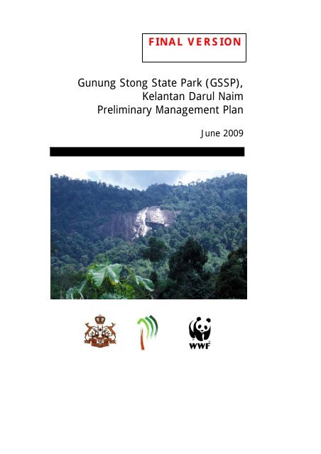
<strong>FINAL</strong> <strong>VERSION</strong><br />
Gunung Stong State Park (GSSP),<br />
Kelantan Darul Naim<br />
Preliminary Management Plan<br />
June 2009
Gunung Stong State Park<br />
(GSSP), Kelantan Darul Naim<br />
Preliminary Management Plan<br />
by<br />
N. M. Maseri, A. H. Mohd-Ros & S. Suksuwan<br />
<strong>WWF</strong>-<strong>Malaysia</strong><br />
December 2006<br />
This document was prepared by <strong>WWF</strong>-<strong>Malaysia</strong> (Project MY02040-G)<br />
for the State Government of Kelantan<br />
and the Kelantan State Forestry Department<br />
Photo credits: N.M. Maseri/<strong>WWF</strong>-<strong>Malaysia</strong>, S.Suksuwan/<strong>WWF</strong>-<strong>Malaysia</strong>,<br />
S. Kamarudin/<strong>WWF</strong>-<strong>Malaysia</strong><br />
This preliminary management plan was produced under <strong>WWF</strong>-<br />
<strong>Malaysia</strong>’s project MY0240G-GEN-000 which was funded by the<br />
generous contribution of the <strong>Malaysia</strong>n public.<br />
ii
Gunung Stong State Park Preliminary Management Plan<br />
ACKNOWLEDGEMENTS<br />
This Preliminary Management Plan for the Gunung Stong State Park was produced for the<br />
Kelantan State Government by <strong>WWF</strong>-<strong>Malaysia</strong> under Project MY0240-G which was funded<br />
through donations from the <strong>Malaysia</strong>n public.<br />
We would like to record out appreciation to En. Wan Yusof b. Wan Ahmad, Tn. Hj. Dahlan<br />
Taha, En. Abdullah Sani, Tn. Hj. Khalim and other staff of the Kelantan State Forestry<br />
Department for their close cooperation and commitment to the Gunung Stong State Park.<br />
This document has benefited from the inputs and comments provided by the members of the<br />
Technical Working Committee of the Gunung Stong State Park:<br />
• Y. Bg. Timbalan Setiausaha Kerajaan (Pembangunan), Pengarah UPEN, Unit<br />
Perancang Ekonomi Negeri Kelantan.<br />
• YABrs. Pengarah, Jabatan Pengairan dan Saliran Negeri Kelantan.<br />
• YABrs. Pengarah, Jabatan Mineral dan Geosains Kelantan<br />
• YABrs. Pengarah, Jabatan Perlindungan Hidupan Liar dan Taman Negara,<br />
• YABrs. Pengarah, KESEDAR (Perbadanan Kemajuan Kelantan Selatan)<br />
• Ybrs. Yang Dipertua, Majlis Daerah Kuala Krai Selatan<br />
• Ybrs. Pegawai Hutan Jajahan Kelantan Barat<br />
• the <strong>Malaysia</strong>n Nature Society, Kelantan branch.<br />
Special thanks to Y. Bg. Prof. Dr. Abdul Latiff Mohamad of UKM, En. Mohamed bin<br />
Abdullah (KESEDAR Jelawang), and Dr Dionysius S.K. Sharma (<strong>WWF</strong>-<strong>Malaysia</strong>) for their<br />
support. Thanks also to Elizabeth Liew Yen Tzu of <strong>WWF</strong>-<strong>Malaysia</strong> for helping to format the<br />
report.<br />
i
Gunung Stong State Park Preliminary Management Plan<br />
EXECUTIVE SUMMARY<br />
In 2004, the state government announced the intention for the formation of the Gunung Stong<br />
State Park (GSSP), within the 21,950 ha area of forest reserve known as the Gunung Stong<br />
Tengah Forest Reserve managed by the Forestry Department, Kelantan. The gazettement of<br />
the State Park will follow the Perlis State Park model, with management responsibilities,<br />
retained by the Kelantan State Forestry Department and reporting to a State Parks<br />
Management Committee, with a State Parks Steering Committee formed, under the<br />
chairmanship of the Mentri Besar.<br />
A protected area like the GSSP needs a management plan, especially if it is also promoted as<br />
an eco-tourism destination. A detailed management plan may take a few years to complete; it<br />
is the intention of the preliminary management plan to provide a rapid, stopgap measure in<br />
the interim, especially in addressing some of the pertinent issues that should be resolved.<br />
Thus, the objectives of the preliminary management plan are as follows:<br />
• To provide a framework for an efficient management system for the park;<br />
• To enable the effective protection of GSSP and its resources;<br />
• To promote the recognition of the biological and economic resources of GSSP, by<br />
scientific means; and<br />
• To provide recommendations for improving the standard of living of the local<br />
community, and their level of conservation awareness.<br />
GSSP is currently still under the management of the Kelantan Barat District of the State<br />
Forestry Department, based at Tanah Merah, though it is located within the Kuala Krai<br />
District, or more precisely, the South Kuala Krai Sub-District, with an office at Dabong.<br />
Apart from adjacent forest reserves, the land use surrounding GSSP is predominantly rural<br />
agriculture, mostly of rubber, oilpalm, and fruit orchards. Most of rubber and oilpalm is<br />
planted under areas developed by KESEDAR, FELCRA, and RISDA, while most fruit<br />
orchards are by smallholders.<br />
The value of GSSP lies in its position as part of the large forested landscape that also includes<br />
the Main Range, the Belum-Temengor area (c. 300,000 ha) in Perak, the Ulu Muda forests (c.<br />
120,000 ha) in Kedah, and their extension, the Hala Bala Wildlife Sanctuary and the Bang<br />
Lang National Park in Thailand.<br />
The purpose of GSSP is the conservation of the biological, physical and hydrological<br />
resources of Gunung Stong and their related ecological systems, while allowing for limited<br />
eco-tourism activities.<br />
The indicator for the purpose is that vegetation, wildlife, fisheries, other biological, physical,<br />
and hydrological resources, show no significant decline within the 5 years of the<br />
implementation of the Preliminary Management Plan and beyond, while limited eco-tourism<br />
activities are allowed.<br />
ii
Gunung Stong State Park Preliminary Management Plan<br />
Summary of Key Issues and Actions Required<br />
No. ISSUE DESCRIPTION ACTION<br />
1. Formal<br />
demarcation of<br />
boundaries.<br />
2. Fragmentation of<br />
GSSP by the<br />
Jelawang-Gua<br />
Musang Road.<br />
3. Management of<br />
the Dabong group<br />
of caves.<br />
4. Land<br />
encroachment<br />
along the fringes<br />
of GSSP.<br />
The boundaries of GSSP must be<br />
formally surveyed and demarcated<br />
before a gazettement can be done.<br />
Without formal surveys law<br />
enforcement at GSSP is contestable.<br />
The road has effectively separated<br />
GSSP into 2 parts: a large western<br />
portion, and the smaller eastern<br />
portion. The road provides greater<br />
access for encroachment, and is a<br />
security risk.<br />
The Dabong group of caves<br />
(including Gua Ikan, Gua Keris,<br />
Gua Pagar and Gua Setol) are<br />
important bat roosting sites and sites<br />
for endemic plants. Though not part<br />
of the GSSP, the Dabong group of<br />
caves is also an important tourism<br />
attraction and usually form part of<br />
visitor packages to GSSP.<br />
Fringes of GSSP are encroached for<br />
farming actitivities, some as far as<br />
40 years ago, some with uncertain<br />
legal status, if not yet converted to<br />
stateland. The formation of GSSP<br />
may lead to two options: the<br />
excision of the encroached areas out<br />
of the total protected area, or the<br />
absorption of these encroached<br />
areas as part of GSSP. However, the<br />
latter option may lead to issues of<br />
land acquisition and compensation.<br />
Proper boundary demarcation is<br />
a priority so that the park can be<br />
legally constituted and law<br />
enforcement can be carried out<br />
effectively.<br />
It is recommended that the<br />
eastern portion be excised out<br />
of GSSP and replaced by the G.<br />
Stong Utara Forest Reserve as<br />
part of GSSP. The road then<br />
becomes an effective eastern<br />
boundary of GSSP.<br />
The management of the Dabong<br />
group of caves should be<br />
integrated into that of GSSP.<br />
This could be achieved by<br />
gazetting the caves as part of<br />
the Serasa Forest Reserve<br />
(currently covering an area of<br />
10,338 ha).<br />
A special sub-committee should<br />
be formed to deliberate on this<br />
issue and recommend which<br />
areas should be alienated and<br />
which should be retained as part<br />
of the GSSP.<br />
iii
Gunung Stong State Park Preliminary Management Plan<br />
Summary of Management Recommendations<br />
Protected Area Legislation<br />
The establishment, purpose and management of the park will be determined by the National<br />
Forestry Act (Amendment) Enactment 2004, which closely follows the Perlis State Park<br />
model of protected area establishment. Under this state legislation, GSSP will be managed by<br />
the Kelantan State Forestry Department through the introduction of an additional category,<br />
“State Park”, to the existing classification of forest reserves.<br />
Law Enforcement<br />
Law enforcement by park staff against illegal activities is based on two main legislative<br />
sources, namely the Wild Life Protection Act 1972 (Amended 1976 & 1988) and the National<br />
Forestry Act (Amendment) Enactment 2004. One of the most serious issues where law<br />
enforcement is concerned is the encroachment by illegal sandalwood (gaharu) collectors,<br />
whether foreign or otherwise. It is possible that they are also opportunistic poachers and<br />
collectors of other forest produce including shoots of the endemic palm, Licuala stongensis,<br />
for food. Actions that can be taken to improve law enforcement include more frequent<br />
monitoring and patrols by park staff, the introduction of a reward system for informers and<br />
tightening the registration process at entry-points, to prevent unauthorised entry.<br />
Surveillance Patrols<br />
There should be frequent and random patrols by park staff within GSSP and along its borders.<br />
Persons committing illegal activities should be apprehended and the laws enforced where<br />
necessary. The mere presence of park officers in itself can act as an effective deterrence<br />
against illegal activities. Joint operations can also be conducted with relevant agencies such as<br />
the Department Wildlife and National Park (DWNP), the army and the Police General<br />
Operations Force, to apprehend the offenders.<br />
Organisational Structure<br />
It is recommended that the Park Officer is a Forestry Officer of Grade G42, reporting directly<br />
to the Deputy Director, State Forestry Department. Reporting to him will be 2 Assistant Park<br />
Officers (G27), under each of which will be 2 Park Rangers (G17), with 3 Assistant Park<br />
Rangers (Forest Guard, Grade G11). A driver (R3) reports directly to each Asst. Park Officer.<br />
Terms Of Reference for the State Parks Committee<br />
This will be chaired by the Menteri Besar and consist of senior state officers. The committee<br />
to meet a minimum of twice a year, to decide on policy issues relating to protected areas in<br />
Kelantan.<br />
Terms of Reference for the State Parks Management Committee<br />
This committee is to be chaired by the State Secretary, and has the mandate to decide on key<br />
management issues pertaining to protected area in the State, including presenting proposals<br />
for new state parks to the State Parks Committee. This committee will meet twice a year.<br />
The Terms of Reference for the Gunung Stong State Park Technical Working<br />
Committee<br />
This committee is formed primarily to guide the formation and management of the GSSP, and<br />
will meet regularly to discuss management issues related to it, and is chaired by the Director,<br />
Kelantan Forestry Department. Any form of development within GSSP must be approved by<br />
the Technical Committee. This is because different agencies may have different visions for<br />
development and tourist promotion of GSSP and surrounding areas. Lack of communication<br />
iv
Gunung Stong State Park Preliminary Management Plan<br />
and coordination among these agencies may result in inappropriate development within GSSP<br />
and surrounding areas.<br />
Zonation of GSSP<br />
We suggest four zones: Intensive Development Zone (Stong Resort, entrance to Semuliang<br />
Trail and Lata Kertas), Moderate Use Zone (Baha Camp and Benta Plateau), Limited Use<br />
Zone (trails, campsites, and summits), and the Strict Conservation Zone (areas outside of the<br />
other three zones).<br />
Presence of Adequate Buffers<br />
In general, buffer zones can be divided into three categories: those in stateland, lands under<br />
forest reserves adjoining GSSP and alienated land. It is suggested that for alienated land, a nodevelopment<br />
buffer zone of 100m from the boundary be created. For surrounding lands<br />
within forest reserves, compartments immediately adjoining GSSP should be designated as<br />
buffer areas where logging should not be carried out. This could be achieved by gazetting<br />
these compartments as protection forest under the National Forestry (Amendment) Enactment<br />
2004. For stateland forests, it is recommended that as far as possible, these should be<br />
incorporated into existing forest reserves and designated as buffer areas.<br />
Physical Development in GSSP<br />
Development must be within the conceptual framework of a protected area setting, and<br />
limited to three zones: Development Zone, Moderate Use Zone, and Limited Use Zone. No<br />
development should be carried out within the Strict Conservation Zone. Development should<br />
be concentrated at the existing resort grounds, where extensive development is allowed. At<br />
the Moderate Use Zone, development is limited to basic infrastructure such as campsites,<br />
shelters, toilets and observation towers, while at the Limited Use Zone, development is<br />
limited to shelters and signage.<br />
Carrying Capacity<br />
Detailed formulas and questionnaires to obtain carrying capacities are beyond the scope of<br />
this study. Nevertheless, some preliminary recommendations on carrying capacity for selected<br />
sites are as follows as follows: Stong Resort grounds (500 people at any one time), Baha<br />
Camp (150), Lata Kertas (50), Bogo Rock Shelter (30), G. Ayam (20), Li Rock Shelter (15),<br />
Lembah Camp (15), Batu Hampar (20), Kobra Camp (20), Tera Camp (10), Gua Ikan (50),<br />
Gua Keris (30), Gua Puteri (20), Gua Pagar (20).<br />
Entry Permits and User Fees<br />
Currently visitors are charged RM2.00 per person for entering the premises of the Stong<br />
Resort, and RM3.00 for park entry fees. The charge of RM2.00 was originally to cover the<br />
expenses for rubbish collection but there is still an unacceptable amount of litter still<br />
accumulating at the resort area. The resort must be reminded of the original purpose of the<br />
RM2.00 fee.<br />
It is suggested that entry fee be maintained at RM3.00 per person, while the concession rate<br />
(schoolchildren below 18, disabled people and pensioners) should be RM1.00. Camping fee<br />
is recommended to be RM3.00 per person per night, while for schoolchildren it should be<br />
RM2.00. Camera permits should be fixed at RM5.00 each and for video cameras, RM10.00.<br />
Commercial filming permit is recommended at RM200.00 per day, while a research permit<br />
should be RM50.00 per researcher.<br />
v
Gunung Stong State Park Preliminary Management Plan<br />
Location of Park Headquarters<br />
The headquarters for GSSP could be located for the time being at the present Kuala Balah<br />
Forestry Office, though preferably, it should be at Dabong or Jelawang.<br />
Siting of Control Posts<br />
Certain campsites could be utilised as control posts, where park staff can do patrols and<br />
monitoring work.<br />
Field Office<br />
There should be an office within the grounds of the Stong Resort for purposes of visitor<br />
registration, cash collection of permits, emergency response, and as a base for patrols.<br />
Biological Monitoring<br />
This is basically a rapid assessment of impacts on wildlife and the general ecology by visitors<br />
and physical development at GSSP. Such an assessment, carried out periodically, may be<br />
based on the presence or absence of indicator species that can be detected through direct<br />
observations or indirectly through droppings, tracks and sounds. A general assessment can<br />
also be made of the overall environmental condition along trails and other sites frequented by<br />
visitors.<br />
Capacity-Building<br />
Capacity-building of park staff is needed to fill gaps in their existing set of skills and the areas<br />
or topics relevant to the management of protected areas and include communications, guiding,<br />
rescue and emergency response, map reading, basic ecology, and computer skills.<br />
Collaboration and Networking with other PAs<br />
GSSP should actively network with other protected area managers, to share experience,<br />
information, and solutions on certain problems common to all. Opportunities for crossmarketing<br />
should also be looked into, as different protected areas have their own niches and<br />
positioning strategies.<br />
Planning and Reporting<br />
Different types of reports need to be prepared on a regular basis and submitted to State<br />
Forestry headquarters by GSSP staff, for analysis and planning purposes. These include<br />
reports on visitor profile and numbers, park finances, patrols and complaints.<br />
Integrated Research Program<br />
It is crucial that research is continuously carried in GSSP as the results of research activities<br />
can be used to enhance the management of effectiveness of the park. Furthermore, new<br />
discoveries will benefit the park in terms of marketing and promotional opportunities. Priority<br />
research areas should be identified and these may include studies on wildlife conservation<br />
(e.g. using camera-trapping or satellite tracking particularly to understand migration patterns),<br />
carrying capacity, cost-benefit analyses, forest regeneration, etc.<br />
Procedures on Specimen Collections<br />
Procedures on specimen collections must be tightened, to safeguard against bio-piracy and<br />
loss of patent rights, and to promote the sharing of benefits from the biodiversity capital of<br />
GSSP. As GSSP does not have its own herbarium, it is recommended that duplicates of plant<br />
specimens be deposited at the Forest Research Insitute of <strong>Malaysia</strong> (FRIM) in Kepong.<br />
vi
Gunung Stong State Park Preliminary Management Plan<br />
Duplicates of animal specimens could be deposited at the Institute of Biological Conservation<br />
at Bukit Rengit, Krau, or other relevant local academic institutions.<br />
Promotion of GSSP to Scientists<br />
GSSP should be aggressively promoted as a destination for research among local and<br />
international researchers. GSSP must link with certain local universities especially those<br />
conducting research and development related to horticulture and plant propagation, crop<br />
improvement and pharmaceuticals, in order to obtain the greatest returns on investments in<br />
conservation.<br />
Tourism Promotion and Marketing<br />
One or more icons should be selected to represent GSSP, and used for product branding.<br />
These icons could be incorporated into an official logo for the park and subsequently used on<br />
letterheads, park signage and publications. It is suggested that the endemic fanpalm Licuala<br />
stongensis be used as an icon that represents GSSP. Promotional efforts should be targeted at<br />
ecotourists, and partnerships should be formed with the relevant media that support this target<br />
market.<br />
Management and Maintenance of the Stong Resort<br />
If the Stong Resort is not under the management of the Kelantan State Forestry Department,<br />
arrangements must be made with the resort operator to accommodate space for the park’s<br />
field office. Capital funding is required for repairing the existing infrastructure at the Stong<br />
Resort, upgrading of campsites and the huts at Baha Camp, and the placement of different<br />
kinds of signposts at appropriate locations.<br />
Signposting<br />
Signposting serves a number of purposes – as a navigational tool, as a method for informing<br />
visitors of pertinent information concerning the park (including codes of conduct), as well as<br />
to educate visitors (e.g. through the use of interpretive signage). To reduce confusion,<br />
warning notices, navigational signs and interpretive signs, should be separately color-coded.<br />
Co-option of BAT Guides<br />
The BAT Guides are synonymous with GSSP, being responsible for promoting eco-tourism in<br />
the area, with little institutional support. BAT guides also carry out trail maintenance, rubbish<br />
clearance, and emergency rescue. Their strong network of local and international visitors<br />
could be capitalised for promotion purposes. Strategic partnerships could be formed between<br />
the park management and the BAT Guides. This could be through privatising the operations<br />
of Baha Camp (which could be upgraded using development allocations), and the guiding<br />
services, to them. This would allow GSSP staff to focus on enforcement and issuing of<br />
permits. There have been incidences where unguided groups enter GSSP, and unsupervised,<br />
they are the biggest culprits in the indiscriminate dumping of garbage. BAT Guides could be<br />
trained to advise offenders and apprehend them if necessary while waiting for law<br />
enforcement officers to arrive.<br />
Formation of School Nature Clubs<br />
The love for conservation must be inculcated with the young, as conservation is a life-long<br />
passion, and the surrounding schools must be the primary target in the nature education<br />
courses, which will be expanded to other areas upon success with the initial areas.<br />
vii
Gunung Stong State Park Preliminary Management Plan<br />
Small Hospitality Business by Local Communities<br />
Local communities in the surrounding areas of GSSP should be encouraged to operate microbusinesses<br />
that are within their capacity and expertise, and small hospitality businesses should<br />
be one of them, as the potential is there.<br />
Integration of Agro-Tourism in the Promotion of GSSP<br />
Fruit farming is one of the agricultural activities in the areas surrounding GSSP, and<br />
integrating this industry with tourism will provide a wider range of products for visitors and<br />
help mitigate the economic impacts of the glut in fruit supplies.<br />
Small Souvenir and Camping Equipment Shops<br />
There are few locals involved in the souvenir and camping equipment business, as there is as<br />
yet poor demand, but the potential is there. More locals should be trained in running such<br />
shops and those with existing businesses should be encouraged to expand their range of<br />
products in line with increasing demands.<br />
Local Outdoor Recreation Club<br />
The young adults need to have a sense of purpose in their life in order for them to avoid<br />
indulging in unhealthy activities, such as illegal motorcycle racing and drug-abuse. Training<br />
in outdoor recreation will allow the youths to engage in meaningful activities while providing<br />
GSSP with an enlarged pool of part-time guides and amateur naturalists.<br />
Local Site Support Group (SSG)<br />
Locals benefiting from tourism to GSSP should be grouped together (with government<br />
stakeholders), to form a group that is passionate about the protected area, and a club or<br />
society created, that is willing to not only promote GSSP, but also safeguard her resources.<br />
The SSG could also become informers against poachers, and illegal plant collectors.<br />
viii
Gunung Stong State Park Preliminary Management Plan<br />
RINGKASAN EKSEKUTIF<br />
Pada tahun 2004, Kerajaan Negeri Kelantan telah mengumumkan hasratnya untuk<br />
menubuhkan Taman Negeri Gunung Stong (TNGS) merangkumi kawasan Hutan Simpan<br />
Gunung Stong Tengah seluas 21,950 ha yang diuruskan oleh Jabatan Perhutanan Negeri<br />
Kelantan. Pengwartaan Taman Negeri tersebut adalah berlandaskan model Taman Negeri<br />
Perlis dengan tanggungjawab pengurusannya kekal di bawah Jabatan Perhutanan Negeri<br />
Kelantan yang melapor kepada Jawatankuasa Pengurusan Taman Negeri serta Jawatankuasa<br />
Pandu Taman Negeri yang dipengerusikan oleh YAB Mentri Besar.<br />
Kawasan perlindungan seperti TNGS memerlukan sebuah pelan pengurusan, terutamanya<br />
sekiranya ia juga dipromosikan sebagai destinasi ekopelancongan. Pelan pengurusan<br />
terperinci mungkin mengambil masa beberapa tahun untuk disiapkan; tujuan Pelan<br />
Pengurusan Awal ini adalah sebagai langkah sementara yang boleh dilaksanakan dengan<br />
kadar segera dalam masa perantaraan, terutamanya dalam menangani beberapa isu penting.<br />
Dalam pada itu, objektif-objektif Pelan Pengurusan Awal ini adalah untuk:<br />
• Merangka suatu sistem pengurusan yang efisyen untuk TNGS;<br />
• Membolehkan pengurusan yang berkesan untuk TNGS dan sumber semulajadinya.<br />
• Mempertingkatkan kesedaran mengenai kepentingan sumber-sumber biologi dan<br />
ekonomi TNGS, melalui kaedah saintifik; dan<br />
• Menyediakan cadangan-cadangan untuk meningkatkan kualiti hidup masyarakat<br />
setempat, dan tahap kesedaran mereka mengenai pemuliharaan alam.<br />
TNGS pada masa ini berada di bawah pengurusan Daerah Perhutanan Kelantan Barat yang<br />
berpusat di Tanah Merah, walaupun ia berkedudukan di Jajahan Kuala Krai ataupun secara<br />
lebih terperinci, Mukim Kuala Krai Selatan, yang pejabatnya terletak di Dabong.<br />
Penggunaan tanah di sekeliling TNGS termasuk Hutan Simpan Kekal dan kawasan pertanian,<br />
terutamanya pokok getah, kelapa sawit dan dusun buah. Kebanyakan ladang getah dan kelapa<br />
sawit adalah termasuk dalam kawasan yang dibangunkan oleh KESEDAR, FELCRA, dan<br />
RISDA, manakala kebanyakan dusun buah-buahan dibangunkan oleh pengusaha tanah<br />
persendirian.<br />
Kepentingan TNGS adalah dari segi kedudukannya sebagai sebahagian daripada suatu<br />
landskap hutan yang luas, merangkumi Banjaran Titiwangsa, kawasan Belum-Temengor<br />
(sekitar 300,000 ha) di Perak, hutan Ulu Muda (sekitar 120,000 ha) di Kedah, dan juga Rizab<br />
Hidupan Liar Hala Bala dan Taman Negara Bang Lang di Thailand.<br />
Tujuan penubuhan TNGS ialah pemuliharaan sumber biologi, fizikal dan hidrologi Gunung<br />
Stong serta ekosistem-ekosistem yang berkaitan, di samping membenarkan aktiviti<br />
ekopelancongan yang terkawal.<br />
Indikator untuk tujuan tersebut ialah tumbuhan, hidupan liar, perikanan, dan lain-lain sumber<br />
biologi, fizikal dan hidrologi tidak menunjukkan kemerosotan ketara dalam masa lima tahun<br />
perlaksanaan Pelan Pengurusan Awal.<br />
ix
Gunung Stong State Park Preliminary Management Plan<br />
Ringkasan Isu-Isu Utama dan Tindakan-Tindakan Yang Perlu Diambil<br />
Bil. ISU PENERANGAN TINDAKAN<br />
1. Penandaan<br />
sempadan rasmi.<br />
2. Pembahagian<br />
TNGS oleh jalan<br />
Jelawang-Gua<br />
Musang.<br />
3. Pengurusan<br />
Gugusan Gua<br />
Dabong.<br />
4. Penerokaan tanah<br />
di kawasan<br />
sekeliling TNGS.<br />
Sempadan TNGS harus ditinjau dan<br />
ditanda dengan rasmi sebelum ia<br />
diwarta. Tanpa sempadan yang<br />
rasmi, penguatkuasaan undangundang<br />
di TNGS boleh dipersoalkan<br />
Jalan tersebut telah membahagikan<br />
TNGS kepada 2 bahagian: bahagian<br />
sebelah barat yang lebih luas dan<br />
bahagian sebelah timur yang lebih<br />
kecil. Jalan ini meningkatkan<br />
kemudahsampaian dan ini boleh<br />
mengakibatkan kenaikan dalam kes<br />
pencerobohan dan juga<br />
menimbulkan isu keselamatan.<br />
Gugusan Gua Dabong (yang<br />
termasuk Gua Ikan, Gua Keris, Gua<br />
Pagar dan Gua Setol) merupakan<br />
tempat kelawar berteduh dan habitat<br />
tumbuhan-tumbuhan endemik.<br />
Walaupun bukan sebahagian<br />
daripada TNGS, gua-gua ini adalah<br />
penting sebagai tarikan pelancong<br />
dan biasanya dimasukkan dalam<br />
pakej pelawat ke TNGS.<br />
Di beberapa kawasan di sekeliling<br />
TNGS penerokaan tanah untuk<br />
kegiatan pertanian boleh<br />
diperhatikan, ada yang berlaku 40<br />
tahun dahulu. Kedudukan dari segi<br />
undang-undang tidak dapat<br />
dipastikan. Penubuhan TNGS<br />
menimbulkan dua pilihan:<br />
pengeluaran kawasan tersebut<br />
daripada kawasan perlindungan,<br />
ataupun penyerapan kawasan yang<br />
telah diteroka ini ke dalam TNGS.<br />
Bagaimanapun, pilihan yang kedua<br />
akan melibatkan isu pengambilan<br />
tanah dan pampasan.<br />
Penandaan sempadan secara<br />
rasmi perlu diberi keutamaan<br />
supaya TNGS boleh diwarta<br />
dan undang-undang boleh<br />
dikuatkuasa dengan berkesan.<br />
Adalah disyorkan supaya<br />
serpihan timur ini dikeluarkan<br />
daripada TNGS dan digantikan<br />
dengan serpihan kecil Hutan<br />
Simpan G. Stong Utara. Dengan<br />
itu, Jalan Jelawang-Gua<br />
Musang akan menjadi<br />
sempadan sebelah timur TNGS.<br />
Pengurusan gua-gua di Dabong<br />
harus diintegrasikan dengan<br />
pengurusan TNGS. Ini boleh<br />
dilaksanakan dengan mewarta<br />
gua-gua ini sebagai sebahagian<br />
daripada Hutan Simpan Serasa<br />
(yang kini merangkumi<br />
kawasan seluas 10,338 ha).<br />
Sebuah jawatankuasa kecil khas<br />
harus diadakan untuk<br />
mempertimbangkan isu ini dan<br />
mencadang kawasan-kawasan<br />
yang patut dinyahwarta dan<br />
yang mana perlu dikekalkan<br />
sebagai sebahagian daripada<br />
TNGS.<br />
x
Gunung Stong State Park Preliminary Management Plan<br />
Ringkasan Syor-Syor Pengurusan<br />
Perundangan Kawasan Perlindungan<br />
Penubuhan, tujuan dan pengurusan Taman Negeri akan ditentukan oleh Enakmen Perhutanan<br />
Negara (Pemindaan) 2004, yang berasaskan model Taman Negeri Perlis untuk penubuhan<br />
kawasan perlindungan. Di bawah perundangan negeri ini, TNGS akan diuruskan oleh Jabatan<br />
Perhutanan Negeri Kelantan melalui penambahan satu lagi kategori dalam pengelasan hutan<br />
simpan, iaitu “Taman Negeri”.<br />
Penguatkuasaan Undang-undang<br />
Penguatkuasaan undang-undang oleh kakitangan Taman Negeri untuk membanteras kegiatan<br />
haram adalah berdasarkan dua sumber utama, iaitu Akta Perlindungan Hidupan Liar 1972<br />
(dipinda 1976 & 1988) dan Enakmen Perhutanan Negara (Pindaan) 2004. Salah satu isu<br />
paling serius berkaitan dengan penguatkuasaan undang-undang ialah pencerobohan oleh<br />
pencuri gaharu, samada warga asing atau sebaliknya. Ada kemungkinan mereka juga<br />
mengambil kesempatan untuk menjalankan pemburuan haram dan mencari hasil hutan yang<br />
lain seperti pucuk daun pokok palas yang endemik, Licuala stongensis, sebagai sumber<br />
makanan. Tindakan-tindakan yang boleh diambil untuk memperbaiki penguatkuasaan<br />
undang-undang termasuklah pengawasan dan rondaan yang lebih kerap oleh kakitangan<br />
Taman Negeri, pengenalan suatu sistem ganjaran untuk pemberi maklumat dan pengetatan<br />
proses pendaftaran di pintu-pintu masuk, untuk mengelakkan pencerobohan.<br />
Rondaan Kawalan<br />
Rondaan yang kerap dan secara rawak harus dijalankan di dalam kawasan TNGS dan<br />
sepanjang sempadannya. Mereka yang menjalankan aktiviti haram harus ditahan dan undangundang<br />
dikuatkuasakan di mana perlu. Kehadiran pegawai-pegawai Taman Negeri dengan<br />
sendirinya merupakan suatu langkah pencegahan yang berkesan untuk membanteras kegiatan<br />
haram. Operasi bersama boleh juga diadakan dengan agensi-agensi berkaitan seperti Jabatan<br />
PERHILITAN, pihak tentera dan Pasukan Gerak Am Polis, untuk menangkap penjenayah.<br />
Struktur Organisasi<br />
Adalah disyorkan supaya jawatan Pegawai Taman Negeri disandang oleh seorang Pegawai<br />
Hutan Gred G42, yang melapor kepada Timbalan Pengarah Perhutanan Negeri. Di bawahnya<br />
pula adalah 2 orang Penolong Pegawai Taman Negeri (G27), dan di bawah setiap Penolong<br />
Pegawai adalah 2 orang Renjer Taman Negeri (G17) dan juga 3 orang Penolong Renjer<br />
Taman Negeri (Pengawas Hutan, Gred G11). Seorang pemandu (R3) melapor kepada setiap<br />
Penolong Pegawai Taman Negeri.<br />
Terma Rujukan untuk Jawatankuasa Taman Negeri<br />
Jawatankuasa ini dipengerusikan oleh YAB Menteri Besar dan dianggotai pegawai-pegawai<br />
kanan kerajaan negeri. Jawatankuasa ini bermesyuarat dua kali setahun untuk membuat<br />
keputusan mengenai isu-isu berkaitan dasar kawasan perlindungan di Negeri Kelantan.<br />
Terma Rujukan untuk Jawatankuasa Pengurusan Taman Negeri<br />
Jawatankuasa ini dipengerusikan oleh Setiausaha Kerajaan Negeri, dan mempunyai mandat<br />
untuk membuat keputusan berkenaan isu-isu pengurusan utama berkaitan dengan kawasan<br />
perlindungan di Negeri Kelatan, termasuk pembentangan cadangan-cadangan untuk Tamantaman<br />
Negeri baru untuk dibawa kepada perhatian Jawatankuasa Taman Negeri.<br />
Jawatankuasa ini akan bermesyuarat dua kali setahun.<br />
xi
Gunung Stong State Park Preliminary Management Plan<br />
Terma Rujukan untuk Jawatankuasa Taman Negeri Gunung Stong<br />
Jawatankuasa ini dibentuk terutamanya untuk memberi arah tuju dalam pembentukan dan<br />
pengurusan TNGS, dan akan bermesyuarat dari masa ke semasa untuk membincangkan isuisu<br />
pengurusan berkaitan dengan TNGS, dan dipengerusikan oleh Pengarah Perhutanan<br />
Negeri Kelantan. Apa-apa bentuk pembangunan di dalam TNGS harus mendapat persetujuan<br />
daripada Jawatankuasa Teknikal ini. Ini adalah kerana agensi-agensi berlainan mungkin<br />
mempunyai wawasan masing-masing untuk pembangunan dan promosi pelancongan di<br />
TNGS. Sekiranya perhubungan dan kordinasi antara agensi-agensi tidak berkesan, ia boleh<br />
mengakibatkan pembangunan yang tidak sesuai di dalam TNGS dan kawasan sekitarnya.<br />
Pengezonan TNGS<br />
Adalah dicadangkan supaya empat zon pengurusan diwujudkan, iaitu: Zon Pembangunan<br />
(Stong Resort, Lata Kertas dan jalan masuk Denai Semuliang), Zon Pembangunan Sederhana<br />
(Kem Baha and Dataran Benta), Zon Penggunaan Terhad (denai-denai, tapak-tapak<br />
perkhemahan dan puncak-puncak gunung), dan Zon Pemuliharaan (kawasan-kawasan yang<br />
terletak di luar ketiga-tiga zon di atas).<br />
Pengwujudan Zon Penampan Yang Mencukupi<br />
Secara amnya, zon penampan boleh dibahagikan kepada tiga kategori: tanah kerajaan negeri,<br />
kawasan hutan simpan yang bersebelahan dengan TNGS, dan tanah hakmilik. Adalah<br />
dicadangkan bahawa untuk tanah hakmilik, suatu zon larangan pembangunan selebar 100m<br />
diwujudkan sepanjang sempadan Taman Negeri. Untuk kawasan yang telah diwartakan<br />
sebagai Hutan Simpan Kekal, kompatmen-kompatment yang terletak bersebelahan dengan<br />
TNGS dicadang supaya ditetapkan sebagai zon penampan. Ini boleh dilaksanakan dengan<br />
mewartakan kompatmen-kompatmen tersebut sebagai hutan perlindungan di bawah Enakmen<br />
Perhutanan Negara (Pindaan) 2004. Untuk tanah kerajaan negeri pula, adalah disyorkan<br />
supaya ianya dimasukkan ke dalam Hutan-hutan Simpan Kekal yang sedia ada dan ditetapkan<br />
sebagai kawasan penampan.<br />
Pembangunan di TNGS<br />
Pembangunan haruslah berasaskan rangka konsep kawasan perlindungan, dan dihadkan<br />
kepada tiga zon iaitu: Zon Pembanguna, Zon Penggunaan Sederhana dan Zon Penggunaan<br />
Terhad. Pembangunan tidak dibenarkan di Zon Pemuliharaan. Tumpuan utama pembangunan<br />
adalah di kawasan Stong Resort. Di dalam Zon Penggunaan Sederhana, pembangunan<br />
dihadkan kepada infrastruktur asas seperti tapak perkhemahan, wakaf, tandas dan menara<br />
pandang, manakala di dalam Zon Pengunaan Terhad pula, cuma wakaf dan papan tanda<br />
dibenarkan.<br />
Daya Tampung<br />
Formula terperinci dan soal selidik untuk mendapatkan daya tampung adalah di luar bidang<br />
kajian ini. Bagaimanapun, cadangan awal untuk daya tampung bagi beberapa kawasan di<br />
TNGS adalah seperti berikut: kawasan Stong Resort (500 orang dalam suatu masa tertentu),<br />
Kem Baha (150), Lata Kertas (50), Gua Bogo (30), G. Ayam (20), Gua Li (15), Kem Lembah<br />
(15), Batu Hampar (20), Kem Kobra (20), Kem Tera (10), Gua Ikan (50), Gua Keris (30),<br />
Gua Puteri (20), Gua Pagar (20).<br />
Permit Masuk dan Bayaran Penggunaan<br />
Buat masa ini, pelawat dikenakan bayaran RM2.00 setiap orang untuk memasuki kawasan<br />
Stong Resort dan RM3.00 untuk permit masuk ke kawasan Taman Negeri. Bayaran RM2.00<br />
itu pada asalnya adalah untuk membiayai kos pengutipan sampah tetapi keadaan sampahsarap<br />
di kawasan resort itu masih tidak memuaskan. Pihak pengurus resort harus<br />
diperingatkan mengenai tujuan asal yuran RM2.00 tersebut.<br />
xii
Gunung Stong State Park Preliminary Management Plan<br />
Dicadangkan supaya bayaran masuk dikekalkan pada RM3.00 seorang, manakala bayaran<br />
konsesi (untuk budak sekolah di bawah 18 tahun, orang kurang upaya dan pesara) ditetapkan<br />
pada kadar RM1.00 seorang. Yuran perkhemahan disyorkan supaya ditetapkan pada kadar<br />
RM3.00 setiap orang untuk setiap malam, manakala untuk budak sekolah pula bayarannya<br />
ialah RM2.00. Bayaran permit untuk kamera yang dicadangkan ialah RM5.00 dan untuk<br />
kamera video pula, RM10.00. Bayaran permit untuk penggambaran komersil disyorkan pada<br />
kadar RM200.00 setiap hari, manakala permit untuk penyelidikan pula RM50.00 setiap<br />
penyelidik.<br />
Lokasi Ibupejabat Taman Negeri<br />
Ibupejabat TNGS boleh ditempatkan untuk masa ini di Pejabat Perhutanan Kuala Balah,<br />
tetapi lebih sesuai sekiranya ia ditempatkan di Dabong atau Jelawang.<br />
Kedudukan Pos Kawalan<br />
Tapak-tapak perkhemahan yang tertentu boleh digunakan sebagai pos kawalan, di mana<br />
kakitangan Taman Negeri boleh mengadakan rondaan dan pengawasan.<br />
Pejabat Lapangan<br />
Dicadangkan supaya sebuah pejabat diadakan di kawasan Stong Resort untuk tujuan<br />
pendaftaran pelawat, pengutipan wang tunai untuk permit, tindakan kecemasan dan sebagai<br />
markas untuk rondaan.<br />
Pengawasan Sumber Biologi<br />
Pada dasarnya, ini merupakan penilaian impak oleh pelawat dan pembangunan fizikal<br />
terhadap hidupan liar dan ekologi am. Penilaian sebegini yang dijalankan secara berkala,<br />
boleh berasaskan kehadiran atau ketidakhadiran spesis indikator yang boleh dikesan melalui<br />
pemerhatian secara langsung ataupun tidak langsung iaitu melalui kesan najis, tapak kaki atau<br />
bunyi. Suatu penilaian am boleh dibuat berkenaan keadaan alam sekitar di sepanjang denaidenai<br />
dan lain-lain kawasan yang dikunjungi pelawat.<br />
Pembangunan Keupayaan<br />
Pembangunan keupayaan kakitangan Taman Negeri adalah perlu untuk mengisi jurang yang<br />
ada dari segi kemahiran mereka dan merangkumi bidang atau topik yang berkaitan dengan<br />
pembangunan kawasan perlindungan dan ini termasuklah perhubungan, pemanduan<br />
pelancong, bantuan kecemasan, pembacaan peta, pemahaman ekologi asas dan kemahiran<br />
komputer.<br />
Kerjasama dan Perhubungan dengan Kawasan-kawasan Perlindungan Yang<br />
Lain<br />
TNGS harus menjalinkan perhubungan dengan lain-lain agensi pengurusan kawasan<br />
perlindungan, untuk berkongsi pengalaman, maklumat, dan mencari jalan penyelesaian untuk<br />
masalah-masalah yang dihadapi bersama. Peluang untuk pemasaran bersama juga harus diberi<br />
perhatian, memandangkan setiap kawasan perlindungan mempunyai nic dan strategi<br />
pemasaran masing-masing.<br />
Perancangan dan Kaedah Laporan<br />
Beberapa jenis laporan harus disediakan dari masa ke semasa oleh kakitangan TNGS dan<br />
diserahkan kepada Ibupejabat Perhutanan Negeri, untuk tujuan analisa dan perancangan. Ini<br />
termasuklah laporan berkenaan profil dan bilangan pelawat, kewangan Taman Negeri,<br />
rondaan dan aduan.<br />
xiii
Gunung Stong State Park Preliminary Management Plan<br />
Program Penyelidikan Bersepadu<br />
Adalah amat penting supaya penyelidikan terus dijalankan di TNGS kerana hasil kajian<br />
tersebut boleh digunakan untuk meningkatkan lagi keberkesanan pengurusan Taman Negeri.<br />
Tambahan lagi, penemuan baru akan memanfaatkan Taman Negeri dari segi promosi dan<br />
peluang pemasaran. Bidang kajian utama harus dikenalpasti dan ini boleh merangkumi kajian<br />
dalam pemuliharaan hidupan liar (misalnya dengan menggunakan kamera perangkap atau<br />
pengesan satelit, terutamanya untuk memahami corak penghijrahan), daya tampung, analisa<br />
kos-faedah, pemulihan hutan dll.<br />
Kaedah Pengutipan Spesimen<br />
Kaedah untuk pengutipan specimen harus diperketatkan, untuk mengelakkan daripada<br />
pencurian sumber biologi (“bio-piracy”) dan kehilangan hak paten, dan menggalakkan<br />
perkongsian faedah daripada modal kepelbagaian biologi yang wujud di TNGS. Oleh kerana<br />
TNGS tidak mempunyai herbarium, dicadangkan supaya salinan spesimen tumbuhan<br />
disimpan di Institut Penyelidikan Perhutanan <strong>Malaysia</strong> (FRIM) di Kepong. Salinan spesimen<br />
haiwan pula boleh disimpan di Institut Kepelbagaian Biologi di Bukit Rengit, Krau, ataupun<br />
institusi lain yang sesuai.<br />
Promosi TNGS di Kalangan Penyelidik<br />
TNGS harus dipromosi secara agresif sebagai destinasi penyelidikan di kalangan penyelidik<br />
tempatan dan luar negara. TNGS juga harus menjalinkan perhubungan dengan universitiuniversiti<br />
tempatan tertentu, terutamanya yang menjalankan penyelidikan dan pembangunan<br />
berkaitan dengan hortikultur dan pembiakan tumbuhan, penambahbaikan tanaman kontan dan<br />
farmaseutikal, untuk meraih hasil yang sebanyak mungkin daripada pelaburan dalam<br />
pemuliharaan.<br />
Promosi Pelancongan dan Pemasaran<br />
Satu atau lebih ikon harus dipilih untuk mewakili Jabatan Perhutanana Negeri, dan untuk<br />
digunakan dalam penjenamaan produk. Ikon-ikon tersebut boleh digunakan dalam logo rasmi<br />
Taman Negeri dan seterusnya digunakan dalam kepala surat, papan tanda dan penerbitan<br />
Taman Negeri. Dicadangkan supaya spesis pokok palas endemik iaitu Licuala stongensis<br />
digunakan sebagai ikon untuk melambangkan TNGS. Usaha untuk mempromosi Taman<br />
Negeri harus diarahkan kepada pelancong eko, dan Taman Negeri perlu mengadakan<br />
perkongsian dengan pihak media yang menyokong kumpulan sasaran ini.<br />
Pengurusan dan Penyelenggaraan Stong Resort<br />
Sekiranya Stong Resort tidak diletakkan di bawah pengurusan Jabatan Perhutanan Negeri,<br />
suatu persetujuan perlu diadakan dengan pengurusan resort tersebut untuk menempatkan<br />
pejabat lapangan Taman Negeri di situ. Modal pembangunan perlu untuk memperbaiki<br />
infrastruktur yang sedia ada di Stong Resort dan penaiktarafan tapak perkhemahan dan<br />
pondok-pondok di Kem Baha, di samping pemasangan beberapa jenis papan tanda di lokasilokasi<br />
sesuai.<br />
Papan Tanda<br />
Terdapat beberapa tujuan papan tanda diperlukan di TNGS – sebagai suatu alat pandu arah,<br />
sebagai suatu keadah untuk menyampaikan maklumat berkenaan Taman Negeri (termasuk<br />
garispanduan tatatertib) kepada para pelawat, dan juga untuk mendidik para pelawat<br />
(contohnya, melalui papan tanda interpretasi). Untuk mengelakkan kekeliruan, papan tanda<br />
amaran, papan tanda navigasi dan papan tanda interpretasi, harus diberikan kod warna<br />
berasingan.<br />
xiv
Gunung Stong State Park Preliminary Management Plan<br />
Notis Amaran di Lokasi-lokasi Strategik<br />
Notis-notis tersebut haruslah didirikan di kawasan-kawasan tumpuan pelawat seperti Stong<br />
Resort, tapak perkhemahan, dan lokasi-lokasi strategik di sepanjang sempadan antara TNGS<br />
dan tanah-tanah bersebelahan. Secara ringkas, notis-notis amaran ini memaparkan senarai<br />
aktiviti yang dibenarkan dan yang dilarangkan, serta hukuman dan denda yang dikenakan<br />
sabit kesalahan seperti pemburuan haram, penangkapan ikan dan membuang sampah.<br />
Penglibatan Pemandu-pemandu Pelancong BAT (Baha Adventure Team)<br />
Pemandu-pemandu pelancong dari BAT adalah sinonim dengan TNGS, oleh kerana mereka<br />
berusaha untuk mempromosi ekopelancongan di kawasan tersebut, walaupun tanpa sokongan<br />
institusi. Pemandu-pemandu BAT juga menjalankan penyelenggaraan denai, pengutipan<br />
sampah, dan bantuan kecemasan. Mereka mempunyai jaringan yang rapat dengan pelawat dan<br />
antarabangsa dan ini boleh membuka peluang untuk promosi Taman Negeri. Perkongsian<br />
strategik boleh diadakan antara pihak pengurusan Taman Negeri dan pemandu-pemandu<br />
pelancong BAT. Ini boleh dilaksanakan dengan menswastakan operasi Kem Baha (yang<br />
boleh dinaiktaraf menggunakan peruntukan pembangunan) dan perkhidmatan pandu arah<br />
kepada mereka. Dengan cara ini, kakitangan TNGS boleh menumpukan perhatian kepada<br />
tugas mereka seperti meluluskan permit masuk. Pernah terjadi kes-kes di mana kumpulan<br />
pelawat tanpa pemandu pelancong telah memasuki TNGS, dan sekiranya mereka tidak<br />
diawasi, besar kemungkinan mereka terlibat dalam pembuangan sampah sarap di merata<br />
tempat. Pemandu-pemandu pelancong BAT boleh dilatih untuk menasihat pelawat yang<br />
melanggar undang-undang dan menahan mereka, sekiranya perlu, sementara menunggu<br />
kedatangan pegawai penguatkuasa undang-undang.<br />
Penubuhan Kelab Pencinta Alam di Sekolah-sekolah<br />
Cinta terhadap pemuliharaan alam sekitar harus dipupuk di kalangan generasi muda, dan<br />
sekolah-sekolah di sekitar Taman Negeri perlu dijadikan sasaran utama untuk pengendalian<br />
kursus-kursus pendidikan alam sekitar, yang kemudiannya diperkembangkan untuk<br />
merangkumi kawasan-kawasan lain sekiranya berjaya.<br />
Perniagaan Hospitaliti Kecilan oleh Komuniti Tempatan<br />
Komuniti tempatan di sekililing TNGS harus digalakkan supaya menjalankan perniagaan<br />
mikro yang sesuai dengan keupayaan dan kemahiran mereka, dan bidang hospitaliti<br />
merupakan salah satu bidang yang sesuai dari segi potensinya.<br />
Integrasi Pelancongan Agro dalam Promosi TNGS<br />
Penanaman buah-buahan merupakan salah satu kegiatan pertanian kawasan pedalaman di<br />
sekitar TNGS, dan integrasi industri ini dengan pelancongan akan menawarkan pilihan<br />
produk yang lebih luas kepada para pelancong dan dapat menolong mengurangkan kesan<br />
ekonomi akibat pengeluaran buah-buahan yang melebihi permintaan.<br />
Kedai Kraftangan dan Peralatan Perkhemahan<br />
Walaupun terdapat hanya beberapa orang tempatan yang berkecimpung dalam perniagaan<br />
kraftangan dan peralatan perkhemahan oleh kerana kurang permintaan, terdapat potensi unuk<br />
membangunkan lagi industri ini. Lebih ramai lagi penduduk tempaan perlu dilatih unuk<br />
mengendalikan kedai-kedai sebegini dan mereka yang kini sedang menjalankan perniagaan<br />
harus digalakkan supaya meluaskan rangkaian produk selaras dengan peningkatan dalam<br />
permintaan.<br />
xv
Gunung Stong State Park Preliminary Management Plan<br />
Kelab Rekreasi Luar Tempatan<br />
Golongan remaja perlu mempunyai arah tuju dalam kehidupan mereka untuk mengelakkan<br />
mereka daripada terlibat dalam aktiviti tidak sihat seperi lumba haram dan penyalahgunaan<br />
dadah. Latihan dalam kegiatan rekreasi luar memberi peluang para remaja untuk melibatkan<br />
diri dalam aktiviti yang berguna di samping membekalkan TNGS dengan sumber manusia<br />
dalam bentuk juru pandu arah sambilan dan penghayat alam semulajadi.<br />
Kumpulan Sokongan Tempatan<br />
Penduduk tempatan yang mendapat faedah daripada TNGS harus digabungkan untuk<br />
membentuk suatu kumpulan sokongan yang mempunyai minat tinggi mengenai kawasan<br />
perlindungan, dan seterusnya sebuah kelab ataupun persatuan diwujudkan untuk mempromosi<br />
TNGS dan melindungi sumber asli yang terkandung di dalamnya. Kumpulan Sokongan<br />
Tempatan ini boleh juga bertindak sebagai pemberi maklumat unuk membanteras pemburu<br />
dan pengutip tumbuhan haram.<br />
xvi
Gunung Stong State Park Preliminary Management Plan<br />
Table of Contents<br />
Acknowledgements .......................................................................i<br />
Executive Summary......................................................................ii<br />
Ringkasan Eksekutif....................................................................ix<br />
List of Abbreviations and Acronyms .......................................xxi<br />
1. Introduction ..............................................................................1<br />
1.1 Aims and Objectives of the Preliminary Management Plan...........................1<br />
1.2 Study Method..................................................................................................1<br />
1.3 Protected Areas in the Global Context............................................................1<br />
1.4 The Peninsular <strong>Malaysia</strong> Context ...................................................................3<br />
1.5 Kelantan Context ............................................................................................6<br />
2. Physical and Socio-economic setting of GSSP ...................20<br />
2.1 Historical Background ..................................................................................20<br />
2.2 Location ........................................................................................................21<br />
2.3 Access ...........................................................................................................21<br />
2.4 Legal Status...................................................................................................23<br />
2.5 Geology.........................................................................................................23<br />
2.6 Water Quality................................................................................................25<br />
2.7 Land Use .......................................................................................................26<br />
2.8 Socio-Economy.............................................................................................29<br />
3. Biodiversity of GSSP..............................................................31<br />
3.1 General Characteristics of the Forests in GSSP............................................31<br />
3.2 Logging History of GSSP and Surrounding Areas.......................................31<br />
3.4 Gunung Stong Scientific Expedition 2003 ...................................................35<br />
3.5 Fauna.............................................................................................................37<br />
3.6 Plants.............................................................................................................40<br />
4. Tourism at GSSP.....................................................................42<br />
4.1 Baha Adventure Team (BAT).......................................................................42<br />
4.2 Trails .............................................................................................................44<br />
4.3 Visitors..........................................................................................................45<br />
4.4 Tourism Infrastructure ..................................................................................57<br />
4.5 Tour Operators..............................................................................................58<br />
5. Main Findings and Implications In Management Planning<br />
of GSSP .......................................................................................60<br />
5.1 Steep Terrain of GSSP..................................................................................60<br />
5.2 Critical Ecosystem ........................................................................................60<br />
5.3 Realignment of GSSP Boundary ..................................................................60<br />
5.4 Inclusion of the Dabong Limestone Hills in Management Planning for GSSP<br />
……………………………………………………………………………. 61<br />
5.5 Greater Involvement of Local Communities ................................................61<br />
5.6 Inappropriate Tourism Development............................................................62<br />
xvii
Gunung Stong State Park Preliminary Management Plan<br />
6. The Preliminary Management Plan ......................................63<br />
6.1 Purpose and Objectives of Gunung Stong State Park...................................63<br />
6.2 Main Approaches and Principles ..................................................................63<br />
6.3 Legislation and Law Enforcement................................................................64<br />
6.4 Administration ..............................................................................................67<br />
6.5 Budget...........................................................................................................75<br />
6.6 Sources of Funding .......................................................................................77<br />
6.7 Demarcation of Boundaries ..........................................................................79<br />
6.8 Zoning...........................................................................................................80<br />
6.9 Buffer Zones .................................................................................................83<br />
6.10 Physical Development ..................................................................................84<br />
6.11 Visitor-Specific Carrying Capacity...............................................................87<br />
6.12 Biological Monitoring...................................................................................89<br />
6.13 Signposting ...................................................................................................90<br />
6.14 Capacity Building .........................................................................................93<br />
6.15 Research........................................................................................................94<br />
6.17 Environmental Education..............................................................................98<br />
6.18 Networking and Collaboration with Other PAs............................................98<br />
6.19 Local Communities.....................................................................................100<br />
6.21 Promotion and Marketing ...........................................................................102<br />
7. 5-Year Implementation Plan.................................................105<br />
8. Conclusion ...........................................................................107<br />
References ...............................................................................108<br />
List of Tables<br />
Table 1.1 IUCN Protected Areas Categories ..……………………………………………… 2<br />
Table 1.2 Selected Milestones of Protected Area (PA) Management in Peninsular <strong>Malaysia</strong><br />
………………………………………….………………………………………… 4<br />
Table 1.3 Area and Population of Districts in Kelantan ……………………………………. 7<br />
Table 1.4 Gross Domestic Product by Sector ……………………………………………… 8<br />
Table 1.5 Tourist Arrivals in Kelantan ..…………………………………………………… 9<br />
Table 1.6 Average Annual 24-Hour Mean Temperature (ºC) ..…………………………….. 11<br />
Table 1.7 Annual rainfall (mm) ..………………………………………………………........ 11<br />
Table 1.8 Permanent Reserved Forests in Kelantan ……………………………………….. 13<br />
Table 1.9 Virgin Jungle Reserves in Kelantan ……………………………………………… 14<br />
Table 1.10 Production of Major Timber Products in Kelantan (in cubic meters) .………….. 15<br />
Table 1.11 Hyper-Endemic Trees of Kelantan and their Localities ………………………….. 16<br />
Table 1.12 Distribution of Plants found on Limestone Hills in Kelantan .…………………… 17<br />
Table 2.1 Existing Means of Access to GSSP ..……………………………………………... 22<br />
Table 2.2 Description of Sampling Stations …………………………………........................ 24<br />
Table 2.3 Water Sampling Data ……………………………………………………….......... 24<br />
Table 2.4 Land Use of the District of Kuala Krai ……………………………....................... 25<br />
Table 2.5 Facilities Available at Settlement Centres near GSSP …………………………… 26<br />
xviii
Gunung Stong State Park Preliminary Management Plan<br />
Table 2.6 Areas under the KESEDAR in the MDKKS ……………………………….......... 27<br />
Table 3.1 Description of Areas in Ground-Truthing A ………………………...................... 31<br />
Table 3.2 Description of Areas in Ground-Truthing B .………………………..................... 33<br />
Table 3.3 Summary of Key Findings of Gunung Stong Expedition 2003 .……………........ 34<br />
Table 4.1 List of Guides in BAT .…………………………………………………………… 38<br />
Table 4.2 BAT Guiding Rates ..…………………………………………………………….. 39<br />
Table 4.3 List of Trails and Tourist Destinations at GSSP …………………………………. 39<br />
Table 6.2 Proposed Staffing Requirements at Gunung Stong State Park ……....................... 65<br />
Table 6.3 Proposed Fee Structure of GSSP …………………………………………………. 68<br />
Table 6.4 Types of Reports and Their Purposes ……………………………………………. 69<br />
Table 6.5 Estimated Capital and Development Budget for GSSP (Years 1-3) .…………….. 71<br />
Table 6.6 Estimated Annual Operating Costs for GSSP …………………………………….. 71<br />
Table 6.7 Suggested Management Zones and Their Current Issues ..………………….......... 76<br />
Table 6.8 Sites of Physical Development in GSSP .…………………………………………. 80<br />
Table 6.9 Carrying Capacities at Some Selected Sites .………………………........................ 82<br />
Table 6.10 Placement of Summit Sign Posts …………………………………………………. 84<br />
Table 6.11 Designated Campsites …………………………………………………………….. 85<br />
Table 6.12 Suggested Capacity-Building Areas ………………………………........................ 86<br />
Table 6.13 Some Areas of Study Relevant to GSSP .…………………………………………. 88<br />
Table 6.14 Contact Details of National and State Park Authorities in <strong>Malaysia</strong> .……………... 92<br />
Table 6.15 Promotion and Marketing Strategies .…………………………………………….. 96<br />
List of Figures<br />
Figure 3.1 Location of Ground-truthing 1&2 ………………………………………………. 33<br />
Figure 4.1 Age Group of Visitors Surveyed ………………………………………………... 41<br />
Figure 4.2 Income Level (RM) of Visitors Surveyed ………………………………………. 42<br />
Figure 4.3 Source of Information on GSSP ………………………………………………… 42<br />
Figure 4.4 Mode of Transportation of Visitors surveyed …………………………………... 43<br />
Figure 4.5 Purpose of Visiting GSSP ………………………………………………………. 43<br />
Figure 4.6 Mode of Travel of Visitors Surveyed……………………………………………. 44<br />
Figure 4.7 Type of Visit to GSSP…………………………………………………………… 44<br />
Figure 4.8 Visitor Perception of Facilities at Stong Resort…………………………………. 45<br />
Figure 4.9 Visitor Perception of Facilities at Baha Camp…………………………………... 46<br />
Figure 4.10 Visitor Perception of Pricing at Baha Camp…………………………………….. 46<br />
Figure 4.11 Visitor Perception of Quality of Service Offered by Mountain Guides…………. 47<br />
Figure 4.12 Visitor Perception of Guiding Fees……………………………………………… 48<br />
Figure 4.13 Length of Stay of Visitors………………………………………………………. 48<br />
Figure 4.14 Visitor Perception of Most Attractive Feature at GSSP…………………………. 49<br />
Figure 4.15 Visitor Perception of Ideal Development at GSSP……………………………… 50<br />
Figure 4.16 Visitor Perception of Additional Activities……………………………………… 51<br />
Figure 4.17 Level of Satisfaction with GSSP………………………………………………… 51<br />
xix
Gunung Stong State Park Preliminary Management Plan<br />
Figure 4.18 Intention for Further Visits………………………………………………………. 52<br />
Figure 6.1 Organisation Chart of The Kelantan State Forestry Department with Inclusion<br />
of the GSSP……………………………………………………………………… 65<br />
Figure 6.2 Organisation Chart of GSSP Unit……………………………………………….. 67<br />
List of Appendix<br />
Appendix 1: Map Showing Location of the Study Area ………………………………………… 115<br />
Appendix 2: Geological Map of the Stong Area ………………………………………………… 119<br />
Appendix 3: Map Showing Slope Classes in the Stong Area……………………………………. 123<br />
Appendix 4: Land Use Map of the Stong Area…………………………………………………... 127<br />
Appendix 5: Preliminary Vegetation Map of the Stong Area……………………………………. 131<br />
Appendix 6: Map of the Zoning Plan for GSSP………………………………………………….. 135<br />
Appendix 7: A Preliminary Checklist of Mammals Recorded in the GSSP Area………………… 139<br />
Appendix 8: A Preliminary Checklist of Birds Recorded at GSSP ………………………............ 147<br />
Appendix 9: A Preliminary Checklist of Plants of GSSP ………………………………………... 157<br />
Photo 2.1: Dabong Railway Station ....................................................................................................... 23<br />
Photo 2.2: Jelawang Waterfalls .............................................................................................................. 24<br />
Photo 2.3: Upper ridges of the Sg. Semuliang ....................................................................................... 24<br />
Photo 3.1: Upper Sg. Semuliang ............................................................................................................ 35<br />
Photo 3.2: An Elephant Being Taken Away after a Human-Elephant Conflict ..................................... 37<br />
Photo 3.3: A Camera-trapped Black Panther.......................................................................................... 38<br />
Photo 3.4: Entrance to Gua Setol ........................................................................................................... 38<br />
Photo 3.5: Mountain Fulvetta................................................................................................................. 39<br />
Photo 3.6: Streaked Spiderhunter........................................................................................................... 40<br />
Photo 3.7: Licuala stongensis, a Palm Endemic to GSSP ...................................................................... 41<br />
Photo 4.1: Baha Adventure Team (BAT) Guides................................................................................... 43<br />
Photo 4.2: Singaporean hikers................................................................................................................ 57<br />
Photo 4.3: Stong Resort Office............................................................................................................... 58<br />
Photo 6.1: Basic Canteen at Baha Camp ................................................................................................ 83<br />
Photo 6.2: A Hanging Bridge Across the Sungai Jasin .......................................................................... 87<br />
Photo 6.3: Example of a Directional Signboard ..................................................................................... 91<br />
Photo 6.4: Example of a Park Layout Map ............................................................................................ 92<br />
Photo 6.5: Example of a Warning Signboard ......................................................................................... 92<br />
xx
Gunung Stong State Park Preliminary Management Plan<br />
LIST OF ABBREVIATIONS AND ACRONYMS<br />
asl<br />
Above sea level<br />
BAT<br />
Baha Adventure Team<br />
BOD<br />
Biological oxygen demand<br />
Bt.<br />
Bukit<br />
COD<br />
Carbon oxygen demand<br />
DANCED Danish Cooperation for Environment and Development<br />
DANIDA Danish International Development Assistance<br />
dbh<br />
Diameter at breast height<br />
DO<br />
Dissolved oxygen<br />
DOA<br />
Department of Agriculture<br />
DWNP Department of Wildlife and National Parks<br />
EIA<br />
Environmental Impact Assessment<br />
FELCRA Federal Land Consolidation and Rehabilitation Authority<br />
FELDA Federal Land Development Authority<br />
G. Gunung (Mountain)<br />
g<br />
Gramme<br />
GDP<br />
Gross Domestic Product<br />
GEF<br />
Global Environment Fund<br />
INWQS Interim National Water Quality Standards (for <strong>Malaysia</strong>)<br />
IUCN<br />
International Union for the Conservation of Nature and Natural Resources<br />
JICA<br />
Japan International Cooperation Agency<br />
JKKK<br />
Jawatankuasa Kemajuan dan Keselamatan Kampung (Village<br />
Development and Security Committee)<br />
JPBD<br />
Jabatan Perancang Bandar dan Desa (Town and Country Planning<br />
Department)<br />
KESEDAR Kelantan Selatan Development Authority<br />
KPK<br />
Kompleks Perkayuan Kelantan (Kelantan Timber Complex)<br />
LKTN<br />
Lembaga Kemajuan Tanah Negeri (State Land Development Board)<br />
m<br />
Metre<br />
MARDI <strong>Malaysia</strong>n Agricultural Research and Development Institute<br />
MDKKS Majlis Daerah Kuala Krai Selatan (South Kuala Krai District Council)<br />
MNS<br />
<strong>Malaysia</strong>n Nature Society<br />
MOSTE Ministry of Science, Technology & the Environment (now Ministry of<br />
Science, Technology & Innovations)<br />
MOT<br />
Ministry of Tourism<br />
MPOB<br />
<strong>Malaysia</strong>n Palm Oil Board<br />
xxi
Gunung Stong State Park Preliminary Management Plan<br />
MV<br />
NGO<br />
PA<br />
PKENK<br />
PRF<br />
RISDA<br />
RKT<br />
RPT<br />
RRIM<br />
Sg.<br />
SM<br />
Sq km<br />
TAKDIR<br />
TNB<br />
TSS<br />
UNDP<br />
UKM<br />
WQI<br />
<strong>WWF</strong>-<strong>Malaysia</strong><br />
Mega volts<br />
Non-Governmental Organisation<br />
Protected Area<br />
Perbadanan Kemajuan Ekonomi Negeri Kelantan (Kelantan State<br />
Economic Development Corporation)<br />
Permanent Reserved Forest<br />
Rubber Industry Development Authority<br />
Rancangan Kemajuan Tanah (Land Development Programme)<br />
Rancangan Pemulihan Tanah (Land Rehabilitation Programme)<br />
Rubber Research Institute of <strong>Malaysia</strong><br />
Sungai (River)<br />
Sekolah Menengah<br />
Square kilometre<br />
Perbadanan Kemajuan Tanah Negeri Kelantan Darulnaim (Kelantan State<br />
Land Development Corporation)<br />
Tenaga Nasional Berhad<br />
Total suspended solids<br />
United Nations Development Programme.<br />
Universiti Kebangsaan <strong>Malaysia</strong><br />
Water Quality Index<br />
World Wide Fund for Nature-<strong>Malaysia</strong><br />
xxii
Gunung Stong State Park Preliminary Management Plan<br />
CHAPTER 1: INTRODUCTION<br />
1.1 Aims and Objectives of the Preliminary Management Plan<br />
In 2004, the state government announced the intention to establish Gunung Stong State Park<br />
(GSSP), corresponding to the 21,950 ha area of forest reserve known as the Gunung Stong<br />
Tengah Forest Reserve managed by the State Forestry Department, Kelantan. Not yet<br />
formally gazetted as a State Park, it will follow the Perlis State Park model, with management<br />
responsibilities retained by the State Forestry Department and reporting to a State Parks<br />
Management Committee which ultimately reports to the State Parks Steering Committee<br />
under the chairmanship of the Mentri Besar of Kelantan.<br />
A protected area like the GSSP needs a management plan, especially if it is also promoted as<br />
an eco-tourism destination. Thus the needs, responsibilities, and functions must be clearly<br />
defined, to provide direction to the agency responsible for its management and planning.<br />
Nonetheless, a detailed management plan may take a few years to complete, and the State<br />
Parks Committee cannot wait that long; it is the intention of the preliminary management plan<br />
to provide a rapid, stopgap measure in the interim period, especially in addressing some of the<br />
pertinent issues that should be resolved.<br />
Thus, the objectives of the preliminary management plan are as follows:<br />
• To provide a framework for an efficient management system for the park;<br />
• To enable the effective protection of GSSP and its resources;<br />
• To promote the recognition of the biological and economic resources of GSSP, by<br />
scientific means; and<br />
• To provide recommendations for improving the standard of living of the local<br />
community, and their level of conservation awareness.<br />
1.2 Study Method<br />
Literature review was conducted following the compilation of secondary data obtained from<br />
universities, NGOs, consultants and government agencies. The information obtained relates to<br />
the history, socio-economy, land-use, biological, physical and geological resources, and<br />
tourism of the Stong area. Interviews and discussions were conducted with government<br />
officers, academics, researchers, consultants and NGOs, for other pertinent information.<br />
Where necessary, rapid biodiversity studies were conducted to fill existing gaps in<br />
information, specifically on plants, bats, birds and the Dabong caves.<br />
Ground-truthing exercises were also conducted in March and August 2005, respectively, in<br />
order to verify information obtained through secondary sources, particularly those pertaining<br />
to land-use, vegetation types and environmental impacts by human activities.<br />
Based on the analysis of the secondary data and primary data from field studies, this<br />
preliminary management plan was produced to guide GSSP managers. Perhaps GSSP could<br />
be a precursor for other protected areas in Kelantan, and this management plan provides a<br />
conceptual framework for other management plans for other protected areas that may be<br />
formed in the future.<br />
The scope of this preliminary plan is limited to GSSP and the adjacent forest reserves, the<br />
limestone hills of Dabong, and the areas within the Jeli-Dabong road corridor (principally the<br />
communities and settlements of Dabong, Kemubu, Jelawang, and Kuala Balah).<br />
1.3 Protected Areas in the Global Context<br />
Historically, protected areas are areas that have been set aside against human intervention,<br />
serve various purposes, and have been known under different names in different cultures.<br />
1
Gunung Stong State Park Preliminary Management Plan<br />
Traditionally, they function as sacred groves to be revered, wildlife sanctuaries for breeding,<br />
and game reserves for royalty. Perhaps the earliest example is in 1122 B.C., and in 252 B.C,<br />
when edicts were issued in China and India respectively, for the conservation of forests and of<br />
fishes, animals and forests (Ceballos-Lascurain, 1996).<br />
However, the first protected area in the concept that we are familiar with, is the Yellowstone<br />
National Park, formed in 1872 by President Ulysses G. Grant, followed by the creation of the<br />
US National Park Service in 1916 (Ceballos-Lascurain, 1996; MacKinnon et al., 1986). This<br />
was followed by Australia (1879), Mexico (1898), Argentina (1903) and Sweden (1909)<br />
(Honey, 1999).<br />
Since then, fuelled by increasing public concern over the deteriorating global environment<br />
and the extinction crisis, creation of protected areas assumed global urgency, and spurred by<br />
international conservation agencies (such as UNEP and IUCN), NGOs, and the 1992 Rio<br />
Conference on Biological Diversity, states actively formed protected areas. An encouraging<br />
sign is that, as at 2003, there were 102,102 protected areas, with a total global area of<br />
18,763,407 sq. km; though there are weaknesses: 58.25% are less than 10 sq km, too small for<br />
species viability (Chape et al, 2003).<br />
Protected areas are classified by IUCN into several categories as described in Table 1.1.<br />
Table 1.1: IUCN Protected Area Categories<br />
Category<br />
1a: Strict Nature<br />
Reserve<br />
Ib: Wilderness<br />
Area<br />
II: National Park<br />
III: Natural<br />
Monument<br />
IV:<br />
Habitat/Species<br />
Management Area<br />
V: Protected<br />
Landscape/<br />
Seascape<br />
VI: Managed<br />
Resource<br />
Protection Area<br />
Source: IUCN (1994)<br />
Description<br />
Area of land and/or sea possessing some outstanding or representative<br />
ecosystems, geological or physiological features and/or species, available<br />
primarily for scientific research and/or environmental monitoring.<br />
Large area of unmodified or slightly modified land and/or sea, retaining its<br />
natural character and influence, without permanent or significant habitation,<br />
which is protected and managed so as to preserve its natural condition.<br />
Natural area of land and/or sea, designated to a) protect the ecological integrity of<br />
one or more ecosystems for present and future generations, b) exclude<br />
exploitation or occupation inimical (harmful) to the purposes of designation of<br />
the area, and c) provide a foundation for spiritual, educational, recreational and<br />
visitor opportunities, all of which must be environmentally and culturally<br />
compatible.<br />
Area containing one, or more, specific natural or/cultural feature which is of<br />
outstanding or unique value because of its inherent rarity, representative or<br />
aesthetic qualities or cultural significance.<br />
Area of land and/or sea subject to active intervention for management purposes so<br />
as to ensure the maintenance of habitats and/or to meet the requirements of<br />
specific species.<br />
Area of land, with coast and sea as appropriate, where the interaction of people<br />
and nature over time has produced an area of distinct character with significant<br />
aesthetic, ecological and/or cultural value, and often with high biological<br />
diversity. Safeguarding the integrity of this traditional interaction is vital to the<br />
protection, maintenance and evolution of such an area.<br />
Area containing predominantly unmodified natural systems, managed to ensure<br />
long-term protection and maintenance of biological diversity, while providing at<br />
the same time a sustainable flow of natural products and services to meet<br />
community needs.<br />
2
Gunung Stong State Park Preliminary Management Plan<br />
1.4 The Peninsular <strong>Malaysia</strong> Context<br />
1.4.1 Brief History of Protected Areas in Peninsular <strong>Malaysia</strong><br />
Conservation in Peninsular <strong>Malaysia</strong> is not new, as evidenced by the promulgation in 1902 of<br />
the Wild Animals and Birds Protection Enactment, that was used by the Federated Malay<br />
States of Perak, Selangor, Negri Sembilan, and Pahang to form wildlife and game reserves,<br />
with the first wildlife reserve at Chior, Perak, in 1903. The Unfederated Malay States of<br />
Kelantan, Terengganu, and Johor, had their own legislation, but only Johor was active,<br />
gazetting 360,000ha as wildlife reserves between the 1933 and 1937. Kelantan and<br />
Trengganu, together with the Federated Malay State of Pahang through their own separate<br />
state enactments, formed the 434,700 ha Taman Negara (formerly known as the King George<br />
V National Park) that straddles the 3 states. Pending independence, it was realised that there<br />
was a need for standardisation, and the different state wildlife enactments were then replaced<br />
with a uniform legislation, the Wild Animals and Birds Protection Ordinance 1955 that was<br />
applicable to all states.<br />
In terms of conservation, the period between 1940 and 1960 was generally quiet, as the<br />
Second World War, followed by the Malayan Emergency of 1948-1960, necessitated the<br />
declaration of forested areas as security areas that were off-limits to the public, much less, for<br />
development. Only after this period, was there a concerted effort in conservation, with the<br />
Stevens’ report on wildlife conservation (Stevens, 1968), where some areas were suggested to<br />
become protected areas. After 1960, there was greater relaxation towards access into forests,<br />
with only a few remaining security areas.<br />
In the late 1960s and early 1970s, with development assistance from the World Bank, largescale<br />
land conversion of natural forests into monoculture plantations of rubber and oilpalm<br />
were conducted by private plantation interests and also by FELDA, the Federal Land<br />
Development Authority.<br />
Increasing concerns over the deteriorating status of the environment led to the formation of<br />
the then Division of the Environment through the Environmental Quality Act (1974) and in<br />
1972, the Protection of Wild Life Act was passed by the Federal government and<br />
consequently the Department of Wildlife and National Parks was formed. All existing State<br />
Ordinances and Enactments pertaining to wildlife protection were repealed and wildlife came<br />
under Federal jurisdiction. It was also during this period that a comprehensive protected area<br />
plan was included into the Third <strong>Malaysia</strong> Plan (1976-1980), which recognised the role of<br />
Taman Negara, while also proposing the formation of two new national parks and 22 other<br />
wildlife reserves (Government of <strong>Malaysia</strong>, 1976).<br />
By the early 1980s, <strong>Malaysia</strong>’s improved education and standards of living meant that greater<br />
numbers of <strong>Malaysia</strong>ns had the means to indulge in leisure activities (which includes<br />
communing with nature through camping, fishing and trekking) and attained greater<br />
awareness of the profound ecological damage caused by Man. This, coupled with the<br />
realisation that most of the peninsula’s lowland rainforests have been converted to plantation<br />
agriculture, led to greater pressures for the formation of protected areas.<br />
In forestry management, the Matang Forest Reserve, established in 1903, was one of the first<br />
in the system of forest reserves initially managed by the MUS (Malayan Uniform System),<br />
and later, by the SMS (Selective Management System), forms of sustainable harvesting of<br />
timber products. The National Forestry Act, 1984 (amended in 1993) recognised the many<br />
functions of forests and categorised forest reserves into 10 categories, but within two broad<br />
categories of either production or protected forests. The classification is as follows:<br />
i. Production Forests under Sustained Yield<br />
ii. Soil Protection Forests<br />
iii.<br />
Soil Reclamation Forests<br />
3
Gunung Stong State Park Preliminary Management Plan<br />
iv.<br />
Catchment Forests<br />
v. Forests under Wildlife Reserves<br />
vi.<br />
vii.<br />
viii.<br />
ix.<br />
Virgin Jungle Reserves<br />
Recreational Forests<br />
Educational Forests<br />
Forest for Research or Scientific purposes<br />
x. Forest for Federal purposes<br />
Of the 10 forest reserve categories, only the first category (forest for sustained yield<br />
production) is a production forest while all the other nine categories are protection forests. In<br />
2001, the state of Perlis made an amendment to the National Forestry Act 1984, adding an<br />
extra category (xi) for the creation of the state park. This allowed the state forestry<br />
department to establish and manage the Perlis State Park. The state of Kelantan, following<br />
the precedent, made a similar amendment to the state forestry enactment to allow for the<br />
establishment of state parks managed by the state government. This legislation, known as the<br />
National Forestry Act (Amendment) Enactment 2004 will be used to establish the Gunung<br />
Stong State Park (GSSP).<br />
Greater interest generated through extensive press coverage on the series of NGO-led<br />
scientific expeditions to Endau-Rompin (1985) and Belum (1992, 1998), had a snowball<br />
effect: more <strong>Malaysia</strong>ns wanted to experience the forests, and while doing so, were exposed<br />
to degraded forests, thus the rising expectation that more forests should be placed within the<br />
protected area system. Thus the formation of Endau-Rompin National Park (1989), Perlis<br />
State Park (2000), Penang National Park (2001), the Royal Belum State Park (2003), and<br />
recently, the intention to set aside 107,000 ha of forests in Selangor for conservation through<br />
the Selangor Heritage Park.<br />
The formation of new protected areas was also due to <strong>Malaysia</strong>’s commitment to<br />
conservation, as a signatory to the Convention on Biological Diversity, and the greater<br />
interest towards the latent economic potential of biodiversity (in the form of biotechnology).<br />
Some of the important events related to protected area management in Peninsular <strong>Malaysia</strong><br />
are as summarised in Table 1.2.<br />
Table 1.2: Selected Milestones of Protected Area (PA) Management in Peninsular <strong>Malaysia</strong><br />
Date<br />
Event<br />
1902 Wild Animals and Birds Protection Enactment passed, allowing establishment of<br />
Game Reserves.<br />
1903 Establishment of Chior Game Reserve as first Game Reserve.<br />
1932 Wildlife Commission Report of Malaya by T.R. Hubback, early guide for PA.<br />
1939 Taman Negara established as the first National Park.<br />
1940 <strong>Malaysia</strong>n Nature Society formed as first local conservation NGO.<br />
1948-1989 Large forested areas declared security areas, due to the first (1948-1960) and<br />
second Emergency (1960-1989).<br />
1954 Aboriginal Peoples Act passed, covering the rights of aboriginal peoples, even in<br />
PAs.<br />
1955 Wild Animals and Wild Birds Ordinance by Federal Government to clarify state<br />
PA laws.<br />
1965 National Land Code passed, section 62 of which allows states to establish PAs.<br />
4
Gunung Stong State Park Preliminary Management Plan<br />
1968 Stevens’ report on The Conservation on Wild Life in West <strong>Malaysia</strong> guided PA<br />
establishment.<br />
1972 Federal government gained jurisdiction from states over wildlife (but not land<br />
management) through Protection of Wild Life Act.<br />
1972 <strong>WWF</strong> opened an office in <strong>Malaysia</strong>.<br />
1980 National Parks Act passed covering establishment of national parks.<br />
1984 National Forestry Act, defining categories of forest reserves for production and<br />
protection.<br />
1993 Amendments to National Forestry Act allowing for increased penalties.<br />
1993 Natural Resources and Environment Section of EPU of the Prime Ministers<br />
Department established to place more emphasis on environmental issues.<br />
1993 National Conservation Strategy prepared by <strong>WWF</strong>-<strong>Malaysia</strong> for the EPU.<br />
1995 National Ecotourism Plan drafted.<br />
1996 PA Masterplan for Peninsular <strong>Malaysia</strong> designed and funded by DANCED<br />
containing comprehensive assessment, inventory and recommended actions on 39<br />
PAs.<br />
1996 Johor National Parks Corporation formed. Endau-Rompin National Park gazetted.<br />
1998 MOSTE briefs Federal Cabinet on findings of PA Masterplan.<br />
1998 MOSTE launched National Policy on Biological Diversity, giving DWNP large<br />
mandate for PA management.<br />
2000 Perlis State Park established.<br />
2001 Legal instrument for establishment of Perlis State Park passed by the Perlis State<br />
Assembly, the first legislation allowing Forestry Department to manage parks.<br />
2001 Penang National Park gazetted, the first using the National Parks Act 1980.<br />
2003 Royal Belum declared a state park.<br />
2004 Kelantan state government amends state forestry enactment to allow for<br />
establishment of state parks following the Perlis model.<br />
2005 Establishment of the 107,000ha Selangor Heritage Park.<br />
1.4.2 Protected Area Legislation<br />
The choice of protected area legislation will determine the framework of its organisational<br />
structure, funding sources, and available technical expertise. In Peninsular <strong>Malaysia</strong>, there are<br />
several models of protected area legislation to adapt from: the National Parks Act 1980<br />
(Amended 1993), the National Parks (Johor) Corporation Enactment 1989 and the National<br />
Forestry Enactment (Amendment) 2001 of Perlis. In addition, Section 62 of the National Land<br />
Code 1965 provides for the acquisition of land for public purposes.<br />
The tri-state Taman Negara was formed initially by the respective Pahang, Terengganu and<br />
Kelantan enactments of 1938/39 for the creation of the then King George V National Park.<br />
Apart from the establishment of the Penang National Park in 2003, no protected area had been<br />
formed by using the National Parks Act 1980.<br />
The National Parks (Johor) Corporation Enactment 1989 led to the gazettement of the Endau-<br />
Rompin Johor National Park, Gunung Ledang Johor National Park, Pulau Kukup Johor<br />
National Park and Tanjong Piai Johor National Park; all of which are managed by the Johor<br />
National Parks Corporation. In 2001, the Perlis State Legislative Assembly passed an<br />
amendment to its National Forestry Enactment, putting in place an additional category, i.e.<br />
5
Gunung Stong State Park Preliminary Management Plan<br />
“State Park”, to the existing categories of protection forest reserves. In Perak, the state<br />
legislation for the establishment of state parks, the Perak State Parks Corporation Enactment<br />
2001, was based on the Johor model.<br />
The selection of protected legislation is up to the respective state governments. The National<br />
Parks Act 1980 was not popular with the states as it was perceived that establishing a<br />
protected area under this legislation would mean losing control of the gazetted area to the<br />
Federal Government. There was also the perception that to degazette a protected area under<br />
Federal control needs Cabinet approval, whereas, if the state manages the protected area,<br />
there is more flexibility if there happens to be a need for degazettement.<br />
Thus, the states of Johor, Perak, and Selangor opted to form their own State Parks<br />
Corporation. Nevertheless, there are disadvantages: state-managed protected areas in the<br />
peninsula are less well-managed than their counterparts in Sabah and Sarawak, due to lack of<br />
resources – in funding opportunities, in experience in protected area management – and lack<br />
of long-term career prospects and other benefits that attract prospective employees.<br />
Also, managing protected areas is beyond the skills of most state civil service officers who<br />
are mostly public administrators. As a temporary measure, state-managed protected areas<br />
frequently employ Federal officers from DWNP and the Forestry Department on a temporary<br />
basis, though in some cases there are officers with the right technical background that join on<br />
a contractual basis; perhaps a reflection of passion for conservation work, job scarcity, or<br />
both, rather than career incentives or benefits.<br />
Nevertheless, as an incentive to the states, the National Parks Act 1980 was amended in 1993,<br />
giving power to the State Authority in certain activities (and limiting the power of the Federal<br />
Minister): in revoking all or part of the protected area [Section 3(3)], in leasing or occupation<br />
[Section 9(1)], construction of public and tourism facilities, and mining [Section 10(2)]. The<br />
power of the Federal Minister is further reduced in Section 11 (1): The Federal Minister needs<br />
to consult the State Authority, if there are regulations to be made which are not consistent<br />
with the Act.<br />
Previously, the State Authority needs the concurrence of the Federal Minister for all the<br />
activities mentioned in Sections 3(3), 9(1), and 10(2), but after the amendment, the state only<br />
needs to consult the Federal Minister; there is no need for his concurrence. Nevertheless,<br />
even with the amendments to parts of Sections 3(3), 9(1), and 10(2), states are still not keen to<br />
establish protected areas under the National Park Act 1980.<br />
1.5 Kelantan Context<br />
1.5.1 Historical Background<br />
Hemmed in by the sea in the north, and jungle-clad mountains in the east, south, and west,<br />
Kelantan was until recently isolated from the west coast states of the peninsula. In the past,<br />
her affinities have been to the ancient states then predominant in Indochina (Langkasuka,<br />
Champa and Funan) and until recent times, her history has been interlinked with the royal<br />
house of Greater Pattani in South Thailand. Kelantan was under Siamese suzerainty until the<br />
early 1900s, when it was transferred to Great Britain as part of the Unfederated Malay States.<br />
Subsequently, Kelantan, together with the other states in the Malay peninsula, formed the<br />
Federation of Malaya during independence in 1957.<br />
Since independence until the late 1970’s, development had largely by-passed the state, as<br />
growth was more concentrated in the west coast states due to greater communications and<br />
mineral resources there. The mountainous barriers to the south, east, and west of the state and<br />
the sea limit access, and hence, investments to the state, until the completion of the East-West<br />
Highway and the Kuala Lumpur-Gua Musang federal road.<br />
6
Gunung Stong State Park Preliminary Management Plan<br />
The mountains on the east (the Eastern Range), west (Main Range or Titiwangsa Range), and<br />
south (Tahan Range), forming a U-shaped trough, channels drainage northwards into the<br />
South China Sea. Pareto’s Law prevails in Kelantan: some 20% of her landmass (the Sg.<br />
Kelantan delta) is peopled by 80% of her population, while 80% of her landmass (the forested<br />
highlands in the south, east, and west) is only settled by 20% of the population.<br />
This has prevailed until today, though the completion of the Kuala Lumpur-Gua Musang<br />
road opened up vast swathes of land in the interior for (mostly) plantation agriculture<br />
managed by KESEDAR (South Kelantan Land Development Authority), FELDA, and<br />
FELCRA, and encouraging pioneers to settle in the interior. Apart from pioneers encouraged<br />
by the various organised settlement schemes, there are the illegal pioneers that encroached<br />
into forest reserves in the hope of them being de-gazetted and alienated into agriculture.<br />
The clearing of forestland for agriculture is giving rise to the following impacts:<br />
• Habitat for wildlife and natural plants shrink considerably, and as their food sources<br />
are depleted, wildlife raids agricultural crop and attack livestock. This has happened<br />
with increasing frequency in Jeli and Gua Musang, with reports of human-wildlife<br />
conflicts including elephant and tiger attacks. This is more pertinent when it is<br />
realised that salt-licks, sources of mineral and salts for wildlife, have been disturbed<br />
for highway construction, and development for oilpalm plantations in South<br />
Kelantan.<br />
• Greater networks of logging tracks and expansion of plantations means improved<br />
access to remaining forested areas for hunters and forest product collectors, and the<br />
threat to conservation has increased significantly. There is a thriving underground<br />
market for animal products and parts, especially for use in traditional preparations for<br />
virility and health. Additionally, our forests have also been infiltrated by foreigners<br />
seeking gaharu or sandalwood (and poaching as a sideline). This is indicated by<br />
frequent cases of wildlife traffickers and sandalwood collectors caught by the<br />
authorities, and as reported in the newspapers.<br />
• Kelantan has a long tradition of pioneers opening up forestland for agriculture and<br />
farming, and this is supported by the state in issuing legal title after some period of<br />
time. The clearing of forestlands for agriculture has a multiplier effect: pioneers open<br />
up new land, fragmenting once extensive forests into “islands” surrounded by a sea of<br />
plantation and small-scale agriculture, and the process is self-repeating, with the more<br />
accessible forest reserves nibbled by these pioneers, following logging trails.<br />
1.5.2 District and Population<br />
Kelantan, with a total land area of 14,922 sq km (1,492,200ha), is 4.4% of the total land size<br />
of <strong>Malaysia</strong> (336,700 sq km or 3,367,000ha). Administration is by 10 districts as listed in<br />
Table 1.3.<br />
District<br />
Table 1.3: Area and Population of Districts in Kelantan<br />
Area (Ha)<br />
Population<br />
1980 1991 2000<br />
Kota Bharu 40,900 275,986 366,770 406,662<br />
Pasir Mas 57,800 118,153 150,036 165,126<br />
Tumpat 16,800 85,952 116,044 134,812<br />
Pasir Puteh 43,300 80,959 96,348 106,138<br />
Bachok 26,400 73,953 98,557 111,040<br />
Kuala Krai 222,500 62,301 90,830 93,550<br />
7
Gunung Stong State Park Preliminary Management Plan<br />
Machang 54,400 58,040 71,584 79,032<br />
Tanah Merah 86,800 61,996 94,611 103,487<br />
Jeli 132,900 23,352 32,720 36,512<br />
Gua Musang 810,400 18,578 63,816 76,655<br />
Total 1,492,200 859,270 1,181,316 1,313,014<br />
Source: UPEN Kelantan (2001).<br />
The population densities (per sq. km) as in 2000, in descending order are: Kota Bharu (994);<br />
Tumpat (802); Bacok (421); Pasir Mas (286); Pasir Puteh (245); Macang (145); Tanah Merah<br />
(119); Kuala Krai (42); Jeli (28); and Gua Musang (10).<br />
It is interesting to note that the districts with the higher populations are those in the north, that<br />
lie within the Sg. Kelantan delta, while those districts in the south (Gua Musang, Jeli, Kuala<br />
Krai), accounting for 78% of the total land area, accounts for only 17% of her population.<br />
The reason is historical: the coastal plains are more accessible by sea and, through links with<br />
neighboring kingdoms, gave rise of entrepot centers that attract settlers; whereas the interior,<br />
being forested, were less accessible for trade and settlement.<br />
However, improvements in rail and road communications are reducing this lopsidedness: the<br />
population in Gua Musang increased by 240% between 1980 and 1991 and by 20% between<br />
1991 and 2000, compared to just 33% for Kota Bharu between 1980 and 1991, and 11%<br />
between 1991 and 2000. It is fair to come to the logical conclusion that population growth in<br />
Gua Musang is also due to in-migration from other parts of Kelantan, and not due to birth<br />
rates alone.<br />
1.5.3 Local Economy<br />
Services (government, banking, transportation, etc.) account for a major contributor to the<br />
GDP, followed by agriculture, manufacturing, construction, and mining (see Table 1.4). The<br />
per capita GDP increased from RM 3,695.09 in 1999 to RM 4,028.14 in 2000. The Mid-Term<br />
Review of the Eighth <strong>Malaysia</strong> Plan estimated that 12.4% of the Kelantan population were<br />
below the poverty line of RM529 (for the peninsula in 2002), the second highest poverty rate<br />
in the peninsula (EPU, 2003).<br />
Table 1.4: Gross Domestic Product by Sectors<br />
Sector<br />
Agriculture, Forestry, Livestock<br />
and Fishing<br />
GDP (RM million)<br />
1999 % 2000 %<br />
835.50 22.7 828.00 15.66<br />
Mining 47.40 0.98 47.00 0.89<br />
Manufacturing 672.60 13.86 746.00 14.10<br />
Construction 136.60 2.82 105.00 1.99<br />
Services 3,159.60 65.00 3,563.00 67.37<br />
GDP 4,851.70 5,289.00<br />
Per Capita GDP (RM) 3,695.09 4,028.14<br />
Source: UPEN Kelantan (2001).<br />
8
Gunung Stong State Park Preliminary Management Plan<br />
1.5.4 Tourism<br />
Tourism increased by 20-fold from 1984 to 2004 (see Table 1.5) with the number of foreign<br />
visitors increasing by 24 times between 1984 and 2000. However, Thai nationals make the<br />
majority of foreign visitors, accounting for some 94% (497,187) of the total. The next biggest<br />
groups of visitors are (in descending order) from the UK, making up 0.94% (4,996),<br />
Singaporeans, 0.89% (4,698), other non-Commonwealth countries, 0.86% (4,556), Indonesia,<br />
0.55% (2,922), Scandinavia, 0.45% (2,382), and Japan, 0.38% (1994) (TIC, 2001). Excluding<br />
the Thais from the total (as most of them are transients, coming to work in Kelantan and other<br />
parts of <strong>Malaysia</strong>), the bona fide foreign tourists are some 30,000, of which, it is assumed that<br />
some 6,000 (20%) are eco- or nature-tourists.<br />
Table 1.5: Tourist Arrivals in Kelantan<br />
Tourist Arrivals<br />
Year Domestic % International % Total<br />
1984 201,135 90 22,182 10 223,317<br />
1985 220,012 89 27,000 11 247,012<br />
1986 224,816 88 29,240 12 254,056<br />
1987 286,213 90 32,633 10 318,846<br />
1988 344,106 89 44,509 11 388,615<br />
1989 412,782 84 78,843 16 491,625<br />
1990 557,255 82 126,148 18 683,403<br />
1991 816,479 84 155,250 16 971,729<br />
1992 837,315 77 253,367 23 1,090,682<br />
1993 915,437 76 282,929 24 1,198,366<br />
1994 1,025,799 78 284,525 22 1,310,324<br />
1995 1,209,170 76 391,873 24 1,601,043<br />
1996 1,668,155 82 357,797 18 2,025,952<br />
1997 1,886,508 83 384,005 17 2,270,513<br />
1998 2,203,840 84 426,598 16 2,630,438<br />
1999 2,124,150 84 407,767 16 2,630,438<br />
2000 2,235,024 81 527,969 19 2,762,993<br />
2001 2,830,625 81 610,531 19 3,480,901<br />
2002 3,514,674 85 610,531 15 4,125,205<br />
2003 3,960,000 88 561,572 12 4,521,000<br />
2004 4,266,286 88 590,964 12 4,857,260<br />
Source: TIC (2004).<br />
Tourism is a major contributor to the state government, jumping from RM38,819,500 in 1987,<br />
to RM864,126,240 in 2000 (TIC, 2001). Even during the economic crisis in 1997-1998,<br />
estimated contribution from tourism is significant, accounting for RM684,676,604 in 1997<br />
and RM767,225,140 in 1998 (TIC, 2001).<br />
9
Gunung Stong State Park Preliminary Management Plan<br />
Tourism in Kelantan could be due to the following:<br />
• Rustic appeal<br />
As other parts of the peninsula become more developed, there is greater yearning among<br />
domestic tourists for the rustic village lifestyle with its closely-knit community values and<br />
the association of Kelantan as a heartland of Malay culture. Foreign tourists in Peninsular<br />
<strong>Malaysia</strong> also visit Kelantan for its rustic charm.<br />
• Proximity to Thailand<br />
Those domestic tourists who visit Kelantan also make it a point to shop at the border<br />
towns of Rantau Panjang and Pengkalan Kubur, and sometimes, side incursions into<br />
Thailand. Foreign visitors with longer stays in Thailand enter Penang or Kota Bharu, for<br />
their visa renewals, before re-entering Thailand. Also, ethnic-Malay Thais, enter<br />
Kelantan to work (or on their way to work in other states), and before expiry of the travel<br />
visas, return to Thailand. (These migrant workers are erroneously reported as tourists).<br />
• Pulau Perhentian<br />
The allure of Pulau Perhentian attracts backpackers to enter Kelantan, stay in Kota Bharu<br />
before continuing to Kuala Besut and the islands. It is no coincidence that occupancy<br />
rates in guest-houses and cheap hotels rise during the summer periods of April to August,<br />
corresponding to the peak season for foreign tourists at Pulau Perhentian. For domestic<br />
tourists, they travel direct to Kuala Besut (and not to Kota Bharu), before proceeding to<br />
Pulau Perhentian.<br />
Tourism is an increasingly important contributor to the state economy, and there are<br />
indications that it may achieve RM1 billion (3 million visitors) by the end of the decade. It<br />
depends on the state government on how best to capitalise on this, and develop a mix of<br />
strategies and policies to keep Kelantan attractive to tourists.<br />
1.5.5 Weather<br />
The climate in <strong>Malaysia</strong> is Tropical Equatorial, characterised by high humidity, high<br />
temperatures, and constant rain, with some variations depending on the location. States in the<br />
extreme north-west (Perlis, parts of Kedah and Langkawi) experience a markedly tropical<br />
monsoonal influence.<br />
There are basically four weather periods in Kelantan: Inter-monsoon (September-October),<br />
north-east monsoon (November-February), inter-monsoon (March-May), and the south-west<br />
monsoon (June-August).<br />
The inter-monsoon period between the south-west monsoon and the north-east monsoon is<br />
characterised by localised, late afternoon thunderstorms and lightning, followed by occasional<br />
high winds, and high sea waves. The north-east monsoon brings rain that can sometimes last<br />
several days, interspersed with a few days of calm weather. This is the flood season, where<br />
heavy rains in the highlands coupled with the strong seas (3-5 m) inundate the lowlands.<br />
There is another period between the north-east and the south-west monsoon, where it is hot<br />
and dry, and drought is common during this time. The onset of the south-west monsoon<br />
brings respite from the heat, with rain in the afternoons and evenings.<br />
Table 1.6 provides the mean annual temperatures from 1994 to 2004.<br />
10
Gunung Stong State Park Preliminary Management Plan<br />
Table 1.6: Average Annual 24-Hour<br />
Mean Temperature (ºC)<br />
Year Kota Bharu Kuala Krai<br />
1994 26.9 25.8<br />
1995 27.1 26.3<br />
1996 27.0 26.2<br />
1997 27.2 26.5<br />
1998 27.9 27.3<br />
1999 26.9 26.2<br />
2000 27.4 26.5<br />
2001 27.4 26.6<br />
2002 27.6 26.8<br />
2003 27.4 26.6<br />
2004 27.5 26.7<br />
Source: Meteorological Department (2005).<br />
From 1994-2004, compared to Kota Bharu (27.3ºC), the average annual 24-hour mean<br />
temperature in Kuala Krai (26.5ºC) is lower. For the years 1994 to 2004, highest annual<br />
maximum temperature in Kota Bharu ranges from 34.5ºC (1999) to 36.4ºC (1994) for the<br />
years 1994 to 2004, while for Kuala Krai, it ranges from 35.6ºC (1999) to 38.8ºC (1998).<br />
For the same time period, records of lowest minimum temperatures for Kota Bharu range<br />
from 19.2ºC (1996) to 22.4ºC (1998) while for Kuala Krai, it ranges from 17.5ºC (1994) to<br />
20.6ºC (2004). This could be due to Kuala Krai’s position in the interior, where forest cover<br />
is greater, while Kota Bharu is more exposed to the sea.<br />
For the 11 years from 1994 to 2004, the average annual rainfall for Kota Bharu, at 2,764.6<br />
mm., is higher than for Kuala Krai, at 2419.1 mm (see Table 1.7). The higher amount of<br />
rainfall in Kota Bharu could be attributed to its greater exposure to the north-east monsoon.<br />
Table 1.7: Annual Rainfall (mm)<br />
Year Kota Bharu Kuala Krai<br />
1994 3,586.6 3,012.5<br />
1995 2,879.5 2,007.6<br />
1996 2,975.7 2,259.3<br />
1997 2,170.3 2,275.0<br />
1998 2,346.8 2,256.5<br />
1999 3,734.5 2,847.2<br />
2000 3,659.5 2,364.9<br />
2001 2,556.7 2,563.0<br />
2002 2,230.9 1,542.8<br />
2003 2,341.1 2,728.6<br />
2004 1,928.6 2,752.1<br />
Average 2,764.6 2,419.1<br />
Source: Meteorological Department (2005).<br />
11
Gunung Stong State Park Preliminary Management Plan<br />
1.5.6 Geology<br />
Generally, the highlands west, south, and east in Kelantan are granitic in origin, characterised<br />
as the Main Range granite, Stong Igneous Complex, Ulu Lalat (Senting) granite, Boundary<br />
Range granite, and Kemahang granite. The northern plain or the Sg. Kelantan delta, is<br />
covered by alluvial sediment, while the coast is sediment overlaid by sand derived from<br />
marine sources.<br />
Central and south Kelantan is composed of Triassic rocks interspersed with Permian rocks.<br />
The Triassic rocks consist of interbedded sandstone and siltstone, shale, with some volcanic<br />
intercalations, while the Permian rocks are of phyllite, slate, shale and limestone (Rishworth,<br />
1974, in Chu et al., 1982).<br />
In the extreme south-east, overlying the Boundary Range granite, are Cretaceous-Jurassic<br />
rocks mainly of continental deposits. These continental rocks are the youngest in the State,<br />
and overlay the Boundary Range granite, and Triassic sediments in the tri-state border region<br />
of Kelantan, Terengganu, and Pahang, within Taman Negara.<br />
The oldest rocks in the State are in the foothills of the Main Range (with a northwards<br />
trending belt), which are Lower Palaeozoic in age, consisting of metapelites, with lesser<br />
amounts of volcanic fragmentals, and arenaceous intercalations (MacDonald, 1967, in Chu et<br />
al., 1982).<br />
1.5.7 Minerals<br />
Gold in Kelantan are of two types, alluvial gold, and lode gold, with the former being more<br />
widespread, particularly in the Sg. Galas, Sg. Pergau, and Taku Schist region, at Sg. Sokor,<br />
Sg. Wias, and at Kg. Pulai, while lode gold is mostly in Gua Musang and Sokor. Gold in Pulai<br />
was mined as early as the 18 th century, from alluvial gold obtained from hydrothermal quartz<br />
veins (MacDonald, 1967, in Chu et al., 1982), but production has stopped due to subeconomic<br />
quantities of gold. Through an agreement with the Sultan, Duff Development had<br />
played an important role in mineral prospecting in Kelantan since 1903.<br />
In terms of gold production, Tanah Merah is the most productive district, with 88,288 g of<br />
gold produced in 2001, followed by Jeli (12,485 g), Kuala Krai (8,353 g), and Gua Musang<br />
(2,770 g), with much of the gold from the Sokor-Taku region (Dept. of Minerals and<br />
Geoscience, Kelantan, 2001, in UPEN Kelantan, 2002).<br />
Iron is located at several locations in the State, but the most economically viable was at<br />
Temangan, made of secondary limonite, hematite, and goethite over primary siderite<br />
occurring along faulted contact between the Taku Schist and adjacent shales (MacDonald,<br />
1967, and Bean, 1969, in Chu et al., 1982). However, the mine, operational in 1819, has<br />
since closed.<br />
Barite, as hydrothermal veins capped by hematite, occurs at Sg. Perdah and Bt. Pencuri, in the<br />
Gua Musang area. These two barite outcrops are located within arenaceous and argillaceous<br />
sediments of the Permian age. Production was at 716.25 tonnes in 1999, 1816.40 tonnes in<br />
2000, and 649.10 tonnes in 2001 (Kelantan Dept. of Minerals and Geosciences, 2001, from<br />
UPEN Kelantan, 2002).<br />
1.5.8 Forest Resources<br />
Some 60% (894,271 ha) of the land area of Kelantan is under forest, of which, 629,687 ha<br />
(70%) is under Permanent Reserved Forests (PRFs), 108,783 ha (12%) is under Taman<br />
Negara, and 155,801 ha (18%) is under state land (Jabatan Perhutanan Negeri Kelantan,<br />
undated). PRFs are managed by the Kelantan State Forestry Department, Taman Negara is by<br />
DWNP, while state land is under the respective land offices. In terms of conservation, only<br />
the forest under Taman Negara is fully protected.<br />
12
Gunung Stong State Park Preliminary Management Plan<br />
Logging is conducted within PRFs and state land, and is a major revenue for the state,<br />
accounting for RM41.37 m in 1999 (47% of the state revenue). As at 2003, there are 35 PRFs<br />
managed by three district forestry offices based respectively at Kuala Krai (East Kelantan),<br />
Tanah Merah (West Kelantan) and Gua Musang (South Kelantan). The PRFs and their<br />
management office are listed in Table 1.8 below.<br />
Table 1.8: Permanent Reserved Forests in Kelantan<br />
No. Forest Reserve Area (ha) Date Gazetted<br />
West Kelantan<br />
1 Balah 56,010 01.09.1990<br />
2. Berangkat 21,409 09.09.1941<br />
3. Bukit Akar 1,072 11.05.1989<br />
4. G. Basor 40,613 11.05.1989<br />
5. G. Stong Selatan 28,134 11.05.1989<br />
6. G. Stong Tengah 21,950 11.05.1989<br />
7. G. Stong Utara 11,044 11.05.1989<br />
8. Jedok 4,382 01.01.1957<br />
9. Jeli 3,649 06.06.1991<br />
10. Jentiang 13,673 11.05.1989<br />
11. Sg. Sator 2,777 01.04.1962<br />
12. Sokotaku 21,825 10.10.1960<br />
Sub-Total 226,538<br />
South Kelantan<br />
13. Batu Papan 17,580 11.05.1989<br />
14. Bukit Hantu 3,134 11.05.1989<br />
15. Chiku 759 11.05.1989<br />
16. G. Rabong 16,355 11.05.1989<br />
17. Limau Kasturi 2,107 11.05.1989<br />
18. Lojing 13,063 11.05.1989<br />
19. Nenggiri 21,160 11.05.1989<br />
20. Perias 60,355 01.03.1990<br />
21. Sg. Betis 55,953 11.05.1989<br />
22. Sg. Brok 25,824 11.05.1989<br />
23. Sg. Terah 4,442 11.05.1989<br />
24. Ulu Galas 13,215 11.05.1989<br />
Sub-Total 233,947<br />
East Kelantan<br />
25. Chabang Tongkat 4,863 07.11.1946<br />
26. Lebir 47,549 01.01.1957<br />
27. Relai 39,432 01.01.1957<br />
13
Gunung Stong State Park Preliminary Management Plan<br />
28. Semerak 4 05.12.1939<br />
29. Serasa 10,338 11.05.1989<br />
30. Sg. Durian 16,481 27.05.1948<br />
31. Sg. Rek 15,360 11.05.1989<br />
32. Sg. Sam 3,756 11.05.1989<br />
33. Temangan 1,590 06.07.1937<br />
34. Ulu Sat 14,432 24.08.1958<br />
34. Ulu Temiang 15,397 18.04.1955<br />
Sub-Total 169,202<br />
Total 629,687<br />
Source: Jabatan Perhutanan Negeri Kelantan (undated)<br />
Compared to the other states in the peninsula, forest reserve gazettement in Kelantan is a<br />
relatively recent phenomenon, with 20 out of 35 forest reserves gazetted in 1989, three in<br />
1957, two in 1990, and one each in 1991, 1962, 1960, 1958, 1955, 1948, 1946, 1941, 1939,<br />
1937. The earliest to be gazetted was the Temangan Forest Reserve in 1937 (where iron was<br />
actively mined) followed by the Semerak Forest Reserve in 1939 and the Berangkat Forest<br />
Reserve in 1941.<br />
In contrast to the production forests, Virgin Jungle Reserves (VJRs) in the state total only<br />
1,611 ha (see Table 1.9 below).<br />
No.<br />
PRF in which VJR is<br />
Located<br />
Table 1.9: Virgin Jungle Reserves in Kelantan<br />
Year<br />
Gazetted<br />
Area of VJR<br />
(ha)<br />
Location of VJR<br />
1. Jeli Forest Reserve 1967 159 Compartment 18<br />
2. Temangan 1959 113 Compartment 7<br />
3. Chabang Tongkat 1967 130 Compartment 76<br />
4. Sg. Durian 1967 147 Compartment 101<br />
5. Ulu Temiang 1967 142 Compartment 43<br />
6. Ulu Sat 1967 189 Compartment 28<br />
7. Lebir N/a. 208 Compartment 19<br />
8. Relai 1960 523 Compartment 15<br />
Total 1,611<br />
Source: Jabatan Alam Sekitar (1993).<br />
Forested areas that are popular with local visitors are the 306ha Jeram Linang Recreational<br />
Forest (compartments 66 and 67 of the Ulu Sat Forest Reserve) and the 314 ha Bt. Baka<br />
Recreational Forest (compartment 6 of the Ulu Sat Forest Reserve). The Gunung Stong<br />
Tengah Forest Reserve (now Gunung Stong State Park) and Gunung Rabong Forest Reserve<br />
are popular with both local and non-local trekkers while the Ulu Nenggiri and Sg. Betis<br />
Forest Reserves, through which the Nenggiri River flows, are popular as white-water rafting<br />
sites for locals and non-locals alike. The kelah (Malayan mahseer) Conservation Area, along<br />
parts of the Sg. Nenggiri, is within the Nenggiri Forest Reserve.<br />
Forest resources are a major revenue earner for the State, accounting for 47% of her revenue<br />
base. Logs are obtained from production forests, stateland forests, and private land. Logs<br />
14
Gunung Stong State Park Preliminary Management Plan<br />
from production forests are based on annual production targets (coupes) decided at the<br />
Forestry Department headquarters, and there are cutting limits on diameter size at breastheight<br />
(dbh), while stateland and private land are not coupe-based, and nor are they limited by<br />
cutting sizes. Table 1.10 below provides some insight on log and timber production in<br />
Kelantan.<br />
Table 1.10: Production Of Major Timber Products in Kelantan (in cubic metres)<br />
Year Logs Sawn<br />
Timber<br />
Plywood Veneer Moulding<br />
1995 2,090,461 2,403,000 50,298 43,058 6,004<br />
1996 1,886,545 935,332 40,402 33,340 15,600<br />
1997 1,757,492 750,380 42,351 35,776 17,979<br />
1998 1,146,382 425,955 27,242 15,458 8,962<br />
1999 1,081,987 451,742 33,510 10,554 3,523<br />
2000 1,339,501 543,246 24,970 3,088 3,327<br />
Source: FDPM (2001).<br />
1.5.9 Environmental Quality<br />
1.5.9.1 Water Quality<br />
There are six river basins in Kelantan (in order of decreasing length and catchment area)<br />
consisting of the Sg. Kelantan (13,000 sq km), Sg. Golok (1,000 sq km), Sg. Semerak (200 sq<br />
km.), Sg. Kemasin (48 sq km), Sg. Pengkalan Chepa, and the Sg. Pengkalan Datu basins, with<br />
45 water-sampling stations.<br />
Out of 45 sampling stations, 34 are located in the Sg. Kelantan basin, Sg. Golok, 4; Sg.<br />
Semerak, 2; Sg. Kemasin, 1; Sg. Pengkalan Chepa, 1; and Sg. Pengkalan Datu, 3. In general,<br />
the surface water quality status of the rivers in Kelantan are in the Class II in the WQI<br />
category, excepting three sampling stations, one each in the Sg. Semerak, Sg. Pengkalan<br />
Chepa, and Sg. Pengkalan Datu basins, that register consistent Class III readings in 2000,<br />
2001, 2002, and 2003 (DOE Kelantan, 2004).<br />
Sg. Semerak, Sg. Pengkalan Chepa, and Sg. Pengkalan Datu recorded moderately polluted<br />
status due to their smaller basins, less pristine sources, and discharges from industries, and the<br />
presence of solid wastes, domestic and sewage pollution in their basins which are in the more<br />
populated and developed areas of the State. The Sg. Kelantan basin is cleaner, due to its<br />
higher volume of water (and greater dilution effect), and with its sources in the less developed<br />
uplands.<br />
1.5.9.2 Air Quality<br />
There are two air quality sampling stations, both in the district of Kota Bharu – one located at<br />
the S.M. Dato’ Hashim in Pengkalan Chepa (A1), and the other in the Sultan Ismail College<br />
(A2). The site in Pengkalan Chepa is within an industrial area, while the other is in the<br />
suburbs.<br />
Generally, between 1998 and 2002, the air quality ranged between Good (less than 50) and<br />
Moderate (between 51 to 100), rarely exceeding 50 on the Air Pollution Index (API), though<br />
in 1998, a spike of 104 and 103 were recorded in the months of April and May for A1, while<br />
for A2, the highest level was recorded in the month of May, 1998 (DOE Kelantan, 2004).<br />
Incidentally, the months of March to May are in the inter-monsoonal period, corresponding to<br />
15
Gunung Stong State Park Preliminary Management Plan<br />
the dry season, while 1998 is an El Nino year and the event of trans-boundary haze from open<br />
burnings in a neighboring country.<br />
According to the DOE, major air pollution sources are from stationary sources like woodbased<br />
industries, rubber and palm-oil mills, quarries, cement plants, tobacco kilns, solid waste<br />
sites and rice-milling factories, though open burnings by villagers and emissions from<br />
transportation are also responsible.<br />
1.5.10 Biodiversity<br />
1.5.10.1 Fauna<br />
With some 60% of her land still under forest cover and, more or less, contiguous with the<br />
remaining forested areas in the Titiwangsa, Tahan, and Eastern Ranges, it is expected that<br />
Kelantan is still relatively rich in wildlife (though apart from the flagship species of tigers,<br />
elephants, there is a paucity of information on population, distribution, and range of other<br />
fauna). A checklist of mammals occurring in the State of Kelantan, totalling 57 species, was<br />
compiled by Pue & Latiff (2005) but this checklist is in need of an update in the light of new<br />
information from more recent surveys (Shaharuddin et al., 2005). Out of the 57 species<br />
reported, seven are in the threatened list, namely the Sumatran rhinoceros (Critically<br />
Endangered), Malayan tapir (Endangered), Asian elephant (Endangered), Malayan tiger<br />
(Endangered), serow (Vulnerable), golden cat (Vulnerable), gaur (Vulnerable) and Asian wild<br />
dog (Vulnerable).<br />
1.5.10.2 Flora<br />
Out of 746 tree species endemic to Peninsular <strong>Malaysia</strong> compiled by Ng et al. (1990), about<br />
200 species are found in Kelantan and seven species are “hyper-endemics”, i.e. found only in<br />
specific locations in Kelantan and nowhere else. Most of these hyper-endemic species are<br />
located in the south of the State. Kelantan hyper-endemic trees and their locations are as<br />
provided in Table 1.11.<br />
Table 1.11: Hyper-Endemic Trees of Kelantan and Their Localities<br />
No Scientific Name Local Name Location<br />
1. Aleisanthia sylvatica (Rubiaceae) N/A Ulu Kelantan<br />
2. Aporusa isabellina (Euphorbiaceae) Pelangas Sg. Lebir<br />
3. Croton kelantanicus<br />
(Euphorbiaceae)<br />
Cenkian<br />
Sg. Ketil<br />
4. Derris yappii (Leguminosae) Batai Kuala Aring<br />
5. Goniothalamus rotundisepalus<br />
(Annonaceae)<br />
Kenerak Sg. Renong, Chaning, G.<br />
Stong<br />
6. Hederopsis major (Araliaceae) Balai Kuala Aring, Gua Musang<br />
7. Scolopia steenisiana<br />
(Flacourtiaceae)<br />
Rukam<br />
Gua Musang, Bertam<br />
Source: Ng et al. (1990)<br />
There are two species (out of three in Peninsular <strong>Malaysia</strong>) of the endangered parasitic plant,<br />
the rafflesia, found in the State. Rafflesia cantleyi is located at Kuala Koh (Kelantan portion<br />
of Taman Negara), while the more common R. kerrii can be found in GSSP, Pos Brooke, and<br />
Bt. Jeli Forest Reserve. The distribution of R. kerrii extends into South Thailand.<br />
Of much concern are the limestone hill habitats that harbour calcium-loving species (with<br />
some endemic to limestone only), of which, 57 species have been recorded for Kelantan<br />
(<strong>WWF</strong>-<strong>Malaysia</strong>, 1991). They are under threat from land development at the base, quarrying,<br />
16
Gunung Stong State Park Preliminary Management Plan<br />
and extraction of guano. The list of plants found on (but not necessarily limited to) limestone<br />
hills is as provided in Table 1.12 below.<br />
Table 1.12: Distribution of Plants found on Limestone Hills in Kelantan<br />
No. Species Location<br />
Family Acanthaceae<br />
1. Justicia arossa Gua Jaya & Sg, Bering, Gua Tampah, Gua Nenek, Gua Setir.<br />
2. Justicia sp. A Gua Renayang, Gua Papan, Pulau Raba, Gua Nenek, Gua<br />
Musang, Batu Boh.<br />
3. Justicia sp. B Pulau Raba.<br />
Family Agavaceae<br />
4. Dracaena porterii Gua Renayang, Gua Nenek, Batu Boh, Gua Gagak, Ciku 5,<br />
Ciku 8.<br />
Family Araceae<br />
5. Alocasia lowii Gua Jaya & Sg. Bering, Pulau Raba, Gua Ikan, Gua Musang,<br />
Gua Setir and Ciku 5.<br />
6. Amorphophallus<br />
carnosus<br />
Gua Papan, Gua Jaya & Sg. Bering, Pulau Raba, Gua Tampah,<br />
Kg. Star, and Ciku 5.<br />
7. Amorphophallus prainii Gua Renayang, Gua Jaya & Sg. Bering, Pulau Raba, Gua Ikan,<br />
Kg. Star, Gua Panjang, Gua Setir and Ciku 5.<br />
8. Arisaema roxburghii Gua Papan, Gua Ikan, Gua Setir and Gua Gagak.<br />
9. Colocasia gigantea Gua Jaya & Sg. Bering, Gua Tampan, Kg. Star, Gua Nenek,<br />
Batu Boh, Gunong Reng and Gua Setir.<br />
10. Cryptocoryne affinis Kg. Star, Gua Setir, Gua Gagak, Ciku 8, Gua Ikan 1 .<br />
11. Hapaline brownie Gua Renayang, Gua Papan, Gua Jaya & Sg, Bering, Pulau Raba,<br />
Gua Ikan, Gua Musang, Ciku 5, Ciku 8.<br />
12. Homalomena humilis Gua Renayang, Gua Jaya & Sg. Bering, Pulau Raba, Gua Ikan,<br />
Gua Nenek, Gua Setir, Gua Gagak, Ciku 5, Ciku 8.<br />
13. Pothos macrocephalus Gua Renayang, Gua Papan, Pulau Raba, Kg. Star, Gua Setir,<br />
Gua Gagak, Ciku 8.<br />
14. Pothos scandens Gua Renayang, Pulau Raba, Gunong Reng.<br />
Family Asclepiadaceae<br />
15. Hoya coronaria Gua Jaya & Sg. Bering, Gua Ikan, Gua Musang, Bukit 5.<br />
16. Hoya citrina 2 Gua Renayang, Gua Musang, Gunong Reng.<br />
Family Balsaminaceae<br />
17. Impatiens opinata Gua Renayang, Gua Jaya & Sg. Bering, Pulau Raba, Gua<br />
Nenek, Gua Musang, Gua Gagak, Bukit 5, Ciku 5, Ciku 8.<br />
Family Begoniaceae<br />
18. Begonia foxworthyi Gua Renayang, Pulau Raba, Kg. Star, Gua Nenek, Gua Panjang,<br />
Gua Musang, Gua Gagak, Bukit 5, Ciku 5, Ciku 8, Gua Ikan 1 .<br />
19. Begonia kingiana Gua Renayang, Gua Jaya & Sg. Bering, Pulau Raba, Gua<br />
Musang, Gunong Reng, Gua Gagak, Ciku 5.<br />
20. Begonia nurii Gua Papan, Gua Ikan, Batu Boh<br />
17
Gunung Stong State Park Preliminary Management Plan<br />
Family Commelinaceae<br />
21. Amischotolype<br />
(Forrestia) monosperma<br />
Family Cycadaceae<br />
Gua Jaya & Sg. Bering, Pulau Raba, Gua Panjang, Gua Setir,<br />
Gua Ikan 1 .<br />
22. Cycas siamensis 3 Gua Renayang, Pulau Raba, Gua Ikan.<br />
Family Euphorbiaceae<br />
23. Sauropus suberosus Gua Jaya & Sg. Bering, Gua Nenek, Gua Musang.<br />
Family Gesneriaceae<br />
24. Chirita involucrata Gua Ikan, Gua Tampah, Gua Gagak.<br />
25. Chirita sericea Batu Boh, Gua Setir, Gua Gagak.<br />
26. Chirita viola Pulau Raba<br />
27. Epithema sp. Nov. Gua Renayang, Gua Jaya & Sg. Bering, Pulau Raba, Gua Ikan,<br />
Gua Nenek, Gua Musang, Batu Boh, Gunong Reng, Gua Setir,<br />
Gua Gagak, Bukit 5, Ciku 5, Ciku 8.<br />
28. Monophyllaea hirticalyx Gua Renayang, Gua Jaya & Sg. Bering, Pulau Raba, Gua Ikan,<br />
Gua Musang, Gua Setir, Gua Gagak, Bukit 5, Ciku 5, Ciku 8.<br />
29. Monophyllaea horsfieldii Gua Jaya & Sg. Bering, Pulau Raba, Gua Ikan, Gua Tampah,<br />
Gua Nenek, Batu Boh, Gua Setir, Gua Gagak, Ciku 5, Ciku 8.<br />
30. Paraboea brachycarpa Kg. Star, Gua Musang.<br />
31. Paraboea spesiosissima Gua Papan, Kg. Star.<br />
32. Stauranthera grandiflora Pulau Raba, Batu Boh.<br />
Family Liliaceae<br />
33. Peliosanthes teta Pulau Raba, Tampah, Kg. Star, Gunong Reng, Gua Gagak,<br />
Bukit 5, Ciku 5, Ciku 8.<br />
Family Moraceae<br />
34. Streblus ilicifolius Gua Renayang, Gua Nenek, Gua Musang, Gua Gagak, Ciku 5.<br />
Family Oleaceae<br />
35. Jasminum curtisii Gua Panjang, Gua Gagak.<br />
Family Orchidaceae<br />
36. Calanthe triplicata Gua Renayang, Kg. Star.<br />
Family Palmae<br />
37. Arenga hookeriana Gua Renayang, Gua Ikan, Kg. Star, Gua Setir, Gua Gagak,<br />
Ciku 5.<br />
38. Arenga obtusifolia Gua Renayang, Gua Jaya & Sg. Bering, Gua Musang, Ciku 5.<br />
39. Arenga westerhoutii Gua Renayang, Batu Boh, Gua Ikan 1 .<br />
40. Caryota mitis Gua Renayang, Gua Ikan, Batu Boh, Gua Setir.<br />
41. Iguanura polymorpha Gua Renayang, Gua Jaya & Sg. Bering, Gua Ikan, Kg. Star,<br />
Gua Nenek, Batu Boh, Gua Setir, Bukit 5.<br />
42. Iguanura wallichiana Gua Jaya & Sg. Bering, Gua Ikan, Batu Boh, Gua Gagak,<br />
Bukit 5, Ciku 5.<br />
Family Pandanaceae<br />
43. Pandanus irregularis Gua Renayang, Gua Ikan, Kg. Star, Gua Nenek, Gua Gagak.<br />
18
Gunung Stong State Park Preliminary Management Plan<br />
Family Piperaceae<br />
44. Peperomia dindigulensis Gua Renayang, Pulau Raba, Batu Boh, Gua Setir.<br />
45. Piper kurzii Gua Renayang, Ciku 5.<br />
Family Rubiaceae<br />
46. Ixora nigricans Gua Jaya & Sg. Bering, Ciku 5.<br />
47. Morinda elliptica Gua Musang, Gunung Reng.<br />
48. Ophiorrhiza sp. A Gua Jaya, & Sg. Bering, Batu Boh, Gunong Reng, Gua Gagak,<br />
Ciku 5.<br />
49. Ophiorhiza sp. B Bukit 5, Ciku 5.<br />
Family Scrophulariaceae<br />
50. Curanga amara Gua Musang, Bukit 5, Ciku 8.<br />
51. Solanus biflorum Bukit 5, Ciku 8.<br />
Family Urticaceae<br />
52. Elatostema latifolium Gua Papan, Gua Jaya & Sg. Bering, Gua Setir, Gua Gagak.<br />
53. Elatostema subscabrum Gua Renayang, Gua Jaya & Sg. Bering, Pulau Raba, Gua Ikan,<br />
Gua Tampah, Kg. Star, Batu Boh, Gunong Reng, Ciku 5.<br />
54. Pilea fruticosa Gua Renayang, Gua Jaya & Sg. Bering, Pulau Raba, Gua Ikan,<br />
Kg. Star, Gua Panjang, Gua Musang, Gunung Reng, Gua Setir,<br />
Gua Gagak, Bukit 5, Ciku 5.<br />
55. Poikilospermum<br />
suaveolens<br />
Gua Renayang, Gua Panjang, Gunong Reng.<br />
56. Procris pedunculata Gua Renayang, Gua Papan, Gua Jaya & Sg. Bering, Pulau Raba,<br />
Gua Ikan, Gua Nenek, Gua Musang, Batu Boh, Gunung Reng,<br />
Gua Setir.<br />
Family Zingiberaceae<br />
57. Phaeomeria maingayi Gua Renayang, Pulau Raba.<br />
Source: After Davison & Kiew (1990)<br />
1<br />
Notes: Maseri et al. (2006)<br />
2 Now Hoya verticillata (Vahl) G. Don var. citrina (Ridl.) Veldkamp<br />
3 Now confirmed to be Cycas macrocarpa Griff according to Maseri et al. (2006).<br />
19
Gunung Stong State Park Preliminary Management Plan<br />
CHAPTER 2: PHYSICAL AND<br />
SOCIO-ECONOMIC SETTING OF GSSP<br />
2.1 Historical Background<br />
GSSP, prior to 1985, is not that well known to tourists or conservationists, due to the security<br />
status then, when large areas of forests were off-limits to the public. Sometime in the mid-<br />
1980s, a retired military special force officer, a Major Yusoff, offered jungle survival courses<br />
at GSSP, to outdoor recreationists and adventurers. These outdoor recreationists, on later<br />
trips, invited their friends along, and through word-of-mouth, more publicity was generated<br />
over this area, especially about the high waterfall known as the Lata Jeri or Lata Jelawang.<br />
A local, Baha, took a special interest over this area, and on his initiative, made explorations<br />
and created fresh trails, often modified from logging tracks, as there was active logging in the<br />
late 1980s. The number of hikers visiting GSSP gradually increased, and being the only<br />
guide, Baha was always hired, and his popularity spread, initially only in Kelantan, but later,<br />
throughout <strong>Malaysia</strong> and overseas.<br />
In 1992, anticipating the need for accommodation by visitors, Baha constructed 10 basic huts<br />
and a canteen, made out of readily available materials, at a logging site above the waterfall. It<br />
was also during this time that larger numbers of foreigners started to visit GSSP, promoted<br />
and marketed by a network of guesthouse operators in Kota Bharu and Pulau Perhentian.<br />
Baha passed away in 2002, but by this time he had already created a team, known as BAT<br />
(Baha Adventure Team) Guides, to handle the guiding and operational duties of the huts<br />
constructed at the top of the waterfall, now known as Baha Camp. Upon his demise, his<br />
eldest son, Odie, became the leader of the BAT Guides. By then, GSSP was already popular<br />
with local and foreign hikers, mostly visiting GSSP from Fridays to Sundays, the state and<br />
national weekends.<br />
In terms of conservation, the <strong>Malaysia</strong>n Nature Society (MNS) suggested that the forests in<br />
this area be conserved as a protected area, i.e. as a national or state park, sometime in 1990.<br />
Several preliminary meetings were made with senior state level officers, but fizzled out as<br />
some stakeholders felt that the area requested was too large. A MNS counter-offer to operate<br />
a nature education centre sometime in 1995 were also not well-received.<br />
However, by 1996, appreciation of the importance of conservation had increased<br />
significantly, partly due to the impacts of the 1992 Rio Conference, the global warming<br />
phenomenon, increased exposure of <strong>Malaysia</strong>ns to unsustainable development, the<br />
DANCED-MNS-Johor National Parks Corporation partnership in the establishment of a<br />
nature education and research centre at the Endau-Rompin National Park, and the preparation<br />
of a management plan and the creation of the Perlis State Park through the collaboration<br />
among DANCED (later DANIDA), <strong>WWF</strong>-<strong>Malaysia</strong>, and the Perlis State Forestry<br />
Department. The role of DANCED is generally as a funder of conservation projects, an<br />
obligation underscored by Denmark, as a developed nation signatory to the Conference on<br />
Biological Diversity.<br />
It was at the turn of the millennium that the role of the Forestry Department began to expand,<br />
from that of forestry management to biodiversity conservation, in areas specifically created<br />
for these purposes, and managed by the respective State Forestry Departments. The spate of<br />
scientific expeditions in forest reserves in recent years is part of the directional change in the<br />
role of the Forestry Department, perhaps spurred by the increasing emphasis on the<br />
applications of the nation’s biodiversity in the biotechnology industry.<br />
In Kelantan, the 2003 Forestry Department-UKM Scientific Expedition to the Gunung Stong<br />
Tengah Forest Reserve revived the earlier proposal for a state park and, coupled with the shift<br />
in attitudes towards conservation, the suggestion in 2004 by the Forestry Department that the<br />
20
Gunung Stong State Park Preliminary Management Plan<br />
Gunung Stong Tengah Forest Reserve be gazetted as a protected area was unanimously<br />
accepted by the State Government. Subsequently, the Kelantan State Government amended<br />
the National Forestry Act 1984 (which had previously been adopted by the State), creating an<br />
additional category of forest reserves, i.e. as a state park, and the relevant state park<br />
committees were formed to guide the creation of the protected area.<br />
It was realised that there is a big gap between intentions and operational reality, and that a<br />
crucial step was the preparation of a management plan. However, unlike other new (or soonto-be)<br />
protected areas, GSSP is already popular with hikers, and pending a more detailed,<br />
management plan, it was decided that a preliminary management plan was necessary as a<br />
guide to the policy, planning and management of GSSP. To delay may result in negative<br />
impacts on GSSP in view of increasing numbers of visitors and the lack of control and<br />
monitoring over their behaviours, and also the lack for coordination between stakeholders. It<br />
is to be understood that this preliminary management plan is meant as a stopgap instrument<br />
pending a more detailed, management plan for GSSP.<br />
2.2 Location<br />
GSSP is currently the Gunung Stong Tengah Forest Reserve located in the west of the State<br />
(refer to Appendix 1 for location map). GSSP is surrounded by the Basor Forest Reserve<br />
(40,790ha), Gunung Stong Utara Forest Reserve (11,044ha), Gunung Stong Selatan Forest<br />
Reserve (28,134ha), Balah Forest Reserve (56,010ha) and Berangkat Forest Reserve<br />
(21,409ha). GSSP and this group of forest reserves together make up a total of 157,087ha of<br />
forestland.<br />
These blocks of forests are the extensions of the Titiwangsa Range that, at this point, straddles<br />
the borders of Kelantan and Perak. These forest reserves surrounding GSSP make good<br />
buffers and provide connectivity to the larger forest block of the Main Range and should<br />
remain forested. The Basor Forest Reserve, Gunung Stong Utara Forest Reserve, Gunung<br />
Stong Tengah Forest Reserve, Gunung Stong Selatan Forest Reserve and Basor Forest<br />
Reserve are under the management of the West Kelantan District of the Forestry Department.<br />
2.3 Access<br />
Before the advent of motor vehicles, the population traveled significantly by river, and jungle<br />
trails for short distances. Through these trails, forest produce was carried by locals to the<br />
nearest trading outpost and was then transported by traditional boats and bamboo rafts<br />
downstream to the more populous district or directly to the state capital.<br />
In time, these trading outposts expanded into river settlements which, for the more<br />
strategically sited, gradually turned into trading centres. Thus, historically, most towns in<br />
<strong>Malaysia</strong> were either on river junctions or along rivers.<br />
These communities attract other settlers, who then opened up forestland for subsistence and<br />
small-scale agriculture, with aggressive large-scale conversions only occurring after the<br />
introduction of rubber (and later oil palm). Introduction of plantation agriculture resulted in<br />
more forestlands were intensely converted to rubber, and the introduction of motor-vehicles<br />
resulted in a network of roads and railway lines crossing the country, not only improving<br />
access to these communities, but bringing in new ideas, people, and goods, further<br />
accelerating and amplifying the process of development. Towns then developed along these<br />
road and rail arteries, relegating river transportation and river towns to minor roles in<br />
logistics.<br />
Up till the last 20 years, Kelantan had been spared the rapid development that occurred in the<br />
west coast, and the GSSP area (which could be termed the last frontier) is finally experiencing<br />
what had been experienced earlier by the west coast states. Formerly accessible only by river<br />
and rail, it is now accessible by motor-vehicles, and as part of the north-south development<br />
21
Gunung Stong State Park Preliminary Management Plan<br />
corridor will be further developed. Dabong itself has been ear-marked as a gateway to GSSP<br />
(MDKKS & JPBD, 2000).<br />
Existing means of access to GSSP are summarised in Table 2.1.<br />
Table 2.1: Existing Means of Access to GSSP<br />
No Type Fee (RM unless stated<br />
otherwise)<br />
1 Train<br />
From Wakaf Baharu to Dabong by<br />
local or express train<br />
From Kuala Lumpur to Dabong<br />
From Singapore to Dabong<br />
2 Motor-vehicle<br />
East-West Highway (via Grik, then<br />
turning to Jeli, then to Dabong)<br />
Kuala Lumpur-Gua Musang Road<br />
(from Gua Musang proceed to Meranto<br />
or Jerek before turning to Jelawang)<br />
4.80 (Local train)<br />
7.00 (Express)<br />
28.00 (Economy Class)<br />
48.00 (2 nd Class Sleeper<br />
Coach)<br />
S$29.00 (Economy Coach)<br />
S$50.00 (2 nd Class Sleeper<br />
Berth)<br />
N/A<br />
Distance<br />
(km)<br />
100<br />
700<br />
600<br />
N/A 332<br />
(from Kuala<br />
Lumpur)<br />
Kota Bharu-Jeli Road (from Jeli<br />
proceed to Jelawang)<br />
3 Boat<br />
From Kuala Krai to Dabong/Jelawang<br />
via riverboat<br />
N/A 147<br />
(from Kota<br />
Bharu)<br />
10.00<br />
(Foreign tourists, 12.00)<br />
50<br />
The train is a popular mode of transport for visitors to GSSP, especially those from Kuala<br />
Lumpur and Singapore. Taking the night train from Kuala Lumpur or Singapore, they usually<br />
stop at Dabong, have breakfast, and either visit the caves first before climbing to Baha Camp<br />
and the mountains, or visit the caves during the return trip, before taking their night train<br />
back.<br />
Originally, those going to GSSP had to stop at Gua Musang, and take the local train to<br />
Dabong, as Dabong was not a scheduled stop for the nightly express train from Kuala Lumpur<br />
or Singapore. However, upon requests from GSSP visitors, it was decided to include Dabong<br />
as a scheduled stop.<br />
The East-West Highway is popular for those who drive from Kuala Lumpur, Penang, or<br />
Kedah. Reaching Jeli, they drive another 40 km to Kg. Jelawang at the base of GSSP, and<br />
park their vehicles at the resort parking lot.<br />
Foreign backpackers, on packages organised by guesthouses, visit GSSP by bus to Kuala<br />
Krai, and from there, by riverboat to Dabong, followed by a short 4-km trip by taxi-van, to<br />
Kg. Jelawang. After staying a few days at Baha Camp, they then return to Kota Bharu by the<br />
2.00 or 5.00 pm local train.<br />
22
Gunung Stong State Park Preliminary Management Plan<br />
Photo 2.1: Dabong Railway Station<br />
<strong>WWF</strong>-<strong>Malaysia</strong>/N.M. Maseri<br />
2.4 Legal Status<br />
GSSP is currently under the management of the Kuala Balah Forestry Sub-District of the<br />
West Kelantan District of the State Forestry Department, based at Tanah Merah, though it is<br />
located within the Kuala Krai District (or more precisely, the South Kuala Krai Sub-District,<br />
with an office at Dabong).<br />
GSSP is not yet formally gazetted as a protected area, and it is still a forest reserve. Gunung<br />
Stong Tengah Forest Reserve was previously logged in the 1980s, and there have been no<br />
logging activities since 1989. However, a logging concession for two compartments was<br />
awarded in 2004. The State Forestry Department is in the process of demarcating the<br />
boundary of GSSP (pers. comm. Abdullah Sani, Kelantan State Deputy Director of Forestry,<br />
2005).<br />
In Peninsular <strong>Malaysia</strong>, there are several models and precedents available for the<br />
establishment of national and state parks using various legal instruments, including the<br />
National Parks Act 1980, the National Parks (Johor) Corporation Enactment 1989 and the<br />
Perak State Parks Enactment 2001, and through amending the National Forestry Act 1984 as<br />
adopted by the State (as in the case of Perlis State Park). There is also a provision under the<br />
National Land Code 1965 (Section 62), for the creation of reserved areas for public use.<br />
Nevertheless, it has been decided that GSSP will be gazetted using the National Forestry Act<br />
(Amendment) Enactment 2004 and, for all intents and purposes, management will closely<br />
follow the Perlis State Park model.<br />
2.5 Geology<br />
The geology of GSSP is granite, part of the Migmatic Stong Complex, an injection complex<br />
from the mixing of Palaeozoic Rocks with an intrusion from the Main Range Granite<br />
(MacDonald, 1967, in Chu et al., 1982). The Stong Complex is composed of igneous rocks<br />
that have undergone metamorphosis, forming 3 suits: the Berangkat Tonalite, the Kenerong<br />
Leucogranite, and the Noring Granite. The Migmatic Stong Complex only has similarities<br />
with the Benta Complex, Pahang (Komoo et al., 2001). The Stong Migmatic Complex is part<br />
of the Central Zone granite that also occurs in Gua Musang, Jeli, Batang Merbau, formed<br />
from the Late Triassic or later (Liew, 1983, in Komoo et al., 2001). In Dabong, some 10 km<br />
away, are limestone hills that are part of the Gua Musang Limestone Aggregates. A<br />
geological map of the GSSP area is included as Appendix 2.<br />
In some parts, the Migmatic Stong Complex forms steep, razor-backed ridges that rise steeply<br />
from the lowlands, with waterfalls along their flanks. The steep flanks are prone to landslides<br />
23
Gunung Stong State Park Preliminary Management Plan<br />
during the monsoon season. The Migmatic Stong Complex, together with Gua Ikan, and the<br />
Sg. Galas, is three of the 22 geological heritage sites suggested by Komoo et al. (2001).<br />
Many of the prominent mountain peaks of the area are located in GSSP. These include<br />
Gunung Stong (1,422m), Gunung Ayam (1,504m), Gunung Saji (1,284m) and Gunung Tera<br />
(1,556m). Some parts of the northern flanks of the Migmatic Stong Complex are actually<br />
located within the Gunung Stong Utara Forest Reserve, outside of the GSSP area. This is not<br />
an ideal situation as the GSSP area, as it is currently defined, does not fully capture the whole<br />
ecosystem of the Migmatic Stong Complex. The northern flanks are composed of very steep<br />
slopes and therefore much of the area is not suitable for logging or any kind of land<br />
development (see Appendix 3). It is highly recommended, therefore, that the northern flanks<br />
within the Gunung Stong Utara Forest Reserve be gazetted as part of GSSP.<br />
Photo 2.2: Jelawang Waterfalls<br />
Photo 2.3: Upper ridges of the Sg. Semuliang<br />
<strong>WWF</strong>-<strong>Malaysia</strong>/N.M. Maseri<br />
<strong>WWF</strong>-<strong>Malaysia</strong>/N.M. Maseri<br />
24
Gunung Stong State Park Preliminary Management Plan<br />
2.6 Water Quality<br />
Water quality sampling was conducted by Mohd. Kamil et al. (2005) at 12 points along the<br />
Sg. Jeri (a tributary of the Sg. Stong, between the Stong resort and Baha Camp), Sg.<br />
Semuliang and Sg. Kenarong. Description of the sampling stations is provided in Table 2.2<br />
while results of the water quality sampling are presented in Table 2.3.<br />
Table 2.2: Description of Sampling Stations<br />
Station<br />
S1<br />
S2<br />
S3<br />
S4<br />
S5<br />
S6<br />
S7<br />
S8<br />
S9<br />
S10<br />
S11<br />
S12<br />
Coordinates<br />
(RSO)<br />
N442750<br />
E590667<br />
N442503<br />
E590728<br />
N442380<br />
E590790<br />
N442041<br />
E590668<br />
N442965<br />
E590666<br />
N443519<br />
E590665<br />
N441981<br />
E591098<br />
N442044<br />
E591589<br />
N439847<br />
E591589<br />
N436457<br />
E584967<br />
N437292<br />
E584962<br />
N442617<br />
E586090<br />
Location<br />
Small iron plate that serves as a bridge across a branch of the Sg.<br />
Jeri on the way to the resort, but outside the boundary of GSSP.<br />
Sg. Jeri that is within the resort area.<br />
Sg. Jeri that is within the resort area.<br />
Sg. Jeri, within the resort area.<br />
Sg. Jeri, outside the resort, and passing several dwellings.<br />
Sg. Jeri, at the bridge near the Jelawang Secondary School.<br />
Sg. Jeri, within the resort grounds, at the canopy bridge.<br />
Sg. Jeri, at the foot of the high waterfall.<br />
Sg. Semuliang, near the junction with the Sg. Kenerong, on the<br />
way to the mini-hydro dam.<br />
Sg. Kenerong, at the mini-hydro-station.<br />
A tributary of the Semuliang<br />
Sg. Stong, near rubber smallholdings.<br />
Source: Mohd Kamil et al. (2003)<br />
Table 2.3: Water Sampling Data<br />
Parameter Unit S1 S2 S3 S4 S5 S6 S7 S8 S9 S10 S11 S12<br />
pH 6.56 6.38 6.78 6.17 7.27 6.57 6.58 6.41 6.07 6.01 6.16 6.17<br />
Temp °C 26.8 26.8 26.4 24.5 23.8 25.7 26.1 26.2 24.5 21.4 21.9 25.3<br />
EC mS/cm 0.02 0.02 0.02 0.02 0.02 0.02 0.02 0.05 0.02 0.02 0.02 0.03<br />
DO mg/l 6.40 6.96 7.11 7.20 7.05 7.18 6.88 6.08 7.70 7.78 7.90 7.71<br />
Turbidity NTU 1.83 1.55 1.63 1.72 1.63 7.03 5.30 3.77 1.14 0.90 1.08 1.58<br />
25
Gunung Stong State Park Preliminary Management Plan<br />
BOD mg/l 0.66 0.54 0.68 0.69 0.50 1.42 0.90 0.66 0.84 0.88 0.40 0.92<br />
COD mg/l 1 1 1 1 1 1 1 5 1 6 1 1<br />
NH3N mg/l 0.02 0.02 0.05 0.02 0.03 0.01 0.04 0.05 0.03 0.03 0.03 0.02<br />
NO 3N mg/l 3.6 5.4 3.1 4.2 1.7 5.0 3.2 2.5 1.4 1.4 4.0 5.0<br />
NO 2N mg/l 0.00<br />
2<br />
0.00<br />
3<br />
0.00<br />
6<br />
0.01<br />
1<br />
0.01<br />
1<br />
PO 4 mg/l 0.46 0.07 0.67 0.44 0.20 0.23 0.58 1.19 0.42 0.60 0.23 0.29<br />
SO 4 mg/l 1 1 2 1 2 2 2 1 5 2 1 1<br />
Cu mg/l 0.00 0.01 0.01 0.01 0.54 0.08 0.00 0.01 0.09 0.09 0.01 0.05<br />
E. coli MPN/<br />
100ml<br />
0.00<br />
1<br />
0.00<br />
4<br />
0.00<br />
4<br />
0.00<br />
5<br />
0.00<br />
7<br />
0.00<br />
6<br />
365 148 365 866 488 980 1,733 2,419 260 980 64 411<br />
TSS Mg/l 1.4 1.6 6.2 1.6 1.6 2.7 7.0 4.3 1.5 0.5 11 0.5<br />
WQI 100 100 100 100 100 100 100 100 100 100 100 100<br />
Class I I I I I I I I I I I I<br />
Source: Mohd Kamil et al. (2005)<br />
All the waters sampled at the points S1 to S12 exhibited INWQS Class I characteristics,<br />
indicative of excellent water quality, especially in relation to its neutral pH, high dissolved<br />
oxygen (DO), low turbidity, low total suspended solids (TSS), low carbon oxygen demand<br />
(COD) and biological oxygen demand (BOD), and low levels of nitrates, phosphates,<br />
sulphates, and copper. Nevertheless, an area of concern is the level of E. coli at certain<br />
sampling stations, indicative of fecal contamination, especially at S8 (2,419/100ml), S7<br />
(1,733/100ml), S10 (980/100ml), S6 (980/100ml), and S4 (866/100ml). Except for S10, all<br />
the sites are at or near human habitations, especially in the resort area, dwelling units, and the<br />
Baha Camp.<br />
Regular monitoring is a must, in order to determine the water (sewage) quality patterns and<br />
trends, in view of the fact that the Sg. Jeri is a source of potable water for the Jelawang<br />
community. Discharge of raw sewage may be the limiting factor in additional infrastructural<br />
construction for accommodation at the resort or at Baha Camp, unless a proper sewage<br />
treatment facility is made available for mitigating the additional sewage load into the Sg. Jeri.<br />
2.7 Land Use<br />
The study area is heavily forested, with some 80% under Permanent Forest Reserves,<br />
followed by agricultural land under rubber, fruits and oil palm, and settlements (refer to<br />
Appendix 4 for the land use map). Federal and state agricultural agencies (FELCRA,<br />
KESEDAR, RISDA, PKENK) play a major role in conversion of forest to agricultural<br />
smallholdings, as a land-reform programme for the poor and landless.<br />
Land use for the Kuala Krai district (as described in Table 2.4 below) could be representative<br />
of the area surrounding GSSP.<br />
Table 2.4: Land Use of the District of Kuala Krai<br />
No Land Use Area (ha) Percentage<br />
(%)<br />
1. Forest Reserves 112,779.6 47.8<br />
2. Reserves/Roads/Others 71,670.0 30.4<br />
3. Rubber 25,959.0 11.0<br />
4. Orchards and others 18,169.2 7.5<br />
0.00<br />
7<br />
26
Gunung Stong State Park Preliminary Management Plan<br />
5. Oilpalm 5,927.0 2.5<br />
6. Settlements 597.2 0.2<br />
7. Towns 587.1 0.2<br />
Total 235, 689.1 100<br />
Source: JPBD (1996).<br />
Settlement centres like Dabong, Jelawang, and Kuala Balah are focal points that provide the<br />
basic food and recreational needs of settlers, and the good road linking these communities to<br />
Gua Musang, Tanah Merah, and Kota Bharu means that they are increasingly becoming less<br />
isolated. Dabong also has a train station that provides services to Gua Musang and Wakaf<br />
Baharu. These settlement centres have facilities for basic commercial activities, schools,<br />
police station, and hospitals and clinics, while traditional villages are linearly aligned along<br />
roads, railway tracks, and rivers, especially along the roads linking Dabong-Jeli and<br />
Jelawang-Gua Musang. Dabong has been identified as a growth area and a gateway to GSSP<br />
(MDKKS & JPBD, 2000). Facilities and conveniences available at Dabong, Jelawang and<br />
Kuala Balah are described in Table 2.5.<br />
No.<br />
Table 2.5: Facilities Available at Settlement Centres Near GSSP<br />
Settlement<br />
Center<br />
Population<br />
Distance from<br />
GSSP (km)<br />
Facilities<br />
1. Dabong N/A 10 Medical centre, mosque,<br />
market, train station,<br />
secondary school, police<br />
station, boat jetty, post office.<br />
2. Jelawang N/A 7 Primary school, mosque,<br />
government clinic, technical<br />
institute (Giatmara),<br />
multipurpose hall, motor<br />
workshop.<br />
3. Kuala Balah 3,738 15 Market, post office, mosque,<br />
police station, primary school,<br />
medical centre.<br />
There is an Orang Asli post at Sg. Tako, for the Mendriq sub-tribe, with a population of about<br />
20 families, with basic facilities, and at Sg. Kenerong there is a mini hydropower dam<br />
(Musteq Hydro <strong>Sdn</strong>. <strong>Bhd</strong>.) which produces 11 kV of power that is connected to the national<br />
electricity grid system.<br />
KESEDAR plays a major role in agriculture and rural development surrounding GSSP.<br />
Formed in 1978, the role of KESEDAR is to develop remote areas of Kelantan through largescale<br />
agricultural development and settlements. Under KESEDAR, there are two schemes:<br />
Rancangan Pemulihan Tanah (RPT) and the Rancangan Kemajuan Tanah (RKT). In the RPT<br />
scheme, development schemes originally under the state is transferred to KESEDAR, while<br />
under the RKT, primary forestland is cleared and replanted with rubber or oilpalm. In the<br />
RPT, each settler is allocated 10 acres of oilpalm or rubber, with 0.25 acre for a dwelling,<br />
while under the RKT, six acres are allotted for oilpalm or rubber, two acres for an orchard,<br />
and 0.25 acre for a housing lot. Soft loans of RM45,000 are offered for seedlings, fertiliser,<br />
and pesticides, with RM10,000-12,000 for house construction (pers. comm.. Mohamad bin<br />
Husin, KESEDAR, 2005).<br />
In relation to the area around GSSP, in 1983, KESEDAR acquired state-owned agricultural<br />
schemes under the LKTN (Lembaga Kemajuan Tanah Negeri) and TAKDIR (Perbadanan<br />
27
Gunung Stong State Park Preliminary Management Plan<br />
Kemajuan Tanah Negeri Kelantan Darulnaim). The area around GSSP is managed by the<br />
operations centre in Jelawang, manned by a staff of 11. In the district of Kuala Krai Selatan<br />
(MDKKS), there are eight schemes, of which, six (RPT Jelawang, Mempelam, Biak,<br />
Meranto, Sg. Long, Pasir Dusun) are under the KESEDAR Jelawang operations office.<br />
The KESEDAR settlements in the MDKKS area are listed in Table 2.6.<br />
Table 2.6: Areas under the KESEDAR in the MDKKS<br />
No. Name of Scheme Families No. Settlers Main Crop Area (ha)<br />
1 RPT Jelawang 187 455 Rubber 527.92<br />
2 RPT Mempelam 145 455 Rubber 736.14<br />
3 RPT Biak 320 713 Rubber 958.20<br />
4 RPT Meranto 88 N/A Rubber N/A<br />
5 RPT Pasir Dusun 135 750 Rubber 2828<br />
6 RPT Sg. Long 250 1,155 Rubber 4050<br />
7 RPT Sg. Sam 264 705 Rubber 565.37<br />
8 RPT Sg. Rek 515 515 Rubber 545.11<br />
9 RPT Sg. Sok 130 800 Rubber 1,011.12<br />
10 Cucuh Puteri 216 1,986 Rubber 1,186<br />
11 Cahaya Putera 216 1,375 Rubber 781.29<br />
Total 4,266<br />
Source: KESEDAR (1995), from JPBD (1996).<br />
Similar to the FELDA schemes, KESEDAR land settlement schemes have been hugely<br />
successful in alleviating the poverty rate, but the offsprings, after obtaining better education,<br />
and good employment opportunities, rarely return to work on the farms, that usually end in<br />
neglect as the settlers become too old to maintain, much less work the farms. Some of the<br />
rubber smallholdings are due for the second replanting, and arrangements are being made to<br />
collaborate with RISDA (pers. comm. Mohamed bin Abdullah, KESEDAR, 2005).<br />
According to En. Mohamed Husin, KESEDAR is not clearing any new land, and its role has<br />
changed to providing infrastructure, and improving the quality of life of the settlers (and their<br />
children) through capacity building, and this includes technical training, small business<br />
training and operations such as small rural industries (poultry farms, grouped vegetable farms,<br />
black pepper farms, food processing), and soft loans for budding entrepreneurs.<br />
Projects planned and implemented by KESEDAR within their areas of operation are:<br />
• Infrastructure and public amenities – road development, supply of treated water,<br />
electricity and public amenities, such as bus terminal and rest and recreation areas, in<br />
South Kelantan. As at 2002, some 1,658 km of roads in South Kelantan has been<br />
built, and 81% and 92% of the population in South Kelantan has 24-hour electrical<br />
supply and piped water supply, respectively (www.kesedar.com).<br />
• Urban and Growth Area Development – planning and development of growth<br />
areas through the provision of infrastructure, housing, and social services. Jeli and<br />
Ciku have been identified as primary growth areas, while traditional villages like<br />
Manik Urai, Bt. Bunga, and Sg. Asap, are identified as village growth areas.<br />
• Economics and Investments – the major activities are entrepreneur development,<br />
industrial lot development, corporate development, trade and commerce, commercial<br />
agriculture and asset management, and hospitality. Some 161 industrial lots (110 ha)<br />
28
Gunung Stong State Park Preliminary Management Plan<br />
have been offered in Gua Musang for investors in the wood-based industry, and as at<br />
2002, nine of these industries were operational. To spearhead the economics sector,<br />
three subsidiaries were formed: KESEDAR Perkilangan <strong>Sdn</strong>. <strong>Bhd</strong>., KESEDAR<br />
Dagang <strong>Sdn</strong>. <strong>Bhd</strong>., and KESEDAR Inn <strong>Sdn</strong>. <strong>Bhd</strong>.<br />
• Human Development Programme – this includes social and institutional<br />
development, poverty alleviation and village development schemes, with the<br />
objective of changing the attitudes of the population, turning them into disciplined,<br />
far-sighted, resourceful individuals, by training and educating them. Under the<br />
poverty alleviation scheme, aid in the form of agriculture input, cattle rearing, and<br />
house repair, is provided.<br />
• Traditional Villages – restructing and resettling of high flood-risk villages, and<br />
providing basic infrastructure and social services to raise their standard of living.<br />
Special projects such as lemon orchards, nuclear village, and herb gardens, have been<br />
introduced.<br />
• Land Development Schemes (RPT) – the major socio-economic thrust for the<br />
creation of KESEDAR, this is the conversion of large areas of forestland into<br />
monoculture of oilpalm or rubber. Under this scheme, 9,655ha of rubber, and 9,655ha<br />
of oilpalm have been planted, benefiting 2228 families. Expert technical advice is<br />
available from KESEDAR staff and the relevant agencies (MPOB, RRIM, MARDI,<br />
DOA, and Veterinary Department).<br />
• Land Rehabilitation Schemes (RKT) – this is the absorption of the 24 state-owned<br />
land development schemes totaling 29,661ha (24,249ha rubber, 3,484ha oilpalm, and<br />
1,928ha fruit orchards) and 7451 families, into KESEDAR. Like the RPT, basic<br />
facilities, technical advice and agriculture inputs are provided.<br />
• Tourism – tourism products are identified, promoted, and yearly events organised at<br />
the tourism sites identified including tournaments at the 9-hole golf course, the<br />
Nenggiri Challenge, rock-climbing, homestay programmes and visits to the Ethnobotany<br />
Park. The subsidiary responsible for these activities is the KESEDAR Travel<br />
<strong>Sdn</strong>. <strong>Bhd</strong>.<br />
There is a major wood processing industry at Meranto, operated by a subsidiary of the state<br />
government: the Kompleks Perkayuan Kelantan (KPK), within a 63.9ha area, some 5km<br />
south of GSSP. With major concessions totaling 92,000ha (JPBD, 1996), from the Balah and<br />
Gunung Berangkat Forest Reserves, KPK produces planks for the export and the domestic<br />
markets.<br />
The Dabong-Gua Musang road cuts through the southeastern part of GSSP, dividing the park<br />
into two portions, a larger western portion containing most of the Gunung Stong massif and<br />
its southern flank and a much smaller eastern portion that contains a hilly area. This smaller<br />
portion contains a significant area of scrubland and there appears to be some encroachment of<br />
fruit orchards and rubber smallholdings into the GSSP area to the east of the Dabong-Gua<br />
Musang road. This presents some potential problems in the management of GSSP as having<br />
two separate portions means that there are more access points into GSSP for illegal activities<br />
and therefore greater management inputs are required. Furthermore, land encroachment will<br />
need to be resolved, either through eviction of illegal settlers (which may require some form<br />
of compensation) or excision of these small areas from the GSSP area.<br />
2.8 Socio-Economy<br />
Agriculture, animal husbandry, logging and fisheries are the leading contributor to the GDP<br />
of the Kuala Krai district, though declining from RM61.3 million (1980) to RM53.4 million<br />
(1995). There are three major crops – rubber, fruits and oilpalm – with the area under rubber<br />
comprising 59.9% (25,959ha out of the total 93,515ha under agriculture in the district)<br />
followed by fruit orchards, 21.9% (9,487ha) and oilpalm, 13.7 % (5,927ha) (JPBD, 1996).<br />
29
Gunung Stong State Park Preliminary Management Plan<br />
For the Kuala Krai district (of which GSSP is within the sub-district of Kuala Krai Selatan),<br />
the agriculture, forestry, and fisheries sector is the major contributor to the economy,<br />
contributing 33.8% in 1995 to the local economy (compared to 13.9% for Kelantan and 7% to<br />
the national economy) (JPBD, 1998). The contribution of this sector as a proportion to the<br />
GDP declined from 63.1% in 1980 to 33.8% in 1995 (JPBD, 1998). The second highest<br />
contributor is government services, accounting for 28.4% of the State’s economy in 1995,<br />
compared to 11.2% in 1980, with a 400% growth in monetary values, from RM10.9 million in<br />
1980 to RM44.9 million in 1990. The third major contributor is manufacturing, responsible<br />
for 12 % of the GDP in 1995, as against 10% in 1980 (JPBD, 1996).<br />
The sectoral shift is reflected in the employment statistics, with a decline in agricultural sector<br />
employment, from 72.9% (1980) to 54% (1995), while there was a corresponding increase in<br />
manufacturing sector employment, from 5.7 % (1980) to 12.5% (1995) (JPBD, 1996).<br />
However, though there is lack of data specific to the GSSP study area (Dabong-Jelawang-<br />
Kuala Balah), we estimate that the contribution of agriculture, animal husbandry, logging and<br />
fisheries sector is about 50-60%, (which is higher than for the district, at 33.8%). The second<br />
highest contributor is likely to be from the government services sector, comprising education,<br />
health and social services (30-40%), and tourism (20-30%). A study on the contribution of<br />
tourism on the socio-economy of the study area will provide fresh insights on the consumer<br />
behavior of the visitors, and their expectations, and will greatly help in tourism planning.<br />
Average monthly household incomes in the Kuala Krai district is RM729, with additional per<br />
household income of RM212 per month. Nevertheless, KESEDAR scheme settlers are better<br />
off, with average monthly incomes of RM1,000-RM1,400, while those from traditional<br />
villages earn much less, i.e. RM350-RM750 per month (JPBD, 1996). However, it must be<br />
cautioned that rural households typically understate their earnings in the hope of obtaining<br />
subsidies and aid from KESEDAR and other agencies (pers. comm., En. Mohamad bin Husin,<br />
KESEDAR, 2005).<br />
30
Gunung Stong State Park Preliminary Management Plan<br />
CHAPTER 3: BIODIVERSITY OF GSSP<br />
3.1 General Characteristics of the Forests in GSSP<br />
The vegetation type of the GSSP area is mainly hill dipterocarp forest at elevations between<br />
300m a.s.l. and 750 m a.s.l. At higher elevations and mountain peaks of between 1,200 m and<br />
1500m, the predominant vegetation type is upper dipterocarp forest and oak-laurel forests.<br />
The forests at the lower elevation at GSSP are logged-over but, due to restrictions against<br />
logging above the 1000m-level, most of the highland forest above that altitude is still intact.<br />
Very little, if any, remains of the primary lowland dipterocarp forest at elevations below<br />
300m a.s.l. In the lowland areas, there are extensive areas of scrubland dominated by pioneer<br />
plants such as mahang (Macaranga spp.), perah (Elateriospermum tapos), bamboos and<br />
gingers. Of particular interest is the sub-montane swamp forest located to the south of GSSP<br />
(see 3.3.2). A preliminary vegetation map of the GSSP area, produced based on the altitudinal<br />
zonation scheme as described by Symington (2001) and on land use map from the<br />
Department of Agriculture, is included as Appendix 5.<br />
3.2 Logging History of GSSP and Surrounding Areas<br />
All of the forest reserves in the GSSP area have been logged, mostly in the late 1970s to the<br />
1980s, and some forest compartments are undergoing the second logging cycle. Areas that<br />
have been exempted from new logging activities are the steep border areas with Perak in the<br />
Basor Forest Reserve and GSSP, with two concessions (Compartments 24, 25) revoked by the<br />
Forestry Department since its declaration as a protected area.<br />
The Kompleks Perkayuan Kelantan (KPK) holds substantial concessions in the Berangkat,<br />
Balah, Gunung Stong Selatan, and Gunung Stong Utara Forest Reserves, with almost 100%<br />
of concessions in Berangkat (non-KPK concessions are in Compartments 57 and 59), and<br />
70% of the concessions in Balah Forest Reserve (the other 30% of the concession is held by<br />
the Jabatan Hal Ehwal Orang Asli).<br />
In Gunung Stong Selatan Forest Reserve, compartments 100 (100ha), 104 (50ha), 97 (40ha)<br />
and 74 (100ha) are being logged, while some 600ha (compartments 94, 95, 96, 97, 98) are<br />
under teak plantations. In Gunung Stong Utara Forest Reserve, compartments 13 (80ha), 18<br />
(80ha) and 19 are undergoing logging, with compartments 44 (210ha), 62 (52ha) was<br />
converted into stateland in 2004.<br />
For Gunung Basor Forest Reserve, logging is conducted in compartments 39 (283ha), 136<br />
(150ha), 126 (148ha), 97 (100ha), 129 (50ha), 24 (50ha), 24 (50ha), 93 (41ha).<br />
Compartments with the potential for opening up for logging are: 61 (50 ha), 40 (60ha), 44<br />
(162ha), 45 (60ha), 62 (50ha), 94 (45ha), 60 (50ha), 164 (50ha), 24 (30ha), 124 (292ha), 25<br />
(289 ha) (pers. comm., En. Mohamed bin Nor, ADFO, Tanah Merah, 2005).<br />
3.3 Ground-Truthing<br />
Two ground-truthing exercises were conducted, the first in March 2005, and the second, in<br />
August 2005 (See Figure 3.1). The first ground-truthing was through the eastern approach,<br />
through the main route for hikers: following the cemented rural road to the waterfall, and<br />
from the trailhead, a climb to Baha Camp. From Baha Camp, a trek was made to G. Kob, Li<br />
Rock Shelter, G. Ayam, G. Che Kob, G. Saji, G.Tera, the saddle between G. Ayam and G.<br />
Stong, and G. Menyelit, and the return trek to Baha Camp.<br />
The second ground-truthing was through the southern approach, by way of the Sg. Semuliang<br />
trail, the entry of which being the confluence of Sg. Kenerong and Sg. Semuliang. With the<br />
exception of a few crossings, the ground-truthing follows the Semuliang Trail, which more or<br />
less follows the upriver course of the Sg. Semuliang. Several stops were made at the<br />
designated campsites (at the Sg. Kenerong-Sg. Semuliang confluence, Batu Hampar Camp,<br />
and Cobra Camp), with the addition of a side expedition to a sub-montane swamp forest. The<br />
31
Gunung Stong State Park Preliminary Management Plan<br />
return trip is through the saddle between, G. Stong and G. Ayam, to G. Stong, and straight<br />
down to Baha Camp.<br />
In general, there are still visible signs that GSSP have been extensively logged some time in<br />
the mid to late 1980s, as evidenced by the abandoned logging trails that extend up to the<br />
1000m limits. At lower elevations and on the more undulating ground, these logging trails<br />
have provided access for settlers to encroach into areas surrounding GSSP, establishing<br />
dwellings, smallholdings, and fruit farms, in the hope of obtaining legal title in the future.<br />
However, since most of GSSP is steeply sloped, encroachment seemed to be limited to three<br />
areas: the Jelawang approach to the waterfall, and to the Sg. Stong river plain that is off the<br />
Jelawang-Gua Musang federal road, and along the edges of the Jelawang-Gua Musang Road<br />
(see Appendix 4). Possibly, the steep, rocky slopes beyond these areas have deterred further<br />
encroachments.<br />
The logged-over patches and logging trails have encouraged the growth of pioneer and<br />
sunlight-loving species, with a profusion of bamboo thickets, gingers, ferns and wild bananas,<br />
and pioneer woody species (typically Macaranga spp., Melastoma spp., Alstonia spp.,<br />
Elateriospermum tapos) are dominant.<br />
There are numerous signs (droppings, prints, and calls) of the presence of wildlife, such as<br />
elephants, gibbons, tigers, deer and wild boar. There are also signs pointing to the presence of<br />
agarwood (Aquilaria spp.) collectors, with their campsites and markings on tree trunks, off<br />
the usual trails.<br />
The upper levels of GSSP are frequently shrouded in mists, due to the upwelling of humid air<br />
from the lowlands that develops into late afternoon thunderstorms and showers. Due to its<br />
granite base, the topsoil is shallow, and this leads to low water retention that easily leads to<br />
mini-cascades and waterfalls along seasonal streambeds, and over-flooding of the riverbanks<br />
within GSSP. This is especially felt at Baha Camp, the base of the waterfall, and the loop<br />
near the Sekolah kebangsaan Mempelam, Jelawang.<br />
Figure 3.1: Location of Ground Truthing 1 & 2<br />
3.3.1 Ground-Truthing A<br />
This ground-truthing investigation was conducted from the Stong Resort to Baha Camp, Bogo<br />
Rock Shelter, G. Kob, Li Rock Shelter, G. Ayam, G. Che Tahir, G. Tera, G. Menyelit, and<br />
back. The descriptions of the areas visited are as in Table 3.1.<br />
32
Gunung Stong State Park Preliminary Management Plan<br />
No.<br />
Name of<br />
Area<br />
Table 3.1: Description of Areas in Ground-Truthing A<br />
Coordinates<br />
& Elevation<br />
GTA1 Baha Camp N441757<br />
E590819<br />
461m asl<br />
GTA2 Sg. Rantai N441155<br />
E590721<br />
621m asl<br />
GTA3 Benta plateau N440137<br />
E590623<br />
760m asl<br />
GTA4 Gua Bogo<br />
(Bogo Rock<br />
Shelter)<br />
GTA5 Turning to<br />
Gua Li<br />
N439798<br />
E590347<br />
816m asl<br />
N439791<br />
E590348<br />
944m asl<br />
GTA6 G. Kob N439202<br />
E590515<br />
1,266m asl<br />
GTA7 Gua Li (Li<br />
Rock Shelter)<br />
N439203<br />
E590515<br />
1,062m asl<br />
GTA8 G. Ayam N437652<br />
E591049<br />
1,500m asl<br />
Description<br />
Logged-over forest, at the top of the big waterfall.<br />
The camp consists of two parts: in one part are the<br />
huts, while across the river is a campsite and a prayer<br />
hut. The area has a diversity of tree species<br />
especially meranti (Shorea spp.), seraya (Shorea<br />
curtisii), simpoh gajah (Dillenia reticulata), and<br />
terentang (Campnosperma auriculata). Near the<br />
campsite is a population of the endemic Licuala<br />
stongensis. On the way to the last waterfall are<br />
gesneriads growing on rock faces, Dracaena spp. in<br />
the shade, and a population of the slipper orchid,<br />
Paphiopedilum barbatum.<br />
Sg. Rantai can be approached from either the resam<br />
(Dicranopteris linearis)-lined trail, or, alternatively,<br />
through a trail next to the last waterfall. The river is<br />
named after a piece of chain tied to a tree to assist<br />
hikers climbing up the steep riverbank.<br />
Formerly a log collection point, this area is<br />
occasionally used by campers as an alternative to<br />
Baha Camp. There is also a population of the<br />
endemic L. stongensis found at this site.<br />
Situated in an upper hill dipterocarp forest, this rock<br />
shelter is regularly used by hikers as a rest-point, and<br />
even a campsite, on their way to the summit of<br />
Stong. There is a large meranti bukit (Shorea<br />
platyclados) next to the rock-shelter, and here also<br />
marks the emerging presence of the montane giant<br />
tree fern, Cyathea spp.<br />
This is the upper limit of the logging trail that starts<br />
from Jelawang. Habitat type is a mix of the upper hill<br />
dipterocarp forest and the oak-laurel forest, with the<br />
latter predominating on the more moist parts, while<br />
the former on steeper, drier parts. Pinanga<br />
malayanum, and dipterocarps like meranti sarang<br />
punai (Shorea parvifolia), meranti bukit (S.<br />
platyclados), are noted. Also noted are signs of<br />
harvested Aquilaria spp.<br />
Lower montane forest on the summit, a steep ascent<br />
from the ridge to Gua Li, with eroded slopes exposed<br />
by landslides.<br />
A small rock shelter, through which a small stream<br />
flows, used by agarwood collectors as a camp.<br />
Habitat-type is more of an oak-laurel forest, with<br />
increasing tendency for a mossy forest type,<br />
influenced by the high level of moisture, as one<br />
enters the saddle between G. Ayam and G. Stong,<br />
with increasing presence of Phyllagathis sp. and<br />
sphagnum moss.<br />
Vegetation at summit is montane ericaceous forest,<br />
dominated by the Dacrydium spp., gnarled<br />
Leptospermum spp., and the montane fern, Dipteris<br />
conjugata, though at exposed flanks, the weedy<br />
Dicranopteris linearis dominate. On exposed<br />
33
Gunung Stong State Park Preliminary Management Plan<br />
GTA9 G. Che Tahir N437829<br />
E592589<br />
1,415m asl<br />
GTA10 G. Tera N434747<br />
E591542<br />
1,565m asl.<br />
GTA11 G. Menyelit N437867<br />
E590176<br />
1,480m asl<br />
summits and flanks, the ericaceus forests dominate,<br />
but on shaded ridges and flanks, the oak and laurel<br />
forests are more prominent.<br />
G. Che Tahir is the granite outcrop somewhat to the<br />
northeast of (and clearly visible from) G. Ayam. The<br />
hike to G. Che Tahir entails a descent down the oaklaurel<br />
slopes of Ayam and the ascent again up the<br />
slope of Che Tahir, while encountering clear<br />
mountain streams on the way.<br />
One needs to descend G. Ayam and ascend the G.<br />
Saji plateau before the final climb to G. Tera. The G.<br />
Saji plateau is a montane swamp, with patches of<br />
ponds and pools, especially during wet periods, and<br />
seems to be a favourite site for elephants. At G. Tera,<br />
there is a profusion of the endemic bamboo,<br />
Holtummochloa pubescens, in the summit area.<br />
G. Menyelit possibly shares the same ridge as G.<br />
Stong. The shallow soil substrate cannot retain water,<br />
and during rain events, small cascades are formed,<br />
along the seasonal streambeds. Vegetation is oaklaurel<br />
forest that turns into upper montane forests at<br />
the summit.<br />
3.3.2 Ground-Truthing B<br />
The ground-truthing began at the confluence of the Sg. Semuliang and Sg. Kenerong (near<br />
mini-hydro dam), from which we generally followed the Sg. Semuliang course upstream to its<br />
confluence with the smaller streams flowing down the G. Tera, G. Ayam, and G. Saji. A<br />
side-trip was made to a patch of sub-montane swamp on a ridge south of this spot (Cobra<br />
Camp). A return journey was made to Baha Camp by way of the saddle between G. Ayam<br />
and G. Stong, up to G. Stong, and down the main hiking trail. The description of the areas<br />
covered is as in Table 3.2.<br />
Table 3.2: Description of Areas in Ground-Truthing B<br />
No. Name of Area Coordinates Description<br />
GTB1 Sg. Stong N586121<br />
E439683<br />
67m asl<br />
GTB2 Kuala Kenerong N586757<br />
E439685<br />
196m asl<br />
GTB3<br />
Small stream<br />
crossing, tributary<br />
of the Sg.<br />
Semuliang.<br />
N587177<br />
E439748<br />
271m asl<br />
GTB4 Rafflesia Site N588093<br />
E439786<br />
281m asl<br />
GTB5<br />
Branch of the Sg.<br />
Semuliang<br />
N588467<br />
E438671<br />
550m asl<br />
Near the Forestry Department signboard.<br />
Land next to the gravel road is under rubber,<br />
probably an encroachment into the forest<br />
reserve. The rocky Sg. Stong at this point is<br />
about 10-15 m wide.<br />
On the way to the Mustaq mini-hydro dam.<br />
The river is rocky, with heavily logged-over<br />
forests. Camped at Sg. Semuliang, next to<br />
the road.<br />
Heavily logged-over area, covered with<br />
bamboo, wild bananas, gingers, and bemban<br />
(Donax grandis).<br />
Next to small waterfall, logged-over forest.<br />
Except for a rotting bud, no fresh signs of<br />
rafflesia.<br />
A small saraca-type rocky stream flowing<br />
southeast. Area has been logged-over.<br />
34
Gunung Stong State Park Preliminary Management Plan<br />
GTB6<br />
Abandoned<br />
logging track on a<br />
ridge between 2<br />
rivers.<br />
N588991<br />
E438382<br />
725m asl<br />
GTB7 Sg. Semuliang N589393<br />
E437627<br />
680m asl<br />
GTB8 Batu Hampar N590421<br />
E436730<br />
774m asl<br />
GTB9 Cobra Camp N590130<br />
E436707<br />
950m asl<br />
GTB10 Trailhead to<br />
Padang Ragut<br />
GTB11<br />
Ridge to Padang<br />
Ragut<br />
GTB12 Padang Ragut<br />
(Sub-montane<br />
swamp)<br />
N589922<br />
E436707<br />
995m asl<br />
N588948<br />
E436171<br />
995m asl<br />
N590288<br />
E438710<br />
1,320m asl<br />
Trail heavily covered with the fern<br />
Dicranopteris linearis (resam). Off the trail<br />
fast-growing secondary forest vegetation can<br />
be observed, typically mahang (Macaranga<br />
spp.), pulai (Alstonia spp.) and perah<br />
(Elateriospermum tapos).<br />
Cascading falls and rocky beds and banks on<br />
the upper Semuliang.<br />
Flat stretch of rocky banks of the upper<br />
Semuliang. Approach is through an<br />
abandoned logging trail parallel to the river.<br />
Campsite on the upper Semuliang, where<br />
several small streams from G. Tera, G.<br />
Ayam, and G. Saji meet. Being a former log<br />
collection point, the campsite is overgrown<br />
with resam.<br />
Trail overgrown with resam. View of G.<br />
Ayam and G. Menyelit clearly visible from<br />
this point.<br />
Primary oak-laurel forest habitat, no sign of<br />
logging, but signs of agarwood collectors.<br />
The mountain fern, Dipteris conjugata, is<br />
abundant here.<br />
An extensive patch of sub-montane swamp<br />
forest, with heavily inundated knee-deep<br />
peaty soil, forming deep pools whenever it<br />
rains.<br />
Photo 3.1: Upper Sg. Semuliang<br />
<strong>WWF</strong>-<strong>Malaysia</strong>/N.M. Maseri<br />
3.4 Gunung Stong Scientific Expedition 2003<br />
Prior to the scientific expedition organised by the Forestry Department Peninsular <strong>Malaysia</strong>,<br />
the Kelantan State Forestry Department and Universiti Kebangsaan <strong>Malaysia</strong> in 2003,<br />
information on the biodiversity of GSSP was limited to records of plant collections by<br />
Symington, Foxworthy, Kiew, and others, while some basic data on wildife was available<br />
from DWNP.<br />
35
Gunung Stong State Park Preliminary Management Plan<br />
The Gunong Stong Scientific Expedition 2003, the first concerted effort to record the<br />
biodiversity of the area, brought a team of some 100 researchers, including specialists on<br />
mammals, birds, reptiles, amphibians, insects, ectoparasites, higher plants, mosses and fungi.<br />
A summary of the key findings from the expedition is provided in Table 3.3 below.<br />
Mosses<br />
Table 3.3: Summary of Key Findings of the Gunung Stong Expedition 2003<br />
Item Notes Source<br />
Plants<br />
30.6% out of 519 taxa of mosses reported so far in Peninsular<br />
<strong>Malaysia</strong>, consisting of 150 species from 60 genera and 28<br />
families. 111 taxa are new to Kelantan.<br />
Damanhuri et al.<br />
(2005).<br />
Pteridophytes 80 taxa belonging to 48 genera and 24 families were recorded. Maideen et al.<br />
(2005).<br />
Angiosperms<br />
and<br />
Gymnosperms<br />
Annonaceae<br />
Composition<br />
and Biomass<br />
Animals<br />
406 species from 254 genera and 84 families were recorded,<br />
including 28 species are endemic to Peninsular <strong>Malaysia</strong>.<br />
Notable endemic or rare plants include Rafflesia kerrii,<br />
Licuala stongensis, Holtummochloa pubescens,<br />
Johannesteijsmannia altifrons.<br />
10 genera and 16 species were collected and observed, notably<br />
the rare and endemic montane species: Enicosanthellum<br />
pulchrum, Friesoldielsia alpina, Polyalthia cauliflora var.<br />
desmantha, Goniothalamus rotundisepalus, and<br />
Goniothalamus montanus.<br />
Density of trees above 5dbh is high, with 1140-1940 trees/ha,<br />
while the above-ground tree biomass ranged from 507.2 t/ha to<br />
676.6 t/ha.<br />
Chee et al.<br />
(2005) and<br />
Shamsul et al<br />
(2005).<br />
Mat-Salleh &<br />
Imam Mahadi<br />
(2005).<br />
Nizam et al.<br />
(2005).<br />
Fishes 15 species of freshwater fish from 6 families were recorded. Abdullah Samat<br />
et al. (2005).<br />
Amphibians<br />
Insects<br />
Birds<br />
Reptiles<br />
13 species of frogs and toads from 7 genera and 5 families<br />
were recorded.<br />
24 cicada species from 12 genera under 2 families were<br />
recorded, with the possibility of 3 being new species.<br />
A total of 146 butterfly species from 88 genera, 13 subfamilies<br />
under 5 families were recorded.<br />
A total of 251 species of moths from 19 families were<br />
recorded.<br />
44 genera belonging to 12 subfamilies of Ichneumonidae were<br />
identified with several new records for Kelantan.<br />
57 species from 22 families were recorded, the most dominant<br />
being the Timallidae.<br />
18 species were recorded, comprising 7 species of snakes, 9 of<br />
lizards, and 2 of freshwater turtles.<br />
Mammals 31 species from 19 families were recorded from GSSP, G.<br />
Stong Utara Forest Reserve and G. Basor Forest Reserve.<br />
Norhayati et al.<br />
(2005).<br />
Azman & Zaidi<br />
(2005).<br />
Zaidi et al.<br />
(2005).<br />
Zaidi et al.<br />
(2005).<br />
Idris et al.<br />
(2005).<br />
Shahrul Anuar et<br />
al. (2005).<br />
Sharma et al.<br />
(2005).<br />
Ahmad Zafir et<br />
al. (2005).<br />
Bats 21 species out of 3 families were recorded. Shukor et al.<br />
(2005).<br />
Source: After Shahahrudin et al. (2005).<br />
36
Gunung Stong State Park Preliminary Management Plan<br />
3.5 Fauna<br />
3.5.1 Mammals<br />
In <strong>Malaysia</strong>, except for flagship species like tigers and elephants, not much is known about<br />
other wildlife, as few specific studies have been conducted. At GSSP, personal, though<br />
harmless encounters by BAT Guides with bears, tigers, and elephants, are not infrequent, and<br />
there is even a resident juvenile siamang (Symphalangus syndactylus) that has made Baha<br />
Camp home. A security guard at the KPK Resort has personal encounters with a tiger on the<br />
access road leading to the resort, and several guards have observed a bear rummaging through<br />
the resort garbage bins.<br />
In the nearby Jeli area, elephants and tigers are becoming a nuisance, due to habitat loss and<br />
land development, as indicated by human-wildlife conflicts in Jeli and Gua Musang, two<br />
districts that are adjacent to GSSP. For example, in 1999, there were reportedly 100 elephanthuman<br />
conflicts, 52 tiger-human conflicts, 46 bear-human conflicts, six tapir-human conflicts,<br />
three wild boar-human conflicts, one pangolin-human conflict, and one leopard-human<br />
conflict (DWNP, 1999, from Pue, 2003). Luckily, fatalities were low; apart from man-eating<br />
tigers that have killed several humans, most of the conflicts have resulted only in fruit crop<br />
damage.<br />
Photo 3.2: An Elephant Being Taken Away after a Human-Elephant Conflict<br />
<strong>WWF</strong>-<strong>Malaysia</strong>/N.M. Maseri<br />
From 1990 to 2003, there were 407 tiger-human conflicts in Kelantan, of which, 133 (33%)<br />
occurred in Jeli (PE Research, 2005) with the highest incidence occurring in 2002 (45% of the<br />
total for the state.<br />
A preliminary checklist of the mammals of GSSP was compiled from studies conducted<br />
during the 2003 scientific expedition to GSSP, as well as camera-trapping studies and<br />
observations made under <strong>WWF</strong>-<strong>Malaysia</strong>’s Tigers Alive Project between 2003 and 2005<br />
within the Gunung Basor Forest Reserve and Gunung Stong Utara Forest Reserve (see<br />
Appendix 7). As these two forests reserves adjoin GSSP and share much of its physical and<br />
biological features, mammals occurring in the two forest reserves are also assumed to be<br />
present in GSSP.<br />
In summary, a total of 60 species of mammals are known to occur in the GSSP area. Three<br />
species are listed under the IUCN Red List as “Endangered”, six as “Vulnerable” and four as<br />
“Lower Risk/Near-Threatened Species” (www.iucnredlist.org). Eighteen species are Totally<br />
Protected under the Protection of Widlife Act 1972 while 11 other species are Protected.<br />
37
Gunung Stong State Park Preliminary Management Plan<br />
Photo 3.3: A Camera-trapped Black Panther<br />
A preliminary survey of bats was also conducted at two caves in the Gua Ikan group of caves<br />
at Dabong. Mist-netting and roosting surveys were carried out at two caves, Gua Ikan and<br />
Gua Setol and it was observed that Gua Ikan is a roosting site of the cave nectar bat<br />
(Eonycteris spelaea) and while at Gua Setol, a population of several thousands of the leafnosed<br />
insect bat (Hipposideros spp.) were roosting (Wong, 2005).<br />
<strong>WWF</strong>-<strong>Malaysia</strong>/Mark Rayan<br />
Photo 3.4: Entrance to Gua Setol<br />
<strong>WWF</strong>-<strong>Malaysia</strong>/N.M. Maseri<br />
3.5.2 Avifauna<br />
A preliminary bird survey was commissioned by <strong>WWF</strong>-<strong>Malaysia</strong> under this project and<br />
conducted in June 2005 (Chong, 2005), covering the extant habitats of GSSP that consists of<br />
lowland dipterocarp forest, hill dipterocarp forest, oak-laurel forest, sub-montane, and<br />
38
Gunung Stong State Park Preliminary Management Plan<br />
montane forests. The results of this survey were combined with that from a bird survey<br />
conducted by during the 2003 scientific expedition to GSSP (Shahrul Anuar et al., 2005) and<br />
the camera-trapping survey by Ahmad Zafir et al. (2005) to produce a preliminary checklist<br />
of birds for GSSP (Appendix 8).<br />
In summary, a total of 130 bird species have so far been recorded at GSSP. This is not<br />
particularly high but there is no doubt that many more birds can be added to the preliminary<br />
checklist as more surveys are conducted. Eighty-three species of birds are Totally Protected<br />
under the Protection of Wild Life Act 1972 while three others are accorded Protected status.<br />
Of the 130 species of birds, twenty are considered to be “Lower Risk/Near-Threatened<br />
Species” and two “Vulnerable” by the IUCN. Montane species recorded at GSSP include the<br />
mountain fulvetta (Alcipe peracensis) and streaked spiderhunter (Arachnothera magna).<br />
The highest concentration of birds recorded was at the Benta Plateau, a relatively flat,<br />
plateau-like area (500-700m asl), just after the turning from the Sg. Rantai, along the main<br />
trail to G. Stong.<br />
A phenomenon observed at GSSP is that five species of lowland birds were found at altitudes<br />
higher than their normal range, perhaps suggesting the effects of compression due to habitat<br />
change: as their natural habitats shrink due to land conversion, they had to range at higher<br />
altitudes for their food needs (Chong, 2005).<br />
Photo 3.5: Mountain Fulvetta<br />
<strong>WWF</strong>-<strong>Malaysia</strong>/ Chew Yen Fook<br />
39
Gunung Stong State Park Preliminary Management Plan<br />
Photo 3.6: Streaked Spiderhunter<br />
<strong>WWF</strong>-<strong>Malaysia</strong>/ Chew Yen Fook<br />
3.5.3 Fishes<br />
The only known study on fish diversity of GSSP is that by Abdullah Samat et al. (2005)<br />
which was conducted during the 2003 scientific expedition. This preliminary study recorded<br />
15 species belonging to 8 families, with cyprinids constituting 40% of the total number of<br />
species. The number of species recorded is considered to be low due to limited sampling<br />
effort and natural constraints such as lack of habitat and food supply in the headwaters or<br />
streams at higher altitudes, compared with large rivers or streams of the lowland areas.<br />
However, the authors predicted that more species could be added to the list if more tributaries<br />
are surveyed. GSSP is believed to be a genebank of fishes in the Galas river system.<br />
Depletion of fish downriver can be replenished by those of GSSP, but if those from GSSP is<br />
depleted, there is no replenishment, as many species of fish cannot swim up against the<br />
waterfalls and cascades flowing down the steep granite massif.<br />
3.5.4 Insects and Other Invertebrates<br />
Studies on insects and other invertebrates for GSSP were mainly conducted during the 2003<br />
scientific expedition. Only certain groups of invertebrates were covered in these surveys and<br />
these include ectoparasites (Mariana et al., 2005), aquatic insects (Che Salmah et al., 2005),<br />
parasitic wasps (Idris et al., 2005), cicadas (Azman & Zaidi, 2005), ants, termites and beetles<br />
(Ahmed Said Sajap et al., 2005), moths (Zaidi et al., 2005) and butterflies (Zaidi et al., 2005).<br />
3.6 Plants<br />
A preliminary checklist of plants was compiled based on the results of surveys conducted<br />
during the 2003 scientific expedition, herbarium records from FRIM and results of a plant<br />
survey commissioned by <strong>WWF</strong>-<strong>Malaysia</strong> under this project and conducted on 22-29<br />
December 2006. This survey was conducted along the main trails within GSSP, from the<br />
lowland areas up to the peak, as well as the limestone hills at Dabong. Although these<br />
limestone hills, containing the Gua Ikan group of caves, are not part of GSSP proper, they<br />
harbour an interesting assemblage of plants including those restricted to limestone (see<br />
1.2.10.2) and rare and threatened plants.<br />
A total of 618 taxa of seed plants and 80 of ferns and fern-allies are known from GSSP. At<br />
least two plant species are endemic to GSSP, a bamboo Hultommochloa pubescens (Wong,<br />
1995) and a fan palm Licuala stongensis (Saw, 1997).<br />
40
Gunung Stong State Park Preliminary Management Plan<br />
The endemic bamboo, Holtummochloa pubescens, deserves special mention, as it seems to be<br />
common along the ridges leading to G. Stong and G. Ayam, while the endemic palm, Licuala<br />
stongensis, though common along the lower ridges and saddles, is threatened by illegal<br />
agarwood collectors who favour its cabbage as a local salad, dipped in ‘budu,’ the local fish<br />
sauce condiment. If this threat persists, then this endemic palm may soon be extinct.<br />
In the lowland areas, there are extensive tracts of secondary forest and scrub dominated by<br />
bamboos, the fern, Dicranopteris linearis, and other pioneer species, together with fewer<br />
harvestable commercial timber species. However, there are signs of regeneration into primary<br />
forests.<br />
The plants most threatened are those growing on the Dabong limestone hills, which are<br />
partially located within the Serasa Forest Reserve with the remainder under stateland, and not<br />
part of GSSP. Gua Ikan, in particular is important as it harbours the only population of the<br />
balsam, Impatiens vaughanii, in Kelantan (the only other locality is in Perlis) and the<br />
variegated population of Begonia nurii. Possible further alienation into agriculture may turn<br />
these limestone hills into isolated islands surrounded by a sea of orchards, oilpalm, or rubber<br />
planting schemes.<br />
Photo 3.7: Licuala stongensis, a Palm<br />
Endemic to GSSP<br />
<strong>WWF</strong>-<strong>Malaysia</strong>/ N.M. Maseri<br />
41
Gunung Stong State Park Preliminary Management Plan<br />
CHAPTER 4: TOURISM AT GSSP<br />
4.1 Baha Adventure Team (BAT)<br />
Prior to 1986, GSSP was only accessible by rail and a logging track, and locals were more<br />
interested in clearing land for agriculture, or working as road construction crews or in logging<br />
gangs. It was also sometime in 1986, that a retired special forces officer, a Major Yusoff,<br />
operated an outdoor recreation outfit (ROKA), and brought some of his charges here as part<br />
of a training course jointly collaborated with the then Ministry of Youth, Culture, and Sports.<br />
By word of mouth, the fame of GSSP spread throughout the outdoor recreation community in<br />
Kelantan (who welcomed the inconveniences as part of the challenge of the wilderness<br />
experience that would have deterred less intrepid travelers), who camped, and made forays to<br />
the mountain summits there.<br />
In time, a local from Kg. Jelawang, Borhanuddin (Baha), joined these groups and, deciding to<br />
become a guide, spent his spare time exploring the mountains, trailblazing, and guiding<br />
visitors to the summits. As a pioneer in eco-tourism, he became synonymous with GSSP.<br />
By 1987, the Jeli-Dabong state road was completed, and as GSSP became more accessible,<br />
and as visitor numbers increased, he decided to construct some huts above the waterfall (Baha<br />
Camp), a popular site for campers watching the rising sun. Ten huts and a kitchen were<br />
constructed in 1992, and this attracted foreign visitors who stayed at the Baha Camp for a few<br />
days a time, although the peaks were more popular with local hikers and Singaporeans. The<br />
decision for the guides to stay at Baha Camp is partly for safety concerns: campers like to<br />
linger at the edge of the waterfall, and if un-monitored and unsupervised, may plunge down<br />
the steep fall. The guides also play a role in monitoring rubbish dumping along trails, and<br />
prevent illegal plant collecting by climbers.<br />
The huts are rented out at RM10 per head, plus free use of kitchen facilities, while the fee for<br />
the camp site is for RM2-3 per night per person. After 1994, a few locals decided to become<br />
guides and joined Baha, taking visitors to the peaks at the rate of RM70 per guide per day, for<br />
a group of 12 per guide. To further improve professionalism, in 1997, the guides, on their<br />
own initiative, undertook the nature guiding courses certified by the then Ministry of Culture<br />
Arts and Tourism. To-date, there are already three batches that have undergone such courses<br />
with the most recent from 28.5.05 to 12.6.05 at Gua Musang, organised by KESEDAR.<br />
Termed BAT (Baha Adventure Team), the guides are responsible for taking visitors to the<br />
various summits within GSSP, ensuring the trails and summits remain rubbish free, and are<br />
responsible for rescue work.<br />
Baha died in 2002; nevertheless, his legacy is carried on: BAT is now managed by three of<br />
his sons assisted by several others who were part of the original team. As further recognition<br />
of their work, two of the guides have been invited to become trainers for the three month-long<br />
National Service Program for secondary school-leavers. The current members of BAT are<br />
listed in Table 4.1.<br />
Table 4.1: List of Guides in BAT<br />
No Name I.C. Guiding Permit No.<br />
1 Mohd. Odie b. Borhanuddin 821127-03-5859 TG 6088<br />
2 Zulkifli Ibrahim 770702-03-5955<br />
3 Shaharunshah b. Ibrahim 820208-03-5899<br />
4 Nik Rosli b. Nik Hassan 750601-03-6475 TG 6090<br />
5 Mohd Zaki b. Ab. Kadir 750414-03-5637<br />
6 Mohd Adzhar b. Mat Razali 791111-03-5307 TG 6085<br />
42
Gunung Stong State Park Preliminary Management Plan<br />
7 Shafie b. Sidek 770531-06-5657<br />
8 Mohd Nazkol b. Mat Nazir 821016-03-6189<br />
9 Rashdan b. Abdul Rashid 700526-03-5197 TG 5003<br />
Mohd. Odie is the son of the late Baha, and together with his two brothers (not in the list) and<br />
some of the guides in the original band (formed in 1994), continues the tradition of guiding<br />
visitors in GSSP.<br />
The guiding rates offered by the BAT guides are as listed in Table 4.2.<br />
Table 4.2: BAT Guiding Rates<br />
No. Activity Rate (RM)<br />
1. Guiding from Railway Station to Baha Camp (less than 4 hours) 30<br />
2. Guiding from Baha Camp to Last Waterfall (less than 4 hours) 30<br />
3. Guiding from Baha Camp to the G. Stong (more than 4 hours but not<br />
overnight), 1 guide to 12 visitors.<br />
4. Guiding from Base-Camp to G. Ayam and other destinations (more<br />
than 4 hours, overnights)<br />
80<br />
80/day<br />
5. Guiding at the Gua Ikan group of caves (less than 4 hours) 50<br />
These rates have been arbitrarily fixed by the BAT Guides, but it seems consistent with the<br />
benchmark guiding fees established at Taman Negara, although slightly higher than those<br />
charged at Endau-Rompin National Park (at RM55 per day).<br />
Photo 4.1: Baha Adventure Team (BAT) Guides<br />
<strong>WWF</strong>-<strong>Malaysia</strong>/ N.M. Maseri<br />
43
Gunung Stong State Park Preliminary Management Plan<br />
4.2 Trails<br />
There are several destinations guided by BAT, ranging from short, 1-day trips to 7-day treks,<br />
with varying degrees of difficulty. Foreign backpackers opt to stay at Baha Camp, and trek to<br />
the last waterfall, on organised packages offered by guesthouses in Kota Bharu, while locals<br />
and Singaporeans trek to G. Ayam and Stong, while staying at Baha Camp between treks.<br />
The trails were created by BAT.<br />
The list of trails and destinations are as in Table 4.3.<br />
Table 4.3: List of Trails and Tourist Destinations at GSSP<br />
No. Name of Trail Duration<br />
Trail Description<br />
(Days)<br />
1 G. Ayam 2 The trail takes one through a logged-over, dipterocarp<br />
forest, then across two streams, then through an undisturbed<br />
oak-laurel forest, before reaching the summit ridge, and the<br />
summit. The summit is flat, and can easily fit some 50<br />
campers. The summit can be reached within one day from<br />
Baha Camp, and the return journey is another day. From<br />
the summit are excellent views of the neighboring peaks of<br />
Tera (1,545 m asl) and Che Tahir (1,415 m asl). After the<br />
second river crossing, is a ridge with the rare endemic palm,<br />
Licuala stongensis.<br />
2 G. Stong 1 G. Stong (1,400 m asl) is some 4-5 hours from Baha Camp,<br />
and the return trip is some 2-3 hours. Like G. Ayam, the<br />
trail takes the hikers through an abandoned logging trail,<br />
before entering undisturbed oak-laurel forests. On the<br />
summit ridge are found the rare endemic bamboo,<br />
Holtummochloa pubescens. Midway between the basecamp<br />
and the summit is a rock-shelter next to a stream,<br />
known as Bogo Rock Shelter.<br />
3 G. Tera 4 This trail is the extension of the G. Ayam trail, where the<br />
hiker descends G. Ayam, and ascends G. Tera, a day away.<br />
Midway between the two summits is a plateau where there<br />
are many signs of the elephant. The rare endemic bamboo,<br />
H. pubescens, is also found. The journey to G. Tera and<br />
return to Baha Camp takes four days.<br />
4 G. Che Tahir 3 This is also an extension of the G. Ayam trail, where the<br />
hiker descends G. Ayam, and goes up again to the granite<br />
outcrop of G. Che Tahir. The summit is not as spectacular<br />
as Ayam, but the trail is, with pristine rocky streams and<br />
cascades.<br />
5 Semuliang<br />
Trail<br />
5 This trail starts from where the Sg. Kenerong meets the Sg.<br />
Semuliang, (the Mustaq mini-hydro dam) along an<br />
abandoned logging trail, and then upriver, before turning<br />
into the saddle separating G. Ayam and G. Stong. From the<br />
saddle, one could make an ascent to G. Stong, and back<br />
down again to Baha Camp. Highlights of this trail include a<br />
rafflesia site, and a rock-shelter with petrified wood.<br />
6 Seven Summits 7 This trail is a combination of the other trails, where the<br />
seven summits are attempted (Ayam, Tera, Stong, Che Kob,<br />
Che Tahir, Menyelit, Birut). Apart from Ayam, Stong, and<br />
Tera, the other peaks are names introduced by Baha, and<br />
are not named in maps.<br />
7 Last Waterfall 0.5 From the Baha Camp to the last waterfall (30 m high), one<br />
goes upriver of the Sg. Jeri, along rock-pools, and several<br />
44
Gunung Stong State Park Preliminary Management Plan<br />
8 Caving at the<br />
Gua Ikan group<br />
of caves<br />
smaller falls. Near Base Camp, a few individuals of the<br />
rare endemic, L. stongensis, are also found.<br />
0.5 Not within GSSP, but is in Dabong, where there are several<br />
caves that the guides take visitors to. Visitors go to the<br />
caves either after disembarking at Dabong, or on the return<br />
from GSSP prior to taking the next train back to<br />
KL/Singapore.<br />
4.3 Visitors<br />
Since 1992, some 50,000 visitors may have been to GSSP, at the average rate of 500 per<br />
month (pers. comm., Odie, 2005). Available, limited records from the BAT register (2002,<br />
2003 and January-March 2005) indicate that 2,301 visited in 2002, 5,371 in 2003, and 1,379<br />
in 2005 (as at March), with 68% males and 32% females in 2002, and 73% males and 27%<br />
females in 2003. Fifty percent of the visitors in 2002 were from Kelantan, 36% were<br />
<strong>Malaysia</strong>ns from outside the State, while 14% were foreigners. For 2003, 62% were from<br />
Kelantan, 30% are outside the State, while 8% were foreigners.<br />
In terms of occupation, 71% of the visitors in 2002 were secondary school and university<br />
students, 9% were lecturers, 6% were engineers, 5% were in private enterprises, while 9%<br />
were categorised as in other occupations. For 2003, 73% were secondary school and<br />
university students, 10% were teachers and lecturers, 5% were engineers, 5% were in private<br />
enterprises, while 7% were in other occupations not listed.<br />
In terms of age, for 2002, 45% are in the 21-30 year group, 43% were in the 11-20 year<br />
group, 8% were in the 31-40 year group, while 4% were above 41 years. A similar profile<br />
was obtained for 2003: 47% were in the 11-20 year group, 43% were between 21-30 years,<br />
6% were between 31-40 years, while 4% were beyond 41 years of age.<br />
From the limited information obtained, we can safely draw the conclusion that GSSP is<br />
popular with locals (Kelantan and non-Kelantanese <strong>Malaysia</strong>ns). Foreigners formed only 14%<br />
of visitors in 2002, and 8% in 2003. A sizable chunk of those between the 11-20 year group<br />
were secondary school students from Kelantan, while the rest were from institutions of higher<br />
learning. Young adults (11-30 years) comprised the majority of visitors (88% in 2002, 87% in<br />
2003), while those above 31 were in the minority (12% in 2002, 10% in 2003).<br />
The popularity of outdoor recreation in <strong>Malaysia</strong> probably accounts for the relatively large<br />
number of visitors to GSSP, and this is a favourite activity for young adults. The explosion in<br />
outdoor recreation activities could be attributed to the general improvements in <strong>Malaysia</strong>n<br />
standards of living, with increased leisure time, and the active promotion of outdoor<br />
recreation by the Ministry of Youth and Sports, to the youths in the villages, schools, and<br />
university campuses.<br />
Historically, between 1992-1994 there were more foreigners in GSSP, but the number has<br />
declined considerably after the 1997-1998 economic downturn, the Asian Flu Virus and<br />
terrorist scares in 2001 and 2002 (pers. comm., Odie, 2005).<br />
4.3.1 Visitor Preferences<br />
For the time-period between May and October 2005, 102 questionnaires were distributed to<br />
visitors visiting GSSP, to obtain their opinions, and preferences, on types of development, and<br />
facilities. Eighty-nine percent were first-time visitors, 11%, were repeat visitors. Sixty-four<br />
percent (64%) were <strong>Malaysia</strong>ns, while 36% were foreigners.<br />
Some of the findings are as follows.<br />
45
Gunung Stong State Park Preliminary Management Plan<br />
a. Age-Group<br />
Figure 4.1. Age Group of Visitors Surveyed<br />
>40<br />
13%<br />
11-20<br />
18%<br />
31-40<br />
10%<br />
21-30<br />
59%<br />
Eighty-three percent (83%) of respondents were above 20 years, with the major block, 59%,<br />
comprising young adults aged 21 to 30, while those above 31 years of age accounted for 23%<br />
of the respondents.<br />
b. Income Level (RM)<br />
Age-Group (Years) 11-20 21-30 31-40 >40<br />
Percentage 18 59 10 13<br />
Figure 4.2. Income Level (RM) of Visitors Surveyed<br />
>3000<br />
23%<br />
Gunung Stong State Park Preliminary Management Plan<br />
c. Information on GSSP<br />
Figure 4.3. Source of Information on GSSP<br />
Information<br />
Centers<br />
3%<br />
Internet<br />
13%<br />
Magazines<br />
4%<br />
Friends<br />
80%<br />
Information<br />
Source<br />
Word-of-mouth played a very important part in the dissemination of information about GSSP,<br />
with 80% of respondents knowing about it through their friends. The other important mode of<br />
communication was through the internet, with 13% of respondents obtaining information<br />
from it. Magazines, and to a lesser extent, tourist information centres, played very minor<br />
roles in the dissemination of information about GSSP.<br />
d. Mode of Transportation<br />
Information<br />
centres<br />
Internet Magazines Friends<br />
Percentage 3 13 4 80<br />
Figure 4.4. Mode of Transportation of Visitors Surveyed<br />
Car<br />
15%<br />
Bus<br />
16%<br />
Boat<br />
12%<br />
Train<br />
57%<br />
Travel Mode Bus Train Boat Car<br />
Percentage 16 56 12 15<br />
The train was a popular mode of transportation to GSSP, mostly with <strong>Malaysia</strong>ns from Kuala<br />
Lumpur, and Singaporeans, with 56% of respondents arriving and leaving by train, compared<br />
47
Gunung Stong State Park Preliminary Management Plan<br />
to 16% by bus, which were popular with students on school trips. Backpackers on packages<br />
arranged by guesthouses arrived by boat from Kuala Krai, and left by local train.<br />
e. Purpose of Visiting GSSP<br />
Figure 4.5. Purpose of Visiting GSSP<br />
Others<br />
13%<br />
Casual Trip<br />
6%<br />
Camping<br />
32%<br />
Climbing<br />
49%<br />
Purpose<br />
Climbing and camping were the two major objectives for visiting GSSP, comprising 81% of<br />
the respondents. This validates GSSP as a popular destination for camping and climbing in<br />
<strong>Malaysia</strong>. Those on casual trips were foreign backpackers on package tours organised by<br />
guesthouse operators.<br />
f. Mode of Travel<br />
Casual<br />
Trip<br />
Camping Climbing Others<br />
Percentage 6 32 49 13<br />
Figure 4.6. Mode of Travel of Visitors Surveyed<br />
Individually<br />
2%<br />
Family<br />
2%<br />
(>10)<br />
Big Group<br />
43%<br />
Small Group (5-<br />
10)<br />
53%<br />
Mode of<br />
Travel<br />
Individually<br />
Family<br />
Small<br />
Group<br />
(5-10)<br />
Big<br />
Group<br />
(>10)<br />
Percentage 2 2 53 43<br />
48
Gunung Stong State Park Preliminary Management Plan<br />
Ninety-six percent (96%) of the respondents travelled in groups of more than five, with the<br />
group of 5-10 comprising 53% of respondents, followed by groups of more than 10,<br />
consistent with hiking and climbing groups on expeditions.<br />
g. Type of Visit<br />
Figure 4.7. Type of Visit to GSSP<br />
Others<br />
11%<br />
Individual<br />
17%<br />
Tour Package<br />
12%<br />
Expedition<br />
60%<br />
Type of Trip Individual Tour Package Expedition Others<br />
Percentage 17 12 60 11<br />
Sixty percent (60%) of the respondents visited GSSP on expeditions organised by friends and<br />
clubs, and arrived by convoys, while 17% arrived on visits individually organised, while<br />
another 12% were on tour packages organised by guesthouse operators in Kota Bharu.<br />
49
Gunung Stong State Park Preliminary Management Plan<br />
h. Facilities at Stong Resort<br />
Figure 4.8. Visitor Perception of Facilities at Stong Resort<br />
Upgrade to Cable-<br />
Car and Golf<br />
Course<br />
22%<br />
Dow ngrade<br />
2%<br />
Adequate<br />
41%<br />
Low Upgrade<br />
35%<br />
Facilities at<br />
Stong Resort<br />
Fifty-seven percent (57%) of those surveyed felt that a general upgrading was necessary at the<br />
Stong Resort, while 41% felt that the facilities were adequate. Only 22% wanted major<br />
upgrades such as a cable car or a golf course. Low upgrading refers to maintenance and<br />
repair of existing facilities, and not their expansion.<br />
i. Facilities at Baha Camp<br />
Adequate<br />
Low<br />
Upgrade<br />
Upgrade<br />
Downgrade<br />
Percentage 41 35 22 2<br />
Figure 4.9. Visitor Perception of Facilities at Baha Camp<br />
Dow ngrade<br />
25%<br />
Others<br />
2%<br />
Adequate<br />
54%<br />
Upgrade<br />
19%<br />
50
Gunung Stong State Park Preliminary Management Plan<br />
Facilities at<br />
Baha Camp<br />
Adequate Upgrade Downgrade Others<br />
Percentage 54 19 25 2<br />
Fifty-six percent (56%) of those surveyed felt that the basic facilities at Baha camp should be<br />
maintained, 46% were of the opinion that some basic maintenance and upgrading was<br />
necessary, and 25% felt that they should be downgraded. Others commented on the need to<br />
improve toilet and rubbish disposal facilities.<br />
j. Pricing of Accommodation at Baha-Camp<br />
Figure 4.10. Visitor Perception of Pricing at Baha Camp<br />
Decrease<br />
8%<br />
Increase<br />
1%<br />
Expensive<br />
17%<br />
Adequate<br />
74%<br />
Accommodation<br />
Price<br />
Expensive Adequate Increase Decrease<br />
Percentage 17 74 1 8<br />
Seventy-four percent (74%) of respondents were of the opinion that the cost of facilities<br />
(RM10 per person per night for huts and RM3 per person per night for camping) was<br />
adequate. Nevertheless, 17% felt that they were expensive in relation to the condition of the<br />
structures, and 8% suggested that the prices be reduced.<br />
51
Gunung Stong State Park Preliminary Management Plan<br />
k. Quality of Services Offered by Mountain Guides<br />
Figure 4.11. Visitor Perception of Quality of Service Offered by Mountain Guides<br />
Need<br />
Upgrading<br />
9%<br />
Not Adequate<br />
1%<br />
Others<br />
15%<br />
Adequate<br />
75%<br />
Quality of<br />
Services Offered<br />
Adequate<br />
Not<br />
Adequate<br />
Need<br />
Upgrading<br />
Others<br />
Percentage 75 1 9 15<br />
Seventy-five percent (75%) of respondents were generally happy with the services of the<br />
guides, though 9% felt that they needed to upgrade their skills (Note: Most guides possess<br />
guiding certificates from the Ministry of Tourism).<br />
l. Guiding Fees<br />
Figure 4.12. Visitor Perception of Guiding Fees<br />
Need to<br />
Low er/Raise<br />
Fees<br />
2%<br />
Expensive<br />
6%<br />
Cheap<br />
12%<br />
Adequate<br />
80%<br />
52
Gunung Stong State Park Preliminary Management Plan<br />
Guiding Fees Cheap Adequate Expensive Need to<br />
Lower/Raise<br />
Fees<br />
Percentage 12 80 6 2<br />
Eighty percent (80%) of visitors surveyed were satisfied with the guiding fees, indicating that<br />
they were comparable to the market rates offered by guides in other protected areas elsewhere<br />
in <strong>Malaysia</strong>. The quantum, per head, was considerably lessened, as visitors travel in groups,<br />
and the guide cost was spread out evenly, depending on the group numbers. Twelve percent<br />
(12%) considered the guiding fees as cheap; possibly this group represented foreigners,<br />
typically Singaporeans that visit GSSP.<br />
m. Length of Stay<br />
Figure 4.13. Length of Stay of Visitors<br />
4 or More Days<br />
12%<br />
1 Day<br />
4% 2 day<br />
8%<br />
3 day<br />
76%<br />
Length<br />
Stay<br />
of<br />
1 Day 2 day 3 day 4 or More<br />
Days<br />
Percentage 4 8 76 12<br />
The majority of respondents (76%) stayed for three days. Typically, for the first day, after<br />
alighting from the train, they do a spot of caving at the Gua Ikan group of caves. They then go<br />
to Baha Camp where they stay overnight. The next day, they make ascents to G. Stong or G.<br />
Ayam, from which they descend to Baha Camp on the same day (or the following day), and<br />
return to Dabong to catch the return train back to Kuala Lumpur or Singapore.<br />
Twelve percent (12%) of those surveyed stayed for four days or more, to rest or to explore<br />
other areas, after climbing G. Ayam or G. Stong.<br />
53
Gunung Stong State Park Preliminary Management Plan<br />
n. Most Attractive Feature of GSSP<br />
Figure 4.14. Visitor Perception of Most Attractive Feature of GSSP<br />
Mountain<br />
Summits<br />
14%<br />
Forest<br />
9%<br />
Others<br />
4%<br />
Waterfalls<br />
73%<br />
Most attractive<br />
feature<br />
The waterfalls scored the highest rating, with 73% of respondents opined them as the most<br />
attractive feature of GSSP, followed by the summits (14%), and the forest (9%). The high<br />
waterfall is the most prominent feature of GSSP, visible for quite a distance away.<br />
o. Ideal Development for GSSP<br />
Waterfalls<br />
Mountain<br />
Summits<br />
Forest<br />
Others<br />
Percentage 73 14 9 4<br />
Figure 4.15. Visitor Perception of Ideal Development for GSSP<br />
Summit<br />
Facilities<br />
19%<br />
Others<br />
7%<br />
Large-Scale<br />
Resort<br />
11%<br />
Maintain<br />
Existing Level<br />
63%<br />
54
Gunung Stong State Park Preliminary Management Plan<br />
Ideal<br />
Development<br />
Large-<br />
Scale<br />
Resort<br />
Maintain<br />
Existing<br />
Level<br />
Summit<br />
Facilities<br />
Percentage 11 63 19 7<br />
Others<br />
The majority of respondents (63%) felt that the existing level of development should be<br />
maintained, with no expansion; only 11% were of the opinion that large-scale resort<br />
development be initiated, while 19% felt that adequate shelters need to be constructed on<br />
summits (this response is from the mountain-climbing groups). This finding is consistent<br />
with the general profile of protected area visitors, who are more interested in nature rather<br />
than development.<br />
p. Additional Activities to be Included<br />
Figure 4.16. Visitor Perception of Additional Activities<br />
Others<br />
13%<br />
Orienteering<br />
16%<br />
Treasure-Hunt<br />
22%<br />
Rock-Climbing<br />
49%<br />
Activities<br />
Orienteering<br />
Treasure-<br />
Hunt<br />
Rock-<br />
Climbing<br />
Others<br />
Percentage 16 22 49 13<br />
Recognising the rugged rocky terrain of GSSP, 49% of respondents suggested that rockclimbing<br />
activities be included, to diversify the activity base for visitors to GSSP. Twenty-two<br />
percent (22%) suggested treasure hunt, followed by oreinteering, in view of the thick forests<br />
within GSSP, also suitable for these two activities.<br />
55
Gunung Stong State Park Preliminary Management Plan<br />
q. Level of Satisfaction with GSSP<br />
Figure 4.17. Level of Satisfaction with GSSP<br />
Unsatisf actory<br />
2%<br />
Exceed<br />
Satisfaction<br />
39%<br />
Satisfactory<br />
59%<br />
Level of<br />
Satisfaction<br />
Fifty-nine percent (59%) of the visitors surveyed were satisfied with their experiences at GSSP,<br />
with another 39% highly satisfied, while only 2% of respondents were not satisfied.<br />
r. Intention for Further Visits<br />
Unsatisfactory Satisfactory Exceed<br />
Satisfaction<br />
Percentage 2 59 39<br />
Figure 4.18. Intention for Further Visits<br />
Will Not Visit<br />
Again<br />
6%<br />
Will Visit<br />
Again<br />
94%<br />
Intention Will Visit Again Will Not Visit Again<br />
Percentage 94 6<br />
Ninety-four percent (94%) of those surveyed expressed their intention to visit GSSP again,<br />
while 6% did not wish to make additional visits.<br />
56
Gunung Stong State Park Preliminary Management Plan<br />
4.3.2 General Conclusions of the Visitor Profile Survey<br />
The majority of visitors were locals (65%) while foreigners (35%) were mostly Singaporeans.<br />
Most of the visitors were from their teens to working adults below 40 years of age. The<br />
favorite mode of transport was the train (56%), and the visitors travel in groups of five and<br />
above, usually in camping and mountaineering expeditions organised by their leaders.<br />
Most are quite happy with facilities at Baha Camp or the KPK Resort, though quite a<br />
significant block feels that some minor upgrading and maintenance is overdue, but not major<br />
expansion of facilities into a golf resort or a cable-car system.<br />
Typical with most ecotourism visitors to national parks and other protected areas, visitors<br />
were in for the outdoor experience, and they were less concerned with luxury<br />
accommodation. As far as they were concerned, existing facilities at Baha Camp or the Stong<br />
Resort are adequate for their needs.<br />
The respondents were happy with the price and the quality of the guiding services offered by<br />
the guides, and most of them (88%) stayed for 3 days or more. There was a high level of<br />
satisfaction in their experiences at GSSP, with 59% satisfied, and 39% claiming that it had<br />
exceeded their expectations. Almost all (94%) intended to visit GSSP again.<br />
Photo 4.2: Singaporean hikers<br />
<strong>WWF</strong>-<strong>Malaysia</strong>/ N. M. Maseri<br />
4.4 Tourism Infrastructure<br />
In 1994, anticipating the potential of tourism at GSSP, the Perdana Stong Resort was<br />
established, but lacking business, its management was transferred to Singgahsana Stong Hill<br />
Resort (2000), which was then transferred again to KPK Resort (2003). As at to-date,<br />
KESEDAR is in the process of acquiring the resort, and is in the process of due diligence: the<br />
verification and valuation of assets before a fair price is obtained and negotiated with the<br />
previous owner. Within the space of 10 years, the resort has changed ownership four times.<br />
The lack of success of the resorts is due to the mismatching of perceptions with market<br />
realities – the tendency to associate tourism with leisure and mass tourism, and the<br />
construction of resorts targeting this market segment, when the majority of visitors to<br />
protected areas are ecotourists whose main objectives are to experience nature (including the<br />
hardships). Leisure resorts may have a place at Kinabalu Park and Taman Negara, with<br />
annual visitors of 220,000 and 65,000 respectively (NRE, 2005), but not for GSSP, with only<br />
some 5,000 annual visitors.<br />
57
Gunung Stong State Park Preliminary Management Plan<br />
Likewise, resorts are not viable in areas with low visitor volumes, and lessons in resort<br />
development from Tg. Mentong and Kuala Koh at Taman Negara, Kenong Rimba Park, Pedu<br />
Lake and Pulau Payar Marine Park should be learnt, and not replicated. As a cautionary note,<br />
the bigger (and more expensive the resort), the higher will be the upkeep, maintenance and<br />
operating costs, and the higher will be the break-even point. Visitors to GSSP lack the critical<br />
mass needed to make resorts a viable business option.<br />
The current majority of visitors to GSSP are the hardy hikers and campers (eco- and nature<br />
tourists) who accept the miseries and discomfort of the outdoors as part of the nature<br />
experience, and they are fitter than the average leisure/mass tourist. Almost all visitors to<br />
GSSP stay at the Baha Camp, either camping or spending their nights at the very basic huts.<br />
They look with disdain at upscale resort accommodation.<br />
There is a rest house at Dabong, operated by the Majlis Daerah Kuala Krai Selatan<br />
(MDKKS), with 3 rooms equipped with ceiling fans (RM30 per night), and one airconditioned<br />
room (RM40 per night). There is also a bungalow available at a rate of RM80<br />
per night. As in the case of the resort, guests staying at the rest house are very rare, and even<br />
then most are not visitors to GSSP. A recent homestay operated by the local JKKK at Bt.<br />
Jering, some 5 km away, is expected to share the same fate, due to its unenvious location,<br />
away from the tourist zone.<br />
Photo 4.3: Stong Resort Office<br />
<strong>WWF</strong>-<strong>Malaysia</strong>/ N. M. Maseri<br />
4.5 Tour Operators<br />
Five tour and guesthouse operators organised tours to GSSP: KESEDAR Travels <strong>Sdn</strong>. <strong>Bhd</strong>.,<br />
KB Backpacker Holidays <strong>Sdn</strong>. <strong>Bhd</strong>., KB2 Guesthouse, Lonesome Traveller, and Cerana<br />
Guesthouse, with the most active being KESEDAR Travels <strong>Sdn</strong>. <strong>Bhd</strong>., and KB Backpacker<br />
Holidays <strong>Sdn</strong>. <strong>Bhd</strong>.<br />
These operators organise 3-day/2-night packages to GSSP, priced at RM220-250 per person,<br />
with the BAT as ground operators. The tours consist of a morning bus trip to Kuala Krai,<br />
followed by a riverboat trip to Dabong, then to GSSP, where visitors stay at Baha Camp with<br />
food prepared by their guides.<br />
The second day consists of a trip to the last waterfall, and after lunch, visitors return to their<br />
huts at Baha Camp. On the third day, visitors go to Dabong for a spot of caving before<br />
returning on the 2.00 pm local train back to Kota Bharu.<br />
58
Gunung Stong State Park Preliminary Management Plan<br />
KESEDAR Travel <strong>Sdn</strong>. <strong>Bhd</strong>. and KB Backpacker Holidays <strong>Sdn</strong>. <strong>Bhd</strong>. operate websites<br />
promoting their destinations, with KESEDAR Travel specialising in white-water rafting down<br />
the Nenggiri River, visits to Orang Asli communities, and rock-climbing courses at their<br />
Taman Etnobotani. A significant revenue source for KESEDAR Travel is currently the use of<br />
their Taman Etnobotani for the National Service programme, with tourism becoming less<br />
significant (pers. comm., Haji Zawawi, KESEDAR Travel, 2005).<br />
KB Backpacker Holidays are relying more on Perhentian Island-Taman Negara-Cameron<br />
Highlands transfers and island trips (P. Perhentian, P. Redang) rather than packages to GSSP,<br />
due to declining numbers of foreign tourists staying in Kota Bharu (pers. comm. Mayee, KB<br />
Backpaker Holidays <strong>Sdn</strong>. <strong>Bhd</strong>.)<br />
Cerana Guesthouse, like KB2 Guesthouse, offers the packages to their guests, who are mostly<br />
returning from P. Perhentian. Compared to 1992, the numbers of foreigners to GSSP has<br />
dwindled, and the frequency of guiding is now reduced to twice a month (pers.comm. Pak<br />
Chu, 2005). Tour packages to GSSP, however, only provide side incomes for these<br />
guesthouse operators.<br />
59
Gunung Stong State Park Preliminary Management Plan<br />
CHAPTER 5: MAIN FINDINGS AND IMPLICATIONS IN<br />
MANAGEMENT PLANNING OF GSSP<br />
5.1 Steep Terrain of GSSP<br />
GSSP is a granite migmatic complex, with steep slopes that are sensitive to erosion,<br />
especially during persistent rain events (see Appendix 3). The shallow topsoil, underlain with<br />
a granite base also mean that rainwater retention is poor, which is flushed down the mountain,<br />
creating frequent flashfloods at the base whenever there is rain above.<br />
Lack of flat space limits sites for development, and for areas that are already developed, there<br />
is not much space left for expansion. The steepland, if disturbed, will increase sedimentation<br />
of streams and rivers, and will negatively affect the water supply to communities of Jelawang<br />
and Dabong. Disturbances on the southern slopes of the Stong massif will also impact on the<br />
water supply to Mustaq mini-hydro dam, which provides 11 MV of power to the national<br />
power grid.<br />
This situation is particularly acute at Baha Camp, especially as the soil there is too shallow for<br />
septic tanks, compounded with the risk of contamination of river water for downstream use by<br />
overflows and leachates.<br />
5.2 Critical Ecosystem<br />
From the information compiled from previous surveys, we can infer that GSSP and the<br />
surrounding forests are rich in biodiversity.<br />
GSSP is part of a forested landscape that includes the Main Range and Belum-Temengor and<br />
is potentially linked to the Taman Negara landscape. As part of a broad ecosystem approach,<br />
it has been visualised that a network of protected areas be created within the country,<br />
surrounded by production forest reserves. GSSP is part of this vision, together with Taman<br />
Negara National Park, Endau-Rompin National Park, the proposed Royal Belum State Park,<br />
the proposed Ulu Muda State Park, and the Perlis State Park.<br />
As the production forest surrounding these protected areas are selectively logged, wildlife<br />
retreats to protected areas that function as refugias, and returns when the situation normalises.<br />
Protected areas such as GSSP also play a major role as genebanks for plants that are crucial<br />
for repopulating logged areas and that could potentially be developed for horticulture,<br />
pharmaceuticals, crop improvement and biotechnology.<br />
There is relatively high level of plant endemicity at GSSP. To reduce threats to these plants, it<br />
is suggested that only small areas within GSSP be allowed for development, and only at<br />
certain zones created for such a purpose.<br />
5.3 Realignment of GSSP Boundary<br />
As described in section 2.5 above, the northern flanks of the Stong Migmatic Complex have<br />
very steep slopes and not all are protected within the GSSP area. Since much of this area is<br />
not suitable for logging or any kind of land development, it should ideally be included within<br />
the GSSP area. The area concerned is currently within the Gunung Stong Utara Forest<br />
Reserve and it is highly recommended that that GSSP boundary be realigned to include this<br />
area. Since the Gunung Stong Utara Forest Reserve is already under the management of the<br />
Kelantan State Forestry Department, there are no major management issues if the area<br />
concerned is gazetted as part of GSSP.<br />
If it is not feasible to increase the size of the GSSP area, perhaps the southeastern portion of<br />
GSSP to the east of the Dabong-Gua Musang road (which bisects the park) could be excluded<br />
60
Gunung Stong State Park Preliminary Management Plan<br />
from the GSSP area. This smaller portion of GSSP is roughly the same size as the area within<br />
the Gunung Stong Utara Forest Reserve described above.<br />
5.4 Inclusion of the Dabong Limestone Hills in Management Planning<br />
for GSSP<br />
Though not part of the GSSP, the Dabong limestone hills containing the Gua Ikan group of<br />
caves merit attention for the following reasons:<br />
(i)<br />
(ii)<br />
(iii)<br />
(iv)<br />
The caves harbour bat populations that are important for pest control and<br />
pollination. Any reduction in their numbers may negatively affect the fruitfarming<br />
industry, and other wild plants that rely on bats for pollination. Bats are<br />
important for seed dispersal and pollination of economically important plants<br />
such as Parkia speciosa (petai), Durio zibethinus (durian), Tamarindus indicus<br />
(tamarind), Anarcadium occidentale (cashewnut), Musa spp. (bananas) and<br />
Sonneratia caseolaris (berembang) (Fujita, 1988).<br />
The limestone hills harbor several rare and endemic species of plants such as the<br />
Vaughn’s balsam (Impatiens vaughinii) and the aquatic aroid, Cryptocoryne<br />
affinis.<br />
They are part of the itinerary for visitors to GSSP. Unmitigated increase in visitor<br />
numbers will disturb bats, and they will roost elsewhere.<br />
Some of the cave animals may be new to science, or are new records for<br />
<strong>Malaysia</strong>. This is especially likely for some snail and trapdoor spider species.<br />
The unique flora and fauna of the Dabong limestone hills are under threat from unregulated<br />
recreational activities, fires set by smallholders and illegal land-clearing (see the cave survey<br />
report in the Annex to this preliminary management plan). These hills and caves need to be<br />
better protected and further studies should be conducted to fully appreciate the biodiversity<br />
value of the area. Ideally, the land immediately surrounding these limestone hills should not<br />
be converted to other land-uses and should be maintained as a buffer area.<br />
It is therefore recommended that the management of the Dabong limestone hills to be<br />
integrated with that of GSSP, in order to provide some form of control over land management<br />
surrounding these hills and better regulation of recreational activities. The hills are too<br />
isolated from GSSP for them to be included in the state park area but they should be gazetted<br />
as part of the Serasa Forest Reserve and therefore placed under the management of the<br />
Kelantan State Forestry Department, the same management authority as GSSP.<br />
5.5 Greater Involvement of Local Communities<br />
The local communities of the GSSP area are mostly involved in agriculture activities,<br />
typically the cultivation of rubber, oil palm, and fruits, in schemes developed by KESEDAR<br />
and RISDA, although some have been working on farmlands encroached into forest reserves.<br />
Salaried workers are schoolteachers, police, government healthcare-workers, and employees<br />
of the KPK Sawmill at Meranto. Being rural-based, small-scale agriculturalists, their incomes<br />
are lower compared to urban dwellers; nevertheles, there are no signs of abject poverty.<br />
Being of simple needs and tastes, there seems to be a high sense of contentment, and<br />
satisfaction in doing simple work.<br />
Demographically, there seems to be relatively few adults of age between 20 to 30, probably<br />
because they are either completing their higher level of studies elsewhere, or working<br />
elsewhere. Those working may be contributing part of their income to the parents, and this<br />
possibly accounts for their contentment. However, the adolescents and late teens are at risk of<br />
indulging in unproductive activities, such as illegal motorbike or car racing, which had led to<br />
some fatal accidents. Being close to the border of Thailand, where cheap drugs are more<br />
readily available, drug abuse through meth-ampethamines may become a major problem. This<br />
61
Gunung Stong State Park Preliminary Management Plan<br />
has happened to FELDA communities in other parts of the country, and it cannot be denied<br />
that it is happening in the communities surrounding GSSP.<br />
The senior locals may be too set in their ways to change their views, but some of them may<br />
want to be involved in some small hospitality or agro-tourism business, that is within their<br />
capabilities, while the young adults need to be educated on conservation. There is a need to<br />
prepare them for a greater purpose, to capitalise on opportunities that could be created upon<br />
the development and promotion of GSSP. This could be in the form of nature education, and<br />
training in outdoor recreation and small businesses, to wean them away from the trap of drug<br />
abuse and other negative activities.<br />
5.6 Inappropriate Tourism Development<br />
Compared to most other newly-created protected areas, there is already a steady stream of<br />
visitors to GSSP since 1992, and most of them are hikers, who do not mind the discomforts of<br />
the outdoors. They visit GSSP on expeditions organised by their schools, workplaces, or<br />
clubs, or on packages organised by guesthouse operators in Kota Bharu. Unlike affluent<br />
leisure tourists, they are less concerned with standards of accommodation, but look forward to<br />
challenges of hiking to the summits.<br />
However, tourism planning in <strong>Malaysia</strong> is targeted to the affluent leisure and mass tourism<br />
market; and there is greater emphasis on infrastructural development, that, without adequate<br />
demand, degenerates into white elephants. This happened to the Pulau Jerejak Resort, Pedu<br />
Lake Resort, and closer to home, the KPK Resort (previously Singgahsana Stong Resort, and<br />
previous to that, Perdana Stong Hill Resort).<br />
Due to the differing perceptions and needs of the actual tourists to GSSP compared to the<br />
targeted affluent tourism market, upscale resorts within GSSP may turn into a failure, when<br />
the demand is for simple, basic structures, with minimal upgrading, and affordable<br />
accommodation and meals. Any design and pricing mechanism should take into<br />
consideration existing market needs, rather than on an uncertain market segment that have not<br />
been properly researched. Extensive upgrades and expansion will lead to greater capital and<br />
operating costs, and higher bottom lines, and the operator will be hard-pressed to achieve<br />
break-even point, much less profits.<br />
62
Gunung Stong State Park Preliminary Management Plan<br />
CHAPTER 6: THE PRELIMINARY MANAGEMENT PLAN<br />
6.1 Purpose and Objectives of Gunung Stong State Park<br />
6.1.1 Purpose of the Gunung Stong State Park<br />
The purpose of GSSP is the conservation of the biological, physical and hydrological<br />
resources of Gunung Stong, and their related ecological systems, while allowing for limited<br />
ecotourism activities.<br />
The indicator for this purpose is the that vegetation, wildlife, fisheries, other biological,<br />
physical, and hydrological resources, show no significant decline within the five years of the<br />
implementation of the Preliminary Management Plan.<br />
6.1.2 Management Objectives of GSSP<br />
To achieve the purpose, there must be a series of management objectives that must be<br />
realised. There are three management objectives for GSSP:<br />
Objective 1: To effectively protect the biodiversity of Gunung Stong and its<br />
associated resources while allowing for limited recreational activities<br />
that do not compromise its ecological integrity.<br />
Objective 2: To promote the scientific study of the physical, biological and economic<br />
resources of Gunung Stong.<br />
Objective 3: To contribute to the improvement of the standard of living of the local<br />
communities and also their level of conservation awareness.<br />
The best form of management and administrative systems must be established if the<br />
objectives are to be achieved. This means clear policy guidelines, clear organisational<br />
structure with clear terms of reference, clear job descriptions on operational and line<br />
management activities, clear chain of command and communications, and smooth integration<br />
of activities with the local communities as stakeholders, as GSSP is not an entity isolated<br />
from these communities.<br />
6.2 Main Approaches and Principles<br />
6.2.1 Ecosystem Approach<br />
The definition of "ecosystem" is provided in Article 2 of the Convention on Biological<br />
Diversity: "'Ecosystem' means a dynamic complex of plant, animal and micro-organism<br />
communities and their non-living environment interacting as a functional unit." This<br />
definition can refer to any functioning unit at any scale ranging from a grain of sand, a forest<br />
or an ecoregion. Therefore, using this principle, the scale of analysis and action should be<br />
determined by the problem being addressed.<br />
The Convention on Biological Diversity defines the ecosystem approach as “…a strategy for<br />
the integrated management of land, water and living resources that promotes conservation and<br />
sustainable use in an equitable way. Application of the ecosystem approach will help to reach<br />
a balance of the three objectives of the Convention: conservation; sustainable use; and the fair<br />
and equitable sharing of the benefits arising out of the utilisation of genetic resources. An<br />
ecosystem approach is based on the application of appropriate scientific methodologies<br />
focused on levels of biological organisation, which encompass the essential structure,<br />
processes, functions and interactions among organisms and their environment. It recognises<br />
that humans, with their cultural diversity, are an integral component of many ecosystems.”<br />
(Decision V/6, Convention of Biological Diversity).<br />
For more information on the ecosystem approach, see<br />
http://www.biodiv.org/programmes/cross-cutting/ecosystem/default.shtml<br />
63
Gunung Stong State Park Preliminary Management Plan<br />
In terms of the practical application of the ecosystem approach with regard to GSSP, the<br />
GSSP is considered to be part of a larger ecosystem comprising the Gunung Stong Utara<br />
Forest Reserve and the Gunung Stong Selatan Forest Reserve as well as state land forests<br />
occurring on the Stong Migmatic Complex. The management of GSSP therefore has to be<br />
seen from a broader perspective, incorporating the surrounding forest reserves as well as the<br />
agricultural land along its borders.<br />
6.2.2 Precautionary Principle<br />
There is no single definition for the precautionary principle but generally it means that if the<br />
risks to the environment are serious, and understanding of those risks is inadequate, then steps<br />
should be immediately taken to prevent harm. The precautionary principle was included in the<br />
1992 Rio Declaration of Environment and Development as Principle 15 which reads:<br />
“Where there are threats of serious or irreversible damage, lack of full scientific certainty<br />
should not be used as a reason for postponing cost-effective measures to prevent<br />
environmental degradation”.<br />
This uncertainty is due to many reasons, including our lack of understanding regarding the<br />
biology of species and of the complex interactions between different species in a given<br />
ecosystem. The precautionary principle could also be interpreted to mean that a management<br />
action should not be implemented unless there is good reason to believe that it would not<br />
cause irreversible harm to the environment.<br />
6.2.3 Adaptive Management<br />
As there is a lack of specialised programmes for protected area managers, as well as a<br />
shortage of skilled personnel, the staff of GSSP will have to be trained on-the-job. This will<br />
require an adaptive management approach which is a cyclical approach to management that<br />
learns from success and failures, seeking to make continuous improvement. Each cycle is<br />
composed of the following key steps:<br />
• Formulation of management framework and actions based on available knowledge.<br />
• Implementation of management actions as formulated.<br />
• Monitoring and assessment of the effectiveness of management actions.<br />
• Modification of management approaches and actions as required.<br />
Adaptive management is a management tool that was developed to deal with uncertainty. It<br />
emphasises provisional, reversible decision-making, with careful monitoring of impacts in<br />
order to refine decision-making. A more thorough description of adaptive management is<br />
provided by Bormann et al. (1999) and, in a more localised context, by DWNP/DANCED<br />
(2001b).<br />
6.3 Legislation and Law Enforcement<br />
6.3.1 Gazettement of GSSP<br />
The GSSP is to be established following the Perlis State Park model, and for all means and<br />
purposes, management will be under the Forestry Department, albeit under a new unit (State<br />
Park or Protected Area Unit) within the Kelantan State Forestry Department.<br />
The enabling legislation for the gazettement of GSSP is the National Forestry Act<br />
(Amendment) Enactment 2004 of Kelantan. The Enactment was passed by the State<br />
Legislative Assembly on 29 June 2004 and published in the Kelantan Government Gazette on<br />
29 July 2004.<br />
64
Gunung Stong State Park Preliminary Management Plan<br />
As at the time of writing of this preliminary management plan, the park has yet to be gazetted<br />
but this is expected to be achieved soon once the State Government is confident that the<br />
necessary administrative and management framework is in place.<br />
6.3.2 Legislation Pertaining to Protection of Resources in GSSP<br />
Even in the transition period before gazettement of GSSP, there is already existing legislation<br />
that provides protection to the natural resources contained within GSSP, in particular the<br />
National Forestry Act 1984 (Act 313) which has been adopted by the Kelantan State<br />
government and recently amended to be the National Forestry Act (Amendment) Enactment<br />
2004, and the Protection of Wild Life Act 1972 (Act 76) which is enforceable in any part of<br />
Peninsular <strong>Malaysia</strong>, including forest reserves.<br />
6.3.2.1 Illegal Collection of Forest Produce and Illegal Logging<br />
There are provisions under the National Forestry Act 1984, Part IV: Forest Management and<br />
Development, Chapter 1, Section 15, against unlawful collection of forest produce from<br />
permanent reserved forest or stateland unless licensed, or upon written approval obtained.<br />
Under Section 15(1): “No person shall take any forest produce from a permanent reserved<br />
forest or a State land except-(a) under the authority of a licence, minor licence, or use permit;<br />
or (b) in accordance with any other written law”.<br />
The penalty is an amount not exceeding RM500,000, and imprisonment of between one year<br />
to 20 years [Section 15(2)]. In addition, under Section 15(3), there are also additional<br />
penalties payable to the State Authority: “(a) a sum, not exceeding 10 times the royalty,<br />
premium, or cess; (b) a sum not exceeding 10 times the value of such forest produce; and (c)<br />
any other charges payable”.<br />
6.3.2.2 Illegal Collection of Plants, Encroachment, Illegal Fishing,<br />
Poaching<br />
These are covered Under Part VII: Miscellaneous Offences and Penalties of the National<br />
Forestry Act 1984, of which Section 81(1) is concerned with acts prohibited in permanent<br />
reserved forests:<br />
“Unless authorised under this Act, no person shall, in a permanent reserved forest:-<br />
(a) graze cattle or permit cattle to graze [penalty under Section 81 (2)(a) is a fine not<br />
exceeding RM10,000];<br />
(b) fell, cut, ring, mark, lop or tap any tree; or injure by fire, or otherwise, or remove any<br />
tree or timber [penalty under Section 81(2)(b) is a fine not exceeding RM50,000 or a<br />
imprisonment not exceeding 5 years, or both];<br />
(c) cause any damage in felling any tree or cutting or dragging any timber (penalty<br />
under Section 81(2) (b) the fine is a sum not exceeding RM50,000, or a imprisonment<br />
not exceeding 5 years, or both;<br />
(d) search for, collect, subject to any manufacturing process or remove any forest<br />
produce or minerals [penalty under Section 81 (2)(c) is a fine not exceeding<br />
RM10,000 or imprisonment not exceeding 3 years, or both];<br />
(e) clear or break up any land for cultivation or any other purpose [penalty under<br />
Section 81(2)(c) is a fine not exceeding RM10,000 or imprisonment not exceeding 3<br />
years, or both];<br />
(f) use poisonous substance, or dynamite or other explosives on rivers or lakes for the<br />
purpose of fishing; or hunt, shoot, fish or set traps or snares [a penalty of a fine not<br />
exceeding RM10,000, or imprisonment not exceeding 3 years, or both, in Section 81<br />
(2)(b)]; or<br />
65
Gunung Stong State Park Preliminary Management Plan<br />
(g) trespass in any manner not in this section hereinbefore prohibited [a penalty of a fine<br />
not exceeding RM10,000, or imprisonment, or both, in Section 81 (2)(b)].”<br />
Prohibited activities relating to poaching of wildlife are also covered under the Protection of<br />
Wild Life Act 1972, especially in Part VI, which relates to the offences and penalties of<br />
Totally Protected animals, Totally Protected wild birds and Protected wild animals and<br />
Protected wild birds. These are defined in the Sections described below.<br />
Section 64(1): unlawful shooting, killing, and taking a Totally Protected wild animal or<br />
Totally Protected wild bird is liable to a fine not exceeding RM5,000 or imprisonment not<br />
exceeding 3 years, or both.<br />
Section 64A: Those who unlawfully shoots, kills, or take, in whole or in part, a Sumatran<br />
rhinoceros, tiger and clouded leopard is liable for a penalty not exceeding RM15,000 or<br />
imprisonment not exceeding 5 years.<br />
Section 65: Unlawful shooting, killing, or taking an immature Totally Protected wild animal<br />
or Totally Protected wild bird is liable to a fine not exceeding RM6,000 or imprisonment of<br />
not exceeding 6 years or both.<br />
Section 66: Unlawful shooting, killing, or taking of female of Totally Protected wildlife is<br />
liable to a fine not exceeding RM10,000 or an imprisonment of not exceeding 10 years, or<br />
both.<br />
Section 67: Unlawful damage or destruction of the nest or egg of a Totally Protected wildlife<br />
or Totally Protected wild bird if convicted, is liable to a fine not exceeding RM5,000 or<br />
imprisonment not more than 5 years, or both.<br />
Sections 68, 69, 70, 71 and 72, relate to unlawful shooting, killing, taking of, either female,<br />
immatures, and damaging of the nests of Totally Protected wild animals and Totally Protected<br />
Birds and Protected animals and birds, with their fines and impriosonments.<br />
Setting of snares and traps are covered in Section 76; use of poisons, Section 77; and the use<br />
of unsuitable weapons is covered in Section 78.<br />
6.3.2.3 Fire Prohibition<br />
In Section 82 of the National Forestry Act 1984, making a fire, carrying a kindling, or leaving<br />
any fire burning in a permanent forest reserve that can endanger the reserved forest is liable to<br />
a fine not exceeding RM50,000 or an imprisonment of not more than 5 years, or both.<br />
6.3.2.4 Littering<br />
This is covered in Section 83 of the National Forestry Act 1984, where offensive littering is<br />
liable to a fine not exceeding RM10,000 or imprisonment for a term not exceeding 3 years or<br />
both. Offensive littering is defined as follows:<br />
“Creation of an objectionable stench or degradation of the beauty or appearance of property<br />
that or detracts from the natural cleanliness or safety of property by intentionally:<br />
(a) discarding or depositing any rubbish, trash, garbage, debris or other refuse;<br />
(b) draining, or causing or permitting to be drained, mining sludge, industrial effluent<br />
sewage, or the drainage of from a cesspool, septic tank, recreational or camping<br />
vehicle waste holding tank or other contaminated source; or<br />
(c) permitting any rubbish, trash, garbage, debris or other refuse to be thrown from a<br />
vehicle which he is operating or which is under his control.”<br />
66
Gunung Stong State Park Preliminary Management Plan<br />
6.3.2.5 Illegal Entry<br />
There are adequate provisions under the National Forestry Act, 1984 against illegal entry but<br />
the Protection of Wild Life Act 1972, has no such provision against illegal entry unless the<br />
area of concern is a Wildlife Reserve (hunting with permission allowed) or Wildlife<br />
Sanctuary (no hunting, no disturbance or removal of plants), as covered in Sections 47, 48,<br />
49, 50 of the Act.<br />
6.3.3 Law Enforcement<br />
Park rangers must be visible, not only be at the registration area, but also regularly be at the<br />
designated campsites. Occasional patrols off the beaten trails are a must, to provide deterrent<br />
to potential encroachers, illegal hunters and collectors of the park’s natural resources.<br />
Regular presence at potential illegal entry-points through the Sg. Semuliang will also provide<br />
a strong message to potential offenders. Patrols are also part of physical monitoring of sites.<br />
Random checks must be made occasionally on visitors at exit-points in order to detect<br />
possible illegal collection of the park’s natural resources such as rocks and plants (typically<br />
the more popular orchids, herbs, and gingers). Surveillance patrols could be a regular<br />
collaboration with the Jeli-based Department of Wildlife and National Parks, since they are<br />
also active in monitoring and surveillance of poachers in the forests surrounding GSSP. To<br />
mitigate damage by illegal agarwood collectors, occasional joint-operations should be<br />
conducted with the military, as there are reports that illegal collectors carry firearms.<br />
6.4 Administration<br />
6.4.1 Governance Structure<br />
First and foremost, there must be formed a council or high-level committee that oversees the<br />
policies and guides the development of GSSP. We envisage the formation of three levels of<br />
committees, with different roles and responsibilities:<br />
• The State Parks Committee<br />
• The State Parks Management Committee<br />
• The Gunung Stong State Park Technical Working Committee<br />
Their Terms of Reference are as follows.<br />
6.4.2 Terms Of Reference for the State Parks Committee<br />
The objectives of the State Parks Committee are to:<br />
• provide directions and recommendations for existing state parks, and establishment of<br />
new state parks in the State of Kelantan;<br />
• decide on key matters pertaining to the policy, conservation, utilisation, care, control,<br />
management, and development of State Parks, after considering the advice from the<br />
State Parks Management Committee;<br />
• consider and endorse Park Management Plans which have been reviewed and<br />
approved by the State Parks Management Committee or any ad hoc Technical<br />
Working Committee that may be established from time to time; and<br />
• act as Trustees for the Trust Fund(s) that may be set up for State Parks within<br />
Kelantan State.<br />
The State Parks Committee shall be chaired by the Menteri Besar of Kelantan and consists of<br />
the following members:<br />
• the State Secretary;<br />
67
Gunung Stong State Park Preliminary Management Plan<br />
• representatives of the Federal and State Governments that the Mentri Besar may<br />
consider to be represented; and<br />
• such other persons, not exceeding three, from NGOs or the private sector, or not<br />
directly employed by the Federal or State Governments.<br />
The State Parks Committee shall meet at least once a year.<br />
6.4.3 Terms of Reference for the State Parks Management Committee<br />
The objectives of the State Parks Management Committee are to:<br />
• be responsible for the conservation, utilisation, care, control, management and<br />
development of State Parks, acting on the directives from the State Parks Committee;<br />
• provide technical advice to the State Parks Committee on aspects relating to the<br />
policy, conservation, utilisation, care, control, management, and development of State<br />
Parks;<br />
• regularly report to the State Parks Committee on the progress, development, and<br />
activities of State Parks;<br />
• provide guidance to the Kelantan State Forestry Department on the vision, mission,<br />
objectives, and management of State Parks; and<br />
• prepare an annual budget for State Parks, and to be responsible for the preparation of<br />
funding proposals to seek funds from the government or other sources, as directed by<br />
the State Parks Committee.<br />
The State Parks Management Committee shall be chaired by the State Secretary of Kelantan<br />
and comprise the following members:<br />
• the Director of the State Economic Planning Unit;<br />
• the Director of the State Forestry Department;<br />
• the Director of the State Drainage and Irrigation Department;<br />
• the District Officer from the Kuala Krai Selatan District;<br />
• the Director of the State Mineral and Geosciences Department;<br />
• the Director of the State Town and Country Planning Department;<br />
• the Director of the State Land and Mines Department;<br />
• the Director of the South Kelantan Development Authority (KESEDAR);<br />
• a representative from <strong>WWF</strong>-<strong>Malaysia</strong>;<br />
• a representative from the <strong>Malaysia</strong>n Nature Society; and<br />
• representatives from other agencies that may be co-opted as and when necessary.<br />
The State Parks Committee shall meet at least twice a year.<br />
6.4.4 The Terms of Reference for the Gunung Stong State Park Technical<br />
Working Committee.<br />
The objectives of the Gunung Stong State Park Technical Working Committee are to:<br />
• to provide technical inputs and guidance to the preparation of the Gunung Stong State<br />
Park Management Plan;<br />
68
Gunung Stong State Park Preliminary Management Plan<br />
• to consider and approve the Gunung Stong State Park Management Plan for<br />
endorsement by the State Parks Management Committee and the State Parks<br />
Committee; and<br />
• to regularly report to the State Parks Management Committee on the progress,<br />
development, and other activities related to the Gunung Stong State Park.<br />
The Committee will be chaired by the Director of Kelantan Forestry Department and<br />
comprise the following members:<br />
• a representative of the State Economic Planning Unit;<br />
• a representative of the State Drainage and Irrigation Department;<br />
• a representative of the State Mineral and Geosciences Department;<br />
• a representative of the State Department of Wildlife and National Parks;<br />
• the District Forest Officer of the West Kelantan Forest District;<br />
• a representative of <strong>WWF</strong>-<strong>Malaysia</strong>; and<br />
• a representative of the <strong>Malaysia</strong>n Nature Society.<br />
The Gunung Stong State Park Technical Working Committee shall meet at least four times<br />
annually, usually to consider the submission and presentation of project reports, and at any<br />
time, when there is a need. The Gunung Stong State Parks Technical Working Committee<br />
will cease to exist upon approval of the Management Plan, as the implementation of the Plan<br />
will come under the purview of the State Parks Management Committee.<br />
6.4.5 Organisational Structure<br />
The Kelantan State Forestry Department is divided into three divisions: Operations,<br />
Administration and Finance, and Forest Development. Each division is headed by a Deputy<br />
Director, except for Administration and Finance, which is headed by an Assistant Director.<br />
The Operations Division is responsible for operations and management, while the Forest<br />
Development Division oversees forest silviculture and protection, forest planning and<br />
management. The respective District Forestry Offices and the Administration and Finance<br />
Division are under the direct management of the State Forestry Director. It is suggested that<br />
GSSP be directly under the Forest Development Division, reporting to the Deputy Director<br />
(see Figure 6.1).<br />
69
Gunung Stong State Park Preliminary Management Plan<br />
Figure 6.1: Proposed Organisation Chart of the Kelantan State Forestry Department<br />
with Inclusion of the GSSP<br />
State<br />
Forestry<br />
Director<br />
Deputy<br />
Director<br />
Operations<br />
Assistant<br />
Director<br />
Admin. &<br />
Finance<br />
Deputy<br />
Director<br />
Forest<br />
Development<br />
District<br />
Forest<br />
Officer<br />
Kelantan<br />
Timur<br />
(Machang)<br />
District<br />
Forest<br />
Officer<br />
Kelantan<br />
Barat<br />
(Tanah<br />
Merah)<br />
District<br />
Forest<br />
Officer<br />
Kelantan<br />
Selatan<br />
(Gua<br />
Musang)<br />
Asst.<br />
Director<br />
Operations &<br />
Enforcement<br />
Asst.<br />
Director<br />
(Industry &<br />
Innovation)<br />
Asst.<br />
Director<br />
Silviculture<br />
& Forest<br />
Protection<br />
Asst.<br />
Director<br />
Forest<br />
Planning &<br />
Management<br />
Senior<br />
Asst.<br />
Director<br />
Gunung<br />
Stong<br />
State Park<br />
With some modifications, staffing could follow the proposed structure of the State Park Unit<br />
within the Perlis State Forestry Department (PSFD/DANIDA, 2002). In order of decreasing<br />
hierarchy, the proposed organisational structure consists of the following positions detailed in<br />
Table 6.1 and illustrated in Figure 6.2.<br />
Table 6.2: Proposed Staffing Requirements of Gunung Stong State Park<br />
No. Position No. of<br />
Positions<br />
1. Park Officer.<br />
(Senior<br />
Assistant<br />
Director, Job<br />
Grade G44)<br />
Reporting to<br />
1 State Deputy<br />
Forestry<br />
Director (Forest<br />
Development).<br />
(G48)<br />
Job Description and Chain of<br />
Command<br />
Initially should be at least on par with the<br />
District Forest Officers (DFO) with G41<br />
grade, but as the responsibilities increase in<br />
line with improved operations and facilities,<br />
should be upgraded to a higher grade (Senior<br />
Asst Forestry Director, G44). Usually,<br />
seniority in the forestry department is based<br />
on the size of forest areas managed, but the<br />
role of a protected area is in conservation,<br />
research, tourism, promotion, and public<br />
relations, and greater recognition should be<br />
placed on this mix of responsibilities placed<br />
70
Gunung Stong State Park Preliminary Management Plan<br />
2. Asst. Park<br />
Officer .<br />
(Job Grade<br />
G27)<br />
3. Park Ranger<br />
(Forest<br />
Ranger, Job<br />
Grade G17)<br />
4. General<br />
Workers<br />
(Grade G11)<br />
5. Drivers<br />
(Grade R3)<br />
2 Park Officer<br />
(G44)<br />
2 Asst. Park<br />
Officer (G27)<br />
6 Park Ranger<br />
(G17)<br />
2 Asst. Parks<br />
Officers (G27)<br />
on him. His role extends beyond the<br />
boundaries of GSSP, especially in relation to<br />
local community engagement and the sitesupport<br />
groups, and promoting collaborative<br />
research projects, and public relations and<br />
promotion work. A well-managed protected<br />
area provides good, positive public relations<br />
to the Forestry Department.<br />
There should be two Asst. Park Officers, one<br />
for administration, and one for operations.<br />
The administration officer is responsible for<br />
bookings, general upkeep and maintenance<br />
of the visitor center, while the other officer<br />
is responsible for interpretation (education),<br />
enforcement and monitoring of GSSP.<br />
The administration officer works closely<br />
with contractors in the physical development<br />
of GSSP and the repair and maintenance of<br />
facilities. The operations officer conducts<br />
monitoring, as well as interpretive and<br />
educational programmes for visitors.<br />
The Park Ranger assists in the duties of the<br />
Asst. Park Officer, one to each Ranger.<br />
There should three general workers to each<br />
section, reporting to the Park Ranger. The<br />
general workers in the enforcement section<br />
can combine monitoring with trail<br />
maintenance. They could also double-up as<br />
guides especially during occasions when<br />
there are insufficient local guides.<br />
Assists in the logistics and communications<br />
of GSSP staff with the Tanah Merah Office,<br />
Kota Bharu Office, and Federal Forestry<br />
Department in Kuala Lumpur. Also<br />
provides logistics support to official guests<br />
and researchers.<br />
Well-managed, GSSP can become a showcase of the capabilities of the Forestry Department,<br />
in countering the negative publicity prevailing within the country, towards logging and<br />
unsustainable development. Recognising this, then it is to the best interests of the Forestry<br />
Department not only to provide sufficient staff to man GSSP, but upgrade the unit to the same<br />
level as the District Forestry Offices. Though the area managed within GSSP is much less<br />
than the area managed by the Tanah Merah Forestry District, the responsibilities and roles<br />
differ, and are more challenging due to the direct interface with domestic and foreign visitors.<br />
Likewise, there must be an expansion of the Silviculture and Forest Protection Unit within the<br />
Federal Forestry Department, to anticipate the possible formation of other State Parks within<br />
<strong>Malaysia</strong>, in response to its greater role in protected area management. Staff in the Unit<br />
should comprise a diversity of disciplines (tourism, protected area management, wildlife<br />
conservation, etc.), not limited to those directly related to forestry.<br />
71
Gunung Stong State Park Preliminary Management Plan<br />
Figure 6.2: Proposed Organisation Chart of GSSP Unit<br />
Deputy<br />
Director<br />
(G48)<br />
Forestry<br />
Development<br />
Senior<br />
Assistant<br />
Director<br />
Gunung<br />
Stong State<br />
Park<br />
(G44)<br />
Asst. Park<br />
Officer<br />
Admin. &<br />
Maintenance<br />
(G27)<br />
Asst. Park<br />
Officer<br />
Operations,<br />
Enforcement &<br />
Monitoring<br />
(G27)<br />
Park Ranger<br />
(G17)<br />
Park Ranger<br />
(G17)<br />
Asst.<br />
Park<br />
Ranger<br />
(G11)<br />
Asst.<br />
Park<br />
Ranger<br />
(G11)<br />
Asst.<br />
Park<br />
Ranger<br />
(G11)<br />
Driver<br />
(R3)<br />
Driver<br />
(R3)<br />
Asst.<br />
Park<br />
Ranger<br />
(G11)<br />
Asst.<br />
Park<br />
Ranger<br />
(G11)<br />
Asst.<br />
Park<br />
Ranger<br />
(G11)<br />
To anticipate the greater need for protected area managers, the Forestry Staff Training School<br />
should incorporate modules in protected area management as part of the curriculum for new<br />
officers. This is to reduce the need to continually train new protected area staff at the State<br />
level, and for all staff to at least know of what is to be expected of them if they were to be<br />
transferred to duties in state parks. This is also to alleviate the sense of alienation and<br />
isolation if staff were to be transferred to state parks, where their roles differ from the normal<br />
roles of forestry department: inventorying commercial timber trees, supervision of timber<br />
harvesting, and silviculture treatment.<br />
72
Gunung Stong State Park Preliminary Management Plan<br />
Meanwhile, State Forestry Departments should not place problematic staff at state parks,<br />
while retaining the better staff for the normal forestry duties. Otherwise, there may be a<br />
stigma attached to working in a protected area, and the sense of isolation from other normal<br />
units may further demotivate the staff.<br />
6.4.6 Entry Permits and User Fees<br />
Currently, visitors are charged RM2.00 per head for entering the Stong Resort, RM3.00 for<br />
entry into GSSP, and RM3.00 per head per day for camping at Baha Camp. The entry fee for<br />
GSSP should be maintained for the time being as a reduction may result in a drop in revenue<br />
for the State Government while an increase may not be justified until the park is wellestablished.<br />
Since the Forestry Department already has some experience in managing an<br />
IUCN Class II protected area in the form of the Perlis State Park, it is suggested that for the<br />
sake of uniformity and standardisation within the organisation, other charges should, as<br />
closely as possible, follow those of Perlis State Park. The suggested charges are as in Table<br />
6.3 below.<br />
Table 6.3: Proposed Fee Structure of GSSP<br />
A. USER FEES RM<br />
No.<br />
Type of fees<br />
1. Entry fees (per person per day)<br />
• Adult 3.00<br />
• Schoolchildren (less than 18 years old) 1.00<br />
2. Camping Fees (Per person per day)<br />
• Adult 3.00<br />
• Schoolchildren 2.00<br />
3. Camera (per unit) 5.00<br />
4. Video-recorder (per unit) 10.00<br />
5. Commercial/documentary filming (per session) 200.00<br />
6. Research permits 50.00<br />
B. SERVICES AND FACILITIES<br />
No.<br />
Type of services<br />
1. Accommodation (per night)<br />
• Huts at Baha Camp (per person per night) 15.00<br />
• Two-man tent rental (per night) 5.00<br />
3. Park Guides (12 visitors per guide)<br />
• Last Waterfall (less than 4 hours) 30.00<br />
• G. Stong (more than 4 hours, but no overnight) 80.00<br />
• G. Ayam (2 days) 80.00 per day<br />
• Semuliang Trail (5 days) 80.00 per day<br />
• Seven Summits (7 days) 80.00 per day<br />
4. Porters 80.00 per day<br />
5. Certificate 3.00 per piece<br />
73
Gunung Stong State Park Preliminary Management Plan<br />
C. DEPOSITS<br />
1. Research permit – refundable upon submission of report or thesis. 300.00<br />
2. Rubbish deposit – refundable upon proof of no-littering. 50.00 per group<br />
Nevertheless, it is suggested that visitors should not be fully charged for entering GSSP until<br />
the facilities, areas of responsibility, and operating systems are fully in place. The charge of<br />
RM2.00 for entering through the resort was originally to defray rubbish collection costs by<br />
resort staff, but this should be reviewed pending the take-over of management of the resort by<br />
KESEDAR. The Baha Camp charges meanwhile, are for maintenance and rubbish collection<br />
at the campsite, use of site and for monitoring the activity of campers and their safety.<br />
6.4.7 Location of Park Headquarters and Field Office<br />
It is suggested that the park headquarters be located at the existing Kuala Balah Ranger Office<br />
while a field office should be sited at the Stong Resort which is the gateway to GSSP, and<br />
where there are sleeping quarters. The park headquarters is where park administration is<br />
conducted, records are kept, and where staffs are based between fieldwork. Bookings for<br />
entry could be addressed at both the park headquarters and the field office. The GSSP unit<br />
based at the park headquarters reports directly to the Deputy Director, Kelantan Forestry<br />
Department, Kota Bharu.<br />
It is suggested that space be allocated at the field office for visitor registration, briefing,<br />
collection of fees and permits, assignment of guides, and issuance of certificates. At the field<br />
office, there should be a noticeboard that is prominently displayed, highlighting the rules for<br />
visitors, and penalties for activities that are not allowed, together with an area map of GSSP,<br />
highlighting the trails and summit destinations.<br />
6.4.8 Siting of Ranger Posts<br />
The shelters at designated campsites and summits can double up as ranger posts, where the<br />
Park Rangers can use as temporary bases to make forays into the surrounding forests for<br />
poachers. Presence, rather than enforcement per se, is more important in deterring would-be<br />
offenders.<br />
Permanent bases could be established at Park Headquarters, the entrance to the Sg. Semuliang<br />
trail and at Lata Kertas.<br />
6.4.9 Planning and Reporting<br />
Short-term to medium-term planning (1 to 5 years) will likely be prepared by the Park<br />
Officer, who will forecast expenditures (expansion of facilities, maintenance) and revenues on<br />
the basis of past trends, and request a budget from the State Parks Management Committee<br />
based on the forecasts. The information required for park planning and budgeting can be<br />
obtained from a number of different reports as described in Table 6.4.<br />
Table 6.4: Types of Reports and their Purposes<br />
No. Type of Report Purpose<br />
1. Visitor Volume Report To determine the number of visitors to GSSP in a year.<br />
Visitor volumes will help in planning for expansion and<br />
regulating their numbers (by pricing mechanisms), if the<br />
carrying capacity and limits of acceptable change have been<br />
breached. The visitor volume report can be expanded to<br />
include demographic details on age, nationality, occupation,<br />
and range of incomes, to help in designing activities,<br />
facilities, and needs for the majority group (the target market)<br />
of visitors, and make promotion more effective.<br />
74
Gunung Stong State Park Preliminary Management Plan<br />
2. Financial Report This report is where revenue (cash obtained from entry<br />
collections, sales of souvenirs, handicraft items), is compared<br />
against capital and operating expenditure. Financial reporting<br />
can help in the budgeting process, as the expected shortfall<br />
between revenue and costs will have to be from state<br />
government funding, since GSSP is under the Foretsry<br />
Department.<br />
It must be understood, however, that profit generation is not<br />
the primary objective of GSSP; revenue is to defray some of<br />
the operating costs, as the value of GSSP is more than<br />
revenue generation alone: it is in the conservation of<br />
biological resources, protection of environmental services,<br />
creation of additional income opportunities to the local<br />
community, and nature and environmental awareness to<br />
locals and visitors, of which, the values are priceless.<br />
3. Field Report This report is for the field officers who goes on patrol, and<br />
documents the general observations in the field. This relates<br />
to condition of campsites, trails, signage, wildlife sightings,<br />
rubbish generation (and other observations), for further<br />
action. Damage to signage indicates either vandalism by<br />
campers or marauding large mammals, and excessive littering<br />
indicates lack of control by assigned guides.<br />
4. Maintenance and<br />
Damage Report<br />
5. Suggestion/Complaints<br />
Report<br />
This is for the park (administrative) officer on their rounds,<br />
where damage is reported for maintenance and remedial<br />
work. Frequent damage and repair could be symptoms of<br />
over-use or inferior quality work and/or materials, for which,<br />
in the long-term, it is more economical to hire better<br />
contractors or purchase better quality materials. Response<br />
time is directly related to efficiency, cashflow, and<br />
communications.<br />
Provides essential feedback (whether negative or positive), of<br />
the visitors’ perceptions, level of satisfaction, and<br />
expectations of the facilities and service level of GSSP.<br />
6.4.10 Monitoring and Evaluation<br />
From the monitoring process, it is possible to evaluate and analyse, and then trends<br />
determined for a proactive approach in the planning process. Impacts on habitats can be<br />
ascertained from the degree of erosion along trails, quantity of litter dumped at campsites, and<br />
vegetation quality along trails and campsites, that are impacted by unsustainably high visitor<br />
volumes. The hardening of popular sites may make it necessary to create fresh trails in other<br />
areas of GSSP. In this respect, reports in simple, standardised formats should be designed to<br />
not only incorporate signs of wildlife, but also signs of habitat change, as an aid in planning.<br />
Monitoring for changes need not necessarily be quantitative; qualitative aspects are also<br />
important; for example, impressions of visitors, maintainance of socio-cultural pride among<br />
the locals, and improved awareness of conservation and nature among the local community.<br />
The placement of suggestion-boxes and complaint forms at accessible places will provide<br />
some direct feedback on the visitors’ perceptions, opinions, and grievances. Complaints<br />
should be taken positively, as it is a measure of visitor level of satisfaction with the services<br />
and facilities of GSSP, and remedial measures to be taken.<br />
6.5 Budget<br />
In managing GSSP, there are two types of budgets: the capital and development budget, and<br />
the operating budgets. The capital budget is for infrastructure, and the acquisition of fixed and<br />
movable assets. Operating budgets are for the normal expenses to operate GSSP, and consist<br />
75
Gunung Stong State Park Preliminary Management Plan<br />
of salaries (and overtimes, and claims), utilities, rentals, maintenance, and fuel expenses.<br />
Table 6.5 below contains the estimated capital and development budget for GSSP for the first<br />
three years of operations. The figures provided are only indicative but should help the park<br />
management in drawing up their development and operating budgets.<br />
Table 6.5: Estimated Capital and Development Budget for GSSP (Years 1-3)<br />
No. Item Description RM<br />
1 Office equipment Furniture, desktops, cabinets, stationery, for GSSP<br />
office.<br />
2. Two 4WD vehicles For use in logistics, boundary patrol and transport to<br />
HQ.<br />
3. Directional signposts To be placed at trail junctions, and river crossings, to<br />
avoid getting lost. 50 units @ RM1,000 each (includes<br />
cost of porters and labour for erecting them).<br />
4. Destination<br />
signposts<br />
To be placed at every 500m intervals, along trails,<br />
indicating distance to next campsite or summit. 100<br />
units @ RM1,500 each (includes porterage and labour).<br />
5. Summit signposts To be placed on seven summits: G. Ayam, G. Stong, G.<br />
Tera, G. Che Tahir, G. Birut, G. Menyelit, and montane<br />
wetland. 7 units @ RM2,000 each (include porterage<br />
and labour for installation).<br />
6. Warning signposts To be placed at Stong Resort, Baha Camp, entrance to<br />
Semuliang Trail, Lata Kertas, campsites, and selected<br />
boundary areas. 20 units @ RM1,000 each (inclusive of<br />
porterage and labour for installation)<br />
7. Huts at Baha Camp The 10 existing huts at Baha Camp should be improved<br />
with better material, and basic huts should be<br />
constructed at campsites and summits for shelter. 30<br />
units (12 at Baha Camp, 7 at summits, and 11 at<br />
campsites, at RM10,000 each (include porterage and<br />
labour).<br />
20,000<br />
180,000<br />
50,000<br />
150,000<br />
14,000<br />
20,000<br />
300,000<br />
TOTAL 684,000<br />
The estimated annual operating costs for GSSP are presented in Table 6.6.<br />
Table 6.6: Estimated Annual Operating Costs for GSSP<br />
No. Item Description RM<br />
1. Salary and emolument for Park<br />
Officer (G44)<br />
2. Salary and emoluments for 2 Asst.<br />
Park Officers (G27).<br />
3. Salary and emoluments for 2 Park<br />
Rangers (G17).<br />
4. Salary and emoluments for 6 Asst.<br />
Park Rangers (G11).<br />
5. Salary and emoluments for 2<br />
drivers (R3)<br />
6. Fuel and motor vehicle<br />
maintenance for 2 4WD.<br />
At RM4,000 per month. 48,000<br />
At RM2,500 each per month. 60,000<br />
At RM2,000 each per month. 48,000<br />
At RM1,500 each per month. 72,000<br />
At RM1,000 each per month. 24,000<br />
At RM1,000 per month each<br />
for 12 months<br />
24,000<br />
76
Gunung Stong State Park Preliminary Management Plan<br />
7. Training, seminars, workshops for<br />
staff<br />
At RM2,000 per month for 1<br />
year.<br />
8. Stationery At RM500 per month for 1<br />
year<br />
9. Maintenance and repair of huts,<br />
signage.<br />
24,000<br />
12,000<br />
RM500 per month for 1 year. 30,000<br />
10. Utilities and rental RM1,000 per month for 1<br />
year.<br />
12,000<br />
TOTAL 354,000<br />
6.6 Sources of Funding<br />
Since GSSP will be managed by the Kelantan Forestry Department, it is envisaged that<br />
funding for operations will be from the state in the form of yearly government grants, and<br />
development funding from the federal government channelled through the Peninsular<br />
<strong>Malaysia</strong> Forestry Department or the Ministry of Tourism. Funding should not be from<br />
traditional sources alone, non-traditional sources must also be capitalised to help reduce the<br />
gap between revenue and operating costs.<br />
Nevertheless, it must be understood that the primary purpose of GSSP is conservation, and<br />
not profits per se, and the funding avenues are meant to reduce the gap between revenue and<br />
costs, and not meant to make GSSP self-sustaining, at least not in the short-term. In addition,<br />
the park also contributes to the economic well-being of local communities, especially in terms<br />
of the multiplier effect: visitors by their stay, interaction, and purchasing behaviour,<br />
contribute to the local economy by the use of local transport, patronage of local eating-places,<br />
and the purchase of vegetables, canned food, and camping items from the local sundry shops<br />
for their hiking needs. Assuming each visitor spends RM50 for food, transport, and guiding<br />
services, and with an estimated number of 5,000 annual visitors, some RM250,000 annually<br />
may have been directly contributed into the local economy. This contributes to an increase in<br />
entrepreneurial activities and the weaning away of the locals from the subsidy mentality<br />
prevalent in rural areas.<br />
The values of GSSP are not in monetary terms alone; there are also intangible values in terms<br />
of ecological services, biotechnology potential, positive public relations (for the Forestry<br />
Department).<br />
Some of the sources of funding for GSSP are as described below.<br />
6.6.1 Government Budget Allocations<br />
Traditionally, yearly budgets are allocated by the state or federal governments for operations,<br />
management, repair, and purchase of fixed and capital assets. This is the most common form<br />
of funding for protected areas in <strong>Malaysia</strong>, and is responsible for the major bulk of funding.<br />
Since GSSP is under the management of the Forestry Department, it is expected that<br />
operating and maintenance will be defrayed by the state government, while costs of<br />
infrastructure and building will be sourced from the Ministry of Tourism (MOT) and the<br />
Peninsular <strong>Malaysia</strong> Forestry Department.<br />
The grants from the MOT are usually for the construction and improvement of infrastructure<br />
at tourist sites (which includes protected areas like GSSP). Some protected area agencies like<br />
the Marine Parks Section of the Ministry of Natural Resources and Environment, Johor<br />
National Parks Corporation, and the Royal Belum State Park, have taken advantage of this<br />
opportunity to construct chalets for visitors and interpretive centers. However, these grants<br />
are only for construction of facilities; maintenance and operational staffing have to be<br />
provided by the implementing agencies themselves. Without adequate operational staff and<br />
77
Gunung Stong State Park Preliminary Management Plan<br />
maintenance budgets, these facilities will quickly degenerate into a general state of disrepair,<br />
providing negative perceptions to protected area management.<br />
6.6.2 Entry Fees<br />
This is a significant revenue base for protected areas in <strong>Malaysia</strong>, and includes park entrance<br />
fees, permits for cameras and for fishing. In Sabah and Sarawak, and other countries, such as<br />
Indonesia and Thailand, differentiated fee structures are practised, but not in Peninsular<br />
<strong>Malaysia</strong>. In this system, foreign visitors are charged more than locals, the reasoning being<br />
that locals pay taxes, some of which are allocated for protected area management. In<br />
Peninsular <strong>Malaysia</strong>, there is some resistance to the practice of this system, due to perceived<br />
sensitivities from international visitors. In view of the current costs of living, entry fees of<br />
RM1.00-3.00 per person, as imposed by our protected areas are long overdue for review, as<br />
some have not been raised for the last 50 years.<br />
6.6.3 Activity Fees<br />
The application of zoning within the park can give rise to several tiers of fees. Apart from the<br />
entry permit of RM2.00, it is suggested that the visitors who wish to go deeper into GSSP be<br />
charged an additional RM3.00 to enter the limited use areas such as summits and campsites.<br />
The lack of recreational space in the cities will mean that there is more value in visiting<br />
protected areas, and the additional charges is a useful screening tool that limits the numbers<br />
and at the same time, reduces the impact on these limited use areas. Fees could also be<br />
imposed on the use of cameras and professional filming within the park (see Section 6.5.6).<br />
Perhaps additional fees could be imposed once visitors exceed a certain volume of, say,<br />
25,000 per annum.<br />
6.6.4 Privatisation of Services<br />
GSSP management should only focus on planning, operations, and enforcement. Services<br />
and operations of accommodation, restaurants and merchandising should be parceled out to<br />
concessionaires, with certain conditions spelled out so as not to compromise conservation<br />
objectives and quality of their operations. In this respect, perhaps guiding duties and the<br />
operations of the Baha Camp above the waterfall could be privatised to the BAT Guides, as a<br />
recognition of their efforts in pioneering the trails, and promoting ecotourism in the region (in<br />
the absence of any institutional support) for the past 20 years (see also Section 4.1). This is<br />
especially critical during the first five years, when staffing, funding, and operational<br />
constraints may not create ideal management conditions for GSSP.<br />
However, apart from Taman Negara National Park, Mulu National Park, Kinabalu Park, and<br />
Gunung Ledang State Park, visitor numbers to other protected areas are too low to attract<br />
bigger private operators. Initially, GSSP should start small: inexpensive accommodation,<br />
small souvenir stalls that are low-cost, low capital, and that provide additional income<br />
generating opportunities for locals. Large-scale expansion should be justified by the demand,<br />
and not otherwise; in this respect, GSSP management should not fall in the trap of large-scale,<br />
capital intensive infrastructural expansions when demand indicates otherwise. Nevertheless,<br />
expansion should only be limited to the development zone and outside GSSP.<br />
6.6.3 International Development Aid<br />
There are several sources of grants from international aid agencies but the amount available<br />
has been on a decreasing trend. The fact that the country has over-qualified itself out of the<br />
potential recipient list due to improved economic standards, is partly a contributing factor.<br />
Usually, the grants are tied to specific research and development projects conducted in<br />
collaboration with local and foreign agencies and NGOs. Examples of donor agencies are<br />
GEF, DANIDA, JICA and UNDP.<br />
78
Gunung Stong State Park Preliminary Management Plan<br />
However, the grants are usually for relatively short periods of time (5 years and below), and<br />
the focus may shift after the end of the programme. For <strong>Malaysia</strong>, a good example of a grant<br />
is the RM6.5 million grant from DANCED (now DANIDA) to develop the nature education<br />
center at Endau-Rompin National Park in collaboration with MNS, and the RM3 million<br />
DANCED-Perlis State Forestry Department-<strong>WWF</strong> <strong>Malaysia</strong> collaboration to produce the<br />
management plan for the Perlis State Park.<br />
Smaller amounts of funding are available from some foreign embassies and high commissions<br />
including the British High Commission, the German Embassy and the Netherlands Embassy.<br />
6.6.4 Conservation Trust Fund<br />
A conservation trust fund can be formed to collect funds from non-traditional sources such as<br />
donations from corporations and the general public, and conservation fees levied on<br />
earmarked hotel, airline tickets, and other businesses associated with the tourism industry.<br />
For example, a surcharge of a few ringgit could be added to hotel room rates, based on a<br />
voluntary arrangement with participating hotels and restaurants. The surcharge is then<br />
collected, and at the end of the fiscal year, transferred to the conservation trust fund of a<br />
particular protected area or management authority. The surcharge is a voluntary contribution<br />
by hotel guests, and they have the option of not contributing. This arrangement, though<br />
common in the developed (and some developing) countries, has not been explored in<br />
<strong>Malaysia</strong>.<br />
These revenues are then parked in the trust fund, which are then used for purposes decided by<br />
a committee or a board of trustees established to manage the funds. These funds (in the form<br />
of an endowment fund, sinking fund, or revolving funds), must be kept separate from the<br />
traditional sources of funding, and there must be strict accountability and transparency in their<br />
uses.<br />
In <strong>Malaysia</strong>, perhaps the best example of a conservation trust fund is the one managed by the<br />
Marine Parks Unit. A charge of RM5.00 per person is levied for international visitors for<br />
each visit, and the accumulated funds are used for maintenance and upkeep of jetties.<br />
Nevertheless, there must be transparency, as donors have the right to know how and where<br />
the funds are utilised.<br />
6.6.5 Payment for Ecological Services<br />
Protected areas are more than conservation areas for wild animals and plants, but also provide<br />
ecological services like water conservation, as most protected areas are also watersheds that<br />
are tapped by water producers for water production, and by hydropower dams for electrical<br />
generation. It is thus fair that, a certain amount be levied for the water users and operators, to<br />
help cover the cost of maintaining the quality of the habitats (and hence, the quality of water<br />
sources) for water producers and users. In relation to GSSP, perhaps some form of monetary<br />
contribution or in kind support, could be solicited from the TNB or Musteq Hydro <strong>Sdn</strong>. <strong>Bhd</strong><br />
(an independent power producer), that have been using water from the Kenerong and<br />
Semuliang catchments for electricity generation.<br />
6.7 Demarcation of Boundaries<br />
Clear demarcation of boundaries need proper surveys, followed by markers at certain<br />
intervals to delineate GSSP from non-GSSP areas.<br />
At certain intervals along the boundary, warning notices should be placed to establish the<br />
management and jurisdiction rights of the Forestry Department, and prevent ignorance against<br />
illegal land encroachments by offenders. The warning notices should caution against not only<br />
killing of animals and illegal collections of plant materials, but also against encroachments<br />
and fishing, and their penalties.<br />
Some parts of GSSP may have already been encroached upon, but placement of warning<br />
notices serve as a cautionary purpose to offenders, informing them that they do not have legal<br />
79
Gunung Stong State Park Preliminary Management Plan<br />
right over the land, and that it is illegal to hunt, fish, and collect plants (unless for scientific<br />
purposes, and even then with permission from GSSP authorities).<br />
6.8 Zoning<br />
Zoning is a well-established planning tool for protected areas and can be considered to be a<br />
“strategy to control the conflicting uses or demands for use of a protected area”<br />
(DWNP/DANCED, 2001a).<br />
Zoning is for purposes of conserving areas of physical and ecological sensitivity, against<br />
excessive development and human presence that may disturb the ecology and destroy the<br />
attractions that attract visitors in the first place. Zoning must be complemented by physical<br />
and biological monitoring to assess if excessive numbers of visitors had negatively impacted<br />
the ecological base of the area, and remedial actions introduced, which include regulation of<br />
visitor numbers.<br />
Ideally, each management zone should have a carrying capacity (or limits of acceptable<br />
change) study, to have an estimate of the permissible number of visitors at any one time.<br />
However, such a study is not within the scope of this preliminary management plan, and the<br />
number of visitors and their impacts at both the resort and Baha Camp, are still manageable.<br />
Nevertheless, we suggest the following management zoning concept for GSSP (see below)<br />
based on intensities of use as recommended by IUCN guidelines. A map of the zoning plan is<br />
presented in Appendix 6 while Table 6.7 summarises the issues and recommendations for<br />
each zone.<br />
The zoning plan is based on the precautionary principle and therefore most areas remain<br />
within the Strict Conservation Zone until more information is available to indicate that<br />
additional areas can be allocated for the other zones without compromising the ecological<br />
integrity of GSSP. Should such information be available, the zoning plan can be modified in<br />
future, in line with the adaptive management approach.<br />
6.8.1 Intensive Development Zone<br />
This zone includes areas where physical development is concentrated, usually where tourists,<br />
park management, and research facilities are located. Areas included in this zone are the<br />
Stong Resort and the entry point to the Semuliang trail in the southern sector of the park.<br />
Within the Intensive Development Zone, physical development should be concentrated at the<br />
existing resort grounds.<br />
6.8.2 Moderate Use Zone<br />
Areas within the Moderate Use Zone are those where visitors are allowed certain activities<br />
that are compatible with the protected area setting, with low impact tourist services. The<br />
Moderate Use Zone includes Baha Camp and the Benta Plateau. Within this zone,<br />
development is limited to basic infrastructure such as campsites, shelters, toilets and<br />
observation towers.<br />
6.8.3 Limited Use/Wilderness Zone<br />
The Limited Use Zone encompasses areas where limited numbers of visitors are allowed to<br />
enter, but only on foot. Areas included in the zones are the hiking trails, campsites and<br />
mountain peaks. Within the Limited Use Zone, development is limited to the construction of<br />
shelters and signage.<br />
6.8.4 Strict Conservation Zone<br />
No development should be carried out within the Strict Conservation Zone. These are areas<br />
where visitors are not allowed, but scientists doing work are welcome, subject to strict<br />
controls and conditions.<br />
80
Gunung Stong State Park Preliminary Management Plan<br />
Table 6.7: Suggested Management Zones and Their Current Issues<br />
No.<br />
Type of<br />
Zones<br />
1. Intensive<br />
Development<br />
Zone<br />
2. Moderate<br />
Tourism Use<br />
Zone<br />
Areas Issues Suggestions for<br />
Improvement<br />
Stong<br />
Resort Area<br />
Entry to<br />
Semuliang<br />
Trail<br />
Lata Kertas<br />
Baha Camp<br />
Some 14ha in area, this zone is<br />
highly visited by day-trippers,<br />
trekkers on the way to Baha<br />
Camp, and guests of the resort.<br />
Rubbish disposal is a problem,<br />
the worst offenders are the day<br />
trippers.<br />
Fishing activities by visitors may<br />
threaten fish populations.<br />
Currently a picnic area with no<br />
indication that it is part of GSSP.<br />
Huts at Baha Camp need<br />
continuous maintenance due to<br />
termites, wear, and tear. Broken<br />
down huts may not be a good<br />
impression for a protected area,<br />
but on the other extreme,<br />
luxurious accommodation sends<br />
a negative message of wastage,<br />
and unsustainable development.<br />
It will also be an embarrassment<br />
if, after upscale upgrading, there<br />
were few guests.<br />
Currently only two shallow pit<br />
toilets are available at Baha<br />
Camp. The 2 toilets need<br />
replacement, as the shallow pits<br />
may fill up (the granite base<br />
underneath prevents deeper pits).<br />
Rubbish disposal is a problem,<br />
as trash is collected and burnt in<br />
pits. Excessive garbage may<br />
lead to leaching of substances<br />
into the river system.<br />
System of registering<br />
and carrying out of<br />
rubbish be introduced,<br />
and enforced.<br />
Fishing rules need to<br />
be formulated and<br />
strictly enforced by<br />
park staff. Warning<br />
signs should be<br />
erected.<br />
A potential area for<br />
development, as the<br />
southern entry-point<br />
for GSSP.<br />
A slight upgrade of the<br />
huts could be made by<br />
funds from GSSP<br />
(labour by BAT<br />
guides), in exchange<br />
for a small privatised<br />
arrangement made to<br />
manage Baha Camp by<br />
BAT guides.<br />
Toilets need to be<br />
monitored and<br />
installation of a septic<br />
tank to replace the old<br />
pits.<br />
A system of carrying<br />
out non-biodegradable<br />
rubbish need to be<br />
introduced, as practised<br />
at Taman Negara and<br />
Endau-Rompin.<br />
Benta<br />
Plateau<br />
This former log-landing area has<br />
been identified as a good birdwatching<br />
site.<br />
Looped trails should be<br />
established to promote<br />
birdwatching. A<br />
watchtower could also<br />
be built here.<br />
3. Limited Use<br />
Zone<br />
These are<br />
the existing<br />
hiking<br />
trails,<br />
campsites,<br />
and rivers<br />
The trails originated from<br />
abandoned logging and wildlife<br />
trails. Certain sections of the<br />
trails are rapidly overgrown with<br />
ferns, and for some parts,<br />
covered with fallen bamboo and<br />
Periodic trail<br />
maintenance, at least<br />
once a year (after the<br />
monsoon), need to be<br />
carried out. This could<br />
be carried out by<br />
81
Gunung Stong State Park Preliminary Management Plan<br />
accessible<br />
to hikers.<br />
tree trunks.<br />
volunteers and NGOs,<br />
or contracted out to<br />
BAT Guides.<br />
The trails provide access for<br />
illegal hunters and collectors of<br />
forest products, including<br />
agarwood collectors. Fish in the<br />
rivers adjacent to these trails are<br />
under threat from fishing by<br />
poachers..<br />
Warning signs<br />
containing information<br />
on prohibited activities<br />
and their penalties<br />
should be placed along<br />
trails and at campsites.<br />
Briefing on do’s and<br />
don’ts should be<br />
conducted by guides<br />
and park staff for<br />
visitors.<br />
Regular monitoring<br />
and enforcement along<br />
trails should be<br />
conducted to deter<br />
offenders.<br />
4. Strict<br />
Conservation<br />
Zone<br />
All other<br />
areas that<br />
are not in<br />
zones 1, 2<br />
and 3.<br />
Primary lower montane and<br />
montane forests are found above<br />
1000 m, but most areas below<br />
that have been logged. Except<br />
for some areas still under<br />
bamboo and ferns, the loggedover<br />
forest is in the process of<br />
regeneration.<br />
Allow for natural selfregeneration,<br />
with<br />
some silviculture<br />
treatment in some areas<br />
persistent with bamboo<br />
and ferns.<br />
Numerous signs of illegal<br />
agarwood collectors, and the<br />
secondary threat of opportunistic<br />
poaching and fishing.<br />
Regular monitoring<br />
and enforcement<br />
should be carried out<br />
by park staff.<br />
Informer networks<br />
should be introduced to<br />
curb illegal activities.<br />
BAT guides should be<br />
co-opted into<br />
monitoring team with<br />
limited enforcement<br />
powers.<br />
82
Gunung Stong State Park Preliminary Management Plan<br />
Photo 6.1: Basic Canteen at Baha Camp<br />
<strong>WWF</strong>-<strong>Malaysia</strong>/ N. M. Maseri<br />
6.9 Buffer Zones<br />
Buffer zones have yet to be legally defined for <strong>Malaysia</strong> but the definition adopted by DWNP<br />
is “areas adjacent to protected areas, on which land use is partially restricted to give an added<br />
layer of protection to the protected area itself while providing valued benefits to neighbouring<br />
rural communities.” (DWNP/DANCED, 2001b, pg. 76).<br />
The buffer zones for GSSP can be categorised into three broad categories: areas under forest<br />
reserves, forests under stateland and alienated land. In general, most of GSSP is in a<br />
favourable position, as the adjacent forest reserves under the management of the Forestry<br />
Department make excellent buffers.<br />
The combination of natural forest buffers in adjacent stateland and production forest reserves,<br />
perhaps with a credible, certified sustainable logging in these forest reserves, will help in<br />
reducing the incidence of human-wildlife conflicts within the surrounding area, reduce<br />
encroachment and improve landscape connectivity.<br />
6.9.1 Buffer Areas Under Forest Reserves<br />
This category of buffer can be found along the western, southern and parts of the northern<br />
boundaries of GSSP. For buffer areas under forest reserves, the compartments immediately<br />
adjacent should not be logged, namely compartments 52, 53, and 55 in Gunung Stong Utara<br />
Forest Reserve and compartments 6, 8, 9, 11, 12, 13, 19, 20, 31, 34, 39, 40, 42, 70, 71, 73, 74,<br />
75 of Gunung Stong Selatan Forest Reserve. Of special interest are the compartments<br />
adjoining the peaks of G. Tera, G. Noreng Timur, and G. Che Tahir, which are peaks popular<br />
with climbers, and as such the scenery from these peaks should be as pristine as possible.<br />
6.9.2 Buffer Areas Under Stateland Forests<br />
Stateland forests adjacent to GSSP are located along parts of the northern boundary of the<br />
proposed state park area. Ideally, all the stateland forests adjacent to GSSP should be<br />
considered to be buffer areas where no land clearing or logging should be carried out.<br />
However, at the very minimum, at least a distance of 100 m from the boundary should not be<br />
disturbed, to form a buffer.<br />
83
Gunung Stong State Park Preliminary Management Plan<br />
6.9.3 Buffer Areas Within Alienated Land<br />
This category of buffer is found mainly along the eastern boundary of GSSP. This is to<br />
minimise human-wildlife conflicts and encroachment. The inclusion of alienated land within<br />
the buffer zone of the park does not require a change in land-ownership from private landowners<br />
to the state government. The land ownership status may remain unchanged but<br />
activities on alienated land within the buffer zone will have to be regulated so as to minimise<br />
negative impacts on GSSP. For example, if the alienated land is under tree cover, such as<br />
rubber or oilpalm plantation, then it should remain as such. The use of chemicals such as<br />
pesticides and artificial fertilisers should also be minimised. Activities that have major and<br />
long-lasting impacts on the environment such as mining, large-scale land development and<br />
quarrying, should be strictly prohibited within buffer areas.<br />
6.10 Physical Development<br />
If the Perlis State Park model is to be adapted, there are ample provisions for development in<br />
GSSP, as articulated in the legislation for Perlis State Park. For instance, in the Forest (State<br />
Park) Rules 2002 of Perlis, under section 8(2):<br />
“The Director, subject to directions that may be issued by the State Executive Committee,<br />
with the approval of the Chief Minister, by order published in the Gazette may appoint any<br />
person or company:<br />
(a) to build, manage, or maintain any building, facilities; or infrastructure; or<br />
(b) to undertake the provision of services within the state park.”<br />
Section 8(4) also states:<br />
“…the Director may within the state park:<br />
(a) construct such trails, interpretive displays, signage, buildings, and fences, and<br />
provide water supplies and refuse disposal facilities as he considers necessary;<br />
(b) provide such accommodation, amenities, facilities and service within designated<br />
zones as are likely to attract visitors to the state park and are not prejudicial to the<br />
proper care, control, and management thereof.”<br />
However, Section 8(5) states that:<br />
“Before any approval is given under subsection (4), the Director shall be satisfied that:<br />
(a) the construction of such infrastructures, facilities or buildings is essential and in the<br />
interest of the public; and<br />
(b) an environmental impact assessment of such infrastructures, facilities, or buildings<br />
has been undertaken and that all conditions and measures to mitigate against any<br />
adverse environmental impact have been complied with, or implemented to the<br />
satisfaction of the director.”<br />
However, to prevent any undesirable effects to wildlife, their interests, as provided in the<br />
Protection of Wild Life Act 1972, are safeguarded in Section 9 of the Forest Rules.<br />
Development in GSSP must be compatible with its primary purpose and objectives of<br />
conservation, which must not be compromised by unsustainable tourism, and as such, must be<br />
consistent with the protected area setting. Construction of physical facilities for tourism<br />
within protected areas is one of the prescribed activities under the Environmental Quality<br />
(Prescribed Activities) (Environmental Impact Assessment) Order 1987 of the Environmental<br />
Quality Act 1974.<br />
Under the Order, the activities listed below (relevant to GSSP) that would require an EIA are:<br />
84
Gunung Stong State Park Preliminary Management Plan<br />
• Airstrip development in state and national parks.<br />
• Development of tourist or recreational facilities in national parks.<br />
• Hill station resort or hotel development covering an area of 50 hectares or more.<br />
• Logging or conversion of forest land to other land use within the catchment area of<br />
reservoirs used for municipal water supply, irrigation or hydro-power or in areas<br />
adjacent to state and national parks and national marine parks.<br />
In addition projects involving land clearing where 50% of the area or more have slopes<br />
exceeding 25˚ (except quarrying) would require a Detailed EIA.<br />
As a protected area established based on IUCN principles, development in GSSP must follow<br />
basic guidelines that include the following (Ceballos-Lascurain, 1996):<br />
• Physical planning must be consistent with the setting, and must not be incongruous.<br />
Thus, loud entertainment outlets must not be allowed within protected areas, nor are<br />
large, luxurious resorts, that cater for the leisure market segments. Accommodation<br />
must be modest, comfortable, clean and unpretentious, and therefore, much cheaper<br />
than conventional resorts.<br />
• The design must be sustainable, and incorporates and improvises on the available<br />
local materials and designs. As a showcase, there must be an emphasis on energy<br />
conservation, with greater usage of solar panels (or hybrid systems) for light and<br />
heating, and elimination of motor vehicles within the area. There is also emphasis on<br />
recycling, re-use, and reduction of waste products, and this includes an efficient<br />
wastewater treatment facility.<br />
• There must be reduction of on-site and off-site development impacts (adequately<br />
covered by the EIA), and there must be an inherent purpose within the design and<br />
planning, which is to educate visitors on conservation, sustainability, and cost and<br />
energy savings.<br />
• Designs for facilities within protected areas must be disabled friendly, to provide<br />
opportunities for the disabled to experience nature, to allow for their greater<br />
participation in activities previously denied to them.<br />
Physical development within GSSP is limited to the specific areas as described in Table 6.8<br />
below.<br />
Table 6.8: Sites of Physical Development in GSSP<br />
No. Location Description of Development<br />
1. Stong Resort area The room capacities of existing facilities are sufficient for the<br />
current volume of visitors to GSSP. What is needed is the<br />
maintenance and general upkeep, cleanliness, upgrading of existing<br />
facilities, an operational restaurant, introduction of interpretive trails,<br />
signposts, and information on nature education and interpretive<br />
center, warning signs, and a trail map of GSSP. The information<br />
centre should have displays of specimens and publications on<br />
<strong>Malaysia</strong>’s natural history, history and culture, especially of GSSP<br />
and the state.<br />
Instead of increasing the facilities, what is needed is creative<br />
promotion of the resort, coupled with the right packaging and pricing<br />
mix that targets the right market segment. Only when demand<br />
increases beyond room capacity should there be ideas for expansion,<br />
provided development impacts are mitigated. Expansion of resort<br />
facilities when there are no signs that demand has increased, may<br />
turn it into a white elephant instead.<br />
Under no circumstances should there be development at the base of<br />
85
Gunung Stong State Park Preliminary Management Plan<br />
3. Entrance to the<br />
Semuliang Trail<br />
(Confluence of<br />
the Sg. Semuliang<br />
and Sg.<br />
Kenerong)<br />
the main waterfall, not only due to the risk of sedimentation and<br />
despoiling of the water supply of Jelawang, but also the risk of being<br />
exposed to flash floods, cascades, and falling logs down the<br />
waterfall during rain-events.<br />
A potential area for tourism infrastructure, as an entry-point to the<br />
Semuliang Trail. The current graveled road could be upgraded, some<br />
form of facilities and quarters provided for visitor accommodation<br />
and park staff. This entry-point will relieve some of the pressures<br />
from the Stong Resort. Park staff can use facilities as a base to do<br />
monitoring and patrolling up the Semuliang.<br />
4. Lata Kertas Next to the Jelawang-Gua Musang Road, the facilities here could be<br />
upgraded and maintained for weekend day-trippers. Possibility of<br />
creating short trails that lead deeper into the forests. However, some<br />
parts have possibly been encroached for cultivation. Regular<br />
presence of park staff here and in the forests may deter<br />
encroachment and illegal agarwood collection.<br />
5. Baha Camp The campsite is more popular than the resort, as it is cheaper and<br />
makes a good staging point for hikers, in combination with attractive<br />
waterfalls, campsite, ambience, and company of the BAT Guides.<br />
There are 10 simple huts, two toilets, a campsite, a prayer hut, and a<br />
dining hut made out of fallen logs, bamboo, and tarpaper. Huts and<br />
toilets need a simple upgrade and regular maintainance. Under no<br />
circumstances should there be increase in facilities and greater<br />
development in Baha Camp, due to increased risk of sedimentation<br />
and sewage load that will affect potable water supply to the<br />
Jelawang community below.<br />
There is a need for a hanging bridge linking the campsite across the<br />
river from the main Baha Camp as the river cannot be crossed during<br />
heavy rains. (See Photo 6.2 for example of hanging bridge). Other<br />
forms of development proposed include the Another is the<br />
construction of a bird hide (a tower 10m in height, to observe birds<br />
and the scenery), and installation of a gravity feed piping system to<br />
transfer water from the small waterfall behind Baha Camp to the<br />
small kitchen in the dining hut.<br />
The presence of a population of the endemic palm, Licuala<br />
stongensis, near the campsite, is a limiting factor for the expansion<br />
of facilities at Baha Camp.<br />
6. Benta Plateau This former log-landing site has been identified as as prime area of<br />
birdwatching within GSSP. Limited physical development, such as<br />
the construction of a birdwatching hide and a looped trail, will<br />
enhance its appeal to birders.<br />
7. Summits Each hiking summit should have a signpost or plaque indicating the<br />
elevation, coordinates, and a register for visitors to fill in, describing<br />
their comments. The register should be stored in a waterproof<br />
container. Summits of G. Ayam, G. Tera, G. Stong, G. Birut, G. Kob<br />
and G. Che Kob, should have a waterproof container containing the<br />
register.<br />
8. Campsites Campsites should have basic facilities to shelter the hikers against<br />
the vagaries of nature, especially the usual wet and cold conditions<br />
that beset them. In this respect, shelters could be constructed, out of<br />
easily available raw materials like bamboo and fallen logs, for hikers<br />
to hang their hammocks or sleep on the platform. The structure<br />
could fit 10 persons, and regularly inspected and maintained against<br />
damage by elephants or the elements. This is for hikers who loathe<br />
to carry or stay in tents. Designated campsites that should have<br />
these shelters are: Bogo Rock Shelter, Lembah Camp, G. Ayam,<br />
Tera Camp, Sg. Semuliang, Batu Hampar Camp, and Cobra Camp.<br />
86
Gunung Stong State Park Preliminary Management Plan<br />
9. Trails Physical development along the trails should be limited to<br />
directional signposts informing the hiker of the distance to the next<br />
destination. The longer trails like the G. Ayam Trail, the G. Stong<br />
Trail, and the Seven Summits Trail, should have these signposts.<br />
Since these trails follow former logging roads, they are, if not<br />
maintained, quickly overgrown with the resam, Dicranopteris<br />
linearis.<br />
Photo 6.24: A Hanging Bridge Across the Sungai Jasin<br />
<strong>WWF</strong>-<strong>Malaysia</strong>/N.M. Maseri<br />
6.11 Visitor-Specific Carrying Capacity<br />
Carrying capacity is defined as the level of visitor use an area can accommodate with high<br />
levels of satisfaction for visitors and few impacts on resources (WTO/UNEP, 1992).<br />
Basically, this relates to the capacity of an area to absorb visitor impacts. Below a certain<br />
threshold, there is a capacity for the physical and biological resources of the land to<br />
regenerate. However, in the case of protected areas that are also promoted to tourism, the<br />
increase of visitors beyond a certain level, and their prolonged activities at a site, may not<br />
only have negative, profound impacts on the physical and biological resources of the area, but<br />
also on the visitors themselves, especially from the effects of overcrowding. This is usually<br />
when, in an attempt to attract mass tourism, there is inappropriate development that reduces<br />
the natural values inherent within a protected area such as GSSP.<br />
Nevertheless, as a general rule, it is better to tolerate a few sites in a protected area to be<br />
hardened by repeated use while keeping other areas relatively undisturbed, as the proportion<br />
of these hardened sites in relation to the whole area is usually not very significant. Wildlife<br />
may initially be stressed by the presence of visitors, but it is assumed that, with time, most<br />
wildlife will get used to them, provided that visitors observe a code of conduct. The impact<br />
of visitors on frequently-used trails can be minimised by hardening trails with concrete or<br />
gravel and the construction of metal or wooden boardwalks and ladders to reduce erosion.<br />
Alternatively, over-used trails can be closed and allowed to regenerate, and visitors diverted<br />
to new trails.<br />
There is a formula available (WTO/UNEP, 1992) for determining carrying capacity estimates<br />
of a given area focused on three capacity variables, i.e. material, psychological, and<br />
ecological, that are based on environmental (size of area and usable space, fragility, wildlife<br />
resources, topography and plants, sensitivity of wildlife to human visitations) and social<br />
factors (visitors viewing patterns, choice of sites, availability of facilities, visitors opinions).<br />
87
Gunung Stong State Park Preliminary Management Plan<br />
With respect to GSSP, it is beyond the scope of the this preliminary management plan to<br />
determine a detailed carrying capacity study, but nevertheless, based on interviews with the<br />
BAT guides, the estimated carrying capacities at the main visitor sites are provided in Table<br />
6.9.<br />
No.<br />
Site<br />
Location<br />
1. Stong<br />
Resort<br />
Table 6.9: Carrying Capacities at Some Selected Sites<br />
Carrying<br />
Capacity (No.<br />
Allowed Daily)<br />
88<br />
Description<br />
500 This site is frequented by picnickers and day-trippers who<br />
are less concerned with overcrowding. They are more<br />
concerned with bathing in the river, eating their packed<br />
food, and returning home. Nevertheless, their rubbish<br />
load, if left uncollected, do not leave a good impression<br />
on the resort and GSSP management as the fee of RM<br />
2.00 per person was originally to defray the cost of<br />
rubbish collection, and not for entrance. Too many local<br />
day-trippers will diminish the ambience and devalue the<br />
sense of exclusivity of the resort and the guests’<br />
experience.<br />
2. Baha Camp 150 The number of visitors peak during long public and<br />
school vacations. There have been instances where about<br />
500 visitors have camped here (pers. comm, Wesema,<br />
2006), with obvious impacts: overflowing toilets, noise,<br />
overcrowded campsites, rubbish generation and<br />
overcrowded swimming spots. A limit of 150 will not<br />
compromise on privacy while allowing for some limited<br />
interaction with other visitors.<br />
3. Lata Kertas 50 The picnic space here is too small to support higher<br />
numbers of visitors, but creation of trails to the forests<br />
and possible identification of new camping spots can<br />
increase the capacity further.<br />
4. Rock Shelter 30 The rock shelter can comfortably accommodate 15, while<br />
the campsite at the base of the giant Shorea platyclados,<br />
another 15. Groups on 2-day ascents to G. Stong camp<br />
here for the night. Currently, groups of more than 20<br />
staying here are rare.<br />
5. G. Ayam 20 The camping site can accommodate slightly more than<br />
20, but there is a risk of the small waterhole here being<br />
depleted of water when there are too many campers.<br />
6. Rock Shelter 15 A small rock-shelter with a small stream passing through<br />
and habitat for a small, eel-like fish. This is a lessfrequented<br />
site, known only to the BAT guides and a few<br />
others, along the trail to the saddle between G. Ayam and<br />
G. Stong.<br />
7. Lembah<br />
Camp<br />
8. Batu<br />
Hampar<br />
Camp<br />
10. Cobra<br />
Camp<br />
15 On the saddle between G. Ayam and G. Stong, next to a<br />
small stream leading to the Sg. Semuliang. Cold and wet<br />
conditions in this sub-montane forest make this site<br />
unsuitable for larger groups due to the lack of a dry patch.<br />
20 Next to the Sg. Semuliang, this campsite is well-stocked<br />
with fishes. Being a protected area, the no-fishing rule<br />
should be strictly enforced here.<br />
20 On the upper reaches of the Semuliang, this site is at the<br />
confluence of the streams from G. Ayam, G. Tera, and G.<br />
Saji. From here, one can proceed to the saddle to G.
Gunung Stong State Park Preliminary Management Plan<br />
Ayam or G. Stong, to G. Tera, or the montane wetland on<br />
one of the un-named peaks.<br />
11. Tera Camp 10 At the base of G. Tera, water is available from a small<br />
stream. The steep slope limits the number of campers.<br />
12. Gua Ikan 50 A much over-used cave visited by locals for weekend<br />
picnics, this could be promoted as a public cave. There is<br />
a patch of Cryptocoryne affinis, just some 10m<br />
downstream of the favorite dipping spot, which could be<br />
applied as a biological monitoring tool on the impact<br />
from tourism.<br />
13. Gua Keris 30 The large chamber can accommodate more than this<br />
number, but larger volumes may result in disturbance to<br />
the bats. Some smaller chambers with interesting<br />
formations should only be shown to smaller groups.<br />
12 Gua Puteri<br />
and Gua<br />
Pagar<br />
20 Gua Puteri can be approached through a small passage<br />
(Gua Pagar) passable to one person at a time, and larger<br />
numbers will take a longer time to traverse the passage.<br />
As the passage is low, overcrowding may disturb the<br />
roosting bats. Gua Puteri is a smaller chamber than Gua<br />
Keris, with several deep gour pools that are filled with<br />
water in the rain season. The limitation of 20 is to reduce<br />
the impact on a population of trap-door spiders that could<br />
be a new record, or new to science.<br />
Carrying capacity is part of the planning process, a means to regulate visitor numbers with the<br />
objective of sustainable ecotourism in relation to the size of the protected area, environmental<br />
(and behavioural) sensitivity, biological resources, ecological services, topography, and the<br />
presence or lack of buffers.<br />
When carrying capacity is breached, there are two management responses: one is to increase<br />
the pricing, thus reducing the number of visitors. This is a pricing mechanism that limits the<br />
nature and recreational experience to those who value them more, and thus, willing to pay<br />
more for them, while screening out those who are less appreciative.<br />
The second response is to increase the total carrying capacity, to create new trails, to redistribute<br />
visitors to other less visited areas, or (for over-used areas), to harden trails by using<br />
more durable materials (eg. concrete surfaces on trails) to reduce erosion, especially in the<br />
development zones. Zoning is one option (see section 6.9), where the development zone,<br />
with the largest carrying capacity, has the largest concentration of infrastructure, with<br />
adequate information and activities, together with interpretive trails. Another option is to<br />
promote greater use during off-season.<br />
Nevertheless, there is a caveat in exercising the second response: increasing carrying capacity<br />
will lead to greater sewage loads, greater rubbish generation, and greater production of noise.<br />
Increasing carrying capacity will compromise the self-regenerating properties of nature. There<br />
must be procedures to be followed in construction and use of facilities, followed by adequate<br />
monitoring to ensure that they are sustainable. Otherwise, the first response (pricing<br />
mechanism) is the better alternative.<br />
With respect to GSSP, except during the occasional peak periods, current visitor numbers<br />
within GSSP have always been within the suggested carrying capacity limits.<br />
6.12 Biological Monitoring<br />
The health of a forest can, to a certain extent, be determined through general observations of<br />
the habitat and its wildife and plants. In areas where the habitat has been disturbed, a general<br />
sign of forest regeneration is the gradual replacement of pioneering or colonising species by<br />
the primary forest species. Likewise, with regard to wildlife, increased observations of prints<br />
89
Gunung Stong State Park Preliminary Management Plan<br />
and droppings, calls and/or direct sightings are good indicators of improving general forest<br />
health, and may be related to the absence of human disturbances and reduction of hunting<br />
pressures.<br />
GSSP staff must be trained to recognise these biological indicators and to formulate remedial<br />
measures, whether by direct intervention (e.g. increased enforcement, re-stocking of absent or<br />
declining wildlife species, silvicultural treatments, etc.) or benign intervention (e.g. closing an<br />
area off, and letting natural regeneration to happen).<br />
General observations on wildlife (direct sightings, calls, prints, droppings), plants (presence<br />
and relative abundance of primary, pioneer or invasive alien species) and habitats (incidence<br />
of erosion, human disturbance, etc.) during patrols must be reported and filed, and the trends<br />
(if any) analysed for remedial measures. Park workers must be well-versed in rapid<br />
biological assessment methods.<br />
6.13 Signposting<br />
Signposting serves a number of purposes – as a navigational tool, as a method for informing<br />
visitors of pertinent information concerning the park (including codes of conduct), as well as<br />
to educate visitors (e.g. through the use of interpretive signage). To reduce confusion,<br />
warning notices, navigational signs and interpretive signs, should be separately color-coded.<br />
6.13.1 Navigational Signposting<br />
Without navigational signposts, visitors will have difficulty determining their position within<br />
GSSP, and will not know if they had inadvertently strayed into areas off-limits to visitors, and<br />
by doing so, may be disturbing an environmentally sensitive area. If visitor areas in GSSP are<br />
well sign-posted, the absence of signposts would indicate to visitors that they are in a place<br />
where they should not be. Navigational signposts include summit signposts, campsite<br />
signposts, and directional signposts.<br />
Summit signposts are signposts that are placed on the popular summits, detailing the altitude,<br />
and name of the summit. These signs should be placed at the summit of G. Ayam, G. Stong,<br />
G. Tera, G. Che Tahir, G. Che Kob, G. Menyelit, and G. Birut, as detailed in Table 6.10.<br />
Table 6.10: Placement of Summit Sign Posts<br />
No. Name of Summits Map Coordinates Elevation (m)<br />
1. G. Ayam N 437652<br />
1,500<br />
E 591049<br />
2. G. Stong N438710<br />
1,415<br />
E590288<br />
3. G. Tera N 434747<br />
1,545<br />
E 591542<br />
4. G. Che Tahir N 437829<br />
1,415<br />
E 592589<br />
5. G. Kob N 439202<br />
1,266<br />
E 590515<br />
6. G. Menyelit N 437867<br />
1,480<br />
E 590176<br />
7. G. Birut N 439556<br />
E 589475<br />
1,390<br />
90
Gunung Stong State Park Preliminary Management Plan<br />
Directional signposts are signs informing the hiker of the direction and distance to the next<br />
camping site or summit, and should be located at high visitor areas or at regular intervals<br />
along trails (e.g. every 500 m).<br />
Photo 6.3: Example of a Directional Signboard<br />
<strong>WWF</strong>-<strong>Malaysia</strong>/ N. M. Maseri<br />
Signposts at designated campsites indicate the name of campsites, their altitude, the estimated<br />
maximum capacity of campers there and the do’s and don’ts. This is to prevent camping at<br />
undesignated campsites, and their subsequent degradation. The designated campsites are<br />
Baha Camp, Bogo Rock Shelter, G. Ayam, Li Rock Shelter, Lembah Camp, Batu Hampar<br />
Camp, Cobra Camp, Tera Camp as detailed in Table 6.11.<br />
Table 6.11: Designated Campsites<br />
No. Campsite Name Map Coordinates Elevation (m)<br />
1. Baha Camp N 441757<br />
E 590819<br />
2. Bogo Rock Shelter N 439798<br />
E 590347<br />
3. Li Rock Shelter N 439203<br />
E 590515<br />
461<br />
816<br />
1,062<br />
4. Lembah Camp N/A 1,160<br />
5. Tera Camp N 434747<br />
E 591542<br />
1,445<br />
Navigational signposts reduce the risk of visitors getting lost, indicate the orientation and<br />
distance to the intended destination, and allow visitors to plan their pacing and rest-times<br />
accordingly. Signposts also prevent camping at non-designated sites.<br />
At the entry-points and the Stong resort area, signposts are needed to direct visitors to the<br />
registration area, interpretive centres, toilets, and accommodation facilities available. At<br />
entry-points, there should be a map showing the general layout of the park, showing details<br />
such as major trails, areas of interest, distances between points, and estimated travelling time<br />
between these points, while also indicating the relative position of the visitor within the park<br />
area.<br />
91
Gunung Stong State Park Preliminary Management Plan<br />
Photo 5.4: Example of a Park Layout Map<br />
Interpretive signage can provide interesting snippets of information on park flora, fauna and<br />
ecology at particular stops along specially-designated nature interpretation along interpretive<br />
trails.<br />
6.13.2 Warning Notices<br />
These warning notices should be differentiated from navigational signage, as the intention is<br />
to warn the potential and actual offender the penalties if the offences are committed (See<br />
Photo 6.5). The warning should include the penalties (jail-term, fines, or both) if certain acts<br />
are done within GSSP. It is suggested that these warning notices be prominently displayed at<br />
park entry-points, Baha Camp, and designated campsites.<br />
Notices displaying the required Code of Conduct, similar to the <strong>Malaysia</strong>n Nature Society<br />
(MNS) Country Code should be prominently displayed in strategic places, as a gentle<br />
reminder to visitors. These strategic places could be at the entry-points and campsites.<br />
Photo 6.5: Example of a Warning Signboard<br />
<strong>WWF</strong>-<strong>Malaysia</strong>/ N. M. Maseri<br />
<strong>WWF</strong>-<strong>Malaysia</strong>/ N. M. Maseri<br />
92
Gunung Stong State Park Preliminary Management Plan<br />
6.14 Capacity Building<br />
To have an efficient management system, managers must know how and what to manage.<br />
Managing protected areas is a new field to the Forestry Department, which traditionally has<br />
expertise and skills related more to forest management rather than conservation or<br />
ecotourism. As such, there should be a diversity and complementary of skills within staff of<br />
GSSP, but with core skills in conservation and protected area management.<br />
The formation of the Perlis State Park signalled a change in the roles of the Forestry<br />
Department. Whereas the earlier emphasis was on sustainable management of forests and<br />
timber harvesting, there is now a shift in responsibilities to also include protected area<br />
management, which demands different academic disciplines and skill-sets. To satisfy this<br />
requirement, additional staff with non-forestry disciplines in wildlife management,<br />
conservation, or resource management must be employed.<br />
At the institutional level, there must be a protected area unit within the Forestry Department<br />
Peninsular <strong>Malaysia</strong> to coordinate, and formulate policies for new protected areas that are<br />
managed by the forestry department. The protected area unit could be an expansion of the<br />
existing Silviculture and Forest Protection Unit within the Forestry Department Peninsular<br />
<strong>Malaysia</strong>. Properly managed, protected areas managed by the forestry department are good<br />
public relations instruments to counter the bad press on logging and forestry activities. Apart<br />
from changes in institutional set-up, protected area management must also be part of the<br />
curriculum for forestry department trainees; as, in the future, there is likely to be more<br />
protected areas managed by the forestry department.<br />
Since there are no formal courses in protected area management in <strong>Malaysia</strong>, staff should be<br />
sent for short training courses that are offered by institutions within the region. Pending<br />
formal training, a short-cut approach is to make study visits to national and state parks in<br />
<strong>Malaysia</strong> (e.g. Perlis State Park, Taman Negara National Park, Mulu National Park, Bako<br />
National Park and Kinabalu Park) and within the region (Australia). The staff must also be<br />
proficient in laws relating to protected areas, wildlife protection, illegal trade of flora and<br />
fauna, use of forest resources, and abuse of facilities.<br />
The ultimate outcome in capacity building is an attitudinal shift, to turn GSSP staff and<br />
guides into naturalists, instead of mere protected area managers and guides. This is an internal<br />
conversion that demands a change in entrenched mindsets, not only at state level, but also at<br />
the federal level.<br />
Those involved in GSSP must have a mix of core competency and knowledge in sciences, law<br />
enforcement, management, and communications – areas of relevance that are outlined in<br />
Table 6.12 below.<br />
Table 6.12: Suggested Capacity-Building Areas<br />
No. Areas of Training Description Target Audience<br />
1. Biological sciences Plant and wildlife ecology, conservation, natural<br />
history.<br />
2. Geology and<br />
physical sciences<br />
Unique physical features of GSSP, origins of the<br />
Stong granite formation, and the limestone hills<br />
of Dabong.<br />
3. Social sciences Understanding the history and culture of the<br />
state and the locals, for improvements in local<br />
community relationships.<br />
4. Legislation<br />
pertaining to<br />
conservation and<br />
environmental<br />
A good understanding of the types of legislation<br />
relating to conservation and environmental<br />
protection in <strong>Malaysia</strong>, their rules, regulations,<br />
enforcement, and penalties. Relevant statutes<br />
include the the National Forestry Act<br />
93<br />
Forest Rangers,<br />
Asst. Park Officers,<br />
Park Guides.<br />
Forest Rangers,<br />
Asst. Park Officers,<br />
Park Guides.<br />
Forest Rangers,<br />
Asst. Park Officers,<br />
Park Guides.<br />
Park Officer,<br />
Forest Rangers,<br />
Asst. Park Officers,<br />
Local
Gunung Stong State Park Preliminary Management Plan<br />
protection<br />
5. Resource<br />
management<br />
6. Protected area policy<br />
and planning<br />
(Amendment) Enactment 2004, the Protection of<br />
Wild Life Act 1972, the Environmetal Quality<br />
Act 1974, the National Forestry Act 1984, the<br />
National Parks Act 1984, and the other relevant<br />
legislation.<br />
Sustainable management of the biological and<br />
physical resources of GSSP, biological<br />
monitoring, indicators, carrying capacity, limits<br />
of acceptable change.<br />
Policy and planning that balances conservation<br />
with the needs and requirements of ecotourism,<br />
recreation and local communities.<br />
7. Communications Presentation techniques, public relations, basic<br />
English, guiding techniques, awareness, reportwriting,<br />
interpretive displays.<br />
8. Protected area<br />
operations<br />
Operational competency that includes project<br />
management, scheduling of duties and<br />
responsibilities, assignment of staff, field<br />
monitoring.<br />
9. Nature guiding This is in collaboration with the Ministry of<br />
Tourism and the Department of Wildlife and<br />
National Parks. Successful participants will be<br />
certified with a Green Badge, without which it is<br />
illegal to do guiding.<br />
10. Emergency rescue,<br />
rapid response, firstaid,<br />
and CPR<br />
11. Navigation and map<br />
reading<br />
12. Information<br />
technology<br />
The ability to deal with emergencies in the<br />
wilderness is of primary importance, due to<br />
distance from the nearest aid station, the<br />
challenging terrain and the different levels of<br />
fitness of visitors. Park staff and guides are the<br />
first line of emergency aid during these<br />
situations.<br />
In the wilderness, the risk of getting lost is great,<br />
especially if one is separated from the group.<br />
Knowledge of navigation and map-reading (use<br />
of compass, GPS, and recognition of physical<br />
features) is important for park staff and guides<br />
that will be leading groups to the peaks, and also<br />
involved in search and rescue activities.<br />
There must be a basic competency level in usage<br />
of information communications technology<br />
(ICT), especially in word-processing and<br />
internet communications.<br />
Communities.<br />
Forest Rangers,<br />
Park Officers, Asst.<br />
Park Officer,<br />
Forest Guides.<br />
Asst. Park Officer,<br />
Forest Officers.<br />
Forest Ranger,<br />
Park Officer, Asst.<br />
Park Officer, Park<br />
Guides.<br />
Forest Ranger,<br />
Park Officers.<br />
Forest Ranger,<br />
Park Officer, Asst.<br />
Park Officers, Park<br />
Guides.<br />
Forest Rangers,<br />
Parks Officer, Asst.<br />
Park Officers,<br />
General Workers,<br />
Park Guides.<br />
Forest Rangers,<br />
Park Officer, Asst.<br />
Park Officers, Park<br />
Guides.<br />
Asst. Park Officers,<br />
Forest Rangers,<br />
Park Guides.<br />
Source: Adapted from PSFD/DANIDA (2002).<br />
6.15 Research<br />
6.15.1 Areas of Study<br />
As a newly protected area, there is a need to increase the body of knowledge on the<br />
biodiversity, tourism, and economic resources within GSSP. Some areas of study relevant to<br />
GSSP are suggested in Table 6.13.<br />
94
Gunung Stong State Park Preliminary Management Plan<br />
No.<br />
Suggested<br />
Areas of Study<br />
1. Wildlife migration<br />
and ecology<br />
2. Forest<br />
regeneration<br />
3. Human-wildlife<br />
conflicts<br />
Table 6.13: Some Areas of Study Relevant to GSSP<br />
Reasons<br />
GSSP is mostly surrounded by forested areas, and is contiguous with<br />
Belum-Temengor and other areas within the Titiwangsa Range and<br />
not much is not known about the movements of wildlife within and<br />
between these areas. For example, elephants have been observed<br />
crossing the East-West Highway at Banding, and this migration<br />
pattern should be studied by satellite tracking or other means, as<br />
GSSP could also be part of their range. However, wildlife research<br />
should not be limited to big mammals alone, bats could also be<br />
radio-collared to ascertain their range.<br />
Most of forests below 1,000m in GSSP have been logged before,<br />
and therefore should be promoted as a site for studies on postharvesting<br />
forest regeneration, as logging will not be carried out<br />
again once the park is gazetted. For those areas that are heavily<br />
logged, silviculture treatment should be introduced, to induce better<br />
regeneration into primary forests. Research plots could be<br />
established and promoted to universities and research institutions.<br />
Large- and small-scale conversions of surrounding forestland into<br />
agriculture have increased the incidence of human-wildlife conflicts.<br />
Studies could be conducted to determine the best methods to<br />
minimise these incidences. The study of wildlife ecology through<br />
camera-trapping is but a beginning for understanding the dynamics<br />
of the on-going problem.<br />
4. Herbaceous plants The perennially moist conditions of GSSP have encouraged the<br />
growth of herbaceous plants, typically orchids, gesneriads, and<br />
gingers. The study of these plants should be promoted, particularly<br />
in terms of their horticultural potential and sustainable harvesting for<br />
establishment of ex situ collections.<br />
5. Medicinal plants There are many plants with medicinal properties within GSSP that<br />
could be promoted for study, and these include the Goniothalamus<br />
spp. (kenerak), some species of Melastoma, and the Tongkat Ali,<br />
Eurycoma longifolia.<br />
6. Limestone ecology The limestone caves at Dabong should be conserved and managed<br />
together with GSSP due to their significance. The limestone hills<br />
have been known to harbour rare and endemic species of gesneriads,<br />
balsams, begonias, and Monophyllaea spp., and the caves are batroosting<br />
sites important for the fruit-farming industry. These caves<br />
are easily accessible, and could be promoted for study on limestone<br />
habitats. There is also a need to confirm the existence of plants<br />
earlier reported to be present here, before any proposed development<br />
threatens their existence. The series of caves within Dabong should<br />
be explored and mapped, and their fauna documented.<br />
7. Market research<br />
and tourism needs<br />
survey<br />
8. Cost-benefit<br />
studies<br />
Infrastructural development in our protected areas quite often does<br />
not include visitor consultation in the planning process. Illconceived<br />
resorts become white elephants when they are targeted at<br />
the wrong market segments, even when there is (as yet), low demand<br />
for such development. Development in protected areas should be<br />
guided by what the visitors wants, and not upon what decisionmakers<br />
think the visitors want. Market research and tourism surveys<br />
are, therefore, crucial.<br />
Cost-benefit studies are much neglected in <strong>Malaysia</strong>, possibly due to<br />
the almost subjective nature of agreeing to the discount rate, value of<br />
benefits (biodiversity, potential for biotechnology, ecological<br />
95
Gunung Stong State Park Preliminary Management Plan<br />
9. Carrying capacity<br />
and limits of<br />
acceptable change<br />
10. Socio-economics<br />
of local<br />
communities<br />
services, etc.), costs, and the time-frame of these streams of costs<br />
and benefits. GSSP would make a good test-bed for developing a<br />
better valuation method for protected areas in <strong>Malaysia</strong>.<br />
This is important in determining the maximum visitor loads in the<br />
various zones within GSSP, especially when the increase in visitor<br />
impacts goes beyond a certain level that, in turn, decreases the value<br />
of their experience. However, this is not an exact science, due to<br />
differing views on the limits and capacities of GSSP to absorb<br />
impacts.<br />
This study should also include the willingness-to-pay concept, i.e.<br />
how much visitors are willing to pay for maintaining their privacy<br />
within a wilderness area.<br />
Except for the occasional surveys on income levels and population<br />
of local communities conducted by the JPBD and the Departmemt of<br />
Agriculture, there have been few, if any, studies done on the local<br />
communities’ perception and expectations, and the value of GSSP to<br />
them. Only by a consultative approach, and after such baseline<br />
information has been obtained, will it be possible to design<br />
appropriate programmes for community development, provided they<br />
are willing to be part of such programmes.<br />
6.15.2 Procedures on Specimen Collections<br />
Procedures on specimen collection could closely follow those of Perlis State Park, as<br />
provided in Section 7 of its Forest (State Park) Rules 2002, consisting of the following subsections:<br />
“7.(1) No research or study may be conducted within the state park without a permit<br />
issued by the Director, subject to subsection (2).<br />
7.(2) A permit for the purpose of research or scientific study in the park and relating to<br />
any living organism obtained from or found in the park may be granted to a person<br />
or organisation after a proper application in Form A has been duly submitted to the<br />
Committee.<br />
7.(3) No such permit may entitle the holder thereof to take, collect, possess, or keep or<br />
convert into another form any specimen beyond the boundaries of the area or areas<br />
designated in the permit for such research study, unless prior written permission<br />
has been granted thereof authorising him to do so.<br />
7.(4) The Committee may impose additional terms and conditions to the permit in so far<br />
as they are not incompatible with the terms and conditions imposed by the<br />
Enactment.<br />
7.(5) No researcher or person assisting the researcher or his agent or worker may<br />
conclude his fieldwork in the designated area of research or study unless a<br />
discharge certificate has been issued by the Director or his authorised agent.<br />
7.(6) A discharge certificate shall be issued if the Committee is satisfied that all<br />
reasonable care has been taken by the researcher to safeguard the ecological<br />
condition of the designated research area and no harm to the environmental or<br />
aesthetic integrity of the designated area has been occasioned either deliberately or<br />
through unprofessional lack of care or through malicious recklessness by the<br />
researcher, his assistant, agent or worker.<br />
7.(7) The Director shall maintain a record of errant researcher and each holder of a<br />
research permit shall be deemed to have authorised the Committee to communicate<br />
the identity and other personal details of the researcher and his record of noncompliance<br />
to other organisations or bodies upon request for the same.”<br />
96
Gunung Stong State Park Preliminary Management Plan<br />
6.15.3 Promotion of GSSP to Scientists<br />
Linkages could be made with local universities and foreign institutions to promote GSSP for<br />
research activities, especially with universities that are near to GSSP, by formal and informal<br />
means. Formal collaboration could be through the establishment of a permanent research<br />
station, or in the form of a Memorandum of Understanding (MOU) that outlines the sharing<br />
of research benefits including profit-sharing from sales of products developed from resources<br />
of GSSP. Informal means include ad hoc applications to conduct research activities at GSSP<br />
from institutions that do not have formal arrangements with GSSP. Promotion should not be<br />
a one-off effort, but should instead be an on-going process, in order to expand the pool of<br />
researchers at GSSP and therefore widen the information base on GSSP.<br />
6.16 Co-option of BAT Guides<br />
The BAT guides has been instrumental in providing basic accommodation and guiding<br />
services since 1992, and is primarily responsible for promoting GSSP to visitors. With an<br />
average annual visitor number of 5,000 over the last 10 years, some 50,000 people may have<br />
visited GSSP to-date, including locals and foreigners, with diverse skills and backgrounds.<br />
The BAT Guides maintain the Baha Camp and campsites along the trails, disposing of<br />
rubbish, preventing illegal collections, helping in rescue work, and monitoring visitors from<br />
straying.<br />
Since they have been involved in promoting GSSP for the last 20 years, their effort should not<br />
go unrecognised. It is therefore suggested that they be co-opted into the GSSP structure,<br />
though not as permanent staff; maintaining the existing status quo, provided certain<br />
conditions are met:<br />
(i)<br />
(ii)<br />
(iii)<br />
(iv)<br />
(v)<br />
(vi)<br />
(vii)<br />
(viii)<br />
(ix)<br />
(x)<br />
The privatisation of guiding services is reviewed annually;<br />
The guiding fees are determined by GSSP, and are reviewed regularly;<br />
The guides are responsible for maintaining the cleanliness of Baha Camp,<br />
designated campsites and trails;<br />
The guides must be registered with the State Park unit of the Kelantan State<br />
Forestry Department and their status reviewed annually;<br />
The registered guides be given the authority to caution visitors and apprehend<br />
offenders, where appropriate;<br />
A roster of guides be maintained at the GSSP headquarters or park entry-points,<br />
and a queuing system be maintained for the guiding services to ensure an<br />
equitable distribution of guiding services;<br />
Visitors must report to GSSP staff at entry-points, and guides assigned<br />
accordingly, based on the guide queue, unless the guide is specifically requested<br />
for by visitors;<br />
The 10 huts and dining hut at Baha Camp should be up-graded and maintained by<br />
the GSSP, and the services outsourced to BAT Guides, at nominal fees, as BAT<br />
guides not only provide guiding services, but also provide rescue, safety and<br />
security services to the campers (there are insufficient numbers of forestry<br />
department staff to handle guiding duties);<br />
The BAT guides must abide by certain codes of conduct as specified by GSSP, or<br />
risk being de-registered;<br />
Baha Camp, campsites, and trails must be regularly monitored by GSSP staff, to<br />
ensure the above conditions are met by BAT guides.<br />
The BAT guides, being locals, help in monitoring GSSP against illegal activities, and they<br />
could be the core site support group for GSSP (that fits into the grand objective of protecting<br />
97
Gunung Stong State Park Preliminary Management Plan<br />
GSSP and its resources). Nevertheless, the guiding services should not be the monopoly of<br />
BAT guides alone; others can also operate within the park, provided they are MOT- certified.<br />
Privatisation or outsourcing of services are provided for, in Section 8 (2)(b) of the Forest<br />
State Park Rules 2002 of the National Forestry (Amendment) (Adoption) Enactment 1994 for<br />
the privatisation of services within the state park. Guiding and facility operations are services<br />
that could be privatised.<br />
6.17 Environmental Education<br />
Within the area surrounding GSSP, there are numerous schools where nature clubs (Kelab<br />
Pencinta Alam) could be formed, in collaboration with the Education Department,<br />
Department of the Environment (which already runs a programme called Nature Warrior), the<br />
<strong>WWF</strong>-<strong>Malaysia</strong>, and the <strong>Malaysia</strong>n Nature Society (MNS), upon which, nature appreciation<br />
programmes and courses could be conducted within GSSP. It is recommended that a nature<br />
interpretation centre, similar to the one in Endau-Rompin National Park, be established within<br />
the Intensive Use Zone of the park.<br />
Initially, the schools along the road between Dabong and Jeli could be targeted, and later on<br />
the programme could be expanded to include schools in other areas. The objective of the<br />
nature club programme would be to turn GSSP into a premier nature education centre in the<br />
region, and at the same time to increase conservation awareness and encourage the formation<br />
of a site support group among the young locals.<br />
The following schools located between Dabong and Jeli should be the initial targets for such a<br />
programme:<br />
(i)<br />
(ii)<br />
(iii)<br />
(iv)<br />
(v)<br />
(vi)<br />
(vii)<br />
(viii)<br />
(ix)<br />
(x)<br />
(xi)<br />
(xii)<br />
Sekolah Menengah Jeli<br />
Maktab Rendah Sains Mara, Jeli<br />
Sekolah Kebangsaan Jeli<br />
Sekolah Kebangsaan Lubok Bungor<br />
Sekolah Kebangsaan Kubur Datuk<br />
Sekolah Kebangsaan Bukit Jering<br />
Sekolah Kebangsaan Kuala Balah<br />
Sekolah Menengah Kuala Balah<br />
Sekolah Kebangsaan Mempelam, Jelawang<br />
Sekolah Kebangsaan Sri Mahligai<br />
Sekolah Kebangsaan Kemubu<br />
Sekolah Kebangsaan Biak<br />
In later phases, the programme could be expanded to include other schools within the state,<br />
and later on, perhaps even regionally, to include the state of Trengganu as well. A heightened<br />
level of conservation consciousness among the young will reap benefits in the form of<br />
sustainable lifestyles, and the corresponding reduction in waste production, and other forms<br />
of environmental abuse.<br />
6.18 Networking and Collaboration with Other PAs<br />
There are some 40 protected areas in <strong>Malaysia</strong>, ranging from the tiny, 4ha Sg. Bukit Puteh<br />
Wildlife Reserve (KL), to the 434,000 ha Taman Negara National Park, managed under<br />
different agencies. However, there is as yet, no formal association nor a network of protected<br />
area managers. This situation is far from ideal as, at the very least, a loose network is<br />
necessary for the sharing of ideas and innovations in park management, given the<br />
98
Gunung Stong State Park Preliminary Management Plan<br />
commonalities of problems and issues across the many protected areas. Increased networking<br />
among PA authorities and managers could lead to collaborations in certain areas of park<br />
management, training and research. Park managers should not perceive other protected areas<br />
as competitors, but instead collaborate in cross-selling and cross promotions, as each<br />
protected area have their own niche that differentiates them from others.<br />
The contact details of the major protected areas management authorities in <strong>Malaysia</strong> are as<br />
provided in Table 6.14 below.<br />
Table 6.14: Contact Details of National and State Park Authorities in <strong>Malaysia</strong>.<br />
No. Authorities Contact Person Contact numbers/<br />
email/website<br />
1. Department of Wildlife<br />
and National Parks,<br />
[Jabatan Perlindungan<br />
Hidupan Liar dan<br />
Taman Negara<br />
(PERHILITAN)],<br />
Km 10 Jalan Cheras,<br />
56100 Kuala Lumpur.<br />
2. Johor National Parks<br />
Corporation,<br />
(Perbadanan Taman<br />
Negeri Johor)<br />
JKR 475, Bukit<br />
Timbalan,<br />
80000 Johor Bahru,<br />
Johor.<br />
3. Perlis State Forestry<br />
Department,<br />
(Jabatan Perhutanan<br />
Negeri Perlis),<br />
Km 2 Jalan Kaki Bukit,<br />
01000 Kangar,<br />
Perlis.<br />
4. Sabah Parks,<br />
P.O. Box 10626,<br />
88806 Kota Kinabalu,<br />
Sabah.<br />
5. Sarawak Forestry<br />
Corporation,<br />
Level 12, Office<br />
Tower, Hock Lee<br />
Centre,<br />
Jalan Datuk Abang<br />
Abdul Rahim,<br />
93450 Kuching<br />
Sarawak.<br />
Tn. Hj. Zainuddin, Director,<br />
Protected Areas Division.<br />
Hasnizam Hamzah,<br />
Assistant Director.<br />
Email: hasnizam@yahoo.com<br />
Aldrich Richard, Assistant<br />
Director.<br />
Email: almiric@hotmail.com<br />
Paul Basintal<br />
Assistant Director<br />
(Administration, Finance and<br />
Development)<br />
Desmond Dick Cotter,<br />
Deputy General Manager<br />
(Protected Areas &<br />
Biodiversity Conservation).<br />
Email:<br />
cotterdd@sarawakforestry.com<br />
Website:<br />
www.wildlife.gov.my<br />
Tel: 03-90752872<br />
Fax: 03-90752873<br />
Website:<br />
www.johorparks.com<br />
Tel. 07-2237471<br />
Fax: 07-2237472<br />
Tel: 04-9765966<br />
Fax: 04-9778772<br />
Tel: 088-211881<br />
Fax: 088-221001<br />
Website:<br />
www.sarawakforestry.com<br />
Tel: 082-348001<br />
Fax: 082-341550<br />
99
Gunung Stong State Park Preliminary Management Plan<br />
6.19 Local Communities<br />
6.19.1 Participation in the Hospitality Industry<br />
The presence of visitors has added, in no small way, to the income of the local communities,<br />
whether through the provision of guiding services, eating establishments, or sundry shops, in<br />
Dabong and Jelawang. However, the visitors are mainly there for the mountains and the<br />
waterfall, and do not linger for longer periods in Dabong or Jelawang, not because of lack of<br />
facilities, but because there is no reason for them to stay, as evidenced by the very low<br />
occupancies at the Dabong Resthouse or the much higher-priced Stong Resort.<br />
The potential for the hospitality business is there, but will become a reality only when visitor<br />
numbers exceed a certain volume. There will then be demands for guesthouses or homestays,<br />
when some of the visitors opt to stay in Dabong or Jelawang, to rest after a bout of the rough<br />
outdoors. Perhaps, as a rule of thumb, only when the Dabong Resthouse is constantly full,<br />
will there be a market for guesthouses or homestays in Dabong or Jelawang, with the excess<br />
demand absorbed by the local operators.<br />
Nevertheless, there should not be a rush for the formal homestay concept, as practised in<br />
<strong>Malaysia</strong>, where groups of visitors are herded from one activity to another, organised by tour<br />
agencies, with no opportunity for informal interactions or even rest. At this moment, the best<br />
form of a homestay or guesthouse programme is where the villager, to supplement his<br />
income, voluntarily offers one or two rooms in his house, at cheap rates, for accommodation,<br />
together with meals, and provides opportunities for boarders to be involved with their host<br />
family, if they choose to. In this way, there is less business risk compared to operating a fulltime<br />
guesthouse. The villager adjusts his business according to demand: offering additional<br />
rooms, when there is additional demand, or scaling down the number of rooms offered, if<br />
demand slackens.<br />
If we rush to provide facilities and soft loans for villagers to be involved in the hospitality<br />
industry (without really studying the market), we will again be repeating the failures of most<br />
of the coastal chalet industry in the peninsula: rundown, empty, over-priced rooms, with high<br />
borrowings, that stretches from Tumpat to Kota Tinggi.<br />
It should be noted here that the locals are naturally capable of exploiting opportunities in the<br />
hospitality industry, without much prompting from the authorities. What is needed is a short<br />
training course in the hospitality industry. The necessary steps are as follows:<br />
(i)<br />
(ii)<br />
(iii)<br />
(iv)<br />
(v)<br />
(vi)<br />
Invite locals who are interested in operating homestays for a meeting, explain the<br />
concept and conditions (registration of guests, basic room-sizes, basic facilities<br />
and furniture, fencing, cleanliness, acceptable toilet facilities etc.).<br />
Obtain a list of potential operators.<br />
Train them in short courses in the hospitality industry.<br />
Provide small soft-loans for furniture, fencing, simple upgrading of toilets or<br />
rooms, or extension of rooms.<br />
Post standardised signboards in front of the houses where homestays are offerred.<br />
Establish and maintain a register of homestay operators, for visitors who may<br />
want to place bookings through the park headquarters and booking offices, and<br />
also for purposes of regulating their numbers and monitoring that conditions are<br />
abided with. The register also functions as a database for planners.<br />
After determining the number of villagers interested in operating homestays or guest-houses,<br />
training in the hospitality business should be introduced to them. A register of the operators<br />
and the number of rooms offered should be maintained and promoted to interested guests by<br />
the park authority, in addition to their own self-promotion. As an aid in planning, occupancy<br />
100
Gunung Stong State Park Preliminary Management Plan<br />
rates could be an indicator of the popularity of the accommodation, and help determine the<br />
potential of additional rooms.<br />
Training should be conducted in collaboration with KESEDAR, as much of the area<br />
surrounding GSSP is within the auspices of the agency, and the agency is also involved in the<br />
human development of the settlers through the provision of training and aid to small<br />
businesses (see section 2.7).<br />
6.19.2 Integration of Agro-Tourism in the Promotion of GSSP<br />
The villages surrounding GSSP are replete with local fruit trees such as durians and<br />
rambutans. During fruiting season from June to August, there is a glut of fruits, resulting in<br />
low prices, and one strategy to alleviate this is to integrate agro-tourism in the promotion of<br />
GSSP.<br />
The “all-you-can-eat” concept (where visitors pay a certain sum per person to eat fruits at the<br />
orchards) can be introduced in the surrounding area, even as an extension of the homestay<br />
programme, during the fruit season. Active promotion of agro-tourism packaged as part of<br />
the tourism package for GSSP will improve the standard of living among villages through<br />
improved sales of their fruits.<br />
As in the homestay concept, steps to introduce villagers to the concept could be as follows:<br />
(i) Invite interested villagers for a meeting, outlining the concept and the conditions<br />
for participation (eg. orchards well-maintained, provision of huts for rest and<br />
shade).<br />
(ii)<br />
(iii)<br />
(iv)<br />
(v)<br />
(vi)<br />
Obtain a list of potential operators.<br />
Provide short-courses in hospitality training, and especially on cross-cultural<br />
sensitivities, as visitors may not necessarily be Malays.<br />
Provide small, soft-loans for fencing, huts, and fertiliser.<br />
Establish and maintain a registry of participants, which is reviewed annually.<br />
Promote the concept to city-dwellers and tourists through the hotel and<br />
guesthouse network.<br />
The attractiveness of agro-tourism to the villagers will depend on their expectations of<br />
success, and initially, there may be few participants. However, success may encourage other<br />
orchard owners to join the programme. As with the homestay concept, training should be<br />
carried out in collaboration with KESEDAR.<br />
6.19.3 Operation of Small Souvenir and Camping Equipment Shops<br />
As in the case of the hospitality industry, the local communities are capable of capitalising on<br />
opportunities, with little or no prompting from authorities. Currently, BAT Guides offer T-<br />
shirts for sale, but the demand is not encouraging, perhaps due to the unattractive design or<br />
the high price (RM20 per piece). There is also a part-time entrepreneur in Dabong that sells<br />
small, hand-carved, wood pieces and some paintings to tourists, but the demand is too small<br />
as yet to turn it into a full-time business.<br />
There are, occasionally, requests for camping gear (camping gas, solid fuel, hammock), but<br />
the demand is too low to support full time entrepreneurs. It is foreseen that when the demand<br />
gets more frequent, some sundry shopkeepers will respond to the demand and initially stock<br />
souvenirs and limited amounts of camping equipment for sale or rental, and eventually<br />
increase these stocks in response to increased demand. The time may come when someone<br />
finds it profitable enough to operate shops specialising in souvenirs and camping supplies, but<br />
this is unlikely to happen within the 5-year implementation period of this plan.<br />
101
Gunung Stong State Park Preliminary Management Plan<br />
Unlike mass tourism sites, visitors to protected areas are generally not in the habit of buying<br />
souvenirs (except for the occasional T-shirt or key-chain); this could also be the reason why<br />
sales of souvenirs have not been encouraging. Nevertheless, basic training in operating small<br />
businesses is necessary, and must be an ongoing process among the local communities in<br />
areas surrounding GSSP. With basic training, the local communities will be encouraged to<br />
venture into any business that they feel is viable within the setting of the GSSP.<br />
6.19.4 Local Outdoor Recreation Club<br />
The boom in outdoor recreation is symptomatic of <strong>Malaysia</strong>’s greatly improved standard of<br />
living, with greater disposable incomes and more leisure time. This can be attested by the<br />
greater number of <strong>Malaysia</strong>ns visiting recreational forests, national parks and marine parks,<br />
the proliferation of outdoor clubs (public and in universities), the large number of outwardbound-type<br />
camps, publication of outdoor recreation magazines, and the proliferation of<br />
camping and fishing equipment shops.<br />
The recent introduction of the National Service programme will add to the number, as more<br />
<strong>Malaysia</strong>ns will be exposed to the outdoors. This will lead to greater pressure for the<br />
government to improve on environmental sustainability, and the establishment of more<br />
protected areas.<br />
The formation of a local outdoor recreation club should be encouraged as many outdoor<br />
recreation clubs have already visited GSSP. The local outdoor recreation club would be part<br />
of the local site support group (see section 6.20), especially if nature appreciation is<br />
incorporated into the activities of the club. Members of the club could be trained to become<br />
part-time guides, and hopefully be drawn away from negative activities such as drug abuse,<br />
vandalism and motorcycle racing.<br />
6.20 Local Site Support Group (SSG)<br />
A local Site Support Group (SSG) should be formed, comprising representatives of the<br />
following:<br />
(i) BAT and non-BAT guides.<br />
(ii)<br />
(iii)<br />
(iv)<br />
(v)<br />
(vi)<br />
(vii)<br />
(viii)<br />
Operators of homestays and souvenir stands.<br />
Operators of restaurants and coffee shops that directly benefit from tourism.<br />
Agro-tourism operators.<br />
School nature clubs.<br />
Outdoor recreation club.<br />
GSSP.<br />
KESEDAR.<br />
This well-represented and diversified group of local stakeholders, banding together under an<br />
umbrella group, will complement the programmes and operations of GSSP. The SSG should<br />
meet regularly, to discuss issues that are raised and participate in events and activities<br />
organised, such as trail clean-ups and climbathons, which will not only promote GSSP, but<br />
also provide positive identification of the group with GSSP. However, as a cautionary<br />
principle, the activities and events that are promoted should not be at the expense of<br />
conservation, which the primary purpose for the formation of GSSP.<br />
6.21 Promotion and Marketing<br />
As elaborated in Section 4.3, <strong>Malaysia</strong>ns make up about 80% of the visitors to GSSP, with<br />
those aged between 20 and 40 years, and males accounting for some 70% of the visitors.<br />
With most of them enjoying the outdoors, and participating in hiking and camping activities,<br />
102
Gunung Stong State Park Preliminary Management Plan<br />
it is pertinent that promotion be focused on this market segment, based on the following<br />
factors:<br />
• The activities are low impact, and consistent with the setting of GSSP, a protected<br />
area, whose objective is the conservation of biological and other natural resources.<br />
• Resorts or resort-like settings at GSSP are not consistent with the existing profile of<br />
visitors to GSSP.<br />
• Targeting for the outdoor market segment will mean that there will be less physical<br />
development of GSSP, which translates into less environmental impact and also<br />
reduced capital and operations costs, and therefore lower break-even points.<br />
• There will be even less need for promotion, as this group of target market are often<br />
repeat visitors, and would also invite their friends who have never visited GSSP<br />
before.<br />
• Shifting to a different market segment such as the leisure or mass-market may mean a<br />
longer promotion period to be successful, even with the right infrastructure in place.<br />
Very popular eco-tourism destinations such Kinabalu Park and Taman Negara<br />
already have a market for mass tourists, but not for GSSP, at least for another 10<br />
years. However, it must be cautioned that infrastructure development for the mass<br />
tourism market is limited to the development zone (resort area) only, as overdevelopment<br />
of other areas of GSSP will not be consistent with its primary purpose.<br />
Only after the target market has been decided can the marketing strategy be devised. To be<br />
successful, a professional marketing approach is needed but sadly, this is lacking within the<br />
protected area system in Peninsular <strong>Malaysia</strong>. Some of the main steps in formulating the<br />
promotion and marketing strategy for GSSP are contained in Table 6.15.<br />
Table 6.15: Promotion and Marketing Strategies<br />
No. Steps Strategic Logic<br />
1. Select a logo that<br />
represents GSSP<br />
2. Positioning of<br />
GSSP as an<br />
ecotourism centre<br />
3. Identification of<br />
the target market<br />
An iconic logo or trademark can help differentiate GSSP from<br />
other protected areas. GSSP is known for its waterfalls, wildlife,<br />
and endemic plants. We suggest a logo derived from the leaves of<br />
the Licuala stongensis as it is endemic to GSSP. The logo will be<br />
copyrighted, used in letterheads, websites, and other forms of<br />
communication.<br />
Even if there is a formal name for GSSP, there must be an brand<br />
name that is easily pronouncable, marketable, and in this respect,<br />
must be imaginative, and conjures a sense of the exotic,<br />
adventure, exploration, or mystery. For example, Sabah,<br />
positioning herself as <strong>Malaysia</strong>n Borneo, has managed to attract<br />
foreign visitors to her protected areas. An uncomplicated, brand<br />
name could be Mt. Stong State Park.<br />
Different protected areas have different qualities that differentiate<br />
them from the others: for example, Kinabalu National Park has<br />
the highest mountain in South East Asia. GSSP can offer its<br />
numerous waterfalls, peaks and the endemic plants as a<br />
positioning strategy. Better accessibility compared to other<br />
protected areas, is also a strong selling point.<br />
GSSP is already popular with adults within the age range of 20-40<br />
years, whose primary motive is hiking and camping, with a dash<br />
of caving and agro-tourism (during the fruit season). This should<br />
be the target market, and facilities and infrastructure should be<br />
designed with this market in mind, which, incidentally, is<br />
consistent with the protected area setting.<br />
Targeting other market segments like the leisure and mass market<br />
103
Gunung Stong State Park Preliminary Management Plan<br />
4. Focused<br />
promotional<br />
strategies<br />
will mean a longer gestation and promotion period, larger<br />
investments in infrastructure, and large promotion, operating and<br />
maintenance budgets, leading to a higher bottom-line.<br />
Due to the current lack of critical visitor volumes, targeting the<br />
leisure and mass tourism market is a long-term investment<br />
commitment, not a feasible option in the medium or short-term<br />
time period. There are too many examples of failed resorts in<br />
protected areas that target this market segment.<br />
The ecotourism (and nature and adventure market) is a special<br />
niche within the tourism industry. This niche is serviced by<br />
several specialist tour operators, nature and conservation<br />
magazines (Outside, National Geographic, Discovery, Asian<br />
Geographic, High). Not to be overlooked are clubs, organisations,<br />
and associations that promote conservation, nature, adventure,<br />
and ecotourism travel. Promotion and advertising strategies<br />
should be focused with these media, the nature or eco-travel<br />
operators, and associations (or clubs), within or outside the<br />
region.<br />
5. Mode of promotion Promotional materials include billboards, advertising,<br />
guidebooks, trail-guides, website and brochures (and the CD<br />
format), and their placements must provide the maximum<br />
exposure with the least cost, to the target market. A good mode<br />
of promotion is to invite eco or nature tour operators and reporters<br />
for a familiarisation trip to GSSP.<br />
Promotional materials must have contents that appeal to<br />
naturalists, like a bird or a plant checklist, or a guide book on<br />
GSSP.<br />
6. Placement of<br />
promotional<br />
materials<br />
7. Regular promotion<br />
of events at GSSP<br />
and inclusion of<br />
innovative outdoor<br />
recreational<br />
activities<br />
8. Word-of-mouth<br />
promotion<br />
To provide maximum exposure, the suggested placement of<br />
promotional materials are as follows.<br />
• Other protected areas and eco-tourism sites in <strong>Malaysia</strong><br />
• Kelantan TIC (Tourist Information Center)<br />
• Billboards placed at entry-points such as the airport, bus<br />
station, and the Wakaf Baru train station. Other primary<br />
locations are at border towns like Rantau Panjang, and at the<br />
interstate borders with Pahang and Terengganu<br />
• Advertising must be in magazines and websites that promote<br />
conservation, nature, and travel.<br />
Kinabalu Park has the annual climbathon, while Taman Negara<br />
organises yearly festivals. Taking a leaf out of these two<br />
protected areas, GSSP can organise similar activities like the<br />
climbathon, as a promotional tool. Events should ideally coincide<br />
with the fruit season, and there must also be included elements of<br />
cultural heritage, turning it into a celebration.<br />
To diversify the activity base, the possibility of running down (by<br />
kayak or raft) the Sg. Galas, from Gua Musang to Dabong and<br />
Kuala Krai, and introduction of rock-climbing on one of the<br />
limestone hills in Dabong, could be explored.<br />
Visiting GSSP must be made to be very satisfying for visitors to<br />
recommend to their friends or make repeat trips. This is the<br />
cheapest from of promotion, and the trick is to make them feel<br />
special, or turn them into friends.<br />
104
Gunung Stong State Park Preliminary Management Plan<br />
CHAPTER 7: 5-YEAR IMPLEMENTATION PLAN<br />
YEAR 1 NO. MILESTONES TO BE ACHIEVED<br />
1. Establishment of the State Parks Committee and the State Parks<br />
Management Committee.<br />
2. Preparation of the organisational structure of the GSSP, and scope of<br />
work defined.<br />
3. Hiring of staff dedicated specifically for GSSP.<br />
4. Standard operating procedures, systems of reporting, monitoring,<br />
controls, budgets, and realistic yearly visitor targets established.<br />
5. Promotion and marketing plan formulated.<br />
6. Scientific research plan formulated.<br />
7. Establishment of the State Park Unit.<br />
YEAR 2 NO. MILESTONES TO BE ACHIEVED<br />
1. Completion of survey and demarcation of GSSP boundaries.<br />
2. Placement of navigational signs, warning notices, and shelters in areas<br />
suggested in the management plan.<br />
3. Active promotion of GSSP, through websites, travel guides, brochures,<br />
and other media linkages and through MOT.<br />
4. Active promotion of GSSP for scientific research, through networks,<br />
collaboration, and linkages with local universities and conservation<br />
NGOs.<br />
5. Completion of GSSP guidebook and trail map.<br />
6. Establishment of a nature interpretation centre, GSSP Field Office,<br />
interpretive trails.<br />
7. Simple upgrading of facilities at Baha Camp and Stong Resort<br />
completed.<br />
8. Acquisition of fixed and movable assets for the park, e.g. motorvehicles,<br />
audio-visual equipment, field equipment, scientific and<br />
research equipment, reference materials, etc.<br />
9. Establishment of ranger posts at entrance to Semuliang Trail and Lata<br />
Kertas.<br />
YEAR 3 NO. MILESTONES TO BE ACHIEVED<br />
1. Gazettement of GSSP.<br />
2. Key posts within State Park Unit filled.<br />
3. Presence of GSSP staff stepped up, frequency of patrols increased.<br />
4. Capacity-building of GSSP staff and guides in skills areas as suggested<br />
in management plan.<br />
5. Formation of local informer system.<br />
5. Formation of homestay and agro-tourism operations.<br />
6. Formation of outdoor recreation clubs.<br />
7. Formation of school nature education clubs.<br />
8. Formation of local Site Support Group (SSG).<br />
105
Gunung Stong State Park Preliminary Management Plan<br />
9. Networking with other protected areas established.<br />
10. Commencement of programmes and courses on nature education at the<br />
nature interpretation centre.<br />
YEAR 4 NO. MILESTONES TO BE ACHIEVED<br />
1. Regular joint-patrols with paramilitary and sharing of information with<br />
DWNP established.<br />
2. Diversification of activities (kayaking, rock-climbing, orienteering,<br />
caving, homestays, agro-tourism), other than hiking, at GSSP and<br />
surrounding areas.<br />
3. Networking and research collaboration with research institutions<br />
established.<br />
4. Networking and sharing of information with non-local protected areas<br />
established, by membership with international protected area agencies.<br />
YEAR 5 NO. MILESTONES TO BE ACHIEVED<br />
1. Recognition of GSSP as one of the premier conservation, eco-tourism,<br />
and nature education center in <strong>Malaysia</strong>.<br />
2. Review of existing management plan and formulation of new<br />
management plan.<br />
3. Upgrading of ranger posts at entrance of Semuliang trail and Lata<br />
Kertas.<br />
106
Gunung Stong State Park Preliminary Management Plan<br />
CHAPTER 8: CONCLUSION<br />
This Preliminary Management Plan is a stopgap, but proactive, measure to guide GSSP<br />
managers, pending a more detailed plan. The sense of urgency is driven by the increased<br />
numbers of visitors, the lack of coordination between agencies and stakeholders, and their<br />
differing visions on how GSSP is to be developed. To the credit of the state government and<br />
the Kelantan State Forestry Department, the formation of the relevant steering, technical, and<br />
working technical committees, is the right initial step to guiding the formation, planning, and<br />
management of GSSP.<br />
GSSP is a suitable candidate for a protected area. Firstly, it is rich in biological diversity,<br />
high in hyper-endemics, especially for certain plants found only in the area, and nowhere else<br />
in the world. Secondly, its significant location between the forests of Taman Negara and the<br />
Titiwangsa Range, and further westwards to Belum and Ulu Muda, makes it a crucial<br />
component in ensuring contiguity within the main forest blocks of the peninsula. Thirdly, it is<br />
relatively well-known among hikers as a destination that offers mountains, cascading<br />
waterfalls, caves, and opportunities for interaction with local communities. Fourthly, the<br />
locals are aware of the benefits of GSSP to them, especially those directly involved in the<br />
ecotourism business, and some form of training must be introduced to them, to get them<br />
involved in a more systematic manner, in micro-businesses and conservation, without losing<br />
their cultural heritage, especially where there is much interaction between foreigners and<br />
locals. This is true in some communities where the locals imitate the more negative cultural<br />
elements of foreign visitors.<br />
The Preliminary Management Plan is but a start towards an end, which is a viable, protected<br />
area that is also promoted for ecotourism, without compromising conservation. This vision<br />
can be achieved through the establishment of efficient management systems, effective<br />
protection of GSSP and its resources, recognition of the biological and economic resources of<br />
GSSP and the improvement of the standard of living of the local communities as well as their<br />
level of conservation awareness.<br />
The Preliminary Management Plan will lead to a more detailed management plan, if funding<br />
is available. A more detailed management plan will further elaborate on the socio-economic<br />
aspects of and the detailed capacity-building requirements of the GSSP staff and the local<br />
communities.<br />
It is expected that conditions during the first 5 years will be less than ideal, due to teething<br />
problems that are common to all new organisations. These include formation of the right<br />
organisational structure, the setting up of administrative and standard operating systems, the<br />
acquisition of assets, selection of the right staff, and their training. Training alone will take<br />
several years due to the mix of skills that is necessary to operate a protected area promoted for<br />
eco-tourism. It is hoped that within the first five years, GSSP will be effectively managed as<br />
a protected area, and eventually achieve the target of being a premier conservation and ecotourism<br />
destination in <strong>Malaysia</strong>.<br />
107
Gunung Stong State Park Preliminary Management Plan<br />
REFERENCES<br />
Abdullah Samat, M.N. Shukor, Mohd. Yusoff Ahmad & A.G. Mazlan. 2005. Fishes of<br />
Torrential Unnamed Tributaries of Sungai Galas in Gunung Stong Area. In: Shaharuddin<br />
Mohamad Ismail, Dahalan Hj. Taha, Abdullah Sani Shafie, Jalil Md. Som, I. Faridah-Hanum<br />
& A. Latiff (eds.). 2005. Taman Negeri Gunung Stong, Kelantan: Pengurusan, Persekitaran<br />
Fizikal, Biologi dan Sosio-Ekonomi. Jabatan Perhutanan Semenanjung <strong>Malaysia</strong>, Kuala<br />
Lumpur.<br />
Ahmad Zafir Abdul Wahab, A.K. Johanssen, M.R. Darmaraj, O. Ansel, D.S.K. Sharma &<br />
Surin Suksuwan. 2005. Camera-trapping and Observations of the Larger Animals in West<br />
Kelantan Forest Complex. In: Shaharuddin Mohamad Ismail, Dahalan Hj. Taha, Abdullah<br />
Sani Shafie, Jalil Md. Som, I. Faridah-Hanum & A. Latiff (eds.). 2005. Taman Negeri<br />
Gunung Stong, Kelantan: Pengurusan, Persekitaran Fizikal, Biologi dan Sosio-Ekonomi.<br />
Jabatan Perhutanan Semenanjung <strong>Malaysia</strong>, Kuala Lumpur.<br />
Ahmed Said Sajap, Noor Farikhah Hareda, Yaacob Abdul Wahab & Pazrina Azuriah<br />
Abdullah. 2005. Diversity of Ants, Termites and Beetles in Gunung Stong Forest Reserve.<br />
2005. In: Shaharuddin Mohamad Ismail, Dahalan Hj. Taha, Abdullah Sani Shafie, Jalil Md.<br />
Som, I. Faridah-Hanum & A. Latiff (eds.). 2005. Taman Negeri Gunung Stong, Kelantan:<br />
Pengurusan, Persekitaran Fizikal, Biologi dan Sosio-Ekonomi. Jabatan Perhutanan<br />
Semenanjung <strong>Malaysia</strong>, Kuala Lumpur.<br />
Azman, S. & M. I. Zaidi. 2005. Cicada (Homonoptera: Cicadoidea) Fauna of Gunung Stong<br />
Forest Reserve. In: Shaharuddin Mohamad Ismail, Dahalan Hj. Taha, Abdullah Sani Shafie,<br />
Jalil Md. Som, I. Faridah-Hanum & A. Latiff (eds.). 2005. Taman Negeri Gunung Stong,<br />
Kelantan: Pengurusan, Persekitaran Fizikal, Biologi dan Sosio-Ekonomi. Jabatan Perhutanan<br />
Semenanjung <strong>Malaysia</strong>, Kuala Lumpur.<br />
Badrul Munir Md-Zain & D.J. Melnick. 2005. Genetic variation of Gunung Stong Banded<br />
Leaf-Monkey (Presbytis melalophos) Based on DNA Sequences. In: Shaharuddin Mohamad<br />
Ismail, Dahalan Hj. Taha, Abdullah Sani Shafie, Jalil Md. Som, I. Faridah-Hanum & A. Latiff<br />
(eds.). 2005.<br />
Bormann, B.T., J.R. Martin, F.H. Wagner, G. Wood, J. Alegria, P.G. Cunningham, M.H.<br />
Brookes, P. Friesema, J. Berg, and J. Henshaw. 1999. Adaptive management. Pp. 505-533 In:<br />
Johnson, N.C., A.J. Malk, W. Sexton, and R. Szaro (eds.). Ecological Stewardship: A<br />
Common Reference for Ecosystem Management. Elsevier, Amsterdam.<br />
Ceballos-Lascurain, H. 1996. Tourism, Ecotourism and Protected Areas. IUCN, Gland,<br />
Switzerland and Cambridge, UK<br />
Chape, S., S. Blyth, L. Fish, P. Fox & M. Spalding (compilers). 2003. 2003 United Nations<br />
List of Protected Areas. IUCN, Gland, Switzerland and UNEP-WCMC, Cambridge, UK.<br />
Che Salmah, M.R., A. Abu Hassan & A. Mohd.Hadzri. 2005. Aquatic Insects of Gunung<br />
Stong Forest Reserve. In: Shaharuddin Mohamad Ismail, Dahalan Hj. Taha, Abdullah Sani<br />
Shafie, Jalil Md. Som, I. Faridah-Hanum & A. Latiff (eds.). 2005. Taman Negeri Gunung<br />
Stong, Kelantan: Pengurusan, Persekitaran Fizikal, Biologi dan Sosio-Ekonomi. Jabatan<br />
Perhutanan Semenanjung <strong>Malaysia</strong>, Kuala Lumpur.<br />
Chee, B.J., C.K. Lim, S. Kamarudin, M. Markandan, K. Shamsul, T.A. Manap, K.H. Lim,<br />
K.H. Ku Yahaya, A. Abdul Razak & A. Latiff. 2005. A Preliminary Checklist of Plant<br />
108
Gunung Stong State Park Preliminary Management Plan<br />
Species of the Gunung Stong Forest Reserve. In: Shaharuddin Mohamad Ismail, Dahalan Hj.<br />
Taha, Abdullah Sani Shafie, Jalil Md. Som, I. Faridah-Hanum & A. Latiff (eds.). 2005.<br />
Taman Negeri Gunung Stong, Kelantan: Pengurusan, Persekitaran Fizikal, Biologi dan<br />
Sosio-Ekonomi. Jabatan Perhutanan Semenanjung <strong>Malaysia</strong>, Kuala Lumpur.<br />
Chu, Ling Heng. 1976. A Geological Investigation on the Limestone Hills Near Dabong, Ulu<br />
Kelantan, Kelantan. Geological Survey of <strong>Malaysia</strong> Project No. MX (N) 5/1976. Ministry of<br />
Primary Industries.<br />
Chu, Ling Heng, H. Muntanion & Aziz Sidik. 1982. Regional Chemistry of South Kelantan.<br />
Geological Survey Geochemical Report 1. Geological Survey HQ, Kuala Lumpur.<br />
Chong, M.H.N. 2005. A Brief Survey of Birds as Part of the Biodiversity Component in the<br />
Preliminary Management Plan of the Gunung Stong State Park, Kelantan. A report produced<br />
under <strong>WWF</strong>-<strong>Malaysia</strong> Project MY 02040 G. <strong>WWF</strong>-<strong>Malaysia</strong>, Petaling Jaya.<br />
Damanhuri, A., K.T. Yong, Nor Hidayah, H. Maideen, Jaafar Tahrim & Solehan Saorani.<br />
2005. Flora Lumut Jati di Gunung Stong. In: Shaharuddin Mohamad Ismail, Dahalan Hj.<br />
Taha, Abdullah Sani Shafie, Jalil Md. Som, I. Faridah-Hanum & A. Latiff (eds.). 2005.<br />
Taman Negeri Gunung Stong, Kelantan: Pengurusan, Persekitaran Fizikal, Biologi dan<br />
Sosio-Ekonomi. Jabatan Perhutanan Semenanjung <strong>Malaysia</strong>, Kuala Lumpur.<br />
Davison, G.W.H. and R. Kiew. 1990. Survey of Flora and Fauna of Limestone Hills in<br />
Kelantan with Recommendations for Conservation. A technical report produced by the<br />
Malayan Nature Society under <strong>WWF</strong>-<strong>Malaysia</strong> project nos. 3829 and MYS 161/89. Malayan<br />
Nature Society and <strong>WWF</strong>-<strong>Malaysia</strong>, Kuala Lumpur.<br />
DOE Kelantan. 2004. Environmental Quality Report for Kelantan, 2003. Department of the<br />
Environment (DOE), Kelantan.<br />
DWNP/DANCED. 2001a. Krau Wildlife Reserve Management Plan. A document prepared by<br />
the Department of Wildlife and National Parks (DWNP) and the Danish Cooperation for<br />
Environment and Development (DANCED) under the Management of Krau Wildlife Reserve,<br />
Human Resource Development and Capacity Building Project.<br />
DWNP/DANCED. 2001b. Managing Protected Areas in Peninsular <strong>Malaysia</strong>: Guidelines 1.<br />
A document prepared by the Department of Wildlife and National Parks (DWNP) and the<br />
Danish Cooperation for Environment and Development (DANCED) under the Management<br />
of Krau Wildlife Reserve, Human Resource Development and Capacity Building Project.<br />
EPU. 2003. Mid-Term Review of the Eighth <strong>Malaysia</strong> Plan 2001-2005. Economic Planning<br />
Unit, Prime Minister’s Department (EPU). Percetakan Nasional <strong>Malaysia</strong> Berhad, Kuala<br />
Lumpur.<br />
FDPM. 2001. Forestry Statistics, Peninsular <strong>Malaysia</strong>. Forestry Department Peninsular<br />
<strong>Malaysia</strong> (FDPM), Kuala Lumpur.<br />
Government of <strong>Malaysia</strong>. 1976. Third <strong>Malaysia</strong> Plan 1976-1980. Government Press, Kuala<br />
Lumpur.<br />
Honey, Martha. 1999. Ecotourism and Sustainable Development: Who Owns Paradise?<br />
Island Press, Washington DC, USA.<br />
Idris, A.B., Y.F. Ng, A. Nur Azura & A.D. Gonzaga. 2005. Diversity and Abundance of<br />
Ichneumonidae and Braconidae (Hymenoptera) in Different Forest Types at Gunung Stong.<br />
109
Gunung Stong State Park Preliminary Management Plan<br />
In: Shaharuddin Mohamad Ismail, Dahalan Hj. Taha, Abdullah Sani Shafie, Jalil Md. Som, I.<br />
Faridah-Hanum & A. Latiff (eds.). 2005. Taman Negeri Gunung Stong, Kelantan:<br />
Pengurusan, Persekitaran Fizikal, Biologi dan Sosio-Ekonomi. Jabatan Perhutanan<br />
Semenanjung <strong>Malaysia</strong>, Kuala Lumpur.<br />
IUCN. 1994. Guidelines for Protected Areas Management Categories. IUCN, Cambridge,<br />
UK and Gland, Switzerland.<br />
Jabatan Perhutanan Negeri Kelantan. Undated. Laporan Tahunan 2003. Jabatan Perhutanan<br />
Negeri Kelantan.<br />
Jabatan Alam Sekitar. 1993. Buku Panduan Kawasan Alam Sekitar <strong>Malaysia</strong>. Jabatan Alam<br />
Sekitar, Kementerian Sains, Teknology & Alam Sekitar, Kuala Lumpur.<br />
JPBD. 1996. Laporan Pemeriksaan Rancangan Tempatan Majlis Daerah Kuala Krai Utara<br />
dan Majlis Daerah Kuala Krai Selatan 1995-2020. Jabatan Perancang Bandar dan Desa<br />
Semenanjung <strong>Malaysia</strong> (JPBD), Kuala Lumpur.<br />
Keng, H. 1969. Size and Affinities of the Flora of the Malay Peninsula. Journal of Tropical<br />
Geography 31: 43-56.<br />
Kiew, R. 2005. Begonias of Peninsular <strong>Malaysia</strong>. Natural History Publications (Borneo) and<br />
Singapore Botanic Gardens, Kota Kinabalu and Singapore.<br />
Komoo, I., H.D.Tjia & M.S. Herman (eds.) 2001. Geological Heritage of <strong>Malaysia</strong>.<br />
LESTARI UKM, Bangi, <strong>Malaysia</strong>.<br />
MacKinnon, J., K. MacKinnon, G. Child, & J. Thorsell. 1986. Managing Protected Areas in<br />
the Tropics. IUCN, Gland, Switzerland and Cambridge, UK.<br />
Maideen, H., A. Faisal, R. Jaman, A. Damanhuri & A. Latiff. 2005. Kepelbagaian Pteridofit<br />
Hutan Simpan Gunung Stong. In: Shaharuddin Mohamad Ismail, Dahalan Hj. Taha, Abdullah<br />
Sani Shafie, Jalil Md. Som, I. Faridah-Hanum & A. Latiff (eds.). 2005. Taman Negeri<br />
Gunung Stong, Kelantan: Pengurusan, Persekitaran Fizikal, Biologi dan Sosio-Ekonomi.<br />
Jabatan Perhutanan Semenanjung <strong>Malaysia</strong>, Kuala Lumpur.<br />
Mariana, A., Z. Zuraidawati, T.M. Ho, R. Mohd Kulaimi, I. Saleh, M.N. Shukor & M.S<br />
Shahrul Anuar. 2005. Fauna Ektoparasit di Hutan Simpan Gunung Stong. In: Shaharuddin<br />
Mohamad Ismail, Dahalan Hj. Taha, Abdullah Sani Shafie, Jalil Md. Som, I. Faridah-Hanum<br />
& A. Latiff (eds.). 2005. Taman Negeri Gunung Stong, Kelantan: Pengurusan, Persekitaran<br />
Fizikal, Biologi dan Sosio-Ekonomi. Jabatan Perhutanan Semenanjung <strong>Malaysia</strong>, Kuala<br />
Lumpur.<br />
Maseri, N.M., S. Kamarudin, M. Markandan & A.H. Mohd-Ros. 2006. A Preliminary<br />
Checklist of Vascular Plants from the Proposed Gunung Stong State Park (Gunung Stong<br />
Tengah Forest Reserve), and Gua Ikan and Gua Pagar, Dabong, Kelantan, Peninsular<br />
<strong>Malaysia</strong>. An unpublished <strong>WWF</strong>-<strong>Malaysia</strong> report published under Project MY 02040.<br />
Mat-Salleh, K. & Imam Mahadi. 2005. Noteworthy Annonaceae of Gunung Stong. In:<br />
Shaharuddin Mohamad Ismail, Dahalan Hj. Taha, Abdullah Sani Shafie, Jalil Md. Som, I.<br />
Faridah-Hanum & A. Latiff (eds.). 2005. Taman Negeri Gunung Stong, Kelantan:<br />
Pengurusan, Persekitaran Fizikal, Biologi dan Sosio-Ekonomi. Jabatan Perhutanan<br />
Semenanjung <strong>Malaysia</strong>, Kuala Lumpur.<br />
110
Gunung Stong State Park Preliminary Management Plan<br />
MDKKS & JPBD. 2000. Draf Rancangan Tempatan Kuala Krai Selatan 1999-2010. Majlis<br />
Daerah Kuala Krai Selatan (MDKKS) & Jabatan Perancang Bandar dan Desa Semenanjung<br />
<strong>Malaysia</strong> (JPBD) Kuala Lumpur.<br />
Meteorological Department. 2005. Meteorological Data, 1995-2005, for Kuala Krai and Kota<br />
Bharu. (Unpublished).<br />
Mohd. Kamil Yusoff, Rosta Harun, Azizi Muda, Abdul Rasid Haron, Jasrul Nizam Jahaya,<br />
Mohd. Zamani Ismail, Nur Salwanie Mohd. Resali, Nur Aina Khairuddin & Marshela<br />
Mohammad. 2005. Status Kualiti Air di Hutan Simpan Kekal Gunung Stong. In: Shaharuddin<br />
Mohamad Ismail, Dahalan Hj. Taha, Abdullah Sani Shafie, Jalil Md. Som, I. Faridah-Hanum<br />
& A. Latiff (eds.). 2005. Taman Negeri Gunung Stong, Kelantan: Pengurusan, Persekitaran<br />
Fizikal, Biologi dan Sosio-Ekonomi. Jabatan Perhutanan Semenanjung <strong>Malaysia</strong>, Kuala<br />
Lumpur.<br />
National Forestry Act 1984 (Act 313).<br />
Ng, F.S.P., C.M. Low & Mat Asri Ngah Sanah. 1990. Endemic Trees of the Malay<br />
Peninsular. FRIM Research Pamphlet No. 106. Forest Research Institute of <strong>Malaysia</strong> (FRIM),<br />
Kuala Lumpur.<br />
Nizam, M.S., A. Rahim, A. Zainuddin Ibrahim & A. Latiff. 2005. In: Shaharuddin Mohamad<br />
Ismail, Dahalan Hj. Taha, Abdullah Sani Shafie, Jalil Md. Som, I. Faridah-Hanum & A. Latiff<br />
(eds.). 2005. Taman Negeri Gunung Stong, Kelantan: Pengurusan, Persekitaran Fizikal,<br />
Biologi dan Sosio-Ekonomi. Jabatan Perhutanan Semenanjung <strong>Malaysia</strong>, Kuala Lumpur.<br />
Norhayati, A., S. Zaiton, S. Juliana & M.N. Shukor. 2005. Kepelbagaian dan Kelimpahan<br />
Amfibia di Gunung Stong. In: Shaharuddin Mohamad Ismail, Dahalan Hj. Taha, Abdullah<br />
Sani Shafie, Jalil Md. Som, I. Faridah-Hanum & A. Latiff (eds.). 2005. Taman Negeri<br />
Gunung Stong, Kelantan: Pengurusan, Persekitaran Fizikal, Biologi dan Sosio-Ekonomi.<br />
Jabatan Perhutanan Semenanjung <strong>Malaysia</strong>, Kuala Lumpur.<br />
NRE. 2005. Management Effectiveness Assessment of National and State Parks in <strong>Malaysia</strong>.<br />
Ministry of Natural Resources and the Environment (NRE), Putrajaya.<br />
PE Research <strong>Sdn</strong> <strong>Bhd</strong>. 2005. Background Study on Economic Analysis of Human: Tiger<br />
Conflict and Possible Mitigating Measures in Peninsular <strong>Malaysia</strong>. Report prepared by PE<br />
Research <strong>Sdn</strong> <strong>Bhd</strong> for <strong>WWF</strong>-<strong>Malaysia</strong>.<br />
Protection of Wild Life Act 1972 (Act 76).<br />
PSFD/DANIDA. 2002. Human Resources Development Plan (Final Report), Perlis State<br />
Park. Perlis State Forestry Department (PSFD) and the Danish International Development<br />
Assistance (DANIDA), Kangar.<br />
Pue, G.H. & A. Latiff. 2005. Kepelbagaian dan Pengurusan Hidupan Liar di Kelantan. In:<br />
Shaharuddin Mohamad Ismail, Dahalan Hj. Taha, Abdullah Sani Shafie, Jalil Md. Som, I.<br />
Faridah-Hanum & A. Latiff (eds.). 2005. Taman Negeri Gunung Stong, Kelantan:<br />
Pengurusan, Persekitaran Fizikal, Biologi dan Sosio-Ekonomi. Jabatan Perhutanan<br />
Semenanjung <strong>Malaysia</strong>, Kuala Lumpur.<br />
111
Gunung Stong State Park Preliminary Management Plan<br />
Shahrul Anuar, M.S., M.N. Shukor, M. Nor Zalipah, E. Nurul ‘Ain, Yusof Ahmad, A. Rahim,<br />
C.L. Puan, O. Yusof, A. Nazri & S. Kalimuthu. 2005. Bird Survey of Gunung Stong<br />
Permanent Forest Reserve. In: Shaharuddin Mohamad Ismail, Dahalan Hj. Taha, Abdullah<br />
Sani Shafie, Jalil Md. Som, I. Faridah-Hanum & A. Latiff (eds.). 2005. Taman Negeri<br />
Gunung Stong, Kelantan: Pengurusan, Persekitaran Fizikal, Biologi dan Sosio-Ekonomi.<br />
Jabatan Perhutanan Semenanjung <strong>Malaysia</strong>, Kuala Lumpur.<br />
Saw, L.G. 1997. A Revision of Licuala (Palmae) in the Malay Peninsula. Sandakania 10: 1-<br />
95.<br />
Shamsul, K. & T.A. Manap. 2005. Notes on the Medicinal Plants of Gunung Stong Forest<br />
Reserve. In: Shaharuddin Mohamad Ismail, Dahalan Hj. Taha, Abdullah Sani Shafie, Jalil<br />
Md. Som, I. Faridah-Hanum & A. Latiff (eds.). 2005. Taman Negeri Gunung Stong,<br />
Kelantan: Pengurusan, Persekitaran Fizikal, Biologi dan Sosio-Ekonomi. Jabatan Perhutanan<br />
Semenanjung <strong>Malaysia</strong>, Kuala Lumpur.<br />
Sharma, D.S.K., Ahmad Zafir Abdul Wahab, Surin Suksuwan, A. Norhayati, M.R. Darmaraj<br />
& O. Ansel. 2005. A Note of the Reptiles Observed at Gunung Stong Forest Reserve, Gunung<br />
Basor Forest Reserve and around Jeli, Kelantan. In: Shaharuddin Mohamad Ismail, Dahalan<br />
Hj. Taha, Abdullah Sani Shafie, Jalil Md. Som, I. Faridah-Hanum & A. Latiff (eds.). 2005.<br />
Taman Negeri Gunung Stong, Kelantan: Pengurusan, Persekitaran Fizikal, Biologi dan<br />
Sosio-Ekonomi. Jabatan Perhutanan Semenanjung <strong>Malaysia</strong>, Kuala Lumpur.<br />
Shukor, M.N., M.S. Shahrul Anuar, E. Nurul `Ain, M. Norzalipah, A. Norhayati, A. Nadzri,<br />
Yusof Ahmed, O. Mohd. Yusof, M. Ganesan & S. Kalimuthu. 2005. Tinjauan Mamalia Kecil<br />
di Hutan Simpan Gunung Stong. In: Shaharuddin Mohamad Ismail, Dahalan Hj. Taha,<br />
Abdullah Sani Shafie, Jalil Md. Som, I. Faridah-Hanum & A. Latiff (eds.). 2005. Taman<br />
Negeri Gunung Stong, Kelantan: Pengurusan, Persekitaran Fizikal, Biologi dan Sosio-<br />
Ekonomi. Jabatan Perhutanan Semenanjung <strong>Malaysia</strong>, Kuala Lumpur.<br />
Stevens, W.E. 1968. The Conservation of Wildlife in West <strong>Malaysia</strong>. Office of the Chief<br />
Game Department, Ministry of Lands and Mines, Seremban.<br />
TIC. 2001. Record of Tourism Visitors to Kelantan. Tourism Information Center (TIC),<br />
Kelantan (Unpublished).<br />
TIC. 2004. Record of Tourism Visitors to Kelantan. Tourism Information Center (TIC),<br />
Kelantan (Unpublished).<br />
UPEN Kelantan. 2001. Profil Sosio Ekonomi Negeri Kelantan 2000. Unit Perancang<br />
Ekonomi Negeri (UPEN) Kelantan, Kota Bharu.<br />
UPEN Kelantan. 2002. Profil Sosio Ekonomi Negeri Kelantan 2001. Unit Perancang<br />
Ekonomi Negeri (UPEN) Kelantan, Kota Bharu.<br />
Wong, C.H. 2005. A Brief Survey of Bats at Gua Ikan and Gua Setol, Dabong, as Part of the<br />
Biodiversity Component in the Preliminary Management Plan of the Gunung Stong State<br />
Park, Kelantan. A report produced under <strong>WWF</strong>-<strong>Malaysia</strong> Project MY 02040 G. <strong>WWF</strong>-<br />
<strong>Malaysia</strong> 2003, Petaling Jaya.<br />
Wong, K.M. 1995. The Bamboos of Peninsular <strong>Malaysia</strong>. Forest Research Institute of<br />
<strong>Malaysia</strong>, Kuala Lumpur.<br />
112
Gunung Stong State Park Preliminary Management Plan<br />
WTO/UNEP. 1992. Guidelines: Development of National Parks and Protected Areas for<br />
Tourism. WTO/UNEP joint publication, Madrid/Paris.<br />
<strong>WWF</strong>-<strong>Malaysia</strong>. 1991. A Conservation Strategy for Kelantan Darul Naim. A report in 3<br />
volumes prepared by M. Kavanagh, K. Kumari, G.W.H Davison, and B. Perumal submitted to<br />
the Government of Kelantan Darul Naim under Project MYS 161/89 & 3289. <strong>WWF</strong>-<br />
<strong>Malaysia</strong>, Kuala Lumpur.<br />
Zaidi, M.I., S. Azman, S. Norela & L.S. Poh. 2005. Butterfly (Lepidoptera: Rhopalocera)<br />
Funa of Gunung Stong Forest Reserve. In: Shaharuddin Mohamad Ismail, Dahalan Hj. Taha,<br />
Abdullah Sani Shafie, Jalil Md. Som, I. Faridah-Hanum & A. Latiff (eds.). 2005. Taman<br />
Negeri Gunung Stong, Kelantan: Pengurusan, Persekitaran Fizikal, Biologi dan Sosio-<br />
Ekonomi. Jabatan Perhutanan Semenanjung <strong>Malaysia</strong>, Kuala Lumpur.<br />
Zaidi, M.S., S. Azman, S. Norela, B.C. Tan. 2005. Moth (Lepidoptera: Heterocera) Fauna of<br />
Gunung Stong Forest Reserve. In: Shaharuddin Mohamad Ismail, Dahalan Hj. Taha,<br />
Abdullah Sani Shafie, Jalil Md. Som, I. Faridah-Hanum & A. Latiff (eds.). 2005. Taman<br />
Negeri Gunung Stong, Kelantan: Pengurusan, Persekitaran Fizikal, Biologi dan Sosio-<br />
Ekonomi. Jabatan Perhutanan Semenanjung <strong>Malaysia</strong>, Petaling Jaya.<br />
113
APPENDIX 1:<br />
MAP SHOWING LOCATION OF THE STUDY AREA
Gunung Stong State Park Preliminary Management Plan<br />
Location of Study Area<br />
Kedah<br />
Perak<br />
Sg. Jenera<br />
420000 430000 440000 450000<br />
Study Area<br />
To Jeli<br />
Kelantan<br />
Sg. Pergau<br />
Terengganu<br />
Pahang<br />
HR G.Stong Utara<br />
!<br />
HR G.Stong Utara<br />
Proposed Gunung Stong State Park<br />
HR G.Stong Selatan<br />
!<br />
Sg. Galas<br />
Dabong<br />
±<br />
Dabong Limestone Hills<br />
Bertam Baharu<br />
570000 580000 590000 600000 610000<br />
!<br />
Kuala Jenera<br />
Sg. Nenggiri<br />
To Gua Musang<br />
0 3 6 KM<br />
Sg.Semerak<br />
LEGEND<br />
! Towns<br />
Rivers<br />
Railway<br />
Major Roads<br />
Study Area<br />
A Preliminary Management Plan<br />
of the Gunung Stong State Park<br />
Kelantan<br />
Prepared by <strong>WWF</strong>-<strong>Malaysia</strong> 2006
APPENDIX 2:<br />
GEOLOGICAL MAP OF THE STONG AREA
Gunung Stong State Park Preliminary Management Plan<br />
Geology<br />
420000 430000 440000 450000<br />
To Jeli<br />
Sg. Pergau<br />
±<br />
Sg. Jenera<br />
HR G.Stong Utara<br />
HR G.Stong Utara<br />
G. Che Tahir<br />
#*<br />
G. Tera<br />
G. Menyelit<br />
#* #* #*<br />
#*<br />
G. Kob<br />
#* #*<br />
G. Saji<br />
G. Beirut<br />
G. Ayam #*<br />
G. Stong<br />
Proposed Gunung Stong State Park<br />
HR G.Stong Selatan<br />
!<br />
Sg. Galas<br />
Dabong<br />
Sg. Galas<br />
Bertam Baharu<br />
!<br />
570000 580000 590000 600000<br />
!<br />
Kuala Jenera<br />
Sg. Nenggiri<br />
To Gua Musang<br />
0 3 6 KM<br />
LEGEND<br />
#* Mountain Peaks<br />
! Towns<br />
Rivers<br />
Railway<br />
Major Roads<br />
Forest Reserves<br />
Geology<br />
Phyllite / slate / shale / schist<br />
Acid intrusives (undifferentiated)<br />
Limestone/marble<br />
Sandstone/metasandstone<br />
A Preliminary Management Plan<br />
of the Gunung Stong State Park<br />
Kelantan<br />
Prepared by <strong>WWF</strong>-<strong>Malaysia</strong> 2006
APPENDIX 3:<br />
MAP SHOWING SLOPE CLASSES IN THE STONG AREA
Gunung Stong State Park Preliminary Management Plan
APPENDIX 4:<br />
LAND USE MAP OF THE STONG AREA
Gunung Stong State Park Preliminary Management Plan
APPENDIX 5:<br />
PRELIMINARY VEGETATION MAP OF THE STONG AREA
Gunung Stong State Park Preliminary Management Plan<br />
Preliminary Vegetation Map<br />
Sg. Jenera<br />
420000 430000 440000 450000<br />
To Jeli<br />
Sg. Pergau<br />
HR G.Stong Utara<br />
!<br />
HR G.Stong Utara<br />
G. Che Tahir<br />
#*<br />
G. Tera<br />
G. Menyelit<br />
#* #* #*<br />
#*<br />
G. Kob<br />
#* #*<br />
G. Saji<br />
G. Ayam<br />
G. Beirut<br />
#*<br />
G. Stong<br />
Proposed Gunung Stong State Park<br />
HR G.Stong Selatan<br />
Sg. Galas<br />
Dabong<br />
Bertam Baharu<br />
!<br />
±<br />
570000 580000 590000 600000 610000<br />
!<br />
Sg. Nenggiri<br />
Kuala Jenera<br />
To Gua Musang<br />
0 3 6KM<br />
LEGEND<br />
! Towns<br />
#* Mountain Peaks<br />
Rivers<br />
Vegetation<br />
Lowland dipterocarp<br />
Hill dipterocarp<br />
Montane ericaceous<br />
Montane swamp forest<br />
Scrub & Forest/Scrub<br />
A Preliminary Management Plan<br />
of the Gunung Stong State Park<br />
Kelantan<br />
Railway<br />
Upper Hill dipterocarp<br />
Major Roads<br />
Montane oak<br />
Elevation at 1000m<br />
Forest Reserves<br />
Prepared by <strong>WWF</strong>-<strong>Malaysia</strong> 2006
APPENDIX 6:<br />
MAP OF THE ZONING PLAN <strong>FOR</strong> GSSP
Gunung Stong State Park Preliminary Management Plan<br />
Zoning Plan & Areas of Interest<br />
420000 430000 440000 450000<br />
HR G.Stong Utara<br />
HR G.Stong Utara<br />
52<br />
Sg. Pe rgau<br />
53<br />
55<br />
#*<br />
6<br />
#*<br />
#*<br />
#*<br />
8<br />
#*<br />
^<br />
#*<br />
#* ^ ^<br />
9<br />
^ #*<br />
11<br />
12<br />
13<br />
Proposed Gunung Stong State Park<br />
19<br />
34<br />
20<br />
35<br />
36 39 40<br />
41<br />
42<br />
70<br />
Lata Kertas<br />
HR G.Stong Selatan<br />
71<br />
INSET MAP OF MAIN TOURIST AREA<br />
73 74<br />
75<br />
G. Tera<br />
Sg. Jenera<br />
G. Saji<br />
#* #*<br />
#* G. Ayam<br />
#*<br />
Cobra Camp<br />
G. Che Tahir<br />
^<br />
#*<br />
G. Menyelit<br />
^<br />
G. Stong #*<br />
^ #*<br />
Batu Hampar Camp<br />
Jelawang Waterfall Stong Resort<br />
Baha Camp<br />
G. Kob<br />
^<br />
Bogor Rock Shelter<br />
G. Beirut<br />
#*<br />
Benta Plateau<br />
To Jeli<br />
REFER INSET MAP<br />
!<br />
Sg. Galas<br />
Dabong<br />
±<br />
Sg. G alas<br />
Bertam Baharu<br />
!<br />
570000 580000 590000 600000 610000<br />
Montane Swamp Forest<br />
Rafflesia Site<br />
To Gua Musang<br />
Entrance to Semuliang Trail<br />
!<br />
Kuala Jenera<br />
Sg. Nenggiri<br />
0 3 6 KM<br />
LEGEND<br />
^ Campsites<br />
#* Mountain Peaks<br />
Other Sites of Interest<br />
! Towns<br />
Elevation at 1000m<br />
Rivers<br />
Railway<br />
Major Roads<br />
Zoning<br />
Buffer Zone<br />
Development Zone<br />
Moderate Use Zone<br />
Limited Use Zone<br />
Strict Conservation Zone<br />
A Preliminary Management Plan<br />
of the Gunung Stong State Park<br />
Kelantan<br />
Prepared by <strong>WWF</strong>-<strong>Malaysia</strong> 2006
APPENDIX 7:<br />
A PRELIMINARY CHECKLIST OF MAMMALS<br />
RECORDED IN THE GSSP AREA
Gunung Stong State Park Preliminary Management Plan<br />
A PRELIMINARY CHECKLIST OF MAMMALS RECORDED IN THE GSSP AREA<br />
No<br />
Common<br />
Name<br />
Latin Name<br />
Dermoptera: Cynocephalidae<br />
1. Flying Lemur Cynocephalus<br />
variegatus<br />
Chiroptera: Pteropodidae<br />
2. Spottedwinged<br />
fruit<br />
bat<br />
3. Lesser dogfaced<br />
fruit bat<br />
4. Hill longtongued<br />
fruit<br />
bat<br />
5. Common longtongued<br />
fruit<br />
bat<br />
Chiroptera: Nycteridae<br />
6. Hollow-faced<br />
bat<br />
Balionycteris<br />
maculata<br />
Cynopterus<br />
brachyotis<br />
Macroglossus<br />
sobrinus<br />
Macroglossus<br />
minimus<br />
Nycteris<br />
javanica<br />
Chiroptera: Rhinolophidae<br />
7. Intermediate<br />
horseshoe bat<br />
8. Glossy<br />
horseshoe bat<br />
9. Lesser brown<br />
horseshoe bat<br />
10. Trefoil<br />
horseshoe bat<br />
Rhinolophus<br />
affinis<br />
Rhinolophus<br />
refulgens<br />
Rhinolophus<br />
stheno<br />
Rhinolophus<br />
trifoliatus<br />
Chiroptera: Hipposideridae<br />
11. Bicolour<br />
roundleaf<br />
horseshoe bat<br />
12. Large<br />
roundleaf<br />
horseshoe bat<br />
Hipposideros<br />
bicolor<br />
Hipposideros<br />
larvatus<br />
Chiroptera: Vespertilionidae:<br />
13. Hardwicke’s<br />
forest bat<br />
14. Least forest<br />
bat<br />
Kerivoula<br />
hardwickii<br />
Kerivoula<br />
minuta<br />
15. Papillose bat Kerivoula<br />
papillosa<br />
Conservation<br />
Status*<br />
Protection<br />
Status+<br />
Method of<br />
Detection<br />
LR/lc TP Direct<br />
observation<br />
Source<br />
Ahmad Zafir<br />
et al. (2005)<br />
LR/lc - Caught Syukor et al.<br />
(2005)<br />
LR/lc - Caught Syukor et al.<br />
(2005)<br />
LR/lc - Caught Syukor et al.<br />
(2005)<br />
LR/lc - Caught Syukor et al.<br />
(2005)<br />
VU - Caught Syukor et al.<br />
(2005)<br />
LR/lc - Caught Syukor et al.<br />
(2005)<br />
- - Caught Syukor et al.<br />
(2005)<br />
LR/lc - Caught Syukor et al.<br />
(2005)<br />
LR/lc - Caught Syukor et al.<br />
(2005)<br />
LR/lc - Caught Syukor et al.<br />
(2005)<br />
LR/lc - Caught Syukor et al.<br />
(2005)<br />
LR/lc - Caught Syukor et al.<br />
(2005)<br />
LR/nt - Caught Syukor et al.<br />
(2005)<br />
LR/lc - Caught Syukor et al.<br />
(2005)
Gunung Stong State Park Preliminary Management Plan<br />
No<br />
Common<br />
Name<br />
16. Clear-winged<br />
bat<br />
17. Bronze tubenosed<br />
bat<br />
18. Orange tubenosed<br />
bat<br />
19. Brown tubenosed<br />
bat<br />
Latin Name<br />
Kerivoula<br />
pellucida<br />
Conservation<br />
Status*<br />
Protection<br />
Status+<br />
Method of<br />
Detection<br />
Source<br />
LR/lc - Caught Syukor et al.<br />
(2005)<br />
Murina aenea LR/nt - Caught Syukor et al.<br />
(2005)<br />
Murina<br />
cyclotis<br />
LR/lc - Caught Syukor et al.<br />
(2005)<br />
Murina suilla LR/lc - Caught Syukor et al.<br />
(2005)<br />
20. Black myotis Myotis ater - - Caught Syukor et al.<br />
(2005)<br />
21. Lesser flatheaded<br />
bat<br />
22. Large flatheaded<br />
bat<br />
Primates: Lorisidae<br />
Tylonycteris<br />
pachypus<br />
Tylonycteris<br />
robustula<br />
22. Slow loris Nycticebus<br />
coucang<br />
Primates: Cercopithecidae<br />
23. Pig-tailed<br />
macaque<br />
24. Long-tailed<br />
macaque<br />
25. Banded leafmonkey<br />
26. Dusky leafmonkey<br />
Primates: Hylobatidae<br />
Macaca<br />
nemestrina<br />
Macaca<br />
fascicularis<br />
Presbytis<br />
melalophos<br />
Trachypithecus<br />
obscurus<br />
27. Siamang Symphalangus<br />
syndactylus<br />
Pholidota: Manidae<br />
29. Malayan<br />
pangolin<br />
Rodentia: Scuiridae<br />
30. Grey-bellied<br />
squirrel<br />
31. Black-banded<br />
squirrel<br />
Manis<br />
javanica<br />
Callosciurus<br />
caniceps<br />
Callosciurus<br />
nigrovittatus<br />
LR/lc - Caught Syukor et al.<br />
(2005)<br />
LR/lc - Caught Syukor et al.<br />
(2005)<br />
LR/lc TP Direct<br />
observation<br />
VU P Cameratrapping,<br />
Direct<br />
observation<br />
LR/nt P Cameratrapping,<br />
Direct<br />
observation<br />
LR/nt P Direct<br />
observation<br />
LR/lc P Direct<br />
observation<br />
LR/nt P Indirect<br />
observation<br />
LR/lc TP Cameratrapping,<br />
Direct<br />
observation<br />
LR/lc - Cameratrapping<br />
Ahmad Zafir<br />
et al. (2005)<br />
Ahmad Zafir<br />
et al. (2005)<br />
Ahmad Zafir<br />
et al. (2005)<br />
Badrul &<br />
Melnick<br />
(2005)<br />
Ahmad Zafir<br />
et al. (2005)<br />
Ahmad Zafir<br />
et al. (2005)<br />
Ahmad Zafir<br />
et al. (2005)<br />
Ahmad Zafir<br />
et al. (2005)<br />
LR/lc - Caught Shukor et al.<br />
(2005)
Gunung Stong State Park Preliminary Management Plan<br />
No<br />
Common<br />
Name<br />
Rodentia: Muridae<br />
32. Long-tailed<br />
giant rat<br />
33. Brown spiny<br />
rat<br />
Latin Name<br />
Leopoldamys<br />
sabanus<br />
Maxomys<br />
rajah<br />
Conservation<br />
Status*<br />
Protection<br />
Status+<br />
Method of<br />
Detection<br />
LR/lc - Cameratrapping,<br />
Caught<br />
Source<br />
Ahmad Zafir<br />
et al. (2005),<br />
Shukor et al.<br />
(2005)<br />
LR/lc - Caught Shukor et<br />
al.(2005)<br />
34. Red spiny rat Maxomys<br />
surifer<br />
35. Whitehead’s<br />
rat<br />
36. Dark-tailed<br />
tree rat<br />
Rodentia: Hystricidae<br />
37. Brush-tailed<br />
porcupine<br />
38. Malayan<br />
porcupine<br />
Rodentia: Petauristinae<br />
39. Grey-bellied<br />
squirrel<br />
40. Black-banded<br />
squirrel<br />
Carnivora: Canidae<br />
41. Asiatic wild<br />
dog<br />
Carnivora: Ursidae<br />
42. Malayan sun<br />
bear<br />
Carnivora: Mustelidae<br />
43. Yellowthroated<br />
marten<br />
Carnivora: Viverridae<br />
Maxomys<br />
whiteheadi<br />
Niviventer<br />
cremoriventer<br />
Atherurus<br />
macrourus<br />
Hystrix<br />
brachyura<br />
Callosciurus<br />
caniceps<br />
Callosciurus<br />
niggrovitatus<br />
LR/lc - Caught Shukor et<br />
al.(2005)<br />
LR/lc - Caught Shukor et<br />
al.(2005)<br />
LR/lc - Caught Shukor et<br />
al.(2005)<br />
LR/lc P Cameratrapping<br />
- P Cameratrapping<br />
LR/lc - Cameratrapping<br />
Ahmad Zafir<br />
et al. (2005)<br />
Ahmad Zafir<br />
et al. (2005)<br />
Ahmad Zafir<br />
et al. (2005)<br />
- - Caught Shukor et<br />
al.(2005)<br />
Cuon alpinus EN TP Cameratrapping,<br />
Indirect<br />
observation<br />
Helarctos<br />
malayanus<br />
Martes<br />
flavigula<br />
44. Binturong Artictis<br />
binturong<br />
45. Small-toothed<br />
palm civet<br />
Arctogalidia<br />
trivirgata<br />
DD TP Cameratrapping,<br />
Indirect<br />
observation<br />
LR/lc - Cameratrapping<br />
LR/nt TP Cameratrapping,<br />
Direct<br />
observation<br />
LR/lc TP Direct<br />
observation<br />
Ahmad Zafir<br />
et al. (2005)<br />
Ahmad Zafir<br />
et al. (2005)<br />
Ahmad Zafir<br />
et al. (2005)<br />
Ahmad Zafir<br />
et al. (2005).<br />
Ahmad Zafir<br />
et al. (2005).
Gunung Stong State Park Preliminary Management Plan<br />
No<br />
Common<br />
Name<br />
46. Masked palm<br />
civet<br />
47. Common palm<br />
civet<br />
48. Banded<br />
linsang<br />
49. Large Indian<br />
civet<br />
Carnivora: Felidae<br />
Latin Name<br />
Paguma<br />
larvata<br />
Paradoxurus<br />
hermaphroditu<br />
s<br />
Prionodon<br />
linsang<br />
Viverra<br />
zibetha<br />
50. Golden cat Catopuma<br />
temminckii<br />
51. Leopard cat Felis<br />
bengalensis<br />
52. Clouded<br />
leopard<br />
53. Black panther/<br />
Leopard<br />
Neofelis<br />
nebulosa<br />
Panthera<br />
pardus<br />
54. Malayan tiger Panthera tigris<br />
jacksoni<br />
Proboscidea: Elephantidae<br />
55. Asian elephant Elephas<br />
maximus<br />
Perissodactyla: Tapiridae<br />
56. Malayan tapir Tapirus<br />
indicus<br />
Conservation<br />
Status*<br />
Protection<br />
Status+<br />
Method of<br />
Detection<br />
LR/lc TP Cameratrapping<br />
LR/lc P Cameratrapping,<br />
Direct<br />
observation<br />
LR/lc TP Cameratrapping<br />
LR/lc TP Cameratrapping,<br />
Indirect<br />
observation<br />
VU TP Cameratrapping,<br />
Indirect<br />
observation<br />
- TP Cameratrapping,<br />
Direct<br />
observation,<br />
Indirect<br />
observation<br />
VU TP Cameratrapping,<br />
Indirect<br />
observation<br />
LC TP Cameratrapping,<br />
Direct<br />
observation,<br />
Indirect<br />
observation<br />
EN TP Cameratrapping,<br />
prints<br />
EN P Cameratrapping,<br />
Direct<br />
observation,<br />
Indirect<br />
observation<br />
VU TP Cameratrapping,<br />
Indirect<br />
observation<br />
Source<br />
Ahmad Zafir<br />
et al. (2005)<br />
Ahmad Zafir<br />
et al. (2005)<br />
Ahmad Zafir<br />
et al. (2005)<br />
Ahmad Zafir<br />
et al. (2005)<br />
Ahmad Zafir<br />
et al. (2005)<br />
Ahmad Zafir<br />
et al. (2005)<br />
Ahmad Zafir<br />
et al. (2005)<br />
Ahmad Zafir<br />
et al. (2005)<br />
Ahmad Zafir<br />
et al. (2005)<br />
Ahmad Zafir<br />
et al. (2005)<br />
Ahmad Zafir<br />
et al. (2005)
Gunung Stong State Park Preliminary Management Plan<br />
No<br />
Common<br />
Name<br />
Artiodactyla: Suidae<br />
Latin Name<br />
Conservation<br />
Status*<br />
Protection<br />
Status+<br />
Method of<br />
Detection<br />
57. Wild pig Sus scrofa LR/lc TP Cameratrapping,<br />
direct<br />
observation,<br />
indirect<br />
observation?<br />
Artiodactyla: Tragulidae<br />
58. Lesser<br />
mousedeer<br />
Tragulus<br />
javanicus<br />
LR/lc P Cameratrapping<br />
Source<br />
Ahmad Zafir<br />
et al. (2005)<br />
Ahmad Zafir<br />
et al. (2005)<br />
Artiodactyla: Cervidae<br />
59. Barking deer Muntiacus<br />
muntjak<br />
Artiodactyla: Bovidae<br />
60. Serow Capricornis<br />
sumatraensis<br />
LR/lc P Cameratrapping,<br />
Direct<br />
observation,<br />
Indirect<br />
observation<br />
VU TP Cameratrapping<br />
Ahmad Zafir<br />
et al. (2005)<br />
Ahmad Zafir<br />
et al. (2005)<br />
Notes:<br />
* Following www.iucnredlist.org:<br />
CR: Critically Endangered<br />
EN: Endangered<br />
VU: Vulnerable<br />
DD: Data Deficient<br />
LR/nt: Lower Risk/near threatened<br />
LR/lc: Lower Risk/least concern<br />
+ According to the Protection of Wild Life Act 1972:<br />
TP = Totally Protected<br />
P = Protected
APPENDIX 8:<br />
A PRELIMINARY CHECKLIST OF BIRDS<br />
RECORDED AT GSSP
Formatted
Gunung Stong State Park Preliminary Management Plan<br />
No.<br />
Common<br />
name<br />
Phasianidae<br />
1. Ferruginous<br />
partridge<br />
2. Unidentified<br />
partridge<br />
A PRELIMINARY CHECKLIST OF BIRDS RECORDED AT GSSP<br />
Latin name<br />
Caloperdix<br />
oculea<br />
3. Great argus Argusianus<br />
argus<br />
4. Red<br />
junglefowl<br />
Picidae<br />
Conservation<br />
Status*<br />
Protection<br />
Status+<br />
Method of<br />
Detection<br />
Source<br />
- TP Observed Chong (2005)<br />
Arborophila sp. - - Observed Chong (2005)<br />
LR/nt TP Observed,<br />
Cameratrapping<br />
Gallus gallus LR/lc Cameratrapping,<br />
Observed<br />
5. Rufous piculet Sasia abnormis - TP Observed,<br />
Caught<br />
6. Rufous<br />
woodpecker<br />
7. Maroon<br />
woodpecker<br />
8. Buff-necked<br />
woodpecker<br />
Megalaimidae<br />
9. Goldwhiskered<br />
barbet<br />
10. Red-throated<br />
barbet<br />
11. Black-browed<br />
barbet<br />
12. Yellowcrowned<br />
barbet<br />
13. Blue-eared<br />
barbet<br />
Celeus<br />
brachyurus<br />
Blythipicus<br />
rubiginosus<br />
Chong (2005),<br />
Ahmad Zafir<br />
et al. (2005)<br />
Ahmad Zafir<br />
et al. (2005)<br />
Chong (2005),<br />
Shahrul Anuar<br />
et al. (2005)<br />
- TP Observed Chong (2005)<br />
- TP Observed Shahrul Anuar<br />
et al. (2005)<br />
Meiglyptes tukki LR/nt TP Caught Shahrul Anuar<br />
et al. (2005)<br />
Megalaima<br />
chrysopogon<br />
Megalaima<br />
mystacophanos<br />
- TP Observed Chong (2005)<br />
LR/nt - Observed Chong (2005)<br />
Megalaima oorti - TP Observed Chong (2005)<br />
Megalaima<br />
henricii<br />
Megalaima<br />
australis<br />
14. Brown barbet Calorhamphus<br />
fuliginosus<br />
Bucerotidae<br />
LR/nt TP Observed Chong (2005)<br />
- TP Observed Chong (2005)<br />
- TP Observed Chong (2005)<br />
15. Rhinoceros<br />
hornbill<br />
16. Helmeted<br />
hornbill<br />
17. Bushy-crested<br />
hornbill<br />
Buceros<br />
rhinoceros<br />
- TP Observed Chong (2005),<br />
Shahrul Anuar<br />
et al. (2005)<br />
Buceros vigil LR/nt TP Observed Chong (2005)<br />
Annorhinus<br />
galeritus<br />
- TP Observed Chong (2005)
Gunung Stong State Park Preliminary Management Plan<br />
No.<br />
Common<br />
name<br />
18. Whitecrowned<br />
hornbill<br />
19. Wreathed<br />
hornbill<br />
Trogonidae<br />
20. Red-naped<br />
trogon<br />
Alcedinidae<br />
21. Blue-banded<br />
kingfisher<br />
22. Blue-eared<br />
kingfisher<br />
Halcyonidae<br />
23. Banded<br />
kingfisher<br />
Meropidae<br />
24. Red-bearded<br />
bee-eater<br />
25. Chesnutheaded<br />
beeeater<br />
Cuculidae<br />
Latin name<br />
Conservation<br />
Status*<br />
Protection<br />
Status+<br />
Method of<br />
Detection<br />
Source<br />
Aceros comatus LR/nt TP Observed Chong (2005)<br />
Aceros undulatus - TP Observed Chong (2005)<br />
Harpactes<br />
kasumba<br />
LR/nt - Observed Chong (2005)<br />
Alcedo euryzonia VU TP Caught Shahrul Anuar<br />
et al. (2005)<br />
Alcedo<br />
meninting<br />
- TP Caught Shahrul Anuar<br />
et al. (2005)<br />
Lacedo pulchella - TP Observed Chong (2005)<br />
Nyctyornis<br />
amictus<br />
Merops<br />
leschenaulti<br />
26. Greater coucal Centropus<br />
sinensis<br />
27. Rusty-breasted<br />
cuckoo<br />
28. Drongo<br />
cuckoo<br />
29. Green-billed<br />
malkoha<br />
30. Raffle’s<br />
malkoha<br />
31. Red-billed<br />
malkoha<br />
Psittacidae<br />
Cacomantis<br />
sepulchralis<br />
Surniculus<br />
lugubris<br />
Phaenicophaeus<br />
tristis<br />
Phaenicophaeus<br />
chlorophaeus<br />
Phaenicophaeus<br />
javanicus<br />
- TP Observed Chong (2005)<br />
- TP Observed Shahrul Anuar<br />
et al. (2005)<br />
- - Observed Shahrul Anuar<br />
et al. (2005)<br />
- - Observed Chong (2005)<br />
- TP Observed Chong (2005)<br />
- TP Observed Chong (2005)<br />
- TP Observed Chong (2005)<br />
- TP Observed Chong (2005)<br />
32. Blue-crowned<br />
hanging parrot<br />
Apodidae<br />
33. [Edible/Blacknest<br />
swiftlet]<br />
34. Brown-backed<br />
needletail<br />
Loriculus<br />
galgulus<br />
Collocalia<br />
fuciphaga /<br />
maxima<br />
Hirundapus<br />
giganteus<br />
- P Observed Chong (2005)<br />
- TP Observed Chong (2005)<br />
- - Observed Chong (2005)
Gunung Stong State Park Preliminary Management Plan<br />
No.<br />
Common<br />
name<br />
Hemiprocnidae<br />
35. Grey-rumped<br />
treeswift<br />
36. Whiskered<br />
treeswift<br />
Columbidae<br />
37. Little cuckoodove<br />
Latin name<br />
Hemiprocne<br />
longipennis<br />
Hemiprocne<br />
comata<br />
Macropygia<br />
ruficeps<br />
38. Emerald dove Chalcophaps<br />
indica<br />
39. Jambu fruit<br />
dove<br />
40. Mountain<br />
imperial<br />
pigeon<br />
Accipitridae<br />
Conservation<br />
Status*<br />
Protection<br />
Status+<br />
Method of<br />
Detection<br />
Source<br />
- TP Observed Chong (2005)<br />
- TP Observed Chong (2005),<br />
Shahrul Anuar<br />
et al. (2005)<br />
- - Observed Chong (2005)<br />
LR/nt P Observed Chong (2005),<br />
Shahrul Anuar<br />
et al. (2005)<br />
Ptilinopus jambu - P Observed Shahrul Anuar<br />
et al. (2005)<br />
Ducula badia - TP Observed Chong (2005)<br />
41. Oriental<br />
honey-buzzard<br />
42. Crested<br />
serpent eagle<br />
43. Blyth’s hawk<br />
eagle<br />
Eurylaimidae<br />
Pernis<br />
ptilorhyncus<br />
- TP Observed Chong (2005)<br />
Spilornis cheela VU TP Observed Chong (2005),<br />
Shahrul Anuar<br />
et al. (2005)<br />
Spizaetus<br />
alboniger<br />
- TP Observed Chong (2005)<br />
44. Green<br />
broadbill<br />
45. Long-tailed<br />
broadbill<br />
46. Dusky<br />
broadbill<br />
Pardalotidae<br />
47. Golden-bellied<br />
gerygone<br />
Irenidae<br />
Calyptomena<br />
viridis<br />
Psarisomus<br />
dalhousiae<br />
Corydon<br />
sumatranus<br />
Gerygone<br />
sulphurea<br />
LR/nt TP Observed,<br />
Caught<br />
Chong (2005),<br />
Shahrul Anuar<br />
et al. (2005)<br />
- TP Observed Chong (2005)<br />
- TP Observed Chong (2005)<br />
- - Observed Chong (2005)<br />
48. Asian fairy<br />
bluebird<br />
49. Lesser green<br />
leafbird<br />
50. Blue-winged<br />
leafbird<br />
Irena puella - TP Observed Chong (2005)<br />
Chloropsis<br />
cyanopogon<br />
Chloropsis<br />
cochinchinensis<br />
LR/nt TP Observed Shahrul Anuar<br />
et al. (2005)<br />
- - Observed Chong (2005)
Gunung Stong State Park Preliminary Management Plan<br />
No.<br />
Common<br />
name<br />
Latin name<br />
Conservation<br />
Status*<br />
Protection<br />
Status+<br />
Method of<br />
Detection<br />
Source<br />
Corvidae<br />
51. Crested jay Platylophus<br />
galericulatus<br />
52. Large-billed<br />
crow<br />
53. Lesser<br />
cuckooshrike<br />
Corvus<br />
macrorynchos<br />
Coracina<br />
fimbriata<br />
54. Scarlet minivet Pericrocotus<br />
flammeus<br />
55. Bar-winged<br />
flycatchershrike<br />
56. Black-winged<br />
flycatchershrike<br />
57. Whitethroated<br />
fantail<br />
58. Bronzed<br />
drongo<br />
59. Greater<br />
racquet-tailed<br />
drongo<br />
60. Black-naped<br />
monarch<br />
61. Asian paradise<br />
flycatcher<br />
LR/nt TP Observed,<br />
Caught<br />
Chong (2005),<br />
Shahrul Anuar<br />
et al. (2005)<br />
- - Observed Shahrul Anuar<br />
et al. (2005)<br />
- - Observed Chong (2005)<br />
- - Observed Chong (2005)<br />
Hemipus picatus - TP Observed Chong (2005)<br />
Hemipus<br />
hirundinaceus<br />
Rhipidura<br />
albicollis<br />
- TP Observed Chong (2005)<br />
- TP Observed Chong (2005)<br />
Dicrurus aeneus - TP Observed Chong (2005),<br />
Shahrul Anuar<br />
et al. (2005)<br />
Dicrurus<br />
paradiseus<br />
Hypothymis<br />
azurea<br />
Terpsiphone<br />
paradisi<br />
62. Green iora Aegithina<br />
viridissima<br />
63. Rufouswinged<br />
philentoma<br />
64. Large<br />
woodshrike<br />
Muscicapidae<br />
65. Blue rock<br />
thrush<br />
66. Blue whistling<br />
thrush<br />
67. Lesser<br />
shortwing<br />
68. Rufous-browed<br />
flycatcher<br />
Philentoma<br />
pyrhopterum<br />
Tephrodornis<br />
virgatus<br />
Monticola<br />
solitarius<br />
Myophoneus<br />
caeruleus<br />
Brachypteryx<br />
leucophrys<br />
Ficedula<br />
solitaris<br />
LR/nt TP Observed Shahrul Anuar<br />
et al. (2005)<br />
- TP Observed Chong (2005)<br />
- TP Observed,<br />
Caught<br />
Chong (2005),<br />
Shahrul Anuar<br />
et al. (2005)<br />
LR/nt TP Observed Chong (2005)<br />
- - Caught Shahrul Anuar<br />
et al. (2005)<br />
- - Observed Chong (2005)<br />
- TP Caught Shahrul Anuar<br />
et al. (2005)<br />
- TP Observed Chong (2005)<br />
- TP Observed Chong (2005)<br />
- - Observed Chong (2005)
Gunung Stong State Park Preliminary Management Plan<br />
No.<br />
Common<br />
name<br />
69. Little pied<br />
flycatcher<br />
70. Verditer<br />
flycatcher<br />
Latin name<br />
Ficedula<br />
westermanni<br />
Eumyias<br />
thalassina<br />
Conservation<br />
Status*<br />
Protection<br />
Status+<br />
Method of<br />
Detection<br />
Source<br />
- - Observed Shahrul Anuar<br />
et al. (2005)<br />
- - Observed Chong (2005)<br />
71. Blue-throated<br />
flycatcher<br />
72. Hill blue<br />
flycatcher<br />
73. Grey-headed<br />
canary<br />
flycatcher<br />
74. Oriental<br />
magpie robin<br />
75. White-rumped<br />
shama<br />
76. Chestnutnaped<br />
forktail<br />
77. Slaty-backed<br />
forktail<br />
Paridae<br />
Cyornis<br />
rubeculoides<br />
Cyornis<br />
banyumas<br />
Culicicapa<br />
ceylonensis<br />
Copsychus<br />
saularis<br />
Copsychus<br />
malabaricus<br />
Enicurus<br />
ruficapillus<br />
Enicurus<br />
schistaceus<br />
78. Sultan tit Melanochlora<br />
sultanea<br />
Hirundinidae<br />
79. Red-rumped<br />
swallow<br />
Pycnonotidae<br />
80. Black-crested<br />
bulbul<br />
81. Scaly-breasted<br />
bulbul<br />
82. Grey-bellied<br />
bulbul<br />
83. Yellow-vented<br />
bulbul<br />
84. Cream-vented<br />
bulbul<br />
85. Red-eyed<br />
bulbul<br />
86. Spectacled<br />
bulbul<br />
- - Caught Shahrul Anuar<br />
et al. (2005)<br />
- - Observed,<br />
Caught<br />
Chong (2005),<br />
Shahrul Anuar<br />
et al. (2005)<br />
- - Observed Chong (2005)<br />
- - Observed Shahrul Anuar<br />
et al. (2005)<br />
- - Observed,<br />
Caught<br />
LR/nt TP Observed,<br />
Caught<br />
Chong (2005),<br />
Shahrul Anuar<br />
et al. (2005)<br />
Chong (2005),<br />
Shahrul Anuar<br />
et al. (2005)<br />
- TP Observed Chong (2005)<br />
- TP Observed Chong (2005)<br />
Hirundo daurica - - Observed Shahrul Anuar<br />
et al. (2005)<br />
Pycnonotus<br />
melanicterus<br />
Pycnonotus<br />
squamatus<br />
Pycnonotus<br />
cyaniventris<br />
Pycnonotus<br />
goaivier<br />
Pycnonotus<br />
simplex<br />
Pycnonotus<br />
brunneus<br />
Pycnonotus<br />
erythropthalmus<br />
- TP Observed Chong (2005),<br />
Shahrul Anuar<br />
et al. (2005)<br />
LR/nt TP Observed Chong (2005)<br />
LR/nt TP Observed Chong (2005)<br />
LR/nt - Observed Shahrul Anuar<br />
et al. (2005)<br />
- TP Observed Chong (2005)<br />
- - Observed,<br />
Caught<br />
- - Observed,<br />
Caught<br />
Chong (2005),<br />
Shahrul Anuar<br />
et al. (2005)<br />
Chong (2005),<br />
Shahrul Anuar
Gunung Stong State Park Preliminary Management Plan<br />
No.<br />
Common<br />
name<br />
87. Ochraceous<br />
bulbul<br />
Latin name<br />
Alophoixus<br />
ochraceus<br />
Conservation<br />
Status*<br />
Protection<br />
Status+<br />
Method of<br />
Detection<br />
Source<br />
et al. (2005)<br />
- - Observed Chong (2005)<br />
88. Grey-cheeked<br />
bulbul<br />
89. Yellow-bellied<br />
bulbul<br />
90. Hairy-backed<br />
bulbul<br />
91. Buff-vented<br />
bulbul<br />
92. Streaked<br />
bulbul<br />
Alophoixus bres - - Observed,<br />
Caught<br />
Alophioxus<br />
phaeocephalus<br />
Tricholestes<br />
criniger<br />
Chong (2005),<br />
Shahrul Anuar<br />
et al. (2005)<br />
- - Caught Shahrul Anuar<br />
et al. (2005)<br />
- - Observed,<br />
Caught<br />
Chong (2005),<br />
Shahrul Anuar<br />
et al. (2005)<br />
Iole olivacea - - Observed Chong (2005)<br />
Ixos malaccensis LR/nt - Observed Chong (2005)<br />
93. Ashy bulbul Hemixos flavala - - Observed Chong (2005)<br />
Zosteropidae<br />
94. Everett’s<br />
white-eye<br />
Cisticolidae<br />
95. Yellow-bellied<br />
prinia<br />
Sylviidae<br />
96. Mountain<br />
tailorbird<br />
97. Common<br />
tailorbird<br />
98. Dark-necked<br />
tailorbird<br />
99. Yellow-bellied<br />
warbler<br />
100. Horsfield’s<br />
babbler<br />
101. Short-tailed<br />
babbler<br />
102. Black-capped<br />
babbler<br />
103. Mustached<br />
babbler<br />
104. Chestnutbacked<br />
scimitarbabbler<br />
Zosterops<br />
everetti<br />
Prinia<br />
flaviventris<br />
Orthotomus<br />
cucullatus<br />
Orthotomus<br />
sutorius<br />
Orthotomus<br />
atrogularis<br />
Abroscopus<br />
superciliaris<br />
Malacocincla<br />
sepiarium<br />
Malacocincla<br />
malaccensis<br />
Pellorneum<br />
capistratum<br />
Malacopteron<br />
magnirostre<br />
Pomatorhinus<br />
montanus<br />
- - Observed Chong (2005)<br />
- - Observed Shahrul Anuar<br />
et al. (2005)<br />
- TP Observed Chong (2005)<br />
- TP Observed Chong (2005),<br />
Shahrul Anuar<br />
et al. (2005)<br />
- TP Observed Chong (2005)<br />
- - Observed Chong (2005)<br />
- - Caught Shahrul Anuar<br />
et al. (2005)<br />
- TP Caught Shahrul Anuar<br />
et al. (2005)<br />
- TP Caught Shahrul Anuar<br />
et al. (2005)<br />
- TP Caught Shahrul Anuar<br />
et al. (2005)<br />
- TP Observed Chong (2005)
Gunung Stong State Park Preliminary Management Plan<br />
No.<br />
Common<br />
name<br />
105. Pygmy wren<br />
babbler<br />
Latin name<br />
Conservation<br />
Status*<br />
Protection<br />
Status+<br />
Method of<br />
Detection<br />
Source<br />
Pnoepyga pusilla - TP Observed Chong (2005)<br />
106. Rufous-fronted<br />
babbler<br />
107. Grey-throated<br />
babbler<br />
108. Grey-headed<br />
babbler<br />
109. Striped titbabbler<br />
110. Fluffy-backed<br />
tit-babbler<br />
Stachyris<br />
rufifrons<br />
Stachyris<br />
nigriceps<br />
Stachyris<br />
poliocephala<br />
Macronous<br />
gularis<br />
Macronous<br />
ptilosus<br />
111. Brown fulvetta Alcippe<br />
bunneicauda<br />
112. Mountain<br />
fulvetta<br />
113. White-bellied<br />
yuhina<br />
Nectariniidae<br />
Alcippe<br />
peracensis<br />
Yuhina<br />
xantholeuca<br />
- TP Observed Chong (2005)<br />
- TP Observed,<br />
Caught<br />
Chong (2005),<br />
Shahrul Anuar<br />
et al. (2005)<br />
- - Caught Shahrul Anuar<br />
et al. (2005)<br />
TP Observed Chong (2005),<br />
Shahrul Anuar<br />
et al. (2005)<br />
LR/nt TP Observed,<br />
Caught<br />
Chong (2005),<br />
Shahrul Anuar<br />
et al. (2005)<br />
LR/nt TP Observed Chong (2005)<br />
- - Observed Chong (2005)<br />
- - Observed Chong (2005)<br />
114. Crimsonbreasted<br />
flowerpecker<br />
Prionochilus<br />
percussus<br />
- TP Caught Shahrul Anuar<br />
et al. (2005)<br />
115. Yellowbreasted<br />
flowerpecker<br />
116. Yellow-vented<br />
flowerpecker<br />
117. Orange-bellied<br />
flowerpecker<br />
118. Scarlet-backed<br />
flowerpecker<br />
Prionochilus<br />
maculatus<br />
Dicaeum<br />
chrysorrheum<br />
Dicaeum<br />
trigonostigma<br />
Dicaeum<br />
cruentatum<br />
119. Plain sunbird Anthreptes<br />
simplex<br />
120. Ruby-cheeked<br />
sunbird<br />
121. Purple-naped<br />
sunbird<br />
122. Blackthroated<br />
sunbird<br />
Anthreptes<br />
singalensis<br />
Hypogrammica<br />
hypogrammicum<br />
Aethopyga<br />
saturata<br />
- TP Observed,<br />
Caught<br />
- TP Observed,<br />
Caught<br />
- TP Observed,<br />
Caught<br />
Chong (2005),<br />
Shahrul Anuar<br />
et al. (2005)<br />
Chong (2005),<br />
Shahrul Anuar<br />
et al. (2005)<br />
Chong (2005),<br />
Shahrul Anuar<br />
et al. (2005)<br />
- TP Observed Shahrul Anuar<br />
et al. (2005)<br />
- TP Caught Shahrul Anuar<br />
et al. (2005)<br />
- TP Observed Chong (2005)<br />
- TP Observed,<br />
Caught<br />
Chong (2005),<br />
Shahrul Anuar<br />
et al. (2005)<br />
- TP Observed Chong (2005)
Gunung Stong State Park Preliminary Management Plan<br />
No.<br />
Common<br />
name<br />
Latin name<br />
123. Scarlet sunbird Aethopyga<br />
mystacalis<br />
124. Little<br />
spiderhunter<br />
125. Thick-billed<br />
spiderhunter<br />
126. Long-billed<br />
spiderhunter<br />
127. Grey-breasted<br />
spiderhunter<br />
128. Streaked<br />
spiderhunter<br />
Passeridae<br />
Arachnothera<br />
longirostra<br />
Arachnothera<br />
crassirostris<br />
Arachnothera<br />
robusta<br />
Arachnothera<br />
affinis<br />
Arachnothera<br />
magna<br />
Conservation<br />
Status*<br />
Protection<br />
Status+<br />
Method of<br />
Detection<br />
Source<br />
- TP Observed Chong (2005)<br />
- TP Observed,<br />
Caught<br />
Chong (2005),<br />
Shahrul Anuar<br />
et al. (2005)<br />
- TP Caught Shahrul Anuar<br />
et al. (2005)<br />
- TP Caught Shahrul Anuar<br />
et al. (2005)<br />
- TP Observed,<br />
Caught<br />
Chong (2005),<br />
Shahrul Anuar<br />
et al. (2005)<br />
- TP Observed Chong (2005)<br />
129. Richard’s pipit Anthus richardi - - Observed Shahrul Anuar<br />
et al. (2005)<br />
130. White-rumped<br />
munia<br />
Lonchura striata - - Observed Chong (2005)<br />
Notes:<br />
Taxonomy and nomenclature of birds follow: Robson, C. 2000. A Field Guide to the Birds of South-East<br />
Asia. New Holland, U.K.<br />
Key:<br />
Birds in parentheses [ ] indicate birds which were provisionally identified to species level.<br />
Birds in bold indicate montane species<br />
* Following www.iucnredlist.org:<br />
VU: Vulnerable<br />
LR/nt Lower Risk/near threatened<br />
+ According to the Protection of Wild Life Act 1972:<br />
TP = Totally Protected<br />
P = Protected
APPENDIX 9:<br />
A PRELIMINARY CHECKLIST OF<br />
PLANTS OF GSSP<br />
Formatted
Gunung Stong State Park Preliminary Management Plan<br />
A PRELIMINARY CHECKLIST OF PLANTS OF GSSP<br />
No. Family Scientific Name Local<br />
names<br />
SEED PLANTS<br />
1. ACANTHACEAE Chroesthes longifolia (Wight) B.<br />
Hansen<br />
2. ACANTHACEAE Lepidagathis incurve Buch.-Ham.<br />
ex D. Don<br />
1 2 3<br />
3. ACTINIDIACEAE Saurauia roxburghii Wall. x<br />
4. ALANGIACEAE Alangium griffithii (C.B. Clarke)<br />
Harms<br />
5. ANACARDIACEAE Bouea macrophylla Griff. Kundang daun<br />
besar<br />
6. ANACARDIACEAE Bouea oppositifolia (Roxb.) Meisn. Kundang daun<br />
kecil<br />
7. ANACARDIACEAE Buchanania sessifolia Blume Otak udang<br />
daun tajam<br />
8. ANACARDIACEAE Campnosperma auriculatum<br />
(Blume) Hook. f.<br />
Terentang daun<br />
besar<br />
9. ANACARDIACEAE Gluta aptera (King) Ding Hou Rengas kerbau<br />
jalang<br />
10. ANACARDIACEAE Gluta capituliflora Ding Hou Rengas kerbau<br />
jalang<br />
11. ANACARDIACEAE Gluta wallichii (Hook. f.) Ding Hou Rengas kerbau<br />
jalang<br />
12. ANACARDIACEAE Mangifera magnifica Kochummen Macang daun<br />
tebal<br />
x<br />
x<br />
x<br />
x<br />
x<br />
x<br />
x<br />
x<br />
x<br />
x<br />
x<br />
x<br />
x x x<br />
13. ANACARDIACEAE Pentaspadon motleyi Hook. f. Pelong licin x<br />
14. ANACARDIACEAE Pentaspadon velutinus Hook. f. x<br />
15. ANACARDIACEAE Swintonia floribunda Griff. Merpaun dun<br />
runching<br />
16. ANISOPHYLLEACEAE Anisophyllea corneri Ding Hou Delek x x<br />
17. ANNONACEAE Alphonsea boniana Pierre x<br />
18. ANNONACEAE Alphonsea elliptica Hook. f. &<br />
Thomson<br />
19. ANNONACEAE Artabotrys suaveolans (Blume)<br />
Blume<br />
20. ANNONACEAE Artabotrys crassifolius Hook. f. &<br />
Thompson<br />
21. ANNONACEAE Cyathocalyx pruniferus (Maingayi<br />
ex Hook. f. & Thomson) J. Sinclair<br />
22. ANNONACEAE Desmos cochinchinensis Lour. Akar<br />
mempisang<br />
23. ANNONACEAE Desmos chinensis Lour. Akar<br />
mempisang<br />
Mempisang x x<br />
Antoi x x x<br />
x<br />
x<br />
x<br />
x<br />
x<br />
x<br />
x<br />
x<br />
x<br />
x
Gunung Stong State Park Preliminary Management Plan<br />
No. Family Scientific Name Local<br />
names<br />
24. ANNONACEAE Enichosanthellum pulchrum<br />
(King) Van Heusden<br />
1 2 3<br />
25. ANNONACEAE Enicosanthum sp. x<br />
26. ANNONACEAE Enicosanthum macranthum (King)<br />
J. Sinclair<br />
27. ANNONACEAE Friesodielsia alpina (J. Sinclair)<br />
Van Steenis<br />
28. ANNONACEAE Friesodielsia affinis (Hook. f. &<br />
Thomson)<br />
29. ANNONACEAE Goniothalamus macrophyllus<br />
(Blume) Hook. f. & Thomson<br />
30. ANNONACEAE Goniothalamus giganteus (Hook. f.<br />
& Thomson)<br />
Gajah Beranak x x<br />
31. ANNONACEAE Goniothalamus montanus J. Sinclair x x<br />
32. ANNONACEAE Goniothalamus rotundisepalus<br />
Henderson<br />
33. ANNONACEAE Goniothalamus scortechinii King Melada putih x<br />
34. ANNONACEAE Goniothalamus tenuifolius King x<br />
35. ANNONACEAE Goniothalamus tortilipetatus<br />
M.R. Hend<br />
36. ANNONACEAE Mezzettia parviflora Becc. Mempisang x<br />
37. ANNONACEAE Mitrephora maingayi Hook. f. &<br />
Thomson<br />
38. ANNONACEAE Monocarpia marginalis (Scheff.) J.<br />
Sinclair<br />
39. ANNONACEAE Phaeanthus ophthalmicus (Roxb.<br />
ex G. Don) J. Sinclair<br />
40. ANNONACEAE Phaeanthus nutans Hook. f. &<br />
Thomson<br />
Mempisang x x<br />
Mempisang x x<br />
Mempisang<br />
41. ANNONACEAE Polyalthia bullata King Tongkat Ali<br />
hitam<br />
42. ANNONACEAE Polyalthia cauliflora Hook. f. &<br />
Thomson<br />
43. ANNONACEAE Polyalthia jenkensii (Hook. f. &<br />
Thomson) Hook. f. & Thomson<br />
Mempsiang x x<br />
Mempisang x x<br />
44. ANNONACEAE Polyalthia lateriflora (Blume) King Mempisang x x<br />
45. ANNONACEAE Polyalthia obliqua Hook. f. &<br />
Thomson<br />
Mempisang x x<br />
47. ANNONACEAE Polyalthia rumphii (Blume) Merr. Mempisang x x<br />
48. ANNONACEAE Polyalthia stenopetala (Hook. f. &<br />
Thomson) Ridl.<br />
Mempisang x x<br />
49. ANNONACEAE Polyalthia sumatrana (Miq.) Kurz Mempisang x x<br />
x<br />
x<br />
X<br />
x<br />
x<br />
x<br />
x<br />
x<br />
x
Gunung Stong State Park Preliminary Management Plan<br />
No. Family Scientific Name Local<br />
names<br />
1 2 3<br />
50. ANNONACEAE Popowia pisocarpa (Blume) Endl. x<br />
51. ANNONACEAE Pseuduvaria macrophylla (Oliv.)<br />
Merr. var. macrophylla<br />
52. ANNONACEAE Uvaria grandiflora Roxb. ex<br />
Hornem. var. grandiflora<br />
53. ANNONACEAE Xylopia magna Maing. ex Hook. f.<br />
54. ANNONACEAE Xylopia malayana Hook. f. &<br />
Thomson var. malayana<br />
Mempisang x x<br />
Jangkang x x<br />
55. APOCYNACEAE Alstonia angustiloba Miq. Pulai x<br />
55. APOCYNACEAE Alstonia angustifolia Miq. Pulai x<br />
56. APOCYNACEAE Alstonia macrophylla Wall. ex<br />
G.Don.<br />
57. APOCYNACEAE Alyxia oleifolia King & Gamble<br />
var. oleifolia<br />
Pulai penipu<br />
bukit<br />
58. APOCYNACEAE Dyera costulata (Miq.) Hook. Jelutong x x<br />
59. APOCYNACEAE Kibatalia maingayi (Hook. f.)<br />
Woodson<br />
60. APOCYNACEAE Tabernaemontana dichotoma<br />
Roxb. ex Wall.<br />
Jelutong pipit x x<br />
61. AQUIFOLIACEAE Ilex kelsallii Ridl. x<br />
62. AQUIFOLIACEAE Ilex myrtillis Ridl. x x<br />
63. AQUIFOLIACEAE Ilex triflora Blume Mensirah x x<br />
64. ARACEAE (M) Aglaonema nitidum (Jack) Kunth X X<br />
65. ARACEAE (M) Alocasia perakensis Hemsl x<br />
66. ARACEAE (M) Arisaema wrayi Hemsl. x<br />
67. ARACEAE (M) Homalomena humilis (Jack) Hook.<br />
f. var. humilis<br />
68. ARACEAE (M) Homalomena sagittifolia Jungh. ex<br />
Schott var. sagittifolia<br />
Kemoyang<br />
69. ARACEAE (M) Scindapsus scortechinii Hook. f. x x<br />
70. ARALIACEAE Arthrophyllum stonei A.L. Lim x x<br />
71. ARALIACEAE Schefflera elliptica (Blume) Harms x<br />
72. ARALIACEAE Trevesia burckii Boerl. Tapak Itik x<br />
73. ARISTOLOCHIACEAE Thottea grandiflora Rottb. Hempedu<br />
beruang<br />
74. ASCLEPIADACEAE Hoya sp. x<br />
75. BALSAMINACEAE Impatiens sp. Keembong x<br />
76. BEGONIACEAE Begonia herveyana var. herveyana x<br />
77. BURSERACEAE Canarium littorale Blume Kedondong<br />
gergaji<br />
x<br />
x<br />
x<br />
x<br />
x<br />
x<br />
x<br />
x<br />
x<br />
x<br />
x<br />
x
Gunung Stong State Park Preliminary Management Plan<br />
No. Family Scientific Name Local<br />
names<br />
1 2 3<br />
78. BURSERACEAE Canarium pilosum Benn. Kedondong x x<br />
79. BURSERACEAE Canarium patentinervium Miq. Kedondong x<br />
80. BURSERACEAE Dacryodes costata (Benn.) H.J.<br />
Lam<br />
Kedondong x x<br />
81. BURSERACEAE Dacryodes kingii (Engl.) Kalkman Kedondong x x<br />
82. BURSERACEAE Dacryodes rostrata (Blume) H.J.<br />
Lam<br />
Kedondong x x<br />
83. BURSERACEAE Dacryodes rugosa (Blume) H.J. Lam Kedondong x<br />
84. BURSERACEAE Santiria griffithii (Hook. f.) Engl. Kedondong x x<br />
85. BURSERACEAE Santiria laevigata Blume Kedondong<br />
kerantai licin<br />
86. BURSERACEAE Santiria tomentosa Blume Kedondong<br />
kerantai bulu<br />
87. BURMANNIACEAE Burmannia longifolia Becc. x<br />
88. CECROPIACEAE Poikilospermum suaveolens<br />
(Blume) Merr.<br />
89. CELASTRACEAE Kokoona reflexa (Laws.) Ding Hou Mata ulat x x<br />
90. CELASTRACEAE Salacia grandiflora Kurz x x<br />
91. CHRYSOBALANACEAE Licania splendens (Korth.) Prance Merbatu x x<br />
92. CHRYSOBALANACEAE Maranthes corymbosa Blume Merbatu x x<br />
93. CHRYSOBALANACEAE Parinari elmeri Merr. x<br />
94. CHRYSOBALANACEAE Parinari oblongifolia Hook. f. Merbatu x x<br />
95. COMMELINACEAE (M) Amischotolype mollissima (Blume)<br />
Hassk.<br />
96. COMPOSITAE Chromolaena odorata (L.) R.M.<br />
King & H. Rob.<br />
Pokok kapal<br />
terbang<br />
97. COMPOSITAE Vernonia arborea Buch. Ham. Merambong x x<br />
98. CONVALLARIACEAE (M) Peliosanthes teta Andrews ssp. teta x x<br />
99. CONVOLVULACEAE Erycibe albida Prain x<br />
100. CORNACEAE Mastixia pentandra Blume ssp.<br />
scortechinii (King) K.M. Matthew<br />
101. COSTACEAE (M) Costus globosus Blume var. kingii<br />
(Baker) Holttum<br />
102. COSTACEAE (M) Costus globosus Blume var. ridleyi<br />
(K. Schum.) Holttum<br />
103. COSTACEAE (M) Costus speciosus (J. König) Sm. Setawar<br />
pendek<br />
Tetebu x x x<br />
104. CUNONIACEAE Weinmannia fraxinea Planch. x x<br />
105. CYCADACEAE (G) Cycas macrocarpa Miq. Bogak x x<br />
106. CYPERACEAE (M) Gahnia baniensis Benl. x x<br />
x<br />
x<br />
x<br />
x<br />
x<br />
x<br />
x<br />
x<br />
x<br />
x<br />
x<br />
x<br />
x
Gunung Stong State Park Preliminary Management Plan<br />
No. Family Scientific Name Local<br />
names<br />
107. CYPERACEAE (M) Mapania cuspidata (Miq.) Uittien<br />
var. cuspidata<br />
108. CYPERACEAE (M) Machaerina maingayi (C.B. Clarke)<br />
Koyama<br />
109. DAPHNIPHYLLACEAE Daphniphyllum glaucescens Blume<br />
var. glaucescens<br />
1 2 3<br />
110. DILLENIACEAE Acrotrema costatum Jack Mempelas bukit x x<br />
111. DILLENIACEAE Dillenia reticulata King var.<br />
psilocarpella Hoogl.<br />
Simpoh gajah x x<br />
112. DILLENIACEAE Tetracera scandens (L.) Merr. Akar mempelas x x<br />
113. DIOSCOREACEAE (M) Dioscorea pyrifolia Kunth var.<br />
pyrifolia<br />
114. DIPTEROCARPACEAE Anisoptera curtisii Dyer ex King Mersawa<br />
kuning<br />
115. DIPTEROCARPACEAE Anisoptera laevis Ridl. Mersawa durian x x<br />
116. DIPTEROCARPACEAE Dipterocarpus crinitus Dyer Keruing<br />
mempelas<br />
117. DIPTEROCARPACEAE Dipterocarpus grandiflorus (Blanco)<br />
Blanco<br />
118. DIPTEROCARPACEAE Dipterocarpus verrucosus Foxw. ex<br />
Slooten<br />
Keruing<br />
belimbing<br />
Keruing kerut x x<br />
119. DIPTEROCARPACEAE Dipterocarpus cornutus Dyer x<br />
120. DIPTEROCARPACEAE Dipterocarpus fagineus Vesque x<br />
121. DIPTEROCARPACEAE Parashorea stellata Kurz Gerutu-gerutu x x<br />
122. DIPTEROCARPACEAE Shorea curtisii Dyer ex King ssp.<br />
curtisii<br />
Meranti seraya x x x<br />
123. DIPTEROCARPACEAE Shorea guiso Blume x<br />
124. DIPTEROCARPACEAE Shorea leprosula Miq. Meranti tembaga x x<br />
125. DIPTEROCARPACEAE Shorea maxima (King) Symington x<br />
126. DIPTEROCARPACEAE Shorea multiflora (Burck)<br />
Symington<br />
127. DIPTEROCARPACEAE Shorea ovalis (Korth.) Blume ssp.<br />
ovalis<br />
Damar hitam<br />
pipit<br />
Meranti kepong x x<br />
128. DIPTEROCARPACEAE Shorea ovata Dyer ex Brandis Meranti sarang<br />
punai bukit<br />
129. DIPTEROCARPACEAE Shorea parvifolia Dyer ssp.<br />
parvifolia<br />
Meranti sarang<br />
punai<br />
130. DIPTEROCARPACEAE Shorea pauciflora King Meranti nemesu x x<br />
131. DIPTEROCARPACEAE Shorea platyclados Slooten ex<br />
Foxw.<br />
Meranti built x x<br />
132. DIPTEROCARPACEAE Shorea singkawang Burck x<br />
133. DIPTEROCARPACEAE Shorea sumatrana (Slooten ex Balau x x x<br />
x<br />
x<br />
x<br />
x<br />
x<br />
x<br />
x<br />
x<br />
x<br />
x<br />
x<br />
x<br />
x<br />
x<br />
x<br />
x
Gunung Stong State Park Preliminary Management Plan<br />
No. Family Scientific Name Local<br />
names<br />
Thorenaar) Symington ex Desch.<br />
sengkawang air<br />
1 2 3<br />
134. DIPTEROCARPACEAE Vatica bella Slooten Resak x x x<br />
135. DIPERTOCARPACEAE Vatica heteroptera Symington Resak x<br />
136. DIPTEROCARPACEAE Vatica pauciflora (Korth.) Blume Resak x<br />
137. DIPTEROCARPACEAE Vatica cf. sarawakensis Resak x<br />
138. DIPTEROCARPACEAE Vatica umbonata (Hook. f.) Buck. Resak x x<br />
139. DRACAENACEAE (M) Dracaena conferta Ridl. x<br />
140. EBENACEAE Diospyros adenophora Bakh. Kayu arang x x<br />
141. EBENACEAE Diospyros argentea Griff. Kayu arang x x<br />
142. EBENACEAE Diospyros cauliflora Blume Kayu arang x x<br />
143. EBENACEAE Diospyros nutans King & Gamble Kayu arang x<br />
144. EBENACEAE Diospyros penangiana King &<br />
Gamble<br />
145. EBENACEAE Diospyros pendula Hasselt &<br />
Hassk.<br />
Kayu arang x x<br />
Kayu arang x x<br />
146. EBENACEAE Diospyros rigida Hiern. Kayu arang x x<br />
147. EBENACEAE Diospyros sumatrana Miq. Kayu arang x x<br />
148. EBENACEAE Diospyros wallichii King & Gamble<br />
ex F.N. Williams<br />
150. ELAEOCARPACEAE Elaeocarpus ferrugineus (Jack)<br />
Steud. ssp. ferrugineus<br />
151. ELAEOCARPACEAE Elaeocarpus ferrugineus (Jack)<br />
Steud. ssp. glabrescens (Mast.)<br />
Coode<br />
Tuba buah x x<br />
Mendong x x<br />
Mendong x x<br />
152. ELAEOCARPACEAE Elaeocarpus mastersii King Mendong x x<br />
153. ELAEOCARPACEAE Elaeocarpus nitidus Jack var.<br />
nitidus<br />
154. ELAEOCARPACEAE Elaeocarpus nitidus Jack var.<br />
velutinus<br />
Mendong x x<br />
x<br />
155. EPACRIDACEAE Styphelia malayana (Jack) Spr. Choreng atap x x x<br />
156. ERICACEAE Rhododendron malayanum Jack x x x<br />
157. ERICACEAE Vaccinium bancanum Miq. x<br />
158. ERICACEAE Vaccinium glabrescens King &<br />
Gamble<br />
x<br />
159. ERICACEAE Vaccinium viscifolium King &<br />
Gamble var. viscifolium<br />
x<br />
x<br />
160. ERYTHROXYLACEAE Erythroxylum cuneatum (Miq.)<br />
Kurz<br />
Cinta mula x x<br />
161. ESCALLONIACEAE Polyosma laetevirens Griff. ex King x x<br />
162. ESCALLONIACEAE Polyosma robusta (Ridl.) L.G. Saw x x<br />
163. EUPHORBIACEAE Agrostistachys longifolia (Wight) x x
Gunung Stong State Park Preliminary Management Plan<br />
No. Family Scientific Name Local<br />
names<br />
Benth. var. longifolia<br />
1 2 3<br />
164. EUPHORBIACEAE Antidesma cuspidatum Müll. Arg. Berunai x x<br />
165. EUPHORBIACEAE Antidesma tomentosum Blume x<br />
166. EUPHORBIACEAE Aporusa aurea Hook. f. Sebasah x x<br />
167. EUPHORBIACEAE Aporusa falcifera Hook. f. Sebasah x x<br />
168. EUPHORBIACEAE Aporusa globifera Hook. f. Sebasah x x<br />
169. EUPHORBIACEAE Aporusa lunata (Miq.) Kurz Sebasah x x<br />
170. EUPHORBIACEAE Aporusa microstachya (Tul.) Mull.<br />
Arg.<br />
Sebasah x x<br />
171. EUPHORBIACEAE Aporusa nervosa Hook. f. Sebasah x x<br />
172. EUPHORBIACEAE Aporusa prainiana King ex Gage Sebasah x x<br />
173. EUPHORBIACEAE Baccaurea kunstleri King ex Gage Jentik jentik x x<br />
174. EUPHORBIACEAE Baccaurea minor Hook. f. Tampoi x x<br />
175. EUPHORBIACEAE Baccaurea parviflora (Müll. Arg.)<br />
Müll. Arg.<br />
Asam tambun x x<br />
176. EUPHORBIACEAE Botryophora geniculata (Miq.)<br />
Beumee ex Airy Shaw<br />
x<br />
x<br />
177. EUPHORBIACEAE Drypetes pendula Ridl. x<br />
178. EUPHORBIACEAE Endospermum diadenum (Miq.)<br />
Airy Shaw<br />
Sesendok x x<br />
179. EUPHORBIACEAE Epiprinus malayanus Griff. x x<br />
180. EUPHORBIACEAE Glochidion glomerulatum (Miq.)<br />
Boerl<br />
Ubah-ubah x x<br />
181. EUPHORBIACEAE Glochidion superbum Baill. x<br />
182. EUPHORBIACEAE Glochidion wallichianum Müll.-Arg Ubah-ubah x x<br />
183. EUPHORBIACEAE Koilodepas longifolium Hook. f. x x<br />
184. EUPHORBIACEAE Macaranga gigantea (Rehb. f. &<br />
Zoll.) Müll. Arg.<br />
185. EUPHORBIACEAE Macaranga hullettii King ex Hook.<br />
f.<br />
186. EUPHORBIACEAE Macaranga hypoleuca (Rehb. f. &<br />
Zoll.) Müll. Arg.<br />
Mahang merah x x<br />
Mahang putih x x<br />
x<br />
187. EUPHORBIACEAE Macaranga lowii King ex Hook. f. Mahang x x<br />
188. EUPHORBIACEAE Macaranga triloba (Blume) Müll.<br />
Arg.<br />
Mahang<br />
x<br />
189. EUPHORBIACEAE Mallotus macrostachyus (Miq.)<br />
Müll. Arg.<br />
190. EUPHORBIACEAE Mallotus oblongifolius (Miq.)<br />
Müll. Arg.<br />
Balik angin x x<br />
Balik angin x x<br />
191. EUPHORBIACEAE Mallotus penangensis Müll.Arg. Balik angin x x<br />
192. EUPHORBIACEAE Neoscortechinia kingii (Hook. f.) x
Gunung Stong State Park Preliminary Management Plan<br />
No. Family Scientific Name Local<br />
names<br />
Pax & K. Hoffm.<br />
1 2 3<br />
193. EUPHORBIACEAE Pimelodendron griffithianum<br />
(Müll.Arg.) Benth.<br />
Perah x x<br />
194. EUPHORBIACEAE Sapium baccatum Roxb. Ludai x<br />
196. EUPHORBIACEAE Sauropus rhamnoides Blume x<br />
195. EUPHORBIACEAE Suregada multiflora (Juss.) Baill.<br />
var. multiflora<br />
x<br />
x<br />
197. FAGACEAE Castanopsis javanica A. DC. x<br />
198. FAGACEAE Castanopsis megacarpa Gamble Berangan x x<br />
199. FAGACEAE Castanopsis schefferiana Hance Berangan x x<br />
200. FAGACEAE Lithocarpus lucidus (Roxb.) Rehder Mempening x x<br />
201. FAGACEAE Lithocarpus rassa (Miq.) Rehder Mempening x x x<br />
202. FAGACEAE Lithocarpus scortechinii (King) A.<br />
Camus<br />
x<br />
203. FAGACEAE Quercus oidocarpa Korth. x<br />
204. FAGACEAE Quercus subsericea A.Camus x<br />
205. FLACOURTIACEAE Casearia velutina Blume x x<br />
206. FLACOURTIACEAE Flacourtia rukam Zoll. & Moritzi Rukam x x<br />
207. FLACOURTIACEAE Hydnocarpus cucurbitina King Setumpul x x<br />
208. FLACOURTIACEAE Hydnocarpus filipes Symington ex<br />
Sleumer<br />
209. FLACOURTIACEAE Hydnocarpus kunstleri King<br />
(Warb.) var. kunstleri<br />
Setumpul x x<br />
Setumpul x x<br />
210. FLACOURTIACEAE Ryparosa fasciculata King x x<br />
211. GESNERIACEAE Aeschynanthus sp. x<br />
212. GESNERIACEAE Cyrtandra cf. anisophyllea x<br />
213. GESNERIACEAE Cyrtandromoea grandis Ridl. x<br />
214. GESNERIACEAE Henckelia tunkuii (Kiew) A. Weber x<br />
215. GNETACEAE (G) Gnetum cuspidatum Blume x<br />
216. GNETACEAE (G) Gnetum gnemon L. var. gnemon Meninjau x<br />
217. GRAMINEAE (M) Dendrocalamus pendulus Ridl. Buluh akar x x<br />
218. GRAMINEAE (M) Gigantochloa ligulata Gamble Buluh x x<br />
219. GRAMINEAE (M) Gigantochloa scortechinii Gamble Buluh galah x x<br />
220. GRAMINEAE (M) Holttumochloa pubescens<br />
K.M.Wong<br />
Buluh x x<br />
221. GRAMINEAE (M) Scrotochloa urceolata (Roxb.) Judz. x<br />
222. GUTTIFERAE Calophyllum ferrugineum Ridl.<br />
var. oblongifolium (T. Anderson)<br />
P.F. Stevens<br />
Bintangor x x<br />
223. GUTTIFERAE Calophyllum rotundifolium Ridl. Bintangor x
Gunung Stong State Park Preliminary Management Plan<br />
No. Family Scientific Name Local<br />
names<br />
1 2 3<br />
224. GUTTIFERAE Calophyllum tetrapterum Miq. var.<br />
tetrapterum<br />
Bintangor x X<br />
225. GUTTIFERAE Calophyllum sp. Bintangor x x<br />
226. GUTTIFERAE Cratoxylon cochinchinense (Lour.)<br />
Blume<br />
x<br />
227. GUTTIFERAE Cratoxylum formosum (Jack) Dyer Geronggang x x<br />
228. GUTTIFERAE Cratoxylon maingayi Derum x<br />
229. GUTTIFERAE Garcinia eugeniifolia Wall. ex<br />
T.Anderson<br />
Kandis x x<br />
230. GUTTIFERAE Garcinia griffithii T. Anderson Kandis x<br />
231. GUTTIFERAE Garcinia malaccensis Hook. f. Kandis x x<br />
232. GUTTIFERAE Garcinia nervosa Miq. var. nervosa Kandis x x<br />
233. GUTTIFERAE Garcinia nigrolineata Planch. ex T.<br />
Anderson<br />
Kandis x x<br />
234. GUTTIFERAE Garcinia rostrata (Hassk.) Miq. Kandis x x<br />
235. GUTTIFERAE Garcinia urophylla Scort. ex King x<br />
236. GUTTIFERAE Mesua ferrea L. Penaga lilin x<br />
237. GUTTIFERAE Mesua grandis (King) Kosterm. Penaga x x<br />
238. GUTTIFERAE Mesua lepidota T. Anderson var.<br />
lepidota<br />
239. HAMAMELIDACEAE Exbucklandia populnea (R. Br. ex<br />
Griff.) R. W. Br.<br />
Penaga x x<br />
Gerok x x x<br />
240. HAMAMELIDACEAE Rhodoleia championii Hook. f. Kerlik x x<br />
241. HANGUANACEAE (M) Hanguana malayana (Jack) Merr. Susum x x<br />
242. HYPOXIDACEAE (M) Molineria latifolia (Dryand.) Herb.<br />
ex Kurz var. latifolia<br />
Lembah x x<br />
243. ICACINACEAE Gomphandra quadrifida (Blume)<br />
Sleumer var. quadrifida<br />
x<br />
x<br />
244. ICACINACEAE Gonocaryum gracile Miq. x x<br />
245. ICACINACEAE Stemonurus malaccensis (Mast.)<br />
Sleumer<br />
Sampul keris x x<br />
246. JUGLANDACEAE Engelhardtia serrata Blume Dungun bukit x<br />
247. LAURACEAE Actinodaphne macrophylla Nees x<br />
248. LAURACEAE Actinodaphne maingayi Hook. f. x x<br />
249. LAURACEAE Actinodaphne pruinosa Nees Medang paying x x<br />
250. LAURACEAE Actinodaphne sesquipedalis Hook.<br />
f. var. sesquipedalis<br />
251. LAURACEAE Alseodaphne foxiana (Gamble)<br />
Kosterm.<br />
252. LAURACEAE Beilschmiedia glauca S.K. Lee &<br />
L.F. Lau<br />
Medang paying x x<br />
Medang x x<br />
x
Gunung Stong State Park Preliminary Management Plan<br />
No. Family Scientific Name Local<br />
names<br />
1 2 3<br />
253. LAURACEAE Beilschmiedia palembanica (Miq.)<br />
Kosterm.<br />
Medang x x<br />
254. LAURACEAE Cinnamomum cordatum Kosterm. Medang x<br />
255. LAURACEAE Cinnamomum iners Reinw. Medang teja x x<br />
256. LAURACEAE Cinnamomum javanicum Blume Rempah gunung x<br />
257. LAURACEAE Cinnamomum mollissimum Hook<br />
f.<br />
Lawang<br />
x<br />
258. LAURACEAE Cryptocarya ferrea Blume Medang x<br />
259. LAURACEAE Cryptocarya griffithiana Wight x<br />
260. LAURACEAE Cryptocarya rugulosa Hook. f. Medang x<br />
261. LAURACEAE Dehaasia cuneata (Blume) Blume Medang x x<br />
262. LAURACEAE Lindera caesia Blume Medang x x<br />
263. LAURACEAE Lindera montana Ridl. Medang x x<br />
264. LAURACEAE Lindera wrayi Gamble Medang x x<br />
265. LAURACEAE Litsea acrantha Ridl. x x<br />
266. LAURACEAE Litsea castanea Hook. f. Medang x x<br />
267. LAURACEAE Litsea grandis (Wall. ex Nees)<br />
Hook. f.<br />
Medang x x<br />
268. LAURACEAE Litsea machilifolia Gamble Medang x x<br />
269. LAURACEAE Litsea magnifica (Miq.) Vill. Medang x x x<br />
270. LAURACEAE Litsea resinosa Blume Medang x<br />
271. LAURACEAE Litsea umbellata (Lour.) Merr. var.<br />
fuscotomentosa (Meisn.)<br />
Kochummen ex I.M. Turner<br />
272. LECYTHIDACEAE Barringtonia macrostachya (Jack)<br />
Kurz<br />
Medang x x<br />
Putat x x<br />
273. LEEACEAE Leea indica (Burm. f.) Merr Mali-mali x<br />
274. LEGUMINOSAE Archidendron bubalinum (Jack)<br />
I.C. Nielsen<br />
275. LEGUMINOSAE Archidendron clypearia (Jack) I.C.<br />
Nielsen ssp. clypearia var. clypearia<br />
276. LEGUMINOSAE Bauhinia ferruginea Roxb. var<br />
ferruginea<br />
277. LEGUMINOSAE Callerya atropurpurea (Wall.)<br />
Schot<br />
Kerdas x x<br />
Tapak kuda<br />
Tulang daing x x<br />
278. LEGUMINOSAE Crudia curtisii Prain x<br />
279. LEGUMINOSAE Cynometra malaccensis Meeuwen. Kekatong x x<br />
280. LEGUMINOSAE Dialium platysepalum Baker Keranji kuning<br />
besar<br />
281. LEGUMINOSAE Intsia palembanica Miq. Merbau x x<br />
282. LEGUMINOSAE Koompassia malaccensis Maing. ex Kempas x x<br />
x<br />
x<br />
x<br />
x<br />
x
Gunung Stong State Park Preliminary Management Plan<br />
No. Family Scientific Name Local<br />
names<br />
Benth.<br />
1 2 3<br />
283. LEGUMINOSAE Parkia speciosa Hassk. Petai x x x<br />
284. LEGUMINOSAE Saraca cauliflora Baker Gapis x x<br />
285. LEGUMINOSAE Sindora coriacea (Baker) Maing. ex<br />
Prain<br />
Sepetir licin x x<br />
286. LOGANIACEAE Fagraea racemosa Jack ex Wall. Kopi hutan x x<br />
287. LOGANIACEAE Strychnos ignatii Berg. Gajah tarik x<br />
288. LOWIACEAE (M) Orchidantha fimbriata Holttum x x<br />
289. MARANTACEAE (M) Donax grandis (Miq.) K. Schum. Bemban x x<br />
290. MARANTACEAE (M) Phrynium pubinerve Blume x x<br />
291. MELASTOMATACEAE Astronia smilacifolia Triana ex C.B.<br />
Clarke<br />
x<br />
x<br />
292. MELASTOMATACEAE Clidemia hirta (L.) D. Don Senduduk rimba x x<br />
293. MELASTOMATACEAE Medinilla clarkei King var. clarkei x x<br />
294. MELASTOMATACEAE Melastoma malabathricum L. Senduduk x<br />
295. MELASTOMATACEAE Memecylon cantleyi Ridl. Nipis kulit x x<br />
296. MELASTOMATACEAE Memecylon acuminatum var.<br />
acuminatum<br />
Nipis kulit<br />
x<br />
297. MELASTOMATACEAE Memecylon dichotomum (C.B.<br />
Clarke) King var. dichotomum<br />
Nipis kulit x x<br />
298. MELASTOMATACEAE Memecylon megacarpum Furtado Nipis kulit x x<br />
299. MELASTOMATACEAE Oxyspora bullata (Griff.) J.F.<br />
Maxwell<br />
x<br />
x<br />
300. MELASTOMATACEAE Phyllagathis hispida King x x<br />
301. MELASTOMATACEAE Phyllagathis rotundifolia (Jack)<br />
Blume<br />
Meroyan<br />
x<br />
302. MELASTOMATACEAE Phyllagathis sp. x<br />
303. MELASTOMATACEAE Pternandra coerulescens Jack Sial menahun x x<br />
304. MELASTOMATACEAE Pternandra echinata Jack Sial menahun x x<br />
305. MELASTOMATACEAE Sonerila rudis Stapf & King x<br />
306. MELASTOMATACEAE Sonerila tenuifolia Blume x<br />
306. MELIACEAE Aglaia forbesii King Bekak x x<br />
307. MELIACEAE Aglaia oligophylla Miq. Bekak x x<br />
308. MELIACEAE Aglaia simplicifolia (Bedd.) Harms Bekak x<br />
309. MELIACEAE Dysoxylum arborescens (Blume)<br />
Miq.<br />
x<br />
310. MELIACEAE Dysoxylum acutangulum Miq. Bekak x x<br />
311. MELIACEAE Dysoxylum alliaceum Blume Bekak x<br />
312. MELIACEAE Walsura pinnata Hassk. Bekak x x
Gunung Stong State Park Preliminary Management Plan<br />
No. Family Scientific Name Local<br />
names<br />
1 2 3<br />
313. MELIOSMACEAE Meliosma lanceolata Blume x<br />
314. MENISPERMACEAE Coscinium fenestratum Colebr. Akar<br />
mengkunyit<br />
315. MORACEAE Artocarpus dadah Miq. Tampang bulu x x<br />
316. MORACEAE Artocarpus elasticus Reinw. ex<br />
Blume<br />
317. MORACEAE Artocarpus gomezianus Wall. ex<br />
Trécul<br />
318. MORACEAE Artocarpus integer (Thunb.) Merr.<br />
var. silvestris Corner<br />
Terap nasi<br />
Tampang hitam<br />
Bangkong x x x<br />
319. MORACEAE Artocarpus lanceifolius Roxb. Keledang x x<br />
320. MORACEAE Artocarpus lowii King Miku x x<br />
321. MORACEAE Artocarpus scortechinii King Terap hitam x<br />
322. MORACEAE Ficus deltoidea Jack var. intermedia<br />
Corner<br />
323. MORACEAE Ficus deltoidea Jack var.<br />
angustifolia<br />
Ara x x x<br />
324. MORACEAE Ficus deltoidea Jack var. kunstleri Ara x<br />
325. MORACEAE Ficus hispida L. f. x<br />
326. MORACEAE Ficus obscura Blume x<br />
327. MORACEAE Ficus pellucidopunctata Griff. x<br />
328. MORACEAE Hullettia dumosa King x x<br />
329. MORACEAE Streblus elongatus (Miq.) Corner Tempinis x x<br />
330. MORACEAE Streblus taxoides (K. Heyne) Kurz Temin x x<br />
331. MUSACEAE (M) Musa acuminata Colla ssp.<br />
malaccensis (Ridl.) N.W. Simmonds<br />
332. MYRICACEAE Myrica esculenta Buch.-Ham. x<br />
333. MYRISTICACEAE Horsfieldia fulva (King) Warb. Penarahan x<br />
334. MYRISTICACEAE Horsfieldia sucosa (King) Warb. Penarahan x x<br />
335. MYRISTICACEAE Knema furfuracea (Hook. f. &<br />
Thomson) Warb.<br />
336. MYRISTICACEAE Knema hookeriana (Wall. ex Hook.<br />
f. & Thomson) Warb.<br />
337. MYRISTICACEAE Knema laurina (Blume) Warb. var.<br />
laurina<br />
Ara<br />
Penarahan x x<br />
Penarahan x x<br />
Penarahan x x<br />
338. MYRSINACEAE Ardisia crassa C.B. Clarke Mata pegar x x<br />
339. MYRSINACEAE Ardisia fulva King & Gamble x<br />
340. MYRSINACEAE Ardisia retinervia Ridl. x<br />
341. MYRSINACEAE Ardisia ridleyi King & Gamble x<br />
342. MYRSINACEAE Ardisia rosea King & Gamble Mata pegar x x<br />
x<br />
x<br />
x<br />
x<br />
x
Gunung Stong State Park Preliminary Management Plan<br />
No. Family Scientific Name Local<br />
names<br />
1 2 3<br />
343. MYRSINACEAE Ardisia sp. x<br />
344. MYRSINACEAE Embelia myrtillus Kurz x<br />
345. MYRSINACEAE Labisia pumila (Blume) Fern.Vill.<br />
var. pumila<br />
Kacip fatimah x x x<br />
346. MYRSINACEAE Maesa ramentacea Wall. ex Roxb. Gambir x x<br />
347. MYRSINACEAE Rapanea perakensis (King &<br />
Gamble) B.C. Stone<br />
348. MYRSINACEAE Rapanea porteriana Wall. ex A. DC x<br />
349. MYRTACEAE Baeckea frutescens L. Cucur atap x x<br />
350. MYRTACEAE Decaspermum parviflorum (Lam.)<br />
A.J. Scott var. parviflorum<br />
351. MYRTACEAE Decaspermum parviflorum (Lam.)<br />
A.J. Scott ssp. quadripartitum J.<br />
Parn. & Nic Lughadha<br />
352. MYRTACEAE Leptospermum javanicum Blume China maki x x<br />
353. MYRTACEAE Rhodamnia cinerea Jack x<br />
354. MYRTACEAE Syzygium glaucum (King) P.<br />
Chantaranothai & J. Parn.<br />
355. MYRTACEAE Syzygium griffithii (Duthie) Merr.<br />
& L.M. Perry<br />
356. MYRTACEAE Syzygium leptostemon (Korth.)<br />
Merr. & L.M. Perry<br />
357. MYRTACEAE Syzygium politum (King) I.M.<br />
Turner<br />
358. MYRTACEAE Syzygium pycnanthum Merr. &<br />
L.M. Perry<br />
359. MYRTACEAE Syzygium syzygioides (Miq.) Merr.<br />
& L.M. Perry<br />
360. MYRTACEAE Tristaniopsis merguensis (Griff.)<br />
Peter G. Wilson & J.T. Waterh.<br />
Kelat x x<br />
Kelat x x<br />
Kelat x x<br />
Kelat x x<br />
Kelat x x<br />
Kelat x x<br />
Pelawan x x<br />
361. NEPENTHACEAE Nepenthes gracillima Ridl. Periok kera x<br />
362. OCHNACEAE Brackenridgea hookeri (Planch.) A.<br />
Gray<br />
363. OCHNACEAE Campylospermum serratum<br />
(Gaertn.) Bittrich & M.C.E. Amaral<br />
Mata ketam x x<br />
364. OCHNACEAE Euthemis leucocarpa Jack x<br />
365. OLACACEAE Ochanostachys amentacea Mast. Petaling x x<br />
366. OLACACEAE Strombosia javanica Blume Dedali x x<br />
367. OPILIACEAE Champereia manillana (Blume)<br />
Merr.<br />
368. ORCHIDACEAE (M) Acriopsis liliiflora (Koenig)<br />
Ormerod<br />
Chemperai x x<br />
x<br />
x<br />
x<br />
x<br />
x<br />
x
Gunung Stong State Park Preliminary Management Plan<br />
No. Family Scientific Name Local<br />
names<br />
369. ORCHIDACEAE (M) Acriopsis sp. Orkid x<br />
1 2 3<br />
370. ORCHIDACEAE (M) Agrostophyllum majus Hook. f. Orkid x x<br />
371. ORCHIDACEAE (M) Appendicula anceps Blume Orkid x x<br />
372. ORCHIDACEAE (M) Appendicula rupestris Ridl. Orkid x<br />
373. ORHIDACEAE (M) Arundina graminifolia (D. Don)<br />
Hochr.<br />
374. ORCHIDACEAE (M) Arundina sp. Orkid x<br />
375. ORCHIDACEAE Bromheadia alticola Ridl. Orkid x<br />
376. ORCHIDACEAE (M) Bromheadia sp. Orkid x<br />
377. ORCHIDACEAE (M) Bulbophyllum sp. Orkid x<br />
378. ORCHIDACEAE (M) Bulbophyllum sp. Orkid x<br />
379. ORCHIDACEAE (M) Calanthe pulchra (Blume) Lindl. Orkid x x<br />
380. ORHIDACEAE (M) Claderia viridiflora Hook. f. Orkid x<br />
381. ORCHIDACEAE (M) Claderia sp. Orkid x<br />
382. ORCHIDACEAE (M) Coelogyne sp. Orkid x<br />
383. ORCHIDACEAE (M) Coelogyne sp. Orkid x<br />
384. ORCHIDACEAE (M) Cymbidium aloifolium (L.) Sw. Orkid x<br />
385. ORCHIDACEAE (M) Cymbidium sp. Orkid x<br />
386. ORCHIDACEAE (M) Dendrobium crumenatum Sw. Orkid x<br />
387. ORCHIDACEAE (M) Dendrobium farmeri Paxton Orkid x<br />
388. ORCHIDACEAE (M) Dendrobium geminatum Orkid x<br />
389. ORCHIDACEAE (M) Dendrobium lamellatum Blume Orkid x<br />
390. ORCHIDACEAE (M) Dendrobium leonis (Lindl.) Rchb. f. Orkid x<br />
391. ORCHIDACEAE (M) Dendrobium villosulum Lindl. Orkid x<br />
392. ORCHIDACEAE (M) Dendrobium sp. Orkid x<br />
393. ORCHIDACEAE (M) Dendrobium sp. Orkid x<br />
394. ORCHIDACEAE (M) Dendrochilum sp. Orkid x<br />
395. ORCHIDACEAE (M) Dipodium sp. Orkid x<br />
396. ORCHIDACEAE (M) Dipodium sp. Orkid x<br />
397. ORCHIDACEAE (M) Eria floribunda Lindl. Orkid x<br />
398. ORCHIDACEAE (M) Eria iridifolia Hook. f. Orkid x<br />
399. ORCHIDACEAE (M) E ria pannea Lindl. Orkid x<br />
400. ORCHIDACEAE (M) Eria pulchella Lindl. Orkid x<br />
401. ORCHIDACEAE (M) Eria sp. Orkid x<br />
402. ORCHIDACEAE (M) Eria sp. Orkid x<br />
403. ORCHIDACEAE (M) Eria sp. Orkid x<br />
404. ORCHIDACEAE (M) Flickingeria sp. Orkid x<br />
x
Gunung Stong State Park Preliminary Management Plan<br />
No. Family Scientific Name Local<br />
names<br />
405. ORCHIDACEAE (M) Goodyera sp. Orkid x<br />
406. ORCHIDACEAE (M) Grammatophyllum speciosum<br />
Blume<br />
Orkid<br />
407. ORCHIDACEAE (M) Grammatophyllum sp. Orkid x<br />
1 2 3<br />
408. ORCHIDACEAE (M) Hylophila cheangii Holttum Orkid x<br />
409. ORCHIDACEAE (M) Lecanorchis multiflora J.J. Sm. Orkid x<br />
410. ORCHIDACEAE (M) Lecanorchis sp. Orkid x x<br />
411. ORCHIDACEAE (M) Liparis elegans Lindl. Orkid x<br />
412. ORCHIDACEAE (M) Liparis purpureoviridus Burkill ex<br />
Ridl.<br />
413. ORCHIDACEAE (M) Paphiopedilum barbatum (Lindl.)<br />
Pfitzer<br />
Orkid<br />
Orkid x x<br />
414. ORCHIDACEAE (M) Pholidota articulata Lindl. Orkid x<br />
415. ORCHIDACEAE (M) Plocoglottis javanica Blume Orkid x x<br />
416. ORCHIDACEAE (M) Spathoglottis gracilis Rolfe ex<br />
Hook. f.<br />
Orkid<br />
417. ORCHIDACEAE (M) Spathoglottis sp. Orkid x x<br />
418. ORCHIDACEAE (M) Thecostele alata (Roxb.) C.S.P.<br />
Parish & Rchb. f.<br />
Orkid<br />
419. ORCHIDACEAE (M) Thrixspermum sp. Orkid x<br />
420. ORCHIDACEAE (M) Tropidia sp. Orkid x<br />
421. ORCHIDACEAE (M) Vanilla sp. Orkid x x<br />
422. OXALIDACEAE Sarcotheca griffithii (Planch. ex<br />
Hook. f.) Hallier f.<br />
423. OXALIDACEAE Sarcotheca monophylla (Planch. ex<br />
Hook. f.) Hallier f.<br />
424. PALMAE (M) Arenga hookeriana (Becc.)<br />
Whitmore<br />
Asam pupoi x x<br />
Asam pupoi<br />
daun tunggal<br />
425. PALMAE (M) Arenga westerhoutii Griff. Langkap x x<br />
426. PALMAE (M) Calamus castaneus Griff. Rotan cucur x x<br />
427. PALMAE (M) Calamus exilis Griff. Rotan x x x<br />
428. PALMAE (M) Calamus peregrinus Furtado Rotan x<br />
429. PALMAE (M) Caryota mitis Lour. Tukas x x<br />
430. PALMAE (M) Daemonorops verticilaris (Griff.)<br />
Mart.<br />
431. PALMAE (M) Eugeissona tristis Griff. Bertam x x<br />
432. PALMAE (M) Iguanura polymorpha Becc. Teronoh x<br />
433. PALMAE (M) Iguanura wallichiana (Wall. ex<br />
Mart.) Hook. f. ssp. wallichiana var.<br />
wallichiana<br />
Teronoh x x<br />
x<br />
x<br />
x<br />
x<br />
x<br />
x<br />
x<br />
x<br />
x<br />
x
Gunung Stong State Park Preliminary Management Plan<br />
No. Family Scientific Name Local<br />
names<br />
1 2 3<br />
434. PALMAE (M) Licuala stongensis L.G. Saw Palas x x<br />
435. PALMAE (M) Livistona speciosa Kurz x x<br />
436. PALMAE (M) Nenga pumila (Mart.) H. Wendl. var.<br />
pachystachya (Blume) Fernando<br />
437. PALMAE (M) Oncosperma horridum (Griff.)<br />
Scheff.<br />
x x x<br />
Bayas x x<br />
438. PALMAE (M) Pinanga beccariana Furtado Pinang x<br />
439. PALMAE (M) Pinanga disticha (Roxb.) Blume ex<br />
H. Wendl.<br />
Pinang x x x<br />
440. PALMAE (M) Pinanga malaiana (Mart.) Scheff. Pinang x x<br />
441. PALMAE (M) Pinanga scortechinii Becc. Pinang x<br />
442. PALMAE (M) Pinanga simplicifrons (Miq.) Becc. Pinang x x<br />
443. PALMAE (M) Pinanga sp. Pinang x<br />
444. PALMAE (M) Salacca sp. Salak x<br />
445. PANDANACEAE (M) Galeria maingayi Hook. f. x<br />
446. PANDANACEAE (M) Microdesmis caseariifolia Planch. x x<br />
447. PANDANACEAE (M) Pandanus klossii Ridl. Pandan x<br />
448. PANDANACEAE (M) Pandanus recurvatus St. John Pandan x<br />
449. PANDANACEAE (M) Pandanus sp. Pandan x<br />
450. PENTAPHRAGMATACEA<br />
E<br />
Pentaphragma horsfieldii (Miq.)<br />
Airy Shaw<br />
451. PENTAPHYLACACEAE Pentaphylax euryoides Gardner &<br />
Champ.<br />
452. PHORMIACEAE (M) Dianella javanica (Blume) Kunth x x<br />
453. PIPERACEAE Piper porphyrophyllum N.E. Br Sireh rimau x<br />
454. PODOCARPACEAE (G) Dacrydium comosum Corner Ekor tupai lebat x x<br />
455. PODOCARPACEAE (G) Podocarpus neriifolius D. Don Podo bukit x x<br />
456. POLYGALACEAE Polygala oreotrephes B.L. Burtt x<br />
457. POLYGALACEAE Xanthophyllum affine Korth. ex<br />
Miq.<br />
458. POLYGALACEAE Xanthophyllum eurhynchum Miq.<br />
ssp. eurhynchum<br />
459. POLYGALACEAE Xanthophyllum griffithii Hook. f. ex<br />
A.W. Benn. ssp. angustifolium (Ng)<br />
Meijden<br />
Minyak berok x x x<br />
Minyak berok x x<br />
Minyak berok x x<br />
460. POLYGALACEAE Xanthophyllum rufum Benn. Minyak berok x x<br />
461. POLYGALACEAE Xanthophyllum wrayi King Minyak berok x x<br />
462. PROTEACEAE Helicia attenuata (Jack) Blume Sawa lukah x x<br />
463. RAFFLESIACEAE Rafflesia kerrii Meijer x<br />
464. RHAMNACEAE Rhamnus serrulata H.B. & K. x<br />
x<br />
x<br />
x
Gunung Stong State Park Preliminary Management Plan<br />
No. Family Scientific Name Local<br />
names<br />
1 2 3<br />
465. RHAMNACEAE Ziziphus angustifolia (Miq.) Hatus.<br />
ex Steenis<br />
x<br />
x<br />
466. RHIZOPHORACEAE Carallia brachiata (Lour.) Merr. Meransi x x<br />
467. RHIZOPHORACEAE Carallia eugenioidea King x<br />
468. RHIZOPHORACEAE Gynotroches axillaris Blume Mata keli x x<br />
469. ROSACEAE Eriobotrya bengalensis (Roxb.)<br />
Hook. f.<br />
470. ROSACEAE Prunus arborea (Blume) Kalkman<br />
var. arborea<br />
471. ROSACEAE Prunus grisea (Blume) Kalkman var.<br />
tomentosa (Koord. & Valeton)<br />
Kalkman<br />
Pepijat x x<br />
Pepijat x x<br />
x<br />
473. RUBIACEAE Aidia densiflora (Wall.) Masam. Menterbang x x<br />
474. RUBIACEAE Aleisanthia sylvatica (Korth.)<br />
Valeton<br />
x<br />
RUBIACEAE Argostemma elatostemma Hook. f. x<br />
475. RUBIACEAE Argostemma ophirense Maingay ex<br />
Hook. f.<br />
x<br />
476. RUBIACEAE Argostemma pictum Wall. x<br />
477. RUBIACEAE Borreria hispida K. Schum x<br />
478. RUBIACEAE Canthium strychnoides Craib x<br />
479. RUBIACEAE Coptophyllum sylvestre (Ridl.) I.M.<br />
Turner<br />
480. RUBIACEAE Coptosapelta tomentosa Valeton ex<br />
K. Heyne<br />
Sebetot<br />
481. RUBIACEAE Diplospora malaccensis Hook. f. Gading-gading x x<br />
482. RUBIACEAE Gaertnera vaginans (D.C.) Merr.<br />
ssp. junghuhniana (Miq.)<br />
Beusekom<br />
483. RUBIACEAE Gardeniopsis longifolia Miq. x x x<br />
484. RUBIACEAE Greenia corymbosa (Jack) K.<br />
Schum.<br />
485. RUBIACEAE Hedyotis capitellata Wall. & G.<br />
Don<br />
Arah songsang<br />
486. RUBIACEAE Hedyotis congesta Wall & G. Don x<br />
487. RUBIACEAE Hypobathrium sp. x<br />
488. RUBIACEAE Ixora grandiflora Schlecht. ex<br />
Hook. f.<br />
489. RUBIACEAE Ixora javanica DC. x<br />
490. RUBIACEAE Ixora sp. x<br />
491. RUBIACEAE Lasianthus lowianus King &<br />
Gamble<br />
x<br />
x<br />
x<br />
x<br />
x<br />
x<br />
x<br />
x
Gunung Stong State Park Preliminary Management Plan<br />
No. Family Scientific Name Local<br />
names<br />
1 2 3<br />
492. RUBIACRAE Lasianthus malaccensis King &<br />
Gamble<br />
493. RUBIACEAE Lasianthus oblongus King &<br />
Gamble<br />
Sekentot<br />
494. RUBIACEAE Lasianthus salicifolius Ridl. x x<br />
495. RUBIACEAE Mussaenda glabra Vahl x<br />
496. RUBIACEAE Mycetia malayana Craib x<br />
497. RUBIACEAE Nauclea subdita Merr. x<br />
498. RUBIACEAE Neonauclea pallida (Reinw. ex<br />
Havil.) Bakh. f. ssp. malaccensis<br />
(Gand.) Rissdale<br />
499. RUBIACEAE Ophiorrhiza discolor R. Br. x<br />
500. RUBIACEAE Pavetta graciliflora Wall. ex Ridl. x<br />
501. RUBIACEAE Pavetta napieri Ridl. Bremek. x<br />
502. RUBIACEAE Pavetta siamica Bremek. x<br />
503. RUBIACEAE Pertusadina eurhyncha (Miq.)<br />
Ridsdale<br />
504. RUBIACEAE Porterandia anisophyllea (Jack ex<br />
Roxb.) Ridl.<br />
505. RUBIACEAE Porterandia scortechinii (King &<br />
Gamble) Ridl.<br />
Meraga x x<br />
Tinjau belukar x x<br />
506. RUBIACEAE Psychotria malayana Jack x<br />
507. RUBIACEAE Psychotria sarmentosa Blume Kaum kopi x x<br />
508. RUBIACEAE Psydrax maingayi (Hook. f.)<br />
Bridson<br />
509. RUBIACEAE Psydrax nitidum (Craib) K.M.<br />
Wong<br />
510. RUBIACEAE Rothmannia macrophylla (R.Br. ex<br />
Hook. f.) Bremek.<br />
511. RUBIACEAE Saprosma glomerulata King &<br />
Gamble<br />
Kaum kopi x x<br />
Kaum kopi x x<br />
Sekentut putih x x<br />
512. RUBUIACEAE Tarenna maingayi (Hook. f.) Merr. x<br />
513. RUBIACEAE Timonius flavescens (Jack) Baker Kaum kopi x x<br />
514. RUBIACEAE Timonius oreophilus Ridl. Kaum kopi x x<br />
515. RUBIACEAE Timonius wallichianus (Korth.)<br />
Valeton<br />
Kaum kopi x x<br />
516. RUBIACEAE Urophyllum blumeanum Hook. f. Kaum kopi x<br />
517. RUBIACEAE Urophyllum glabrum Wall. Kaum kopi x x x<br />
518. RUTACEAE Glycosmis chlorosperma Spreng.<br />
var. chlorosperma<br />
519. RUTACEAE Maclurodendron porteri (Hook. f.)<br />
T.G. Hartley<br />
x<br />
x<br />
x<br />
x<br />
x<br />
x<br />
x<br />
x<br />
x<br />
x
Gunung Stong State Park Preliminary Management Plan<br />
No. Family Scientific Name Local<br />
names<br />
1 2 3<br />
520. RUTACEAE Melicope glabra (Blume) T.G.<br />
Hartley<br />
521. RUTACEAE Melicope lunu-ankenda (Gaertn.)<br />
T.G. Hartley<br />
522. RUTACEAE Melicope pachyphylla (Blume) T.G.<br />
Hartley<br />
523. RUTACEAE Tetractomia tetrondum (Roxb.)<br />
Merr.<br />
524. SAPINDACEAE Lepisanthes tetraphylla (Vahl)<br />
Radlk.<br />
Pepauh daun<br />
besar<br />
Pepauh<br />
Pepauh x x<br />
525. SAPINDACEAE Nephelium maingayi Hiern Redan x x<br />
526. SAPINDACEAE Pometia pinnata J.R. Forst. & G.<br />
Forst.<br />
Kasai<br />
527. SAPINDACEAE Xerospermum laevigatum Radk. Rambutan pacat<br />
daun kecil<br />
528. SAPINDACEAE Xerospermum noronhianum<br />
(Blume) Blume<br />
529. SAPOTACEAE Palaquium clarkeanum King &<br />
Gamble<br />
530. SAPOTACEAE Palaquium gutta (Hook. f.) Baill. Nyatoh taban<br />
merah<br />
531. SAPOTACEAE Palaquium hexandrum (Griff.)<br />
Baill.<br />
532. SAPOTACEAE Palaquium maingayi (C.B. Clarke)<br />
King & Gamble<br />
Rambutan pacat x x<br />
Nyatoh x x<br />
Nyatoh jambak x x x<br />
Nyatoh<br />
tembaga<br />
533. SAPOTACEAE Palaquium ridleyi King & Gamble x<br />
534. SAPOTACEAE Palaquium rostratum (Miq.) Burck Nyatoh siding x x x<br />
535. SAPOTACEAE Palaquium semaram H.J. Lam Nyatoh<br />
semaram<br />
536. SAPOTACEAE Payena dasyphylla (Miq.) Pierre Nyatoh x x<br />
537. SAPOTACEAE Payena lucida A. DC. Nyatoh x x x<br />
538. SAPOTACEAE Pouteria firma (Miq.) Baehni Nyatoh x x x<br />
539. SAPOTACEAE Pouteria maingayi (C.B. Clarke)<br />
Baehni<br />
540. SAPOTACEAE Pouteria malaccensis (C.B. Clarke)<br />
Baehni<br />
Nyatoh nangka<br />
merah<br />
Nyatoh nangka<br />
kuning<br />
541. SIMAROUBACEAE Eurycoma longifolia Jack Tongkat ali<br />
daun tajam<br />
542. SMILACACEAE Smilax megacarpa A. DC. & C.<br />
DC.<br />
543. STERCULIACEAE Heritiera javanica (Blume)<br />
Kosterm.<br />
Mengkulang<br />
jari<br />
544. STERCULIACEAE Heritiera simplicifolia (Mast.) Mengkulang x<br />
x<br />
x<br />
x<br />
x<br />
x<br />
x<br />
x<br />
x<br />
x<br />
x<br />
x<br />
x<br />
x<br />
x<br />
x<br />
x<br />
x<br />
x<br />
x<br />
x<br />
x<br />
x<br />
x<br />
x
Gunung Stong State Park Preliminary Management Plan<br />
No. Family Scientific Name Local<br />
names<br />
Kosterm.<br />
siku keluang<br />
1 2 3<br />
545. STERCULIACEAE Scaphium macropodum (Miq.)<br />
Beumée ex Heyne<br />
Kembang<br />
semangkok<br />
jantung<br />
x<br />
x<br />
546. STERCULIACEAE Sterculia coccinea Jack x x<br />
547. STERCULIACEAE Sterculia parviflora Roxb. ex G.<br />
Don<br />
Kelumpang x x<br />
548. STERCULIACEAE Sterculia rubiginosa Vent. var.<br />
rubiginosa<br />
Kelumpang<br />
bulu<br />
x<br />
x<br />
549. TACCACEAE (M) Tacca integrifolia Ker Gawl. Keladi murai x x<br />
550. TACCACEAE (M) Tacca sp. x<br />
551. THEACEAE Adinandra maculosa T. Anderson<br />
ex Dyer<br />
Tetiup x x x<br />
552. THEACEAE Adinandra sarosanthera Miq. Tetiup x x<br />
553. THEACEAE Eurya nitida Korth. x<br />
554. THEACEAE Gordonia concentricicatrix Burkill Samak pulut x x<br />
555. THEACEAE Schima wallichii (DC.) Korth. Gegatal x x<br />
556. THEACEAE Ternstroemia evenia (King) A.C.<br />
Sm.<br />
x<br />
x<br />
557. THEACEAE Ternstroemia penangiana Choisy x x<br />
558. THYMELEACEAE Aquilaria malaccensis Lam. Karas x x<br />
559. THYMELEACEAE Gonystylus confusus Airy Shaw Ramin pinang<br />
muda<br />
x<br />
x<br />
560. TILIACEAE Microcos antidesmifolia (King)<br />
Burret.<br />
561. TILIACEAE Microcos blattifolia (Corner) R.S.<br />
Rao<br />
562. TILIACEAE Microcos laurifolia (Hook. ex Mast.)<br />
Burret<br />
Damak-damak<br />
Damak-damak<br />
x<br />
x<br />
x<br />
563. TILIACEAE Microcos tomentosa Sm. Damak-damak x<br />
564. TILIACEAE Pentace strychnoidea King Melunak x x<br />
565. TILIACEAE Pentace triptera Mast. Melunak x x<br />
566. TILIACEAE Schoutenia accrescens (Mast.) C.H.<br />
Curtis ssp. accrescens<br />
Bayur bukit<br />
x<br />
567. TRIGONIACEAE Trigoniastrum hypoleucum Miq. x x<br />
568. ULMACEAE Gironniera nervosa Planch. Hampas tebu<br />
bulu<br />
569. ULMACEAE Gironniera parviflora Planch. Hampas tebu<br />
daun kechik<br />
570. ULMACEAE Gironniera subaequalis Planch. Hampas tebu<br />
daun kesat<br />
x<br />
x<br />
x<br />
x
Gunung Stong State Park Preliminary Management Plan<br />
No. Family Scientific Name Local<br />
names<br />
571. ULMACEAE Trema cannabina Lour. Menarong daun<br />
kecil<br />
1 2 3<br />
572. ULMACEAE Trema orientalis (L.) Blume. Menarong x x<br />
573. VERBENACEAE Callicarpa maingayi King &<br />
Gamble<br />
Tampang besi x x<br />
574. VERBENACEAE Clerodendrum deflexum Wall. x<br />
575. VERBENACEAE Clerodendrum laevifolium Blume x<br />
576. VERBENACEAE Clerodendrum villosum Blume x x<br />
577. VERBENACEAE Premna kunstleri King & Gamble x<br />
578. VERBENACEAE Teijsmanniodendron coriaceum<br />
(C.B. Clarke) Kosterm.<br />
579. VERBENACEAE Vitex gamosepala Griff. Leban x x<br />
580. VIOLACEAE Rinorea sclerocarpa (Burgersd.) M.<br />
Jacobs<br />
581. VITACEAE Ampelocissus polythyrsa (Miq.)<br />
Planch.<br />
Sentil tembakau<br />
582. VITACEAE Cayratia mollissima (Wall.) Gagnep. x<br />
583. VITACEAE Cissus repens Lam. x<br />
584. ZINGIBERACEAE (M) Alpinia javanica (Blume) var.<br />
javanica<br />
585. ZINGIBERACEAE (M) Alpinia cf. mutica Roxb. x<br />
586. ZINGIBERACEAE (M) Alpinia scabra (Blume) Baker x<br />
587. ZINGIBERACEAE (M) Alpinia sp. x<br />
588. ZINGIBERACEAE (M) Amomum lappaceum Ridl. x<br />
589. ZINGIBERACEAE (M) Amomum spiceum Ridl. x<br />
590 ZINGIBERACEAE (M) Amomum uliginosum J. Konig x<br />
591. ZINGIBERACEAE (M) Boesenbergia plicata (Ridl.) Holttum x<br />
592. ZINGIBERACEAE (M) Boesenbergia prainiana (Baker)<br />
Schltr.<br />
593. ZINGIBERACEAE (M) Boesenbergia sp. x<br />
594. ZINGIBERACEAE (M) Elettariopsis curtisii Baker x<br />
595. ZINGIBERACEAE (M) Elettariopsis triloba (Gagnep) Loes. x<br />
596. ZINGIBERACEAE (M) Etlingera coccinea (Blume) S. Sakai<br />
& Nagam<br />
597. ZINGIBERACEAE (M) Etlingera apus-hang C.K. Lim x<br />
598. ZINGIBERACEAE (M) Etlingera maingayi (Baker) R.M.<br />
Smith<br />
599. ZINGIBERACEAE (M) Etlingera metriocheilos (Griff.) R.M.<br />
Smith<br />
600. ZINGIBERACEAE (M) Etlingera rubrolutea (Baker) C.K. x<br />
x<br />
x<br />
x<br />
x<br />
x<br />
x<br />
x<br />
x<br />
x<br />
x<br />
x
Gunung Stong State Park Preliminary Management Plan<br />
No. Family Scientific Name Local<br />
names<br />
Lim<br />
601. ZINGIBERACEAE (M) Etlingera sphaerocephala (Bak.)<br />
C.K. Lim<br />
602. ZINGIBERACEAE (M) Etlingera triorgyalis (Bak.) R.M.<br />
Smith<br />
1 2 3<br />
x<br />
x<br />
603. ZINGIBERACEAE (M) Etlingera venusta (Ridl.) R.M. Smith x<br />
604. ZINGIBERACEAE (M) Globba leucantha Miq. x<br />
605. ZINGIBERACEAE (M) Globba pendula Roxb. x<br />
606. ZINGIBERACEAE (M) Globba unifolia (Ridley) R. M.<br />
Smith<br />
x<br />
607. ZINGIBERACEAE (M) Globba variabilis Ridl. x<br />
608. ZINGIBERACEAE (M) Globba violacea Ridl. x<br />
609. ZINGIBERACEAE (M) Hedychium longicornutum Griff. ex<br />
Baker<br />
610. ZINGIBERACEAE (M) Hornstedtia scyphifera (J. Köenig)<br />
Steud. var. fusiformis<br />
611. ZINGIBERACEAE (M) Scaphochlamys biloba (Ridl.)<br />
Holttum<br />
612. ZINGIBERACEAE (M) Scaphochlamys concinna (Baker)<br />
Holttum<br />
x<br />
x<br />
x<br />
x<br />
613. ZINGIBERACEAE (M) Scaphochlamys kunstleri (Baker)<br />
Holttum var. kunstleri<br />
x<br />
614. ZINGIBERACEAE (M) Scaphochlamys cf. longifolia x<br />
615. ZINGIBERACEAE (M) Zingiber gracile Jack x<br />
616. ZINGIBERACEAE (M) Zingiber kelantanense C.K. Lim x<br />
617. ZINGIBERACEAE (M) Zingiber puberulum Ridl. x<br />
618. ZINGIBERACEAE (M) Zingiber spectabile Griff. x<br />
Ferns and Fern-Allies<br />
1. ADIANTACEAE Adiantum latifolium Lam. x<br />
2. ADANTIACEAE Taenitis blechnoides (Willd.) Sw. x<br />
3. ADANTIACEAE Taenitis dimorpha Holttum x<br />
4. ADANTIACEAE Taenitis interrupta Hook. & Grev. x<br />
5. ASPLENIACEAE Asplenium affine Sw. var. affine x<br />
6. ASPLENIACEAE Asplenium excicum C. Presl. x<br />
7. ASPLENIACEAE Asplenium nidus L. var. nidus Paku sakat x x<br />
8. ASPLENIACEAE Asplenium nitidum Sw. x<br />
9. ASPLENIACEAE Asplenium normale D. Don var.<br />
normale<br />
10. ASPLENIACEAE Asplenium tenerum G. Forst var.<br />
tenerum<br />
x<br />
x
Gunung Stong State Park Preliminary Management Plan<br />
No. Family Scientific Name Local<br />
names<br />
1 2 3<br />
11. ASPLENIACEAE Asplenium thunbergii Kunze x<br />
12. BLECHNIACEAE Blechnium finlaysonium Hook. &<br />
Grev.<br />
13. BLECHNACEAE Blechnum indicum Burm. x<br />
14. BLECHNIACEAE Blechnium orientale L. x<br />
15. CYATHEACEAE Cyathea alternans (Wall. ex Hook.)<br />
C. Presl.<br />
16. CYATHEACEAE Cyathea contaminans (Wall. ex<br />
Hook.) Copel.<br />
17. CYATHEACEAE Cyathea incisoserrata Copel. x<br />
18. CYATHEACEAE Cyathea latebrosa (Wall. ex Hook.)<br />
Copel.<br />
19. CYATHEACEAE Cyathea moluccana R. Br. x<br />
20. DAVALLIACEAE Davallia denticulata (Burma. f.)<br />
Mett.<br />
21. DAVALLIACEAE Davallia solida (G. Forst.) Sw. x<br />
22. DAVALLIACEAE Davallia repens (L.f.) Diels x<br />
23. DENNSTAEDTIACEAE Lindsaea heterophylla Dryand. x<br />
24. DENNSTAEDTIACEAE Lindsaea napaea Alderw. x<br />
25. DENNSTAEDTIACEAE Lindsaea parallelogramma<br />
Alderw.<br />
26. DENNSTAEDTIACEAE Lindsaea parasitica (Roxb. ex<br />
Griffith) Hieron.<br />
27. DENNSTAEDTIACEAE Microlepia speluncae (L.) T.<br />
Moore var. villosissima C. Chr.<br />
28. DENNSTAEDTIACEAE Odontosoria chinensis (L.) J. Sm.<br />
var. divaricata H. Christ<br />
29. DENNSTAEDTIACEAE Tapeinidium luzonicum (Hook.)<br />
K.U. Kramer var. luzonicum<br />
30. DICKSONIACEAE Cibotium barometz (L.) J. Sm. x<br />
31. DIPTERIDACEAE Dipteris conjugata Reinw. x x<br />
32. DIPTERIDACEAE Dipteris lobbiana (Hook.) T. Moore<br />
var. lobbiana<br />
33. DRYOPTERIDACEAE Didymochlaena trunculata (Sw.) Sw. x<br />
34. DRYOPTERIDACEAE Tectaria fissa (Kunze) Holttum x<br />
35. DRYOPTERIDACEAE Tectaria vasta (Blume) Copel. x<br />
36. GLEICHENIACEAE Dicranopteris linearis (Burm f.)<br />
Underw. var. alternans (Mett.)<br />
Holttum<br />
37. GLEICHENIACEAE Dicranopteris linearis (Burm f.)<br />
Underw. var. linearis<br />
Resam<br />
Resam<br />
38. GLEICHENIACEAE Dicranopteris longissisum (Blume) x<br />
x<br />
x<br />
x<br />
x<br />
x<br />
x<br />
x<br />
x<br />
x<br />
x<br />
x<br />
x<br />
x<br />
x
Gunung Stong State Park Preliminary Management Plan<br />
No. Family Scientific Name Local<br />
names<br />
Nakai<br />
1 2 3<br />
39. GLEICHENIACEAE Diploterygium norrisii (Mett.) Nakai x<br />
40. GLEICHENIACEAE Gleichenia microphylla R. Br. var.<br />
semivestita (Labill.) Alderw.<br />
x<br />
x<br />
41. GLEICHENIACEAE Gleichenia oppossita Alderw. x<br />
42. GLEICHENIACEAE Sticherus hirtus (Blume) Ching x<br />
43. GLEICHENIACEAE Sticherus truncatus (Willd.) Nakai<br />
var. truncatus<br />
x<br />
44. GRAMMITIDACEAE Prosaptia alata (Blume) H. Christ x<br />
45. HYMENOPHYLLACEAE Gonocormus saxifragoides (C.<br />
Presl.) Bosch<br />
x<br />
46. HYMENOPHYLLACEAE Mecodium polyanthus (Sw.) Copel. x<br />
47. HYMENOPHYLLACEAE Meringium denticulatum (Sw.)<br />
Copel.<br />
48. HYMENOPHYLLACEAE Microtrichomanes digitatum (Sw.)<br />
Copel.<br />
49. LOMARIOSIDACEAE Bolbitis appendiculata (Willd.) K.<br />
Iwatsuki subsp. appendiculata<br />
x<br />
x<br />
x<br />
50. LYCOPODIACEAE (FA) Lycopodiella cernua (L.) Pic.Serm. x x<br />
51. LYCOPODIACEAE (FA) Lycopodium casuarinoides Spring. x<br />
52. MARATTIACEAE Angiopteris evecta (G. Forst.)<br />
Hoffm.<br />
Paku gajah x x<br />
53. MATONIACEAE Matonia pectinata R.Br. x x<br />
54. OLEANDRACEAE Oleandra pistillaris (Sw.) Cav. x<br />
55. OPHIOGLOSSACEAE Ophioglossum pendulum L. forma<br />
pendulum<br />
x<br />
56. POLYPODIACEAE Belvisia callifolia (H. Christ) C. Chr. x<br />
57. POLYPODIACEAE Drynaria quercifolia (L.) J. Sm. x<br />
58. POLYPODIACEAE Drynaria rigidula (Sw.) Bedd. x<br />
59. POLYPODIACEAE Goniophlebium percussum (Cav.)<br />
W.H. Wagner & Grether<br />
60. POLYPODIACEAE Goniophlebium subauriculatum<br />
(Blume) C. Presl.<br />
61. POLYPODIACEAE Loxogramme avenia (Blume) C.<br />
Presl.<br />
62. POLYPODIACEAE Loxogramme subecostata (Hook.) C.<br />
Chr.<br />
x<br />
x<br />
x<br />
x<br />
63. POLYPODIACEAE Microsorum punctatum (L.) Copel. x<br />
64. POLYPODIACEAE Neocheiropteris sarawakensis<br />
(Baker) Parris<br />
65. POLYPODIACEAE Paragramma longifolia (Blume) T.<br />
Moore<br />
x<br />
x
Gunung Stong State Park Preliminary Management Plan<br />
No. Family Scientific Name Local<br />
names<br />
66. POLYPODIACEAE Phymatosorus nigrescens (Blume)<br />
Pic. Serm.<br />
67. POLYPODIACEAE Pyrrosia longifolia (Burm. f.) C. V.<br />
Morton<br />
68. POLYPODIACEAE Selliguea heterocarpa (Blume)<br />
Blume<br />
1 2 3<br />
69. POLYPODIACEAE Selliguea stenopteris (Baker) Parris x<br />
70. POLYPODIACEAE Selliguea triloba (Houtt.) M.G. Price x<br />
71. SELAGINELLACEAE (FA) Selaginella intermedia var.<br />
intermedia (Blume) Spring.<br />
72. SELAGINELLACEAE (FA) Selaginella willdenowii (Desv.)<br />
Baker<br />
73. THELYPTERIDACEAE Parathelypteris beddomei (Baker)<br />
Ching var. beddomei<br />
74. THELYPTERIDACEAE Pronephrium glandulosum<br />
(Blume) Holttum<br />
75. THELYPTERIDACEAE Pronephrium rubicundum<br />
(Alderw.) Holttum<br />
Paku lipan x x<br />
76. VITTARIACEAE Anthrophyum callifolium Blume x<br />
77. VITTARIACEAE Antrophyum semicostatum Blume<br />
var. semicostatum<br />
78. VITTARIACEAE Vittaria elongata Sw. var. elongata x<br />
79. WOODSIACEAE Diplazium malaccense C. Presl. x<br />
80. WOODSIACEAE Diplazium sorzogonense (C. Presl.)<br />
C. Presl.<br />
x<br />
x<br />
x<br />
x<br />
x<br />
x<br />
x<br />
x<br />
x<br />
Notes:<br />
1. Collections made by Maseri et al. (2006) during the preparation of the management plan.<br />
2. Earlier collections made by FRIM (based on herbarium records).<br />
3. Collections made during the Gunong Stong Scientific Expedition, 2003 (Shaharuddin<br />
Mohamad Ismail et al., 2005)<br />
FA = Fern ally G = Gymnosperm M = Monocot