Remote sensing of natural hazards
Remote sensing of natural hazards
Remote sensing of natural hazards
SHOW LESS

Create successful ePaper yourself
Turn your PDF publications into a flip-book with our unique Google optimized e-Paper software.
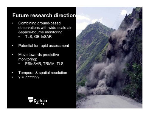
Future research directions<br />
• Combining ground-based<br />
observations with wide-scale air<br />
&space-bourne monitoring<br />
• TLS, GB-InSAR<br />
• Potential for rapid assessment<br />
• Move towards predictive<br />
monitoring:<br />
• PSInSAR, TRMM, TLS<br />
• Temporal & spatial resolution<br />
• ? = ???????