Remote sensing of natural hazards
Remote sensing of natural hazards
Remote sensing of natural hazards
SHOW LESS

Create successful ePaper yourself
Turn your PDF publications into a flip-book with our unique Google optimized e-Paper software.
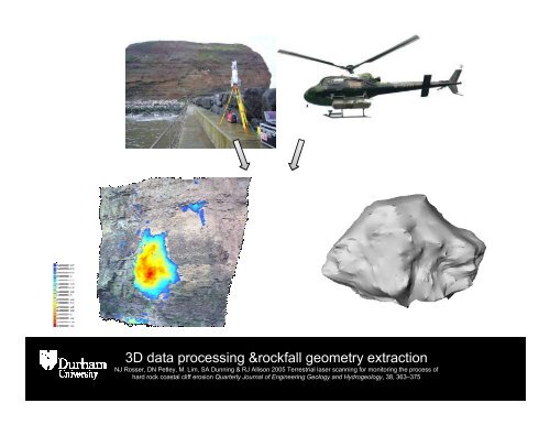
3D data processing &rockfall geometry extraction<br />
NJ Rosser, DN Petley, M. Lim, SA Dunning & RJ Allison 2005 Terrestrial laser scanning for monitoring the process <strong>of</strong><br />
hard rock coastal cliff erosion Quarterly Journal <strong>of</strong> Engineering Geology and Hydrogeology, 38, 363–375