Minnetonka Boulevard - City of St. Louis Park
Minnetonka Boulevard - City of St. Louis Park
Minnetonka Boulevard - City of St. Louis Park

Create successful ePaper yourself
Turn your PDF publications into a flip-book with our unique Google optimized e-Paper software.
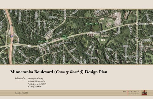
<strong>Minnetonka</strong> <strong>Boulevard</strong> (County Road 5) Design Plan<br />
Submitted to: Hennepin County<br />
<strong>City</strong> <strong>of</strong> <strong>Minnetonka</strong><br />
<strong>City</strong> <strong>of</strong> <strong>St</strong>. <strong>Louis</strong> <strong>Park</strong><br />
<strong>City</strong> <strong>of</strong> Hopkins<br />
December 30, 2008
<strong>Minnetonka</strong> <strong>Boulevard</strong> (County Road 5) Design Plan<br />
Submitted to: Hennepin County<br />
<strong>City</strong> <strong>of</strong> <strong>Minnetonka</strong><br />
<strong>City</strong> <strong>of</strong> <strong>St</strong>. <strong>Louis</strong> <strong>Park</strong><br />
<strong>City</strong> <strong>of</strong> Hopkins<br />
Submitted by:<br />
Date: December 30, 2008<br />
Hart Howerton<br />
150 West Lake <strong>St</strong>reet, Suite 104<br />
Wayzata, MN 55391<br />
Telephone: 952-476-1574<br />
Fax: 952-476-1573<br />
www.harthowerton.com<br />
WSB & Associates, Inc.<br />
701 Xenia Avenue South, Suite 300<br />
Minneapolis, MN 55416<br />
Telephone: 763-541-4800<br />
Fax: 763-541-1700<br />
www.wsbeng.com<br />
Table <strong>of</strong> Contents:<br />
Executive Summary . . . . . 1<br />
Background Data . . . . . 5<br />
Corridor Analysis . . . . . 11<br />
Traffic Summary . . . . . 14<br />
Analysis Summary . . . . . 21<br />
Project Opportunities . . . . 23<br />
Public Input & Open House . . . 37<br />
Design Plan . . . . . . 39<br />
Discussion <strong>of</strong> Further <strong>St</strong>udy . . . 57<br />
Appendix . . . . . . . 59
Executive Summary:<br />
The <strong>Minnetonka</strong> <strong>Boulevard</strong> (County Road 5) Design Plan is a collaboration between<br />
Hennepin County and the cities <strong>of</strong> <strong>Minnetonka</strong>, Hopkins and <strong>St</strong>. <strong>Louis</strong> <strong>Park</strong> to conceive<br />
a travel corridor that addresses the needs <strong>of</strong> a variety <strong>of</strong> commuting, recreational and local<br />
travelers. The Design Plan seeks to capitalize on the opportunities <strong>of</strong>fered by the natural<br />
setting, cultural resources and location between major lakes and adjacent regional trails.<br />
The extent <strong>of</strong> this study, from Interstate 494 on the west to a point just east <strong>of</strong> <strong>St</strong>ate<br />
Highway 100 on the east, includes a key segment <strong>of</strong> the road that links two city halls and<br />
establishes a core from which the design concepts that are developed could be further<br />
extended east and west.<br />
The Design Plan was initiated by researching background information and analysis<br />
about the current environment <strong>of</strong> <strong>Minnetonka</strong> Blvd., and by developing a number<br />
<strong>of</strong> opportunities for potential improvements that could be made along the corridor.<br />
Public comments were sought on the subjects <strong>of</strong> how the road functions, its appearance<br />
and how local citizens were using it. They were also asked to identify which potential<br />
improvements they would give the highest (or lowest) priority to. The top four priorities<br />
for improvements that were mentioned by the public were:<br />
1. Pedestrian Safety Improvements<br />
2. Continuous East-West Bike Route<br />
3. Multi-Modal Scenic Corridor (“Link to the Lakes”)<br />
4. Additional Tree Planting/Landscaping<br />
While there are currently no plans for road reconstruction on <strong>Minnetonka</strong> Blvd., there<br />
are numerous other projects that are moving forward on properties and roadways that lie<br />
adjacent to or intersect it. As a result, there may be opportunities to implement the plan<br />
over time as these related projects go forward, and as the various cities and County find<br />
additional fiscal resources. To this end, the design plan is intended to identify important<br />
functions <strong>of</strong> the <strong>Boulevard</strong> and how they could best be improved. This information will<br />
serve as a springboard for future planning by the County and Cities sponsoring the study.<br />
It is beyond the scope <strong>of</strong> this study to propose a detailed and engineered layout for<br />
the entire length <strong>of</strong> the study area, or to resolve all <strong>of</strong> the potential conflicts between<br />
stakeholders, property owners and agencies who have an interest in the roadway. Rather,<br />
the intent is to develop a set <strong>of</strong> general principles and a range <strong>of</strong> ideas that would<br />
address the goal <strong>of</strong> the County and Cities to describe a street that considers multiple<br />
modes <strong>of</strong> transportation and various reasons for traveling on it, from commuting, to<br />
recreation, to local shopping. Based on a positive response received at the two public<br />
meetings, an overall theme <strong>of</strong> “Link to the Lakes” should be considered, which ultimately<br />
could extend from Lake <strong>Minnetonka</strong> to the Minneapolis Grand Rounds. In addition,<br />
the overall idea <strong>of</strong> making <strong>Minnetonka</strong> <strong>Boulevard</strong> as a “Scenic Corridor” was strongly<br />
endorsed.<br />
The Design Plan recommendations are presented in diagrammatic form for the entire<br />
study area and on several prototype plans that describe the recommendations at some<br />
<strong>of</strong> the key intersections along the corridor. Some assumptions about the relative cost <strong>of</strong><br />
various proposed improvements are also included.<br />
The first <strong>of</strong> two diagrammatic plans, entitled “Bike and Trail Improvement<br />
Opportunities”, describes these four general design principles:<br />
1. Provide for a continuous on-street bike route<br />
2. Enhance pedestrian crossings, especially at primary intersections<br />
3. Create better connections to regional trails<br />
4. Provide additional bike and transit support facilities<br />
The second diagrammatic plan, entitled “Landscape and <strong>St</strong>reetscape Opportunities”,<br />
describes these five general design principles:<br />
1. Emphasize the natural landscape by framing views and by installing new<br />
plantings within the road ROW and on adjacent institutional properties<br />
2. Use formal arrangements <strong>of</strong> trees and lighting in commercial areas only<br />
3. Use landscape as the main unifier along the corridor; allow other features<br />
to change between districts to reflect their unique identities<br />
4. Develop a hierarchy <strong>of</strong> gateways, at highway interchanges, commercial<br />
districts and at pedestrian crossings, to reinforce regional & <strong>City</strong> identity<br />
5. Identify opportunities to improve views <strong>of</strong> Minnehaha Creek by thinning<br />
out vegetation and to improve access for recreational users <strong>of</strong> the Creek and<br />
open space areas.<br />
The prototype plans describe these recommendations in more detail at major intersections<br />
such as Plymouth Rd and Texas Ave.; at the Hwy 169 interchange and at neighborhood<br />
intersections such as at Hampshire Ave. Additionally, several important goals for a future<br />
Hwy 100 bridge crossing have been included.<br />
Due to the limited scope <strong>of</strong> this study, several “areas <strong>of</strong> further study” have been identified<br />
that will require additional master planning thought, engineering effort, public input or<br />
agency review before the final form <strong>of</strong> ideas suggested in this report can be verified. For<br />
example, a major goal <strong>of</strong> the Design Plan is to encourage a continuous on-street bike<br />
route, consistent with both city policy and county standards. There may be obstacles<br />
to achieving this in some areas due to grading constraints or ROW width limitations.<br />
Potential solutions are suggested in this study, including the purchasing <strong>of</strong> additional<br />
ROW or a reduction in traffic lane dimensions. Ultimately, the preferred solution will be<br />
determined at the time <strong>of</strong> implementation for a given segment <strong>of</strong> the corridor, based on<br />
local factors and interests.<br />
Ultimately, the preferred solution will be determined at the time <strong>of</strong> implementation for a<br />
given segment <strong>of</strong> the corridor, based on local factors and interests.
<strong>Minnetonka</strong> <strong>Boulevard</strong> &<br />
I-494<br />
<strong>Minnetonka</strong> <strong>Boulevard</strong> &<br />
Baker Road<br />
<strong>Minnetonka</strong> <strong>Boulevard</strong> &<br />
Plymouth Road<br />
<strong>Minnetonka</strong> <strong>Boulevard</strong> &<br />
Shady Oak Road<br />
<strong>Minnetonka</strong> <strong>Boulevard</strong> &<br />
Co. Road 73<br />
60 yds<br />
60 yds<br />
Share | Print<br />
30 yds<br />
30 yds<br />
60 yds<br />
60 yds<br />
50 yds<br />
50 yds<br />
60 yds<br />
60 yds<br />
<br />
<strong>St</strong>udy Area - <strong>Minnetonka</strong> Boulev
50 yds<br />
50 yds<br />
50 yds<br />
50 yds<br />
50 yds<br />
50 yds<br />
50 yds<br />
50 yds<br />
50 yds<br />
<strong>Minnetonka</strong> <strong>Boulevard</strong> &<br />
Hwy. 169<br />
<strong>Minnetonka</strong> <strong>Boulevard</strong> &<br />
Texas Avenue<br />
<strong>Minnetonka</strong> <strong>Boulevard</strong> &<br />
<strong>Louis</strong>iana Avenue<br />
<strong>Minnetonka</strong> <strong>Boulevard</strong> &<br />
Dakota Avenue<br />
<strong>Minnetonka</strong> <strong>Boulevard</strong> &<br />
Hwy. 100<br />
ard (Co. Road 5) Design Plan<br />
NTS
Background Data:<br />
The <strong>Minnetonka</strong> <strong>Boulevard</strong> (County Road 5) corridor is rich<br />
in history, passing by or through many natural and cultural<br />
resources. Information regarding the historical background<br />
<strong>of</strong> the corridor and the adjacent Minnehaha Creek has been<br />
documented. Pre-existing plans for the development <strong>of</strong> parks,<br />
trails and creek access have also been catalogued and reviewed,<br />
as have projected land use maps and other city planning<br />
documents.
The most significant history along the <strong>Minnetonka</strong> portion <strong>of</strong> the<br />
<strong>Boulevard</strong> occurs at the Mills District, which was originally the site <strong>of</strong> a<br />
saw mill; later a flour mill. These two important economic resources in<br />
the early settled history <strong>of</strong> the area were both located on the Creek just<br />
east <strong>of</strong> Plymouth Rd. A railroad depot was also located at Plymouth Rd,<br />
south <strong>of</strong> the Creek and a rail spur served the flour mill, extending along<br />
the current Burwell Drive. A mill pond took up part <strong>of</strong> the Burwell<br />
House site, storing logs that were floated down from Lake <strong>Minnetonka</strong>.<br />
This area was also important to Native Americans as a crossing point on<br />
an ancient trail that extended from the Shakopee area to Lake Mille Lacs.<br />
Burwell House<br />
• Built in 1883<br />
• Currently a <strong>City</strong> owned historical site<br />
Image: <strong>Minnetonka</strong> Historical Society<br />
Image: <strong>Minnetonka</strong> Historical Society<br />
<strong>Minnetonka</strong> - 1916<br />
• Bicycle Trail built by Hennepin County in the 1890’s along <strong>Minnetonka</strong> <strong>Boulevard</strong> from Minneapolis to Deephaven.<br />
Image: <strong>Minnetonka</strong> Historical Society<br />
<strong>Minnetonka</strong> Mills<br />
• Saw Mill (1852-1860), Flour Mill (1869-1895)<br />
• Currently the location <strong>of</strong> a <strong>City</strong> owned park featuring a gazebo<br />
Image: <strong>Minnetonka</strong> Historical Society<br />
Plymouth Road<br />
<strong>Minnetonka</strong> <strong>Boulevard</strong><br />
Baker Road<br />
<strong>Minnetonka</strong> Town Hall<br />
• Built in 1906<br />
• Sold to <strong>Minnetonka</strong> Community Church in 1970<br />
Image: <strong>Minnetonka</strong> Historical Society<br />
Bridge <strong>St</strong>reet<br />
• Historic Native American Indian trail crossing<br />
Image: <strong>Minnetonka</strong> Historical Society<br />
<strong>Minnetonka</strong> <strong>Boulevard</strong> - 1916<br />
• <strong>Boulevard</strong> diverts south <strong>of</strong> railline (currently TRPD trail) between Baker Road & Plymouth Road<br />
Related <strong>Minnetonka</strong> History<br />
<br />
M i n n e t o n k a B o u l e v a r d ( C o . R o a d 5 )<br />
D e s i g n P l a n<br />
October, 2008
MI NESOTA<br />
<strong>Minnetonka</strong> <strong>Park</strong> Mall - 1960<br />
Image: <strong>St</strong>. <strong>Louis</strong> <strong>Park</strong> Historical Society<br />
Texa-Tonka Shopping Center - 1960<br />
Image: <strong>St</strong>. <strong>Louis</strong> <strong>Park</strong> Historical Society<br />
Lilac <strong>Park</strong><br />
• Built as part <strong>of</strong> a series <strong>of</strong> parks through the WPA by local stonemasons<br />
• Unique stone “beehive” fireplaces were constructed for use by park-goers.<br />
- One remains intact today.<br />
Image: NPS<br />
<strong>Minnetonka</strong> <strong>Park</strong> Mall - 2007<br />
Image: <strong>St</strong>. <strong>Louis</strong> <strong>Park</strong> Historical Society<br />
Texa-Tonka Shopping Center - 2008<br />
• In 1896, <strong>Minnetonka</strong> <strong>Boulevard</strong> was a narrow bicycle path.<br />
• In July <strong>of</strong> 1913, Charles M. Loring requested permission to plant<br />
elm trees on <strong>Minnetonka</strong> <strong>Boulevard</strong> from Minneapolis to Lake<br />
<strong>Minnetonka</strong>.<br />
• In 1913, the railroad bridge at Brunswick Avenue was built (rebuilt<br />
in 2008).<br />
• <strong>Minnetonka</strong> <strong>Boulevard</strong> was paved in 1952.<br />
•The bridge at <strong>Minnetonka</strong> <strong>Boulevard</strong> and Aquila was built in 1960,<br />
and rebuilt in 2007.<br />
• In 2009, a campaign to restore Lilac Way (Hwy. 100) will begin by<br />
asking individuals & businesses to sponsor lilac shrubs to be planted<br />
throughout the corridor.<br />
Highway 100 Roadside <strong>Park</strong>s<br />
• <strong>St</strong>ructures fashioned from limestone cut along the Minnesota River<br />
• Due to highway expansion projects over the years, most structures have been removed.<br />
However, pieces <strong>of</strong> the stone have been retained by MNDOT.<br />
Image: <strong>St</strong>. <strong>Louis</strong> <strong>Park</strong> Historical Society<br />
Campaign graphics: Window sticker<br />
the C AmPAign to restore LiLAC WAy<br />
10<br />
Texa-Tonka Lanes - 1960<br />
Image: <strong>St</strong>. <strong>Louis</strong> <strong>Park</strong> Historical Society<br />
PROUD SUPPORTER <strong>of</strong><br />
100<br />
Texa-Tonka Lanes - 2007<br />
Image: <strong>St</strong>. <strong>Louis</strong> <strong>Park</strong> Historical Society<br />
www.restorelilacway.com<br />
© 2008 Laukkonen Design—Idea-oriented. Super-organized. Deadline-sensitive. www.laukkonen.com<br />
7.20.08<br />
Remaining Beehive Fireplace - Lilac <strong>Park</strong><br />
Image: <strong>St</strong>. <strong>Louis</strong> <strong>Park</strong> Historical Society<br />
Removed <strong>St</strong>one - MNDOT Graveyard<br />
Image: www.restorelilacway.com<br />
Related <strong>St</strong>. <strong>Louis</strong> <strong>Park</strong> History<br />
M i n n e t o n k a B o u l e v a r d ( C o . R o a d 5 )<br />
D e s i g n P l a n<br />
October, 2008
Minnehaha<br />
Creek<br />
Minnehaha<br />
Creek<br />
Minnehaha Creek - represents a unique natural asset for the portion <strong>of</strong> the corridor between I-494 and Hopkins<br />
Crossroad, where it runs along side <strong>of</strong> the roadway or a short distance away. In this area the creek contributes<br />
to the forested character <strong>of</strong> the roadway corridor. Where dense shrubbery has been removed, the Creek corridor<br />
greatly extends the travelers viewshed. The Creek presents opportunities for complementary recreational uses<br />
such as overlooks, trails and canoe landings that are positive for users <strong>of</strong> the Creek and users <strong>of</strong> the roadway. By<br />
giving consideration to the Creek as a visual and recreational asset, with special stopping points, view corridors,<br />
and recreational access, it will improve the character <strong>of</strong> the road and adjacent land uses.<br />
Upper Minnehaha Creek Corridor<br />
<br />
M i n n e t o n k a B o u l e v a r d ( C o . R o a d 5 )<br />
D e s i g n P l a n<br />
October, 2008
Pioneer<br />
Rd<br />
Drive<br />
Blvd.<br />
Drive<br />
Acres<br />
Rd.<br />
Grant<br />
Lorenz Rd.<br />
Cr<br />
Trail<br />
Lake Independence Regional Trail<br />
te<br />
t<br />
Ave.<br />
Mtka<br />
Rd.<br />
Tamarack Drive<br />
Mtka<br />
Hunter Drive<br />
W. 192nd Ave.<br />
Duck Lake Rd.<br />
Dunkirk Lane<br />
Road<br />
Vicksburg Lane N.<br />
Whited<br />
Niagara Lane<br />
Fernbrook Lane<br />
Rd.<br />
Berkshire<br />
La.<br />
Baker<br />
Rd.<br />
La.<br />
Sunset Dr.<br />
Dr.<br />
Rd.<br />
E.<br />
Dr<br />
d<br />
Jordan Ave.<br />
Mendelssohn Ave.<br />
Flag Ave.<br />
Boone<br />
<br />
Boone Ave.<br />
General Mills<br />
Blvd.<br />
Winnetka Ave.<br />
<strong>Louis</strong>iana Ave.<br />
Soo Line<br />
Ave.<br />
Blvd.<br />
W<br />
Beltline<br />
Beltline<br />
Beltline<br />
Vernon<br />
Ave.<br />
Wooddale<br />
Noble Ave.<br />
Cedar<br />
Ave.<br />
Penn<br />
<br />
Soo Line RR<br />
GREAT RIVER ROAD<br />
M IN N ES O T A<br />
GREAT RIVER ROAD<br />
M IN N ES O T A<br />
e.<br />
W.<br />
Ave.<br />
<strong>St</strong>andish<br />
26th Ave.<br />
GREAT RIVER ROAD<br />
M IN N ES O TA<br />
S<br />
S.<br />
Blvd.<br />
Minn. Trans<br />
SHELARD PKWY<br />
GREAT RIVER ROAD<br />
M IN N ES O T A<br />
GREAT RIVER ROAD<br />
M IN N ES O T A<br />
FORD<br />
CIR<br />
Long<br />
LANCASTER<br />
AVE<br />
FORD LN<br />
KILMER AVE<br />
KILMER<br />
POND<br />
Prior Ave.<br />
22ND LN<br />
INDEPENDENCE<br />
AVE<br />
22ND ST<br />
23RD ST<br />
HILLSBORO<br />
AVE<br />
GETTYSBURG AVE<br />
18TH ST<br />
GETTYSBURG<br />
AVE<br />
C<br />
MINNEHAHA<br />
CT<br />
FLAG AVE<br />
FLAG AVE<br />
AVE<br />
22ND<br />
ST<br />
23RD<br />
ST<br />
24TH<br />
ST<br />
24TH<br />
PL<br />
CEDAR<br />
MANOR<br />
LAKE<br />
Cedar Manor<br />
<strong>Park</strong>/Lake<br />
Cedar Manor<br />
ENSIGN<br />
AVE<br />
HANNAN LAKE<br />
DECATUR<br />
24TH CT<br />
COBBLE<br />
CREST LAKE<br />
BOONE<br />
AVE<br />
BOON E<br />
25TH ST<br />
BOONE AVE<br />
WESTWOOD LAKE<br />
Westwood Hills<br />
Environmental<br />
Education Center<br />
ILA AVE<br />
ZINR AN AVE<br />
Westling<br />
Pond<br />
33RD ST<br />
ZINRAN AVE<br />
Aquila<br />
Primary<br />
Center<br />
Sunset<br />
<strong>Park</strong><br />
XYLON AVE<br />
WES TWOOD HILLS DR<br />
VIRGINIA CIR<br />
VICTORIA<br />
LAKE<br />
XYLON AVE<br />
Elie<br />
<strong>Park</strong><br />
PL<br />
30 1/2 ST<br />
WYOMING AVE<br />
16TH<br />
Knollwood Mall<br />
Texa-Tonka<br />
<strong>Park</strong>/Lake<br />
Victoria<br />
VIRGINIA AVE<br />
UTAH<br />
POND<br />
32ND ST<br />
34TH ST<br />
34 1/2 ST<br />
35TH ST<br />
36TH ST<br />
WESTWOOD<br />
HILLS<br />
DR<br />
TEXAS AVE<br />
TEXAS AVE<br />
31ST<br />
ST<br />
CIR<br />
Rainbow<br />
<strong>Park</strong><br />
13TH LN<br />
37TH ST<br />
SUMTER AVE<br />
Timothy<br />
Lutheran<br />
32 1/2 ST<br />
SUMTER AVE<br />
14TH ST<br />
RH ODE ISL AND AVE<br />
13TH LN<br />
13 1/2 ST<br />
LAMP<br />
LIGHTER<br />
POND<br />
Lamplighter<br />
<strong>Park</strong><br />
<strong>St</strong>. <strong>Louis</strong> <strong>Park</strong><br />
Jr High School<br />
Willow<br />
<strong>Park</strong><br />
QUEBEC AVE<br />
POWELL RD<br />
PENNSYLVANIA AVE<br />
Ainsworth<br />
<strong>Park</strong><br />
PENNSYLVA NIA AVE<br />
PENNSYLVANIA<br />
AVE<br />
PENNSYL VANIA AVE<br />
OREGON AVE<br />
14TH ST<br />
Oregon <strong>Park</strong><br />
OREGON AVE<br />
OREGON AVE<br />
18TH ST<br />
FRANKLIN AVE<br />
22ND ST<br />
NEVADA AVE<br />
LOUISIANA CT<br />
NEVADA AVE<br />
Northside<br />
Rotary<br />
<strong>Park</strong><br />
Fire<br />
<strong>St</strong>ation #2<br />
Cedar<br />
Knoll/Carlson<br />
Field<br />
OAK<br />
POND<br />
MARYLAND AVE<br />
SOUTH<br />
IsaacWalton<br />
League/ Municipal<br />
Creekside Service<br />
Center<br />
EXCELSIOR<br />
WAY<br />
OAK<br />
POND<br />
KENTUCKY AVE<br />
16TH ST<br />
18TH ST<br />
22ND ST<br />
26TH ST<br />
27TH ST<br />
28TH ST<br />
JERSEY AVE<br />
29TH ST<br />
Bronx<br />
<strong>Park</strong><br />
31ST ST<br />
32ND ST<br />
Par kview<br />
P ark<br />
IDAHO AVE<br />
HAMPSHIRE AVE<br />
Eliot Ctr<br />
HAMPSHIRE AVE<br />
33RD ST<br />
WALKE R ST<br />
GEORGIA AVE<br />
Hampshire<br />
<strong>Park</strong><br />
Nelson<br />
<strong>Park</strong><br />
Peter Hobart<br />
FLORIDA AVE<br />
OTTEN POND<br />
MINN ETON KA<br />
Lenox<br />
Ctr<br />
EDGEWOOD AVE<br />
<strong>St</strong>. <strong>Louis</strong> <strong>Park</strong><br />
Senior<br />
High School<br />
Hospital<br />
Meadowbrook<br />
Lake<br />
EDGEWOOD AVE<br />
Spanish<br />
Immersion<br />
School<br />
DAKOTA AVE<br />
DAKOTA<br />
AVE<br />
14TH ST<br />
16TH ST<br />
18TH<br />
Dakota<br />
<strong>Park</strong><br />
BLVD<br />
CAMBRIDGE ST<br />
COLORADO AVE<br />
31ST ST<br />
Central Ctr<br />
BRUNSWICK AVE<br />
34TH ST<br />
Jorvig<br />
<strong>Park</strong><br />
41ST ST<br />
BLACKSTONE AVE<br />
BLACKSTONE AVE<br />
Pennsylvania<br />
<strong>Park</strong><br />
16TH ST<br />
Blackstone<br />
<strong>Park</strong><br />
16TH ST<br />
39TH ST<br />
42ND ST<br />
ALABAMA AVE<br />
HAMILT ON ST<br />
35TH ST<br />
37TH ST<br />
ZARTHAN AVE<br />
Holy<br />
Family<br />
Acad.<br />
16TH ST<br />
OXFORD ST<br />
Justad<br />
<strong>Park</strong><br />
ZARTHAN AVE<br />
Jackley<br />
<strong>Park</strong><br />
YOSEMITE AVE<br />
Center<br />
<strong>Park</strong><br />
Fire<br />
<strong>St</strong>ation #1<br />
41ST ST<br />
YOSEMITE AVE<br />
Candlestick<br />
Pond<br />
25 1/2 ST<br />
26TH ST<br />
27TH ST<br />
35 1/2 ST<br />
WEBSTER AVE<br />
WEBSTER AVE<br />
26TH<br />
ST<br />
29TH ST<br />
WEBSTER<br />
AVE<br />
Sunshine<br />
<strong>Park</strong><br />
The Whole<br />
Learning<br />
Webster<br />
<strong>Park</strong><br />
PARK PLACE BLVD<br />
UTICA AVE<br />
GAMBLE DR<br />
STEPHENS DR<br />
28TH<br />
ST<br />
Groves<br />
Academy<br />
TOLEDO<br />
AVE<br />
31ST<br />
ST<br />
41ST ST<br />
42ND ST<br />
S<br />
!<br />
43 1/2 ST<br />
SALEM AVE<br />
3<br />
<strong>Park</strong> Nicollet<br />
Clinic<br />
Miracle Mile<br />
Mall<br />
PA<br />
Benilde/<strong>St</strong>.<br />
Margaret<br />
27TH<br />
ST<br />
28TH ST<br />
29TH ST<br />
Police<br />
<strong>St</strong>ation<br />
RALEIGH AVE<br />
<strong>City</strong> Hall<br />
Carpenter<br />
<strong>Park</strong>/Skippy<br />
Field<br />
Rec Center<br />
WOLFE<br />
LAKE<br />
Town Green<br />
<strong>Park</strong><br />
E & G<br />
Browndale<br />
<strong>Park</strong><br />
PRINCETON AVE<br />
HILL LN<br />
OTTAWA<br />
AVE<br />
Susan Lindgren<br />
42ND ST<br />
TWIN<br />
LAKE<br />
31ST ST<br />
E & G<br />
Cedarhurst<br />
<strong>Park</strong><br />
26TH ST<br />
27TH ST<br />
Fern Hill<br />
<strong>Park</strong><br />
LYNN AVE<br />
LYNN AVE<br />
KIPLING AVE<br />
LN<br />
BASS LAKE<br />
40TH ST<br />
Torah<br />
Acad.<br />
Bais<br />
Yaakov<br />
HS<br />
BASSWOOD RD<br />
25TH ST<br />
CEDAR LAKE<br />
AVE<br />
SUNS ET BL VD<br />
INGLEWOOD AVE<br />
Minneapolis<br />
Jewish<br />
Day<br />
School<br />
31ST ST<br />
Minikahda<br />
Vista<br />
<strong>Park</strong><br />
34TH ST<br />
Bass Lake<br />
<strong>Park</strong><br />
37TH ST<br />
38TH ST<br />
24TH ST<br />
<br />
Shelard<br />
<strong>Park</strong><br />
FORD RD<br />
WAYZATA BLVD<br />
§¨¦ 394<br />
GENERAL MILLS BLVD<br />
<strong>St</strong>. <strong>Louis</strong> <strong>Park</strong> Trail Map<br />
<br />
2<br />
<br />
<br />
<br />
<br />
£¤ 169 §¨¦ 394<br />
Otten<br />
Pond<br />
×<br />
Westwood<br />
Hills Nature<br />
Center<br />
Ford<br />
å<br />
<strong>Park</strong><br />
m<br />
¦¨<br />
å<br />
Twin<br />
å<br />
Lakes<br />
<strong>Park</strong><br />
å<br />
QR å<br />
5<br />
m<br />
QR 5<br />
×<br />
å<br />
ca<br />
å<br />
Aquila<br />
<strong>Park</strong><br />
QR 25<br />
å<br />
£¤ 169 <strong>Louis</strong>iana<br />
å<br />
Oaks<br />
Knollwood<br />
<strong>Park</strong><br />
Green<br />
7<br />
å<br />
å m<br />
P<br />
7<br />
×<br />
¦¨<br />
QR 20<br />
7<br />
@<br />
@<br />
Legend<br />
QR 3<br />
×<br />
P<br />
!<br />
Trails<br />
Clinic<br />
Ñ<br />
å<br />
<strong>St</strong>airs<br />
m Community Center<br />
Boardwalk<br />
¦¨ Fire <strong>St</strong>ation<br />
QR 3 å<br />
FORD RD<br />
16TH ST<br />
18 TH ST<br />
PARK E<br />
LN<br />
PRKR<br />
MELROS E AVE<br />
R R D<br />
KILMER AVE<br />
JORDAN AVE<br />
INDEPENDENCE AV E<br />
INDEPEND ENCE AVE<br />
IND EPENDENCE A VE<br />
³±<br />
14T H ST<br />
L SBORO AVE<br />
HI L<br />
HILLSBORO AVE<br />
16TH ST<br />
F LAG AVE<br />
FAIRWAY<br />
LN<br />
F RANKLIN AVE<br />
Marked on Road<br />
Pedestrian Bridge<br />
Paved Trail<br />
Unpaved Trail<br />
<strong>Park</strong>s<br />
× <strong>City</strong> Building<br />
L U B RD<br />
28TH ST<br />
HILL SBORO AVE<br />
FLAG<br />
STANLEN RD<br />
DECAT U R LN<br />
AVE DECATUR AVE<br />
31ST ST<br />
MINNEHAHA CIR<br />
Ñ<br />
P<br />
ca<br />
å<br />
@<br />
PHILLIPS PKWY<br />
Minnehaha Creek<br />
CAVELL AVE CAVELL AVE<br />
WESTMORELAND<br />
CAVELL L N<br />
C AVELL AVE<br />
L N<br />
BOONE<br />
CT<br />
AQUILA LN<br />
AVE<br />
AQUILA CIR<br />
28TH STAQUIL AA V E<br />
AQ U<br />
Hospital<br />
Mall<br />
Y U K O N AVE<br />
29TH ST<br />
31ST ST<br />
AQUILA AVE<br />
37TH S T<br />
X YL O N AVE<br />
YUKON AVE<br />
XYLON<br />
AVE<br />
AQ UILA AVE<br />
Police <strong>St</strong>ation<br />
School<br />
VIRG<br />
WYOMING AVE<br />
INI A AVE<br />
WESTWOOD HILLS CRV<br />
UTAH DR<br />
18TH ST<br />
FRAN KLIN AVE<br />
BURD<br />
Excelsior & Grand<br />
VIRGINIA AVE<br />
ST<br />
UTAH AVE<br />
VIRGINIA AVE<br />
TE XA T O N KA AVE<br />
UTAH AVE<br />
UTAH AVE<br />
U TAH AVE<br />
25TH ST<br />
TEXAS<br />
23RD ST<br />
SUMTER AVE<br />
26TH ST<br />
BROOKVIEW<br />
DR<br />
22ND ST<br />
WOODLAND<br />
DR<br />
QUEBEC AVE<br />
24TH ST<br />
RHODE ISLAND AVE<br />
QUEBEC AVE<br />
QUEBEC AVE<br />
Oak Hill<br />
Pa rk<br />
Walker<br />
Field<br />
³±<br />
QUEBEC AVE<br />
NORTH ST<br />
EDGEBROOK DR<br />
MEADOWBROOK RD<br />
OREGON AVE<br />
NEVADA AVE<br />
MARYLAND AVE<br />
OXFORD ST<br />
LAKE ST<br />
TAFT AVE<br />
Edgebrook <strong>Park</strong><br />
LOUISIANA AVE<br />
KENTUCKY AVE<br />
GORHAM AVE<br />
JERSEY AVE<br />
23RD ST<br />
24TH ST<br />
Freedom<br />
<strong>Park</strong><br />
(Paul Frank)<br />
REPUBLIC<br />
AVE<br />
IDAHO AVE<br />
Jersey<br />
<strong>Park</strong><br />
HAMPSHIRE AVE<br />
2ND ST<br />
1ST ST<br />
EXCELSIOR BLVD<br />
IDAHO<br />
18TH<br />
ST<br />
GEORGIA<br />
AVE<br />
ELIOT VIEW RD<br />
LIBRARY LN<br />
BROWNLOW AVE<br />
MONITOR ST<br />
MEADOWBROOK BLVD<br />
FLORIDA AVE<br />
Metropolitan<br />
Open<br />
School<br />
EDGEWOOD AVE<br />
23RD ST<br />
EDGEWOOD AVE<br />
LAKE ST<br />
DAKOTA AVE<br />
DAKOTA AVE<br />
DAKOTA AVE<br />
COLORADO AVE<br />
32ND ST<br />
COLORADO AVE<br />
COLORADO AVE<br />
BRUNSWICK AVE<br />
BLACKSTONE<br />
AVE<br />
ALABAMA AVE<br />
ALABAMA AVE<br />
ALABA MA AVE<br />
ZARTHAN AVE<br />
RIDGE<br />
YOSEMITE AVE<br />
DR<br />
33RD ST 33RD ST<br />
COLORADO AVE<br />
BRUNSWICK<br />
AVE<br />
39TH ST<br />
Roxbury<br />
<strong>Park</strong><br />
MEADOWBROOK BLVD<br />
Keystone<br />
<strong>Park</strong><br />
Birchwood<br />
<strong>Park</strong><br />
³±<br />
WOOD DALE AVE<br />
ZARTHAN AVE<br />
YOSEMI TE AVE<br />
XENWOOD AVE<br />
XENWOOD AVE<br />
XENWOOD AVE<br />
28TH ST<br />
WEBSTER AVE<br />
100³ ±<br />
VERNON AVE<br />
VERNON AVE<br />
IC A AVE<br />
UT<br />
UTICA AVE<br />
100³ ±<br />
MACKEY AVE<br />
PARKDALE DR<br />
CEDAR LAKE RD<br />
23RD S T<br />
TOLEDO AVE<br />
36TH ST<br />
SALEM AVE<br />
PARK CEN T E R BLVD<br />
TOLEDO AVE<br />
BROOK AVE<br />
25 1/2 ST<br />
ALEM AVE<br />
100³ ±<br />
35TH ST<br />
EXCELSIOR BLVD<br />
B ROWNDALE AVE<br />
RALEIGH AVE<br />
RALEIGH AVE<br />
3RD ST<br />
40TH ST<br />
R KWOODS RD<br />
QUENTIN AVE<br />
PARK COMMONS DR<br />
SALEM AVE<br />
RALEIGH AVE<br />
QU ENT I N AVE<br />
PRINCETON AVE<br />
OTTAWA AVE<br />
OTTAWA AVE<br />
40TH LN<br />
MOR NINGSIDE RD<br />
GLEN PL<br />
WESTRIDGE<br />
LN<br />
BELT LINE BLVD<br />
VALLACHER AVE<br />
DART AVE<br />
C EDARWOOD RD<br />
0 0.5<br />
1 2<br />
<strong>Minnetonka</strong> Saint <strong>Louis</strong> <strong>Park</strong> Minneapolis<br />
Miles<br />
Wolfe<br />
<strong>Park</strong><br />
OTTAWA<br />
AVE<br />
OTTAWA AVE<br />
WOODDALE AVE<br />
NATCHEZ AVE<br />
NATCHEZ AVE<br />
NATCHEZ AVE<br />
CEDAR LAKE RD<br />
MONTEREY AVE<br />
MONTEREY AVE<br />
3 6 1/2 ST<br />
MONTEREY DR<br />
39TH ST<br />
PARKLANDS RD<br />
LYNN AVE<br />
LYNN<br />
AVE<br />
WILLOW<br />
KIPLING AVE<br />
WILLOW<br />
LN<br />
PARK GLEN RD<br />
FOREST RD<br />
CE DARWOOD RD<br />
JOPPA AVE<br />
JOPPA AVE<br />
å<br />
36TH ST<br />
JOPPA AVE<br />
å<br />
HIGH WOOD RD<br />
CEDAR LA KE RD<br />
å<br />
FOREST LN<br />
INGLEWOOD AVE<br />
HUNTINGTON AVE<br />
HUNTINGTON AVE<br />
GLENHURST AVE<br />
RANDALL AVE<br />
HUNTINGTON AVE<br />
GLENHURST AVE<br />
S T R D<br />
GLENHUR<br />
GLENHURST<br />
AVE<br />
25TH ST<br />
/<br />
FRANCE AVE<br />
26<br />
6<br />
Long<br />
Lake<br />
N. Branch Rd. Ingerson Rd.<br />
Pioneer<br />
Gale Woods<br />
<br />
ad<br />
Kings<br />
11<br />
Quaas Cut-<strong>of</strong>f<br />
Point<br />
Road<br />
90<br />
Painter<br />
Creek<br />
Creek<br />
Maple<br />
Plain<br />
83<br />
110<br />
19<br />
29<br />
84<br />
Luce<br />
Baker<br />
Lake<br />
201<br />
Katrina <strong>Park</strong><br />
Reserve<br />
s Bay<br />
Line <strong>St</strong>ate Trail<br />
eek<br />
<strong>St</strong>ubb<br />
Classen<br />
Lake<br />
12<br />
Long<br />
Wolsfeld<br />
Lake<br />
Lake<br />
Creek<br />
Long Lake<br />
Holy Name<br />
Lake<br />
Lydiard<br />
Lake<br />
Mooney<br />
Lake<br />
Hadley<br />
Lake<br />
Gleason<br />
Lake<br />
<strong>Park</strong>ers<br />
Lake<br />
101<br />
12<br />
394<br />
12<br />
394<br />
<strong>St</strong>ubbs<br />
146 15<br />
110<br />
Bay<br />
Wayzata<br />
12<br />
<strong>St</strong>. <strong>Louis</strong><br />
Tanager<br />
94<br />
151<br />
84<br />
169<br />
Cedar<br />
5<br />
135 Maxwell Bay<br />
Lake<br />
Wayzata Bay<br />
19<br />
Noerenberg<br />
<strong>Park</strong><br />
Lake<br />
151<br />
Browns Bay<br />
Minneapolis<br />
North Memorial<br />
100<br />
Lake<br />
22<br />
110<br />
Forest Arm <strong>Park</strong><br />
61<br />
<strong>of</strong><br />
48<br />
Lake<br />
Grays<br />
Woodland<br />
the Isles<br />
Jennings Bay<br />
Bay<br />
51<br />
Smiths<br />
16<br />
Hannan<br />
Lake<br />
43<br />
Bay<br />
5<br />
3<br />
25<br />
3<br />
Bay<br />
Woolsey<br />
W. 31st <strong>St</strong>.<br />
Robinsons<br />
Pond<br />
Libbs<br />
Minnehaha<br />
25<br />
Powderhorn<br />
West Arm<br />
Crystal<br />
Bay<br />
Lake<br />
Lake<br />
35 Lake<br />
<strong>Minnetonka</strong><br />
5<br />
Dutch Lake<br />
Harrisons<br />
Calhoun<br />
Bay<br />
51<br />
Lake <strong>Minnetonka</strong><br />
61<br />
73<br />
33<br />
5<br />
Spring<br />
Lower Lake<br />
7<br />
Navarre Beach<br />
Mtka Mills<br />
Lafayette<br />
Bay<br />
Langdon<br />
Seton<br />
15<br />
Mound <strong>Park</strong><br />
Big Island<br />
Lake Black<br />
20<br />
Lyndale<br />
Lake<br />
(Undeveloped)<br />
Deephaven<br />
152<br />
Lake Spring<br />
19<br />
60<br />
<strong>Park</strong> Carman<br />
Carsons<br />
H<br />
<strong>Park</strong><br />
17<br />
Saunders<br />
Cooks Bay<br />
Bay<br />
Bay<br />
Bay<br />
42<br />
125<br />
Hopkins<br />
3<br />
Lake<br />
Meadowbrook<br />
Lake<br />
Lake<br />
Lake<br />
Harriet<br />
Hiawatha<br />
Echo<br />
Hopkins<br />
Wild Goose<br />
46<br />
Priests Bay<br />
Bay<br />
101<br />
494 3<br />
Depot<br />
Chase Island<br />
Tonka<br />
Mill<br />
Phelps<br />
Pond<br />
Lake <strong>Minnetonka</strong><br />
Bay<br />
Bay<br />
Upper Lake<br />
Greenwood<br />
21<br />
Halsted<br />
Mirror<br />
Shady<br />
Lake<br />
Bay<br />
Gideon<br />
Lake<br />
Excelsior<br />
Oak<br />
35<br />
Nokomis<br />
Bay<br />
7<br />
<strong>St</strong>. Albans<br />
Lake<br />
44<br />
Bay Bay<br />
<strong>Minnetonka</strong><br />
Wawatasso<br />
Excelsior<br />
3<br />
Glen<br />
Lone 61<br />
158<br />
22<br />
Diamond<br />
Island<br />
Lake<br />
Lake<br />
19<br />
35W Lake<br />
<br />
31<br />
62<br />
Christmas<br />
Glen Lake Golf<br />
Galpin<br />
Lake Silver<br />
17<br />
121<br />
<br />
& Practice Center<br />
Shorewood<br />
Lake<br />
Edina<br />
Lake<br />
82<br />
<br />
Mother<br />
62 62<br />
Lake<br />
Smith<br />
<strong>St</strong>one<br />
Virginia<br />
Birch<br />
62<br />
Richfield<br />
Legion<br />
Town<br />
Island<br />
Lake<br />
Lake<br />
Lake<br />
Bay Lake<br />
Lake<br />
117<br />
Bryant<br />
H<br />
Lake<br />
4<br />
Lake<br />
53 53<br />
60<br />
100 Lake<br />
<br />
Zumbra<br />
<br />
Lake <strong>Park</strong><br />
Bryant<br />
Cornelia<br />
<br />
Minnewashta<br />
Lotus<br />
Wood<br />
Schutz<br />
Lake 17<br />
101<br />
212<br />
Lake<br />
Lake<br />
Lucy<br />
Lake<br />
Richfield<br />
41<br />
Carver<br />
Duck<br />
13<br />
Lake<br />
Regional<br />
<strong>Park</strong><br />
Three Rivers <strong>Park</strong> District<br />
Blaire Rd.<br />
Game<br />
Road<br />
Road<br />
West Branch Rd.<br />
Bartlett<br />
Blaire Rd.<br />
Edge<br />
Sunnyfield Road<br />
Farm<br />
West<br />
Lotus<br />
Road<br />
Main <strong>St</strong>.<br />
Lake <strong>Minnetonka</strong><br />
Regional <strong>Park</strong><br />
Drake Drive<br />
Grand<br />
Road<br />
View<br />
Lynwood Blvd<br />
Dr.<br />
Blvd<br />
Halgren Road<br />
Moline Rd.<br />
North Arm Drive<br />
Commerce Blvd<br />
Three<br />
Bartlett<br />
Apple<br />
Garden Rd.<br />
Shoreline<br />
Budd <strong>St</strong>.<br />
Jennings<br />
Cove Rd.<br />
Points<br />
Tuxedo<br />
Perkinsville<br />
Rd.<br />
Main <strong>St</strong>.<br />
Blvd.<br />
Blvd<br />
Wilshire<br />
Blvd.<br />
Town Line Rd.<br />
Devon<br />
Enc<br />
N orth<br />
Tuxedo<br />
Island<br />
<br />
<br />
McCulley<br />
Rd.<br />
Wildhurst<br />
Trail<br />
Blvd.<br />
View<br />
Dr.<br />
hanted Lane<br />
North<br />
Arm<br />
Orchard<br />
<strong>Park</strong> Rd.<br />
Bayside Road<br />
Shore<br />
Blvd.<br />
Road<br />
Smitht own<br />
B. N. RR<br />
Rd.<br />
Pt.<br />
Howard’s<br />
Summit<br />
Drive<br />
<br />
Dr.<br />
Sunset<br />
<strong>St</strong>ubbs Bay Rd.<br />
Wate rtown<br />
Drive<br />
Shadywood<br />
Rd.<br />
Casco<br />
Point<br />
Rd.<br />
Edgewood Rd.<br />
ewashta<br />
Pkwy.<br />
Wayzata<br />
Blvd.<br />
Homestead<br />
Rd.<br />
Tonkawa Rd.<br />
Leaf <strong>St</strong>.<br />
Northview<br />
Birch<br />
Eureka Rd.<br />
Rd.<br />
Shoreline<br />
Bluff<br />
Rd.<br />
Old Crystal Bay Rd.<br />
Manitou Ave.<br />
Smithtown Rd.<br />
vd<br />
Willow Drive<br />
24<br />
6<br />
Brown Road<br />
Long<br />
Lake<br />
Fox <strong>St</strong>.<br />
Dr.<br />
Willow Drive<br />
N. Shor e Drive<br />
Westpoint<br />
Tonka<br />
Bay Rd.<br />
Mtka<br />
Dr.<br />
Yellow stone<br />
Rd.<br />
Grand<br />
Lake <strong>St</strong>.<br />
Willow Drive<br />
.<br />
R d<br />
Lafaye<br />
Brown Road<br />
Oak<br />
<strong>St</strong>.<br />
Trail<br />
pin Blvd.<br />
Medina<br />
Orono<br />
Orchard<br />
Orono<br />
Galp<br />
Fox <strong>St</strong>.<br />
i n<br />
Lk. Rd.<br />
Lake<br />
Yosemite<br />
Mill<br />
Apple<br />
Rd.<br />
Shoreline<br />
Blvd.<br />
Lucy Rd.<br />
d.<br />
Spring<br />
Dr.<br />
Excelsior<br />
<strong>St</strong>.<br />
E. Lon g<br />
Old<br />
Blvd.<br />
<strong>St</strong>. Albans<br />
Blvd.<br />
L ake Rd.<br />
Hill<br />
L o ng<br />
Pleasant<br />
W.<br />
Lakeview<br />
Cottagewood<br />
Manor<br />
Bay<br />
Rd.<br />
Lake<br />
Ridge Road<br />
View<br />
Rd.<br />
Wayzata<br />
B. N. RR<br />
Ferndale<br />
Mtka<br />
Rd.<br />
Northom<br />
Vine <strong>St</strong>.<br />
Rd.<br />
Rd.<br />
Nam<br />
Holy<br />
Rd.<br />
e<br />
101<br />
Lake <strong>Minnetonka</strong> LRT<br />
Blvd. Ridgewood Rd.<br />
Rd.<br />
Vine Hill<br />
Covington<br />
Ferndale Rd.<br />
Deephaven<br />
Ave.<br />
Rd.<br />
Vine Hill Rd.<br />
Ridgevie<br />
Maplewood<br />
w<br />
Lake <strong>St</strong>.<br />
Rd.<br />
Highland Ave.<br />
<strong>Park</strong> Ave.<br />
Rd.<br />
Rd.<br />
Sparrow Rd.<br />
Breezy Point Rd.<br />
Dell<br />
Dr.<br />
Vall<br />
Blvd.<br />
Mtka Blvd.<br />
Therese <strong>St</strong>.<br />
Chanhassen Rd.<br />
Duck<br />
Central Ave.<br />
Road<br />
24<br />
Lasalle<br />
McGinty Rd.<br />
Bush w ay Rd.<br />
Regional<br />
Excelsior<br />
Lake<br />
Trail<br />
Trail<br />
6<br />
15<br />
Lake <strong>St</strong>. Ext.<br />
Scenic Heights Dr.<br />
Townline Rd.<br />
Shores<br />
Blvd.<br />
Clear<br />
Spring Rd.<br />
McGinty<br />
Tonka<br />
Woodland<br />
Wood Rd.<br />
Rd.<br />
Ave. N.<br />
Holdridge<br />
F airchild<br />
Crosby Rd.<br />
Ave.<br />
Purgatory<br />
Shenandoah<br />
La.<br />
Rd.<br />
Highwood<br />
Blvd.<br />
Road<br />
Highland<br />
Creek<br />
Luce<br />
Gleason Lake Dr.<br />
Day Pl.<br />
McKenzie Blvd.<br />
Victoria<br />
<strong>St</strong>.<br />
Niagara La.<br />
<strong>Park</strong>ers<br />
Lake Rd.<br />
Sheridan<br />
Rd.<br />
Linner Rd.<br />
Dr.<br />
Blvd.<br />
Rd.<br />
Williston<br />
Crestview<br />
Kurtz La.<br />
H i lls<br />
Rd.<br />
vale<br />
494<br />
Xenium Lan<br />
61<br />
Line Regional Trail<br />
Carlson<br />
Wayzata Blvd.<br />
Ave.<br />
Meeting<br />
<strong>Minnetonka</strong><br />
Pkwy.<br />
<strong>St</strong>.<br />
<strong>St</strong>one<br />
W.<br />
Orchard Road<br />
Woodhill Rd.<br />
Woodridge<br />
Rd.<br />
La. Dr.<br />
Indian Chief<br />
Birch Is. Rd.<br />
Cheshire<br />
Lane<br />
Road<br />
13th<br />
Ave.<br />
Oakland<br />
Rd.<br />
Bellev ue<br />
School Rd<br />
Essex Rd.<br />
Xenium Lane N.<br />
Edenvale<br />
Blvd.<br />
Northwest<br />
Sunset<br />
Baker<br />
McGinty Rd. E.<br />
Rd.<br />
26th Ave N.<br />
Plymouth Road<br />
Blvd.<br />
Pineview<br />
Creek<br />
Lake <strong>St</strong>.<br />
Robert<br />
Pioneer<br />
Rd.<br />
Rowland<br />
Ridge<br />
Dominick<br />
Drive<br />
55<br />
Shady<br />
Fair<br />
View<br />
Rd.<br />
Medicine<br />
Lake<br />
Medicine<br />
Lake<br />
Trail<br />
Ridgemount Ave.<br />
d ale<br />
Hilloway Rd.<br />
W.<br />
Cedar<br />
B. N. RR<br />
Blvd.<br />
<br />
Medicine Lake<br />
Mtka<br />
<br />
Administrative Ctr<br />
3000 Xenium Ln. N.<br />
Oak<br />
Shady<br />
Bren Rd<br />
Row<br />
land<br />
Dr.<br />
Rd.<br />
Zachary<br />
Lane<br />
Hopkins Cross Road<br />
Lake<br />
Oak<br />
73<br />
<strong>City</strong><br />
Road<br />
Lake<br />
South<br />
Hillside La.<br />
Rd.<br />
Mills Rd.<br />
17th Ave.<br />
Peninsul a<br />
M edicine<br />
Rd.<br />
11th Ave.<br />
Smetana Rd.<br />
West<br />
Pkwy.<br />
Cloud<br />
Dr.<br />
Lindbergh<br />
Ford Road<br />
7th <strong>St</strong>. S.<br />
North<br />
26th<br />
Ave<br />
Shady<br />
Betty<br />
3rd <strong>St</strong>. N.<br />
1st <strong>St</strong>. N.<br />
Main <strong>St</strong>.<br />
Soo Line RR<br />
Bren<br />
Shore<br />
Rd.<br />
Shelar<br />
Bren Rd.<br />
Red Cir<br />
Dr.<br />
Lake<br />
Olson Memorial Hwy.<br />
Blvd.<br />
13th<br />
Ave.<br />
Pkwy.<br />
5th Ave.<br />
Dr.<br />
Oak<br />
Ridge<br />
W.<br />
Bren Rd.<br />
W.<br />
E.<br />
Drive<br />
Oak<br />
R d.<br />
d<br />
16th<br />
Fork<br />
156<br />
70<br />
Golden<br />
Valley<br />
Plymouth Ave.<br />
C rocker<br />
10th Ave. N.<br />
2nd <strong>St</strong>.<br />
7th Ave. N.<br />
Cedar Lake<br />
Nine<br />
156<br />
32nd Ave. N.<br />
Medicine Lake Rd.<br />
Wayzata<br />
Mile<br />
Bassett<br />
102<br />
Creek<br />
Creek<br />
North Cedar Lake Regional Trail<br />
Aquila Ave.<br />
Road<br />
Valley<br />
Texas Ave.<br />
Gleason<br />
Rd.<br />
Cedar Lake LRT<br />
Regional Trail<br />
View<br />
<strong>Louis</strong>iana Ave.<br />
W. 28th <strong>St</strong>.<br />
Antrim<br />
Rd.<br />
Library<br />
Ave.<br />
W. 36th <strong>St</strong>. Walker <strong>St</strong>.<br />
N.E.<br />
Excelsior<br />
Harrison Ave.<br />
Dr.<br />
Blake Rd.<br />
Maloney Ave.<br />
Blvd.<br />
Schaeffer Road<br />
Blake Rd.<br />
Lake <strong>St</strong>.<br />
Ave. E.<br />
Country<br />
Club Dr.<br />
Harold Ave.<br />
Laurel Ave.<br />
Interlachen Blvd.<br />
Vernon<br />
Olinger<br />
Olympia <strong>St</strong>.<br />
<strong>Minnetonka</strong><br />
Mirror Lake Dr.<br />
Jersey<br />
Ave.<br />
Road<br />
Ave.<br />
Blvd.<br />
Glenw o od Ave.<br />
Road<br />
Douglas Dr.<br />
Ave.<br />
Dakota<br />
Ave.<br />
Duluth <strong>St</strong>.<br />
Ave.<br />
Blvd.<br />
Lake <strong>St</strong>.<br />
Brookside<br />
100<br />
Golden Valley Rd.<br />
Tracy<br />
RR<br />
W. 65th<br />
<strong>St</strong>.<br />
Hansen<br />
Road<br />
Line<br />
Brunswick<br />
Zane<br />
RR<br />
Benton<br />
Turner’s<br />
Cross Rd.<br />
W. 36th <strong>St</strong>.<br />
Eden<br />
Ave.<br />
Valley<br />
Wilryan<br />
H<br />
66 81<br />
Theodore<br />
Sweeney-Twin<br />
Lake<br />
C. & N.W.<br />
Soo Line RR<br />
Excelsior<br />
Quentin<br />
Ave.<br />
40<br />
W. 26th <strong>St</strong>.<br />
Natchez<br />
Monterey<br />
Beltline<br />
Blvd.<br />
W. 44th <strong>St</strong>.<br />
Concord<br />
Ave.<br />
Wood dale Ave.<br />
View<br />
Ave.<br />
Blvd.<br />
W. 54th <strong>St</strong>.<br />
W. 58th <strong>St</strong>.<br />
Rd.<br />
W. 66th <strong>St</strong>.<br />
B.N. RR<br />
Crosstown<br />
38th<br />
W. 70th <strong>St</strong>.<br />
France Ave. N.<br />
Wirth<br />
Olson<br />
Meadow<br />
La.<br />
<strong>Park</strong><br />
View<br />
France<br />
Golden<br />
France Ave.<br />
Ave.<br />
<strong>Park</strong><br />
Wirth<br />
Lake<br />
Sunset<br />
Blvd.<br />
W. Calhoun Pkwy.<br />
W. 39th <strong>St</strong>.<br />
35th Ave. N.<br />
Lowry<br />
Valley Rd.<br />
2<br />
153<br />
Plymouth Ave.<br />
Penn Ave.<br />
Glenwood Ave.<br />
Xerxes Ave. S.<br />
W. 50th <strong>St</strong>.<br />
62nd<br />
<strong>St</strong>.<br />
Oakdale<br />
Ave.<br />
26th<br />
Ave.<br />
Soo Line RR<br />
W.<br />
Zenith Ave.<br />
Wirth<br />
Lake Pkwy.<br />
Th eodore<br />
Pkwy.<br />
Xerxes<br />
Ave. N.<br />
W.<br />
Upton Ave. S.<br />
Kenwood Pkwy.<br />
La ke<br />
W. 60th <strong>St</strong>.<br />
Xerxes Ave.<br />
B. N.<br />
Broadway<br />
65th <strong>St</strong>.<br />
W. 69th <strong>St</strong>.<br />
Ave. Penn Ave. S.<br />
Isles<br />
the<br />
Wm<br />
Berry<br />
Harriet<br />
E.<br />
26th Ave.<br />
Memorial Hwy.<br />
RR<br />
Ave. N.<br />
55<br />
Cedar Lake<br />
Rd.<br />
Logan<br />
Irving Ave.<br />
Richfield Rd.<br />
Lake<br />
Pkwy.<br />
Pkwy.<br />
Harriet<br />
94<br />
Minnehaha<br />
W. 54th <strong>St</strong>.<br />
W. 56th <strong>St</strong>.<br />
Sunrise<br />
Dr.<br />
Dupont Ave. S.<br />
Bryant Ave. S.<br />
Lyndale Ave. S.<br />
Grand Ave. S.<br />
152<br />
52<br />
W. 35th<br />
W. 36th<br />
W. 38th<br />
W. 42nd<br />
W. 46th<br />
Diamond<br />
47<br />
W. 66th E. 66th <strong>St</strong>.<br />
66<br />
H<br />
153<br />
152<br />
Creek<br />
W. 58th <strong>St</strong>.<br />
E. 60th <strong>St</strong>.<br />
W. 61st <strong>St</strong>. Crosstown<br />
Ave.<br />
Nicollet Ave. S.<br />
Minnehaha Pkwy.<br />
Nicollet Ave.<br />
E.70th <strong>St</strong>.<br />
65<br />
52<br />
Johnson <strong>St</strong>. N.E.<br />
Lowry Ave. N.E.<br />
3rd Ave. S.<br />
Portland Ave. S.<br />
<strong>Park</strong> Ave. S.<br />
Chicago Ave. S.<br />
E. 50th <strong>St</strong>.<br />
Lake<br />
ortland Ave.<br />
Rd.<br />
Bloomington Ave. S.<br />
E. 46th <strong>St</strong>.<br />
E. 54th <strong>St</strong>.<br />
Lake<br />
Bloomington<br />
Ave.<br />
Diagonal<br />
vd.<br />
E. 35th <strong>St</strong>.<br />
E. 36th <strong>St</strong>.<br />
E. 38th <strong>St</strong>.<br />
Nokomis<br />
E.<br />
Lake<br />
122<br />
Nokomis<br />
56th <strong>St</strong>.<br />
Nokomis Ave. S.<br />
Anthony<br />
U <strong>of</strong> M<br />
Wayzata<br />
U <strong>of</strong> M<br />
<strong>St</strong>.<br />
Douglas Ave.<br />
Franklin Ave.<br />
W. 21st<br />
W. 24th <strong>St</strong>.<br />
<strong>of</strong><br />
25th <strong>St</strong>.<br />
E. 26th <strong>St</strong>.<br />
26th <strong>St</strong>.<br />
Soo Line RR<br />
W. 28th <strong>St</strong>.<br />
E. 28th <strong>St</strong>.<br />
HCRRA<br />
W.<br />
Lake <strong>St</strong>.<br />
E. Lake <strong>St</strong>.<br />
E. 31st <strong>St</strong>.<br />
Burnham<br />
W. Lake<br />
Pkwy.<br />
HCRRA<br />
E. Calhoun<br />
Ave.<br />
Fremont Ave. N<br />
Emerson Ave. N.<br />
Lyndale Ave. N.<br />
Blvd.<br />
Hennepin<br />
Emerson Ave.<br />
S.<br />
1st<br />
Ave.<br />
Groveland<br />
7th <strong>St</strong>. N.<br />
Hennepin<br />
Ave.<br />
15th<br />
Washington<br />
S.<br />
11th<br />
Ave.<br />
LaSalle<br />
3rd Ave.<br />
Marshall <strong>St</strong>.<br />
3rd<br />
4th<br />
6th<br />
S.<br />
University Ave. N.E<br />
Main <strong>St</strong>.<br />
Ave. S.<br />
8th<br />
B. N. RR<br />
Central<br />
Ave.<br />
Cedar<br />
20th<br />
Cedar Ave.<br />
Hennepin<br />
8th <strong>St</strong>. S.E.<br />
Ave.<br />
27<br />
18th Ave.<br />
S.E.<br />
27th Ave.<br />
31st Ave.<br />
37<br />
Minnehaha Ave.<br />
153<br />
88<br />
55<br />
E. 42nd <strong>St</strong>.<br />
Ave.<br />
35W<br />
52<br />
3<br />
Blvd.<br />
48<br />
70th <strong>St</strong>.<br />
36<br />
E. 50th <strong>St</strong>.<br />
34th Ave.<br />
36th Ave. S.<br />
4th <strong>St</strong>.<br />
Kasota<br />
43rd Ave.<br />
E. 54th <strong>St</strong>.<br />
94<br />
18th Ave. N.E.<br />
Ridgeway<br />
Pkwy.<br />
<strong>St</strong>. N.E.<br />
Broadway<br />
Ave.<br />
Como Ave.<br />
Elm <strong>St</strong>.<br />
Central<br />
Cedar<br />
Washington<br />
Ave.<br />
10th Ave.<br />
Riverside<br />
63rd<br />
Hiawatha Ave.<br />
B. N. RR<br />
Soo Line RR<br />
28th Ave.<br />
28th<br />
Ave.<br />
<strong>St</strong>inson Blvd.<br />
University<br />
Oak <strong>St</strong>.<br />
Fulton<br />
E. 46th<br />
Minnehaha Pkwy<br />
B.N.<br />
27th<br />
Ave.<br />
New<br />
E. 34th <strong>St</strong>.<br />
Industrial<br />
B. N. RR<br />
E. River<br />
Walnut <strong>St</strong>.<br />
Ave.<br />
42nd Ave. S.<br />
46th Ave. S.<br />
EL 840<br />
Fort<br />
Snelling<br />
46<br />
Post<br />
23<br />
Franklin<br />
Ave.<br />
Godfrey<br />
R.R.<br />
Terminal Rd.<br />
26<br />
128<br />
127<br />
Lauderdale<br />
Falcon<br />
Heights<br />
46 <strong>St</strong>ate Fair<br />
G<br />
280<br />
S.E.<br />
Pkwy.<br />
River<br />
Pkwy.<br />
West<br />
Airport Rd.<br />
Ryan Ave.<br />
Eustis<br />
Pelham<br />
Minnehaha<br />
<strong>Park</strong><br />
Road<br />
Raymond<br />
Blvd.<br />
Fort<br />
Snelling<br />
205<br />
AVE<br />
Marshall<br />
Blvd.<br />
52<br />
Cretin<br />
Mississippi River<br />
5<br />
Ave.<br />
Vandalia<br />
Rd.<br />
Cleveland Ave.<br />
42<br />
Cleveland Ave.<br />
46<br />
204<br />
Roseville<br />
Co.<br />
25<br />
Roselaw<br />
Larpent<br />
Common<br />
Ave.<br />
Energ<br />
C. &<br />
35<br />
Summ<br />
Grand<br />
<strong>St</strong>.<br />
Randol<br />
<strong>St</strong>.<br />
Snelling<br />
Lake<br />
<strong>St</strong>. Paul<br />
M<br />
Fort<br />
Hennepin County<br />
Trail Plans<br />
M i n n e t o n k a B o u l e v a r d ( C o . R o a d 5 )<br />
D e s i g n P l a n<br />
October, 2008
* North Cedar Lake Trail crossing<br />
(bridge over trail)<br />
62’<br />
*<br />
67’ 68’ 67’<br />
12
* RR bridge crossing overhead<br />
Corridor Analysis:<br />
69’ 66’<br />
* *<br />
In order to fully understand the <strong>Minnetonka</strong> <strong>Boulevard</strong> (County<br />
Road 5) corridor, studies have been done to examine many <strong>of</strong><br />
the physical, jurisdictional, environmental and experiential<br />
opportunities<br />
67’<br />
and constraints. Six specific studies are shown,<br />
covering Roadway Conditions (physical characteristics),<br />
Character, Adjacent Land Uses (complementary features that<br />
contribute to the overall corridor<br />
90’<br />
experience), Local & Regional<br />
Trails, Bike Trail Crossings (specific examination <strong>of</strong> how trails<br />
are impacted by the roadway), and Transit. When analyzed, each<br />
study provides specific opportunities. Local citizens were asked<br />
to contribute to the design process by assisting in the selection<br />
and prioritization <strong>of</strong> these opportunities. A summary <strong>of</strong> public<br />
input is included in a later chapter <strong>of</strong> this report.<br />
13
Section A Section B Section C Section D Section E<br />
iles<br />
Roadway Characteristics<br />
no shoulder, 2-lane roadway with turn lanes, no parking<br />
no shoulder, 4-lane roadway, no parking<br />
no shoulder, 4-lane roadway, parking lane<br />
shoulder on one side <strong>of</strong> road, 3-lane roadway, no parking<br />
shoulder, 2-lane roadway, no parking<br />
shoulder, 4-lane roadway, no parking<br />
A<br />
B<br />
C<br />
D<br />
E<br />
Sections - Existing Conditions<br />
14<br />
M i n n e t o n k a B o u l e v a r d ( C o . R o a d 5 )<br />
D e s i g n P l a n<br />
<strong>Minnetonka</strong><br />
October, 2008
Westwood<br />
Lake<br />
?vA@<br />
Twin L.<br />
Section A Section B Section C Section D<br />
?úA@<br />
Cedar Lake Rd<br />
Hannan<br />
Lake<br />
Victoria L.<br />
BNSF Railway<br />
Cobble<br />
Crest L.<br />
GdWX<br />
A<br />
Texas Ave S<br />
<strong>Louis</strong>iana Ave S<br />
Dakota Ave S<br />
CP Railway<br />
B C D<br />
GzWX<br />
Lake <strong>St</strong><br />
[<br />
0 0.15 0.3<br />
Miles<br />
Roadway Characteristics<br />
no shoulder, 2-lane roadway with turn lanes, no parking<br />
no shoulder, 4-lane roadway, no parking<br />
no shoulder, 4-lane roadway, parking lane<br />
shoulder on one side <strong>of</strong> road, 3-lane roadway, no parking<br />
shoulder, 2-lane roadway, no parking<br />
shoulder, 4-lane roadway, no parking<br />
primary arterial<br />
minor arterial or collector<br />
other roadway<br />
pinch point<br />
<strong>of</strong>f-road bikeway<br />
railroads<br />
<strong>Minnetonka</strong> <strong>Boulevard</strong> (CSAH 5)<br />
Roadway Sections<br />
<strong>St</strong>. <strong>Louis</strong> <strong>Park</strong><br />
Sections - Existing Conditions<br />
M i n n e t o n k a B o u l e v a r d ( C o . R o a d 5 )<br />
D e s i g n P l a n<br />
October, 2008 15
Traffic Summary:<br />
Introduction:<br />
<strong>Minnetonka</strong> <strong>Boulevard</strong> is a 2-4 lane roadway with a variety <strong>of</strong> typical design sections.<br />
Between I-494 and Shady Oak Road, <strong>Minnetonka</strong> Blvd is a 4-lane, undivided roadway.<br />
Between Shady Oak Road and Oak Ridge Road, <strong>Minnetonka</strong> <strong>Boulevard</strong> narrows to<br />
a 2-lane configuration (including a short 3-lane section near Big Willow <strong>Park</strong>).<br />
<strong>Minnetonka</strong> <strong>Boulevard</strong> is a 4-lane roadway with turn lanes between Oak Ridge Road and<br />
Th-169. Between TH-169 and Lake <strong>St</strong>reet W, <strong>Minnetonka</strong> <strong>Boulevard</strong> is a 2-lane roadway<br />
with turn lanes at major intersections. East <strong>of</strong> Lake <strong>St</strong>reet W, <strong>Minnetonka</strong> <strong>Boulevard</strong><br />
is a 4-lane roadway. Speed limits on <strong>Minnetonka</strong> <strong>Boulevard</strong> range between 30-40 miles/<br />
hour.<br />
Existing Traffic Volumes:<br />
Year 2007 traffic volumes were obtained from MnDOT Traffic Volume Maps for<br />
<strong>Minnetonka</strong> <strong>Boulevard</strong> and the following intersecting roadways:<br />
• Baker Road<br />
• Plymouth Road<br />
• Shady Oak Road<br />
• Hopkins Crossroad<br />
• Oak Ridge Road<br />
2005 traffic volumes were obtained form MnDOT Traffic Volume maps for the<br />
following intersecting roadways:<br />
• Texas Avenue South<br />
• <strong>Louis</strong>iana Avenue South<br />
• Dakota Avenue South<br />
• West Lake <strong>St</strong>reet<br />
• Ottawa Avenue South<br />
The Average Annual Daily Traffic (AADT) on <strong>Minnetonka</strong> <strong>Boulevard</strong> ranges from 8,500<br />
to 19,900. The largest volume (19,900) is just east <strong>of</strong> TH-100 while the smallest (8,500)<br />
is between Shady Oak Road and Hopkins Crossroad. Traffic volumes on <strong>Minnetonka</strong><br />
<strong>Boulevard</strong> tend to be larger near TH-100, TH-169, and I-494 and smaller on the<br />
sections <strong>of</strong> <strong>Minnetonka</strong> <strong>Boulevard</strong> further from the Principal Arterials. The 2005-2007<br />
AADT volumes are displayed on Figure 1.<br />
Traffic Forecasts:<br />
The 2020 traffic forecasts were developed using the Hennepin County Travel Demand<br />
Model and were provided by Hennepin County. The model was used to develop<br />
system-wide forecasts for the study area. The model is calibrated to produce 2020<br />
traffic projections using a capacity constrained roadway network and estimated 2020<br />
socioeconomic data. The Hennepin County Travel Demand Model was not modified<br />
from its base form for this study and retains the roadway network, socioeconomic data<br />
and Transportation Analysis Zones (TAZs) from the base model.<br />
On three roadway segments, the Hennepin County model projections were less than<br />
the most recent (2005 or 2007) MnDOT traffic counts. These three segments were<br />
Texas Avenue S (south <strong>of</strong> <strong>Minnetonka</strong> <strong>Boulevard</strong>) and <strong>Louis</strong>iana Avenue S (both north<br />
and south <strong>of</strong> <strong>Minnetonka</strong> <strong>Boulevard</strong>). In these three locations, an annual 0.5 percent<br />
growth factor was applied to the 2005 traffic counts to arrive at reasonable 2020<br />
forecasts. 0.5% was assumed to be a reasonable growth factor based on the growth<br />
shown in the Hennepin County model throughout the entire study area between<br />
the 1995 projections and the 2010 projections. The 2020 daily traffic forecasts are<br />
displayed on Figure 1.<br />
The 2030 forecasts were produced by applying a 0.5 percent annual growth factor to<br />
all 2020 forecasts. Because the land surrounding <strong>Minnetonka</strong> <strong>Boulevard</strong> and the<br />
intersecting streets is largely developed, relatively little traffic growth is anticipated<br />
throughout the upcoming years. The 2030 daily traffic forecasts are displayed on<br />
Figure 1.<br />
16
%&e(<br />
Crane<br />
Lake<br />
Westwood<br />
Lake<br />
?vA@<br />
Twin L.<br />
McGinty Rd W<br />
GpWX<br />
14,700<br />
21,000<br />
22,100<br />
Baker Rd<br />
14,600<br />
12,400, 13,90 0,<br />
GÇWX<br />
Plymouth Rd<br />
5,000, 8,700, 9,200<br />
8,500<br />
12,500<br />
13,100<br />
GdWX<br />
GÓWX<br />
14,200, 21,200, 22,300 11,200, 14,200, 15,000<br />
Hopkins Crossroad<br />
10,200<br />
15,000<br />
15,800<br />
Oak Ridge Rd<br />
3,350, 5,500, 5,800<br />
10,500<br />
16,000<br />
16,800<br />
Hannan<br />
Lake<br />
Cobble<br />
Crest L.<br />
Cedar Lake Rd<br />
BNSF Railway<br />
North Cedar Lake Trail<br />
Victoria<br />
L.<br />
W 36th <strong>St</strong><br />
5,000, 6,400, 6,800<br />
Texas Ave S<br />
8,600, 9,300, 9,700<br />
<strong>Louis</strong>iana Ave S<br />
14,100, 15,200, 16,000 10,600, 11,400, 12,000<br />
13,000<br />
13,500<br />
14,200<br />
Dakota Ave S<br />
4,700, 4,900, 5,200<br />
CP Railway<br />
Lake <strong>St</strong><br />
4,950, 6,000, 6,300<br />
?«A@<br />
?úA@<br />
19,900<br />
21,500<br />
22,600<br />
GzWX<br />
36th <strong>St</strong> W<br />
%&f(<br />
7,600, 11,900, 12,500<br />
GÆWX<br />
GÇWX<br />
?«A@<br />
GtWX<br />
Blake Rd S<br />
CP Railway<br />
Cedar Lake Trail<br />
GbWX<br />
Shady Oak Rd<br />
Excelsior Blvd<br />
GbWX<br />
Meadowbrook<br />
Lake<br />
[<br />
0 0.25 0.5<br />
Miles<br />
Speed Limit<br />
30 mph<br />
35 mph<br />
40 mph<br />
SOURCE: MnDOT, Hennepin County Travel Demand Model, WSB & Associates, Inc.<br />
2005 - 2007 Daily Traffic Count (AADT)<br />
2020 Daily Traffic Forecast<br />
2030 Daily Traffic Forecast<br />
primary arterial<br />
minor arterial or collector<br />
other roadway<br />
signalized intersection<br />
<strong>of</strong>f-road bikeway<br />
railroads<br />
NOTE: 2030 Forecasts assume a 0.5% annual growth rate from 2020 Forecasts. 2020 Forecasts assume a 0.5% annual growth rate from 2005 or 2007 counts where data is inconsistent.<br />
Speed Limit & Traffic Volume<br />
<strong>Minnetonka</strong> <strong>Boulevard</strong><br />
Figure 1<br />
17
<strong>Minnetonka</strong> <strong>Boulevard</strong> &<br />
I-494<br />
<strong>Minnetonka</strong> <strong>Boulevard</strong> &<br />
Baker Road<br />
<strong>Minnetonka</strong> <strong>Boulevard</strong> &<br />
Plymouth Road<br />
<strong>Minnetonka</strong> <strong>Boulevard</strong> &<br />
Shady Oak Road<br />
<strong>Minnetonka</strong> <strong>Boulevard</strong> &<br />
Co. Road 73<br />
60 yds<br />
60 yds<br />
Share | Print<br />
30 yds<br />
30 yds<br />
60 yds<br />
60 yds<br />
50 yds<br />
50 yds<br />
60 yds<br />
60 yds<br />
50 yds<br />
50 yds<br />
50 yds<br />
50 yds<br />
50 yds<br />
50 yds<br />
50 yds<br />
50 yds<br />
50 yds<br />
<strong>Minnetonka</strong> <strong>Boulevard</strong> &<br />
Hwy. 169<br />
<strong>Minnetonka</strong> <strong>Boulevard</strong> &<br />
Texas Avenue<br />
<strong>Minnetonka</strong> <strong>Boulevard</strong> &<br />
<strong>Louis</strong>iana Avenue<br />
<strong>Minnetonka</strong> <strong>Boulevard</strong> &<br />
Dakota Avenue<br />
<strong>Minnetonka</strong> <strong>Boulevard</strong> &<br />
Hwy. 100<br />
<strong>St</strong>udy Area - <strong>Minnetonka</strong> <strong>Boulevard</strong> (Co. Road 5) Design Plan<br />
NTS<br />
<strong>Minnetonka</strong> <strong>Boulevard</strong> &<br />
I-494<br />
* I-494 bridge crossing overhead * Additional right turn lane<br />
(westbound traffic only)<br />
65’<br />
*<br />
70’ 58’ 70’<br />
78’<br />
<strong>Minnetonka</strong> <strong>Boulevard</strong> &<br />
Plymouth Road<br />
65’<br />
* On-street parking between<br />
Burwell Drive & Shady Oak Road<br />
(north side only)<br />
66’<br />
66’<br />
66’<br />
66’<br />
<strong>Minnetonka</strong> <strong>Boulevard</strong> &<br />
Co. Road 73<br />
* Additional left turn lanes<br />
70’ 68’<br />
* Minnehaha Creek crossing<br />
(culvert under road)<br />
66’ 64’<br />
* North Cedar Lake Trail crossing<br />
(bridge over trail)<br />
* RR bridge crossing overhead<br />
* * * * *<br />
66’<br />
62’<br />
<strong>Minnetonka</strong> <strong>Boulevard</strong> &<br />
Hwy. 169<br />
67’ 68’ 67’ 69’ 66’<br />
<strong>Minnetonka</strong> <strong>Boulevard</strong> &<br />
Texas Avenue<br />
<strong>Minnetonka</strong> <strong>Boulevard</strong> &<br />
<strong>Louis</strong>iana Avenue<br />
* Hwy 169 bridge crossing overhead * Additional left & right turn lanes * Additional left & right turn lanes * Additional lane in each dierction * Bridge crossing over Hwy. 100<br />
* Additional left turn lanes<br />
67’<br />
<strong>Minnetonka</strong> <strong>Boulevard</strong> &<br />
Dakota Avenue<br />
90’ 66’<br />
<strong>Minnetonka</strong> <strong>Boulevard</strong> &<br />
Hwy. 100<br />
2-Lanes<br />
3-Lanes<br />
Indicates Curb & Gutter<br />
4-Lanes<br />
*<br />
Indicates<br />
Grade-Separated Crossing<br />
<strong>Minnetonka</strong> <strong>Boulevard</strong> (County Road 5) Roadway Condition - The road is under Hennepin County jurisdiction and is classified as an A Minor<br />
Arterial-Reliever. It functions as a route for short to medium length trips within Hennepin County and as an alternative route to TH 7 and I-394. Through<br />
various segments, the public right <strong>of</strong> way varies in width from 65 to 90 feet and the road width varies between two lane from Shady Oak Rd. to Oak Ridge<br />
Rd. and from Hwy 169 to Hwy 100, to four lane from I-494 to Shady Oak Rd. and from Oak Ridge Rd. to Hwy 169. Available generalized traffic data<br />
shows that the roadway is congested during rush hours in the I-494 Interchange area.<br />
Road Width<br />
Roadway Conditions - <strong>Minnetonka</strong> <strong>Boulevard</strong> (Co. Road 5) Design Plan<br />
NTS<br />
Corridor Analysis<br />
18<br />
M i n n e t o n k a B o u l e v a r d ( C o . R o a d 5 )<br />
D e s i g n P l a n<br />
October, 2008
60 yds<br />
60 yds<br />
<strong>Minnetonka</strong> <strong>Boulevard</strong> &<br />
I-494<br />
Share | Print<br />
30 yds<br />
30 yds<br />
<strong>Minnetonka</strong> <strong>Boulevard</strong> &<br />
Baker Road<br />
60 yds<br />
60 yds<br />
<strong>Minnetonka</strong> <strong>Boulevard</strong> &<br />
Plymouth Road<br />
<strong>Minnetonka</strong> <strong>Boulevard</strong> &<br />
Shady Oak Road<br />
50 yds<br />
50 yds<br />
60 yds<br />
60 yds<br />
<strong>Minnetonka</strong> <strong>Boulevard</strong> &<br />
Co. Road 73<br />
<strong>Minnetonka</strong> <strong>Boulevard</strong> (County Road 5) Roadway Character - The character <strong>of</strong> the road varies greatly, from rural sections, having no curbs or sidewalks, near<br />
Big Willow <strong>Park</strong>, to urban residential sections having curbs, boulevards, sidewalks and street trees elsewhere. These varying conditions will create opportunities<br />
for special character zones within the three cities and numerous districts, but will also pose challenges to concepts and goals that require continuity along the<br />
roadways entire length. The presence <strong>of</strong> large trees overhead and on adjacent land provides the most consistent element <strong>of</strong> character along the length <strong>of</strong> the<br />
corridor and creates a sense <strong>of</strong> a parkway traveling through a forest.<br />
50 yds<br />
50 yds<br />
50 yds<br />
50 yds<br />
50 yds<br />
50 yds<br />
50 yds<br />
50 yds<br />
50 yds<br />
* Includes both curbed & non-curbed<br />
road sections<br />
* Meandering trails<br />
* Sidewalks at commercial areas only<br />
* No residential driveways<br />
* Dense “natural” vegetation<br />
* Low visibility <strong>of</strong> homes from road<br />
Rural<br />
* Curb & gutter road section<br />
* Intermittent asphalt sidewalks<br />
* Some residential driveways present<br />
* Moderately dense “natural” vegetation<br />
* Moderate visibility <strong>of</strong> homes from road<br />
Road Character<br />
* Curb & gutter road section<br />
* Sidewalks & grass boulevards<br />
* Some residential driveways present<br />
* Moderate vegetation / street tree plantings<br />
* High visibility <strong>of</strong> homes from road<br />
Urban<br />
Major Highway Intersection<br />
Commercial Intersection<br />
Other Gateway Intersection<br />
<strong>Minnetonka</strong> <strong>Boulevard</strong> &<br />
Hwy. 169<br />
<strong>Minnetonka</strong> <strong>Boulevard</strong> &<br />
Texas Avenue<br />
Character <strong>St</strong>udy - <strong>Minnetonka</strong> <strong>Boulevard</strong> (Co. Road 5) Design Plan<br />
<strong>Minnetonka</strong> <strong>Boulevard</strong> &<br />
<strong>Louis</strong>iana Avenue<br />
<strong>Minnetonka</strong> <strong>Boulevard</strong> &<br />
Dakota Avenue<br />
NTS<br />
<strong>Minnetonka</strong> <strong>Boulevard</strong> &<br />
Hwy. 100<br />
*<br />
* <strong>Minnetonka</strong><br />
Christian Academy<br />
<strong>Minnetonka</strong> <strong>City</strong> Hall<br />
Civic Center * <strong>Park</strong><br />
Complementary Adjacent Land Uses / Community Resources<br />
Commercial Property<br />
Intersection w/ Burwell Drive<br />
Minnehaha Creek<br />
<strong>Minnetonka</strong> <strong>Boulevard</strong> Corridor<br />
<strong>St</strong>. David’s School<br />
Burwell House<br />
<strong>Minnetonka</strong> Mills <strong>Park</strong><br />
* * *<br />
*<strong>Minnetonka</strong> Mills<br />
Commercial District<br />
Sunrise Ridge<br />
<strong>Minnetonka</strong><br />
<strong>Park</strong><br />
*<br />
Community Church<br />
*<br />
Intersection w/ Shady Oak Road<br />
Mills Landing * <strong>Park</strong><br />
Big Willow * <strong>Park</strong><br />
Guilliam * Fields<br />
Lake <strong>Minnetonka</strong> Regional Trail<br />
<strong>City</strong> <strong>of</strong> <strong>Minnetonka</strong><br />
Public Works<br />
*<br />
<strong>Park</strong> / Natural Feature<br />
*<br />
Civic / Institutional Resource<br />
*<br />
Intersection w/ Oak Ridge Road<br />
Minnehaha<br />
Adjacent Land Uses - <strong>Minnetonka</strong> <strong>Boulevard</strong> (Co. Road 5) Design Plan<br />
Creek<br />
Hannan * Lake<br />
Cobble * Crest<br />
Lake<br />
Westling * Pond<br />
North Cedar Lake Regional Trail<br />
Victoria * Lake<br />
Aquila<br />
Primary Center<br />
*<br />
Aquila * <strong>Park</strong><br />
Texa-Tonka *<br />
<strong>Park</strong><br />
Intersection w/ Texas Ave. South<br />
Rainbow <strong>Park</strong><br />
*<br />
*<br />
Trinity Lutheran<br />
Church<br />
Oak Hill <strong>Park</strong><br />
<strong>Louis</strong>iana<br />
* *<br />
Oaks <strong>Park</strong><br />
Intersection w/ <strong>Louis</strong>iana Ave. South<br />
Intersection w/ Dakota Ave. South<br />
NTS<br />
<strong>St</strong>. <strong>Louis</strong> <strong>Park</strong> <strong>City</strong> Hall<br />
Carpenter *<br />
<strong>Park</strong><br />
Intersection w/ Lake <strong>St</strong>reet West<br />
& Vernon Ave. South<br />
<strong>Minnetonka</strong> <strong>Boulevard</strong> (County Road 5) Adjacent Land Uses - Land uses along the corridor vary from parks and natural spaces, historic districts,<br />
commercial and <strong>of</strong>fice districts and residential areas. There are many areas adjacent to the roadway which are publicly owned or are institutional land uses.<br />
These areas typically have a natural or highly landscaped character and also extend the viewshed <strong>of</strong> the road corridor, contributing to the forested character.<br />
Residential areas vary from large lot single family homes in the western areas-with large yards facing the street, to small, urban lot neighborhoods in the<br />
east-with charming, bungalow styled homes. The character <strong>of</strong> the commercial districts is typically auto-oriented, i.e.: strip malls with parking lots in front or<br />
corner gas stations, and it appears that they have not been significantly updated, with a few exceptions. The overall variety <strong>of</strong> land uses creates opportunities<br />
for special character zones that will lead to a more vibrant and unique corridor.<br />
Bronx <strong>Park</strong><br />
*<br />
<strong>St</strong>. <strong>Louis</strong> <strong>Park</strong> * *Lennox Center<br />
Evangelical Free Church<br />
Good News For Isreal<br />
*<br />
<strong>St</strong>. <strong>Louis</strong> <strong>Park</strong> *<br />
Senior High School<br />
First Lutheran*<br />
Church<br />
Keystone <strong>Park</strong><br />
Roxbury * <strong>Park</strong>*<br />
Sunshine <strong>Park</strong><br />
*<br />
* Groves Academy<br />
Corridor Analysis<br />
M i n n e t o n k a B o u l e v a r d ( C o . R o a d 5 )<br />
D e s i g n P l a n<br />
October, 2008 19
The Regional Trail and Bikeway System - Trails and bikeways are community resources that provide recreational and transportation options and<br />
connections between cities, neighborhoods, land uses and recreational sites. Hennepin County, Three Rivers <strong>Park</strong> District and the cities <strong>of</strong> <strong>Minnetonka</strong>,<br />
Hopkins and <strong>St</strong>. <strong>Louis</strong> <strong>Park</strong> have all completed master plans for trail and bikeway systems that intersect or run nearby to the <strong>Minnetonka</strong> <strong>Boulevard</strong><br />
(County Road 5) corridor and together they represent an extensive network <strong>of</strong> local and regional routes connecting <strong>Minnetonka</strong> Blvd. to all parts <strong>of</strong><br />
these cities.<br />
Another significant opportunity is the potential to relate these trails to the Minneapolis “Grand Rounds” network, creating a trail that extends all the<br />
way from Lake <strong>Minnetonka</strong> to the Mississippi River. To accomplish this, it would require the completion <strong>of</strong> a trail segment along <strong>Minnetonka</strong> Blvd.<br />
between the intersections <strong>of</strong> the Lake <strong>Minnetonka</strong> LRT Regional Trail, near Shady Oak Road and the North Cedar Lake Regional Trail, near Aquila<br />
Avenue. This would require upgrading on-road bike lanes between these points or creating a new <strong>of</strong>f-road trail link.<br />
M i s s i s<br />
s i p p<br />
i R i v e<br />
r<br />
Missing Link<br />
<strong>Park</strong>way Route<br />
Downtown<br />
Minneapolis<br />
Lake <strong>Minnetonka</strong><br />
<strong>Minnetonka</strong><br />
<strong>Boulevard</strong><br />
M i s<br />
s<br />
i<br />
s<br />
s<br />
i p p i<br />
R i v e r<br />
Mpls. Grand Rounds<br />
Regional Bike Trail<br />
Local Off-<strong>St</strong>reet Trail<br />
Local On-<strong>St</strong>reet Bike Lane<br />
NTS<br />
Local & Regional Trails<br />
20<br />
M i n n e t o n k a B o u l e v a r d ( C o . R o a d 5 )<br />
D e s i g n P l a n<br />
October, 2008
North Cedar Lake Trail crossing<br />
(tunnel under Mtka Blvd.)<br />
Existing striped & signalized<br />
crossing<br />
Existing striped & signalized<br />
crossing<br />
Existing striped & signalized<br />
crossing<br />
*<br />
*<br />
2-way<br />
3-way 4-way<br />
*<br />
Grade-Separated<br />
Grade-Separated<br />
Existing striped & signalized crossing<br />
(improvements needed)<br />
Existing striped & signalized crossing<br />
*<br />
NO<br />
BIKE LANE<br />
Existing striped & signalized crossing<br />
(improvements needed)<br />
** * *<br />
Crossing Designated On-<strong>St</strong>reet Bike Route<br />
Crossing<br />
Proposed On-<strong>St</strong>reet Bike Route<br />
(<strong>St</strong>. <strong>Louis</strong> <strong>Park</strong> Active Living & Trails Plan)<br />
Crossing<br />
Existing Off-<strong>St</strong>reet Trail<br />
Crossing (Bridge)<br />
Crossing (Tunnel)<br />
Regional Trail<br />
NO BIKE LANE<br />
Existing striped & signalized crossing<br />
NO BIKE<br />
Bike & Trail Conditions - <strong>Minnetonka</strong> <strong>Boulevard</strong> (Co. Road 5) Design Plan<br />
LANE<br />
*<br />
* * * * *<br />
Existing striped & signalized crossing<br />
NTS<br />
Pedestrian bridge over Hwy. 7<br />
Cedar Lake LRT Regional Trail connection<br />
<strong>Minnetonka</strong> <strong>Boulevard</strong> (County Road 5) Bikeway and Trail Conditions - Along <strong>Minnetonka</strong> <strong>Boulevard</strong> (County Road 5) there are many gaps in the<br />
bikeway and trail system, due to a narrow roadway, curb cuts, grade drop <strong>of</strong>fs and a lack <strong>of</strong> signage that makes continuous pedestrian or bicycle travel difficult.<br />
Many <strong>of</strong> the intersections have pedestrian and bikeway crossings that could be improved for safety.<br />
*<br />
To <strong>Louis</strong>iana Transit Center<br />
Express to Downtown<br />
To Southshore Transit Center<br />
To Plymouth Road Transit Center<br />
& Express to Downtown<br />
Access to routes<br />
9 643 663<br />
at Cedar Lake Road<br />
17 604 668<br />
671<br />
667<br />
615<br />
To Knollwood Mall<br />
To Methodist Hospital<br />
& <strong>Park</strong> Nicollet Medical Center<br />
To Knollwood Mall<br />
To Uptown Transit Center<br />
& Downtown<br />
<strong>Park</strong> & Ride Location<br />
Bus <strong>St</strong>op & Shelter<br />
Bus <strong>St</strong>op & Bench<br />
Bus <strong>St</strong>op<br />
To Knollwood Mall<br />
& <strong>Park</strong> Nicollet Medical Center<br />
Transit - <strong>Minnetonka</strong> <strong>Boulevard</strong> (Co. Road 5) Design Plan<br />
<strong>Minnetonka</strong> <strong>Boulevard</strong> (County Road 5) Transit Facilities - Local and commuter bus routes along the corridor are operated by MetroTransit and include<br />
lines 671, 667 through <strong>Minnetonka</strong>, 667 through Hopkins and 667, 17 and 668 through <strong>St</strong>. <strong>Louis</strong> <strong>Park</strong>. Lines 615 and 604 cross the corridor at Hopkins<br />
Crossroad and at <strong>Louis</strong>iana Ave. Lines 9, 643 and 663 terminate at a transit hub just to the north on Hopkins Crossroad. A park and ride lot exists on the<br />
south side <strong>of</strong> <strong>Minnetonka</strong> Blvd. at Baker Road. There are a total <strong>of</strong> four bus shelters on the corridor and several additional stops with benches. The shelters<br />
are not heated.<br />
NTS<br />
Corridor Analysis<br />
M i n n e t o n k a B o u l e v a r d ( C o . R o a d 5 )<br />
D e s i g n P l a n<br />
October, 2008 21
Analysis Summary:<br />
• The corridor has a strong landscape character defined by<br />
the existing tree canopy and adjacent creek and wetlands. This<br />
distinguishes it from other east/west roadways such as Hwy 7 and<br />
I-394.<br />
• The road currently varies from 2 to 5 lanes and road capacity<br />
is generally adequate for the projected traffic, except at I-494,<br />
which may require left turn lanes in the future.<br />
• The road passes through a variety <strong>of</strong> land uses with a character<br />
that changes between rural, forested, suburban and urban.<br />
• There are several main roads intersecting the corridor, with<br />
important neighborhood commercial districts. The commercial<br />
districts have parking lots and facades facing the <strong>Boulevard</strong> that<br />
could be updated.<br />
• The corridor passes by numerous different neighborhoods and<br />
business districts that could be identified with unique signs,<br />
banners and gateways.<br />
• Where Minnehaha Creek meets <strong>Minnetonka</strong> Blvd., it provides<br />
opportunities for recreational access such as overlooks, canoe<br />
landings, trailheads and impressive vistas from the road.<br />
• There are opportunities to improve and expand regional and<br />
local trail and bikeway connections within the corridor, which<br />
are presently inconsistent and <strong>of</strong>ten in conflict with autos.<br />
Pedestrian crossings at major intersections are not always safe.<br />
• There are several bus transit lines that run within the corridor,<br />
but facilities for parking and waiting are limited.<br />
• The corridor could be developed as a scenic drive, becoming a<br />
recreational destination linking parks, open spaces and civic<br />
facilities, as far away as Lake <strong>Minnetonka</strong> and the Minneapolis<br />
Chain <strong>of</strong> Lakes.<br />
• The corridor has an interesting history that could be presented<br />
through various signs, fixtures and artworks.<br />
• Highway interchanges at I-494, Hwy 169 and Hwy 100 interrupt<br />
the continuity <strong>of</strong> the corridor and create conditions which will<br />
need special attention. They also <strong>of</strong>fer unique opportunities for<br />
landscaping and gateways.
Project Opportunities:<br />
Many opportunities for improving the <strong>Minnetonka</strong> <strong>Boulevard</strong><br />
(County Road 5) corridor can be imagined, both functionally<br />
and experientially. The corridor already has many distinct<br />
natural and cultural features to draw from, including the<br />
Minnehaha Creek, the historic <strong>Minnetonka</strong> Mills District,<br />
and a mature tree canopy throughout. Recognizing this, there<br />
are opportunities to build upon these features and provide<br />
additional amenities that support the various functions <strong>of</strong> the<br />
corridor, including autos, transit, commuter and recreational<br />
bikers, and pedestrians. Such opportunities include, Pedestrian<br />
Safety features, Bicycle Support Facilities, improved <strong>St</strong>reetscape<br />
Design, Gateway Design, Interpretive Features, Improved Creek<br />
Access & Water Quality Improvements. Under the theme <strong>of</strong><br />
“Link to the Lakes”, <strong>Minnetonka</strong> Blvd. could someday become<br />
a significant recreational connection between Lake <strong>Minnetonka</strong><br />
and the Minneapolis Chain <strong>of</strong> Lakes.<br />
25
Luce Line Regional Trail<br />
<strong>Minnetonka</strong> <strong>Boulevard</strong><br />
“LINK TO THE LAKES”<br />
A comprehensive vision for a multi-modal corridor<br />
serving recreational, local and commute travelers, from<br />
Lake <strong>Minnetonka</strong> to the Chain <strong>of</strong> Lakes.<br />
Lake<br />
Lake<br />
Lake<br />
North Cedar Lake Regional Trail<br />
L<br />
the Isles<br />
Midtown Greenway<br />
M i s s i s s i p p i R i v e r<br />
Minneapolis<br />
Chain <strong>of</strong> Lakes<br />
Lake <strong>Minnetonka</strong><br />
Lake<br />
Minnetoka LRT Regional Trail<br />
Cedar Lake LRT Regional Trail<br />
* Promotes the Concept <strong>of</strong> “Complete <strong>St</strong>reets” -<br />
Integrating Pedestrians, Bicycles, Autos & Transit<br />
* Creates Links in Local & Regional Trail Systems<br />
* Provides Greater Access to Minnehaha Creek<br />
* Expands Local Transit Opportunities<br />
* Promotes & Enhances the Unique Natural Landscape<br />
M<br />
Calhoun<br />
H arriet<br />
i n n<br />
e h a h a<br />
C r e<br />
e k<br />
Lake<br />
Lake<br />
Hiawatha<br />
Lake<br />
N okomis<br />
Multi-Modal Scenic Corridor Concept<br />
26
A “Complete <strong>St</strong>reet” accommodates all users <strong>of</strong> the roadway corridor and<br />
promotes safe and convenient transportation options and access for all people.<br />
• Offers a full range <strong>of</strong> travel<br />
choices<br />
• Connects to a network that <strong>of</strong>fers<br />
choices<br />
• Is fully accessible to all: kids,<br />
seniors and people with disabilities<br />
• Supports & contributes to life in<br />
pleasant, convenient neighborhoods<br />
• Walking & bicycling help prevent<br />
obesity, diabetes, high blood<br />
pressure & colon cancer.<br />
• Reduces traffic volume<br />
• Reduces environmental impact<br />
Poorly Designed <strong>St</strong>reet<br />
Photo: www.pedbikeimages.org/Dan Burden<br />
Improved <strong>St</strong>reet Design - (employing Complete <strong>St</strong>reet concepts)<br />
• 52% <strong>of</strong> people want to bike more<br />
than they do now.<br />
-America Bikes Poll<br />
• 55% <strong>of</strong> people would rather drive<br />
less and walk more<br />
-STPP Poll<br />
• About 1/3 <strong>of</strong> all Americans do not<br />
drive<br />
-21% <strong>of</strong> Americans over 65<br />
-All children under 16<br />
-Many low income Americans<br />
cannot afford automobiles<br />
Complete streets are roadways designed<br />
and operated to enable safe, attractive, and<br />
comfortable access and travel for all users.<br />
Pedestrians, bicyclists, motorists and public<br />
transport users <strong>of</strong> all ages and abilities are<br />
able to safely and comfortably move along<br />
and across a complete street. Complete<br />
<strong>St</strong>reets also create a sense <strong>of</strong> place and<br />
improve social interaction, while generally<br />
improving property adjacent land values.<br />
For more information see:<br />
www.completestreets.org<br />
*2000 FHWA Guidance:<br />
“Bicycling and walking facilities will be incorporated into all transportation projects unless exceptional circumstances exist.”<br />
Complete <strong>St</strong>reets<br />
M i n n e t o n k a B o u l e v a r d ( C o . R o a d 5 )<br />
D e s i g n P l a n<br />
October, 2008 27
P e d e s t r i A n<br />
s A f e t y<br />
Potential Tools for <strong>Minnetonka</strong> <strong>Boulevard</strong>:<br />
Potential Tools for Neighborhood Cross-<strong>St</strong>reets:<br />
There are a number <strong>of</strong> strategies<br />
that can be used to improve the<br />
safety <strong>of</strong> pedestrians and bicyclists<br />
as well as promote a more pleasant<br />
environment for adjacent land<br />
owners. Some <strong>of</strong> these include:<br />
Pedestrian Refuge Island<br />
• Provides safer crossings for children, seniors & people with disabilities<br />
• Helps to reduce speed <strong>of</strong> vehicles<br />
Reduced Curb Radii<br />
• Reduces speed at which cars turn corners<br />
• Decreases distance for pedestrians to cross intersections<br />
Alternative Paving Treatments at Crosswalks<br />
• Provides visual cue to drivers<br />
Signalized Crosswalk<br />
• Provides added visibility and promotes pedestrian safety<br />
Crosswalk Flags<br />
• Provides greater visibility <strong>of</strong> crossing pedestrians<br />
Countdown Clocks<br />
• Greatly reduces auto & pedestrian collisions<br />
Speed Detection Sign<br />
• Advisory warning for motorists to control speed<br />
Accessible Pedestrian Signal (APS)<br />
• Audible indicator for pedestrian crossing<br />
• Provides increased accessibility for the blind<br />
Reduced Curb Radii<br />
• Reduces speed at which cars turn corners<br />
• Decreases distance for pedestrians to cross intersections<br />
Curb Bumpout<br />
• Decreases intersection crossing distance for pedestrians<br />
• Potential for landscaping<br />
• Protects parked cars<br />
Curb Extensions<br />
• Decreases intersections crossing distance for pedestrians<br />
• Potential for landscaping<br />
Alternate Paving Treatments at Crosswalks<br />
• Provides visual cue to drivers<br />
Signalized Crosswalk<br />
• Provides added visibility and promotes pedestrian safety<br />
Crosswalk Flags<br />
• Provides greater visibility <strong>of</strong> crossing pedestrians<br />
Countdown Clocks<br />
• Greatly reduces auto & pedestrian collisions<br />
M i n n e t o n k a B o u l e v a r d ( C o . R o a d 5 )<br />
D e s i g n P l a n<br />
October, 2008<br />
28
B i k e s u P P o r t F A c i l i t i e s<br />
Providing adequate bicycle facilities<br />
promotes bicycle commuting as well<br />
as increased recreational use. When<br />
effectively partnered with public<br />
transit, the bicycle <strong>of</strong>fers a greater<br />
diversity <strong>of</strong> transportation options.<br />
“The installation <strong>of</strong> secure bicycle<br />
parking at transit stops, combined<br />
with targeted bicycle facility<br />
investments...can be expected to<br />
increase suburban transit use<br />
significantly in many communities.”<br />
National Walking & Biking <strong>St</strong>udy<br />
FHWA (1992)<br />
Some specific examples <strong>of</strong> bike support facilities include:<br />
Bicycle Repair / Retail Shop<br />
• Repair & Maintenance Services<br />
• Bicycle sales<br />
• Parts & gear<br />
Vertical <strong>St</strong>orage Racks<br />
• Provides increased storage capacity in small areas<br />
Bike Shelter<br />
• Provides protection from the elements<br />
• May be accompanied by kiosks, maps, signage, advertising, etc.<br />
Custom Bike Racks<br />
• Add to street interest & complement streetscape<br />
Bike Lockers<br />
• Provided on a rental basis<br />
• Available at many <strong>Park</strong> & Ride and downtown locations<br />
Bike-Share<br />
• Partnerships with health care companies to provide bicycles<br />
& kiosks<br />
• Bicycle use is free, with credit card deposit<br />
• Bicycles can be checked out and returned to any kiosk<br />
throughout the area, but are required to be returned within 24<br />
hours <strong>of</strong> checkout<br />
• Kiosks are electronic (some solar-powered) and require no<br />
attendant<br />
Bike-Transit Center<br />
• Provide secure parking with on-duty attendant.<br />
• Bicycle related retail, rental, repair, and share/loan programs<br />
• Bicycling and transit information center<br />
• Potential for changing room and/or shower facilities<br />
• Incorporates public art and state-<strong>of</strong>-the-art technology<br />
M i n n e t o n k a B o u l e v a r d ( C o . R o a d 5 )<br />
D e s i g n P l a n<br />
October, 2008<br />
30
L A n d s c A P e tr e A t m e n t s<br />
There are many ways to enhance the visual quality <strong>of</strong> the <strong>Minnetonka</strong> <strong>Boulevard</strong> (County Road 5) corridor,<br />
including streetscape treatments, interpretive features and gateways. Gateways occur at major road crossings<br />
where there are changes in land use, neighborhood boundaries or city boundaries. Gateways are important as<br />
symbolic points <strong>of</strong> reference for those who identify with the surrounding area. The study corridor includes <strong>City</strong><br />
gateways at I-494, Hopkins Crossroads, Hwy 169 and Hwy 100. Additionally, the corridor provides many<br />
opportunities to recognize adjacent neighborhoods and commercial districts through signs, lighting, tree planting,<br />
decorative fencing and other streetscape design motifs. There is also opportunity for the incorporation <strong>of</strong> artistic<br />
and cultural interpretive features throughout the corridor.<br />
M i n n e t o n k a B o u l e v a r d ( C o . R o a d 5 )<br />
D e s i g n P l a n<br />
October, 2008<br />
32
WA t e r r e s o u r c e I m P r o v e m e n t s<br />
In a sense, every street is a stream. The stormwater run-<strong>of</strong>f from our streets ultimately ends up in our lakes and<br />
rivers. We should be aware <strong>of</strong> this and make efforts to treat stormwater at its source. Many techniques exist for<br />
treating stormwater that will ultimately improve the water quality <strong>of</strong> our lakes and streams, reduce run-<strong>of</strong>f and<br />
recharge aquifers. This is especially important on <strong>Minnetonka</strong> <strong>Boulevard</strong> as Minnehaha Creek runs directly<br />
adjacent to it for a large portion <strong>of</strong> the corridor. Improving the water quality <strong>of</strong> Minnehaha Creek will help to<br />
promote the further utilization <strong>of</strong> the Creek for recreational activities, including canoeing and wildlife viewing.<br />
M i n n e t o n k a B o u l e v a r d ( C o . R o a d 5 )<br />
D e s i g n P l a n<br />
October, 2008<br />
36
Public Input & Open House:<br />
On Tuesday, October 21, an open house and public presentation<br />
was made for the communities <strong>of</strong> <strong>St</strong>. <strong>Louis</strong> <strong>Park</strong>, Hopkins and<br />
<strong>Minnetonka</strong>. The intent <strong>of</strong> this open house was to propose ideas<br />
for improving the <strong>Minnetonka</strong> Blvd. corridor and gathering<br />
public opinion. Included in the presentation was background<br />
information and analysis about the current environment <strong>of</strong><br />
<strong>Minnetonka</strong> Blvd. A number <strong>of</strong> opportunities for potential<br />
improvements that could be made along the corridor were also<br />
presented.<br />
Comments were gathered on the subjects <strong>of</strong> how the road<br />
functions, its appearance and how people use it. The public was<br />
also asked to identify which potential improvements they would<br />
give the highest (or lowest) priority to.<br />
It was stressed that while there are currently no plans for road<br />
reconstruction on <strong>Minnetonka</strong> <strong>Boulevard</strong>, there are numerous<br />
other projects that are moving forward on properties and<br />
roadways that lie adjacent to or intersect it. Some <strong>of</strong> these<br />
include: Plans to improve recreational access to Minnehaha<br />
Creek; Plans to improve bikeways and trails; the MnDOT<br />
Highway 100 interchange project and private development<br />
proposals. These projects will have an impact on <strong>Minnetonka</strong><br />
Blvd. Conversely, there may be opportunities to implement<br />
portions <strong>of</strong> this plan as these related development projects go<br />
forward. For this reason, a comprehensive look at <strong>Minnetonka</strong><br />
Blvd. is timely.<br />
The input that was received and summarized on the following<br />
page helped us gain an understanding <strong>of</strong> the important functions<br />
<strong>of</strong> the <strong>Boulevard</strong> and how it could best be improved to support<br />
the wide variety <strong>of</strong> uses and adjacent properties.<br />
41
4.4 4.23 8.0 6.2 4.17 5.6 7.3 8<br />
Two separate meetings were held in tandem.<br />
The first meeting was targeted at <strong>St</strong>. <strong>Louis</strong><br />
<strong>Park</strong> residents, the second accommodated<br />
<strong>Minnetonka</strong> and Hopkins residents. Open house<br />
notices were mailed out to residents within each<br />
community and special interest groups such as<br />
bicycle clubs were also informed.<br />
Turnout was good, with roughly 30 people<br />
attending each session. All attendees were asked<br />
to fill out a survey, ranking their priorities for<br />
the corridor. The survey and project exhibits<br />
were also posted on the internet in an effort<br />
to reach citizens who could not attend the<br />
presentation. The top priorities were similar<br />
for residents <strong>of</strong> each community with slight<br />
differences in the ordering. A complete listing <strong>of</strong><br />
priorities for each community can be found in<br />
the appendix.<br />
Top 4 Priorities<br />
M i n n e t o n k a B o u l e v a r d ( C o u n t y R o a d 5 )<br />
OPPORTUNITY RATING FORM<br />
WHAT PRIORITY WOULD YOU GIVE THE FOLLOWING POTENTIAL<br />
IMPROVEMENTS? (1=HIGHEST, 12=LOWEST)<br />
1. MULTI-MODAL SCENIC CORRIDOR<br />
2. CONTINUOUS EAST/WEST BIKE LANE (ON-ROAD)<br />
3. COMMUTER BIKE SUPPORT FACILITIES<br />
4. RECREATIONAL (OFF-ROAD) MULTI-USE TRAILS<br />
5. PEDESTRIAN SAFETY IMPROVEMENTS<br />
PRIORITY RATING (1-12)<br />
Uses<br />
1. Pedestrian Safety Improvements 1. Local Auto Trips (24)<br />
2. Continuous East/West Bike Lane 2. Commuting-Auto (23)<br />
3. Multi-Modal Scenic Corridor 3. Sidewalks (20)<br />
4. Additional Tree Planting/Landscaping 4. Access to Recreation (14)<br />
*Mean, Lowest Number = Highest Priority 5. Commuting-Biking (12)<br />
6. Access to Creek (9)<br />
7. Commuting - Transit (4)<br />
Recreational Biking (4)<br />
6. TRAFFIC FLOW IMPROVEMENTS<br />
7. IMPROVED TRANSIT FACILITIES<br />
The cumulative ranking <strong>of</strong> the top priorities are<br />
as follows:<br />
1. Pedestrian Safety Improvements<br />
2. A Continuous East/West Bike Lane<br />
3. A Multi-Modal Scenic Corridor<br />
4. Additional Tree Planting & Landscaping<br />
8. CITY AND COMMUNITY GATEWAY IDENTIFICATION<br />
9. COMMERCIAL PROPERTY UPGRADES<br />
10. ADDITIONAL TREE PLANTING/LANDSCAPING<br />
11. IMPROVED CREEK ACCESS & VIEWING OPPORTUNITIES<br />
12. CORRIDOR HISTORY INTERPRETIVE FEATURES/ARTWORKS<br />
PLEASE ANSWER THE FOLLOWING QUESTIONS:<br />
I LIVE IN (CIRCLE): <strong>St</strong>. <strong>Louis</strong> <strong>Park</strong> Hopkins <strong>Minnetonka</strong> Other<br />
I CURRENTLY USE MINNETONKA BLVD FOR (CIRCLE ALL THAT APPLY):<br />
Commuting-Auto Commuting-Transit Commuting-Biking Local Auto Trips<br />
Sidewalks Access To Recreation Access to Creek Other (Please Specify)<br />
DO YOU OWN OR RENT PROPERTY ON MINNETONKA BLVD?<br />
Own Home Own Commercial Property Rent Home/Apt Lease Commercial<br />
WHAT OTHER IDEAS OR COMMENTS DO YOU HAVE ABOUT THE MINNETONKA BLVD.<br />
CORRIDOR? (FOR ADDITIONAL ROOM, PLEASE USE THE BACK OF THE SHEET)<br />
Open House Survey Results<br />
42
Design Plan:<br />
It is beyond the scope <strong>of</strong> this study to propose a detailed and<br />
engineered layout for the entire length <strong>of</strong> the study area, or<br />
to resolve all <strong>of</strong> the potential conflicts between stakeholders,<br />
property owners and agencies who have an interest in the<br />
roadway. Rather, the intent is to develop a set <strong>of</strong> general<br />
principles and a range <strong>of</strong> ideas that would address the goal <strong>of</strong> the<br />
County and Cities to describe a street that considers multiple<br />
modes <strong>of</strong> transportation and various reasons for traveling on<br />
it, from commuting to recreation to local shopping. Based<br />
on a positive response received at the two public meetings, an<br />
overall theme <strong>of</strong> “Link to the Lakes” should be considered,<br />
which ultimately could extend from Lake <strong>Minnetonka</strong> to the<br />
Minneapolis Grand Rounds.<br />
To provide a framework for this vision, the following Design<br />
Plan recommendations are presented. First, in diagrammatic<br />
form, are two plans that show how the recommendations would<br />
be applied over the entire study area. These are followed by<br />
several prototype plans that describe how the design features<br />
would be planned out in more detail, at some <strong>of</strong> the key<br />
intersections along the corridor. Some assumptions about the<br />
relative cost <strong>of</strong> various proposed improvements are included at<br />
the end <strong>of</strong> the chapter.<br />
Of the two diagrammatic plans that show the entire study area,<br />
the first is entitled “Bike and Trail Improvement Opportunities”<br />
and describes these four general design principles:<br />
1. Provide for a continuous on-street bike route<br />
2. Enhance pedestrian crossings, esp. at primary<br />
intersections<br />
3. Create better connections to regional trails<br />
4. Provide additional bike and transit support<br />
facilities<br />
The second diagrammatic plan is entitled “Landscape and<br />
<strong>St</strong>reetscape Opportunities” and it describes these five general<br />
design principles:<br />
1. Emphasize the natural landscape by framing views<br />
and by installing new plantings within the road ROW<br />
and on adjacent institutional properties<br />
2. Use formal arrangements <strong>of</strong> trees and lighting in<br />
commercial areas only<br />
3. Use landscape as the main unifier along the<br />
corridor; allow other features to change between<br />
districts to reflect their unique identities<br />
4. Develop a hierarchy <strong>of</strong> gateways, at highway<br />
interchanges, commercial districts and at pedestrian<br />
crossings, to reinforce regional identity<br />
5. Identify opportunities to improve views <strong>of</strong><br />
Minnehaha Creek by thinning out vegetation and to<br />
improve access for recreational users <strong>of</strong> the Creek.<br />
The prototype plans describe these recommendations in more<br />
detail at major intersections including Plymouth Rd and Texas<br />
Ave.; at the Hwy 169 interchange and at a neighborhood<br />
intersection; Hampshire Ave. Additionally, several important<br />
goals for a future Hwy 100 bridge crossing have been included.<br />
Due to the limited scope <strong>of</strong> this study, several “areas <strong>of</strong> further<br />
study” have been identified that will require additional master<br />
planning thought, engineering effort, public input or agency<br />
review before the final form <strong>of</strong> ideas suggested in this report can<br />
be verified. For example, a major goal <strong>of</strong> the Design Plan is to<br />
encourage a continuous on-street bike route, consistent with<br />
both city policy and county standards. There may be obstacles<br />
to achieving this in some areas due to grading constraints or<br />
ROW width limitations. Potential solutions are suggested in<br />
this study, including the purchasing <strong>of</strong> additional ROW or a<br />
reduction in traffic lane dimensions. Ultimately, the preferred<br />
solution will be determined at the time <strong>of</strong> implementation<br />
for a given segment <strong>of</strong> the corridor, based on local factors and<br />
interests.<br />
45
Lake <strong>Minnetonka</strong><br />
Nor th Cedar Lake Regional Trail<br />
Proposed on-street bike route extension<br />
(<strong>Minnetonka</strong> <strong>City</strong> Hall to Hopkins Crossroad)<br />
Potential future trail extension<br />
(Connection to bus stops at Cedar Lake Road)<br />
Lake M innetonk a LRT Regional Trail<br />
Regional Trail and Bikeway System<br />
Cedar Lake LRT Regional Trail<br />
Minneapolis<br />
Chain <strong>of</strong> Lakes<br />
Replacment bridge over Creek needed<br />
to allow for on-street bike route and<br />
sidewalks<br />
Intersection improvements needed<br />
*<br />
*<br />
*<br />
494<br />
*<br />
46<br />
*<br />
Major Highway Interchange - These interchanges act as<br />
gateways for automobile traffic entering the corridor. Significant improvements<br />
are needed to ensure bicycle & pedestrian safety.<br />
Primary Road Intersection - <strong>Minnetonka</strong> Blvd. is intersected<br />
by other high-moderate volume roads at these locations. Improvements are<br />
needed to ensure bicycle & pedestrian crossing safety.<br />
Other Intersection\Crossing - These points indicate other<br />
significant intersections and crossings with lower traffic volumes. The need for<br />
improvements will need to be evaluated on a case by case basis.<br />
Regional Trail Connection Point - These points indicate<br />
opportunities for improved regional trail access. Emphasis should be placed on<br />
safe and convenient access.<br />
Bike Support Facility Improvements - These areas could<br />
benefit from upgrades or installation <strong>of</strong> additional support facilities.<br />
Potential pedestrian tunnel<br />
Potential pedestrian bridge<br />
Improvements needed to establish better connections between<br />
on-street bike routes, recreational trails, the <strong>Minnetonka</strong> Mills<br />
District and Lake <strong>Minnetonka</strong> LRT Regional Trail<br />
Intersection improvements needed<br />
Designated On-<strong>St</strong>reet Bike R<br />
Proposed On-<strong>St</strong>reet Bike Rou<br />
Existing Off-<strong>St</strong>reet Trail<br />
Regional Trail<br />
Bike & Trail Improvement Opportunities - Min
Improvements needed to establish a better<br />
connection between on-street bike routes<br />
and North Cedar Lake Regional Trail<br />
Intersection improvements needed<br />
(Establish better connections to <strong>of</strong>f-street trail<br />
and Cedar Lake LRT Regional Trail)<br />
Future trail connection to<br />
Cedar Lake Regional Trail<br />
Intersection and bicycle facility<br />
improvements needed<br />
169<br />
100<br />
*<br />
Proposed on-street bike route extension<br />
(Close the gap at Hwy. 169 Interchange)<br />
Improvements needed to <strong>of</strong>f-street trail<br />
connection on south side <strong>of</strong> Hwy. 5<br />
oute<br />
te<br />
Corridor Improvements<br />
Continuous On-<strong>St</strong>reet Bike Route:<br />
Much <strong>of</strong> the eastern portion <strong>of</strong> the<br />
<strong>Minnetonka</strong> Blvd. includes an on-street bike<br />
route. Closing the gaps in the on-street bike<br />
route and extending them west to <strong>Minnetonka</strong><br />
<strong>City</strong> Hall is a high priority. This will create a<br />
continuous west-east bike thoroughfare, create<br />
connections to regional trails, link the city<br />
halls <strong>of</strong> <strong>Minnetonka</strong> & <strong>St</strong>. <strong>Louis</strong> <strong>Park</strong> and<br />
promote the overall concept <strong>of</strong> “Link to the<br />
Lakes.” Signage and striping improvements<br />
will be made throughout the entire length <strong>of</strong><br />
the corridor to promote a consistent theme.<br />
Major Highway Interchanges:<br />
Due to existing bridges and increased<br />
traffic volume, there are significant<br />
challenges to ensure bike safety. To ensure<br />
bike safety, special attention needs to be<br />
paid to potential bike lane and right-turn<br />
lane conflicts. Alternative paving<br />
treatments should be used at these<br />
locations to enhance pedestrian crossing<br />
safety as well as provide gateways to the<br />
corridor. In addition to ensuring a<br />
well-signed and siganlized intersection,<br />
these locations should also incorporate<br />
the use <strong>of</strong> countdown timers.<br />
Intersection and Crossing Improvements<br />
Primary Road Intersections:<br />
Due to high-moderate volume at these<br />
intersections, a number <strong>of</strong> safety<br />
provisions might be employed.<br />
Countdown clocks and alternative<br />
pavings should also be considered for<br />
pedestrian crossings. Reduced curb<br />
radii, curb bumpouts & curb<br />
extensions could be used to reduce the<br />
speed at which cars turn corners and<br />
reduce the crossing distance for peds.<br />
Crosswalk flags may also be considered<br />
at intersections with high pedestrian<br />
activity.<br />
Other Intersections:<br />
The improvements to these<br />
intersections may be very<br />
similar to that <strong>of</strong> the<br />
“Primary Road<br />
Intersections.” Because <strong>of</strong><br />
their lower volume, certain<br />
traffic calming techniques<br />
may be better suited here.<br />
These will need to be<br />
evaluated on a case by case<br />
basis.<br />
Other Crossings:<br />
Crossings may be needed for<br />
locations other than intersections,<br />
such as at certain bus stops and<br />
areas that have pedestrian activity<br />
on both sides <strong>of</strong> the road.<br />
Solutions that could address this<br />
situation include grade-separated<br />
crossings (bridges & tunnels),<br />
pedestrian refuge islands, signalized<br />
and/or raised crosswalks and a<br />
mid-block narrowing <strong>of</strong> the road.<br />
These options will need to be<br />
evaluated on a case by case basis.<br />
Bike Support Facility<br />
Improvemets:<br />
These locations recieve high<br />
bicycle traffic due to intersecting<br />
trails, adjacent commercial<br />
areas, and transit stops.<br />
Investments should be made to<br />
further support the use <strong>of</strong><br />
bicycles for transportation and<br />
recreation. Improvements may<br />
include bike racks, bike lockers<br />
& shelters. A bike transit center<br />
could also be considered, which<br />
has the potential to include a<br />
bike-share program.<br />
netonka <strong>Boulevard</strong> (Co. Road 5) Design Plan<br />
NTS<br />
November 2008<br />
47
<strong>Minnetonka</strong> <strong>City</strong> Hall<br />
Interpretive Feature<br />
(<strong>City</strong> <strong>of</strong> <strong>Minnetonka</strong>)<br />
Improved Canoe Access<br />
& <strong>St</strong>orage<br />
Interpretive Features<br />
(Burwell House)<br />
View to Minnehaha Creek and<br />
<strong>Minnetonka</strong> Mills <strong>Park</strong><br />
View to Minnehaha Creek<br />
and wetlands<br />
Interpretive Feature<br />
(<strong>Minnetonka</strong> Town Hall)<br />
Interpretive Features<br />
(<strong>Minnetonka</strong> Mills Site)<br />
Mills Commercial District Redevelopment<br />
Improved Canoe Access<br />
& <strong>St</strong>orage<br />
Interpretive Features<br />
(Creek Ecology)<br />
Interpretive Features<br />
(Minnehaha Creek)<br />
Minnehaha Creek Crossing<br />
View to Minnehaha Creek<br />
and wetlands<br />
Improved Canoe Access<br />
& <strong>St</strong>orage<br />
Commercial Redevelopment<br />
& Expansion<br />
48<br />
*<br />
*<br />
* Creek Access<br />
*<br />
<strong>Minnetonka</strong><br />
Christian Academy<br />
* * Civic Center <strong>Park</strong><br />
Sunrise Ridge<br />
*<br />
Complementary Adjacent Land<br />
Uses / Community Resources<br />
Commercial Property<br />
<strong>Park</strong> / Natural Feature<br />
Civic / Institutional Resource<br />
Burwell House<br />
*<br />
<strong>Minnetonka</strong> Mills <strong>Park</strong><br />
* *<br />
* <strong>Minnetonka</strong><br />
<strong>Park</strong> Community Church<br />
<strong>St</strong>. David’s School<br />
*<strong>Minnetonka</strong> Mills<br />
Commercial District<br />
Interpretive Feature(s)<br />
Gateway<br />
Improved <strong>St</strong>reet Lighting<br />
Significant Viewshed<br />
*<br />
Mills Landing <strong>Park</strong><br />
<strong>City</strong> <strong>of</strong> <strong>Minnetonka</strong><br />
Public Works<br />
*<br />
Big Willow <strong>Park</strong><br />
*<br />
* Guilliam Fields<br />
Lake <strong>Minnetonka</strong> Regional Trail<br />
View to wetlands<br />
View to Big Willow Natural Area<br />
Commercial Redevelopment<br />
View to Big Willow Natural Area<br />
View to wetlands<br />
Minnehah<br />
Landscape & <strong>St</strong>reetscape Opportunities - Minn<br />
*
View to Cobble Crest Lake<br />
Commercial Redevelopment<br />
a<br />
Creek<br />
* Hannan Lake<br />
* Cobble Crest<br />
Lake<br />
* Westling Pond<br />
North Cedar Lake Regional Trail<br />
* Victoria Lake<br />
* Texa-Tonka<br />
<strong>Park</strong><br />
*Aquila<br />
Primary Center<br />
* Aquila <strong>Park</strong><br />
Interpretive Features<br />
(Recreational Themed)<br />
Texa-Tonka Commercial<br />
District Redevelopment<br />
Rainbow <strong>Park</strong><br />
*<br />
*<br />
Trinity Lutheran<br />
Church<br />
Oak Hill <strong>Park</strong><br />
* * <strong>Louis</strong>iana<br />
Oaks <strong>Park</strong><br />
Bronx <strong>Park</strong><br />
*<br />
*<br />
<strong>St</strong>. <strong>Louis</strong> <strong>Park</strong><br />
Evangelical Free Church<br />
Good News For Isreal<br />
*<br />
*Lennox Center<br />
*<br />
<strong>St</strong>. <strong>Louis</strong> <strong>Park</strong><br />
Senior High School<br />
First Lutheran*<br />
Church<br />
*<br />
Keystone <strong>Park</strong><br />
Roxbury <strong>Park</strong>*<br />
*<br />
Sunshine <strong>Park</strong><br />
* Groves Academy<br />
Interpretive Features<br />
(Lilac Way)<br />
<strong>St</strong>. <strong>Louis</strong> <strong>Park</strong><br />
<strong>City</strong> Hall<br />
* Carpenter<br />
<strong>Park</strong><br />
Gateways:<br />
The improvement <strong>of</strong> gateways<br />
reinforces the notion <strong>of</strong> the<br />
corridor and can be accomplished<br />
in many ways, including<br />
landscaping, signage, sculptural<br />
pieces, and overhead markers. The<br />
size and scale <strong>of</strong> gateways will<br />
respond to their location. Gateways<br />
at the major highways will provide<br />
much grander statements than<br />
those at smaller intersecting streets.<br />
Gateways into <strong>Minnetonka</strong> may<br />
take on a more rural character<br />
while those to <strong>St</strong>. <strong>Louis</strong> <strong>Park</strong> will<br />
have a more urban feel.<br />
Interpretive Features:<br />
Public art and interpretive<br />
features lend a unique<br />
character to communities.<br />
These features can draw from<br />
historical events and places<br />
or simply be celebrations <strong>of</strong><br />
art and landscape. General<br />
locations are identified for<br />
locating such features.<br />
However, careful<br />
consideration should be<br />
made to determine the size,<br />
scale and “fit” <strong>of</strong> these<br />
features to their location.<br />
<strong>St</strong>reet Lighting:<br />
<strong>St</strong>reet lights contribute to the<br />
overall character <strong>of</strong> the corridor<br />
during the day as well as at night.<br />
Thematic lamposts can be<br />
selected, incorporating signage<br />
and landscape planters. There is<br />
opportunity for these lamposts to<br />
retain a commonality that<br />
supports the corridor as a whole<br />
in addition to providing specific<br />
identification to certain<br />
communities, neighborhoods or<br />
districts. <strong>St</strong>reet lighting should be<br />
considered from the pedestrian<br />
scale and light levels should be<br />
chosen to provide safe usage <strong>of</strong><br />
the corridor, but not disrupt the<br />
rural character <strong>of</strong> many locations.<br />
Viewsheds:<br />
The abundance <strong>of</strong> natural<br />
and scenic resources along<br />
the corridor provide many<br />
locations where outstanding<br />
views can be found. In some<br />
areas this naturally exists. In<br />
other areas, the landscape<br />
needs to addressed to achieve<br />
this. This may include<br />
selective cutting and clearing<br />
<strong>of</strong> shrub layers and<br />
understory and additional<br />
planting to frame views.<br />
These decisions will need to<br />
be specific to each location.<br />
Commercial<br />
Redevelopment:<br />
Most commercial properties<br />
along the corridor are located at<br />
the identified intersections and<br />
vary in size and condition. Many<br />
could benefit from updates to<br />
their facades and improvements<br />
to their overall appearance. In<br />
some cases, redevelopment <strong>of</strong><br />
entire commercial intersections<br />
may be desirable. In these cases,<br />
there is a lot <strong>of</strong> opportunity to<br />
cooperate with developers to<br />
help contribute to the quality <strong>of</strong><br />
the overall corridor.<br />
Redevelopment opportunities<br />
will need to be further examined.<br />
Informal<br />
Landscape Frame Planting:<br />
Many areas along the corridor<br />
retain a very rural and natural feel.<br />
Minimal planting is required in<br />
these areas, and in some cases no<br />
planting may be required at all.<br />
The trees in these areas are<br />
intended frame the corridor and<br />
frame views to adjacent natural<br />
features, including Minnehaha<br />
Creek and wetlands. Buckthorn<br />
removal may be needed in some<br />
areas as well as selective cutting <strong>of</strong><br />
understory vegetation.<br />
Tree Planting <strong>St</strong>rategy<br />
<strong>St</strong>reet Tree Planting:<br />
Formal<br />
The more “urban” areas <strong>of</strong> the<br />
corridor require a more manicured<br />
and formal planting scheme. This<br />
predominately occurs in the<br />
eastern portion <strong>of</strong> <strong>St</strong>. <strong>Louis</strong> <strong>Park</strong>,<br />
but may also be appropriate at<br />
certain commercial districts. Tree<br />
planting in these areas should<br />
reflect a typical 40ft. on-center<br />
street tree planting scheme along<br />
both sides <strong>of</strong> the road. Tree<br />
selection for these areas should also<br />
reflect a more formal character.<br />
etonka <strong>Boulevard</strong> (Co. Road 5) Design Plan<br />
NTS<br />
October 2008<br />
49
<strong>Minnetonka</strong> <strong>Boulevard</strong> &<br />
Plymouth Road<br />
<strong>Minnetonka</strong> <strong>Boulevard</strong> &<br />
Highway 169<br />
<strong>Minnetonka</strong> <strong>Boulevard</strong> &<br />
Texas Avenue<br />
<strong>Minnetonka</strong> <strong>Boulevard</strong> &<br />
Hampshire Avenue<br />
<strong>Minnetonka</strong> <strong>Boulevard</strong> &<br />
Highway 100<br />
<strong>Minnetonka</strong> <strong>Boulevard</strong> &<br />
I-494<br />
<strong>Minnetonka</strong> <strong>Boulevard</strong> &<br />
Baker Road<br />
<strong>Minnetonka</strong> <strong>Boulevard</strong> &<br />
Plymouth Road<br />
<strong>Minnetonka</strong> <strong>Boulevard</strong> &<br />
Shady Oak Road<br />
<strong>Minnetonka</strong> <strong>Boulevard</strong> &<br />
Co. Road 73<br />
60 yds<br />
60 yds<br />
Share | Print<br />
30 yds<br />
30 yds<br />
60 yds<br />
60 yds<br />
50 yds<br />
50 yds<br />
60 yds<br />
60 yds<br />
50 yds<br />
50 yds<br />
50 yds<br />
50 yds<br />
50 yds<br />
50 yds<br />
50 yds<br />
50 yds<br />
50 yds<br />
<strong>Minnetonka</strong> <strong>Boulevard</strong> &<br />
Hwy. 169<br />
<strong>Minnetonka</strong> <strong>Boulevard</strong> &<br />
Texas Avenue<br />
<strong>Minnetonka</strong> <strong>Boulevard</strong> &<br />
<strong>Louis</strong>iana Avenue<br />
<strong>Minnetonka</strong> <strong>Boulevard</strong> &<br />
Dakota Avenue<br />
<strong>Minnetonka</strong> <strong>Boulevard</strong> &<br />
Hwy. 100<br />
Prototype Intersection Key<br />
50<br />
<strong>St</strong>udy Area - <strong>Minnetonka</strong> <strong>Boulevard</strong> (Co. Road 5) Design Plan<br />
NTS
<strong>Minnetonka</strong> Blvd and Plymouth Rd – <strong>Minnetonka</strong>, MN<br />
Major Intersection Improvement Recommendations:<br />
General: This prototype and illustrated concept represent<br />
recommendations for a typical major intersection either within<br />
the <strong>City</strong> <strong>of</strong> <strong>Minnetonka</strong>, or in other cities where intersections are<br />
framed by natural landscape open space context.<br />
P l y m o u t h R o a d<br />
Burwell House<br />
Property<br />
M i n n<br />
Possible Extension <strong>of</strong><br />
Existing Bridge to Add Trail<br />
(8-10’ Wide)<br />
e h<br />
New Decorative <strong>St</strong>reet Lighting<br />
(Between Baker & Shady Oak Roads)<br />
a<br />
Trail<br />
Add New Willow<br />
Trees<br />
h a<br />
C<br />
Connection<br />
(County Road 5)<br />
M i n n e t o n k a B o u l e v a r d<br />
r<br />
6’ Continuous Bike Route (Both Sides)<br />
e<br />
Existing Lake <strong>Minnetonka</strong> Regional LRT Trail<br />
e<br />
k<br />
Existing Willow Grove<br />
New Flowering Trees<br />
to Enhance Gateway Character<br />
Plaza<br />
New Bus Shelter<br />
Minnehaha Creek<br />
Interpretive Sign<br />
Decorative Paving at<br />
Intersection Center<br />
(Option)<br />
Enhanced Cross Walks<br />
- Interlocking Pavers<br />
- Zebra <strong>St</strong>ripe Painted<br />
- Countdown Clocks<br />
Existing Trees<br />
Existing Trees<br />
Plaza<br />
New Flowering Trees<br />
to Enhance Gateway Character<br />
Bench and <strong>Minnetonka</strong> Mills<br />
District Interpretive / Directional<br />
Signage<br />
New<br />
Trail Connections<br />
Possible New Trail Underpass<br />
Adjacent to Creek<br />
New Flowering Trees<br />
to Enhance Gateway Character<br />
Bench and Trail Kiosk<br />
New Connections to<br />
Regional Trail<br />
Existing <strong>Park</strong><br />
Old Mill Interpretive Sign<br />
New Bus Shelter w/ Bike Lockers<br />
Informal <strong>Boulevard</strong> Tree<br />
Planting at Mid-Block to<br />
Reinforce Woodland Character<br />
New Planting in Hennepin<br />
County Rail Authority ROW<br />
(Must be Approved)<br />
Vehicular Road Concepts:<br />
• Enhance the visual quality <strong>of</strong> the intersection to give<br />
distinction and character through the use <strong>of</strong> special<br />
pavement detailing<br />
• Create strong visual recognition to vehicle drivers that<br />
the intersection is a crossing point for pedestrians and<br />
bicyclists by clear delineation <strong>of</strong> crosswalks using special<br />
pavement patterns and colors<br />
Pedestrian Corridor Concepts:<br />
• Create pedestrian scale corner plazas at road<br />
intersection with special paving, pedestrian scale<br />
lighting, and landscape framework<br />
• Use special crosswalk signalization systems<br />
• Connect the intersection to other sidewalk and trail<br />
systems<br />
• Incorporate other pedestrian components to embellish<br />
the intersections including benches, bus stops, trash<br />
receptacles, landscape, directional signage, and high<br />
quality materials.<br />
Surrounding Framework:<br />
• Create an overall landscape concept that frames<br />
the intersection, reinforces the “Scenic Corridor” image<br />
and integrates the various trails and adjacent land uses.<br />
<strong>St</strong>reet trees on <strong>Minnetonka</strong> Blvd are part <strong>of</strong> this<br />
treatment<br />
• Use landscape to provide color, seasonal change and<br />
spatial definition<br />
• Allow views to interesting elements such as Minnehaha<br />
Creek and create alternative trail connections to cross<br />
roads<br />
• Provide special lighting fixtures and indirect lighting<br />
concepts to enhance the scenic corridor<br />
• Link cross walks and roadside plazas to local and<br />
regional trail pedestrian / bicycle systems<br />
Design Prototype: Major Intersection<br />
<strong>Minnetonka</strong> <strong>Boulevard</strong> at Plymouth Road<br />
Prototype: <strong>Minnetonka</strong> Blvd. & Plymouth Road<br />
51
<strong>Minnetonka</strong> Blvd and US Highway 169 –<br />
<strong>Minnetonka</strong> / <strong>St</strong>. <strong>Louis</strong> <strong>Park</strong>, MN<br />
Improvement Recommendations - <strong>City</strong> Gateway:<br />
General: This prototype and illustrated concept represents<br />
recommendations for enhancement <strong>of</strong> one <strong>of</strong> several major city<br />
arrival “Gateways” that occur where a major regional road system,<br />
including Interstate Freeways and <strong>St</strong>ate Highways, intersects<br />
with <strong>Minnetonka</strong> Blvd. These are special opportunity areas to<br />
not only create a high quality arrival experience for residents and<br />
visitors, but also allows the ability for an enhanced woodland and<br />
open space environment that can support the idea <strong>of</strong> a “Scenic<br />
Corridor” for <strong>Minnetonka</strong> Blvd.<br />
Recommended Goals and Design Principals:<br />
• Develop a comprehensive, large scale landscape master<br />
plan for the entire intersection <strong>of</strong> the Interstate or <strong>St</strong>ate<br />
road corridor system with <strong>Minnetonka</strong> Blvd. This plan<br />
should include all <strong>of</strong> the entrance and exit ramps, as well<br />
as all land contained within the Right <strong>of</strong> Way beginning<br />
with the point where the ramps intersect with the actual<br />
Freeway.<br />
• Develop the plan to include a major restoration <strong>of</strong><br />
woodland and a more natural, informal landscape image.<br />
This should included dense tree areas as well as meadow<br />
clearings. Allow all roadways to have an experience <strong>of</strong><br />
moving through this great landscape setting.<br />
• Use the plant material to visually mitigate the pragmatic,<br />
engineered slopes and other slope and storm water<br />
conditions that have been created in support <strong>of</strong> the major<br />
freeway.<br />
• Develop the landscape concept to allow <strong>Minnetonka</strong><br />
Blvd to be the visually strongest landscape corridor,<br />
allowing the freeway to have the appearance <strong>of</strong> moving<br />
through the <strong>Minnetonka</strong> Blvd landscape. At present,<br />
the freeway corridor interrupts the visual flow and<br />
character <strong>of</strong> <strong>Minnetonka</strong> Blvd.<br />
• Allow new trails and sidewalks to meander through the<br />
new woodland landscape<br />
• Provide clearly delineated road crossings with large<br />
painted stripping on the road surface where cars,<br />
pedestrians and bicycles intersect.<br />
• Take special design consideration to mitigate the areas<br />
under the existing bridges including the slope<br />
embankments and the negative image that currently exists.<br />
• Provide special lighting fixtures and indirect lighting<br />
concepts on trees to enhance the scenic corridor and<br />
support the experience <strong>of</strong> driving on <strong>Minnetonka</strong> Blvd.<br />
• Allow entry monuments or signs to be placed at exit<br />
ramps to announce the arrival <strong>of</strong> people in the respective<br />
city where the intersection occurs.<br />
• Basically, the intent is to create an overall landscape<br />
context that reinforces the “Scenic Corridor” image and<br />
integrates the adjacent residential and community land<br />
uses. Use landscape to also provide color, seasonal change<br />
and spatial definition.<br />
Housing<br />
Complex<br />
Existing<br />
Woodland<br />
<strong>City</strong> <strong>of</strong> <strong>Minnetonka</strong><br />
Gateway Feature<br />
New Crosswalks<br />
w/ Countdown<br />
Clocks<br />
Meadow w/<br />
Scattered New<br />
Trees<br />
Land Use Buffer<br />
Planting<br />
Existing Woodland<br />
New Tree Planting<br />
M i n<br />
n e t o n<br />
New Wetland Edge<br />
Shrub Massings<br />
k a<br />
U S H i g h w a y 1 6 9<br />
( C o u n t y R o a d 5 )<br />
Land Use Buffer<br />
Planting<br />
<strong>City</strong> <strong>of</strong> <strong>St</strong>. <strong>Louis</strong> <strong>Park</strong><br />
Gateway Feature<br />
8’ Off-Road<br />
Meandering Trail<br />
Connection<br />
6’ Continuous Bike Route (Both<br />
B o u l e v a r d<br />
Sides)<br />
Maintain Views<br />
into Wetlands<br />
New Tree Planting -<br />
Re-establish Woodland<br />
Across Interchange<br />
New Crosswalks<br />
w/ Countdown<br />
Clocks<br />
Existing Woodland<br />
52<br />
Design Prototype: <strong>City</strong> Gaterway<br />
Hwy. 169 at <strong>Minnetonka</strong> <strong>Boulevard</strong><br />
Landscape Concept: <strong>Minnetonka</strong> Blvd. & Hwy. 169 Interchange
Bike Route<br />
Bike Route<br />
<strong>Minnetonka</strong> Blvd and US Highway 169 Bridge / On &<br />
Off Ramps<br />
Intersection Improvement Recommendations:<br />
General: This plan represents recommendations for the roadway<br />
and bicycle route on <strong>Minnetonka</strong> Blvd at Highway 169.<br />
General Conditions, Guidelines and Design Principle<br />
Recommendations:<br />
Bike Route<br />
Bike Route<br />
<br />
<br />
<br />
<br />
<br />
<br />
<br />
•Hennepin County long term goals for <strong>Minnetonka</strong><br />
Blvd calls for the development <strong>of</strong> a continuous bike<br />
route on both sides <strong>of</strong> the road.<br />
• Current conditions for bicyclists create a dangerous<br />
condition where existing bike route or shoulder on<br />
<strong>Minnetonka</strong> Blvd. disappear in the area <strong>of</strong> the Highway<br />
169 overpass bridge structure. Recommendations<br />
for improvements in this area include the establishment<br />
<strong>of</strong> a continuous Bike Route or shoulder in this area to<br />
allow for safe movement <strong>of</strong> bicyclists.<br />
• To allow 12 foot wide vehicular travel lanes to remain,<br />
one alternative recommendation would be to lessen the<br />
width <strong>of</strong> the median island in the center <strong>of</strong> the road that<br />
supports the structural columns. A six foot wide bike<br />
route / shoulder lane could then be constructed on the<br />
outer lanes on both east and west bound lanes.<br />
• Where sidewalks would occur, the sidewalk would<br />
be situated immediately adjacent to the roadway curb,<br />
with the potential for a short retaining wall on the up<br />
hill side to mitigate the current slope embankment<br />
beneath the bridge superstructure.<br />
• Should the center median island not be allowed to<br />
be reduced in size, then the roadway pr<strong>of</strong>ile would need<br />
to be widened to accommodate the 6 foot wide bicycle<br />
route / shoulder resulting in a higher retaining wall<br />
section where the curb or sidewalk meet the current<br />
slope embankment beneath the bridge superstructure.<br />
• At entry and exit on-ramps, painted crosswalk graphics<br />
should be incorporated onto the respective road surfaces<br />
if continuous sidewalks / trails become necessary.<br />
Pedestrian crossing signalization should be integrated<br />
with the pedestrian sidewalk upgrades.<br />
• Sidewalks that occur along the <strong>Minnetonka</strong> Blvd<br />
Corridor in these areas should be aligned to meander<br />
through the new proposed landscape setting and be kept<br />
as far away from the road as possible. The intent is to<br />
take advantage <strong>of</strong> the open space opportunities and<br />
create a more park like experience for users.<br />
Prototype: <strong>Minnetonka</strong> Blvd. & Hwy. 169<br />
53
<strong>Minnetonka</strong> Blvd and Hampshire Av. / Georgia Av. –<br />
<strong>St</strong>. <strong>Louis</strong> <strong>Park</strong>, MN<br />
Neighborhood Cross-<strong>St</strong>reet Improvement Recommendations:<br />
General: This prototype and illustrated concept represents<br />
recommendations for enhancement <strong>of</strong> typical neighborhood<br />
residential cross – street connections along the <strong>Minnetonka</strong> Blvd.<br />
Corridor.<br />
Vehicular Road Concepts:<br />
• Improve <strong>Minnetonka</strong> Blvd to incorporate normal<br />
vehicular travel lanes as well as bicycle routes on both sides<br />
<strong>of</strong> the street.<br />
• Where neighborhood roads intersect with <strong>Minnetonka</strong><br />
Blvd., install bump outs at the entry <strong>of</strong> each neighborhood<br />
roads to create an entry “gateway” expression to the various<br />
neighborhoods. Incorporate street trees into the bumpouts<br />
to enhance sense <strong>of</strong> an entry portal. Narrowing <strong>of</strong> the<br />
entrance to the neighborhood road is also a traffic calming<br />
solution.<br />
• Create clear delineation <strong>of</strong> crosswalks using painted<br />
stripping connecting the neighborhood road sidewalks.<br />
Pedestrian Corridor Concepts:<br />
• Create drop curbs where the sidewalks meet the<br />
neighborhood roads for easy movement <strong>of</strong> people, bicycles<br />
and prams.<br />
• Incorporate lighting at all neighborhood intersections for<br />
safety and designation <strong>of</strong> the entry.<br />
• Incorporate other pedestrian scale components to<br />
embellish the road experience where appropriate including<br />
upgraded bus stops, associated trash receptacles, landscape,<br />
directional signage, and high quality materials.<br />
Surrounding Framework:<br />
• Develop a comprehensive street tree program for<br />
<strong>Minnetonka</strong> Blvd. that introduces new trees where<br />
necessary to reinforce the concept <strong>of</strong> the scenic corridor<br />
and provides street tree maintenance throughout.<br />
• Bury the existing power lines to allow an enhanced<br />
corridor image.<br />
• Remove wood poles and Cobra overhead lights<br />
• Create an overall landscape concept that reinforces the<br />
“Scenic Corridor” image and integrates the adjacent<br />
residential and community land uses. <strong>St</strong>reet trees should be<br />
arranged in informal patterns in contrast to the landscape<br />
treatment at the major intersections.<br />
• Where special community elements front onto Mtka<br />
Blvd such as schools, churches, parks or open space<br />
elements, develop the landscape design to visually<br />
incorporate these places as extensions <strong>of</strong> the <strong>Minnetonka</strong><br />
Blvd Scenic Corridor.<br />
• Use landscape to provide color, seasonal change and<br />
spatial definition.<br />
• Provide special lighting fixtures and indirect lighting<br />
concepts on trees to enhance the scenic corridor and<br />
support a more pedestrian oriented environment<br />
• Work with the adjacent private residential neighborhood<br />
homeowners to develop their yards to reinforce the goals <strong>of</strong><br />
the scenic corridor.<br />
6’ Continuous Bike Route (Both Sides)<br />
Design Prototype: Neighborhood Cross <strong>St</strong>reets<br />
<strong>Minnetonka</strong> <strong>Boulevard</strong> at Hampshire & Georgia<br />
Potential Rain Gardens<br />
or Colorful Plantings by Neighborhood<br />
at Intersections<br />
New Lighting at all Neighborhood<br />
Intersections<br />
-Remove Wood Poles & Cobra-Head Lights<br />
-Bury Overhead Electrical Lines<br />
S i n g l e F a m i l y R e s i d e n c e s<br />
New Bus Shelter<br />
M i n n e t o n k a B o u l e v a r d<br />
(County Road 5)<br />
Informal <strong>Boulevard</strong> Tree<br />
Formal <strong>Boulevard</strong> Tree<br />
Planting at Mid-Block to<br />
Planting at Intersections<br />
Reinforce Woodland Character<br />
Flowering Trees<br />
New Canopy Tree Planting at<br />
at Bus Shelter<br />
Institutional Land Uses<br />
-Emphasizes Woodland Character<br />
New Bump-Outs and <strong>St</strong>reet Trees<br />
Create Gateways to Neighborhood<br />
Enhanced Cross Walks at<br />
Cross <strong>St</strong>reets<br />
-<strong>St</strong>reet Print or<br />
-Painted Zebra Type<br />
Prototype: <strong>Minnetonka</strong> Blvd. & Hampshire / Georgia Avenue<br />
54
<strong>Minnetonka</strong> Blvd and Texas Avenue – <strong>St</strong>. <strong>Louis</strong> <strong>Park</strong>,<br />
MN<br />
Major Intersection Improvement Recommendations:<br />
General: This prototype and illustrated concept represents<br />
recommendations for a typical major intersection within <strong>St</strong>.<br />
<strong>Louis</strong> <strong>Park</strong> or other cities along the <strong>Minnetonka</strong> Blvd corridor<br />
where community retail establishments abut the street and form a<br />
more urban statement.<br />
C o m m e r c i a l<br />
Construct New Retaining Wall<br />
New Decorative <strong>St</strong>reet Lighting<br />
at Commercial Intersections<br />
-Remove Wood Poles & Cobra-Head Lights<br />
-Bury Overhead Electrical Lines<br />
6’ Continuous Bike Route (Both Sides)<br />
Planted Median<br />
District or Neighborhood<br />
Gateway Monument<br />
New Bus Shelter<br />
Formal <strong>St</strong>reet Tree Planting<br />
Behind Sidewalk at Commercial<br />
Districts<br />
C o m m e r c i a l<br />
Design Prototype: Major Intersection<br />
<strong>Minnetonka</strong> <strong>Boulevard</strong> at Texas Avenue<br />
Proposed <strong>City</strong> <strong>of</strong> <strong>St</strong>. <strong>Louis</strong><br />
<strong>Park</strong> Bike Route<br />
(Both Sides)<br />
Decorative Paving at<br />
Intersection Center<br />
(Option)<br />
Enhanced Cross Walks<br />
- Interlocking Pavers<br />
- Zebra <strong>St</strong>ripe Painted<br />
- Countdown Clocks<br />
Te x a s A v e n u e<br />
C o m m e r c i a l<br />
Flowering Trees, Flower Pots<br />
& Raised Planters at All Corners<br />
M i n n e t o n k a B o u l e v a r d<br />
(County Road 5)<br />
Existing<br />
Bus Shelter<br />
C o m m e r c i a l<br />
S i n g l e F a m i l y R e s i d e n c e s<br />
New Bus Shelter<br />
Planted Median<br />
District or Neighborhood<br />
Gateway Monument<br />
S i n g l e F a m i l y R e s i d e n c e s<br />
Vehicular Road Concepts:<br />
• Enhance the visual quality <strong>of</strong> the intersection to give<br />
distinction and character through the use <strong>of</strong> special<br />
pavement detailing<br />
• Create strong visual recognition to vehicle drivers that<br />
the intersection is a crossing point for pedestrians and<br />
bicyclists by clear delineation <strong>of</strong> crosswalks using special<br />
pavement patterns and colors<br />
• Create center planted islands to support reservoir turn<br />
lanes while also providing space for planting and other<br />
amenities.<br />
• Develop the corner “mini plaza” to not only support<br />
pedestrian safety, but to also enhance the visual framework<br />
<strong>of</strong> the intersection<br />
Pedestrian Corridor Concepts:<br />
• Create pedestrian scale corner plazas at road intersection<br />
with special paving, pedestrian scale lighting, landscape<br />
framework, signage, benches, etc.<br />
• Use special crosswalk signalization systems<br />
• Develop the cross walks, corner mini plazas and the<br />
central paving area as a whole visual composition<br />
• Incorporate other pedestrian scale components to<br />
embellish the intersections including upgraded bus stops,<br />
trash receptacles, landscape, directional signage, and high<br />
quality materials.<br />
Surrounding Framework:<br />
• Create an overall landscape concept that frames the<br />
intersection, reinforces the “Scenic Corridor” image and<br />
integrates the adjacent urban land uses. <strong>St</strong>reet trees on<br />
<strong>Minnetonka</strong> Blvd are part <strong>of</strong> this treatment arranged in a<br />
more formal pattern.<br />
• Include planting in the center <strong>of</strong> the road to slow traffic<br />
and create a sense <strong>of</strong> a “gateway” to this community retail<br />
area<br />
• Develop the intersection and the adjacent retail uses to<br />
form more <strong>of</strong> a “village” expression than <strong>of</strong> a strip mall<br />
• Use landscape to provide color, seasonal change and<br />
spatial definition<br />
• Provide special lighting fixtures and indirect lighting<br />
concepts on trees to enhance the scenic corridor and<br />
support a more pedestrian oriented environment<br />
• Ultimately, work with retail tenants to create more<br />
pedestrian oriented environments with more landscape<br />
and coordinated lighting and signage supportive <strong>of</strong> the<br />
whole intersection<br />
Prototype: <strong>Minnetonka</strong> Blvd. & Texas Avenue<br />
55
Existing Condition<br />
<strong>Minnetonka</strong> <strong>Boulevard</strong> near Gizmo Lane<br />
Option 1<br />
Narrowed traffic lanes, increased roadway width<br />
Added on-street bike lanes & sidewalks<br />
Option 2<br />
“Road Diet” - Reduce traffic lanes from 4 to 3<br />
Added on-street bike lanes, sidewalks & planted blvd.<br />
*Option only applicable in areas <strong>of</strong> low ADT volumes<br />
<strong>St</strong>reet Improvement Options<br />
M i n n e t o n k a B o u l e v a r d ( C o . R o a d 5 )<br />
D e s i g n P l a n<br />
<strong>St</strong>reet Section Prototypes: Maintained ROW<br />
September, 2008 57
4’ 8’ 6’ 11’ 12’ 12’ 11’ 6’ 4’ 47’<br />
HCRRA<br />
A A’<br />
Section A-A’<br />
3’ 6’ 6’ 11’ 12’ 12’ 11’ 6’ 3’ 50’<br />
HCRRA<br />
Existing ROW To Remain<br />
Supporting the adopted County and <strong>City</strong> policy <strong>of</strong> incorporating continuous bicycle<br />
travel routes on both sides <strong>of</strong> the road, two alternatives exist that would allow this<br />
policy to be implemented in many places along the <strong>Minnetonka</strong> Blvd corridor for<br />
fulfilling this expectation. The first alternative maintains the existing ROW and<br />
assumes no need to acquire additional adjacent land area. The potential issue that<br />
results from this approach is that it does not fulfill existing County road or ROW<br />
standards. The second alternative follows current Hennepin County Dimensional<br />
<strong>St</strong>andards. However the result <strong>of</strong> this approach is the need for an expanded ROW<br />
from the current conditions to fulfill the adopted bike route policy while also<br />
maintaining the County’s current vehicular standards. As various intersections and<br />
roadway sections begin any improvement process, the County, <strong>City</strong>, public and<br />
adjacent landowners will need to grapple with these issues to ultimately come up with<br />
a workable,.viable resolution.<br />
Section B-B’<br />
Hennepin County Dimensional <strong>St</strong>andards<br />
B B’<br />
<strong>St</strong>reet Dimension Prototypes: <strong>Minnetonka</strong> Blvd. & Plymouth Road<br />
58
A A’<br />
2’ 6’ 8’ 6’ 11’ 10’ 11’ 6’ 6’ 2’<br />
Section A-A’<br />
5’<br />
6’<br />
8’<br />
6’ 11’ 10’ 11’ 6’ 6’<br />
Section B-B’<br />
B B’<br />
Hennepin County Dimensional <strong>St</strong>andards<br />
Existing ROW To Remain<br />
Supporting the adopted County and <strong>City</strong> policy <strong>of</strong> incorporating continuous bicycle<br />
travel routes on both sides <strong>of</strong> the road, two alternatives exist that would allow this<br />
policy to be implemented in many places along the <strong>Minnetonka</strong> Blvd corridor for<br />
fulfilling this expectation. The first alternative maintains the existing ROW and<br />
assumes no need to acquire additional adjacent land area. The potential issue that<br />
results from this approach is that it does not fulfill existing County road or ROW<br />
standards. The second alternative follows current Hennepin County Dimensional<br />
<strong>St</strong>andards. However the result <strong>of</strong> this approach is the need for an expanded ROW<br />
from the current conditions to fulfill the adopted bike route policy while also<br />
maintaining the County’s current vehicular standards. As various intersections and<br />
roadway sections begin any improvement process, the County, <strong>City</strong>, public and<br />
adjacent landowners will need to grapple with these issues to ultimately come up with<br />
a workable,.viable resolution.<br />
<strong>St</strong>reet Dimension Prototypes: <strong>Minnetonka</strong> Blvd. & Texas Avenue<br />
59
Page 1 <strong>of</strong> 1<br />
Unique Light Fixtures<br />
<strong>St</strong>reet Lighting<br />
Page 1 <strong>of</strong> 1<br />
Commercial Dist. Lighting<br />
Custom Signage<br />
Landscaped Bus Shelter<br />
Detail design thought has been developed for various key<br />
intersections and right-<strong>of</strong>-way areas within the <strong>Minnetonka</strong><br />
<strong>Boulevard</strong> Corridor including plan design and suggested material<br />
selections. Collectively, we refer to these as <strong>St</strong>reetscape Elements.<br />
Prototypical designs have also been developed as actual plan layouts,<br />
and are included in other sections <strong>of</strong> this study report. This section<br />
deals with the actual physical choices <strong>of</strong> materials that would support<br />
those plan design ideas.<br />
To understand how materials and design can be thought about<br />
for the <strong>Minnetonka</strong> Corridor, this study team has developed a set<br />
<strong>of</strong> conclusions and guidelines that are the basis for how all design<br />
direction should occur. These can be summarized as follows:<br />
Informational Kiosks<br />
• First and foremost, it has been established that <strong>Minnetonka</strong><br />
<strong>Boulevard</strong> should be considered as a “Scenic Corridor,” and not just<br />
an east / west running roadway.<br />
• Other road systems, including I - 394 and Highway 7,<br />
are higher speed, commuter corridors that are different in scale and<br />
character to <strong>Minnetonka</strong> Blvd. As a result, <strong>Minnetonka</strong> Blvd <strong>of</strong>fers<br />
the unique opportunity to be a true neighborhood and interlinking<br />
community roadway that not only handles motorized vehicles, but<br />
bicycles and pedestrians as well, at all levels <strong>of</strong> use. It is a vital link<br />
http://www.sternberglighting.com/img.asp?fid=1752&width=225&height=300&crop=1<br />
Newspaper Corals<br />
that operates at many levels <strong>of</strong> use.<br />
11/12/2008<br />
...Continued on page 56<br />
Suggested <strong>St</strong>reetscape Element Palette<br />
60
Alternate Paving Treatments at Crosswalks<br />
Photo: Dan Burden<br />
<strong>St</strong>riping<br />
Landscaped Median<br />
Photo: Dan Burden<br />
Landscaped Median<br />
Photo: www.pedbikeimages.org/Dan Burden<br />
Alternative Paving & Crosswalk Treatments<br />
Curb Bumpout with Ornamental Planting<br />
Photo: Dan Burden<br />
Curb Bumpout with Rain Garden<br />
Suggested <strong>St</strong>reetscape Element Palette<br />
61
OUTLINE SPECIFICATION<br />
...from page 54.<br />
Any planning and design along the corridor should therefore<br />
embody strong emphasis for all levels <strong>of</strong> use. Design should also<br />
encourage design response that fosters a sense <strong>of</strong> the respective<br />
neighborhoods, be supportive <strong>of</strong> a more urban village character<br />
development, emphasize and draw out the wonderful experiential<br />
qualities that occur along the corridor, and should place equal<br />
value and safety on pedestrian, bicycle and vehicular usage.<br />
• Because <strong>Minnetonka</strong> Blvd runs through a number <strong>of</strong><br />
cities, special districts, and a wide variety <strong>of</strong> diverse conditions<br />
along the length <strong>of</strong> the corridor, it is the opinion <strong>of</strong> this team<br />
that their not be a uniformity <strong>of</strong> details throughout, but rather<br />
a commonality <strong>of</strong> purpose and shared sense <strong>of</strong> more generalized<br />
goals and guidelines. To this end, it is thought that all entry<br />
monumentation, light fixtures, paving or corner details, etc. do<br />
not need to look alike or be consistent throughout the corridor.<br />
What should be consistent, is the thought that each community<br />
or city should have the same common goal approach <strong>of</strong> being<br />
pedestrian oriented in scale and detail, as well as responsive<br />
to the context <strong>of</strong> the areas within which they occur. Safety<br />
would be a consistent theme throughout. Each area would then<br />
be different in how they are designed and detailed. The level <strong>of</strong><br />
quality <strong>of</strong> the specific design response would also be subject to the<br />
respective available budgetary allowance.<br />
• For special major intersections in city center areas,<br />
we propose that surface road pavements and special pedestrian<br />
sidewalk minim park areas, including cross walks, be constructed<br />
with interlocking brick paving. See the respective prototype<br />
drawings for patterns and extent <strong>of</strong> the paving.<br />
• For all other crosswalks throughout the corridor,<br />
we propose painted zebra stripping in all areas where street<br />
crossings are deemed safe and are supported by special pedestrian<br />
signalization systems.<br />
• For light posts in special intersection and village areas,<br />
we propose that more ornate pedestrian scale type lighting be<br />
used that will also create better lit zones that are safer for people<br />
while adding detail and quality to these special village zones. Light<br />
fixtures should also have the potential to support hanging planters<br />
as well as banners or flags.<br />
• <strong>City</strong> or district areas should also incorporate entry<br />
monument type features that reinforce the sense <strong>of</strong> where the<br />
district begins and ends. Elements such as newspaper vending<br />
machines and other pedestrian support elements such as maps or<br />
directional signs should also be grouped and designed as special<br />
elements within the context <strong>of</strong> the village areas. The detail <strong>of</strong> the<br />
monuments and signs should also be reflective <strong>of</strong> the character and<br />
heritage <strong>of</strong> the specific city or district.<br />
• Planted street dividers should also be incorporated at<br />
special intersections and village areas to further define the district<br />
as well as serve as a traffic calming device.<br />
• Where bus shelters or benches occur, incorporate trees<br />
and other plant material to give these elements a setting within<br />
which they can sit while providing year round interest for the users<br />
while also maintaining a safe environment.<br />
All <strong>of</strong> the elements shown under <strong>St</strong>reetscape Elements are<br />
intended as examples <strong>of</strong> the design intent. There are multiple<br />
ranges <strong>of</strong> patterns, material types and colors that would be<br />
appropriate within each setting. As specific areas become ready for<br />
improvement, the appropriate design solution would grow out <strong>of</strong><br />
the context <strong>of</strong> the specific improvement area.<br />
STREETSCAPE ELEMENTS-TYPICAL UNIT COSTS<br />
ITEM # PROPOSED STREETSCAPE FEATURE TYPICAL UNIT DESCRIPTION<br />
UNIT COST<br />
1 LANDSCAPE PLANTING AND RESTORATION<br />
A. EXISTING TREES - PRUNING TYPE II $3,000 Acre PRUNE TO SHAPE AND FRAME VIEWS<br />
B. EXISTING TREES - REMOVAL $450.00 Each REMOVE AND HAUL TREE AND STUMP-ALLOWANCE<br />
C. PLANTED TREE - RIPARIAN SPECIES $80.00 Each ASSUME BARE ROOT STOCK, MIXED SIZES - 1/2 TO 2 INCH CAL.<br />
D. PLANTED TREE - UPLAND SPECIES $400.00 Each ASSUME B AND B STOCK, MIXED SIZES - 2-1/2 INCH CAL. AVG.<br />
E. PLANTED TREE - ORNAMENTAL SPECIES $275.00 Each ASSUME B AND B STOCK, MIXED SIZES - 2 INCH CAL. AVG.<br />
F. PLANTED TREE - EVERGREEN SPECIES $350.00 Each ASSUME B AND B STOCK, MIXED SIZES - 6 FT. HEIGHT, AVG.<br />
G. PLANTED SHRUBS -WETLAND EDGE $15.00 Each ASSUME BARE ROOT STOCK, MIXED SIZES - 1/2 TO 1 INCH CAL.<br />
H. PLANTED SHRUBS - EVERGREEN $50.00 Each ASSUME B AND B STOCK, 5 GAL CAN SIZE<br />
I. PLANTED SHRUBS -ORNAMENTAL $30.00 Each 5 GAL. SIZE SHRUBS W/MULCH<br />
J. PERRENIAL BEDS $9.00 Each 1 GAL. SIZE PERENNIALS IN BEDS W/MULCH<br />
K. MASSED BULBS 0.25 Each MIXED TYPES-MATERIAL ONLY, INSTALLATION BY VOLUNTEERS<br />
L. SODDED LAWNS $2.75 Sq. Yds. INCLUDES 4" TOPSOIL<br />
M. AUTOMATIC IRRIGATION SYSTEM - LARGE AREAS $6.00 Sq. Yds. LARGE LAWN AREAS<br />
N. AUTOMATIC IRRIGATION SYSTEM - SMALL AREAS $10.00 Sq. Yds. SMALL LAWN AREAS, SHRUBS AND FLOWERS BEDS<br />
2 VEHICULAR PAVEMENTS<br />
A. ENHANCED INTERSECTION-INTERLOCKING PAVER $60 Sq. Yds. CONCRETE UNIT PAVER OVER SAND AND AGGREGATE<br />
B. ENHANCED INTERSECTION-BIT. PAVING W/CHIPS $20 Sq. Yds. CUSTOM CHIP SEAL FINISH - ROLLED AND BROOMED<br />
C. ENHANCED CROSSWALK-INTERLOCKING PAVER $60 Sq. Yds. CONCRETE UNIT PAVER OVER SAND AND AGGREGATE<br />
D. ENHANCED CROSSWALK-ZEBRA STRIPE ONLY $6,000 Allow PAINTED CROSSWALK OVER EXIST. PAVING, PER INTERSECTION<br />
E. BIKE ROUTE STRIPING $4.50 Lin. Ft. INCLUDES STRIPING, SIGNAGE<br />
3 PEDESTRIAN PAVEMENTS AND PLAZAS<br />
A. CONCRETE WALK W/ENHANCED FINISH $55 Sq. Yds. 4" SLAB W/GRAN. BASE, ENHANCED SCORING-30" O. C.<br />
B. CONCRETE WALK W/ENHANCED COLOR AND FINISH $65 Sq. Yds. 4" SLAB W/GRAN. BASE, ENHANCED SCORING AND INTEGRAL COLOR<br />
C. CONCRETE WALK W/STANDARD FINISH $45 Sq. Yds. 4" SLAB W/GRAN. BASE, STD. SCORING-5' O.C.<br />
D. BITUMINOUS PEDESTRIAN PATH W/CHIPS $25 Sq. Yds. CUSTOM CHIP SEAL FINISH MATCHING ROADS<br />
E. STONE CLAD PLANTER WALLS-24"HIGH $320 Lin ft. INCLUDE CONCRETE CORE WALL W/FOOTING AND STONE CAP<br />
F. WOOD ARBOR $15,000 Each POSSIBLE AT SOME CORNERS-HEAVY WOOD TIMBER CONSTRUCTION<br />
4 GATEWAY MONUMENTS AND SIGNS<br />
A. CUSTOM STONE GATEWAY SIGN $20,000 Each ALLOWANCE<br />
B. INFORMATION SIGNS - WOOD W/STONE BASE $5,000 Each ALLOWANCE FOR INTERPRETIVE AND DIRECTIONAL SIGNS<br />
5 LIGHTING<br />
A. TALL STREET LIGHT AT INTERSECTIONS $5,000 Each DECORATIVE FIXTURE, 30 FT. MOUNTING HEIGHT<br />
B. MID-LEVEL STREET LIGHT AT COMMERCIAL DISTRICTS $8,000 Each DECORATIVE FIXTURE, 20 FT. MOUNTING HEIGHT<br />
C. CUSTOM GATEWAY LIGHT $1,000 Each GROUND MOUNTED UPLIGHT<br />
D. TREE UPLIGHT $800 Each 100-150W KIM HID FIXTURE<br />
E. CANOPY MTD. LIGHT $1,000 Each 100-150W KIM HID DOWNLIGHT FIXTURE<br />
6 OUTDOOR FURNISHINGS<br />
A. WOOD BENCHES $800 Each 5 FOOT TEAK<br />
B. TRASH RECEPTACLES $800 Each MATCH BENCHES<br />
C. WOOD PLANTERS $800 Each TEAK<br />
D. PLANTER POTS $500 Each PRECAST CONCRETE OR TERRA COTTA, TYP.<br />
7 ART AND INTERPRETIVE FEATURES<br />
A. ENGRAVED ELEMENTS TO BE DETERMINED COST TO BE DETERMINED<br />
8 OTHER IMPROVEMENTS<br />
A. COUNTDOWN CLOCK $25,000 Allow ALLOWANCE PER INTERSECTION<br />
B. ENHANCED BUS SHELTER 15,000 Allow ALLOWANCE FOR CUSTOMIZATIONS, EACH SHELTER<br />
<strong>St</strong>reetscape Feature Unit Costs<br />
62
Discussion <strong>of</strong> Further <strong>St</strong>udy:<br />
It is beyond the scope <strong>of</strong> this study to propose a detailed<br />
and engineered layout for the entire length <strong>of</strong> the study<br />
area, or to resolve all <strong>of</strong> the potential conflicts between<br />
stakeholders, property owners and agencies who have an<br />
interest in the roadway. Rather, the intent is to develop<br />
a set <strong>of</strong> general principles and a range <strong>of</strong> ideas that would<br />
address the goal <strong>of</strong> the County and Cities to describe a<br />
street that considers multiple modes <strong>of</strong> transportation<br />
and various reasons for traveling on it, from commuting<br />
to recreation to local shopping. Due to the limited scope<br />
<strong>of</strong> this study, several “areas <strong>of</strong> further study” have been<br />
identified that will require additional master planning<br />
thought, engineering effort, public input or agency review<br />
before the final form <strong>of</strong> ideas suggested in this report can<br />
be verified. Some <strong>of</strong> these include:<br />
1. A major goal <strong>of</strong> the Design Plan is to encourage<br />
a continuous on-street bike route. There may be obstacles<br />
to achieving this in some areas due to grading constraints<br />
or ROW width limitations. Potential solutions, as<br />
suggested in this study, include the purchasing <strong>of</strong><br />
additional ROW or a reduction in traffic lane dimensions.<br />
Further study and discussion is required in this area,<br />
including a thorough analysis <strong>of</strong> local conditions.<br />
2. The existing bridge over the Minnehaha Creek<br />
within the <strong>City</strong> <strong>of</strong> <strong>Minnetonka</strong> also presents a challenge<br />
to achieving a continuous bike route. Further study is<br />
required as to whether a reduction <strong>of</strong> traffic lanes from 4 to<br />
3 could be accommodated, or whether a replacement <strong>of</strong> or<br />
addition to the structure is possible.<br />
3. The existence <strong>of</strong> overhead electric lines has<br />
a strong negative impact on the visual character <strong>of</strong> the<br />
corridor in numerous locations. The removal or burying <strong>of</strong><br />
these lines should be pursued.<br />
4. Improvements proposed within any <strong>of</strong> the state<br />
highway interchange areas would require the cooperation<br />
<strong>of</strong> MnDOT, who has not approved any <strong>of</strong> the ideas<br />
presented.<br />
5. As redevelopment <strong>of</strong> commercial properties<br />
occurs along the corridor, the relationship <strong>of</strong> proposed<br />
building to the street should be considered. In particular,<br />
the presence <strong>of</strong> parking lots between the street and existing<br />
buildings has a negative impact on the visual character <strong>of</strong><br />
the street and alternatives should be considered that bring<br />
the buildings closer to the street.<br />
6. The extension to the east and west <strong>of</strong> the<br />
improvements recommended in this study, beyond this<br />
study area, represents a significant future opportunity<br />
to achieve the “Link to the Lakes” goal that has been<br />
identified and endorsed in the public meetings.<br />
7. The feasibility <strong>of</strong> a grade-separated crossing<br />
at Minnehaha Creek, beneath Plymouth Rd. will require<br />
further study.<br />
8. The possibility <strong>of</strong> a privately operated rubber<br />
tired trolley running along <strong>Minnetonka</strong> Blvd. was<br />
suggested, similar to the one operating in the <strong>City</strong> <strong>of</strong><br />
Wayzata. Further study would be required to determine<br />
interest/feasibility.<br />
9. Potential locations for rain gardens have been<br />
suggested. While these locations are consistent with<br />
designs that have been implemented in other cities, no<br />
detailed study <strong>of</strong> storm sewer piping or street grading has<br />
been done for this project.<br />
65