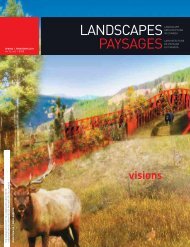
time + place temps + lieu - CSLA :: AAPC
time + place temps + lieu - CSLA :: AAPC
time + place temps + lieu - CSLA :: AAPC

You also want an ePaper? Increase the reach of your titles
YUMPU automatically turns print PDFs into web optimized ePapers that Google loves.
UPFRONT<br />
GRAHAM GIDDEN<br />
along the black track<br />
The ruggedly beautiful wilderness<br />
of Vancouver Island is truly its defining<br />
characteristic. Perhaps just as remarkable,<br />
however, is its cultural heritage. A First<br />
Nation’s colleague put the island’s history<br />
in perspective. When he looks into the<br />
landscape, he said, everything he sees is<br />
connected to his people, dating back before<br />
Rome was built. Every square kilometre is the<br />
traditional territory of the First Peoples.<br />
As in many <strong>place</strong>s world-wide, original<br />
aboriginal land use has eroded. The island<br />
today is a mosaic of infrastructure-driven land<br />
use that has fractured the landscape, making<br />
preservation of connected heritage landscapes<br />
difficult. Nonetheless, within the aboriginal<br />
heritage island district, scatterings of early<br />
industrial historic <strong>place</strong>s and urban areas add<br />
fascinating architectural character-defining<br />
elements to the landscape. These <strong>place</strong>s where<br />
heritages intersect create uniquely complex<br />
and sensitive opportunities for design.<br />
WHERE CULTURES INTERSECT<br />
The coastal wilderness, which is the<br />
foundational heritage of this <strong>place</strong>, is where<br />
the intersections of cultural heritage began<br />
– the ancient indigenous First Nations and<br />
the post-colonial industrial. For my final<br />
Masters’ thesis, I have proposed a project<br />
for a regional scale park that involves both<br />
ends of the continuum. An abandoned spur<br />
rail line runs 26 km from the mountains to<br />
the ocean. The line once linked coal mines to<br />
ships waiting on the coast. The rail line runs<br />
though the lower reaches of the Nanaimo<br />
River Valley at the heart of the Snuneymuxw<br />
First Nation’s traditional territory.<br />
THE BLACK TRACK<br />
The old rail line transects coastal Douglas fir<br />
forests, traverses the Nanaimo River, crosses<br />
over scrubby arbutus bluffs, through Garry<br />
oak meadows, beside wonderful wetlands and<br />
to the sandstone beaches on the east side<br />
of Vancouver Island. It once connected three<br />
historical communities that were part of the<br />
coal mining economy. The rail bed is known<br />
as the black track. In <strong>place</strong>s where the bed<br />
is clear of vegetation, the black coal slag is<br />
clearly visible. Relics of the coal mines remain<br />
in the landscape around the black track and<br />
the mines below still exist, in theory at least,<br />
though most of their openings and shafts<br />
have been closed.<br />
During the mining boom at the turn of<br />
the 20 th century, the mines were extremely<br />
dangerous with explosions taking hundreds of<br />
lives. The dangerous conditions were one of<br />
the reasons mining fell out of favour. Today,<br />
interest in that mining history has increased.<br />
The tragedies at the mines and the villages<br />
that supported them are long in the past, and<br />
Islanders are now embracing the importance<br />
of those histories and landscape.<br />
On the west side of the Nanaimo River, the<br />
proposed design pulls in artifacts along the<br />
coal slag trail with focus on the Morden Mine<br />
Site. A pedestrian river crossing uses a large<br />
island as a midpoint. Here, mining ceased in<br />
the 1930s. The island is an axis where cultures<br />
come together, as the Nanaimo River is one<br />
of the most significant cultural landscapes<br />
for the Snuneymuxw people. Here, the First<br />
Nation culture is the focus of the design –<br />
its artifacts, stories and the Hul’qumi’num<br />
language. Presently there are no<br />
developments in view from the island so the<br />
natural river landscape can be experienced.<br />
As the trail continues east from the river,<br />
the design incorporates elements of both post<br />
colonial heritage and First Nation’s culture.<br />
At Boat Harbour, the terminus, the cultures<br />
and natural heritage will combine to shape a<br />
celebratory gathering <strong>place</strong> on the multiple<br />
black coal slag beaches.<br />
FRIENDS AND FUNDS<br />
Currently, the local communities are<br />
enthusiastic about the concept. The Friends<br />
of Morden Mine are fundraising to preserve<br />
the old mine site which now stands in a<br />
small 4-ha provincial park. Local landscape<br />
architect Jessica Gamella has developed<br />
concept plans. Extension, South Wellington<br />
and Cedar want to make the trail and<br />
pedestrian river crossing a reality.<br />
ggidden@cvrd.bc.ca<br />
18 LANDSCAPES PAYSAGES