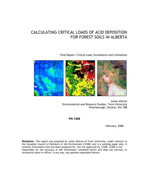
calculating critical loads of acid deposition for forest soils in ... - CCME
calculating critical loads of acid deposition for forest soils in ... - CCME
calculating critical loads of acid deposition for forest soils in ... - CCME

You also want an ePaper? Increase the reach of your titles
YUMPU automatically turns print PDFs into web optimized ePapers that Google loves.
CALCULATING CRITICAL LOADS OF ACID DEPOSITION<br />
FOR FOREST SOILS IN ALBERTA<br />
F<strong>in</strong>al Report: Critical Load, Exceedance and Limitations<br />
Julian Aherne<br />
Environmental and Resource Studies, Trent University<br />
Peterborough, Ontario, K9J 7B8<br />
PN 1408<br />
February, 2008<br />
Disclaimer. This report was prepared by Julian Aherne <strong>of</strong> Trent University, under contract to<br />
the Canadian Council <strong>of</strong> M<strong>in</strong>isters <strong>of</strong> the Environment (<strong>CCME</strong>) and is a work<strong>in</strong>g paper only. It<br />
conta<strong>in</strong>s <strong>in</strong><strong>for</strong>mation that has been prepared <strong>for</strong>, but not approved by, <strong>CCME</strong>. <strong>CCME</strong> is not<br />
responsible <strong>for</strong> the accuracy <strong>of</strong> the <strong>in</strong><strong>for</strong>mation conta<strong>in</strong>ed here<strong>in</strong> and does not warrant, or<br />
necessarily share or affirm, <strong>in</strong> any way, any op<strong>in</strong>ions expressed there<strong>in</strong>.
Project Title:<br />
Calculat<strong>in</strong>g Critical Loads <strong>of</strong> Acid Deposition <strong>for</strong> Forest Soils<br />
<strong>in</strong> Alberta (CLAB)<br />
Report Title:<br />
Critical Load, Exceedance and Limitations (F<strong>in</strong>al Report)<br />
Project Leader:<br />
Dr. Julian Aherne<br />
Canada Research Chair <strong>in</strong> Environmental Modell<strong>in</strong>g<br />
Environmental and Resource Studies<br />
Trent University<br />
Peterborough, ON K9J 7B8<br />
Telephone: (705) 748-1011 x 7887<br />
Email: jaherne@trentu.ca<br />
Report Citation: Aherne, J. Calculat<strong>in</strong>g Critical Loads <strong>of</strong> Acid Deposition <strong>for</strong> Forest Soils<br />
<strong>in</strong> Alberta: Critical Load, Exceedance and Limitations. F<strong>in</strong>al Report. Canadian Council <strong>of</strong><br />
M<strong>in</strong>isters <strong>of</strong> the Environment, 2008,14pp.<br />
© Canadian Council <strong>of</strong> M<strong>in</strong>isters <strong>of</strong> the Environment 2008<br />
i
Preface<br />
This report presents <strong>critical</strong> <strong>loads</strong> <strong>of</strong> <strong>acid</strong> (sulphur and nitrogen) <strong>deposition</strong> and exceedance<br />
estimates <strong>for</strong> upland <strong>for</strong>est <strong>soils</strong> <strong>in</strong> Alberta. The pr<strong>in</strong>cipal motivation <strong>for</strong> this work stems from<br />
the recent <strong>critical</strong> load mapp<strong>in</strong>g activity <strong>in</strong> eastern and western Canada through <strong>in</strong>itiatives<br />
funded by the New England Governors-Eastern Canadian Premiers (NEG-ECP) and the Canadian<br />
Council <strong>of</strong> M<strong>in</strong>isters <strong>of</strong> the Environment. To date <strong>critical</strong> <strong>loads</strong> <strong>of</strong> <strong>acid</strong> <strong>deposition</strong> have been<br />
mapped <strong>for</strong> all prov<strong>in</strong>ces east <strong>of</strong> Alberta follow<strong>in</strong>g guidel<strong>in</strong>es established by the NEG-ECP. For<br />
consistency, the determ<strong>in</strong>ation <strong>of</strong> <strong>critical</strong> <strong>loads</strong> and exceedances <strong>for</strong> <strong>for</strong>est <strong>soils</strong> <strong>in</strong> Alberta<br />
followed the NEG-ECP protocol. In addition, this report presents the first attempt at estimat<strong>in</strong>g<br />
regional <strong>critical</strong> <strong>loads</strong> us<strong>in</strong>g a soil po<strong>in</strong>t approach (based on soil observations) <strong>in</strong> contrast to the<br />
commonly used soil polygon approach (based on soil maps). While every attempt has been<br />
made to <strong>in</strong>clude the best available data, all modell<strong>in</strong>g endeavours suffer from uncerta<strong>in</strong>ties<br />
and limitations <strong>in</strong> data and methods. The <strong>critical</strong> load and exceedance estimates will ultimately<br />
change as data and methods are revised; as such, the current estimates should be viewed as a<br />
start<strong>in</strong>g po<strong>in</strong>t <strong>in</strong> the <strong>critical</strong> load process and not the end-po<strong>in</strong>t. While the ‘science’ <strong>of</strong> <strong>critical</strong><br />
<strong>loads</strong> has developed rapidly <strong>in</strong> Canada <strong>in</strong> recent years, it is still <strong>in</strong> it’s <strong>in</strong>fancy compared to<br />
Europe, and there is considerable opportunity <strong>for</strong> improvement <strong>in</strong> methodologies and data.<br />
Acknowledgements<br />
This report has benefited from discussion with many <strong>in</strong>dividuals <strong>in</strong> relation to data sources and<br />
methodologies. Furthermore, many <strong>of</strong> these <strong>in</strong>dividuals represent organisations that<br />
contributed data. The follow<strong>in</strong>g is an attempt to list <strong>in</strong>dividuals (and organisations) that have<br />
provided time, energy and data; their contribution is gratefully acknowledged.<br />
Contributors: Mike Shaw, Bob Vet and Mike Moran (Environment Canada, Science and<br />
Technology Branch), Max Posch (Co-ord<strong>in</strong>ation Centre <strong>for</strong> Effects, The Netherlands), Brian<br />
Moneith (Agriculture and Agri-food Canada), Lawrence Cheng, Gary Byrtus and Preston<br />
McEachern (Alberta Environment), Cathy Jacques and Heather Evans (Alberta Susta<strong>in</strong>able<br />
Resource Development), Anthony Tr<strong>of</strong>ymow and Brian Titus (Canadian Forest Service, Victoria),<br />
Barbara Kishchuk and C<strong>in</strong>dy Shaw (Canadian Forest Service, Edmonton), Rock Ouimet (Quebec<br />
M<strong>in</strong>istère des Resources Naturelles) and Dave Fox and Markus Kellerhals (Environment Canada,<br />
Yellowknife).<br />
Data sources: Agriculture and Agri-Food Canada (Soil Landscapes <strong>of</strong> Canada), Co-ord<strong>in</strong>ation<br />
Centre <strong>for</strong> Effects, The Netherlands (long-term precipitation, temperature and run<strong>of</strong>f), United<br />
States Geological Survey (North America Land Cover Characteristics Data Base), Environment<br />
Canada, Science and Technology Branch (mapped <strong>deposition</strong> fields and A Unified Regional Airquality<br />
Modell<strong>in</strong>g System data), Environment Canada, Yellowknife (Community Multiscale Air<br />
Quality model data), Alberta Environment (REgional Lagrangian Acid Deposition model data,<br />
Soil Metals Database and Long Term Soils Acidification Monitor<strong>in</strong>g Program data), Cumulative<br />
Environmental Management Association (properties <strong>of</strong> sensitive <strong>soils</strong>) and the Canadian Forest<br />
Service (<strong>for</strong>est soil data from various national networks and projects: Canadian Intersite<br />
Decomposition Experiment, Soil Pr<strong>of</strong>ile and Organic Carbon Database, ARNEWS, Forest Carbon<br />
Database).<br />
F<strong>in</strong>ancial support from the Canadian Council <strong>of</strong> M<strong>in</strong>isters <strong>of</strong> the Environment is gratefully<br />
acknowledged, <strong>in</strong> addition to the time and energy contributed by Sara Davarbakhsh, Gwen<br />
Waedt and Sande Petkau under this contact.<br />
ii
Acronyms and abbreviations<br />
AOSR Athabasca Oil Sands Region<br />
ARTG Acid Ra<strong>in</strong> Task Group<br />
AURAMS A Unified Regional Air quality Modell<strong>in</strong>g System<br />
Bc:Al Base cation (calcium, magnesium and potassium) to alum<strong>in</strong>ium ratio<br />
CASA Clean Air Strategic Alliance<br />
<strong>CCME</strong> Canadian Council <strong>of</strong> M<strong>in</strong>isters <strong>of</strong> the Environment<br />
CL(S + N) Critical load <strong>of</strong> sulphur and nitrogen<br />
CMAQ Community Multiscale Air Quality model<br />
EC<br />
Environment Canada<br />
EXC Exceedance<br />
GEM Global Environmental Multiscale<br />
LUC Land Use Categories<br />
GIS Geographical In<strong>for</strong>mation System<br />
ICP M&M International Co-operative Programme on Modell<strong>in</strong>g and Mapp<strong>in</strong>g <strong>of</strong> Critical Loads<br />
(and Levels) and Air Pollution Effects, Risks and Trends<br />
LRTAP Long-Range Transboundary Air Pollution<br />
N<br />
Nitrogen<br />
NEG-ECP New England Governors-Eastern Canadian Premiers<br />
Q<br />
Precipitation surplus or run<strong>of</strong>f<br />
RELAD REgional Lagrangian Acid Deposition<br />
S<br />
Sulphur<br />
SI<br />
International System <strong>of</strong> Units (Système International d'Unités)<br />
SIB Simple Biosphere model<br />
SLC Soils Landscape <strong>of</strong> Canada<br />
SSMB Steady-State Mass Balance<br />
UNECE United Nations Economic Commission <strong>for</strong> Europe<br />
Units. Where possible, data have been reported us<strong>in</strong>g the International System <strong>of</strong> Units.<br />
Critical load and exceedance data are reported us<strong>in</strong>g the unit <strong>of</strong> mol c ha –1 yr –1 (note the<br />
subscript ‘c’ refers to moles <strong>of</strong> charge). A correspond<strong>in</strong>g and somewhat archaic term still<br />
commonly used is equivalents (eq): eq = mol c . The unit <strong>of</strong> mol c ha –1 yr –1 are compatible with the<br />
<strong>critical</strong> load estimates <strong>for</strong> eastern Canada presented <strong>in</strong> the recent Canadian Acid Deposition<br />
Science Assessment (Environment Canada 2004).<br />
Map projections. All maps are displayed us<strong>in</strong>g a Lambert Azimuthal Equal Area Projection.<br />
Parameters used <strong>for</strong> this projection are longitude <strong>of</strong> orig<strong>in</strong>: 100 00 00 W and latitude <strong>of</strong> orig<strong>in</strong>:<br />
50 00 00 N. Maps were generated <strong>in</strong> raster <strong>for</strong>mat with a pixel size <strong>of</strong> 1000 meters.<br />
Map legends. In a regional context, <strong>critical</strong> load data can span several orders <strong>of</strong> magnitude,<br />
higher values typically represent<strong>in</strong>g <strong>soils</strong> with greater buffer<strong>in</strong>g capacities. As such, <strong>critical</strong><br />
load maps have been reported us<strong>in</strong>g unequal <strong>in</strong>tervals with smaller category <strong>in</strong>tervals <strong>for</strong> the<br />
lower (more <strong>acid</strong> sensitive) data values: < 250, 250–500, 500–1000, 1000–2000 and > 2000 mol c<br />
ha –1 yr –1 .<br />
Caveat emptor. The maps conta<strong>in</strong>ed <strong>in</strong> this report represent a broad-scale regional assessment<br />
<strong>of</strong> <strong>critical</strong> <strong>loads</strong> <strong>of</strong> sulphur and nitrogen <strong>for</strong> upland <strong>for</strong>est <strong>soils</strong> and are not <strong>in</strong>tended <strong>for</strong> sitespecific<br />
assessments.<br />
iii
Table <strong>of</strong> contents<br />
Executive summary ............................................................................................1<br />
1. Introduction..................................................................................................1<br />
2. Objective.....................................................................................................2<br />
3. Methodology .................................................................................................2<br />
4. Critical <strong>loads</strong>: Vanilla ......................................................................................4<br />
5. Critical <strong>loads</strong>: Neapolitan..................................................................................5<br />
6. Conclusions................................................................................................. 11<br />
7. Future research ........................................................................................... 11<br />
References .................................................................................................... 12<br />
Appendix I. The Steady-State Mass Balance model ..................................................... 13<br />
Appendix II. Monitor<strong>in</strong>g sites used to generate the ECMAP <strong>deposition</strong> fields....................... 14<br />
List <strong>of</strong> tables<br />
Table 1. Summary statistics <strong>for</strong> <strong>critical</strong> <strong>loads</strong> <strong>of</strong> sulphur and nitrogen................................6<br />
Table 2. Comparison <strong>of</strong> <strong>critical</strong> load and exceedance ...................................................6<br />
Table 3. Comparison <strong>of</strong> <strong>critical</strong> load and exceedance (m<strong>in</strong>eral <strong>soils</strong>) .................................6<br />
List <strong>of</strong> figures<br />
Figure 1. Total (wet plus dry) <strong>deposition</strong> <strong>of</strong> sulphur, nitrogen and base cations ....................7<br />
Figure 2. Critical load and exceedance <strong>of</strong> sulphur and nitrogen <strong>deposition</strong>..........................8<br />
Figure 3. Critical load and exceedance <strong>of</strong> sulphur and nitrogen <strong>deposition</strong> (m<strong>in</strong>eral <strong>soils</strong>) .......9<br />
Figure 4. Critical load and exceedance based on a soil po<strong>in</strong>t approach ............................ 10<br />
Critical load. ‘a quantitative estimate <strong>of</strong> exposure to one or more pollutants below which<br />
significant harmful effects on specified sensitive elements <strong>of</strong> the environment do not occur<br />
accord<strong>in</strong>g to present knowledge’.<br />
Nilsson and Grennfelt, 1988<br />
iv
Executive summary<br />
The <strong>critical</strong> <strong>loads</strong> <strong>of</strong> <strong>acid</strong> (sulphur and nitrogen) <strong>deposition</strong> have been determ<strong>in</strong>ed and mapped<br />
<strong>for</strong> <strong>for</strong>est <strong>soils</strong> <strong>in</strong> Alberta. For consistency with exist<strong>in</strong>g <strong>critical</strong> load estimates <strong>in</strong> eastern and<br />
western Canada, the methodology followed the protocol and guidel<strong>in</strong>es established by the New<br />
England Governors-Eastern Canadian Premiers (NEG-ECP). The key data <strong>in</strong>puts were base cation<br />
weather<strong>in</strong>g rate, atmospheric base cation <strong>deposition</strong> and <strong>critical</strong> alkal<strong>in</strong>ity leach<strong>in</strong>g. The Soil<br />
Landscapes <strong>of</strong> Canada (SLC, version 2.1) was the pr<strong>in</strong>cipal database underly<strong>in</strong>g the estimation<br />
<strong>of</strong> base cation weather<strong>in</strong>g rate. Gridded (GEM grid: 35 km × 35 km) total (wet plus dry)<br />
atmospheric <strong>deposition</strong> data (<strong>in</strong>clud<strong>in</strong>g base cations) were provided by Environment Canada.<br />
Under the NEG-ECP protocol the <strong>critical</strong> alkal<strong>in</strong>ity leach<strong>in</strong>g was set to ma<strong>in</strong>ta<strong>in</strong> soil base<br />
saturation at an acceptable level <strong>for</strong> <strong>for</strong>est health and productivity. In pr<strong>in</strong>cipal this should<br />
equate to a molar ratio <strong>of</strong> soil solution base cations to alum<strong>in</strong>ium (Bc:Al) equal to 10. A Bc:Al<br />
ratio <strong>of</strong> 1 is the most common protection limit used <strong>in</strong> Europe.<br />
The mean <strong>critical</strong> load <strong>for</strong> Alberta was 872 mol c ha –1 yr –1 under the NEG-ECP protocol. Us<strong>in</strong>g a<br />
Bc:Al ratio <strong>of</strong> 10 and 1, the mean <strong>critical</strong> load was 778 mol c ha –1 yr –1 and 1462 mol c ha –1 yr –1 ,<br />
respectively. The NEG-ECP protocol closely resembled a Bc:Al ratio <strong>of</strong> 10, although marg<strong>in</strong>ally<br />
less protective. In contrast, the commonly used Bc:Al ratio <strong>of</strong> 1 resulted <strong>in</strong> significantly higher<br />
<strong>critical</strong> <strong>loads</strong>. Mean annual total (wet plus dry) sulphur and nitrogen <strong>deposition</strong> <strong>for</strong> Alberta was<br />
303 mol c ha –1 yr –1 dur<strong>in</strong>g the period 1994–1998. Approximately 8.5 % <strong>of</strong> the mapped <strong>soils</strong><br />
received <strong>acid</strong> <strong>deposition</strong> <strong>in</strong> excess <strong>of</strong> <strong>critical</strong> load. This <strong>in</strong>creased to 11 % us<strong>in</strong>g a Bc:Al ratio <strong>of</strong><br />
10; <strong>in</strong> contrast, there was no exceedance under a Bc:Al ratio <strong>of</strong> 1.<br />
The choice <strong>of</strong> <strong>critical</strong> chemical limit (receptor and level <strong>of</strong> protection) has a significant impact<br />
on the resultant <strong>critical</strong> load. Follow<strong>in</strong>g the NEG-ECP protocol (consistent with eastern and<br />
western Canada), 8.5 % <strong>of</strong> the mapped <strong>soils</strong> were exceeded. However, much <strong>of</strong> these <strong>soils</strong> were<br />
classified as organic and their <strong>critical</strong> load is uncerta<strong>in</strong> under the current protocol. Although<br />
the SLC is the highest resolution soil coverage available <strong>for</strong> Alberta, the scale is coarse (scale<br />
1:1,000,000), with large regions classified entirely as 100 % organic <strong>soils</strong>. Remov<strong>in</strong>g these soil<br />
units, the mean <strong>critical</strong> load <strong>for</strong> Alberta was 1067 mol c ha –1 yr –1 under the NEG-ECP protocol.<br />
Furthermore, approximately 1.5 % <strong>of</strong> the mapped m<strong>in</strong>eral <strong>soils</strong> received <strong>acid</strong> <strong>deposition</strong> <strong>in</strong><br />
excess <strong>of</strong> <strong>critical</strong> load. However, <strong>in</strong> practice the organic soil units are a mosaic <strong>of</strong> m<strong>in</strong>eral and<br />
organic <strong>soils</strong>. To address this uncerta<strong>in</strong>ty, <strong>critical</strong> <strong>loads</strong> <strong>for</strong> Alberta were further determ<strong>in</strong>ed<br />
us<strong>in</strong>g a soil po<strong>in</strong>t approach based on soil observations rather than soil maps. Soil physiochemical<br />
properties were collated <strong>for</strong> approximately 1200 m<strong>in</strong>eral soil observation pits (from<br />
exist<strong>in</strong>g programs). Critical <strong>loads</strong> were estimated <strong>for</strong> each po<strong>in</strong>t follow<strong>in</strong>g the NEG-ECP protocol<br />
and summarised on the GEM grid. Soil data were not available across the entire prov<strong>in</strong>ce,<br />
approximately 42 % <strong>of</strong> grids with <strong>for</strong>est <strong>soils</strong> had soil observations (227 out <strong>of</strong> a maximum <strong>of</strong> 546<br />
grid squares); however, many <strong>of</strong> the grid squares (34 %) had only one soil observation (77 grid<br />
squares). Multiple observations with<strong>in</strong> each grid were summarised us<strong>in</strong>g percentiles; the pentile<br />
<strong>critical</strong> load (5th percentile) is typically used as a regional target to account <strong>for</strong> uncerta<strong>in</strong>ties,<br />
but also to ensure a sufficient level <strong>of</strong> protection (95 % protection limit). The mean pentile<br />
<strong>critical</strong> load was 843 mol c ha –1 yr –1 , which was close to the map-based estimate (872 mol c ha –1<br />
yr –1 ); similarly, approximately 12 % <strong>of</strong> the grid squares received <strong>acid</strong> <strong>deposition</strong> <strong>in</strong> excess <strong>of</strong><br />
<strong>critical</strong> load (27 grid squares) based solely on m<strong>in</strong>eral soil physio-chemical observations.<br />
1. Introduction<br />
In October 1998, Canadian Energy and Environment M<strong>in</strong>isters signed The Canada-Wide Acid Ra<strong>in</strong><br />
Strategy <strong>for</strong> Post-2000, <strong>in</strong> which they committed to take steps over the long-term to manage<br />
the <strong>acid</strong> ra<strong>in</strong> problem <strong>in</strong> eastern Canada and prevent one <strong>in</strong> western and northern Canada. The<br />
Strategy set a long-term goal <strong>of</strong> achiev<strong>in</strong>g the threshold <strong>of</strong> <strong>critical</strong> <strong>loads</strong> <strong>for</strong> <strong>acid</strong> <strong>deposition</strong><br />
across Canada.<br />
1
Critical <strong>loads</strong> have been determ<strong>in</strong>ed and mapped <strong>for</strong> upland <strong>for</strong>est <strong>soils</strong> <strong>in</strong> eastern Canada<br />
(Newfoundland, Pr<strong>in</strong>ce Edward Island, Nova Scotia, New Brunswick, Quebec and Ontario)<br />
follow<strong>in</strong>g guidel<strong>in</strong>es established by the New England Governors-Eastern Canadian Premiers<br />
(NEG-ECP) Environmental Task Group on Forest Mapp<strong>in</strong>g (NEG-ECP 2001); reported <strong>in</strong> the 2004<br />
Canadian Acid <strong>deposition</strong> Science Assessment (Environment Canada 2004). In western Canada,<br />
the Acid Ra<strong>in</strong> Task Group (ARTG: mandated by the Air Management Committee <strong>of</strong> the Canadian<br />
Council <strong>of</strong> M<strong>in</strong>isters <strong>of</strong> the Environment (<strong>CCME</strong>)) have recently supported the determ<strong>in</strong>ation <strong>of</strong><br />
<strong>critical</strong> <strong>loads</strong> follow<strong>in</strong>g the NEG-ECP protocol <strong>for</strong> upland <strong>for</strong>est <strong>soils</strong> <strong>in</strong> Manitoba and<br />
Saskatchewan (Aherne and Watmough 2006, Aherne 2008). In Alberta, a level 0 1 approach<br />
based on soil sensitivity has previously been used to estimate <strong>critical</strong> <strong>loads</strong> (Alberta<br />
Environment 1999, Foster et al. 2001). In addition, localised ef<strong>for</strong>ts have been carried out,<br />
e.g., <strong>in</strong> Provost-Esther, Alberta (Turchenek and Abboud 2001) and the Athabasca Oil Sands<br />
Region (AOSR: Abboud et al. 2002).<br />
In June 2006, Trent University <strong>in</strong>itiated a small project funded by the Canadian Council <strong>of</strong><br />
M<strong>in</strong>isters <strong>of</strong> the Environment (<strong>CCME</strong>) to determ<strong>in</strong>e and map <strong>critical</strong> <strong>loads</strong> <strong>of</strong> <strong>acid</strong> <strong>deposition</strong><br />
(and exceedances) <strong>for</strong> upland <strong>for</strong>est <strong>soils</strong> <strong>in</strong> Alberta. The work closely followed, and built upon,<br />
recent <strong>critical</strong> load assessments <strong>for</strong> Manitoba and Saskatchewan (Aherne and Watmough 2006,<br />
Aherne 2008). Details on the <strong>critical</strong> load methodology, apply<strong>in</strong>g the concept and the Steady-<br />
State Mass Balance (SSMB) model are described <strong>in</strong> Aherne and Watmough (2006).<br />
2. Objective<br />
The pr<strong>in</strong>cipal objective <strong>of</strong> this report was to describe the determ<strong>in</strong>ation and mapp<strong>in</strong>g <strong>of</strong> <strong>critical</strong><br />
load and exceedance <strong>of</strong> sulphur (S) and nitrogen (N) <strong>deposition</strong> <strong>for</strong> upland <strong>for</strong>est <strong>soils</strong> <strong>in</strong><br />
Alberta. For consistency with eastern Canada, Manitoba and Saskatchewan, the methodology<br />
followed the protocol and guidel<strong>in</strong>es established by the NEG-ECP. A secondary objective was to<br />
identify an alternative approach to determ<strong>in</strong>e and map <strong>critical</strong> <strong>loads</strong> based on m<strong>in</strong>eral soil<br />
po<strong>in</strong>t observations.<br />
The pr<strong>in</strong>cipal task was to generate or acquire spatial data-sets (base maps) <strong>of</strong> the <strong>in</strong>put<br />
variables required to calculate <strong>critical</strong> <strong>loads</strong> <strong>for</strong> Alberta, follow<strong>in</strong>g the protocol and guidel<strong>in</strong>es<br />
established by the NEG-ECP. This report attempts to identify a framework <strong>for</strong> Canada-wide<br />
determ<strong>in</strong>ation and mapp<strong>in</strong>g <strong>of</strong> <strong>critical</strong> <strong>loads</strong> (<strong>for</strong> <strong>acid</strong>ity). Further, the report also recommends<br />
future research needs <strong>for</strong> Alberta.<br />
3. Methodology<br />
Critical load and exceedance <strong>of</strong> S and N have been estimated <strong>for</strong> <strong>for</strong>est <strong>soils</strong> <strong>in</strong> Alberta<br />
follow<strong>in</strong>g the methodology and guidel<strong>in</strong>es established by the NEG-ECP (NEG-ECP 2001, Ouimet<br />
2005). The long-term <strong>critical</strong> load was estimated us<strong>in</strong>g the Steady-State Mass Balance (SSMB)<br />
model (see Appendix I and Aherne and Watmough 2006). The key spatial data-sets (or base<br />
maps) required as <strong>in</strong>puts <strong>for</strong> the SSMB model are atmospheric <strong>deposition</strong>, base cation<br />
weather<strong>in</strong>g rate and <strong>critical</strong> alkal<strong>in</strong>ity leach<strong>in</strong>g. Critical <strong>loads</strong> estimated under this soil-map<br />
based approach are hereafter referred to as ‘vanilla’; <strong>critical</strong> <strong>loads</strong> estimated under the<br />
m<strong>in</strong>eral soil-po<strong>in</strong>t approach, hereafter referred to as ‘neapolitan’, required observations <strong>of</strong> soil<br />
physio-chemical observations.<br />
Atmospheric <strong>deposition</strong>. Average annual total (wet plus dry) atmospheric <strong>deposition</strong> data <strong>for</strong><br />
Alberta dur<strong>in</strong>g the period 1994–1998 were provided by Environment Canada on the Global<br />
1 Level 0 refers to semi-quantitative approaches as opposed to mass balance or level I approaches.<br />
2
Environmental Multiscale (GEM) grid at a resolution <strong>of</strong> 35 km × 35 km (see Figure 1a and 1b <strong>for</strong><br />
base cation, and sulphur and nitrogen <strong>deposition</strong>). These estimates represented an important<br />
contribution to the project and are consistent with the <strong>deposition</strong> fields recently developed <strong>for</strong><br />
eastern Canada, Manitoba and Saskatchewan (see Appendix II <strong>for</strong> monitor<strong>in</strong>g stations used to<br />
generate the <strong>deposition</strong> fields). Hereafter the <strong>deposition</strong> data are referred to as ECMAP. For<br />
further details on the <strong>deposition</strong> fields and a general description <strong>of</strong> uncerta<strong>in</strong>ty see Aherne and<br />
Watmough (2006).<br />
Base cation weather<strong>in</strong>g rate. Under the NEG-ECP protocol, weather<strong>in</strong>g rates were estimated<br />
us<strong>in</strong>g a soil type–texture approximation method (Ouimet 2005). The approach estimates<br />
weather<strong>in</strong>g rate from texture (clay content) and parent material class. This method was used <strong>in</strong><br />
conjunction with the Soil Landscapes <strong>of</strong> Canada (SLC, version 2.1) map <strong>for</strong> Alberta to estimate<br />
prov<strong>in</strong>ce-wide base cation weather<strong>in</strong>g rates. The SLC map is the best resolution database<br />
available <strong>for</strong> estimat<strong>in</strong>g regionally consistent base cation weather<strong>in</strong>g <strong>for</strong> Alberta. Although<br />
more detailed soil databases (and maps) are available, they are generally conf<strong>in</strong>ed to<br />
agricultural regions or spatially restricted surveys. The scale (1:1,000,000) is consistent with<br />
the <strong>critical</strong> load mapp<strong>in</strong>g carried out <strong>in</strong> Ontario, Manitoba and Saskatchewan.<br />
Percent clay was vertically (all soil horizons exclud<strong>in</strong>g the C horizon) and spatially (component<br />
soil types with<strong>in</strong> a mapp<strong>in</strong>g unit) weighted to derive a s<strong>in</strong>gle average value <strong>for</strong> each mapp<strong>in</strong>g<br />
unit on the SLC map. The base cation weather<strong>in</strong>g rate was estimated follow<strong>in</strong>g Ouimet (2005).<br />
In addition, <strong>for</strong> consistency with Ontario, Manitoba and Saskatchewan, maximum soil depth was<br />
limited to 50 cm. For further details on the methodology see Aherne and Watmough (2006).<br />
Critical alkal<strong>in</strong>ity leach<strong>in</strong>g. Alkal<strong>in</strong>ity leach<strong>in</strong>g is typically estimated from a <strong>critical</strong> molar base<br />
cation to alum<strong>in</strong>ium (Bc:Al) ratio <strong>in</strong> soil solution and the gibbsite dissolution constant (K gibb ; see<br />
Appendix I). Under the NEG-ECP protocol, an alkal<strong>in</strong>ity leach<strong>in</strong>g function was developed that<br />
corresponds to a value <strong>of</strong> 10 <strong>for</strong> the Bc:Al ratio and 9 <strong>for</strong> log K gibb (Rock Ouimet, personal<br />
communication). For consistency with eastern Canada, Manitoba and Saskatchewan, <strong>critical</strong><br />
alkal<strong>in</strong>ity leach<strong>in</strong>g <strong>for</strong> Alberta was estimated follow<strong>in</strong>g the protocol and guidel<strong>in</strong>es established<br />
by the NEG-ECP. The choice <strong>of</strong> <strong>critical</strong> chemical limit (receptor and level <strong>of</strong> protection) has a<br />
significant impact on the resultant <strong>critical</strong> load. Critical <strong>loads</strong> <strong>of</strong> S and N <strong>deposition</strong> <strong>for</strong> <strong>for</strong>est<br />
<strong>soils</strong> was further estimated us<strong>in</strong>g a Bc:Al ratio <strong>of</strong> 10 (<strong>in</strong> pr<strong>in</strong>ciple equivalent the NEG-ECP<br />
protocol) and 1 to <strong>in</strong>vestigate uncerta<strong>in</strong>ty <strong>in</strong> exceedance based on the choice <strong>of</strong> <strong>critical</strong><br />
chemical limit. A Bc:Al ratio <strong>of</strong> 1 is the most common protection limit used <strong>in</strong> support <strong>of</strong> the<br />
United Nations Economic Commission <strong>for</strong> Europe’s (UNECE) Convention on Long-Range<br />
Transboundary Air Pollution.<br />
Soil physio-chemical properties. The SLC is the only prov<strong>in</strong>ce-wide soil coverage available <strong>for</strong><br />
Alberta. However <strong>in</strong> addition to the prov<strong>in</strong>cial map, soil physio-chemical properties are<br />
available <strong>for</strong> numerous soil pit observations through several monitor<strong>in</strong>g programs or surveys <strong>in</strong><br />
Alberta. Data are available <strong>for</strong> the Ecological Site In<strong>for</strong>mation plots, the Long Term Soil<br />
Acidification Monitor<strong>in</strong>g Program and several networks operated by the Canadian Forest Service<br />
(ARNEWS and NFI). Much <strong>of</strong> these data have been summarised by Shaw et al. (2005) and<br />
Siltanen et al. (1997). Similar to the soil-polygon mapp<strong>in</strong>g procedure, <strong>critical</strong> <strong>loads</strong> <strong>of</strong> S and N<br />
<strong>deposition</strong> <strong>for</strong> <strong>for</strong>est <strong>soils</strong> may also be estimated <strong>for</strong> each soil observation po<strong>in</strong>t us<strong>in</strong>g the NEG-<br />
ECP protocol. M<strong>in</strong>eral soil physio-chemical properties (specifically site location, horizon depth,<br />
bulk density and percent clay) were collated <strong>for</strong> approximately 1200 observations throughout<br />
Alberta from five pr<strong>in</strong>cipal databases (Siltanen et al. 1997, Shaw et al. 2005, Alberta<br />
Susta<strong>in</strong>able Resource Development 2003, Cumulative Environmental Management Association<br />
2005, Alberta Environment 2006).<br />
3
4. Critical <strong>loads</strong>: Vanilla<br />
Critical load and exceedance <strong>of</strong> S and N have been estimated <strong>for</strong> <strong>for</strong>est <strong>soils</strong> <strong>in</strong> Alberta<br />
follow<strong>in</strong>g the methodology and guidel<strong>in</strong>es established by the NEG-ECP. The SLC was the<br />
pr<strong>in</strong>cipal database underly<strong>in</strong>g the estimation <strong>of</strong> weather<strong>in</strong>g rate. The SLC mapp<strong>in</strong>g units<br />
conta<strong>in</strong> one or more dist<strong>in</strong>ct soil types or components (m<strong>in</strong>eral and organic); the location <strong>of</strong><br />
these components with<strong>in</strong> a polygon is not def<strong>in</strong>ed. The <strong>in</strong>clusion <strong>of</strong> organic soil components<br />
with<strong>in</strong> these mapp<strong>in</strong>g units will decrease the area weighted <strong>critical</strong> load. In the current<br />
assessment, the base cation weather<strong>in</strong>g rate represented only m<strong>in</strong>eral <strong>soils</strong> with<strong>in</strong> each<br />
mapp<strong>in</strong>g unit, i.e., organic <strong>soils</strong> were excluded. However, a m<strong>in</strong>imal weather<strong>in</strong>g rate was set<br />
<strong>for</strong> soil mapp<strong>in</strong>g units entirely composed <strong>of</strong> organic <strong>soils</strong> (250 mol c ha –1 yr –1 ). Furthermore,<br />
<strong>critical</strong> <strong>loads</strong> are only presented <strong>for</strong> <strong>for</strong>est <strong>soils</strong>. Forest cover was described us<strong>in</strong>g the Simple<br />
Biosphere (SIB) model, which is part <strong>of</strong> the ‘North America Land Cover Characteristics Data<br />
Base’ developed by the United States Geological Survey 2 . The SIB land cover was chosen to be<br />
consistent with the Land Use Categories (LUC) used by Environment Canada to determ<strong>in</strong>e dry<br />
<strong>deposition</strong>. Forest cover <strong>for</strong> Alberta was spatially def<strong>in</strong>ed from the three follow<strong>in</strong>g LUC: (i)<br />
broadleaf deciduous trees, (ii) deciduous and evergreen trees, and (iii) evergreen needleleaf<br />
trees.<br />
The mean <strong>critical</strong> load <strong>for</strong> Alberta was estimated at approximately 872 mol c ha –1 yr –1 (Figure<br />
2a). The m<strong>in</strong>imum <strong>critical</strong> load was estimated at 216 mol c ha –1 yr –1 . The current estimates <strong>for</strong><br />
<strong>critical</strong> load were consistent with other prov<strong>in</strong>ces <strong>in</strong> Canada (Table 1), with estimates <strong>for</strong><br />
Alberta similar to British Columbia, Newfoundland and Labrador, Nova Scotia, Ontario and<br />
Quebec. Approximately 33 % <strong>of</strong> the mapped <strong>soils</strong> <strong>in</strong> Alberta had <strong>critical</strong> load less than 500 mol c<br />
ha –1 yr –1 (8.8 % less than 250 mol c ha –1 yr –1 ). The mean annual total (wet plus dry) S and N<br />
<strong>deposition</strong> <strong>for</strong> Alberta was 303 mol c ha –1 yr –1 dur<strong>in</strong>g the period 1994–1998 (Figure 1b).<br />
Approximately 8.5 % <strong>of</strong> the mapped <strong>soils</strong> received <strong>acid</strong> <strong>deposition</strong> <strong>in</strong> excess <strong>of</strong> <strong>critical</strong> load<br />
(Figure 2d and Table 2). However, a considerable proportion <strong>of</strong> these soil mapp<strong>in</strong>g units were<br />
composed entirely <strong>of</strong> organic <strong>soils</strong> accord<strong>in</strong>g to the SLC (Figure 2f).<br />
Remov<strong>in</strong>g all mapp<strong>in</strong>g units classified entirely (100 %) as organic <strong>soils</strong> had a significant<br />
<strong>in</strong>fluence on the <strong>critical</strong> load and extent <strong>of</strong> exceedance. The mean <strong>critical</strong> load <strong>for</strong> Alberta was<br />
estimated at approximately 1067 mol c ha –1 yr –1 (Figure 3a and Tables 1). Approximately 1.5 % <strong>of</strong><br />
the mapped <strong>soils</strong> received <strong>acid</strong> <strong>deposition</strong> <strong>in</strong> excess <strong>of</strong> <strong>critical</strong> load (Figure 3b and Table 3).<br />
However, mapp<strong>in</strong>g units classified entirely as organic are <strong>in</strong> practice composed <strong>of</strong> m<strong>in</strong>eral and<br />
organic <strong>soils</strong>. Rather than completely remove these soil units, future studies should explore the<br />
use <strong>of</strong> digital elevation or wetland maps to del<strong>in</strong>eate regions with organic <strong>soils</strong>.<br />
Us<strong>in</strong>g a Bc:Al ratio <strong>of</strong> 10 and 1 under the UNECE protocol, the mean <strong>critical</strong> load <strong>for</strong> Alberta<br />
was 778 mol c ha –1 yr –1 and 1462 mol c ha –1 yr –1 , respectively. The NEG-ECP protocol closely<br />
resembled a Bc:Al ratio <strong>of</strong> 10, although marg<strong>in</strong>ally less protective (Figure 2b and Table 2). In<br />
contrast, the commonly used Bc:Al ratio <strong>of</strong> 1 resulted <strong>in</strong> significantly higher <strong>critical</strong> <strong>loads</strong><br />
(Figure 2c). Approximately 11 % <strong>of</strong> the mapped <strong>soils</strong> received <strong>acid</strong> <strong>deposition</strong> <strong>in</strong> excess <strong>of</strong><br />
<strong>critical</strong> load us<strong>in</strong>g a Bc:Al ratio <strong>of</strong> 10 (Figure 2e); <strong>in</strong> contrast, there was no exceedance under a<br />
Bc:Al ratio <strong>of</strong> 1 (Table 2). To further <strong>in</strong>vestigate uncerta<strong>in</strong>ty <strong>in</strong> exceedance, a second<br />
<strong>deposition</strong> scenario (M4) was used to estimate <strong>critical</strong> load exceedance (Figure 1c). The M4<br />
scenario is a multi-model scenario derived from the mean <strong>of</strong> four <strong>deposition</strong> fields available <strong>for</strong><br />
Alberta (AURAMS, CMAQ, ECMAP and RELAD; see Aherne (2008) <strong>for</strong> further details). Exceedance<br />
estimates under the M4 scenario were considerably reduced, with a decrease <strong>for</strong> the NEG-ECP<br />
protocol (2 %) and the UNECE <strong>critical</strong> <strong>loads</strong> us<strong>in</strong>g a Bc:Al ratio <strong>of</strong> 10 (3.4 %, Table 2). Aga<strong>in</strong>, the<br />
majority <strong>of</strong> the exceeded <strong>soils</strong> are composed entirely <strong>of</strong> organic <strong>soils</strong> accord<strong>in</strong>g to the SLC.<br />
In contrast, approximately 2.4 % <strong>of</strong> the mapped <strong>soils</strong> received <strong>acid</strong> <strong>deposition</strong> <strong>in</strong> excess <strong>of</strong><br />
<strong>critical</strong> load us<strong>in</strong>g a molar Bc:Al ratio <strong>of</strong> 10 <strong>for</strong> m<strong>in</strong>eral soil only (all mapp<strong>in</strong>g units classified<br />
2 URL: edc2.usgs.gov/glcc/na_<strong>in</strong>t.php<br />
4
entirely as organic <strong>soils</strong> were removed; Table 3). There was no exceedance under a Bc:Al ratio<br />
<strong>of</strong> 1. Exceedance estimates under the M4 <strong>deposition</strong> scenario were similar (Table 3).<br />
Critical load: Vanilla. Follow<strong>in</strong>g the NEG-ECP protocol, approximately 8.5 % <strong>of</strong> the mapped<br />
<strong>soils</strong> received <strong>acid</strong> <strong>deposition</strong> <strong>in</strong> excess <strong>of</strong> <strong>critical</strong> load. Depend<strong>in</strong>g on the chosen <strong>critical</strong><br />
chemical limit and the ‘current’ level <strong>of</strong> total <strong>deposition</strong>, exceedance will vary. However,<br />
much <strong>of</strong> the sensitive <strong>soils</strong> were classified as organic and their exceedance is uncerta<strong>in</strong> under<br />
the current protocol. Although the SLC is the highest resolution soil coverage available <strong>for</strong><br />
Alberta, the scale is coarse (scale 1:1,000,000) result<strong>in</strong>g <strong>in</strong> large regions classified entirely as<br />
100 % organic <strong>soils</strong>. Remov<strong>in</strong>g these soil units, the mean <strong>critical</strong> load <strong>for</strong> Alberta was 1067 mol c<br />
ha –1 yr –1 under the NEG-ECP protocol. Furthermore, approximately 1.5 % <strong>of</strong> the mapped m<strong>in</strong>eral<br />
<strong>soils</strong> received <strong>acid</strong> <strong>deposition</strong> <strong>in</strong> excess <strong>of</strong> <strong>critical</strong> load. However, <strong>in</strong> practice these soil units<br />
are a mosaic <strong>of</strong> m<strong>in</strong>eral and organic <strong>soils</strong>.<br />
Previous studies <strong>in</strong> Alberta. Alberta Environment (1999) applied a ‘Level 0’ <strong>critical</strong> load<br />
assessment to the prov<strong>in</strong>ce <strong>of</strong> Alberta. The prov<strong>in</strong>ce was divided <strong>in</strong>to cells measur<strong>in</strong>g 1° × 1°,<br />
with each cell categorised as sensitive, moderately sensitive or <strong>of</strong> low sensitivity on the basis <strong>of</strong><br />
the soil and water systems. Critical <strong>loads</strong> were set at 250, 500 and 1000 mol c ha −1 yr −1 ,<br />
respectively (Foster et al. 2001). The REgional Lagrangian Acid Deposition (RELAD: Cheng et al.<br />
1995) model was used to estimate the amount <strong>of</strong> <strong>acid</strong> <strong>deposition</strong> <strong>in</strong> Alberta; no grid cells<br />
received <strong>acid</strong> <strong>deposition</strong> <strong>in</strong> excess <strong>of</strong> their assigned <strong>critical</strong> load. However, one cell spann<strong>in</strong>g<br />
the southern part <strong>of</strong> Alberta-Saskatchewan border (Provost-Esther grid) was predicted to be at<br />
risk <strong>of</strong> exceedance (Turchenek and Abboud 2001). The current study applied a more<br />
sophisticated ‘Level 1’ or mass balance approach to determ<strong>in</strong>e <strong>critical</strong> <strong>loads</strong> <strong>for</strong> <strong>for</strong>est <strong>soils</strong><br />
(Appendix I). The approach utilised newer data at a greater spatial disaggregation. It<br />
represents a significant advancement on the previous <strong>critical</strong> load assessments, and is<br />
consistent with procedures <strong>in</strong> eastern Canada, Manitoba and Saskatchewan. S<strong>in</strong>ce the Provost-<br />
Esther grid does not conta<strong>in</strong> <strong>for</strong>est <strong>soils</strong> it is not <strong>in</strong>cluded <strong>in</strong> the current assessment.<br />
5. Critical <strong>loads</strong>: Neapolitan<br />
Soil physio-chemical properties were collated <strong>for</strong> approximately 1200 m<strong>in</strong>eral soil observation<br />
pits. A <strong>critical</strong> load was estimated <strong>for</strong> each po<strong>in</strong>t follow<strong>in</strong>g the NEG-ECP protocol and<br />
summarised on the GEM (35 km × 35 km) mapp<strong>in</strong>g grid. For comparison, the map-based <strong>for</strong>est<br />
soil <strong>critical</strong> <strong>loads</strong> were also summarised on the GEM grid (Figure 4a). Approximately 42 % <strong>of</strong><br />
grids conta<strong>in</strong><strong>in</strong>g <strong>for</strong>est <strong>soils</strong> had soil po<strong>in</strong>t observations (227 out <strong>of</strong> a maximum <strong>of</strong> 546 grid<br />
squares); however, many <strong>of</strong> the grid squares (34 %) had only one soil observation (77 grid<br />
squares). Multiple observations with<strong>in</strong> each grid were summarised us<strong>in</strong>g percentiles; the pentile<br />
<strong>critical</strong> load (5th percentile) is typically used as a regional target to account <strong>for</strong> uncerta<strong>in</strong>ties,<br />
but also to ensure a sufficient level <strong>of</strong> protection (95 % protection limit). The pentile <strong>critical</strong><br />
<strong>loads</strong> <strong>in</strong>dicate somewhat <strong>of</strong> a similar pattern to the soil-map based approach; although, the low<br />
<strong>critical</strong> <strong>loads</strong> <strong>in</strong> north-western Alberta are absent and <strong>critical</strong> <strong>loads</strong> <strong>in</strong> the AOSR are lower<br />
(Figure 4b). However, the mean pentile <strong>critical</strong> load was 843 mol c ha –1 yr –1 , which was close to<br />
the map-based estimate (872 mol c ha –1 yr –1 ). It is important to note that the soil po<strong>in</strong>t data<br />
were not randomly selected and do not cover all soil mapp<strong>in</strong>g units. Rather they were collated<br />
from exist<strong>in</strong>g programs and, as such, may be biased towards more sensitive <strong>soils</strong>.<br />
The exceedance <strong>of</strong> <strong>critical</strong> load <strong>of</strong> S and N to upland <strong>for</strong>est <strong>soils</strong> was calculated as the current<br />
<strong>deposition</strong> flux <strong>of</strong> S plus N (Figure 1b) m<strong>in</strong>us the pentile <strong>critical</strong> load (Figure 4b). Annual<br />
average total (wet plus dry) <strong>deposition</strong> dur<strong>in</strong>g the period 1994–1998 was provided by<br />
Environment Canada on the GEM grid. Approximately 12 % <strong>of</strong> the grid squares (27 grids)<br />
received <strong>acid</strong> <strong>deposition</strong> <strong>in</strong> excess <strong>of</strong> <strong>critical</strong> load. Furthermore, a number <strong>of</strong> the exceeded grid<br />
squares (notably <strong>in</strong> the AOSR) had multiple soil observations (> 5) provid<strong>in</strong>g confidence <strong>in</strong> their<br />
exceedance state (Figure 4c). Unlike the map-based approach, the soil-po<strong>in</strong>t <strong>critical</strong> <strong>loads</strong> were<br />
5
ased solely on m<strong>in</strong>eral soil observations (the ~1200 soil pit observation data were <strong>for</strong> m<strong>in</strong>eral<br />
<strong>soils</strong> only). Clearly this provides a more reliable estimate <strong>of</strong> <strong>critical</strong> load and exceedance <strong>for</strong><br />
m<strong>in</strong>eral <strong>for</strong>est <strong>soils</strong> compared to the map-based approach, which <strong>in</strong>corporated large mapp<strong>in</strong>g<br />
units categorised as entirely <strong>of</strong> organic soil or units composed <strong>of</strong> spatially undef<strong>in</strong>ed mixtures<br />
<strong>of</strong> m<strong>in</strong>eral and organic <strong>soils</strong>.<br />
Critical load: Neapolitan. The soil-po<strong>in</strong>t approach presents a promis<strong>in</strong>g alternative to the soilmap<br />
based approach <strong>for</strong> determ<strong>in</strong><strong>in</strong>g <strong>critical</strong> <strong>loads</strong> <strong>of</strong> S and N <strong>deposition</strong>. The approach directly<br />
utilises measured soil <strong>in</strong><strong>for</strong>mation and there<strong>for</strong>e provides greater confidence <strong>in</strong> the result<strong>in</strong>g<br />
<strong>critical</strong> <strong>loads</strong>. However, soil observations are limited <strong>in</strong> many regions (or grid squares) and the<br />
areal representatively <strong>of</strong> each po<strong>in</strong>t is unknown. Under the current ‘prelim<strong>in</strong>ary’ assessment,<br />
the Neapolitan approach is somewhat more pessimistic with lower <strong>critical</strong> <strong>loads</strong> and greater<br />
exceedance than the Vanilla approach. It was assumed that grid squares with multiple soil<br />
observations are more reliable; however, each soil po<strong>in</strong>t was given equal weight<strong>in</strong>g with<strong>in</strong> a<br />
grid. Nonetheless, it is recommended that the approach be further <strong>in</strong>vestigated and ref<strong>in</strong>ed <strong>for</strong><br />
future Canada-wide assessments.<br />
Table 1. Summary statistics (mean, median, mode, m<strong>in</strong>imum and maximum) <strong>for</strong> <strong>critical</strong> <strong>loads</strong><br />
<strong>of</strong> sulphur and nitrogen <strong>for</strong> all Canadian prov<strong>in</strong>ces. Statistics are based on <strong>for</strong>est soil (mapped<br />
area <strong>in</strong> 1000 km 2 ) as def<strong>in</strong>ed by the Simple Biosphere model §§§ .<br />
Prov<strong>in</strong>ce Mean Median Mode M<strong>in</strong>. Max. Area<br />
1000 km 2<br />
Alberta 872 868 264 216 3421 409.9<br />
Alberta § 1066 1101 818 259 3404 308.2<br />
British Columbia §§ 856 750 532 174 4026 697.2<br />
Manitoba 1119 870 259 185 3240 317.6<br />
New Brunswick 1361 1150 1267 178 6131 60.0<br />
Newfoundland and Labrador 749 602 263 193 4635 87.9<br />
Nova Scotia 950 805 405 220 5181 41.6<br />
Ontario 775 525 250 213 4276 755.0<br />
Pr<strong>in</strong>ce Edward Island 1936 1950 2513 201 5930 1.5<br />
Quebec 747 525 377 250 3219 619.8<br />
Saskatchewan 539 354 303 208 2885 278.9<br />
§ Critical <strong>loads</strong> <strong>for</strong> m<strong>in</strong>eral soil polygons only; statistics <strong>for</strong> other prov<strong>in</strong>ces <strong>in</strong>clude organic soil<br />
polygons. §§ Prelim<strong>in</strong>ary estimates <strong>of</strong> <strong>critical</strong> load. §§§ URL: edc2.usgs.gov/glcc/na_<strong>in</strong>t.php<br />
Table 2. Comparison <strong>of</strong> <strong>critical</strong> load and exceedance estimates us<strong>in</strong>g three <strong>critical</strong> chemical<br />
limits (NEG-ECP protocol, UNECE SSMB Bc/Al = 10 and UNECE SSMB Bc/Al = 1). Two exceedance<br />
scenarios are presented: ECMAP and M4 total sulphur and nitrogen <strong>deposition</strong>.<br />
Methodology Critical load (mol c ha –1 yr –1 ) Exceedance (% <strong>of</strong> mapped area § )<br />
Mean % area < 250 % area < 500 ECMAP M4<br />
NEG-ECP §§ 871.9 8.75 33.36 8.45 2.06<br />
SSMB (Bc:Al = 10) 778.3 16.64 34.90 11.35 3.37<br />
SSMB (Bc:Al = 1) 1461.5 0.00 18.74 0.00 0.17<br />
§ Mapped area is 409,857 km 2 . §§ Based on a function equivalent to a Bc:Al ratio <strong>of</strong> 10.<br />
Table 3. Comparison <strong>of</strong> <strong>critical</strong> load and exceedance estimates <strong>for</strong> m<strong>in</strong>eral <strong>soils</strong> only us<strong>in</strong>g<br />
three <strong>critical</strong> chemical limits (NEG-ECP protocol, UNECE SSMB Bc/Al = 10 and UNECE SSMB Bc/Al<br />
= 1). Two exceedance scenarios: ECMAP and M4 total sulphur and nitrogen <strong>deposition</strong>.<br />
Methodology Critical load (mol c ha –1 yr –1 ) Exceedance (% <strong>of</strong> mapped area § )<br />
Mean % area < 250 % area < 500 ECMAP M4<br />
NEG-ECP §§ 1066.9 0.00 11.78 1.52 1.42<br />
SSMB (Bc:Al = 10) 950.8 2.14 13.83 2.44 2.19<br />
SSMB (Bc:Al = 1) 1782.9 0.00 2.79 0.00 0.23<br />
§ Mapped area is 308,157 km 2 . §§ Based on a function equivalent to a Bc:Al ratio <strong>of</strong> 10.<br />
6
(a) (b) (c)<br />
Figure 1. Atmospheric <strong>deposition</strong> to Alberta (a) ECMAP: Total (wet plus dry) base cation (calcium, magnesium, potassium and sodium)<br />
<strong>deposition</strong> <strong>in</strong>terpolated from 1994–1998 observations (b) ECMAP: Total (wet plus dry) sulphur and nitrogen <strong>deposition</strong> <strong>in</strong>terpolated from 1994–<br />
1998 observations. See Appendix II <strong>for</strong> monitor<strong>in</strong>g used to generate the ECMAP <strong>deposition</strong> fields (c) M4: Total (wet plus dry) sulphur and<br />
nitrogen <strong>deposition</strong> derived from the average <strong>of</strong> four modelled and mapped <strong>deposition</strong> fields (AURAMS, CMAQ, ECMAP and RELAD; see Aherne<br />
(2008) <strong>for</strong> further details).<br />
7
(a) (b) (c)<br />
(d) (e) (f)<br />
Figure 2. Critical load and exceedance <strong>of</strong> sulphur and nitrogen <strong>deposition</strong> <strong>for</strong> <strong>for</strong>est <strong>soils</strong> <strong>in</strong> Alberta. (a) Critical load based on the NEG-ECP<br />
protocol (b) Critical load based on the UNECE (SSMB Bc:Al = 10) protocol (c) Critical load based on the UNECE (SSMB Bc:Al = 1) protocol (d)<br />
Exceedance (red area) <strong>of</strong> NEG-ECP <strong>critical</strong> load (e) Exceedance (red area) <strong>of</strong> UNECE (SSMB Bc:Al = 10) <strong>critical</strong> load (f) Soil polygons comprised<br />
<strong>of</strong> 100 % organic <strong>soils</strong>.<br />
8
(a)<br />
(b)<br />
Figure 3. Critical load and exceedance <strong>of</strong> sulphur and nitrogen <strong>deposition</strong> <strong>for</strong> m<strong>in</strong>eral <strong>for</strong>est <strong>soils</strong> <strong>in</strong> Alberta. (a) Critical load based on the NEG-<br />
ECP protocol (b) Exceedance (red area) <strong>of</strong> NEG-ECP <strong>critical</strong> load. Soil polygons comprised <strong>of</strong> 100 % organic <strong>soils</strong> have been removed (see Figure<br />
2).<br />
9
(a) (b) (c)<br />
Figure 4. Critical load and exceedance <strong>for</strong> <strong>for</strong>est <strong>soils</strong> based on a soil po<strong>in</strong>t approach (a) Mean <strong>critical</strong> load <strong>of</strong> sulphur and nitrogen <strong>for</strong> <strong>for</strong>est<br />
<strong>soils</strong> <strong>in</strong> Alberta based on the NEG-ECP protocol (map-based approach, see Figure 2a) aggregated to the Global Environmental Multiscale (GEM)<br />
mapp<strong>in</strong>g grid used <strong>for</strong> the ECMAP <strong>deposition</strong> field (b) The 5th percentile <strong>critical</strong> <strong>loads</strong> estimated from po<strong>in</strong>t observations (approximately 1200<br />
soil pits) aggregated to the GEM grid; soil observation po<strong>in</strong>ts are also shown as open circles (c) Exceedance <strong>of</strong> the 5th percentile <strong>critical</strong> load<br />
under the ECMAP total sulphur and nitrogen <strong>deposition</strong> (1994–1998). Red (exceedance 0–100 mol c ha –1 yr –1 ) and black (> 100 mol c ha –1 yr –1 ) grid<br />
squares are exceeded; grid squares conta<strong>in</strong><strong>in</strong>g a white circle have five <strong>of</strong> more po<strong>in</strong>t observations (n<strong>in</strong>e grid squares).<br />
10
6. Conclusions<br />
The mean <strong>critical</strong> load <strong>for</strong> Alberta was estimated at 872 mol c ha –1 yr –1 ; however, a significant proportion<br />
<strong>of</strong> the sensitive regions are associated with organic <strong>soils</strong>. Mean annual total S and N <strong>deposition</strong> was 303<br />
mol c ha –1 yr –1 <strong>for</strong> Alberta dur<strong>in</strong>g the period 1994–1998. Approximately 8.5 % <strong>of</strong> the mapped <strong>soils</strong><br />
received <strong>acid</strong> <strong>deposition</strong> <strong>in</strong> excess <strong>of</strong> <strong>critical</strong> load, although much <strong>of</strong> these regions were aga<strong>in</strong> classified<br />
as entirely organic <strong>soils</strong>. Remov<strong>in</strong>g the organic soil units, approximately 1.5 % <strong>of</strong> the mapped m<strong>in</strong>eral<br />
<strong>soils</strong> received <strong>acid</strong> <strong>deposition</strong> <strong>in</strong> excess <strong>of</strong> <strong>critical</strong> load. However, an alternative ‘soil-po<strong>in</strong>t’ approach<br />
based solely on m<strong>in</strong>eral soil observations <strong>in</strong>dicated levels <strong>of</strong> exceedance similar to the mapped <strong>soils</strong><br />
approach that <strong>in</strong>cluded organic <strong>soils</strong>.<br />
Uncerta<strong>in</strong>ties. The determ<strong>in</strong>ation and mapp<strong>in</strong>g <strong>of</strong> <strong>critical</strong> <strong>loads</strong> <strong>for</strong> Alberta builds upon works <strong>in</strong><br />
Canada, specifically Manitoba and Saskatchewan. In general terms, the resultant maps <strong>for</strong> Alberta are<br />
consistent to those <strong>for</strong> other regions <strong>in</strong> Canada. However, the f<strong>in</strong>al maps should be viewed somewhat<br />
as a start<strong>in</strong>g po<strong>in</strong>t <strong>in</strong> the <strong>critical</strong> load process and not the end-po<strong>in</strong>t. While every attempt has been<br />
made to <strong>in</strong>clude the best available data, all modell<strong>in</strong>g endeavours suffer from uncerta<strong>in</strong>ties and<br />
limitations <strong>in</strong> data and methods. The current study suffers from many uncerta<strong>in</strong>ties, specifically<br />
related to: the resolution <strong>of</strong> the <strong>soils</strong> data, the choice <strong>of</strong> an appropriate <strong>critical</strong> limit, the treatment <strong>of</strong><br />
nitrogen and the spatial resolution <strong>of</strong> <strong>deposition</strong> data. The <strong>critical</strong> load and exceedance estimates will<br />
ultimately change as data and methods are revised.<br />
7. Future research<br />
A number <strong>of</strong> future research needs are recommended to address data limitations or knowledge-gaps,<br />
and to provide more reliable or improved estimates <strong>of</strong> <strong>critical</strong> load and exceedance (see Aherne and<br />
Watmough 2006 <strong>for</strong> a more complete list<strong>in</strong>g <strong>of</strong> recommendations).<br />
It is recommended that the ‘soil po<strong>in</strong>t’ approach be further <strong>in</strong>vestigated (developed). The approach<br />
would allow <strong>for</strong> more comparable <strong>critical</strong> load estimates between prov<strong>in</strong>ces. The approach is consistent<br />
with <strong>critical</strong> load estimates <strong>for</strong> surface waters and would allow <strong>for</strong> a greater <strong>in</strong>tegration <strong>of</strong> both data<br />
sets. In addition, the approach will provide a structure <strong>for</strong> future dynamic modell<strong>in</strong>g assessments.<br />
It is recommended that nitrogen parameter values be reassessed. The proposed assessment should<br />
attempt to def<strong>in</strong>e (or recommend) parameter values <strong>for</strong> multiple receptor ecosystems. Similarly, it is<br />
also recommended that the fixed values used <strong>for</strong> the determ<strong>in</strong>ation <strong>of</strong> the <strong>critical</strong> alkal<strong>in</strong>ity leach<strong>in</strong>g<br />
be reviewed and evaluated <strong>for</strong> multiple receptor ecosystems. The l<strong>in</strong>k between the chemical criterion<br />
and the biological <strong>in</strong>dicator, i.e., the <strong>critical</strong> limit, requires further <strong>in</strong>vestigation and verification.<br />
It is recommended that a technical work<strong>in</strong>g group be <strong>for</strong>med to discuss, co-ord<strong>in</strong>ate and develop a<br />
framework <strong>for</strong> Canada-wide <strong>critical</strong> <strong>loads</strong> (aquatic and terrestrial). There is a need <strong>for</strong> a focused<br />
work<strong>in</strong>g group mandated to revise and extend the exist<strong>in</strong>g methodology and guidel<strong>in</strong>es, and to<br />
<strong>in</strong>tegrate <strong>critical</strong> <strong>loads</strong> <strong>for</strong> terrestrial and aquatic ecosystems. It should be noted that a Canada-wide<br />
framework would not restrict greater detail at the prov<strong>in</strong>cial level but rather would ensure a more<br />
comparable and consistent base level approach between Canadian prov<strong>in</strong>ces. Ideally, the task group<br />
would also be a focal centre <strong>for</strong> co-operation with the United States and Europe on related <strong>critical</strong> load<br />
activities.<br />
F<strong>in</strong>ally it is highly recommended that the methodology beh<strong>in</strong>d the NEG-ECP protocol be reviewed and<br />
revised to be consistent with the ICP M&M protocol (UNECE).<br />
11
References<br />
Abboud SA, Turchenek LW, Halsey LA 2002. Critical <strong>loads</strong> <strong>of</strong> <strong>acid</strong> <strong>deposition</strong> on <strong>soils</strong> <strong>in</strong> the Athabasca<br />
Oil Sands Region, Alberta. Alberta Research Council, Edmonton, Alberta, 171pp.<br />
Aherne J 2008. Critical Load and Exceedance Estimates <strong>for</strong> Upland Forest Soils <strong>in</strong> Manitoba and<br />
Saskatchewan: Compar<strong>in</strong>g Exceedance under Multiple Deposition Fields. F<strong>in</strong>al Report, Environmental<br />
and Resource Studies, Trent University, Peterborough, Ontario, 11pp.<br />
Aherne J and Watmough SA 2006. Calculat<strong>in</strong>g Critical Loads <strong>of</strong> Acid Deposition <strong>for</strong> Forest Soils <strong>in</strong><br />
Manitoba and Saskatchewan: Data Sources, Critical Load, Exceedance and Limitations. F<strong>in</strong>al Report,<br />
Environmental and Resource Studies, Trent University, Peterborough, Ontario, 61pp.<br />
Alberta Environment 1999. Application <strong>of</strong> Critical, Target and Monitor<strong>in</strong>g Loads <strong>for</strong> the Evaluation and<br />
Management <strong>of</strong> Acid Deposition. Environmental Sciences Division, Alberta Environment and Target<br />
Load<strong>in</strong>g Subgroup, Clean Air Strategic Alliance, Edmonton, Alberta. Publication No.: T/472, 67pp.<br />
Alberta Environment 2006. Soils Metals Database. Source: Gary Brytus.<br />
Alberta Susta<strong>in</strong>able Resource Development 2003. Ecological Land Survey Site Description Manual (2nd<br />
edition). Alberta Environment Publication No.: T/036, 112pp.<br />
Cumulative Environmental Management Association 2005. Properties <strong>of</strong> Sensitive Soils. Prepared by:<br />
AMEC Earth & Environmental, AXYS Environmental Consultants LTD and Alberta Research Council,<br />
35pp.<br />
Cheng L, Angle RP, Peake E and Sandhu HS 1995. Effective <strong>acid</strong>ity modell<strong>in</strong>g to establish <strong>acid</strong>ic<br />
<strong>deposition</strong> objectives and manage emissions. Atmospheric Environment 29: 383–392.<br />
Environment Canada 2004. Canadian Acid Deposition: Science Assessment. Environment Canada<br />
Meteorological Service <strong>of</strong> Canada. Issued on CD-ROM, 479pp.<br />
Foster KR, McDonald K and Eastlick K 2001. Development and Application <strong>of</strong> Critical, Target and<br />
Monitor<strong>in</strong>g Loads <strong>for</strong> the Management <strong>of</strong> Acid Deposition <strong>in</strong> Alberta, Canada. Water, Air, and Soil<br />
Pollution: Focus 1, 135–151.<br />
Nilsson J and Grennfelt P (editors) 1988. Critical Loads <strong>for</strong> Sulphur and Nitrogen. Miljörapport 1988:15.<br />
Nordic council <strong>of</strong> M<strong>in</strong>isters, Copenhagen, 418pp.<br />
NEG-ECP 2001. Critical Load <strong>of</strong> Sulphur and Nitrogen Assessment and Mapp<strong>in</strong>g Protocol <strong>for</strong> Upland<br />
Forests. New England Governors and eastern Canadian Premiers Environment Task Group, Acid Ra<strong>in</strong><br />
Action Plan, Halifax, Canada.<br />
Ouimet R 2005. Cartographie des Charges Critiques d’Acidité des Forêts: Deuxième Approximation.<br />
Gouvernement du Québec M<strong>in</strong>istère des Ressources naturelles et de la Faune. Direction de la<br />
recherche <strong>for</strong>estière. Rapport <strong>in</strong>terne n° 487, 48pp.<br />
Shaw CH, Bhatti JS, Sabour<strong>in</strong> KJ 2005. An ecosystem carbon database <strong>for</strong> Canadian <strong>for</strong>ests. Canadian<br />
Forest Service, Edmonton, Alberta.<br />
Siltanen RM, Apps MJ, Zoltai SC, Mair RM, Strong WL 1997. A soil pr<strong>of</strong>ile and organic carbon data base<br />
<strong>for</strong> Canadian <strong>for</strong>est and tundra m<strong>in</strong>eral <strong>soils</strong>. Canadian Forest Service.<br />
Turchenek LW, Abboud SA 2001. Site-specific Critical Loads <strong>of</strong> Acid Deposition on Soils <strong>in</strong> the Provost-<br />
Esther Area, Alberta. AGRA Earth & Environmental Ltd and Alberta Research Council, Edmonton,<br />
Alberta, 128pp.<br />
UBA 2004. Manual on Methodologies and Criteria <strong>for</strong> Modell<strong>in</strong>g and Mapp<strong>in</strong>g Critical Loads and Levels<br />
and Air Pollution Effects, Risks and Trends. Federal Environmental Agency (Umweltbundesamt),<br />
Berl<strong>in</strong>, Germany (onl<strong>in</strong>e: www.icpmapp<strong>in</strong>g.org).<br />
12
Appendix I. The Steady-State Mass Balance model<br />
Long-term <strong>critical</strong> load <strong>of</strong> sulphur (S) and nitrogen (N) to <strong>for</strong>est <strong>soils</strong> may be estimated us<strong>in</strong>g the<br />
Steady-State Mass Balance (SSMB) model. The SSMB model assumes a simplified, steady state <strong>in</strong>putoutput<br />
description <strong>of</strong> the most important biogeochemical processes that affect soil <strong>acid</strong>ification.<br />
Potential ecosystem <strong>in</strong>puts <strong>in</strong>clude atmospheric <strong>deposition</strong> <strong>of</strong> sulphate (SO 4 2– ), N (nitrate and<br />
ammonium), chloride (Cl–), sodium (Na + ), calcium (Ca 2+ ), magnesium (Mg 2+ ) and potassium (K + ), and soil<br />
base cation weather<strong>in</strong>g rate. Ecosystem outputs and consumption <strong>in</strong>clude net removal <strong>of</strong> nutrients by<br />
<strong>for</strong>est harvest<strong>in</strong>g, nutrient loss through soil leach<strong>in</strong>g, denitrification and N immobilisation. The SSMB<br />
model, described <strong>in</strong> detailed by the ICP M&M (UBA 2004), estimates <strong>critical</strong> load <strong>of</strong> sulphur, CL(S), and<br />
nitrogen, CL(N):<br />
(A.1)<br />
CL ( S)<br />
+ CL(<br />
N)<br />
= BCdep<br />
− Cldep<br />
+ BCw<br />
− Bcu<br />
+ Ni<br />
+ Nu<br />
+ Nde<br />
− Alkle,<br />
crit<br />
where BC dep = base cation (BC = Ca 2+ + Mg 2+ + K + + Na + ) <strong>deposition</strong>, Cl dep = Cl – <strong>deposition</strong>, BC w = base<br />
cation weather<strong>in</strong>g, Bc u = net base cation (Bc = Ca 2+ + Mg 2+ + K + ) uptake by trees (harvest<strong>in</strong>g removal), N i<br />
= net N immobilisation rate <strong>in</strong> soil, N u = net N uptake by trees, N de = net denitrification rate, and<br />
Alk le,crit = <strong>critical</strong> alkal<strong>in</strong>ity leach<strong>in</strong>g rate. Units <strong>of</strong> mol c ha –1 yr –1 . This <strong>for</strong>mulation has been rewritten by<br />
the NEG-ECP to estimate the long-term <strong>critical</strong> <strong>loads</strong> <strong>of</strong> sulphur plus nitrogen CL(S+N):<br />
(A.2)<br />
CL ( S + N)<br />
= BCdep<br />
− Cldep<br />
+ BCw<br />
− Bcu<br />
+ Ni<br />
+ Nu<br />
+ Nde<br />
− Alkle,<br />
crit<br />
Under the NEG-ECP protocol, harvest<strong>in</strong>g removals were not considered; there<strong>for</strong>e, long-term net<br />
uptake <strong>of</strong> N and Bc were set to zero. The long-term net denitrification was considered negligible <strong>in</strong><br />
well-dra<strong>in</strong>ed upland <strong>for</strong>est ecosystems. Similarly, the net N immobilisation <strong>in</strong> <strong>soils</strong> was also assumed to<br />
be negligible <strong>in</strong> the long-term s<strong>in</strong>ce this process can be negative or close to zero with stand dynamics<br />
and natural disturbances such as fire (NEG-ECP 2001). The f<strong>in</strong>al model under the NEG-ECP protocol can<br />
there<strong>for</strong>e be simplified to:<br />
(A.3)<br />
CL ( S + N)<br />
= BCdep<br />
− Cldep<br />
+ BCw<br />
− Alkle,<br />
crit<br />
The <strong>critical</strong> alkal<strong>in</strong>ity leach<strong>in</strong>g rate <strong>for</strong> <strong>for</strong>est <strong>soils</strong> is estimated from a <strong>critical</strong> molar base cation to<br />
(<strong>in</strong>organic) alum<strong>in</strong>ium (Bc:Al) ratio <strong>in</strong> soil leachate and the gibbsite dissolution constant (K gibb ) which<br />
controls alum<strong>in</strong>ium solubility <strong>in</strong> m<strong>in</strong>eral <strong>soils</strong> (UBA 2004):<br />
(A.4)<br />
Alk<br />
le,<br />
crit<br />
= −Q<br />
2/3<br />
⎛ Bc<br />
⋅ ⎜1.5<br />
⋅<br />
⎝<br />
K<br />
dep<br />
gibb<br />
+ Bc<br />
w<br />
− Bc<br />
⋅(<br />
Bc : Al)<br />
u<br />
crit<br />
⎞<br />
⎟<br />
⎠<br />
1/3<br />
Bc<br />
− 1.5 ⋅<br />
dep<br />
+ Bc<br />
w<br />
( Bc : Al)<br />
− Bc<br />
crit<br />
u<br />
where Q is soil run<strong>of</strong>f rate or precipitation surplus (m 3 ha –1 yr –1 ), The NEG-ECP protocol used a Bc:Al<br />
ratio <strong>of</strong> 10, a log K gibb <strong>of</strong> 9.0 and Bc u = 0 (as above); K gibb is expressed as m 6 mol c –2 . In practice, the NEG-<br />
ECP protocol uses a function based on the total <strong>acid</strong> <strong>in</strong>put to derive a <strong>critical</strong> chemical limit equivalent<br />
to a Bc:Al ratio <strong>of</strong> 10.<br />
Exceedance (EXC) <strong>of</strong> steady-state <strong>critical</strong> load <strong>of</strong> S and N to upland <strong>for</strong>est <strong>soils</strong>, is calculated as the<br />
current total <strong>deposition</strong> flux <strong>of</strong> S plus N (nitrate plus ammonium) m<strong>in</strong>us <strong>critical</strong> load:<br />
(A.5) EXC = S dep + N dep – CL(S + N)<br />
where S dep = total (wet plus dry) S <strong>deposition</strong> and N dep = total N <strong>deposition</strong>. Unit <strong>of</strong> mol c ha –1 yr –1 ;<br />
negative exceedance values represent regions that are ‘not exceeded’, i.e., <strong>soils</strong> will not <strong>acid</strong>ify to a<br />
level where <strong>for</strong>est soil damage is expected.<br />
13
Appendix II. Monitor<strong>in</strong>g sites used to generate the ECMAP <strong>deposition</strong> fields<br />
Sites used <strong>for</strong> Alberta-Saskatchewan -Manitoba <strong>deposition</strong> estimates<br />
Data used: 1994–1998 except <strong>for</strong> CAPM (Cree Lake): 1991–1993 (Air concentration values <strong>of</strong> calcium and magnesium estimated us<strong>in</strong>g data from ELA),<br />
Alta-Cont: 1998–2002, TEEM: 1999–2003 and Sask-Pass: 2005.<br />
Dry<br />
Wet<br />
CA CL HNO3 K MG NA NH4 NO3 SO2<br />
nss<br />
SO4 CA CL K MG NA NH4 NO3<br />
nss<br />
SO4<br />
Station<br />
Network<br />
B W Canoe Area IMPR * * * * * * * *<br />
Badlands Nat Pk IMPR * * * * * * * *<br />
Beaverlodge ABPM * * * * * * * *<br />
Big Spr<strong>in</strong>gs Fish NADP * * * * * * * *<br />
Bridger Wildern IMPR * * * * * * * *<br />
Brochet B MAPN * * * * * * * *<br />
Camp Ripley NADP * * * * * * * *<br />
Cedar Creek NADP * * * * * * * *<br />
Chassell NADP * * * * * * * *<br />
Clancy NADP * * * * * * * *<br />
Cold Lake ABPM * * * * * * * *<br />
Cottonwood NADP * * * * * * * *<br />
Cree Lake CAPM * * * * * * * * * * * * * * * * *<br />
Drayton Valley ABPM * * * * * * * *<br />
ELA CAPM * * * * * * * * * * * * * * * * * *<br />
Esther CAPM * * * * * * * * * * * * * * * * * *<br />
Fernberg NADP * * * * * * * *<br />
Fond Du Lac NADP * * * * * * * *<br />
Fort Chipewyan ABPM * * * * * * * *<br />
Alta-Cont *<br />
Fort Mcmurray B ABPM * * * * * * * *<br />
Fort Vermillion ABPM * * * * * * * *<br />
Geraldton APIC * * * * * * * *<br />
Give Out Morgan NADP * * * * * * * *<br />
Glacier N.P. CAST * *<br />
IMPR * * * * * * * *<br />
NADP * * * * * * * *<br />
Gr<strong>in</strong>dstone Lake NADP * * * * * * * *<br />
Gypsum Creek NADP * * * * * * * *<br />
Havre Experiment NADP * * * * * * * *<br />
High Prairie ABPM * * * * * * * *<br />
Hovland NADP * * * * * * * *<br />
Huron Well Field NADP * * * * * * * *<br />
Icelandic NADP * * * * * * * *<br />
Island Lake CAPM * * * * * * * *<br />
Isle Royale B NADP * * * * * * * *<br />
Kananaskis ABPM * * * * * * * *<br />
Lake Dubay NADP * * * * * * * *<br />
Lamberton NADP * * * * * * * *<br />
Little Big Horn NADP * * * * * * * *<br />
Marcell NADP * * * * * * * *<br />
Mccreary CAPM * * * * * * * *<br />
Near 54.3N 109.1W (3 site) Sask-Pass *<br />
Near 55.3N 108.1W (4 site) Sask-Pass *<br />
Near 56.4N 106.4W (2 site) Sask-Pass *<br />
Near 56.5N 109.4W (1 site) Sask-Pass *<br />
Near 57.1N 111.5W (10 site) TEEM *<br />
Newcastle NADP * * * * * * * *<br />
Perk<strong>in</strong>stown CAST * * * * * * * * * * * *<br />
P<strong>in</strong>edale CAST * * * *<br />
NADP * * * * * * * *<br />
Po<strong>in</strong>t Du Bois MAPN * * * * * * * *<br />
Popple River NADP * * * * * * * *<br />
Red Deer ABPM * * * * * * * *<br />
Roosevelt N.P. B NADP * * * * * * * *<br />
Royal Park ABPM * * * * * * * *<br />
S<strong>in</strong>ks Canyon NADP * * * * * * * *<br />
Snare Rapids CAPM * * * * * * * *<br />
Snare Rapids-Dup CAPM * * * * * * * *<br />
Snare Rapids-Dup2 CAPM * * * * * * * *<br />
South Pass City NADP * * * * * * * *<br />
Spooner NADP * * * * * * * *<br />
Suffield ABPM * * * * * * * *<br />
Sur<strong>in</strong>g-Nadp NADP * * * * * * * *<br />
Theodore Roosevelt N CAST * * * *<br />
Trout Lake NADP * * * * * * * *<br />
Voyageurs N.P. CAST * * * *<br />
Wildcat Mounta<strong>in</strong> NADP * * * * * * * *<br />
Wolf Ridge NADP * * * * * * * *<br />
Woodworth NADP * * * * * * * *<br />
Yellowstone NADP * * * * * * * *<br />
Yellowstone N.P. CAST *<br />
IMPR * * * * * * * * *<br />
14