drawing standards - City of Surrey
drawing standards - City of Surrey
drawing standards - City of Surrey

Create successful ePaper yourself
Turn your PDF publications into a flip-book with our unique Google optimized e-Paper software.
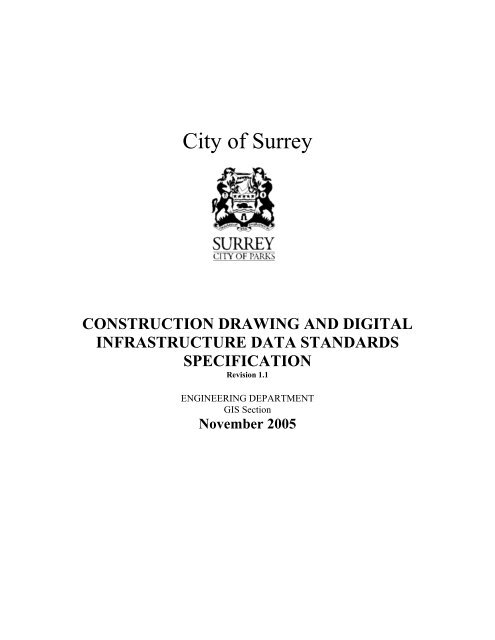
<strong>City</strong> <strong>of</strong> <strong>Surrey</strong><br />
CONSTRUCTION DRAWING AND DIGITAL<br />
INFRASTRUCTURE DATA STANDARDS<br />
SPECIFICATION<br />
Revision 1.1<br />
ENGINEERING DEPARTMENT<br />
GIS Section<br />
November 2005
INDEX<br />
1. DRAWING STANDARD SPECIFICATION: INTRODUCTION ............................ 1<br />
2. DRAWING SUBMISSION PROCESS .................................................................. 2<br />
2.1. Final Design (Early Copy) Submission .............................................................. 2<br />
2.2. Preliminary As-Built Submission ....................................................................... 3<br />
2.3. Final As-Built Submission: ................................................................................. 3<br />
3. HARD-COPY DRAWING STANDARDS .............................................................. 4<br />
3.1. Page Layout ......................................................................................................... 4<br />
3.1.1. Plan View .................................................................................................................. 5<br />
3.1.2. Pr<strong>of</strong>ile View ............................................................................................................... 6<br />
3.2. General Hardcopy Drawing Standards .............................................................. 6<br />
3.2.1. Spatial Positioning <strong>of</strong> Services on Hard-Copy Drawings .......................................... 7<br />
3.2.2. Baselines .................................................................................................................. 7<br />
3.2.3. Chainages ................................................................................................................. 7<br />
3.3. Additional Standards for Specific Service Drawings ....................................... 8<br />
3.3.1. Storm and Sanitary Sewers ...................................................................................... 8<br />
3.3.2. Roads ........................................................................................................................ 8<br />
3.3.3. Water ......................................................................................................................... 9<br />
3.3.4. Street Light Works .................................................................................................... 9<br />
3.3.5. Sidewalks .................................................................................................................. 9<br />
3.3.6. Cross-Sections ........................................................................................................ 10<br />
3.3.7. Signalized Road Intersections ................................................................................ 10<br />
4. DIGITAL DATA STANDARDS ........................................................................... 11<br />
5. APPENDICES .................................................................................................... 14<br />
5.1. Construction Drawing Legend ......................................................................... 14
<strong>City</strong> <strong>of</strong> <strong>Surrey</strong> Construction Drawing Standards Specifications, Nov 2005<br />
1. Drawing Standard Specification: Introduction<br />
The <strong>City</strong> <strong>of</strong> <strong>Surrey</strong> receives over 2000 Final Design or As-Built Construction Drawings<br />
(hereinafter referred to simply as “<strong>drawing</strong>s”) per year from outside developers and consultants.<br />
Each <strong>of</strong> these <strong>drawing</strong>s are recorded, scanned, organized and stored within the <strong>City</strong>’s network, as<br />
well as digitized into the <strong>City</strong>’s GIS System.<br />
The process is labour intensive, and can <strong>of</strong>ten be quite time consuming. A key strategy <strong>of</strong>ten<br />
employed by municipalities to counter this is to define, implement, and enforce <strong>drawing</strong><br />
<strong>standards</strong>. Intuitively, it makes sense that the more standard <strong>drawing</strong>s are, the more efficient<br />
processing the <strong>drawing</strong>s can become.<br />
This document fully specifies the <strong>standards</strong> each <strong>drawing</strong> submitted to the <strong>City</strong> must adhere.<br />
Not only will adherence to these <strong>standards</strong> guarantee that <strong>drawing</strong>s will not be rejected, but will<br />
also help to ensure a quick turn around, enabling developers to obtain project acceptance sooner.<br />
These specifications are not new. They have been refined to detail specifications applicable to<br />
both hard-copy and digital formats, both <strong>of</strong> which are required at the time <strong>of</strong> submission.<br />
Page 1
<strong>City</strong> <strong>of</strong> <strong>Surrey</strong> Construction Drawing Standards Specifications, Nov 2005<br />
2. Drawing Submission Process<br />
Drawings must be submitted to the <strong>City</strong> three times over the course <strong>of</strong> a typical land<br />
development project: at the Final Design (Early Copy) stage, the Preliminary As-Built<br />
Submission stage, and the Final As-Built submission stage. Only after <strong>drawing</strong>s for each stage<br />
are submitted, processed, and accepted will the project obtain a Certificate <strong>of</strong> Acceptance.<br />
Each submission package must contain a set <strong>of</strong> hard copy <strong>drawing</strong>s, and one digital file, which<br />
must include all service features. The set <strong>of</strong> hard copy <strong>drawing</strong>s must include a Key Plan<br />
Drawing, and a separate <strong>drawing</strong> for each applicable service type (see Table 1) 1 . Please see<br />
Section 3 for a detailed description <strong>of</strong> all the hard copy <strong>drawing</strong> <strong>standards</strong>. The digital file must<br />
either be in either Autocad or Microstation format. Please see Section 4 for a detailed<br />
description <strong>of</strong> the <strong>standards</strong> the digital data must adhere to.<br />
Service Type<br />
Pavement Markings<br />
Roads<br />
Traffic Lights<br />
Street Lights<br />
Water Infrastructure<br />
Storm Water Control<br />
Storm Sewer<br />
Sanitary Catchment Plan<br />
Sanitary<br />
Detention Areas<br />
Sidewalks<br />
Table 1: Service Feature Types<br />
Information Included<br />
Water mains, connections, manholes, etc.<br />
Drainage mains, connections, manholes, etc.<br />
Sanitary mains, connections, manholes, etc.<br />
Notes:<br />
1. Drawings with incomplete, non-standard or confusing information will be returned for<br />
correction and/or clarification.<br />
2. All <strong>drawing</strong>s submitted remain the property <strong>of</strong> the <strong>City</strong>.<br />
2.1. Final Design (Early Copy) Submission<br />
The first time <strong>drawing</strong>s are submitted to the <strong>City</strong> is at the Final Design Stage, also referred to by<br />
<strong>City</strong> staff as the Early Copy stage. Two sets <strong>of</strong> hardcopy <strong>drawing</strong>s and one digital file are<br />
required. These <strong>drawing</strong>s are forwarded to the <strong>City</strong>’s GIS Section for input into the GIS<br />
database. Typically, these <strong>drawing</strong>s are rough copies used to indicate proposed infrastructure<br />
development.<br />
1 Also refer to The <strong>City</strong> <strong>of</strong> <strong>Surrey</strong>’s Design Criteria Manual for a more detailed description <strong>of</strong> services required.<br />
Page 2
<strong>City</strong> <strong>of</strong> <strong>Surrey</strong> Construction Drawing Standards Specifications, Nov 2005<br />
Ideally, these <strong>drawing</strong>s would adhere to all <strong>standards</strong> detailed in Sections 3 and 4, however they<br />
are not strictly enforced at this stage.<br />
2.2. Preliminary As-Built Submission<br />
Once construction is complete, two hardcopies <strong>of</strong> each As-Built <strong>drawing</strong>, and the associated<br />
digital file must be sent to the <strong>City</strong>. Upon receipt, the <strong>City</strong> forwards the <strong>drawing</strong>s to the GIS<br />
Section for input into the GIS database. The GIS Section records the receipt <strong>of</strong> the <strong>drawing</strong>s,<br />
assigns <strong>Surrey</strong> Drawing Numbers, reviews the <strong>drawing</strong>s for completeness <strong>of</strong> design and<br />
adherence to <strong>standards</strong>, and inputs all new services into the GIS.<br />
Any deviation from <strong>standards</strong>, omissions, or any other deficiencies to the <strong>drawing</strong>s are noted.<br />
All <strong>drawing</strong>s are returned to the consultant for final review and updates. The <strong>City</strong> expects any<br />
deficiencies are corrected, and that the <strong>Surrey</strong> Drawing Numbers are entered on each <strong>drawing</strong>.<br />
Once complete, the <strong>drawing</strong>s can be sent back to the <strong>City</strong> for final acceptance.<br />
Please note that the most frequent deficiency encountered involve the placement <strong>of</strong> features and<br />
the dimensions and <strong>of</strong>fset distances associated with those features. Placement <strong>of</strong> features must<br />
be geographically correct. Any dimensions or <strong>of</strong>fset distances displayed must be to scale (e.g. If<br />
the <strong>of</strong>fset distance <strong>of</strong> a manhole from a lot corner is listed as 2.1m, the placement <strong>of</strong> the manhole<br />
must be 2.1m from the lot corner). Simply changing the <strong>of</strong>fset distance without moving the<br />
service feature accordingly is NOT acceptable.<br />
2.3. Final As-Built Submission:<br />
Final Submission must include:<br />
• The original marked-up set <strong>of</strong> paper prints<br />
• Two sets <strong>of</strong> corrected paper prints, (One set must be sealed).<br />
• One digital file that includes all new services. See section 4 for details on digital copy<br />
<strong>standards</strong>.<br />
The Final Submission is reviewed to ensure all corrections have been made appropriately. If so,<br />
the <strong>drawing</strong>s are scanned and stored on the <strong>City</strong>’s network for posterity. A final acceptance<br />
letter is produced and sent to the consultant along with the release <strong>of</strong> any funds held back<br />
pending final acceptance. If <strong>drawing</strong>s still have deficiencies, they are again returned to the<br />
consultant for corrections.<br />
Page 3
<strong>City</strong> <strong>of</strong> <strong>Surrey</strong> Construction Drawing Standards Specifications, Nov 2005<br />
3. Hard-Copy Drawing Standards<br />
This section fully details <strong>standards</strong> that apply to any hard copy <strong>drawing</strong> submitted. Each<br />
<strong>drawing</strong> must adhere to the general page layout and <strong>drawing</strong> <strong>standards</strong> described in Sections 3.1<br />
and 3.2. Individual service <strong>drawing</strong>s each have specific <strong>standards</strong> associated with them. See<br />
Sections 3.3 through 3.10<br />
3.1. Page Layout<br />
All hardcopy <strong>drawing</strong>s must be printed on a standard A1 size page, and must include a plan view<br />
and a pr<strong>of</strong>ile view. In addition, the <strong>drawing</strong>s must include a pr<strong>of</strong>ile grid, a Title Block and a<br />
Revision Block.<br />
Page Size:<br />
Layout:<br />
Pr<strong>of</strong>ile Grid:<br />
Text:<br />
Title Block:<br />
A1 (594 x 841 mm)<br />
1/2 plan and 1/2 pr<strong>of</strong>ile (plan at top <strong>of</strong> <strong>drawing</strong>)<br />
Minimum 2 mm vertical by 20 mm horizontal<br />
Minimum text height <strong>of</strong> 2.5 mm for all text<br />
A title block as shown in Figure 1 is to be placed in the lower right hand<br />
corner <strong>of</strong> each <strong>drawing</strong>.<br />
Figure 1: Title Block<br />
Revision Block:<br />
A Revision Block is to be placed in the lower centre <strong>of</strong> the <strong>drawing</strong>. As-<br />
Built date <strong>of</strong> services must be included in the Revision Block.<br />
The project will not be accepted unless a set <strong>of</strong> sealed paper prints is submitted. Each original<br />
<strong>drawing</strong> must include the following text:<br />
Page 4
<strong>City</strong> <strong>of</strong> <strong>Surrey</strong> Construction Drawing Standards Specifications, Nov 2005<br />
“A set <strong>of</strong> sealed paper prints has been submitted with this<br />
original by____________________, the Engineer <strong>of</strong> Record”<br />
3.1.1. Plan View<br />
1. The plan view is to be drawn at a scale <strong>of</strong> 1:500. The pr<strong>of</strong>ile to be drawn to scales<br />
horizontal 1:500, vertical 1:50. A horizontal scale <strong>of</strong> 1:250 is also acceptable only where<br />
the project is small enough to fit on a single sheet at 1:250. A vertical scale <strong>of</strong> 1:100 is<br />
acceptable in extreme cases.<br />
2. All <strong>of</strong>fsets <strong>of</strong> services, existing and new, will be indicated to the nearest 0.1m and<br />
referenced to and along property lines. Offsets for new mains are to be circled.<br />
3. Benchmarks (including TBM’s) are to be noted in the legend with location and elevation.<br />
Survey monuments are to be shown on the plan view.<br />
4. The plan view will show the legal layout <strong>of</strong> roads and properties with all legal<br />
descriptions (lots and plan numbers) and dimensions (to the nearest 0.01m). Also show<br />
existing house numbers and all registered statutory rights-<strong>of</strong>-way.<br />
5. The names <strong>of</strong> streets are to be indicated outside <strong>of</strong> the road boundaries. Road widths are<br />
to be annotated. No temporary (e.g., A, B or C) names will be accepted.<br />
6. All work done must be shown (e.g. removal <strong>of</strong> a clean out or replacement <strong>of</strong> a clean out<br />
by a manhole, removal or existing blowdowns, lines abandoned, etc.) and clearly noted<br />
on the appropriate <strong>drawing</strong>.<br />
7. An <strong>of</strong>fset from lot corners must be shown for all service connections. (The note<br />
“centreline <strong>of</strong> lot” or “typical” is not acceptable.) If the connection is not perpendicular<br />
to the main, the location <strong>of</strong> each bend is to be shown.<br />
8. The rim, invert and depth (where applicable) are to be shown for all service connections<br />
and are to be “boxed” in.<br />
Where there are existing connections, the field-measured inverts are to be shown. Where<br />
information has been obtained from an as-built <strong>drawing</strong> this must be clearly noted.<br />
9. Two dimensions from lot corners are required to show the location for all manholes,<br />
valves, tees, hydrants, stubs, catchbasins, lawnbasins, bends in water lines, etc.<br />
Note: the “Location” <strong>of</strong> manholes as shown on the <strong>drawing</strong>s are to be the location <strong>of</strong> the<br />
intersection <strong>of</strong> the pipes within the manhole, not the centre <strong>of</strong> the lid. When there is a<br />
major difference, a note stating the <strong>of</strong>fset <strong>of</strong> the manhole lid should be added to the<br />
<strong>drawing</strong>.<br />
10. Where chainage is used to locate services, bends, etc., the baseline must be shown and<br />
dimensioned to the legal along with all curve data. Each change <strong>of</strong> direction (pipe<br />
deflections) must be noted and tied with dimensions to lot corners; or noted as follows:<br />
• pipe pulled from sta. ____ to sta. ____<br />
• BC at sta. ____<br />
• EC at sta. ____<br />
Page 5
<strong>City</strong> <strong>of</strong> <strong>Surrey</strong> Construction Drawing Standards Specifications, Nov 2005<br />
• bend at sta. ____<br />
Stationing is to be clearly noted if either baseline or centreline <strong>of</strong> main chainage is used.<br />
11. New works are to be drafted in bold lines and the <strong>of</strong>fset <strong>of</strong> these works are to be circled.<br />
12. On curves clearly locate all fittings to the baseline and/or lot corners.<br />
13. All notes and dimensions are to be placed outside <strong>of</strong> the road right-<strong>of</strong>-way.<br />
3.1.2. Pr<strong>of</strong>ile View<br />
1. The pr<strong>of</strong>ile view must show:<br />
• chainages and pr<strong>of</strong>ile along the baseline<br />
• elevations <strong>of</strong> new and existing works<br />
• new and existing service connections<br />
• services being crossed by the new works (and their elevations)<br />
• all data pertaining to the design <strong>of</strong> the works<br />
2. Elevations at all grade changes are to be shown with a chainage or ties to lot corners.<br />
3. All elevations are to be geodetic and rounded to the nearest 0.01m.<br />
4. Starting chainages on pr<strong>of</strong>ile views must coincide with an accented vertical line on the grid<br />
and must line up vertically with the station on the plan view<br />
5. The material type (PVC, concrete, etc.) must be shown on the pr<strong>of</strong>ile for all mains.<br />
6. Rim elevations are required for all manholes and clean outs.<br />
7. All manhole and clean-out sizes are to be noted. If standard 1050 mm diameter is used, a<br />
general note is acceptable with any non-standard sizes clearly noted on the pr<strong>of</strong>ile.<br />
8. Pr<strong>of</strong>iles must be shown for all services (including road crossings) except where the<br />
installation <strong>of</strong> connections from an existing main is the only work performed.<br />
9. Pipe measurements should be from the centre <strong>of</strong> each associated manhole. Chainage<br />
distances are not acceptable.<br />
10. For drop manholes, note whether ‘inside’, ‘outside’ or ‘ramp’ manhole.<br />
11. Where a new main breaks into an existing main, show the location and inverts <strong>of</strong> both<br />
existing upstream and downstream manholes relative to the new works.<br />
12. Note all additional requirements pertaining to specific service <strong>drawing</strong>s. See Section 3.1.<br />
3.2. General Hardcopy Drawing Standards<br />
The following <strong>standards</strong> apply to all submitted Early Copy and As-Built <strong>drawing</strong>s:<br />
1. A separate <strong>drawing</strong> is required for each service type (see Table 1).<br />
2. Key plans are to show ‘as-built’ information for those services not shown on other<br />
<strong>drawing</strong>s within the project.<br />
Page 6
<strong>City</strong> <strong>of</strong> <strong>Surrey</strong> Construction Drawing Standards Specifications, Nov 2005<br />
3. Notes pertaining to the construction <strong>of</strong> a particular service type are to be shown on the<br />
applicable service <strong>drawing</strong>s, not on the Key Plan.<br />
4. All dimensions and elevations are to be in metres.<br />
5. All <strong>drawing</strong>s must include existing infrastructure within the project area. Each <strong>of</strong> the<br />
following, if applicable, must be illustrated:<br />
• Water Infrastructure • Driveway Culverts and Sizes<br />
• Sanitary Infrastructure • Utility Poles<br />
• Drainage Infrastructure • Gas Lines<br />
• Catch Basins • Underground electrical and phone<br />
• Lawn Basins • Road Edges<br />
• Ditches • Curbs and Sidewalks<br />
6. All <strong>drawing</strong>s submitted must be original prints<br />
7. Pen colour must be black<br />
8. Line thickness must be no less than 3mm<br />
9. Background must be white<br />
10. Drawing must be printed using the maximum line density<br />
3.2.1. Spatial Positioning <strong>of</strong> Services on Hard-Copy Drawings<br />
All service features (mains, manholes, connections, etc.) must be placed at their correct spatial<br />
location. Proposed and existing features (if impacted by the project) must be placed at their<br />
proper locations in the <strong>drawing</strong>. It is not acceptable to simply change the value <strong>of</strong> the<br />
associated dimension string.<br />
3.2.2. Baselines<br />
General Baseline requirements:<br />
1. Offsets are to be shown to both sides <strong>of</strong> the road allowance or to one side with the road<br />
allowance width annotated.<br />
2. Baseline change <strong>of</strong> direction (bend, curve, deflection, BC, EC, etc.) must be noted.<br />
3. Each <strong>drawing</strong> must have sufficient baseline information to stand on its own.<br />
4. If features are within an ISA, then all baselines are to be referenced to two Integrated<br />
Survey Monuments.<br />
5. If features are outside ISA, then all baselines are to be referenced to two property corners<br />
(stationing for all IP’s found) and shown on the <strong>drawing</strong>s.<br />
3.2.3. Chainages<br />
1. Chainage stations must be at 20 metre intervals (+20, +40, etc.) and rounded <strong>of</strong>f to the<br />
nearest 0.1m.<br />
2. Chainage intersections and starting points are to be related to lot corners (1 + 00).<br />
Page 7
<strong>City</strong> <strong>of</strong> <strong>Surrey</strong> Construction Drawing Standards Specifications, Nov 2005<br />
3.3. Additional Standards for Specific Service Drawings<br />
This section details <strong>standards</strong> specific to individual service <strong>drawing</strong>s.<br />
3.3.1. Storm and Sanitary Sewers<br />
1. Connections greater than 10 mm diameter shall be shown and noted on the plan with ties to<br />
lot corners.<br />
2. Main size and material and manhole size and material are to be shown as well as all<br />
elevations.<br />
3. Where a new main ties to an existing stub, the balance <strong>of</strong> the distance to the existing<br />
manhole (from the new main) is to be shown.<br />
4. Show location, invert and <strong>of</strong>fset all new frontage tile installed if 10 metres in length or<br />
longer.<br />
5. All lawn basins (both private and Municipal) are to be referenced to lot corners and the<br />
size, material and rim elevation shown with the size and material <strong>of</strong> the lead.<br />
6. 5 and 100 year HGL (storm) to be shown. For each proposed storm sewer pipe, the Q 5 ,<br />
Q 100 and Q C will be noted in the pr<strong>of</strong>ile.<br />
7. All Sanitary Sewer flows to be shown in pr<strong>of</strong>ile for each section <strong>of</strong> pipe.<br />
8. Type <strong>of</strong> backfill material is to be shown.<br />
9. Storm sewer catchbasin locations (either <strong>of</strong>fset and chainage or two ties to property lines)<br />
to the back <strong>of</strong> the rim are to be shown. Where chainage is used, the base line must be<br />
shown and referenced to legal and curve data.<br />
10. Detention pond information required:<br />
o all pipes with size, inverts and location<br />
o capacity, high water elevation, base elevation<br />
o control device(s) particulars<br />
o location, size and elevation <strong>of</strong> all manholes, catchbasins, etc.<br />
10. All non-standard connections are to be noted on the <strong>drawing</strong>.<br />
3.3.2. Roads<br />
1. A typical cross-section <strong>of</strong> the designed roads will be shown on every <strong>drawing</strong>.<br />
2. The new road works are to be drafted in bold lines and to be shaded lightly along edges<br />
or shaded (maximum 10%) along edges only on reverse side <strong>of</strong> <strong>drawing</strong><br />
Page 8
<strong>City</strong> <strong>of</strong> <strong>Surrey</strong> Construction Drawing Standards Specifications, Nov 2005<br />
3. A table showing curve and curve return data is to be shown on the road <strong>drawing</strong> as<br />
shown in Table 2.<br />
CURVE NO. 1 2 3 4<br />
R<br />
Δ<br />
T<br />
Arc<br />
B.C. Sta.<br />
E.C. Sta.<br />
7.000<br />
84º 10’ 42”<br />
6.322<br />
10.284<br />
1 + 40.71<br />
1 + 72.60<br />
7.000<br />
95º 49’ 18”<br />
7.750<br />
11.707<br />
1 + 38.73<br />
1 + 52.60<br />
7.000<br />
90º 00’ 00”<br />
7.000<br />
10.996<br />
—<br />
1 + 11.20<br />
7.000<br />
90º 00’ 00”<br />
7.000<br />
10.996<br />
—<br />
1 + 11.20<br />
Table 2: Curve Table<br />
4. Pavement tapers are to be dimensioned to legal with length <strong>of</strong> taper and the <strong>of</strong>fset to<br />
existing pavement.<br />
3.3.3. Water<br />
1. All fittings used are to be “boxed in” for each location and tied to chainages and lot<br />
corners. Show on the ‘plan’ portion <strong>of</strong> the <strong>drawing</strong>. Fittings will have the description <strong>of</strong><br />
hub, flange, etc.: e.g., 150H x 150H x 150 FL Tee.<br />
2. All fittings are to be shown in the pr<strong>of</strong>ile with the elevations and chainages indicated.<br />
3. Water connections larger than 20 mm diameter to show size. Water connections 100 mm<br />
diameter and larger shall show size with elevation at property line on plan view.<br />
4. A list <strong>of</strong> materials used is to be shown in a materials table.<br />
5. The location <strong>of</strong> all bend points along curves must be shown and dimensioned to legal.<br />
6. Show symbols at all grade changes.<br />
7. Between each grade change, show the length and grade <strong>of</strong> that segment <strong>of</strong> main.<br />
3.3.4. Street Light Works<br />
1. The <strong>drawing</strong>s will only include plan views. No pr<strong>of</strong>ile being required. All improvements<br />
(service boxes, poles, etc.) are to be tied to property lines.<br />
2. Streetlights are to be numbered.<br />
3.3.5. Sidewalks<br />
The <strong>drawing</strong>s must show the width <strong>of</strong> sidewalk, and the type <strong>of</strong> materials used. The <strong>of</strong>fset <strong>of</strong> the<br />
sidewalk to the property line must be circled. A typical cross-section shall also be shown on<br />
each <strong>drawing</strong>, see next section.<br />
1. When sidewalks are part <strong>of</strong> road works, they will be shown on road <strong>drawing</strong>s.<br />
Page 9
<strong>City</strong> <strong>of</strong> <strong>Surrey</strong> Construction Drawing Standards Specifications, Nov 2005<br />
2. When sidewalks are shown separately, the <strong>drawing</strong>s will include plan view and pr<strong>of</strong>ile.<br />
3. The <strong>drawing</strong>s will require the same information as for street light works. The new<br />
sidewalk will be drafted in bold lines and shaded (hatched or shaded (maximum 10%)) on<br />
reverse side <strong>of</strong> <strong>drawing</strong>.<br />
3.3.6. Cross-Sections<br />
Cross-sections are required for <strong>drawing</strong>s depicting new road, sidewalk, drainage channels and/or<br />
dykes.<br />
For new road and sidewalk features, a 20m-interval cross-section is required.<br />
For road works, cross-sections must span the full width <strong>of</strong> the road allowance. Cross-section<br />
must include property lines, ditches, and edges <strong>of</strong> existing road and centreline <strong>of</strong> road. It must<br />
also illustrate chainages and elevations <strong>of</strong> each break in the cross-section.<br />
The new road works must be shown with bold lines that emphasize the finished surface.<br />
Elevations <strong>of</strong> the new road must be shown. Road measurements from centreline <strong>of</strong> the road<br />
allowance must also be illustrated.<br />
Cross-sections will be drafted using a 1:100 Horizontal Scale, and a 1:20 Vertical Scale.<br />
Elevations should be rounded <strong>of</strong>f to the nearest centimetre.<br />
3.3.7. Signalized Road Intersections<br />
1. For road intersections with traffic signals or traffic channelization, the <strong>drawing</strong>s will only<br />
include plan views. No pr<strong>of</strong>ile is required. The scale <strong>of</strong> <strong>drawing</strong>s must be 1:200.<br />
2. The <strong>drawing</strong>s will show the following existing services:<br />
• Curbs • Hydrants<br />
• Sidewalks • Edges <strong>of</strong> Pavement<br />
• Utility Poles • Catch Basins<br />
• Islands • Electrical Conduits and Junction Boxes<br />
• Valves • Traffic Signals<br />
• Inspection Chambers<br />
3. All services will be referenced to property lines. Conduits will be sized in millimetres.<br />
4. The new works will be drafted in bold lines.<br />
5. The location <strong>of</strong> new lights, junction boxes, conduits, will be referenced to property lines<br />
and circled.<br />
6. Where traffic channelization is shown, widths <strong>of</strong> traffic lanes are to be shown, length <strong>of</strong><br />
road tapering and stop bars.<br />
7. Where raised islands are used, a cross-section <strong>of</strong> the intersection is to be shown on the<br />
<strong>drawing</strong>, to scale.<br />
Page 10
<strong>City</strong> <strong>of</strong> <strong>Surrey</strong> Construction Drawing Standards Specifications, Nov 2005<br />
4. Digital Data Standards<br />
• The data that the <strong>City</strong> will be providing will be based on NAD83 (NMIP93) with UTM grid<br />
coordinates.<br />
• The proposed data submitted must also be based on the same projection and shown in its true<br />
geographic location<br />
FORMAT: AUTOCAD (DWG) MICROSTATION (DGN)<br />
LAYER DEFINITIONS COLOUR LINE TYPE DESCRIPTION<br />
STORM (Proposed)<br />
Prop___Stm___Mains 3 Dashed Proposed Mains<br />
Prop___Stm___Nodes 3 Continuous Proposed Manholes, Junctions &<br />
Cleanouts<br />
Prop___Stm___Anno 3 “ Proposed Annotation<br />
Prop___Stm___Connections 3 Dashed Proposed Connections<br />
ROADS (Existing)<br />
Rds___Curbs 7 As per attached sheet Curbs, Gutters, Pavement<br />
Rds___Annotation 7 “ Widths, Labels, Notes<br />
ROADS (Proposed)<br />
Prop.Rds___Curbs 1 As per attached sheet Proposed Curbs, Gutters, Pavement<br />
Prop.Rds___Annotation 1 “ Proposed Widths, Labels, Notes<br />
Prop.Rds___Offsets 1 “ Proposed Drainage, Offsets,<br />
Elevations<br />
Prop.Rds___Details 1 “ Proposed Clarification Details<br />
Prop.Rds___Typical 1 “ Proposed Typical Details<br />
Prop.Rds___Walks 1 “ Proposed Sidewalks, Walkways<br />
STREET/TRAFFIC LIGHTS<br />
(Existing)<br />
Stl___Poles 7 As per attached sheet Poles<br />
Stl___Annotations 7 “ Annotations<br />
Stl___Conduit 7 Long dash-2 dots Conduit<br />
STREET/TRAFFIC LIGHTS<br />
(Proposed)<br />
Stl___Poles 7 As per attached sheet Proposed Poles<br />
Stl___Annotation 7 Continuous Proposed Pole Numbers,<br />
Annotation<br />
Stl___Nodes 7 “ Proposed Junction Box, Loops, Pull<br />
Box<br />
Stl___Offsets 7 “ Proposed Offsets<br />
Stl___Conduits 7 “ Proposed Conduits<br />
Page 11
<strong>City</strong> <strong>of</strong> <strong>Surrey</strong> Construction Drawing Standards Specifications, Nov 2005<br />
FORMAT: AUTOCAD (DWG) MICROSTATION (DGN)<br />
LEGAL (Existing)<br />
Blk___Line 7 Continuous Block Lines<br />
Lot___Line 7 “ Lot Lines<br />
Monuments 6 Hidden2 Monuments<br />
Muni___ROW 2 Dashed Municipal Right-<strong>of</strong>-Way<br />
Util___ROW 2 Dashed Utility Co. Right-<strong>of</strong>-Way<br />
Bldg___Location 7 Continuous Building Locations<br />
Dimensions 7 “ Dimensions<br />
Plan___Numbers 7 “ LTO Plan Numbers<br />
Lot___Annotation 7 “ Lot Numbers<br />
Mons___Numbers 6 “ Monument Numbers<br />
MuniAnnotation 2 “ Municipal R/W Annotation<br />
UtilAnnotation 2 “ Utility Co. R/W Annotation<br />
Address___Annotation 7 “ Addressing<br />
SANITARY (Existing)<br />
San___Mains 1 Continuous Sanitary Mains<br />
San___Flow___Direction 1 “ Flow Direction<br />
San___Nodes 1 “ Manholes, Cleanouts & Junctions<br />
San___Liftstations 1 “ Liftstations<br />
San___Connections 1 “ Connections<br />
San___Annotation 1 “ Size, Type & Anno Material<br />
San___Offsets 1 “ Offset Dimensions<br />
SANITARY (Proposed)<br />
Prop___San___Mains 1 Continuous Propsed Mains<br />
Prop___San___Nodes 1 “ Proposed Manholes, Junctions &<br />
Cleanouts<br />
Prop___San___Anno 1 “ Proposed Annotation<br />
Prop___San___Connections 1 “ Proposed Connections<br />
WATER (Existing)<br />
Wtr___Mains 4 Dash-dot Water Mains<br />
Wtr___Valves 4 Continuous Valves<br />
Wtr___Chambers 4 “ Chambers<br />
Wtr___Hydrants___Standpipes 4 “ Hydrants & Standpipes<br />
Wtr___Pump___Stations 4 “ Pump Stations<br />
Wtr___Connections 4 Dash-dot Connections<br />
Wtr___Wells___Tanks___Reserv 4 Continuous Wells, Tanks & Reservoirs<br />
Wtr___Annotation 4 “ Annotation<br />
WATER (Proposed)<br />
Prop___Wtr___Mains 4 Dash-dot Proposed Mains<br />
Prop___Wtr___Nodes 4 “ Proposed Valves, T’s<br />
Prop___Wtr___Anno 4 “ Proposed Annotation<br />
Prop___Wtr___Connections 4 “ Proposed Connections<br />
Page 12
<strong>City</strong> <strong>of</strong> <strong>Surrey</strong> Construction Drawing Standards Specifications, Nov 2005<br />
FORMAT: AUTOCAD (DWG) MICROSTATION (DGN)<br />
STORM (Existing)<br />
Stm___Mains (exist) 3 Dashed Storm Mains<br />
Stm___Flow___Direction 3 Continuous Flow Direction<br />
Stm___Nodes 3 “ Manholes, Cleanouts & Junctions<br />
Stm___Pumpstation 3 “ Pumpstations<br />
Stm___Connections 3 Dashed Connections<br />
Stm___Annotation 3 Continuous Size, Type & Anno Material<br />
Stm___Offsets 3 “ Offset Dimensions<br />
Stm___Catchbasins/LBS 3 “ Catchbasins/LBS<br />
LEGAL (Proposed)<br />
Prop___Blk___Line 1 Continuous Proposed Block Lines<br />
Prop___Lot___Line 1 “ Proposed Lot Lines<br />
Monument___Ties 1 Dash-dot 2 Ties to Existing Monuments<br />
Prop___Dimensions 1 Continuous Proposed Dimensions<br />
Prop___Address 1 “ Proposed Addressing<br />
Prop___Lot___Anno 1 “ Proposed Lot Annotation<br />
Note:<br />
All line types - weights should resemble Construction Drawing Standards Book<br />
- Master Municipal Specifications<br />
Proposed should be thick wt 3 or 4<br />
Existing should be narrow ⌫ wt 0 or 1<br />
Page 13
5. Appendices<br />
5.1. Construction Drawing Legend<br />
Page 14