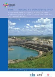
Full Report - Sustainable Aggregates
Full Report - Sustainable Aggregates
Full Report - Sustainable Aggregates

Create successful ePaper yourself
Turn your PDF publications into a flip-book with our unique Google optimized e-Paper software.
CR/07/042N<br />
The results of the drilling show a chalky glacial till to bedrock. This indicates one of two<br />
scenarios. Either the sand and gravel is of variable thickness beneath the overlying till, or it was<br />
deposited on top of the till and is within depressions in the till surface.<br />
• BH7 [468628 298200]<br />
BH6 was drilled approximately 150m from an outcrop of sand and gravel, and was drilled to<br />
assess how continuous the deposit is beneath the glacial till.<br />
The borehole discovered no sand and gravel, consisting of variable glacial till. This suggests that<br />
the sand and gravel has a variable thickness beneath the till, or the deposit has been eroded and<br />
so is only present in patches.<br />
• BH8 [468900 295446]<br />
Borehole 8 was drilled within a sand and gravel deposit approximately 0.5km long and 150m<br />
wide, surrounded by glacial till. There was no existing PSA data for this deposit.<br />
The borehole revealed slightly gravelly, very clayey SAND at 1.4-2.5m. It had a silt/clay content<br />
of 26% and an overburden to mineral ratio within this borehole of 1.3:1. Made Ground was<br />
recorded at th top of the borehole overlying the sand, and a firm till was recorded beneath to the<br />
terminal depth of the borehole (18.75m). This would suggest that the pocket of sand and gravel<br />
overlies the glacial till, and is therefore unlikely to be widespread.<br />
• BH9 [471681 294153]<br />
BH9 was drilled within a region of glacial till, with an aim of investigating the presence or<br />
absence of an underlying glacial sand and gravel.<br />
The results of the borehole suggest there is no underlying sand and gravel, with glacial till<br />
recorded for the total borehole depth of 13m.<br />
• BH10 [494064 293968]<br />
BH10 was drilled in an area of glacial till, with sand and gravel mapped beneath it and<br />
outcropping within approximately 100m. The location was chosen to confirm the relationship<br />
between the two deposits, and gain PSA data for the sand and gravel.<br />
The borehole revealed a clayey very gravely SAND at 2.4m, which had a depth of 1.1m. It had a<br />
low silt/clay content of 16% and was 51% sand. The overburden to mineral ratio at this location<br />
was 2.2:1.<br />
• BH11a [459662 289360]<br />
BH10 was drilled in an area of glacial till, with sand and gravel mapped beneath it and<br />
outcropping approximately 1.5km away. The location was chosen to confirm the relationship<br />
between the two deposits, to build an understanding of the distribution of the sand and gravel,<br />
and gain PSA data for the sand and gravel.<br />
The borehole identified no sand and gravel. The total depth of the borehole was 19m, indicating<br />
that the sand and gravel is not continuous beneath the till.<br />
• BH11b [457864 287578]<br />
BH10 was drilled in an area of glacial till, with sand and gravel mapped beneath it and<br />
outcropping within approximately 100m. The location was chosen to confirm the relationship<br />
between the two deposits, and gain PSA data for the sand and gravel.<br />
BH11b identified a thin deposit of clayey very sandy GRAVEL, at 7-7.8m. The deposit had a<br />
small silt/clay content of 6%, and contained 41% sand. The overburden to mineral ratio for this<br />
deposit is almost 9:1 at this location. The borehole demonstrated that glacial till is deposited<br />
above and below this gravel.<br />
155