Full Report - Sustainable Aggregates
Full Report - Sustainable Aggregates
Full Report - Sustainable Aggregates

Create successful ePaper yourself
Turn your PDF publications into a flip-book with our unique Google optimized e-Paper software.
CR/07/042N<br />
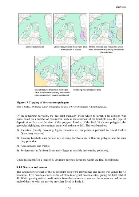
Figure 19 Clipping of the resource polygons<br />
BGS © NERC. Ordnance Survey topographic material © Crown Copyright. All rights reserved.<br />
Of the remaining polygons, the geologist manually chose which to target. This decision was<br />
made based on a number of parameters, such as reassessment of the borehole data, the type of<br />
deposit at surface and the size of the polygon. Finally, of the final 38 chosen polygons, the<br />
geologist highlighted the optimum areas within them to drill. This was based on:<br />
1) Elevation (mostly favouring higher elevation as this provides potential to reveal thicker<br />
Quaternary deposits)<br />
2) Existing borehole data (where any existing boreholes are within the polygon and the data<br />
they provide)<br />
3) Access (roads and tracks)<br />
4) Settlements (as far from farms and villages as possible due to noise pollution).<br />
Geologists identified a total of 49 optimum borehole locations within the final 38 polygons.<br />
8.4.1 Services and Access<br />
The landowners for each of the 49 optimum sites were approached, and access was gained for 43<br />
boreholes. Five boreholes were re-drilled close to original borehole sites, giving the final total of<br />
48. Whilst gaining written confirmation from the landowners, service checks were carried out on<br />
each of the sites with the service providers listed in Table 11.<br />
51