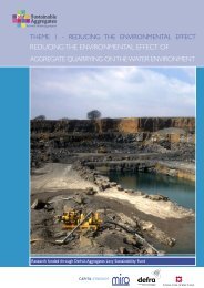
Full Report - Sustainable Aggregates
Full Report - Sustainable Aggregates
Full Report - Sustainable Aggregates

Create successful ePaper yourself
Turn your PDF publications into a flip-book with our unique Google optimized e-Paper software.
CR/07/042N<br />
The borehole revealed a succession of glacial till at the surface to 4.8m, with a band of clayey<br />
sand within it, with a dense sand and gravel beneath it to a depth of 12.9m. Between 8.8-9.6m<br />
there was a bed of stiff clay within the sand and gravel. Considered as one unit, the overburden<br />
to mineral ratio of this deposit is 0.6:1. The PSA demonstrates that although the deposit varies<br />
from clayey sand to sandy gravel there is no distinct difference between the deposit above and<br />
below the stiff clay band. Silt/clay content varies from 3% to 25%, except for the 12.6m sample<br />
which shows a high silt/clay content of 46%.<br />
• BH24 [482221 228824]<br />
The geological maps show that BH24 was drilled on an outcrop of glacial sand and gravel,<br />
surrounded by overlying glacial till. There was no reliable existing PSA data for the deposit;<br />
however some records suggest it has relatively high silt/clay content.<br />
The borehole revealed a thin deposit of sand and gravel at surface, an underlying till, beneath<br />
which was a thick (6.10-13.9m) deposit of sand and gravel. Till was recorded to the total depth<br />
of 18.5m. PSA data shows that the upper sand and gravel is very gravelly sand with 20%<br />
silt/clay. The lower thicker deposit is clayey sandy gravel, with an average silt/clay content of<br />
15%, with a minimum of 13% and a maximum of 16%, increasing with depth. The overburden to<br />
mineral ratio for this lower sand is 0.8:1.<br />
• BH29 (and redrill 29a) [486437 226987 and 486207 226850]<br />
Borehole 29 was drilled on glacial till with glacial sand and gravel mapped beneath it. BH29a<br />
was drilled approximately 300m southwest of BH29, a location mapped as glacial sand and<br />
gravel with no overlying till. This location has chosen as there was very little existing borehole<br />
data for the sand and gravel unit.<br />
Borehole 29 encountered an upper till above the sand and gravel deposit. This was not found in<br />
BH29a, supporting the geological mapping. Beneath the sand and gravel unit in BH29a was a<br />
lower till. Chalk clasts were identified within the BH29 sand and gravel unit. The PSA data<br />
demonstrated that in both boreholes the deposit was consistently clayey very sandy GRAVEL to<br />
a depth of 13.3m. Below 13.3m in BH29a the deposit changed to consistent clayey SAND. The<br />
units highest silt/clay content is 21%, at the 1m depth in BH29a, however, elsewhere it varies<br />
between 11-1%. The overburden mineral ratio for the sand in BH29a is 0.2:1.<br />
• BH30 (and redrill 30a) [489256 224939]<br />
BH30a was a redrill of 30a due to problems concerning inadequate casing diameter during<br />
BH30. Because of this the boreholes were drilled only a few metres apart. The location within<br />
the regional stratigraphy is identical to BH29, drilled through the overlying till to investigate the<br />
potential resource beneath.<br />
The till contains two beds of sand and gravel. The upper one is 180cm thick at a depth of ~4m,<br />
and identified in both boreholes, the lower one only found in BH30a, with a thickness of 70cm.<br />
PSA analysis demonstrates that the upper bed is very clayey (26%) very gravelly SAND. The<br />
main body of sand and gravel, identified in both boreholes, is from a depth of around 14m,<br />
directly beneath the till. PSA has shown that this varies between very clayey very gravelly<br />
SAND to gravelly clayey SAND. Throughout the deposit, the silt/clay content never rises above<br />
22%. The overburden to mineral ratio for this lower deposit is around 1.3:1.<br />
18.3 GLACIOFLUVIAL SANDS AND GRAVELS IN THE WEST OF THE PROJECT<br />
AREA<br />
• BH31 [462338 244008]<br />
Borehole 31 was drilled to investigate the potential of a sand and gravel deposit beneath the<br />
glacial till mapped at the surface. A channel of sand and gravel is suggested by the geological<br />
map, but there were very few existing boreholes and no PSA data.<br />
157