Star Swamp Heritage Trail - City of Stirling
Star Swamp Heritage Trail - City of Stirling
Star Swamp Heritage Trail - City of Stirling

You also want an ePaper? Increase the reach of your titles
YUMPU automatically turns print PDFs into web optimized ePapers that Google loves.
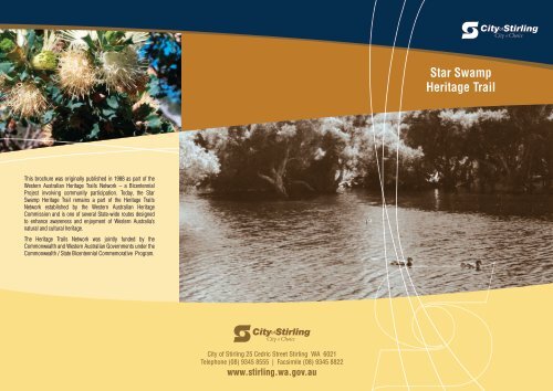
<strong>Star</strong> <strong>Swamp</strong><br />
<strong>Heritage</strong> <strong>Trail</strong><br />
This brochure was originally published in 1988 as part <strong>of</strong> the<br />
Western Australian <strong>Heritage</strong> <strong>Trail</strong>s Network – a Bicentennial<br />
Project involving community participation. Today, the <strong>Star</strong><br />
<strong>Swamp</strong> <strong>Heritage</strong> <strong>Trail</strong> remains a part <strong>of</strong> the <strong>Heritage</strong> <strong>Trail</strong>s<br />
Network established by the Western Australian <strong>Heritage</strong><br />
Commission and is one <strong>of</strong> several State-wide routes designed<br />
to enhance awareness and enjoyment <strong>of</strong> Western Australia’s<br />
natural and cultural heritage.<br />
The <strong>Heritage</strong> <strong>Trail</strong>s Network was jointly funded by the<br />
Commonwealth and Western Australian Governments under the<br />
Commonwealth / State Bicentennial Commemorative Program.<br />
<strong>City</strong> <strong>of</strong> <strong>Stirling</strong> 25 Cedric Street <strong>Stirling</strong> WA 6021<br />
Telephone (08) 9345 8555 | Facsimile (08) 9345 8822<br />
www.stirling.wa.gov.au
Hope Street<br />
How To Get There<br />
<strong>Star</strong> <strong>Swamp</strong> Bushland Reserve is a 100 hectare native bushland reserve<br />
located approximately 15 kilometres north-west <strong>of</strong> Perth and is bordered by<br />
Marmion Avenue, North Beach Road, Hope Street and Beach Road.<br />
Notes<br />
The <strong>Star</strong> <strong>Swamp</strong> <strong>Heritage</strong> <strong>Trail</strong> is a 1.4 kilometre walk-trail which highlights<br />
the natural significance and role <strong>of</strong> the bushland and associated wetland in the<br />
history and development <strong>of</strong> North Beach and Watermans Bay. At a leisurely<br />
pace the walk-trail provides an enjoyable 40 minute walk through uniquely<br />
varying bushland ecosystems, with opportunities for bird-watching and<br />
wildflower photography. The reserve sustains a rich diversity <strong>of</strong> plant and<br />
animal life in tranquil settings. A walk through the bushland and around the<br />
wetland provides a rewarding experience.<br />
Beach Road<br />
The <strong>Trail</strong> is accessible from three entrance points:<br />
South – from the end <strong>of</strong> Groat Street.<br />
North – from the end <strong>of</strong> Mary Street.<br />
West – from Hope Street by the <strong>Swamp</strong>.<br />
Following the trail route map, look for trail markers bearing the <strong>City</strong><br />
<strong>of</strong> <strong>Stirling</strong> and Bushlinks logos.<br />
Mary Street<br />
236m 314m<br />
290m<br />
i<br />
263m<br />
10<br />
500m<br />
9<br />
260m<br />
305m<br />
8<br />
250m<br />
0m<br />
N<br />
250m<br />
Marmion Avenue<br />
73m<br />
Please note: Anyone using this <strong>Heritage</strong> <strong>Trail</strong> is advised to have closed<br />
footwear and other protective apparel as appropriate. Bicycles <strong>of</strong> any form<br />
are not permitted on this walk-trail.<br />
7<br />
510m<br />
MAP KEY<br />
<strong>Heritage</strong> <strong>Trail</strong><br />
Limestone Firebreak/<strong>Trail</strong><br />
1 Sanitation Disposal Site 8 Remnant By-Way<br />
2 Orchards & Pastoral Leases 9 Aboriginal Camp<br />
3 Camel Quarantine Area 10 Drover’s Tree<br />
4 Stock Route Drinking Fountain<br />
5 Dairy Cattle Pedestrian Access Points<br />
6 Quarry for Marl Shelter<br />
7 Light-Horse Division i Information<br />
Parking<br />
<strong>Star</strong><br />
<strong>Swamp</strong><br />
4<br />
3<br />
210m 2<br />
384m<br />
5<br />
Groat Street<br />
340m<br />
365m<br />
1 Henderson<br />
220m Environmental<br />
Centre<br />
380m<br />
i<br />
6<br />
North Beach<br />
Primary<br />
School<br />
577m<br />
400m<br />
146m<br />
180m<br />
North Beach Road<br />
590m