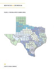
Chapter 4 Climate of Texas - Texas Water Development Board
Chapter 4 Climate of Texas - Texas Water Development Board
Chapter 4 Climate of Texas - Texas Water Development Board

You also want an ePaper? Increase the reach of your titles
YUMPU automatically turns print PDFs into web optimized ePapers that Google loves.
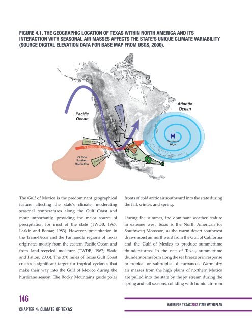
FIGURE 4.1. THE GEOGRAPHIC LOCATION OF TEXAS WITHIN NORTH AMERICA AND ITS<br />
INTERACTION WITH SEASONAL AIR MASSES AFFECTS THE STATE’S UNIQUE CLIMATE VARIABILITY<br />
(SOURCE DIGITAL ELEVATION DATA FOR BASE MAP FROM USGS, 2000).<br />
Pacific<br />
Ocean<br />
Arctic fronts<br />
Atlantic<br />
Ocean<br />
Rocky Mountains<br />
Polar jet stream<br />
West winds<br />
Subtropical jet stream<br />
Mexican<br />
Highlands<br />
Gulf air<br />
H<br />
Bermuda<br />
High<br />
El Niño<br />
Southern<br />
Oscillation<br />
West winds<br />
Gulf<br />
<strong>of</strong><br />
Mexico<br />
Tropical<br />
storms<br />
The Gulf <strong>of</strong> Mexico is the predominant geographical<br />
feature affecting the state’s climate, moderating<br />
seasonal temperatures along the Gulf Coast and<br />
more importantly, providing the major source <strong>of</strong><br />
precipitation for most <strong>of</strong> the state (TWDB, 1967;<br />
Larkin and Bomar, 1983). However, precipitation in<br />
the Trans-Pecos and the Panhandle regions <strong>of</strong> <strong>Texas</strong><br />
originates mostly from the eastern Pacific Ocean and<br />
from land-recycled moisture (TWDB, 1967; Slade<br />
and Patton, 2003). The 370 miles <strong>of</strong> <strong>Texas</strong> Gulf Coast<br />
creates a significant target for tropical cyclones that<br />
make their way into the Gulf <strong>of</strong> Mexico during the<br />
hurricane season. The Rocky Mountains guide polar<br />
fronts <strong>of</strong> cold arctic air southward into the state during<br />
the fall, winter, and spring.<br />
During the summer, the dominant weather feature<br />
in extreme west <strong>Texas</strong> is the North American (or<br />
Southwest) Monsoon, as the warm desert southwest<br />
draws moist air northward from the Gulf <strong>of</strong> California<br />
and the Gulf <strong>of</strong> Mexico to produce summertime<br />
thunderstorms. In the rest <strong>of</strong> <strong>Texas</strong>, summertime<br />
thunderstorms form along the sea breeze or in response<br />
to tropical or subtropical disturbances. Warm dry<br />
air masses from the high plains <strong>of</strong> northern Mexico<br />
are pulled into the state by the jet stream during the<br />
spring and fall seasons, colliding with humid air from<br />
146<br />
<strong>Chapter</strong> 4 : climate <strong>of</strong> <strong>Texas</strong><br />
WAT E R FOR TEXAS 2012 STATE WATER PLAN