South Platte River and Lower Lakewood Gulch Improvement
South Platte River and Lower Lakewood Gulch Improvement
South Platte River and Lower Lakewood Gulch Improvement

Create successful ePaper yourself
Turn your PDF publications into a flip-book with our unique Google optimized e-Paper software.
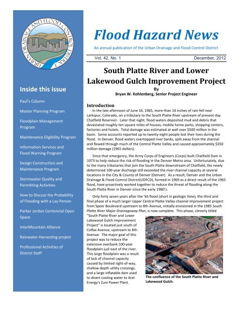
Flood Hazard News<br />
An annual publication of the Urban Drainage <strong>and</strong> Flood Control District<br />
Vol. 42, No. 1 December, 2012<br />
Inside this issue<br />
Paul’s Column<br />
Master Planning Program<br />
Floodplain Management<br />
Program<br />
Maintenance Eligibility Program<br />
Information Services <strong>and</strong><br />
Flood Warning Program<br />
Design Construction <strong>and</strong><br />
Maintenance Program<br />
Stormwater Quality <strong>and</strong><br />
Permitting Activities<br />
How to Discuss the Probability<br />
of Flooding with a Lay Person<br />
Parker Jordan Centennial Open<br />
Space<br />
InterMountain Alliance<br />
Rainwater Harvesting project<br />
Professional Activities of<br />
District Staff<br />
<strong>South</strong> <strong>Platte</strong> <strong>River</strong> <strong>and</strong> <strong>Lower</strong><br />
<strong>Lakewood</strong> <strong>Gulch</strong> <strong>Improvement</strong> Project<br />
By<br />
Bryan W. Kohlenberg, Senior Project Engineer<br />
Introduction<br />
In the late afternoon of June 16, 1965, more than 14 inches of rain fell near<br />
Larkspur, Colorado, on a tributary to the <strong>South</strong> <strong>Platte</strong> <strong>River</strong> upstream of present day<br />
Chatfield Reservoir. Later that night, flood waters deposited mud <strong>and</strong> debris that<br />
devastated roughly ten square miles of houses, mobile home parks, shopping centers,<br />
factories <strong>and</strong> hotels. Total damage was estimated at well over $500 million in the<br />
basin. Some accounts reported up to twenty-eight people lost their lives during the<br />
flood. In Denver, flood waters overtopped river banks, split away from the channel<br />
<strong>and</strong> flowed through much of the Central <strong>Platte</strong> Valley <strong>and</strong> caused approximately $350<br />
million damage (1965 dollars).<br />
Since that emergency, the Army Corps of Engineers (Corps) built Chatfield Dam in<br />
1973 to help reduce the risk of flooding in the Denver Metro area. Unfortunately, due<br />
to the many tributaries that join the <strong>South</strong> <strong>Platte</strong> downstream of Chatfield, the newly<br />
determined 100-year discharge still exceeded the river channel capacity at several<br />
locations in the City & County of Denver (Denver). As a result, Denver <strong>and</strong> the Urban<br />
Drainage & Flood Control District(UDFCD), formed in 1969 as a direct result of the 1965<br />
flood, have proactively worked together to reduce the threat of flooding along the<br />
<strong>South</strong> <strong>Platte</strong> <strong>River</strong> in Denver since the early 1980’s.<br />
Only forty seven years after the ’65 flood (short in geologic time), the third <strong>and</strong><br />
final phase of a much larger Upper Central <strong>Platte</strong> Valley channel improvement project<br />
from Speer Boulevard upstream to 8th Avenue, initially envisioned in the 1985 <strong>South</strong><br />
<strong>Platte</strong> <strong>River</strong> Major Drainageway Plan, is now complete. This phase, cleverly titled<br />
“<strong>South</strong> <strong>Platte</strong> <strong>River</strong> <strong>and</strong> <strong>Lower</strong><br />
<strong>Lakewood</strong> <strong>Gulch</strong> <strong>Improvement</strong><br />
Project” is located just south of<br />
Colfax Avenue, upstream to 8th<br />
Avenue. The major goal of this<br />
project was to reduce the<br />
extensive overbank 100-year<br />
floodplain just east of the river.<br />
This large floodplain was a result<br />
of lack of channel capacity<br />
caused by limited right-of-way,<br />
shallow depth utility crossings,<br />
<strong>and</strong> a large inflatable dam used<br />
to divert cooling water to Xcel<br />
Energy's Zuni Power Plant.<br />
The confluence of the <strong>South</strong> <strong>Platte</strong> <strong>River</strong> <strong>and</strong><br />
<strong>Lakewood</strong> <strong>Gulch</strong>.
<strong>Lakewood</strong> <strong>Gulch</strong> flows into the <strong>South</strong> <strong>Platte</strong> just upstream<br />
of Colfax Avenue. The lower gulch reach below Decatur<br />
Street was severely undersized for the 100-year flood; with<br />
several Denver owned buildings located within the 100-year<br />
floodplain. During the design of the <strong>South</strong> <strong>Platte</strong><br />
improvements it became apparent that the new RTD<br />
FasTracks West Corridor light rail line, following the<br />
<strong>Lakewood</strong> <strong>Gulch</strong> corridor, would need to cross the <strong>South</strong><br />
<strong>Platte</strong> just upstream of <strong>Lakewood</strong> <strong>Gulch</strong>. Since RTD required<br />
that their tracks be located outside or above 100-year<br />
floodplains, both the gulch <strong>and</strong> <strong>South</strong> <strong>Platte</strong> improvements<br />
were expedited to meet the light rail completion schedule.<br />
Both the gulch <strong>and</strong> <strong>South</strong> <strong>Platte</strong> reaches shared common<br />
goals, constructability issues, staging areas, light rail<br />
crossings, funding partners, construction schedules, etc.,<br />
therefore, it was decided to combine both projects into one<br />
construction package. Having a single general contractor<br />
made sense due to the amount of coordination <strong>and</strong><br />
construction phasing needed to construct both reaches<br />
simultaneously.<br />
Design <strong>and</strong> Construction<br />
The original <strong>South</strong> <strong>Platte</strong> portion of the project was<br />
initially to be designed <strong>and</strong> built under a cost share<br />
agreement with the Corps. Preliminary engineering was<br />
almost complete when additional Corps' funding<br />
authorizations were never appropriated by Congress. Due to<br />
the local importance of the project <strong>and</strong> the tight west<br />
corridor light rail schedule, the UDFCD <strong>and</strong> Denver committed<br />
to see the project through without federal financial support.<br />
The UDFCD <strong>and</strong> Denver contributed each year to a special<br />
project funding account to ultimately cover the entire design,<br />
right-of-way, <strong>and</strong> construction costs. In 2006, the consulting<br />
firm Matrix Design Group, Inc. was hired to design the <strong>South</strong><br />
<strong>Platte</strong> <strong>River</strong> improvements <strong>and</strong> soon thereafter selected<br />
again to design the <strong>Lower</strong> <strong>Lakewood</strong> <strong>Gulch</strong> improvements.<br />
The design of channel improvements to the <strong>South</strong> <strong>Platte</strong><br />
reach, over 3,800 linear feet, included channel widening <strong>and</strong><br />
lowering, recreation-compatible drop structures, naturallooking<br />
sculpted concrete jetties, surface water diversion,<br />
utility protection <strong>and</strong> relocation, retaining walls, regional trail<br />
improvements, re-vegetation <strong>and</strong> wildlife habitat<br />
enhancement. Most notable was the removal of Xcel<br />
Energy’s old inflatable diversion dam, the last major<br />
obstruction to boatability on the river in Denver.<br />
The original inflatable dam was built to divert <strong>and</strong> pass<br />
cooling water through the Zuni Power Plant <strong>and</strong> immediately<br />
back into the river. In its inflated position it was a major<br />
obstacle to flow, causing much of the overbank flooding<br />
downstream <strong>and</strong> mass sediment loading when deflated for<br />
maintenance flushing. In cooperation with Xcel Energy, the<br />
plant’s cooling towers were retrofit by Xcel with a closed-loop<br />
circulation system that required more cooling but much<br />
smaller river water dem<strong>and</strong>. This allowed the inflatable dam<br />
to be removed <strong>and</strong> replaced with a new grouted sloping<br />
boulder drop structure with boat chute <strong>and</strong> small water<br />
intake structure.<br />
The design of channel improvements to the <strong>Lower</strong><br />
<strong>Lakewood</strong> <strong>Gulch</strong> portion, over 1,600 linear feet, included<br />
realignment <strong>and</strong> restoration of a narrow, walled channel<br />
section that could only convey approximately the 10-year<br />
storm event. To facilitate these improvements, Denver’s<br />
70,000 square foot fleet maintenance facility building was<br />
demolished to make room. The channel was greatly widened<br />
<strong>and</strong> vegetated to create a more natural floodplain corridor.<br />
<strong>Improvement</strong>s included a me<strong>and</strong>ering low flow channel,<br />
utility protection, extensive wetl<strong>and</strong>s <strong>and</strong> upl<strong>and</strong> vegetation,<br />
<strong>and</strong> a new concrete multi-use trail system with two<br />
pedestrian bridges to provide the community access to the<br />
revitalized waterway. All these improvements vastly<br />
improved public safety <strong>and</strong> recreational opportunities.<br />
Other notable improvements to <strong>Lower</strong> <strong>Lakewood</strong> <strong>Gulch</strong><br />
included removing the small Decatur Street culvert <strong>and</strong><br />
Old Inflatable Diversion Dam at Zuni Power Plant<br />
New Diversion Dam with boat chute
Completed <strong>South</strong> <strong>Platte</strong> <strong>River</strong> Reach<br />
replacing it with a new bridge approximately 10 times wider.<br />
A new drop structure upstream of Decatur was designed as a<br />
series of wetl<strong>and</strong> planted aesthetic ponds for visual interest<br />
<strong>and</strong> to improve water quality (more on this structure below).<br />
Ultimately, <strong>Lower</strong> <strong>Lakewood</strong> <strong>Gulch</strong>, once a narrow walled<br />
corridor, was completely reconstructed into a broad natural<br />
open space corridor using native plant <strong>and</strong> tree species to<br />
provide urban wildlife habitat <strong>and</strong> visual interest to park<br />
visitors <strong>and</strong> light rail users.<br />
Early construction of a portion of the<br />
<strong>South</strong> <strong>Platte</strong> reach was begun in 2007 by<br />
Edge Contracting Inc. This work included<br />
the lowering of a large concrete electrical<br />
distribution duct <strong>and</strong> the protection of a<br />
shallow depth power transmission line<br />
crossing the river just downstream of<br />
Colfax <strong>and</strong> upstream of the proposed light<br />
rail bridge. This work was completed early<br />
to facilitate the early construction of the<br />
light rail bridge. Lawrence Construction<br />
Company (LCC) was awarded the<br />
combined overall construction project on<br />
November 2, 2009. Total project cost for<br />
design <strong>and</strong> construction was<br />
approximately $20 million.<br />
Innovation<br />
This project utilized innovative<br />
approaches to work in an active river<br />
channel. Approximately 3000 feet of sheet<br />
pile were installed in the river to<br />
temporarily control surface <strong>and</strong> ground<br />
Completed <strong>Lower</strong> <strong>Lakewood</strong> <strong>Gulch</strong><br />
Reach<br />
Sheet pile water control within the<br />
<strong>South</strong> <strong>Platte</strong> <strong>River</strong><br />
water. Installing this much sheet<br />
pile was a massive undertaking by<br />
LCC but it allowed them to meet<br />
water quality regulatory<br />
requirements <strong>and</strong> phase<br />
construction activities in the river.<br />
This sheet pile remained in place for<br />
over a year <strong>and</strong> allowed LCC to<br />
switch the river flow from one side<br />
to the other as work progressed.<br />
Another innovative approach by<br />
LCC was to modify the retaining wall<br />
design to allow work to proceed<br />
during the flood season <strong>and</strong><br />
minimize the work effort. The<br />
change in construction involved a<br />
“top-down” approach which utilized<br />
drilled caissons. Ultimately pre-cast<br />
concrete panels were attached to<br />
the caissons to form the finished<br />
wall. This eliminated the need for a<br />
large traditional spread footing <strong>and</strong><br />
allowed for construction to occur on<br />
both sides of the river at the same time. This approach saved<br />
money, time <strong>and</strong> reduced the risk of high water damage<br />
during construction.<br />
At the request of the Corps for the Section 404 permit<br />
approval, the <strong>Gulch</strong> channel needed to allow for fish passage.<br />
Typical grade control drop structures create waterfalls that<br />
become barriers for aquatic life to migrate upstream. Matrix<br />
Design Group designed the <strong>Lakewood</strong> <strong>Gulch</strong> drop structure to<br />
be fish passable using a set of 6-inch drops<br />
<strong>and</strong> pools. The plan went through a few<br />
iterations <strong>and</strong> ended with a unique<br />
concept of interlocking sculpted concrete<br />
rings. The pools were then planted with<br />
wetl<strong>and</strong> species for a softer appearance.<br />
Conclusion<br />
Construction of the $20 million <strong>South</strong><br />
<strong>Platte</strong> <strong>River</strong> <strong>and</strong> <strong>Lower</strong> <strong>Lakewood</strong> <strong>Gulch</strong><br />
<strong>Improvement</strong> Project through Denver’s<br />
Upper Central <strong>Platte</strong> Valley was completed<br />
in April 2012. The 3½-year construction<br />
project involved extensive earthwork <strong>and</strong><br />
environmental restoration for the purpose<br />
of flood control, recreation, habitat<br />
creation, <strong>and</strong> general enhancement of the<br />
river corridor for the community. This was<br />
a massive local effort that removed<br />
obstructions on the river <strong>and</strong><br />
reconstructed the entire river channel to<br />
safely contain a 100-year flood event <strong>and</strong><br />
create a more natural, vibrant, recreational
Completed <strong>Lakewood</strong> <strong>Gulch</strong> Ring Drop<br />
river amenity. As a result, over 365 acres (496 properties)<br />
located between Speer Boulevard <strong>and</strong> 8th Avenue are now<br />
outside of the 100-year regulatory floodplain.<br />
The planning, design <strong>and</strong> construction of this project<br />
required significant coordination <strong>and</strong> cooperation between<br />
the UDFCD, Denver Public Works, Denver Parks <strong>and</strong><br />
Recreation, RTD, Xcel Energy, Denver Water, Metro<br />
Wastewater Reclamation District, the Metropolitan Football<br />
Stadium District, <strong>and</strong> others. This project was a finalist for<br />
the 2012 Colorado Association of Stormwater <strong>and</strong> Floodplain<br />
Manager’s Gr<strong>and</strong> Award for Engineering Excellence <strong>and</strong> was<br />
awarded the 2012 Safety Award in the Engineering News<br />
Record’s Mountain States, Best Projects competition for the<br />
Colorado-Wyoming Region.<br />
Congratulations to all involved for over 30 years of<br />
successful planning, design <strong>and</strong> construction!!!<br />
The pre- <strong>and</strong> post-project 100-year floodplains
Hind’ sight<br />
By Paul A. Hindman<br />
Timely Comment from the District's Executive Director<br />
The year 2012 was an active year for the Urban Drainage<br />
<strong>and</strong> Flood Control District (District). We had a lot of<br />
successes but we also had an "oops". Since everyone is<br />
attracted to bad stuff like moths are to a light, I’ll start with<br />
that.<br />
In March we were notified by the EPA that we had<br />
violated the Clean Water Act on a project we completed on<br />
Piney Creek, <strong>and</strong> they would be contacting us to determine<br />
the penalties that would be accessed. The project was<br />
removing sediment that had washed down Piney Creek <strong>and</strong><br />
deposited so that the trail <strong>and</strong> nearby area was unusable by<br />
the public. We applied for a Nationwide 404 permit from the<br />
U.S. Army Corps of Engineers <strong>and</strong> got it. Then when we went<br />
to construction we went over <strong>and</strong> above what the nationwide<br />
permit allowed. We took a proactive approach <strong>and</strong> contacted<br />
EPA to discuss how to remedy the situation.<br />
In the end we ended up with a minimal fine, an on-site<br />
environmental enhancement project <strong>and</strong> an agreement to<br />
discuss the whole process at our annual seminar in 2013. The<br />
seminar requirement was our suggestion but the EPA loved it.<br />
So come to our annual seminar on April 2, 2013 <strong>and</strong> you can<br />
hear all the details. Again, moths to a light.<br />
Now the fun stuff. In February we hosted a group of<br />
public works professionals from Curitiba, Brazil. The<br />
population is about 1.8 million in Curitiba, <strong>and</strong> like most cities<br />
around the world, have a couple of rivers running through<br />
their metro area that have been ignored for many years,<br />
much like the south <strong>Platte</strong> <strong>River</strong> in the 1960’s <strong>and</strong> ‘70’s. They<br />
were here because they had heard how our area has<br />
Our visitors from Brazil along the <strong>South</strong> <strong>Platte</strong> <strong>River</strong>.<br />
transformed the <strong>South</strong><br />
<strong>Platte</strong> into an amenity<br />
that the population is<br />
now drawn to. We<br />
rented a van to take<br />
them up <strong>and</strong> down the<br />
river as well as other sites<br />
within the District to<br />
show them how we<br />
manage stormwater <strong>and</strong><br />
have revitalized the river<br />
<strong>and</strong> its tributaries. A lot of information was exchanged <strong>and</strong><br />
since the visit the group has followed up with me <strong>and</strong> other<br />
staff members to continue the dialogue. This type of<br />
international exchange is incredibly rewarding for both<br />
parties.<br />
Within the office, we’ve been moving toward an<br />
electronic document <strong>and</strong> records management system for the<br />
past several years. We tried one path <strong>and</strong> ultimately<br />
determined that path was like walking through the mud. We<br />
got out of the mud <strong>and</strong> are now trying a new path with a<br />
software system called SIRE. We negotiated the contract <strong>and</strong><br />
starting in January of 2013 we are going full steam ahead. It<br />
will allow us to not only file our documents in electronic<br />
format, but will allow us to strategically manage them so that<br />
we can all be more productive. The interesting thing that I<br />
discovered was that in today’s electronic world, our society is<br />
really in the infant stage in knowing how to manage all the<br />
electronic data that we receive daily.<br />
I assumed, wrongly, that there were<br />
companies out there that have this all figured out<br />
<strong>and</strong> we would just have to learn how to use their<br />
system <strong>and</strong> we would no longer be strapped to a<br />
large file room filled with paper, kind of like<br />
QuickBooks for accounting. What I found was<br />
that there are many companies, <strong>and</strong> even<br />
individuals, that will tell you they have a system<br />
all worked out but in reality their system or<br />
program has numerous holes that they either<br />
haven’t thought about or ignore because they<br />
don’t know how to fix it. SIRE is a product that is<br />
customizable <strong>and</strong> has been constructed<br />
specifically for public organizations so I’m<br />
optimistic.<br />
On the State <strong>and</strong> Federal front, our staff has<br />
been engaged in underst<strong>and</strong>ing <strong>and</strong> commenting
on stormwater regulations <strong>and</strong> laws that affect our local<br />
governments. In March, Ken MacKenzie <strong>and</strong> I traveled to<br />
Kansas City to attend one of EPA’s listening sessions on their<br />
proposed integrated permitting process for wastewater <strong>and</strong><br />
stormwater. We relayed to EPA, on behalf of our local<br />
governments, that any change should be only implemented if<br />
it were to decrease the cost to the local governments. Since<br />
then the EPA has allowed integrated permitting <strong>and</strong> a few<br />
communities across the nation have submitted a plan. It is<br />
too early in the program to determine if this will benefit local<br />
governments. No communities in the District boundaries<br />
have submitted an integrated plan. Everyone is taking a “wait<br />
<strong>and</strong> see” approach.<br />
As always, I continue to look for ways to better serve our<br />
local governments <strong>and</strong> welcome any suggestions or<br />
comments anyone may have.<br />
In Memory of Joe Shoemaker<br />
W. Joseph “Joe” Shoemaker passed away in 2012 on his<br />
88 th birthday. He is remembered as a naval officer, Manager<br />
of Public Works for the City <strong>and</strong> County of Denver, State<br />
Senator <strong>and</strong> Chairman of the Joint Budget Committee,<br />
founder <strong>and</strong> chairman of the Greenway Foundation, founder<br />
<strong>and</strong> chairman of the Foundation for Colorado State Parks <strong>and</strong><br />
a devoted family man. He loved Denver, he loved Colorado<br />
<strong>and</strong> he loved the <strong>South</strong> <strong>Platte</strong> <strong>River</strong>.<br />
Joe was instrumental in the creation of the Urban<br />
Drainage <strong>and</strong> Flood Control District. Following the disastrous<br />
1965 flood on the <strong>South</strong> <strong>Platte</strong> <strong>River</strong>, <strong>and</strong> many other<br />
drainageways in Colorado, the Five County Engineers<br />
organization, of which Joe was a member, began searching<br />
for ways to deal with drainage <strong>and</strong> flood control issues<br />
regionally, since water pays no respect to corporate<br />
boundaries.<br />
By 1969, Senator Joe Shoemaker had drafted <strong>and</strong><br />
introduced legislation to create the District. With the help of<br />
some flooding in the Denver-Boulder area during the<br />
legislative session, the legislation passed <strong>and</strong> the District<br />
became a reality. Joe then served as the District’s legal<br />
counsel for many years.<br />
In recognition of his many years of service to the District<br />
<strong>and</strong> the <strong>South</strong> <strong>Platte</strong> <strong>River</strong>; the District, the Greenway<br />
Foundation <strong>and</strong> Wright Water Engineers will establish the Joe<br />
Shoemaker Endowed Research Fund with the University of<br />
Colorado Foundation, for the benefit of the Hydrology <strong>and</strong><br />
"He loved the District. Of Joe's many<br />
accomplishment's he was most proud of<br />
the District."<br />
Jeff Shoemaker, Executive Director of<br />
the Greenway Foundation.<br />
Hydraulics Graduate Program in the Civil Engineering<br />
Department at the University of Colorado Denver.<br />
Distributions from the Fund will be used to provide<br />
research <strong>and</strong> educational support for studies on urban<br />
hydrology <strong>and</strong> environmental preservation, <strong>and</strong> graduate<br />
studies that focus on moving the practical science of urban<br />
hydrology <strong>and</strong> stormwater management into a new era.<br />
Research <strong>and</strong> academic endeavors will typically be in the field<br />
of civil engineering, but may extend to other disciplines such<br />
as political science <strong>and</strong> law.<br />
Joe will be missed by many people, but he leaves a lasting<br />
legacy, including the Urban Drainage <strong>and</strong> Flood Control<br />
District.
Floodplain Management Program<br />
Bill DeGroot, PE, Program Manager<br />
National Flood Insurance Program reauthorized<br />
The National Flood Insurance Program (NFIP) was<br />
reauthorized for a five-year period in late July. The legislation<br />
is called Biggert-Waters 2012, or BW12 for short. There are<br />
many analyses of what is in the bill available on the web,<br />
including one by ASFPM, <strong>and</strong> I’m not going to give my<br />
interpretation here.<br />
I do want to make you aware of two provisions in BW12.<br />
The first is the creation of a Technical Mapping Advisory<br />
Council (TMAC). This will be a 20 member organization with<br />
quite a bit of influence. FEMA is in the process of getting the<br />
council started. That includes writing a charter <strong>and</strong><br />
determining how to seek nominations for membership. Stay<br />
tuned.<br />
The other area I wanted to mention is the loss of<br />
subsidized insurance premiums for many different situations,<br />
including non-primary residences <strong>and</strong> severe repetitive loss<br />
structures. Premiums will go up 25% per year on these <strong>and</strong><br />
many other structures. I expect that there will be quite a<br />
furor in the making when people start experiencing these<br />
higher premiums.<br />
Natural Hazard Mitigation Association award<br />
The Natural Hazard Mitigation Association (NHMA), at its<br />
annual International Hazard Mitigation Practitioners<br />
Workshop in Broomfield in July, presented its inaugural Safe<br />
Development Leadership Award to the UDFCD. I really like<br />
the name of the award, because that’s what we have been<br />
Bill DeGroot <strong>and</strong> David Mallory with the NHMA Safe<br />
Development Leadership Award<br />
trying to promote: sate development. David Mallory <strong>and</strong> I<br />
accepted the award on behalf of the UDFCD.<br />
LOMC delegation<br />
We have been reviewing requests for Letters of Map<br />
Change (LOMC) for FEMA since July 1, 2001. We have had a<br />
pretty busy year again; with 40 cases received in 2012. As<br />
was the case the last couple of years, most of the cases we<br />
have reviewed are for government funded projects. I’m sure<br />
that one reason for the lack of private sector projects is the<br />
economy; but I like to think that our efforts to promote safe<br />
development have also had an impact on the number of<br />
cases. I say this because local government referrals of<br />
development proposals are definitely increasing, but private<br />
sector LOMC’s are not.<br />
We also have to remember that many of the public sector<br />
LOMC’s are for transportation projects that have to cross<br />
floodplains, as well as projects intended to modify the<br />
floodplain to mitigate flood hazards.<br />
At the end of December we had 19 cases under review<br />
<strong>and</strong> only three were private sector cases.<br />
LOMC database<br />
We now have a database that allows us to easily track all<br />
of the LOMC applications since 2001, <strong>and</strong> maintenance<br />
eligibility projects in one place. This helps us do several<br />
things. We can assure that a LOMR has followed a CLOMR<br />
within a reasonable period of time. We can see whether a<br />
CLOMR or LOMR project has been submitted for District<br />
maintenance eligibility, or vice versa. We can sort projects by<br />
drainageway or local government. Finally, we are filing PDF’s<br />
of all recent CLOMR’s <strong>and</strong> LOMR’s in the database for easy<br />
access.<br />
The database is available to the entire District staff. It will<br />
be on-line <strong>and</strong> available to our local governments <strong>and</strong> the<br />
public in early 2013.<br />
DLOMC guidelines<br />
We unveiled Digital Letter of Map Change (DLOMC)<br />
guidelines at the District seminar in April, 2010. So far we<br />
haven’t had many submittals, which has been a bit of a<br />
disappointment. DLOMC’s are voluntary, but we believe they<br />
will save both applicants <strong>and</strong> the District time <strong>and</strong> money,<br />
<strong>and</strong> we continue to encourage DLOMC submittals.<br />
Floodplain delineation<br />
We collaborated with the Master Planning Program to<br />
complete four digital flood hazard area delineation (DFHAD)<br />
studies this year; for Big Dry Creek in Adams County,<br />
Thornton <strong>and</strong> Westminster; Littles Creek in Littleton <strong>and</strong><br />
Centennial; ; S<strong>and</strong> Creek in Aurora <strong>and</strong> Arapahoe County;<br />
Marston Lake North Drainageway in Denver <strong>and</strong> Jefferson<br />
County.<br />
We have DFHAD’s underway for West Toll Gate Creek in<br />
Aurora, Centennial <strong>and</strong> Arapahoe County; Toll Gate Creek <strong>and</strong><br />
<strong>Lower</strong> East Toll Gate Creek in Aurora, Goose Creek in<br />
Boulder; Happy Canyon Creek <strong>and</strong> Badger <strong>Gulch</strong> in Arapahoe<br />
County, Douglas County Lone Tree <strong>and</strong> Parker; Coal Creek <strong>and</strong><br />
Rock Creek in Boulder County, Erie, Lafayette, Louisville,
Broomfield <strong>and</strong> Superior; S<strong>and</strong>erson <strong>Gulch</strong> in Denver,<br />
<strong>Lakewood</strong> <strong>and</strong> Jefferson County; Senac Creek in Aurora; <strong>and</strong><br />
Box Elder Creek in Adams County, Denver, Aurora <strong>and</strong><br />
Arapahoe County.<br />
All of these studies are compatible with FEMA’s DFIRM<br />
specifications, <strong>and</strong> will be provided to FEMA for incorporation<br />
into the appropriate DFIRMs. Terri Fead does an excellent<br />
job of assuring that the DFHAD’s are done to our st<strong>and</strong>ards<br />
<strong>and</strong> FEMA’s.<br />
We have reached an informal agreement with FEMA<br />
Region 8 to put together a schedule of when DFHAD’s will be<br />
completed so that they can be scheduled by the region for<br />
Physical Map Revision (PMR) funding as they are completed.<br />
This will help get the DFHAD’s into the DFIRM database <strong>and</strong><br />
onto the National Flood Hazard Layer quicker. See Risk MAP<br />
below. The first two PMR’s, consisting of seven DFHAD’s,<br />
have just been funded <strong>and</strong> Baker, FEMA’s contractor, is<br />
starting work on them.<br />
Wise Use of Floodplains<br />
David Mallory <strong>and</strong> I attended a conference on the Wise<br />
Use of Floodplains, sponsored by the University of California,<br />
Berkeley <strong>and</strong> the Corps of Engineers in March. I presented a<br />
paper, Wise Use of Floodplains, The Denver Area Experience;<br />
<strong>and</strong> David participated in a panel discussion. The results of<br />
the conference will be the subject of a session at the Natural<br />
Hazards conference in Broomfield in July, 2013.<br />
DFHAD guidelines<br />
Our DFHAD Guidelines have been undergoing some<br />
additional modifications, with seemingly every new draft<br />
DFHAD submittal raising new issues. New guidelines were<br />
posted on our website in mid-2012.Terri Fead did a great job<br />
with the revisions. There is a lot of good information in the<br />
guidelines for anyone doing any kind of digital floodplain<br />
mapping.<br />
DFIRM projects<br />
In 2009 we received four grants from FEMA to update<br />
existing DFIRM’s for the City <strong>and</strong> County of Broomfield, City<br />
<strong>and</strong> County of Denver, Jefferson County <strong>and</strong> Douglas County.<br />
At the end of 2012 Broomfield was nearing completion, with<br />
Denver <strong>and</strong> Jefferson County both in the 90-day appeal<br />
period. The Douglas County project has picked up speed <strong>and</strong><br />
we now expect to be in the 90-day appeal period in mid-<br />
2013.<br />
The Boulder County DFIRM conversion project, which is<br />
being managed by the Colorado Water Conservation Board<br />
became effective on December 18, 2012. With its completion<br />
all of the District’s local governments have effective DFIRM’s<br />
<strong>and</strong> all should be available on the National Flood Hazard<br />
Layer (NFHL).<br />
Risk MAP moves ahead<br />
FEMA is now well into its fourth year of Risk MAP. Last<br />
year we participated in discovery meetings for the Clear<br />
Creek <strong>and</strong> St. Vrain Creek watersheds. The Colorado Water<br />
Conservation Board (CWCB) has taken the lead for studies in<br />
these two watersheds.<br />
While we are cooperating with the CWCB on these<br />
studies, our emphasis has shifted from applying for FEMA<br />
grants to trying to get our completed DFHAD’s (see above)<br />
incorporated into the DFIRM’s as quickly as possible. We are<br />
also talking to FEMA about getting our master plans<br />
incorporated in some way into non-regulatory Risk MAP<br />
products.<br />
In the case of the St Vrain study, we were planning to<br />
begin a master planning <strong>and</strong> FHAD study for Coal <strong>and</strong> Rock<br />
Creeks in 2012. Since FEMA had just acquired new LIDAR<br />
mapping for the watershed, including Coal <strong>and</strong> Rock Creeks,<br />
we agreed to provide the new FHAD to the Risk MAP effort in<br />
return for FEMA providing the new mapping to us. This is<br />
another route to getting our FHAD’s into the NFHL.<br />
FasTracks Coordination<br />
FasTracks continues to take a lot of our time, as David<br />
Mallory discusses elsewhere in this issue. In addition to the<br />
design <strong>and</strong> construction work David discusses, we formed a<br />
group of the local governments impacted by the Eagle P3<br />
corridors. We met monthly early on to address common<br />
issues <strong>and</strong> develop common positions for all of the<br />
communities. The group was able to resolve issues on unified<br />
drainage criteria for the CRT corridors as well as unified<br />
BMP’s for the corridors. Ken MacKenzie was very helpful to<br />
the group. This proved to be a very successful effort, <strong>and</strong><br />
regularly scheduled meetings are no longer necessary.<br />
Maintenance Eligibility<br />
Our maintenance eligibility program continues to flourish<br />
under David Mallory’s direction. See David’s column.
Maintenance Eligibility Program<br />
David Mallory, PE, CFM, Senior Project Engineer, Floodplain Management Program<br />
The Maintenance Eligibility Guidelines (aka Maintenance<br />
Eligibility Program Guidelines For Flood Control Facilities<br />
Constructed By Others) were updated this year <strong>and</strong><br />
presented at the District’s Annual Seminar. Everyone in the<br />
Floodplain Management Program contributed as well as folks<br />
in our Design Construction <strong>and</strong> Maintenance (DCM) <strong>and</strong><br />
Master Planning programs. Changes of note include:<br />
• Provision for digital submittals,<br />
• Inclusion of the Floodplain Preservation Brochure,<br />
• Inclusion of the District’s Good Neighbor Policy,<br />
• New trail criteria, especially at grade separated<br />
roadway crossings,<br />
• Clarification on field operations <strong>and</strong> grouted boulder<br />
pre-grout inspections,<br />
• Clarification for acknowledging the flood attenuation<br />
effects of existing detention basins that are not<br />
eligible for District maintenance assistance,<br />
• New requirement for Maintenance Site Plans for<br />
regional detention basins.<br />
The guidelines do not address as-built plans directly as we<br />
simply require whatever the local government requires.<br />
However, certified as-built plans are required for a LOMR<br />
submittal. Terri completed an exhaustive review of FEMA<br />
requirements <strong>and</strong> current st<strong>and</strong>ard of care. The resulting<br />
memo will be available for distribution in early 2013.<br />
Private sector development is still slow; however we see<br />
signs of a mild resurgence. Several older projects were<br />
resubmitted for re-approval along with several new projects.<br />
Among those in the works are Solterra in <strong>Lakewood</strong>, Pinery<br />
West in Douglas County, Eastgate in Aurora <strong>and</strong> Parker<br />
Homestead. Most of our time this year was spent on several<br />
large public sector projects:<br />
RTD FasTracks West Corridor Project<br />
We have worked with RTD, the City <strong>and</strong> County of Denver,<br />
the City of <strong>Lakewood</strong> <strong>and</strong> Jefferson County on this project<br />
since the summer of 2004. Denver Transit Construction<br />
Group JV (DTCG) commenced construction in the spring of<br />
2009. Joanna Czarnecka continues to do a fabulous job of<br />
keeping this large, long <strong>and</strong> complicated project on track (pun<br />
intended) for District Maintenance Eligibility. Most of our<br />
effort this year was focused on final details, <strong>and</strong> punch list<br />
activities. We have now issued construction acceptance for<br />
all project elements related to the impacted stream corridors.<br />
The West Corridor Project involved eight years of hard<br />
work <strong>and</strong> touched most of the District staff in one way or<br />
another. Through patience, perseverance, skilled<br />
negotiations <strong>and</strong> strong local government support, we<br />
achieved the desired outcome. Bill DeGroot served as the<br />
District’s lead policy liaison to RTD. His leadership was<br />
important in shaping the final project<br />
RTD FasTracks Eagle P3 Project<br />
The Eagle P3 Project includes the East Corridor to DIA, the<br />
Gold Line to Arvada <strong>and</strong> Wheat Ridge <strong>and</strong> a starter segment<br />
of the Northwest Rail Corridor to Westminster. Eagle is an<br />
acronym for those corridors <strong>and</strong> P3 st<strong>and</strong>s for public private<br />
partnership. The Eagle P3 Project is a competitive<br />
concessionaire arrangement where the selected team,<br />
Denver Transit Partners (DTP) (Fluor, HDR, PBS&J, Parsons<br />
Brinckerhoff <strong>and</strong> others) will design, build, finance, operate<br />
<strong>and</strong> maintain the project with a long-term lease back to RTD.<br />
There are significant drainage <strong>and</strong> floodplain<br />
management issues throughout the corridors. For example,<br />
the proposed commuter rail track (CRT) alignment impacts<br />
every regional detention pond along Pena Boulevard. We<br />
negotiated a Memor<strong>and</strong>um of Underst<strong>and</strong>ing (MOU) with<br />
RTD concerning the design approach as it affects Irondale<br />
<strong>Gulch</strong>, Blue Grama Draw <strong>and</strong> the West Fork of Second Creek.<br />
We received an astonishing number of large submittal<br />
packages. Fortunately, John Pflaum was available to help<br />
with the engineering review tasks in order meet RTD’s<br />
dem<strong>and</strong>ing review <strong>and</strong> issue resolution schedule. Joanna<br />
downloads the submittals <strong>and</strong> performs a cursory review in<br />
order to determine the District’s interest in each submittal.<br />
She also maintains the tracking spreadsheet to monitor<br />
progress <strong>and</strong> deadlines. John follows with the detailed<br />
review <strong>and</strong> written comments that are uploaded to the RTD<br />
comment portal.<br />
One little bump in the road this year was the so called Big<br />
Deal that the City <strong>and</strong> County of Denver negotiated with RTD.<br />
The agreement affected the East Corridor, providing<br />
Drainage structures for the East Corridor CRT to DIA went in<br />
very quickly in late 2012.
additional double tracking <strong>and</strong> exp<strong>and</strong>ing the CRT<br />
embankment <strong>and</strong> structures to accommodate future<br />
continuous double tracking to DIA. The agreement also<br />
provided for additional grade separations at Green Valley<br />
Ranch Boulevard <strong>and</strong> Tower Road. Impacts on drainage<br />
features included doubling the width of the First Creek Bridge<br />
<strong>and</strong> additional fill <strong>and</strong>/or retaining structures at most of the<br />
regional detention sites. Everyone’s work load increased<br />
while the schedule remained unchanged. Nicole Harwell with<br />
RTD <strong>and</strong> Rich Thornton with HDR proved effective partners in<br />
resolving the various issues <strong>and</strong> concerns on the East<br />
Corridor. Anyone traveling to DIA recently has undoubtedly<br />
noticed bridge construction in the Second Creek/E-470 area<br />
<strong>and</strong> First Creek as well as embankment <strong>and</strong> drainage work<br />
along the east side of Pena Boulevard.<br />
The Eagle P3 Project has been the catalyst for several DCM<br />
projects including the Montclair Basin Outfall <strong>and</strong> First Creek<br />
Restoration projects in Denver, the Westminster Little Dry<br />
Creek improvements, Baranmor Ditch in Aurora, <strong>and</strong> the<br />
Ridge Road storm drain <strong>and</strong> interim detention basin in Wheat<br />
Ridge <strong>and</strong> Arvada. In addition to requiring internal District<br />
coordination with various DCM project managers, there was<br />
also significant coordination with our local government<br />
colleagues <strong>and</strong> other stakeholders. Similar to the West<br />
Corridor, the Eagle P3 project was faced with challenging<br />
drainage <strong>and</strong> floodplain management issues that required<br />
hard work from all the stakeholders. Everyone involved <strong>and</strong><br />
the agencies <strong>and</strong> interests they represent want a successful<br />
transit project that holds public safety as the overarching<br />
goal.<br />
First Creek Restoration Project<br />
The First Creek DFHAD identified a significant overflow of<br />
56 th Avenue between Pena Boulevard <strong>and</strong> Tower Road. We<br />
believe the First Creek channel was relocated several decades<br />
ago in order to facilitate farming operations. The overflow<br />
affected RTD’s East Corridor <strong>and</strong> Denver’s 56 th Avenue<br />
widening projects as well as several adjacent l<strong>and</strong>owners.<br />
RTD’s original proposal was a nearly 1,800 foot long structure<br />
starting south of 56 th Avenue <strong>and</strong> ending north of First Creek.<br />
Correcting the 56 th Avenue overtopping would have required<br />
additional culverts <strong>and</strong> higher profile grades for both the<br />
roadway <strong>and</strong> CRT, while l<strong>and</strong>owners would still be in the<br />
floodplain. In 2011, we proposed an alternate approach to<br />
partially restore the historic First Creek alignment <strong>and</strong> fully<br />
utilize the existing 56 th Avenue bridge capacity.<br />
The stakeholders <strong>and</strong> funding partners include RTD,<br />
Denver, DIA, several private l<strong>and</strong>owners, two metropolitan<br />
districts the Rocky Mountain Arsenal Wildlife Refuge <strong>and</strong> the<br />
District. Denver is in charge of right-of-way acquisition <strong>and</strong><br />
funding arrangements. The District contracted with Short<br />
Elliott Hendrickson (SEH) to prepare the final construction<br />
documents, cost estimates, l<strong>and</strong> acquisition documents <strong>and</strong><br />
so forth. Danny Elsner is the SEH project manager <strong>and</strong><br />
Barbara Chongtoua is the DCM Manager. I believe that when<br />
completed, this project will be a great example of stream<br />
restoration, regional cooperation, <strong>and</strong> shared transit <strong>and</strong><br />
floodplain management interests.<br />
A number of private sector projects will also spin off as a<br />
result of Eagle P3. Expect a plethora of Transit Oriented<br />
Development (TOD) projects to come along in the future.<br />
Two private sector flood risk reduction projects along the East<br />
Corridor follow:<br />
Aviation Station at Blue Grama Pond<br />
The Big Deal mentioned above also paved the way for one<br />
additional East Corridor station along Pena Boulevard that is<br />
currently referred to as Aviation Station. DIA selected the<br />
Fulenwider proposal for siting Aviation Station, thus the CRT<br />
platform <strong>and</strong> bus interface will be located between 61 st <strong>and</strong><br />
63 rd Avenues. This selection will kick start the adjacent TOD<br />
project. Blue Grama Draw runs through the project, crosses<br />
the CRT in a culvert <strong>and</strong> continues into Blue Grama Pond. We<br />
believe this will facilitate the completion of Blue Grama Draw<br />
<strong>and</strong> Pond between Tower Road <strong>and</strong> Pena Boulevard.<br />
Bolling Tributary Completion Project<br />
The other CRT station along Pena Boulevard is located just<br />
south of 40 th Avenue in the Gateway Park East development<br />
at the existing Park <strong>and</strong> Ride. The 40 th Avenue under-crossing<br />
of the CRT is currently under construction. Also under<br />
construction is the Bolling Tributary Completion Project,<br />
between Tower Road <strong>and</strong> Silverado II Detention Pond.<br />
Silverado II is a past DCM endeavor that is being partially<br />
rebuilt as a result of the CRT project. The culvert at Tower<br />
Road is scheduled for replacement next year, which is also a<br />
DCM project. The completion project will link these two<br />
features. Project elements include four drop structures,<br />
several storm drain outfalls <strong>and</strong> a lot of earthwork.<br />
In the Field<br />
Joanna continues to do an outst<strong>and</strong>ing job observing the<br />
construction phase of projects that will ultimately be eligible<br />
for District maintenance assistance. Joanna oversaw the<br />
completion of the Parker Jordan Centennial Open Space, <strong>and</strong><br />
West Corridor projects. New projects include the East<br />
Corridor, Bolling Tributary <strong>and</strong> Parker Homestead projects.<br />
SEMSWA sent several remeadial regional detention pond<br />
projects along for eligibility, including Windmill Creek Pond<br />
W-1, Dove Creek Pond D-2, Caley East Detention Pond <strong>and</strong><br />
Lone Tree Creek Pond L-2.<br />
Joanna has been invited at address the APWA Colorado<br />
Chapter Constuction Inspection Conference at the end of<br />
January. The title of her presentation will be When<br />
Maintenance Eligibility is On the Line. I recommend this<br />
discussion to anyone who is curious about or needs to better<br />
undst<strong>and</strong> the the critical construction phase element to<br />
project eligibility for District maintenance assistance.
Parker Jordan Centennial Open Space – a consultant’s story<br />
By Susan Brown, Valerian, llc<br />
One morning, at sunrise, I went to the Parker Jordan<br />
Centennial Open Space (PJCOS) to photograph our completed<br />
reclamation project. As I was walking to the amphitheatre<br />
along Cherry Creek, I noticed a woman walking down the<br />
same path. We started talking while walking <strong>and</strong> she said she<br />
visits the open space every morning <strong>and</strong> likes to explore<br />
different areas <strong>and</strong> experience each open space amenity<br />
individually. When she asked me why I was taking pictures I<br />
told her I was on the Parker Jordan Metropolitan District <strong>and</strong><br />
City of Centennial design team. As the sun began to rise, she<br />
described how much this area means to her. She recently<br />
retired after a 38 year career in nursing <strong>and</strong> she said she<br />
comes to PJCOS every day to look for her soul. She has sat on<br />
the benches, interacted with the kiosk, <strong>and</strong> walked along all<br />
the different pathways <strong>and</strong> trails. We exchanged e-mail<br />
addresses <strong>and</strong> parted ways. The following day this is what I<br />
received from her.<br />
“I just love the way you respected<br />
the natural beauty of that area <strong>and</strong><br />
provided places of rest <strong>and</strong> solace<br />
in magnificent wood <strong>and</strong> stone.<br />
There is wonderful variety with the<br />
paved paths <strong>and</strong> soft paths <strong>and</strong><br />
places to cross the creek <strong>and</strong> places<br />
to just sit quietly <strong>and</strong> marvel at<br />
nature <strong>and</strong> catch up with our souls.<br />
What a gift you have designed for<br />
all of us to be able to access the<br />
beauty of these treasured open<br />
spaces. Thank you so very much.”<br />
Vonnie<br />
Although this story describes the experience of one<br />
woman, this open space is important to a variety of visitors<br />
because of its size, adjacency to Cherry Creek, <strong>and</strong> its<br />
recreational <strong>and</strong> ecological improvements. Until the<br />
purchase of this property by the Parker Jordan Metropolitan<br />
District the entire site was closed to the public <strong>and</strong> the Cherry<br />
Creek Regional Trail stopped on the south property line <strong>and</strong><br />
picked up again on the north property line leaving a one mile<br />
gap in the 83 mile trail. The sale of the 80-acre site to Parker<br />
Jordan Metropolitan District was restrictive in terms of the<br />
amount of developable l<strong>and</strong> that was requested to be kept<br />
out of the floodplain designation.<br />
As a result, we had some significant design issues<br />
concerning the stream corridor reclamation from the<br />
beginning. The original design prepared by the engineer was<br />
responsive to the previous owner’s desires <strong>and</strong> hence the<br />
direction by the Parker Jordan Metropolitan District. After<br />
thorough examination, Urban Drainage <strong>and</strong> Flood Control<br />
District determined that the submitted design contained too<br />
much disturbance <strong>and</strong> would not be eligible for UDFCD<br />
maintenance eligibility without a re design. The design team<br />
went back to the drawing boards. At this point, without the<br />
help <strong>and</strong> support of UDFCD, the Cherry Creek Basin Water<br />
Quality Authority (CCBWQA), <strong>and</strong> <strong>South</strong>east Metropolitan<br />
Stormwater Authority (SEMSWA); the Parker Jordan<br />
Metropolitan District <strong>and</strong> the City of Centennial would never<br />
have received maintenance eligibility <strong>and</strong> consequently this<br />
open space never would have been improved. Thankfully,<br />
everyone came to the table <strong>and</strong> worked closely with the<br />
design team to create a reclamation plan that was effectively<br />
implemented. We all met at UDFCD <strong>and</strong> strategically<br />
determined the best approach to maintain the most<br />
developable l<strong>and</strong>, while proceeding with an engineering<br />
solution that created fewer disturbances to the riparian<br />
corridor. The new plan represented compromises but it<br />
saved money <strong>and</strong> enhanced<br />
recreational opportunities <strong>and</strong><br />
natural habitat. Paul Hindman wrote<br />
“When all parties come together a<br />
solution can be found.” I<br />
wholeheartedly agree with this<br />
sentiment. It is of utmost importance<br />
that our public <strong>and</strong> private<br />
partnerships have a common goal of<br />
completing great projects so that the<br />
larger visions of healthy ecosystems<br />
are realized.<br />
There are times when it appears<br />
that the amount of work necessary to “do the right thing”<br />
seems overwhelming. We must resolve conflicting schedules,<br />
budgets, agendas, <strong>and</strong> multi faceted design teams to<br />
negotiate the best solutions to project issues as they arise.<br />
In the case of PJCOS, the hard work <strong>and</strong> collaboration of the<br />
public entities <strong>and</strong> the design consultants culminated in a<br />
project that turned an unsafe <strong>and</strong> ecologically challenged 80-<br />
acre open space into a haven for visitors of all ages. In<br />
addition to creating inviting spaces for human interaction the<br />
stream corridor reclamation also incorporated natural habitat<br />
improvements encouraging healthy system equilibrium.<br />
We are fortunate to live in an area where our desires to<br />
provide people like Vonnie <strong>and</strong> the rest of the community<br />
safe accessible places to become healthier in body <strong>and</strong> spirit<br />
are shared by so many decision making organizations like<br />
UDFCD, SEMSWA <strong>and</strong> the CCBWQA. One of the most<br />
rewarding aspects of our profession is that we can help<br />
facilitate stream corridor reclamation; since it has been<br />
proven that healthy communities are directly related to<br />
healthy environments.
Master Planning Program<br />
Shea Thomas, Senior Project Engineer <strong>and</strong> Ken MacKenzie, Program Manager<br />
Master Planning Projects<br />
We completed seven planning<br />
projects <strong>and</strong> four flood hazard area<br />
delineation studies in 2012 with 13<br />
additional projects under way; <strong>and</strong> we<br />
plan to begin five new planning projects<br />
in 2013.<br />
To date, UDFCD has completed a<br />
total of 93 major drainageway planning<br />
(MDP) studies, 85 outfall system<br />
planning (OSP) studies, <strong>and</strong> 91 flood<br />
hazard area delineation (FHAD) studies,<br />
including many updates of studies<br />
completed in the past.<br />
Urban Storm Drainage Criteria Manual<br />
Progress continues on an update of<br />
the Urban Storm Drainage Criteria<br />
Manual (USDCM), Volumes 1 <strong>and</strong> 2,<br />
with an admittedly optimistic release<br />
date of early 2014. One of the most<br />
respected drainage criteria manuals<br />
nationally <strong>and</strong> around the world; all<br />
three volumes of the USDCM are<br />
available in pdf format on our web page<br />
(www.udfcd.org) for download. We<br />
encourage you to check the website<br />
frequently for the latest updates<br />
Join UDFCD on LinkedIn<br />
We’ve created a LinkedIn group <strong>and</strong><br />
already have over two hundred<br />
members. We would love to have you<br />
join the conversation!<br />
Share your experience, or ask a<br />
question about the criteria manual,<br />
software, or spreadsheets <strong>and</strong> hear<br />
what we <strong>and</strong> other users have to say. We post messages to<br />
this group whenever a new version of the spreadsheets,<br />
software or manual is posted so this is a great way to be<br />
alerted to new releases on our website.<br />
UDFCD Software<br />
You may download the UDFCD unit hydrograph program<br />
Colorado Urban Hydrograph Procedure (CUHP), <strong>and</strong> other<br />
free software, including UDSEWER that includes a profile<br />
plotter, <strong>and</strong> many other free design aid workbooks from our<br />
website at www.udfcd.org. To download the CUHP<br />
companion EPA SWMM program, we have placed a hyperlink<br />
from our software site to the EPA website.<br />
STATUS OF PLANNING PROJECTS<br />
Project Sponsors Consultant Status<br />
Big Dry Creek MDP &<br />
FHAD<br />
Adams, Thornton,<br />
Westminster<br />
Wright<br />
Water<br />
Completed in<br />
2012<br />
Cherry Creek Stabilization Joint MP-DC&M<br />
Completed in<br />
Matrix<br />
Plan<br />
Programs<br />
2012<br />
Erie, Lafayette,<br />
Coal Creek & Rock Creek<br />
Louisville, Broomfield,<br />
MDP & FHAD<br />
Superior, Boulder Co.<br />
RESPEC 30% Complete<br />
Dry <strong>Gulch</strong> OSP Update <strong>Lakewood</strong>, Denver ICON 5% Complete<br />
East Toll Gate Creek (<strong>Lower</strong>)<br />
MDP <strong>and</strong> FHAD<br />
Aurora, Buckley J3 70% Complete<br />
Easterly Creek OSP Aurora SEH<br />
Completed in<br />
2012<br />
Erie OSP Erie WRC 10% Complete<br />
Globeville-Utah Junction OSP<br />
Update<br />
Denver, Adams County CH2M Hill 80% Complete<br />
Goose Creek & Twomile<br />
Canyon Creek Floodplain<br />
Boulder ICON 90% Complete<br />
Happy Canyon Creek MDP & SEMSWA, Doug. Co.,<br />
FHAD<br />
Lone Tree, Parker<br />
Muller 25% Complete<br />
Little’s Creek MDP <strong>and</strong><br />
Completed in<br />
SEMSWA<br />
AMEC<br />
FHAD<br />
2012<br />
Marston Lake North<br />
Denver, Denver Water,<br />
Completed in<br />
Olsson<br />
Drainageway MDP Update <strong>Lakewood</strong>, Jefferson<br />
2012<br />
Newlin <strong>Gulch</strong> MDP Update Parker, Douglas Co. Muller 5% Complete<br />
North Dry <strong>Gulch</strong> OSP <strong>Lakewood</strong> Muller 35% Complete<br />
Park Hill (<strong>Lower</strong>) Drainage<br />
Completed in<br />
Denver, Denver Water Enginuity<br />
OSP<br />
2012<br />
Piney Creek OSP & FHAD<br />
SEMSWA, Aurora,<br />
Completed in<br />
WRC<br />
Douglas<br />
2012<br />
S<strong>and</strong> Creek MDP & FHAD Aurora, SEMSWA Matrix 75% Complete<br />
S<strong>and</strong>erson <strong>Gulch</strong> MDP &<br />
FHAD<br />
Denver, <strong>Lakewood</strong> Matrix 40% Complete<br />
<strong>South</strong> Boulder Creek Flood<br />
Mitigation Study<br />
City of Boulder CH2M Hill 75% Complete<br />
West Toll Gate Creek MDP &<br />
Michael<br />
Aurora, SEMSWA<br />
FHAD<br />
Baker<br />
95% Complete<br />
MDP = Major Drainageway Plan, OSP = Outfall Systems Plan,<br />
FHAD = Flood Hazard Area Delineation<br />
UDFCD Annual Seminar<br />
At our 2012 annual seminar we had 330 registrants,<br />
making it the best attended UDFCD seminar ever. The<br />
proceedings are available at:<br />
http://udfcd.org/conferences/conferences.htm<br />
On April 2, 2013 we will have our next annual seminar.<br />
This one-day program will be at the Stapleton Doubletree<br />
Hotel, <strong>and</strong> early registration will be $69. Please mark your<br />
calendar <strong>and</strong> join us to find out what is going on regionally<br />
<strong>and</strong> nationally in drainage, stormwater quality, <strong>and</strong> floodplain<br />
management.
Stormwater Quality & Permitting Support Activities<br />
Holly Piza, Senior Project Engineer <strong>and</strong> Ken MacKenzie, Manager, Master Planning Program<br />
UDFCD continued to be active in the stormwater quality<br />
arena in 2011, with commitments to the following<br />
organizations <strong>and</strong> activities:<br />
Best Management Practices (BMP) Advancements:<br />
UDFCD continued to make detailed reports available to<br />
the public via the website (www.udfcd.org) for specific sites<br />
within the UDFCD monitoring program. A report spanning<br />
2001-2011 for the extended detention basin (EDB) at Grant<br />
Ranch has been posted on the website. Full history reports<br />
on the porous asphalt <strong>and</strong> permeable interlocking concrete<br />
pavement (PICP) sites in Denver <strong>and</strong> the pervious concrete<br />
site in <strong>Lakewood</strong> can also be found on the website.<br />
UDFCD BMP Monitoring Program:<br />
UDFCD In addition to making detailed reports available to<br />
the public, information on all of the UDFCD stormwater<br />
research sites is now available on our website. Sites currently<br />
monitored by UDFCD include the following BMPs:<br />
• Green Roof,<br />
• Rain Garden,<br />
• Extended Detention Basin (EDB),<br />
• Slotted Concrete,<br />
• Permeable Interlocking Concrete Pavement (PICP)<br />
• Rainwater Harvesting system.<br />
Additionally, UDFCD monitors runoff from an aggregate<br />
rooftop in downtown Denver. Although this is not a BMP, the<br />
data provide information descriptive of stormwater runoff<br />
from an aggregate rooftop <strong>and</strong> could be considered as a<br />
reference point for the green roof. These data are also used<br />
by EPA Region 8 as a control for their green roof (located<br />
across the street from this site).<br />
New Discoveries:<br />
UDFCD partnered with Water Environment Research<br />
Foundation (WERF), Denver Public Schools, <strong>and</strong> the Urban<br />
Watershed Research Institute to construct a rainwater<br />
harvesting system on a new school building. The system has<br />
a connection to NOAA weather forecasting <strong>and</strong> will evacuate<br />
prior to an event <strong>and</strong> commensurate with the forecast so that<br />
the cistern volume is available for stormwater capture. This<br />
type of automated system can be used to address<br />
stormwater treatment using a smaller footprint than would<br />
be required using conventional methods.<br />
Additionally, measurements will include volume collected;<br />
volume used for irrigation <strong>and</strong> volume drained to make<br />
storage available for forecasted rainfall. This is part of a<br />
nationwide WERF study <strong>and</strong> an important site within that<br />
study as rainfall patterns in the UDFCD region are much<br />
different than at other sites currently in the study. We will<br />
monitor the system for five years in an effort to determine<br />
the following:<br />
• Can this specific type of BMP configuration,<br />
utilizing automated controls at the outlet, be an<br />
effective tool in managing stormwater in this<br />
region, <strong>and</strong><br />
• Is rainwater harvesting in general an effective<br />
practice for managing on-site stormwater in<br />
Colorado?<br />
Education <strong>and</strong> Outreach:<br />
After UDFCD applied for <strong>and</strong> received a $60,220 Colorado<br />
State water quality improvement fund grant. This grant will<br />
be used to develop a statewide stormwater education <strong>and</strong><br />
outreach program, housed within the Urban Water Center of<br />
the Colorado Water Institute <strong>and</strong> delivered throughout the<br />
state via the CSU Extension program.<br />
Colorado MS4 Stormwater Group:<br />
The UDFCD continues to host monthly meetings of the<br />
Colorado Stormwater Council, an MS4 permittee-only group<br />
comprising more than 92% of all permit holders in Colorado.<br />
The Colorado Water Quality Control Division is now<br />
holding MS4 permittee meetings at their offices, allowing for<br />
additional State personnel to attend <strong>and</strong> contribute to the<br />
discussion. These meetings are open to all interested parties<br />
<strong>and</strong> consist of MS4 permitees with few exceptions. The<br />
Colorado Stormwater Council has a significant role in these<br />
meetings <strong>and</strong> has presented a list of topics to be discussed<br />
over the coming year. UDFCD attends these meetings,<br />
provides input in an effort to aid the discussion <strong>and</strong> provides<br />
technical expertise where appropriate.<br />
Ken MacKenzie <strong>and</strong> Holly Piza at the seminar.
How to Discuss the Probability of Flooding with a Lay Person<br />
By Ken MacKenzie, Manager, Master Planning Program<br />
Earlier this year, one of our board members asked me to<br />
describe in lay terms what the impacts would be of designing<br />
commuter rail that would remain serviceable during a 5-year<br />
storm vs. a 10-year storm or even a 100-year storm. Most<br />
adults are capable of underst<strong>and</strong>ing that the 100-year flood is<br />
actually an event having a probability of occurrence of 1/100<br />
(or 1%) in any given year <strong>and</strong> not necessarily an event that<br />
occurs once every 100 years; but even highly educated<br />
decision makers often get hazy on the implications of<br />
designing to a specific level of service with the underst<strong>and</strong>ing<br />
that flooding events larger than that level of service may<br />
occur multiple times during the service life of the facility. The<br />
following is a description of the probability of the tracks for a<br />
commuter train being overtopped in the next 20 or 50 years,<br />
by storms larger than the 5-year design storm to which the<br />
track elevations <strong>and</strong> crossings were designed.<br />
There is a probability of occurrence that correlates with<br />
the number of times a design threshold will be exceeded;<br />
which is a technical way of saying the following:<br />
For a 5-year design storm<br />
If the tracks are designed to accommodate the<br />
runoff from a 5-year storm, is almost certain (> 90%<br />
probability) that the tracks will be overtopped once in<br />
the next 20 years. In fact, there is a good chance (> 60%<br />
probability) that it will be happen three times in 20<br />
years.<br />
For the same 5-year storm design, it is almost<br />
certain (> 90% probability) that the tracks will be<br />
overtopped five times in the next 50 years, <strong>and</strong> a good<br />
chance (> 60% probability) that it will happen eight<br />
times in 50 years.<br />
For a 10-year design storm<br />
If the tracks are designed to accommodate the<br />
runoff from a 10-year storm, there is a good chance<br />
(> 80% probability) that the tracks will be overtopped<br />
once in the next 20 years, <strong>and</strong> about a 50/50 chance of<br />
happening twice in 20 years.<br />
For the same 10-year storm design, it is almost<br />
certain (> 90% probability) that the tracks will be<br />
overtopped twice in the next 50 years, <strong>and</strong> about a<br />
50/50 chance of happening five times in 50 years.
For a 100-year design storm<br />
If the tracks are designed to accommodate the<br />
runoff from a 100-year storm, there is a small chance<br />
(< 20% probability) that the tracks will be overtopped<br />
once in the next 20 years, <strong>and</strong> practically no chance of it<br />
happening twice in 20 years.<br />
These illustrations proved to be a good means of making<br />
accessible information that decision makers needed but<br />
found difficult to underst<strong>and</strong> through the st<strong>and</strong>ard veil of<br />
jargon <strong>and</strong> vernacular that accompanies the study of<br />
probability theory <strong>and</strong> analysis of r<strong>and</strong>om phenomena such<br />
as flooding.<br />
For the same 100-year storm design, there is a lessthan<br />
50/50 chance (40% probability) that the tracks will<br />
be overtopped once in the next 50 years, <strong>and</strong> about a<br />
10% chance of happening twice in 50 years.<br />
District Receives Financial<br />
Reporting Certificate<br />
For the twenty-third year in a row the District has<br />
received a Certificate of Achievement for Excellence in<br />
Financial Reporting from the Government Finance Officers<br />
Association of the United States <strong>and</strong> Canada. The certificate<br />
is presented to government units whose comprehensive<br />
annual financial reports achieve the highest st<strong>and</strong>ards in<br />
government accounting <strong>and</strong> financial reporting. The District’s<br />
auditor was Johnson, Holscher & Co., P.C.<br />
Congratulations to Frank Dobbins, Manager of Finance<br />
<strong>and</strong> Accounting, <strong>and</strong> assistant W<strong>and</strong>a Salazar for continuing<br />
this string of awards.<br />
District Receives award from<br />
Colorado Chapter of APWA<br />
The Colorado Chapter of APWA presented its Public<br />
Works Project Award for Environmental Design for a Large<br />
Community to the District for its revisions to the Urban Storm<br />
Drainage Criteria Manual, Volume 3- Best Management<br />
Practices. The revision effort was led by Holly Piza, Senior<br />
Project Engineer in the Master Planning Program. Consulting<br />
services were provided by Wright Water Engineers. Holly<br />
represented the District at the awards luncheon.<br />
From left, Board Chairman Susan Beckman, W<strong>and</strong>a<br />
Salazar, Frank Dobbins <strong>and</strong> Paul Hindman<br />
Paul Hindman <strong>and</strong> Holly Piza
Using Rainwater Harvesting <strong>and</strong> Cloud-Based Infrastructure as a Stormwater BMP<br />
By Holly Piza, P.E., Senior Project Engineer, Master Planning Program<br />
Introduction<br />
Although rainwater harvesting systems capture <strong>and</strong> treat<br />
stormwater, use of this practice as a stormwater best<br />
management practice (BMP) in Colorado is rarely seen as a<br />
viable alternative. First, the practice doesn’t typically provide<br />
the volume required to capture the water quality capture<br />
volume (WQCV) when it rains because the tank may already<br />
be full. Second, western water law dictates that diverting <strong>and</strong><br />
using rainwater for beneficial use (outside of free river<br />
conditions) is illegal without a water right. Exceptions to this<br />
include systems meeting the physical criteria <strong>and</strong> permit<br />
requirements under HB-1129 or SB-09-80. HB-1129, or the<br />
“Pilot Project Bill”, allows for up to ten pilot installations as<br />
approved by the Colorado Water Conservation Board. The<br />
permit obtained through this bill includes rather extensive<br />
monitoring <strong>and</strong> reporting requirements. SB-09-80 allows for<br />
greater use of this type of practice; however, it requires a<br />
permit <strong>and</strong> its use is limited given the criteria to be eligible.<br />
For example, the l<strong>and</strong>owner must not have a tap from a<br />
water supplier. Due to these reasons very little research has<br />
been done in Colorado on the effectiveness of this practice in<br />
reducing the pollutants in receiving streams or as a water<br />
conservation measure.<br />
In 2012 UDFCD applied for a permit from the State,<br />
outside of both HB-1129 <strong>and</strong> SB09-80, which allowed for the<br />
construction of a 3000 gallon, above ground rainwater<br />
harvesting system on a new school building owned by Denver<br />
Public Schools (DPS). This was done through a provision in<br />
the State statues (37-92-308(5)) that allows temporary<br />
approval for up to five years. The statute does not allow for<br />
consumptive use credit by pre-existing vegetation to be used<br />
as an offset for total depletions for the project. This means,<br />
rainwater captured out of priority must be replaced to the<br />
stream system. UDFCD presented this project to Denver<br />
Water, requesting a temporary lease agreement. An<br />
agreement was reached, whereby UDFCD is responsible for<br />
calculating water for replacement <strong>and</strong> Denver Water replaces<br />
this water each month based on that calculation.<br />
Project Overview<br />
This project is a partnership consisting of UDFCD, Water<br />
Environment Research Foundation (WERF) <strong>and</strong> DPS. The<br />
project is also made possible by an Urban Watershed<br />
Research Institute research grant; Denver Water’s<br />
augmentation of rainwater used for irrigation; <strong>and</strong> the<br />
Denver Green School (DGS), who participates in the research.<br />
A 3,000 gallon cistern collects rainwater from the roof of a<br />
new building at DGS <strong>and</strong> uses it for irrigation of the adjacent<br />
l<strong>and</strong>scape areas. The new building, containing 6 th , 7 th , <strong>and</strong> 8 th<br />
grade class rooms is 8,000 square-feet <strong>and</strong> most of the roof<br />
drains to this cistern. When available, the cistern will capture<br />
a rainfall depth of approximately 0.7 inches. The part of this<br />
design that makes it both unique <strong>and</strong> specifically designed for<br />
treatment of stormwater is that the system has a connection<br />
to NOAA weather forecasting <strong>and</strong> it will drain prior to an<br />
event <strong>and</strong> commensurate with the forecast so that the<br />
volume is available for stormwater capture. The controls for<br />
this system are fully automated <strong>and</strong> can also be controlled<br />
remotely. The equipment assembly used to release <strong>and</strong><br />
measure water evacuated from the system, as well as the<br />
software utilized for this purpose, was developed by<br />
Geosyntec Consultants. Geosyntec is WERF’s consultant as<br />
part of a national study being conducted on highperformance<br />
BMPs that utilize cloud-based infrastructure<br />
similar to the DGS rainwater harvesting system. This is an<br />
important site within that study as rainfall patterns in Denver<br />
are much different than at other sites currently in the study.<br />
The DGS rainwater harvesting system is designed, in part,<br />
for student involvement. DGS utilizes project-based learning<br />
through the lens of sustainability. Students can view<br />
differences in volume associated with usage, rain events, <strong>and</strong><br />
cistern evacuation in anticipation of forecasted rain events.<br />
See photo 1 for the dashboard view of the system<br />
components. They can use this system to exp<strong>and</strong><br />
underst<strong>and</strong>ing of math <strong>and</strong> science while becoming aware of<br />
water issues in Colorado. The WERF partnership has<br />
enhanced this aspect of the project, providing components<br />
for real time monitoring of the cistern via the web.<br />
This type of automated system can be used to address<br />
stormwater treatment using a smaller footprint than would<br />
be required using conventional methods because it better<br />
utilizes the volume of BMPs in series. Additionally,<br />
measurements will include volume collected; volume used for<br />
irrigation <strong>and</strong> volume drained to make storage available for<br />
forecasted rainfall. UDFCD will monitor the system in an<br />
effort to determine the following:<br />
• Can this type of BMP configuration, utilizing<br />
automated controls at the outlet, be an effective<br />
tool in managing stormwater in this region, <strong>and</strong><br />
• Is rainwater harvesting an effective practice for<br />
managing on-site stormwater in Colorado?<br />
Construction<br />
One challenge in construction of this system was finding a<br />
Colorado contractor experienced in the construction of<br />
rainwater harvesting systems. The construction of the DGS<br />
system utilized the expertise of three different contractors in<br />
addition to the portion of the system installed by Geosyntec.<br />
Many parts of the system were also designed during<br />
construction, with UDFCD coordinating all work <strong>and</strong> installing<br />
part of the system as well. See photo 2. System components<br />
include the following:
Photo 1 - Dashboard view of the system components<br />
• Water drains through the 8-inch by 8-inch aluminum<br />
downspout at the corner of the building. The<br />
downspout has been built to house a 6-inch PVC<br />
valve. When this valve is closed, rain water is<br />
directed into through a screen filter into a 3,000<br />
gallon high density poly-ethylene (HDPE) cistern.<br />
• Flow into the cistern is measured in two ways. A<br />
rain gauge has been installed on the roof of the<br />
building allowing the predicted flow into the cistern<br />
to be calculated based on the roof area <strong>and</strong> a runoff<br />
coefficient. Additionally, a level logger has been<br />
placed at the end of the discharge pipe (the pipe<br />
used to evacuate the cistern commensurate with the<br />
rain forecast) from the cistern. This measures head<br />
<strong>and</strong> allows for a calculation of increased volume over<br />
the period of the rain event.<br />
• A pump that pressurizes the irrigation system is<br />
located exterior to the cistern <strong>and</strong> fed by a 2-inch<br />
diameter pipe from the bottom of the cistern. The<br />
irrigation system consists of three zones, irrigating a<br />
total area of approximately 2,600 square-feet. The<br />
irrigation system is on a timer <strong>and</strong> is set up to run<br />
daily for a total time of about 15 minutes.<br />
• In the event that there is not enough water in the<br />
cistern to run the pump <strong>and</strong> water in the cistern<br />
drops to a depth of approximately one-foot, gravity<br />
will open a float valve located inside of the cistern<br />
allowing water from the domestic system to fill the<br />
cistern to a minimum depth which allows the pump<br />
to run. This float valve is set just below the pipe<br />
used to evacuate the cistern due to a forecast for<br />
rain. This is to ensure that the evacuation of the<br />
water doesn’t cause the float valve to open. A pulse<br />
output meter measures the volume of water added<br />
from the domestic supply line.<br />
• The<br />
cistern can be<br />
drained in three<br />
ways, by the<br />
irrigation pump, by<br />
an orifice located<br />
at the very bottom<br />
of the cistern<br />
(primarily for<br />
winterization of<br />
the system), <strong>and</strong><br />
by the discharge<br />
pipe (the pipe<br />
used to evacuate<br />
the cistern<br />
commensurate<br />
with the rain<br />
forecast). The 1-<br />
inch diameter<br />
discharge pipe<br />
exits the cistern just above the elevation of the float<br />
valve <strong>and</strong> includes a level logger followed by a<br />
solenoid valve. The solenoid valve opens<br />
automatically when a rain event is forecasted (or<br />
manually as needed).<br />
Data Collection<br />
Typically UDFCD monitors BMPs from April to October,<br />
however; this system was not fully in place until late<br />
September of 2012. Three rain events supplied all of the<br />
irrigation water needed in September <strong>and</strong> part of October. A<br />
couple small events (less than 0.2 inches each) provided<br />
enough irrigation water for the remainder of the month. In<br />
total, 3,223 gallons of rainwater was used for irrigation,<br />
which both completely eliminated stormwater runoff from<br />
the building <strong>and</strong> provided all of the irrigation water needed<br />
during that time. UDFCD will continue to monitor this system<br />
for the term allowed by the State.<br />
Photo 2 – System components
Design, Construction & Maintenance Program<br />
Dave Bennetts, PE, CFM, Program Manager <strong>and</strong> Laura Kroeger, PE, Assistant Program Manager<br />
CIP <strong>and</strong> Work Plan<br />
The DCM program is funded by three different legislative<br />
authorizations; the Construction Fund, the Maintenance<br />
Fund, <strong>and</strong> the <strong>South</strong> <strong>Platte</strong> <strong>River</strong> Fund. Each year the District<br />
prepares a work plan for each of the funds. The 5-year<br />
Capital <strong>Improvement</strong> Plan (CIP) lists capital construction<br />
projects by county for the Construction <strong>and</strong> <strong>South</strong> <strong>Platte</strong><br />
<strong>River</strong> funds. The CIP shows the District’s financial<br />
participation, which will be matched by the participating local<br />
governments, for a 5 year window of time. This allows both<br />
the District <strong>and</strong> local government partners to plan funding<br />
levels into the future.<br />
The Maintenance Work Plan lists projects for the<br />
Maintenance <strong>and</strong> <strong>South</strong> <strong>Platte</strong> <strong>River</strong> funds. Work is listed by<br />
county, category of work, the local government where the<br />
work is located, project location, description of work, <strong>and</strong> the<br />
estimated cost. Maintenance work is funded entirely by the<br />
District. Both the 5-year CIP <strong>and</strong> Maintenenace Work Plan<br />
are developed based on prioritized project requests from<br />
local governments. Copies of both of these plans are<br />
available on the District’s website:<br />
http://www.udfcd.org/design_const_maint/dcm_home.html.<br />
New Consultant Selection Process<br />
The DCM program is implementing an alternative process<br />
for selecting design engineers for District projects. The<br />
District's traditional Qualification Based Selection (QBS)<br />
procedure is based on the guidelines established by ASCE.<br />
While the District <strong>and</strong> the local governments will still have the<br />
option of going through the traditional process, this new<br />
Modified QBS process will offer more flexibility to expedite<br />
the selection process, <strong>and</strong> have the confidence a qualified<br />
drainageway engineering consultant will be awarded the<br />
work.<br />
Most are likely familiar with the traditional selection<br />
process of sending a Request for Proposal (RFP) to ten<br />
engineering consultants selected by the District <strong>and</strong> local<br />
government representatives. Based on the proposals<br />
received, a short list is developed <strong>and</strong> interviews conducted.<br />
The selected firm then enters into negotiations with the<br />
District <strong>and</strong> the local government to develop a scope <strong>and</strong> fee<br />
for the project.<br />
Over the last several years the District has seen the<br />
traditional QBS process become more intense with the<br />
increased competition. The amount of time consultants<br />
invest researching <strong>and</strong> assembling a comprehensive proposal,<br />
<strong>and</strong> then developing <strong>and</strong> detailing a design approach for an<br />
interview takes significant consulting hours. This additional<br />
time ultimately results in increased overhead costs, which are<br />
passed onto the District <strong>and</strong> the local governments.<br />
The District has not seen this exp<strong>and</strong>ed effort during the<br />
selection process add any substantial benefit to the project.<br />
With the recognition that the traditional QBS process no<br />
longer fully serves the District, local governments, consulting<br />
firms, nor the public; a Modified QBS process is being<br />
introduced to expedite the selection process <strong>and</strong> minimize<br />
overhead costs.<br />
The Modified QBS process selects a pool of prequalified<br />
drainageway engineering consultants to whom projects will<br />
be given. The engineering firms will be selected based on a<br />
Statement of Qualification (SOQ), <strong>and</strong> the District’s<br />
experience with that consultant. The number of engineering<br />
firms on the list will vary from about five to ten depending on<br />
District project work load. It is the intent that each<br />
engineering firm on the list will have at least one active<br />
project. Annually, one or more engineering firms on the<br />
prequalified list will need to resubmit their SOQ at which time<br />
the selection process will also be opened up to new<br />
engineering firms to submit their qualifications for<br />
consideration.<br />
Quarterly meetings will be held with District project<br />
engineers to look at upcoming projects <strong>and</strong> distribute the<br />
work load, as well as coordinate providing opportunities for<br />
firms not on the prequalified list to gain experience by<br />
working on smaller projects. The District is committed to<br />
providing opportunities to those firms who market <strong>and</strong> can<br />
provide skills/services needed on projects but not on the<br />
prequalified list.<br />
Routine Maintenance<br />
Routine work provides basic flood control maintenance along<br />
the major drainageways within the District. Services typically<br />
performed include mowing, trash <strong>and</strong> debris removal, weed<br />
control, <strong>and</strong> tree thinning. The District is currently<br />
maintaining over 320 drainageways <strong>and</strong> spent $1,371,620 in<br />
2012 for Routine Maintenance. Private contractors are hired<br />
each year to perform the maintenance on a unit price basis.<br />
The District’s website has maps of the routine work broken<br />
down by county, major drainageway <strong>and</strong> reach.<br />
Restoration Maintenance<br />
Restoration work is site specific construction work to<br />
address isolated drainageway problems that are included in<br />
the Maintenance Eligibility Program. This work often<br />
mitigates the need for more costly improvements in the<br />
future. Types of restoration activities include: sediment<br />
removal, local erosion repair <strong>and</strong> bank protection, drop<br />
structure repair, <strong>and</strong> channel grading, stabilization, <strong>and</strong><br />
revegetation. All of this work is accomplished using private<br />
contractors either through a public bidding process or a pre-
qualified contractor selection process. In 2012, the District<br />
completed $ 9,576,882 of restoration work.<br />
Design <strong>and</strong> Construction Projects<br />
Design <strong>and</strong> construction projects implement master<br />
planned improvements. Generally, the District manages final<br />
designs prepared by consulting engineers. The local<br />
governments are involved in all aspects of the design process,<br />
<strong>and</strong> usually acquire any necessary ROW. Projects are<br />
publically bid for construction. In 2012 the District authorized<br />
approximately 11,875,000 for construction projects. Below is<br />
a brief outline of a few capital <strong>and</strong> maintenance projects that<br />
have been recently completed:<br />
Adams County<br />
The Brantner <strong>Gulch</strong> at Holly Street culvert in the City of<br />
Thornton was significantly undersized, <strong>and</strong> the road<br />
embankment was not wide enough to accommodate a major<br />
arterial road section. The existing dual 48-inch culverts were<br />
no match for the 100-year runoff of approximately 3,500 cfs,<br />
<strong>and</strong> the road would overtop during just a 2-year storm.<br />
North <strong>and</strong> south of Brantner <strong>Gulch</strong>, Holly Street included two<br />
traffic lanes in each direction, but only one lane of traffic in<br />
each direction at Brantner <strong>Gulch</strong>. In addition, the Brantner<br />
<strong>Gulch</strong> trail system had no safe crossing of Holly Street, an<br />
important missing connection with a nearby middle school.<br />
This capital improvement project included the installation<br />
of a 24’x11’ ConSpan arch structure to convey 100-year flows<br />
underneath Holly Street, <strong>and</strong> to accommodate a pedestrian<br />
underpass that will remain dry for up to a 2-year flood event.<br />
Holly Street had to be raised by five feet to accommodate the<br />
larger culvert, <strong>and</strong> to provide a safer sag vertical curve<br />
geometry. A high pressure Xcel gas line had to be<br />
temporarily re-routed to accommodate construction, in<br />
addition to many other utilities that had to be temporarily<br />
supported. Construction was completed in November.<br />
The District <strong>and</strong> Adams County partnered to replace a<br />
failing pedestrian bridge along the Clear Creek trail system.<br />
This pedestrian bridge across the Colorado Agricultural Ditch<br />
New Clear Creek Trail bridge.<br />
Brantner <strong>Gulch</strong> at Holly St. before (above) <strong>and</strong> after<br />
construction.<br />
was rusting out <strong>and</strong> in dire need of replacement in order to<br />
maintain adequate maintenance access along Clear Creek,<br />
<strong>and</strong> to maintain the regional trail system. A prefabricated<br />
steel beam bridge was placed on drilled piers, <strong>and</strong> the trail<br />
was re-aligned to soften the approach curves to the new<br />
skewed bridge. Construction was completed in March.<br />
Grange Hall Creek crosses Washington Street in<br />
Northglenn near 106 th Avenue. An existing regional<br />
detention pond just upstream of Washington Street has only<br />
a 30-inch pipe outfall. With a 100-year flood of around 2,100<br />
cfs, this pipe outfall is frequently overwhelmed <strong>and</strong> the<br />
dilapidated emergency spillway conveys flood flows.<br />
Washington Street is just downstream of the emergency<br />
spillway, <strong>and</strong> has only a pair of 24-inch culverts. As a result,<br />
Washington Street is frequently overtopped, such that the<br />
downstream side of Washington Street has been paved with<br />
asphalt to act as a spillway back into the creek (see photo<br />
below). In addition, the regional trail along Grange Hall Creek<br />
has no safe crossing At Washington Street, as the nearest
Existing Grange Hall Creek crossing<br />
stoplights are several blocks away. Pedestrians frequently<br />
dodge traffic to cross Washington Street.<br />
The City of Northglenn <strong>and</strong> the District are partnering to<br />
construct a new pond outlet structure <strong>and</strong> a new 100-year<br />
crossing <strong>and</strong> pedestrian underpass across Washington Street.<br />
Construction of this project is underway, with a planned<br />
completion in the fall of 2013. Utilities have been a major<br />
challenge on this important project, as many of the City’s<br />
main sanitary sewer trunk lines run along Grange Hall Creek.<br />
Additionally, a 48-inch water conduit along Washington<br />
Street will need to be lowered to accommodate vertical<br />
clearance on the pedestrian underpass. The concept for the<br />
pedestrian underpass is shown above. This will be a<br />
signature project for the City of Northglenn, as it will provide<br />
flood protection for one of their busiest streets, in addition to<br />
providing a safe <strong>and</strong> aesthetically pleasing pedestrian<br />
underpass.<br />
Arapahoe County<br />
The District <strong>and</strong> the <strong>South</strong>east Metro Stormwater<br />
Authority (SEMSWA) have started construction on the capital<br />
project on Cherry Creek at Eco Park, located northeast of<br />
Broncos Parkway <strong>and</strong> Jordan Road. Cherry Creek’s main<br />
channel has cut down several feet <strong>and</strong> the stream banks are<br />
actively eroding. The adjacent vegetation on the overbanks<br />
has been left high <strong>and</strong> dry <strong>and</strong> the native grasses have begun<br />
to disappear <strong>and</strong> the willows are dying off on the overbanks.<br />
During the June 6, 2012 storm; areas on the overbank were<br />
washed out due to the lack of vegetation. This project<br />
rehabilitates the channel by installing several grade control<br />
structures (5 riffle drops, 5 sculpted concrete drop structure,<br />
<strong>and</strong> 1 boulder drop structure). In addition, the banks were<br />
protected with a combination of plantings, willow bundles,<br />
erosion control mats <strong>and</strong> blankets, traditional riprap, <strong>and</strong><br />
void filled riprap. A secondary channel for slightly higher<br />
flows was added. The project includes seeding of native<br />
grasses <strong>and</strong> species <strong>and</strong> returning frequent smaller flood<br />
events to the over-banks to help re-establish the vegetation.<br />
In addition to the project work, two volunteer seeding<br />
Proposed Grange Hall Creek crossing<br />
projects were done to help restore the health <strong>and</strong> vitality of<br />
this reach of Cherry Creek.<br />
Cherry Creek degradation had separated the low flow<br />
from the floodplain vegetation (above). A grouted<br />
sloping boulder drop structure, under construction,<br />
will help re-connect the low flow with the floodplain.
The District <strong>and</strong> City of Englewood completed a maintenance<br />
project on West Harvard <strong>Gulch</strong> upstream of Tejon Street<br />
located southwest of Vassar Avenue <strong>and</strong> Tejon Street. One<br />
drop structure failed <strong>and</strong> a second structure developed<br />
evidence of water moving under the structure during the<br />
June 6, 2012 storm. This project replaced the two sloping<br />
concrete drop structures with two grouted boulder drop<br />
structures. The project was completed in just over 3 months,<br />
from observed failure of old sloping concrete drop structures<br />
on June 7, 2012 to the two new grouted boulder drop<br />
structures that were tested by the September 12, 2012<br />
storm.<br />
Boulder Creek drop structure <strong>and</strong> fish passage.<br />
June 7, 2012<br />
September 12, 2012<br />
Boulder County<br />
A sanitary sewer encasement had become exposed in the<br />
bed of Boulder Creek in the City of Boulder near the Humane<br />
Society at 55 th <strong>and</strong> Pearl Parkway. Upstream of this crossing,<br />
concrete had been poured in several layers along the east<br />
bank of the creek, presumably as bank protection. As the<br />
creek has lowered in this section, the sewer encasement was<br />
exposed <strong>and</strong> the concrete along the bank started to become<br />
undermined.<br />
The City of Boulder <strong>and</strong> the District partnered to install a<br />
grouted boulder drop structure to protect the sanitary sewer,<br />
<strong>and</strong> also removed concrete from the bank so that it may be<br />
revegetated. At the request of the City Open Space staff, we<br />
incorporated a generic fish passage section into the drop<br />
structure, which is evident on the left side of the photo. This<br />
section of the structure has a longitudinal slope of around<br />
4.5%, the main body of the drop structure on the right has a<br />
4:1 longitudinal slope. The fish passage portion is slightly<br />
lower at the crest <strong>and</strong> will convey the low flows. A 5-foot<br />
deep pool at the downstream end gives fish a refuge area<br />
prior to attempting the swim upstream. Construction was<br />
completed in November.<br />
Coal Creek at 120 th Street<br />
A vertical bank had formed along the south side of Coal<br />
Creek, just downstream of 120 th Street. This vertical bank<br />
was threatening an RV storage facility. Additionally, the Coal<br />
Creek trail system from the west ended at 120 th Street, with<br />
no safe connection across 120 th Street <strong>and</strong> no trail<br />
constructed downstream to the east. Local governments in<br />
the area have plans to extend the Coal Creek trail several<br />
miles downstream, <strong>and</strong> the lack of a safe crossing at 120 th<br />
Street was a large impediment. The existing 3-cell 120 th<br />
Street culvert consisted of a 16-foot by 8-foot cell flanked by<br />
two 13-foot by 8-foot cells.<br />
The District partnered with the City of Lafayette to realign<br />
a portion of Coal Creek to eliminate the threat to the RV<br />
facility, <strong>and</strong> converted the south cell of the existing 120 th<br />
Coal Creek at 120 th after construction.
Street culvert into a pedestrian underpass. A series of<br />
boulder walls were installed to bring the trail down through<br />
the south culvert cell. A stem wall was added to keep the<br />
south cell dry for pedestrians, <strong>and</strong> excess sediment in the<br />
creek bottom was removed to provide a 1-foot drop at the<br />
culvert outlet so the underpass will drain. There are plans to<br />
replace this culvert within the next five years, so the flat trail<br />
approaches to the culvert were lengthened in anticipation of<br />
a larger future structure. Construction was completed in<br />
October.<br />
City <strong>and</strong> County of Broomfield<br />
Alexx & Michael’s Pond is located at the southwest<br />
corner of West 132nd Avenue <strong>and</strong> Zuni Street. Originally<br />
called West Lake Pond, this facility was constructed in the<br />
late 1970’s to provide regional detention for the 100-year<br />
event, as well as irrigation water storage for surrounding<br />
properties. After the City <strong>and</strong> County of Broomfield took over<br />
operation <strong>and</strong> maintenance of the pond in 1986, it was<br />
discovered that the only outlet from the pond exists<br />
approximately 7 feet above the historic pond bottom.<br />
Therefore the permanent water surface elevation is<br />
controlled by rate of inflow, infiltration, <strong>and</strong> evaporation.<br />
The good news is that the pond currently has adequate<br />
capacity for the 100-year storm volume above the outlet<br />
invert.<br />
The north <strong>and</strong> southwest portions of the pond are densely<br />
populated cottonwood groves, associated with sediment<br />
deposited by flows from stormwater outfalls as development<br />
has occurred. Over the last few years the pond water level<br />
has inundated these cottonwoods for extensive periods<br />
Without the ability to control the water surface, these<br />
forested areas are vulnerable to rot, decay, poor drainage,<br />
odors, poor water quality <strong>and</strong> mosquito infestation. This<br />
fluctuating water level <strong>and</strong> lack of water movement in the<br />
pond resulted in Broomfield receiving many complaints about<br />
the dying vegetation <strong>and</strong> a “smelly pond."<br />
ICON Engineering, Inc. was hired by the District to explore<br />
options to stabilize the fluctuating water surface to improve<br />
the environmental health of the pond. Several alternatives<br />
Alexx & Michael’s Pond <strong>and</strong> new pump house.<br />
were formulated but it was determined that a pumped outfall<br />
system would best address all concerns. More specifically,<br />
the pump system could drain the pond <strong>and</strong> allow for future<br />
sediment removal to create a water depth less conducive to<br />
mosquito breeding. The entire system includes: pump house<br />
with two 1500gpm pumps, intake structure, wet well, a 12-<br />
inch diameter drain down pipe outfall, <strong>and</strong> two 6-inch<br />
diameter recirculation pipes. The pumps are controlled by<br />
floats which are manually set by Broomfield operators to an<br />
elevation deemed most desirable to the environmental<br />
health of the pond in any given year. Recirculation pipes, fed<br />
by alternating pump cycles to minimize potential pump burnout,<br />
were installed to outfall at opposite ends of the pond<br />
perimeter in order to promote circulation <strong>and</strong> help improve<br />
water quality.<br />
The construction was awarded to Naranjo Civil<br />
Constructors with the building <strong>and</strong> electrical work completed<br />
by sub-contractors. Icon provided construction engineering<br />
while the District provided overall construction management.<br />
City <strong>and</strong> County of Denver<br />
Many projects were completed in the City <strong>and</strong> County of<br />
Denver (Denver) this past year but two are notable because<br />
of their history: Babi Yar <strong>Improvement</strong>s <strong>and</strong> West Harvard<br />
<strong>Gulch</strong> Stabilization. The Babi Yar Tributary <strong>Improvement</strong>s<br />
were implemented within the Babi Yar Park located in<br />
southeast Denver the intersection of Havana Street <strong>and</strong><br />
<strong>South</strong> Parker Road. A severely degraded channel with tall<br />
<strong>and</strong> steep channel banks was compromising check structures,<br />
park infrastructure, <strong>and</strong> the memorial it serves.<br />
In 1969, Babi Yar Park was designated by Denver as a<br />
memorial to the Jews, Ukrainians, gypsies <strong>and</strong> others who<br />
lost their lives during World War II on the outskirts of Kiev,<br />
Ukraine. The Babi Yar Tributary resembled a ravine where<br />
their bodies were dumped from railroad boxcars. Babi Yar<br />
Park was transformed from an open space to an official park<br />
in 1983 to serve as a place for education, walking, biking, <strong>and</strong><br />
quiet remembrance. Five years ago, Denver, the Mizel<br />
Museum, <strong>and</strong> community leaders paved the way for the next<br />
phase of development, a September 11 Memorial.<br />
The next phase commenced with a project to stabilize the<br />
tributary channel. The challenge was to insure stability to the<br />
Babi Yar Ravine while preserving the elements symbolic to<br />
the tragedies. Working with ICON Engineering <strong>and</strong> Sabells<br />
Enterprises, a successful channel stabilization project ensued<br />
while preserving the elements of the ravine that<br />
memorializes the events of 1941. Multiple drop structures<br />
were constructed along the length of the ravine to mitigate<br />
for 40 feet of vertical fall along the 1900 feet length of<br />
channel. The ten steel sheet pile <strong>and</strong> grouted boulder drop<br />
structures, sinuous low flow channel, straight <strong>and</strong><br />
contemporary box car pedestrian bridge, 74 trees, <strong>and</strong><br />
upl<strong>and</strong>/wetl<strong>and</strong> grasses are in harmony as seen in the<br />
photos.
Babi Yar Park channel<br />
improvements:<br />
Above left is low flow<br />
channel restoration <strong>and</strong><br />
plantings,<br />
Above right shows sheet<br />
pile <strong>and</strong> grouted boulder<br />
drop structures, <strong>and</strong><br />
Right shows the pedestrian<br />
bridge replica boxcar.<br />
The planning for the West Harvard <strong>Gulch</strong> Channel <strong>and</strong><br />
Trail <strong>Improvement</strong>s near the confluence with the <strong>South</strong><br />
<strong>Platte</strong> <strong>River</strong> began in the mid 1990’s. It has taken nearly 20<br />
years, but in spite of many obstacles, the project team<br />
consisting of the District, Denver, <strong>and</strong> the City of Englewood<br />
achieved success in 2012 with construction of the<br />
improvements. Englewood completed the trail section within<br />
their jurisdiction in the mid 1990’s. Planning began in 1997 to<br />
continue the trail east in Denver towards the <strong>South</strong> <strong>Platte</strong><br />
<strong>River</strong> Trail. With a degraded channel corridor, private<br />
property, <strong>and</strong> the Burlington Northern Santa Fe (BNSF)<br />
Railway as obstacles, the planning did not get very far.<br />
Milestone success was achieved with the acquisition of<br />
parcels <strong>and</strong> a permanent easement from adjacent property<br />
owners in 2004.<br />
The remaining hurdle was getting approval from the BNSF<br />
Railway to construct channel improvements within their<br />
right-of way <strong>and</strong> a pedestrian tunnel beneath their tracks.<br />
The discussion related to the channel improvements was<br />
straightforward. The tunnel discussion was more interesting.<br />
With limited vertical separation of just a few feet between<br />
the bottom of the track <strong>and</strong> the top of the tunnel, trenchless<br />
technology was a challenging <strong>and</strong> expensive option, so open<br />
cut was the proposed construction method. Eight years <strong>and</strong><br />
many project managers later, the BNSF Railway issued a<br />
License Agreement agreeing to cease operations for three<br />
days to enable construction of the tunnel.<br />
With the assistance of Mike Sarmento, Muller<br />
Engineering, L&M Construction, <strong>and</strong> BTC Construction, the<br />
channel <strong>and</strong> trail improvements have been completed. West<br />
Harvard <strong>Gulch</strong> now winds gently towards the <strong>South</strong> <strong>Platte</strong><br />
<strong>River</strong> anchored by a riffle drop structure, a cascading boulder<br />
drop structure, <strong>and</strong> a 100-year old cottonwood tree. A<br />
secondary channel, bank improvements, <strong>and</strong> the plantings of<br />
40 trees complete the improvements. The project restored<br />
1000 feet of channel, 1.5 acres of grass l<strong>and</strong>, <strong>and</strong> preserved<br />
one of only a few sites of original Colorado prairie grassl<strong>and</strong>.<br />
A series of photos highlights the project.
Views of the West Harvard <strong>Gulch</strong> project.<br />
Douglas County<br />
Laura Kroeger <strong>and</strong> I (Barbara Chongtoua) were scouting a<br />
project in Douglas County one afternoon when two residents<br />
approached us. We had noticed them previously but they<br />
seemed distant <strong>and</strong> suspicious of our presence. I believe they<br />
finally relented <strong>and</strong> decided to approach us. “What are you<br />
looking at?” one of them asked in an inquisitive tone. I<br />
explained that the channel was experiencing bed degradation<br />
<strong>and</strong> bank erosion <strong>and</strong> we were evaluating the improvements<br />
necessary to protect the resources in the area. With a sigh of<br />
relief, they chuckled. “We thought you were assessing the<br />
area for development. Well, we like what you have done so<br />
far.” they exclaimed <strong>and</strong> with that, they were off, not needing<br />
further explanation. As I was writing this piece for the Flood<br />
Hazard News, I thought of this encounter as a summary of<br />
our year; uneventful (whew...) yet very meaningful. Although<br />
this was not the year of large projects, it has been a year of<br />
meaningful projects resolving “the everyday” nuisances.<br />
The Kinney Creek Tributary C project retrofit an existing<br />
detention pond outlet structure <strong>and</strong> spillway. As a result of<br />
the project, private property was removed from the<br />
floodplain downstream of the detention pond. A second<br />
detention pond retrofit project was implemented in the Town<br />
of Parker for the Twenty Mile Detention at the confluence of<br />
Baldwin <strong>Gulch</strong> with Cherry Creek. The existing outlet<br />
structure was not functional which resulted in frequent<br />
blockage of the water quality orifices <strong>and</strong> retention of<br />
stormwater. The improvements removed the frequent<br />
nuisance ponding thus returning the open space provided by<br />
the pond to the adjacent homeowners.<br />
A tributary outfall to Willow Creek in the City of Lone Tree<br />
was restored. A head cut resulting from a failing stilling basin<br />
was migrating upstream towards a trail <strong>and</strong> road crossing.<br />
Mike Sarmento <strong>and</strong> his contractor team design built a stilling<br />
basin to arrest the head cut <strong>and</strong> facilitate energy dissipation.<br />
Among many other small projects were sediment removal<br />
projects for a series of regional detention ponds in Douglas<br />
County. Working closing with ERO Resources <strong>and</strong> the US<br />
Army Corps of Engineers, these facilities were restored to<br />
their original capacity with minimal disruption to adjacent<br />
commercial business owners <strong>and</strong> homeowners. These were<br />
simple fixes that achieved very meaningful results. With such<br />
great partners to work with in Douglas County, getting work<br />
done has been simple <strong>and</strong> satisfying, so thanks to everyone<br />
that was involved.<br />
Jefferson County<br />
Early 2012 saw the completion of the Clear Creek<br />
<strong>Improvement</strong>s at Oulette Ditch, located west of Kipling<br />
Avenue, just downstream of Prospect Park in Wheat Ridge.<br />
The Oulette Ditch, partially owned by the City of Wheat<br />
Ridge, provides irrigation water to several city parks located<br />
downstream of the project site. Clear Creek has been downcutting<br />
over the years to the point that the river bottom was<br />
below the ditch bottom at the diversion point. As a result<br />
river flows during mid to late summer were not high enough<br />
to supply the much needed irrigation water to the City. The<br />
City requested District maintenance funds to remedy this<br />
problem.<br />
Muller Engineering, under their on-call services contract,<br />
was selected by the District to design a grouted sloping<br />
boulder drop structure that would raise the invert of Clear<br />
Clear Creek <strong>Improvement</strong>s at Oulette Ditch
Creek high enough to check the on-going river degradation,<br />
allow low-flows to be diverted into Oulette Ditch, <strong>and</strong> not<br />
cause a rise to the regulatory 100-year floodplain elevations<br />
along Clear Creek. A boat chute was incorporated into the<br />
structure for safety concerns. On each side of the boat chute,<br />
small spill channels with pools were incorporated into the<br />
structure as water features <strong>and</strong> fish passage structures. A<br />
sediment cleanout gate was also added to the design to allow<br />
the ditch company to flush sediment that accumulates at the<br />
point of diversion.<br />
Naranjo Civil Constructors was selected to construct the<br />
project. The first phase of construction consisted of the<br />
southern half of the drop including the boat chute.<br />
Temporary water control for this phase utilized the existing<br />
ditch <strong>and</strong> downstream wasteway to bypass river low-flows<br />
around the construction zone. Consequently, during<br />
construction of the north half of the drop, including the ditch<br />
cleanout facility, the river low-flows were flipped back to the<br />
newly constructed boat chute. Much fun was had by all while<br />
placing boulders to look as natural <strong>and</strong> pleasing to the eye as<br />
possible.<br />
<strong>South</strong> <strong>Platte</strong> <strong>River</strong><br />
In 2011, the <strong>South</strong> <strong>Platte</strong> <strong>River</strong> Program addressed the<br />
unstable east bank upstream of 104 th Avenue in Adams<br />
County. The bank was vertically cut, approximately 10’ high<br />
<strong>and</strong> was very active. Several large trees had fallen into the<br />
scour hole at the base of the bank, creating a huge debris<br />
pile. The eddy created was a constant trash magnet <strong>and</strong> was<br />
getting steadily worse. The District contracted with Respec<br />
Water <strong>and</strong> Resources (Moser <strong>and</strong> Associates at the time) to<br />
design the bank stabilization project. The consultant was<br />
already well familiar with the area since they were in the<br />
process of designing the new 104 th Ave Bridge for CDOT. The<br />
plan was to construct the stabilized bank in the fall of 2012.<br />
Shortly after work started on the design, a maintenance<br />
request was received from Metro Wastewater Reclamation<br />
District, to stabilize that specific bank. Metro’s concern was<br />
the potential impact of the river migration to the adjacent<br />
constructed wetl<strong>and</strong>s, approximately 100 lf from the eroded<br />
bank. Shortly after that, Aggregate Industries (AI) also called<br />
to express their unease of the vertical bank <strong>and</strong> its proximity<br />
<strong>South</strong> <strong>Platte</strong> <strong>River</strong> before <strong>and</strong> after<br />
to their conveyor system. AI had previously obtained a 404<br />
Permit <strong>and</strong> had stabilized approximately 200 lf of bank, but<br />
sections upstream <strong>and</strong> downstream of this stabilized reach<br />
continued to fail. Given the maintenance request <strong>and</strong><br />
concerns from AI, it was determined to move construction up<br />
to the spring of 2012.<br />
Naranjo Civil Constructors was selected for the<br />
construction of the project. Since significant fill would be<br />
required to bring the toe of slope to its previous alignment,<br />
Naranjo began preparatory work to secure a dirt source<br />
several weeks before construction was scheduled.<br />
The 404 Permit was received in early April <strong>and</strong> work<br />
began on April 19 th . It is worth noting that the normal<br />
construction season, for the <strong>South</strong> <strong>Platte</strong> <strong>River</strong> runs from<br />
October 1 st to April 1 st of the following year. Due to<br />
significantly reduced snow pack, <strong>and</strong> the critical nature of the<br />
bank repair, it was reasonable to allow the contractor to work<br />
outside the normal date range. Naranjo was aware of the<br />
potential risks for spring events <strong>and</strong> accounted for it in their<br />
construction approaches. For example, the river was diverted<br />
to the west side using a combination of concrete barriers,<br />
riprap <strong>and</strong> in-situ material; <strong>and</strong> the majority of the work was<br />
done from the banks. Approximately 18” of well graded Type<br />
L Riprap was installed along the slope <strong>and</strong> to a depth of<br />
approximately 5’ below the channel bottom. <strong>River</strong> material<br />
was washed into the voids of the riprap <strong>and</strong> the riprap along<br />
the slope was bucket compacted to present a uniform<br />
appearance. Both ends of the stabilized bank were secured<br />
with the installation of a riprap flank section that ran from<br />
the toe to the top of bank, basically creating a riprap filled<br />
trench that was 3’ x 3’in width <strong>and</strong> depth.<br />
During the duration of the project, fortunately no high<br />
flows were experienced. The project was tested during two<br />
instances over the summer of 2012. Flows reached to within<br />
6” of the top of bank. After the flows subsided, it was<br />
gratifying to see that the washed in s<strong>and</strong>/gravel/coble<br />
mixture had held in place as designed. To date, little riprap<br />
can be seen on the stabilized slope, creating a quite natural<br />
appearance. Volunteer plants have taken root over the<br />
entire reach <strong>and</strong> cottonwood poles will be installed in<br />
February of 2013.<br />
The following DCM staff members<br />
contributed to this column: Bryan<br />
Kohlenberg, P.E., CFM, Senior Project<br />
Engineer; David Skuodas, P.E., CFM,<br />
LEED AP, Senior Project Engineer;<br />
Richard Borchardt, P.E., CFM, Senior<br />
Project Engineer; Barbara Chongtoua,<br />
P.E., CFM, Senior Project Engineer;<br />
Steve Materkowski, E.I., Senior<br />
Construction Manager
Information Services <strong>and</strong> Flood Warning Program Notes<br />
Kevin Stewart, PE, Program Manager<br />
The <strong>Lower</strong> North Fork Fire in Jefferson<br />
County destroyed 23 homes <strong>and</strong> caused<br />
$11 million in damages. (The Denver Post<br />
| Helen H. Richardson)<br />
Ten years<br />
ago once<br />
familiar<br />
names like<br />
Missionary<br />
Ridge, Coal<br />
Seam, <strong>and</strong><br />
Hayman<br />
(Colorado’s<br />
largest<br />
recorded<br />
wildfire)<br />
were<br />
headline<br />
news items<br />
that prompted Colorado’s governor to tell reporters, ''It looks<br />
as if all of Colorado is burning.'' This past year—2012—was<br />
reminiscent of that terrible 2002 wildfire season when two<br />
Front Range wildfires, High Park in Larimer County <strong>and</strong> Waldo<br />
Canyon near Colorado Springs, forced the evacuation of<br />
thous<strong>and</strong>s <strong>and</strong> respectively destroyed 259 <strong>and</strong> 345 homes.<br />
Both of these events surpassed the property losses<br />
experienced in Boulder County’s 2010 Labor Day blaze known<br />
as the Fourmile Canyon Fire, which until this past year was<br />
considered Colorado’s most costly wildfire. Closer to Denver<br />
three lives were tragically lost in Jefferson County in March in<br />
the <strong>Lower</strong> North Fork Fire that also claimed 23 homes.<br />
Another ominous-looking wildfire near Boulder in June, the<br />
Flagstaff Fire, seriously threatened nearby residents but<br />
fortunately, no homes were lost due to the rapid response of<br />
firefighters <strong>and</strong> support personnel.<br />
The connection between wildfires <strong>and</strong> floods is generally<br />
well accepted with regard to the heightened potential for<br />
mud/rock/debris slides <strong>and</strong> the increased flash flood threat<br />
due to the absence of vegetative cover previously offered by<br />
a healthy forest; the transformation of a once deep forest<br />
duff layer to ash; <strong>and</strong> in some extremely high temperature<br />
burns, the creation of hydrophobic soil conditions. However,<br />
not all fires are created equal <strong>and</strong> consequently, knowing<br />
precisely which rainstorms pose real flash flood danger<br />
remains a challenge for forecasters as well as emergency<br />
managers. The District continues to grow in its<br />
underst<strong>and</strong>ing of this phenomenon <strong>and</strong> in 2012,<br />
implemented some more proactive ways to predict <strong>and</strong><br />
detect the onset of flash floods. This experience <strong>and</strong> other<br />
accounts from the 2012 flood season are highlighted in this<br />
article.<br />
Information services provided by the District rely heavily<br />
on a strong IT foundation. Derrick Schauer has made that<br />
happen <strong>and</strong> continues to serve as the District’s IT master,<br />
implementing equipment updates, new operating systems<br />
<strong>and</strong> software applications, <strong>and</strong> website enhancements.<br />
System security <strong>and</strong> disaster recovery remain a priority for<br />
Derrick as we roll into 2013. Be sure to visit www.udfcd.org<br />
to see Derrick’s h<strong>and</strong>iwork <strong>and</strong> watch for future changes.<br />
Julia Bailey has been is the District’s Information Services<br />
Engineer since 2010. Accessibility of District publications <strong>and</strong><br />
other information via the Internet are among Julia’s talents<br />
<strong>and</strong> responsibilities. She also oversees District GIS activities<br />
<strong>and</strong> facilitates staff trainings. Julia is currently working very<br />
closely with Amelia in the front office on developing new <strong>and</strong><br />
better ways of maintaining <strong>and</strong> accessing official District<br />
records. Some useful changes to the EDM (Electronic Data<br />
Management) mapping interface are also underway. Be sure<br />
to read Julia’s related article to see what lies ahead.<br />
Jeremy Deischer is one of the District’s gifted student<br />
interns who began working with the IS/FWP in 2012 <strong>and</strong> was<br />
instrumental in analyzing the ALERT system streamflow data<br />
to determine weekly, annual <strong>and</strong> record peaks (see<br />
http://www.udfcd.org/FWP/ALERT/wl/). He also became our<br />
executive producer for UD-Tube flood videos. Jeremy is a<br />
civil engineering graduate student at the University of<br />
Colorado at Denver.<br />
2012 Flood Season Recap<br />
Like the wildfire experience of 2012, the corresponding<br />
flood season also felt very similar to the notorious 2002<br />
drought with a near record-low number of threat days (see<br />
table), high summer temperatures, <strong>and</strong> precipitation totals<br />
26 days/25 periods with flood potential in 2012<br />
April 26 1<br />
May 5, 19 2<br />
June<br />
2, 6-7 , 7-8 , 15, 16, 27<br />
Note: Total of six time periods over 7 days<br />
July 5 , 6 , 7 , 8 , 9, 16 , 24, 25, 27, 29, 30 , 31 12<br />
August 1, 2, 23 3<br />
Sept 12 1<br />
Red dates are days when rainfall measured by automated gages exceeded<br />
alarm thresholds. Yellow highlighted dates indicate that heavy rainfall<br />
measurements only affected areas outside the District’s main area of<br />
concern, i.e. Hayman Burn Area in Douglas <strong>and</strong> Jefferson Counties, <strong>and</strong> the<br />
St. Vrain Creek basin in northern Boulder County. Blue boxes designate<br />
NWS flash flood watches that affected the District <strong>and</strong> red boxes designate<br />
flash flood warnings.<br />
7
unning well below average. The late evening storm of June<br />
6-7 in Arapahoe, Douglas <strong>and</strong> Jefferson Counties was the<br />
most notable of 2012; <strong>and</strong> a much smaller event on July 30<br />
did raise a few eyebrows when another surge of water<br />
occurred on Fourmile Creek <strong>and</strong> Fourmile Canyon Creek in<br />
Boulder County due to runoff from the Fourmile Burn Area.<br />
Heavy rainfall activity exceeded ALERT System alarm<br />
thresholds on only 13 days in 2012 between April 15 <strong>and</strong><br />
September 15 compared to 34 days the prior year. Specific<br />
alarm dates are shown in red in the table above. Rare post<br />
flood season rainfall rate alarms (not shown in the table)<br />
were also logged for 3 consecutive days in late September.<br />
Twenty-four hour measured rainfall totals from the<br />
ALERT/CoCoRaHS combined dataset exceeded 3 inches on<br />
four days in 2012 (June 6; July 7, 9 & 30). Only two other<br />
days (July 6 & 8) had 24-hour rain totals between from 2 to 3<br />
inches. A storm summary table <strong>and</strong> corresponding maps are<br />
available for every day identified as having flash flood<br />
potential. Alarm maps <strong>and</strong> tables were newly added this year<br />
to show where <strong>and</strong> when various ALERT System rainfall rate<br />
thresholds were exceeded.<br />
The 2012 Snowpack<br />
In stark contrast to the prior year’s notably high <strong>and</strong> longlasting<br />
mountain runoff, 2012 was uneventful for the Denver<br />
area as shown on the graph below.<br />
forecasters all seem well-prepared to face future threats.<br />
The Fourmile community <strong>and</strong> their neighbors have also taken<br />
significant steps to prepare for a repeat performance <strong>and</strong><br />
other possibilities. While county officials, mountain fire<br />
districts <strong>and</strong> other support agencies deserve much credit for<br />
implementing mitigation measures, improving early warning<br />
systems <strong>and</strong> educating the citizens at highest risk, another<br />
highly motivated advocacy group—the InterMountain<br />
Alliance—merits special recognition. The IMA has played a<br />
huge part in helping the Fourmile community <strong>and</strong> other<br />
mountain towns in Boulder County prepare for the next<br />
disaster, be it fire, flood or other misfortune, <strong>and</strong> to<br />
education people on how to keep safe <strong>and</strong> accept personal<br />
responsibility when emergency situations arise. Be sure to<br />
read the article by Rebecca Lawrence in this issue of Flood<br />
Hazard News to learn about what the IMA has accomplished.<br />
Prior to the 2012 flood season the District upgraded its<br />
lightning detection capabilities to assist with storm tracking<br />
<strong>and</strong> recognizing storm intensity with respect to heavy rainfall<br />
potentials. This new technology was also able to estimate<br />
strike coordinates <strong>and</strong> display archived data. Soon after the<br />
March 26 <strong>Lower</strong> North Fork Fire in Jefferson County, the<br />
District shared this capability with both Jefferson <strong>and</strong> Boulder<br />
Counties with the hope the wildfire suppression activities<br />
could also benefit. Subsequently, the Boulder Office of<br />
Emergency Management acquired their custom designed<br />
web-based application <strong>and</strong> informed State OEM officials <strong>and</strong><br />
the governor’s office of this action. News about this<br />
capability spread very quickly as the High Park <strong>and</strong> Waldo<br />
Canyon fires were raging. It is likely that many other<br />
Colorado communities have by now adapted similar tools.<br />
SPECIAL REPORT: The<br />
Fourmile Burn Area<br />
Flood Threat Two Years<br />
Later<br />
With the July 13 flash<br />
flood experience now<br />
behind us (see 2011<br />
Flood Hazard News),<br />
Boulder County’s first<br />
responders, emergency<br />
managers, <strong>and</strong> flood<br />
The 2012 flood season had an extremely quiet start for<br />
the entire District, but this was particularly true with respect<br />
to the Fourmile Burn Area where officials stood ready for<br />
more flooding from relatively small rainstorms. April, May
<strong>and</strong> June passed without incident in Boulder County <strong>and</strong> then<br />
the summer monsoon made its appearance the day after July<br />
4th with a string of five consecutive threat days.<br />
On Thursday, July 5, the NWS issued its first flash flood<br />
warning of the season for the FMBA at 4:17 PM. Ten-minute<br />
rainfall intensities of 3.5 inches/hour were measured over the<br />
burn area with rain totals approaching 1-inch. Fourmile<br />
Creek rose 1.3 feet at the Salina gage, peaking at 5 PM. Only<br />
minor flooding was reported from this event with a mudslide<br />
forcing the closure of Fourmile Canyon Drive (see UD-Tube<br />
news video).<br />
The next day, July 6, was a repeat performance with<br />
another FMBA-only flash flood warning being issued at 9:06<br />
PM. While rain totals this day exceeded 1-inch, the rainfall<br />
rates were much less than the preceding day (maximum 10-<br />
minute intensities < 1 inch/hour). Many low threshold rain<br />
alarms occurred within a 5-mile radius of the FMBA, but no<br />
flooding was reported.<br />
Saturday, July 7, produced the greatest flooding threat of<br />
the 5-day period. Runoff from rainfall (not snowmelt) caused<br />
Boulder Creek to experience its highest peak flow rates of the<br />
year with flows through the City of Boulder rising from about<br />
200 cfs to over 650 cfs by 6:30 PM causing streamside trails<br />
to overtop. Earlier the NWS issued a flash flood warning at<br />
3:41 PM for the Nederl<strong>and</strong> area <strong>and</strong> another warning at 4:53<br />
PM for the FMBA, although no noteworthy flooding<br />
happened there. A 3.19-inch measurement was reported by<br />
the St. Antons rain gage northeast of Nederl<strong>and</strong> while gauges<br />
in the FMBA once again approached the 1” mark, with the<br />
Lee Hill gauge reporting the highest total of 1.06”. Peak 10-<br />
minute intensities in the FMBA were less than 1.7” per hour.<br />
Many rainfall alarms were triggered by this close-call event.<br />
By Sunday, July 8, the forecast heavy rain threat was more<br />
focused on the plains, prompting the NWS to issue an areawide<br />
flash flood watch beginning at 11 AM. The City of<br />
Boulder was the best target this day, thus giving the<br />
mountain communities a break from the past 3 days. One<br />
CoCoRaHS observer in Boulder recorded a 24-hour rainfall<br />
amount of 2.15”, but no serious flood problems were<br />
reported. The next day, July 9, the heavy rain threat moved<br />
to south out of Boulder County beginning a week-long dry<br />
spell. On Monday, July 16, an uneventful short-lived intense<br />
thunderstorm passed over the FMBA prompting the NWS to<br />
issue another flash flood warning for just the burn area at<br />
4:34 PM. Measured rainfall totals were under 0.6”<br />
After a 2-week hiatus another relatively small rainstorm<br />
(see map above) produced the largest runoff of the year from<br />
the FMBA. This event occurred on Monday, July 30, between<br />
3 <strong>and</strong> 4 PM, once again prompting the NWS to issue a FMBAonly<br />
flash flood warning at 3:27 PM. The rainfall totals were<br />
about the same as earlier events, but the rainfall intensities<br />
were significantly higher. Peak 10-minute intensities (>5”/hr)<br />
were more than twice as high as the storms in early July.<br />
Boulder’s OEM Director, Mike Chard, requested flood<br />
forecasting assistance from District staff at 3:23 PM. The<br />
real-time hydromodels that were calibrated after the July 13,<br />
2011 flash flood proved valuable in making accurate flood<br />
predictions. Once this information was communicated to<br />
EOC officials, field personnel were sent to monitor the<br />
situation well ahead of the flooding enabling Boulder County<br />
Sheriff’s Department <strong>and</strong> Open Space officials to close public<br />
access to trails <strong>and</strong> capture a very nice video (use Chrome<br />
browser ) of flooding along the Anne U. White trail on Fourmile<br />
Canyon Creek.<br />
Post flood season analysis was completed by Vieux, Inc. of<br />
Norman, Oklahoma at the request of the District. They were<br />
asked to compare hydromodel results from the July 13, 2011<br />
event to July 30, 2012, <strong>and</strong> to evaluate the potential for<br />
increasing forecast lead times by using radar-derived 60-<br />
minute future rainfall estimates as opposed to real-time<br />
estimates. Initial findings suggest that an additional 40<br />
minutes of lead time is possible depending on the availability<br />
of radar data for an approaching storm. For storms that
High water impacted the City of Aurora in the Piney Creek<br />
<strong>and</strong> S<strong>and</strong> Creek basins. Many ALERT gages experienced their<br />
annual peaks from this event. Leonard Rice Engineers<br />
prepared a report of the flood damages, conducted high<br />
water surveys <strong>and</strong> estimated flood peaks at many locations at<br />
the District’s request. Click here to view this report.<br />
The June 7-8 event was also the first NWS flash flood<br />
warning that affected the District in 2012. The initial warning<br />
was issued at 7:16 PM for NW Elbert County, NE Douglas<br />
County <strong>and</strong> western Arapahoe County. A maximum 5-minute<br />
rainfall intensity of 7.5” per hour was reported by the ALERT<br />
weather station at Salisbury Park in Parker with 0.63 inches<br />
falling in that short time period ending at 8:43 PM. The<br />
following map shows where the heaviest rainfall occurred:<br />
essentially form over the FMBA like the July 30 event, the<br />
additional lead time from QPF (Quantitative Precipitation<br />
Forecast) radar would be far less. Click here to read the Vieux<br />
report.<br />
Vegetative recovery in the FMBA appears to be<br />
progressing well-ahead of expectations as compared to 2002-<br />
Hayman <strong>and</strong> 1996-Buffalo Creek according to paleoflood<br />
expert Bob Jarrett, USGS Scientist Emeritus retired. This is<br />
certainly good news for the affected residents, but Bob also<br />
cautions that it is still a bit too early to let our guard down<br />
completely.<br />
One final note—the District, the Colorado Water<br />
Conservation Board, the Boulder Office of Emergency<br />
Management, <strong>and</strong> Boulder County provided funding for a<br />
video website entitled: “Building Resilient Communities in the<br />
Wildl<strong>and</strong> Interface.” This project examines recent Front<br />
Range wildl<strong>and</strong> fires <strong>and</strong> uses the 2010 Fourmile Fire in<br />
Boulder County as a case study of risk preparedness,<br />
response <strong>and</strong> recovery. Issues like wildfire <strong>and</strong> flash flood risk<br />
<strong>and</strong> public water supply are reviewed as well as agency<br />
coordination, recovery management, community<br />
engagement, <strong>and</strong> mitigation efforts for specific risks. The<br />
website will be released for public viewing soon. The District<br />
will post a link from our Flood Safety webpage.<br />
Noteworthy Events Elsewhere in the District<br />
In a gallant attempt to make up for an extremely dry<br />
spring, a late evening storm arrived on D-Day, June 6, <strong>and</strong><br />
carried on during the early AM hours of Thursday, June 7.<br />
This storm primarily affected Jefferson, Douglas <strong>and</strong><br />
Arapahoe Counties; <strong>and</strong> to a lesser degree Denver. It was<br />
clearly the District’s biggest event of the year with lots of hail,<br />
a tornado warning for Jefferson County <strong>and</strong> record flooding<br />
for the Town of Parker. Five-inch precipitation totals were<br />
reported in the Castle Pines area of Douglas County. Tallman<br />
<strong>Gulch</strong> in Parker produced record flooding <strong>and</strong> the highest<br />
estimated flow rates in terms of flood frequency.<br />
Monday, July 9, was the fifth consecutive day of monsoon<br />
rainfall. On this day an unusual morning event occurred in<br />
Denver prompting F2P2 forecasters to issue a low impact<br />
flooding message. The peak flow measured on Cherry Creek<br />
at Champa Street at 10:50 AM was the annual high water<br />
event of the year at that location.<br />
Wednesday, September 12, was the last hurray for the<br />
2012 F2P2 with Denver being issued a special “Cherry Creek<br />
Trail Flood Advisory” for low impact flooding due to a general<br />
wide-spread low-intensity rainfall over the region.<br />
For more Message Day information on rainfall amounts,<br />
alarms, <strong>and</strong> areas impacted visit the Flash Flood Prediction<br />
Program 2012 Season Summary webpage. Streamflow <strong>and</strong><br />
rainfall intensity summaries are also available online.<br />
Early Flood Prediction <strong>and</strong> Notification Services<br />
Meteorological support was provided by Genesis Weather<br />
Solutions in partnership with Skyview Weather for the sixth<br />
consecutive year. This program provides District local<br />
governments with early predictions of potential <strong>and</strong><br />
imminent flood threats along with a variety of related<br />
forecast products like daily heavy precipitation outlooks,<br />
area-specific quantitative precipitation forecasts (QPF), <strong>and</strong><br />
storm track maps. Project manager <strong>and</strong> chief meteorologist
Bryan Rappolt completed his 19 th year of service. Bryan’s<br />
Skyview partners included lead forecaster Brad Simmons,<br />
met-techs Jeffrey Auger, Chris Brinson, <strong>and</strong> Jorel Torres, with<br />
Skyview’s President Tim Tonge providing backup from his<br />
business location <strong>and</strong> forecast center in Castle Rock. This<br />
District program was established after the deadly 1976 Big<br />
Thompson Canyon flash flood <strong>and</strong> has served the<br />
Denver/Boulder metropolitan area for the past 34 years.<br />
The Flash Flood Prediction Program, a.k.a. F2P2, operates<br />
from April 15 through September 15 in close partnership with<br />
the National Weather Service Forecast Office in Boulder. The<br />
F2P2 forecasts <strong>and</strong> early notifications focus primarily on<br />
heavy rain threats over approximately 3,000 square miles<br />
covering the District <strong>and</strong> watersheds upstream. During the<br />
mountain snowmelt runoff season from late spring to early<br />
summer, local governments are also kept advised concerning<br />
stream conditions <strong>and</strong> how those high flows increase the<br />
flood potential when heavy rain threatens. F2P2 notifications<br />
concerning high reservoir releases by the Tri-Lakes Office of<br />
the U.S. Army Corps of Engineers from Chatfield, Cherry<br />
Creek <strong>and</strong> Bear Creek dams are also disseminated to affected<br />
jurisdictions downstream.<br />
F2P2 products <strong>and</strong> services were evaluated for the sixth<br />
consecutive year by Judy Peratt of JP Consulting, located in<br />
Windsor, Colorado. Judy was the director of emergency<br />
management in Jefferson County for many years. Her faceto-face<br />
interview process has helped the District learn more<br />
about what works well <strong>and</strong> what could use improvement<br />
from an end-user perspective. The District greatly<br />
appreciates the valuable time taken by all the participating<br />
local officials representing emergency management,<br />
communications, public works <strong>and</strong> emergency services.<br />
Upon completion of Judy’s survey, the program changes<br />
made for 2012 were declared a success. All st<strong>and</strong>ard<br />
message forms were revised <strong>and</strong> sectioned to more clearly<br />
communicate where, when, <strong>and</strong> what predicted flood threats<br />
means. Use of plain language was made a priority with terms<br />
like “Red Flood Alert” being replaced by “Low Impact<br />
Flooding.” While more individualized training for 911<br />
dispatchers is desired, the F2P2 message products have<br />
certainly set a new high st<strong>and</strong>ard with only very minor<br />
formatting changes being suggested for 2013. A complete<br />
archive of these <strong>and</strong> other F2P2 products can be found at<br />
f2p2.udfcd.org.<br />
CoCoRaHS Update<br />
The Community Collaborative Rain, Hail & Snow Network<br />
continues to grow in popularity national-wide <strong>and</strong> now has<br />
over 10,000 volunteers in all 50 states <strong>and</strong> Canada. New to<br />
CoCoRaHS in 2012 is a unique relationship with the PRISM<br />
Climate Portal developed by Oregon State University. This<br />
exclusive feature is only available to CoCoRaHS participants.<br />
It helps connect daily precipitation measurements (weather)<br />
to seasonal patterns, long term averages <strong>and</strong> year to year<br />
variations (climate). This portal provides access to estimates<br />
of "normal" precipitation for any location in the contiguous<br />
United States. PRISM also provides estimates of total<br />
precipitation for each month <strong>and</strong> year since 1895. So if you<br />
are not currently a volunteer, this may motivate you to sign<br />
up today.<br />
Click here to view a series of slides illustrating how PRISM can be used at a<br />
specific CoCoRaHS station (red star above) in Douglas County by putting into<br />
context the rainfall event of June 6, 2012.<br />
The District has been a long-term sponsor of CoCoRaHS<br />
<strong>and</strong> routinely makes use of this valuable resource. The past 6<br />
years of storm summary maps are good examples. See also<br />
the ALERT/CoCoRaHS display feature at the District’s ALERT<br />
Rainfall Map webpage. And finally, be sure to visit<br />
www.cocorahs.org to become a CoCoRaHS volunteer.<br />
EMWIN-Denver Update<br />
The Emergency Managers Weather Information Network<br />
continues to provide 22 northeast Colorado communities<br />
with timely NWS weather warnings <strong>and</strong> advisories. EMWIN-<br />
Denver’s steering committee meets quarterly under the<br />
leadership of Rick<br />
Newman, Deputy<br />
Director of Emergency<br />
Management for<br />
Jefferson County. Julia<br />
Bailey <strong>and</strong> Kevin Stewart<br />
of UDFCD’s staff are<br />
members of the steering<br />
committee. Adams<br />
County hosts the<br />
satellite downlink<br />
equipment, which is<br />
linked to a message<br />
dissemination server<br />
hosted by the District.
UDFCD also supports the email subscription service for this<br />
regional system.<br />
ALERT System News<br />
The ALERT system currently collects data from 225 gaging<br />
stations that host 194 rain gages, 107 stream gages <strong>and</strong> 26<br />
full weather stations. The gaging network experienced some<br />
growth in 2012. On the District’s south side, the Douglas<br />
County Public Works Department installed two new stations<br />
in the upper Cherry Creek watershed above Castlewood<br />
Canyon State Park at the Colorado Highway 83 crossings of<br />
Antelope Creek <strong>and</strong> West Cherry Creek. Both stations<br />
measure water levels of their respective streams. The West<br />
Cherry Creek station also hosts a suite of weather sensors<br />
including a rain gage. In Boulder County the District installed<br />
two new rain gages at Lee Hill <strong>and</strong> Whispering Pines in the<br />
Fourmile Burn Area to further enhance early flood detection<br />
for this high risk area.<br />
OneRain <strong>and</strong> Water & Earth Technologies (WET) provided<br />
preventative maintenance <strong>and</strong> repair services for 2012,<br />
enabling the District to successfully process a high volume of<br />
ALERT data reports. For example, the storm activity on July 7<br />
caused a peak 10-minute traffic rate that exceeded 2,946<br />
reports per hour (RPH) between 5:07 <strong>and</strong> 5:17 PM. Another<br />
noteworthy event was a 1,000-plus RPH rate that was<br />
sustained for more than 6 hours between 4 <strong>and</strong> 11am on<br />
9/12. The figure below shows the peak <strong>and</strong> average hourly<br />
ALERT radio traffic for the year. Annual reports <strong>and</strong> other<br />
documents concerning 2012 maintenance activities can be<br />
downloaded from the ALERT_Reports directory.<br />
EOC’s <strong>and</strong> dispatch centers, redundant Internet links can be<br />
established using either cellular or satellite communications.<br />
Two different types of servers are currently supported.<br />
The public website that can be accessed from the District’s<br />
homepage is a Contrail Web platform developed <strong>and</strong><br />
maintained by OneRain. Two redundant NS5 platforms were<br />
developed primarily for public safety agency use. These<br />
platforms are maintained by WET. Both base station types<br />
ingest data from satellite-monitored stream gages operated<br />
by the USGS. In 2013 we may also include data collected by<br />
the Colorado Division of Water Resources (DWR), or at least<br />
provide convenient links to this data from our websites.<br />
Text/email messaging continues<br />
to be a popular means for receiving<br />
alarm notifications from the ALERT<br />
System. The USGS also provides a<br />
convenient way to receive alarms<br />
from their stations known as<br />
WaterAlert. Anyone interested in<br />
receiving USGS stream level alerts<br />
should sign up at<br />
http://water.usgs.gov/wateralert.<br />
The District believes it is wellpositioned<br />
to continue providing<br />
quality information services to all of<br />
our partners <strong>and</strong> the public. Your ideas on how we might<br />
better serve are always welcome.<br />
Resources<br />
A complete archive of daily forecasts, flood threat notifications, storm track<br />
predictions, storm summary maps, <strong>and</strong> other products can be found at<br />
f2p2.udfcd.org. See www.udfcd.org/FWP/ALERT/wl/annual_peaks.xlsx for<br />
an up-to-date table of annual <strong>and</strong> record water level/streamflow peaks<br />
measured by the ALERT system. For detailed operation <strong>and</strong> maintenance<br />
reports visit:<br />
www.udfcd.org/FWP/ALERT_Reports/ <strong>and</strong><br />
www.udfcd.org/FWP/F2P2_Reports/<br />
In 2012 the District made some significant changes with<br />
regard to how ALERT base stations will be managed in the<br />
future with the transition from NovaStar4 to NovaStar5<br />
nearing its final stages. Most of the 12-year-old NS4<br />
platforms previously supported by the District have already<br />
been discontinued. These include the base stations located in<br />
Boulder, Denver <strong>and</strong> <strong>Lakewood</strong>. The new NS-5 platforms<br />
make Internet data communications the preferred delivery<br />
method, thus eliminating the need to maintain a large<br />
number of radio receivers <strong>and</strong> data collection points. When<br />
completed, the District will maintain only three radio<br />
reception stations with their corresponding data collection<br />
platforms. For critical facility end-users like local government
Electronic Data Management Application Update<br />
Julia Bailey, Information Services Engineer, Information Services <strong>and</strong> Flood Warning Program<br />
Developmental symbology of new project lines <strong>and</strong> study areas.<br />
Exciting new updates to the District’s web map<br />
application will be ready for testing in January 2013. The<br />
application has been used to find <strong>and</strong> retrieve District report<br />
documents since 2010. The current application has three<br />
different ways to find documents using the web interface:<br />
enter text attributes in the search form, click on a stream or<br />
basin feature to return all related documents, or click on a<br />
report specific feature to open one of the three report types:<br />
Outfall Systems Plan, As Built, or Design Report. The report<br />
specific features are color coded dots that represent the<br />
centroid of a report drawing. When reports are opened using<br />
this search method, they open to the page represented by<br />
the centroid dots. This process will soon be replaced.<br />
Page centroid dots do not adequately describe the study or<br />
project areas.<br />
There are three reasons to replace the<br />
report dots. First, lines <strong>and</strong> polygons better<br />
describe project <strong>and</strong> study limits. Second,<br />
some report formats have changed <strong>and</strong> now<br />
embed drawing pages which cannot be<br />
linked to directly. Third, dot layers do not<br />
exist for all report types.<br />
In an effort to simplify the design while<br />
providing more accurate map information,<br />
the report dots are being replaced by a<br />
Design, Construction, <strong>and</strong> Maintenance<br />
Projects line layer <strong>and</strong> a Master Planning<br />
Studies polygon layer. Multiple documents<br />
can be linked to a single feature. For<br />
example, both the As Built <strong>and</strong> Design<br />
Report for a project can be linked to from<br />
the same project line.<br />
Also new in this development phase, the<br />
Maintenance Eligibility layers are now<br />
clickable. A popup will appear <strong>and</strong> display<br />
the project name, acceptance level, <strong>and</strong><br />
District identification numbers.<br />
This airport feature is covering up aerial information<br />
that is important in defining a maintenance eligibility<br />
project on the property.<br />
Users have the ability to control whether a layer is visible<br />
or not through the table of contents (TOC). There are several<br />
new layers being added to the TOC. Currently the map<br />
includes lake <strong>and</strong> airport features, however, these features<br />
are opaque <strong>and</strong> not part of the TOC. Since these layers are<br />
opaque, users are not able to obtain ground information from<br />
the map as shown in Figure 3. Four layers will be added to the<br />
TOC with 50% transparency: Lakes, Airports, Municipalities,<br />
<strong>and</strong> Counties. As always comments are appreciated<br />
(Email:Jbailey@udfcd.org).
Like The Phoenix Rising Out of the Ashes<br />
By Rebecca Lawrence, InterMountain Alliance, Ward, CO<br />
On Labor Day Monday, September 6th, 2010, a<br />
wildfire broke out in the rural Fourmile Canyon area<br />
west of Boulder, Colorado. Dry conditions combined<br />
with excessively high winds fanning the flames, led<br />
to an explosive situation. By the time total<br />
containment was reached 6,200 acres had been<br />
consumed, 168 homes were completely destroyed<br />
<strong>and</strong> thous<strong>and</strong>s of residents had been<br />
displaced/evacuated. Fortunately no lives were lost.<br />
This unexpected Class 1 Federal Disaster has taught<br />
the rural Rocky Mountain residents a lot about<br />
emergency preparedness.<br />
In March of 2011 mayors <strong>and</strong> citizen leaders<br />
from six surrounding mountain communities;<br />
Nederl<strong>and</strong>, Gold Hill, Ward, Jamestown, Allenspark<br />
<strong>and</strong> Lyons, held the first meeting of the<br />
InterMountain Alliance (IMA). Unincorporated<br />
historic Gold Hill (population-230, altitude- 8,300<br />
feet) lost over 20 homes <strong>and</strong> had been directly<br />
threated by a 100’ wall of flame. Because of this, the<br />
IMA convened to learn lessons from the leaders in<br />
Gold Hill about their emergency response; what was<br />
in place prior to the fire, what was put in place<br />
during the fire, <strong>and</strong> what was being created after the<br />
fire. The IMA participants began to review <strong>and</strong> share<br />
their community preparedness plans.<br />
The first step was to meet with local fire chiefs<br />
<strong>and</strong> law enforcement officials to present the desire<br />
to create volunteer action groups that would<br />
complement <strong>and</strong> support their efforts. It needed to<br />
be done in a way that would insure public safety <strong>and</strong><br />
allow them to focus on the situation at h<strong>and</strong>. One<br />
chief shared a scenario in which he wished he could<br />
have called someone when one of his volunteer fire<br />
fighters was worried about his dog, who been left<br />
behind in his home <strong>and</strong> was potentially in harm’s<br />
way. The chief wanted someone in his community he<br />
could contact to evacuate the dog so his firefighter<br />
could continue to focus on his own safety <strong>and</strong> the<br />
front line of the fire. This example led the group to<br />
look at the many ways community members could<br />
assist <strong>and</strong> simultaneously maintain public safety. The<br />
following emerged:<br />
Basic Preparedness<br />
1) Individual Family<br />
Citizens cannot reach out to assist their<br />
communities until they know their own families are<br />
safe. Staff from the Boulder Office of Emergency<br />
Management (OEM) made themselves available to<br />
present information to community groups about<br />
individual/family emergency preparedness planning.<br />
This included lists of items to pack in a “go kit” (i.e.<br />
paperwork such as car titles, insurance information,<br />
prescription medication, family photos, clothing,<br />
water, snacks).<br />
Being familiar with the school district’s<br />
emergency evacuation plans is an important part of<br />
family planning, as well as designating a safe location<br />
where the family will meet if they are separated<br />
when an emergency occurs.<br />
2) Neighborhood<br />
Knowing one’s neighbors, the number of<br />
members in the household, any special needs (i.e.<br />
disabilities, medical conditions <strong>and</strong> critically needed<br />
medications), the number of animals in the<br />
household that may require evacuation, <strong>and</strong> contact<br />
information (work/cell phone numbers) is key in an<br />
emergency situation. Gold Hill developed a Neighbor<br />
Link Program which has a “pod” leader for every 8 to<br />
10 households. The leader gathers pertinent<br />
information about the members within his/her<br />
“pod”. A phone tree is also set up within that “pod”<br />
<strong>and</strong> between other “pods” in town. The other IMA<br />
members took this Neighbor Link concept, made<br />
modifications to better suit their locales <strong>and</strong> applied<br />
them to their own communities.<br />
During this process it became apparent that it is<br />
important to respect individual privacy <strong>and</strong> allow<br />
community members to select their level of
involvement. Many of the rural inhabitants chose<br />
their living situation to protect/maintain their<br />
privacy. Their choice not to participate has to be<br />
respected. No matter how important this seemed to<br />
the organizers it was important to remember that<br />
“not everyone has to play if they don’t want to.”<br />
3) Community<br />
The communities participating in the IMA vary<br />
greatly in population (from 150 to 2,033),<br />
geographical terrain <strong>and</strong> local governmental<br />
infrastructures (two are unincorporated). Each one<br />
began taking inventory of local assets. The larger<br />
towns have schools, community centers, local<br />
summer camps, etc. that can be used as information<br />
centers (Safe Sites) or even Red Cross shelters. It<br />
became apparent that the local rural populations<br />
prefer to stay in the mountains, if at all possible,<br />
making local resource exploration a crucial task.<br />
The Boulder County Sheriff’s Office, OEM <strong>and</strong><br />
local fire departments stepped forward to support<br />
the IMA efforts with the attitude of ”what do you<br />
need from us?” vs. “here is what you have to do.”<br />
They were instrumental in helping make connections<br />
to county offices/staff, resource information <strong>and</strong><br />
training opportunities.<br />
Trainings were offered to local residents in<br />
Weather Spotting (see Flood Preparedness), HAM<br />
Radio operation (see MERN) <strong>and</strong> First Aid/CPR.<br />
These classes continue to be offered as citizen<br />
interest increases.<br />
Large <strong>and</strong> small animal evacuation scenarios<br />
were reviewed. The Boulder County Sheriff’s<br />
Department Animal Protection staff members<br />
shared resource information with local organizers.<br />
An agreement between the Sheriffs of Boulder<br />
County <strong>and</strong> neighboring Gilpin County was reached<br />
in regards to using the Gilpin County Fairgrounds,<br />
located in the mountains, as an alternate animal<br />
evacuation site in the event that routes to the<br />
Boulder County Fairgrounds, down in the plains,<br />
were cut off.<br />
Three sheds were provided by the OEM to<br />
selected rural mountain locations. These sheds<br />
house backup generators <strong>and</strong> emergency supplies in<br />
the event that access is temporarily cut off from the<br />
resources down in the plains. Lists of locally<br />
accessible large equipment (i.e. backhoes,<br />
earthmovers, large trucks) <strong>and</strong> licensed operators<br />
were compiled, again in the event that supply routes<br />
were cut off <strong>and</strong> the equipment was needed during<br />
the emergency response effort.<br />
As leaders emerge to organize specific areas, the<br />
planned approach is to build the leadership role two<br />
to three people deep so the onus doesn’t fall on any<br />
one person. This is done to insure that the success of<br />
implementation doesn’t hinge on one individual’s<br />
presence. It was important to ask each organizer if<br />
his/her portion could st<strong>and</strong> alone, without their<br />
being in the lead.<br />
The Fourmile Canyon Fire exposed how quickly<br />
neighborhoods <strong>and</strong> communities are scattered in the<br />
event of an evacuation. Preserving that cohesiveness<br />
<strong>and</strong> support for victims is a challenge both during<br />
<strong>and</strong> after an evacuation. Some of the neighborhoods<br />
were totally destroyed. Some returned to rebuild<br />
afterwards <strong>and</strong> others never came back. Some didn’t<br />
lose their homes, but as neighboring houses were<br />
lost they lost their community. During the fire, as<br />
well as after, the town websites had been either<br />
created or modified to keep people informed <strong>and</strong> to<br />
maintain the sense of community despite physical<br />
separation. Residents are able to stay informed<br />
about evacuation status, community meeting<br />
locations in other parts of the county, emergency<br />
supply centers for food/clothing/shelter, links to<br />
related websites <strong>and</strong> services.<br />
Communication<br />
Information is gold in an emergency situation.<br />
The IMA members looked at the various levels of<br />
communication:<br />
Between the fire chiefs/fire department to<br />
local residents<br />
Between the residents/among<br />
neighborhoods<br />
Between Law Enforcement/Emergency<br />
Services <strong>and</strong> communities<br />
Between mountain communities/IMA<br />
members<br />
The loss of communication for residents at the<br />
onset of the fire due to downed telephone <strong>and</strong><br />
power lines along with already sporadic cell phone<br />
coverage in the rugged mountain terrain made it<br />
difficult to provide or receive accurate information.<br />
In this age of social media it was difficult to stop the<br />
“rumor mill”, which in this scenario as people were<br />
looking at evacuation routes, could have cost lives.<br />
In reviewing the Fourmile Canyon Fire<br />
operations, the key role Boulder County Amateur<br />
Radio Emergency Services (BCARES) members played
in providing information to emergency services was<br />
apparent. At one time during the fire two BCARES<br />
members were able to radio in <strong>and</strong> provide<br />
authorities with GPS coordinates for a slurry drop to<br />
save a house from the encroaching fire. It was a<br />
situation that only they could see from their vantage<br />
point, at a safe distance, high above the fire. BCARES<br />
has their own table in the OEM Comm<strong>and</strong> Post to<br />
provide information through their network of HAM<br />
radio volunteers.<br />
The IMA began to look at this BCARES model of<br />
collecting <strong>and</strong> providing accurate, updated<br />
information by using equipment that can work in the<br />
mountains when other forms of communication are<br />
lost. Also key is the fact that it is a volunteer staffed<br />
effort. This was the beginning of the Mountain<br />
Emergency Radio Network (MERN).<br />
Mountain Emergency Radio Network (MERN)<br />
Since communication can be so easily lost in the<br />
mountains it made sense to turn to BCARES given<br />
their established success in providing accurate<br />
information to the OEM <strong>and</strong> law enforcement during<br />
emergencies. The idea emerged to train volunteers<br />
in the mountain communities in HAM radio<br />
operation. Classes were held in basic radio operation<br />
to obtain an FCC license. These classes were taught<br />
by BCARES members, who also administered the<br />
subsequent licensure test. Additional training was<br />
then provided regarding equipment operation <strong>and</strong><br />
how the MERN participants can dovetail with<br />
BCARES <strong>and</strong> the OEM during an emergency situation.<br />
Because emergency radio frequencies were<br />
changed from wideb<strong>and</strong> to narrowb<strong>and</strong> as the result<br />
of an FCC directive, many of the local fire<br />
departments had obsolete equipment. Thus they<br />
were able to donate radios to the MERN project.<br />
These older radio sets were converted for HAM radio<br />
use, making it possible to give equipment to the<br />
newly licensed volunteer operators, thus avoiding<br />
excessive personal out of pocket expenditures.<br />
Grant money <strong>and</strong> private party donations also<br />
funded the installation of repeaters at strategic<br />
mountain locations. This effort is ongoing to ensure<br />
HAM radio connection between the mountain<br />
communities <strong>and</strong> emergency personnel in Boulder.<br />
There are currently over 60 licensed HAM MERN<br />
operators <strong>and</strong> the goal is to reach 100 by the spring<br />
of 2013.<br />
Flood Preparedness in the Fourmile Burn Area<br />
The community emergency preparedness efforts<br />
for potential wildfires also led to planning for<br />
eminent flooding danger in the Fourmile Canyon Fire<br />
burn area caused by loss of vegetation. The OEM<br />
developed a warning system through Everbridge, the<br />
local reverse 911 calling service, to contact homes in<br />
high flood risk areas giving one of four possible<br />
warning messages, which range from “flood watch”<br />
to “immediate evacuation-seek higher ground.”<br />
Updated information is also provided to OEM <strong>and</strong><br />
the National Weather Service by the network of 50+<br />
trained Weather Spotters from the nearby<br />
communities of Nederl<strong>and</strong>, Gold Hill <strong>and</strong> Ward (all<br />
situated at elevations above <strong>and</strong> west of the<br />
Fourmile burn area). One hundred twenty weather<br />
radios were given to households identified by the<br />
Fourmile Fire Chief as being directly in harm’s way<br />
during a flood. These radios were funded by Foothills<br />
United Way in Boulder as part of their Fourmile fire<br />
recovery efforts.<br />
Gold Hill, which is the closest community to the<br />
Fourmile area, combined their Neighbor Link<br />
Program with their Safe Site efforts to create Safe<br />
Link. This gives evacuated flood victims a short term<br />
place to convene away from flood danger to get a<br />
cup of coffee, a snack, <strong>and</strong> most importantly, obtain<br />
information. The Safe Link volunteers will keep track<br />
of who has utilized the Safe Link facilities <strong>and</strong> share<br />
that information with the OEM <strong>and</strong> local emergency<br />
personnel. This will help authorities account for<br />
those who have evacuated <strong>and</strong> those whose<br />
whereabouts are still unknown. In addition, the<br />
evacuees can be matched with pre-identified Gold<br />
Hill residents (approximately 20) willing to open up<br />
their private residences to those who need<br />
immediate housing. This also addresses the<br />
reluctance of residents to leave the mountains by<br />
giving them shelter in a neighboring community<br />
located away of the flood’s path.<br />
Mitigation Efforts<br />
In 2013 the IMA will also begin focusing their<br />
efforts on fuel mitigation in the mountainous regions<br />
of western Boulder County that encompasses the<br />
IMA communities. Predictions for continuing<br />
drought conditions combined with trees downed by<br />
recent beetle-kill make this a high priority. The effort<br />
will begin by sitting down with staff from the<br />
Boulder County Forest Health office <strong>and</strong><br />
representatives from the U.S. Forest Service to<br />
explore ways in which all levels of effort can be
combined. This would include local grassroots “Saws<br />
<strong>and</strong> Slaws” events (where neighbors gather to<br />
mitigate properties followed by a potluck) <strong>and</strong> to<br />
formalized approaches in reducing slash on USFS<br />
l<strong>and</strong>.<br />
Conclusion<br />
The IMA continues to meet monthly <strong>and</strong> has<br />
been recognized by state senators <strong>and</strong> county<br />
agencies as a means for opening dialog with the<br />
rural mountain communities. This has also created<br />
an avenue to provide needed human resources in<br />
previously unidentified regions. Efforts to promote<br />
community emergency preparedness plans are<br />
ongoing <strong>and</strong> ever evolving. It is important to adhere<br />
to the KISS (Keep It Simple <strong>and</strong> Sustainable)<br />
approach on all levels.<br />
The greatest benefit has been the open<br />
communication that now exists between the<br />
individual mountain communities. This continues to<br />
grow as word spreads about the IMA activities. It has<br />
fostered respect <strong>and</strong> an underst<strong>and</strong>ing regarding the<br />
varying strengths each town has to offer each other.<br />
Our definition of “community” has broadened<br />
beyond town limits <strong>and</strong> personal boundaries, like the<br />
Phoenix from the Ashes.<br />
Related Web Sites<br />
For updated information on Mountain<br />
Community Resources, IMA meetings, the MERN<br />
project, <strong>and</strong> IMA community member activities visit<br />
bouldermountainresources.org.<br />
For information on organizing a “Saws <strong>and</strong><br />
Slaws” event go to saws<strong>and</strong>slaws.com.<br />
More photos of Parker Jordan Centennial Open Space
2012 Professional Activities of District Staff<br />
Paul Hindman, Executive Director<br />
*Co-Chair of Cherry Creek Stewardship Partners annual “Run for the Watershed”<br />
*Chapter Delegate, American Public Works Association (APWA) Colorado Chapter<br />
*Chair, APWA National House of Delegates<br />
*Chair, APWA National Water Resource Committee<br />
*Appointed “Public Works Leadership Fellow”, APWA Donald C. Stone Center<br />
*Board Member, Colorado County Officials <strong>and</strong> Employees Retirement Association<br />
Bill DeGroot, Manager, Floodplain Management Program<br />
*Board Member of the National Association of Flood <strong>and</strong> Stormwater Management Agencies (NAFSMA).<br />
*Attended the ASFPM annual conference in San Antonio in May.<br />
*Presented Keeping Track of CLOMR’s, LOMR’s <strong>and</strong> the Projects that Drive Them with Joanna Czarnecka at the CASFM Annual<br />
Conference in Steamboat Springs, Colorado in September.<br />
*Attended NAFSMA’s annual meeting in August in Coeur D’Alene, ID.<br />
*Represented NAFSMA as a member of FEMA’s Operating Partners Focus Group, which meets quarterly with representatives from<br />
FEMA, their Risk MAP contractors, NAFSMA <strong>and</strong> ASFPM to discuss Risk MAP <strong>and</strong> other mapping issues.<br />
*Presented Wise Use of Floodplains, The Denver Area Experience at the Wise Floodplain Use Conference hosted by the University of<br />
California at Berkley <strong>and</strong> the Army Corps of Engineers, March.<br />
*Presented Maintenance Eligibility Program Updates with David Mallory at the District’s annual seminar in April.<br />
*Attended the Natural Hazards Workshop held in Broomfield, July.<br />
*Became a Life Member of American Society of Civil Engineers (ASCE)<br />
*Member of Association of State Floodplain Managers (ASFPM), Colorado Association of Stormwater <strong>and</strong> Floodplain Managers<br />
(CASFM), Natural Hazard Mitigation Association (NHMA) <strong>and</strong> American Public Works Association (APWA)<br />
Kevin Stewart, Manager, Information Services <strong>and</strong> Flood Warning Program<br />
* National Hydrologic Warning Council (NHWC) Board Member <strong>and</strong> Past President<br />
*U.S. Department of the Interior Advisory Committee on Water Information, Subcommittee on Hydrology<br />
*Member of ASCE, APWA, ASFPM, CASFM, American Meteorological Society (AMS), <strong>and</strong> Colorado Emergency Management<br />
Association<br />
*Participant at AMS Weather & Climate Enterprise Commission Steering Committee meeting in New Orleans, LA in January.<br />
*Presented When the Flood Threat is Imminent—in the Aftermath of the Fourmile Canyon Fire at National Flood Workshop in<br />
Houston, TX in February.<br />
*Presented When the Flood Threat is Imminent—in the Aftermath of the Fourmile Canyon Fire at National Flood Workshop in<br />
Houston, TX in February.<br />
*Participant at National Weather Service Interactive Weather Team Workshop in Colorado Springs in April.<br />
*Presented The 2010 Fourmile Canyon Fire—One Year <strong>and</strong> One Flood Later at UDFCD Annual Seminar in Denver in April.<br />
*Invited panelist at 37 th Annual Natural Hazards Research <strong>and</strong> Applications Workshop in Broomfield <strong>and</strong> interpretive tour guide at<br />
the evening social hosted by NCAR’s Mesa Lab in Boulder in July.<br />
*Featured speaker on the increased flash flood threat following Front Range wildfires at Denver-Boulder AMS Chapter meeting in<br />
Boulder in November.<br />
Ken MacKenzie, Manager, Master Planning Program<br />
* Participated in U.S. Environmental Protection Agency’s (EPA) National Workshop on Achieving Water Quality Objectives through<br />
Integrated Municipal Stormwater <strong>and</strong> Wastewater Plans on February 15 in Kansas City, KS.<br />
*Moderator of the UDFCD Annual Seminar on April 10 in Denver, CO; presented Physical Modeling of Median Inlets with Dr. James<br />
Guo, presented Full Spectrum Detention Sizing Methods with Jim Wulliman <strong>and</strong> Ryan Taylor (Muller Engineering)<br />
*Presented EPA’s Integrated Municipal Stormwater <strong>and</strong> Wastewater Planning Approach at the NAFSMA annual meeting in August in<br />
Coeur D’Alene, ID.<br />
*Presented What is the Correct Volume of Runoff to Retain? A Simple Free Tool Removes The Guesswork on August 22 at StormCon<br />
in Denver, CO.<br />
*Presented “Stream Stabilization: the “Best(est)” Management Practice” with Laura Kroeger on October 10 at the Colorado<br />
Watershed Assembly in Avon CO.
*Served on the board of directors of the Urban Watershed Research Institute (UWRI).<br />
*Co-instructor for training course on Urban Flood Channel Design <strong>and</strong> Rehabilitation for UWRI in September.<br />
*Co-instructor for training course on Stormwater Best Management Practices for UWRI in October.<br />
*Served on the Urban Water Resources Research Council <strong>and</strong> Low Impact Development Committee of the ASCE Environmental &<br />
Water Resources Institute.<br />
*Served on Water & Environment Research Foundation (WERF) committee creating a model to link stormwater BMP systems<br />
performance to receiving stream protection.<br />
*Co-chaired the NAFSMA Stormwater Committee with Brent Johnson (Knoxville, TN).<br />
*Served on the CASFM Stormwater Committee.<br />
*Member of ASCE, ASFPM, CASFM, & NAFSMA.<br />
David Bennetts, Manager, Design, Construction & Maintenance Program<br />
*Co-presented Temporary Diversion Sizing When Working in Drainageways with Shannon Tillack at the District’s annual Seminar in<br />
April<br />
*Attended ASFPM’s Annual Conference in May in San Antonio<br />
*Attended APWA’s Annual Management Conference in May in Denver<br />
*Attended NAFSMA’s Annual Conference in August in Coeur d’Alene<br />
*Attended the StormCon Annual Conference in August in Denver<br />
*Co-Presented Babi Yar Tributary Project with Barbara Chongtoua at CASFM Metro Social in September in Denver<br />
*Co-Presented Temporary Diversion Sizing When Working in Drainageways with Shannon Tillack at CASFM’s Annual Conference in<br />
September in Steamboat Springs<br />
*Co-Presented West Harvard <strong>Gulch</strong> Rehabilitation – Tale of a Creek, a Railroad, a Cottonwood, <strong>and</strong> Bricks with Carolyn Roan, Deb<br />
Keammerer, <strong>and</strong> Jim Wulliman at CASFM’s Annual Conference in September in Steamboat Springs<br />
*Panelist on Protecting & Restoring Our Watersheds Practitioner Dialogue Panel Discussion at the Sustaining Colorado Watersheds<br />
Conference in October in Vail<br />
*Council Member, CU Denver Engineering Leadership Council <strong>and</strong> Construction Engineering <strong>and</strong> Management Advisory Board<br />
*Served on the NAFSMA Flood Management Committee<br />
*Chair, Colorado Association of Stormwater <strong>and</strong> Floodplain Managers (CASFM)<br />
*Member of ASCE, APWA, ASFPM, CASFM<br />
Laura A. Kroeger, Assistant Manager, Design, Construction & Maintenance Program<br />
* Colorado Chapter APWA At-Large Board Member<br />
*Colorado Chapter APWA Education Chair<br />
*ACEC Scholarship Committee<br />
*Presented Stabilizing Marcy <strong>Gulch</strong>, Importance of Stream Stabilization in Urban Watershed Management with Forrest Dykstra<br />
(Highl<strong>and</strong>s Ranch Metro District), Derek Johns (Muller) <strong>and</strong> Andy Pultorak (Muller) at StormCon in Denver in August<br />
*Presented Stream Stabilization: The Best(est) Management Practice, with Ken MacKenzie at Colorado Watershed Assembly<br />
Conference in Avon in October<br />
Bryan Kohlenberg, Senior Project Engineer, Design, Construction & Maintenance Program<br />
* Continued as National Society of Professional Engineers’ (NSPE) scoring coordinator for the Jefferson County, North Metro <strong>and</strong><br />
Colorado State MATHCOUNTS competitions for 6th, 7th <strong>and</strong> 8th graders<br />
*Member of American Society of Civil Engineers (ASCE), Chi Epsilon, Colorado Association of Stormwater <strong>and</strong> Floodplain Managers<br />
(CASFM), American Public Works Association (APWA), Association of State Floodplain Managers (ASFPM), <strong>and</strong> International<br />
Erosion Control Association (IECA)<br />
* Co-presented <strong>South</strong> <strong>Platte</strong> <strong>River</strong> <strong>and</strong> <strong>Lower</strong> <strong>Lakewood</strong> <strong>Gulch</strong> <strong>Improvement</strong> Project at CASFM Annual Conference in Steamboat,<br />
September, in consideration for 2012 Gr<strong>and</strong> Award<br />
*Obtained certification for ASFPM Certified Floodplain Manager (CFM)<br />
David Mallory, Senior Project Engineer, Floodplain Management Program<br />
* Co-chair of the Floodplain Management Committee of the National Association of Flood <strong>and</strong> Stormwater Management Agencies<br />
(NAFSMA).<br />
*Board Member of the Natural Hazard Mitigation Association (NHMA).<br />
*Additional Memberships in the Association of State Floodplain Managers (ASFPM), <strong>and</strong> the American Public Works Association<br />
(APWA).
*Member of the Core Writing Team for the National Mitigation Framework Plan pursuant to Presidential Policy Directive 8, National<br />
Preparedness signed by President Obama on March 8, 2011. Participated in the Stakeholders Workshop <strong>and</strong> Writing Event in<br />
Kansas City, January.<br />
*Participated in the Flood Technologies panel discussion at the Wise Floodplain Use Conference hosted by the University of<br />
California at Berkley <strong>and</strong> the Army Corps of Engineers, March.<br />
*Presented Maintenance Eligibility Program Updates with Bill DeGroot at the UDFCD Annual Seminar in Denver, April.<br />
*Presented “Digital Letter of Map Change Guidelines” with Terri Fead at the CASFM Lunch <strong>and</strong> Learn session in Denver, April.<br />
*Presented Ode to Riparian Floodplains, Protect <strong>and</strong> Be Protected with Julie Ash at the Boulder County Nature Association<br />
Ecosystem Symposium in Boulder, April.<br />
*Presented Ode to Riparian Floodplains, Protect <strong>and</strong> Be Protected with Julie Ash at the ASFPM Annual Conference in San Antonio,<br />
May.<br />
*Attended the Natural Hazards Workshop held in Broomfield, July.<br />
*Participated in the Presidential Policy Directive 8 panel discussion with Jim Schwab <strong>and</strong> Darrin Punchard <strong>and</strong> moderated by Roy<br />
Wright at the International Hazard Mitigation Practitioners Symposium held in Boulder, July.<br />
*Attended the NAFSMA Annual Meeting in Coeur d'Alene, Idaho, August.<br />
*Presented Negotiations for Floodplain Managers with Ed Thomas <strong>and</strong> Communicating Floodplain Preservation Values in L<strong>and</strong> Use<br />
Decisions at the NHMA Salt Lake City Workshop, September.<br />
*Attended CASFM Annual Conference held in Steamboat Springs, September.<br />
*Presented Cooperating Technical Partners (CTP) Lessons Learned at the NAFSMA Agency to Agency Mentoring Session held in<br />
Chicago, November.<br />
Rich Borchardt, Senior Project Engineer, Design, Construction & Maintenance Program<br />
* Chair of the Water Resource Committee for the Colorado Chapter of the American Public Works Association (APWA)<br />
*Attended UDFCD’s annual seminar<br />
*Presented Creating Amenities: Retrofitting Urban Regional Detention Facilities for Multi-Use Purposes with Kyle Hamilton CH2M Hill<br />
at StormCon 2012 Stormwater Conference <strong>and</strong> Expo in Denver, August<br />
*Attended APWA 2012 International Public Works Congress <strong>and</strong> Exposition<br />
*Presented Double Duty or Double Trouble: Combining Pedestrian <strong>and</strong> Drainage Crossings with Teresa Paterson RESPEC at Colorado<br />
Association of Stormwater <strong>and</strong> Floodplain Managers (CASFM) 2012 Conference in Steamboat Springs, September<br />
*Attended Cherry Creek Stewardship Partners Conference<br />
Shea Thomas, Senior Project Engineer, Master Planning Program<br />
* Presented 2D or Not 2D? Guidance for 2-Dimensional Floodplain Modeling at the annual UDFCD seminar in Aurora in April.<br />
*Elected for a second term as Secretary of CASFM in September.<br />
*Served as the Conference Program Chair for CASFM.<br />
*Served on the Scholarship Committee for CASFM.<br />
*Served on the Stormwater Management <strong>and</strong> Floodplain Management Committees for NAFSMA.<br />
Barbara Chongtoua, Senior Project Engineer, Design, Construction <strong>and</strong> Maintenance Program<br />
* Speaker on the Generational Diversity Panel at the APWA 2012 Congress<br />
*Participated in the CU Boulder Senior Design Class Project as a Lecturer <strong>and</strong> a Mentor<br />
*Control Group Member for the ASCE EWRI Stormwater Infrastructure Committee<br />
*Chair <strong>and</strong> Moderator of the Naturalized Stormwater Structures Track at the ASCE EWRI 2013 Congress<br />
*Member of ASCE Urban Water Resources Research Council, Water, Wastewater, <strong>and</strong> Stormwater Council, Stormwater<br />
Infrastructure Committee <strong>and</strong> National Safety St<strong>and</strong>ards for Storm Water Facilities Sub-committee<br />
*Attended StormCon 2012 in Denver, Colorado<br />
*Attended ASCE EWRI Congress 2012 in Albuquerque, New Mexico<br />
*Attended APWA National Congress in Anaheim, California<br />
*Attended Cherry Creek Stewardship Partners Annual Congress in Englewood, Colorado<br />
*Active Member of ASCE, APWA, Chi Epsilon, ASFPM, <strong>and</strong> CASFM<br />
Holly Piza, Senior Project Engineer, Master Planning Program<br />
* Authored Lessons learned from Seven Years of Monitoring Pervious Concrete for the February issue of the APWA Reporter<br />
*Presented Our Role with Water to 7 th graders at a public school in Denver in February;<br />
*Presented Updating Volume 1 <strong>and</strong> 2 of the USDCM at the UDFCD Annual Seminar in Denver in April;<br />
*Presented Lessons learned from Seven Years of Monitoring Pervious Concrete at StormCon in Denver in August <strong>and</strong> at CASFM in<br />
Steamboat Springs in September;
*Presented Rain Garden Design, Construction, <strong>and</strong> Vegetation considerations at the Mountain States Chapter IECA 2012 Annual<br />
Winter Conference; <strong>and</strong><br />
*Served as the CASFM Water Quality Committee Chair <strong>and</strong> member of the CASFM training committee.<br />
*Member of ASCE, CASFM, <strong>and</strong> CSC.<br />
Dave Skoudas, Project Engineer, Design, Construction & Maintenance Program<br />
* Member of ASCE, CASFM, ASFPM, APWA<br />
*Co-Chair of the local chapter of ASCE’s Environmental <strong>and</strong> Water Resources Institute (EWRI)<br />
*Member of the EWRI National Section/Branch Advisory Council<br />
*Helped organize an ASCE field trip the USBR Hydraulics Lab in <strong>Lakewood</strong><br />
*CASFM Conference Co-Presenter of Grange Hall Creek in Thornton – A Plethora of Issues all Rolled into One Project<br />
*Attended APWA Management Conference<br />
*Attended StormCon Conference & Exposition<br />
Terri L. Fead, P.E., CFM, Project Engineer, Floodplain Management Program<br />
*Member of the Colorado Association of Stormwater <strong>and</strong> Floodplain Managers (CASFM), Association of State Floodplain Managers<br />
(ASFPM), American Society of Civil Engineers (ASCE) <strong>and</strong> the National Society of Professional Engineers (NSPE).<br />
*Attended the UDFCD Seminar held in Denver in April.<br />
*Attended 2012 Annual CASFM Conference, September 2012<br />
*Attended Flo-2D Web Short Course (Flo-2D Software, March 2012), Working Smart with Microsoft Outlook (MSEC/Priority<br />
Management, April 2012), Urban Channel Design <strong>and</strong> Rehabilitation (UWRI, September 2012),CWCB-CASFM Floodplain<br />
Workshop (CWCB/FEMA Region VIII, December 2012)<br />
*Attended webinars on Revised Credits for Flood Warning In the NFIP Community Rating System (NHWC, November 2012) <strong>and</strong><br />
ASFPM LIDAR Series, Session 4: Using LIDAR Data (ASFPM, December 2012)<br />
* Member of Cherry Creek High School Engineering Physics Advisory Committee<br />
Julia Bailey, Information Services Engineer, Information Services <strong>and</strong> Flood Warning Program<br />
*Attended the ESRI Annual International Users Conference in San Diego, CA in July.<br />
*Attended the DRCOG Annual GIS Data Summit in Denver, CO in January.<br />
*Participant in the North Central Region GIS steering committee.<br />
*Steering Committee member for EMWIN-Denver (Emergency Managers Weather Information Network).<br />
Mike Sarmento, Senior Construction Manager, Design, Construction & Maintenance Program<br />
* Attended Construction Inspectors Conference Feb 2012<br />
*Attended OSHA 8 Hr Re-Certification June 2012<br />
*Co-Presented Simplifying Stormwater Permitting for Maintenance Activities <strong>and</strong> Small Projects in Waterways at StormCon in<br />
Denver, Aug 2012<br />
*Presented Urban Drainage <strong>and</strong> Vegetation Management at Colorado Weed Network: in Sep.<br />
*Member American Public Works Association, American Institute of Hydrology, National Institute for Certification of Engineering<br />
Technicians, Society of Wetl<strong>and</strong>s Scientists<br />
Steve Materkowski, Senior Construction Manager, Design, Construction & Maintenance Program<br />
* CO State All Hazards Advisory Committee – Voting Representative, CO APWA<br />
*APWA Emergency Management - Preparedness Subcommittee – Member<br />
*Attended Emergency Management Table Top Exercise – Douglas County<br />
*Completed Hazardous Material Refresher – HAZWOPER – RMEC<br />
*Attended 2012 APWA Congress, 2012 APWA Inspectors Conference <strong>and</strong> 2012 Emergency Management Summit<br />
Jeff Fisher Senior Construction Manager, Design, Construction & Maintenance Program<br />
* Continued membership in American Public Works Association (APWA)<br />
*Attended the APWA Construction Inspection Conference in February<br />
*Attended the UDFCD annual Stormwater & Floodplain Management Seminar in April<br />
Joe Williams, Senior Construction Manager, Design, Construction & Maintenance Program<br />
* Attended the UDFCD annual seminar in April 2012<br />
*Continued membership into the American Public Works Association (APWA)<br />
*New membership into the International Erosion Control Association (IECA)
Darren Bradshaw, Construction Manager, Jefferson <strong>and</strong> Broomfield County – Design, Construction & Maintenance Program<br />
* Continued membership in Association of State Floodplain Managers (ASFPM)<br />
*Continued membership in American Public Works Association (APWA)<br />
*Continued certification for the ASFPM Certified Floodplain Manager (CFM)<br />
*Attended the APWA Construction Inspection Conference in February<br />
*Attended the UDFCD annual Stormwater & Floodplain Management Seminar in April<br />
Joanna Czarnecka, Construction Manager, Floodplain Management Program<br />
*Member of the Colorado Association of Stormwater <strong>and</strong> Floodplain Managers (CASFM), Association of State Floodplain Managers<br />
(ASFPM) <strong>and</strong> the American Public Works Association (APWA).<br />
*Attended the UDFCD Seminar held in Denver in April <strong>and</strong> CWCB-CASFM Floodplain Workshop (CWCB/FEMA Region VIII, December<br />
2012) in Pueblo, Colorado.<br />
*Attended webinar on ASFPM LIDAR Series, Session 4: Using LIDAR Data (ASFPM, December 2012)<br />
*Presented Keeping Track of CLOMR’s, LOMR’s <strong>and</strong> the Projects that Drive Them with Bill DeGroot at the CASFM Annual Conference<br />
in Steamboat Springs, September.<br />
New additions to District staff in 2012<br />
Amelia Deleon<br />
joined the District to<br />
replace our<br />
Administrative Services<br />
Manager, S<strong>and</strong>y<br />
Gonzalez, who retired<br />
last year <strong>and</strong> moved to<br />
Iowa. Amelia has over<br />
ten years experienced<br />
in the Engineering<br />
industry, seven of which<br />
was working on an<br />
Environmental Impact Statement for the RTD FasTracks<br />
Program. She has a Bachelor’s degree in Advertising <strong>and</strong><br />
Advertising Art. . She is also Egyptian by heritage <strong>and</strong> is first<br />
generation in the U.S., which will come in h<strong>and</strong>y for us at<br />
Urban Drainage when we need an Arabic translator (haven’t<br />
used it yet but waiting for the chance). Amelia has been a<br />
great addition <strong>and</strong> fit in immediately. We are looking forward<br />
to her being here for many years to come.<br />
W<strong>and</strong>a Salazar<br />
joined us in our<br />
Accounting <strong>and</strong><br />
Finance Program to<br />
assist Frank Dobbins<br />
with all the bills,<br />
invoices, agreements,<br />
<strong>and</strong> other financial<br />
activity. She has<br />
certainly made herself<br />
instantly useful <strong>and</strong> a<br />
valuable <strong>and</strong> welcomed<br />
staff addition. W<strong>and</strong>a has an Associate’s Degree from<br />
Bismarck Junior College in Bismarck, ND. She has worked for<br />
several years in the bookkeeping <strong>and</strong> accounting world so she<br />
stepped into the role of Accounting Assistant with ease.<br />
W<strong>and</strong>a is a welcome addition <strong>and</strong> has a wonderful<br />
personality. We are fortunate to have found her.<br />
Urban Drainage <strong>and</strong> Flood Control District<br />
2480 West 26 th Ave., Suite 156-B<br />
Denver, CO 80211<br />
303-455-6277 l www.udfcd.org