

DFHADprototype071409.. - Urban Drainage and Flood Control District
DFHADprototype071409.. - Urban Drainage and Flood Control District
DFHADprototype071409.. - Urban Drainage and Flood Control District

You also want an ePaper? Increase the reach of your titles
YUMPU automatically turns print PDFs into web optimized ePapers that Google loves.
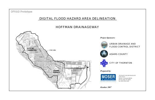
DIGITAL FLOOD HAZARD AREA DELINEATION<br />
HOFFMAN DRAINAGEWAY<br />
Project Sponsors:<br />
URBAN DRAINAGE AND<br />
FLOOD CONTROL DISTRICT<br />
ADAMS COUNTY<br />
CITY OF THORNTON<br />
Prepared by:<br />
720 South Colorado Boulevard<br />
Suite 410 S<br />
Denver, Colorado 80246<br />
phone (303) 757-3655<br />
fax (303) 300-1635<br />
October 2007
THIS PAGE INTENTIONALLY LEFT BLANK<br />
DFHAD Prototype
DFHAD Prototype
THIS PAGE INTENTIONALLY LEFT BLANK<br />
DFHAD Prototype
HOFFMAN MAJOR DRAINAGEWAY PLANNING<br />
FLOOD HAZARD AREA DELINEATION<br />
Section 1 Introduction.................................................................................. 1-1<br />
1.1 Authorization .......................................................................................................1-1<br />
1.2 Purpose <strong>and</strong> Scope ...............................................................................................1-1<br />
1.3 Planning Process ..................................................................................................1-1<br />
1.4 Mapping <strong>and</strong> Surveys...........................................................................................1-1<br />
1.5 Data Collection ....................................................................................................1-2<br />
1.6 Acknowledgements..............................................................................................1-2<br />
Section 2 Study Area.................................................................................... 2-1<br />
2.1 Project Area..........................................................................................................2-1<br />
2.2 L<strong>and</strong> Use ..............................................................................................................2-1<br />
2.3 Outfall Description...............................................................................................2-3<br />
2.4 Previous Studies <strong>and</strong> <strong>Flood</strong> History.....................................................................2-5<br />
2.5 Wetl<strong>and</strong> <strong>and</strong> Riparian Zones................................................................................2-5<br />
2.6 Flora, Fauna <strong>and</strong> Threatened or Endangered Species ..........................................2-5<br />
Section 3 Hydrologic Analysis ..................................................................... 3-1<br />
3.1 Overview..............................................................................................................3-1<br />
3.2 Design Rainfall.....................................................................................................3-1<br />
3.3 Subwatershed Characteristics ..............................................................................3-2<br />
3.4 Hydrograph Routing ............................................................................................3-2<br />
3.5 Results of Analysis...............................................................................................3-2<br />
3.6 Previous Studies...................................................................................................3-3<br />
Section 4 Hydraulic Analysis ....................................................................... 4-1<br />
4.1 Evaluation of Existing Facilities ..........................................................................4-1<br />
4.2 <strong>Flood</strong> Hazards ......................................................................................................4-1<br />
Section 5 References ................................................................................... 5-1<br />
List of Tables<br />
List of Figures<br />
APPENDICES<br />
Appendix A<br />
Appendix B<br />
Appendix C<br />
Table 2-1 Fully-Developed L<strong>and</strong>-Use........................................................................2-1<br />
Table 3-1 Incremental Rainfall Depths ......................................................................3-1<br />
Table 3-2 Comparison of 100-Year Peak Flow to Other Studies ..............................3-3<br />
Table 4-1 Structure Capacity Table ...........................................................................4-3<br />
Figure 2-1 Study Area Map.........................................................................................2-2<br />
Figure 2-2 Conveyance Overview...............................................................................2-4<br />
Figure 2-3 <strong>Flood</strong> Insurance Rate Map Limits .............................................................2-6<br />
Figure 4-1 Conveyance Schematic..............................................................................4-2<br />
Meeting Minutes<br />
Hydrologic Analysis<br />
EPA SWMM Input File<br />
Table B-1 Subwatershed Characteristics<br />
Table B-2 Peak Flow Summary<br />
Figure B-1 Imperviousness Map<br />
Figure B-2 Subwatershed Boundaries<br />
Figure B-3 Soils Map<br />
Figure B-4 EPA SWMM Routing<br />
Figure B-5 EPA SWMM Routing Schematics<br />
Chart B-1 Peak Flow Profile for Hoffman <strong>Drainage</strong>way Mainstem<br />
Chart B-2 Peak Flow Profile for Hoffman <strong>Drainage</strong>way Rainbow Split<br />
Chart B-3 100-Year Hydrograph, Baseline Hydrograph<br />
Mannings “n” Photographs<br />
Hydraulic Analysis<br />
HEC-RAS Output<br />
Structure Hydraulic Analysis Details Table<br />
Drainge Structure Photos<br />
Structure Sections<br />
Appendix D<br />
<strong>Flood</strong>plain <strong>and</strong> <strong>Flood</strong>way Data Table<br />
Appendix E<br />
Appendix F<br />
<strong>Flood</strong> Map<br />
<strong>Flood</strong> Profiles
THIS PAGE INTENTIONALLY LEFT BLANK<br />
DFHAD Prototype
SECTION 1 – INTRODUCTION<br />
1.1 AUTHORIZATION<br />
On July 11, 2006 the <strong>Urban</strong> <strong>Drainage</strong> <strong>and</strong> <strong>Flood</strong> <strong>Control</strong> D istrict (<strong>District</strong>), in joint sponsorship with the<br />
City of Thornton <strong>and</strong> Adams County, contracted with Moser & Associates Engineering for the provisions of<br />
engineering services for a Major <strong>Drainage</strong>way Planning <strong>and</strong> <strong>Flood</strong> H azard Area Delineation (FHAD) Study<br />
for the Hoffman <strong>Drainage</strong>way watershed. Specific hydrol ogic analysis tasks were performed in accordance<br />
with Agreement Number 06-04.05.<br />
1.2 PURPOSE AND SCOPE<br />
The scope of this FHAD study is as follows:<br />
1. Gather <strong>and</strong> assemble information on the existing drainage system including hydraulic structures,<br />
channel characteristics, <strong>and</strong> topographic information<br />
2. Define the water surface prof ile <strong>and</strong> flood boundaries for th e 10, 50, 100, <strong>and</strong> 500-year flood<br />
events <strong>and</strong> also for the 0.5 foot <strong>and</strong> 1.0 foot floodways.<br />
3. Prepare plan <strong>and</strong> profile drawi ngs of the Hoffm an <strong>Drainage</strong>way showing the lim its of the 100-<br />
year floodplain <strong>and</strong> the 10-year <strong>and</strong> 100-year flood profile.<br />
4. Document the study results in the FHAD Report.<br />
The study area is approxim ately 1.8 square m iles loca ted within the City of Thornton <strong>and</strong> portions of<br />
unincorporated Adams County. The study are boundary is generally defined on the west by Grant Street,<br />
the north by East Thornton Parkwa y, the east by the S outh Platte River, <strong>and</strong> the south by Coronado<br />
Parkway.<br />
Three addenda have been issued for this contract. Addendum 1 was executed to exp<strong>and</strong> the study area to<br />
include l<strong>and</strong> affected by flood flow splits outside of the m ain Hoffman <strong>Drainage</strong>way. Addendum 2 wa s<br />
executed to obtain additional survey information near structures <strong>and</strong> along FHAD c ross sections to bette r<br />
define the floodplain delineations for the FHAD. A ddendum 3 was executed to perform a more detailed<br />
analysis of several localized areas of concern.<br />
1.3 PLANNING PROCESS<br />
HOFFMAN MAJOR DRAINAGEWAY PLANNING<br />
FLOOD HAZARD AREA DELINEATION<br />
In the beginning, the project sponsors expressed two primary goals: determine the actual path of floodwater<br />
<strong>and</strong> propose im provements to safely convey the fl oodwater to m inimize the flooding im pacts to the<br />
structures in the watershed. The watershed had been studied in the past , but a FEMA detailed study for the<br />
entire watershed had not been completed. T he proj ect sponsors felt it was im portant to address the<br />
watershed as a whole <strong>and</strong> prioritize the improvements.<br />
Early in the FHAD pro cess, it wa s discovered that the Hoffm an <strong>Drainage</strong>way did not contain flood flows<br />
within its existing infrastructure which resulted in multiple flood flow splits. Because of this, the watershed<br />
study area was exp<strong>and</strong>ed to consider additional storm runoff through the split flow areas.<br />
Two public open houses were held on Septem ber 11, 2006 <strong>and</strong> July 19, 2007. A m ailing was sent to all<br />
property owners within the watershed to attend the first meeting to provide insight into issues in the project<br />
area <strong>and</strong> to offer input for the study. Ten (10) residents <strong>and</strong> representati ves attended the first open house.<br />
Postcards were s ent to all p roperty owners whose propertie s are with in or ad jacent to an existing or new<br />
floodplain. Eleven (11) residents <strong>and</strong> representatives attended the second open house.<br />
The “Hoffm an <strong>Drainage</strong>way Baseline Hydrology Re port” was published in Septem ber 2006 which<br />
summarized the results for existing fully-developed l<strong>and</strong>-use condition hydrologic analysis for the Major<br />
<strong>Drainage</strong>way Study <strong>and</strong> the FHAD. This report was accepted by the project sponsors <strong>and</strong> provided the<br />
hydrology for the <strong>Flood</strong> Hazard Area Delineation.<br />
This <strong>Flood</strong> Hazard Area Delineatio n Report describes the Study Area, provides results of the hydrologic<br />
analysis <strong>and</strong> documents the findings of the hydraulic analysis for the floodplain <strong>and</strong> floodway delineations.<br />
1.4 MAPPING AND SURVEYS<br />
The <strong>District</strong> supplied m apping (2-foot contours) for the original c ontract study lim its as AutoCAD<br />
electronic files. Adam s County supplied 2-foot contour m apping to supplement the <strong>District</strong>’s mapping for<br />
the exp<strong>and</strong>ed watershed area.<br />
1-1<br />
DFHAD Prototype
SECTION 1 – INTRODUCTION<br />
HOFFMAN MAJOR DRAINAGEWAY PLANNING<br />
FLOOD HAZARD AREA DELINEATION<br />
1.5 DATA COLLECTION<br />
Several sources of data have been collected at this point. These sources include:<br />
Mapping (2-foot contours) for the study area was supplied by the <strong>District</strong> as AutoCAD electronic<br />
files.<br />
Supplemental mapping (2-foot contours) was supplied by Adams County as AutoCAD electronic<br />
files for the exp<strong>and</strong>ed watershed area.<br />
Hardcopies of <strong>Flood</strong> Insurance Study backup HEC-2 files were supplied by FEMA for the detailed<br />
floodplain study between 88 th Avenue <strong>and</strong> Devonshire Boulevard.<br />
As-built survey information for the H.C.C. Subdivision on Steele Street.<br />
City of Thornton GIS shape files (August 2006).<br />
Adams County storm sewer GIS shape files (August 15, 2006)<br />
City of Thornton as-built plans for storm sewer <strong>and</strong> channel improvements along the watershed.<br />
Hardcopy of Muller Engineering Lower Hoffman <strong>Drainage</strong>way conceptual Design report date May<br />
14, 1990.<br />
Hardcopy of Muller Engineering Lower Hoffman <strong>Drainage</strong>way Preliminary Design Memor<strong>and</strong>um<br />
dated January 30, 2003.<br />
1.6 ACKNOWLEDGEMENTS<br />
The following individuals representing project sponsors have attended the progress meetings <strong>and</strong> given<br />
input to the study.<br />
Ben Urbonas, P.E. Project Director, <strong>Urban</strong> <strong>Drainage</strong> <strong>and</strong> <strong>Flood</strong> <strong>Control</strong> <strong>District</strong><br />
Ken MacKenzie, P.E. Project Manager, <strong>Urban</strong> <strong>Drainage</strong> <strong>and</strong> <strong>Flood</strong> <strong>Control</strong> <strong>District</strong><br />
Pete Brezall Project Manager of Infrastructure Engineering, City of Thornton<br />
Besharah Najjar, P.E. Engineering Manager, Adams County<br />
Jessica Stevens, E.I. <strong>Drainage</strong> Engineer, Adams County<br />
The following individuals from Moser & Associates Engineering contributed to this study are listed below.<br />
Rick Moser, P.E. Principal-In-Charge<br />
Teresa Patterson, P.E. Project Manager<br />
David Delagarza E.I. Project Engineer<br />
Lee Draeger, E.I. Engineer<br />
Robert Mitchell Technician<br />
Tony Tran Technician<br />
Amy Tiegen Technician<br />
Stephanie Titus Technician<br />
Sage Cabrera Technician<br />
1-2<br />
DFHAD Prototype
SECTION 2 – STUDY AREA<br />
2.1 PROJECT AREA<br />
The project area consis ts of the Hoff man <strong>Drainage</strong>way watershed which is located in the City of Thornton<br />
<strong>and</strong> portions of unincorporated Adam s County. The to tal watershed area is 1,161 acres or 1.81 square<br />
miles. The study area boundary is generally defined on the west by Grant Street, the north by East Thornton<br />
Parkway, the east by the Sout h Platte R iver, <strong>and</strong> th e south by Coronado Parkway. Early in the FHAD<br />
process, it was discovered that th e Hoffman <strong>Drainage</strong>way did not cont ain flood flows within its existing<br />
infrastructure which res ulted in m ultiple flood f low splits. Because of this, the watershed study area was<br />
exp<strong>and</strong>ed to consider additional storm runoff through the split flow areas.<br />
The Hoffman <strong>Drainage</strong>way starts near th e in tersection of Hoffm an Way <strong>and</strong> Dorothy Boulevard, runs<br />
southeast along Hoffman Way to 88 th Avenue, continues southeast throu gh a residential area to Devonshire<br />
Boulevard, then follows 86 th Avenue easterly to the South Platte River. The drainageway crosses 88<br />
Avenue, the Union Pacific Railroad (UPRR), the Colo rado Agricultural Ditch, a nd the Lower Clear Creek<br />
Canal (LCCC). See the Study Area map Figure 2-1.<br />
th<br />
HOFFMAN MAJOR DRAINAGEWAY PLANNING<br />
FLOOD HAZARD AREA DELINEATION<br />
L<strong>and</strong>-use information was obtained by sampling r<strong>and</strong>om areas of similar densities from the base mapping to<br />
calculate the imperviousness values. Additional discussions with the project sponsors were used to<br />
determine projected densities for the few areas that have yet to be developed. See Figure B-1 in Appendix<br />
B for the Imperviousness Map that illustrates the l<strong>and</strong>-use densities.<br />
There are two soil classifications within the project limits, types A <strong>and</strong> C <strong>and</strong> are described in Section 3.3.3.<br />
General watershed parameters include:<br />
Highest watershed elevation (approximate) = 5,446<br />
Lowest watershed elevation (approximate) = 5,070<br />
The average slope of the channel = 0.025 ft/ft<br />
Watershed shape (L/W) = 4<br />
A Project Reuse Watershed number for Hoffman <strong>Drainage</strong>way has not been defined.<br />
2.2 LAND USE<br />
The watershed is nearly built out, so only the fully-developed l<strong>and</strong>-use condition is considered for this<br />
study. The l<strong>and</strong>-use within the watershed can be broken down into the general l<strong>and</strong>-use categories which<br />
are summarized below. The watershed imperviousness is 60.2%.<br />
TABLE 2-1<br />
Fully-Developed L<strong>and</strong>-Use<br />
Imperviousness Area<br />
% (acres) (sq mi)<br />
30 50 0.08<br />
35 357 0.56<br />
45 36 0.06<br />
50 147 0.23<br />
55 39 0.06<br />
80 385 0.60<br />
90 72 0.11<br />
100 74 0.12<br />
2-1<br />
DFHAD Prototype
SECTION 2 – STUDY AREA<br />
2.3 OUTFALL DESCRIPTION<br />
During the process of developing this repo rt, a num ber of split flow c onditions were identified. This<br />
resulted in seven (7) different reaches being used for the purpose of FHAD planning. Figure 2-2 illus trates<br />
the locations of the various reaches.<br />
HOFFMAN MAJOR DRAINAGEWAY PLANNING<br />
FLOOD HAZARD AREA DELINEATION<br />
lower half was recen tly improved down to the SPR. The Lower Clear Creek Canal cross es<br />
the Hoffm an Mainstem imm ediately upstream of the im proved sect ion. The irrigation<br />
structure significantly constricts the drainageway at this location, causing runoff to split into<br />
the Irrigation Ditch Split.<br />
Hoffman <strong>Drainage</strong> Mainstem <strong>and</strong> Irrigation Ditch Split<br />
Hoffman Mainstem represents the central flow of runoff through the watershed <strong>and</strong> is the primary flowpath<br />
for the watershed. It may be divided into three distinct subreaches:<br />
SubReach 1<br />
Along Hoffm an W ay from the upstream FHAD li mit at the intersection of Dorothy<br />
Boulevard to 88 th Avenue. Hoffm an Way is a divided collector roadway with a l<strong>and</strong>scaped<br />
median through a residential area. There is a storm sewer system that generally follows the<br />
median.<br />
SubReach 2<br />
88 th Avenue to W elby Road. The existing draina geway infrastructure is a com bination of<br />
open channel, pipe, culverts, <strong>and</strong> bridges. This reach flows through a residential area with a<br />
very small section of industrial l<strong>and</strong> directly adjacent to the UPRR.<br />
Hoffman Mainstem SubReach 3 – Channel Along 86 th Avenue<br />
Rainbow, Hope <strong>and</strong> Railroad Splits<br />
Due to an undersized culvert at R ainbow Drive, st ormwater splits from Hoffma n Mainstem <strong>and</strong> flows<br />
through an undeveloped property east of Rainbow Drive. Runoff that splits into the Rainbow Split does not<br />
return to th e Hoffm an Mainstem . The Rainbow Split is characterized by open, undeveloped l<strong>and</strong> above<br />
Devonshire Boulevard. A shallow ch annel conveys a sm all volum e of flow through this property to<br />
Devonshire Blvd. Flows which exceed the capacity of this channel (approximately 140 cfs) break out of the<br />
channel to the south, flow to Hope Court <strong>and</strong> rejoin the Rainbow Split at McElwain Boulevard.<br />
Hoffman SubReach 1 – Hoffman Way Hoffman Mainstem SubReach 2 – 88 th Avenue to Rainbow<br />
Below Devonshire Boulevard, the Ra inbow Split flows through an undeve loped lot <strong>and</strong> over the railroad<br />
tracks. A sm all ditch on the west side of the tracks carries up to 150 cfs into the Railroad Split along the<br />
railroad tracks. The Ra ilroad Split conveys water to the Lower Clear Creek Canal railroad brid ge. The<br />
Railroad Split then flows east under this bridge <strong>and</strong> joins the Industrial Split, discussed below.<br />
SubReach 3<br />
Welby Road to the So uth Platte River (SPR ). This reach runs throug h an industrial area.<br />
The upper half of this reach is a dilapidated open channel with steep, unstable slopes. The<br />
2-3
SECTION 2 – STUDY AREA<br />
Flows from the Rainbow Split which are not diverted into the Railroad Split pass over the railroad tracks<br />
<strong>and</strong> enter a prestressed concrete plant. Within the plant property, these flows split around the primary<br />
building. The flows that split to the south become the Industrial Split, which is discussed below. Flows<br />
which split around the north side of the building continue along the Rainbow Split over Steele Street.<br />
Below Steele Street, the Rainbow Split flows through the corner of a mobile home park <strong>and</strong> into sparsely<br />
developed horse pastures. The Rainbow Split flows into a series of gravel ponds <strong>and</strong> discharges into the<br />
South Platte River.<br />
Industrial <strong>and</strong> Industrial South Splits<br />
The Industrial Split begins as flows splits around the south side of the m ain bui lding of the prestressed<br />
concrete plant. The Industrial Split continues south, paralleling the Railroad through an undeveloped parcel.<br />
Runoff in the Industrial Split which is not div erted into th e Industrial So uth Split, d iscussed below, flows<br />
around the north side of the commercial propert y, overtopping a detention pond <strong>and</strong> Steele Street, <strong>and</strong><br />
rejoins the Rainbow Split east of Steele Street.<br />
South of the aforementioned undeveloped parcel is a newly developed commercial property (Parrot H.C.C.<br />
Subdivision). When the commercial property was constructed, several feet of fill material was added. As a<br />
result of the fill m aterial being pl aced in this location, flows from the Industrial Split are divided again,<br />
creating the Industrial South Split. A ditch along the ra ilroad tracks carries flow in the Industrial South<br />
Split. W ater in this split follows the railroad around the west side <strong>and</strong> the south side of the comm ercial<br />
property to Steele Street. Flows then overtop Steele Street, flow through sparsely developed l<strong>and</strong> <strong>and</strong> rejoin<br />
the Rainbow Split at the gravel lakes.<br />
With the existing topog raphy, there is no way for flows fr om the Rainbow Split to rejo in th e Hoffm an<br />
<strong>Drainage</strong>way. The Rainbow Split overtops the UPRR <strong>and</strong> splits <strong>and</strong> rejoins several times before continuing<br />
easterly toward the South Platte River.<br />
2.4 PREVIOUS STUDIES AND FLOOD HISTORY<br />
HOFFMAN MAJOR DRAINAGEWAY PLANNING<br />
FLOOD HAZARD AREA DELINEATION<br />
According to the <strong>Flood</strong> Insurance Rate Map (FIRM) , there is a Zone A (approxim ate) floodplain along<br />
Hoffman Way. In August 1974 a detailed study of the drainageway between 88 th Avenue <strong>and</strong> Welby Road<br />
was completed <strong>and</strong> a Zone AE floodpl ain was recognized. Downstream of Welby Road, the FIRM panel<br />
notes, “500-year flood contained in [the] channel”.<br />
According to the current FIRM, a num<br />
ber of hous es along Hoffma n W ay <strong>and</strong> in the Hope Court<br />
neighborhood are within a 100-year floodplain. Figure 2-3 illustrates the approximate location of the FIRM<br />
effective floodplain <strong>and</strong> how it compares to the FHAD 100-year floodplain.<br />
The residents in the watershed have reported their experiences with flooding. At the public meeting, several<br />
of residents in the Hope Court area relayed their stories of flooding. At the same meeting, two members of<br />
the mobile home community southeast of the LCCC <strong>and</strong> 86 th Avenue imparted their stories of being flooded<br />
multiple times from backwater up the LCCC.<br />
2.5 WETLAND AND RIPARIAN ZONES<br />
No riparian or wetl<strong>and</strong> vegetation ha s been observed within the study area with the ex ception of the South<br />
Platte River banks at the downstream study limits. Ho wever, a thorough investigation should be perform ed<br />
prior to construction.<br />
2.6 FLORA, FAUNA AND THREATENED OR ENDANGERED SPECIES<br />
There are no known threatened flora or fauna with in the study area; however a thorough investigation<br />
should be performed prior to any construction.<br />
The mainstem of Hoffman runs along the south side of 86 th Avenue in an open channel. At the LCCC, the<br />
at-grade crossing with the irrigation ditch is to o sm all to r elease th e larger sto rm events <strong>and</strong> during the<br />
100-year storm event, water breaks out of the irrigation stru cture overtopping 86 th Avenue. This results in<br />
shallow flooding north of 86 th Avenue.<br />
2-5
SECTION 3 – HYDROLOGIC ANALYSIS<br />
HOFFMAN MAJOR DRAINAGEWAY PLANNING<br />
FLOOD HAZARD AREA DELINEATION<br />
3.1 OVERVIEW<br />
The storm runoff hydrographs <strong>and</strong> routing for the study were generated using the Environm ental Protection<br />
Agency’s 2006 version of Stormwater Manage ment Model (SW MM) Version 5.0. The physical<br />
characteristics for each subwatershed in the SWMM analysis include:<br />
• <strong>Drainage</strong> area<br />
• Width of the subwatershed<br />
• Subwatershed slope<br />
• Percent imperviousness<br />
• Subarea routing<br />
• Percent routed<br />
• Soil infiltration rates<br />
• Surface retention storage values<br />
The peak flow results from the SWMM m odel were com pared to the re sults in the FEMA FIS at various<br />
locations. The comparison process is discussed in more detail in Section 3.6<br />
In acco rdance with Dis trict policy, existing privatel y-owned detention basins we re not inclu ded in th e<br />
hydrologic models because of the uncertainty associated with their continued ex istence. There are no<br />
known publicly-owned <strong>and</strong> maintained detention basins in the watershed area.<br />
The drainage network is generally comprised of subwatersheds, design points, <strong>and</strong> open channels.<br />
TABLE 3-1<br />
Incremental Rainfall Depths (inches)<br />
Time<br />
Return Period (Year)<br />
(min)<br />
2 5 10 25 50 100 500<br />
0 0.00 0.00 0.00 0.00 0.00 0.00 0.00<br />
5 0.02 0.03 0.03 0.03 0.03 0.03 0.03<br />
10 0.04 0.05 0.06 0.07 0.08 0.08 0.10<br />
15 0.08 0.12 0.14 0.10 0.12 0.12 0.15<br />
20 0.16 0.22 0.25 0.16 0.19 0.22 0.26<br />
25 0.25 0.36 0.42 0.30 0.35 0.38 0.46<br />
30 0.14 0.18 0.20 0.50 0.59 0.68 0.82<br />
35 0.06 0.08 0.09 0.24 0.28 0.38 0.46<br />
40 0.05 0.06 0.07 0.16 0.19 0.22 0.26<br />
45 0.03 0.05 0.06 0.10 0.12 0.17 0.20<br />
50 0.03 0.05 0.05 0.10 0.12 0.14 0.16<br />
55 0.03 0.04 0.05 0.06 0.08 0.11 0.13<br />
60 0.03 0.04 0.05 0.06 0.08 0.11 0.13<br />
65 0.03 0.04 0.05 0.06 0.08 0.11 0.13<br />
70 0.02 0.04 0.05 0.05 0.06 0.05 0.07<br />
75 0.02 0.03 0.05 0.05 0.06 0.05 0.07<br />
80 0.02 0.03 0.04 0.04 0.04 0.03 0.04<br />
85 0.02 0.03 0.03 0.04 0.04 0.03 0.04<br />
90 0.02 0.03 0.03 0.03 0.03 0.03 0.04<br />
95 0.02 0.03 0.03 0.03 0.03 0.03 0.04<br />
100 0.02 0.02 0.03 0.03 0.03 0.03 0.04<br />
105 0.02 0.02 0.03 0.03 0.03 0.03 0.04<br />
110 0.02 0.02 0.03 0.03 0.03 0.03 0.04<br />
115 0.01 0.02 0.03 0.03 0.03 0.03 0.04<br />
120 0.01 0.02 0.02 0.03 0.03 0.03 0.04<br />
1-Hour Point<br />
Rainfall (inches)<br />
1.00 1.42 1.68 2.01 2.35 2.71 3.35<br />
The “Hoffman <strong>Drainage</strong>way Baseline Hydrology Repor t” was published in September of 2006 <strong>and</strong> the<br />
hydrologic calculations were accep ted by the <strong>Urban</strong> Drai nage <strong>and</strong> <strong>Flood</strong> <strong>Control</strong> <strong>District</strong> on October 11,<br />
2006.<br />
3.2 DESIGN RAINFALL<br />
The 5-m inute increm ental rainfall depths for the 2- , 5-, 10-, 25-, 50-, <strong>and</strong> 100-year storm events were<br />
gathered from table 9.5 in the Ad ams County Development St<strong>and</strong>ards <strong>and</strong> Regulations. The EPA SW MM<br />
model then distributed the rainfall depths over a 2- hour storm duration. The increm ental rainfall depths<br />
used are shown in Table 3-1.<br />
3-1<br />
DFHAD Prototype
SECTION 3 – HYDROLOGIC ANALYSIS<br />
HOFFMAN MAJOR DRAINAGEWAY PLANNING<br />
FLOOD HAZARD AREA DELINEATION<br />
3.3 SUBWATERSHED CHARACTERISTICS<br />
A total of 27 subwatersheds were delineated in the Hoffman <strong>Drainage</strong>way study area. The subwatershed<br />
identification <strong>and</strong> locations are displayed in Figure B-2 in Appendix B. The physical characteristics of each<br />
subwatershed are described in Table B-1, Subwatershed Characteristics, located in Appendix B.<br />
The 2-foot contour m apping, provided by the <strong>District</strong>, supplem ented with the 2-foot contour m apping from<br />
the City of Thornton <strong>and</strong> Adam s County, were used to identify subwater shed boundaries, flow paths, <strong>and</strong><br />
slopes for each subwatershed. The subwatersheds range in size from 5.3 acres to 107.6 acres with an<br />
average drainage area size of 42.5 acres.<br />
Due to the fact that th e watershed is alm ost co mpletely developed, the watershed im perviousness was<br />
determined only f or f ully develope d condition s using zoning f or guidance in und eveloped a reas. Aeria l<br />
mapping <strong>and</strong> site visits were used to iden tify levels of existing im perviousness. City of Thornton <strong>and</strong><br />
Adams County zoning was used to identify areas where approved future development will have a significant<br />
effect on the watershed imperviousness.<br />
Eight (8) dif ferent categories of im perviousness were identified <strong>and</strong> ra nge from 30 percent to 100 percent.<br />
The watershed imperviousness is shown on Figure B-1 in Appendix B.<br />
3.4 HYDROGRAPH ROUTING<br />
The routing elem ents within th is model are sto rm sewer pipes, stre ets, <strong>and</strong> open channels. In location s<br />
where storm sewer pipes were modeled, a parallel open channel routing elem ent was m odeled to ca rry<br />
excess flows from the pipes. Appendix B provides the physical attributes (widt h, length, slope, side slope,<br />
<strong>and</strong> Manning’s “n”) assigned to each conveyance element used in the EPA SWMM m odel. W here<br />
available, cross section s for each routing elem ent were developed usin g as-built in formation from channel<br />
<strong>and</strong> storm sewer construction.<br />
In Appendix B Figure B-4, the EPA SWMM Routi ng Map, <strong>and</strong> Figure B-5, the EPA SWM M Routing<br />
Schematic, illustrate the lo cation <strong>and</strong> connectivity of the drainage system elements. The Routing Map <strong>and</strong><br />
schematic show where the subwatersh eds connect into the drainag e system <strong>and</strong> the specific design points<br />
defined at these locatio ns. In addition, the rou ting elements illustrate where the runoff is connected to th e<br />
next downstream design point.<br />
Runoff from subwatershed 35 is co llected in a storm sewer which is routed out of the Hoffma n<br />
<strong>Drainage</strong>way watershed. Flows which exceed the cap acity of the stor m sewer ar e tribu tary to Hoffm an<br />
<strong>Drainage</strong>way. The storm sewer is modeled in rou ting element 355 which connect s to outfall 351. Flows<br />
which exceed the capacity of the storm sewer are modeled in routing element 356.<br />
Two (2) soil types identified by the Soil Conservation Service (S CS) were found in the Hoffma n<br />
<strong>Drainage</strong>way study area. The m ajority of the basin is classified as hydrological so il classification Type C<br />
Soil. Type A soils are found in the upper area of the ba sin <strong>and</strong> near the gravel la kes, <strong>and</strong> in the southwest<br />
portion of the study area. Fo r Types C soils, the initial in filtration rate is 3.0 inches per hour (iph), the final<br />
infiltration rate is 0.5 ip h, <strong>and</strong> the infiltration decay constant is 0.0018 (1/sec). For Type A soils, the in itial<br />
infiltration rate is 5 iph, the fina l infiltration rate is 1 iph <strong>and</strong> the decay constant is 0.007 (1/sec). These<br />
values are in accordan ce with Distri ct criteria as referen ced in th e Ru noff Chapter of the <strong>Urban</strong> Stor m<br />
<strong>Drainage</strong> Criteria Manual (USDCM, 2001) . The distribution of the soil t ypes can be seen on Figure B-3 in<br />
Appendix B.<br />
Mannings “n” values were verified in the field. Pictures illustrating th e Manning’s “n” values for a sam ple<br />
of the conveyance elements are included in Appendix B.<br />
3.5 RESULTS OF ANALYSIS<br />
Using the physical subwatershed hydrologic param eters <strong>and</strong> rainfall infor mation, along with the drainage<br />
system conveyance cha racteristics, peak flow rate s were determ ined. Table B-2 in Appendix B provides<br />
peak flow rate inform ation at each of the elem ents along the drainageway for the 2-, 5-, 10-, 25-, 50-, <strong>and</strong><br />
100-year event storms.<br />
A summarized input file from the EPA SWMM model is included in Appe ndix B. Peak flow profiles for<br />
Hoffman Mainstem <strong>and</strong> the Rainbow Split may be found in Charts B-1 <strong>and</strong> B-2 both located in Appendix B.<br />
3-2<br />
DFHAD Prototype
SECTION 3 – HYDROLOGIC ANALYSIS<br />
HOFFMAN MAJOR DRAINAGEWAY PLANNING<br />
FLOOD HAZARD AREA DELINEATION<br />
Hydrographs for the 100-year event storm are shown on Chart B-3 in Appendix B at five (5) different<br />
locations along Hoffman <strong>Drainage</strong>way.<br />
3.6 COMPARISON WITH PREVIOUS STUDIES<br />
The flows from the EPA SW MM model were com pared with those supplied by FEMA as part of the FIS<br />
study. Upon examining the HEC-2 model that was provided as suppo rt for the FIS, it became apparent that<br />
there was a discrepancy between the flows in the model <strong>and</strong> those published in the FIS. For the purposes of<br />
this study, the HEC-2 model will be used for comparison, as it appears to have more reasonable flows.<br />
The current model was calibrated to the FEMA HEC-2 model by systema tically varying the subbasin width<br />
characteristic within EP A SWMM. The EPA SW MM model was compared to the HEC-2 m odel at two<br />
locations: East 88 th Avenue <strong>and</strong> Devonshire Road. The results of the calibration are shown below.<br />
TABLE 3-2<br />
Comparison of 100-Year Peak Flow to Other Studies<br />
Location FIS FEMA HEC-2 Moser – Calibrated b<br />
88th Avenue 680 (0.8 sq.mi.) 1000 a 1069 (0.8 sq.mi.)<br />
Devonshire Boulevard<br />
1240 (1.2<br />
sq.mi.)<br />
1220 a 1079 (0.9 sq.mi.)<br />
a Tributary area unknown<br />
b Calibration occurred before watershed area was exp<strong>and</strong>e<br />
3-3<br />
DFHAD Prototype
THIS PAGE INTENTIONALLY LEFT BLANK<br />
DFHAD Prototype
SECTION 4 – HYDRAULIC ANALYSIS<br />
HOFFMAN MAJOR DRAINAGEWAY PLANNING<br />
FLOOD HAZARD AREA DELINIATION<br />
4.1 EVALUATION OF EXISTING FACILITIES<br />
Existing drainage facilities within the project area consist of roadways, natural channels, improved channels,<br />
overl<strong>and</strong> flow paths, storm sewers, bridges <strong>and</strong> culvert crossings.<br />
HEC-RAS was used f or the floodplain analysis of all drainage faciliti es. The cross se ctions used by<br />
HEC-RAS were developed using A utodesk L<strong>and</strong> Development Desktop a nd were c ut from digital ter rain<br />
model data supplied by the <strong>District</strong> for all cross sections above 88<br />
th Avenue, <strong>and</strong> 2-foot contour data for<br />
cross sections located below 88 th Avenue. The additional survey perf ormed by Woolpert Inc. in March of<br />
2007 was used to further refine selected cross sections <strong>and</strong> to determine structure elevations near the edge of<br />
the floodplain. An as-built su rvey for the H.C.C. Subdivision provided by Ed Jennings, PE was used to<br />
refine the cross sections in the area south of the concrete plant, between the railroad tracks <strong>and</strong> Steele Street.<br />
All bridges <strong>and</strong> culverts were anal yzed using HEC-RAS. The flow through the culvert between Rainbow<br />
<strong>and</strong> Devonshire was also analyzed us ing HY-8 to further refine its fl ow capacity. The flow through the<br />
Lower Clear Creek Canal intersection structure was analyzed using HEC-RAS with topographical<br />
information obtained from the Woolpert survey. Detailed H EC-RAS output for this project m ay be located<br />
in Appendix C.<br />
For flows i n Hoffm an Way above 88 th Avenue, the surface flows wer e determ ined by using SW MM to<br />
model the capacity of the underg round storm sewer <strong>and</strong> route excess flows to the surface. Th e pipe sizes<br />
<strong>and</strong> inverts for the Hoffman Way storm sewer were obtained from as-built information provided by the City<br />
of Thornton, where available.<br />
Manning’s “n” values w ere determined through field obs ervation. Pictures illustrating the Manning’s “n”<br />
values for a sample of the conveyance elements are included in Appendix B.<br />
A number of different splits flow conditions w ere identified in the watershed. For each split f low, a new<br />
reach was c reated <strong>and</strong> n amed. HEC-RAS was used to id entify the locations of the splits <strong>and</strong> to determ ine<br />
the pe ak flo ws in e ach split. A sc hematic sho wing each s plit <strong>and</strong> its associa ted peak flow is shown in<br />
Figure 4-1.<br />
Two floodways were defined for Hoff man <strong>Drainage</strong>way based on a half-foot <strong>and</strong> one-foot rise in energy<br />
grade elevations. The floodways were defined in a m anner to keep structures out of the floodway<br />
delineation where possible. In locations where the flow is channelized in the 100-year event <strong>and</strong> no<br />
structures are in the floodplain, the floodway was set equal to the floodplain. The <strong>Flood</strong>plain <strong>and</strong> <strong>Flood</strong>way<br />
Data Table can be found in Appendix E.<br />
4.2 FLOOD HAZARDS<br />
The results of the <strong>Flood</strong> Hazard Area Delineation are located in Appendix D. The FHAD revealed that<br />
there are a number of houses <strong>and</strong> structures (garages, sheds, etc.) located within the 100-year floodplain.<br />
• One (1) house is located within the 100-year floodplain on Hoffman Way on the northwest corner of<br />
Hoffman Way <strong>and</strong> Ash Court.<br />
• Four (4) houses <strong>and</strong> two (2) structures are loca ted within the 100-year fl oodplain on the northwest<br />
corner of 88 th Avenue <strong>and</strong> Hoffman Way.<br />
• Two (2) houses <strong>and</strong> one (1) structure are located w ithin the 100-year floodplain on the west corner<br />
of Rainbow Avenue <strong>and</strong> Vine Court.<br />
• Approximately 13 houses <strong>and</strong> 13 structures are lo cated within the 100-year floodplain along H ope<br />
Court between McDougal Street <strong>and</strong> McElwain Boulevard.<br />
• Two (2) houses <strong>and</strong> one (1) structure are located within the floodplain on the southwest corner of<br />
McElwain Boulevard <strong>and</strong> Devonshire Boulevard.<br />
• A large portion of the c oncrete plant on the southwest corner of 86 th Avenue <strong>and</strong> Steele Street is<br />
located within the 100-year floodplain.<br />
• Downstream of the concrete plan t, approximately 29 structures, in cluding buildings, mobile homes,<br />
livestock shelters, <strong>and</strong> sheds, are located in the floodplain on both sides of Steele Street.<br />
The culvert between Rainbow Avenue <strong>and</strong> Devonshire Boulevard can only convey approximately 187 cfs of<br />
runoff. Excess flows overtop Rainbow Avenue, c ontinue overl<strong>and</strong> along the Rainbow Split <strong>and</strong> do no t<br />
return to the Hoffman <strong>Drainage</strong>way. In addition, a 185- acre basin which drains to McElwain Boulevard is<br />
also tributary to the Rainbow Split, com pounding the problems in this area. The Rainbow Split is a m ajor<br />
source of flooding. More than 50 houses <strong>and</strong> other structures are in the floodplain as a result of this split.<br />
4-1<br />
DFHAD Prototype
DFHAD Prototype
SECTION 4 – HYDRAULIC ANALYSIS<br />
HOFFMAN MAJOR DRAINAGEWAY PLANNING<br />
FLOOD HAZARD AREA DELINIATION<br />
The channel is undersized at the Lower Clear Creek Canal at grade crossing. This causes flows to split out<br />
of Hoffman <strong>Drainage</strong>way at this location <strong>and</strong> sheet flow overl<strong>and</strong> to the northeast. This is the reason for the<br />
shallow flooding region on the north side of 86 th Avenue, between Steele Street <strong>and</strong> the South Platte River.<br />
HEC-RAS analys is ind icates th at a num ber of struct ures do not contain the various storm events. The<br />
results of the analysis are shown in Table 4-1<br />
TABLE 4-1<br />
Structure Hydraulic Analysis<br />
(Structures Exceeding the Allowable Overtopping Criteria)<br />
Structure Station<br />
Return Event<br />
10-Year 50-Year 100-Year 500-Year<br />
88th Avenue Pipe 76+00 X X X X<br />
Rainbow Avenue Culvert 64+00 X X X X<br />
Old Welby Road Culvert 48+70<br />
Railroad Bridge 47+50<br />
Welby Road Culvert 46+25<br />
Steele Street 32+60<br />
X X X<br />
LCCC Crossing<br />
30+00 X X X<br />
Maintenance Road 8+25<br />
Maintenance Road 2+75<br />
Pedestrian Trail 2+00 N/A - Overtopped by S. Platte River Backwater<br />
X = Storm Event Peak Flow Exceeds the allowable overtopping criteria<br />
Additional details in Appendix D<br />
4-3<br />
DFHAD Prototype
THIS PAGE INTENTIONALLY LEFT BLANK<br />
DFHAD Prototype
SECTION 5 – REFERENCES<br />
HOFFMAN MAJOR DRAINAGEWAY PLANNING<br />
FLOOD HAZARD AREA DELINIATION<br />
1. “<strong>Urban</strong> Storm <strong>Drainage</strong> Criteria Manual”, <strong>Urban</strong> <strong>Drainage</strong> <strong>and</strong> <strong>Flood</strong> <strong>Control</strong> <strong>District</strong>, 2001.<br />
2. “User Manual, EPA SWMM Version 5.0”, U.S. Environmental Protection Agency, 2005.<br />
3. “Lower Hoffman <strong>Drainage</strong>way Conceptual Design”, Muller Engineering Company, May 14, 1990<br />
4. “Lower Hoffman <strong>Drainage</strong>way Preliminary Design Memor<strong>and</strong>um”, January 30, 2003<br />
5. “<strong>Flood</strong> Insurance Rate Maps, Adam s County, Co lorado <strong>and</strong> Incorporated Areas”, Federal<br />
Emergency Management Agency, August 16 1995<br />
6. “FEMA <strong>Flood</strong> Insurance Study”, Federal Emergency Management Agency, August 1995.<br />
7. “As-built” drawings for Hoffman Way storm sewer, City of Thornton<br />
8. H.C.C Subdivision As-Built Survey, R.W. Bayer & Associates, Inc., October 2006.<br />
9. 1974 FEMA HEC-2 Model Output Back-up Data<br />
10. “Hoffman <strong>Drainage</strong>way Baseline Hydrology Report,” Moser <strong>and</strong> Associates , September 2006.<br />
11. “<strong>Flood</strong> Hazard Area Delineation , S outh Platte River, Adam s County, Colorado.,” Camp, Dresser<br />
<strong>and</strong> McKee, April 2005.<br />
5-1<br />
DFHAD Prototype
THIS PAGE INTENTIONALLY LEFT BLANK<br />
DFHAD Prototype
HOFFMAN MAJOR DRAINAGEWAY PLANNING<br />
FLOOD HAZARD AREA DELINEATION<br />
APPENDIX A – Meeting Minutes<br />
DFHAD Prototype
THIS PAGE INTENTIONALLY LEFT BLANK<br />
DFHAD Prototype
DFHAD Prototype<br />
720 S. Colorado Boulevard, Suite 410 S<br />
Denver, Colorado 80246<br />
phone (303) 757-3655<br />
fax (303) 300-1635<br />
PROGRESS MEETING FOR<br />
HOFFMAN DRAINAGEWAY PLANNING & FHAD STUDY<br />
MEETING MINUTES<br />
Date: August 1, 2006<br />
Location: <strong>Urban</strong> <strong>Drainage</strong> <strong>and</strong> <strong>Flood</strong> <strong>Control</strong> <strong>District</strong> Board Room<br />
Distributions: Attendees<br />
Attendees:<br />
Name Organization Email<br />
Ben Urbonas UDFCD burbonas@udfcd.org<br />
Ken MacKenzie UDFCD kam@udfcd.org<br />
Pete Brezall City of Thornton pete.brezall@cityofthornton.net<br />
Gene Potter City of Thornton gene.potter@cityofthornton.net<br />
Matthew Pacheco LCCDC&CADC matthew.pacheco@cityofthornton.net<br />
Besharah Najjar Adams County bnajjar@co.adams.co.us<br />
Jessica Murphy Adams County jmurphy@co.adams.co.us<br />
Rick Moser Moser & Associates moser@moser-eng.com<br />
Teresa Patterson Moser & Associates patterson@moser-eng.com<br />
David Delagarza Moser & Associates delagarza@moser-eng.com<br />
I. Purpose<br />
The purpose of this meeting was to kickoff the project study, to obtain input from the project<br />
sponsors <strong>and</strong> interested parties, <strong>and</strong> to describe information collected to date.<br />
III.<br />
IV.<br />
Information Gathered <strong>and</strong> Existing Reports<br />
Ben Urbonas has provided mapping for the majority of the Watershed to Moser <strong>and</strong><br />
Associates. There are several areas along the fringe of the watershed boundary that were<br />
not included in the mapping. The City of Thornton will provide GIS mapping to cover these<br />
areas <strong>and</strong> supplement the mapping provided by the <strong>District</strong>. The GIS mapping should<br />
include 2-foot contours (1998) as well as aerial photography (2004).<br />
Moser & Associates has obtained FEMA data for Hoffman (Northfield Creek).<br />
The City of Thornton provided a storm sewer map of the watershed at the meeting.<br />
Additional Information Needed<br />
The City of Thornton will provide Moser <strong>and</strong> Associates GIS mapping of the watershed as<br />
discussed above.<br />
<strong>Drainage</strong> Reports <strong>and</strong> any as-built drawings still need to be obtained for the Hoffman Street<br />
Storm Sewer.<br />
V. Study Watershed<br />
Ben Urbonas gave Moser <strong>and</strong> Associates direction to only model the future l<strong>and</strong> use<br />
condition, as the watershed is almost fully developed. There are only three relatively small<br />
locations in the watershed that are expected to be developed in the future:<br />
• The undeveloped area at the north end of the watershed will be developed<br />
commercial. Thornton has a requirement of a 20 percent l<strong>and</strong>scaping <strong>and</strong> therefore<br />
an 80% impervious value will be used for future development.<br />
• The undeveloped lot between Devonshire Street <strong>and</strong> Rainbow Street will be<br />
assumed to be developed as high-density residential housing.<br />
• The existing “<strong>Urban</strong> Farmer Nursery” will be assumed to be developed commercial<br />
(80% imperviousness.)<br />
II.<br />
Schedule<br />
The notice to proceed was on July 17 th, 2006. The Alternatives Analysis & FHAD are<br />
scheduled to be complete on December 1, 2006. The conceptual design report is<br />
scheduled to be complete on June 1, 2007.<br />
DESCRIPTION<br />
DATE<br />
Notice to Proceed July 17, 2006<br />
Baseline Hydrology Report September 1, 2006<br />
Draft Alternatives Report September 29, 2006<br />
Draft FHAD Report September 29, 2006<br />
Final Alternatives Report December 1, 2006<br />
Final FHAD Report December 1, 2006<br />
Draft Conceptual Design Report March 30, 2007<br />
Final Conceptual Design Report June 1, 2007<br />
The “High Point” development is a 6 to 7 acre area in the northwest corner of the watershed<br />
that will be re-routed out of the watershed with future development; however for the<br />
purposes of this study it will be included in the watershed delineation.<br />
The existing Union Pacific Railroad Line is planned to become a commuter rail line with the<br />
RTD FasTracks project. This project will also include a station at 88 th Ave & Welby Rd.<br />
RTD will be invited to become involved in this project.<br />
The hydrology for this project will be completed entirely in SWMM. The SWMM model will<br />
be calibrated to match FEMA flows at 88 th Ave <strong>and</strong> Devonshire.<br />
There may be an area between the Hoffman watershed <strong>and</strong> the Niver Creek watershed to<br />
the southwest that has not been identified as tributary to either watershed. Moser &<br />
Associates will compare the boundary of the Niver Creek watershed (from the Niver Creek<br />
OSP) to the Hoffman watershed boundary <strong>and</strong> account for any discrepancy.<br />
Hoffman <strong>Drainage</strong>way Planning & FHAD<br />
Kickoff Meeting Minutes 08/01/06<br />
Page 1 of 4<br />
Hoffman <strong>Drainage</strong>way Planning & FHAD<br />
Kickoff Meeting Minutes 08/01/06<br />
Page 2 of 4
DFHAD Prototype<br />
VI.<br />
Problem Areas<br />
There are a number of homes in the effective floodplain.<br />
Overtopping has occurred in larger events at Hoffman Way <strong>and</strong> 88 th Ave approximately 2<br />
times in the last 20 to 30 years.<br />
There may be a split flow near Devonshire causing some of the runoff to inundate the<br />
railroad tracks or divert into the Niver creek watershed.<br />
The Lower Clear Creek Canal currently intercepts the low flows in Hoffman Gulch. This is<br />
not preferred by the canal company <strong>and</strong> has led to some minor flooding along the canal.<br />
The portion of the drainageway along 86 th Avenue is unsafe for vehicles <strong>and</strong> very tight as far<br />
as ROW is concerned. In addition, 86 th Avenue will likely be widened to 3 lanes in the<br />
future.<br />
Elm Place is a large contributing basin to the Hoffman drainageway <strong>and</strong> significant flooding<br />
has occurred there in the past, however, <strong>Flood</strong> Hazard Area Delineation <strong>and</strong> development of<br />
alternatives to improve pipe the conveyance for Elm Place are not included in the scope of<br />
this study.<br />
There are a number of utilities that will need to be considered during the alternatives<br />
analysis. Utility maps will be obtained from the companies early in the alternatives analysis<br />
phase. It has been observed that there are exposed utilities in the drainageway that need to<br />
be addressed.<br />
The design flows for the Lower Clear Creek Canal <strong>and</strong> the Colorado Agricultural Ditch are<br />
150 cfs <strong>and</strong> 80 cfs respectively.<br />
VIII. Next Meeting<br />
The next progress meeting is scheduled for August 22 nd at 1:30 pm at the <strong>Urban</strong> <strong>Drainage</strong><br />
<strong>and</strong> <strong>Flood</strong> <strong>Control</strong> <strong>District</strong>’s office.<br />
IX.<br />
Action Items<br />
• Moser & Associates will contact the City or Thornton to obtain GIS mapping.<br />
• Pete Brezall will provide as-builts of the new CBC near the lower end of the study reach to<br />
Moser & Associates<br />
• Jessica will provide address list to Ken MacKenzie for public meeting by August 9 th .<br />
• Moser & Associates will provide a floodplain boundary to Jessica.<br />
• Moser & Associates will provide a brief description of the study area location to Ken<br />
Mackenzie<br />
• Besharah will provide documentation on the 90’ existing drainage easement along 86 th<br />
Avenue. He will also try to provide documentation on the court ruling requiring the pipe<br />
between Rainbow Street <strong>and</strong> Devonshire Street.<br />
VII.<br />
Public Involvement<br />
A website will be maintained by Moser <strong>and</strong> Associates on the <strong>District</strong>’s server. This website<br />
will explain the purpose of the project, the limits of the study, the progress of the work, <strong>and</strong><br />
provide an avenue for public comment.<br />
A public meeting will be held to address concerns of the homeowners <strong>and</strong> business owners<br />
in the area. The meeting will “Open House” style, with several short presentations. The<br />
meeting is tentatively scheduled for Thursday September 14 th from 6pm to 8pm. Pete<br />
Brezall <strong>and</strong> Gene Potter indicated that they would look into the availability of the Thornton<br />
Civic Center meeting area for this meeting. (Pete has notified after the progress meeting<br />
that September 14 th is not available <strong>and</strong> the public meeting was scheduled at Thornton Civic<br />
Center for September 11, 2006)<br />
A postcard will be mailed to all homeowners <strong>and</strong> business owners in the study limits<br />
informing them of the project, the website <strong>and</strong> the public meeting. Jessica Murphy indicated<br />
that she would provide names <strong>and</strong> addresses for the mailing to Ken MacKenzie. Teresa will<br />
provide the limits of the watershed to Jessica.<br />
Hoffman <strong>Drainage</strong>way Planning & FHAD<br />
Kickoff Meeting Minutes 08/01/06<br />
Page 3 of 4<br />
Hoffman <strong>Drainage</strong>way Planning & FHAD<br />
Kickoff Meeting Minutes 08/01/06<br />
Page 4 of 4
DFHAD Prototype<br />
720 S. Colorado Boulevard, Suite 410 S<br />
Denver, Colorado 80246<br />
phone (303) 757-3655<br />
fax (303) 300-1635<br />
PUBLIC MEETING FOR<br />
HOFFMAN DRAINAGEWAY PLANNING & FHAD STUDY<br />
MEETING SUMMARY<br />
Date: September 11, 2006<br />
Location: Thornton Civic Center Training Room<br />
Attendees:<br />
Name Organization Email<br />
Ken MacKenzie UDFCD kam@udfcd.org<br />
Besharah Najjar Adams County bnajjar@co.adams.co.us<br />
Pete Brezall City of Thornton pete.brezall@cityofthornton.net<br />
Rick Moser Moser & Associates moser@moser-eng.com<br />
Teresa Patterson Moser & Associates patterson@moser-eng.com<br />
David Delagarza Moser & Associates delagarza@moser-eng.com<br />
WE NEED YOUR HELP TO DEVELOP A MAJOR DRAINAGEWAY PLANNING AND<br />
FLOOD HAZARD AREA DELINEATION STUDY FOR THE HOFFMAN DRAINAGEWAY!<br />
The project sponsors listed below are in the process of updating a major drainageway<br />
master plan for the Hoffman <strong>Drainage</strong>way.<br />
The area we are studying is roughly bounded on the west by I-25, on the north by<br />
Thornton Pkwy, on the south by 86th Avenue, <strong>and</strong> on the east by the South Platte River.<br />
We invite you to attend a public meeting that will take place on September 11, 2006 to<br />
tell us what flood-related problems you have observed <strong>and</strong> to provide your input to<br />
develop a master plan that best addresses community needs while staying within the<br />
resources that may be available to solve them.<br />
Where: Thornton Civic Center<br />
Training Room, First Floor<br />
9500 Civic Center Drive,<br />
Thornton, CO 80229<br />
When: September 11, 2006 from 6:00 to 8:00 PM<br />
Project Sponsors:<br />
- <strong>Urban</strong> <strong>Drainage</strong> <strong>and</strong><br />
<strong>Flood</strong> <strong>Control</strong> <strong>District</strong><br />
- Adams County<br />
- City of Thornton<br />
Public Participants are shown on an attached sheet.<br />
I. Purpose<br />
The purpose of this meeting was to inform the public of the scope <strong>and</strong> objectives of the<br />
study <strong>and</strong> to gather input from the public about problems in the area.<br />
II.<br />
Comments<br />
The following is a summary of comments received from the public at the meeting.<br />
• Stormwater backs up at Rainbow <strong>and</strong> Devonshire <strong>and</strong> floods houses <strong>and</strong> yards<br />
on Hope Ct. One of the residents noted that the last time a major flood occurred<br />
was in July 2004.<br />
• The pipe inlet between Rainbow <strong>and</strong> Devonshire clogs with debris.<br />
• <strong>Flood</strong>ing occurs between 88 th Avenue <strong>and</strong> Rainbow Drive with some regularity<br />
• 88 th Avenue floods <strong>and</strong> overtops with heavy rains<br />
• The existing <strong>Drainage</strong>way is a breeding ground for mosquitoes<br />
• During heavy rains the water along the Lower Clear Creek Canal backs up from<br />
the intersection with Hoffman Gulch causing flooding of the residences south of<br />
86 th Avenue. The ditch company (a representative from the City) will<br />
occasionally open the gate at Lower Clear Creek Canal to alleviate the flooding.<br />
Several residents voiced that keeping the gate open all of the time would prevent<br />
future flooding.<br />
• There are 2 sanitary sewer lines exposed along 86 th Avenue between Welby <strong>and</strong><br />
Steele Street. A representative from EnCon (pre-cast concrete plant) voiced<br />
concerns about flooding on the plant boundary <strong>and</strong> the exposed utilities in the<br />
Hoffman ditch.<br />
Hoffman <strong>Drainage</strong>way Planning & FHAD<br />
Public Meeting Minutes 09/11/06<br />
Page 1 of 2<br />
Hoffman <strong>Drainage</strong>way Planning & FHAD<br />
Public Meeting Minutes 09/11/06<br />
Page 2 of 2
DFHAD Prototype<br />
720 S. Colorado Boulevard, Suite 410 S<br />
Denver, Colorado 80246<br />
phone (303) 757-3655<br />
fax (303) 300-1635<br />
IV.<br />
Alternatives<br />
Teresa presented a preliminary alternatives analysis matrix. A brief discussion was held<br />
regarding the viability of the various alternatives considered. It was agreed that the<br />
McElwain Blvd basin should be added to the alternatives analysis.<br />
PROGRESS MEETING FOR<br />
HOFFMAN DRAINAGEWAY PLANNING & FHAD STUDY<br />
MEETING MINUTES<br />
Date: September 19, 2006<br />
Location: <strong>Urban</strong> <strong>Drainage</strong> <strong>and</strong> <strong>Flood</strong> <strong>Control</strong> <strong>District</strong> Board Room<br />
Distributions: Concerns Map, Structure Profile, Alternative Screening Matrix, <strong>and</strong><br />
Alternatives Descriptions<br />
V. Schedule<br />
The project is currently on schedule; however the change of scope will require additional<br />
time. The schedule will be adjusted accordingly in the addendum.<br />
VI.<br />
Next Meeting<br />
The next progress meeting has been scheduled for Monday, October 16th at 1:30 pm at<br />
UDFCD.<br />
Attendees:<br />
Name Organization Email<br />
Ben Urbonas UDFCD burbonas@udfcd.org<br />
Ken MacKenzie UDFCD kam@udfcd.org<br />
Pete Brezall City of Thornton pete.brezall@cityofthornton.net<br />
Besharah Najjar Adams County bnajjar@co.adams.co.us<br />
Teresa Patterson Moser & Associates patterson@moser-eng.com<br />
David Delagarza Moser & Associates delagarza@moser-eng.com<br />
I. Feedback from Public Meeting<br />
Teresa discussed the feedback revealed at the public meeting held on September 11.<br />
II.<br />
III.<br />
Draft Hydrology Report<br />
A brief discussion was held about the draft hydrology report, which was published on<br />
September 4 th .<br />
FHAD<br />
David presented the preliminary cross sections for use in modeling FHAD flows. The<br />
discussion acknowledged that the cross sections upstream of 88 th Avenue should be placed<br />
to account for crown issues at intersection <strong>and</strong> also have cross sections between them. At<br />
88 th Avenue, there should be a cross section upstream of 88 th , along 88 th at the crown, <strong>and</strong><br />
then one downstream of 88 th .<br />
A discussion was held about how to h<strong>and</strong>le split flows from Hoffman. The flow split begins<br />
at Rainbow <strong>and</strong> therefore a second set of cross sections for the flow split are set up<br />
downstream of Rainbow. It is anticipated that the flow overtops Devonshire <strong>and</strong> the railroad<br />
<strong>and</strong> heads east through the HydroConduit property. It is also anticipated that not all of the<br />
flow overtops the railroad, causing another flow split at the railroad.<br />
Ben stated that any water that splits from the main channel needs to be modeled regardless<br />
of where it is going. Due to the large area <strong>and</strong> length of the split flows, this work will require<br />
an addendum. Teresa will get a scope <strong>and</strong> cost estimate for the addendum to Ben as soon<br />
as possible.<br />
Hoffman <strong>Drainage</strong>way Planning & FHAD<br />
Progress Meeting Minutes 09/17/06<br />
Page 1 of 2<br />
Hoffman <strong>Drainage</strong>way Planning & FHAD<br />
Progress Meeting Minutes 09/17/06<br />
Page 2 of 2
DFHAD Prototype<br />
720 S. Colorado Boulevard, Suite 410 S<br />
Denver, Colorado 80246<br />
phone (303) 757-3655<br />
fax (303) 300-1635<br />
PROGRESS MEETING FOR<br />
HOFFMAN DRAINAGEWAY PLANNING & FHAD STUDY<br />
MEETING MINUTES<br />
Date: October 16, 2006<br />
Location: <strong>Urban</strong> <strong>Drainage</strong> <strong>and</strong> <strong>Flood</strong> <strong>Control</strong> <strong>District</strong> Board Room<br />
Distributions: Subwatershed Boundaries, Imperviousness Map, Soils Map, EPA SWMM<br />
Routing, Preliminary FHAD Map<br />
Attendees:<br />
Name Organization Email<br />
Ben Urbonas UDFCD burbonas@udfcd.org<br />
Ken MacKenzie UDFCD kam@udfcd.org<br />
Pete Brezall City of Thornton pete.brezall@cityofthornton.net<br />
Besharah Najjar Adams County bnajjar@co.adams.co.us<br />
Jessica Stevens Adams County Jstevens@co.adams.co.us<br />
Rick Moser Moser & Associates moser@moser-eng.com<br />
Teresa Patterson Moser & Associates patterson@moser-eng.com<br />
David Delagarza Moser & Associates delagarza@moser-eng.com<br />
I. Purpose<br />
The purpose of the meeting was to present an update of the project progress. The meeting<br />
included discussions about the exp<strong>and</strong>ed watershed boundary due to the flood flow splits,<br />
l<strong>and</strong>-use for these areas, <strong>and</strong> how the modeling should account for the additional<br />
contributing flows. The preliminary 100-year floodplain delineation upstream of Rainbow<br />
Avenue was also discussed.<br />
IV.<br />
delineation, a number of houses have been added around 88 th Avenue <strong>and</strong> Hoffman Way as<br />
well as at the intersection with Rainbow Drive.<br />
Alternatives<br />
Teresa discussed the flooding issues along Hoffman Way <strong>and</strong> at Rainbow Avenue <strong>and</strong><br />
strategies to address capacity concerns. She also presented that the detention upstream of<br />
Devonshire would need to be approximately 50 ac-ft to accommodate existing channel<br />
capacities downstream of Devonshire Blvd.<br />
V. Other Items<br />
Ed Jennings, the engineer for the developer of the property south of HydroConduit property,<br />
met with Teresa concerning changes to the topography on his client’s property. The<br />
development of the lot changed the topography <strong>and</strong> will most likely affect the floodplain<br />
delineation that we are doing. It was agreed that if updated mapping is supplied to Moser<br />
within 1 month that the topography for the FHAD will be updated to reflect this change.<br />
VI.<br />
VII.<br />
Schedule<br />
An extension of the schedule was requested to offer more time to develop the FHAD <strong>and</strong><br />
the Alternatives. The draft FHAD <strong>and</strong> Alternatives Reports deadline has been moved to<br />
December 1.<br />
Upcoming Meetings<br />
The next progress meeting has been scheduled for Tuesday, November 14th at 1:30 pm<br />
at UDFCD.<br />
The next public meeting will be held in late January to early February during the sponsor’s<br />
Alternatives Report review period to take the public’s comments into consideration for the<br />
Selected Plan. Pete will check on available dates at the Thornton City Hall.<br />
II.<br />
Exp<strong>and</strong>ed Watershed Hydrology<br />
Teresa presented the additional subbasins that were modeled to define the split flow<br />
conditions from Hoffman <strong>Drainage</strong>way. Ben stated that the flow spilt at the railroad should<br />
be modeled in a manner that the floodplain west of the railroad will account for the split flow<br />
<strong>and</strong> the floodplain east of the railroad will assume that all of the water overtops the railroad<br />
instead of splitting.<br />
The future l<strong>and</strong> use of the area between Devonshire <strong>and</strong> the railroad was questioned. The<br />
distributed exhibit shows 80% impervious. Jessica is going to check with the County’s<br />
planning department to see what it’s future plans were <strong>and</strong> inquire if the trailer home area<br />
south of 86 th Avenue will remain zoned as designated.<br />
III.<br />
FHAD<br />
David presented the preliminary flood hazard area delineation results for the area above<br />
Rainbow Drive. While some houses appear to have been removed from the FIRM<br />
Hoffman <strong>Drainage</strong>way Planning & FHAD<br />
Progress Meeting Minutes 10/16/06<br />
Page 1 of 2<br />
Hoffman <strong>Drainage</strong>way Planning & FHAD<br />
Progress Meeting Minutes 10/16/06<br />
Page 2 of 2
DFHAD Prototype<br />
720 S. Colorado Boulevard, Suite 410 S<br />
Denver, Colorado 80246<br />
phone (303) 757-3655<br />
fax (303) 300-1635<br />
PROGRESS MEETING FOR<br />
HOFFMAN DRAINAGEWAY PLANNING & FHAD STUDY<br />
MEETING MINUTES<br />
Date: November 14, 2006<br />
Location: <strong>Urban</strong> <strong>Drainage</strong> <strong>and</strong> <strong>Flood</strong> <strong>Control</strong> <strong>District</strong> Confrence Room<br />
Distributions: Alternative 1 Plan (Hoffman <strong>and</strong> McElwain Detention),<br />
Alternative 2 Plan (Hoffman Dentention),<br />
Alternative 3 Plan (100-year Conveyance, Open Channel),<br />
Alternative 4 Plan (100-year Conveyance, Conduits),<br />
Alternative 5 Plan (Non-Structural Methods),<br />
Watershed Overview, <strong>and</strong> Estimate of Probable Cost<br />
Attendees:<br />
Name Organization Email<br />
Ben Urbonas UDFCD burbonas@udfcd.org<br />
Ken MacKenzie UDFCD kam@udfcd.org<br />
Pete Brezall City of Thornton pete.brezall@cityofthornton.net<br />
Besharah Najjar Adams County bnajjar@co.adams.co.us<br />
Jessica Stevens Adams County Jstevens@co.adams.co.us<br />
Teresa Patterson Moser & Associates patterson@moser-eng.com<br />
David Delagarza Moser & Associates delagarza@moser-eng.com<br />
I. Purpose<br />
The purpose of the meeting was to present an update of the project progress. The meeting<br />
included discussions about the preliminary 100-year floodplain delineation <strong>and</strong> preliminary<br />
alternatives.<br />
IV.<br />
It was requested that the open channel alternative along Hoffman Way north of 88 th Avenue<br />
be reinvestigated for other configurations besides the deep channel with vertical sides.<br />
Moser will also add an option for a concrete-lined channel east of Welby Road along 86 th<br />
Avenue.<br />
Schedule<br />
The schedule will be extended to accommodate acquiring the additional survey for the<br />
FHAD. Once Moser obtains the survey results, the next progress meeting will be scheduled.<br />
II.<br />
III.<br />
FHAD<br />
David discussed the preliminary FHAD for the basin. While some structures were removed<br />
from the floodplain, a significant number of structures were added to the floodplain or are<br />
adjacent to the floodplain boundary. Ben requested that all structures that are near the<br />
floodplain boundary be surveyed to determine their first floor elevation. This survey will also<br />
include enough information to tie in the Jenning’s property as-built survey into the study<br />
mapping.<br />
Alternatives Assessment<br />
Teresa discussed the various alternatives <strong>and</strong> the associated cost estimates. The<br />
alternatives presented include options for incorporating detention along the mainstem of<br />
Hoffman <strong>Drainage</strong>way <strong>and</strong> also downstream of the McElwain neighborhood. Other<br />
alternatives consider conveyance infrastructure with various configurations of open channels<br />
<strong>and</strong> conduits. The fifth alternative considers non-structural methods that may include<br />
purchasing residential homes in the floodplain.<br />
Hoffman <strong>Drainage</strong>way Planning & FHAD<br />
Progress Meeting Minutes 11/14/06<br />
Page 1 of 2<br />
Hoffman <strong>Drainage</strong>way Planning & FHAD<br />
Progress Meeting Minutes 11/14/06<br />
Page 2 of 2
DFHAD Prototype<br />
720 S. Colorado Boulevard, Suite 410 S<br />
Denver, Colorado 80246<br />
phone (303) 757-3655<br />
fax (303) 300-1635<br />
PROGRESS MEETING FOR<br />
HOFFMAN DRAINAGEWAY PLANNING & FHAD STUDY<br />
MEETING MINUTES<br />
Date: April 24, 2007<br />
Location: <strong>Urban</strong> <strong>Drainage</strong> <strong>and</strong> <strong>Flood</strong> <strong>Control</strong> <strong>District</strong> Conference Room<br />
Distributions: <strong>Flood</strong>plain Exhibit, Alternative Plans, <strong>and</strong> Estimate of Probable Cost<br />
IV.<br />
it is feasible to discharge the proposed McElwain improvements through this l<strong>and</strong> instead of<br />
east of Devonshire.<br />
Other<br />
It was decided that instead of holding another public meeting, the sponsors would contact<br />
those property owners affected by the updated floodplain.<br />
V. Schedule<br />
Moser will get the website updated soon. The draft FHAD <strong>and</strong> draft Alternatives Evaluation<br />
Reports will be submitted by the end of May. Moser will try to submit the FHAD report<br />
sooner.<br />
Attendees:<br />
Name Organization Email<br />
Ben Urbonas UDFCD burbonas@udfcd.org<br />
Ken MacKenzie UDFCD kam@udfcd.org<br />
Pete Brezall City of Thornton pete.brezall@cityofthornton.net<br />
Besharah Najjar Adams County bnajjar@co.adams.co.us<br />
Jessica Stevens Adams County Jstevens@co.adams.co.us<br />
Teresa Patterson Moser & Associates patterson@moser-eng.com<br />
David Delagarza Moser & Associates delagarza@moser-eng.com<br />
I. Purpose<br />
The purpose of the meeting was to present the results of the field survey <strong>and</strong> its affect on<br />
the FHAD <strong>and</strong> alternatives evaluation.<br />
II.<br />
FHAD Progress<br />
Moser received the additional survey of elevations around the residential homes in March<br />
<strong>and</strong> has incorporated this information into the FHAD modeling. David discussed the results<br />
<strong>and</strong> how the floodplain was being modified. Spot elevations from the survey at the corner of<br />
the houses near the border of the floodplain were examined to fine tune the location of the<br />
100-year floodplain around the houses.<br />
The survey also tied the Jenning’s property as-built on Steele Street into the project<br />
mapping. The as-built shows that fill was placed in the flow path which changes the<br />
floodplain in this area. The floodplain was revised in this area to reflect this.<br />
III.<br />
Alternatives Assessment<br />
Teresa recapped the alternatives that are being evaluated. She presented alternatives that<br />
would narrow the floodplain along Hoffman north of 88 th Avenue, removing four houses from<br />
the floodplain. Teresa will look at additional alternatives at this location to see if there is a<br />
more cost effective solution.<br />
Jessica told us that the parcel in the northwest corner of Devonshire Blvd. <strong>and</strong> McElwain<br />
Blvd. may be an area that we could use for improvements. The owner has contacted the<br />
County several times to see if would like to purchase the property. Teresa will investigate if<br />
Hoffman <strong>Drainage</strong>way Planning & FHAD<br />
Progress Meeting Minutes 04/24/07<br />
Page 1 of 2<br />
Hoffman <strong>Drainage</strong>way Planning & FHAD<br />
Progress Meeting Minutes 04/24/07<br />
Page 2 of 2
DFHAD Prototype<br />
720 S. Colorado Boulevard, Suite 410 S<br />
Denver, Colorado 80246<br />
phone (303) 757-3655<br />
fax (303) 300-1635<br />
PROGRESS MEETING FOR<br />
HOFFMAN DRAINAGEWAY PLANNING & FHAD STUDY<br />
MEETING MINUTES<br />
Date: July 11, 2007<br />
Location: <strong>Urban</strong> <strong>Drainage</strong> <strong>and</strong> <strong>Flood</strong> <strong>Control</strong> <strong>District</strong> Conference Room<br />
Distributions: none<br />
Attendees:<br />
Name Organization Email<br />
Ben Urbonas UDFCD burbonas@udfcd.org<br />
Ken MacKenzie UDFCD kam@udfcd.org<br />
Pete Brezall City of Thornton pete.brezall@cityofthornton.net<br />
Chris Crowley City of Thornton chris.crowley@cityofthornton.net<br />
Marques Gr<strong>and</strong>erson City of Thornton marques.gr<strong>and</strong>erson@cityofthornton.net<br />
Matthew Pacheco LCC Ditch Co. matthew.pacheco@cityofthornton.net<br />
Besharah Najjar Adams County bnajjar@co.adams.co.us<br />
Jessica Stevens Adams County Jestevens@co.adams.co.us<br />
Teresa Patterson Moser & Associates patterson@moser-eng.com<br />
David Delagarza Moser & Associates delagarza@moser-eng.com<br />
I. Purpose<br />
The purpose of the meeting was to discuss the Project Sponsors’ review comments on<br />
the Phase A – Development of Alternate Plans report.<br />
II.<br />
Phase A Report Review Comments<br />
Ken <strong>and</strong> Besharah supplied Moser with copies of the report with their review comments;<br />
Jessica provided a CD that contained a scan of her comments; <strong>and</strong> Pete distributed a<br />
hard copy of an email that had review comments from City of Thornton <strong>and</strong> also sent an<br />
email with additional City of Thornton comments.<br />
Lower Clear Creek Canal (LCCC) – The figure illustrating the conceptual configuration<br />
for separating the Hoffman Channel from the LCCC ditch flows was discussed. Matt<br />
stated that the ditch company supported the general idea of the configuration as<br />
illustrated in the report, but that they would like to see a waste gate <strong>and</strong> emergency<br />
overflow provided. Moser will add a note to the figure stating that a waste gate <strong>and</strong> an<br />
emergency overflow shall be provided. Moser will also revise the figure to show a<br />
rectangular ditch section instead of a trapezoidal section.<br />
88 th Avenue & Cross Culvert – We discussed the flooding at issues at the intersection of<br />
Hoffman Way <strong>and</strong> 88 th Avenue. Chris Crowley pointed out that the crown of 88 th Avenue<br />
is much higher than the gutters <strong>and</strong> asked if lowering in the crown would help alleviate<br />
the flooding in that area. The cause of the flooding is water breaking out of the Hoffman<br />
III.<br />
IV.<br />
Way street section to the houses which are lower than the curb line. Lowering the crown<br />
of 88 th has little effect on the flooding upstream.<br />
We also discussed that the culvert under 88 th Avenue is a 60” CMP in poor condition <strong>and</strong><br />
that 88 th Avenue is overtopped frequently, including the 10-year event.<br />
It was noted that there are multiple detention facilities in the upper end of the watershed.<br />
It was discussed whether accounting for them in the hydrology would affect the peak<br />
flows enough to show a benefit <strong>and</strong> whether their storage could be guaranteed for<br />
perpetuity. It is the <strong>District</strong>’s policy that planning studies only recognize facilities under<br />
the maintenance <strong>and</strong> control of the local government to ensure its existence. Moser will<br />
experiment with flows near 88 th to determine the threshold at which flooding occurs for<br />
the one new house within the floodplain boundary.<br />
McElwain Blvd. – The alternatives illustrate discharging the proposed storm sewer east<br />
of Devonshire. Adams County requested that for Alternatives 2-4, the outfall flows north<br />
to the Hoffman culvert under Devonshire, eliminating one culvert crossing.<br />
86 th Avenue Concrete Channel option – Moser will add a discussion in the report that the<br />
concrete-lined channel shall be designed in accordance with USDCM Major<br />
<strong>Drainage</strong>way chapter. The report will also note that chain-link fence will be required<br />
around the perimeter of the channel <strong>and</strong> shall be equipped with a complete underdrain<br />
system <strong>and</strong> shall be constructed of reinforced steel.<br />
Thornton Water Treatment Plant<br />
The 2007 FHAD (draft currently being reviewed) shows the area north of 86 th Avenue<br />
<strong>and</strong> east of the LCCC in a shallow flooding area. The Thornton Water Treatment Plant<br />
(WTP) lies within this boundary. City of Thornton is concerned about the flood insurance<br />
implications <strong>and</strong> asked that Moser take a more detailed look at that area. Thornton<br />
supplied the as-builts for the WTP grading plan <strong>and</strong> a CD of additional survey shots in<br />
the area. Moser will assess the capacity of the ditch west of the WTP to determine if it<br />
has adequate capacity to divert the shallow flood flows around the plant. If additional<br />
information is needed, Moser will contact Thornton. Moser will also supply an<br />
addendum to Ken for this additional work.<br />
Community Meeting<br />
A community meeting has been scheduled for Thursday, July 19 th at the Thornton Civic<br />
Center. Residents that could potentially be affected by the FHAD floodplain update were<br />
invited to attend this public meeting. Moser will prepare exhibits showing the old <strong>and</strong><br />
new floodplain lines <strong>and</strong> the structures affected <strong>and</strong> an exhibit of the Recommended<br />
Plan. Jessica is going to put together some information about obtaining flood insurance.<br />
Hoffman <strong>Drainage</strong>way Planning & FHAD<br />
Progress Meeting Minutes 07/11/07<br />
Page 1 of 2<br />
Hoffman <strong>Drainage</strong>way Planning & FHAD<br />
Progress Meeting Minutes 07/11/07<br />
Page 2 of 2
DFHAD Prototype<br />
720 S. Colorado Boulevard, Suite 410 S<br />
Denver, Colorado 80246<br />
phone (303) 757-3655<br />
fax (303) 300-1635<br />
PUBLIC MEETING FOR<br />
HOFFMAN DRAINAGEWAY PLANNING & FHAD STUDY<br />
MEETING SUMMARY<br />
Date: July 19, 2007<br />
Location: Thornton Civic Center Training Room<br />
The project sponsors listed below are in the process of a major drainageway master<br />
planning study <strong>and</strong> flood hazard area delineation for the Hoffman <strong>Drainage</strong>way.<br />
The area we are studying is roughly bounded on the west by I-25, on the north by<br />
Thornton Pkwy, on the south by 86th Avenue, <strong>and</strong> on the east by the South Platte River.<br />
We invite you to attend a public meeting that will take place on July 19, 2007 to find out<br />
how the changes to the Hoffman <strong>Drainage</strong>way floodplain delineation may affect you <strong>and</strong><br />
what plans are being formulated as part of the master plan to mitigate the flood hazards<br />
we have identified.<br />
Attendees:<br />
Name Organization Email<br />
Ken MacKenzie UDFCD kam@udfcd.org<br />
Jessica Stevens Adams County Jestevens@co.adams.co.us<br />
Pete Brezall City of Thornton pete.brezall@cityofthornton.net<br />
Marques Gr<strong>and</strong>erson City of Thornton marques.gr<strong>and</strong>erson@cityofthornton.net<br />
Teresa Patterson Moser & Associates patterson@moser-eng.com<br />
FOR INFORMATION OR TO CONTACT A PROJECT SPONSER, GO TO:<br />
David Delagarza Moser & Associates delagarza@moser-eng.com<br />
Public Participants are shown on an attached sheet.<br />
Where: Thornton Civic Center<br />
Project Sponsors:<br />
Training Room, First Floor<br />
9500 Civic Center Drive,<br />
Thornton, CO 80229<br />
I. Purpose<br />
The purpose of this meeting was to inform the public of the preliminary results of the <strong>Flood</strong><br />
Hazard Area Delineation (FHAD) study, present the recommended improvements developed in<br />
the Alternatives Analysis phase of the project to address the problem areas, <strong>and</strong> to gather input<br />
from the public concerning the floodplain changes <strong>and</strong> the drainage improvements.<br />
YOU MAY BE AFFECTED BY CHANGES TO THE FLOOD HAZARD<br />
AREA DELINEATION OF THE HOFFMAN DRAINAGEWAY<br />
http://projects.udfcd.org/hoffman/html/contacts.html<br />
When: July 19, 2007 from 6:00 to 8:00 PM<br />
- <strong>Urban</strong> <strong>Drainage</strong> <strong>and</strong><br />
<strong>Flood</strong> <strong>Control</strong> <strong>District</strong><br />
- Adams County<br />
- City of Thornton<br />
II.<br />
Major Discussion Points<br />
• Ken introduced the team members <strong>and</strong> briefly described the scope <strong>and</strong> purpose of the<br />
study.<br />
• Ken stated that this study will not, by itself, determine what improvements, if any will be<br />
constructed, rather, it will be used as a guide to determine where improvements are<br />
needed, how they will be effective, <strong>and</strong> give the project sponsors a tool to budget for<br />
construction of the improvements.<br />
• Ken discussed what it means for a structure or property to be in the floodplain <strong>and</strong> the<br />
flood insurance implications.<br />
• Teresa <strong>and</strong> David with Moser presented the floodplain results from the preliminary<br />
FHAD mapping in detail <strong>and</strong> compared the results from this FHAD study to the current<br />
FEMA <strong>Flood</strong> Insurance Rate Maps.<br />
• Teresa presented the preliminary design alternatives being considered <strong>and</strong> discussed<br />
<strong>and</strong> how the improvements would modify drainage patterns <strong>and</strong> the floodplain.<br />
• The public participants were invited to look at the floodplain <strong>and</strong> recommended<br />
improvement exhibits up close <strong>and</strong> ask the sponsors <strong>and</strong> Moser representatives<br />
questions.<br />
Hoffman <strong>Drainage</strong>way Planning & FHAD<br />
Public Meeting Minutes 07/19/07<br />
Page 1 of 2<br />
Hoffman <strong>Drainage</strong>way Planning & FHAD<br />
Public Meeting Minutes 07/19/07<br />
Page 2 of 2
THIS PAGE INTENTIONALLY LEFT BLANK<br />
DFHAD Prototype
HOFFMAN MAJOR DRAINAGEWAY PLANNING<br />
FLOOD HAZARD AREA DELINEATION<br />
APPENDIX B –Hydrologic Analysis<br />
Supporting Documents<br />
DFHAD Prototype
THIS PAGE INTENTIONALLY LEFT BLANK<br />
DFHAD Prototype
HOFFMAN MAJOR DRAINAGEWAY PLANNING<br />
FLOOD HAZARD AREA DELINEATION<br />
EPA SWMM Input File<br />
[TITLE]<br />
[OPTIONS]<br />
FLOW_UNITS CFS<br />
INFILTRATION HORTON<br />
FLOW_ROUTING KINWAVE<br />
START_DATE 08/10/2006<br />
START_TIME 00:00:00<br />
REPORT_START_DATE 08/10/2006<br />
REPORT_START_TIME 00:00:00<br />
END_DATE 08/10/2006<br />
END_TIME 10:00:00<br />
SWEEP_START 01/01<br />
SWEEP_END 12/31<br />
DRY_DAYS 0<br />
REPORT_STEP 00:05:00<br />
WET_STEP 00:15:00<br />
DRY_STEP 01:00:00<br />
ROUTING_STEP 0:00:10<br />
ALLOW_PONDING NO<br />
INERTIAL_DAMPING PARTIAL<br />
VARIABLE_STEP 0.75<br />
LENGTHENING_STEP 0<br />
MIN_SURFAREA 0<br />
NORMAL_FLOW_LIMITED NO<br />
SKIP_STEADY_STATE NO<br />
IGNORE_RAINFALL NO<br />
[RAINGAGES]<br />
;; Rain Recd. Snow Data Source Station Rain<br />
;;Name Type Freq. Catch Source Name ID Units<br />
;;-------------------------------------------------------------------------------------<br />
Adams VOLUME 0:05 1.0 FILE "Z:\UDFCD<br />
PLANNING\Hoffman\data\SWMM\adams_raingauge.txt" 500YR IN<br />
[SUBCATCHMENTS]<br />
;; Total Pcnt. Pcnt. Curb Snow<br />
;;Name Raingage Outlet Area Imperv Width Slope Length Pack<br />
;;----------------------------------------------------------------------------------------------------<br />
10 Adams 100 5.31 80 109 2.12 0<br />
11 Adams 110 67.69 62 516 1.47 0<br />
12 Adams 120 8.78 80 96 1.33 0<br />
13 Adams 130 15.6 60 452 1.8 0<br />
14 Adams 140 43.24 39 234 1.01 0<br />
15 Adams 150 18.71 46 182 3.08 0<br />
16 Adams 160 13.3 60 500 0.5 0<br />
20 Adams 200 19.77 35 307 3.08 0<br />
21 Adams 210 71.61 40 612 2.91 0<br />
22 Adams 220 35.28 35 745 3.64 0<br />
23 Adams 230 39.81 36 784 4.2 0<br />
24 Adams 240 31.89 40 536 3.44 0<br />
25 Adams 250 54.87 72 1030 7.72 0<br />
30 Adams 300 26.63 89 611 3.92 0<br />
31 Adams 310 22.63 77 238 2.49 0<br />
32 Adams 320 47.55 57 388 2.93 0<br />
33 Adams 330 64.39 50 1147 5.72 0<br />
34 Adams 340 31.81 57 374 3.95 0<br />
35 Adams 350 42.24 75 578 3.82 0<br />
40 Adams 400 33.5 93.8 220 0.58 0<br />
41 Adams 410 32.8 80 921 1.65 0<br />
42 Adams 420 42.1 80 444 1.31 0<br />
43 Adams 430 73.8 42 571 2.39 0<br />
44 Adams 440 54.2 35 617 2.09 0<br />
45 Adams 450 57.9 44 450 2.11 0<br />
50 Adams 500 46.5 80 307 2.28 0<br />
51 Adams 510 65.3 80 503 2.89 0<br />
52 Adams 520 19.1 66 411 9.34 0<br />
[SUBAREAS]<br />
;;Subcatchment N-Imperv N-Perv S-Imperv S-Perv PctZero RouteTo PctRouted<br />
;;--------------------------------------------------------------------------------------------<br />
10 0.02 0.25 0.08 0.18 0 PERVIOUS 33<br />
11 0.02 0.25 0.08 0.18 0 PERVIOUS 33<br />
12 0.02 0.25 0.08 0.18 0 IMPERVIOUS 50<br />
13 0.02 0.25 0.08 0.18 0 PERVIOUS 33<br />
14 0.02 0.25 0.08 0.18 0 PERVIOUS 33<br />
15 0.02 0.25 0.08 0.18 0 PERVIOUS 33<br />
16 0.02 0.25 0.08 0.18 0 PERVIOUS 33<br />
20 0.02 0.25 0.08 0.18 0 PERVIOUS 33<br />
21 0.02 0.25 0.08 0.18 0 PERVIOUS 33<br />
22 0.02 0.25 0.08 0.18 0 PERVIOUS 33<br />
23 0.02 0.25 0.08 0.18 0 PERVIOUS 33<br />
24 0.02 0.25 0.08 0.18 0 PERVIOUS 33<br />
25 0.02 0.25 0.08 0.18 0 PERVIOUS 33<br />
30 0.02 0.25 0.08 0.18 0 PERVIOUS 33<br />
31 0.02 0.25 0.08 0.18 0 IMPERVIOUS 50<br />
32 0.02 0.25 0.08 0.18 0 IMPERVIOUS 50<br />
33 0.02 0.25 0.08 0.18 0 PERVIOUS 33<br />
34 0.02 0.25 0.08 0.18 0 IMPERVIOUS 50<br />
35 0.02 0.25 0.08 0.18 0 IMPERVIOUS 50<br />
40 0.02 0.25 0.08 0.18 0 IMPERVIOUS 50<br />
41 0.02 0.25 0.08 0.18 0 IMPERVIOUS 50<br />
42 0.02 0.25 0.08 0.18 0 IMPERVIOUS 50<br />
43 0.02 0.25 0.08 0.18 0 PERVIOUS 33<br />
44 0.02 0.25 0.08 0.18 0 PERVIOUS 33<br />
45 0.02 0.25 0.08 0.18 0 PERVIOUS 33<br />
50 0.02 0.25 0.08 0.18 0 IMPERVIOUS 50<br />
51 0.02 0.25 0.08 0.18 0 IMPERVIOUS 50<br />
52 0.02 0.25 0.08 0.18 0 IMPERVIOUS 50<br />
[INFILTRATION]<br />
;;Subcatchment MaxRate MinRate Decay DryTime MaxInfil<br />
;;-----------------------------------------------------------------------<br />
10 3.0 0.5 6.48 7 0<br />
11 3.0 0.5 6.48 7 0<br />
12 3.0 0.5 6.48 7 0<br />
13 3.0 0.5 6.48 7 0<br />
14 3.0 0.5 6.48 7 0<br />
15 3.0 0.5 6.48 7 0<br />
16 3.0 0.5 4 7 0<br />
20 3.0 0.5 6.48 7 0<br />
21 3.0 0.5 6.48 7 0<br />
22 3.0 0.5 6.48 7 0<br />
23 3.0 0.5 6.48 7 0<br />
24 3.2 0.5 6.17 7 0<br />
25 4.1 0.8 4.30 7 0<br />
30 3.0 0.5 6.48 7 0<br />
31 3.0 0.5 6.48 7 0<br />
32 3.0 0.5 6.48 7 0<br />
33 3.8 0.7 4.88 7 0<br />
34 4.3 0.8 3.91 7 0<br />
35 4.4 0.8 3.74 7 0<br />
40 4.68 .92 3.14 7 0<br />
41 3.17 .54 6.15 7 0<br />
42 3.0 .5 6.48 7 0<br />
43 3.0 0.5 6.48 7 0<br />
44 3.0 .5 6.48 7 0<br />
45 3.0 0.5 6.48 7 0<br />
50 3.94 .74 4.61 7 0<br />
51 3.65 .66 5.2 7 0<br />
52 3.0 0.5 6.48 7 0<br />
[JUNCTIONS]<br />
;; Invert Max. Init. Surcharge Ponded<br />
;;Name Elev. Depth Depth Depth Area<br />
;;------------------------------------------------------------------------<br />
110 5091.53 0 0 0 0<br />
120 5125 0 0 0 0<br />
130 5150.41 0 0 0 0<br />
;Below 88th<br />
DFHAD Prototype
HOFFMAN MAJOR DRAINAGEWAY PLANNING<br />
FLOOD HAZARD AREA DELINEATION<br />
245 CIRCULAR 3.5 0 0 0 1<br />
245s IRREGULAR HoffmanTyp 0 0 0 1<br />
255 CIRCULAR 2.75 0 0 0 1<br />
255s IRREGULAR HoffmanTyp 0 0 0 1<br />
305 IRREGULAR 48street 0 0 0 1<br />
315 IRREGULAR 48street 0 0 0 1<br />
325 IRREGULAR 48street 0 0 0 1<br />
335 IRREGULAR 48street 0 0 0 1<br />
345 IRREGULAR 48street 0 0 0 1<br />
355 CIRCULAR 4.5 0 0 0 1<br />
356 IRREGULAR 48street 0 0 0 1<br />
415 DUMMY 0 0 0 0 1<br />
425 TRAPEZOIDAL 3 100 10 10 1<br />
435 TRAPEZOIDAL 2 100 100 100 1<br />
436 TRAPEZOIDAL 3 2 1 1 1<br />
445 IRREGULAR 48street 0 0 0 1<br />
455 IRREGULAR 48street 0 0 0 1<br />
515 TRAPEZOIDAL 10 2 1 1 1<br />
526 TRAPEZOIDAL 10 2 1 1 1<br />
525 DUMMY 0 0 0 0 1<br />
437 TRAPEZOIDAL 2 100 100 100 1<br />
[TRANSECTS]<br />
;;--------------------------------------------------------------------------------------------<br />
;48' Street<br />
NC .014 0.014 0.014<br />
X1 48street 10 .375 52.625 0.0 0.0 0.0 0.0 0.0<br />
GR 2.5 -20 .5 .375 0 .5 0.166667 2.5 0.647 26.5<br />
GR 0.16666667 50.5 0 52.5 .5 52.625 .5 53 2.5 73<br />
NC 0.014 0.014 0.014<br />
X1 HoffmanTyp 17 0.0 88 0.0 0.0 0.0 0.0 0.0<br />
GR 4 -20 2 .375 1.5 .5 1.41666667 2.5 0.937 26.5<br />
GR .770 28.5 1.270 28.625 1.270 29.0 1.770 44 1.270 59.0<br />
GR 1.270 59.375 .770 59.5 0.937 61.5 1.416667 85.5 1.5 87.5<br />
GR 2.0 87.625 4 108<br />
[REPORT]<br />
INPUT NO<br />
CONTROLS NO<br />
[TAGS]<br />
DFHAD Prototype
HOFFMAN MAJOR DRAINAGEWAY PLANNING<br />
FLOOD HAZARD AREA DELINEATION<br />
150 5190 0 0 0 0<br />
160 5155 0 0 0 0<br />
300 5268 0 0 0 0<br />
310 5301 0 0 0 0<br />
320 5267.2 0 0 0 0<br />
330 5308 0 0 0 0<br />
340 5354.3 0 0 0 0<br />
410 5108 0 0 0 0<br />
420 5116 0 0 0 0<br />
431 5132 0 0 0 0<br />
440 5194 0 0 0 0<br />
450 5224 0 0 0 0<br />
510 5122 0 0 0 0<br />
[OUTFALLS]<br />
;; Invert Outfall Stage/Table Tide<br />
;;Name Elev. Type Time Series Gate<br />
;;------------------------------------------------------------<br />
100 5071.0 FREE NO<br />
351 5362.8 FREE NO<br />
400 5080 FREE NO<br />
500 5118 FREE NO<br />
[DIVIDERS]<br />
;; Invert Diverted Divider<br />
;;Name Elev. Link Type Parameters<br />
;;------------------------------------------------------------------<br />
140 5169.88 145o CUTOFF 181 0 0 0 0<br />
;Hoffman Way at 88th<br />
200 5191 205s OVERFLOW 0 0 0 0<br />
;Hoffman Way at Poze Blvd.<br />
210 5200 215s OVERFLOW 0 0 0 0<br />
;Hoffman Way at 9th Ave<br />
;Sta. 20+65<br />
220 5212.95 225s OVERFLOW 0 0 0 0<br />
;Hoffman Way at Elm Pl.<br />
;Sta. 28+26<br />
230 5235.65 235s OVERFLOW 0 0 0 0<br />
;Hoffman Way at Eppinger Blvd.<br />
;Sta 40+75<br />
240 5269.71 245s OVERFLOW 0 0 0 0<br />
;Hoffman Way at Dorthy Pl.<br />
;Sta. 51+48<br />
250 5303.94 255s OVERFLOW 0 0 0 0<br />
350 5372.8 356 OVERFLOW 0 0 0 0<br />
430 5148 435 CUTOFF 0 0 0 0 0<br />
520 5133 526 CUTOFF 1000 0 0 0 0<br />
[CONDUITS]<br />
;; Inlet Outlet Manning Inlet Outlet Init.<br />
Maximum<br />
;;Name Node Node Length N Height Height Flow<br />
Flow<br />
;;----------------------------------------------------------------------------------------------------------<br />
--------------<br />
115 110 100 1320 .04 0 0 0<br />
0<br />
125 120 110 1700 .04 0 0 0<br />
0<br />
135 130 120 1850 .05 0 0 0<br />
0<br />
145 140 130 1400 .02 0 0 0<br />
0<br />
145o 140 430 1400 .045 6.5 11.59 0<br />
0<br />
155 150 140 1100 .04 0 0 0<br />
0<br />
165 160 430 400 0.01 0 0 0<br />
0<br />
205 200 150 150 0.025 0 0 0<br />
0<br />
205s 200 150 150 .02 7 6 0<br />
0<br />
0<br />
0<br />
0<br />
0<br />
0<br />
0<br />
0<br />
0<br />
0<br />
0<br />
0<br />
0<br />
0<br />
0<br />
0<br />
0<br />
0<br />
0<br />
0<br />
0<br />
0<br />
0<br />
0<br />
0<br />
0<br />
0<br />
0<br />
215 210 200 1000 .014 0 0 0<br />
215s 210 200 1000 .02 10 7 0<br />
225 220 210 1350 .014 0 0 0<br />
225s 220 210 1350 .02 9.75 10 0<br />
235 230 220 743 .014 0 2 0<br />
235s 230 220 743 .02 9.95 9.75 0<br />
245 240 230 1216 .014 0 1.4 0<br />
245s 240 230 1216 .02 6.99 9.95 0<br />
255 250 240 1272 .014 0 0.2 0<br />
255s 250 240 1272 .02 6.96 6.99 0<br />
305 300 220 2000 .02 0 0 0<br />
315 310 300 2000 .02 0 0 0<br />
325 320 230 1500 .02 0 0 0<br />
335 330 320 2000 .02 0 0 0<br />
345 340 330 2000 .02 0 0 0<br />
355 350 351 1000 .014 0 0 0<br />
356 350 330 2500 .02 0 0 0<br />
415 410 400 850 0.04 0 0 0<br />
425 420 410 2100 0.04 0 0 0<br />
435 430 431 1350 0.035 0 0 0<br />
436 430 520 400 .04 0 0 0<br />
445 440 430 3800 0.02 0 0 0<br />
455 450 440 3000 0.02 0 0 0<br />
515 510 500 600 0.045 0 0 0<br />
526 520 510 1800 0.045 0 0 0<br />
525 520 431 400 0.04 0 0 0<br />
437 431 420 1350 0.04 0 0 0<br />
[XSECTIONS]<br />
;;Link Type Geom1 Geom2 Geom3 Geom4 Barrels<br />
;;---------------------------------------------------------------------------------<br />
115 TRAPEZOIDAL 8 6 3 3 1<br />
125 TRAPEZOIDAL 8 6 3 3 1<br />
135 TRAPEZOIDAL 8 6 4 4 1<br />
145 CIRCULAR 5 0 0 0 2<br />
145o TRAPEZOIDAL 5 20 10 10 1<br />
155 TRAPEZOIDAL 10 5 4 4 1<br />
165 DUMMY 0 0 0 0 1<br />
205 CIRCULAR 5 0 0 0 1<br />
205s IRREGULAR HoffmanTyp 0 0 0 1<br />
215 CIRCULAR 5 0 0 0 1<br />
215s IRREGULAR HoffmanTyp 0 0 0 1<br />
225 CIRCULAR 5 0 0 0 1<br />
225s IRREGULAR HoffmanTyp 0 0 0 1<br />
235 CIRCULAR 4 0 0 0 1<br />
235s IRREGULAR HoffmanTyp 0 0 0 1<br />
DFHAD Prototype
EPA SWMM Output File (100-Year)<br />
EPA STORM WATER MANAGEMENT MODEL - VERSION 5.0 (Build 5.0.011)<br />
--------------------------------------------------------------<br />
****************<br />
Analysis Options<br />
****************<br />
Flow Units ............... CFS<br />
Infiltration Method ...... HORTON<br />
Flow Routing Method ...... KINWAVE<br />
Starting Date ............ AUG-10-2006 00:00:00<br />
Ending Date .............. AUG-10-2006 10:00:00<br />
Antecedent Dry Days ...... 0.0<br />
Report Time Step ......... 00:05:00<br />
Wet Time Step ............ 00:15:00<br />
Dry Time Step ............ 01:00:00<br />
Routing Time Step ........ 10.00 sec<br />
*********************<br />
Rainfall File Summary<br />
*********************<br />
Station First Last Recording Periods Periods Periods<br />
ID Date Date Frequency w/Rain Missing Malfunc.<br />
-------------------------------------------------------------------------------<br />
100YR AUG-10-2006 AUG-10-2006 5 min 25 0 0<br />
************************** Volume Depth<br />
Runoff Quantity Continuity acre-feet inches<br />
************************** --------- -------<br />
Total Precipitation ...... 282.441 3.120<br />
Evaporation Loss ......... 0.000 0.000<br />
Infiltration Loss ........ 98.244 1.085<br />
Surface Runoff ........... 180.639 1.995<br />
Final Surface Storage .... 5.180 0.057<br />
Continuity Error (%) ..... -0.574<br />
************************** Volume Volume<br />
Flow Routing Continuity acre-feet Mgallons<br />
************************** --------- ---------<br />
Dry Weather Inflow ....... 0.000 0.000<br />
Wet Weather Inflow ....... 180.654 58.869<br />
Groundwater Inflow ....... 0.000 0.000<br />
RDII Inflow .............. 0.000 0.000<br />
External Inflow .......... 0.000 0.000<br />
External Outflow ......... 181.932 59.285<br />
Surface <strong>Flood</strong>ing ......... 0.000 0.000<br />
Evaporation Loss ......... 0.000 0.000<br />
Initial Stored Volume .... 0.000 0.000<br />
Final Stored Volume ...... 0.297 0.097<br />
Continuity Error (%) ..... -0.872<br />
***************************<br />
Subcatchment Runoff Summary<br />
***************************<br />
HOFFMAN MAJOR DRAINAGEWAY PLANNING<br />
FLOOD HAZARD AREA DELINEATION<br />
--------------------------------------------------------------------------------------<br />
Total Total Total Total Total Peak Runoff<br />
Precip Runon Evap Infil Runoff Runoff Coeff<br />
Subcatchment in in in in in CFS<br />
--------------------------------------------------------------------------------------<br />
10 3.120 0.000 0.000 0.452 2.629 16.468 0.843<br />
11 3.120 0.000 0.000 1.155 1.918 94.185 0.615<br />
12 3.120 0.000 0.000 0.409 2.641 22.513 0.847<br />
13 3.120 0.000 0.000 0.853 2.244 41.922 0.719<br />
14 3.120 0.000 0.000 1.931 1.157 35.846 0.371<br />
15 3.120 0.000 0.000 1.402 1.695 30.689 0.543<br />
16 3.120 0.000 0.000 1.019 2.074 30.317 0.665<br />
20 3.120 0.000 0.000 1.529 1.579 32.761 0.506<br />
21 3.120 0.000 0.000 1.606 1.494 100.857 0.479<br />
22 3.120 0.000 0.000 1.409 1.702 67.848 0.545<br />
23 3.120 0.000 0.000 1.385 1.725 78.071 0.553<br />
24 3.120 0.000 0.000 1.393 1.713 60.125 0.549<br />
25 3.120 0.000 0.000 0.807 2.285 177.930 0.732<br />
30 3.120 0.000 0.000 0.240 2.843 113.909 0.911<br />
31 3.120 0.000 0.000 0.459 2.604 66.447 0.834<br />
32 3.120 0.000 0.000 0.990 2.094 110.271 0.671<br />
33 3.120 0.000 0.000 1.325 1.777 152.588 0.570<br />
34 3.120 0.000 0.000 1.185 1.901 87.192 0.609<br />
35 3.120 0.000 0.000 0.662 2.408 145.590 0.772<br />
40 3.120 0.000 0.000 0.180 2.766 51.641 0.887<br />
41 3.120 0.000 0.000 0.361 2.711 134.047 0.869<br />
42 3.120 0.000 0.000 0.412 2.636 105.127 0.845<br />
43 3.120 0.000 0.000 1.618 1.478 98.053 0.474<br />
44 3.120 0.000 0.000 1.694 1.410 73.236 0.452<br />
45 3.120 0.000 0.000 1.584 1.510 76.696 0.484<br />
50 3.120 0.000 0.000 0.524 2.515 102.024 0.806<br />
51 3.120 0.000 0.000 0.476 2.574 169.789 0.825<br />
52 3.120 0.000 0.000 0.577 2.515 88.161 0.806<br />
--------------------------------------------------------------------------------------<br />
System 3.120 0.000 0.000 1.085 1.995 2314.061 0.640<br />
DFHAD Prototype
HOFFMAN MAJOR DRAINAGEWAY PLANNING<br />
FLOOD HAZARD AREA DELINEATION<br />
******************<br />
Node Depth Summary<br />
******************<br />
----------------------------------------------------------------------------------------<br />
Average Maximum Maximum Time of Max Max Vol. Total<br />
Depth Depth HGL Occurrence Ponded Minutes<br />
Node Type Feet Feet Feet days hr:min acre-in <strong>Flood</strong>ed<br />
----------------------------------------------------------------------------------------<br />
110 JUNCTION 0.89 3.08 5094.61 0 00:50 0 0<br />
120 JUNCTION 0.83 2.70 5127.70 0 00:48 0 0<br />
130 JUNCTION 0.83 2.73 5153.14 0 00:40 0 0<br />
150 JUNCTION 6.17 7.40 5197.40 0 00:46 0 0<br />
160 JUNCTION 0.00 0.00 5155.00 0 00:00 0 0<br />
300 JUNCTION 0.21 0.75 5268.75 0 00:42 0 0<br />
310 JUNCTION 0.19 0.62 5301.62 0 00:40 0 0<br />
320 JUNCTION 0.27 0.97 5268.17 0 00:41 0 0<br />
330 JUNCTION 0.21 0.85 5308.85 0 00:40 0 0<br />
340 JUNCTION 0.16 0.64 5354.94 0 00:40 0 0<br />
410 JUNCTION 0.38 2.31 5110.31 0 01:10 0 0<br />
420 JUNCTION 0.37 2.38 5118.38 0 01:02 0 0<br />
431 JUNCTION 0.20 1.28 5133.28 0 00:56 0 0<br />
440 JUNCTION 0.27 0.77 5194.77 0 00:47 0 0<br />
450 JUNCTION 0.23 0.69 5224.69 0 00:40 0 0<br />
510 JUNCTION 1.06 5.16 5127.16 0 00:40 0 0<br />
100 OUTFALL 0.89 3.07 5074.07 0 00:52 0 0<br />
351 OUTFALL 0.42 3.04 5365.84 0 00:40 0 0<br />
400 OUTFALL 0.00 0.00 5080.00 0 00:00 0 0<br />
500 OUTFALL 1.06 5.13 5123.13 0 00:42 0 0<br />
140 DIVIDER 6.78 9.50 5179.38 0 00:48 0 0<br />
200 DIVIDER 7.17 8.40 5199.40 0 00:46 0 0<br />
210 DIVIDER 10.12 11.32 5211.32 0 00:45 0 0<br />
220 DIVIDER 9.85 11.06 5224.01 0 00:43 0 0<br />
230 DIVIDER 10.01 10.89 5246.54 0 00:42 0 0<br />
240 DIVIDER 7.02 7.62 5277.33 0 00:41 0 0<br />
250 DIVIDER 6.99 7.60 5311.54 0 00:35 0 0<br />
350 DIVIDER 0.42 3.04 5375.84 0 00:40 0 0<br />
430 DIVIDER 11.89 14.56 5162.56 0 00:51 0 0<br />
520 DIVIDER 0.00 0.00 5133.00 0 00:00 0 0<br />
*****************<br />
Node Flow Summary<br />
*****************<br />
------------------------------------------------------------------------------------<br />
Maximum Maximum Maximum<br />
Lateral Total Time of Max <strong>Flood</strong>ing Time of Max<br />
Inflow Inflow Occurrence Overflow Occurrence<br />
Node Type CFS CFS days hr:min CFS days hr:min<br />
------------------------------------------------------------------------------------<br />
110 JUNCTION 94.19 326.05 0 00:50 0.00<br />
120 JUNCTION 22.51 236.76 0 00:47 0.00<br />
130 JUNCTION 41.92 222.77 0 00:40 0.00<br />
150 JUNCTION 30.69 974.80 0 00:46 0.00<br />
160 JUNCTION 30.32 30.32 0 00:40 0.00<br />
300 JUNCTION 113.91 167.30 0 00:42 0.00<br />
310 JUNCTION 66.45 66.45 0 00:40 0.00<br />
320 JUNCTION 110.27 327.40 0 00:41 0.00<br />
330 JUNCTION 152.59 223.52 0 00:40 0.00<br />
340 JUNCTION 87.19 87.19 0 00:40 0.00<br />
410 JUNCTION 134.05 1060.72 0 01:10 0.00<br />
420 JUNCTION 105.13 1069.11 0 01:02 0.00<br />
431 JUNCTION 0.00 1026.16 0 00:56 0.00<br />
440 JUNCTION 73.24 125.14 0 00:47 0.00<br />
450 JUNCTION 76.70 76.70 0 00:40 0.00<br />
510 JUNCTION 169.79 169.79 0 00:40 0.00<br />
100 OUTFALL 16.47 338.27 0 00:52 0.00<br />
351 OUTFALL 0.00 145.47 0 00:40 0.00<br />
400 OUTFALL 51.64 1109.41 0 01:10 0.00<br />
500 OUTFALL 102.02 269.58 0 00:42 0.00<br />
140 DIVIDER 35.85 1006.61 0 00:48 0.00<br />
200 DIVIDER 32.76 948.41 0 00:46 0.00<br />
210 DIVIDER 100.86 924.93 0 00:45 0.00<br />
220 DIVIDER 67.85 840.42 0 00:43 0.00<br />
230 DIVIDER 78.07 621.40 0 00:42 0.00<br />
240 DIVIDER 60.13 233.14 0 00:40 0.00<br />
250 DIVIDER 177.93 177.93 0 00:35 0.00<br />
350 DIVIDER 145.59 145.59 0 00:40 0.00<br />
430 DIVIDER 98.05 1024.05 0 00:51 0.00<br />
520 DIVIDER 88.16 88.16 0 00:35 0.00<br />
***********************<br />
Outfall Loading Summary<br />
***********************<br />
-----------------------------------------------<br />
Flow Avg. Max.<br />
Freq. Flow Flow<br />
Outfall Node Pcnt. CFS CFS<br />
-----------------------------------------------<br />
100 98.33 63.44 338.27<br />
351 97.64 10.48 145.47<br />
400 98.33 120.75 1109.41<br />
500 98.33 29.22 269.58<br />
-----------------------------------------------<br />
System 98.16 223.89 1656.43<br />
DFHAD Prototype
HOFFMAN MAJOR DRAINAGEWAY PLANNING<br />
FLOOD HAZARD AREA DELINEATION<br />
********************<br />
Link Flow Summary<br />
********************<br />
-----------------------------------------------------------------------------------------<br />
Maximum Time of Max Maximum Max/ Max/ Total<br />
Flow Occurrence Velocity Full Full Minutes<br />
Link Type CFS days hr:min ft/sec Flow Depth Surcharged<br />
------------------------------------------------------------------------------------------<br />
115 CONDUIT 325.09 0 00:52 6.97 0.11 0.38 0<br />
125 CONDUIT 235.71 0 00:51 7.00 0.07 0.31 0<br />
135 CONDUIT 215.79 0 00:48 4.79 0.08 0.34 0<br />
145 CONDUIT 181.52 0 02:11 10.01 0.45 0.47 0<br />
145o CONDUIT 807.11 0 00:51 5.56 0.31 0.59 0<br />
155 CONDUIT 971.58 0 00:48 9.26 0.14 0.45 0<br />
165 DUMMY 30.32 0 00:40<br />
205 CONDUIT 119.42 0 00:38 6.58 1.08 0.95 114<br />
205s CHANNEL 828.94 0 00:46 13.56 0.15 0.43 0<br />
215 CONDUIT 247.86 0 01:44 13.72 1.08 0.95 73<br />
215s CHANNEL 675.21 0 00:46 26.59 0.13 0.41 0<br />
225 CONDUIT 255.81 0 01:08 14.23 1.08 0.95 64<br />
225s CHANNEL 580.11 0 00:45 24.01 0.12 0.40 0<br />
235 CONDUIT 240.44 0 00:46 20.80 1.08 0.95 53<br />
235s CHANNEL 380.33 0 00:43 32.91 0.04 0.29 0<br />
245 CONDUIT 165.42 0 00:57 18.68 1.08 0.95 24<br />
245s CHANNEL 65.22 0 00:43 30.01 0.01 0.18 0<br />
255 CONDUIT 86.83 0 01:08 15.87 1.08 0.95 39<br />
255s CHANNEL 90.53 0 00:41 26.06 0.01 0.20 0<br />
305 CHANNEL 165.37 0 00:44 8.53 0.05 0.30 0<br />
315 CHANNEL 62.89 0 00:46 5.27 0.02 0.24 0<br />
325 CHANNEL 326.05 0 00:43 10.00 0.10 0.39 0<br />
335 CHANNEL 221.20 0 00:42 8.68 0.07 0.34 0<br />
345 CHANNEL 85.19 0 00:42 6.59 0.03 0.25 0<br />
355 CONDUIT 145.47 0 00:40 12.87 0.80 0.67 0<br />
356 CHANNEL 0.00 0 00:00 0.00 0.00 0.00 0<br />
415 DUMMY 1060.72 0 01:10<br />
425 CONDUIT 1011.48 0 01:10 3.67 0.63 0.76 0<br />
435 CONDUIT 991.67 0 00:56 3.95 0.32 0.59 0<br />
436 CONDUIT 0.00 0 00:00 0.00 0.00 0.00 0<br />
445 CHANNEL 119.57 0 00:56 5.91 0.05 0.30 0<br />
455 CHANNEL 67.69 0 00:50 4.53 0.03 0.27 0<br />
515 CONDUIT 167.78 0 00:42 4.60 0.21 0.51 0<br />
526 CONDUIT 0.00 0 00:00 0.00 0.00 0.00 0<br />
525 DUMMY 88.16 0 00:35<br />
437 CONDUIT 992.50 0 01:02 3.59 0.36 0.63 0<br />
********************************<br />
Highest Flow Instability Indexes<br />
********************************<br />
Link 155 (1)<br />
Link 235 (1)<br />
Link 315 (1)<br />
Link 215 (1)<br />
Link 125 (1)<br />
*************************<br />
Routing Time Step Summary<br />
*************************<br />
Minimum Time Step : 10.00 sec<br />
Average Time Step : 10.00 sec<br />
Maximum Time Step : 10.00 sec<br />
Percent in Steady State : 0.00<br />
Average Iterations per Step : 1.10<br />
Analysis begun on: Thu Oct 11 13:42:07 2007<br />
Analysis ended on: Thu Oct 11 13:42:07 2007<br />
Total elapsed time: < 1 sec<br />
DFHAD Prototype
HOFFMAN MAJOR DRAINAGEWAY PLANNING<br />
FLOOD HAZARD AREA DELINEATION<br />
Basin ID<br />
Table B-1<br />
Subwatershed Characteristics<br />
Impervious<br />
Percent<br />
Initial<br />
(in/hr)<br />
Infiltration<br />
Final<br />
(in/hr)<br />
Decay Coefficient<br />
(1/sec)<br />
Area (ac.) Width (ft) Slope (%) (%) Subarea Routing Routed<br />
10 5.31 109 2.12 80 PERVIOUS 33 3.00 0.50 6.48<br />
11 67.69 516 1.47 62 PERVIOUS 33 3.00 0.50 6.48<br />
12 8.78 96 1.33 80 IMPERVIOUS 50 3.00 0.50 6.48<br />
13 15.37 253 2.26 64 PERVIOUS 33 3.00 0.50 6.48<br />
14 43.24 234 1.01 39 PERVIOUS 33 3.00 0.50 6.48<br />
15 18.71 182 3.08 46 PERVIOUS 33 3.00 0.50 6.48<br />
20 19.77 307 3.08 35 PERVIOUS 33 3.00 0.50 6.48<br />
21 71.61 612 2.91 40 PERVIOUS 33 3.00 0.50 6.48<br />
22 35.28 745 3.64 35 PERVIOUS 33 3.00 0.50 6.48<br />
23 39.81 784 4.20 36 PERVIOUS 33 3.00 0.50 6.48<br />
24 31.89 536 3.44 40 PERVIOUS 33 3.16 0.54 6.17<br />
25 54.87 1030 7.72 72 PERVIOUS 33 4.10 0.78 4.30<br />
30 26.63 611 3.92 89 PERVIOUS 33 3.00 0.50 6.48<br />
31 22.63 238 2.49 77 IMPERVIOUS 50 3.00 0.50 6.48<br />
32 47.55 388 2.93 57 IMPERVIOUS 50 3.00 0.50 6.48<br />
33 64.39 1147 5.72 50 PERVIOUS 33 3.81 0.70 4.88<br />
34 31.81 374 3.95 57 IMPERVIOUS 50 4.30 0.82 3.91<br />
35 42.24 578 3.82 75 IMPERVIOUS 50 4.38 0.85 3.74<br />
40 107.57 706 0.58 94 IMPERVIOUS 50 4.68 0.92 3.14<br />
41 32.81 921 1.65 80 IMPERVIOUS 50 3.17 0.54 6.15<br />
42 42.13 444 1.31 80 IMPERVIOUS 50 3.00 0.50 6.48<br />
43 73.76 571 2.39 42 PERVIOUS 33 3.00 0.50 6.48<br />
44 54.20 617 2.09 35 PERVIOUS 33 3.00 0.50 6.48<br />
45 57.89 450 2.11 44 PERVIOUS 33 3.00 0.50 6.48<br />
50 46.52 307 2.28 80 IMPERVIOUS 50 3.94 0.74 4.61<br />
51 65.28 503 2.89 80 IMPERVIOUS 50 3.65 0.66 5.2<br />
52 19.06 411 9.34 66 IMPERVIOUS 50 3.00 0.50 6.48<br />
DFHAD Prototype
Table B-2<br />
Peak Flow Summary<br />
Mainline<br />
Sta<br />
Design<br />
Point<br />
Location<br />
<strong>Drainage</strong> Area<br />
(ac)<br />
100-Yr Runoff<br />
Volume (ac-ft)<br />
2-Year<br />
(cfs)<br />
5-Year<br />
(cfs)<br />
10-Year<br />
(cfs)<br />
25-Year<br />
(cfs)<br />
50-Year<br />
(cfs)<br />
100-Year<br />
(cfs)<br />
500-Year<br />
(cfs)<br />
0+00 100 Outfall to S. Platte 213 0.3 207 226 238 274 302 338 390<br />
13+00 110 Maintenance Road 207.7 2.5 206 222 233 267 293 326 374<br />
28+00 120 Steele Street 140 0.6 191 196 200 214 224 237 256<br />
51+00 130 Devonshire Road 131.2 0.6 187 193 197 206 213 223 235<br />
63+00 140 Rainbow Avenue 550.5 1.0 202 336 413 617 797 1007 1329<br />
76+00 150 Downstream East 88th Avenue 507.2 0.5 196 323 408 598 772 975 1287<br />
76+50 160 Devonshire Road 13.3 0.5 7 11 14 19 24 30 40<br />
76+50 200 Upstream East 88th Avenue 488.5 0.4 190 315 399 583 751 948 1252<br />
86+50 210 Poze Boulevard 468.7 1.7 185 308 387 570 733 925 1220<br />
96+50 220 East 90th Avenue 397.1 0.8 167 285 358 521 666 840 1108<br />
104+00 230 Elm Place 312.6 0.9 126 214 270 387 493 621 820<br />
117+00 240 Eppinger Blvd. 86.8 0.8 56 91 114 147 186 233 307<br />
128+00 250 Dorthy Blvd 54.9 2.4 43 69 86 118 149 178 234<br />
300 Corona Street 49.2 1.9 35 60 74 107 134 167 217<br />
310 Washington Street 22.6 1.5 14 24 30 42 53 66 86<br />
320 Elm Place 186 2.4 72 118 146 206 260 327 430<br />
330 Washington Street 138.4 1.9 52 83 102 140 178 224 294<br />
340 High School 31.8 1.6 23 36 43 58 74 87 113<br />
350 Grant Street 42.2 2.8 37 59 70 94 119 146 185<br />
351 Gr<strong>and</strong> Street Storm Sewer - 36 58 70 94 118 145 198<br />
400 Outfall to S. Platte 816.6 2.2 82 237 339 590 816 1109 1513<br />
410 Inflow to Gravel Lakes 709 2.3 72 221 319 562 779 1061 1451<br />
420 Rainbow Split at Steele Street 676.2 2.9 69 229 322 574 793 1069 1466<br />
430 McElwain at Devonshire 634.1 1.9 60 216 307 550 764 1024 1413<br />
431 Industrial Plant at LCCC Bridge 634.1 - 57 214 306 549 763 1026 1414<br />
440 McElwain at Rainbow Avenue 112.1 1.1 24 41 51 76 98 125 167<br />
450 McElwain at Evelyn Court 57.9 1.5 16 27 34 47 60 77 101<br />
500 Railroad Ditch at Niver Creek 130.9 3.2 57 94 117 170 214 270 354<br />
510 Railroad Ditch at Culvert 84.4 4.6 36 60 75 106 134 170 223<br />
520 Railroad Ditch at LCCC Bridge 19.1 1.1 23 38 47 61 75 88 111<br />
Z:\UDFCD PLANNING\Hoffman\Xcel\PeakFlowSummary_071409.xlsBaseline<br />
DFHAD Prototype
DFHAD Prototype
DFHAD Prototype
DFHAD Prototype
DFHAD Prototype<br />
LEGEND<br />
WATERSHED BOUNDARY<br />
SUB-WATERSHED BOUNDARY<br />
SUB-WATERSHED ID<br />
SUB-WATERSHED AREA (ACRES)<br />
STUDY AREA<br />
DESIGN POINT<br />
CONVEYANCE ELEMENT<br />
DESIGNED<br />
DRAWN<br />
CHECKED<br />
REVISED<br />
DPD<br />
ACT<br />
TLP<br />
DATE<br />
DATE<br />
DATE<br />
DATE<br />
08/31/07<br />
08/31/07<br />
08/31/07<br />
CITY OF THORNTON, ADAMS COUNTY<br />
URBAN DRAINAGE AND FLOOD CONTROL DISTRICT<br />
HOFFMAN DRAINAGEWAY<br />
FLOOD HAZARD AREA<br />
DELINEATION<br />
EPA SWMM ROUTING<br />
FIGURE B-4
DFHAD Prototype
1200<br />
1000<br />
800<br />
600<br />
400<br />
200<br />
0<br />
130+00<br />
120+00<br />
110+00<br />
100+00<br />
Chart B-1<br />
Peak Flow Profile for Hoffman <strong>Drainage</strong>way Mainstem<br />
30+00<br />
90+00 80+00 70+00 60+00 50+00 40+00<br />
Station<br />
20+00<br />
10+00<br />
0+00<br />
100-Year<br />
50-Year<br />
25-Year<br />
10-Year<br />
5-Year<br />
2-Year<br />
Peak Flow (cfs)<br />
DORTHY BLVD.<br />
DP 250<br />
ELM PLACE<br />
DP 230<br />
DEVONSHIRE ROAD<br />
DP 130<br />
EAST 88TH AVE.<br />
DP 150<br />
RAINBOW AVE.<br />
DP 140<br />
S. PLATTE RIVER<br />
DP 400<br />
DFHAD Prototype
Chart B-2<br />
Peak Flow Profile for Hoffman <strong>Drainage</strong>way Rainbow Split<br />
Peak Flow (cfs)<br />
1400<br />
1200<br />
1000<br />
800<br />
600<br />
RAINBOW AVE.<br />
DP 140<br />
RAILROAD<br />
DP 430<br />
STEELE STREET<br />
DP 420<br />
S. PLATTE RIVER<br />
DP 400<br />
100-Year<br />
50-Year<br />
25-Year<br />
10-Year<br />
5-Year<br />
2-Year<br />
400<br />
200<br />
0<br />
290+00<br />
280+00<br />
270+00<br />
260+00<br />
250+00<br />
240+00<br />
230+00<br />
220+00<br />
210+00<br />
200+00<br />
Station<br />
DFHAD Prototype
Chart B-3<br />
100-Year Hydrograph<br />
Baseline Hydrology<br />
1200<br />
1100<br />
1000<br />
900<br />
East 88th Avenue<br />
(DP 150)<br />
Flowrate (cfs)<br />
800<br />
700<br />
600<br />
500<br />
Rainbow<br />
(DP 140)<br />
South Platte River<br />
along Rainbow Split<br />
(DP 400)<br />
400<br />
300<br />
200<br />
Elm Place<br />
(DP 230)<br />
South Platte River<br />
along Hoffman<br />
(DP 100)<br />
100<br />
0<br />
0 20 40 60 80 100 120 140 160 180 200<br />
Time (min)<br />
DFHAD Prototype
Mannings “n” Photographs<br />
Segment 115 – Devonshire Road to South Platte River<br />
Manning’s n=0.04<br />
Segment 205 – Hoffman Way<br />
Manning’s n=0.020<br />
DFHAD Prototype
THIS PAGE INTENTIONALLY LEFT BLANK<br />
DFHAD Prototype
HOFFMAN MAJOR DRAINAGEWAY PLANNING<br />
FLOOD HAZARD AREA DELINEATION<br />
APPENDIX C –Hydraulic Analysis<br />
Supporting Documents<br />
DFHAD Prototype
THIS PAGE INTENTIONALLY LEFT BLANK<br />
DFHAD Prototype
Hoffman<br />
River = RIVER-1 Reach = Rainbow RS = 27749<br />
Hoffman<br />
River = RIVER-1 Reach = Rainbow RS = 27450<br />
Hoffman<br />
River = RIVER-1 Reach = Rainbow RS = 27145<br />
Hoffman<br />
River = RIVER-1 Reach = Rainbow RS = 26953<br />
Elevation (ft)<br />
5188<br />
5186<br />
5184<br />
5182<br />
5180<br />
5178<br />
5176<br />
.<br />
0<br />
4<br />
.04 .04<br />
Legend<br />
WS 100-YEAR<br />
Ground<br />
Bank Sta<br />
Elevation (ft)<br />
5186<br />
5184<br />
5182<br />
5180<br />
5178<br />
5176<br />
5174<br />
5172<br />
.04 .<br />
0<br />
4<br />
5<br />
.04<br />
Legend<br />
WS 100-YEAR<br />
Ground<br />
Bank Sta<br />
Elevation (ft)<br />
5184<br />
5182<br />
5180<br />
5178<br />
5176<br />
5174<br />
5172<br />
5170<br />
5168<br />
5166<br />
.04 .<br />
0<br />
4<br />
5<br />
.04<br />
Legend<br />
WS 100-YEAR<br />
Ground<br />
Bank Sta<br />
Elevation (ft)<br />
5178<br />
5176<br />
5174<br />
5172<br />
5170<br />
5168<br />
5166<br />
5164<br />
.04 .<br />
0<br />
4<br />
4<br />
.04<br />
Legend<br />
WS 100-YEAR<br />
Ground<br />
Bank Sta<br />
5174<br />
0 100 200 300 400 500 600 700<br />
5170<br />
0 100 200 300 400 500 600 700<br />
5164<br />
0 200 400 600 800 1000<br />
5162<br />
0 200 400 600 800 1000<br />
Station (ft)<br />
Station (ft)<br />
Station (ft)<br />
Station (ft)<br />
Hoffman<br />
River = RIVER-1 Reach = Rainbow RS = 26844<br />
Hoffman<br />
River = RIVER-1 Reach = Rainbow RS = 26674<br />
Hoffman<br />
River = RIVER-1 Reach = Rainbow RS = 26588<br />
Hoffman<br />
River = RIVER-1 Reach = Rainbow RS = 26401<br />
5174<br />
.044<br />
Legend<br />
5170<br />
.04 .<br />
042<br />
.04<br />
Legend<br />
5170<br />
.04 .04 .04<br />
Legend<br />
5168<br />
.04 .03 .04<br />
Legend<br />
5172<br />
5170<br />
WS 100-YEAR<br />
Ground<br />
Bank Sta<br />
5168<br />
5166<br />
WS 100-YEAR<br />
Ground<br />
Bank Sta<br />
5168<br />
5166<br />
WS 100-YEAR<br />
Ground<br />
Bank Sta<br />
5166<br />
5164<br />
WS 100-YEAR<br />
Ground<br />
Bank Sta<br />
Elevation (ft)<br />
5168<br />
5166<br />
5164<br />
Elevation (ft)<br />
5164<br />
5162<br />
Elevation (ft)<br />
5164<br />
5162<br />
Elevation (ft)<br />
5162<br />
5160<br />
5158<br />
5162<br />
5160<br />
5160<br />
5156<br />
5160<br />
0 200 400 600 800 1000<br />
5158<br />
0 200 400 600 800<br />
5158<br />
0 100 200 300 400 500 600 700<br />
5154<br />
0 200 400 600 800 1000<br />
Station (ft)<br />
Station (ft)<br />
Station (ft)<br />
Station (ft)<br />
Hoffman<br />
River = RIVER-1 Reach = Rainbow RS = 26245<br />
Hoffman<br />
River = RIVER-1 Reach = Rainbow RS = 26161<br />
Hoffman<br />
River = RIVER-1 Reach = Rainbow RS = 26113<br />
Hoffman<br />
River = RIVER-1 Reach = Rainbow RS = 26074<br />
5164<br />
.025 .025 .025<br />
Legend<br />
5166<br />
.04 .045 .04<br />
Legend<br />
5162<br />
.04 .04 .04<br />
Legend<br />
5158<br />
.04 .04 .04<br />
Legend<br />
Elevation (ft)<br />
5162<br />
5160<br />
5158<br />
5156<br />
WS 100-YEAR<br />
Ground<br />
Levee<br />
Bank Sta<br />
Elevation (ft)<br />
5164<br />
5162<br />
5160<br />
5158<br />
5156<br />
5154<br />
5152<br />
WS 100-YEAR<br />
Ground<br />
Bank Sta<br />
Elevation (ft)<br />
5160<br />
5158<br />
5156<br />
5154<br />
5152<br />
WS 100-YEAR<br />
Ground<br />
Ineff<br />
Bank Sta<br />
Elevation (ft)<br />
5157<br />
5156<br />
5155<br />
5154<br />
5153<br />
5152<br />
WS 100-YEAR<br />
Ground<br />
Ineff<br />
Bank Sta<br />
5154<br />
0 200 400 600 800 1000<br />
5150<br />
0 200 400 600 800 1000<br />
5150<br />
0 200 400 600 800 1000<br />
5151<br />
0 100 200 300 400 500 600 700<br />
Station (ft)<br />
Station (ft)<br />
Station (ft)<br />
Station (ft)<br />
DFHAD Prototype
Hoffman<br />
River = RIVER-1 Reach = Rainbow RS = 25819<br />
Hoffman<br />
River = RIVER-1 Reach = Rainbow RS = 25710<br />
Hoffman<br />
River = RIVER-1 Reach = Rainbow RS = 25606<br />
Hoffman<br />
River = RIVER-1 Reach = Rainbow RS = 25504<br />
5152<br />
.04 .<br />
0<br />
4<br />
.04<br />
Legend<br />
5152<br />
.04 .04<br />
Legend<br />
5148<br />
.04 .04 .04<br />
Legend<br />
5147<br />
.04 .04 .<br />
0<br />
4<br />
Legend<br />
Elevation (ft)<br />
5151<br />
5150<br />
5149<br />
WS 100-YEAR<br />
Ground<br />
Ineff<br />
Bank Sta<br />
Elevation (ft)<br />
5150<br />
5148<br />
WS 100-YEAR<br />
Ground<br />
Levee<br />
Bank Sta<br />
Elevation (ft)<br />
5147<br />
5146<br />
5145<br />
WS 100-YEAR<br />
Ground<br />
Bank Sta<br />
Elevation (ft)<br />
5146<br />
5145<br />
5144<br />
WS 100-YEAR<br />
Ground<br />
Levee<br />
Bank Sta<br />
5148<br />
5146<br />
5144<br />
5143<br />
5147<br />
0 100 200 300 400 500 600 700 800<br />
5144<br />
0 100 200 300 400 500 600 700 800<br />
5143<br />
0 100 200 300 400 500 600 700<br />
5142<br />
0 200 400 600 800 1000<br />
Station (ft)<br />
Station (ft)<br />
Station (ft)<br />
Station (ft)<br />
Hoffman<br />
River = RIVER-1 Reach = Rainbow RS = 25201<br />
Hoffman<br />
River = RIVER-1 Reach = Industrial RS = 41940<br />
Hoffman<br />
River = RIVER-1 Reach = Industrial RS = 41818<br />
Hoffman<br />
River = RIVER-1 Reach = Industrial RS = 41465<br />
5145<br />
.04 .04 .04<br />
Legend<br />
5135.5<br />
Legend<br />
5134<br />
Legend<br />
5128.0<br />
.04 .04 .04<br />
Legend<br />
Elevation (ft)<br />
5144<br />
5143<br />
5142<br />
5141<br />
5140<br />
WS 100-YEAR<br />
Ground<br />
Levee<br />
Bank Sta<br />
Elevation (ft)<br />
5135.0<br />
5134.5<br />
5134.0<br />
WS 100-YEAR<br />
Ground<br />
Bank Sta<br />
Elevation (ft)<br />
5133<br />
5132<br />
5131<br />
5130<br />
WS 100-YEAR<br />
Ground<br />
Bank Sta<br />
Elevation (ft)<br />
5127.5<br />
5127.0<br />
5126.5<br />
5126.0<br />
5125.5<br />
5125.0<br />
WS 100-YEAR<br />
Ground<br />
Bank Sta<br />
5139<br />
5138<br />
5133.5<br />
5129<br />
5124.5<br />
5124.0<br />
5137<br />
0 200 400 600 800 1000 1200 1400<br />
.04 .04 .<br />
04<br />
1100 1200 1300 1400 1500 1600 1700 1800 1900<br />
5133.0<br />
1100 1200 1300 1400 1500 1600<br />
5128<br />
.04 .04 .<br />
04<br />
400 500 600 700 800 900 1000<br />
5123.5<br />
Station (ft)<br />
Station (ft)<br />
Station (ft)<br />
Station (ft)<br />
Hoffman<br />
River = RIVER-1 Reach = Industrial-b RS = 41218<br />
Hoffman<br />
River = RIVER-1 Reach = Industrial-b RS = 40893<br />
Hoffman<br />
River = RIVER-1 Reach = Industrial-b RS = 40753<br />
Hoffman<br />
River = RIVER-1 Reach = Industrial South RS = 32296<br />
Elevation (ft)<br />
5124.0<br />
5123.5<br />
5123.0<br />
5122.5<br />
5122.0<br />
.04 .04<br />
Legend<br />
WS 100-YEAR<br />
Ground<br />
Levee<br />
Bank Sta<br />
Elevation (ft)<br />
5124<br />
5123<br />
5122<br />
5121<br />
.<br />
0<br />
4<br />
.04 .04<br />
Legend<br />
WS 100-YEAR<br />
Ground<br />
Bank Sta<br />
Elevation (ft)<br />
5120.0<br />
5119.8<br />
5119.6<br />
5119.4<br />
5119.2<br />
5119.0<br />
.04<br />
Legend<br />
WS 100-YEAR<br />
Ground<br />
Bank Sta<br />
Elevation (ft)<br />
5124<br />
5123<br />
5122<br />
5121<br />
.04 .04 .<br />
0<br />
4<br />
Legend<br />
WS 100-YEAR<br />
Ground<br />
Bank Sta<br />
5121.5<br />
5120<br />
5118.8<br />
5118.6<br />
5120<br />
5121.0<br />
400 450 500 550 600 650 700 750<br />
5119<br />
0 100 200 300 400 500<br />
5118.4<br />
200 250 300 350 400 450 500<br />
5119<br />
960 980 1000 1020 1040 1060 1080 1100 1120 1140<br />
Station (ft)<br />
Station (ft)<br />
Station (ft)<br />
Station (ft)<br />
DFHAD Prototype
Hoffman<br />
River = RIVER-1 Reach = Industrial South RS = 32172<br />
Hoffman<br />
River = RIVER-1 Reach = Industrial South RS = 31441<br />
Hoffman<br />
River = RIVER-1 Reach = Industrial South RS = 31417<br />
Hoffman<br />
River = RIVER-1 Reach = Industrial South RS = 31334<br />
Elevation (ft)<br />
5122.0<br />
5121.5<br />
5121.0<br />
5120.5<br />
5120.0<br />
5119.5<br />
.04 .<br />
0<br />
4<br />
Legend<br />
WS 100-YEAR<br />
Ground<br />
Bank Sta<br />
Elevation (ft)<br />
5118.0<br />
5117.5<br />
5117.0<br />
.04 .04 .04<br />
Legend<br />
WS 100-YEAR<br />
Ground<br />
Bank Sta<br />
Elevation (ft)<br />
5116.7<br />
5116.6<br />
5116.5<br />
5116.4<br />
.035<br />
Legend<br />
WS 100-YEAR<br />
Ground<br />
Bank Sta<br />
Elevation (ft)<br />
5114.4<br />
5114.2<br />
5114.0<br />
5113.8<br />
5113.6<br />
.04 .04 .<br />
0<br />
4<br />
Legend<br />
WS 100-YEAR<br />
Ground<br />
Bank Sta<br />
5119.0<br />
5116.5<br />
5118.5<br />
5116.3<br />
5113.4<br />
5118.0<br />
800 850 900 950 1000 1050<br />
5116.0<br />
400 600 800 1000 1200 1400<br />
5116.2<br />
300 400 500 600 700 800 900 1000<br />
5113.2<br />
600 650 700 750 800 850 900<br />
Station (ft)<br />
Station (ft)<br />
Station (ft)<br />
Station (ft)<br />
Hoffman<br />
River = RIVER-1 Reach = Industrial South RS = 30950<br />
Hoffman<br />
River = RIVER-1 Reach = Rainbow-d RS = 24826<br />
Hoffman<br />
River = RIVER-1 Reach = Rainbow-d RS = 24493<br />
Hoffman<br />
River = RIVER-1 Reach = Rainbow-d RS = 24317<br />
Legend<br />
5138<br />
.04 .04 .04<br />
Legend<br />
5138<br />
.04 .04 .04<br />
Legend<br />
5134<br />
.04 .<br />
04<br />
.04<br />
Legend<br />
5110.5<br />
WS 100-YEAR<br />
Ground<br />
5137<br />
WS 100-YEAR<br />
Ground<br />
5136<br />
WS 100-YEAR<br />
Ground<br />
5132<br />
WS 100-YEAR<br />
Ground<br />
Elevation (ft)<br />
5110.4<br />
5110.3<br />
5110.2<br />
Bank Sta<br />
Elevation (ft)<br />
5136<br />
5135<br />
Levee<br />
Bank Sta<br />
Elevation (ft)<br />
5134<br />
5132<br />
Levee<br />
Bank Sta<br />
Elevation (ft)<br />
5130<br />
5128<br />
Levee<br />
Bank Sta<br />
5110.1<br />
5134<br />
5130<br />
5126<br />
5110.0<br />
350 400 450 500 550 600 650<br />
.04 .<br />
04<br />
0 200 400 600 800 1000 1200 1400 1600 1800<br />
5133<br />
5128<br />
0 500 1000 1500 2000<br />
5124<br />
0 500 1000 1500 2000<br />
Station (ft)<br />
Station (ft)<br />
Station (ft)<br />
Station (ft)<br />
Hoffman<br />
River = RIVER-1 Reach = Rainbow-d RS = 24138<br />
Hoffman<br />
River = RIVER-1 Reach = Rainbow-d RS = 24012<br />
Hoffman<br />
River = RIVER-1 Reach = Rainbow-e RS = 23747<br />
Hoffman<br />
River = RIVER-1 Reach = Rainbow-e RS = 23533<br />
5132<br />
.04 .<br />
0<br />
4<br />
.04<br />
Legend<br />
5130<br />
.04 .<br />
0<br />
4<br />
.04<br />
Legend<br />
5124<br />
.04 .04 .04<br />
Legend<br />
5122<br />
.04 .04 .04<br />
Legend<br />
5130<br />
5128<br />
WS 100-YEAR<br />
Ground<br />
Levee<br />
5128<br />
5126<br />
WS 100-YEAR<br />
Ground<br />
Levee<br />
5122<br />
5120<br />
WS 100-YEAR<br />
Ground<br />
Levee<br />
5120<br />
5118<br />
WS 100-YEAR<br />
Ground<br />
Levee<br />
Elevation (ft)<br />
5126<br />
5124<br />
5122<br />
Bank Sta<br />
Elevation (ft)<br />
5124<br />
5122<br />
Bank Sta<br />
Elevation (ft)<br />
5118<br />
5116<br />
Bank Sta<br />
Elevation (ft)<br />
5116<br />
5114<br />
Bank Sta<br />
5120<br />
5120<br />
5114<br />
5112<br />
5118<br />
0 500 1000 1500 2000 2500<br />
5118<br />
0 500 1000 1500 2000 2500<br />
5112<br />
0 500 1000 1500 2000 2500 3000<br />
5110<br />
0 500 1000 1500 2000 2500 3000<br />
Station (ft)<br />
Station (ft)<br />
Station (ft)<br />
Station (ft)<br />
DFHAD Prototype
Hoffman<br />
River = RIVER-1 Reach = Mainstem RS = 12758<br />
Hoffman<br />
River = RIVER-1 Reach = Mainstem RS = 12708<br />
Hoffman<br />
River = RIVER-1 Reach = Mainstem RS = 12558<br />
Hoffman<br />
River = RIVER-1 Reach = Mainstem RS = 12008<br />
5328<br />
.02 .03<br />
Legend<br />
5326<br />
.03 .02 .03<br />
Legend<br />
5330<br />
.03 .02 .03<br />
Legend<br />
5315<br />
.03 .02 .03<br />
Legend<br />
Elevation (ft)<br />
5326<br />
5324<br />
5322<br />
5320<br />
WS 100-YEAR<br />
Ground<br />
Bank Sta<br />
Elevation (ft)<br />
5324<br />
5322<br />
5320<br />
5318<br />
WS 100-YEAR<br />
Ground<br />
Bank Sta<br />
Elevation (ft)<br />
5325<br />
5320<br />
5315<br />
WS 100-YEAR<br />
Ground<br />
Bank Sta<br />
Elevation (ft)<br />
5310<br />
5305<br />
5300<br />
WS 100-YEAR<br />
Ground<br />
Bank Sta<br />
5318<br />
5316<br />
5316<br />
5314<br />
5310<br />
5295<br />
5314<br />
0 50 100 150 200 250 300<br />
5312<br />
0 50 100 150 200 250 300 350<br />
5305<br />
0 50 100 150 200 250 300 350<br />
5290<br />
0 100 200 300 400<br />
Station (ft)<br />
Station (ft)<br />
Station (ft)<br />
Station (ft)<br />
Hoffman<br />
River = RIVER-1 Reach = Mainstem RS = 11634<br />
Hoffman<br />
River = RIVER-1 Reach = Mainstem RS = 11255<br />
Hoffman<br />
River = RIVER-1 Reach = Mainstem RS = 10853<br />
Hoffman<br />
River = RIVER-1 Reach = Mainstem RS = 10466<br />
5300<br />
.03 .02 .03<br />
Legend<br />
5288<br />
.03 .02 .03<br />
Legend<br />
5276<br />
.03 .02 .03<br />
Legend<br />
5264<br />
.03 .02 .03<br />
Legend<br />
Elevation (ft)<br />
5295<br />
5290<br />
5285<br />
WS 100-YEAR<br />
Ground<br />
Bank Sta<br />
Elevation (ft)<br />
5286<br />
5284<br />
5282<br />
5280<br />
WS 100-YEAR<br />
Ground<br />
Bank Sta<br />
Elevation (ft)<br />
5274<br />
5272<br />
5270<br />
WS 100-YEAR<br />
Ground<br />
Bank Sta<br />
Elevation (ft)<br />
5262<br />
5260<br />
5258<br />
5256<br />
WS 100-YEAR<br />
Ground<br />
Bank Sta<br />
5278<br />
5254<br />
5280<br />
5276<br />
5268<br />
5252<br />
5275<br />
0 100 200 300 400 500 600 700<br />
5274<br />
0 100 200 300 400 500 600 700 800<br />
5266<br />
0 100 200 300 400 500 600<br />
5250<br />
0 100 200 300 400 500<br />
Station (ft)<br />
Station (ft)<br />
Station (ft)<br />
Station (ft)<br />
Hoffman<br />
River = RIVER-1 Reach = Mainstem RS = 10411<br />
Hoffman<br />
River = RIVER-1 Reach = Mainstem RS = 10353<br />
Hoffman<br />
River = RIVER-1 Reach = Mainstem RS = 10103<br />
Hoffman<br />
River = RIVER-1 Reach = Mainstem RS = 9702<br />
5262<br />
.03 .02<br />
Legend<br />
5264<br />
.03 .02 .03<br />
Legend<br />
5254<br />
.03 .02 .03<br />
Legend<br />
5244<br />
.03 .02 .03<br />
Legend<br />
5260<br />
WS 100-YEAR<br />
5262<br />
WS 100-YEAR<br />
5252<br />
WS 100-YEAR<br />
5242<br />
WS 100-YEAR<br />
Elevation (ft)<br />
5258<br />
5256<br />
5254<br />
5252<br />
5250<br />
Ground<br />
Bank Sta<br />
Elevation (ft)<br />
5260<br />
5258<br />
5256<br />
5254<br />
5252<br />
5250<br />
5248<br />
Ground<br />
Bank Sta<br />
Elevation (ft)<br />
5250<br />
5248<br />
5246<br />
5244<br />
5242<br />
5240<br />
Ground<br />
Bank Sta<br />
Elevation (ft)<br />
5240<br />
5238<br />
5236<br />
5234<br />
5232<br />
5230<br />
Ground<br />
Levee<br />
Bank Sta<br />
5248<br />
0 100 200 300 400 500<br />
5246<br />
0 100 200 300 400 500 600<br />
5238<br />
0 100 200 300 400 500<br />
5228<br />
0 100 200 300 400 500<br />
Station (ft)<br />
Station (ft)<br />
Station (ft)<br />
Station (ft)<br />
DFHAD Prototype
Hoffman<br />
River = RIVER-1 Reach = Mainstem RS = 9647<br />
Hoffman<br />
River = RIVER-1 Reach = Mainstem RS = 9603<br />
Hoffman<br />
River = RIVER-1 Reach = Mainstem RS = 9302<br />
Hoffman<br />
River = RIVER-1 Reach = Mainstem RS = 8851<br />
5244<br />
.03 .02 .03<br />
Legend<br />
5245<br />
.03 .02 .03<br />
Legend<br />
5234<br />
.03 .02 .03<br />
Legend<br />
5226<br />
.03 .02 .03<br />
Legend<br />
Elevation (ft)<br />
5242<br />
5240<br />
5238<br />
5236<br />
5234<br />
5232<br />
WS 100-YEAR<br />
Ground<br />
Bank Sta<br />
Elevation (ft)<br />
5240<br />
5235<br />
5230<br />
WS 100-YEAR<br />
Ground<br />
Bank Sta<br />
Elevation (ft)<br />
5232<br />
5230<br />
5228<br />
5226<br />
5224<br />
WS 100-YEAR<br />
Ground<br />
Bank Sta<br />
Elevation (ft)<br />
5224<br />
5222<br />
5220<br />
5218<br />
5216<br />
WS 100-YEAR<br />
Ground<br />
Bank Sta<br />
5230<br />
5228<br />
5225<br />
5222<br />
5220<br />
5214<br />
5212<br />
5226<br />
0 100 200 300 400 500<br />
5220<br />
0 100 200 300 400 500<br />
5218<br />
0 100 200 300 400 500<br />
5210<br />
0 100 200 300 400<br />
Station (ft)<br />
Station (ft)<br />
Station (ft)<br />
Station (ft)<br />
Hoffman<br />
River = RIVER-1 Reach = Mainstem RS = 8552<br />
Hoffman<br />
River = RIVER-1 Reach = Mainstem RS = 8252<br />
Hoffman<br />
River = RIVER-1 Reach = Mainstem RS = 8127<br />
Hoffman<br />
River = RIVER-1 Reach = Mainstem RS = 8066<br />
Elevation (ft)<br />
5228<br />
5226<br />
5224<br />
5222<br />
5220<br />
5218<br />
5216<br />
5214<br />
.03 .02 .03<br />
Legend<br />
WS 100-YEAR<br />
Ground<br />
Bank Sta<br />
Elevation (ft)<br />
5218<br />
5216<br />
5214<br />
5212<br />
5210<br />
.03 .<br />
02<br />
.03<br />
Legend<br />
WS 100-YEAR<br />
Ground<br />
Bank Sta<br />
Elevation (ft)<br />
5214<br />
5212<br />
5210<br />
5208<br />
5206<br />
.03 .02 .03<br />
Legend<br />
WS 100-YEAR<br />
Ground<br />
Bank Sta<br />
Elevation (ft)<br />
5216<br />
5214<br />
5212<br />
5210<br />
5208<br />
5206<br />
.02 .02 .03<br />
Legend<br />
WS 100-YEAR<br />
Ground<br />
Levee<br />
Bank Sta<br />
5212<br />
5210<br />
5208<br />
5204<br />
5204<br />
5208<br />
0 100 200 300 400 500 600<br />
5206<br />
0 100 200 300 400 500 600<br />
5202<br />
0 100 200 300 400 500 600 700<br />
5202<br />
0 100 200 300 400 500 600<br />
Station (ft)<br />
Station (ft)<br />
Station (ft)<br />
Station (ft)<br />
Hoffman<br />
River = RIVER-1 Reach = Mainstem RS = 7991<br />
Hoffman<br />
River = RIVER-1 Reach = Mainstem RS = 7861<br />
Hoffman<br />
River = RIVER-1 Reach = Mainstem RS = 7665<br />
Hoffman<br />
River = RIVER-1 Reach = Mainstem RS = 7610<br />
Elevation (ft)<br />
5214<br />
5212<br />
5210<br />
5208<br />
5206<br />
5204<br />
.03 .02 .03<br />
Legend<br />
WS 100-YEAR<br />
Ground<br />
Levee<br />
Bank Sta<br />
Elevation (ft)<br />
5214<br />
5212<br />
5210<br />
5208<br />
5206<br />
5204<br />
5202<br />
.03 .<br />
0<br />
2<br />
.03<br />
Legend<br />
WS 100-YEAR<br />
Ground<br />
Bank Sta<br />
Elevation (ft)<br />
5208<br />
5206<br />
5204<br />
5202<br />
5200<br />
.02<br />
Legend<br />
WS 100-YEAR<br />
Ground<br />
Levee<br />
Bank Sta<br />
Elevation (ft)<br />
5204<br />
5203<br />
5202<br />
5201<br />
5200<br />
5199<br />
5198<br />
.02<br />
Legend<br />
WS 100-YEAR<br />
Ground<br />
Bank Sta<br />
5202<br />
5200<br />
5198<br />
5197<br />
5200<br />
0 100 200 300 400 500 600 700<br />
5198<br />
0 100 200 300 400 500 600 700<br />
5196<br />
0 100 200 300 400 500 600 700<br />
5196<br />
0 200 400 600 800 1000 1200 1400 1600<br />
Station (ft)<br />
Station (ft)<br />
Station (ft)<br />
Station (ft)<br />
DFHAD Prototype
Hoffman<br />
River = RIVER-1 Reach = Mainstem RS = 7563<br />
Hoffman<br />
River = RIVER-1 Reach = Mainstem RS = 7535<br />
Hoffman<br />
River = RIVER-1 Reach = Mainstem RS = 7450<br />
Hoffman<br />
River = RIVER-1 Reach = Mainstem RS = 7300<br />
5201<br />
5200<br />
.035 .04 .035<br />
Legend<br />
WS 100-YEAR<br />
Ground<br />
5199<br />
5198<br />
.035 .<br />
0<br />
4<br />
5<br />
.035<br />
Legend<br />
WS 100-YEAR<br />
Ground<br />
5200<br />
5198<br />
.035 .<br />
0<br />
4<br />
5<br />
.035<br />
Legend<br />
WS 100-YEAR<br />
Ground<br />
5198<br />
5196<br />
.035 .045 .035<br />
Legend<br />
WS 100-YEAR<br />
Ground<br />
5199<br />
Bank Sta<br />
5197<br />
Bank Sta<br />
5196<br />
Bank Sta<br />
5194<br />
Levee<br />
Elevation (ft)<br />
5198<br />
5197<br />
Elevation (ft)<br />
5196<br />
5195<br />
Elevation (ft)<br />
5194<br />
5192<br />
Elevation (ft)<br />
5192<br />
5190<br />
Bank Sta<br />
5196<br />
5194<br />
5190<br />
5188<br />
5195<br />
0 200 400 600 800 1000 1200<br />
5193<br />
0 200 400 600 800 1000<br />
5188<br />
0 200 400 600 800 1000 1200<br />
5186<br />
0 200 400 600 800 1000 1200<br />
Station (ft)<br />
Station (ft)<br />
Station (ft)<br />
Station (ft)<br />
Hoffman<br />
River = RIVER-1 Reach = Mainstem RS = 7000<br />
Hoffman<br />
River = RIVER-1 Reach = Mainstem RS = 6800<br />
Hoffman<br />
River = RIVER-1 Reach = Mainstem RS = 6575<br />
Hoffman<br />
River = RIVER-1 Reach = Mainstem RS = 6425<br />
5194<br />
.035 .045 .035<br />
Legend<br />
5194<br />
.035 .<br />
045<br />
.035<br />
Legend<br />
5188<br />
.035 .<br />
04<br />
.035<br />
Legend<br />
5190<br />
.035 .<br />
045<br />
.035<br />
Legend<br />
5192<br />
WS 100-YEAR<br />
5192<br />
WS 100-YEAR<br />
5186<br />
WS 100-YEAR<br />
5188<br />
WS 100-YEAR<br />
Elevation (ft)<br />
5190<br />
5188<br />
5186<br />
5184<br />
5182<br />
Ground<br />
Bank Sta<br />
Elevation (ft)<br />
5190<br />
5188<br />
5186<br />
5184<br />
5182<br />
5180<br />
5178<br />
Ground<br />
Bank Sta<br />
Elevation (ft)<br />
5184<br />
5182<br />
5180<br />
5178<br />
5176<br />
5174<br />
Ground<br />
Levee<br />
Bank Sta<br />
Elevation (ft)<br />
5186<br />
5184<br />
5182<br />
5180<br />
5178<br />
5176<br />
5174<br />
Ground<br />
Bank Sta<br />
5180<br />
0 100 200 300 400 500<br />
5176<br />
0 100 200 300 400 500 600 700 800<br />
5172<br />
0 100 200 300 400 500 600<br />
5172<br />
0 100 200 300 400 500 600 700<br />
Station (ft)<br />
Station (ft)<br />
Station (ft)<br />
Station (ft)<br />
Hoffman<br />
River = RIVER-1 Reach = Mainstem RS = 5700 Culv<br />
Hoffman<br />
River = RIVER-1 Reach = Mainstem RS = 5700 Culv<br />
Hoffman<br />
River = RIVER-1 Reach = Mainstem RS = 4942<br />
Hoffman<br />
River = RIVER-1 Reach = Mainstem RS = 4905<br />
5190<br />
5185<br />
.035 .<br />
0<br />
4<br />
5<br />
.035<br />
Legend<br />
WS 100-YEAR<br />
Ground<br />
5166<br />
5164<br />
5162<br />
.045 .045 .<br />
0<br />
4<br />
5<br />
Legend<br />
WS 100-YEAR<br />
Ground<br />
5166<br />
5164<br />
5162<br />
.045 .045 .<br />
0<br />
4<br />
5<br />
Legend<br />
WS 100-YEAR<br />
Ground<br />
5164<br />
5162<br />
5160<br />
.045 .045 .045<br />
Legend<br />
WS 100-YEAR<br />
Ground<br />
Elevation (ft)<br />
5180<br />
5175<br />
Bank Sta<br />
Elevation (ft)<br />
5160<br />
5158<br />
5156<br />
5154<br />
Bank Sta<br />
Elevation (ft)<br />
5160<br />
5158<br />
5156<br />
5154<br />
Bank Sta<br />
Elevation (ft)<br />
5158<br />
5156<br />
5154<br />
5152<br />
Bank Sta<br />
5170<br />
5152<br />
5152<br />
5150<br />
5150<br />
5150<br />
5148<br />
5165<br />
0 100 200 300 400 500 600 700<br />
5148<br />
0 50 100 150 200 250 300 350<br />
5148<br />
0 50 100 150 200 250 300 350<br />
5146<br />
0 20 40 60 80 100 120 140 160 180<br />
Station (ft)<br />
Station (ft)<br />
Station (ft)<br />
Station (ft)<br />
DFHAD Prototype
Hoffman<br />
River = RIVER-1 Reach = Mainstem RS = 4870 Culv<br />
Hoffman<br />
River = RIVER-1 Reach = Mainstem RS = 4870 Culv<br />
Hoffman<br />
River = RIVER-1 Reach = Mainstem RS = 4830<br />
Hoffman<br />
River = RIVER-1 Reach = Mainstem RS = 4800<br />
Elevation (ft)<br />
5164<br />
5162<br />
5160<br />
5158<br />
5156<br />
5154<br />
5152<br />
5150<br />
5148<br />
.045 .045 .045<br />
Legend<br />
WS 100-YEAR<br />
Ground<br />
Bank Sta<br />
Elevation (ft)<br />
5164<br />
5162<br />
5160<br />
5158<br />
5156<br />
5154<br />
5152<br />
5150<br />
5148<br />
5146<br />
.045 .045 .045<br />
Legend<br />
WS 100-YEAR<br />
Ground<br />
Bank Sta<br />
Elevation (ft)<br />
5164<br />
5162<br />
5160<br />
5158<br />
5156<br />
5154<br />
5152<br />
5150<br />
5148<br />
5146<br />
.045 .045 .045<br />
Legend<br />
WS 100-YEAR<br />
Ground<br />
Bank Sta<br />
Elevation (ft)<br />
5158<br />
5156<br />
5154<br />
5152<br />
5150<br />
5148<br />
5146<br />
.045 .045 .045<br />
Legend<br />
WS 100-YEAR<br />
Ground<br />
Bank Sta<br />
5146<br />
0 20 40 60 80 100 120 140 160 180<br />
5144<br />
0 50 100 150 200 250<br />
5144<br />
0 50 100 150 200 250<br />
5144<br />
0 50 100 150 200 250<br />
Station (ft)<br />
Station (ft)<br />
Station (ft)<br />
Station (ft)<br />
Hoffman<br />
River = RIVER-1 Reach = Mainstem RS = 4750 BR<br />
Hoffman<br />
River = RIVER-1 Reach = Mainstem RS = 4750 BR<br />
Hoffman<br />
River = RIVER-1 Reach = Mainstem RS = 4700<br />
Hoffman<br />
River = RIVER-1 Reach = Mainstem RS = 4643<br />
5158<br />
.045 .045 .045<br />
Legend<br />
5165<br />
.045 .045 .045<br />
Legend<br />
5165<br />
.045 .045 .045<br />
Legend<br />
5154<br />
.045 .045 .045<br />
Legend<br />
Elevation (ft)<br />
5156<br />
5154<br />
5152<br />
5150<br />
5148<br />
WS 100-YEAR<br />
Ground<br />
Bank Sta<br />
Elevation (ft)<br />
5160<br />
5155<br />
5150<br />
WS 100-YEAR<br />
Ground<br />
Bank Sta<br />
Elevation (ft)<br />
5160<br />
5155<br />
5150<br />
WS 100-YEAR<br />
Ground<br />
Bank Sta<br />
Elevation (ft)<br />
5152<br />
5150<br />
5148<br />
5146<br />
WS 100-YEAR<br />
Ground<br />
Bank Sta<br />
5146<br />
5145<br />
5145<br />
5144<br />
5144<br />
0 50 100 150 200 250<br />
5140<br />
0 20 40 60 80 100 120 140<br />
5140<br />
0 20 40 60 80 100 120 140<br />
5142<br />
0 50 100 150 200<br />
Station (ft)<br />
Station (ft)<br />
Station (ft)<br />
Station (ft)<br />
Hoffman<br />
River = RIVER-1 Reach = Mainstem RS = 4625 Culv<br />
Hoffman<br />
River = RIVER-1 Reach = Mainstem RS = 4625 Culv<br />
Hoffman<br />
River = RIVER-1 Reach = Mainstem RS = 4603<br />
Hoffman<br />
River = RIVER-1 Reach = Mainstem RS = 4400<br />
5154<br />
.045 .045 .045<br />
Legend<br />
5154<br />
.03 .045 .045<br />
Legend<br />
5154<br />
.03 .045 .045<br />
Legend<br />
5147<br />
.03 .045 .035<br />
Legend<br />
Elevation (ft)<br />
5152<br />
5150<br />
5148<br />
5146<br />
WS 100-YEAR<br />
Ground<br />
Bank Sta<br />
Elevation (ft)<br />
5152<br />
5150<br />
5148<br />
5146<br />
WS 100-YEAR<br />
Ground<br />
Bank Sta<br />
Elevation (ft)<br />
5152<br />
5150<br />
5148<br />
5146<br />
WS 100-YEAR<br />
Ground<br />
Bank Sta<br />
Elevation (ft)<br />
5146<br />
5145<br />
5144<br />
5143<br />
5142<br />
WS 100-YEAR<br />
Ground<br />
Bank Sta<br />
5141<br />
5144<br />
5144<br />
5144<br />
5140<br />
5142<br />
0 50 100 150 200<br />
5142<br />
0 50 100 150 200 250<br />
5142<br />
0 50 100 150 200 250<br />
5139<br />
0 50 100 150 200<br />
Station (ft)<br />
Station (ft)<br />
Station (ft)<br />
Station (ft)<br />
DFHAD Prototype
Hoffman<br />
River = RIVER-1 Reach = Mainstem RS = 3900<br />
Hoffman<br />
River = RIVER-1 Reach = Mainstem RS = 3425<br />
Hoffman<br />
River = RIVER-1 Reach = Mainstem RS = 3321<br />
Hoffman<br />
River = RIVER-1 Reach = Mainstem RS = 3260 Culv<br />
5138<br />
5137<br />
.03 .<br />
0<br />
4<br />
5<br />
.035<br />
Legend<br />
WS 100-YEAR<br />
Ground<br />
5136<br />
5134<br />
.03 .<br />
0<br />
4<br />
5<br />
.035<br />
Legend<br />
WS 100-YEAR<br />
Ground<br />
5134<br />
5132<br />
.03 .<br />
0<br />
4<br />
5<br />
.035<br />
Legend<br />
WS 100-YEAR<br />
Ground<br />
5134<br />
5132<br />
.03 .<br />
0<br />
4<br />
5<br />
.035<br />
Legend<br />
WS 100-YEAR<br />
Ground<br />
5136<br />
Levee<br />
5132<br />
Levee<br />
5130<br />
Levee<br />
5130<br />
Levee<br />
Elevation (ft)<br />
5135<br />
5134<br />
Bank Sta<br />
Elevation (ft)<br />
5130<br />
5128<br />
Bank Sta<br />
Elevation (ft)<br />
5128<br />
5126<br />
Bank Sta<br />
Elevation (ft)<br />
5128<br />
5126<br />
Bank Sta<br />
5133<br />
5126<br />
5124<br />
5124<br />
5132<br />
0 50 100 150 200 250<br />
5124<br />
0 50 100 150 200 250<br />
5122<br />
0 50 100 150 200 250 300<br />
5122<br />
0 50 100 150 200 250 300<br />
Station (ft)<br />
Station (ft)<br />
Station (ft)<br />
Station (ft)<br />
Hoffman<br />
River = RIVER-1 Reach = Mainstem RS = 3260 Culv<br />
Hoffman<br />
River = RIVER-1 Reach = Mainstem RS = 3217<br />
Hoffman<br />
River = RIVER-1 Reach = Mainstem RS = 3182<br />
Hoffman<br />
River = RIVER-1 Reach = Mainstem RS = 3055<br />
5134<br />
.03 .<br />
045<br />
.035<br />
Legend<br />
5134<br />
.03 .<br />
045<br />
.035<br />
Legend<br />
5134<br />
.035 .<br />
045<br />
.035<br />
Legend<br />
5128<br />
.035 .<br />
045<br />
.035<br />
Legend<br />
5132<br />
5130<br />
WS 100-YEAR<br />
Ground<br />
Levee<br />
5132<br />
5130<br />
WS 100-YEAR<br />
Ground<br />
Levee<br />
5132<br />
5130<br />
WS 100-YEAR<br />
Ground<br />
Levee<br />
5127<br />
5126<br />
WS 100-YEAR<br />
Ground<br />
Levee<br />
Elevation (ft)<br />
5128<br />
5126<br />
Bank Sta<br />
Elevation (ft)<br />
5128<br />
5126<br />
Bank Sta<br />
Elevation (ft)<br />
5128<br />
5126<br />
Bank Sta<br />
Elevation (ft)<br />
5125<br />
5124<br />
5123<br />
Bank Sta<br />
5124<br />
5124<br />
5124<br />
5122<br />
5122<br />
0 50 100 150 200 250<br />
5122<br />
0 50 100 150 200 250<br />
5122<br />
0 50 100 150 200 250<br />
5121<br />
0 100 200 300 400 500<br />
Station (ft)<br />
Station (ft)<br />
Station (ft)<br />
Station (ft)<br />
Hoffman<br />
River = RIVER-1 Reach = Mainstem RS = 3036<br />
Hoffman<br />
River = RIVER-1 Reach = Mainstem RS = 3019<br />
Hoffman<br />
River = RIVER-1 Reach = Mainstem RS = 3000<br />
Hoffman<br />
River = RIVER-1 Reach = Mainstem RS = 2950<br />
5128<br />
5127<br />
5126<br />
.035 .<br />
0<br />
4<br />
5<br />
.035<br />
Legend<br />
WS 100-YEAR<br />
Ground<br />
Levee<br />
5128<br />
5127<br />
5126<br />
.035 .<br />
0<br />
4<br />
5<br />
.035<br />
Legend<br />
WS 100-YEAR<br />
Ground<br />
Levee<br />
5127<br />
5126<br />
5125<br />
5124<br />
.035 .<br />
0<br />
4<br />
5<br />
.035<br />
Legend<br />
WS 100-YEAR<br />
Ground<br />
Bank Sta<br />
5124<br />
5123<br />
5122<br />
.035 .<br />
0<br />
4<br />
5<br />
.035<br />
Legend<br />
WS 100-YEAR<br />
Ground<br />
Bank Sta<br />
Elevation (ft)<br />
5125<br />
5124<br />
5123<br />
5122<br />
Ineff<br />
Bank Sta<br />
Elevation (ft)<br />
5125<br />
5124<br />
5123<br />
Bank Sta<br />
Elevation (ft)<br />
5123<br />
5122<br />
5121<br />
5120<br />
5119<br />
Elevation (ft)<br />
5121<br />
5120<br />
5119<br />
5121<br />
0 100 200 300 400 500 600 700 800<br />
5122<br />
0 100 200 300 400 500 600<br />
5118<br />
0 50 100 150 200 250 300 350<br />
5118<br />
0 50 100 150 200 250 300 350<br />
Station (ft)<br />
Station (ft)<br />
Station (ft)<br />
Station (ft)<br />
DFHAD Prototype
Hoffman<br />
River = RIVER-1 Reach = Mainstem RS = 2750<br />
Hoffman<br />
River = RIVER-1 Reach = Mainstem RS = 2450<br />
Hoffman<br />
River = RIVER-1 Reach = Mainstem RS = 1950<br />
Hoffman<br />
River = RIVER-1 Reach = Mainstem RS = 1450<br />
5122<br />
5120<br />
.035 .035 .035<br />
Legend<br />
WS 100-YEAR<br />
Ground<br />
5118<br />
5116<br />
.035 .035 .035<br />
Legend<br />
WS 100-YEAR<br />
Ground<br />
5112<br />
5110<br />
.035 .035 .<br />
0<br />
3<br />
5<br />
Legend<br />
WS 100-YEAR<br />
Ground<br />
5104<br />
5102<br />
.035 .035 .<br />
0<br />
3<br />
5<br />
Legend<br />
WS 100-YEAR<br />
Ground<br />
Elevation (ft)<br />
5118<br />
5116<br />
Bank Sta<br />
Elevation (ft)<br />
5114<br />
5112<br />
Bank Sta<br />
Elevation (ft)<br />
5108<br />
5106<br />
Bank Sta<br />
Elevation (ft)<br />
5100<br />
5098<br />
Bank Sta<br />
5114<br />
5110<br />
5104<br />
5096<br />
5112<br />
0 50 100 150 200 250 300<br />
5108<br />
0 50 100 150 200 250 300<br />
5102<br />
0 50 100 150 200 250 300 350 400<br />
5094<br />
0 100 200 300 400<br />
Station (ft)<br />
Station (ft)<br />
Station (ft)<br />
Station (ft)<br />
Hoffman<br />
River = RIVER-1 Reach = Mainstem RS = 975<br />
Hoffman<br />
River = RIVER-1 Reach = Mainstem RS = 870<br />
Hoffman<br />
River = RIVER-1 Reach = Mainstem RS = 825 Culv<br />
Hoffman<br />
River = RIVER-1 Reach = Mainstem RS = 825 Culv<br />
5105<br />
.035 .035 .035<br />
Legend<br />
5100<br />
.035 .<br />
035<br />
.035<br />
Legend<br />
5100<br />
.035 .<br />
035<br />
.035<br />
Legend<br />
5100<br />
.035 .035 .035<br />
Legend<br />
Elevation (ft)<br />
5100<br />
5095<br />
5090<br />
WS 100-YEAR<br />
Ground<br />
Levee<br />
Bank Sta<br />
Elevation (ft)<br />
5098<br />
5096<br />
5094<br />
5092<br />
5090<br />
WS 100-YEAR<br />
Ground<br />
Levee<br />
Bank Sta<br />
Elevation (ft)<br />
5098<br />
5096<br />
5094<br />
5092<br />
5090<br />
WS 100-YEAR<br />
Ground<br />
Levee<br />
Bank Sta<br />
Elevation (ft)<br />
5098<br />
5096<br />
5094<br />
5092<br />
5090<br />
WS 100-YEAR<br />
Ground<br />
Levee<br />
Bank Sta<br />
5085<br />
5088<br />
5086<br />
5088<br />
5086<br />
5088<br />
5086<br />
5080<br />
0 100 200 300 400 500 600<br />
5084<br />
0 100 200 300 400 500 600<br />
5084<br />
0 100 200 300 400 500 600<br />
5084<br />
0 100 200 300 400 500 600<br />
Station (ft)<br />
Station (ft)<br />
Station (ft)<br />
Station (ft)<br />
Hoffman<br />
River = RIVER-1 Reach = Mainstem RS = 800<br />
Hoffman<br />
River = RIVER-1 Reach = Mainstem RS = 750<br />
Hoffman<br />
River = RIVER-1 Reach = Mainstem RS = 550<br />
Hoffman<br />
River = RIVER-1 Reach = Mainstem RS = 350<br />
Elevation (ft)<br />
5100<br />
5098<br />
5096<br />
5094<br />
5092<br />
5090<br />
.035 .035 .035<br />
Legend<br />
WS 100-YEAR<br />
Ground<br />
Levee<br />
Bank Sta<br />
Elevation (ft)<br />
5100<br />
5098<br />
5096<br />
5094<br />
5092<br />
5090<br />
.035 .<br />
0<br />
3<br />
5<br />
.035<br />
Legend<br />
WS 100-YEAR<br />
Ground<br />
Levee<br />
Bank Sta<br />
Elevation (ft)<br />
5098<br />
5096<br />
5094<br />
5092<br />
5090<br />
.035 .<br />
0<br />
3<br />
5<br />
.035<br />
Legend<br />
WS 100-YEAR<br />
Ground<br />
Levee<br />
Bank Sta<br />
Elevation (ft)<br />
5094<br />
5092<br />
5090<br />
5088<br />
.035 .035 .35<br />
Legend<br />
WS 100-YEAR<br />
Ground<br />
Levee<br />
Bank Sta<br />
5088<br />
5086<br />
5088<br />
5086<br />
5088<br />
5086<br />
5086<br />
5084<br />
0 100 200 300 400 500 600<br />
5084<br />
0 100 200 300 400 500<br />
5084<br />
0 100 200 300 400 500<br />
5084<br />
0 100 200 300 400 500<br />
Station (ft)<br />
Station (ft)<br />
Station (ft)<br />
Station (ft)<br />
DFHAD Prototype
Hoffman<br />
River = RIVER-1 Reach = Mainstem RS = 295<br />
Hoffman<br />
River = RIVER-1 Reach = Mainstem RS = 275 Culv<br />
Hoffman<br />
River = RIVER-1 Reach = Mainstem RS = 275 Culv<br />
Hoffman<br />
River = RIVER-1 Reach = Mainstem RS = 237<br />
5094<br />
.035 .035 .035<br />
Legend<br />
5094<br />
.035 .035 .035<br />
Legend<br />
5092<br />
.04 .04 .04<br />
Legend<br />
5092<br />
.04 .04 .04<br />
Legend<br />
5092<br />
WS 100-YEAR<br />
Ground<br />
5092<br />
WS 100-YEAR<br />
Ground<br />
5090<br />
WS 100-YEAR<br />
Ground<br />
5090<br />
WS 100-YEAR<br />
Ground<br />
Elevation (ft)<br />
5090<br />
5088<br />
5086<br />
Levee<br />
Bank Sta<br />
Elevation (ft)<br />
5090<br />
5088<br />
5086<br />
Levee<br />
Bank Sta<br />
Elevation (ft)<br />
5088<br />
5086<br />
Bank Sta<br />
Elevation (ft)<br />
5088<br />
5086<br />
Bank Sta<br />
5084<br />
5084<br />
5084<br />
5084<br />
5082<br />
0 50 100 150 200 250 300 350 400<br />
5082<br />
0 50 100 150 200 250 300 350 400<br />
5082<br />
0 100 200 300 400<br />
5082<br />
0 100 200 300 400<br />
Station (ft)<br />
Station (ft)<br />
Station (ft)<br />
Station (ft)<br />
Hoffman<br />
River = RIVER-1 Reach = Mainstem RS = 230<br />
Hoffman<br />
River = RIVER-1 Reach = Mainstem RS = 200 Culv<br />
Hoffman<br />
River = RIVER-1 Reach = Mainstem RS = 200 Culv<br />
Hoffman<br />
River = RIVER-1 Reach = Mainstem RS = 150<br />
5086<br />
.04 .04 .04<br />
Legend<br />
5086<br />
.04 .04 .04<br />
Legend<br />
5084<br />
.04 .<br />
04<br />
.04<br />
Legend<br />
5084<br />
.04 .<br />
04<br />
.04<br />
Legend<br />
5084<br />
WS 100-YEAR<br />
Ground<br />
5084<br />
WS 100-YEAR<br />
Ground<br />
5082<br />
WS 100-YEAR<br />
Ground<br />
5082<br />
WS 100-YEAR<br />
Ground<br />
Elevation (ft)<br />
5082<br />
5080<br />
5078<br />
Bank Sta<br />
Elevation (ft)<br />
5082<br />
5080<br />
5078<br />
Bank Sta<br />
Elevation (ft)<br />
5080<br />
5078<br />
5076<br />
Bank Sta<br />
Elevation (ft)<br />
5080<br />
5078<br />
Bank Sta<br />
5076<br />
5076<br />
5074<br />
5076<br />
5074<br />
0 100 200 300 400<br />
5074<br />
0 100 200 300 400<br />
5072<br />
0 100 200 300 400 500 600<br />
5074<br />
0 100 200 300 400 500 600<br />
Station (ft)<br />
Station (ft)<br />
Station (ft)<br />
Station (ft)<br />
Hoffman<br />
River = RIVER-1 Reach = Mainstem RS = 075<br />
Hoffman<br />
River = RIVER-1 Reach = Railroad RS = 26824<br />
Hoffman<br />
River = RIVER-1 Reach = Railroad RS = 26521<br />
Hoffman<br />
River = RIVER-1 Reach = rainbow-f RS = 23141<br />
Elevation (ft)<br />
5084<br />
5082<br />
5080<br />
5078<br />
5076<br />
.04 .04 .04<br />
Legend<br />
WS 100-YEAR<br />
Ground<br />
Bank Sta<br />
Elevation (ft)<br />
5147<br />
5146<br />
5145<br />
5144<br />
.04 . .<br />
0 0<br />
4 4<br />
Legend<br />
WS 100-YEAR<br />
Ground<br />
Levee<br />
Bank Sta<br />
Elevation (ft)<br />
5145<br />
5144<br />
5143<br />
5142<br />
5141<br />
5140<br />
.04 . .<br />
00<br />
44<br />
Legend<br />
WS 100-YEAR<br />
Ground<br />
Levee<br />
Bank Sta<br />
Elevation (ft)<br />
5110<br />
5109<br />
5108<br />
.04 .045 .04<br />
Legend<br />
WS 100-YEAR<br />
Ground<br />
Bank Sta<br />
5074<br />
5072<br />
5143<br />
5139<br />
5138<br />
5107<br />
5070<br />
0 100 200 300 400 500 600<br />
5142<br />
0 200 400 600 800 1000<br />
5137<br />
0 200 400 600 800 1000 1200 1400<br />
5106<br />
0 200 400 600 800 1000 1200 1400 1600<br />
Station (ft)<br />
Station (ft)<br />
Station (ft)<br />
Station (ft)<br />
DFHAD Prototype
Hoffman<br />
River = RIVER-1 Reach = rainbow-f RS = 23102<br />
Hoffman<br />
River = RIVER-1 Reach = rainbow-f RS = 23011<br />
Hoffman<br />
River = RIVER-1 Reach = rainbow-f RS = 22415<br />
Hoffman<br />
River = RIVER-1 Reach = rainbow-f RS = 22152<br />
Elevation (ft)<br />
5110.0<br />
5109.5<br />
5109.0<br />
5108.5<br />
5108.0<br />
.04 .045 .<br />
0<br />
4<br />
Legend<br />
WS 100-YEAR<br />
Ground<br />
Bank Sta<br />
Elevation (ft)<br />
5108<br />
5106<br />
5104<br />
5102<br />
5100<br />
.<br />
0<br />
3<br />
5<br />
.01 .<br />
0<br />
3<br />
5<br />
Legend<br />
WS 100-YEAR<br />
Ground<br />
Bank Sta<br />
Elevation (ft)<br />
5104.0<br />
5103.5<br />
5103.0<br />
5102.5<br />
5102.0<br />
5101.5<br />
.<br />
0<br />
3<br />
5<br />
.035 .<br />
0<br />
3<br />
5<br />
Legend<br />
WS 100-YEAR<br />
Ground<br />
Bank Sta<br />
Elevation (ft)<br />
5096<br />
5094<br />
5092<br />
5090<br />
5088<br />
5086<br />
5084<br />
.<br />
0<br />
3<br />
5<br />
.01 .<br />
0<br />
3<br />
5<br />
Legend<br />
WS 100-YEAR<br />
Ground<br />
Bank Sta<br />
5107.5<br />
5098<br />
5101.0<br />
5082<br />
5107.0<br />
0 200 400 600 800 1000 1200 1400 1600<br />
5096<br />
0 200 400 600 800 1000 1200 1400<br />
5100.5<br />
0 500 1000 1500 2000<br />
5080<br />
0 500 1000 1500 2000 2500 3000<br />
Station (ft)<br />
Station (ft)<br />
Station (ft)<br />
Station (ft)<br />
Hoffman<br />
River = RIVER-1 Reach = rainbow-f RS = 20229<br />
.<br />
5094 0<br />
3<br />
5<br />
5093<br />
.0035 .035<br />
Legend<br />
WS 100-YEAR<br />
Ground<br />
Elevation (ft)<br />
5092<br />
5091<br />
Bank Sta<br />
5090<br />
5089<br />
0 500 1000 1500 2000 2500 3000<br />
Station (ft)<br />
DFHAD Prototype
Location<br />
Structure<br />
Description<br />
Station<br />
Total<br />
Flow<br />
(cfs)<br />
Structure<br />
Flow<br />
(cfs)<br />
Structure Hydraulic Analysis Details Table<br />
Return Event<br />
10-Year 50-Year 100-Year 500-Year<br />
Max<br />
Max<br />
Max<br />
Overtopping<br />
Total Structure Overtopping<br />
Total Structure Overtopping<br />
Total Structure Overtopping<br />
Overtopping<br />
Overtopping<br />
Overtopping<br />
Flow<br />
Flow Flow Flow<br />
Flow Flow Flow<br />
Flow Flow Flow<br />
Depth<br />
Depth<br />
Depth<br />
(cfs)<br />
(cfs) (cfs) (cfs)<br />
(cfs) (cfs) (cfs)<br />
(cfs) (cfs) (cfs)<br />
(feet)<br />
(feet)<br />
(feet)<br />
88th Avenue Culvert 60" CMP 76+00 397 119 278 0.6 751 119 632 0.8 948 119 829 0.9 1252 119 1133 1.0<br />
Rainbow Avenue Culvert 9.5' Arch CMP 64+00 972 182 788 2.2 1283 183 1100 2.6 398 181 217 1.2 770 182 587 1.9<br />
Old Welby Road Culvert 5.5' CMP 48+70 215 215 - - 228 228 - - 192 192 - - 207 207 - -<br />
Railroad Bridge Bridge 47+50 215 - - - 228 - - - 192 - - - 207 - - -<br />
Welby Road Culvert 10' CBC 46+25 215 215 - - 228 228 - - 192 192 - - 207 207 - -<br />
Steele Street 5' CMP 32+60 235 209 26 0.4 253 212 41 0.5 199 199 - - 222 207 14 0.3<br />
LCCC Crossing At Grade Channel 30+00 199 199 - - 222 150 72 0.3 235 149 86 0.3 253 157 96 0.3<br />
Maintenance Road 3-8' x 6' CBC 8+25 324 324 - - 372 372 - - 231 231 - - 290 290 - -<br />
Maintenance Road 3-8' x 6' CBC 2+75 324 324 - - 372 372 - - 231 231 - - 290 290 - -<br />
Pedestrian Trail 4' RCP 2+00 324 4 349 2.6 372 4 368 3.6 231 6 225 1.1 290 4 297 2.1<br />
Max<br />
Overtopping<br />
Depth<br />
(feet)<br />
DFHAD Prototype
DRAINAGE STRUCTURE PHOTOS FOR HOFFMAN DRAINAGE MAINSTEM<br />
STRUCTURE A<br />
1.JPG<br />
STA 2+00<br />
STRUCTURE<br />
A - SOUTH PLATTE<br />
2.JPG<br />
STA 2+00<br />
STRUCTURE<br />
A - SOUTH PLATTE<br />
DFHAD Prototype
STRUCTURE B<br />
3.JPG<br />
STA 2+75<br />
STRUCTURE<br />
B – MAINTENANCE ROAD<br />
4.JPG<br />
STA 2+75<br />
STRUCTURE<br />
B- MAINTENANCE ROAD<br />
DFHAD Prototype
STRUCTURE C<br />
5.JPG<br />
STA 8+25<br />
STRUCTURE<br />
C - MAINTENANCE ROAD<br />
6.JPG<br />
STA 8+25<br />
STRUCTURE<br />
C - MAINTENANCE ROAD<br />
DFHAD Prototype
STRUCTURE D<br />
7.JPG<br />
STA 32+50<br />
STRUCTURE<br />
D – STEELE STREET<br />
8.JPG<br />
STA 32+50<br />
STRUCTURE<br />
D – STEELE STREET<br />
DFHAD Prototype
STRUCTURE E<br />
10.JPG<br />
STA 46+25<br />
STRUCTURE<br />
E – WELBY ROAD<br />
9.JPG<br />
STA 46+25<br />
STRUCTURE<br />
E – WELBY ROAD<br />
DFHAD Prototype
STRUCTURE F<br />
11.JPG<br />
STA 47+50<br />
STRUCTURE<br />
F – UNION PACIFIC RAILROAD<br />
12.JPG<br />
STA 47+50<br />
STRUCTURE<br />
F – UNION PACIFIC RAILROAD<br />
DFHAD Prototype
STRUCTURE G<br />
13.JPG<br />
STA 48+60<br />
STRUCTURE<br />
G –OLD WELBY ROAD<br />
14.JPG<br />
STA 48+60<br />
STRUCTURE<br />
G – OLD WELBY ROAD<br />
DFHAD Prototype
STRUCTURE H<br />
15.JPG<br />
STA 49+50<br />
STRUCTURE<br />
H - DEVONSHIRE<br />
DFHAD Prototype
STRUCTURE I<br />
16.JPG<br />
STA 63+70<br />
STRUCTURE<br />
I – RAINBOW AVENUE<br />
DFHAD Prototype
STRUCTURE J<br />
17.JPG<br />
STA 74+75<br />
STRUCTURE<br />
J – 88 TH AVENUE<br />
DFHAD Prototype
DFHAD Prototype
THIS PAGE INTENTIONALLY LEFT BLANK<br />
DFHAD Prototype
HOFFMAN MAJOR DRAINAGEWAY PLANNING<br />
FLOOD HAZARD AREA DELINEATION<br />
APPENDIX D – <strong>Flood</strong>plain <strong>and</strong> <strong>Flood</strong>way Data Table<br />
DFHAD Prototype
THIS PAGE INTENTIONALLY LEFT BLANK<br />
DFHAD Prototype
REFERENCE<br />
LOCATION<br />
REACH: Mainstem<br />
RIVER<br />
STATION<br />
PEAK DISCHARGE WATER SURFACE ELEVATION 100-YEAR<br />
10-YR 50-YR 100-YR 500-YR 10-YR 50-YR 100-YR 500-YR FLOODPLAIN<br />
FLOW<br />
(CFS)<br />
FLOW<br />
(CFS)<br />
FLOW<br />
(CFS)<br />
FLOW<br />
(CFS)<br />
WSEL<br />
(FT)<br />
WSEL<br />
(FT)<br />
WSEL<br />
(FT)<br />
WSEL<br />
(FT)<br />
WIDTH<br />
(FT)<br />
EGL<br />
(FT)<br />
U/S Limit at Dorthy Blvd. 127+58 12758 5315.33 1 54 91 147 5315.44 5315.91 5316.07 5316.22 82.13 5316.25 5316.07 b 82.13 58.42 23.71 26.17 3.48 5316.07 b 82.13 58.42 23.71 26.17 3.48<br />
WIDTH<br />
(FT)<br />
DIST. LEFT a<br />
(FT)<br />
DIST. RIGHT a<br />
(FT)<br />
AREA<br />
(SQ FT)<br />
VELOCITY<br />
(FT/S)<br />
WIDTH<br />
(FT)<br />
DIST. LEFT a<br />
(FT)<br />
DIST. RIGHT a<br />
(FT)<br />
127+08 12708 5313.66 1 54 91 147 5313.78 5314.24 5314.35 5314.51 62.35 5314.56 5314.35 b 62.35 24.89 37.46 24.88 3.66 5314.35 b 62.35 24.89 37.46 24.88 3.66<br />
125+58 12558 5308.60 1 54 91 147 5308.72 5309.16 5309.30 5309.44 74.83 5309.48 5309.30 b 74.83 45.64 29.19 26.64 3.42 5309.30 b 74.83 45.64 29.19 26.64 3.42<br />
120+08 12008 5292.93 1 54 91 147 5293.05 5293.39 5293.49 5293.61 86.92 5293.65 5293.49 b 86.92 47.91 39.01 28.60 3.18 5293.49 b 86.92 47.91 39.01 28.60 3.18<br />
Eppinger Blvd. 116+34 11634 5279.96 1 22 65 140 5280.07 5280.39 5280.56 5280.79 59.96 5280.74 5280.56 b 59.96 45.99 13.97 19.54 3.33 5280.56 b 59.96 45.99 13.97 19.54 3.33<br />
112+55 11255 5275.36 1 22 65 140 5275.55 5276.00 5276.35 5276.73 30.20 5276.63 5276.35 b 30.20 9.31 20.89 15.55 4.18 5276.35 b 30.20 9.31 20.89 15.55 4.18<br />
108+53 10853 5267.00 1 22 65 140 5267.17 5267.58 5267.83 5268.09 76.34 5268.01 5267.83 b 76.34 41.23 35.11 19.03 3.42 5267.83 b 76.34 41.23 35.11 19.03 3.42<br />
104+66 10466 5251.60 1 22 65 140 5251.79 5252.17 5252.43 5252.69 62.41 5252.61 5252.43 b 62.41 31.98 30.43 18.89 3.44 5252.43 b 62.41 31.98 30.43 18.89 3.44<br />
Elm Pl. 104+11 10411 5249.70 1 22 65 140 5249.84 5250.17 5250.40 5250.64 72.06 5250.58 5250.40 b 72.06 47.46 24.60 19.44 3.34 5250.40 b 72.06 47.46 24.60 19.44 3.34<br />
103+53 10353 5246.94 29 255 380 580 5247.36 5248.19 5248.40 5248.68 94.57 5248.82 5248.40 b 94.57 65.82 28.75 76.70 4.95 5248.40 b 94.57 65.82 28.75 76.70 4.95<br />
101+03 10103 5239.10 29 255 380 580 5239.67 5240.53 5240.76 5241.09 76.63 5241.24 5240.76 b 76.63 44.90 31.73 69.90 5.44 5240.76 b 76.63 44.90 31.73 69.90 5.44<br />
97+02 9702 5228.19 29 255 380 580 5228.87 5230.11 5230.47 5230.94 58.55 5231.03 5230.47 b 58.55 15.04 43.51 69.56 5.46 5230.47 b 58.55 15.04 43.51 69.56 5.46<br />
90th Ave. 96+47 9647 5226.54 29 255 380 580 5227.06 5227.78 5228.00 5228.32 90.69 5228.42 5228.00 b 90.69 9.96 80.73 73.38 5.18 5228.00 b 90.69 9.96 80.73 73.38 5.18<br />
96+03 9603 5224.56 106 410 581 848 5225.80 5226.69 5227.05 5227.57 63.80 5227.78 5227.03 55.83 20.16 35.67 82.93 7.01 5227.05 55.83 20.16 35.67 85.19 6.82<br />
93+02 9302 5219.59 106 410 581 848 5220.54 5221.38 5221.75 5222.33 82.12 5222.42 5221.72 57.63 0.52 57.11 84.18 6.90 5221.75 57.63 0.52 57.11 93.12 6.24<br />
88+51 8851 5211.20 106 410 581 848 5212.05 5212.67 5212.86 5213.18 96.84 5213.41 5212.86 96.83 57.39 39.44 101.99 5.70 5212.86 96.83 57.39 39.44 101.99 5.70<br />
Poze Blvd. 85+52 8552 5209.05 140 486 676 972 5210.20 5210.79 5211.02 5211.36 98.74 5211.63 5211.02 98.73 38.61 60.12 112.71 6.00 5211.02 98.73 38.61 60.12 112.71 6.00<br />
82+52 8252 5206.17 140 486 676 972 5207.45 5208.18 5208.54 5208.81 146.26 5209.03 5208.44 119.43 52.43 67.00 134.88 5.01 5208.54 119.43 52.43 67.00 151.35 4.47<br />
81+27 8127 5203.87 140 486 676 972 5204.96 5205.64 5205.89 5206.31 123.22 5206.48 5205.89 167.15 57.40 109.75 120.58 5.61 5205.89 167.15 57.40 109.75 120.58 5.61<br />
80+66 8066 5203.19 140 486 676 972 5203.99 5204.58 5204.81 5205.12 135.12 5205.30 5204.82 116.16 92.79 23.37 117.64 5.75 5204.81 116.16 92.79 23.37 126.10 5.36<br />
79+91 7991 5200.78 140 486 676 972 5201.91 5202.64 5202.95 5203.45 76.63 5203.63 5203.13 53.80 30.68 23.12 92.29 7.32 5202.95 53.80 30.68 23.12 108.77 6.21<br />
78+61 7861 5199.31 140 486 676 972 5200.09 5200.60 5200.82 5201.12 211.83 5201.34 5201.11 78.32 34.11 44.21 107.96 6.26 5200.82 78.32 34.11 44.21 130.89 5.16<br />
76+65 7665 5196.23 275 634 830 1134 5197.49 5197.66 5197.87 5198.12 231.32 5198.40 5197.87 130.38 36.41 93.97 142.09 5.84 5197.87 130.38 36.41 93.97 142.09 5.84<br />
88th Ave. 76+10 7610 5196.70 275 634 830 1134 5197.33 5197.48 5197.55 5197.65 610.30 5197.75 5197.55 b 610.30 511.15 99.15 231.84 3.58 5197.55 b 610.30 511.15 99.15 231.84 3.58<br />
75+63 7563 5195.18 275 634 830 1134 5196.17 5196.48 5196.56 5196.69 421.70 5196.83 5196.56 b 421.69 249.90 171.79 221.92 3.74 5196.56 b 421.69 249.90 171.79 221.92 3.74<br />
75+35 7535 5193.96 275 634 830 1134 5195.15 5195.38 5195.51 5195.53 322.32 5195.78 5195.51 b 322.32 276.40 45.92 213.53 3.89 5195.51 b 322.32 276.40 45.92 213.53 3.89<br />
74+50 7450 5189.00 398 770 972 1283 5192.18 5193.00 5193.33 5193.64 231.17 5193.87 5193.33 b 231.17 175.26 55.91 173.44 5.60 5193.34 b 231.17 175.26 55.91 174.18 5.58<br />
73+00 7300 5186.37 398 770 972 1283 5190.23 5190.86 5191.13 5191.49 118.30 5191.52 5191.13 b 118.20 43.96 74.24 193.24 5.03 5191.03 b 118.20 43.96 74.24 182.15 5.34<br />
70+00 7000 5181.20 398 770 972 1283 5184.29 5185.16 5185.51 5185.94 71.06 5186.41 5185.51 71.14 30.89 40.25 127.64 7.61 5185.67 71.14 30.89 40.25 139.30 6.98<br />
68+00 6800 5177.81 398 770 972 1283 5181.59 5182.58 5182.93 5183.38 100.41 5183.38 5182.64 91.33 58.96 32.37 164.87 5.90 5182.39 91.33 58.96 32.37 142.31 6.83<br />
65+75 6575.00 5173.41 398 770 972 1283 5178.87 5179.46 5179.79 5180.22 84.44 5180.64 5180.17 84.44 61.96 22.48 174.09 5.58 5180.59 84.44 61.96 22.48 209.14 4.65<br />
U/S of Rainbow Ave. 64+25 6425.00 5172.58 398 770 972 1283 5178.47 5179.11 5179.40 5179.75 238.12 5179.57 5180.00 200.00 174.18 25.82 314.69 3.09 5180.37 200.00 174.18 25.82 301.74 3.22<br />
D/S of Devonshire Blvd. 49+42 4942.00 5149.90 192 207 215 228 5153.21 5153.49 5153.63 5153.88 35.04 5153.75 5153.63 35.04 24.76 10.28 78.15 2.75 5153.63 35.04 24.76 10.28 78.15 2.75<br />
49+05 4905.00 5147.07 192 207 215 228 5153.09 5153.38 5153.52 5153.77 19.57 5153.64 5153.52 19.57 4.25 15.32 78.12 2.75 5153.52 19.57 4.25 15.32 78.12 2.75<br />
48+30 4830.00 5145.84 192 207 215 228 5148.65 5148.84 5149.09 5149.29 24.70 5149.31 5149.09 24.69 15.72 8.97 57.89 3.71 5149.09 24.69 15.72 8.97 57.89 3.71<br />
Union Pacific Railroad 48+00 4800.00 5145.47 192 207 215 228 5148.60 5148.80 5149.07 5149.27 34.48 5149.16 5149.07 34.48 19.15 15.33 87.79 2.45 5149.07 34.48 19.15 15.33 87.79 2.45<br />
47+00 4700.00 5144.35 192 207 215 228 5148.18 5148.43 5148.56 5148.76 25.20 5148.75 5148.56 25.21 13.22 11.99 60.32 3.56 5148.56 25.21 13.22 11.99 60.32 3.56<br />
46+43 4643.00 5142.55 192 207 215 228 5148.15 5148.39 5148.52 5148.72 20.87 5148.61 5148.52 20.87 13.41 7.46 88.52 2.43 5148.52 20.87 13.41 7.46 88.52 2.43<br />
Welby Road 46+03 4603.00 5142.55 192 207 215 228 5144.56 5144.66 5144.99 5145.07 17.80 5145.51 5144.99 17.80 9.01 8.79 37.13 5.79 5144.99 17.80 9.01 8.79 37.13 5.79<br />
44+00 4400.00 5139.50 192 207 215 228 5142.58 5142.71 5142.22 5142.30 18.50 5142.75 5142.22 18.50 7.77 10.73 36.73 5.85 5142.22 18.50 7.77 10.73 36.73 5.85<br />
39+00 3900.00 5132.65 192 207 215 228 5135.74 5135.92 5136.40 5136.42 87.00 5136.71 5136.40 87.00 26.11 60.89 56.12 3.83 5136.40 87.00 26.11 60.89 56.12 3.83<br />
34+25 3425.00 5125.52 192 207 215 228 5132.06 5132.44 5132.56 5132.70 42.88 5132.65 5132.56 42.97 23.95 19.02 90.64 2.37 5132.56 42.97 23.95 19.02 90.64 2.37<br />
33+21 3321.00 5123.55 199 222 235 253 5132.02 5132.40 5132.51 5132.65 49.09 5132.57 5132.51 49.19 25.07 24.12 133.92 1.75 5132.51 49.19 25.07 24.12 133.92 1.75<br />
Steele St. 32+17 3217.00 5123.18 199 222 235 253 5127.38 5127.26 5127.31 5127.36 7.88 5128.45 5127.38 7.92 5.39 2.53 27.91 8.42 5127.38 7.92 5.39 2.53 27.91 8.42<br />
31+82 3182.00 5123.57 199 222 235 253 5127.38 5127.15 5127.22 5127.33 20.00 5127.65 5127.38 20.04 10.12 9.92 47.98 4.90 5127.38 20.04 10.12 9.92 47.98 4.90<br />
30+55 3055.00 5121.63 199 222 235 253 5126.84 5126.26 5126.24 5126.22 15.31 5126.62 5126.70 15.58 8.18 7.40 54.78 4.29 5126.70 15.58 8.18 7.40 54.78 4.29<br />
a Distance to floodway from the control line looking downstream<br />
b <strong>Flood</strong>way is equal to floodplain'<br />
CROSS<br />
SECTION<br />
THALWEG<br />
ELEVATION<br />
(FT)<br />
<strong>Flood</strong>plain <strong>and</strong> <strong>Flood</strong>way Data Table<br />
Hoffman Major <strong>Drainage</strong>way<br />
WSEL<br />
(FT)<br />
100 YEAR FLOODWAY (0.5' EGL)<br />
WSEL<br />
(FT)<br />
100 YEAR FLOODWAY (1.0' EGL)<br />
AREA<br />
(SQ FT)<br />
VELOCITY<br />
(FT/S)<br />
COMMENTS<br />
DFHAD Prototype
REFERENCE<br />
LOCATION<br />
REACH: Mainstem<br />
<strong>Flood</strong>plain <strong>and</strong> <strong>Flood</strong>way Data Table<br />
Hoffman Major <strong>Drainage</strong>way<br />
PEAK DISCHARGE WATER SURFACE ELEVATION 100-YEAR<br />
100 YEAR FLOODWAY (0.5' EGL)<br />
100 YEAR FLOODWAY (1.0' EGL)<br />
10-YR 50-YR 100-YR 500-YR 10-YR 50-YR 100-YR 500-YR FLOODPLAIN<br />
FLOW FLOW FLOW FLOW WSEL WSEL WSEL WSEL WIDTH EGL WSEL WIDTH STA. LEFT a STA. RIGHT a AREA VELOCITY WSEL WIDTH STA. LEFT a STA. RIGHT a AREA VELOCITY<br />
30+36 3036.00 5121.20 199 222 235 253 5126.96 5126.45 5126.46 5126.48 377.47 5126.50 5126.86 33.19 6.74 26.45 162.69 1.44 5126.86 33.19 6.74 26.45 162.69 1.44<br />
LCC Canal 30+19 3019.00 5122.77 199 222 235 253 5125.61 5126.28 5126.32 5126.33 225.45 5126.47 5126.37 b 44.50 36.10 8.40 42.75 5.50 5126.37 b 44.50 36.10 8.40 42.75 5.50<br />
30+00 3000.00 5118.63 199 222 235 253 5123.23 5123.46 5123.58 5123.74 16.20 5124.02 5123.58 b 16.19 9.11 7.08 43.96 5.35 5123.58 b 16.19 9.11 7.08 43.96 5.35<br />
29+50 2950.00 5118.62 199 222 235 253 5121.66 5121.85 5121.95 5122.09 10.78 5123.19 5121.95 b 10.78 8.89 1.89 26.30 8.94 5121.95 b 10.78 8.89 1.89 26.30 8.94<br />
27+50 2750.00 5113.17 199 222 235 253 5115.06 5115.14 5115.20 5115.26 31.91 5115.80 5115.20 b 31.91 16.50 15.41 37.68 6.24 5115.20 b 31.91 16.50 15.41 37.68 6.24<br />
24+50 2450.00 5108.40 199 222 235 253 5110.70 5110.82 5110.87 5110.94 29.82 5111.33 5110.87 b 29.82 15.43 14.39 42.88 5.48 5110.87 b 29.82 15.43 14.39 42.88 5.48<br />
19+50 1950.00 5102.29 199 222 235 253 5103.93 5104.02 5104.07 5104.15 28.69 5104.72 5104.07 b 28.69 18.84 9.85 36.54 6.43 5104.07 b 28.69 18.84 9.85 36.54 6.43<br />
14+50 1450.00 5095.70 231 290 324 372 5098.85 5099.16 5099.32 5099.53 37.79 5099.59 5099.32 b 37.79 17.58 20.21 77.52 4.18 5099.32 b 37.79 17.58 20.21 77.52 4.18<br />
9+75 975.00 5092.84 231 290 324 372 5095.19 5095.44 5095.57 5095.75 32.78 5096.29 5095.57 b 32.78 14.43 18.35 47.80 6.78 5095.57 b 32.78 14.43 18.35 47.80 6.78<br />
8+70 870.00 5090.02 231 290 324 372 5092.66 5093.03 5093.22 5093.49 33.77 5093.38 5093.22 b 33.77 18.04 15.73 101.83 3.18 5093.22 b 33.77 18.04 15.73 101.83 3.18<br />
8+00 800.00 5089.53 231 290 324 372 5092.51 5092.84 5093.01 5093.23 36.49 5093.14 5093.01 b 36.49 19.79 16.70 113.17 2.86 5093.01 b 36.49 19.79 16.70 113.17 2.86<br />
7+50 750.00 5089.88 231 290 324 372 5091.74 5092.00 5092.14 5092.32 27.29 5092.93 5092.14 b 27.29 17.21 10.08 45.43 7.13 5092.14 b 27.29 17.21 10.08 45.43 7.13<br />
5+50 550.00 5086.46 231 290 324 372 5089.56 5089.87 5090.02 5090.25 24.37 5090.64 5090.02 b 24.37 11.49 12.88 51.37 6.31 5090.02 b 24.37 11.49 12.88 51.37 6.31<br />
3+50 350 5084.09 231 290 324 372 5087.04 5087.33 5087.49 5087.65 24.30 5088.35 5087.49 b 24.30 8.88 15.42 43.39 7.47 5087.49 b 24.30 8.88 15.42 43.39 7.47<br />
2+95 295 5083.39 231 290 324 372 5085.65 5086.02 5086.22 5086.49 40.73 5086.37 5086.22 b 40.72 20.52 20.20 101.60 3.19 5086.22 b 40.72 20.52 20.20 101.60 3.19<br />
Access Road 2+37 237 5082.87 231 290 324 372 5084.21 5084.43 5084.54 5084.70 29.55 5085.32 5084.54 b 29.55 12.01 17.54 45.68 7.09 5084.54 b 29.55 12.01 17.54 45.68 7.09<br />
2+30 230 5075.00 231 290 324 372 5082.49 5083.50 5084.00 5085.00 397.57 5084.00 5084.00 b N/A N/A N/A 892.14 0.36 5084.00 b 397.57 N/A N/A 892.14 0.36<br />
1+50 150 5074.00 231 290 324 372 5082.50 5083.50 5084.00 5085.00 511.37 5084.00 5084.00 b N/A N/A N/A 2791.46 0.12 5084.00 b 511.37 N/A N/A 2791.46 0.12<br />
Outfall at S. Platte 0+75 75 5071.35 231 290 324 372 5082.50 5083.50 5084.00 5085.00 525.01 5084.00 5084.00 b N/A N/A N/A 4616.71 0.07 5084.00 b 525.01 N/A N/A 4616.71 0.07<br />
REACH: Rainbow<br />
RIVER<br />
STATION<br />
CROSS<br />
SECTION<br />
THALWEG<br />
ELEVATION<br />
(FT)<br />
Rainbow Ave, 277+49 27749 5175.06 215 585 803 1119 5175.74 5176.16 5176.35 5176.59 352.25 5176.46 5176.77 175.00 138.35 36.65 217.70 3.69 5176.36 175.00 138.35 36.65 301.26 2.67<br />
274+50 27450 5170.44 215 585 803 1119 5171.87 5172.58 5172.84 5173.15 121.90 5173.40 5173.14 54.48 16.33 38.15 118.37 6.78 5172.80 54.48 16.33 38.15 139.42 5.76<br />
271+45 27145 5165.73 60 430 648 964 5166.98 5168.24 5168.51 5168.82 146.18 5168.81 5168.96 92.23 52.60 39.63 129.45 5.01 5168.75 92.23 52.60 39.63 187.32 3.46<br />
269+53 26953 5163.83 60 430 648 964 5164.78 5165.66 5165.89 5166.11 179.23 5166.25 5166.10 99.16 3.80 95.36 106.19 6.10 5166.33 99.16 3.80 95.36 90.66 7.15<br />
268+44 26844 5160.36 60 430 648 964 5160.93 5161.79 5162.07 5162.27 331.71 5162.25 5162.52 257.76 2.47 255.29 172.59 3.75 5162.65 257.76 2.47 255.29 351.88 1.84<br />
266+74 26674 5160.22 60 430 648 964 5160.23 5160.74 5161.03 5161.25 334.12 5161.14 5161.52 227.00 5.22 221.78 191.42 3.39 5161.63 227.00 5.22 221.78 127.08 5.10<br />
265+88 26588 5158.60 215 585 803 1119 5159.11 5159.47 5159.60 5159.77 383.21 5159.97 5159.90 182.76 50.61 132.15 144.87 5.54 5159.60 182.76 50.61 132.15 166.35 4.83<br />
264+01 26401 5155.33 215 585 803 1119 5156.11 5156.40 5156.60 5156.85 224.26 5157.08 5156.82 85.00 39.79 45.21 119.40 6.73 5156.60 85.00 39.79 45.21 147.25 5.45<br />
Devonshire Blvd. 262+45 26245 5154.36 215 585 803 1119 5155.31 5155.87 5156.12 5156.46 281.89 5156.24 5156.63 128.02 44.41 83.61 249.18 3.22 5156.12 128.02 44.41 83.61 305.07 2.63<br />
261+61 26161 5151.96 283 720 980 1359 5155.09 5155.73 5156.00 5156.33 363.58 5156.11 5156.44 123.24 47.61 75.63 259.11 3.78 5156.00 123.24 47.61 75.63 372.15 2.63<br />
261+13 26113 5151.50 283 720 980 1359 5154.24 5155.08 5155.30 5155.57 264.00 5155.80 5155.38 70.00 38.06 31.94 128.68 7.62 5155.30 70.00 38.06 31.94 173.60 5.65<br />
260+74 26074 5151.07 283 720 980 1359 5153.48 5154.37 5154.37 5154.50 314.46 5154.69 5154.68 125.72 28.49 97.23 172.95 5.67 5154.37 125.72 28.49 97.23 218.49 4.49<br />
Union Pacific Railroad 258+19 25819 5147.20 283 720 980 1359 5148.75 5149.73 5150.55 5151.06 283.59 5151.27 5150.18 47.74 13.52 34.22 112.00 8.75 5150.55 47.74 13.52 34.22 166.05 5.90<br />
257+10 25710 5144.37 283 720 980 1359 5147.01 5147.60 5147.86 5148.08 270.51 5148.13 5148.31 135.00 87.29 47.71 176.69 5.55 5147.86 135.00 87.29 47.71 238.60 4.11<br />
256+06 25606 5144.70 283 720 980 1359 5145.52 5145.91 5146.09 5146.29 305.80 5146.46 5146.31 110.00 40.47 69.53 147.46 6.65 5146.09 110.00 40.47 69.53 203.68 4.81<br />
255+04 25504 5142.50 283 720 980 1359 5143.33 5143.70 5143.85 5144.08 303.47 5144.10 5144.09 120.00 50.27 69.73 165.97 5.90 5143.85 120.00 50.27 69.73 247.10 3.97<br />
Industrial Flow Split 252+01 25201 5137.00 283 720 980 1359 5138.15 5138.52 5138.67 5138.83 408.46 5138.97 5139.01 221.07 41.48 179.59 194.31 5.04 5138.67 221.07 41.48 179.59 235.23 4.17<br />
248+26 24826 5133.21 237 468 593 780 5133.79 5134.01 5134.10 5134.22 290.33 5134.33 5134.27 102.67 36.91 65.76 101.81 5.82 5134.10 102.67 36.91 65.76 153.93 3.85<br />
244+93 24493 5128.71 237 468 593 780 5129.56 5129.81 5129.90 5130.08 254.69 5130.10 5130.22 85.06 50.82 34.24 113.91 5.21 5129.90 85.06 50.82 34.24 168.70 3.52<br />
Steele St. 243+17 24317 5125.45 237 468 593 780 5126.25 5126.54 5126.68 5126.86 188.09 5127.04 5126.83 75.24 40.41 34.83 93.35 6.35 5126.68 75.24 40.41 34.83 131.49 4.51<br />
241+38 24138 5123.15 237 468 593 780 5123.97 5124.19 5124.32 5124.43 624.87 5124.47 5124.77 130.00 69.96 60.04 161.00 3.68 5124.32 130.00 69.96 60.04 212.13 2.80<br />
240+12 24012 5120.07 237 468 593 780 5122.31 5122.63 5122.70 5122.85 447.54 5122.99 5123.01 187.38 143.66 43.72 121.20 4.89 5122.70 187.38 143.66 43.72 167.25 3.55<br />
237+47 23747 5115.86 279 678 919 1268 5116.37 5116.58 5116.68 5116.79 707.31 5116.76 5117.02 271.18 97.21 173.97 272.13 3.38 5116.68 271.18 97.21 173.97 398.67 2.31<br />
235+33 23533 5111.90 279 678 919 1268 5112.32 5112.56 5112.64 5112.76 482.71 5112.88 5113.01 190.00 79.63 110.37 170.54 5.39 5112.64 190.00 79.63 110.37 231.45 3.97<br />
231+41 23141 5106.00 298 757 1043 1435 5108.15 5108.31 5108.40 5108.51 1198.70 5108.42 5108.40 1286.47 213.18 1073.29 1235.44 0.84 5108.40 1286.47 213.18 1073.29 1235.44 0.84<br />
Upper Gravel Pond 231+02 23102 5107.48 298 757 1043 1435 5108.07 5108.17 5108.22 5108.29 1376.61 5108.36 5108.22 1376.61 255.68 1120.93 348.48 2.99 5108.22 1376.61 255.68 1120.93 348.48 2.99<br />
a Distance to floodway from the control line looking downstream<br />
COMMENTS<br />
b <strong>Flood</strong>way is equal to floodplain'<br />
DFHAD Prototype
REFERENCE<br />
LOCATION<br />
REACH: Rainbow<br />
RIVER<br />
STATION<br />
CROSS<br />
SECTION<br />
THALWEG<br />
ELEVATION<br />
(FT)<br />
<strong>Flood</strong>plain <strong>and</strong> <strong>Flood</strong>way Data Table<br />
Hoffman Major <strong>Drainage</strong>way<br />
PEAK DISCHARGE WATER SURFACE ELEVATION 100-YEAR<br />
100 YEAR FLOODWAY (0.5' EGL)<br />
100 YEAR FLOODWAY (1.0' EGL)<br />
10-YR 50-YR 100-YR 500-YR 10-YR 50-YR 100-YR 500-YR FLOODPLAIN<br />
FLOW FLOW FLOW FLOW WSEL WSEL WSEL WSEL WIDTH EGL WSEL WIDTH STA. LEFT a STA. RIGHT a AREA VELOCITY WSEL WIDTH STA. LEFT a STA. RIGHT a AREA VELOCITY<br />
230+11 23011 5096.80 298 757 1043 1435 5101.22 5101.38 5101.46 5101.55 1359.75 5101.46 5101.46 1359.74 274.30 1085.44 6271.68 0.17 5101.46 1359.74 274.30 1085.44 6271.68 0.17<br />
224+15 22415 5100.80 298 757 1043 1435 5101.15 5101.26 5101.32 5101.38 1578.87 5101.44 5101.32 1718.82 435.06 1283.76 367.11 2.84 5101.32 1718.82 435.06 1283.76 367.11 2.84<br />
Lower Gravel Pond 221+52 22152 5080.00 298 757 1043 1435 5089.72 5090.05 5090.19 5090.36 2778.85 5090.19 5090.19 2778.85 1747.79 1031.06 27871.57 0.04 5090.19 2778.85 1747.79 1031.06 27871.57 0.04<br />
Outfall at S. Platte 202+29 20229 5089.00 298 757 1043 1435 5089.57 5089.82 5089.93 5090.04 574.49 5090.17 5089.93 574.49 306.32 268.17 267.89 3.89 5089.93 574.49 306.32 268.17 267.61 3.90<br />
COMMENTS<br />
REACH: Industrial<br />
419+40 41940 5133.19 46 252 387 579 5133.50 5133.88 5134.05 5134.18 291.52 5134.17 5134.24 90.00 37.78 52.22 84.42 4.58 5134.05 90.00 37.78 52.22 138.32 2.80<br />
418+18 41818 5128.69 46 252 387 579 5128.94 5129.18 5129.28 5129.41 290.73 5129.48 5129.63 90.00 58.16 31.84 74.34 5.21 5129.28 90.00 58.16 31.84 110.05 3.52<br />
Industrial South Split 414+65 41465 5123.80 46 252 387 579 5124.73 5125.48 5125.63 5125.80 393.70 5125.69 5125.96 102.00 77.07 24.93 111.17 3.48 5125.63 102.00 77.07 24.93 206.91 1.87<br />
412+18 41218 5121.35 42 210 326 488 5122.15 5122.99 5123.26 5123.48 118.71 5123.57 5123.26 118.71 90.62 28.09 73.09 4.46 5123.26 118.71 90.62 28.09 73.09 4.46<br />
408+93 40893 5119.00 42 210 326 488 5119.63 5120.41 5120.79 5121.21 182.50 5120.81 5120.74 179.17 125.07 54.10 265.07 1.23 5120.79 179.17 125.07 54.10 272.85 1.19<br />
Confluence w/ Rainbow 407+53 40753 5118.50 42 210 326 488 5118.75 5119.03 5119.16 5119.31 183.99 5119.39 5119.27 194.58 59.49 135.09 105.11 3.10 5119.16 194.58 59.49 135.09 84.40 3.86<br />
REACH: Industrial South<br />
322+96 32296 5119.70 4 42 61 91 5119.93 5120.53 5120.66 5120.83 51.31 5120.71 5121.08 20.00 9.04 10.96 24.58 2.48 5120.66 20.00 9.04 10.96 34.52 1.77<br />
321+72 32172 5118.32 4 42 61 91 5118.42 5118.69 5118.77 5118.89 57.05 5118.94 5119.06 17.00 7.74 9.26 12.33 4.95 5118.77 17.00 7.74 9.26 18.38 3.32<br />
314+41 31441 5116.00 4 42 61 91 5116.36 5116.50 5116.55 5116.61 580.42 5116.55 5117.19 80.00 38.51 41.49 95.08 0.64 5116.55 80.00 38.51 41.49 277.58 0.22<br />
Steele St. 314+17 31417 5116.29 8 52 76 111 5116.34 5116.42 5116.46 5116.49 316.10 5116.52 5116.84 36.00 17.23 18.77 18.56 4.09 5116.46 36.00 17.23 18.77 38.65 1.97<br />
313+34 31334 5113.21 8 52 76 111 5113.33 5113.66 5113.74 5113.85 151.47 5113.77 5114.26 35.00 16.71 18.29 31.31 2.43 5113.74 35.00 16.71 18.29 57.69 1.32<br />
Confluence w/ Rainbow 309+50 30950 5110.00 8 52 76 111 5110.09 5110.30 5110.38 5110.44 170.32 5110.48 5110.65 26.00 13.37 12.63 16.83 4.51 5110.38 26.00 13.37 12.63 30.64 2.48<br />
a Distance to floodway from the control line looking downstream<br />
b <strong>Flood</strong>way is equal to floodplain'<br />
DFHAD Prototype
THIS PAGE INTENTIONALLY LEFT BLANK<br />
DFHAD Prototype
HOFFMAN MAJOR DRAINAGEWAY PLANNING<br />
FLOOD HAZARD AREA DELINEATION<br />
APPENDIX E – <strong>Flood</strong> Map<br />
DFHAD Prototype
HOFFMAN MAJOR DRAINAGEWAY PLANNING<br />
FLOOD HAZARD AREA DELINEATION<br />
APPENDIX F – <strong>Flood</strong> Profiles<br />
DFHAD Prototype


