

DFHADprototype071409.. - Urban Drainage and Flood Control District
DFHADprototype071409.. - Urban Drainage and Flood Control District
DFHADprototype071409.. - Urban Drainage and Flood Control District

Create successful ePaper yourself
Turn your PDF publications into a flip-book with our unique Google optimized e-Paper software.
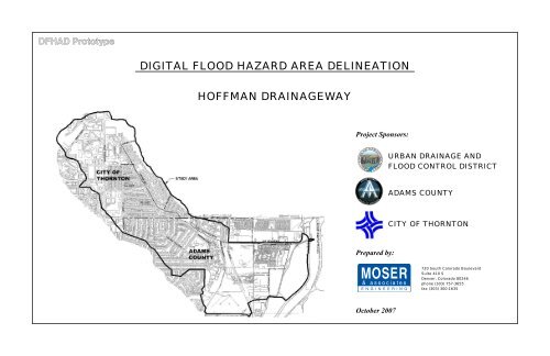
DIGITAL FLOOD HAZARD AREA DELINEATION<br />
HOFFMAN DRAINAGEWAY<br />
Project Sponsors:<br />
URBAN DRAINAGE AND<br />
FLOOD CONTROL DISTRICT<br />
ADAMS COUNTY<br />
CITY OF THORNTON<br />
Prepared by:<br />
720 South Colorado Boulevard<br />
Suite 410 S<br />
Denver, Colorado 80246<br />
phone (303) 757-3655<br />
fax (303) 300-1635<br />
October 2007
THIS PAGE INTENTIONALLY LEFT BLANK<br />
DFHAD Prototype
DFHAD Prototype
THIS PAGE INTENTIONALLY LEFT BLANK<br />
DFHAD Prototype
HOFFMAN MAJOR DRAINAGEWAY PLANNING<br />
FLOOD HAZARD AREA DELINEATION<br />
Section 1 Introduction.................................................................................. 1-1<br />
1.1 Authorization .......................................................................................................1-1<br />
1.2 Purpose <strong>and</strong> Scope ...............................................................................................1-1<br />
1.3 Planning Process ..................................................................................................1-1<br />
1.4 Mapping <strong>and</strong> Surveys...........................................................................................1-1<br />
1.5 Data Collection ....................................................................................................1-2<br />
1.6 Acknowledgements..............................................................................................1-2<br />
Section 2 Study Area.................................................................................... 2-1<br />
2.1 Project Area..........................................................................................................2-1<br />
2.2 L<strong>and</strong> Use ..............................................................................................................2-1<br />
2.3 Outfall Description...............................................................................................2-3<br />
2.4 Previous Studies <strong>and</strong> <strong>Flood</strong> History.....................................................................2-5<br />
2.5 Wetl<strong>and</strong> <strong>and</strong> Riparian Zones................................................................................2-5<br />
2.6 Flora, Fauna <strong>and</strong> Threatened or Endangered Species ..........................................2-5<br />
Section 3 Hydrologic Analysis ..................................................................... 3-1<br />
3.1 Overview..............................................................................................................3-1<br />
3.2 Design Rainfall.....................................................................................................3-1<br />
3.3 Subwatershed Characteristics ..............................................................................3-2<br />
3.4 Hydrograph Routing ............................................................................................3-2<br />
3.5 Results of Analysis...............................................................................................3-2<br />
3.6 Previous Studies...................................................................................................3-3<br />
Section 4 Hydraulic Analysis ....................................................................... 4-1<br />
4.1 Evaluation of Existing Facilities ..........................................................................4-1<br />
4.2 <strong>Flood</strong> Hazards ......................................................................................................4-1<br />
Section 5 References ................................................................................... 5-1<br />
List of Tables<br />
List of Figures<br />
APPENDICES<br />
Appendix A<br />
Appendix B<br />
Appendix C<br />
Table 2-1 Fully-Developed L<strong>and</strong>-Use........................................................................2-1<br />
Table 3-1 Incremental Rainfall Depths ......................................................................3-1<br />
Table 3-2 Comparison of 100-Year Peak Flow to Other Studies ..............................3-3<br />
Table 4-1 Structure Capacity Table ...........................................................................4-3<br />
Figure 2-1 Study Area Map.........................................................................................2-2<br />
Figure 2-2 Conveyance Overview...............................................................................2-4<br />
Figure 2-3 <strong>Flood</strong> Insurance Rate Map Limits .............................................................2-6<br />
Figure 4-1 Conveyance Schematic..............................................................................4-2<br />
Meeting Minutes<br />
Hydrologic Analysis<br />
EPA SWMM Input File<br />
Table B-1 Subwatershed Characteristics<br />
Table B-2 Peak Flow Summary<br />
Figure B-1 Imperviousness Map<br />
Figure B-2 Subwatershed Boundaries<br />
Figure B-3 Soils Map<br />
Figure B-4 EPA SWMM Routing<br />
Figure B-5 EPA SWMM Routing Schematics<br />
Chart B-1 Peak Flow Profile for Hoffman <strong>Drainage</strong>way Mainstem<br />
Chart B-2 Peak Flow Profile for Hoffman <strong>Drainage</strong>way Rainbow Split<br />
Chart B-3 100-Year Hydrograph, Baseline Hydrograph<br />
Mannings “n” Photographs<br />
Hydraulic Analysis<br />
HEC-RAS Output<br />
Structure Hydraulic Analysis Details Table<br />
Drainge Structure Photos<br />
Structure Sections<br />
Appendix D<br />
<strong>Flood</strong>plain <strong>and</strong> <strong>Flood</strong>way Data Table<br />
Appendix E<br />
Appendix F<br />
<strong>Flood</strong> Map<br />
<strong>Flood</strong> Profiles
THIS PAGE INTENTIONALLY LEFT BLANK<br />
DFHAD Prototype
SECTION 1 – INTRODUCTION<br />
1.1 AUTHORIZATION<br />
On July 11, 2006 the <strong>Urban</strong> <strong>Drainage</strong> <strong>and</strong> <strong>Flood</strong> <strong>Control</strong> D istrict (<strong>District</strong>), in joint sponsorship with the<br />
City of Thornton <strong>and</strong> Adams County, contracted with Moser & Associates Engineering for the provisions of<br />
engineering services for a Major <strong>Drainage</strong>way Planning <strong>and</strong> <strong>Flood</strong> H azard Area Delineation (FHAD) Study<br />
for the Hoffman <strong>Drainage</strong>way watershed. Specific hydrol ogic analysis tasks were performed in accordance<br />
with Agreement Number 06-04.05.<br />
1.2 PURPOSE AND SCOPE<br />
The scope of this FHAD study is as follows:<br />
1. Gather <strong>and</strong> assemble information on the existing drainage system including hydraulic structures,<br />
channel characteristics, <strong>and</strong> topographic information<br />
2. Define the water surface prof ile <strong>and</strong> flood boundaries for th e 10, 50, 100, <strong>and</strong> 500-year flood<br />
events <strong>and</strong> also for the 0.5 foot <strong>and</strong> 1.0 foot floodways.<br />
3. Prepare plan <strong>and</strong> profile drawi ngs of the Hoffm an <strong>Drainage</strong>way showing the lim its of the 100-<br />
year floodplain <strong>and</strong> the 10-year <strong>and</strong> 100-year flood profile.<br />
4. Document the study results in the FHAD Report.<br />
The study area is approxim ately 1.8 square m iles loca ted within the City of Thornton <strong>and</strong> portions of<br />
unincorporated Adams County. The study are boundary is generally defined on the west by Grant Street,<br />
the north by East Thornton Parkwa y, the east by the S outh Platte River, <strong>and</strong> the south by Coronado<br />
Parkway.<br />
Three addenda have been issued for this contract. Addendum 1 was executed to exp<strong>and</strong> the study area to<br />
include l<strong>and</strong> affected by flood flow splits outside of the m ain Hoffman <strong>Drainage</strong>way. Addendum 2 wa s<br />
executed to obtain additional survey information near structures <strong>and</strong> along FHAD c ross sections to bette r<br />
define the floodplain delineations for the FHAD. A ddendum 3 was executed to perform a more detailed<br />
analysis of several localized areas of concern.<br />
1.3 PLANNING PROCESS<br />
HOFFMAN MAJOR DRAINAGEWAY PLANNING<br />
FLOOD HAZARD AREA DELINEATION<br />
In the beginning, the project sponsors expressed two primary goals: determine the actual path of floodwater<br />
<strong>and</strong> propose im provements to safely convey the fl oodwater to m inimize the flooding im pacts to the<br />
structures in the watershed. The watershed had been studied in the past , but a FEMA detailed study for the<br />
entire watershed had not been completed. T he proj ect sponsors felt it was im portant to address the<br />
watershed as a whole <strong>and</strong> prioritize the improvements.<br />
Early in the FHAD pro cess, it wa s discovered that the Hoffm an <strong>Drainage</strong>way did not contain flood flows<br />
within its existing infrastructure which resulted in multiple flood flow splits. Because of this, the watershed<br />
study area was exp<strong>and</strong>ed to consider additional storm runoff through the split flow areas.<br />
Two public open houses were held on Septem ber 11, 2006 <strong>and</strong> July 19, 2007. A m ailing was sent to all<br />
property owners within the watershed to attend the first meeting to provide insight into issues in the project<br />
area <strong>and</strong> to offer input for the study. Ten (10) residents <strong>and</strong> representati ves attended the first open house.<br />
Postcards were s ent to all p roperty owners whose propertie s are with in or ad jacent to an existing or new<br />
floodplain. Eleven (11) residents <strong>and</strong> representatives attended the second open house.<br />
The “Hoffm an <strong>Drainage</strong>way Baseline Hydrology Re port” was published in Septem ber 2006 which<br />
summarized the results for existing fully-developed l<strong>and</strong>-use condition hydrologic analysis for the Major<br />
<strong>Drainage</strong>way Study <strong>and</strong> the FHAD. This report was accepted by the project sponsors <strong>and</strong> provided the<br />
hydrology for the <strong>Flood</strong> Hazard Area Delineation.<br />
This <strong>Flood</strong> Hazard Area Delineatio n Report describes the Study Area, provides results of the hydrologic<br />
analysis <strong>and</strong> documents the findings of the hydraulic analysis for the floodplain <strong>and</strong> floodway delineations.<br />
1.4 MAPPING AND SURVEYS<br />
The <strong>District</strong> supplied m apping (2-foot contours) for the original c ontract study lim its as AutoCAD<br />
electronic files. Adam s County supplied 2-foot contour m apping to supplement the <strong>District</strong>’s mapping for<br />
the exp<strong>and</strong>ed watershed area.<br />
1-1<br />
DFHAD Prototype
SECTION 1 – INTRODUCTION<br />
HOFFMAN MAJOR DRAINAGEWAY PLANNING<br />
FLOOD HAZARD AREA DELINEATION<br />
1.5 DATA COLLECTION<br />
Several sources of data have been collected at this point. These sources include:<br />
Mapping (2-foot contours) for the study area was supplied by the <strong>District</strong> as AutoCAD electronic<br />
files.<br />
Supplemental mapping (2-foot contours) was supplied by Adams County as AutoCAD electronic<br />
files for the exp<strong>and</strong>ed watershed area.<br />
Hardcopies of <strong>Flood</strong> Insurance Study backup HEC-2 files were supplied by FEMA for the detailed<br />
floodplain study between 88 th Avenue <strong>and</strong> Devonshire Boulevard.<br />
As-built survey information for the H.C.C. Subdivision on Steele Street.<br />
City of Thornton GIS shape files (August 2006).<br />
Adams County storm sewer GIS shape files (August 15, 2006)<br />
City of Thornton as-built plans for storm sewer <strong>and</strong> channel improvements along the watershed.<br />
Hardcopy of Muller Engineering Lower Hoffman <strong>Drainage</strong>way conceptual Design report date May<br />
14, 1990.<br />
Hardcopy of Muller Engineering Lower Hoffman <strong>Drainage</strong>way Preliminary Design Memor<strong>and</strong>um<br />
dated January 30, 2003.<br />
1.6 ACKNOWLEDGEMENTS<br />
The following individuals representing project sponsors have attended the progress meetings <strong>and</strong> given<br />
input to the study.<br />
Ben Urbonas, P.E. Project Director, <strong>Urban</strong> <strong>Drainage</strong> <strong>and</strong> <strong>Flood</strong> <strong>Control</strong> <strong>District</strong><br />
Ken MacKenzie, P.E. Project Manager, <strong>Urban</strong> <strong>Drainage</strong> <strong>and</strong> <strong>Flood</strong> <strong>Control</strong> <strong>District</strong><br />
Pete Brezall Project Manager of Infrastructure Engineering, City of Thornton<br />
Besharah Najjar, P.E. Engineering Manager, Adams County<br />
Jessica Stevens, E.I. <strong>Drainage</strong> Engineer, Adams County<br />
The following individuals from Moser & Associates Engineering contributed to this study are listed below.<br />
Rick Moser, P.E. Principal-In-Charge<br />
Teresa Patterson, P.E. Project Manager<br />
David Delagarza E.I. Project Engineer<br />
Lee Draeger, E.I. Engineer<br />
Robert Mitchell Technician<br />
Tony Tran Technician<br />
Amy Tiegen Technician<br />
Stephanie Titus Technician<br />
Sage Cabrera Technician<br />
1-2<br />
DFHAD Prototype
SECTION 2 – STUDY AREA<br />
2.1 PROJECT AREA<br />
The project area consis ts of the Hoff man <strong>Drainage</strong>way watershed which is located in the City of Thornton<br />
<strong>and</strong> portions of unincorporated Adam s County. The to tal watershed area is 1,161 acres or 1.81 square<br />
miles. The study area boundary is generally defined on the west by Grant Street, the north by East Thornton<br />
Parkway, the east by the Sout h Platte R iver, <strong>and</strong> th e south by Coronado Parkway. Early in the FHAD<br />
process, it was discovered that th e Hoffman <strong>Drainage</strong>way did not cont ain flood flows within its existing<br />
infrastructure which res ulted in m ultiple flood f low splits. Because of this, the watershed study area was<br />
exp<strong>and</strong>ed to consider additional storm runoff through the split flow areas.<br />
The Hoffman <strong>Drainage</strong>way starts near th e in tersection of Hoffm an Way <strong>and</strong> Dorothy Boulevard, runs<br />
southeast along Hoffman Way to 88 th Avenue, continues southeast throu gh a residential area to Devonshire<br />
Boulevard, then follows 86 th Avenue easterly to the South Platte River. The drainageway crosses 88<br />
Avenue, the Union Pacific Railroad (UPRR), the Colo rado Agricultural Ditch, a nd the Lower Clear Creek<br />
Canal (LCCC). See the Study Area map Figure 2-1.<br />
th<br />
HOFFMAN MAJOR DRAINAGEWAY PLANNING<br />
FLOOD HAZARD AREA DELINEATION<br />
L<strong>and</strong>-use information was obtained by sampling r<strong>and</strong>om areas of similar densities from the base mapping to<br />
calculate the imperviousness values. Additional discussions with the project sponsors were used to<br />
determine projected densities for the few areas that have yet to be developed. See Figure B-1 in Appendix<br />
B for the Imperviousness Map that illustrates the l<strong>and</strong>-use densities.<br />
There are two soil classifications within the project limits, types A <strong>and</strong> C <strong>and</strong> are described in Section 3.3.3.<br />
General watershed parameters include:<br />
Highest watershed elevation (approximate) = 5,446<br />
Lowest watershed elevation (approximate) = 5,070<br />
The average slope of the channel = 0.025 ft/ft<br />
Watershed shape (L/W) = 4<br />
A Project Reuse Watershed number for Hoffman <strong>Drainage</strong>way has not been defined.<br />
2.2 LAND USE<br />
The watershed is nearly built out, so only the fully-developed l<strong>and</strong>-use condition is considered for this<br />
study. The l<strong>and</strong>-use within the watershed can be broken down into the general l<strong>and</strong>-use categories which<br />
are summarized below. The watershed imperviousness is 60.2%.<br />
TABLE 2-1<br />
Fully-Developed L<strong>and</strong>-Use<br />
Imperviousness Area<br />
% (acres) (sq mi)<br />
30 50 0.08<br />
35 357 0.56<br />
45 36 0.06<br />
50 147 0.23<br />
55 39 0.06<br />
80 385 0.60<br />
90 72 0.11<br />
100 74 0.12<br />
2-1<br />
DFHAD Prototype
SECTION 2 – STUDY AREA<br />
2.3 OUTFALL DESCRIPTION<br />
During the process of developing this repo rt, a num ber of split flow c onditions were identified. This<br />
resulted in seven (7) different reaches being used for the purpose of FHAD planning. Figure 2-2 illus trates<br />
the locations of the various reaches.<br />
HOFFMAN MAJOR DRAINAGEWAY PLANNING<br />
FLOOD HAZARD AREA DELINEATION<br />
lower half was recen tly improved down to the SPR. The Lower Clear Creek Canal cross es<br />
the Hoffm an Mainstem imm ediately upstream of the im proved sect ion. The irrigation<br />
structure significantly constricts the drainageway at this location, causing runoff to split into<br />
the Irrigation Ditch Split.<br />
Hoffman <strong>Drainage</strong> Mainstem <strong>and</strong> Irrigation Ditch Split<br />
Hoffman Mainstem represents the central flow of runoff through the watershed <strong>and</strong> is the primary flowpath<br />
for the watershed. It may be divided into three distinct subreaches:<br />
SubReach 1<br />
Along Hoffm an W ay from the upstream FHAD li mit at the intersection of Dorothy<br />
Boulevard to 88 th Avenue. Hoffm an Way is a divided collector roadway with a l<strong>and</strong>scaped<br />
median through a residential area. There is a storm sewer system that generally follows the<br />
median.<br />
SubReach 2<br />
88 th Avenue to W elby Road. The existing draina geway infrastructure is a com bination of<br />
open channel, pipe, culverts, <strong>and</strong> bridges. This reach flows through a residential area with a<br />
very small section of industrial l<strong>and</strong> directly adjacent to the UPRR.<br />
Hoffman Mainstem SubReach 3 – Channel Along 86 th Avenue<br />
Rainbow, Hope <strong>and</strong> Railroad Splits<br />
Due to an undersized culvert at R ainbow Drive, st ormwater splits from Hoffma n Mainstem <strong>and</strong> flows<br />
through an undeveloped property east of Rainbow Drive. Runoff that splits into the Rainbow Split does not<br />
return to th e Hoffm an Mainstem . The Rainbow Split is characterized by open, undeveloped l<strong>and</strong> above<br />
Devonshire Boulevard. A shallow ch annel conveys a sm all volum e of flow through this property to<br />
Devonshire Blvd. Flows which exceed the capacity of this channel (approximately 140 cfs) break out of the<br />
channel to the south, flow to Hope Court <strong>and</strong> rejoin the Rainbow Split at McElwain Boulevard.<br />
Hoffman SubReach 1 – Hoffman Way Hoffman Mainstem SubReach 2 – 88 th Avenue to Rainbow<br />
Below Devonshire Boulevard, the Ra inbow Split flows through an undeve loped lot <strong>and</strong> over the railroad<br />
tracks. A sm all ditch on the west side of the tracks carries up to 150 cfs into the Railroad Split along the<br />
railroad tracks. The Ra ilroad Split conveys water to the Lower Clear Creek Canal railroad brid ge. The<br />
Railroad Split then flows east under this bridge <strong>and</strong> joins the Industrial Split, discussed below.<br />
SubReach 3<br />
Welby Road to the So uth Platte River (SPR ). This reach runs throug h an industrial area.<br />
The upper half of this reach is a dilapidated open channel with steep, unstable slopes. The<br />
2-3
SECTION 2 – STUDY AREA<br />
Flows from the Rainbow Split which are not diverted into the Railroad Split pass over the railroad tracks<br />
<strong>and</strong> enter a prestressed concrete plant. Within the plant property, these flows split around the primary<br />
building. The flows that split to the south become the Industrial Split, which is discussed below. Flows<br />
which split around the north side of the building continue along the Rainbow Split over Steele Street.<br />
Below Steele Street, the Rainbow Split flows through the corner of a mobile home park <strong>and</strong> into sparsely<br />
developed horse pastures. The Rainbow Split flows into a series of gravel ponds <strong>and</strong> discharges into the<br />
South Platte River.<br />
Industrial <strong>and</strong> Industrial South Splits<br />
The Industrial Split begins as flows splits around the south side of the m ain bui lding of the prestressed<br />
concrete plant. The Industrial Split continues south, paralleling the Railroad through an undeveloped parcel.<br />
Runoff in the Industrial Split which is not div erted into th e Industrial So uth Split, d iscussed below, flows<br />
around the north side of the commercial propert y, overtopping a detention pond <strong>and</strong> Steele Street, <strong>and</strong><br />
rejoins the Rainbow Split east of Steele Street.<br />
South of the aforementioned undeveloped parcel is a newly developed commercial property (Parrot H.C.C.<br />
Subdivision). When the commercial property was constructed, several feet of fill material was added. As a<br />
result of the fill m aterial being pl aced in this location, flows from the Industrial Split are divided again,<br />
creating the Industrial South Split. A ditch along the ra ilroad tracks carries flow in the Industrial South<br />
Split. W ater in this split follows the railroad around the west side <strong>and</strong> the south side of the comm ercial<br />
property to Steele Street. Flows then overtop Steele Street, flow through sparsely developed l<strong>and</strong> <strong>and</strong> rejoin<br />
the Rainbow Split at the gravel lakes.<br />
With the existing topog raphy, there is no way for flows fr om the Rainbow Split to rejo in th e Hoffm an<br />
<strong>Drainage</strong>way. The Rainbow Split overtops the UPRR <strong>and</strong> splits <strong>and</strong> rejoins several times before continuing<br />
easterly toward the South Platte River.<br />
2.4 PREVIOUS STUDIES AND FLOOD HISTORY<br />
HOFFMAN MAJOR DRAINAGEWAY PLANNING<br />
FLOOD HAZARD AREA DELINEATION<br />
According to the <strong>Flood</strong> Insurance Rate Map (FIRM) , there is a Zone A (approxim ate) floodplain along<br />
Hoffman Way. In August 1974 a detailed study of the drainageway between 88 th Avenue <strong>and</strong> Welby Road<br />
was completed <strong>and</strong> a Zone AE floodpl ain was recognized. Downstream of Welby Road, the FIRM panel<br />
notes, “500-year flood contained in [the] channel”.<br />
According to the current FIRM, a num<br />
ber of hous es along Hoffma n W ay <strong>and</strong> in the Hope Court<br />
neighborhood are within a 100-year floodplain. Figure 2-3 illustrates the approximate location of the FIRM<br />
effective floodplain <strong>and</strong> how it compares to the FHAD 100-year floodplain.<br />
The residents in the watershed have reported their experiences with flooding. At the public meeting, several<br />
of residents in the Hope Court area relayed their stories of flooding. At the same meeting, two members of<br />
the mobile home community southeast of the LCCC <strong>and</strong> 86 th Avenue imparted their stories of being flooded<br />
multiple times from backwater up the LCCC.<br />
2.5 WETLAND AND RIPARIAN ZONES<br />
No riparian or wetl<strong>and</strong> vegetation ha s been observed within the study area with the ex ception of the South<br />
Platte River banks at the downstream study limits. Ho wever, a thorough investigation should be perform ed<br />
prior to construction.<br />
2.6 FLORA, FAUNA AND THREATENED OR ENDANGERED SPECIES<br />
There are no known threatened flora or fauna with in the study area; however a thorough investigation<br />
should be performed prior to any construction.<br />
The mainstem of Hoffman runs along the south side of 86 th Avenue in an open channel. At the LCCC, the<br />
at-grade crossing with the irrigation ditch is to o sm all to r elease th e larger sto rm events <strong>and</strong> during the<br />
100-year storm event, water breaks out of the irrigation stru cture overtopping 86 th Avenue. This results in<br />
shallow flooding north of 86 th Avenue.<br />
2-5
SECTION 3 – HYDROLOGIC ANALYSIS<br />
HOFFMAN MAJOR DRAINAGEWAY PLANNING<br />
FLOOD HAZARD AREA DELINEATION<br />
3.1 OVERVIEW<br />
The storm runoff hydrographs <strong>and</strong> routing for the study were generated using the Environm ental Protection<br />
Agency’s 2006 version of Stormwater Manage ment Model (SW MM) Version 5.0. The physical<br />
characteristics for each subwatershed in the SWMM analysis include:<br />
• <strong>Drainage</strong> area<br />
• Width of the subwatershed<br />
• Subwatershed slope<br />
• Percent imperviousness<br />
• Subarea routing<br />
• Percent routed<br />
• Soil infiltration rates<br />
• Surface retention storage values<br />
The peak flow results from the SWMM m odel were com pared to the re sults in the FEMA FIS at various<br />
locations. The comparison process is discussed in more detail in Section 3.6<br />
In acco rdance with Dis trict policy, existing privatel y-owned detention basins we re not inclu ded in th e<br />
hydrologic models because of the uncertainty associated with their continued ex istence. There are no<br />
known publicly-owned <strong>and</strong> maintained detention basins in the watershed area.<br />
The drainage network is generally comprised of subwatersheds, design points, <strong>and</strong> open channels.<br />
TABLE 3-1<br />
Incremental Rainfall Depths (inches)<br />
Time<br />
Return Period (Year)<br />
(min)<br />
2 5 10 25 50 100 500<br />
0 0.00 0.00 0.00 0.00 0.00 0.00 0.00<br />
5 0.02 0.03 0.03 0.03 0.03 0.03 0.03<br />
10 0.04 0.05 0.06 0.07 0.08 0.08 0.10<br />
15 0.08 0.12 0.14 0.10 0.12 0.12 0.15<br />
20 0.16 0.22 0.25 0.16 0.19 0.22 0.26<br />
25 0.25 0.36 0.42 0.30 0.35 0.38 0.46<br />
30 0.14 0.18 0.20 0.50 0.59 0.68 0.82<br />
35 0.06 0.08 0.09 0.24 0.28 0.38 0.46<br />
40 0.05 0.06 0.07 0.16 0.19 0.22 0.26<br />
45 0.03 0.05 0.06 0.10 0.12 0.17 0.20<br />
50 0.03 0.05 0.05 0.10 0.12 0.14 0.16<br />
55 0.03 0.04 0.05 0.06 0.08 0.11 0.13<br />
60 0.03 0.04 0.05 0.06 0.08 0.11 0.13<br />
65 0.03 0.04 0.05 0.06 0.08 0.11 0.13<br />
70 0.02 0.04 0.05 0.05 0.06 0.05 0.07<br />
75 0.02 0.03 0.05 0.05 0.06 0.05 0.07<br />
80 0.02 0.03 0.04 0.04 0.04 0.03 0.04<br />
85 0.02 0.03 0.03 0.04 0.04 0.03 0.04<br />
90 0.02 0.03 0.03 0.03 0.03 0.03 0.04<br />
95 0.02 0.03 0.03 0.03 0.03 0.03 0.04<br />
100 0.02 0.02 0.03 0.03 0.03 0.03 0.04<br />
105 0.02 0.02 0.03 0.03 0.03 0.03 0.04<br />
110 0.02 0.02 0.03 0.03 0.03 0.03 0.04<br />
115 0.01 0.02 0.03 0.03 0.03 0.03 0.04<br />
120 0.01 0.02 0.02 0.03 0.03 0.03 0.04<br />
1-Hour Point<br />
Rainfall (inches)<br />
1.00 1.42 1.68 2.01 2.35 2.71 3.35<br />
The “Hoffman <strong>Drainage</strong>way Baseline Hydrology Repor t” was published in September of 2006 <strong>and</strong> the<br />
hydrologic calculations were accep ted by the <strong>Urban</strong> Drai nage <strong>and</strong> <strong>Flood</strong> <strong>Control</strong> <strong>District</strong> on October 11,<br />
2006.<br />
3.2 DESIGN RAINFALL<br />
The 5-m inute increm ental rainfall depths for the 2- , 5-, 10-, 25-, 50-, <strong>and</strong> 100-year storm events were<br />
gathered from table 9.5 in the Ad ams County Development St<strong>and</strong>ards <strong>and</strong> Regulations. The EPA SW MM<br />
model then distributed the rainfall depths over a 2- hour storm duration. The increm ental rainfall depths<br />
used are shown in Table 3-1.<br />
3-1<br />
DFHAD Prototype
SECTION 3 – HYDROLOGIC ANALYSIS<br />
HOFFMAN MAJOR DRAINAGEWAY PLANNING<br />
FLOOD HAZARD AREA DELINEATION<br />
3.3 SUBWATERSHED CHARACTERISTICS<br />
A total of 27 subwatersheds were delineated in the Hoffman <strong>Drainage</strong>way study area. The subwatershed<br />
identification <strong>and</strong> locations are displayed in Figure B-2 in Appendix B. The physical characteristics of each<br />
subwatershed are described in Table B-1, Subwatershed Characteristics, located in Appendix B.<br />
The 2-foot contour m apping, provided by the <strong>District</strong>, supplem ented with the 2-foot contour m apping from<br />
the City of Thornton <strong>and</strong> Adam s County, were used to identify subwater shed boundaries, flow paths, <strong>and</strong><br />
slopes for each subwatershed. The subwatersheds range in size from 5.3 acres to 107.6 acres with an<br />
average drainage area size of 42.5 acres.<br />
Due to the fact that th e watershed is alm ost co mpletely developed, the watershed im perviousness was<br />
determined only f or f ully develope d condition s using zoning f or guidance in und eveloped a reas. Aeria l<br />
mapping <strong>and</strong> site visits were used to iden tify levels of existing im perviousness. City of Thornton <strong>and</strong><br />
Adams County zoning was used to identify areas where approved future development will have a significant<br />
effect on the watershed imperviousness.<br />
Eight (8) dif ferent categories of im perviousness were identified <strong>and</strong> ra nge from 30 percent to 100 percent.<br />
The watershed imperviousness is shown on Figure B-1 in Appendix B.<br />
3.4 HYDROGRAPH ROUTING<br />
The routing elem ents within th is model are sto rm sewer pipes, stre ets, <strong>and</strong> open channels. In location s<br />
where storm sewer pipes were modeled, a parallel open channel routing elem ent was m odeled to ca rry<br />
excess flows from the pipes. Appendix B provides the physical attributes (widt h, length, slope, side slope,<br />
<strong>and</strong> Manning’s “n”) assigned to each conveyance element used in the EPA SWMM m odel. W here<br />
available, cross section s for each routing elem ent were developed usin g as-built in formation from channel<br />
<strong>and</strong> storm sewer construction.<br />
In Appendix B Figure B-4, the EPA SWMM Routi ng Map, <strong>and</strong> Figure B-5, the EPA SWM M Routing<br />
Schematic, illustrate the lo cation <strong>and</strong> connectivity of the drainage system elements. The Routing Map <strong>and</strong><br />
schematic show where the subwatersh eds connect into the drainag e system <strong>and</strong> the specific design points<br />
defined at these locatio ns. In addition, the rou ting elements illustrate where the runoff is connected to th e<br />
next downstream design point.<br />
Runoff from subwatershed 35 is co llected in a storm sewer which is routed out of the Hoffma n<br />
<strong>Drainage</strong>way watershed. Flows which exceed the cap acity of the stor m sewer ar e tribu tary to Hoffm an<br />
<strong>Drainage</strong>way. The storm sewer is modeled in rou ting element 355 which connect s to outfall 351. Flows<br />
which exceed the capacity of the storm sewer are modeled in routing element 356.<br />
Two (2) soil types identified by the Soil Conservation Service (S CS) were found in the Hoffma n<br />
<strong>Drainage</strong>way study area. The m ajority of the basin is classified as hydrological so il classification Type C<br />
Soil. Type A soils are found in the upper area of the ba sin <strong>and</strong> near the gravel la kes, <strong>and</strong> in the southwest<br />
portion of the study area. Fo r Types C soils, the initial in filtration rate is 3.0 inches per hour (iph), the final<br />
infiltration rate is 0.5 ip h, <strong>and</strong> the infiltration decay constant is 0.0018 (1/sec). For Type A soils, the in itial<br />
infiltration rate is 5 iph, the fina l infiltration rate is 1 iph <strong>and</strong> the decay constant is 0.007 (1/sec). These<br />
values are in accordan ce with Distri ct criteria as referen ced in th e Ru noff Chapter of the <strong>Urban</strong> Stor m<br />
<strong>Drainage</strong> Criteria Manual (USDCM, 2001) . The distribution of the soil t ypes can be seen on Figure B-3 in<br />
Appendix B.<br />
Mannings “n” values were verified in the field. Pictures illustrating th e Manning’s “n” values for a sam ple<br />
of the conveyance elements are included in Appendix B.<br />
3.5 RESULTS OF ANALYSIS<br />
Using the physical subwatershed hydrologic param eters <strong>and</strong> rainfall infor mation, along with the drainage<br />
system conveyance cha racteristics, peak flow rate s were determ ined. Table B-2 in Appendix B provides<br />
peak flow rate inform ation at each of the elem ents along the drainageway for the 2-, 5-, 10-, 25-, 50-, <strong>and</strong><br />
100-year event storms.<br />
A summarized input file from the EPA SWMM model is included in Appe ndix B. Peak flow profiles for<br />
Hoffman Mainstem <strong>and</strong> the Rainbow Split may be found in Charts B-1 <strong>and</strong> B-2 both located in Appendix B.<br />
3-2<br />
DFHAD Prototype
SECTION 3 – HYDROLOGIC ANALYSIS<br />
HOFFMAN MAJOR DRAINAGEWAY PLANNING<br />
FLOOD HAZARD AREA DELINEATION<br />
Hydrographs for the 100-year event storm are shown on Chart B-3 in Appendix B at five (5) different<br />
locations along Hoffman <strong>Drainage</strong>way.<br />
3.6 COMPARISON WITH PREVIOUS STUDIES<br />
The flows from the EPA SW MM model were com pared with those supplied by FEMA as part of the FIS<br />
study. Upon examining the HEC-2 model that was provided as suppo rt for the FIS, it became apparent that<br />
there was a discrepancy between the flows in the model <strong>and</strong> those published in the FIS. For the purposes of<br />
this study, the HEC-2 model will be used for comparison, as it appears to have more reasonable flows.<br />
The current model was calibrated to the FEMA HEC-2 model by systema tically varying the subbasin width<br />
characteristic within EP A SWMM. The EPA SW MM model was compared to the HEC-2 m odel at two<br />
locations: East 88 th Avenue <strong>and</strong> Devonshire Road. The results of the calibration are shown below.<br />
TABLE 3-2<br />
Comparison of 100-Year Peak Flow to Other Studies<br />
Location FIS FEMA HEC-2 Moser – Calibrated b<br />
88th Avenue 680 (0.8 sq.mi.) 1000 a 1069 (0.8 sq.mi.)<br />
Devonshire Boulevard<br />
1240 (1.2<br />
sq.mi.)<br />
1220 a 1079 (0.9 sq.mi.)<br />
a Tributary area unknown<br />
b Calibration occurred before watershed area was exp<strong>and</strong>e<br />
3-3<br />
DFHAD Prototype
THIS PAGE INTENTIONALLY LEFT BLANK<br />
DFHAD Prototype
SECTION 4 – HYDRAULIC ANALYSIS<br />
HOFFMAN MAJOR DRAINAGEWAY PLANNING<br />
FLOOD HAZARD AREA DELINIATION<br />
4.1 EVALUATION OF EXISTING FACILITIES<br />
Existing drainage facilities within the project area consist of roadways, natural channels, improved channels,<br />
overl<strong>and</strong> flow paths, storm sewers, bridges <strong>and</strong> culvert crossings.<br />
HEC-RAS was used f or the floodplain analysis of all drainage faciliti es. The cross se ctions used by<br />
HEC-RAS were developed using A utodesk L<strong>and</strong> Development Desktop a nd were c ut from digital ter rain<br />
model data supplied by the <strong>District</strong> for all cross sections above 88<br />
th Avenue, <strong>and</strong> 2-foot contour data for<br />
cross sections located below 88 th Avenue. The additional survey perf ormed by Woolpert Inc. in March of<br />
2007 was used to further refine selected cross sections <strong>and</strong> to determine structure elevations near the edge of<br />
the floodplain. An as-built su rvey for the H.C.C. Subdivision provided by Ed Jennings, PE was used to<br />
refine the cross sections in the area south of the concrete plant, between the railroad tracks <strong>and</strong> Steele Street.<br />
All bridges <strong>and</strong> culverts were anal yzed using HEC-RAS. The flow through the culvert between Rainbow<br />
<strong>and</strong> Devonshire was also analyzed us ing HY-8 to further refine its fl ow capacity. The flow through the<br />
Lower Clear Creek Canal intersection structure was analyzed using HEC-RAS with topographical<br />
information obtained from the Woolpert survey. Detailed H EC-RAS output for this project m ay be located<br />
in Appendix C.<br />
For flows i n Hoffm an Way above 88 th Avenue, the surface flows wer e determ ined by using SW MM to<br />
model the capacity of the underg round storm sewer <strong>and</strong> route excess flows to the surface. Th e pipe sizes<br />
<strong>and</strong> inverts for the Hoffman Way storm sewer were obtained from as-built information provided by the City<br />
of Thornton, where available.<br />
Manning’s “n” values w ere determined through field obs ervation. Pictures illustrating the Manning’s “n”<br />
values for a sample of the conveyance elements are included in Appendix B.<br />
A number of different splits flow conditions w ere identified in the watershed. For each split f low, a new<br />
reach was c reated <strong>and</strong> n amed. HEC-RAS was used to id entify the locations of the splits <strong>and</strong> to determ ine<br />
the pe ak flo ws in e ach split. A sc hematic sho wing each s plit <strong>and</strong> its associa ted peak flow is shown in<br />
Figure 4-1.<br />
Two floodways were defined for Hoff man <strong>Drainage</strong>way based on a half-foot <strong>and</strong> one-foot rise in energy<br />
grade elevations. The floodways were defined in a m anner to keep structures out of the floodway<br />
delineation where possible. In locations where the flow is channelized in the 100-year event <strong>and</strong> no<br />
structures are in the floodplain, the floodway was set equal to the floodplain. The <strong>Flood</strong>plain <strong>and</strong> <strong>Flood</strong>way<br />
Data Table can be found in Appendix E.<br />
4.2 FLOOD HAZARDS<br />
The results of the <strong>Flood</strong> Hazard Area Delineation are located in Appendix D. The FHAD revealed that<br />
there are a number of houses <strong>and</strong> structures (garages, sheds, etc.) located within the 100-year floodplain.<br />
• One (1) house is located within the 100-year floodplain on Hoffman Way on the northwest corner of<br />
Hoffman Way <strong>and</strong> Ash Court.<br />
• Four (4) houses <strong>and</strong> two (2) structures are loca ted within the 100-year fl oodplain on the northwest<br />
corner of 88 th Avenue <strong>and</strong> Hoffman Way.<br />
• Two (2) houses <strong>and</strong> one (1) structure are located w ithin the 100-year floodplain on the west corner<br />
of Rainbow Avenue <strong>and</strong> Vine Court.<br />
• Approximately 13 houses <strong>and</strong> 13 structures are lo cated within the 100-year floodplain along H ope<br />
Court between McDougal Street <strong>and</strong> McElwain Boulevard.<br />
• Two (2) houses <strong>and</strong> one (1) structure are located within the floodplain on the southwest corner of<br />
McElwain Boulevard <strong>and</strong> Devonshire Boulevard.<br />
• A large portion of the c oncrete plant on the southwest corner of 86 th Avenue <strong>and</strong> Steele Street is<br />
located within the 100-year floodplain.<br />
• Downstream of the concrete plan t, approximately 29 structures, in cluding buildings, mobile homes,<br />
livestock shelters, <strong>and</strong> sheds, are located in the floodplain on both sides of Steele Street.<br />
The culvert between Rainbow Avenue <strong>and</strong> Devonshire Boulevard can only convey approximately 187 cfs of<br />
runoff. Excess flows overtop Rainbow Avenue, c ontinue overl<strong>and</strong> along the Rainbow Split <strong>and</strong> do no t<br />
return to the Hoffman <strong>Drainage</strong>way. In addition, a 185- acre basin which drains to McElwain Boulevard is<br />
also tributary to the Rainbow Split, com pounding the problems in this area. The Rainbow Split is a m ajor<br />
source of flooding. More than 50 houses <strong>and</strong> other structures are in the floodplain as a result of this split.<br />
4-1<br />
DFHAD Prototype
DFHAD Prototype
SECTION 4 – HYDRAULIC ANALYSIS<br />
HOFFMAN MAJOR DRAINAGEWAY PLANNING<br />
FLOOD HAZARD AREA DELINIATION<br />
The channel is undersized at the Lower Clear Creek Canal at grade crossing. This causes flows to split out<br />
of Hoffman <strong>Drainage</strong>way at this location <strong>and</strong> sheet flow overl<strong>and</strong> to the northeast. This is the reason for the<br />
shallow flooding region on the north side of 86 th Avenue, between Steele Street <strong>and</strong> the South Platte River.<br />
HEC-RAS analys is ind icates th at a num ber of struct ures do not contain the various storm events. The<br />
results of the analysis are shown in Table 4-1<br />
TABLE 4-1<br />
Structure Hydraulic Analysis<br />
(Structures Exceeding the Allowable Overtopping Criteria)<br />
Structure Station<br />
Return Event<br />
10-Year 50-Year 100-Year 500-Year<br />
88th Avenue Pipe 76+00 X X X X<br />
Rainbow Avenue Culvert 64+00 X X X X<br />
Old Welby Road Culvert 48+70<br />
Railroad Bridge 47+50<br />
Welby Road Culvert 46+25<br />
Steele Street 32+60<br />
X X X<br />
LCCC Crossing<br />
30+00 X X X<br />
Maintenance Road 8+25<br />
Maintenance Road 2+75<br />
Pedestrian Trail 2+00 N/A - Overtopped by S. Platte River Backwater<br />
X = Storm Event Peak Flow Exceeds the allowable overtopping criteria<br />
Additional details in Appendix D<br />
4-3<br />
DFHAD Prototype
THIS PAGE INTENTIONALLY LEFT BLANK<br />
DFHAD Prototype
SECTION 5 – REFERENCES<br />
HOFFMAN MAJOR DRAINAGEWAY PLANNING<br />
FLOOD HAZARD AREA DELINIATION<br />
1. “<strong>Urban</strong> Storm <strong>Drainage</strong> Criteria Manual”, <strong>Urban</strong> <strong>Drainage</strong> <strong>and</strong> <strong>Flood</strong> <strong>Control</strong> <strong>District</strong>, 2001.<br />
2. “User Manual, EPA SWMM Version 5.0”, U.S. Environmental Protection Agency, 2005.<br />
3. “Lower Hoffman <strong>Drainage</strong>way Conceptual Design”, Muller Engineering Company, May 14, 1990<br />
4. “Lower Hoffman <strong>Drainage</strong>way Preliminary Design Memor<strong>and</strong>um”, January 30, 2003<br />
5. “<strong>Flood</strong> Insurance Rate Maps, Adam s County, Co lorado <strong>and</strong> Incorporated Areas”, Federal<br />
Emergency Management Agency, August 16 1995<br />
6. “FEMA <strong>Flood</strong> Insurance Study”, Federal Emergency Management Agency, August 1995.<br />
7. “As-built” drawings for Hoffman Way storm sewer, City of Thornton<br />
8. H.C.C Subdivision As-Built Survey, R.W. Bayer & Associates, Inc., October 2006.<br />
9. 1974 FEMA HEC-2 Model Output Back-up Data<br />
10. “Hoffman <strong>Drainage</strong>way Baseline Hydrology Report,” Moser <strong>and</strong> Associates , September 2006.<br />
11. “<strong>Flood</strong> Hazard Area Delineation , S outh Platte River, Adam s County, Colorado.,” Camp, Dresser<br />
<strong>and</strong> McKee, April 2005.<br />
5-1<br />
DFHAD Prototype
THIS PAGE INTENTIONALLY LEFT BLANK<br />
DFHAD Prototype
HOFFMAN MAJOR DRAINAGEWAY PLANNING<br />
FLOOD HAZARD AREA DELINEATION<br />
APPENDIX A – Meeting Minutes<br />
DFHAD Prototype
THIS PAGE INTENTIONALLY LEFT BLANK<br />
DFHAD Prototype
DFHAD Prototype<br />
720 S. Colorado Boulevard, Suite 410 S<br />
Denver, Colorado 80246<br />
phone (303) 757-3655<br />
fax (303) 300-1635<br />
PROGRESS MEETING FOR<br />
HOFFMAN DRAINAGEWAY PLANNING & FHAD STUDY<br />
MEETING MINUTES<br />
Date: August 1, 2006<br />
Location: <strong>Urban</strong> <strong>Drainage</strong> <strong>and</strong> <strong>Flood</strong> <strong>Control</strong> <strong>District</strong> Board Room<br />
Distributions: Attendees<br />
Attendees:<br />
Name Organization Email<br />
Ben Urbonas UDFCD burbonas@udfcd.org<br />
Ken MacKenzie UDFCD kam@udfcd.org<br />
Pete Brezall City of Thornton pete.brezall@cityofthornton.net<br />
Gene Potter City of Thornton gene.potter@cityofthornton.net<br />
Matthew Pacheco LCCDC&CADC matthew.pacheco@cityofthornton.net<br />
Besharah Najjar Adams County bnajjar@co.adams.co.us<br />
Jessica Murphy Adams County jmurphy@co.adams.co.us<br />
Rick Moser Moser & Associates moser@moser-eng.com<br />
Teresa Patterson Moser & Associates patterson@moser-eng.com<br />
David Delagarza Moser & Associates delagarza@moser-eng.com<br />
I. Purpose<br />
The purpose of this meeting was to kickoff the project study, to obtain input from the project<br />
sponsors <strong>and</strong> interested parties, <strong>and</strong> to describe information collected to date.<br />
III.<br />
IV.<br />
Information Gathered <strong>and</strong> Existing Reports<br />
Ben Urbonas has provided mapping for the majority of the Watershed to Moser <strong>and</strong><br />
Associates. There are several areas along the fringe of the watershed boundary that were<br />
not included in the mapping. The City of Thornton will provide GIS mapping to cover these<br />
areas <strong>and</strong> supplement the mapping provided by the <strong>District</strong>. The GIS mapping should<br />
include 2-foot contours (1998) as well as aerial photography (2004).<br />
Moser & Associates has obtained FEMA data for Hoffman (Northfield Creek).<br />
The City of Thornton provided a storm sewer map of the watershed at the meeting.<br />
Additional Information Needed<br />
The City of Thornton will provide Moser <strong>and</strong> Associates GIS mapping of the watershed as<br />
discussed above.<br />
<strong>Drainage</strong> Reports <strong>and</strong> any as-built drawings still need to be obtained for the Hoffman Street<br />
Storm Sewer.<br />
V. Study Watershed<br />
Ben Urbonas gave Moser <strong>and</strong> Associates direction to only model the future l<strong>and</strong> use<br />
condition, as the watershed is almost fully developed. There are only three relatively small<br />
locations in the watershed that are expected to be developed in the future:<br />
• The undeveloped area at the north end of the watershed will be developed<br />
commercial. Thornton has a requirement of a 20 percent l<strong>and</strong>scaping <strong>and</strong> therefore<br />
an 80% impervious value will be used for future development.<br />
• The undeveloped lot between Devonshire Street <strong>and</strong> Rainbow Street will be<br />
assumed to be developed as high-density residential housing.<br />
• The existing “<strong>Urban</strong> Farmer Nursery” will be assumed to be developed commercial<br />
(80% imperviousness.)<br />
II.<br />
Schedule<br />
The notice to proceed was on July 17 th, 2006. The Alternatives Analysis & FHAD are<br />
scheduled to be complete on December 1, 2006. The conceptual design report is<br />
scheduled to be complete on June 1, 2007.<br />
DESCRIPTION<br />
DATE<br />
Notice to Proceed July 17, 2006<br />
Baseline Hydrology Report September 1, 2006<br />
Draft Alternatives Report September 29, 2006<br />
Draft FHAD Report September 29, 2006<br />
Final Alternatives Report December 1, 2006<br />
Final FHAD Report December 1, 2006<br />
Draft Conceptual Design Report March 30, 2007<br />
Final Conceptual Design Report June 1, 2007<br />
The “High Point” development is a 6 to 7 acre area in the northwest corner of the watershed<br />
that will be re-routed out of the watershed with future development; however for the<br />
purposes of this study it will be included in the watershed delineation.<br />
The existing Union Pacific Railroad Line is planned to become a commuter rail line with the<br />
RTD FasTracks project. This project will also include a station at 88 th Ave & Welby Rd.<br />
RTD will be invited to become involved in this project.<br />
The hydrology for this project will be completed entirely in SWMM. The SWMM model will<br />
be calibrated to match FEMA flows at 88 th Ave <strong>and</strong> Devonshire.<br />
There may be an area between the Hoffman watershed <strong>and</strong> the Niver Creek watershed to<br />
the southwest that has not been identified as tributary to either watershed. Moser &<br />
Associates will compare the boundary of the Niver Creek watershed (from the Niver Creek<br />
OSP) to the Hoffman watershed boundary <strong>and</strong> account for any discrepancy.<br />
Hoffman <strong>Drainage</strong>way Planning & FHAD<br />
Kickoff Meeting Minutes 08/01/06<br />
Page 1 of 4<br />
Hoffman <strong>Drainage</strong>way Planning & FHAD<br />
Kickoff Meeting Minutes 08/01/06<br />
Page 2 of 4
DFHAD Prototype<br />
VI.<br />
Problem Areas<br />
There are a number of homes in the effective floodplain.<br />
Overtopping has occurred in larger events at Hoffman Way <strong>and</strong> 88 th Ave approximately 2<br />
times in the last 20 to 30 years.<br />
There may be a split flow near Devonshire causing some of the runoff to inundate the<br />
railroad tracks or divert into the Niver creek watershed.<br />
The Lower Clear Creek Canal currently intercepts the low flows in Hoffman Gulch. This is<br />
not preferred by the canal company <strong>and</strong> has led to some minor flooding along the canal.<br />
The portion of the drainageway along 86 th Avenue is unsafe for vehicles <strong>and</strong> very tight as far<br />
as ROW is concerned. In addition, 86 th Avenue will likely be widened to 3 lanes in the<br />
future.<br />
Elm Place is a large contributing basin to the Hoffman drainageway <strong>and</strong> significant flooding<br />
has occurred there in the past, however, <strong>Flood</strong> Hazard Area Delineation <strong>and</strong> development of<br />
alternatives to improve pipe the conveyance for Elm Place are not included in the scope of<br />
this study.<br />
There are a number of utilities that will need to be considered during the alternatives<br />
analysis. Utility maps will be obtained from the companies early in the alternatives analysis<br />
phase. It has been observed that there are exposed utilities in the drainageway that need to<br />
be addressed.<br />
The design flows for the Lower Clear Creek Canal <strong>and</strong> the Colorado Agricultural Ditch are<br />
150 cfs <strong>and</strong> 80 cfs respectively.<br />
VIII. Next Meeting<br />
The next progress meeting is scheduled for August 22 nd at 1:30 pm at the <strong>Urban</strong> <strong>Drainage</strong><br />
<strong>and</strong> <strong>Flood</strong> <strong>Control</strong> <strong>District</strong>’s office.<br />
IX.<br />
Action Items<br />
• Moser & Associates will contact the City or Thornton to obtain GIS mapping.<br />
• Pete Brezall will provide as-builts of the new CBC near the lower end of the study reach to<br />
Moser & Associates<br />
• Jessica will provide address list to Ken MacKenzie for public meeting by August 9 th .<br />
• Moser & Associates will provide a floodplain boundary to Jessica.<br />
• Moser & Associates will provide a brief description of the study area location to Ken<br />
Mackenzie<br />
• Besharah will provide documentation on the 90’ existing drainage easement along 86 th<br />
Avenue. He will also try to provide documentation on the court ruling requiring the pipe<br />
between Rainbow Street <strong>and</strong> Devonshire Street.<br />
VII.<br />
Public Involvement<br />
A website will be maintained by Moser <strong>and</strong> Associates on the <strong>District</strong>’s server. This website<br />
will explain the purpose of the project, the limits of the study, the progress of the work, <strong>and</strong><br />
provide an avenue for public comment.<br />
A public meeting will be held to address concerns of the homeowners <strong>and</strong> business owners<br />
in the area. The meeting will “Open House” style, with several short presentations. The<br />
meeting is tentatively scheduled for Thursday September 14 th from 6pm to 8pm. Pete<br />
Brezall <strong>and</strong> Gene Potter indicated that they would look into the availability of the Thornton<br />
Civic Center meeting area for this meeting. (Pete has notified after the progress meeting<br />
that September 14 th is not available <strong>and</strong> the public meeting was scheduled at Thornton Civic<br />
Center for September 11, 2006)<br />
A postcard will be mailed to all homeowners <strong>and</strong> business owners in the study limits<br />
informing them of the project, the website <strong>and</strong> the public meeting. Jessica Murphy indicated<br />
that she would provide names <strong>and</strong> addresses for the mailing to Ken MacKenzie. Teresa will<br />
provide the limits of the watershed to Jessica.<br />
Hoffman <strong>Drainage</strong>way Planning & FHAD<br />
Kickoff Meeting Minutes 08/01/06<br />
Page 3 of 4<br />
Hoffman <strong>Drainage</strong>way Planning & FHAD<br />
Kickoff Meeting Minutes 08/01/06<br />
Page 4 of 4
DFHAD Prototype<br />
720 S. Colorado Boulevard, Suite 410 S<br />
Denver, Colorado 80246<br />
phone (303) 757-3655<br />
fax (303) 300-1635<br />
PUBLIC MEETING FOR<br />
HOFFMAN DRAINAGEWAY PLANNING & FHAD STUDY<br />
MEETING SUMMARY<br />
Date: September 11, 2006<br />
Location: Thornton Civic Center Training Room<br />
Attendees:<br />
Name Organization Email<br />
Ken MacKenzie UDFCD kam@udfcd.org<br />
Besharah Najjar Adams County bnajjar@co.adams.co.us<br />
Pete Brezall City of Thornton pete.brezall@cityofthornton.net<br />
Rick Moser Moser & Associates moser@moser-eng.com<br />
Teresa Patterson Moser & Associates patterson@moser-eng.com<br />
David Delagarza Moser & Associates delagarza@moser-eng.com<br />
WE NEED YOUR HELP TO DEVELOP A MAJOR DRAINAGEWAY PLANNING AND<br />
FLOOD HAZARD AREA DELINEATION STUDY FOR THE HOFFMAN DRAINAGEWAY!<br />
The project sponsors listed below are in the process of updating a major drainageway<br />
master plan for the Hoffman <strong>Drainage</strong>way.<br />
The area we are studying is roughly bounded on the west by I-25, on the north by<br />
Thornton Pkwy, on the south by 86th Avenue, <strong>and</strong> on the east by the South Platte River.<br />
We invite you to attend a public meeting that will take place on September 11, 2006 to<br />
tell us what flood-related problems you have observed <strong>and</strong> to provide your input to<br />
develop a master plan that best addresses community needs while staying within the<br />
resources that may be available to solve them.<br />
Where: Thornton Civic Center<br />
Training Room, First Floor<br />
9500 Civic Center Drive,<br />
Thornton, CO 80229<br />
When: September 11, 2006 from 6:00 to 8:00 PM<br />
Project Sponsors:<br />
- <strong>Urban</strong> <strong>Drainage</strong> <strong>and</strong><br />
<strong>Flood</strong> <strong>Control</strong> <strong>District</strong><br />
- Adams County<br />
- City of Thornton<br />
Public Participants are shown on an attached sheet.<br />
I. Purpose<br />
The purpose of this meeting was to inform the public of the scope <strong>and</strong> objectives of the<br />
study <strong>and</strong> to gather input from the public about problems in the area.<br />
II.<br />
Comments<br />
The following is a summary of comments received from the public at the meeting.<br />
• Stormwater backs up at Rainbow <strong>and</strong> Devonshire <strong>and</strong> floods houses <strong>and</strong> yards<br />
on Hope Ct. One of the residents noted that the last time a major flood occurred<br />
was in July 2004.<br />
• The pipe inlet between Rainbow <strong>and</strong> Devonshire clogs with debris.<br />
• <strong>Flood</strong>ing occurs between 88 th Avenue <strong>and</strong> Rainbow Drive with some regularity<br />
• 88 th Avenue floods <strong>and</strong> overtops with heavy rains<br />
• The existing <strong>Drainage</strong>way is a breeding ground for mosquitoes<br />
• During heavy rains the water along the Lower Clear Creek Canal backs up from<br />
the intersection with Hoffman Gulch causing flooding of the residences south of<br />
86 th Avenue. The ditch company (a representative from the City) will<br />
occasionally open the gate at Lower Clear Creek Canal to alleviate the flooding.<br />
Several residents voiced that keeping the gate open all of the time would prevent<br />
future flooding.<br />
• There are 2 sanitary sewer lines exposed along 86 th Avenue between Welby <strong>and</strong><br />
Steele Street. A representative from EnCon (pre-cast concrete plant) voiced<br />
concerns about flooding on the plant boundary <strong>and</strong> the exposed utilities in the<br />
Hoffman ditch.<br />
Hoffman <strong>Drainage</strong>way Planning & FHAD<br />
Public Meeting Minutes 09/11/06<br />
Page 1 of 2<br />
Hoffman <strong>Drainage</strong>way Planning & FHAD<br />
Public Meeting Minutes 09/11/06<br />
Page 2 of 2
DFHAD Prototype<br />
720 S. Colorado Boulevard, Suite 410 S<br />
Denver, Colorado 80246<br />
phone (303) 757-3655<br />
fax (303) 300-1635<br />
IV.<br />
Alternatives<br />
Teresa presented a preliminary alternatives analysis matrix. A brief discussion was held<br />
regarding the viability of the various alternatives considered. It was agreed that the<br />
McElwain Blvd basin should be added to the alternatives analysis.<br />
PROGRESS MEETING FOR<br />
HOFFMAN DRAINAGEWAY PLANNING & FHAD STUDY<br />
MEETING MINUTES<br />
Date: September 19, 2006<br />
Location: <strong>Urban</strong> <strong>Drainage</strong> <strong>and</strong> <strong>Flood</strong> <strong>Control</strong> <strong>District</strong> Board Room<br />
Distributions: Concerns Map, Structure Profile, Alternative Screening Matrix, <strong>and</strong><br />
Alternatives Descriptions<br />
V. Schedule<br />
The project is currently on schedule; however the change of scope will require additional<br />
time. The schedule will be adjusted accordingly in the addendum.<br />
VI.<br />
Next Meeting<br />
The next progress meeting has been scheduled for Monday, October 16th at 1:30 pm at<br />
UDFCD.<br />
Attendees:<br />
Name Organization Email<br />
Ben Urbonas UDFCD burbonas@udfcd.org<br />
Ken MacKenzie UDFCD kam@udfcd.org<br />
Pete Brezall City of Thornton pete.brezall@cityofthornton.net<br />
Besharah Najjar Adams County bnajjar@co.adams.co.us<br />
Teresa Patterson Moser & Associates patterson@moser-eng.com<br />
David Delagarza Moser & Associates delagarza@moser-eng.com<br />
I. Feedback from Public Meeting<br />
Teresa discussed the feedback revealed at the public meeting held on September 11.<br />
II.<br />
III.<br />
Draft Hydrology Report<br />
A brief discussion was held about the draft hydrology report, which was published on<br />
September 4 th .<br />
FHAD<br />
David presented the preliminary cross sections for use in modeling FHAD flows. The<br />
discussion acknowledged that the cross sections upstream of 88 th Avenue should be placed<br />
to account for crown issues at intersection <strong>and</strong> also have cross sections between them. At<br />
88 th Avenue, there should be a cross section upstream of 88 th , along 88 th at the crown, <strong>and</strong><br />
then one downstream of 88 th .<br />
A discussion was held about how to h<strong>and</strong>le split flows from Hoffman. The flow split begins<br />
at Rainbow <strong>and</strong> therefore a second set of cross sections for the flow split are set up<br />
downstream of Rainbow. It is anticipated that the flow overtops Devonshire <strong>and</strong> the railroad<br />
<strong>and</strong> heads east through the HydroConduit property. It is also anticipated that not all of the<br />
flow overtops the railroad, causing another flow split at the railroad.<br />
Ben stated that any water that splits from the main channel needs to be modeled regardless<br />
of where it is going. Due to the large area <strong>and</strong> length of the split flows, this work will require<br />
an addendum. Teresa will get a scope <strong>and</strong> cost estimate for the addendum to Ben as soon<br />
as possible.<br />
Hoffman <strong>Drainage</strong>way Planning & FHAD<br />
Progress Meeting Minutes 09/17/06<br />
Page 1 of 2<br />
Hoffman <strong>Drainage</strong>way Planning & FHAD<br />
Progress Meeting Minutes 09/17/06<br />
Page 2 of 2
DFHAD Prototype<br />
720 S. Colorado Boulevard, Suite 410 S<br />
Denver, Colorado 80246<br />
phone (303) 757-3655<br />
fax (303) 300-1635<br />
PROGRESS MEETING FOR<br />
HOFFMAN DRAINAGEWAY PLANNING & FHAD STUDY<br />
MEETING MINUTES<br />
Date: October 16, 2006<br />
Location: <strong>Urban</strong> <strong>Drainage</strong> <strong>and</strong> <strong>Flood</strong> <strong>Control</strong> <strong>District</strong> Board Room<br />
Distributions: Subwatershed Boundaries, Imperviousness Map, Soils Map, EPA SWMM<br />
Routing, Preliminary FHAD Map<br />
Attendees:<br />
Name Organization Email<br />
Ben Urbonas UDFCD burbonas@udfcd.org<br />
Ken MacKenzie UDFCD kam@udfcd.org<br />
Pete Brezall City of Thornton pete.brezall@cityofthornton.net<br />
Besharah Najjar Adams County bnajjar@co.adams.co.us<br />
Jessica Stevens Adams County Jstevens@co.adams.co.us<br />
Rick Moser Moser & Associates moser@moser-eng.com<br />
Teresa Patterson Moser & Associates patterson@moser-eng.com<br />
David Delagarza Moser & Associates delagarza@moser-eng.com<br />
I. Purpose<br />
The purpose of the meeting was to present an update of the project progress. The meeting<br />
included discussions about the exp<strong>and</strong>ed watershed boundary due to the flood flow splits,<br />
l<strong>and</strong>-use for these areas, <strong>and</strong> how the modeling should account for the additional<br />
contributing flows. The preliminary 100-year floodplain delineation upstream of Rainbow<br />
Avenue was also discussed.<br />
IV.<br />
delineation, a number of houses have been added around 88 th Avenue <strong>and</strong> Hoffman Way as<br />
well as at the intersection with Rainbow Drive.<br />
Alternatives<br />
Teresa discussed the flooding issues along Hoffman Way <strong>and</strong> at Rainbow Avenue <strong>and</strong><br />
strategies to address capacity concerns. She also presented that the detention upstream of<br />
Devonshire would need to be approximately 50 ac-ft to accommodate existing channel<br />
capacities downstream of Devonshire Blvd.<br />
V. Other Items<br />
Ed Jennings, the engineer for the developer of the property south of HydroConduit property,<br />
met with Teresa concerning changes to the topography on his client’s property. The<br />
development of the lot changed the topography <strong>and</strong> will most likely affect the floodplain<br />
delineation that we are doing. It was agreed that if updated mapping is supplied to Moser<br />
within 1 month that the topography for the FHAD will be updated to reflect this change.<br />
VI.<br />
VII.<br />
Schedule<br />
An extension of the schedule was requested to offer more time to develop the FHAD <strong>and</strong><br />
the Alternatives. The draft FHAD <strong>and</strong> Alternatives Reports deadline has been moved to<br />
December 1.<br />
Upcoming Meetings<br />
The next progress meeting has been scheduled for Tuesday, November 14th at 1:30 pm<br />
at UDFCD.<br />
The next public meeting will be held in late January to early February during the sponsor’s<br />
Alternatives Report review period to take the public’s comments into consideration for the<br />
Selected Plan. Pete will check on available dates at the Thornton City Hall.<br />
II.<br />
Exp<strong>and</strong>ed Watershed Hydrology<br />
Teresa presented the additional subbasins that were modeled to define the split flow<br />
conditions from Hoffman <strong>Drainage</strong>way. Ben stated that the flow spilt at the railroad should<br />
be modeled in a manner that the floodplain west of the railroad will account for the split flow<br />
<strong>and</strong> the floodplain east of the railroad will assume that all of the water overtops the railroad<br />
instead of splitting.<br />
The future l<strong>and</strong> use of the area between Devonshire <strong>and</strong> the railroad was questioned. The<br />
distributed exhibit shows 80% impervious. Jessica is going to check with the County’s<br />
planning department to see what it’s future plans were <strong>and</strong> inquire if the trailer home area<br />
south of 86 th Avenue will remain zoned as designated.<br />
III.<br />
FHAD<br />
David presented the preliminary flood hazard area delineation results for the area above<br />
Rainbow Drive. While some houses appear to have been removed from the FIRM<br />
Hoffman <strong>Drainage</strong>way Planning & FHAD<br />
Progress Meeting Minutes 10/16/06<br />
Page 1 of 2<br />
Hoffman <strong>Drainage</strong>way Planning & FHAD<br />
Progress Meeting Minutes 10/16/06<br />
Page 2 of 2
DFHAD Prototype<br />
720 S. Colorado Boulevard, Suite 410 S<br />
Denver, Colorado 80246<br />
phone (303) 757-3655<br />
fax (303) 300-1635<br />
PROGRESS MEETING FOR<br />
HOFFMAN DRAINAGEWAY PLANNING & FHAD STUDY<br />
MEETING MINUTES<br />
Date: November 14, 2006<br />
Location: <strong>Urban</strong> <strong>Drainage</strong> <strong>and</strong> <strong>Flood</strong> <strong>Control</strong> <strong>District</strong> Confrence Room<br />
Distributions: Alternative 1 Plan (Hoffman <strong>and</strong> McElwain Detention),<br />
Alternative 2 Plan (Hoffman Dentention),<br />
Alternative 3 Plan (100-year Conveyance, Open Channel),<br />
Alternative 4 Plan (100-year Conveyance, Conduits),<br />
Alternative 5 Plan (Non-Structural Methods),<br />
Watershed Overview, <strong>and</strong> Estimate of Probable Cost<br />
Attendees:<br />
Name Organization Email<br />
Ben Urbonas UDFCD burbonas@udfcd.org<br />
Ken MacKenzie UDFCD kam@udfcd.org<br />
Pete Brezall City of Thornton pete.brezall@cityofthornton.net<br />
Besharah Najjar Adams County bnajjar@co.adams.co.us<br />
Jessica Stevens Adams County Jstevens@co.adams.co.us<br />
Teresa Patterson Moser & Associates patterson@moser-eng.com<br />
David Delagarza Moser & Associates delagarza@moser-eng.com<br />
I. Purpose<br />
The purpose of the meeting was to present an update of the project progress. The meeting<br />
included discussions about the preliminary 100-year floodplain delineation <strong>and</strong> preliminary<br />
alternatives.<br />
IV.<br />
It was requested that the open channel alternative along Hoffman Way north of 88 th Avenue<br />
be reinvestigated for other configurations besides the deep channel with vertical sides.<br />
Moser will also add an option for a concrete-lined channel east of Welby Road along 86 th<br />
Avenue.<br />
Schedule<br />
The schedule will be extended to accommodate acquiring the additional survey for the<br />
FHAD. Once Moser obtains the survey results, the next progress meeting will be scheduled.<br />
II.<br />
III.<br />
FHAD<br />
David discussed the preliminary FHAD for the basin. While some structures were removed<br />
from the floodplain, a significant number of structures were added to the floodplain or are<br />
adjacent to the floodplain boundary. Ben requested that all structures that are near the<br />
floodplain boundary be surveyed to determine their first floor elevation. This survey will also<br />
include enough information to tie in the Jenning’s property as-built survey into the study<br />
mapping.<br />
Alternatives Assessment<br />
Teresa discussed the various alternatives <strong>and</strong> the associated cost estimates. The<br />
alternatives presented include options for incorporating detention along the mainstem of<br />
Hoffman <strong>Drainage</strong>way <strong>and</strong> also downstream of the McElwain neighborhood. Other<br />
alternatives consider conveyance infrastructure with various configurations of open channels<br />
<strong>and</strong> conduits. The fifth alternative considers non-structural methods that may include<br />
purchasing residential homes in the floodplain.<br />
Hoffman <strong>Drainage</strong>way Planning & FHAD<br />
Progress Meeting Minutes 11/14/06<br />
Page 1 of 2<br />
Hoffman <strong>Drainage</strong>way Planning & FHAD<br />
Progress Meeting Minutes 11/14/06<br />
Page 2 of 2
DFHAD Prototype<br />
720 S. Colorado Boulevard, Suite 410 S<br />
Denver, Colorado 80246<br />
phone (303) 757-3655<br />
fax (303) 300-1635<br />
PROGRESS MEETING FOR<br />
HOFFMAN DRAINAGEWAY PLANNING & FHAD STUDY<br />
MEETING MINUTES<br />
Date: April 24, 2007<br />
Location: <strong>Urban</strong> <strong>Drainage</strong> <strong>and</strong> <strong>Flood</strong> <strong>Control</strong> <strong>District</strong> Conference Room<br />
Distributions: <strong>Flood</strong>plain Exhibit, Alternative Plans, <strong>and</strong> Estimate of Probable Cost<br />
IV.<br />
it is feasible to discharge the proposed McElwain improvements through this l<strong>and</strong> instead of<br />
east of Devonshire.<br />
Other<br />
It was decided that instead of holding another public meeting, the sponsors would contact<br />
those property owners affected by the updated floodplain.<br />
V. Schedule<br />
Moser will get the website updated soon. The draft FHAD <strong>and</strong> draft Alternatives Evaluation<br />
Reports will be submitted by the end of May. Moser will try to submit the FHAD report<br />
sooner.<br />
Attendees:<br />
Name Organization Email<br />
Ben Urbonas UDFCD burbonas@udfcd.org<br />
Ken MacKenzie UDFCD kam@udfcd.org<br />
Pete Brezall City of Thornton pete.brezall@cityofthornton.net<br />
Besharah Najjar Adams County bnajjar@co.adams.co.us<br />
Jessica Stevens Adams County Jstevens@co.adams.co.us<br />
Teresa Patterson Moser & Associates patterson@moser-eng.com<br />
David Delagarza Moser & Associates delagarza@moser-eng.com<br />
I. Purpose<br />
The purpose of the meeting was to present the results of the field survey <strong>and</strong> its affect on<br />
the FHAD <strong>and</strong> alternatives evaluation.<br />
II.<br />
FHAD Progress<br />
Moser received the additional survey of elevations around the residential homes in March<br />
<strong>and</strong> has incorporated this information into the FHAD modeling. David discussed the results<br />
<strong>and</strong> how the floodplain was being modified. Spot elevations from the survey at the corner of<br />
the houses near the border of the floodplain were examined to fine tune the location of the<br />
100-year floodplain around the houses.<br />
The survey also tied the Jenning’s property as-built on Steele Street into the project<br />
mapping. The as-built shows that fill was placed in the flow path which changes the<br />
floodplain in this area. The floodplain was revised in this area to reflect this.<br />
III.<br />
Alternatives Assessment<br />
Teresa recapped the alternatives that are being evaluated. She presented alternatives that<br />
would narrow the floodplain along Hoffman north of 88 th Avenue, removing four houses from<br />
the floodplain. Teresa will look at additional alternatives at this location to see if there is a<br />
more cost effective solution.<br />
Jessica told us that the parcel in the northwest corner of Devonshire Blvd. <strong>and</strong> McElwain<br />
Blvd. may be an area that we could use for improvements. The owner has contacted the<br />
County several times to see if would like to purchase the property. Teresa will investigate if<br />
Hoffman <strong>Drainage</strong>way Planning & FHAD<br />
Progress Meeting Minutes 04/24/07<br />
Page 1 of 2<br />
Hoffman <strong>Drainage</strong>way Planning & FHAD<br />
Progress Meeting Minutes 04/24/07<br />
Page 2 of 2
DFHAD Prototype<br />
720 S. Colorado Boulevard, Suite 410 S<br />
Denver, Colorado 80246<br />
phone (303) 757-3655<br />
fax (303) 300-1635<br />
PROGRESS MEETING FOR<br />
HOFFMAN DRAINAGEWAY PLANNING & FHAD STUDY<br />
MEETING MINUTES<br />
Date: July 11, 2007<br />
Location: <strong>Urban</strong> <strong>Drainage</strong> <strong>and</strong> <strong>Flood</strong> <strong>Control</strong> <strong>District</strong> Conference Room<br />
Distributions: none<br />
Attendees:<br />
Name Organization Email<br />
Ben Urbonas UDFCD burbonas@udfcd.org<br />
Ken MacKenzie UDFCD kam@udfcd.org<br />
Pete Brezall City of Thornton pete.brezall@cityofthornton.net<br />
Chris Crowley City of Thornton chris.crowley@cityofthornton.net<br />
Marques Gr<strong>and</strong>erson City of Thornton marques.gr<strong>and</strong>erson@cityofthornton.net<br />
Matthew Pacheco LCC Ditch Co. matthew.pacheco@cityofthornton.net<br />
Besharah Najjar Adams County bnajjar@co.adams.co.us<br />
Jessica Stevens Adams County Jestevens@co.adams.co.us<br />
Teresa Patterson Moser & Associates patterson@moser-eng.com<br />
David Delagarza Moser & Associates delagarza@moser-eng.com<br />
I. Purpose<br />
The purpose of the meeting was to discuss the Project Sponsors’ review comments on<br />
the Phase A – Development of Alternate Plans report.<br />
II.<br />
Phase A Report Review Comments<br />
Ken <strong>and</strong> Besharah supplied Moser with copies of the report with their review comments;<br />
Jessica provided a CD that contained a scan of her comments; <strong>and</strong> Pete distributed a<br />
hard copy of an email that had review comments from City of Thornton <strong>and</strong> also sent an<br />
email with additional City of Thornton comments.<br />
Lower Clear Creek Canal (LCCC) – The figure illustrating the conceptual configuration<br />
for separating the Hoffman Channel from the LCCC ditch flows was discussed. Matt<br />
stated that the ditch company supported the general idea of the configuration as<br />
illustrated in the report, but that they would like to see a waste gate <strong>and</strong> emergency<br />
overflow provided. Moser will add a note to the figure stating that a waste gate <strong>and</strong> an<br />
emergency overflow shall be provided. Moser will also revise the figure to show a<br />
rectangular ditch section instead of a trapezoidal section.<br />
88 th Avenue & Cross Culvert – We discussed the flooding at issues at the intersection of<br />
Hoffman Way <strong>and</strong> 88 th Avenue. Chris Crowley pointed out that the crown of 88 th Avenue<br />
is much higher than the gutters <strong>and</strong> asked if lowering in the crown would help alleviate<br />
the flooding in that area. The cause of the flooding is water breaking out of the Hoffman<br />
III.<br />
IV.<br />
Way street section to the houses which are lower than the curb line. Lowering the crown<br />
of 88 th has little effect on the flooding upstream.<br />
We also discussed that the culvert under 88 th Avenue is a 60” CMP in poor condition <strong>and</strong><br />
that 88 th Avenue is overtopped frequently, including the 10-year event.<br />
It was noted that there are multiple detention facilities in the upper end of the watershed.<br />
It was discussed whether accounting for them in the hydrology would affect the peak<br />
flows enough to show a benefit <strong>and</strong> whether their storage could be guaranteed for<br />
perpetuity. It is the <strong>District</strong>’s policy that planning studies only recognize facilities under<br />
the maintenance <strong>and</strong> control of the local government to ensure its existence. Moser will<br />
experiment with flows near 88 th to determine the threshold at which flooding occurs for<br />
the one new house within the floodplain boundary.<br />
McElwain Blvd. – The alternatives illustrate discharging the proposed storm sewer east<br />
of Devonshire. Adams County requested that for Alternatives 2-4, the outfall flows north<br />
to the Hoffman culvert under Devonshire, eliminating one culvert crossing.<br />
86 th Avenue Concrete Channel option – Moser will add a discussion in the report that the<br />
concrete-lined channel shall be designed in accordance with USDCM Major<br />
<strong>Drainage</strong>way chapter. The report will also note that chain-link fence will be required<br />
around the perimeter of the channel <strong>and</strong> shall be equipped with a complete underdrain<br />
system <strong>and</strong> shall be constructed of reinforced steel.<br />
Thornton Water Treatment Plant<br />
The 2007 FHAD (draft currently being reviewed) shows the area north of 86 th Avenue<br />
<strong>and</strong> east of the LCCC in a shallow flooding area. The Thornton Water Treatment Plant<br />
(WTP) lies within this boundary. City of Thornton is concerned about the flood insurance<br />
implications <strong>and</strong> asked that Moser take a more detailed look at that area. Thornton<br />
supplied the as-builts for the WTP grading plan <strong>and</strong> a CD of additional survey shots in<br />
the area. Moser will assess the capacity of the ditch west of the WTP to determine if it<br />
has adequate capacity to divert the shallow flood flows around the plant. If additional<br />
information is needed, Moser will contact Thornton. Moser will also supply an<br />
addendum to Ken for this additional work.<br />
Community Meeting<br />
A community meeting has been scheduled for Thursday, July 19 th at the Thornton Civic<br />
Center. Residents that could potentially be affected by the FHAD floodplain update were<br />
invited to attend this public meeting. Moser will prepare exhibits showing the old <strong>and</strong><br />
new floodplain lines <strong>and</strong> the structures affected <strong>and</strong> an exhibit of the Recommended<br />
Plan. Jessica is going to put together some information about obtaining flood insurance.<br />
Hoffman <strong>Drainage</strong>way Planning & FHAD<br />
Progress Meeting Minutes 07/11/07<br />
Page 1 of 2<br />
Hoffman <strong>Drainage</strong>way Planning & FHAD<br />
Progress Meeting Minutes 07/11/07<br />
Page 2 of 2
DFHAD Prototype<br />
720 S. Colorado Boulevard, Suite 410 S<br />
Denver, Colorado 80246<br />
phone (303) 757-3655<br />
fax (303) 300-1635<br />
PUBLIC MEETING FOR<br />
HOFFMAN DRAINAGEWAY PLANNING & FHAD STUDY<br />
MEETING SUMMARY<br />
Date: July 19, 2007<br />
Location: Thornton Civic Center Training Room<br />
The project sponsors listed below are in the process of a major drainageway master<br />
planning study <strong>and</strong> flood hazard area delineation for the Hoffman <strong>Drainage</strong>way.<br />
The area we are studying is roughly bounded on the west by I-25, on the north by<br />
Thornton Pkwy, on the south by 86th Avenue, <strong>and</strong> on the east by the South Platte River.<br />
We invite you to attend a public meeting that will take place on July 19, 2007 to find out<br />
how the changes to the Hoffman <strong>Drainage</strong>way floodplain delineation may affect you <strong>and</strong><br />
what plans are being formulated as part of the master plan to mitigate the flood hazards<br />
we have identified.<br />
Attendees:<br />
Name Organization Email<br />
Ken MacKenzie UDFCD kam@udfcd.org<br />
Jessica Stevens Adams County Jestevens@co.adams.co.us<br />
Pete Brezall City of Thornton pete.brezall@cityofthornton.net<br />
Marques Gr<strong>and</strong>erson City of Thornton marques.gr<strong>and</strong>erson@cityofthornton.net<br />
Teresa Patterson Moser & Associates patterson@moser-eng.com<br />
FOR INFORMATION OR TO CONTACT A PROJECT SPONSER, GO TO:<br />
David Delagarza Moser & Associates delagarza@moser-eng.com<br />
Public Participants are shown on an attached sheet.<br />
Where: Thornton Civic Center<br />
Project Sponsors:<br />
Training Room, First Floor<br />
9500 Civic Center Drive,<br />
Thornton, CO 80229<br />
I. Purpose<br />
The purpose of this meeting was to inform the public of the preliminary results of the <strong>Flood</strong><br />
Hazard Area Delineation (FHAD) study, present the recommended improvements developed in<br />
the Alternatives Analysis phase of the project to address the problem areas, <strong>and</strong> to gather input<br />
from the public concerning the floodplain changes <strong>and</strong> the drainage improvements.<br />
YOU MAY BE AFFECTED BY CHANGES TO THE FLOOD HAZARD<br />
AREA DELINEATION OF THE HOFFMAN DRAINAGEWAY<br />
http://projects.udfcd.org/hoffman/html/contacts.html<br />
When: July 19, 2007 from 6:00 to 8:00 PM<br />
- <strong>Urban</strong> <strong>Drainage</strong> <strong>and</strong><br />
<strong>Flood</strong> <strong>Control</strong> <strong>District</strong><br />
- Adams County<br />
- City of Thornton<br />
II.<br />
Major Discussion Points<br />
• Ken introduced the team members <strong>and</strong> briefly described the scope <strong>and</strong> purpose of the<br />
study.<br />
• Ken stated that this study will not, by itself, determine what improvements, if any will be<br />
constructed, rather, it will be used as a guide to determine where improvements are<br />
needed, how they will be effective, <strong>and</strong> give the project sponsors a tool to budget for<br />
construction of the improvements.<br />
• Ken discussed what it means for a structure or property to be in the floodplain <strong>and</strong> the<br />
flood insurance implications.<br />
• Teresa <strong>and</strong> David with Moser presented the floodplain results from the preliminary<br />
FHAD mapping in detail <strong>and</strong> compared the results from this FHAD study to the current<br />
FEMA <strong>Flood</strong> Insurance Rate Maps.<br />
• Teresa presented the preliminary design alternatives being considered <strong>and</strong> discussed<br />
<strong>and</strong> how the improvements would modify drainage patterns <strong>and</strong> the floodplain.<br />
• The public participants were invited to look at the floodplain <strong>and</strong> recommended<br />
improvement exhibits up close <strong>and</strong> ask the sponsors <strong>and</strong> Moser representatives<br />
questions.<br />
Hoffman <strong>Drainage</strong>way Planning & FHAD<br />
Public Meeting Minutes 07/19/07<br />
Page 1 of 2<br />
Hoffman <strong>Drainage</strong>way Planning & FHAD<br />
Public Meeting Minutes 07/19/07<br />
Page 2 of 2
THIS PAGE INTENTIONALLY LEFT BLANK<br />
DFHAD Prototype
HOFFMAN MAJOR DRAINAGEWAY PLANNING<br />
FLOOD HAZARD AREA DELINEATION<br />
APPENDIX B –Hydrologic Analysis<br />
Supporting Documents<br />
DFHAD Prototype
THIS PAGE INTENTIONALLY LEFT BLANK<br />
DFHAD Prototype
HOFFMAN MAJOR DRAINAGEWAY PLANNING<br />
FLOOD HAZARD AREA DELINEATION<br />
EPA SWMM Input File<br />
[TITLE]<br />
[OPTIONS]<br />
FLOW_UNITS CFS<br />
INFILTRATION HORTON<br />
FLOW_ROUTING KINWAVE<br />
START_DATE 08/10/2006<br />
START_TIME 00:00:00<br />
REPORT_START_DATE 08/10/2006<br />
REPORT_START_TIME 00:00:00<br />
END_DATE 08/10/2006<br />
END_TIME 10:00:00<br />
SWEEP_START 01/01<br />
SWEEP_END 12/31<br />
DRY_DAYS 0<br />
REPORT_STEP 00:05:00<br />
WET_STEP 00:15:00<br />
DRY_STEP 01:00:00<br />
ROUTING_STEP 0:00:10<br />
ALLOW_PONDING NO<br />
INERTIAL_DAMPING PARTIAL<br />
VARIABLE_STEP 0.75<br />
LENGTHENING_STEP 0<br />
MIN_SURFAREA 0<br />
NORMAL_FLOW_LIMITED NO<br />
SKIP_STEADY_STATE NO<br />
IGNORE_RAINFALL NO<br />
[RAINGAGES]<br />
;; Rain Recd. Snow Data Source Station Rain<br />
;;Name Type Freq. Catch Source Name ID Units<br />
;;-------------------------------------------------------------------------------------<br />
Adams VOLUME 0:05 1.0 FILE "Z:\UDFCD<br />
PLANNING\Hoffman\data\SWMM\adams_raingauge.txt" 500YR IN<br />
[SUBCATCHMENTS]<br />
;; Total Pcnt. Pcnt. Curb Snow<br />
;;Name Raingage Outlet Area Imperv Width Slope Length Pack<br />
;;----------------------------------------------------------------------------------------------------<br />
10 Adams 100 5.31 80 109 2.12 0<br />
11 Adams 110 67.69 62 516 1.47 0<br />
12 Adams 120 8.78 80 96 1.33 0<br />
13 Adams 130 15.6 60 452 1.8 0<br />
14 Adams 140 43.24 39 234 1.01 0<br />
15 Adams 150 18.71 46 182 3.08 0<br />
16 Adams 160 13.3 60 500 0.5 0<br />
20 Adams 200 19.77 35 307 3.08 0<br />
21 Adams 210 71.61 40 612 2.91 0<br />
22 Adams 220 35.28 35 745 3.64 0<br />
23 Adams 230 39.81 36 784 4.2 0<br />
24 Adams 240 31.89 40 536 3.44 0<br />
25 Adams 250 54.87 72 1030 7.72 0<br />
30 Adams 300 26.63 89 611 3.92 0<br />
31 Adams 310 22.63 77 238 2.49 0<br />
32 Adams 320 47.55 57 388 2.93 0<br />
33 Adams 330 64.39 50 1147 5.72 0<br />
34 Adams 340 31.81 57 374 3.95 0<br />
35 Adams 350 42.24 75 578 3.82 0<br />
40 Adams 400 33.5 93.8 220 0.58 0<br />
41 Adams 410 32.8 80 921 1.65 0<br />
42 Adams 420 42.1 80 444 1.31 0<br />
43 Adams 430 73.8 42 571 2.39 0<br />
44 Adams 440 54.2 35 617 2.09 0<br />
45 Adams 450 57.9 44 450 2.11 0<br />
50 Adams 500 46.5 80 307 2.28 0<br />
51 Adams 510 65.3 80 503 2.89 0<br />
52 Adams 520 19.1 66 411 9.34 0<br />
[SUBAREAS]<br />
;;Subcatchment N-Imperv N-Perv S-Imperv S-Perv PctZero RouteTo PctRouted<br />
;;--------------------------------------------------------------------------------------------<br />
10 0.02 0.25 0.08 0.18 0 PERVIOUS 33<br />
11 0.02 0.25 0.08 0.18 0 PERVIOUS 33<br />
12 0.02 0.25 0.08 0.18 0 IMPERVIOUS 50<br />
13 0.02 0.25 0.08 0.18 0 PERVIOUS 33<br />
14 0.02 0.25 0.08 0.18 0 PERVIOUS 33<br />
15 0.02 0.25 0.08 0.18 0 PERVIOUS 33<br />
16 0.02 0.25 0.08 0.18 0 PERVIOUS 33<br />
20 0.02 0.25 0.08 0.18 0 PERVIOUS 33<br />
21 0.02 0.25 0.08 0.18 0 PERVIOUS 33<br />
22 0.02 0.25 0.08 0.18 0 PERVIOUS 33<br />
23 0.02 0.25 0.08 0.18 0 PERVIOUS 33<br />
24 0.02 0.25 0.08 0.18 0 PERVIOUS 33<br />
25 0.02 0.25 0.08 0.18 0 PERVIOUS 33<br />
30 0.02 0.25 0.08 0.18 0 PERVIOUS 33<br />
31 0.02 0.25 0.08 0.18 0 IMPERVIOUS 50<br />
32 0.02 0.25 0.08 0.18 0 IMPERVIOUS 50<br />
33 0.02 0.25 0.08 0.18 0 PERVIOUS 33<br />
34 0.02 0.25 0.08 0.18 0 IMPERVIOUS 50<br />
35 0.02 0.25 0.08 0.18 0 IMPERVIOUS 50<br />
40 0.02 0.25 0.08 0.18 0 IMPERVIOUS 50<br />
41 0.02 0.25 0.08 0.18 0 IMPERVIOUS 50<br />
42 0.02 0.25 0.08 0.18 0 IMPERVIOUS 50<br />
43 0.02 0.25 0.08 0.18 0 PERVIOUS 33<br />
44 0.02 0.25 0.08 0.18 0 PERVIOUS 33<br />
45 0.02 0.25 0.08 0.18 0 PERVIOUS 33<br />
50 0.02 0.25 0.08 0.18 0 IMPERVIOUS 50<br />
51 0.02 0.25 0.08 0.18 0 IMPERVIOUS 50<br />
52 0.02 0.25 0.08 0.18 0 IMPERVIOUS 50<br />
[INFILTRATION]<br />
;;Subcatchment MaxRate MinRate Decay DryTime MaxInfil<br />
;;-----------------------------------------------------------------------<br />
10 3.0 0.5 6.48 7 0<br />
11 3.0 0.5 6.48 7 0<br />
12 3.0 0.5 6.48 7 0<br />
13 3.0 0.5 6.48 7 0<br />
14 3.0 0.5 6.48 7 0<br />
15 3.0 0.5 6.48 7 0<br />
16 3.0 0.5 4 7 0<br />
20 3.0 0.5 6.48 7 0<br />
21 3.0 0.5 6.48 7 0<br />
22 3.0 0.5 6.48 7 0<br />
23 3.0 0.5 6.48 7 0<br />
24 3.2 0.5 6.17 7 0<br />
25 4.1 0.8 4.30 7 0<br />
30 3.0 0.5 6.48 7 0<br />
31 3.0 0.5 6.48 7 0<br />
32 3.0 0.5 6.48 7 0<br />
33 3.8 0.7 4.88 7 0<br />
34 4.3 0.8 3.91 7 0<br />
35 4.4 0.8 3.74 7 0<br />
40 4.68 .92 3.14 7 0<br />
41 3.17 .54 6.15 7 0<br />
42 3.0 .5 6.48 7 0<br />
43 3.0 0.5 6.48 7 0<br />
44 3.0 .5 6.48 7 0<br />
45 3.0 0.5 6.48 7 0<br />
50 3.94 .74 4.61 7 0<br />
51 3.65 .66 5.2 7 0<br />
52 3.0 0.5 6.48 7 0<br />
[JUNCTIONS]<br />
;; Invert Max. Init. Surcharge Ponded<br />
;;Name Elev. Depth Depth Depth Area<br />
;;------------------------------------------------------------------------<br />
110 5091.53 0 0 0 0<br />
120 5125 0 0 0 0<br />
130 5150.41 0 0 0 0<br />
;Below 88th<br />
DFHAD Prototype
HOFFMAN MAJOR DRAINAGEWAY PLANNING<br />
FLOOD HAZARD AREA DELINEATION<br />
245 CIRCULAR 3.5 0 0 0 1<br />
245s IRREGULAR HoffmanTyp 0 0 0 1<br />
255 CIRCULAR 2.75 0 0 0 1<br />
255s IRREGULAR HoffmanTyp 0 0 0 1<br />
305 IRREGULAR 48street 0 0 0 1<br />
315 IRREGULAR 48street 0 0 0 1<br />
325 IRREGULAR 48street 0 0 0 1<br />
335 IRREGULAR 48street 0 0 0 1<br />
345 IRREGULAR 48street 0 0 0 1<br />
355 CIRCULAR 4.5 0 0 0 1<br />
356 IRREGULAR 48street 0 0 0 1<br />
415 DUMMY 0 0 0 0 1<br />
425 TRAPEZOIDAL 3 100 10 10 1<br />
435 TRAPEZOIDAL 2 100 100 100 1<br />
436 TRAPEZOIDAL 3 2 1 1 1<br />
445 IRREGULAR 48street 0 0 0 1<br />
455 IRREGULAR 48street 0 0 0 1<br />
515 TRAPEZOIDAL 10 2 1 1 1<br />
526 TRAPEZOIDAL 10 2 1 1 1<br />
525 DUMMY 0 0 0 0 1<br />
437 TRAPEZOIDAL 2 100 100 100 1<br />
[TRANSECTS]<br />
;;--------------------------------------------------------------------------------------------<br />
;48' Street<br />
NC .014 0.014 0.014<br />
X1 48street 10 .375 52.625 0.0 0.0 0.0 0.0 0.0<br />
GR 2.5 -20 .5 .375 0 .5 0.166667 2.5 0.647 26.5<br />
GR 0.16666667 50.5 0 52.5 .5 52.625 .5 53 2.5 73<br />
NC 0.014 0.014 0.014<br />
X1 HoffmanTyp 17 0.0 88 0.0 0.0 0.0 0.0 0.0<br />
GR 4 -20 2 .375 1.5 .5 1.41666667 2.5 0.937 26.5<br />
GR .770 28.5 1.270 28.625 1.270 29.0 1.770 44 1.270 59.0<br />
GR 1.270 59.375 .770 59.5 0.937 61.5 1.416667 85.5 1.5 87.5<br />
GR 2.0 87.625 4 108<br />
[REPORT]<br />
INPUT NO<br />
CONTROLS NO<br />
[TAGS]<br />
DFHAD Prototype
HOFFMAN MAJOR DRAINAGEWAY PLANNING<br />
FLOOD HAZARD AREA DELINEATION<br />
150 5190 0 0 0 0<br />
160 5155 0 0 0 0<br />
300 5268 0 0 0 0<br />
310 5301 0 0 0 0<br />
320 5267.2 0 0 0 0<br />
330 5308 0 0 0 0<br />
340 5354.3 0 0 0 0<br />
410 5108 0 0 0 0<br />
420 5116 0 0 0 0<br />
431 5132 0 0 0 0<br />
440 5194 0 0 0 0<br />
450 5224 0 0 0 0<br />
510 5122 0 0 0 0<br />
[OUTFALLS]<br />
;; Invert Outfall Stage/Table Tide<br />
;;Name Elev. Type Time Series Gate<br />
;;------------------------------------------------------------<br />
100 5071.0 FREE NO<br />
351 5362.8 FREE NO<br />
400 5080 FREE NO<br />
500 5118 FREE NO<br />
[DIVIDERS]<br />
;; Invert Diverted Divider<br />
;;Name Elev. Link Type Parameters<br />
;;------------------------------------------------------------------<br />
140 5169.88 145o CUTOFF 181 0 0 0 0<br />
;Hoffman Way at 88th<br />
200 5191 205s OVERFLOW 0 0 0 0<br />
;Hoffman Way at Poze Blvd.<br />
210 5200 215s OVERFLOW 0 0 0 0<br />
;Hoffman Way at 9th Ave<br />
;Sta. 20+65<br />
220 5212.95 225s OVERFLOW 0 0 0 0<br />
;Hoffman Way at Elm Pl.<br />
;Sta. 28+26<br />
230 5235.65 235s OVERFLOW 0 0 0 0<br />
;Hoffman Way at Eppinger Blvd.<br />
;Sta 40+75<br />
240 5269.71 245s OVERFLOW 0 0 0 0<br />
;Hoffman Way at Dorthy Pl.<br />
;Sta. 51+48<br />
250 5303.94 255s OVERFLOW 0 0 0 0<br />
350 5372.8 356 OVERFLOW 0 0 0 0<br />
430 5148 435 CUTOFF 0 0 0 0 0<br />
520 5133 526 CUTOFF 1000 0 0 0 0<br />
[CONDUITS]<br />
;; Inlet Outlet Manning Inlet Outlet Init.<br />
Maximum<br />
;;Name Node Node Length N Height Height Flow<br />
Flow<br />
;;----------------------------------------------------------------------------------------------------------<br />
--------------<br />
115 110 100 1320 .04 0 0 0<br />
0<br />
125 120 110 1700 .04 0 0 0<br />
0<br />
135 130 120 1850 .05 0 0 0<br />
0<br />
145 140 130 1400 .02 0 0 0<br />
0<br />
145o 140 430 1400 .045 6.5 11.59 0<br />
0<br />
155 150 140 1100 .04 0 0 0<br />
0<br />
165 160 430 400 0.01 0 0 0<br />
0<br />
205 200 150 150 0.025 0 0 0<br />
0<br />
205s 200 150 150 .02 7 6 0<br />
0<br />
0<br />
0<br />
0<br />
0<br />
0<br />
0<br />
0<br />
0<br />
0<br />
0<br />
0<br />
0<br />
0<br />
0<br />
0<br />
0<br />
0<br />
0<br />
0<br />
0<br />
0<br />
0<br />
0<br />
0<br />
0<br />
0<br />
0<br />
215 210 200 1000 .014 0 0 0<br />
215s 210 200 1000 .02 10 7 0<br />
225 220 210 1350 .014 0 0 0<br />
225s 220 210 1350 .02 9.75 10 0<br />
235 230 220 743 .014 0 2 0<br />
235s 230 220 743 .02 9.95 9.75 0<br />
245 240 230 1216 .014 0 1.4 0<br />
245s 240 230 1216 .02 6.99 9.95 0<br />
255 250 240 1272 .014 0 0.2 0<br />
255s 250 240 1272 .02 6.96 6.99 0<br />
305 300 220 2000 .02 0 0 0<br />
315 310 300 2000 .02 0 0 0<br />
325 320 230 1500 .02 0 0 0<br />
335 330 320 2000 .02 0 0 0<br />
345 340 330 2000 .02 0 0 0<br />
355 350 351 1000 .014 0 0 0<br />
356 350 330 2500 .02 0 0 0<br />
415 410 400 850 0.04 0 0 0<br />
425 420 410 2100 0.04 0 0 0<br />
435 430 431 1350 0.035 0 0 0<br />
436 430 520 400 .04 0 0 0<br />
445 440 430 3800 0.02 0 0 0<br />
455 450 440 3000 0.02 0 0 0<br />
515 510 500 600 0.045 0 0 0<br />
526 520 510 1800 0.045 0 0 0<br />
525 520 431 400 0.04 0 0 0<br />
437 431 420 1350 0.04 0 0 0<br />
[XSECTIONS]<br />
;;Link Type Geom1 Geom2 Geom3 Geom4 Barrels<br />
;;---------------------------------------------------------------------------------<br />
115 TRAPEZOIDAL 8 6 3 3 1<br />
125 TRAPEZOIDAL 8 6 3 3 1<br />
135 TRAPEZOIDAL 8 6 4 4 1<br />
145 CIRCULAR 5 0 0 0 2<br />
145o TRAPEZOIDAL 5 20 10 10 1<br />
155 TRAPEZOIDAL 10 5 4 4 1<br />
165 DUMMY 0 0 0 0 1<br />
205 CIRCULAR 5 0 0 0 1<br />
205s IRREGULAR HoffmanTyp 0 0 0 1<br />
215 CIRCULAR 5 0 0 0 1<br />
215s IRREGULAR HoffmanTyp 0 0 0 1<br />
225 CIRCULAR 5 0 0 0 1<br />
225s IRREGULAR HoffmanTyp 0 0 0 1<br />
235 CIRCULAR 4 0 0 0 1<br />
235s IRREGULAR HoffmanTyp 0 0 0 1<br />
DFHAD Prototype
EPA SWMM Output File (100-Year)<br />
EPA STORM WATER MANAGEMENT MODEL - VERSION 5.0 (Build 5.0.011)<br />
--------------------------------------------------------------<br />
****************<br />
Analysis Options<br />
****************<br />
Flow Units ............... CFS<br />
Infiltration Method ...... HORTON<br />
Flow Routing Method ...... KINWAVE<br />
Starting Date ............ AUG-10-2006 00:00:00<br />
Ending Date .............. AUG-10-2006 10:00:00<br />
Antecedent Dry Days ...... 0.0<br />
Report Time Step ......... 00:05:00<br />
Wet Time Step ............ 00:15:00<br />
Dry Time Step ............ 01:00:00<br />
Routing Time Step ........ 10.00 sec<br />
*********************<br />
Rainfall File Summary<br />
*********************<br />
Station First Last Recording Periods Periods Periods<br />
ID Date Date Frequency w/Rain Missing Malfunc.<br />
-------------------------------------------------------------------------------<br />
100YR AUG-10-2006 AUG-10-2006 5 min 25 0 0<br />
************************** Volume Depth<br />
Runoff Quantity Continuity acre-feet inches<br />
************************** --------- -------<br />
Total Precipitation ...... 282.441 3.120<br />
Evaporation Loss ......... 0.000 0.000<br />
Infiltration Loss ........ 98.244 1.085<br />
Surface Runoff ........... 180.639 1.995<br />
Final Surface Storage .... 5.180 0.057<br />
Continuity Error (%) ..... -0.574<br />
************************** Volume Volume<br />
Flow Routing Continuity acre-feet Mgallons<br />
************************** --------- ---------<br />
Dry Weather Inflow ....... 0.000 0.000<br />
Wet Weather Inflow ....... 180.654 58.869<br />
Groundwater Inflow ....... 0.000 0.000<br />
RDII Inflow .............. 0.000 0.000<br />
External Inflow .......... 0.000 0.000<br />
External Outflow ......... 181.932 59.285<br />
Surface <strong>Flood</strong>ing ......... 0.000 0.000<br />
Evaporation Loss ......... 0.000 0.000<br />
Initial Stored Volume .... 0.000 0.000<br />
Final Stored Volume ...... 0.297 0.097<br />
Continuity Error (%) ..... -0.872<br />
***************************<br />
Subcatchment Runoff Summary<br />
***************************<br />
HOFFMAN MAJOR DRAINAGEWAY PLANNING<br />
FLOOD HAZARD AREA DELINEATION<br />
--------------------------------------------------------------------------------------<br />
Total Total Total Total Total Peak Runoff<br />
Precip Runon Evap Infil Runoff Runoff Coeff<br />
Subcatchment in in in in in CFS<br />
--------------------------------------------------------------------------------------<br />
10 3.120 0.000 0.000 0.452 2.629 16.468 0.843<br />
11 3.120 0.000 0.000 1.155 1.918 94.185 0.615<br />
12 3.120 0.000 0.000 0.409 2.641 22.513 0.847<br />
13 3.120 0.000 0.000 0.853 2.244 41.922 0.719<br />
14 3.120 0.000 0.000 1.931 1.157 35.846 0.371<br />
15 3.120 0.000 0.000 1.402 1.695 30.689 0.543<br />
16 3.120 0.000 0.000 1.019 2.074 30.317 0.665<br />
20 3.120 0.000 0.000 1.529 1.579 32.761 0.506<br />
21 3.120 0.000 0.000 1.606 1.494 100.857 0.479<br />
22 3.120 0.000 0.000 1.409 1.702 67.848 0.545<br />
23 3.120 0.000 0.000 1.385 1.725 78.071 0.553<br />
24 3.120 0.000 0.000 1.393 1.713 60.125 0.549<br />
25 3.120 0.000 0.000 0.807 2.285 177.930 0.732<br />
30 3.120 0.000 0.000 0.240 2.843 113.909 0.911<br />
31 3.120 0.000 0.000 0.459 2.604 66.447 0.834<br />
32 3.120 0.000 0.000 0.990 2.094 110.271 0.671<br />
33 3.120 0.000 0.000 1.325 1.777 152.588 0.570<br />
34 3.120 0.000 0.000 1.185 1.901 87.192 0.609<br />
35 3.120 0.000 0.000 0.662 2.408 145.590 0.772<br />
40 3.120 0.000 0.000 0.180 2.766 51.641 0.887<br />
41 3.120 0.000 0.000 0.361 2.711 134.047 0.869<br />
42 3.120 0.000 0.000 0.412 2.636 105.127 0.845<br />
43 3.120 0.000 0.000 1.618 1.478 98.053 0.474<br />
44 3.120 0.000 0.000 1.694 1.410 73.236 0.452<br />
45 3.120 0.000 0.000 1.584 1.510 76.696 0.484<br />
50 3.120 0.000 0.000 0.524 2.515 102.024 0.806<br />
51 3.120 0.000 0.000 0.476 2.574 169.789 0.825<br />
52 3.120 0.000 0.000 0.577 2.515 88.161 0.806<br />
--------------------------------------------------------------------------------------<br />
System 3.120 0.000 0.000 1.085 1.995 2314.061 0.640<br />
DFHAD Prototype
HOFFMAN MAJOR DRAINAGEWAY PLANNING<br />
FLOOD HAZARD AREA DELINEATION<br />
******************<br />
Node Depth Summary<br />
******************<br />
----------------------------------------------------------------------------------------<br />
Average Maximum Maximum Time of Max Max Vol. Total<br />
Depth Depth HGL Occurrence Ponded Minutes<br />
Node Type Feet Feet Feet days hr:min acre-in <strong>Flood</strong>ed<br />
----------------------------------------------------------------------------------------<br />
110 JUNCTION 0.89 3.08 5094.61 0 00:50 0 0<br />
120 JUNCTION 0.83 2.70 5127.70 0 00:48 0 0<br />
130 JUNCTION 0.83 2.73 5153.14 0 00:40 0 0<br />
150 JUNCTION 6.17 7.40 5197.40 0 00:46 0 0<br />
160 JUNCTION 0.00 0.00 5155.00 0 00:00 0 0<br />
300 JUNCTION 0.21 0.75 5268.75 0 00:42 0 0<br />
310 JUNCTION 0.19 0.62 5301.62 0 00:40 0 0<br />
320 JUNCTION 0.27 0.97 5268.17 0 00:41 0 0<br />
330 JUNCTION 0.21 0.85 5308.85 0 00:40 0 0<br />
340 JUNCTION 0.16 0.64 5354.94 0 00:40 0 0<br />
410 JUNCTION 0.38 2.31 5110.31 0 01:10 0 0<br />
420 JUNCTION 0.37 2.38 5118.38 0 01:02 0 0<br />
431 JUNCTION 0.20 1.28 5133.28 0 00:56 0 0<br />
440 JUNCTION 0.27 0.77 5194.77 0 00:47 0 0<br />
450 JUNCTION 0.23 0.69 5224.69 0 00:40 0 0<br />
510 JUNCTION 1.06 5.16 5127.16 0 00:40 0 0<br />
100 OUTFALL 0.89 3.07 5074.07 0 00:52 0 0<br />
351 OUTFALL 0.42 3.04 5365.84 0 00:40 0 0<br />
400 OUTFALL 0.00 0.00 5080.00 0 00:00 0 0<br />
500 OUTFALL 1.06 5.13 5123.13 0 00:42 0 0<br />
140 DIVIDER 6.78 9.50 5179.38 0 00:48 0 0<br />
200 DIVIDER 7.17 8.40 5199.40 0 00:46 0 0<br />
210 DIVIDER 10.12 11.32 5211.32 0 00:45 0 0<br />
220 DIVIDER 9.85 11.06 5224.01 0 00:43 0 0<br />
230 DIVIDER 10.01 10.89 5246.54 0 00:42 0 0<br />
240 DIVIDER 7.02 7.62 5277.33 0 00:41 0 0<br />
250 DIVIDER 6.99 7.60 5311.54 0 00:35 0 0<br />
350 DIVIDER 0.42 3.04 5375.84 0 00:40 0 0<br />
430 DIVIDER 11.89 14.56 5162.56 0 00:51 0 0<br />
520 DIVIDER 0.00 0.00 5133.00 0 00:00 0 0<br />
*****************<br />
Node Flow Summary<br />
*****************<br />
------------------------------------------------------------------------------------<br />
Maximum Maximum Maximum<br />
Lateral Total Time of Max <strong>Flood</strong>ing Time of Max<br />
Inflow Inflow Occurrence Overflow Occurrence<br />
Node Type CFS CFS days hr:min CFS days hr:min<br />
------------------------------------------------------------------------------------<br />
110 JUNCTION 94.19 326.05 0 00:50 0.00<br />
120 JUNCTION 22.51 236.76 0 00:47 0.00<br />
130 JUNCTION 41.92 222.77 0 00:40 0.00<br />
150 JUNCTION 30.69 974.80 0 00:46 0.00<br />
160 JUNCTION 30.32 30.32 0 00:40 0.00<br />
300 JUNCTION 113.91 167.30 0 00:42 0.00<br />
310 JUNCTION 66.45 66.45 0 00:40 0.00<br />
320 JUNCTION 110.27 327.40 0 00:41 0.00<br />
330 JUNCTION 152.59 223.52 0 00:40 0.00<br />
340 JUNCTION 87.19 87.19 0 00:40 0.00<br />
410 JUNCTION 134.05 1060.72 0 01:10 0.00<br />
420 JUNCTION 105.13 1069.11 0 01:02 0.00<br />
431 JUNCTION 0.00 1026.16 0 00:56 0.00<br />
440 JUNCTION 73.24 125.14 0 00:47 0.00<br />
450 JUNCTION 76.70 76.70 0 00:40 0.00<br />
510 JUNCTION 169.79 169.79 0 00:40 0.00<br />
100 OUTFALL 16.47 338.27 0 00:52 0.00<br />
351 OUTFALL 0.00 145.47 0 00:40 0.00<br />
400 OUTFALL 51.64 1109.41 0 01:10 0.00<br />
500 OUTFALL 102.02 269.58 0 00:42 0.00<br />
140 DIVIDER 35.85 1006.61 0 00:48 0.00<br />
200 DIVIDER 32.76 948.41 0 00:46 0.00<br />
210 DIVIDER 100.86 924.93 0 00:45 0.00<br />
220 DIVIDER 67.85 840.42 0 00:43 0.00<br />
230 DIVIDER 78.07 621.40 0 00:42 0.00<br />
240 DIVIDER 60.13 233.14 0 00:40 0.00<br />
250 DIVIDER 177.93 177.93 0 00:35 0.00<br />
350 DIVIDER 145.59 145.59 0 00:40 0.00<br />
430 DIVIDER 98.05 1024.05 0 00:51 0.00<br />
520 DIVIDER 88.16 88.16 0 00:35 0.00<br />
***********************<br />
Outfall Loading Summary<br />
***********************<br />
-----------------------------------------------<br />
Flow Avg. Max.<br />
Freq. Flow Flow<br />
Outfall Node Pcnt. CFS CFS<br />
-----------------------------------------------<br />
100 98.33 63.44 338.27<br />
351 97.64 10.48 145.47<br />
400 98.33 120.75 1109.41<br />
500 98.33 29.22 269.58<br />
-----------------------------------------------<br />
System 98.16 223.89 1656.43<br />
DFHAD Prototype
HOFFMAN MAJOR DRAINAGEWAY PLANNING<br />
FLOOD HAZARD AREA DELINEATION<br />
********************<br />
Link Flow Summary<br />
********************<br />
-----------------------------------------------------------------------------------------<br />
Maximum Time of Max Maximum Max/ Max/ Total<br />
Flow Occurrence Velocity Full Full Minutes<br />
Link Type CFS days hr:min ft/sec Flow Depth Surcharged<br />
------------------------------------------------------------------------------------------<br />
115 CONDUIT 325.09 0 00:52 6.97 0.11 0.38 0<br />
125 CONDUIT 235.71 0 00:51 7.00 0.07 0.31 0<br />
135 CONDUIT 215.79 0 00:48 4.79 0.08 0.34 0<br />
145 CONDUIT 181.52 0 02:11 10.01 0.45 0.47 0<br />
145o CONDUIT 807.11 0 00:51 5.56 0.31 0.59 0<br />
155 CONDUIT 971.58 0 00:48 9.26 0.14 0.45 0<br />
165 DUMMY 30.32 0 00:40<br />
205 CONDUIT 119.42 0 00:38 6.58 1.08 0.95 114<br />
205s CHANNEL 828.94 0 00:46 13.56 0.15 0.43 0<br />
215 CONDUIT 247.86 0 01:44 13.72 1.08 0.95 73<br />
215s CHANNEL 675.21 0 00:46 26.59 0.13 0.41 0<br />
225 CONDUIT 255.81 0 01:08 14.23 1.08 0.95 64<br />
225s CHANNEL 580.11 0 00:45 24.01 0.12 0.40 0<br />
235 CONDUIT 240.44 0 00:46 20.80 1.08 0.95 53<br />
235s CHANNEL 380.33 0 00:43 32.91 0.04 0.29 0<br />
245 CONDUIT 165.42 0 00:57 18.68 1.08 0.95 24<br />
245s CHANNEL 65.22 0 00:43 30.01 0.01 0.18 0<br />
255 CONDUIT 86.83 0 01:08 15.87 1.08 0.95 39<br />
255s CHANNEL 90.53 0 00:41 26.06 0.01 0.20 0<br />
305 CHANNEL 165.37 0 00:44 8.53 0.05 0.30 0<br />
315 CHANNEL 62.89 0 00:46 5.27 0.02 0.24 0<br />
325 CHANNEL 326.05 0 00:43 10.00 0.10 0.39 0<br />
335 CHANNEL 221.20 0 00:42 8.68 0.07 0.34 0<br />
345 CHANNEL 85.19 0 00:42 6.59 0.03 0.25 0<br />
355 CONDUIT 145.47 0 00:40 12.87 0.80 0.67 0<br />
356 CHANNEL 0.00 0 00:00 0.00 0.00 0.00 0<br />
415 DUMMY 1060.72 0 01:10<br />
425 CONDUIT 1011.48 0 01:10 3.67 0.63 0.76 0<br />
435 CONDUIT 991.67 0 00:56 3.95 0.32 0.59 0<br />
436 CONDUIT 0.00 0 00:00 0.00 0.00 0.00 0<br />
445 CHANNEL 119.57 0 00:56 5.91 0.05 0.30 0<br />
455 CHANNEL 67.69 0 00:50 4.53 0.03 0.27 0<br />
515 CONDUIT 167.78 0 00:42 4.60 0.21 0.51 0<br />
526 CONDUIT 0.00 0 00:00 0.00 0.00 0.00 0<br />
525 DUMMY 88.16 0 00:35<br />
437 CONDUIT 992.50 0 01:02 3.59 0.36 0.63 0<br />
********************************<br />
Highest Flow Instability Indexes<br />
********************************<br />
Link 155 (1)<br />
Link 235 (1)<br />
Link 315 (1)<br />
Link 215 (1)<br />
Link 125 (1)<br />
*************************<br />
Routing Time Step Summary<br />
*************************<br />
Minimum Time Step : 10.00 sec<br />
Average Time Step : 10.00 sec<br />
Maximum Time Step : 10.00 sec<br />
Percent in Steady State : 0.00<br />
Average Iterations per Step : 1.10<br />
Analysis begun on: Thu Oct 11 13:42:07 2007<br />
Analysis ended on: Thu Oct 11 13:42:07 2007<br />
Total elapsed time: < 1 sec<br />
DFHAD Prototype
HOFFMAN MAJOR DRAINAGEWAY PLANNING<br />
FLOOD HAZARD AREA DELINEATION<br />
Basin ID<br />
Table B-1<br />
Subwatershed Characteristics<br />
Impervious<br />
Percent<br />
Initial<br />
(in/hr)<br />
Infiltration<br />
Final<br />
(in/hr)<br />
Decay Coefficient<br />
(1/sec)<br />
Area (ac.) Width (ft) Slope (%) (%) Subarea Routing Routed<br />
10 5.31 109 2.12 80 PERVIOUS 33 3.00 0.50 6.48<br />
11 67.69 516 1.47 62 PERVIOUS 33 3.00 0.50 6.48<br />
12 8.78 96 1.33 80 IMPERVIOUS 50 3.00 0.50 6.48<br />
13 15.37 253 2.26 64 PERVIOUS 33 3.00 0.50 6.48<br />
14 43.24 234 1.01 39 PERVIOUS 33 3.00 0.50 6.48<br />
15 18.71 182 3.08 46 PERVIOUS 33 3.00 0.50 6.48<br />
20 19.77 307 3.08 35 PERVIOUS 33 3.00 0.50 6.48<br />
21 71.61 612 2.91 40 PERVIOUS 33 3.00 0.50 6.48<br />
22 35.28 745 3.64 35 PERVIOUS 33 3.00 0.50 6.48<br />
23 39.81 784 4.20 36 PERVIOUS 33 3.00 0.50 6.48<br />
24 31.89 536 3.44 40 PERVIOUS 33 3.16 0.54 6.17<br />
25 54.87 1030 7.72 72 PERVIOUS 33 4.10 0.78 4.30<br />
30 26.63 611 3.92 89 PERVIOUS 33 3.00 0.50 6.48<br />
31 22.63 238 2.49 77 IMPERVIOUS 50 3.00 0.50 6.48<br />
32 47.55 388 2.93 57 IMPERVIOUS 50 3.00 0.50 6.48<br />
33 64.39 1147 5.72 50 PERVIOUS 33 3.81 0.70 4.88<br />
34 31.81 374 3.95 57 IMPERVIOUS 50 4.30 0.82 3.91<br />
35 42.24 578 3.82 75 IMPERVIOUS 50 4.38 0.85 3.74<br />
40 107.57 706 0.58 94 IMPERVIOUS 50 4.68 0.92 3.14<br />
41 32.81 921 1.65 80 IMPERVIOUS 50 3.17 0.54 6.15<br />
42 42.13 444 1.31 80 IMPERVIOUS 50 3.00 0.50 6.48<br />
43 73.76 571 2.39 42 PERVIOUS 33 3.00 0.50 6.48<br />
44 54.20 617 2.09 35 PERVIOUS 33 3.00 0.50 6.48<br />
45 57.89 450 2.11 44 PERVIOUS 33 3.00 0.50 6.48<br />
50 46.52 307 2.28 80 IMPERVIOUS 50 3.94 0.74 4.61<br />
51 65.28 503 2.89 80 IMPERVIOUS 50 3.65 0.66 5.2<br />
52 19.06 411 9.34 66 IMPERVIOUS 50 3.00 0.50 6.48<br />
DFHAD Prototype
Table B-2<br />
Peak Flow Summary<br />
Mainline<br />
Sta<br />
Design<br />
Point<br />
Location<br />
<strong>Drainage</strong> Area<br />
(ac)<br />
100-Yr Runoff<br />
Volume (ac-ft)<br />
2-Year<br />
(cfs)<br />
5-Year<br />
(cfs)<br />
10-Year<br />
(cfs)<br />
25-Year<br />
(cfs)<br />
50-Year<br />
(cfs)<br />
100-Year<br />
(cfs)<br />
500-Year<br />
(cfs)<br />
0+00 100 Outfall to S. Platte 213 0.3 207 226 238 274 302 338 390<br />
13+00 110 Maintenance Road 207.7 2.5 206 222 233 267 293 326 374<br />
28+00 120 Steele Street 140 0.6 191 196 200 214 224 237 256<br />
51+00 130 Devonshire Road 131.2 0.6 187 193 197 206 213 223 235<br />
63+00 140 Rainbow Avenue 550.5 1.0 202 336 413 617 797 1007 1329<br />
76+00 150 Downstream East 88th Avenue 507.2 0.5 196 323 408 598 772 975 1287<br />
76+50 160 Devonshire Road 13.3 0.5 7 11 14 19 24 30 40<br />
76+50 200 Upstream East 88th Avenue 488.5 0.4 190 315 399 583 751 948 1252<br />
86+50 210 Poze Boulevard 468.7 1.7 185 308 387 570 733 925 1220<br />
96+50 220 East 90th Avenue 397.1 0.8 167 285 358 521 666 840 1108<br />
104+00 230 Elm Place 312.6 0.9 126 214 270 387 493 621 820<br />
117+00 240 Eppinger Blvd. 86.8 0.8 56 91 114 147 186 233 307<br />
128+00 250 Dorthy Blvd 54.9 2.4 43 69 86 118 149 178 234<br />
300 Corona Street 49.2 1.9 35 60 74 107 134 167 217<br />
310 Washington Street 22.6 1.5 14 24 30 42 53 66 86<br />
320 Elm Place 186 2.4 72 118 146 206 260 327 430<br />
330 Washington Street 138.4 1.9 52 83 102 140 178 224 294<br />
340 High School 31.8 1.6 23 36 43 58 74 87 113<br />
350 Grant Street 42.2 2.8 37 59 70 94 119 146 185<br />
351 Gr<strong>and</strong> Street Storm Sewer - 36 58 70 94 118 145 198<br />
400 Outfall to S. Platte 816.6 2.2 82 237 339 590 816 1109 1513<br />
410 Inflow to Gravel Lakes 709 2.3 72 221 319 562 779 1061 1451<br />
420 Rainbow Split at Steele Street 676.2 2.9 69 229 322 574 793 1069 1466<br />
430 McElwain at Devonshire 634.1 1.9 60 216 307 550 764 1024 1413<br />
431 Industrial Plant at LCCC Bridge 634.1 - 57 214 306 549 763 1026 1414<br />
440 McElwain at Rainbow Avenue 112.1 1.1 24 41 51 76 98 125 167<br />
450 McElwain at Evelyn Court 57.9 1.5 16 27 34 47 60 77 101<br />
500 Railroad Ditch at Niver Creek 130.9 3.2 57 94 117 170 214 270 354<br />
510 Railroad Ditch at Culvert 84.4 4.6 36 60 75 106 134 170 223<br />
520 Railroad Ditch at LCCC Bridge 19.1 1.1 23 38 47 61 75 88 111<br />
Z:\UDFCD PLANNING\Hoffman\Xcel\PeakFlowSummary_071409.xlsBaseline<br />
DFHAD Prototype
DFHAD Prototype
DFHAD Prototype
DFHAD Prototype
DFHAD Prototype<br />
LEGEND<br />
WATERSHED BOUNDARY<br />
SUB-WATERSHED BOUNDARY<br />
SUB-WATERSHED ID<br />
SUB-WATERSHED AREA (ACRES)<br />
STUDY AREA<br />
DESIGN POINT<br />
CONVEYANCE ELEMENT<br />
DESIGNED<br />
DRAWN<br />
CHECKED<br />
REVISED<br />
DPD<br />
ACT<br />
TLP<br />
DATE<br />
DATE<br />
DATE<br />
DATE<br />
08/31/07<br />
08/31/07<br />
08/31/07<br />
CITY OF THORNTON, ADAMS COUNTY<br />
URBAN DRAINAGE AND FLOOD CONTROL DISTRICT<br />
HOFFMAN DRAINAGEWAY<br />
FLOOD HAZARD AREA<br />
DELINEATION<br />
EPA SWMM ROUTING<br />
FIGURE B-4
DFHAD Prototype
1200<br />
1000<br />
800<br />
600<br />
400<br />
200<br />
0<br />
130+00<br />
120+00<br />
110+00<br />
100+00<br />
Chart B-1<br />
Peak Flow Profile for Hoffman <strong>Drainage</strong>way Mainstem<br />
30+00<br />
90+00 80+00 70+00 60+00 50+00 40+00<br />
Station<br />
20+00<br />
10+00<br />
0+00<br />
100-Year<br />
50-Year<br />
25-Year<br />
10-Year<br />
5-Year<br />
2-Year<br />
Peak Flow (cfs)<br />
DORTHY BLVD.<br />
DP 250<br />
ELM PLACE<br />
DP 230<br />
DEVONSHIRE ROAD<br />
DP 130<br />
EAST 88TH AVE.<br />
DP 150<br />
RAINBOW AVE.<br />
DP 140<br />
S. PLATTE RIVER<br />
DP 400<br />
DFHAD Prototype
Chart B-2<br />
Peak Flow Profile for Hoffman <strong>Drainage</strong>way Rainbow Split<br />
Peak Flow (cfs)<br />
1400<br />
1200<br />
1000<br />
800<br />
600<br />
RAINBOW AVE.<br />
DP 140<br />
RAILROAD<br />
DP 430<br />
STEELE STREET<br />
DP 420<br />
S. PLATTE RIVER<br />
DP 400<br />
100-Year<br />
50-Year<br />
25-Year<br />
10-Year<br />
5-Year<br />
2-Year<br />
400<br />
200<br />
0<br />
290+00<br />
280+00<br />
270+00<br />
260+00<br />
250+00<br />
240+00<br />
230+00<br />
220+00<br />
210+00<br />
200+00<br />
Station<br />
DFHAD Prototype
Chart B-3<br />
100-Year Hydrograph<br />
Baseline Hydrology<br />
1200<br />
1100<br />
1000<br />
900<br />
East 88th Avenue<br />
(DP 150)<br />
Flowrate (cfs)<br />
800<br />
700<br />
600<br />
500<br />
Rainbow<br />
(DP 140)<br />
South Platte River<br />
along Rainbow Split<br />
(DP 400)<br />
400<br />
300<br />
200<br />
Elm Place<br />
(DP 230)<br />
South Platte River<br />
along Hoffman<br />
(DP 100)<br />
100<br />
0<br />
0 20 40 60 80 100 120 140 160 180 200<br />
Time (min)<br />
DFHAD Prototype
Mannings “n” Photographs<br />
Segment 115 – Devonshire Road to South Platte River<br />
Manning’s n=0.04<br />
Segment 205 – Hoffman Way<br />
Manning’s n=0.020<br />
DFHAD Prototype
THIS PAGE INTENTIONALLY LEFT BLANK<br />
DFHAD Prototype
HOFFMAN MAJOR DRAINAGEWAY PLANNING<br />
FLOOD HAZARD AREA DELINEATION<br />
APPENDIX C –Hydraulic Analysis<br />
Supporting Documents<br />
DFHAD Prototype
THIS PAGE INTENTIONALLY LEFT BLANK<br />
DFHAD Prototype
Hoffman<br />
River = RIVER-1 Reach = Rainbow RS = 27749<br />
Hoffman<br />
River = RIVER-1 Reach = Rainbow RS = 27450<br />
Hoffman<br />
River = RIVER-1 Reach = Rainbow RS = 27145<br />
Hoffman<br />
River = RIVER-1 Reach = Rainbow RS = 26953<br />
Elevation (ft)<br />
5188<br />
5186<br />
5184<br />
5182<br />
5180<br />
5178<br />
5176<br />
.<br />
0<br />
4<br />
.04 .04<br />
Legend<br />
WS 100-YEAR<br />
Ground<br />
Bank Sta<br />
Elevation (ft)<br />
5186<br />
5184<br />
5182<br />
5180<br />
5178<br />
5176<br />
5174<br />
5172<br />
.04 .<br />
0<br />
4<br />
5<br />
.04<br />
Legend<br />
WS 100-YEAR<br />
Ground<br />
Bank Sta<br />
Elevation (ft)<br />
5184<br />
5182<br />
5180<br />
5178<br />
5176<br />
5174<br />
5172<br />
5170<br />
5168<br />
5166<br />
.04 .<br />
0<br />
4<br />
5<br />
.04<br />
Legend<br />
WS 100-YEAR<br />
Ground<br />
Bank Sta<br />
Elevation (ft)<br />
5178<br />
5176<br />
5174<br />
5172<br />
5170<br />
5168<br />
5166<br />
5164<br />
.04 .<br />
0<br />
4<br />
4<br />
.04<br />
Legend<br />
WS 100-YEAR<br />
Ground<br />
Bank Sta<br />
5174<br />
0 100 200 300 400 500 600 700<br />
5170<br />
0 100 200 300 400 500 600 700<br />
5164<br />
0 200 400 600 800 1000<br />
5162<br />
0 200 400 600 800 1000<br />
Station (ft)<br />
Station (ft)<br />
Station (ft)<br />
Station (ft)<br />
Hoffman<br />
River = RIVER-1 Reach = Rainbow RS = 26844<br />
Hoffman<br />
River = RIVER-1 Reach = Rainbow RS = 26674<br />
Hoffman<br />
River = RIVER-1 Reach = Rainbow RS = 26588<br />
Hoffman<br />
River = RIVER-1 Reach = Rainbow RS = 26401<br />
5174<br />
.044<br />
Legend<br />
5170<br />
.04 .<br />
042<br />
.04<br />
Legend<br />
5170<br />
.04 .04 .04<br />
Legend<br />
5168<br />
.04 .03 .04<br />
Legend<br />
5172<br />
5170<br />
WS 100-YEAR<br />
Ground<br />
Bank Sta<br />
5168<br />
5166<br />
WS 100-YEAR<br />
Ground<br />
Bank Sta<br />
5168<br />
5166<br />
WS 100-YEAR<br />
Ground<br />
Bank Sta<br />
5166<br />
5164<br />
WS 100-YEAR<br />
Ground<br />
Bank Sta<br />
Elevation (ft)<br />
5168<br />
5166<br />
5164<br />
Elevation (ft)<br />
5164<br />
5162<br />
Elevation (ft)<br />
5164<br />
5162<br />
Elevation (ft)<br />
5162<br />
5160<br />
5158<br />
5162<br />
5160<br />
5160<br />
5156<br />
5160<br />
0 200 400 600 800 1000<br />
5158<br />
0 200 400 600 800<br />
5158<br />
0 100 200 300 400 500 600 700<br />
5154<br />
0 200 400 600 800 1000<br />
Station (ft)<br />
Station (ft)<br />
Station (ft)<br />
Station (ft)<br />
Hoffman<br />
River = RIVER-1 Reach = Rainbow RS = 26245<br />
Hoffman<br />
River = RIVER-1 Reach = Rainbow RS = 26161<br />
Hoffman<br />
River = RIVER-1 Reach = Rainbow RS = 26113<br />
Hoffman<br />
River = RIVER-1 Reach = Rainbow RS = 26074<br />
5164<br />
.025 .025 .025<br />
Legend<br />
5166<br />
.04 .045 .04<br />
Legend<br />
5162<br />
.04 .04 .04<br />
Legend<br />
5158<br />
.04 .04 .04<br />
Legend<br />
Elevation (ft)<br />
5162<br />
5160<br />
5158<br />
5156<br />
WS 100-YEAR<br />
Ground<br />
Levee<br />
Bank Sta<br />
Elevation (ft)<br />
5164<br />
5162<br />
5160<br />
5158<br />
5156<br />
5154<br />
5152<br />
WS 100-YEAR<br />
Ground<br />
Bank Sta<br />
Elevation (ft)<br />
5160<br />
5158<br />
5156<br />
5154<br />
5152<br />
WS 100-YEAR<br />
Ground<br />
Ineff<br />
Bank Sta<br />
Elevation (ft)<br />
5157<br />
5156<br />
5155<br />
5154<br />
5153<br />
5152<br />
WS 100-YEAR<br />
Ground<br />
Ineff<br />
Bank Sta<br />
5154<br />
0 200 400 600 800 1000<br />
5150<br />
0 200 400 600 800 1000<br />
5150<br />
0 200 400 600 800 1000<br />
5151<br />
0 100 200 300 400 500 600 700<br />
Station (ft)<br />
Station (ft)<br />
Station (ft)<br />
Station (ft)<br />
DFHAD Prototype
Hoffman<br />
River = RIVER-1 Reach = Rainbow RS = 25819<br />
Hoffman<br />
River = RIVER-1 Reach = Rainbow RS = 25710<br />
Hoffman<br />
River = RIVER-1 Reach = Rainbow RS = 25606<br />
Hoffman<br />
River = RIVER-1 Reach = Rainbow RS = 25504<br />
5152<br />
.04 .<br />
0<br />
4<br />
.04<br />
Legend<br />
5152<br />
.04 .04<br />
Legend<br />
5148<br />
.04 .04 .04<br />
Legend<br />
5147<br />
.04 .04 .<br />
0<br />
4<br />
Legend<br />
Elevation (ft)<br />
5151<br />
5150<br />
5149<br />
WS 100-YEAR<br />
Ground<br />
Ineff<br />
Bank Sta<br />
Elevation (ft)<br />
5150<br />
5148<br />
WS 100-YEAR<br />
Ground<br />
Levee<br />
Bank Sta<br />
Elevation (ft)<br />
5147<br />
5146<br />
5145<br />
WS 100-YEAR<br />
Ground<br />
Bank Sta<br />
Elevation (ft)<br />
5146<br />
5145<br />
5144<br />
WS 100-YEAR<br />
Ground<br />
Levee<br />
Bank Sta<br />
5148<br />
5146<br />
5144<br />
5143<br />
5147<br />
0 100 200 300 400 500 600 700 800<br />
5144<br />
0 100 200 300 400 500 600 700 800<br />
5143<br />
0 100 200 300 400 500 600 700<br />
5142<br />
0 200 400 600 800 1000<br />
Station (ft)<br />
Station (ft)<br />
Station (ft)<br />
Station (ft)<br />
Hoffman<br />
River = RIVER-1 Reach = Rainbow RS = 25201<br />
Hoffman<br />
River = RIVER-1 Reach = Industrial RS = 41940<br />
Hoffman<br />
River = RIVER-1 Reach = Industrial RS = 41818<br />
Hoffman<br />
River = RIVER-1 Reach = Industrial RS = 41465<br />
5145<br />
.04 .04 .04<br />
Legend<br />
5135.5<br />
Legend<br />
5134<br />
Legend<br />
5128.0<br />
.04 .04 .04<br />
Legend<br />
Elevation (ft)<br />
5144<br />
5143<br />
5142<br />
5141<br />
5140<br />
WS 100-YEAR<br />
Ground<br />
Levee<br />
Bank Sta<br />
Elevation (ft)<br />
5135.0<br />
5134.5<br />
5134.0<br />
WS 100-YEAR<br />
Ground<br />
Bank Sta<br />
Elevation (ft)<br />
5133<br />
5132<br />
5131<br />
5130<br />
WS 100-YEAR<br />
Ground<br />
Bank Sta<br />
Elevation (ft)<br />
5127.5<br />
5127.0<br />
5126.5<br />
5126.0<br />
5125.5<br />
5125.0<br />
WS 100-YEAR<br />
Ground<br />
Bank Sta<br />
5139<br />
5138<br />
5133.5<br />
5129<br />
5124.5<br />
5124.0<br />
5137<br />
0 200 400 600 800 1000 1200 1400<br />
.04 .04 .<br />
04<br />
1100 1200 1300 1400 1500 1600 1700 1800 1900<br />
5133.0<br />
1100 1200 1300 1400 1500 1600<br />
5128<br />
.04 .04 .<br />
04<br />
400 500 600 700 800 900 1000<br />
5123.5<br />
Station (ft)<br />
Station (ft)<br />
Station (ft)<br />
Station (ft)<br />
Hoffman<br />
River = RIVER-1 Reach = Industrial-b RS = 41218<br />
Hoffman<br />
River = RIVER-1 Reach = Industrial-b RS = 40893<br />
Hoffman<br />
River = RIVER-1 Reach = Industrial-b RS = 40753<br />
Hoffman<br />
River = RIVER-1 Reach = Industrial South RS = 32296<br />
Elevation (ft)<br />
5124.0<br />
5123.5<br />
5123.0<br />
5122.5<br />
5122.0<br />
.04 .04<br />
Legend<br />
WS 100-YEAR<br />
Ground<br />
Levee<br />
Bank Sta<br />
Elevation (ft)<br />
5124<br />
5123<br />
5122<br />
5121<br />
.<br />
0<br />
4<br />
.04 .04<br />
Legend<br />
WS 100-YEAR<br />
Ground<br />
Bank Sta<br />
Elevation (ft)<br />
5120.0<br />
5119.8<br />
5119.6<br />
5119.4<br />
5119.2<br />
5119.0<br />
.04<br />
Legend<br />
WS 100-YEAR<br />
Ground<br />
Bank Sta<br />
Elevation (ft)<br />
5124<br />
5123<br />
5122<br />
5121<br />
.04 .04 .<br />
0<br />
4<br />
Legend<br />
WS 100-YEAR<br />
Ground<br />
Bank Sta<br />
5121.5<br />
5120<br />
5118.8<br />
5118.6<br />
5120<br />
5121.0<br />
400 450 500 550 600 650 700 750<br />
5119<br />
0 100 200 300 400 500<br />
5118.4<br />
200 250 300 350 400 450 500<br />
5119<br />
960 980 1000 1020 1040 1060 1080 1100 1120 1140<br />
Station (ft)<br />
Station (ft)<br />
Station (ft)<br />
Station (ft)<br />
DFHAD Prototype
Hoffman<br />
River = RIVER-1 Reach = Industrial South RS = 32172<br />
Hoffman<br />
River = RIVER-1 Reach = Industrial South RS = 31441<br />
Hoffman<br />
River = RIVER-1 Reach = Industrial South RS = 31417<br />
Hoffman<br />
River = RIVER-1 Reach = Industrial South RS = 31334<br />
Elevation (ft)<br />
5122.0<br />
5121.5<br />
5121.0<br />
5120.5<br />
5120.0<br />
5119.5<br />
.04 .<br />
0<br />
4<br />
Legend<br />
WS 100-YEAR<br />
Ground<br />
Bank Sta<br />
Elevation (ft)<br />
5118.0<br />
5117.5<br />
5117.0<br />
.04 .04 .04<br />
Legend<br />
WS 100-YEAR<br />
Ground<br />
Bank Sta<br />
Elevation (ft)<br />
5116.7<br />
5116.6<br />
5116.5<br />
5116.4<br />
.035<br />
Legend<br />
WS 100-YEAR<br />
Ground<br />
Bank Sta<br />
Elevation (ft)<br />
5114.4<br />
5114.2<br />
5114.0<br />
5113.8<br />
5113.6<br />
.04 .04 .<br />
0<br />
4<br />
Legend<br />
WS 100-YEAR<br />
Ground<br />
Bank Sta<br />
5119.0<br />
5116.5<br />
5118.5<br />
5116.3<br />
5113.4<br />
5118.0<br />
800 850 900 950 1000 1050<br />
5116.0<br />
400 600 800 1000 1200 1400<br />
5116.2<br />
300 400 500 600 700 800 900 1000<br />
5113.2<br />
600 650 700 750 800 850 900<br />
Station (ft)<br />
Station (ft)<br />
Station (ft)<br />
Station (ft)<br />
Hoffman<br />
River = RIVER-1 Reach = Industrial South RS = 30950<br />
Hoffman<br />
River = RIVER-1 Reach = Rainbow-d RS = 24826<br />
Hoffman<br />
River = RIVER-1 Reach = Rainbow-d RS = 24493<br />
Hoffman<br />
River = RIVER-1 Reach = Rainbow-d RS = 24317<br />
Legend<br />
5138<br />
.04 .04 .04<br />
Legend<br />
5138<br />
.04 .04 .04<br />
Legend<br />
5134<br />
.04 .<br />
04<br />
.04<br />
Legend<br />
5110.5<br />
WS 100-YEAR<br />
Ground<br />
5137<br />
WS 100-YEAR<br />
Ground<br />
5136<br />
WS 100-YEAR<br />
Ground<br />
5132<br />
WS 100-YEAR<br />
Ground<br />
Elevation (ft)<br />
5110.4<br />
5110.3<br />
5110.2<br />
Bank Sta<br />
Elevation (ft)<br />
5136<br />
5135<br />
Levee<br />
Bank Sta<br />
Elevation (ft)<br />
5134<br />
5132<br />
Levee<br />
Bank Sta<br />
Elevation (ft)<br />
5130<br />
5128<br />
Levee<br />
Bank Sta<br />
5110.1<br />
5134<br />
5130<br />
5126<br />
5110.0<br />
350 400 450 500 550 600 650<br />
.04 .<br />
04<br />
0 200 400 600 800 1000 1200 1400 1600 1800<br />
5133<br />
5128<br />
0 500 1000 1500 2000<br />
5124<br />
0 500 1000 1500 2000<br />
Station (ft)<br />
Station (ft)<br />
Station (ft)<br />
Station (ft)<br />
Hoffman<br />
River = RIVER-1 Reach = Rainbow-d RS = 24138<br />
Hoffman<br />
River = RIVER-1 Reach = Rainbow-d RS = 24012<br />
Hoffman<br />
River = RIVER-1 Reach = Rainbow-e RS = 23747<br />
Hoffman<br />
River = RIVER-1 Reach = Rainbow-e RS = 23533<br />
5132<br />
.04 .<br />
0<br />
4<br />
.04<br />
Legend<br />
5130<br />
.04 .<br />
0<br />
4<br />
.04<br />
Legend<br />
5124<br />
.04 .04 .04<br />
Legend<br />
5122<br />
.04 .04 .04<br />
Legend<br />
5130<br />
5128<br />
WS 100-YEAR<br />
Ground<br />
Levee<br />
5128<br />
5126<br />
WS 100-YEAR<br />
Ground<br />
Levee<br />
5122<br />
5120<br />
WS 100-YEAR<br />
Ground<br />
Levee<br />
5120<br />
5118<br />
WS 100-YEAR<br />
Ground<br />
Levee<br />
Elevation (ft)<br />
5126<br />
5124<br />
5122<br />
Bank Sta<br />
Elevation (ft)<br />
5124<br />
5122<br />
Bank Sta<br />
Elevation (ft)<br />
5118<br />
5116<br />
Bank Sta<br />
Elevation (ft)<br />
5116<br />
5114<br />
Bank Sta<br />
5120<br />
5120<br />
5114<br />
5112<br />
5118<br />
0 500 1000 1500 2000 2500<br />
5118<br />
0 500 1000 1500 2000 2500<br />
5112<br />
0 500 1000 1500 2000 2500 3000<br />
5110<br />
0 500 1000 1500 2000 2500 3000<br />
Station (ft)<br />
Station (ft)<br />
Station (ft)<br />
Station (ft)<br />
DFHAD Prototype
Hoffman<br />
River = RIVER-1 Reach = Mainstem RS = 12758<br />
Hoffman<br />
River = RIVER-1 Reach = Mainstem RS = 12708<br />
Hoffman<br />
River = RIVER-1 Reach = Mainstem RS = 12558<br />
Hoffman<br />
River = RIVER-1 Reach = Mainstem RS = 12008<br />
5328<br />
.02 .03<br />
Legend<br />
5326<br />
.03 .02 .03<br />
Legend<br />
5330<br />
.03 .02 .03<br />
Legend<br />
5315<br />
.03 .02 .03<br />
Legend<br />
Elevation (ft)<br />
5326<br />
5324<br />
5322<br />
5320<br />
WS 100-YEAR<br />
Ground<br />
Bank Sta<br />
Elevation (ft)<br />
5324<br />
5322<br />
5320<br />
5318<br />
WS 100-YEAR<br />
Ground<br />
Bank Sta<br />
Elevation (ft)<br />
5325<br />
5320<br />
5315<br />
WS 100-YEAR<br />
Ground<br />
Bank Sta<br />
Elevation (ft)<br />
5310<br />
5305<br />
5300<br />
WS 100-YEAR<br />
Ground<br />
Bank Sta<br />
5318<br />
5316<br />
5316<br />
5314<br />
5310<br />
5295<br />
5314<br />
0 50 100 150 200 250 300<br />
5312<br />
0 50 100 150 200 250 300 350<br />
5305<br />
0 50 100 150 200 250 300 350<br />
5290<br />
0 100 200 300 400<br />
Station (ft)<br />
Station (ft)<br />
Station (ft)<br />
Station (ft)<br />
Hoffman<br />
River = RIVER-1 Reach = Mainstem RS = 11634<br />
Hoffman<br />
River = RIVER-1 Reach = Mainstem RS = 11255<br />
Hoffman<br />
River = RIVER-1 Reach = Mainstem RS = 10853<br />
Hoffman<br />
River = RIVER-1 Reach = Mainstem RS = 10466<br />
5300<br />
.03 .02 .03<br />
Legend<br />
5288<br />
.03 .02 .03<br />
Legend<br />
5276<br />
.03 .02 .03<br />
Legend<br />
5264<br />
.03 .02 .03<br />
Legend<br />
Elevation (ft)<br />
5295<br />
5290<br />
5285<br />
WS 100-YEAR<br />
Ground<br />
Bank Sta<br />
Elevation (ft)<br />
5286<br />
5284<br />
5282<br />
5280<br />
WS 100-YEAR<br />
Ground<br />
Bank Sta<br />
Elevation (ft)<br />
5274<br />
5272<br />
5270<br />
WS 100-YEAR<br />
Ground<br />
Bank Sta<br />
Elevation (ft)<br />
5262<br />
5260<br />
5258<br />
5256<br />
WS 100-YEAR<br />
Ground<br />
Bank Sta<br />
5278<br />
5254<br />
5280<br />
5276<br />
5268<br />
5252<br />
5275<br />
0 100 200 300 400 500 600 700<br />
5274<br />
0 100 200 300 400 500 600 700 800<br />
5266<br />
0 100 200 300 400 500 600<br />
5250<br />
0 100 200 300 400 500<br />
Station (ft)<br />
Station (ft)<br />
Station (ft)<br />
Station (ft)<br />
Hoffman<br />
River = RIVER-1 Reach = Mainstem RS = 10411<br />
Hoffman<br />
River = RIVER-1 Reach = Mainstem RS = 10353<br />
Hoffman<br />
River = RIVER-1 Reach = Mainstem RS = 10103<br />
Hoffman<br />
River = RIVER-1 Reach = Mainstem RS = 9702<br />
5262<br />
.03 .02<br />
Legend<br />
5264<br />
.03 .02 .03<br />
Legend<br />
5254<br />
.03 .02 .03<br />
Legend<br />
5244<br />
.03 .02 .03<br />
Legend<br />
5260<br />
WS 100-YEAR<br />
5262<br />
WS 100-YEAR<br />
5252<br />
WS 100-YEAR<br />
5242<br />
WS 100-YEAR<br />
Elevation (ft)<br />
5258<br />
5256<br />
5254<br />
5252<br />
5250<br />
Ground<br />
Bank Sta<br />
Elevation (ft)<br />
5260<br />
5258<br />
5256<br />
5254<br />
5252<br />
5250<br />
5248<br />
Ground<br />
Bank Sta<br />
Elevation (ft)<br />
5250<br />
5248<br />
5246<br />
5244<br />
5242<br />
5240<br />
Ground<br />
Bank Sta<br />
Elevation (ft)<br />
5240<br />
5238<br />
5236<br />
5234<br />
5232<br />
5230<br />
Ground<br />
Levee<br />
Bank Sta<br />
5248<br />
0 100 200 300 400 500<br />
5246<br />
0 100 200 300 400 500 600<br />
5238<br />
0 100 200 300 400 500<br />
5228<br />
0 100 200 300 400 500<br />
Station (ft)<br />
Station (ft)<br />
Station (ft)<br />
Station (ft)<br />
DFHAD Prototype
Hoffman<br />
River = RIVER-1 Reach = Mainstem RS = 9647<br />
Hoffman<br />
River = RIVER-1 Reach = Mainstem RS = 9603<br />
Hoffman<br />
River = RIVER-1 Reach = Mainstem RS = 9302<br />
Hoffman<br />
River = RIVER-1 Reach = Mainstem RS = 8851<br />
5244<br />
.03 .02 .03<br />
Legend<br />
5245<br />
.03 .02 .03<br />
Legend<br />
5234<br />
.03 .02 .03<br />
Legend<br />
5226<br />
.03 .02 .03<br />
Legend<br />
Elevation (ft)<br />
5242<br />
5240<br />
5238<br />
5236<br />
5234<br />
5232<br />
WS 100-YEAR<br />
Ground<br />
Bank Sta<br />
Elevation (ft)<br />
5240<br />
5235<br />
5230<br />
WS 100-YEAR<br />
Ground<br />
Bank Sta<br />
Elevation (ft)<br />
5232<br />
5230<br />
5228<br />
5226<br />
5224<br />
WS 100-YEAR<br />
Ground<br />
Bank Sta<br />
Elevation (ft)<br />
5224<br />
5222<br />
5220<br />
5218<br />
5216<br />
WS 100-YEAR<br />
Ground<br />
Bank Sta<br />
5230<br />
5228<br />
5225<br />
5222<br />
5220<br />
5214<br />
5212<br />
5226<br />
0 100 200 300 400 500<br />
5220<br />
0 100 200 300 400 500<br />
5218<br />
0 100 200 300 400 500<br />
5210<br />
0 100 200 300 400<br />
Station (ft)<br />
Station (ft)<br />
Station (ft)<br />
Station (ft)<br />
Hoffman<br />
River = RIVER-1 Reach = Mainstem RS = 8552<br />
Hoffman<br />
River = RIVER-1 Reach = Mainstem RS = 8252<br />
Hoffman<br />
River = RIVER-1 Reach = Mainstem RS = 8127<br />
Hoffman<br />
River = RIVER-1 Reach = Mainstem RS = 8066<br />
Elevation (ft)<br />
5228<br />
5226<br />
5224<br />
5222<br />
5220<br />
5218<br />
5216<br />
5214<br />
.03 .02 .03<br />
Legend<br />
WS 100-YEAR<br />
Ground<br />
Bank Sta<br />
Elevation (ft)<br />
5218<br />
5216<br />
5214<br />
5212<br />
5210<br />
.03 .<br />
02<br />
.03<br />
Legend<br />
WS 100-YEAR<br />
Ground<br />
Bank Sta<br />
Elevation (ft)<br />
5214<br />
5212<br />
5210<br />
5208<br />
5206<br />
.03 .02 .03<br />
Legend<br />
WS 100-YEAR<br />
Ground<br />
Bank Sta<br />
Elevation (ft)<br />
5216<br />
5214<br />
5212<br />
5210<br />
5208<br />
5206<br />
.02 .02 .03<br />
Legend<br />
WS 100-YEAR<br />
Ground<br />
Levee<br />
Bank Sta<br />
5212<br />
5210<br />
5208<br />
5204<br />
5204<br />
5208<br />
0 100 200 300 400 500 600<br />
5206<br />
0 100 200 300 400 500 600<br />
5202<br />
0 100 200 300 400 500 600 700<br />
5202<br />
0 100 200 300 400 500 600<br />
Station (ft)<br />
Station (ft)<br />
Station (ft)<br />
Station (ft)<br />
Hoffman<br />
River = RIVER-1 Reach = Mainstem RS = 7991<br />
Hoffman<br />
River = RIVER-1 Reach = Mainstem RS = 7861<br />
Hoffman<br />
River = RIVER-1 Reach = Mainstem RS = 7665<br />
Hoffman<br />
River = RIVER-1 Reach = Mainstem RS = 7610<br />
Elevation (ft)<br />
5214<br />
5212<br />
5210<br />
5208<br />
5206<br />
5204<br />
.03 .02 .03<br />
Legend<br />
WS 100-YEAR<br />
Ground<br />
Levee<br />
Bank Sta<br />
Elevation (ft)<br />
5214<br />
5212<br />
5210<br />
5208<br />
5206<br />
5204<br />
5202<br />
.03 .<br />
0<br />
2<br />
.03<br />
Legend<br />
WS 100-YEAR<br />
Ground<br />
Bank Sta<br />
Elevation (ft)<br />
5208<br />
5206<br />
5204<br />
5202<br />
5200<br />
.02<br />
Legend<br />
WS 100-YEAR<br />
Ground<br />
Levee<br />
Bank Sta<br />
Elevation (ft)<br />
5204<br />
5203<br />
5202<br />
5201<br />
5200<br />
5199<br />
5198<br />
.02<br />
Legend<br />
WS 100-YEAR<br />
Ground<br />
Bank Sta<br />
5202<br />
5200<br />
5198<br />
5197<br />
5200<br />
0 100 200 300 400 500 600 700<br />
5198<br />
0 100 200 300 400 500 600 700<br />
5196<br />
0 100 200 300 400 500 600 700<br />
5196<br />
0 200 400 600 800 1000 1200 1400 1600<br />
Station (ft)<br />
Station (ft)<br />
Station (ft)<br />
Station (ft)<br />
DFHAD Prototype
Hoffman<br />
River = RIVER-1 Reach = Mainstem RS = 7563<br />
Hoffman<br />
River = RIVER-1 Reach = Mainstem RS = 7535<br />
Hoffman<br />
River = RIVER-1 Reach = Mainstem RS = 7450<br />
Hoffman<br />
River = RIVER-1 Reach = Mainstem RS = 7300<br />
5201<br />
5200<br />
.035 .04 .035<br />
Legend<br />
WS 100-YEAR<br />
Ground<br />
5199<br />
5198<br />
.035 .<br />
0<br />
4<br />
5<br />
.035<br />
Legend<br />
WS 100-YEAR<br />
Ground<br />
5200<br />
5198<br />
.035 .<br />
0<br />
4<br />
5<br />
.035<br />
Legend<br />
WS 100-YEAR<br />
Ground<br />
5198<br />
5196<br />
.035 .045 .035<br />
Legend<br />
WS 100-YEAR<br />
Ground<br />
5199<br />
Bank Sta<br />
5197<br />
Bank Sta<br />
5196<br />
Bank Sta<br />
5194<br />
Levee<br />
Elevation (ft)<br />
5198<br />
5197<br />
Elevation (ft)<br />
5196<br />
5195<br />
Elevation (ft)<br />
5194<br />
5192<br />
Elevation (ft)<br />
5192<br />
5190<br />
Bank Sta<br />
5196<br />
5194<br />
5190<br />
5188<br />
5195<br />
0 200 400 600 800 1000 1200<br />
5193<br />
0 200 400 600 800 1000<br />
5188<br />
0 200 400 600 800 1000 1200<br />
5186<br />
0 200 400 600 800 1000 1200<br />
Station (ft)<br />
Station (ft)<br />
Station (ft)<br />
Station (ft)<br />
Hoffman<br />
River = RIVER-1 Reach = Mainstem RS = 7000<br />
Hoffman<br />
River = RIVER-1 Reach = Mainstem RS = 6800<br />
Hoffman<br />
River = RIVER-1 Reach = Mainstem RS = 6575<br />
Hoffman<br />
River = RIVER-1 Reach = Mainstem RS = 6425<br />
5194<br />
.035 .045 .035<br />
Legend<br />
5194<br />
.035 .<br />
045<br />
.035<br />
Legend<br />
5188<br />
.035 .<br />
04<br />
.035<br />
Legend<br />
5190<br />
.035 .<br />
045<br />
.035<br />
Legend<br />
5192<br />
WS 100-YEAR<br />
5192<br />
WS 100-YEAR<br />
5186<br />
WS 100-YEAR<br />
5188<br />
WS 100-YEAR<br />
Elevation (ft)<br />
5190<br />
5188<br />
5186<br />
5184<br />
5182<br />
Ground<br />
Bank Sta<br />
Elevation (ft)<br />
5190<br />
5188<br />
5186<br />
5184<br />
5182<br />
5180<br />
5178<br />
Ground<br />
Bank Sta<br />
Elevation (ft)<br />
5184<br />
5182<br />
5180<br />
5178<br />
5176<br />
5174<br />
Ground<br />
Levee<br />
Bank Sta<br />
Elevation (ft)<br />
5186<br />
5184<br />
5182<br />
5180<br />
5178<br />
5176<br />
5174<br />
Ground<br />
Bank Sta<br />
5180<br />
0 100 200 300 400 500<br />
5176<br />
0 100 200 300 400 500 600 700 800<br />
5172<br />
0 100 200 300 400 500 600<br />
5172<br />
0 100 200 300 400 500 600 700<br />
Station (ft)<br />
Station (ft)<br />
Station (ft)<br />
Station (ft)<br />
Hoffman<br />
River = RIVER-1 Reach = Mainstem RS = 5700 Culv<br />
Hoffman<br />
River = RIVER-1 Reach = Mainstem RS = 5700 Culv<br />
Hoffman<br />
River = RIVER-1 Reach = Mainstem RS = 4942<br />
Hoffman<br />
River = RIVER-1 Reach = Mainstem RS = 4905<br />
5190<br />
5185<br />
.035 .<br />
0<br />
4<br />
5<br />
.035<br />
Legend<br />
WS 100-YEAR<br />
Ground<br />
5166<br />
5164<br />
5162<br />
.045 .045 .<br />
0<br />
4<br />
5<br />
Legend<br />
WS 100-YEAR<br />
Ground<br />
5166<br />
5164<br />
5162<br />
.045 .045 .<br />
0<br />
4<br />
5<br />
Legend<br />
WS 100-YEAR<br />
Ground<br />
5164<br />
5162<br />
5160<br />
.045 .045 .045<br />
Legend<br />
WS 100-YEAR<br />
Ground<br />
Elevation (ft)<br />
5180<br />
5175<br />
Bank Sta<br />
Elevation (ft)<br />
5160<br />
5158<br />
5156<br />
5154<br />
Bank Sta<br />
Elevation (ft)<br />
5160<br />
5158<br />
5156<br />
5154<br />
Bank Sta<br />
Elevation (ft)<br />
5158<br />
5156<br />
5154<br />
5152<br />
Bank Sta<br />
5170<br />
5152<br />
5152<br />
5150<br />
5150<br />
5150<br />
5148<br />
5165<br />
0 100 200 300 400 500 600 700<br />
5148<br />
0 50 100 150 200 250 300 350<br />
5148<br />
0 50 100 150 200 250 300 350<br />
5146<br />
0 20 40 60 80 100 120 140 160 180<br />
Station (ft)<br />
Station (ft)<br />
Station (ft)<br />
Station (ft)<br />
DFHAD Prototype
Hoffman<br />
River = RIVER-1 Reach = Mainstem RS = 4870 Culv<br />
Hoffman<br />
River = RIVER-1 Reach = Mainstem RS = 4870 Culv<br />
Hoffman<br />
River = RIVER-1 Reach = Mainstem RS = 4830<br />
Hoffman<br />
River = RIVER-1 Reach = Mainstem RS = 4800<br />
Elevation (ft)<br />
5164<br />
5162<br />
5160<br />
5158<br />
5156<br />
5154<br />
5152<br />
5150<br />
5148<br />
.045 .045 .045<br />
Legend<br />
WS 100-YEAR<br />
Ground<br />
Bank Sta<br />
Elevation (ft)<br />
5164<br />
5162<br />
5160<br />
5158<br />
5156<br />
5154<br />
5152<br />
5150<br />
5148<br />
5146<br />
.045 .045 .045<br />
Legend<br />
WS 100-YEAR<br />
Ground<br />
Bank Sta<br />
Elevation (ft)<br />
5164<br />
5162<br />
5160<br />
5158<br />
5156<br />
5154<br />
5152<br />
5150<br />
5148<br />
5146<br />
.045 .045 .045<br />
Legend<br />
WS 100-YEAR<br />
Ground<br />
Bank Sta<br />
Elevation (ft)<br />
5158<br />
5156<br />
5154<br />
5152<br />
5150<br />
5148<br />
5146<br />
.045 .045 .045<br />
Legend<br />
WS 100-YEAR<br />
Ground<br />
Bank Sta<br />
5146<br />
0 20 40 60 80 100 120 140 160 180<br />
5144<br />
0 50 100 150 200 250<br />
5144<br />
0 50 100 150 200 250<br />
5144<br />
0 50 100 150 200 250<br />
Station (ft)<br />
Station (ft)<br />
Station (ft)<br />
Station (ft)<br />
Hoffman<br />
River = RIVER-1 Reach = Mainstem RS = 4750 BR<br />
Hoffman<br />
River = RIVER-1 Reach = Mainstem RS = 4750 BR<br />
Hoffman<br />
River = RIVER-1 Reach = Mainstem RS = 4700<br />
Hoffman<br />
River = RIVER-1 Reach = Mainstem RS = 4643<br />
5158<br />
.045 .045 .045<br />
Legend<br />
5165<br />
.045 .045 .045<br />
Legend<br />
5165<br />
.045 .045 .045<br />
Legend<br />
5154<br />
.045 .045 .045<br />
Legend<br />
Elevation (ft)<br />
5156<br />
5154<br />
5152<br />
5150<br />
5148<br />
WS 100-YEAR<br />
Ground<br />
Bank Sta<br />
Elevation (ft)<br />
5160<br />
5155<br />
5150<br />
WS 100-YEAR<br />
Ground<br />
Bank Sta<br />
Elevation (ft)<br />
5160<br />
5155<br />
5150<br />
WS 100-YEAR<br />
Ground<br />
Bank Sta<br />
Elevation (ft)<br />
5152<br />
5150<br />
5148<br />
5146<br />
WS 100-YEAR<br />
Ground<br />
Bank Sta<br />
5146<br />
5145<br />
5145<br />
5144<br />
5144<br />
0 50 100 150 200 250<br />
5140<br />
0 20 40 60 80 100 120 140<br />
5140<br />
0 20 40 60 80 100 120 140<br />
5142<br />
0 50 100 150 200<br />
Station (ft)<br />
Station (ft)<br />
Station (ft)<br />
Station (ft)<br />
Hoffman<br />
River = RIVER-1 Reach = Mainstem RS = 4625 Culv<br />
Hoffman<br />
River = RIVER-1 Reach = Mainstem RS = 4625 Culv<br />
Hoffman<br />
River = RIVER-1 Reach = Mainstem RS = 4603<br />
Hoffman<br />
River = RIVER-1 Reach = Mainstem RS = 4400<br />
5154<br />
.045 .045 .045<br />
Legend<br />
5154<br />
.03 .045 .045<br />
Legend<br />
5154<br />
.03 .045 .045<br />
Legend<br />
5147<br />
.03 .045 .035<br />
Legend<br />
Elevation (ft)<br />
5152<br />
5150<br />
5148<br />
5146<br />
WS 100-YEAR<br />
Ground<br />
Bank Sta<br />
Elevation (ft)<br />
5152<br />
5150<br />
5148<br />
5146<br />
WS 100-YEAR<br />
Ground<br />
Bank Sta<br />
Elevation (ft)<br />
5152<br />
5150<br />
5148<br />
5146<br />
WS 100-YEAR<br />
Ground<br />
Bank Sta<br />
Elevation (ft)<br />
5146<br />
5145<br />
5144<br />
5143<br />
5142<br />
WS 100-YEAR<br />
Ground<br />
Bank Sta<br />
5141<br />
5144<br />
5144<br />
5144<br />
5140<br />
5142<br />
0 50 100 150 200<br />
5142<br />
0 50 100 150 200 250<br />
5142<br />
0 50 100 150 200 250<br />
5139<br />
0 50 100 150 200<br />
Station (ft)<br />
Station (ft)<br />
Station (ft)<br />
Station (ft)<br />
DFHAD Prototype
Hoffman<br />
River = RIVER-1 Reach = Mainstem RS = 3900<br />
Hoffman<br />
River = RIVER-1 Reach = Mainstem RS = 3425<br />
Hoffman<br />
River = RIVER-1 Reach = Mainstem RS = 3321<br />
Hoffman<br />
River = RIVER-1 Reach = Mainstem RS = 3260 Culv<br />
5138<br />
5137<br />
.03 .<br />
0<br />
4<br />
5<br />
.035<br />
Legend<br />
WS 100-YEAR<br />
Ground<br />
5136<br />
5134<br />
.03 .<br />
0<br />
4<br />
5<br />
.035<br />
Legend<br />
WS 100-YEAR<br />
Ground<br />
5134<br />
5132<br />
.03 .<br />
0<br />
4<br />
5<br />
.035<br />
Legend<br />
WS 100-YEAR<br />
Ground<br />
5134<br />
5132<br />
.03 .<br />
0<br />
4<br />
5<br />
.035<br />
Legend<br />
WS 100-YEAR<br />
Ground<br />
5136<br />
Levee<br />
5132<br />
Levee<br />
5130<br />
Levee<br />
5130<br />
Levee<br />
Elevation (ft)<br />
5135<br />
5134<br />
Bank Sta<br />
Elevation (ft)<br />
5130<br />
5128<br />
Bank Sta<br />
Elevation (ft)<br />
5128<br />
5126<br />
Bank Sta<br />
Elevation (ft)<br />
5128<br />
5126<br />
Bank Sta<br />
5133<br />
5126<br />
5124<br />
5124<br />
5132<br />
0 50 100 150 200 250<br />
5124<br />
0 50 100 150 200 250<br />
5122<br />
0 50 100 150 200 250 300<br />
5122<br />
0 50 100 150 200 250 300<br />
Station (ft)<br />
Station (ft)<br />
Station (ft)<br />
Station (ft)<br />
Hoffman<br />
River = RIVER-1 Reach = Mainstem RS = 3260 Culv<br />
Hoffman<br />
River = RIVER-1 Reach = Mainstem RS = 3217<br />
Hoffman<br />
River = RIVER-1 Reach = Mainstem RS = 3182<br />
Hoffman<br />
River = RIVER-1 Reach = Mainstem RS = 3055<br />
5134<br />
.03 .<br />
045<br />
.035<br />
Legend<br />
5134<br />
.03 .<br />
045<br />
.035<br />
Legend<br />
5134<br />
.035 .<br />
045<br />
.035<br />
Legend<br />
5128<br />
.035 .<br />
045<br />
.035<br />
Legend<br />
5132<br />
5130<br />
WS 100-YEAR<br />
Ground<br />
Levee<br />
5132<br />
5130<br />
WS 100-YEAR<br />
Ground<br />
Levee<br />
5132<br />
5130<br />
WS 100-YEAR<br />
Ground<br />
Levee<br />
5127<br />
5126<br />
WS 100-YEAR<br />
Ground<br />
Levee<br />
Elevation (ft)<br />
5128<br />
5126<br />
Bank Sta<br />
Elevation (ft)<br />
5128<br />
5126<br />
Bank Sta<br />
Elevation (ft)<br />
5128<br />
5126<br />
Bank Sta<br />
Elevation (ft)<br />
5125<br />
5124<br />
5123<br />
Bank Sta<br />
5124<br />
5124<br />
5124<br />
5122<br />
5122<br />
0 50 100 150 200 250<br />
5122<br />
0 50 100 150 200 250<br />
5122<br />
0 50 100 150 200 250<br />
5121<br />
0 100 200 300 400 500<br />
Station (ft)<br />
Station (ft)<br />
Station (ft)<br />
Station (ft)<br />
Hoffman<br />
River = RIVER-1 Reach = Mainstem RS = 3036<br />
Hoffman<br />
River = RIVER-1 Reach = Mainstem RS = 3019<br />
Hoffman<br />
River = RIVER-1 Reach = Mainstem RS = 3000<br />
Hoffman<br />
River = RIVER-1 Reach = Mainstem RS = 2950<br />
5128<br />
5127<br />
5126<br />
.035 .<br />
0<br />
4<br />
5<br />
.035<br />
Legend<br />
WS 100-YEAR<br />
Ground<br />
Levee<br />
5128<br />
5127<br />
5126<br />
.035 .<br />
0<br />
4<br />
5<br />
.035<br />
Legend<br />
WS 100-YEAR<br />
Ground<br />
Levee<br />
5127<br />
5126<br />
5125<br />
5124<br />
.035 .<br />
0<br />
4<br />
5<br />
.035<br />
Legend<br />
WS 100-YEAR<br />
Ground<br />
Bank Sta<br />
5124<br />
5123<br />
5122<br />
.035 .<br />
0<br />
4<br />
5<br />
.035<br />
Legend<br />
WS 100-YEAR<br />
Ground<br />
Bank Sta<br />
Elevation (ft)<br />
5125<br />
5124<br />
5123<br />
5122<br />
Ineff<br />
Bank Sta<br />
Elevation (ft)<br />
5125<br />
5124<br />
5123<br />
Bank Sta<br />
Elevation (ft)<br />
5123<br />
5122<br />
5121<br />
5120<br />
5119<br />
Elevation (ft)<br />
5121<br />
5120<br />
5119<br />
5121<br />
0 100 200 300 400 500 600 700 800<br />
5122<br />
0 100 200 300 400 500 600<br />
5118<br />
0 50 100 150 200 250 300 350<br />
5118<br />
0 50 100 150 200 250 300 350<br />
Station (ft)<br />
Station (ft)<br />
Station (ft)<br />
Station (ft)<br />
DFHAD Prototype
Hoffman<br />
River = RIVER-1 Reach = Mainstem RS = 2750<br />
Hoffman<br />
River = RIVER-1 Reach = Mainstem RS = 2450<br />
Hoffman<br />
River = RIVER-1 Reach = Mainstem RS = 1950<br />
Hoffman<br />
River = RIVER-1 Reach = Mainstem RS = 1450<br />
5122<br />
5120<br />
.035 .035 .035<br />
Legend<br />
WS 100-YEAR<br />
Ground<br />
5118<br />
5116<br />
.035 .035 .035<br />
Legend<br />
WS 100-YEAR<br />
Ground<br />
5112<br />
5110<br />
.035 .035 .<br />
0<br />
3<br />
5<br />
Legend<br />
WS 100-YEAR<br />
Ground<br />
5104<br />
5102<br />
.035 .035 .<br />
0<br />
3<br />
5<br />
Legend<br />
WS 100-YEAR<br />
Ground<br />
Elevation (ft)<br />
5118<br />
5116<br />
Bank Sta<br />
Elevation (ft)<br />
5114<br />
5112<br />
Bank Sta<br />
Elevation (ft)<br />
5108<br />
5106<br />
Bank Sta<br />
Elevation (ft)<br />
5100<br />
5098<br />
Bank Sta<br />
5114<br />
5110<br />
5104<br />
5096<br />
5112<br />
0 50 100 150 200 250 300<br />
5108<br />
0 50 100 150 200 250 300<br />
5102<br />
0 50 100 150 200 250 300 350 400<br />
5094<br />
0 100 200 300 400<br />
Station (ft)<br />
Station (ft)<br />
Station (ft)<br />
Station (ft)<br />
Hoffman<br />
River = RIVER-1 Reach = Mainstem RS = 975<br />
Hoffman<br />
River = RIVER-1 Reach = Mainstem RS = 870<br />
Hoffman<br />
River = RIVER-1 Reach = Mainstem RS = 825 Culv<br />
Hoffman<br />
River = RIVER-1 Reach = Mainstem RS = 825 Culv<br />
5105<br />
.035 .035 .035<br />
Legend<br />
5100<br />
.035 .<br />
035<br />
.035<br />
Legend<br />
5100<br />
.035 .<br />
035<br />
.035<br />
Legend<br />
5100<br />
.035 .035 .035<br />
Legend<br />
Elevation (ft)<br />
5100<br />
5095<br />
5090<br />
WS 100-YEAR<br />
Ground<br />
Levee<br />
Bank Sta<br />
Elevation (ft)<br />
5098<br />
5096<br />
5094<br />
5092<br />
5090<br />
WS 100-YEAR<br />
Ground<br />
Levee<br />
Bank Sta<br />
Elevation (ft)<br />
5098<br />
5096<br />
5094<br />
5092<br />
5090<br />
WS 100-YEAR<br />
Ground<br />
Levee<br />
Bank Sta<br />
Elevation (ft)<br />
5098<br />
5096<br />
5094<br />
5092<br />
5090<br />
WS 100-YEAR<br />
Ground<br />
Levee<br />
Bank Sta<br />
5085<br />
5088<br />
5086<br />
5088<br />
5086<br />
5088<br />
5086<br />
5080<br />
0 100 200 300 400 500 600<br />
5084<br />
0 100 200 300 400 500 600<br />
5084<br />
0 100 200 300 400 500 600<br />
5084<br />
0 100 200 300 400 500 600<br />
Station (ft)<br />
Station (ft)<br />
Station (ft)<br />
Station (ft)<br />
Hoffman<br />
River = RIVER-1 Reach = Mainstem RS = 800<br />
Hoffman<br />
River = RIVER-1 Reach = Mainstem RS = 750<br />
Hoffman<br />
River = RIVER-1 Reach = Mainstem RS = 550<br />
Hoffman<br />
River = RIVER-1 Reach = Mainstem RS = 350<br />
Elevation (ft)<br />
5100<br />
5098<br />
5096<br />
5094<br />
5092<br />
5090<br />
.035 .035 .035<br />
Legend<br />
WS 100-YEAR<br />
Ground<br />
Levee<br />
Bank Sta<br />
Elevation (ft)<br />
5100<br />
5098<br />
5096<br />
5094<br />
5092<br />
5090<br />
.035 .<br />
0<br />
3<br />
5<br />
.035<br />
Legend<br />
WS 100-YEAR<br />
Ground<br />
Levee<br />
Bank Sta<br />
Elevation (ft)<br />
5098<br />
5096<br />
5094<br />
5092<br />
5090<br />
.035 .<br />
0<br />
3<br />
5<br />
.035<br />
Legend<br />
WS 100-YEAR<br />
Ground<br />
Levee<br />
Bank Sta<br />
Elevation (ft)<br />
5094<br />
5092<br />
5090<br />
5088<br />
.035 .035 .35<br />
Legend<br />
WS 100-YEAR<br />
Ground<br />
Levee<br />
Bank Sta<br />
5088<br />
5086<br />
5088<br />
5086<br />
5088<br />
5086<br />
5086<br />
5084<br />
0 100 200 300 400 500 600<br />
5084<br />
0 100 200 300 400 500<br />
5084<br />
0 100 200 300 400 500<br />
5084<br />
0 100 200 300 400 500<br />
Station (ft)<br />
Station (ft)<br />
Station (ft)<br />
Station (ft)<br />
DFHAD Prototype
Hoffman<br />
River = RIVER-1 Reach = Mainstem RS = 295<br />
Hoffman<br />
River = RIVER-1 Reach = Mainstem RS = 275 Culv<br />
Hoffman<br />
River = RIVER-1 Reach = Mainstem RS = 275 Culv<br />
Hoffman<br />
River = RIVER-1 Reach = Mainstem RS = 237<br />
5094<br />
.035 .035 .035<br />
Legend<br />
5094<br />
.035 .035 .035<br />
Legend<br />
5092<br />
.04 .04 .04<br />
Legend<br />
5092<br />
.04 .04 .04<br />
Legend<br />
5092<br />
WS 100-YEAR<br />
Ground<br />
5092<br />
WS 100-YEAR<br />
Ground<br />
5090<br />
WS 100-YEAR<br />
Ground<br />
5090<br />
WS 100-YEAR<br />
Ground<br />
Elevation (ft)<br />
5090<br />
5088<br />
5086<br />
Levee<br />
Bank Sta<br />
Elevation (ft)<br />
5090<br />
5088<br />
5086<br />
Levee<br />
Bank Sta<br />
Elevation (ft)<br />
5088<br />
5086<br />
Bank Sta<br />
Elevation (ft)<br />
5088<br />
5086<br />
Bank Sta<br />
5084<br />
5084<br />
5084<br />
5084<br />
5082<br />
0 50 100 150 200 250 300 350 400<br />
5082<br />
0 50 100 150 200 250 300 350 400<br />
5082<br />
0 100 200 300 400<br />
5082<br />
0 100 200 300 400<br />
Station (ft)<br />
Station (ft)<br />
Station (ft)<br />
Station (ft)<br />
Hoffman<br />
River = RIVER-1 Reach = Mainstem RS = 230<br />
Hoffman<br />
River = RIVER-1 Reach = Mainstem RS = 200 Culv<br />
Hoffman<br />
River = RIVER-1 Reach = Mainstem RS = 200 Culv<br />
Hoffman<br />
River = RIVER-1 Reach = Mainstem RS = 150<br />
5086<br />
.04 .04 .04<br />
Legend<br />
5086<br />
.04 .04 .04<br />
Legend<br />
5084<br />
.04 .<br />
04<br />
.04<br />
Legend<br />
5084<br />
.04 .<br />
04<br />
.04<br />
Legend<br />
5084<br />
WS 100-YEAR<br />
Ground<br />
5084<br />
WS 100-YEAR<br />
Ground<br />
5082<br />
WS 100-YEAR<br />
Ground<br />
5082<br />
WS 100-YEAR<br />
Ground<br />
Elevation (ft)<br />
5082<br />
5080<br />
5078<br />
Bank Sta<br />
Elevation (ft)<br />
5082<br />
5080<br />
5078<br />
Bank Sta<br />
Elevation (ft)<br />
5080<br />
5078<br />
5076<br />
Bank Sta<br />
Elevation (ft)<br />
5080<br />
5078<br />
Bank Sta<br />
5076<br />
5076<br />
5074<br />
5076<br />
5074<br />
0 100 200 300 400<br />
5074<br />
0 100 200 300 400<br />
5072<br />
0 100 200 300 400 500 600<br />
5074<br />
0 100 200 300 400 500 600<br />
Station (ft)<br />
Station (ft)<br />
Station (ft)<br />
Station (ft)<br />
Hoffman<br />
River = RIVER-1 Reach = Mainstem RS = 075<br />
Hoffman<br />
River = RIVER-1 Reach = Railroad RS = 26824<br />
Hoffman<br />
River = RIVER-1 Reach = Railroad RS = 26521<br />
Hoffman<br />
River = RIVER-1 Reach = rainbow-f RS = 23141<br />
Elevation (ft)<br />
5084<br />
5082<br />
5080<br />
5078<br />
5076<br />
.04 .04 .04<br />
Legend<br />
WS 100-YEAR<br />
Ground<br />
Bank Sta<br />
Elevation (ft)<br />
5147<br />
5146<br />
5145<br />
5144<br />
.04 . .<br />
0 0<br />
4 4<br />
Legend<br />
WS 100-YEAR<br />
Ground<br />
Levee<br />
Bank Sta<br />
Elevation (ft)<br />
5145<br />
5144<br />
5143<br />
5142<br />
5141<br />
5140<br />
.04 . .<br />
00<br />
44<br />
Legend<br />
WS 100-YEAR<br />
Ground<br />
Levee<br />
Bank Sta<br />
Elevation (ft)<br />
5110<br />
5109<br />
5108<br />
.04 .045 .04<br />
Legend<br />
WS 100-YEAR<br />
Ground<br />
Bank Sta<br />
5074<br />
5072<br />
5143<br />
5139<br />
5138<br />
5107<br />
5070<br />
0 100 200 300 400 500 600<br />
5142<br />
0 200 400 600 800 1000<br />
5137<br />
0 200 400 600 800 1000 1200 1400<br />
5106<br />
0 200 400 600 800 1000 1200 1400 1600<br />
Station (ft)<br />
Station (ft)<br />
Station (ft)<br />
Station (ft)<br />
DFHAD Prototype
Hoffman<br />
River = RIVER-1 Reach = rainbow-f RS = 23102<br />
Hoffman<br />
River = RIVER-1 Reach = rainbow-f RS = 23011<br />
Hoffman<br />
River = RIVER-1 Reach = rainbow-f RS = 22415<br />
Hoffman<br />
River = RIVER-1 Reach = rainbow-f RS = 22152<br />
Elevation (ft)<br />
5110.0<br />
5109.5<br />
5109.0<br />
5108.5<br />
5108.0<br />
.04 .045 .<br />
0<br />
4<br />
Legend<br />
WS 100-YEAR<br />
Ground<br />
Bank Sta<br />
Elevation (ft)<br />
5108<br />
5106<br />
5104<br />
5102<br />
5100<br />
.<br />
0<br />
3<br />
5<br />
.01 .<br />
0<br />
3<br />
5<br />
Legend<br />
WS 100-YEAR<br />
Ground<br />
Bank Sta<br />
Elevation (ft)<br />
5104.0<br />
5103.5<br />
5103.0<br />
5102.5<br />
5102.0<br />
5101.5<br />
.<br />
0<br />
3<br />
5<br />
.035 .<br />
0<br />
3<br />
5<br />
Legend<br />
WS 100-YEAR<br />
Ground<br />
Bank Sta<br />
Elevation (ft)<br />
5096<br />
5094<br />
5092<br />
5090<br />
5088<br />
5086<br />
5084<br />
.<br />
0<br />
3<br />
5<br />
.01 .<br />
0<br />
3<br />
5<br />
Legend<br />
WS 100-YEAR<br />
Ground<br />
Bank Sta<br />
5107.5<br />
5098<br />
5101.0<br />
5082<br />
5107.0<br />
0 200 400 600 800 1000 1200 1400 1600<br />
5096<br />
0 200 400 600 800 1000 1200 1400<br />
5100.5<br />
0 500 1000 1500 2000<br />
5080<br />
0 500 1000 1500 2000 2500 3000<br />
Station (ft)<br />
Station (ft)<br />
Station (ft)<br />
Station (ft)<br />
Hoffman<br />
River = RIVER-1 Reach = rainbow-f RS = 20229<br />
.<br />
5094 0<br />
3<br />
5<br />
5093<br />
.0035 .035<br />
Legend<br />
WS 100-YEAR<br />
Ground<br />
Elevation (ft)<br />
5092<br />
5091<br />
Bank Sta<br />
5090<br />
5089<br />
0 500 1000 1500 2000 2500 3000<br />
Station (ft)<br />
DFHAD Prototype
Location<br />
Structure<br />
Description<br />
Station<br />
Total<br />
Flow<br />
(cfs)<br />
Structure<br />
Flow<br />
(cfs)<br />
Structure Hydraulic Analysis Details Table<br />
Return Event<br />
10-Year 50-Year 100-Year 500-Year<br />
Max<br />
Max<br />
Max<br />
Overtopping<br />
Total Structure Overtopping<br />
Total Structure Overtopping<br />
Total Structure Overtopping<br />
Overtopping<br />
Overtopping<br />
Overtopping<br />
Flow<br />
Flow Flow Flow<br />
Flow Flow Flow<br />
Flow Flow Flow<br />
Depth<br />
Depth<br />
Depth<br />
(cfs)<br />
(cfs) (cfs) (cfs)<br />
(cfs) (cfs) (cfs)<br />
(cfs) (cfs) (cfs)<br />
(feet)<br />
(feet)<br />
(feet)<br />
88th Avenue Culvert 60" CMP 76+00 397 119 278 0.6 751 119 632 0.8 948 119 829 0.9 1252 119 1133 1.0<br />
Rainbow Avenue Culvert 9.5' Arch CMP 64+00 972 182 788 2.2 1283 183 1100 2.6 398 181 217 1.2 770 182 587 1.9<br />
Old Welby Road Culvert 5.5' CMP 48+70 215 215 - - 228 228 - - 192 192 - - 207 207 - -<br />
Railroad Bridge Bridge 47+50 215 - - - 228 - - - 192 - - - 207 - - -<br />
Welby Road Culvert 10' CBC 46+25 215 215 - - 228 228 - - 192 192 - - 207 207 - -<br />
Steele Street 5' CMP 32+60 235 209 26 0.4 253 212 41 0.5 199 199 - - 222 207 14 0.3<br />
LCCC Crossing At Grade Channel 30+00 199 199 - - 222 150 72 0.3 235 149 86 0.3 253 157 96 0.3<br />
Maintenance Road 3-8' x 6' CBC 8+25 324 324 - - 372 372 - - 231 231 - - 290 290 - -<br />
Maintenance Road 3-8' x 6' CBC 2+75 324 324 - - 372 372 - - 231 231 - - 290 290 - -<br />
Pedestrian Trail 4' RCP 2+00 324 4 349 2.6 372 4 368 3.6 231 6 225 1.1 290 4 297 2.1<br />
Max<br />
Overtopping<br />
Depth<br />
(feet)<br />
DFHAD Prototype
DRAINAGE STRUCTURE PHOTOS FOR HOFFMAN DRAINAGE MAINSTEM<br />
STRUCTURE A<br />
1.JPG<br />
STA 2+00<br />
STRUCTURE<br />
A - SOUTH PLATTE<br />
2.JPG<br />
STA 2+00<br />
STRUCTURE<br />
A - SOUTH PLATTE<br />
DFHAD Prototype
STRUCTURE B<br />
3.JPG<br />
STA 2+75<br />
STRUCTURE<br />
B – MAINTENANCE ROAD<br />
4.JPG<br />
STA 2+75<br />
STRUCTURE<br />
B- MAINTENANCE ROAD<br />
DFHAD Prototype
STRUCTURE C<br />
5.JPG<br />
STA 8+25<br />
STRUCTURE<br />
C - MAINTENANCE ROAD<br />
6.JPG<br />
STA 8+25<br />
STRUCTURE<br />
C - MAINTENANCE ROAD<br />
DFHAD Prototype
STRUCTURE D<br />
7.JPG<br />
STA 32+50<br />
STRUCTURE<br />
D – STEELE STREET<br />
8.JPG<br />
STA 32+50<br />
STRUCTURE<br />
D – STEELE STREET<br />
DFHAD Prototype
STRUCTURE E<br />
10.JPG<br />
STA 46+25<br />
STRUCTURE<br />
E – WELBY ROAD<br />
9.JPG<br />
STA 46+25<br />
STRUCTURE<br />
E – WELBY ROAD<br />
DFHAD Prototype
STRUCTURE F<br />
11.JPG<br />
STA 47+50<br />
STRUCTURE<br />
F – UNION PACIFIC RAILROAD<br />
12.JPG<br />
STA 47+50<br />
STRUCTURE<br />
F – UNION PACIFIC RAILROAD<br />
DFHAD Prototype
STRUCTURE G<br />
13.JPG<br />
STA 48+60<br />
STRUCTURE<br />
G –OLD WELBY ROAD<br />
14.JPG<br />
STA 48+60<br />
STRUCTURE<br />
G – OLD WELBY ROAD<br />
DFHAD Prototype
STRUCTURE H<br />
15.JPG<br />
STA 49+50<br />
STRUCTURE<br />
H - DEVONSHIRE<br />
DFHAD Prototype
STRUCTURE I<br />
16.JPG<br />
STA 63+70<br />
STRUCTURE<br />
I – RAINBOW AVENUE<br />
DFHAD Prototype
STRUCTURE J<br />
17.JPG<br />
STA 74+75<br />
STRUCTURE<br />
J – 88 TH AVENUE<br />
DFHAD Prototype
DFHAD Prototype
THIS PAGE INTENTIONALLY LEFT BLANK<br />
DFHAD Prototype
HOFFMAN MAJOR DRAINAGEWAY PLANNING<br />
FLOOD HAZARD AREA DELINEATION<br />
APPENDIX D – <strong>Flood</strong>plain <strong>and</strong> <strong>Flood</strong>way Data Table<br />
DFHAD Prototype
THIS PAGE INTENTIONALLY LEFT BLANK<br />
DFHAD Prototype
REFERENCE<br />
LOCATION<br />
REACH: Mainstem<br />
RIVER<br />
STATION<br />
PEAK DISCHARGE WATER SURFACE ELEVATION 100-YEAR<br />
10-YR 50-YR 100-YR 500-YR 10-YR 50-YR 100-YR 500-YR FLOODPLAIN<br />
FLOW<br />
(CFS)<br />
FLOW<br />
(CFS)<br />
FLOW<br />
(CFS)<br />
FLOW<br />
(CFS)<br />
WSEL<br />
(FT)<br />
WSEL<br />
(FT)<br />
WSEL<br />
(FT)<br />
WSEL<br />
(FT)<br />
WIDTH<br />
(FT)<br />
EGL<br />
(FT)<br />
U/S Limit at Dorthy Blvd. 127+58 12758 5315.33 1 54 91 147 5315.44 5315.91 5316.07 5316.22 82.13 5316.25 5316.07 b 82.13 58.42 23.71 26.17 3.48 5316.07 b 82.13 58.42 23.71 26.17 3.48<br />
WIDTH<br />
(FT)<br />
DIST. LEFT a<br />
(FT)<br />
DIST. RIGHT a<br />
(FT)<br />
AREA<br />
(SQ FT)<br />
VELOCITY<br />
(FT/S)<br />
WIDTH<br />
(FT)<br />
DIST. LEFT a<br />
(FT)<br />
DIST. RIGHT a<br />
(FT)<br />
127+08 12708 5313.66 1 54 91 147 5313.78 5314.24 5314.35 5314.51 62.35 5314.56 5314.35 b 62.35 24.89 37.46 24.88 3.66 5314.35 b 62.35 24.89 37.46 24.88 3.66<br />
125+58 12558 5308.60 1 54 91 147 5308.72 5309.16 5309.30 5309.44 74.83 5309.48 5309.30 b 74.83 45.64 29.19 26.64 3.42 5309.30 b 74.83 45.64 29.19 26.64 3.42<br />
120+08 12008 5292.93 1 54 91 147 5293.05 5293.39 5293.49 5293.61 86.92 5293.65 5293.49 b 86.92 47.91 39.01 28.60 3.18 5293.49 b 86.92 47.91 39.01 28.60 3.18<br />
Eppinger Blvd. 116+34 11634 5279.96 1 22 65 140 5280.07 5280.39 5280.56 5280.79 59.96 5280.74 5280.56 b 59.96 45.99 13.97 19.54 3.33 5280.56 b 59.96 45.99 13.97 19.54 3.33<br />
112+55 11255 5275.36 1 22 65 140 5275.55 5276.00 5276.35 5276.73 30.20 5276.63 5276.35 b 30.20 9.31 20.89 15.55 4.18 5276.35 b 30.20 9.31 20.89 15.55 4.18<br />
108+53 10853 5267.00 1 22 65 140 5267.17 5267.58 5267.83 5268.09 76.34 5268.01 5267.83 b 76.34 41.23 35.11 19.03 3.42 5267.83 b 76.34 41.23 35.11 19.03 3.42<br />
104+66 10466 5251.60 1 22 65 140 5251.79 5252.17 5252.43 5252.69 62.41 5252.61 5252.43 b 62.41 31.98 30.43 18.89 3.44 5252.43 b 62.41 31.98 30.43 18.89 3.44<br />
Elm Pl. 104+11 10411 5249.70 1 22 65 140 5249.84 5250.17 5250.40 5250.64 72.06 5250.58 5250.40 b 72.06 47.46 24.60 19.44 3.34 5250.40 b 72.06 47.46 24.60 19.44 3.34<br />
103+53 10353 5246.94 29 255 380 580 5247.36 5248.19 5248.40 5248.68 94.57 5248.82 5248.40 b 94.57 65.82 28.75 76.70 4.95 5248.40 b 94.57 65.82 28.75 76.70 4.95<br />
101+03 10103 5239.10 29 255 380 580 5239.67 5240.53 5240.76 5241.09 76.63 5241.24 5240.76 b 76.63 44.90 31.73 69.90 5.44 5240.76 b 76.63 44.90 31.73 69.90 5.44<br />
97+02 9702 5228.19 29 255 380 580 5228.87 5230.11 5230.47 5230.94 58.55 5231.03 5230.47 b 58.55 15.04 43.51 69.56 5.46 5230.47 b 58.55 15.04 43.51 69.56 5.46<br />
90th Ave. 96+47 9647 5226.54 29 255 380 580 5227.06 5227.78 5228.00 5228.32 90.69 5228.42 5228.00 b 90.69 9.96 80.73 73.38 5.18 5228.00 b 90.69 9.96 80.73 73.38 5.18<br />
96+03 9603 5224.56 106 410 581 848 5225.80 5226.69 5227.05 5227.57 63.80 5227.78 5227.03 55.83 20.16 35.67 82.93 7.01 5227.05 55.83 20.16 35.67 85.19 6.82<br />
93+02 9302 5219.59 106 410 581 848 5220.54 5221.38 5221.75 5222.33 82.12 5222.42 5221.72 57.63 0.52 57.11 84.18 6.90 5221.75 57.63 0.52 57.11 93.12 6.24<br />
88+51 8851 5211.20 106 410 581 848 5212.05 5212.67 5212.86 5213.18 96.84 5213.41 5212.86 96.83 57.39 39.44 101.99 5.70 5212.86 96.83 57.39 39.44 101.99 5.70<br />
Poze Blvd. 85+52 8552 5209.05 140 486 676 972 5210.20 5210.79 5211.02 5211.36 98.74 5211.63 5211.02 98.73 38.61 60.12 112.71 6.00 5211.02 98.73 38.61 60.12 112.71 6.00<br />
82+52 8252 5206.17 140 486 676 972 5207.45 5208.18 5208.54 5208.81 146.26 5209.03 5208.44 119.43 52.43 67.00 134.88 5.01 5208.54 119.43 52.43 67.00 151.35 4.47<br />
81+27 8127 5203.87 140 486 676 972 5204.96 5205.64 5205.89 5206.31 123.22 5206.48 5205.89 167.15 57.40 109.75 120.58 5.61 5205.89 167.15 57.40 109.75 120.58 5.61<br />
80+66 8066 5203.19 140 486 676 972 5203.99 5204.58 5204.81 5205.12 135.12 5205.30 5204.82 116.16 92.79 23.37 117.64 5.75 5204.81 116.16 92.79 23.37 126.10 5.36<br />
79+91 7991 5200.78 140 486 676 972 5201.91 5202.64 5202.95 5203.45 76.63 5203.63 5203.13 53.80 30.68 23.12 92.29 7.32 5202.95 53.80 30.68 23.12 108.77 6.21<br />
78+61 7861 5199.31 140 486 676 972 5200.09 5200.60 5200.82 5201.12 211.83 5201.34 5201.11 78.32 34.11 44.21 107.96 6.26 5200.82 78.32 34.11 44.21 130.89 5.16<br />
76+65 7665 5196.23 275 634 830 1134 5197.49 5197.66 5197.87 5198.12 231.32 5198.40 5197.87 130.38 36.41 93.97 142.09 5.84 5197.87 130.38 36.41 93.97 142.09 5.84<br />
88th Ave. 76+10 7610 5196.70 275 634 830 1134 5197.33 5197.48 5197.55 5197.65 610.30 5197.75 5197.55 b 610.30 511.15 99.15 231.84 3.58 5197.55 b 610.30 511.15 99.15 231.84 3.58<br />
75+63 7563 5195.18 275 634 830 1134 5196.17 5196.48 5196.56 5196.69 421.70 5196.83 5196.56 b 421.69 249.90 171.79 221.92 3.74 5196.56 b 421.69 249.90 171.79 221.92 3.74<br />
75+35 7535 5193.96 275 634 830 1134 5195.15 5195.38 5195.51 5195.53 322.32 5195.78 5195.51 b 322.32 276.40 45.92 213.53 3.89 5195.51 b 322.32 276.40 45.92 213.53 3.89<br />
74+50 7450 5189.00 398 770 972 1283 5192.18 5193.00 5193.33 5193.64 231.17 5193.87 5193.33 b 231.17 175.26 55.91 173.44 5.60 5193.34 b 231.17 175.26 55.91 174.18 5.58<br />
73+00 7300 5186.37 398 770 972 1283 5190.23 5190.86 5191.13 5191.49 118.30 5191.52 5191.13 b 118.20 43.96 74.24 193.24 5.03 5191.03 b 118.20 43.96 74.24 182.15 5.34<br />
70+00 7000 5181.20 398 770 972 1283 5184.29 5185.16 5185.51 5185.94 71.06 5186.41 5185.51 71.14 30.89 40.25 127.64 7.61 5185.67 71.14 30.89 40.25 139.30 6.98<br />
68+00 6800 5177.81 398 770 972 1283 5181.59 5182.58 5182.93 5183.38 100.41 5183.38 5182.64 91.33 58.96 32.37 164.87 5.90 5182.39 91.33 58.96 32.37 142.31 6.83<br />
65+75 6575.00 5173.41 398 770 972 1283 5178.87 5179.46 5179.79 5180.22 84.44 5180.64 5180.17 84.44 61.96 22.48 174.09 5.58 5180.59 84.44 61.96 22.48 209.14 4.65<br />
U/S of Rainbow Ave. 64+25 6425.00 5172.58 398 770 972 1283 5178.47 5179.11 5179.40 5179.75 238.12 5179.57 5180.00 200.00 174.18 25.82 314.69 3.09 5180.37 200.00 174.18 25.82 301.74 3.22<br />
D/S of Devonshire Blvd. 49+42 4942.00 5149.90 192 207 215 228 5153.21 5153.49 5153.63 5153.88 35.04 5153.75 5153.63 35.04 24.76 10.28 78.15 2.75 5153.63 35.04 24.76 10.28 78.15 2.75<br />
49+05 4905.00 5147.07 192 207 215 228 5153.09 5153.38 5153.52 5153.77 19.57 5153.64 5153.52 19.57 4.25 15.32 78.12 2.75 5153.52 19.57 4.25 15.32 78.12 2.75<br />
48+30 4830.00 5145.84 192 207 215 228 5148.65 5148.84 5149.09 5149.29 24.70 5149.31 5149.09 24.69 15.72 8.97 57.89 3.71 5149.09 24.69 15.72 8.97 57.89 3.71<br />
Union Pacific Railroad 48+00 4800.00 5145.47 192 207 215 228 5148.60 5148.80 5149.07 5149.27 34.48 5149.16 5149.07 34.48 19.15 15.33 87.79 2.45 5149.07 34.48 19.15 15.33 87.79 2.45<br />
47+00 4700.00 5144.35 192 207 215 228 5148.18 5148.43 5148.56 5148.76 25.20 5148.75 5148.56 25.21 13.22 11.99 60.32 3.56 5148.56 25.21 13.22 11.99 60.32 3.56<br />
46+43 4643.00 5142.55 192 207 215 228 5148.15 5148.39 5148.52 5148.72 20.87 5148.61 5148.52 20.87 13.41 7.46 88.52 2.43 5148.52 20.87 13.41 7.46 88.52 2.43<br />
Welby Road 46+03 4603.00 5142.55 192 207 215 228 5144.56 5144.66 5144.99 5145.07 17.80 5145.51 5144.99 17.80 9.01 8.79 37.13 5.79 5144.99 17.80 9.01 8.79 37.13 5.79<br />
44+00 4400.00 5139.50 192 207 215 228 5142.58 5142.71 5142.22 5142.30 18.50 5142.75 5142.22 18.50 7.77 10.73 36.73 5.85 5142.22 18.50 7.77 10.73 36.73 5.85<br />
39+00 3900.00 5132.65 192 207 215 228 5135.74 5135.92 5136.40 5136.42 87.00 5136.71 5136.40 87.00 26.11 60.89 56.12 3.83 5136.40 87.00 26.11 60.89 56.12 3.83<br />
34+25 3425.00 5125.52 192 207 215 228 5132.06 5132.44 5132.56 5132.70 42.88 5132.65 5132.56 42.97 23.95 19.02 90.64 2.37 5132.56 42.97 23.95 19.02 90.64 2.37<br />
33+21 3321.00 5123.55 199 222 235 253 5132.02 5132.40 5132.51 5132.65 49.09 5132.57 5132.51 49.19 25.07 24.12 133.92 1.75 5132.51 49.19 25.07 24.12 133.92 1.75<br />
Steele St. 32+17 3217.00 5123.18 199 222 235 253 5127.38 5127.26 5127.31 5127.36 7.88 5128.45 5127.38 7.92 5.39 2.53 27.91 8.42 5127.38 7.92 5.39 2.53 27.91 8.42<br />
31+82 3182.00 5123.57 199 222 235 253 5127.38 5127.15 5127.22 5127.33 20.00 5127.65 5127.38 20.04 10.12 9.92 47.98 4.90 5127.38 20.04 10.12 9.92 47.98 4.90<br />
30+55 3055.00 5121.63 199 222 235 253 5126.84 5126.26 5126.24 5126.22 15.31 5126.62 5126.70 15.58 8.18 7.40 54.78 4.29 5126.70 15.58 8.18 7.40 54.78 4.29<br />
a Distance to floodway from the control line looking downstream<br />
b <strong>Flood</strong>way is equal to floodplain'<br />
CROSS<br />
SECTION<br />
THALWEG<br />
ELEVATION<br />
(FT)<br />
<strong>Flood</strong>plain <strong>and</strong> <strong>Flood</strong>way Data Table<br />
Hoffman Major <strong>Drainage</strong>way<br />
WSEL<br />
(FT)<br />
100 YEAR FLOODWAY (0.5' EGL)<br />
WSEL<br />
(FT)<br />
100 YEAR FLOODWAY (1.0' EGL)<br />
AREA<br />
(SQ FT)<br />
VELOCITY<br />
(FT/S)<br />
COMMENTS<br />
DFHAD Prototype
REFERENCE<br />
LOCATION<br />
REACH: Mainstem<br />
<strong>Flood</strong>plain <strong>and</strong> <strong>Flood</strong>way Data Table<br />
Hoffman Major <strong>Drainage</strong>way<br />
PEAK DISCHARGE WATER SURFACE ELEVATION 100-YEAR<br />
100 YEAR FLOODWAY (0.5' EGL)<br />
100 YEAR FLOODWAY (1.0' EGL)<br />
10-YR 50-YR 100-YR 500-YR 10-YR 50-YR 100-YR 500-YR FLOODPLAIN<br />
FLOW FLOW FLOW FLOW WSEL WSEL WSEL WSEL WIDTH EGL WSEL WIDTH STA. LEFT a STA. RIGHT a AREA VELOCITY WSEL WIDTH STA. LEFT a STA. RIGHT a AREA VELOCITY<br />
30+36 3036.00 5121.20 199 222 235 253 5126.96 5126.45 5126.46 5126.48 377.47 5126.50 5126.86 33.19 6.74 26.45 162.69 1.44 5126.86 33.19 6.74 26.45 162.69 1.44<br />
LCC Canal 30+19 3019.00 5122.77 199 222 235 253 5125.61 5126.28 5126.32 5126.33 225.45 5126.47 5126.37 b 44.50 36.10 8.40 42.75 5.50 5126.37 b 44.50 36.10 8.40 42.75 5.50<br />
30+00 3000.00 5118.63 199 222 235 253 5123.23 5123.46 5123.58 5123.74 16.20 5124.02 5123.58 b 16.19 9.11 7.08 43.96 5.35 5123.58 b 16.19 9.11 7.08 43.96 5.35<br />
29+50 2950.00 5118.62 199 222 235 253 5121.66 5121.85 5121.95 5122.09 10.78 5123.19 5121.95 b 10.78 8.89 1.89 26.30 8.94 5121.95 b 10.78 8.89 1.89 26.30 8.94<br />
27+50 2750.00 5113.17 199 222 235 253 5115.06 5115.14 5115.20 5115.26 31.91 5115.80 5115.20 b 31.91 16.50 15.41 37.68 6.24 5115.20 b 31.91 16.50 15.41 37.68 6.24<br />
24+50 2450.00 5108.40 199 222 235 253 5110.70 5110.82 5110.87 5110.94 29.82 5111.33 5110.87 b 29.82 15.43 14.39 42.88 5.48 5110.87 b 29.82 15.43 14.39 42.88 5.48<br />
19+50 1950.00 5102.29 199 222 235 253 5103.93 5104.02 5104.07 5104.15 28.69 5104.72 5104.07 b 28.69 18.84 9.85 36.54 6.43 5104.07 b 28.69 18.84 9.85 36.54 6.43<br />
14+50 1450.00 5095.70 231 290 324 372 5098.85 5099.16 5099.32 5099.53 37.79 5099.59 5099.32 b 37.79 17.58 20.21 77.52 4.18 5099.32 b 37.79 17.58 20.21 77.52 4.18<br />
9+75 975.00 5092.84 231 290 324 372 5095.19 5095.44 5095.57 5095.75 32.78 5096.29 5095.57 b 32.78 14.43 18.35 47.80 6.78 5095.57 b 32.78 14.43 18.35 47.80 6.78<br />
8+70 870.00 5090.02 231 290 324 372 5092.66 5093.03 5093.22 5093.49 33.77 5093.38 5093.22 b 33.77 18.04 15.73 101.83 3.18 5093.22 b 33.77 18.04 15.73 101.83 3.18<br />
8+00 800.00 5089.53 231 290 324 372 5092.51 5092.84 5093.01 5093.23 36.49 5093.14 5093.01 b 36.49 19.79 16.70 113.17 2.86 5093.01 b 36.49 19.79 16.70 113.17 2.86<br />
7+50 750.00 5089.88 231 290 324 372 5091.74 5092.00 5092.14 5092.32 27.29 5092.93 5092.14 b 27.29 17.21 10.08 45.43 7.13 5092.14 b 27.29 17.21 10.08 45.43 7.13<br />
5+50 550.00 5086.46 231 290 324 372 5089.56 5089.87 5090.02 5090.25 24.37 5090.64 5090.02 b 24.37 11.49 12.88 51.37 6.31 5090.02 b 24.37 11.49 12.88 51.37 6.31<br />
3+50 350 5084.09 231 290 324 372 5087.04 5087.33 5087.49 5087.65 24.30 5088.35 5087.49 b 24.30 8.88 15.42 43.39 7.47 5087.49 b 24.30 8.88 15.42 43.39 7.47<br />
2+95 295 5083.39 231 290 324 372 5085.65 5086.02 5086.22 5086.49 40.73 5086.37 5086.22 b 40.72 20.52 20.20 101.60 3.19 5086.22 b 40.72 20.52 20.20 101.60 3.19<br />
Access Road 2+37 237 5082.87 231 290 324 372 5084.21 5084.43 5084.54 5084.70 29.55 5085.32 5084.54 b 29.55 12.01 17.54 45.68 7.09 5084.54 b 29.55 12.01 17.54 45.68 7.09<br />
2+30 230 5075.00 231 290 324 372 5082.49 5083.50 5084.00 5085.00 397.57 5084.00 5084.00 b N/A N/A N/A 892.14 0.36 5084.00 b 397.57 N/A N/A 892.14 0.36<br />
1+50 150 5074.00 231 290 324 372 5082.50 5083.50 5084.00 5085.00 511.37 5084.00 5084.00 b N/A N/A N/A 2791.46 0.12 5084.00 b 511.37 N/A N/A 2791.46 0.12<br />
Outfall at S. Platte 0+75 75 5071.35 231 290 324 372 5082.50 5083.50 5084.00 5085.00 525.01 5084.00 5084.00 b N/A N/A N/A 4616.71 0.07 5084.00 b 525.01 N/A N/A 4616.71 0.07<br />
REACH: Rainbow<br />
RIVER<br />
STATION<br />
CROSS<br />
SECTION<br />
THALWEG<br />
ELEVATION<br />
(FT)<br />
Rainbow Ave, 277+49 27749 5175.06 215 585 803 1119 5175.74 5176.16 5176.35 5176.59 352.25 5176.46 5176.77 175.00 138.35 36.65 217.70 3.69 5176.36 175.00 138.35 36.65 301.26 2.67<br />
274+50 27450 5170.44 215 585 803 1119 5171.87 5172.58 5172.84 5173.15 121.90 5173.40 5173.14 54.48 16.33 38.15 118.37 6.78 5172.80 54.48 16.33 38.15 139.42 5.76<br />
271+45 27145 5165.73 60 430 648 964 5166.98 5168.24 5168.51 5168.82 146.18 5168.81 5168.96 92.23 52.60 39.63 129.45 5.01 5168.75 92.23 52.60 39.63 187.32 3.46<br />
269+53 26953 5163.83 60 430 648 964 5164.78 5165.66 5165.89 5166.11 179.23 5166.25 5166.10 99.16 3.80 95.36 106.19 6.10 5166.33 99.16 3.80 95.36 90.66 7.15<br />
268+44 26844 5160.36 60 430 648 964 5160.93 5161.79 5162.07 5162.27 331.71 5162.25 5162.52 257.76 2.47 255.29 172.59 3.75 5162.65 257.76 2.47 255.29 351.88 1.84<br />
266+74 26674 5160.22 60 430 648 964 5160.23 5160.74 5161.03 5161.25 334.12 5161.14 5161.52 227.00 5.22 221.78 191.42 3.39 5161.63 227.00 5.22 221.78 127.08 5.10<br />
265+88 26588 5158.60 215 585 803 1119 5159.11 5159.47 5159.60 5159.77 383.21 5159.97 5159.90 182.76 50.61 132.15 144.87 5.54 5159.60 182.76 50.61 132.15 166.35 4.83<br />
264+01 26401 5155.33 215 585 803 1119 5156.11 5156.40 5156.60 5156.85 224.26 5157.08 5156.82 85.00 39.79 45.21 119.40 6.73 5156.60 85.00 39.79 45.21 147.25 5.45<br />
Devonshire Blvd. 262+45 26245 5154.36 215 585 803 1119 5155.31 5155.87 5156.12 5156.46 281.89 5156.24 5156.63 128.02 44.41 83.61 249.18 3.22 5156.12 128.02 44.41 83.61 305.07 2.63<br />
261+61 26161 5151.96 283 720 980 1359 5155.09 5155.73 5156.00 5156.33 363.58 5156.11 5156.44 123.24 47.61 75.63 259.11 3.78 5156.00 123.24 47.61 75.63 372.15 2.63<br />
261+13 26113 5151.50 283 720 980 1359 5154.24 5155.08 5155.30 5155.57 264.00 5155.80 5155.38 70.00 38.06 31.94 128.68 7.62 5155.30 70.00 38.06 31.94 173.60 5.65<br />
260+74 26074 5151.07 283 720 980 1359 5153.48 5154.37 5154.37 5154.50 314.46 5154.69 5154.68 125.72 28.49 97.23 172.95 5.67 5154.37 125.72 28.49 97.23 218.49 4.49<br />
Union Pacific Railroad 258+19 25819 5147.20 283 720 980 1359 5148.75 5149.73 5150.55 5151.06 283.59 5151.27 5150.18 47.74 13.52 34.22 112.00 8.75 5150.55 47.74 13.52 34.22 166.05 5.90<br />
257+10 25710 5144.37 283 720 980 1359 5147.01 5147.60 5147.86 5148.08 270.51 5148.13 5148.31 135.00 87.29 47.71 176.69 5.55 5147.86 135.00 87.29 47.71 238.60 4.11<br />
256+06 25606 5144.70 283 720 980 1359 5145.52 5145.91 5146.09 5146.29 305.80 5146.46 5146.31 110.00 40.47 69.53 147.46 6.65 5146.09 110.00 40.47 69.53 203.68 4.81<br />
255+04 25504 5142.50 283 720 980 1359 5143.33 5143.70 5143.85 5144.08 303.47 5144.10 5144.09 120.00 50.27 69.73 165.97 5.90 5143.85 120.00 50.27 69.73 247.10 3.97<br />
Industrial Flow Split 252+01 25201 5137.00 283 720 980 1359 5138.15 5138.52 5138.67 5138.83 408.46 5138.97 5139.01 221.07 41.48 179.59 194.31 5.04 5138.67 221.07 41.48 179.59 235.23 4.17<br />
248+26 24826 5133.21 237 468 593 780 5133.79 5134.01 5134.10 5134.22 290.33 5134.33 5134.27 102.67 36.91 65.76 101.81 5.82 5134.10 102.67 36.91 65.76 153.93 3.85<br />
244+93 24493 5128.71 237 468 593 780 5129.56 5129.81 5129.90 5130.08 254.69 5130.10 5130.22 85.06 50.82 34.24 113.91 5.21 5129.90 85.06 50.82 34.24 168.70 3.52<br />
Steele St. 243+17 24317 5125.45 237 468 593 780 5126.25 5126.54 5126.68 5126.86 188.09 5127.04 5126.83 75.24 40.41 34.83 93.35 6.35 5126.68 75.24 40.41 34.83 131.49 4.51<br />
241+38 24138 5123.15 237 468 593 780 5123.97 5124.19 5124.32 5124.43 624.87 5124.47 5124.77 130.00 69.96 60.04 161.00 3.68 5124.32 130.00 69.96 60.04 212.13 2.80<br />
240+12 24012 5120.07 237 468 593 780 5122.31 5122.63 5122.70 5122.85 447.54 5122.99 5123.01 187.38 143.66 43.72 121.20 4.89 5122.70 187.38 143.66 43.72 167.25 3.55<br />
237+47 23747 5115.86 279 678 919 1268 5116.37 5116.58 5116.68 5116.79 707.31 5116.76 5117.02 271.18 97.21 173.97 272.13 3.38 5116.68 271.18 97.21 173.97 398.67 2.31<br />
235+33 23533 5111.90 279 678 919 1268 5112.32 5112.56 5112.64 5112.76 482.71 5112.88 5113.01 190.00 79.63 110.37 170.54 5.39 5112.64 190.00 79.63 110.37 231.45 3.97<br />
231+41 23141 5106.00 298 757 1043 1435 5108.15 5108.31 5108.40 5108.51 1198.70 5108.42 5108.40 1286.47 213.18 1073.29 1235.44 0.84 5108.40 1286.47 213.18 1073.29 1235.44 0.84<br />
Upper Gravel Pond 231+02 23102 5107.48 298 757 1043 1435 5108.07 5108.17 5108.22 5108.29 1376.61 5108.36 5108.22 1376.61 255.68 1120.93 348.48 2.99 5108.22 1376.61 255.68 1120.93 348.48 2.99<br />
a Distance to floodway from the control line looking downstream<br />
COMMENTS<br />
b <strong>Flood</strong>way is equal to floodplain'<br />
DFHAD Prototype
REFERENCE<br />
LOCATION<br />
REACH: Rainbow<br />
RIVER<br />
STATION<br />
CROSS<br />
SECTION<br />
THALWEG<br />
ELEVATION<br />
(FT)<br />
<strong>Flood</strong>plain <strong>and</strong> <strong>Flood</strong>way Data Table<br />
Hoffman Major <strong>Drainage</strong>way<br />
PEAK DISCHARGE WATER SURFACE ELEVATION 100-YEAR<br />
100 YEAR FLOODWAY (0.5' EGL)<br />
100 YEAR FLOODWAY (1.0' EGL)<br />
10-YR 50-YR 100-YR 500-YR 10-YR 50-YR 100-YR 500-YR FLOODPLAIN<br />
FLOW FLOW FLOW FLOW WSEL WSEL WSEL WSEL WIDTH EGL WSEL WIDTH STA. LEFT a STA. RIGHT a AREA VELOCITY WSEL WIDTH STA. LEFT a STA. RIGHT a AREA VELOCITY<br />
230+11 23011 5096.80 298 757 1043 1435 5101.22 5101.38 5101.46 5101.55 1359.75 5101.46 5101.46 1359.74 274.30 1085.44 6271.68 0.17 5101.46 1359.74 274.30 1085.44 6271.68 0.17<br />
224+15 22415 5100.80 298 757 1043 1435 5101.15 5101.26 5101.32 5101.38 1578.87 5101.44 5101.32 1718.82 435.06 1283.76 367.11 2.84 5101.32 1718.82 435.06 1283.76 367.11 2.84<br />
Lower Gravel Pond 221+52 22152 5080.00 298 757 1043 1435 5089.72 5090.05 5090.19 5090.36 2778.85 5090.19 5090.19 2778.85 1747.79 1031.06 27871.57 0.04 5090.19 2778.85 1747.79 1031.06 27871.57 0.04<br />
Outfall at S. Platte 202+29 20229 5089.00 298 757 1043 1435 5089.57 5089.82 5089.93 5090.04 574.49 5090.17 5089.93 574.49 306.32 268.17 267.89 3.89 5089.93 574.49 306.32 268.17 267.61 3.90<br />
COMMENTS<br />
REACH: Industrial<br />
419+40 41940 5133.19 46 252 387 579 5133.50 5133.88 5134.05 5134.18 291.52 5134.17 5134.24 90.00 37.78 52.22 84.42 4.58 5134.05 90.00 37.78 52.22 138.32 2.80<br />
418+18 41818 5128.69 46 252 387 579 5128.94 5129.18 5129.28 5129.41 290.73 5129.48 5129.63 90.00 58.16 31.84 74.34 5.21 5129.28 90.00 58.16 31.84 110.05 3.52<br />
Industrial South Split 414+65 41465 5123.80 46 252 387 579 5124.73 5125.48 5125.63 5125.80 393.70 5125.69 5125.96 102.00 77.07 24.93 111.17 3.48 5125.63 102.00 77.07 24.93 206.91 1.87<br />
412+18 41218 5121.35 42 210 326 488 5122.15 5122.99 5123.26 5123.48 118.71 5123.57 5123.26 118.71 90.62 28.09 73.09 4.46 5123.26 118.71 90.62 28.09 73.09 4.46<br />
408+93 40893 5119.00 42 210 326 488 5119.63 5120.41 5120.79 5121.21 182.50 5120.81 5120.74 179.17 125.07 54.10 265.07 1.23 5120.79 179.17 125.07 54.10 272.85 1.19<br />
Confluence w/ Rainbow 407+53 40753 5118.50 42 210 326 488 5118.75 5119.03 5119.16 5119.31 183.99 5119.39 5119.27 194.58 59.49 135.09 105.11 3.10 5119.16 194.58 59.49 135.09 84.40 3.86<br />
REACH: Industrial South<br />
322+96 32296 5119.70 4 42 61 91 5119.93 5120.53 5120.66 5120.83 51.31 5120.71 5121.08 20.00 9.04 10.96 24.58 2.48 5120.66 20.00 9.04 10.96 34.52 1.77<br />
321+72 32172 5118.32 4 42 61 91 5118.42 5118.69 5118.77 5118.89 57.05 5118.94 5119.06 17.00 7.74 9.26 12.33 4.95 5118.77 17.00 7.74 9.26 18.38 3.32<br />
314+41 31441 5116.00 4 42 61 91 5116.36 5116.50 5116.55 5116.61 580.42 5116.55 5117.19 80.00 38.51 41.49 95.08 0.64 5116.55 80.00 38.51 41.49 277.58 0.22<br />
Steele St. 314+17 31417 5116.29 8 52 76 111 5116.34 5116.42 5116.46 5116.49 316.10 5116.52 5116.84 36.00 17.23 18.77 18.56 4.09 5116.46 36.00 17.23 18.77 38.65 1.97<br />
313+34 31334 5113.21 8 52 76 111 5113.33 5113.66 5113.74 5113.85 151.47 5113.77 5114.26 35.00 16.71 18.29 31.31 2.43 5113.74 35.00 16.71 18.29 57.69 1.32<br />
Confluence w/ Rainbow 309+50 30950 5110.00 8 52 76 111 5110.09 5110.30 5110.38 5110.44 170.32 5110.48 5110.65 26.00 13.37 12.63 16.83 4.51 5110.38 26.00 13.37 12.63 30.64 2.48<br />
a Distance to floodway from the control line looking downstream<br />
b <strong>Flood</strong>way is equal to floodplain'<br />
DFHAD Prototype
THIS PAGE INTENTIONALLY LEFT BLANK<br />
DFHAD Prototype
HOFFMAN MAJOR DRAINAGEWAY PLANNING<br />
FLOOD HAZARD AREA DELINEATION<br />
APPENDIX E – <strong>Flood</strong> Map<br />
DFHAD Prototype
HOFFMAN MAJOR DRAINAGEWAY PLANNING<br />
FLOOD HAZARD AREA DELINEATION<br />
APPENDIX F – <strong>Flood</strong> Profiles<br />
DFHAD Prototype


