CD and DVD data packages - NSW Department of Primary ...
CD and DVD data packages - NSW Department of Primary ...
CD and DVD data packages - NSW Department of Primary ...

Create successful ePaper yourself
Turn your PDF publications into a flip-book with our unique Google optimized e-Paper software.
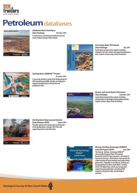
Petroleum <strong>data</strong>bases<br />
Geological Survey <strong>of</strong> New South Wales<br />
Oakl<strong>and</strong>s Basin Petroleum<br />
Data Package December 2003<br />
A st<strong>and</strong>-alone conventional petroleum <strong>and</strong> coal<br />
seam methane prospectivity analysis.<br />
Darling Basin SEEBASE Project<br />
December 2003<br />
A structural synthesis study <strong>of</strong> the Darling Basin by<br />
SRK Consulting <strong>and</strong> DMR. Includes an integrated<br />
regional interpretation <strong>of</strong> basement <strong>and</strong><br />
geophysical <strong>data</strong>.<br />
Darling Basin Reprocessed Seismic<br />
Data Release (<strong>DVD</strong>) August 2004<br />
Provides reprocessed seismic <strong>data</strong> covering part<br />
<strong>of</strong> the Darling Basin. Includes SEGY files <strong>and</strong><br />
supporting reports <strong>and</strong> other <strong>data</strong>.<br />
This <strong>data</strong> package includes:<br />
Integrated regional interpretation<br />
<strong>of</strong> basement composition,<br />
lithology, <strong>and</strong> structure <strong>of</strong> the<br />
Murray, Darling <strong>and</strong> Eromanga<br />
Basins in New South Wales<br />
New depth to basement (SEEBASE<br />
) model <strong>of</strong> Murray <strong>and</strong> Eromanga<br />
Basins <strong>and</strong> updated model <strong>of</strong><br />
Darling Basin<br />
Predictive maps <strong>of</strong><br />
basement-controlled hydrocarbon<br />
Formats:<br />
Geospatial <strong>data</strong> in this product are stored in ESRI® ArcGIS version 9.0<br />
(or later)<br />
Accompanying documents are stored in Micros<strong>of</strong>t® PowerPoint© <strong>and</strong><br />
Adobe® Acrobat PDF formats.<br />
Installation:<br />
GIS Project: Navigate to the folder ArcGIS on the <strong>DVD</strong> <strong>and</strong> launch<br />
the ArcGIS project �le MR702_MDE_project.mxd (requires ArcGIS 9.x).<br />
Supporting documents: Navigate to the folder Reports on the <strong>DVD</strong><br />
to view the various supporting documents.<br />
© COPYRIGHT 2006 <strong>NSW</strong> DEPARTMENT OF PRIMARY INDUSTRIES<br />
Disclaimer: This <strong>data</strong> package is not guaranteed to be free from error or omission.<br />
Therefore the state <strong>of</strong> New South Wales <strong>and</strong> its employees disclaim liability <strong>of</strong> any act<br />
done or omission made on the information in this <strong>data</strong> package, <strong>and</strong> any consequencs<br />
<strong>of</strong> such acts or omissions.<br />
generation <strong>and</strong> migration<br />
Geophysical <strong>and</strong> base <strong>data</strong>: DTM,<br />
L<strong>and</strong>sat, high-resolution magnetic,<br />
gravity, seismic, geology, cultural<br />
Project report incorporating a<br />
reconstruction <strong>of</strong> basin evolution<br />
All spatial <strong>data</strong><br />
referenced to<br />
Geocentric Datum <strong>of</strong><br />
Australia (GDA94)<br />
June 2006<br />
<strong>NSW</strong> DPI<br />
Murray-Darling-Eromanga<br />
SEEBASE<br />
<strong>and</strong> GIS Project<br />
www.dpi.nsw.gov.au<br />
Eromanga Basin Petroleum<br />
Data Package May 2001<br />
A petroleum prospectivity analysis including<br />
evaluation <strong>of</strong> well, seismic <strong>and</strong> regional geophysical<br />
<strong>data</strong>. Isopach contour maps <strong>of</strong> key formations.<br />
Bowen <strong>and</strong> Surat Basins Petroleum<br />
Data Package September 2002<br />
A petroleum prospectivity analysis including<br />
interpretation <strong>of</strong> geological <strong>and</strong> geophysical <strong>data</strong>.<br />
Isopach contour maps <strong>of</strong> key formations.<br />
Murray-Darling-Eromanga SEEBASE<br />
<strong>and</strong> GIS Project (<strong>DVD</strong>) June 2006<br />
The Murray–Darling–Eromanga SEEBASE<br />
(Structurally Enhanced View <strong>of</strong> Economic<br />
Basement) <strong>and</strong> GIS Project presents a 3D model <strong>of</strong><br />
basement structure, which refines <strong>and</strong> extends the<br />
underst<strong>and</strong>ing <strong>of</strong> basin evolution <strong>and</strong> hydrocarbon<br />
generation / migration in the Murray, Darling <strong>and</strong><br />
Eromanga Basins in New South Wales. Includes<br />
ArcGIS 9.0 digital <strong>data</strong>, which also incorporates<br />
supporting geospatial layers including DTM,<br />
magnetic <strong>and</strong> gravity <strong>data</strong>, <strong>and</strong> geological<br />
structure.