CD and DVD data packages - NSW Department of Primary ...
CD and DVD data packages - NSW Department of Primary ...
CD and DVD data packages - NSW Department of Primary ...

Create successful ePaper yourself
Turn your PDF publications into a flip-book with our unique Google optimized e-Paper software.
ata,<br />
d<br />
ll spatial <strong>data</strong><br />
eferenced to<br />
eocentric Datum <strong>of</strong><br />
ustralia (GDA94)<br />
CW compression<br />
as been applied to<br />
eophysical imagery<br />
: DTM,<br />
agnetic,<br />
ltural<br />
g a<br />
olution<br />
9.0<br />
nd<br />
.x).<br />
ll spatial <strong>data</strong><br />
ferenced to<br />
eocentric Datum <strong>of</strong><br />
ustralia (GDA94)<br />
March 2008<br />
June 2006<br />
<strong>NSW</strong> DPI<br />
New South Wales<br />
Mineral Exploration<br />
GEOSCIENCE DATA PACKAGE<br />
Version 2<br />
<strong>NSW</strong> DPI<br />
www.dpi.nsw.gov.au<br />
Murray-Darling-Eromanga<br />
SEEBASE<br />
<strong>and</strong> GIS Project<br />
www.dpi.nsw.gov.au<br />
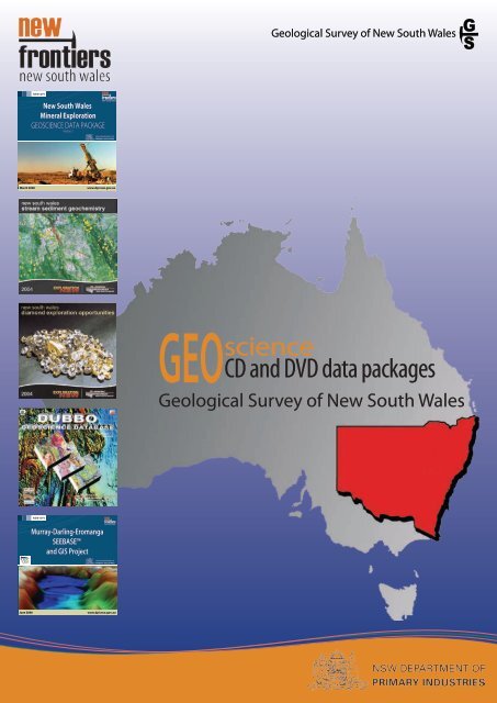
Geological Survey <strong>of</strong> New South Wales<br />
GEOscience <strong>CD</strong> <strong>and</strong> <strong>DVD</strong> <strong>data</strong> <strong>packages</strong><br />
Geological Survey <strong>of</strong> New South Wales
Exploration<br />
& beyond<br />
Geological Survey <strong>of</strong> New South Wales<br />
Through the New Frontiers initiative, the New South Wales Government is committed to<br />
promoting exploration in the under-explored north- <strong>and</strong> south-western regions <strong>of</strong> the<br />
state. Exploration <strong>and</strong> <strong>data</strong> interpretation in these areas had been constrained by lack <strong>of</strong><br />
information.<br />
The Discovery 2000 program was introduced in 1994–95. It provided $35 million over<br />
six years <strong>and</strong> resulted in high-resolution airborne geophysical coverage over much<br />
<strong>of</strong> New South Wales.<br />
In 2001, a further $30 million was committed over seven years under the<br />
Exploration <strong>NSW</strong> initiative, which took airborne geophysical coverage to more<br />
than 80% <strong>of</strong> the state.<br />
In 2006, the government announced the New Frontiers initiative with a focus on<br />
greenfields opportunities in New South Wales — in particular the far north-western<br />
<strong>and</strong> south-western ‘frontier’ areas.<br />
As technology has changed, so has the way in which mapping information has been delivered<br />
to the industry.<br />
The Geological Survey, through the <strong>NSW</strong> <strong>Department</strong> <strong>of</strong> <strong>Primary</strong> Industries, has developed a<br />
variety <strong>of</strong> geoscience products, including <strong>data</strong> sets on <strong>DVD</strong>s/<strong>CD</strong>s <strong>and</strong> maps that are available<br />
for both the state <strong>and</strong> individual projects.<br />
Geoscience (GIS) <strong>data</strong> <strong>packages</strong> on <strong>CD</strong> or <strong>DVD</strong> ROM typically contain detailed geology,<br />
geophysical imagery, mineral occurrences, geochemistry, drill-holes, tenements, reports <strong>and</strong><br />
other spatial information.<br />
Recently produced <strong>data</strong> <strong>packages</strong> include <strong>data</strong>sets in ArcGIS <strong>and</strong> MapInfo formats, <strong>and</strong><br />
are designed to autorun. Data <strong>packages</strong> produced earlier generally contain <strong>data</strong>sets in<br />
ArcView 3x <strong>and</strong> MapInfo formats, which may affect some functionality when used with<br />
more recent s<strong>of</strong>tware such as ArcGIS.<br />
Pre 2002 <strong>data</strong> <strong>packages</strong> generally contain <strong>data</strong>sets using the AGD66 datum; more recent<br />
<strong>packages</strong> employ the GDA94 datum.<br />
Data <strong>packages</strong> are AU$110 per <strong>CD</strong>-ROM/<strong>DVD</strong>-ROM (GST inclusive). An order form for these<br />
products is on the last page or email: geoscience.products@dpi.nsw.gov.au
mples<br />
tes<br />
Base Data,<br />
y, Basic<br />
ation <strong>and</strong><br />
terface<br />
W<br />
All spatial <strong>data</strong><br />
referenced to<br />
Geocentric Datum <strong>of</strong><br />
Australia (GDA94)<br />
ECW compression<br />
has been applied to<br />
geophysical imagery<br />
NEWPRODUCTS<br />
March 2008<br />
<strong>NSW</strong> DPI<br />
New South Wales<br />
Mineral Exploration<br />
GEOSCIENCE DATA PACKAGE<br />
Version 2<br />
<strong>NSW</strong> 1:25 000 Coastal Quaternary<br />
Geology Data Package 2007, Version 2<br />
GIS <strong>data</strong>sets include new 1:25 000 Quaternary<br />
geological mapping which has been integrated<br />
with best available 1:250 000 bedrock<br />
geology mapping to provide a seamless<br />
geology <strong>data</strong> set for regional areas <strong>of</strong> the<br />
New South Wales north <strong>and</strong> south coasts.<br />
Updated resource assessment <strong>data</strong> are<br />
also provided as part <strong>of</strong> this <strong>data</strong> package,<br />
complimenting the geological mapping. The<br />
resource assessment <strong>data</strong> informs l<strong>and</strong> use<br />
planners <strong>of</strong> the range <strong>of</strong> mineral <strong>and</strong> petroleum issues<br />
existing in the region.<br />
www.dpi.nsw.gov.au<br />
This <strong>data</strong> package includes:<br />
1:250 000 surface geology <strong>and</strong> 6 x1:100 Whole rock geochemistry (172<br />
000 surface geology<br />
samples) <strong>and</strong> assays (312 samples)<br />
1:250 000 basement geology<br />
Fossil sites (108 sites)<br />
Structural geology (faults, folds, point Field rock descriptions <strong>and</strong><br />
<strong>data</strong> <strong>and</strong> geological boundaries)<br />
photographs (5400 sites)<br />
Time-space plot <strong>and</strong> cross sections Isotopic age dates (U-Pb SHRIMP <strong>and</strong><br />
High quality geophysical images <strong>and</strong> K-Ar)<br />
rectified maps (ECW format)<br />
Petrographic descriptions (1210<br />
Known mineral occurrences (261sites) samples)<br />
Metallic <strong>and</strong> industrial mineral<br />
Supporting topographic base <strong>data</strong> <strong>and</strong><br />
drillholes (1265 sites)<br />
administrative <strong>data</strong>sets<br />
Explanatory Notes <strong>and</strong> appendices<br />
Formats:<br />
ArcGIS 9.1 (or later)<br />
ArcReader 9.1 (free GIS viewer)<br />
MapInfo 7.0 (or later)<br />
Installation:<br />
Data package is designed to automatically launch a user interface<br />
when inserted into the <strong>DVD</strong> drive<br />
User interface requires a web browser<br />
Instructions to install the required s<strong>of</strong>tware are<br />
All spatial <strong>data</strong><br />
available in the user interface<br />
referenced to<br />
Geocentric Datum <strong>of</strong><br />
Australia (GDA94)<br />
© COPYRIGHT 2007 <strong>NSW</strong> DEPARTMENT OF PRIMARY INDUSTRIES<br />
Disclaimer: This <strong>data</strong> package is not guaranteed to be free from error or omission.<br />
ECW compression<br />
Therefore the state <strong>of</strong> New South Wales <strong>and</strong> its employees disclaim liability <strong>of</strong> any act<br />
has been applied to<br />
done or omission made on the information in this <strong>data</strong> package, <strong>and</strong> any<br />
ECW geophysical imagery<br />
consequences <strong>of</strong> such acts or omissions.<br />
<strong>NSW</strong> Minerals Exploration Database<br />
March 2008, Version 2<br />
Statewide <strong>data</strong>sets include metallic mineral<br />
deposits, industrial minerals, mineral<br />
exploration drill holes <strong>and</strong> historical mineral<br />
EL locations.<br />
Statewide <strong>data</strong>bases<br />
New South Wales Industrial Minerals Database<br />
May 2003, Version 2<br />
Contains over 9,000 operations <strong>and</strong> occurrences.<br />
* See also Bulletin 33: Industrial Mineral Opportunites in <strong>NSW</strong>,<br />
a publication covering over 50 industrial minerals mined in<br />
the state.<br />
New South Wales Stream Sediment<br />
Geochemistry 2004<br />
Contains 255,000 stream sediment sample results from statewide<br />
company explorations. The Access <strong>data</strong>base includes<br />
tenement <strong>data</strong>, location co-ordinates, sample type, analytical<br />
method <strong>and</strong> assay results for each sample.<br />
<strong>NSW</strong> DPI<br />
Cargelligo 1:250 000 Sheet<br />
Geoscience Database<br />
Version 2<br />
September 2007<br />
Auto-launch <strong>DVD</strong>-ROM for Windows<br />
Internet browser required<br />
<strong>NSW</strong> DPI<br />
www.dpi.nsw.gov.au<br />
Cargelligo 1:250 000 Geoscience<br />
Database 2007, Version 2<br />
This new version provides a comprehensive<br />
digital geological <strong>data</strong>set derived from<br />
1:100 000 <strong>and</strong> 1:250 000 scale secondgeneration<br />
geological mapping <strong>of</strong> the<br />
Cargelligo 1:250 000 map sheet area. This <strong>data</strong><br />
package includes new surface <strong>and</strong> basement<br />
geology layers, along with new point <strong>data</strong><br />
layers derived from geological mapping (whole<br />
rock geochemistry, assays, U-Pb SHRIMP dates,<br />
field descriptions, <strong>and</strong> petrographic <strong>data</strong>).<br />
New structural <strong>data</strong>, time-space plots, <strong>and</strong> cross sections are provided<br />
together with a range <strong>of</strong> geophysical images <strong>and</strong> the latest mineral<br />
occurrence <strong>and</strong> drill hole <strong>data</strong>.<br />
new south wales, australia<br />
Explorers Directory 2008<br />
FREE<br />
company information<br />
exploration opportunities<br />
geoscience coverages<br />
mineral projects<br />
free GIS <strong>and</strong> Google EarthTM An essential part <strong>of</strong> the<br />
mineral explorer’s toolkit.<br />
The Explorers Directory<br />
<strong>data</strong> 2008 showcases mineral<br />
exploration opportunities<br />
in New South Wales. This<br />
free mini-<strong>DVD</strong> is a significant<br />
upgrade over previous editions. As<br />
well as information on mineral explorers<br />
operating in New South Wales, it now includes statewide<br />
geological, mineral occurrence <strong>and</strong> geophysical <strong>data</strong> in<br />
ArcReader format. Georectified 1:250 000 series geological<br />
maps are also included. The new frontier Thomson <strong>and</strong><br />
Delamerian Orogens are also featured.<br />
1:250 000 New South Wales Statewide Geology<br />
December 2003<br />
A compilation <strong>of</strong> best available digital map <strong>data</strong> for surface <strong>and</strong><br />
interpreted Quaternary <strong>and</strong> ‘bedrock’ geology for <strong>NSW</strong>.<br />
New South Wales Diamond<br />
Exploration Opportunities 2004<br />
A study <strong>of</strong> the diamond potential <strong>of</strong> <strong>NSW</strong> by Peter Temby <strong>and</strong><br />
a diamond occurrence <strong>data</strong>base (over 120 records). Includes<br />
geophysical <strong>and</strong> diatreme layers.
141°E<br />
29°S<br />
31°<br />
S.A.<br />
33°<br />
35°<br />
37°<br />
MILPARINKA<br />
COBHAM LAKE<br />
BROKEN HILL<br />
MENINDEE<br />
ANA BRANCH<br />
0<br />
141°E<br />
Koonenberry<br />
Broken Hill<br />
TN<br />
100<br />
143°<br />
Lachlan Orogen<br />
Eastern Lachlan<br />
URISINO<br />
WHITE CLIFFS<br />
WILCANNIA<br />
MANARA<br />
POONCARIE<br />
BALRANALD<br />
143°<br />
200 km<br />
145°<br />
YANTABULLA<br />
LOUTH<br />
BARNATO<br />
IVANHOE<br />
BOOLIGAL<br />
HAY<br />
DENILIQUIN<br />
145°<br />
Queensl<strong>and</strong><br />
ENNGONIA<br />
BOURKE<br />
COBAR<br />
NYMAGEE<br />
CARGELLIGO<br />
NARRANDERA<br />
JERILDERIE<br />
Victoria<br />
147°<br />
147°<br />
ANGLEDOOL<br />
WALGETT<br />
NYNGAN<br />
NARROMINE<br />
FORBES<br />
COOTAMUNDRA<br />
WAGGA WAGGA<br />
149°<br />
Brigalow Bioregion<br />
N<strong>and</strong>ewar Bioregion<br />
149°<br />
MOREE<br />
NARRABRI<br />
GILGANDRA<br />
Brigalow Bioregion<br />
DUBBO<br />
BATHURST<br />
GOULBURN<br />
CANBERRA<br />
BEGA<br />
Coastal Quaternary South<br />
SYDNEY<br />
ULLADULLA<br />
151°<br />
151°<br />
INVERELL<br />
N<strong>and</strong>ewar<br />
Bioregion<br />
MANILLA<br />
WOLLONGONG<br />
DORRIGO<br />
TAMWORTH HASTINGS<br />
SINGLETON<br />
Coastal Quaternery north <strong>and</strong> south coast<br />
New Engl<strong>and</strong> Orogen<br />
New Engl<strong>and</strong> Orogen <strong>data</strong>bases<br />
Inverell Geoscience Database May 2003<br />
Covers the eastern half <strong>of</strong> the Inverell <strong>and</strong> western part <strong>of</strong> the<br />
Grafton 1:250 000 map sheets. Datasets include geology, TMI,<br />
1VD, DTM, ternary radioelement, historic titles, drill holes,<br />
mineral occurrences, petrological <strong>data</strong>, stream sediments, whole<br />
rock geochemistry <strong>and</strong> grab sample assay <strong>data</strong> <strong>and</strong> geophysical<br />
interpretation map.<br />
Peel South Geoscience Database March 2002<br />
Covers the south eastern portion <strong>of</strong> the Manilla 1:250 000 map<br />
sheet area. Datasets include geology, TMI, 1VD, DTM, radio<br />
element images, historic titles, drill holes, mineral occurrences,<br />
petrological <strong>data</strong>, exploration geochemistry <strong>data</strong> <strong>and</strong> 1:100 000<br />
geophysical interpretation map.<br />
Geological Survey <strong>of</strong> New South Wales<br />
WARWICK<br />
GRAFTON<br />
NEWCASTLE<br />
SOUTH<br />
PACIFIC<br />
OCEAN<br />
153°<br />
153°<br />
Coastal Quaternary North<br />
TWEED<br />
HEADS<br />
31°<br />
33°<br />
35°<br />
37°<br />
2007_02_0033<br />
Peel Geoscience Database September 1999<br />
Covers the Inverell <strong>and</strong> Manilla 1:250 000 map sheets. Datasets<br />
include geology, TMI, 1VD, DTM, ternary radioelement, historic<br />
titles, drill holes, mineral occurrences, petrological <strong>data</strong>, stream<br />
sediments, whole rock geochemistry <strong>and</strong> grab sample assay <strong>data</strong>.<br />
Includes 1:100 000 geophysical interpretation map.<br />
Warwick-Tweed Heads<br />
1:250 000 Metallogenic Data Package March 2002<br />
New South Wales portion <strong>of</strong> the Warwick <strong>and</strong> Tweed Heads 1:250<br />
000 sheets. Datasets include geology maps (prelim. Qld <strong>data</strong><br />
<strong>and</strong> 1:25 000 mineral occurrence maps), historic titles, mineral<br />
occurrences, heavy mineral s<strong>and</strong> placers, petrological <strong>data</strong>,<br />
exploration geochemistry <strong>and</strong> geographical <strong>data</strong>.
Broken Hill <strong>data</strong>bases<br />
Koonenberry Geoscience Database<br />
January 2002, Version 1b<br />
Covers part <strong>of</strong> the Milparinka, White Cliffs, Menindee, Wilcannia,<br />
Broken Hill <strong>and</strong> Cobham Lake 1:250 000 map sheet areas. GIS<br />
formatted <strong>data</strong> set contains the latest geophysical imagery,<br />
1:100 000 <strong>and</strong> 1:250 000 scale geology, comprehensive<br />
exploration <strong>data</strong>sets, regional interpretations, L<strong>and</strong>sat images<br />
<strong>and</strong> geographical reference <strong>data</strong>.<br />
Potential for Cu-Au Systems in the Broken Hill Block<br />
September 2002<br />
Contains two reports commissioned by the Geological Survey<br />
into copper-gold mineralisation within the Broken Hill Block.<br />
Willis (2000) discusses two recognised styles <strong>of</strong> mineralisation<br />
in comparison with the Curnamona. Anderson <strong>and</strong> McConarchy<br />
(2001) discuss the Cu-Au prospectivity <strong>of</strong> the BH Block following<br />
analysis <strong>of</strong> regional exploration <strong>data</strong>sets.<br />
Broken Hill Geoscience Database<br />
June 2002, Version 2<br />
Covers the Corona, Fowlers Gap, Broken Hill, Taltingan, Redan <strong>and</strong><br />
Thackaringa 1:100 000 sheets. Customised GIS <strong>data</strong>set containing<br />
the latest 1:25K scale outcrop geology, 1:50K metallogenic<br />
<strong>and</strong> 1:100K regolith coverages; comprehensive geophysical<br />
imagery including hyperspectral surveys, regional stratigraphic<br />
interpretations <strong>and</strong> extensive exploration <strong>data</strong>sets. Specify<br />
ArcView or MapInfo format when ordering (separate <strong>CD</strong>s).<br />
Lachlan Orogen <strong>data</strong>bases<br />
Albury Geoscience Database November 1997<br />
Covers six 1:100 000 sheets, (Lockhart, Walbundrie, Holbrook,<br />
Wagga Wagga, Tarcutta <strong>and</strong> Rosewood). GIS formatted <strong>data</strong><br />
sets include comprehensive geology <strong>and</strong> exploration <strong>data</strong>, TMI,<br />
DTM, ternary radiometrics; <strong>and</strong> contoured TMI, gravity <strong>and</strong> DTM.<br />
L<strong>and</strong>sat imagery is also included.<br />
Bourke Geoscience Database May 1996<br />
Centres on the Bourke 1:250 000 map sheet area. GIS formatted<br />
<strong>data</strong> sets include comprehensive geology <strong>and</strong> exploration <strong>data</strong>,<br />
TMI, ternary radiometrics, gravity, DTM; <strong>and</strong> contoured TMI,<br />
gravity <strong>and</strong> DTM. Cobar 1:250 000 map <strong>data</strong> also included.<br />
Cobar Geoscience Database May 1998<br />
Covers both the Cobar <strong>and</strong> Nymagee 1:250 000 map sheet areas.<br />
Datasets include 1:250 000 & 1:100 000 scale geology, TMI, 1VD,<br />
gravity, drill holes, mineral deposits, petrological <strong>data</strong>, stream<br />
sediment <strong>data</strong> <strong>and</strong> whole rock geochemistry.<br />
Dubbo Geoscience Database June 1999<br />
Covers the Dubbo 1:250 000 map sheet <strong>and</strong> includes 1:250 000<br />
<strong>and</strong> 1:100 000 geological maps, geophysical images (TMI, gravity,<br />
radioelement subsampled images), exploration <strong>data</strong> (ELs, mineral<br />
occurrences) <strong>and</strong> petrographic <strong>data</strong>. Original geophysical images<br />
are available separately from Geoscience Australia.<br />
Goulburn Geoscience Database November 1997<br />
Covers the Goulburn 1:250 000 map sheet <strong>and</strong> includes geology,<br />
general index <strong>data</strong>, geographical <strong>data</strong>, <strong>and</strong> exploration <strong>data</strong><br />
including geochemistry <strong>and</strong> historic titles. Original geophysical<br />
images <strong>and</strong> contour maps are available separately from<br />
Geoscience Australia.<br />
Regional <strong>data</strong>bases<br />
<strong>NSW</strong> 1:25 000 Coastal Quaternary Geology Data<br />
Package (<strong>DVD</strong>) NEW PRODUCT<br />
2007, Version 2<br />
GIS <strong>data</strong>sets include new 1:25 000 Quaternary geological<br />
mapping which has been integrated with best available<br />
1:250 000 bedrock geology mapping.<br />
N<strong>and</strong>ewar Regional Assessment<br />
Geoscience Data Package January 2004<br />
Covers parts <strong>of</strong> the Goondiwindi, Inverell, Manilla <strong>and</strong> Tamworth<br />
1:250,000 map sheet areas. Contains GIS formatted <strong>data</strong>sets<br />
include geology, mineral occurrences <strong>and</strong> mineral potential<br />
tracts. Also contains detailed reports on the geology <strong>and</strong><br />
mineral potential <strong>of</strong> the region. Compiled for the Resource <strong>and</strong><br />
Conservation Assessment Council.<br />
Brigalow Belt South Bioregion Geoscience Data<br />
Package April 2003<br />
Covers the New South Wales portion <strong>of</strong> the Brigalow Belt<br />
Bioregion. Contains GIS <strong>data</strong>, Reports, Maps <strong>and</strong> 3D models<br />
produced for the Resource <strong>and</strong> Conservation Assessment Council<br />
(RACAC) as part <strong>of</strong> the Western Regional Assessment <strong>of</strong> New South<br />
Wales. It includes reports for the Geology Integration <strong>and</strong> Upgrade<br />
(WRA19) <strong>and</strong> Mineral <strong>and</strong> Petroleum Resources <strong>and</strong> Potential<br />
(WRA20) projects that were completed by the <strong>NSW</strong> <strong>Department</strong> <strong>of</strong><br />
Mineral Resources for the BBSB Assessment.<br />
Northern Parkes Geoscience Database<br />
December 1997 Version 2<br />
Covers the Narromine <strong>and</strong> Nyngan 1:250 000 map sheets. GIS<br />
formatted <strong>data</strong>sets include geology, geophysical images (TMI,<br />
1VD, 2VD, gravity, DTM, ternary radiometrics, total count K, U, Th)<br />
<strong>and</strong> contours (TMI, gravity <strong>and</strong> digital terrain). Includes spatial<br />
analysis <strong>data</strong> for the Peak Hill 1:100 000 map sheet.<br />
Hill End Trough Geoscience Database December 2003<br />
Covers the outcropping extent <strong>of</strong> the Hill End Trough <strong>and</strong><br />
immediate surrounds. It contains a series <strong>of</strong> papers on the<br />
evolution <strong>of</strong> the Hill End Trough, including new cross-sectional<br />
interpretations, <strong>and</strong> a GIS formatted <strong>data</strong>base which includes<br />
1:250,000 scale geology, geophysical images, mineral<br />
occurrences <strong>and</strong> topographical <strong>data</strong>.<br />
Cargelligo Geoscience Database<br />
February 1997, Version 1<br />
Covers the Cargelligo <strong>and</strong> most <strong>of</strong> the Narr<strong>and</strong>era 1:250 000 map<br />
sheets. GIS formatted <strong>data</strong> sets include comprehensive geology<br />
<strong>and</strong> exploration <strong>data</strong>, TMI, ternary radiometrics, DTM, L<strong>and</strong>sat TM<br />
images, <strong>and</strong> contoured TMI, gravity <strong>and</strong> DTM.<br />
Cargelligo 1:250 000 Geoscience<br />
Database (<strong>DVD</strong>) NEW PRODUCT 2007, Version 2<br />
A comprehensive digital geological <strong>data</strong>set derived from<br />
1:100 000 <strong>and</strong> 1:250 000 scale second generation geological<br />
mapping <strong>of</strong> the Cargelligo 1:250 000 map sheet area.<br />
Eastern Lachlan Orogen<br />
Geoscience Database (<strong>DVD</strong>) September 2006, Version 2<br />
Provides an integrated <strong>and</strong> synthesised geological <strong>data</strong> set<br />
derived from the 1:100 000 scale 2nd generation geological<br />
mapping <strong>of</strong> the Eastern Lachlan Orogen. New solid basement<br />
geology layers, new cover geology layers, new structural layers<br />
<strong>and</strong> time-space plots are provided, with a range <strong>of</strong> geophysical<br />
images <strong>and</strong> the latest mineral deposit <strong>and</strong> geological point <strong>data</strong>.
Petroleum <strong>data</strong>bases<br />
Geological Survey <strong>of</strong> New South Wales<br />
Oakl<strong>and</strong>s Basin Petroleum<br />
Data Package December 2003<br />
A st<strong>and</strong>-alone conventional petroleum <strong>and</strong> coal<br />
seam methane prospectivity analysis.<br />
Darling Basin SEEBASE Project<br />
December 2003<br />
A structural synthesis study <strong>of</strong> the Darling Basin by<br />
SRK Consulting <strong>and</strong> DMR. Includes an integrated<br />
regional interpretation <strong>of</strong> basement <strong>and</strong><br />
geophysical <strong>data</strong>.<br />
Darling Basin Reprocessed Seismic<br />
Data Release (<strong>DVD</strong>) August 2004<br />
Provides reprocessed seismic <strong>data</strong> covering part<br />
<strong>of</strong> the Darling Basin. Includes SEGY files <strong>and</strong><br />
supporting reports <strong>and</strong> other <strong>data</strong>.<br />
This <strong>data</strong> package includes:<br />
Integrated regional interpretation<br />
<strong>of</strong> basement composition,<br />
lithology, <strong>and</strong> structure <strong>of</strong> the<br />
Murray, Darling <strong>and</strong> Eromanga<br />
Basins in New South Wales<br />
New depth to basement (SEEBASE<br />
) model <strong>of</strong> Murray <strong>and</strong> Eromanga<br />
Basins <strong>and</strong> updated model <strong>of</strong><br />
Darling Basin<br />
Predictive maps <strong>of</strong><br />
basement-controlled hydrocarbon<br />
Formats:<br />
Geospatial <strong>data</strong> in this product are stored in ESRI® ArcGIS version 9.0<br />
(or later)<br />
Accompanying documents are stored in Micros<strong>of</strong>t® PowerPoint© <strong>and</strong><br />
Adobe® Acrobat PDF formats.<br />
Installation:<br />
GIS Project: Navigate to the folder ArcGIS on the <strong>DVD</strong> <strong>and</strong> launch<br />
the ArcGIS project �le MR702_MDE_project.mxd (requires ArcGIS 9.x).<br />
Supporting documents: Navigate to the folder Reports on the <strong>DVD</strong><br />
to view the various supporting documents.<br />
© COPYRIGHT 2006 <strong>NSW</strong> DEPARTMENT OF PRIMARY INDUSTRIES<br />
Disclaimer: This <strong>data</strong> package is not guaranteed to be free from error or omission.<br />
Therefore the state <strong>of</strong> New South Wales <strong>and</strong> its employees disclaim liability <strong>of</strong> any act<br />
done or omission made on the information in this <strong>data</strong> package, <strong>and</strong> any consequencs<br />
<strong>of</strong> such acts or omissions.<br />
generation <strong>and</strong> migration<br />
Geophysical <strong>and</strong> base <strong>data</strong>: DTM,<br />
L<strong>and</strong>sat, high-resolution magnetic,<br />
gravity, seismic, geology, cultural<br />
Project report incorporating a<br />
reconstruction <strong>of</strong> basin evolution<br />
All spatial <strong>data</strong><br />
referenced to<br />
Geocentric Datum <strong>of</strong><br />
Australia (GDA94)<br />
June 2006<br />
<strong>NSW</strong> DPI<br />
Murray-Darling-Eromanga<br />
SEEBASE<br />
<strong>and</strong> GIS Project<br />
www.dpi.nsw.gov.au<br />
Eromanga Basin Petroleum<br />
Data Package May 2001<br />
A petroleum prospectivity analysis including<br />
evaluation <strong>of</strong> well, seismic <strong>and</strong> regional geophysical<br />
<strong>data</strong>. Isopach contour maps <strong>of</strong> key formations.<br />
Bowen <strong>and</strong> Surat Basins Petroleum<br />
Data Package September 2002<br />
A petroleum prospectivity analysis including<br />
interpretation <strong>of</strong> geological <strong>and</strong> geophysical <strong>data</strong>.<br />
Isopach contour maps <strong>of</strong> key formations.<br />
Murray-Darling-Eromanga SEEBASE<br />
<strong>and</strong> GIS Project (<strong>DVD</strong>) June 2006<br />
The Murray–Darling–Eromanga SEEBASE<br />
(Structurally Enhanced View <strong>of</strong> Economic<br />
Basement) <strong>and</strong> GIS Project presents a 3D model <strong>of</strong><br />
basement structure, which refines <strong>and</strong> extends the<br />
underst<strong>and</strong>ing <strong>of</strong> basin evolution <strong>and</strong> hydrocarbon<br />
generation / migration in the Murray, Darling <strong>and</strong><br />
Eromanga Basins in New South Wales. Includes<br />
ArcGIS 9.0 digital <strong>data</strong>, which also incorporates<br />
supporting geospatial layers including DTM,<br />
magnetic <strong>and</strong> gravity <strong>data</strong>, <strong>and</strong> geological<br />
structure.
� �<br />
GEOSCIENCE PRODUCT ORDER FORM<br />
Please send me the following geoscience products:<br />
Title<br />
Postage &<br />
h<strong>and</strong>ling: domestic – AU$7.70; express – AU$13; international freight – price on application<br />
Contact details:<br />
Name: Company:<br />
Address:<br />
State/Province: Postcode:<br />
Telephone/Mobile: Facsimile/Email:<br />
Payment options:<br />
We accept these cards<br />
Card Type:<br />
Expiry Date:<br />
Card No. :<br />
Signature:<br />
Quantity Price<br />
Total<br />
Payment can be made by credit card, cheque or money order (made payable to <strong>NSW</strong> <strong>Department</strong> <strong>of</strong> <strong>Primary</strong> Industries)<br />
Name on card:<br />
Country:<br />
Forward to:<br />
Geoscience Products Officer<br />
OR go to<br />
<strong>NSW</strong> Government Online Shop at<br />
<strong>NSW</strong> <strong>Department</strong> <strong>of</strong> <strong>Primary</strong> Industries<br />
www.shop.nsw.gov.au<br />
PO Box 344<br />
Hunter Region Mail Centre<br />
<strong>NSW</strong> Australia 2310<br />
ph: 61 2 4931 6666<br />
then select Minerals in the<br />
‘Browse by subject’ navigation pane<br />
for a list <strong>of</strong> products.<br />
fax: 61 2 4931 6789 email: geoscience.products@dpi.nsw.gov.au<br />
www.dpi.nsw.gov.au
Job No. 8456