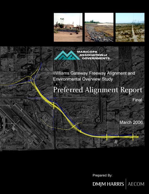
Williams Gateway Freeway Preferred Alignment Report Final
Williams Gateway Freeway Preferred Alignment Report Final
Williams Gateway Freeway Preferred Alignment Report Final

You also want an ePaper? Increase the reach of your titles
YUMPU automatically turns print PDFs into web optimized ePapers that Google loves.
<strong>Williams</strong> <strong>Gateway</strong> <strong>Freeway</strong> <strong>Alignment</strong><br />
<strong>Preferred</strong> <strong>Alignment</strong> Summary <strong>Report</strong><br />
and Environmental Overview Study March 2006<br />
List of Figures<br />
Figure E-1 Recommended Corridor ................................................................................ 4<br />
Figure 1-1........................................................................................................................ 7<br />
Figure 4-1...................................................................................................................... 20<br />
Figure 5-1...................................................................................................................... 25<br />
Figure 6-1 Recommended Corridor............................................................................... 44<br />
List of Tables<br />
Table 1.1: Projected Population and Employment Growth—Study Area,<br />
East Valley and Countywide........................................................................ 10<br />
Table 2.1: Stakeholder Interviews................................................................................ 11<br />
Table 3.1: Tier 1 (Critical Flaw) Corridor Evaluation Matrix.......................................... 18<br />
Table 4.1: Tier 2 Corridor Alternatives Evaluation Matrix............................................. 22<br />
Table 5.1: <strong>Williams</strong> <strong>Gateway</strong> <strong>Freeway</strong> <strong>Alignment</strong> Study-Tier 3 Matrix......................... 27<br />
Table 5.2: <strong>Williams</strong> <strong>Gateway</strong> <strong>Freeway</strong> <strong>Alignment</strong> Study-Tier 3 Matrix<br />
June 7, 2005 ............................................................................................... 38<br />
Table 5.3: <strong>Williams</strong> <strong>Gateway</strong> <strong>Freeway</strong> <strong>Alignment</strong> Study-Tier 3 Matrix<br />
June 7, 2005 ............................................................................................... 40<br />
Table 5.4: Planning Level Cost Estimates (Maricopa County portion) ......................... 42<br />
Page ii
<strong>Williams</strong> <strong>Gateway</strong> <strong>Freeway</strong> <strong>Alignment</strong><br />
<strong>Preferred</strong> <strong>Alignment</strong> Summary <strong>Report</strong><br />
and Environmental Overview Study March 2006<br />
EXECUTIVE SUMMARY<br />
Purpose and Background<br />
Beginning in November 2004, the Maricopa Association of Governments (MAG) initiated<br />
an <strong>Alignment</strong> and Environmental Overview Study for the future <strong>Williams</strong> <strong>Gateway</strong><br />
<strong>Freeway</strong>. The purpose of the study is to identify a preferred alignment for the Maricopa<br />
County portion of this planned freeway, and to develop detailed information regarding<br />
facility characteristics, right-of-way needs, environmental issues, and “environmental<br />
justice” concerns under Title VI of the Civil Rights Act of 1964. This information will help<br />
guide future adjacent development in the area and provide essential input for<br />
subsequent Arizona Department of Transportation (ADOT) studies and design efforts<br />
regarding corridor development.<br />
The <strong>Williams</strong> <strong>Gateway</strong> Corridor is an integral part of the MAG Regional Transportation<br />
Plan (RTP) adopted by the MAG Regional Council in November 2003 and endorsed<br />
one year later by voters in connection with their approval of Proposition 400. This<br />
proposed freeway will begin at the Santan <strong>Freeway</strong> (State Route 202L) in the vicinity of<br />
<strong>Williams</strong> <strong>Gateway</strong> Airport, and then head generally eastward to the Maricopa/Pinal<br />
county line at Meridian Road. From there, ADOT is currently conducting a Corridor<br />
Definition Study to continue the route eastward through Pinal County to potentially link<br />
up with US 60. The corridor is approximately 4.5 miles long from the Santan <strong>Freeway</strong><br />
to the Maricopa/Pinal county line.<br />
According to the 20-year phased transportation development program incorporated in<br />
the MAG RTP, preliminary engineering and right-of-way protection for the <strong>Williams</strong><br />
<strong>Gateway</strong> <strong>Freeway</strong> will occur in Phase I (2005-2010), with funding for final design and<br />
right-of-way provided in Phase II (2011-2015). ADOT would construct the Maricopa<br />
County portion of the facility during Phase III (2016-2020).<br />
The study is organized into two phases. Phase 1, completed in July 2005, resulted in a<br />
recommended preferred alignment for the future <strong>Williams</strong> <strong>Gateway</strong> <strong>Freeway</strong>. Phase 2,<br />
scheduled for completion by the end of 2005, detailed the preferred alignment, included<br />
an environmental overview, and further assessed Environmental Justice/Title VI factors.<br />
Tiered Evaluation Process<br />
Phase 1 of the study involved a tiered evaluation process, in which a wide range of<br />
alignment alternatives was systematically screened down to a single preferred<br />
alternative. In Tier 1 of the screening process (Figure 3.1, page 17), two broad corridor<br />
concepts—known as Greenfield and Hawes 1—were eliminated because of critical<br />
flaws precluding their further consideration in this project. The following characteristics<br />
were considered critical flaws:<br />
• Inconsistency with the MAG RTP, in terms of either location or cost.<br />
• Inconsistency with adopted plans and policies of host local jurisdictions.<br />
Page 1
<strong>Williams</strong> <strong>Gateway</strong> <strong>Freeway</strong> <strong>Alignment</strong><br />
<strong>Preferred</strong> <strong>Alignment</strong> Summary <strong>Report</strong><br />
and Environmental Overview Study March 2006<br />
• Interference with the mission and operations of <strong>Williams</strong> <strong>Gateway</strong> Airport.<br />
• Unacceptable impacts on existing land uses and economic activities.<br />
The remaining generalized corridor, known as Hawes 2, generated seven specific<br />
alignments for consideration in Tier 2 of the evaluation (Figure 4.1, page 20). These<br />
alignments all begin at the same location along the Santan <strong>Freeway</strong> just east of Hawes<br />
Road, but turn east at different locations. The alternatives are numbered by the location<br />
of their eastward turn, from north to south.<br />
These seven alternatives were evaluated in Tier 2, which used the following evaluation<br />
criteria:<br />
• Support for Economic Development<br />
• Consistency with Community Plans<br />
• Transportation Service<br />
• Environmental Compatibility (Natural/Physical/Human)<br />
• Cost Minimization<br />
• Pinal County Considerations<br />
This phase resulted in the elimination of Alternatives 1, 2, 4 and 6, for a variety of<br />
reasons including land use impacts and displacement of section-line arterial streets<br />
needed to provide future mobility and access. In the third and final tier of the evaluation<br />
process, the three remaining alternatives (Figure 5.1, page 25) - 3 Frye Road<br />
alignment), 5 (Willis Road alignment) and 7 (Ryan Road alignment) - were analyzed in<br />
much greater detail, using the following general criteria:<br />
• Mobility<br />
• Safety<br />
• General Plan Consistency<br />
• Access<br />
• Natural Environment Impacts<br />
• Physical Environment Impacts<br />
• Socioeconomic Impacts<br />
• Estimated Cost<br />
• Pinal County Considerations<br />
In addition, a set of specific performance measures was used to comprehensively<br />
evaluate the performance of the three Tier 3 alternatives with respect to each of the<br />
above criteria. Each alternative was rated as “Most Desirable,” “Less Desirable” or<br />
“Least Desirable” on each of the 32 performance measures. The overall results of the<br />
Tier 3 evaluation across all criteria and performance measures were then used to<br />
develop a recommendation for the preferred alternative.<br />
Page 2
<strong>Williams</strong> <strong>Gateway</strong> <strong>Freeway</strong> <strong>Alignment</strong><br />
<strong>Preferred</strong> <strong>Alignment</strong> Summary <strong>Report</strong><br />
and Environmental Overview Study March 2006<br />
Conclusion<br />
On the basis of the Tier 3 analysis, MAG’s consultant recommends Alternative 3 as the<br />
preferred alternative as shown in Figure E-1, to be carried through the MAG committee<br />
and Regional Council review process. The reasons for this recommendation include:<br />
1. The preferred alignment is suitable for a high-capacity, access-controlled<br />
facility from the SR 202L Santan <strong>Freeway</strong> to the Pinal County line.<br />
2. The preferred alignment will adequately serve the <strong>Williams</strong> <strong>Gateway</strong><br />
complex and other key employment centers (existing and projected) within<br />
the corridor study area.<br />
3. The alignment is consistent with the generalized corridor depicted in the<br />
MAG RTP and endorsed by Maricopa County voters.<br />
4. The alignment achieved the highest score of any alternative in the<br />
comprehensive Tier 3 evaluation.<br />
5. The estimated cost of Alternative 3 is within the RTP programmed budget.<br />
6. This alternative dominates (beats all rivals) more performance measures<br />
than the other two alternatives combined—including three of the four cost<br />
measures.<br />
7. Alternative 3 also performs the best overall when the matrix is collapsed to<br />
show an aggregate score for each of the nine evaluation criteria.<br />
8. Based on conversations with the Arizona State Land Department staff, the<br />
alternative strongly supports the expected community and economic<br />
development pattern envisioned for the approximately 275 square-mile<br />
State land holdings (Superstition Vistas) in Pinal County.<br />
9. This alternative is compatible with the planning work that ADOT has done<br />
to date on the <strong>Williams</strong> <strong>Gateway</strong> Corridor Definition Study in Pinal County.<br />
These recommendations were reviewed by various MAG committees on the following<br />
dates in June and July 2005:<br />
• MAG Transportation Review Committee—June 30, 2005<br />
• MAG Management Committee—July 13, 2005<br />
• MAG Policy Committee—July 20, 2005<br />
• MAG Regional Council—July 27, 2005<br />
On July 27, 2005, the MAG Regional Council passed a motion to: “Select Alternative 3 –<br />
Frye Road as the preferred alignment for the <strong>Williams</strong> <strong>Gateway</strong> <strong>Freeway</strong> in Maricopa<br />
County and recommend to ADOT that Alternative 7 – Ryan Road be considered in the<br />
design concept/environmental evaluation conducted by ADOT.”<br />
Page 3
<strong>Williams</strong> <strong>Gateway</strong> <strong>Freeway</strong> <strong>Alignment</strong><br />
<strong>Preferred</strong> <strong>Alignment</strong> Summary <strong>Report</strong><br />
and Environmental Overview Study March 2006<br />
Figure E-1 Recommended Corridor<br />
Page 4
<strong>Williams</strong> <strong>Gateway</strong> <strong>Freeway</strong> <strong>Alignment</strong><br />
<strong>Preferred</strong> <strong>Alignment</strong> Summary <strong>Report</strong><br />
and Environmental Overview Study March 2006<br />
1.0 PROJECT OVERVIEW<br />
1.1 Purpose<br />
Beginning in November 2004, the Maricopa Association of Governments (MAG) initiated<br />
an <strong>Alignment</strong> and Environmental Overview Study for the future <strong>Williams</strong> <strong>Gateway</strong><br />
<strong>Freeway</strong>. The purpose of the study is to identify a preferred alignment for the Maricopa<br />
County portion of this planned freeway, and to develop detailed information regarding<br />
facility characteristics, right-of-way needs, environmental issues, and “environmental<br />
justice” concerns under Title VI of the Civil Rights Act of 1964. This information will help<br />
guide future adjacent development in the area and provide essential input for<br />
subsequent Arizona Department of Transportation (ADOT) studies and design efforts<br />
regarding corridor development . ADOT is charged with constructing and operating the<br />
MAG regional freeway and expressway system throughout Maricopa County.<br />
1.2 Background<br />
In November 2004, Maricopa County voters approved Proposition 400, which extends<br />
for 20 years the existing half-cent excise (sales) tax to fund transportation systems.<br />
While a significant portion of the revenue will be devoted to transit and streets, the<br />
majority is dedicated to the further expansion and improvement of the MAG regional<br />
freeway and highway system. The <strong>Williams</strong> <strong>Gateway</strong> Corridor is an integral part of the<br />
MAG Regional Transportation Plan (RTP) adopted by the MAG Regional Council in<br />
November 2003 and endorsed one year later by voters in connection with their approval<br />
of Proposition 400. This proposed freeway will begin at the Santan <strong>Freeway</strong> (State<br />
Route 202L) in the vicinity of <strong>Williams</strong> <strong>Gateway</strong> Airport, and then head generally<br />
eastward to the Maricopa/Pinal county line at Meridian Road. From there, ADOT is<br />
currently conducting a Corridor Definition Study to continue the route eastward through<br />
Pinal County to potentially link up with US 60.<br />
The need for a high-capacity, access-controlled facility in this corridor has become<br />
increasingly clear due to strong current and projected projected growth in the Southeast<br />
Valley and northern Pinal Countyin the whole, as well as specific development patterns<br />
centering on the site of the former <strong>Williams</strong> Air Force Base. Since the conversion of this<br />
approximately 4,400-acre facility to <strong>Williams</strong> <strong>Gateway</strong> Airport (WGA), the <strong>Williams</strong><br />
Education, Research and Training Campus (including ASU Polytechnic), the WGA<br />
Business Park and associated uses in 1994, the airport and its environs have been the<br />
focus of extensive land and transportation planning efforts. These plans and studies<br />
indicate that the area surrounding WGA has the potential to become one of the largest<br />
employment centers in the Phoenix Metropolitan Area. For this potential to be realized,<br />
however, an effective supporting transportation system must be developed.<br />
Both the <strong>Williams</strong> Area Transportation Study (1998) and a revision to the <strong>Williams</strong><br />
<strong>Gateway</strong> Airport Master Plan (1999) contemplated direct access to the future WGA<br />
passenger terminal from a Santan <strong>Freeway</strong> service interchange near Hawes Road.<br />
During the recent preparation of the City of Mesa General Plan Update, however, it<br />
Page 5
<strong>Williams</strong> <strong>Gateway</strong> <strong>Freeway</strong> <strong>Alignment</strong><br />
<strong>Preferred</strong> <strong>Alignment</strong> Summary <strong>Report</strong><br />
and Environmental Overview Study March 2006<br />
became evident that this concept would do little to enhance freeway access to the<br />
planned industrial access east of the airport. Such access is crucial to the long-range<br />
development plans and jobs/housing balance of surrounding jurisdictions - especially<br />
Mesa (in which WGA is located), but also Gilbert, Queen Creek and Apache Junction.<br />
Meanwhile, MAG and the Central Arizona Association of Governments (CAAG)<br />
completed the Southeast Maricopa/Northern Pinal County Area Transportation Plan.<br />
The findings of this study indicated that the area surrounding WGA is a potential major<br />
regional employment center, warranting regional level access. In addition, later MAG<br />
studies projected that the population of the northeast corner of Pinal County would grow<br />
to over 750,000 by 2030. At about the same time, General Motors (GM) announced<br />
long-range plans to close its Desert Proving Grounds (1,650 acres) east of the airport,<br />
and sell the property for eventual development into a mix of residential and commercial<br />
land uses. However, GM has since decided to continue operating the northern half of<br />
the proving grounds for the indefinite future. GM has sold the southern half of the<br />
property to a private party who plans to develop the property at a later date, and has<br />
given the purchaser a series of “rolling options” to eventually purchase the whole site.<br />
The completion of the Mesa Transportation Plan, the Directional Interchange Evaluation<br />
for the Santan <strong>Freeway</strong> at Hawes Road, and the MAG/CAAG Area Transportation<br />
Study led to the conclusion that a freeway corridor extending from the Santan at Hawes<br />
Road east into Pinal County is a high regional priority to meet anticipated travel<br />
demand. According to the 20-year phased transportation development program<br />
incorporated in the MAG RTP, preliminary engineering and right-of-way protection for<br />
the <strong>Williams</strong> <strong>Gateway</strong> <strong>Freeway</strong> will occur in Phase I (2005-2010), with funding for final<br />
design and right-of-way provided in Phase II (2011-2015). ADOT would construct the<br />
Maricopa County portion of the facility during Phase III (2016-2020).<br />
1.3 Study Area<br />
The <strong>Williams</strong> <strong>Gateway</strong> <strong>Freeway</strong> corridor between the Santan <strong>Freeway</strong> and the<br />
Maricopa/Pinal county line is approximately 4 to 6 miles long. The exact length of the<br />
facility will depend in part on the alignment selected in this study. The project study<br />
area, while remaining somewhat flexible in order to adapt to MAG’s needs during the<br />
study, is generally bounded by Power Road on the west, Tomahawk Road (three miles<br />
east of the county line) on the east, Elliot Road on the north and Queen Creek Road on<br />
the south, as Figure 1-1 illustrates. However, the critical flaw (Tier 1) analysis included<br />
one alternative extending as far west as Greenfield Road. The study area is extended<br />
far enough into Pinal County to permit coordination with the ADOT Pinal County<br />
<strong>Williams</strong> <strong>Gateway</strong> Corridor Definition Study’s feasibility analysis of corridors within that<br />
county.<br />
Page 6
<strong>Williams</strong> <strong>Gateway</strong> <strong>Freeway</strong> <strong>Alignment</strong><br />
<strong>Preferred</strong> <strong>Alignment</strong> Summary <strong>Report</strong><br />
and Environmental Overview Study March 2006<br />
Figure 1-1<br />
Figure 1-1<br />
Page 7
<strong>Williams</strong> <strong>Gateway</strong> <strong>Freeway</strong> <strong>Alignment</strong><br />
<strong>Preferred</strong> <strong>Alignment</strong> Summary <strong>Report</strong><br />
and Environmental Overview Study March 2006<br />
1.4 Socioeconomic Growth Projections<br />
Both the Maricopa County and Pinal County portions of the project study area are<br />
expected to experience strong growth in population and employment during the next 20<br />
years. The Maricopa County portion of the study area (bounded generally by Power,<br />
Meridian, Elliot and Queen Creek roads) contains all or part of 35 Socioeconomic<br />
Analysis Zones (SAZs), the basic geographic unit used in the development of MAG<br />
socioeconomic projections. These projections in turn become inputs into the regional<br />
traffic forecasting model for Maricopa County. The study area SAZs lie within four of<br />
the larger Regional Analysis Zones (RAZs) at the extreme southeastern corner of<br />
Maricopa County: RAZ 320, 321, 322 and 339. RAZs 320 through 322 are part of the<br />
Mesa Municipal Planning Area (MPA); RAZ 339 constitutes the entire Queen Creek<br />
MPA. The portion of the study area between Meridian Road and Tomahawk Road<br />
consists of several additional SAZs within Pinal County RAZ 349.<br />
Table 1.1 shows total year 2000 population and employment in both the Maricopa and<br />
Pinal County portions of the study area, along with projections for the study horizon year<br />
2026 and the intermediate year 2016 from the MAG travel forecasting model. From<br />
2000 to 2026, population in the Maricopa County portion of the study area is projected<br />
to grow by a factor of nearly eighteen and employment by a factor of five. The<br />
population of this area—less than one-fourth of its number of jobs in 2000—will reach<br />
nearly three-fourths of the employment total by 2026. In other words, commerce and<br />
industry will grow vigorously, but population will grow even faster as the residentially<br />
zoned portions of the Maricopa County SAZs develop.<br />
The population and employment of the Pinal County portion of the study area will grow<br />
even faster, although starting from a much smaller base. By 2026, the population of the<br />
Pinal County portion will nearly equal that of the Maricopa County subarea, but<br />
employment in the Pinal County SAZs will continue to be only a small fraction of the<br />
total in the Maricopa County zones. In the entire study area, population is expected to<br />
grow from 3,300 in 2000 to 92,600 in 2026, while employment will increase from 10,800<br />
to 70,300 during the same period. The proposed <strong>Williams</strong> <strong>Gateway</strong> <strong>Freeway</strong> will clearly<br />
serve an area of rapidly growing trip generation and travel demand.<br />
In addition to the population and employment in the immediate study area, the <strong>Williams</strong><br />
<strong>Gateway</strong> <strong>Freeway</strong> Corridor will be impacted by growth throughout the East Valley in<br />
Maricopa County and all of the Northern Pinal County area. This growth was taken into<br />
account as part of the study process.<br />
The table shows year 2000, 2016 and 2026 population and employment totals for the<br />
East Valley (defined as the Chandler, Gilbert, Mesa and Queen Creek MPAs, plus the<br />
city of Apache Junction and the unincorporated Sun Lakes area), Maricopa County and<br />
northern Pinal County. The East Valley—which will be served by the <strong>Williams</strong> <strong>Gateway</strong><br />
<strong>Freeway</strong> as well as the Superstition, Price <strong>Freeway</strong>, Red Mountain and Santan—is<br />
projected to grow by 68 percent in population and 119 percent in employment over the<br />
26-year period. Total population and total employment are projected to reach,<br />
Page 8
<strong>Williams</strong> <strong>Gateway</strong> <strong>Freeway</strong> <strong>Alignment</strong><br />
<strong>Preferred</strong> <strong>Alignment</strong> Summary <strong>Report</strong><br />
and Environmental Overview Study March 2006<br />
respectively, 1,351,000 and 643,300 in the East Valley Area by 2026. Maricopa County<br />
as a whole will experience slightly faster population growth but slower employment<br />
growth than the East Valley subregion. Northern Pinal County will grow at a far higher<br />
rate than either Maricopa County or the East Valley. This region is likely to be served in<br />
the future by extensions of the <strong>Williams</strong> <strong>Gateway</strong> <strong>Freeway</strong> or new routes connecting to<br />
it, as currently under study in the ADOT Pinal County Corridor Definition Studies. Total<br />
population and total employment are projected to reach, respectively, 907,200 and<br />
202,200 in the Northern Pinal County area by 2026.<br />
1.5 Project Phasing<br />
The study is organized into two phases. Phase 1, completed in July 2005, resulted in a<br />
recommended preferred alignment for the future <strong>Williams</strong> <strong>Gateway</strong> <strong>Freeway</strong>. Phase 2,<br />
completed at the end of 2005, detailed the preferred alignment, included an<br />
environmental overview, and further assessed Environmental Justice/Title VI factors.<br />
Public and stakeholder involvement were included throughout the study process. The<br />
study has been closely coordinated with the ongoing ADOT Pinal County <strong>Williams</strong><br />
<strong>Gateway</strong> Corridor Definition Study, which examined possible corridors for the eastward<br />
continuation of the <strong>Williams</strong> <strong>Gateway</strong> <strong>Freeway</strong> from the Maricopa/Pinal county line to<br />
US 60 or some other state route. The recommendations of the MAG <strong>Alignment</strong> and<br />
Environmental Overview Study are limited to the Maricopa County portion of the<br />
<strong>Williams</strong> <strong>Gateway</strong> <strong>Freeway</strong> corridor. However, all alignment alternatives within<br />
Maricopa County were evaluated for a reasonable distance into Pinal County (roughly<br />
three miles) for critical flaws that may make the alignment unsuitable when extended<br />
beyond the Maricopa County line.<br />
1.6 Study Review Team<br />
Early in the process, MAG assembled a Study Review Team (SRT) to provide guidance<br />
and input from project stakeholders. The SRT met four times (every one to two months)<br />
during Phase 1, and have met twice in Phase 2. Meetings were scheduled at project<br />
milestones to review key findings and recommendations. Representatives of the<br />
following agencies serve on the SRT:<br />
• City of Mesa<br />
• City of Apache Junction<br />
• Town of Gilbert<br />
• Town of Queen Creek<br />
• Maricopa County (Department of Transportation and Flood Control District)<br />
• Arizona Department of Transportation<br />
• <strong>Williams</strong> <strong>Gateway</strong> Airport Authority<br />
Page 9
<strong>Williams</strong> <strong>Gateway</strong> <strong>Freeway</strong> <strong>Alignment</strong><br />
<strong>Preferred</strong> <strong>Alignment</strong> Summary <strong>Report</strong><br />
and Environmental Overview Study March 2006<br />
Table 1.1: Projected Population and Employment Growth—Study Area, East Valley and Countywide<br />
Area<br />
Total Population 1 Total Employment 1<br />
2000 2016 2 2026 2 % Growth,<br />
2000-2026<br />
2000 2016 2 2026 2 % Growth,<br />
2000-2026<br />
<strong>Williams</strong> <strong>Gateway</strong> study 2,500 29,400 47,100 1,784% 10,600 37,900 65,500 518%<br />
portion) 3<br />
area (Maricopa County<br />
<strong>Williams</strong> <strong>Gateway</strong> study 800 20,400 45,500 5,588% 200 3,000 4,800 2,300%<br />
portion) 4<br />
area (Pinal County<br />
Study area total 3,300 49,800 92,600 2,706% 10,800 40,900 70,300 551%<br />
--Comparison Areas--<br />
East Valley 5 802,600 1,216,400 1,351,000 68% 294,400 545,500 643,300 119%<br />
Maricopa County 3,096,600 4,752,200 5,759,200 86% 1,564,900 2,467,800 3,077,000 97%<br />
Northern Pinal County 6 150,200 599,800 907,200 504% 44,800 145,200 202,200 351%<br />
1 Rounded to the nearest hundred.<br />
2 Year 2016 values were calculated by linear interpolation between 2010 and 2020 MAG projections. Year 2026 values were calculated by linear<br />
interpolation between 2025 and 2030 MAG projections. For Apache Junction, data were available for 2000, 2020 and 2030 only, so these years<br />
were used for all interpolations. For northern Pinal County, data were available for 2000, 2010, 2020 and 2030 only, so these years were used for<br />
all interpolations.<br />
3 Includes the following Socioeconomic Analysis Zones: 1489-1491, 1494-1496, 1499, 1502, 1503, 1508-1513, 1581, 1583, 1584, 1587, 1908-<br />
1910, 1916, 1921-1923, 1925-1927, 1930-1933, 1936, 1937. Bounded generally by Elliot Road, Queen Creek Road, Power Road and Meridian<br />
Road.<br />
4 Bounded generally by Elliott Road, Queen Creek Road, Meridian Road and Tomahawk Road. Data provided by MAG staff.<br />
5 Includes the Chandler, Gilbert, Mesa and Queen Creek Municipal Planning Areas, plus Regional Analysis Zone 326 (County—Sun Lakes) and<br />
Apache Junction.<br />
6 Consists of 23 Regional Analysis Zones: 338, 342, 348-362 and 364-369.<br />
Sources: MAG Interim Socioeconomic Projections, July 2003; MAG Southeast Maricopa/Northern Pinal County Transportation Study (for Apache<br />
Junction data); MAG staff (for northern Pinal County)<br />
Page 10
<strong>Williams</strong> <strong>Gateway</strong> <strong>Freeway</strong> <strong>Alignment</strong><br />
<strong>Preferred</strong> <strong>Alignment</strong> Summary <strong>Report</strong><br />
and Environmental Overview Study March 2006<br />
2.0 PUBLIC AND STAKEHOLDER INVOLVEMENT<br />
2.1 Stakeholder Interviews<br />
Public and stakeholder involvement is critical to the MAG <strong>Williams</strong> <strong>Gateway</strong> <strong>Freeway</strong><br />
<strong>Alignment</strong> Study. The first phase of the public involvement consisted of a series of<br />
stakeholder interviews to uncover issues, concerns, and possible alignment<br />
suggestions. The information collected was used to develop the range of alignment<br />
alternatives, alternative implications, and evaluation criteria. As Table 2.1 indicates,<br />
eighteen groups of stakeholders were interviewed in Phase 1 of the study, from<br />
December 6, 2004 through February 11, 2005. Three additional stakeholder meetings<br />
for Phase 2 were held in October and November 2005.<br />
Table 2.1: Stakeholder Interviews<br />
Date<br />
Stakeholding Agency<br />
or Organization<br />
Participating Individuals<br />
December 6, 2004 Town of Queen Creek Mayor Wendy Feldman-Kerr<br />
Cynthia Seelhammer, Town Manager<br />
John Kross, Assistant Town Manager<br />
December 7, 2004 City of Mesa Utilities David Plumb, Utilities Manager<br />
December 7, 2004 City of Mesa Public<br />
Safety<br />
Dennis Donna, Chief of Police<br />
Bryan Kostner, Fire Operations<br />
December 7, 2004<br />
Mesa Mayor and<br />
Council<br />
Gary Bradbury, Assistant Fire Chief<br />
Mayor Keno Hawker<br />
Janie C. Thom, District 6 Councilmember<br />
Heidi Gast, Assistant to the Mayor<br />
Wayne Balmer, <strong>Williams</strong> <strong>Gateway</strong> Project Manager<br />
December 9, 2004 Pinal County Sandie Smith, Board of Supervisors District 2<br />
Ken Buchanan, Assistant County Manager<br />
Bob Davis, Director Public Works (now retired)<br />
Doug Hansen, Planning Section Chief, Public Works<br />
David Kuhl, Planning & Development<br />
Greg Stanley, Director of Public Works<br />
Dianne Kresich, ADOT<br />
December 10, 2004<br />
Mesa Transportation<br />
and Planning Staff<br />
Wayne Balmer, <strong>Williams</strong> <strong>Gateway</strong> Project Manager<br />
Tom Ellsworth, Planning<br />
Jeff Kramer, Transportation<br />
Jeff Martin, Development Services<br />
Keith Nath, Engineering<br />
Ross Renner, Transportation<br />
John Pein, ADOT<br />
December 15, 2004 Salt River Project Mike Jones, Manager Customer Service & System<br />
Improvements Systems/Municipal<br />
Tom Olivas, Senior Engineer Distribution Planning<br />
Jerry Ulfers, Manager Customer & System<br />
Improvements<br />
Greg Wilson, Assistant Project Manager, ADOT<br />
Andy Smith, ADOT<br />
Page 11
<strong>Williams</strong> <strong>Gateway</strong> <strong>Freeway</strong> <strong>Alignment</strong><br />
<strong>Preferred</strong> <strong>Alignment</strong> Summary <strong>Report</strong><br />
and Environmental Overview Study March 2006<br />
Date<br />
December 15, 2004<br />
December 15, 2004<br />
December 16, 2004<br />
December 16, 2004<br />
December 17, 2004<br />
Table 2.1: Stakeholder Interviews (continued)<br />
Stakeholding Agency<br />
or Organization<br />
Maricopa County<br />
Transportation and<br />
Flood Control<br />
Property Owners and<br />
East Valley Partnership<br />
<strong>Williams</strong> <strong>Gateway</strong><br />
Airport and Property<br />
Owners<br />
Participating Individuals<br />
John Lynch, MCDOT<br />
Tim Oliver, MCDOT<br />
Mike Sabatini, MCDOT<br />
Felicia Terry, Flood Control District<br />
Andy Smith, ADOT<br />
Roc Arnett, EVP<br />
Carson Brown, Vanderbilt<br />
Ryan Cochran, Kitchell Development<br />
Brent Moser, Grubb & Ellis<br />
Kevin Petersen, Vanderbilt<br />
Mark Sleeth, Kitchell Development<br />
Barry Zemell, Outer Ring LLC<br />
Wayne Balmer, City of Mesa<br />
Casey Denny, WGAA<br />
James Harriman, GRIC Retail DPS<br />
Terry Isaacson, ASU East (now ASU Polytechnic)<br />
Lynn Kusy, WGAA<br />
Dave Porter, GRIC Toka Sticks Golf Course<br />
John Schroeder, CGCC<br />
Larry Stephenson, GRIC<br />
Dean Weatherly, GRIC Economic Development<br />
Mike <strong>Williams</strong>, WGAA<br />
City of Apache Junction Mayor Douglas Coleman<br />
Vice Mayor R.E. Eck, Jr.<br />
George Hoffman, City Manager<br />
Bryant Powell, Asssistant City Manager<br />
Amy Mallery, Assistant to the City Manager<br />
Rudy Esquivias, Community Development Director<br />
Ron Grittman, Public Works Director<br />
Andy Smith, ADOT<br />
City of Mesa<br />
Management<br />
Mike Hutchinson, City Manager<br />
Jack Friedline, Assistant Manager<br />
Jim Huling, Assistant Manager<br />
Paul Wenbert, Assistant Manager<br />
Wayne Balmer, <strong>Williams</strong> <strong>Gateway</strong> Project Manager<br />
December 20, 2004 Town of Gilbert Tami Ryall, Deputy Manager<br />
Mike Molillo, Transportation<br />
December 20, 2004 GM Desert Proving<br />
Grounds<br />
Roc Arnett, EVP<br />
Chuck Bachus, EVP, ASU Research Park<br />
Steve Chucri, Chucri Consulting (on behalf of GM)<br />
Andrew M. Cohn for Bill Levine, Pacific Proving LLC<br />
Paul Gilbert, Beus Gilbert Law Firm (rep. for Levine)<br />
January 7, 2005 TRW John M. Fry, Plant Manager, Mesa Operations<br />
Tom Kendall, Controller, Mesa Operations<br />
Jeffrey A. Mierth, Environmental Manager<br />
Will C. Rogers, Facilities Engineering Manager<br />
January 18, 2005<br />
Arizona State Land<br />
Department<br />
Luana Capponi, ASLD<br />
Andy Smith, ADOT<br />
Page 12
<strong>Williams</strong> <strong>Gateway</strong> <strong>Freeway</strong> <strong>Alignment</strong><br />
<strong>Preferred</strong> <strong>Alignment</strong> Summary <strong>Report</strong><br />
and Environmental Overview Study March 2006<br />
Date<br />
February 1, 2005<br />
Table 2.1: Stakeholder Interviews (continued)<br />
Stakeholding Agency<br />
or Organization<br />
Landowners in Study<br />
Area<br />
Participating Individuals<br />
Chuck Bachus, EVP<br />
Wayne Balmer, City of Mesa<br />
Jason Barney, Circle G Properties<br />
Russ Brandt<br />
Carson Brown, Vanderbilt<br />
Steve Chucri, GM Desert Proving Grounds<br />
Ryan Cochran, Kitchell<br />
Doug Cook<br />
Jim Creedon, Landry Creedon Associates<br />
Casey Denny, WAAA<br />
Len Fuchs<br />
J. Garrido, CGCC<br />
Marcus Gutierrez<br />
Terry Isaacson, ASU East (now ASU Polytechnic)<br />
Gerald Jakubowsky, ASU East (now ASU<br />
Polytechnic)<br />
Billy Maynard<br />
Nora Maynard<br />
Anthony Mormino<br />
Jim Nelson, Salt River Project<br />
Darra Rayndon<br />
Lyle Richardson<br />
Casmer Ruzycki<br />
Bruce Scharbach, CGCC<br />
Gene Slechta<br />
Andy Smith, ADOT<br />
Keith Zeiler<br />
February 11, 2005 Fuji Film Scott Klamm, Site Manager<br />
Mary Clark, Environmental/Health & Safety Manager<br />
October 31, 2005 1 Kitchell Contractors Wayne Balmer, City of Mesa<br />
Michael Blenis, Paragon<br />
Dean Busk, Paragon<br />
Ryan Cochran, Kitchell<br />
Susan Demmitt, Gilbert Beus (rep. for Kitchell)<br />
Doug Dragoo, Paragon<br />
Ryan Eller, Paragon<br />
Paul E. Gilbert, Gilbert Beus Law Firm (rep. for<br />
Kitchell)<br />
Chuck Horvath, David Evans & Associates<br />
Jeff Kramer, City of Mesa<br />
Ross Renner, City of Mesa<br />
Steven Schwarz, ViaWest<br />
November 1, 2005 1 General Motors Wayne Balmer, City of Mesa<br />
Steve Chucri, Chucri Consulting (on behalf of GM)<br />
Paul Gilbert, Beus Gilbert (on behalf of Levine)<br />
Bob Holse, General Motors<br />
Jeff Kramer, City of Mesa<br />
Ross Renner, City of Mesa<br />
Rob Thorn, General Motors<br />
Page 13
<strong>Williams</strong> <strong>Gateway</strong> <strong>Freeway</strong> <strong>Alignment</strong><br />
<strong>Preferred</strong> <strong>Alignment</strong> Summary <strong>Report</strong><br />
and Environmental Overview Study March 2006<br />
Table 2.1: Stakeholder Interviews (continued)<br />
Date<br />
November 16, 2005 1<br />
1 Phase 2 stakeholder meeting<br />
Stakeholding Agency<br />
or Organization<br />
Fuji Film, City of<br />
Apache Junction, ASLD<br />
Participating Individuals<br />
Wayne Balmer, City of Mesa<br />
Luana Capponi, ASLD<br />
Rudy Esquivias, City of Apache Junction<br />
Scott Klamm, Fuji Film<br />
Manny Patel, ASLD<br />
Ross Renner, City of Mesa<br />
Joel Trevino, Fuji Film<br />
Abbreviations<br />
ADOT = Arizona Department of Transportation<br />
ASLD = Arizona State Land Department<br />
ASU = Arizona State University<br />
CGCC = Chandler Gilbert Community College<br />
EVP = East Valley Partnership<br />
GM = General Motors<br />
GRIC = Gila River Indian Community<br />
MCDOT = Maricopa County Department of Transportation<br />
WGAA = <strong>Williams</strong> <strong>Gateway</strong> Airport Authority<br />
Source: MAG/Consultant Team<br />
During the interviews, the MAG/Consultant Team (MAG project manager and<br />
consultants) identified a number of issues and concerns that many of the stakeholders<br />
hold in common. There were also several issues on which stakeholders have differing<br />
views. Both the common themes and the divergent viewpoints are listed below. These<br />
are not all the topics that were raised, but represent some of the more salient issues.<br />
Common Themes<br />
• Protection and enhancement of the employment opportunities at <strong>Williams</strong> <strong>Gateway</strong><br />
Airport and the surrounding economic activity center is critical<br />
• Ensuring adequate connections or access to <strong>Williams</strong> <strong>Gateway</strong> Airport<br />
• Need for an interchange at Ellsworth Road<br />
• <strong>Freeway</strong> alignment should be at the half mile street location (preserving arterial<br />
street continuity)<br />
• Supportive arterial street network should be addressed<br />
• Potential development and timing of Arizona State Land Department (ASLD) trust<br />
lands will have an impact on the alignment<br />
• Drainage and flood control issues throughout the area must be addressed<br />
• Pace of development occurring in this area is important to address in the modeling<br />
effort<br />
• Eventual urban development of GM Desert Proving Grounds will impact the<br />
alignment<br />
• Geopolitical structure (e.g., annexations) of the area (i.e., ASLD land) is a concern<br />
• <strong>Alignment</strong> should not provide easy sight lines into the GM Desert Proving Grounds<br />
Page 14
<strong>Williams</strong> <strong>Gateway</strong> <strong>Freeway</strong> <strong>Alignment</strong><br />
<strong>Preferred</strong> <strong>Alignment</strong> Summary <strong>Report</strong><br />
and Environmental Overview Study March 2006<br />
• Support to local land use plans<br />
Divergent Viewpoints<br />
• <strong>Preferred</strong> alignment for the <strong>Williams</strong> <strong>Gateway</strong> <strong>Freeway</strong>. Opinions range from Ray<br />
Road to Germann Road corridors<br />
• Locations for interchanges<br />
• Appropriate land uses to the east of GM Desert Proving Grounds<br />
• Future disposition of the ASLD state trust lands<br />
• Designation of high capacity north/south corridors<br />
• Responsibility for flood control and drainage issues<br />
2.2 Public Open House<br />
A public open house was held on March 24, 2005 from 6:00 to 8:00 p.m. at the ASU<br />
Polytechnic Student Union Ballroom. The purpose of this meeting was to apprise the<br />
community of the purpose and status of the <strong>Williams</strong> <strong>Gateway</strong> <strong>Alignment</strong> and<br />
Environmental Study, to answer questions, and to solicit comments on study issues.<br />
Attendees were able to view maps and other displays, and to ask questions of individual<br />
staff members. There was also a brief presentation and a formal question-and-answer<br />
period. In addition, input regarding the project and the various alternatives was<br />
submitted on comment cards distributed to all who attended. Staff members from the<br />
ADOT <strong>Williams</strong> <strong>Gateway</strong> Corridor Definition Study were also present. Appendix B<br />
contains a complete record of questions and comments received at this event.<br />
After receiving input from the stakeholder interviews and the public open house, several<br />
informal meeting were held with Mesa, Queen Creek, Maricopa County and ADOT.<br />
These meetings were held to further discuss the evaluation process and review data<br />
and other findings from the analysis of alternatives. As a result of these sessions,<br />
performance measures were adjusted and the findings from the evaluation process<br />
refined.<br />
Page 15
<strong>Williams</strong> <strong>Gateway</strong> <strong>Freeway</strong> <strong>Alignment</strong><br />
<strong>Preferred</strong> <strong>Alignment</strong> Summary <strong>Report</strong><br />
and Environmental Overview Study March 2006<br />
3.0 TIER 1 (CRITICAL FLAW) ANALYSIS<br />
Several conceptual freeway corridors were eliminated at the outset of the study<br />
because of flaws so significant as to preclude further consideration in this project. Each<br />
of the following characteristics was defined as a “critical flaw” sufficient to rule out a<br />
proposed corridor:<br />
1. Inconsistency with the MAG RTP, as adopted by the MAG Regional Council of<br />
elected officials and then endorsed by Maricopa County voters. The RTP specifies<br />
the approximate location of each planned regional facility, including the <strong>Williams</strong><br />
<strong>Gateway</strong> <strong>Freeway</strong>. Any location inconsistent with the RTP is considered critically<br />
flawed. In addition, the revenue stream to be generated by the half-cent sales tax<br />
will have to meet a variety of transportation needs countywide. Therefore, an<br />
alternative whose cost greatly exceeds the amount budgeted in the RTP is also<br />
critically flawed.<br />
2. Inconsistency with adopted plans and policies (including the current General Plans)<br />
of host local jurisdictions.<br />
3. Interference with the mission and operations of <strong>Williams</strong> <strong>Gateway</strong> Airport, which are<br />
crucial to the regional economy and the stakeholders involved in this study.<br />
4. Unacceptable impacts on existing land uses and economic activities, such as the<br />
<strong>Williams</strong> <strong>Gateway</strong> complex, the GM Desert Proving Grounds, other major<br />
employers in the area, and established residential communities.<br />
The three generalized corridors considered in the Tier 1 evaluation are illustrated in<br />
Figure 3-1 and evaluated in Table 3.1. All of them begin at the Santan (SR 202L)<br />
<strong>Freeway</strong>. As shown in Table 3.1, two of the three—Greenfield and Hawes 1--have one<br />
or more critical flaws, and are therefore eliminated from consideration at this point. The<br />
Greenfield corridor was removed from further consideration because of inconsistency<br />
with the RTP and local plans, and its unacceptable land use impacts. The Hawes 1<br />
corridor was eliminated because of its interference with the <strong>Williams</strong> <strong>Gateway</strong> Airport,<br />
and unacceptable land use and economic impacts. The Hawes 2 corridor was<br />
recommended for further consideration. The Hawes 2 corridor encompasses seven<br />
distinct alignment alternatives, which are described and evaluated in the next chapter<br />
on Tier 2.<br />
Page 16
<strong>Williams</strong> <strong>Gateway</strong> <strong>Freeway</strong> <strong>Alignment</strong><br />
<strong>Preferred</strong> <strong>Alignment</strong> Summary <strong>Report</strong><br />
and Environmental Overview Study March 2006<br />
Figure 3-1<br />
Figure 3-1<br />
Page 17
<strong>Williams</strong> <strong>Gateway</strong> <strong>Freeway</strong> <strong>Alignment</strong><br />
<strong>Preferred</strong> <strong>Alignment</strong> Summary <strong>Report</strong><br />
and Environmental Overview Study March 2006<br />
Table 3.1: Tier 1 (Critical Flaw) Corridor Evaluation Matrix<br />
Corridor<br />
Greenfield<br />
(diverges<br />
east at<br />
Greenfield<br />
Road)<br />
Hawes 1<br />
(diverges<br />
south at<br />
Hawes<br />
Road)<br />
Hawes 2<br />
(diverges<br />
southeast<br />
at Hawes)<br />
Consistency<br />
with RTP<br />
Not consistent<br />
with<br />
connection to<br />
SR 202L<br />
shown in RTP,<br />
& prohibitive<br />
cost due to<br />
excessive<br />
length of new<br />
freeway<br />
construction<br />
required<br />
Inconsistency<br />
with local<br />
plans<br />
Inconsistent<br />
with Gilbert &<br />
Mesa General<br />
Plans<br />
Criteria<br />
<strong>Williams</strong><br />
<strong>Gateway</strong><br />
Airport<br />
Interference<br />
No critical flaw<br />
No critical flaw No critical flaw Interferes with<br />
<strong>Williams</strong><br />
<strong>Gateway</strong><br />
Airport<br />
operations<br />
without a costprohibitive<br />
solution such<br />
as tunneling<br />
(which raises<br />
security issues)<br />
No critical flaw No critical flaw No critical flaw<br />
Source: MAG/Consultant Team<br />
Unacceptable<br />
land use or<br />
economic<br />
impacts<br />
Unacceptably<br />
disrupts<br />
established<br />
neighborhoods<br />
Likely<br />
unacceptable<br />
impacts on<br />
land uses &<br />
economic<br />
activities<br />
within <strong>Williams</strong><br />
<strong>Gateway</strong><br />
complex<br />
Conclusion<br />
Remove from<br />
further<br />
consideration:<br />
Inconsistent with<br />
RTP<br />
Inconsistent with<br />
local plans<br />
Unacceptable land<br />
use impacts<br />
Remove from<br />
further<br />
consideration:<br />
Airport<br />
interference<br />
Unacceptable land<br />
use & economic<br />
impacts<br />
No critical flaw Carry forward and<br />
evaluate refined<br />
options in Tier 2<br />
Page 18
<strong>Williams</strong> <strong>Gateway</strong> <strong>Freeway</strong> <strong>Alignment</strong><br />
<strong>Preferred</strong> <strong>Alignment</strong> Summary <strong>Report</strong><br />
and Environmental Overview Study March 2006<br />
4.0 TIER 2 EVALUATION<br />
4.1 Alternatives Considered<br />
The Hawes 2 corridor generated seven specific alignments for consideration in Tier 2 of<br />
the evaluation, as illustrated in Figure 4-1:<br />
Alternative 1: Begins at a new system interchange with SR 202L just east of Hawes<br />
Road, where SR 202L curves to change direction from east-west to north-south;<br />
proceeds generally southeast across the northeast corner of the <strong>Williams</strong> <strong>Gateway</strong><br />
Airport property; then continues due east through the General Motors Desert Proving<br />
Grounds along the Galveston Street alignment to Meridian Road.<br />
Alternative 2: Begins like Alternative 1, but turns east along <strong>Williams</strong> Field Road, onehalf<br />
mile farther south, and continues due east to Meridian Road.<br />
Alternative 3: Begins like Alternative 2, but turns east along the Frye Road alignment,<br />
one-half mile farther south.<br />
Alternative 4: Begins like Alternative 3, but turns east along Pecos Road, one-half mile<br />
farther south.<br />
Alternative 5: Begins like Alternative 4, but turns east along the Willis Road alignment,<br />
one-half mile farther south.<br />
Alternative 6: Begins like Alternative 5, but turns east along Germann Road, one-half<br />
mile farther south.<br />
Alternative 7: Begins like Alternative 6, but turns east along the Ryan Road alignment,<br />
midway between Germann Road and Queen Creek Road.<br />
4.2 Tier 2 Evaluation<br />
The evaluation criteria are listed across the top of Table 4.1, the Tier 2 evaluation<br />
matrix. These criteria consist of:<br />
1. Economic Development<br />
• Sustains existing employers<br />
• Supports economic activity centers<br />
2. Consistency with Community Plans<br />
3. Transportation Service<br />
• Access to <strong>Williams</strong> <strong>Gateway</strong> Airport<br />
• Compatibility with planned arterial system<br />
Page 19
<strong>Williams</strong> <strong>Gateway</strong> <strong>Freeway</strong> <strong>Alignment</strong><br />
<strong>Preferred</strong> <strong>Alignment</strong> Summary <strong>Report</strong><br />
and Environmental Overview Study March 2006<br />
Figure 4-1<br />
Page 20
<strong>Williams</strong> <strong>Gateway</strong> <strong>Freeway</strong> <strong>Alignment</strong><br />
<strong>Preferred</strong> <strong>Alignment</strong> Summary <strong>Report</strong><br />
and Environmental Overview Study March 2006<br />
4. Environmental Compatibility (Natural/Physical/Human)<br />
5. Cost Minimization<br />
• Estimated length of alignment<br />
• Number of traffic interchanges<br />
6. Pinal County Considerations<br />
Tier 2 is an intermediate phase of the evaluation process and uses a broad brush to<br />
remove those alternatives that are clearly less desirable than others. Therefore, the<br />
alternatives are rated non-quantitatively on each criterion as “High,” “Medium” or “Low.”<br />
The criteria have been formulated so that “High” always means most desirable and<br />
“Low” least desirable. The right-hand column of Table 4.1 summarizes conclusions of<br />
the Tier 2 analysis. Alternatives 1, 2, 4 and 6 were recommended for elimination at this<br />
point. In general, these alternatives were removed from further consideration because<br />
of factors such as alignments falling on major mile arterials and/or undesirable<br />
economic and environmental impacts. Alternatives 3, 5 and 7 were retained for further<br />
evaluation in Tier 3.<br />
4.3 Investigation of “Super Street” or “Parkway” Options<br />
As an outgrowth of the fundamental task of identifying a preferred alignment for the<br />
planned <strong>Williams</strong> <strong>Gateway</strong> <strong>Freeway</strong> (WGF) in Maricopa County, several stakeholders<br />
were interested in investigating some options for a super street or parkway at a broad,<br />
conceptual level. The purpose of such a facility would be to provide enhanced<br />
connections between the WGF and rapidly growing commercial and residential areas of<br />
Queen Creek to the south. The super street/parkway options were developed assuming<br />
Alternative 3 (Frye Road alignment) as the base alternative. The investigation of these<br />
options is attached as Appendix A.<br />
4.4 Continuation to Ironwood Drive<br />
The Study Review Team and the MAG/consultant team generally felt that the WGF<br />
should continue into Pinal County to Ironwood Drive, one mile east of the Maricopa<br />
County line at Meridian Road. Ironwood Drive is envisioned as a major future northsouth<br />
corridor that would feed the WGF from rapidly growing areas of Pinal County to<br />
the south. This extension would need to be accomplished in cooperation with ADOT<br />
and with funding from sources other than MAG RTP/Proposition 400 revenue. Issues of<br />
logical termini and continuation into Pinal County will be further addressed in<br />
subsequent ADOT studies, and as part of the Design Concept <strong>Report</strong> (DCR) and<br />
National Environmental Policy Act (NEPA) process.<br />
Page 21
<strong>Williams</strong> <strong>Gateway</strong> <strong>Freeway</strong> <strong>Alignment</strong><br />
<strong>Preferred</strong> <strong>Alignment</strong> Summary <strong>Report</strong><br />
and Environmental Overview Study March 2006<br />
Table 4.1: Tier 2 Corridor Alternatives Evaluation Matrix<br />
Alternatives<br />
Criteria 1<br />
Economic Development Consistency<br />
with Currently<br />
Transportation Service Environmental<br />
Compatibility 2<br />
Sustains Supports longterm<br />
Adopted Mesa Local Compatibility Natural, Physical,<br />
major<br />
growth of and Queen access, with planned Human<br />
existing <strong>Williams</strong> Creek General including arterial system<br />
employers <strong>Gateway</strong> Plans<br />
access to<br />
economic<br />
airport 5<br />
activity center 4<br />
1 Low (requires<br />
R/W from<br />
GM Desert<br />
Proving<br />
Grounds &<br />
removes N/S<br />
test track)<br />
2 Medium<br />
(requires<br />
some R/W<br />
from GM<br />
Desert<br />
Proving<br />
Grounds, but<br />
preserves<br />
N/S test<br />
track)<br />
3 High (no<br />
notable<br />
impacts)<br />
4 Medium<br />
(minor impact<br />
to Fuji Film &<br />
CRMA tire<br />
recycling<br />
plant access)<br />
Medium<br />
(primarily serves<br />
Mesa portion of<br />
<strong>Williams</strong><br />
<strong>Gateway</strong><br />
economic activity<br />
center)<br />
Medium<br />
(primarily serves<br />
Mesa portion of<br />
<strong>Williams</strong><br />
<strong>Gateway</strong><br />
economic activity<br />
center)<br />
High (provides<br />
balanced highcapacity<br />
travel<br />
within <strong>Williams</strong><br />
<strong>Gateway</strong><br />
economic activity<br />
center)<br />
High (provides<br />
balanced highcapacity<br />
travel<br />
within <strong>Williams</strong><br />
<strong>Gateway</strong><br />
economic activity<br />
center)<br />
Medium (less<br />
compatible with<br />
residential than<br />
with employment<br />
land use in Mesa)<br />
High (consistent<br />
with Mesa<br />
General Plan)<br />
High (consistent<br />
with Mesa<br />
General Plan)<br />
High (consistent<br />
with Mesa<br />
General Plan)<br />
Low<br />
Low<br />
Medium<br />
Medium<br />
High<br />
(compatible with<br />
future grid<br />
network)<br />
Low (takes<br />
arterial<br />
alignment:<br />
<strong>Williams</strong> Field<br />
Rd)<br />
High<br />
(compatible with<br />
future grid<br />
network)<br />
Low (takes<br />
arterial<br />
alignment: Pecos<br />
Rd)<br />
Low (impacts 4<br />
domestic water<br />
production wells, 1<br />
stock water production<br />
well & 1 test well;<br />
impacts major wash<br />
feature & 100-year<br />
floodplain east of<br />
county line in study<br />
area)<br />
Low (impacts 4<br />
domestic water<br />
production wells, a<br />
major wash feature, &<br />
a 100-year floodplain<br />
east of county line in<br />
study area; adjacent<br />
hazardous materials)<br />
Medium (impacts 1<br />
domestic water<br />
production well & a<br />
major wash feature in<br />
Maricopa County;<br />
adjacent hazardous<br />
materials)<br />
Medium (impacts 1<br />
monitor well, 1<br />
municipal water<br />
production well & a<br />
major wash feature in<br />
Maricopa County;<br />
adjacent hazardous<br />
materials)<br />
Cost Minimization<br />
Estimated length<br />
(5.5 mi = “Low”)<br />
Pinal<br />
County<br />
Considerations<br />
3<br />
Conclusions<br />
High (4.0 miles) Medium Consultant recommends remove from<br />
further consideration.<br />
Substantial environmental & economic<br />
(GM Desert Proving Grounds) impacts;<br />
relatively little airport access<br />
High (4.25 miles) High Consultant recommends remove from<br />
further consideration.<br />
Incompatible with planned arterial street<br />
system; substantial environmental<br />
impacts<br />
Medium (4.5 miles) High Consultant recommends retain for Tier 3.<br />
Performs generally well at Tier 2 level of<br />
analysis<br />
Medium (5.0 miles) Medium Consultant recommends remove from<br />
further consideration.<br />
Incompatible with planned arterial street<br />
system<br />
Page 22
<strong>Williams</strong> <strong>Gateway</strong> <strong>Freeway</strong> <strong>Alignment</strong><br />
<strong>Preferred</strong> <strong>Alignment</strong> Summary <strong>Report</strong><br />
and Environmental Overview Study March 2006<br />
Table 4.1: Tier 2 Corridor Alternatives Evaluation Matrix (continued)<br />
Alternatives<br />
Criteria 1<br />
Economic Development Consistency<br />
with Currently<br />
Transportation Service Environmental<br />
Compatibility 2<br />
Sustains Supports longterm<br />
Adopted Mesa Local Compatibility Natural, Physical,<br />
major<br />
growth of and Queen access, with planned Human<br />
existing <strong>Williams</strong> Creek General including arterial system<br />
employers <strong>Gateway</strong> Plans<br />
access to<br />
economic<br />
airport 5<br />
activity center 4<br />
5 Medium<br />
(requires<br />
R/W from<br />
TRW,<br />
although in a<br />
manner<br />
consistent<br />
with its longrange<br />
property<br />
disposition<br />
plans)<br />
6 Medium<br />
(minor impact<br />
to TRW<br />
access)<br />
7 High (no<br />
notable<br />
impacts)<br />
Notes<br />
High (provides<br />
balanced highcapacity<br />
travel<br />
within <strong>Williams</strong><br />
<strong>Gateway</strong><br />
economic activity<br />
center)<br />
Medium<br />
(primarily serves<br />
Queen Creek<br />
portion of<br />
<strong>Williams</strong><br />
<strong>Gateway</strong><br />
economic activity<br />
center)<br />
Medium<br />
(primarily serves<br />
Queen Creek<br />
portion of<br />
<strong>Williams</strong><br />
<strong>Gateway</strong><br />
economic activity<br />
center)<br />
High (consistent<br />
with Mesa<br />
General Plan)<br />
High (consistent<br />
with Mesa and<br />
Queen Creek<br />
General Plans)<br />
Medium (less<br />
compatible with<br />
residential than<br />
with employment<br />
land use in<br />
Queen Creek)<br />
Medium<br />
High<br />
High<br />
High<br />
(compatible with<br />
future grid<br />
network)<br />
Low (takes<br />
arterial<br />
alignment:<br />
Germann Rd)<br />
High<br />
(compatible with<br />
future grid<br />
network)<br />
Medium (impacts 2<br />
irrigation production<br />
wells, 1 municipal<br />
production well, 1<br />
abandoned geotech<br />
boring, & a major wash<br />
feature & 100-year<br />
floodplain)<br />
Low (impacts 12<br />
production wells: 2<br />
industrial, 5 irrigation, 3<br />
stock, 1 domestic & 1<br />
municipal; also a<br />
known cultural site & a<br />
100-year floodplain)<br />
Low (impacts 3<br />
irrigation production<br />
wells, a known cultural<br />
site, & creates noise &<br />
visual concerns near<br />
existing residences)<br />
Cost Minimization<br />
Estimated length<br />
(6.5 mi = “Low”)<br />
Pinal<br />
County<br />
Considerations<br />
3<br />
Conclusions<br />
Medium (5.5 miles) Medium Consultant recommends retain for Tier 3.<br />
Performs generally well at Tier 2 level of<br />
analysis<br />
Low (5.75 miles) Low Consultant recommends remove from<br />
further consideration.<br />
Incompatible with planned arterial street<br />
system; substantial environmental<br />
impacts<br />
Low (6.0 miles) Low Consultant recommends retain for Tier 3.<br />
Performs generally well at Tier 2 level<br />
despite length, environmental impacts &<br />
impacts to existing land uses in Pinal<br />
County<br />
1 Rating scale: “High” = most desirable<br />
“Medium” = intermediate in desirability<br />
“Low” = least desirable<br />
2 Evaluation denotes only potential impacts to existing or known natural, physical, or human considerations. Other considerations, such as additional cultural sites in those areas not currently surveyed, could arise<br />
during future detailed studies.<br />
3 Likelihood of supporting planned community growth & potential activity center development at centralized location within ASLD lands; impacts to existing development.<br />
4 Based on proximity to central economic development area associated with airport, as identified in Mesa & Queen Creek General Plans.<br />
5 Based on length of freeway frontage.<br />
Source: MAG/Consultant Team<br />
Page 23
<strong>Williams</strong> <strong>Gateway</strong> <strong>Freeway</strong> <strong>Alignment</strong><br />
<strong>Preferred</strong> <strong>Alignment</strong> Summary <strong>Report</strong><br />
and Environmental Overview Study March 2006<br />
5.0 TIER 3 EVALUATION<br />
In Tier 3, the MAG/Consultant Team conducted a much more comprehensive evaluation<br />
of the three remaining alternatives: 3, 5 and 7 (see Figure 5-1). The number of criteria<br />
was increased from eight in Tier 2 to nine in this phase of the evaluation. Most<br />
important, each criterion was subdivided into performance measures. The criteria<br />
represent the basic elements by which the effectiveness of a major freeway facility can<br />
be determined. The performance measures are specific tools designed to ascertain<br />
how well each alternative satisfies the criteria. Some performance measures, such as<br />
those relating to traffic volumes, cost, and some environmental factors, are<br />
quantifiable—i.e., they depend on data that can be directly counted or measured.<br />
Others, including consistency with adopted plans and many environmental elements,<br />
are not amenable to a quantitative approach. These were assessed qualitatively, using<br />
the best professional judgment of the MAG/Consultant Team. All of the criteria and<br />
performance measure definitions received advance review and concurrence from the<br />
Study Review Team.<br />
As in Tier 2, a three-point rating scale was used, with “Most Desirable” the highest<br />
rating and “Least Desirable” the lowest. The intermediate rating was defined as “Less<br />
Desirable.” Criteria and performance measures were not weighted; because of their<br />
variety and complexity, it was felt that any attempt to assign specific weights to each<br />
performance measure could be arbitrary and not aid the decision-making process. It<br />
must be acknowledged, however, that cost has special importance because of the<br />
funding level identified for this corridor in the MAG RTP.<br />
5.1 Evaluation Criteria<br />
The Tier 3 evaluation criteria are as follows:<br />
• Mobility—relates to the fundamental purpose of an access-controlled, highcapacity<br />
facility: to efficiently move large volumes of people and goods. Specific<br />
performance measures address forecast usage (per mile) of the freeway facility and<br />
the projected number of congested intersections in the project area.<br />
• Safety—relates to the importance of minimizing incidents that cause injury or<br />
property damage. The single performance measure is based on the proportion of<br />
traffic occurring on high-capacity, access-controlled facilities, which are known to be<br />
safer than arterials.<br />
• General Plan Consistency—relates to the importance of coordinated long-range<br />
planning for growth, by showing the degree to which each alternative is consistent<br />
with the adopted General Plans and other relevant planning documents of study<br />
area jurisdictions (primarily the City of Mesa and Town of Queen Creek). Three<br />
aspects of the General Plans are evaluated: the land use, circulation and economic<br />
development elements.<br />
Page 24
<strong>Williams</strong> <strong>Gateway</strong> <strong>Freeway</strong> <strong>Alignment</strong><br />
<strong>Preferred</strong> <strong>Alignment</strong> Summary <strong>Report</strong><br />
and Environmental Overview Study March 2006<br />
Figure 5-1<br />
Page 25
<strong>Williams</strong> <strong>Gateway</strong> <strong>Freeway</strong> <strong>Alignment</strong><br />
<strong>Preferred</strong> <strong>Alignment</strong> Summary <strong>Report</strong><br />
and Environmental Overview Study March 2006<br />
• Access—represents the effectiveness with which an alternative provides access to<br />
people, jobs and facilities in its service area. The performance measures reflect<br />
projected future population and employment near a potential freeway interchange,<br />
as well as the availability of direct access to the <strong>Williams</strong> <strong>Gateway</strong> Complex.<br />
• Natural Environment—compares the impacts of alternatives on key elements of<br />
the natural environment that they would traverse. Specific performance measures<br />
address key drainageways (Waters of the United States), floodplains, species and<br />
their habitats, air quality and the visual environment.<br />
• Physical Environment—compares the impacts of alternatives on key elements of<br />
the physical environment as shaped or altered by humans. Cultural resources,<br />
recreational land uses (potentially subject to Section 4(f) or 6(f) of the U.S.<br />
Department of Transportation Act), hazardous materials and farmlands are<br />
included.<br />
• Socioeconomic Impacts—compares the impacts of alternatives on key elements<br />
of the social and economic environment of the project area, such as neighborhood<br />
cohesion, adjacent developed properties, and Environmental Justice concerns<br />
under Title VI of the federal Civil Rights Act.<br />
• Estimated Cost—compares various costs of each alternative at a planning level of<br />
analysis: capital cost, additional right-of-way cost, operating and maintenance cost,<br />
and expected cost of potential environmental mitigations.<br />
• Pinal County Considerations—although the MAG <strong>Williams</strong> <strong>Gateway</strong> <strong>Freeway</strong><br />
<strong>Alignment</strong> Study focuses on the relative merits of alternatives within Maricopa<br />
County, this criterion recognizes the need to consider factors related to continuity<br />
with the proposed future extension of the corridor into Pinal County. These<br />
elements consist of potential direct impacts on natural drainageways and existing<br />
land use, along with potential visual and noise impacts to existing uses.<br />
5.2 Tier 3 Evaluation Matrix<br />
Table 5.1 provides the full evaluation matrix used in Tier 3. The first two columns list<br />
the evaluation criteria and the performance measures used for each criterion. The next<br />
three columns show summary evaluation results for Alternatives 3, 5 and 7. A “Most<br />
Desirable” rating is represented by a filled-in circle, a “Less Desirable” rating by a<br />
partially filled-in circle, and a “Least Desirable” rating by an empty circle. The final<br />
column describes the approach that was used to measure each aspect of performance.<br />
The MAG/Consultant Team consistently attempted to rate one alternative as Most<br />
Desirable, a second as Less Desirable and the third as Least Desirable—so long as<br />
there were sufficient differences between the three alternatives’ performance to justify<br />
this procedure. For twelve of the 32 measures, however, there was no substantial<br />
difference between two of the alternatives, which therefore received identical ratings.<br />
For nine others, all three alternatives were rated the same. Seven of these<br />
performance measures relate to environmental issues. These were not necessarily<br />
expected to reveal clear differences between alternatives, but were considered worthy<br />
of inclusion because of their future importance in the National Environmental Policy Act<br />
(NEPA) process required of projects receiving federal funds.<br />
Page 26
<strong>Williams</strong> <strong>Gateway</strong> <strong>Freeway</strong> <strong>Alignment</strong><br />
<strong>Preferred</strong> <strong>Alignment</strong> Summary <strong>Report</strong><br />
and Environmental Overview Study March 2006<br />
Table 5.1: <strong>Williams</strong> <strong>Gateway</strong> <strong>Freeway</strong> <strong>Alignment</strong> Study-Tier 3 Matrix<br />
=Most Desirable =Less Desirable =Least Desirable<br />
Criteria<br />
Alternative<br />
Performance Measures 3 5 7 Measurement Approach<br />
Mobility<br />
Daily usage of <strong>Williams</strong><br />
<strong>Gateway</strong> <strong>Freeway</strong>--year<br />
2026<br />
<br />
128,200<br />
<br />
124,400<br />
<br />
121,700<br />
Weekday freeway VMT per<br />
mile of freeway mainline<br />
(Hawes Rd to Meridian Rd).<br />
Source: MAG traffic model<br />
output. More VMT = greater<br />
arterial relief = better<br />
performance.<br />
Number of congested<br />
major intersections—year<br />
2026<br />
<br />
1 (Ray/Hawes)<br />
<br />
1 (Ray/Hawes)<br />
<br />
1 (Ray/Hawes)<br />
Number of arterial/arterial<br />
intersections (in area bounded<br />
by Ray, Ocotillo, Hawes &<br />
Meridian Roads) with forecast<br />
2026 peak hour LOS of E or F.<br />
Source: MAG traffic model<br />
output using Highway<br />
Capacity Manual<br />
methodology. Fewer<br />
congested intersections =<br />
better performance.<br />
Safety<br />
Proportion of VMT<br />
occurring on safer (highcapacity)<br />
facilities<br />
<br />
42%<br />
<br />
43%<br />
<br />
45%<br />
Percent of weekday VMT (in<br />
area generally bounded by US<br />
60, Hunt Highway, Power Rd<br />
& Meridian Rd) occurring on<br />
freeway. Higher percentage =<br />
reduced crash frequency &<br />
severity = greater safety.<br />
Page 27
<strong>Williams</strong> <strong>Gateway</strong> <strong>Freeway</strong> <strong>Alignment</strong><br />
<strong>Preferred</strong> <strong>Alignment</strong> Summary <strong>Report</strong><br />
and Environmental Overview Study March 2006<br />
Table 5.1: <strong>Williams</strong> <strong>Gateway</strong> <strong>Freeway</strong> <strong>Alignment</strong> Study-Tier 3 Matrix<br />
(continued)<br />
Criteria<br />
Alternative<br />
Performance Measures 3 5 7 Measurement Approach<br />
General Plan<br />
Consistency (at<br />
community build out)<br />
Consistency with land use<br />
element in adopted<br />
General Plan<br />
Consistency with<br />
circulation element in<br />
adopted General Plan<br />
Consistency with<br />
economic development<br />
element in adopted<br />
General Plan<br />
<br />
<strong>Freeway</strong><br />
corridor lies<br />
within planned<br />
business,<br />
industrial or<br />
mixed use<br />
areas.<br />
<br />
Minor impacts to<br />
existing arterial<br />
grid system.<br />
Surrounding<br />
arterial streets<br />
north & south of<br />
the freeway<br />
alignment have<br />
planned<br />
improvements<br />
to help move<br />
traffic to & from<br />
freeway.<br />
<br />
Located within<br />
the northern<br />
portion of<br />
<strong>Williams</strong><br />
<strong>Gateway</strong><br />
regional<br />
economic<br />
activity center.<br />
<br />
<strong>Freeway</strong> corridor<br />
lies within planned<br />
business,<br />
industrial or mixed<br />
use areas.<br />
<br />
Minor impacts to<br />
existing arterial<br />
grid system.<br />
Surrounding<br />
arterial streets<br />
north of the<br />
freeway alignment<br />
have planned<br />
improvements to<br />
help move traffic<br />
to & from freeway.<br />
<br />
Centrally located<br />
within the <strong>Williams</strong><br />
<strong>Gateway</strong> regional<br />
economic activity<br />
center.<br />
<br />
<strong>Freeway</strong> corridor<br />
lies within planned<br />
business,<br />
industrial or mixed<br />
use areas.<br />
<br />
Minor impacts to<br />
existing arterial<br />
grid system. Few<br />
improvements are<br />
planned for the<br />
surrounding<br />
arterial streets to<br />
help move traffic<br />
to & from freeway.<br />
<br />
Located within the<br />
southern portion of<br />
<strong>Williams</strong> <strong>Gateway</strong><br />
regional economic<br />
activity center.<br />
Overall consistency with<br />
adopted General Plan land<br />
use element of applicable<br />
jurisdiction.<br />
Overall consistency with<br />
adopted General Plan<br />
circulation element (& standalone<br />
transportation plans) of<br />
applicable jurisdiction.<br />
Overall consistency with<br />
adopted General Plan<br />
economic development<br />
elements (& stand-alone<br />
economic development plans)<br />
of applicable jurisdiction.<br />
Page 28
<strong>Williams</strong> <strong>Gateway</strong> <strong>Freeway</strong> <strong>Alignment</strong><br />
<strong>Preferred</strong> <strong>Alignment</strong> Summary <strong>Report</strong><br />
and Environmental Overview Study March 2006<br />
Table 5.1: <strong>Williams</strong> <strong>Gateway</strong> <strong>Freeway</strong> <strong>Alignment</strong> Study-Tier 3 Matrix<br />
(continued)<br />
Criteria<br />
Alternative<br />
Performance Measures 3 5 7 Measurement Approach<br />
Access<br />
Population within<br />
immediate <strong>Williams</strong><br />
<strong>Gateway</strong> <strong>Freeway</strong> travel<br />
shed (2016)<br />
<br />
3,400<br />
<br />
3,240<br />
<br />
3,850<br />
Projected population per mile<br />
within 2 miles of <strong>Williams</strong><br />
<strong>Gateway</strong> <strong>Freeway</strong><br />
interchanges. Source: MAG<br />
socioeconomic projections.<br />
Greater population served =<br />
better performance.<br />
Population within<br />
immediate <strong>Williams</strong><br />
<strong>Gateway</strong> <strong>Freeway</strong> travel<br />
shed (2026)<br />
Employment within<br />
immediate <strong>Williams</strong><br />
<strong>Gateway</strong> <strong>Freeway</strong> travel<br />
shed (2016)<br />
Employment within<br />
immediate <strong>Williams</strong><br />
<strong>Gateway</strong> <strong>Freeway</strong> travel<br />
shed (2026)<br />
<br />
5,580<br />
<br />
6,135<br />
<br />
10,155<br />
Access to <strong>Williams</strong><br />
<strong>Gateway</strong> Complex 2<br />
(Ellsworth,<br />
<strong>Williams</strong> Field)<br />
<br />
5,965<br />
<br />
5,510<br />
<br />
9,800<br />
3<br />
(Ellsworth,<br />
<strong>Williams</strong> Field,<br />
Crismon)<br />
<br />
7,020<br />
<br />
4,850<br />
<br />
8,815<br />
3<br />
(Ellsworth,<br />
<strong>Williams</strong> Field,<br />
Pecos)<br />
Same as above<br />
Projected employment per<br />
mile within 2 miles of <strong>Williams</strong><br />
<strong>Gateway</strong> <strong>Freeway</strong><br />
interchanges. Source: MAG<br />
socioeconomic projections.<br />
Greater employment served =<br />
better performance.<br />
Same as above<br />
Number of <strong>Williams</strong> <strong>Gateway</strong><br />
<strong>Freeway</strong> interchanges directly<br />
serving the <strong>Williams</strong> <strong>Gateway</strong><br />
Complex. More interchanges<br />
= better access.<br />
Page 29
<strong>Williams</strong> <strong>Gateway</strong> <strong>Freeway</strong> <strong>Alignment</strong><br />
<strong>Preferred</strong> <strong>Alignment</strong> Summary <strong>Report</strong><br />
and Environmental Overview Study March 2006<br />
Table 5.1: <strong>Williams</strong> <strong>Gateway</strong> <strong>Freeway</strong> <strong>Alignment</strong> Study-Tier 3 Matrix<br />
(continued)<br />
Criteria<br />
Alternative<br />
Performance Measures 3 5 7 Measurement Approach<br />
Natural Environment<br />
Waters of the United<br />
States<br />
<br />
Would impact 3<br />
jurisdictional<br />
waters of the<br />
U.S. within<br />
Maricopa<br />
County.<br />
<br />
Would impact 3<br />
jurisdictional<br />
waters of the U.S.<br />
within Maricopa<br />
County.<br />
<br />
Would impact 3<br />
jurisdictional<br />
waters of the U.S.<br />
within Maricopa<br />
County.<br />
Number of jurisdictional<br />
waters impacted, based on<br />
existing documentation.<br />
100-year floodplains<br />
<br />
No projected<br />
impacts to 100-<br />
year floodplains<br />
<br />
No projected<br />
impacts to 100-<br />
year floodplains<br />
<br />
No projected<br />
impacts to 100-<br />
year floodplains<br />
Number of delineated<br />
floodplains crossed, based on<br />
existing documentation.<br />
Fewer crossings = better<br />
performance.<br />
Page 30
<strong>Williams</strong> <strong>Gateway</strong> <strong>Freeway</strong> <strong>Alignment</strong><br />
<strong>Preferred</strong> <strong>Alignment</strong> Summary <strong>Report</strong><br />
and Environmental Overview Study March 2006<br />
Table 5.1: <strong>Williams</strong> <strong>Gateway</strong> <strong>Freeway</strong> <strong>Alignment</strong> Study-Tier 3 Matrix<br />
(continued)<br />
Criteria<br />
Alternative<br />
Performance Measures 3 5 7 Measurement Approach<br />
Natural Environment<br />
(continued)<br />
Species & habitats<br />
Air quality<br />
<br />
No Critical<br />
Habitat.<br />
Potential for 2<br />
listed species<br />
(CFPO, longnosed<br />
bat) &<br />
one candidate<br />
species (Acuna<br />
cactus). Likely<br />
habitat for<br />
several state<br />
sensitive<br />
species.<br />
<br />
12,000<br />
<br />
No Critical Habitat.<br />
Potential for 2<br />
listed species<br />
(CFPO, longnosed<br />
bat) & one<br />
candidate species<br />
(Acuna cactus).<br />
Likely habitat for<br />
several state<br />
sensitive species.<br />
<br />
11,800<br />
<br />
No Critical Habitat.<br />
Potential for 2<br />
listed species<br />
(CFPO, longnosed<br />
bat) & one<br />
candidate species<br />
(Acuna cactus).<br />
Likely habitat for<br />
several state<br />
sensitive species.<br />
<br />
11,800<br />
Estimated impact based on<br />
existing documentation.<br />
Future 2026 weekday hours of<br />
delay on freeway mainline.<br />
Source: MAG traffic model<br />
output. Less delay = better air<br />
quality.<br />
<br />
17,800<br />
<br />
17,100<br />
<br />
16,200<br />
Future weekday hours of<br />
delay on arterials in area<br />
bounded generally by US 60,<br />
Hunt Hwy, Power Rd &<br />
Meridian Rd. Source: MAG<br />
traffic model output. Less<br />
delay = better air quality.<br />
Page 31
<strong>Williams</strong> <strong>Gateway</strong> <strong>Freeway</strong> <strong>Alignment</strong><br />
<strong>Preferred</strong> <strong>Alignment</strong> Summary <strong>Report</strong><br />
and Environmental Overview Study March 2006<br />
Table 5.1: <strong>Williams</strong> <strong>Gateway</strong> <strong>Freeway</strong> <strong>Alignment</strong> Study-Tier 3 Matrix<br />
(continued)<br />
Criteria<br />
Alternative<br />
Performance Measures 3 5 7 Measurement Approach<br />
Natural Environment<br />
(continued)<br />
Visual<br />
<br />
Potentially<br />
impacted<br />
residences.<br />
<br />
No apparent direct<br />
impact to<br />
foreground or<br />
distant views.<br />
<br />
No apparent direct<br />
impact to<br />
foreground or<br />
distant views.<br />
Qualitative assessment of<br />
directional miles of new<br />
freeway frontage adjacent to<br />
existing residential<br />
communities. Fewer miles =<br />
less impact = better<br />
performance.<br />
Noise<br />
Physical Environment Cultural resources<br />
Recreational land uses<br />
<br />
Potentially<br />
impacted<br />
residences.<br />
<br />
No known<br />
cultural sites<br />
impacted.<br />
<br />
No apparent 4(f)<br />
or 6(f) impacts.<br />
<br />
No apparent direct<br />
noise impacts.<br />
<br />
No known cultural<br />
sites impacted.<br />
<br />
No apparent 4(f)<br />
or 6(f) impacts.<br />
<br />
No apparent direct<br />
noise impacts.<br />
<br />
Impacts 1 large<br />
cultural site.<br />
<br />
No apparent 4(f)<br />
or 6(f) impacts.<br />
Qualitative assessment of<br />
linear miles of corridor<br />
centerline within 0.25 miles of<br />
existing residences or other<br />
sensitive receivers. Fewer<br />
miles = less impact = better<br />
performance.<br />
Number of historic &<br />
prehistoric sites impacted,<br />
based on site records.<br />
Potential impact on existing &<br />
planned 4(f) & 6(f) resources,<br />
based on existing<br />
documentation.<br />
Page 32
<strong>Williams</strong> <strong>Gateway</strong> <strong>Freeway</strong> <strong>Alignment</strong><br />
<strong>Preferred</strong> <strong>Alignment</strong> Summary <strong>Report</strong><br />
and Environmental Overview Study March 2006<br />
Table 5.1: <strong>Williams</strong> <strong>Gateway</strong> <strong>Freeway</strong> <strong>Alignment</strong> Study-Tier 3 Matrix<br />
(continued)<br />
Criteria<br />
Alternative<br />
Performance Measures 3 5 7 Measurement Approach<br />
Physical Environment Hazardous materials<br />
Socioeconomic<br />
Impacts<br />
Farmlands<br />
Title VI/Environmental<br />
Justice<br />
Impacts on neighborhood<br />
continuity & community<br />
cohesion<br />
<br />
RCRA & EPA<br />
toxic release<br />
site within<br />
proximity (Fuji<br />
Film), drywells<br />
at Fuji Film<br />
<br />
Existing<br />
agricultural land<br />
zoned for other<br />
land uses.<br />
<br />
Potential direct<br />
impact to<br />
sensitive<br />
populations.<br />
<br />
Potential impact<br />
to large-lot<br />
residential.<br />
<br />
RCRA & EPA<br />
toxic release site<br />
within proximity<br />
(TRW), ADWR<br />
well<br />
<br />
Existing<br />
agricultural land<br />
zoned for other<br />
land uses.<br />
<br />
No apparent<br />
disproportionate<br />
impacts to<br />
protected/sensitive<br />
populations.<br />
<br />
No direct impacts.<br />
<br />
ADWR well<br />
<br />
Existing<br />
agricultural land<br />
zoned for other<br />
land uses.<br />
<br />
No apparent<br />
disproportionate<br />
impacts to<br />
protected/sensitive<br />
populations.<br />
<br />
No direct impacts.<br />
Disturbance of existing &<br />
suspected hazmat sites,<br />
based on existing<br />
documentation. Fewer sites =<br />
better performance.<br />
Impacts to Prime & Unique<br />
Farmland, based on existing<br />
documentation.<br />
Qualitative assessment of<br />
potential impacts to protected<br />
populations, based on Census<br />
2000 data.<br />
Qualitative assessment of<br />
disruption to existing<br />
residential communities within<br />
0.25 miles of corridor<br />
centerline, based on existing<br />
documentation.<br />
Page 33
<strong>Williams</strong> <strong>Gateway</strong> <strong>Freeway</strong> <strong>Alignment</strong><br />
<strong>Preferred</strong> <strong>Alignment</strong> Summary <strong>Report</strong><br />
and Environmental Overview Study March 2006<br />
Table 5.1: <strong>Williams</strong> <strong>Gateway</strong> <strong>Freeway</strong> <strong>Alignment</strong> Study-Tier 3 Matrix<br />
(continued)<br />
Criteria<br />
Socioeconomic<br />
Impacts (continued)<br />
Estimated Cost<br />
Alternative<br />
Performance Measures 3 5 7 Measurement Approach<br />
Business & residential<br />
takings (full or partial)<br />
Capital cost (millions of<br />
dollars)<br />
<br />
Direct impacts<br />
to existing<br />
residences.<br />
<br />
Direct impact to<br />
existing TRW<br />
operations<br />
(commercial).<br />
<br />
<br />
<br />
$243-333 1 $278-378 1<br />
Additional right-of-way<br />
cost <br />
Additional cost<br />
due to business<br />
takes (TRW).<br />
Qualitative assessment of<br />
<br />
existing business, residential<br />
Direct impact to & institutional properties<br />
existing nurseries potentially required, based on<br />
(commercial). existing documentation.<br />
Fewer properties = better<br />
performance.<br />
Estimated capital cost of new<br />
freeway facilities, based on<br />
$295-400 1<br />
<br />
Additional cost<br />
due to business<br />
takes (Nurseries).<br />
generalized unit cost<br />
estimates. Lower cost =<br />
better performance.<br />
Qualitative assessment of<br />
additional right-of-way cost to<br />
account for business or<br />
residential takes.<br />
Operating & maintenance<br />
cost per year <br />
Qualitative assessment of<br />
operating & maintenance cost,<br />
based on generalized cost per<br />
mile by facility type &<br />
characteristics.<br />
Page 34
<strong>Williams</strong> <strong>Gateway</strong> <strong>Freeway</strong> <strong>Alignment</strong><br />
<strong>Preferred</strong> <strong>Alignment</strong> Summary <strong>Report</strong><br />
and Environmental Overview Study March 2006<br />
Table 5.1: <strong>Williams</strong> <strong>Gateway</strong> <strong>Freeway</strong> <strong>Alignment</strong> Study-Tier 3 Matrix<br />
(continued)<br />
Criteria<br />
Alternative<br />
Performance Measures 3 5 7 Measurement Approach<br />
Estimated Cost<br />
(continued)<br />
Expected cost of<br />
environmental mitigations<br />
<br />
Costs assume<br />
loss of WUS.<br />
<br />
Costs assume<br />
loss of WUS.<br />
<br />
Costs assume<br />
testing & data<br />
recovery of<br />
cultural resource<br />
site and loss of<br />
WUS.<br />
Qualitative assessment of<br />
relative cost of potentially<br />
required environmental<br />
mitigations, based on existing<br />
documentation.<br />
Pinal County<br />
Considerations<br />
Potential impact on<br />
natural drainage ways in<br />
Study Area<br />
<br />
0 FEMA<br />
crossings.<br />
<br />
Impacts 1 100-<br />
year floodplain<br />
and 1 WUS.<br />
<br />
Impacts 1 WUS.<br />
Number of FEMA or wash<br />
crossings, based on existing<br />
documentation & input from<br />
ADOT <strong>Williams</strong> <strong>Gateway</strong><br />
Corridor Definition Study.<br />
Potential impact on<br />
existing land use <br />
Direct impacts to<br />
existing<br />
residential.<br />
Qualitative assessment of<br />
potential impact based on<br />
existing documentation & input<br />
from ADOT <strong>Williams</strong> <strong>Gateway</strong><br />
Corridor Definition Study.<br />
Page 35
<strong>Williams</strong> <strong>Gateway</strong> <strong>Freeway</strong> <strong>Alignment</strong><br />
<strong>Preferred</strong> <strong>Alignment</strong> Summary <strong>Report</strong><br />
and Environmental Overview Study March 2006<br />
Table 5.1: <strong>Williams</strong> <strong>Gateway</strong> <strong>Freeway</strong> <strong>Alignment</strong> Study-Tier 3 Matrix<br />
(continued)<br />
Criteria<br />
Alternative<br />
Performance Measures 3 5 7 Measurement Approach<br />
Pinal County<br />
Considerations<br />
(continued)<br />
Potential environmental<br />
impacts (visual & noise)<br />
<br />
No apparent<br />
direct visual or<br />
noise impacts.<br />
<br />
No apparent direct<br />
visual or noise<br />
impacts.<br />
<br />
Would visually<br />
impact foreground<br />
views and cause<br />
noise concerns for<br />
approximately 2<br />
miles of adjacent<br />
existing residential<br />
within potential<br />
Pinal County<br />
segment.<br />
Visual: Linear miles of<br />
adjacent residential<br />
communities potentially<br />
impacted by freeway. Fewer<br />
miles = less impact = better<br />
performance.<br />
Noise: Linear miles of corridor<br />
centerline within 0.25 miles of<br />
existing residences or other<br />
sensitive receivers. Fewer<br />
miles = less impact = better<br />
performance.<br />
1 See Table 5.4, Planning Level Cost Estimates<br />
ADWR = Arizona Department of Water Resources<br />
ASLD = Arizona State Land Department<br />
CFPO=Cactus Ferruginous Pygmy Owl<br />
EPA = Environmental Protection Agency<br />
FEMA = Federal Emergency Management Agency<br />
LOS = Level of Service<br />
RCRA = Resource Conservation & Recovery Act<br />
VMT = Vehicle Miles of Travel<br />
WUS = Waters of the United States<br />
=Most Desirable<br />
=Less Desirable<br />
=Least Desirable<br />
Source: MAG/Consultant Team<br />
Page 36
<strong>Williams</strong> <strong>Gateway</strong> <strong>Freeway</strong> <strong>Alignment</strong><br />
<strong>Preferred</strong> <strong>Alignment</strong> Summary <strong>Report</strong><br />
and Environmental Overview Study March 2006<br />
Table 5.2, which was condensed by omitting the “Measurement Approach” column,<br />
more clearly shows how the three alternatives compare with one another. For the<br />
purpose of comparison, each filled-in circle was awarded three points, each half-filled<br />
circle two points, and each empty circle one point. When the circles in each column are<br />
added and multiplied by the appropriate number of points, Alternative 3 has 78 points,<br />
Alternative 5 has 75 points, and Alterative 7 has 69 points. Alternative 3 bests<br />
alternative 5 by a relatively narrow margin of three points (four percent) and Alternative<br />
7 trails Alternative 5 by an additional six points. All three alternatives score within<br />
approximately 13 percent of one another. These relatively close results reflect the fact<br />
that the Tier 3 alternatives were the result of an extensive pre-screening process<br />
designed to select the best options for comprehensive analysis.<br />
The differences between the overall performance of alternatives was most dramatic with<br />
regard to the half-filled circles: “Less Desirable” (two-point scores) and empty circles:<br />
“Least Desirable” (one-point scores). This occurred because of the numerous<br />
measures on which two or more alternatives received the maximum score. Alternative<br />
7 had far fewer “Less Desirable” (two-point) scores than Alternatives 3 and 5. On the<br />
other hand, Alternative 7 had by far the most “Least Desirable” (one-point) scores.<br />
These differences may be disguised when looking only at the grand totals.<br />
It is also valuable to look at “dominant” alternatives; that is, for how many performance<br />
measures does each alternative dominate (receive a higher rating than) both rivals?<br />
Alternative 3 dominates eight performance measures, followed by Alternative 7 with five<br />
and Alternative 5 with one. Especially noteworthy is the fact that Alternative 3<br />
dominates three of the four cost measures (and ties for first in the fourth measure)—<br />
given that the RTP identifies a specific funding level for the <strong>Williams</strong> <strong>Gateway</strong> <strong>Freeway</strong>.<br />
5.3 “Collapsed” Matrix Showing Evaluation Criteria Only<br />
Table 5.3 is a collapsed version of the Tier 3 evaluation matrix, listing the nine<br />
evaluation criteria but omitting the performance measures. Each alternative has been<br />
given an aggregate score (Most, Less, or Least Desirable) based on a comparison of<br />
total point scores within each criterion. The alternative with the most total points was<br />
given a filled-in circle, the one with the fewest points received an empty circle, and the<br />
one with an intermediate score was awarded a half-filled circle.<br />
Using the three-point scale described earlier, Alternative 3 again has the highest total<br />
score, with 23 points, versus 21 for Alternative 5 and 19 for Alternative 7. Alternative 3<br />
achieves the highest possible score on six of the nine criteria and dominates three,<br />
including Mobility and Estimated Cost. Alternative 5 has the highest possible score on<br />
three criteria and dominates none. Alternative 7 attains the highest score on five criteria<br />
and dominates two, but also has by far the largest number of low scores (four versus<br />
zero or one for Alternatives 3 and 5).<br />
Page 37
<strong>Williams</strong> <strong>Gateway</strong> <strong>Freeway</strong> <strong>Alignment</strong><br />
<strong>Preferred</strong> <strong>Alignment</strong> Summary <strong>Report</strong><br />
and Environmental Overview Study March 2006<br />
Table 5.2: <strong>Williams</strong> <strong>Gateway</strong> <strong>Freeway</strong> <strong>Alignment</strong> Study-Tier 3 Matrix<br />
June 7, 2005<br />
Criteria<br />
Mobility<br />
Safety<br />
General Plan<br />
Consistency (at<br />
community build out)<br />
Access<br />
Natural Environment<br />
Performance Measures<br />
Daily usage of <strong>Williams</strong><br />
<strong>Gateway</strong> <strong>Freeway</strong>--year<br />
2026<br />
Number of congested<br />
major intersections—year<br />
2026<br />
Proportion of VMT<br />
occurring on safer (highcapacity)<br />
facilities<br />
Consistency with land use<br />
element in adopted<br />
General Plan<br />
Consistency with<br />
circulation element in<br />
adopted General Plan<br />
Consistency with economic<br />
development element in<br />
adopted General Plan<br />
Population within<br />
immediate <strong>Williams</strong><br />
<strong>Gateway</strong> <strong>Freeway</strong> travel<br />
shed (2016)<br />
Population within<br />
immediate <strong>Williams</strong><br />
<strong>Gateway</strong> <strong>Freeway</strong> travel<br />
shed (2026)<br />
Employment within<br />
immediate <strong>Williams</strong><br />
<strong>Gateway</strong> <strong>Freeway</strong> travel<br />
shed (2016)<br />
Employment within<br />
immediate <strong>Williams</strong><br />
<strong>Gateway</strong> <strong>Freeway</strong> travel<br />
shed (2026)<br />
Access to <strong>Williams</strong><br />
<strong>Gateway</strong> complex<br />
Waters of the United<br />
States<br />
100-year floodplains<br />
Species & habitats<br />
Air quality<br />
Alternative<br />
3 5 7<br />
<br />
<br />
<br />
<br />
<br />
<br />
<br />
<br />
<br />
<br />
<br />
<br />
<br />
<br />
<br />
Physical Environment<br />
Socioeconomic<br />
Impacts<br />
Estimated Cost<br />
Visual<br />
Noise<br />
Cultural resources<br />
Recreational land uses<br />
Hazardous materials<br />
Farmlands<br />
Title VI/Environmental<br />
Justice<br />
Impacts on neighborhood<br />
continuity & community<br />
cohesion<br />
Business & residential<br />
takings (full or partial)<br />
Capital cost (millions of<br />
dollars)<br />
Additional Right-of-way<br />
cost<br />
Operating & maintenance<br />
cost per year<br />
Expected cost of<br />
environmental mitigations<br />
<br />
<br />
<br />
<br />
<br />
<br />
<br />
<br />
<br />
<br />
<br />
<br />
<br />
<br />
Page 38
<strong>Williams</strong> <strong>Gateway</strong> <strong>Freeway</strong> <strong>Alignment</strong><br />
<strong>Preferred</strong> <strong>Alignment</strong> Summary <strong>Report</strong><br />
and Environmental Overview Study March 2006<br />
Table 5.2: <strong>Williams</strong> <strong>Gateway</strong> <strong>Freeway</strong> <strong>Alignment</strong> Study-Tier 3 Matrix<br />
June 7, 2005 (continued)<br />
Criteria<br />
Pinal County<br />
Considerations*<br />
Performance Measures<br />
Potential impact on natural<br />
drainage ways in Study<br />
Area<br />
Potential impact on<br />
existing land use<br />
Alternative<br />
3 5 7<br />
<br />
<br />
Potential environmental<br />
impacts (visual & noise)<br />
<br />
(3 pts) 17x3=51 15x3=45 15x3=45<br />
(2 pts) 12x2=24 13x2=26 7x2=14<br />
(1pt) 3x1=3 4x1=4 10x1=10<br />
TOTALS 78 75 69<br />
*At the end of the evaluation process after preparation of Table 5.2, additional input was received from staff at the State Land<br />
Department. It was concluded that Alternative 3 strongly supports the expected community and development pattern envisioned<br />
for State Land holdings in northeastern Pinal County. Based on this input, with the addition of a performance measure rating<br />
compatibility with future State lands development in Pinal County, the revised scores of the alternatives would be: Alt. 3 = 81<br />
points ; Alt. 5 = 77 points; and Alt. 7 = 70 points. Item # 8 under the conclusions supporting Alternative 3 reflects the input<br />
received from State Land Department staff.<br />
Source: MAG/Consultant Team<br />
Page 39
<strong>Williams</strong> <strong>Gateway</strong> <strong>Freeway</strong> <strong>Alignment</strong><br />
<strong>Preferred</strong> <strong>Alignment</strong> Summary <strong>Report</strong><br />
and Environmental Overview Study March 2006<br />
Table 5.3: <strong>Williams</strong> <strong>Gateway</strong> <strong>Freeway</strong> <strong>Alignment</strong> Study-Tier 3 Matrix<br />
June 7, 2005<br />
Criteria<br />
Mobility<br />
Safety<br />
General Plan<br />
Consistency (at<br />
community build<br />
out)<br />
Access<br />
Natural<br />
Environment<br />
Physical<br />
Environment<br />
Socioeconomic<br />
Impacts<br />
Estimated Cost<br />
Description<br />
Daily usage of <strong>Williams</strong> <strong>Gateway</strong><br />
<strong>Freeway</strong> and number of<br />
congested major intersections in<br />
2026<br />
Proportion of VMT occurring on<br />
high-capacity facilities<br />
Consistency with land use,<br />
circulation, and economic<br />
development elements in<br />
adopted General Plan<br />
Population and employment<br />
within William <strong>Gateway</strong> <strong>Freeway</strong><br />
travel shed in 2016 & 2026, and<br />
access to <strong>Williams</strong> <strong>Gateway</strong><br />
Complex<br />
Impacts to Waters of the US,<br />
100-year floodplains, species &<br />
habitat, air quality, visual, and<br />
noise<br />
Impacts to cultural resources,<br />
recreational land uses,<br />
hazardous materials, and<br />
farmlands<br />
Title VI/Environmental Justice,<br />
impacts to neighborhood<br />
continuity, and business &<br />
residential takings<br />
Capital cost, additional right-ofway<br />
cost, operating &<br />
maintenance cost, and cost of<br />
environmental mitigation<br />
Alternative<br />
3 5 7<br />
<br />
<br />
<br />
<br />
<br />
<br />
<br />
<br />
Page 40
<strong>Williams</strong> <strong>Gateway</strong> <strong>Freeway</strong> <strong>Alignment</strong><br />
<strong>Preferred</strong> <strong>Alignment</strong> Summary <strong>Report</strong><br />
and Environmental Overview Study March 2006<br />
Table 5.3: <strong>Williams</strong> <strong>Gateway</strong> <strong>Freeway</strong> <strong>Alignment</strong> Study-Tier 3 Matrix<br />
June 7, 2005 (continued)<br />
Criteria<br />
Description<br />
Alternative<br />
3 5 7<br />
Pinal County<br />
Considerations<br />
Impacts to natural drainage<br />
ways, existing land uses, and<br />
noise & visual impacts<br />
<br />
(3 pts) 6x3=18 3x3=9 5x3=15<br />
(2 pts) 2x2=4 6x2=12 0x2=0<br />
(1pt) 1x1=1 0x1=0 4x1=4<br />
Total 23 21 19<br />
Source: MAG/Consultant Team<br />
Page 41
<strong>Williams</strong> <strong>Gateway</strong> <strong>Freeway</strong> <strong>Alignment</strong><br />
<strong>Preferred</strong> <strong>Alignment</strong> Summary <strong>Report</strong><br />
and Environmental Overview Study March 2006<br />
5.4 Planning Level Cost Estimates<br />
Table 5.4 provides the planning level cost estimates used in the capital cost range for<br />
each alternative in Table 5.1. The largest element of capital cost is the freeway<br />
mainline, of which the Maricopa County portion varies in length from 4.5 miles for<br />
Alternative 3 to 6.0 miles for Alternative 7. The other major cost elements are the<br />
system interchange with the Santan <strong>Freeway</strong> (SR 202L) and drainage. As one would<br />
expect, the total facility cost is generally proportionate to the length of the freeway,<br />
except for the cost of the system TI. Cost estimates are expressed in 2004 dollars.<br />
Table 5.4: Planning Level Cost Estimates (Maricopa County portion)<br />
<strong>Williams</strong> <strong>Gateway</strong> <strong>Freeway</strong> Alternative 3<br />
Facility<br />
Length<br />
(miles)<br />
Estimated<br />
Cost/Mile ($M)<br />
Estimated<br />
Cost ($M)<br />
<strong>Williams</strong> <strong>Gateway</strong> 4.5 $35-$45 $157.5-$202.5<br />
<strong>Freeway</strong> Mainline<br />
Santan/<strong>Williams</strong><br />
$60-$100<br />
<strong>Gateway</strong> Fwy System TI<br />
Drainage Structures $25-$30<br />
Total Cost $243-$333<br />
<strong>Williams</strong> <strong>Gateway</strong> <strong>Freeway</strong> Alternative 5<br />
Facility<br />
Length<br />
(miles)<br />
Estimated<br />
Cost/Mile ($M)<br />
Estimated<br />
Cost ($M)<br />
W.G. <strong>Freeway</strong> Mainline 5.5 $35-45 $192.5-$247.5<br />
Santan/<strong>Williams</strong><br />
$60-$100<br />
<strong>Gateway</strong> Fwy System TI<br />
Drainage Structures $25-$30<br />
Total Cost $278-$378<br />
<strong>Williams</strong> <strong>Gateway</strong> <strong>Freeway</strong> Alternative 7<br />
Facility<br />
Length<br />
(miles)<br />
Estimated<br />
Cost/Mile ($M)<br />
Estimated<br />
Cost ($M)<br />
<strong>Williams</strong> <strong>Gateway</strong> 6.0 $35-$45 $210-$270<br />
<strong>Freeway</strong> Mainline<br />
Santan/<strong>Williams</strong><br />
$60-$100<br />
<strong>Gateway</strong> Fwy System TI<br />
Drainage Structures $25-$30<br />
Total Cost $295-$400<br />
Assumptions<br />
1. Estimated costs are for facilities within Maricopa County. The mile lengths show above end at<br />
Meridian Road.<br />
2. <strong>Freeway</strong> $35-45 million per mile cost based on historic data from the Santan <strong>Freeway</strong> between 1-10<br />
and US 60.<br />
Source: MAG/Consultant Team<br />
Page 42
<strong>Williams</strong> <strong>Gateway</strong> <strong>Freeway</strong> <strong>Alignment</strong><br />
<strong>Preferred</strong> <strong>Alignment</strong> Summary <strong>Report</strong><br />
and Environmental Overview Study March 2006<br />
6.0 CONCLUSION<br />
DMJM Harris, consultant to MAG for the <strong>Williams</strong> <strong>Gateway</strong> <strong>Freeway</strong> <strong>Alignment</strong> Study,<br />
recommended Alternative 3 (illustrated in Figure 6-1) as the preferred alternative, to be<br />
carried through the MAG committee and Regional Council review process. The reasons<br />
for this recommendation include:<br />
1. The preferred alignment is suitable for a high-capacity, access-controlled<br />
facility from the SR 202L Santan <strong>Freeway</strong> to the Pinal County line.<br />
2. The preferred alignment will adequately serve the <strong>Williams</strong> <strong>Gateway</strong> complex<br />
and other key employment centers (existing and projected) within the corridor<br />
study area.<br />
3. The alignment is consistent with the generalized corridor depicted in the MAG<br />
RTP, and endorsed by Maricopa County voters as part of Proposition 400 in<br />
November 2004.<br />
4. The alignment achieved the highest score of any alternative in the<br />
comprehensive Tier 3 evaluation.<br />
5. The estimated cost of Alternative 3 is within the RTP programmed budget.<br />
6. This alternative dominates more performance measures than the other two<br />
alternatives combined—including three of the four cost measures.<br />
7. Alternative 3 also performs the best overall when the matrix is collapsed to<br />
show an aggregate score for each of the nine evaluation criteria.<br />
8. Based on conversations with the Arizona State Land Department staff, the<br />
alternative strongly supports the expected community and economic<br />
development pattern envisioned for the approximately 275 square mile State<br />
land holdings (Superstitions Vistas) in Pinal County.<br />
9. This alternative is compatible with the planning work that ADOT has done to<br />
date on the <strong>Williams</strong> <strong>Gateway</strong> Corridor Definition Study in Pinal County.<br />
These recommendations were reviewed by various MAG committees on the following<br />
dates in June and July 2005:<br />
• MAG Transportation Review Committee—June 30, 2005<br />
• MAG Management Committee—July 13, 2005<br />
• MAG Policy Committee—July 20, 2005<br />
• MAG Regional Council—July 27, 2005<br />
On July 27, 2005, the MAG Regional Council passed a motion to: “Select Alternative 3 –<br />
Frye Road as the preferred alignment for the <strong>Williams</strong> <strong>Gateway</strong> <strong>Freeway</strong> in Maricopa<br />
County and recommend to ADOT that Alternative 7 – Ryan Road be considered in the<br />
design concept/environmental evaluation conducted by ADOT.”<br />
Page 43
<strong>Williams</strong> <strong>Gateway</strong> <strong>Freeway</strong> <strong>Alignment</strong><br />
<strong>Preferred</strong> <strong>Alignment</strong> Summary <strong>Report</strong><br />
and Environmental Overview Study March 2006<br />
Figure 6-1 Recommended Corridor<br />
Page 44
APPENDIX A<br />
Investigation of “Super Street” or “Parkway Plans”
APPENDIX B<br />
Phase I Public Meeting Summary Notes, March 24, 2004