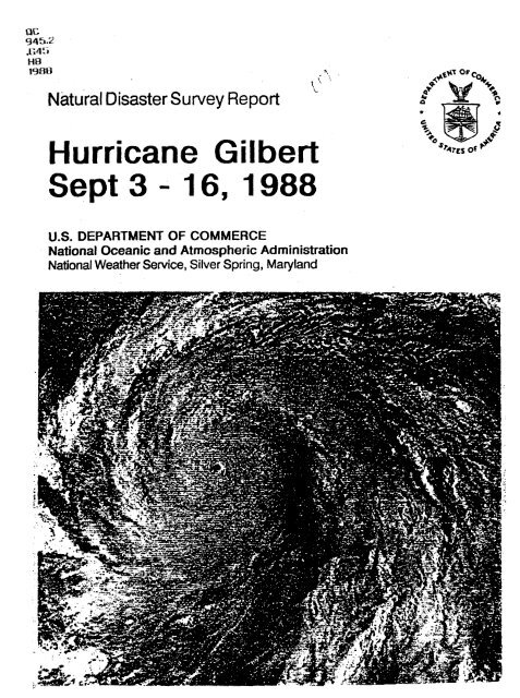
Hurricane Gilbert Sept 3-16 1988 - NOAA
Hurricane Gilbert Sept 3-16 1988 - NOAA
Hurricane Gilbert Sept 3-16 1988 - NOAA

You also want an ePaper? Increase the reach of your titles
YUMPU automatically turns print PDFs into web optimized ePapers that Google loves.
QC<br />
945.2<br />
.G45<br />
HB<br />
19%a '><br />
' '.<br />
\ '\<br />
L<br />
Natural Disaster Survey Report<br />
<strong>Hurricane</strong> <strong>Gilbert</strong><br />
<strong>Sept</strong> 3 - <strong>16</strong>, <strong>1988</strong><br />
U.S. DEPARTMENT OF COMMERCE<br />
National Oceanic and Atmospheric Administration<br />
National Weather Service, Silver Spring, Maryland
National Oceanic and Atmospheric Administration<br />
Weather Bureau <strong>Hurricane</strong> Series<br />
ERRATA NOTICE<br />
One or more conditions of the original document may affect the quality of the image, such<br />
as:<br />
Discolored pages<br />
Faded or light ink<br />
Binding intrudes into the text<br />
This has been a co-operative project between the <strong>NOAA</strong> Central Library and the Climate<br />
Database Modernization Program, National Climate Data Center (NCDC). To view the<br />
original document contact the <strong>NOAA</strong> Central Library in Silver Spring, MD at (301)<br />
7 13-2607 xl24 or Librai-v..Keference(&?noaa.lr;ov.<br />
HOV Services<br />
Imaging Contractor<br />
12200 Kiln Court<br />
Beltsville, MD 20704- 1387<br />
November 6,2007
!<br />
F0RF;WORD<br />
On <strong>Sept</strong>ember 17,<strong>1988</strong>, after landfall by <strong>Hurricane</strong> <strong>Gilbert</strong>,<br />
a disaster survey team was designated to review the<br />
effectiveness of <strong>NOAA</strong>’s public safety information services<br />
and to gather detailed first-hand information from<br />
the communities affected along the Texas Coast. The field<br />
survey was completed by <strong>Sept</strong>ember 22,<strong>1988</strong>. This report<br />
is based on the findings of the Survey Team.<br />
Dr.Elbert W. Friday, Jr.<br />
Assistant Administrator for<br />
Weather Services, NOM<br />
ii
PREFACE<br />
On <strong>Sept</strong>ember 17,<strong>1988</strong>, Dr. Elbert W. Friday, Jr, Assistant Administrator<br />
for Weather Services, designated a Disaster Survey Team to collect and<br />
report on the events pertaining to <strong>Hurricane</strong> <strong>Gilbert</strong> and the associated tornadoes.<br />
The Team consisted of the following members:<br />
Louis Boezi, Team Leader, Director, Transition Program Office<br />
Joe Bocchieri, Chief, Services Evaluation Branch, Office of Meteorol-<br />
OW<br />
Gary Grice, Assistant Chief, Meteorological SeMces Division,<br />
Southern Region<br />
Steve Harned, National <strong>Hurricane</strong> Program Leader, Office of<br />
Meteorology<br />
Herb Lieb, Consultant, Public Affairs & Humcane Preparedness<br />
The team was escorted and aided by Al Dreumont, MIC, San Antonio. The<br />
team met initially on <strong>Sept</strong>ember 18,<strong>1988</strong>, in San Antonio, Texas, with the National<br />
Academy of Science Disaster Survey Team. In San Antonio the team<br />
decided to split up to better cover the Texas coast. Mr. Harned and Mr. Jieb<br />
went to the Houston/Galveston Area, while Mr. Boezi, Mr. Bocchieri, Mr.<br />
Grice, Mr. Dreumont, Mr. Frerichs (NAS member) and Mr. Acquirre (NAS<br />
member) travelled to the Brownsville and Corpus Christi areas. National<br />
Weather Service Offices (WSOs), mayors, city managers, emergency management<br />
coordinators, newspaper managers, and T.V. weathercasters were<br />
visited by the team members, and as many interviews as possible were conducted.<br />
After returning from the Survey, the team members were ably assisted<br />
by William Lerner, who wrote Chapter 4, Stephen Frerichs, and<br />
Danielle Bishop. A special thank you to the team members for your professional<br />
work and to Bill, Stephen a3p Danielle for your invaluable assistance.<br />
Lou Boezi, Team Leader<br />
iii
TABLE OF CONTENTS<br />
Foreword ............................................................................................................................... ..<br />
...<br />
Prefa ...................................................................................................................................<br />
List of Figures and Tables ................................................................................................. v .<br />
Executive Summary ............................................................................................................ 1<br />
Chapter 1: <strong>Hurricane</strong> <strong>Gilbert</strong>: The Event and Its Impact.<br />
The History of the Sto ................................................................................................ 3<br />
Humcane Induced Tornadoes ..... L., . 5<br />
Rainfall with <strong>Gilbert</strong> .................................................................................................... 5<br />
Casualty and Damage Statistics .................................................................................. 5<br />
Chapter 2: Summary of NWS Preparedness Actions, Information and Warning<br />
System.<br />
Preparedness Actions ................................................................................................... 7<br />
Information .................................................................................................................... 8<br />
Warning Se ................................................................................................................. 8<br />
Chapter 3: Discussion of Data Collection and Communications.<br />
Data Collection ............................................................................................................. 9<br />
communications ......................................................................................................... 10<br />
AFOS Performance .................................................................................................... 10<br />
Chapter 4: An Evaluation of the Processing, Interpretation, and Dissemination of<br />
NWS Information.<br />
National <strong>Hurricane</strong> Center Forecasts .......................................................................<br />
Weather Service Offices/<strong>Hurricane</strong> Local Statements . 15<br />
Severe Weather Fore .............................................................................................. <strong>16</strong><br />
iv
Rainfall and River Fore casts ..................................................................................... 20<br />
Flooding ....................................................................................................................... 23<br />
Chapter 5: Public Response and User Benefits<br />
. Public Response .......................................................................................................... 23<br />
Emergency Management Coordinators (EMC) Response . 24<br />
User Benefits ............................................................................................................. 24<br />
Chapter 6: Findings and Recommendations by Chapter<br />
Chapter 1 ..................................................................................................................... 24<br />
Chapter 2 ...................................................................................................................... 26<br />
Chapter 3 ...................................................................................................................... 27<br />
Chapter 4 ......................................................................................................................<br />
Chapter 5 ..................................................................................................................... .O<br />
Appendix<br />
The Evacuation Recommendation for Galveston Island .<br />
A
FIGURES:<br />
1.1 <strong>Hurricane</strong> <strong>Gilbert</strong>, <strong>Sept</strong>ember 10-17. <strong>1988</strong> . 4<br />
12 Tornadoes Associated with <strong>Hurricane</strong> <strong>Gilbert</strong> . 6<br />
4.1 <strong>Hurricane</strong> <strong>Gilbert</strong>: Observed & 24-Hour Forecast Positions . 12<br />
42 <strong>Hurricane</strong> <strong>Gilbert</strong> Watch and Warning Areas . 14<br />
4.3 Verification of Tornadoes in Watches . - . 17<br />
4.4 Verification of Tornadoes in Watches . 18<br />
4.5 Rainfall: <strong>Sept</strong>ember <strong>16</strong> and 17. Forecast vs . Observed . 21<br />
4.6 Rainfall: <strong>Sept</strong>ember 18 and 19. Forecast vs . Observed . 22<br />
l7luUJs<br />
2.1 Information Sources Available During <strong>Gilbert</strong> . 8<br />
4.1 <strong>Hurricane</strong> <strong>Gilbert</strong> Position Errors Versus Previous Years . 11<br />
4.2 Verification of Tide and Surge Fore casts . 13<br />
4.3 Tornadoes in Watches Issued During <strong>Hurricane</strong> <strong>Gilbert</strong> . <strong>16</strong><br />
4.4 Verification of <strong>Gilbert</strong> Tornado Watches Versus Previous Years ................ <strong>16</strong><br />
45 Tornadoes Associated with <strong>Gilbert</strong> ................................................................... 19<br />
4.6 Verification of <strong>Gilbert</strong> Tornado Warnings Versus Previous Years .............. 20<br />
vi
CHAPTER 1<br />
HURRICANE GILBERT: THE EVENT<br />
AND ITS IMPACT<br />
e Histw of the Sto rm<br />
<strong>Hurricane</strong> <strong>Gilbert</strong> began as a tropical wave<br />
over northwest Africa. On <strong>Sept</strong>ember 3,<br />
<strong>1988</strong>, this tropical wave left the African<br />
coast and moved over the open waters of<br />
the North Atlantic becoming a broad area<br />
of low pressure over the southern Atlantic<br />
between Africa and the Lesser Antilles. By<br />
<strong>Sept</strong>ember 8,<strong>1988</strong>, an organized circulation<br />
center was apparent as the system approached<br />
the Windward Islands. The low<br />
was classified by the National <strong>Hurricane</strong><br />
Center (NHC) as the 12th tropical depression<br />
of the <strong>1988</strong> hurricane season. By now<br />
the storm was located about 400 miles east<br />
of Barbados.<br />
The tropical depression moved on a west<br />
northwest course at 15 knots (18 mph), and<br />
by <strong>Sept</strong>ember 9, tropical storm <strong>Gilbert</strong> was<br />
born (Fig. 1.1). By <strong>Sept</strong>ember 14 Puerto<br />
Ria began feeling the effects of the tropical<br />
storm. Winds gusted to 43 knots (50<br />
mph) at Puerto Rico and to 51 knots (59<br />
mph) at Saint Crok Breakers to 12 feet<br />
were reported along the south coast, causing<br />
low areas to be flooded.<br />
<strong>Gilbert</strong> strengthened rapidly and within 30<br />
hours, the NHC upgraded it to a hurricane.<br />
<strong>Gilbert</strong> continued to strengthen as it<br />
brushed the southern coast of Hispaniola<br />
before passing directly over the island of<br />
Jamaica. As the hurricane passed over<br />
Jamaica, sustained winds were 110 hots<br />
(123 mph) which is a Category 3 hurricane<br />
on the Saffir-Simpson Scale.<br />
Followhg the passage over Jamaica, <strong>Gilbert</strong><br />
went through a remarkable intensifica-<br />
tion process with the central pressure falling<br />
from 960 mb (2835 in.) to 888 mb<br />
(26.22 in.) in 24 hours. The 888 mb pressure<br />
was the lowest sea level pressure ever<br />
recorded in the Western Hemisphere. The<br />
low pressure was measured by a <strong>NOAA</strong><br />
recobce plane which also measured<br />
sustained winds of <strong>16</strong>0 knots (184 mph) at<br />
10,OOO feet with a peak gust to 173 knots<br />
(199 mph). <strong>Gilbert</strong> had become a Category<br />
5 hurricane.<br />
Extremely dangerous, <strong>Hurricane</strong> <strong>Gilbert</strong><br />
continued to move west-northwest at 15<br />
knots (17 mph), and on <strong>Sept</strong>ember 13,<br />
passed just south of Grand Cayman Island.<br />
With the passage of the hurricane, Grand<br />
Cayman reported sustained winds of 119<br />
knots (137 mph) with gusts to 136 knots<br />
(157 mph) and 5 foot tides.<br />
The passage of <strong>Gilbert</strong> over the northeast<br />
Yucatan Peninsula on <strong>Sept</strong>ember 14<br />
marked the first time since 1969 (<strong>Hurricane</strong><br />
Camille) that a Category 5 hurricane had<br />
made landfall in the Western Hemisphere.<br />
A 10 to 15 foot storm surge likely occurred<br />
along the immediate Yucatan coast near<br />
the point of landfall.<br />
A somewhat weakened <strong>Gilbert</strong> moved from<br />
Yucatan into the Gulf of Mexico on <strong>Sept</strong>ember<br />
15. The west-northwest track at 15<br />
knots (17 mph) persisted in the Gulf and<br />
<strong>Gilbert</strong> reached the northeast Mexican<br />
coast just north of the town of La Pesca<br />
during the late afternoon of <strong>Sept</strong>ember <strong>16</strong>.<br />
<strong>Gilbert</strong>, a Category 3 hurricane as it<br />
crossed the northeast Mexican coast,<br />
caused approximately a 10 foot storm surge.<br />
Along the lower Texas coast, 150 miles to<br />
the north, tides of 3 to 5 feet above normal<br />
were reported.<br />
No official wind reports were available in<br />
Mexico where the hurricane made landfall.<br />
At Port Isabel, Texas, located about 150<br />
3
30'<br />
MEXICO<br />
*<br />
P<br />
*<br />
* *<br />
*<br />
*<br />
. . *.<br />
e<br />
*<br />
*-.e- * * 8 0<br />
11<br />
20'<br />
*<br />
.<br />
, 4 * e e * * e * * * * * e * *j--;4* e *<br />
Figure 1.1.
miles north of landfall, an observer with a<br />
truck mounted anemometer reported gusts<br />
up to 53 knots (61 mph) to the National<br />
Weather Service Office (WSO).<br />
tonio causing 4 million dollars damage to<br />
hospitals and residential areas (Fig. 1.4).<br />
Late in the afternoon of the 17th, several<br />
tornadoes also struck the Del Rio area causing<br />
extensive damage to three sub-divisions.<br />
In the United States, most destruction from<br />
<strong>Gilbert</strong> occurred from hurricane spawned<br />
tornadoes in south Texas on <strong>Sept</strong>ember <strong>16</strong><br />
and 17 Fig. 1.2). A total of 29 tornadoes<br />
were confirmed and there were 22 funnel<br />
cloud reports. The number of tornadoes is<br />
likely a conservative figure considering the<br />
sparse population in the area.<br />
Fourteen of the tornadoes occurred on <strong>Sept</strong>ember<br />
<strong>16</strong> near the Texas Coast, and 15 occurred<br />
on the 17th, mostly well inland. The<br />
tornadoes on the 17th were considerably<br />
more destructive. Tornado path lengths<br />
were generally less than 1 mile on the <strong>16</strong>th<br />
and up to 5 to 10 miles long on the 17th.<br />
The most destructive tornado on the <strong>16</strong>th<br />
occurred in Harlingen, Texas,near<br />
Brownsville. This tornado touched down<br />
on the south side of Harlingen and moved<br />
from the southeast to the northwest. The<br />
tornado collapsed one wall and the roof of<br />
a doctor’s office. Windows were blown out<br />
of a nearby hospital and residences. Roof<br />
damage OCCUIT~~ to some homes and apartment<br />
complexes, and 20 to 30 cars lost<br />
windshields. Damage was estimated at 1<br />
million.<br />
The tornadoes on the 17th caused the<br />
greatest damage and the only death. A<br />
woman near San Antonio was killed early<br />
on the 17th when a tornado destroyed her<br />
mobile home. Later, a tornado struck Kelly<br />
Air Force Base in San Antonio causing extensive<br />
damage to about 12 warehouse<br />
storage buildings (Fig. 1.3). Damage to the<br />
base was estimated at 28 million dollars.<br />
Another tornado struck northwest San An-<br />
Torrential rains accompanied the hurricane<br />
as it moved inland over Mexico. Five to 10<br />
inches of rain fell along the coastal sections<br />
of Mexico with much greater amounts in<br />
the mountainous areas. Massive flooding in<br />
the Monterey, Mexico area caused about<br />
200 deaths.<br />
<strong>Gilbert</strong>’s rains were generally beneficial to<br />
south Texas. Flooding was almost non-existent<br />
since the bulk of the heavy core rains<br />
fell in the mountains of Mexico. Almost 9<br />
inches of confirmed rain fell in Aransas<br />
County near Corpus Christi as the hurricane<br />
moved inland. Rainfall amounts<br />
were generally 2 to 5 inches in the<br />
Brownsville and Corpus Quisti area.<br />
Runoff from the rain into the Rio Grande<br />
did necessitate a release of water by the International<br />
Boundary Water Commission in<br />
their floodways. This caused some damage<br />
to crops that had been planted in the floodways.<br />
Rains of 2 to 4 inches fell across parts of<br />
southwest Texas on <strong>Sept</strong>ember 18 with<br />
local amounts of 4 to 5 inches near Del Rio.<br />
Three to 5 inch rains accompanied the<br />
remains of <strong>Gilbert</strong> through northwest Texas<br />
and into central Oklahoma. In Oklahoma,<br />
up to 8 inches of rain fell in the central part<br />
of the state.<br />
Da-<br />
..<br />
The death toll from <strong>Gilbert</strong> was 3<strong>16</strong> people.<br />
Mexico reported the most deaths, 202<br />
people, most died with the floods in<br />
Monterey. Other death statistics included:<br />
5
United States, 1; Jamaica, 45; Haiti, 30;<br />
Guatemala, 12; Honduras, 12; Dominican<br />
Republic, 5; Venezuela, 5; Costa Rim, 2;<br />
and Nicaragua, 2.<br />
Estimated damage with <strong>Gilbert</strong> was nearly<br />
$10 billion. Jamaica alone had $65 billion<br />
in damage and the damage to Mexico was<br />
estimated between $1 billion and $2 billion.<br />
Reports from the Mexican government indicate<br />
that more than 60,OOO homes were<br />
destroyed. The most extensive damage in<br />
the United States was from the tornadoes<br />
in San Antonio. Total damage in the<br />
United States was estimated at $33 million.<br />
With the exception of the tornadoes, hurricane<br />
induced damage in south Texas was<br />
light. Most damage was along the lower<br />
Texas Coast and the lower Rio Grande Valley<br />
from high winds and higher than normal<br />
tides. A few trees were uprooted and many<br />
limbs downed; however, only a few power<br />
poles and lines were downed. Agricultural<br />
damage was slight. Beach erosion ranged<br />
up to 4 feet along parts of the coast near<br />
Brownsville.<br />
CHAFTER 2<br />
SUMMARY OF NWS PREPAREDNESS<br />
ACTION, INFORMATION AND WARN-<br />
ING SERVICE.<br />
PreDaredness Act ions<br />
All National Weather Service (NWS) offices<br />
along the Texas coast (Beaumont-Pt.<br />
Arthur, Houston-Galveston, Victoria, Corpus<br />
Christi, and Brownsville) had performed<br />
extensive pre- and early hurricane<br />
season preparedness activities. Hundreds<br />
of presentations to the media, civic, industrial,<br />
and business groups reached<br />
thousands of people.<br />
4<br />
NWS officials met with emergency management<br />
coordinators (EMCs) before the hurricane<br />
season to ensure that strong links<br />
would exist between N WS offices and local<br />
emergency management offices during hurricane<br />
situations. Coordination with emergency<br />
management officials was<br />
strengthened in the Corpus Qristi, Victoria,<br />
and HoustodGalveston areas because<br />
of monthly emergency management<br />
meetings that are held throughout the year.<br />
These meetings were attended by the local<br />
NWS Meteorologist in Charge (MIC).<br />
As part of the NWS preparedness activities,<br />
Dr. Bob Sheets, Director of the NHC, participated<br />
in local meetings with all the mastal<br />
WSOs except Brownsville between May<br />
9-12. In total, over a thousand people attended<br />
these meetings and media coverage<br />
was extensive. Other preparedness actions<br />
by Weather Service Forecast Office<br />
(WSFO) San Antonio included organizing<br />
a comprehensive coastal humcane exercise<br />
to test AFOS backup procedures and links<br />
with the amateur radio groups along the<br />
coast. The successful drill was held July 28.<br />
Although no major problems were encountered<br />
during the storm, there appeared<br />
to be some confusion among EMCs and the<br />
public concerning hurricane tornadoes as<br />
well as the use of hurricane probabilities.<br />
<strong>Hurricane</strong> induced tornadoes tend to be<br />
small and weak. They do not have the Same<br />
characteristics as thunderstorm induced tornadoes<br />
and thus are more difficult to<br />
detect. The hurricane landfall probabilities<br />
were, at times, not used in conjunction with<br />
the 72- hour track.€orecasts and the two<br />
should be used together to show the uncertainty<br />
associated with forecasts of longer<br />
duration.<br />
7
,i-\, -<br />
matron<br />
As the landfall threat increased along the<br />
Texas coast., information available to local<br />
EMCs was abundant. An overriding concern<br />
expressed by most EMCs, other<br />
governmental officials, and the media was<br />
that the multi-sources of information were<br />
too abundant (Table. 2.1). The myriad of<br />
landfall forecasts and computer driven<br />
evacuation decision aids were often conflicting<br />
and in the end, very confusing. A steady<br />
stream of conflicting infomation resulted<br />
in the recommendation Thursday, <strong>Sept</strong>ember,<br />
15 <strong>1988</strong>, for an evacuation of Galveston<br />
Island (See Appendix I for complete<br />
story). City ManagerEmergency Management<br />
Coordinator, Doug Matthew stated<br />
that a total evacuation would not have been<br />
recommended if not for the confusion from<br />
the many information sources (Galveston<br />
Daily News, Sat. Morning 9/17/88).<br />
TABLE 2.1<br />
Information Sources Available During <strong>Gilbert</strong><br />
la<br />
mcb<br />
lha<br />
- -<br />
Y<br />
n<br />
Y<br />
Y<br />
Y<br />
Y<br />
Y<br />
Y<br />
Y<br />
Y<br />
Y<br />
Y<br />
Y<br />
Y<br />
Y<br />
Y<br />
A<br />
-<br />
Y<br />
Y<br />
Y<br />
?<br />
Y<br />
Y<br />
Y<br />
Y<br />
Y<br />
n<br />
n<br />
Y<br />
Y<br />
n<br />
Y<br />
7<br />
-<br />
Y<br />
Y<br />
Y<br />
Y<br />
Y<br />
Y<br />
Y<br />
Y<br />
- 7<br />
lu<br />
Y<br />
Y<br />
Y<br />
Y<br />
Y<br />
Y<br />
Y<br />
Y<br />
Y<br />
Y<br />
Y<br />
7<br />
Y<br />
Y<br />
n<br />
n<br />
n<br />
n<br />
n<br />
n<br />
38aro<br />
n<br />
s8aro<br />
The Corpus Christi City Manager felt the<br />
national networks sensationalized the situation<br />
and that the local TV stations were<br />
more responsive in trying to provide helpful<br />
?<br />
information. The Acting EMC for<br />
Cameron County thought the ~ tiod<br />
media was generally irresponsible and the<br />
local stations did a better job. However,<br />
there was a problem with a local TV station<br />
in Harlingen Friday afternoon (9/<strong>16</strong>) when<br />
it reported that "the worst was over." This<br />
prompted many evacuees to attempt a<br />
return to Port Isabel. When city officials<br />
from Port Isabel returned to the city from<br />
their shelter in Harlingen, they encountered<br />
high winds, driving rain and no<br />
power; they had to take immediate action<br />
to ensure people did not return home from<br />
the shelters. The worst was llQt over because<br />
<strong>Gilbert</strong> was still Causing high winds<br />
and seas along the island.<br />
Wamina SeMm<br />
In response to the potentially devastating<br />
storm, the NWS hurricane watch and hurricane<br />
warning advisories for the Texas<br />
coast were issued with long lead times (51<br />
and 36 hours respectively) by NHC NHC<br />
performed outstandingly, especially considering<br />
the tremendous media demands on<br />
the center. A pre-arranged TV pool was instituted<br />
early in the week by NHC staff.<br />
This allowed maximum coverage with minimum<br />
disruption. Dr. Sheets held over 400<br />
personal interviews and was named ABCs<br />
"Person of the week" on <strong>Sept</strong>ember <strong>16</strong>.<br />
WSFO San Antonio and the coastal WSOs<br />
increased operations early in the week in<br />
response to increased media and public interest,<br />
The forecast office maintained very<br />
strong contact with the coastal WSOs<br />
during the event, After each coordination<br />
call with NHC, a detailed administrative<br />
message was immediately sent to the WSOs<br />
outlining the decisions reached during the<br />
calls. Also, each office manager was called<br />
to discuss operational details in light of the<br />
latest information.<br />
8
The role and actions of WSFO San Antonio<br />
deserve special attention. The location,<br />
functional management, and structure of<br />
NWS offices in south Texas is somewhat<br />
unique, The WSFO is located weU inland<br />
(approximately 150 miles from the Gulf)<br />
with six WSOs located along the immediate<br />
coast. Because of the large number of<br />
WSOs (eight total) in south Texas, ammunications<br />
can be heavy between the<br />
WSOs and the WSFO. In addition, the<br />
South Texas Weather Wire (which carries<br />
NWS forecasts and warnings to media,<br />
government officials, and general public) is<br />
driven by the WSFO and can be overloaded<br />
by a significant weather event. During a<br />
potential major disaster, such as <strong>Gilbert</strong>,<br />
the staff at the WSFO must exercise control<br />
over incoming and outgoing communications<br />
(including the weather wire) and offer<br />
support and direction to the WSOs. During<br />
<strong>Hurricane</strong> <strong>Gilbert</strong>, WSFO San Antonio performed<br />
this function in an outstanding manner.<br />
While <strong>Gilbert</strong> was in the Cariibeaq WSFO<br />
San Antonio issued internal messages (over<br />
the AFOS computer system) to the coastal<br />
WSOs, and the Area Manager called each<br />
WSO manager to remind the staffs of essential<br />
points of operation. Internal messages<br />
were also distributed to the WSOs following<br />
NHC coordination calls indicating the<br />
forecast track of <strong>Gilbert</strong> and how the<br />
WSFO planned to handle weather<br />
problems in south Texas. These messages<br />
provided the WSOs with crucial advance information<br />
to be included in the local statements.<br />
To avoid overcrowding of the weather wire,<br />
the WSFO prepared and issued information<br />
and preparedness statements applicable<br />
to all WSO areas. Several of these<br />
statements were transmitted in Spanish.<br />
The WSFO/WSO partnership worked well<br />
during <strong>Gilbert</strong>. The WSFO provided<br />
guidance and support to the coastal WSOs<br />
freeing those offices to concentrate on local<br />
problems. It is ironic that after serving as<br />
coordinator for the coast, the greatest<br />
damage from <strong>Gilbert</strong> in the U.S. occurred<br />
in San Antonio proper.<br />
The major warning service problem was the<br />
occasional inability for N WS offices to talk<br />
directly with Emergency Operation Centers<br />
(EOC). This was due to inadequate communications<br />
links existing between the<br />
NWS and the various EDC's. This is especially<br />
m e in the very complex Houston-<br />
Calveston area where there are 50 EOCs.<br />
Related to the inadequate communications,<br />
the Corpus Christi Department of Public<br />
Safety (DPS) office stated they would like<br />
to have better access to N WS officials and<br />
information. They said that the various<br />
local statements from all WSOs inTwras,<br />
which are transmitted and received in their<br />
office, created confusion. Taking the time<br />
to sort out which local statement was pertinent<br />
to their area of responsibility<br />
hindered their decision making process.<br />
CHAPTEiR 3<br />
DISCUSSION OF DATA COLLECTION<br />
AND COMMUNICATIONS<br />
In the absence of a direct U.S. landfall, data<br />
collection was minimally affected.<br />
However, concern was expressed by several<br />
EMCs regarding the availability of tide<br />
data. Along the Texas coast many of the<br />
barrier islands are accessible by only one<br />
roadway. Generally, this roadway is 2-5<br />
feet above sea level and very easily hundated.<br />
Thus, one of the key inputs in an<br />
evacuation recommendation for the islands<br />
is tide information. Without a tidal gauge<br />
9
s\ there is no means of knowing how high the<br />
tides are and whether inhabitants can or<br />
should evacuate. l[n Corpus Christi the<br />
Police Chief felt that tide data were so important<br />
that he actually positioned people<br />
on the causeways during the height of the<br />
storm to radio tide levels to the city.<br />
fl7<br />
In Brownsville the WSO receives tide information<br />
from two HANDAR units and a National<br />
Ocean Survey (NOS) gauge. The<br />
South Padre HANDAR was waiting for a<br />
computer boar& the NOS gauge had a<br />
recent change of equipment, and reference<br />
level information was not yet available.<br />
Thus, WSO Brownsville was also painfully<br />
uninformed.<br />
During the south Texas tornadoes (Satufday<br />
9/17), WSMO Hondo’s radar was<br />
operating at lowered power levels at times<br />
due to magnetron problems. The aging<br />
technological infrastructure of the NWS is<br />
becoming more unreliable. Fortunately,<br />
the lowered power levels were compensated<br />
for by the expertise of the<br />
meteorologists in the area (see Chp. 4).<br />
formed nearly 24-hour non-stop interviews<br />
for national and local media stations.<br />
Other NWS employees faced a great<br />
demand for interviews.<br />
A communication problem did exist with<br />
Kelly Air Force Base and WSFO San Antonio.<br />
The tornado siting and subsequent<br />
warning issued for the base (9/17) were not<br />
reported by the base personnel to the<br />
WSFO until five hours after the tornado<br />
touched down.<br />
A check of the SMCC AFOS log shows that<br />
for the three days (<strong>Sept</strong>ember <strong>16</strong>-19)<br />
WSFO San Antonio experienced 10 outages.<br />
This is “average” AFOS operations<br />
performance and the outages were not<br />
storm related. This “average” failure rate is<br />
unacceptably high. The high failure rate becomes<br />
more critical during periods of lifethreatening<br />
weather and points to the need<br />
for modernizing communications equipment.<br />
CHAPTER 4<br />
f-3<br />
Most communication systems worked as expected.<br />
The major problem, especially in<br />
the HoustoxVGalveston area was the great<br />
dficulty encountered at times in cornmunieathg<br />
between the N WS and EOCs<br />
due to the great load on systems,<br />
telephones especially. The MIQ at Corpus<br />
Christ& Brownsville, and Port Arthur ordered<br />
additional telephone lines for the<br />
storm and these were used extensively.<br />
All NWS offices were inundated with requests<br />
for live television interviews. As an<br />
example, the MIC, Richard Hagan, in<br />
Brownsville was roused out of bed at 2:OO<br />
p.m. after a 20 hour shift to do a live interview<br />
and Mike Pass, MIC, Houston, per-<br />
AN EVALUATION OF THE PROCESS-<br />
ING, INTERPRETATION, AND DISSEMI-<br />
NATION OF NWS INFORMATION<br />
Warnings, forecasts, and statements were<br />
timely and effective. NWS forecasters<br />
predicting landfall for the U.S. were under<br />
unusual pressure because of the record<br />
breaking low atmospheric pressure of <strong>Gilbert</strong>.<br />
The intensity of the storm and its<br />
devastation of Jamaica and the Yucatan<br />
peninsula sensitized the population of coastal<br />
Texas to the event and contriiuted to a<br />
‘<br />
significant public response to NWS advisories.<br />
At the same time, the public’s<br />
awareness focused greater attention on the<br />
accuracy of the NWS advisories.<br />
10
National Hu rricane C em<br />
<strong>Gilbert</strong> posed major problems for<br />
meteorologists at NHC. Most objective<br />
hurricane forecast techniques and National<br />
Meteorological Center model guidance consistently<br />
predicted the hurricane to move to<br />
the northwest. A short-wave trough over<br />
the western part of the United States was<br />
expected to be the influencing factor. A<br />
west-northwest movement would bring the<br />
storm into Mexico or onto the relatively unpopulated<br />
lower Texas coast. A turn to the<br />
northwest or north would result in landfall<br />
over the much more densely populated<br />
upper Texas coast. In addition, the storm's<br />
intensity had decreased after its passage<br />
across the northern Yucatan. But the atmospheric<br />
conditions that had produced<br />
175 mph winds and the lowest pressure on<br />
record in the Western Hemisphere were<br />
still in place. A concern was how much intensification<br />
would reoccur before landfall.<br />
While the storm was still east of the<br />
Yucatan peninsula, the NHC forecast track<br />
predicted landfall on the upper Texas coast.<br />
Succeeding forecasts gradually pushed the<br />
track southward. By noon on the 15th <strong>Gilbert</strong><br />
was in the Gulf of Mexico and was still<br />
forecast to hit Texas on the extreme<br />
southern part of the coast near the Mexican<br />
border. At that time, most objective<br />
guidance techniques and many private<br />
meteorologists were still forecasting the<br />
storm to turn north. NHC, however, did<br />
not issue any turn north advisories and <strong>Gilbert</strong><br />
did not turn north until after making<br />
landfall in northern Mexico.<br />
NHC forecasts of hurricane movement<br />
were excellent relative to past performance.<br />
The 24-hour forecast of <strong>Gilbert</strong>, the standard<br />
used to measure forecast error had an<br />
error of only 63 des, while the average 24-<br />
hour error over the past 10 years is 129<br />
miles. Figure 4.1 shows <strong>Gilbert</strong>'s 24-hour<br />
forecast and observed positions during the<br />
life of the storm. Table 4.1 compares the<br />
hurricane's position errors with previous<br />
Y-9<br />
TABLE 4.1<br />
<strong>Hurricane</strong> <strong>Gilbert</strong> Position Errors Versus<br />
Forecast EXTOIS for Previous Years<br />
(Distance measured in statute miles)<br />
Verification data on wind speed forecasts<br />
were not available at the time of this publication.<br />
However, a check of the wind<br />
forecasts from the marine advisories<br />
showed forecasters believed the storm<br />
would intensify from a Category 3 to a<br />
Category 4 after moving off the Yucatan<br />
Peninsula and into the Gulf of Mexico. On<br />
the 15th, maximum sustained winds were<br />
expected to increase from 120 mph to 140<br />
mph. Early on the lath, the forecast called<br />
for an increase to 130 mph. However, the<br />
highest winds remained steady at 120 mph<br />
during <strong>Gilbert</strong>'s passage across the Gulf.<br />
Tide and surge forecasts were excellent for<br />
the Yucatan and Mexico flable 4.2). But<br />
the wording of the tide section in the advisories<br />
caused problems for verification on<br />
the Texas coast.<br />
The 8 AM, <strong>Sept</strong>ember 15, advisory read:<br />
'Tides of 7 to 11 feet above normal may be<br />
expected in the warning area near and to<br />
the north of where the center crosses the<br />
coast. Tides of 4 to 6 feet above normal are<br />
11
likely elsewhere in the watch area." At 8<br />
PM, the latter part of the message was<br />
changed to read: "...elsewhere on the Texas<br />
coast." This wording change causes some<br />
confusion. Did the phrase "to the north"<br />
mean all the way to the northern limit of<br />
TABLE 4.2<br />
Verification of Tide and Surge Forecasts<br />
the warning area, or was it meant to cover an<br />
area only a short distance north of the eye?<br />
Did-the phrase "elsewhere in the watch area"<br />
imply that the warning area was part of the<br />
watch area? Or was there a different tide<br />
forecast on another part of the coast that was<br />
also in the watch? In any event, specific and<br />
accurate tide data were not available in many<br />
places; this lack of data was a problem.<br />
The <strong>Hurricane</strong> Watch for the Texas coast<br />
was issued 48 hours in advance of landfall<br />
and warnings were posted 33 hours in advance.<br />
No adjustments were required for<br />
the watch and warning areas (Fig. 4.2). Because<br />
of the publicity surrounding the<br />
storm and the large size of <strong>Gilbert</strong>, the<br />
public responded unusually well to the<br />
warning. In fact, many began preparing to<br />
evacuate before the watch advisoIy was issued.<br />
The threat of tornadoes was underplayed by<br />
NHC. The first mention in an NHC advisory<br />
was on the corrected version of the<br />
11 AM CDT issuance on <strong>Sept</strong>ember <strong>16</strong>: "A<br />
possible isolated tornado may accompany<br />
the hurricane as it moves inland." The first<br />
touchdown was on the <strong>16</strong>th at about 9:30<br />
AM CDT near Pharr, Texas, based on National<br />
Severe Storms Forecast Center's<br />
(NSSFC) rough log. None of the succeeding<br />
advisories mentioned more than an isolated<br />
threat although tornadoes turned out<br />
to be the most significant aspect of the<br />
storm in the U.S.<br />
NHC forecasts of rainfall associated with<br />
<strong>Gilbert</strong> predicted 5 to 10 inch storm totals<br />
until the 5 AM CDT issuance on the <strong>16</strong>th.<br />
Amounts were subsequently raised to 10 to<br />
15 inches and further adjusted to mention<br />
locally 20 inches on the next advisory at 11<br />
AM. Actual amounts included 538 inches<br />
at Brownsville, 4.69 inches in east Corpus<br />
Christi, and 450 inches at Beeville. An unofficial<br />
report from the public indicated<br />
8.71 inches near Lamar. Rainfall totals<br />
probably ranged upward to between 6 and 7<br />
inches in places near the Mexican border,<br />
in areas west of San Angelo and Abilene in<br />
Texas, and west and north of Oklahoma<br />
City and Tulsa in Oklahoma. Isolated spots<br />
undoubtedly received higher amounts.<br />
Flooding was minimal. Heavy rains occurred<br />
in Mexico but amounts are unknown<br />
Local EMCs followed, and the media<br />
reported the hurricane probabilities issued<br />
by NHC However, the probabilities were<br />
not used to trigger any decisions related to<br />
evacuation recommendations. Most<br />
evacuation recommendations were keyed<br />
to the warning advisory. Exceptions to the<br />
warning response occurred in the Galveston<br />
area. (See Appendix A)<br />
Several media personnel and local officials<br />
expressed a desire for the NHC to include a<br />
rationale or explanation of the hurricane<br />
forecast. In particular, the general question<br />
arose: Why was the storm forecast to turn<br />
to the northwest or north, while it continued<br />
to move to the west-northwest. In<br />
13
conjunction, most local media people<br />
strongly favored direct interviews with<br />
NHC.<br />
<<br />
hr r' n I<br />
v<br />
WSOs bore the brunt of the pressure,<br />
workload, and local community attention.<br />
The offices along the Texas mast performed<br />
admirably before the humcane<br />
made landfall. The WSOs also did a good<br />
job of explaining how storm effects would<br />
vary depending on <strong>Gilbert</strong>'s track Afterward,<br />
coastal and inland WSOs and the<br />
WSFO handled the tornado and flood<br />
threats.<br />
HLSs began in the evening (5 PM CDT) of<br />
<strong>Sept</strong>ember 14. (Emphasis is placed on<br />
statements from Brownsville, Corpus Christi<br />
and Victoria since they were in the warning<br />
area.) Brownsville spoke in general<br />
terms about the storm, explained the role<br />
local statements would play, and provided<br />
information on possible storm effects as<br />
well as the reliability of the forecasts. Corpus<br />
cbristi listed county officials responsible<br />
for evacuation decisions and<br />
suggested preliminary preparation activities.<br />
Victoria supplied a checklist of useful<br />
items to buy and suggested preparatory<br />
activities. Brownsville and Corpus Christi<br />
both stressed in their early statements the<br />
size and strength of <strong>Gilbert</strong> and they<br />
warned that the coast would be affected<br />
well before the eye arrived. This fact is<br />
often lost since attention is usually focused<br />
on the location of the eye. At some WSOs<br />
there was a tendency to repeat too much of<br />
the information included in the NHC advisories.<br />
The <strong>Hurricane</strong> Warning in Texas was issued<br />
at 8 AM, <strong>Sept</strong>ember 15. By then,<br />
WSOs were issuing all specific information<br />
available on tides, wave heights, and surf<br />
conditions. However, specific tide information<br />
was not available for many places, and<br />
this proved to be a serious deficiency in the<br />
warning process. In their final storm<br />
report, Corpus Christi stated, "...ow biggest<br />
problem was lack of accurate tide data in<br />
Corpus Christi Bay and the remainder of<br />
the area bay and inland waterway system."<br />
(Please refer to Chapter 3 for further information).<br />
WSO Brownsville performed an excellent<br />
job advisii the public on the tornado<br />
threat. Information on tornadoes was included<br />
on the evening of the 15th, 18 hours<br />
before the NHCs first mention of tornadoes.<br />
Brownsville stated, Tbe first [rain]<br />
bands to move onshore with a hurricane<br />
can spawn tornadoes." At 11 PM, the office<br />
mentioned that the threat of tornadoes<br />
would increase as the storm moved closer.<br />
Corpus Christi included the threat of tornadoes<br />
in their 545 AM statement on the<br />
<strong>16</strong>th. Information concerning WSO tornado<br />
wafning performance is included in<br />
the next section, Severe Weather.<br />
In the hurricane watch area, WSOs Port Arthur<br />
and HoustodGalveston disseminated<br />
information on tides, coastal flooding,<br />
school closings, and general information<br />
and suggestions to prepare for possible<br />
evacuation. Both relayed Emergency<br />
Management Center suggestions and both<br />
warned of increased effects if the hurricane<br />
made a northward turn.<br />
A number of local officials in the<br />
Brownmille area complained that the<br />
media indicated "the worst is over" shortly<br />
after the hurricane made landfall, but<br />
weather conditions remained hazardous for<br />
some time afterward. A check of the local<br />
statements indicated Brownsville advised:<br />
"Evexyone presently in shelters should plan<br />
to remain there during the night. All unnecessary<br />
travel is strongly discouraged."
Corpus Christi stated: "Public officials in<br />
Calhoun County recommend that residen<br />
&...be patient in returning to their<br />
homes." Most offices, as expected, had a<br />
heavy telephone and media interview load.<br />
These were handled well. Virtually all local<br />
officials and media people praised N WS<br />
responsiveness and cooperation. There was<br />
a large demand for communication in<br />
Spanish since much of the population in<br />
south Texas is Hispanic. WSFO San Antonio<br />
and WSO Brownsville interpreted advisories<br />
into Spanish on demand over the<br />
telephone. WSFO San Antonio, MIC, AI<br />
Dreumont, conducted TV and radio interviews<br />
in Spanish. Also, general hurricane<br />
preparation material was broadcast in<br />
Spanish over the NWWS.<br />
The Padre Isles Property Owners Association<br />
rated the quality of service provided by<br />
WSO Corpus Christi. Members of this<br />
group were asked to complete a questionnaire<br />
on <strong>Hurricane</strong> <strong>Gilbert</strong>. One question<br />
asked respondents to rate the quality of information<br />
on <strong>NOAA</strong> Weather Radio. Of<br />
23 replies 14 rated the service a "5" on a<br />
scale of 1 to 5, five others rated it a "4," and<br />
no one gave a rating below "3."<br />
TABLE 4.3<br />
Tornadoes in Watches Issued During <strong>Gilbert</strong><br />
W&h<br />
Nunbw<br />
410<br />
420<br />
421<br />
422<br />
423<br />
424<br />
425<br />
- m<br />
TaW<br />
Mmbrd<br />
Tandor<br />
12<br />
2<br />
0<br />
12<br />
5<br />
0<br />
0<br />
-<br />
0<br />
2s<br />
h<br />
W.rch<br />
d<br />
2<br />
0<br />
10<br />
5<br />
0<br />
0<br />
-<br />
0<br />
21<br />
Wh<br />
W&h<br />
a<br />
0<br />
0<br />
2<br />
0<br />
0<br />
0<br />
-<br />
0<br />
8<br />
Most of the tornadoes were small, weak, and<br />
short-lived. However, one was a killer, four<br />
others caused injuries, and several more<br />
produced varying amounts of damage.<br />
TABLE 4.4<br />
Verification of <strong>Gilbert</strong> Tornado Watches<br />
Versus Previous Years<br />
The only death and most of the injuries and<br />
damage caused by <strong>Gilbert</strong> were from the 29<br />
known tornadoes spawned by the storm.<br />
Twenty-one of the 29 storms were in watch<br />
areas. Table 43 shows a breakdown of tornadoes<br />
by watch.<br />
NSSFC issued eight watches and four were<br />
associated with severe weather. The<br />
watches and the locations of the 29 tornadoes<br />
are detailed in Fig. 43, and Fig. 4.4.<br />
are CDZ Table 4.4 compares<br />
NSSFC's performance with verification<br />
scores from previous years<br />
WSFO San Antonio and the WSOs in<br />
southern Texas alerted the public to the tornado<br />
threat. Information included in the<br />
HLSs has already been discussed. The<br />
<strong>16</strong>
- -..* .<br />
7 are tornadoes within the watch area<br />
and valid time. v are tornadoes not within the watch area and/or<br />
valid time. Numbers correspmd to Table 4.5.<br />
Figure 4.3. All times are CDT.<br />
17
-a-- I -2 VALID 17/2000 - 1810200 -<br />
-:--<br />
..- VALID 18/<strong>16</strong>00 - 18/2200 --<br />
L<br />
vare tomadoes within the watch area<br />
and valid time. V are tornadoes not within the watch area andlor<br />
valid time. Numbers correspond to Table 4.5.<br />
Figure 4.4. All times are CDT.<br />
18
TABLE 4.5<br />
TORNADOES ASSOCIATED WITH GILBERT<br />
cL#<br />
1<br />
2<br />
3<br />
4<br />
5<br />
6<br />
7<br />
8<br />
9<br />
10<br />
11<br />
12<br />
DATE/<br />
TIME<br />
<strong>16</strong>/O945<br />
<strong>16</strong>/1000<br />
<strong>16</strong>/1045<br />
<strong>16</strong>/1115<br />
<strong>16</strong>/1118<br />
<strong>16</strong>/1201<br />
<strong>16</strong>/1230<br />
<strong>16</strong>/1330<br />
<strong>16</strong>/1400<br />
<strong>16</strong>/1500<br />
<strong>16</strong>/1704<br />
<strong>16</strong>/1730<br />
<strong>16</strong>/2100<br />
<strong>16</strong>/2xx)<br />
17/0510<br />
17/0545<br />
17/0649<br />
17/0730<br />
17/0744<br />
17/0900<br />
17/0940<br />
17/1030<br />
COUNTY<br />
Hildalgo<br />
Hildalgo<br />
Hildalgo<br />
Hildalgo<br />
Hildalgo<br />
LOCATION<br />
Pharr<br />
San Juan<br />
San Juan<br />
Donna<br />
McAllen<br />
Edcouch-Lavilla<br />
Edinburg<br />
Brownsville<br />
Harlingen<br />
Hading en<br />
5 N Goliad<br />
Corpus Christi<br />
Corpus Christi<br />
STA-<br />
TION<br />
BRO<br />
BRO<br />
BRO<br />
BRO<br />
BRO<br />
BRO<br />
BRO<br />
BRO<br />
BRO<br />
BRO<br />
VCT<br />
CRP<br />
CRP<br />
CRP<br />
SAT<br />
SAT<br />
SAT<br />
SAT<br />
AUS<br />
SAT<br />
SAT<br />
AUS<br />
Hildalgo<br />
Hildalgo<br />
Cameron<br />
Cameron<br />
Cameron<br />
Goliad<br />
Nueces<br />
13<br />
14<br />
15<br />
<strong>16</strong><br />
17<br />
10<br />
19<br />
20<br />
21<br />
22<br />
Nueces<br />
Bee<br />
Kames<br />
Bexar<br />
Bexar<br />
Bexar<br />
Val Verde<br />
Fayette<br />
&mal<br />
Atascosa<br />
Pettus<br />
4 W Karnes Ci<br />
S Bexar County<br />
Kelly AFB<br />
San Antonio<br />
5 Sw LaGrange<br />
Canyon Lake<br />
Near Jourdanton<br />
Near Prairie Lea<br />
23 17/1050 Caldwell W Edwards County SAT<br />
24 1711213 Edwards 20 N Eagle Pass SAT<br />
25 17/1345 Maverick 3 W Carrizo Springs SAT<br />
26 17/1420 Dimmit 15 N Comstock DRT<br />
27 17/1745 Val Verde Del Rio DRT<br />
28 17/1839 Val Verde Lake Amistad DRT<br />
29 17/1852 Val Verde Near Comstock DRT<br />
WARN<br />
NO<br />
NO<br />
NO<br />
NO<br />
NO<br />
NO<br />
NO<br />
NO<br />
NO<br />
NO<br />
NO<br />
NO<br />
NO<br />
NO<br />
NO<br />
NO<br />
YES<br />
YES<br />
NO<br />
NO<br />
NO<br />
NO<br />
NO<br />
NO<br />
NO<br />
YES<br />
YES.<br />
YES<br />
YES<br />
F# REMARK<br />
FO O/O/DM<br />
FO O/O/DM<br />
FO O/l/DM<br />
M O/O/DM<br />
FO O/O/DM<br />
FO O/O/DM<br />
FO O/O/DM<br />
FO O/O/DM<br />
FO O/O/DM<br />
F1 O/O/D1<br />
FO O/O/O<br />
FO O/O/DM<br />
F1<br />
F1<br />
O/O/Dl<br />
0/3/D28<br />
FO O/O/DM<br />
F1 O/O/DM<br />
F2 1/1/01<br />
F1 OBD6<br />
O/O/DM<br />
FO<br />
FO<br />
FO<br />
O/O/DM<br />
o/o/o<br />
FO O/O/DM<br />
FO O/O/O<br />
FO O/O/O<br />
FO O/O/DM<br />
FO O/O/O<br />
F2 0/20D3<br />
FO O/O/O<br />
FO O/O/DM<br />
All times are CDT. All locations are in Texas. Lead time in minutes.<br />
Remarks: #/#/D# = deaths/injuries/damage in millions (DM = minor damage)<br />
19
threat of severe weather was also included<br />
in forecasts and statements. Of the 29 tornadoes,<br />
warnings were issued for Six It is<br />
remarkable that any warnings were issued<br />
considering that most lasted for only a few<br />
minutes. In addition, current NWS field<br />
radar technology is not capable of detecting<br />
this type of severe weather. Despite this,<br />
WSFO San Antonio was able to warn for<br />
two of the tornadoes in its area of responsibility.<br />
WSO Del Rio turned in a truly outstanding<br />
performance given today’s aging<br />
technological systems. There were four tornadoes<br />
in their area and they warned for<br />
each one.<br />
Table 4.5 lists each of the tornadoes by<br />
time, county, location,station, whether a<br />
Warning was issued, lead time of warning,<br />
F#, and damage remarks. pill times are<br />
CDT.<br />
Table 4.6 compares the warning performance<br />
with previous years based on the official<br />
count of tornadoes. The Probability of<br />
Detection, or the probability of an event<br />
being covered by a forecast or warning, was<br />
lower for <strong>Gilbert</strong>’s tornadoes. This was expected<br />
since the historical breakdown of<br />
tornadoes is FO (76%), F1(17%), F2 (5%),<br />
where FO is weakest. The weaker tornadoes<br />
are the most difficult to warn for.<br />
For previous years (19SO-1987), FO’s and<br />
Fl’s were 33% and 37%, respectively, of<br />
the total warned. Warnings were issued for<br />
both F2’s that occurred as a result of <strong>Gilbert</strong>.<br />
Because of the nature of humcane<br />
spawned tornadoes, some N WS offices<br />
warned for the conditions rather than<br />
specific events. Current technology is insufficient<br />
for detecting these weaker<br />
phenomena. This explains why lead times<br />
are considerably longer than in previous<br />
years.<br />
TABLE 4.6<br />
Verification of <strong>Gilbert</strong> Tornado Warnings<br />
Versus Previous Years<br />
Rainfall and River Fo recasQ<br />
The heavy precipitation forecasters of the<br />
National Meteorological Center’s Forecast<br />
Branch issue quantitative precipitation<br />
forecasts (QPF). Twenty-four hour QPFs<br />
for <strong>Sept</strong>ember <strong>16</strong>,17,18, and 19,<strong>1988</strong> and<br />
observed rainfall for the same time period<br />
are shown in Fig. 45 and 4.6.<br />
The areas of heavy rainfall were delineated<br />
well, particularly in the period ending on<br />
the 19th. The West Gulf River Forecast<br />
Center (WGRFC) has forecast responsibility<br />
for the Rio Grande which required<br />
constant monitoring of the river’s<br />
tributaries in Mexico. As <strong>Gilbert</strong> continued<br />
moving northwest, a 38-foot rise in less<br />
than 18 hours was experienced near<br />
Dryden, Texas,above the huge Amistad<br />
Reservoir. The excellent, and timely,<br />
forecasts provided by the WGRFC were extremely<br />
helpful to the International Boundary<br />
and Water Commission in safely<br />
operating flood control reservoirs in the<br />
middle Rio Grande Valley and in operating<br />
the engineered floodway systems along the<br />
lower Rio Grande. The lack of heavy rain<br />
in south Texas on the <strong>16</strong>th resulted from<br />
the more southerly track of the hurricane.<br />
20
I 1<br />
RAINFALL<br />
I d<br />
724 HOURS ENDING 7 AM' CDT - <strong>16</strong> SEP<br />
7<br />
FORECAST<br />
/<br />
1<br />
No 1 inch amounts.?<br />
, I<br />
-+<br />
Figure 4.5. Isohyet values are in inches.<br />
21
RAINFALL<br />
24 HOURS ENDING 7<br />
FORECAST<br />
OBSERVED<br />
.FORECAST<br />
v OBSERVED<br />
24 HOURS ENDING 7 AM COT - 19 SEP<br />
I -\ I<br />
Figure 4.6. Isohyet values are in inches.<br />
22
Floodloa<br />
Since <strong>Gilbert</strong> produced relatively little rain<br />
in the United States, flooding was limited.<br />
WSFO San Antonio issued a flood warning<br />
at 3:20 AM CDT, <strong>Sept</strong>ember 18, for the<br />
Pecos River at Dryden above Amistad<br />
Reservoir. This is in a remote area where a<br />
flood stage is not defined. However, the<br />
river rose from 6 feet on the evening of the<br />
17th to about 45 feet at 9 AM CDT on the<br />
18th. Three fishing camps at Foster Ranch,<br />
about 20 miles downstream from Dryden,<br />
were warned and people and property were<br />
evacuated. Flooding occurs when the river<br />
is above 9 feet; the crest was estimated at<br />
over 20 feet.<br />
WSO Del Rio issued two flash flood warnings.<br />
The first was for Val Verde County<br />
from 9:30 PM CDT on the 17th to 1:30 PM<br />
CDT on the 18th. This warning verified<br />
when Highway <strong>16</strong>3 North out of Cornstock<br />
and Farm Road 1024 near Pandale were<br />
closed by high water. The second Warning<br />
was also for Val Verde County and was issued<br />
for the period 9:30 AM CDT to 230<br />
PM CDT on the 18th. The Devils River<br />
flooded during the warning valid time and a<br />
bridge on Highway <strong>16</strong>3 at Bakers Crossing<br />
was under water.<br />
Most of the rain from <strong>Gilbert</strong> fell in<br />
Mexico. The resulting inflow into the Rio<br />
Grande River necessitated a release of<br />
water by the American and Mexican International<br />
Boundary & Water Commission<br />
(IBWC) into their respective floodways.<br />
The river went 5 feet over the bank at San<br />
Benito. Although this flooding is planned<br />
for, a statement was issued advising people<br />
with vulnerable property to take appropriate<br />
action if necessary. Any crops<br />
planted in the floodways were lost and livestock<br />
had to be removed from the floodways.<br />
In general, operations and coordination<br />
among WSFO San Antonio, WSO<br />
Brownsville, the West Gulf WC, and the<br />
IBWC went well. However the WSFO service<br />
hydrologist indicated that this event<br />
only tested the system; it was not a crisis.<br />
Potential weaknesses identified include:<br />
1. Better communications between the<br />
IBWC at Mercedes and the San Antonio<br />
WSFO are needed to keep the RFC informed<br />
in a timely manner of water<br />
releases through their floodways and dams.<br />
This had a significant effect on river and<br />
flood forecasts.<br />
2. Outdated current ratings at San Benito.<br />
This resulted in erroneous forecasts<br />
downstream.<br />
3. The fact that observations and forecasts<br />
for Brownsville were being made below the<br />
area where flooding occurred. The flow at<br />
the downstream location was interpreted<br />
upstream, but the gauge needed for this (at<br />
the Brownsville Bridge) was removed.<br />
Also, downstream current ratings have not<br />
been kept up to date as the channel and<br />
capacity changed.<br />
CHAPTER 5<br />
PUBLIC RESPONSE AND USER<br />
BEN EFlTS<br />
Public Resoo nse<br />
The destructive history and size of <strong>Gilbert</strong><br />
resulted in tremendous public interest and<br />
response. As <strong>Gilbert</strong> formed, interest in<br />
the storm rose along the coast. When it became<br />
apparent that <strong>Gilbert</strong> was deadly,<br />
destructive and the strongest storm on<br />
record, concern rose to great levels. Dr.<br />
Neil Frank of KHOU-TV in Houston<br />
remarked that he felt the public reacted<br />
strongly and quickly, in fact too much so.<br />
23
He stated that people along the upper coast<br />
reacted 24 hours before it was necessary.<br />
Thousands of Texans bought food, batteries,<br />
plywood, and other provisions for<br />
protection. In Brownsville and Corpus<br />
Christi hardware stores were initially sold<br />
out of plywood the day before the NHC issued<br />
the hurricane Watch for the Texas<br />
coast. Other shipments of plywood were<br />
sent into the area during the week, and<br />
some instances of price gouging were<br />
reported.<br />
Many Texans acquired hurricane plotting<br />
maps from local TV stations and other businesses.<br />
As NHC reported the coordinates<br />
of <strong>Gilbert</strong>'s eye, the public followed<br />
<strong>Gilbert</strong>'s track. A problem with the fixation<br />
on the hurricane eye is that once the<br />
eye makes landfall the public may falsely<br />
believe that the threat from the hurricane is<br />
over. The fixation with the eye may have<br />
led local Harlingen newscasters to state<br />
"that the worst was over." People with hurricane<br />
plotting maps in shelters desired to<br />
leave once landfall had been reported.<br />
ResDonse<br />
Manawnt Coordinator's<br />
All local officials interviewed stated the<br />
early issuances of the watches and Warnings<br />
provided for more effective evacuation<br />
decision making. During the threat of<br />
landfall, public officials followed hurricane<br />
probabilities but did not use them in any<br />
public safety decision process. Critical<br />
public safety decisions were based on the issuance<br />
of the hurricane warning consultations<br />
with local NWS managers for<br />
reinforcement (the exceptions being in the<br />
Galvestod La Marque area). A high<br />
demand among the EMCs existed for personal<br />
contact with NWS meteorologists. In<br />
fact, local public safety decision makers requested<br />
the ability to work closer with the<br />
NWS and to have better, higher resolution<br />
data (including graphics).<br />
For hurricanes, the largest user benefit<br />
from NWS information is public safety.<br />
EMCs and the public are provided with pertinent<br />
meteorological information regarding<br />
safety and are given enough input to<br />
help with rational, life saving decisions. All<br />
evacuation recommendations in lower<br />
Texas issued by EMCs were keyed to the<br />
<strong>Hurricane</strong> Warning Advisory. In<br />
Brownsville, for instance, the evacuation<br />
recommendation for the coast was issued<br />
within l/2 hour of the warning advisory. All<br />
EMCs desired a personal interface with an<br />
NWS meteorologists to aid them in their<br />
decision process.<br />
Other economic benefits accrued to some<br />
local businesses and local industries that<br />
key production shutdown decisions to N WS<br />
advisories and/or probabilities. In the future,<br />
as a result of the Modernization and<br />
Restructuring of the NWS, the opportunity<br />
for more localized information should expand<br />
the direct benefits available from<br />
NWS services to both public safety decision<br />
makers and to private industry via private<br />
meteorologists.<br />
CHAPTER 6<br />
FINDINGS AND RECOMMENDATIONS<br />
BY CHAPTER<br />
*** Finding 1.1 (The event and its impact)<br />
<strong>Hurricane</strong> <strong>Gilbert</strong> was the most powerful<br />
hurricane ever recorded in the Western<br />
Hemisphere. Winds measured in excess of<br />
200 mph and the lowest barometric pres-<br />
24
sure ever recorded were associated with<br />
<strong>Gilbert</strong>.<br />
The passage of <strong>Gilbert</strong> over the northeast<br />
Yucatan Penbsula on <strong>Sept</strong>ember 14<br />
marked the first time since 1969 that a<br />
category 5 hurricane made landfall in the<br />
Western Hemisphere. After passing over<br />
the Yucatan, a weakened <strong>Gilbert</strong> moved<br />
into the Gulf of Mexico on <strong>Sept</strong>ember 15.<br />
The west-northwest track persisted in the<br />
GulE, and <strong>Gilbert</strong> reached the northeast<br />
Mexican coast just north of the town of La<br />
Pesca during the late afternoon of <strong>Sept</strong>ember<br />
<strong>16</strong> as a Category 3 hurricane.<br />
The death toll from <strong>Gilbert</strong> was 3<strong>16</strong> people.<br />
Mexico reported the most deaths, 202<br />
people. Other death statistics include:<br />
United States, 1; Jamaica, 45; Haiti,30;<br />
Guatemala, 12; Honduras, 12; Dominican<br />
Republic, 5; Venezuela, 5; Costa Ria, 2;<br />
and Nicaragua, 2.<br />
Estimated damage from <strong>Gilbert</strong> was nearly<br />
$10 billion. Jamaica alone had $65 billion<br />
in damage, and the damage to Mexico was<br />
between $1 and $2 billion. Reports from<br />
the Mexican government indicate that more<br />
than 60 thousand homes were destroyed.<br />
The most extensive damage in the United<br />
States was due to tornadoes in San Antonio.<br />
The total damage in the United<br />
States was estimated at $33 million.<br />
*** Finding 13 (Utility of Watches and<br />
Warnings)<br />
Early hurricane watches and warnings are<br />
essential with hurricanes the size and intensity<br />
of <strong>Gilbert</strong> since public evacuation<br />
decisions are keyed to these information<br />
products. All local officials interviewed<br />
stated the early issuances of the watches<br />
and warnings provided for a more effective<br />
evacuation.<br />
*** Finding 13 (User's personal contact with<br />
NWS personnel)<br />
Local National Weather Service Managers<br />
are essential participants in the warning<br />
and preparedness process. During <strong>Gilbert</strong>,<br />
public officials followed hurricane probabilities<br />
but keyed critical actions to the<br />
hurricane advisories after discussion with<br />
local NWS managers for reinforcement.<br />
The one-on-one personal relationship<br />
provides the confidence and reinforcement<br />
for public safety decisions in a complex,<br />
highly stressful environment.<br />
*** Finding 1.4 (Need for higher resolution<br />
in NWS products)<br />
New technologies exist that can provide the<br />
opportunity for better understanding and<br />
study of hurricane situations. It was apparent<br />
from this survey and others that a<br />
need for heavy rain and wind speed information<br />
on a higher spatial resolution along<br />
the coast and over open water exists. Currently,<br />
there is a paucity of observations<br />
from today's infrastructure. Such information<br />
along and near the coast is crucial<br />
during hurricane situations, e.g., in routing<br />
tra€!ic. An important benefit of the Next<br />
Generation Radar (NEXlU4.D) will be the<br />
opportunity to determine winds with a<br />
higher spatial resolution than at present.<br />
Such information, used in improved HLSs,<br />
and, e.g., graphics, should provide local officials<br />
important information and additional<br />
confidence for evacuation and "all clear"<br />
recommendations.<br />
*** Recommendation 1.4<br />
The NWS should continue its modemization<br />
plans. The new technologies associated<br />
with Modernization and<br />
Restructuring should increase the<br />
forecaster's capabilib to detect and predict<br />
weather phenomena on a finer time and<br />
25
space scale (mesoscale) than is possible<br />
now. In addition to improved phenomena<br />
detection and product formulation, the<br />
NWS recognizes that dissemination of the<br />
information to emergency managen and<br />
the public is of utmost importance. Modernization<br />
and restructuring plans address<br />
the need for integrating an ever increasing<br />
flow of finer scale information to the<br />
forecaster, for rapid formulation of user<br />
products, and for rapid dissemination of<br />
those products to emergency officials and<br />
the public in both graphical and printed<br />
fom<br />
ments on its value and applicability. The<br />
NWS should continue its preparedness activities<br />
and continue to educate its users on<br />
the content and quality of official N WS<br />
forecasts and warning products.<br />
Also, the NWS should continue pursuing<br />
better means of conveying public safety information.<br />
For example, plans call for the<br />
ability to transmit graphics in addition to,<br />
or as a substitute to, printed matter.<br />
Graphic presentation of watch and warning<br />
information should reduce the need for<br />
users to absorb large quantities of printed<br />
information.<br />
*** Finding 2.2 (Performance of the media)<br />
***Finding 2.1 (Proliferation of information)<br />
Users of weather information, especially<br />
EMCs, are becoming more sophisticated<br />
and are making more use of computers to<br />
display and interpret information. In concert<br />
with this trend, the quantity of information<br />
and the number of sources is also<br />
increasing. During <strong>Gilbert</strong>,EMCs, other<br />
government officials, and the media complained<br />
about the large quantity of information<br />
they received and about the conflicting<br />
nature of the various sources. This growing<br />
trend will be a problem if not handled<br />
properly. Since the increasing sources of information<br />
often conflict, the resulting indecisiveness<br />
undermines public safety.<br />
*** Recommendation 2.1<br />
Given the trend toward more information,<br />
EM0 and other government officials<br />
responsible for making public safety<br />
decisions need to remain up-to-date about<br />
the sources and content of the information<br />
they receive. They must be able to<br />
prioritize the information and make judg-<br />
The national media tended to sensationalize<br />
the situation, whereas the local media<br />
stations were more responsive in trying to<br />
provide helpful information. However, as<br />
reported by George Gavito, acting EMC of<br />
Cameron County, and Manuel Hinojosa,<br />
City Manager, City of Port Isabel, a<br />
problem occurred when newscasters on a<br />
local station indicated "the worst was over"<br />
as hurricane <strong>Gilbert</strong> made landfall. Based<br />
on this news, people wanted to leave the<br />
shelters and return home. Also, Mitch Ammons,<br />
EMC of Rockport in A r m county,<br />
felt that Bob Sheets added to the confusion<br />
in an intexview with CNN when he said that<br />
the maximum storm surge was over as the<br />
hurricane made landfall. Mitch Ammons<br />
felt that this message gave a false sense of<br />
security.<br />
*** Recommendation 2.2<br />
In its preparedness activities, the N WS<br />
needs to stress that dangerous weather conditions<br />
can occur before and after hurricane<br />
landfall. The best local source of information<br />
with regard to these conditions is the<br />
<strong>Hurricane</strong> Local Statement (HLS) issued<br />
by the local NWS office. Also, local<br />
26
y the local NWS office. Also, local<br />
newscasters aside from the weathercaster<br />
should be encouraged to attend preparedness<br />
activities and educate themselves<br />
about public safety threats associated with<br />
hurricanes.<br />
*** Finding 3.1 (Lack of tide information)<br />
EMCs had a problem in determining tide<br />
levels. Tide levels are vital for the decision<br />
to evacuate the islands, as most causeways<br />
are near sea level. Tide level data are sorely<br />
lacking all along the Gulf Coast; most<br />
locations don't have gauges, and many that<br />
are present are not reliable.<br />
*** Recommendation 3.1<br />
Dr. Michael Speed of Corpus Christi State<br />
University would like to establish a tide<br />
gauge network in Corpus Christi Bay, but<br />
lacks funding. The Southern Region Headquarters<br />
of NWS and <strong>NOAA</strong> should coordinate<br />
with Dr.Speed in his effort and<br />
investigate the possibility of cost-sharing.<br />
Southern Region Headquarters should also<br />
act on the request for an additional HAND-<br />
AR unit for Port Mansfield.<br />
In addition, the NWS should initiate a<br />
NOM-wide effort to ensure that an operational<br />
network of tide gauges is installed<br />
along the Gulf coast. Not only must the<br />
tide gauges be installed but effective means<br />
for using the data for forecasts must also be<br />
instituted.<br />
*** Finding32 (Direct communications link<br />
between NWS Offices and Emergency<br />
Operating Centers (EOCs))<br />
The desire by EMCs to speak directly to<br />
NWS personnel was found to be<br />
widespread, despite the fact that all per-<br />
tinent information is contained in statements<br />
issued by the NHC and local NWS offices.<br />
Due to the large number of EOCs<br />
affected along the Texas coast, direct communication<br />
between the NWS and the<br />
EOCs was at times impeded, especially<br />
telephone communication. Several EMCs<br />
felt they were getting too much information<br />
in the form of printed statements and had<br />
to call the N WS just to get a picture of what<br />
was happening. The Turns provided a<br />
continuous stream of information, which<br />
was too hard to filter for pertinent material.<br />
+** Recommendation 3.2<br />
As part of the its modernization plans, the<br />
NWS recognizes the need for a direct communications<br />
link between its offices and<br />
local government officials. Finding 32 supports<br />
the need for a direct link<br />
Prior to the modernization, the NWS and<br />
local communities should pursue other<br />
means of direct communication. For example,<br />
Mike Pass, MIC of WSO Houston,<br />
recommended establishing a "hot-line" between<br />
the local office and the EOCs. Such<br />
a hot-line was established, for example, between<br />
the EOC in Corpus Christi and the<br />
local WSO. In the future, additional<br />
telephone lines should be considered by<br />
each MIC during a hurricane event.<br />
*** Finding 33 (External coordination)<br />
Personnel at Kelly AFB, San Antonio, issued<br />
a tornado warning after a tornado had<br />
been spotted at 6:35 am CDT by base personnel.<br />
The tornado report was not communicated<br />
to WSFO San Antonio.<br />
*** Recommendation 33<br />
WSFO San Antonio and Kelly AFB need to<br />
review and update their reciprocal communications<br />
agreement whereby both are<br />
27
made aware of spotted tornado touchdowns<br />
and tornado warnings in real time.<br />
CHAP=<br />
*** Finding 4.1 (Performance of National<br />
<strong>Hurricane</strong> Center (NHC))<br />
The NHC 24 hour landfall forecast was excellent<br />
relative to past performances. The<br />
NHC watches and warnings provided useful<br />
information to local emergency managers<br />
for hurricane preparation purposes.<br />
*** Finding 4.2 (Performance of the WSOs<br />
and WSFOs)<br />
The WSOs and WSFOs involved in hurricane<br />
<strong>Gilbert</strong> did an outstanding job.<br />
NWS employees worked long hours under<br />
considerable pressure. Warnings,forecasts,<br />
and statements were generally clear, timely,<br />
and accurate. The tornado threat was<br />
publicized well in advance through HLSs.<br />
Also, as noted in finding 2.2, several local<br />
officials complained that certain media indicated<br />
"the worst was over" right after <strong>Gilbert</strong><br />
made landfall; the NWS offices,<br />
however, consistently warned about the continuing<br />
danger even after landfall.<br />
*** Finding 43 (Ability to detect/predict tornados)<br />
The tornadoes that occurred in south Texas<br />
did more damage in the U.S. than the direct<br />
effects of hurricane <strong>Gilbert</strong> and resulted in<br />
loss of life. Although the W S performance<br />
in issuing watches and warnings was<br />
remarkable considering today's technology,<br />
most of the tornadoes occurred before a<br />
watch or warning was issued.<br />
*** Recommendation 43<br />
The NWS should continue with its modernization<br />
plans. NEXRAD, for example,<br />
brings the promise of determining regions<br />
of high probability of hurricane induced tornadoes<br />
based on in-situ wind fields (vertical<br />
and horizontal) and radial velocities within<br />
the storms. However, there is little or no<br />
experience with the ability of NEXRAD to<br />
detect tornadic activity spawned by hurricanes.<br />
Conditions associated with tornadoes<br />
Occurring with hurricane landfall<br />
can be quite different than those associated<br />
with strong thunderstorms. For the latter<br />
situations, the capability of N E W to<br />
detect tornadic activity aloft before touchdown<br />
has already been demonstrated.<br />
*** Finding 4.4 (Rationale behind NHC<br />
forecasts)<br />
Several local officials expressed a need for<br />
a rationale behind the NHC forecast track.<br />
A Weathercaster from a local TV station in<br />
the Brownsville area said the NHC should<br />
tell people why the computers are predicting<br />
a trajectory that seems different than<br />
what they are plotting themselves; people<br />
were confused as to why the forecast track<br />
called for a more northerly component,<br />
since the storm persisted in its westward<br />
movement.<br />
*** Recommendation 4.4<br />
The NHC should include the rationale behind<br />
the forecast track, if feasible given<br />
time constraints, in their advisories. The rationale<br />
should be written in layman's terms.<br />
*** Finding 4.5 (Tornadoes in NHC advisories)<br />
There was a lack of emphasis on tornadoes<br />
in the NHC advisories and by NSSFC until<br />
tornadoes began to strike south Texas.<br />
28
*** Recommendation 4.5 *** Finding 4.8 (Numbering of HLSs)<br />
The NHC should include more information<br />
on tornadoes. This is especially true when<br />
the main effects of the storm miss the<br />
United States, as in <strong>Gilbert</strong>'s case, and<br />
other effects, such as tornadoes, take on<br />
more importance.<br />
*** Finding 4.6 (Content of HLSs)<br />
There was a tendency by some WSOs to<br />
repeat too much of the information in NHC<br />
Advisories in their HLSs.<br />
*** Recommendation 4.6<br />
WSOs should ensure that they include only<br />
enough information from NHC Advisories<br />
to make their HLSs clear.<br />
*** Finding 4.7 (Demand for information in<br />
Spanish)<br />
Because of the large Hispanic population of<br />
southern Texas, there was a demand for<br />
Spanish-speaking NWS employees to<br />
answer phones, make broadcasts, and give<br />
interviews. Along these lines, WSO Houston<br />
has developed an outstanding outreach<br />
program to encourage hurricane awareness<br />
among the Hispanic community in the<br />
greater Houston area. Also, advisories and<br />
other information were translated into<br />
Spanish on request by WSFO San Antonio<br />
and WSO Brownmille. The two offices also<br />
gave radio and television interviews, and<br />
answered phones in Spanish. A TV station<br />
in Harlingen also broadcast hurricane information<br />
in Spanish.<br />
*** Recommendation 4.7<br />
The N WS should continue developing a<br />
preparedness program to increase service<br />
to the Hispanic population.<br />
The wisdom of numbering HLSs was questioned.<br />
No other product issued by WSFOs<br />
and WSOs is numbered. In the "heat of battle"<br />
it is easy to make a numbering mistake.<br />
Necessary corrections add to workload,<br />
paper load, and product load on NWWS.<br />
*** Recommendation 4.8<br />
The NWS should stop numbering HLSs as<br />
well as NHC advisories.<br />
*** Finding 4.9 (External communications)<br />
The River Forecast Center (RFC) was not<br />
always informed in a timely manner of<br />
water releases by the International Boundary<br />
Water Commission (IBWC).<br />
*** Recommendation 4.9<br />
The NWS should strengthen contacts with<br />
the lBWC in preparedness activities. In<br />
particular, communications facilities should<br />
be checked and plans for coordination<br />
should be reviewed.<br />
*** Finding 4.10 (Outdated river flow information)<br />
The river current rating at San Benito is<br />
outdated.<br />
*** Recommendation 4.10<br />
All ratings on the N o Grande River should<br />
be checked and updated as necessary.<br />
*** Finding 4.11 (Need for more river<br />
gauges)<br />
River obsewations and forecasts for<br />
Brownmille are made below the flooding<br />
29
area. There is no river gauge in the floodprone<br />
area now.<br />
action. The N WS should continue to<br />
promote this knowledge in its preparedness<br />
activities, especially in light of the trend in<br />
the growing number of information sources.<br />
*** Recommendation 4.11<br />
Install a gauge and begin taking observations<br />
and making forecasts in the area<br />
where flooding occurs, upstream from the<br />
present site.<br />
*** Finding 5.1 (Public response to media<br />
coverage)<br />
Because of the great intensity of <strong>Gilbert</strong><br />
and the resulting damage inflicted on<br />
Jamaica, the Cayman Islands, and the<br />
Yucatan peninsula, the hurricane was well<br />
advertised by the national media. Also, because<br />
of its large size, the threat from <strong>Gilbert</strong><br />
was very apparent on satellite photos<br />
readily available to the public through the<br />
media. Due to this history and media<br />
coverage, many residents along the Texas<br />
coast evacuated earlier than necessary.<br />
Several EMCs felt that the national media<br />
overstated the weather conditions along the<br />
Texas coast just to make news, causing<br />
some EOCs to be swamped by telephone<br />
calls from all over the country.<br />
*** Recommendation 5.1<br />
While public awareness is inherently a good<br />
thing, over-reaction to a potential threat<br />
can cause problems if emergency management<br />
officials are not prepared to deal with<br />
it. Solutions to this problem will evolve<br />
slowly with time as the public becomes<br />
more educated on the nature of hunicanes,<br />
the nature of the NWS watcbhvarning system,<br />
and on the requirements for protective<br />
30
APPENDIX<br />
THE EVACUATION RECOMMENDA-<br />
TION FOR GALVESTON ISLAND<br />
Mr. Doug Matthews, Galveston City<br />
Manager and Emergency Management<br />
Coordinator, recommended a total evacuation<br />
of Galveston Island at 8 PM Thursday,<br />
<strong>Sept</strong>ember 15,<strong>1988</strong>. Although controversial,<br />
most residents and media in the area<br />
strongly support the decision. The following<br />
is the unfolding of events that led to the<br />
evacuation decision as told to the survey<br />
team by Mr. Matthews.<br />
Throughout the day, Mr. Matthews was relying<br />
on the N WS forecasts that indicated the<br />
highest landfall possibility well south of Galveston.<br />
Following this forecast, there<br />
would be no need to issue an evacuation<br />
recommendation for Galveston.<br />
A4) that, among other things, relayed the<br />
following. "Anticipated point of landfall 20<br />
miles left of Freeport". Freeport is 40 miles<br />
southwest of Galveston. Although he and<br />
his staff felt the message was just a<br />
scenario, the wording was quite ambiguous.<br />
In the light of the afternoon's events, Mr.<br />
Matthews decided at 730 PM to recommend<br />
the complete evacuation of the Island.<br />
Also at this time, his staff told him<br />
that Dr. Sheets had said on CBS's "48<br />
Hours" that the storm was turning to the<br />
north. [After reviewing the tape of the "48<br />
Hours" program, it is evident that this was<br />
not true and that his staff had<br />
misinterpreted the message.]<br />
Mr. Matthews said that he would ElQz have<br />
called for the evacuation if he had not<br />
received the ESTED message. It was the<br />
final straw. See pages ii through viii for<br />
newspaper articles and editorials concerning<br />
the Galveston evacuation.<br />
Early in the afternoon, the Port of Galveston<br />
received a hard copy forecast (see page<br />
A3) from a private meteorological company<br />
stating that "...(the company) believes it<br />
(<strong>Hurricane</strong> <strong>Gilbert</strong>)will go onshore between<br />
Galveston and Corpus Christi during<br />
the early part of Friday afternoon." This<br />
was passed from the mayor to Mr. Matthews.<br />
During the afternoon, the private weather<br />
service subscribed to by Galveston radio<br />
station KILE was also predicting landfall<br />
for near the same area.<br />
At 4 PM, the City of La Marque (10 miles<br />
north of Galveston on the mainland) recommended<br />
evacuation for its citizens.<br />
At 6:20 PM, his staff received via the<br />
TLETS a partial ESTED message (see page<br />
1
BURRTCXJE GILBERT<br />
301A<br />
ii
G<br />
ZVAC 00007<br />
GSA<br />
)9/15/89 17.15.29 ,<br />
ZVACGSA 14867. GSAO . GSA<br />
REF : HURRICANE GILBERT ESf';D ZEPORT NR. EO<br />
..-<br />
PASS I s MESSAGE TO EM3GENCY MANAGEMENT. BASED UPOtJ CZ?*3UTZ2<br />
ANALYSIS OF SLOSH DATA AND CURRENT WEATHER SERVICE AOVISCRY, TklE<br />
FOLLCVlrJG INFORMATION IS PROVIDED TO ASSIST LOCAL OFFICIALS IN<br />
ADVISlrJG CITIZZNS OF THE NEED TO EVACUATE. THIS IS NOT A PREDICTION<br />
OF LANDFALL BUT A TOOL TO ASSIST IN THE IDENTIFICATION Or' THE LATEST<br />
ESTIMATED EVACUATION DECISION TIMES FOR COASTAL ZONES.<br />
CURRENT HURRlCANE INFORMATION<br />
MOVEMENT SPE3 (MPH) 1s<br />
W I NDS?EED 120<br />
LAT I TUOE 22.4<br />
LONG 1 TUDE 93.6<br />
-<br />
WEATHER 9uLLgiN oaq: 09/15/03 17:OO<br />
POINT<br />
( E O MILES LEFT<br />
:NTC 00137 REG2 REG3 AGC<br />
191 I s/aa 17.29.4s<br />
\1IN HD<br />
IOAA 00130 INTC 00456 AZAA<br />
)9/ 15/88 17.25.21<br />
\PAP SATHLSaRO ,<br />
7AAOO KBRO 1522125<br />
:zzzz<br />
I<br />
WRR r C J W ~<br />
IATIONAL WEATHER SERVICE BROWNSVILLE TX<br />
;zs PM CDT THU SEP IS <strong>1988</strong><br />
..HURRICANE<br />
I<br />
WARNING IN EFFECT FOR THE LOWER TEXAS COAST INCLUDING THE<br />
COASTAL COUNTIES OF CAMERON ... WILLACY ... AND KENEDY IN OEEP SOUTH<br />
TXAS EVACUATIONS HAVE BEEN RECOMMENDED BY LOCAL GOVERNMENT OFFICIALS<br />
.LL WATERFRONT COMMUNITIES IN BOTH CAMERON AND WILLACY COUNTIES. THIS<br />
NCLUDES PORT ISABEL ... PORT MANSFIELD. ..LAGUNA HEIGHfS...AND LAGUNA<br />
rlSTA. THESE ACTIONS SHOULD BE COMPLEfED BEFORE SUNSET THIS THURSDAY<br />
XENING IF AT ALL POSSIBLE.<br />
WACUATION OF ALL COLONIAS AND M06ILE HOMES IN CAMERON AND WfLLACY<br />
:OUNTIES 'IS STRONGLY RECOMMENDED BY THE NATIONAL WEATHER SERVICE...ANO<br />
IAS BEEN ADVISED BY LOCAL GOVERNMENT FOR THE AREA EAST OF 1947' IN CAMERON':<br />
~UNTY. .j . . I ...-<br />
'INOS HAVE CONTINUED A GRADUAL BUT STEADY INCREASE OVER THE LOWER COAST<br />
. WRING THE AFTERNOON.*..AND ARE NOW AVERAGING 20 MPH OR MORE WITH GUSTS<br />
- pfiarq AN^<br />
----.-- ----- ---- *<br />
-.-.....,. rcrr.,o,UC,<br />
FOR<br />
0<br />
iii
- --- - --.-- -. L -<br />
-. I-.--<br />
SATURDAY MORNING. SEI7EbllEllt. 1W --_I. - - -- --<br />
Matthews in the eye<br />
of special kii 7d of storm<br />
I<br />
Isianders can return<br />
-<br />
-"-.I-<br />
Iwll)m UL u,<br />
Residents, others criticize evscuaiion Z~.ZZZW-<br />
"We called everyone on the list.<br />
compiled through agreement with<br />
Houston, but if someone did not get<br />
the word that is his problem."<br />
iv
La t t h ew s 1<br />
i<br />
I<br />
Criticize<br />
olfice. then went to wnrk rarely<br />
lakine timrocl.<br />
,\bo wnn8 Inc wvcrk. .VatuM'<br />
lace was scm coast-t~cnast as thr<br />
world's media focusa on IM<br />
1c.u tiull Coasc. A major part d<br />
hu time w u spcnt aruwmne<br />
quetmns lrom more than IW acmdilea<br />
-men ana vamm He<br />
was QOPPC~ almost cnnsuntly by<br />
Ncm.<br />
"DouCs rm artccuhte. and<br />
Calvarm hliu bv hat." Iln.<br />
Warn sad. "People called me<br />
from all over the eountp and<br />
canmenled m how luckv cc are<br />
Lo have a ntv manacer who can<br />
yo on miens& ana r+*mmc thc<br />
citv roweU."<br />
Dcalcne with the mcda is a role<br />
Alaiulcvr Wkos -iv. and<br />
Ihat was partlv -mole<br />
tor in.<br />
neat ues ana pcneu he sported<br />
allveek.<br />
"Havine so nuny media plrooIe<br />
around a n be IQIU~(WI annoymg."<br />
Slatthowa u14. "8ut 1 bon't<br />
aUa thcm a m f u monc~v<br />
la me. I was( um m a to know<br />
mrytniru I It- so tncy<br />
emearrate or mma the main<br />
pOlnL"<br />
Th oiv manaeer uld he cwld<br />
not era- nrw -ec ol the<br />
suym Dccaw he's km 100 arry<br />
to-tchworrua tnacu~cp~.<br />
'When I dal m(b IN mcoia. I<br />
think overall I rant to Dortrav iw<br />
lhuur 10 me pcopc. from out d<br />
wwn." Jlaww*n rrld -me fin1<br />
is UnI w are praauocuc poph<br />
I<br />
i<br />
I<br />
I<br />
I<br />
,<br />
1<br />
i<br />
I i<br />
i<br />
1<br />
i<br />
i
6" JACK SiE%GLER<br />
ma OM ).e-'.<br />
G,UVESTOH - Ilurricone dau<br />
from private (reamer ICIYICL? will<br />
M bncer N used by Citv Xanar-<br />
IX Ooup .\131u)crl in manine emergency<br />
mona~emnil ~Iecisio~.<br />
"I h3rc 8 incL~b!r lor ail private<br />
r ~mer SC~YICC)." :.:airnews<br />
I<br />
.. . .<br />
City<br />
vi
Un side 01 caution<br />
1 1<br />
It is easy to criticizc Galveston citv officials [or the<br />
decision to recommend e~acuation 01 the Island in the<br />
face of <strong>Hurricane</strong> <strong>Gilbert</strong>. ana for what apparcnrly<br />
was the basis of that dccision. 11's easy. and somewhat<br />
justified.<br />
Calveston Citv Slaaazer Doug Slatthews recommended<br />
evacuairon iif tcr rcvrewlng a Deparcmcnt of<br />
Public Safety cornpuler analysis. prepared by Tcxas<br />
A&Ll University. which he interpreted as predicting<br />
the hurricane would mdic lanaiall nearby in Brazoria<br />
County. That would have been a quite dangerous<br />
situation. The DPS says it periodically Lramrnits these<br />
advised evacuation schcdules hased on a theorctical<br />
direct hurricane-hit on particular areas. The DPS says<br />
it sent nothing that wid the hurricane would hit near<br />
Calveston. - .<br />
The DPS message map'have been subject to misinterpretation.<br />
Nevertheless. decisions should be based<br />
on otficial National Weather Service information. .<br />
This all sounds like some of the "fog" Chat typically<br />
surrounds an oncoming-hurricane situation. where<br />
- there is a great deal of information coming fiom<br />
different sourccs. All that remains to be sorted out.<br />
SO be it Calveston is an individual case and those<br />
involved will have to deal with it. Fair enough.<br />
We would offer the thought. however, that in the<br />
aftermath of this hurricane alert there is going to be a<br />
whole lot of second-guessing. in both public and<br />
pnvatc sector. and an orgy ot overbashing is not in<br />
anyhody's best interest. In !act. it could be countcrproductive<br />
in the future.<br />
. ...!<br />
. Time, effort and money expcnded and inconveniences<br />
suffered, which turn out in hindsight not to<br />
have been necessary. are awfully tempting targets.<br />
The problem is that if the criticism.is overdone and<br />
isn7 tempered with judgment. it can tend to make<br />
people reluctant to make decisions the next tune and<br />
others reluctant to heed the decisions *-Aa. &'<br />
I<br />
v j j Humcanes are killers. Thev have to Qalt in-'<br />
advan- it *k,.-, ___ ,L :. drilina with them
v<br />
m n m<br />
In a decision that makes a lot oi seFse. G~iveston City<br />
Manager Doug Matthcws h a jncoucczd that od:; the Sational<br />
Keathcr Service wiil be 3 rccogni:ed source oi information<br />
2s the city dczils with k*&-i:cme Aer; SitGJtlOnS.<br />
The G3lveston Daily Sews has NT. ?:est coiuzxs -.vrit:tn<br />
by ?.lYSernpioyee Bob Fields (thouTn 50 stresses tk3r he<br />
writesasan in&*.-iaud ana notzsa ~~.~Sc~oio:;~!r!r..r.htc:?<br />
have ;rjphlcallp depcred the \*CY: iC>l C;E:?~S crr2tcd 5:’<br />
conilicricq ioreczsts in cmergcxy situatiors.<br />
Vihile k!e forecasting oi the -.warher rcz;:cs. 3: Scct. a<br />
very inexact scieccc. Ihc SJVS is as authoriutive 3 source<br />
as isavailable -it provides. in fact. the basic iniormation<br />
upon which. in most d not all cases, other ser.-ices base<br />
their own predictions.<br />
And .VVS predictions are conser:ative. responsible ones.<br />
The :\WS and the National <strong>Hurricane</strong> Center. cur:cz the<br />
time <strong>Gilbert</strong>was approachins and was in the Cuff oi 31exicu,<br />
consistently pointed to landid1 in the Erowisville 3re3.<br />
The two also. however, consistently inc!ccec “ders” that<br />
thestorm couldturn northand that coasai rcsioexs snouid<br />
remain wary.<br />
In contrast. private weather services 3r.a broaaczst iorec3stes<br />
“authoritatively“ predicted !meail in a nost 01 diiferent<br />
locations.<br />
Thebnqer in that. of course. was accurateiy c:. -3racterited<br />
in theiableoi the boy who cried “Kolf! “sooiten<br />
that no one believed him when the woii reail:: czae.<br />
Doug 3Iatthews announcement this :veek eiiect!=.e!y removes<br />
the “Cry Xolf !’* potential.<br />
Looking back<br />
25 years ago crushing blow .to the alreaad<br />
OCC. 7. 1~6.3 - COnstrmiOn Of J staggertng economy of Fidei<br />
si.ojo.000 marine aquanum will Castro’s comncrst rcgirne. .<br />
begin in Galveston sometime in Ha11 of the island’s sugdr. rice!<br />
January. Jack Dismukes. prai- coffee. cotton and cocai cropg<br />
dent of Calveston Xarine were reported wiped out by thq<br />
Aquarium. Inc. said today. wind and the torrential rain, andl<br />
Dismukes appeared before the Flora was far from throuqh wcth!<br />
city zonlng commission ths mom- Cuba. At i a.m. she had started to<br />
ing with a request thjt the zoning move once again across the<br />
of a portron of 38 acres of land strickennation.<br />
owned by the company 115 feet hfrs. E.B. Vogelpohl Jr.. one of<br />
west of the five-milc rod near the Galveston’s buslest voluntcers in<br />
Hilltop Slotel be dunged from community work. has been<br />
residential toa businesszone. honored by bciog sclectcd<br />
jw,-w~, FJa. (AP)- <strong>Hurricane</strong> **Penelope of me Year** at bel<br />
Flora lashed Cuba today for the national convention of the Daugh- i<br />
fourth day m 3 row. dealing a ten of Penelope insan Diego.<br />
I<br />
U.S.P.S. 113u)o<br />
m<br />
FOUSDED IS 1 .~~2<br />
TEXW OLDEST KEIVSPXPER<br />
Dedicalcd (0 the Growth and Progress of Galvaton and Galvaton County ,<br />
LES DAUGHTRY . Editor and Publisher Emeritus ‘<br />
DOLPH TILLOTSON.. .....................................E~tor and Publisher<br />
JAMES T. ELSBERRY .-.: . &aciate Publisher<br />
DAVID SULLENS. .<br />
LTq-rm-r Fa’’<br />
’1,..-. e--- -<br />
viii