Downtown Specific Plan - City Of Ventura
Downtown Specific Plan - City Of Ventura
Downtown Specific Plan - City Of Ventura

Create successful ePaper yourself
Turn your PDF publications into a flip-book with our unique Google optimized e-Paper software.
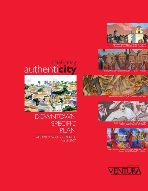
Norman Kennedy, Murals Commissioned by <strong>Ventura</strong><br />
Guarantee & Loan 1930, Chestnut & Main Streets<br />
celebrating<br />
authenticity<br />
Qi Pang, China Alley Memorial Mural, 2004 – Figueroa Street Mall<br />
WPA Artist Gordon Grant, 1936 – <strong>Downtown</strong> Post <strong>Of</strong>fice<br />
PRISCILLA HOLMES<br />
DOWNTOWN<br />
SPECIFIC<br />
PLAN<br />
ADOPTED BY CITY COUNCIL<br />
March 2007<br />
Tortilla Flats Commemorative Mural Project, 2007<br />
Artists – MB Hanrahan and Moses Mora<br />
Gayle Childress – “<strong>Ventura</strong> Pier and the Holiday Inn”, 1989<br />
<strong>Ventura</strong> <strong>City</strong> Hall Municipal Art Collection<br />
C I T Y O F
This page intentionally left blank
city of san buenaventura<br />
<strong>Downtown</strong> <strong>Specific</strong> <strong>Plan</strong><br />
Adopted By city Council on March 19, 2007<br />
Resolutions: 2007-014, 2007-015, 2007-016, 200-017<br />
Ordinances: 2007-008, 2007-009
Acknowledgements<br />
<strong>City</strong> Council<br />
Carl E. Morehouse, Mayor<br />
Christy Weir, Deputy Mayor<br />
Neal Andrews<br />
Brian Brennan<br />
Bill Fulton<br />
James L. Monahan<br />
Edward Summers<br />
<strong>City</strong> of San Buena<strong>Ventura</strong><br />
Rick Cole, <strong>City</strong> Manager<br />
Mary Walsh, Deputy <strong>City</strong> Manager<br />
Bob Boehm, <strong>City</strong> Attorney<br />
Nelson Hernandez, Community Development Director<br />
Lead Staff<br />
Nicole Horn, Associate <strong>Plan</strong>ner, Project Manager<br />
Kaizer Rangwala, Assistant Community Dev. Director<br />
Sid White, Economic Development & Revitalization Manager<br />
Jim Neuerburg, Assistant <strong>City</strong> Attorney II<br />
Kari Gialketsis, Principal <strong>Plan</strong>ner<br />
Dave Ward, Principal <strong>Plan</strong>ner<br />
Kevin Colin, Senior <strong>Plan</strong>ner<br />
Margaret Ide, Associate <strong>Plan</strong>ner, Environmental Project Manager<br />
Thomas Mericle, Transportation and Traffic Engineer<br />
VS Chandrashaker, Associate Transportation Engineer<br />
Dave Armstrong, RDA Project Manager<br />
Teresa Purrington, Management Technician<br />
Support Staff<br />
Ron Calkins, Public Works Director<br />
Elena Brokaw, Community Services Director<br />
Jay Panzica, Chief Financial <strong>Of</strong>ficer<br />
Pat Miller, Police Chief<br />
Mike Lavery, Fire Chief<br />
Mabi Plisky, <strong>City</strong> Clerk<br />
<strong>Plan</strong>ning Commission<br />
John Hecht, Chair<br />
Martin Johnson, Vice Chair<br />
Carolyn Briggs<br />
Michael Faulconer<br />
Martel Fraser<br />
Ronald Allen<br />
Curtis Stiles<br />
Technical Consultants to the <strong>City</strong><br />
Crawford Multari & Clark Associates<br />
Paul Crawford, FAICP, Principal<br />
Dave Moran, Senior Associate<br />
Moule & Polyzoides Architects/Urbanists<br />
Stephanos Polyzoides, Principal<br />
Juan Gomez-Novy, Project Manager<br />
Nelson/Nygaard Consulting Associates<br />
Patrick Siegman, Principal<br />
Jeremy Nelson, Associate Project Manager<br />
HDR-Town <strong>Plan</strong>ning<br />
Dave Sargent, Principal<br />
Maria Martinez, Town <strong>Plan</strong>ner<br />
Rincon Consultants, Inc.<br />
Stephen Svete, AICP, President<br />
Joseph Power, AICP, Principal<br />
Cori Lindbeck, Associate Environmental <strong>Plan</strong>ner<br />
Support Consultants<br />
Keyser Marston Associates, Inc.<br />
Katz, Okitsu & Associates<br />
Rick Raives, <strong>City</strong> Engineer<br />
Bob Williams, Principal Civil Engineer<br />
Vicki Musgrove, Maintenance Services Mgr.<br />
Richard Bradley, Management Analyst II<br />
Mike Montoya, Parks Manager<br />
Daryl Wagar, Parks Supervisor<br />
Ray Olsen, Environmental Services Supervisor<br />
Don Davis, Utilities Manager<br />
Susan Rungren, Utilities <strong>Plan</strong>ning Engineer<br />
Kerry Adams-Hapner, Cultural Affairs Manager<br />
Denise Sindelar, Public & Visual Arts Sup.<br />
Andrew Stuffler, Building <strong>Of</strong>ficial<br />
Ken Corney, Assistant Police Chief<br />
Quinn Fenwick, Lieutenant<br />
Dave Wilson, Lieutenant<br />
Jenise Wagar, Civic Engagement Manager<br />
Richard Newsham, Marketing Specialist<br />
Priscilla Holmes, Graphics Supervisor<br />
Roger Adams, Systems Analyst I<br />
Don Taylor, Systems Analyst I<br />
Lisette Alivandivafa, <strong>Of</strong>fice Services Sup.<br />
Rob Garven, Print Shop Supervisor<br />
Yvonne Velasco, Printer II<br />
Alvin Adora, Printer I<br />
Luz Juachon, Secretary<br />
Sue Torres, Administrative Secretary<br />
Lisa Wilkinson, Associate <strong>Plan</strong>ner
Contents<br />
I. Overview i-1<br />
Vision Statement I-1<br />
Building on the Vision I-3<br />
Achieving the Vision I-11<br />
Catalytic Projects I-35<br />
II. Goals and Policies ii-1<br />
<strong>Ventura</strong>'s Unique Character<br />
California's New Art <strong>City</strong><br />
Animating the Public Realm<br />
Economic Vitality<br />
Housing Renaissance<br />
Mobility in Transportation<br />
“Park Once” Management Strategy<br />
Sustainable Infrastructure<br />
III. Development Code iii-1<br />
Article I. Introduction<br />
Article II. Urban Standards<br />
Article III. Building Types<br />
Article IV. Frontage Types<br />
Article V. Design Guidelines<br />
Article VI. Sign Standards<br />
Article VII. Other Standards<br />
Article VIII. Administration<br />
Article IX. Glossary<br />
IV. Streetscape <strong>Plan</strong> IV-1<br />
V. Programs and Implementation V-1<br />
II-3<br />
II-13<br />
II-17<br />
II-21<br />
II-27<br />
II-31<br />
II-37<br />
II-39<br />
III-3<br />
III-7<br />
III-31<br />
III-59<br />
III-69<br />
III-89<br />
III-95<br />
III-111<br />
III-121<br />
<strong>Downtown</strong> Parking Management Program V-3<br />
<strong>Downtown</strong> CIP 2006-2011 Programs V-8<br />
Summary of Actions V-11<br />
Appendix A-1<br />
A. Summary of the 1993 <strong>Plan</strong> Objectives and Achievements A-2<br />
B. Secretary of the Interior’s Standards for Rehabilitation A-5<br />
C. Regulatory Setting A-6<br />
D. List of Supporting Documents A-8
Figures<br />
I-1 <strong>Downtown</strong> <strong>Specific</strong> <strong>Plan</strong> Boundary I-5<br />
I-2 Historic Resources I-13<br />
I-3 Existing Parks and Open Space I-19<br />
I-4 Pedestrian Linkage Opportunities I-23<br />
I-5 <strong>Downtown</strong> Roadway Classification <strong>Plan</strong> I-29<br />
I-6 Potential Parking Structure Locations I-29<br />
I-7 Storm Drainage Facilities and Recommended Improvements I-31<br />
I-8 Catalytic Projects and Focus Areas I-37<br />
I-9 Potential Multi-Modal Transit Center Sites I-39<br />
I-10 Potential California <strong>Of</strong>framp Design I-44<br />
III-1 Regulating <strong>Plan</strong><br />
III-9<br />
III-2 Required Ground Level Commercial Uses<br />
III-11<br />
III-3 Bar and Nightclub Siting<br />
III-12<br />
IV-1 Public Realm and Tree <strong>Plan</strong>ting <strong>Plan</strong><br />
IV-3<br />
Tables<br />
I-1 1993 <strong>Plan</strong> Accomplishments I-3<br />
I-2 <strong>City</strong> Park Facilities Serving <strong>Downtown</strong> I-18<br />
I-3 Summary of Vacant, Public and Infill Opportunity Properties I-26<br />
I-4 Public Schools Serving <strong>Downtown</strong> I-32<br />
II-1 <strong>Downtown</strong> Water Improvements II-44<br />
II-2 <strong>Downtown</strong> Sewer Improvements II-44<br />
III-1 Land Use and Permit Requirements<br />
III-8<br />
III-2 Summary of Approval Requirements<br />
III-113<br />
V-1 <strong>Downtown</strong> 2006-2011 Capital Improvement Projects V-17<br />
V-2 Summary of Actions V-20<br />
A-1 1993 <strong>Specific</strong> <strong>Plan</strong> Summary of 5 - 7 Year Objectives A-2<br />
A-2 1993 <strong>Specific</strong> <strong>Plan</strong> Summary of 15 - 20 Year Objectives A-3
I. Overview<br />
Vision Statement<br />
Over the next ten years, <strong>Ventura</strong> will emphasize our history, culture and<br />
unique character to sustain the <strong>Downtown</strong> as our city’s authentic heart<br />
– the pre-eminent arena for civic and artistic life and a preferred location<br />
for retail and office commerce.<br />
“<strong>Downtown</strong> <strong>Ventura</strong> is to be a thriving and integrated district of<br />
civic, cultural, commercial, recreational and residential activities.”<br />
So began the 1993 <strong>Downtown</strong> <strong>Specific</strong> <strong>Plan</strong> which guided more<br />
than a decade of successful revitalization:<br />
• Main and California Streets have come back to life as<br />
the “central spines of activity”, fulfilling the 1993 vision<br />
that the-then struggling <strong>Downtown</strong> would one day be<br />
the “logical place to go find one’s friends, have a cup of<br />
coffee, buy a book or simply relax and watch the people<br />
go by.”<br />
• A new cineplex, public parking structure and streetscape<br />
improvements have served as catalytic drivers of renewed<br />
vitality, achieving the goal of "infusing the streets with<br />
activity throughout the day and evening.”<br />
• Major new housing developments are finally underway, not<br />
only living up to the aim of “insuring a diverse residential<br />
population” but also the standard of “demanding the<br />
highest quality in new development.”<br />
<strong>Downtown</strong> <strong>Ventura</strong> street scene<br />
This 2007 <strong>Downtown</strong> <strong>Specific</strong> <strong>Plan</strong> builds on the first plan’s<br />
accomplishments, assesses our new challenges, and spells out<br />
what is needed to succeed in the decade ahead. It also addresses<br />
the limitations of the 1993 plan, particularly through the new formbased<br />
code that through interim use has brought greater clarity<br />
and discipline to the goal of engendering buildings that “insure the<br />
continued liveability and vitality of the <strong>Downtown</strong> and contribute<br />
to a memorable city identity.”<br />
<strong>City</strong> of San Buenaventura D O W N T O W N S P E C I F I C P L A N<br />
I-1
<strong>Specific</strong> <strong>Plan</strong> Goals<br />
1. <strong>Ventura</strong>’s Unique Character<br />
Preserve <strong>Ventura</strong>’s special sense of place by insisting on high<br />
standards of architecture, urban design and landscaping so that<br />
new development complements the eclectic architecture and<br />
historic richness of our <strong>Downtown</strong>.<br />
2. California’s New Art <strong>City</strong><br />
Weave art and culture into the fabric of everyday life in <strong>Downtown</strong><br />
through the growth and expansion of cultural institutions and by<br />
nurturing creative and artistic expression in the public realm.<br />
3. Animating the Public Realm<br />
Maintain and enhance public features such as parks, streetscapes<br />
and open spaces. Provide access to our natural areas, including<br />
the hillsides and <strong>Ventura</strong> River and re-connect <strong>Downtown</strong> to the<br />
ocean. Encourage development and events that activate the<br />
public realm.<br />
4. Economic Vitality<br />
Establish <strong>Downtown</strong> as a preferred place to work as well as live<br />
or visit. Ensure the future economic stability of <strong>Downtown</strong> by<br />
providing an active daytime workforce in offices and studios and<br />
by promoting successful retailing, tourism and the provision of<br />
high wage, high value jobs.<br />
5. Housing Renaissance<br />
Provide high quality, urban housing for a diverse range of income<br />
levels. Encourage efficient utilization of <strong>Downtown</strong>’s limited land<br />
resources by promoting infill development.<br />
6. Mobility<br />
Create an integrated transportation system that effectively serves<br />
the <strong>Downtown</strong> area, making <strong>Downtown</strong> a place where people<br />
prefer to walk, bike or ride public transit rather than drive a car.<br />
7. “Park Once” Management Strategy<br />
Efficiently manage supply and demand for <strong>Downtown</strong> parking to<br />
accommodate visitor, commuter and resident parking needs.<br />
8. Sustainable Infrastructure<br />
Safeguard public health, safety and prosperity by providing and<br />
maintaining facilities that enable the community to live in balance<br />
with natural systems. Continue to ensure public services keep<br />
pace with new development in <strong>Downtown</strong>.<br />
Today, <strong>Downtown</strong> <strong>Ventura</strong>'s revived economic vitality<br />
represents both a challenge and an opportunity. It is<br />
neither possible nor desirable to freeze the area in its<br />
current state. Longtime merchants face displacement<br />
due to rising real estate values, but the fragile charm of<br />
the area cannot be sustained on new restaurants and<br />
boutiques alone. By emphasizing the strengths that<br />
differentiate <strong>Ventura</strong>’s historic downtown from made-toorder<br />
“lifestyle centers,” the vision of sustaining our city’s<br />
authentic heart can be achieved.<br />
The 1993 <strong>Plan</strong> was focused mainly on hope and possibility.<br />
The 2007 <strong>Plan</strong> is focused heavily on opportunity and<br />
implementation. To address the needs identified during<br />
public outreach events and summarized in various<br />
background studies, this plan offers:<br />
1. Goals and policies to guide decision-makers in<br />
achieving the community’s desires;<br />
2. Actions to be taken by the <strong>City</strong> to develop projects<br />
and partnerships that implement the goals and<br />
policies;<br />
3. Catalytic projects to spur economic investment<br />
and residential and commercial development in<br />
<strong>Downtown</strong>;<br />
4. New form-based zoning standards to provide<br />
clear direction for developers and staff; and<br />
5. Streetscape improvements to activate the public<br />
realm, providing an inviting and engaging urban<br />
core.<br />
The <strong>Downtown</strong> <strong>Specific</strong> <strong>Plan</strong> also fulfills the goals, policies<br />
and actions of <strong>Ventura</strong>’s General <strong>Plan</strong>. <strong>Specific</strong>ally,<br />
the General <strong>Plan</strong> directs the preparation of new formbased<br />
zoning regulations and the completion of specific<br />
and community plans in areas such as the Westside,<br />
Midtown, Wells, Saticoy, Pierpont, Victoria Corridor and<br />
the <strong>Downtown</strong>.<br />
The <strong>Downtown</strong> <strong>Specific</strong> <strong>Plan</strong> lays out a strategy for<br />
the continued revitalization of our city’s cultural and<br />
commercial core through implementation of eight planning<br />
goals that constitute the central elements of this plan<br />
(shown at left).<br />
<strong>City</strong> of San Buenaventura D O W N T O W N S P E C I F I C P L A N<br />
I-2
Building on the Vision<br />
Developing the <strong>Downtown</strong> <strong>Specific</strong> <strong>Plan</strong><br />
The first San Buenaventura <strong>Downtown</strong> <strong>Specific</strong> <strong>Plan</strong> was adopted in 1993. By<br />
2003, after ten years of using the plan, it became apparent that it was in need of<br />
revision to reflect changing circumstances and to re-evaluate the community’s<br />
shared vision for <strong>Downtown</strong>’s future growth and development.<br />
Much has been accomplished in the ten years since the first <strong>Downtown</strong> <strong>Specific</strong><br />
<strong>Plan</strong> was adopted. A brief discussion of how the original eight goals have been<br />
accomplished and what remains to be achieved is presented in Table I-1, below:<br />
Table I-1. 1993 <strong>Plan</strong> Accomplishments<br />
<strong>Plan</strong>ning Area Boundary<br />
<strong>Ventura</strong> Pier renovation<br />
The <strong>Downtown</strong> <strong>Specific</strong> <strong>Plan</strong> area<br />
covers approximately 514 acres and<br />
is bounded by the Pacific Ocean to<br />
the south; the foothills to the north; the<br />
<strong>Ventura</strong> River and Hwy 33 to the west;<br />
and Sanjon barranca to the east (see<br />
Figure I-1).<br />
1993 PLAN Goal Progress<br />
1. <strong>Downtown</strong> shall be restored<br />
and revitalized as the social<br />
and symbolic “Heart of the<br />
<strong>City</strong>.”<br />
2. The image and visibility of<br />
<strong>Downtown</strong> shall be enhanced,<br />
creating a distinctive identity<br />
built on the best of what is<br />
already there.<br />
Significant progress has been made toward achieving this<br />
goal. Construction of the Promenade Plaza, Century Theater<br />
and a new parking structure, are all significant contributions.<br />
Streetscape improvements provided on California Street and<br />
Main Street, which include textured sidewalks, street trees<br />
and other street furnishings, have helped to draw people<br />
to <strong>Downtown</strong>. A variety of new eating and entertainment<br />
establishments have also brought people <strong>Downtown</strong>, and<br />
along with the new theater, boosted the <strong>City</strong>’s nightlife and<br />
entertainment draw.<br />
The improvements described above have also contributed to<br />
achieving this goal. Additional programs undertaken with this<br />
<strong>Specific</strong> <strong>Plan</strong> update include the Wayfinding program, siting<br />
of the Cultural Arts Village, locating a multi-modal transit<br />
facility, further streetscape improvements on major <strong>Downtown</strong><br />
streets, implementation of a <strong>Downtown</strong> parking management<br />
program and efforts to re-connect <strong>Downtown</strong> with the beach.<br />
3. The <strong>Downtown</strong> Core shall<br />
be revitalized as the <strong>City</strong>’s<br />
central business district<br />
offering a prominent address<br />
for a variety of commercial<br />
ventures.<br />
4. Main Street and California<br />
Street shall be revitalized as<br />
the central shopping streets<br />
of the <strong>Downtown</strong> Core.<br />
<strong>Downtown</strong> is home to several new restaurants and retail<br />
businesses that have opened in the past ten years. Continuing<br />
to expand the <strong>Downtown</strong> economy through commercial, office,<br />
and other employment-based development is a continuing<br />
goal of the <strong>Specific</strong> <strong>Plan</strong>.<br />
The efforts of the <strong>Downtown</strong> <strong>Ventura</strong> Organization (DVO), a<br />
newly formed group of merchants, residents and community<br />
members will further pave the way for revitalization and the<br />
promotion of <strong>Downtown</strong>’s role as a key business district in<br />
<strong>Ventura</strong>. In conjunction with the Redevelopment Agency<br />
and Community Development Department, the <strong>Downtown</strong><br />
<strong>Ventura</strong> Organization will continue to strategize economic<br />
revitalization programs and target marketing opportunities for<br />
visitor-serving businesses.<br />
The success of this goal is evident to anyone visiting <strong>Downtown</strong><br />
during the day or on weekends when pedestrian traffic and<br />
business patronage is at its peak. The Century Theater<br />
multiplex creates a nighttime presence that complements<br />
eating and drinking establishments. New restaurants and<br />
cafes have enhanced the pedestrian environment, yet<br />
additional commercial uses are still needed to attract and<br />
engage a wide variety of customers and visitors. Commercial<br />
and retail strategies have been identified in this <strong>Specific</strong> <strong>Plan</strong><br />
and the <strong>Downtown</strong> <strong>Ventura</strong> Organization has been formulated<br />
to take the lead on developing and implementing further<br />
revitalization efforts.<br />
<strong>City</strong> of San Buenaventura D O W N T O W N S P E C I F I C P L A N<br />
I-3
Building on the Vision<br />
Developing the <strong>Downtown</strong> <strong>Specific</strong> <strong>Plan</strong><br />
1993 PLAN Goal Progress<br />
5. <strong>Downtown</strong> shall be<br />
reconnected to the waterfront,<br />
re-establishing the critical link<br />
between Main Street and the<br />
oceanfront Promenade.<br />
6. Residential development shall<br />
be encouraged to support<br />
the creation of a <strong>Downtown</strong><br />
Core that is active throughout<br />
the day and evening, and<br />
to support the local-serving<br />
character of the <strong>Downtown</strong><br />
Core.<br />
7. The forces of disinvestment<br />
operating in the East Side<br />
Neighborhood shall be<br />
reversed, and the historic<br />
character of the neighborhood<br />
shall be restored.<br />
8. The long-term pattern of<br />
<strong>Downtown</strong> development shall<br />
be shaped to accommodate<br />
and provide public transit,<br />
generate fewer and shorter<br />
commute trips, and increase<br />
the quality of life for the<br />
community and the region.<br />
Improvements to California Street have greatly enhanced the<br />
pedestrian character of this important thoroughfare, helping<br />
to create a greater sense of connectivity with the beach and<br />
Promenade area. The strong connection is evident in the<br />
heavy pedestrian use of the California Street Bridge despite<br />
the lack of adequate pedestrian facilities. A main goal of this<br />
updated <strong>Specific</strong> <strong>Plan</strong> is to incorporate elements into the<br />
streetscape for Figueroa and California Streets to strengthen<br />
the connection between the <strong>Downtown</strong> core and the beach.<br />
A number of important projects have been constructed in<br />
the past ten years to further this goal. The Olson Company<br />
residential project, Pacifica Walk located at Garden and<br />
Santa Clara Streets, and the Mulokas mixed-use (residential<br />
and retail) project on Poli across from <strong>City</strong> Hall, are important<br />
contributions to the housing stock. Providing a range of<br />
housing options and establishing a 24-hour presence in the<br />
<strong>Downtown</strong> continues to be an important plan goal.<br />
The 1993 “East Side Neighborhood” is bound on the north<br />
by homes fronting Poli Street, on the east by Cemetery<br />
Memorial Park and Cabrillo Middle School, on the south by<br />
Thompson Boulevard and on the west by Fir Street. This<br />
area today offers a mix of commercial, office, and residential<br />
uses not readily found in the <strong>Downtown</strong> core. The area is<br />
also rich in architectural character and history. With recent<br />
revitalization of the <strong>Downtown</strong> core area, the “East end”<br />
(as they are called in this 2007 plan) neighborhoods have<br />
experienced a certain amount of increased investment and<br />
pressures for development. Private investment has increased<br />
and properties have been renovated with a corresponding<br />
increase in value. Preserving and enhancing the architectural<br />
richness of the East end neighborhoods continues to be a<br />
goal of this <strong>Specific</strong> <strong>Plan</strong> update.<br />
Progress toward achieving this goal is evident from the<br />
discussions above, but it continues to be an integral goal for<br />
this plan update. Facilitating pedestrian movement, improving<br />
public transit, enhancing the public realm through streetscape<br />
improvements and providing clear standards for urban infill<br />
development via the Development Code (Chapter III) will<br />
establish a sustainable, inviting and innovative long-term<br />
pattern for <strong>Downtown</strong>’s growth.<br />
The 1993 plan also identified a number of objectives for the near term (5-7 years)<br />
and long term (15-20 years). Progress toward achieving these objectives is<br />
summarized in Tables A-1 and A-2 of Appendix A.<br />
<strong>City</strong> of San Buenaventura D O W N T O W N S P E C I F I C P L A N<br />
I-4
Coastal Zone<br />
Figure I-1. <strong>Downtown</strong> specific plan boundary<br />
Hwy 33<br />
<strong>City</strong> of<br />
San Buenaventura<br />
Aerial View<br />
(2002 Photography)<br />
Coastal Zone<br />
L E G E N D<br />
<strong>Specific</strong> <strong>Plan</strong> Boundary<br />
Avenue<br />
<strong>City</strong> Hall<br />
Coastal Zone<br />
Poli<br />
Street<br />
Redevelopment<br />
Project Area Boundary<br />
Coastal Zone Boundary<br />
Main<br />
Street<br />
<strong>Ventura</strong><br />
Santa Clara Street<br />
Thompson<br />
Hwy 101<br />
C alifornia Street<br />
Boulevard<br />
Fir Street<br />
Coastal Zone<br />
Fairgrounds<br />
HarborBoulevard<br />
0’<br />
400’ 800’ 1600’<br />
N<br />
<strong>City</strong> of San Buenaventura D O W N T O W N S P E C I F I C P L A N<br />
I-5
This page intentionally left blank
Public Outreach<br />
The 2007 <strong>Downtown</strong> <strong>Specific</strong> <strong>Plan</strong> is based on the community’s vision. Preparation<br />
of the plan was guided by an ongoing public outreach program that included:<br />
• Touring <strong>Downtown</strong> with key stakeholders;<br />
• Participation in the Creative Cities exercises (December 2002);<br />
• A 3-day coding charrette;<br />
• A 60-day public review period for the April 2006 Draft plan;<br />
• Approximately 20 public workshops and community meetings held in 2006<br />
after release of the Draft plan;<br />
• A six-week public review period for the draft local coastal program<br />
amendment, made available with release of the December 2006 Final Draft<br />
plan; and<br />
• Discussions with the Historic Preservation Committee, Design Review<br />
Committee and <strong>Plan</strong>ning Commission before the plan’s adoption by <strong>City</strong><br />
Council in March 2007.<br />
The public outreach efforts and workshops resulted in a list of planning principles<br />
used to guide the update process to develop the first Draft plan. When asked to<br />
rank the five most important principles, early workshop participants responded as<br />
follows:<br />
1. Re-connect <strong>Downtown</strong> to the Beach<br />
Highway 101 effectively isolates the <strong>Downtown</strong> from the beach. One of<br />
the primary goals of the <strong>Downtown</strong> <strong>Specific</strong> <strong>Plan</strong> should be to reconnect<br />
<strong>Downtown</strong> with the beach for all forms of circulation, but especially for<br />
pedestrians. The California Street bridge over Highway 101 should<br />
be the focal point for re-establishing this connection. Other secondary<br />
connections should be reinforced on Figueroa Street, the Ash Street<br />
pedestrian bridge and via the bike tunnel under Highway 101 at <strong>Ventura</strong><br />
Avenue.<br />
2. Manage Parking Supply and Demand<br />
Parking is an essential component of downtown vitality, but is also landintensive<br />
and expensive. The parking standards for the <strong>Downtown</strong> need to<br />
be re-visited with the goal of identifying an appropriate balance between<br />
parking supply and demand. One consideration is to reduce or eliminate<br />
the off-street parking requirement for <strong>Downtown</strong> businesses. Another is to<br />
re-formulate a parking district to fund consolidated parking in structures.<br />
3. Improve Public Transit<br />
The Amtrak train station is inconveniently located with respect to <strong>Downtown</strong><br />
and connections to other forms of transit serving the city. Consideration<br />
should be given to relocate the train station, ideally in conjunction with a<br />
multi-modal transit facility. Possible locations include the block between<br />
Ash, Front, Fir and Thompson Boulevard or within the vicinity of the<br />
Crowne Plaza hotel at the southern terminus of California Street.<br />
<strong>City</strong> of San Buenaventura D O W N T O W N S P E C I F I C P L A N<br />
I-7
Building on the Vision<br />
Developing the <strong>Downtown</strong> <strong>Specific</strong> <strong>Plan</strong><br />
4. Preserve and Enhance our Historic Character<br />
<strong>Downtown</strong> <strong>Ventura</strong> possesses a rich architectural heritage with fine<br />
examples of Victorian-era dwellings and an eclectic mix of institutional and<br />
commercial buildings. <strong>Downtown</strong>’s sense of authentic historic uniqueness<br />
should be maintained.<br />
5. Establish New Form-Based Development Standards<br />
Development standards should be updated to establish the physical form<br />
and character desired for <strong>Downtown</strong>. The new standards (i.e., “formbased”<br />
code standards) should re-visit and address the following:<br />
• Appropriate building height: consider allowing greater building height<br />
that varies with location;<br />
• Permitted uses;<br />
• Allowance for exceptions;<br />
• Consistency between new development standards and those in the<br />
existing Municipal Code;<br />
• Provide land use designations north of Main Street and south of Park<br />
Row Avenue;<br />
• Incorporate the city’s Wayfinding program;<br />
• Clarify sign regulations; and<br />
• Re-visit the threshold of discretionary permit requirements for<br />
construction.<br />
<strong>City</strong> staff have identified the following three additional principles:<br />
6. Facilitate Additional Housing to Generate Around-the clock Activity<br />
Drawing from Goal 6 of the 1993 <strong>Downtown</strong> <strong>Specific</strong> <strong>Plan</strong> that encourages<br />
additional residential development to create “around-the clock activity”,<br />
several new residential projects have been entitled with others either in<br />
the development review process or nearing submittal. This important goal<br />
from the 1993 <strong>Plan</strong> will be carried forward.<br />
7. Improve Infrastructure to Meet Revitalization Efforts and New<br />
Development Requirements<br />
Along with revitalization and new development come new demands for<br />
improvements to an aging, and in some cases, outdated infrastructure<br />
system. <strong>Plan</strong>ning to meet these needs is imperative.<br />
8. Preserve and Link Surrounding Natural Areas<br />
<strong>Downtown</strong> is surrounded by many unique natural areas including the<br />
<strong>Ventura</strong> River, the Pacific Ocean and the hillsides. New development must<br />
be designed to account for, enhance access to, and protect these natural<br />
areas.<br />
Where the eight (8) planning principles have been incorporated into the <strong>Downtown</strong><br />
<strong>Specific</strong> <strong>Plan</strong>, they are identified by reference.<br />
<strong>City</strong> of San Buenaventura D O W N T O W N S P E C I F I C P L A N<br />
I-8
Assessing <strong>Downtown</strong><br />
To address these issues, the <strong>City</strong> commissioned special technical studies aimed<br />
at providing the necessary foundation for new policies, programs and actions<br />
incorporated into this 2007 update:<br />
1.<br />
2.<br />
3.<br />
4.<br />
5.<br />
<strong>Downtown</strong> Market Opportunities Assessment<br />
Conceptual <strong>Plan</strong>ning Study for a Multi-Modal Transportation Center<br />
<strong>Downtown</strong> Parking Study<br />
Historic Landmarks and Districts Report<br />
Sewer Deficiency Study<br />
Applicable recommendations from these studies have been incorporated as<br />
policies and actions, identifying opportunities for either implementation or<br />
additional strategizing. For details and background information regarding these<br />
specific studies, please refer to the actual document. Each study is published<br />
separately and listed in Appendix D, Background. All are available for review at the<br />
Community Development Department located at:<br />
<strong>City</strong> Hall<br />
501 Poli Street, Room 117<br />
<strong>Ventura</strong> CA 93001.<br />
Transportation and streetscape plans were also prepared. Recommendations<br />
included in the 2006 <strong>Downtown</strong> <strong>Ventura</strong> Mobility and Parking <strong>Plan</strong> and 2004<br />
Streetscape <strong>Plan</strong> are also incorporated as programs and actions in Chapter II and<br />
full streetscape diagrams are presented in Chapter IV.<br />
<strong>City</strong> of San Buenaventura D O W N T O W N S P E C I F I C P L A N<br />
I-9
This page intentionally left blank
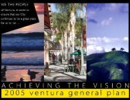
Achieving the Vision<br />
Identifying opportunity<br />
This section describes existing conditions and opportunities for improvement that<br />
drove the formation of the goals, policies and actions identified in Chapter II. By<br />
focusing on the following eight key issue areas, this plan addresses the needs and<br />
aspirations of the <strong>Downtown</strong> business and residential community.<br />
1. <strong>Ventura</strong>’s Unique Character<br />
2. California’s New Art <strong>City</strong><br />
3. Animating the Public Realm<br />
4. Economic Vitality<br />
5. Housing Renaissance<br />
6. Mobility<br />
7. “Park Once” Management Strategy<br />
8. Sustainable Infrastructure<br />
In addition to policies and actions, the Development Code in Chapter III addresses<br />
community concerns and desires related to the built environment. Through<br />
the form established in the Development Code, the <strong>Downtown</strong> <strong>Specific</strong> <strong>Plan</strong><br />
provides further opportunity to achieve community goals. A rendering of the<br />
potential scale and massing of buildings within the urban core is shown at left.<br />
Illustrations at left: potential growth in building height<br />
and scale in <strong>Downtown</strong> <strong>Ventura</strong> over the years to come...<br />
<strong>City</strong> of San Buenaventura D O W N T O W N S P E C I F I C P L A N<br />
I-11
Achieving the Vision<br />
Identifying opportunity<br />
Figure I-2 Historic resources Legend*<br />
2. Ortega Adobe<br />
3. Father Serra statue<br />
4. County Courthouse<br />
5. Grant Park cross<br />
6. Mission Plaza site<br />
7. Conklin home<br />
8. Mission Norfolk pines<br />
10. San Buenaventura<br />
Mission<br />
11. Plaza Morton Bay fig<br />
12. Morton Bay fig<br />
14. Judge Ewing residence<br />
15. <strong>Ventura</strong> Guaranty building<br />
16. San Miguel Chapel site<br />
17. First Baptist Church<br />
18. Shisholop Village site<br />
19. Bard Hospital<br />
20. <strong>Ventura</strong> Wharf (pier)<br />
21. Franz Home<br />
22. Magnolia Tree<br />
23. Hobson Brothers meat<br />
packing<br />
24. <strong>Ventura</strong> Theatre<br />
25. First Post <strong>Of</strong>fice building<br />
26. Hitching Post<br />
27. Apostolic Church<br />
28. Southern Methodist<br />
Episcopal Church<br />
29. Post <strong>Of</strong>fice murals<br />
30. Livery Theatre/County<br />
Garage<br />
31. Packard Garage<br />
32. Peirano Store/Wilson<br />
Studios<br />
33. Peirano residence<br />
34. Theodosia Burr Shepherd<br />
Gardens<br />
35. Feraud General<br />
Merchandise Store<br />
36. First National Bank of<br />
<strong>Ventura</strong><br />
37. First National Bank<br />
38. Bank of Italy<br />
39. Dr. C.F. Miller residence<br />
40. El Nido Hotel<br />
41. Robert Sudden house<br />
42. Sheridan house<br />
43. Chaffey and McKeeby<br />
store<br />
45. Righetti house<br />
46. Shaw house<br />
47. Jacque Roos house<br />
48. Dacy Fazio house<br />
50. Bert Shaw house<br />
51. Blackstock house<br />
52. Sifford house<br />
53. Nellie Clover house<br />
55. Dunning house<br />
56. Granger house<br />
57. Morrison house<br />
59. David S. Blackburn house<br />
60. Alessandro Lagoon<br />
61. Elwell house<br />
62. Suyter house<br />
63. El Jardin patio<br />
64. R.E. Brakey residence<br />
66. Charles Corcoran house<br />
67. Charles Cooper house<br />
69. Hartman house<br />
70. J.A. Day house<br />
71. <strong>Ventura</strong> Mutual Fire<br />
Insurance Co.<br />
73. McCoskey Love house<br />
74. Kate Duval house<br />
75. J. Hoover Love house<br />
77. Dr. C.L. Bard residence<br />
78. Carlo Hahn House<br />
79. Hammond/Reese house<br />
80. Pierpont Inn<br />
81. A.D. Briggs residence<br />
83. Arcade building<br />
85. Mission Lavanderia<br />
86. Erle Stanley Garner office<br />
89. Norton Ranch house<br />
90. John C. Fremont camp<br />
91. China Alley<br />
92. Louis Rudolph house<br />
95. Mayfair Theatre Site<br />
96. Coast Live Oak Tree<br />
97. 92 North Fir Street<br />
* Historic landmark numbers are assigned by the <strong>City</strong>; where numbers are out of sequence,<br />
those resources are located outside of the plan area and are not shown in Figure I-2.<br />
<strong>Ventura</strong>’s Unique Character<br />
To promote the long-term vitality of the city, this plan recognizes<br />
the value of <strong>Downtown</strong> as an authentic urban core with a rich<br />
heritage. <strong>Downtown</strong>’s historic, archaeological and architectural<br />
resources contribute to an eclectic style that will continue to<br />
attract residents, business and visitors. By preserving and<br />
enhancing that unique quality through a commitment to urban<br />
design and smart growth, this plan lays the groundwork for<br />
sustaining <strong>Downtown</strong> as the city center.<br />
Historic Resources<br />
<strong>City</strong> government plays an active role in the management and<br />
protection of important archeological and historic resources<br />
through the actions of the <strong>City</strong>’s Cultural Affairs Commission and<br />
the Historic Preservation Committee (HPC). The HPC advises<br />
decision makers on issues that may affect historic resources<br />
and makes recommendations on the designation of historic<br />
districts, landmarks, sites, buildings, structures and points of<br />
interest significant to the heritage and development of the city.<br />
The most significant historic building in <strong>Downtown</strong> <strong>Ventura</strong> is<br />
the San Buenaventura Mission and its supporting structures<br />
and sites, such as the San Miguel Chapel site and Mission<br />
Aqueduct. The San Buenaventura Mission District is listed in<br />
the National Register.<br />
<strong>Downtown</strong> <strong>Ventura</strong> also possesses hundreds of commercial<br />
and residential buildings that were constructed between 1870<br />
and 1930. Many of these buildings retain their original exterior<br />
façade and have been adaptively reused over the years. Other<br />
important historic resources are the many large trees that add<br />
character to the <strong>Downtown</strong>; the Moreton Bay fig in Plaza Park<br />
is perhaps the most striking example. <strong>City</strong>-designated historic<br />
resources are identified in Figure I-2. A key to the sites is located<br />
to the left.<br />
The <strong>City</strong> has also designated two local Historic Districts within<br />
the <strong>Downtown</strong> <strong>Specific</strong> <strong>Plan</strong> area: the Selwyn Shaw and<br />
Mitchell Block districts. Within these districts, the <strong>City</strong> regulates<br />
development in order to:<br />
1. Protect against destruction or encroachment;<br />
2. Encourage uses that promote the preservation, maintenance<br />
or improvement of points of interest;<br />
3. Assure that new structures and uses in the District are in<br />
keeping with the historic character; and<br />
4. Prevent adverse environmental influences on local historic<br />
resources (see Zoning Ordinance §24.340.010).<br />
<strong>City</strong> of San Buenaventura D O W N T O W N S P E C I F I C P L A N<br />
I-12
VISTA DEL MAR DR<br />
Figure I-2. Historic resources<br />
HARRISON AV W<br />
PROSPECT ST W<br />
PROSPECT ST E<br />
SIMPSON TRACT<br />
DISTRICT<br />
MISSION AV<br />
HARRISON AV E<br />
33NB<br />
PARK ROW AV W<br />
45<br />
77<br />
VENTURA AV N<br />
CEDAR ST<br />
WALL ST<br />
5<br />
33SB<br />
DUBBERS ST<br />
OLIVE ST N<br />
GARDEN ST N<br />
PINE LN<br />
CRIMEA ST N<br />
101SB<br />
MAIN ST W<br />
101NB<br />
PEKING ST<br />
JULIAN ST<br />
23<br />
2<br />
FRONT ST W<br />
OLIVE ST S<br />
BROOKS AV<br />
GARDEN ST S<br />
83<br />
FIX WY<br />
35<br />
VENTURA AV S<br />
JUNIPERO ST<br />
67<br />
90<br />
THOMPSON BL W<br />
SAN BUENAVENTURA<br />
MISSION<br />
6 10 8<br />
RAILROAD<br />
12<br />
33<br />
73<br />
61<br />
FIGUEROA ST<br />
32 85<br />
91<br />
78<br />
96<br />
16<br />
FERRO DR<br />
69<br />
89 30<br />
PALM ST N<br />
PALM ST S<br />
OAK ST N<br />
OAK ST S<br />
JODY LN<br />
57 64<br />
43<br />
21<br />
25 36<br />
63<br />
38<br />
SAN BUENAVENTURA<br />
MISSION DISTRICT<br />
(NATIONAL REGISTER)<br />
HARBOR BL<br />
CITY HALL<br />
37<br />
86<br />
40<br />
4<br />
3<br />
CALIFORNIA ST N<br />
CALIFORNIA ST S<br />
39<br />
48<br />
MITCHELL BLOCK<br />
DISTRICT<br />
15<br />
CHESTNUT ST N<br />
CHESTNUT ST S<br />
14 79 19<br />
31<br />
24<br />
34<br />
SANTA CLARA ST E<br />
11<br />
7<br />
BUENA VISTA ST<br />
FIR ST N<br />
MAIN ST E<br />
71<br />
29<br />
FIR ST S<br />
97<br />
59<br />
70<br />
POLI ST<br />
95<br />
22<br />
ASH ST N<br />
ASH ST S<br />
66<br />
MC EDDON PL<br />
POINSETTIA PL<br />
47<br />
52<br />
41<br />
51<br />
53<br />
CHURCH ST<br />
81<br />
28<br />
KALORAMA ST N<br />
KALORAMA ST S<br />
27 55<br />
74<br />
92 75<br />
17<br />
FRONT ST E<br />
LAUREL ST N<br />
LAUREL ST S<br />
42<br />
CHURCH ST<br />
26<br />
ANN ST N<br />
ANN ST S<br />
BUENA VISTA ST<br />
46<br />
50 62<br />
META ST<br />
HEMLOCK ST N<br />
HEMLOCK ST S<br />
56<br />
COTTAGE CT<br />
BUENA VISTA ST<br />
SELWYN SHAW<br />
DISTRICT<br />
CRIMEA ST S<br />
CHURCH ST<br />
CEMETERY MEMORIAL<br />
PARK<br />
ALISO ST N<br />
ALISO LN<br />
CHRISMAN AV<br />
RINCON ST<br />
LINCOLN DR<br />
SANTA BARBARA ST<br />
Legend<br />
FAIRGROUNDS<br />
PASEO DE PLAYA<br />
THOMPSON BL E<br />
SANTA YNEZ ST<br />
64<br />
64<br />
Historic District<br />
Historic Landmark<br />
Historic Point of Interest<br />
18<br />
PROMENADE PARK<br />
20<br />
Railroad<br />
SANJON RD<br />
Parks and Open Space<br />
Coastal Zone<br />
<strong>Downtown</strong> <strong>Specific</strong> <strong>Plan</strong> Area<br />
80<br />
PACIFIC OCEAN<br />
101SB<br />
101NB<br />
ALESSANDRO DR<br />
60<br />
0 300<br />
600<br />
feet<br />
This Figure is provided for illustrative purposes and may be updated from time to time. Up-to-date source data may be found in the <strong>City</strong>’s GIS database.<br />
<strong>City</strong> of San Buenaventura D O W N T O W N S P E C I F I C P L A N<br />
I-13
This page intentionally left blank
Design review is required for changes to exterior structural and/or architectural<br />
features, including color and materials, and for all new construction and alterations<br />
or additions to existing historic resources. The Development Code (Chapter III)<br />
provides Historic Resource Design Guidelines and other development standards<br />
for construction on or contiguous to a property that contains a city-designated<br />
historic resource.<br />
Archaeological Resources<br />
There is considerable evidence that indigenous peoples inhabited the <strong>Ventura</strong> area<br />
and especially the area that became <strong>Downtown</strong>. <strong>Of</strong> particular note is Shisholop<br />
Village, the site of a Chumash settlement located near the beach at the terminus<br />
of Figueroa Street, now an underground resource. Archaeological records show<br />
that the village was settled sometime around 1000 A.D. and was believed to have<br />
been a Chumash provincial capital.<br />
Sub-surface prehistoric sites are located throughout <strong>Downtown</strong>. The policies and<br />
actions included in Chapter II mandate the preservation of archaeological deposits<br />
through the development and environmental review processes.<br />
Architectural Character<br />
Three architectural styles predominate the <strong>Downtown</strong> built environment, particularly<br />
among residential buildings: Victorian, Craftsman and Spanish. However, these<br />
stylistic categories are more like “families,” within them is a broad range of<br />
variation. For example, architecture commonly referred to as Victorian includes<br />
Italianate, Queen Anne, Eastlake, Victorian Vernacular and Greek Revival. Other<br />
styles, such as Art Deco, are also present and have achieved compatibility with<br />
the overall mix through massing, color, level of articulation and detailing.<br />
The Development Code in Chapter III does not dictate architectural style, but<br />
addresses design on a number of broader levels to establish a matrix of standards<br />
and guidelines that will allow projects to develop over time in a familiar scale<br />
and character. In this manner, new buildings and renovation projects will support<br />
<strong>Downtown</strong>’s historic lotting pattern and existing mix of architectural styles.<br />
Consistency reference<br />
The goals, policies and actions<br />
derived from the city’s commitment to<br />
preserving <strong>Ventura</strong>’s unique character<br />
are consistent with the following local<br />
plans and state policies:<br />
• California Coastal Act<br />
- CA Article 2, Section 30210<br />
- CA Article 5, Section 30244<br />
- CA Article 6, Section 30250 (a)<br />
and 30251<br />
• <strong>Ventura</strong> General <strong>Plan</strong><br />
- Policy 3A: Sustain and<br />
complement cherished<br />
community characteristics<br />
- Policy 3B: Integrate uses in<br />
building forms that increase<br />
choice and encourage community<br />
vitality<br />
- Policy 3C: Maximize use of land<br />
in the city before considering<br />
expansion<br />
- Policy 9A: Integrate local history<br />
and heritage into urban form and<br />
daily life<br />
- Policy 9D: Ensure proper<br />
treatment of archeological and<br />
historic resources<br />
• Economic Development Strategy<br />
- Focus 5, Goal: Continue vitality<br />
through planning, organization,<br />
and achievement.<br />
• Redevelopment Implementation<br />
<strong>Plan</strong><br />
- Section 328: Rehabilitation,<br />
Conservation, and Moving of<br />
Structures<br />
- Section 420: Design Guidelines<br />
- Goal III: Invest in infrastructure<br />
and Enhance Community<br />
Facilities<br />
• <strong>Ventura</strong> Cultural <strong>Plan</strong><br />
- Policy 1: Build and preserve a<br />
city that is reflective of <strong>Ventura</strong>’s<br />
heritage and aspirations.<br />
- Policy 2: Support <strong>Ventura</strong>’s<br />
cultural infrastructure: people,<br />
places and organizations.<br />
<strong>City</strong> of San Buenaventura D O W N T O W N S P E C I F I C P L A N<br />
I-15
Achieving the Vision<br />
Identifying opportunity<br />
Consistency reference<br />
The goals, policies and actions<br />
derived from the city’s commitment<br />
to promoting California’s new art city<br />
are consistent with the following local<br />
plans and state policies:<br />
• <strong>Ventura</strong> General <strong>Plan</strong><br />
- Policy 2C: Encourage niche<br />
industries<br />
- Policy 2D: Expand tourism<br />
opportunities<br />
- Policy 9A: Increase public art and<br />
cultural expression throughout<br />
the community<br />
- Policy 9B: Meet diverse needs<br />
for performance, exhibition, and<br />
workspace<br />
- Policy 9C: Integrate local history<br />
and heritage into urban form and<br />
daily life<br />
• Economic Development Strategy<br />
- Focus 5, Goal: Continue vitality<br />
through planning, organization,<br />
and achievement.<br />
• <strong>Ventura</strong> Cultural <strong>Plan</strong><br />
- Policy 2: Support <strong>Ventura</strong>’s<br />
cultural infrastructure: people,<br />
places and organizations<br />
- Policy 3: Create a broad-based<br />
public awareness of local and<br />
regional cultural offerings and<br />
amenities.<br />
- Policy 4: Enhance opportunities<br />
for lifelong learning in the arts.<br />
- Policy 5: Ensure comprehensive<br />
access to and involvement in<br />
cultural opportunities for all<br />
segments of the population.<br />
- Policy 6: Stabilize and expand<br />
funding and other resources that<br />
support <strong>Ventura</strong>’s cultural assets.<br />
California’s New Art <strong>City</strong><br />
In 2005, the <strong>City</strong> Council adopted the <strong>Ventura</strong> Cultural <strong>Plan</strong>: “Creating California’s<br />
New Art <strong>City</strong>”. The goals of the plan are permeated with a focus on authenticity and<br />
a desire to nurture <strong>Ventura</strong>’s unique identity. Part of this emphasis on authenticity<br />
includes a comprehensive approach to culture, one that weaves together the broad<br />
fabric of the community – artists, architecture, culture, history and the environment.<br />
Through implementation of policies that support the preservation of <strong>Ventura</strong>’s local<br />
heritage while encouraging artistic development, the <strong>City</strong> is actively pursuing the<br />
integration of art, architecture, culture and history to restore and enhance the<br />
unique identity of <strong>Downtown</strong>.<br />
Cultural planning documents include:<br />
• 2005 <strong>Ventura</strong> Cultural <strong>Plan</strong>: Creating California’s New Art <strong>City</strong><br />
• 2000 Public Art Long Range <strong>Plan</strong><br />
• 1998 <strong>Downtown</strong> Cultural District <strong>Plan</strong><br />
These plans created the framework for art and culture to flourish. Further<br />
implementing the recommendations of these planning documents will reinforce<br />
the role of <strong>Downtown</strong> as the cultural center of the city. Goals and policies that are<br />
specific to <strong>Downtown</strong> are incorporated or referenced in this plan.<br />
MISSION PARK Cultural Arts CLUSTER<br />
The <strong>Ventura</strong> County Museum has approved plans for a major remodel and<br />
expansion of its existing facilities. This expansion will extend into Mission Park and<br />
make the museum a stronger draw for the western edge of <strong>Downtown</strong>. Mission<br />
Park and the Figueroa Street Plaza will be the center of a new cultural arts center<br />
and should be planned as such. The goal is to increase participation in the arts<br />
by providing additional cultural facilities to activate the park and plaza, creating<br />
a dynamic civic space and linkages to the rest of <strong>Downtown</strong>. A new town square<br />
across from the Mission will provide a much-needed central gathering place for<br />
community events.<br />
In July of 2003, the <strong>City</strong>, in partnership with the San Buenaventura Foundation for<br />
the Arts, conducted a Cultural Facilities Feasibility Study to determine the optimum<br />
size of a facility that could be supported by the community. That study concluded<br />
that <strong>Ventura</strong> could support a 600-seat performing arts venue. The site of the future<br />
facility is identified on Figure I-8 as part of the future Mission Park Cultural Arts<br />
Cluster development, further discussed as Catalytic Project No. 2.<br />
<strong>City</strong> of San Buenaventura D O W N T O W N S P E C I F I C P L A N<br />
I-16
Animating the Public Realm<br />
The <strong>City</strong> is responsible for improvements to the public realm that foster a climate<br />
conducive to private investment. The public realm includes streets, alleyways,<br />
sidewalks, lighting, landscaping and street furniture such as benches, bike racks,<br />
newsracks and fountains, as well as squares, plazas, parks, public art, open space<br />
areas and pedestrian corridors.<br />
Streetscape<br />
To assess existing conditions and recommend improvements to California, Oak and<br />
Figueroa streets and portions of Thompson Boulevard, a “<strong>Downtown</strong> Streetscape<br />
<strong>Plan</strong>” was prepared. The actions in Chapter II direct specific improvements to<br />
these streetscapes. The improvements can be phased, but priority should be<br />
given to California and Figueroa streets to re-establish the connection between<br />
<strong>Downtown</strong> and the beach. The 2004 Streetscape <strong>Plan</strong> is published separately in<br />
its entirety. The <strong>City</strong>’s adapted recommendations, taken from the 2004 document,<br />
are depicted graphically in Chapter IV.<br />
California Street<br />
The recommendations for California include providing 12-foot wide sidewalks,<br />
introducing revised street tree patterns and pedestrian-oriented light fixtures and<br />
creating additional on-street parking. Additionally, California Plaza should be<br />
enhanced and connected directly to the beach by a new stairway. The California<br />
Street bridge should be renovated to provide wider sidewalks. Strong visual<br />
elements like towers or pavilions should be added to emphasize the importance<br />
of the crossing. Lighting, noise reduction, landscaping and signage improvements<br />
are also recommended.<br />
Figueroa Street<br />
The streetscape along Figueroa should be improved by providing greater<br />
consistency of sidewalks, intersection and crosswalks patterns, street trees and<br />
lighting along its length. On-street parking patterns can be revised to a mix of<br />
parallel and diagonal parking while maintaining bike lanes. The beachside terminus<br />
should be re-configured with a better defined visual terminus, such as a water<br />
feature or other public art piece to emphasize the importance of this connection.<br />
Access to beach parking lots would be retained or improved.<br />
The underpass will be transformed into an attractive gateway between <strong>Downtown</strong><br />
and the fairgrounds and beach. Improvements including a public art mural, better<br />
lighting and signage are already underway for completion in 2008.<br />
consistency reference<br />
The goals, policies and actions<br />
derived from the city’s commitment<br />
to animating the public realm are<br />
consistent with the following local<br />
plans and state policies:<br />
• California Coastal Act<br />
- Article 2: Sections 30210, 30211,<br />
30212, 30214(4)<br />
- Article 3, Section 30221<br />
- Article 6, Section 30252<br />
• <strong>Ventura</strong> General <strong>Plan</strong><br />
- Policy 3A: Sustain and<br />
complement cherished<br />
community characteristics<br />
- Policy 3B: Integrate uses in<br />
building forms that increase<br />
choice and encourage<br />
community vitality<br />
- Policy 4D: Protect views along<br />
scenic routes<br />
• Economic Development Strategy<br />
- Focus 5, Goal: Continue vitality<br />
through planning, organization<br />
and achievement.<br />
• Redevelopment Implementation<br />
<strong>Plan</strong><br />
- Goal III: Invest in infrastructure<br />
and Enhance Community<br />
Facilities<br />
• <strong>Ventura</strong> Cultural <strong>Plan</strong><br />
- Policy 3: Create a broad-based<br />
public awareness of local and<br />
regional cultural offerings and<br />
amenities.<br />
- Policy 5: Ensure comprehensive<br />
access to and involvement in<br />
cultural opportunities for all<br />
segments of the population.<br />
Oak Street<br />
Oak Street’s role as a north-south corridor in <strong>Downtown</strong> will become significantly<br />
more important when the northbound Highway 101 offramp is redirected there.<br />
Chapter IV recommends enhancing Oak Street by widening sidewalks, improving<br />
crosswalks at various intersections and introducing new lighting, street trees and<br />
signage.<br />
<strong>City</strong> of San Buenaventura D O W N T O W N S P E C I F I C P L A N<br />
I-17
Achieving the Vision<br />
Identifying opportunity<br />
Thompson Boulevard<br />
Chapter IV also recommends a number of changes to Thompson Boulevard between <strong>Ventura</strong><br />
Avenue and Chestnut Street. These include new street trees, lighting, signage and on-street<br />
parking. Crosswalk improvements are suggested at key locations, including a new marked<br />
crosswalk between Figueroa Street and <strong>Ventura</strong> Avenue.<br />
Parks and Recreation<br />
There are eight developed parks in the <strong>Downtown</strong> <strong>Specific</strong> <strong>Plan</strong> area. In total, thirteen parks and<br />
recreational facilities, including three undeveloped open space areas, serve <strong>Downtown</strong> residents<br />
and visitors as summarized in Table I-2 and as shown in Figure I-3. As noted in Table 3-3 of the<br />
environmental impact report (EIR) prepared for this plan, there are currently an estimated 2,299<br />
residences within <strong>Downtown</strong>. Based on the current citywide average household size of 2.57<br />
persons, the estimated <strong>Downtown</strong> population is 5,908. Based on the <strong>City</strong>’s 10 acres per 1,000<br />
residents standard, such a population would demand 59 acres of parks. The current supply of<br />
parks accessible to <strong>Downtown</strong> provides about 26 acres per 1,000 residents, or more than double<br />
the <strong>City</strong> standard. The 1,600 new residences projected for <strong>Downtown</strong> would add an estimated<br />
4,112 residents (1,600 units x 2.57 persons/unit), bringing the total <strong>Downtown</strong> population to 10,020.<br />
Such a population would need about 100 acres of parks based on the <strong>City</strong>’s 10 acres per 1,000<br />
residents standard. The 156.1 acres of parks currently available in the <strong>Downtown</strong> area would<br />
provide about 15 acres per 1,000 residents, thus continuing to exceed the <strong>City</strong>’s standard.<br />
Table I-2. <strong>City</strong> Park Facilities Serving <strong>Downtown</strong><br />
Park Size by Use (acres)<br />
Park<br />
Special<br />
Neighborhood Community <strong>City</strong>wide<br />
Use<br />
Total<br />
Albinger Archaeological<br />
Museum<br />
0.9 0.9<br />
Cemetery Memorial Park 7.1 7.1<br />
Chapel Site 0.3 0.3<br />
<strong>Downtown</strong> Mini-Park 0.4 0.4<br />
Eastwood Park 0.7 0.7<br />
Mission Park 1.5 1.5<br />
Plaza Park 3.7 3.7<br />
Promenade Park 1.0 1.00<br />
Surfers Point Park 3.4 1 3.4<br />
Grant Park* 107.3 107.3<br />
Seaside Wilderness Park* 24 1,2 24<br />
<strong>Ventura</strong> Community Park* 100 100<br />
Westpark* 1.5 3 5.8 5.8 3<br />
Total 13.7 105.8 107.3 29.3 256.1<br />
Source: 2005 <strong>Ventura</strong> General <strong>Plan</strong>.<br />
1<br />
Acreage dependent upon mean high tide line of the Pacific Ocean.<br />
2<br />
Acreage is variable because 65% of the area is located in the <strong>Ventura</strong> River bed.<br />
* Not located within the <strong>Downtown</strong> <strong>Specific</strong> <strong>Plan</strong> area, but still accessed and used by <strong>Downtown</strong> residents.<br />
3<br />
Although Westpark is adjacent to <strong>Downtown</strong> and used by <strong>Downtown</strong> residents, it is not within the DTSP boundary. Therefore, only<br />
its acreage devoted to Community use is counted and not its Neighborhood Use.<br />
<strong>City</strong> of San Buenaventura D O W N T O W N S P E C I F I C P L A N<br />
I-18
PALM STREET<br />
Figure I-3. Existing parks and open space<br />
Riv er<br />
33<br />
Westpark<br />
Community<br />
Center<br />
N. O LIV E<br />
STREET<br />
M IS SIO N STREET<br />
W. PA RK RO W AV EN U E<br />
Coastal Zone<br />
Ortega<br />
Adobe<br />
W. P RO SPECT STREET<br />
W. H ARRIS O N TREET<br />
N . G A RDEN STR EET<br />
V EN TU RA A V EN U E<br />
Eastwood<br />
Park<br />
CED A R STR EET<br />
Grant<br />
Grant Park<br />
Mission<br />
San Buenaventura<br />
FERR<br />
DRIV E<br />
<strong>City</strong> Hall<br />
SU M MIT<br />
Coastal Zone<br />
BUENA VISTA<br />
DRIV E<br />
POLI<br />
STREET<br />
<strong>City</strong> of<br />
San Buenaventura<br />
Existing Parks<br />
&<br />
Open Space<br />
L E G E N D<br />
Ve ntur a<br />
101<br />
S OLIVE STREET<br />
MAIN STREET<br />
S GARDEN STREET<br />
V EN TURA AV EN U E<br />
JU N IP ERO STREET<br />
Southern Pacific Railroad<br />
Mission<br />
Park<br />
FIGUEROA STREET<br />
San Miguel<br />
Chapel Site<br />
Senior<br />
Center<br />
OAK STREET<br />
CALIFORNIA STREET<br />
Parking<br />
Structure<br />
Parking<br />
Structure<br />
Parking<br />
Structure<br />
Parking<br />
Structure<br />
CH ESTN U T STREET<br />
MAIN<br />
Library<br />
SANTA CLARA<br />
Plaza<br />
Park<br />
THOMPSON<br />
FIR STREET<br />
STREET<br />
STREET<br />
BOULEVARD<br />
ASH STREET<br />
K ALO RAM A STREET<br />
Coastal Zone<br />
FRONT<br />
STREET<br />
LA U REL STREET<br />
META<br />
Coastal Zone<br />
E. TH O M PSO N<br />
A N N STREET<br />
Lincoln<br />
School<br />
STREET<br />
H EM LO CK STR EET<br />
B O U LEV A RD<br />
S. CRIM EA TREET<br />
Cemetery<br />
Memorial<br />
Park<br />
Cabrillo<br />
Middle School<br />
ALISO LA N E<br />
CH RISM AN AV ENU E<br />
<strong>Specific</strong> <strong>Plan</strong> Boundary<br />
Coastal Zone Boundary<br />
Parks and Public<br />
Open Space<br />
School<br />
Seaside<br />
Wilderness<br />
Park<br />
SHORELINE<br />
<strong>Ventura</strong> County<br />
Fairgrounds<br />
DRIV E<br />
Surfer’s Point Park<br />
Promenade<br />
O H ARB R B O U LE V A RD<br />
SA N JO N R O AD<br />
South ern Pa cific Ra ilr oa d<br />
P<br />
a c<br />
i f i<br />
c<br />
O c<br />
e a<br />
n<br />
101<br />
San Buenaventura Beach<br />
State Park<br />
N<br />
0’<br />
400’ 800’<br />
<strong>City</strong> of San Buenaventura D O W N T O W N S P E C I F I C P L A N<br />
I-19
This page intentionally left blank
Beaches & Other Special Use Recreational Facilities<br />
In addition to <strong>City</strong>-owned parks, a number of other recreational facilities are<br />
available within the planning area. Foremost among these are the seven miles<br />
of beach that line the southern boundary of the <strong>City</strong>. The <strong>Ventura</strong> River Trail also<br />
provides walk, bike, jog and strolling opportunities. In addition, the <strong>Ventura</strong> Unified<br />
School District and <strong>Ventura</strong> College have joint-use agreements with the <strong>City</strong> so<br />
that residents have access to their sports fields, pools, and gymnasiums after<br />
school hours.<br />
Pedestrian Linkage Opportunities<br />
<strong>Downtown</strong> is situated between three important natural elements: the Pacific Ocean,<br />
<strong>Ventura</strong> River and the foothills. Publicly owned lands including the Omer Raines<br />
bike trail along the Pacific Ocean, the <strong>City</strong>’s oceanfront promenade and the 109-<br />
acre Grant Park in the hillside area above <strong>City</strong> Hall serve as major recreational<br />
opportunities that help make <strong>Downtown</strong> a unique and special place. Very few<br />
urban centers have accessibility to such elements in close proximity.<br />
Between these important earth forms and public areas are significant connectors,<br />
including several parks and plazas. However, a vital, aesthetically-inviting<br />
pedestrian connection to areas such as Mission Park and Figueroa Plaza, the Old<br />
Mission grounds, Albinger Museum, <strong>Ventura</strong> County Museum of History and Art,<br />
Eastwood Park, the San Miguel Chapel Site, <strong>City</strong> Hall, Foster Library, Plaza Park<br />
and Cemetery Memorial Park is lacking. Creating connections where residents<br />
and visitors can stroll and access cultural and natural areas with minimal intrusion<br />
from busy streets is an important aspect to animating the public realm.<br />
Figure I-4 illustrates how future <strong>Downtown</strong> development can join together with<br />
the public sector to help tie these areas together and establish an experience that<br />
is <strong>Ventura</strong>’s own. From the heart of <strong>Downtown</strong>, a pedestrian should be able to<br />
access the beach and beautiful vistas offered through walks along <strong>Ventura</strong> River<br />
and in Grant Park.<br />
<strong>City</strong> of San Buenaventura D O W N T O W N S P E C I F I C P L A N<br />
I-21
Achieving the Vision<br />
Identifying opportunity<br />
consistency reference<br />
The goals, policies and actions<br />
derived from the city’s commitment<br />
to ensuring economic vitality are<br />
consistent with the following local<br />
plans and state policies:<br />
• <strong>Ventura</strong> General <strong>Plan</strong><br />
- Policy 2A: Establish a clear<br />
economic strategy<br />
- Policy 2B: Make the local<br />
economic climate more<br />
supportive of business<br />
investment<br />
- Policy 2C: Encourage niche<br />
industries<br />
- Policy 2D: Expand tourism<br />
opportunities<br />
• Economic Development Strategy<br />
- Focus 5, Goal: Continue vitality<br />
through planning, organization,<br />
and achievement.<br />
- Focus 6: Goal: Positioning for<br />
prosperity in the New Economy.<br />
• Redevelopment Implementation<br />
<strong>Plan</strong><br />
- Goal 1: Encourage and Stimulate<br />
Private Investment<br />
- Goal II: Provide Affordable<br />
Housing Pursuant to Law<br />
• <strong>Ventura</strong> Cultural <strong>Plan</strong><br />
- Policy 2: support <strong>Ventura</strong>’s<br />
cultural infrastructure: people,<br />
places, and organizations.<br />
- Policy 3: Create a broad-based<br />
public awareness of local and<br />
regional cultural offerings and<br />
amenities.<br />
- Policy 6: Stabilize and expand<br />
funding and other resources that<br />
support <strong>Ventura</strong>’s cultural assets.<br />
Economic Vitality<br />
“Critical mass is created when there is enough activity to occupy a visitor for four<br />
to six hours” according to downtown revitalization expert Christopher Leinberger 1 .<br />
To sustain the restaurants and entertainment assets of <strong>Downtown</strong> in the face of<br />
emerging competition, successful retail must be actively pursued to re-establish<br />
<strong>Ventura</strong>’s historic urban core as a preferred shopping location. Americans are reasserting<br />
the importance of place in retail environments and <strong>Downtown</strong> <strong>Ventura</strong><br />
must capitalize on this desire for marvelous venues in which we can spend our money<br />
enjoying ourselves. <strong>City</strong> and Redevelopment Agency land holdings are key to this,<br />
along with mixed-use designs that meet current retail operational requirements.<br />
But while retail and tourism are highly visible measures of economic success, the<br />
General <strong>Plan</strong>’s focus on high wage, high value jobs is also an essential ingredient<br />
of economic stability for <strong>Downtown</strong>. Returning first class office, studio and livework<br />
space that appeals to entrepreneurial endeavors is critical to balancing and<br />
diversifying <strong>Downtown</strong>’s economic base.<br />
Constraints to Development<br />
Development potential of the <strong>Downtown</strong> must be considered within the context of<br />
various physical and regulatory constraints. Such special conditions include:<br />
• Environmental constraints such as geology and hydrology;<br />
• Aging infrastructure; and<br />
• Preserving historic buildings while promoting infill and revitalization.<br />
The policies and actions included in this <strong>Specific</strong> <strong>Plan</strong> and the urban regulations<br />
provided in the Development Code are aimed at addressing these and other<br />
constraints to new development.<br />
1 “The Shape of <strong>Downtown</strong>”, Urban Land magazine (ULI), December, 2004<br />
<strong>City</strong> of San Buenaventura D O W N T O W N S P E C I F I C P L A N<br />
I-22
Palm Street<br />
Oak Street<br />
Fir Street<br />
Ash Street<br />
Figure I-4. Pedestrian linkage opportunities<br />
Westpark<br />
Community<br />
Rive r<br />
Center<br />
Westpark<br />
<strong>City</strong> of<br />
San Buenaventura<br />
Ortega<br />
Adobe<br />
Avenue<br />
Eastwood<br />
Park<br />
Mission<br />
San Buenaventura<br />
Grant<br />
Park<br />
<strong>City</strong> Hall<br />
Poli<br />
Church Street<br />
Street<br />
Pedestrian<br />
Linkage<br />
Opportunities<br />
Chestnut Street<br />
Ve n tur a<br />
Seaside<br />
Wilderness<br />
Park<br />
Garden Street<br />
<strong>Ventura</strong> County<br />
Fairgrounds<br />
<strong>Ventura</strong><br />
Museum<br />
Mission<br />
Park<br />
Figueroa Street<br />
San Miguel<br />
Chapel Site<br />
Promenade<br />
California Street<br />
Parking<br />
Structure<br />
Parking<br />
Structure<br />
Library<br />
Plaza<br />
Park<br />
Main<br />
Santa Clara<br />
Thompson<br />
Kalorama Street<br />
Street<br />
Street<br />
Boulevard<br />
Lincoln<br />
School<br />
Memorial<br />
Park<br />
Cabrillo<br />
Middle School<br />
L E G E N D<br />
<strong>Specific</strong> <strong>Plan</strong> Boundary<br />
School<br />
Paseo or Pedestrian/Bike Path*<br />
Park, Open Space or Plaza*<br />
Public Art or Landscape<br />
Feature*<br />
Surfer’s Point<br />
Park<br />
Harbor<br />
Ocean<br />
Avenue<br />
Park<br />
B oule va<br />
r d<br />
Alessandro<br />
Lagoon<br />
San Buenaventura Beach<br />
State Park<br />
* Both existing and future opportunities<br />
are shown to display intended<br />
connections and destinations<br />
0’<br />
400’ 800’ 1600’<br />
N<br />
<strong>City</strong> of San Buenaventura D O W N T O W N S P E C I F I C P L A N<br />
I-23
This page intentionally left blank
Housing Renaissance<br />
<strong>City</strong> government plays a pivotal role in promoting housing by setting policy, facilitating<br />
projects and, in some cases, by being a partner in development. Providing sufficient,<br />
quality housing in <strong>Downtown</strong> is a pivotal step toward revitalization, resulting in<br />
a lively and livable urban center that can sustain around-the-clock activity. The<br />
intent of the policies and actions in Chapter II is to stimulate the production of<br />
mixed use and residential development to create additional housing opportunities<br />
for local residents and workers while complementing the existing urban fabric,<br />
building strong neighborhoods and strengthening the local economy.<br />
Residential development in <strong>Downtown</strong> can be complex and expensive due to<br />
multiple factors, including the difficulty of land assembly, high land costs, physical<br />
and environmental constraints and off-site infrastructure costs. The urban<br />
standards and direction provided within the Development Code in Chapter III are<br />
intended to reduce or eliminate common regulatory obstacles to development.<br />
Unlike conventional zoning ordinances, the Code was formulated to illuminate and<br />
re-define the development approval process to achieve an eclectic, yet cohesive<br />
urban fabric that provides for and meets the needs of a <strong>Downtown</strong> in concert<br />
with redevelopment. The Code provides flexibility in design to encourage the<br />
construction of affordable housing units, while elevating the standard for materials<br />
and architecture. By guiding development through implementation of the Code and<br />
by reducing regulatory and financial burdens via policies and actions, this plan<br />
provides the means for overcoming housing challenges in <strong>Downtown</strong>.<br />
Affordable Housing Production Strategy<br />
In April of 2004, the Redevelopment Agency (RDA) adopted an inclusionary housing<br />
resolution for the Redevelopment Project area, which lies within the <strong>Downtown</strong><br />
<strong>Specific</strong> <strong>Plan</strong> area. This resolution, now codified as Chapter 24R.250 of the city<br />
Municipal Code, requires new residential developments of 7 or more units to<br />
make 15 percent of the units affordable to low- and moderate-income households.<br />
The requirement ensures that future developments in <strong>Downtown</strong> will meet the<br />
Redevelopment Agency’s legal mandate for affordable housing production. As<br />
identified in the 2005-2010 Redevelopment Agency Implementation <strong>Plan</strong>, this<br />
means that a total of 170 units may be made affordable to very low-, low-, and<br />
moderate-income households.<br />
In October of 2004, the <strong>City</strong> and RDA released a $3.35 million Notice of Funding<br />
Availability (NOFA), of which the RDA’s Housing Funds provided $2.2 million.<br />
Circulated to qualified developers and development teams, the goal of the NOFA<br />
was to increase the housing inventory through the construction of new affordable<br />
housing units citywide. By 2015, the RDA expects to facilitate development of 769<br />
housing units in the <strong>Downtown</strong>, including 116 affordable units. Approximately $4.3<br />
million in Redevelopment set aside funds will be available to qualified developers<br />
in financing the production of affordable housing in the <strong>Downtown</strong> over the next<br />
few years.<br />
Consistency reference<br />
The goals, policies and actions<br />
derived from the city’s commitment<br />
to facilitating a housing renaissance<br />
are consistent with the following local<br />
plans and state policies:<br />
• California Coastal Act<br />
- Article 6, Section 30250(a)<br />
• <strong>Ventura</strong> General <strong>Plan</strong><br />
- Policy 3C: Maximize use of land<br />
in the city before considering<br />
expansion<br />
- Action 2.13: Encourage the<br />
production of housing that<br />
meets the needs of all economic<br />
segments, including lower,<br />
moderate, and above moderateincome<br />
households, to achieve a<br />
balanced community<br />
- Action 2.14: Promote and<br />
facilitate nontraditional housing<br />
types and options, including cohousing,<br />
assisted living facilities,<br />
live-work spaces, and artist lofts<br />
- Action 3.9: Promote higher<br />
density housing as part of mixeduse<br />
developments along parts of<br />
Thompson Boulevard and Main<br />
Street in Midtown <strong>Ventura</strong>, as well<br />
as other areas such as Westside,<br />
<strong>Downtown</strong>, and East <strong>Ventura</strong><br />
• Economic Development Strategy<br />
- Focus 5, Goal: Continue vitality<br />
through planning, organization,<br />
and achievement.<br />
• Redevelopment Implementation<br />
<strong>Plan</strong><br />
- Section 331: Low or Moderate<br />
Income Housing<br />
- Section 335: Increase, Improve,<br />
and Preserve the Supply<br />
- Goal II: Provide Affordable<br />
Housing Pursuant to Law<br />
• <strong>Ventura</strong> Cultural <strong>Plan</strong><br />
- Policy 2: Support <strong>Ventura</strong>’s cultural<br />
infrastructure: people, places, and<br />
organizations.<br />
<strong>City</strong> of San Buenaventura D O W N T O W N S P E C I F I C P L A N<br />
I-25
Achieving the Vision<br />
Identifying opportunity<br />
Potential for Infill<br />
Infill opportunities include vacant and under-utilized properties that are both<br />
privately and publicly owned. As an established urban core, these opportunities in<br />
<strong>Downtown</strong> are becoming increasingly limited and will require creative solutions and<br />
public/private partnerships. To balance the many goals for <strong>Downtown</strong>, larger infill<br />
projects are likely to serve multiple functions. Surface parking lots, for example,<br />
provide excellent opportunities for redevelopment.<br />
The largest infill site is approximately 11 vacant acres commonly known as the<br />
“Triangle Site” in the southeastern corner of downtown. Due to its unique size and<br />
location, the site presents opportunities for certain uses not otherwise available in<br />
<strong>Downtown</strong>. Therefore, future development and uses must be carefully considered<br />
for this site, see Focus Area C on pg. I-47 for a more detailed discussion.<br />
Table I-3 summarizes the acreage of vacant, public and infill opportunity properties<br />
within the <strong>Downtown</strong> <strong>Specific</strong> <strong>Plan</strong> area that have a high potential for new<br />
development or redevelopment.<br />
Table I-3 - Summary of Vacant, Public and Infill Opportunity Properties<br />
Land Use Category<br />
Acres<br />
Vacant 1 16.60<br />
Infill Opportunities 2 10.20<br />
<strong>City</strong> Owned Properties<br />
Vacant<br />
Parks<br />
Surface Parking Lots<br />
Parking Structures<br />
2.87<br />
16.68<br />
8.46<br />
Other 3<br />
2.58<br />
7.52<br />
RDA Properties<br />
Vacant<br />
1.79<br />
Surface Parking Lots<br />
1.02<br />
Total 67.72<br />
Potential for<br />
40.72<br />
Development 4<br />
1. Excludes public land.<br />
2. For purposes of this discussion, infill opportunity properties<br />
are those with deteriorating buildings and less than 50<br />
percent of anticipated density, based on a per-parcel<br />
calculation at the time of proposed development.<br />
3. Includes Senior Activity Center, Albinger Museum, Mission<br />
Museum, and the Ortega Adobe. Excludes <strong>City</strong> Hall and the<br />
Sanjon Road Maintenance Yard.<br />
4. Among the acreage of the <strong>City</strong> Owned parking lots are two<br />
fully developed parking structures that total 2.58 acres.<br />
When this area is deducted, along with the Parks and Other<br />
category, the remaining development potential on vacant<br />
and other private and public properties is about 40.72<br />
acres.<br />
Redevelopment<br />
The <strong>City</strong> and its Redevelopment Agency (RDA) will actively engage in helping<br />
to assemble land and intensify uses on under-utilized properties. The RDA is<br />
already working on a number of owner participation projects whereby RDA-owned<br />
land is transferred to an adjacent owner for existing business expansion or new,<br />
efficient development. A recent example is the RDA’s acquisition of three run-down<br />
buildings at the west end of Thompson Boulevard. These buildings will be razed<br />
and combined with other RDA-owned parcels and a partial street abandonment<br />
to provide a one-half block development site for affordable artist live-work units,<br />
limited retail and supportive housing.<br />
A full description of redevelopment activities is included in the 2005-2010<br />
Redevelopment Agency Implementation <strong>Plan</strong>.<br />
<strong>City</strong> of San Buenaventura D O W N T O W N S P E C I F I C P L A N<br />
I-26
Mobility<br />
<strong>Downtown</strong> is served by a wide range of circulation modes including cars and trucks,<br />
buses, rail, bicycling and walking. It is the intent of this plan to encourage people<br />
to use alternative modes of transportation to get to <strong>Downtown</strong> and to walk or bike<br />
once they reach <strong>Downtown</strong>. <strong>Downtown</strong> sidewalks, plazas and paseos will continue<br />
to be accessible to disabled persons. Providing access to and around <strong>Downtown</strong><br />
through various transportation options will help ease traffic congestion and<br />
enhance <strong>Downtown</strong>’s pedestrian ambience. However, for the foreseeable future,<br />
most people, especially visitors, will continue to arrive by automobile. Therefore,<br />
providing adequate and convenient parking is a critical element of transportation<br />
planning efforts. In this plan, the city’s goals for parking management are closely<br />
tied to achieving our mobility goals.<br />
The <strong>City</strong> commissioned special studies to explore transportation and accessibility<br />
issues and opportunities. For example, in 2003, the <strong>City</strong> analyzed multi-modal<br />
transit center options, looking specifically at the <strong>Ventura</strong> County Fairgrounds, the<br />
parking lot next to the Crowne Plaza hotel and the “Triangle Site” (late eliminated<br />
as a potential site by the <strong>City</strong> Council in 2006). Figure I-9 provides options for<br />
locating a multi-modal center in the <strong>Downtown</strong>. With regard to the public realm,<br />
Chapter IV of this plan recommends ways to better connect <strong>Downtown</strong> and<br />
the beach, including improvements to key corridors. With regard to transit and<br />
parking, the 2006 <strong>Downtown</strong> <strong>Ventura</strong> Mobility and Parking <strong>Plan</strong> (Nelson/Nygaard<br />
Consulting Associates) recommends a comprehensive program to meet <strong>Downtown</strong><br />
parking needs. The strategies recommended in that plan have been adapted by<br />
the community and are included in Chapter II as policies and actions and in the<br />
<strong>Downtown</strong> Parking Management Program in Chapter V.<br />
consistency reference<br />
The goals, policies and actions<br />
derived from the city’s commitment to<br />
increasing mobility are consistent with<br />
the following local plans and state<br />
policies:<br />
• California Coastal Act<br />
- Article 6, Section 30252<br />
• <strong>Ventura</strong> General <strong>Plan</strong><br />
- Policy 4A: Ensure that the<br />
transportation system is safe and<br />
easily accessible to all travelers<br />
- Policy 4B: Help reduce<br />
dependence on the automobile<br />
- Policy 4C: Increase transit<br />
efficiency and options<br />
Each of these studies is published separately.<br />
Figure I-5 identifies <strong>Downtown</strong> roadway classifications. These classifications will<br />
be maintained through the policies and actions in this plan to encourage formation<br />
of a pedestrian-oriented transportation network.<br />
<strong>City</strong> of San Buenaventura D O W N T O W N S P E C I F I C P L A N<br />
I-27
Achieving the Vision<br />
Identifying opportunity<br />
consistency reference<br />
The goals, policies and actions<br />
derived from the city’s commitment<br />
to managing a “park once” strategy<br />
are consistent with the following local<br />
plans and state policies:<br />
• California Coastal Act<br />
- Article 6, Section 30252<br />
• <strong>Ventura</strong> General <strong>Plan</strong><br />
- Policy 3C: Maximize use of land<br />
in the city before considering<br />
expansion.<br />
- Policy 4B: Help reduce<br />
dependence on the automobile.<br />
• Redevelopment Implementation<br />
<strong>Plan</strong><br />
- Goal III: Invest in Infrastructure<br />
and Enhance Community<br />
Facilities<br />
“Park Once” Management Strategy<br />
Most people visiting <strong>Downtown</strong> for work, shopping, entertainment or recreation<br />
arrive by automobile. Although the <strong>City</strong> strives to encourage alternative means of<br />
transportation, provision of adequate parking is an important practical issue for the<br />
<strong>Downtown</strong>’s continued success. The “Parking Study for the DTSP Update” (Katz,<br />
Okitsu & Associates 2003) found that in <strong>Downtown</strong>, north of Highway 101, there are<br />
over 4,000 public parking spaces: about 2,500 on-street and the rest in off-street<br />
lots, including the Santa Clara Street structure. Overall, there is sufficient capacity<br />
to accommodate typical demand, with a little over half of the available spaces<br />
occupied during weekday peak times. However, various sub-areas in <strong>Downtown</strong><br />
reach much higher levels of utilization. For example, approximately two-thirds of all<br />
available spaces are occupied in the downtown core around weekday lunchtime.<br />
On-street spaces along certain blocks of Main Street are often fully used at times of<br />
highest demand, both weekdays and weekends. A detailed breakdown of parking<br />
utilization by time and location is included in the 2006 <strong>Downtown</strong> <strong>Ventura</strong> Mobility<br />
and Parking <strong>Plan</strong> (published separately).<br />
The 2006 <strong>Downtown</strong> <strong>Ventura</strong> Mobility and Parking <strong>Plan</strong> made recommendations<br />
that staff has further tailored to address public input received during the public<br />
draft review period for this <strong>Specific</strong> <strong>Plan</strong> update. A comprehensive implementation<br />
strategy to manage parking supply and demand is called out in the <strong>Downtown</strong><br />
Parking Management Program (DPMP) in Chapter V. The DPMP will be implemented<br />
over time through Action 7.1 in Chapter II and as described in the DPMP itself. The<br />
DPMP is intended as a strategy to guide the transition of our <strong>Downtown</strong> to be more<br />
independent of cars over the next ten years; some components will happen within<br />
the first few years and others will be implemented over time.<br />
As part of the DPMP, future locations for public parking will be identified and<br />
secured after analyzing existing and anticipated supply and demand for parking.<br />
Potential parking structure locations are identified in Figure I-6<br />
<strong>City</strong> of San Buenaventura D O W N T O W N S P E C I F I C P L A N<br />
I-28
Figure I-5. <strong>Downtown</strong> Roadway Classification <strong>Plan</strong><br />
Roadway Design Classification<br />
Existing Secondary Arterial<br />
Existing Collector<br />
Future Extension Collector<br />
Principal Intersection<br />
Figure I-6. Potential Parking Structure locations<br />
Poli<br />
Street<br />
= Potential location<br />
of a new parking<br />
structure*<br />
Main<br />
Street<br />
Palm Street<br />
Santa Clara Street<br />
Thompson<br />
Oak Street<br />
Boulevard<br />
C alifornia Street<br />
Existing<br />
Structure<br />
Chestnut Street<br />
* Final locations will be defined<br />
through additional and ongoing<br />
parking utilization studies.<br />
<strong>City</strong> of San Buenaventura D O W N T O W N S P E C I F I C P L A N<br />
I-29
Achieving the Vision<br />
Identifying opportunity<br />
Consistency reference<br />
The goals, policies and actions<br />
derived from the city’s commitment to<br />
maintaining and providing sustainable<br />
infrastructure are consistent with<br />
the following local plans and state<br />
policies:<br />
• California Coastal Act<br />
- Article 4, Section 30231<br />
- Article 5, Section 30240 and<br />
30241<br />
- Article 6, Section 30253<br />
• <strong>Ventura</strong> General <strong>Plan</strong><br />
- Policy 1A: Reduce beach and<br />
hillside erosion and threats to<br />
coastal ecosystem health<br />
- Policy 1C: Improve protection for<br />
native plants and animals<br />
- Policy 1D: Expand the use of<br />
green practices<br />
- Policy 5A: Follow an approach<br />
that contributes to resource<br />
conservation<br />
- Policy 5B: Improve services in<br />
ways that respect and even<br />
benefit the environment<br />
- Policy 8A: Reach out to<br />
institutions and educators to<br />
advance lifelong learning<br />
- Policy 8B: Increase the availability<br />
and diversity of learning<br />
resources.<br />
• Economic Development Strategy<br />
- Focus 6, Goal: Positioning for<br />
Prosperity in the New Economy<br />
• Redevelopment Implementation<br />
<strong>Plan</strong><br />
- Goal III: Invest in Infrastructure<br />
and Enhance Community<br />
Facilities<br />
Sustainable Infrastructure<br />
The California Government Code requires a specific plan to include text and<br />
diagrams that specify, “The proposed distribution, location, and extent and<br />
intensity of major components of public and private transportation, sewage, water,<br />
drainage, solid waste disposal, energy, and other essential facilities proposed to<br />
be located within the area covered by the plan and needed to support the land<br />
uses described in the plan.”<br />
The development objectives of the <strong>Downtown</strong> <strong>Specific</strong> <strong>Plan</strong> can only be<br />
achieved if infrastructure capacity is available concurrently or in advance of such<br />
development.<br />
Water Supply, Distribution and Treatment<br />
The city water system serves residential, commercial, industrial, petroleum<br />
recovery and irrigation needs. Raw water is used only for irrigation and injected into<br />
the ground for oil recovery. All other customers receive treated potable water.<br />
The western portion of the <strong>City</strong>, including the <strong>Downtown</strong> <strong>Specific</strong> <strong>Plan</strong> area, is<br />
normally supplied from the Casitas Municipal Water District (Lake Casitas) and<br />
the <strong>Ventura</strong> River diversion at Foster Park (in Ojai). The <strong>City</strong> also supplies water<br />
to the <strong>Downtown</strong> <strong>Specific</strong> <strong>Plan</strong> area from groundwater wells located in the eastern<br />
portion of <strong>Ventura</strong> when necessary. As development occurs and demand for water<br />
increases, our infrastructure network will respond accordingly.<br />
Wastewater Collection and Treatment<br />
The <strong>Downtown</strong> area has sewer pipes that were installed as early as 1905. Some<br />
existing mains are currently at or above capacity. Others will reach or exceed<br />
capacity as a result of development in the <strong>Downtown</strong> <strong>Specific</strong> <strong>Plan</strong> area. Capital<br />
improvement projects are currently underway to improve sewer lines in the<br />
<strong>Downtown</strong>, however, developers and the <strong>City</strong> will need to work closely to ensure<br />
the continued availability of adequate sewer service.<br />
Storm Drainage<br />
<strong>Downtown</strong> <strong>Ventura</strong> is served by a system of storm drains and culverts. Elsewhere<br />
in the <strong>City</strong> natural watercourses or barrancas are part of the drainage system. The<br />
<strong>Downtown</strong> does not include any natural waterways. Drainage patterns within the<br />
<strong>City</strong> generally begin in the hills north of the <strong>City</strong> and terminate in the <strong>Ventura</strong> River,<br />
Santa Clara River or the Pacific Ocean.<br />
The <strong>City</strong>’s storm drainage facilities are designed to convey the runoff generated<br />
from a 10-year storm event, while <strong>City</strong> streets convey flows above the 10-year storm,<br />
see Figure I-7. As identified in Chapter II, a Master Drainage <strong>Plan</strong> will be prepared<br />
in the next few years to address the <strong>City</strong>’s drainage issues in a comprehensive<br />
approach. New development will need to comply with the Master Drainage <strong>Plan</strong>.<br />
<strong>City</strong> of San Buenaventura D O W N T O W N S P E C I F I C P L A N<br />
I-30
S. OLIV E STREET<br />
S. GA RDEN STREET<br />
FIGUEROA STREET<br />
PALM STREET<br />
OA K STREET<br />
C ALIFORNIA STREET<br />
HEM LO C K STREET<br />
Figure I-7. storm drainage facilities and recommended improvements<br />
W. PRO SPEC T STREET<br />
<strong>Ventura</strong> River<br />
101<br />
33<br />
G ARD EN STREET<br />
Coastal Zone<br />
N. OLIVE<br />
STREET<br />
W. HARRISO N STREET<br />
MISSIO N STREET<br />
W. PARK RO W AVEN U E<br />
N. G ARD EN STREET<br />
MAIN STREET<br />
1<br />
VEN TURA AVEN UE<br />
4<br />
VEN TU RA AVEN U E<br />
JU N IPERO STREET<br />
C EDA R STREET<br />
<strong>City</strong> Drain<br />
(>48”)<br />
FER RO<br />
5<br />
DRIVE<br />
Coastal Zone<br />
12<br />
54<br />
C HES TN UT STREET<br />
BUENA VISTA<br />
MAIN<br />
SU MMIT<br />
SANTA CLARA<br />
THOMPSON<br />
FIR STREET<br />
STREET<br />
STREET<br />
8<br />
BOULEVARD<br />
7<br />
ASH STREET<br />
229<br />
DRIV E<br />
KALO RAMA STREET<br />
6<br />
16<br />
POLI<br />
STREET<br />
Coastal Zone<br />
LAU REL STREET<br />
META<br />
AN N STREET<br />
STREET<br />
S. C RIMEA STREET<br />
ALIS O LAN E<br />
San<br />
Stor<br />
F<br />
& Re<br />
Im<br />
L E<br />
Southern Pacific Railroad<br />
2<br />
FRONT STREET<br />
Coastal Zone<br />
E. TH O MPSO N<br />
BO ULEVARD<br />
C HRISM AN AVENU E<br />
SHORELINE<br />
11<br />
DRIVE<br />
10<br />
Barranca<br />
SANJO N RO AD<br />
HARBO R BO U LEVARD<br />
Southern Pacific Railroa d<br />
3<br />
P a c i f<br />
i c<br />
O c e a n<br />
7<br />
101<br />
1.<br />
2.<br />
3.<br />
4.<br />
5.<br />
Garden Street/Santa Clara Street Storm Drain<br />
Improvements<br />
Surfers Point Beach Water Quality Improvements<br />
(California Street Storm Drain)<br />
Sanjon Road Pump Station Improvements<br />
Thompson Boulevard/<strong>Ventura</strong> Avenue Storm Drain<br />
Improvements<br />
Palm Street/Santa Clara Street Storm Drain<br />
Improvements<br />
7. Buena Vista/Ash Street Storm Drain Improvements<br />
8. Summit Drive Storm Drain Improvements<br />
9. Tioga Drive Slope Repair<br />
10. Surfers Point Beach Water Quality Improvements<br />
(Figueroa Street Storm Drain)<br />
11. Shoreline Drive Storm Drain Improvements<br />
12. Chestnut Street/Main Street Storm Drain<br />
Improvements<br />
0’<br />
6.<br />
Kalorama Street/Church Street Storm Drain<br />
Improvements<br />
<strong>City</strong> of San Buenaventura D O W N T O W N S P E C I F I C P L A N<br />
I-31
Achieving the Vision<br />
Identifying opportunity<br />
Solid Waste<br />
A majority of the <strong>City</strong>’s municipal solid waste is disposed of at the Toland Landfill<br />
after processing at Gold Coast Recycling. The State of California mandates that<br />
jurisdictions, including <strong>Ventura</strong>, divert at least 50% of solid waste generated in the<br />
jurisdiction from landfill disposal. To help accomplish this mandate, the <strong>Downtown</strong><br />
<strong>Specific</strong> <strong>Plan</strong> ensures that every new development will include receptacles and<br />
enclosures to adequately service commerical, retail and residential solid waste and<br />
recyclables. Compliance with the <strong>City</strong>’s Trash and Recycling Enclosure Guidelines<br />
will be required of all new development.<br />
Library Services<br />
<strong>Ventura</strong> has three public libraries: E.P. Foster Library, H. P. Wright Library and<br />
The [<strong>Ventura</strong>] Avenue Library. The libraries are administered and staffed through<br />
the <strong>Ventura</strong> County Library System. Residents consider the <strong>Downtown</strong> public<br />
library, a “symbol of civic pride”, serving as both a central information resource<br />
and community center. The E.P. Foster Library, located at 651 East Main Street,<br />
has recently been identified for improvements that will enhance public services by<br />
providing additional community meeting venues and educational programming.<br />
This “Library of the Future” project is supported with polcies and actions in Chapter<br />
II.<br />
Schools<br />
Figure I-3 shows locations of school facilities operated by the <strong>Ventura</strong> Unified<br />
School District (VUSD) that serve <strong>Downtown</strong>. Additional educational facilities<br />
include private schools and institutions of higher learning. VUSD has divided the<br />
city into four geographic attendance areas to direct a student’s progression from<br />
elementary to high school: Westside, Midtown, Montalvo and East End. Table I-4<br />
lists schools that serve <strong>Downtown</strong> residents.<br />
Table I-4 Public Schools Serving <strong>Downtown</strong><br />
School 2001 1 st Enrollment Capacity Utilization<br />
Lincoln Elementary School 266 267 100%<br />
Pierpont 283 296 96%<br />
Cabrillo Middle School 1,029 1,192 86%<br />
<strong>Ventura</strong> 2,055 2,344 88%<br />
Foothill Technology 553 550 101%<br />
Source: <strong>Ventura</strong> Unified School District.<br />
Despite recent school improvements, VUSD staff indicate that several deficiencies<br />
still exist and they have concerns regarding future growth and the potential need<br />
for new schools. Actions are identified in Chapter II, wherein the <strong>City</strong> will partner<br />
with VUSD to facilitate the provision of new schools and enhanced services.<br />
<strong>City</strong> of San Buenaventura D O W N T O W N S P E C I F I C P L A N<br />
I-32
Police Protection<br />
The <strong>City</strong> of <strong>Ventura</strong> Police Department (VPD) is budgeted (as of July 1, 2007) for<br />
134 sworn officers. When fully staffed this results in an allocated level of service<br />
of about 1.27 officers per 1000 residents. The Department employs an additional<br />
50 civilians as support personnel. The <strong>City</strong> is divided into four geographic beats.<br />
There are at least eight patrol officers on duty across the <strong>City</strong> at any one time.<br />
In the afternoon and evening hours there are overlapping shifts that result in a<br />
minimum of 14 officers on patrol form the hours of noon until 2 am. The <strong>Downtown</strong><br />
area is located within Beat 1 (of four Beats). Currently there are no specific officers<br />
assigned to the <strong>Downtown</strong> area.<br />
Police Department Recommendations<br />
In 2005, the <strong>Downtown</strong> <strong>Specific</strong> <strong>Plan</strong> area accounted for nearly 13,000 or 20%<br />
of total police calls for service citywide. Continued growth of residential and<br />
commercial activity in <strong>Downtown</strong> will increase calls for police service and further<br />
strain understaffed police resources. <strong>Specific</strong>ally, higher density neighborhoods,<br />
increased tourism and nightlife activities will generate a need for additional police<br />
services. To meet the additional needs VPD recommends:<br />
1. Identifying long-term funding sources for additional police personnel and<br />
services, including resource allocations for Foot and Bicycle Patrol; and<br />
2. Implementing crime prevention measures through environmental design of<br />
public areas.<br />
Fire Protection<br />
The <strong>Ventura</strong> <strong>City</strong> Fire Department (VFD) provides fire protection services to areas<br />
within the <strong>City</strong>, including <strong>Downtown</strong>. The Department responds to fire, rescue,<br />
medical, and hazardous materials emergencies. VFD operates six fire stations in<br />
<strong>Ventura</strong> and is staffed by 105.5 full time employees including 73 sworn firefighters,<br />
3 support staff and 29.5 other employees.<br />
VFD has not officially adopted a standard for firefighter staffing levels; however,<br />
for jurisdictions of comparable size and population, staffing levels are typically<br />
0.98 fire fighters per 1,000 residents (Chief Mike Lavery, January 2006). The VFD<br />
is currently operating at approximately 0.69 firefighters per 1,000 residents. As of<br />
2006, staffing levels were stretched to provide fire protection services. Growth<br />
within the <strong>City</strong> and the <strong>Downtown</strong> will require additional personnel in order to meet<br />
future service demands.<br />
Fire protection issues associated with <strong>Downtown</strong> have to do with the age of<br />
buildings, their proximity to each other and the general absence of modern safety<br />
features. In addition, VFD staff has identified the following design elements, which<br />
correspond to fire and rescue response activities:<br />
1. Street width;<br />
2. Single and/or long, dead-end access/egress points for developments;<br />
3. Streets with high percentage grades (e.g. Skyline Drive); and<br />
4. Earthquake prone older structures.<br />
<strong>City</strong> of San Buenaventura D O W N T O W N S P E C I F I C P L A N<br />
I-33
<strong>City</strong> of San Buenaventura D O W N T O W N S P E C I F I C P L A N<br />
I-34<br />
Currently, these issues are evaluated during the development review process on a<br />
case by case basis. As new urban design techniques are introduced in <strong>Downtown</strong><br />
it will become critical that we address the needs and concerns of Fire and Police<br />
staff. By working cooperatively with multiple <strong>City</strong> agencies to review projects<br />
for potential health and public safety issues, smart and sustainable growth can<br />
occur.
Catalytic Projects<br />
Getting Started<br />
Catalytic Projects<br />
A few visionary projects are required to begin the re-establishment of <strong>Downtown</strong><br />
as the pre-eminent arena for civic and artistic life and a preferred location for retail<br />
and office commerce. Such projects create a ripple effect throughout by improving<br />
access, drawing more residents and visitors to <strong>Downtown</strong> and spurring additional<br />
investment. Due to their large scale and regional impact, these projects demand a<br />
broad spectrum of leadership and participation. A variety of government agencies<br />
and community and private investors will cooperate to accomplish and facilitate<br />
the catalytic projects.<br />
Figueroa Street underpass<br />
preliminary mural drawing<br />
- M.B. Hanrahan and Moses Mora<br />
To encourage cooperation from the private sector, including public/private<br />
partnerships and investment, public and private development projects that provide<br />
substantial public benefit will be considered for development incentives. Four<br />
such projects have been identified in the <strong>Downtown</strong> area (see Figure 1-8) and are<br />
described in this section. The four projects are:<br />
Catalytic Project No. 1 – Multi-Modal Transit Center<br />
Catalytic project No. 2 – Cultural Arts Cluster<br />
Catalytic Project No. 3 – Beach Connections<br />
Catalytic Project No. 4 – California Street <strong>Of</strong>framp Project<br />
In addition, there are four ”focus areas” that have been identified for specific types<br />
of development, generally commercial and/or mixed-use. Visionary descriptions<br />
of these areas are included in the following pages. Illustrative potential build-out<br />
patterns for the areas are shown in Figure 1-8; they include:<br />
Focus Area A – Urban Core Retail and <strong>Of</strong>fice Strategy<br />
Focus Area B – Neighborhood Centers<br />
Focus Area C – The Triangle Site<br />
Focus Area D – Beachfront Promenade<br />
<strong>City</strong> of San Buenaventura D O W N T O W N S P E C I F I C P L A N<br />
I-35
catalytic projects<br />
getting started<br />
Catalytic Project No. 1 – Multi-modal Transit Center<br />
Accessibility is critical to support <strong>Downtown</strong> retail, office and cultural activities. As<br />
<strong>Ventura</strong> implements greater transit alternatives throughout the city, <strong>Downtown</strong> will<br />
become the city’s hub as the site of a multi-modal transit center. The transit center<br />
would offer as many transportation alternatives as possible including rail, bus,<br />
shuttle, bicycles, taxi service and pedestrian links to <strong>Downtown</strong> shopping, cultural<br />
activities and tourist locations. As such, the transit center should be located within<br />
walking distance from the <strong>Downtown</strong> core, generally the intersection of Main and<br />
California and adjacent blocks.<br />
The transit center will also facilitate Goals 6 and 7 of this plan related to mobility<br />
and parking management. As viable alternatives to the car become more readily<br />
available, major development projects will be able to dedicate less land and invest<br />
less capital to meet on-site parking needs. Subsequently, parking requirements<br />
will be assessed and potentially revised as transportation alternatives become<br />
available.<br />
In 2003, the <strong>City</strong> completed a feasibility study for the multi-modal transit center.<br />
The study identified three potential sites: 1) the existing Amtrak Station at the<br />
<strong>Ventura</strong> County Fairgrounds, 2) the Crowne Plaza hotel parking lot, and 3) the<br />
undeveloped Triangle Site property. During a planning charette in 2004, a fourth<br />
site was added that would require capping Highway 101 at the south terminus<br />
of Ash Street and a potential new parking garage located in the block bound by<br />
Thompson Boulevard, Ash, Front and Fir streets. In 2006, after the public draft<br />
of this plan was released, the <strong>City</strong> Council decided to omit the Triangle Site from<br />
consideration in response to public input. The remaining three sites are identified<br />
in Figures I-8 and I-9.<br />
Each of the initial sites is technically feasible but only at a very high cost. Estimates<br />
ranged from $13 million to more than $18 million. Land acquisition would more than<br />
double the cost, except at the fairgrounds site, which would utilize existing State<br />
and <strong>City</strong> property. Capping the highway is likely to be even more expensive.<br />
Due to these prohibitive costs, a multi-modal transit center should be considered<br />
as part of a larger, mixed-use project. By including revenue-generating uses, some<br />
of the transit center costs can be off-set through shared parking and infrastructure.<br />
The ability to co-locate with complementary uses should be a primary factor in<br />
siting the multi-modal transit center.<br />
Timeframe: Long-term (10+ years)<br />
<strong>City</strong> of San Buenaventura D O W N T O W N S P E C I F I C P L A N<br />
I-36
S.G AR DEN STR EET<br />
FIG U ER O A STR EET<br />
PALM STR EET<br />
O AK STR EET<br />
CALIF O R NIA STR EET<br />
Figure I-8. Catalytic projects and focus areas<br />
33<br />
G A R D EN S TR EET<br />
N. O LIV E<br />
STREET<br />
M IS SIO N STREET<br />
W. PA RK R O W AV EN U E<br />
Coastal Zone<br />
W. P RO SP ECT STREET<br />
W. H AR R IS O N STREET<br />
B<br />
N . G A R D EN STR EET<br />
V EN TU RA A V EN U E<br />
CED A R STR EET<br />
Grant<br />
Park<br />
FERRO<br />
DRIV E<br />
<strong>City</strong> Hall<br />
SU M M IT<br />
Coastal Zone<br />
BUENA VISTA<br />
D RIV E<br />
Urban Core<br />
(see Regulating <strong>Plan</strong>)<br />
POLI<br />
STREET<br />
<strong>City</strong> of<br />
San Buenaventura<br />
Catalytic Projects<br />
&<br />
Focus Areas<br />
L E G E N D<br />
<strong>Specific</strong> <strong>Plan</strong> Boundary<br />
Coastal Zone Boundary<br />
101<br />
Neighborhood<br />
Center<br />
(see Regulating <strong>Plan</strong>)<br />
SHORELINE<br />
S. O LIV E STR EET<br />
MAIN STREET<br />
V EN TU R A AV EN U E<br />
Southern Pacific Railroad<br />
DR IV E<br />
J U N IP ERO STREET<br />
1<br />
Mission<br />
Park<br />
P<br />
a c<br />
3<br />
i f i<br />
c<br />
2<br />
O c<br />
e a<br />
n<br />
4<br />
1<br />
A<br />
3<br />
D<br />
Parking<br />
Structure<br />
CH ESTN U T STR EET<br />
MAIN<br />
SANTA CLARA<br />
THOMPSON<br />
FIR STREET<br />
3<br />
STREET<br />
STREET<br />
BOULEVARD<br />
1<br />
A SH STREET<br />
K A LO R A M A STR EET<br />
H A RB O R B O U LE V A RD<br />
Coastal Zone<br />
FRONT<br />
STREET<br />
LA U R EL STREET<br />
B<br />
C<br />
META<br />
Coastal Zone<br />
E. TH O M P SO N<br />
A N N STR EET<br />
STREET<br />
B O U LEV A R D<br />
SA N JO N R O A D<br />
H EM LO CK STR EET<br />
Neighborhood<br />
Center<br />
(see Regulating <strong>Plan</strong>)<br />
3<br />
S. CR IM EA STREET<br />
A LISO LA N E<br />
CH RISM AN AV ENU E<br />
South e r n Pa cific R a ilr oa d<br />
101<br />
1<br />
2<br />
3<br />
4<br />
A<br />
B<br />
C<br />
D<br />
Catalytic Projects<br />
Multi-Modal Transit Center<br />
(potential locations)<br />
Cultural Arts Cluster<br />
Beach Connections<br />
California Street Bridge<br />
Figueroa Street<br />
Sanjon Road<br />
Ash Street Pedestrian Bridge<br />
California Street <strong>Of</strong>framp Relocation<br />
Focus Areas<br />
Urban Core<br />
Neighborhood Centers<br />
West End<br />
East End<br />
The Triangle Site<br />
Beach Front Promenade<br />
Potential Buildout Footprint<br />
N<br />
0’<br />
400’ 800’<br />
<strong>City</strong> of San Buenaventura D O W N T O W N S P E C I F I C P L A N<br />
I-37
This page intentionally left blank
S. OLIV E STREET<br />
MAIN STREET<br />
S. GA RDEN STREET<br />
FIGUEROA STREET<br />
PALM STREET<br />
OA K STREET<br />
C ALIFORNIA STREET<br />
HEM LO C K STREET<br />
FIGURE i-9. potential MULTI-MODAL transit CENTER SITES<br />
33<br />
W. PRO SPEC T STREET<br />
STREET<br />
W. HARRISO N STREET<br />
MISSIO N STREET<br />
W. PARK RO W AVEN U E<br />
G ARD EN STREET<br />
N. OLIVE<br />
N. G ARD EN STREET<br />
VEN TU RA AVEN U E<br />
C EDA R STREET<br />
FER RO<br />
DRIVE<br />
SU MMIT<br />
BUENA VISTA<br />
DRIV E<br />
POLI<br />
STREET<br />
101<br />
VEN TURA AVEN UE<br />
JU N IPERO STREET<br />
C HES TN UT STREET<br />
MAIN<br />
SANTA CLARA<br />
FIR STREET<br />
STREET<br />
STREET<br />
ASH STREET<br />
KALO RAMA STREET<br />
LAU REL STREET<br />
AN N STREET<br />
S. C RIMEA STREET<br />
ALIS O LAN E<br />
Fairgrounds<br />
Site<br />
Southern Pacific Railroad<br />
Parking Lot<br />
Adjacent to<br />
Crowne Plaza<br />
Hotel<br />
THOMPSON<br />
BOULEVARD<br />
Ash Street<br />
(Hwy 101<br />
Capping<br />
Alternative)<br />
FRONT<br />
STREET<br />
META<br />
E. TH O MPSO N<br />
STREET<br />
BO ULEVARD<br />
C HRISM AN AVENU E<br />
HARBO R BO U LEVARD<br />
Legend<br />
SHORELINE<br />
DRIVE<br />
SANJO N RO AD<br />
Southern Pacific Railroa d<br />
Potential Multi-Modal Transit<br />
Center Sites<br />
<strong>Specific</strong> <strong>Plan</strong> Boundary<br />
P a c i f<br />
i c<br />
O c e a n<br />
0’<br />
400’ 800’<br />
N<br />
101<br />
<strong>City</strong> of San Buenaventura D O W N T O W N S P E C I F I C P L A N<br />
I-39
Catalytic Projects<br />
Getting Started<br />
Catalytic Project 2 – Cultural arts Cluster<br />
The focal point for civic and cultural life in <strong>Ventura</strong> will be an expanded cluster<br />
of cultural venues located along Figueroa Plaza between Main Street and Santa<br />
Clara Street. The existing anchors are the <strong>Ventura</strong> County Museum of History<br />
and Art and Albinger Museum to the west and the San Buenaventura Mission<br />
to the north. To provide “critical mass”, a new Cultural Arts Village on the east<br />
side of Figueroa will provide an anchor with Mission Park, linking the elements.<br />
Additionally, the expansion of the <strong>Ventura</strong> County Museum of History and Art will<br />
enhance the museum facility, allowing for expanded programming and creating a<br />
major cultural destination in the region.<br />
Cultural Arts Village<br />
The San Buenaventura Foundation of the Arts is planning a “Cultural Arts Village.”<br />
Components include a 600-seat performing arts auditorium and a separate<br />
community hall to be used by organizations for special events, meetings and<br />
lectures with the flexibility to convert to a 200-seat studio theater. In addition, the<br />
Cultural Arts Village will act as a venue for local programming created by area<br />
arts organizations. It will provide visual arts exhibition space and arts education<br />
facilities.<br />
The Cultural Arts Village will have an impact on the future development of the<br />
south side of the 200 block of Main Street. Private development in this block is<br />
strongly encouraged to work with the San Buenaventura Foundation for the Arts.<br />
Timeframe: Mid-term (3-5 years)<br />
<strong>Ventura</strong> County Museum of History and Art Expansion<br />
The <strong>Ventura</strong> County Museum of History and Art is planning to add over 18,000<br />
square feet of activity space for additional galleries, an expanded library and<br />
archive, classrooms for the museum’s educational programs and a pavilion for<br />
cultural, recreational and educational activities.<br />
Expansion plans include:<br />
• Permanent gallery for the museum’s renowned collection of over 26,000<br />
paintings, sculpture and historical artifacts;<br />
• Changing gallery for touring and rotating exhibits;<br />
• Research library and archive to maintain the museum’s collection of books,<br />
photographs, maps and documents;<br />
• Expanded museum store with distinctive books and collectables; and<br />
• Pavilion that will seat 200 for lectures, programs and special events.<br />
Timeframe: Mid-term (3-5 years)<br />
<strong>City</strong> of San Buenaventura D O W N T O W N S P E C I F I C P L A N<br />
I-40
Catalytic Project 3 – Beach Connections<br />
Reconnecting <strong>Downtown</strong> to the beach is, and has since 1993 been, a primary<br />
goal of the <strong>Downtown</strong> <strong>Specific</strong> <strong>Plan</strong>. There are four existing connections, all of<br />
which require improvements. Additionally, the <strong>City</strong> will explore the feasibility of<br />
capping Highway 101 to connect major North-South streets from the <strong>Downtown</strong><br />
core to Harbor Boulevard, see Action 3.10 (Chapter II). Funding sources and<br />
implementation timelines vary.<br />
California Street Bridge<br />
Although this is a direct connection over Highway 101, the bridge’s current design<br />
is so unfriendly to pedestrians that it often serves as an impediment to people<br />
walking between the beach and <strong>Downtown</strong>. A capital improvement (CIP) project<br />
for $1.2 million is already appropriated to widen the sidewalks, improve safety, add<br />
streetscape improvements and install public art. Project construction is expected<br />
to start in 2008.<br />
Figueroa Street<br />
This project is aimed at strengthening and reinforcing the pedestrian character<br />
of Figueroa Street, from Santa Clara Street to the beach. Elements that will help<br />
achieve this objective include:<br />
• Streetscape plans in Chapter IV;<br />
• Strengthening ‘park’ aspects of Surfer's Point Park as the beach terminus<br />
of Figueroa Street; this effort will be achieved, in part, through the CIP<br />
Surfer’s Point Improvements project;<br />
• Strengthening the pedestrian connection between the beach and Grant<br />
Park by providing a network of pedestrian paths, bikeways and paseos (see<br />
Figure I-4); and<br />
• Encouraging entertainment-type businesses such as restaurants, coffee<br />
houses, etc. along northern Figueroa Street to bring more pedestrian traffic<br />
into the corridor.<br />
A funded CIP project is currently in progress that will add pedestrian scale lighting,<br />
street trees, sidewalk upgrades, and a public art wall under the Hwy 101 bridge<br />
between Thompson Boulevard and Harbor Boulevard (including the intersection of<br />
Thompson and Harbor). The project will be constructed in 2007-2008.<br />
Sanjon Street<br />
Sanjon provides the eastern connection from <strong>Downtown</strong> to the beach and has<br />
existing visitor-serving assets such as the Pierpont Inn and Racquet Club. Sanjon<br />
will be re-configured to make it pedestrian friendly, activating the street with<br />
pedestrian amenities and visitor-serving uses such as hotels, restaurants/cafes<br />
and retail. Development of the Triange Site (Focus Area C) will play an important<br />
role as well.<br />
<strong>City</strong> of San Buenaventura D O W N T O W N S P E C I F I C P L A N<br />
I-41
Catalytic Projects<br />
Getting Started<br />
Ash Street Pedestrian Bridge<br />
Ash Street provides another opportunity to connect views of the mountains and the<br />
ocean. Public improvements and the design of private investment along Ash Street<br />
should enhance the visual and functional link between the neighborhood and the<br />
waterfront. A small pocket park or other civic destination should be established at<br />
the northern terminus of the Ash Street pedestrian bridge. A streetscape plan will<br />
be prepared and a funding source identified to implement the plan.<br />
Timeframe: Near- to mid-term (1-5 years)<br />
Catalytic Project No. 4 – California Street <strong>Of</strong>framp Relocation<br />
One of the <strong>City</strong>’s key long-term goals is to relocate the Highway 101 offramp from<br />
California Street to Oak Street. Although it received State funding in the past,<br />
State budget cuts delayed the project until legislature passed in 2006 allowed<br />
the project to move forward again. However, because of the funding delays, the<br />
actual project costs are anticipated to be much higher than the original estimates.<br />
The project would improve access to <strong>Downtown</strong>, eliminate current congestion<br />
and confusion at the California Street and Thompson Boulevard intersection, and<br />
open up improved coastal pedestrian access along California Street to Harbor<br />
Boulevard. The potential offramp configuration is shown in Figure 1-10.<br />
Timeframe: Mid-term (3-5 years)<br />
<strong>City</strong> of San Buenaventura D O W N T O W N S P E C I F I C P L A N<br />
I-42
Focus Areas<br />
Four “focus areas” have been identified to meet the goals of the <strong>Specific</strong> <strong>Plan</strong>. They<br />
represent specific commercial, mixed-use, infill and redevelopment opportunities<br />
that extend beyond a single-phase development and could have the same<br />
regional impact as Catalytic Projects. These areas would benefit from a focused,<br />
comprehensive planning effort. The focus areas are illustrated on Figure I-8 and<br />
described below.<br />
Focus Area A – Urban Core Retail and <strong>Of</strong>fice Strategy<br />
The <strong>Downtown</strong> core has changed significantly since the adoption of the first<br />
<strong>Specific</strong> <strong>Plan</strong> in 1993. As private owners expand and redevelop their properties,<br />
efforts will be made to retain the unique character of <strong>Downtown</strong>. A retail and<br />
office strategy will be completed that focuses on making <strong>Downtown</strong> a destination,<br />
providing services for residents and supporting unique, independent businesses.<br />
The <strong>Downtown</strong> <strong>Ventura</strong> Organization and the Redevelopment Agency will work<br />
with property owners, merchants and residents to retain a variety of retail and office<br />
opportunities to keep the <strong>Downtown</strong> competitive in those markets. <strong>Specific</strong>ally, the<br />
area generally bounded by Thompson Boulevard, Oak, Santa Clara and California,<br />
offers an opportunity for infill mixed-use development with larger, high-end retail.<br />
As retail and commercial development evolves, the need for additional parking<br />
may arise and potential sites are identified in Figure I-6.<br />
Timeframe: 2007 to complete strategy; 5+ years for implementation<br />
Focus Area B – Neighborhood Centers<br />
One of this plan’s objectives is to provide a small town center at the heart of each<br />
neighborhood. These areas are zoned for high density mixed-use building types<br />
that accommodate retail, office, rowhouses and apartments. Buildings are set<br />
close to wide sidewalks within a tight network of streets.<br />
West End<br />
The center of the West End neighborhood is at Main and Garden Streets. The<br />
existing shopping center is currently a car-oriented suburban design with buildings<br />
set back behind a sea of surface parking that could be adapted to a more urban<br />
configuration, reconnecting Garden Street to provide a walkable street grid.<br />
A redevelopment site on the southeast corner provides another opportunity to<br />
activate this area.<br />
East End<br />
The intersection of Front and Kalorama Streets will be the neighborhood center<br />
for the east end. This area is just beginning to be transformed with artist galleries,<br />
niche retail and creative offices. Over the long-term, it will be important to extend<br />
the existing street grid through to the Triangle Site to the south.<br />
Timeframe: Mid-term (3-5 years)<br />
<strong>City</strong> of San Buenaventura D O W N T O W N S P E C I F I C P L A N<br />
I-43
catalytic projects<br />
FIGURE i-10. potential California OFFRAMP DESIGN<br />
<strong>City</strong> of San Buenaventura D O W N T O W N S P E C I F I C P L A N<br />
I-44
Focus Area C – The Triangle Site<br />
At approximately 11 acres, the Triangle Site represents the largest undeveloped<br />
area in <strong>Downtown</strong> and its ultimate buildout provides an important opportunity to<br />
achieve the goals of this plan. The site has incredible ocean views, but constraints<br />
include adjacency to Highway 101 and the railroad and limited access from<br />
major roads. Development of the site must include a mix of uses, including public<br />
recreational uses such as a bluff-top park and improved public amenities at the<br />
northern terminus of Ash Street pedestrian bridge, which provides coastal access<br />
over Hwy 101. Key issues to be addressed during development of this area are:<br />
• Extending the street grid to the North across the railroad;<br />
• Facilitating pedestrian, bike and vehicular connections between the<br />
<strong>Downtown</strong> core and the beach;<br />
• Addressing noise impacts associated with Hwy 101 and the railroad;<br />
• Establishing a mix of uses;<br />
• Provision of public recreational or open space; and<br />
• Public corridor view protection.<br />
Timeframe: Near-term (1-3 years)<br />
Focus area d – Beachfront Promenade<br />
<strong>Ventura</strong>’s beach area is one of its greatest attractions and offers some of the<br />
premier surfing in California. However, no shops or restaurants front on and<br />
activate the beach. Instead, the pedestrian walk is defined primarily by a parking<br />
structure and private condominiums. The Promenade itself was developed in the<br />
1970s and is dated. The area between the newly renovated Crowne Plaza hotel<br />
and the pier, including the parking structure and parking lot should be considered<br />
for redevelopment.<br />
The entire beachfront requires a place-making transformation. This will start with<br />
reaching out to the various groups that use the beachfront including those that<br />
may not typically participate in improvement projects. It will include an analysis<br />
of how people access and use the beach and what works best. From this effort,<br />
small-scale, do-able projects that can be implemented quickly will be formulated to<br />
bring immediate benefit and pave the way for future, large-scale redevelopment.<br />
Timeframe: Near-term (1-3 years) for analysis, 5+ years for implementation<br />
<strong>City</strong> of San Buenaventura D O W N T O W N S P E C I F I C P L A N<br />
I-45
This page intentionally left blank
II. Goals and celebrating Policies<br />
authenticity<br />
Qi Pang, China Alley Memorial Mural, 2004 – Figueroa Street Mall<br />
By collaborating with the public, other government agencies and<br />
private developers, the goals, policies and actions included in this<br />
chapter will be implemented to achieve the desired development<br />
and long-term vitality of our <strong>Downtown</strong>.<br />
Goals identify physical, economic and social ends that the<br />
community wishes to achieve.<br />
Policies establish a basic course of action for decision-makers to<br />
WPA Artist Gordon Grant, 1936 – <strong>Downtown</strong> Post <strong>Of</strong>fice<br />
follow that will fulfill the community’s desired goals.<br />
Actions need to be undertaken by the <strong>City</strong> and partners to<br />
implement the policies.<br />
PRISCILLA HOLMES<br />
DOWNTOWN<br />
SPECIFIC<br />
PLAN<br />
ADOPTED BY CITY COUNCIL<br />
March 2007<br />
The <strong>Downtown</strong> <strong>Specific</strong> <strong>Plan</strong> goals are assimilated from comments<br />
received during public charettes and workshops. For each goal,<br />
the eight planning principles used to guide the <strong>Specific</strong> <strong>Plan</strong><br />
update process are identified. The goals and policies are intended<br />
to preserve the best of <strong>Ventura</strong>’s unique and endearing qualities,<br />
while building upon and improving the <strong>Downtown</strong>’s Tortilla Flats Commemorative economic Mural base Project, 2007<br />
to attract visitors, residents and businesses and Artists establish – MB Hanrahan aroundthe-clock<br />
activity. Each goal creates a sub-chapter of policies and<br />
and Moses Mora<br />
actions organized as follows:<br />
<strong>Plan</strong>ning Goals<br />
1.<br />
2.<br />
3.<br />
4.<br />
5.<br />
6.<br />
7.<br />
8.<br />
<strong>Ventura</strong>’s Unique Character<br />
California’s New Art <strong>City</strong><br />
Animating the Public Realm<br />
Gayle Childress – “<strong>Ventura</strong> Pier and the Holiday Inn”, 1989<br />
Economic Vitality<br />
<strong>Ventura</strong> <strong>City</strong> Hall Municipal Art Collection<br />
Housing Renaissance<br />
Mobility in Transportation<br />
“Park Once” Parking Management Strategy<br />
Sustainable Infrastructure<br />
C I T Y O F<br />
<strong>City</strong> of San Buenaventura D O W N T O W N S P E C I F I C P L A N<br />
II-1
This page intentionally left blank
Goal 1: <strong>Ventura</strong>’s Unique Character<br />
Policies and Actions<br />
Today, bland and homogenized suburban environments are losing<br />
their appeal as people of all ages seek high-quality environments to<br />
live, work and spend time. Timeless principles of human-scale design<br />
are returning to favor, promoting adaptive reuse of historic buildings<br />
and “new urbanist” approaches to redevelopment and growth<br />
management. Among the many historic sites in <strong>Downtown</strong>, the San<br />
Buenaventura Mission is the most visible landmark of <strong>Ventura</strong>’s<br />
authentic history as a real place. Through continued revitalization<br />
efforts, we will sustain growth and economic development that builds<br />
upon our city’s historic identity.<br />
Main Street looking west, circa 1930<br />
Goal 1<br />
Preserve <strong>Ventura</strong>’s special sense of place by insisting on high<br />
standards of architecture, urban design and landscaping so<br />
that new development complements the eclectic architecture<br />
and historic richness of our <strong>Downtown</strong>.<br />
<strong>Plan</strong>ning Principles Supported<br />
Re-connect <strong>Downtown</strong> to the Beach<br />
Preserve and Enhance our Historic Character<br />
Establish New Form-Based Development Standards<br />
<strong>City</strong> of San Buenaventura D O W N T O W N S P E C I F I C P L A N<br />
II-3
<strong>Ventura</strong>’s Unique Character<br />
Policies and Actions<br />
Policy 1A<br />
Historic Resources<br />
Action 1.1<br />
Enhance, preserve and celebrate the <strong>Downtown</strong>’s historic and<br />
prehistoric resources.<br />
Conduct an historical survey of <strong>Downtown</strong> properties in accordance<br />
with National Register Bulletin #24 Guidelines for Local Surveys: A<br />
Basis for Preservation <strong>Plan</strong>ning that includes the following:<br />
1. Inventory of above ground historic, architectural and<br />
cultural resources;<br />
2. Inventory of below ground prehistoric, historic and cultural<br />
resources;<br />
3. Inventory of potentially significant historic districts that<br />
classifies buildings according to categories of importance,<br />
which may include the following:<br />
a. Individually significant buildings, e.g. local landmarks<br />
including points of interest and contributing<br />
buildings, national historic landmarks or those listed<br />
in the National Register of Historic Places or state<br />
register.<br />
b. Contributing buildings - buildings of importance to<br />
the understanding of an identified historic district.<br />
c. Non-contributing buildings - buildings located within<br />
an identified historic district that do not contribute<br />
to the understanding of the district and/or are not<br />
individually historically or culturally significant.<br />
Lead Agency: Community Development<br />
Timeframe: Estimated completion Fall/Summer 2007<br />
Funding:<br />
General Fund (already allocated)<br />
Action 1.2<br />
Require all new development on a lot containing a Historic<br />
Resource to be reviewed by the Historic Preservation Committee<br />
for compliance with this plan’s Historic Resource Design Guidelines<br />
and the Secretary of the Interior’s Standards and Guidelines for the<br />
Treatment of Historic Properties.<br />
Lead Agency:<br />
Timeframe:<br />
Funding:<br />
Community Development<br />
Ongoing<br />
Development application fees<br />
(See Action 1.6)<br />
<strong>City</strong> of San Buenaventura D O W N T O W N S P E C I F I C P L A N<br />
II-4
Policies and Actions<br />
Action 1.3<br />
Require all new development contiguous to a lot containing a<br />
Historic Resource to be reviewed by the Historic Preservation<br />
Committee (HPC) for compliance with this plan’s Historic Resource<br />
Design Guidelines and by the Design Review Committee (DRC) for<br />
compliance with the Development Code.<br />
Lead Agency:<br />
Timeframe:<br />
Funding:<br />
Community Development<br />
Ongoing<br />
Development application fees<br />
Action 1.4<br />
Prior to completion of the survey identified in Action 1.1, all new<br />
development in <strong>Downtown</strong> shall be evaluated as follows:<br />
1. Applications for all development proposals involving<br />
structures over 40 years of age shall include a CEQA-based<br />
historic, technical assessment (or “Phase I”) prepared by<br />
a <strong>City</strong>-designated historic preservation professional and<br />
funded by the applicant.<br />
2. The Community Development Director may request<br />
additional documentation via a Phase II study (also funded<br />
by the applicant).<br />
3. Community Development Department staff shall evaluate<br />
the Phase I and/or Phase II to determine whether the<br />
application involves a Historic Resource.<br />
4. When the Community Development Department staff<br />
determines a Historic Resource is present but not formally<br />
designated as a landmark, the development proposal<br />
shall be reviewed by the Historic Preservation Committee<br />
(HPC) for compliance with the Secretary of the Interior’s<br />
Standards and Guidelines for the Treatment of Historic<br />
Properties and this plan’s Historic Resource Design<br />
Guidelines, in addition to any review procedures required<br />
pursuant to the Development Code.<br />
5. When the Community Development Department staff<br />
determines a Historic Resource is not present, the<br />
development proposal shall be reviewed pursuant to the<br />
Development Code.<br />
Lead Agency:<br />
Timeframe:<br />
Funding:<br />
Community Development<br />
Prior to survey completion, estimated Fall<br />
2007<br />
Development application fees<br />
<strong>City</strong> of San Buenaventura D O W N T O W N S P E C I F I C P L A N<br />
II-5
<strong>Ventura</strong>’s Unique Character<br />
Policies and Actions<br />
Action 1.5<br />
Prior to completion of the survey identified in Action 1.1, all new<br />
requests to demolish a structure over 40 years of age shall be<br />
evaluated as follows:<br />
1. The Demolition Permit application shall include a CEQAbased<br />
historic, technical assessment (or “Phase I”)<br />
prepared by a <strong>City</strong>-designated historic preservation<br />
professional and funded by the applicant.<br />
2. The Community Development Director or Building <strong>Of</strong>ficial<br />
may request additional documentation via a Phase II study<br />
(also funded by the applicant).<br />
3. Community Development Department staff shall evaluate<br />
the Phase I and/or Phase II study to determine whether<br />
the application involves a Historic Resource.<br />
4. If Community Development Department staff determines<br />
that a potential Historic Resource would be in part or<br />
wholly, demolished, an Initial Study shall be prepared.<br />
5. The Historic Preservation Committee (HPC) shall review<br />
the resulting environmental document and Demolition<br />
Permit application. The HPC may approve, conditionally<br />
approve, or deny the Demolition Permit application<br />
depending upon its ability to cause a significant<br />
environmental impact relative to the Historic Resource.<br />
Lead Agency:<br />
Timeframe:<br />
Funding:<br />
Community Development<br />
Prior to survey completion, estimated Fall<br />
2007<br />
Development application fees<br />
Action 1.6<br />
Establish a permit application fee for design review by the Historic<br />
Preservation Committee.<br />
Lead Agency: Community Development<br />
Timeframe: 2007-2008<br />
Funding:<br />
N/A<br />
Action 1.7<br />
Require new or re-modeled <strong>Downtown</strong> signs be consistent with the<br />
pedestrian scale, and designed as prescribed by the Development<br />
Code Sign Standards, or in conformance with the Historic Resource<br />
Design Guidelines.<br />
Lead Agency:<br />
Timeframe:<br />
Funding:<br />
Community Development<br />
Ongoing<br />
N/A<br />
<strong>City</strong> of San Buenaventura D O W N T O W N S P E C I F I C P L A N<br />
II-6
Policies and Actions<br />
Action 1.8<br />
Archaeological Resources<br />
Action 1.9<br />
Identify funding for the ongoing preservation of <strong>City</strong>-owned historic<br />
resources in the <strong>Downtown</strong> and provide incentives for private<br />
preservation efforts.<br />
Lead Agency:<br />
Timeframe:<br />
Funding:<br />
Community Services<br />
Ongoing<br />
General Fund<br />
Update the Historic and Prehistoric Sensitivity map.<br />
Lead Agency:<br />
Timeframe:<br />
Funding:<br />
Community Development<br />
Every 2-3 years or as needed<br />
General Fund<br />
Action 1.10<br />
Continue implementing current <strong>City</strong> permit procedures to preserve or<br />
document archaeological resources by requiring new development<br />
to:<br />
1. Have a <strong>City</strong>-qualified archaeologist and Native American<br />
monitor present during excavation in streets and beneath<br />
19th and early 20th century structures consistent with <strong>City</strong><br />
and County archaeological mitigation guidelines.<br />
2. Document and record data or information relevant to<br />
prehistoric and historic cultural resources that may be<br />
impacted by proposed development to assess potential<br />
impacts and develop appropriate mitigation measures;<br />
3. Provide periodic and systematic inspection reports of<br />
any Pleistocene deposits which are cut by excavation<br />
activities, prepared by a qualified paleontologists; and<br />
4. Include clauses in grading and building permits that require<br />
the developer to contact the <strong>Ventura</strong> County Historical<br />
Society, the Los Angeles Natural History Museum, and/or<br />
the invertebrate Paleontologist at the UCLA Department<br />
of Geology when an archaeological discovery is made.<br />
Lead Agency:<br />
Timeframe:<br />
Funding:<br />
Community Development<br />
Ongoing<br />
Development application fees<br />
Policy 1B<br />
New development and the substantial remodel of existing<br />
development in the <strong>Downtown</strong> shall be consistent with the<br />
purpose and intent of this <strong>Specific</strong> <strong>Plan</strong> and the Development<br />
Code.<br />
<strong>City</strong> of San Buenaventura D O W N T O W N S P E C I F I C P L A N<br />
II-7
<strong>Ventura</strong>’s Unique Character<br />
Policies and Actions<br />
Action 1.11<br />
Amend the Zoning Ordinance to reference the Development Code<br />
(Chapter III) as the legal development standards and provisions for<br />
new development and substantial remodels in <strong>Downtown</strong>.<br />
Lead Agency:<br />
Timeframe:<br />
Funding:<br />
Community Development<br />
Concurrent with plan adoption<br />
General Fund<br />
Action 1.12<br />
Ensure all development, including substantial remodels, adheres to<br />
Development Code standards.<br />
Lead Agency:<br />
Timeframe:<br />
Funding:<br />
Community Development<br />
Ongoing<br />
Development application fees<br />
Action 1.13<br />
Hire or enlist the services of a Town Architect to ensure consistent<br />
application of the Development Code and to uphold <strong>Ventura</strong>’s urban<br />
design aspirations.<br />
Lead Agency:<br />
Timeframe:<br />
Funding:<br />
Community Development<br />
Ongoing<br />
General Fund, Development application fees<br />
Action 1.14<br />
Require all <strong>City</strong>-funded projects of 5,000 sq. ft. or more, including<br />
capital improvement projects (CIP), comply with the <strong>City</strong>’s Green<br />
Building Standards. Encourage private development projects<br />
do the same through incentives, such as priority building permit<br />
processing.<br />
Lead Agency:<br />
Timeframe:<br />
Funding:<br />
Community Development<br />
Ongoing<br />
Development application fees<br />
Action 1.15<br />
Create a new set of Green Building Guidelines for <strong>Downtown</strong><br />
based on the <strong>City</strong>’s existing program. The new guidelines for<br />
<strong>Downtown</strong> should incorporate considerations that reflect the urban<br />
setting, such as adaptive re-use, historic preservation, stormwater<br />
management and other green techniques to enhance an already<br />
built environment.<br />
Lead Agency:<br />
Support Agency:<br />
Timeframe:<br />
Funding:<br />
Community Development<br />
Building & Safety, Green Building Council<br />
Ongoing<br />
Development application fees<br />
<strong>City</strong> of San Buenaventura D O W N T O W N S P E C I F I C P L A N<br />
II-8
Policies and Actions<br />
Action 1.16<br />
Encourage green building site planning and design considerations<br />
at the conceptual phase of project review.<br />
Lead Agency:<br />
Timeframe:<br />
Funding:<br />
Community Development<br />
Ongoing<br />
Development application fees<br />
Included below are policies specific to development in certain zones.<br />
For comprehensive zoning regulations, see the Development Code<br />
(Chapter III).<br />
Policy 1C<br />
Action 1.17<br />
Preserve and enhance public views of the ocean, mountains<br />
and culturally significant buildings such as San Buenaventura<br />
Mission and <strong>City</strong> Hall.<br />
Evaluate potential impacts of proposed development on public views<br />
of culturally significant structures and natural features, consistent<br />
with the Hillside Overlay Zone, during the development review<br />
process.<br />
Lead Agency:<br />
Timeframe:<br />
Funding:<br />
Community Development<br />
Ongoing<br />
Development application fees<br />
T6.1 Urban Core Zone<br />
Policy 1D<br />
Action 1.18<br />
Provide a mix of uses in the Urban Core. Buildings should<br />
accommodate retail businesses, offices and/or restaurants on<br />
the ground floor, that depend on foot traffic and exposure to<br />
pedestrians.<br />
Require new development to provide ground-floor commercial, retail<br />
and/or office uses as regulated by the Development Code in certain<br />
areas (see Figure III-2).<br />
Lead Agency:<br />
Timeframe:<br />
Funding:<br />
Community Development<br />
Ongoing<br />
N/A<br />
Action 1.19<br />
Restrict siting of new bars and nightclubs to specific street frontages<br />
within the Urban Core as identified in the Development Code. No use<br />
permits for alcohol establishments functioning as a bar or nightclub<br />
shall be issued outside the boundaries of the mapped area of Figure<br />
III-3.<br />
Lead Agency:<br />
Support Agency:<br />
Timeframe:<br />
Funding:<br />
Community Development<br />
Police Department<br />
Ongoing<br />
N/A<br />
<strong>City</strong> of San Buenaventura D O W N T O W N S P E C I F I C P L A N<br />
II-9
<strong>Ventura</strong>’s Unique Character<br />
Policies and Actions<br />
Action 1.20<br />
Update the Noise Ordinance to revise standards for new residential<br />
projects, visitor-serving (e.g. hotel) projects and residential<br />
components of mixed-used projects in the Urban Core and<br />
Neighborhood Center zones where commercial and entertainment<br />
uses are concentrated. The new standards should also take into<br />
consideration nighttime noise generated by <strong>City</strong> maintenance<br />
activities and vehicles. Based on revisions to the Noise Ordinance,<br />
the Development Code should be revised to require such projects<br />
to incorporate sound dampening materials, thick exterior or interior<br />
walls, sound attenuating windows, or other construction and<br />
landscape elements that would minimize noise impacts.<br />
Lead Agency: Community Development<br />
Support Agencies: Code Enforcement, Police Department<br />
Timeframe: 2008-2009<br />
Funding:<br />
General Fund<br />
Policy 1E<br />
Action 1.21<br />
Revitalize Main, Oak and California Streets as the central<br />
shopping streets in the Urban Core. Retail and restaurant infill<br />
development shall be focused along these streets to create a<br />
continuous line of ground level uses.<br />
Identify a strategy to strengthen the role of California Street as the<br />
primary pedestrian link between the Urban Core and the oceanfront<br />
promenade, enhancing the street as an interesting and inviting<br />
“spine” with a range of commercial uses to attract visitors, shoppers<br />
and residents. Streetscape improvements shall be implemented as<br />
prescribed in the Streetscape <strong>Plan</strong> and Action 3.1. See also Catalytic<br />
Project No. 4. California Street Bridge, Chapter I.<br />
Lead Agency:<br />
Support Agency:<br />
Timeframe:<br />
Funding:<br />
Community Development<br />
Economic Development Division<br />
As funding allows<br />
General Fund<br />
T4.1 Urban General 1 Zone<br />
Policy 1F<br />
Action 1.22<br />
Preserve and restore the historic character of east-side<br />
neighborhoods.<br />
Utilize RDA set-aside funds to facilitate redevelopment or adaptive<br />
reuse of existing buildings consistent with the Development Code<br />
and Historic Resource Design Guidelines.<br />
Lead Agencies:<br />
Support Agency:<br />
Timeframe:<br />
Funding:<br />
Redevelopment Agency<br />
Community Development<br />
Ongoing<br />
RDA Funds<br />
<strong>City</strong> of San Buenaventura D O W N T O W N S P E C I F I C P L A N<br />
II-10
Policies and Actions<br />
T4.2/3 Urban General 2/3 Zones<br />
Policy 1G<br />
Action 1.23<br />
Coordinate private development and public improvements to<br />
facilitate a coherent and attractive urban neighborhood in the<br />
west-side area of <strong>Downtown</strong>.<br />
Develop strategies to promote economic growth of <strong>Downtown</strong> westside<br />
businesses, recognizing their expansion needs, in a manner<br />
sensitive to the neighborhood.<br />
T5.1 Neighborhood Center Zone<br />
Lead Agency:<br />
Support Agencies:<br />
Timeframe:<br />
Funding:<br />
Economic Development Division<br />
Redevelopment Agency, <strong>Downtown</strong> <strong>Ventura</strong><br />
Organization<br />
Ongoing<br />
General Fund, RDA<br />
Policy 1H<br />
Action 1.24<br />
Establish compatible retail businesses and/or restaurants on<br />
the ground floor in the Neighborhood Center zones that depend<br />
on foot traffic and exposure to pedestrians.<br />
Require new development in the Neighborhood Center zones to<br />
provide ground-floor commercial and retail uses as identified in<br />
the Development Code. Upper floors may be used for residences,<br />
lodging or offices, see Figure III-2.<br />
Lead Agency:<br />
Timeframe:<br />
Funding:<br />
Community Development<br />
Ongoing<br />
N/A<br />
Action 1.25<br />
Revitalize existing suburban-style shopping centers to be consistent<br />
with the urban fabric envisioned by the Development Code.<br />
T5.1 Figueroa Frontage<br />
Lead Agency:<br />
Support Agencies:<br />
Timeframe:<br />
Funding:<br />
Redevelopment Agency<br />
Community Development, <strong>Downtown</strong> <strong>Ventura</strong><br />
Organization<br />
Ongoing<br />
RDA Funds<br />
Policy 1I<br />
Orient public improvements and private development along<br />
Figueroa Street to accentuate the presence of San Buenaventura<br />
Mission and reinforce the connection between the Mission and<br />
the oceanfront.<br />
<strong>City</strong> of San Buenaventura D O W N T O W N S P E C I F I C P L A N<br />
II-11
<strong>Ventura</strong>’s Unique Character<br />
Policies and Actions<br />
Action 1.26<br />
Establish conservative height limits in areas adjacent to the Mission<br />
and require new development be sited and designed pursuant to the<br />
Development Code.<br />
Parks and Open Space Reserve<br />
Lead Agency:<br />
Timeframe:<br />
Funding:<br />
Community Development<br />
Concurrent with plan adoption<br />
General Fund<br />
Policy 1J<br />
Action 1.27<br />
Establish and maintain an enhanced, interconnected system of<br />
<strong>Downtown</strong> public parks, trails and open space.<br />
Develop an improvement and implementation plan for enhancing and<br />
connecting public parks, open spaces and trails serving <strong>Downtown</strong><br />
residents and visitors, connecting existing parks and natural areas<br />
with each other and the beach through marked trails, paths, selfguided<br />
walking tours, etc. See also Goal 3: Animating the Public<br />
Realm policies and actions.<br />
Lead Agency: Parks Division<br />
Support Agencies: Community Development, Public Works<br />
Timeframe: 2008-2009<br />
Funding:<br />
General Fund<br />
<strong>City</strong> of San Buenaventura D O W N T O W N S P E C I F I C P L A N<br />
II-12
Goal 2: California’s New Art <strong>City</strong><br />
Policies and Actions<br />
Established as a Cultural District in 1998, <strong>Downtown</strong> is the heart<br />
and soul of <strong>Ventura</strong> and is home to several important cultural<br />
venues including the <strong>Ventura</strong> Theater, Rubicon Theater, <strong>Ventura</strong><br />
County Museum of History and Art, Buenaventura Art Gallery, Livery<br />
Theater and the San Buenventura Mission. Artwalks, concerts,<br />
lectures, festivals, outdoor performances, and public art are among<br />
the many cultural experiences offered in the <strong>Downtown</strong>, attracting<br />
visitors and supporting a burgeoning art industry. The venues and<br />
organizations that provide programming have contributed to the<br />
<strong>Downtown</strong>’s renaissance, enhancing the quality of life for residents<br />
and visitors.<br />
Ruth Ellen Hoag - Rubicon Theater watercolor<br />
The arts will continue to play an essential role in the coming decade,<br />
as quality of life decisions continue to shape people’s choices about<br />
where to live, work, shop, vacation, and invest time and money.<br />
By providing opportunities to convene and share experiences, the<br />
arts will help build connections and create social capital in <strong>Ventura</strong>.<br />
The creative cultural community will continue to contribute a direct,<br />
beneficial economic impact through visitor and industry spending.<br />
2005 <strong>Ventura</strong> Cultural <strong>Plan</strong> Policies<br />
In addition to the policies identified in this section, the<br />
2005 <strong>Ventura</strong> Cultural <strong>Plan</strong> is a supporting document<br />
to the <strong>Downtown</strong> <strong>Specific</strong> <strong>Plan</strong>. The Cultural <strong>Plan</strong><br />
policies make recommendations regarding facilities,<br />
arts programming, funding, marketing, and urban<br />
design issues as stated below:<br />
1.<br />
2.<br />
3.<br />
4.<br />
5.<br />
6.<br />
Build and preserve a city that is reflective of<br />
<strong>Ventura</strong>’s heritage and aspirations;<br />
Support <strong>Ventura</strong>’s cultural infrastructure:<br />
people, places and organizations;<br />
Create broad-based public awareness of local<br />
and regional cultural offerings and amenities;<br />
Enhance opportunities for life-long learning in<br />
the arts;<br />
Ensure comprehensive access to and<br />
involvement in cultural opportunities for all<br />
segments of the population; and<br />
Stabilize and expand funding and other<br />
resources that support <strong>Ventura</strong>’s cultural<br />
assets.<br />
Goal 2<br />
Weave art and culture into the fabric of <strong>Downtown</strong> everyday<br />
life through the growth and expansion of cultural institutions<br />
and by nurturing creative and artistic expression in the public<br />
realm.<br />
<strong>Plan</strong>ning Principle Supported<br />
Preserve and Enhance our Historic Character<br />
<strong>City</strong> of San Buenaventura D O W N T O W N S P E C I F I C P L A N<br />
II-13
California’s New Art <strong>City</strong><br />
Policies and Actions<br />
Policy 2A<br />
Action 2.1<br />
Promote <strong>Downtown</strong> as <strong>Ventura</strong>’s cultural heart.<br />
Develop a cultural tourism initiative to promote broad public<br />
awareness of local cultural offerings in the <strong>Downtown</strong> Cultural<br />
District.<br />
Lead Agency:<br />
Support Agencies:<br />
Timeframe: 2007-2009<br />
Funding:<br />
General Fund<br />
Community Services<br />
<strong>Downtown</strong> <strong>Ventura</strong> Organization,<br />
<strong>Ventura</strong> Visitors & Convention Bureau<br />
Action 2.2<br />
Implement the recommendations and adhere to the policies of<br />
the 2005 <strong>Ventura</strong> Cultural <strong>Plan</strong>, providing seed funds for new<br />
programmatic elements of the <strong>Downtown</strong> Cultural District, including<br />
cultural festivals and special events.<br />
Lead Agency:<br />
Support Agency:<br />
Timeframe:<br />
Funding:<br />
Community Services<br />
Redevelopment Agency<br />
Ongoing<br />
General Fund, RDA Funds<br />
Action 2.3<br />
Establish a Cultural Marketing Task Force to explore strategies and<br />
partnerships to market the <strong>Downtown</strong> as a cultural destination.<br />
Lead Agency: Community Services<br />
Support Agency: <strong>Downtown</strong> <strong>Ventura</strong> Organization<br />
Timeframe: 2008-2009<br />
Funding:<br />
General Fund<br />
Action 2.4<br />
Develop signage and other information delivery systems, including<br />
kiosks, to promote awareness of <strong>Downtown</strong>’s cultural offerings.<br />
Lead Agency:<br />
Support Agencies:<br />
Timeframe: 2008-2009<br />
Funding:<br />
General Fund<br />
Community Services<br />
Economic Development Division,<br />
<strong>Downtown</strong> <strong>Ventura</strong> Organization<br />
Action 2.5<br />
Identify and secure continuous funding for cultural programs, cultural<br />
infrastructure development and special initiatives.<br />
Lead Agency:<br />
Timeframe:<br />
Funding:<br />
Community Services<br />
Ongoing<br />
General Fund<br />
<strong>City</strong> of San Buenaventura D O W N T O W N S P E C I F I C P L A N<br />
II-14
Policies and Actions<br />
Action 2.6<br />
Increase participation in the cultural life of <strong>Downtown</strong>, from production<br />
to consumption by:<br />
1.<br />
2.<br />
3.<br />
4.<br />
Hosting events at parks and gathering places in<br />
<strong>Downtown</strong>;<br />
Establishing ticket subsidy and distribution programs;<br />
Facilitating transportation to cultural events; and<br />
Encouraging bilingual programming and advertising.<br />
Lead Agency:<br />
Support Agency:<br />
Timeframe:<br />
Funding:<br />
Community Services<br />
<strong>Downtown</strong> <strong>Ventura</strong> Organization<br />
Ongoing<br />
General Fund<br />
Policy 2B<br />
Action 2.7<br />
Promote first-class venues for artistic production, performance<br />
and display; for cultural education; and live-work space for<br />
artists.<br />
Partner with the San Buenaventura Foundation for the Arts to<br />
develop the Cultural Arts Village project, which will provide a diverse<br />
range of public and private programs including a performing arts<br />
venue. See Catalytic Project No. 2, Chapter I.<br />
Lead Agency: Community Services<br />
Timeframe: Permitting 2007; begin construction 2008<br />
Funding:<br />
Public-private partnerships<br />
Action 2.8<br />
Continue to work with a non-profit to develop an artist live/work<br />
project consisting of affordable housing units, a transitional or<br />
supportive housing center, arts-related commercial space and<br />
a community gallery at the corner of South <strong>Ventura</strong> Avenue and<br />
Thompson Boulevard.<br />
Lead Agency:<br />
Support Agencies:<br />
Community Services<br />
Economic Development Division,<br />
Redevelopment Agency, <strong>Downtown</strong><br />
<strong>Ventura</strong> Organization<br />
Timeframe: Begin construction 2008<br />
Funding:<br />
General Fund, RDA Funds<br />
Action 2.9<br />
Facilitate the siting of and programming for a municipal art<br />
gallery, as well as commercial art galleries through public/private<br />
partnerships.<br />
Lead Agency:<br />
Timeframe:<br />
Funding:<br />
Community Services<br />
As funding allows<br />
Public-private partnerships<br />
<strong>City</strong> of San Buenaventura D O W N T O W N S P E C I F I C P L A N<br />
II-15
California’s New Art <strong>City</strong><br />
Policies and Actions<br />
Action 2.10<br />
Evaluate the feasibility of a private development fee or other funding<br />
mechanism to support cultural facilities and programs, including the<br />
placement of public art.<br />
Lead Agencies: Community Services<br />
Support Agency: Community Development<br />
Timeframe: 2007-2008<br />
Funding:<br />
General Fund<br />
<strong>City</strong> of San Buenaventura D O W N T O W N S P E C I F I C P L A N<br />
II-16
Goal 3: Animating the Public Realm<br />
Policies and Actions<br />
Vibrant public spaces are integral to the success of any great city<br />
center. Efforts over the last five years have been made to improve<br />
the previously dreary and unimaginative streetscape in <strong>Downtown</strong>.<br />
Our greatest return on public investment will come from continuing<br />
to improve streets, parks, alleys and landscaping at a standard we<br />
can take pride in.<br />
Goal 3<br />
Maintain and enhance public features such as parks,<br />
streetscapes and open spaces. Provide access to our natural<br />
areas, including the hillsides and <strong>Ventura</strong> River and re-connect<br />
<strong>Downtown</strong> to the ocean. Encourage development and events<br />
that activate the public realm.<br />
Donna Granata - <strong>Ventura</strong> Pier<br />
Plaza Park<br />
<strong>Plan</strong>ning Principles Supported<br />
Re-connect <strong>Downtown</strong> to the Beach<br />
Preserve and Enhance our Historic Character<br />
Establish New Form-Based Development Standards<br />
Preserve and Link Surrounding Natural Areas<br />
<strong>City</strong> of San Buenaventura D O W N T O W N S P E C I F I C P L A N<br />
II-17
Animating the Public Realm<br />
Policies and Actions<br />
Policy 3A<br />
Action 3.1<br />
Enhance the public realm through careful placement and<br />
design of street trees, public art, street furnishings, bike racks,<br />
landscaping, signage, newsstands, street lights, paving and<br />
trash receptacles.<br />
Implement the streetscape recommendations for California, Oak and<br />
Figueroa streets and Thompson Boulevard (contained in Chapter IV).<br />
Establish a detailed implementation program that sets timeframes<br />
given available funding and community priorities. Improvements can<br />
be phased, but priority should be given to California and Figueroa<br />
streets to re-establish the connection between <strong>Downtown</strong> and the<br />
beach.<br />
Lead Agency:<br />
Timeframe:<br />
Funding:<br />
Public Works, or a per-project basis<br />
2010 for completion<br />
Gas Tax and Transportation Development<br />
Act (TDA) for implementation plan; state and<br />
federal transportation funding for construction<br />
Action 3.2<br />
Prepare streetscape improvement plans for <strong>Downtown</strong> streets<br />
not included in Chapter IV, including East Main and Santa Clara<br />
streets.<br />
Lead Agency:<br />
Timeframe:<br />
Funding:<br />
Public Works<br />
As funding allows<br />
Gas Tax and Transportation Development<br />
Act (TDA) for implementation plan; state and<br />
federal transportation funding for construction<br />
Action 3.3<br />
Provide <strong>Downtown</strong> street trees as shown in Figure IV-1.<br />
Lead Agency:<br />
Support Agency:<br />
Timeframe:<br />
Funding:<br />
Public Works<br />
Redevelopment Agency<br />
In coordination with streetscape<br />
improvements and new development, to be<br />
completed by 2009<br />
General Fund, RDA Funds<br />
Action 3.4<br />
Continue to implement the Wayfinding signage program for the<br />
<strong>Downtown</strong> area, providing an informational kiosk and signage<br />
oriented to pedestrians.<br />
Lead Agency: Public Works<br />
Support Agency: Economic Development Division<br />
Timeframe: 2008<br />
Funding:<br />
General Fund (currently un-funded)<br />
<strong>City</strong> of San Buenaventura D O W N T O W N S P E C I F I C P L A N<br />
II-18
Policies and Actions<br />
Action 3.5<br />
Develop a program, permitting system and identify funding for<br />
placement and design of a consolidated network of newsracks.<br />
Lead Agency:<br />
Support Agencies:<br />
Community Development<br />
Public Works, <strong>Downtown</strong> <strong>Ventura</strong><br />
Organization<br />
Timeframe: 2008-2009<br />
Funding:<br />
Currently un-funded<br />
Action 3.6<br />
Require all new development to incorporate sufficient trash and<br />
recycling receptacles and enclosures to adequately serve residents<br />
and tenants.<br />
Lead Agency:<br />
Support Agency:<br />
Timeframe:<br />
Funding:<br />
Public Works<br />
Community Development<br />
Ongoing<br />
General Fund<br />
Action 3.7<br />
Continue to provide and identify funding for public bike racks and<br />
lockers.<br />
Lead Agency:<br />
Support Agencies:<br />
Timeframe:<br />
Funding:<br />
Public Works<br />
Community Services, <strong>Downtown</strong> <strong>Ventura</strong><br />
Organization<br />
Ongoing<br />
Gas Tax, Transportation Development Act<br />
(TDA) and state grants<br />
Action 3.8<br />
Revise the Quimby Fee for <strong>Downtown</strong> projects to improve <strong>Downtown</strong><br />
parks and public plazas and provide funding for development of<br />
cultural amenities.<br />
Lead Agency: Community Development<br />
Support Agency: Parks Division<br />
Timeframe: 2007<br />
Funding:<br />
General Fund<br />
Policy 3B<br />
Action 3.9<br />
Establish attractive <strong>Downtown</strong> gateways from East Main Street,<br />
and West Main Street, California Street, <strong>Ventura</strong> Avenue, Harbor<br />
Boulevard and Oak Street (after freeway improvements are<br />
completed at Oak).<br />
Map the urban core gateways and designate locations for the<br />
placement of public art, interpretive signage and entry signage.<br />
Lead Agencies:<br />
Support Agencies:<br />
Timeframe:<br />
Funding:<br />
Community Development<br />
Public Works, Community Services<br />
Ongoing<br />
General Fund, Public Art Fund<br />
<strong>City</strong> of San Buenaventura D O W N T O W N S P E C I F I C P L A N<br />
II-19
Animating the Public Realm<br />
Policies and Actions<br />
Policy 3C<br />
Action 3.10<br />
Re-connect <strong>Downtown</strong> to the beach and promote other linkages<br />
to the hillsides and <strong>Ventura</strong> River. Enhance such places for<br />
future generations to enjoy.<br />
Pursue grants to perform a feasibility study to cap Hwy 101 and<br />
connect major North-South streets from the <strong>Downtown</strong> core to<br />
Harbor Boulevard.<br />
Lead Agency: Community Development<br />
Timeframe: 2007-2008<br />
Funding:<br />
State and other grants<br />
Action 3.11<br />
Renovate the Pierside Promenade and beachfront area to enhance<br />
the <strong>Downtown</strong> waterfront’s appeal as a recreational destination. See<br />
Focus Area D, Chapter I.<br />
Lead Agencies:<br />
Support Agencies:<br />
Timeframe:<br />
Funding:<br />
Community Development<br />
Public Works, Redevelopment Agency<br />
As funding allows<br />
General Fund, RDA Funds<br />
Action 3.12<br />
Enhance the visual and functional link to the waterfront along Ash<br />
Street through streetscape improvements and complementary<br />
design of new development. See Catalytic Project No. 3, Chapter I.<br />
Lead Agency:<br />
Support Agency:<br />
Timeframe:<br />
Funding:<br />
Community Development<br />
Public Works<br />
As funding allows<br />
General Fund<br />
Action 3.13<br />
Develop a strategy and identify funding to implement the pedestrian<br />
linkage improvements recommended in Figure I-4, Pedestrian<br />
Linkage Opportunities. Obtain easements for public right-of-way on<br />
a per-project basis.<br />
Lead Agency:<br />
Timeframe:<br />
Funding:<br />
Parks Division<br />
As funding allows<br />
Parks Funding<br />
Action 3.14<br />
Require all new shoreline development (including anti-erosion or<br />
other protective structures) to retain or provide public access in a<br />
manner consistent with the California Coastal Act and applicable<br />
law.<br />
Lead Agency:<br />
Timeframe:<br />
Funding:<br />
Community Development<br />
Ongoing<br />
N/A<br />
<strong>City</strong> of San Buenaventura D O W N T O W N S P E C I F I C P L A N<br />
II-20
Goal 4: Economic vitality<br />
Policies and Actions<br />
The 2005 Economic Development Strategy laid out a goal for<br />
the <strong>Downtown</strong>: continue vitality through planning, organization<br />
and achievement. One of the four approaches to achieving this<br />
goal is through “economic restructuring”. To enhance <strong>Downtown</strong><br />
retail and commercial activity, strategies will be developed by first<br />
identifying appropriate type, mix and location of commercial and<br />
retail uses. These strategies will set the grounds for diversifying,<br />
thus strengthening, the <strong>Downtown</strong> economic base.<br />
<strong>Downtown</strong> shopping<br />
However, downtowns are not revitalized by public action alone. Private<br />
entrepreneurs, non-profit service providers, civic associations and<br />
volunteers all play key roles. We are fortunate that just as this new<br />
plan represents a major refocusing of <strong>City</strong> efforts, The <strong>Downtown</strong><br />
<strong>Ventura</strong> Organization has emerged representing a cross-section of<br />
stakeholders dedicated to ensuring that <strong>Downtown</strong> <strong>Ventura</strong> will be<br />
a cultural district and livable neighborhood as well as a strong retail<br />
center and business community.<br />
Goal 4<br />
Establish <strong>Downtown</strong> as a preferred place to work as well as<br />
live or visit. Ensure the future economic stability of <strong>Downtown</strong><br />
by providing an active daytime workforce in offices and<br />
studios and by promoting successful retailing, tourism and the<br />
provision of high wage, high value jobs.<br />
<strong>Plan</strong>ning Principles Supported<br />
Facilitate Additional Housing<br />
Establish New Form-Based Development Standards<br />
<strong>City</strong> of San Buenaventura D O W N T O W N S P E C I F I C P L A N<br />
II-21
Economic Vitality<br />
Policies and Actions<br />
Policy 4A<br />
Action 4.1<br />
Partner with merchants, property owners, residents and<br />
community supporters of <strong>Downtown</strong> revitalization to share<br />
responsibility for implementing this <strong>Specific</strong> <strong>Plan</strong> and achieving<br />
its goals.<br />
The newly established <strong>Downtown</strong> <strong>Ventura</strong> Organization (DVO) will:<br />
1.<br />
2.<br />
3.<br />
Improve the appearance, security, design and overall<br />
operation of <strong>Downtown</strong>;<br />
Strengthen and expand the economic vitality of <strong>Downtown</strong>;<br />
and<br />
Promote a positive image of <strong>Downtown</strong> through marketing<br />
and events.<br />
Lead Agency: <strong>Downtown</strong> <strong>Ventura</strong> Organization<br />
Support Agency: Economic Development Division<br />
Timeframe: 2007<br />
Funding:<br />
General Fund<br />
Action 4.2<br />
Evaluate the feasibility of establishing an entity (e.g. a Local<br />
Development Corporation) to facilitate large-scale transformational<br />
real estate projects that may involve <strong>City</strong> assets, such as surface<br />
parking lots.<br />
Lead Agency: <strong>Downtown</strong> <strong>Ventura</strong> Organization<br />
Support Agency: Economic Development Division<br />
Timeframe: 2007-2008<br />
Funding:<br />
General Fund<br />
Policy 4B<br />
Action 4.3<br />
Activate the <strong>Downtown</strong> by incorporating a complementary<br />
range of commercial, residential and institutional uses to<br />
establish around-the-clock activity and promote tourism.<br />
Amend the Zoning Ordinance to incorporate the new <strong>Downtown</strong><br />
zones shown in the Regulating <strong>Plan</strong> of the Development Code and<br />
the new urban standards and building types that establish rules to<br />
facilitate a range of commercial, residential and institutional uses.<br />
Lead Agency:<br />
Timeframe:<br />
Funding:<br />
Community Development<br />
Concurrent with plan adoption<br />
General Fund<br />
<strong>City</strong> of San Buenaventura D O W N T O W N S P E C I F I C P L A N<br />
II-22
Policies and Actions<br />
Action 4.4<br />
Continue to identify opportunity sites for the following uses in order<br />
to increase the number of people living, working and recreating in<br />
<strong>Downtown</strong>:<br />
1.<br />
2.<br />
3.<br />
4.<br />
High-quality infill housing;<br />
<strong>Of</strong>fice, retail and restaurant development;<br />
Visitor-serving facilities; and<br />
Cultural and entertainment venues.<br />
Lead Agency:<br />
Support Agencies:<br />
Timeframe:<br />
Funding:<br />
Economic Development<br />
Redevelopment Agency, <strong>Downtown</strong> <strong>Ventura</strong><br />
Organization<br />
Ongoing<br />
General Fund, RDA Funds<br />
Action 4.5<br />
Continue to prioritize and fund redevelopment projects in the<br />
<strong>Downtown</strong>, including revitalization of <strong>City</strong> and RDA-owned sites<br />
identified in the 2005-2010 Redevelopment Agency Implementation<br />
<strong>Plan</strong>.<br />
Lead Agency:<br />
Support Agency:<br />
Timeframe:<br />
Funding:<br />
Redevelopment Agency<br />
Community Development<br />
Ongoing<br />
RDA Funds<br />
Action 4.6<br />
Complete a retail and office market analysis and business<br />
development plan to facilitate the provision of job-rich office and<br />
retail developments, especially in the area bounded by Thompson<br />
Boulevard, Oak, California and Santa Clara Streets (see Focus Area<br />
A, Figure I-7).<br />
Lead Agency: Redevelopment Agency<br />
Support Agency: <strong>Downtown</strong> <strong>Ventura</strong> Organization<br />
Timeframe: 2007<br />
Funding:<br />
RDA Funds<br />
Action 4.7<br />
Develop incentives for office projects of exceptional design quality<br />
along California Street, fronting Plaza Park and in the Neighborhood<br />
Center zones.<br />
Lead Agency:<br />
Timeframe:<br />
Funding:<br />
Community Development<br />
Ongoing<br />
N/A<br />
<strong>City</strong> of San Buenaventura D O W N T O W N S P E C I F I C P L A N<br />
II-23
Economic vitality<br />
Policies and Actions<br />
Action 4.8<br />
Require new development incorporate commercial uses on the<br />
ground floor, reserving upper floors for office and residential use in<br />
buildings fronting the following streets (see Figure III-2):<br />
1.<br />
2.<br />
3.<br />
4.<br />
Main Street within the T6.1 zone;<br />
Oak Street within the T6.1 zone;<br />
California Street within the T6.1 zone; and<br />
Chestnut Street within the T6.1 and T5.1 zones.<br />
Lead Agency:<br />
Timeframe:<br />
Funding:<br />
Community Development<br />
Ongoing<br />
N/A<br />
Action 4.9<br />
Encourage land assembly for odd-shaped and elongated parcels<br />
to provide infill opportunities that enhance civic life by defining the<br />
public realm through street and pedestrian-oriented frontages.<br />
Lead Agency:<br />
Timeframe:<br />
Funding:<br />
Community Development<br />
Ongoing<br />
N/A<br />
Policy 4C<br />
Action 4.10<br />
Regenerate and diversify the <strong>Downtown</strong> economic base.<br />
Devise an employment strategy to maintain the long-term economic<br />
vitality of the <strong>Downtown</strong> by matching the range and types of jobs<br />
attracted to the <strong>Downtown</strong> with the skill set and earning potential of<br />
<strong>Downtown</strong> workers and residents.<br />
Lead Agency:<br />
Support Agencies:<br />
Timeframe:<br />
Funding:<br />
Economic Development<br />
Redevelopment Agency, <strong>Downtown</strong> <strong>Ventura</strong><br />
Organization<br />
Ongoing<br />
General Fund, RDA Funds<br />
Policy 4D<br />
Consistent with the General <strong>Plan</strong>’s predicted development<br />
intensity and pattern, monitor and, as necessary, redirect<br />
residential and commercial growth.<br />
<strong>City</strong> of San Buenaventura D O W N T O W N S P E C I F I C P L A N<br />
II-24
Policies and Actions<br />
Action 4.11<br />
Monitor the production and pace of new development through the<br />
issuance of building permits. The following shall be reported annually<br />
to the <strong>City</strong> Council:<br />
1. Production and pace of new residential units;<br />
2. Production and pace of new commercial growth, identifying<br />
total square feet of retail, office and visitor-serving (hotel)<br />
space; and<br />
3. Total number of planning permits approved and<br />
applications pending.<br />
When <strong>Downtown</strong> production of residences and commerce has<br />
reached 70% of predicted development as defined in the <strong>City</strong>’s<br />
2005 General <strong>Plan</strong> (either 1,120 issued residential building permits<br />
or 315,000 commercial square feet in issued building permits), <strong>City</strong><br />
Council shall review the intensity of development and locations<br />
throughout the <strong>Downtown</strong> <strong>Specific</strong> <strong>Plan</strong> area to determine if strategies<br />
are needed to modify the pace, redirect location or change the mix<br />
of <strong>Downtown</strong> residential and commercial development.<br />
Lead Agency:<br />
Timeframe:<br />
Funding:<br />
Community Development<br />
Annually<br />
General Fund<br />
<strong>City</strong> of San Buenaventura D O W N T O W N S P E C I F I C P L A N<br />
II-25
This page intentionally left blank
Goal 5: Housing Renaissance<br />
Policies and Actions<br />
Over the past 10 years revitalization efforts have created a reawakening<br />
of <strong>Downtown</strong> <strong>Ventura</strong>. The growth bringing new life<br />
back to historic <strong>Downtown</strong> must be sustained. Beyond facilitating<br />
more residential units, it will be essential to improve the security and<br />
livability of <strong>Downtown</strong>, including provision of attractive park space<br />
and convenient services and neighborhood commercial uses. This<br />
section establishes the means to provide a range of housing to meet<br />
diverse needs, while demanding high quality development sensitive<br />
to <strong>Downtown</strong>’s historic and unique character.<br />
Multi-family residence on Main Street<br />
Goal 5<br />
Provide high-quality, urban housing for a diverse range of<br />
income levels. Encourage efficient utilization of <strong>Downtown</strong>’s<br />
limited land resources by promoting infill development.<br />
<strong>Plan</strong>ning Principles Supported<br />
Preserve and Enhance our Historic Character<br />
Establish Form-Based Development Standards<br />
Facilitate Additional Housing<br />
<strong>City</strong> of San Buenaventura D O W N T O W N S P E C I F I C P L A N<br />
II-27
Housing Renaissance<br />
Policies and Actions<br />
Policy 5A<br />
Action 5.1<br />
Facilitate production of a range of housing types that meet the<br />
diverse needs of the community.<br />
Continue to provide financial assistance to non-profits, private<br />
housing developers and public agencies to facilitate production of:<br />
1.<br />
2.<br />
3.<br />
4.<br />
A range of affordable housing;<br />
Live-work spaces;<br />
Co-housing opportunities; and<br />
Assisted living facilities.<br />
Lead Agency:<br />
Support Agency:<br />
Timeframe:<br />
Funding:<br />
Redevelopment Agency<br />
Economic Development Division<br />
Ongoing<br />
RDA Housing Fund and other private funds<br />
Action 5.2<br />
Facilitate provision of transitional and supportive housing units in<br />
<strong>Downtown</strong> consistent with <strong>Ventura</strong> County’s “10 Year Strategy to<br />
End Homelessness”.<br />
Lead Agency:<br />
Support Agency:<br />
Timeframe:<br />
Funding:<br />
Community Services<br />
Redevelopment Agency<br />
Ongoing<br />
RDA Housing Fund and other private funds<br />
Action 5.3<br />
Partner with the Redevelopment Agency to target expenditure of<br />
set-aside funds for housing production and economic reinvestment,<br />
including land assembly, new programs and other housing strategies<br />
identified in this section.<br />
Lead Agency:<br />
Support Agencies:<br />
Timeframe:<br />
Funding:<br />
Economic Development Division<br />
Community Development, <strong>Downtown</strong><br />
<strong>Ventura</strong> Organization<br />
Ongoing<br />
RDA Funds<br />
Action 5.4<br />
Consider reducing parking requirements for low- and very lowincome<br />
affordable housing units, and single-room occupancy (SRO)<br />
units to incentivize development of affordable housing and reduce<br />
developer burdens.<br />
Lead Agency:<br />
Support Agency:<br />
Timeframe:<br />
Funding:<br />
Community Development<br />
Redevelopment Agency<br />
Ongoing<br />
General Fund, RDA Funds<br />
<strong>City</strong> of San Buenaventura D O W N T O W N S P E C I F I C P L A N<br />
II-28
Policies and Actions<br />
Action 5.5<br />
Ensure all new development containing seven (7) or more residential<br />
units constructed in the Merged Redevelopment Project Area<br />
complies with the 15% affordable inclusionary housing requirement<br />
(Resolution No. 2004-0022).<br />
Lead Agency:<br />
Timeframe:<br />
Funding:<br />
Community Development<br />
Ongoing<br />
Development application fees<br />
Action 5.6<br />
Encourage quality rental housing with three or more bedrooms to<br />
accommodate large families by offering the following incentives to<br />
100% rental housing developments that provide, at a minimum, 40%<br />
of the units with 3 or more bedrooms:<br />
1.<br />
2.<br />
Parking reduction for attached units; or<br />
Priority building permit processing.<br />
Lead Agency:<br />
Support Agency:<br />
Timeframe:<br />
Funding:<br />
Community Development<br />
Redevelopment Agency<br />
Ongoing<br />
General Fund, RDA Funds<br />
Policy 5B<br />
Action 5.7<br />
Maximize housing opportunities by promoting efficient use of<br />
land and resources.<br />
Maintain an inventory of vacant and under-utilized parcels and<br />
provide the inventory to interested developers in conjunction<br />
with information on available financial assistance programs and<br />
development incentives, such as reduced parking requirements.<br />
Lead Agency:<br />
Support Agencies:<br />
Timeframe:<br />
Funding:<br />
Community Development<br />
Redevelopment Agency, <strong>Downtown</strong> <strong>Ventura</strong><br />
Organization<br />
Ongoing<br />
General Fund, RDA Funds<br />
Action 5.8<br />
Develop a strategy to market residential reuse opportunities on<br />
deteriorating commercial properties and pursue use of publicly<br />
owned land, such as surface parking lots, for affordable housing.<br />
Lead Agency:<br />
Support Agencies:<br />
Timeframe: 2007-2008<br />
Funding:<br />
RDA Funds<br />
Economic Development Division<br />
Redevelopment Agency, <strong>Downtown</strong> <strong>Ventura</strong><br />
Organization<br />
<strong>City</strong> of San Buenaventura D O W N T O W N S P E C I F I C P L A N<br />
II-29
Housing Renaissance<br />
Policies and Actions<br />
Policy 5C<br />
Action 5.9<br />
Augment the historic and unique character of the <strong>Downtown</strong><br />
by ensuring new residential development and remodels exhibit<br />
the highest standards of architecture, urban design and<br />
landscaping.<br />
Ensure all residential development, including remodels, adheres to<br />
the Development Code, including design criteria suggested by the<br />
Design Guidelines, to sustain an eclectic mix of architectural styles<br />
that complements the <strong>Downtown</strong>’s unique and historic character.<br />
Lead Agency:<br />
Timeframe:<br />
Funding:<br />
Community Development<br />
Ongoing<br />
Development application fees<br />
<strong>City</strong> of San Buenaventura D O W N T O W N S P E C I F I C P L A N<br />
II-30
Goal 6: Mobility<br />
Policies and Actions<br />
We will pursue the ambitious General <strong>Plan</strong> goal of providing “more<br />
transportation choices by strengthening and balancing bicycle,<br />
pedestrian and transit opportunities.” This will require innovative<br />
and sustained efforts, including a transit hub that brings together rail<br />
and bus connections to connect the rest of the city and the region.<br />
The <strong>Downtown</strong> <strong>Ventura</strong> Mobility and Parking <strong>Plan</strong> recommendations<br />
were established on the premise that parking and transportation is<br />
not an end in itself, but a means to achieve broader community goals<br />
such as commercial revitalization and increased tourism. The policies<br />
and actions in this Chapter are based on those recommendations.<br />
By implementing improved circulation and alternative transportation<br />
methods, our parking and mobility goals become more realistic.<br />
Donna Granata - Amtrak train<br />
Goal 6<br />
Create an integrated transportation system that effectively<br />
serves the <strong>Downtown</strong> area, making <strong>Downtown</strong> a place where<br />
people prefer to walk, bike or ride public transit rather than<br />
drive a car.<br />
<strong>Plan</strong>ning Principles Supported<br />
Re-connect <strong>Downtown</strong> to the Beach<br />
Manage Parking Supply and Demand<br />
Improve Public Transit<br />
Improve Infrastructure to Meet Revitalization Efforts<br />
<strong>City</strong> of San Buenaventura D O W N T O W N S P E C I F I C P L A N<br />
II-31
Mobility<br />
Policies and Actions<br />
Policy 6A<br />
Action 6.1<br />
Provide access to and around the <strong>Downtown</strong> through a variety<br />
of options, emphasizing rail, buses, bikes and walking.<br />
Identify a final location within <strong>Downtown</strong> for a multi-modal transit<br />
center (see Catalytic Project No. 1, Chapter I) to integrate rail,<br />
Greyhoud, SCAT and VISTA bus services.<br />
Lead Agency: Public Works<br />
Support Agencies: Redevelopment Agency, SCAT<br />
Timeframe: 2007-2008<br />
Funding:<br />
General Fund<br />
Action 6.2<br />
.<br />
Action 6.3<br />
Construct the multi-modal transit center described in Action 6.I.<br />
Lead Agency:<br />
Support Agencies:<br />
Timeframe:<br />
Funding:<br />
Public Works<br />
Redevelopment Agency, SCAT<br />
As funding allows<br />
Gas Tax, Transportation Development Act<br />
(TDA), RDA, Development Contributions<br />
Evaluate opportunities for improving the <strong>Downtown</strong> circulation<br />
system as part of the approval of new projects, including streets,<br />
alleys, sidewalks, bikeways, transit and related facilities.<br />
Lead Agency:<br />
Support Agency:<br />
Timeframe:<br />
Funding:<br />
Community Development<br />
Public Works<br />
Ongoing<br />
Gas Tax, Transportation Development Act<br />
(TDA), RDA, Development Contributions<br />
Action 6.4<br />
Continue to support efforts by SCAT to provide a service that<br />
connects the <strong>Downtown</strong> with <strong>Ventura</strong> Harbor and beach access<br />
points along the way.<br />
Lead Agencies:<br />
Support Agency:<br />
Timeframe:<br />
Funding:<br />
Public Works<br />
SCAT<br />
Monitor and revise routes/schedules as<br />
needed<br />
Transportation Development Act (TDA)<br />
Action 6.5<br />
Evaluate the feasibility and effectiveness of a shuttle or tram that<br />
connects key destinations within <strong>Downtown</strong> including Grant Park,<br />
shopping areas, parking lots/structures and the beach. Develop a<br />
strategy to implement such a service.<br />
Lead Agency:<br />
Support Agency:<br />
Timeframe:<br />
Funding:<br />
Public Works<br />
SCAT<br />
Ongoing<br />
Transportation Development Act (TDA)<br />
<strong>City</strong> of San Buenaventura D O W N T O W N S P E C I F I C P L A N<br />
II-32
Policies and Actions<br />
Action 6.6<br />
Evaluate the feasibility of rerouting larger SCAT buses off of Main<br />
Street. Encourage local transit with smaller vehicles on Main Street<br />
and express service on Thompson Boulevard.<br />
Lead Agency:<br />
Support Agency:<br />
Timeframe:<br />
Funding:<br />
Public Works<br />
SCAT<br />
Ongoing<br />
Transportation Development Act (TDA)<br />
Action 6.7<br />
Evaluate the feasibility and effectiveness of extending the evening<br />
hours of SCAT transit service in the <strong>Downtown</strong> for peak times (Friday<br />
and Saturday).<br />
Lead Agency:<br />
Support Agency:<br />
Timeframe:<br />
Funding:<br />
Public Works<br />
SCAT<br />
Ongoing<br />
Transportation Development Act (TDA), RDA<br />
Fund, Parking Fund<br />
Action 6.8<br />
Facilitate establishment of a car-sharing service and begin<br />
negotiations with a new or existing provider (see <strong>Downtown</strong> Parking<br />
Management Program, Chapter V).<br />
Lead Agency:<br />
Support Agency:<br />
Timeframe:<br />
Funding:<br />
Public Works<br />
Community Development<br />
2011 and beyond, see Chapter V<br />
General Fund<br />
Action 6.9<br />
Require all new development contribute toward a Transportation<br />
Demand Management (TDM) fund to be used to develop regional<br />
programs to offset air pollutant emissions associated with growth<br />
anticipated under the DTSP. The TDM fund shall be used to finance<br />
<strong>City</strong> programs to reduce regional air pollutant emissions. <strong>Specific</strong><br />
mitigation measures that could be undertaken using the TDM fund<br />
include, but are not limited to, enhanced public transit service,<br />
vanpool programs/subsidies, ride-share assistance programs, carshare<br />
service, clean fuel programs, improved pedestrian and bicycle<br />
facilities, and park-and-ride facilities. Fee estimates are described in<br />
the final environmental impact report (FEIR) for this plan.<br />
Lead Agency:<br />
Timeframe:<br />
Funding:<br />
Community Development<br />
Ongoing<br />
N/A<br />
<strong>City</strong> of San Buenaventura D O W N T O W N S P E C I F I C P L A N<br />
II-33
Mobility<br />
Policies and Actions<br />
Policy 6B<br />
Action 6.10<br />
Reconnect <strong>Downtown</strong> with the beach for all forms of circulation,<br />
especially pedestrian, prioritizing the California Street bridge<br />
over Highway 101 as the focal point for re-establishing this<br />
connection. Other secondary connections shall be reinforced<br />
on Figueroa Street, San Jon Road, the Ash Street bridge, and<br />
through the pedestrian tunnel under the freeway at <strong>Ventura</strong><br />
Avenue.<br />
Fund and implement the California Street off-ramp project in<br />
cooperation with Caltrans, <strong>Ventura</strong> County Transportation<br />
Commission (VCTC), and State legislators (see Catalytic Project<br />
No. 4, Chapter 1).<br />
Lead Agencies:<br />
Timeframe:<br />
Funding:<br />
Public Works, Caltrans<br />
As funding allows<br />
State and federal transportation funds<br />
Action 6.11<br />
Evaluate the feasibility and effectiveness of upgrading the Ash Street<br />
pedestrian bridge including improvements to nearby parking, safety,<br />
landscaping and amenities (see Catalytic Project No. 3, Chapter I).<br />
Lead Agency: Public Works<br />
Support Agencies: Community Services, Caltrans<br />
Timeframe: 2008-2009<br />
Funding:<br />
Gas Tax, Transportation Development Act<br />
(TDA), other State and Federal funding<br />
Action 6.12<br />
Improve pedestrian safety at crosswalks along Main and California<br />
with additional pedestrian scale lighting, in-ground lighting and<br />
bulb-outs. Modify traffic signals on California Street to eliminate<br />
pedestrian push buttons, facilitating pedestrian movement.<br />
Lead Agency:<br />
Support Agency:<br />
Timeframe:<br />
Funding:<br />
Public Works<br />
Community Development<br />
As pedestrian traffic volume increases<br />
General Fund<br />
Policy 6C<br />
Action 6.13<br />
While promoting alternative resident and visitor transportation<br />
modes, maintain adequate vehicle movement for commercial<br />
use and public safety.<br />
Continue to evaluate traffic impacts to ensure that the principal<br />
<strong>Downtown</strong> intersections (see Figure I-5) generally operate at level<br />
of service (LOS) “D” or better. LOS “E” at peak times is acceptable<br />
in the <strong>Downtown</strong> Urban Core.<br />
Lead Agency:<br />
Timeframe:<br />
Funding:<br />
Public Works<br />
Ongoing<br />
General Fund<br />
<strong>City</strong> of San Buenaventura D O W N T O W N S P E C I F I C P L A N<br />
II-34
Policies and Actions<br />
Action 6.14<br />
Require new development with the potential to cause traffic impacts<br />
to provide a traffic study demonstrating that principal intersections<br />
(see Figure I-5) would remain at level of service (LOS) “D” or better<br />
after project construction.<br />
Lead Agency:<br />
Timeframe:<br />
Funding:<br />
Community Development<br />
Ongoing<br />
Development application fees<br />
Action 6.15<br />
Require on-street commercial truck loading occur before 11 AM to<br />
ensure daytime parking remains available for business patrons and<br />
to facilitate pedestrian movement. As necessary, provide adequate<br />
truck parking and loading areas elsewhere to reduce loading activity<br />
interference with traffic flow or disruption of the general pedestrian<br />
ambience.<br />
Lead Agency:<br />
Timeframe:<br />
Funding:<br />
Public Works<br />
Ongoing<br />
General Fund<br />
Policy 6D<br />
Action 6.16<br />
Maintain all streets at their current number of lanes, or fewer.<br />
Allow minor widening of right-of-way only to facilitate pedestrian<br />
and other non-auto-oriented mobility efforts.<br />
Maintain roadways, through development review process, of all<br />
<strong>Downtown</strong> streets subject to designations shown on the <strong>Downtown</strong><br />
Roadway Classification <strong>Plan</strong> (Figure I-5), except as provided in<br />
Action 6.17.<br />
Lead Agency:<br />
Timeframe:<br />
Funding:<br />
Community Development<br />
Ongoing<br />
N/A<br />
Action 6.17<br />
Require new development on the north side of Thompson Boulevard<br />
between Oak Street and <strong>Ventura</strong> Avenue to dedicate 2 ft. of rightof-way<br />
to achieve minor street widening that will accommodate onstreet<br />
parking. See Thompson Boulevard streetscape section plans<br />
in Chapter IV.<br />
Lead Agency:<br />
Timeframe:<br />
Funding:<br />
Community Development<br />
Ongoing<br />
N/A<br />
<strong>City</strong> of San Buenaventura D O W N T O W N S P E C I F I C P L A N<br />
II-35
This page intentionally left blank
Goal 7: Park Once<br />
Policies and Actions<br />
Recognizing that most visitors and commuters will continue to arrive<br />
in the <strong>Downtown</strong> by car, comprehensively and effectively managing<br />
parking is critical to continued revitalization. The linchpin of this<br />
approach will be to adopt a “park once” strategy where visitors<br />
store their cars upon arriving in <strong>Downtown</strong> and access a variety of<br />
destinations on foot or using transit. Charging for parking is vital to<br />
creating a market mechanism that will promote the conversion of<br />
surface parking to more efficient structures and provide adequate<br />
funding for enhancing security and pedestrian amenities.<br />
Goal 7<br />
Efficiently manage supply and demand for <strong>Downtown</strong> parking to<br />
accommodate visitor, commuter, and resident parking needs.<br />
Blue McRight and Warren Wagner - “Traveller”<br />
(California Street parking structure public art)<br />
<strong>Plan</strong>ning Principles Supported<br />
Re-connect <strong>Downtown</strong> to the Beach<br />
Manage Parking Supply and Demand<br />
Improve Public Transit<br />
<strong>City</strong> of San Buenaventura D O W N T O W N S P E C I F I C P L A N<br />
II-37
Park Once<br />
Policies and Actions<br />
Policy 7A<br />
Action 7.1<br />
Manage parking to meet demand in the <strong>Downtown</strong> through a<br />
variety of measures including pricing, parking meters, public<br />
parking structures and revised parking standards.<br />
Implement the <strong>Downtown</strong> Parking Management Program (DPMP)<br />
described in Chapter V. The DPMP includes strategies to manage<br />
both parking supply and demand and includes timeframes for<br />
implementation.<br />
Lead Agencies:<br />
Support Agency:<br />
Timeframe:<br />
Funding:<br />
Public Works<br />
Community Development<br />
Varies, see Chapter V<br />
General Fund, Parking Fund<br />
Policy 7B<br />
Action 7.2<br />
Take advantage of opportunities to consolidate parking into<br />
centralized structures and convert some <strong>Downtown</strong> surface<br />
lots (including the many small, inefficient and scattered private<br />
lots) into new uses that benefit the community.<br />
Implement a program to maximize efficient use of existing parking<br />
lots and the Santa Clara Street parking structure. Such a program<br />
should initially consider improved signage and visibility, including<br />
signs that can direct overflow vehicles to alternative locations when<br />
lots are full. In part, this will be achieved through the Wayfinding<br />
signage program (Action 3.4).<br />
Lead Agency: Economic Development<br />
Support Agency: Public Works<br />
Timeframe: 2007-2008<br />
Funding:<br />
General Fund, Parking Fund<br />
Action 7.3<br />
Develop a strategy and identify funding to convert under-utilized<br />
surface lots to new uses such as retail, commercial or residences.<br />
Lead Agency:<br />
Support Agencies:<br />
Timeframe:<br />
Funding:<br />
Redevelopment Agency<br />
Economic Development Division, Public<br />
Works<br />
Ongoing<br />
General Fund, RDA Fund, Parking Fund<br />
<strong>City</strong> of San Buenaventura D O W N T O W N S P E C I F I C P L A N<br />
II-38
Goal 8: Sustainable Infrastructure<br />
Policies and Actions<br />
Capitalizing on the increasing economic viability of <strong>Downtown</strong>, new<br />
investments must continually be made to handle the increased<br />
demands that a revitalized urban core will demand. Creative<br />
partnerships and strategies will be deployed and tested to secure<br />
the health and safety of residents and visitors.<br />
As <strong>Downtown</strong> continues to emerge as <strong>Ventura</strong>’s central business<br />
district, the preservation of our parks and natural areas will become<br />
increasingly important. Managing the necessary balance between<br />
growth and environmental conservation is the primary goal of<br />
providing sustainable infrastructure.<br />
Water testing (Public Works staff)<br />
Goal 8<br />
Safeguard public health, safety and prosperity by providing<br />
and maintaining facilities that enable the community to live<br />
in balance with natural systems. Continue to ensure public<br />
services keep pace with new development in <strong>Downtown</strong>.<br />
<strong>Plan</strong>ning Principles Supported<br />
Preserve and Enhance our Historic Character<br />
Improve Infrastructure to Meet Revitalization Efforts<br />
Preserve and Link Surrounding Natural Areas<br />
<strong>City</strong> of San Buenaventura D O W N T O W N S P E C I F I C P L A N<br />
II-39
Sustainable Infrastructure<br />
Policies and Actions<br />
Policy 8A<br />
Action 8.1<br />
Reduce beach erosion, hillside erosion and threats to coastal<br />
ecosystem health.<br />
Adhere to the policies and directives of the California Coastal Act in<br />
reviewing and permitting any proposed development in the Coastal<br />
Zone.<br />
Lead Agency:<br />
Timeframe:<br />
Funding:<br />
Community Development<br />
Ongoing<br />
N/A<br />
Action 8.2<br />
Require new coastal development adjacent to the beach to provide<br />
non-structural shoreline protection that avoids adverse impacts to<br />
coastal processes and nearby beaches.<br />
Lead Agency:<br />
Timeframe:<br />
Funding:<br />
Community Development<br />
Ongoing<br />
Development application fees<br />
Action 8.3<br />
Require that Environmentally Sensitive Habitat Areas (ESHA),<br />
especially in the vicinity of <strong>Ventura</strong> River, be preserved or enhanced<br />
as undeveloped open space wherever feasible and that future<br />
development result in no net loss of wetlands or natural coastal<br />
areas.<br />
Lead Agency:<br />
Timeframe:<br />
Funding:<br />
Community Development<br />
Ongoing<br />
Development application fees<br />
Action 8.4<br />
Continue to work with the State Department of Parks and Recreation,<br />
<strong>Ventura</strong> County Watershed Protection Agency, and the <strong>Ventura</strong><br />
Port District to determine and carry out appropriate methods for<br />
protecting and restoring coastal resources, including supplying<br />
sand at beaches under the Beach Erosion Authority for Control<br />
Operations and Nourishment (BEACON) South Central Coast<br />
Beach Enhancement Program.<br />
Lead Agency:<br />
Timeframe:<br />
Funding:<br />
Public Works<br />
Ongoing<br />
General Fund<br />
<strong>City</strong> of San Buenaventura D O W N T O W N S P E C I F I C P L A N<br />
II-40
Policies and Actions<br />
Action 8.5<br />
For development in which 100 cubic yards or more of excess material<br />
is exported, require that the developer coordinate with the <strong>City</strong> to<br />
determine if the excess material is suitable for beach nourishment<br />
(it must meet beach quality regulatory agency requirements). Under<br />
the BEACON Joint Powers Authority, the <strong>City</strong> is allowed to place<br />
such material in the surf zone at Surfers Point. The <strong>City</strong> Engineer<br />
shall approve scheduling and timing. The applicant shall notify the<br />
<strong>City</strong> Engineer 60 days in advance of the excavation process.<br />
Lead Agency:<br />
Support Agency:<br />
Timeframe:<br />
Funding:<br />
Community Development<br />
Public Works<br />
Ongoing<br />
Development application fees<br />
Action 8.6<br />
In hillside areas, require all development to minimize land disturbance<br />
activities, such as vegetation clearing and grading to reduce erosion<br />
potential, sediment loss and soil over-compaction that prevents<br />
water absorption.<br />
Lead Agency:<br />
Timeframe:<br />
Funding:<br />
Community Development<br />
Ongoing<br />
Development application fees<br />
Policy 8B<br />
Action 8.7<br />
Improve protection for native plants and animals and maintain<br />
the urban canopy.<br />
Require development to mitigate its impacts on wildlife through the<br />
development review process.<br />
Lead Agency:<br />
Timeframe:<br />
Funding:<br />
Community Development<br />
Ongoing<br />
Development application fees<br />
Action 8.8<br />
Require development adjacent to rivers and wetlands to use native or<br />
non-invasive species, preferably drought-tolerant for landscaping.<br />
Lead Agency:<br />
Timeframe:<br />
Funding:<br />
Community Development<br />
Ongoing<br />
Development application fees<br />
Action 8.9<br />
Require development proposals near watercourses, shoreline areas,<br />
and other sensitive habitat areas include surveys for state and/or<br />
federally listed sensitive and endangered species and to provide<br />
appropriate buffers and other mitigation necessary to protect habitat<br />
for listed species.<br />
Lead Agency:<br />
Timeframe:<br />
Funding:<br />
Community Development<br />
Ongoing<br />
Development application fees<br />
<strong>City</strong> of San Buenaventura D O W N T O W N S P E C I F I C P L A N<br />
II-41
Sustainable Infrastructure<br />
Policies and Actions<br />
Action 8.10<br />
Require all new development projects retain and protect historic and<br />
indigenous trees (per existing <strong>City</strong> regulations) and mature trees<br />
defined by, and subject to the provisions of a future Tree Preservation<br />
Ordinance to be prepared per General <strong>Plan</strong> Action 1.22.<br />
Lead Agency:<br />
Support Agency:<br />
Timeframe:<br />
Funding:<br />
Community Development<br />
Parks Division<br />
Ongoing upon adoption of a Tree<br />
Preservation Ordinance<br />
Development application fees<br />
Policy 8C<br />
Action 8.11<br />
Improve the quality of urban stormwater runoff and groundwater<br />
recharge.<br />
Require all new development to preserve natural drainage features<br />
and vegetation to the maximum extent practical or to otherwise<br />
maintain pre-development site hydrology by using site design<br />
techniques that store, infiltrate, evaporate or detain runoff. All new<br />
development shall comply, at minimum, with current municipal<br />
National Pollutant Discharge Elimination System requirements for<br />
peak flow, stormwater quality and runoff volume.<br />
Lead Agency:<br />
Support Agency:<br />
Timeframe:<br />
Funding:<br />
Community Development<br />
Public Works<br />
Ongoing, subject to change upon adoption of<br />
a Master Drainage <strong>Plan</strong> (Action 8.12)<br />
Development application fees<br />
Action 8.12<br />
Prepare a Master Drainage <strong>Plan</strong> to control runoff and improve<br />
stormwater quality. The Master Drainage <strong>Plan</strong> shall coordinate<br />
stormwater quality requirements on a regional basis and establish a<br />
<strong>Downtown</strong> watershed resource inventory.<br />
Lead Agency:<br />
Timeframe:<br />
Funding:<br />
Public Works<br />
As funding allows<br />
General Fund<br />
Action 8.13<br />
Once a Master Drainage <strong>Plan</strong> is adopted, require engineered<br />
drainage plans for all new development consistent with the <strong>City</strong>’s<br />
new Master Drainage <strong>Plan</strong> and applicable federal and state laws.<br />
Lead Agency:<br />
Timeframe:<br />
Funding:<br />
Community Development<br />
Upon adoption of a Master Drainage <strong>Plan</strong><br />
N/A<br />
<strong>City</strong> of San Buenaventura D O W N T O W N S P E C I F I C P L A N<br />
II-42
Policies and Actions<br />
Action 8.14<br />
Once a Master Drainage <strong>Plan</strong> is adopted, establish a fee developers<br />
may pay in lieu of on-site management of stormwater runoff. The<br />
fees should be used to fund regional stormwater projects within the<br />
same watershed.<br />
Lead Agency:<br />
Timeframe:<br />
Funding:<br />
Public Works<br />
Upon adoption of a Master Drainage <strong>Plan</strong><br />
N/A<br />
Action 8.15<br />
Within public spaces, street medians or landscaping barriers, use<br />
hydro-tensiometers and automatic irrigation systems (or similar<br />
technology) to achieve the most effective and efficient application of<br />
water. On private property, encourage developers to do the same.<br />
Lead Agency:<br />
Support Agency:<br />
Timeframe:<br />
Funding:<br />
Public Works<br />
Community Development<br />
As funding allows (per-project basis)<br />
General Fund<br />
Policy 8D<br />
Action 8.16<br />
Provide adequate public facilities and services to serve new<br />
development and maintain current services.<br />
Where existing facilities are inadequate, new development shall only<br />
be approved when the following conditions are met:<br />
1. The developer and/or <strong>City</strong> can demonstrate that all<br />
necessary public facilities will be adequately financed and<br />
installed prior to project occupancy (through fees or other<br />
means); and<br />
2. The facilities improvements are consistent with applicable<br />
facility plans approved by the <strong>City</strong> or other agencies in<br />
which the <strong>City</strong> is a participant.<br />
Lead Agency:<br />
Support Agency:<br />
Timeframe:<br />
Funding:<br />
Community Development<br />
Public Works<br />
Ongoing<br />
N/A<br />
<strong>City</strong> of San Buenaventura D O W N T O W N S P E C I F I C P L A N<br />
II-43
Sustainable Infrastructure<br />
Policies and Actions<br />
Water and Wastewater<br />
Action 8.17<br />
Implement sewer and water improvements for the <strong>Downtown</strong> as<br />
identified in the 2005 Midtown/Westside Sewer System Study and<br />
described in the <strong>City</strong>’s 2006-2011 Capital Improvement Program<br />
(CIP) and summarized in the tables, below. Project implementation<br />
is based on funding availability and prioritization by the <strong>City</strong> Council.<br />
Where improvements are necessary to support new development,<br />
that new development shall pay its proportionate share of<br />
improvement costs as determined by the Public Works Director prior<br />
to project approval.<br />
Table II-1 <strong>Downtown</strong> Water Improvements<br />
CIP #<br />
Project Description<br />
97901 <strong>Downtown</strong> Water Main Replacement<br />
95887 Booster Pump Station Upgrades<br />
73004 Grant Park Water System Upgrades<br />
Table II-2 <strong>Downtown</strong> Sewer Improvements<br />
CIP #<br />
Sewer<br />
Study #<br />
Project Description<br />
96889 2005 Sewer Lining and Manhole Rehabilitation<br />
96885 <strong>Downtown</strong> Sewer Line Replacement<br />
96880 Sewer Capacity Upgrades<br />
E1 South Garden Street Sewer<br />
E4 21-Inch South Olive Street Sewer<br />
N21 South <strong>Ventura</strong> Avenue Sewer<br />
N22 Harbor Boulevard Sewer<br />
N23 Palm Street Sewer<br />
N24 California Street Sewer<br />
U31 Kalorama Street Sewer<br />
U32 South Fir Street Sewer<br />
U33 27-Inch South Olive Street Sewer<br />
U34 Highway 33 SB <strong>Of</strong>f Ramp Sewer<br />
U35 21-Inch South Olive Street Sewer<br />
U36 Hwy 101 and Hwy 33<br />
U37 South <strong>Ventura</strong> Avenue Connection<br />
U38 Oak Street Sewer<br />
U39 Chestnut Street Sewer<br />
U41 Front Street Sewer<br />
Lead Agency:<br />
Timeframe:<br />
Funding:<br />
Public Works<br />
Ongoing, as funding allows<br />
General Fund, Development impact fees<br />
<strong>City</strong> of San Buenaventura D O W N T O W N S P E C I F I C P L A N<br />
II-44
Policies and Actions<br />
Solid Waste<br />
Action 8.18<br />
Implement the 2004 Trash and Recycling Enclosure Design<br />
Guidelines and add inspection guidelines to the occupancy<br />
checklist. Require all new developments, redevelopments, and<br />
tenant improvements incorporate the guidelines into project design.<br />
Lead Agency:<br />
Support Agency:<br />
Timeframe:<br />
Funding:<br />
Public Works<br />
Community Development<br />
As funding allows<br />
General Fund, AB939 Funding, Public Art<br />
Funding (as applicable)<br />
Action 8.19<br />
Where applicable, encourage all commercial and retail development<br />
to consolidate their trash and recycling in <strong>City</strong>-approved receptacles<br />
and enclosures in parking lots and not in pedestrian access ways.<br />
Public Safety<br />
Lead Agency:<br />
Support Agencies:<br />
Timeframe:<br />
Funding:<br />
Community Development<br />
Public Works, <strong>Downtown</strong> <strong>Ventura</strong><br />
Organization<br />
Ongoing<br />
Development application fees<br />
Action 8.20<br />
Adopt and implement Crime Prevention Design Guidelines<br />
recommended by the <strong>Ventura</strong> Police Department (VPD) to address<br />
public safety issues through commercial and residential project<br />
design. All new developments and tenant improvements in the<br />
<strong>Downtown</strong> Redevelopment Area shall be collaboratively reviewed<br />
by the VPD, Public Works and Community Development to prevent<br />
blight and improve public safety through site design.<br />
Lead Agency:<br />
Support Agencies:<br />
Timeframe:<br />
Funding:<br />
Police Department<br />
Fire Department, Community Development,<br />
Public Works<br />
Ongoing<br />
General Fund<br />
Action 8.21<br />
Partner with the Police Department, Public Works and the<br />
Redevelopment Agency to identify and implement public safety<br />
improvements, including redevelopment and enhancement of<br />
existing public parks, plazas, parking areas and restrooms.<br />
Lead Agency:<br />
Support Agencies:<br />
Timeframe:<br />
Funding:<br />
Public Works<br />
Fire Department, Community Development,<br />
Police Department, Redevelopment Agency<br />
As funding allows<br />
General Fund, RDA<br />
<strong>City</strong> of San Buenaventura D O W N T O W N S P E C I F I C P L A N<br />
II-45
Sustainable Infrastructure<br />
Policies and Actions<br />
Action 8.22<br />
Ensure all proposed developments comply with appropriate fire<br />
safety standards per the Uniform Fire & Building Code.<br />
Lead Agency:<br />
Support Agency:<br />
Timeframe:<br />
Funding:<br />
Fire Department<br />
Community Development<br />
Ongoing<br />
Development application fees<br />
Action 8.23<br />
Public Services<br />
Action 8.24<br />
Require fire sprinklers be installed for all new development and<br />
remodels in accordance with State and <strong>City</strong> standards as determined<br />
by the Fire Marshall.<br />
Lead Agency:<br />
Support Agency:<br />
Timeframe:<br />
Funding:<br />
Community Development<br />
Building and Safety Division<br />
Ongoing<br />
Development application fees<br />
In conjunction with the Library of the Future project identified in the<br />
2005 General <strong>Plan</strong>, develop a strategy to make the Foster Library a<br />
model of active life-long learning with extended hours and services.<br />
Lead Agency: Community Services<br />
Timeframe: 2007-2008<br />
Funding:<br />
General Fund, other non-city funds and local<br />
colleges<br />
Action 8.25<br />
Partner with the <strong>Ventura</strong> Unified School District (VUSD) and <strong>Ventura</strong><br />
County Community College to facilitate new schools, campuses and<br />
improvements to existing educational facilities and services.<br />
Lead Agencies:<br />
Support Agency:<br />
Timeframe:<br />
Funding:<br />
Community Development Administration<br />
Community Services<br />
As necessary<br />
VUSD<br />
Action 8.26<br />
Provide and continue to assess the need for safe, clean public<br />
restrooms in the <strong>Downtown</strong>.<br />
Lead Agency:<br />
Support Agency:<br />
Timeframe:<br />
Funding:<br />
Economic Development Division<br />
Public Works<br />
Ongoing<br />
General Fund, Development impact fees<br />
Action 8.27<br />
Evaluate the feasibility of public wireless internet (Wi-Fi).<br />
Lead Agency: Economic Development Division<br />
Support Agency: Redevelopment Agency<br />
Timeframe: 2007<br />
Funding:<br />
General Fund, RDA Fund<br />
<strong>City</strong> of San Buenaventura D O W N T O W N S P E C I F I C P L A N<br />
II-46
III. Development Code<br />
T1<br />
T2<br />
T3<br />
D R A W I N G B Y J A M E S W A S S E L L<br />
The Development Code is based upon the operating concept of<br />
the Transect (shown at left). The Transect provides that certain<br />
building forms belong in certain environments; for example,<br />
a commercial block building belongs in the hub of <strong>Downtown</strong>’s<br />
commercial activity and a single-family house belongs in<br />
<strong>Downtown</strong>’s east neighborhood. The Development Code does<br />
not limit choices; it expands them. Instead of one-size-fits-all<br />
regulation, the Development Code uses the Transect (“T”) zones<br />
to enable different development patterns without becoming a freefor-all.<br />
The Development Code was initially drafted after an extensive<br />
inventory of existing physical attributes and subsequently finalized<br />
after many public charettes, workshops and hearings, including<br />
a two-year trial period in which the <strong>City</strong> Council endorsed the<br />
applicability of “compatibility guidelines”, which formed the basis<br />
for this final version of the Code.<br />
Article I<br />
INTRODUCTION<br />
T4<br />
T5<br />
T6<br />
Article II<br />
Article III<br />
Article IV<br />
Article v<br />
Article Vi<br />
ARticle VII<br />
Article VIII<br />
Purpose and Intent<br />
Organization<br />
Urban Standards<br />
Regulating <strong>Plan</strong><br />
Allowable Land Uses and Permit Requirements<br />
Urban Standards by Zone<br />
Mixed Type Development Standards<br />
Overlay Zones<br />
Building Types<br />
frontage types<br />
Design Guidelines<br />
Sign standards<br />
Other standards<br />
Administration<br />
Authority<br />
Responsibility<br />
Applicability<br />
Approval Requirements<br />
Variances: Exceptions and Warrants<br />
Drawings by James Wassell<br />
Article Ix<br />
Exemptions and Permit Requirements<br />
Procedures for Interpretation<br />
Glossary<br />
<strong>City</strong> of San Buenaventura D O W N T O W N S P E C I F I C P L A N<br />
III-1
This page intentionally left blank
Article I. introduction<br />
Purpose and INTENT<br />
The Development Code translates the <strong>Downtown</strong> <strong>Specific</strong> <strong>Plan</strong> goals<br />
and policies into prescriptive evaluation standards and guidelines,<br />
ensuring that new development projects exhibit the highest<br />
standards of urban design, architecture and landscaping while<br />
addressing <strong>Downtown</strong>’s authentic and rich heritage at the scale of the<br />
neighborhood, block, lot and building according to the Transect.<br />
<strong>Downtown</strong>’s form is compact, walkable and mixed-use; it is meant to<br />
be comfortable, safe and ecologically sustainable. The Development<br />
Code allows a mix of uses within each neighborhood, so its residents<br />
do not have to drive to fulfill everyday needs. The Code simultaneously<br />
allows a variety of uses to create vitality and bring many activities of<br />
daily living within walking distance of homes.<br />
The Development Code’s most basic components are:<br />
1. Urban Standards (Article II)<br />
2. Building Types (Article III)<br />
3. Frontage Types (Article IV)<br />
4. Design Guidelines (Article V)<br />
<strong>City</strong> of San Buenaventura D O W N T O W N S P E C I F I C P L A N<br />
III-3
Article I. introduction<br />
Organization<br />
At its broadest scale, the Development Code fulfills the Transect<br />
through prescriptive measures organized within the Urban Standards,<br />
including Mixed Type Development Standards and several overlay<br />
zones.<br />
1.<br />
2.<br />
Urban Standards pertain to the scale of neighborhoods<br />
organized by the Transect (or “T” zones). The Urban<br />
Standards apply to six zones (T4.1 Urban General 1,<br />
T4.2 Urban General 2, T4.3 Urban General 3, T4.4<br />
Thompson Corridor, T5.1 Neighborhood Center and<br />
T6.1 Urban Core) and affect development form and<br />
intensity. The Urban Standards require buildings to<br />
define the street as a public room and they prohibit<br />
surface parking areas from disrupting frontages.<br />
Mixed Type Development Standards retain and<br />
enhance downtown’s pedestrian scale and character<br />
by requiring that new large-scale developments not<br />
appear as massive, monolithic structures. Instead,<br />
large projects are broken down into a series of<br />
buildings scaled to their surrounding context.<br />
Carefully conceived groups of separate structures<br />
each contribute to an attractive streetscape and the<br />
overall quality of a pedestrian-oriented downtown.<br />
B. At the scale of the lot and building, Building Type performance<br />
measures combine with Frontage Type measures and<br />
Design Guidelines to promote buildings and renovations<br />
that strengthen the urban character of the <strong>Downtown</strong> and, in<br />
particular, support a pedestrian-oriented environment. This is<br />
accomplished in the following manner:<br />
1.<br />
Building Type performance standards relate to the<br />
scale of the lot. They depart from a conventional<br />
zoning one size fits all approach by, for example, their<br />
appropriation of building types according to location<br />
within the Transect and lot width. Each building type is<br />
principally defined by performance measures relating<br />
to pedestrian access and open space arrangement.<br />
Performance measures are broken into mandatory<br />
(i.e., those which define the ‘type’), indicative (i.e.,<br />
those which enhance the ‘type’), and subjective<br />
(i.e., details which are common to the ‘type’ but best<br />
determined through design review) qualities.<br />
<strong>City</strong> of San Buenaventura D O W N T O W N S P E C I F I C P L A N<br />
III-4
2.<br />
3.<br />
Frontage Type performance measures combine with<br />
the Building Type measures to establish a building’s<br />
relationship to the street, blending building scale and<br />
syntax to accommodate the pedestrian.<br />
Design Guidelines are discretionary evaluation<br />
parameters that relate to but are distinctly different<br />
from Urban Standards and Building Type measures.<br />
Here, building syntax issues of proportion, fenestration<br />
and style are addressed. This occurs only after basic<br />
urbanistic objectives such as building placement (i.e.,<br />
Urban Standards) and dwelling access and open<br />
space arrangement (i.e., Building Type performance<br />
measures) are defined.<br />
From top to bottom, the Development Code’s four-fold approach<br />
(consisting of Urban Standards, Building Types, Frontage Types and<br />
Design Guidelines) to regulating neighborhood character and building<br />
design transitions from the large to smaller scale. The focus is broad,<br />
at the neighborhood level, and is then, through a pragmatic and<br />
integrated design process, revealed in the form of schematic plans for<br />
an individual building.<br />
The Development Code, on the whole, functions separately from the<br />
<strong>City</strong>’s conventional Zoning Regulations. As a departure from the 1993<br />
<strong>Downtown</strong> <strong>Specific</strong> <strong>Plan</strong>, every evaluation standard necessary to<br />
design a project is now located within this plan. However, to provide<br />
for smooth administration of the Code, this plan continues to rely upon<br />
the Chapter 24 Zoning Regulations for permit processing procedures<br />
(e.g., noticing, hearing, appeals, and expiration procedures). Zoning<br />
Regulation evaluation standards are relied upon in limited and unique<br />
circumstances as noted throughout the Code.<br />
<strong>City</strong> of San Buenaventura D O W N T O W N S P E C I F I C P L A N<br />
III-5
This page intentionally left blank
Article II. Urban Standards<br />
Purpose<br />
The Urban Standards dictate allowable land uses and they set the<br />
standard for development in the <strong>Downtown</strong> <strong>Specific</strong> <strong>Plan</strong> area by<br />
regulating the shape and form of the built environment.<br />
The <strong>Downtown</strong> zone designations are illustrated in the Regulating<br />
<strong>Plan</strong> (Figure III-1). The zones are established to effect the desired<br />
intensity and building scale for any specific area. The T6.1 Urban Core<br />
and T5.1 Neighborhood Center zones facilitate dense commercial,<br />
retail and mixed-use development, while the outer-lying T4 Urban<br />
General and Thompson Corridor zones are scaled primarily toward<br />
residential use and neighborhood character. For two zones, there<br />
are distinct edge conditions that regulate street frontage where the<br />
character of the buildings fronting those streets is different from the<br />
buildings located in the interior of the zone. The two edge conditions<br />
are: T5.1 Figueroa Frontage and T4.1 Main Street Frontage. The<br />
Parks and Open Space zone limits use in <strong>City</strong>-designated parks to<br />
park/recreational and civic uses. Finally, several overlay zones are<br />
advanced to retain monumental buildings, establish equitable height<br />
restrictions in hillside areas and to allow some existing uses to remain<br />
in areas targeted for primarily residential uses. These are the Civic<br />
Building Overlay, Hillside Overlay and Flex Use Overlays. Within the<br />
blocks of any zone, Mixed Type Development standards provide further<br />
guidance to cement pedestrian and neighborhood compatibility.<br />
Allowed land uses are provided in Table III-1, Land Use and Permit<br />
Requirements. Land uses shown in the table are allowed in the zones<br />
specified. Any use not listed is prohibited in the <strong>Downtown</strong> <strong>Specific</strong> <strong>Plan</strong><br />
area. Figures III-2 and III-3 designate specific areas for pedestriandependent<br />
and entertainment uses.<br />
Article VIII. Administration describes procedures for obtaining project<br />
approval, while Article VII. Other Standards outlines provisions,<br />
including Coastal Zone requirements for development, and uses not<br />
defined by the Urban Standards or the Building Type regulations.<br />
In a five-tiered approach, the Urban Standards are:<br />
1. Land Use and Permit Requirements, Table III-1;<br />
2. The Regulating <strong>Plan</strong>, Figure III-1;<br />
3. Zone Designations T4.1 through T6.1;<br />
4. Mixed Type Development Standards; and<br />
5. Overlay zones.<br />
<strong>City</strong> of San Buenaventura D O W N T O W N S P E C I F I C P L A N<br />
III-7
Article II. Urban Standards<br />
2.10.010 Land Use and Permit Requirements<br />
Table III-1<br />
ALLOWED USE °<br />
T4.1<br />
T4.1<br />
Main<br />
PERMIT REQUIRED BY ZONE<br />
T4.2 T4.3 T4.4 T5.1<br />
T5.1<br />
Figueroa<br />
T6.1 POS<br />
1 Auto Repair - - U 1 U 1 U - - - -<br />
2 Bar / Nightclub • - - - - - U U U -<br />
3 Bed & Breakfast P P P P P - - P -<br />
4 Civic P P P P P P P P P<br />
5 Community Meeting U U - U U U U U -<br />
6 Corner Store U P U U - - - - -<br />
7 Daycare U U - U 2 U U - - -<br />
8 Farmers Market - U - U U U U U -<br />
9 Gas Station - - - - U - - - -<br />
10 Health / Fitness - P - - P P P P -<br />
11 Home Occupation P P P P P P P P -<br />
12 Lodging - - - U P P P P -<br />
13 Medical / Dental - - U 1 U 1 - P P P -<br />
14 Multi-Family P P P P P P P P -<br />
15 <strong>Of</strong>fice - P U 1 U 1,2 P P P P -<br />
16 Parks & Recreation P P P P P P P P P<br />
17 Personal Services - P - - P P P P -<br />
18 Recycling - U - U U U - - -<br />
19 Restaurant - P - U 2 P P P P -<br />
20 Retail - P - U 2 P P P P -<br />
21 Single Family / Carriage House P P - - - - - - -<br />
22 Special Residential U U U U U U U U -<br />
23 Timeshare - - - U 2 - - U* U* -<br />
24 Trade School - U U 1 U 1,2 U U U U -<br />
25 Light Industrial - - U 1 U 1 - - - - -<br />
26 Wholesale / Distribution - - U 1 U 1 - - - - -<br />
Permit Requirements<br />
P = Permitted by Right U = Use Permit - = Not an allowed use<br />
° Alcoholic beverage establishments are subject to a Use Permit under the<br />
provisions of Section 24.460.210 of the Municipal Code. For example,<br />
a restaurant in the T6.1 zone, while by itself is permitted by right, would<br />
not be permitted to sell alcoholic beverages unless a separate Use<br />
Permit is obtained.<br />
• New bars and nightclubs are restricted to the areas shown in Figure III-<br />
3. Bar and Nightclub Siting.<br />
* Exclusive to the area south of U.S. Highway 101<br />
1<br />
Exclusive to the Westside Workplace Overlay zone<br />
2<br />
Exclusive to the Eastside Workplace Overlay zone<br />
Key to Zone Names<br />
T4.1 Urban General 1 T4.3 Urban General 3 T5.1 Figueroa Figueroa Street Frontage<br />
T4.1 Main Main Street Frontage T4.4 Thompson Corridor T6.1 Urban Core<br />
T4.2 Urban General 2 T5.1 Neighborhood Center POS Parks and Open Space<br />
<strong>City</strong> of San Buenaventura D O W N T O W N S P E C I F I C P L A N<br />
III-8
2.20.010 Regulating plan (Figure III-1)<br />
PROSPECT ST W<br />
HARRISON AV W<br />
PROSPECT ST E<br />
MISSION AV<br />
HARRISON AV E<br />
33NB<br />
PARK ROW AV W<br />
VENTURA AV N<br />
CEDAR ST<br />
WALL ST<br />
DUBBERS ST<br />
OLIVE ST N<br />
GARDEN ST N<br />
PINE LN<br />
CRIMEA ST N<br />
MAIN ST W<br />
PEKING ST<br />
33SB<br />
JULIAN ST<br />
FIX WY<br />
FERRO DR<br />
PALM ST N<br />
OAK ST N<br />
JODY LN<br />
CALIFORNIA ST N<br />
CHESTNUT ST N<br />
BUENA VISTA ST<br />
POLI ST<br />
ASH ST N<br />
FIR ST N<br />
MC EDDON PL<br />
CHURCH ST<br />
KALORAMA ST N<br />
LAUREL ST N<br />
CHURCH ST<br />
ANN ST N<br />
BUENA VISTA ST<br />
HEMLOCK ST N<br />
BUENA VISTA ST<br />
CHURCH ST<br />
ALISO ST N<br />
RINCON ST<br />
MAIN ST E<br />
ALISO LN<br />
101SB<br />
101NB<br />
OLIVE ST S<br />
GARDEN ST S<br />
VENTURA AV S<br />
JUNIPERO ST<br />
FIGUEROA ST<br />
PALM ST S<br />
OAK ST S<br />
CALIFORNIA ST S<br />
CHESTNUT ST S<br />
SANTA CLARA ST E<br />
FIR ST S<br />
ASH ST S<br />
POINSETTIA PL<br />
KALORAMA ST S<br />
LAUREL ST S<br />
ANN ST S<br />
HEMLOCK ST S<br />
COTTAGE CT<br />
CRIMEA ST S<br />
LINCOLN DR<br />
BROOKS AV<br />
THOMPSON BL W<br />
META ST<br />
CHRISMAN AV<br />
SANTA BARBARA ST<br />
FRONT ST W<br />
Railroad<br />
HARBOR BL<br />
FRONT ST E<br />
Legend<br />
T4.1 - Urban General 1<br />
Westside Workplace Overlay<br />
PASEO DE PLAYA<br />
THOMPSON BL E<br />
SANTA YNEZ ST<br />
T4.2 - Urban General 2<br />
T4.3 - Urban General 3<br />
Hillside Overlay<br />
Eastside Workplace Overlay<br />
SANJON RD<br />
T4.4 - Thompson Corridor<br />
T5.1 - Neighborhood Center<br />
T6.1 - Urban Core<br />
Civic Building Overlay<br />
Parks and Open Space<br />
Right-of-Way<br />
Coastal Zone<br />
<strong>Downtown</strong> <strong>Specific</strong> <strong>Plan</strong> Area<br />
T4.1 Main Street Frontage<br />
20'-25' Front Setback<br />
Shopfront Frontage Type allowed<br />
Live/Work Building Type allowed<br />
For allowed uses see Table III-1<br />
T5.1 Figueroa Frontage<br />
10' Street Build-to Line<br />
10' Side Street Build-to Line<br />
5' min. Side Yard Setback<br />
Any Frontage Type allowed except: Arcade, Gallery & Lightcourt<br />
For allowed uses see Table III-1<br />
0 300<br />
600<br />
feet<br />
ALESSANDRO DR<br />
VISTA DEL MAR DR<br />
OCEAN AV<br />
This Figure may be amended from time to time through a zoning map amendment and as parcel information is updated. Up-to-date source data, including the latest Assessor’s parcel data, may be found in the <strong>City</strong>’s GIS database.<br />
<strong>City</strong> of San Buenaventura D O W N T O W N S P E C I F I C P L A N<br />
III-9
This page intentionally left blank
Article II. Urban Standards<br />
2.10.020 Required Ground Level Commercial Uses<br />
Figure III-2<br />
C ity Hall<br />
BUENA VISTA<br />
<strong>City</strong> Hall<br />
POLI STREET<br />
Mission San<br />
Buenaventura<br />
FIG U ERO A<br />
STREET<br />
PALM STREET<br />
OA K STREET<br />
SANTA CLARA STREET<br />
C ALIF0RNIA STREET<br />
MAIN STREET<br />
Parking<br />
Structure<br />
THOMPSON BOULEVARD<br />
C HESTNUT<br />
STREET<br />
Plaza<br />
Park<br />
FIR STREET<br />
ASH STREET<br />
Hwy 101<br />
A. MIXED USES<br />
Commercial land uses 10, 13, 15, 17, 19, and/or 20 (see Table III-1) are required to be located at ground<br />
level street frontages as shown in Figure III-2. The commercial space shall be at least 30 feet deep. Lobbies,<br />
paseos or courts providing access to premises behind or above the commercial frontage are exempt from<br />
this requirement.<br />
<strong>City</strong> of San Buenaventura D O W N T O W N S P E C I F I C P L A N<br />
III-11
II. urban standards<br />
2.10.020 Bar and Nightclub Siting<br />
Figure III-3<br />
C ity Hall<br />
BUENA VISTA<br />
POLI STREET<br />
Mission San<br />
Buenaventura<br />
FIG U ERO A<br />
STREET<br />
PALM STREET<br />
OA K STREET<br />
SANTA CLARA STREET<br />
C ALIF0RNIA STREET<br />
MAIN STREET<br />
Parking<br />
Structure<br />
C HESTNUT<br />
STREET<br />
Plaza<br />
Park<br />
FIR STREET<br />
ASH STREET<br />
THOMPSON BOULEVARD<br />
B. Bar / Nightclub USE<br />
Land use 2. “Bar / Nightclub” is restricted to the shaded areas shown in Figure III-3. Bars and/or<br />
nightclubs are prohibited elsewhere in the <strong>Downtown</strong> <strong>Specific</strong> <strong>Plan</strong> area, except in the pier-side<br />
plaza as indicated. Generally, the purpose is to allows bars and nightclubs on properties fronting<br />
these commercial-lined streets:<br />
1. Main Street within the T6.1 Urban Core zone;<br />
2. Figueroa Street within the T5.1 Neighborhood Center zone;<br />
3. Palm Street within the T6.1 Urban Core zone;<br />
4. Oak Street within the T6.1 Urban Core zone;<br />
5. California Street within the T6.1 Urban Core zone;<br />
6. Chestnut Street within the T6.1 Urban Core and T5.1 Neighborhood Center zones; and<br />
7. Thompson Boulevard within the T6.1 Urban Core and T5.1 Neighborhood Center zones.<br />
<strong>City</strong> of San Buenaventura D O W N T O W N S P E C I F I C P L A N<br />
III-12
2.30.010 Urban Standards by Zone<br />
The Urban Standards contained in the following pages describe land<br />
use and allowed form and building type for the zones established in<br />
the Regulating <strong>Plan</strong> (Figure III-1).<br />
The following zone designations are defined by Urban Standards<br />
2.30.020 through 2.30.070:<br />
T4.1 Urban General 1<br />
T4.2 Urban General 2<br />
T4.3 Urban General 3<br />
T4.4 Thompson Corridor<br />
T5.1 Neighborhood Center<br />
T6.1 Urban Core<br />
The Parks and Open Space zone provides for public recreational<br />
use: active or passive. Within <strong>Downtown</strong>, these areas are juxtaposed<br />
against urbanized properties. Urban park areas are intended to be<br />
composed as greens, squares, plazas, and playgrounds. Any proposed<br />
building must be incidental and subordinate to their intended public<br />
purpose. Consequently, Articles II - IV are not applicable, however,<br />
proposed new buildings, significant landscape improvements, or<br />
significant changes to existing buildings, landscaping or site layout<br />
require Design Review.<br />
<strong>City</strong> of San Buenaventura D O W N T O W N S P E C I F I C P L A N<br />
III-13
Article II. Urban Standards<br />
2.30.020 T4.1 Urban General 1<br />
A. Building Placement B. Building Profile and Frontage<br />
1. Building Placement<br />
a.<br />
Primary Buildings shall be placed within the shaded area as<br />
shown in the diagram above (unless specified otherwise by a<br />
permitted Building Type).<br />
1. Front Yard Setback: 15’ min. to 25’ max.<br />
2. Side Street Setback: 10’ to 15’<br />
3. Side Yard Setback: 5’ min.<br />
4. Rear Setback: 25’ min.<br />
2. Carriage Houses and Accessory Buildings<br />
a.<br />
<strong>Plan</strong> Diagram<br />
Carriage Houses and Accessory buildings shall be placed in<br />
the shaded area shown in Diagram C. Parking Placement.<br />
1. Street Setback: Rear 50% of lot depth<br />
2. Side Street Setback: 5’ min.<br />
3. Side Yard Setback: 5’ min.<br />
4. Rear Setback: 5’ min.<br />
Section Diagram<br />
1. Height<br />
a. Maximum: 2 stories for Primary Building (20% of building<br />
footprint may be 3 story).<br />
b.<br />
c.<br />
Floor to Floor: 12’ max.<br />
Accessory Buildings: 14’ max. to eave or parapet line.<br />
d. Carriage Houses: See Building Type performance<br />
standards.<br />
2. Frontage Types<br />
a. Stoop<br />
b. Porch<br />
c. Lightcourt<br />
d. Dooryard<br />
3. Architectural Encroachments<br />
a.<br />
Balconies, bay windows, chimneys, cantilevered rooms, and<br />
eaves may encroach into required setbacks as identified<br />
below and as may be further limited by the California Building<br />
Code (CBC).<br />
1. Balconies: 6’ max. into Street Build-to Line, Side Street<br />
Build-to Line and Rear Setbacks.<br />
2. Bay windows, chimneys, cantilevered rooms, and eaves:<br />
3’ max. into all Setback areas identified in Diagram A.<br />
Building Placement, above.<br />
<strong>City</strong> of San Buenaventura D O W N T O W N S P E C I F I C P L A N<br />
III-14
C. Parking<br />
D. Building Types<br />
Building Type<br />
Carriage House<br />
Front Yard House<br />
Side Yard House<br />
Dup/Trip/<br />
Quadplex<br />
Villa<br />
Bungalow Court<br />
Side Court Housing<br />
Courtyard Housing<br />
Stacked Dwelling<br />
Allowed Lot Widths<br />
25’ 35’ 50’ 75’ 100’ 125’ 150’<br />
Only allowed as part of Mixed Type Developments<br />
1. Parking and Services Placement<br />
a.<br />
Parking Placement<br />
<strong>Of</strong>f-street parking and Services shall be placed in the shaded<br />
area shown above.<br />
1. Street Setback: Rear 50% of lot depth<br />
2. Side Street Setback: 5’ min. (with alley) / 20’ min. (no<br />
alley)<br />
3. Side Yard Setback: 5’ min.<br />
4. Rear Setback: 5’ min.<br />
2. Parking Requirements<br />
a. Residential<br />
1. 1 parking space / 1500 s.f.<br />
2. No parking spaces are required for single room<br />
occupancy units<br />
b. Non-Residential<br />
1. 2 parking spaces / 1000 s.f.<br />
The building types allowed within the T4.1 Urban General 1<br />
zone shall be limited to those in the table above, and placed only<br />
on lots with the lot width shown. See Article III (Building Type<br />
Standards) for performance standards and Article V (Design<br />
Guidelines) for architectural expression guidance.<br />
E. Allowed Land Uses<br />
The following land uses may occur within the T4.1 Urban General<br />
1 zone, subject to the noted permit requirements:<br />
Allowed Use °<br />
Bed & Breakfast<br />
Civic<br />
Community Meeting<br />
Corner Store<br />
Day Care<br />
Home Occupations<br />
Multi-Family<br />
Parks & Recreation<br />
Single Family / Carriage House<br />
Special Residential<br />
Permit<br />
P<br />
P<br />
U<br />
U<br />
U<br />
P<br />
P<br />
P<br />
P<br />
U<br />
P = Permitted by Right<br />
U = Use Permit<br />
° Alcoholic beverage establishments are subject to a Use<br />
Permit under the provisions of Section 24.460.210 of the<br />
Municipal Code.<br />
<strong>City</strong> of San Buenaventura D O W N T O W N S P E C I F I C P L A N<br />
III-15
Article II. Urban Standards<br />
2.30.030 T4.2 Urban General 2<br />
A. Building Placement<br />
B. Building Profile and Frontage<br />
1. Setbacks<br />
a.<br />
<strong>Plan</strong> Diagram<br />
Primary Buildings shall be placed within the shaded area as<br />
shown in the diagram above (unless specified otherwise by a<br />
permitted Building Type).<br />
1. Street Build-to Line: 10’<br />
2. Side Street Build-to Line: 10’<br />
3. Side Yard Setback: 5’ min.<br />
4. Rear Setback: 15’ min.<br />
2. Accessory Buildings<br />
a.<br />
Accessory Buildings shall be placed in the shaded area<br />
shown in Diagram C. Parking Placement.<br />
1. Street Setback: Rear 50% of lot depth<br />
2. Side Street Setback: 5’ min.<br />
3. Side Yard Setback: 5’ min.<br />
4. Rear Setback: 5’ min.<br />
Section Diagram<br />
1. Height<br />
a. Maximum: 2 stories for Primary Building (40% of building<br />
footprint may be 3 story).<br />
b. Floor to Floor: 12’ max.<br />
c. Accessory buildings: 14’ max. to e ave or parapet line.<br />
2. Frontage Types<br />
a. Stoop<br />
b. Porch<br />
c. Dooryard<br />
3. Architectural Encroachments<br />
a.<br />
Balconies, bay windows, chimneys, cantilevered rooms, and<br />
eaves may encroach into required setbacks as identified<br />
below and as may be further limited by the California Building<br />
Code (CBC).<br />
1. Balconies: 6’ max. into Street Build-to Line, Side Street<br />
Build-to Line and Rear Setback.<br />
2. Bay windows, chimneys, cantilevered rooms, and eaves:<br />
3’ max. into all Setback areas identified in Diagram A.<br />
Building Placement, above.<br />
<strong>City</strong> of San Buenaventura D O W N T O W N S P E C I F I C P L A N<br />
III-16
C. Parking<br />
D. Building Types<br />
Building Type<br />
Dup/Trip/<br />
Quadplex<br />
Villa<br />
Bungalow Court<br />
Row House<br />
Live/Work<br />
Side Court Housing<br />
Courtyard Housing<br />
Stacked Dwelling<br />
Allowed Lot Widths<br />
25’ 35’ 50’ 75’ 100’ 125’ 150’<br />
Only allowed as part of Mixed Type Developments<br />
Parking Placement<br />
The building types allowed within the T4.2 Urban General 2<br />
zone shall be limited to those in the table above, and placed only<br />
on lots with the lot width shown. See Article III (Building Type<br />
Standards) for performance standards and Article V (Design<br />
Guidelines) for architectural expression guidance.<br />
1. Parking Placement<br />
a.<br />
b.<br />
<strong>Of</strong>f-street parking and services shall be placed in the shaded<br />
area shown above, unless subterranean.<br />
1. Street Setback: Rear 50% of lot depth<br />
2. Side Street Setback: 5’ (with alley) / 20’ (no alley)<br />
3. Side Yard Setback: 5’ min.<br />
4. Rear Setback: 5’ min.<br />
Subterranean parking may extend to a height of 3’ max<br />
above finished grade, provided that garage perimeter wall<br />
either aligns with face of building or becomes part of a Stoop<br />
or Dooryard frontage.<br />
E. Allowed Land Uses<br />
The following land uses may occur within the T4.2 Urban General<br />
2 zone, subject to the noted permit requirements:<br />
2. Parking Requirements<br />
a. Residential<br />
1.<br />
2.<br />
1 parking space / 1500 s.f.<br />
No parking spaces are required for single room<br />
occupancy units<br />
b. Non-Residential<br />
1. 2 parking spaces / 1000 s.f.<br />
Allowed Use °<br />
Bed & Breakfast<br />
Civic<br />
Corner Store<br />
Home Occupations<br />
Multi-Family<br />
Parks & Recreation<br />
Special Residential<br />
Permit<br />
P<br />
P<br />
U<br />
P<br />
P<br />
P<br />
U<br />
P = Permitted by Right<br />
U = Use Permit<br />
° Alcoholic beverage establishments are subject to a Use<br />
Permit under the provisions of Section 24.460.210 of the<br />
Municipal Code.<br />
<strong>City</strong> of San Buenaventura D O W N T O W N S P E C I F I C P L A N<br />
III-17
Article II. Urban Standards<br />
2.30.040 T4.3 Urban General 3<br />
A. Building Placement<br />
B. Building Profile and Frontage<br />
1. Setbacks<br />
a.<br />
<strong>Plan</strong> Diagram<br />
Primary Buildings shall be placed within the shaded area as<br />
shown in the diagram above (unless specified otherwise by a<br />
permitted Building Type).<br />
1. Street Build-to Line: 10’<br />
2. Side Street Build-to Line: 5’<br />
3. Side Yard Setback: 5’ min<br />
4. Rear Setback: 5’ min. (with alley) / 15’ min. (no alley)<br />
2. Accessory Buildings<br />
a.<br />
Accessory Buildings shall be placed in the shaded area<br />
shown in Diagram C. Parking Placement.<br />
1. Street Setback: Rear 50% of lot depth<br />
2. Side Street Setback: 5’ min.<br />
3. Side Yard Setback: 5’ min.<br />
4. Rear Setback: 5’ min.<br />
Section Diagram<br />
1. Height<br />
a. Maximum: 3 stories for Primary Building (15% of building<br />
footprint may be 4 story.<br />
b. Floor to Floor: 14’ min. and 17’ max. ground floor for the<br />
shopfront frontage type; 15’ max. ground floor for all other<br />
frontage types; 12’ max. second floor and above.<br />
c. Accessory buildings: 14’ max. to eave or parapet line.<br />
2. Frontage Types<br />
a. Shopfront<br />
b. Forecourt<br />
c. Stoop<br />
d. Porch<br />
e. Dooryard<br />
3. Architectural Encroachments<br />
a.<br />
Balconies, bay windows, chimneys, cantilevered rooms, and<br />
eaves may encroach into required setbacks as identified<br />
below and as may be further limited by the California Building<br />
Code (CBC).<br />
1. Balconies: 6’ max. into Street Build-to Line, Side Street<br />
Build-to Line and Rear Setback.<br />
2. Bay windows, chimneys, cantilevered rooms, and eaves:<br />
3’ max. into all Setback areas identified in Diagram A.<br />
Building Placement, above.<br />
<strong>City</strong> of San Buenaventura D O W N T O W N S P E C I F I C P L A N<br />
III-18
C. Parking<br />
D. Building Types<br />
Building Type<br />
Mansion<br />
Row House<br />
Live/Work<br />
Side Court Housing<br />
Courtyard Housing<br />
Stacked Dwelling<br />
Allowed Lot Width<br />
25’ 35’ 50’ 75’ 100’ 125’ 150’<br />
Only allowed as part of Mixed Type Developments<br />
The building types allowed within the T4.3 Urban General 3<br />
zone shall be limited to those in the table above, and placed only<br />
on lots with the lot width shown. See Article III (Building Type<br />
Standards) for performance standards and Article V (Design<br />
Guidelines) for architectural expression guidance.<br />
Parking Placement<br />
1. Parking Placement<br />
a.<br />
b.<br />
<strong>Of</strong>f-street parking and services shall be placed in the shaded<br />
area shown above, unless subterranean.<br />
1. Street Setback: Rear 50% of lot depth<br />
2. Side Street Setback: 5’ min. (with alley) / 20’ min. (no<br />
alley)<br />
3. Side Yard Setback: 5’ min.<br />
4. Rear Setback: 5’ min.<br />
Subterranean parking may extend to a height of 3’ max.<br />
above finished grade, provided that garage perimeter wall<br />
either aligns with face of building or becomes part of a Stoop<br />
or Dooryard frontage.<br />
2. Parking Requirements<br />
a. Residential<br />
1.<br />
2.<br />
1 parking space / 1500 s.f.<br />
No parking spaces are required for single room<br />
occupancy units<br />
b. Non-Residential:<br />
1. 2 parking spaces / 1000 s.f.<br />
E. Allowed Land Uses<br />
The following land uses may occur within the T4.3 Urban General<br />
3 zone, subject to the noted permit requirements:<br />
Allowed Use °<br />
Bed & Breakfast<br />
Civic<br />
Community Meeting<br />
Corner Store<br />
Farmers Market<br />
Home Occupations<br />
Lodging<br />
Multi-Family<br />
Parks & Recreation<br />
Recycling<br />
Special Residential<br />
Permit<br />
P<br />
P<br />
U<br />
U<br />
U<br />
P<br />
U<br />
P<br />
P<br />
U<br />
U<br />
P = Permitted by Right<br />
U = Use Permit<br />
° Alcoholic beverage establishments are subject to a Use<br />
Permit under the provisions of Section 24.460.210 of the<br />
Municipal Code.<br />
<strong>City</strong> of San Buenaventura D O W N T O W N S P E C I F I C P L A N<br />
III-19
Article II. Urban Standards<br />
2.30.050 T4.4 Thompson Corridor<br />
A. Building Placement<br />
B. Building Profile and Frontage<br />
1. Setbacks<br />
a.<br />
<strong>Plan</strong> Diagram<br />
Primary Buildings shall be placed within the shaded area as<br />
shown in the diagram above (unless specified otherwise by a<br />
permitted Building Type).<br />
1. Front Yard Setback: 0 to 5’ max. for corner lots; 5’ min.<br />
to 10’ max. for interior lots.<br />
2. Side Street Setback: 0 to 5’ max.<br />
3. Side yard Setback: 5’ min. adjacent to T4.1 Urban<br />
General 1; 0’ adjacent to all other zones.<br />
4. Rear Setback: 15’ min.<br />
2. Accessory Buildings<br />
a. Accessory Buildings<br />
1. Permitted only by Warrant.<br />
2. Must be located within shaded area of Diagram C.<br />
Parking Placement.<br />
Section Diagram<br />
1. Height<br />
a. Maximum: 2 stories for Primary Building (40% of building<br />
footprint may be 3 story).<br />
b. Floor to Floor: 14’ min. and 17’ max. ground floor for the<br />
shopfront frontage type; 15’ max. ground floor for all other<br />
frontage types; 12’ max. second floor and above.<br />
b. Accessory buildings: 14’ max. to eave or parapet line.<br />
2. Frontage Types<br />
a. Shopfront<br />
b. Forecourt<br />
c. Stoop<br />
d. Porch<br />
e. Lightcourt<br />
f. Dooryard<br />
3. Architectural Encroachments<br />
a.<br />
Balconies, bay windows, chimneys, cantilevered rooms, and<br />
eaves may encroach into required setbacks as identified<br />
below and as may be further limited by the California Building<br />
Code (CBC).<br />
1. Balconies: 6’ max. into Street Build-to Line, Side Street<br />
Build-to Line and Rear Setback.<br />
2. Bay windows, chimneys, cantilevered rooms, and eaves:<br />
3’ max. into all Setback areas identified in Diagram A.<br />
Building Placement, above.<br />
<strong>City</strong> of San Buenaventura D O W N T O W N S P E C I F I C P L A N<br />
III-20
C. Parking<br />
D. Building Types<br />
Building Type<br />
Mansion<br />
Row House<br />
Live/Work<br />
Side Court Housing<br />
Courtyard Housing<br />
Commercial Block<br />
Stacked Dwelling<br />
Allowed Lot Widths<br />
25’ 35’ 50’ 75’ 100’ 125’ 150’<br />
Only allowed as part of Mixed Type Developments<br />
The building types allowed within the T4.4 Thompson Corridor<br />
zone shall be limited to those in the table above, and placed only<br />
on lots with the lot width shown. See Article III (Building Type<br />
Standards) for performance standards and Article V (Design<br />
Guidelines) for architectural expression guidance.<br />
Parking Placement<br />
1. Parking Placement<br />
a.<br />
b.<br />
<strong>Of</strong>f-Street parking and Services are allowed only in the<br />
shaded area as shown, unless subterranean.<br />
1. Street Setback: Rear 50% of lot depth.<br />
2. Side Street Setback: 5’ min. (with alley) / 20’ min. (no<br />
alley).<br />
3. Side Yard Setback: 5’ min.<br />
4. Rear Setback: 5’ min.<br />
Subterranean parking may extend to a height of 3’ max.<br />
above finished grade, provided that garage perimeter wall<br />
either aligns with face of building or becomes part of a Stoop<br />
or Dooryard frontage.<br />
2. Parking Requirements<br />
a. Residential<br />
1.<br />
2.<br />
1 parking space / 1500 s.f.<br />
No parking spaces are required for single room<br />
occupancy units<br />
b. Non-Residential:<br />
1. 2 parking spaces / 1000 s.f.<br />
E. Allowed Land Uses<br />
The following land uses may occur within the T4.4 Thompson<br />
Corridor zone, subject to the noted permit requirements:<br />
Allowed Use °<br />
Auto Repair<br />
Bed & Breakfast<br />
Civic<br />
Community Meeting<br />
Day Care<br />
Farmers Market<br />
Gas Station<br />
Health / Fitness<br />
Home Occupations<br />
Lodging<br />
Medical / Dental<br />
Multi-Family<br />
<strong>Of</strong>fice<br />
Parks & Recreation<br />
Personal Services<br />
Recycling<br />
Restaurant<br />
Retail<br />
Special Residential<br />
Trade School<br />
Permit<br />
U<br />
P<br />
P<br />
U<br />
U<br />
U<br />
U<br />
P<br />
P<br />
P<br />
P<br />
P<br />
P<br />
P<br />
P<br />
U<br />
P<br />
P<br />
U<br />
U<br />
P = Permitted by Right<br />
U = Use Permit<br />
° Alcoholic beverage establishments are subject to a Use<br />
Permit under the provisions of Section 24.460.210 of the<br />
Municipal Code.<br />
<strong>City</strong> of San Buenaventura D O W N T O W N S P E C I F I C P L A N<br />
III-21
Article II. Urban Standards<br />
2.30.060 T5.1 Neighborhood Center<br />
A. Building Placement<br />
B. Building Profile and Frontage<br />
1. Setbacks<br />
a.<br />
<strong>Plan</strong> Diagram<br />
Primary Buildings shall be placed within the shaded area as<br />
shown in the diagram above (unless specified otherwise by a<br />
permitted Building Type).<br />
1. Street Build-to Line: per Frontage Type requirements<br />
2. Side Street Build-to Line: 0’ to 5’<br />
3. Side Yard Setback: 0’<br />
4. Rear Setback: 5’ min. (with alley) / 15’ min. (no alley)<br />
2. Accessory Buildings<br />
a. Accessory Buildings<br />
1. Permitted only by Warrant.<br />
2. Must be located within shaded area of Diagram C.<br />
Parking Placement.<br />
Section Diagram<br />
1. Height<br />
a. Maximum: 3 stories for Primary Building (25% of building<br />
footprint may be 4 story).<br />
b. Floor to Floor: 14’ min. and 18’ max. ground floor for arcade,<br />
gallery and shopfront frontage types; 18’ max. ground floor for<br />
all other frontage types, 12’ max. second floor and above.<br />
c. Accessory buildings: 14’ max. to eave or parapet line.<br />
2. Frontage Types<br />
a. Arcade<br />
b. Gallery<br />
c. Shopfront<br />
d. Forecourt<br />
e. Stoop<br />
3. Architectural Encroachments<br />
a.<br />
Balconies, bay windows, chimneys, cantilevered rooms, and<br />
eaves may encroach into required setbacks as identified<br />
below and as may be further limited by the California Building<br />
Code (CBC).<br />
1. Balconies: 6’ max. into Street Build-to Line, Side Street<br />
Build-to Line and Rear Setback.<br />
2. Bay windows, chimneys, cantilevered rooms, and eaves:<br />
3’ max. into all Setback areas identified in Diagram A.<br />
Building Placement, above.<br />
<strong>City</strong> of San Buenaventura D O W N T O W N S P E C I F I C P L A N<br />
III-22
C. Parking<br />
D. Building Types<br />
Building Type<br />
Row House<br />
Live/Work<br />
Courtyard Housing<br />
Commercial Block<br />
Stacked Dwelling<br />
Allowed Lot Widths<br />
25’ 35’ 50’ 75’ 100’ 125’ 150’<br />
Only allowed as part of Mixed Type Developments<br />
The building types allowed within the T5.1 Neighborhood Center<br />
zone shall be limited to those in the table above, and placed only<br />
on lots with the lot width shown. See Article III (Building Type<br />
Standards) for performance standards and Article V (Design<br />
Guidelines) for architectural expression guidance.<br />
Parking Placement<br />
1. Parking Placement<br />
a.<br />
b.<br />
<strong>Of</strong>f-street parking and Services are allowed only in the<br />
shaded area as shown, unless subterranean.<br />
1. Street Setback: Rear 75% of lot depth<br />
2. Side Street Setback: 5’ min.<br />
3. Side Yard Setback: 0’ min.<br />
4. Rear Setback: 5’ min.<br />
Subterranean parking may extend to a height of 3’ max<br />
above finished grade, provided that garage perimeter wall<br />
either aligns with face of building or becomes part of a Stoop<br />
frontage.<br />
2. Parking Requirements<br />
a. Residential<br />
1.<br />
2.<br />
1 parking space / 1500 s.f.<br />
No parking spaces are required for single room<br />
occupancy units.<br />
b. Non-Residential:<br />
1. 2 parking spaces / 1000 s.f.<br />
E. Allowed Land Uses<br />
The following land uses may occur within the T5.1 Neighborhood<br />
Center zone, subject to the noted permit requirements:<br />
Allowed Use °<br />
Bar / Nightclub • U<br />
Civic<br />
P<br />
Community Meeting<br />
U<br />
Daycare<br />
U<br />
Farmers Market<br />
U<br />
Health / Fitness<br />
P<br />
Home Occupations<br />
P<br />
Lodging<br />
P<br />
Medical / Dental<br />
P<br />
Multi-Family<br />
P<br />
<strong>Of</strong>fice<br />
P<br />
Parks & Recreation<br />
P<br />
Personal Services<br />
P<br />
Recycling<br />
U<br />
Restaurant<br />
P<br />
Retail<br />
P<br />
Special Residential<br />
U<br />
Trade School<br />
U<br />
Permit<br />
P = Permitted by Right<br />
U = Use Permit<br />
° Alcoholic beverage establishments are subject to a Use<br />
Permit under the provisions of Section 24.460.210 of the<br />
Municipal Code.<br />
• New bars and nightclubs are restricted to the areas shown in<br />
Figure III-3. Bar and Nightclub Siting.<br />
<strong>City</strong> of San Buenaventura D O W N T O W N S P E C I F I C P L A N<br />
III-23
Article II. Urban Standards<br />
2.30.070 T6.1 Urban Core<br />
A. Building Placement<br />
B. Building Profile and Frontage<br />
1. Setbacks<br />
a.<br />
<strong>Plan</strong> Diagram<br />
Primary Buildings shall be placed within the shaded area as<br />
shown in the diagram above (unless specified otherwise by a<br />
permitted Building Type).<br />
1. Street Build-to Line: 0’ to 5’ min.<br />
2. Side Street Build-to Line: 0’ to 5’ min.<br />
3. Side Yard Setback: 0’ min.<br />
4. Rear Yard Setback: 5’ min.<br />
2. Architectural Encroachments<br />
a.<br />
Balconies, bay windows, chimneys, cantilevered rooms, and<br />
eaves may encroach into required setbacks as identified<br />
below and as may be further limited by the California Building<br />
Code (CBC).<br />
1. Balconies: 6’ max. into Street Build-to Line, Side Street<br />
Build-to Line and Rear Setback.<br />
2. Bay windows, chimneys, cantilevered rooms, and eaves:<br />
3’ max. into all Setback areas identified in Diagram A.<br />
Building Placement, above.<br />
1. Height<br />
a. Maximum:<br />
1. Core Area: 4 stories for Primary Building (20% of<br />
building footprint may be 5 story).<br />
2. Fringe Area: 3 stories for Primary Building (25% of<br />
building footprint may be 4 story).<br />
3. Taper Area: 3 stories for Primary Building (25% of<br />
building footprint may be 4 story) + 25’ setback for fourth<br />
story from Oak and California Streets. Taper area height<br />
limits apply to all T6.1 properties South of Hwy 101 (not<br />
shown in Maximum Height Diagram).<br />
4. Mission Area: 3 stories for Primary Building (15% of<br />
building footprint may be 4 story).<br />
b. Floor to Floor: 15’ min. and 20’ max. ground floor for shopfront<br />
frontage type; 18’ max. ground floor for all other frontage<br />
types; 12’ max. second floor and above.<br />
2. Frontage Types<br />
a. Shopfront<br />
b. Forecourt<br />
c. Stoop<br />
d. Porch (along Poli Street only)<br />
e. Lightcourt<br />
f. Dooryard (along Poli Street only)<br />
Maximum Height Diagram<br />
<strong>City</strong> of San Buenaventura D O W N T O W N S P E C I F I C P L A N<br />
III-24
C. Parking<br />
D. Building Types<br />
Building Type<br />
Live/Work<br />
Courtyard Housing<br />
Commercial Block<br />
Stacked Dwelling<br />
Allowed Lot Widths<br />
25’ 35’ 50’ 75’ 100’ 125’ 150’<br />
Only allowed as part of Mixed Type Developments<br />
The building types allowed within the T6.1 Urban Core zone shall<br />
be limited to those in the table above, and placed only on lots<br />
with the lot width shown. See Article III (Building Type Standards)<br />
for performance standards and Article V (Design Guidelines) for<br />
architectural expression guidance.<br />
Parking Placement<br />
1. Parking Placement<br />
a.<br />
b.<br />
<strong>Of</strong>f-street parking and Services are allowed only in the<br />
shaded area as shown, unless subterranean.<br />
1. Street Setback: Rear 75% of lot depth<br />
2. Side Street Setback: 5’ min.<br />
3. Side Yard Setback: 0’<br />
4. Rear Setback: 5’ min.<br />
Subterranean parking may extend to a height of 3’ max<br />
above finished grade, provided that garage perimeter wall<br />
either aligns with face of building or becomes part of a Stoop<br />
or Dooryard frontage.<br />
2. Parking Requirements<br />
a. Residential<br />
1.<br />
2.<br />
1 parking space / 1500 s.f.<br />
No parking spaces are required for single room<br />
occupancy units<br />
b. Non-Residential:<br />
1. 2 parking spaces / 1000 s.f.<br />
E. Allowed Land Uses<br />
The following land uses may occur within the T6.1 Urban Core<br />
zone, subject to the noted permit requirements:<br />
Allowed Use °<br />
Bar / Nightclub • U<br />
Bed & Breakfast<br />
P<br />
Civic<br />
P<br />
Community Meeting<br />
U<br />
Farmers Market<br />
U<br />
Health / Fitness<br />
P<br />
Home Occupations<br />
P<br />
Lodging<br />
P<br />
Medical / Dental<br />
P<br />
Multi-Family<br />
P<br />
<strong>Of</strong>fice<br />
P<br />
Parks & Recreation<br />
P<br />
Personal Services<br />
P<br />
Restaurant<br />
P<br />
Retail<br />
P<br />
Special Residential<br />
U<br />
Timeshare U*<br />
Trade School<br />
U<br />
P = Permitted by Right<br />
U = Use Permit<br />
Permit<br />
° Alcoholic beverage establishments are subject to a Use<br />
Permit under the provisions of Section 24.460.210 of the<br />
Municipal Code.<br />
• New bars and nightclubs are restricted to the areas shown in<br />
Figure III-3. Bar and Nightclub Siting.<br />
* Exclusive to the area south of U.S. Highway 101.<br />
<strong>City</strong> of San Buenaventura D O W N T O W N S P E C I F I C P L A N<br />
III-25
Article II. Urban Standards<br />
2.40.010 Mixed Type Development Standards<br />
A. Purpose<br />
This section regulates the development of large parcels<br />
or parcel assemblages. The intent is to generate buildings<br />
whose massing and articulation reflect the scale of the historic<br />
downtown development pattern, and to prevent large monolithic<br />
and repetitive buildings. Large development projects shall be<br />
composed of multiple structures and/or shall be designed to have<br />
the appearance of multiple independent buildings. A variation in<br />
building height and a mix of building and dwelling types within<br />
the same project is required in order to reflect the scale and<br />
rhythm of <strong>Downtown</strong> <strong>Ventura</strong>’s historic lotting pattern.<br />
B. Applicability<br />
Any parcel or parcel assemblage with a contiguous area of 30,000<br />
sf or more shall be developed as Mixed Type Development in<br />
accordance with the standards in this section [E]. Parcels or<br />
parcel assemblages with a contiguous area less than 30,000 sf<br />
may also be developed as Mixed Type Development.<br />
C. Submittal Requirements<br />
An application for a development qualifying under this section<br />
shall include, at a minimum, a plan sheet, inclusive of diagrams<br />
and text, which identifies proposed individual building sites and<br />
their dimensions, existing adjacent thoroughfares, proposed new<br />
thoroughfares, proposed Building Type(s), proposed Frontage<br />
Type(s) and the relationship of the project site to its surrounding<br />
context.<br />
D. Relationship to Urban Standards, Building Type<br />
Standards and Design Guidelines<br />
Each building within a Mixed Type Development shall comply<br />
with the applicable requirements in the Urban Standards,<br />
Building Types Standards and Design Guideline. However,<br />
standards and requirements shall be amended as follows:<br />
1.<br />
2.<br />
3.<br />
Street Setback: For buildings not abutting a street this<br />
requirement shall be waived. Buildings shall instead conform<br />
with the dimensions and requirements for semi-public paseos<br />
and/or courtyards described above [E or W].<br />
Access: For buildings not abutting a street pedestrian<br />
access shall be taken directly from a paseo or courtyard that<br />
functions as the extension of the public realm as described<br />
above [E].<br />
Side and/or Rear Setback: The overall project site shall<br />
be governed by the applicable Urban Standards. Nominal<br />
lots shall be governed by the interior side setback for the<br />
applicable zone as per the Urban Standards [W].<br />
E. Mixed Type Development Standards<br />
1. Mix of Building Types<br />
a.<br />
b.<br />
c.<br />
Developments on parcels or parcel assemblages between<br />
30,000 sf and 50,000 sf shall be composed of at least 2<br />
buildings which may be of the same or different building<br />
types as allowed by the applicable zone [E].<br />
Developments on parcels or parcel assemblages exceeding<br />
50,000 sf shall be composed of at least 3 buildings which<br />
may be of the same or different building types as allowed by<br />
the applicable zone [E].<br />
Stacked Dwellings are generally not permitted in the<br />
downtown as they do not contribute much to enliven the street<br />
facade and do not provide direct street access for individual<br />
dwelling units. However, Mixed Type Developments allow<br />
for the inclusion of Stacked Dwellings if they are integrated<br />
into the overall design of a project. Stacked Dwelling building<br />
type shall comprise no more than 30% of the total number<br />
of units and are encouraged to be located toward the rear<br />
of a lot [E].<br />
2. Pedestrian Access<br />
The relatively large downtown blocks and resulting deep lots<br />
often accommodate buildings within the block that do not<br />
necessarily have direct frontage on any of the block bounding<br />
streets. These standards aim at ensuring that all dwelling units<br />
and/or residential lobbies independent of their location within<br />
a block have access to and are connected with the public<br />
realm and the life of the city. To that end, the public realm shall<br />
extend into the block in the form of new streets, paseos and/or<br />
interconnected courtyards that provide direct access to a public<br />
street. Paseos and courtyards are limited to pedestrian traffic,<br />
and in no case may a vehicular driveway be the sole means of<br />
access to a dwelling. Permitted building types shall be arranged<br />
around and take their primary access from this extension of the<br />
public realm.<br />
Semi-public paseos and courtyards that serve as an extension<br />
of the public realm shall have the following minimum dimensions<br />
and setbacks:<br />
a. Paseos shall be a minimum of 15 ft wide between primary<br />
building walls. Architectural encroachments are not permitted<br />
[E].<br />
b. Courtyards shall be at minimum 30 ft wide for North/South<br />
oriented courtyards, or 40 ft wide for East/West oriented<br />
courtyard [W]. See Article III, section 3.10.120 for further<br />
detail. Architectural encroachments are permitted per the<br />
Urban Standards.<br />
<strong>City</strong> of San Buenaventura D O W N T O W N S P E C I F I C P L A N<br />
III-26
B L E N D E D T Y P E D E V E L O P M E N T ( B T D )<br />
3. Vehicular Access<br />
a. Parking A. shall Purpose. be accessed from new internal streets, alleys or<br />
PROPERTY BOUNDARY<br />
driveways. The desired Cul-de-sacs pedestrian and scale dead and end character streets of are the prohibited<br />
<strong>Downtown</strong><br />
unless requires topographical that new constraints project development prohibit not through appear as streets. massive,<br />
may monolithic be dead-end structures, if they but allow instead for as future a series connection of smaller<br />
Alleys<br />
scale buildings. This goal is a particular challenge when one<br />
to adjacent parcels. Garage doors shall face alleys or<br />
large ownership, or smaller consolidated parcels are proposed<br />
Flag for development lots are prohibited as a single [E]. project. The standards of<br />
driveways.<br />
b. Thoroughfares this Section shall are intended fluctuate to in ensure design that larger (i.e., projects travel lane are<br />
widths,<br />
designed<br />
sidewalk<br />
as carefully<br />
widths,<br />
conceived<br />
landscaping,<br />
groups<br />
etc.)<br />
of separate<br />
according<br />
structures,<br />
that each contribute to an attractive streetscape and<br />
to<br />
variables<br />
the overall<br />
including,<br />
quality<br />
but<br />
of the<br />
not<br />
<strong>Downtown</strong>.<br />
limited to, vehicle capacity,<br />
vehicle speed, topography, pedestrian (including bicycle use)<br />
circulation, B. Applicability. public transit, placement of adjacent buildings and<br />
businesses The requirements and function of this beyond Section the apply project to development proposed<br />
on all a subject site that is to equivalent <strong>City</strong> Engineer to the size approval. of one-half Within of a<br />
boundaries,<br />
historic <strong>Downtown</strong> block (400 by 400 feet, or approximately<br />
<strong>Downtown</strong>, vehicle and pedestrian movement should<br />
1.8 acres) or larger.<br />
emphasize the pedestrian.<br />
C. Application requirements.<br />
M E N T ( B T D 4. ) Massing An application and Articulation<br />
for project approval shall include a Regulating<br />
<strong>Plan</strong> that illustrates compliance with the requirements of this<br />
a. Development Section, shall and be the designed other applicable as if buildings requirements were built of this on<br />
narrow <strong>Downtown</strong> lots, following Code. the 50 foot historic lotting pattern in<br />
<strong>Downtown</strong> I: Original <strong>Ventura</strong>. Site Each building shall have a clear and<br />
II: Introduce Streets<br />
harmonious D. Design pattern objectives.<br />
2. Introduce Streets<br />
of vertically-oriented facade openings<br />
Each site shall be designed to be divided into smaller blocks<br />
including entries, PROPERTY windows, BOUNDARY and bays and columns or other<br />
PROPERTY BOUNDARY<br />
e <strong>Downtown</strong><br />
with:<br />
ear as mases<br />
of smaller produced 1. Internal by variations streets, where in roof appropriate lines, window to connect groupings, with off-<br />
exposed vertical supports. Vertical articulations STREETcan be<br />
IV: Introduce Lots<br />
ge when one applied facade site streets elements and/or to such create a piers series or of smaller, pilasters, walkable bay<br />
PROPERTY BOUNDARY<br />
els are prostandards<br />
of that create shadow lines and textural differences. Vertical<br />
windows and blocks; subtle changes in materials and vertical planes<br />
projects are<br />
2. Service alleys within the new blocks; and<br />
elements break up long, monolithic building facades along<br />
parate strucetscape<br />
and<br />
3. Multiple buildings on the site, with their entrances on bor-<br />
the street. Major vertical elements should be a maximum<br />
of 50 ft apart dering measured streets. center-to-center, which reflects the<br />
historic parcel increment of much of <strong>Downtown</strong>. Article V<br />
Design E. Guidelines Subdivision shall requirements. apply [DR].<br />
lopment proone-half<br />
of a<br />
with the following standards, and to achieve the objectives in<br />
Each site shall be designed as a subdivision in compliance<br />
5. Public Buildings<br />
pproximately<br />
Subsection D.<br />
a. Public buildings that, if included, are located in visually<br />
1. Each proposed building site shall not exceed one acre.<br />
prominent central locations recognizable and accessible to<br />
the public.<br />
a Regulating<br />
2. Each proposed parcel frontage shall not exceed a maximum<br />
width of 180 feet.<br />
ments of this<br />
ents of this<br />
STREET<br />
F. Illustrative Diagrams<br />
F. Building design.<br />
The diagrams Buildings II: Introduce at right proposed and Streets<br />
on the a site following of one-half page block (III-28) or larger provide shall<br />
III: Introduce Alleys<br />
be designed in compliance with the following requirements, in<br />
3. Introduce Alleys<br />
an illustrative example of how to comply with this section.<br />
aller blocks<br />
addition to all other applicable provisions of this Code.<br />
PROPERTY BOUNDARY<br />
PROPERTY BOUNDARY<br />
STREET<br />
IV:<br />
1. No<br />
Introduce<br />
more than<br />
Lots<br />
30 percent of dwelling units STREET on the site<br />
V: Introduce Architectural Types<br />
may be stacked flats.<br />
ect with offller,<br />
walkable<br />
2. Buildings PROPERTY shall BOUNDARY be designed to have fronts and backs,<br />
PROPERTY BOUNDARY<br />
with front facades containing primary building entrances<br />
STREET<br />
and facing streets.<br />
nces on borcompliance<br />
objectives in<br />
d one acre.<br />
STREET<br />
DRAFT <strong>Downtown</strong> <strong>Specific</strong> <strong>Plan</strong><br />
<strong>Ventura</strong>, California<br />
STREET<br />
STREET<br />
NEW STREET<br />
NEW STREET<br />
NEW STREET<br />
NEW STREET<br />
I: Original Site II: Introdu<br />
1. Original Site<br />
STREET<br />
STREET<br />
STREET<br />
STREET<br />
STREET<br />
NEW STREET<br />
NEW STREET<br />
NEW STREET<br />
NEW STREET<br />
STREET<br />
STREET<br />
STREET<br />
STREET<br />
NEW STREET<br />
NEW STREET<br />
STREET<br />
STREET<br />
STREET<br />
STREET<br />
NEW STREET<br />
NEW STREET<br />
STREET<br />
PR<br />
III: Intro<br />
V: Introd<br />
STREET<br />
STREET<br />
P<br />
PR<br />
STREET<br />
STREET<br />
STREET<br />
ceed a maxir<br />
larger shall<br />
uirements, in Deviations from a standard of guideline require the following Variance (pg. III-120):<br />
Code. [DR] = Design Review [W] = Warrant [E] = Exception STREET<br />
on the site<br />
V: Introduce Architectural Types<br />
<strong>City</strong> of San Buenaventura D O W N T O W N S P E C I F I C P L A N<br />
STREET<br />
III-27
STRE<br />
STRE<br />
NEW STREET<br />
STRE<br />
Article II. Urban Standards<br />
STREET<br />
STREET<br />
2.40.010 Mixed Type Development Standards<br />
II: Introduce Streets<br />
III: Introduce Alleys<br />
IV: Introduce Lots<br />
4. Introduce Lots<br />
PROPERTY BOUNDARY<br />
PROPERTY BOUNDARY<br />
STREET<br />
NEW STREET<br />
NEW STREET<br />
STREET<br />
STREET<br />
NEW STREET<br />
V: Introduce Architectural Types<br />
PROPERTY BOUNDARY<br />
STREET<br />
PROPERTY BOUNDARY<br />
STREET<br />
NEW STREET<br />
NEW STREET<br />
STREET<br />
NEW STREET<br />
STREET<br />
NEW STREET<br />
STREET<br />
NEW STREET<br />
STREET<br />
STREET<br />
STREET<br />
STREET<br />
V: Introduce Architectural Types<br />
5. Introduce Building Types<br />
PROPERTY BOUNDARY<br />
STREET<br />
NEW STREET<br />
Cra<br />
Moule & Pol<br />
STREET<br />
NEW STREET<br />
STREET<br />
Crawford Multari & Clark Associates<br />
Moule & Polyzoides Architects and Urbanists<br />
October 2004<br />
29<br />
<strong>City</strong> of San Buenaventura D O W N T O W N S P E C I F I C P L A N<br />
III-28
2.50.010 Flex Use Overlay<br />
2.50.020 civic building Overlay<br />
A. Applicability. The Flex Use Overlay is applied to<br />
fringe <strong>Plan</strong> areas titled Westside Workplace and Eastside<br />
Workplace.<br />
B. Westside Workplace<br />
1. This area occurs along the western fringe of <strong>Downtown</strong>;<br />
as depicted on the Regulating <strong>Plan</strong> (Page III-9, Figure<br />
III-1). It is provided a Flex Use Overlay to facilitate an<br />
alternative environment for <strong>Ventura</strong>’s population of artisans<br />
and craftspeople. While building types allowed under the<br />
base zone (e.g., Courtyard Housing is allowed T4.1 Urban<br />
General 1) are required, their function may be designed to<br />
accommodate commercial and light industrial activities.<br />
The Westside Workplace Area also contains Patagonia;<br />
one of <strong>Downtown</strong> <strong>Ventura</strong>’s major employers. Retaining<br />
the Patagonia buildings and uses, and allowing for them to<br />
expand, are priorities of the planning area.<br />
2. Use Permit approval is required prior to commencing Light<br />
Industrial, <strong>Of</strong>fice, Auto Repair, Trade School, Medical/Dental<br />
or Wholesale/Distribution uses in the Westside Workplace<br />
Area.<br />
C. Eastside Workplace<br />
1. This area occurs around <strong>Ventura</strong>’s oldest industrial hub near<br />
Front Street and Southern Pacific Railroad; as shown on<br />
the Regulating <strong>Plan</strong> (Page III-9, Figure III-1). This area also<br />
includes the Triangle Site. While the expansion of residential<br />
use was encouraged by the 1993 <strong>Downtown</strong> <strong>Specific</strong> <strong>Plan</strong><br />
and is provided for by this <strong>Plan</strong>, a Flex Use Overlay will<br />
provide for limited commercial uses. The overlay will also<br />
enable the retention of a number of existing commercial<br />
uses. It will also facilitate neighborhood serving commercial<br />
uses within walking distance and, thus, reduce vehicle trips.<br />
2. Use Permit approval is required prior to commencing<br />
Restaurant, Timeshare, Trade School, Day Care, Personal<br />
Service, <strong>Of</strong>fice or Retail uses in the Eastside Workplace<br />
Area.<br />
A. PURPOSE. Civic buildings and their associated uses<br />
represent physical symbols of a community’s social, cultural,<br />
educational, and other institutional activities. They preserve<br />
the lessons and instruments of culture, offer a dignified forum<br />
for the issues of the time, encourage democratic initiatives,<br />
and consequently ensure the balanced evolution of the larger<br />
society. The physical composition of civic buildings should<br />
result in distinction from common, backstory buildings used<br />
for dwelling and commerce.<br />
B. Applicability. New civic buildings and/or alterations to<br />
existing civic buildings require Design Review and, to the<br />
extent provided for below, conformance to the Development<br />
Code standards and guidelines:<br />
1. Article II (Urban Standards) - All requirements apply unless<br />
Warrant approval is obtained<br />
2. Article III (Building Types) - Not applicable<br />
3. Article IV (Frontage Types) - Not applicable<br />
4. Article V (Design Guidelines) - All sections apply except<br />
5.10.030 (A) (Context and Architectural Character) and<br />
5.10.030 (B) (Building Massing and Articulation)<br />
5. Article VI (Sign Standards) - Not applicable<br />
7. Article VII (Other Standards) - All requirements apply<br />
<strong>City</strong> of San Buenaventura D O W N T O W N S P E C I F I C P L A N<br />
III-29
H I L L S I D E O V E R L A Y<br />
Article II. Urban Standards<br />
I: Building Placement<br />
1. SETBACKS<br />
2.50.030 Hillside Overlay<br />
Per Underlaying zone<br />
II: Building Profile and Frontage<br />
A. Applicability. The following provisions supersede the<br />
maximum height regulations for the underlying zones as<br />
shown in the Regulating <strong>Plan</strong> (Figure III-1).<br />
1. Height<br />
a.<br />
Primary Building height, as measured to the eave, shall not<br />
project above the following:<br />
1. T4.1 Urban General 1:<br />
i. Rear lot line highest/slope of lot ten percent or<br />
less. Where the average elevation of the rear lot<br />
line is above the average elevation of the front lot<br />
line, and where the slope of the lot is ten percent<br />
or less, no building or other structure, shall exceed<br />
a height of 12 1/2 feet above the average natural<br />
grade of the required rear lot line, or 15 feet<br />
above the average natural grade of the required<br />
rear setback line, or 30 feet above the average<br />
natural grade at each corner point of the building,<br />
whichever of the foregoing is the lowest elevation.<br />
ii. Rear lot line highest/slope of lot greater than ten<br />
percent. Where the average elevation of the rear<br />
lot line is above the average elevation of the front<br />
lot line, and where the slope of the lot is greater<br />
than ten percent, no building or other structure<br />
shall exceed a height of ten feet above the average<br />
natural grade of the rear lot line, or 15 feet above<br />
the average natural grade of the required rear<br />
setback line, or 30 feet above the average natural<br />
grade at each corner point of the building line,<br />
whichever of the foregoing is the lowest elevation.<br />
iii. Front lot line highest. Where the average elevation<br />
of the front lot line is above the average elevation<br />
of the rear lot line, no building or other structure<br />
shall exceed a height of 15 feet above the average<br />
elevation of the front lot line and 30 feet above<br />
the average natural grade at each corner point of<br />
the building line, whichever of the foregoing is the<br />
lowest elevation.<br />
iv. Through lot. No building or other structure on<br />
a through lot in the Hillside Area shall exceed a<br />
height of 15 feet above the average elevation of<br />
the front lot line of the highest lot frontage and<br />
30 feet above the average natural grade at each<br />
corner point of the building line, whichever of the<br />
foregoing is the lowest elevation.<br />
2. T6.1 Urban Core: 24’ max. above Poli Street (A) and 36’<br />
max. above average natural grade (B), see Maximum<br />
Height Diagram (opposite).<br />
B<br />
B<br />
average natural grade<br />
Maximum Height Diagram (T6.1 Urban Core)<br />
b. Survey.<br />
Section Diagram<br />
1. Applicants must provide complete topographical and lot<br />
survey information prepared by an architect, surveyor,<br />
1. HEIGHT<br />
or civil engineer licensed or registered to practice in<br />
Height the shall State not of project California, above for a the plane lot or parallel lots involved. to the slope Such<br />
of the site: information shall include grading details of any cut or<br />
fill slopes and all elevation reference points required by<br />
A: Poli this Street subsection & Buena to verify Vista height Street: measurements, 24 feet max. except<br />
as provided below. The elevation reference points for<br />
B: Zone the UG-1: front and 24 rear feet lot max. lines and the required rear yard<br />
Zone setback DC: line 36 shall feet be max. shown directly on the site plan and<br />
plotted as follows:<br />
2. FRONTAGE i. Point TYPES one ALLOWED:<br />
and two shall be the lot corners;<br />
ii. Point three shall be the midpoint between points<br />
Per underlying one zone and two;<br />
iii. Point four shall be the midpoint between points<br />
one and three; and<br />
III: Parking<br />
iv. Point five shall be the midpoint between points two<br />
and three<br />
1. PARKING PLACEMENT<br />
2. Exception to preparation of survey information. Within<br />
Per underlying the boundaries zone of the Hillside Overlay, the director may<br />
determine that the survey information set forth above is<br />
not required provided it can be demonstrated, based on<br />
2: PARKING criteria REQUIREMENTS<br />
established and adopted by separate resolution,<br />
of the council, that the height of buildings or structures<br />
Per underlying or expansions zone thereof, is in scale with surrounding<br />
development and will not unreasonably or unnecessarily<br />
interfere with scenic views from other public streets and<br />
other public areas. However, in no case shall the height<br />
IV: Building Types<br />
of any building or structure or expansion thereof exceed<br />
the maximum height set forth in the underlying zone or<br />
Per underlying Hillside Overlay. zone<br />
A<br />
Crawford Multari & Clark Associates<br />
Moule & Polyzoides Architects and Urbanists<br />
6 June 2005<br />
10<br />
<strong>City</strong> of San Buenaventura D O W N T O W N S P E C I F I C P L A N<br />
III-30
article III. Building Types<br />
3.10.010 Purpose<br />
Building Type performance measures are established based on location<br />
within the Transect and lot size. For each zone, the Building Types allowed<br />
provide standards to achieve the desired built form and pedestrian<br />
orientation in the <strong>Downtown</strong>.<br />
The Building Types allowed in the <strong>Downtown</strong> <strong>Specific</strong> <strong>Plan</strong> area, as<br />
described in the following pages, are:<br />
1. Carriage House<br />
2. Front Yard House<br />
3. Side Yard House<br />
4. Duplex, Triplex and Quadplex<br />
5. Villa<br />
6. Mansion<br />
7. Bungalow Court<br />
8. Rowhouse<br />
9. Live / Work<br />
10. Side Court Housing<br />
11. Courtyard Housing<br />
12. Commercial Block<br />
13. Stacked Dwellings<br />
<strong>City</strong> of San Buenaventura D O W N T O W N S P E C I F I C P L A N<br />
III-31
Article III. Building Types<br />
3.10.020 Carriage House<br />
NATURAL<br />
RURAL<br />
SUBURBAN<br />
GENERAL URBAN<br />
URBAN CENTER<br />
URBAN CORE<br />
T1 ZONE T2 ZONE T3 ZONE T4 T5 T6 DA<br />
ZONE<br />
ZONE<br />
ZONE<br />
AS<br />
DI<br />
A. Description<br />
A Carriage House is a building type consisting of<br />
a dwelling unit on top of or attached,<br />
TOTAL NATURAL<br />
at-grade<br />
&<br />
to<br />
SOCIO-ECONOMIC<br />
a detached garage. Carriage Houses DIVERSITY typically abut<br />
an alley at the rear of a lot that also includes a<br />
Front Yard or Side Yard House. Lots deeper than<br />
120’ within the T4.1 Urban General 1 and T4.1 Main<br />
Frontage zones are eligible for NATURAL a Carriage DIVERSITY House. In<br />
compliance with State <strong>Plan</strong>ning Law, performance<br />
TOTAL NATURAL &<br />
standards for Carriage Houses<br />
SOCIO-ECONOMIC<br />
are mandatory and<br />
DIVERSITY<br />
no variance may be granted. Carriage Houses<br />
SOCIO-ECONOMIC<br />
approval is ministerial without public DIVERSITY hearing.<br />
B. Access<br />
NATURAL DIVERSITY<br />
Carriage House Example Diagram<br />
1. The main entrance to the dwelling unit shall be<br />
accessed from the side yard setback, side street<br />
build-to or rear yard setback.<br />
2. Where an alley is present, parking and services<br />
shall be accessed through the alley.<br />
EXISTING ENVIRONMENTAL THEORY<br />
PROPOSED THEORY I<br />
PROPOSED THEORY II<br />
Allowed in Transect: T4.1 & T4.1 Main Frontage<br />
C. Parking and Services<br />
1. No parking is required for the Carriage Houses,<br />
however, if provided it may be within a garage,<br />
carport or tandem in the driveway.<br />
2. An alley-accessed garage may accommodate<br />
up to three cars. A non-alley-accessed garage<br />
may accommodate no more than two cars. A<br />
street facing garage shall have one-car garage<br />
doors.<br />
D. Open Space<br />
1. Carriage Houses and garages may occupy<br />
no more than 30% of that area illustrated by<br />
Diagram C.1 (Parking and Services Placement)<br />
of the applicable zone.<br />
2. One private yard, separate from the primary<br />
yard, of no less than 150 s.f. with a minimum<br />
dimension of 10 feet shall be provided. The<br />
private yard area may be provided at-grade or<br />
via a balcony not oriented toward a side yard<br />
setback.<br />
3. On a lot without an alley, a Carriage House shall<br />
have a minimum rear yard setback of 10 feet<br />
and a minimum side yard setback of 5 feet.<br />
<strong>City</strong> of San Buenaventura D O W N T O W N S P E C I F I C P L A N<br />
III-32
Illustrative Photo<br />
E. Landscape<br />
1. There are no landscape requirements for this<br />
building type.<br />
F. Frontage<br />
1. As Carriage Houses are located in the rear of<br />
lots, no Frontage Type is required since direct<br />
access from the street is not possible.<br />
G. Building Size and Massing<br />
1. Carriage houses shall be designed as flats<br />
located above a detached garage, attached atgrade<br />
to a detached garage, or as a detached<br />
unit if no garage is present.<br />
2. Carriage Houses located above garages shall<br />
be no taller than 2 stories (inclusive of garage)<br />
at 12’ max. per floor.<br />
3. Carriage Houses located attached, at-grade to<br />
garages shall be no taller than 1 story at 12’<br />
max. per floor.<br />
4. Carriage houses shall be a max. size of 750 s.f.<br />
habitable floor area.<br />
5. Carriage houses shall not exceed 50% of<br />
primary building’s habitable floor area.<br />
<strong>City</strong> of San Buenaventura D O W N T O W N S P E C I F I C P L A N<br />
III-33
Article III. Building Types<br />
3.10.030 front yard House<br />
NATURAL<br />
RURAL<br />
SUBURBAN<br />
GENERAL URBAN<br />
URBAN CENTER<br />
URBAN CORE<br />
T1 ZONE T2 ZONE T3 ZONE T4 T5 T6 DA<br />
ZONE<br />
ZONE<br />
ZONE<br />
AS<br />
DI<br />
A. Description<br />
A detached building designed as a single dwelling<br />
unit that may be located upon<br />
TOTAL<br />
a<br />
NATURAL<br />
qualifying<br />
&<br />
lot in<br />
SOCIO-ECONOMIC<br />
the T4.1 Urban General 1 and T4.1 DIVERSITY Main Frontage<br />
zones. A Front Yard House may be used for nonresidential<br />
purposes where allowed by Table E.<br />
Allowed Land Uses of the applicable zone (see<br />
Article II). A Front Yard House NATURAL is accessed DIVERSITY from the<br />
sidewalk adjacent to the street build-to line. The<br />
TOTAL NATURAL &<br />
following text provides performance<br />
SOCIO-ECONOMIC<br />
standards for<br />
DIVERSITY<br />
Front Yard Houses.<br />
B. Access<br />
NATURAL DIVERSITY<br />
Front Yard House Example Diagram<br />
SOCIO-ECONOMIC<br />
DIVERSITY<br />
1. The main entrance shall be located within the<br />
façade and accessed directly from the street<br />
through an allowed frontage type. [W]<br />
2. Where an alley is present, parking and services<br />
shall be accessed through the alley. [E]<br />
3. Where an alley is not present, parking and<br />
services shall be accessed by way of a driveway<br />
7 to 10 feet wide, and with 2-foot min. planters<br />
on each side. [W]<br />
4. On a corner lot without access to an alley,<br />
parking and services shall be accessed by a<br />
driveway of 18 feet maximum width, and with<br />
2-foot min. planters on each side. [W]<br />
EXISTING ENVIRONMENTAL THEORY<br />
PROPOSED THEORY I<br />
PROPOSED THEORY II<br />
Allowed in Transects: T4.1 & T4.1 Main Frontage<br />
C. Parking and Services<br />
1. Required parking for one car shall be within a<br />
garage. The remainder of required parking may<br />
be provided in a garage, carport or uncovered.<br />
[W]<br />
2. An alley accessed garage or carport may<br />
accommodate up to three cars. [W]<br />
3. Parking facing a side street build-to line shall be<br />
accommodated in a two-car (max.) garage with<br />
one-car garage doors. [W]<br />
4. Where an alley is present, services, above<br />
ground equipment and trash container areas<br />
should be located on the alley. [DR]<br />
5. Where an alley is not present, above ground<br />
equipment and trash container areas shall be<br />
located at least 10 feet behind the façade of<br />
the house and be screened from view from the<br />
street with landscaping or a fence. [W]<br />
<strong>City</strong> of San Buenaventura D O W N T O W N S P E C I F I C P L A N<br />
III-34
Illustrative Photo<br />
Illustrative Photo<br />
D. Open Space<br />
1. Front yards are defined by the street build-to<br />
line or front yard setback and frontage type<br />
requirements of the applicable zone. [DR]<br />
2. One usable, outdoor space shall be provided<br />
behind the Front Yard House at no less than<br />
15% of the area of each lot and of a regular<br />
geometry (e.g., rectangular) with a minimum<br />
dimension of 20 feet. [W]<br />
E. Landscape<br />
1. Front yard trees are encouraged to be of porch<br />
scale (no more that 1.5 times the height of the<br />
porch at maturity) except at the margins of<br />
the lot, where they may be of house scale (no<br />
more that 1.5 times the height of the house at<br />
maturity). [DR]<br />
2. Side yard trees may be placed to protect the<br />
privacy of neighbors. [DR]<br />
F. frontage<br />
1. Other than Frontage Type performance<br />
measures, there are no additional frontage<br />
requirements for this building type.<br />
G. Building Size and Massing<br />
1. Building elevations abutting side yards should<br />
be designed to provide at least one horizontal<br />
plane break of at least three feet, and one<br />
vertical break. [DR]<br />
2. Houses on corner lots should be designed with<br />
two facades of equal architectural expression.<br />
[DR]<br />
3. Buildings should be composed of one and/or<br />
two story volumes, each designed to house<br />
scale. [DR]<br />
4. Attic space may be occupied and not count as<br />
a story when applying the height limits of the<br />
applicable zone. [DR]<br />
Deviations from a standard of guideline require the following Variance (pg. III-120):<br />
[DR] = Design Review [W] = Warrant [E] = Exception<br />
<strong>City</strong> of San Buenaventura D O W N T O W N S P E C I F I C P L A N<br />
III-35
Article III. Building Types<br />
3.10.040 Side Yard House<br />
NATURAL<br />
RURAL<br />
SUBURBAN<br />
GENERAL URBAN<br />
URBAN CENTER<br />
URBAN CORE<br />
T1 ZONE T2 ZONE T3 ZONE T4 T5 T6 DA<br />
ZONE<br />
ZONE<br />
ZONE<br />
AS<br />
DI<br />
A. Description<br />
A detached building designed as a single dwelling<br />
TOTAL NATURAL &<br />
unit that may be located upon a qualifying lot in<br />
SOCIO-ECONOMIC<br />
the T4.1 Urban General 1 and T4.1<br />
DIVERSITY<br />
Main Frontage<br />
zones. A Side Yard House may be used for nonresidential<br />
purposes where allowed by Table E.<br />
Allowed Land Uses of the applicable zone (see<br />
Article II). A Side Yard House NATURAL is flanked DIVERSITY by a side<br />
yard accessed via a walkway<br />
TOTAL<br />
parallel<br />
NATURAL<br />
to<br />
&<br />
the yard<br />
SOCIO-ECONOMIC<br />
area. The following text provides performance<br />
DIVERSITY<br />
standards for Side Yard Houses.<br />
B. Access<br />
NATURAL DIVERSITY<br />
Side Yard House Example Diagram<br />
SOCIO-ECONOMIC<br />
DIVERSITY<br />
1. The main entrance shall be accessed directly<br />
from the street through an allowed frontage type<br />
or side yard area. [E]<br />
2. Where an alley is present, parking and services<br />
shall be accessed through the alley. [E]<br />
3. Where an alley is not present, this type is<br />
allowed only on a corner lot. [E]<br />
4. For a corner lot without access to an alley,<br />
parking and services shall be accessed by a<br />
driveway of 18 feet maximum width, and with<br />
2-foot min. planters on each side. [W]<br />
EXISTING ENVIRONMENTAL THEORY<br />
PROPOSED THEORY I<br />
PROPOSED THEORY II<br />
Allowed in Transects: T4.1 & T4.1 Main Frontage<br />
C. Parking & Services<br />
1. Required parking for one car shall be within a<br />
garage. The remainder of required parking may<br />
be provided in a garage, carport or uncovered.<br />
[W]<br />
2. An alley accessed garage or carport may<br />
accommodate up to three cars. A non-alleyaccessed<br />
garage or carport may accommodate<br />
no more than 2 cars. Parking facing a side street<br />
must be accommodated in a garage (carports<br />
are not allowed). A side street facing garage<br />
shall have 1-car garage doors. [W]<br />
3. Where an alley is present, services, above<br />
ground equipment and trash container areas<br />
should be located on the alley. [DR]<br />
4. Where an alley is not present, above ground<br />
equipment and trash container areas shall be<br />
located at least 10 feet behind the façade of<br />
the house and be screened from view from the<br />
street with landscaping or a fence. [W]<br />
D. Open Space<br />
1. Front yards are defined by the street build-to<br />
line of front yard setback of the applicable zone.<br />
[DR]<br />
2. One side yard shall provide usable, outdoor<br />
space equal in width to the street build-to line<br />
but not less than 15 feet, with ground floor living<br />
areas (e.g., living room, family room, dining<br />
room, etc.) opening to it with large windows and,<br />
where possible, French doors. This side yard<br />
shall be enclosed by a wall or hedge no more<br />
than 6 feet high, and shall encompass no less<br />
than 15% of the area of each lot and of a regular<br />
geometry (e.g., rectangular). [E]<br />
<strong>City</strong> of San Buenaventura D O W N T O W N S P E C I F I C P L A N<br />
III-36
3. On a corner lot, the side yard required by D.2,<br />
shall abut the street, and the enclosing wall or<br />
hedge shall not be more than 6 feet high. The<br />
opposite side yard may not have a fence at the<br />
property line, with an easement instead allowing<br />
use of the yard by the neighbor. Windows facing<br />
this opposing yard shall be relatively small and<br />
5 feet min. high, providing light and ventilation<br />
while allowing for privacy. [E]<br />
E. Landscape<br />
Illustrative Photo<br />
1. Trees in the front yard should be of porch scale<br />
(no more that 1.5 times the height of the porch at<br />
maturity) except at the margins of the lot, where<br />
they may be of house scale (no more that 1.5<br />
times the height of the house at maturity). [DR]<br />
2. Trees may be placed in side yards to protect the<br />
privacy of neighbors. [DR]<br />
F. Frontage<br />
Illustrative Photo<br />
1. This building type shall provide a permitted<br />
frontage type at the street build-to line, within<br />
the front yard setback or within the side yard<br />
required by Section D. Open Space. [E]<br />
2. Notwithstanding setback requirements of the<br />
applicable zone, the front setback need not<br />
exceed 10 feet. [W]<br />
3. A gallery, either one or two stories in height,<br />
or an arcade frontage type should occur for at<br />
least half the building length along the building<br />
elevation facing the side yard required by<br />
Section D. Open Space. [DR]<br />
4. Because a frontage type is not mandatory at<br />
the frontage street, but may be located within<br />
the side yard, special care should be taken<br />
to ensure that the composition of fenestration<br />
and other architectural details are scaled to the<br />
public rooms of the house. [DR]<br />
G. Building Size and Massing<br />
1. Building elevations abutting side yards shall<br />
be designed to provide at least one horizontal<br />
plane break of at least three feet, and one<br />
vertical break. [DR]<br />
2. Attic space may be occupied and not count as<br />
a story when applying the height limits of the<br />
applicable zone. [DR]<br />
Deviations from a standard of guideline require the following Variance (pg. III-120):<br />
[DR] = Design Review [W] = Warrant [E] = Exception<br />
<strong>City</strong> of San Buenaventura D O W N T O W N S P E C I F I C P L A N<br />
III-37
Article III. Building Types<br />
3.10.050 Duplex, Triplex, Quadplex<br />
NATURAL<br />
RURAL<br />
SUBURBAN<br />
GENERAL URBAN<br />
URBAN CENTER<br />
URBAN CORE<br />
T1 ZONE T2 ZONE T3 ZONE T4 T5 T6 DA<br />
ZONE<br />
ZONE<br />
ZONE<br />
AS<br />
DI<br />
NATURAL DIVERSITY<br />
Duplex, Triplex, Quadplex Example Diagram<br />
A. Description<br />
A building containing two, three, or four dwelling<br />
units that may be located upon TOTAL a NATURAL qualifying & lot in<br />
SOCIO-ECONOMIC<br />
the T4.1 Urban General 1, T4.2 Urban DIVERSITY General 2,<br />
and T4.1 Main Frontage zones. Each dwelling unit<br />
is individually accessed directly from the street. A<br />
Duplex, Triplex, Quadplex may be used for nonresidential<br />
purposes where<br />
NATURAL<br />
allowed<br />
DIVERSITY<br />
by Table E.<br />
Allowed Land Uses of the applicable zone (see<br />
TOTAL NATURAL &<br />
Article II). The following text provides SOCIO-ECONOMIC performance<br />
DIVERSITY<br />
standards for Duplex, Triplex, Quadplexes.<br />
B. Access<br />
SOCIO-ECONOMIC<br />
DIVERSITY<br />
1. Entrances to each dwelling shall be accessed<br />
directly from, and face, the street. Access to<br />
second floor dwellings shall be by elevator or a<br />
stair that may be open, roofed or enclosed. [E]<br />
2. Where an alley is present, parking and services<br />
shall be accessed through the alley. [E]<br />
3. Where an alley is not present, parking and<br />
services shall be accessed by way of a driveway<br />
7 to 10 feet wide, and with 2-foot min. planters<br />
on each side. [W]<br />
4. On a corner lot without access to an alley,<br />
parking and services shall be accessed by<br />
driveways of 7 to 8 feet maximum width, and<br />
with 2-foot min. planters on each side. [W]<br />
EXISTING ENVIRONMENTAL THEORY<br />
PROPOSED THEORY I<br />
PROPOSED THEORY II<br />
Allowed in Transects: T4.1 & T4.1 Main Frontage<br />
C. Parking & Services<br />
1. One parking space for each dwelling unit shall be<br />
within a garage. The remaining required parking<br />
spaces may be within a garage, carports, or<br />
uncovered. [W]<br />
2. Garages on corner lots without alleys may face<br />
the street only if provided with one-car garage<br />
doors, and with driveways no more than 8 feet<br />
wide that are separated by planters at least 2<br />
feet wide. Garages facing a side street shall not<br />
accommodate more than four cars. [W]<br />
3. Where an alley is present, services, above<br />
ground equipment and trash container areas<br />
shall be located on the alley. [W]<br />
4. Where an alley is not present, above ground<br />
equipment and trash container areas shall be<br />
located at least 10 feet behind the façade of the<br />
building and be screened from view from the<br />
street with landscaping or a fence. [W]<br />
D. Open Space<br />
1. Front yards are defined by the street build-to<br />
line or front yard setback and frontage type<br />
requirements of the applicable zone. [DR]<br />
2. Each dwelling at the first floor shall have a<br />
usable, outdoor space of at least 150 square<br />
feet with a minimum dimension of 8 feet. [W]<br />
3. Each dwelling accessed above the first floor<br />
shall have a usable, outdoor space that may<br />
be in balconies or loggias and of at least 150<br />
square feet with a minimum dimension of 7 feet.<br />
[W]<br />
4. Dwellings accessed at the first floor should<br />
provide outdoor space at-grade that is enclosed<br />
by landscaping or a wall. [DR]<br />
<strong>City</strong> of San Buenaventura D O W N T O W N S P E C I F I C P L A N<br />
III-38
Illustrative Photo<br />
Illustrative Photo<br />
E. Landscape<br />
1. Landscape should not be used to separate a<br />
front yard from front yards on adjacent parcels.<br />
Front yard trees should be of porch scale (no<br />
more that 1.5 times the height of the porch at<br />
maturity) except at the margins of the lot, where<br />
they may be of house scale (no more that 1.5<br />
times the height of the house at maturity). [DR]<br />
2. Trees may be placed in side yards to protect the<br />
privacy of neighbors. [DR]<br />
F. Frontage<br />
1. On corner lots, dwellings are encouraged to<br />
obtain access through a permitted frontage type<br />
from either street; particularly in triplexes and<br />
quadplexes. [DR]<br />
G. Building Size and Massing<br />
1. Building elevations abutting side yards should<br />
be designed to provide at least one horizontal<br />
plane break of at least three feet, and one<br />
vertical break. [DR]<br />
2. Buildings on corner lots should be designed with<br />
two facades of equal architectural expression.<br />
[DR]<br />
3. Buildings should be massed as large houses,<br />
composed principally of two story volumes,<br />
each designed to house scale. [DR]<br />
4. Dwellings within buildings may be flats and/or<br />
townhouses. [DR]<br />
5. Attic space may be occupied and not count as<br />
a story when applying the height limits of the<br />
applicable zone. [DR]<br />
h. Exposure to Light and Air<br />
1. At least two sides of each dwelling shall be<br />
exposed to outside light and air. [W]<br />
Deviations from a standard of guideline require the following Variance (pg. III-120):<br />
[DR] = Design Review [W] = Warrant [E] = Exception<br />
<strong>City</strong> of San Buenaventura D O W N T O W N S P E C I F I C P L A N<br />
III-39
Article III. Building Types<br />
3.10.060 villa<br />
NATURAL<br />
RURAL<br />
SUBURBAN<br />
GENERAL URBAN<br />
URBAN CENTER<br />
URBAN CORE<br />
T1 ZONE T2 ZONE T3 ZONE T4 T5 T6 DA<br />
ZONE<br />
ZONE<br />
ZONE<br />
EXISTING ENVIRONMENTAL THEORY<br />
NATURAL DIVERSITY<br />
Example Villa Diagram Allowed in Transects: T4.1 & T4.2<br />
AS<br />
DI<br />
A. Description<br />
A large house containing anywhere from two to<br />
TOTAL NATURAL &<br />
eight dwelling units that may be located upon a<br />
SOCIO-ECONOMIC<br />
qualifying lot in the T4.1 Urban<br />
DIVERSITY<br />
General 1 and<br />
T4.2 Urban General 2 zones. Each dwelling unit is<br />
individually accessed from a central lobby, which in<br />
turn is accessed directly from the street. A Villa may<br />
be used for non-residential purposes NATURAL DIVERSITY where allowed<br />
by Table E. Allowed Land Uses<br />
TOTAL<br />
of<br />
NATURAL<br />
the<br />
&<br />
applicable<br />
SOCIO-ECONOMIC<br />
zone (see Article II). The following text provides<br />
DIVERSITY<br />
performance standards for Villas.<br />
B. Access<br />
SOCIO-ECONOMIC<br />
DIVERSITY<br />
PROPOSED THEORY I<br />
PROPOSED THEORY II<br />
1. Access to the building shall occur directly from<br />
and face the street. Said access shall be a single<br />
point leading to a central lobby which provides<br />
access to the individual dwellings without use<br />
of a corridor. Second floor dwellings shall be<br />
accessed by a stair located in the lobby and,<br />
again, without use of a corridor. [E]<br />
2. Where an alley is present, parking and services<br />
shall be accessed through the alley. [E]<br />
3. On an interior lot without access to an alley,<br />
parking and services shall be accessed by a<br />
driveway 7 to 10 feet wide, and with 2-foot min.<br />
planters on each side. [W]<br />
4. On a corner lot without access to an alley,<br />
parking and services shall be accessed from the<br />
side street by driveways of 7 to 8 feet maximum<br />
width, and with 2-foot min. planters on each<br />
side. [W]<br />
5. Subterranean parking entrances should be<br />
located as close as possible to the side or rear<br />
of each lot. [DR]<br />
C. Parking & Services<br />
1. If provided at-grade, one parking space for<br />
each dwelling unit shall be within a garage.<br />
The remaining required parking spaces may be<br />
within a garage, carport, or uncovered. [W]<br />
2. Garages on corner lots without alleys may<br />
face the side street only if provided with onecar<br />
garage doors, and with driveways no more<br />
than 8 feet wide that are separated by planters<br />
at least 2 feet wide. Garages facing a side street<br />
shall not accommodate more than four cars.<br />
[W]<br />
3. Where an alley is present, services, above<br />
ground equipment and trash container areas<br />
shall be located on the alley. [W]<br />
4. Where an alley is not present, above ground<br />
equipment and trash container areas shall be<br />
located at least 10 feet behind the façade of the<br />
building and be screened from view from the<br />
street with landscaping or a fence. [W]<br />
D. Open Space<br />
1. Front yards are defined by the street build-to<br />
line or front yard setback and frontage type<br />
requirements of the applicable zone. [DR]<br />
2. Rear yards shall contain a usable, outdoor<br />
space of no less than 15% of the area of each<br />
lot and of a regular geometry (e.g., rectangular).<br />
This yard area is intended for common use by<br />
all dwelling occupants. [E]<br />
3. Dwelling units accessed above the first floor<br />
may provide usable, outdoor space in balconies<br />
or loggias with a minimum dimension of 7 feet.<br />
[DR]<br />
4. Dwelling units accessed at the first floor may<br />
provide usable, outdoor space, exclusive of the<br />
common yard area required above. [DR]<br />
<strong>City</strong> of San Buenaventura D O W N T O W N S P E C I F I C P L A N<br />
III-40
Illustrative Photo<br />
Illustrative Photo<br />
E. Landscape<br />
1. Landscape should not be used to separate a<br />
front yard from front yards on adjacent parcels.<br />
Front yard trees should be of porch scale (no<br />
more that 1.5 times the height of the porch at<br />
maturity) except at the margins of the lot, where<br />
they may be of house scale (no more that 1.5<br />
times the height of the house at maturity). [DR]<br />
2. Trees may be placed in side yards to protect the<br />
privacy of neighbors. [DR]<br />
F. Frontage<br />
1. Other than Frontage Type performance<br />
measures, there are no additional frontage<br />
requirements for this building type.<br />
G. Building Size and Massing<br />
1. Building elevations abutting side yards should<br />
be designed to provide at least one horizontal<br />
plane break of at least three feet, and one<br />
vertical break. Architectural elements such<br />
as bay windows, projecting rooms or covered<br />
balconies may be provided in lieu of one plane<br />
break. [DR]<br />
2. Buildings on corner lots should be designed with<br />
two facades of equal architectural expression.<br />
[DR]<br />
3. Buildings should be massed as large houses,<br />
composed principally of two story volumes,<br />
each designed to house scale. [DR]<br />
4. Dwellings within buildings may be flats and/or<br />
townhouses. [DR]<br />
5. Attic space may be occupied and not count as<br />
a story when applying the height limits of the<br />
applicable zone. [DR]<br />
H. Exposure to Light and Air<br />
1. At least two sides of each dwelling shall be<br />
exposed to outside light and air. [W]<br />
Deviations from a standard of guideline require the following Variance (pg. III-120):<br />
[DR] = Design Review [W] = Warrant [E] = Exception<br />
<strong>City</strong> of San Buenaventura D O W N T O W N S P E C I F I C P L A N<br />
III-41
Article III. Building Types<br />
3.10.070 Mansion<br />
NATURAL<br />
RURAL<br />
SUBURBAN<br />
GENERAL URBAN<br />
URBAN CENTER<br />
URBAN CORE<br />
T1 ZONE T2 ZONE T3 ZONE T4 T5 T6 DA<br />
ZONE<br />
ZONE<br />
ZONE<br />
EXISTING ENVIRONMENTAL THEORY<br />
NATURAL DIVERSITY<br />
Mansion Example Diagram Allowed in Transects: T4.3 & T4.4<br />
AS<br />
DI<br />
A. Description<br />
A detached building with the appearance from<br />
the street of a large house which TOTAL NATURAL contains & more<br />
SOCIO-ECONOMIC<br />
than four dwellings and that may be<br />
DIVERSITY<br />
located upon<br />
a qualifying lot in the T4.3 Urban General 3 and<br />
T4.4 Thompson Corridor zones. Each dwelling is<br />
individually accessed from a central lobby, which in<br />
turn is accessed directly from the street. A Mansion<br />
NATURAL DIVERSITY<br />
may be used for non-residential purposes where<br />
TOTAL NATURAL &<br />
allowed by Table E. Allowed SOCIO-ECONOMIC Land Uses of the<br />
DIVERSITY<br />
applicable zone (see Article II). The following text<br />
SOCIO-ECONOMIC<br />
provides performance standards for Mansions.<br />
B. Access<br />
DIVERSITY<br />
PROPOSED THEORY I<br />
PROPOSED THEORY II<br />
1. The main entrance to the building shall be<br />
accessed directly from, and face, the street.<br />
The main entrance shall open to a central lobby<br />
which provides access to individual dwellings<br />
through use of a corridor. Second and third floor<br />
dwellings shall be accessed by a stair or elevator<br />
located in the lobby. Direct access from street to<br />
ground floor dwellings at the street build-to line<br />
is encouraged. [E]<br />
2. Where an alley is present, parking and services<br />
shall be accessed through the alley. [E]<br />
3. On a corner lot without access to an alley,<br />
parking and services shall be accessed from the<br />
side street by driveways of 7 to 8 feet maximum<br />
width, and with 2-foot min. planters on each<br />
side. [W]<br />
4. On an interior lot without access to an alley,<br />
parking and services shall be accessed by a<br />
driveway 7 to 10 feet wide, and with 2-foot min.<br />
planters on each side. [W]<br />
5. Subterranean parking entrances should be<br />
located as close as possible to the side or rear<br />
of each lot. [DR]<br />
C. Parking & Services<br />
1. Required parking may be at-grade or<br />
subterranean. If provided at-grade, one parking<br />
space for each dwelling unit shall be within a<br />
garage. The remaining required parking spaces<br />
may be within a garage, carport, or uncovered.<br />
[W]<br />
2. Garages on corner lots without alleys may<br />
face the side street only if provided with onecar<br />
garage doors, and with driveways no more<br />
than 8 feet wide that are separated by planters<br />
at least 2 feet wide. Garages facing a side street<br />
shall not accommodate more than four cars.<br />
[W]<br />
3. Where an alley is present, services, above<br />
ground equipment and trash container areas<br />
shall be located on the alley. [W]<br />
4. Where an alley is not present, above ground<br />
equipment and trash container areas shall be<br />
located at least 10 feet behind the façade of the<br />
building and be screened from view from the<br />
street with landscaping or a fence. [W]<br />
D. Open Space<br />
1. Front yards are defined by the street build-to<br />
line or front yard setback and frontage type<br />
requirements of the applicable zone. [DR]<br />
2. Side yards should be useable by and accessible<br />
from the dwellings; where possible. [DR]<br />
3. Each ground level dwelling shall have a usable,<br />
outdoor space of at least 150 square feet with a<br />
minimum dimension of 8 feet. [E]<br />
<strong>City</strong> of San Buenaventura D O W N T O W N S P E C I F I C P L A N<br />
III-42
Illustrative Photo<br />
Illustrative Photo<br />
E. Landscape<br />
1. Landscape should not be used to separate a<br />
front yard from front yards on adjacent parcels.<br />
Front yard trees should be of porch scale (no<br />
more that 1.5 times the height of the porch at<br />
maturity) except at the margins of the lot, where<br />
they may be of house scale (no more that 1.5<br />
times the height of the house at maturity). [DR]<br />
2. Trees may be placed in side yards to protect the<br />
privacy of neighbors. [DR]<br />
F. Frontage<br />
1. Other than Frontage Type performance<br />
measures, there are no additional frontage<br />
requirements for this building type.<br />
G. Building Size and Massing<br />
1. Buildings shall be massed as large houses,<br />
composed principally of two and three story<br />
volumes. [DR]<br />
2. Building elevations abutting side yards should<br />
be designed to provide at least one horizontal<br />
plane break of at least three feet, and one<br />
vertical break. Architectural elements such<br />
as bay windows, projecting rooms or covered<br />
balconies may be provided in lieu of one plane<br />
break. [DR]<br />
3. Buildings on corner lots should be designed with<br />
two facades of equal architectural expression.<br />
[DR]<br />
4. Dwellings within the building may be flats and/or<br />
townhouses. [DR]<br />
5. Attic space may be occupied and not count as<br />
a story when applying the height limits of the<br />
applicable zone. [DR]<br />
Deviations from a standard of guideline require the following Variance (pg. III-120):<br />
[DR] = Design Review [W] = Warrant [E] = Exception<br />
<strong>City</strong> of San Buenaventura D O W N T O W N S P E C I F I C P L A N<br />
III-43
Article III. Building Types<br />
3.10.080 Bungalow Court<br />
NATURAL<br />
RURAL<br />
SUBURBAN<br />
GENERAL URBAN<br />
URBAN CENTER<br />
URBAN CORE<br />
T1 ZONE T2 ZONE T3 ZONE T4 T5 T6 DA<br />
ZONE<br />
ZONE<br />
ZONE<br />
EXISTING ENVIRONMENTAL THEORY<br />
NATURAL DIVERSITY<br />
Building Type Diagram Allowed in Transects: T4.1 & T4.2<br />
AS<br />
DI<br />
A. Description<br />
Four or more detached houses or duplexes arranged<br />
TOTAL NATURAL &<br />
around a shared courtyard, with pedestrian access<br />
SOCIO-ECONOMIC<br />
to the building entrances from the<br />
DIVERSITY<br />
courtyard and/<br />
or street. Bungalow Courts may be located upon<br />
qualifying lots in the T4.1 Urban General 1 and T4.2<br />
Urban General 2 zones. A Bungalow Court may be<br />
used for non-residential purposes NATURAL DIVERSITY where allowed<br />
by Table E. Allowed Land Uses<br />
TOTAL<br />
of<br />
NATURAL<br />
the<br />
&<br />
applicable<br />
SOCIO-ECONOMIC<br />
zone (see Article II). The following text provides<br />
DIVERSITY<br />
performance standards for Bungalow Courts.<br />
B. Access<br />
SOCIO-ECONOMIC<br />
DIVERSITY<br />
PROPOSED THEORY I<br />
PROPOSED THEORY II<br />
1. Entrances to dwellings shall be directly from the<br />
front yard or from the courtyard. [E]<br />
2. Where an alley is present, parking and services<br />
shall be accessed through the alley. [E]<br />
3. On a corner lot without access to an alley,<br />
parking and services shall be accessed from the<br />
side street by driveways of 7 to 8 feet maximum<br />
width, and with 2-foot min. planters on each<br />
side. [W]<br />
4. On an interior lot without access to an alley,<br />
parking and services shall be accessed by a<br />
driveway 7 to 10 feet wide, and with 2-foot min.<br />
planters on each side. [W]<br />
C. Parking & Services<br />
1. Required parking shall be at-grade. One parking<br />
space for each dwelling unit shall be within a<br />
garage. The remaining required parking spaces<br />
may be within a garage, carport, or uncovered.<br />
[W]<br />
2. Garages on corner lots without alleys may<br />
face the side street only if provided with onecar<br />
garage doors, and with driveways no more<br />
than 8 feet wide that are separated by planters<br />
at least 2 feet wide. Garages facing a side street<br />
shall not accommodate more than four cars.<br />
[W]<br />
3. Where an alley is present, services, above<br />
ground equipment and trash container areas<br />
shall be located on the alley. [W]<br />
4. Where an alley is not present, above ground<br />
equipment and trash container areas shall be<br />
located at least 10 feet behind the façade of the<br />
building and be screened from view from the<br />
street with landscaping or a fence. [W]<br />
D. Open Space<br />
1. Front yards are defined by the street build-to<br />
line or front yard setback and frontage type<br />
requirements of the applicable zone. [DR]<br />
2. Dwelling entrances shall face a courtyard that<br />
comprises at least 15% of the lot area and of a<br />
regular geometry (e.g., rectangular). [E]<br />
3. Each dwelling shall have a usable at-grade,<br />
outdoor space of at least 150 square feet with<br />
a minimum dimension of 8 feet. This space<br />
shall be exclusive of the courtyard and may be<br />
located in a side yard and/or the rear yard. [E]<br />
4. Minimum courtyard dimensions shall be 30 feet.<br />
[W]<br />
5. Required outdoor space should be enclosed by<br />
a fence, wall or hedge. [DR]<br />
<strong>City</strong> of San Buenaventura D O W N T O W N S P E C I F I C P L A N<br />
III-44
Illustrative Photo<br />
Illustrative Photo<br />
E. Landscape<br />
1. Landscape should not be used to separate a<br />
front yard from front yards on adjacent parcels.<br />
Front yard trees should be of porch scale (no<br />
more that 1.5 times the height of the porch at<br />
maturity) except at the margins of the lot, where<br />
they may be of house scale (no more that 1.5<br />
times the height of the house at maturity). [DR]<br />
2. Trees may be placed in side yards to protect the<br />
privacy of neighbors. [DR]<br />
F. Frontage<br />
1. Other than Frontage Type performance<br />
measures, there are no additional frontage<br />
requirements for this building type.<br />
G. Building Size and Massing<br />
1. Buildings should be composed of one and/or two<br />
story volumes and massed as houses. [DR]<br />
2. Building elevations abutting side yards should<br />
be designed to provide at least one horizontal<br />
plane break of at least three feet, and one<br />
vertical break. Architectural elements such<br />
as bay windows, projecting rooms or covered<br />
balconies may be provided in lieu of one plane<br />
break. [DR]<br />
3. Buildings on corner lots should be designed with<br />
two facades of equal architectural expression.<br />
[DR]<br />
4. Dwellings within a duplex may be flats and/or<br />
townhouses. [DR]<br />
5. Attic space may be occupied and not count as<br />
a story when applying the height limits of the<br />
applicable zone. [DR]<br />
Deviations from a standard of guideline require the following Variance (pg. III-120):<br />
[DR] = Design Review [W] = Warrant [E] = Exception<br />
<strong>City</strong> of San Buenaventura D O W N T O W N S P E C I F I C P L A N<br />
III-45
Article III. Building Types<br />
3.10.090 RowHouse<br />
NATURAL<br />
RURAL<br />
SUBURBAN<br />
GENERAL URBAN<br />
URBAN CENTER<br />
URBAN CORE<br />
T1 ZONE T2 ZONE T3 ZONE T4 T5 T6 DA<br />
ZONE<br />
ZONE<br />
ZONE<br />
ASSIGNED<br />
DISTRICT<br />
NATURAL DIVERSITY<br />
EXISTING ENVIRONMENTAL THEORY<br />
Building Type Diagram<br />
Allowed in Transects: T4.1 thru T5.1<br />
A. Description<br />
Two or more attached two- or three-story<br />
PROPOSED<br />
dwellings<br />
THEORY I<br />
TOTAL NATURAL &<br />
with zero side yard setbacks located upon a<br />
SOCIO-ECONOMIC<br />
qualifying lot(s) in the T4.2<br />
DIVERSITY<br />
Urban General 2, T4.3<br />
Urban General 3, T4.4 Thompson Corridor, T5.1<br />
Neighborhood Center and T5.1 Figueroa Frontage<br />
zones. A Rowhouse may be used for<br />
PROPOSED<br />
non-residential<br />
THEORY II<br />
purposes where allowed NATURAL by DIVERSITY Table E. Allowed Land<br />
Uses of the applicable<br />
TOTAL<br />
zone<br />
NATURAL<br />
(see<br />
&<br />
Article II). The<br />
SOCIO-ECONOMIC<br />
following text provides performance standards for<br />
DIVERSITY<br />
Rowhouses.<br />
B. Access<br />
SOCIO-ECONOMIC<br />
DIVERSITY<br />
1. The main entrance to each dwelling shall be<br />
accessed directly from and face the street. [E]<br />
2. Parking and services shall be accessed from an<br />
alley or subterranean garage in a Mixed Type<br />
Development. This type is not allowed on a lot<br />
without an alley if it is not within a Mixed Type<br />
Development. [E]<br />
C. Parking & Services<br />
1. Required parking for one car shall be in a<br />
garage, which may be attached to, or detached<br />
from, the dwelling. The remaining required<br />
parking spaces may be within a garage, carport,<br />
or uncovered. [W]<br />
2. Corner lots shall not have garages that face the<br />
side street. [W]<br />
3. Services, above ground equipment and trash<br />
container areas shall be located on the alley.<br />
[W]<br />
D. Open Space<br />
1. Front yards are defined by the street build-to<br />
line or front yard setback and frontage type<br />
requirements of the applicable zone. [DR]<br />
2. One usable at-grade, outdoor space shall be<br />
provided behind the Rowhouse at no less than<br />
15% of the lot area and of a regular geometry<br />
(e.g., rectangular) with a minimum dimension of<br />
20 feet. [E]<br />
<strong>City</strong> of San Buenaventura D O W N T O W N S P E C I F I C P L A N<br />
III-46
Illustrative Photo<br />
Illustrative Photo<br />
E. Landscape<br />
1. Landscape should not be used to separate a<br />
front yard from front yards on adjacent parcels.<br />
Front yard trees, if provided, should be of porch<br />
scale (no more that 1.5 times the height of the<br />
porch at maturity) except at the margins of<br />
the lot, where they may be of house scale (no<br />
more that 1.5 times the height of the house at<br />
maturity). [DR]<br />
2. Trees may be placed in side yards to protect the<br />
privacy of neighbors. [DR]<br />
F. Frontage<br />
G. Building Size and Massing<br />
1. Buildings should be composed of 2 and/or 3-<br />
story volumes in compliance with the regulations<br />
for the applicable zone. [DR]<br />
2. Buildings on corner lots should be designed with<br />
two facades of equal architectural expression.<br />
[DR]<br />
H. Exposure to Light and Air<br />
1, At least two sides of each dwelling shall be<br />
exposed to outside light and air. [W]<br />
1. Other than Frontage Type performance<br />
measures, there are no additional frontage<br />
requirements for this building type.<br />
Deviations from a standard of guideline require the following Variance (pg. III-120):<br />
[DR] = Design Review [W] = Warrant [E] = Exception<br />
<strong>City</strong> of San Buenaventura D O W N T O W N S P E C I F I C P L A N<br />
III-47
Article III. Building Types<br />
3.10.100 Live/Work<br />
NATURAL DIVERSITY<br />
NATURAL<br />
RURAL<br />
SUBURBAN<br />
GENERAL URBAN<br />
URBAN CENTER<br />
URBAN CORE<br />
T1 ZONE T2 ZONE T3 ZONE T4 T5 T6 DA<br />
ZONE<br />
ZONE<br />
ZONE<br />
EXISTING ENVIRONMENTAL THEORY<br />
Live/Work Example Diagram Allowed in Transects: T4.1 thru T6.1<br />
ASSIGNED<br />
DISTRICT<br />
A. Description<br />
An integrated housing unit and working space,<br />
PROPOSED THEORY I<br />
occupied and TOTAL utilized NATURAL & by a single household in<br />
SOCIO-ECONOMIC<br />
a structure, either DIVERSITY single family or multi-family,<br />
that has been designed or structurally modified<br />
to accommodate joint residential occupancy and<br />
work activity at the ground floor. Non-residential<br />
PROPOSED THEORY II<br />
uses are identified NATURAL DIVERSITY by Table E. Allowed Land Uses<br />
of the applicable zone (see Article II). A Live-work<br />
TOTAL NATURAL &<br />
building may SOCIO-ECONOMIC be located upon a qualifying lot in the<br />
DIVERSITY<br />
T4.2 Urban General 2, T4.3 Urban General 3, T4.4<br />
SOCIO-ECONOMIC<br />
Thompson Corridor, DIVERSITY T5.1 Neighborhood Center,<br />
T5.1 Figueroa Frontage and T6.1 Urban Core<br />
zones. The following text provides performance<br />
standards for Live-work buildings.<br />
B. Access<br />
1. Live-work buildings shall have one of two<br />
methods of pedestrian access:<br />
(a)<br />
(b)<br />
The main entrance to the ground floor<br />
flex space shall be accessed directly from<br />
and face the street, and the residential<br />
occupancy area shall be accessed by<br />
a separate entrance and internal stair<br />
that is also accessed from and faces the<br />
street. There may also be a small shared<br />
lobby that provides separate access to<br />
commercial/flex and residential areas<br />
[E]; or<br />
Access to the residential area may be<br />
taken through the commercial/flex space<br />
that is accessed directly from and faces<br />
the street. [E]<br />
2. Parking and services shall be accessed from an<br />
alley or subterranean garage in a Mixed Type<br />
Development. This type is not allowed on a lot<br />
without an alley if it is not within a Mixed Type<br />
Development. [E]<br />
C. Parking & Services<br />
1. Required parking for one car shall be in a<br />
garage, which may be attached to, or detached<br />
from, the dwelling. The remaining required<br />
parking spaces may be within a garage, carport,<br />
or uncovered. [W]<br />
2. Corner lots shall not have garages that face the<br />
side street. [W]<br />
3. Services, above ground equipment and trash<br />
container areas shall be located on the alley.<br />
[W]<br />
D. Open Space<br />
1. Front yards are defined by the street build-to<br />
line or front yard setback and frontage type<br />
requirements of the applicable zone. [DR]<br />
2. One usable at-grade, outdoor space shall be<br />
provided behind the Live-work building at no<br />
less than 15% of the lot area and of a regular<br />
geometry (e.g., rectangular) with a minimum<br />
dimension of 20 feet. [E]<br />
<strong>City</strong> of San Buenaventura D O W N T O W N S P E C I F I C P L A N<br />
III-48
Illustrative Photo<br />
Illustrative Photo<br />
E. Landscape<br />
1. Landscape should not obscure front yards on<br />
adjacent lots or the front of the ground floor flex<br />
space. [DR]<br />
F. Frontage<br />
1. As a building that provides both residential and<br />
non-residential uses, the commercial/flex space<br />
on ground floors should be oriented toward the<br />
street to allow pedestrian exposure and direct<br />
access to the commercial/flex space. [DR]<br />
G. Building Size and Massing<br />
1. Buildings should be composed of 2 and/or 3-<br />
story volumes in compliance with the height<br />
limitations of the applicable zone. [DR]<br />
2. Buildings on corner lots should be designed with<br />
two facades of equal architectural expression.<br />
[DR]<br />
H. Exposure to Light and Air<br />
1. At least two sides of each dwelling shall be<br />
exposed to outside light and air. [W]<br />
Deviations from a standard of guideline require the following Variance (pg. III-120):<br />
[DR] = Design Review [W] = Warrant [E] = Exception<br />
<strong>City</strong> of San Buenaventura D O W N T O W N S P E C I F I C P L A N<br />
III-49
Article III. Building Types<br />
3.10.110 Side Court Housing<br />
NATURAL<br />
RURAL<br />
SUBURBAN<br />
GENERAL URBAN<br />
URBAN CENTER<br />
URBAN CORE<br />
T1 ZONE T2 ZONE T3 ZONE T4 T5 T6 DA<br />
ZONE<br />
ZONE<br />
ZONE<br />
AS<br />
DI<br />
A. Description<br />
A building or group of buildings containing dwelling<br />
units arranged on a lot in a row<br />
TOTAL<br />
with<br />
NATURAL<br />
the<br />
&<br />
first unit<br />
SOCIO-ECONOMIC<br />
facing the street upon a qualifying DIVERSITY lot in the T4.1<br />
Urban General 1, T4.2 Urban General 2, T4.3<br />
Urban General 3 and T4.4 Thompson Corridor<br />
zones. The primary entrance to each unit is from<br />
the side yard or, in the case NATURAL of units DIVERSITY facing the<br />
street, the front yard. Side Court Housing may be<br />
TOTAL NATURAL &<br />
used for non-residential purposes<br />
SOCIO-ECONOMIC<br />
where allowed<br />
DIVERSITY<br />
by Table E. Allowed Land Uses of the applicable<br />
SOCIO-ECONOMIC<br />
zone (see Article II). Side Court Housing DIVERSITY is flanked<br />
by a side yard and dwellings are accessed via a<br />
walkway parallel to that yard area. The following<br />
text provides performance standards for Side Court<br />
Housing.<br />
B. Access<br />
NATURAL DIVERSITY<br />
Side Court Housing Example Diagram<br />
1. Entrances to dwellings shall be directly from the<br />
front yard or side yard area equal in width to the<br />
street build-to line. Access to no more than three<br />
(3) second-story dwellings shall be through an<br />
open or roofed (but not enclosed) stair. [E]<br />
2. Where an alley is present, parking and services<br />
shall be accessed through the alley. [E]<br />
3. Where an alley is not present, parking and<br />
services shall be accessed by way of a driveway<br />
7 to 10 feet wide, and with 2-foot min. planters<br />
on each side. [W]<br />
4. On a corner lot without access to an alley,<br />
parking and services shall be accessed by<br />
driveways of 7 to 8 feet maximum width, and<br />
with 2-foot min. planters on each side. [W]<br />
EXISTING ENVIRONMENTAL THEORY<br />
PROPOSED THEORY I<br />
PROPOSED THEORY II<br />
C. Parking & Services<br />
Allowed in Transects: T4.1 thru T4.4<br />
1. Required parking may be at-grade or as<br />
subterranean. If provided at-grade, one parking<br />
space for each dwelling unit shall be within a<br />
garage. The remaining required parking spaces<br />
may be within a garage, carport, or uncovered.<br />
[W]<br />
2. Dwellings may have direct on indirect access to<br />
their parking stalls(s), or direct access to stalls<br />
enclosed within the garage. A combination of<br />
these conditions is encouraged. [DR]<br />
3. Where an alley is present, services, above<br />
ground equipment and trash container areas<br />
shall be located on the alley. [W]<br />
4. Where an alley is not present, above ground<br />
equipment and trash container areas shall be<br />
located at least 10 feet behind the façade of the<br />
building and be screened from view from the<br />
street with landscaping or a fence. [W]<br />
5. Parking entrances to subterranean garages<br />
and/or driveways should be located as close as<br />
possible to the side or rear of each lot. [DR]<br />
<strong>City</strong> of San Buenaventura D O W N T O W N S P E C I F I C P L A N<br />
III-50
F. Frontage<br />
1. Each ground level dwelling shall have a frontage<br />
type that may not encroach into the active<br />
sideyard. [W]<br />
G. Building Size and Massing<br />
1. Buildings should be massed to the street as<br />
large houses of primarily two story volumes, and<br />
to the side yards as one-and two-story masses<br />
at the scale of houses. [DR]<br />
D. Open Space<br />
Illustrative Photo<br />
1. Front yards are defined by the street build-to<br />
line or front yard setback and frontage type<br />
requirements of the applicable zone. [DR]<br />
2. Dwellings shall face an active side court with a<br />
minimum dimension of 20 feet. [E]<br />
3. Major ground floor rooms should open to the<br />
active side court with large windows and, where<br />
possible, doors. [DR]<br />
4. When located in an active side yard, a driveway<br />
should be integrated into the design of the<br />
yard through the use of a reduced paved area,<br />
permeable paving materials or comparable<br />
surface area that provides a landscaped<br />
aesthetic and usable outdoor space. [DR]<br />
5. Rear yards are not required for this type, as the<br />
private useable outdoor space is provided as a<br />
common amenity to all residents in the sideyard.<br />
[E]<br />
2. The building elevation abutting an inactive side<br />
yard should be designed to provide at least one<br />
horizontal plane break of at least three feet, and<br />
one vertical break. [DR]<br />
3. Buildings on corner lots should be designed with<br />
two facades of equal architectural expression.<br />
[DR]<br />
4. Dwellings within the buildings may be flats and/<br />
or townhouses. [DR]<br />
H. Exposure to Light and Air<br />
1. At least two sides of each dwelling shall be<br />
exposed to outside light and air. [W]<br />
E. Landscape<br />
1. Landscape should not be used to separate a<br />
front yard from front yards on adjacent parcels.<br />
Front yard trees should be of porch scale (no<br />
more that 1.5 times the height of the porch at<br />
maturity) except at the margins of the lot, where<br />
they may be of house scale (no more that 1.5<br />
times the height of the house at maturity). [DR]<br />
2. Trees may be placed in side yards to protect the<br />
privacy of neighbors. [DR]<br />
Deviations from a standard of guideline require the following Variance (pg. III-120):<br />
[DR] = Design Review [W] = Warrant [E] = Exception<br />
<strong>City</strong> of San Buenaventura D O W N T O W N S P E C I F I C P L A N<br />
III-51
Article III. Building Types<br />
3.10.120 Courtyard Housing<br />
Courtyard Housing Example Diagram Allowed in Transects: T4.1 thru T6.1<br />
NATURAL DIVERSITY<br />
NATURAL<br />
RURAL<br />
SUBURBAN<br />
GENERAL URBAN<br />
URBAN CENTER<br />
URBAN CORE<br />
T1 ZONE T2 ZONE T3 ZONE T4 T5 T6 DA<br />
ZONE<br />
ZONE<br />
ZONE<br />
EXISTING ENVIRONMENTAL THEORY<br />
ASSIGNED<br />
DISTRICT<br />
A. Description<br />
A group of dwelling units arranged<br />
PROPOSED THEORY<br />
to share<br />
I<br />
one or<br />
TOTAL NATURAL &<br />
more common courtyards upon a qualifying lot in<br />
SOCIO-ECONOMIC<br />
any zone. Dwellings<br />
DIVERSITY<br />
take access from the street<br />
or the courtyard(s). Dwelling configuration occurs<br />
as townhouses, flats, or flats located over or under<br />
flats or townhouses. The<br />
PROPOSED<br />
courtyard<br />
THEORY<br />
is<br />
II<br />
intended to<br />
be a semi-public NATURAL DIVERSITY space that is an extension of the<br />
public realm.<br />
TOTAL<br />
Courtyard<br />
NATURAL &<br />
Housing for residential and<br />
SOCIO-ECONOMIC<br />
non-residential purposes is allowed in all zones (see<br />
DIVERSITY<br />
Article II). The following text provides performance<br />
SOCIO-ECONOMIC<br />
standards for Courtyard DIVERSITY Housing.<br />
B. Access<br />
1. The main entrance to each ground floor dwelling<br />
shall be directly off a common courtyard or<br />
directly from the street. [E]<br />
2. Access to no more than three second story<br />
dwellings shall be through an open or roofed<br />
(but not enclosed) stair. [W]<br />
3. Except for dwellings occurring at the fourth story,<br />
elevator access from subterranean parking may<br />
be provided between the garage and podium<br />
only. [W]<br />
4. Where an alley is present, parking and services<br />
shall be accessed through the alley. [W]<br />
5. Where an alley is not present on an interior lot,<br />
parking and services should be accessed from<br />
the street by a driveway near the side lot line<br />
and be flanked by planters, at least one-foot<br />
wide. [DR]<br />
6. On a corner lot without access to an alley,<br />
parking and services shall be accessed by<br />
driveways of 7 to 8 feet maximum width, and<br />
with 2-foot min. planters on each side. [W]<br />
C. Parking & Services<br />
1. Required parking may be at-grade or as<br />
subterranean. If provided at-grade, one parking<br />
space for each dwelling unit shall be within a<br />
garage. The remaining required parking spaces<br />
may be within a garage, carport, or uncovered.<br />
[W]<br />
2. Dwellings may have direct on indirect access<br />
to their parking stall(s) or direct access to stalls<br />
enclosed within the garage. A combination of<br />
these conditions is encouraged. [DR]<br />
3. Where an alley is present, services, including<br />
all utility access and above ground equipment<br />
and trash container areas shall be located on<br />
the alley. [W]<br />
4. Where an alley is not present, above ground<br />
equipment and trash container areas should be<br />
located at least 10 feet behind the façade of the<br />
building and be screened from view from the<br />
street with landscaping or a fence. [DR]<br />
5. Parking entrances to subterranean garages<br />
and/or driveways should be located as close as<br />
possible to the side or rear of each lot. [DR]<br />
D. Open Space<br />
1. Front yards are defined by the street build-to<br />
line or front yard setback and frontage type<br />
requirements of the applicable zone. [DR]<br />
2. Courtyard housing shall be designed to provide<br />
a central courtyard and/or partial, multiple,<br />
separated or interconnected courtyards with a<br />
cumulative total of at least 15% of the lot. [E]<br />
3. In a project with multiple courtyards, at least two<br />
of the courtyards shall conform to the patterns<br />
below. [W]<br />
4. Minimum courtyard dimensions shall be 40 feet<br />
when the long axis of the courtyard is oriented<br />
East/West and 30 feet when the courtyard is<br />
oriented North/South. [W]<br />
<strong>City</strong> of San Buenaventura D O W N T O W N S P E C I F I C P L A N<br />
III-52
5. In 40-foot wide courtyards, the frontages and<br />
architectural projections allowed within the<br />
applicable zone are permitted on two sides of<br />
the courtyard; they are permitted on one side of<br />
a 30-foot wide courtyard. [W]<br />
6. Private patios may be provided in side and rear<br />
yards, and in courtyards. [DR]<br />
7. Courtyards shall be connected to the public way<br />
and/or to each other by zaguans, or paseos.<br />
[E]<br />
a. Zaguans shall be a minimum of 10’ wide.<br />
[W]<br />
b. Paseos shall be a minimum of 15’ wide. [W]<br />
E. Landscape<br />
1. Landscape should not be used to separate a<br />
front yard from front yards on adjacent parcels.<br />
Front yard trees should be of porch scale (no<br />
more that 1.5 times the height of the porch at<br />
maturity) except at the margins of the lot, where<br />
they may be of house scale (no more that 1.5<br />
times the height of the house at maturity). [DR]<br />
2. Trees may be placed in side yards to protect the<br />
privacy of neighbors. [DR]<br />
3. Courtyards located over garages should be<br />
designed to avoid the sensation of forced<br />
podium hardscape through the use of ample<br />
landscaping. [DR]<br />
F. Frontage<br />
1. Entrance doors should be oriented toward<br />
courtyards and the street to the degree possible.<br />
[DR]<br />
2. No arcade or gallery may encroach into the<br />
required minimum width of a courtyard. [W]<br />
3. Stoops up to 3 feet in height and dooryards<br />
up to 2 feet in height may be placed above<br />
subterranean parking, provided that they are<br />
scaled to the street and building. [W]<br />
4. Dooryards that face and/or encroach into a<br />
courtyard shall be a minimum of 10 feet wide.<br />
[W]<br />
G. Building Size and Massing<br />
1. Buildings may contain any four combinations of<br />
dwelling unit configurations: flats, flats over flats,<br />
townhouses, and townhouses over flats. [W]<br />
2. Dwellings may be as repetitive or unique as deemed<br />
by individual designs. [DR]<br />
3. Buildings should be composed of one, two and three<br />
story masses, each designed to house scale, and not<br />
necessarily representing a single dwelling. [DR]<br />
4. Four story masses should be minimized inside<br />
courtyards and apparent on street frontages. [DR]<br />
5. The intent of these performance standards is to<br />
provide for Courtyard Housing buildings with varying<br />
heights. Suggested height ratios are as follows:<br />
a. 2.0 stories: 80% 2 stories, 20% 1 stories [W]<br />
b. 2.5 stories: 60% 2 stories, 40% 3 stories [W]<br />
c. 3.0 stories: 35% 2 stories, 50% 3 stories, 15% 4<br />
stories [W]<br />
d. 3.5 stories: 15% 2 stories, 60% 3 stories, 25% 4<br />
stories [W]<br />
These height ratios are maximums that correspond<br />
to the applicable zone (e.g., Courtyard Housing 2.0<br />
and 2.5 are possible in the T4.2 Urban General 2<br />
zone; and so on).<br />
6. Dwellings at fourth stories shall be accessed by<br />
single-loaded corridors or exclusive elevator service<br />
and configured as flats. [E]<br />
7. The visibility of elevators and of exterior corridors at<br />
the third and/or fourth stories should be minimized by<br />
incorporation into the mass of the building. [DR]<br />
H. Exposure to Light and Air<br />
1. At least two sides of each dwelling shall be exposed<br />
to outside light and air. [W]<br />
Deviations from a standard of guideline require the following Variance (pg. III-120):<br />
[DR] = Design Review [W] = Warrant [E] = Exception<br />
<strong>City</strong> of San Buenaventura D O W N T O W N S P E C I F I C P L A N<br />
III-53
Article III. Building Types<br />
3.10.130 commercial block<br />
NATURAL<br />
RURAL<br />
SUBURBAN<br />
GENERAL URBAN<br />
URBAN CENTER<br />
URBAN CORE<br />
T1 ZONE T2 ZONE T3 ZONE T4 T5 T6 DA<br />
ZONE<br />
ZONE<br />
ZONE<br />
ASSIGNED<br />
DISTRICT<br />
A. Description<br />
A building designed for occupancy<br />
PROPOSED THEORY<br />
by retail,<br />
I<br />
service,<br />
TOTAL NATURAL &<br />
and/or office uses on the ground floor, with upper<br />
SOCIO-ECONOMIC<br />
floors also configured<br />
DIVERSITY<br />
for those uses or for dwelling<br />
units. A Commercial Block may be located upon a<br />
qualifying lot in the T4.4 Thompson Corridor, T5.1<br />
Neighborhood Center and T6.1 Urban Core zones.<br />
B. Access<br />
NATURAL DIVERSITY<br />
NATURAL DIVERSITY<br />
TOTAL NATURAL &<br />
SOCIO-ECONOMIC<br />
DIVERSITY<br />
EXISTING ENVIRONMENTAL THEORY<br />
Commercial Block Example Diagram<br />
PROPOSED THEORY II<br />
1. The main entrance to each ground floor area<br />
SOCIO-ECONOMIC<br />
shall be directly DIVERSITY from and face the street. [E]<br />
2. Entrance to the residential and/or non-residential<br />
portions of the building above the ground floor<br />
shall be through a street level lobby or through<br />
a podium lobby accessible from the street. [E]<br />
3. Elevator access shall be provided between<br />
the subterranean garage and each level of<br />
the building where dwelling and/or commerce<br />
access occurs. [W]<br />
4. Interior circulation to each dwelling shall be<br />
through a corridor which may be single or<br />
double-loaded. [E]<br />
5. Where an alley is present, parking shall be<br />
accessed through the alley. [E]<br />
6. Where an alley is not present, parking shall be<br />
accessed by a driveway of 14’ min. width. [E]<br />
7. On a corner lot without access to an alley,<br />
parking shall be accessed by a driveway of 14’<br />
min. width. [E]<br />
8. Dwellings can be accessed via a single-loaded,<br />
exterior corridor, provided the corridor is<br />
designed per the following requirements:<br />
a. The open corridor length does not exceed<br />
40 feet. [W]<br />
b. The open corridor is designed in the form<br />
of a Monterey balcony, loggia, terrace, or<br />
a wall with window openings. [DR]<br />
C. Parking & Services<br />
1. Required parking may be at-grade or as<br />
subterranean. If provided at-grade, parking<br />
spaces may be within a garage, carport, or<br />
uncovered. [W]<br />
2. Dwellings may have indirect access to their<br />
parking stalls. [DR]<br />
3. Where an alley is present, services, above<br />
ground equipment and trash container areas<br />
shall be located on the alley. [W]<br />
4. Where an alley is not present, above ground<br />
equipment and trash container areas should be<br />
located at least 10 feet behind the façade of the<br />
building and be screened from view from the<br />
street with landscaping or a fence. [DR]<br />
5. Parking entrances to subterranean garages<br />
and/or driveways should be located as close as<br />
possible to the side or rear of each lot. [DR]<br />
D. Open Space<br />
Allowed in Transects: T4 through T6<br />
1. Front yards are defined by the street build-to<br />
line or front yard setback and frontage type<br />
requirements of the applicable zone. [DR]<br />
2. The primary shared open space is the rear<br />
yard, which shall be designed as a courtyard.<br />
Courtyards may be located on the ground or<br />
on a podium. Side yards may also be provided<br />
for outdoor patios connected to ground floor<br />
commercial uses. [E]<br />
3. Minimum courtyard dimensions shall be 40 feet<br />
when the long axis of the courtyard is oriented<br />
East/West, and 30 feet when the courtyard is<br />
oriented North/South. [W]<br />
4. The minimum courtyard area shall be twenty<br />
percent (20%) of the lot area. [W]<br />
5. Courtyards shall not be of a proportion of less<br />
than 1:1 between their width and height. [W]<br />
<strong>City</strong> of San Buenaventura D O W N T O W N S P E C I F I C P L A N<br />
III-54
6. In 40-foot wide courtyards, the frontages and<br />
architectural projections allowed within the<br />
applicable zone are permitted on two sides of<br />
the courtyard; they are permitted on one side of<br />
a 30-foot wide courtyard. [W]<br />
7. Private patios may be provided in side and rear<br />
yards. [DR]<br />
E. Landscape<br />
1. No private landscaping is required in front of the<br />
building. [DR]<br />
2. Trees may be placed in side yards to create a<br />
particular sense of place. [DR]<br />
3. Courtyards located over garages should be<br />
designed to avoid the sensation of forced<br />
podium hardscape through the use of ample<br />
landscaping. [DR]<br />
F. Frontage<br />
Illustrative Photo<br />
1. No arcade or gallery may encroach into the<br />
required minimum width of a courtyard. [W]<br />
G. Building Size & Massing<br />
1. Buildings may contain any of three dwelling<br />
types: flats, townhouses, and lofts. [W]<br />
2. Dwellings may be as repetitive or unique, as<br />
determined by individual designs. [DR]<br />
3. Buildings may be composed of one dominant<br />
volume, and may be flanked by secondary<br />
ones. [DR]<br />
4. The intent of these regulations is to provide for<br />
buildings with varying heights. Suggested height<br />
ratios are as follows:<br />
a. 1.0 story: 100% 1 story [W]<br />
Illustrative Photo<br />
b. 2.0 stories: 85% 2 stories, 15% 3 stories<br />
[W]<br />
c. 3.0 stories: 85% 3 stories, 15% 4 stories<br />
[W]<br />
d. 4.0 stories: 75% 4 stories, 25% 5 stories<br />
[W]<br />
These height ratios are maximums that may<br />
exceed that allowed by the applicable zone<br />
(e.g., Commercial Block 4.0 may exceed the 4.0<br />
75% 4-story, 25% 5-story limitation of the T6.1<br />
Urban Core zone).<br />
5. The visibility of elevators and of exterior corridors<br />
at the third, fourth and/or fifth stories should be<br />
minimized by incorporation into the mass of the<br />
building. [DR]<br />
Deviations from a standard of guideline require the following Variance (pg. III-120):<br />
[DR] = Design Review [W] = Warrant [E] = Exception<br />
<strong>City</strong> of San Buenaventura D O W N T O W N S P E C I F I C P L A N<br />
III-55
Article III. Building Types<br />
3.10.140 stacked dwelling<br />
NATURAL<br />
RURAL<br />
SUBURBAN<br />
GENERAL URBAN<br />
URBAN CENTER<br />
URBAN CORE<br />
T1 ZONE T2 ZONE T3 ZONE T4 T5 T6 DA<br />
ZONE<br />
ZONE<br />
ZONE<br />
ASSIGNED<br />
DISTRICT<br />
A. Description<br />
An exclusively residential building<br />
PROPOSED THEORY<br />
comprised<br />
I<br />
of flats<br />
TOTAL NATURAL &<br />
and/or other dwelling units above or below, and not<br />
SOCIO-ECONOMIC<br />
meeting the requirements<br />
DIVERSITY<br />
of any other building type<br />
herein. This building type must be located within a<br />
Mixed Type Development project. The residential<br />
units within the Stacked Dwelling<br />
PROPOSED<br />
shall<br />
THEORY<br />
comprise<br />
II<br />
no<br />
more than NATURAL 30% of DIVERSITY the project’s total dwelling unit<br />
count. (See Mixed<br />
TOTAL NATURAL<br />
Type<br />
&<br />
Development Standards in<br />
SOCIO-ECONOMIC<br />
Article II). The following text provides performance<br />
DIVERSITY<br />
standards for Stacked Dwelling.<br />
B. Access<br />
Stacked Dwelling Example Diagram<br />
NATURAL DIVERSITY<br />
SOCIO-ECONOMIC<br />
DIVERSITY<br />
EXISTING ENVIRONMENTAL THEORY<br />
1. The entrance to the building shall be through a<br />
street level lobby or through a combination of<br />
street/podium lobby directly accessible from the<br />
street. [E]<br />
2. The main entrance to each ground floor dwelling<br />
shall be directly from the street. Secondary<br />
access may be through an elevator and corridor.<br />
[E]<br />
3. Elevator access shall be provided between<br />
the subterranean garage and each level of the<br />
building where dwelling access occurs. [W]<br />
4. Interior circulation to each dwelling shall be<br />
through a corridor which may be single or<br />
double-loaded. [E]<br />
5. Where an alley is present, parking shall be<br />
accessed through the alley. [E]<br />
6. Where an alley is not present, parking shall be<br />
accessed from the street through the building.<br />
[E]<br />
7. On a corner lot without access to an alley,<br />
parking shall be accessed from the side street<br />
through the building. [E]<br />
Allowed in Transects: T4 through T6 only<br />
as part of a Mixed Type Development<br />
8. Dwellings can be accessed via a single-loaded,<br />
exterior corridor, provided the corridor is<br />
designed per the following requirements:<br />
a. The open corridor length does not exceed<br />
40 feet. [W]<br />
b. The open corridor is designed in the<br />
form of a Monterey balcony, a loggia, a<br />
terrace, or a wall with window openings.<br />
[DR]<br />
C. Parking & Services<br />
1. Required parking may be at-grade or as<br />
subterranean. If provided at-grade, parking<br />
spaces may be within a garage, carport, or<br />
uncovered. [W]<br />
2. Dwellings may have indirect access to their<br />
parking stalls. [DR]<br />
3. Where an alley is present, services, above<br />
ground equipment and trash container areas<br />
shall be located on the alley. [W]<br />
4. Where an alley is not present, above ground<br />
equipment and trash container areas should be<br />
located at least 10 feet behind the façade of the<br />
building and be screened from view from the<br />
street with landscaping or a fence. [DR]<br />
5. Parking entrances to subterranean garages<br />
and/or driveways should be located as close as<br />
possible to the side or rear of each lot. [DR]<br />
<strong>City</strong> of San Buenaventura D O W N T O W N S P E C I F I C P L A N<br />
III-56
Illustrative Photo<br />
Illustrative Photo<br />
D. Open Space<br />
1. Front yards are defined by the street buildto<br />
line and frontage type requirements of the<br />
applicable zone. [DR]<br />
2. The primary shared open space is the rear<br />
yard, which shall be designed as a courtyard.<br />
Courtyards may be located on the ground or on<br />
a podium. Side yards may also be provided for<br />
common use gardens. [E]<br />
3. Minimum courtyard dimensions shall be 40 feet<br />
when the long axis of the courtyard is oriented<br />
East/West, and 30 feet when the courtyard is<br />
oriented North/South. [W]<br />
4. Courtyards shall not be of a proportion of less<br />
than 1:1 between their width and height. [W]<br />
5. In 40-foot wide courtyards, the frontages and<br />
architectural projections allowed within the<br />
applicable zone are permitted on two sides of<br />
the courtyard; they are permitted on one side of<br />
a 30-foot wide courtyard. [W]<br />
6. Private patios may be provided in side and rear<br />
yards . [DR]<br />
F. Frontage<br />
1. No arcade or gallery may encroach into the<br />
required minimum width of a courtyard. [W]<br />
G. Building Size & Massing<br />
1. Buildings may contain any of three dwelling type<br />
configurations: flats, townhouses, and lofts. [W]<br />
2. Dwellings may be as repetitive or unique, as<br />
determined by individual designs. [DR]<br />
3. Buildings should be composed of one dominant<br />
volume, flanked by secondary ones. [DR]<br />
4. The intent of these regulations is to provide for<br />
buildings with varying heights through adherence<br />
to the applicable zones height ratios.<br />
E. Landscape<br />
1. Front yard trees, if used, should be less than the<br />
height of the buildings, except at the margins of<br />
the lot, where they may be used to frame and<br />
separate the building from its neighbors. [DR]<br />
2. Trees may be placed in side yards to create a<br />
particular sense of place. [DR]<br />
3. Courtyards located over garages should be<br />
designed to avoid the sensation of forced<br />
podium hardscape through the use of ample<br />
landscaping. [DR]<br />
Deviations from a standard of guideline require the following Variance (pg. III-120):<br />
[DR] = Design Review [W] = Warrant [E] = Exception<br />
<strong>City</strong> of San Buenaventura D O W N T O W N S P E C I F I C P L A N<br />
III-57
This page intentionally left blank
Article IV. frontage Types<br />
4.10.010 Purpose<br />
Article IV identifies the frontage types allowed within the <strong>Downtown</strong><br />
<strong>Specific</strong> <strong>Plan</strong> area and for each type provides a description, a<br />
statement as to the type’s intent, and design standards to ensure<br />
that proposed development is consistent with the <strong>Plan</strong>'s goals<br />
for building form, character, and architectural quality. The types<br />
are organized by intensity from most (A. Arcade) to least (H .<br />
Dooryard) intense.<br />
The provisions of Article IV work in combination with the underlying<br />
zone as identified in the Regulating <strong>Plan</strong>. A Frontage Type is<br />
allowed by zone as provided for in the Urban Standards of Article<br />
II. The Frontage Types are:<br />
A. Arcade<br />
B. Gallery<br />
C. Shopfront<br />
D. Forecourt<br />
E. Stoop<br />
F. Porch<br />
G. Lightcourt<br />
H. Dooryard<br />
<strong>City</strong> of San Buenaventura D O W N T O W N S P E C I F I C P L A N<br />
III-59
Article IV. frontage types<br />
All drawings c 2006 Moule & Polyzoides Architects and Urbanists<br />
A. Arcade<br />
Arcades are facades with an attached colonnade, that is covered by upper stories. This type<br />
is ideal for retail use, but only when the sidewalk is fully absorbed within the arcade so that a<br />
pedestrian cannot bypass it.<br />
1. Configuration. A great variety of arcade designs are possible, but the following guidelines apply:<br />
a. The height (10 feet) and the proportions of the arcade may correspond to the facade consistent<br />
with the architectural style of the building.<br />
b. 10 feet wide clear in all directions. Soffits, columns/arches may be treated consistent with the<br />
architecture of the building<br />
c. Along primary frontages, the arcade may correspond to shopfront openings and:<br />
• spacing between openings along the right-of-way may be between 8 and 12 feet.<br />
• primary frontage shopfront openings may be at least 10 feet tall and comprise 65% of the 1st<br />
floor wall area facing the street and not have opaque or reflective glazing.<br />
2. Elements<br />
d. A bulkhead is to transition between the opening(s) and the adjacent grade. The bulkhead<br />
may be between 10 inches and 28 inches tall (aluminum shopfront or spandrel panel may not<br />
substitute for a bulkhead).<br />
e. The adjacent sidewalk may not be raised more than 6" without installation of the necessary<br />
stair or ramp access.<br />
f. Max 3' sidewalk between curb and face of arcade (except at curb extensions for intersections).<br />
Illustrative Photo: Arcade<br />
B. Gallery<br />
Galleries are shopfronts with an attached colonnade, that projects over the sidewalk and<br />
encroaches into the public right of way. This frontage type is ideal for retail use but only when the<br />
sidewalk is fuly absorbed within the colonnade so that a pedestrian cannot bypass it.<br />
1. Configuration. A great variety of gallery designs are possible, but the following guidelines<br />
apply:<br />
a. The height and the proportions of the gallery may correspond to the facade consistent with the<br />
architectural style of the building.<br />
b. 10 feet wide clear in all directions. Soffits, columns/arches may be treated consistent with the<br />
architecture of the building.<br />
c. Along primary frontage, the arcade may correspond to shopfront openings and:<br />
• spacing between openings along the right-of-way may be between 8 and 12 feet.<br />
• primary frontage shopfront openings may be at least 10 feet tall and comprise 65% of the 1st<br />
floor wall area facing the street and not have opaque or reflective glazing.<br />
• shopfronts may be between 10 - 16 feet tall.<br />
2. Elements<br />
d. A bulkhead is to transition between the opening(s) and the adjacent grade. The bulkhead<br />
may be between 10 inches and 28 inches tall (aluminum shopfront or spandrel panel may not<br />
substitute for a bulkhead.)<br />
e. The adjacent sidewalk may not be raised more than 6” without installation of the necessary<br />
stair or ramp access.<br />
f. Max 3’ sidewalk between curb and face of arcade (except at curb extensions for intersections.)<br />
Illustrative Photo: Gallery<br />
<strong>City</strong> of San Buenaventura D O W N T O W N S P E C I F I C P L A N<br />
III-60
PUBLIC ROW<br />
PRIVATE LOT<br />
SETBACK LINE<br />
b<br />
c<br />
a<br />
Property Line<br />
f<br />
b<br />
PRIVATE<br />
LOT<br />
PUBLIC ROW<br />
c b<br />
f<br />
a<br />
e<br />
b<br />
d<br />
c<br />
Axonometric Diagram: Arcade<br />
<strong>Plan</strong> Diagram: Arcade<br />
Section Diagram: Arcade<br />
PUBLIC ROW<br />
PRIVATE LOT<br />
SETBACK LINE<br />
PRIVATE<br />
LOT<br />
b<br />
c<br />
a<br />
Property Line<br />
b<br />
PUBLIC ROW<br />
c<br />
b<br />
f<br />
a<br />
e<br />
b<br />
d<br />
c<br />
Axonometric Diagram: Gallery<br />
<strong>Plan</strong> Diagram: Gallery<br />
Section Diagram: Gallery<br />
<strong>City</strong> of San Buenaventura D O W N T O W N S P E C I F I C P L A N<br />
III-61
Article IV. frontage types<br />
All drawings c 2006 Moule & Polyzoides Architects and Urbanists<br />
C. Shopfront<br />
Shopfronts are facades placed at or close to the right-of-way line, with the entrance at side walk<br />
grade. This type is conventional for retail frontage and is commonly equipped with cantilevered<br />
shed roof(s) or awning(s). Recessed Shopfronts are also acceptable.<br />
1. Configuration. A great variety of shopfront designs are possible, but the following guidelines<br />
apply:<br />
a. 10 feet to 16 feet tall, as measured from the adjacent sidewalk.<br />
b. The Shopfront opening(s) along the primary frontage may be at least 10 feet tall and comprise<br />
65% of the 1st floor wall area facing the street and not have opaque or reflective glazing.<br />
c. The Shopfront may be recessed from the frontage line by up to 5 feet. The storefront assembly<br />
(the doors, display windows, bulkheads and associated framing) should not be deeply<br />
set back (maximum of 2 feet) in the Shopfront openings, so that passing pedestrians have a<br />
clear view of the shop interior. However, the storefront may be set back up to 12 feet, but not<br />
less than 8’, for up to 25’ of the building Frontage in order to create a covered Alcove in which<br />
outdoor dining or merchandising can occur within the volume of the building.<br />
d. A bulkhead is a transition between the opening(s) and the adjacent grade. The bulkhead may<br />
be between 10 inches and 28 inches tall (aluminum shopfront or spandrel panel may not<br />
substitute for a bulkhead)<br />
e. The adjacent sidewalk may not be raised more than 6" without installation of the necessary<br />
stair or ramp access.<br />
2. Elements<br />
Illustrative Photo: Shopfront<br />
f. Awnings, signs, etc, may be located 8 feet min. above the adjacent sidewalk.<br />
g. Awnings may only cover openings so as to not cover the entire facade.<br />
D. Forecourt<br />
On a Shopfront, Galley, or Arcade frontage, a Forecourt may be created by recessing the Facade<br />
for a portion of the building Frontage. A Forecourt is not covered, and must be at least 10’ by 10’.<br />
A Forecourt may be suitable for gardens, outdoor dining, or in some cases vehicular drop-offs.<br />
A fence or wall at the Frontage Line, with a pedestrian opening in all cases, may be provided to<br />
define the space of the court. This Frontage type should be used sparingly and in conjunction<br />
with Stoops or Shopfronts.<br />
1. Configuration. A great variety of forecourt designs are possible, but the following guidelines<br />
apply:<br />
a. 10 feet deep (clear) min, 30 feet deep (clear) max. Forecourts between 10’ and 15’ in depth<br />
shall be substantially paved, and enhanced with landscaping. Forecourts between 15’ and 30’<br />
in depth shall be designed with a balance of paving and landscaping.<br />
b. 10' wide min; up to 50% of lot width<br />
c. Shopfronts may be between 10 feet and 16 feet tall, as measured from the adjacent sidewalk.<br />
• The corresponding shopfront(s) opening(s) along the primary frontage may be at least 65%<br />
of the 1st floor wall area and not have opaque or reflective glazing.<br />
• Shopfronts may be recessed from the frontage line by up to 5 feet.<br />
Illustrative Photo: Forecourt<br />
d. Bulkhead: 10 inches min, 28 inches max (aluminum shopfront or spandrel panel may not be<br />
substituted for a bulkhead).<br />
2. Elements<br />
e. A 1-story fence or wall at the property line may be used to define the private space of the<br />
yard.<br />
f. Minimum clearances: vertical: 8' from sidewalk; horizontal: width of sidewalk.<br />
<strong>City</strong> of San Buenaventura D O W N T O W N S P E C I F I C P L A N<br />
III-62
PUBLIC ROW<br />
PRIVATE LOT<br />
SETBACK LINE<br />
f<br />
f<br />
a<br />
PRIVATE<br />
LOT<br />
c<br />
c<br />
a<br />
Property Line<br />
d<br />
b/f<br />
b<br />
PUBLIC ROW<br />
e<br />
f<br />
d<br />
b<br />
Axonometric Diagram: Shopfront <strong>Plan</strong> Diagram: Shopfront Section Diagram: Shopfront<br />
PUBLIC<br />
ROW<br />
PRIVATE LOT<br />
SETBACK LINE<br />
a<br />
e<br />
d<br />
Property Line<br />
d<br />
b<br />
a<br />
PRIVATE<br />
LOT<br />
PUBLIC ROW<br />
a<br />
b<br />
f<br />
d<br />
d<br />
c<br />
Axonometric Diagram: Forecourt<br />
<strong>Plan</strong> Diagram: Forecourt<br />
Section Diagram: Forecourt<br />
<strong>City</strong> of San Buenaventura D O W N T O W N S P E C I F I C P L A N<br />
III-63
Article IV. frontage types<br />
All drawings c 2006 Moule & Polyzoides Architects and Urbanists<br />
E. Stoop<br />
Stoops are elevated entry porches/stairs placed close to the frontage line with the ground story<br />
elevated from the sidewalk, securing privacy for the windows and front rooms. This type is suitable<br />
for ground-floor residential uses with short setbacks. This type may be interspersed with the<br />
shopfront frontage type. A porch or shed roof may also cover the stoop.<br />
1. Configuration. A great variety of stoop designs are possible, but the following guidelines apply:<br />
a. 2 feet min. deep (clear)<br />
b. 3 feet min. wide (clear)<br />
c. Stoops may be at grade or raised to transition into the building. In no case may the ground<br />
story be elevated more than 3 feet above the adjacent sidewalk.<br />
d. Stoops must correspond directly to the building entry(s).<br />
2. Elements<br />
e. Fences or walls defining the stoop or front setback may not exceed 30" from the highest adjacent<br />
finished grade.<br />
Illustrative Photo: Stoop<br />
F. Porch<br />
Front yard porches are a common frontage primarily associated with single family houses, but used<br />
with other building types depending on the context in all cases, where the facade is set back from<br />
the right of way with a front yard. An encroaching porch may also be appended to the facade. A<br />
fence or wall at the property line may be used to define the private space of the yard. The front yard<br />
may also be raised from the sidewalk, creating a small retaining wall at the property line with entry<br />
steps to the yard.<br />
1. Configuration. A great variety of porch designs are possible, but the following guidelines apply:<br />
a. 6 feet min. deep (clear);<br />
b 12 feet min. wide (clear) for centered entry; 10 feet for asymmetrical entry and;<br />
c. 10 feet tall (clear).<br />
d. Porches may be at grade or raised to transition into the building. In no case may porches be<br />
raised more than 3 feet from the adjacent grade.<br />
2. Elements<br />
e. Fences or walls defining and/or retaining the front yard may not exceed 4 feet in height from<br />
the adjacent sidewalk.<br />
Illustrative Photo: Frontyard/Porch<br />
<strong>City</strong> of San Buenaventura D O W N T O W N S P E C I F I C P L A N<br />
III-64
PUBLIC ROW<br />
PRIVATE LOT<br />
SETBACK LINE<br />
d<br />
e<br />
PRIVATE<br />
LOT<br />
e<br />
Property<br />
Line<br />
b<br />
e<br />
d<br />
a<br />
d<br />
PUBLIC ROW<br />
d<br />
b<br />
d<br />
a<br />
c<br />
a<br />
Axonometric Diagram: Stoop <strong>Plan</strong> Diagram: Stoop Section Diagram: Stoop<br />
PUBLIC ROW<br />
PRIVATE LOT<br />
SETBACK LINE<br />
Property Line<br />
d<br />
c<br />
b<br />
a<br />
PRIVATE LOT<br />
a<br />
b<br />
PUBLIC ROW<br />
e<br />
d<br />
c<br />
a<br />
Axonometric Diagram: Frontyard/Porch<br />
<strong>Plan</strong> Diagram: Frontyard/Porch<br />
Section Diagram: Frontyard/Porch<br />
<strong>City</strong> of San Buenaventura D O W N T O W N S P E C I F I C P L A N<br />
III-65
Article IV. frontage types<br />
G. Lightcourt<br />
Lightcourts are frontages wherein the facade is set back from the frontage line by a sunken light<br />
court. This type buffers residential use from urban sidewalks and removes the private yard from<br />
public encroachment. The lightcourt is suitable for conversion to outdoor cafes.<br />
1. Configuration. The following guideline applies:<br />
a. Sub-basements accessed by a lightcourt may not be more than 6 feet below the adjacent<br />
sidewalk.<br />
Illustrative Photo: LIghtcourt<br />
H. Dooryard<br />
Dooryards are elevated gardens or terraces that are set back from the frontage line. This type can<br />
effectively buffer residential quarters from the sidewalk, while removing the private yard from public<br />
encroachment. The Dooryard type is suitable for restaurants and cafes as the eye of the sitter is level<br />
with that of the standing passerby.<br />
Illustrative Photo: Dooryard<br />
<strong>City</strong> of San Buenaventura D O W N T O W N S P E C I F I C P L A N<br />
III-66
Public<br />
R.O.W.<br />
Private<br />
Lot<br />
Setback<br />
Axonometric Diagram: Lightcourt<br />
Section Diagram: Lightcourt<br />
Public<br />
R.O.W.<br />
Private<br />
Lot<br />
Setback<br />
Axonometric Diagram: Dooryard<br />
Section Diagram: Dooryard<br />
<strong>City</strong> of San Buenaventura D O W N T O W N S P E C I F I C P L A N<br />
III-67
This page intentionally left blank
article V. Design Guidelines<br />
Contents<br />
5.10.000 Standard Design Guidelines<br />
5.20.000 Historic Resource Design Guidelines<br />
5.10.010 Purpose<br />
These Standard Design Guidelines intend to ensure new development<br />
establishes a level of architectural quality responsive to its context.<br />
Development is encouraged to fit within and contributes to the<br />
established or planned architectural character of <strong>Downtown</strong>. This<br />
is done without prescribing architectural style; a list of design and<br />
architectural resources is included for reference instead (Section<br />
5.10.040). The Standard Design Guidelines are organized as follows:<br />
A.<br />
B.<br />
C.<br />
D.<br />
E.<br />
F.<br />
Context and Architectural Character<br />
Building Massing and Articulation<br />
Building Walls<br />
Wall Openings<br />
Roofs<br />
Miscellaneous Building Elements<br />
G. Site Improvements<br />
Where a guideline provision is not consistent with an established<br />
architectural style reflected in a project design, it should not apply.<br />
The Standard Design Guidelines are advisory.<br />
<strong>City</strong> of San Buenaventura D O W N T O W N S P E C I F I C P L A N<br />
III-69
Article V. design guidelines<br />
Standard Design Guidelines<br />
5.10.020 Applicability<br />
Development proposals inclusive any of the<br />
following attributes require Design Review by the<br />
<strong>City</strong>’s Design Review Committee:<br />
A. All new development located within the T5.1 and<br />
T6.1 zones.<br />
B. All buildings types located within the <strong>Downtown</strong><br />
<strong>Specific</strong> <strong>Plan</strong> area excluding Front Yard House,<br />
Sideyard House and Carriage House.<br />
C. Additions and exterior changes to all structures<br />
providing for non-residential uses and all<br />
structures with over three dwelling units existing<br />
prior to adoption of this <strong>Downtown</strong> <strong>Specific</strong><br />
<strong>Plan</strong>.<br />
D. All Mixed Type Developments.<br />
E. New construction on property contiguous to a<br />
Historic Resource.<br />
F. New Civic Buildings or additions and exterior<br />
alterations to Civic Buildings.<br />
Standard Design Review requests are processed<br />
according to the procedural requirements of<br />
Zoning Regulation Chapter 24.515 (Design Review<br />
Procedure).<br />
5.10.030 Standard Guidelines<br />
A. Context and Architectural Character<br />
Proposed buildings should relate to the architectural<br />
characteristics of surrounding buildings, especially<br />
historic buildings, in order to be more compatible<br />
with their neighbors. The intent is not necessarily<br />
to replicate or emulate historic buildings, but to<br />
allow for a range of architectural expressions that<br />
complement the existing urban fabric. Therefore,<br />
proposed building designs should be based on<br />
and reflect thorough analysis of their surrounding<br />
patterns with regard to the following:<br />
1. Building orientation;<br />
2. Horizontal and vertical building articulation;<br />
3. Architectural style;<br />
4. Building scale and proportion;<br />
<strong>City</strong> of San Buenaventura D O W N T O W N S P E C I F I C P L A N<br />
III-70<br />
5. Roof line and form;<br />
6. Fenestration pattern and detailing;<br />
7. Architectural detailing;<br />
8. Exterior finish materials and colors; and<br />
9. Lighting and landscape patterns.<br />
Even where there is no consistent architectural<br />
character or pattern found in the surrounding<br />
area, building design and massing can be used<br />
to complement architectural characteristics of<br />
neighboring buildings. In some cases, where the<br />
existing context is not so well-defined, or may be<br />
undesirable, a proposed project can establish an<br />
architectural character and pattern from which<br />
future development can take its cues.<br />
B. Building Massing and Articulation<br />
1. Each building should have at minimum a<br />
distinctive: horizontal base; occupied middle;<br />
and eave, cornice and/or parapet line that<br />
complement and balance one another.<br />
Horizontal articulations can be produced by<br />
material changes or applied facade elements.<br />
2. Each building should have a clear and<br />
harmonious pattern of vertically-oriented facade<br />
openings including entries, windows, and<br />
bays and columns or other exposed vertical<br />
supports. Vertical articulations can be produced<br />
by variations in rooflines; window groupings;<br />
applied facade elements such piers or pilasters,<br />
bay windows and balconies; entrance stoops<br />
and porches; and subtle changes in materials<br />
and vertical planes that create shadow lines<br />
and textural differences. Vertical elements break<br />
up long, monolithic building facades along the<br />
street. In the T5.1 and T6.1 zones, major vertical<br />
elements should be a maximum of 50 ft apart<br />
measured center-to-center, which reflects the<br />
historic parcel increment of much of <strong>Downtown</strong>.<br />
In all other zones, major vertical elements should<br />
be a maximum of 40 ft apart measured centerto-center.<br />
3. In all zones other than T4, T5.1 and T6.1<br />
buildings should generally be designed to the<br />
scale and form of single-family houses.<br />
4. Building Base - This may be as simple as a small<br />
projection of the wall surface and/or a different<br />
material or color. It may be created by a heavier
or thicker design treatment of the entire ground<br />
floor for a building of two or more floors, or by a<br />
setback of the upper floors.<br />
5. Pattern of Features - Windows, wall panels,<br />
pilasters, building bays, and storefronts should<br />
be based on a module derived from the building’s<br />
structural bay spacing. Features based on this<br />
module should be carried across windowless<br />
walls to relieve blank, uninteresting surfaces.<br />
6. Building Entrances to Upper Floors - should<br />
be directly visible from the street and easy to<br />
identify.<br />
a. For buildings in T5.1 Neighborhood Centerand<br />
T6.1 Urban Core:<br />
i. Main building entrances - should be<br />
easily identifiable and distinguishable<br />
from first floor storefronts. At least<br />
one of the following treatments is<br />
recommended:<br />
a) Marked by a taller mass above,<br />
such as a tower, or within a volume<br />
that protrudes from the rest of the<br />
building surface;<br />
b) Located in the center of the facade,<br />
as part of a symmetrical overall<br />
composition;<br />
c) accented by architectural elements,<br />
such as columns, overhanging<br />
roofs, awnings, and ornamental<br />
light fixtures;<br />
d) marked or accented by a change<br />
in the roofline or change in the roof<br />
type.<br />
ii. Along Main and California Streets -<br />
entries to shops or lobbies should be<br />
spaced a maximum of fifty (50) feet<br />
apart.<br />
iii. Corner buildings - should provide<br />
prominent corner entrances for shops<br />
and other activity-generating uses.<br />
b. For buildings in other zones:<br />
i. A clear entry sequence should lead<br />
from the sidewalk to the front door. The<br />
following elements are recommended:<br />
a) Low Hedges, Fences and/or Entry<br />
Gates - to define the edge between<br />
the public street and private<br />
property.<br />
b). Stairs, Stoops, and Open Porches<br />
- are recommended to create<br />
attractive semi-public spaces.<br />
(1) Stairs - All stairs should be<br />
boxed and framed by attractive<br />
stepped bulkheads walls or<br />
balustrade railings. Bullnose<br />
treads are recommended.<br />
Open or “floating” exterior<br />
stairs should not be used.<br />
(2) Open porches - should<br />
have attractive bulkheads or<br />
balustrade railings and a roof<br />
that complements the pitch<br />
and materials of the main<br />
roof.<br />
c) Ornamental Lighting - for porches<br />
and walks to add attractiveness,<br />
safety, and security.<br />
d) Freestanding Landscape Elements<br />
- such as trellises, arbors, and<br />
special landscape materials that<br />
add character to yard spaces and /<br />
or accent the entry sequence.<br />
e) Pedestrian Access to Subsurface<br />
Parking Garages - should be<br />
provided along the building<br />
frontages to increase streetside<br />
pedestrian activity. Accessways<br />
could link directly to the main<br />
entrance stoop/porch, or be<br />
provided in a separate location.<br />
In either case, they should be<br />
designed as a prominent, visible<br />
<strong>City</strong> of San Buenaventura D O W N T O W N S P E C I F I C P L A N<br />
III-71
Article V. design guidelines<br />
Standard Design Guidelines<br />
C. Building Walls<br />
1. Configuration<br />
element in the overall facade<br />
composition.<br />
a. Two or more wall materials may be combined<br />
on one façade only with one above<br />
the other - lighter materials above those<br />
more substantial (e.g. wood above stucco<br />
or masonry, or stucco above masonry); dependent,<br />
however, upon the chosen style.<br />
b. All building elements that project from the<br />
building wall by more than 16 inches, including<br />
but not limited to decks, balconies,<br />
porch roofs and bays, shall be visibly supported<br />
by pilasters, piers, brackets, posts,<br />
columns, or beams that are sized proportionally<br />
to the structure above. This requirement<br />
does not apply to cantilevered<br />
elements that are typical for a specific style.<br />
2. Wall Surface Materials - If the building mass and<br />
pattern of windows and doors is complex, simple<br />
wall surfaces are preferable (e.g. stucco); if the<br />
building volume and the pattern of wall openings<br />
are simple, additional wall texture and articulation<br />
should be employed (e.g. bricks or blocks,<br />
rusticated stucco, ornamental reliefs). In both<br />
cases, pilasters, columns, and cornices should<br />
be used to add visual interest and pedestrian<br />
scale.<br />
The palette of wall materials should be kept to<br />
a minimum, preferably two (e.g. stucco and tile,<br />
brick and stone) or less. Using the same wall<br />
materials as adjacent or nearby buildings helps<br />
strengthen the district character.<br />
a. Brick - Brick veneers should be mortared<br />
to give the appearance of structural brick.<br />
If used, brick tile applications should use<br />
wraparound corner and bullnose pieces to<br />
minimize a veneer appearance.<br />
b. Stone and Stone Veneers - are appropriate<br />
as a basic building material or as special<br />
material for wall panels or sills in combination<br />
with other materials, such as brick or<br />
concrete.<br />
c. Poured-in-Place Concrete - options in<br />
terms of formwork, pigments, and aggregates<br />
should be explored to create rich surfaces.<br />
When used, include accents such as<br />
ceramic tile or stone for decorative effect.<br />
d. Ceramic Tile - is recommended as an accent<br />
material.<br />
e. Stucco - and/or painted stucco may be<br />
used in order to reduce maintenance and<br />
increase wear. All stucco surfaces should<br />
be smooth to prevent the collection of dirt<br />
and surface pollutants, and the deterioration<br />
of painted surfaces.<br />
f. Wood Siding - Painted horizontal lap wood<br />
siding with detailed trim is the only recommended<br />
“Main Street” use of wood. For<br />
residential application other wood siding<br />
configurations are acceptable.<br />
g. Curtain Wall Systems - Should only be<br />
used for limited areas, such as connections<br />
between buildings, entrance lobbies, etc.<br />
h. Note on Parapet and Cornice Cap Flashings<br />
- Sheet metal parapet cap flashings<br />
should be painted to match wall or trim<br />
color.<br />
i. Not Appropriate:<br />
a) Simulated finishes - such as artificial<br />
stone.<br />
b) Wood shingles and shakes - Vertical<br />
board and batten, shingles, or shakes<br />
are not recommended in the T-4, T-5 and<br />
T-6 zones; they have a rural/residential<br />
character.<br />
c) Plywood siding.<br />
3. Side and Rear Building Facades - should have a<br />
level of trim and finish compatible with the front<br />
facade, particularly if they are visible from streets,<br />
adjacent parking areas or residential buildings.<br />
4. Blank Wall Areas - without windows or doors are<br />
only permitted on internal-block side-property line<br />
walls. Such blank walls should reflect the Ground<br />
Level Building Increment, Building Massing<br />
& Organization, and Facade Compositions<br />
guidelines, A through D above. Surface reliefs,<br />
decorative vines, and/or architectural murals<br />
and other surface enhancements should also be<br />
<strong>City</strong> of San Buenaventura D O W N T O W N S P E C I F I C P L A N<br />
III-72
considered. Any blank exterior wall should also<br />
be treated with a graffiti-resistant coating.<br />
5. Color - In general, drab earth tones should not be<br />
used. Building walls should contrast trim colors;<br />
for example, neutral or light walls with dark colors<br />
and saturated hues for accent and ornamental<br />
colors; white or light window and door trim on a<br />
medium or dark building wall. Colors of adjacent<br />
buildings should be taken into consideration.<br />
a. Secondary Color - can be used to give additional<br />
emphasis to architectural features<br />
such as building bases (like a wainscot),<br />
plasters, cornices, capitals, and bands.<br />
b. Bright Colors - should be used sparingly.<br />
Typical applications are fabric awnings and<br />
banners. A restrained use of bright colors<br />
allows display windows and merchandise<br />
to catch the eye and stand out in the visual<br />
field.<br />
D. Wall Openings<br />
1. Windows - are an important element of building<br />
composition and an indicator of overall building<br />
quality:<br />
a. All windows within a building, large or<br />
small, should be related in operating type,<br />
proportions, and trim. Other unifying elements<br />
should be used, such as common<br />
sill or header lines.<br />
b. For storefront buildings: Window-to-Wall<br />
Proportion - In general, upper stories should<br />
have a window to wall area proportion (typically<br />
30 — 50%) that is smaller than that of<br />
ground floor storefronts.<br />
c. Window Inset - Glass should be inset a<br />
minimum of three (3) inches from the exterior<br />
wall surface to add relief to the wall surface;<br />
this is especially important for stucco<br />
buildings.<br />
d. Shaped Frames and Sills -should be used<br />
to enhance openings and add additional<br />
relief. They should be proportional to the<br />
glass area framed; e.g. a larger window<br />
should have thicker framing members.<br />
e. Mullions - “true divided light” windows<br />
or sectional windows are recommended<br />
where a divided window design is desired;<br />
“snap-in” grilles or mullions should not be<br />
used.<br />
f. Glazing - Clear glazing is strongly recommended.<br />
Reflective glazing should not<br />
be used. If tinted glazing is used, the tint<br />
should be kept as light as possible; green,<br />
gray, and blue are recommended.<br />
g. Replacement/Renovation - Wood windows<br />
should be replaced with wood windows of<br />
the same operating type (e.g. double-hung,<br />
casement, etc.; vinyl-covered wood windows<br />
are available for lower maintenance).<br />
If aluminum replacement windows or doors<br />
are used, they should be:<br />
h. Same operating type - and orientation as<br />
the original windows (e.g. do not replace a<br />
double hung window with a horizontal sliding<br />
window).<br />
i. Factory painted - or fluorocoated to<br />
match the original; color anodized is<br />
also acceptable.<br />
ii. Similar in size - and thickness to the<br />
original frame and mullions.<br />
2. Storefronts - are like small buildings with their<br />
own base, “roofline,” and pattern of window and<br />
door openings; with the exception of styles, for<br />
example, as Art Moderne and Art Deco.<br />
a. Base - a panel of tile or other special material<br />
is recommended below display windows.<br />
Materials recommended for walls<br />
(next section) are generally suitable. Base<br />
materials should be the same or “heavier”<br />
materials visually than walls.<br />
i. Brick and wood - should only be used if<br />
the rest of the wall surface is the same<br />
material; neither material should be<br />
used exclusively.<br />
ii. Ceramic tile - is frequently used as<br />
a storefront base. Dark tile with light<br />
stucco is an effective combination.<br />
Different colors and sizes of tile may be<br />
used for decorative effect.<br />
<strong>City</strong> of San Buenaventura D O W N T O W N S P E C I F I C P L A N<br />
III-73
Article V. design guidelines<br />
Standard Design Guidelines<br />
b. Display Windows - Large pane windows<br />
encompassing a minimum of 60% of the<br />
storefront surface area are recommended.<br />
Where privacy is desired for restaurants,<br />
professional services, etc., windows should<br />
be divided into smaller panes.<br />
c. Clerestory Windows - are horizontal panels<br />
of glass between the storefront and<br />
the second floor. They are a traditional element<br />
of “main street” buildings, and are<br />
recommended for all new or renovated<br />
storefronts. Clerestory windows can be<br />
good locations for neon, painted-window~<br />
and other relatively non-obtrusive types of<br />
signs.<br />
d. Recessed Entries - are recommended as<br />
another traditional element of the main<br />
street storefront. Recommended treatments<br />
include:<br />
i. Special paving materials -such as<br />
ceramic tile;<br />
ii. Ornamental ceilings – such as<br />
coffering;<br />
iii. Decorative light fixtures.<br />
e. Doors - should be substantial and well detailed.<br />
They are the one part of the storefront<br />
that patrons will invariably touch and<br />
feel. They should match the materials, design<br />
and character of the display window<br />
framing. “Narrowline” aluminum frame<br />
doors are not recommended.<br />
f. Cornices - should be provided at the second<br />
floor (or roofline for a one-story building)<br />
to differentiate the storefront from upper<br />
levels of the building and to add visual<br />
interest; this also allows the storefront to<br />
function as the base for the rest of the<br />
building.<br />
g. New or Renovated Storefronts within Historic<br />
Buildings —should emulate or recreate<br />
a previous storefront (from historic photos<br />
or drawings) in order to harmonize with<br />
the overall building architecture. This can<br />
be flexibly interpreted, for example when<br />
the general form of a new storefront is like<br />
E. Roofs<br />
the original but the materials are contemporary.<br />
1. Forms - Roof forms should complement the<br />
building mass and match the principal building<br />
in terms of style, detailing and materials.<br />
Double-pitched roofs (such as gable, hip,<br />
pyramid), dormer windows, and chimneys are<br />
recommended to add variety and visual interest<br />
when viewed from downtown streets below and<br />
hillside areas above. Roofs of historic buildings<br />
in <strong>Ventura</strong> and neighboring cities should be used<br />
as an inspiration for new designs. Flat roofs are<br />
acceptable in the T-5 and T-6 zones if a strong,<br />
attractively detailed cornice and/or parapet wall<br />
is provided. Single-pitched - or “shed” roofs<br />
should not be used for the principal building.<br />
2. Parapet walls - are recommended; they should<br />
have a distinct shape or profile, e.g. a gable, arc,<br />
or raised center.<br />
3. “Commercial Mansards” - i.e. wraparound<br />
roofing panels that do not enclose a habitable<br />
floor, should not be used.<br />
4. Mansards - should only be used when emulating<br />
a traditional building style that typically employs<br />
mansard roofs, e.g. Beaux Arts, Victorian, etc.<br />
The following guidelines should apply:<br />
a. Buildings are three (3) stories or greater<br />
height,<br />
b. They enclose no more and no less than<br />
one (1) floor of habitable space;<br />
c. Dormer windows and other architectural<br />
features should occupy a minimum of twenty-five<br />
percent (25%) of the roof length.<br />
5. Accent elements - such as flags, cut-out openings,<br />
grilles and latticework, ornamental medallions or<br />
building numbers are recommended.<br />
6. Mechanical equipment - on rooftops should<br />
be screened, preferably behind a parapet<br />
roof. Latticework, louvered panels, and other<br />
<strong>City</strong> of San Buenaventura D O W N T O W N S P E C I F I C P L A N<br />
III-74
treatments that are compatible with the building’s<br />
architecture may also be appropriate.<br />
7. Materials – Encouraged roof surface materials<br />
are identified as follows:<br />
a. Clay, Ceramic or Concrete Tile - Colorful<br />
glazed ceramic tiles are recommended for<br />
decorative roof shapes, such as parapets,<br />
domes, and turrets.<br />
b. Metal Seam Roofing - should be anodized,<br />
fluorocoated or painted. Copper and lead<br />
roofs should be natural or oxidized.<br />
F. Miscellaneous Building Elements<br />
1. Trellises, Canopies, Awnings and Other Building-<br />
Mounted Accessories.<br />
a. Awnings - are recommended. They should<br />
be a colorful fabric mounted over a metal<br />
structure that is framed and attractive in<br />
design. Fabric awnings are generally preferable<br />
to permanent canopies. Backlit awnings<br />
are strongly discouraged.<br />
b. Trellises and Canopies - Materials, colors,<br />
and form should be derived from the building<br />
architecture.<br />
c. Height and Projection - trellises, canopies<br />
and awnings should be a minimum of seven<br />
(7) feet above the sidewalk, and project<br />
no more than seven (7) feet out from the<br />
building wall.<br />
d. Placement - of trellises, canopies and awnings<br />
should be above the display windows<br />
and below the storefront cornice or<br />
sign panel. They should not cover piers, pilasters,<br />
clerestory windows or other architectural<br />
features. An individual awning or<br />
canopy for each storefront or building bay<br />
complements the building more effectively<br />
than one continuous awning does.<br />
e. Accessories - Colorful banners should be<br />
used to add variety to the street. Ornamental<br />
brackets and poles add further interest.<br />
Hanging flower or plant baskets suspended<br />
from ornamental brackets of metal or wood<br />
are recommended for storefronts.<br />
2. Accessory Buildings<br />
a. General - Outbuildings of all types should<br />
have architectural treatments derived from<br />
the main building: surface materials, trim,<br />
fenestration, roof materials, and colors.<br />
b. Freestanding Garages - should be unobtrusive,<br />
preferably located at the rear of<br />
properties to minimize visual impact.<br />
c. Single-Car Garage Doors - are strongly<br />
recommended, with windows, surface panels,<br />
trim, and other forms of architectural<br />
detailing to reduce their impact and scale.<br />
d. Built-in Garages - should blend with the<br />
form of the residence.<br />
G. Site Improvements<br />
1. Public and Semi-Public Open Space – where<br />
provided as part of new development; e.g.<br />
pedestrian spaces, arcades, malls, courtyards,<br />
etc.<br />
a. Spatial Definition – Spaces should be defined<br />
by buildings or landscape elements<br />
on a minimum of two sides.<br />
b. Linkage - Spaces should be publicly accessible<br />
during daylight hours and linked to<br />
adjacent streets and sidewalks.<br />
c. Sequence - Gateways, trellises, special<br />
lighting, planting, etc., should be used to<br />
create a sequence for pedestrians; for example,<br />
an ornamental gate at the sidewalk,<br />
a passage lined with columns, and arrival<br />
at a courtyard.<br />
2. Walls, Fences and Piers - should be used<br />
to define public and private boundaries and<br />
spaces.<br />
a. Design - Walls, fences, and piers should be<br />
designed to be compatible with the character<br />
of the principal building(s).<br />
i. Walls and fences should be open<br />
and/or low along street frontages - to<br />
maintain both a public character and<br />
<strong>City</strong> of San Buenaventura D O W N T O W N S P E C I F I C P L A N<br />
III-75
Article V. design guidelines<br />
Standard Design Guidelines<br />
sight distance for driveways where they<br />
occur.<br />
ii. Fence and wall panels - should be<br />
divided into regular modules that reflect<br />
the module of the principal building.<br />
iii. Thick and thin elements - should be<br />
used, with thicker pieces for supports<br />
and panel divisions. Fence posts and<br />
support columns should be emphasized<br />
and/or built-up.<br />
iv. Walls - should have a base and coping.<br />
c. Materials - should be compatible with the<br />
principal building. Post or pier materials<br />
may differ from fence materials, such as<br />
metal fences with masonry piers.<br />
d. Fences - Wrought iron, cast iron, and<br />
welded steel ornamental fences; wood<br />
picket fences of substantial design. Metal<br />
fences also may be mounted on a low masonry<br />
wall, and/or spanning masonry piers.<br />
Wooden fences in non-residential areas<br />
should be painted, preferably a light color.<br />
e. Walls - recommended are brick, stone, concrete,<br />
precast concrete, and stucco-faced<br />
concrete or concrete block.<br />
f. Piers - For spatial separation, a line of piers<br />
is acceptable. A continuous chain suspended<br />
between piers can be an effective and<br />
attractive device for creating a separation.<br />
i. Spacing: no more than eight (8) feet on<br />
center.<br />
ii. Thickness: at least eighteen (18) inches<br />
per side or diameter.<br />
iii. Height: at least three (3) feet, no more<br />
than six (6) feet.<br />
iv. Materials: should be the same as<br />
<strong>City</strong> of San Buenaventura D O W N T O W N S P E C I F I C P L A N<br />
III-76<br />
or complementary to the principal<br />
building.<br />
g. Not Recommended:<br />
i. Chain link fences - If used, chain link<br />
should be coated with nylon, preferably<br />
of a dark color. Chain link fences can be<br />
made more attractive by using masonry<br />
or heavy wood posts.<br />
ii. Unfinished or unsurfaced concrete<br />
block walls - should not be used; block<br />
walls should be coated with stucco or a<br />
similar surface.<br />
iii. Rustic wood fences - should not be<br />
used.<br />
iv. Barbed wire/plaza wire - should not be<br />
used.<br />
3. Paving Materials - recommended for pedestrian<br />
surfaces are listed below. In general, a maximum<br />
of two materials should be combined in a<br />
particular application:<br />
a. Stone - such as slate or granite.<br />
b. Brick Payers.<br />
c. Concrete Unit Pavers.<br />
d. Poured-in-Place Concrete - with any of<br />
the following treatments: integral pigment<br />
color, special aggregate, special scoring<br />
pattern, ornamental insets such as tile, pattern-stamped.<br />
All concrete walks should be<br />
tinted to reduce glare.<br />
e. Not Recommended - asphalt, with the exception<br />
of bike paths.<br />
4. Furnishings, Art Work, and Special Features<br />
- are recommended for public and/or common<br />
outdoor spaces.<br />
a. Permanent Outdoor Seating — is recommended<br />
in all publicly-accessible ways and<br />
spaces. Seating should be either:<br />
i. Incorporated — as part of the design of<br />
the building base, or;<br />
ii. Custom designed — in a style related<br />
to the architecture of the building<br />
(permanent benches of stone, brick or<br />
precast concrete), or;<br />
iii. Catalog items — of substantial materials<br />
appropriate for the center of the <strong>City</strong>;
e.g. steel or cast iron, precast concrete,<br />
or substantial wood.<br />
b. Portable Seating — movable chairs, tables<br />
for cafes and other furniture should be of<br />
substantial materials; preferably metal or<br />
wood rather than plastic. Tables used for<br />
outdoor dining within the public right-of-way<br />
(i.e. in sidewalk areas) shall be a maximum<br />
of three (3) feet in diameter if round and<br />
three (3) feet along the longest side if rectilinear.<br />
c. Street Clocks, Directory Kiosks, and Permanent<br />
Freestanding Showcase Displays<br />
- are encouraged for commercial buildings,<br />
subject to <strong>City</strong> review for adequate clearances,<br />
safety, and design. Designs should<br />
reflect the architecture of the sponsoring<br />
building or storefront.<br />
d. Fountains - are recommended in open<br />
courtyard and passage spaces. The design<br />
and materials should be related to the principal<br />
building.<br />
e. Public Art - such as sculpture, wall murals<br />
and other paintings, lighting displays and<br />
special public open spaces are encouraged.<br />
i. Location - of public art should be<br />
in highly visible places specifically<br />
designed or modified for the purpose of<br />
accommodating it; public art should not<br />
be located in semi-private areas such as<br />
the rear of buildings or in courtyards.<br />
ii. Symbolic content - of public art should<br />
relate to and represent the rich history of<br />
<strong>Downtown</strong> <strong>Ventura</strong> where appropriate;<br />
abstract as well as literal representative<br />
elements are appropriate.<br />
iii. Murals - should reflect the color<br />
and architectural composition of the<br />
buildings on which they are painted,<br />
and, to the extent appropriate, that<br />
of neighboring buildings. Murals are<br />
strongly recommended for exposed<br />
firewalls and other windowless wall<br />
areas that extend two or more floors<br />
above neighboring buildings.<br />
f. Surface Parking Lots Should Include Space-<br />
Defining Elements — such as arcades, trellises,<br />
columns, light standards, walls and<br />
railings, stairs and ramps, trees, climbing<br />
vines, arbors, and hedges to provide visual<br />
interest; use of these elements should be<br />
consistent with the principal building and<br />
other site features.<br />
5. <strong>Plan</strong>t Materials and Landscaping - should<br />
contribute to a comfortable, yet urban, downtown<br />
environment. The Streetscape <strong>Plan</strong> contained in<br />
this document and the <strong>City</strong> of <strong>Ventura</strong> “<strong>City</strong> Tree<br />
Master <strong>Plan</strong>” should be referred to in addition<br />
to the guidelines listed below. Drought-tolerant<br />
plant materials should be used as appropriate.<br />
a. <strong>Plan</strong>t Materials Along Street Frontages<br />
- should contribute to a harmonious, civic<br />
character.<br />
ii. Street trees - shall be planted along all<br />
streets at a spacing of approximately<br />
twenty-five (25) feet on center to<br />
create a buffer between pedestrians<br />
and automobiles. Consistency in tree<br />
species, tree size, and spacing should<br />
be used to establish a strong street<br />
identity<br />
ii. Trees with open branching structures<br />
- should be used. Deciduous trees<br />
are recommended to create shade in<br />
summer and allow sun in winter.<br />
iii. Curbside planting strips – shall be<br />
drought-tolerant grasses or low-growing<br />
groundcover; materials that might cause<br />
pedestrians to trip shall not be used.<br />
iv. Streetside planting areas -should<br />
have a simple palette of plant species.<br />
Drought-tolerant and/or native plants<br />
should be used. Common non-native<br />
species such as Juniper, Oleander, and<br />
Eucalyptus should not be used.<br />
v. <strong>Plan</strong>t materials that exhibit annual or<br />
seasonal color - are recommended to<br />
<strong>City</strong> of San Buenaventura D O W N T O W N S P E C I F I C P L A N<br />
III-77
Article V. design guidelines<br />
Standard Design Guidelines<br />
highlight special locations; e.g. flanking<br />
main building entries and driveways.<br />
b. “Orchard Parking” - shall be employed in<br />
all surface parking lots. It provides more<br />
trees than typical parking lot landscape<br />
approaches without the need for islands<br />
between parking bays. The “orchard” tree<br />
placement provides better shade on the<br />
passenger compartment and more even<br />
shade and vegetation throughout the parking<br />
area. Trees should be planted toward<br />
the rear of parking stalls to create a grid<br />
of trees rather than isolated rows of trees.<br />
Shade trees should be planted between every<br />
three (3) parking spaces; at a minimum,<br />
trees should be planted between every five<br />
(5) spaces.<br />
Tree species employed shall not drop significant<br />
amounts of debris, sap or other<br />
materials. Threes shall be round-headed,<br />
easy to limb up, and able to thrive in urban<br />
conditions.<br />
c. <strong>Plan</strong>t Materials in Other Locations - should<br />
be selected and placed to reflect both ornamental<br />
and functional characteristics.<br />
i. Deciduous trees - should be the<br />
predominant large plant material used.<br />
They should be located adjacent to<br />
buildings and within parking areas to<br />
provide shade in summer and allow<br />
sun in winter. Species should be<br />
selected to be drought-tolerant, provide<br />
fall color and minimize litter and other<br />
maintenance problems.<br />
ii. Evergreen shrubs and trees - should<br />
be used as a screening device, for<br />
example, along rear property lines,<br />
around mechanical appurtenances~<br />
and to obscure grillwork and fencing<br />
associated with subsurface parking<br />
garages.<br />
iii. Flowering shrubs and trees - should<br />
be used where they can be most<br />
appreciated: adjacent to walks and<br />
recreational areas, or framing building<br />
entries, stairs, and walks.<br />
iv. <strong>Plan</strong>ts with annual or seasonal color -<br />
are recommended to highlight special<br />
locations, such as courtyards, building<br />
entrances, or access drives.<br />
v. Decorative vines - should be considered<br />
for use along fences, property<br />
boundaries, perimeter walls, and on<br />
blank building elevations.<br />
vi. Palm trees - should be used sparingly.<br />
The <strong>Specific</strong> <strong>Plan</strong> identifies palms as the<br />
trees to be used to establish Figueroa,<br />
California, and Ash Streets as symbolic<br />
connections to the Oceanfront. Palms<br />
planted in other locations should be<br />
singular or in tight groupings so as not<br />
to compete with the visual importance<br />
of these streets.<br />
vii. Drought-tolerant - and/or native plants<br />
should generally be used. Common<br />
non-native species such as Juniper,<br />
Oleander, and Eucalyptus should not<br />
be used.<br />
d. Mounding Earth — Freestanding earth<br />
berms and/or earth berms against buildings<br />
are a suburban landscape approach<br />
that are not appropriate in the <strong>Downtown</strong><br />
<strong>Plan</strong>ning Areas.<br />
5.10.040 Design Resources<br />
1. Calloway, Stephen (ed). 2005. The Elements of<br />
Style: An Encyclopedia of Domestic Architectural<br />
Detail. Buffalo: Firefly Books, Inc.<br />
2. Carley, Rachel. 1994. The Visual Dictionary of<br />
American Domestic Architecture. New York:<br />
Henry Holt and Co.<br />
3. <strong>City</strong> of Oakland <strong>Plan</strong>ning Department. June<br />
1978. Rehab Right.<br />
4. John J.-G. Blumenson, Identifying American<br />
Architecture. New York: Norton. 1981.<br />
5. McAlester, V. and Lee McAlester. 1984. A Field<br />
Guide to American Houses. Alfred A. Knopf,<br />
Inc.<br />
6. Rifkind, Carole. 1980. A Field Guide to American<br />
Architecture. Penguin Books USA Inc.: New<br />
York.<br />
<strong>City</strong> of San Buenaventura D O W N T O W N S P E C I F I C P L A N<br />
III-78
Historic Resource Design Guidelines<br />
Architectural Styles and Evolution<br />
contributed by: San Buenaventura Conservancy<br />
The Gallery Collection of <strong>Ventura</strong>’s Architectural Styles<br />
As one reviews the ensuing list of architectural<br />
styles and periods of development still evident in<br />
<strong>Ventura</strong>’s built environment, a mental image of a<br />
gallery-like art collection begins to emerge.<br />
As at the Getty, the Los Angeles County Museum of<br />
Art, or even the Metropolitan Museum in New York,<br />
collections of great art are arranged by periods of<br />
development of particular styles and techniques.<br />
So, too, one can travel from San Buenaventura<br />
Mission, the Avenue area, the <strong>Downtown</strong> Core,<br />
Midtown, Pierpont Bay and Harbor area, the<br />
Hillsides, and on out to the East End and experience<br />
the styles, construction techniques, and stories of<br />
<strong>Ventura</strong>’s people and developmental influences that<br />
is abundantly rich in the existing fabric. In California,<br />
it is rare to have over 200 years of architectural<br />
history still, for the most part, intact, and flowing<br />
from one generation to the other as if arranged in a<br />
gallery-like setting.<br />
The <strong>City</strong> welcome the involvement of all facets of<br />
the community to participate in the maintenance<br />
and management of the collection, as well as the<br />
acquisitions of new contributors to the collection.<br />
<strong>City</strong> Beginnings<br />
Founded in 1782 with the building of the San<br />
Buenaventura Mission, the city of <strong>Ventura</strong> grew<br />
through the decades in a straight line eastward,<br />
due to its geographical limitations of the hills and<br />
the ocean. This unique growth pattern (as opposed<br />
to the more common star or radial layouts of most<br />
cities) enables one to travel from the Mission to<br />
the far East End and literally see the styles of each<br />
generation of growth emerge.<br />
The other distinctive, identifying sense of place<br />
<strong>Ventura</strong> can lay claim to is that it is only one of two<br />
California Mission towns whose mission is still in<br />
the heart of the original <strong>Downtown</strong>, San Luis Obispo<br />
being the other. <strong>Ventura</strong> is the only coastal town<br />
whose mission is on its Main Street.<br />
As in every habitable portion of North America, the<br />
area now called San Buenaventura was originally<br />
inhabited by Native Americans, with the Chumash<br />
Indians being its largest contingent. However,<br />
almost all remaining evidence of their culture today<br />
are sub-surface archaeological artifacts. Therefore,<br />
it is the existing fabric of the Mission that is the<br />
easily traceable beginning of “style” in the city of<br />
<strong>Ventura</strong>.<br />
The Challenge:<br />
Blending the Past while Building the Future<br />
Because of <strong>Ventura</strong>’s unique history and setting, we<br />
invite present and future developers and property<br />
owners to bring the very best of their efforts to<br />
enhance, integrate, and grow this collection. With<br />
the pressure for both residential and commercial<br />
interests placed upon the city of San Buenaventura,<br />
the challenge will be to integrate the past while<br />
successfully building the future, hopefully creating<br />
an architectural record that will say the present<br />
generation cherishes its history while concurrently<br />
crafting a contemporary statement of its time.<br />
<strong>City</strong> of San Buenaventura D O W N T O W N S P E C I F I C P L A N<br />
III-79
Article V. design guidelines<br />
Historic Resource Design Guidelines<br />
overview<br />
All cities trace their stylistic evolution to<br />
developmental events or periods that shaped their<br />
growth. The significant design styles for the <strong>City</strong><br />
of <strong>Ventura</strong> are described in the following pages in<br />
order of <strong>Ventura</strong>’s chronological development. The<br />
definable periods of significant growth are:<br />
• Mission Period (1782 to 1834)<br />
• Mexican Period, Secularization and the Ranchos<br />
(1824 to 1848)<br />
• California Statehood and Incorporation as a<br />
Town (1848 to 1868)<br />
• Transcontinental Railroad Construction (1869 to<br />
late 1870s)<br />
• Southern Pacific Railroad through the Santa<br />
Clara Valley (1886 to mid 1890s)<br />
• <strong>City</strong> Beautiful Movement from (1893 to late<br />
1920s)<br />
• Oil/Automobile Land Boom (1920s to late<br />
1930s)<br />
• Post World War II Prosperity (1945 to mid<br />
1960s)<br />
• Corporate Commercialism (1960s to Present)<br />
It is common for developmental periods and styles<br />
to overlap each other and be re-used as infill<br />
through successive decades. It is also common for<br />
types of styles to borrow elements from each other,<br />
which is why a building may contain influences from<br />
many styles.<br />
Developmental Periods:<br />
• Mission (1782 – 1834)<br />
• Mexican, Secularization, Ranchos (1824 –<br />
1848)<br />
Period Style: Adobe<br />
Worship and Housing (1782 to 1859)<br />
Starting with the Mission, the earliest building<br />
material and type of construction was that of handhewn<br />
adobe brick, made of earth and straw. The<br />
surrounding “village” that emerged around the<br />
Mission was comprised mostly of adobe housing<br />
and commercial buildings.<br />
The last example of the earliest residential adobes<br />
closest to the Mission was the Angel S. Escandon<br />
adobe located in what is now the 200 block of East<br />
Main Street. It was demolished in 1926 to make<br />
way for the Nash Auto Sales Garage located at 230<br />
E. Main.<br />
Area of Style Concentration<br />
The concentration of adobe dwellings (both<br />
residential, commercial and worship) was within<br />
a three-block area around the San Buenaventura<br />
Mission. Today, there are only three extant examples<br />
within the downtown. The only other structure within<br />
city limits is the Olivas Adobe, constructed in the<br />
late 1840s on the East end of town.<br />
• Adobe Worship example: Landmark #10 San<br />
Buenaventura Mission.<br />
• Adobe Residence examples: Landmark #1 the<br />
Olivas Adobe and Landmark #2 the Ortega<br />
Adobe.<br />
• Adobe Commercial Building example: Building<br />
located within current addresses of 248, 254,<br />
256 E. Main Street.<br />
Landmark 10. San Buenaventura Mission, an example of the<br />
Adobe Worship style.<br />
<strong>City</strong> of San Buenaventura D O W N T O W N S P E C I F I C P L A N<br />
III-80
Developmental Periods:<br />
• Transcontinental Railroad Construction (1869 -<br />
late 1870s)<br />
• Southern Pacific Railroad through Santa Clara<br />
Valley (1886 - mid 1890s)<br />
• <strong>City</strong> Beautiful Movement (1893 - late 1920s)<br />
• Oil/Automobile Land Boom (1920s - late 1930s)<br />
Period Style: Wood and Brick<br />
Pioneer Development (1850 to 1880)<br />
The earliest framed buildings in San Buenaventura<br />
were simple box shaped, clapboard structures.<br />
Architectural detail was extremely simple, varying<br />
from post to split pilasters. Main Street began to<br />
emerge with wooden false fronts mixed with long<br />
rectangular narrow brick buildings as early as the<br />
late 1850s. China Alley and the early storefronts<br />
on East Main Street visible in J. C. Brewster’s<br />
documentary photography of <strong>Ventura</strong> from the<br />
1870s to 1909 represent this style. William Dewey<br />
Hobson is credited with building the first brick<br />
building in the county, the building known for many<br />
years as the Cohn store on West Main Street<br />
opposite the Santa Clara House, in <strong>Ventura</strong>. The<br />
use of brick for commercial structures, particularly<br />
within the <strong>Downtown</strong> core, remained popular until<br />
the late 1920s.<br />
Developmental Periods:<br />
• California Statehood/Township Incorporation<br />
(1848 - 1868)<br />
• Transcontinental Railroad Construction (1869 -<br />
1870)<br />
Period Style: Romantic<br />
Early Prosperity (1860 - 1890)<br />
As the town grew, the national trend of the Romantic<br />
Period began to influence construction in <strong>Ventura</strong>.<br />
The styles associated with the Romantic Period are<br />
Greek Revival, Gothic Revival, Italianate, Exotic<br />
Revivals, and Octagon.<br />
Area of Style Concentration<br />
The concentration of these styles is primarily in<br />
the downtown core as development did not push<br />
beyond Cemetery Memorial Park until the 1920s.<br />
There are some scattered, smaller examples on<br />
the Westside Avenue area. This period style is<br />
concurrent with the Victorian Era.<br />
• Gothic Revival Style examples: <strong>Ventura</strong><br />
Landmark #28 Southern Methodist Episcopal<br />
Church (Victorian Rose Bed & Breakfast)<br />
• Italianate Style example: Landmark #21 the<br />
Franz Home<br />
Area of Style Concentration<br />
There is one remaining example of a wooden front in<br />
<strong>Downtown</strong> at 809 Front Street. However, there are<br />
a large number of extant, original brick commercial<br />
buildings along Main Street. These date from the<br />
1870s to the 1920s and can be traced through<br />
Sanborn Maps.<br />
Commerical Brick Building examples:<br />
• Both sides of Main Street from the Mission to<br />
Chestnut<br />
• South side of Main Street from <strong>Ventura</strong> Avenue<br />
to Olive Street<br />
Landmark #28. Episcopal Church, 896 E. Main Street , an<br />
example of Gothic Revival Style<br />
<strong>City</strong> of San Buenaventura D O W N T O W N S P E C I F I C P L A N<br />
III-81
Article V. design guidelines<br />
Historic Resource Design Guidelines<br />
Developmental Periods:<br />
• Transcontinental Railroad Construction (1869 -<br />
1870s)<br />
• Southern Pacific Railroad through Santa Clara<br />
Valley (1886 - 1890s)<br />
• <strong>City</strong> Beautiful Movement (1893 - 1920s)<br />
Period Style: Victorian<br />
The Beginning of Sophistication (1860 - 1900)<br />
The term “Victorian” is often referred to as a style,<br />
but it is actually an era that represents many styles.<br />
Britain’s Queen Victoria ruled from 1837 to 1901,<br />
however, in American architecture, the styles that<br />
were popular during the last decades of her reign,<br />
1860 to 1900, are referred to as “Victorian”. They<br />
encompassed many styles, which were called<br />
Second Empire, Stick, Stick Eastlake, Queen<br />
Anne, Shingle, Richardsonian Romanesque, Folk<br />
Victorian, and other variations.<br />
Area of Style Concentration<br />
This period style is mostly concurrent with the<br />
Romantic Period (1860 - 1890). The largest<br />
concentration of extant examples is within the<br />
<strong>Downtown</strong> sore, but there are others scattered<br />
throughout the Westside with some rare examples<br />
in Midtown.<br />
• Second Empire example: Landmark #68 Josiah<br />
Keene Residence<br />
• Stick Eastlake example: Landmark #47 Jacque<br />
Roos House<br />
• Queen Anne example: Landmark #59 David S.<br />
Blackburn House, Landmark #39 Dr. C.F. Miller<br />
Residence<br />
• Stick Style example: (very few true examples<br />
extant) Landmark #65 Judge Ben T. Williams<br />
with modifications, E. P. Foster House on <strong>Ventura</strong><br />
Avenue (prior to remodel in 1940s)<br />
• Folk Victorian example: Early Chrisman farm<br />
house at 37 S. Crimea<br />
• Richardsonian Romanesque example: Former<br />
Bank of <strong>Ventura</strong> at the corner of Oak and Main<br />
that has since been demolished; the Mary Mitchell<br />
house within Mitchell Block Historic District (670<br />
E. Thompson Blvd) has such influences.<br />
Developmental Periods:<br />
• Southern Pacific Railroad through Santa Clara<br />
Valley (1886 - 1890s)<br />
• <strong>City</strong> Beautiful Movement (1893 - late 1920s)<br />
• Oil/Automobile Land Boom (1920s - late 1930s)<br />
• Post World War II Prosperity (1945 - mid 1960s)<br />
• Corporate Commercialism (1960s - Present)<br />
Period Style: Eclectic (including 3 major styles)<br />
(1880 - 1940)<br />
From the 1870s to the early 1920s the primary<br />
development of San Buenaventura stayed within the<br />
confines of the <strong>Downtown</strong> core from the Westside<br />
<strong>Ventura</strong> Avenue area to the edge of Cemetery<br />
Memorial Park, geographically bordered by the San<br />
Jon Barranca. Main Street from <strong>Ventura</strong> Avenue<br />
to Chestnut was the primary commercial district<br />
and the surrounding areas were developed as the<br />
residential districts for the merchants and business<br />
persons who worked in the <strong>Downtown</strong>. It was a livework<br />
environment.<br />
In the 1920s, the discovery of oil and the affordability<br />
of the automobile created the largest developmental<br />
growth period in the history of the city. Whole blocks<br />
along Main Street were filled in with new buildings<br />
that offered goods and services to the expanding<br />
population. The residential areas pushed eastward<br />
with the Hobson Heights and Buenaventura Tracts<br />
among the earliest to provide housing. Concurrently,<br />
the <strong>Ventura</strong> Avenue area was developed with small,<br />
affordable housing for oil field workers.<br />
Landmark #39, an example of Queen Anne Victorian.<br />
<strong>City</strong> of San Buenaventura D O W N T O W N S P E C I F I C P L A N<br />
III-82
The Eclectic Period of architecture overlaps many<br />
eras, but it draws on the full spectrum of architectural<br />
tradition. There are three main branches of styles<br />
with sub-types within this period:<br />
1. Anglo-American, English and French:<br />
Colonial Revival 1880 - 1955<br />
Neoclassical 1895 - 1950<br />
Tudor 1890 - 1940<br />
Chateauesque 1880 - 1910<br />
Beaux Arts 1885 - 1930<br />
2. Mediterranean:<br />
Italian Renaissance 1890 - 1935<br />
Mission 1890 - 1920<br />
Spanish Eclectic 1915 - 1940<br />
Monterey 1925 - 1955<br />
Pueblo Revival<br />
3. Modern:<br />
1910 - Present<br />
Prairie 1900 - 1920<br />
Craftsman 1905 - 1930<br />
Modernistic 1920 - 1940<br />
International<br />
1925 - Present<br />
1. Anglo-American, English and French<br />
From 1880 to the 1920s, six styles emerged in<br />
<strong>Ventura</strong> varying forms that borrowed heavily<br />
from English and French influences: Colonial<br />
Revival, Neoclassical, Tudor (also Tudorbethan),<br />
Chateauesque, and Beaux Arts.<br />
Area of Style Concentration<br />
All six of these styles are present across the<br />
Westside and through <strong>Downtown</strong> to West Midtown.<br />
They include residential and some commercial<br />
adaptive reuse examples.<br />
• Colonial Revival examples: Landmark #97 Arnold<br />
House (92 N. Fir Street), with a concentration of<br />
this type on Santa Clara and Ash Streets.<br />
• Neoclassical examples: Landmark #51<br />
Blackstock House.<br />
• Tudor examples: Landmark #82 Tudor House<br />
and Landmark #93 Charles W. Petit House. The<br />
Simpson Historic District also has at least three<br />
small scale houses of this type and there are<br />
several large examples on the hills above Poli<br />
Street.<br />
• Chateauesque examples: (few in <strong>Ventura</strong>) The<br />
Somerset Apartments (formerly the Fosnaugh<br />
Hotel) at 540 E. Santa Clara is the best example<br />
in <strong>Downtown</strong>. The Mary Mitchell House (670<br />
E. Thompson Blvd) within the Mitchell Block<br />
Historic District demonstrates Chateauesque<br />
influences and there are some small examples<br />
in Midtown.<br />
• Beaux Arts examples: Landmark #4 <strong>City</strong> Hall<br />
(former County Courthouse); influences shown<br />
in Landmark #37 First National Bank and<br />
Landmark #38 The Bank of Italy.<br />
Landmark #38. Bank of Italy, 394 E. Main Street, an example of<br />
Beaux Arts<br />
<strong>City</strong> of San Buenaventura D O W N T O W N S P E C I F I C P L A N<br />
III-83
Article V. design guidelines<br />
Historic Resource Design Guidelines<br />
2. Mediterranean<br />
From 1890 through the late 1930s there was a revival<br />
of interest in the Italian and Spanish influences<br />
catapulted by the Spanish-American War and the<br />
highly romanticized California Missions. With the<br />
advent of the motion picture industry, a frenzy<br />
began with the extremely wealthy and these styles<br />
became homogenized into the main stream.<br />
The predominant styles of this period are: Italian<br />
Renaissance, Mission Revival, Spanish Eclectic,<br />
Monterrey and Pueblo Revival.<br />
Area of Style Concentration<br />
On the Westside and in the <strong>Downtown</strong> core, the<br />
style can be seen in affordable housing residential<br />
and some commercial adaptive reuse buildings.<br />
In Midtown, there are both affluent and affordable<br />
housing residential examples with some commercial<br />
adaptive reuse along Thompson and Main streets<br />
with the heaviest concentration between Cemetery<br />
Memorial Park and the Pacific View Mall.<br />
• Italian Renaissance examples: There are a few<br />
affluent examples of these in the Hobson Heights<br />
tract above Poli Street.<br />
• Mission Revival examples: Landmark #19 the<br />
Elizabeth Bard Memorial Hospital and the Star<br />
Rug Factory (305 S. Kalorama St). The Edith<br />
Hobson residence in Midtown above Poli Street<br />
is an excellent example.<br />
• Spanish Eclectic examples: <strong>Ventura</strong> has a<br />
plethora of variations of this style in the Midtown<br />
and Westside areas which reflect the land<br />
boom of the oil industry and the affordability of<br />
the automobile. Within <strong>Downtown</strong>, the <strong>Ventura</strong><br />
Theater (26 S. Chestnut) is an excellent<br />
example, with influences also seen in the Elks<br />
Lodge (11 S. Ash St), the Masonic Temple (101<br />
S. California St), Landmark #63 El Jardin Patio,<br />
and Landmark #40 El Nido Hotel (currently the<br />
Bella Maggiore Inn).<br />
• Monterey examples: Midtown area residential in<br />
the upper Hobson Heights tract. An early, original<br />
example is Landmark #1 the Olivas Adobe. A<br />
late example of this style for recreational hotels<br />
is the East Wing of the Pierpont Inn (Landmark<br />
#80), designed by renowned hospitality architect,<br />
Robert R. Jones in 1953.<br />
3. Modern Structures of the Early 20 th Century<br />
Although some of the styles of this period appear<br />
before 1900, the dawning new Millennium began a<br />
rush to modernism with clean lines and open floor<br />
plans to cast off the fussy excess of the socially<br />
regimented Victorian era.<br />
The styles that emerged during this time period<br />
were Prairie, Craftsman, Modernistic, and<br />
International that spanned from 1900 to 1940, with<br />
the International style still popular today.<br />
Area of Style Concentration<br />
These styles range over a 60 year time span and<br />
are listed below by sub-type.<br />
• Prairie examples: There are few examples of<br />
this style in <strong>Ventura</strong> in its purest form, however<br />
the influence of this style is seen in the many<br />
Craftsman homes in the <strong>Downtown</strong> Core. A late<br />
example of the influence of this style is the West<br />
Wing of the Pierpont Inn.<br />
• Craftsman examples: Hundreds of examples<br />
of the various types of this style in <strong>Ventura</strong> with<br />
their concentration being on the Avenue, the<br />
<strong>Downtown</strong> Core through the western edge of<br />
Midtown that spans this 1905 to 1930 period.<br />
Outstanding examples can be found in Landmark<br />
#80 the Pierpont Inn, Landmark #55 the Dunning<br />
House, Landmark #69 the Hartman House, and<br />
two undesignated residences: one at 767 E. Santa<br />
Clara and the Harry Valentine house located at<br />
993 E. Santa Clara, a recently restored Oriental<br />
Craftsman. The most outstanding example of<br />
this style is the Thomas Gould, Jr. residence,<br />
built in 1924 by Henry Mather Greene that is on<br />
the National Register of Historic Places.<br />
Landmark #80, an example Prairie influence<br />
<strong>City</strong> of San Buenaventura D O W N T O W N S P E C I F I C P L A N<br />
III-84
• Modernistic examples: Art Moderne commercial<br />
buildings in <strong>Ventura</strong> were the Mayfair Theater<br />
and the Jack Rose Building, now demolished.<br />
However, some examples can be found in<br />
residential and commercial structures on the<br />
east end of the <strong>Downtown</strong> core and throughout<br />
Midtown, which was developed during this time<br />
period. Several examples of Art Deco can be<br />
found in the <strong>Downtown</strong> core and in the commercial<br />
area of Midtown, most notably Landmark #71 the<br />
Mutual Fire Insurance company (now Chicago<br />
Ribs) at the corner of Fir and Main Street. Another<br />
example is the Firestone Tire building at 200 S.<br />
California. Several elements of both Art Moderne<br />
and Art Deco can be seen in the residential and<br />
commercial areas developed between Seaward<br />
Avenue and the Pacific View Mall.<br />
• International examples: Most of the residential<br />
examples of the International Style are found in<br />
the upper hills above <strong>Downtown</strong> and Midtown.<br />
The Addison Residence designed by architect<br />
Carl L. Maston is an outstanding example.<br />
However, what became known as Mid-Century<br />
Modern borrowed heavily from this style and<br />
some excellent examples are the “new” E. P.<br />
Foster Library on Main Street, built in front of the<br />
old library in 1959, the Medical Building located<br />
at 739 E. Main Street, Landmark #59 the David<br />
S. Blackburn House, also designed by Carl<br />
L. Maston, and the 50s Flat at Landmark #80<br />
the Pierpont Inn (formerly a private residence)<br />
designed by architect, Robert R. Jones in 1953.<br />
Another great example is the Smith-Hobson<br />
house at 63 N Ash St.<br />
Developmental Periods:<br />
• Post World War II Prosperity (1945 - mid 1960s)<br />
• Corporate Commercialism (1960s - Present)<br />
Period Style 1: Post World War II<br />
Eastward Growth (1946 to 1980s)<br />
When construction resumed after World War II,<br />
houses based on historical precedent were largely<br />
abandoned in favor of new variations of the modern<br />
styles that had only begun to gain popularity in the<br />
pre-war years.<br />
There were five predominant types that emerged<br />
that were loosely based upon previous styles.<br />
Area of Style Concentration<br />
The concentration of these five styles begins<br />
primarily east of Seaward when development of the<br />
town began pushing eastward after World War II. It<br />
continues past Victoria Boulevard with residential<br />
construction of the 1970s.<br />
Examples: The Minimal Traditional Style is most<br />
prevalent in the neighborhoods east of Seaward<br />
Avenue. The Ranch Style becomes predominant in<br />
the areas east of Mills Road and east of Victoria<br />
with heavy pockets of simplified Ranch style tract<br />
homes The Split Level Style is also available in<br />
the area east of Mills Road, but becomes more<br />
predominant in the development of the late 60s<br />
and early 70s as you move toward Victoria and<br />
Telephone Boulevards. The Contemporary and<br />
Shed Styles are more concentrated in the areas<br />
east of Mills Road and north of Foothill Streets. All<br />
of this follows the progression from the beginning<br />
of the earliest development that began with the<br />
Mission to move eastward.<br />
Landmark #71, an example Art Deco<br />
<strong>City</strong> of San Buenaventura D O W N T O W N S P E C I F I C P L A N<br />
III-85
Article V. design guidelines<br />
Historic Resource Design Guidelines<br />
Period Style 2: Neoeclectic<br />
A Return to the Past (1980 to the Present)<br />
The decades between 1950 and the 1970s were<br />
dominated by the Modern styles previously<br />
discussed, however, by the late 1960s, the fashions<br />
of domestic architecture were shifting back toward<br />
styles based on traditional elements and influences,<br />
partly fueled by the social upheaval of that time<br />
period and a shocking awareness that America was<br />
losing its history through the massive demolition of<br />
buildings and even whole neighborhoods that took<br />
place between 1950 and 1965.<br />
By 1980, the Neoeclectic Movement was in full<br />
swing with a decided emphasis on traditional<br />
elements re-introduced in the styles of Mansard,<br />
Neocolonial, Neo-French, Neo-Tudor, Neo<br />
Mediterranean, Neoclassical Revival, and Neo-<br />
Victorian. In commercial buildings a style called<br />
Post Modern became popular through the work of<br />
architects like Robert Venturi, Michael Graves, and<br />
Richard Meier.<br />
Area of Style Concentration<br />
• Commercial examples: Commerical examples<br />
can be found in Midtown and the beginning of<br />
the East End at Telephone and Main as infill for<br />
shopping. Post Modern influences are primarily<br />
being applied to new commercial construction<br />
and façade renovation within shopping centers.<br />
• Residential examples: Most evident in the<br />
infill residential housing between Telephone<br />
Boulevard and the 126 Freeway that formerly<br />
were lemon orchards. One can find housing<br />
with Victorian, Colonial Revival, Craftsman, and<br />
Spanish Revival character defining features.<br />
This trend is continuing in the very eastward<br />
new development as far as Kimball Road and<br />
beyond.<br />
Since the late 1990s to the present, there has been<br />
a very strong emphasis on traditional elements in<br />
both commercial and residential structures that<br />
seek to incorporate that past sense of “place”.<br />
<strong>City</strong> of San Buenaventura D O W N T O W N S P E C I F I C P L A N<br />
III-86
Historic Resource Design Guidelines<br />
5.20.010 Purpose<br />
Rehabilitation is defined as the act or process of<br />
making possible a compatible use for a property<br />
through repair, alterations, and additions while<br />
preserving those portions or features that convey<br />
its historical, cultural, or architectural values. The<br />
purpose of these guidelines is to facilitate the review<br />
of development proposals involving changes to a<br />
Historic Resource. The city staff shall use both the<br />
guidelines of Section 5.20.040 and the Secretary<br />
of the Interior’s Standards for Rehabilitation when<br />
evaluating such proposed changes.<br />
5.20.020 Applicability<br />
Development proposals inclusive any of the<br />
following attributes require Design Review by the<br />
<strong>City</strong>’s Historic Preservation Committee, but may<br />
also require Design Review by the Design Review<br />
Committee and may be subject to final decision<br />
by either Committee, see Table III-4. Summary of<br />
Approval Requirements (pg. III-113) for details:<br />
A. Designation of a Historic Landmark, point of<br />
interest (POI) or District<br />
B. Demolition of a Historic Resource<br />
C. Exterior additions or alterations to a Historic<br />
Resource<br />
D. New construction on property containing a<br />
Historic Resource<br />
E. New construction on property contiguous to a<br />
Historic Resource<br />
F. New residential construction of four units or<br />
fewer in Historic District Overlay Zones<br />
5.20.030 Secretary of the Interior’s<br />
Standards for Rehabilitation<br />
The Secretary of the Interior’s Standards for<br />
Rehabilitation are found in Appendix B of this plan.<br />
<strong>City</strong> staff and the Historic Preservation Committee<br />
shall use these standards (and the guidelines in<br />
Section 5.20.040) to evaluate proposed projects<br />
affecting historic resources.<br />
5.20.040 Historic Resource Design<br />
Guidelines<br />
A. Design Approach<br />
Design of infill building facade should be influenced<br />
by the other facades on the street but should not<br />
attempt to copy. Infill buildings should be sympathetic<br />
and compatible with surrounding buildings in terms<br />
of mass, scale, height, facade rhythm, placement<br />
of doors and windows, storefront design, color and<br />
use of materials.<br />
Historic Resource Design Review requests are<br />
processed according to the procedural requirements<br />
of Zoning Regulation Chapter 24.515 (Design<br />
Review Procedure).<br />
<strong>City</strong> of San Buenaventura D O W N T O W N S P E C I F I C P L A N<br />
III-87
Article V. design guidelines<br />
Historic Resource Design Guidelines<br />
B. Design Principles<br />
1. Facade Proportion: Characteristic proportion of<br />
existing facades should be respected in relation<br />
to new infill development.<br />
2. Proportion of Openings: Maintain the predominant<br />
difference between upper story openings and<br />
street level storefront openings of adjoining<br />
existing development.<br />
3. Horizontal Rhythms: Integrate horizontal<br />
elements in the new development (e.g. cornice<br />
line, window height/width, and spacing) found in<br />
the adjoining historic structures.<br />
4. Wall Articulation: New development should avoid<br />
monolithic street wall facades. Development<br />
should learn from adjacent historical structures<br />
with facades that are “broken” by vertical and<br />
horizontal articulation.<br />
5. Roof Articulation: Flat or sloped consistent with<br />
surrounding buildings. Flat roofs should use<br />
decorative parapets and heavy cornice lines<br />
compatible with adjacent historic architecture.<br />
Cornice lines of new buildings (horizontal rhythm<br />
element) should be aligned with historic adjacent<br />
buildings.<br />
6. Building Material Palette: Materials to be used<br />
on infill buildings are to be compatible with the<br />
materials used on significant adjacent buildings.<br />
7. Mechanical Equipment Screening: Mechanical<br />
equipment located on a roof shall be appropriately<br />
screened so as not to detract from the historic<br />
character of the streetscape and views from<br />
the hillsides. Screening shall be architecturally<br />
integrated with the structure in terms of color,<br />
shape and size and compatible materials that<br />
also minimize glare.<br />
8. Setbacks and “Build To” Lines: Maintain the<br />
pattern and alignment of buildings established<br />
by the traditional setbacks from the street. Build<br />
consistently with the street wall, particularly at<br />
corner sites. Design new buildings to respond to<br />
the existing building context within a block, and<br />
provide continuity to the overall streetscape.<br />
9. Entrance Orientation: Maintain the traditional<br />
design vocabulary used for defining building<br />
entrances.<br />
10. Storefront Design: Storefront is an important<br />
visual element and should be compatible<br />
in scale, rhythm, recesses, etc to adjoining<br />
existing historical storefront design.<br />
11. Door and Window Design: Door and window<br />
proportion and detailing should be compatible<br />
with adjacent historical architecture, including<br />
percent of glass/solid, windowpanes/mullions<br />
proportion and window materials.<br />
12. Signage: Signs should be subordinate to the<br />
architecture and overall character throughout<br />
the downtown area. New signage should be<br />
compatible in size, color, proportion, shape<br />
placement, and selection of lettering material<br />
with adjacent historical signage.<br />
13. Landscaping: Consistency and continuity within<br />
the street right-of-way and building setback<br />
areas.<br />
<strong>City</strong> of San Buenaventura D O W N T O W N S P E C I F I C P L A N<br />
III-88
ARticle Vi. Sign Standards<br />
6.10.010 Purpose<br />
The purpose of the standards and guidelines in this section is not<br />
uniformity, but elimination of those elements that result in a cluttered<br />
and unattractive physical environment. The standards provide basic<br />
parameters for creative signs that may be as varied and different as<br />
the businesses they represent.<br />
6.10.020 Applicability<br />
The sign standards in this Article determine the allowed type and<br />
size, material, design, and maintenance requirements for signage<br />
on commercial and residential development allowed under Article II.<br />
Urban Standards.<br />
Furthermore, the provisions of Chapter 24.420 of the Municipal<br />
Code continue to apply except, and notwithstanding any provision of<br />
Section 24.420.020 to the contrary, Sections 24.420.060, 24.420.070,<br />
24.420.080, 24.420.110 through 24.420.160 inclusive, and 24.420.180<br />
through 24.420.230 inclusive.<br />
6.10.030 Permit Requirements<br />
The Director shall have the authority to review and approve all signs<br />
complying with the standards of this Article. The Director may also<br />
forward any sign requests to the Design Review Committee for<br />
decision. Any sign requests not complying with this Article’s standards<br />
shall require Warrant approval.<br />
<strong>City</strong> of San Buenaventura D O W N T O W N S P E C I F I C P L A N<br />
III-89
Article Vi. sign standards<br />
6.10.040 Sign Standards for Commercial<br />
Uses<br />
A. Location<br />
The subsequent sign types and standards shall<br />
apply in the following zones:<br />
• T4.3 Urban General 3<br />
• T4.4 Thompson Corridor<br />
• T5.1 Neighborhood Center<br />
• T6.1 Urban Core<br />
1. Building-Mounted Signs<br />
a. Projecting Signs are allowed provided:<br />
i. Signs are no less than 8’ above<br />
the finished grade, and extend no<br />
more than 4 feet out from the wall.<br />
See Uniform Sign Code for detailed<br />
clearance standards.<br />
ii. Signs are not mounted above the first<br />
floor.<br />
Projecting sign, 1(a)<br />
b. Awning and Canopy Signs. Letters and<br />
graphics are limited to two surfaces and<br />
shall not exceed 33% of the total awning/<br />
canopy area.<br />
Awning sign, 1(b)<br />
2. Free-Standing Signs. Pole-mounted and/or other<br />
forms of freestanding signs shall not be permitted<br />
in T6.1 Urban Core. Exceptions, subject to<br />
review, are:<br />
a. Directory signs or kiosks. These may be<br />
considered for sidewalk locations. Those<br />
for private arcades or buildings should be<br />
on private property, located in publicly accessible<br />
courts, access-ways, or passages.<br />
Only one directory sign or kiosk is allowed<br />
per arcade.<br />
b. Portable signs (one per building only) -<br />
such as menu boards for restaurants, etc.,<br />
provided:<br />
i. They are placed immediately in front<br />
of the business, within the width of<br />
store frontage and not, for example,<br />
at the street corner in front of other<br />
businesses. For businesses located<br />
in an arcade or plaza, a portable sign<br />
may be placed at the street entrance<br />
to the arcade or plaza.<br />
ii. They are stored indoors after hours of<br />
operation.<br />
<strong>City</strong> of San Buenaventura D O W N T O W N S P E C I F I C P L A N<br />
III-90
B. Sign Size<br />
1. Building-Mounted Signs. Maximum area for<br />
each permitted sign type or any combination<br />
thereof shall be 1 square foot per 1 linear foot of<br />
tenant street frontage, up to a total of 100 square<br />
feet on ground floor only. In instances where an<br />
existing building has the principal entrance on<br />
a side facade (e.g. facing a parking area), the<br />
side facade may be counted as street frontage in<br />
calculating maximum sign area.<br />
C. Exceptions<br />
1. Permanent Signs shall be limited to:<br />
a. Existing built-in signs that are integral to<br />
the building design<br />
b. Painted window signs to a maximum of<br />
twenty percent (20%) of the window area<br />
c. Signs identifying hours of operation to a<br />
maximum of two (2) square feet.<br />
D. Sign Maintenance<br />
A high level of maintenance is essential.<br />
1. Paint. Signs shall be retained in good condition,<br />
with touch-up or repainting as needed. Peeling<br />
paint should be replaced promptly.<br />
2. Repair. Damaged signs and poles shall be<br />
repaired promptly.<br />
3. Illumination. Bulbs and fixtures shall be replaced<br />
promptly if they burn out or are broken.<br />
4. Awnings. Awnings that are damaged and/or<br />
faded shall be repaired or replaced promptly<br />
6.10.050 Design Guidelines for Commercial<br />
Signage<br />
A. Architectural Compatibility<br />
A building’s architectural style and overall<br />
proportions should guide the design of signs. Signs<br />
should be located on the facade in areas designed<br />
for this function; e.g. a recessed or framed area<br />
between the first and second floor; a parapet panel<br />
between shop front and roofline.<br />
B. Sign Design<br />
1. Building-Mounted Signs. Should align with<br />
major architectural elements, such as doors<br />
and windows. Ornamental elements, such as<br />
moldings, pilasters, arches, clerestory windows,<br />
roof eaves, or cornice lines should be used as a<br />
frame.<br />
a. Relationship to cornice or roofline. Signs<br />
should not extend above the cornice line or<br />
into or above roof areas, unless they function<br />
as an integral part of the façade or roof<br />
design or are a faithful accent to existing<br />
architectural details or forms.<br />
i. A signboard may extend above the<br />
cornice line of an otherwise flattopped<br />
building if it is designed as a<br />
parapet in keeping with the style of<br />
the rest of the building.<br />
ii. A signboard may extend above an<br />
existing parapet, if it is located to<br />
function as an accent to the basic<br />
parapet design.<br />
iii. Projecting signs should not extend<br />
above the eave line of a sloped roof.<br />
<strong>City</strong> of San Buenaventura D O W N T O W N S P E C I F I C P L A N<br />
III-91
Article Vi. sign standards<br />
2. Projecting Signs<br />
a. Projecting signs with vertically oriented<br />
messages should be slender in appearance,<br />
with a proportion of at least 2:1,<br />
height to width. Projecting signs with horizontally<br />
oriented messages may be rectangular<br />
or square in proportion; if located<br />
below an awning or canopy as a hanging<br />
“blade” sign, they should also be slender,<br />
proportioned 2:1 width to height.<br />
b. If used for structural support the sign shall<br />
be an attractive addition to the overall design<br />
of the sign and/or building. Ornamental<br />
metal is recommended. Wooden supports<br />
are also appropriate if designed to<br />
complement the sign; however, undetailed,<br />
standard-size lumber should not be used.<br />
3. Awning and Canopy Signs<br />
a. Color combinations for awning or canopy<br />
signs should be simple. Lettering color and<br />
background color should contrast for legibility.<br />
Subtle bands of color are appropriate<br />
for awnings; more complex patterns or<br />
textures should generally not be used.<br />
b. The awning is primarily for shade and secondarily<br />
a sign location. Lettering may appear<br />
on the sloped or curved portion, but<br />
should not dominate; i.e. ancillary information<br />
may be located on the valance (front<br />
vertical portion).<br />
c. Signs on canopies should be in the form<br />
of letters or a signboard integrated with<br />
the canopy fascia, or freestanding letters<br />
mounted on top and extending above the<br />
fascia.<br />
4. Other Signs<br />
a. Figurative signs shaped to reflect the silhouette<br />
of a particular object (for example,<br />
a key, a coffee cup, etc.) are encouraged.<br />
These may be wall-mounted or projecting,<br />
but should reflect guidelines for the specific<br />
type of sign as listed above.<br />
5. Signs Not Appropriate<br />
C. Sign Materials<br />
a. “Canned” signs are internally<br />
illuminated plastic panels within a<br />
sheet metal box enclosure and shall<br />
not be used because these signs use<br />
a limited range of colors and lettering<br />
types and tend to have no relationship<br />
to the architecture of the building.<br />
b. Illuminated “balloon” awning signs<br />
should not be used.<br />
Recommended materials:<br />
1. Signboards. Wood or metal, with painted or<br />
engraved letters, or mounted letters of wood or<br />
metal.<br />
2. Silhouette or Figurative Signs. Three-dimensional<br />
letters, symbols, and/or ornamental figures made<br />
of wood or metal.<br />
3. Custom Neon. Exterior-mounted on a signboard<br />
or metal support frame or enclosure, or interiormounted<br />
behind clerestory or display windows.<br />
4. Fabric Awnings. Canvas or nylon, with painted or<br />
applied lettering; plastic awnings should not be<br />
used.<br />
D. Sign Lighting<br />
Recommended lighting:<br />
1. Backlit. With lighting inside and behind projecting<br />
lettering.<br />
2. Top or Bottom Lit. With single or multiple<br />
spotlights.<br />
<strong>City</strong> of San Buenaventura D O W N T O W N S P E C I F I C P L A N<br />
III-92
6.10.060 Sign Standards for Residential<br />
uses<br />
A. Location<br />
The subsequent sign types and standards shall<br />
apply in the following zones:<br />
• T4.1 Urban General 1<br />
• T4.2 Urban General 2<br />
• T4.3 Urban General 3<br />
• In all zones, signs may be provided for residential<br />
components of mixed-use projects in addition to<br />
commercial signs.<br />
B. Building-mounted Signs<br />
Incised letters on the building facade are permitted<br />
for residential development. Maximum area shall<br />
be 1 square foot per 1 linear foot of tenant street<br />
frontage, up to a total of 100 square feet.<br />
C. Monument Column Signs<br />
These shall be a maximum of 8 feet in height and<br />
3 feet in width.<br />
D. Live/Work Dwellings<br />
Live/Work dwellings may have signage inclusive of<br />
the following:<br />
1. 2 sq. ft. area maximum<br />
2. Non-illuminated<br />
3. Placed upon windows, doors, or a building<br />
wall<br />
4. Below 2nd floor<br />
5. Projecting signs per 6.10.040(A)(1)<br />
<strong>City</strong> of San Buenaventura D O W N T O W N S P E C I F I C P L A N<br />
III-93
This page intentionally left blank
article Vii. other Standards<br />
Contents<br />
7.10.000 Parking Standards<br />
7.20.000 Yard Standards<br />
7.30.000 Temporary Uses<br />
7.40.000 Home Occupations<br />
7.50.000 Nonconformity Regulations<br />
7.60.000 Outdoor Dining in Public Right-of-Way<br />
7.70.000 Timeshare<br />
7.80.000 Wireless Telecommunications Facilities<br />
7.90.000 Animals<br />
7.10.000 Parking Standards<br />
The <strong>City</strong> Engineer shall have the authority to review, approve and<br />
deviate from the following standards except those related to off-street<br />
parking and bicycle calculation. In instances where a project includes<br />
a deviation from these standards and also requires Design Review,<br />
the <strong>City</strong> Engineer’s recommendation shall be forwarded to the Design<br />
Review Committee for review and action.<br />
A. Curb Cuts. The number of curb cuts shall be minimized, especially<br />
on California Street, Chestnut Street, Oak Street and Thompson<br />
Boulevard. New curb cuts are not permitted on East Main Street<br />
within the Urban Core without approval of an Exception. Shared<br />
alleys, access drives and parking arrangements are encouraged<br />
to reduce the need for new curb cuts. Where new curb cuts are<br />
necessary, the following standards shall be adhered to:<br />
1. Location. Curb cuts shall be on east-west streets where accessible.<br />
2. Width. Maximum width shall be twelve (12) feet for one-way<br />
driveway and twenty-four (24) for a two-way driveway.<br />
3. Number. Maximum number of curb cuts associated with a<br />
single parcel shall be one (1) two-way curb-cut or two (2) oneway<br />
curb cuts; subject to <strong>City</strong> Engineer approval.<br />
4. Setbacks. Curb cuts shall be setback a minimum of two (2)<br />
feet from adjoining properties.<br />
<strong>City</strong> of San Buenaventura D O W N T O W N S P E C I F I C P L A N<br />
III-95
Article Vii. Other Standards<br />
B. Dimensions. Parking lot, parking space and alley<br />
design and dimensions shall be carried out in<br />
accordance with the following standards.<br />
1. Spaces<br />
a. Standard. Each space shall be an<br />
unobstructed rectangle not less than<br />
nine feet wide by not less than 20 feet<br />
long, exclusive of drives, aisles or, if<br />
enclosed, structural supports.<br />
b. Compact. Each space shall be an<br />
unobstructed rectangle not less than<br />
eight feet wide by not less than 16 feet<br />
long, exclusive of drives, aisles or, if<br />
enclosed, structural supports. Each<br />
compact space shall be individually<br />
marked or designated as a compact<br />
space.<br />
c. Vehicle Overhang. Where a required<br />
off-street parking space is designed<br />
to abut a landscaped area that is at<br />
least five feet wide or a sidewalk that<br />
is a minimum of 2 1/2 feet wider than<br />
required by the state building code<br />
handicap ADA requirements, the<br />
length of any such parking spaces,<br />
except for parallel spaces, may be<br />
reduced by 2 1/2 feet for spaces that<br />
are perpendicular or angular to such<br />
landscaped area or sidewalk. Except<br />
that compact parking spaces shall<br />
only be allowed a 1.5-foot overhang.<br />
d. Marking. All parking spaces and<br />
directional arrows and instructions<br />
shall be clearly designated in a manner<br />
satisfactory to the <strong>City</strong> Engineer.<br />
e. Screening. Where permitted, surface<br />
parking shall be screened from<br />
view from the public street with an<br />
attractive low wall, fence, or line of<br />
piers between thirty-two (32) and<br />
forty-eight (48) inches in height;<br />
including accent landscaping. Shade<br />
trees at a ratio of one (1) tree for<br />
every three (3) parking spaces in an<br />
“orchard” planting arrangement shall<br />
also be provided.<br />
2. Aisles. Vehicular access to streets and alleys<br />
will be determined to meet the following<br />
requirements or as may otherwise be<br />
approved by the <strong>City</strong> Engineer.<br />
a. All Building Types - Driveway access<br />
dimensions are identified within each<br />
particular building type. The <strong>City</strong><br />
Engineer or the Fire Department<br />
may require a greater minimum width<br />
or grant a lesser minimum width<br />
depending on the driveway length,<br />
number of dwelling units served,<br />
turnaround needs, or other factors.<br />
b. Back-out. A minimum 25 foot deep<br />
unobstructed back-out area should<br />
be provided in front of every garage,<br />
carport, or open perpendicular<br />
parking space, provided that, where<br />
any of the foregoing abut an alley or<br />
private street or driveway, the width of<br />
the alley or private street or driveway<br />
may count towards this required 25<br />
foot back-out area. The <strong>City</strong> Engineer<br />
may grant a lesser back-out distance<br />
where, for example, other factors such<br />
as increased stall width are included.<br />
3. Alleys. When project development includes<br />
access via an alley, alley construction shall<br />
comply with the following standards:<br />
a. All alleys shall be within dedicated <strong>City</strong><br />
right-of-way and shall be a minimum<br />
of 20 feet in width.<br />
b. Only dry utilities shall be placed in the<br />
alley. Wet utilities shall be placed in<br />
the public street.<br />
c. Alleys shall have a minimum 12-<br />
foot wide travel section. The entire<br />
alley shall have a structural section<br />
capable of supporting trash truck<br />
and emergency vehicle access and<br />
loading. The travel section surface<br />
shall be constructed of concrete or<br />
pavers over an appropriate structural<br />
base.<br />
<strong>City</strong> of San Buenaventura D O W N T O W N S P E C I F I C P L A N<br />
III-96
d. The additional 4-foot area on either<br />
side of the travel section shall be<br />
pavers or other approved structural<br />
surface on an approved base. Dry<br />
utilities shall be placed in this area.<br />
e. Trees or shrubs shall not be placed in<br />
the alley right-of-way.<br />
f. Where an alley is present, services,<br />
including all utility access and above<br />
ground equipment and trash container<br />
areas shall be located in the alley.<br />
C. Calculation. The total number of off-street parking<br />
spaces required shall be calculated as follows:<br />
1. Whenever the computation of the number<br />
of off-street parking spaces required by<br />
this chapter results in a fractional parking<br />
space, each such fractional space shall be<br />
constructed as a whole number if equal to<br />
or greater than one-half.<br />
2. No off-street parking spaces are required<br />
for floor area comprised by carports, garages,<br />
parking structures or other buildings<br />
devoted exclusively to provision of required<br />
parking spaces.<br />
3. No off-street parking spaces are required<br />
for floor area exclusively used and maintained<br />
for elevators, stairways, restrooms,<br />
unstaffed electrical or mechanical equipment<br />
rooms, and employee only kitchens,<br />
lunchrooms, exercise, or locker rooms.<br />
4. With respect to any Restaurant use type,<br />
gross floor area does not include outdoor<br />
dining areas.<br />
5. Tandem and stacked parking may count toward<br />
the total number of off-street parking<br />
spaces.<br />
6. The total number of off-street parking spaces<br />
required shall be the sum of the requirements<br />
for the various uses on a particular<br />
site, except as provided for by the Live/<br />
Work building type and the Home Occupation<br />
use type.<br />
D. Provision of Required Spaces. The total number<br />
of off-street parking spaces shall be provided as<br />
follows:<br />
1. The total number of off-street parking spaces<br />
required may be reduced if the spaces<br />
can be shared among the various uses<br />
of a mixed-use development, confirmed<br />
through a land use entitlement condition.<br />
2. Up to 35% of required off-street parking<br />
spaces may be compact.<br />
3. Any surplus parking may be compact.<br />
4. Up to 100% of the required off-street parking<br />
spaces may be provided off-site, but within<br />
1250 ft. of the site and shall be confirmed<br />
through a land use entitlement condition.<br />
5. A fee may be paid in-lieu of providing the<br />
required number of spaces and shall be<br />
confirmed through a land use entitlement<br />
condition.<br />
E. Surfacing. In order to minimize the volume<br />
and contribution of potential pollutants to the<br />
stormwater conveyance system, alternative and<br />
permeable pavement materials may be used<br />
to simultaneously facilitate vehicle movements<br />
and improved water quality subject to <strong>City</strong><br />
Engineer or Fire Department approval. Asphalt<br />
or cement concrete surfacing may be used but<br />
are discouraged for exclusive use where water<br />
quality enhancement is possible. Gravel parking<br />
lots require approval of an Exception.<br />
F. Bicycle Parking. The requirements of this section<br />
shall apply when a building is constructed,<br />
an existing building is added to or structurally<br />
altered, or the use or occupancy of a property is<br />
intensified, expanded or changed.<br />
1. Qualifying Uses. The determination of<br />
whether bicycle-parking facilities (in the<br />
form of both racks and lockers) are required<br />
shall be determined as follows:<br />
a. Residential. Projects of five or more<br />
total dwellings shall provide bicycleparking<br />
facilities in the number of ten<br />
percent of the total required off-street<br />
parking spaces.<br />
b. Commercial. All commercial projects<br />
shall provide bicycle-parking facilities<br />
in the number of ten percent of<br />
the total required off-street parking<br />
spaces.<br />
<strong>City</strong> of San Buenaventura D O W N T O W N S P E C I F I C P L A N<br />
III-97
Article VIi. Other Standards<br />
2. Calculation.<br />
a. Fractional requirements. Where<br />
the total number of bicycle parking<br />
facilities required includes a fraction<br />
of a facility, one additional bicycle<br />
facility shall be added for each such<br />
fraction.<br />
b. Mixed uses. The total requirement<br />
for bicycle parking facilities on a site<br />
shall be the sum of the requirements<br />
for each of the uses occupying the<br />
site.<br />
c. Uses not specified. The decisionmaking<br />
authority may establish<br />
bicycle parking facilities requirements<br />
for uses not set forth herein. Such<br />
determination shall be based upon<br />
the requirements for the, most<br />
comparable uses specified in this<br />
section. The decision-making<br />
authority may seek the advice of the<br />
bicycle technical advisory committee<br />
with respect to these matters.<br />
3. Facility Standards.<br />
a. Location. Bicycle parking facilities<br />
shall be located on the same site<br />
as the use that is subject to the<br />
requirements of this section. Bicycle<br />
facilities shall be located so as to be<br />
at least as convenient as the majority<br />
of vehicular parking areas, and as<br />
closely oriented to adjacent bikeways<br />
as is feasible.<br />
b. Physical Improvement.<br />
i. Bicycle parking facilities shall<br />
include provisions for storage<br />
and locking of bicycles, either<br />
in lockers or secured racks<br />
or equivalent installations in<br />
which the user may lock the<br />
bicycle frame and wheels.<br />
Instructions for the proper use<br />
of the racks and/or lockers<br />
should be provided. Bicycle<br />
racks shall be designed so that<br />
the user is able to secure both<br />
wheels and the frame with a<br />
user-provided 1.8-meter sixfoot<br />
cable or chain and lock.<br />
Racks or lockers shall be<br />
anchored so that they cannot<br />
be easily removed. Lockers<br />
shall be designed such that<br />
bicycles cannot be removed<br />
except by authorized persons.<br />
It is recommended that bicycle<br />
facilities be covered so that<br />
they are protected from the<br />
elements. A mix of lockers<br />
and racks is encouraged.<br />
ii. The design of bicycle parking<br />
facilities with respect to safety,<br />
convenience, and security<br />
shall be subject to the review<br />
and approval of the Director.<br />
The director may specify<br />
certain types and standards<br />
for bicycle parking facilities in<br />
addition to the standards set<br />
forth herein.<br />
iii. Bicycle parking facilities<br />
required in conjunction with<br />
uses that are subject to design<br />
review shall be reviewed by<br />
the decision-making authority<br />
to insure that they relate well to<br />
the remainder of the facilities,<br />
are architecturally consistent<br />
with the site and structures,<br />
and are located in the most<br />
appropriate location.<br />
c. Maintenance. Bicycle parking facilities<br />
as required herein shall be provided<br />
and maintained for the duration of<br />
the use incurring the requirements<br />
therefore and shall not be used for<br />
other purposes.<br />
<strong>City</strong> of San Buenaventura D O W N T O W N S P E C I F I C P L A N<br />
III-98
7.20.000 YARD STANDARDS<br />
A. Fences & Walls. Fences, walls or dense<br />
landscaping that serves as a fence or wall shall<br />
be located or maintained as follows:<br />
1. Location & Height.<br />
a. Between the property line and a Street<br />
Build-to Line or Side Street Build-to<br />
Line but not located behind the rear<br />
of a building, height shall be limited to<br />
3.5 feet max.<br />
b. Between the property line and Side<br />
Street Build-to Line or Side Yard<br />
Setback but located behind the rear<br />
of a building, height shall be limited to<br />
six (6) feet maximum.<br />
B. Patio Covers. Patio covers that are either attached<br />
to or detached from a building are subject to the<br />
following standards:<br />
1. Location. Patio covers shall be located anywhere<br />
within Diagram C (Parking Placement)<br />
of the applicable zone, subject to following:<br />
a. Twelve (12) foot setback from the<br />
rear property line; as measured to the<br />
supporting post. Two (2) feet of cover<br />
overhand is permitted.<br />
b. Five (5) foot from each side property<br />
line; as measured to the supporting<br />
post. Two (2) feet of cover overhand<br />
is permitted.<br />
c. Patio Cover may not exceed one-half<br />
(1/2) of the lot width nor more than<br />
four hundred (400) square feet in<br />
area.<br />
2. Height. Patio covers shall not exceed fourteen<br />
(14) feet height.<br />
3. Material. If associated with a Building Type<br />
requiring Design Review, the material and<br />
composition of patio covers shall be evaluated<br />
through the Design Review process.<br />
7.30.000 TEMPORARY USES<br />
The procedural requirements and standards<br />
identified below pertain to land uses that are<br />
temporary in nature and which would occur on<br />
private property. Temporary uses that may occur<br />
on <strong>City</strong> property are addressed separately under<br />
Municipal Code, Division 18. Example land uses<br />
include, but are not limited to, events such as<br />
temporary gatherings, swap meets, and community<br />
events. Seasonal events including, but not limited<br />
to, Christmas tree sales, Halloween pumpkin sales,<br />
berry sales, and similar events may occur outside<br />
of the downtown.<br />
A. Permit Requirement. Temporary uses may<br />
be allowed only upon approval of a Director’s<br />
Permit application. The Director’s Permit may be<br />
conditionally approved in a manner that places<br />
conditions and restrictions on the temporary<br />
use including, without limitation, conditions and<br />
restrictions relating to duration and hours of<br />
operation, noise and litter control, parking and<br />
vehicle or pedestrian access, or relating to any<br />
such other concerns as may arise with respect<br />
to the proposed use.<br />
The procedural requirements for obtaining a<br />
Director’s Permit are contained within Zoning<br />
Regulations Chapter 24.505.<br />
B. Location. Temporary uses may be carried out in<br />
any zoning district other than T4.1 Urban General<br />
1 and T4.2 Urban General 2.<br />
C. Standards. The following types of temporary uses<br />
may be considered subject to A & B standards<br />
listed above:<br />
1. Community Event. Temporary gatherings of<br />
individuals that may involve eating, drinking,<br />
dancing, fund raisers, or other similar<br />
activities, may be conducted at any one<br />
site but only for a maximum of one instance<br />
of no more than seven consecutive days in<br />
any 30 day period and a maximum of six<br />
times per calendar year.<br />
2. Non-Charity Auction. Sales of goods or<br />
merchandise by auction less than three<br />
times per calendar year, and excluding the<br />
sale of food products or animals.<br />
3. Promotional Event.<br />
<strong>City</strong> of San Buenaventura D O W N T O W N S P E C I F I C P L A N<br />
III-99
Article VIi. Other Standards<br />
7.40.000 HOME OCCUPATIONS<br />
The procedural requirements and evaluation<br />
standards identified below pertain to home<br />
businesses; otherwise known as home occupations.<br />
The intention of evaluation standards is to allow the<br />
reasonable yet limited occupations within dwelling<br />
units.<br />
A. Permit Requirement. Home businesses may<br />
be conducted by-right in accordance with the<br />
standards identified below and in any zone,<br />
provided that the home occupation is incidental<br />
to the residential use of the dwelling unit and<br />
complies with all of the provisions below.<br />
B. Evaluation Standards. Home businesses shall<br />
comply with all of the following provisions:<br />
1. Up to one employee shall be permitted<br />
and no other pedestrian or vehicular traffic<br />
related to the home business is permitted<br />
beyond that normally generated by the<br />
residential uses prevalent in the vicinity in<br />
which the subject property is located;<br />
2. No signs visible from the outside of the<br />
dwelling unit are allowed except for signs<br />
that are otherwise permitted in conjunction<br />
with the primary residential use and provisions<br />
of this plan;<br />
3. No supplies or equipment used for, or in<br />
any way related to, the home business may<br />
be stored outside the dwelling unit;<br />
4. No more than one vehicle used for, or in<br />
any way related to, the home business may<br />
be used or stored on the premises and any<br />
truck or van related to the home occupation<br />
shall not exceed a maximum capacity<br />
of one ton;<br />
5. No hazardous materials may be used for<br />
any activities related to the home business<br />
or stored on the premises for that purpose<br />
unless approved by the Fire Chief or his or<br />
her designee;<br />
6. No activities related to the home business<br />
may be performed on the premises if such<br />
activities produce, or may produce, any<br />
external physical effects, including, but not<br />
limited to, noise, smoke, odors, vibrations,<br />
electromagnetic wave interference, line<br />
voltage fluctuation, or similar physical impacts;<br />
7. No more than 750 gross square feet of the<br />
dwelling unit may be used in connection<br />
with the home business;<br />
8. Deliveries of any supplies or equipment related<br />
to the home occupations are allowed<br />
no more than once daily, provided that such<br />
deliveries shall not interfere with traffic circulation;<br />
9. No additional off-street parking is required<br />
for the business use.<br />
<strong>City</strong> of San Buenaventura D O W N T O W N S P E C I F I C P L A N<br />
III-100
7.50.000 Nonconformity Regulations<br />
This section regulates nonconforming lots,<br />
nonconforming structures, and nonconforming<br />
uses, including uses that are nonconforming as to<br />
required off-street parking. This section is intended<br />
to allow nonconforming lots, structures, uses, and<br />
off-street parking arrangements to continue to the<br />
extent consistent with the health, safety and public<br />
welfare purposes of this plan, with the ultimate goal<br />
being to bring such nonconforming lots, structures,<br />
and uses into compliance with the plan.<br />
A. Nonconforming Buildings or Structures. Buildings<br />
or other structures that are nonconforming as<br />
to setback, yard, height, or other Development<br />
Code provisions may be repaired, replaced, or<br />
added to, only to the extent permitted by this<br />
section:<br />
1. Lots which are nonconforming as to width<br />
may be adjusted or subdivided provided<br />
the resulting re-configuration brings the<br />
nonconforming lot into, or closer to, conformity<br />
with the requirements of this plan.<br />
2. Additions. A nonconforming building or other<br />
structure may be added to, provided that<br />
an addition of 50% or more of the existing<br />
floor area shall trigger compliance with all<br />
Development Code provisions for the portion<br />
of the building or structure comprising<br />
the addition.<br />
3. Restoration of building or other structure.<br />
If a nonconforming building or structure<br />
is damaged or partially destroyed by fire,<br />
flood, wind, earthquake, or other calamity<br />
or act of God or the public enemy, structural<br />
alterations, or other repairs for purposes of<br />
reconstruction may be carried out so long<br />
as they are repaired or replaced to no more<br />
than their original size (i.e., no additional<br />
floor area shall be added).<br />
4. Other repair. Repair of nonconforming<br />
buildings or other structures, other than<br />
structural alterations and other repairs required<br />
for restoration of damaged or partially<br />
destroyed buildings, may be carried<br />
out provided that:<br />
a. No structural alterations may be<br />
carried out unless those structural<br />
alterations are determined by the<br />
building official to be required for<br />
protection of the public health or<br />
safety, and<br />
b. No like-for-like reconstruction of<br />
nonconforming buildings or other<br />
structure may be carried out unless<br />
such reconstruction is determined<br />
by the building official to be required<br />
for protection of the public health or<br />
safety.<br />
5. Remodels, and other additions or alterations.<br />
Notwithstanding any provisions of<br />
the above-listed standards, in any instance<br />
where a person proposes to, or commences<br />
to, alter, expand, or add to an existing<br />
nonconforming building or structure and<br />
nonconforming portions of the nonconforming<br />
building or structure are demolished in<br />
the course of such alterations, expansions,<br />
or additions, all nonconforming portions<br />
of the building or structure so demolished<br />
shall be reconstructed in compliance with<br />
all requirements of this plan. This requirement<br />
shall apply regardless of whether<br />
such demolition is determined by the building<br />
official to be necessary to comply with<br />
the Uniform Building Code or required for<br />
the protection of the public health and safety.<br />
6. Historic Resources. Remodels, additions<br />
and alterations to designated historic resources<br />
shall not be subject to: (1) Article<br />
II (Urban Standards) requirements pertaining<br />
to Building Placement (Setbacks,<br />
Accessory Buildings and Architectural<br />
Encroachments), Placement (Setbacks,<br />
Accessory Buildings and Architectural Encroachments),<br />
Building Profile and Front-<br />
<strong>City</strong> of San Buenaventura D O W N T O W N S P E C I F I C P L A N<br />
III-101
Article Vii. Other Standards<br />
age (Height and Frontage Types), Parking<br />
(Parking Placement) and Building Types;<br />
and (2) Article III (Building Types). Instead,<br />
proposed remodels, additions and alterations<br />
shall be evaluated according to the<br />
requirements of Article V (Design Guidelines<br />
for Historic Resources).<br />
B. Nonconforming Uses. A nonconforming use,<br />
including any uses incidental thereto, may<br />
continue, even if ceased for a period longer<br />
than six months, provided such use is not<br />
intensified, expanded or extended in any way.<br />
Nonconforming uses shall not be changed to<br />
any other use, in whole or in part, except to a<br />
conforming use which is permitted in the zoning<br />
district in which the subject site is located.<br />
C. Nonconforming as to Parking. All uses that<br />
are nonconforming as to the off-street parking<br />
requirements of this plan shall comply with the<br />
following:<br />
1. Repair of buildings. Where the off-street<br />
parking provided for a use does not meet<br />
the requirements of this plan, repair of any<br />
buildings on the site occupied by that use<br />
may be carried out, provided that, no structural<br />
alterations may be carried out unless<br />
the building official determines those structural<br />
alterations to be necessary for the<br />
protection of the public health and safety. If<br />
structural alterations are carried out which<br />
are not determined by the building official<br />
to be necessary for the protection of the<br />
public health or safety, all off-street parking<br />
requirements of this plan must be met by<br />
any and all uses occupying, or otherwise<br />
using, any buildings on the subject site.<br />
2. Additions to building. Where the off-street<br />
parking provided for a use does not meet<br />
the requirements of this plan, additions to<br />
buildings on the site occupied by that use<br />
may be carried out only if all requirements<br />
of this plan are met by any and all uses occupying,<br />
or otherwise using, any buildings<br />
on the subject site.<br />
3. Vacancy. In addition to the above provisions<br />
regarding discontinuance of nonconforming<br />
uses and change of a nonconforming<br />
use to a conforming use, where any nonresidential<br />
use does not meet the off-street<br />
parking requirements of this plan, and the<br />
building which the non-residential use occupies<br />
becomes and remains vacant for<br />
an uninterrupted period of 12 months, the<br />
building may not be reoccupied, nor may<br />
any new land use be initiated anywhere on<br />
the site, unless all requirements of plan are<br />
met.<br />
D. Abatement of Nonconforming Uses. Where no<br />
buildings are occupied or otherwise used in<br />
connection with a nonconforming use, that use<br />
shall be terminated within five years from the<br />
date it became nonconforming, provided that for<br />
any use that becomes nonconforming as a result<br />
of a zone change, the specified five-year period<br />
of time for the termination of the nonconforming<br />
use shall be computed from the effective date of<br />
the zone change.<br />
7.70.000 Outdoor Dining in Public<br />
Right-of-Way<br />
This section provides regulations for outdoor dining<br />
within the public right-of-way when accompanying<br />
a Restaurant use type.<br />
A. Permit Requirement. No person may establish<br />
outdoor dining in the public right-of-way unless<br />
a Director’s permit is first approved. The<br />
procedural requirements for obtaining a Director’s<br />
Permit are contained within Zoning Regulations<br />
Chapter 24.505. A Director’s Permit application<br />
shall include adequate plans and information to<br />
determine compliance with this section.<br />
The procedural requirements for obtaining a<br />
Director’s Permit are contained within Zoning<br />
Regulations Chapter 24.505.<br />
B. Evaluation Standards. No Director’s Permit for<br />
outdoor dining in the public right-of-way may be<br />
approved unless all of the following development<br />
and operational standards are met:<br />
<strong>City</strong> of San Buenaventura D O W N T O W N S P E C I F I C P L A N<br />
III-102
1. To provide for adequate pedestrian circulation,<br />
four feet of clearance between dining<br />
furnishings and any curbline, street furniture,<br />
or above ground utilities. A minimum<br />
of 50 feet of clearance, shall be maintained<br />
between dining furnishings and the centerline<br />
of intersecting perpendicular driveways,<br />
alleys or streets to provide for adequate<br />
vehicle sight, unless a lesser distance is<br />
determined by the Director and <strong>City</strong> Engineer<br />
to be adequate for the protection of<br />
the public safety.<br />
2. Tables and chairs used for outdoor dining<br />
shall be of substantial materials. Tables<br />
shall be a maximum of three feet in diameter<br />
if round and three feet along the longest<br />
side if rectilinear. All such furnishings shall<br />
be stored indoors after hours of operation.<br />
3. In addition to signage permitted for the restaurant,<br />
one portable sign, such as a menu<br />
board/chalk board or “A” frame board sign<br />
shall be permitted, provided that said sign<br />
is attractively designed, maintains adequate<br />
pedestrian and vehicle sight clearance<br />
as described above, does not block<br />
the visibility of display windows or signage<br />
of any adjacent business, is stored indoors<br />
after hours of operation, and is limited to<br />
no more than ten square feet in area. Additional<br />
signage on umbrellas may also be<br />
permitted through a Director’s permit. The<br />
Director shall have design review authority<br />
for signs used in conjunction with outdoor<br />
dining uses and shall carry out such<br />
design review authority in conjunction with<br />
the overall review of the outdoor dining use<br />
pursuant to this section.<br />
4. No portion of the outdoor dining use, including<br />
furnishings and signs, shall block visibility<br />
of display windows or signage of adjacent<br />
businesses, unless written consent<br />
of any affected adjacent business owner to<br />
block visibility is obtained by the applicant<br />
and provided to the Director.<br />
5. The outdoor dining use operator shall maintain<br />
the outdoor dining area in a clean and<br />
safe condition at all times, including properly<br />
disposing of all trash generated by the<br />
operation.<br />
6. Any alcohol service in a outdoor dining area<br />
must be compliant with an alcohol CUP.<br />
7. Approval of a Director’s Permit for outdoor<br />
dining in the public right-of-way shall be<br />
valid for an initial one year period. Permittees<br />
may apply for an unlimited term permit<br />
renewal, unless a limited term is deemed<br />
appropriate by the Director. Applications<br />
and renewals shall be subject to an application<br />
fee that may include a separate fee<br />
for outdoor dining uses in the public rightof-way.<br />
8. The outdoor dining use operator shall provide<br />
an executed city hold harmless waiver<br />
and proof of liability insurance to the satisfaction<br />
of the city risk manager.<br />
C. No additional parking spaces for their outdoor<br />
dining area shall be required.<br />
<strong>City</strong> of San Buenaventura D O W N T O W N S P E C I F I C P L A N<br />
III-103
Article Vii. Other Standards<br />
7.70.000 timeshare<br />
This section establishes cristeria by which<br />
timeshare facilities can adequately function as<br />
lodging services.<br />
A. Limits on Occupancy. Occupancy of the same<br />
timeshare unit by any person shall be limited<br />
to 30 consecutive days or one calendar month,<br />
whichever is less. In no instance shall any<br />
person occupy one or more timeshare units in<br />
any timeshare facility for more than 90 days<br />
per calendar year. Units that do not meet these<br />
criteria shall be considered residential dwelling<br />
units.<br />
B. Permit Requirement. Timeshare facilities and<br />
conversions to timeshare use may be permitted<br />
only in zones south of U.S. Highway 101<br />
and within the Eastside Workplace Overlay.<br />
Timeshare facilities shall require the approval of<br />
a Use Permit. Conversion of timeshare units to<br />
residential condominium use shall be prohibited.<br />
Timeshare facilities may include other uses,<br />
either as other principal uses or incidental uses<br />
to the timeshare facility, so long as each such<br />
specific use is permitted by the zone regulations<br />
for the zone within which the timeshare facility<br />
is located. Such other uses shall meet all city<br />
ordinances and requirements.<br />
C. Required Facilities. Facilities, amenities and<br />
design features usually associated with hotels<br />
(e.g., lobby, check in area, registration desk,<br />
service closets, laundry facilities, etc.) may be<br />
required as a condition of approval of a use<br />
permit to ensure that the timeshare facility will<br />
adequately function as lodging services.<br />
D. Availability. Any use permit approving a proposed<br />
timeshare facility or a timeshare conversion may<br />
require the project to provide units which will not<br />
be sold but which will function instead as hotel<br />
rental units available to the general public.<br />
E. Conversion. Conversion of any type of existing<br />
units or facilities to timeshare facility use shall<br />
require the approval of a use permit. All such<br />
proposed conversions to timeshare facility<br />
use shall be evaluated in terms of the physical<br />
suitability of the units or facilities for timeshare<br />
facility use. Items to be considered shall include,<br />
but not be limited to:<br />
1. General maintenance and upkeep of the<br />
structures;<br />
2. General physical condition of the facility;<br />
3. Age of the structures;<br />
4. Suitability of the units for the type of occupancy<br />
proposed;<br />
5. Availability of kitchen facilities;<br />
6. The age, condition, and general repair of<br />
any recreational facilities; and<br />
7. Conformance with appropriate building,<br />
safety or fire standards<br />
Improvements to the project site or any buildings<br />
or structures thereon to mitigate any identified<br />
deficiencies may be required as a condition of<br />
approval of any use permit for such conversion.<br />
F. Submittal Requirements. In addition to any<br />
information requirements established for use<br />
permit applications, the following information<br />
shall also be submitted as part of any application<br />
to develop or institute a timeshare facility:<br />
1. Site plan, showing the location of all buildings,<br />
parking areas, circulation systems,<br />
landscaped areas, vehicular entrances,<br />
pedestrian entrances, recreation areas,<br />
and any ancillary uses.<br />
2. Elevation plans in sufficient detail to indicate<br />
the type of materials to be used.<br />
3. Typical floor plans of each timeshare unit.<br />
4. Proposed phasing of construction of the<br />
timeshare use.<br />
5. Description of the type of timeshare method<br />
to be used (fee simple, leasehold, etc.).<br />
6. Identification of timeshare intervals and the<br />
number of intervals per unit.<br />
7. Identification of which units are in the timeshare<br />
program and the use of the units not<br />
included in the program.<br />
8. Description of amenities and any incidental<br />
uses that are proposed in conjunction with<br />
the timeshare facility.<br />
<strong>City</strong> of San Buenaventura D O W N T O W N S P E C I F I C P L A N<br />
III-104
9. Description of the availability of the timeshare<br />
project, including ancillary uses, to<br />
the general public.<br />
10. Description of the method of management<br />
of the project and indication of a contact<br />
person or party responsible for the day-today<br />
operation of the project.<br />
11. Description of the type and operation of<br />
any other uses (residential, commercial,<br />
recreational) that are to be carried out in<br />
conjunction with the timeshare facility.<br />
12. Description of the methods to be used<br />
to guarantee the future adequacy, stability,<br />
and continuity of a satisfactory level of<br />
management and maintenance.<br />
13. Description of the method to be used in<br />
collecting and transmitting the transient occupancy<br />
tax to the city.<br />
G. Public Notice. Public notice shall be given for all<br />
use permits associated with timeshare facilities<br />
pursuant to the provisions of Zoning Ordinance<br />
Chapter 24.560. In addition, for apartments<br />
or residential condominiums proposed to be<br />
converted to timeshare facilities, written notice<br />
shall be mailed to all tenants residing in the<br />
project proposed to be converted not less than<br />
ten days prior to the hearing. Such notice shall<br />
specify the following: (1) The date, time, place<br />
and purpose of the hearing; (2) That should the<br />
permit be approved, tenants may be required<br />
to vacate the premises; and (3) That should the<br />
permit be approved, the property owner shall<br />
be required to give all tenants a minimum of<br />
180 days notice to vacate; and that, such notice<br />
shall not restrict the exercise of lawful remedies<br />
pertaining to, but not limited to, tenant’s default<br />
in the payment of rent or defacing or destruction<br />
of all or part of the rented premises.<br />
H. Findings. In addition to the findings required for<br />
approval of a use permit, the following findings<br />
shall be necessary for approval of a permit for<br />
a timeshare facility: (1) that the proposal is in<br />
conformance with the Local Coastal Program;<br />
and (2) that the project will not preclude the<br />
development of other needed tourist facilities,<br />
hotels or motel facilities in the city as a whole, or<br />
in a particular area of the city.<br />
7.80.000 Wireless Telecommunication<br />
Facilities<br />
This section establishes the development and<br />
operational standards for the review of Wireless<br />
Telecommunication Facilities (WTF).<br />
A. The provision of this section intend to:<br />
1. Provide for the siting and development of<br />
Wireless Telecommunications Facilities to<br />
serve <strong>City</strong> of <strong>Ventura</strong> residents, businesses,<br />
industry, schools, and other institutions<br />
and to set forth specific permit regulations<br />
for those facilities;<br />
2. Promote orderly development and ensure<br />
that Wireless Telecommunications Facilities<br />
are compatible with surrounding land<br />
uses in order to preserve the unique visual<br />
character of the city;<br />
3. Provide a public forum to ensure a balance<br />
between public concerns and private interests<br />
in establishing Wireless Telecommunications<br />
Facilities;<br />
4. Protect the visual character of the city from<br />
the potential adverse effects of Wireless<br />
Telecommunications Facilities and prevent<br />
visual blight within or along the city’s scenic<br />
corridors and ridgelines through careful<br />
design, siting, landscaping, and various innovative<br />
camouflage techniques;<br />
5 Avoid potential damage to adjacent properties<br />
from tower/monopole failure through<br />
careful engineering and siting of such structures;<br />
6. Maximize the use of any existing wireless<br />
telecommunication tower or monopole and<br />
the use of well-camouflaged sites to minimize<br />
the need to construct new towers or<br />
monopoles within the city;<br />
7. Maximize and encourage the use of Minor<br />
camouflaged Wireless Telecommunications<br />
Facilities or co-location with existing<br />
Wireless Telecommunications Facilities<br />
structures as a primary option rather than<br />
construction of new single-use towers or<br />
monopoles; and<br />
<strong>City</strong> of San Buenaventura D O W N T O W N S P E C I F I C P L A N<br />
III-105
Article VIi. Other Standards<br />
8. Protect the visual and other environmental<br />
resources of <strong>Ventura</strong>.<br />
B. Permit Requirement. Prior to the installation<br />
of Wireless Telecommunications Facilities use<br />
types, the type of permit required shall be:<br />
1. Wireless Telecommunication Facilities,<br />
Mini: A zoning clearance must be obtained<br />
prior to the installation.<br />
2. Wireless Telecommunication Facilities, Minor:<br />
A director’s permit shall be obtained<br />
prior to installation.<br />
3. Wireless Telecommunication Facilities, Major.<br />
A use permit shall be obtained prior to<br />
installation.<br />
C. Submittal Requirements. In addition to any<br />
requirements established for the submittal of an<br />
application, including materials, plans and fees,<br />
the applicant may be required to submit one or<br />
more of the following as determined desirable by<br />
the community development director to make the<br />
required findings:<br />
1. The name, address, telephone number<br />
and title of the officer, agent or employee<br />
responsible for the accuracy of the applicant’s<br />
materials and who will serve as a<br />
contact for the city regarding the siting of<br />
new Wireless Telecommunications Facilities<br />
in the city.<br />
2. A project description fully describing the<br />
proposed facility, including a description<br />
of proposed lighting and noise-generating<br />
equipment, and the projected useful life of<br />
the facility.<br />
3. A site plan of the proposed project including<br />
existing and proposed walls and fences,<br />
proposed lighting and access to the facility.<br />
4. A landscape plan showing all existing vegetation<br />
and identifying landscaping that is to<br />
be retained on the site and any additional<br />
vegetation that is proposed to screen the<br />
facility from adjacent land uses and public<br />
views.<br />
5. If ground mounted, a topographic map<br />
showing existing and proposed contours,<br />
including access.<br />
6. A narrative and map description of all of<br />
the other applicant’s existing and proposed<br />
Wireless Telecommunications Facilities<br />
within the city.<br />
7. Visual impact assessment, including existing<br />
site photos and photo simulations from<br />
a minimum of four vantage points. The<br />
photo simulation is to be an accurate representation<br />
that includes a worst case impact<br />
on the view from the public realm and shall<br />
encompass a radius of at least 1,000 feet<br />
from the proposed site. The assessments<br />
shall consider views from public areas as<br />
well as from nearby private residences.<br />
8. An alternate site analysis presenting various<br />
locations considered, which would<br />
minimize the number, size, and adverse<br />
visual impacts of facilities necessary to<br />
provide telecommunication services to the<br />
public. When the decision-making authority<br />
determines that an alternate location is<br />
more desirable, the burden of proof shall<br />
be on the applicant to show that the alternate<br />
location is not feasible or reasonable<br />
for signal access.<br />
9. Retention of an appropriate technical consultant,<br />
by the city, at the applicant’s expense<br />
to verify the need for any requested<br />
administration variance.<br />
10. Such other information as the director may<br />
reasonably require.<br />
D. Development and Operational Standards.<br />
Regardless of the zoning district in which Wireless<br />
Telecommunications Facilities are proposed<br />
to be located, the following development and<br />
operational standard shall be met:<br />
1. Sufficient entry-deterrent measures shall<br />
be incorporated into the facility design, if<br />
needed, to reduce the potential for trespass<br />
and injury.<br />
<strong>City</strong> of San Buenaventura D O W N T O W N S P E C I F I C P L A N<br />
III-106
2. Mobile or immobile equipment not used in<br />
direct support of a Wireless Telecommunications<br />
Facility shall not be stored on the<br />
site of a Wireless Telecommunications Facility,<br />
unless repairs to the facility are being<br />
made.<br />
3. The use of any portion of a Wireless Telecommunications<br />
Facility for signs or advertising<br />
purposes is prohibited, unless it is<br />
part of the camouflage design or primary<br />
structure upon which the Wireless Telecommunications<br />
Facility is affixed.<br />
4. Accessory facilities, (i.e., vaults, equipment<br />
rooms, utilities and equipment enclosures)<br />
shall be constructed out of non-reflective<br />
materials (visible exterior surfaces only)<br />
or shall be placed in underground vaults if<br />
feasible.<br />
5. Ground-mounted accessory facilities which<br />
can not be practically placed in underground<br />
vaults, such as security lighting or<br />
screening walls, shall be no taller than six<br />
feet in height unless approved otherwise<br />
by the decision making authority and shall<br />
be designed to be compatible with a structure<br />
or facility typically found in the area<br />
and zone where it is located. Existing vegetation<br />
removed by construction of support<br />
utilities shall be replaced.<br />
E. Additional Standards. Wireless<br />
Telecommunications Facilities Major shall<br />
incorporate the following design elements to the<br />
greatest extent possible:<br />
1. The height shall be the minimum necessary<br />
without compromising reasonable reception<br />
or transmission.<br />
2. The design, finish, colors and texture shall<br />
be non-reflective and blend with the surrounding<br />
natural and/or man-made environment.<br />
3. Screening of the facility by existing and/or<br />
proposed structures and landscaping to<br />
the extent possible without unduly compromising<br />
reception when not of a camouflage<br />
design.<br />
4. Fencing, landscaping, and other screening<br />
shall be integrated and compatible with<br />
surrounding improvements.<br />
5. If it is necessary, painted components shall<br />
be repainted with “flat” (non-gloss) paint to<br />
maintain continuous coverage at all times.<br />
The color selected shall be one that will<br />
minimize the visual impact to the greatest<br />
extent feasible. Facilities that will be primarily<br />
viewed against soils, trees grasslands<br />
or sky shall be painted or repainted<br />
colors matching these landscapes during<br />
the predominant season.<br />
6. All utilities servicing the facilities shall be<br />
placed underground unless existing overhead<br />
lines currently servicing the site will<br />
be used to service the facilities.<br />
F. Location. Wireless Telecommunications Facilities<br />
shall be located so as to minimize their visibility<br />
and the number of separate, individual, distinct<br />
facilities required. Unless specified otherwise<br />
as part of a required permit, all of the following<br />
standards shall be followed in the siting of<br />
Wireless Telecommunications Facilities.<br />
1. Wireless Telecommunications Facilities<br />
shall be located on a site in such a manner<br />
that it does not occupy or displace the minimum<br />
required parking spaces or minimum<br />
required landscape areas.<br />
2. Wireless Telecommunications Facilities<br />
shall be installed so that they are not visible<br />
from any Scenic Drive or Scenic Approach<br />
as identified in the community design element<br />
of the comprehensive plan unless<br />
sufficiently screened or camouflaged.<br />
3. Wireless Telecommunications Facilities and<br />
their appurtenances shall not be situated<br />
between the primary building on the parcel<br />
and any public or private street adjoining<br />
the parcel unless sufficiently screened or<br />
camouflaged.<br />
4. Wireless Telecommunications Facilities<br />
located in hillside areas of high visibility<br />
shall be sited below the ridgeline or otherwise<br />
designed to mitigate their impact<br />
on the ridgeline profile and are sufficiently<br />
screened or camouflaged.<br />
<strong>City</strong> of San Buenaventura D O W N T O W N S P E C I F I C P L A N<br />
III-107
Article VIi. Other Standards<br />
5. Wireless Telecommunications Facilities<br />
shall not be installed on an exposed ridgeline,<br />
in or at a location readily visible from<br />
Highway 101 or Highway 33, a public trail,<br />
public park or other outdoor recreation area<br />
unless it is placed underground, depressed,<br />
or located behind earth berms or blends<br />
with the surrounding existing natural and<br />
manmade environment in such a manner<br />
as to be camouflaged.<br />
6. Wireless Telecommunications Facilities<br />
shall not be installed at a location where<br />
special painting or lighting will be required<br />
by the FAA regulations, unless technical<br />
evidence acceptable to the decision-making<br />
authority, is submitted showing that this<br />
is the only technically feasible location for<br />
this facility.<br />
G. Co-Location. To the extent feasible, Wireless<br />
Telecommunications Facilities shall be designed<br />
to promote site sharing and co-location.<br />
Accordingly, Wireless Telecommunications<br />
Facilities shall comply with the following<br />
standards.<br />
1. Accessory facilities, including but not limited<br />
to, poles, towers, parking areas, access<br />
roads, utilities and equipment buildings<br />
shall be shared by the site users.<br />
2. The facility shall make available unutilized<br />
or underutilized space for co-location of<br />
other Wireless Telecommunications Facilities,<br />
including space for those entities providing<br />
similar, competing services.<br />
3. All new Wireless Telecommunications Facilities<br />
Major shall be designed to accommodate<br />
co-location.<br />
4. Application permits required for Wireless<br />
Telecommunications Facilities Major shall<br />
include the following in addition to the information<br />
as applicable:<br />
a. Documentation identifying the total<br />
capacity of the structure, including<br />
the number and types of antennae<br />
that can be accommodated over the<br />
life of the project; and,<br />
b. A written statement of willingness to<br />
lease space on the proposed support<br />
structure to other users or a written<br />
explanation why the subject facility is<br />
not a candidate for co-location.<br />
H. Height. Wireless Telecommunications<br />
Facilities Major and freestanding Wireless<br />
Telecommunications Facilities Minor shall be<br />
limited to the maximum height allowed by the<br />
underlying zone in which the facility is to be<br />
located. Wireless Telecommunications Facilities<br />
Mini or Minor located on or attached to a building<br />
or structure shall be subject to the following<br />
height restrictions:<br />
1. The height shall not exceed that building’s<br />
height limit as determined by this plan.<br />
2. The height shall not exceed the height of<br />
the building or structure that is legally nonconforming<br />
to height.<br />
3. Notwithstanding any provision of this section,<br />
if the height of any Wireless Telecommunications<br />
Facilities Mini or Minor<br />
exceeds the overall height limitations of<br />
the zone district within which it is sited, or<br />
exceeds the legally non-conforming height,<br />
that facility shall require approval of a Warrant.<br />
I. Setbacks. Building-mounted Wireless<br />
Telecommunications Facilities Mini shall meet<br />
the existing legal or legally non-conforming<br />
setbacks of the structure or building to which<br />
they are attached. Freestanding Wireless<br />
Telecommunications Facilities: Minor and<br />
Wireless Telecommunications Facilities Major<br />
shall be limited to the same setbacks as those<br />
required by the underlying zone in which the<br />
facility is to be located.<br />
J. Lighting. Exterior lighting for Wireless<br />
Telecommunications Facilities shall be limited to<br />
the following:<br />
1. A manually-operated or motion-detector<br />
controlled light above any accessory structure<br />
which shall be kept off except when<br />
personnel are actually present at night.<br />
2. The minimum tower lighting required by<br />
FAA regulations.<br />
<strong>City</strong> of San Buenaventura D O W N T O W N S P E C I F I C P L A N<br />
III-108
3. Lighting shall be shielded or directed to the<br />
greatest extent possible in such a manner<br />
as to minimize the amount of light that falls<br />
onto nearby properties, particularly residences.<br />
4. Requirements of paragraphs one or three<br />
above may be waived by the decision making<br />
authority if the Wireless Telecommunications<br />
Facilities is designed as a light<br />
pole. In such instance, lighting intensity,<br />
direction, and shielding shall be the same<br />
as other pole-mounted lights in the vicinity,<br />
the design of which has been duplicated for<br />
construction of the Wireless Telecommunications<br />
Facilities<br />
K. Screening. All ground-mounted Wireless<br />
Telecommunications Facilities shall be installed<br />
in such a manner to maintain and enhance<br />
existing vegetation and shall include additional<br />
suitable landscaping to screen the facility to<br />
the extent feasible. To that end, the following<br />
shall apply to all ground-mounted Wireless<br />
Telecommunications Facilities:<br />
1. All areas disturbed during project construction,<br />
other than the access travelway and<br />
parking shall be revegetated with plants<br />
compatible with the surrounding area.<br />
2. Landscaping shall be required to screen<br />
new access grading from public viewpoints.<br />
L. Noise. All Wireless Telecommunications Facilities<br />
shall be constructed and operated in such a<br />
manner as to minimize the amount of disruption<br />
caused to nearby residents, businesses and<br />
users of nearby recreational areas such as public<br />
parks and trails. Operation of backup generators<br />
and batteries shall be limited to power outages<br />
or testing and maintenance purposes only.<br />
M. Findings. In addition to the findings required<br />
for approval of a director’s permit, use permit,<br />
planned development permit or design review<br />
approval, prior to approval of a Wireless<br />
Telecommunications Facility, the decisionmaking<br />
authority shall make the following<br />
additional findings:<br />
1. The proposed site results in fewer or less<br />
severe impacts than any alternative sites<br />
that have been considered;<br />
2. Special design considerations have been<br />
incorporated into or applied to the Wireless<br />
Telecommunications Facilities to ensure<br />
that the facility will not result in an adverse<br />
visual impact to the surrounding properties<br />
or public views;<br />
3. The proposed Wireless Telecommunications<br />
Facilities will be substantially screened<br />
from the view of surrounding properties<br />
and public view or will otherwise be substantially<br />
camouflaged; and<br />
4. All applicable development standards for<br />
Wireless Telecommunications Facilities<br />
have been met, or an administrative variance<br />
has been granted.<br />
N. Warrants. Exceptions to dimensional<br />
requirements specified within this chapter, as<br />
limited through section 7.10.080.F, may be<br />
granted through issuance of an administrative<br />
variance<br />
O. Existing Telecommunication Facilities. All<br />
Wireless Telecommunications Facilities legally<br />
operating on the effective date of this chapter,<br />
but not complying with the provisions of this<br />
chapter, shall be allowed to continue their<br />
present usage as a legal non-conforming use<br />
and structure and shall be treated as a legal<br />
non-conforming use and structure in accordance<br />
with the Nonconformity Regulations of this plan.<br />
A Wireless Telecommunications Facilities that<br />
has received approval from the city in the form of<br />
either a building permit or discretionary permit,<br />
but has not yet been constructed or placed<br />
in operation prior to the effective date of this<br />
chapter, shall be considered an existing Wireless<br />
Telecommunications Facilities so long as such<br />
approval is current and has not expired. New<br />
construction, other than routine maintenance<br />
to an existing Wireless Telecommunications<br />
Facilities, shall comply with the requirements of<br />
this chapter.<br />
<strong>City</strong> of San Buenaventura D O W N T O W N S P E C I F I C P L A N<br />
III-109
Article VIi. Other Standards<br />
P. Abandonment. If, after becoming operational, a<br />
Wireless Telecommunications Facility has been<br />
out of use for 12 continuous months, the facility<br />
and all appurtenant structures shall be deemed<br />
abandoned. If the director determines that the<br />
facility has been abandoned, the applicant may<br />
be required to remove all equipment from the<br />
premises within 60 calendar days of receipt of<br />
written notice from the city to abate and restore<br />
the site to its original pre-construction condition.<br />
If such facilities are not removed within 60<br />
days, the city may remove the facility at the last<br />
operator’s expense. For facilities located on<br />
city property, this removal requirement shall be<br />
incorporated within the terms of the lease.<br />
Q. Nonexclusive Grant. No approval granted under<br />
this chapter is intended to confer, or shall be<br />
construed to confer, any right, privilege, license<br />
or franchise to occupy or use the public rights-ofway<br />
of the city for delivery of telecommunication<br />
services or for any other purposes.<br />
7.90.000 ANIMALS<br />
A. Domestic animals. Domestic animals, as defined<br />
in Chapter 24.110 of the Municipal Code, are<br />
permitted in all downtown zones, provided that,<br />
no more than four adult animals over the age<br />
of four months are permitted per dwelling unit<br />
or establishment and, further provided that, no<br />
more than three adult dogs shall be permitted<br />
per dwelling unit or establishment.<br />
B. Livestock animals. Livestock animals, as defined<br />
in Chapter 24.110 of the Municipal Code, are not<br />
permitted in any of the downtown zones.<br />
C. Wild animals. Wild animals, as defined in Chapter<br />
24.110 of the Municipal Code, are not permitted<br />
in any of the downtown zones.<br />
<strong>City</strong> of San Buenaventura D O W N T O W N S P E C I F I C P L A N<br />
III-110
article VIII. administration<br />
8.10.010 Authority for the Development Code<br />
This Development Code is enacted based on the authority vested in<br />
the <strong>City</strong> of San Buenaventura by the State of California, including but<br />
not limited to: the State Constitution. the <strong>Plan</strong>ning and Zoning Law<br />
(Government Code Sections 65000 et seq.).<br />
8.10.020 Responsibility for Administration<br />
This Development Code shall be administered by: the San Buenaventura<br />
<strong>City</strong> Council, hereafter referred to as the “Council”; the <strong>Plan</strong>ning<br />
Commission, referred to as the “Commission”; the Design Review<br />
Committee, hereafter “DRC”; the Historic Preservation Committee,<br />
referred to as “HPC”; the Community Development Director, referred<br />
to as the “Director”; and the Community Development Department,<br />
hereafter referred to as the “Department” as specified by the provisions<br />
of this Development Code.<br />
8.10.030 Applicability of the Development Code<br />
This Development Code applies to all land uses, subdivisions, and<br />
development within the <strong>City</strong> of San Buenaventura <strong>Downtown</strong> <strong>Specific</strong><br />
<strong>Plan</strong> area, as follows.<br />
A. New land uses or structures, changes to land uses or structures.<br />
It shall be unlawful, and a violation of this Development Code for<br />
any person to establish, construct, reconstruct, enlarge, alter, or<br />
replace any use of land or structure, except in compliance with the<br />
requirements listed below, including those relating to nonconforming<br />
uses, structures, and parcels. No Building Permit or Grading<br />
Permit shall be issued by the <strong>City</strong> unless the proposed construction<br />
complies with all applicable provisions of this Development Code.<br />
B. Subdivisions. Any subdivision of land proposed within the <strong>City</strong><br />
after the effective date of this Development Code shall enable<br />
development of structures consistent with evaluation standards<br />
relating to Urban Standards and Building Type; including, where<br />
applicable, those relating to Mixed Type Development Standards.<br />
A subdivision application shall contain, to the Director’s satisfaction,<br />
sufficient plans and information to demonstrate existing and/or<br />
future development upon newly created lots may feasibly conform<br />
to the Development Code.<br />
<strong>City</strong> of San Buenaventura D O W N T O W N S P E C I F I C P L A N<br />
III-111
Article VIII. administration<br />
C. Minimum requirements. The provisions of<br />
this Development Code shall be minimum<br />
requirements for the promotion of the public<br />
health, safety, and general welfare. When this<br />
Development Code provides for authority on<br />
the part of a <strong>City</strong> official or body, that discretion<br />
may be exercised to impose more stringent<br />
requirements than set forth in this Development<br />
Code, as may be determined by the applicable<br />
review authority to be necessary to promote<br />
orderly land use and development, environmental<br />
resource protection, and the other purposes of<br />
this Development Code.<br />
D. Conflicting Requirements<br />
1. Development Code and Municipal Code<br />
provisions. If a conflict occurs between requirements<br />
of this Development Code, or<br />
between this Development Code and the<br />
<strong>City</strong> of San Buenaventura Municipal Code<br />
or other regulations of the <strong>City</strong>, the most restrictive<br />
shall apply.<br />
2. Development Agreements. If conflicts occur<br />
between the requirements of this Development<br />
Code and standards adopted as<br />
part of any development agreement, the requirements<br />
of the development agreement<br />
shall apply.<br />
3. Private Agreements. This Development<br />
Code applies to all land uses and development<br />
regardless of whether it imposes a<br />
greater or lesser restriction on the development<br />
or use of structures or land than a private<br />
agreement or restriction (for example,<br />
CC&Rs), without affecting the applicability<br />
of any agreement or restriction.<br />
E. Other requirements may apply. Nothing in this<br />
Development Code eliminates the need for<br />
obtaining any other permits required by the <strong>City</strong>,<br />
or any permit, approval or entitlement required<br />
by any other applicable special district or agency,<br />
and/or the regulations of any State, or Federal<br />
agency.<br />
8.10.040 Approval Requirements<br />
Each structure and land use shall be established,<br />
constructed, reconstructed, enlarged, altered,<br />
moved or replaced in compliance with the following<br />
requirements, as summarized in Table III-4:<br />
A. Allowable use or function. The land use or function<br />
must be allowed by the Urban Standards in the<br />
zone where the site is located. Adult-oriented<br />
uses (i.e., Zoning Regulations Chapter 24.492)<br />
are prohibited within the <strong>Plan</strong> area.<br />
B. Permit and approval requirements. Any and all<br />
planning permits or other approvals required<br />
by this Development Code shall be obtained<br />
before the issuance of any required grading,<br />
building, or other construction permit, and before<br />
the proposed use is constructed, otherwise<br />
established or put into operation, unless the<br />
proposed use is listed as exempted below.<br />
C. Development standards, conditions of approval.<br />
Each land use and structure shall comply with<br />
the development standards of Article II (Urban<br />
Standards), Article III (Building Type) and<br />
Article VII (Other Standards) and any applicable<br />
conditions imposed by a previously granted<br />
planning permit.<br />
D. Legal parcel. The site of a proposed development<br />
or new land use must be a parcel that was<br />
legally created or certified in compliance with the<br />
Subdivision Map Act and the <strong>City</strong>’s Subdivision<br />
Ordinance.<br />
E. Development in coastal zone. Coastal<br />
Development Permit approval shall be required<br />
based upon whether a property is located<br />
north or south of the U.S. Highway 101. All<br />
development proposals located south of the U.S.<br />
Highway 101 shall require Coastal Development<br />
Permit approval by the <strong>Plan</strong>ning Commission. All<br />
development proposals located north of the U.S.<br />
Highway 101 and within the Coastal Zone shall<br />
not require Administrative Coastal Development<br />
Permit or Coastal Development Permit approval<br />
unless a Warrant or Exception is requested.<br />
In such cases, all Warrant requests located<br />
north of U.S. Highway 101 shall also require an<br />
Administrative Coastal Development Permit; all<br />
Exception requests located north of U.S. Highway<br />
<strong>City</strong> of San Buenaventura D O W N T O W N S P E C I F I C P L A N<br />
III-112
Table III-2. Summary of Approval Requirements<br />
Type of Decision<br />
Development<br />
Code Reference<br />
(Municipal Code)<br />
Role of Review Authority 1<br />
Director HPC DRC PC<br />
Administrative and Legislative<br />
Interpretation 8.10.070 D A A<br />
Development Agreement (24.550) R R D<br />
<strong>Specific</strong> <strong>Plan</strong> Amendment (24.555) R R D<br />
Zoning Change/Map Amendment (24.540) Initiate 2 R D<br />
Development Code Amendment R R D<br />
<strong>Plan</strong>ning Permit/Development Approval<br />
Zoning Clearance 8.10.040.F D A A<br />
Director’s Permit (24.505) D A A<br />
<strong>Plan</strong>ned Development Permit (24.525) R R D A<br />
Uses Permitted by Right (P) 8.10.040.F D R 3 A A<br />
Use Permit (U) (24.520) R D A<br />
Administrative Coastal Development Permit 6 (24.515) D R A A<br />
Coastal Development Permit (CDP) (24.515) R D A<br />
Warrant 8.10.050 D A A<br />
Exception 8.10.050 R D A<br />
Design Review for Non-historic Resources<br />
All new development in zones T5.1 and T6.1 5.10.020 R D A A<br />
All building types excluding Front Yard, Side<br />
Yard and Carriage Houses<br />
5.10.020 R D<br />
Additions and exterior changes to all structures<br />
providing non-residential use, except for<br />
structures with over 3 dwelling units, built prior to<br />
5.10.020 R D A A<br />
adoption of this <strong>Plan</strong><br />
Design Review for Historic Resources 4<br />
Designation of a Historic Landmark, point of<br />
interest (POI) or District<br />
(2.430) R R D<br />
Demolition of a Historic Resource (2.430) R D A A<br />
Exterior additions or alterations to a Historic<br />
Resource<br />
8.10.040 R D A A<br />
New construction on property containing a<br />
Historic Resource<br />
8.10.040 R D R A A<br />
New construction on property contiguous to a<br />
Historic Resource<br />
<strong>City</strong><br />
Council<br />
8.10.040 R R D A A<br />
New residential construction of four units or<br />
fewer in Historic District Overlay Zones<br />
(24.545) R D A A<br />
Flood Plain Overlay Zone Permit (24.530) D A A<br />
Sign Permit (24.420) D 5 A A A<br />
Access and Open Space Review 8.10.040.L D 5 A A A<br />
Notes:<br />
1. “R” means that the Review Authority makes a Recommendation to a higher-level Review Authority, which can also be a decision-making body; “D” means that the Review Authority makes the final<br />
Decision on the matter; “A” (i.e., Appeal) means that the Review Authority may consider and decide upon the Decision of an earlier Review Authority/decision-making body, in compliance with Chapter<br />
17.84 (Appeals) of the Municipal Code. See Review Authorities Defined, below.<br />
2. A proposed zone change may be initiated by the <strong>Plan</strong>ning commission or <strong>City</strong> council, or by application pursuant to section 24.500.030. A zone change to establish a Historic District Overlay Zone, or<br />
amend the boundaries thereof, may be initiated by the Historic Preservation Committee.<br />
3. Uses Permitted by Right (“P”) may require Zoning Clearance if no Building Permit is required, and a Director’s Permit if Design Review is required pursuant to any regulations within this Development<br />
Code.<br />
4. Ordinary repair and replacement of Historic Resources does not require Design Review. See Definition of Historic Resource in Article IX. Glossary.<br />
5. The Director may defer action and refer the request to the Design Review Committee so that the Committee may instead make the decision.<br />
6. In the case of a Warrant or Exception request.<br />
Review Authorities Defined:<br />
Director=Community Development Director HPC=Historic Preservation Committee DRC=Design Review Committee PC=<strong>Plan</strong>ning Commission<br />
<strong>City</strong> of San Buenaventura D O W N T O W N S P E C I F I C P L A N<br />
III-113
Article Viii. administration<br />
101 shall also require Coastal Development<br />
Permit approval. Zoning Ordinance Chapter<br />
24.515 (Coastal Permit Procedure) specifies<br />
the Administrative Coastal Development Permit<br />
and Coastal Development Permit processing<br />
procedure.<br />
F. New nonresidential land use in an existing<br />
building or on developed site. A land use<br />
identified by Article II (Urban Standards) as a “P”<br />
(Permitted) use, that is proposed on a site where<br />
no construction requiring a Building Permit<br />
will occur, shall require a Zoning Clearance as<br />
provided for below to ensure that the site complies<br />
with all applicable standards of this Development<br />
Code, including parking, landscaping, signs,<br />
trash enclosures, etc. Zoning Clearance shall<br />
not be granted and the proposed land use shall<br />
not be established unless the site and existing<br />
improvements comply with all applicable<br />
requirements of this Development Code, except<br />
as provided by the Nonconformity Regulations of<br />
Section 7.10.060. No Zoning Clearance may be<br />
issued if the request in question is located on the<br />
same site where there are existing violations of<br />
this plan, including, without limitation, violations<br />
of the terms of a discretionary permit or approval<br />
relating to the site. Zoning clearances shall<br />
expire 180 days after issuance, unless otherwise<br />
indicated on the clearance or unless the use of<br />
land or structures or building construction has<br />
commenced and is being diligently pursued.<br />
G. Design review. Major Design Review, according<br />
to the procedural requirements of Zoning<br />
Regulations Chapter (Sec. 24.545) shall be<br />
required for the following:<br />
1. All new development located within the<br />
T5.1 Neighborhood Center and T6.1 Urban<br />
Core zones.<br />
2. All Buildings Types excluding Front Yard<br />
House, Sideyard House and Carriage<br />
House.<br />
3. Additions and exterior changes to all structures<br />
providing for non-residential uses<br />
and all structures with over three dwelling<br />
units existing prior to adoption of the 2006<br />
<strong>Downtown</strong> <strong>Specific</strong> <strong>Plan</strong>.<br />
4. All new development on a lot containing a<br />
Historic Resource shall require Major Design<br />
Review by the Historic Preservation<br />
Committee for compliance with this plan’s<br />
Historic Resource Design Guidelines and<br />
the Secretary of the Interior’s Standards<br />
and Guidelines for the Treatement of Historic<br />
Properties.<br />
5. All new development contiguous to a lot<br />
containing a Historic Resource shall require<br />
Major Design Review by the Design<br />
Review Committee (DRC) for compliance<br />
with the Development Code and the Historic<br />
Preservation Committee (HPC) for compliance<br />
with this plan’s Historic Resources<br />
Guidelines and Secretary of the Interior’s<br />
Standards and Guidelines for the Treatment<br />
of Historic Properties.<br />
H. Use permit. A land use identified by Article II<br />
(Urban Standards) as a “U” (Use Permit) use,<br />
shall require a Use Permit. Zoning Regulations<br />
Chapter 24.520 (Use Permit Procedure) specifies<br />
the Use Permit processing procedure.<br />
I. Director’s Permit. Uses or activities of the<br />
Development Code requiring Director’s Permit<br />
approval shall be processed according to the<br />
requirements of Zoning Regulations Chapter<br />
24.505 (Director’s Permit Procedure).<br />
J. Floodplain overlay zone permit. Flood Plain<br />
Overlay Zone development permits are required<br />
for development or redevelopment within any<br />
area of the Coastal Zone identified on the<br />
<strong>Of</strong>ficial Flood Plain Overlay Zone Map as being<br />
within the Flood Plain Overlay Zone. Zoning<br />
Regulations Chapter 24.530 (Floodplain Overlay<br />
Zone Development Permit Procedure) specifies<br />
the Floodplain Overlay Zone Development<br />
Permit processing procedure.<br />
K. Residential condominium conversions. In<br />
order to regulate development in a manner<br />
that provides a variety of housing types and<br />
neighborhoods for residents, both renters and<br />
owners, the provisions of Zoning Regulations<br />
Chapter 24.425 (Residential Condominium<br />
Conversion Regulations) shall apply to all<br />
proposed residential condominium conversion<br />
projects located within the plan area.<br />
<strong>City</strong> of San Buenaventura D O W N T O W N S P E C I F I C P L A N<br />
III-114
L. Access and open space review. Prior to issuance<br />
of building permits, site plans and floor plans<br />
may be reviewed by the Director to determine<br />
that building type access and open space<br />
requirements will be met. This review shall<br />
preclude or lessen the possibility that dwellings<br />
without compliant access and sufficient open<br />
space, including sufficient off-street parking<br />
space(s), might be installed during or after<br />
construction. During building access and open<br />
space review process, additional changes may<br />
be required in the placement of exterior doors,<br />
windows, stairways, hallways, utility connections,<br />
or other fixtures or architectural features when<br />
determined by the Director to be necessary or<br />
desirable to preclude or lessen the likelihood of<br />
unlawful dwelling unit creations in the future.<br />
M. Consumer recycling collection. Consumer<br />
recycling collection is permitted in any zone and<br />
shall be located on a site whereby they do not<br />
occupy or displace required parking spaces or<br />
required landscaped areas. No more than six<br />
collection bins, containers, or reverse vending<br />
machines, not to exceed a total of 200 square<br />
feet in area, shall be located on any one site.<br />
N. Historic Resource review. The following review<br />
and permit procedures pertain to projects<br />
potentially effecting a Historic Resource.<br />
1. All new development on a lot containing<br />
a Historic Resource shall undergo Design<br />
Review by the Historic Preservation Committee<br />
(HPC) for compliance with the Historic<br />
Resource Design Guidelines of Article<br />
V and the Secretary of the Interior’s Standards<br />
and Guidelines for the Treatment of<br />
Historic Properties.<br />
2. All new development contiguous to a lot<br />
containing a Historic Resource shall undergo<br />
Design Review by the Design Review<br />
Committee (DRC) for compliance with the<br />
Development Code and the Historic Preservation<br />
Committee (HPC) for compliance<br />
with the Historic Resource Design Guidelines<br />
of Article V and the Secretary of the<br />
Interior’s Standards and Guidelines for the<br />
Treatment of Historic Properties.<br />
3. Prior to completion of the Historic Resources<br />
Survey identified in Action 1.1 of this<br />
<strong>Plan</strong>, all new development in <strong>Downtown</strong><br />
shall be evaluated on an interim basis as<br />
follows:<br />
a. Applications for all development<br />
proposals involving structures over<br />
40 years in age shall include a CEQAbased<br />
historic, technical assessment<br />
(or “Phase I”) prepared by a <strong>City</strong>designated<br />
historic professional.<br />
b. The Community Development<br />
Director may request additional<br />
documentation via a Phase II study.<br />
c. Community Development Department<br />
staff shall evaluate the Phase I and/<br />
or Phase II to determine whether<br />
the application involves a Historic<br />
Resource.<br />
d. If the Community Development<br />
Department Director determines a<br />
Historic Resource is present, but not<br />
formally designated as a landmark,<br />
the development proposal shall be<br />
reviewed by the Historic Preservation<br />
Committee (HPC) for compliance<br />
with the Historic Resource Design<br />
Guidelines of Article V and the<br />
Secretary of the Interior’s Standards<br />
and Guidelines for the Treatment of<br />
Historic Properties.<br />
e. If the Community Development<br />
Department Director determines a<br />
Historic Resource is not present,<br />
the development proposal shall be<br />
reviewed pursuant to the standards in<br />
Articles II-IV.<br />
4. Prior to completion of the Historic Resources<br />
Survey identified in Action 1.1 of this<br />
<strong>Plan</strong>, all requests to demolish a structure<br />
over 40 years of age shall be evaluated as<br />
follows:<br />
a. The Demolition permit application<br />
shall include a Phase I survey. The<br />
Community Development Director<br />
or Building <strong>Of</strong>ficial may request<br />
additional documentation via a Phase<br />
II study.<br />
<strong>City</strong> of San Buenaventura D O W N T O W N S P E C I F I C P L A N<br />
III-115
Article Viii. administration<br />
8.10.010<br />
b. Community Development Department<br />
staff shall evaluate the Phase I and/or<br />
Phase II study to determine whether<br />
the application involves a Historic<br />
Resource.<br />
c. If the Community Development<br />
Department Director determines that<br />
a potential Historic Resource would<br />
be in part or wholly, demolished, an<br />
Initial Study shall be prepared.<br />
d. The Historic Preservation Committee<br />
(HPC) shall review the resulting<br />
environmental document and<br />
demolition permit application. The<br />
HPC may approve, conditionally<br />
approve, or deny the demolition<br />
permit application depending upon<br />
its ability to cause a significant<br />
environmental impact relative to the<br />
Historic Resource.<br />
P. Other review procedures. The following procedural<br />
requirements of the Zoning Regulations and<br />
State law shall also apply within the plan area:<br />
1.<br />
2.<br />
3.<br />
4.<br />
5.<br />
6.<br />
7.<br />
8.<br />
9.<br />
10.<br />
11.<br />
Alcoholic Beverage Establishments<br />
(24.460)<br />
Parking Approval Procedure (24.510)<br />
Redevelopment Project and Affordable<br />
Housing Program (24R.520)<br />
Development Agreement Procedure<br />
(24.550)<br />
<strong>Specific</strong> <strong>Plan</strong> Procedure (24.555)<br />
Notice and Hearing Requirements<br />
(24.560)<br />
Appeal Procedure (24.565)<br />
Permit Amendment, Revocation and Reevaluation<br />
Procedure (24.570)<br />
Enforcement Procedure (24.580)<br />
Subdivision Regulations (Municipal Code<br />
Division 26)<br />
State Density Bonus Law<br />
8.10.050 Variances: Warrants and<br />
exceptions<br />
There shall be two levels of deviation from the<br />
evaluation standards of the <strong>Downtown</strong> <strong>Specific</strong><br />
<strong>Plan</strong>: Warrants and Exceptions.<br />
A. Type. Variances are classified into two categories<br />
based on their assignment to evaluation<br />
standards and, consequently, the ability of those<br />
standards to further the goals, policies and<br />
actions of this plan. Mere economic or financial<br />
hardship alone is not sufficient justification for<br />
granting either a Warrant or Exception.<br />
1. Warrant.<br />
a. A Warrant is a deviation that would<br />
permit a practice that is not consistent<br />
with a specific provision of this plan,<br />
but is justified by its ability to fulfill this<br />
plan’s intent while not compromising<br />
its goals, policies and actions.<br />
b. Any Building Type performance<br />
standard with the notation “[W]”<br />
indicates a mandatory requirement<br />
unless Warrant approval is obtained.<br />
c. All of the following Urban Standards<br />
are mandatory requirements unless<br />
approval of a Warrant is obtained:<br />
i. Building Placement:<br />
Architectural Encroachments<br />
ii. Building Profile and Frontage:<br />
Height, exclusive of the<br />
Hillside Overlay<br />
iii. Building Type: Minimum Lot<br />
Width - by no more than a<br />
10-foot reduction and where<br />
all requirements of Article II<br />
(Building Types), exclusive of<br />
those measures designated<br />
[DR], are met.<br />
d. Warrants are subject to Director review<br />
and action in a public Administrative<br />
hearing.<br />
e. Warrants are discouraged but may be<br />
permissible when they fulfill the plan’s<br />
goals, policies and actions.<br />
<strong>City</strong> of San Buenaventura D O W N T O W N S P E C I F I C P L A N<br />
III-116
f. Warrants are required for all remodels,<br />
additions and alterations to designated<br />
historic resources not consistent with<br />
the Development Code.<br />
g. Warrants may be obtained for approval<br />
of Civic Buildings that do not conform<br />
to the Urban Standards (Article II).<br />
2. Exceptions<br />
a. An Exception is a deviation that would<br />
permit a practice that is not consistent<br />
with a specific provision of this plan<br />
that is critical to the furtherance of its<br />
goals, policies and actions.<br />
b. Any Building Type performance<br />
standard with the notation “[E]”<br />
indicates a mandatory requirement<br />
unless Exception approval is<br />
obtained.<br />
c. All of the following Urban Standards<br />
are mandatory requirements unless<br />
approval of an Exception is obtained:<br />
i. Building Placement: Primary<br />
Buildings<br />
ii. Building Placement:<br />
Accessory Buildings as it<br />
relates to Accessory Buildings<br />
only and not Carriage<br />
Houses.<br />
iii. Hillside Overlay: Building<br />
Profile and Frontage<br />
iv. Parking: Parking Placement<br />
v. Parking: Parking<br />
Requirements<br />
d. Exceptions are subject to <strong>Plan</strong>ning<br />
Commission review and action.<br />
e. Exceptions are strongly discouraged<br />
since they severely compromise the<br />
ability to fulfill the plan’s goals, policies<br />
and actions.<br />
3. Design Review<br />
a. Any building type evaluation standard<br />
that, regardless of the use of terms<br />
such as “should” and “shall,” is<br />
followed by the notation “[DR]”<br />
indicates a permissive requirement<br />
that is subject to Design Review.<br />
No Warrant or Exception shall be<br />
required.<br />
B. Limitations. The following evaluation standards<br />
shall not be eligible for Warrants or Exceptions:<br />
1. Building Type - Minimum Lot Width reduction<br />
of more than 10-feet and where all<br />
requirements of Article II (Building Types),<br />
exclusive of those measures designated<br />
[DR] are not met.<br />
2. All Development Code standards relating<br />
to Carriage Houses.<br />
3. Land use or activity on a particular site<br />
which is not otherwise allowed.<br />
4. Home Occupations.<br />
C. Submittal Requirements. Each Warrant or<br />
Exception application shall include, at a minimum,<br />
the following;<br />
1. A statement of the evaluation standard or<br />
standards that are the subject of the proposed<br />
Warrant or Exception;<br />
2. A textual description of the manner in which<br />
the applicant proposes to deviate from such<br />
evaluation standard or standards;<br />
3. <strong>Plan</strong>s, drawn to scale, showing the nature,<br />
location, dimensions, and elevation of the<br />
structure, area, or part thereof that is the<br />
subject of the proposed Warrant or Exception;<br />
including the development projects relationship<br />
to the surrounding context;<br />
4. A justification for the proposed variance in<br />
light of the requirements set forth above;<br />
and<br />
5. Such other information as may be required<br />
by the Director, DRC, HPC, Commission or<br />
Council.<br />
<strong>City</strong> of San Buenaventura D O W N T O W N S P E C I F I C P L A N<br />
III-117
Article Viii. administration<br />
D. Processing. Both Warrants and Exceptions shall<br />
be reviewed and acted upon in accordance with<br />
the procedural requirements of Zoning Regulation<br />
Sections 24.535.150 through 24.535.230.<br />
E. Findings. In order to approve a Warrant or<br />
Exception, the review authority must make<br />
findings as follows:<br />
1. All warrants:<br />
a. The Warrant, while not consistent with<br />
a specific provision of this Code, is<br />
justified by its intent or by hardship.<br />
b. The Warrant would result in<br />
development compatible with the<br />
scale and character of existing<br />
development in the vicinity.<br />
c. The Warrant would result in<br />
development that is not detrimental<br />
to or that would adversely impact<br />
adjacent properties.<br />
2. Warrants in the Hillside Overlay, exclusive<br />
of Height, in addition to (1) a, b, and c,<br />
above: evaluating the proposed project in<br />
light of reasonable use and development of<br />
the property on which the proposed structure<br />
or expansion is to occur, the project<br />
authorized by the Warrant will not unreasonably<br />
or unnecessarily interfere with the<br />
scenic view from any other public or private<br />
property; including, but not limited to, public<br />
streets and other public areas.<br />
3. Warrants for remodels, additions and alterations<br />
to historic resources in addition to<br />
(1) a, b, and c, above: For remodels, additions<br />
and alterations to historic resources<br />
not consistent with the Development Code,<br />
said proposal results in development that,<br />
first and foremost, preserves those portions<br />
or features which convey the building’s historical,<br />
cultural or architectural values, and<br />
secondarily, adherence to the Development<br />
Code’s intent as reflected by the Purpose<br />
and Applicability Statements of Sections<br />
1.10.010, 10.10.020 and 2.10.010.<br />
4. Warrants for Civic Buildings in addition to<br />
(1) a, b, and c, above: The Civic Building<br />
provides a public service dedicated to arts,<br />
culture, education, recreation, government,<br />
transit and/or public parking and is uniquely<br />
designed to feature as a prominent, architecturally<br />
significant contribution to the built<br />
environment such that exemption from the<br />
provisions of Article II is warranted.<br />
5. Exceptions<br />
a. The parcel of property has physical<br />
characteristics so unusual that<br />
complying with the evaluation standard<br />
would create an exceptional hardship<br />
to the applicant or the surrounding<br />
property owners. The characteristics<br />
must be unique to the property and<br />
not be shared by adjacent parcels.<br />
The unique characteristic must pertain<br />
to the land itself, not to the existing or<br />
proposed structure, its inhabitants, or<br />
the property owners.<br />
b. For Exception requests in the Hillside<br />
Overlay, evaluating the proposed<br />
project in light of reasonable use and<br />
development of the property on which<br />
the proposed structure or expansion<br />
is to occur, the project authorized by<br />
the exception will not unreasonably or<br />
unnecessarily interfere with the scenic<br />
view from any other public or private<br />
property; including, but not limited to,<br />
public streets and other public areas.<br />
F. Conditions of approval. In approving a Warrant or<br />
Exception, the review authority:<br />
1. May impose any reasonable conditions to<br />
ensure that the approval complies with the<br />
findings required above.<br />
8.10.060 Exemptions from <strong>Plan</strong>ning Permit<br />
Requirements<br />
The planning permit requirements of this<br />
Development Code do not apply to the structures,<br />
land uses, and activities identified by this Section.<br />
These are allowed in all planning areas subject to<br />
compliance with this Section.<br />
<strong>City</strong> of San Buenaventura D O W N T O W N S P E C I F I C P L A N<br />
III-118
A. General requirements for exemption. The land<br />
uses, structures, and activities identified by<br />
Subsection B. below are exempt from the planning<br />
permit requirements of this Development Code<br />
only when:<br />
1. The new use, activity or structure associated<br />
with the Carriage House, Front Yard<br />
House and Side Yard House that are established<br />
and operated in compliance with<br />
the setback requirements, height limits,<br />
and all other applicable standards of Article<br />
II (Urban Standards), Article III, (Building<br />
Type), and, where applicable, those relating<br />
to Nonconformity Regulations; and<br />
2. Any permit or approval required by <strong>City</strong><br />
regulations other than this Development<br />
Code is obtained (for example, a Building<br />
Permit).<br />
B. Exempt activities and land uses. The following are<br />
exempt from the land use permit requirements of<br />
this Development Code when in compliance with<br />
Subsection A. above.<br />
1. Decks, paths and driveways. Decks, platforms,<br />
on-site paths, and driveways that<br />
are not required to have a Building Permit<br />
or Grading Permit.<br />
2. Fences and walls in compliance with height<br />
and location requirements in the T4.1 Urban<br />
General 1, T4.2 Urban General 2 and<br />
T4.3 Urban General 3 zones.<br />
3. Interior remodeling. Interior alterations that<br />
do not increase the gross floor area of the<br />
structure, or change the permitted use of<br />
the structure.<br />
4. Repairs and maintenance.<br />
a. Single-family dwellings. Ordinary nonstructural<br />
repairs to, and maintenance<br />
of, single-family dwellings.<br />
b. Multi-family, and non-residential<br />
structures. Ordinary non-structural<br />
repairs to, and maintenance of multifamily<br />
residential and non-residential<br />
structures, if:<br />
i. The work does not change<br />
the approved land use of the<br />
site or structure, or add to,<br />
enlarge or expand the land<br />
use and/or structure; and<br />
ii. Any exterior repairs employing<br />
the same materials and design<br />
as the original construction.<br />
5. Small, portable residential accessory structures.<br />
A single portable structure of 120<br />
square feet or less per lot or unit, including<br />
pre-manufactured storage sheds and other<br />
small structures in T4.1 Urban General 1,<br />
T4.2 Urban General 2, T4.3 Urban General<br />
3, T4.4 Thompson Corridor, and T5.1<br />
Figueroa Frontage zone that are exempt<br />
from Building Permit requirements in compliance<br />
with the Municipal Code and the<br />
Uniform Building Code. Additional structures<br />
may be approved in compliance with<br />
Article II (Urban Standards), where allowed<br />
by the applicable zoning district.<br />
6. Spas, hot tubs, and fish ponds. Portable<br />
spas, hot tubs, and constructed fish ponds,<br />
and similar equipment and structures that<br />
do not: exceed 120 square feet in total area<br />
including related equipment; contain more<br />
than 2,000 gallons of water; or exceed two<br />
feet in depth.<br />
7. Utilities. The erection, construction, alteration,<br />
or maintenance by a public utility or<br />
public agency of utilities intended to service<br />
existing or nearby approved developments<br />
shall be permitted in any zoning district.<br />
These include: water; gas; electric; supply<br />
or disposal systems; including wires,<br />
mains, drains, sewers, pipes, conduits,<br />
cables, fire-alarm boxes, police call boxes,<br />
traffic signals, hydrants, etc., but not including<br />
new transmission lines and structures.<br />
Satellite and wireless communications antennas<br />
are not exempt, and are instead<br />
subject to Article II (Urban Standards) and<br />
Zoning Regulations Chapter 24.497 (Telecommunications<br />
Facilities).<br />
<strong>City</strong> of San Buenaventura D O W N T O W N S P E C I F I C P L A N<br />
III-119
Article Viii. administration<br />
8.10.070 Rules of Interpretation<br />
A. Authority. The Director has the authority to<br />
interpret any provision of this Development<br />
Code. Whenever the Director determines that<br />
the meaning or applicability of any Development<br />
Code requirement is subject to interpretation, the<br />
Director may issue an official interpretation. The<br />
Director may also refer any issue of interpretation<br />
to the Commission for their determination.<br />
B. Rules of interpretation.<br />
1. Language. When used in this Development<br />
Code, the words “shall,” “must,” “will,”<br />
“is to,” “may be” and “are to” are always<br />
mandatory. “Should” is not mandatory but<br />
is strongly recommended; and “may” is<br />
permissive. The present tense includes the<br />
past and future tenses; and the future tense<br />
includes the present. The singular number<br />
includes the plural number, and the plural<br />
the singular, unless the natural construction<br />
of the word indicates otherwise. The words<br />
“includes” and “including” shall mean “including<br />
but not limited to . . .”<br />
2. Time limits. Whenever a number of days is<br />
specified in this Development Code, or in<br />
any permit, condition of approval, or notice<br />
provided in compliance with this Development<br />
Code, the number of days shall be<br />
construed as calendar days. A time limit<br />
shall extend to 5:00 p.m. on the following<br />
working day when the last of the specified<br />
number of days falls on a weekend or holiday.<br />
3. State law requirements. Where this Development<br />
Code references applicable<br />
provisions of State law (for example, the<br />
California Government Code, Subdivision<br />
Map Act, or Public Resources Code), the<br />
reference shall be construed to be the applicable<br />
State law provisions as they may<br />
be amended from time to time.<br />
4. Corner Lots. The Director shall have the<br />
autority, when reviewing an application<br />
concerning a corner lot, to determine the<br />
Street Setback and Side Street Setback<br />
where the distance differ within a particular<br />
zone.<br />
<strong>City</strong> of San Buenaventura D O W N T O W N S P E C I F I C P L A N<br />
III-120<br />
C. Procedure for interpretations. Whenever<br />
the Director determines that the meaning<br />
or applicability of any requirement of this<br />
Development Code is subject to interpretation<br />
generally, or as applied to a specific case, the<br />
Director may issue an official interpretation. The<br />
Director may also forward any interpretation of the<br />
meaning or applicability of any provision of this<br />
Development Code directly to the Commission<br />
for a determination at a public meeting.<br />
1. Findings, basis for interpretation. The issuance<br />
of an interpretation shall include findings<br />
stating the basis for the interpretation.<br />
The basis for an interpretation may include<br />
technological changes or new industry<br />
standards. The issuance of an interpretation<br />
shall also include a finding documenting<br />
the consistency of the interpretation<br />
with the General <strong>Plan</strong>, and any applicable<br />
<strong>Specific</strong> <strong>Plan</strong>.<br />
2. Record of interpretations. <strong>Of</strong>ficial interpretations<br />
shall be:<br />
a. Written, and shall quote the<br />
provisions of this Development<br />
Code being interpreted, and the<br />
applicability in the particular or<br />
general circumstances that caused<br />
the need for interpretations, and the<br />
determination; and<br />
b. Distributed to the Council, Commission,<br />
Director, <strong>City</strong> Manager, <strong>City</strong> Attorney,<br />
<strong>City</strong> Clerk, and Department staff.<br />
Any provision of this Development<br />
Code that is determined by the<br />
Director to need refinement or revision<br />
will be corrected by amending this<br />
Development Code as soon as is<br />
practical. Until an amendment can<br />
occur, the Director will maintain<br />
a complete record of all official<br />
interpretations to this Development<br />
Code, indexed by the number of the<br />
Article or Section that is the subject of<br />
the interpretation.<br />
3. Appeals. Any interpretation of this Development<br />
Code may be appealed to the<br />
<strong>Plan</strong>ning Commission in compliance with<br />
Zoning Regulations Chapter 24.565 (Appeal<br />
Procedure).
Article IX. glossary<br />
9.10.010 Glossary of terms<br />
The terms in this Article are defined for purposes of the<br />
Development Code. Definitions in Chapter 24 of the Municipal<br />
Code are applicable.<br />
Average Natural<br />
Grade:<br />
The average elevation of the surface<br />
of the ground comprising a site as<br />
determined by a survey taken from<br />
five equally-spaced points along each<br />
setback line.<br />
Accessory Building:<br />
Affordable Housing:<br />
Alcove:<br />
Allee:<br />
Alley:<br />
Attic:<br />
A building located on the same lot and<br />
customarily incidental and subordinate<br />
to the Primary Building on the lot or to<br />
the use of land. Where an accessory<br />
structure is attached to the Primary<br />
Building, as by a roof or common wall,<br />
such structures shall be considered<br />
a portion of the Primary Building.<br />
Typically accessory structures are<br />
intended for a variety of uses such<br />
as vehicular parking, storage of lawn<br />
and garden equipment, storage of<br />
household items, play house and green<br />
house. Accessory structures may<br />
include habitable area such as a home<br />
office, recreation room, guesthouse,<br />
and sleeping room(s).<br />
A residential unit that is restricted<br />
to occupancy by an income eligible<br />
household as defined by a local,<br />
State or Federal Program, as may be<br />
amended from time to time.<br />
A recessed space within a Shopfront<br />
frontage where the façade is aligned<br />
with the frontage line thereby creating<br />
a covered functional space.<br />
A regularly spaced and aligned row<br />
of trees usually planted along a<br />
thoroughfare or pedestrian path.<br />
A public way permanently reserved<br />
as a secondary means of access to<br />
abutting property.<br />
Space between the ceiling joists and<br />
roof rafters of a structure. An attic may<br />
be accessible by a staircase or other<br />
means and may also be finished into<br />
rooms.<br />
Auto Repair: Repair of automobiles and the<br />
sale, installation, and servicing of<br />
automobile equipment and parts, but<br />
excluding system repairs conducted<br />
as an incidental use in conjunction with<br />
a automotive sales and retail business,<br />
including equipment rentals, sales or<br />
services. Typical uses include muffler<br />
shops, tire shops, automotive detailing,<br />
tune-up shops, automobile repair<br />
garages, vehicle stereo installation<br />
and automobile glass shops<br />
Bar/Nightclub:<br />
Establishment providing entertainment<br />
such as live music and dancing onsite<br />
alcohol consumption, but not adult<br />
entertainment. The sale of alcoholic<br />
beverages is separately regulated by<br />
Zoning Regulations Chapter 24.460<br />
(Alcoholic Beverage Establishments<br />
- Use Permit). Entertainment is also<br />
separately regulated by Zoning<br />
Regulations Chapter 10.450 (Dance<br />
Halls.)<br />
Bed/Breakfast: Establishment providing temporary<br />
lodging typically of three to five<br />
individual rooms or suites in a single<br />
family dwelling unit for temporary rental<br />
to members of the public and which<br />
may include incidental food, drink and<br />
services intended for the convenience<br />
of guests.<br />
Bicycle Lane:<br />
Bicycle Route:<br />
Bicycle Trail:<br />
Block:<br />
Block Face:<br />
A dedicated bicycle lane running<br />
within a moderate-speed vehicular<br />
thoroughfare, demarcated by striping.<br />
A thoroughfare suitable for the shared<br />
use of bicycles and automobiles<br />
moving at low speeds.<br />
A bicycle way running independently of<br />
a high-speed vehicular thoroughfare.<br />
The aggregate of private lots, passages,<br />
rear lanes and alleys, circumscribed by<br />
thoroughfares.<br />
The aggregate of all the building<br />
facades on one side of a block. The<br />
Block Face provides the context for<br />
establishing architectural harmony.<br />
Build-to Line, Street: Building setback distance varying by<br />
zone designation that is measured from<br />
the property line abutting a street at<br />
which point a building must be placed.<br />
For corner lot scenarios, the Director<br />
shall have the authority to determine<br />
the applicability of a Street Build-to<br />
Line and/or Side Street Build-to Line.<br />
<strong>City</strong> of San Buenaventura D O W N T O W N S P E C I F I C P L A N<br />
III-121
Article Ix. glossary<br />
Build-to Line,<br />
Side Street:<br />
Building<br />
Configuration:<br />
Building setback distance applying<br />
to corner lots that varies by zone<br />
designation and that is measured from<br />
the property line abutting a street at<br />
which point a building must be placed.<br />
The Director shall have the authority to<br />
determine the applicability of a Street<br />
Build-to Line and/or Side Street Buildto<br />
Line.<br />
The form of a building, based on its<br />
massing, private frontage and height.<br />
Building Disposition: The placement of a building on its lot.<br />
Civic Building:<br />
Civic Space:<br />
A building owned or leased by a public<br />
agency or non-profit organization for<br />
the primary purpose of providing a<br />
service to the general public dedicated<br />
to arts, culture, education, recreation,<br />
government, transit and municipal/<br />
public parking.<br />
An outdoor area dedicated for public<br />
use. Civic Spaces are defined by a<br />
combination of physical elements that<br />
define the relationship between their<br />
intended use, size, landscaping and/or<br />
enfronting buildings.<br />
Building Function:<br />
Building Height:<br />
The uses accommodated by a building<br />
and its lot. Building functions (i.e.,<br />
uses) are categorized by Table III-1.<br />
Land Use and Permit Requirements<br />
in Article II (page III-8) and are either<br />
permitted by right or via use permit.<br />
The vertical extent of a building<br />
measured in stories, not including a<br />
raised basement or a habitable attic.<br />
Height limits do not apply to masts,<br />
belfries, clock towers, chimney flues,<br />
water tanks, elevator bulkheads and<br />
similar structures. Building Height shall<br />
be measured from the average grade<br />
of the enfronting thoroughfare, except<br />
in the Hillside Overlay (see Section<br />
2.50.030).<br />
Building Type: A structure category commonly<br />
determined by function, disposition<br />
on the lot, and configuration, including<br />
frontage and height but specifically<br />
defined by Article III.<br />
Carriage House:<br />
A separate, attached or detached,<br />
complete housekeeping unit with<br />
kitchen, sleeping and full bathroom<br />
facilities, located in the same lot as a<br />
Primary Building but subordinate in<br />
size.<br />
Commercial: The term collectively defining<br />
workplace, office and retail functions.<br />
Common Destination: An area of focused community activity<br />
defining the approximate center of a<br />
Pedestrian Shed. It may include without<br />
limitation one or more of the following:<br />
a Civic Space, a Civic Building, a<br />
Commercial center, or transit stop. A<br />
Common Destination may act as the<br />
social center of a Neighborhood.<br />
Community Meeting: Consisting of group gatherings<br />
conducted indoors. Typical uses<br />
include synagogues, mosques,<br />
temples, churches, community<br />
centers, bingo halls, private clubs,<br />
fraternal, philanthropic and charitable<br />
organizations, and lodges. Additional<br />
typical uses include those providing live<br />
or recorded events or performances, or<br />
other activities intended for spectators<br />
that are conducted within an enclosed<br />
building such as motion picture<br />
theatres, music performance halls,<br />
and sports arenas.<br />
Context:<br />
Surroundings, including a combination<br />
of architectural, natural and civic<br />
elements that define specific<br />
neighborhood or block character.<br />
Civic:<br />
A use operated by a public agency or<br />
non-profit organization for the primary<br />
purpose of providing a service to<br />
the general public. Such uses are<br />
dedicated to, by way of example<br />
but without limitation, arts, culture,<br />
education, recreation, government,<br />
transit and municipal/public parking.<br />
<strong>City</strong> of San Buenaventura D O W N T O W N S P E C I F I C P L A N<br />
III-122
Corner Store:<br />
A commercial land uses that may,<br />
upon authorization of a Use Permit,<br />
be located within buildings on a<br />
corner lot in the T4.1, T4.2 and T4.3<br />
zones. Typical uses include Personal<br />
Services, Retail, Restaurant and <strong>Of</strong>fice.<br />
Since the Corner Store land use type<br />
is located in zones primarily intended<br />
for residential use, a Use Permit is<br />
necessary to ensure compatibility with<br />
nearby dwellings. Corner Store design<br />
variables include, but are not limited<br />
to, floor area, hours of operation,<br />
outdoor lighting, outdoor maintenance<br />
and outdoor seating limited by the Use<br />
Permit.<br />
Corridor: A linear geographic system<br />
incorporating transportation and/or<br />
greenway trajectories. A transportation<br />
corridor may be a linear urban Transect<br />
Zone.<br />
Day Care:<br />
Density:<br />
Design Speed:<br />
Driveway:<br />
Dwelling Unit:<br />
Elevation:<br />
Enfront:<br />
Day care centers as defined by the<br />
Health and Safety Code, and the day<br />
care and supervision of more than<br />
12 children under 18 years of age for<br />
periods of less than 24 hours per day.<br />
The number of dwelling units within a<br />
standard measure of land area, usually<br />
given as units per acre.<br />
Is the velocity at which a thoroughfare<br />
tends to be driven without the<br />
constraints of signage or enforcement.<br />
There are three ranges of speed:<br />
Very Low: (below 20 MPH); Low: (20-<br />
25 MPH); Moderate: (25-35 MPH);<br />
High: (above 35 MPH). Lane width is<br />
determined by desired design speed.<br />
A vehicular lane within a lot, usually<br />
leading to a garage.<br />
Any building or portion thereof that<br />
contains living facilities including all of<br />
the following: provisions for sleeping,<br />
a kitchen, and sanitation for not more<br />
than one family.<br />
An exterior wall of a building not along<br />
a Street Build-to Line or Side Street<br />
Build-to Line.<br />
To place an element along a frontage<br />
line, as in “porches enfront the street.”<br />
Entrance, Principal:<br />
Facade:<br />
Farmers Market:<br />
Flat(s):<br />
The main point of pedestrian access<br />
into a building.<br />
The exterior wall of a building that is<br />
set along a Street Build-to Line or Side<br />
Street Build-to Line.<br />
Consisting of retail markets for sale<br />
of food such as produce, nuts, honey,<br />
eggs, and processed food such as<br />
baked goods or juices. Such markets<br />
are typically run by an organization of<br />
food producers who market directly<br />
to the public and who are required to<br />
obtain a certificate from the County<br />
Agricultural Commission on an annual<br />
basis to prove that the farmer produced<br />
the product.<br />
Dwelling unit that consists of a singlefloor<br />
level.<br />
Flex space: Ground level floor area that is<br />
structurally built to accommodate both<br />
residential and non-residential uses;<br />
such as that in a Live-work building.<br />
Frontage Type<br />
Gas Station:<br />
Health/Fitness:<br />
Site and/or building design feature<br />
that interfaces between public (or<br />
semi-public) and private spaces. The<br />
interface occurs physically according<br />
to horizontal and vertical parameters<br />
with a principal purpose of identifying<br />
and mediating access to a building<br />
entry point. Design instruction and<br />
diagrammatic examples of permitted<br />
Frontage Types are provided in Article<br />
IV, beginning on page III-63.<br />
Retail sale, from the premises, of vehicle<br />
fuel which may include the incidental<br />
sale of other petroleum products, tires,<br />
batteries, and replacement items, and<br />
the incidental provision of minor repairs<br />
and lubricating services. Typical uses<br />
include automobile service stations<br />
and filling stations and special oil<br />
change and lube shops.<br />
Establishments offering predominately<br />
participant sports within an enclosed<br />
building. Typical uses include bowling<br />
alleys, billiard parlors, pool halls,<br />
indoor ice or roller skating rinks, indoor<br />
racquetball courts, indoor batting<br />
cages and health or fitness clubs.<br />
<strong>City</strong> of San Buenaventura D O W N T O W N S P E C I F I C P L A N<br />
III-123
Article Ix. glossary<br />
Historic Resource:<br />
A building, site or feature that is a local,<br />
state, or national historic landmark, or<br />
anything that is determined to be a<br />
Historic Resource under CEQA.<br />
Loft:<br />
Dwelling unit that contains the volume<br />
of two stories but where the second<br />
floor typically consists of less floor area<br />
than the first; as in a mezzanine.<br />
Historic Resource, A building, site or feature that,<br />
Potential:<br />
regardless of whether it has been<br />
surveyed or not, may qualify for<br />
designation as a local, state or national<br />
historic landmark.<br />
Home Occupation: An occupation conducted at a<br />
premises containing a dwelling unit as<br />
an incidental use by the occupant of<br />
that dwelling unit.<br />
Inside Turning<br />
Radius:<br />
Light Industrial:<br />
Liner Building:<br />
Lodging:<br />
The curved edge of a thoroughfare at<br />
an intersection, measured at the inside<br />
edge of the vehicular tracking. The<br />
smaller the Turning Radius, the smaller<br />
the pedestrian crossing distance and<br />
the more slowly the vehicle is forced to<br />
make the turn.<br />
A use including the manufacture,<br />
predominantly from previously<br />
prepared materials, of finished<br />
products or parts, including processing,<br />
fabrication, assembly, treatment,<br />
and packaging of such products and<br />
incidental storage and distribution of<br />
such products or parts, but excluding<br />
basic industrial processing classified<br />
under the “General Industrial” use<br />
type in the Zoning Ordinance (Section<br />
24.115.3210). Typical uses include<br />
apparel manufacturing, machine<br />
shops, and furniture manufacturing.<br />
A building designed to mask a parking<br />
lot or a parking garage from a frontage.<br />
A Liner Building, if less than 30 feet<br />
deep and two (2) stories high, shall<br />
be exempt from Urban Standard C.<br />
Parking Requirements.<br />
Establishments providing two (2) or<br />
more housekeeping units od six (6)<br />
or more rooms or suites for temporary<br />
rental to members of the public and<br />
which may include incidental food,<br />
drink and other sales and services<br />
intended for the convenience of guests.<br />
Typical uses include hotels, motels and<br />
timeshare facilities.<br />
Lot Line: The boundary that legally and<br />
geometrically demarcates a lot.<br />
Lot Width:<br />
The length of the principal frontage lot<br />
line.<br />
Medical/Dental: Establishment providing medical,<br />
psychiatric, surgical, dental or other<br />
health-related services. This includes<br />
medical, dental, psychiatric or other<br />
therapeutic services offered in<br />
individual offices or suites, which may<br />
include laboratories incidental to the<br />
practitioner’s consulting or therapeutic<br />
work but excluding licensed health<br />
facilities, as defined in Health and<br />
Safety Code Section 1250, except as<br />
provided in Health and Safety Code<br />
Section 1267.8.<br />
Multi-Family:<br />
The use of a site for two or more<br />
dwellings within one or more buildings<br />
and includes, without limitation,<br />
“Residential Condominiums” as defined<br />
in the Zoning Ordinance (Section<br />
24.115.270).<br />
Neighborhood: An urbanized area at least 40<br />
acres that is primarily Residential. A<br />
Neighborhood shall be based upon a<br />
partial or entire Standard Pedestrian<br />
Shed. The physical center of the<br />
Neighborhood should be located at an<br />
important traffic intersection associated<br />
with a Civic or Commercial institution.<br />
<strong>Of</strong>fice:<br />
Consisting of offices of firms or<br />
organizations that primarily provide<br />
executive, management, administrative<br />
or financial services. It also refers to<br />
establishments primarily engaged<br />
in providing professional services to<br />
individuals or businesses, but excludes<br />
uses classified under the Medical/<br />
Dental. Typical uses include corporation<br />
headquarters and administrative<br />
offices, banks, savings and loans,<br />
law offices, real estate offices, public<br />
relations firms, advertising firms,<br />
insurance offices, travel agencies, and<br />
photography studios.<br />
<strong>City</strong> of San Buenaventura D O W N T O W N S P E C I F I C P L A N<br />
III-124
Parking Structure:<br />
Parks and<br />
Open Space:<br />
Passage:<br />
Paseo:<br />
Path:<br />
Pedestrian Shed:<br />
A building containing two (2) or more<br />
stories of parking. Parking Structures<br />
shall have Liner Buildings at the first<br />
story, continuing higher as applicable.<br />
Public Parking Structures are Civic<br />
Buildings.<br />
Publicly owned and operated parks,<br />
playgrounds and open space.<br />
An at-grade pedestrian connector<br />
passing between buildings, providing<br />
shortcuts through long blocks and<br />
connecting rear parking areas to<br />
frontages. Passages may be roofed<br />
over.<br />
A pedestrian passage or walkway,<br />
covered or uncovered.<br />
A pedestrian way traversing a park or<br />
rural area, with landscape matching the<br />
contiguous open space. Paths should<br />
connect directly with the sidewalk<br />
network.<br />
An area, approximately circular, that is<br />
centered on a Common Destination.<br />
A Pedestrian Shed is applied to<br />
determine the approximate size of<br />
a Neighborhood. The outline of the<br />
shed must be refined according to<br />
actual site conditions, particularly<br />
along Thoroughfares. The Common<br />
Destination should have the present or<br />
future capacity to accommodate a T5<br />
or T6 Transect Zone. See also Linear,<br />
Long, and/or Standard Pedestrian<br />
Shed.<br />
Pedestrian Shed, A Pedestrian Shed that is elongated<br />
Linear: along an important Commercial<br />
corridor such as a main street. The<br />
resulting shed is shaped like a lozenge.<br />
(Sometimes called an Elongated<br />
Pedestrian Shed.)<br />
Pedestrian Shed,<br />
Long:<br />
Pedestrian Shed,<br />
Standard:<br />
A Pedestrian Shed of 1/2 mile radius<br />
used for mapping community types<br />
when a transit stop (bus or rail) is<br />
present or proposed as the Common<br />
Destination.<br />
A Pedestrian Shed of 1/4 mile radius,<br />
or 1320 feet, about the distance of a<br />
five-minute walk at a leisurely pace.<br />
(Sometimes called a “walkshed” or<br />
“walkable catchment.”)<br />
<strong>Plan</strong>ter:<br />
The element of the public streetscape<br />
that accommodates landscaping,<br />
including street trees. <strong>Plan</strong>ters may be<br />
continuous or individual.<br />
Personal Services: Establishments primarily engaged<br />
in the provision of services for the<br />
enhancement of personal appearance,<br />
cleaning, alteration or reconditioning<br />
of garments and accessories, and<br />
similar non-business related or nonprofessional<br />
services. Typical uses<br />
include reducing salons, tanning<br />
salons, barber shops, tailors, shoe<br />
repair shops, self-service laundries,<br />
and dry cleaning shops, but exclude<br />
uses classified under the <strong>Of</strong>fice and<br />
Trade School.<br />
Primary Building:<br />
Private Frontage:<br />
Public Frontage:<br />
Rear Alley:<br />
Rear Lane:<br />
The main building on a lot, usually<br />
located toward the frontage.<br />
The privately held layer between the<br />
frontage line and the primary building<br />
facade. The structures and landscaping<br />
within the Private Frontage may be held<br />
to specific standards. The variables<br />
of Private Frontage are the depth of<br />
the setback and the combination of<br />
architectural elements such as fences,<br />
stoops, porches and galleries.<br />
The area between the curb of the<br />
vehicular lanes and the Frontage<br />
Line. Physical elements of the Public<br />
Frontage include the type of curb,<br />
sidewalk, planter, street tree and<br />
streetlight.<br />
A vehicular driveway located to the<br />
rear of lots providing access to service<br />
areas and parking, and containing<br />
utility easements. Alleys should be<br />
paved from building face to building<br />
face, with drainage by inverted crown<br />
at the center or with roll curbs at the<br />
edges.<br />
A vehicular driveway located to the<br />
rear of lots providing access to parking<br />
and outbuildings and containing<br />
utility easements. Rear lanes may be<br />
paved lightly to driveway standards.<br />
Its streetscape consists of gravel or<br />
landscaped edges, no raised curb and<br />
is drained by percolation.<br />
<strong>City</strong> of San Buenaventura D O W N T O W N S P E C I F I C P L A N<br />
III-125
Article Ix. glossary<br />
Recycling:<br />
A facility requiring a use permit for<br />
consumer drop off and collection, with<br />
or without remuneration, of used paper<br />
products, glass, plastic, or metal.<br />
Residential: Premises available for long-term<br />
human dwelling.<br />
Retail:<br />
Restaurant:<br />
Establishments engaged in the sale of<br />
goods and merchandise.<br />
Sale of prepared food and beverages<br />
in a ready-to-eat state for on-site or offsite<br />
consumption. A dining area may or<br />
may not be provided. Vehicle drive-up<br />
service is prohibited. The restaurant<br />
use may be ancillary to another use.<br />
Road: A local, rural and suburban<br />
thoroughfare of low vehicular speed and<br />
capacity. Its public frontage consists of<br />
swales drained by percolation and<br />
a walking path or bicycle trail along<br />
one or both sides. The landscaping<br />
consists of multiple species composed<br />
in naturalistic clusters. This type is<br />
allocated to the more rural Transect<br />
Zones (T1-T4.1).<br />
Services:<br />
Sidewalk:<br />
Single Family:<br />
Single Room<br />
Occupancy (SRO):<br />
Special Residential:<br />
Activities and, in some instances, their<br />
structural components that relate to<br />
the maintenance and basic functioning<br />
components of each land use. These<br />
activities may include, but are not<br />
limited to, trash and recycling areas<br />
and above ground components of wet<br />
and dry utilities.<br />
The paved area of the public frontage<br />
dedicated exclusively to pedestrian<br />
activity.<br />
The use of a site for one dwelling within<br />
one building.<br />
A building with rooms that provide<br />
sleeping areas with shared bathrooms<br />
and kitchens.<br />
A use within or comprising any of the<br />
following as the definitions of same<br />
may be amended from time to time:<br />
Group Care Residential (defined in<br />
the Zoning Ordinance), Group Care<br />
(defined in the Zoning Ordinance),<br />
Boarding Houses (defined in the<br />
Zoning Ordinance), and Single Room<br />
Occupancy (defined in this Glossary).<br />
Stacked Parking:<br />
Story:<br />
Street:<br />
Street Setback:<br />
Streetscape:<br />
An off-street parking arrangement<br />
where one vehicle is parked atop the<br />
other one.<br />
A habitable level within a building that,<br />
depending upon zone location, may<br />
extend between 12 to 18 feet in height<br />
from finished floor to finished ceiling.<br />
Attics and raised basements are not<br />
considered stories for the purposes of<br />
determining building height.<br />
A local urban thoroughfare of low<br />
speed and capacity. Its public frontage<br />
consists of raised curbs drained by<br />
inlets and sidewalks separated from<br />
the vehicular lanes by a planter and<br />
parking on both sides. The landscaping<br />
consists of regularly placed street<br />
trees. This type is permitted within the<br />
more urban Transect Zones (T4-T6).<br />
The distance between a property line<br />
and any structure requiring a building<br />
permit.<br />
The urban element that establishes<br />
the major part of the public realm.<br />
The streetscape is composed of<br />
thoroughfares (travel lanes for vehicles<br />
and bicycles, parking lanes for cars,<br />
and sidewalks or paths for pedestrians)<br />
as well as the visible private frontages<br />
(building facades and elevations,<br />
porches, yards, fences, awnings,<br />
etc.), and the amenities of the public<br />
frontages (street trees and plantings,<br />
benches, streetlights, etc.).<br />
Streetscreen: Sometimes called Streetwall. a<br />
freestanding wall built along the frontage<br />
line, or coplanar with the facade, often<br />
for the purpose of masking a parking lot<br />
from the thoroughfare. Streetscreens<br />
should be between 3.5 and 8 feet in<br />
height and constructed of a material<br />
matching the adjacent building facade.<br />
The streetscreen may be a hedge<br />
or fence by Warrant. Streetscreens<br />
shall have openings no larger than is<br />
necessary to allow automobile and<br />
pedestrian access. In addition, all<br />
streetscreens over [4 feet] high should<br />
be [30%] permeable or articulated to<br />
avoid blank walls.<br />
<strong>City</strong> of San Buenaventura D O W N T O W N S P E C I F I C P L A N<br />
III-126
Substantial<br />
Modification:<br />
Tandem Parking:<br />
Terminated Vista:<br />
Timeshare:<br />
Thoroughfare:<br />
Through Lot:<br />
Townhome:<br />
Alterations to a building that are valued<br />
at more than 50% of the replacement<br />
cost of the entire building, if new.<br />
An off-street parking arrangement<br />
where one vehicle is parked behind the<br />
other.<br />
A location at the axial conclusion of<br />
a thoroughfare. A building located<br />
at a Terminated Vista designated on<br />
a Community <strong>Plan</strong> is required to be<br />
designed in response to the axis.<br />
A facility in which a person receives<br />
the right in perpetuity, for life or for a<br />
specific period of time, to the recurrent,<br />
exclusive use or occupancy of a lot, unit<br />
or portion of real property, for a period<br />
of time that has been or will be allocated<br />
from the use of occupancy period into<br />
which the facility has been divided. A<br />
timeshare use may be coupled with<br />
an estate in the real property or it may<br />
entail a license, contract, membership,<br />
or other right of occupancy not coupled<br />
with an estate in real property.<br />
A vehicular way incorporating moving<br />
lanes and parking lanes within a rightof-way.<br />
A lot having a frontage on, and rights<br />
of vehicular access to, two parallel<br />
or approximately parallel streets. For<br />
the purposes of determining vehicular<br />
access to parallel streets pursuant to<br />
this definition, alleys are not streets.<br />
The Community Development Director<br />
shall determine, either as a part of an<br />
application or independently prior to<br />
application, the Street Build-to Line.<br />
More than one Street Build-to Line<br />
may be determined. The basis for<br />
determination shall be the particular<br />
property’s orientation to a street,<br />
proposed or potential use of that area<br />
near the street, and ability to further<br />
the goals and policies of this plan.<br />
Dwelling unit that includes two or more<br />
stories.<br />
Trade School: Provision of educational services<br />
with the primary purpose of preparing<br />
students for jobs in a trade or<br />
profession, or instructing students in<br />
a hobby or craft. Typical uses include<br />
training in business or vocational fields,<br />
music, hair styling, or martial arts.<br />
Any establishment offering aerobic<br />
dancing, or other dancing instruction<br />
that also offers exercise machines,<br />
saunas, Jacuzzis, or other amenities<br />
typically associated with health and<br />
fitness clubs, is not included in this use<br />
type.<br />
Transect:<br />
Transect Zone<br />
(T-Zone):<br />
Transition Line:<br />
Type:<br />
A system of ordering human habitats<br />
in a range from the most natural to<br />
the most urban. The <strong>Ventura</strong> General<br />
<strong>Plan</strong> identifies six Transect Zones<br />
that describe the physical character<br />
of place at any scale, according to the<br />
density and intensity of land use and<br />
urbanism.<br />
Transect Zones are administratively<br />
similar to the landuse zones in<br />
conventional codes, except that<br />
in addition to the usual building<br />
use, density, height, and setback<br />
requirements, other elements of<br />
the intended habitat are integrated,<br />
including those of the private lot and<br />
building and the enfronting public<br />
streetscape. The elements are<br />
determined by their location on the<br />
Transect scale. The T-Zones are: T1<br />
Natural, T2 Rural, T4.1 Suburban, T4<br />
General Urban, T5 Urban Center, and<br />
T6 Urban Core.<br />
A horizontal line spanning the full width<br />
of a facade, expressed by a material<br />
change or by a continuous horizontal<br />
articulation such as a cornice or a<br />
balcony.<br />
A category determined by function,<br />
disposition, and configuration, including<br />
size or extent. There are community<br />
types, street types, civic space types,<br />
etc. (See also: Building Type)<br />
Town Center: The mixed-use center or main<br />
Commercial corridor of a community.<br />
<strong>City</strong> of San Buenaventura D O W N T O W N S P E C I F I C P L A N<br />
III-127
Article Ix. glossary<br />
Wholesale /<br />
Distribution:<br />
A use consisting of establishments<br />
primarily engaged in wholesaling,<br />
storage, moving or bulk distribution of<br />
goods other than live animals. Typical<br />
uses include wholesale distributors,<br />
storage warehouses, and moving and<br />
storage firms<br />
Wireless<br />
An unmanned facility that transmits<br />
Telecommunication and/or receives electromagnetic<br />
Facility (WTF): signals for the purpose of providing<br />
telecommunication service. Wireless<br />
Telecommunication Facilities (WTF)<br />
include, without limitation, building or<br />
ground-mounted directional (panel),<br />
omni-directional (whip), vertical,<br />
parabolic (satellite dish), and portable<br />
antennae, microwave dishes/antennae<br />
and related accessory structures<br />
for the transmission and receipt of<br />
wireless signals. Such facilities may<br />
include but are not limited to, facilities<br />
for the transmission and reception<br />
of cellular, enhanced specialized<br />
mobile radio, personal communication<br />
system, paging, e-mail, and other data<br />
transmission.<br />
WTF do not include facilities staffed<br />
with onsite personnel (other than<br />
occasional maintenance and<br />
installation personnel), vehicle or<br />
other outdoor storage yards, office or<br />
broadcast studios, ham radio antennae,<br />
or TVROs (Television Receive Only),<br />
or other uses defined in section<br />
24.115.3440 (Utility or Equipment<br />
Substations Use Classification).<br />
Wireless Telecommunications Facilities<br />
are divided into three use types<br />
WTF Mini: Any Wireless Telecommunications<br />
Facilities directly affixed to a primary<br />
building or structure, provided<br />
that all components of the facility<br />
are designed in a manner to be<br />
architecturally consistent with the<br />
building or structure and meet all<br />
zoning ordinance requirements for<br />
the underlying zone. Examples of<br />
WTF Mini include, without limitation,<br />
Wireless Telecommunications Facilities<br />
concealed within existing structures<br />
such as attics, cupolas, steeples,<br />
stanchions, belltowers, or similar<br />
structures, mounted to the penthouse<br />
of a building to appear as part of the<br />
architecture.<br />
WTF Minor: Freestanding WTF designed to<br />
blend into the surrounding natural or<br />
man-made environment in order to<br />
minimize the overall visual impact,<br />
such designs would include flag,<br />
telephone or light poles, palm trees,<br />
windmills, or rock formations and other<br />
similar items. WTF Minor may further<br />
include, without limitation, Wireless<br />
Telecommunications Facilities<br />
proposed to co-locate on another<br />
freestanding existing WTF Major.<br />
WTF Major: Wireless Telecommunications<br />
Facilities that do not meet the definition<br />
of WTF Mini or WTF Minor, including,<br />
without limitation, a structure mounted<br />
Wireless Telecommunications<br />
Facilities or freestanding monopoles or<br />
towers constructed to support Wireless<br />
Telecommunications Facilities and<br />
accessory facilities that are not<br />
designed to blend with the structure to<br />
which they are attached or camouflaged<br />
with the surrounding environment.<br />
“Accessory facilities,” for the purpose<br />
of this definition, includes a building<br />
or shelter to house cabinets, utilities,<br />
back-up generators or batteries, and<br />
other related appurtenances such as:<br />
guy wires; security lighting and/or FAA<br />
required lighting; screening materials<br />
such as landscaping and decorative<br />
walls; and access roads or driveways.<br />
Any Wireless Telecommunications<br />
Facility that does not meet the<br />
definition of either a WTF Mini or WTF<br />
Minor shall be considered a Wireless<br />
Telecommunications Facility Major.<br />
<strong>City</strong> of San Buenaventura D O W N T O W N S P E C I F I C P L A N<br />
III-128
IV. Streetscape <strong>Plan</strong><br />
This chapter identifies streetscape improvements, such as<br />
sidewalk dimension, lighting, landscaping and signage. The<br />
recommendations in this Chapter are conceptual. They are<br />
based on the 2004 Streetscape Project <strong>Plan</strong> prepared by<br />
Moule & Polyzoides Architects and Urbanists. When the<br />
<strong>City</strong> undertakes each individual street improvement these<br />
recommendations will be further evaluated and supplemented<br />
on a per-project basis. Through implementation, the <strong>City</strong> will<br />
continue to revitalize four (4) specific streets in the <strong>Downtown</strong>,<br />
providing an engaging public realm to attract visitors, residents<br />
and businesses.<br />
In conjunction with individual street improvements, this <strong>Specific</strong><br />
<strong>Plan</strong> recommends an overall landscape plan (Figure IV-I) be<br />
implemented to achieve a cohesive and visually stimulating<br />
environment. Action 3.1 (Chapter II) directs implementation of<br />
the street improvements described in this chapter.<br />
Streets Recommended for Improvement:<br />
1. California Street<br />
2. Figueroa Street<br />
3. Oak Street<br />
4. Thompson Boulevard<br />
Chloe Murdoch - “Walking the Dog”<br />
(Municipal Art Collection)<br />
<strong>City</strong> of San Buenaventura D O W N T O W N S P E C I F I C P L A N<br />
IV-1
CALIFORNIA STREET<br />
EXISTING CONDITIONS<br />
The existing sidewalk materials<br />
and patterns have also<br />
been applied to California<br />
Street’s crosswalks (north<br />
of Thompson).<br />
The alley between Main<br />
and Santa Clara shifts as<br />
it crosses California Street.<br />
This street configuration<br />
not only slows traffic, but<br />
also improves the urban<br />
experience by introducing<br />
buildings at the visual<br />
termination of the alley.<br />
Pocket park on the corner<br />
of California Street and<br />
Santa Clara Street.<br />
In order to accommodate<br />
the 101 freeway off-ramp<br />
the east side of the<br />
California Street Bridge is<br />
closed to pedestrians. The<br />
closure not only forms an<br />
unattractive barrier, but also<br />
emphasizes the disconnect<br />
between downtown and the<br />
shoreline.<br />
The median dividing the<br />
freeway lanes provides<br />
an excellent place to<br />
introduce landscape. This<br />
landscape could also mark<br />
downtown’s presence to<br />
motorists driving by on the<br />
101 freeway.<br />
California Street terminates<br />
at California Plaza. Historically,<br />
the pier extended to<br />
the center line of California<br />
Street forming an important<br />
visual terminus.<br />
Reintroducing this visual<br />
terminus could help entice<br />
pedestrians to cross over<br />
the freeway, particularly<br />
at night.<br />
POLI STREET<br />
MAIN STREET<br />
SANTA CLARA STREET<br />
CALIFORNIA<br />
STREET<br />
THOMPSON BOULEVARD<br />
U.S. 101 NB<br />
U.S. 101 SB<br />
HARBOR BOULEVARD<br />
North of Thompson Boulevard,<br />
California Street has<br />
recently been renovated;<br />
regularly-spaced queen<br />
palms and “acorn” streetlights<br />
line the upgraded<br />
sidewalks; diagonal parking<br />
has been introduced. These<br />
improvements could help<br />
inform streetscape design<br />
south of Thompson.<br />
Wide sidewalks not only<br />
provide a comfortable place<br />
for pedestrians to walk,<br />
but also accommodate a<br />
wide range of activities and<br />
street side amenities (cafe<br />
tables, trees, lights, bike<br />
racks).<br />
Views of the Pacific Ocean<br />
entice pedestrians and<br />
motorists south toward<br />
the ocean. However, the<br />
car-dominated character of<br />
Thompson Boulevard and<br />
the wide, noisy, expanse<br />
of the 101 freeway form<br />
uninviting barriers to<br />
pedestrians.<br />
Other than the view of the<br />
ocean, the California Street<br />
bridge forms an uninviting<br />
connection to the shoreline.<br />
In order to attract people<br />
from downtown, the bridge<br />
will need to be upgraded<br />
to be more pedestrianfriendly.<br />
Between California Street<br />
and Figueroa Street, the<br />
railroad tracks are lined<br />
with spectacular shade<br />
trees, providing an ideal<br />
location for the Amtrak station.<br />
The shoreline promenade<br />
is currently frequented by a<br />
steady flow of pedestrians.<br />
The introduction of varied<br />
activities and uses (retail,<br />
restaurants, bike rentals,<br />
etc.) would help draw<br />
even more people to the<br />
promenade.<br />
<strong>City</strong> of San Buenaventura D O W N T O W N S P E C I F I C P L A N<br />
IV-2
S. O LIV E STREET<br />
S.G AR DEN STR EET<br />
FIG U ER O A STR EET<br />
O AK STR EET<br />
CALIFO R NIA STREET<br />
H EM LO CK STR EET<br />
Figure IV-1. Public realm and tree planting plan<br />
River<br />
33<br />
Westpark<br />
Community<br />
Center<br />
W. PA RK R O W AV EN U E<br />
W. P RO SP ECT STREET<br />
N. O LIV E<br />
STREET<br />
W. H AR R IS O N STREET<br />
M IS SIO N STREET<br />
N . G A R D EN STR EET<br />
V EN TU RA A V EN U E<br />
CED A R STR EET<br />
Mission<br />
San Buenaventura<br />
Grant Park<br />
FERRO<br />
DRIV E<br />
SU M M IT<br />
BUENA VISTA<br />
D RIV E<br />
POLI<br />
STREET<br />
<strong>City</strong> of<br />
San Buenaventura<br />
Public Realm<br />
and Tree<br />
<strong>Plan</strong>ting <strong>Plan</strong><br />
L E G E N D<br />
Ve ntur a<br />
101<br />
Seaside<br />
Wilderness<br />
Park<br />
MAIN STREET<br />
V EN TU R A AV EN U E<br />
J U N IP ERO STREET<br />
Southern Pacific Railroad<br />
Mission<br />
Park<br />
PALM STREET<br />
CH ESTN U T STR EET<br />
MAIN<br />
THOMPSON<br />
FIR STREET<br />
STREET<br />
BOULEVARD<br />
A SH STREET<br />
K A LO R A M A STR EET<br />
Lincoln<br />
School<br />
Memorial<br />
Park<br />
Cabrillo<br />
Middle School<br />
North-South <strong>Downtown</strong> Streets:<br />
Alternate palms and flowering trees<br />
East Neighborhood Parkways:<br />
Canopy trees<br />
Cross Town Boulevards: Large<br />
evergreen canopy trees<br />
Front Street/Harbor Boulevard:<br />
Fan palms<br />
Main Street: Alternate Queen Palms<br />
and Honey Locust<br />
Poli Street: flowering trees<br />
West Neighborhood: Small<br />
flowering trees<br />
As described in this Chapter<br />
<strong>Ventura</strong> County<br />
Fairgrounds<br />
Surfer’s Point Park<br />
Promenade<br />
H A RB O R B O U LE V A RD<br />
FRONT STREET<br />
LA U R EL STREET<br />
META<br />
E. TH O M P SO N<br />
A N N STR EET<br />
STREET<br />
B O U LEV A R D<br />
S. CR IM EA STREET<br />
A LISO LA N E<br />
CH RISM AN AV ENU E<br />
<strong>Specific</strong> <strong>Plan</strong> Boundary<br />
SHORELINE<br />
DR IV E<br />
SA N JO N R O A D<br />
Streets to be considered for additional<br />
streetscape plans<br />
South e r n Pa cific Ra ilr oa d<br />
P<br />
a c<br />
i f i c<br />
O c e<br />
a n<br />
101<br />
San Buenaventura Beach<br />
State Park<br />
N<br />
0’<br />
400’ 800’<br />
<strong>City</strong> of San Buenaventura D O W N T O W N S P E C I F I C P L A N<br />
IV-3
This page intentionally left blank
CALIFORNIA STREET<br />
recommended improvements<br />
I. General Recommendations<br />
A. Create a consistent streetscape by:<br />
• Providing for 12 foot wide sidewalks<br />
• Introducing street tree pattern of alternating Queen<br />
Palms and flowering canopy trees<br />
• Introducing pedestrian-oriented light fixtures<br />
• Providing diagonal, or at a minimum, parallel parking<br />
on both sides of street<br />
• Improving crosswalks at Poli Street, Thompson<br />
Boulevard, and Harbor Boulevard<br />
• Retaining left turn pockets at Thompson Blvd.<br />
B. Re-establish connection to the ocean by:<br />
• Renovating the California Street Bridge<br />
• Enhancing California Plaza<br />
• Connecting California Plaza with the beach by<br />
introducing a stairway<br />
II. STREET TREES<br />
The existing streetscape improvements (paving, “acorn”<br />
street lights, street trees) between Thompson Boulevard<br />
and Poli Street remain, however, to establish the<br />
designated street tree pattern, every other Queen Palm<br />
needs to be removed and replaced with a flowering shade<br />
tree. The removed Queen Palm should be relocated to the<br />
southern portion of California Street.<br />
Golden Medallion Tree (Cassia<br />
Lepto phylla)<br />
Queen Palm (Syragus romanzoffi<br />
anum)<br />
Oleander (Nerium oleander)<br />
bushes would be a good tree species<br />
in U.S. 101 median<br />
III. STREET LIGHTS<br />
The existing “acorn” street lights on California Street north<br />
of Thompson Boulevard should also be installed on the<br />
southern portions of the street.<br />
Typical “acorn” light fixture Close-up of existing “acorn” lamp Close-up of existing “acorn” base<br />
IV. BANNERS<br />
Currently, the banners on California Street are installed<br />
at a 45 degree angle to the street to prevent cars from<br />
bumping into the banners. To ensure the banners are<br />
seen more effectively by pedestrians and motorists,<br />
banner poles should be installed so that tapered banners<br />
hang perpendicular to the street. The banners should be<br />
tapered at a minimum of 16 feet above ground and one<br />
foot out from the banner pole to prevent motorists from<br />
bumping into the banners.<br />
Existing banner installation<br />
Tapered banners<br />
<strong>City</strong> of San Buenaventura D O W N T O W N S P E C I F I C P L A N<br />
IV-5
california street<br />
recommended improvements<br />
Upgrade street crossing to <strong>City</strong><br />
Hall. Introduce a change in paving<br />
material to strengthen the identity<br />
of the crosswalk as well as to slow<br />
vehicular traffic.<br />
Keep existing “acorn” light<br />
fixtures.<br />
<strong>City</strong> Hall<br />
MAIN STREET<br />
CALIFORNIA STREET<br />
SANTA CLARA STREET<br />
Keep existing sidewalk improvements<br />
north of Thompson Boulevard. Remove<br />
every other Queen Palm and replace<br />
with flowering tree such as Golden<br />
Medallion Tree (Cassia leptophylla).<br />
Removed Queen Palms should be<br />
relocated to California Street south of<br />
Thompson Boulevard.<br />
Keep existing diagonal<br />
parking.<br />
Introducing diagonal parking on<br />
the east side of California Street<br />
between Thompson Boulevard and<br />
Santa Clara Street. New parking<br />
configuration shall be dependent on<br />
a thorough traffic study, particularly<br />
at the intersection of California Street<br />
and Thompson Boulevard.<br />
<strong>City</strong> of San Buenaventura D O W N T O W N S P E C I F I C P L A N<br />
IV-6
CALIFORNIA PLAZA<br />
Renovate California Plaza to attract pedestrians to the shoreline and pier by:<br />
• Encouraging the Crowne Plaza hotel to open up the ground floor to the plaza.<br />
• Encouraging structures on east side of plaza to engage the plaza.<br />
• Creating a direct link to the beach by building steps leading from the plaza to the beach.<br />
• Continuing the street tree pattern of alternating Queen Palms and flowering trees into California<br />
Plaza while retaining the existing Mexican Fan Palms.<br />
• Preservation of existing California Plaza artwork is imperative.<br />
Upgrade street crossing by<br />
introducing a change in paving<br />
materials to strengthen the<br />
identity of the crosswalk, slow<br />
automobile traffic and help<br />
establish a pedestrian character<br />
at Thompson Boulevard;<br />
intersection design must be<br />
preceded by a detailed traffic<br />
analysis.<br />
Renovate California Street<br />
Bridge to strengthen pedestrian<br />
connection between<br />
<strong>Downtown</strong> and the shoreline.<br />
(Concept <strong>Plan</strong> shown on following<br />
page.)<br />
Upgrade street crossing by<br />
introducing a change in paving<br />
materials to strengthen the<br />
identity of the crosswalk and<br />
slow traffic.<br />
Retain existing fountain and<br />
artwork.<br />
Introduce stronger connection<br />
between California<br />
Plaza and water with steps<br />
leading directly to the<br />
beach. (Example of steps<br />
in New York <strong>City</strong>’s Battery<br />
Park) This necessitates<br />
relocating the storm drains<br />
that currently empty out<br />
here.<br />
THOMPSON BOULEVARD<br />
U.S. 101 NB<br />
U.S. 101 SB<br />
HARBOR BOULEVARD<br />
California Plaza<br />
Provide crosswalk at north end<br />
of bridge so pedestrians can<br />
cross over to the west side of<br />
street and avoid freeway offramp<br />
traffic. This requirement<br />
will no longer be necessary<br />
once the off-ramp is moved to<br />
Oak Street.<br />
Introduce flowering bushes<br />
such as oleander in the<br />
freeway median.<br />
Keep existing Mexican Fan<br />
Palms. Introduce alternative<br />
Queen Palms and flowering<br />
trees. Renovate Crowne Plaza<br />
ground floor to engage California<br />
Plaza pedestrians.<br />
Introduce sculptural<br />
elements to complement<br />
the Father Serra statue<br />
at northern terminus of<br />
California Street. A<br />
sculpture constructed of<br />
thin lightweight members<br />
is one way of introducing a<br />
focal point without blocking<br />
the view. A kinetic structure<br />
could take advantage of the<br />
constant winds that blow<br />
from the ocean.<br />
<strong>City</strong> of San Buenaventura D O W N T O W N S P E C I F I C P L A N<br />
IV-7
CALIFORNIA STREET<br />
California Street bridge CONCEPT PLAN<br />
Section view: California Street Bridge<br />
California Street Bridge with existing<br />
freeway off-ramp conditions. In<br />
order to improve the physical appearance<br />
of the bridge, the east side<br />
of the ramp would be opened-up to<br />
pedestrian traffic. A crosswalk will<br />
be introduced at the north end of the<br />
bridge to prevent pedestrians from<br />
interfering with the freeway off-ramp.<br />
California Street Bridge with freeway<br />
off-ramp moved to Oak Street.<br />
The freeway off-ramp would pass<br />
beneath the California Street Bridge<br />
allowing the sidewalk and street<br />
character to pass, uninterrupted,<br />
from <strong>Downtown</strong> to the Ocean.<br />
<strong>City</strong> of San Buenaventura D O W N T O W N S P E C I F I C P L A N<br />
IV-8
FIGUEROA STREET<br />
EXISTING CONDITIONS<br />
Figueroa Plaza links Main<br />
Street with Santa Clara<br />
Street. The U.S. 101 overpass,<br />
seen in the distance,<br />
frames the Pacific Ocean.<br />
Like California Street,<br />
Figueroa Street has<br />
been renovated with the<br />
introduction of regularlyspaced<br />
queen palms and<br />
“acorn”- style street lights,<br />
upgraded-sidewalk, and<br />
crosswalks, new tree grates<br />
and bollards.<br />
The U.S. 101 overpass<br />
serves as a gateway to the<br />
ocean and the fairgrounds.<br />
The 101 freeway underpass,<br />
lined by a dreary<br />
chain link fence and unkept<br />
dirt embankment, is an<br />
uninviting arrival point for<br />
visitors arriving via Amtrak.<br />
The adjacent fairgrounds<br />
parking lot makes the arrival<br />
even more unappealing.<br />
An obvious link with the<br />
<strong>Downtown</strong> is absent.<br />
The shoreline promenade<br />
links the fairgrounds to the<br />
pier and beyond.<br />
MAIN STREET<br />
FIGUEROA PLAZA<br />
SANTA CLARA STREET<br />
THOMPSON BOULEVARD<br />
U.S. 101 NB<br />
U.S. 101 SB<br />
HARBOR BOULEVARD<br />
FIGUEROA STREET<br />
Mission San Buenaventura<br />
occupies the northern end<br />
of Figueroa Street. Though<br />
visible during the day, the<br />
Mission is poorly lit at night.<br />
Illuminating the front facade<br />
at night would greatly<br />
improve the civic presence<br />
of the building.<br />
The unkept embankments,<br />
chain link fences, and poor<br />
lighting make the U.S. 101<br />
underpass an intimidating<br />
passage. Widening the<br />
sidewalks, improving the<br />
embankments, and introducing<br />
better lighting would<br />
transform the underpass<br />
into a worthy gateway to<br />
the ocean.<br />
Lacking adequate street<br />
trees, lighting, and sidewalk<br />
width, the southern portion<br />
of Figueroa Street is<br />
unimproved and pedestrian<br />
unfriendly. The expansive<br />
parking lot adds to the<br />
unappealing character of<br />
south Figueroa Street.<br />
A long, blank wall on the<br />
east side of Figueroa Street<br />
forms an imposing and<br />
pedestrian unfriendly edge<br />
along the east side of the<br />
street.<br />
Figueroa Street’s physical<br />
and visual connection to<br />
the shoreline is blocked<br />
by scruffy landscape.<br />
Pedestrians, looking for<br />
the most direct route to<br />
the beach, have trampled<br />
a path through the poorly<br />
placed landscape.<br />
<strong>City</strong> of San Buenaventura D O W N T O W N S P E C I F I C P L A N<br />
IV-9
fIGUEROA STREET<br />
RECOMMENDED IMPROVEMENTS<br />
I. GENERAL RECOMMENDATIONS<br />
Create a consistent streetscape along entire length of<br />
Figueroa Street comprised by:<br />
•<br />
•<br />
Establishing 12 foot wide sidewalks<br />
Establishing a street tree pattern of alternating<br />
Queen Palms and Mexican Fan Palms<br />
• Installing “Acorn” light fixtures<br />
• Introduce parallel paring on one side of street while<br />
keeping existing bike lanes.<br />
II. STREET TREES<br />
The existing streetscape improvements (paving, “acorn”<br />
street lights, street trees) between Thompson Boulevard<br />
and Santa Clara Street remain, however, to establish the<br />
designated street tree pattern, every other Queen Palm<br />
needs to be removed and replaced with Canary Island<br />
Palm. The removed Queen Palms should be relocated to<br />
the south Figueroa Street.<br />
III. STREET LIGHTS<br />
The existing pedestrian-scaled “acorn” street lights (shown<br />
on California Street at right) should be introduced south of<br />
Thompson Boulevard.<br />
Queen Palm (Syragus romanzoff<br />
anum)<br />
The Canary Island Palm (Phoenix<br />
canariensis) visually re-asserts the<br />
connection between <strong>Downtown</strong><br />
and the ocean.<br />
The Mexican Fan Palm (Washingtonia<br />
app) is another species that<br />
could alternate with the Queen<br />
Typical “acorn” light fixture Close-up of existing “acorn” lamp Close-up of existing “acorn” base<br />
IV. SIGNAGE<br />
Provisions should be made for banners along the entire<br />
length of Figueroa Street.<br />
<strong>City</strong> of San Buenaventura D O W N T O W N S P E C I F I C P L A N<br />
IV-10<br />
Because south Figueroa Street<br />
is exposed to more demanding<br />
weather conditions, banners could<br />
be made of permanent materials.<br />
Another option is to use tapered<br />
banners, nautical in character.
FIGUEROA STREET<br />
FIGUEROA STREET UNDERPASS RECOMMENDED IMPROVEMENTS<br />
I. GENERAL RECOMMENDATIONS<br />
Strengthen <strong>Downtown</strong>’s connection to the ocean by transforming<br />
the U.S. 101 freeway underpass into a gateway<br />
between <strong>Downtown</strong> and the fairgrounds/shoreline.<br />
II. ENCLOSURE<br />
Fill-in the angled embankments on each side of the roadway.<br />
Introduce creative lighting strategies to transform the<br />
under pass into a more appealing and safe passage.<br />
Arched openings of the Hyperion<br />
Bridge in Los Angeles signify the<br />
crossing.<br />
State Street in Santa Barbara passes beneath the U.S. 101. Notice the<br />
separation of pedestrian and vehicular traffic. Vines growing on the bridge<br />
also help mitigate the dominating stature of the freeway.<br />
III. PUBLIC ART<br />
The new walls enclosing the previously-sloped freeway<br />
embankments provide an excellent location for a public art<br />
project such as murals.<br />
Detail of the “Tortilla Flats” temporary<br />
mural below Harbor.<br />
One of <strong>Ventura</strong>’s historic murals (at<br />
the US Post <strong>Of</strong>fice).<br />
Art can identify both vertical and<br />
horizontal surfaces.<br />
IV. SIGNAGE<br />
Introduce signage to demarcate the passage to and from<br />
<strong>Downtown</strong> directly on the surface of the underpass.<br />
Sand-blasted or carved letters are<br />
one way of adding letters above<br />
the bridge opening.<br />
Surface-mounted metal letters are<br />
another way of creating signage.<br />
<strong>City</strong> of San Buenaventura D O W N T O W N S P E C I F I C P L A N<br />
IV-11
figueroa street<br />
recommended improvements<br />
Keep existing sidewalk<br />
improvements north of Thompson<br />
Boulevard.<br />
SANTA CLARA<br />
FIGUEROA PLAZA<br />
STREET<br />
Crosswalks connecting the<br />
south and north sides of<br />
Santa Clara Street have been<br />
upgraded to concrete and pavers.<br />
The crosswalk connecting<br />
the east and west side of<br />
Figueroa Street still needs to<br />
be upgraded.<br />
FIGUEROA STREET ROUNDABOUT<br />
Remove every other Queen<br />
Palm and replace with Canary<br />
Island or Mexican Fan Palm.<br />
Relocated removed Queen<br />
Palms to southern portion of<br />
Figueroa Street.<br />
Build wall to block freeway<br />
underpass embankment which<br />
is devoid of landscape and a<br />
potential haven for vagrants.<br />
Introduce public art such as a<br />
mural on new wall. Introduce<br />
signage immediately above<br />
the roadway to identify passage<br />
to and from <strong>Downtown</strong>.<br />
THOMPSON<br />
U.S. 101 SB<br />
FIGUEROA STREET<br />
BOULEVARD<br />
U.S. 101 NB<br />
Introduce parallel parking on<br />
east side of street (maintain<br />
bike lanes.)<br />
Upgraded intersection including<br />
crosswalks constructed<br />
of different paving materials.<br />
Bulbout intersections to slow<br />
traffic and shorten distance<br />
pedestrians must travel to<br />
cross street. Intersection<br />
design must be preceded by a<br />
detailed traffic analysis.<br />
Introduce parallel parking on<br />
west side of street (maintain<br />
bike lanes.)<br />
In order to establish a more formal and<br />
direct visual link between <strong>Downtown</strong> and<br />
the shoreline, introduce a traffic circle at<br />
the southern terminus of Figueroa Street.<br />
The roundabout could also identify Surfer’s<br />
Point. Introduce a water feature or suitable<br />
landscaping within the roundabout. Road<br />
re-configuration should maintain access<br />
to beach parking lots, in conjunction with<br />
potential street and parking area changes<br />
as part of the Surfer’s Point Managed<br />
Retreat project.<br />
Study ways to make Amtrak<br />
station less isolated (including<br />
perhaps moving the platform<br />
to a completely different<br />
location.)<br />
HARBOR<br />
BOULEVARD<br />
Upgrade intersection by paving<br />
crosswalks in materials other<br />
than asphalt.<br />
Introduce parallel parking on<br />
east side of street (maintain<br />
bike lanes.)<br />
Re-configure sidewalks south<br />
of Thompson Boulevard to<br />
match width of northern part<br />
of street.<br />
Introduce a roundabout to<br />
strengthen the Figueroa Street<br />
axis.<br />
<strong>City</strong> of San Buenaventura D O W N T O W N S P E C I F I C P L A N<br />
IV-12
Oak street<br />
Existing conditions<br />
Oak Street’s existing<br />
canopy trees not only<br />
provide shady respite for<br />
pedestrians in the summer,<br />
but also provide a tree type<br />
different from Figueroa and<br />
California Streets.<br />
Oak Street’s sidewalks<br />
are too narrow to<br />
achieve the pedestrian<br />
friendly environment<br />
promoted in this plan.<br />
They do not comfortably<br />
accommodate pedestrians<br />
and street side uses<br />
such as outdoor seating,<br />
bike racks, newspaper<br />
racks, etc.<br />
The mid-block crossing<br />
between Santa Clara<br />
and Main is demarcated<br />
solely by paint.<br />
A change in materials<br />
would emphasize the<br />
pedestrian nature<br />
of the crosswalk as<br />
well as slow traffic by<br />
alerting motorists of the<br />
crossing.<br />
A public telephone is<br />
attached to a storefront.<br />
Amenities such as<br />
public telephones and<br />
newspaper vending<br />
boxes should be intelligently<br />
integrated into<br />
the streetscape.<br />
As Oak Street approaches<br />
Thompson<br />
Boulevard street trees<br />
disappear.<br />
POLI STREET<br />
OAK<br />
MAIN STREET<br />
STREET<br />
SANTA CLARA STREET<br />
THOMPSON BOULEVARD<br />
U.S. 101 NB<br />
Looking south on Oak<br />
Street, the connection<br />
to the ocean has been<br />
severed by the freeway.<br />
Though Harbor’s large<br />
eucalyptus trees block<br />
views of the ocean, their<br />
dark silhouette provides<br />
a good background for a<br />
much needed terminating<br />
element.<br />
Oak Street’s current<br />
sidewalk width cannot<br />
comfortably accommodate<br />
street furniture<br />
and other sidewalk<br />
amenities. In order to<br />
pass a flower pot and<br />
fire hydrant shown in<br />
this photo, pedestrians<br />
must walk single-file.<br />
Oak Street’s streetscape<br />
is inconsistent: tree<br />
wells vary in size and<br />
shape, tree well grates<br />
are noticeably absent,<br />
sidewalks are composed<br />
of plain concrete and<br />
are unevenly graded<br />
(creating dangerous<br />
tripping hazards).<br />
<strong>Downtown</strong>’s urban fabric<br />
south of Santa Clara<br />
Street deteriorates into<br />
surface parking lots and<br />
vacant plots of land.<br />
Facing north, Oak<br />
Street terminates at the<br />
hills. This is the view<br />
motorists exiting the 101<br />
freeway will see once<br />
the off-ramp is relocated<br />
to Oak Street. This image<br />
also shows ample<br />
width of Oak Street’s<br />
roadway.<br />
<strong>City</strong> of San Buenaventura D O W N T O W N S P E C I F I C P L A N<br />
IV-13
oak street<br />
Recommended improvements<br />
I. GENERAL RECOMMENDATIONS<br />
Create a consistent streetscape along entire length of Oak<br />
Street by:<br />
• Widening sidewalks to 11 foot (min.) width<br />
• Introducing street tree pattern of alternating palms<br />
and flowering canopy trees<br />
• Provide parallel parking on both sides of the street,<br />
except at intersections, where left turn lanes are<br />
needed (e.g. Thompson and Santa Clara)<br />
• Improve mid-block street crossing.<br />
• Introduce grove of oak trees to terminate the southern<br />
end of Oak Street.<br />
II. STREET TREES<br />
In order to widen the sidewalks the existing Melaleuca linarifolia<br />
street trees will need to be removed. Care should<br />
be taken to reduce the impact of selected street trees on<br />
storefront signage.<br />
A possible street tree combination<br />
for Oak Street: at left, Chitalpa<br />
(Chitalpa tashkentensis) and King<br />
Palm (Archontophoenix cunninghamiana).<br />
Another possible street tree<br />
combination for Oak Street: at left,<br />
Chitalpa (Chitalpa tashkentensis)<br />
and Date Palm (Phoenix<br />
dactylifera).<br />
A possible tree for the southern<br />
terminus of Oak Street: Southern<br />
Live Oak (Quercus virginiana).<br />
III. STREET LIGHTS<br />
Street lights should be consistent with those currently used<br />
in the downtown (California Street shown).<br />
IV. SIGNAGE<br />
A monument sign at the southern end of Oak Street should<br />
be considered once the U.S. 101 off-ramp is relocated<br />
from California Street to Oak Street.<br />
Typical “acorn” light fixture Close-up of existing “acorn” lamp Close-up of existing “acorn” base<br />
V. BANNERS<br />
To enhance the public realm and provide context with<br />
banners along Main and California Streets, banner poles<br />
should be installed along Main and Oak. To ensure the<br />
banners are seen more effectively by pedestrians and<br />
motorists, banner poles should be installed so that the<br />
tapered banners hang perpendicular to the street. The<br />
banners should be tapered at a minimum of 16 feet above<br />
ground and one foot out from the banner pole to prevent<br />
motorist from bumping into the banners.<br />
Existing banner installation<br />
Tapered banners<br />
<strong>City</strong> of San Buenaventura D O W N T O W N S P E C I F I C P L A N<br />
IV-14
oak street<br />
recommended improvements<br />
Widen sidewalks along entire length of<br />
Oak Street to a minimum of 11 feet.<br />
POLI<br />
STREET<br />
Upgrade street crossing<br />
Remove existing Melaieuca trees and<br />
replace with alternating pattern of palm<br />
trees and flowering canopy trees.<br />
Retain existing crosswalk improvements.<br />
MAIN<br />
STREET<br />
Upgrade street crossing.<br />
SANTA CLARA<br />
STREET<br />
Keep parallel parking on entire length of<br />
Oak Street.<br />
Introduce grove of oak trees to terminate<br />
the southern end of Oak Street,<br />
but not to conflict with future off-ramp<br />
relocation.<br />
OAK STREET<br />
THOMPSON BOULEVARD<br />
Upgrade intersection including crosswalks<br />
constructed of different paving<br />
materials and bulb-out intersections intended<br />
to slow automobile traffic and to<br />
establish a pedestrian character along<br />
Thompson Boulevard. Intersection<br />
design must be preceded by a detailed<br />
traffic analysis.<br />
US 101 NB<br />
Future U.S. 101 off-ramp location.<br />
US 101 SB<br />
<strong>City</strong> of San Buenaventura D O W N T O W N S P E C I F I C P L A N<br />
IV-15
Thompson boulevard<br />
existing conditions<br />
Thompson Boulevard,<br />
illuminated by cobra-head<br />
lights (one to three fixtures<br />
per block), is inadequately<br />
lit for pedestrians.<br />
Marked cross walks are not<br />
provided at Junipero Street<br />
or Palm Street. Marked<br />
crosswalks are provided<br />
on only three sides of the<br />
intersection at <strong>Ventura</strong><br />
Avenue.<br />
The Greyhound bus station<br />
is located at the corner of<br />
Thompson Boulevard and<br />
Palm Street.<br />
Street-side planters vary<br />
in their size, shape and<br />
plantings. Some business<br />
owners have landscaped<br />
the planters in front of their<br />
businesses contributing to<br />
further lack of uniformity of<br />
the streetscape.<br />
Thompson Boulevard’s<br />
streetscape is unfriendly<br />
and poorly landscaped.<br />
VENTURA AVENUE<br />
JUNIPERO STREET<br />
THOMPSON<br />
FIGUEROA STREET<br />
PALM STREET<br />
U.S. 101 NB<br />
BOULEVARD<br />
OAK STREET<br />
CALIFORNIA STREET<br />
CHESTNUT STREET<br />
Several surf stores occupy<br />
Thompson Boulevard’s<br />
south side. Surf-related<br />
retail begins to create a<br />
unique sense of place.<br />
Several restaurants<br />
also occupy Thompson<br />
Boulevard’s south side.<br />
The San Miguel Chapel site<br />
is located on the south side<br />
of the street.<br />
Suburban planter with<br />
cacti, but no street trees.<br />
Thompson Boulevard lacks<br />
consistent street trees and<br />
they often vary in size,<br />
species, and spacing.<br />
Utilities (vault boxes, manholes,<br />
fire hydrants) are<br />
randomly placed and often<br />
encroach onto sidewalks,<br />
planters or both contributing<br />
further to Thompson<br />
Boulevard’s visual chaos.<br />
No on-street parking is<br />
permitted along Thompson<br />
Boulevard in several areas.<br />
<strong>City</strong> of San Buenaventura D O W N T O W N S P E C I F I C P L A N<br />
IV-16
Thompson boulevard<br />
recommended improvements<br />
I. GENERAL RECOMMENDATIONS<br />
Create a consistent streetscape along entire length of<br />
Thompson Boulevard by:<br />
• Providing parallel parking and wider sidewalks on<br />
the north and south sides of Thompson Boulevard<br />
between Oak Street and <strong>Ventura</strong> Avenue in a<br />
phased approach, see phasing diagrams to the<br />
right;<br />
• Introducing large canopy street trees at regular<br />
intervals;<br />
• Introducing combination pedestrian-oriented light<br />
fixtures;<br />
• Introducing curb “bulb-outs” at pertinent intersections;<br />
and<br />
• Improving crosswalks at <strong>Ventura</strong> Avenue, Palm<br />
Street, and Oak Street.<br />
Existing section between Oak Street and <strong>Ventura</strong> Avenue<br />
Phase I. Section between Oak Street and <strong>Ventura</strong> Avenue<br />
Phase II. Section between Oak Street and <strong>Ventura</strong> Avenue<br />
<strong>City</strong> of San Buenaventura D O W N T O W N S P E C I F I C P L A N<br />
IV-17
Thompson boulevard<br />
recommended improvements<br />
II. STREET TREES<br />
The portion of Thompson Boulevard that passes through<br />
<strong>Downtown</strong> (between Chestnut Street and Figueroa Street)<br />
should be urban in character. Accordingly trees between<br />
Chestnut Street and Figueroa Street should be planted in<br />
tree wells. Street trees west of Figueroa Street and east of<br />
Chestnut Street should be planted in landscaped parkway<br />
strips.<br />
A possible Thompson Boulevard<br />
street tree species with a large<br />
canopy is the Flowering Red<br />
Gum Tree (Eucalyptus filciolia),<br />
<strong>Ventura</strong>’s official tree.<br />
An alternate street tree for Thompson<br />
Boulevard is the Chinese<br />
evergreen Elm (Ulmus parvifolia).<br />
Another street tree for Thomson<br />
Boulevard is the Brazilian Wood<br />
(Cedrella fissillis).<br />
III. STREET LIGHTS<br />
Thompson Boulevard is currently a street that is dominated<br />
by fast moving automobiles. However, as the vacant<br />
properties begin to develop, more and more pedestrians<br />
will walk along Thompson Boulevard. Street lights should<br />
be introduced that illuminate the way for automobiles and<br />
pedestrians alike.<br />
Examples of combination pedestrian / carriageway fixtures<br />
IV. SIGNAGE & GRAPHICS<br />
An effective way to transform the haphazardly placed utility<br />
boxes along Thompson Boulevard is to paint their surfaces<br />
with a variety of creative and playful designs.<br />
<strong>City</strong> of San Buenaventura D O W N T O W N S P E C I F I C P L A N<br />
IV-18
Thompson Boulevard<br />
Recommended Improvements<br />
Potential west side location for downtown<br />
gateway trees.<br />
Colombo Street: new street provided<br />
with site development.<br />
Provide large wide canopy shade trees<br />
that fill large voids and create shaded<br />
boulevard appearance. Red Gums to<br />
continue along Thompson Boulevard<br />
outside of central business district.<br />
Potential east side location for <strong>Downtown</strong><br />
gateway trees<br />
VENTURA AVENUE<br />
JUNIPERO STREET<br />
COLOMBO STREET<br />
FIGUEROA STREET<br />
PALM STREET<br />
U.S. 101 NB<br />
OAK STREET<br />
CALIFORNIA STREET<br />
CHESTNUT STREET<br />
Extend Junipero and Colombo Streets<br />
as development occurs on the south<br />
side of Thompson Boulevard. This will<br />
eliminate the need for a left turn lane,<br />
making Phase II of the street improvements<br />
feasible (pg IV-17).<br />
Red Flowering Gum to continue along<br />
Thompson Avenue east of Chestnut<br />
Street (not shown).<br />
<strong>City</strong> of San Buenaventura D O W N T O W N S P E C I F I C P L A N<br />
IV-19
This page intentionally left blank
V. Programs and Implementation<br />
contents<br />
<strong>Downtown</strong> Parking Management Program<br />
2006-2011 <strong>Downtown</strong> Capital Improvement Projects<br />
Summary of Actions<br />
<strong>City</strong> of San Buenaventura D O W N T O W N S P E C I F I C P L A N<br />
V-1
This page intentionally left blank
DOWNTOWN PARKING MANAGEMENT PROGRAM<br />
The <strong>Downtown</strong> Parking Management Program (DPMP)<br />
requirements were developed on the premise that parking is<br />
not an end in itself, but a means to achieve broader community<br />
goals by leveraging existing assets. Managing both parking<br />
supply and parking demand establishes a necessary balance<br />
between providing too much parking and not providing<br />
enough parking to meet community needs. Too much parking<br />
wastes valuable land resources, distorts the urban form,<br />
encourages automobile dependence, and increases the cost<br />
of new development. Not providing enough parking limits<br />
economic growth and increases traffic congestion. The <strong>City</strong><br />
desired balance for parking supply and demand is achieved<br />
when 85% of the parking supply is utilized during peak<br />
periods leaving 15% of supply available for use at any given<br />
time. Implementation of the requirements in this program will<br />
further the overall vision of a walkable, pedestrian-oriented<br />
and economically vital <strong>Downtown</strong> as identified in this <strong>Specific</strong><br />
<strong>Plan</strong>, the 2005 General <strong>Plan</strong> and the 2005-2010 Economic<br />
Development Strategy.<br />
The parking management goals, policies, actions defined<br />
in this program are based on recommendations in the<br />
March 2006 <strong>Downtown</strong> <strong>Ventura</strong> Mobility and Parking <strong>Plan</strong><br />
prepared by Nelson/Nygaard Consulting Associates. Those<br />
recommendations were developed from an analysis of<br />
parking supply and demand conditions in downtown <strong>Ventura</strong>,<br />
a comprehensive review of transportation and parking<br />
management best practices, new technological advances<br />
in the field and surveys of cities comparable to <strong>Ventura</strong> .<br />
The consultant recommendations were then tailored to the<br />
<strong>City</strong>’s unique needs based on extensive stakeholder input.<br />
The resulting policies and actions are summarized in the<br />
Implementation <strong>Plan</strong> Summary.<br />
Purpose<br />
The DPMP identifies the goal, rationale and benefit behind<br />
each requirement created to manage parking resources in<br />
the <strong>Downtown</strong> <strong>Specific</strong> <strong>Plan</strong> Area. Established by adoption of<br />
the <strong>Downtown</strong> <strong>Specific</strong> <strong>Plan</strong>, the DPMP consists of two major<br />
implementation strategies: (1) Managing Parking Supply and<br />
(2) Managing Parking Demand.<br />
The requirements of this plan will be enacted partly via the<br />
Development Code in Chapter III and otherwise as outlined in<br />
the Implementation <strong>Plan</strong> Summary either by ordinance or by<br />
resolution of the <strong>City</strong> Council.<br />
<br />
Details regarding the analysis are described in the March 2006 <strong>Downtown</strong> <strong>Ventura</strong> Mobility and<br />
Parking <strong>Plan</strong> available at the <strong>City</strong> planning counter in Room 117 at 501 Poli Street and online (www.<br />
cityofventura.net/downtown).<br />
<strong>City</strong> of San Buenaventura D O W N T O W N S P E C I F I C P L A N<br />
V-3
DOWNTOWN PARKING MANAGEMENT PROGRAM<br />
Contents<br />
I. Implementation <strong>Plan</strong> Summary<br />
II. Policies and Actions: Managing Parking Supply<br />
III. Policies and Actions: Managing Parking Demand<br />
I. Implementation <strong>Plan</strong> Summary<br />
Managing both demand and supply of parking is critical<br />
in achieving urban design, housing and economic<br />
development goals for <strong>Downtown</strong>. The actions needed<br />
to implement the goals of this plan are summarized in a<br />
series of steps that should be taken in specific order. The<br />
steps are strategic and organized to be cost-effective.<br />
The success of many of the recommendations in this plan<br />
will be leveraged if implemented concurrently, while the<br />
success of others depends on earlier recommendations<br />
being implemented and well established.<br />
A. Concurrent Implementation: 2007<br />
Implemented in conjunction with plan adoption by the<br />
<strong>City</strong> Council:<br />
1. Implement new code and parking regulations for all<br />
new development in the <strong>Downtown</strong> <strong>Specific</strong> <strong>Plan</strong><br />
area outside of the Coastal Zone that, among other<br />
things, reduces minimum parking requirements<br />
to levels that reflect urban demand in a downtown<br />
district.<br />
B. Near-term Implementation: 2007-2008<br />
Upon plan adoption by the <strong>City</strong> Council, staff will initiate<br />
the following actions (once funding is appropriated):<br />
1. Hire new parking management staff (or contractors)<br />
to implement the requirements of this plan and<br />
perform ongoing monitoring and supply and demand<br />
analyses.<br />
2. Complete a study of existing parking supply and<br />
demand for all public on-street, public off-street, and<br />
private parking lots and structures in the <strong>Downtown</strong><br />
<strong>Specific</strong> <strong>Plan</strong> area.<br />
3. Based on the results of the parking study identified<br />
in Step (B.2), determine where future public parking<br />
supply should to be added due to high demand or<br />
anticipated redevelopment of existing at-grade lots.<br />
Reserve potential locations for future public parking<br />
structures. Proceed with initial planning, financing,<br />
and designing of a new public parking structure<br />
where demand is anticipated to be greatest.<br />
<strong>City</strong> of San Buenaventura D O W N T O W N S P E C I F I C P L A N<br />
V-4<br />
C. Short-Term Implementation: 2008-2009<br />
Implemented upon certification of the DTSP by the<br />
California Coastal Commission and then by resolution<br />
or ordinance of the <strong>City</strong> Council:<br />
1. Implement new code and parking regulations for all<br />
new development in the <strong>Downtown</strong> <strong>Specific</strong> <strong>Plan</strong><br />
within the Coastal Zone that:<br />
a. Reduces minimum parking requirements to<br />
levels that reflect urban demand in a downtown<br />
district; and<br />
b. Expands applicability of the existing in-lieu<br />
parking fee program to all new development.<br />
D. Mid-Term Implementation: 2008-2011<br />
Implemented by resolution or ordinance of the <strong>City</strong><br />
Council:<br />
1. Require residential parking costs to be “unbundled”<br />
from the cost of the housing itself.<br />
2. Form a Commercial Parking Benefit District that<br />
dedicates parking revenue to public improvements<br />
and services within the <strong>Downtown</strong> <strong>Specific</strong> <strong>Plan</strong><br />
area only. Potential net revenue uses include<br />
landscaping, trash receptacles and collection<br />
service, street cleaning, pedestrian-scaled lighting,<br />
transit and bicycle infrastructure, and management<br />
of <strong>Downtown</strong> transportation amenities and<br />
infrastructure.<br />
3. Implement a paid parking program to achieve<br />
<strong>Downtown</strong> revitalization goals, including improved<br />
urban design, cleanliness, safety and economic<br />
vitality. Paid parking program would be established<br />
in areas identified in Step B.2, and north of Highway<br />
101. Public parking supply south of Highway 101<br />
is not subject to the regulations of this <strong>Downtown</strong><br />
Parking Management Program.<br />
4. Establish Residential Parking Benefit Districts to<br />
prevent unwanted spillover parking in adjacent<br />
residential neighborhoods<br />
5. Require all employers in the <strong>Downtown</strong> <strong>Specific</strong><br />
<strong>Plan</strong> area to offer employees the option to “cash<br />
out” the cost, if applicable, of a parking space<br />
provided by the employer. Parking spaces paid for<br />
by employers are made available to employees as<br />
a Transportation Fringe Benefit to promote use of<br />
alternative transportation methods .<br />
Current state law (§43845 of the California Health and Safety Code) already requires<br />
employers with over 50 employees to offer the parking cash-out.
6. Require new mixed-use developments to provide<br />
common transportation amenities such as transit<br />
passes, bicycles, personal mobility devices,<br />
scooters, neighborhood use vehicles, and shared<br />
cars in proportion to the size of the development.<br />
7. Perform ongoing monitoring, supply and demand<br />
analyses, and program operation.<br />
E. Long-term Implementation: 2011 and beyond<br />
Implemented upon success of Steps A through D:<br />
1. Use net parking revenue from the Commercial<br />
Parking Benefit Districts to fund long-term<br />
transportation and parking demand management<br />
programs and incentives, and street improvements<br />
within the <strong>Downtown</strong> <strong>Specific</strong> <strong>Plan</strong> area, including:<br />
a. Provide universal transit passes for all residents<br />
and employees in the Commercial Parking<br />
Benefit District; and<br />
b. Establish a car sharing program with one or<br />
more convenient and highly-visible “pods” located<br />
in <strong>Downtown</strong> <strong>Specific</strong> <strong>Plan</strong> area.<br />
2. Construct additional parking supply, such as<br />
parking structures, when <strong>Downtown</strong> peak parking<br />
occupancy regularly and consistently exceeds 80%<br />
in the <strong>Downtown</strong> Core. Parking supply shall be<br />
located as identified in Step B.2.<br />
3. Through Development Code revisions, continue to<br />
reduce parking requirements in a phased approach<br />
as parking supply balances with parking demand.<br />
Allow further reductions for projects that incorporate<br />
transportation and parking demand management<br />
strategies.<br />
4. Once parking resources are sufficiently shared to<br />
meet demand and future supply needs are funded,<br />
remove minimum parking requirements in a phase<br />
approach.<br />
5. Perform ongoing monitoring, supply and demand<br />
analyses, and program operation.<br />
II. MANAGING PARKING SUPPLY<br />
What is a “Park Once” strategy?<br />
Managing the supply of private and public parking will<br />
reduce the long-term cost of having to build more supply<br />
than is needed to support a successful, economically<br />
viable and sustainable downtown. Through efficient<br />
utilization and management of the current and future<br />
supply of parking, the <strong>City</strong> will ensure that sufficient<br />
parking is available for residents and visitors to<br />
<strong>Downtown</strong> <strong>Ventura</strong>. To generate economic vitality in<br />
<strong>Downtown</strong>, we will create an environment that enables<br />
a visitor to easily find parking such that he or she can<br />
park upon arrival in <strong>Downtown</strong> and then shop, dine or<br />
be entertained without having to get back in the car. This<br />
is called the “Park Once” strategy and it is implemented<br />
by:<br />
• Managing parking supply as a public utility, just<br />
like streets and sewers, to maximize the efficiency<br />
of existing parking and provide public parking<br />
in strategically-placed, city-managed lots and<br />
structures; and<br />
• Encouraging existing private commercial parking to<br />
be shared among different land uses so that spaces<br />
are available to the public when not serving private<br />
commercial use.<br />
Operating the downtown parking supply as a single<br />
shared pool results in significant savings in daily vehicle<br />
trips, air emissions and costly provision of parking<br />
spaces, for three reasons:<br />
1. Those arriving by car can easily follow a “park once”<br />
pattern: they park their car just once and complete<br />
multiple daily tasks on foot, or by using local transit,<br />
before returning to their car.<br />
2. Spaces can be efficiently shared between uses with<br />
different peak hours, peak days, and peak seasons<br />
of parking demand (such as office, restaurant, retail<br />
and entertainment uses).<br />
3. The parking supply can be sized to meet average<br />
parking loads (instead of the worst-case parking<br />
ratios needed for isolated suburban buildings), since<br />
the common supply allows shops and offices with<br />
above-average demand to be balanced by shops<br />
and offices that have below-average demand or are<br />
temporarily vacant.<br />
<strong>City</strong> of San Buenaventura D O W N T O W N S P E C I F I C P L A N<br />
V-5
DOWNTOWN PARKING MANAGEMENT PROGRAM<br />
Overall, the benefits of implementing a “Park Once”<br />
strategy for the entire <strong>Downtown</strong> include:<br />
• A welcoming environment for customers and visitors<br />
through removal of confusing time and "no re-park"<br />
restriction signs scattered throughout <strong>Downtown</strong>.<br />
• Greater urban design and redevelopment<br />
opportunities by consolidating the parking supply<br />
into strategically placed lots and new larger, more<br />
space-efficient (and therefore more cost-effective)<br />
structures.<br />
• Finally, and perhaps most importantly, by<br />
transforming motorists into pedestrians, who walk<br />
instead of drive to different downtown destinations.<br />
A “park once” strategy is an immediate generator<br />
of pedestrian life, creating crowds of people who<br />
animate public life on the streets and generate<br />
patrons for street-oriented retail businesses and<br />
restaurants.<br />
The strategy to initiate a "Park Once" environment is<br />
addressed in this <strong>Downtown</strong> Parking Management<br />
Program as a comprehensive series of actions and<br />
policies to manage both parking supply and demand.<br />
Policies and Actions<br />
The following parking supply management policies and<br />
actions will be implemented, in concert with policies and<br />
actions to manage parking demand, to meet the eight<br />
overall <strong>Downtown</strong> <strong>Specific</strong> <strong>Plan</strong> Goals. The following<br />
actions are summarized in Section I. Implementation<br />
<strong>Plan</strong> Summary in chronological order of implementation.<br />
For this Section, they are organized under pertinent<br />
policy statements.<br />
Policy S1: Reduce and Eventually Remove Minimum<br />
Parking Requirements.<br />
Action S1.1: Implement new code and parking<br />
regulations for all new development in the <strong>Downtown</strong><br />
<strong>Specific</strong> <strong>Plan</strong> area that reduces minimum parking<br />
requirements to levels that reflect urban demand in a<br />
downtown district.<br />
Action S1.2: Implement new code and parking<br />
regulations for all new development in the <strong>Downtown</strong><br />
<strong>Specific</strong> <strong>Plan</strong> area that expands applicability of<br />
the existing in-lieu parking fee program to all new<br />
development.<br />
Action S1.3: Through Development Code revisions,<br />
continue to reduce parking requirements in a phased<br />
approach as parking supply balances with parking<br />
demand. Allow further reductions for projects that<br />
incorporate transportation and parking demand<br />
management strategies.<br />
Action S1.4: Once parking resources are sufficiently<br />
shared to meet demand and future supply needs are<br />
funded, remove minimum parking requirements in a<br />
phased approach.<br />
Policy S2: Implement a “Park Once” Strategy for<br />
the <strong>Downtown</strong> <strong>Specific</strong> <strong>Plan</strong> area.<br />
Action S2.1: Complete a study of existing parking<br />
supply and demand for all public on-street, public offstreet,<br />
and private parking lots and structures in the<br />
<strong>Downtown</strong> <strong>Specific</strong> <strong>Plan</strong> area.<br />
Action S2.2: Based on the results of the parking study<br />
identified in Action S2.1, determine where future public<br />
parking supply should be added due to high demand<br />
or anticipated redevelopment of existing at-grade lots.<br />
Reserve potential locations for future public parking<br />
structures. Proceed with initial planning, financing,<br />
and designing of a new public parking structure where<br />
demand is anticipated to be greatest.<br />
Action S2.3: Construct additional parking supply, such<br />
as parking structures, when <strong>Downtown</strong> peak parking<br />
occupancy regularly and consistently exceeds 80% in<br />
the <strong>Downtown</strong> Core. Parking supply shall be located as<br />
identified in Action S2.1.<br />
Policy S3: Form commercial and residential parking<br />
benefit districts.<br />
Action S3.1: Form a Commercial Parking Benefit<br />
District that dedicates parking revenue to public<br />
improvements and services within the <strong>Downtown</strong><br />
<strong>Specific</strong> <strong>Plan</strong> area only. Potential net revenue uses<br />
include landscaping, trash receptacles and collection<br />
service, street cleaning, pedestrian-scaled lighting,<br />
transit and bicycle infrastructure, and management of<br />
<strong>Downtown</strong> transportation amenities and infrastructure.<br />
Action S3.2: Implement a paid parking program to<br />
achieve <strong>Downtown</strong> revitalization goals, including<br />
improved urban design, cleanliness, safety and<br />
economic vitality. (Paid parking would be established<br />
in areas identified in Action S2.1, and north of Highway<br />
<strong>City</strong> of San Buenaventura D O W N T O W N S P E C I F I C P L A N<br />
V-6
101. Public parking supply south of Highway 101 is not<br />
subject to the regulations of this <strong>Downtown</strong> Parking<br />
Management Program.)<br />
Action S3.3: Establish Residential Parking Benefit<br />
Districts to prevent unwanted spillover parking in<br />
adjacent residential neighborhoods<br />
Rationale for Actions<br />
Action S1.1: Implement new code and parking<br />
regulations for all new development in the <strong>Downtown</strong><br />
<strong>Specific</strong> <strong>Plan</strong> area that reduces minimum parking<br />
requirements to levels that reflect urban demand in a<br />
downtown district.<br />
Timing: Concurrent with DTSP adoption (2007) and<br />
ongoing<br />
Reducing and eventually removing minimum parking<br />
requirements will remove barriers to new development,<br />
encourage efficiently shared public parking, and create<br />
a healthy market for <strong>Downtown</strong> parking, where parking<br />
spaces are bought, sold, rented and leased like any<br />
other commodity.<br />
Minimum parking requirements have emerged as one of<br />
the biggest obstacles to many cities’ efforts to encourage<br />
new residential and commercial development in their<br />
revitalizing downtown areas. As UCLA professor Don<br />
Shoup describes it, “Parking requirements cause great<br />
harm: they subsidize cars, distort transportation choices,<br />
warp urban form, increase housing costs, burden lowincome<br />
households, debase urban design, damage the<br />
economy, and degrade the environment… <strong>Of</strong>f-street<br />
parking requirements also cost a lot of money, although<br />
this cost is hidden in higher prices for everything except<br />
parking itself.”<br />
Minimum parking requirements currently serve to<br />
prevent spillover parking, the phenomenon of commuters<br />
filling up all of the parking spaces on a downtown’s<br />
streets, and then spilling over into adjacent residential<br />
areas. However, once the actions in this program are<br />
implemented, market rate prices for on-street parking<br />
in the <strong>Downtown</strong> Core will ensure that ample vacancies<br />
exist on the street directly in front of businesses. In the<br />
adjacent residential neighborhoods, the mechanism<br />
of residential parking benefit districts will ensure that<br />
unwanted spill over parking is prevented there as<br />
well. Once these two key program actions have been<br />
implemented, imposing minimum parking requirements<br />
becomes superfluous.<br />
<strong>Ventura</strong>’s existing minimum parking requirements often<br />
require more than one square foot of parking area for<br />
every square foot of building. And the minimum parking<br />
requirements for downtown often require more parking<br />
than building, and this is especially true for uses that<br />
help create vibrancy and life downtown (restaurants,<br />
night clubs, etc). Removing these requirements, and<br />
the interim step of reducing them to levels appropriate<br />
to a traditional downtown, can greatly improve urban<br />
design, while making it possible to build many projects<br />
that were previously infeasible.<br />
After minimum parking requirements have been<br />
reduced – and after the recommendations in this plan<br />
to prevent spillover parking have been successfully<br />
implemented – minimum parking requirements for all<br />
new development in the <strong>Downtown</strong> <strong>Plan</strong> <strong>Specific</strong> will<br />
be removed. Doing so will provide numerous rewards,<br />
allowing <strong>Ventura</strong> to achieve its goals of a more walkable<br />
and transit oriented downtown, a healthier economy<br />
and environment, lower housing costs and better urban<br />
design.<br />
While the necessary strategies to prevent spillover<br />
parking are being established, minimum parking<br />
requirements for downtown <strong>Ventura</strong> will be reduced to<br />
rates that reflect the actual demand observed in similar<br />
mixed-use downtowns.<br />
New Minimum Parking Requirements<br />
The 2000 Census shows that residents of <strong>Downtown</strong><br />
own substantially fewer vehicles per household than<br />
both the national average and the citywide average; this<br />
pattern holds true for both rental units and ownership<br />
units. Among homeowners in the <strong>Downtown</strong>, the<br />
average household owns 1.48 vehicles, while among<br />
renters the average household has just 0.72 vehicles.<br />
To reflect this difference in vehicle ownership rates,<br />
the minimum parking requirements included in the<br />
Development Code (Chapter III) have been revised. The<br />
new minimum parking requirements are as follows:<br />
1. Nonresidential Parking requirements: 2 parking<br />
spaces per 1,000 square feet.<br />
See Actions S3.1 through S3.3 for a description of the proposed parking benefit districts.<br />
<strong>City</strong> of San Buenaventura D O W N T O W N S P E C I F I C P L A N<br />
V-7
DOWNTOWN PARKING MANAGEMENT PROGRAM<br />
The establishment of a single, “blended” ratio for all<br />
nonresidential land uses serves two purposes: (1) it<br />
reflects the typical average demand for observed for<br />
<strong>Downtown</strong> <strong>Ventura</strong> uses in comparable downtowns;<br />
and (2) it makes it possible for land uses to change<br />
freely over time within a building, as property owner’s<br />
needs and economic demands change.<br />
2. Residential parking requirements: 1 parking space<br />
per 1,500 square feet.<br />
a. No parking spaces required for single-room occupancy<br />
(SRO) units<br />
Additionally, the following parking provisions are<br />
established:<br />
• Except for designated disabled parking spaces, no<br />
parking spaces for any use in the <strong>Downtown</strong> <strong>Specific</strong><br />
<strong>Plan</strong> area are required to be individually accessible<br />
(e.g., tandem, stacking, and valet parking are<br />
permitted by right to satisfy the minimum parking<br />
requirements).<br />
• Shared on-site parking between land uses with<br />
different periods of peak parking demand are<br />
allowed for all uses in the <strong>Downtown</strong> <strong>Specific</strong> <strong>Plan</strong><br />
area. Shared on-site parking is allowed to satisfy<br />
100% of the minimum parking requirement for each<br />
use at the approval of the Community Development<br />
Director.<br />
• <strong>Of</strong>f-site parking is allowed, within 1,250 feet, to<br />
satisfy 100% of the minimum parking requirement<br />
for each use at the approval of the Community<br />
Development Director. <strong>Of</strong>f-site parking located<br />
further than 1,250 feet may be allowed at the<br />
approval of the Community Development Director.<br />
• The incorporation of transportation and parking<br />
demand management strategies to justify a reduced<br />
amount of parking will be allowed at the approval of<br />
the Community Development Director.<br />
Action S1.2: Implement new code and parking<br />
regulations for all new development in the <strong>Downtown</strong><br />
<strong>Specific</strong> <strong>Plan</strong> area that expands applicability of<br />
the existing in-lieu parking fee program to all new<br />
development.<br />
Timing: Short-term (2008-2009)<br />
The current option to pay a fee in-lieu of providing onsite<br />
parking will be expanded to apply to all development<br />
types within the <strong>Downtown</strong> <strong>Specific</strong> <strong>Plan</strong> area. Payment<br />
of the in-lieu parking fee for each required space would<br />
be allowed to satisfy 100% of the minimum parking<br />
requirement. The in-lieu revenue generated by the<br />
program will be used to fund parking and transportation<br />
management strategies contained in this plan.<br />
Action S1.3: Through Development Code revisions,<br />
continue to reduce parking requirements in a phased<br />
approach as parking supply balances with parking<br />
demand. Allow further reductions for projects that<br />
incorporate transportation and parking demand<br />
management strategies.<br />
Timing: Long-term (2011 and beyond)<br />
For greater explanation of the rationale and benefit of<br />
reducing minimum parking requirements, see also the<br />
description for Action S1.2.<br />
Action S1.4: Once parking resources are sufficiently<br />
shared to meet demand and future supply needs are<br />
funded, remove minimum parking requirements in a<br />
phased approach.<br />
Timing: Long-term (2011 and beyond)<br />
After market-rate pricing has been instituted for<br />
<strong>Downtown</strong>’s on-street parking and residential parking<br />
benefit districts have been established, the <strong>City</strong> will be<br />
able to remove minimum parking requirements in the<br />
<strong>Downtown</strong> <strong>Specific</strong> <strong>Plan</strong> area. For greater explanation<br />
of the rationale and benefit of reducing and eliminating<br />
minimum parking requirements, see the description for<br />
Action S1.2.<br />
Action S2.1: Complete a study of existing parking<br />
supply and demand for all public on-street, public offstreet,<br />
and private parking lots and structures in the<br />
<strong>Downtown</strong> <strong>Specific</strong> <strong>Plan</strong> area.<br />
Timing: Near-term (2007-2008)<br />
A regularly updated analysis of parking supply and<br />
demand is required to maximize the efficient siting and<br />
management of the parking supply. Until management<br />
<strong>City</strong> of San Buenaventura D O W N T O W N S P E C I F I C P L A N<br />
V-8
systems such as parking meters and kiosks are in place<br />
that can monitor parking utilization on a daily basis, a<br />
regular update of on-street and off-street parking supply<br />
and utilization is required.<br />
Action S2.2: Based on the results of the parking study<br />
identified in Action S2.1, determine where future public<br />
parking supply should be added due to high demand<br />
or anticipated redevelopment of existing at-grade lots.<br />
Reserve potential locations for future public parking<br />
structures. Proceed with initial planning, financing,<br />
and designing of a new public parking structure where<br />
demand is anticipated to be greatest.<br />
Timing: Near-term (2007-2008)<br />
Because the funding, planning and design efforts<br />
required to construct a public parking structure take<br />
many years to complete, these steps must be initiated<br />
in advance of actual need and as early as possible.<br />
That way, the <strong>City</strong> will be able to provide adequate<br />
parking once surface lots are converted to new uses<br />
and the <strong>Downtown</strong> occupancy rates demonstrate that<br />
additional parking supply is needed.<br />
Action S2.3: Construct additional parking supply, such<br />
as parking structures, when <strong>Downtown</strong> peak parking<br />
occupancy regularly and consistently exceeds 80% in<br />
the <strong>Downtown</strong> Core. Parking supply shall be located as<br />
identified in Action S2.1.<br />
Timing: Long-term (2011 and beyond)<br />
Construction of a <strong>City</strong>-funded public parking structure<br />
takes years of planning and fund raising, which is why the<br />
planning for such structures will take place beginning in<br />
2007. The actual construction of a new structure should<br />
be underway by 2011 or should begin when occupancy<br />
regularly exceeds 80% in order to maintain and not<br />
exceed 85% occupancy in the <strong>Downtown</strong> Core.<br />
Action S3.1: Form a Commercial Parking Benefit<br />
District that dedicates parking revenue to public<br />
improvements and services within the <strong>Downtown</strong><br />
<strong>Specific</strong> <strong>Plan</strong> area only. Potential net revenue uses<br />
include landscaping, trash receptacles and collection<br />
service, street cleaning, pedestrian-scaled lighting,<br />
transit and bicycle infrastructure, and management of<br />
<strong>Downtown</strong> transportation amenities and infrastructure.<br />
Timing: Mid-term (2008-2011)<br />
Always available, convenient, on-street customer<br />
parking is of primary importance for ground-level retail<br />
to succeed. To create vacancies and rapid turnover in<br />
the best, most convenient, front door parking spaces,<br />
it is crucial to have price incentives to persuade some<br />
drivers to park in the less convenient spaces (on upper<br />
floors of a parking structure or in a lot a block or two<br />
away): higher prices for the best spots, cheap or free<br />
for the less convenient, currently underused lots. The<br />
sequential steps necessary to accomplish this include:<br />
1. Create both commercial and residential parking<br />
benefit districts<br />
Creation of both commercial and residential parking<br />
benefit districts will manage supply and demand<br />
by putting customers first to create vacancies and<br />
turnover of the most convenient “front door” curb<br />
parking spaces to ensure availability for customers<br />
and visitors. The Districts will also provide revenues<br />
necessary to increase the supply of shared public<br />
parking and improve the public realm.<br />
2. Amend existing downtown commercial parking<br />
districts<br />
There are currently two downtown commercial<br />
parking districts that were established in the 1950’s.<br />
They have a long history and may have remaining<br />
obligations that should be addressed. Currently, the<br />
two districts are the only <strong>Downtown</strong> areas in which<br />
in lieu fees may be collected.<br />
3. Implement paid parking (see Action S3.2)<br />
Action S3.2: Implement a paid parking program<br />
to achieve <strong>Downtown</strong> revitalization goals, including<br />
improved urban design, cleanliness, safety and<br />
economic vitality.<br />
Paid parking would be established in areas identified in<br />
Action S2.1, and north of Highway 101. Public parking<br />
supply south of Highway 101 is not subject to the<br />
regulations of this <strong>Downtown</strong> Parking Management<br />
Program.<br />
Timing: Mid-term (2008-2011)<br />
<strong>City</strong> of San Buenaventura D O W N T O W N S P E C I F I C P L A N<br />
V-9
DOWNTOWN PARKING MANAGEMENT PROGRAM<br />
Multi-space, pay-by-space parking meters will be<br />
installed in the core commercial area of downtown. Meter<br />
locations will be finalized through analysis of existing<br />
parking supply and demand conditions identified in the<br />
parking study per Action S2.1.<br />
• Multi-space meters control 10-20 parking spaces,<br />
resulting in just one or two meters per block face.<br />
• Meters will accept multiple forms of payment (coins,<br />
credit cards, etc.) and may allow the user to extend<br />
time from any other meter, or by cell phone, to<br />
provide ease of use.<br />
• Meters will be solar powered and centrally networked<br />
with wireless technology, to reduce operation costs<br />
and improve parking management and pricing<br />
decisions.<br />
• Implement a “pay-by-space” payment system which<br />
allows motorists to park, pay, and go (not pay-anddisplay,<br />
which requires customer to return to vehicle<br />
to display a receipt and can contribute to litter<br />
problems)<br />
Parking prices will be set at rates that create a 15%<br />
vacancy rate on each block.<br />
Motorists can be thought of as falling into two primary<br />
categories: bargain hunters and convenience seekers.<br />
Convenience seekers are more willing to pay for an<br />
available front door spot. Many shoppers and diners are<br />
convenience seekers: they are typically less sensitive to<br />
parking charges because they stay for relatively short<br />
periods of time, meaning that they will accumulate less<br />
of a fee than an employee or other all-day visitor. By<br />
contrast, many long-stay parkers, such as employees,<br />
find it more worthwhile to walk a block to save on eight<br />
hours worth of parking fees. With proper pricing, the<br />
bargain hunters will choose currently underutilized lots,<br />
leaving the prime spots available for those convenience<br />
seekers who are willing to spend a bit more. For<br />
<strong>Downtown</strong> merchants, it is important to make prime<br />
spots available for both those who are willing to pay<br />
a small fee to park are also those who are willing to<br />
spend money in downtown stores and restaurants.<br />
If prices are used to create vacancies and turnover in<br />
the prime parking spots, then what is the right price?<br />
An ideal occupancy rate is 85% at even the busiest<br />
hour, a rate that leaves about one out of every seven<br />
spaces available, or approximately two empty spaces<br />
on each block face. This provides enough vacancies<br />
that visitors can easily find a spot near their destination<br />
when they first arrive. For each block and each parking<br />
lot in <strong>Downtown</strong>, the right price is the price that will<br />
achieve this goal. This means that pricing should not be<br />
uniform: the most desirable spaces need higher prices,<br />
while less convenient lots are cheap or may even be<br />
free. Prices should also vary by time of day and day<br />
of week: for example, higher at noon, and lower at<br />
midnight.<br />
Ideally, parking occupancy for each block and lot should<br />
be monitored carefully, and prices adjusted regularly to<br />
keep enough spaces available. In short, prices should<br />
be set at market rate, according to demand, so that just<br />
enough spaces are always available. Professor Donald<br />
Shoup of UCLA advocates setting prices for parking<br />
according to the “Goldilocks Principle”:<br />
The price is too high if many spaces are vacant,<br />
and too low if no spaces are vacant. Children learn<br />
that porridge shouldn’t be too hot or too cold, and<br />
that beds shouldn’t be too soft or too firm. Likewise,<br />
the price of curb parking shouldn’t be too high or<br />
too low. When about 15 percent of curb spaces are<br />
vacant, the price is just right. What alternative price<br />
could be better?<br />
If this principle is followed, then there need be no fear<br />
that pricing parking will drive customers away. After<br />
all, when the front-door parking spots at the curb are<br />
entirely full, under-pricing parking cannot create more<br />
curb parking spaces for customers, because it cannot<br />
create more spaces. And, if the initial parking meter rate<br />
on a block is accidentally set too high, so that there are<br />
too many vacancies, then a policy goal of achieving an<br />
85% occupancy rate will result in lowering the parking<br />
rate until the parking is once again well used (including<br />
making parking free, if need be).<br />
Time limits and all-day loading zones will be<br />
eliminated.<br />
Once a policy of market rate pricing is adopted, with<br />
the goal of achieving an 85% occupancy rate on each<br />
block, even at the busiest hours, then time limits can<br />
actually be eliminated. With their elimination, much of<br />
the worry and “ticket anxiety” for downtown customers<br />
disappears. There will always be spaces available to<br />
park.<br />
<strong>City</strong> of San Buenaventura D O W N T O W N S P E C I F I C P L A N<br />
V-10
All-day loading zones will also no longer be necessary<br />
once parking meters are installed since there will always<br />
be a space available to park on the block where the<br />
loading is occurring. Allowing commercial loading to<br />
take place in the morning hours (7 am to 10 am) for free<br />
will shift this activity to a more appropriate time period<br />
when larger delivery vehicles will not block traffic or<br />
take several parking spaces.<br />
Action S3.3: Establish Residential Parking Benefit<br />
Districts to prevent unwanted spillover parking in<br />
adjacent residential neighborhoods.<br />
Timing: Mid-term (2008-2011)<br />
Once the Commercial Benefit District is established<br />
some existing residents inside of the district boundaries<br />
will have no readily available, free off-site parking. As<br />
the <strong>City</strong> transitions from a downtown with free parking<br />
to one with market driven parking pricing, a short term<br />
parking permit arrangement will be established to handle<br />
the transition. The permit will give existing residents<br />
who do not have any available on-site or alternative<br />
parking the ability to park in a designated lot.<br />
III. MANAGING PARKING DEMAND<br />
Managing the demand for parking will allow current<br />
investment of parking supply to be utilized more<br />
efficiently, thereby reducing the long-term cost of<br />
having to build more supply than is needed to support a<br />
successful, sustainable downtown. The following set of<br />
parking demand management policies and actions will<br />
be implemented, in concert with policies and actions<br />
to manage parking supply, to meet the eight overall<br />
<strong>Downtown</strong> <strong>Specific</strong> <strong>Plan</strong> Goals. The following actions<br />
are summarized in Section I. Implementation <strong>Plan</strong><br />
Summary in chronological order of implementation. For<br />
this Section, they are organized under pertinent policy<br />
statements.<br />
Policies and Actions<br />
Policy D1: Manage the demand for public and<br />
private parking.<br />
Action D1.1: Implement new code and parking<br />
regulations for all new development in the <strong>Downtown</strong><br />
<strong>Specific</strong> <strong>Plan</strong> area that requires residential parking<br />
costs to be “unbundled” from the cost of the housing<br />
itself.<br />
Action D1.2: Hire new parking management staff (or<br />
contractors) to implement the requirements of this<br />
plan and perform ongoing monitoring and supply and<br />
demand analyses.<br />
Action D1.3: Require all employers in the <strong>Downtown</strong><br />
<strong>Specific</strong> <strong>Plan</strong> area to offer employees the option to<br />
“cash out” the cost, if applicable, of a parking space<br />
provided by the employer. Parking spaces paid for<br />
by employers are made available to employees as<br />
a Transportation Fringe Benefit to promote use of<br />
alternative transportation methods .<br />
Current state law (§43845 of the California Health and Safety Code) already requires<br />
employers with over 50 employees to offer the parking cash out.<br />
<strong>City</strong> of San Buenaventura D O W N T O W N S P E C I F I C P L A N<br />
V-11
DOWNTOWN PARKING MANAGEMENT PROGRAM<br />
Policy D2: Invest a portion of net parking revenues<br />
in transportation demand management strategies.<br />
Action D2.1: Use net parking revenue from the<br />
Commercial Parking Benefit Districts to fund street<br />
improvements and long-term transportation and parking<br />
demand management programs and incentives within<br />
the <strong>Downtown</strong> <strong>Specific</strong> <strong>Plan</strong> area, including:<br />
a. Universal transit passes for all residents and<br />
employees in the Commercial Parking Benefit<br />
District; and<br />
b. A car sharing program with one or more<br />
convenient and highly-visible “pods” located in<br />
<strong>Downtown</strong> <strong>Specific</strong> <strong>Plan</strong> area.<br />
Rationale for Actions<br />
Action D1.1: Implement new code and parking<br />
regulations for all new development in the <strong>Downtown</strong><br />
<strong>Specific</strong> <strong>Plan</strong> area that requires residential parking<br />
costs to be “unbundled” from the cost of the housing<br />
itself.<br />
Timing: Concurrent with DTSP adoption (2007)<br />
The <strong>City</strong> will require that all new residential development<br />
“unbundle” the full cost of providing parking from the<br />
cost of the housing itself to create a separate charge for<br />
use of the parking spaces.<br />
Parking costs are generally included in the sale<br />
or rental price of housing. But although the cost of<br />
parking is often hidden in this way, parking is never<br />
free. Everyone pays for parking, but almost nobody<br />
pays directly. Each parking space can cost upwards of<br />
$31,000 to build new and is usually already included in<br />
the purchase price of the residential unit. Unbundling<br />
parking provides a financial reward to households who<br />
decide to dispense with one or more of their cars, and<br />
helps attract those who wish to live in a transit-oriented<br />
neighborhood where it is possible to live well with only<br />
one car, or even no car, per household.<br />
Allowing this choice can provide a substantial financial<br />
benefit. For example, among downtown <strong>Ventura</strong><br />
households earning less than $25,000 per year, more<br />
than 40% have no car, and more than 70% have one car<br />
or fewer. Unbundling parking costs means that these<br />
households no longer have to pay for parking spaces<br />
that they may not be able to use or afford.<br />
Charging separately for parking is also the single<br />
most effective strategy to encourage households to<br />
own fewer cars, and rely more on walking, bicycling<br />
and using public transit (especially when coupled<br />
with universal transit passes). According to one study,<br />
unbundling residential parking can significantly reduce<br />
household vehicle ownership and parking demand by<br />
as much as 35% depending on the monthly cost of the<br />
parking space.<br />
Action D1.2: Hire new parking management staff (or<br />
contractors) to implement the requirements of this<br />
plan and perform ongoing monitoring and supply and<br />
demand analyses.<br />
Timing: Near-term (2007-2008)<br />
Action D1.3: Require all employers in the <strong>Downtown</strong><br />
<strong>Specific</strong> <strong>Plan</strong> area to offer employees the option to<br />
“cash out” the cost, if applicable, of a parking space<br />
provided by the employer. Parking spaces paid for<br />
by employers are made available to employees as<br />
a Transportation Fringe Benefit to promote use of<br />
alternative transportation methods .<br />
Timing: Mid-term (2008-2011)<br />
Requiring all new and existing employers that provide<br />
subsidized employee parking to offer their employees<br />
the option to “cash out” their parking subsidy will<br />
lower parking demand. Many employers in downtown<br />
(including the <strong>City</strong> itself) provide free private parking for<br />
their employees. Under a parking cash out requirement,<br />
employers will be able to continue this practice on the<br />
condition that they offer the cash value of the parking<br />
subsidy to any employee who does not drive to work.<br />
The cash value of the parking subsidy would be offered<br />
in one of two forms:<br />
•<br />
•<br />
A transit/vanpool subsidy equal to the value of the<br />
parking subsidy (of which up to $105 is tax-free for<br />
both employer and employee)<br />
A taxable carpool/walk/bike subsidy equal to the<br />
value of the parking subsidy<br />
<br />
Current state law (§43845 of the California Health and Safety Code) already requires<br />
employers with over 50 employees to offer the parking cash out.<br />
<strong>City</strong> of San Buenaventura D O W N T O W N S P E C I F I C P L A N<br />
V-12
Employees who opt to cash out their parking subsidies<br />
would not be eligible to receive free parking from the<br />
employer, and would be responsible for paying to park<br />
on days when they drive to work even if there is no pay<br />
mechanism.<br />
Benefits of Parking Cash Out<br />
• Provides an equal transportation subsidy to<br />
employees who ride transit, carpool, vanpool,<br />
walk or bicycle to work. The benefit is particularly<br />
valuable to low-income employees, who are less<br />
likely to drive to work alone.<br />
• Provides a low-cost fringe benefit that can help<br />
individual businesses recruit and retain employees.<br />
• Employers report that parking cash-out requirements<br />
are simple to administer and enforce, typically<br />
requiring just one to two minutes per employee per<br />
month to administer.<br />
In addition to these benefits, the primary benefit of<br />
a parking cash out program is their proven effect<br />
on reducing auto congestion and parking demand.<br />
Studies that illustrate programs implemented in cities,<br />
colleges, and by individual employers, covering tens of<br />
thousands of employees and hundreds of firms show<br />
that, even in suburban locations with little or no transit,<br />
financial incentives can substantially reduce parking<br />
demand. On average, a financial incentive of $70 per<br />
month reduced parking demand by over one-quarter.<br />
At the University of Washington, a financial incentive<br />
of just $18 per month reduced parking demand by 24<br />
percent.<br />
State Law currently requires the employer to provide<br />
a cash allowance to an employee if the employer has<br />
an out-of-pocket expense to provide parking for its<br />
employees. For instance, the office building that is<br />
planned on being built at 60 California Street has entered<br />
into an agreement with the <strong>City</strong> to lease spaces in the<br />
<strong>City</strong>’s Santa Clara Street Parking structure. If the owner<br />
of the building passes on the monthly per space lease<br />
cost of the parking to a tenant, the tenant (employer)<br />
is required to provide a subsidy to any employee that<br />
does not use one of the leasable spaces, provided that<br />
the employer receives a credit for the unused space.<br />
However, to achieve the full potential of parking cashout<br />
programs, <strong>Ventura</strong> would adopt local legislation that<br />
extends parking cash out requirements to all employers<br />
in the <strong>Downtown</strong> <strong>Specific</strong> <strong>Plan</strong> area who provide free/<br />
reduced price parking to their employees, including both<br />
those who own or lease their parking. The ordinance<br />
would require that any downtown employers that provide<br />
subsidized parking to one or more of their employees<br />
must provide all their employees with the option to<br />
“cash out” their employee parking by taking the cash<br />
value of the parking subsidy. To establish the value of<br />
parking, the ordinance would define the market value<br />
of parking downtown using the most recent estimate of<br />
the cost to add additional parking spaces to downtown,<br />
including both the opportunity costs of land, and the<br />
cost to build operate and maintain parking itself. This<br />
figure currently stands at $188 per month.<br />
In order to enforce this parking cash out requirement, the<br />
<strong>City</strong> would have to require employers to provide proof<br />
of compliance (via an affidavit signed by a company<br />
officer) at the same time that they receive/renew<br />
their business license or pay their annual business<br />
taxes. This method ensures that all employers are in<br />
compliance with parking cash out requirements on an<br />
ongoing basis, rather than limiting proof of compliance<br />
to a one-time enforcement for employers occupying<br />
new or renovated commercial buildings.<br />
Action D2.1: Use net parking revenue from the<br />
Commercial Parking Benefit Districts to fund street<br />
improvements and long-term transportation and parking<br />
demand management programs and incentives, within<br />
the <strong>Downtown</strong> <strong>Specific</strong> <strong>Plan</strong> area, including:<br />
a. Universal transit passes for all residents and<br />
employees in the Commercial Parking Benefit<br />
District; and<br />
b. A car sharing program with one or more convenient<br />
and highly-visible “pods” located in<br />
<strong>Downtown</strong> <strong>Specific</strong> <strong>Plan</strong> area.<br />
Timing: Long-term (2011 and beyond)<br />
Example Parking Demand Management Programs<br />
and Incentives<br />
It can often be cheaper to reduce some of the parking<br />
demand than to only construct new parking. The <strong>City</strong> will<br />
invest in the most cost-effective mix of transportation<br />
modes for access to downtown, including both public<br />
parking and transportation demand management<br />
strategies. By investing in the following package<br />
of demand-reduction strategies, the <strong>City</strong> will cost-<br />
<strong>City</strong> of San Buenaventura D O W N T O W N S P E C I F I C P L A N<br />
V-13
DOWNTOWN PARKING MANAGEMENT PROGRAM<br />
effectively reduce parking demand in downtown (and<br />
the resulting traffic volumes) by one quarter to one<br />
third. A portion of parking revenues (and other fees,<br />
grants, and/or transportation funds, when available)<br />
will be used to establish a full menu of transportation<br />
programs for the benefit of all downtown residents and<br />
employers. These programs may include:<br />
• Carpool & Vanpool Incentives. The <strong>City</strong> will<br />
work with the <strong>Ventura</strong> County Transportation<br />
Commission’s Rideshare program to provide ridesharing<br />
services, such as a carpool and vanpool<br />
incentives, customized ride-matching services, a<br />
Guaranteed Ride Home program (offering a limited<br />
number of emergency rides home), and an active<br />
marketing program to advertise the services to<br />
employees and residents.<br />
• Pedestrian and Bicycle Facilities. Sidewalk and<br />
street crossing improvements will make walking<br />
safer and more desirable. Increased bicycle facilities<br />
including a centralized location for secure bike<br />
parking, clothes lockers, and shower facilities.<br />
• Transportation Resource Center. An information<br />
center will be established to provide personalized<br />
information on transit routes and schedules, carpool<br />
and vanpool programs, bicycle routes and facilities<br />
and other transportation options. The center may<br />
take a variety of forms from an actual physical<br />
storefront to on-line based virtual resource center.<br />
Employees commuting to <strong>Downtown</strong> already have lower<br />
drive alone rates than employees who work elsewhere<br />
in <strong>Ventura</strong> (60% compared to 66%) and commute by<br />
transit, bike, and on foot at twice the rate of employees<br />
commuting to other areas of <strong>Ventura</strong>. With a focused<br />
effort, and genuine financial incentives, the share can<br />
be increased.<br />
Commute Mode for <strong>Downtown</strong> Employees<br />
Commute Mode <strong>Downtown</strong> <strong>City</strong>wide<br />
Drive Alone 60% 66%<br />
Carpool 10% 11%<br />
Transit 2% 1%<br />
Bike / Walk 6% 3%<br />
Worked at home 2% 3%<br />
Total Non-Drive Alone 21% 19%<br />
Source: 2000 US Census Transportation <strong>Plan</strong>ning Package<br />
Universal transit passes for all residents and<br />
employees in the Commercial Parking Benefit<br />
District.<br />
A universal transit pass program provides free, unlimited<br />
ride transit passes for every employee and resident of<br />
the <strong>Downtown</strong> <strong>Specific</strong> <strong>Plan</strong> area. The annual passes<br />
will be purchased by the Parking Benefit District from<br />
the transit operators (SCAT and VISTA). Universal<br />
transit passes will not only reduce parking demand, but<br />
will provide public transit systems with a stable source<br />
of income, while helping increase ridership.<br />
A review of existing universal transit pass programs<br />
found that the annual per employee fees are between<br />
1% and 17% of the retail price for an equivalent annual<br />
transit pass. The principle of employee and/or residential<br />
transit passes is similar to that of group insurance<br />
plans – transit agencies can offer deep bulk discounts<br />
when selling passes to a large group, with universal<br />
enrollment, on the basis that not all those offered the<br />
pass will actually use them regularly.<br />
An example of a universal transit pass is the Eco-<br />
Pass program in downtown Boulder, which provides<br />
free transit on Denver’s Regional Transportation<br />
District (RTD) light rail and buses to more than 7500<br />
employees, employed by 700 different businesses in<br />
downtown Boulder. To fund this program, Boulder’s<br />
downtown parking benefit district pays a flat fee for each<br />
employee who is enrolled in the program, regardless of<br />
whether the employee actually rides transit. Because<br />
every single employee in the downtown is enrolled in<br />
the program, the Regional Transportation District in turn<br />
provides the transit passes at a deep bulk discount.<br />
Universal transit passes provide multiple benefits for<br />
riders, the <strong>City</strong>, and transit providers as listed below:<br />
For transit riders:<br />
• Free access to transit (e.g., eliminating the current<br />
$1.25 per ride or $41 per month South Coast area<br />
transit pass price)<br />
• Rewards existing riders, attracts new ones<br />
• For employees who drive, making public transit<br />
free can effectively create demand for existing<br />
transit routes that provide convenient park-and-ride<br />
shuttles to existing under-utilized remote parking<br />
areas.<br />
<strong>City</strong> of San Buenaventura D O W N T O W N S P E C I F I C P L A N<br />
V-14
For transit operators:<br />
• Provides a stable source of income<br />
• Increases transit ridership, helping to meet agency<br />
ridership goals and farebox ratio requirements<br />
• Can help improve cost recovery, reduce agency<br />
subsidy, and/or fund service improvements such as<br />
a downtown shuttle<br />
For the <strong>City</strong> and <strong>Downtown</strong>:<br />
• Reduces traffic congestion and increases transit<br />
ridership<br />
• Reduces existing parking demand. For instance,<br />
Santa Clara County’s ECO Pass program resulted<br />
in a 19% reduction in parking demand<br />
• Reduces unmet parking demand. For instance,<br />
UCLA’s BruinGo! program resulted in 1,300 fewer<br />
vehicle trips which resulted 1,331 fewer students on<br />
the wait list for parking permits (a 36% reduction)<br />
• Reduces future growth in parking demand. For<br />
instance, the University of Washington’s U-Pass<br />
program helped avoid construction of 3,600 new<br />
spaces, saving $100 million<br />
• Universal transit pass programs can benefit new<br />
development if implemented concurrently with<br />
reduced parking requirements, which consequently<br />
lower construction costs<br />
• Providing free transit passes to residents provides<br />
an amenity that can help attract renters or home<br />
buyers seeking a “downtown lifestyle”<br />
For employees/employers:<br />
• Reduces demand for parking on-site or leased<br />
spaces off-site.<br />
• Provides a tax-advantaged transportation benefit<br />
that can help recruit and retain employees<br />
As many case studies illustrate, free transit passes are<br />
an extremely effective means to reduce the number of<br />
car trips in an area; reductions in car mode share of<br />
4% to 22% have been documented, with an average<br />
reduction of 11%. By removing any cost barrier to using<br />
transit, including the need to search for spare change<br />
for each trip, people become much more likely to take<br />
transit to work or for non-work trips.<br />
Many cities and institutions have found that trying to<br />
provide additional parking spaces costs much more<br />
than reducing parking demand by simply providing<br />
everyone with a free transit pass. For example, a study<br />
of UCLA’s universal transit pass program found that a<br />
new parking space costs more than 3 times as much as<br />
a free transit pass ($223/month versus $71/month).<br />
In addition, on-street parking spaces formerly taken<br />
by residents' autos free up more spaces for short-term<br />
parkers. This can provide additional parking revenue<br />
to pay for improvements in the Commercial Parking<br />
Benefit District. For example, the same study of UCLA’s<br />
universal transit pass program mentioned above found<br />
that an hourly space on-campus generates 30% more<br />
revenue than a monthly space if used 50% of the time<br />
and 149% more revenue than a monthly space if used<br />
100% of the time.<br />
Purchase of a universal transit pass program for all<br />
downtown employees and existing residents will be<br />
funded through some combination of the following<br />
funding sources:<br />
• Parking revenue<br />
• Grants from environmental, public health, traffic<br />
mitigation sources (grants usually funds pilot<br />
projects)<br />
• Local Transportation Development Act (TDA) funds<br />
In implementing a universal transit pass program, the<br />
<strong>City</strong> will emphasize:<br />
• Universal coverage for all residents, which will allow<br />
for a lower per rider costs and a deeper discount to<br />
be offered<br />
• Automatic opt-in, which lowers sign-up barriers<br />
and encourages greater participation and ridership<br />
gains<br />
• <strong>Plan</strong> for targeted transit service improvements to<br />
further encourage usage of the universal transit<br />
pass and/or to respond to increased ridership after<br />
the program is launched<br />
Car Sharing Program<br />
The <strong>City</strong> of <strong>Ventura</strong> will establish a car sharing service<br />
with one or more shared vehicle “pods” strategically<br />
located in the <strong>Downtown</strong> <strong>Specific</strong> <strong>Plan</strong> area. In order<br />
<strong>City</strong> of San Buenaventura D O W N T O W N S P E C I F I C P L A N<br />
V-15
DOWNTOWN PARKING MANAGEMENT PROGRAM<br />
to help establish a car sharing service, the <strong>City</strong> will<br />
establish a car sharing program concurrent with the<br />
launch of the a transit pass program and include the<br />
following strategies:<br />
• Replace some existing city-owned fleet vehicles<br />
with car sharing cars.<br />
• Partially or fully subsidize operation costs for a<br />
specified term.<br />
• Require developers to pay into a car-share start-up<br />
fund.<br />
• Provide other incentives, such as:<br />
» <strong>Of</strong>fering convenient and visible spaces in<br />
downtown public parking facilities to car sharing<br />
providers for locating car sharing “pods”.<br />
» Requiring developers of large downtown projects<br />
to offer car sharing operators the right<br />
of first refusal for a limited number of parking<br />
spaces<br />
» <strong>Of</strong>fering city employees discounted annual car<br />
sharing memberships.<br />
National car sharing operators using telephone and<br />
Internet-based reservation systems, allow for a hasslefree<br />
way to rent cars by the hour, with members<br />
receiving a single bill at the end of the month for all<br />
their usage. The shared cars are located at convenient<br />
neighborhood “pods”.<br />
This strategy has proven successful in reducing both<br />
household vehicle ownership and the percentage of<br />
employees who drive alone because of the need to<br />
have a car for errands during the workday. As a result,<br />
car sharing can be an important tool to reduce parking<br />
demand.<br />
For residents, car sharing reduces the need to own a<br />
vehicle, particularly a second or third car. Recent surveys<br />
have shown that more than half of car-share users have<br />
sold at least one vehicle since joining a program in the<br />
San Francisco Bay Area. For employees, car sharing<br />
allows them to take transit to work, since they will have<br />
a vehicle available for errands during the day.<br />
Dedicate Parking Revenues to Public Improvements<br />
and Public Services that Benefit the <strong>Downtown</strong><br />
<strong>Specific</strong> <strong>Plan</strong> Area<br />
Revenues from paid parking in the Commercial Parking<br />
Benefit District will fund public improvements that benefit<br />
the <strong>Downtown</strong> <strong>Specific</strong> <strong>Plan</strong> area. (“Revenues” means<br />
total parking revenues from the area, less revenue<br />
collection costs, such as purchase and operation of<br />
the meters, enforcement and the administration of<br />
the district.) <strong>Downtown</strong> parking revenues need to be<br />
spent for the benefit of the <strong>Downtown</strong> on projects that<br />
merchants and property owners have had a choice<br />
in deciding rather than having the parking revenues<br />
disappear into the General Fund. Bonding against future<br />
revenue (i.e. issuing revenue bonds) will enable to fund<br />
larger capital projects (including the cost of the meters)<br />
in the early stages of implementing the Commercial<br />
Parking Benefit District.<br />
To ensure such continuing support for a Commercial<br />
Parking Benefit District, and for continuing to charge fair<br />
market rates for parking, it is crucial to give downtown<br />
stakeholders a strong voice in setting policies for the<br />
district, deciding how downtown parking revenues<br />
should be spent, and overseeing the operation of<br />
district to ensure that the monies collected from their<br />
customers are spent wisely.<br />
Establish a Parking Advisory Board<br />
To accomplish this, the <strong>City</strong> Council should establish<br />
an advisory board, similar to the <strong>City</strong> of Pasadena’s<br />
Parking Meter Revenue Advisory Board, which advises<br />
the <strong>City</strong> Council on policies, rates and expenditures<br />
of meter revenues. <strong>City</strong> Council would appoint the<br />
members of the Advisory Board, with the recommended<br />
composition including <strong>City</strong> staff, <strong>Downtown</strong> business<br />
and property owners and other <strong>Downtown</strong> community<br />
leaders. In particular, the Advisory Board should advise<br />
<strong>City</strong> Council how the community would like the meter<br />
revenue spent in downtown. The <strong>City</strong> Council will retain<br />
final approval over all expenditures.<br />
<strong>City</strong> of San Buenaventura D O W N T O W N S P E C I F I C P L A N<br />
V-16
<strong>Downtown</strong> 2006-2011 Capital Improvement Projects<br />
Table V-1<br />
Project Project Description<br />
Number<br />
DRAINAGE<br />
93008 Chestnut/Main Drainage Improvements<br />
93009 Kalorama/Church Storm Drain Replacement<br />
- Phase I<br />
93013 Beach Water Quality Improvements<br />
Phase I<br />
93013 Beach Water Quality Improvements<br />
Phase II<br />
72036 Kalorama/Church Storm Drain Replacement<br />
- Phase II<br />
Responsible<br />
Agency/Dept.<br />
Completion<br />
(If funded) FY<br />
Total Estimated<br />
Project Cost<br />
Funding<br />
Source<br />
Funding<br />
Identification<br />
Public Works 2007-08 $449,000 CIP General Funding Identified<br />
Public Works 2007-08 $654,599 CIP General Funding Identified<br />
Public Works 2006-07 $953,000 Grant (CIP<br />
General)<br />
Funding Identified<br />
Public Works 2008-09 $747,000 Unfunded Funding Not Identified<br />
Grant<br />
Public Works 2008-09 $1,100,000 CIP General Funding Not Identified<br />
72051 Surfers Point Concrete Removal Public Works 2009-10 $400,000 CIP General Funding Not Identified<br />
72066 Alessandro/Sanjon Drainage Public Works 2008-09 $1,000,000 CIP General Funding Not Identified<br />
System<br />
FACILITIES<br />
72031 HVAC <strong>City</strong> Hall West Public Works 2008-09 $1,200,000 CIP General Funding Not Identified<br />
72043 Beachfront Parking Structure<br />
Repairs<br />
93958 <strong>Downtown</strong> Cultural District Implementation<br />
93998 <strong>City</strong> Hall East First Floor Refurbishment<br />
99884 <strong>Downtown</strong> Restroom Redevelopment<br />
Agency<br />
Public Works 2008-09 $927,200 CIP General Funding Partially Identified<br />
Comm Services 2006-07 $824,000 CIP General Funding Identified<br />
Public Works 2007-08 $2,914,000 CIP General Funding Identified<br />
2007-08 $479,500 Redevelopment<br />
Agency<br />
Funding Identified<br />
72052 Maintenance Yard Roofs & Skylights Public Works 2009-10 $345,000 CIP General Funding Not Identified<br />
72057 <strong>City</strong> Hall Back Entrance Renovation Public Works 2009-10 $250,000 CIP General Funding Not Identified<br />
72058 <strong>City</strong> Hall Third Floor Tenant Improvements<br />
Public Works 2008-09 $2,000,000 CIP General Funding Not Identified<br />
72059 <strong>City</strong> Hall Second Floor Renovation Public Works 2009-10 $500,000 CIP General Funding Not Identified<br />
72061 California Plaza Repairs Public Works 2008-09 $300,000 CIP General Funding Not Identified<br />
72063 <strong>Downtown</strong> Tree Well Electrical System<br />
Public Works 2008-09 $300,000 CIP General Funding Not Identified<br />
Replacement<br />
78004 ADA - Ortega Adobe and Olivas<br />
Adobe<br />
Public Works 2010-11 $517,500 CDBG Funding Not Identified<br />
93980 Pomenade Beach Stairs and Seawall<br />
94664 Santa Clara Senior Center Renovation<br />
Public Works 2008-09 $2,682,000 CIP General Funding Partially Identified<br />
Public Works 2008-09 $500,000 CDBG Funding Not Identified<br />
(none) New Parking Structure Public Works 2011 + $10,000,000 RDA, Development<br />
Impact Fee<br />
Funding Partially Identified<br />
<strong>City</strong> of San Buenaventura D O W N T O W N S P E C I F I C P L A N<br />
V-17
<strong>Downtown</strong> 2006-2011 Capital Improvement Projects<br />
Table V-1<br />
Project Project Description<br />
Number<br />
PARKS AND RECREATION<br />
92865 Seaside Wilderness Park Enhancement<br />
Responsible<br />
Agency/Dept.<br />
Completion<br />
(If funded) FY<br />
Total Estimated<br />
Project Cost<br />
Funding<br />
Source<br />
Public Works 2007-08 $610,540 Grant (CIP<br />
General)<br />
Funding<br />
Identification<br />
Funding Identified<br />
92895 <strong>Ventura</strong> River Estuary Enhancement Public Works 2006-07 $90,000 Grant (CIP Funding Identified<br />
General)<br />
93014 Cemetery Memorial Park Improvement<br />
Public Works 2007-08 $435,000 CIP General Funding Identified<br />
93959 Surfers Point Improvements Public Works 2007-08 $6,537,137 Grants (CIP<br />
General)<br />
Funding Partially Identified<br />
72018 Mission Park Restroom Renovation Public Works 2008-09 $977,500 CIP General Funding Not Identified<br />
PUBLIC ART<br />
79119 <strong>City</strong> Hall Art Gallery Improvements Comm Services 2008-09 $100,000 Public Art<br />
(01)<br />
Funding Identified<br />
98150 Public Art - California Street Bridge Comm Services 2007-08 $400,000 Public Art<br />
(12)<br />
98158 Public Art - Figueroa Street Comm Services 2006-07 $65,000 Public Art<br />
(12)<br />
98165 Public Art - Mission Park Gateway Comm Services 2007-08 $90,000 Public Art<br />
(18PT)<br />
98167 Public Art - Beachfront Promenade<br />
& Surfers’ Point<br />
Comm Services 2007-08 $32,000 Public Art<br />
(01)<br />
98174 Public Art - Historic Water Aqueduct Comm Services 2007-08 $70,000 Public Art<br />
(72)<br />
98184 Public Art - Cemetery Memorial<br />
Project<br />
98175 Public Art - Oak Street Improvements<br />
Comm Services 2006-07 $25,000 Public Art<br />
(01)<br />
Comm Services 2008-09 $231,500 Public Art<br />
(12)<br />
Funding Partially Identified<br />
Funding Identified<br />
Funding Identified<br />
Funding Identified<br />
Funding Identified<br />
Funding Identified<br />
Funding Identified<br />
<strong>City</strong> of San Buenaventura D O W N T O W N S P E C I F I C P L A N<br />
V-18
Project Project Description<br />
Number<br />
STREETS & STREETSCAPE<br />
Responsible<br />
Agency/Dept.<br />
Completion<br />
(If funded) FY<br />
Total Estimated<br />
Project Cost<br />
Funding<br />
Source<br />
Funding<br />
Identification<br />
72024 ASM - <strong>Downtown</strong> Public Works 2008-09 $750,000 Gas Tax Funding Identified<br />
72046 ASM - Olive Street Resurfacing Public Works 2008-09 $1,000,000 Grants & Funding Identified<br />
Gas Tax<br />
91894 California Street Bridge Upgrade Public Works 2007-08 $1,231,000 Grants & Funding Identified<br />
Gas Tax<br />
(TDA)<br />
91911 Figueroa Street Underpass Public Works 2006-07 $532,640 Grants & Funding Identified<br />
Gas Tax<br />
71010 <strong>City</strong> Parking Lot Irrigation & Landscape<br />
Public Works 2009-10 $690,000 CIP General Funding Not Identified<br />
Upgrade<br />
72025 ASM - Poli Street/Buena Vista Area Public Works 2009-10 $990,000 Gas Tax Funding Identified<br />
72040 Main Street Bridge Protection Public Works 2008-09 $300,000 Gas Tax Funding Identified<br />
99885 Oak Street Improvements Redevelopment 2008-09 $611,000 Redevelopment<br />
Funding Identified<br />
Agency<br />
Agency<br />
WASTEWATER UTILITY<br />
96880 Sewer Capacity Upgrades Public Works 2007-08 $322,490 Wastewater Funding Identified<br />
96885 <strong>Downtown</strong> Sewer Line Replacement Public Works 2007-08 $450,000 Wastewater Funding Identified<br />
96889 2005 Sewer Lining and Manhole Public Works 2007-08 $1,000,000 Wastewater Funding Identified<br />
Rehabilitation<br />
96886 Aliso Relief Sewer Public Works 2008-09 $1,000,000 Wastewater Funding Identified<br />
WATER UTILITY<br />
97901 <strong>Downtown</strong> Water Main Replacement Public Works 2007-08 $2,472,500 Water Funding Identified<br />
97887 Booster Pump Station Upgrades Public Works 2009-10 $2,500,000 Water Funding Not Identified<br />
97889 Waterline - Harbor Blvd. Public Works 2008-09 $2,000,000 Water Funding Not Identified<br />
<strong>City</strong> of San Buenaventura D O W N T O W N S P E C I F I C P L A N<br />
V-19
Summary of Actions<br />
Table V-2<br />
Number Action Lead<br />
Agency / Dept.<br />
<strong>Ventura</strong>’s Unique Character<br />
1.1 Conduct an historical survey of <strong>Downtown</strong> properties in accordance with National<br />
Register Bulletin #24 Guidelines for Local Surveys: A Basis for Preservation<br />
<strong>Plan</strong>ning that includes the following:<br />
1. Inventory of above ground historic, architectural and cultural resources;<br />
2. Inventory of below ground prehistoric, historic and cultural resources;<br />
3. Inventory of potentially significant historic districts that classifies buildings<br />
according to categories of importance, which may include the following:<br />
a. Individually significant buildings, e.g. local landmarks including points<br />
of interest and contributing buildings, national historic landmarks<br />
or those listed in the National Register of Historic Places or state<br />
register.<br />
b. Contributing buildings - buildings of importance to the understanding<br />
of an identified historic district.<br />
c. Non-contributing buildings - buildings located within an identified<br />
historic district that do not contribute to the understanding of the<br />
district and/or are not individually historically or culturally significant.<br />
1.2 Require all new development on a lot containing a Historic Resource to be<br />
reviewed by the Historic Preservation Committee for compliance with this<br />
plan’s Historic Resource Design Guidelines and the Secretary of the Interior’s<br />
Standards and Guidelines for the Treatment of Historic Properties.<br />
1.3 Require all new development contiguous to a lot containing a Historic Resource<br />
to be reviewed by the Historic Preservation Committee (HPC) for compliance<br />
with this plan’s Historic Resource Design Guidelines and by the Design Review<br />
Committee (DRC) for compliance with the Development Code.<br />
1.4 Prior to completion of the survey identified in Action 1.1, all new development in<br />
<strong>Downtown</strong> shall be evaluated as follows:<br />
1. Applications for all development proposals involving structures over 40<br />
years of age shall include a CEQA-based historic, technical assessment (or<br />
“Phase I”) prepared by a <strong>City</strong>-designated historic preservation professional<br />
and funded by the applicant.<br />
2. The Community Development Director may request additional<br />
documentation via a Phase II study (also funded by the applicant).<br />
3. Community Development Department staff shall evaluate the Phase I<br />
and/or Phase II to determine whether the application involves a Historic<br />
Resource.<br />
4. When the Community Development Department staff determines a<br />
Historic Resource is present but not formally designated as a landmark,<br />
the development proposal shall be reviewed by the Historic Preservation<br />
Committee (HPC) for compliance with the Secretary of the Interior’s<br />
Standards and Guidelines for the Treatment of Historic Properties and<br />
this plan’s Historic Resource Design Guidelines, in addition to any review<br />
procedures required pursuant to the Development Code.<br />
5. When the Community Development Department staff determines a Historic<br />
Resource is not present, the development proposal shall be reviewed<br />
pursuant to the Development Code.<br />
Support<br />
Agency / Dept.<br />
Timeframe<br />
CD -- Estimated<br />
completion Fall<br />
2007<br />
CD -- Ongoing<br />
CD -- Ongoing<br />
CD -- Prior to survey<br />
completion,<br />
estimated Fall<br />
2007<br />
Key to Abbreviations<br />
Caltrans = CA Dept. of Transportation<br />
CD = Community Development Dept.<br />
CD [A] = Administration<br />
CD [E] = Economic Development<br />
CS = Community Services Dept.<br />
DVO = <strong>Downtown</strong> <strong>Ventura</strong> Org.<br />
FD = Fire Department<br />
FD [BS] = Building and Safety<br />
FD [CE] = Code Enforcement<br />
GBC = Green Building Council<br />
PD = Police Department<br />
PW = Public Works Department<br />
PW [P] = Parks<br />
RDA = Redevelopment Agency<br />
SCAT = South Coast Area Transit<br />
VVCB = <strong>Ventura</strong> Visitors & Convention<br />
Bureau<br />
-- = none assigned<br />
Ongoing = May require short-, mid- or<br />
long-term recurring action<br />
<strong>City</strong> of San Buenaventura D O W N T O W N S P E C I F I C P L A N<br />
V-20
Number Action Lead<br />
Agency / Dept.<br />
1.5 Prior to completion of the survey identified in Action 1.1, all new requests to<br />
demolish a structure over 40 years of age shall be evaluated as follows:<br />
1. The Demolition Permit application shall include a CEQA-based historic,<br />
technical assessment (or “Phase I”) prepared by a <strong>City</strong>-designated historic<br />
preservation professional and funded by the applicant.<br />
2. The Community Development Director or Building <strong>Of</strong>ficial may request<br />
additional documentation via a Phase II study (also funded by the<br />
applicant).<br />
3. Community Development Department staff shall evaluate the Phase I and/<br />
or Phase II study to determine whether the application involves a Historic<br />
Resource.<br />
4. If Community Development Department staff determines that a potential<br />
Historic Resource would be in part or wholly, demolished, an Initial Study<br />
shall be prepared.<br />
5. The Historic Preservation Committee (HPC) shall review the resulting<br />
environmental document and Demolition Permit application. The HPC may<br />
approve, conditionally approve, or deny the Demolition Permit application<br />
depending upon its ability to cause a significant environmental impact<br />
relative to the Historic Resource.<br />
1.6 Establish a permit application fee for design review by the Historic Preservation<br />
Committee.<br />
1.7 Require new or re-modeled <strong>Downtown</strong> signs be consistent with the pedestrian<br />
scale, and designed as prescribed by the Development Code Sign Standards,<br />
or in conformance with the Historic Resource Design Guidelines.<br />
1.8 Identify funding for the ongoing preservation of <strong>City</strong>-owned historic resources in<br />
the <strong>Downtown</strong> and provide incentives for private preservation efforts.<br />
Support<br />
Agency / Dept.<br />
Timeframe<br />
CD -- Prior to survey<br />
completion,<br />
estimated Fall<br />
2007<br />
CD -- 2007-2008<br />
CD -- Ongoing<br />
CD -- Ongoing<br />
1.9 Update the Historic and Prehistoric Sensitivity map. CD -- Ongoing<br />
1.10 Continue implementing current <strong>City</strong> permit procedures to preserve or document<br />
archaeological resources by requiring new development to:<br />
1. Have a <strong>City</strong>-qualified archaeologist and Native American monitor present<br />
during excavation in streets and beneath 19th and early 20th century<br />
structures consistent with <strong>City</strong> and County archaeological mitigation<br />
guidelines.<br />
2. Document and record data or information relevant to prehistoric and<br />
historic cultural resources that may be impacted by proposed development<br />
to assess potential impacts and develop appropriate mitigation measures;<br />
3. Provide periodic and systematic inspection reports of any Pleistocene<br />
deposits which are cut by excavation activities, prepared by a qualified<br />
paleontologists; and<br />
4. Include clauses in grading and building permits that require the developer<br />
to contact the <strong>Ventura</strong> County Historical Society, the Los Angeles Natural<br />
History Museum, and/or the invertebrate Paleontologist at the UCLA<br />
Department of Geology when an archaeological discovery is made.<br />
CD -- Ongoing<br />
1.11 Amend the Zoning Ordinance to reference the Development Code (Chapter III)<br />
as the legal development standards and provisions for new development and<br />
substantial remodels in <strong>Downtown</strong>.<br />
CD -- Concurrent<br />
with plan<br />
adoption<br />
Key to Abbreviations<br />
Caltrans = CA Dept. of Transportation<br />
CD = Community Development Dept.<br />
CD [A] = Administration<br />
CD [E] = Economic Development<br />
CS = Community Services Dept.<br />
DVO = <strong>Downtown</strong> <strong>Ventura</strong> Org.<br />
FD = Fire Department<br />
FD [BS] = Building and Safety<br />
FD [CE] = Code Enforcement<br />
GBC = Green Building Council<br />
PD = Police Department<br />
PW = Public Works Department<br />
PW [P] = Parks<br />
RDA = Redevelopment Agency<br />
SCAT = South Coast Area Transit<br />
VVCB = <strong>Ventura</strong> Visitors & Convention<br />
Bureau<br />
-- = none assigned<br />
Ongoing = May require short-, mid- or<br />
long-term recurring action<br />
<strong>City</strong> of San Buenaventura D O W N T O W N S P E C I F I C P L A N<br />
V-21
Summary of Actions<br />
Table V-2<br />
Number Action Lead<br />
Agency / Dept.<br />
1.12 Ensure all development, including substantial remodels, adheres to Development<br />
Code standards.<br />
1.13 Hire or enlist the services of a Town Architect to ensure consistent application of<br />
the Development Code and to uphold <strong>Ventura</strong>’s urban design aspirations.<br />
Support<br />
Agency / Dept.<br />
Timeframe<br />
CD -- Ongoing<br />
CD -- Ongoing<br />
1.14 Require all <strong>City</strong>-funded projects of 5,000 sq. ft. or more, including capital<br />
improvement projects (CIP), comply with the <strong>City</strong>’s Green Building Standards.<br />
Encourage private development projects do the same through incentives, such<br />
as priority building permit processing.<br />
1.15 Create a new set of Green Building Guidelines for <strong>Downtown</strong> based on the<br />
<strong>City</strong>’s existing program. The new guidelines for <strong>Downtown</strong> should incorporate<br />
considerations that reflect the urban setting, such as adaptive re-use, historic<br />
preservation, stormwater management and other green techniques to enhance<br />
an already built environment.<br />
1.16 Encourage green building site planning and design considerations at the<br />
conceptual phase of project review.<br />
1.17 Evaluate potential impacts of proposed development on public views of culturally<br />
significant structures and natural features, consistent with the Hillside Overlay<br />
Zone, during the development review process.<br />
1.18 Require new development to provide ground-floor commercial, retail and/or<br />
office uses as regulated by the Development Code in certain areas (see Figure<br />
III-2).<br />
1.19 Restrict siting of new bars and nightclubs to specific street frontages within the<br />
Urban Core as identified in the Development Code. No use permits for alcohol<br />
establishments functioning as a bar or nightclub shall be issued outside the<br />
boundaries of the mapped area of Figure III-3.<br />
1.20 Update the Noise Ordinance to revise standards for new residential projects,<br />
visitor-serving (e.g. hotel) projects and residential components of mixed-used<br />
projects in the Urban Core and Neighborhood Center zones where commercial<br />
and entertainment uses are concentrated. The new standards should also take<br />
into consideration nighttime noise generated by <strong>City</strong> maintenance activities and<br />
vehicles. Based on revisions to the Noise Ordinance, the Development Code<br />
should be revised to require such projects to incorporate sound dampening<br />
materials, thick exterior or interior walls, sound attenuating windows, or other<br />
construction and landscape elements that would minimize noise impacts.<br />
1.21 Identify a strategy to strengthen the role of California Street as the primary<br />
pedestrian link between the Urban Core and the oceanfront promenade,<br />
enhancing the street as an interesting and inviting “spine” with a range of<br />
commercial uses to attract visitors, shoppers and residents. Streetscape<br />
improvements shall be implemented as prescribed in the Streetscape <strong>Plan</strong> and<br />
Action 3.1. See also Catalytic Project No. 4. California Street Bridge, Chapter I.<br />
1.22 Utilize RDA set-aside funds to facilitate redevelopment or adaptive reuse of<br />
existing buildings consistent with the Development Code and Historic Resource<br />
Design Guidelines.<br />
1.23 Develop strategies to promote economic growth of <strong>Downtown</strong> west-side<br />
businesses, recognizing their expansion needs, in a manner sensitive to the<br />
neighborhood.<br />
CD -- Ongoing<br />
CD FD [BS], GBC Ongoing<br />
CD -- Ongoing<br />
CD -- Ongoing<br />
CD -- Ongoing<br />
CD PD Ongoing<br />
CD FD [CE], PD 2008-2009<br />
CD CD [ED] As funding<br />
allows<br />
RDA CD Ongoing<br />
CD [ED] RDA, DVO Ongoing<br />
Key to Abbreviations<br />
Caltrans = CA Dept. of Transportation<br />
CD = Community Development Dept.<br />
CD [A] = Administration<br />
CD [E] = Economic Development<br />
CS = Community Services Dept.<br />
DVO = <strong>Downtown</strong> <strong>Ventura</strong> Org.<br />
FD = Fire Department<br />
FD [BS] = Building and Safety<br />
FD [CE] = Code Enforcement<br />
GBC = Green Building Council<br />
PD = Police Department<br />
PW = Public Works Department<br />
PW [P] = Parks<br />
RDA = Redevelopment Agency<br />
SCAT = South Coast Area Transit<br />
VVCB = <strong>Ventura</strong> Visitors & Convention<br />
Bureau<br />
-- = none assigned<br />
Ongoing = May require short-, mid- or<br />
long-term recurring action<br />
<strong>City</strong> of San Buenaventura D O W N T O W N S P E C I F I C P L A N<br />
V-22
Number Action Lead<br />
Agency / Dept.<br />
1.24 Require new development in the Neighborhood Center zones to provide groundfloor<br />
commercial and retail uses as identified in the Development Code. Upper<br />
floors may be used for residences, lodging or offices, see Figure III-2.<br />
1.25 Revitalize existing suburban-style shopping centers to be consistent with the<br />
urban fabric envisioned by the Development Code.<br />
1.26 Establish conservative height limits in areas adjacent to the Mission and require<br />
new development be sited and designed pursuant to the Development Code.<br />
1.27 Develop an improvement and implementation plan for enhancing and connecting<br />
public parks, open spaces and trails serving <strong>Downtown</strong> residents and visitors,<br />
connecting existing parks and natural areas with each other and the beach<br />
through marked trails, paths, self-guided walking tours, etc. See also Goal 3:<br />
Animating the Public Realm policies and actions.<br />
California’s New Art <strong>City</strong><br />
2.1 Develop a cultural tourism initiative to promote broad public awareness of local<br />
cultural offerings in the <strong>Downtown</strong> Cultural District.<br />
2.2 Implement the recommendations and adhere to the policies of the 2005 <strong>Ventura</strong><br />
Cultural <strong>Plan</strong>, providing seed funds for new programmatic elements of the<br />
<strong>Downtown</strong> Cultural District, including cultural festivals and special events.<br />
2.3 Establish a Cultural Marketing Task Force to explore strategies and partnerships<br />
to market the <strong>Downtown</strong> as a cultural destination.<br />
2.4 Develop signage and other information delivery systems, including kiosks, to<br />
promote awareness of <strong>Downtown</strong>’s cultural offerings.<br />
2.5 Identify and secure continuous funding for cultural programs, cultural<br />
infrastructure development and special initiatives.<br />
2.6 Increase participation in the cultural life of <strong>Downtown</strong>, from production to<br />
consumption by:<br />
1.<br />
2.<br />
3.<br />
4.<br />
Hosting events at parks and gathering places in <strong>Downtown</strong>;<br />
Establishing ticket subsidy and distribution programs;<br />
Facilitating transportation to cultural events; and<br />
Encouraging bilingual programming and advertising.<br />
2.7 Partner with the San Buenaventura Foundation for the Arts to develop the<br />
Cultural Arts Village project, which will provide a diverse range of public and<br />
private programs including a performing arts venue. See Catalytic Project No.<br />
2, Chapter I.<br />
2.8 Continue to work with a non-profit to develop an artist live/work project consisting<br />
of affordable housing units, a transitional or supportive housing center, artsrelated<br />
commercial space and a community gallery at the corner of South<br />
<strong>Ventura</strong> Avenue and Thompson Boulevard.<br />
2.9 Facilitate the siting of and programming for a municipal art gallery, as well as<br />
commercial art galleries through public/private partnerships.<br />
2.10 Evaluate the feasibility of a private development fee or other funding mechanism<br />
to support cultural facilities and programs, including the placement of public<br />
art.<br />
Support<br />
Agency / Dept.<br />
Timeframe<br />
CD -- Ongoing<br />
RDA CD, DVO Ongoing<br />
CD -- Concurrent w/<br />
plan adoption<br />
PW [P] CD, PW 2008-2009<br />
CS<br />
CD, DVO, 2007-2009<br />
VVCB<br />
CS RDA Ongoing<br />
CS DVO 2008-2009<br />
CS CD [ED], DVO 2008-2009<br />
CS -- Ongoing<br />
CS DVO Ongoing<br />
CS -- Permitting<br />
2007; Begin<br />
construction<br />
2008<br />
CS<br />
CD [ED], RDA,<br />
DVO<br />
Begin<br />
construction<br />
2008<br />
CS -- As funding<br />
allows<br />
CS CD 2007-2008<br />
Key to Abbreviations<br />
Caltrans = CA Dept. of Transportation<br />
CD = Community Development Dept.<br />
CD [A] = Administration<br />
CD [E] = Economic Development<br />
CS = Community Services Dept.<br />
DVO = <strong>Downtown</strong> <strong>Ventura</strong> Org.<br />
FD = Fire Department<br />
FD [BS] = Building and Safety<br />
FD [CE] = Code Enforcement<br />
GBC = Green Building Council<br />
PD = Police Department<br />
PW = Public Works Department<br />
PW [P] = Parks<br />
RDA = Redevelopment Agency<br />
SCAT = South Coast Area Transit<br />
VVCB = <strong>Ventura</strong> Visitors & Convention<br />
Bureau<br />
-- = none assigned<br />
Ongoing = May require short-, mid- or<br />
long-term recurring action<br />
<strong>City</strong> of San Buenaventura D O W N T O W N S P E C I F I C P L A N<br />
V-23
Summary of Actions<br />
Table V-2<br />
Number Action Lead<br />
Agency / Dept.<br />
Animating the Public Realm<br />
3.1 Implement the streetscape recommendations for California, Oak and Figueroa<br />
streets and Thompson Boulevard (contained in Chapter IV). Establish a<br />
detailed implementation program that sets timeframes given available funding<br />
and community priorities. Improvements can be phased, but priority should be<br />
given to California and Figueroa streets to re-establish the connection between<br />
<strong>Downtown</strong> and the beach.<br />
3.2 Prepare streetscape improvement plans for <strong>Downtown</strong> streets not included in<br />
Chapter IV, including East Main and Santa Clara streets.<br />
PW, or a perproject<br />
basis<br />
Support<br />
Agency / Dept.<br />
-- 2010<br />
Timeframe<br />
PW -- As funding<br />
allows<br />
3.3 Provide <strong>Downtown</strong> street trees as shown in Figure IV-1. PW RDA 2009 for<br />
completion<br />
3.4 Continue to implement the Wayfinding signage program for the <strong>Downtown</strong>, PW CD [ED] 2008<br />
providing an informational kiosk and signage oriented to pedestrians.<br />
3.5 Develop a program, permitting system and identify funding for placement and CD PW, DVO 2008-2009<br />
design of a consolidated network of newsracks.<br />
3.6 Require all new development to incorporate sufficient trash and recycling PW CD Ongoing<br />
receptacles and enclosures to adequately serve residents and tenants.<br />
3.7 Continue to provide and identify funding for public bike racks and lockers. PW CS, DVO Ongoing<br />
3.8 Revise the Quimby Fee for <strong>Downtown</strong> projects to improve <strong>Downtown</strong> parks and CD PW [P] 2007<br />
public plazas and provide funding for development of cultural amenities.<br />
3.9 Map the urban core gateways and designate locations for the placement of CD PW, CS Ongoing<br />
public art, interpretive signage and entry signage.<br />
3.10 Pursue grants to perform a feasibility study to cap Hwy 101 and connect major<br />
North-South streets from the <strong>Downtown</strong> core to Harbor Boulevard.<br />
CD -- 2007-2008<br />
3.11 Renovate the Pierside Promenade and beachfront area to enhance the<br />
<strong>Downtown</strong> waterfront’s appeal as a recreational destination. See Focus Area<br />
D, Chapter I.<br />
3.12 Enhance the visual and functional link to the waterfront along Ash Street through<br />
streetscape improvements and complementary design of new development.<br />
See Catalytic Project No. 3, Chapter I.<br />
3.13 Develop a strategy and identify funding to implement the pedestrian linkage<br />
improvements recommended in Figure I-4, Pedestrian Linkage Opportunities.<br />
Obtain easements for public right-of-way on a per-project basis.<br />
3.14 Require all new shoreline development (including anti-erosion or other protective<br />
structures) to retain or provide public access in a manner consistent with the<br />
California Coastal Act and applicable law.<br />
Economic Vitality<br />
4.1 The newly established <strong>Downtown</strong> <strong>Ventura</strong> Organization (DVO) will:<br />
1.<br />
2.<br />
3.<br />
Improve the appearance, security, design and overall operation of<br />
<strong>Downtown</strong>;<br />
Strengthen and expand the economic vitality of <strong>Downtown</strong>; and<br />
Promote a positive image of <strong>Downtown</strong> through marketing and events.<br />
4.2 Evaluate the feasibility of establishing an entity (e.g. a Local Development<br />
Corporation) to facilitate large-scale transformational real estate projects that<br />
may involve <strong>City</strong> assets, such as surface parking lots.<br />
CD PW, RDA As funding<br />
allows<br />
CD PW As funding<br />
allows<br />
PW [P] -- As funding<br />
allows<br />
CD -- Ongoing<br />
DVO CD [ED] 2007<br />
DVO CD [ED] 2007-2008<br />
Key to Abbreviations<br />
Caltrans = CA Dept. of Transportation<br />
CD = Community Development Dept.<br />
CD [A] = Administration<br />
CD [E] = Economic Development<br />
CS = Community Services Dept.<br />
DVO = <strong>Downtown</strong> <strong>Ventura</strong> Org.<br />
FD = Fire Department<br />
FD [BS] = Building and Safety<br />
FD [CE] = Code Enforcement<br />
GBC = Green Building Council<br />
PD = Police Department<br />
PW = Public Works Department<br />
PW [P] = Parks<br />
RDA = Redevelopment Agency<br />
SCAT = South Coast Area Transit<br />
VVCB = <strong>Ventura</strong> Visitors & Convention<br />
Bureau<br />
-- = none assigned<br />
Ongoing = May require short-, mid- or<br />
long-term recurring action<br />
<strong>City</strong> of San Buenaventura D O W N T O W N S P E C I F I C P L A N<br />
V-24
Number Action Lead<br />
Agency / Dept.<br />
4.3 Amend the Zoning Ordinance to incorporate the new <strong>Downtown</strong> zones shown in<br />
the Regulating <strong>Plan</strong> of the Development Code and the new urban standards and<br />
building types that establish rules to facilitate a range of commercial, residential<br />
and institutional uses.<br />
4.4 Continue to identify opportunity sites for the following uses in order to increase<br />
the number of people living, working and recreating in <strong>Downtown</strong>:<br />
1.<br />
2.<br />
3.<br />
4.<br />
High-quality infill housing;<br />
<strong>Of</strong>fice, retail and restaurant development;<br />
Visitor-serving facilities; and<br />
Cultural and entertainment venues.<br />
4.5 Continue to prioritize and fund redevelopment projects in the <strong>Downtown</strong>,<br />
including revitalization of <strong>City</strong> and RDA-owned sites identified in the 2005-2010<br />
Redevelopment Agency Implementation <strong>Plan</strong>.<br />
4.6 Complete a retail and office market analysis and business development plan<br />
to facilitate the provision of job-rich office and retail developments, especially<br />
in the area bounded by Thompson Boulevard, Oak, California and Santa Clara<br />
Streets (see Focus Area A, Figure I-7).<br />
4.7 Develop incentives for office projects of exceptional design quality along<br />
California Street, fronting Plaza Park and in the Neighborhood Center zones.<br />
4.8 Require new development incorporate commercial uses on the ground floor,<br />
reserving upper floors for office and residential use in buildings fronting the<br />
following streets (see Figure III-2):<br />
1.<br />
2.<br />
3.<br />
4.<br />
Main Street within the T6.1 zone;<br />
Oak Street within the T6.1 zone;<br />
California Street within the T6.1 zone; and<br />
Chestnut Street within the T6.1 and T5.1 zones.<br />
4.9 Encourage land assembly for odd-shaped and elongated parcels to provide infill<br />
opportunities that enhance civic life by defining the public realm through street<br />
and pedestrian-oriented frontages.<br />
4.10 Devise an employment strategy to maintain the long-term economic vitality of the<br />
<strong>Downtown</strong> by matching the range and types of jobs attracted to the <strong>Downtown</strong><br />
with the skill set and earning potential of <strong>Downtown</strong> workers and residents.<br />
4.11 Monitor the production and pace of new development through the issuance of<br />
building permits. The following shall be reported annually to the <strong>City</strong> Council:<br />
1.<br />
2.<br />
3.<br />
Production and pace of new residential units;<br />
Production and pace of new commercial growth, identifying total square<br />
feet of retail, office and visitor-serving (hotel) space; and<br />
Total number of planning permits approved and applications pending.<br />
When <strong>Downtown</strong> production of residences and commerce has reached 70% of<br />
predicted development as defined in the <strong>City</strong>’s 2005 General <strong>Plan</strong> (either 1,120<br />
issued residential building permits or 315,000 commercial square feet in issued<br />
building permits), <strong>City</strong> Council shall review the intensity of development and<br />
locations throughout the <strong>Downtown</strong> <strong>Specific</strong> <strong>Plan</strong> area to determine if strategies<br />
are needed to modify the pace, redirect location or change the mix of <strong>Downtown</strong><br />
residential and commercial development.<br />
Support<br />
Agency / Dept.<br />
Timeframe<br />
CD -- Concurrent w/<br />
plan adoption<br />
CD [ED] RDA, DVO Ongoing<br />
RDA CD Ongoing<br />
RDA DVO 2007<br />
CD -- Ongoing<br />
CD -- Ongoing<br />
CD -- Ongoing<br />
CD [ED] RDA, DVO Ongoing<br />
CD -- Annually<br />
Key to Abbreviations<br />
Caltrans = CA Dept. of Transportation<br />
CD = Community Development Dept.<br />
CD [A] = Administration<br />
CD [E] = Economic Development<br />
CS = Community Services Dept.<br />
DVO = <strong>Downtown</strong> <strong>Ventura</strong> Org.<br />
FD = Fire Department<br />
FD [BS] = Building and Safety<br />
FD [CE] = Code Enforcement<br />
GBC = Green Building Council<br />
PD = Police Department<br />
PW = Public Works Department<br />
PW [P] = Parks<br />
RDA = Redevelopment Agency<br />
SCAT = South Coast Area Transit<br />
VVCB = <strong>Ventura</strong> Visitors & Convention<br />
Bureau<br />
-- = none assigned<br />
Ongoing = May require short-, mid- or<br />
long-term recurring action<br />
<strong>City</strong> of San Buenaventura D O W N T O W N S P E C I F I C P L A N<br />
V-25
Summary of Actions<br />
Table V-2<br />
Number Action Lead<br />
Agency / Dept.<br />
Housing Renaissance<br />
5.1 Continue to provide financial assistance to non-profits, private housing<br />
developers and public agencies to facilitate production of:<br />
1.<br />
2.<br />
3.<br />
4.<br />
A range of affordable housing;<br />
Live-work spaces;<br />
Co-housing opportunities; and<br />
Assisted living facilities.<br />
5.2 Facilitate provision of transitional and supportive housing units in <strong>Downtown</strong><br />
consistent with <strong>Ventura</strong> County’s “10 Year Strategy to End Homelessness”.<br />
5.3 Partner with the Redevelopment Agency to target expenditure of set-aside funds<br />
for housing production and economic reinvestment, including land assembly,<br />
new programs and other housing strategies identified in this section.<br />
5.4 Consider reducing parking requirements for low- and very low-income<br />
affordable housing units, and single-room occupancy (SRO) units to incentivize<br />
development of affordable housing and reduce developer burdens.<br />
5.5 Ensure all new development containing seven (7) or more residential units<br />
constructed in the Merged Redevelopment Project Area complies with the 15%<br />
affordable inclusionary housing requirement (Resolution No. 2004-0022).<br />
5.6 Encourage quality rental housing with three or more bedrooms to accommodate<br />
large families by offering the following incentives to 100% rental housing<br />
developments that provide, at a minimum, 40% of the units with 3 or more<br />
bedrooms:<br />
1.<br />
2.<br />
Parking reduction for attached units; or<br />
Priority building permit processing.<br />
Support<br />
Agency / Dept.<br />
Timeframe<br />
RDA CD [ED] Ongoing<br />
CS RDA Ongoing<br />
CD [ED] CD, DVO Ongoing<br />
CD RDA Ongoing<br />
CD -- Ongoing<br />
CD RDA Ongoing<br />
5.7 Maintain an inventory of vacant and under-utilized parcels and provide the CD RDA, DVO Ongoing<br />
inventory to interested developers in conjunction with information on available<br />
financial assistance programs and development incentives, such as reduced<br />
parking requirements.<br />
5.8 Develop a strategy to market residential reuse opportunities on deteriorating CD [ED] RDA, DVO 2007-2008<br />
commercial properties and pursue use of publicly owned land, such as surface<br />
parking lots, for affordable housing.<br />
5.9 Ensure all residential development, including remodels, adheres to the CD -- Ongoing<br />
Development Code, including design criteria suggested by the Design<br />
Guidelines, to sustain an eclectic mix of architectural styles that complements<br />
the <strong>Downtown</strong>’s unique and historic character.<br />
Mobility in Transportation<br />
6.1 Identify a final location within <strong>Downtown</strong> for a multi-modal transit center (see PW RDA, SCAT 2007-2008<br />
Catalytic Project No. 1, Chapter I) to integrate rail, Greyhoud, SCAT and VISTA<br />
bus services.<br />
6.2 Construct the multi-modal transit center described in Action 6.I. PW RDA, SCAT As funding<br />
allows<br />
6.3 Evaluate opportunities for improving the <strong>Downtown</strong> circulation system as part<br />
of the approval of new projects, including streets, alleys, sidewalks, bikeways,<br />
transit and related facilities.<br />
CD PW Ongoing<br />
Key to Abbreviations<br />
Caltrans = CA Dept. of Transportation<br />
CD = Community Development Dept.<br />
CD [A] = Administration<br />
CD [E] = Economic Development<br />
CS = Community Services Dept.<br />
DVO = <strong>Downtown</strong> <strong>Ventura</strong> Org.<br />
FD = Fire Department<br />
FD [BS] = Building and Safety<br />
FD [CE] = Code Enforcement<br />
GBC = Green Building Council<br />
PD = Police Department<br />
PW = Public Works Department<br />
PW [P] = Parks<br />
RDA = Redevelopment Agency<br />
SCAT = South Coast Area Transit<br />
VVCB = <strong>Ventura</strong> Visitors & Convention<br />
Bureau<br />
-- = none assigned<br />
Ongoing = May require short-, mid- or<br />
long-term recurring action<br />
<strong>City</strong> of San Buenaventura D O W N T O W N S P E C I F I C P L A N<br />
V-26
Number Action Lead<br />
Agency / Dept.<br />
6.4 Continue to support efforts by SCAT to provide a service that connects the<br />
<strong>Downtown</strong> with <strong>Ventura</strong> Harbor and beach access points along the way.<br />
6.5 Evaluate the feasibility and effectiveness of a shuttle or tram that connects key<br />
destinations within <strong>Downtown</strong> including Grant Park, shopping areas, parking<br />
lots/structures and the beach. Develop a strategy to implement such a service.<br />
6.6 Evaluate the feasibility of rerouting larger SCAT buses off of Main Street.<br />
Encourage local transit with smaller vehicles on Main Street and express<br />
service on Thompson Boulevard.<br />
6.7 Evaluate the feasibility and effectiveness of extending the evening hours of<br />
SCAT transit service in the <strong>Downtown</strong> for peak times (Friday and Saturday).<br />
6.8 Facilitate establishment of a car-sharing service and begin negotiations with<br />
a new or existing provider (see <strong>Downtown</strong> Parking Management Program,<br />
Chapter V).<br />
6.9 Require all new development contribute toward a Transportation Demand<br />
Management (TDM) fund to be used to develop regional programs to offset air<br />
pollutant emissions associated with growth anticipated under the DTSP. The<br />
TDM fund shall be used to finance <strong>City</strong> programs to reduce regional air pollutant<br />
emissions. <strong>Specific</strong> mitigation measures that could be undertaken using the<br />
TDM fund include, but are not limited to, enhanced public transit service, vanpool<br />
programs/subsidies, ride-share assistance programs, car-share service, clean<br />
fuel programs, improved pedestrian and bicycle facilities, and park-and-ride<br />
facilities. Fee estimates are described in the final environmental impact report<br />
(FEIR) for this plan.<br />
6.10 Fund and implement the California Street off-ramp project in cooperation with<br />
Caltrans, VCTC, and State legislators (see Catalytic Project No. 4, Chapter 1).<br />
6.11 Evaluate the feasibility and effectiveness of upgrading the Ash Street pedestrian<br />
bridge including improvements to nearby parking, safety, landscaping and<br />
amenities (see Catalytic Project No. 3, Chapter I).<br />
6.12 Improve pedestrian safety at crosswalks along Main and California with additional<br />
pedestrian scale lighting, in-ground lighting and bulb-outs. Modify traffic signals<br />
on California Street to eliminate pedestrian push buttons, facilitating pedestrian<br />
movement.<br />
6.13 Continue to evaluate traffic impacts to ensure that the principal <strong>Downtown</strong><br />
intersections (see Figure I-5) generally operate at level of service (LOS) “D” or<br />
better. LOS “E” at peak times is acceptable in the <strong>Downtown</strong> Urban Core.<br />
6.14 Require new development with the potential to cause traffic impacts to provide<br />
a traffic study demonstrating that principal intersections (see Figure I-5) would<br />
remain at level of service (LOS) “D” or better after project construction.<br />
6.15 Require on-street commercial truck loading occur before 11 AM to ensure<br />
daytime parking remains available for business patrons and to facilitate<br />
pedestrian movement. As necessary, provide adequate truck parking and<br />
loading areas elsewhere to reduce loading activity interference with traffic flow<br />
or disruption of the general pedestrian ambience.<br />
6.16 Maintain roadways, through development review process, of all <strong>Downtown</strong><br />
streets subject to designations shown on the <strong>Downtown</strong> Roadway Classification<br />
<strong>Plan</strong> (Figure I-5), except as provided in Action 6.17.<br />
Support<br />
Agency / Dept.<br />
Timeframe<br />
PW SCAT Monitor and<br />
revise routes/<br />
schedules as<br />
needed<br />
PW SCAT Ongoing<br />
PW SCAT Ongoing<br />
PW SCAT Ongoing<br />
PW CD 2011 and<br />
beyond<br />
CD -- Ongoing<br />
PW, Caltrans -- As funding<br />
allows<br />
PW CS, Caltrans 2008-2009<br />
PW CD As pedestrian<br />
traffic volume<br />
increases<br />
PW -- Ongoing<br />
CD -- Ongoing<br />
PW -- Ongoing<br />
CD -- Ongoing<br />
Key to Abbreviations<br />
Caltrans = CA Dept. of Transportation<br />
CD = Community Development Dept.<br />
CD [A] = Administration<br />
CD [E] = Economic Development<br />
CS = Community Services Dept.<br />
DVO = <strong>Downtown</strong> <strong>Ventura</strong> Org.<br />
FD = Fire Department<br />
FD [BS] = Building and Safety<br />
FD [CE] = Code Enforcement<br />
GBC = Green Building Council<br />
PD = Police Department<br />
PW = Public Works Department<br />
PW [P] = Parks<br />
RDA = Redevelopment Agency<br />
SCAT = South Coast Area Transit<br />
VVCB = <strong>Ventura</strong> Visitors & Convention<br />
Bureau<br />
-- = none assigned<br />
Ongoing = May require short-, mid- or<br />
long-term recurring action<br />
<strong>City</strong> of San Buenaventura D O W N T O W N S P E C I F I C P L A N<br />
V-27
Summary of Actions<br />
Table V-2<br />
Number Action Lead<br />
Agency / Dept.<br />
6.17 Require new development on the north side of Thompson Boulevard between<br />
Oak Street and <strong>Ventura</strong> Avenue to dedicate 2 ft. of right-of-way to achieve<br />
minor street widening that will accommodate on-street parking. See Thompson<br />
Boulevard streetscape section plans in Chapter IV.<br />
“Park once” Management Strategy<br />
7.1 Implement the <strong>Downtown</strong> Parking Management Program (DPMP) described in<br />
Chapter V. The DPMP includes strategies to manage both parking supply and<br />
demand and includes timeframes for implementation.<br />
7.2 Implement a program to maximize efficient use of existing parking lots and the<br />
Santa Clara Street parking structure. Such a program should initially consider<br />
improved signage and visibility, including signs that can direct overflow vehicles<br />
to alternative locations when lots are full. In part, this will be achieved through<br />
the Wayfinding signage program (Action 3.4).<br />
7.3 Develop a strategy and identify funding to convert under-utilized surface lots to<br />
new uses such as retail, commercial or residences.<br />
Sustainable Infrastructure<br />
8.1 Adhere to the policies and directives of the California Coastal Act in reviewing<br />
and permitting any proposed development in the Coastal Zone.<br />
8.2 Require new coastal development adjacent to the beach to provide nonstructural<br />
shoreline protection that avoids adverse impacts to coastal processes<br />
and nearby beaches.<br />
8.3 Require that Environmentally Sensitive Habitat Areas (ESHA), especially in the<br />
vicinity of <strong>Ventura</strong> River, be preserved or enhanced as undeveloped open space<br />
wherever feasible and that future development result in no net loss of wetlands<br />
or natural coastal areas.<br />
8.4 Continue to work with the State Department of Parks and Recreation, <strong>Ventura</strong><br />
County Watershed Protection Agency, and the <strong>Ventura</strong> Port District to determine<br />
and carry out appropriate methods for protecting and restoring coastal resources,<br />
including supplying sand at beaches under the Beach Erosion Authority for<br />
Control Operations and Nourishment (BEACON) South Central Coast Beach<br />
Enhancement Program.<br />
8.5 For development in which 100 cubic yards or more of excess material is<br />
exported, require that the developer coordinate with the <strong>City</strong> to determine if the<br />
excess material is suitable for beach nourishment (it must meet beach quality<br />
regulatory agency requirements). Under the BEACON Joint Powers Authority,<br />
the <strong>City</strong> is allowed to place such material in the surf zone at Surfers Point. The<br />
<strong>City</strong> Engineer shall approve scheduling and timing. The applicant shall notify the<br />
<strong>City</strong> Engineer 60 days in advance of the excavation process.<br />
8.6 In hillside areas, require all development to minimize land disturbance activities,<br />
such as vegetation clearing and grading to reduce erosion potential, sediment<br />
loss and soil over-compaction that prevents water absorption.<br />
8.7 Require development to mitigate its impacts on wildlife through the development<br />
review process.<br />
8.8 Require development adjacent to rivers and wetlands to use native or noninvasive<br />
species, preferably drought-tolerant for landscaping.<br />
Support<br />
Agency / Dept.<br />
Timeframe<br />
CD -- Ongoing<br />
PW CD Varies from<br />
short- to longterm,<br />
see pg.<br />
V-4 and V-5<br />
CD [ED] PW 2007-2008<br />
RDA CD [ED], PW Ongoing<br />
CD -- Ongoing<br />
CD -- Ongoing<br />
CD -- Ongoing<br />
PW -- Ongoing<br />
CD PW Ongoing<br />
CD -- Ongoing<br />
CD -- Ongoing<br />
CD -- Ongoing<br />
Key to Abbreviations<br />
Caltrans = CA Dept. of Transportation<br />
CD = Community Development Dept.<br />
CD [A] = Administration<br />
CD [E] = Economic Development<br />
CS = Community Services Dept.<br />
DVO = <strong>Downtown</strong> <strong>Ventura</strong> Org.<br />
FD = Fire Department<br />
FD [BS] = Building and Safety<br />
FD [CE] = Code Enforcement<br />
GBC = Green Building Council<br />
PD = Police Department<br />
PW = Public Works Department<br />
PW [P] = Parks<br />
RDA = Redevelopment Agency<br />
SCAT = South Coast Area Transit<br />
VVCB = <strong>Ventura</strong> Visitors & Convention<br />
Bureau<br />
-- = none assigned<br />
Ongoing = May require short-, mid- or<br />
long-term recurring action<br />
<strong>City</strong> of San Buenaventura D O W N T O W N S P E C I F I C P L A N<br />
V-28
Number Action Lead<br />
Agency / Dept.<br />
8.9 Require development proposals near watercourses, shoreline areas, and other<br />
sensitive habitat areas include surveys for state and/or federally listed sensitive<br />
and endangered species and to provide appropriate buffers and other mitigation<br />
necessary to protect habitat for listed species.<br />
8.10 Require all new development projects retain and protect historic and indigenous<br />
trees (per existing <strong>City</strong> regulations) and mature trees defined by, and subject<br />
to the provisions of a future Tree Preservation Ordinance to be prepared per<br />
General <strong>Plan</strong> Action 1.22.<br />
8.11 Require all new development to preserve natural drainage features and<br />
vegetation to the maximum extent practical or to otherwise maintain predevelopment<br />
site hydrology by using site design techniques that store, infiltrate,<br />
evaporate or detain runoff. All new development shall comply, at minimum, with<br />
current municipal National Pollutant Discharge Elimination System requirements<br />
for peak flow, stormwater quality and runoff volume.<br />
8.12 Prepare a Master Drainage <strong>Plan</strong> to control runoff and improve stormwater quality.<br />
The Master Drainage <strong>Plan</strong> shall coordinate stormwater quality requirements on<br />
a regional basis and establish a <strong>Downtown</strong> watershed resource inventory.<br />
8.13 Once a Master Drainage <strong>Plan</strong> is adopted, require engineered drainage plans for<br />
all new development consistent with the <strong>City</strong>’s new Master Drainage <strong>Plan</strong> and<br />
applicable federal and state laws.<br />
8.14 Once a Master Drainage <strong>Plan</strong> is adopted, establish a fee developers may pay<br />
in lieu of on-site management of stormwater runoff. The fees should be used to<br />
fund regional stormwater projects within the same watershed.<br />
8.15 Within public spaces, street medians or landscaping barriers, use hydrotensiometers<br />
and automatic irrigation systems (or similar technology) to achieve<br />
the most effective and efficient application of water. On private property,<br />
encourage developers to do the same.<br />
8.16 Where existing facilities are inadequate, new development shall only be<br />
approved when the following conditions are met:<br />
1. The developer and/or <strong>City</strong> can demonstrate that all necessary public<br />
facilities will be adequately financed and installed prior to project occupancy<br />
(through fees or other means); and<br />
2. The facilities improvements are consistent with applicable facility plans<br />
approved by the <strong>City</strong> or other agencies in which the <strong>City</strong> is a participant.<br />
8.17 Implement sewer and water improvements for the <strong>Downtown</strong> as identified in the<br />
2005 Midtown/Westside Sewer System Study and described in the <strong>City</strong>’s 2006-<br />
2011 Capital Improvement Program (CIP) and summarized in Tables II-1 and II-2.<br />
Project implementation is based on funding availability and prioritization by the<br />
<strong>City</strong> Council. Where improvements are necessary to support new development,<br />
that new development shall pay its proportionate share of improvement costs as<br />
determined by the Public Works Director prior to project approval.<br />
8.18 Implement the 2004 Trash and Recycling Enclosure Design Guidelines and add<br />
inspection guidelines to the occupancy checklist. Require all new developments,<br />
redevelopments, and tenant improvements incorporate the guidelines into<br />
project design.<br />
Support<br />
Agency / Dept.<br />
Timeframe<br />
CD -- Ongoing<br />
CD PW [P] Ongoing upon<br />
adoption<br />
of a Tree<br />
Preservation<br />
Ordinance<br />
CD PW Ongoing,<br />
subject to<br />
change upon<br />
adoption of<br />
a Master<br />
Drainage <strong>Plan</strong><br />
(Action 8.12)<br />
PW -- As funding<br />
allows<br />
CD -- Upon adoption<br />
of a Master<br />
Drainage <strong>Plan</strong><br />
PW -- Upon adoption<br />
of a Master<br />
Drainage <strong>Plan</strong><br />
PW CD As funding<br />
allows (perproject<br />
basis)<br />
CD PW Ongoing<br />
PW -- Ongoing, as<br />
funding allows<br />
PW CD As funding<br />
allows<br />
Key to Abbreviations<br />
Caltrans = CA Dept. of Transportation<br />
CD = Community Development Dept.<br />
CD [A] = Administration<br />
CD [E] = Economic Development<br />
CS = Community Services Dept.<br />
DVO = <strong>Downtown</strong> <strong>Ventura</strong> Org.<br />
FD = Fire Department<br />
FD [BS] = Building and Safety<br />
FD [CE] = Code Enforcement<br />
GBC = Green Building Council<br />
PD = Police Department<br />
PW = Public Works Department<br />
PW [P] = Parks<br />
RDA = Redevelopment Agency<br />
SCAT = South Coast Area Transit<br />
VVCB = <strong>Ventura</strong> Visitors & Convention<br />
Bureau<br />
-- = none assigned<br />
Ongoing = May require short-, mid- or<br />
long-term recurring action<br />
<strong>City</strong> of San Buenaventura D O W N T O W N S P E C I F I C P L A N<br />
V-29
Summary of Actions<br />
Table V-2<br />
Number Action Lead<br />
Agency / Dept.<br />
8.19 Where applicable, encourage all commercial and retail development to<br />
consolidate their trash and recycling in <strong>City</strong>-approved receptacles and<br />
enclosures in parking lots and not in pedestrian access ways.<br />
8.20 Adopt and implement Crime Prevention Design Guidelines recommended by<br />
the <strong>Ventura</strong> Police Department (VPD) to address public safety issues through<br />
commercial and residential project design. All new developments and tenant<br />
improvements in the <strong>Downtown</strong> Redevelopment Area shall be collaboratively<br />
reviewed by the VPD, Public Works and Community Development to prevent<br />
blight and improve public safety through site design.<br />
8.21 Partner with the Police Department, Public Works and the Redevelopment PW<br />
Agency to identify and implement public safety improvements, including<br />
redevelopment and enhancement of existing public parks, plazas, parking areas<br />
and restrooms.<br />
8.22 Ensure all proposed developments comply with appropriate fire safety standards<br />
per the Uniform Fire & Building Code.<br />
8.23 Require fire sprinklers be installed for all new development and remodels in<br />
accordance with State and <strong>City</strong> standards as determined by the Fire Marshall.<br />
8.24 In conjunction with the Library of the Future project identified in the 2005 General<br />
<strong>Plan</strong>, develop a strategy to make the Foster Library a model of active life-long<br />
learning with extended hours and services.<br />
8.25 Partner with the <strong>Ventura</strong> Unified School District (VUSD) and <strong>Ventura</strong> County<br />
Community College to facilitate new schools, campuses and improvements to<br />
existing educational facilities and services.<br />
8.26 Provide and continue to assess the need for safe, clean public restrooms in the<br />
<strong>Downtown</strong>.<br />
Support<br />
Agency / Dept.<br />
Timeframe<br />
CD PW, DVO Ongoing<br />
PD FD, CD, PW Ongoing<br />
FD, CD, PD,<br />
RDA<br />
As funding<br />
allows<br />
FD CD Ongoing<br />
CD FD [BS] Ongoing<br />
CS -- 2007-2008<br />
CD [A] CS As necessary<br />
CD [ED] PW Ongoing<br />
8.27 Evaluate the feasibility of public wireless internet (Wi-Fi). CD [ED] RDA 2007<br />
Key to Abbreviations<br />
Caltrans = CA Dept. of Transportation<br />
CD = Community Development Dept.<br />
CD [A] = Administration<br />
CD [E] = Economic Development<br />
CS = Community Services Dept.<br />
DVO = <strong>Downtown</strong> <strong>Ventura</strong> Org.<br />
FD = Fire Department<br />
FD [BS] = Building and Safety<br />
FD [CE] = Code Enforcement<br />
GBC = Green Building Council<br />
PD = Police Department<br />
PW = Public Works Department<br />
PW [P] = Parks<br />
RDA = Redevelopment Agency<br />
SCAT = South Coast Area Transit<br />
VVCB = <strong>Ventura</strong> Visitors & Convention<br />
Bureau<br />
-- = none assigned<br />
Ongoing = May require short-, mid- or<br />
long-term recurring action<br />
<strong>City</strong> of San Buenaventura D O W N T O W N S P E C I F I C P L A N<br />
V-30
Appendices<br />
A. Summary of the 1993 <strong>Plan</strong> Objectives and Achievements<br />
B. Secretary of the Interior’s Standards for Rehabilitation<br />
C. Regulatory Setting<br />
D. List of Supporting Documents<br />
<strong>City</strong> of San Buenaventura D O W N T O W N S P E C I F I C P L A N<br />
A-1
Appendix A<br />
Summary of the 1993 <strong>Plan</strong> Objectives and Achievements<br />
Table A-1. 1993 <strong>Specific</strong> <strong>Plan</strong> Summary of 5 -7 Year Objectives<br />
5 – 7 Year Objectives Status<br />
Promote California Street infill<br />
development<br />
Promote infill development<br />
along Main Street<br />
Promote pierside<br />
redevelopment project<br />
Promote residential<br />
development in <strong>Downtown</strong> core<br />
Promote new office<br />
development in the <strong>Downtown</strong><br />
core<br />
Promote renovation of<br />
storefronts along Main Street<br />
Promote infill along Figueroa<br />
Street<br />
Relocate historical buildings to<br />
the Figueroa Street corridor<br />
<strong>Downtown</strong> Landmark and<br />
California Street bridge<br />
improvements<br />
California Street improvements<br />
Private Investment<br />
Objective met; other<br />
improvements are<br />
ongoing<br />
Objective met; other<br />
improvements are<br />
ongoing<br />
In progress<br />
Objective met; other<br />
improvements are<br />
ongoing<br />
Objective met; other<br />
improvements are<br />
ongoing<br />
Objective met; other<br />
improvements are<br />
ongoing<br />
Objective met; other<br />
improvements are<br />
ongoing<br />
Complete<br />
Public Investment<br />
In progress<br />
Objective met; other<br />
improvements are<br />
ongoing<br />
Progress Toward<br />
Implementation<br />
California Street streetscape<br />
improvements completed; New<br />
parking structure completed;<br />
lease agreement for California<br />
66; improvements to freeway<br />
overpass<br />
Streetscape improvements to<br />
Main Street completed; new<br />
Century Theater; other new<br />
businesses throughout<br />
Currently under staff review to<br />
determine ownership structure<br />
Olson Company project; new<br />
regulations adopted to promote<br />
infill of housing<br />
Business assistance program<br />
enacted; construction of Court<br />
of Appeals at Santa Clara and<br />
Figueroa; Faucett Building<br />
constructed<br />
Business assistance program;<br />
Peirano Building with RDA funding<br />
for acquisition and renovation<br />
Construction of Court of Appeals<br />
at Santa Clara and Figueroa;<br />
Faucett Building constructed<br />
Relocation of three historical<br />
structures to Figueroa Street<br />
Design phase completed;<br />
streetscape improvements to the<br />
bridge are included in this <strong>Specific</strong><br />
<strong>Plan</strong> (Chapter IV)<br />
Additional streetscape<br />
improvements recommended as<br />
part of this <strong>Specific</strong> <strong>Plan</strong> (Chapter<br />
IV)<br />
Conceptual design phase<br />
underway<br />
Holiday Inn (now Crowne Plaza)<br />
plaza redesign<br />
In progress<br />
<strong>Downtown</strong> Plaza Complete Included in <strong>Specific</strong> <strong>Plan</strong><br />
California Street offramp<br />
State funding currently not<br />
On hold<br />
redesign (interim)<br />
available<br />
Pier reconstruction<br />
Complete<br />
<strong>City</strong> of San Buenaventura D O W N T O W N S P E C I F I C P L A N<br />
A-2
Table A-2. 1993 <strong>Specific</strong> <strong>Plan</strong> Summary of 15 -20 Year Objectives<br />
15 – 20 Year Objectives Status Progress Toward Implementation<br />
Promote additional office<br />
development in the <strong>Downtown</strong><br />
Promote residential development<br />
on all remaining opportunity sites<br />
Promote continued renovation of<br />
storefront commercial buildings<br />
in <strong>Downtown</strong> core<br />
Promote construction of new<br />
homes and renovation of<br />
multifamily residential uses in<br />
Eastside neighborhood<br />
Promote construction of<br />
commercial structures along<br />
Main Street east of Fir Street<br />
that replicate the established<br />
architectural character<br />
Promote the development of<br />
a variety of types of visitorserving<br />
uses in proximity to the<br />
<strong>Downtown</strong> waterfront<br />
Accommodate the expansion of<br />
Patagonia<br />
Promote the development of live/<br />
work facilities to accommodate<br />
artists and craftpeople<br />
Figueroa Street improvements<br />
Ash Street improvements<br />
Private Investment<br />
Business Assistance Program;<br />
RDA activities; the updated <strong>Specific</strong><br />
Ongoing <strong>Plan</strong> incorporates provisions for<br />
accommodating live/work settings<br />
(Chapter IV)<br />
Infill incentives are included in<br />
Ongoing development standards for updated<br />
<strong>Specific</strong> <strong>Plan</strong>, RDA activities<br />
Ongoing<br />
Ongoing<br />
Ongoing<br />
Ongoing<br />
Business Assistance Program<br />
First time homebuyers program; Housing<br />
preservation program<br />
Business assistance program<br />
Market study prepared for updated<br />
<strong>Downtown</strong> <strong>Specific</strong> <strong>Plan</strong> (Appendix B)<br />
Master <strong>Plan</strong> for Patagonia development<br />
Ongoing is in place and is incorporated into this<br />
<strong>Specific</strong> <strong>Plan</strong><br />
The updated <strong>Specific</strong> <strong>Plan</strong> incorporates<br />
provisions for accommodating live/work<br />
settings via the Development Code. The<br />
Complete<br />
WAV artist live-work facility is in progress<br />
at the corner of Thompson and <strong>Ventura</strong><br />
Ave.<br />
Public Investment<br />
Additional improvements are<br />
In progress incorporated into this <strong>Specific</strong> <strong>Plan</strong><br />
(Chapter IV)<br />
To be considered with private and nonprofit<br />
development, this updated <strong>Specific</strong><br />
Ongoing <strong>Plan</strong> prioritizes completion of a future<br />
streetscape plan and improvements to<br />
the overpass.<br />
<strong>City</strong> of San Buenaventura D O W N T O W N S P E C I F I C P L A N<br />
A-3
Appendix A<br />
Summary of the 1993 <strong>Plan</strong> Objectives and Achievements<br />
Table A-2. 1993 <strong>Specific</strong> <strong>Plan</strong> Summary of 15 - 20 Year Objectives<br />
15 – 20 Year Objectives Status Progress Toward Implementation<br />
West Side Neighborhood Parks Ongoing Conceptual design phase under way<br />
Mission Park Amphitheater<br />
Redefined<br />
and in<br />
progress<br />
Improvements to Mission Park are<br />
planned as part of the Cultural Arts<br />
Center facility currently in design phase<br />
(see Catalytic Projects), however, an<br />
amphitheater has not been prioritized.<br />
East Main Street improvements Incomplete<br />
A streetscape plan is prioritized in this<br />
updated <strong>Specific</strong> <strong>Plan</strong><br />
California Street offramp<br />
Draft Project Study Report completed;<br />
On hold<br />
redesign/relocation to Oak Street<br />
State funding currently not available<br />
Thompson Boulevard<br />
improvements<br />
Olive Street/Thompson<br />
Boulevard realignment<br />
Regional bus station and train<br />
station (Multi-modal station)<br />
In progress<br />
No<br />
progress<br />
In progress<br />
Streetscape improvements are<br />
incorporated into this updated <strong>Specific</strong><br />
<strong>Plan</strong> (Chapter IV)<br />
No progress; the 1993 <strong>Plan</strong> indicates<br />
that this objective was “subject to further<br />
study”. This has not been pursued and<br />
has not been carried forward as an<br />
objective.<br />
Siting study for multi-modal transit center<br />
incorporated into this updated <strong>Specific</strong><br />
<strong>Plan</strong>. However, it is currently un-funded.<br />
<strong>City</strong> of San Buenaventura D O W N T O W N S P E C I F I C P L A N<br />
A-4
Appendix B<br />
Secretary of the interior’s standards for rehabilitation<br />
1. A property shall be used for its historic purpose or be placed in a new use<br />
that requires minimal change to the defining characteristics of the building<br />
and its site and environment.<br />
2. The historic character of a property shall be retained and preserved. The<br />
removal of historic materials or alteration of features and spaces that<br />
characterize a property shall be avoided.<br />
3. Each property shall be recognized as a physical record of its time, place, and<br />
use. Changes that create a false sense of historical development, such as<br />
adding conjectural features or architectural elements from other buildings,<br />
shall not be undertaken.<br />
4. Most properties change over time; those changes that have acquired historic<br />
significance in their own right shall be retained and preserved.<br />
5. Distinctive features, finishes, and construction techniques or examples of<br />
craftsmanship that characterize a property shall be preserved.<br />
6. Deteriorated historic features shall be repaired rather than replaced. Where<br />
the severity of deterioration requires replacement of a distinctive feature, the<br />
new feature shall match the old in design, color, texture, and other visual<br />
qualities and, where possible, materials. Replacement of missing features<br />
shall be substantiated by documentary, physical, or pictorial evidence.<br />
7. Chemical or physical treatments, such as sandblasting, that cause damage<br />
to historic materials shall not be used. The surface cleaning of structures, if<br />
appropriate, shall be undertaken using the gentlest means possible.<br />
8. Significant archeological resources affected by a project shall be protected<br />
and preserved. If such resources must be disturbed, mitigation measures<br />
shall be undertaken.<br />
9. New additions, exterior alterations, or related new construction shall not<br />
destroy historic materials that characterize the property. The new work shall<br />
be differentiated from the old and shall be compatible with the massing,<br />
size, scale, and architectural features to protect the historic integrity of the<br />
property and its environment.<br />
10. New additions and adjacent or related new construction shall be undertaken<br />
in such a manner that if removed in the future, the essential form and<br />
integrity of the historic property and its environment would be unimpaired.<br />
(Department of Interior regulations, 36 CFR 67)<br />
<strong>City</strong> of San Buenaventura D O W N T O W N S P E C I F I C P L A N<br />
A-5
Appendix C<br />
Regulatory setting<br />
California Government Code<br />
The California Government Code requires a specific plan to include text and<br />
diagrams which specify “…the distribution, location, and extent of the uses of land,<br />
including open space, within the area covered by the plan.” Chapters II, III and IV<br />
of the <strong>Downtown</strong> <strong>Specific</strong> <strong>Plan</strong> fulfill this requirement.<br />
California Coastal Act<br />
As shown on the Regulating <strong>Plan</strong> (Figure IV-1), a large portion of the <strong>Downtown</strong><br />
<strong>Specific</strong> <strong>Plan</strong> area lies within the Coastal Zone as defined the Coastal Act of 1976,<br />
Public Resources Code § 30000 et seq. The <strong>Downtown</strong> <strong>Specific</strong> plan must be<br />
consistent with the various policies and standards of the Coastal Act.<br />
Local Coastal Program<br />
The <strong>City</strong> of San Buenaventura adopted its General <strong>Plan</strong> in August of 2005. The<br />
subsequent specific and community plans identified in the General <strong>Plan</strong> will, as<br />
they are adopted, serve as updates to the city’s 1989 Local Coastal Program<br />
(LCP). The first <strong>Downtown</strong> <strong>Specific</strong> <strong>Plan</strong> was certified by the Coastal Commission<br />
in 1994. This 2007 update replaces the previous plan in its entirety. As such, the<br />
2007 <strong>Downtown</strong> <strong>Specific</strong> <strong>Plan</strong>, as adopted by the San Buenaventura <strong>City</strong> Council,<br />
requires certification by the Coastal Commission as an amendment to the city’s<br />
Local Coastal Program. The <strong>Downtown</strong> <strong>Specific</strong> <strong>Plan</strong> is both a Land Use and<br />
Implementation <strong>Plan</strong> that constitutes the majority of the LCP for property within the<br />
coastal zone in <strong>Downtown</strong>.<br />
General <strong>Plan</strong><br />
A specific plan can be thought of as a detailed general plan focusing on a portion<br />
of a city. Section 65450 of the California Government Code describes the required<br />
contents of a specific plan and its relationship to the general plan as follows:<br />
65450. After the legislative body has adopted a general plan, the planning<br />
agency may, or if so directed by the legislative body, shall, prepare specific<br />
plans for the systematic implementation of the general plan for all or part of the<br />
area covered by the general plan.<br />
The 2007 <strong>Downtown</strong> <strong>Specific</strong> <strong>Plan</strong> is the first in a series of intended updates to<br />
<strong>Ventura</strong>’s specific plans and new community plans that implement the goals,<br />
policies and programs of the <strong>Ventura</strong> General <strong>Plan</strong>. By establishing policies and<br />
standards for development and redevelopment that are consistent with the General<br />
<strong>Plan</strong>, the <strong>Downtown</strong> <strong>Specific</strong> <strong>Plan</strong> is consistent with the General <strong>Plan</strong>.<br />
<strong>City</strong> of San Buenaventura D O W N T O W N S P E C I F I C P L A N<br />
A-6
Redevelopment <strong>Plan</strong><br />
The <strong>Downtown</strong> <strong>Specific</strong> <strong>Plan</strong> area encompasses the <strong>City</strong>’s redevelopment project<br />
area (see Figure I-1). Redevelopment is a powerful tool for implementing the<br />
objectives of the General <strong>Plan</strong> and <strong>Downtown</strong> <strong>Specific</strong> <strong>Plan</strong>. Under California<br />
redevelopment law, agencies can generate revenue from the property tax<br />
associated with the growth in assessed value of properties within the project area,<br />
and use these revenues to effect improvements. At least 20 percent of these<br />
revenues must be set aside for the provision of affordable housing.<br />
The overall goal of the 2005-2010 Redevelopment Implementation <strong>Plan</strong> is to<br />
alleviate conditions within <strong>Downtown</strong> that are impediments to the full and beneficial<br />
use of properties and buildings. Among the many important tools available to the<br />
Redevelopment Agency in accomplishing this task is the use of tax increment<br />
financing to help pay for revitalization efforts. Together, the <strong>Downtown</strong> <strong>Specific</strong><br />
<strong>Plan</strong> and the Redevelopment Implementation <strong>Plan</strong> work hand in hand to revitalize<br />
<strong>Downtown</strong>.<br />
<strong>City</strong> of San Buenaventura D O W N T O W N S P E C I F I C P L A N<br />
A-7
Appendix D<br />
Supporting documents<br />
The following documents were prepared as part of the <strong>Downtown</strong> <strong>Specific</strong> <strong>Plan</strong><br />
update process. They are background materials published separately and included<br />
by reference:<br />
1.<br />
2.<br />
3.<br />
4.<br />
5.<br />
6.<br />
2006 <strong>Downtown</strong> <strong>Ventura</strong> Mobility and Parking <strong>Plan</strong><br />
2004 Streetscape Project <strong>Plan</strong><br />
<strong>Downtown</strong> Market Opportunities Assessment<br />
Conceptual <strong>Plan</strong>ning Study for a Multi-Modal Transportation Center<br />
<strong>Downtown</strong> Parking Study<br />
Historic Landmarks and Districts Report<br />
They are available for review at the Public <strong>Plan</strong>ning Counter:<br />
<strong>City</strong> Hall<br />
Room 117<br />
501 Poli Street<br />
<strong>Ventura</strong>, CA 93001<br />
<strong>City</strong> of San Buenaventura D O W N T O W N S P E C I F I C P L A N<br />
A-8
C I T Y O F<br />
www.cityofventura.net<br />
In compliance with the Americans with Disabilities Act, this document is available in alternate formats by calling<br />
the <strong>City</strong> of <strong>Ventura</strong> at 805/654-7893 or by contacting the California Relay Service. 3•07