Downtown Specific Plan - City Of Ventura
Downtown Specific Plan - City Of Ventura
Downtown Specific Plan - City Of Ventura

Create successful ePaper yourself
Turn your PDF publications into a flip-book with our unique Google optimized e-Paper software.
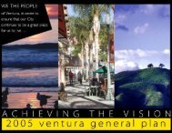
Achieving the Vision<br />
Identifying opportunity<br />
Consistency reference<br />
The goals, policies and actions<br />
derived from the city’s commitment to<br />
maintaining and providing sustainable<br />
infrastructure are consistent with<br />
the following local plans and state<br />
policies:<br />
• California Coastal Act<br />
- Article 4, Section 30231<br />
- Article 5, Section 30240 and<br />
30241<br />
- Article 6, Section 30253<br />
• <strong>Ventura</strong> General <strong>Plan</strong><br />
- Policy 1A: Reduce beach and<br />
hillside erosion and threats to<br />
coastal ecosystem health<br />
- Policy 1C: Improve protection for<br />
native plants and animals<br />
- Policy 1D: Expand the use of<br />
green practices<br />
- Policy 5A: Follow an approach<br />
that contributes to resource<br />
conservation<br />
- Policy 5B: Improve services in<br />
ways that respect and even<br />
benefit the environment<br />
- Policy 8A: Reach out to<br />
institutions and educators to<br />
advance lifelong learning<br />
- Policy 8B: Increase the availability<br />
and diversity of learning<br />
resources.<br />
• Economic Development Strategy<br />
- Focus 6, Goal: Positioning for<br />
Prosperity in the New Economy<br />
• Redevelopment Implementation<br />
<strong>Plan</strong><br />
- Goal III: Invest in Infrastructure<br />
and Enhance Community<br />
Facilities<br />
Sustainable Infrastructure<br />
The California Government Code requires a specific plan to include text and<br />
diagrams that specify, “The proposed distribution, location, and extent and<br />
intensity of major components of public and private transportation, sewage, water,<br />
drainage, solid waste disposal, energy, and other essential facilities proposed to<br />
be located within the area covered by the plan and needed to support the land<br />
uses described in the plan.”<br />
The development objectives of the <strong>Downtown</strong> <strong>Specific</strong> <strong>Plan</strong> can only be<br />
achieved if infrastructure capacity is available concurrently or in advance of such<br />
development.<br />
Water Supply, Distribution and Treatment<br />
The city water system serves residential, commercial, industrial, petroleum<br />
recovery and irrigation needs. Raw water is used only for irrigation and injected into<br />
the ground for oil recovery. All other customers receive treated potable water.<br />
The western portion of the <strong>City</strong>, including the <strong>Downtown</strong> <strong>Specific</strong> <strong>Plan</strong> area, is<br />
normally supplied from the Casitas Municipal Water District (Lake Casitas) and<br />
the <strong>Ventura</strong> River diversion at Foster Park (in Ojai). The <strong>City</strong> also supplies water<br />
to the <strong>Downtown</strong> <strong>Specific</strong> <strong>Plan</strong> area from groundwater wells located in the eastern<br />
portion of <strong>Ventura</strong> when necessary. As development occurs and demand for water<br />
increases, our infrastructure network will respond accordingly.<br />
Wastewater Collection and Treatment<br />
The <strong>Downtown</strong> area has sewer pipes that were installed as early as 1905. Some<br />
existing mains are currently at or above capacity. Others will reach or exceed<br />
capacity as a result of development in the <strong>Downtown</strong> <strong>Specific</strong> <strong>Plan</strong> area. Capital<br />
improvement projects are currently underway to improve sewer lines in the<br />
<strong>Downtown</strong>, however, developers and the <strong>City</strong> will need to work closely to ensure<br />
the continued availability of adequate sewer service.<br />
Storm Drainage<br />
<strong>Downtown</strong> <strong>Ventura</strong> is served by a system of storm drains and culverts. Elsewhere<br />
in the <strong>City</strong> natural watercourses or barrancas are part of the drainage system. The<br />
<strong>Downtown</strong> does not include any natural waterways. Drainage patterns within the<br />
<strong>City</strong> generally begin in the hills north of the <strong>City</strong> and terminate in the <strong>Ventura</strong> River,<br />
Santa Clara River or the Pacific Ocean.<br />
The <strong>City</strong>’s storm drainage facilities are designed to convey the runoff generated<br />
from a 10-year storm event, while <strong>City</strong> streets convey flows above the 10-year storm,<br />
see Figure I-7. As identified in Chapter II, a Master Drainage <strong>Plan</strong> will be prepared<br />
in the next few years to address the <strong>City</strong>’s drainage issues in a comprehensive<br />
approach. New development will need to comply with the Master Drainage <strong>Plan</strong>.<br />
<strong>City</strong> of San Buenaventura D O W N T O W N S P E C I F I C P L A N<br />
I-30