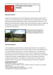
Swyncombe intro - Victoria County History
Swyncombe intro - Victoria County History
Swyncombe intro - Victoria County History

You also want an ePaper? Increase the reach of your titles
YUMPU automatically turns print PDFs into web optimized ePapers that Google loves.
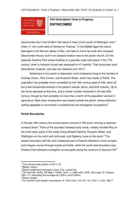
VCH Oxfordshire • Texts in Progress • <strong>Swyncombe</strong> (Apr. 2012) • © University of London • p. 1<br />
VCH Oxfordshire Texts in Progress<br />
SWYNCOMBE<br />
<strong>Swyncombe</strong> lies in the Chiltern hills about 3 miles (5 km) south of Watlington and 7<br />
miles (11 km) north-west of Henley-on-Thames. 1 In the Middle Ages the manor<br />
belonged to the Norman abbey of Bec, and later to minor lay lords who occupied<br />
<strong>Swyncombe</strong> House, built in an isolated location next to the parish church. On the<br />
separate Ewelme Park estate building on a grander scale took place in the 17th<br />
century, when a mansion house was assessed on 41 hearths. That house was soon<br />
demolished, however, and was not replaced until 1913. 2<br />
Settlement in the parish is dispersed, most inhabitants living in the hamlets of<br />
Cookley Green, Park Corner, and Russell’s Water, which lies mostly in Pishill. The<br />
population has probably never exceeded its mid 19th-century peak of 446, when all<br />
but a few households worked in the parish’s woods, farms, and brick industry. Up to<br />
ten farms operated at that time, and a similar number remained in the late 20th<br />
century, though by then probably no more than a tenth of the population worked in<br />
agriculture. Most other employment was based outside the parish, whose attractive<br />
setting appealed to commuters in professional and managerial occupations. 3<br />
Parish Boundaries<br />
In the late 19th century the ancient parish covered 2,708 acres, forming a relatively<br />
compact block. 4 Parts of the boundary followed early roads, notably Icknield Way on<br />
the north-west, parts of the roads linking Britwell Salome, Russell’s Water, and<br />
Watlington on the north and north-east, and Digberry Lane on the south. 5 The<br />
eastern boundary with Bix and a detached part of Ewelme followed a more complex<br />
and irregular course through woods and fields, while the south-west boundary near<br />
Ewelme Park followed a straighter course partly along the contours of Harcourt Hill. 6<br />
1 This account was written in 2011–12.<br />
2 Below, manor.<br />
3 Below (settlement and popn); econ. hist.; social hist.<br />
4 OS Area Bk (1878); OS Map 1:10560, Oxon. L (1883 edn); OHC, tithe map. Cf. Census,<br />
1831–71, estimating the acreage at 2,320 a. and 2,646 a.<br />
5 Below (roads).<br />
6 For northern and eastern boundaries, cf. VCH Oxon. VIII, 43, 131, 210–11; XVI, 196–7.
VCH Oxfordshire • Texts in Progress • <strong>Swyncombe</strong> (Apr. 2012) • © University of London • p. 2<br />
From there the boundary with Ewelme crossed the downs to rejoin Icknield Way,<br />
leaving the foothills (Ewelme Downs) within Ewelme parish.<br />
The northern and eastern boundaries coincided with those of the hundred,<br />
which were established before the Norman Conquest and possibly by the 9th or 10th<br />
century. 7 Elsewhere, the boundaries presumably derived from the estates created in<br />
the area before and after the Conquest, as the vast Benson estate became<br />
fragmented. A 2½-hide holding at <strong>Swyncombe</strong> existed by 1086, although parts of the<br />
later parish may have still been included within Benson, or in one of the four large<br />
Ewelme manors recorded in Domesday. 8 A church was built on <strong>Swyncombe</strong> manor<br />
in the late 11th century, however, and by the 12th or 13th century it seems likely that<br />
the later parish bounadries were broadly established. 9 Even so the Ewelme manors<br />
retained some property in <strong>Swyncombe</strong>, notably at Cookley Green, while woodland on<br />
<strong>Swyncombe</strong>’s south-east edge remained a detached part of Ewelme parish. 10<br />
<strong>Swyncombe</strong><br />
ancient parish<br />
and its<br />
surroundings:<br />
from An<br />
Historical<br />
Atlas of<br />
Oxfordshire,<br />
ed. K. Tiller<br />
and G. Darke<br />
(ORS 67,<br />
2010), 3.<br />
7 M. Hammond, ‘The Anglo-Saxon Estate of Readonora and the Manor of Pyrton,<br />
Oxfordshire’, Oxoniensia 63 (1998), 23–42; L.W. Hepple and A.M. Doggett, ‘Stonor: a<br />
Chilterns Landscape’, in J. Thirsk (ed.), Rural England (2000), 266–9; VCH Oxon. VIII, 1–3,<br />
128–30; XVI, 197; above, vol. <strong>intro</strong>.<br />
8 e.g. the 2½-hide Peverel fee (above, Ewelme, manors); firm evidence is lacking, however.<br />
9 Below, relig. hist. The whole parish was titheable to <strong>Swyncombe</strong> church, and no evidence<br />
has been found of late medieval boundary changes.<br />
10 Above, Ewelme, par. <strong>intro</strong>. (par. bdies); manors.
VCH Oxfordshire • Texts in Progress • <strong>Swyncombe</strong> (Apr. 2012) • © University of London • p. 3<br />
In 1952 the parish gained 868 a. from Bix, including woods, farms, and<br />
houses at Maidensgrove, 11 and in 1991 the area was unchanged at 3,576 a. (1,447<br />
ha.). A small area in the south-east was lost to Bix in the early 21st century. 12<br />
Landscape<br />
The parish extends from the scarp to the summit of the Chiltern hills, and lies mostly<br />
on chalk, covered along the ridge by a mantle of clay-with-flints. 13 The relief is<br />
uneven, and from Cookley Green (at 224 m. almost the highest point in the parish)<br />
the land falls away north-westwards to 140 m. at North Farm and to 111 m. near<br />
Warren Bottom in Ewelme, giving spectacular views across the vale. In between, the<br />
deep dry coombs of <strong>Swyncombe</strong> Downs create a secluded and intimate landscape<br />
typical of the Chilterns, although one generally more wooded from the late 19th<br />
century than earlier. 14<br />
<strong>Swyncombe</strong><br />
in 1767:<br />
from<br />
Jefferys’s<br />
map of<br />
Oxfordshire<br />
The church and manor house lie in a sheltered hollow at around 160 m. From<br />
there the ground rises southwards to a plateau of c.200–215 m. at Park Corner and<br />
Ewelme Park, the site of a late medieval deer park associated with Ewelme manor.<br />
11 Census, 1961; VCH Oxon. XVI, 198, 202. The added areas had a population of 50.<br />
12 OS Map 1:25000, sheet 171 (1999 and 2009 edns); Census, 1961–2001. For changes to<br />
the ecclesiastical parish, below, relig. hist. (par. organization).<br />
13 Geol. Surv. Map 1:50000 (solid and drift), sheet 254 (1980 edn).<br />
14 OS Maps 1:10560, Oxon. L (1883 edn); 1:25000, sheet 171 (2009 edn); Jefferys, Oxon.<br />
Map (1767); Bryant, Oxon. Map (1824); OHC, tithe map; H.J. Massingham, Chiltern Country<br />
(1940), 13–14; below, econ. hist. (agric. landscape).
VCH Oxfordshire • Texts in Progress • <strong>Swyncombe</strong> (Apr. 2012) • © University of London • p. 4<br />
Remnants of the wooded parkland survived in the 19th century, when tree stumps<br />
marked the parish boundary amidst open arable closes, and 20th-century<br />
plantations, including larch and conifers, afforded more modern owners opportunities<br />
for fox-hunting and shooting. 15 As elsewhere in the Chilterns, numerous tanks and<br />
wells provided the inhabitants with water until piped supplies gradually became<br />
available. 16<br />
Communications<br />
The ancient Icknield Way, running along the scarp face of the Chiltern hills, marked<br />
the parish’s north-western boundary, 17 while the Roman road from Dorchester to<br />
Henley crossed the south-western corner of the parish near Ewelme Park, continuing<br />
along the line of Digberry Lane between <strong>Swyncombe</strong> and Nettlebed. 18 From the<br />
Middle Ages the chief route through the parish ran north–south from Watlington to<br />
Nettlebed, part of it along a ridgeway called Red Lane from the colour of the subsoil.<br />
19 The hamlets of Cookley Green and Park Corner both developed alongside it. 20<br />
Branch roads included parallel north–south routes called Coates Lane and Reading<br />
Lane, the east–west Church Lane and White Hill (which joined Icknield Way), a<br />
medieval road to Bix with a link (Law Lane) to Russell’s Water, and a track to<br />
Ewelme Park which continued along the Ewelme–Nuffield parish boundary. 21 All<br />
those survived in the early 21st century as minor access roads or bridleways,<br />
connected by a dense network of footpaths. 22<br />
15 OS Maps 1:10560, Oxon. L (1883 edn); 1:25000, sheet 171 (2009 edn); Sale Cat., Ewelme<br />
Park (1934): copy in OHC, P SWYN/631.2; Sale Cat., Parkcorner Farm (1956): copy in OHC,<br />
SC 212; for Ewelme Park, below, manor (other estates); econ. hist.; social hist.<br />
16 OS Map 1:10560, Oxon. L (1883 edn); B. Read, Henley Rural: A <strong>History</strong> of Henley Rural<br />
District Council 1894–1932 (2003), 58–9; Kelly’s Dir. Oxon. (1939 edn); below, local govt.<br />
17 The Viatores, Roman Roads in the South-East Midlands (1964), 53–5; HER, PRN 8929;<br />
Hepple and Doggett, Chilterns, 8–11, 44–5; VCH Oxon. XVI, 4; Oxon. Atlas, 28–9, 50–1;<br />
above, vol. <strong>intro</strong>. (communics).<br />
18 F.J. Malpas, ‘Roman Roads South and East of Dorchester’, Oxoniensia 52 (1987), 31–2;<br />
below (early settlement).<br />
19 Grundy, Saxon Oxon. 102–4; Bridge, <strong>Swyncombe</strong>, 15–19; M. Hammond, ‘The Anglo-Saxon<br />
Estate of Readonora and the Manor of Pyrton, Oxfordshire’, Oxoniensia 63 (1998), 36; OS<br />
Map 1:25000, sheet 171 (2009 edn); above, vol. <strong>intro</strong>. (communics). In 2011 the road’s<br />
classification was B481.<br />
20 Below (medieval and later settlement).<br />
21 Jefferys, Oxon. Map (1767); Davis, Oxon. Map (1797); Bryant, Oxon. Map (1824); OHC,<br />
tithe map; OS Maps 1:63360, sheet XIII (1830 edn); 1:10560, Oxon. L (1883 edn); VCH<br />
Oxon. VIII, 43–4; XVI, 199–200.<br />
22 OS Map 1:25000, sheet 171 (2009 edn); below, local govt.
VCH Oxfordshire • Texts in Progress • <strong>Swyncombe</strong> (Apr. 2012) • © University of London • p. 5<br />
In the mid 19th century a carrier from Watlington to Reading passed through<br />
the parish on Saturdays. 23 The local carrier Thomas Hayes provided a similar service<br />
from Park Corner, and travelled to Henley on Thursdays (market day). 24 The service<br />
was continued by his daughter Alice until the 1890s, 25 after which inhabitants<br />
presumably used carriers from Nettlebed and Watlington. 26 From the 1920s<br />
motorized buses ran between Watlington and Reading with increasing frequency,<br />
and an occasional service continued in 2011. 27<br />
Post was delivered from Nettlebed in the 19th century, and later from Henley.<br />
A sub-post office at Park Corner, opened in the 1850s, was managed first by the<br />
blacksmith Stephen Wixen and in the 1860s by the farmer John Parker. 28 From the<br />
1880s it was run by women, and continued until the early 20th century when a post<br />
and telegraph office opened at Cookley Green. 29 A second sub-post office at<br />
Russell’s Water was short-lived, 30 and the post office at Cookley Green closed in<br />
1967. 31<br />
Settlement and Population<br />
Early Settlement<br />
Flint axes and other implements of Mesolithic to Neolithic date have been found on<br />
the northern, eastern, and western edges of the parish, while a flint dagger suggests<br />
Bronze-Age activity. 32 On the southern boundary with Nettlebed prehistoric<br />
enclosures and other features have been identified from cropmarks, 33 and in the<br />
23 PO Dir. Oxon. (1854 and 1864 edns).<br />
24 TNA, HO 107/881; HO 107/1725; ibid. RG 9/884; RG 10/1428; PO Dir. Oxon. (1854 and<br />
later edns); VCH Oxon. XVI, 101.<br />
25 TNA, RG 11/1491; RG 12/1159; Kelly’s Dir. Oxon. (1883–91 edns). In 1901 Alice was<br />
described as a charwoman: TNA, RG 13/1372.<br />
26 Kelly’s Dir. Oxon. (1895 and later edns), s.v. Watlington; VCH Oxon. VIII, 232–3; above,<br />
Nettlebed, par. <strong>intro</strong>. (carriers).<br />
27 Kelly’s Dir. Oxon. (1924 and later edns); below, local govt. In 2011 four buses a week<br />
stopped at Cookley Green and Park Corner.<br />
28 PO Dir. Oxon. (1847 and later edns); TNA, RG 9/884; RG 10/1428.<br />
29 TNA, RG 11/1491, s.v. Frances Sarney; Kelly’s Dir. Oxon. (1883 and later edns); below,<br />
local govt.<br />
30 Kelly’s Dir. Oxon. (1915).<br />
31 OHC, PC 265/A/3, s.a. 1967; OS Map 1:2500, SU 6990 (1973 edn); Sale Cat., Old Post<br />
Office (1976): copy at NMR.<br />
32 HER, PRN 2021 (near Ewelme Park), 12750 (near Coates Farm), 2067, 15428, 15434 (all<br />
near Russell’s Water); H. Case and J.R. Kirk, ‘Archaeological Notes’, Oxoniensia 19 (1954),<br />
118–19; VCH Oxon. XVI, 201; for context, Hepple and Doggett, Chilterns, 18–30.<br />
33 HER, PRN 13887–9; above, Nettlebed, par. <strong>intro</strong>. (early settlement).
VCH Oxfordshire • Texts in Progress • <strong>Swyncombe</strong> (Apr. 2012) • © University of London • p. 6<br />
north a prehistoric ring ditch lies next to Icknield Way. 34 A late 3rd-century Roman<br />
coin hoard discovered along the Roman road south of Ewelme Park may not indicate<br />
settlement, although Roman occupation is known nearby. 35<br />
The most significant archaeological remains are also the most enigmatic and<br />
difficult to date. A boundary dyke running along the northern edge of the downs for<br />
about a mile, and commanding Icknield Way, may be of Bronze-Age or Anglo-Saxon<br />
origin, and could have been intended either for defensive or agricultural use. 36 A<br />
square enclosure at Digberry Farm is also problematic, but possibly marks an Anglo-<br />
Saxon farmstead. 37 More certain evidence of Anglo-Saxon activity is afforded by the<br />
parish’s place names. <strong>Swyncombe</strong> means pig valley, the element cumb being<br />
particularly characteristic of the Chilterns. Cookley is probably derived from Cuca’s<br />
lēah (or wood-pasture), and several field names also include Anglo-Saxon<br />
elements. 38 Park Corner was known in the 18th century as Stanley or Stanvill, the<br />
Old English stān presumably referring to the abundant flint in the area. 39<br />
Population from 1086<br />
No tenants were recorded on the manor in 1086, when it was presumably<br />
administered as demesne. The late 11th-century church nevertheless suggests a<br />
small resident population. 40 Around 26 tenants were named c.1248, and in 1279<br />
there were 10 serfs or servi and 11 cottars, suggesting a population of 80–100. 41<br />
Seven people including the prior of Bec paid tax in 1306, but mid 14th-century plague<br />
seems to have had a serious long-term effect, since in 1377 only 16 adults aged over<br />
14 paid the national poll tax. 42 In 1524 the parish was taxed with places in Nuffield,<br />
34 HER, PRN 5344.<br />
35 Ibid. 2019; C.M. Kraay, ‘A Third Century Hoard of Roman Coins from Ewelme’, Oxoniensia<br />
17/18 (1952/1953), 234–5; VCH Oxon. XVI, 201.<br />
36 HER, PRN 13608; VCH Oxon. II, 307, 343; Bridge, <strong>Swyncombe</strong>, 20.<br />
37 HER, PRN 2026; Bridge, <strong>Swyncombe</strong>, 20–1; C.R. Hart, ‘Digberry Farm, <strong>Swyncombe</strong>’, CBA<br />
Group 9 Newsletter 4 (1974), 29; O.G.S. Crawford, ‘The Chiltern Grim’s Ditches’, Antiquity 5<br />
(1931), 170–1; above, Nettlebed, par. <strong>intro</strong>. (early settlement).<br />
38 PN Oxon. I, 136–8; Oxon. Atlas, 22–4; above, Nuffield, par. <strong>intro</strong>. (early settlement).<br />
39 Par. Colln, III, 300; OHC, par. reg. transcript, s.a. 1726–7; cf. Oxon. Atlas, 22; below (built<br />
character).<br />
40 VCH Oxon. I, 419; below, relig. hist.<br />
41 M. Chibnall (ed.), Select Documents of the English Lands of the Abbey of Bec (Camden 3rd<br />
ser. 73, 1951), 87–9; Rot. Hund. II, 757–8; M.T. Pearman, ‘Notes on Swincomb’, OAS Trans.<br />
48 (1906), 6–8. For their social status, below, econ. hist. (medieval agric.); social hist.<br />
42 TNA, E 179/161/10; Poll Taxes 1377–81, ed. Fenwick, II, 295; below, social hist.
VCH Oxfordshire • Texts in Progress • <strong>Swyncombe</strong> (Apr. 2012) • © University of London • p. 7<br />
and few <strong>Swyncombe</strong> people contributed to the lay subsidies of the later 16th<br />
century. 43<br />
Thereafter the population rose slowly. From the 1570s baptisms usually<br />
outnumbered burials, averaging 4.6 a year (compared with 3.2 burials) in the period<br />
1570–1700. 44 Thirteen households were assessed for hearth tax in 1662, 97 adults<br />
were mentioned in 1676, and a population of about 200 was reported in 1718. 45<br />
During the 18th century the average number of baptisms rose to 5.8 a year<br />
compared with 4.5 burials, 46 and 40 houses were mentioned in 1738, rising to 50 in<br />
1759 and 55 in 1771. 47 By 1801 there were 53 houses and a population of 285, rising<br />
to 70 houses and 367 people thirty years later. 48<br />
The population peaked in 1861, when 446 people occupied 80 houses.<br />
Thereafter it fell to 308 in 72 houses by 1891. In the 20th century the population<br />
fluctuated between 342 (in 1901) and 280 (in 1981), the number of households rising<br />
from 79 to 102 during the same period. In 2001 a total of 260 people occupied 112<br />
houses. 49<br />
Medieval and Later Settlement<br />
As elsewhere in the Chiltern uplands, medieval settlement was dispersed. The<br />
origins of individual hamlets and farmsteads are generally untraceable, although<br />
some must have existed by the late 11th century when the present church was built.<br />
Any tenant housing next to the church was probably removed in the 16th or 17th<br />
century, when the mansion house was rebuilt by resident lords, 50 and in the early<br />
18th century about half of the parish’s 40 houses were reportedly situated at Park<br />
Corner, with a further eight at Cookley Green and the same number at Russell’s<br />
Water, which lay mostly in Pishill parish. Then and presumably earlier the houses at<br />
Cookley Green and Park Corner were arranged around small greens, 51 while a few<br />
43 TNA, E 179/161/198; E 179/162/258; E 179/162/317; E 179/162/346; E 179/163/381;<br />
above, Nuffield, par. <strong>intro</strong>. (popn).<br />
44 OHC, par. reg. transcript (based on decennial totals 1570–1699).<br />
45 TNA, E 179/164/504; Hearth Tax Oxon. 40 (listing only 7 houses); Compton Census, ed.<br />
Whiteman, 424; B.J. Enright, ‘Rawlinson’s Proposed <strong>History</strong> of Oxfordshire’, Oxoniensia 16<br />
(1951), 70.<br />
46 OHC, par. reg. transcript (based on decennial totals 1700–99).<br />
47 Secker’s Visit. 157; ORO, MSS Oxf. Dioc. d 557, f. 98; d 563, f. 129.<br />
48 Census, 1801–31.<br />
49 Ibid. 1841–2001.<br />
50 Below, manor (<strong>Swyncombe</strong> House); relig. hist.<br />
51 Jefferys, Oxon. Map (1767); Davis, Oxon. Map (1797); Par. Colln, III, 300; Enright,<br />
‘Rawlinson’s Proposed <strong>History</strong> of Oxfordshire’, 70; VCH Oxon. VIII, 131–2.
VCH Oxfordshire • Texts in Progress • <strong>Swyncombe</strong> (Apr. 2012) • © University of London • p. 8<br />
additional cottages were built on the edges of commons or in the woods. 52 A lodge<br />
existed in Ewelme Park probably from the early 15th century, when the park was first<br />
created, and in the early 17th century it was briefly superseded by a short-lived but<br />
exceptionally large mansion house. Coates (or Bacon) Farm was established by the<br />
16th century, and possibly from the Middle Ages. 53<br />
In the mid 19th century Park Corner (including Digberry Lane) remained the<br />
largest of the hamlets, with around 25 of the parish’s 80 houses. Cookley Green and<br />
Russell’s Water each contained around 18 households, while the remainder lay<br />
dispersed at <strong>Swyncombe</strong> House, the rectory house, Ewelme Park, Lower Farm,<br />
Coates Farm, Seymour Green, and Down Cottages. 54 Thereafter the settlement<br />
pattern remained largely unchanged, the number of houses increasing only to 85<br />
until the boundary changes of 1952. 55 Subsequent decades witnessed relatively little<br />
new development. 56<br />
The parish<br />
war<br />
memorial<br />
on Cookley<br />
Green,<br />
around<br />
which<br />
settlement<br />
is loosely<br />
scattered.<br />
52 TNA, E 315/388/1; below, social hist. (16th to 18th cents).<br />
53 Below, manor (other estates); econ. hist. (farming in 16th to 18th cents).<br />
54 OHC, tithe award and map; TNA, HO 107/881; HO 107/1725.<br />
55 Census, 1951; OS Maps 1:25000 SU 68 (1960 edn); 1:25000 SU 69 (1959 edn); above<br />
(par. bdies).<br />
56 OS Map 1:25000, sheet 171 (2009 edn); below, local govt.
VCH Oxfordshire • Texts in Progress • <strong>Swyncombe</strong> (Apr. 2012) • © University of London • p. 9<br />
The Built Character<br />
<strong>Swyncombe</strong>’s vernacular buildings are broadly typical of the Oxfordshire Chilterns.<br />
Farmhouses and cottages of 17th- to 19th-century date are thinly scattered<br />
throughout the parish, built mostly of brick, flint, and clay tile. Though varying in size<br />
and style, none (with the exception of <strong>Swyncombe</strong> House and Ewelme Park) stands<br />
out as particularly distinctive. 57 The early 18th-century Park Corner Farm, flint-built<br />
with brick quoins and dressings, brick stacks, and a tiled hipped roof, is typical of the<br />
better tenanted farmhouses. Two-storeyed with attic gables, it has a three-bay front<br />
and a double-pile plan, its rooms lit by windows with 19th- and 20th-century sashes<br />
and casements. 58 In the 19th century it was covered with ivy, and its enclosed yards<br />
included brick and timber barns, stables, and sheds, variously roofed with tile, slate,<br />
or thatch. 59 Later outbuildings used ‘iron and other materials’. 60<br />
On the same estate the 18th-century Ewelme Park Farm, of rendered brick<br />
with a tiled gabled roof, 61 was replaced by a larger brick and slated residence in the<br />
late 19th century. The original farmhouse was sub-divided for use as labourers’<br />
accommodation, supplementing several tied cottages which were let on service<br />
tenancies into the mid 20th century. 62 On the <strong>Swyncombe</strong> manor estate, the 17thcentury<br />
Home Farm was extended and remodelled in the 19th century, though the<br />
flint, brick, and tile of its main ranges remained wholly characteristic. 63 Among the<br />
estate’s farm buildings, the 17th-century aisled barn of four bays with a queen-post<br />
roof at Coates Farm is particularly impressive. Built on a brick and flint base, it is<br />
weatherboarded with a tiled roof. 64 Timber and thatch were probably once more<br />
common on both estates, and at Lower Farm were used in the barns and stable<br />
mentioned in the late 18th century. 65<br />
Other 18th-century farmhouses include Darkwood and Little Parkcorner (or<br />
Chear’s) Farms, built in different styles but using the same materials of brick, flint,<br />
and tile. Decorative features at Little Parkcorner Farm include segmental brick arches<br />
over windows and door, while Darkwood Farm has a notable M-shaped gabled<br />
57 Above, vol. <strong>intro</strong>. (bldgs). For manorial and ecclesiastical buildings, below, manor<br />
(<strong>Swyncombe</strong> House; Ewelme Park House); relig. hist. (rectory house; church archit.).<br />
58 Bldgs List, IoE 247569.<br />
59 Sale Cat., Ewelme Park (1889): copy in Bodl. GA Oxon. b 92*; OHC, Ta. XI/ii/3.<br />
60 Sale Cat., Parkcorner Farm (1956): copy in OHC, SC 212.<br />
61 Bldgs List, IoE 247555.<br />
62 Sale Cat., Ewelme Park (1889); OHC, Ta. XI/ii/3; TNA, MAF 32/919/233, no. 1; Sale Cat.,<br />
Parkcorner Farm (1956).<br />
63 Bldgs List, IoE 247559.<br />
64 Ibid. 247565.<br />
65 OHC, Brakspear X/1, p. 156; ibid. QSD/L/273, s.a. 1794.
VCH Oxfordshire • Texts in Progress • <strong>Swyncombe</strong> (Apr. 2012) • © University of London • p.<br />
10<br />
roof. 66 Such buildings reflected the widespread agricultural prosperity of the period,<br />
when the profits of farming enabled landowners to replace the small, old-fashioned<br />
houses mentioned in mid 17th-century hearth taxes and inventories with more<br />
modern and comfortable residences. 67 Rebuilding also extended to many of the<br />
parish’s cottages, of which several were newly built or substantially enlarged in the<br />
18th century. 68<br />
The number of inhabited houses rose from 53 in 1801 to 80 in 1851, although<br />
the increase did not always keep pace with population, resulting in subdivision and<br />
overcrowding. In 1831, for example, 88 families were accommodated in 70 houses. 69<br />
Like the earlier buildings most were of brick and flint and were unexceptional, and at<br />
the beginning of the 20th century many still belonged to the parish’s major<br />
landowners. 70 By then population was falling, and several houses were vacant:<br />
twelve in 1881, eight in 1891, and six in 1901. 71 A few council houses were built at<br />
Park Corner in the 1920s, and private development in the 1970s and 1980s raised<br />
the number of households from 95 to 113. Over all, however, the built character of<br />
the parish’s hamlets remained remarkably unchanged. 72<br />
66 Bldgs List, IoE 247570, 247572–3; Sale Cat., Little Parkcorner Farm (1972): copy in OHC,<br />
P NETT/631.2.<br />
67 VCH Oxon. XVI, 11, 18; above, vol. <strong>intro</strong>.; below, social hist.<br />
68 Bldgs List, IoE 247566–7 (Digberry Lane), 247571 (Park Corner), 247578–9 (Cookley<br />
Green).<br />
69 Census, 1801–51.<br />
70 OHC, DV XII/59; Sale Cat., <strong>Swyncombe</strong> Est. (1921): copy in OHC, SC 140.<br />
71 Census, 1881–1901.<br />
72 OHC, PC 265/A/2, s.a. 1923, 1926; Census, 1921–91; below, social hist.