

Estimation of potential debris-flow volumes for Centerville Canyon ...
Estimation of potential debris-flow volumes for Centerville Canyon ...
Estimation of potential debris-flow volumes for Centerville Canyon ...

You also want an ePaper? Increase the reach of your titles
YUMPU automatically turns print PDFs into web optimized ePapers that Google loves.
ESTIMATION OF POTENTIAL DEBRIS-<br />
FLOW VOLUMES FOR CENTERVILLE<br />
CANYON, DAVIS COUNTY, UTAH<br />
by Richard E. Giraud and Jessica J. Castleton<br />
REPORT OF INVESTIGATION 267<br />
UTAH GEOLOGICAL SURVEY<br />
a division <strong>of</strong><br />
UTAH DEPARTMENT OF NATURAL RESOURCES<br />
2009<br />
Utah Geological Survey
ESTIMATION OF POTENTIAL DEBRIS-<br />
FLOW VOLUMES FOR CENTERVILLE<br />
CANYON, DAVIS COUNTY, UTAH<br />
by Richard E. Giraud and Jessica J. Castleton<br />
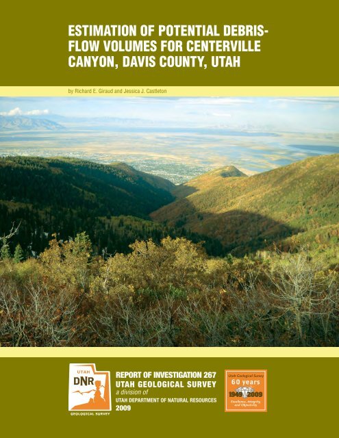
Cover photo: Looking down <strong>Centerville</strong> <strong>Canyon</strong> towards <strong>Centerville</strong> City.<br />
REPORT OF INVESTIGATION 267<br />
UTAH GEOLOGICAL SURVEY<br />
a division <strong>of</strong><br />
UTAH DEPARTMENT OF NATURAL RESOURCES<br />
2009<br />
Utah Geological Survey
STATE OF UTAH<br />
Gary R. Herbert, Governor<br />
DEPARTMENT OF NATURAL RESOURCES<br />
Michael Styler, Executive Director<br />
UTAH GEOLOGICAL SURVEY<br />
Richard G. Allis, Director<br />
PUBLICATIONS<br />
contact<br />
Natural Resources Map & Bookstore<br />
1594 W. North Temple<br />
Salt Lake City, UT 84116<br />
telephone: 801-537-3320<br />
toll-free: 1-888-UTAH MAP<br />
Web site: mapstore.utah.gov<br />
email: geostore@utah.gov<br />
UTAH GEOLOGICAL SURVEY<br />
contact<br />
1594 W. North Temple, Suite 3110<br />
Salt Lake City, UT 84116<br />
telephone: 801-537-3300<br />
Web site: geology.utah.gov<br />
Although this product represents the work <strong>of</strong> pr<strong>of</strong>essional scientists, the Utah Department <strong>of</strong> Natural Resources, Utah Geological<br />
Survey, makes no warranty, expressed or implied, regarding its suitability <strong>for</strong> a particular use. The Utah Department <strong>of</strong> Natural<br />
Resources, Utah Geological Survey, shall not be liable under any circumstances <strong>for</strong> any direct, indirect, special, incidental, or<br />
consequential damages with respect to claims by users <strong>of</strong> this product.
CONTENTS<br />
ABSTRACT.................................................................................................................................................................................................1<br />
INTRODUCTION........................................................................................................................................................................................1<br />
Davis County Debris-Flow History......................................................................................................................................................2<br />
Previous Work.......................................................................................................................................................................................3<br />
Methods................................................................................................................................................................................................3<br />
PHYSOGRAPHIC AND GEOLOGIC SETTING ......................................................................................................................................4<br />
FIRE-RELATED DEBRIS-FLOW VOLUMES..........................................................................................................................................5<br />
Regression Model.................................................................................................................................................................................6<br />
Fire-Related Volume Limitations..........................................................................................................................................................6<br />
RAINFALL AND SNOWMELT DEBRIS-FLOW VOLUMES..................................................................................................................6<br />
Upper <strong>Canyon</strong>.......................................................................................................................................................................................8<br />
Middle <strong>Canyon</strong>.....................................................................................................................................................................................8<br />
Lower <strong>Canyon</strong>.......................................................................................................................................................................................9<br />
Rainfall and Snowmelt Debris-Flow Volume Limitations....................................................................................................................9<br />
ESTIMATED AND HISTORICAL DEBRIS-FLOW VOLUME COMPARSION...................................................................................11<br />
DEBRIS-FLOW RISK REDUCTION.......................................................................................................................................................12<br />
CONCLUSIONS AND RECOMMENDATIONS.....................................................................................................................................12<br />
ACKNOWLEDGMENTS..........................................................................................................................................................................13<br />
REFERENCES...........................................................................................................................................................................................13<br />
APPENDIX–CROSS-CHANNEL PROFILES, CENTERVILLE CANYON...........................................................................................15<br />
FIGURES<br />
Figure 1. Map showing <strong>Centerville</strong> <strong>Canyon</strong>, drainage basin boundary, and alluvial fan.............................................................................2<br />
Figure 2. Photos showing physiographic character <strong>of</strong> <strong>Centerville</strong> <strong>Canyon</strong>.................................................................................................5<br />
Figure 3. Burn areas used to estimate fire-related <strong>debris</strong> <strong>flow</strong> <strong>volumes</strong> in <strong>Centerville</strong> <strong>Canyon</strong>..................................................................7<br />
Figure 4. Main and tributary channels <strong>for</strong> estimating rainfall and snowmelt <strong>debris</strong>-<strong>flow</strong> <strong>volumes</strong>.............................................................8<br />
Figure 5. Longitudinal pr<strong>of</strong>ile <strong>of</strong> the main and tributary channels.............................................................................................................10<br />
TABLES<br />
Table 1. Estimated fire-related <strong>debris</strong>-<strong>flow</strong> <strong>volumes</strong> using 0.94 inch and 1.14 inch total rainfall...............................................................7<br />
Table 2. Estimated rainfall and snowmelt <strong>volumes</strong> <strong>for</strong> <strong>debris</strong> <strong>flow</strong>s initiating in upper, middle, and lower <strong>Centerville</strong> <strong>Canyon</strong>...............9<br />
Table 3. Comparison <strong>of</strong> historical and estimated <strong>debris</strong>-<strong>flow</strong> <strong>volumes</strong>, Davis County, Utah....................................................................11
ESTIMATION OF POTENTIAL DEBRIS-FLOW VOLUMES<br />
FOR CENTERVILLE CANYON, DAVIS COUNTY, UTAH<br />
by Richard E. Giraud and Jessica J. Castleton<br />
ABSTRACT<br />
<strong>Centerville</strong> <strong>Canyon</strong> in Davis County, Utah, has a high <strong>debris</strong><strong>flow</strong><br />
hazard due to the volume <strong>of</strong> sediment stored in the canyon,<br />
the lack <strong>of</strong> historical <strong>debris</strong> <strong>flow</strong>s to reduce the volume<br />
<strong>of</strong> stored sediment, and the lack <strong>of</strong> mitigation structures to<br />
reduce the hazard from a large-volume <strong>debris</strong> <strong>flow</strong>. We estimated<br />
fire-related and rainfall and snowmelt <strong>debris</strong>-<strong>flow</strong> <strong>volumes</strong><br />
<strong>for</strong> <strong>Centerville</strong> <strong>Canyon</strong> to aid in sizing a <strong>debris</strong> basin<br />
to reduce the hazard. Our fire-related <strong>debris</strong>-<strong>flow</strong> <strong>volumes</strong><br />
estimated using the empirical Western U.S. regression model<br />
are significantly less than historical <strong>debris</strong>-<strong>flow</strong> <strong>volumes</strong> produced<br />
from overgrazed and fire-damaged watersheds. The<br />
model <strong>volumes</strong> are likely smaller because the model does not<br />
account <strong>for</strong> the bulking <strong>of</strong> water and sediment from the long<br />
perennial channels in the canyons that produced historical <strong>debris</strong><br />
<strong>flow</strong>s. Rainfall and snowmelt <strong>debris</strong>-<strong>flow</strong> <strong>volumes</strong> were<br />
estimated using the unit-volume analysis method to estimate<br />
the volume <strong>of</strong> channel sediment bulked by <strong>debris</strong> <strong>flow</strong>s. Topographic<br />
cross-channel pr<strong>of</strong>iles were used to estimate the volume<br />
<strong>of</strong> stored channel sediment. The stored-channel volume<br />
estimates and the maximum historical bulking rate were used<br />
to estimate likely rainfall and snowmelt <strong>debris</strong>-<strong>flow</strong> <strong>volumes</strong>.<br />
Uncertainties in our volume estimates are difficult to quantify.<br />
We use historical <strong>debris</strong> <strong>flow</strong> <strong>volumes</strong> from other canyons as<br />
a check <strong>of</strong> our volume estimates. The rainfall and snowmelt<br />
volume estimate <strong>of</strong> 196,000 cubic yards (149,900 m 3 ) <strong>for</strong> a<br />
<strong>debris</strong> <strong>flow</strong> initiating in the upper canyon compares favorably<br />
with the largest historical <strong>debris</strong>-<strong>flow</strong> <strong>volumes</strong> from other<br />
Davis County canyons with similar bulked channel lengths.<br />
Formal <strong>debris</strong>-basin volume design guidance based on return<br />
periods similar to those used <strong>for</strong> earthquake and flood hazards<br />
is not available. Consideration <strong>of</strong> historical <strong>debris</strong>-<strong>flow</strong><br />
<strong>volumes</strong> produced in other Davis County canyons is likely<br />
the best approach <strong>for</strong> sizing <strong>debris</strong>-basin volume. Because the<br />
196,000 cubic yards (149,900 m 3 ) volume compares favorably<br />
with nearby historical <strong>debris</strong>-<strong>flow</strong> <strong>volumes</strong>, this volume<br />
is likely the most appropriate volume to consider when sizing<br />
a <strong>debris</strong> basin to accommodate a large-volume <strong>debris</strong> <strong>flow</strong><br />
from <strong>Centerville</strong> <strong>Canyon</strong>. This study and previous studies<br />
show that <strong>Centerville</strong> <strong>Canyon</strong> has a high <strong>debris</strong>-<strong>flow</strong> hazard,<br />
and a large-volume <strong>debris</strong> <strong>flow</strong> will cause significant damage<br />
to development on the alluvial fan below the canyon. An<br />
appropriately sized <strong>debris</strong> basin will significantly reduce the<br />
<strong>debris</strong>-<strong>flow</strong> hazard and provide protection <strong>for</strong> the developed<br />
residential area on the alluvial fan in <strong>Centerville</strong>.<br />
INTRODUCTION<br />
<strong>Centerville</strong> <strong>Canyon</strong> presents a serious <strong>debris</strong>-<strong>flow</strong> hazard because<br />
the canyon has not discharged a historical <strong>debris</strong> <strong>flow</strong>,<br />
contains abundant sediment that will likely be bulked into future<br />
<strong>debris</strong> <strong>flow</strong>s, and there<strong>for</strong>e has a high <strong>potential</strong> <strong>for</strong> producing<br />
a large-volume <strong>debris</strong> <strong>flow</strong>. The hazard severity was<br />
recognized by Williams and Lowe (1990) in their study <strong>of</strong><br />
<strong>debris</strong>-<strong>flow</strong>-producing canyons in Davis County. Debris <strong>flow</strong>s<br />
are a hazard on the alluvial fan below the canyon (figure 1)<br />
where they deposit sediment. Development on the alluvial fan<br />
in <strong>Centerville</strong> City will likely be damaged by future <strong>debris</strong><br />
<strong>flow</strong>s. Debris <strong>flow</strong>s on alluvial fans elsewhere in Davis County<br />
have caused damage to several communities since the area<br />
was first settled in 1847 (Keate, 1991).<br />
Debris <strong>flow</strong>s are fast-moving <strong>flow</strong>-type landslides composed<br />
<strong>of</strong> a slurry <strong>of</strong> rock, mud, organic matter, and water that move<br />
down drainage-basin channels onto alluvial fans. Debris <strong>flow</strong>s<br />
generally initiate on steep slopes or in channels by the addition<br />
<strong>of</strong> water from intense rainfall or rapid snowmelt. As <strong>flow</strong>s<br />
travel downchannel, the channel bed is typically destabilized<br />
and eroded, and sediment and vegetation are entrained into the<br />
<strong>flow</strong>ing mass increasing the <strong>flow</strong> volume. When <strong>flow</strong>s reach<br />
the alluvial fan and lose channel confinement, they spread laterally<br />
and deposit the entrained sediment. Debris <strong>flow</strong>s typically<br />
exhibit a surging behavior as they <strong>flow</strong> down channels<br />
and onto alluvial fans.<br />
Debris <strong>flow</strong>s pose a hazard very different from other types<br />
<strong>of</strong> landslides and floods due to their rapid movement and destructive<br />
power. Debris <strong>flow</strong>s can occur with little warning.<br />
Fifteen people have been killed by <strong>debris</strong> <strong>flow</strong>s in Utah. Thirteen<br />
<strong>of</strong> those people died in two different events at night as<br />
fast-moving <strong>debris</strong> <strong>flow</strong>s allowed little chance <strong>of</strong> escape. Six<br />
<strong>of</strong> the 13 victims were campers in Farmington <strong>Canyon</strong> who<br />
died in an August 13, 1923, <strong>debris</strong> <strong>flow</strong> (Keate, 1991). In ad-
2<br />
Utah Geological Survey<br />
Figure 1. Map showing <strong>Centerville</strong> <strong>Canyon</strong>, drainage basin boundary (solid black line), and alluvial fan (yellow); modified from<br />
Lowe (1988a) and Nelson and Personius (1993). Base map from U.S. Geological Survey (USGS) 7.5-minute Farmington and Bountiful<br />
Peak quadrangles.<br />
dition to threatening lives, <strong>debris</strong> <strong>flow</strong>s can damage buildings<br />
and infrastructure by sediment burial, erosion, direct impact,<br />
and associated water flooding.<br />
At the request <strong>of</strong> Davis County and <strong>Centerville</strong> City, the Utah<br />
Geological Survey estimated likely <strong>debris</strong>-<strong>flow</strong> <strong>volumes</strong> that<br />
could be produced from <strong>Centerville</strong> <strong>Canyon</strong> to aid in sizing a<br />
<strong>debris</strong> basin <strong>for</strong> hazard reduction. Debris-<strong>flow</strong> investigations<br />
typically involve investigation <strong>of</strong> both the drainage basin and<br />
alluvial fan to estimate and compare <strong>potential</strong> <strong>debris</strong>-<strong>flow</strong> <strong>volumes</strong><br />
(Giraud, 2005; Jakob, 2005). Because the <strong>Centerville</strong><br />
<strong>Canyon</strong> alluvial fan is developed, an alluvial-fan evaluation<br />
to determine past <strong>debris</strong>-<strong>flow</strong> <strong>volumes</strong> is not practical. There<strong>for</strong>e,<br />
we investigated the drainage basin and channels in the<br />
drainage basin to estimate likely <strong>debris</strong>-<strong>flow</strong> <strong>volumes</strong> that will<br />
reach the alluvial fan, and compared our estimated <strong>volumes</strong><br />
with historical <strong>debris</strong>-<strong>flow</strong> <strong>volumes</strong> from nearby canyons.<br />
Our volume estimates include <strong>debris</strong> <strong>flow</strong>s triggered by rainfall<br />
following wildfires and <strong>debris</strong> <strong>flow</strong>s triggered solely by<br />
intense rainfall or rapid snowmelt.<br />
Parrish Creek, Barnard Creek, Ford <strong>Canyon</strong> (Ricks Creek),<br />
and Lone Pine <strong>Canyon</strong> east <strong>of</strong> <strong>Centerville</strong> also produce <strong>debris</strong><br />
<strong>flow</strong>s. However, these creeks and canyons have engineered<br />
<strong>debris</strong> basins in place to reduce the <strong>debris</strong>-<strong>flow</strong> hazard. <strong>Centerville</strong><br />
<strong>Canyon</strong> has a small 4450 cubic yard (3400 m 3 ) basin<br />
(Keaton and Lowe, 1998) designed <strong>for</strong> removing fine sediment<br />
to reduce sediment deposition farther downstream (Fred<br />
Campbell, <strong>Centerville</strong> City, verbal communication, 2009);<br />
however, the basin is too small to reduce the <strong>debris</strong>-<strong>flow</strong> hazard.<br />
Davis County Debris-Flow History<br />
From a historical perspective, <strong>potential</strong> stream-flooding, alluvial-fan-flooding,<br />
and <strong>debris</strong>-<strong>flow</strong> hazards are the most frequent<br />
and destructive geologic hazards affecting <strong>Centerville</strong><br />
and other Davis County communities. Davis County has sustained<br />
more loss <strong>of</strong> life and property damage from flash floods<br />
and <strong>debris</strong> <strong>flow</strong>s than any other county along the Wasatch<br />
Front. The majority <strong>of</strong> these floods and <strong>debris</strong> <strong>flow</strong>s were pro-
<strong>Estimation</strong> <strong>of</strong> <strong>potential</strong> <strong>debris</strong>-<strong>flow</strong> <strong>volumes</strong> <strong>for</strong> <strong>Centerville</strong> <strong>Canyon</strong>, Davis County, Utah 3<br />
duced by intense thunderstorm rainfall (Woolley, 1946; Cr<strong>of</strong>t,<br />
1967; Butler and Marsell, 1972; Pack, 1985). Debris <strong>flow</strong>s<br />
were also triggered by rapid snowmelt in the Shepard, Farmington,<br />
Rudd, and Steed drainages in 1983 and 1984 (Keaton<br />
and Lowe, 1998). The 1983 Rudd <strong>Canyon</strong> <strong>debris</strong> <strong>flow</strong> in Farmington<br />
deposited approximately 84,000 cubic yards (64,000<br />
m 3 ) <strong>of</strong> sediment on the alluvial fan, damaged 35 houses, and<br />
caused an estimated $3 million in property damage (Deng and<br />
others, 1992). Flood water from <strong>Centerville</strong> <strong>Canyon</strong> in 1983<br />
produced a small sediment volume <strong>of</strong> 2600 cubic yards (1990<br />
m 3 ) (Williams and others, 1989).<br />
Historical accounts <strong>of</strong> <strong>debris</strong> <strong>flow</strong>s in Davis County date back<br />
to 1878 when <strong>debris</strong> <strong>flow</strong>s were triggered by thunderstorm<br />
rainfall in Farmington and Davis <strong>Canyon</strong>s (Keate, 1991).<br />
Keaton and Lowe (1998) provided a historical summary <strong>of</strong><br />
<strong>debris</strong> <strong>flow</strong>s in Davis County. They show 78 alluvial-fan<br />
flooding and <strong>debris</strong>-<strong>flow</strong> events and include sediment volume<br />
estimates <strong>for</strong> 56 events. Forty <strong>of</strong> these events were triggered<br />
by thunderstorm rainfall and 16 by rapid snowmelt. Many <strong>of</strong><br />
these events are the result <strong>of</strong> natural geological and meteorological<br />
processes, but most events in the 1920s and in1930 are<br />
attributed to denuded canyon slopes, due to overgrazing and<br />
wildfire (Cannon, 1931).<br />
To reduce the hazard and minimize future damage from <strong>debris</strong><br />
<strong>flow</strong>s and alluvial-fan flooding events, <strong>debris</strong> basins have been<br />
constructed <strong>for</strong> many Davis County canyons. Debris basins<br />
were typically constructed <strong>for</strong> canyons that had discharged<br />
<strong>debris</strong> <strong>flow</strong>s rather than canyons that had not generated a historical<br />
<strong>debris</strong> <strong>flow</strong> (Keaton and Lowe, 1998). However, Williams<br />
and Lowe (1990) suggest that the canyons most capable<br />
<strong>of</strong> producing future large <strong>debris</strong> <strong>flow</strong>s are those canyons that<br />
have not discharged historical <strong>debris</strong> <strong>flow</strong>s, such as <strong>Centerville</strong><br />
<strong>Canyon</strong>.<br />
Previous Work<br />
Many researchers have studied Davis County <strong>debris</strong> <strong>flow</strong>s, but<br />
the primary researchers using geologic methods to study historical<br />
and <strong>potential</strong> <strong>debris</strong>-<strong>flow</strong> <strong>volumes</strong> were Williams and<br />
others (1989) and Williams and Lowe (1990). Their research<br />
objective was to estimate <strong>potential</strong> <strong>debris</strong>-<strong>flow</strong> <strong>volumes</strong> in<br />
Davis County <strong>for</strong> the Davis County Planning and Flood Control<br />
Departments. For historical <strong>debris</strong> <strong>flow</strong>s, they compared<br />
eroded channel lengths with <strong>debris</strong>-<strong>flow</strong> <strong>volumes</strong> deposited<br />
on alluvial fans to derive a channel sediment-bulking rate. For<br />
historical <strong>debris</strong> <strong>flow</strong>s triggered by intense rainfall and rapid<br />
snowmelt in canyons with perennial streams, they estimated<br />
an average bulking rate <strong>of</strong> 12 cubic yards per linear foot (yd 3 /<br />
ft; 36 cubic yards per yard [yd 3 /yd]; 30 cubic meters per meter<br />
[m 3 /m]). They used this bulking rate to estimate <strong>debris</strong>-<strong>flow</strong><br />
<strong>volumes</strong> <strong>for</strong> canyons with perennial streams in Davis County<br />
that had not discharged a historical <strong>debris</strong> <strong>flow</strong>.<br />
Bulking rates <strong>for</strong> ephemeral streams are generally lower than<br />
those <strong>for</strong> perennial streams. For the thunderstorm-rainfalltriggered<br />
1991 Cameron Cove <strong>debris</strong> <strong>flow</strong> in northern Weber<br />
County, Mulvey and Lowe (1992) estimated a bulking rate <strong>of</strong><br />
15 yd 3 /yd (12.6 m 3 /m). Fire-related <strong>debris</strong> <strong>flow</strong>s in northern<br />
Utah typically have measured bulking rates <strong>of</strong> 6 yd 3 /yd (4.6<br />
m 3 /m) or less (Giraud and McDonald, 2007). Bulking rates<br />
along dry channels are generally lower because water in the<br />
passing <strong>debris</strong> <strong>flow</strong> is needed to saturate, erode, and entrain<br />
sediment from the dry channel bed. Bulking rates along perennial<br />
streams are generally higher because they have saturated<br />
channel beds, and channel sediment and channel water are<br />
more easily entrained into the passing <strong>debris</strong> <strong>flow</strong>, resulting in<br />
a higher bulking rate.<br />
Evanstad and Rasely (1995) estimated fire-related hillslope<br />
sediment yield <strong>for</strong> Wasatch Front drainages in Davis County.<br />
However, their sediment volume estimates are <strong>for</strong> annual<br />
post-burn hillslope sediment yields only and do not include<br />
the channel sediment bulking that must be considered when<br />
estimating total <strong>debris</strong>-<strong>flow</strong> <strong>volumes</strong>.<br />
The U.S. Army Corps <strong>of</strong> Engineers (USACE, 1998) <strong>Centerville</strong><br />
<strong>Canyon</strong> flood hazard study included a <strong>debris</strong>-<strong>flow</strong> hazard<br />
evaluation. They simulated deposition <strong>of</strong> <strong>debris</strong>-<strong>flow</strong> sediment<br />
on the <strong>Centerville</strong> <strong>Canyon</strong> alluvial fan by routing <strong>debris</strong>-<strong>flow</strong><br />
<strong>volumes</strong> <strong>of</strong> 153,000 cubic yards (117,000 m 3 ) and 193,000<br />
cubic yards (147,600 m 3 ) using the computer program FLO-<br />
2D. The computer simulations show a large area <strong>of</strong> the alluvial<br />
fan buried by <strong>debris</strong>-<strong>flow</strong> sediment, which would result<br />
in substantial damage to existing and future development on<br />
the alluvial fan.<br />
Methods<br />
Sediment supply, erosion conditions, drainage basin morphology,<br />
and hydrologic conditions in the canyon control the <strong>debris</strong>-<strong>flow</strong><br />
<strong>volumes</strong> that reach the alluvial fan. In addition to the<br />
volume <strong>of</strong> run<strong>of</strong>f water, <strong>debris</strong>-<strong>flow</strong> volume is a function <strong>of</strong><br />
initiating landslide volume (where applicable), the sediment<br />
volume bulked along the channel, and the <strong>volumes</strong> deposited<br />
along the channel. Our fire-related <strong>debris</strong>-<strong>flow</strong> <strong>volumes</strong> consider<br />
rainfall, run<strong>of</strong>f water, and basin characteristics. Our rainfall<br />
and snowmelt <strong>debris</strong>-<strong>flow</strong> <strong>volumes</strong> use an initiating landslide<br />
volume and sediment volume entrained by a <strong>debris</strong> <strong>flow</strong><br />
traveling down the channel. We do not reduce our <strong>volumes</strong><br />
<strong>for</strong> sediment deposited along the channel because observed<br />
<strong>debris</strong>-<strong>flow</strong> levees are relatively small.<br />
To estimate fire-related <strong>debris</strong>-<strong>flow</strong> <strong>volumes</strong> we used the<br />
Western U.S. regression model by Gartner and others (2008).<br />
The model uses drainage basin area, slope steepness, burn<br />
characteristics, and total rainfall to estimate a <strong>potential</strong> <strong>debris</strong><strong>flow</strong><br />
volume. The model is calibrated with historical fire-related<br />
<strong>debris</strong>-<strong>flow</strong> <strong>volumes</strong> from the Rocky Mountains, including<br />
September 12, 2002, <strong>flow</strong>s in Santaquin and April 6, 2004,<br />
<strong>flow</strong>s in Farmington (Giraud and McDonald, 2007).<br />
To estimate rainfall and snowmelt <strong>debris</strong>-<strong>flow</strong> <strong>volumes</strong>, we
4<br />
use the unit-volume analysis method that involves measuring<br />
and estimating the stored erodible sediment in the channel,<br />
generally expressed in cubic yards per linear yard <strong>of</strong> channel<br />
(Hungr and others, 1984, 2005; VanDine, 1985; Williams<br />
and Lowe, 1990). Estimating the channel sediment volume<br />
available <strong>for</strong> <strong>debris</strong>-<strong>flow</strong> entrainment or bulking is critical<br />
because study <strong>of</strong> historical <strong>debris</strong> <strong>flow</strong>s in Davis County indicates<br />
80 to 90% <strong>of</strong> the <strong>debris</strong>-<strong>flow</strong> volume comes from the<br />
channel (Cr<strong>of</strong>t, 1967; Santi, 1988; Keaton and Lowe, 1998).<br />
Williams and others (1989) and Williams and Lowe (1990)<br />
measured three cross-channel pr<strong>of</strong>iles in <strong>Centerville</strong> <strong>Canyon</strong><br />
from which they estimated a <strong>potential</strong> <strong>debris</strong>-<strong>flow</strong> volume <strong>of</strong><br />
216,000 cubic yards (165,100 m 3 ) <strong>for</strong> the first event from the<br />
canyon using a channel length <strong>of</strong> 18,000 feet (5486 m). We<br />
provide an independent check <strong>of</strong> their work and further refine<br />
their bulking rates.<br />
To estimate the sediment volume bulked along the channel,<br />
we measured topographic cross-channel pr<strong>of</strong>iles and inspected<br />
sediment-supply conditions on the main and tributary<br />
channels. We also measured the length <strong>of</strong> channel floored by<br />
bedrock, where stored sediment is absent. Using our measured<br />
pr<strong>of</strong>iles and sediment supply observations, we estimated the<br />
volume <strong>of</strong> erodible sediment stored along individual, relatively<br />
homogeneous channel reaches and summed the individual<br />
reaches to obtain a total volume. We checked our estimated<br />
<strong>debris</strong>-<strong>flow</strong> <strong>volumes</strong> by comparing them with historical <strong>debris</strong>-<strong>flow</strong><br />
<strong>volumes</strong> from nearby canyons. We include a 10,000<br />
cubic yards (7600 m 3 ) landslide volume to account <strong>for</strong> a possible<br />
landslide-initiated <strong>debris</strong> <strong>flow</strong>. We believe this is a conservative<br />
volume, because mapped landslides in the canyon<br />
(Lowe, 1988a) that have initiated <strong>debris</strong> <strong>flow</strong>s are smaller in<br />
volume. For <strong>Centerville</strong> <strong>Canyon</strong>, where long channel distances<br />
exist above the alluvial fan, the initial landslide volume is<br />
small compared to the bulked channel volume. We round our<br />
volume estimates to the nearest 1000 cubic yards.<br />
The most subjective factor in the unit-volume analysis method<br />
is estimating the depth <strong>of</strong> erodible sediment stored in the<br />
channel. Along some channel reaches, bedrock outcrops line<br />
the stream banks and stored sediment is only a few feet thick.<br />
However, in the absence <strong>of</strong> bedrock exposures along channel<br />
banks and the longitudinal channel axis, geologic judgment<br />
is necessary to estimate erodible sediment depth. Our depth<br />
estimates are similar to eroded depths shown in historical<br />
<strong>debris</strong>-<strong>flow</strong> photographs (Bailey and others, 1947; Copeland,<br />
1960; Cr<strong>of</strong>t, 1962, 1967) and measured depths <strong>of</strong> Williams<br />
and Lowe (1990) in other Davis County canyons. We used a<br />
maximum eroded depth <strong>of</strong> 10 feet (3 m) to estimate our stored<br />
sediment <strong>volumes</strong>.<br />
We used a Geographic In<strong>for</strong>mation System (GIS) to store,<br />
organize, and analyze data used to estimate <strong>debris</strong>-<strong>flow</strong> <strong>volumes</strong>.<br />
We used U.S. Geological Survey (USGS) 1997 orthophotography<br />
at various scales (Utah Automated Geographic<br />
Reference Center [AGRC], 2009a), and 2004 and 2006 National<br />
Agriculture Imagery Program (NAIP) orthophotography<br />
at various scales (Utah AGRC, 2009b), as well as 1985,<br />
Utah Geological Survey<br />
1:24,000-scale and 2001, 1:17,000-scale stereo aerial photographs.<br />
We used a 2-meter (6-feet) Digital Elevation Model<br />
(DEM) derived from 2006 Light Detection and Ranging<br />
(LiDAR) data (Utah AGRC, 2009c) to generate two shaded<br />
relief (hillshade) maps, slope maps, and a detailed topographic<br />
map with 10-foot contour intervals. The hillshade maps and<br />
aerial photography were used to estimate <strong>potential</strong> <strong>debris</strong><strong>flow</strong>-initiating<br />
landslide <strong>volumes</strong> <strong>for</strong> landslides shown on<br />
the landslide-inventory map (Lowe, 1988a). The topographic<br />
map and field measurements were used <strong>for</strong> subdividing individual<br />
channel reaches.<br />
PHYSOGRAPHIC AND<br />
GEOLOGIC SETTING<br />
<strong>Centerville</strong> <strong>Canyon</strong> (figure 1) is in north-central Utah at the<br />
southern end <strong>of</strong> Davis County. The creek in <strong>Centerville</strong> <strong>Canyon</strong><br />
is locally called Deuel Creek, named after William Deuel,<br />
one <strong>of</strong> the original <strong>Centerville</strong> City settlers. After settlement<br />
in 1848, water from <strong>Centerville</strong> <strong>Canyon</strong> was diverted <strong>for</strong> irrigation<br />
and other uses. In 1854, a grist mill was built on Deuel<br />
Creek (Utah State History, 2009). <strong>Centerville</strong> <strong>Canyon</strong> is the<br />
only canyon east <strong>of</strong> <strong>Centerville</strong> that was not overgrazed (Bailey<br />
and others, 1947), and this may partially explain why the<br />
canyon has not discharged a historical <strong>debris</strong> <strong>flow</strong>. Most overgrazed<br />
canyons in Davis County have discharged historical<br />
<strong>debris</strong> <strong>flow</strong>s.<br />
<strong>Centerville</strong> <strong>Canyon</strong> has a basin area <strong>of</strong> 3.1 square miles (8.0<br />
km 2 ). The mouth <strong>of</strong> <strong>Centerville</strong> <strong>Canyon</strong> is located near 100<br />
South Island View Drive at an elevation <strong>of</strong> 4560 feet (1390<br />
m). The Wasatch Range east <strong>of</strong> <strong>Centerville</strong> rises to elevations<br />
<strong>of</strong> over 8775 feet (2674 m) (figure 2A). The main channel has<br />
a length <strong>of</strong> 17,906 feet (5458 m) to the confluence with upper<br />
tributary channels. Channel gradient ranges from about 7%<br />
(4º) near the mouth to nearly 52% (28º) in the upper canyon;<br />
the average gradient is 19% (11º). Channel bedrock reaches<br />
have gradients up to 66% (33º). The upper canyon (figure<br />
2A, 2B) and higher elevation north-facing slopes are covered<br />
with mixed conifer and aspen <strong>for</strong>est. The south-facing<br />
slopes and lower canyon elevations (figure 2C, 2D) are covered<br />
with gamble oak and other mountain shrubs that transition<br />
into grass and sagebrush-covered slopes in the lowest<br />
canyon elevations. Most <strong>of</strong> <strong>Centerville</strong> <strong>Canyon</strong> is within the<br />
Uinta-Wasatch-Cache National Forest. Forest Service roads<br />
Ward <strong>Canyon</strong> (117) and Skyline Drive (008) pass through the<br />
upper canyon.<br />
<strong>Centerville</strong> <strong>Canyon</strong> is at the eastern edge <strong>of</strong> the Basin and<br />
Range Province, where the Wasatch Range has been uplifted<br />
by movement on the Wasatch fault. The Weber segment <strong>of</strong><br />
the Wasatch fault lies at the base <strong>of</strong> the range. The Great Salt<br />
Lake Basin lies west <strong>of</strong> the Wasatch Range and is filled with<br />
lacustrine and alluvial sediments. Bedrock in the canyon is<br />
part <strong>of</strong> the Precambrian Farmington <strong>Canyon</strong> Complex (Bryant,<br />
1988) and is predominantly quartzite, schist, and gneiss.
<strong>Estimation</strong> <strong>of</strong> <strong>potential</strong> <strong>debris</strong>-<strong>flow</strong> <strong>volumes</strong> <strong>for</strong> <strong>Centerville</strong> <strong>Canyon</strong>, Davis County, Utah 5<br />
Figure 2. Photos showing physiographic character <strong>of</strong> <strong>Centerville</strong> <strong>Canyon</strong>. A. View to the north <strong>of</strong> the upper canyon covered by conifers<br />
and aspen <strong>for</strong>ests. The elevation <strong>of</strong> the unnamed peak is 8775 feet. Skyline Drive is evident below the peak. B. View to the south<br />
<strong>of</strong> the upper canyon. Ward <strong>Canyon</strong> Road cuts across steep upper canyon slopes. C. View to the east up canyon from <strong>Centerville</strong> City.<br />
Discontinuous bedrock outcrops are present along the lower canyon channel. D. View to the southwest showing discontinuous bedrock<br />
exposures along the lowermost canyon above <strong>Centerville</strong> City.<br />
The bedrock is highly fractured and weathers into colluvium<br />
that mantles the drainage basin slopes. Steep slopes covered<br />
with colluvium are prone to landsliding, and numerous <strong>debris</strong><br />
slides occurred during rapid snowmelt in 1983 (Wieczorek<br />
and others, 1983; Pack, 1985) in <strong>Centerville</strong> and other Davis<br />
County canyons. Colluvium is transported down steep tributary<br />
channels and deposited as alluvium in the main channel.<br />
Large <strong>volumes</strong> <strong>of</strong> sediment are stored along the main channel.<br />
From a <strong>debris</strong>-<strong>flow</strong>-<strong>potential</strong> perspective, <strong>Centerville</strong> <strong>Canyon</strong><br />
is classified as a supply-unlimited canyon (Bovis and Jakob,<br />
1999) where the sediment supply is not a limiting condition<br />
<strong>for</strong> a <strong>debris</strong> <strong>flow</strong>.<br />
A large alluvial fan is mapped by Lowe (1988a) and Nelson<br />
and Personius (1993) below the mouth <strong>of</strong> <strong>Centerville</strong> <strong>Canyon</strong><br />
(figure 1). The alluvial fan <strong>for</strong>med as Lake Bonneville receded<br />
from the Provo shoreline after 14,400 years ago (Godsey and<br />
others, 2005) to the present level <strong>of</strong> Great Salt Lake. A post-<br />
Lake Bonneville alluvial fan <strong>of</strong> this size is indicative <strong>of</strong> active<br />
<strong>debris</strong>-<strong>flow</strong> deposition on the fan. The fan is considered<br />
active from a <strong>debris</strong>-<strong>flow</strong>-hazard perspective, and developed<br />
residential subdivisions on the fan are within an area where<br />
<strong>debris</strong> <strong>flow</strong>s runout onto the fan and deposit sediment (Lowe,<br />
1988b).<br />
FIRE-RELATED DEBRIS-FLOW VOLUMES<br />
The <strong>debris</strong>-<strong>flow</strong> hazard <strong>potential</strong> increases following a wildfire<br />
because fires typically remove the rainfall-intercepting<br />
vegetation, organic litter, and duff that effectively reduce<br />
run<strong>of</strong>f and overland <strong>flow</strong>. Post-fire <strong>debris</strong> <strong>flow</strong>s are most<br />
frequently initiated by high-intensity rainfall during shortduration<br />
storms. Typically, fire-related <strong>debris</strong> <strong>flow</strong>s in Utah<br />
are generated by erosion and progressive sediment bulking <strong>of</strong><br />
run<strong>of</strong>f water rather than landsliding. Fire-related <strong>debris</strong> <strong>flow</strong>s<br />
are fairly common in northern Utah, and seven wildfire areas<br />
produced 26 <strong>debris</strong> <strong>flow</strong>s between 2000 and 2004 (Giraud and<br />
McDonald, 2007). These <strong>debris</strong> <strong>flow</strong>s were triggered by short-
6<br />
duration, intense thunderstorm rainfall. Some <strong>of</strong> the triggering<br />
rainfall has recurrence intervals <strong>of</strong> two years or less. Williams<br />
and Lowe (1990) state that the most significant <strong>debris</strong>-<strong>flow</strong><br />
threat exists from thunderstorm rainfall over a burned canyon,<br />
and that the most dangerous canyons are those that have not<br />
discharged a historical <strong>debris</strong> <strong>flow</strong> and have no engineered<br />
<strong>debris</strong>-<strong>flow</strong> protection (conditions that apply to <strong>Centerville</strong><br />
<strong>Canyon</strong>). <strong>Centerville</strong> <strong>Canyon</strong> will likely experience wildfires<br />
at some future time; there<strong>for</strong>e, we estimate fire-related <strong>debris</strong><strong>flow</strong><br />
<strong>volumes</strong>.<br />
Regression Model<br />
We used Gartner and others’ (2008) empirical Western U.S.<br />
regression model to estimate fire-related <strong>debris</strong>-<strong>flow</strong> <strong>volumes</strong>.<br />
The model estimates <strong>debris</strong>-<strong>flow</strong> volume as:<br />
ln V = 0.59(ln S) + 0.65(B) 1/2 + 0.18(R) 1/2 + 7.21<br />
where:<br />
V = volume (cubic meters),<br />
S = basin area with slopes greater than or equal to 30%<br />
(square kilometers),<br />
B = basin area burned at moderate and high severity<br />
(square kilometers), and<br />
R = total storm rainfall (millimeters).<br />
We convert from metric to English units <strong>for</strong> our primary use<br />
<strong>of</strong> English units. Burned slopes steeper than 30% (17º) are<br />
highly susceptible to erosion (Gartner and others, 2008), and<br />
the area with slopes steeper than 30% (17º) in <strong>Centerville</strong><br />
<strong>Canyon</strong> is 2.7 square miles (7 km 2 ), or 85% <strong>of</strong> the total basin<br />
area. To consider wildfires that partially burn the canyon, we<br />
estimated <strong>volumes</strong> <strong>for</strong> four different burn areas shown on figure<br />
3. Burn severity is rated as high, moderate, or low (Miller,<br />
2001) depending on burn characteristics and soil heating.<br />
Cannon and Gartner (2005) concluded that moderate and high<br />
burn severities strongly influence <strong>debris</strong>-<strong>flow</strong> occurrence. To<br />
provide conservative volume estimates, we considered all<br />
slopes steeper than 30% (17º) to be burned at moderate and<br />
high severity.<br />
We used two different rainfall totals in our volume estimates<br />
(table 1). We used a 60-minute rainfall total with an average<br />
five-year return interval from the National Oceanic and Atmospheric<br />
Administration (NOAA) precipitation frequency<br />
atlas (NOAA, 2009). The five-year return interval accounts<br />
<strong>for</strong> rainfall on a burn area be<strong>for</strong>e significant post-fire vegetation<br />
growth that inhibits initiation <strong>of</strong> fire-related <strong>debris</strong> <strong>flow</strong>s.<br />
The total rainfall values did not change significantly (0.92 to<br />
0.94 inch; 23 to 24 mm) <strong>for</strong> the upper elevations <strong>of</strong> our four<br />
burn areas, so we used the larger (conservative) 0.94 inch (24<br />
mm) value. We also consider measured thunderstorm rainfall<br />
totals <strong>of</strong> 1.14 inch (29 mm) on July 10, 1936, and 0.7 inch (18<br />
mm) on July 10, 1950, in Parrish Creek north <strong>of</strong> <strong>Centerville</strong><br />
<strong>Canyon</strong> (Marston, 1958). We use both the estimated precipitation<br />
frequency atlas value (0.94 inch [24 mm]) and measured<br />
value (1.14 inch [29 mm]) in our volume estimates.<br />
Utah Geological Survey<br />
Our estimated fire-related <strong>debris</strong>-<strong>flow</strong> <strong>volumes</strong> <strong>for</strong> the different<br />
burn areas are shown in table 1. The larger rainfall total<br />
yields larger (more conservative) volume estimates <strong>for</strong> all <strong>of</strong><br />
the burn areas. The total basin burn area produces an estimated<br />
<strong>debris</strong>-<strong>flow</strong> volume <strong>of</strong> 91,000 cubic yards (69,600 m 3 ).<br />
Fire-Related Volume Limitations<br />
Empirical models can only predict within certain margins <strong>of</strong><br />
error, and a degree <strong>of</strong> uncertainty is inherent in our estimates.<br />
The Western U.S. regression model has a correlation coefficient<br />
<strong>of</strong> 0.83 and a residual standard error <strong>of</strong> 0.79. When the<br />
model was applied to fire-related <strong>debris</strong> <strong>flow</strong>s that occurred<br />
in northern Utah from 2000 to 2004 (Giraud and McDonald,<br />
2007), the model underestimated the deposit <strong>volumes</strong> measured<br />
on alluvial fans. However, our model <strong>volumes</strong> <strong>for</strong> <strong>Centerville</strong><br />
<strong>Canyon</strong> are within two residual standard errors.<br />
RAINFALL AND SNOWMELT<br />
DEBRIS-FLOW VOLUMES<br />
Intense rainfall and rapid snowmelt have triggered the majority<br />
<strong>of</strong> historical <strong>debris</strong> <strong>flow</strong>s in Davis County. Unlike firerelated<br />
<strong>debris</strong> <strong>flow</strong>s, analytical techniques do not exist to estimate<br />
<strong>flow</strong> <strong>volumes</strong> and are unlikely to be available in the<br />
<strong>for</strong>eseeable future (Hungr and others, 2005), due to the large<br />
variations in <strong>debris</strong>-<strong>flow</strong> volume and the complexity <strong>of</strong> <strong>debris</strong><strong>flow</strong><br />
processes. For volume estimates in drainage basins, most<br />
<strong>debris</strong>-<strong>flow</strong> scientists agree the best approach is to collect field<br />
data on the <strong>potential</strong> sediment bulking along channels, and<br />
then evaluate estimated <strong>volumes</strong> with those produced historically<br />
or measured on the alluvial fan.<br />
We measured 18 cross-channel pr<strong>of</strong>iles across the main channel<br />
and an upper-basin tributary channel (appendix) to estimate<br />
the volume <strong>of</strong> sediment stored along specific channel<br />
reaches. We used the pr<strong>of</strong>iles and field observations to estimate<br />
<strong>volumes</strong> <strong>of</strong> <strong>debris</strong> <strong>flow</strong>s initiating in the upper, middle,<br />
and lower parts <strong>of</strong> <strong>Centerville</strong> <strong>Canyon</strong>. The main and tributary<br />
channels used to estimate these <strong>volumes</strong> are shown by different<br />
colors on figure 4. On each pr<strong>of</strong>ile, we show the stream<br />
topographic cross section and a trapezoidal area underneath<br />
extending to our estimated erodible depth (appendix). We also<br />
show the elevation, <strong>debris</strong>-<strong>flow</strong> levees, estimated volume <strong>of</strong><br />
stored sediment, and channel photographs on the pr<strong>of</strong>iles.<br />
We limit our upper bound sediment-bulking rate based on<br />
observed historical bulking rates. Based on their research <strong>of</strong><br />
historical <strong>debris</strong> <strong>flow</strong>s, Williams and Lowe (1990) suggested a<br />
maximum 36 yd 3 /yd (30 m 3 /m) bulking rate. For some channel<br />
reaches, our stored sediment <strong>volumes</strong> exceed 36 yd 3 /yd (30<br />
m 3 /m). For these reaches, including the entire stored sediment<br />
volume is likely inappropriate because the stored volume exceeds<br />
the observed historical sediment-bulking rate. There-
<strong>Estimation</strong> <strong>of</strong> <strong>potential</strong> <strong>debris</strong>-<strong>flow</strong> <strong>volumes</strong> <strong>for</strong> <strong>Centerville</strong> <strong>Canyon</strong>, Davis County, Utah 7<br />
Figure 3. Burn areas used to estimate fire-related <strong>debris</strong> <strong>flow</strong> <strong>volumes</strong> in <strong>Centerville</strong> <strong>Canyon</strong>. The four burn areas include the entire<br />
drainage basin, south area (blue), north area (green) and upper (yellow). The yellow and green hachure area is an overlap <strong>of</strong> north<br />
and upper burn areas. Base map from USGS 7.5-minute Farmington and Bountiful Peak quadrangles.<br />
Table 1. Estimated fire-related <strong>debris</strong>-<strong>flow</strong> <strong>volumes</strong> using 0.94 inch and 1.14 inch total rainfall. <strong>Centerville</strong> <strong>Canyon</strong> burn areas are<br />
shown on figure 3.<br />
<strong>Centerville</strong> <strong>Canyon</strong><br />
Burn Area<br />
Total Area (mi 2 )<br />
Area Steeper Than<br />
30% Slope (mi 2 )<br />
FiveYear 60-min Rainfall<br />
Total 0.94 in<br />
1936 Storm Rainfall<br />
Total 1.14 in<br />
Volume (yd 3 ) Volume (yd 3 )<br />
Total Basin 3.1 2.7 84,000 91,000<br />
Upper Basin 1.0 0.85 19,000 21,000<br />
North Basin 1.3 1.2 27,000 29,000<br />
South Basin 1.1 0.93 22,000 24,000<br />
<strong>for</strong>e, <strong>for</strong> channel reaches having stored sediment <strong>volumes</strong> exceeding<br />
36 yd 3 /yd (30 m 3 /m), we limited the sediment-bulking<br />
rate to 36 yd 3 /yd (30 m 3 /m). Our erodible depth estimates <strong>of</strong><br />
stored sediment appear to be conservative because some bulking<br />
rates exceed the maximum rate.<br />
We defined relatively homogenous channel reaches based on<br />
channel gradient, bedrock along and near stream banks, bedrock<br />
near stream banks, channel bed sediment thickness, and<br />
channel width. Each individual channel reach is assigned a<br />
sediment-bulking rate (table 2; figure 5). Channel sediment<br />
consists <strong>of</strong> weathered schist, gneiss, and quartzite that ranges
8<br />
Utah Geological Survey<br />
Figure 4. Main and tributary channels <strong>for</strong> estimating rainfall and snowmelt <strong>debris</strong>-<strong>flow</strong> <strong>volumes</strong> initiating in upper, middle, and lower<br />
<strong>Centerville</strong> <strong>Canyon</strong>. Base map from USGS 7.5-minute Farmington and Bountiful Peak quadrangles.<br />
in size from sand to cobbles and boulders. The gravel, cobbles,<br />
and boulders are angular to subround. The long axis <strong>of</strong><br />
some boulders ranges up to several feet long, but most are 1 to<br />
4 feet (0.3–1.2 m) long.<br />
Upper <strong>Canyon</strong><br />
For the upper canyon <strong>debris</strong> <strong>flow</strong>, we divided the main channel<br />
and tributary channel into 17 reaches shown on the longitudinal<br />
channel pr<strong>of</strong>ile (figure 5A). We estimate a volume<br />
<strong>of</strong> 196,000 cubic yards (149,900 m 3 ) <strong>for</strong> a channel length <strong>of</strong><br />
7635 yards (6981 m). The sediment-bulking rates <strong>for</strong> each<br />
reach and the total volume are shown in table 2. Reaches 4, 7,<br />
11, and 13 have estimated stored sediment <strong>volumes</strong> that range<br />
from 38.1 to 53.7 yd 3 /yd (31.9 to 44.9 m 3 /m), but we limit<br />
the bulking rate to the historical maximum <strong>of</strong> 36 yd 3 /yd (30<br />
m 3 /m). Bedrock exists along reaches 3 and 9 (table 2; figure<br />
5B). Reach 9 includes a small waterfall. Only 2% <strong>of</strong> the total<br />
main and upper tributary channel length has an exposed bedrock<br />
floor, which further indicates the large volume <strong>of</strong> sediment<br />
stored in <strong>Centerville</strong> <strong>Canyon</strong>. By comparison, Parrish<br />
Creek north <strong>of</strong> <strong>Centerville</strong> <strong>Canyon</strong> has discharged three large<br />
volume <strong>debris</strong> <strong>flow</strong>s (table 3) and has bedrock exposed along<br />
an estimated 40 to 50% <strong>of</strong> the channel (Williams and Lowe,<br />
1990).<br />
The majority <strong>of</strong> sediment is stored between channel reach 3<br />
and 15 (figure 5B). The cross-channel pr<strong>of</strong>iles <strong>for</strong> these reaches<br />
show the creek in a relatively wide, flat-bottom valley with<br />
abundant stored sediment. Reaches 1 and 2 have a small bulking<br />
rate because the narrow channel has discontinuous bedrock<br />
exposed along the stream banks (figure 2C, 2D) and a<br />
3 to 4 foot (1 to 1.2 m) sediment thickness. Similarly, above<br />
reach 14 the bulking rates are small due to narrow channels<br />
and shallow bedrock.<br />
Middle <strong>Canyon</strong><br />
To estimate the volume <strong>for</strong> a middle canyon <strong>debris</strong> <strong>flow</strong>, we<br />
used 12 reaches along the main channel and tributary channel
<strong>Estimation</strong> <strong>of</strong> <strong>potential</strong> <strong>debris</strong>-<strong>flow</strong> <strong>volumes</strong> <strong>for</strong> <strong>Centerville</strong> <strong>Canyon</strong>, Davis County, Utah 9<br />
Table 2. Estimated rainfall and snowmelt <strong>volumes</strong> <strong>for</strong> <strong>debris</strong> <strong>flow</strong>s initiating in upper, middle, and lower <strong>Centerville</strong> <strong>Canyon</strong>. The<br />
channels <strong>for</strong> the upper, middle, and lower <strong>debris</strong>-<strong>flow</strong> estimates are shown on figure 4.<br />
Upper <strong>Canyon</strong> Sediment Bulking Middle <strong>Canyon</strong> Sediment Bulking Lower <strong>Canyon</strong> Sediment Bulking<br />
Channel<br />
Reach<br />
Reach<br />
Length<br />
(yd)<br />
Bulking<br />
Rate<br />
(yd 3 /yd)<br />
Bulked<br />
Volume<br />
(yd 3 )<br />
Channel<br />
Reach<br />
Reach<br />
Length<br />
(yd)<br />
Bulking<br />
Rate<br />
(yd 3 /yd)<br />
Bulked<br />
Volume<br />
(yd 3 )<br />
Channel<br />
Reach<br />
Reach<br />
Length<br />
(yd)<br />
Bulking<br />
Rate<br />
(yd 3 /yd)<br />
Bulked<br />
Volume<br />
(yd 3 )<br />
Main Main Main<br />
1 885 8.7 7700 1 885 8.7 7700 7 885 8.7 7700<br />
2 245 12.9 3161 2 245 12.9 3161 2 245 12.9 3161<br />
3 116 0 0 3 116 0 0 3 116 0 0<br />
4 819 36.0 29,496 4 819 36.0 29,496 4 819 36.0 29,496<br />
5 749 34.5 25,852 5 749 34.5 25,852 5 578 34.5 19,930<br />
6 649 33.3 21,623 6 649 33.3 21,623 Tributary<br />
7 203 36.0 7308 7 649 36.0 7308 6 658 6.0 3946<br />
8 243 20.7 5023 8 243 20.7 5023 7 280 3.0 841<br />
9 17 0 0 9 17 0 0<br />
10 187 14.7 2754 10 187 14.7 2754<br />
11 464 36.0 16,716 Tributary<br />
12 476 30.0 14,290 11 318 6.0 1908<br />
13 895 36.0 32,208 12 513 3.0 1539<br />
Tributary<br />
14 422 28.5 12,037<br />
15 446 6.0 2678<br />
16 452 4.8 2171<br />
17 215 2.7 581<br />
Sediment Bulking<br />
Volume (yd 3 )<br />
Landslide Volume<br />
(yd 3 )<br />
185,758 106,363 65,073<br />
10,000 10,000 10,000<br />
Total Volume (yd 3 ) 196,000 116,000 75,000<br />
(table 2; figure 4). We estimate a volume <strong>of</strong> 116,000 cubic<br />
yards (88,700 m 3 ) <strong>for</strong> a channel length <strong>of</strong> 4947 yards (4524<br />
m). A small historical <strong>debris</strong> slide in 1983 or 1984 trans<strong>for</strong>med<br />
into a <strong>debris</strong> <strong>flow</strong> (DS 872 and DF 873 in Lowe,<br />
1988a), <strong>flow</strong>ed down this tributary, and deposited sediment in<br />
the main channel. For the purpose <strong>of</strong> estimating <strong>debris</strong>-<strong>flow</strong><br />
volume, we used this <strong>debris</strong>-<strong>flow</strong> initiation location and the<br />
corresponding channel length to approximate a scenario <strong>debris</strong><br />
<strong>flow</strong> <strong>for</strong> the middle canyon.<br />
Lower <strong>Canyon</strong><br />
For a <strong>debris</strong> <strong>flow</strong> in the lower canyon, we used seven reaches<br />
along the main channel and tributary channel (table 2; figure<br />
4). We estimate a volume <strong>of</strong> 75,000 cubic yard (57,300 m 3 )<br />
<strong>for</strong> a channel length <strong>of</strong> 3581 yards (3275 m). The tributary<br />
channel does not contain any mapped <strong>debris</strong> slides or <strong>debris</strong><br />
<strong>flow</strong>s. For the purpose <strong>of</strong> estimating <strong>debris</strong>-<strong>flow</strong> volume, we<br />
used this <strong>debris</strong>-<strong>flow</strong> initiation location and the corresponding<br />
channel length to approximate a scenario <strong>debris</strong> <strong>flow</strong> <strong>for</strong> the<br />
lower canyon.<br />
Rainfall and Snowmelt Debris-Flow Volume<br />
Limitations<br />
Our methods <strong>for</strong> estimating <strong>potential</strong> rainfall and snowmelt<br />
<strong>debris</strong>-<strong>flow</strong> <strong>volumes</strong> use quantitative and objective methodologies<br />
that have practical limits. Our volume estimates are<br />
approximate and appropriate engineering factors <strong>of</strong> safety
10<br />
Utah Geological Survey<br />
Figure 5. Longitudinal pr<strong>of</strong>ile <strong>of</strong> the main and tributary channels showing channel reaches and sediment bulking rates <strong>for</strong> a <strong>debris</strong><br />
<strong>flow</strong> initiating in the upper part <strong>of</strong> <strong>Centerville</strong> <strong>Canyon</strong>. A. Main and tributary channel longitudinal pr<strong>of</strong>ile and channel reaches. B.<br />
Main and tributary channel reaches and sediment bulking rates. Reach 3 and 9 have a bedrock-floored channel.
<strong>Estimation</strong> <strong>of</strong> <strong>potential</strong> <strong>debris</strong>-<strong>flow</strong> <strong>volumes</strong> <strong>for</strong> <strong>Centerville</strong> <strong>Canyon</strong>, Davis County, Utah 11<br />
Table 3. Comparison <strong>of</strong> historical and estimated <strong>debris</strong>-<strong>flow</strong> <strong>volumes</strong>, Davis County, Utah.<br />
Davis County Historical Debris Flows<br />
<strong>Centerville</strong> <strong>Canyon</strong> Estimated Debris Flows<br />
<strong>Canyon</strong> Rainfall and Snowmelt Fire Related<br />
Parrish Davis Steed Rudd Farmington Lower Middle Upper North South Upper Total<br />
Drainage Basin<br />
Area or Fire-<br />
Related Burn<br />
Area (mi 2 )<br />
Bulked<br />
Channel<br />
Length (yd)<br />
Volume a (yd 3 )<br />
Debris Basin<br />
Capacity e (yd 3 )<br />
2.1 1.6 3.0 0.69 10.5 - - - 1.3 1.1 1.0 3.1<br />
6567 4267 5853 1807 19,719 3581 4947 7635 - - - -<br />
220,484 b 146,971 204,243 83,707 690,492 75,000 116,000 196,000 29,000 24,000 21,000 91,000<br />
101,098 d<br />
186,446 c<br />
40,000<br />
no<br />
basin<br />
no<br />
basin<br />
35,200 168,600<br />
no<br />
basin<br />
a<br />
Largest reported volume from Williams and others (1989)<br />
b<br />
July 10, 1930<br />
c<br />
August 11, 1930<br />
d<br />
August 13, 1930<br />
e<br />
Debris basin <strong>volumes</strong> from Keaton and Lowe (1998)<br />
should be incorporated in risk-reduction design. We lack data<br />
specific to <strong>Centerville</strong> <strong>Canyon</strong> to quantify the amount our estimated<br />
<strong>volumes</strong> under- or over-predict <strong>debris</strong>-<strong>flow</strong> <strong>volumes</strong><br />
to accurately express the uncertainty associated with our <strong>volumes</strong>.<br />
Our methods also rely on historical <strong>debris</strong>-<strong>flow</strong> <strong>volumes</strong><br />
and the measurement uncertainty <strong>of</strong> these historical <strong>volumes</strong>,<br />
which are unknown. However, we believe our <strong>volumes</strong><br />
are the best approximation given the techniques and methods<br />
currently available.<br />
ESTIMATED AND HISTORICAL<br />
DEBRIS-FLOW VOLUME COMPARSION<br />
To provide an independent check <strong>of</strong> our estimated <strong>debris</strong>-<strong>flow</strong><br />
<strong>volumes</strong>, we compared them with historical <strong>debris</strong>-<strong>flow</strong> <strong>volumes</strong><br />
from other Davis County canyons. Table 3 shows the<br />
largest historical <strong>volumes</strong> (to provide a conservative comparison)<br />
compared to our estimated <strong>volumes</strong>. The drainage basin<br />
area and estimates <strong>of</strong> eroded channel length are also shown.<br />
The data in this table were compiled by Williams and others<br />
(1989) and are largely based on data in Cr<strong>of</strong>t (1967) and<br />
Wieczorek and others (1983).<br />
Our fire-related <strong>volumes</strong> are lower than most historical <strong>volumes</strong><br />
in nearby canyons. All historical <strong>volumes</strong>, with the exception<br />
<strong>of</strong> Rudd <strong>Canyon</strong>, are from denuded watersheds in the<br />
1920s and 1930 due to overgrazing and fires (Cannon, 1931).<br />
The historical denuded basin condition should be similar to<br />
our total-basin-area burn condition. Our total-basin burn volume<br />
<strong>of</strong> 91,000 cubic yards (69,600 m 3 ) is less than half the<br />
historical <strong>volumes</strong> (table 3) <strong>for</strong> the first two <strong>debris</strong> <strong>flow</strong>s produced<br />
in Parrish Creek north <strong>of</strong> <strong>Centerville</strong> <strong>Canyon</strong> (figure 1).<br />
Our volume is likely smaller because the Western U.S. model<br />
(Gartner and others, 2008) does not incorporate a variable <strong>for</strong><br />
sediment bulked along perennial channels. There<strong>for</strong>e we believe<br />
our empirical fire-related <strong>debris</strong>-<strong>flow</strong> volume estimates<br />
are too low and additional work is needed to refine methods<br />
<strong>for</strong> accurately estimating fire-related <strong>debris</strong>-<strong>flow</strong> <strong>volumes</strong> in<br />
canyons with long perennial stream channels. Our fire-related<br />
<strong>volumes</strong> compare more closely to historical fire-related <strong>volumes</strong><br />
(Giraud and McDonald, 2007) and ephemeral channel<br />
volume from Cameron Cove in northern Weber County (Mulvey<br />
and Lowe, 1992). Rainfall-triggered <strong>debris</strong>-<strong>flow</strong> <strong>volumes</strong><br />
from denuded canyons are indirectly considered in our rainfall<br />
and snowmelt <strong>volumes</strong> because we applied the unit-volume<br />
analysis method and bulking rates that account <strong>for</strong> historical<br />
<strong>debris</strong> <strong>flow</strong>s produced from denuded canyons.<br />
Our estimated rainfall and snowmelt <strong>debris</strong>-<strong>flow</strong> volume<br />
initiating in upper <strong>Centerville</strong> <strong>Canyon</strong> compares relatively<br />
closely with historical <strong>volumes</strong> based on similar eroded or<br />
bulked channel lengths. Our rainfall and snowmelt upper canyon<br />
volume <strong>of</strong> 196,000 cubic yards (149,900 m 3 ) compares<br />
most closely to the first two 1930 Parrish Creek <strong>debris</strong> <strong>flow</strong>s<br />
<strong>of</strong> 220,484 cubic yards (168,600 m 3 ) on July 10 and 186,446<br />
cubic yards (142,500 m 3 ) on August 11 (table 3). Based on the<br />
historical <strong>volumes</strong> <strong>of</strong> sediment produced from Parrish Creek<br />
prior to 1930, Parrish Creek was likely similar to <strong>Centerville</strong><br />
<strong>Canyon</strong> and contained an abundant supply <strong>of</strong> sediment. Because<br />
our upper canyon volume compares favorably with<br />
other historical <strong>volumes</strong>, we believe the 196,000 cubic yards<br />
(149,900 m 3 ) is the most appropriate volume to consider <strong>for</strong>
12<br />
sizing a <strong>debris</strong> basin at the mouth <strong>of</strong> <strong>Centerville</strong> <strong>Canyon</strong>. Debris<br />
<strong>flow</strong>s initiating in the middle and lower canyon would<br />
have smaller <strong>volumes</strong> (table 3).<br />
Our upper canyon 196,000 cubic yards (149,900 m 3 ) estimate<br />
is slightly (10%) lower than Williams and others’ (1989) and<br />
Williams and Lowe’s (1990) 216,000 cubic yards (165,100<br />
m 3 ) estimate where they applied a single bulking rate <strong>for</strong> an<br />
18,000-foot (5486 m) channel length. Our volume is likely<br />
lower because we more accurately constrained the channel<br />
geometry and sediment available <strong>for</strong> bulking. We measured<br />
more channel cross sections, applied specific bulking rates<br />
<strong>for</strong> channel reaches, measured bedrock reaches, considered<br />
relatively thin depths <strong>of</strong> stored sediment above bedrock, and<br />
considered sediment stored in both wide and narrow channel<br />
areas.<br />
DEBRIS-FLOW RISK REDUCTION<br />
Engineered <strong>debris</strong> basins are the most common type <strong>of</strong> control<br />
structure used to reduce <strong>debris</strong>-<strong>flow</strong> risks in Utah. Debris<br />
basins are popular because <strong>debris</strong>-<strong>flow</strong> behavior is difficult to<br />
predict and <strong>flow</strong>s are difficult to route on alluvial fans. Uncertainty<br />
exists with the estimated <strong>volumes</strong> used to size <strong>debris</strong><br />
basins and the <strong>debris</strong>-<strong>flow</strong> volume may exceed the <strong>debris</strong>basin<br />
capacity. However, if a <strong>debris</strong>-<strong>flow</strong> volume exceeds<br />
the basin capacity, a basin continues to provide a level <strong>of</strong> risk<br />
reduction because the basin captures the <strong>flow</strong>, reduces <strong>flow</strong><br />
velocity, and conveys the excess volume over the spillway<br />
at a relatively low velocity back into a channel downstream.<br />
The <strong>debris</strong>-basin capacities <strong>for</strong> Parrish, Rudd, and Farmington<br />
<strong>Canyon</strong>s are shown with the largest historical <strong>debris</strong>-<strong>flow</strong> <strong>volumes</strong><br />
in table 3. Table 3 shows that the historical <strong>flow</strong> <strong>volumes</strong><br />
would exceed the existing <strong>debris</strong>-basin capacity. Even though<br />
basin capacity can be exceeded, these basins can reduce the<br />
<strong>potential</strong> <strong>for</strong> loss <strong>of</strong> life if areas below these basins are evacuated<br />
be<strong>for</strong>e the basin volume is exceeded. Depending on the<br />
design, <strong>debris</strong> basins can also reduce the stream-<strong>flow</strong> and alluvial-fan<br />
flooding hazards.<br />
A <strong>debris</strong> basin would benefit the developed area <strong>of</strong> <strong>Centerville</strong><br />
City on the alluvial fan by reducing the <strong>debris</strong>-<strong>flow</strong> hazard.<br />
Debris basins are expensive, require periodic maintenance,<br />
and sediment removal. For these reasons, <strong>debris</strong>-<strong>flow</strong>- and<br />
flood-risk-reduction basins are commonly government public<br />
works or shared public-private responsibilities. In Davis<br />
County, local agencies such as Davis Public Works or individual<br />
cities manage both <strong>debris</strong>-<strong>flow</strong> and stream-flooding<br />
hazards and associated infrastructure.<br />
Formal design guidance <strong>for</strong> sizing <strong>debris</strong>-basin volume is not<br />
available. Debris <strong>flow</strong>s are complex natural processes, and<br />
generally accepted return periods <strong>for</strong> design <strong>of</strong> <strong>debris</strong>-<strong>flow</strong><br />
risk-reduction measures based on probabilistic models do<br />
not exist, unlike <strong>for</strong> earthquake ground shaking and flooding,<br />
which have established design return periods <strong>of</strong> 2500 years<br />
Utah Geological Survey<br />
(International Building Code) and 100 years (FEMA’s National<br />
Flood Insurance Program), respectively. Keaton (1988) and<br />
Keaton and others (1991) developed a probabilistic model <strong>for</strong><br />
<strong>debris</strong> <strong>flow</strong>s in Davis County based on the record <strong>of</strong> historical<br />
<strong>debris</strong> <strong>flow</strong>s, but the high degree <strong>of</strong> irregularity and uncertainty<br />
in return periods limited their results and the practical<br />
application <strong>of</strong> their model.<br />
Rather than assigning an absolute probability <strong>of</strong> <strong>debris</strong>-<strong>flow</strong><br />
occurrence to guide risk reduction, many studies assign a<br />
relative probability <strong>of</strong> occurrence (VanDine, 1996) based<br />
on frequencies in similar basins and alluvial fans in the geographic<br />
areas that have experienced historical <strong>debris</strong> <strong>flow</strong>s.<br />
We believe this is the best approach <strong>for</strong> <strong>Centerville</strong> <strong>Canyon</strong>.<br />
Williams and Lowe (1990) did not specifically assign a relative<br />
probability to the hazard in <strong>Centerville</strong> <strong>Canyon</strong>, but they<br />
concluded that the most significant <strong>debris</strong>-<strong>flow</strong> threat exists<br />
from a thunderstorm-generated event in a fire-damaged canyon.<br />
They further state that the real danger is from canyons<br />
that have not discharged <strong>debris</strong> <strong>flow</strong>s and have communities<br />
below the canyon mouth without engineered protection from<br />
<strong>debris</strong> <strong>flow</strong>s, which applies to <strong>Centerville</strong> <strong>Canyon</strong>. We concur<br />
with Williams and Lowe (1990) and believe their study<br />
and our investigation both show <strong>Centerville</strong> <strong>Canyon</strong> to have<br />
a high relative probability <strong>of</strong> producing a large <strong>debris</strong> <strong>flow</strong>.<br />
We completed a reconnaissance in the lowermost canyon <strong>for</strong><br />
<strong>potential</strong> <strong>debris</strong>-basin sites because the alluvial fan is developed<br />
and limited space exists on the fan <strong>for</strong> a large-capacity<br />
<strong>debris</strong> basin. Bedrock outcrops are exposed in the lowermost<br />
canyon above road and trail crossings, water diversions, and<br />
the USGS stream gauge. The bedrock outcrops would likely<br />
provide a suitable foundation <strong>for</strong> a <strong>debris</strong>-basin embankment,<br />
but a site-specific geotechnical investigation is necessary to<br />
fully evaluate the site.<br />
CONCLUSIONS AND<br />
RECOMMENDATIONS<br />
We provided volume estimates <strong>for</strong> fire-related <strong>debris</strong> <strong>flow</strong>s<br />
and intense rainfall and rapid snowmelt <strong>debris</strong> <strong>flow</strong>s from<br />
<strong>Centerville</strong> <strong>Canyon</strong> to aid in sizing a <strong>debris</strong> basin. Our firerelated<br />
<strong>debris</strong>-<strong>flow</strong> volume estimates are significantly lower<br />
than historical <strong>volumes</strong> from denuded canyons, and we do not<br />
recommend using these estimates <strong>for</strong> fire-related <strong>debris</strong> <strong>flow</strong>s<br />
in the canyon. Additional work is needed to refine methods<br />
<strong>for</strong> accurately estimating fire-related <strong>debris</strong>-<strong>flow</strong> <strong>volumes</strong> in<br />
Davis County canyons with long perennial stream channels.<br />
Because denuded canyons are similar to fire-related conditions,<br />
fire-related <strong>debris</strong> <strong>flow</strong>s are considered indirectly in our<br />
<strong>potential</strong> rainfall and snowmelt <strong>volumes</strong>.<br />
We estimated rainfall and snowmelt <strong>debris</strong>-<strong>flow</strong> <strong>volumes</strong><br />
using a unit-volume analysis to determine sediment bulking<br />
rates <strong>for</strong> specific channel reaches. Our rainfall and snowmelt
<strong>Estimation</strong> <strong>of</strong> <strong>potential</strong> <strong>debris</strong>-<strong>flow</strong> <strong>volumes</strong> <strong>for</strong> <strong>Centerville</strong> <strong>Canyon</strong>, Davis County, Utah 13<br />
volume <strong>of</strong> 196,000 cubic yards (149,900 m 3 ), <strong>for</strong> a <strong>debris</strong> <strong>flow</strong><br />
initiating in the upper canyon, compares favorably with historical<br />
<strong>volumes</strong> based on similar eroded channel lengths. We<br />
believe the 196,000 cubic yards (149,900 m 3 ) volume is the<br />
most appropriate volume to consider in sizing a <strong>debris</strong> basin<br />
because the volume is comparable to <strong>volumes</strong> produced from<br />
other nearby canyons from both intense rainfall and rapid<br />
snowmelt. For <strong>debris</strong> <strong>flow</strong>s initiating in the middle and lower<br />
canyon we estimate <strong>flow</strong> <strong>volumes</strong> <strong>of</strong> 116,000 cubic yards<br />
(88,700 m 3 ) and 75,000 cubic yards (57,300 m 3 ), respectively.<br />
<strong>Centerville</strong> <strong>Canyon</strong> has a high relative probability <strong>of</strong> producing<br />
a large <strong>debris</strong> <strong>flow</strong>. The canyon has not discharged a historical<br />
<strong>debris</strong> <strong>flow</strong> and contains an abundant supply <strong>of</strong> sediment<br />
<strong>for</strong> future <strong>debris</strong> <strong>flow</strong>s. Future large <strong>debris</strong> <strong>flow</strong>s could<br />
result from wildfires followed by intense rainfall, intense rainfall<br />
without fire conditions, or from rapid spring snowmelt.<br />
Other Davis County canyons have discharged historical <strong>debris</strong><br />
<strong>flow</strong>s, reducing the volume <strong>of</strong> sediment available <strong>for</strong> future<br />
<strong>debris</strong> <strong>flow</strong>s. Parrish and Barnard Creeks above <strong>Centerville</strong><br />
have <strong>debris</strong> basins in place to reduce the hazard. An adequately<br />
sized <strong>debris</strong> basin would likely result in a relatively high<br />
level <strong>of</strong> risk reduction <strong>for</strong> the developed alluvial fan below<br />
<strong>Centerville</strong> <strong>Canyon</strong>.<br />
ACKNOWLEDGMENTS<br />
We thank Greg McDonald, Steve Bowman and Mike Hylland<br />
(Utah Geological Survey) <strong>for</strong> their technical review comments.<br />
Mike Lowe, who was part <strong>of</strong> the original Davis County<br />
Planning and Flood Control Department research, provided<br />
many beneficial observations and comments on historical <strong>debris</strong><br />
<strong>flow</strong>s and insightful review comments. Fred Campbell<br />
(<strong>Centerville</strong> City Engineer) and Kirk Schmalz (Davis County<br />
Public Works Director) provided suggestions <strong>for</strong> investigation<br />
and funding from their respective organizations. Scott Stoddard<br />
with the U.S. Army Corps <strong>of</strong> Engineers also provided<br />
helpful suggestions.<br />
REFERENCES<br />
Bailey, R.W., Craddock, G.W., and Cr<strong>of</strong>t, A.R., 1947, Watershed<br />
management <strong>for</strong> summer flood control in Utah:<br />
U.S. Department <strong>of</strong> Agriculture, Forest Service, Miscellaneous<br />
Publication no. 639, 24 p.<br />
Bovis, M., and Jakob, M., 1999, The role <strong>of</strong> <strong>debris</strong> supply<br />
conditions in predicting <strong>debris</strong> <strong>flow</strong> activity: Earth Surface<br />
Processes and Land<strong>for</strong>ms, v. 24, p. 1039–1054.<br />
Bryant, B., 1988, Geology <strong>of</strong> the Farmington <strong>Canyon</strong> Complex,<br />
Wasatch Mountains, Utah: U.S. Geological Survey<br />
Pr<strong>of</strong>essional Paper 1476, 54 p., 1 plate.<br />
Butler, E., and Marsell, R.E., 1972, Developing a state water<br />
plan, cloudburst floods in Utah, 1939–69: Utah Department<br />
<strong>of</strong> Natural Resources, Division <strong>of</strong> Water Resources<br />
Cooperative-Investigations Report Number 11, 103 p., 1<br />
plate.<br />
Cannon, S.H., and Gartner, J.E., 2005, Wildfire-related <strong>debris</strong><br />
<strong>flow</strong> from a hazards perspective, in Jakob, M., and<br />
Hungr, O., Debris-<strong>flow</strong>s hazards and related phenomena:<br />
Chichester, United Kingdom, Springer-Praxis Books, p.<br />
362–385.<br />
Cannon, S.Q., chairman, 1931, Torrential floods in northern<br />
Utah, 1930, report <strong>of</strong> Special Flood Commission: Utah<br />
Agricultural Experiment Station Circular 92, 51p.<br />
Copeland, O.L., 1960, Watershed restoration—a photo-record<br />
<strong>of</strong> conservation practices applied in the Wasatch Mountains<br />
<strong>of</strong> Utah: Journal <strong>of</strong> Soil and Water Conservation, v.<br />
15, no. 3, p. 105–120.<br />
Cr<strong>of</strong>t, A.R., 1962, Some sedimentation phenomena along the<br />
Wasatch Mountain Front: Journal <strong>of</strong> Geophysical Research,<br />
v. 67, no. 4, p. 1511–1524.<br />
Cr<strong>of</strong>t, A.R., 1967, Rainstorm <strong>debris</strong> floods, a problem in public<br />
welfare: University <strong>of</strong> Arizona, Agricultural Experiment<br />
Station Report 248, 35 p.<br />
Deng, Z., Lawton, E.C., May, F.E., Smith, S.W., and Williams,<br />
S.R., 1992, Estimated impact <strong>for</strong>ces on houses caused by<br />
the 1983 Rudd Creek <strong>debris</strong> <strong>flow</strong>, in Conference on Arid<br />
West Floodplain Management Issues, Las Vegas, Nevada,<br />
December 2–4, 1992, Proceedings: Association <strong>of</strong> State<br />
Floodplain Managers Inc., p. 103–115.<br />
Evanstad, N.C., and Rasely, R.C., 1995, G.I.S. applications<br />
in the northern Wasatch Front pre-fire hazard risk assessment,<br />
Davis and Weber Counties, Utah, in Lund, W.R.,<br />
editor, Environmental and engineering geology <strong>of</strong> the<br />
Wasatch Front region: Utah Geological Association Publication<br />
24, p. 169–184.<br />
Gartner, J.E., Cannon, S.H., Santi, P.M., and deWolfe, V.G.,<br />
2008, Empirical models to predict the <strong>volumes</strong> <strong>of</strong> <strong>debris</strong><br />
<strong>flow</strong>s generated by recently burned basins in the western<br />
U.S.: Geomorphology, v. 96, p. 339–354.<br />
Giraud, R.E., 2005, Guidelines <strong>for</strong> the geologic evaluation <strong>of</strong><br />
<strong>debris</strong>-<strong>flow</strong> hazards on alluvial fans in Utah: Utah Geological<br />
Survey Miscellaneous Publication 05-06, 16 p.<br />
Giraud, R.E., and McDonald, G.N., 2007, The 2000–2004<br />
fire-related <strong>debris</strong> <strong>flow</strong>s in northern Utah, in Schaefer,<br />
V.R., Schuster, R.L., and Turner, A.K., editors, Conference<br />
presentations, 1 st North American Landslide Conference,<br />
Vail, Colorado: Association <strong>of</strong> Environmental<br />
& Engineering Geologists Special Publication no. 23, p.<br />
1522–1531.<br />
Godsey, H.S., Currey, D.R., and Chan, M.A., 2005, New evidence<br />
<strong>for</strong> an extended occupation <strong>of</strong> the Provo shoreline<br />
and implications <strong>for</strong> regional climate change, Pleistocene<br />
Lake Bonneville, Utah, USA: Quaternary Research, v.<br />
63, p. 212–223.
14<br />
Utah Geological Survey<br />
Hungr, O., McDougall, S., and Bovis, M., 2005, Entrainment<br />
<strong>of</strong> material by <strong>debris</strong> <strong>flow</strong>s, in Jakob, M., and Hungr, O.,<br />
editors, Debris-<strong>flow</strong> hazards and related phenomena:<br />
Chichester, United Kingdom, Springer-Praxis Books, p.<br />
135–158.<br />
Hungr, O., Morgan, G.C., and Kellerhals, R., 1984, Quantitative<br />
analysis <strong>of</strong> <strong>debris</strong> torrent hazards <strong>for</strong> design <strong>of</strong> remedial<br />
measures: Canadian Geotechnical Journal, v. 21, p.<br />
663–677.<br />
Jakob, M., 2005, Debris-<strong>flow</strong> hazard analysis, in Jakob, M.,<br />
and Hungr, O., editors, Debris-<strong>flow</strong> hazards and related<br />
phenomena: Chichester, United Kingdom, Springer-<br />
Praxis Books, p. 411–443.<br />
Keate, N.S., 1991, Debris <strong>flow</strong>s in southern Davis County:<br />
Salt Lake City, University <strong>of</strong> Utah, M.S. thesis, 174 p.<br />
Keaton, J.R., 1988, A probabilistic model <strong>for</strong> hazards related<br />
to sedimentation processes on alluvial fans in Davis<br />
County, Utah: College Station, Texas A & M University,<br />
Ph.D. dissertation, 441 p.<br />
Keaton, J.R., Anderson, L.R., and Mathewson, C.C., 1991,<br />
Assessing <strong>debris</strong> <strong>flow</strong> hazards on alluvial fans in Davis<br />
County, Utah: Utah Geological Survey Contract Report<br />
91-11, 166 p., 7 appendices.<br />
Keaton, J.R., and Lowe, M., 1998, Evaluating <strong>debris</strong>-<strong>flow</strong><br />
hazards in Davis County, Utah—engineering versus geological<br />
approaches, in Welby, C.W., and Gowan, M.E.,<br />
editors, A paradox <strong>of</strong> power—voices <strong>of</strong> warning and reason<br />
in the geosciences: Geological Society <strong>of</strong> America<br />
Reviews in Engineering Geology, Volume XII, p. 97–121.<br />
Lowe, M., 1988a, Slope-failure inventory map, Kaysville<br />
quadrangle: Davis County Planning Department unpublished<br />
map, scale 1:24,000.<br />
Lowe, M., 1988b, Natural hazards overlay zone—<strong>debris</strong> <strong>flow</strong><br />
hazard, Kaysville quadrangle: Davis County Planning<br />
Department unpublished map, scale 1:24,000.<br />
Marston, R.B., 1958, Parrish <strong>Canyon</strong>, Utah—a lesson in flood<br />
sources: Journal <strong>of</strong> Soil and Water Conservation, v. 13,<br />
no. 4, p. 165–167.<br />
Miller, M., 2001, Fire behavior and characteristics, in Miller,<br />
M., editor, Fire effects guide, National Wildfire Coordinating<br />
Group, Boise, Idaho: Online, , accessed July 20, 2009.<br />
Mulvey, W.E., and Lowe, M., 1992, Cameron Cove subdivision<br />
<strong>debris</strong> <strong>flow</strong>, North Ogden, Utah, in Mayes, B.H.,<br />
compiler, Technical reports <strong>for</strong> 1990–91: Utah Geological<br />
Survey Report <strong>of</strong> Investigation 222, p. 186–191.<br />
National Oceanic and Atmospheric Association, 2009, Hydrometeorological<br />
Design Studies Center Precipitation Frequency<br />
Data Center: Online, , accessed May 28, 2009.<br />
Nelson, A.R., and Personius, S.F., 1993, Surficial geologic<br />
map <strong>of</strong> the Weber segment, Wasatch fault zone, Weber<br />
and Davis Counties, Utah: U.S. Geological Survey Miscellaneous<br />
Investigations Series Map I-2199, 22 p. pamphlet,<br />
scale 1:50,000.<br />
Pack, R.T., 1985, Multivariate analysis <strong>of</strong> relative landslide<br />
susceptibility in Davis County, Utah: Logan, Utah State<br />
University, Ph.D. dissertation, 233 p.<br />
Santi, P.M., 1988, The kinematics <strong>of</strong> <strong>debris</strong> <strong>flow</strong> transport<br />
down a canyon: College Station, Texas A&M University,<br />
M.S. thesis, 85 p.<br />
U.S. Army Corps <strong>of</strong> Engineers, 1998, Special flood hazard<br />
study <strong>Centerville</strong>, Utah: Sacramento, unpublished report,<br />
4 p.<br />
Utah Automated Geographic Reference Center, 2009a, U.S.<br />
Geological Survey 1997 aerial photos: Online, , accessed May 4, 2009.<br />
Utah Automated Geographic Reference Center, 2009b, National<br />
Agriculture Imagery Program aerial photos: Online,<br />
, accessed<br />
May 4, 2009.<br />
Utah Automated Geographic Reference Center, 2009c,<br />
National Agriculture Imagery Program aerial photos:<br />
Online, , accessed<br />
May 4, 2009.<br />
Utah State History, 2009, Monuments and markers: Online,<br />
, accessed July 29, 2009.<br />
VanDine, D.F., 1985, Debris <strong>flow</strong>s and <strong>debris</strong> torrents in the<br />
southern Canadian Cordillera: Canadian Geotechnical<br />
Journal, v. 22, p. 44–68.<br />
VanDine, D.F., 1996, Debris <strong>flow</strong> control structures <strong>for</strong> <strong>for</strong>est<br />
engineering: British Columbia Ministry <strong>of</strong> Forests Research<br />
Program, Working Paper 22, 68 p.<br />
Wieczorek, G.F., Ellen, S., Lips, E.W., Cannon, S.H., and<br />
Short, D.N., 1983, Potential <strong>for</strong> <strong>debris</strong> <strong>flow</strong> and <strong>debris</strong><br />
flood along the Wasatch Front between Salt Lake City<br />
and Willard, Utah, and measures <strong>for</strong> their mitigation:<br />
U.S. Geological Survey Open-File Report 83-635, 45 p.<br />
Williams, S.R., and Lowe, M., 1990, Process-based <strong>debris</strong><strong>flow</strong><br />
prediction method, in French, R.H., editor, Proceedings,<br />
Hydraulics/Hydrology <strong>of</strong> Arid Lands, July 30–August<br />
3, 1990, San Diego, Cali<strong>for</strong>nia: American Society <strong>of</strong><br />
Civil Engineers, p. 66–71.<br />
Williams, S.R., Lowe, M., and Smith, S.W., 1989, The discrete<br />
<strong>debris</strong>-mud <strong>flow</strong> risk analysis method, in Proceedings,<br />
1988 conference on Arid West Flood Plain Management<br />
Issues, October 19–21, 1988, Las Vegas, Nevada:<br />
Association <strong>of</strong> Flood Plain Managers, p. 157–167.<br />
Woolley, R.R., 1946, Cloudburst floods in Utah, 1850-1938:<br />
U.S. Geological Survey Water Supply Paper 994, 128 p.,<br />
23 plates.
<strong>Estimation</strong> <strong>of</strong> <strong>potential</strong> <strong>debris</strong>-<strong>flow</strong> <strong>volumes</strong> <strong>for</strong> <strong>Centerville</strong> <strong>Canyon</strong>, Davis County, Utah 15<br />
APPENDIX<br />
CROSS-CHANNEL PROFILES, CENTERVILLE CANYON<br />
The cross-channel pr<strong>of</strong>iles in this appendix were used to estimate the volume <strong>of</strong> sediment stored along channel reaches in <strong>Centerville</strong><br />
<strong>Canyon</strong> shown in table 2. The cross-channel pr<strong>of</strong>ile locations are shown on the accompanying figure. On each pr<strong>of</strong>ile,<br />
the solid line shows the measured topographic pr<strong>of</strong>ile across the channel and the dashed line shows a trapezoidal area representing<br />
the estimated depth <strong>of</strong> erodible channel sediment. All pr<strong>of</strong>iles are orientated downchannel. Due to the large variation<br />
in channel width the pr<strong>of</strong>iles are at different scales. We did not measure a cross-channel pr<strong>of</strong>ile along reach 10; there<strong>for</strong>e, we<br />
used pr<strong>of</strong>iles upchannel and downchannel, field photographs, aerial photos, and widths measured on the detailed topographic<br />
map to estimate a sediment bulking rate. Also, the sediment bulking rate <strong>for</strong> reach 4 is averaged from pr<strong>of</strong>iles 3 and 4, and the<br />
sediment bulking rate <strong>for</strong> reach 13 is averaged from pr<strong>of</strong>iles 11, 12, and 13.<br />
Cross-channel pr<strong>of</strong>ile locations in <strong>Centerville</strong> <strong>Canyon</strong>. Cross-channel pr<strong>of</strong>ile locations along the main channel and upper- basin<br />
tributary channel are shown with a short line and number. Base map from USGS 7.5-minute Farmington and Bountiful Peak quadrangles.
16<br />
Utah Geological Survey<br />
0<br />
-5<br />
-10<br />
Pr<strong>of</strong>ile 1<br />
Elevation 4680 feet<br />
0 5 10 15 20 25<br />
Horizontal Distance (feet)<br />
Channel Reach 1<br />
Bulked Volume 7700 yd 3<br />
View upchannel<br />
Depth (feet)
<strong>Estimation</strong> <strong>of</strong> <strong>potential</strong> <strong>debris</strong>-<strong>flow</strong> <strong>volumes</strong> <strong>for</strong> <strong>Centerville</strong> <strong>Canyon</strong>, Davis County, Utah 17<br />
0<br />
-5<br />
-10<br />
Pr<strong>of</strong>ile 2<br />
Elevation 4950 feet<br />
0 5 10 15 20 25 30 35 40<br />
Horizontal Distance (feet)<br />
Channel Reach 2<br />
Bulked Volume 3161 yd 3<br />
View upchannel<br />
Depth (feet)
18<br />
Utah Geological Survey<br />
0<br />
-5<br />
-10<br />
-15<br />
-20<br />
Pr<strong>of</strong>ile 3<br />
Elevation 5170 feet<br />
0 5 10 15 20 25 30 35 40 45 50<br />
Horizontal Distance (feet)<br />
Channel Reach 4<br />
Bulked Volume 29,496 yd 3<br />
View upchannel<br />
Depth (feet)
<strong>Estimation</strong> <strong>of</strong> <strong>potential</strong> <strong>debris</strong>-<strong>flow</strong> <strong>volumes</strong> <strong>for</strong> <strong>Centerville</strong> <strong>Canyon</strong>, Davis County, Utah 19<br />
0<br />
-5<br />
-10<br />
-15<br />
Pr<strong>of</strong>ile 4<br />
Elevation 5360 feet<br />
0 5 10 15 20 25 30 35<br />
Horizontal Distance (feet)<br />
Channel Reach 4<br />
Bulked Volume 29,496 yd 3<br />
View upchannel<br />
Depth (feet)
20<br />
Utah Geological Survey<br />
0<br />
-5<br />
-10<br />
-15<br />
Pr<strong>of</strong>ile 5<br />
Elevation 5530 feet<br />
0 5 10 15 20 25 30 35<br />
Horizontal Distance (feet)<br />
Channel Reach 5<br />
Bulked Volume 25,852 yd 3<br />
View upchannel<br />
Bedrock at pr<strong>of</strong>ile 5<br />
Depth (feet)
<strong>Estimation</strong> <strong>of</strong> <strong>potential</strong> <strong>debris</strong>-<strong>flow</strong> <strong>volumes</strong> <strong>for</strong> <strong>Centerville</strong> <strong>Canyon</strong>, Davis County, Utah 21<br />
0<br />
-5<br />
-10<br />
-15<br />
-20<br />
Pr<strong>of</strong>ile 6<br />
Elevation 5700 feet<br />
0 5 10 15 20 25 30<br />
Horizontal Distance (feet)<br />
Channel Reach 6<br />
Bulked Volume 21,623 yd 3<br />
View upchannel<br />
Depth (ft)
22<br />
Utah Geological Survey<br />
0<br />
-5<br />
-10<br />
-15<br />
-20<br />
Pr<strong>of</strong>ile 7<br />
Elevation 5880 feet<br />
0 5 10 15 20 25 30 35 40<br />
Levee<br />
Horizontal Distance (feet)<br />
Channel Reach 7<br />
Bulked Volume 7308 yd 3<br />
View downchannel<br />
Depth (feet)
<strong>Estimation</strong> <strong>of</strong> <strong>potential</strong> <strong>debris</strong>-<strong>flow</strong> <strong>volumes</strong> <strong>for</strong> <strong>Centerville</strong> <strong>Canyon</strong>, Davis County, Utah 23<br />
0<br />
-5<br />
-10<br />
-15<br />
-20<br />
Pr<strong>of</strong>ile 8<br />
Elevation 5980 feet<br />
0 5 10 15 20 25<br />
Horizontal Distance (feet)<br />
Channel Reach 8<br />
Bulked Volume 5023 yd 3<br />
View upchannel<br />
Depth (feet)
24<br />
Utah Geological Survey<br />
0<br />
-5<br />
-10<br />
-15<br />
-20<br />
Pr<strong>of</strong>ile 9<br />
Elevation 6220 feet<br />
0 5 10 15 20 25 30 35 40 45 50 55<br />
Levee<br />
Horizontal Distance (feet)<br />
Channel Reach 11<br />
Bulked Volume 16,716 yd 3<br />
View upchannel<br />
Depth (feet)
<strong>Estimation</strong> <strong>of</strong> <strong>potential</strong> <strong>debris</strong>-<strong>flow</strong> <strong>volumes</strong> <strong>for</strong> <strong>Centerville</strong> <strong>Canyon</strong>, Davis County, Utah 25<br />
0<br />
-5<br />
-10<br />
-15<br />
-20<br />
Pr<strong>of</strong>ile 10<br />
Elevation 6460 feet<br />
0 5 10 15 20 25 30<br />
Horizontal Distance (feet)<br />
Channel Reach 12<br />
Bulked Volume 14,290 yd 3<br />
View upchannel<br />
Depth (feet)
26<br />
Utah Geological Survey<br />
0<br />
-5<br />
-10<br />
-15<br />
-20<br />
Pr<strong>of</strong>ile 11<br />
Elevation 6560 feet<br />
0 5 10 15 20 25 30 35 40<br />
Horizontal Distance (feet)<br />
Channel Reach 13<br />
Bulked Volume 32,208 yd 3<br />
View upchannel<br />
Depth (feet)
<strong>Estimation</strong> <strong>of</strong> <strong>potential</strong> <strong>debris</strong>-<strong>flow</strong> <strong>volumes</strong> <strong>for</strong> <strong>Centerville</strong> <strong>Canyon</strong>, Davis County, Utah 27<br />
0<br />
-5<br />
-10<br />
-15<br />
-20<br />
Pr<strong>of</strong>ile 12<br />
Elevation 6700 feet<br />
0 5 10 15 20 25 30 35 40 45 50<br />
Horizontal Distance (feet)<br />
Channel Reach 13<br />
Bulked Volume 32,208 yd 3<br />
View upchannel<br />
Depth (feet)
28<br />
Utah Geological Survey<br />
0<br />
-5<br />
-10<br />
-15<br />
-20<br />
Pr<strong>of</strong>ile 13<br />
Elevation 6735 feet<br />
0 5 10 15 20 25 30 35 40 45<br />
Horizontal Distance (feet)<br />
Channel Reach 13<br />
Bulked Volume 32,208 yd 3<br />
View upchannel<br />
Depth (feet)
<strong>Estimation</strong> <strong>of</strong> <strong>potential</strong> <strong>debris</strong>-<strong>flow</strong> <strong>volumes</strong> <strong>for</strong> <strong>Centerville</strong> <strong>Canyon</strong>, Davis County, Utah 29<br />
0<br />
-5<br />
-10<br />
-15<br />
-20<br />
Pr<strong>of</strong>ile 14<br />
Elevation 6910 feet<br />
0 5 10 15 20 25 30 35<br />
Horizontal Distance (feet)<br />
Channel Reach 14<br />
Bulked Volume 12,037 yd 3<br />
View upchannel<br />
Depth (feet)
30<br />
Utah Geological Survey<br />
0<br />
-5<br />
-10<br />
-15<br />
Pr<strong>of</strong>ile 15<br />
Elevation 7040 feet<br />
0 5 10 15 20 25 30<br />
Horizontal Distance (feet)<br />
Channel Reach 14<br />
Bulked Volume 12,037 yd 3<br />
View downchannel<br />
Depth (feet)
<strong>Estimation</strong> <strong>of</strong> <strong>potential</strong> <strong>debris</strong>-<strong>flow</strong> <strong>volumes</strong> <strong>for</strong> <strong>Centerville</strong> <strong>Canyon</strong>, Davis County, Utah 31<br />
0<br />
-5<br />
-10<br />
-15<br />
Pr<strong>of</strong>ile 16<br />
Elevation 7190 feet<br />
0 5 10 15 20<br />
Horizontal Distance (feet)<br />
Channel Reach 15<br />
Bulked Volume 2678 yd 3 View upchannel<br />
Depth (feet)
32<br />
Utah Geological Survey<br />
0<br />
Pr<strong>of</strong>ile 17<br />
Elevation 7500 feet<br />
0 5 10 15<br />
-5<br />
-10<br />
Channel Reach 16<br />
Horizontal Distance (feet)<br />
Bulked Volume 2171 yd 3 View upchannel<br />
Depth (feet)
<strong>Estimation</strong> <strong>of</strong> <strong>potential</strong> <strong>debris</strong>-<strong>flow</strong> <strong>volumes</strong> <strong>for</strong> <strong>Centerville</strong> <strong>Canyon</strong>, Davis County, Utah 33<br />
0<br />
-5<br />
-10<br />
Pr<strong>of</strong>ile 18<br />
Elevation 7710 feet<br />
0 5 10<br />
Horizontal Distance (feet)<br />
View upchannel<br />
Channel Reach 17<br />
Bulked Volume 581 yd 3<br />
Depth (feet)


