URBAN TRANSPORT PLAN - Hertfordshire County Council
URBAN TRANSPORT PLAN - Hertfordshire County Council
URBAN TRANSPORT PLAN - Hertfordshire County Council

Create successful ePaper yourself
Turn your PDF publications into a flip-book with our unique Google optimized e-Paper software.
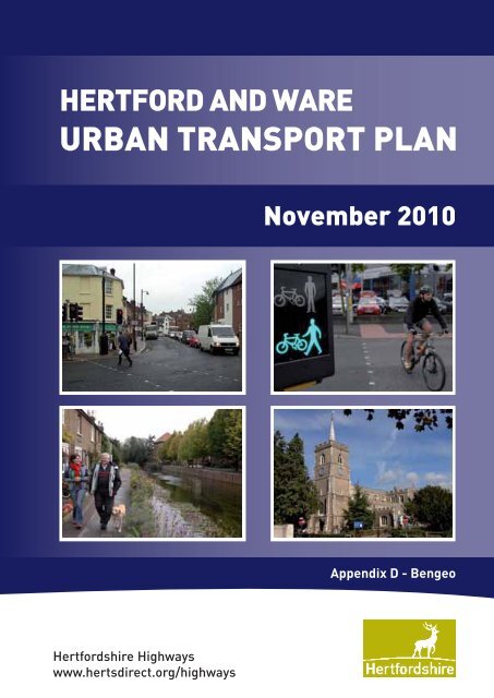
HERTFORD AND WARE<br />
<strong>URBAN</strong> <strong>TRANSPORT</strong> <strong>PLAN</strong><br />
November 2010<br />
Appendix D - Bengeo<br />
<strong>Hertfordshire</strong> Highways<br />
www.hertsdirect.org/highways
Appendix D<br />
Bengeo Traffic Modelling Study<br />
<br />
11501189-PT2<br />
Hertford and Ware UTP Stage 2 Report
Contents<br />
<br />
<br />
<br />
<br />
<br />
!"# <br />
$ $ %<br />
& " '$ ()$ <br />
& !*
GLOSSARY OF TERMS<br />
ANPR Automatic Number Plate Recogniation<br />
CPZ<br />
DMRB<br />
EHC<br />
GEH<br />
GIS<br />
GTP<br />
HCC<br />
HGV<br />
LDF<br />
LGV<br />
LMVR<br />
Controlled Parking Zone<br />
Design Manual for Roads and Bridges<br />
East Herts <strong>Council</strong><br />
Goodness of Fit Statistic to gauge the level of calibration and<br />
validation achieved between the observed data and the modelled<br />
data<br />
Geographic Information System<br />
Green Travel Plan<br />
<strong>Hertfordshire</strong> <strong>County</strong> <strong>Council</strong><br />
Heavy goods Vehicle<br />
Local Development Framework<br />
Light Goods Vehicle<br />
Local Model Validation Report<br />
LTP<br />
Modal Shift<br />
Paramics<br />
TRICS<br />
TRO<br />
UTC<br />
VMS<br />
85 th Percentile<br />
Local Transport Plan<br />
Change in use of one mode of transport to another (such as car<br />
to bus)<br />
Micro-simulation traffic modelling software package<br />
Database of observed trip generation survey data by land use<br />
type<br />
Traffic Regulation Order<br />
Urban Traffic Control<br />
Variable Message Sign<br />
The amount which is not exceeded (such as 85% of queue<br />
lengths recorded across a given time period do not exceed a<br />
certain length)
1 Introduction<br />
+ ,-#./0<br />
1.1.1 The main purpose of the Bengeo Transport model is to assess whether the<br />
surrounding strategic road network can accommodate the traffic that is currently avoiding<br />
the town centre congestion. The traffic avoiding the town centre at Old Cross is using the<br />
secondary routes along the Victorian residential streets of Lower Bengeo.<br />
1.1.2 Descriptions used in the report relate to the following:<br />
Upper Bengeo – the area west of Port Hill/Bengeo Street and north of Church<br />
Road/Westfield Road;<br />
Bengeo East – the area east of Port Hill/Bengeo Street; and<br />
Lower Bengeo – the area west of Port Hill and south of Church Road/Westfield Road<br />
1.1.3 It has been raised that rat-running represents an ongoing problem for the<br />
residents in this area. Various studies, consultations and initiatives have already been<br />
considered with the most recent being the access and parking restrictions that were<br />
implemented in 2008. However, whilst the closure of Byde Street would improve the<br />
environment in Lower Bengeo for pedestrians and cyclists as well as preventing through<br />
traffic, it would also remove route choice for residents of Upper Bengeo and Bengeo<br />
East. These appeared to make up a large proportion of trips in the Bengeo Traffic<br />
Feasibility Study.<br />
1.1.4 The implications of closing Byde Street, in terms of the resulting traffic impact on<br />
the surrounding junctions, has therefore been investigated. Potential options for<br />
mitigation measures to accommodate the diverted traffic have also been identified.<br />
1.1.5 A Paramics Micro-simulation model has been developed to test proposals, in<br />
particular the closure of Byde Street, and to consider accommodating the additional<br />
traffic at the already congested Old Cross junction in Hertford town centre. Paramics is<br />
an assessment package with sophisticated routing algorithms that can accurately model<br />
the impact of the proposals.<br />
1.1.6 The Paramics software has significant visualisation capabilities which allow the<br />
test results to be clearly demonstrated in real-time simulations. The resulting Paramics<br />
Micro-simulation model will therefore be invaluable for demonstrating the scenario results<br />
and will be used directly during the public consultation.<br />
+ 1#.""12"#3<br />
1.2.1 The <strong>County</strong> <strong>Council</strong> carried out an extensive feasibility study in 2006 to consider<br />
what options there were to reduce the number of vehicles travelling through the Bengeo<br />
residential area via Byde Street. The history of this issue before the 2006 study is<br />
summarised as follows in that report:<br />
“The main issue that has been considered previously is how to ease the<br />
congestion without encouraging vehicles to speed on these roads. The<br />
Highway Authority (<strong>Hertfordshire</strong> <strong>County</strong> <strong>Council</strong> (HCC)), East Herts <strong>Council</strong><br />
(EHC) and the Highways Partnership have considered this dilemma on many<br />
occasions since the 1970’s, and have offered various “solutions” in the past.<br />
11501189-PT2 Hertford and Ware UTP Stage 2 – Appendix D Bengeo 1
There is an existing “no vehicles except for access” traffic regulation order on<br />
Upper and Lower Bengeo. This was implemented in 1997 to prevent through<br />
traffic rat-running from outside this area. However, it has proved difficult to<br />
assess whether a vehicle is legitimately accessing the area or rat-running.<br />
The restricted area also consists of numerous entry and exit points which<br />
again make enforcement difficult.<br />
In 2005 the rat-running issues were again raised and <strong>Hertfordshire</strong> Highways<br />
consulted with residents to suggest a more co-ordinated approach in<br />
conjunction with the setting up of a Residents’ Association, in an attempt to<br />
examine what measures could be implemented to improve the situation.”<br />
1.2.2 The 2006 study presented six options to reduce traffic flow through the area.<br />
These together with the outcome for each are shown in Table 1.1 below.<br />
Measure Implemented? Reasons<br />
Width Restrictions<br />
at entry points<br />
Chicane and<br />
Traffic Priority<br />
One way traffic<br />
system<br />
Clear signing at<br />
entry points to<br />
indicate a<br />
residential area<br />
possibly<br />
combined with a<br />
20mph zone<br />
Road Closure<br />
Restricted<br />
Turning<br />
Movements<br />
No<br />
No<br />
No<br />
No<br />
Possible, but not<br />
considered<br />
reasonable<br />
response to the<br />
issue so not<br />
implemented<br />
Yes<br />
Received negative feed back during the consultation;<br />
Isn’t feasible as access for delivery and servicing vehicles needs<br />
to be maintained.<br />
Strong objection during consultation;<br />
Loss of parking;<br />
Space Constraints.<br />
Extremely strong objection during consultation;<br />
Potential for increased speeds;<br />
Limitation of cycling facilities<br />
Lack of precedent in <strong>Hertfordshire</strong>;<br />
Lack of impact on the problem;<br />
Negative impact on streetscape;<br />
Footway constraints for signage;<br />
20mph zones must be self enforcing requiring the introduction of<br />
speed reduction measures in the area, these may not be<br />
compatible with the conservation status of the area;<br />
Traffic speeds in the area are generally low;<br />
This scheme would not have a significant impact on traffic<br />
volumes without additional measures.<br />
Restriction to access for residents in Bengeo;<br />
Impact on Old Cross<br />
Further modelling required<br />
Table 1.1: Summary of 2006 Study Measures and Recommendations<br />
1.2.3 A ‘No Right Turn’ into Cross Road, Monday to Friday, 7:30 to 9:30am was trialled<br />
and then made permanent. This achieved a 16% decrease in southbound traffic through<br />
Byde Street during the morning peak and corresponded with a 247% increase in traffic<br />
using The Avenue (albeit baseline traffic levels on this route were previously quite low).<br />
These results were obtained from surveys. The long term benefits of the ‘No Right Turn’<br />
may well have reduced, with a reduction in Police enforcement. Consideration was given<br />
to an experimental closure of Byde Street. However, it was felt that without modelling of<br />
the various scenarios a closure should not take place.<br />
1.2.4 It was therefore agreed that modelling should take place as part of the Hertford &<br />
Ware Urban Transport Plan. This has now been completed.<br />
2 Hertford and Ware UTP Stage 2 – Appendix D Bengeo 11500189-PT2
1.2.5 Since the decision was made to undertake the modelling work, the Sainsbury’s<br />
proposals for the McMullen Brewery Site have advanced and were granted planning<br />
permission in January 2010 following a public inquiry. A decision was therefore taken to<br />
include the potential affects of the Sainsbury’s development in terms of changes to traffic<br />
flow within the modelling work undertaken.<br />
1.2.6 The modelling undertaken looked at the following:<br />
Existing situation;<br />
Existing situation plus Sainsbury’s; and<br />
Existing situation with Sainsbury’s plus Byde Street closure.<br />
<br />
11501189-PT2 Hertford and Ware UTP Stage 2 – Appendix D Bengeo 3
2 Bengeo Transport Modelling<br />
2.1 The model has been built using traffic data collected on the 2 nd July 2009 from the<br />
areas of interest and historic relevant traffic data. Figure 2.1 illustrates the location of<br />
Bengeo and the extent of the Paramics model.<br />
Figure 2.1: Location Plan of Bengeo Modelling Area<br />
4 Hertford and Ware UTP Stage 2 – Appendix D Bengeo 11500189-PT2
2.2 The model has been developed specifically with a view to testing the impact of the<br />
closure of Byde Street on the road network of Hertford and also to test the impact of the<br />
proposed superstore development (Sainsbury’s) at the McMullen’s brewery site. Whilst the<br />
testing primarily focuses on car traffic there will also be implications for bus services.<br />
2.3 This report sets out the findings of the modelling work and considers the impacts of<br />
the new superstore and the closure of Byde Street.<br />
+ #01401" #/<br />
2.1.1 The Paramics model area, shown in Figure 2.1, includes the A414 to the south<br />
between the junction of Hertingfordbury Road with Cross Lane in the West and the junction<br />
of Ware Road, London Road and Fore Street in the East (Bluecoats). To the north west<br />
the model extends to include the junction of High Road with Bullsmill Road and to the north<br />
east the model extends to include Sacombe Road and Wades Mill Road.<br />
2.1.2 The model has been developed for two assessment periods, namely the morning<br />
and evening weekday peak periods. For the morning peak period the model has been<br />
developed for the time period 0700-1000, with 0800-0900 representing the peak hour. In<br />
the evening peak period the time period 1600-1900 has been modelled with 1700-1800<br />
representing the peak period.<br />
+ ##/"1"/-<br />
2.2.1 The scenarios tested were as below. These were undertaken using the existing<br />
situation model.<br />
<br />
<br />
Implementation of proposed Sainsbury’s superstore; and<br />
Implementation of proposed Sainsbury’s superstore and the introduction of the closure<br />
of Byde Street.<br />
2.2.2 All of the scenarios were tested for the AM and PM peak periods (7-10am and 4-<br />
7pm).<br />
2.2.3 No adjustments have been made to the model in terms of signal timing at the Old<br />
Cross junction. For example no testing has been done to assess the impact of increasing<br />
green time for the Old Cross southbound movement. However, as this junction is close to<br />
capacity, increasing green time to the southbound towards Old Cross from Port Hill will<br />
generate additional delay to the other two arms which is likely to have more significant<br />
impacts on the A414.<br />
2.2.4 It should also be noted that the Sainsbury’s traffic flows are based on the<br />
“Addendum Transport Statement of Common Ground between <strong>Hertfordshire</strong> <strong>County</strong><br />
<strong>Council</strong> and Savell Bird & Axon” produced in September 2009 in preparation for the<br />
Sainsbury’s Planning Public Inquiry. These are single peak hour flows so TRICS has been<br />
used to estimate 3-hour flows to cover the model periods.<br />
11501189-PT2 Hertford and Ware UTP Stage 2 – Appendix D Bengeo 5
3 Model Validation<br />
+ #014 4#//040#/<br />
3.1.1 A full Local Model Validation Report (LMVR) has been produced as part of the<br />
model development process and this has been agreed with <strong>Hertfordshire</strong> <strong>County</strong> <strong>Council</strong>.<br />
However, an overview of the calibration and validation processes and key validation<br />
statistics based on DMRB guidance are provided below.<br />
3.1.2 The model has been calibrated in accordance with the guidance on model validation<br />
provided within the DMRB (Design Manual for Roads and Bridges), using observed turning<br />
count data for calibration, and journey time and queue surveys for validation. The DMRB<br />
acceptance criteria for model validation is shown in Figure 3.1 below<br />
Figure 3.1 DMRB Acceptance Criteria<br />
3.1.3 The trip matrix has been constructed from a range of surveys carried out on the 2nd<br />
July 2009 and also utilising some existing turning count information. This data has been<br />
combined with a visual inspection of the network and matrix estimation.<br />
3.1.4 For the matrix estimation process all available turning count data has been used. In<br />
the development of a trip matrix this ensures the best possible trip matrix is obtained by<br />
using all available data. The queue and journey time data are not used in the matrix<br />
estimation process and therefore are considered as independent data which have been<br />
used for validation purposes.<br />
3.1.5 The AM peak hour of the model achieves a 97.1% pass rate in
3.1.7 DMRB also specifies that 85% of modelled movements should obtain a GEH score<br />
of less than 5 when compared to observed values. A GEH value of 0 reflects a perfect fit,<br />
values up to and including 5 reflect a good fit, a value between 5 and 10 represents an<br />
acceptable fit and values over 10 represent a poor fit. The GEH statistic is a summary<br />
statistic used as a measure of the goodness of fit of observed to modelled data.<br />
3.1.8 The morning peak model well exceeds DMRB criteria with 97.4% of links with a<br />
GEH score of less than 5 and 97.4% with a value of less than 6. The average value across<br />
all movements is 1.60. The evening peak model exceeds DMRB criteria with 95.9% of links<br />
with a GEH score of less than 5 and 98.6% with a value of less than 6. The average value<br />
across all counts is 1.60.<br />
3.1.9 This illustrates that in terms of vehicle flow the model provides an accurate<br />
representation of the observed data.<br />
+ 5.1.141/-240#/<br />
3.2.1 The Paramics model validation has been undertaken against the surveyed queue<br />
and journey time data. Registration plate data has also been used to check the correct<br />
magnitude of trips are routing through lower Bengeo.<br />
3.2.2 The DMRB does not provide a definition for the validation of queue data, but<br />
practice over recent years has been to demonstrate that the modelled queue is of the same<br />
order as the observed. When observing a junction the queue will fluctuate significantly both<br />
through the period and from day to day. It is never therefore expected, or required to exactly<br />
replicate observed queues within the model<br />
3.2.3 However, queues are typically very sensitive to fluctuations in demand and even if<br />
the same people traversed the network everyday, queue patterns and peaks would vary<br />
significantly.<br />
3.2.4 The Paramics queue output compared with the observed has been assessed on the<br />
basis of a 95% confidence limit, which allows for the variation in queue within the Paramics<br />
model to be assessed against the observed values. The junctions included in the queue<br />
validation are as follows:<br />
A414 Hertingfordbury Road / Cross Lane;<br />
A414 Gascoyne Way / Parliament Square / Hale Road;<br />
A414 London Road / A414 Gascoyne Way / Fore Street / Ware Road (Bluecoats<br />
Roundabout);<br />
Old Cross / Mill Bridge / St Andrew Street;<br />
North Road / Welwyn Road / Beane Road; and<br />
Bengeo Street / Sacombe Road / Wades Mill Road.<br />
21/-)#0.3#06 #""4/1<br />
3.2.5 The queues observed at this junction provide a reasonable representation of<br />
observed, however typically overestimate queues slightly at the junction. In the morning<br />
peak period, the majority of approaches are observed to have very limited queuing with<br />
queues below 50m for the majority of the peak period. This is reflected in the model. In the<br />
PM peak period there are slight discrepancies between the modelled and observed queue<br />
lengths. However, the journey time for this arm validates in both peak periods.<br />
11501189-PT2 Hertford and Ware UTP Stage 2 – Appendix D Bengeo 7
-" #3/17 364 1/"5.16241#0<br />
3.2.6 The queues observed at this junction are typically of the same order of magnitude<br />
as the modelled queues. However a couple of approach arms have more significant queuing<br />
modelled than observed. The journey times for the A414 in both directions from this junction<br />
validate in both peak periods.<br />
4#/0#/06-" #3/17 36)#1"1167 1#0<br />
3.2.7 The queues observed at Bluecoats roundabout were generally of the same<br />
magnitude and profile of those observed on site.<br />
#40 #""6 440-16"/017 "11<br />
3.2.8 The profile of queues is well represented by the model in both AM and PM peak<br />
periods at this junction for all approach arms.<br />
/#2#067 147 3/#061/1#0<br />
3.2.9 The queues modelled at this junction match those observed very closely. The only<br />
queue which does not match the observed queue is that along Welwyn Road in the PM<br />
peak period, where during the second half of the period the queue extends further in the<br />
model than the length observed.<br />
3.2.10 This queuing discrepancy has been reviewed in the model and it has confirmed that<br />
the correct number of vehicles are travelling along the link. Furthermore, unrealistic changes<br />
would have to be made to model coding to further increase capacity at this junction. The<br />
current modelling is therefore deemed appropriate.<br />
1/-1#"116" # 1#067 01" 44#0<br />
3.2.11 The queuing modelled at this junction is very similar to that observed, with all arms<br />
at all times showing a similar profile and magnitude of queue in the model to that observed.<br />
+ 8#./13 140#/<br />
3.3.1 This section outlines a comparison between the modelled and observed journey<br />
times and provides validation statistics indicating a goodness of fit to observed data. The<br />
observed journey times were recorded between 08:00 and 09:00, and 17:00 and 18:00 for<br />
each of the AM and PM peak hours respectively; during each hour a minimum of 6 journey<br />
times were carried out for each route in each direction.<br />
3.3.2 Modelled journey times were recorded using the ‘paths’ feature in Paramics, which<br />
records every vehicle trip along a specified route. All trips in the periods 08:00 to 09:00 and<br />
17:00 to 18:00 for each of the AM and PM peaks have been used for analysis averaged<br />
across 5 model runs.<br />
3.3.3 Journey time routes have been chosen to represent the main routes through the<br />
network in order to validate the length of trips through the model. Four routes have been<br />
chosen for this model:<br />
Route 1 From the A414 roundabout junction with Campfield Road to the west, along the<br />
A414, to the A414 roundabout junction with Ware Road (Bluecoats roundabout) to the<br />
east;<br />
Route 2 From The Wick / Sacombe Road T-junction to the north, along the A158, to the<br />
A158 roundabout junction with Pegs Lane to the south;<br />
Route 3 From B1000 Welwyn Road / Fordwich Rise T-junction at the west, via Nelson<br />
Street and Byde Street, to the Bengeo Street / Cross Road junction; and<br />
8 Hertford and Ware UTP Stage 2 – Appendix D Bengeo 11500189-PT2
Route 4 From A119 North Road / Bramfield Road T-junction in the west, to the A119, St<br />
Andrew St and the A158 junction (Old Cross signalised junction) in the east.<br />
3.3.4 A 95% confidence interval has been used for the purpose of journey time validation<br />
and this is standard practice when validating journey times in micro-simulation models. This<br />
is also a more stringent test than the DMRB requirement for an 85% confidence interval.<br />
3.3.5 To compare modelled times to the observed times, 5 runs of the Paramics model<br />
were completed for both the morning and evening peak periods. This provided a large<br />
sample of vehicle journeys between two points for comparison with the observed data, with<br />
the mean value being used.<br />
3.3.6 The average modelled value was then plotted against the average observed value.<br />
Graphs illustrating the validation criteria for the modelled journey times plotted against the<br />
observed journey times for the routes are included in the LMVR.<br />
3.3.7 The journey time results show sections grouped by direction. 77% of journey time<br />
results in the AM peak hour pass the journey time test. The analysis demonstrates that<br />
where the modelled journey lengths do not fall within the confidence interval the model<br />
typically has longer journey times, which is robust.<br />
11501189-PT2 Hertford and Ware UTP Stage 2 – Appendix D Bengeo 9
4 Model Results<br />
+ /17 #,8#./13 1"" "<br />
4.1.1 The results are considered for the three 3 scenarios:<br />
<br />
<br />
<br />
Existing situation (current traffic conditions);<br />
Scenario A – Sainsbury’s in place; and<br />
Scenario B – Sainsbury’s in place and Byde Street closure.<br />
Time Period<br />
AM (0700 to 1000)<br />
PM (1600 to 1900)<br />
Scenario<br />
Total Network<br />
Journey Time<br />
(seconds)<br />
Vehicles<br />
Average Journey<br />
Time per Vehicle<br />
(seconds)<br />
Existing Situation 2794452 8402 333<br />
A – Sainsbury’s 2824936 8509 332<br />
B – Sainsbury’s<br />
plus Byde Street<br />
Closure<br />
3181262 8490 375<br />
Existing Situation 2204700 7623 289<br />
A – Sainsbury’s 2015728 7843 257<br />
B – Sainsbury’s<br />
plus Byde Street<br />
Closure<br />
3061705 7838 391<br />
Table 4.1 – Network Journey Time Statistics (across the whole model network)<br />
4.1.2 Table 4.1 shows the numbers across the whole modelled area, as shown in Figure<br />
2.1, rather than at any specific location on the network. The total network journey time is a<br />
sum of all vehicles on the network and their modelled journey times. The number of vehicles<br />
shows the modelled vehicle movements across the model network area. The average journey<br />
time per vehicle shows the average time for each vehicle to undertake its journey within the<br />
model network area.<br />
4.1.3 Scenario A involves significant re-routing of a number of trips from their normal route<br />
to the proposed Sainsbury’s development. This will increase the overall number of vehicle<br />
trips as one trip through the model becomes two trips - one from the origin zone to the<br />
Sainsbury’s zone, and a second from there to the destination zone. However the overall<br />
average journey time remains approximately the same depending on exactly where queues<br />
are in the model.<br />
4.1.4 Scenario B includes both the closure of Byde Street and the introduction of the<br />
Sainsbury’s development, putting more pressure on the route parallel to the A414 in the eastwest<br />
direction. The number of vehicles on the network remains approximately the same as for<br />
Scenario A, however the routing is significantly different and hence the additional delays.<br />
4.1.5 The results in Table 4.1 show that Sainsbury’s does not have a significant effect on<br />
network operation and, whilst this is based on future estimated flows and not actual flows, the<br />
model provides the most robust prediction available. However, until Sainsbury’s is open it is<br />
not possible to fully understand the implications of the new superstore in terms of the highway<br />
network operation.<br />
10 Hertford and Ware UTP Stage 2 – Appendix D Bengeo 11500189-PT2
4.1.6 It can be seen that with Sainsbury’s and the closure of Byde Street, there is significant<br />
detriment to the operation of the local road network on the primary routes. Despite this the<br />
secondary residential routes of lower Bengeo no longer have any through traffic. The primary<br />
routes through Bengeo into Hertford, where there are already queues, have additional traffic<br />
in the order of some 200-300 extra vehicles over the 3-hour peak period. This traffic would<br />
normally route through the Bengeo residential area.<br />
4.1.7 It should be noted that the additional congestion at the Old Cross junction will also<br />
cause delays to bus services.<br />
+ 5.1.141/-2"<br />
4.2.1 Queue length graphs for the AM peak period at Old Cross are shown in Figure 4.1<br />
below with corresponding queue lengths for Old Cross Southbound only shown in Table 4.2.<br />
Bengeo Model - AM Q - Old Cross Soutbound<br />
(Old Cross Signals)<br />
Bengeo Model - AM Q - Mill Bridge Westbound<br />
(Old Cross Signals)<br />
800<br />
700<br />
600<br />
800<br />
700<br />
600<br />
Distance (m)<br />
Distance (m)<br />
500<br />
400<br />
300<br />
200<br />
100<br />
0<br />
800<br />
700<br />
600<br />
500<br />
400<br />
300<br />
200<br />
100<br />
07:00:00<br />
07:10:00<br />
0<br />
07:00:00<br />
07:10:00<br />
07:20:00<br />
07:30:00<br />
07:40:00<br />
07:50:00<br />
08:00:00<br />
08:10:00<br />
08:20:00<br />
08:30:00<br />
Time<br />
Bengeo Model - AM Q - St. Andrews Street Eastbound<br />
(Old Cross Signals)<br />
07:20:00<br />
07:30:00<br />
07:40:00<br />
07:50:00<br />
08:00:00<br />
08:10:00<br />
08:20:00<br />
08:30:00<br />
Time<br />
08:40:00<br />
08:50:00<br />
09:00:00<br />
09:10:00<br />
09:20:00<br />
09:30:00<br />
09:40:00<br />
09:50:00<br />
08:40:00<br />
08:50:00<br />
09:00:00<br />
09:10:00<br />
09:20:00<br />
09:30:00<br />
09:40:00<br />
09:50:00<br />
Distance (m)<br />
500<br />
400<br />
300<br />
200<br />
100<br />
0<br />
07:00:00<br />
07:10:00<br />
07:20:00<br />
07:30:00<br />
07:40:00<br />
07:50:00<br />
08:00:00<br />
08:10:00<br />
08:20:00<br />
08:30:00<br />
Figure 4.1: Queue Lengths for the AM peak period at Old Cross<br />
Time<br />
08:40:00<br />
08:50:00<br />
09:00:00<br />
09:10:00<br />
09:20:00<br />
09:30:00<br />
09:40:00<br />
09:50:00<br />
Current and Predicted Queue Lengths at<br />
the Old Cross Junction in Hertford<br />
Current Queue Lengths (based on data<br />
collected on mid-week day in July outside<br />
school holidays)<br />
Predicted Queue Length with Sainsbury's<br />
Open<br />
Predicted Queue Length with Sainsbury's<br />
Open and Byde Street Closure<br />
11501189-PT2 Hertford and Ware UTP Stage 2 – Appendix D Bengeo 11
Time<br />
Average Queue Length (m) at Old Cross Junction (AM Peak Period)<br />
Old Cross Southbound Only<br />
Existing<br />
Situation<br />
Queue Length<br />
(m)<br />
Scenario<br />
A<br />
Difference<br />
Existing vs.<br />
Scenario A<br />
Scenario<br />
B<br />
Difference<br />
Existing vs.<br />
Scenario B<br />
07:00 36 36 0 50 14<br />
07:05 38 34 -4 50 12<br />
07:10 44 47 3 52 8<br />
07:15 44 49 5 56 12<br />
07:20 49 43 -6 44 -5<br />
07:25 37 43 6 45 8<br />
07:30 78 64 -14 64 -14<br />
07:35 69 55 -14 86 17<br />
07:40 55 55 0 61 6<br />
07:45 80 54 -26 105 25<br />
07:50 102 85 -17 152 50<br />
07:55 88 95 7 221 133<br />
08:00 140 162 22 225 85<br />
08:05 186 131 -55 329 143<br />
08:10 191 145 -46 498 307<br />
08:15 203 227 24 601 398<br />
08:20 188 142 -46 677 489<br />
08:25 157 153 -4 736 579<br />
08:30 180 247 67 674 494<br />
08:35 239 307 68 651 412<br />
08:40 322 344 22 700 378<br />
08:45 324 343 19 619 295<br />
08:50 370 233 -137 648 278<br />
08:55 468 241 -227 626 158<br />
09:00 493 329 -164 667 174<br />
09:05 387 285 -102 624 237<br />
09:10 217 240 23 593 376<br />
09:15 105 134 29 493 388<br />
09:20 48 80 32 334 286<br />
09:25 37 49 12 179 142<br />
09:30 38 45 7 87 49<br />
09:35 38 69 31 77 39<br />
09:40 37 68 31 73 36<br />
09:45 44 58 14 99 55<br />
09:50 89 94 5 118 29<br />
09:55 47 52 5 74 27<br />
Table 4.2: Average Queue Lengths Southbound at Old Cross (AM Peak)<br />
4.2.2 Queue length graphs for the PM peak period at Old Cross are shown in Figure 4.2<br />
below with corresponding queue lengths for St Andrew Street Eastbound only shown in Table<br />
4.3.<br />
12 Hertford and Ware UTP Stage 2 – Appendix D Bengeo 11500189-PT2
Bengeo Model - PM Q - Old Cross Southbound<br />
(Old Cross Signals)<br />
Bengeo Model - PM Q - Mill Bridge Westbound<br />
(Old Cross Signals)<br />
600<br />
600<br />
500<br />
500<br />
Distance (m)<br />
Distance (m)<br />
400<br />
300<br />
200<br />
100<br />
0<br />
600<br />
500<br />
400<br />
300<br />
200<br />
100<br />
16:00:00<br />
16:10:00<br />
0<br />
16:00:00<br />
16:10:00<br />
16:20:00<br />
16:30:00<br />
16:40:00<br />
16:50:00<br />
17:00:00<br />
17:10:00<br />
17:20:00<br />
17:30:00<br />
Time<br />
Bengeo Model - PM Q - St. Andrews Street Eastbound<br />
(Old Cross Signals)<br />
16:20:00<br />
16:30:00<br />
16:40:00<br />
16:50:00<br />
17:00:00<br />
17:10:00<br />
17:20:00<br />
17:30:00<br />
Time<br />
17:40:00<br />
17:50:00<br />
18:00:00<br />
18:10:00<br />
18:20:00<br />
18:30:00<br />
18:40:00<br />
18:50:00<br />
17:40:00<br />
17:50:00<br />
18:00:00<br />
18:10:00<br />
18:20:00<br />
18:30:00<br />
18:40:00<br />
18:50:00<br />
Distance (m)<br />
400<br />
300<br />
200<br />
100<br />
0<br />
16:00:00<br />
16:10:00<br />
Figure 4.2: Queue Lengths for the PM peak period at Old Cross<br />
16:20:00<br />
16:30:00<br />
16:40:00<br />
16:50:00<br />
17:00:00<br />
17:10:00<br />
17:20:00<br />
17:30:00<br />
Time<br />
17:40:00<br />
17:50:00<br />
18:00:00<br />
18:10:00<br />
18:20:00<br />
18:30:00<br />
18:40:00<br />
18:50:00<br />
Current and Predicted Queue Lengths at<br />
the Old Cross Junction in Hertford<br />
Current Queue Lengths (based on data<br />
collected on mid-week day in July outside<br />
school holidays)<br />
Predicted Queue Length with Sainsbury's<br />
Open<br />
Predicted Queue Length with Sainsbury's<br />
Open and Byde Street Closure<br />
11501189-PT2 Hertford and Ware UTP Stage 2 – Appendix D Bengeo 13
Average Queue Length at Old Cross Junction (PM Peak Period) – St Andrew<br />
Street Eastbound<br />
Time<br />
Existing<br />
Situation<br />
Queue<br />
Length (m)<br />
Scenario<br />
A<br />
Difference<br />
Existing vs.<br />
Scenario A<br />
Scenario<br />
B<br />
Difference<br />
Existing vs.<br />
Scenario B<br />
16:00 82 86 4 111 29<br />
16:05 94 170 76 272 178<br />
16:10 132 196 64 315 183<br />
16:15 140 183 43 288 148<br />
16:20 140 172 32 248 108<br />
16:25 122 144 22 241 119<br />
16:30 110 143 33 231 121<br />
16:35 115 111 -4 206 91<br />
16:40 88 115 27 225 137<br />
16:45 118 123 5 326 208<br />
16:50 145 131 -14 387 242<br />
16:55 160 164 4 472 312<br />
17:00 157 148 -9 507 350<br />
17:05 164 184 20 501 337<br />
17:10 162 207 45 505 343<br />
17:15 154 215 61 519 365<br />
17:20 167 204 37 527 360<br />
17:25 161 197 36 514 353<br />
17:30 200 221 21 535 335<br />
17:35 274 259 -15 517 243<br />
17:40 285 270 -15 536 251<br />
17:45 283 278 -5 541 258<br />
17:50 341 309 -32 548 207<br />
17:55 388 346 -42 550 162<br />
18:00 398 389 -9 551 153<br />
18:05 412 434 22 545 133<br />
18:10 417 436 19 550 133<br />
18:15 415 457 42 545 130<br />
18:20 395 454 59 545 150<br />
18:25 385 433 48 547 162<br />
18:30 362 433 71 550 188<br />
18:35 340 458 118 555 215<br />
18:40 313 419 106 547 234<br />
18:45 282 394 112 542 260<br />
18:50 287 332 45 550 263<br />
18:55 341 301 -40 551 210<br />
Table 4.3: Average Queue Lengths at Old Cross St Andrew Street Eastbound (PM Peak)<br />
4.2.3 The above table 4.3 shows a direct comparison between the existing situation model<br />
and the two modelled scenarios. It is important to focus on the differences in the queue<br />
lengths between the different scenarios and the existing situation.<br />
14 Hertford and Ware UTP Stage 2 – Appendix D Bengeo 11500189-PT2
4.2.4 The queue lengths with Sainsbury’s in place do not change significantly, with similar<br />
profiles to the existing situation across both AM and PM peak periods. As would be expected<br />
with a superstore, the PM peak exhibits some extension of queue lengths at the Old Cross<br />
junction.<br />
4.2.5 The reasons for the small change when Sainsbury’s opens are set out below:<br />
<br />
<br />
<br />
<br />
<br />
<br />
The number of new trips in the model, based on the Sainsbury’s Agreed Transport<br />
Statement, indicates only 12 additional vehicles in the AM peak (08:00 – 09:00) and 55<br />
additional vehicles in the evening peak (17:00 – 18:00). All the rest are pass by or diverted<br />
trips (i.e. journeys already travelling on the local road network);<br />
A number of vehicles remained queued on the Sainsbury’s exit arm, especially in the<br />
evening peak period therefore not reaching the Old Cross junction. The queue analysis<br />
does not provide details of the queue internal to the Sainsbury’s site (however it extends<br />
up to almost 100 vehicles);<br />
The Sainsbury’s development results in the removal of trips on the A414 and hence<br />
queues on a delayed part of the network. As a result strategic traffic from North Road<br />
previously avoiding the A414 through Old Cross can now replace the trips that have been<br />
removed. The diversion of trips to Sainsbury’s therefore has wider network distribution<br />
effects, reducing the flow of some vehicles through the Old Cross junction;<br />
Performance of other junctions in the network are affected by the redistribution of trips and<br />
this has an impact on the routing of vehicles through the network;<br />
Variability in model runs can account for a difference. Queue length is particularly volatile<br />
on a day to day basis i.e. the length of the queue can change a lot from one day to the<br />
next. Therefore, there are differences in queue length between the modelled options as a<br />
result of this variability and volatility. For this reason it is important to focus on the<br />
difference trend across the whole time period rather than specific intervals;<br />
During the AM peak there are not many trips to the Sainsbury’s store. Therefore a<br />
proportion of trips will divert to avoid the Old Cross junction as drivers expect there to be<br />
an increase in queuing time caused by the opening of the new store. This behaviour is not<br />
mirrored in the PM peak as during this period there is a high occurrence of people going to<br />
Sainsbury’s on their way home. Therefore they have no choice in route and must queue at<br />
Old Cross.<br />
4.2.6 The reasons for a larger change when Sainsbury’s is open and Byde Street is closed<br />
are set out below<br />
<br />
<br />
With both Sainsbury’s and the Byde Street closure, the queues at the Old Cross junction<br />
heading southbound from Bengeo Street and Port Hill do extend significantly from between<br />
200m to 400m in the AM peak period in the existing situation to over 700m. This is on the<br />
southbound approach to the Old Cross junction as would be expected with traffic forced to<br />
re-route via Bengeo Street/Port Hill and Old Cross due to the Byde Street closure. The<br />
other approaches have similar queue profiles between the existing situation and the two<br />
scenarios.<br />
In the PM peak the queues increase on the St Andrew Street and Mill Bridge approaches<br />
to Old Cross but not as significantly as experienced in the AM peak southbound towards<br />
the Old Cross junction. St Andrew Street shows increases in queue lengths from around<br />
400m currently to around 550m in the PM Peak and this is largely as a result of<br />
northbound traffic having to re-route via Old Cross as routes via Byde Street in Lower<br />
Bengeo are no longer available.<br />
11501189-PT2 Hertford and Ware UTP Stage 2 – Appendix D Bengeo 15
In both AM and PM peaks there will be significant reductions in car journeys through the<br />
residential streets of Lower Bengeo of around 250 vehicles and 350-400 vehicles<br />
respectively.<br />
4.2.7 It should be noted that the model does not take account of any wider effects of the<br />
Sainsbury’s and/or Byde Street closure, such as displacement of traffic to other routes,<br />
changes in mode of travel or times drivers undertake their journeys.<br />
16 Hertford and Ware UTP Stage 2 – Appendix D Bengeo 11500189-PT2
5 Bengeo Area Proposals<br />
+ ". 3#) #0144/-1".4"<br />
5.1.1 The conclusions show that, with the scenarios tested there is little change to the<br />
highway network with the opening of the Sainsbury’s superstore. However, there is a<br />
detriment to network operation and queuing with the option of closing Byde Street. This is due<br />
to journeys diverting onto Bengeo Street, Port Hill and St Andrew Street.<br />
5.1.2 The conclusions of the modelling work show that:<br />
<br />
<br />
<br />
<br />
The network is already congested in the study area in the peak hours;<br />
There is a slight increase in queuing along Port Hill and Bengeo Street in the am peak<br />
when Sainsbury’s opens. The effect is more noticeable in the PM peak with increased<br />
queuing along St Andrew Street towards Old Cross. (Predicted traffic to Sainsbury’s taken<br />
from HCC Development Control);<br />
There is large increase in queuing along Port Hill and Bengeo Street in the AM peak when<br />
Sainsbury’s is open and Byde Street is closed as well as along St Andrew Street in the PM<br />
peak; and<br />
There is a slight benefit on the network due to the switch of shoppers between Tesco and<br />
Sainsbury’s once it opens. Trips diverted off A414 for example.<br />
5.1.3 It should also be noted that the additional delays and queuing will significantly impact<br />
on the reliability of bus services.<br />
5.1.4 The model presents the most robust means of predicting the likely impacts of any<br />
closure. The model also represents the worst case that would be likely to be experienced.<br />
However, the localised Paramics model does not take account of any wider network<br />
implications, i.e. where drivers alter their travel habits due to the increased congestion.<br />
+ 2-27 3 2/-1"<br />
5.2.1 As noted in the second key stakeholder workshop, 90% of stakeholders would prefer<br />
to reduce ‘rat-running’ on the secondary routes through residential areas, even if this has the<br />
affect of increasing congestion on primary routes. 100% of stakeholders wanted to encourage<br />
the use of sustainable transport, rather than increase road capacity.<br />
5.2.2 In the Consultation Questionnaire, question 13 asked respondents to tell us about<br />
their level of support for measures to reduce rat-running in specific residential areas. In<br />
response to this question 60% of respondents gave a positive answer with 25% giving a<br />
negative response and 15% having no view.<br />
5.2.3 There is also a significant history of considering the local traffic issues in Bengeo with<br />
previous studies undertaken in 2006 when it was decided not to proceed with any closure due<br />
to likely congestion issues.<br />
5.2.4 The recent modelling, described in this report, provides the most comprehensive<br />
means of predicting the future impacts of any closure. While this modelling has estimated that<br />
the congestion may significantly worsen, there is already congestion in the vicinity of Old<br />
Cross. Furthermore the recent Sainsbury’s decision has found that local wider benefits may<br />
outweigh congestion impacts.<br />
11501189-PT2 Hertford and Ware UTP Stage 2 – Appendix D Bengeo 17
5.2.5 It is recommended that congestion impacts in the vicinity of the Old Cross junction are<br />
reduced by providing an improved road layout. This would encourage a safer environment for<br />
pedestrians and cyclists whilst still accommodating vehicular traffic. Further detail is included<br />
in Appendix A.<br />
5.2.6 Whilst it is acknowledged that the closure of Byde Street would improve the<br />
residential amenity in Bengeo, any such closure is subject to further consideration and<br />
therefore the consultation sought views on two possible options:<br />
<br />
Option 1: Byde Street closure is implemented, initially for a temporary period, to monitor<br />
the impacts. The temporary closure would only be put in place once the Sainsbury’s<br />
superstore has opened and the full traffic impacts are known. If the benefits outweigh any<br />
localised and wider implications the decision could be made to make the closure<br />
permanent. More detail is given in the pro-forma BEN1a at Appendix A.<br />
5.2.7 It is estimated that the cost of this option would be:<br />
Installation of temporary bollard, signage and minor highway works £20, 000<br />
Design Fee including experimental traffic regulation order £5, 000<br />
<br />
Traffic Counts (manual junction counts & automatic traffic counts – pre-Sainsbury’s, post<br />
Sainsbury’s and during trial) £75, 000. See section on monitoring trial closure for further<br />
information.<br />
5.2.8 Table 5.1 shows the strengths and weaknesses of Option 1 Byde Street Closure.<br />
Strengths<br />
Keeps through traffic on the primary route<br />
network<br />
Protect residents in Bengeo<br />
Encourages sustainable travel through<br />
walking and cycling for short journeys and<br />
travel to school<br />
Temporary closure allows impacts to be<br />
quantified and a final decision to be made<br />
Decisions made once Sainsbury’s traffic<br />
impacts are known.<br />
Agreed strategy for tackling on-going<br />
issue.<br />
Weaknesses<br />
Potential impact on Waterford with more traffic<br />
seeking an alternative route<br />
Restricts access for local residents<br />
Amenity for residents at Old Cross area and<br />
main routes will be reduced<br />
Detriment to highway network (noting existing<br />
congestion)<br />
Reduces on street parking in the vicinity of the<br />
trial closure<br />
Possible delay to bus services<br />
Delays decision until after Sainsbury’s opens<br />
Wider impacts likely, such as on A414 or A119<br />
as drivers seek alternative routes.<br />
UTP consultation sought views across Not all local residents support closure<br />
Hertford of closure<br />
Congestion on Primary Routes<br />
Table 5.1 Strengths and Weaknesses of Byde Street Closure<br />
5.2.9 The Urban Transport Plan proposes schemes and projects to encourage more<br />
journeys by foot, bicycle and public transport to lessen the impact of a closure if this option is<br />
included in the final plan.<br />
5.2.10 Alternatively the following option could be selected:<br />
<br />
Option 2: No closure of Byde Street and therefore no changes are made to the road<br />
network.<br />
18 Hertford and Ware UTP Stage 2 – Appendix D Bengeo 11500189-PT2
+ #/#/-/34 4#".1<br />
5.3.1 As outlined above any permanent closure would be subject to monitoring the<br />
outcomes of the Byde Street trial closure. However, the trial closure would only be<br />
implemented once the traffic impacts of the Sainsbury’s superstore are known. The<br />
monitoring would cover the following:<br />
<br />
<br />
<br />
<br />
Changes in traffic flows around this part of the town;<br />
Changes in queue lengths in the town (including other main routes into Hertford) and<br />
particularly at the Old Cross junction;<br />
Changes in journey times and delays (including impacts on bus services) at the Old Cross<br />
junction; and<br />
Consideration of any modal shift from car to cycling and walking.<br />
5.3.2 Exact criteria based on the monitoring to assist any decisions on whether to make the<br />
closure have been determined as set out in section 7.3.6 The “base” situation would also only<br />
be determined once the Sainsbury’s store has opened. The criteria are related to the<br />
increases in delay, journey times and queues at Old Cross junction as a result of the<br />
Sainsbury’s development.<br />
+ #01"2)15.10#".#21##"10 4#".1<br />
5.4.1 Consideration has also been given to the amount of modal shift required from car to<br />
other means of travel, such as walking and cycling. This would be to achieve a situation<br />
where the Old Cross part of town would be no worse than prior to any closure being<br />
implemented. It is possible that some modal shift would be achieved through the UTP<br />
proposals.<br />
5.4.2 Based on the Paramics modelling of the Bengeo area of Hertford, the proposed<br />
closure of Byde Street within the Bengeo area would cause re-routing of approximately 250<br />
southbound vehicles per hour in the AM peak period and 350-400 northbound vehicles per<br />
hour in the PM Peak period. These would largely be re-directed via Port Hill and the Old<br />
Cross junction, which is already near or at capacity.<br />
5.4.3 Therefore consideration has been given to identify the level of switch from car to<br />
cycling and walking in this part of Hertford around Bengeo to enable the traffic to be re-routed<br />
via Old Cross junction without significant additional impact on the junction operation.<br />
Therefore this section estimates the level of modal shift required for the proposed closure of<br />
Byde Street to operate with tolerable queuing levels.<br />
5.4.4 Taking the worst case of the PM Peak hour, the existing situation model indicates that<br />
approximately 530 vehicles per hour currently use Port Hill travelling north. Similar traffic<br />
levels of northbound PM peak traffic are also evident at the Old Cross junction.<br />
5.4.5 Given that the junction is already reaching capacity in the peak hours, a comparison<br />
of 85th percentile average peak period queue lengths at Old Cross junction for the scenario<br />
“Base + Sainsbury’s without closure of Byde Street” from the model results has been used as<br />
a guide to tolerable queuing levels. This has been taken for all queues on all approaches to<br />
the Old Cross junction in both AM and PM peak periods. A comparison of results for this with<br />
the “Base + Sainsbury’s + closure of Byde Street” shows that the difference in 85th percentile<br />
average queue lengths is 330m. Based on an average distance of 6m per vehicle this<br />
suggests that the queuing tolerance criteria would be exceeded by approximately 55 vehicles<br />
at the Old Cross junction with the proposed closure in place.<br />
11501189-PT2 Hertford and Ware UTP Stage 2 – Appendix D Bengeo 19
5.4.6 Therefore in order to prevent a situation of queue lengths exceeding the level of<br />
baseline queuing anticipated for the base + Sainsbury’s scenario, a reduction of 10% of<br />
journeys through this junction by car would need to be achieved to enable a “no-worse”<br />
situation to be achieved with the proposed closure of Byde Street.<br />
5.4.7 For a robust estimate, the full average queue lengths have also been compared which<br />
suggests that in the worst situation with Sainsbury’s and Byde Street closed, the tolerance<br />
criteria would be exceeded by 65 vehicles (a maximum average queue difference of 392m<br />
based on vehicles using 6m of road space on average) which would require a 12% reduction<br />
in traffic to compensate for the closure of Byde Street.<br />
5.4.8 This mode shift could be achieved through improved walking and cycling measures<br />
and smarter choices, such as personalised travel planning for local Bengeo residents. These<br />
are included within the UTP. However, a mode shift of 10-12% is at the higher end of what<br />
might be achieved.<br />
20 Hertford and Ware UTP Stage 2 – Appendix D Bengeo 11500189-PT2
6 Consultation on Byde Street Options<br />
+<br />
.4 #/".4#/<br />
6.1.1 Taking into account the findings from the transport model, the public consultation on<br />
the UTP provided specific options for Bengeo. Question 15 of the consultation questionnaire<br />
sought views on combining the improved road layout at the Old Cross junction with one of the<br />
following options:<br />
<br />
<br />
Option 1 Temporary closure of Byde Street to alleviate through-traffic movements in<br />
Bengeo; OR<br />
Option 2 No closure of Byde Street.<br />
6.1.2 To allow respondents to make an informed decision, a summary UTP leaflet was<br />
distributed to all residents and businesses in the study area (approximately 24,500<br />
households and businesses). The agreed draft Bengeo recommendations were listed in the<br />
leaflet which included a return questionnaire. These are outlined below:<br />
6.1.3 The temporary closure would only be put in place once the Sainsbury’s superstore<br />
has opened and the full traffic impacts are known. If the benefits outweigh any localised and<br />
wider implications the decision could be made to make the closure permanent.<br />
6.1.4 The results of the consultation were very mixed, with similar levels of support and<br />
opposition for the proposal to close Byde Street across the study area. 1,252 responses to<br />
the consultation were received, of which 1,048 provided a response to question 15 above.<br />
6.1.5 A GIS-based postcode analysis was used to identify the location of residences and<br />
businesses for responses to question 15. The results by geographic area are summarised in<br />
Table 6.1 below and shown on a map in Appendix B.<br />
All Responses<br />
‘’No View’ Not Counted<br />
Area Option 1 Option 2<br />
Option 1 Option 2<br />
No View<br />
Close Do nothing<br />
Close Do Nothing<br />
Hertford & Ware 36% (442) 48% (606) 16% (204) 42% (442) 58% (606)<br />
Hertford 36% (305) 51% (435) 13% (117) 41% (305) 59% (435)<br />
Bengeo 35% (157) 60% (275) 5% (21) 36% (157) 64% (275)<br />
Lower Bengeo 57% ( 92) 40% (64) 3% (6) 59% (92) 41% (64)<br />
* Figures in brackets are the actual number of responses received<br />
Table 6.1: Consultation Responses to Question 15 by Geographical Area<br />
6.1.6 The classification of the Lower Bengeo area was based on streets within the remit of<br />
the Lower Bengeo Resident’s Association. Postcodes for the streets in Lower Bengeo were<br />
cross checked with Royal Mail.<br />
6.1.7 It should be noted that 178 surveys were received without a postcode. These survey<br />
results are not included in the Hertford, Bengeo and Lower Bengeo summary of results lines.<br />
11501189-PT2 Hertford and Ware UTP Stage 2 – Appendix D Bengeo 21
6.1.8 As shown above, there were mixed responses to the options for Byde Street within<br />
the overall study area, with a slight overall majority in favour of Option 2. Results for Hertford<br />
only and the wider Bengeo area were consistent with those for the overall study area.<br />
However, for Lower Bengeo residents (those living closest to Byde Street) there was a slight<br />
majority in favour of closing Byde Street.<br />
6.1.9 A number of comments were received in connection with the Bengeo proposals.<br />
These are summarised below with an appropriate response.<br />
Consultation Comment<br />
Scheme Suggestions<br />
Implement a 20 mph zone<br />
Response<br />
A 20mph zone could assist in reducing vehicle speeds – although speeds<br />
recorded in Lower Bengeo are already low, particularly in peak periods. It is<br />
unlikely that such a scheme would significantly reduce the flow of traffic<br />
through this area. Physical features may not be compatible with the<br />
conservation area. Suggested in the 2006 study and rejected as it was<br />
unpopular with residents and stakeholders. See table 1.1<br />
Speed calming measures in<br />
Byde Street<br />
Congestion charge or<br />
permit style scheme to<br />
restrict access to Byde<br />
Street or Bengeo as a<br />
whole<br />
Enforcement by camera of<br />
existing restrictions to<br />
improve compliance<br />
Improve late night and<br />
weekend bus services to<br />
Bengeo<br />
Improve the traffic flow at<br />
Old Cross to reduce the<br />
need to use Benego routes<br />
Increase in enforcement of<br />
existing Access and<br />
Parking Restrictions<br />
Increase in hours of<br />
operation of existing<br />
restrictions<br />
One Way Operation in<br />
Bengeo<br />
Traffic speeds in the area are already low. The impact of traffic calming on<br />
traffic volumes wouldn't be significant enough in isolation to solve the<br />
underlying problem. Chicanes and traffic priority were considered as part of<br />
the 2006 study and were rejected due to lack of support during<br />
consultation. There were concerns over loss of parking and space<br />
constraints in the area. See table 1.1.<br />
Extensive research would be required to implement this option with special<br />
dispensation from the Department for Transport required. This would be<br />
extremely costly and isn't feasible for a scheme of this size. Although,<br />
subsequent to the public consultation another technological solution has<br />
been investigated. See section 6.3.<br />
This option is being considered further please see section 6.3 for more<br />
details.<br />
This would be covered by the area wide bus service review which forms<br />
scheme PTM26 of the UTP and would require the support and agreement<br />
of the Bus Operators.<br />
The traffic signals at Old Cross facilitate pedestrian a crossing point on this<br />
very busy road, To remove the pedestrian crossing would create major<br />
severance issues for pedestrians especially vulnerable road users such as<br />
elderly and disabled people with limited mobility. During the access and<br />
parking restrictions trial which took place in 2006, the signals were altered<br />
slightly. This gave as much ‘green time’ to vehicles travelling through Old<br />
Cross from Port Hill as possible.<br />
Enforcement of parking restrictions is the responsibility of East Herts<br />
<strong>Council</strong> whilst the access restrictions are enforced by the Police. The<br />
<strong>County</strong> <strong>Council</strong> will work with these authorities to provide as much as<br />
enforcement as possible given the resources available.<br />
Through traffic issues are more prevalent in peak hours than during the<br />
day. This coupled with limited enforcement resources would preclude an<br />
increase of hours.<br />
One way operation was considered and discounted in the 2006 study (see<br />
table 1.1) due to lack of support during the consultation. There were also<br />
concerns that speeds would increase and the limitations this would place<br />
on cyclists.<br />
22 Hertford and Ware UTP Stage 2 – Appendix D Bengeo 11500189-PT2
Consultation Comment<br />
Reopen Port Vale if Byde<br />
Street is closed<br />
Trial traffic lights at Nelson<br />
Street/ Port Vale and Byde<br />
Street/ Farquhar Street<br />
Response<br />
If Byde St is closed on a trial basis re-opening Port Vale would provide<br />
another through route through Lower Bengeo.<br />
This has previously been suggested but was, considered to simply regulate<br />
the rat run flow through this section of Byde St. This could potentially make<br />
the route more attractive as it would remove the conflict on this narrow<br />
stretch of road.<br />
Impose width restrictions to<br />
limit traffic<br />
This was considered in the 2006 Study (see table 1.1), at the time the<br />
scheme was considered to be unfeasible as the streets are already very<br />
narrow and access for Deliveries and servicing would have to be<br />
maintained.<br />
Use a CPZ to restrict<br />
parking to residents and<br />
exclude commuters<br />
More organised parking on<br />
Byde Street to allow better<br />
access through narrow<br />
streets<br />
Provide a park and walk<br />
facility for residents on the<br />
'rat-run'and remove<br />
parking to make the route<br />
safer.<br />
Remove parking from<br />
Bengeo to allow traffic<br />
easier passage through the<br />
area<br />
Problems with the Current Situation<br />
Sainsbury's will make the<br />
situation in Byde Street<br />
worse<br />
Scheme CPK3 proposes to implement parking bays in Bengeo where<br />
possible, as part of the delivery of this scheme a parking study would be<br />
carried out. CPK1 also provides a car parking review for the entire study<br />
area of Hertford and Ware.<br />
The decision to approve the Sainsbury's development was made after a<br />
call-in inquiry. The agreed statement of common ground on transport<br />
indicated that trips to the store would, for the most part, be diverted from<br />
other local stores. The modelling has included Sainsbury's traffic and the<br />
UTP recommendation for Bengeo will only be made once the store is open<br />
and the traffic situation can be properly assessed.<br />
Parking by commuters<br />
exacerbates the problem<br />
Scheme CPK3 proposes to implement parking bays in Bengeo where<br />
possible.<br />
11501189-PT2 Hertford and Ware UTP Stage 2 – Appendix D Bengeo 23
Problems with Closure Scheme<br />
Increased congestion on Port Hill<br />
caused by closure of Byde Stet<br />
Access needs to be maintained for<br />
residents of Bengeo<br />
Increase in journey times for<br />
residents in Bengeo if closure goes<br />
ahead<br />
Closing Byde Street would cause<br />
severance issues in Bengeo<br />
It is accepted that increased congestion on Port Hill and<br />
inconvenience for some residents will be inevitable by-products<br />
of the closure of Byde Street. However the relative advantages<br />
and disadvantages of the scheme will be carefully considered<br />
before a permanent solution is identified.<br />
A technological solution has also been put forward which would<br />
alleviate severance and access issues for Bengeo residents.<br />
See section 6.3. However, at the present time this option is not<br />
viable.<br />
Other Comments<br />
Closure was rejected in the 2006<br />
study<br />
The 2006 Study concluded that closure was feasible, but that<br />
given the circumstances at the time it wasn't a reasonable<br />
response. It was agreed that a modelling exercise would be<br />
undertaken to ascertain the likely impact on Port Hill and the<br />
surrounding area – hence this piece of work. This is detailed<br />
earlier in this report (see sections 2-4).<br />
A bypass is required to reduce the<br />
general level of congestion in<br />
Hertford<br />
The UTP has stated that a bypass will not be included due to<br />
priority being given to other large schemes in the <strong>County</strong>,<br />
funding, and wider impacts of the scheme.<br />
Every driver should have access to<br />
the Highway<br />
Please do not use speed bumps in<br />
Bengeo<br />
Some residents want something<br />
done – just not a closure<br />
Current policy seeks wherever possible to keep the majority of<br />
traffic on the primary routes through the area and off residential<br />
streets.<br />
Traffic calming measures are not currently under consideration<br />
for Bengeo.<br />
A number of other possible options have been looked at<br />
previously and discounted. Taking into account these comments,<br />
a technological solution has been considered – but is currently<br />
not viable.<br />
Table 6.2:<br />
+ #21##/"<br />
Summary of Consultation Comments about Bengeo<br />
6.2.1 A number of comments were received during the public consultation whereby<br />
respondents did not support a road closure trial or the ‘do nothing’ option. As outlined in<br />
section 1.2, a number of other options have been considered and consulted on. This included<br />
the following in 2006:<br />
width restrictions at entry points<br />
<br />
<br />
<br />
<br />
chicanes and traffic priority<br />
a one way traffic system<br />
signing at entry points to indicate a residential area<br />
20mph zone accompanied by appropriate traffic management measures<br />
6.2.2 The above options were not taken forward due to the 2006 consultation results,<br />
feasibility concerns, or because they would not alleviate the through traffic issue.<br />
24 Hertford and Ware UTP Stage 2 – Appendix D Bengeo 11500189-PT2
6.2.3 However, a six month access and parking restrictions trial was recommended in the<br />
study. It provided some benefits and was made permanent. The trial included:<br />
<br />
<br />
<br />
A ‘No Right Turn’ into Cross Road from Bengeo Street<br />
Making Tower Street one way in an eastbound direction; and<br />
Part time parking restrictions in Byde Street and Balfour Street.<br />
6.2.4 The options listed above were not consulted on during this consultation as they had<br />
been considered previously.<br />
6.3 1 2/#4#- 4##/"<br />
6.3.1 Taking into account the comments outlined in 6.2.1 further investigative work was<br />
carried out on the possibility of providing a technological solution using automatic number<br />
plate recognition cameras (ANPR) and variable message signs. At this time such a solution is<br />
not viable for enforcement and legal reasons, although the technology is available. Therefore<br />
this option did not form part of the consultation.<br />
" 21 1##"4<br />
6.3.2 The cameras would be used to enforce an ‘Access Only’ restriction. When in<br />
operation, the variable message signs would be illuminated. If a vehicle is caught by the two<br />
cameras within a set time period this will be deemed an access contravention. This option<br />
would not require a physical bollard or restraint in Byde Street. This option could be used in<br />
peak hours only and thereby would not affect the network at other times of the day.<br />
6.3.3 The ANPR cameras would be located at the two locations below, with each site<br />
requiring 2 cameras, so 4 in total:<br />
<br />
<br />
Wades Mill Road north of its junction with Sacombe Road<br />
Beane Road at its junction with the A119 (near to Hertford North station)<br />
Four variable message signs would be required to be illuminated when access restrictions<br />
were operational at the following locations:<br />
<br />
<br />
<br />
<br />
Bengeo Street junction with The Avenue<br />
Bengeo Street junction with Cross Road<br />
Sacombe Road junction with The Wick<br />
Beane Road junction with the A119 (near to Hertford North station)<br />
6.3.4 A sign would not be required on Bengeo Street at its junction with Tower Street as this<br />
is one way in an eastbound direction. See Ben 1b In appendix A for more information..<br />
1/)# 1 1/"".1"<br />
6.3.5 As stated there are a number of enforcement issues which do not make this option<br />
viable at present. These are summarised below:<br />
<br />
<br />
It is unlikely that <strong>Hertfordshire</strong> Constabulary can take on the enforcement role of such a<br />
system at the current time. If such a scheme was to move forward further discussions<br />
would be required with the Police.<br />
Further investigations could be carried out in respect of using a private company to enforce<br />
the scheme. There would obviously be a financial implication in employing a private<br />
company. Therefore the costs vs benefits will need to be carefully considered.<br />
11501189-PT2 Hertford and Ware UTP Stage 2 – Appendix D Bengeo 25
Further consideration needs to be given to how the information collected is managed and<br />
shared. This would involve liaising with the Information Sharing Commissioner to provide<br />
clarity around the legal aspects of data sharing and retention.<br />
41-4"".1"<br />
6.3.6 There are also some legal issues which will need resolving / confirming should such a<br />
scheme move forward.<br />
<br />
<br />
Preliminary discussions suggest that the existing ‘Except for Access’ restriction could be<br />
utilised for this option, although confirmation will be required with further investigations.<br />
If a third party was to enforce this option, rather than the Police a ‘Special Enforcement<br />
declaration’ would be required. The process can be lengthy and expensive<br />
#""<br />
6.3.7 It is difficult at this stage to provide robust cost estimates for this option. The initial<br />
estimate listed below do not include the cost of any ‘back office’ and enforcement functions,<br />
maintenance costs or data collection costs if the scheme moves forward.<br />
<br />
<br />
Installation costs £75,000 (£55,000 ANPR / £20,000 VMS).<br />
Maintenance costs - ANPR Unknown / VMS £200 per year per sign under current<br />
Maintenance Contract (likely to be different at time of implementation).<br />
Design/Implementation fees £10,000<br />
<br />
Enforcement costs (unknown at present)<br />
0/-1"9 0"0/-1"<br />
6.3.8 The main advantage of this solution is that residents living within all of Bengeo would<br />
not contravene the restriction. However, congestion in peak periods will be similar to that of<br />
the road closure option and the scheme’s viability can not be confirmed at this stage. Table<br />
6.3 shows the strengths and weaknesses of the technological option.<br />
26 Hertford and Ware UTP Stage 2 – Appendix D Bengeo 11500189-PT2
Strengths<br />
No permanent fixed bollard required in<br />
Byde Street<br />
Weaknesses<br />
Potential impact on Waterford village with<br />
more traffic seeking an alternative route<br />
when restrictions are in operation<br />
Restricts access for residents living in<br />
Bengeo East<br />
Amenity for residents at Old Cross area<br />
and main routes will be reduced when<br />
restrictions are in operation<br />
Access restrictions could be used for<br />
limited periods (eg. peak hours only)<br />
Access restrictions could be ‘switched off’<br />
if there was a major incident on the<br />
highway network<br />
Does not exclude residents in Upper<br />
Bengeo and Bengeo East from using Possible delay to bus services when<br />
Byde Street when the restriction is in restrictions are in operation<br />
operation<br />
Agreed strategy for tackling on-going Delays decision until after Sainsbury’s<br />
issue<br />
opens<br />
Decision made once Sainsbury’s traffic Wider impacts likely, such as on A414 or<br />
impacts are known<br />
A119 as drivers seek alternative routes<br />
Enforcement and legal issues prevent this<br />
option being taken forward at present<br />
Traffic entering Bengeo off Sacombe Road<br />
from the Waterford direction would not<br />
contravene the restriction<br />
Fairly high set up costs<br />
Potential visual impacts upon a<br />
conservation area. Permanent signs will<br />
be required as well as the variable<br />
message signs in case they fail, therefore<br />
increasing sign clutter.<br />
If chosen, consultation will be required<br />
Table 6.3: Strengths and weaknesses of Technological Enforcement Measures<br />
6.3.9 A technological solution does form part of the recommendations in section 7. A<br />
decision will be made on whether to take forward either a trial road closure or consideration of<br />
a technological solution once the impacts of Sainsbury’s are known.<br />
11501189-PT2 Hertford and Ware UTP Stage 2 – Appendix D Bengeo 27
7 Conclusions and Recommendations<br />
+ ". 3<br />
7.1.1 Based on the scenarios tested the conclusions of this study show that there is little<br />
change with the opening of the Sainsbury’s superstore. However, there is a detriment to<br />
network operation and queuing with the option of closing Byde Street. This is due to journeys<br />
diverting onto Bengeo Street, Port Hill and St Andrew Street.<br />
7.1.2 The conclusions of the modelling work show that:<br />
<br />
<br />
<br />
<br />
The network is already congested in the study area in the peak hours;<br />
There is a slight increase in queuing along Port Hill and Bengeo Street in the AM peak<br />
when Sainsbury’s opens. The effect is more noticeable in the PM peak with increased<br />
queuing along St Andrew Street towards Old Cross. (Predicted traffic to Sainsbury’s taken<br />
from HCC Development Control);<br />
There is a large increase in queuing along Port Hill and Bengeo Street in the AM peak<br />
when Sainsbury’s is open and Byde Street is closed as well as along St Andrew Street in<br />
the PM peak; and<br />
There is a slight benefit on the network due to the switch of shoppers between Tesco and<br />
Sainsbury’s once it opens. Trips diverted off A414 for example.<br />
7.1.3 It should also be noted that the additional delays and queuing will significantly impact<br />
on the reliability of bus services.<br />
7.1.4 The model presents the most robust means of predicting the likely impacts of any<br />
closure. The model also represents the worst case that is likely to be experienced. However,<br />
the localised Paramics model does not take account of any wider network implications, i.e.<br />
where drivers alter their travel habits due to the increased congestion.<br />
.4 #/".4#/)110 ,<br />
7.1.5 The consultation sought views on combining a scheme to provide an improved road<br />
layout at the Old Cross with one of the following options:<br />
<br />
<br />
Option 1 Byde Street closure is implemented, initially for a temporary period, to monitor<br />
the impacts. The temporary closure would only be put in place once the Sainsbury’s<br />
superstore has opened and the full traffic impacts are known. If the benefits outweigh any<br />
localised and wider implications the decision could be made to make the closure<br />
permanent; OR<br />
Option 2 Do Nothing - No closure of Byde Street and therefore no changes are made to<br />
the road network.<br />
28 Hertford and Ware UTP Stage 2 – Appendix D Bengeo 11500189-PT2
7.1.6 It is recommended that congestion impacts in the vicinity of the Old Cross junction are<br />
reduced by providing an improved road layout. This would encourage a safer environment for<br />
pedestrians and cyclists whilst still accommodating vehicular traffic. This would be<br />
implemented in conjunction with the Sainsbury’s improvements. In addition, such a scheme<br />
would also be implemented irrespective of whether Option1 or Option 2 is taken forward.<br />
7.1.7 The consultation closed on 30 th April 2010 and the outcome of the consultation is as<br />
follows:<br />
Area Option 1<br />
Close<br />
All Responses<br />
Option 2 Do<br />
nothing<br />
’No View’ Not Counted<br />
No View Option 1 Option 2 Do<br />
Close Nothing<br />
Hertford & Ware 36% (442) 48% (606) 16% (204) 42% (442) 58% (606)<br />
Hertford 36% (305) 51% (435) 13% (117) 41% (305) 59% (435)<br />
Bengeo 35% (157) 60% (275) 5% ( 21) 36% (157) 64% (275)<br />
Lower Bengeo 57% ( 92) 40% ( 64) 3% (6) 59% (92) 41% (64)<br />
Table 7.1: Consultation responses on Bengeo options by geographical area<br />
7.1.8 1,252 questionnaire responses were received, with 1,048 responding to Question 15<br />
regarding the Bengeo Options. If those who have not responded are excluded from the split<br />
the overall result for the entire study area is 42% for Option 1 and 58% for Option 2. If the<br />
“no-responses” were included within the do-nothing responses then there would only be 36%<br />
for the closure and 48% either for doing nothing or with no response.<br />
7.1.9 The postcode split is shown in Appendix B. The definition of the Lower Bengeo area<br />
is based on the streets within the remit of the Lower Bengeo Residents Association.<br />
7.1.10 As can be seen from the postcode analysis only the localised area of Lower Bengeo<br />
have a majority support for Option 1. In addition, there is a strong level of support for Option 2<br />
(do-nothing) from other areas of Bengeo.<br />
7.1.11 The strengths and weaknesses of any closure are summarised below.<br />
Strengths<br />
Keeps through traffic on the primary<br />
route network<br />
Protect residents in Bengeo<br />
Encourages sustainable travel through<br />
walking and cycling for short journeys<br />
and travel to school<br />
Temporary closure allows impacts to be<br />
quantified and a final decision to be<br />
made<br />
Decisions made once Sainsbury’s traffic<br />
impacts are known.<br />
Agreed strategy for tackling on-going<br />
issue.<br />
Weaknesses<br />
Potential impact on Waterford with more traffic<br />
seeking an alternative route<br />
Restricts access for local residents<br />
Amenity for residents at Old Cross area and<br />
main routes will be reduced<br />
Detriment to highway network (noting existing<br />
congestion)<br />
Reduces on street parking in the vicinity of the<br />
trial closure<br />
Possible delay to bus services<br />
Delays decision until after Sainsbury’s opens<br />
Wider impacts likely, such as on A414 or A119<br />
as drivers seek alternative routes.<br />
UTP consultation sought views across Not all local residents support closure<br />
Hertford of closure<br />
Congestion on Primary Routes<br />
Table 7.2: Strengths and Weaknesses on a closure<br />
11501189-PT2 Hertford and Ware UTP Stage 2 – Appendix D Bengeo 29
+<br />
1 2/#4#- 4##/<br />
7.2.1 Taking into account the consultation comments outlined in 6.2.1 further investigative<br />
work was carried out on the possibility of providing a technological solution. This option did<br />
not form part of the consultation as it is not viable at this time.<br />
7.2.2 Under a technological option, there would be four variable message signs which<br />
would be located on the boundary of the restriction. Two sets of automatic number plate<br />
recognition (ANPR) cameras would be installed in Wades Mill Road and Beane Road.<br />
7.2.3 The technology would be used to enforce an ‘Access Only’ restriction. When in<br />
operation the variable message signs would be illuminated. If a vehicle is caught by two<br />
cameras within a set time period this will be deemed an access contravention. This option<br />
would not require a physical bollard or restraint in Byde Street. This option could be used in<br />
peak hours only and thereby not affect the network at other times of the day.<br />
7.2.4 There are a number of enforcement and legal issues which would need to be resolved<br />
if this scheme was to be taken forward. These issues do not make this scheme viable at<br />
present. .<br />
7.2.5 Table 7.3 shows the strengths and weaknesses of a technological option.<br />
Strengths<br />
No permanent fixed bollard required in<br />
Byde Street<br />
Access restrictions could be used for<br />
limited periods (e.g. peak hours only)<br />
Access restrictions could be ‘switched off’<br />
if there was a major incident on the<br />
highway network<br />
Does not exclude residents in Upper<br />
Bengeo and Benego East from using<br />
Byde Street when the restriction is in<br />
operation<br />
Agreed strategy for tackling on-going<br />
issue<br />
Decision made once Sainsbury’s traffic<br />
impacts are known<br />
Weaknesses<br />
Potential impact on Waterford with more traffic<br />
seeking an alternative route when restrictions<br />
are in operation<br />
Restricts access for residents living in Bengeo<br />
East<br />
Amenity for residents at Old Cross area and<br />
main routes will be reduced when restrictions<br />
are in operation<br />
Possible delay to bus services when<br />
restrictions are in operation<br />
Delays decision until after Sainsbury’s opens<br />
Wider impacts likely, such as on A414 or A119<br />
as drivers seek alternative routes<br />
Enforcement and legal issues prevent this<br />
option being taken forward at present<br />
Traffic entering Bengeo off Sacombe Road<br />
from the Waterford direction would not<br />
contravene the restriction<br />
Fairly high set up costs<br />
Permanent signs will be required as well as<br />
the variable message signs in case they fail,<br />
therefore increasing sign clutter.<br />
If chosen, consultation will be required.<br />
Table 7.3: Summary of the Strengths and Weaknesses of a Technological Option<br />
30 Hertford and Ware UTP Stage 2 – Appendix D Bengeo 11500189-PT2
+ 1 # 1/0#/"<br />
7.3.1 Based on the consultation there is not overwhelming support for either of the two<br />
options presented – to close Byde Street or to do nothing in Bengeo.<br />
7.3.2 It is therefore recommended that a decision should be made on the way forward once<br />
the actual traffic impacts of the new Sainsbury’s store are known. It is proposed that before<br />
and after monitoring should be undertaken in the form of traffic surveys in particular<br />
assessing queue length to ascertain the impact of the Sainsbury’s store.<br />
7.3.3 A threshold criteria has been specified for determining whether the traffic impact of<br />
Sainsbury’s is unacceptable for a closure or technological option to proceed (ie. an increase<br />
in traffic queues greater than 20% of the before Sainsbury’s counts). In the event that the<br />
criteria threshold is not exceeded, a 3-month temporary trial closure could be implemented or<br />
technological option taken forward or considered. It should be noted that the additional traffic<br />
generated by Sainsbury’s is expected to be below this level.<br />
7.3.4 As outlined above any closure or technological option would be subject to monitoring<br />
as well as understanding the pre-Sainsbury’s and post Sainsbury’s traffic situation. Therefore<br />
the decision will only be made once the traffic impacts of the Sainsbury’s superstore are<br />
known.<br />
7.3.5 The monitoring of the closure or the technological option would cover the following:<br />
<br />
<br />
<br />
<br />
Changes in traffic flows around this part of the town;<br />
Changes in queue lengths in the town (including other main routes into Hertford) and<br />
particularly at the Old Cross junction;<br />
Changes in journey times and delays (including impacts on bus services) at the Old Cross<br />
junction – using the data from the surveys; and<br />
Consideration of any modal shift from car to cycling and walking.<br />
7.3.5 To determine the full impacts, the closure or technological option would need to be in<br />
place for at least 3-months. This is essential to enable changes in travel behaviour and<br />
patterns to be determined.<br />
7.3.6 Exact criteria based on the monitoring would need to be established once the pre-<br />
Sainsbury’s traffic counts have been completed. This is because the “base” situation would<br />
only be able to be determined once the Sainsbury’s store has opened. Such criteria are likely<br />
to be related to the increases in delay, journey times and amount of modal shift and draft<br />
criteria (specific percentage figures still to be determined) are outlined below:<br />
<br />
<br />
<br />
<br />
Queue lengths increasing by more than 20% and/or journey time delay affected with flows<br />
significantly exceeding capacity at the Old Cross Junction;<br />
Traffic flows increasing by more than 5% through other residential areas/secondary<br />
routes, such as via Waterford;<br />
Bus Journey times increasing by more than 10%; and<br />
Modal Shift of 2.5% away from car to walking and cycling for local residents in Bengeo.<br />
7.3.7 The costs of the road closure and technological trial options are outlined below:<br />
11501189-PT2 Hertford and Ware UTP Stage 2 – Appendix D Bengeo 31
TRIAL OPTION: Road Closure Technological<br />
Installation £ 20,000 £ 75,000<br />
Design Fee including TROs £ 5,000 £25,000<br />
Traffic Data Counts £75,000 £ 50,000<br />
TOTAL £100,000 £ 155,000<br />
Table 7.3: Summary of outline costs<br />
7.3.8 Maintenance and enforcement costs have not been included, but would need to be<br />
taken into account if either of these options was made permanent.<br />
7.3.9 It has been established through the modelling that a 12% reduction in traffic to<br />
compensate for the closure of Byde Street would be required to achieve a situation where<br />
traffic is no worse than currently experienced. This could be achieved through a mode shift<br />
from car by improvements to walking and cycling measures and using smarter choices, such<br />
as personalised travel planning for local Bengeo residents. These are included within the<br />
UTP. However, a mode shift of 10-12% is at the higher end of what might be achieved.<br />
7.3.10 The process for taking forward the recommendations outlined are shown in the flow<br />
chart on the following page.<br />
32 Hertford and Ware UTP Stage 2 – Appendix D Bengeo 11500189-PT2
1/-1#1 # 1/0#/")4#7 2<br />
Hertford & Ware UTP Recommendations<br />
3 month pre-Sainsbury’s traffic monitoring<br />
(to establish up to date base line situation)<br />
Sainsbury’s opens December 2011*<br />
3 month post-Sainsbury’s monitoring<br />
Are the post Sainsbury’s traffic queues greater (>+20%) than the pre-Sainsbury’s queues at<br />
Old Cross?<br />
NO<br />
DECISION:<br />
(i) implement 3 month trial closure in August 2012*, or,<br />
(ii) consideration of technological option (not viable in July<br />
2010)<br />
Agree ‘impacts of closure or technology’ criteria<br />
Do Nothing<br />
YES<br />
TECHNOLOGY<br />
CLOSURE<br />
Advertise Experimental Traffic Regulation<br />
Order (ETRO)<br />
Consider technological solution<br />
(VMS/ANPR). Is a solution viable?<br />
Traffic monitoring with Byde Street closure in<br />
place<br />
YES<br />
Enforcement<br />
procedures to be<br />
confirmed<br />
Public Consultation<br />
NO<br />
Wait for a<br />
technological<br />
solution to be<br />
viable<br />
Technological option trial including traffic monitoring.<br />
Results of monitoring against criteria.<br />
Are the impacts acceptable?<br />
Check against criteria (draft criteria to be confirmed after<br />
Sainsbury’s opens)<br />
NO<br />
Remove closure<br />
or technological<br />
option<br />
YES<br />
Consultation and consideration of objections<br />
Make option permanent (subject to resolving any objections)<br />
KEY:<br />
* - dates subject to<br />
Sainsbury’s<br />
opening in<br />
December 2011<br />
11501189-PT2 Hertford and Ware UTP Stage 2 – Appendix D Bengeo 33
7.4 OTHER SCHEMES<br />
7.4.1 It is also noted that the following schemes could be implemented irrespective of the<br />
Byde Street closure or technological option moving forward or not.<br />
<br />
<br />
<br />
Improvements to parking across Bengeo on key junctions and near schools (Pro-forma<br />
CPK3), albeit it is noted that often parking acts as a natural traffic calming and may<br />
reduce the attractiveness of the through route;<br />
Old Cross Junction Improvements to retain signalised junction and provide shared surface<br />
(minimal kerb upstand) to encourage pedestrian crossing/movement, slow traffic and<br />
follow DfT Mixed Priority route treatment to make part of extended town centre with links<br />
to Sainsbury’s (Pro-forma PED25); and<br />
Pedestrian and cycle improvements across Bengeo (including Pro-forma CPM18 and<br />
PED25).<br />
7.5 NEXT STEPS<br />
7.5.1 Following the recommendations in this report as part of the Hertford and Ware Urban<br />
Transport Plan, the next steps are to undertake pre-Sainsbury’s monitoring. This will be<br />
undertaken once the UTP is endorsed by members in advance of Winter 2011 when<br />
Sainsbury’s is due to open.<br />
7.5.2 During this time further investigation will be undertaken into using ANPR technology<br />
rather than fixed types of closure.<br />
7.5.3 Only once the post-Sainsbury’s traffic situation is known will a decision be made on a<br />
way forward.<br />
34 Hertford and Ware UTP Stage 2 – Appendix D Bengeo 11500189-PT2
Appendix A<br />
Bengeo Scheme Pro-Formas
Hertford & Ware UTP Medium Term Scheme Feasibility Assessment<br />
Scheme Name:<br />
Scheme ID Number:<br />
Byde Street, Lower Bengeo – Temporary Trial Closure<br />
(Timescale dependent upon completion and opening of Sainsbury’s)<br />
BEN1a<br />
Scheme Summary: Option to close Byde Street to vehicular traffic to remove through traffic from<br />
the Victorian Residential Streets.<br />
The proposal is an Option (Option 1) subject to the outcomes of public consultation. The alternative<br />
option (Option 2) is to do nothing (BEN3).<br />
Byde Street closure would be implemented, initially for a temporary period, to monitor the impacts. The<br />
temporary closure would only be put in place once the Sainsbury’s superstore has opened and the full<br />
traffic impacts are known. If the benefits outweigh any localised and wider implications the decision<br />
could be made to make the closure permanent.<br />
The closure point would be formed by suitable bollards to allow access by pedestrians and cyclists and<br />
would need to be at a location to ensure suitable arrangements for turning (seeking to avoid long<br />
sections of highway without any means of turning)<br />
Any permanent closure would be subject to monitoring of:<br />
• Changes in traffic flows around this part of the town;<br />
• Changes in queue lengths in the town (including other main routes into Hertford) and particularly at the<br />
Old Cross junction (Old Cross mixed use priority junction improvements also covered in PED25);<br />
• Changes in journey times and delays (including impacts on bus services) at the Old Cross junction; and<br />
• Consideration of any modal shift from car to cycling and walking.<br />
Rat Run, Lower Bengeo, 2009<br />
BEN1
Scheme Diagram:<br />
Byde Street<br />
Closure<br />
Alternative Route for<br />
Lower Bengeo Traffic<br />
Links to Other UTP/LTP Schemes: PED25 – Improvements to Old Cross to create a new road layout<br />
that creates a safer environment for pedestrians. This will be important to mitigate any traffic impacts of<br />
the existing situation, the Sainsbury’s store and any Byde Street Closure<br />
Estimated Delivery Cost (provide breakdown for works element where appropriate/possible):<br />
Implementation of road closure (bollards or similar and kerb changes as appropriate) = £7,500<br />
Alterations to on-street parking arrangements (TRO and bay markings as appropriate) = £7,500<br />
Cost of monitoring and any TRO = £5,000<br />
TOTAL COST: £20,000<br />
Estimated Maintenance/Operating Costs: n/a<br />
User Mode Benefits:<br />
Scale of Benefit Pedestrian Cycle Bus Rail Car<br />
High <br />
Medium<br />
Low <br />
Design Considerations:<br />
Design Considerations Proposed Solutions Sufficient to tackle<br />
issues? (Y/N)<br />
Appropriate closure of Byde St Location of bollards to still allow<br />
Y<br />
appropriate area for turning of vehicles<br />
and maintain suitable property access<br />
Parking layout amended to allow suitable<br />
Y<br />
closure<br />
Include measures to encourage cycling<br />
and walking<br />
Y<br />
BEN1
Deliverability Constraints:<br />
Can the scheme be delivered without third party involvement?<br />
Is third party land required to deliver the scheme? (i.e. within the<br />
Highway Boundary)<br />
Are there any likely utilities constraints?<br />
Do all elements of the scheme involve standard work processes?<br />
Can the scheme be delivered in the short term?<br />
Are there any accessibility constraints that impact on building the<br />
scheme? (e.g. limited road access)<br />
Links to Other UTP/LTP Indicators: LTP 16 and LTP17<br />
UTP Objectives 5 and 6<br />
Programme/Delivery Risks (include brief description for overcoming where possible):<br />
Timescale of delivery dependent upon Sainsbury’s opening and review of traffic affects associated with<br />
Sainsbury’s<br />
Design of suitable closure point – need to consult more locally<br />
Impact on bus services at Old Cross junction due to delays – liaise with operators<br />
Outcomes of public consultation – likely to be varying range of views on closure<br />
Delivery dependent upon successful outcomes of monitoring – need to set and agreed criteria to<br />
determine whether proposal for closure is made permanent<br />
Further Actions Required:<br />
Review outcomes of public consultation<br />
Set criteria for determining outcomes of monitoring following results of public consultation<br />
Other Information / Additional Notes: Await results of UTP consultation and the trial if selected will be<br />
funded through S106 financial contribution(s).<br />
Y<br />
Y<br />
N<br />
N<br />
N<br />
N<br />
BEN1
Hertford & Ware UTP Medium Term Scheme Feasibility Assessment<br />
Scheme Name:<br />
Byde Street, Lower Bengeo – ANPR Enforced Access Restrictions<br />
Scheme ID Number:<br />
BEN1b<br />
Scheme Summary: Option to remove through traffic from the Victorian Residential streets of<br />
Bengeo using a camera-based enforcement system relying on automatic number plate recognition<br />
(ANPR), rather than a fixed bollard.<br />
This proposal is an alternative to BEN1a, and could be implemented if the fixed bollard scheme proves<br />
not to be feasible and the legislative and enforcement issues associated with BEN1b are resolved prior<br />
to implementation.<br />
The ANPR system offers a flexible approach which allows the access restrictions to be imposed for the<br />
appropriate time period (eg peak hours only or all day) as required.<br />
Under this technological option, there would be four Variable Message Signs which would be located on<br />
the boundary of the restriction. Two sets of automatic number plate recognition (ANPR) cameras would<br />
be installed in Wades mill Road and Beane Road.<br />
The technology would be used to enforce an ‘Access Only’ restriction. When in operation the Variable<br />
Message Signs (VMS) would be illuminated. Standard signs would also be required in the event that<br />
the VMS fail.<br />
Access would be maintained at all times for:<br />
• Cyclists and pedestrians; and<br />
• Emergency vehicles.<br />
Rat Run, Lower Bengeo, 2009<br />
BEN1
Links to Other UTP/LTP Schemes:<br />
PED25 – Improvements to Old Cross to create a new road layout that creates a safer environment for<br />
pedestrians. This will be important to mitigate any traffic impacts of the existing situation, the<br />
Sainsbury’s store and any Byde Street Closure.<br />
CPM3 cycle and pedestrian route through Bengeo area.<br />
BEN1a – If BEN1a is implemented, BEN1b is not required.<br />
Estimated Delivery Cost (provide breakdown for works element where appropriate/possible):<br />
Implementation of access restrictions (signage and kerb changes as appropriate) = £7,500<br />
Alterations to on-street parking arrangements (TRO and bay markings as appropriate) = £7,500<br />
Any TRO = £5,000<br />
Design costs = £10,000<br />
Cost of ANPR/ CCTV equipment and installation=£75,000<br />
Cost of traffic surveys £50,000<br />
TOTAL ESTIMATED COST: £155,000<br />
Estimated Maintenance/Operating Costs: £2,000pa<br />
User Mode Benefits:<br />
Scale of Benefit Pedestrian Cycle Bus Rail Car<br />
High <br />
Medium<br />
Low <br />
Design Considerations:<br />
Design Considerations Proposed Solutions Sufficient to<br />
tackle issues?<br />
(Y/N)<br />
Appropriate Limitation of<br />
Access to Byde St<br />
Design of restriction scheme to still allow<br />
appropriate area for turning of vehicles and<br />
maintain suitable property access<br />
Time restriction to be identified<br />
Include measures to encourage cycling and<br />
walking<br />
Selection of appropriate method of<br />
enforcement of access restrictions<br />
Time limit for identification of through traffic and<br />
application of penalties to be determined (eg<br />
15 mins)<br />
Y<br />
Y<br />
Y<br />
Y<br />
Deliverability Constraints:<br />
Can the scheme be delivered without third party involvement?<br />
Is third party land required to deliver the scheme? (i.e. within the<br />
Highway Boundary)<br />
Are there any likely utilities constraints?<br />
Do all elements of the scheme involve standard work processes?<br />
Can the scheme be delivered in the short term?<br />
Are there any accessibility constraints that impact on building the<br />
scheme? (e.g. limited road access)<br />
Links to Other UTP/LTP Indicators: LTP 16 and LTP17<br />
UTP Objectives 5 and 6<br />
Y<br />
Y<br />
N<br />
N<br />
N<br />
N<br />
BEN1
Programme/Delivery Risks (include brief description for overcoming where possible):<br />
Design of Access Restrictions – need to consult more locally on physical design and operation<br />
Impact on bus services at Old Cross junction due to delays – liaise with operators<br />
Outcomes of public consultation – likely to be varying range of views on closure<br />
Delivery dependent improvement in ANPR/ CCTV enforcement technology and the acceptance of these<br />
methods by the DfT.<br />
Consultation with Police required<br />
Further Actions Required:<br />
Review outcomes of public consultation<br />
Monitor the progress of camera based enforcement technology<br />
Discuss the application of ANPR/ CCTV enforcement in principle with DfT<br />
Utility searches in the vicinity of proposed VMS locations and camera<br />
Consult with EHC on visual impact issues of new signage and cameras in Conservation area<br />
Other Information / Additional Notes:<br />
BEN1
Hertford & Ware UTP Medium Term Scheme Feasibility Assessment<br />
Scheme Name:<br />
Formal Parking Bays – Bengeo Street and surrounding roads<br />
Scheme ID Number:<br />
CPK3<br />
Scheme Summary:<br />
• To formalise the parking arrangements within the Bengeo area. This would create identifiable<br />
parking bays and help traffic flow more smoothly. Formalised bays would also reduce access<br />
issues and minimise conflicts with cycle route proposals.<br />
• It should be acknowledged that the parking issues are very different in Upper, Lower and East<br />
Bengeo. In Lower Bengeo the streets are narrow and some properties do not have off street<br />
parking. In Upper and East Bengeo the parking issues are linked to school parking around<br />
Bengeo and Duncombe schools<br />
• Measures would be primarily aimed at junctions and areas of narrow carriageway where access<br />
is restricted<br />
Links to Other UTP/LTP Schemes:<br />
CPK1, CPM3, CPM18, PED25, BEN1<br />
Estimated Delivery Cost (provide breakdown for works element where appropriate/possible):<br />
ESTIMATED TOTAL COST: £50,000<br />
Estimated Operating Costs:<br />
• £200 per annum for lines and signs<br />
• Additional operating costs if parking meters required.<br />
User Mode Benefits:<br />
Scale of Benefit Pedestrian Cycle Bus Rail Car<br />
High <br />
Medium<br />
<br />
Low <br />
Design Considerations:<br />
Design Considerations Proposed Solutions Sufficient to tackle<br />
issues? (Y/N)<br />
Access to properties<br />
Parking bays should not prevent<br />
access to properties<br />
Y<br />
Cars parking elsewhere on Streets TROs would be required to prevent<br />
in Bengeo<br />
cars parking elsewhere<br />
Y<br />
School Parking<br />
Introduce time restricted waiting in<br />
the vicinity of schools in conjunction<br />
with Safer Routes to Schools<br />
schemes to encourage walking and<br />
cycling to schools<br />
Y<br />
CPK3
Links to LTP and UTP Targets and Objectives:<br />
LTP16<br />
UTP2 & 3<br />
Programme/Delivery Risks (include brief description for overcoming where possible):<br />
• Linked to cycle route through Bengeo.<br />
• Also linked to area-wide parking review of long and short stay parking – final scheme details,<br />
such as requirement for metering and any parking time restrictions need to take into account<br />
recommendations from this study.<br />
• TROs need to be put in place and any objections to the TRO consultation may cause delay.<br />
• The scheme may cause disruption to the road network – diversion routes and traffic management<br />
would be required.<br />
Further Actions Required:<br />
Determine number of spaces to be provided and consider if metering would be required or time<br />
restrictions to parking based on findings of Parking study.<br />
Other Information / Additional Notes<br />
None<br />
CPK3
Hertford & Ware UTP Short Term Scheme Feasibility Assessment<br />
Scheme Name: Cycle and Pedestrian Route 18<br />
Scheme ID Number:<br />
Scheme Summary:<br />
CPM18<br />
Bengeo – Mead Lane<br />
Provides connections between Bengeo residential areas towards Mead Lane employment areas across<br />
Hartham Common, including:<br />
• New cycle bridge between Mead Lane and Hartham Common to remove existing stepped<br />
facility.<br />
• 3.0m shared use paths where possible across Hartham Common and widening towpath<br />
between Mead Lane and Hertford Lock where possible.<br />
• This scheme compliments the recent upgrade to the Right of Way from St Leonards Road into<br />
Hartham Common and connects existing walking/cycling routes across Hartham Common.<br />
Links to Other UTP/LTP Schemes:<br />
CYC24, PED23, CPM16, MDL1, MDL2, MDL3, MDL4, MDL5<br />
Estimated Delivery Cost (provide breakdown for works element where appropriate/possible):<br />
• 3.0m wide shared use paths where possible<br />
• Upgrade of bridges<br />
ESTIMATED TOTAL COST: £200,000-500,000 (depending upon bridge upgrade requirements)<br />
Estimated Operating Costs:<br />
None<br />
User Mode Benefits:<br />
Scale of Benefit Pedestrian Cycle Bus Rail Car<br />
High <br />
Medium<br />
Low <br />
Design Considerations:<br />
Design Considerations Proposed Solutions Sufficient to tackle<br />
issues? (Y/N)<br />
After dark cycling / walking Provide lighting where acceptable Y<br />
River crossings<br />
Replace/upgrade existing bridges to<br />
remove steps and allow cycling where<br />
possible<br />
Y<br />
CPM18
Deliverability Constraints:<br />
Can the scheme be delivered without third party involvement?<br />
Is third party land required to deliver the scheme? (i.e. within the<br />
Highway Boundary)<br />
Are there any likely utilities constraints?<br />
Do all elements of the scheme involve standard work processes?<br />
Can the scheme be delivered in the short term?<br />
Are there any accessibility constraints that impact on building the<br />
scheme? (e.g. limited road access)<br />
Y<br />
Y<br />
Y<br />
N<br />
N<br />
N<br />
Links to LTP and UTP Targets and Objectives:<br />
LTP13 and LTP14<br />
UTP objectives 3, 4 and 5<br />
Programme/Delivery Risks (include brief description for overcoming where possible):<br />
• Land ownership – speak to landowner<br />
• Possible constraints on lighting across Hartham Common (Policy ENV23 Light Pollution and<br />
Floodlighting of the East Herts Local Plan, 2007 needs to be taken into consideration to ensure<br />
there is no conflict with its provisions).<br />
• Bridge upgrades – liaise with British Waterways and consider through Mead Lane development<br />
brief and consultation with landowners<br />
Further Actions Required:<br />
Liaise with landowners and British Waterways re bridge structures<br />
Consult with EHC on lighting proposals<br />
Other Information / Additional Notes<br />
Key to sustainability of Mead Lane development<br />
CPM18
Hertford & Ware UTP Medium Term Scheme Feasibility Assessment<br />
Scheme Name:<br />
Scheme ID Number:<br />
Improved Pedestrian Priority at Old Cross Junction<br />
PED25<br />
Scheme Summary: Part of Old Cross junction improvements to retain signalised junction and<br />
provide shared surface to encourage pedestrian crossing/ movement, slow traffic and follow DfT Mixed<br />
Priority route treatment.<br />
The scheme would set the broad parameters for the design competition set through the S106 for the<br />
Sainsbury’s development with the objectives as follows:<br />
• Create a pedestrian friendly streetscape that promotes ‘ad-hoc’ crossings for pedestrians<br />
• Enables extension of the town centre towards Sainsbury’s<br />
• Slows traffic and reduces traffic priority<br />
• Reduces the impact of congestion<br />
• Should follow DfT guidance on ‘mixed priority’ and latest best practice on shared spaces<br />
Links to Other UTP/LTP Schemes:<br />
CPM3, CPM7 CPM8<br />
Estimated Delivery Cost (provide breakdown for works element where appropriate/possible):<br />
Final scheme to be determined through Design competition<br />
ESTIMATED TOTAL COST: £350,000<br />
Estimated Operating Costs:<br />
Not applicable<br />
User Mode Benefits:<br />
Scale of Benefit Pedestrian Cycle Bus Rail Car<br />
High <br />
Medium <br />
Low<br />
<br />
Design Considerations:<br />
Design Considerations Proposed Solutions Sufficient to tackle<br />
issues? (Y/N)<br />
Promote mixed priority Shared space retaining signals Y<br />
PED25
Deliverability Constraints:<br />
Can the scheme be delivered without third party<br />
involvement?<br />
Is third party land required to deliver the scheme? (i.e. within<br />
the Highway Boundary)<br />
Are there any likely utilities constraints?<br />
Do all elements of the scheme involve standard work<br />
processes?<br />
Can the scheme be delivered in the medium term?<br />
Are there any accessibility constraints that impact on<br />
building the scheme? (e.g. limited road access)<br />
Y<br />
N<br />
N<br />
N<br />
N<br />
N<br />
Comments<br />
Design competition<br />
depends upon S106<br />
Links to LTP and UTP Targets and Objectives:<br />
LTP14<br />
UTP objectives 3 and 4<br />
Programme/Delivery Risks (include brief description for overcoming where possible):<br />
• Timing of S106 and Design competition<br />
• Relationship to Bengeo closure decision<br />
Further Actions Required:<br />
Keep up to date with S106 and design competition<br />
Other Information / Additional Notes<br />
Main objective of the scheme is to mitigate the impacts of congestion and provide improved connections<br />
to Sainsbury’s from town centre<br />
PED25
Appendix B Postcode Analysis of Bengeo<br />
Consultation Responses<br />
Please note that the following GIS analysis of responses to Question 15<br />
of the public consultation questionnaire in which respondents were asked<br />
to identify their preference for Bengeo Option 1 or Option 2. Although the<br />
majority of respondents provided a postcode, 178 responses were<br />
received which did not include a home postcode which have therefore<br />
been excluded from the GIS analysis of the results.
Bengeo Options – Postcode Analysis
<strong>Hertfordshire</strong> <strong>County</strong> <strong>Council</strong> -<br />
making <strong>Hertfordshire</strong> an even<br />
better place to live by providing:<br />
Care for older people<br />
Support for schools, pre-school children, pupils and parents<br />
Support for carers<br />
Fire and rescue<br />
Fostering and adoption<br />
Support for people with disabilities<br />
Libraries<br />
Admission to schools<br />
Road maintenance and safety<br />
Services to safeguard and promote the welfare of children and adults<br />
Trading standards and consumer protection<br />
Household waste recycling centres<br />
These are only some of our services.<br />
Find out more at www.hertsdirect.org<br />
or email us at hertsdirect@hertscc.gov.uk<br />
Every <strong>Hertfordshire</strong> library has internet access<br />
for the public<br />
Printed on recycled paper with a minimum of 75% made from de-inked post consumer waste Design ref: 060xxx<br />
Highways House<br />
41-45 Broadwater Road<br />
Welwyn Garden City AL7 3SP