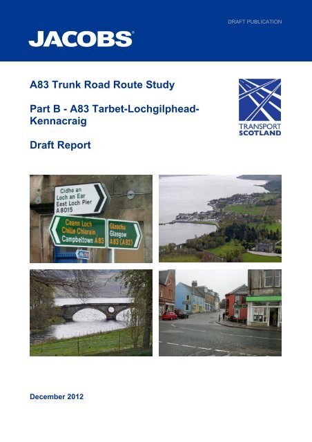
A83 Trunk Road Route Study Part B - Transport Scotland
A83 Trunk Road Route Study Part B - Transport Scotland
A83 Trunk Road Route Study Part B - Transport Scotland

You also want an ePaper? Increase the reach of your titles
YUMPU automatically turns print PDFs into web optimized ePapers that Google loves.
DRAFT PUBLICATION<br />
<strong>A83</strong> <strong>Trunk</strong> <strong>Road</strong> <strong>Route</strong> <strong>Study</strong><br />
<strong>Part</strong> B - <strong>A83</strong> Tarbet-Lochgilphead-<br />
Kennacraig<br />
Draft Report<br />
December 2012
Document Control Sheet<br />
BPP 04 F8<br />
Version 14 July 2012<br />
Project: <strong>A83</strong> <strong>Trunk</strong> <strong>Road</strong> <strong>Route</strong> <strong>Study</strong> Report Project No: B1557610<br />
Client:<br />
<strong>Transport</strong> <strong>Scotland</strong><br />
Document Title: <strong>Part</strong> B – <strong>A83</strong> Tarbet-Lochgilphead-Kennacraig<br />
Ref. No:<br />
Originated by Checked by Reviewed by Approved by<br />
ORIGINAL<br />
(Draft)<br />
DATE<br />
NAME NAME NAME NAME<br />
Laura Richmond<br />
Graeme<br />
McQuaker<br />
Stuart Turnbull<br />
INITIALS INITIALS INITIALS INITIALS<br />
Helen Bradley<br />
7/12/2012 Document Status: Published Draft for Consultation<br />
NAME NAME NAME NAME<br />
DATE INITIALS INITIALS INITIALS INITIALS<br />
Document Status:<br />
NAME NAME NAME NAME<br />
DATE INITIALS INITIALS INITIALS INITIALS<br />
Document Status<br />
NAME NAME NAME NAME<br />
DATE INITIALS INITIALS INITIALS INITIALS<br />
Document Status<br />
Jacobs U.K. Limited<br />
This document has been prepared by a division, subsidiary or affiliate of Jacobs U.K. Limited (“Jacobs”) in its professional capacity as consultants<br />
in accordance with the terms and conditions of Jacobs’ contract with the commissioning party (the “Client”). Regard should be had to those terms<br />
and conditions when considering and/or placing any reliance on this document. No part of this document may be copied or reproduced by any<br />
means without prior written permission from Jacobs. If you have received this document in error, please destroy all copies in your possession or<br />
control and notify Jacobs.<br />
Any advice, opinions, or recommendations within this document (a) should be read and relied upon only in the context of the document as a<br />
whole; (b) do not, in any way, purport to include any manner of legal advice or opinion; (c) are based upon the information made available to<br />
Jacobs at the date of this document and on current UK standards, codes, technology and construction practices as at the date of this document.<br />
It should be noted and it is expressly stated that no independent verification of any of the documents or information supplied to Jacobs has been<br />
made. No liability is accepted by Jacobs for any use of this document, other than for the purposes for which it was originally prepared and<br />
provided. Following final delivery of this document to the Client, Jacobs will have no further obligations or duty to advise the Client on any matters,<br />
including development affecting the information or advice provided in this document.<br />
This document has been prepared for the exclusive use of the Client and unless otherwise agreed in writing by Jacobs, no other party may use,<br />
make use of or rely on the contents of this document. Should the Client wish to release this document to a third party, Jacobs may, at its<br />
discretion, agree to such release provided that (a) Jacobs’ written agreement is obtained prior to such release; and (b) by release of the document<br />
to the third party, that third party does not acquire any rights, contractual or otherwise, whatsoever against Jacobs and Jacobs, accordingly,<br />
assume no duties, liabilities or obligations to that third party; and (c) Jacobs accepts no responsibility for any loss or damage incurred by the Client<br />
or for any conflict of Jacobs’ interests arising out of the Client's release of this document to the third party.<br />
<strong>A83</strong> <strong>Trunk</strong> <strong>Road</strong> <strong>Route</strong> <strong>Study</strong> Report <strong>Part</strong> B (Draft)
DRAFT PUBLICATION<br />
SUMMARY<br />
Jacobs was appointed by <strong>Transport</strong> <strong>Scotland</strong> to undertake a study of the <strong>A83</strong> <strong>Trunk</strong><br />
<strong>Road</strong> to identify and appraise potential options to minimise the effects of road<br />
closures, investigate the feasibility of removing traffic pinch points and improve<br />
pedestrian safety in villages along the route.<br />
This <strong>Part</strong> B report examines the issues along the length of the <strong>A83</strong> <strong>Trunk</strong> <strong>Road</strong><br />
between Tarbet and Kennacraig and presents the results of the transport appraisal<br />
in accordance with Scottish <strong>Transport</strong> Appraisal Guidance. The <strong>Part</strong> B Report<br />
excludes consideration of landslide issues at the Rest and Be Thankful, which are<br />
covered in the <strong>Part</strong> A report.<br />
The <strong>A83</strong> <strong>Trunk</strong> <strong>Road</strong><br />
The <strong>A83</strong> <strong>Trunk</strong> <strong>Road</strong> runs from the A82 at Tarbet on Loch Lomond in a generally<br />
south westerly direction for 108 km to the Islay Ferry port at Kennacraig in Kintyre.<br />
The section of the <strong>A83</strong> between Kennacraig and Campbeltown is not part of the<br />
trunk road network. The principal towns on the <strong>A83</strong> <strong>Trunk</strong> <strong>Road</strong> are Inveraray,<br />
Lochgilphead and Tarbert and the road also serves Dunoon, the Cowal peninsula,<br />
Campbeltown and the rest of Kintyre. Traffic volumes on the route are relatively low<br />
at around 2,000-4,000 vehicles per day, however this increases to around 5,500 per<br />
day in the summer months.<br />
Analysis of Problems and Opportunities<br />
Current evidence-based problems and potential opportunities along the route were<br />
identified through a review of recent relevant studies, analysis of relevant available<br />
data and an inspection of the route. Consultation was undertaken, via a workshop,<br />
which enabled stakeholders to share their views about issues experienced by road<br />
users. This consultation exercise has also informed the identification of the<br />
evidence-based problems.<br />
The problems identified can be summarised in the following broad categories:<br />
<br />
<br />
<br />
<br />
the overall geometric standard of the route; including restricted road width,<br />
poor horizontal and vertical alignment, the availability and standard of lay-bys<br />
and pinch points;<br />
concerns regarding pedestrian provision in Inveraray, Ardrishaig and Tarbert<br />
and between Tarbet and Arrochar;<br />
frequency and severity of injury related road collisions; and<br />
concerns over traffic speeds through communities along the route.<br />
<strong>Transport</strong> Planning Objectives<br />
Objectives and outcomes for the route were developed as part of the Strategic<br />
<strong>Transport</strong> Projects Review. Considering the route further and taking cognisance of<br />
the relevant local and regional transport strategies, the strategic objective for the<br />
study is to improve operating conditions on the <strong>A83</strong>. In addition, the following<br />
specific <strong>Transport</strong> Planning Objectives were developed to reflect the identified<br />
problems:<br />
<strong>A83</strong> <strong>Trunk</strong> <strong>Road</strong> <strong>Route</strong> <strong>Study</strong> Report <strong>Part</strong> B (Draft)<br />
i
DRAFT PUBLICATION<br />
<strong>Transport</strong> Planning Objectives (continued)<br />
Improve journey time reliability by reducing the frequency and impact of road<br />
closures;<br />
Reduce accident rates and severity on the <strong>A83</strong>; and<br />
Improve pedestrian and cycling amenities in the settlements on the <strong>A83</strong>.<br />
Option Generation, Sifting and Development<br />
Options were generated with the potential to address the identified problems and<br />
contribute towards meeting the objectives. 30 potential options were identified for<br />
appraisal. The exercise to identify potential options was informed by a review of<br />
previous relevant study reports.<br />
Potential options were grouped, by location, as follows:<br />
<br />
<br />
<br />
<br />
<br />
<br />
<br />
<br />
<br />
Whole route (3 options)<br />
Tarbet to Ardgartan (9 options)<br />
Clachan to Inveraray (8 options)<br />
Furnace (1 option)<br />
Minard (2 options)<br />
Lochgair (1 option)<br />
Ardrishaig (1 option)<br />
Erines (1 option)<br />
Tarbert (4 options)<br />
Appraisal Process<br />
The 30 identified options were subjected to a transport appraisal in accordance with<br />
the Scottish <strong>Transport</strong> Appraisal Guidance. The transport appraisal considers the<br />
performance of potential options against the objectives and the standard appraisal<br />
criteria of Environment, Economy, Safety, Integration and Accessibility & Social<br />
Inclusion.<br />
Limited information was available to quantify the potential benefits of each of these<br />
options and, therefore, it has not been possible to carry out a cost benefit analysis.<br />
The appraisal has been completed based on a mainly qualitative assessment using<br />
a seven point assessment scoring system which provides a relative comparison<br />
between options, with additional quantifiable benefits included where possible.<br />
During the appraisal process, a number of options were sifted out as they did not<br />
meet the objectives and/or demonstrated limited benefits in terms of performance<br />
against the appraisal criteria. The 13 options surviving the appraisal process<br />
represent a series of potential infrastructure, signage and road marking<br />
interventions, under five themes. These are presented in Table 1 below, together<br />
with an indication of preliminary costs and benefits and potential timescales for<br />
delivery, subject to funding availability and competing priorities in <strong>Scotland</strong>.<br />
<strong>A83</strong> <strong>Trunk</strong> <strong>Road</strong> <strong>Route</strong> <strong>Study</strong> Report <strong>Part</strong> B (Draft)<br />
ii
DRAFT PUBLICATION<br />
Theme Option Estimated<br />
Cost<br />
Environment<br />
Safety<br />
Economy<br />
Integration<br />
Accessibility<br />
and Social<br />
Inclusion<br />
Potential<br />
Delivery<br />
Pedestrian<br />
Measures<br />
Provision of a pedestrian<br />
crossing island on<br />
Barmore <strong>Road</strong>, Tarbert<br />
£20K-£50K<br />
0 0 0 M<br />
Minor<br />
Improvement<br />
Schemes<br />
Re-alignment of the bend<br />
at Strone Point<br />
Implement Phase 1&2 of<br />
the Dunderave Scheme<br />
Implement the preferred<br />
scheme for widening the<br />
pinch point at Erines<br />
Widen the pinch point at<br />
Barmore <strong>Road</strong>, Tarbert<br />
and provide priority control<br />
in remaining section<br />
£1M-£5M<br />
£5M-£10M<br />
£2M-£5M<br />
£500K-<br />
£1M<br />
XX 0 0 L<br />
XX 0 0 L<br />
XX 0 0 0 L<br />
XX 0 0 0 L<br />
Measures to<br />
Improve<br />
Information<br />
Improved signage on the<br />
A819 junction in Inveraray<br />
DRAFT PUBLICATION<br />
Table 1 provides a summary of potential options along the <strong>A83</strong> <strong>Trunk</strong> <strong>Road</strong>, which<br />
have been appraised, mainly qualitatively, in terms of meeting the objectives and<br />
performance against the appraisal criteria. Given the different range and type of<br />
potential interventions and the specific problem which each one may address, a<br />
relative comparison of one intervention against another is not always appropriate.<br />
The potential options have, therefore, been grouped into common themes to allow a<br />
general overview of options which address similar types of issues. Options under<br />
the grouping of ‘minor improvement schemes’ address recognised pinch points and<br />
road casualty cluster points on the route. The potential quantifiable benefits relating<br />
to each of the minor improvement schemes mainly relate to potential cost savings<br />
from reduced casualty numbers and/or casualty severity. The positive and negative<br />
impacts are presented using the seven point scale detailed above. The assessment<br />
indicates that measures to realign the bend at Strone Point potentially provide the<br />
greatest benefits, followed by the intervention at Dunderave, although it should be<br />
noted that a quantified economic assessment has not been undertaken at this stage.<br />
Potential options such as upgrading the whole route to a standard level of crosssection,<br />
or providing upgraded and additional lay-bys, in line with current Design<br />
Manual for <strong>Road</strong>s and Bridges (DMRB) standards, were also considered in the<br />
appraisal. Whilst these potential options were not taken forward within this study,<br />
consideration should be given to upgrading the standard of sections of the route,<br />
particularly with regard to cross section and lay-by provision, as part of ongoing<br />
maintenance and upgrade programmes. The rationale for implementing such<br />
interventions would need to be clear. In addition, in order to investigate further the<br />
issue of pedestrian casualties and facilities in Inveraray, consideration should be<br />
given to conducting a feasibility study.<br />
Conclusions<br />
The potential options identified in this study align with the approach recommended<br />
in the STPR, which recognised the need to maintain and safely operate the road in<br />
the context of a route management strategy. The potential options comprise a series<br />
of localised improvements to address the evidence based problems on the route.<br />
The measures range from the implementation of improved direction or warning<br />
signs, which are relatively inexpensive and straightforward to implement, to minor<br />
improvement schemes that address specific pinch points and provide a greater level<br />
of benefit. The rationale for taking forward any option for further development and<br />
implementation would need to be clear and assessed against other competing<br />
priorities for the trunk road budget. For example, the minor improvement schemes, if<br />
developed further, would require additional assessment, planning and design work.<br />
Minor improvement schemes are generally managed and implemented on behalf of<br />
<strong>Transport</strong> <strong>Scotland</strong> by the <strong>Trunk</strong> <strong>Road</strong> Operating Companies.<br />
Next Steps<br />
The draft report is to be presented to the <strong>A83</strong> Rest and Be Thankful Task Force.<br />
<strong>Transport</strong> <strong>Scotland</strong> will consider the next steps following feedback from the<br />
Taskforce.<br />
<strong>A83</strong> <strong>Trunk</strong> <strong>Road</strong> <strong>Route</strong> <strong>Study</strong> Report <strong>Part</strong> B (Draft)<br />
iv
DRAFT PUBLICATION<br />
Contents<br />
1 INTRODUCTION 1<br />
1.1 <strong>Study</strong> Background 1<br />
1.2 <strong>Study</strong> Deliverables 1<br />
2 ANALYSIS OF PROBLEMS AND OPPORTUNITIES 2<br />
2.1 Introduction 2<br />
2.2 <strong>A83</strong> Corridor 2<br />
2.3 Methodology 6<br />
2.4 Stakeholder Consultation 7<br />
2.5 Analysis of Problems and Constraints 8<br />
2.6 Other Problems 26<br />
3 OBJECTIVES 29<br />
3.1 Introduction 29<br />
3.2 <strong>Transport</strong> Planning Objectives 29<br />
3.3 National and Regional Objectives 30<br />
4 OPTION GENERATION, SIFTING AND DEVELOPMENT 34<br />
4.1 Option Generation 34<br />
4.2 Option Sifting 43<br />
5 APPRAISAL 44<br />
5.1 Introduction 44<br />
5.2 Summary of Appraisals 44<br />
5.3 Implementation Risk 55<br />
6 CONCLUSIONS 56<br />
6.1 Option Summary 56<br />
6.2 Conclusions 57<br />
6.3 Monitoring and Evaluation 58<br />
Appendix A<br />
Appendix B<br />
Appendix C<br />
Appendix D<br />
Appendix E<br />
Summary of Lay-by Provision<br />
Stakeholder Consultation Workshop – Summary of Discussions<br />
Option Layouts<br />
Draft Pedestrian Crossing Feasibility Studies<br />
Appraisal Summary Tables<br />
<strong>A83</strong> <strong>Trunk</strong> <strong>Road</strong> <strong>Route</strong> <strong>Study</strong> Report <strong>Part</strong> B (Draft)
DRAFT PUBLICATION<br />
1 INTRODUCTION<br />
1.1 <strong>Study</strong> Background<br />
The <strong>A83</strong> <strong>Trunk</strong> <strong>Road</strong> <strong>Route</strong> <strong>Study</strong> recognises the significant challenges that exist<br />
along the length of this vital road. The study identified and appraised potential<br />
options to address evidence based problems along the route.<br />
A campaign to upgrade the <strong>A83</strong> has been started to urge the Scottish Government<br />
to take ‘urgent action to improve the rapidly deteriorating main road from Argyll into<br />
central <strong>Scotland</strong>’. The campaign has highlighted four areas:<br />
<br />
<br />
<br />
<br />
Absence of proper crossing points in villages of Ardrishaig and Tarbert;<br />
The pinch points on the route;<br />
The landslides at the Rest and Be Thankful; and<br />
<strong>Trunk</strong>ing of the route from Kennacraig to Campbeltown.<br />
This study will inform <strong>Transport</strong> <strong>Scotland</strong>’s response to the first three areas<br />
identified by the campaign to upgrade the <strong>A83</strong>. <strong>Transport</strong> <strong>Scotland</strong> will respond<br />
separately to the Public Petitions Committee on the subject of trunking of the <strong>A83</strong><br />
from Kennacraig to Campbeltown.<br />
1.2 <strong>Study</strong> Deliverables<br />
The <strong>A83</strong> <strong>Trunk</strong> <strong>Road</strong> <strong>Route</strong> <strong>Study</strong> Report consists of two sections; <strong>Part</strong> A and <strong>Part</strong><br />
B.<br />
The <strong>Part</strong> A report examines the landslide problem at Rest and Be Thankful and<br />
considers options to minimise the effects of road closures on the local communities<br />
and road users in the area. It also addresses other sections of the <strong>A83</strong> trunk road<br />
where a high risk of landslides has been identified.<br />
This <strong>Part</strong> B Report provides a review of the issues across the whole <strong>A83</strong> <strong>Trunk</strong><br />
<strong>Road</strong> from Tarbet to Kennacraig and details the results of an appraisal of potential<br />
options to deal with the identified problems.<br />
<strong>A83</strong> <strong>Trunk</strong> <strong>Road</strong> <strong>Route</strong> <strong>Study</strong> Report <strong>Part</strong> B (Draft) 1
DRAFT PUBLICATION<br />
2 ANALYSIS OF PROBLEMS AND OPPORTUNITIES<br />
2.1 Introduction<br />
This section of the report presents details of the problems on the <strong>A83</strong> route from<br />
Tarbet to Kennacraig and the evidence to support these problems. Key route<br />
characteristics are also outlined<br />
2.2 <strong>A83</strong> Corridor<br />
The <strong>A83</strong> <strong>Trunk</strong> <strong>Road</strong> runs from the A82 at Tarbet on Loch Lomond in a generally<br />
south west direction for 108 km to the ferry port at Kennacraig in Kintyre. The<br />
section of the <strong>A83</strong> between Kennacraig and Campbeltown is not part of the trunk<br />
road network. The principal towns on the <strong>A83</strong> <strong>Trunk</strong> <strong>Road</strong> are Inveraray,<br />
Lochgilphead and Tarbert and the road also serves Dunoon and the Cowal<br />
peninsula, and Campbeltown and the Kintyre peninsula. Traffic volumes on the<br />
route are relatively low at around 2,000-4,000 vehicles per day, however this<br />
increases to around 5,500 per day in the summer months.<br />
Figure 2-1: <strong>A83</strong> <strong>Trunk</strong> <strong>Road</strong><br />
<strong>A83</strong> <strong>Trunk</strong> <strong>Road</strong> <strong>Route</strong> <strong>Study</strong> Report <strong>Part</strong> B (Draft) 2
DRAFT PUBLICATION<br />
The <strong>A83</strong> is of variable width single carriageway two lane construction throughout its<br />
entire length with the exception of localised short single lane narrowings at Aray<br />
Bridge, Minard, Ardrishaig, Erines and Barmore <strong>Road</strong>, Tarbert. The Strategic<br />
<strong>Transport</strong> Projects Review (STPR) identified the <strong>A83</strong> as a route that would be<br />
maintained and safely operated within the general remit of <strong>Transport</strong> <strong>Scotland</strong>. No<br />
specific interventions were indicated within the STPR.<br />
2.2.1 Existing Traffic Volumes<br />
Traffic count data is available for nine locations along the route where Automatic<br />
Traffic Counters (ATCs) are installed. Annual average daily traffic levels have been<br />
extracted from the Scottish <strong>Road</strong> Traffic database and are detailed in Table 2-1<br />
below. Average daily traffic levels for the month of August are also detailed showing<br />
the marked increase in trips on the route in the summer.<br />
Location<br />
Average Daily Traffic<br />
(2010)<br />
Average Daily Traffic<br />
(August - 2010)<br />
<strong>A83</strong> Arrochar Outdoor Centre 4723 6677<br />
<strong>A83</strong> north of A814 4847 5460<br />
<strong>A83</strong> west of Arrochar 4414 6348<br />
<strong>A83</strong> Drishaig 3511 4687<br />
<strong>A83</strong> south of Inveraray 3005 3943<br />
<strong>A83</strong> Castleton 2781 3490<br />
<strong>A83</strong> east of Lochgilphead Roundabout 5789 6493<br />
<strong>A83</strong> Ardrishaig 2910 3248<br />
<strong>A83</strong> 200m west of Tarbert 2298 2742<br />
Table 2-1: <strong>A83</strong> Traffic Volumes<br />
The traffic flows detailed in Table 2-1 above show that, the southern section of the<br />
route has significantly lower traffic levels that the northern section. Traffic levels in<br />
general, while increasing in the summer months are relatively low.<br />
Traffic classification is available at two of the locations detailed above (the <strong>A83</strong> West<br />
of Arrochar and <strong>A83</strong> Ardrishaig). Figures 2-2 and 2-3 below detail the classification<br />
of traffic at these ATC sites and highlight a much higher proportion of HGV traffic on<br />
the southern part of the route.<br />
Figure 2-2: Vehicle Classification on <strong>A83</strong> west of Arrochar<br />
<strong>A83</strong> <strong>Trunk</strong> <strong>Road</strong> <strong>Route</strong> <strong>Study</strong> Report <strong>Part</strong> B (Draft) 3
DRAFT PUBLICATION<br />
Figure 2-3: Vehicle Classification on <strong>A83</strong> at Ardrishaig<br />
2.2.2 Accident Data<br />
The accident rate for the <strong>A83</strong> is 26.64 accidents per one hundred million vehicle<br />
kilometre (mvkm). In comparison, the accident rate for singles carriageways on the<br />
whole of the Scottish <strong>Trunk</strong> <strong>Road</strong> network is 15.9 accidents per hundred mvkm,<br />
indicating a higher accident rate on the <strong>A83</strong> 1 . In the 2009 Hazard Ranking for the<br />
Scottish road network ten locations along the <strong>A83</strong> were rated as high/very high risk.<br />
Accident statistics have been made available for the period 1 January 2007 to 31<br />
December 2011 inclusive, during which time there were a total of 239 accidents on<br />
the <strong>A83</strong> between Tarbet and Kennacraig. A detailed breakdown of accident severity<br />
and year of occurrence is provided in Table 2-2 below. It presents the Killed and<br />
Seriously Injured (KSI) severity ratio. The equivalent KSI ratio on the whole of the<br />
Scottish <strong>Trunk</strong> <strong>Road</strong> Network, as reported in the <strong>A83</strong> <strong>Route</strong> Safety File, is 0.2,<br />
highlighting a higher proportion of accidents on the <strong>A83</strong> that result in serious or fatal<br />
casualties than on the Scottish trunk road network as a whole.<br />
Year Fatal Serious Slight Total<br />
KSI Severity<br />
Ratio<br />
2007 5 4 27 36 0.25<br />
2008 1 15 36 52 0.31<br />
2009 1 16 35 52 0.33<br />
2010 3 11 38 52 0.27<br />
2011 0 13 34 47 0.28<br />
Total 10 59 170 239 0.29<br />
Table 2-2: Accident Severity Statistics<br />
Figure 2-4 presents the location of those accidents classified as slight (green),<br />
serious (blue), or fatal (red).<br />
1<br />
<strong>Scotland</strong> TranServ <strong>A83</strong> <strong>Route</strong> Safety File; September 2010<br />
<strong>A83</strong> <strong>Trunk</strong> <strong>Road</strong> <strong>Route</strong> <strong>Study</strong> Report <strong>Part</strong> B (Draft) 4
DRAFT PUBLICATION<br />
Figure 2-4: Accident Locations on the <strong>A83</strong><br />
Figure 2-5 below, extracted from the <strong>A83</strong> <strong>Route</strong> Safety File 1 shows 50% of<br />
accidents on the <strong>A83</strong> occur when vehicles are going ahead on a bend. Over the<br />
whole Scottish <strong>Trunk</strong> <strong>Road</strong> network, 15% of accidents are attributable to this vehicle<br />
manoeuvre, highlighting that this is a particular issue on the <strong>A83</strong> route. The<br />
proportion of accidents on the <strong>A83</strong> occurring while vehicles are overtaking another<br />
moving vehicle (7%) is double that for the whole Scottish <strong>Trunk</strong> <strong>Road</strong> network,<br />
highlighting another particular issue on the <strong>A83</strong>.<br />
<strong>A83</strong> <strong>Trunk</strong> <strong>Road</strong> <strong>Route</strong> <strong>Study</strong> Report <strong>Part</strong> B (Draft) 5
DRAFT PUBLICATION<br />
Figure 2-5: <strong>A83</strong> <strong>Route</strong> Safety File - Accident Involvement by Vehicle Manoeuvre 1<br />
The number of accidents on the <strong>A83</strong> increases in the summer months (Figure 2.6).<br />
This is not surprising given the increases in traffic flows, but it also may be related to<br />
the number of unfamiliar drivers on the route.<br />
Figure 2-6: <strong>A83</strong> <strong>Route</strong> Safety File – Accidents by Month (2007 to 2009) 1<br />
2.3 Methodology<br />
The evidence-based problems on the route were identified using several<br />
approaches.<br />
Previous reports and studies undertaken on the route, as supplied by <strong>Transport</strong><br />
<strong>Scotland</strong> and <strong>Scotland</strong> TranServ, were studied and key problems identified. These<br />
reports are:<br />
<strong>A83</strong> <strong>Trunk</strong> <strong>Road</strong> <strong>Route</strong> <strong>Study</strong> Report <strong>Part</strong> B (Draft) 6
DRAFT PUBLICATION<br />
<strong>A83</strong> Emergency Standard Diversion <strong>Route</strong>s (<strong>Scotland</strong> TranServ, June 2009);<br />
<strong>A83</strong> <strong>Route</strong> Accident Reduction Plan – Phase 1 Arrochar to Furnace<br />
(<strong>Scotland</strong> TranServ, January 2009);<br />
<strong>A83</strong> <strong>Route</strong> Accident Reduction Plan – Phase 2 Furnace to Lochgilphead<br />
(<strong>Scotland</strong> TranServ, February 2008);<br />
<strong>A83</strong> <strong>Route</strong> Accident Reduction Plan – Phase 3 Lochgilphead to Kennacraig<br />
(<strong>Scotland</strong> TranServ, June 2011);<br />
<strong>A83</strong> <strong>Route</strong> Safety File (<strong>Scotland</strong> TranServ, September 2010);<br />
<strong>A83</strong> Dunderave Scheme Phase 1 (<strong>Scotland</strong> TranServ, April 2010);<br />
<strong>A83</strong> Dunderave Scheme Phase 2 (<strong>Scotland</strong> TranServ, June 2011);<br />
<strong>A83</strong> Ardrishaig – Pedestrian Crossing Feasibility <strong>Study</strong> (<strong>Scotland</strong> TranServ,<br />
July 2012);<br />
<strong>A83</strong> Tarbet – Lochgilphead – Kennacraig <strong>Trunk</strong> <strong>Road</strong> - Ardrishaig Pedestrian<br />
Crossing Feaibility <strong>Study</strong> (<strong>Scotland</strong> TranServ, February 2009);<br />
<strong>A83</strong> Erines <strong>Road</strong> Improvement – Feasibility <strong>Study</strong> (Jacobs Babtie for Bear<br />
<strong>Scotland</strong>, March 2006);<br />
<br />
<br />
<strong>A83</strong> Erines Scheme (<strong>Scotland</strong> TranServ, April 2010); and<br />
<strong>A83</strong> Tarbert Draft Pedestrian Crossing Feasibility <strong>Study</strong> (<strong>Scotland</strong> TranServ,<br />
July 2012).<br />
Some of the problems identified in the reports listed above have already been<br />
addressed and are therefore not included in any further assessment as part of this<br />
study.<br />
<strong>Road</strong> accident data detailing all injury accidents for the past five years, supplied by<br />
<strong>Transport</strong> <strong>Scotland</strong>, and the current moving cursor data for accidents on the route<br />
was analysed.<br />
Two stakeholder workshops were held as detailed in Section 2.4 below.<br />
In addition, a site visit was undertaken. The purpose of this visit was to observe and<br />
verify the issues that had been identified through the previous reports and at the<br />
stakeholder workshops.<br />
2.4 Stakeholder Consultation<br />
A stakeholder consultation workshop for the study was held at the Loch Fyne Hotel,<br />
Inveraray, on 22 August 2012. It was attended by various parties including local<br />
elected members, officials from Argyll and Bute Council, community council<br />
representatives, transport operators, local business groups, <strong>Transport</strong> <strong>Scotland</strong>,<br />
<strong>Scotland</strong> Transerv and Jacobs. Further written feedback was also received from<br />
stakeholders through the project email address.<br />
A further (technical) workshop was held on 29 August 2012 with a focus on<br />
operational management issues This workshop was held in Jacobs offices in<br />
Glasgow and was attended by representatives of <strong>Transport</strong> <strong>Scotland</strong>, <strong>Scotland</strong><br />
Transerv, the <strong>Transport</strong> Research Laboratory and Jacobs.<br />
The transport issues raised by stakeholders have been considered in the<br />
identification of transport problems and constraints, which is the first stage of a<br />
<strong>Transport</strong> Appraisal.<br />
<strong>A83</strong> <strong>Trunk</strong> <strong>Road</strong> <strong>Route</strong> <strong>Study</strong> Report <strong>Part</strong> B (Draft) 7
DRAFT PUBLICATION<br />
Following the stakeholder workshops the issues raised have been examined<br />
alongside previous reports and studies for the route and accident records for the<br />
route in order to build up the evidence of the identified problems.<br />
The issues discussed at the Inveraray Stakeholder event are detailed in the<br />
Stakeholder Consultation Workshop – Summary of Discussion 2 , which was<br />
published on the <strong>Transport</strong> <strong>Scotland</strong> website following the events and which is<br />
included as Appendix B of this report.<br />
2.5 Analysis of Problems and Constraints<br />
The problems identified are set out in the following section, grouped by location.<br />
Figure 2-7 below shows the whole route with specific locations of identified<br />
problems. Locations are grouped as follows:<br />
<br />
<br />
<br />
<br />
<br />
<br />
<br />
<br />
<br />
Whole route<br />
Tarbet to Ardgartan<br />
Clachan to Inveraray<br />
Furnace<br />
Minard<br />
Lochgair<br />
Ardrishaig<br />
Erines<br />
Tarbert<br />
Figure 2-7: Location of Identified Problems on the <strong>Route</strong><br />
2<br />
<strong>A83</strong> <strong>Trunk</strong> <strong>Road</strong> <strong>Route</strong> <strong>Study</strong> – Stakeholder Consultation Workshop: Summary of Discussion. Produced by<br />
Jacobs for <strong>Transport</strong> <strong>Scotland</strong>. August 2012.<br />
http://www.transportscotland.gov.uk/road/maintenance/landslides/<strong>A83</strong>-rest-and-be-thankful<br />
<strong>A83</strong> <strong>Trunk</strong> <strong>Road</strong> <strong>Route</strong> <strong>Study</strong> Report <strong>Part</strong> B (Draft) 8
DRAFT PUBLICATION<br />
Whole <strong>Route</strong> Issues<br />
2.5.1 Problem: <strong>Road</strong> width less than 6m wide requires closure for<br />
maintenance<br />
The operating company for the route, <strong>Scotland</strong> TranServ, have advised that all<br />
maintenance activities on sections of the route that are less than 6.0m require a full<br />
closure to be implemented. The location and length of these areas is not recorded at<br />
present.<br />
2.5.2 Problem: <strong>Road</strong> is not to current DMRB standards across most of its<br />
length<br />
<strong>Part</strong>s of the route are below current standards in terms of horizontal and vertical<br />
alignment and carriageway width. <strong>Part</strong>icipants at the stakeholder workshop<br />
expressed concern at the road width on parts of the route. This was also highlighted<br />
in the <strong>Route</strong> Accident Reduction Plan that was developed by <strong>Scotland</strong> TranServ in<br />
2008:<br />
“Sub-standard width - The <strong>A83</strong> is a trunk road and therefore a strategic route for<br />
commercial use. The width of the road is, in many places, unsuitable for a major<br />
route because it is not wide enough to accommodate large vehicles, HGVs,<br />
PSV’s, tourist coaches and abnormal loads. Large vehicles should be able to use<br />
the road without overrunning the edge. This contributes to crumbling of the edge<br />
of the road and also the wear on the edge of carriageway and centre line<br />
markings. Such vehicles passing each other on this road can become perilously<br />
close to each other, causing sudden braking and conflict. There are many places<br />
where these vehicles stray over the centre line and can come into conflict with<br />
opposing traffic causing collisions. There are examples of this type of collision on<br />
this route.” 3<br />
2.5.3 Problem: Lack of overtaking opportunities on route<br />
Stakeholders at the workshop in Inveraray shared their views about a lack of safe<br />
overtaking opportunities on the route as an issue. The substandard width and the<br />
proportion of HGV traffic on the route effectively reduce the available overtaking<br />
opportunities. Accident records for the route between 2007 and 2011 show a total of<br />
21 accidents occurred when an overtaking manoeuvre was taking place. Of these,<br />
two resulted in fatalities and a further eight resulted in serious casualties. These<br />
accidents are however spread across the whole length of the route and are not<br />
confined to any particular section.<br />
2.5.4 Problem: Lay-bys are infrequent<br />
Several stakeholders raised concerns about a lack of formal lay-bys and the<br />
standard of existing lay-bys as an issue.<br />
A desk top review of the lay-bys located on the <strong>A83</strong> between Tarbet and Kennacraig<br />
has been undertaken using all available information sources. The aim of the review<br />
was as follows:<br />
3<br />
<strong>Scotland</strong> TranServ <strong>A83</strong> Tarbet-Lochgilphead-Kennacraig <strong>Trunk</strong> <strong>Road</strong> <strong>Route</strong> Accident Reduction Plan, May 2008<br />
<strong>A83</strong> <strong>Trunk</strong> <strong>Road</strong> <strong>Route</strong> <strong>Study</strong> Report <strong>Part</strong> B (Draft) 9
DRAFT PUBLICATION<br />
<br />
<br />
<br />
<br />
<br />
Identify the number of lay-bys on the route;<br />
Identify the general type of lay-by;<br />
Identify the spacing between lay-bys;<br />
Investigate the condition of surfacing and signage at each lay-by; and<br />
Investigate options for improving the existing lay-bys both with and without<br />
need for land acquisition.<br />
A total of 24 lay-bys were identified, 17 on the southbound carriageway and 7 on the<br />
northbound carriageway. Spacing of lay-bys and design varied greatly and in<br />
general failed to comply with the standards outlined in the Design Manual for <strong>Road</strong>s<br />
and Bridges (DMRB), which requires a spacing of 5-8km for single carriageway with<br />
Annual Average Daily Traffic (AADT) levels of 2,500-8,000.<br />
There are two categories of lay-by within DMRB for single carriageway roads. A<br />
Type A lay-by is segregated from the running carriageway by a channel island whilst<br />
a Type B lay-by is immediately adjacent to the running carriageway. There is also a<br />
modified Type A lay-by detailed in the standard. The principal difference between a<br />
Type A and a Type A-modified lay-by is the length of the merge taper on exit from<br />
the lay-by.<br />
All but two of the lay-bys identified on the <strong>A83</strong> are of Type B layout however, their<br />
exact dimensions do not conform to the standard. Whilst the Type B layout is a<br />
recognised layout, the AADT figures for the <strong>A83</strong> (
DRAFT PUBLICATION<br />
Figure 2-8: Identified problems between Tarbet and Ardgartan<br />
2.5.5 Problem: Pinch points between Tarbet and Arrochar including through<br />
the railway bridge at Tarbet<br />
Several stakeholders raised the issue of pinch points in the road width through the<br />
village of Tarbet and between Tarbet and Arrochar at the railway bridge where the<br />
pedestrian footway is reduced.<br />
Figure 2-9: Pinch point at railway bridge between Tarbet and Arrochar 4<br />
2.5.6 Problem: Risk of accidents on the sharp bend at the Tarbet<br />
Tearooms/Hotel<br />
The sharp bend within Tarbet village at Tarbet tearooms was considered a potential<br />
accident risk by several stakeholders at the workshop. Analysis of the accident<br />
records between 2007 and 2011 has identified three slight injury accidents within the<br />
30mph limits at Tarbet. These accidents were all attributable to either a poor turn or<br />
manoeuvre or losing control on a wet surface.<br />
4<br />
Image taken from <strong>Transport</strong> <strong>Scotland</strong>’s SERIS database.<br />
<strong>A83</strong> <strong>Trunk</strong> <strong>Road</strong> <strong>Route</strong> <strong>Study</strong> Report <strong>Part</strong> B (Draft) 11
DRAFT PUBLICATION<br />
Figure 2-10: Bend at Tarbet Tearooms 5<br />
2.5.7 Problem: Risk of accidents due to poor alignment and visibility at<br />
Ardgartan<br />
At Ardgartan, the <strong>A83</strong> turns sharply north-west on a long sweeping bend. On this<br />
bend, there is a turning for Ardgartan Caravan Park. Stakeholders consider that this<br />
location is an accident risk area. From the accident data for 2007 to 2011, four<br />
accidents have been recorded at this location, one resulting in a serious injury, the<br />
rest resulting in slight injuries. Further analysis of the accident records show no<br />
distinct patterns of accident type or causation.<br />
Figure 2-11: Bend at Ardgartan Campsite (Westbound) 6<br />
5<br />
Image Copyright John Firth. This work is licensed under the Creative Commons Attribution-Share Alike 2.0<br />
Generic Licence. To view a copy of this licence, visit http://creativecommons.org/licenses/by-sa/2.0/ or send a letter<br />
to Creative Commons, 171 Second Street, Suite 300, San Francisco, California, 94105, USA.<br />
6<br />
Image Copyright John Firth. This work is licensed under the Creative Commons Attribution-Share Alike 2.0<br />
Generic Licence. To view a copy of this licence, visit http://creativecommons.org/licenses/by-sa/2.0/ or send a letter<br />
to Creative Commons, 171 Second Street, Suite 300, San Francisco, California, 94105, USA.<br />
<strong>A83</strong> <strong>Trunk</strong> <strong>Road</strong> <strong>Route</strong> <strong>Study</strong> Report <strong>Part</strong> B (Draft) 12
DRAFT PUBLICATION<br />
Figure 2-12: Bend at Ardgartan Campsite (Eastbound) 4<br />
2.5.8 Problem: Risk of accidents on the bend at the Rest and Be Thankful<br />
Car Park<br />
The Rest and Be Thankful car park is a well known location on the <strong>A83</strong> and is<br />
popular with tourists. The car park and view point is situated on a sharp bend where<br />
the severity of which is not apparent on approach. In addition, the entrances to the<br />
car park and the B828 junction are not readily apparent until motorists are within<br />
close proximity of the junction. This is particularly problematic due to the number of<br />
vehicle turning movements which occur there. Subsequently, the popularity and<br />
poor visibility at the Rest and Be Thankful has contributed to the high accident rates<br />
on this section of the <strong>A83</strong>.<br />
Nine incidents have been recorded at the bend between 2007 and 2011, including<br />
seven slight and two serious injury accidents, the majority of which occurred in<br />
2008. Three of the accidents were reported to be due to a poor turning manoeuvre<br />
and six occurred while going ahead on a left hand bend. Another five accidents<br />
occurred within 1km of the car park during the same time period, all of which since<br />
2010. These included three slight injury and two serious injury accidents. Two were<br />
reported to have been due to a loss of control and three occurred while going ahead<br />
on a right hand bend.<br />
Measures have been identified at this location as part of the <strong>Route</strong> Accident<br />
Reduction Plan in order to deal with these issues. The effectiveness of these<br />
measures will be monitored as part of ongoing annual accident analysis on the<br />
route. This problem is therefore not considered further in this report.<br />
Clachan to Inveraray<br />
Figure 2-13 below highlights the location of the problems identified between Clachan<br />
and Inveraray.<br />
<strong>A83</strong> <strong>Trunk</strong> <strong>Road</strong> <strong>Route</strong> <strong>Study</strong> Report <strong>Part</strong> B (Draft) 13
DRAFT PUBLICATION<br />
Figure 2-13: Identified problems between Clachan and Inveraray<br />
2.5.9 Problem: <strong>Road</strong> condition and effective narrowing between Dunderave<br />
and Inveraray<br />
Issues relating to poor condition of the road edge have been raised by stakeholders<br />
and are highlighted in previous work completed by <strong>Scotland</strong> TranServ on the section<br />
of the <strong>A83</strong> between Dunderave and Inveraray. This issue effectively results in<br />
narrowing the available road width, especially for heavy vehicles and results in<br />
vehicles having to cross the centre line of the road to avoid the poor edge surface.<br />
From the accident data for 2007 to 2011, three accidents have been recorded on<br />
this section of the <strong>A83</strong>, all resulting in serious injuries. Of these accidents, two were<br />
single vehicle accidents involving an LGV or HGV skidding and overturning, the<br />
other was a collision between two vehicles.<br />
Figure 2-14: <strong>A83</strong> at Dunderave showing poor carriageway edge on both sides 4<br />
<strong>A83</strong> <strong>Trunk</strong> <strong>Road</strong> <strong>Route</strong> <strong>Study</strong> Report <strong>Part</strong> B (Draft) 14
DRAFT PUBLICATION<br />
2.5.10 Problem: Accident risk at Strone Point north of Inveraray<br />
Stakeholders considered Strone Point, to the north of Inveraray, as an area where<br />
there had been several serious accidents in the past and the bend was considered<br />
to be a hazard.<br />
Figure 2-15: <strong>A83</strong> at Strone Point 7<br />
The bend at Strone Point is located in the 3.6km section between Dunderave Castle<br />
and Shira Bridge. Six collisions, including one fatal collision and three collisions<br />
resulting in serious casualties, have been recorded at Strone Point in the five year<br />
period between 2007 and 2011. Contributory factors in each of these incidents have<br />
been either loss of control, making a poor manoeuvre or travelling too fast for the<br />
conditions. During the period of this study, there has been a further fatal collision at<br />
this location.<br />
As the photograph above shows, advanced warning signs with reflective yellow<br />
backing are provided on the approach to the bend along with high friction surfacing,<br />
chevron markings with yellow reflective backing and safety barriers on the bend<br />
itself.<br />
2.5.11 Problem: Pedestrians on the River Aray Bridge<br />
Stakeholders at the workshop in Inveraray raised an issue with pedestrians<br />
accessing the single lane bridge over the River Aray in order to take photographs of<br />
Inveraray Castle. Although there have been no recorded accidents on the bridge in<br />
recent years this issue presents a safety risk for pedestrians, as there are no<br />
footways on the bridge and visibility is poor due to the incline of the bridge.<br />
7<br />
Image Copyright John Firth. This work is licensed under the Creative Commons Attribution-Share Alike 2.0<br />
Generic Licence. To view a copy of this licence, visit http://creativecommons.org/licenses/by-sa/2.0/ or send a letter<br />
to Creative Commons, 171 Second Street, Suite 300, San Francisco, California, 94105, USA.<br />
<strong>A83</strong> <strong>Trunk</strong> <strong>Road</strong> <strong>Route</strong> <strong>Study</strong> Report <strong>Part</strong> B (Draft) 15
DRAFT PUBLICATION<br />
Figure 2-16: Signal controlled bridge crossing of the River Aray to the north of Inveraray 4<br />
2.5.12 Problem: Poor signage for Dalmally <strong>Road</strong> in Inveraray<br />
Stakeholders shared their views regarding several people missing the turning for the<br />
A819 Dalmally <strong>Road</strong> in Inveraray. Advanced directional signage is provided on the<br />
approach to Inveraray from the north however, the directional signage for the A819<br />
at the junction is located on a bend and is less prominent than those for the car and<br />
coach parks, which are sited on the same pole. The A819 also passes through an<br />
arch adjacent to the Argyll Hotel, which does not give the impression of a main<br />
route. The road accident data does not give any indication that this problem has<br />
contributed to any accidents occurring within the vicinity of the junction.<br />
2.5.13 Problem: Pedestrian/vehicle conflicts within Inveraray<br />
The <strong>A83</strong> passes through Inveraray on the Main Street which has shops on either<br />
side. The area becomes busy with pedestrians, especially during the tourist season.<br />
Pedestrians can be seen crossing the road along the length of Main Street between<br />
the various shops, creating potential pedestrian vehicle conflicts. In general, traffic<br />
through Inveraray is slowed by the presence and volume of pedestrians. However<br />
four accidents involving pedestrians have been recorded within the 30mph limits of<br />
Inveraray between 2007 and 2011, one of which resulted in a serious casualty, the<br />
remaining three resulting in slight casualties.<br />
No assessment of pedestrian crossing requirements is currently available for Main<br />
Street, Inveraray therefore, it is recommended that a Pedestrian Crossing Feasibility<br />
<strong>Study</strong>, following the guidance set out in LTN 1/95 Assessment of Pedestrian<br />
Crossings, is carried out in order to determine the need for, and suitable type, of<br />
crossing facilities at this location.<br />
<strong>A83</strong> <strong>Trunk</strong> <strong>Road</strong> <strong>Route</strong> <strong>Study</strong> Report <strong>Part</strong> B (Draft) 16
DRAFT PUBLICATION<br />
Figure 2-17: Main Street Inveraray showing pedestrians and shops on either side of the road 8<br />
2.5.14 Problem: Confusing road layout at church through Inveraray<br />
Stakeholders considered that the road layout around the church on the <strong>A83</strong> through<br />
Inveraray is confusing, especially to tourists, some of whom have been observed by<br />
stakeholders travelling in the wrong direction on this section of road. The road<br />
accident data does not give any indication that this road layout has resulted in any<br />
casualties.<br />
Figure 2-18: <strong>Road</strong> layout at church – Main Street, Inveraray 4<br />
8<br />
Image Copyright jim and liz denham. This work is licensed under the Creative Commons Attribution-Share Alike<br />
2.0 Generic Licence. To view a copy of this licence, visit http://creativecommons.org/licenses/by-sa/2.0/ or send a<br />
letter to Creative Commons, 171 Second Street, Suite 300, San Francisco, California, 94105, USA.<br />
<strong>A83</strong> <strong>Trunk</strong> <strong>Road</strong> <strong>Route</strong> <strong>Study</strong> Report <strong>Part</strong> B (Draft) 17
DRAFT PUBLICATION<br />
Furnace<br />
Figure 2-19 below highlights the location of the problems identified at Furnace.<br />
Figure 2-19: Identified problems at Furnace<br />
2.5.15 Problem: Dangerous turn for traffic leaving Furnace (northern end of<br />
village), especially for buses<br />
Figure 2-20: <strong>A83</strong> at Furnace (north) junction looking south 4<br />
The bus services between Lochgilphead and Inveraray leave the main <strong>A83</strong> to serve<br />
the village of Furnace. There are junctions at either end of the village that are used<br />
for access and egress onto the <strong>A83</strong>. Representatives from the local bus operator at<br />
the stakeholder event raised an issue with northbound buses turning right while<br />
egressing from the village at Furnace. The buses are unable to manoeuvre into the<br />
correct position at the junction and therefore visibility is restricted on the nearside of<br />
the bus (looking south). There have been no recorded accidents at the junction<br />
between 2007 and 2011. The available visibility is shown in Drawing No<br />
B1557610/Option 22 in Appendix C.<br />
<strong>A83</strong> <strong>Trunk</strong> <strong>Road</strong> <strong>Route</strong> <strong>Study</strong> Report <strong>Part</strong> B (Draft) 18
DRAFT PUBLICATION<br />
Minard<br />
Figure 2-21 below highlights the location of the problems identified at Minard.<br />
Figure 2-21: Identified problems at Minard<br />
2.5.16 Problem: Traffic Speeds on 40mph limit at Minard<br />
Stakeholders at the workshop expressed concern regarding the speed of traffic<br />
through the section of 40mph speed limit in Minard. Two slight injury accidents have<br />
occurred within the 40mph section at Minard between 2007 and 2011; however<br />
there is no evidence to suggest that these were due to speeding.<br />
Lochgair<br />
Figure 2-22 below highlights the location of the problems identified at Lochgair.<br />
Figure 2-22: Identified problems at Lochgair<br />
2.5.17 Problem: Traffic speeds on 40mph limit at Lochgair.<br />
Stakeholders at the workshop expressed concern regarding the speed of traffic<br />
through the section of 40mph speed limit in Lochgair, however no accidents have<br />
been recorded within this section between 2007 and 2011.<br />
<strong>A83</strong> <strong>Trunk</strong> <strong>Road</strong> <strong>Route</strong> <strong>Study</strong> Report <strong>Part</strong> B (Draft) 19
DRAFT PUBLICATION<br />
Ardrishaig<br />
Figure 2-23 below highlights the location of the problems identified at Ardrishaig.<br />
Figure 2-23: Identified problems at Ardrishaig<br />
2.5.18 Problem: Speed of traffic entering the village of Ardrishaig from the<br />
40mph limit<br />
Stakeholders expressed concern over the speed of traffic entering the 30mph limits<br />
at Ardrishaig from the north. There were no recorded accidents within Ardrishaig<br />
between 2007 and 2011.<br />
Figure 2-24: 30mph limit at Ardrishaig 4<br />
2.5.19 Problem: Lack of safe crossing points in Ardrishaig;<br />
Parking is restricted on the <strong>A83</strong> Chalmers Street through Ardrishaig. Parking is<br />
provided in two car parks on the east side of Chalmers Street. The main shopping<br />
area is located on the opposite side of Chalmers Street, therefore creating a<br />
pedestrian desire line from the car parks to the shops.<br />
<strong>A83</strong> <strong>Trunk</strong> <strong>Road</strong> <strong>Route</strong> <strong>Study</strong> Report <strong>Part</strong> B (Draft) 20
DRAFT PUBLICATION<br />
Figure 2-25: <strong>A83</strong> Chalmers Street, Ardrishaig 9<br />
A Draft Pedestrian Crossing Feasibility <strong>Study</strong> 10 for this location was completed for<br />
<strong>Transport</strong> <strong>Scotland</strong> by <strong>Scotland</strong> TranServ and submitted in July 2012. This study<br />
utilised the guidance set out in Local <strong>Transport</strong> Note (LTN) 1/95 Assessment of<br />
Pedestrian Crossings and assessed the site layout, pedestrian and vehicle trip<br />
levels and safety records for the area.<br />
The study reported that there had been no personal injury accidents in the 5 year<br />
period between January 2007 and December 2011 at this location and that traffic and<br />
pedestrian count information suggested that there are sufficient gaps in the traffic<br />
patterns to allow safe passage across Chalmers Street.<br />
The study recommended that no further action is taken at this time with regard to the<br />
provision of a pedestrian facility on the <strong>A83</strong> Chalmers Street, Ardrishaig. A copy of the<br />
Draft <strong>Study</strong> is included in Appendix D of this report. The conclusions of this report have<br />
been reviewed and are considered to be reasonable.<br />
Whilst identified as a problem by Stakeholders, it is considered that this problem has<br />
been addressed through the previous study and is therefore not considered further in<br />
this report.<br />
Erines<br />
Figure 2-26 below highlights the location of the problems identified at Ardrishaig.<br />
9<br />
Image Copyright jim and liz denham. This work is licensed under the Creative Commons Attribution-Share Alike<br />
2.0 Generic Licence. To view a copy of this licence, visit http://creativecommons.org/licenses/by-sa/2.0/ or send a<br />
letter to Creative Commons, 171 Second Street, Suite 300, San Francisco, California, 94105, USA.<br />
10<br />
<strong>Scotland</strong> TranServ: <strong>A83</strong> Ardrishaig: Pedestrian Crossing Feasibility <strong>Study</strong> (Draft); July 2012<br />
<strong>A83</strong> <strong>Trunk</strong> <strong>Road</strong> <strong>Route</strong> <strong>Study</strong> Report <strong>Part</strong> B (Draft) 21
DRAFT PUBLICATION<br />
Figure 2-26: Identified problems at Erines<br />
2.5.20 Problem: Vehicles unable to pass at pinch point at Erines;<br />
Figure 2-27: <strong>A83</strong> at Erines 11<br />
Stakeholders have identified the pinch point in the road at Erines as a significant<br />
issue. The Erines <strong>Road</strong> Improvement Feasibility <strong>Study</strong> prepared by Jacobs Babtie<br />
for Bear <strong>Scotland</strong> in March 2006 identified:<br />
“The existing <strong>A83</strong> trunk road at Erines has a maximum width of 5 metres over a<br />
750m section. This reduces to less than 4.5 metres in width at the most constrained<br />
location. The horizontal and vertical alignments also combine to result in<br />
substandard visibility. Consequently, the standard of the existing road is not<br />
sufficient to permit the free flow of two-way traffic.”<br />
Five accidents have occurred within the vicinity of the pinch point at Erines over a<br />
five year period from 2007 to 2011. These included four slight injury accidents and<br />
one serious injury accident. Only one of these accidents occurred within the pinch<br />
point and the road width was not recorded as a contributory factor.<br />
11 Jacobs Babtie: <strong>A83</strong> Erines <strong>Road</strong> Improvement Feasibility <strong>Study</strong>, March 2006<br />
<strong>A83</strong> <strong>Trunk</strong> <strong>Road</strong> <strong>Route</strong> <strong>Study</strong> Report <strong>Part</strong> B (Draft) 22
DRAFT PUBLICATION<br />
Figure 2-28: <strong>A83</strong> at Erines 11<br />
Tarbert<br />
Figure 2-29 below highlights the location of the problems identified at Tarbert.<br />
Figure 2-29: Identified problems at Tarbert<br />
2.5.21 Problem: Lack of space for two vehicles to pass on the approach to<br />
Tarbert from the north (Barmore <strong>Road</strong>):<br />
Stakeholders identified the <strong>A83</strong> at Barmore <strong>Road</strong>, leaving Tarbert to the north as a<br />
constraint point where two vehicles were unable to pass without utilising the verge<br />
or footway. The footway provided at this stretch also narrows at the pinch points.<br />
One slight injury accident has been recorded within the vicinity of the pinch point<br />
between 2007 and 2011 involving a single vehicle losing control on a west surface.<br />
<strong>A83</strong> <strong>Trunk</strong> <strong>Road</strong> <strong>Route</strong> <strong>Study</strong> Report <strong>Part</strong> B (Draft) 23
DRAFT PUBLICATION<br />
Figure 2-30: Barmore <strong>Road</strong> looking north from Tarbert 4<br />
Figure 2-31: Barmore <strong>Road</strong> looking south towards Tarbert 4<br />
2.5.22 Problem: Safely crossing the road to the Co-op in Tarbert:<br />
The lack of pedestrian crossing provision in Tarbert, particularly for people crossing<br />
between the designated parking areas around the harbour and the shops was<br />
highlighted as a problem by stakeholders at the workshop. However no accidents<br />
have been recorded at the junction between 2007 and 2011.<br />
A Draft Pedestrian Crossing Feasibility <strong>Study</strong> 12 covering Barmore <strong>Road</strong> and<br />
Campbeltown <strong>Road</strong> at this location was completed for <strong>Transport</strong> <strong>Scotland</strong> by<br />
<strong>Scotland</strong> TranServ and submitted in July 2012. This study utilised the guidance set<br />
out in Local <strong>Transport</strong> Note (LTN) 1/95 Assessment of Pedestrian Crossings and<br />
assessed the site layout, pedestrian and vehicle trip levels and safety records for the<br />
area.<br />
12<br />
<strong>Scotland</strong> TranServ: <strong>A83</strong> Tarbert Pedestrian Crossing Feasibility <strong>Study</strong> (Draft); July 2012<br />
<strong>A83</strong> <strong>Trunk</strong> <strong>Road</strong> <strong>Route</strong> <strong>Study</strong> Report <strong>Part</strong> B (Draft) 24
DRAFT PUBLICATION<br />
The study reported that there had been no personal injury accidents in the 5 year<br />
period between January 2007 and December 2011 at this location and that traffic<br />
and pedestrian count information suggested that there are sufficient gaps in the<br />
traffic patterns to allow safe passage across Barmore <strong>Road</strong> and Campbeltown<br />
<strong>Road</strong>.<br />
The study recommended that no additional provision for pedestrians is provided at<br />
this time. A copy of the Draft <strong>Study</strong> is included in Appendix D of this report.<br />
Although traffic flows and pedestrian flows are relatively low when compared with<br />
the assessment criteria, there are several other factors that affect safe pedestrian<br />
crossing at this location.<br />
One of the main pedestrian desire lines between the designated parking areas at<br />
the harbour and the main shops including the Co-Op is adjacent to the northern<br />
edge of the junction of Campbeltown <strong>Road</strong>/Barmore <strong>Road</strong>/Harbour Street/Kintyre<br />
Street. The main <strong>A83</strong> <strong>Trunk</strong> <strong>Route</strong> enters the town from the south on Campbeltown<br />
<strong>Road</strong> and exits on Barmore <strong>Road</strong> via a 90 0 turn at the junction. Visibility between<br />
vehicular traffic travelling northbound around this corner and pedestrians crossing<br />
from east to west is therefore limited.<br />
On a recent site visit, it was noted that although Campbeltown <strong>Road</strong> and Barmore<br />
<strong>Road</strong>, outside the Co-Op are marked with double yellow lines, several vehicles were<br />
parked illegally on Barmore <strong>Road</strong> as shown in the photographs below. Pedestrians<br />
crossing Barmore <strong>Road</strong> from the Co-Op to the designated parking areas were noted<br />
having to pass between parked cars before crossing the road, thus further reducing<br />
the effective available visibility at this location. The issue of parked cars at this<br />
location did not exist and therefore was not recorded and assessed in the previous<br />
assessment carried out by <strong>Scotland</strong> TranServ.<br />
Junction looking west towards Campbeltown <strong>Road</strong><br />
Junction looking north on Barmore <strong>Road</strong><br />
Barmore <strong>Road</strong> looking towards the junction<br />
Barmore <strong>Road</strong> at the junction<br />
Figure 2-32: <strong>A83</strong> at Barmore <strong>Road</strong>/Campbeltown <strong>Road</strong>, Tarbert<br />
<strong>A83</strong> <strong>Trunk</strong> <strong>Road</strong> <strong>Route</strong> <strong>Study</strong> Report <strong>Part</strong> B (Draft) 25
DRAFT PUBLICATION<br />
2.6 Other Problems<br />
In addition to the problems detailed above, stakeholders at the workshop identified<br />
some additional problems on the route that are related to the existing maintenance<br />
and operation of the route and are not considered further as part of this study.<br />
These problems are listed below for completeness:<br />
Whole <strong>Route</strong> Issues<br />
2.6.1 Problem: Poor visibility, obscured road signs and damage to vehicles<br />
from overhanging trees and overgrown vegetation<br />
Stakeholders at the workshop in Inveraray identified a significant increase in<br />
vegetation on the route over recent years resulting in damage to vehicles from<br />
overhanging branches and reduced visibility levels.<br />
2.6.2 Problem: Lengthy or no diversion routes available during road closures<br />
Over the last two years, emergency closures have resulted in the route being closed<br />
at various locations on 39 occasions for a total of 261 hours. These closures have<br />
varied in duration between 35 minutes and just under 3 days. The majority of these<br />
closures are attributed to landslide related incidents at the Rest and be Thankful. On<br />
the remainder of the route, just over 8 hours of emergency closures were on<br />
sections of the route where there is no alternative diversion route for all vehicles and<br />
16 hours of emergency closures were on sections of the route where there are no<br />
suitable diversion route for HGVs.<br />
2.6.3 Problem: Excessive duration of incident related road closures<br />
The duration of road closures on the route is generally related to the length of time it<br />
take to complete statutory investigations and procedures or recover vehicles that are<br />
blocking the roads. There is therefore limited scope to reduce this time.<br />
Inveraray<br />
2.6.4 Problem: Pinch point at the bridge over the River Aray to the north of<br />
Inveraray<br />
This location was identified as a pinch point prior to the consultation event however,<br />
the stakeholders at the event agreed that the traffic signals controlling the bridge<br />
worked well and there were no issues with the operation of the bridge.<br />
2.6.5 Problem: Vibration of buildings within Inveraray<br />
This issue was identified by a stakeholder at the event in Inveraray however, there is<br />
no evidence to suggest that the vibration of buildings in Inveraray due to traffic<br />
movement through the town is excessive.<br />
<strong>A83</strong> <strong>Trunk</strong> <strong>Road</strong> <strong>Route</strong> <strong>Study</strong> Report <strong>Part</strong> B (Draft) 26
DRAFT PUBLICATION<br />
2.6.6 Problem: Abnormal loads require whole width of road when passing<br />
through Inveraray<br />
The movement of abnormal loads through Inveraray was identified as an issue at<br />
the Stakeholders meeting. The movement of abnormal loads is however, subject to<br />
advance planning arrangements with the <strong>Road</strong>s Authorities and local police forces,<br />
which determines suitable movement times, routes and the requirement for escort<br />
vehicles.<br />
Minard<br />
2.6.7 Problem: Standing start up hill from Minard for HGVs when stopped at<br />
lights<br />
The signal controlled pinch point at Minard was also identified prior to the<br />
stakeholder event as a potential issue however, in general stakeholders agreed that<br />
the signal control worked well. Individual stakeholders identified that the signal<br />
control could be improved to reduce the need for southbound HGVs to progress up<br />
the hill from a standing start at the traffic signals.<br />
Lochgilphead<br />
2.6.8 Problem: 30mph limit leaving Lochgilphead to the north is unsuitable<br />
Stakeholders considered that the extents of the 30mph limit in Lochgilphead are<br />
unsuitable. It would appear that the extents of the 30mph speed limit were<br />
determined during the planning stage of the new school however subsequently, the<br />
walking routes to the school were altered and therefore the reasons for extending<br />
the 30mph limits to their current location were no longer applicable.<br />
Additional Issues<br />
An additional issue was raised by stakeholders relating to bus passengers having to<br />
alight at Ardgartan visitors centre as there are no facilities for buses to turn at the<br />
Rest and be Thankful. A scheme to provide bus turning facilities at the Lochgoilhead<br />
road end, which will address this issue, is currently being progressed by Argyll and<br />
Bute Council.<br />
Table 2-3 below summarises the other problems detailed above and additional steps<br />
that are being taken outwith this study,<br />
Problem<br />
Poor visibility, obscured road signs and damage<br />
to vehicles from overhanging trees and<br />
vegetation.<br />
Lengthy or no diversion routes available.<br />
Excessive duration of road closures<br />
Next Steps<br />
The <strong>Trunk</strong> <strong>Road</strong> Maintenance Company is<br />
responsible for the maintenance of trees and<br />
vegetation on the route and have taken on<br />
board the problems raised by stakeholders.<br />
<strong>Transport</strong> <strong>Scotland</strong> are currently working to<br />
provide The Old Military <strong>Road</strong> as a temporary<br />
diversion route for closures on the Rest and be<br />
Thankful. Information provision relating to<br />
closures and diversion routes will continue to be<br />
monitored and revised as appropriate.<br />
The duration of road closures following road<br />
accidents is a result of statutory investigation<br />
procedures and recovery operations that are<br />
required.<br />
<strong>A83</strong> <strong>Trunk</strong> <strong>Road</strong> <strong>Route</strong> <strong>Study</strong> Report <strong>Part</strong> B (Draft) 27
DRAFT PUBLICATION<br />
Problem<br />
Pinch point over the River Aray bridge.<br />
Vibration of buildings within Inveraray<br />
Abnormal loads require the whole width of the<br />
road when passing through Inveraray.<br />
Standing start for HGVs at pinch point.<br />
30mph limit leaving Lochgilphead to the north is<br />
unsuitable.<br />
Bus facilities at the Lochgoilhead <strong>Road</strong> End<br />
Table 2-3: Summary of Other Problems and Next Steps<br />
Next Steps<br />
No action required.<br />
No action required.<br />
The movement of abnormal loads, by their<br />
nature, require to be planned in advance. Their<br />
movement also includes escort vehicles and<br />
often police vehicles to warn oncoming traffic.<br />
The signals at the pinch point could be reconfigured<br />
to give priority to southbound traffic<br />
where possible. This could be completed during<br />
routine maintenance.<br />
A national speed limit review of the <strong>Trunk</strong> <strong>Road</strong><br />
Network has recently been published by<br />
<strong>Transport</strong> <strong>Scotland</strong>. No change to the speed<br />
limit on this stretch of road has been<br />
recommended.<br />
Argyll and Bute Council are currently<br />
progressing a scheme to address this issue.<br />
<strong>A83</strong> <strong>Trunk</strong> <strong>Road</strong> <strong>Route</strong> <strong>Study</strong> Report <strong>Part</strong> B (Draft) 28
DRAFT PUBLICATION<br />
3 OBJECTIVES<br />
3.1 Introduction<br />
This section of the report details the transport planning objectives for the study and<br />
presents hierarchical objectives which are relevant to the <strong>A83</strong> that are detailed in<br />
National and Regional policies and guidance documents.<br />
3.2 <strong>Transport</strong> Planning Objectives<br />
A set of draft transport planning objectives was presented to the stakeholder<br />
workshop at Inveraray on 22 August 2012. These route specific objectives align with<br />
the key themes that are set out in national and regional policy and guidance.<br />
Following discussions within the break-out groups at the stakeholder workshop,<br />
these objectives were accepted as set out below:<br />
Provide a long term solution to address landslide impacts at the Rest and be<br />
Thankful;<br />
Improve journey time reliability by reducing the frequency and impact of road<br />
closures;<br />
Improve operating conditions on the <strong>A83</strong>;<br />
Reduce accident rates and severity on the <strong>A83</strong>;<br />
Improve pedestrian and cycling amenities in the settlements on the <strong>A83</strong>; and<br />
Deliver environmental benefits where possible, and minimise necessary<br />
environmental impacts to an acceptable level.<br />
The first objective has been addressed through the <strong>Part</strong> A Report from this study.<br />
<strong>A83</strong> Rest and be Thankful. The last objective from the list above is incorporated<br />
through the appraisal process, within the ‘environment’ STAG criteria, and is<br />
therefore considered to be included.<br />
The third objective from the list above: ‘Improve operating conditions on the <strong>A83</strong>’<br />
has been adopted as an overarching strategic objective for the route appraisal. The<br />
remaining three objectives are identified as the transport planning, sub objectives for<br />
the study, against which the options are appraised.<br />
Strategic Objective: Improve operating conditions on the <strong>A83</strong>.<br />
Objective 1: Improve journey time reliability by reducing the frequency and<br />
impact of road closures.<br />
Objective 2: Reduce accident rates and severity on the <strong>A83</strong>.<br />
Objective 3: Improve pedestrian and cycling amenities in the settlements on<br />
the <strong>A83</strong>.<br />
Table 3-1 below identifies how the transport planning objectives detailed above<br />
relate to the problems that were identified in Chapter 2.<br />
<strong>A83</strong> <strong>Trunk</strong> <strong>Road</strong> <strong>Route</strong> <strong>Study</strong> Report <strong>Part</strong> B (Draft) 29
DRAFT PUBLICATION<br />
Problem<br />
Number<br />
Identified Problem<br />
Objective 1<br />
Objective 2<br />
Objective 3<br />
1 <strong>Road</strong> width less than 6m requires closure for maintenance <br />
2 <strong>Road</strong> is not to DMRB standards across most of its length <br />
3 Lack of overtaking opportunities in the route <br />
4 Infrequent and poor standard lay-bys <br />
5 Pinch points between Tarbet and Arrochar <br />
6 Risk of accidents on the sharp bend at Tarbet Tearooms <br />
7 Risk of accidents due to poor alignment and visibility at<br />
<br />
Ardgartan<br />
8 * Risk of accidents on the bend at the Rest and be Thankful car <br />
park<br />
9 Poor road condition and effective narrowing between<br />
<br />
Dunderave and Inveraray<br />
10 Accident risk at Strone Point north of Inveraray <br />
11 Pedestrians on the River Aray bridge <br />
12 Poor signage for the Dalmally road in Inveraray <br />
13 Pedestrian and vehicle conflicts within Inveraray <br />
14 Confusing road layout past the church on Main Street,<br />
<br />
Inveraray<br />
15 Dangerous turn for traffic leaving Furnace (north end of<br />
<br />
village), especially for buses<br />
16 Speeding in the 40mph limits at Minard <br />
17 Standing start for southbound HGVs at traffic signals at pinch <br />
point in Minard<br />
18 Speeding in the 40mph limits at Lochgair <br />
19 Speeding on entry to Ardrishaig from the 40mph limit <br />
20 * Lack of safe crossing points in Ardrishaig <br />
21 Pinch point at Erines <br />
22 Lack of space for two vehicles on the approach to Tarbert from <br />
the north (Barmore <strong>Road</strong>)<br />
23 Problems safely crossing the road in Tarbert <br />
* Problem addressed through separate study and not considered further in this report.<br />
Table 3-1: Identified Problems and <strong>Transport</strong> Planning Objectives<br />
3.3 National and Regional Objectives<br />
National and regional objectives are detailed in a number of policy and guidance<br />
documents. These are:<br />
<br />
<br />
<br />
<br />
<br />
<br />
National <strong>Transport</strong> Strategy;<br />
Strategic <strong>Transport</strong> Projects Review;<br />
Hi-Trans Regional <strong>Transport</strong> Strategy;<br />
Adopted Argyll and Bute Local Plan;<br />
Emerging Argyll and Bute Local Plan Main Issues Report; and<br />
Argyll and Bute Local <strong>Transport</strong> Strategy.<br />
<strong>A83</strong> <strong>Trunk</strong> <strong>Road</strong> <strong>Route</strong> <strong>Study</strong> Report <strong>Part</strong> B (Draft) 30
DRAFT PUBLICATION<br />
3.3.1 National <strong>Transport</strong> Strategy<br />
The Scottish Government’s Purpose is to focus government and public services on<br />
creating a more successful country, with opportunities for all of <strong>Scotland</strong> to flourish,<br />
through increasing sustainable economic growth. This is translated to five strategic<br />
objectives for a safer and stronger; smarter; wealthier and fairer; greener; and<br />
healthier <strong>Scotland</strong>.<br />
The following Key Strategic Outcomes (KSOs) from <strong>Scotland</strong>’s National <strong>Transport</strong><br />
Strategy (NTS) are most relevant to the <strong>A83</strong> and are used as the basis for delivering<br />
improvement to transport in <strong>Scotland</strong> in response to the Scottish Government’s<br />
purpose and strategic objectives:<br />
<br />
<br />
Improve journey times and connections between our cities and towns and our<br />
global markets to tackle congestion and provide access to key markets -<br />
wealthier and fairer, safer and stronger; and<br />
Reduce emissions to tackle climate change - safer and stronger, wealthier and<br />
fairer.<br />
3.3.2 Strategic <strong>Transport</strong> Projects Review (STPR)<br />
The Strategic <strong>Transport</strong> Projects Review (STPR) was conducted between 2006 and<br />
2008 and covered the strategic transport network in <strong>Scotland</strong>. The following specific<br />
objectives were established by the STPR with respect to the Glasgow to Oban/Fort<br />
William Corridor (Corridor 7), which includes the <strong>A83</strong>:<br />
<br />
<br />
To provide improved road standards and overtaking opportunities; and<br />
To reduce accident severity to the national average.<br />
The <strong>A83</strong> was identified, under Intervention 5, as one of a number of routes which<br />
generally performed well and therefore did not need specific interventions to<br />
address corridor specific issues in order to meet the established objectives.<br />
However, the STPR recognised that there is a need to maintain and safely operate<br />
the corridors listed under Intervention 5 in the context of a route management<br />
strategy. The STPR also highlighted that this may be achieved through localised<br />
improvements targeted to bring the physical condition and safety standards of these<br />
corridors to a level which will support the expected levels of traffic during the period<br />
of the review.<br />
3.3.3 HITRANS Regional <strong>Transport</strong> Strategy<br />
The vision of HITRANS Regional <strong>Transport</strong> Strategy (2008) for the Highlands and<br />
Islands is: ‘’enhancing the area’s viability – enhancing its place competitiveness and<br />
thereby attracting and retaining people in the area and making it a more attractive<br />
place in which to live, to work, to conduct business and to visit.’’<br />
The HITRANS strategy states that to accomplish this, a suitable multi-modal<br />
transport system is required.<br />
Ten horizontal themes were developed to concentrate action and investment to work<br />
towards their vision during the next fifteen years. Those relevant to the <strong>A83</strong> route<br />
are:<br />
<strong>A83</strong> <strong>Trunk</strong> <strong>Road</strong> <strong>Route</strong> <strong>Study</strong> Report <strong>Part</strong> B (Draft) 31
DRAFT PUBLICATION<br />
<br />
<br />
<br />
<br />
<br />
<br />
<br />
Active travel – promoting the long term development of walking and cycling<br />
across the region to reduce the use of cars for short journeys and to contribute<br />
towards good health.<br />
Freight transport – assisting freight transport to shift mode from road to less<br />
environmentally damaging rail and sea.<br />
Locally significant network and maintenance of the area's roads - developing a<br />
programme of investment to improve and maintain the locally significant rural<br />
road network which has suffered from under-investment in the past.<br />
Mainstream passenger transport. – preparing a strategy for investment in the<br />
region’s bus services.<br />
Ports, ferries and waterway transport – preparing a strategy for investment in<br />
ports and ferries.<br />
Cost of transport and travel – developing initiatives for reducing the cost of<br />
transport and travel.<br />
Environmental impacts – develop ways to reduce and mitigate the climate<br />
change impact of travelling in, to and from the region.<br />
The principle objective of HITRANS is to generate sustainable economic growth<br />
across the region by improving the interconnectivity across the area to destinations<br />
and strategic services. This is undertaken through the support of Local Authorities,<br />
Scottish Government and other important public and private sector partners to<br />
create an enhanced transport network across the Highlands and Islands.<br />
HITRANS aim is to “improve journey reliability connecting Argyll and Bute to<br />
Glasgow via the trunk roads and the West Highland Line” in addition to ‘’improving<br />
mainland road connections and sea crossings to the Western Isles’’. It has also<br />
identified priorities for improving the regionally significant network, such as<br />
upgrading the connections to the Argyll islands from the mainland.<br />
HITRANS also aim to improve and create more integrated transport services to<br />
increase the tourist and business usage of public transport. Subsequently they want<br />
to provide high quality public and freight transport services and be considered as<br />
one of the leading regions in reference to intelligent transport systems.<br />
3.3.4 Adopted Argyll and Bute Local Plan<br />
The Local Plan supported seven strategic issues that were recognised by the<br />
Structure Plan including ‘’encouraging the further regeneration of the West of Argyll<br />
and the islands given their ‘’fragile’’ status and the need for further investment to<br />
counter economic and geographic disadvantages’’.<br />
An Action Plan was produced in conjunction with the Local Plan to provide a priority<br />
framework for delivering key elements of the plan including Allocations; Areas For<br />
Action; Potential Development Areas; Development <strong>Road</strong> Actions and Traffic<br />
Management Actions.<br />
3.3.5 Emerging Argyll and Bute Development Plan Main Issues Report<br />
‘’Improving our Connectivity and Infrastructure Together’’ is one of the key themes<br />
within the Main Issues report for the emerging Argyll and Bute Development Plan,<br />
which is currently being developed. It concerns such issues as the need to integrate<br />
new developments with existing infrastructure and making the necessary<br />
improvements to the transport network to make public transport and other modes of<br />
private and freight transport more attractive as a means of travel.<br />
<strong>A83</strong> <strong>Trunk</strong> <strong>Road</strong> <strong>Route</strong> <strong>Study</strong> Report <strong>Part</strong> B (Draft) 32
DRAFT PUBLICATION<br />
Some of the key transport issues which are directly related to the <strong>A83</strong> and are<br />
considered within the LDP include:<br />
<br />
<br />
<br />
<br />
<br />
To focus investment on our road network where it can achieve the best<br />
impact;<br />
Improving accessibility to key services and facilities through better integration<br />
of land use and transport and the path network;<br />
Continue to advocate improvement of our strategic links; life line ferry and air<br />
services; trunk roads A82, A85, <strong>A83</strong>; bus and rail services;<br />
Ensuring significant new development contributes to improving our transport<br />
infrastructure;<br />
Climate Change; reduce emissions and safeguard transportation routes from<br />
impacts of climate change (e.g. flooding of coastal routes, increased landslip<br />
risk):<br />
‘’The mitigation of impacts such as flooding and landslip, particularly on strategic<br />
routes and links to our remote communities’’ is considered as the main transport<br />
issue within the LDP.<br />
3.3.6 Argyll and Bute Local <strong>Transport</strong> Strategy<br />
The vision for the current Argyll and Bute Local <strong>Transport</strong> Strategy is to enable a<br />
vibrant Argyll and Bute. To achieve this, the LTS has adopted the following<br />
objectives:<br />
<br />
<br />
<br />
<br />
<br />
Encourage a growing and sustainable economy in Argyll and Bute;<br />
Improve people’s transport experience;<br />
Manage the effect of transport on Argyll and Bute’s rich natural environment;<br />
Improve accessibility for all our communities; and<br />
Improve journey safety and personal security for everyone in Argyll and Bute.<br />
<strong>A83</strong> <strong>Trunk</strong> <strong>Road</strong> <strong>Route</strong> <strong>Study</strong> Report <strong>Part</strong> B (Draft) 33
DRAFT PUBLICATION<br />
4 OPTION GENERATION, SIFTING AND DEVELOPMENT<br />
4.1 Option Generation<br />
This section of the report details the options that have been developed which could<br />
potentially address the evidence-based problems detailed in Section 2 and<br />
potentially meet the objectives listed in Section 3. These potential options have<br />
been developed utilising recommendations in previous reports, opportunities that<br />
were identified at the Stakeholder Workshops and additional options that have been<br />
developed to specifically address the problems identified.<br />
Several reports and studies, as detailed in Section 2 of this report, have been<br />
completed for various parts of the <strong>A83</strong> in the past few years. These reports detail a<br />
number of options that potentially address many of the evidence-based problems<br />
that are highlighted in Section 2 of the report.<br />
With regard to the ‘whole route’ issues and minor improvement type schemes it<br />
should be noted that the cross section for potential options that were developed in<br />
previous reports is not necessarily consistent with a standard cross section at all<br />
locations due to varying constraints. In developing a final design for these options,<br />
consideration should be given to adopting a consistent cross section width of 7.3m<br />
carriageway and 1m hard strips on either side, where it can be realistically achieved.<br />
Any departure from standards would require an independent review and approval by<br />
<strong>Transport</strong> <strong>Scotland</strong>’s Standards Branch and, if approved, usually requires some<br />
compensatory mitigation to be put in place.<br />
4.1.1 Whole <strong>Route</strong><br />
Three options have been identified which affect the whole route rather than specific<br />
locations on the route. These are:<br />
1. Develop a programme to bring the cross section of the route up to DMRB<br />
standard.<br />
The road has been identified as being below standard, in terms of alignment and<br />
width across parts of the route. This option would involve widening the route to a<br />
standard 7.3m cross section with 1m wide strips on each side.<br />
2. Develop 2+1 sections on the route.<br />
In this option, 2+1 sections would be provided at key locations on the route to<br />
improve overtaking opportunities.<br />
3. Provide additional lay-bys, and improve existing lay-bys on the route.<br />
A desktop review of the lay-by provision on the route has identified that, to comply<br />
with DMRB, 13 additional or re-located lay-bys would be required on the route. In<br />
addition, several of the existing lay-bys would require upgrading to bring them up to<br />
DMRB Type A standards.<br />
<strong>A83</strong> <strong>Trunk</strong> <strong>Road</strong> <strong>Route</strong> <strong>Study</strong> Report <strong>Part</strong> B (Draft) 34
DRAFT PUBLICATION<br />
4.1.2 Tarbet to Ardgartan<br />
The 6.7km section between Tarbet and Ardgartan has been identified as having<br />
several problems, including sections of poor alignment and various pinch points<br />
along the route. The following options have been developed which could potentially<br />
address the issues:<br />
4. Provide additional signing and lining and improved high friction surface<br />
treatment on the bend at Tarbet tearooms.<br />
This option involves the following improvements:<br />
Overlaying a high friction road surfacing at this section of the <strong>A83</strong> to reduce<br />
the risk of vehicles skidding while navigating the bend;<br />
Improving the road signage by placing warning signs on the approach to this<br />
bend which will increase driver awareness of the bend ahead and encourage<br />
them to reduce their speed; and<br />
Improved road markings e.g. road markings warning motorists to reduce<br />
speed and rumble strips on the approach to the bend which encourage<br />
motorists to slow down.<br />
5. Improve the visibility on the bend at Tarbet Tearooms.<br />
This option involves improving visibility on the existing bend. This would require<br />
maintaining the same alignment but acquiring additional land in order to increase the<br />
verge width on the inside of the bend. This would improve motorists’ forward<br />
visibility on the approach to the bend from its current sub-standard stopping sight<br />
distance of less than 30m to a stopping sight distance of up to 50m. The layout is<br />
indicated in Drawing No B1557610/Option 5/6 in Appendix C.<br />
6. Re-align the bend at Tarbet tearooms.<br />
This option involves a realignment of the bend in Tarbet village at Tarbet Tearooms.<br />
This would involve the provision of a larger horizontal radius curve at this location,<br />
eliminating the existing sharp bend. This option would require the acquisition of<br />
additional land in order to construct the new alignment and would probably also<br />
require the promotion of a road order as the works would be off line. The current<br />
radius of this bend is 30m which is a non-standard radius with stopping sight<br />
distance of less than 30m. The desirable minimum horizontal radius for a design<br />
speed of 50kph is 180m, however, developing a bend on this radius is not practical<br />
at this location due to the large amount of land that would be required in order to<br />
construct it. An achievable horizontal radius for this location would be a 90m curve<br />
which is two steps below desirable minimum standard and would increase Stopping<br />
Sight Distance to a minimum of 50m and improve road safety at this location. To<br />
achieve this curve, superelevation of 7% is required and transition curves would<br />
need to be provided to allow for the gradual application of superelevation to be<br />
applied within the transition curve length. It is estimated that such a realignment<br />
would consist of 155m of DMRB compliant S2 single carriageway, constructed<br />
offline which would require the acquisition of additional lands. A potential alignment<br />
for this option is indicated in Drawing No B1557610/Option 5/6 in Appendix C.<br />
No discussions on this option have taken place with <strong>Transport</strong> <strong>Scotland</strong>’s Standards<br />
Branch at this stage. Any departure from standards would require an independent<br />
review and approval by <strong>Transport</strong> <strong>Scotland</strong>’s Standards Branch and, if approved,<br />
usually requires some compensatory mitigation to be put in place.<br />
<strong>A83</strong> <strong>Trunk</strong> <strong>Road</strong> <strong>Route</strong> <strong>Study</strong> Report <strong>Part</strong> B (Draft) 35
DRAFT PUBLICATION<br />
7. Provide a replacement railway bridge between Tarbet and Arrochar to<br />
widen the road and footway to standard width.<br />
This option comprises the replacement of the existing railway bridge with a new<br />
wider structure which will eliminate the pinch point on the <strong>A83</strong> and provide sufficient<br />
width for the full carriageway cross-section and pedestrian footways.<br />
8. Widen the footway and create a pinch point in the road at the railway<br />
bridge between Tarbet and Arrochar.<br />
This option introduces a priority control system at the railway bridge, whereby, the<br />
road is reduced to a single lane of traffic under the bridge. Traffic approaching the<br />
bridge would be controlled using give way markings in one direction. This system<br />
would allow additional space for a wider pedestrian footpath to be constructed.<br />
Appropriate road signage and road markings would be required to inform motorists<br />
on approach to the bridge of the system that is in place.<br />
9. Develop off-road signed footpaths between Tarbet and Arrochar.<br />
This option would provide a new off-road footway for pedestrians and cyclists,<br />
therefore, eliminating the need for such road users to pass underneath the existing<br />
railway bridge. This option would require the acquisition of additional land in order to<br />
construct a new section of footpath to the west of the existing bridge which would tie<br />
into the existing Arrochar -Tarbet link path. This would allow pedestrians to cross<br />
beneath the railway line using the subway at Arrochar and Tarbet railway station<br />
and then rejoin the footpath on the <strong>A83</strong>. Works would include the construction of<br />
approximately 100m of new footpath, in addition road signs would be required to<br />
divert pedestrians along the new route. A potential alignment for this option is<br />
indicated in Drawing No B1557610/Option 9 in Appendix C.<br />
10. Provide additional signing and lining and improved high friction surface<br />
treatment at the bend at Ardgartan.<br />
This option involves the following improvements:<br />
<br />
<br />
<br />
Overlaying a high friction road surfacing at this section of the <strong>A83</strong> to reduce<br />
the risk of vehicles skidding while navigating the bend.<br />
Improving the road signage by placing additional warning signs on the<br />
approach to this bend which will increase driver awareness of the sharp bend<br />
ahead and encourage them to reduce their speed.<br />
Improving road markings e.g. road markings warning motorists to reduce<br />
speed and rumble strips on the approach to the bend which encourage<br />
motorists to slow down.<br />
11. Improve visibility on the bend at Ardgartan.<br />
This option involves improving the visibility along this section of the road. This can<br />
be achieved by acquiring additional land and widening the verge on the inside of the<br />
bend through this section. This would improve motorists’ forward visibility on the<br />
approach to the bend from its current sub-standard stopping sight distance of less<br />
than 85m to a stopping sight distance of 120m therefore, providing improved forward<br />
visibility to motorists navigating the bend and also to vehicles entering or exiting the<br />
Ardgartan Caravanning and Camping site. The layout is indicated in Drawing No<br />
B1557610/Option 11/12 in Appendix C.<br />
<strong>A83</strong> <strong>Trunk</strong> <strong>Road</strong> <strong>Route</strong> <strong>Study</strong> Report <strong>Part</strong> B (Draft) 36
DRAFT PUBLICATION<br />
No discussions on this option have taken place with <strong>Transport</strong> <strong>Scotland</strong>’s Standards<br />
Branch at this stage. Any departure from standards would require an independent<br />
review and approval by <strong>Transport</strong> <strong>Scotland</strong>’s Standards Branch and, if approved,<br />
usually requires some compensatory mitigation to be put in place.<br />
12. Re-align the bend at Ardgartan.<br />
This option would involve the realignment of the road at this location to eliminate the<br />
sharp bend. The current horizontal radius at this bend is approximately 230m which<br />
is 4 steps below desirable minimum standard. The desirable minimum horizontal<br />
radius for a design speed of 100kph is 720m, however, this radius is simply not a<br />
practical solution at this location due to the large amount of land that would need to<br />
be acquired in order to construct it and due to the difficult topography at this<br />
location. An appropriate horizontal radius for this location would be a 360m curve<br />
which would increase stopping sight distance to 120m and improve road safety at<br />
this location. To achieve this curve, superelevation of 7% is required and transition<br />
curves would need to be provided to allow for the gradual application of<br />
superelevation to be applied within the transition curve length. The acquisition of<br />
additional land would be required in order to construct the alignment. In addition a<br />
new access for the Ardgartan Caravanning and Camping site would be required<br />
onto the realigned section. A potential alignment for this option is indicated in<br />
Drawing No B1557610/Option 11/12 in Appendix C.<br />
No discussions on this option have taken place with <strong>Transport</strong> <strong>Scotland</strong>’s Standards<br />
Branch at this stage. Any departure from standards would require an independent<br />
review and approval by <strong>Transport</strong> <strong>Scotland</strong>’s Standards Branch and, if approved,<br />
usually requires some compensatory mitigation to be put in place.<br />
4.1.3 Clachan to Inveraray<br />
13. Implement the remaining elements of Phase 1 and 2 of the Dunderave<br />
Improvement Scheme.<br />
This option involves full implementation of the remaining <strong>Scotland</strong> TranServ<br />
proposals for Dunderave Phase 1 and Phase 2. This option covers approximately 5<br />
km of the <strong>A83</strong> from Ardgenavan to approximately 1.37km west of Dunderave Castle.<br />
The works, as developed by <strong>Scotland</strong> TranServ comprise an improved carriageway<br />
cross section to a 6.5m carriageway with 0.5m westbound verge and 2.0m<br />
eastbound verge, full resurfacing works, improved drainage, additional safety<br />
barrier, additional kerbing and signing and lining works. Additional land would be<br />
required to accommodate the construction of the road improvements and a traffic<br />
management plan would also need to be put in place during the construction of the<br />
works.<br />
Refer to comments in Section 4.1 with regard to a consistent cross section.<br />
14. Re-align the route at the bend at Strone Point.<br />
This option involves a realignment to eliminate the sharp bend at Strone Point. The<br />
current horizontal radius at this bend is approximately 90m which is six steps below<br />
desirable minimum standard for a 100kph design speed. The desirable minimum<br />
horizontal radius for a design speed of 100kph is 720m, which would result in<br />
approximately 1.7km of offline carriageway realignment.<br />
<strong>A83</strong> <strong>Trunk</strong> <strong>Road</strong> <strong>Route</strong> <strong>Study</strong> Report <strong>Part</strong> B (Draft) 37
DRAFT PUBLICATION<br />
However, this radius is simply not a practical solution due to the difficult topography<br />
at this location; the existing ground at the apex of the bend is approximately 150m<br />
higher than the existing ground at the tie-ins. An appropriate horizontal radius for<br />
this location is considered to be a 180m curve which would increase stopping sight<br />
distance to 70m. This is one step below the absolute minimum horizontal radius<br />
and three steps below the absolute minimum stopping sight distance. However, it<br />
would deliver an improvement in road safety at this location, and could be<br />
supplemented with low-cost accident reduction measures such as high-friction<br />
surfacing and appropriate signage.<br />
No discussions on this option have taken place with <strong>Transport</strong> <strong>Scotland</strong>’s Standards<br />
Branch at this stage. Any departure from standards would require an independent<br />
review and approval by <strong>Transport</strong> <strong>Scotland</strong>’s Standards Branch and, if approved,<br />
usually requires some compensatory mitigation to be put in place.<br />
The acquisition of additional land would be required in order to construct the<br />
alignment. A potential layout for this option is indicated in Drawing No<br />
B1557610/Option 14/15 in Appendix C.<br />
15. Re-aligned road on new structure over Loch Shira from Strone Point to<br />
Inveraray.<br />
This option comprises a new bridge structure spanning Loch Shira to eliminate the<br />
bend at Strone Point. The structure would span over 1200m connecting the <strong>A83</strong><br />
from Strone Point to a location north of the town of Inveraray. A potential alignment<br />
for the bridge is indicated in Drawing No B1557610/Option 14/15 in Appendix C.<br />
16. Provide a pedestrian footbridge across the River Aray to the north of<br />
Inveraray.<br />
This option would involve the construction of a new pedestrian bridge over the River<br />
Aray on the north-western side of the existing bridge with a connecting section of<br />
footpath to the <strong>A83</strong> on the north-eastern side. This option would require the<br />
acquisition of additional lands to construct a pedestrian footbridge structure of<br />
approximately 90m in length in addition to 60m of new footpath connecting to the<br />
<strong>A83</strong>. The potential location of this option is indicated in Drawing No<br />
B1557610/Option 16/17/18 in Appendix C.<br />
17. Provide a footway on the road bridge over the River Aray.<br />
This option involves the provision of a pedestrian footway on the existing bridge over<br />
the River Aray. Currently there is a one way system of traffic in place on the bridge<br />
controlled by traffic signals with no designated pedestrian access. The available<br />
carriageway width on the bridge varies from 5.9m to 6.23m. This would allow<br />
sufficient space to accommodate a single carriageway of 3.5m with a 2.0m footway<br />
for pedestrians. The work involved in this option would require development of a<br />
2.0m wide kerbed footway on the bridge, which was continued to the lay-by to the<br />
north of the bridge. The potential revised layout is indicated in Drawing No<br />
B1557610/Option 16/17/18 in Appendix C.<br />
<strong>A83</strong> <strong>Trunk</strong> <strong>Road</strong> <strong>Route</strong> <strong>Study</strong> Report <strong>Part</strong> B (Draft) 38
DRAFT PUBLICATION<br />
18. Develop a viewpoint for Inveraray Castle.<br />
This option involves the provision of a new pedestrian walkway between the lay-by<br />
40m to the north of the bridge to a new viewing area of the castle adjacent to the<br />
River Aray near the bridge. This option would allow people to park at the lay-by and<br />
to view Inveraray Castle from the viewing area without having to use the bridge,.<br />
This option would involve the acquisition of additional land to construct<br />
approximately 110m of pedestrian footway and also to construct a viewing area<br />
adjacent to the River Aray. The potential route is indicated in Drawing No<br />
B1557610/Option 16/17/18 in Appendix C.<br />
19. Improve signing to the Dalmally <strong>Road</strong> in Inveraray.<br />
This option would provide improved directional signage for the A819 Dalmally <strong>Road</strong><br />
from the <strong>A83</strong> <strong>Trunk</strong> <strong>Road</strong> junction by increasing the size of the directional sign for<br />
Oban and Crianlarich giving it at least as much prominence as the local car park<br />
direction sign on the same post.<br />
20. Provide additional signage and markings at the church in Inveraray.<br />
This option would improve the visibility of existing signs and markings and provide<br />
additional no-entry signs at the church on Main Street, Inveraray.<br />
4.1.4 Furnace<br />
21. Re-locate bus stops.<br />
This option involves relocating the bus stops from the village of Furnace onto the<br />
<strong>A83</strong>, thereby removing the requirement for buses to navigate the turn into and out of<br />
the village of Furnace. This option may require the acquisition of addition lands in<br />
order to construct new bus stops and allow for road widening on the <strong>A83</strong>. In<br />
addition, suitable drop kerb provision would be required to form a crossing point of<br />
the <strong>A83</strong>.<br />
22. Re-model the junction at the north of the village of Furnace to improve<br />
visibility for vehicles emerging from the village, especially buses.<br />
This option would provide an improved vehicle turning path on approach to the<br />
junction by providing a wider carriageway layout. This will give longer vehicles more<br />
room to turn and therefore, allow them to approach the <strong>A83</strong> perpendicularly which<br />
will give them improved visibility of oncoming traffic. This option would require the<br />
acquisition of addition lands in order to construct a widened carriageway on the<br />
approach to the <strong>A83</strong>. As these works would be on the local road network, outwith<br />
the control of the <strong>Trunk</strong> <strong>Road</strong> Authority, these works would require to be progressed<br />
by Argyll and Bute Council. The works proposed by this option include:<br />
<br />
<br />
Widening of the carriageway on the side road at the approach to the junction<br />
with the <strong>A83</strong> to accommodate a wider inside curve radius.<br />
Improved road markings.<br />
The potential extent of these works is indicated in Drawing No B1557610/Option 22<br />
in Appendix C.<br />
<strong>A83</strong> <strong>Trunk</strong> <strong>Road</strong> <strong>Route</strong> <strong>Study</strong> Report <strong>Part</strong> B (Draft) 39
DRAFT PUBLICATION<br />
4.1.5 Minard<br />
23. Provide flashing 40mph warning signs on the <strong>A83</strong> in the 40mph limit at<br />
Minard.<br />
This option would provide 40mph flashing warning signs on the northbound and<br />
southbound carriageways within the 40mph limits at each side of Minard village.<br />
4.1.6 Lochgair<br />
24. Provide flashing 40mph warning signs on the <strong>A83</strong> in the 40mph limit at<br />
Lochgair.<br />
This option would provide 40mph flashing warning signs on the northbound and<br />
southbound carriageways within the 40mph limits at each side of Lochgair village.<br />
4.1.7 Ardrishaig<br />
25. Provide flashing 30mph warning signs in the 30mph limit on the north side<br />
of Ardrishaig.<br />
This option would provide 40mph flashing warning signs on the southbound<br />
carriageway within the 30mph limit on the north side of Ardrishaig.<br />
4.1.8 Erines<br />
26. Implement the preferred scheme for widening the pinch point at Erines.<br />
This option would involve implementing the recommendations of the <strong>A83</strong> Erines<br />
<strong>Road</strong> Improvement Feasibility Report prepared for BEAR <strong>Scotland</strong> by Jacobs Babtie<br />
(2006). This report assessed a number of proposals for this section of the <strong>A83</strong> and<br />
the preferred option involved a DMRB compliant cross section on the existing<br />
alignment. This option will provide an alignment that does not differ significantly from<br />
that currently provided. This option would address the issue of free flow of two way<br />
traffic and would go some way towards addressing the problem of vehicular safety<br />
by providing a wider carriageway. In order to widen this section of road the preferred<br />
option is to widen to the landward side of existing alignment.<br />
The works proposed by this option include:<br />
Reconstruct the carriageway where possible without deviating from existing<br />
alignment;<br />
Widen the carriageway to 6m and provide 1m hardstrips on either side;<br />
Widen the verges to 1.5m on both sides and renew or provide new lengths of<br />
safety barrier where required;<br />
Provide adequate road signs and traffic markings to increase driver<br />
awareness;<br />
Install filter drains on one or both sides of the carriageway as required;<br />
Extend existing culverts where required;<br />
Works to seaward side embankment / retaining wall; and<br />
Works to landward side rock cutting.<br />
Refer to comments in Section 4.1 with regard to a consistent cross section.<br />
<strong>A83</strong> <strong>Trunk</strong> <strong>Road</strong> <strong>Route</strong> <strong>Study</strong> Report <strong>Part</strong> B (Draft) 40
DRAFT PUBLICATION<br />
4.1.9 Tarbert<br />
27. Widen Barmore <strong>Road</strong> leaving Tarbert to the north.<br />
This option comprises the upgrade of approximately 280m of the <strong>A83</strong> (Barmore<br />
<strong>Road</strong>) on the northern approach to Tarbert between the junction at Garvel <strong>Road</strong> and<br />
the junction with Lady Ileene <strong>Road</strong> to S2 (urban) single carriageway cross section<br />
with a footway on one side. The works would potentially include the following:<br />
<br />
<br />
<br />
<br />
Widen the carriageway to 7.3m;<br />
Provide a footway on one side;<br />
Provide adequate road signs and traffic markings to increase driver<br />
awareness; and<br />
Acquisition of land (mostly walls, gardens etc) on one or both sides<br />
The potential layout is indicated in Drawing No B1557610/Option 27 in Appendix C.<br />
28. Provide traffic signals at the pinch point on Barmore <strong>Road</strong>.<br />
This option involves reducing the Barmore <strong>Road</strong>, Tarbert to a single lane of traffic<br />
between Garvel <strong>Road</strong> and the junction with Lady Ileene <strong>Road</strong> (280m) and providing<br />
traffic signals at each end to control the flow of vehicles. This system would alleviate<br />
the problem of vehicles not being able to pass and would allow additional space for<br />
improved pedestrian/cyclist facilities. Access to several properties on this stretch of<br />
the route would need to be maintained and this would be challenging under signal<br />
control. The extent of the potential signal controlled section is indicated in Drawing<br />
No B1557610/Option 28 in Appendix C.<br />
29. Widen Barmore <strong>Road</strong> and leave a shorter section of narrow carriageway<br />
with priority control.<br />
This option would involve carrying out partial widening on Barmore <strong>Road</strong> with the<br />
remaining narrow section being formalised as single lane with a 2m footway to one<br />
side, controlled by priority signage. Appropriate road signage and road markings<br />
would be required to inform motorists on approach that this system is in place.<br />
This would require the following works:<br />
<br />
<br />
<br />
<strong>Part</strong>ial widening of the carriageway at various locations to 7.3m;<br />
Provide adequate road signs and traffic markings to identify give way areas<br />
and inform road users; and<br />
Acquisition of land (mostly walls, gardens etc) on one or both sides.<br />
The potential layout of this option is indicated in Drawing No B1557610/Option 29 in<br />
Appendix C.<br />
<strong>A83</strong> <strong>Trunk</strong> <strong>Road</strong> <strong>Route</strong> <strong>Study</strong> Report <strong>Part</strong> B (Draft) 41
DRAFT PUBLICATION<br />
30. Pedestrian crossing provision on Barmore <strong>Road</strong>, Tarbert.<br />
The development of suitable options to address pedestrian crossing issues in<br />
Tarbert was carried out giving cognisance to the following:<br />
<br />
<br />
<br />
<strong>A83</strong> Tarbert Draft Pedestrian Crossing Feasibility <strong>Study</strong> (<strong>Scotland</strong> TranServ,<br />
July 2012);<br />
Site visit carried out on 6 September 2012; and<br />
Local <strong>Transport</strong> Note 2/95: The Design of Pedestrian Crossings.<br />
In Tarbert, there are numerous pedestrian desire lines between the various<br />
shopping areas and parking facilities. Visibility on the majority of these desire lines is<br />
adequate, pedestrian and vehicle volumes are low and there have been no recorded<br />
pedestrian accidents in the area. Therefore, in line with the <strong>Scotland</strong> TranServ<br />
Pedestrian Crossing Feasibility Report, no pedestrian crossing provisions are<br />
required to service the majority of these areas.<br />
As detailed in Section 2 of the report however, the site visit identified several<br />
changes on Barmore <strong>Road</strong> since completion of the <strong>Scotland</strong> TranServ report,<br />
particularly with regard to cars parking illegally on the east side of Barmore <strong>Road</strong>. In<br />
addition, vehicles travelling north have limited visibility of pedestrians crossing<br />
Barmore <strong>Road</strong> between the Co-op and the harbour.<br />
When considering suitable pedestrian provision for this section of Barmore <strong>Road</strong>,<br />
the following parameters set out in LTN 2/95 have been considered:<br />
<br />
<br />
<br />
A signal controlled crossing should be located at least 20 metres from a<br />
junction;<br />
A zebra crossing should be located at least 5 metres from a junction; and<br />
For an 85 th percentile approach speed, the desirable minimum visibility is 50m<br />
with an absolute minimum of 40m.<br />
This location is located over 5 metres from the stop-line at the adjacent junction<br />
however, visibility for oncoming vehicles from Campbeltown <strong>Road</strong> is below the<br />
absolute minimum value of 40m and therefore zebra crossing and signal controlled<br />
crossings are not suitable for this location. In addition, <strong>Transport</strong> <strong>Scotland</strong> have<br />
advised that they do not allow new zebra crossing facilities on the <strong>Trunk</strong> <strong>Road</strong><br />
network.<br />
The provision of a pedestrian island at this location would reduce the crossing<br />
distance to the width of a single lane of traffic at this location and hence improve<br />
crossing conditions for pedestrians. In addition, the island would reduce the<br />
available road space to pass illegally parked cars therefore discouraging this<br />
practice at the crossing location. A pedestrian island can be accommodated with a<br />
re-alignment of the eastern kerbline on Barmore <strong>Road</strong> as indicated in Drawing No<br />
B1557610/Option 30 in Appendix C. The design of the pedestrian island and, in<br />
particular street furniture including directional arrows on the island would need to<br />
consider the movement of abnormal loads from the wind turbine facility at<br />
Machrahanish northwards.<br />
<strong>A83</strong> <strong>Trunk</strong> <strong>Road</strong> <strong>Route</strong> <strong>Study</strong> Report <strong>Part</strong> B (Draft) 42
DRAFT PUBLICATION<br />
4.2 Option Sifting<br />
Options have been developed which potentially address each of the problems<br />
identified in Section 2. The majority of the identified problems have only one or two<br />
potential options associated with them, all of which meet at least one of the transport<br />
planning objectives, therefore an initial sift of the options against the transport<br />
planning objectives has not been carried out and all potential options have been<br />
progressed to the next stage in the appraisal process, which is discussed in Section<br />
5.<br />
<strong>A83</strong> <strong>Trunk</strong> <strong>Road</strong> <strong>Route</strong> <strong>Study</strong> Report <strong>Part</strong> B (Draft) 43
DRAFT PUBLICATION<br />
5 APPRAISAL<br />
5.1 Introduction<br />
The 30 measures identified were subjected to a transport appraisal in accordance<br />
with Scottish <strong>Transport</strong> Appraisal Guidance.<br />
Limited information was available to quantify the benefits of each of the options,<br />
therefore a single stage appraisal has been carried out using a seven point<br />
qualitative assessment with additional quantifiable benefits included where possible.<br />
Indicative cost ranges for each option based on a desk top assessment and<br />
previously available information have been developed.<br />
The Appraisal Summary Tables are included in Appendix E and a summary of the<br />
appraisal is outlined in Table 5-1 within this section of the report.<br />
5.2 Summary of Appraisals<br />
The appraisal has been carried out against the following criteria:<br />
<strong>Transport</strong> Planning Objectives:<br />
Strategic Objective: Improve operating conditions on the <strong>A83</strong>.<br />
Objective 1: Improve journey time reliability by reducing the<br />
frequency and impact of road closures.<br />
Objective 2: Reduce accident rates and severity on the <strong>A83</strong>.<br />
Objective 3: Improve pedestrian and cycling amenities in the<br />
settlements on the <strong>A83</strong>.<br />
Implementability Appraisal:<br />
Technical;<br />
Operational;<br />
Financial; and<br />
Public.<br />
STAG Criteria:<br />
Environment;<br />
Safety;<br />
Economy;<br />
Integration; and;<br />
Accessibility and Social Inclusion.<br />
The problem which each option addresses is referenced in accordance with the<br />
problem ‘reference number’ as set out in Table 3-A. The options have been<br />
appraised against the STAG criteria utilising the standard seven point scale:<br />
Major Benefit <br />
Moderate Benefit <br />
Minor Benefit <br />
No benefit or impact 0<br />
Minor Negative Impact X<br />
Moderate Negative Impact XX<br />
Major Negative Impact XXX<br />
<strong>A83</strong> <strong>Trunk</strong> <strong>Road</strong> <strong>Route</strong> <strong>Study</strong> Report <strong>Part</strong> B (Draft) 44
DRAFT PUBLICATION<br />
Options<br />
Problems<br />
Addressed<br />
Objective 1<br />
Objective 2<br />
Objective 3<br />
Environment<br />
Safety<br />
Economy<br />
Integration<br />
Accessibility<br />
and Social<br />
Inclusion<br />
Rationale for Selection or<br />
Rejection of Option<br />
Estimated Cost<br />
1 Upgrade the route to DMRB<br />
standard throughout.<br />
2 Develop 2+1 Sections on the<br />
route.<br />
1, 2, 3,<br />
4, 5, 6,<br />
8, 9,<br />
10, 14,<br />
16, 20,<br />
22<br />
- XXX XXX 0 This option performs well against<br />
the transport planning objectives<br />
and STAG criteria, however,<br />
upgrading of the route to full<br />
DMRB cross sectional standard<br />
would not be cost effective given<br />
the volumes of traffic on the <strong>A83</strong>.<br />
It is therefore recommended that<br />
this option is not progressed.<br />
However, as individual sections of<br />
the route are upgraded as part of<br />
ongoing maintenance and<br />
programmed works, the cross<br />
sectional width of the route could<br />
be upgraded to current DMRB<br />
standards, providing value for<br />
money can be demonstrated.<br />
1, 3 - X - 0 0 The option to provide 2+1 sections<br />
on the route demonstrates minor<br />
benefits against the planning<br />
objectives. Minor benefits have<br />
been recorded against the safety<br />
and economy STAG Critera but<br />
this option is expected to result in<br />
a minor impact against the<br />
environmental criteria. In general,<br />
this option would only provide<br />
benefits at a localised level. It is<br />
therefore recommended that this<br />
option is not progressed.<br />
>£250M<br />
£2M-£5M per<br />
2+1 section.<br />
<strong>A83</strong> <strong>Trunk</strong> <strong>Road</strong> <strong>Route</strong> <strong>Study</strong> Report <strong>Part</strong> B (Draft) 45
DRAFT PUBLICATION<br />
Options<br />
Problems<br />
Addressed<br />
Objective 1<br />
Objective 2<br />
Objective 3<br />
Environment<br />
Safety<br />
Economy<br />
Integration<br />
Accessibility<br />
and Social<br />
Inclusion<br />
Rationale for Selection or<br />
Rejection of Option<br />
Estimated Cost<br />
3 Improved lay-bys. 4 - - X 0 X 0 Upgrading existing lay-bys and<br />
providing additional lay-bys across<br />
the whole route would not be cost<br />
effective and the appraisal<br />
demonstrates limited benefits<br />
against the planning objectives<br />
and STAG Criteria and a minor<br />
impact in environmental terms. It<br />
is therefore recommended that<br />
this option is not progressed.<br />
However existing lay-bys could be<br />
upgraded and additional lay-bys<br />
provided as part of routine<br />
maintenance or infrastructure<br />
schemes implemented across the<br />
route.<br />
4 Improve signing, lining and<br />
surfacing on the bend Tarbet<br />
Tearooms<br />
5 Improve visibility on the bend<br />
at Tarbet Tearooms<br />
6 Re-align bend at Tarbet<br />
Tearooms<br />
6 - 0 0 0 0 This option performs well against<br />
the planning objectives and safety<br />
benefits are identified when<br />
appraised against the STAG<br />
Criteria. It is therefore<br />
recommended that this option is<br />
progressed.<br />
6 - - - X 0 0 0 This option demonstrates limited<br />
benefits against the planning<br />
objectives or the STAG Criteria.<br />
The main reason for this is that<br />
existing recorded accidents at this<br />
site do not cite visibility as a<br />
cause. It is therefore<br />
recommended that this option is<br />
not progressed.<br />
6 X 0 0 0 This option performs well against<br />
the planning objectives and safety<br />
benefits are identified when<br />
appraising against the STAG<br />
Criteria. The additional benefits<br />
that this option provides over<br />
£1M-£5M<br />
£5K-£10K<br />
£50-£100K<br />
£100K-£500K<br />
<strong>A83</strong> <strong>Trunk</strong> <strong>Road</strong> <strong>Route</strong> <strong>Study</strong> Report <strong>Part</strong> B (Draft) 46
DRAFT PUBLICATION<br />
Options<br />
Problems<br />
Addressed<br />
Objective 1<br />
Objective 2<br />
Objective 3<br />
Environment<br />
Safety<br />
Economy<br />
Integration<br />
Accessibility<br />
and Social<br />
Inclusion<br />
Rationale for Selection or<br />
Rejection of Option<br />
Estimated Cost<br />
7 Replace railway bridge<br />
between Tarbet and Arrochar<br />
8 Widen footway and narrow<br />
road into pinch point at the<br />
railway bridge between Tarbet<br />
and Arrochar<br />
9 Develop off-road footpaths<br />
between Tarbet and Arrochar<br />
Option 4 are however, limited and<br />
the cost is significantly higher,<br />
therefore this option is not<br />
considered to be cost effective<br />
and it is recommended that this<br />
option is not progressed.<br />
5 - - X 0 0 0 Although this option performs well<br />
against two of the <strong>Transport</strong><br />
Planning objectives, the measure<br />
is expected to have a marginal<br />
effect when appraised against the<br />
STAG Criteria. In addition, this<br />
measure would have a significant<br />
cost and implementation would<br />
require closure of both the road<br />
and rail line for a period of time. It<br />
is therefore recommended that<br />
this option is rejected.<br />
5 - - 0 X 0 0 Although this option provides<br />
improvements for pedestrians at a<br />
localised pinch point, the measure<br />
has a negative impact against the<br />
economy STAG criteria. The<br />
measure would, in effect, create a<br />
further pinch point for vehicular<br />
traffic on the route. It is therefore<br />
recommended that this option is<br />
rejected.<br />
5 - - 0 0 0 0 0 The performance of this option is<br />
limited against the planning<br />
objectives and an overall neutral<br />
impact is demonstrated against<br />
the STAG Criteria therefore it is<br />
recommended that this option is<br />
not progressed.<br />
£5M-£10M<br />
£10K-£20K<br />
£20K-£50K cost<br />
dependent on<br />
surface finish<br />
and land<br />
requirements<br />
<strong>A83</strong> <strong>Trunk</strong> <strong>Road</strong> <strong>Route</strong> <strong>Study</strong> Report <strong>Part</strong> B (Draft) 47
DRAFT PUBLICATION<br />
Options<br />
Problems<br />
Addressed<br />
Objective 1<br />
Objective 2<br />
Objective 3<br />
Environment<br />
Safety<br />
Economy<br />
Integration<br />
Accessibility<br />
and Social<br />
Inclusion<br />
Rationale for Selection or<br />
Rejection of Option<br />
Estimated Cost<br />
10 Improve signing, lining and<br />
surfacing on the bend at<br />
Ardgartan Caravan Park<br />
11 Improve visibility on the bend<br />
at Ardgartan Caravan Park<br />
12 Re-align bend at Ardgartan<br />
Caravan Park<br />
13 Implement Phase 1 and 2 of<br />
the Dunderave scheme<br />
(<strong>Scotland</strong> TranServ)<br />
7 - 0 0 0 This option performs well against<br />
the planning objectives and safety<br />
benefits are identified when<br />
appraised against the STAG<br />
Criteria. It is therefore<br />
recommended that this option is<br />
progressed.<br />
7 - X 0 0 0 This option performs well against<br />
the planning objectives and safety<br />
benefits are identified when<br />
appraising against the STAG<br />
Criteria. The additional benefits in<br />
comparison to Option 11 are<br />
however, limited and this option<br />
has a significantly greater cost of<br />
implementation, therefore it is<br />
recommended that this option is<br />
not progressed.<br />
7 - XX 0 0 0 This option performs well against<br />
the planning objectives and safety<br />
benefits are identified when<br />
appraising against the STAG<br />
Criteria. The additional benefits in<br />
comparison to Option 11 are<br />
however, limited and this option<br />
has a significantly greater cost of<br />
implementation, therefore it is<br />
recommended that this option is<br />
not progressed.<br />
8 - XX 0 0 This option performs well against<br />
the planning objectives and most<br />
of the STAG Criteria.<br />
Environmental impacts are<br />
identified; however these impacts<br />
can be managed, particularly<br />
during construction. It is therefore<br />
recommended that this option is<br />
progressed.<br />
£5K-£10K<br />
£250K-£500K<br />
£500K-£1M<br />
£5M-£10M<br />
<strong>A83</strong> <strong>Trunk</strong> <strong>Road</strong> <strong>Route</strong> <strong>Study</strong> Report <strong>Part</strong> B (Draft) 48
DRAFT PUBLICATION<br />
Options<br />
Problems<br />
Addressed<br />
Objective 1<br />
Objective 2<br />
Objective 3<br />
Environment<br />
Safety<br />
Economy<br />
Integration<br />
Accessibility<br />
and Social<br />
Inclusion<br />
Rationale for Selection or<br />
Rejection of Option<br />
Estimated Cost<br />
14 Re-align bend at Strone Point 9 - XX 0 0 This option performs well against<br />
the planning objectives and<br />
significant potential safety benefits<br />
and economic benefits related to<br />
cost savings from a reduction in<br />
accidents are identified when<br />
appraised against the STAG<br />
Criteria. This option has a<br />
moderate environmental impact<br />
although this impact could be<br />
managed. It is therefore<br />
recommended that this option is<br />
progressed.<br />
15 Re-aligned road on new<br />
structure over Loch Shira from<br />
Strone Point to Inveraray<br />
9 - XXX XX 0 This option performs well against<br />
the planning objectives and the<br />
safety STAG Criteria however,<br />
significant impacts are recorded<br />
against the environment STAG<br />
Criteria and this option would also<br />
have a significant cost of delivery.<br />
Similar benefits can be achieved<br />
from alternative schemes that<br />
have a significantly reduced<br />
environmental impact and cost<br />
therefore, it is recommended that<br />
this option is not progressed.<br />
£1M-£5M<br />
>£100M<br />
<strong>A83</strong> <strong>Trunk</strong> <strong>Road</strong> <strong>Route</strong> <strong>Study</strong> Report <strong>Part</strong> B (Draft) 49
DRAFT PUBLICATION<br />
Options<br />
Problems<br />
Addressed<br />
Objective 1<br />
Objective 2<br />
Objective 3<br />
Environment<br />
Safety<br />
Economy<br />
Integration<br />
Accessibility<br />
and Social<br />
Inclusion<br />
Rationale for Selection or<br />
Rejection of Option<br />
Estimated Cost<br />
16 Pedestrian bridge across the<br />
River Aray to the east of the<br />
existing road bridge.<br />
17 Footway on existing road<br />
bridge across the River Aray<br />
18 Development of a viewpoint for<br />
Inveraray Castle.<br />
10 - - X 0 0 0 0 The pedestrian issue at the River<br />
Aray is related to tourists using<br />
the existing bridge to take<br />
photographs of the castle rather<br />
than pedestrians using the bridge<br />
to cross the river. Although the<br />
pedestrian bridge could provide<br />
an alternative viewpoint for<br />
tourists towards the castle, some<br />
tourists may still utilise the<br />
existing bridge for this purpose.<br />
The option has limited benefits<br />
when assessed against the<br />
planning objectives and the STAG<br />
Criteria and therefore it is<br />
recommended that it is not<br />
progressed.<br />
10 - - 0 X 0 0 This option has limited benefits<br />
when assessed against the<br />
planning objectives and the STAG<br />
Criteria. In addition, the option<br />
could attract additional<br />
pedestrians onto the bridge, this<br />
increasing the risk of pedestrian<br />
vehicle conflicts. It is therefore<br />
recommended that this option is<br />
not progressed.<br />
10 - - X 0 0 0 0 This option provides limited<br />
benefits against the planning<br />
objectives and the STAG Criteria<br />
and may create additional safety<br />
issues with significant additional<br />
use of the lay-by facilities to the<br />
north of the existing road bridge.<br />
It is therefore recommended that<br />
this option is not progressed.<br />
£50K-£100K<br />
£20K-£50K<br />
£20K-£50K<br />
<strong>A83</strong> <strong>Trunk</strong> <strong>Road</strong> <strong>Route</strong> <strong>Study</strong> Report <strong>Part</strong> B (Draft) 50
DRAFT PUBLICATION<br />
Options<br />
Problems<br />
Addressed<br />
Objective 1<br />
Objective 2<br />
Objective 3<br />
Environment<br />
Safety<br />
Economy<br />
Integration<br />
Accessibility<br />
and Social<br />
Inclusion<br />
Rationale for Selection or<br />
Rejection of Option<br />
Estimated Cost<br />
19 Improved signage at the A819<br />
junction in Inveraray<br />
20 Improved signage at the<br />
church on Main Street,<br />
Inveraray<br />
21 Re-locate bus stops from<br />
Furnace village to the <strong>A83</strong><br />
thereby eliminating the need<br />
for buses to turn off the <strong>A83</strong><br />
22 Re-model the junction at the<br />
north of Furnace village to<br />
improve visibility for vehicles<br />
emerging from the village,<br />
especially buses.<br />
11 - - 0 0 0 This option meets the overall<br />
strategic planning objective and<br />
demonstrates slight safety,<br />
economic and environmental<br />
benefits in the STAG Criteria. It is<br />
also straightforward and low cost<br />
to implement. It is therefore<br />
recommended that this option is<br />
progressed.<br />
13 - - - 0 0 0 0 This option meets the overall<br />
strategic planning objective and<br />
demonstrates safety benefits in<br />
the STAG Criteria. It is also<br />
straightforward to implement. It is<br />
therefore recommended that this<br />
option is progressed.<br />
14 - - /X 0 0 X This option meets some of the<br />
planning objectives and provides<br />
limited environmental and safety<br />
benefits against the STAG<br />
Criteria. There are however<br />
impacts related to pedestrian<br />
safety and accessibility and social<br />
inclusion. It is therefore<br />
recommended that this option is<br />
not progressed.<br />
14 - - X 0 0 0 This option performs well against<br />
the overall objective and<br />
demonstrates moderate benefits<br />
in the safety STAG Criteria. It is<br />
therefore recommended that this<br />
option is progressed. As this<br />
option is located outwith the<br />
<strong>Trunk</strong> <strong>Road</strong> Network, it would<br />
require to be progressed by Argyll<br />
and Bute Council. Minor<br />
environmental impacts are<br />
anticipated.<br />
DRAFT PUBLICATION<br />
Options<br />
Problems<br />
Addressed<br />
Objective 1<br />
Objective 2<br />
Objective 3<br />
Environment<br />
Safety<br />
Economy<br />
Integration<br />
Accessibility<br />
and Social<br />
Inclusion<br />
Rationale for Selection or<br />
Rejection of Option<br />
Estimated Cost<br />
23 Provide flashing speed<br />
warning signs in the 40mph<br />
limit at Minard<br />
24 Provide flashing speed<br />
warning signs in the 40mph<br />
limit at Lochgair<br />
25 Provide flashing speed<br />
warning signs in the 30mph<br />
limit at the north side of<br />
Ardrishaig<br />
26 Implement the preferred<br />
scheme for widening the pinch<br />
point at Erines.<br />
15 - - 0 0 0 0 This option meets the overall<br />
strategic planning objective and<br />
demonstrates safety benefits in<br />
the STAG Criteria. It is also<br />
straightforward to implement. It is<br />
therefore recommended that this<br />
option is progressed.<br />
17 - - 0 0 0 0 This option meets the overall<br />
strategic planning objective and<br />
demonstrates safety benefits in<br />
the STAG Criteria. It is also<br />
straightforward to implement. It is<br />
therefore recommended that this<br />
option is progressed.<br />
18 - - 0 0 0 0 This option meets the overall<br />
strategic planning objective and<br />
demonstrates safety benefits in<br />
the STAG Criteria. It is also<br />
straightforward to implement. It is<br />
therefore recommended that this<br />
option is progressed.<br />
1, 20 - XX 0 0 0 This option performs well against<br />
the planning objectives and the<br />
STAG Criteria with the exception<br />
of environment. The<br />
environmental impacts of the<br />
scheme would be managed.<br />
Although the scheme would<br />
involve removal of some of the<br />
rockface to provide space to<br />
widen the road, this would utilise<br />
tried and tested methods. Traffic<br />
management would require to be<br />
managed carefully to minimise<br />
any periods of closure. It is<br />
therefore recommended that this<br />
option is progressed.<br />
<br />
£5K-£10K<br />
£5K-£10K<br />
£5K-£10K<br />
£5M-£10M<br />
<strong>A83</strong> <strong>Trunk</strong> <strong>Road</strong> <strong>Route</strong> <strong>Study</strong> Report <strong>Part</strong> B (Draft) 52
DRAFT PUBLICATION<br />
Options<br />
Problems<br />
Addressed<br />
Objective 1<br />
Objective 2<br />
Objective 3<br />
Environment<br />
Safety<br />
Economy<br />
Integration<br />
Accessibility<br />
and Social<br />
Inclusion<br />
Rationale for Selection or<br />
Rejection of Option<br />
Estimated Cost<br />
27 Widen narrow section of <strong>A83</strong><br />
on Barmore <strong>Road</strong> Tarbert to<br />
standard width with footway<br />
28 Provide signal control of<br />
existing pinch point on<br />
Barmore <strong>Road</strong>, Tarbert and<br />
widen footway<br />
29 Widen either side of pinch<br />
point on Barmore <strong>Road</strong>,<br />
Tarbert and provide either<br />
priority or signal control over<br />
shorter pinch point section.<br />
21 XX 0 0 Although this option performs well<br />
against some of the planning<br />
objectives and STAG Criteria,<br />
there is a moderate<br />
environmental impact and a need<br />
to utilise existing privately owned<br />
land on either side of the existing<br />
roadway resulting the need for<br />
CPO. The additional benefits that<br />
this option offers over alternatives<br />
are limited and therefore it is<br />
recommended that this option is<br />
not progressed.<br />
21 0 X 0 0 This option performs well against<br />
the planning objectives and some<br />
of the STAG Criteria however, the<br />
excessive length of the signal<br />
controlled section will result in<br />
delays to road users. It is<br />
therefore recommended that this<br />
option is not progressed.<br />
21 XX 0 0 0 This option performs well against<br />
the planning objectives and most<br />
of the STAG Criteria however,<br />
there is a negative environmental<br />
impact and the need to utilise<br />
land outwith the control of the<br />
roads authority. These issues<br />
would require to be carefully<br />
managed. On balance, the<br />
impacts can be controlled and<br />
therefore it is recommended that<br />
this option is progressed.<br />
£500K-£1M<br />
£50K-£100K<br />
£500K-£1M<br />
<br />
<strong>A83</strong> <strong>Trunk</strong> <strong>Road</strong> <strong>Route</strong> <strong>Study</strong> Report <strong>Part</strong> B (Draft) 53
DRAFT PUBLICATION<br />
Options<br />
Problems<br />
Addressed<br />
Objective 1<br />
Objective 2<br />
Objective 3<br />
Environment<br />
Safety<br />
Economy<br />
Integration<br />
Accessibility<br />
and Social<br />
Inclusion<br />
Rationale for Selection or<br />
Rejection of Option<br />
Estimated Cost<br />
30 Pedestrian crossing provision<br />
on Barmore <strong>Road</strong>, Tarbert<br />
22 - - 0 0 0 This option performs well against<br />
one of the planning objectives<br />
and demonstrates safety and<br />
accessibility benefits against the<br />
STAG Criteria. It is therefore<br />
recommended that this option is<br />
progressed.<br />
£20K-£50K<br />
Table 5-1: Appraisal against Planning Objectives and STAG Criteria<br />
<strong>A83</strong> <strong>Trunk</strong> <strong>Road</strong> <strong>Route</strong> <strong>Study</strong> Report <strong>Part</strong> B (Draft) 54
DRAFT PUBLICATION<br />
5.3 Implementation Risk<br />
Following the appraisal, 13 options are identified as meeting the appraisal criteria<br />
and offering sufficient benefits to be considered further.<br />
Table 5-2 below provides an initial high level review of potential issues which may<br />
impact on the implementation of each option with regard to significant technical or<br />
statutory risks. Funding issues are not considered. This is an initial risk review and is<br />
not an exhaustive list of all risks.<br />
Option Option Title<br />
No<br />
4 Improve signing, lining and<br />
surfacing at the bend at Tarbet<br />
Tearooms.<br />
10 Improve signing, lining and<br />
surfacing at the bend at Ardgartan<br />
Caravan Park.<br />
13 Implement Phase 1 and 2 of the<br />
Dunderave Scheme (<strong>Scotland</strong><br />
TranServ)<br />
Implementation Risk<br />
No significant risk identified.<br />
No significant risk identified.<br />
This option involves utilising land on the existing<br />
rock face side or towards the lochside in places<br />
with potential environmental and technical risks.<br />
There may also be a requirement to promote a<br />
road order for this option.<br />
14 Re-align the bend at Strone Point This option would be subject to further<br />
assessment and detailed design. The<br />
realignment may require cutting into the rock on<br />
the inside of the existing bend. Land that is<br />
currently outwith the existing road boundary<br />
would be required. There may also be a<br />
requirement to promote a road order for this<br />
option.<br />
19 Improved signage at the A819 No significant risk identified.<br />
junction in Inveraray.<br />
21 Improved signage at the church<br />
on Main Street, Inveraray<br />
No significant risk identified.<br />
22 Re-model the junction at the north<br />
of Furnace village to improve<br />
visibility for vehicles emerging<br />
from the village, especially buses.<br />
23 Provide flashing speed warning<br />
signs in the 40mph limit at Minard<br />
24 Provide flashing speed warning<br />
signs in the 40mph limit at<br />
Lochgair<br />
25 Provide flashing speed warning<br />
signs in the 30mph limit at the<br />
north side of Ardrishaig<br />
26 Implement the preferred scheme<br />
for widening the pinch point at<br />
Erines<br />
29 Widen narrow section of <strong>A83</strong> on<br />
Barmore <strong>Road</strong>, Tarbert to<br />
standard width and provide priority<br />
control over the remaining narrow<br />
section.<br />
30 Pedestrian crossing provision on<br />
Barmore <strong>Road</strong>, Tarbert.<br />
Table 5-2: High Level Risks to Delivery<br />
This option would require land outwith the<br />
existing road boundary. As it is outwith the <strong>Trunk</strong><br />
<strong>Road</strong> Network, it would require collaboration<br />
with Argyll and Bute Council.<br />
No significant risk identified.<br />
No significant risk identified.<br />
No significant risk identified.<br />
Under this option, the road widening would<br />
require significant rock cutting and may require<br />
land not currently within the road boundary.<br />
This option would require land acquisition<br />
outwith the existing road boundary. A road order<br />
may also be required to progress this option.<br />
No significant risk identified.<br />
<strong>A83</strong> <strong>Trunk</strong> <strong>Road</strong> <strong>Route</strong> <strong>Study</strong> Report <strong>Part</strong> B (Draft) 55
DRAFT PUBLICATION<br />
6 CONCLUSIONS<br />
6.1 Option Summary<br />
Table 6-1 provides a summary of potential options along the <strong>A83</strong> <strong>Trunk</strong> <strong>Road</strong>, which<br />
have been appraised, mainly qualitatively, in terms of meeting the objectives and<br />
performance against the appraisal criteria. Given the different range and type of<br />
potential interventions and the specific problem which each one may address, a<br />
relative comparison of one intervention against another is not always appropriate.<br />
The potential options have, therefore, been grouped into common themes to allow a<br />
general overview of options which address similar types of issues. Options under<br />
the grouping of ‘minor improvement schemes’ address recognised pinch points and<br />
road casualty cluster points on the route. The potential quantifiable benefits relating<br />
to each of the minor improvement schemes mainly relate to potential cost savings<br />
from reduced casualty numbers and/or casualty severity. The positive and negative<br />
impacts are presented using the seven point scale detailed above. The assessment<br />
indicates that measures to realign the bend at Strone Point potentially provide the<br />
greatest benefits, followed by the intervention at Dunderave, although it should be<br />
noted that a quantified economic assessment has not been undertaken at this stage.<br />
Potential options such as upgrading the whole route to a standard level of crosssection,<br />
or providing upgraded and additional lay-bys, in line with current Design<br />
Manual for <strong>Road</strong>s and Bridges (DMRB) standards, were also considered in the<br />
appraisal. Whilst these potential options were not taken forward within this study,<br />
consideration should be given to upgrading the standard of sections of the route,<br />
particularly with regard to cross section and lay-by provision, as part of ongoing<br />
maintenance and upgrade programmes. The rationale for implementing such<br />
interventions would need to be clear. In addition, in order to investigate further the<br />
issue of pedestrian casualties and facilities in Inveraray, consideration should be<br />
given to conducting a feasibility study.<br />
Theme Option Estimated<br />
Cost<br />
Environment<br />
Safety<br />
Economy<br />
Integration<br />
Accessibility<br />
and Social<br />
Inclusion<br />
Potential<br />
Delivery<br />
Pedestrian<br />
Measures<br />
Provision of a pedestrian<br />
crossing island on<br />
Barmore <strong>Road</strong>, Tarbert<br />
£20K-£50K<br />
0 0 0 M<br />
Minor<br />
Improvement<br />
Schemes<br />
Re-alignment of the bend<br />
at Strone Point<br />
Implement Phase 1&2 of<br />
the Dunderave Scheme<br />
Implement the preferred<br />
scheme for widening the<br />
pinch point at Erines<br />
Widen the pinch point at<br />
Barmore <strong>Road</strong>, Tarbert<br />
and provide priority control<br />
in remaining section<br />
£1M-£5M<br />
£5M-£10M<br />
£2M-£5M<br />
£500K-<br />
£1M<br />
XX 0 0 L<br />
XX 0 0 L<br />
XX 0 0 0 L<br />
XX 0 0 0 L<br />
<strong>A83</strong> <strong>Trunk</strong> <strong>Road</strong> <strong>Route</strong> <strong>Study</strong> Report <strong>Part</strong> B (Draft) 56
DRAFT PUBLICATION<br />
Theme Option Estimated<br />
Cost<br />
Environment<br />
Safety<br />
Economy<br />
Integration<br />
Accessibility<br />
and Social<br />
Inclusion<br />
Potential<br />
Delivery<br />
Measures to<br />
Improve<br />
Information<br />
Improved signage on the<br />
A819 junction in Inveraray<br />
DRAFT PUBLICATION<br />
Minor improvement schemes are generally managed and implemented on behalf of<br />
<strong>Transport</strong> <strong>Scotland</strong> by the <strong>Trunk</strong> <strong>Road</strong> Operating Companies.<br />
6.3 Monitoring and Evaluation<br />
In line with STAG, any potential options that are progressed require monitoring and<br />
evaluation against the planning objectives set for the study.<br />
6.3.1 Monitoring and Evaluation of Injury Accidents<br />
In <strong>Scotland</strong>, annual monitoring of injury accidents is carried out on the <strong>Trunk</strong> <strong>Road</strong><br />
Network. As part of this monitoring process, locations where three or more injury<br />
related accidents have occurred in the previous three year period are identified<br />
through the moving cursor programme (MCP). Where common themes in these<br />
accidents are identified, potential improvement measures are developed by the<br />
<strong>Trunk</strong> <strong>Road</strong> Operating Company for that route.<br />
On the <strong>A83</strong>, locations identified previously in the MCP were considered in the <strong>Route</strong><br />
Accident Reduction Plans produced by <strong>Scotland</strong> TranServ. The measures detailed<br />
in this plan have been delivered and monitoring of these locations will continue as<br />
part of the MCP.<br />
In relation to this study, accidents on the bends at Tarbet and Ardgartan following<br />
implementation of measures including improved signing, lining and surface<br />
treatment should be monitored in order to determine if the measures are effective in<br />
reducing accidents at these locations. If this is not the case, additional engineered<br />
measures may need to be considered subject to available funding.<br />
6.3.2 Monitoring <strong>Road</strong> Closures<br />
<strong>Road</strong> closures on the route, resulting in long alternative diversion affect journey<br />
times and subsequently have an effect on the economy of Argyll, Kintyre and Cowal.<br />
<strong>Road</strong> closures are recorded and monitored by the <strong>Trunk</strong> <strong>Road</strong> Maintenance<br />
Company in terms of nature of the closure, duration etc.<br />
The majority of the road closures on the route in the most recent years have been<br />
attributed to landslides on the section of the <strong>A83</strong> at the Rest and be Thankful. <strong>Part</strong> A<br />
of this report detailed potential measures to address this problem and closures on<br />
this section and the remainder of the route will continue to be monitored.<br />
<strong>A83</strong> <strong>Trunk</strong> <strong>Road</strong> <strong>Route</strong> <strong>Study</strong> Report <strong>Part</strong> B (Draft) 58
DRAFT PUBLICATION<br />
Appendix A<br />
Summary of Lay-by Provision<br />
Lay-By<br />
Reference<br />
Number<br />
Location<br />
Side of<br />
Carriageway<br />
Spacing<br />
between<br />
Lay-Bys<br />
General<br />
Lay-by<br />
Type<br />
Signage <strong>Road</strong> Markings Dimensions Surface<br />
Condition<br />
Additional<br />
Notes<br />
Easting Northing<br />
No.1 229827 703980 Southbound Start - No.1<br />
>10km<br />
Type B<br />
No signage to<br />
identify lay-by<br />
Dashed line on<br />
edge of<br />
carriageway<br />
Approx 53m in<br />
length and 10.0m<br />
at widest point<br />
Surface in<br />
good<br />
condition<br />
Lighting<br />
columns at<br />
entrance<br />
to lay-by<br />
No.2 218234 710882 Southbound No.1 - No.2<br />
>10km<br />
Type B<br />
'Parking' signpost<br />
immediately before<br />
lay-by<br />
Dashed line on<br />
edge of<br />
carriageway<br />
Approx 55m in<br />
length and 6.5m at<br />
widest point<br />
Surface in<br />
good<br />
condition<br />
No.3 218476 711384 Southbound No.2 - No.3<br />
480m<br />
Type B<br />
No signage to<br />
identify lay-by<br />
Dashed line on<br />
edge of<br />
carriageway<br />
Approx 80m in<br />
length and 4.7m at<br />
widest point<br />
Surface in<br />
good<br />
condition<br />
Bus Stop<br />
at lay-by<br />
No.4 218476 711384 Northbound Start - No.4<br />
>10.5km<br />
Type B<br />
No signage to<br />
identify lay-by<br />
Dashed line on<br />
edge of<br />
carriageway<br />
Approx 80m in<br />
length and 4.5m at<br />
widest point<br />
Surface in<br />
good<br />
condition<br />
Bus Stop<br />
at lay-by<br />
No.5 219318 712351 Northbound No.4 - No.5<br />
1.2 km<br />
Type B<br />
'Parking' signpost<br />
immediately before<br />
lay-by<br />
Dashed line on<br />
edge of<br />
carriageway<br />
Approx 40m in<br />
length and 3.5m at<br />
widest point<br />
Surface in<br />
poor<br />
condition<br />
No.6 218367 712282 Southbound No.3 - No.6<br />
2.7km<br />
Type B<br />
'Parking' signpost in<br />
advance (200m)<br />
and immediately<br />
before lay-by<br />
Dashed line on<br />
edge of<br />
carriageway<br />
Approx 55m in<br />
length and 3.5m at<br />
widest point<br />
Surface in<br />
good<br />
condition<br />
No.7 215465 710350 Southbound No.6 - No.7<br />
3.5km<br />
No.8 209959 709166 Northbound No.5- No.8<br />
12.6km<br />
Type B<br />
Type B<br />
'Parking' signpost in<br />
advance (1/4mile),<br />
No sign<br />
immediately before<br />
lay-by<br />
'Parking' signpost in<br />
advance (1/4mile),<br />
and immediately<br />
before lay-by<br />
Solid line on<br />
carriageway edge<br />
Dashed line on<br />
edge of<br />
carriageway<br />
Approx 45m in<br />
length and 6m at<br />
widest point<br />
Approx 56m in<br />
length and 3.5m at<br />
widest point<br />
Poor<br />
surface<br />
condition,<br />
gravel<br />
material<br />
Surface in<br />
good<br />
condition<br />
<strong>A83</strong> <strong>Trunk</strong> <strong>Road</strong> <strong>Route</strong> <strong>Study</strong> Report <strong>Part</strong> B (Draft)
DRAFT PUBLICATION<br />
Lay-By<br />
Reference<br />
Number<br />
Location<br />
Side of<br />
Carriageway<br />
Spacing<br />
between<br />
Lay-Bys<br />
General<br />
Lay-by<br />
Type<br />
Signage <strong>Road</strong> Markings Dimensions Surface<br />
Condition<br />
Additional<br />
Notes<br />
Easting Northing<br />
No.9 208536 707180 Southbound No.7 - No.9<br />
10.29km<br />
Type B<br />
No signage to<br />
identify lay-by<br />
Dashed line on<br />
edge of<br />
carriageway<br />
Approx 60m in<br />
length and 3.0m at<br />
widest point<br />
Surface in<br />
good<br />
condition<br />
No.10 202798 702815 Northbound No.8 -<br />
No.10<br />
>13km<br />
Type B<br />
No signage to<br />
identify lay-by<br />
Dashed line on<br />
edge of<br />
carriageway<br />
Approx 55m in<br />
length and 3.5m at<br />
widest point<br />
Surface in<br />
poor<br />
condition<br />
No.11 201691 699770 Southbound No.9 -<br />
No.11<br />
>13.5km<br />
Type B<br />
No signage to<br />
identify lay-by<br />
Dashed line on<br />
edge of<br />
carriageway<br />
Approx 90m in<br />
length and 2.7m at<br />
widest point<br />
Surface in<br />
poor<br />
condition<br />
No.12 185621 687443 Southbound No.11 -<br />
No.12<br />
>15km<br />
Type B<br />
No signage to<br />
identify lay-by<br />
Dashed line on<br />
edge of<br />
carriageway<br />
Approx 25m in<br />
length and 2.5m at<br />
widest point<br />
Surface in<br />
ok condition<br />
No.13 185071 683492 Northbound No.10 -<br />
No.13<br />
>23km<br />
No.14 184900 680160 Southbound No.12 -<br />
No.14<br />
7m<br />
No.15 184993 679750 Southbound No.14 -<br />
No.15<br />
390m<br />
Type A<br />
Type B<br />
Type B<br />
No signage to<br />
identify lay-by<br />
No signage to<br />
identify lay-by<br />
No signage to<br />
identify lay-by<br />
Dashed line on<br />
edge of<br />
carriageway<br />
Dashed line on<br />
edge of<br />
carriageway<br />
Dashed line on<br />
edge of<br />
carriageway<br />
Approx 40m in<br />
length and 3.0m at<br />
widest point<br />
Approx 50m in<br />
length and 5.0m at<br />
widest point<br />
Approx 26m in<br />
length and 3.0m at<br />
widest point<br />
Surface in<br />
poor<br />
condition,<br />
loose<br />
material<br />
Surface in<br />
very poor<br />
condition,<br />
pot holes<br />
etc<br />
Surface in<br />
reasonable<br />
condition<br />
Not<br />
identified<br />
on OS<br />
mapping<br />
No.16 185208 679105 Northbound No.13 -<br />
No.16<br />
4.2km<br />
Type B<br />
No signage to<br />
identify lay-by<br />
Dashed line on<br />
edge of<br />
carriageway<br />
Approx 48m in<br />
length and 4.0m at<br />
widest point<br />
Surface in<br />
reasonable<br />
condition<br />
No.17 185176 679128 Southbound No.15 -<br />
No.17<br />
740m<br />
Type B<br />
No signage to<br />
identify lay-by<br />
Dashed line on<br />
edge of<br />
carriageway<br />
Approx 15m in<br />
length and 2.5m at<br />
widest point<br />
Surface in<br />
reasonable<br />
condition<br />
<strong>A83</strong> <strong>Trunk</strong> <strong>Road</strong> <strong>Route</strong> <strong>Study</strong> Report <strong>Part</strong> B (Draft)
DRAFT PUBLICATION<br />
Lay-By<br />
Reference<br />
Number<br />
Location<br />
Side of<br />
Carriageway<br />
Spacing<br />
between<br />
Lay-Bys<br />
General<br />
Lay-by<br />
Type<br />
Signage <strong>Road</strong> Markings Dimensions Surface<br />
Condition<br />
Additional<br />
Notes<br />
Easting Northing<br />
No.18 185692 678832 Southbound No.17 -<br />
No.18<br />
490m<br />
No.19 185947 677595 Southbound No.18 -<br />
No.19<br />
1.2km<br />
No.20 185983 676751 Southbound No.19 -<br />
No.20<br />
810m<br />
Type A<br />
Type B<br />
Type B<br />
'Parking' signpost<br />
immediately before<br />
lay-by<br />
No signage to<br />
identify lay-by<br />
No signage to<br />
identify lay-by<br />
Dashed line on<br />
edge of<br />
carriageway<br />
Dashed line on<br />
edge of<br />
carriageway<br />
Dashed line on<br />
edge of<br />
carriageway<br />
Approx 100m in<br />
length and 4.5m at<br />
widest point<br />
Approx 40m in<br />
length and 6m at<br />
widest point<br />
Approx 45m in<br />
length and 4m at<br />
widest point<br />
Surface in<br />
very poor<br />
condition,<br />
pot holes<br />
etc<br />
Surface in<br />
very poor<br />
condition,<br />
pot holes<br />
etc<br />
Surface in<br />
reasonable<br />
condition<br />
No.21 186260 673260 Southbound No.20 -<br />
No.21<br />
>3km<br />
Type B<br />
'Parking' signpost<br />
immediately before<br />
lay-by<br />
Dashed line on<br />
edge of<br />
carriageway<br />
Approx 32m in<br />
length and 4m at<br />
widest point<br />
Surface in<br />
good<br />
condition<br />
No.22 186150 671352 Southbound No.21 -<br />
No.22<br />
2.5km<br />
No.23 186712 670294 Southbound No.22 -<br />
No.23<br />
1.5km<br />
Type B<br />
Type B<br />
No signage to<br />
identify lay-by<br />
No signage to<br />
identify lay-by<br />
Dashed line on<br />
edge of<br />
carriageway<br />
Dashed line on<br />
edge of<br />
carriageway<br />
Approx 25m in<br />
length and 5m at<br />
widest point<br />
Approx 40m in<br />
length and 4.5m at<br />
widest point<br />
Surface in<br />
very poor<br />
condition,<br />
pot holes<br />
etc<br />
Surface in<br />
good<br />
condition<br />
No.24 179799 659475 Northbound No.16 -<br />
No.24<br />
10.5km<br />
Type B<br />
No signage to<br />
identify lay-by<br />
Solid line on<br />
carriageway edge<br />
Approx 50m in<br />
length and 3.5m at<br />
widest point<br />
Surface in<br />
very poor<br />
condition,<br />
overgrown,<br />
loose<br />
material<br />
<strong>A83</strong> <strong>Trunk</strong> <strong>Road</strong> <strong>Route</strong> <strong>Study</strong> Report <strong>Part</strong> B (Draft)
DRAFT PUBLICATION<br />
Appendix B<br />
Stakeholder Consultation Workshop – Summary of<br />
Discussions<br />
<strong>A83</strong> <strong>Trunk</strong> <strong>Road</strong> <strong>Route</strong> <strong>Study</strong> Report <strong>Part</strong> B (Draft) 62
DRAFT PUBLICATION<br />
<strong>A83</strong> <strong>Trunk</strong> <strong>Road</strong> <strong>Route</strong> <strong>Study</strong><br />
Stakeholder Consultation Workshop:<br />
Summary of Discussion<br />
Inveraray 22 August 2012<br />
30 August 2012
DRAFT PUBLICATION<br />
Contents<br />
1 Introduction 1<br />
1.1 Purpose of the Workshop 1<br />
1.2 Format of the Workshop 1<br />
2 Workshop Attendees 4<br />
3 Summary of Workshop Outputs 5<br />
3.1 Introduction 5<br />
3.2 Draft <strong>Study</strong> Objectives 5<br />
3.3 Summary of Discussion Groups 5<br />
4 Next Steps 6<br />
Appendix A<br />
Appendix B<br />
Appendix C<br />
Appendix D<br />
Briefing Note<br />
Feedback Form<br />
Summary of First Break-Out Session Discussions (Rest and be<br />
Thankful)<br />
Summary of Second Break-Out Session Discussions (Tarbet to<br />
Kennacraig)<br />
<strong>A83</strong> <strong>Route</strong> <strong>Study</strong> Stakeholder Workshop Report
DRAFT PUBLICATION<br />
1 Introduction<br />
1.1 Purpose of the Workshop<br />
What<br />
<strong>A83</strong> <strong>Trunk</strong> <strong>Road</strong> <strong>Route</strong> <strong>Study</strong> Stakeholder Workshop<br />
When Wednesday 22 August 2012 (10:00 – 15:30)<br />
Where<br />
Who<br />
Loch Fyne Hotel, Inveraray<br />
Jacobs, <strong>Transport</strong> <strong>Scotland</strong> and Stakeholders<br />
The objective of this workshop was to provide stakeholders with an opportunity to<br />
discuss the issues along the <strong>A83</strong> <strong>Trunk</strong> <strong>Road</strong> and allow them to contribute their<br />
views on any ideas or possible solutions that might help remedy those issues. A set<br />
of draft objectives for the study was also presented and discussed and suggestions<br />
for changes or additions invited.<br />
1.2 Format of the Workshop<br />
Before the workshop: Stakeholders who had confirmed their attendance at the<br />
event were provided with a copy of a briefing note prior to the workshop. This<br />
briefing note detailed the objective of the workshop, the agenda, the structure of the<br />
workshop, draft study objectives and further engagement. A copy of the briefing note<br />
is included in Appendix A.<br />
At the workshop: Following a welcome and introductions, Graham Edmond, Head<br />
of Network Maintenance for <strong>Transport</strong> <strong>Scotland</strong>, provided an update on the current<br />
work that is ongoing at the Rest and be Thankful. This update included discussions<br />
on the installation of netting at the landslip sites and the proposed use of the Old<br />
Military <strong>Road</strong> as a temporary emergency diversion route during closure periods.<br />
<strong>A83</strong> <strong>Route</strong> <strong>Study</strong> Stakeholder Workshop Report 1
DRAFT PUBLICATION<br />
A variety of questions were introduced from the attendees and responses provided<br />
by <strong>Transport</strong> <strong>Scotland</strong> representatives.<br />
<strong>Transport</strong> <strong>Scotland</strong> (Gordon Ramsay) provided a general overview of the <strong>A83</strong> <strong>Trunk</strong><br />
<strong>Road</strong> <strong>Study</strong>, advising that the study would appraise a series of potential options to<br />
address the landslide problem at the Rest and be Thankful and for the wider route<br />
and these options would be further discussed with the Taskforce.<br />
Following the introductory presentations, ‘Session One’ was undertaken whereby<br />
participants split into four break out groups. Each group was led by a representative<br />
from Jacobs and a representative from <strong>Transport</strong> <strong>Scotland</strong>. A list of all attendees<br />
and groups is included in Section 2 of this paper.<br />
Stakeholders were asked to discuss their views in relation to the following:<br />
• What are the issues related to the landslide closures on the <strong>A83</strong> Rest and be<br />
Thankful that affect you?<br />
• What are the consequences related to the issues identified above?<br />
• Are there any potential solutions to address the issues identified above? and<br />
• What problems would these potential solutions mitigate?<br />
Stakeholders were also asked for their views on the draft objectives that had been<br />
developed.<br />
Break out groups in discussion<br />
Following the ‘Session One’ break out groups, feedback was provided to the full<br />
stakeholder group by Jacobs staff or a nominated representative of the group and<br />
questions/comments were invited from stakeholders.<br />
The participants returned to the same groups to participate in ‘Session Two’. In this<br />
session, stakeholders were asked to consider the whole <strong>A83</strong> <strong>Trunk</strong> <strong>Road</strong> between<br />
Kennacraig and Tarbet and again discuss their views in relation to issues,<br />
consequences, potential solutions and what problems the potential solutions would<br />
mitigate. Stakeholders were also asked to rank the issues in order of priority.<br />
<strong>A83</strong> <strong>Route</strong> <strong>Study</strong> Stakeholder Workshop Report 2
DRAFT PUBLICATION<br />
Break out groups in discussion<br />
Feedback was again provided to the full stakeholder group following completion of<br />
the break out sessions followed by a question and answer session.<br />
A summary of the output from each workshop session is included in Section 3.<br />
After the workshop: Comment forms were made available at the end of the day<br />
for stakeholders to provide any additional information following the event. These<br />
forms should be submitted to us no later than Friday 14 September. A copy of the<br />
feedback form is included in Appendix B.<br />
<strong>A83</strong> <strong>Route</strong> <strong>Study</strong> Stakeholder Workshop Report 3
DRAFT PUBLICATION<br />
2 Workshop Attendees<br />
John Buchanan (Friends of the Rest)<br />
Garret Corner (Inveraray Community<br />
Council)<br />
Mike Dean (Citylink Coaches)<br />
David Eaglesham (<strong>Road</strong> Haulage<br />
Association)<br />
Mary Haggarty (Arrochar & Tarbet<br />
CommunityCouncil)<br />
Andrew Mclure (Strathclyde Fire &<br />
Rescue)<br />
Alan Reid MP<br />
Gordon Ross (Western Ferries)<br />
Cllr John Semple<br />
Andrew Wilson (Mid-Argyll Chamber of<br />
Commerce)<br />
Robbie Brown (Caledonian Macbrayne)<br />
Kathleen Cameron (Tourist Guide)<br />
Cllr George Freeman<br />
Danny Halliday (West Coast Motors)<br />
Tony Jarvis (Highlands & Islands<br />
Enterprise)<br />
Iain MacInnes (Lochgoil Community<br />
Council)<br />
Peter McKerral (Forestry Contractors)<br />
Mike Masters (Furnace Community<br />
Council)<br />
Robert Pollock (Argyll & Bute Council)<br />
Roland Stiven (Timber <strong>Transport</strong><br />
Forum)<br />
Graeme Herd (Jacobs)<br />
Veronica Allan (<strong>Transport</strong> <strong>Scotland</strong>)<br />
Helen Bradley (Jacobs)<br />
Keith Murray (<strong>Transport</strong> <strong>Scotland</strong>)<br />
Bob Chicken (Tarbert & Skipness<br />
Community Council)<br />
Gavin Dick (Argyll & the Islands<br />
Tourism)<br />
Gordon Donaldson (Forestry<br />
Commission)<br />
Alastair Henderson (Caledonian<br />
Macbrayne)<br />
Cllr Donald Kelly<br />
Peter MacDonald (Strathclyde Police)<br />
Mary MacGugan (West Loch Fyne Jane<br />
MacLeod (Mid-Argyll Chamber of<br />
Commerce)<br />
Community Council)<br />
Paul Robertson (Strathclyde Police)<br />
John Semple (National Farmers Union)<br />
Jim Smith (Argyll & Bute Council)<br />
John Wrigley (<strong>Scotland</strong> Transerv)<br />
Cllr Roddy McCuish<br />
Ian Liddell (Lochgilphead Community<br />
Council)<br />
Leonard McNeill (West Loch Fyne<br />
Community Council)<br />
Alan Bell (Loch Lomond and the<br />
Trossachs National Park)<br />
David Duthie (HI-TRANS)<br />
Edward Laughton (Ardrishaig<br />
Community Council)<br />
Kirsty Robb (Argyll Timber <strong>Transport</strong><br />
Group)<br />
Callum Robertson (Argyll & Bute)<br />
Mike Story (Argyll & the Islands Tourism)<br />
Rebecca McClenaghan (Jacobs)<br />
Gordon Ramsay (<strong>Transport</strong> <strong>Scotland</strong>)<br />
Graeme McQuaker (Jacobs)<br />
Andy Anderson (<strong>Transport</strong> <strong>Scotland</strong>)<br />
<strong>A83</strong> <strong>Route</strong> <strong>Study</strong> Stakeholder Workshop Report 4
DRAFT PUBLICATION<br />
3 Summary of Workshop Outputs<br />
3.1 Introduction<br />
Representatives from Jacobs recorded the various comments made by the<br />
stakeholders, within the break out groups. All comments were then collated, and<br />
grouped into a series of common themes. The sections below present the key<br />
issues relating to the Rest and be Thankful and the remainder of the <strong>Trunk</strong> <strong>Road</strong><br />
3.2 Draft <strong>Study</strong> Objectives<br />
A set of draft study objectives were presented and discussed at the various break<br />
out groups. The draft objectives are listed below:<br />
• Provide a long term (permanent) solution to address landslide impacts at the<br />
Rest and be Thankful;<br />
• Improve journey time reliability by reducing the frequency and impact of road<br />
closures;<br />
• Improve operating conditions on the <strong>A83</strong>;<br />
• Reduce accident rates and severity on the <strong>A83</strong>;<br />
• Improve pedestrian and cycling amenities in the settlements on the <strong>A83</strong>; and<br />
• Deliver environmental benefits where possible, and minimise necessary<br />
environmental impacts to an acceptable level.<br />
The above draft objectives will be refined over the next few weeks to reflect the<br />
specific problems identified and discussed as part of the stakeholder engagement<br />
session.<br />
3.3 Summary of Discussion Groups<br />
Appendix C provides a summary of the output from the discussions during the first<br />
break out session at the stakeholder workshop, and Appendix D contains details<br />
from the second session. This output is presented in terms of the problems, causes,<br />
constraints and comments relating to particular issues and potential solutions, as<br />
raised by the workshop participants. The individual comments made have been<br />
collated and grouped by Jacobs to aid presentation and understanding.<br />
The information within the tables in Appendices C and D reflects the discussion<br />
across the four break out groups and is presented as a record of the discussion.<br />
This information will be used to inform the study and is not meant to represent a<br />
complete list of options that will be considered as the study progresses.<br />
<strong>A83</strong> <strong>Route</strong> <strong>Study</strong> Stakeholder Workshop Report 5
DRAFT PUBLICATION<br />
4 Next Steps<br />
Moving forward, the next steps in the project are to:<br />
• consolidate outputs from this workshop with previous work and any other written<br />
submissions;<br />
• progress the Stage 1 Appraisal;<br />
• continue to report to the monthly <strong>A83</strong> Taskforce meetings;<br />
• conclude study by end of October 2012; and<br />
• publish a final report by the end of the year.<br />
<strong>A83</strong> <strong>Route</strong> <strong>Study</strong> Stakeholder Workshop Report 6
DRAFT PUBLICATION<br />
Appendix A<br />
Briefing Note<br />
<strong>A83</strong> <strong>Trunk</strong> <strong>Road</strong> <strong>Route</strong> <strong>Study</strong><br />
Stakeholder Workshop: 22 August 2012<br />
Information to aid participants<br />
Please find below a general outline of the workshop and the agenda for the day. This<br />
information has been prepared to give you an understanding of the workshop<br />
structure and to outline what you can expect on the day in terms of your participation.<br />
The project team look forward to meeting you and working with you in an open and<br />
collaborative forum.<br />
1. Objective of the Workshop<br />
Jacobs has been appointed by <strong>Transport</strong> <strong>Scotland</strong> to carry out an appraisal of the <strong>A83</strong> <strong>Trunk</strong><br />
<strong>Road</strong>. In this appraisal we have been asked to consider measures to manage the effects of<br />
landslips at the Rest and be Thankful and also to consider wider measures which would seek<br />
to remove traffic pinch points and improve pedestrian and cyclist safety in villages along the<br />
<strong>A83</strong>.<br />
Stakeholder and community participation and consultation are key elements of this process<br />
and we really encourage you to provide your thoughts, insights and ideas to help inform this<br />
study.<br />
The objective of the workshop is to look more closely at the issues along the route and<br />
identify any ideas or solutions that could help remedy those issues. We are also keen to<br />
agree a set of objectives with you which will help the appraisal process.<br />
We have invited a wide range of organisations and individuals to the meeting in order to hear<br />
from as many different people as possible in order that we may learn and understand more<br />
about the issues on the route and to think about the possible solutions.<br />
You will note that this is a workshop rather than a public meeting. This means we would<br />
really like you to participate in the discussions. There will be further opportunities to talk to<br />
the team after the workshop should you have any further questions or concerns.<br />
Lunch will be provided on the day, and we ask that you inform us of any special dietary<br />
requirements that you may have.<br />
2. Agenda<br />
An indicative Agenda is set out below. Please note this is for guidance and may be subject to<br />
change in terms of detailed timings and structure as we finalise our plans in the lead up to<br />
the workshop.<br />
9:50 to 10:00 Registration<br />
10.00 to 10.45 Introduction, Overview & Briefing<br />
10.45 to 12.00 Session 1 – <strong>A83</strong> Rest and Be Thankful<br />
<strong>A83</strong> <strong>Route</strong> <strong>Study</strong> Stakeholder Workshop Report
DRAFT PUBLICATION<br />
Discussion of the issues and identification of problems, followed by thoughts on the draft<br />
study objectives and identification of possible options and solutions.<br />
12.00 to 12.30 Feedback<br />
12.30 to 13.15 Lunch<br />
13.15 to 12.30 Introduction to Session 2<br />
13.30 to 14.45 Session 2 – <strong>A83</strong> Tarbet-Lochgilpead-Kennacraig<br />
Discussion of the issues and identification of problems, followed by thoughts on the draft<br />
study objectives and identification of possible options and solutions.<br />
14.45 to 15.15 Feedback<br />
15.15 to 15.30 Overview of Next Steps<br />
3. Structure of Workshop<br />
An indicative structure for the workshop is set out below. Please note this is for guidance and<br />
may be subject to change as we finalise our plans in the lead up to the workshop. Also on<br />
the day of the workshop we may adjust some of the details so that we can accommodate the<br />
evolving discussion.<br />
The workshop will be hosted by representatives of <strong>Transport</strong> <strong>Scotland</strong> and Jacobs.<br />
A <strong>Transport</strong> <strong>Scotland</strong> representative will provide a brief introduction, following which the<br />
programme for the day will be set out.<br />
The first part of the morning session will consist of a short presentation by Jacobs staff on<br />
the appraisal process, highlighting the different aspects of the study; covering the Rest and<br />
be Thankful issues and also issues affecting areas along the remainder of the <strong>A83</strong> <strong>Trunk</strong><br />
<strong>Road</strong>.<br />
Break out groups will then be used to facilitate discussion from the participants in each<br />
session. In addition to discussing the problems and opportunities, there will be a clear focus<br />
in each session on the discussion of well defined and robust objectives and potential<br />
solutions.<br />
The first break out session will focus on the issues relating to the Rest and be Thankful<br />
section. Workshop participants will be encouraged to communicate the problems that are<br />
encountered as a result of the landslip closures and identify potential opportunities to<br />
improve the situation, both in the short term and longer term.<br />
The afternoon session will concentrate on the issues relating to the whole of the <strong>A83</strong> <strong>Trunk</strong><br />
<strong>Road</strong> between Tarbet and Kennacraig. This will follow a similar structure to the morning<br />
session and participants will be encouraged to identify the causes and consequences of<br />
problems and other issues that are encountered along the length of the route, and again<br />
potential solutions.<br />
4. Draft <strong>Study</strong> Objectives<br />
The following draft study objectives have been identified and we would like to hear your<br />
thoughts on these on the day.<br />
<strong>A83</strong> <strong>Route</strong> <strong>Study</strong> Stakeholder Workshop Report
DRAFT PUBLICATION<br />
• Provide a long term solution to address landslide impacts at the Rest and be Thankful;<br />
• Improve journey time reliability by reducing the frequency and impact of road closures;<br />
• Improve operating conditions on the <strong>A83</strong>;<br />
• Reduce accident rates and severity on the <strong>A83</strong>; and<br />
• Improve pedestrian and cycling amenities in the towns on the <strong>A83</strong>.<br />
The above objectives will be refined over the next few weeks to reflect the specific problems<br />
identified and discussed as part of the stakeholder engagement session.<br />
5. Further Engagement<br />
Whilst the workshop is a key component of the study, there will be further opportunities for<br />
stakeholders and interested parties to contribute to the study. All workshop participants will<br />
be issued with a form to provide additional comments, which can be submitted after the<br />
workshop. In addition, any further comments on the study can be submitted, after the<br />
workshop and for a reasonable period of time, via e-mail to <strong>A83</strong>trunkroadstudy@jacobs.com,<br />
or in writing to:<br />
Evonne Baird<br />
Jacobs UK Ltd<br />
95 Bothwell Street<br />
GLASGOW, G2 7HX<br />
<strong>A83</strong> <strong>Route</strong> <strong>Study</strong> Stakeholder Workshop Report
DRAFT PUBLICATION<br />
Appendix B<br />
Feedback Form<br />
<strong>A83</strong> <strong>Route</strong> <strong>Study</strong> Stakeholder Workshop Report
DRAFT PUBLICATION<br />
<strong>A83</strong> <strong>Trunk</strong> <strong>Road</strong> <strong>Route</strong> <strong>Study</strong><br />
The <strong>A83</strong> <strong>Trunk</strong> <strong>Road</strong> <strong>Route</strong> <strong>Study</strong> is being undertaken to identify existing issues on the <strong>A83</strong><br />
between Tarbet and Kennacraig and consider a range of improvement opportunities. The project<br />
team welcomes comments from stakeholders to help inform this study. Comments can be made in<br />
the space below, by email or in writing to the address given. Comments received by Friday 14<br />
September 2012 will be considered as part of this study. However, please note it will not be<br />
possible for the project team to respond individually to comments received.<br />
Comments:<br />
Return to:<br />
<strong>A83</strong>trunkroadstudy@jacobs.com (email address will become live on Friday 24 August 2012)<br />
or<br />
Evonne Baird, Jacobs UK Ltd, 95 Bothwell Street, Glasgow G2 7HX<br />
<strong>A83</strong> <strong>Route</strong> <strong>Study</strong> Stakeholder Workshop Report
DRAFT PUBLICATION<br />
Appendix C<br />
Summary of First Break-Out Session Discussions (Rest and be Thankful)<br />
These tables summarise the issues and opportunities identified by participants during the first break-out session at the<br />
stakeholder event in Inveraray on 22 August 2012.<br />
Problems Causes Constraints Opportunities/Interventions<br />
Closure of <strong>A83</strong> at Rest and be Landslide incidents or closure<br />
Thankful<br />
due to high risk of landslides.<br />
Challenging topography.<br />
Geotechnical issues.<br />
Land ownership.<br />
Maintaining adequate diversion<br />
routes during construction.<br />
Landscape considerations.<br />
Affordability<br />
Use of the Old Military <strong>Road</strong> for<br />
diversions.<br />
Utilise forestry road.<br />
Construction of a new route.<br />
Tunnelling.<br />
Provision of avalanche type<br />
rock/debris shelters.<br />
Removal of part of the hillside in a<br />
controlled manner.<br />
Re-introduction of livestock to the<br />
hillside to reduce the vegetation.<br />
Plant trees on the affected<br />
hillside.<br />
Improved ferry links to Cowal and<br />
Argyll.<br />
Consequences of the Closure<br />
Comments made by participants<br />
Access to Glasgow and the central belt for shopping, hospital<br />
appointments and social requirements is reduced.<br />
Ageing population resulting from difficulty maintaining the population<br />
and reducing migration.<br />
Disruption to business. This includes hotels and other tourist facilities<br />
in Argyll and sawmills outwith Argyll that utilise forestry products from
DRAFT PUBLICATION<br />
Consequences of the Closure<br />
Comments made by participants<br />
Argyll<br />
Economic costs to businesses in Argyll from additional fuel costs,<br />
drivers wages and other running costs.<br />
Closure of the Rest and be Thankful results in increased attendance<br />
times for the emergency services from alternative locations.<br />
External perception of Argyll as disconnected, peripheral and remote<br />
resulting from poor information giving negative messages.<br />
Improve information promoting alternative routes.<br />
Ferry connections missed resulting in a knock on effect to businesses<br />
on the islands.<br />
The hazard warning system flashes when there is an increased risk of<br />
landslide but drivers are unsure how to react when the warning is<br />
activated.<br />
HGV/Bus may have insufficient driving hours to complete their journey.<br />
Closures and risk of closure due to landslides discouraging visitors<br />
from using the <strong>A83</strong>.<br />
High risk message being portrayed.<br />
Intense monitoring is making the situation worse.<br />
Review use of warning signs.<br />
Temporary relaxation of driving hours.<br />
Improve communication including promoting alternative routes<br />
into Argyll including use of the ferry service to Cowal.<br />
Toning down the high risk message.<br />
Increased journey time due to road closure diversion. This increased<br />
journey time results in additional costs and can result in drivers not<br />
having sufficient driving hours to complete the journey.<br />
Increased risk of accidents due to the use of an unfamiliar diversion<br />
route with significantly longer driving times resulting in time pressures.<br />
Length of time to re-open the road following closure appears to be<br />
excessive as material needs to be removed and the slope made safe.
DRAFT PUBLICATION<br />
Consequences of the Closure<br />
Comments made by participants<br />
Reduced passenger numbers on Campbeltown to Glasgow bus<br />
service during closures, reducing viability on non-subsidised service.<br />
Risk of material on lower slopes, below current road level, on the Rest<br />
and be Thankful slipping.<br />
Traffic queuing back onto road from ferry terminals at McInroes’ Point<br />
and Hunter’s Quay at times of increased traffic using ferry to Cowal to<br />
avoid <strong>A83</strong> closure due to limited storage space at terminals.<br />
Traffic <strong>Scotland</strong> information slow to load on mobile devices and not<br />
specific to area.<br />
Provide area specific information. Seek to improve suitability of<br />
web page for mobile devices.<br />
Some school pupils travel to school through the landslip area and this<br />
is not viable when the route is closed.<br />
Uncertainty over future closures.<br />
Improve information provision.<br />
Viability of exporting timber from Argyll is reduced as the uncertainty<br />
over length of route is factored into pricing for the movement of timber<br />
resulting in reduced viability compared to other areas.
DRAFT PUBLICATION<br />
Appendix D<br />
Summary of Second Break-Out Session Discussions (Tarbet to Kennacraig)<br />
These tables summarise the issues and opportunities identified by participants during the first break-out session at the<br />
stakeholder event in Inveraray on 22 August 2012.<br />
Problems Causes Constraints Comments made by<br />
participants<br />
Poor visibility, obscured road<br />
signs and damage to vehicles.<br />
Uncut vegetation and<br />
overhanging trees.<br />
Trees are not all owned by the<br />
roads authority.<br />
Ongoing maintenance of roadside<br />
vegetation.<br />
Lengthy or no diversion routes<br />
available.<br />
<strong>Road</strong> closures due to accidents<br />
or other incidents.<br />
Topography limits opportunities<br />
for suitable diversion routes.<br />
Improve information provision.<br />
Excessive duration of road<br />
closures<br />
Serious/fatal road accidents.<br />
Requirement for accident<br />
investigation with specialist<br />
support from outwith the<br />
immediate area.<br />
Limited specialist support within<br />
immediate area.<br />
Requirement to fully investigate<br />
road accidents.<br />
Improve information provision.<br />
Lack of overtaking opportunities<br />
on route<br />
<strong>Road</strong> alignment. High level of<br />
HGV traffic. Driver frustration.<br />
Platooning traffic behind slow<br />
moving vehicles.<br />
Physical constraints from<br />
rockfaces and the lochside. Cost.<br />
Improve road layouts.<br />
Lay-bys are infrequent and full<br />
of potholes<br />
Poor maintenance Improve existing laybys and<br />
provide additional laybys where<br />
required.<br />
Pinch points between Tarbet<br />
and Arrochar.<br />
Width of road through railway<br />
bridge<br />
<strong>Road</strong> width/pedestrian provision<br />
through bridge.<br />
Sharp bend at Tarbet Hotel. Poor road alignment Land ownership/landscape Improve road layout.
DRAFT PUBLICATION<br />
Problems Causes Constraints Comments made by<br />
participants<br />
Risk of accidents at Ardgarten Poor alignment Improve road layout.<br />
Provision of additional signage<br />
and surface treatment.<br />
Bus passengers having to alight<br />
at Ardgarten visitors centre as<br />
there are no facilities for buses<br />
to turn at the Rest and be<br />
Thankful.<br />
Narrow road and potholes along<br />
the edge of road between<br />
Dunderave and Inveraray.<br />
Lack of space for bus to turn. Land issues Argyll & Bute Council are<br />
progressing a scheme for a bus<br />
turning facility at this location.<br />
<strong>Road</strong> alignment. Improve road layout.<br />
Delays on River Aray Bridge<br />
Tourists stopping to take<br />
photographs and pedestrians on<br />
bridge.<br />
Width of bridge<br />
Provide pedestrian viewpoint with<br />
a path from Inveraray Green.<br />
Provide additional pedestrian<br />
crossing of the river.<br />
Poor signage for Dalmally <strong>Road</strong><br />
in Inveraray.<br />
Improve signage.<br />
Pedestrian vehicle conflicts<br />
within Inveraray, particularly in<br />
the tourist season.<br />
<strong>Trunk</strong> road passes directly<br />
through the main street in<br />
Inveraray, tourists and other<br />
pedestrians cross this road<br />
between shops, hotels,<br />
restaurants etc.<br />
No clear single pedestrian desire<br />
line.<br />
Investigate the requirement for<br />
formalised crossing facilities.<br />
Vibration of buildings within<br />
Inveraray.<br />
Heavy vehicles passing through<br />
the middle of the town.<br />
<strong>Trunk</strong> road passes through the<br />
main street.<br />
Consider bypass of Inveraray<br />
Additional Traffic Management<br />
measures
DRAFT PUBLICATION<br />
Problems Causes Constraints Comments made by<br />
participants<br />
Abnormal loads require whole<br />
width of road when passing<br />
through Inveraray.<br />
<strong>Road</strong> layout at church through<br />
Inveraray.<br />
Accident risk at Strone Point<br />
north of Inveraray.<br />
Width of load vs width of road. Tight corners through town. Effective management of<br />
abnormal loads to minimise<br />
disruption.<br />
Driver confusion/hesitation. Narrow road width around church. Improve signing.<br />
Sharp bend in road. Land ownership/landscape Improve road layout/safety<br />
features.<br />
Dangerous right turn from<br />
Furnace (northern end of<br />
village), especially for buses.<br />
Poor visibility while turning out<br />
of village.<br />
Available land<br />
Improve road layout/safety<br />
features.<br />
Speeding through 40mph at<br />
Minard<br />
Straight section of road with<br />
40mph limit past village.<br />
Provide additional road<br />
markings/warning signs.<br />
Standing start up hill from<br />
Minard for HGVs when stopped<br />
at lights.<br />
Traffic lights at pinch point at<br />
red.<br />
Re-configure traffic signals to give<br />
priority to traffic heading south.<br />
Speeding on 40mph limit<br />
through Lochgair<br />
Excessive speed Improve signage<br />
Improve enforcement<br />
Introduce additional warning<br />
signs.<br />
30mph limit leaving<br />
Lochgilphead is not suitable for<br />
location.<br />
30mph limit implemented when<br />
school was built. Design altered<br />
resulting in no requirement for<br />
pupils to walk on this stretch.<br />
Speed limit review has been<br />
carried out.
DRAFT PUBLICATION<br />
Problems Causes Constraints Comments made by<br />
participants<br />
Crossing the road safely in<br />
Ardrishaig.<br />
Lack of crossing facilities Consider providing some form of<br />
pedestrian crossing facilities.<br />
Approach to Adrishaig is a<br />
40mph and cars enter going too<br />
fast.<br />
Vehicles unable to pass at pinch<br />
point at Erines.<br />
Narrow road width.<br />
Rockface on west side, loch side<br />
on east side of road.<br />
Reduce speed limit, incorporate<br />
traffic calming measures.<br />
<strong>Part</strong>ial or complete widening.<br />
Improved signage and control of<br />
traffic through pinch point.<br />
Problems safely crossing the<br />
road to the Co-Op in Tarbert<br />
Lack of crossing facilities Consider providing some form of<br />
pedestrian crossing facilities.<br />
Lack of space for two vehicles to<br />
pass on the approach to Tarbert<br />
from the north.<br />
Narrow road width.<br />
Adjacent house boundaries next<br />
to roadway.<br />
Improve road layout;<br />
Additional control of traffic.<br />
Strategic timber route that<br />
allows forestry HGVs to avoid<br />
the centre of Tarbert not being<br />
used to full potential.<br />
Adverse camber in road at<br />
junction with <strong>A83</strong><br />
Improve road layout.
DRAFT PUBLICATION<br />
Appendix C<br />
Option Layouts<br />
<strong>A83</strong> <strong>Trunk</strong> <strong>Road</strong> <strong>Route</strong> <strong>Study</strong> Report <strong>Part</strong> B (Draft)
DRAFT PUBLICATION<br />
Appendix D<br />
Draft Pedestrian Crossing Feasibility Studies<br />
<strong>A83</strong> <strong>Trunk</strong> <strong>Road</strong> <strong>Route</strong> <strong>Study</strong> Report <strong>Part</strong> B (Draft)
<strong>A83</strong> ARDRISHAIG<br />
Pedestrian Crossing Feasibility <strong>Study</strong><br />
12/NW/0901/005<br />
<strong>Transport</strong> <strong>Scotland</strong><br />
Buchanan House<br />
58 Port Dundas <strong>Road</strong><br />
Glasgow<br />
G4 0HF<br />
<strong>Scotland</strong> Transerv<br />
Broxden House<br />
Broxden Business Park<br />
Lamberkine Drive<br />
Perth<br />
PH1 1RA
<strong>A83</strong> ARDRISHAIG PEDESTRIAN CROSSING<br />
<strong>A83</strong> ARDRISHAIG<br />
Pedestrian Crossing Feasibility <strong>Study</strong><br />
12/NW/0901/005<br />
Name Signature Date<br />
Prepared By Andrew Hunter July 2012<br />
Checked & Reviewed by Adam Lloyd July 2012<br />
Approved By John Smith July 2012<br />
Issue Status<br />
Purpose of Issue<br />
DRAFT<br />
Client Approval<br />
Authorised for issue by<br />
WP Ref:<br />
S:\Technical\<strong>Road</strong>s\AIP_Traffic\Works Code 0901\2012-13\ <strong>A83</strong> Pedestrian Crossing<br />
Surveys\<strong>A83</strong> Ardrishaig Report.doc<br />
Document Ref: Z:\Works Code 0901\2012-13\<strong>A83</strong> Pedestrian Crossing Surveys\<strong>A83</strong> Ardrishaig Report.doc<br />
Issue Status: Draft<br />
Copyright © <strong>Scotland</strong> Transerv<br />
Date: July 2012
<strong>A83</strong> ARDRISHAIG PEDESTRIAN CROSSING<br />
REGISTER OF AMENDMENTS<br />
AMENDMENT<br />
No.<br />
STATUS<br />
DESCRIPTION<br />
OF ISSUE /<br />
AMENDMENTS<br />
ORIGINATOR CHECKER APPROVED DATE<br />
Document Ref: Z:\Works Code 0901\2012-13\<strong>A83</strong> Pedestrian Crossing Surveys\<strong>A83</strong> Ardrishaig Report.doc<br />
Issue Status: Draft<br />
Copyright © <strong>Scotland</strong> Transerv<br />
Date: July 2012
<strong>A83</strong> ARDRISHAIG PEDESTRIAN CROSSING<br />
CONTENTS<br />
PAGE<br />
Executive Summary 1<br />
1. Introduction 2<br />
2. Site Description 2<br />
3. Traffic Survey Data 5<br />
4. Accident Analysis 6<br />
5. Assessment Framework 7<br />
6. Conclusions and Recommendation 9<br />
APPENDICES<br />
Appendix A<br />
Drawings:<br />
Drawing No. 12/NW/0901/005/010<br />
Location Plan<br />
Appendix B Traffic Surveys<br />
Appendix C Pedestrian Crossing Site Assessment Record<br />
Document Ref: Z:\Works Code 0901\2012-13\<strong>A83</strong> Pedestrian Crossing Surveys\<strong>A83</strong> Ardrishaig Report.doc<br />
Issue Status: Draft<br />
Copyright © <strong>Scotland</strong> Transerv<br />
Date: July 2012
<strong>A83</strong> ARDRISHAIG<br />
Pedestrian Crossing Feasibility <strong>Study</strong><br />
12/NW/0901/005<br />
EXECUTIVE SUMMARY<br />
This report has been prepared by <strong>Scotland</strong> TranServ in response to an instruction<br />
issued by <strong>Transport</strong> <strong>Scotland</strong> to carry out a feasibility study into the provision of a<br />
Pedestrian Crossing on the <strong>A83</strong> Chalmers Street, Ardrishaig. The instruction was in<br />
response to local concerns for the safety of pedestrians crossing Chalmers Street to<br />
and from the shops and commercial properties on the west side of the <strong>A83</strong> and the car<br />
park on the east side of the <strong>A83</strong>. It is intended for this report to provide advice to<br />
<strong>Transport</strong> <strong>Scotland</strong> as to whether pedestrian crossing facilties are justified at this<br />
location using the guidance as set out in Local <strong>Transport</strong> Note: LTN 1/95 Assessment<br />
of Pedestrian Crossings.<br />
There have been no personal injury accidents in the 5 year period between January<br />
2007 and December 2011 at this location. Traffic and pedestrian count information<br />
suggests that there are sufficient gaps in the traffic patterns to allow safe passage<br />
across Chalmers Street.<br />
It is recommended that no further action is taken at this time with regard to the<br />
provision of a pedestrian facility on the <strong>A83</strong> Chalmers Street, Ardrishaig<br />
Document Ref: Z:\Works Code 0901\2012-13\<strong>A83</strong> Pedestrian Crossing Surveys\<strong>A83</strong> Ardrishaig Report.doc<br />
Issue Status: Draft<br />
Copyright © <strong>Scotland</strong> Transerv<br />
Date: July 2012 1
1. INTRODUCTION<br />
1.1 This report has been prepared by <strong>Scotland</strong> TranServ in response to an<br />
instruction issued by <strong>Transport</strong> <strong>Scotland</strong> to carry out a feasibility study into the<br />
provision of a Pedestrian Crossing on the <strong>A83</strong> Chalmers Street, Ardrishaig.<br />
The instruction was in response to concerns for the safety of pedestrians<br />
crossing Chalmers Street between the shops and the car park. It is intended<br />
for this report to provide recommendations to <strong>Transport</strong> <strong>Scotland</strong> on whether a<br />
crossing is justified using the guidance given in Local <strong>Transport</strong> Note LTN1/95<br />
The Assessment of Pedestrian Crossings.<br />
2. SITE DESCRIPTION<br />
2.1 Ardrishaig lies on the <strong>A83</strong> approximately 3 kilometres south of Lochgilphead, as<br />
shown in Figure 1. The Crinan Canal eastern entrance is located to the south of<br />
the study area.<br />
Figure 1 – <strong>Study</strong> Location (not to scale)<br />
Document Ref: Z:\Works Code 0901\2012-13\<strong>A83</strong> Pedestrian Crossing Surveys\<strong>A83</strong> Ardrishaig Report.doc<br />
Issue Status: Draft<br />
Copyright © <strong>Scotland</strong> Transerv<br />
Date: July 2012 2
Figure 2 – Detailed Location (not to scale)<br />
2.2 The study area, as shown in figure 2, is approximately 200 metres long<br />
commencing south of the junction of East Bank <strong>Road</strong> with the <strong>A83</strong>. The study<br />
area terminates on the north side of the access into the northerly most car park.<br />
There are shopping, commercial and residential properties adjacent to the west<br />
side of the <strong>A83</strong>, with car parking, a bus stop and tourist information services<br />
adjacent to the east side of the <strong>A83</strong>. The study area is subject to a 30mph<br />
speed limit and is street lit throughout.<br />
2.3 The shopping area and car parks are shown in the photographs 1 and 2 below<br />
with a location plan being shown in Appendix 1.<br />
Document Ref: Z:\Works Code 0901\2012-13\<strong>A83</strong> Pedestrian Crossing Surveys\<strong>A83</strong> Ardrishaig Report.doc<br />
Issue Status: Draft<br />
Copyright © <strong>Scotland</strong> Transerv<br />
Date: July 2012 3
Photograph 1 – <strong>A83</strong> at shopping area and car parks looking northwards towards<br />
Lochgilphead<br />
Photograph 2 – <strong>A83</strong> at shopping area and car parks looking southwards<br />
towards Crinan Canal<br />
Document Ref: Z:\Works Code 0901\2012-13\<strong>A83</strong> Pedestrian Crossing Surveys\<strong>A83</strong> Ardrishaig Report.doc<br />
Issue Status: Draft<br />
Copyright © <strong>Scotland</strong> Transerv<br />
Date: July 2012 4
3. TRAFFIC AND PEDESTRIAN SURVEY DATA<br />
3.1 Traffic Flows - A traffic survey undertaken on 1 May 2012, in the area shown<br />
in figure 2, indicated that between the hours of 0700 and 1900hrs 4135 vehicles<br />
passed through the study area, 6.4% of these were heavy goods vehicles and<br />
75 were public service vehicles. The average vehicular flow per hour over the<br />
12 hour period is 345 vehicles.<br />
Figure 3 – Traffic Count Data<br />
3.2 Pedestrian Flows – As shown in figure 4 overleaf, 499 pedestrians were<br />
observed crossing between the shopping area and the car parks during the<br />
hours between 0700 and 1900 on May 1 st 2012. The average pedestrian flow<br />
per hour over the 12 hour period was 42 with the busiest hour for crossing<br />
movements being 12-1pm when 64 crossed. During this hour 345 vehicles<br />
travelled through the study area.<br />
Document Ref: Z:\Works Code 0901\2012-13\<strong>A83</strong> Pedestrian Crossing Surveys\<strong>A83</strong> Ardrishaig Report.doc<br />
Issue Status: Draft<br />
Copyright © <strong>Scotland</strong> Transerv<br />
Date: July 2012 5
70<br />
60<br />
50<br />
Number<br />
40<br />
30<br />
Cyclists<br />
Pedestrians<br />
20<br />
10<br />
0<br />
07:00<br />
to<br />
09:00<br />
08:00<br />
to<br />
09:00<br />
09:00<br />
to<br />
10:00<br />
10:00<br />
to<br />
11:00<br />
11:00<br />
to<br />
12:00<br />
12:00<br />
to<br />
13:00<br />
13:00<br />
to<br />
14:00<br />
Time Period<br />
14:00<br />
to<br />
15:00<br />
15:00<br />
to<br />
16:00<br />
16:00<br />
to<br />
17:00<br />
17:00<br />
to<br />
18:00<br />
18:00<br />
to<br />
19:00<br />
Figure 4 – Pedestrian count graph<br />
3.3 Traffic Speeds - The speed limit through the study area is 30 mph; a speed<br />
survey on 1 st of May 2012 indicated an 85 th %ile speed through the study area<br />
of 26.3mph and a mean speed of 25.7mph.<br />
0000-2400 Vehicle Flow 4868<br />
Mean Speed 25.7<br />
85%ile Speed 26.3<br />
No. Vehicles > 30 MPH Limit 695<br />
% Vehicles > 30 MPH Limit 14.3<br />
No. Vehicles > 45 MPH 3<br />
% Vehicles > 45 MPH 0.1<br />
Table 1 – Speed Survey Information<br />
4. ACCIDENT ANALYSIS<br />
4.1 During the five year period 1 st January 2007 to 31 st December 2011 no personal<br />
injury accidents occurred within the study area.<br />
Document Ref: Z:\Works Code 0901\2012-13\<strong>A83</strong> Pedestrian Crossing Surveys\<strong>A83</strong> Ardrishaig Report.doc<br />
Issue Status: Draft<br />
Copyright © <strong>Scotland</strong> Transerv<br />
Date: July 2012 6
5. ASSESSMENT FRAMEWORK<br />
5.1 Tables 2 and 3, below, form the assessment framework based on the site<br />
assessment record (refer to appendix C) which records the details required to<br />
make a recommendation on the need for pedestrian facilities using the<br />
guidance in LTN 1.95.<br />
Characteristic Data and Comments at 1 st May 2012<br />
The study area is located on the <strong>A83</strong> Tarbet to Kennacraig<br />
<strong>Trunk</strong> <strong>Road</strong> in the village of Ardrishaig on Chalmers Street<br />
Location<br />
(Refer to Figure 2). The 2 lane single (S2) carriageway is<br />
7.0m wide with footways of 2.0 metres wide on each side.<br />
<strong>Road</strong> Lighting is to standard and no upgrade is needed. The<br />
road surface is in good condition and the skid resistance of<br />
Highway Facilities<br />
the carriageway surface meets the current standards as set<br />
out in DMRB.<br />
There is good forward visibility throughout the study area.<br />
Visibility<br />
There is no on-street parking, which would reduce visibility,<br />
as there are waiting restrictions in place on the carriageway.<br />
There are 2 No. accesses to the car parks within the study<br />
Complexity<br />
area otherwise there are no significant features which would<br />
have an adverse effect on pedestrians crossing.<br />
499 pedestrians were observed crossing the carriageway<br />
within the study area, giving an average of 42 crossing<br />
Crossing Traffic<br />
pedestrians per hour. The busiest hour was between 12:00<br />
and 13:00 when 64 people crossed the carriageway.<br />
4135 vehicles passed through the study area between 07:00<br />
and 19:00. 265 of the vehicles were HGV’s and there were<br />
Vehicles<br />
75 buses. In the busiest pedestrian hour (12:00 to 13:00)<br />
345 vehicles passed through the study area.<br />
There have been no personal injury accidents within the<br />
<strong>Road</strong> Accidents<br />
study area in the 5 years between 2007 and 2011 inclusive.<br />
Table 2: Site Assessment Record Summary<br />
Document Ref: Z:\Works Code 0901\2012-13\<strong>A83</strong> Pedestrian Crossing Surveys\<strong>A83</strong> Ardrishaig Report.doc<br />
Issue Status: Draft<br />
Copyright © <strong>Scotland</strong> Transerv<br />
Date: July 2012 7
Factor<br />
Do Nothing<br />
Refuge<br />
Island<br />
Zebra<br />
Crossing<br />
Signalled<br />
Crossing<br />
1 to 3 for all<br />
Difficulty of<br />
groups after the<br />
Crossing,<br />
0 (able) and<br />
0 (able) and 5<br />
1 to 3 for all<br />
end of the<br />
average wait in<br />
10 (elderly)<br />
(elderly)<br />
groups<br />
vehicle<br />
seconds<br />
minimum green<br />
period<br />
Vehicle Delay in<br />
peak periods<br />
None<br />
None<br />
1 stop per<br />
minute of 10<br />
seconds<br />
1 stop per<br />
minute of 12<br />
seconds<br />
<strong>Road</strong> Capacity Not reduced Not reduced 17% reduction 20% reduction<br />
Estimated<br />
Installation<br />
Costs<br />
Estimated<br />
operating costs<br />
per annum<br />
Comments<br />
None £7500 £25000 £45000<br />
None £250.00 £2500.00 £4500.00<br />
Not<br />
Maximum recommended<br />
island width of by <strong>Transport</strong><br />
less than <strong>Scotland</strong> to be<br />
1.0m due to used on the<br />
road width trunk road<br />
network<br />
Table 3: Options Assessment<br />
Document Ref: Z:\Works Code 0901\2012-13\<strong>A83</strong> Pedestrian Crossing Surveys\<strong>A83</strong> Ardrishaig Report.doc<br />
Issue Status: Draft<br />
Copyright © <strong>Scotland</strong> Transerv<br />
Date: July 2012 8
6. CONCLUSIONS AND RECOMMENDATION<br />
6.1 Traffic flows and pedestrian crossing figures do not indicate that any<br />
pedestrians are unduly delayed from crossing the carriageway as there are<br />
sufficient gaps in the traffic to allow pedestrians to cross safely. Also, the lack of<br />
injury accidents does not support improvements to the pedestrian facilties in the<br />
study area.<br />
6.2 It is recommended that no further action is taken at this time with regard to the<br />
provision of a pedestrian facility on the <strong>A83</strong> Chalmers Street, Ardrishaig.<br />
Document Ref: Z:\Works Code 0901\2012-13\<strong>A83</strong> Pedestrian Crossing Surveys\<strong>A83</strong> Ardrishaig Report.doc<br />
Issue Status: Draft<br />
Copyright © <strong>Scotland</strong> Transerv<br />
Date: July 2012 9
APPENDIX A<br />
DRAWINGS<br />
Document Ref: Z:\Works Code 0901\2012-13\<strong>A83</strong> Pedestrian Crossing Surveys\<strong>A83</strong> Ardrishaig Report.doc<br />
Issue Status: Draft<br />
Copyright © <strong>Scotland</strong> Transerv<br />
Date: July 2012 10
Document Ref: Z:\Works Code 0901\2012-13\<strong>A83</strong> Pedestrian Crossing Surveys\<strong>A83</strong> Ardrishaig Report.doc<br />
Issue Status: Draft<br />
Copyright © <strong>Scotland</strong> Transerv<br />
Date: July 2012 11
APPENDIX B<br />
TRAFFIC SURVEYS<br />
Document Ref: Z:\Works Code 0901\2012-13\<strong>A83</strong> Pedestrian Crossing Surveys\<strong>A83</strong> Ardrishaig Report.doc<br />
Issue Status: Draft<br />
Copyright © <strong>Scotland</strong> Transerv<br />
Date: July 2012 12
PEDESTRIAN COUNT FIGURES<br />
TIME Cyclist Pedestrian Grand Total<br />
07:00 - 07:15 0 8 8<br />
07:15 - 07:30 0 4 4<br />
07:30 - 07:45 0 7 7<br />
07:45 - 08:00 0 12 12<br />
08:00 - 08:15 0 10 10<br />
08:15 - 08:30 0 2 2<br />
08:30 - 08:45 0 8 8<br />
08:45 - 09:00 0 15 15<br />
09:00 - 09:15 0 17 17<br />
09:15 - 09:30 0 6 6<br />
09:30 - 09:45 0 10 10<br />
09:45 - 10:00 0 14 14<br />
10:00 - 10:15 0 7 7<br />
10:15 - 10:30 0 7 7<br />
10:30 - 10:45 0 12 12<br />
10:45 - 11:00 0 17 17<br />
11:00 - 11:15 0 15 15<br />
11:15 - 11:30 0 4 4<br />
11:30 - 11:45 0 12 12<br />
11:45 - 12:00 0 9 9<br />
12:00 - 12:15 0 12 12<br />
12:15 - 12:30 0 18 18<br />
12:30 - 12:45 0 21 21<br />
12:45 - 13:00 0 13 13<br />
13:00 - 13:15 0 12 12<br />
13:15 - 13:30 1 10 11<br />
13:30 - 13:45 0 9 9<br />
13:45 - 14:00 0 9 9<br />
14:00 - 14:15 0 7 7<br />
14:15 - 14:30 0 11 11<br />
14:30 - 14:45 0 15 15<br />
14:45 - 15:00 0 6 6<br />
15:00 - 15:15 0 8 8<br />
15:15 - 15:30 0 13 13<br />
15:30 - 15:45 0 6 6<br />
15:45 - 16:00 0 11 11<br />
16:00 - 16:15 0 8 8<br />
16:15 - 16:30 0 6 6<br />
16:30 - 16:45 0 15 15<br />
16:45 - 17:00 0 15 15<br />
17:00 - 17:15 0 14 14<br />
17:15 - 17:30 0 9 9<br />
17:30 - 17:45 0 13 13<br />
17:45 - 18:00 0 15 15<br />
18:00 - 18:15 0 11 11<br />
18:15 - 18:30 0 8 8<br />
18:30 - 18:45 0 4 4<br />
18:45 - 19:00 0 3 3<br />
Grand Total 1 498 499<br />
Document Ref: Z:\Works Code 0901\2012-13\<strong>A83</strong> Pedestrian Crossing Surveys\<strong>A83</strong> Ardrishaig Report.doc<br />
Issue Status: Draft<br />
Copyright © <strong>Scotland</strong> Transerv<br />
Date: July 2012 13
TRAFFIC COUNT FIGURES<br />
Document Ref: Z:\Works Code 0901\2012-13\<strong>A83</strong> Pedestrian Crossing Surveys\<strong>A83</strong> Ardrishaig Report.doc<br />
Issue Status: Draft<br />
Copyright © <strong>Scotland</strong> Transerv<br />
Date: July 2012 14
APPENDIX C<br />
PEDESTRIAN CROSSING SITE ASSESSMENT RECORD<br />
Document Ref: Z:\Works Code 0901\2012-13\<strong>A83</strong> Pedestrian Crossing Surveys\<strong>A83</strong> Ardrishaig Report.doc<br />
Issue Status: Draft<br />
Copyright © <strong>Scotland</strong> Transerv<br />
Date: July 2012 15
SITE CHARACTERISTICS<br />
1.1 Site Location Description 2 lane road with footways<br />
<strong>A83</strong> Chalmers Street, Ardrishaig OS Grid<br />
Ref<br />
185195,685601<br />
1.2 Carriageway Type Single<br />
Two way<br />
Number of Lanes 2<br />
1.3 Carriageway Width 7.0 metres<br />
1.4 Footway Width E Side 2.0 metre<br />
W Side 2.0 metre<br />
1.5 Refuge Island No<br />
1.6 Street Lighting Standard<br />
BS5489 classification<br />
Is lighting to above standard?<br />
Any re-arrangement necessary?<br />
Better lighting standard needed?<br />
Supplementary lighting needed?<br />
1.7 Minimum visibility<br />
Pedestrian to Vehicle<br />
Vehicle to crossing<br />
Direction<br />
Southbound<br />
Direction<br />
Northbound<br />
Direction<br />
Southbound<br />
Direction<br />
Northbound<br />
Category A<br />
Yes<br />
No<br />
No<br />
No<br />
80 metres<br />
200 metres<br />
120 metres<br />
220 metres<br />
1.8 Waiting/Loading/Stopping Restrictions<br />
At prospective site<br />
Within 50metres of the site<br />
Yes<br />
Yes<br />
1.9 Public <strong>Transport</strong> Stopping Points<br />
At prospective site<br />
No<br />
Within 50 metres of the site<br />
Yes<br />
Relationship to crossing Direction Southern approach<br />
[in direction of travel] Direction Northern exit<br />
1.10 Nearby Junctions<br />
Distance to nearest significant<br />
traffic junction.<br />
Direction<br />
Southbound<br />
Direction<br />
Northbound<br />
110 metres<br />
250 metres<br />
Document Ref: Z:\Works Code 0901\2012-13\<strong>A83</strong> Pedestrian Crossing Surveys\<strong>A83</strong> Ardrishaig Report.doc<br />
Issue Status: Draft<br />
Copyright © <strong>Scotland</strong> Transerv<br />
Date: July 2012 16
1.11 Other Pedestrian Crossings<br />
Distance to next crossing Direction 1 N/A metres<br />
Direction 2 N/A metres<br />
Zebra/Pelican/Puffin/Toucan/Other<br />
1.12 School Crossing Patrol<br />
Distance if less than 100 metres N/A metres<br />
1.13 Skid Risk<br />
Does surface meet skid<br />
resistance requirements<br />
1.14 Surroundings<br />
(entrances within 100 metres)<br />
Hospital/Sheltered Housing/ Workshop for disabled<br />
people<br />
School<br />
Post Office<br />
Railway/Bus Station<br />
Pedestrian Leisure Area<br />
Shopping Area<br />
Sports Stadium<br />
Entertainment Venue<br />
Junction with cycle route<br />
Equestrian Centre or junction with Bridle Path<br />
Others (e.g. Fire Station)<br />
Yes<br />
No<br />
No<br />
Yes<br />
No<br />
No<br />
Yes<br />
No<br />
Yes<br />
No<br />
No<br />
No<br />
CROSSING TRAFFIC INFORMATION<br />
2.1 Flow and Composition<br />
Pedestrian Count Number 499 per 12<br />
hrs<br />
Prams/pushchairs 0 %<br />
Percent elderly 0.2 %<br />
Unaccompanied young children 0 %<br />
Severe mobility difficulties Number per day ?<br />
Visually impaired Number per day ?<br />
Crossing cyclists Number per day 1<br />
Equestrians Number per day 0<br />
Others Number per day -<br />
2.2 Time to cross the road<br />
(measured sample)<br />
Able persons<br />
Elderly or Disabled<br />
(units as for selected method)<br />
6 secs<br />
12 secs<br />
Document Ref: Z:\Works Code 0901\2012-13\<strong>A83</strong> Pedestrian Crossing Surveys\<strong>A83</strong> Ardrishaig Report.doc<br />
Issue Status: Draft<br />
Copyright © <strong>Scotland</strong> Transerv<br />
Date: July 2012 17
2.4 Latent Crossing Demand<br />
Estimate Unlikely/number per Unlikely<br />
VEHICLE TRAFFIC INFORMATION<br />
3.1 Flow and Composition<br />
Vehicle Count Number per 12 hrs 4135<br />
Cyclists Number per day 8<br />
Heavy goods vehicle 6.4%<br />
Public service vehicles Number per day 75<br />
3.2 Vehicle Speed<br />
85 percentile 27.1<br />
m.p.h.<br />
Speed limit<br />
30 m.p.h.<br />
ROAD ACCIDENTS<br />
4.1 Mean Personal injury Accident Frequency<br />
Number per year at site P.I. accidents/year 0/5<br />
(2007 - 2011)<br />
Number per year at an average P.I. accidents/year 1/5<br />
local site<br />
(2007 – 2011)<br />
Document Ref: Z:\Works Code 0901\2012-13\<strong>A83</strong> Pedestrian Crossing Surveys\<strong>A83</strong> Ardrishaig Report.doc<br />
Issue Status: Draft<br />
Copyright © <strong>Scotland</strong> Transerv<br />
Date: July 2012 18
<strong>A83</strong> TARBERT<br />
Pedestrian Crossing Feasibility <strong>Study</strong><br />
12/NW/0901/005<br />
<strong>Transport</strong> <strong>Scotland</strong><br />
Buchanan House<br />
58 Port Dundas <strong>Road</strong><br />
Glasgow<br />
G4 0HF<br />
<strong>Scotland</strong> Transerv<br />
Broxden House<br />
Broxden Business Park<br />
Lamberkine Drive<br />
Perth<br />
PH1 1RA
<strong>A83</strong> TARBERT PEDESTRIAN CROSSING<br />
<strong>A83</strong> TARBERT<br />
Pedestrian Crossing Feasibility <strong>Study</strong><br />
12/NW/0901/005<br />
Name Signature Date<br />
Prepared By Andrew Hunter 19 July 2012<br />
Checked & Reviewed by Adam Lloyd 20 July 2012<br />
Approved By John Smith 23 July 2012<br />
Issue Status<br />
Purpose of Issue<br />
Authorised for issue by<br />
WP Ref:<br />
DRAFT<br />
Client Approval<br />
John Smith<br />
Z:\Works Code 0901\2012-13\<strong>A83</strong> Pedestrian Crossing Surveys\<strong>A83</strong> Tarbert Report - AH<br />
amemded 23-07-2012.doc<br />
Document Ref: Z:\Works Code 0901\2012-13\<strong>A83</strong> Pedestrian Crossing Surveys\<strong>A83</strong> Tarbert Report - AH amemded 23-07-<br />
2012.doc<br />
Issue Status: Draft<br />
Copyright © <strong>Scotland</strong> Transerv<br />
Date: July 2012
<strong>A83</strong> TARBERT PEDESTRIAN CROSSING<br />
REGISTER OF AMENDMENTS<br />
AMENDMENT<br />
No.<br />
STATUS<br />
DESCRIPTION<br />
OF ISSUE /<br />
AMENDMENTS<br />
ORIGINATOR CHECKER APPROVED DATE<br />
Document Ref: Z:\Works Code 0901\2012-13\<strong>A83</strong> Pedestrian Crossing Surveys\<strong>A83</strong> Tarbert Report - AH amemded 23-07-<br />
2012.doc<br />
Issue Status: Draft<br />
Copyright © <strong>Scotland</strong> Transerv<br />
Date: July 2012
<strong>A83</strong> TARBERT PEDESTRIAN CROSSING<br />
CONTENTS<br />
PAGE<br />
Executive Summary 1<br />
1. Introduction 2<br />
2. Site Description 2<br />
3. Traffic and Pedestrian Survey Data 5<br />
4. Accident Analysis 8<br />
5. Assessment Framework 9<br />
6. Conclusions and Recommendation 12<br />
APPENDICES<br />
Appendix A<br />
Drawings:<br />
Drawing No. 12/NW/0901/005/020<br />
Location Plan<br />
Appendix B Traffic Surveys<br />
Appendix C Pedestrian Crossing Site Assessment Record<br />
Document Ref: Z:\Works Code 0901\2012-13\<strong>A83</strong> Pedestrian Crossing Surveys\<strong>A83</strong> Tarbert Report - AH amemded 23-07-<br />
2012.doc<br />
Issue Status: Draft<br />
Copyright © <strong>Scotland</strong> Transerv<br />
Date: July 2012
<strong>A83</strong> TARBERT PEDESTRIAN CROSSING<br />
<strong>A83</strong> TARBERT<br />
Pedestrian Crossing Feasibility <strong>Study</strong><br />
12/NW/0901/005<br />
EXECUTIVE SUMMARY<br />
This report has been prepared by <strong>Scotland</strong> TranServ in response to an instruction<br />
issued by <strong>Transport</strong> <strong>Scotland</strong> to carry out a feasibility study into the provision of<br />
Pedestrian Crossing facilties along the <strong>A83</strong> on Barmore <strong>Road</strong> and Campbeltown <strong>Road</strong><br />
in Tarbert. The instruction was in response to local concerns for the safety of<br />
pedestrians crossing the <strong>A83</strong> in Tarbert near to the junction with the A8015 Harbour<br />
Street. It is intended for this report to provide recommendations to <strong>Transport</strong> <strong>Scotland</strong><br />
on whether pedestrian crossing facilties are justified at this location using the guidance<br />
framework within Local <strong>Transport</strong> Note: LTN 1/95 Assessment of Pedestrian<br />
Crossings.<br />
There have been no personal injury accidents in the 5 year period between January<br />
2007 and December 2011 at this location. Traffic and pedestrian count information<br />
suggests that there are sufficient gaps in the traffic patterns to allow safe passage<br />
across both Barmore <strong>Road</strong> and Campbeltown <strong>Road</strong>.<br />
It is recommended that no additional provision for the crossing of pedestrians is<br />
provided at this time.<br />
Document Ref: Z:\Works Code 0901\2012-13\<strong>A83</strong> Pedestrian Crossing Surveys\<strong>A83</strong> Tarbert Report - AH amemded 23-<br />
07-2012.doc<br />
Issue Status: Draft<br />
Copyright © <strong>Scotland</strong> Transerv<br />
Date: June 2012 1
<strong>A83</strong> TARBERT PEDESTRIAN CROSSING<br />
1. INTRODUCTION<br />
1.1 This report has been prepared by <strong>Scotland</strong> TranServ in response to an<br />
instruction issued by <strong>Transport</strong> <strong>Scotland</strong> to carry out a feasibility study into<br />
providing pedestrian crossing facilties on the <strong>A83</strong> in Tarbert<br />
1.2 The instruction was in response to local concerns for the safety of pedestrians<br />
crossing Barmore <strong>Road</strong> and Campbeltown <strong>Road</strong> in the vicinity of the junction of<br />
the <strong>A83</strong> and A8015 Harbour Street. It is intended for this report to provide<br />
recommendations to <strong>Transport</strong> <strong>Scotland</strong> on whether pedestrian crossing<br />
facilties are justified using the guidance framework given in Local <strong>Transport</strong><br />
Note: LTN 1/95 The Assessment of Pedestrian Crossings.<br />
2. SITE DESCRIPTION<br />
2.1 Tarbert lies on the <strong>A83</strong> approximately 22 kilometres south of Lochgilphead, as<br />
shown in Figure 1.<br />
Figure 1 – <strong>Study</strong> Location (not to scale)<br />
Document Ref: Z:\Works Code 0901\2012-13\<strong>A83</strong> Pedestrian Crossing Surveys\<strong>A83</strong> Tarbert Report - AH amemded 23-<br />
07-2012.doc<br />
Issue Status: Draft<br />
Copyright © <strong>Scotland</strong> Transerv<br />
Date: June 2012 2
<strong>A83</strong> TARBERT PEDESTRIAN CROSSING<br />
Figure 2 – Detailed Location (not to scale)<br />
2.2 The study area, as shown in figure 2, is approximately 170m long and for the<br />
purposes of this study 2 sections will be examined within the overall study area.<br />
Section 1 is from the A8015 Harbour Street junction northwards on Barmore<br />
<strong>Road</strong> for a distance of approximately 95m. Section 2 extending westwards from<br />
the A8015 junction, along Campbeltown <strong>Road</strong>, for a distance of approximately<br />
75m.<br />
2.3 Section 1 is bounded by retail, commercial and residential properties on the<br />
west side of the street, with the harbour area and quayside on the east side.<br />
Section 2 is bounded by commercial premises on both sides of the<br />
carriageway. The study area is subject to a 30mph speed limit and is street lit<br />
throughout.<br />
2.4 The locations are shown in photographs 1 and 2 below with a location plan<br />
being shown in Appendix A.<br />
Document Ref: Z:\Works Code 0901\2012-13\<strong>A83</strong> Pedestrian Crossing Surveys\<strong>A83</strong> Tarbert Report - AH amemded 23-<br />
07-2012.doc<br />
Issue Status: Draft<br />
Copyright © <strong>Scotland</strong> Transerv<br />
Date: June 2012 3
<strong>A83</strong> TARBERT PEDESTRIAN CROSSING<br />
Photograph 1 – <strong>A83</strong> Barmore <strong>Road</strong> looking northwards from the A8015 junction<br />
(Start of Section 1)<br />
Photograph 2 – <strong>A83</strong> Campbeltown <strong>Road</strong> looking west from the A8015 junction<br />
(Start of Section 2)<br />
Document Ref: Z:\Works Code 0901\2012-13\<strong>A83</strong> Pedestrian Crossing Surveys\<strong>A83</strong> Tarbert Report - AH amemded 23-<br />
07-2012.doc<br />
Issue Status: Draft<br />
Copyright © <strong>Scotland</strong> Transerv<br />
Date: June 2012 4
<strong>A83</strong> TARBERT PEDESTRIAN CROSSING<br />
3. TRAFFIC AND PEDESTRIAN SURVEY DATA<br />
3.1 Traffic and Pedestrian surveys were undertaken on 1 May 2012 between 07:00<br />
and 19:00 hours for both sections and detailed in Appendix B.<br />
Section 1 – Barmore <strong>Road</strong><br />
3.2 Traffic Survey - 2280 vehicles passed through the area with the average<br />
number of vehicles per hour being 190, as shown in figure 3a. Of the total<br />
number of vehicles 185 (8.1%) were heavy goods vehicles and 17 (0.7%) were<br />
public service vehicles. During the peak hour of 08:00 to 09:00 256 vehicles<br />
passed through the section.<br />
<strong>A83</strong> Barmore <strong>Road</strong>, Tarbert<br />
300<br />
250<br />
256<br />
250<br />
206<br />
207<br />
213<br />
Number of Vehicles<br />
200<br />
150<br />
100<br />
125<br />
163<br />
163<br />
175<br />
165<br />
185<br />
172<br />
number<br />
average<br />
50<br />
0<br />
07:00 to<br />
08:00<br />
08:00 to<br />
09:00<br />
09:00 to<br />
10:00<br />
10:00 to<br />
11:00<br />
11:00 to<br />
12:00<br />
12:00 to<br />
13:00<br />
13:00 to<br />
14:00<br />
14:00 to<br />
15:00<br />
15:00 to<br />
16:00<br />
16:00 to<br />
17:00<br />
17:00 to<br />
18:00<br />
18:00 to<br />
19:00<br />
Time Band<br />
Figure 3a – 2-way Traffic Flows: Barmore <strong>Road</strong> (Section 1)<br />
Document Ref: Z:\Works Code 0901\2012-13\<strong>A83</strong> Pedestrian Crossing Surveys\<strong>A83</strong> Tarbert Report - AH amemded 23-<br />
07-2012.doc<br />
Issue Status: Draft<br />
Copyright © <strong>Scotland</strong> Transerv<br />
Date: June 2012 5
<strong>A83</strong> TARBERT PEDESTRIAN CROSSING<br />
3.3 Pedestrian Count - As shown in figure 3b, 840 pedestrians were observed<br />
crossing the <strong>A83</strong> during the hours between 0700 and 1900 on May 1 st 2012.<br />
The average pedestrian flow per hour over the 12 hour period was 70 with the<br />
peak hour for crossing movements being 11am-12pm when 108 crossed.<br />
During this hour 163 vehicles travelled through the study area.<br />
<strong>A83</strong> Barmore <strong>Road</strong>, Tarbert<br />
120<br />
108<br />
100<br />
93<br />
Number of Crossing Pedestrians<br />
80<br />
60<br />
40<br />
36<br />
63<br />
81<br />
78<br />
86<br />
82<br />
85<br />
59 58<br />
Cyclists<br />
Pedestrians<br />
Average<br />
20<br />
9<br />
0<br />
0 0 0 0 1 1 0 0 0 0 0 0<br />
07:00 to<br />
08:00<br />
08:00 to<br />
09:00<br />
09:00 to<br />
10:00<br />
10:00 to<br />
11:00<br />
11:00 to<br />
12:00<br />
12:00 to<br />
13:00<br />
13:00 to<br />
14:00<br />
Time Band<br />
14:00 to<br />
15:00<br />
15:00 to<br />
16:00<br />
16:00 to<br />
17:00<br />
17:00 to<br />
18:00<br />
18:00 to<br />
19:00<br />
Figure 3b – Pedestrian Count Data: Barmore <strong>Road</strong> (Section 1)<br />
3.4 Traffic speeds – The speed survey, summarised in Table 1, indicated an<br />
85 th %ile speed through the study area of 29.6mph and a mean speed of<br />
25.2mph.<br />
0000-2400 Vehicle Flow 2763<br />
Mean Speed 25.2<br />
85%ile Speed 29.6<br />
No. Vehicles > 30 MPH<br />
Limit 338<br />
% Vehicles > 30 MPH Limit 12.2<br />
No. Vehicles > 45 MPH 2<br />
% Vehicles > 45 MPH 0.1<br />
Table 1 – Speed Survey Information – Barmore <strong>Road</strong> (Section 1)<br />
Document Ref: Z:\Works Code 0901\2012-13\<strong>A83</strong> Pedestrian Crossing Surveys\<strong>A83</strong> Tarbert Report - AH amemded 23-<br />
07-2012.doc<br />
Issue Status: Draft<br />
Copyright © <strong>Scotland</strong> Transerv<br />
Date: June 2012 6
<strong>A83</strong> TARBERT PEDESTRIAN CROSSING<br />
Section 2 – Campbeltown <strong>Road</strong><br />
3.5 Traffic Survey - 2695 vehicles passed through the area with the average<br />
number of vehicles per hour being 225, as shown in figure 4a. Of the total<br />
number of vehicles 207 (7.7%) were heavy goods vehicles and 31 (1.2%) were<br />
public service vehicles. During the peak hour of 17:00 to 18:00 288 vehicles<br />
passed through the section.<br />
<strong>A83</strong> Campbeltown <strong>Road</strong>, Tarbert<br />
350<br />
Number of Vehicles<br />
300<br />
250<br />
200<br />
150<br />
146<br />
278<br />
194<br />
238<br />
201<br />
216 218<br />
205<br />
249<br />
261<br />
288<br />
201<br />
number<br />
average<br />
100<br />
50<br />
0<br />
07:00 to<br />
08:00<br />
08:00 to<br />
09:00<br />
09:00 to<br />
10:00<br />
10:00 to<br />
11:00<br />
11:00 to<br />
12:00<br />
12:00 to<br />
13:00<br />
13:00 to<br />
14:00<br />
14:00 to<br />
15:00<br />
15:00 to<br />
16:00<br />
16:00 to<br />
17:00<br />
17:00 to<br />
18:00<br />
18:00 to<br />
19:00<br />
Time Band<br />
Figure 4a – Traffic Count Data: Campbeltown <strong>Road</strong> (Section 2)<br />
3.6 Pedestrian Count - As shown in figure 4b, 707 pedestrians were observed<br />
crossing the <strong>A83</strong> during the hours between 0700 and 1900 on May 1 st 2012.<br />
The average pedestrian flow per hour over the 12 hour period was 59 with the<br />
peak hour for crossing movements being 11am-12pm when 82 crossed.<br />
During this hour 201 vehicles travelled through the study area.<br />
Document Ref: Z:\Works Code 0901\2012-13\<strong>A83</strong> Pedestrian Crossing Surveys\<strong>A83</strong> Tarbert Report - AH amemded 23-<br />
07-2012.doc<br />
Issue Status: Draft<br />
Copyright © <strong>Scotland</strong> Transerv<br />
Date: June 2012 7
<strong>A83</strong> TARBERT PEDESTRIAN CROSSING<br />
<strong>A83</strong> Campbeltown <strong>Road</strong>, Tarbert<br />
90<br />
80<br />
79<br />
82<br />
Number of Crossing Pedestrians<br />
70<br />
60<br />
50<br />
40<br />
30<br />
20<br />
20<br />
37<br />
64<br />
64<br />
66<br />
59<br />
71<br />
67<br />
56<br />
42<br />
Cyclists<br />
Pedestrians<br />
Average<br />
10<br />
0<br />
0 0 0 0 0 0 0 0 0 0 0 0<br />
07:00 to<br />
08:00<br />
08:00 to<br />
09:00<br />
09:00 to<br />
10:00<br />
10:00 to<br />
11:00<br />
11:00 to<br />
12:00<br />
12:00 to<br />
13:00<br />
13:00 to<br />
14:00<br />
Time Band<br />
14:00 to<br />
15:00<br />
15:00 to<br />
16:00<br />
16:00 to<br />
17:00<br />
17:00 to<br />
18:00<br />
18:00 to<br />
19:00<br />
Figure 4b – Pedestrian Count Data, Campbeltown <strong>Road</strong> (Section 2)<br />
3.7 Traffic Speeds - The speed survey, summarised in Table 2, indicated an<br />
85 th %ile speed through the study area of 25.9mph and a mean speed of<br />
20.9mph.<br />
0000-2400 Vehicle Flow 3338<br />
Mean Speed 20.9<br />
85%ile Speed 25.9<br />
No. Vehicles > 30 MPH<br />
Limit 29<br />
% Vehicles > 30 MPH Limit 0.9<br />
No. Vehicles > 45 MPH 0<br />
% Vehicles > 45 MPH 0.0<br />
Table 2 – Speed Survey Information – Campbeltown <strong>Road</strong> (Section 2)<br />
4. ACCIDENT ANALYSIS<br />
4.1 During the five year period 1 st January 2007 to 31 st December 2011 no personal<br />
injury accidents occurred within the study area.<br />
Document Ref: Z:\Works Code 0901\2012-13\<strong>A83</strong> Pedestrian Crossing Surveys\<strong>A83</strong> Tarbert Report - AH amemded 23-<br />
07-2012.doc<br />
Issue Status: Draft<br />
Copyright © <strong>Scotland</strong> Transerv<br />
Date: June 2012 8
<strong>A83</strong> TARBERT PEDESTRIAN CROSSING<br />
5. ASSESSMENT FRAMEWORK<br />
5.1 Section 1: Barmore <strong>Road</strong>. Tables 3a and 3b, below, form the LTN 1-95<br />
assessment framework based on the site assessment record (see appendix C),<br />
which records the details required to make a considered recommendation on<br />
the need for pedestrian facilities.<br />
Characteristic Data and Comments at 1 st May 2012<br />
Location<br />
Highway<br />
Facilities<br />
The 95m long section is located on the <strong>A83</strong> Tarbet to Kennacraig<br />
<strong>Trunk</strong> <strong>Road</strong> in the village of Tarbert on Barmore <strong>Road</strong> (Refer to Figure<br />
2).<br />
The 2 lane single (S2) carriageway is 6.5m wide with footways of 2.0<br />
metres wide on each side. Street Lighting is to standard. The road<br />
surface is in good condition.<br />
Visibility<br />
Complexity<br />
Crossing<br />
Traffic<br />
Vehicles<br />
<strong>Road</strong><br />
Accidents<br />
There is good visibility throughout the study area. There is no on-street<br />
parking due to existing waiting restrictions<br />
There is the junction with the A8015 Harbour Street at the southern<br />
end of the area, where the <strong>A83</strong> turns west along Campbeltown <strong>Road</strong>.<br />
840 pedestrians were observed crossing the carriageway within the<br />
study area between 07:00 and 19:00 giving an hourly average of 70.<br />
The peak hour was between 11:00 and 12:00 when 108 people<br />
crossed the carriageway.<br />
2280 vehicles passed through the study area between 07:00 and<br />
19:00, giving an hourly average of 190 vehicles. 185 (8.1%) of the<br />
vehicles were HGV’s and there were 17 (0.7%) buses. In the peak<br />
pedestrian hour (11:00 to 12:00) 163 vehicles passed through the<br />
study area.<br />
There have been no personal injury accidents within the study area in<br />
the 5 years between 2007 and 2011 inclusive.<br />
Table 3a: Site Assessment Record Summary – Barmore <strong>Road</strong> (Section 1)<br />
Document Ref: Z:\Works Code 0901\2012-13\<strong>A83</strong> Pedestrian Crossing Surveys\<strong>A83</strong> Tarbert Report - AH amemded 23-<br />
07-2012.doc<br />
Issue Status: Draft<br />
Copyright © <strong>Scotland</strong> Transerv<br />
Date: June 2012 9
<strong>A83</strong> TARBERT PEDESTRIAN CROSSING<br />
Factor<br />
Do<br />
Nothing<br />
Refuge<br />
Island<br />
Zebra<br />
Crossing<br />
Signalled<br />
Crossing<br />
Difficulty of<br />
Crossing, average<br />
wait in seconds<br />
0 (able)<br />
and 0<br />
(elderly)<br />
0 (able) and 0<br />
(elderly)<br />
1 to 3 for all<br />
groups<br />
1 to 3 for all after<br />
the end of the<br />
vehicle minimum<br />
green period<br />
Vehicle Delay in<br />
peak periods<br />
None<br />
None<br />
1 stop per<br />
minute of 10<br />
seconds<br />
1 stop per minute<br />
of 12 seconds<br />
<strong>Road</strong> Capacity<br />
Not<br />
reduced<br />
Not reduced<br />
17% reduction 20% reduction<br />
Estimated<br />
Installation Costs<br />
Estimated operating<br />
costs per annum<br />
None £7500 £25000 £45000<br />
None £250.00 £2500.00 £4500.00<br />
Not<br />
Comments<br />
Maximum<br />
island width of<br />
less than<br />
1.0m due to<br />
road width<br />
recommended<br />
by <strong>Transport</strong><br />
<strong>Scotland</strong> for<br />
use on the<br />
trunk road<br />
network<br />
Table 3b: Options Assessment – Barmore <strong>Road</strong> (Section 2)<br />
Document Ref: Z:\Works Code 0901\2012-13\<strong>A83</strong> Pedestrian Crossing Surveys\<strong>A83</strong> Tarbert Report - AH amemded 23-<br />
07-2012.doc<br />
Issue Status: Draft<br />
Copyright © <strong>Scotland</strong> Transerv<br />
Date: June 2012 10
<strong>A83</strong> TARBERT PEDESTRIAN CROSSING<br />
5.2 Section 2: Campbeltown <strong>Road</strong>. Tables 4a and 4b, below, form the LTN 1-95<br />
assessment framework based on the site assessment record (see appendix C),<br />
which records the details required to make a considered recommendation on<br />
the need for pedestrian facilities.<br />
Characteristic Data and Comments at 1 st May 2012<br />
Location<br />
Highway<br />
Facilities<br />
This 75m long section is located on the <strong>A83</strong> Tarbet to Kennacraig<br />
<strong>Trunk</strong> <strong>Road</strong> in the village of Tarbert on Campbeltown <strong>Road</strong> (Refer to<br />
Figure 2).<br />
The 2 lane single (S2) carriageway is 6.5m wide with footways of 1.5<br />
metres wide on each side. Street Lighting is to standard. The road<br />
surface is in good condition.<br />
Visibility<br />
Complexity<br />
Crossing<br />
Traffic<br />
Vehicles<br />
<strong>Road</strong><br />
Accidents<br />
There is good visibility throughout the study area. There is no on-street<br />
parking due to existing waiting restrictions<br />
There is the junction with the A8015 Harbour Street at the eastern end<br />
of the area and 2 side street accesses to Brunswick and Kintyre<br />
Streets.<br />
707 pedestrians were observed crossing the carriageway within the<br />
study area, giving an hourly average of 59. The peak hour was<br />
between 11:00 and 12:00 when 82 people crossed the carriageway.<br />
2691 vehicles passed through the study area between 07:00 and<br />
19:00, giving an hourly average of 224 vehicles. 207 (7.7%) of the<br />
vehicles were HGV’s and there were 31 (1.2%) buses. In the peak<br />
pedestrian hour (11:00 to 12:00) 201 vehicles passed through the<br />
study area.<br />
There have been no personal injury accidents within the study area in<br />
the 5 years between 2007 and 2011 inclusive.<br />
Table 4a: Site Assessment Record Summary – Campbeltown <strong>Road</strong> (Section 2)<br />
Document Ref: Z:\Works Code 0901\2012-13\<strong>A83</strong> Pedestrian Crossing Surveys\<strong>A83</strong> Tarbert Report - AH amemded 23-<br />
07-2012.doc<br />
Issue Status: Draft<br />
Copyright © <strong>Scotland</strong> Transerv<br />
Date: June 2012 11
<strong>A83</strong> TARBERT PEDESTRIAN CROSSING<br />
Factor<br />
Do<br />
Nothing<br />
Refuge<br />
Island<br />
Zebra<br />
Crossing<br />
Signalled<br />
Crossing<br />
Difficulty of<br />
Crossing, average<br />
wait in seconds<br />
0 (able)<br />
and 0<br />
(elderly)<br />
0 (able) and 0<br />
(elderly)<br />
1 to 3 for all<br />
groups<br />
1 to 3 for all after<br />
the end of the<br />
vehicle minimum<br />
green period<br />
Vehicle Delay in<br />
peak periods<br />
None<br />
None<br />
1 stop per<br />
minute of 10<br />
seconds<br />
1 stop per minute<br />
of 12 seconds<br />
<strong>Road</strong> Capacity<br />
Not<br />
reduced<br />
Not reduced<br />
17% reduction 20% reduction<br />
Estimated<br />
Installation Costs<br />
None £7500 £25000 £45000<br />
Estimated operating<br />
costs per annum<br />
None £250.00 £2500.00 £4500.00<br />
Not<br />
Comments<br />
Maximum<br />
island width of<br />
less than<br />
1.0m due to<br />
road width<br />
recommended<br />
by <strong>Transport</strong><br />
<strong>Scotland</strong> for<br />
use on the<br />
trunk road<br />
network<br />
Table 4b: Options Assessment – Campbeltown <strong>Road</strong> (Section 2)<br />
6. CONCLUSIONS AND RECOMMENDATION<br />
6.1 Traffic flows, pedestrian crossing figures and the on-site assessment do not<br />
indicate that any pedestrians are unduly delayed from crossing the<br />
carriageway, as there are sufficient gaps within the traffic flow to allow<br />
pedestrians to cross safely. Also, the lack of injury accidents does not support<br />
improvements to the pedestrian facilties within the study area.<br />
6.2 It is recommended that no further action is taken, at this time, with regard to the<br />
provision of pedestrian facilities on the <strong>A83</strong> <strong>Trunk</strong> road, within the study area.<br />
Document Ref: Z:\Works Code 0901\2012-13\<strong>A83</strong> Pedestrian Crossing Surveys\<strong>A83</strong> Tarbert Report - AH amemded 23-<br />
07-2012.doc<br />
Issue Status: Draft<br />
Copyright © <strong>Scotland</strong> Transerv<br />
Date: June 2012 12
APPENDIX A<br />
DRAWINGS
APPENDIX B<br />
TRAFFIC SURVEYS
PEDESTRIAN COUNT FIGURES (Both Sections)
TRAFFIC COUNT FIGURES
APPENDIX C<br />
PEDESTRIAN CROSSING SITE ASSESSMENT RECORDS
Section 1 – Barmore <strong>Road</strong><br />
SITE CHARACTERISTICS<br />
1.1 Site Location Description 2 lane road junction with<br />
footways<br />
<strong>A83</strong> Tarbert, Barmore <strong>Road</strong> (East of<br />
Junction)<br />
OS Grid Ref 186402, 668665<br />
1.2 Carriageway Type Single<br />
Two way<br />
Number of Lanes 2<br />
1.3 Carriageway Width 8.0 metres<br />
1.4 Footway Width E Side 5.0 metre<br />
W Side 2.0 metre<br />
1.5 Refuge Island No<br />
1.6 Street Lighting Standard<br />
BS5489 classification<br />
Is lighting to above standard?<br />
Any re-arrangement necessary?<br />
Better lighting standard needed?<br />
Supplementary lighting needed?<br />
1.7 Minimum visibility<br />
Pedestrian to Vehicle<br />
Vehicle to crossing<br />
1.8 Waiting/Loading/Stopping Restrictions<br />
At prospective site<br />
Within 50metres of the site<br />
1.9 Public <strong>Transport</strong> Stopping Points<br />
At prospective site<br />
Within 50 metres of the site<br />
Relationship to crossing<br />
[in direction of travel]<br />
1.10 Nearby Junctions<br />
Distance to nearest significant<br />
traffic junction.<br />
Direction<br />
Eastbound<br />
Direction<br />
Westbound<br />
Direction<br />
Eastbound<br />
Direction<br />
Westbound<br />
Direction Southern<br />
Direction Northern<br />
Direction<br />
Southbound<br />
Direction<br />
Northbound<br />
Category A<br />
Yes<br />
No<br />
No<br />
No<br />
40 metres<br />
138 metres<br />
40 metres<br />
150 metres<br />
Yes<br />
Yes<br />
No<br />
No<br />
21 metres<br />
269 metres<br />
1.11 Other Pedestrian Crossings<br />
Distance to next crossing Direction 1 N/A metres
Direction 2 N/A metres<br />
Zebra/Pelican/Puffin/Toucan/Other<br />
1.12 School Crossing Patrol<br />
Distance if less than 100 metres N/A metres<br />
1.13 Skid Risk<br />
Does surface meet skid resistance Yes No<br />
requirements<br />
1.14 Surroundings<br />
(entrances within 100 metres)<br />
Hospital/Sheltered Housing/ Workshop for disabled people<br />
School<br />
Post Office<br />
Railway/Bus Station<br />
Pedestrian Leisure Area<br />
Shopping Area<br />
Sports Stadium<br />
Entertainment Venue<br />
Junction with cycle route<br />
Equestrian Centre or junction with Bridle Path<br />
Others (e.g. Fire Station)<br />
No<br />
No<br />
Yes<br />
No<br />
Yes<br />
Yes<br />
No<br />
Yes<br />
No<br />
No<br />
No<br />
CROSSING TRAFFIC INFORMATION<br />
2.1 Flow and Composition<br />
Pedestrian Count Number 1825 per 12 hrs<br />
Prams/pushchairs 0.7 %<br />
Percent elderly 0.2 %<br />
Unaccompanied young children 0 %<br />
Severe mobility difficulties Number per day 4<br />
Visually impaired Number per day 0<br />
Crossing cyclists Number per day 2<br />
Equestrians Number per day 0<br />
Others Number per day -<br />
2.2 Time to cross the road<br />
(measured sample)<br />
Able persons<br />
Elderly or Disabled<br />
(units as for selected method)<br />
8 secs<br />
16 secs<br />
2.4 Latent Crossing Demand<br />
Estimate Unlikely/number per unlikely<br />
VEHICLE TRAFFIC INFORMATION<br />
3.1 Flow and Composition<br />
Vehicle Count Number per 12 hrs 2280
Heavy goods vehicle 8.1%<br />
Public service vehicles Number per day 17<br />
3.2 Vehicle Speed<br />
85 percentile 29.6 m.p.h.<br />
Speed limit<br />
30 m.p.h.<br />
ROAD ACCIDENTS<br />
4.1 Mean Personal injury Accident Frequency<br />
Number per year at site P.I. accidents/year 0/5<br />
(2007 - 2011)<br />
Number per year at an average P.I. accidents/year 1/5<br />
local site<br />
(2007 – 2011)
Section 2 – Campbeltown <strong>Road</strong><br />
SITE CHARACTERISTICS<br />
1.1 Site Location Description 2 lane road junction with<br />
footways<br />
<strong>A83</strong> Tarbert, Campbeltown <strong>Road</strong> (West<br />
of Junction)<br />
OS Grid Ref 186363, 668630<br />
1.2 Carriageway Type Single<br />
Two way<br />
Number of Lanes 2<br />
1.3 Carriageway Width 6.5 metres<br />
1.4 Footway Width N Side 2.0 metre<br />
S Side 2.0 metre<br />
1.5 Refuge Island No<br />
1.6 Street Lighting Standard<br />
BS5489 classification<br />
Is lighting to above standard?<br />
Any re-arrangement necessary?<br />
Better lighting standard needed?<br />
Supplementary lighting needed?<br />
1.7 Minimum visibility<br />
Pedestrian to Vehicle<br />
Vehicle to crossing<br />
1.8 Waiting/Loading/Stopping Restrictions<br />
At prospective site<br />
Within 50metres of the site<br />
1.9 Public <strong>Transport</strong> Stopping Points<br />
At prospective site<br />
Within 50 metres of the site<br />
Relationship to crossing<br />
[in direction of travel]<br />
1.10 Nearby Junctions<br />
Distance to nearest significant<br />
traffic junction.<br />
Direction<br />
Eastbound<br />
Direction<br />
Westbound<br />
Direction<br />
Eastbound<br />
Direction<br />
Westbound<br />
Direction Southern<br />
Direction Northern<br />
Direction<br />
Southbound<br />
Direction<br />
Northbound<br />
Category A<br />
Yes<br />
No<br />
No<br />
No<br />
120 metres<br />
50 metres<br />
130 metres<br />
50 metres<br />
Yes<br />
Yes<br />
No<br />
No<br />
15 metres<br />
15 metres<br />
1.11 Other Pedestrian Crossings<br />
Distance to next crossing Direction 1 N/A metres
Direction 2 N/A metres<br />
Zebra/Pelican/Puffin/Toucan/Other<br />
1.12 School Crossing Patrol<br />
Distance if less than 100 metres N/A metres<br />
1.13 Skid Risk<br />
Does surface meet skid resistance<br />
requirements<br />
1.14 Surroundings<br />
(entrances within 100 metres)<br />
Hospital/Sheltered Housing/ Workshop for disabled people<br />
School<br />
Post Office<br />
Railway/Bus Station<br />
Pedestrian Leisure Area<br />
Shopping Area<br />
Sports Stadium<br />
Entertainment Venue<br />
Junction with cycle route<br />
Equestrian Centre or junction with Bridle Path<br />
Others (e.g. Fire Station)<br />
No<br />
No<br />
No<br />
Yes<br />
No<br />
Yes<br />
Yes<br />
No<br />
Yes<br />
No<br />
No<br />
No<br />
CROSSING TRAFFIC INFORMATION<br />
2.1 Flow and Composition<br />
Pedestrian Count Number 2005 per 12 hrs<br />
Prams/pushchairs 0.7 %<br />
Percent elderly 0.2 %<br />
Unaccompanied young children 0 %<br />
Severe mobility difficulties Number per day 4<br />
Visually impaired Number per day 0<br />
Crossing cyclists Number per day 2<br />
Equestrians Number per day 0<br />
Others Number per day -<br />
2.2 Time to cross the road<br />
(measured sample)<br />
Able persons<br />
Elderly or Disabled<br />
(units as for selected method)<br />
8 secs<br />
16 secs<br />
2.4 Latent Crossing Demand<br />
Estimate Unlikely/number per unlikely<br />
VEHICLE TRAFFIC INFORMATION<br />
3.1 Flow and Composition<br />
Vehicle Count Number per 12 hrs 2691<br />
Heavy goods vehicle 7.7%<br />
Public service vehicles Number per day 31<br />
3.2 Vehicle Speed<br />
85 percentile 25.9 m.p.h.
Speed limit<br />
30 m.p.h.<br />
ROAD ACCIDENTS<br />
4.1 Mean Personal injury Accident Frequency<br />
Number per year at site P.I. accidents/year 0/5<br />
(2007 - 2011)<br />
Number per year at an average P.I. accidents/year 1/5<br />
local site<br />
(2007 – 2011)
DRAFT PUBLICATION<br />
Appendix E<br />
Appraisal Summary Tables<br />
Proposal Details<br />
Name and address of authority or organisation promoting the proposal:<br />
(Also provide name of any subsidiary organisations also involved in promoting the proposal)<br />
Proposal Name:<br />
Proposal Description:<br />
Funding Sought From: (if<br />
applicable)<br />
Background Information<br />
1. Upgrade route to DMRB<br />
standard throughout.<br />
This option would involve widening<br />
the route to a standard 7.3m width<br />
and re-aligning the route to achieve<br />
desired horizontal and vertical<br />
alignment. It is anticipated that this<br />
option would be delivered in phases,<br />
with sections being upgraded as part<br />
of programmed maintenance on the<br />
route.<br />
Name of Planner:<br />
Estimated Total Public Sector<br />
Funding Requirement:<br />
N/A Amount of Application: £<br />
<strong>Transport</strong> <strong>Scotland</strong><br />
Buchanan House<br />
58 Port Dundas <strong>Road</strong><br />
Glasgow<br />
Alasdair Graham<br />
Capital costs/grant<br />
>£250M<br />
Annual revenue support<br />
£<br />
Present Value of Cost to Govt.<br />
£<br />
Geographic<br />
Context:<br />
Social<br />
Context:<br />
The <strong>A83</strong> trunk road runs from the A82 at Tarbet on Loch Lomond to the Kennacraig Ferry Terminal on West Loch Tarbert. It provides the main<br />
route for traffic from central <strong>Scotland</strong> to Argyll and Bute and therefore provides access to such towns as Inveraray, Lochgilphead, Tarbert and<br />
Campbeltown. Although the traffic volumes on the <strong>A83</strong> are relatively low, there are no other landward means of transportation along this route<br />
and therefore much of Argyll is dependent on the <strong>A83</strong>. There are several geographical features and constraints which impact on the operation,<br />
for example several narrow sections along its length and landslides at the Rest and Be Thankful.<br />
78% of the working age population in Argyll and Bute is economically active. Approximately 74% of residents are in employment, while those<br />
claiming Job Seeker Allowance is 3.3%, slightly less than the Scottish average. However, due to the seasonal nature of employment in the<br />
tourism industry the county’s employment statistics fluctuate throughout the year. In 2001 the average number of cars or vans per household in<br />
Argyll and Bute was 1.03 which was higher than the Scottish average of 0.93.<br />
Economic<br />
Context:<br />
The majority of employment in Argyle and Bute is serviced based. Over 85% of employees work in the service sector, including 37% in the public<br />
administration, education and health industries and another 20% in distribution, hotels and restaurants. Other important sector based industries<br />
in the region include agriculture, construction, manufacturing and banking. The effective operation of the <strong>A83</strong> trunk road is especially important<br />
for the rural communities which depend on tourism as a means of employment.<br />
Planning Objectives<br />
<strong>A83</strong> <strong>Trunk</strong> <strong>Road</strong> <strong>Route</strong> <strong>Study</strong> Report <strong>Part</strong> B (Draft)
DRAFT PUBLICATION<br />
Objective:<br />
Improve operating<br />
conditions on the<br />
<strong>A83</strong>.<br />
Performance against planning objective:<br />
This option would significantly improve operating conditions over the entire <strong>A83</strong> trunk road, as the provision of a continuous DMRB<br />
standard road would enable maintenance to be carried out effectively, improve opportunities for overtaking, improve journey times and<br />
journey time reliability and improve safety on the route.<br />
Improve journey<br />
time reliability by<br />
reducing the<br />
frequency and impact<br />
of road closures.<br />
Reduce accident<br />
rates and severity on<br />
the <strong>A83</strong>.<br />
Improve pedestrian<br />
and cycling amenities<br />
in the settlements on<br />
the <strong>A83</strong>.<br />
Rationale for<br />
Selection or Rejection<br />
of Proposal:<br />
It is expected that the improved quality of the road would reduce accident rates and the subsequent need for road closures. In addition,<br />
provision of a consistent standard road width would reduce the duration that sections of the road require to be closed for maintenance<br />
purposes.<br />
Upgrading the road to current DMRB standards across the full extents of route would result in improved horizontal and vertical alignment<br />
and improved road width throughout. This would eliminate the current sharp bends and narrow stretches, thus providing increased<br />
opportunities for safe overtaking and improving visibility along the route. Subsequently it is expected that accident rates and severity on<br />
the <strong>A83</strong> would be reduced.<br />
This option would not affect pedestrian and cycling amenities in the settlements on the <strong>A83</strong>.<br />
This option performs well against the transport planning objectives and STAG criteria, however, upgrading of the route to full DMRB cross<br />
sectional standard would not be cost effective given the volumes of traffic on the <strong>A83</strong>. It is therefore recommended that this option is not<br />
progressed. However, as individual sections of the route are upgraded as part of ongoing maintenance and programmed works, the cross<br />
sectional width of the route could be upgraded to current DMRB standards, providing value for money can be demonstrated.<br />
<strong>A83</strong> <strong>Trunk</strong> <strong>Road</strong> <strong>Route</strong> <strong>Study</strong> Report <strong>Part</strong> B (Draft)
DRAFT PUBLICATION<br />
Implementability Appraisal<br />
Technical:<br />
Operational:<br />
Financial:<br />
The implementation of this option is expected to be fairly demanding due to several constraints along the route. Much of the trunk road is<br />
surrounded by topographical constraints, which may make upgrading the route to full DMRB standard fairly complex and expensive in<br />
areas. The necessary land acquisitions may also lead to technical difficulties.<br />
In addition, several sections of the route are within National Scenic Areas, Special Protected Areas, SSSIs and the Loch Lomond and The<br />
Trossachs National Park. This may increase the complexity of upgrading the route to full DMRB standards as there would be several factors<br />
which would have to be considered in order to minimise the environmental impact of the option. Implementation of parts of this option<br />
would require closure of the existing road for periods of time.<br />
Upgrading the route to full DMRB standards would enable the route to be maintained more effectively without the need for complete<br />
closures. Operational costs would be incorporated into the ongoing maintenance budgets for the route.<br />
The cost of implementing this option is estimated as in excess of £250M. Ongoing operation and maintenance costs of the <strong>A83</strong> would be<br />
integrated into existing maintenance budgets for the route. This option is unlikely to increase maintenance costs over the existing<br />
situation. Costs associated with accidents on the route would be likely to reduce significantly.<br />
Public:<br />
Consultation events have taken place with representatives of the local community, transport operators and route operators during which<br />
the issues and potential solutions have been discussed. It is considered that the improvements would be welcomed by regular road users<br />
in this area as there has been a degree of public interest in improvements on the <strong>A83</strong> for some time. Careful consideration of traffic<br />
management measures, during construction, would be required to minimise impact on road users.<br />
STAG Criteria<br />
Criterion<br />
Environment:<br />
Safety:<br />
Economy:<br />
Assessment<br />
Summary<br />
Major<br />
Negative<br />
Impact<br />
Major Benefit<br />
Major<br />
Negative<br />
Impact<br />
Supporting Information<br />
The <strong>A83</strong> trunk road is situated within National Scenic Areas, SSSIs, Special Protected Areas and The Loch Lomond and The<br />
Trossachs National Park. Consequently the effect of carrying out any construction work on the route may create a notable impact<br />
on the protected environment.<br />
The nature of the works would involve the encroachment of the road onto the surrounding terrain which would detrimentally<br />
impact the surrounding environment.<br />
There is a need to reduce accident rates and severity levels on the <strong>A83</strong> trunk road. Upgrading the route to DMRB standards<br />
would assist in achieving this. Improving the route to full DMRB standards would eliminate the current sub-standard bends and<br />
narrow road widths which are considered hazardous for drivers.<br />
This option could reduce journey times and increase the reliability of travel times, improving the viability of the movement of<br />
people and freight into and out of the area with a consequential benefit to the economy of Mid-Argyll and Kintyre. The improved<br />
route could also result in increased visitor levels to the area. A reduction in accidents over the whole route would reduce the<br />
economic impact of dealing with these accidents. However, the costs of achieving this would be way in excess of the benefits<br />
<strong>A83</strong> <strong>Trunk</strong> <strong>Road</strong> <strong>Route</strong> <strong>Study</strong> Report <strong>Part</strong> B (Draft)
DRAFT PUBLICATION<br />
Integration:<br />
Accessibility<br />
and Social<br />
Inclusion:<br />
Neutral<br />
Minor Benefit<br />
achieved and therefore this option would not deliver value for money.<br />
This option would not affect transport integration. This option aligns with the objectives of the STPR for this corridor by<br />
improving road standards and overtaking opportunities and providing measures to reduce accident severity to the national<br />
average.<br />
This option would provide some benefits in accessibility to the settlements along the route as the improved carriageway width<br />
and alignment would increase opportunities for overtaking, hence reducing instances of road users being stuck behind slower<br />
moving vehicles. This would especially be the case for larger vehicles such as buses and HGVs. This could result in improved<br />
accessibility to/from the area.<br />
This option would not affect accessibility and social inclusion.<br />
<strong>A83</strong> <strong>Trunk</strong> <strong>Road</strong> <strong>Route</strong> <strong>Study</strong> Report <strong>Part</strong> B (Draft)
DRAFT PUBLICATION<br />
Proposal Details<br />
Name and address of authority or organisation promoting the proposal:<br />
(Also provide name of any subsidiary organisations also involved in promoting the proposal)<br />
Proposal Name: 2. Develop 2 + 1 sections on the route. Name of Planner:<br />
Proposal Description:<br />
Funding Sought From:<br />
(if applicable)<br />
Background Information<br />
Provide 2+1 sections at key locations on<br />
the route.<br />
Estimated Total Public Sector<br />
Funding Requirement:<br />
N/A Amount of Application: £<br />
<strong>Transport</strong> <strong>Scotland</strong><br />
Buchanan House<br />
58 Port Dundas <strong>Road</strong><br />
Glasgow<br />
Alasdair Graham<br />
Capital costs/grant<br />
£2M-£5M per section<br />
Annual revenue support<br />
£<br />
Present Value of Cost to Govt.<br />
£<br />
Geographic Context:<br />
The <strong>A83</strong> trunk road runs from the A82 at Tarbet on Loch Lomond to the Kennacraig Ferry Terminal on West Loch Tarbert. It provides the<br />
main route for traffic from central <strong>Scotland</strong> to Argyll and Bute and therefore provides access to such towns as Inveraray, Lochgilphead,<br />
Tarbert and Campbeltown. Although the traffic volumes on the <strong>A83</strong> are relatively low, there are no other landward means of<br />
transportation along this route and therefore much of Argyll is dependent on the <strong>A83</strong>. There are several geographical features and<br />
constraints which impact on the operation, for example several narrow sections along its length and the prevalent threat of landslides at<br />
the Rest and Be Thankful.<br />
Social Context:<br />
78% of the working age population in Argyll and Bute is economically active. Approximately 74% of residents are in employment, while<br />
those claiming Job Seeker Allowance is 3.3%, slightly less than the Scottish average. However, due to the seasonal nature of<br />
employment in the tourism industry the county’s employment statistics fluctuate throughout the year. In 2001 the average number of<br />
cars or vans per household in Argyll and Bute was 1.03 which was higher than the Scottish average of 0.93.<br />
Economic Context:<br />
The majority of employment in Argyle and Bute is serviced based. Over 85% of employees work in the service sector, including 37% in<br />
the public administration, education and health industries and another 20% in distribution, hotels and restaurants. Other important<br />
sector based industries in the region include agriculture, construction, manufacturing and banking. The effective operation of the <strong>A83</strong><br />
trunk road is especially important for the rural communities which depend on tourism as a means of employment.<br />
<strong>A83</strong> <strong>Trunk</strong> <strong>Road</strong> <strong>Route</strong> <strong>Study</strong> Report <strong>Part</strong> B (Draft)
DRAFT PUBLICATION<br />
Planning Objectives<br />
Objective:<br />
Improve operating conditions<br />
on the <strong>A83</strong>.<br />
Improve journey time<br />
reliability by reducing the<br />
frequency and impact of road<br />
closures.<br />
Reduce accident rates and<br />
severity on the <strong>A83</strong>.<br />
Improve pedestrian and<br />
cycling amenities in the<br />
settlements on the <strong>A83</strong>.<br />
Rationale for Selection or<br />
Rejection of Proposal:<br />
Performance against planning objective:<br />
The provision of 2+1 sections at key points on the route would provide additional opportunities for drivers passing slow moving<br />
vehicles safely, resulting in an expected reduction in journey times and accidents related to overtaking on the route, with an<br />
overall improvement in operating conditions. The benefits however are likely to be restricted to localised areas where 2+1<br />
sections are implemented. The introduction of isolated sections of 2+1 could lead to driver confusion due to inconsistency of<br />
carriageway provision.<br />
There is likely to be a reduction in closures due to overtaking related accidents in the areas where 2+1 sections are introduced.<br />
Over the whole route, the impact is however likely to be slight.<br />
A reduction in overtaking related accidents would be expected in the vicinity of the 2+1 sections. Since overtaking related<br />
accidents are occurring across the route as a whole, localised 2+1 sections would have a limited effect on the overall accident<br />
rates and severity on the route.<br />
This option would not improve pedestrian and cycling amenities in the settlements on the <strong>A83</strong>.<br />
The option to provide 2+1 sections on the route demonstrates minor benefits against the planning objectives. Minor benefits have<br />
been recorded against the safety and economy STAG Criteria but this option is expected to result in a minor impact against the<br />
environmental criteria. In general, this option would only provide benefits at a localised level. It is therefore recommended that<br />
this option is not progressed.<br />
Implementability Appraisal<br />
Technical:<br />
Operational:<br />
Financial:<br />
2+1 sections have been implemented at several locations on the <strong>Trunk</strong> <strong>Road</strong> network throughout <strong>Scotland</strong>. The locations that they<br />
can feasibly be implemented at, on the <strong>A83</strong>, are however, limited by the topography of the route and the adjacent hillsides and<br />
loch sides which bound the road along a significant part of its route. This may restrict the ability to provide 2+1 sections in key<br />
areas where there are currently limited overtaking opportunities.<br />
The route would continue to be maintained by the trunk road operating company.<br />
Implementation of 2+1 sections is estimated to cost between £2M and £5M per section. In order to provide benefits across the<br />
whole route, a number of 2+1 sections would be required. Operational costs would be incorporated into the ongoing<br />
maintenance budgets for the route. Costs associated with overtaking related accidents would be likely to reduce.<br />
Public:<br />
Consultation events have taken place with representatives of the local community, transport operators and route operators during<br />
which the issues and potential solutions have been discussed. It is considered that the improvements would be welcomed by<br />
regular road users in this area as there has been a degree of public interest in improvements on the <strong>A83</strong> for some time. Careful<br />
<strong>A83</strong> <strong>Trunk</strong> <strong>Road</strong> <strong>Route</strong> <strong>Study</strong> Report <strong>Part</strong> B (Draft)
consideration of traffic management measures, during construction, would be required to minimise the impact on road users.<br />
DRAFT PUBLICATION<br />
STAG Criteria<br />
Criterion<br />
Environment:<br />
Safety:<br />
Economy:<br />
Assessment<br />
Summary<br />
Minor Impact<br />
Neutral<br />
Minor Benefit<br />
Supporting Information<br />
This option could result in slightly increased overall speeds across the route resulting in a slight environmental impact.<br />
The option would require additional land for widening the road to create 2+1 sections.<br />
This option would assist in improve safety, especially related to accidents involving overtaking manoeuvres. The<br />
benefits would however be limited as the improvements would be localised and the issues are currently experienced<br />
over the whole of the route. However, this could equally result in higher vehicle speeds along the route and potential<br />
driver confusion caused by the inconsistent carriageway provision.<br />
This option could improve some journey times by enabling safe overtaking of slower moving vehicles on the route<br />
resulting in improved journey time reliability. The benefits however would be limited due to the localised nature of the<br />
2+1 sections and the significant cost of implementing sufficient 2+1 sections on the route in order to realise benefits<br />
across the whole route.<br />
Integration: Neutral This option would not affect integration.<br />
Accessibility and Social<br />
Inclusion:<br />
Neutral<br />
This option would not affect accessibility and social inclusion.<br />
<strong>A83</strong> <strong>Trunk</strong> <strong>Road</strong> <strong>Route</strong> <strong>Study</strong> Report <strong>Part</strong> B (Draft)
DRAFT PUBLICATION<br />
Proposal Details<br />
Name and address of authority or organisation promoting the proposal:<br />
(Also provide name of any subsidiary organisations also involved in promoting the proposal)<br />
<strong>Transport</strong> <strong>Scotland</strong><br />
Buchanan House<br />
58 Port Dundas <strong>Road</strong><br />
Glasgow<br />
Proposal Name: 3. Improved lay-bys. Name of Planner: Alasdair Graham<br />
Proposal Description:<br />
Funding Sought From:<br />
(if applicable)<br />
Background Information<br />
-Provide additional lay-bys on the<br />
route;<br />
- Improve existing lay-bys to DMRB<br />
Type A standard;<br />
- Re-locate lay-bys that are located<br />
opposite each other;<br />
- Improve the surface of existing laybys;<br />
and<br />
- Improve signage and road markings in<br />
and on the approach to lay-bys.<br />
Estimated Total Public Sector<br />
Funding Requirement:<br />
N/A Amount of Application: £<br />
Capital costs/grant<br />
£1M-£5M<br />
Annual revenue support<br />
£<br />
Present Value of Cost to Govt.<br />
£<br />
Geographic Context:<br />
The <strong>A83</strong> trunk road runs from the A82 at Tarbet on Loch Lomond to the Kennacraig Ferry Terminal on West Loch Tarbert. It provides<br />
the main route for traffic from central <strong>Scotland</strong> to Argyll and Bute and therefore provides access to such towns as Inveraray,<br />
Lochgilphead, Tarbert and Campbeltown. Although the traffic volumes on the <strong>A83</strong> are relatively low, there are no other landward<br />
means of transportation along this route and therefore much of Argyll is dependent on the <strong>A83</strong>. There are several geographical features<br />
and constraints which impact on the operation, for example several narrow sections along its length and the prevalent threat of<br />
landslides at the Rest and Be Thankful.<br />
Social Context:<br />
78% of the working age population in Argyll and Bute is economically active. Approximately 74% of residents are in employment, while<br />
those claiming Job Seeker Allowance is 3.3%, slightly less than the Scottish average. However, due to the seasonal nature of<br />
employment in the tourism industry the county’s employment statistics fluctuate throughout the year. In 2001 the average number of<br />
cars or vans per household in Argyll and Bute was 1.03 which was higher than the Scottish average of 0.93.<br />
Economic Context:<br />
The majority of employment in Argyle and Bute is serviced based. Over 85% of employees work in the service sector, including 37% in<br />
the public administration, education and health industries and another 20% in distribution, hotels and restaurants. Other important<br />
sector based industries in the region include agriculture, construction, manufacturing and banking. The effective operation of the <strong>A83</strong><br />
trunk road is especially important for the rural communities which depend on tourism as a means of employment.<br />
Planning Objectives<br />
<strong>A83</strong> <strong>Trunk</strong> <strong>Road</strong> <strong>Route</strong> <strong>Study</strong> Report <strong>Part</strong> B (Draft)
DRAFT PUBLICATION<br />
Objective:<br />
Improve operating conditions<br />
on the <strong>A83</strong>.<br />
Improve journey time reliability<br />
by reducing the frequency and<br />
impact of road closures.<br />
Reduce accident rates and<br />
severity on the <strong>A83</strong>.<br />
Improve pedestrian and cycling<br />
amenities in the settlements on<br />
the <strong>A83</strong>.<br />
Rationale for Selection or<br />
Rejection of Proposal:<br />
Performance against planning objective:<br />
The provision of lay-bys in accordance with the DMRB Type A standard would improve operating conditions on the <strong>A83</strong> by<br />
providing additional formal rest areas for drivers and passengers. Additionally, increased lay-by provision would provide<br />
additional opportunities for slow moving vehicles to pull over and allow following traffic to pass.<br />
The option is unlikely to have a significant effect on journey times or road closures.<br />
The provision of additional lay-bys would encourage drivers to take breaks and would reduce the likelihood of accidents due to<br />
fatigue. This would however, be expected to have a negligible effect on overall accident rates and severity of accidents on the<br />
<strong>A83</strong>.<br />
This option would not affect pedestrian and cycling amenities in the settlements on the <strong>A83</strong>.<br />
Upgrading existing lay-bys and providing additional lay-bys across the whole route would not be cost effective and the appraisal<br />
demonstrates limited benefits against the planning objectives and STAG Criteria and a minor impact in environmental terms. It<br />
is therefore recommended that this option is not progressed. However existing lay-bys could be upgraded and additional laybys<br />
provided as part of routine maintenance or infrastructure schemes implemented across the route.<br />
Implementability Appraisal<br />
The various elements of this package would be implemented using proven methods and technology.<br />
Technical:<br />
Operational:<br />
Financial:<br />
Public:<br />
There may be technical risks associated with the option because of the constrained nature of the road width. The surrounding<br />
landscape is expected to impact the amount of area that lay-bys can occupy and make constructing some of the lay-bys<br />
arduous.<br />
It is unlikely that any factors would adversely affect the operation of this option during its projected life. The route would<br />
continue to be maintained by the trunk road operating company.<br />
Implementation of this option in full is estimated to cost between £1M and £5M. Operational costs would be incorporated into<br />
the ongoing maintenance budgets for the route, however, an increased number of lay-bys on the route would result in an<br />
increased maintenance requirement.<br />
Consultation events have taken place with representatives of the local community, transport operators and route operators<br />
during which the issues and potential solutions have been discussed. It is considered that the improvements would be<br />
welcomed by regular road users in this area as there has been a degree of public interest in improvements on the <strong>A83</strong> for some<br />
time. Due to the level of tourist traffic on the route, enforcement to prevent long stay parking on the lay-bys may be required.<br />
STAG Criteria<br />
<strong>A83</strong> <strong>Trunk</strong> <strong>Road</strong> <strong>Route</strong> <strong>Study</strong> Report <strong>Part</strong> B (Draft)
DRAFT PUBLICATION<br />
Criterion<br />
Environment:<br />
Safety:<br />
Economy:<br />
Assessment<br />
Summary<br />
Minor Negative<br />
Impact<br />
Minor Benefit<br />
Neutral<br />
Supporting Information<br />
This option would have negligible impact on reducing emissions of CO 2 and other pollutants. However the<br />
construction works may result in a temporary minor reduction in water and soil quality. It is predicted that the affect<br />
on biodiversity, landscape and cultural heritage of the area would be negligible.<br />
Lay-bys should encourage drivers to take regular breaks, reducing the risk of driver fatigue and hence related<br />
accidents. The overall impact on accident levels on the route is however, likely to be low.<br />
The provision of additional and improved lay-bys on the route would be beneficial to regular users and tourists. The<br />
additional lay-bys could be used by slow moving vehicles to pull over, thus reducing journey times for other users.<br />
The additional lay-bys would assist in the promotion of the area for visitors. However, the costs of achieving this<br />
would be high for the benefits achieved and therefore this option would be unlikely to deliver value for money.<br />
Integration: Neutral This option would not affect integration.<br />
Accessibility and Social<br />
Inclusion:<br />
Neutral<br />
This option would not affect accessibility and social inclusion.<br />
<strong>A83</strong> <strong>Trunk</strong> <strong>Road</strong> <strong>Route</strong> <strong>Study</strong> Report <strong>Part</strong> B (Draft)
DRAFT PUBLICATION<br />
Proposal Details<br />
Name and address of authority or organisation promoting the proposal:<br />
(Also provide name of any subsidiary organisations also involved in promoting the proposal)<br />
Proposal Name:<br />
Proposal Description:<br />
Funding Sought From:<br />
(if applicable)<br />
Background Information<br />
4. Improve signing, lining and<br />
surfacing at the bend at Tarbet<br />
Tearooms.<br />
Provide additional signage, lining and<br />
improved high friction surface treatment<br />
at the bend at Tarbet tearooms.<br />
Name of Planner:<br />
Estimated Total Public Sector<br />
Funding Requirement:<br />
N/A Amount of Application: £<br />
<strong>Transport</strong> <strong>Scotland</strong><br />
Buchanan House<br />
58 Port Dundas <strong>Road</strong><br />
Glasgow<br />
Alasdair Graham<br />
Capital costs/grant<br />
£5K-£10K<br />
Annual revenue support<br />
£<br />
Present Value of Cost to Govt.<br />
£<br />
Geographic Context:<br />
The <strong>A83</strong> trunk road runs from the A82 at Tarbet on Loch Lomond to the Kennacraig Ferry Terminal on West Loch Tarbert. It provides<br />
the main route for traffic from central <strong>Scotland</strong> to Argyll and Bute and therefore provides access to such towns as Inveraray,<br />
Lochgilphead, Tarbert and Campbeltown. Although the traffic volumes on the <strong>A83</strong> are relatively low, there are no other landward<br />
means of transportation along this route and therefore much of Argyll is dependent on the <strong>A83</strong>. There are several geographical features<br />
and constraints which impact on the operation, for example several narrow sections along its length and the prevalent threat of<br />
landslides at the Rest and Be Thankful.<br />
Social Context:<br />
78% of the working age population in Argyll and Bute is economically active. Approximately 74% of residents are in employment, while<br />
those claiming Job Seeker Allowance is 3.3%, slightly less than the Scottish average. However, due to the seasonal nature of<br />
employment in the tourism industry the county’s employment statistics fluctuate throughout the year. In 2001 the average number of<br />
cars or vans per household in Argyll and Bute was 1.03 which was higher than the Scottish average of 0.93.<br />
Economic Context:<br />
The majority of employment in Argyle and Bute is serviced based. Over 85% of employees work in the service sector, including 37% in<br />
the public administration, education and health industries and another 20% in distribution, hotels and restaurants. Other important<br />
sector based industries in the region include agriculture, construction, manufacturing and banking. The effective operation of the <strong>A83</strong><br />
trunk road is especially important for the rural communities which depend on tourism as a means of employment.<br />
<strong>A83</strong> <strong>Trunk</strong> <strong>Road</strong> <strong>Route</strong> <strong>Study</strong> Report <strong>Part</strong> B (Draft)
DRAFT PUBLICATION<br />
Planning Objectives<br />
Objective:<br />
Improve operating conditions<br />
on the <strong>A83</strong>.<br />
Improve journey time reliability<br />
by reducing the frequency and<br />
impact of road closures.<br />
Reduce accident rates and<br />
severity on the <strong>A83</strong>.<br />
Improve pedestrian and cycling<br />
amenities in the settlements on<br />
the <strong>A83</strong>.<br />
Rationale for Selection or<br />
Rejection of Proposal:<br />
Performance against planning objective:<br />
This option would be expected to improve the operating conditions on the <strong>A83</strong> at Tarbet Tea Rooms. The improved signage and<br />
lining should improve driver awareness of the road layout and the high friction surface should provide them with enhanced<br />
vehicle handling.<br />
This option would be expected to reduce the risk of accidents which may subsequently lessen the need for road closures at this<br />
location.<br />
The provision of additional signage and lining should improve driver’s awareness of the sharp bend and thus assist in reducing<br />
accident levels. The provision of a high friction surface would also improve vehicle handling on the bend, which should reduce<br />
the risk of accidents.<br />
This option would not improve pedestrian and cycling amenities in the settlements on the <strong>A83</strong>.<br />
This option performs well against the planning objectives and safety benefits are identified when appraised against the STAG<br />
Criteria. It is therefore recommended that this option is progressed.<br />
Implementability Appraisal<br />
Technical:<br />
There are no envisaged technical constraints associated with this option.<br />
Operational:<br />
Financial:<br />
Public:<br />
No factors are anticipated to adversely affect the operation of this option during its projected life. The route would continue to<br />
be maintained by the trunk road operating company.<br />
Implementation of this option is estimated to cost between £5K and £10K. Maintenance would be carried out under existing<br />
<strong>Trunk</strong> <strong>Road</strong> Maintenance Company contracts.<br />
Consultation events have taken place with representatives of the local community, transport operators and route operators<br />
during which the issues and potential solutions have been discussed. It is considered that the improvements would be<br />
welcomed by regular road users in this area as there has been a degree of public interest in improvements on the <strong>A83</strong> for some<br />
time. Careful consideration of traffic management measures, during implementation, would be required to minimise the impact<br />
on road users.<br />
STAG Criteria<br />
Criterion Assessment Supporting Information<br />
<strong>A83</strong> <strong>Trunk</strong> <strong>Road</strong> <strong>Route</strong> <strong>Study</strong> Report <strong>Part</strong> B (Draft)
DRAFT PUBLICATION<br />
Environment:<br />
Safety:<br />
Summary<br />
Neutral<br />
Minor Benefit<br />
The works would be undertaken within the existing carriageway boundary and therefore it is unlikely that there<br />
would be a notable impact on the surrounding environment. The effect of implementing warning signs on the<br />
environment would also be minimal.<br />
The improved signage and road markings would result in increased driver awareness and encourage safer driving.<br />
The high friction surface would result in improved vehicle handling.<br />
Economy: Neutral Traffic flows would remain unaffected and there would be negligible impact on economic factors.<br />
Integration: Neutral This option would not affect integration.<br />
Accessibility and Social<br />
Inclusion:<br />
Neutral<br />
This option would not affect accessibility and social inclusion.<br />
<strong>A83</strong> <strong>Trunk</strong> <strong>Road</strong> <strong>Route</strong> <strong>Study</strong> Report <strong>Part</strong> B (Draft)
DRAFT PUBLICATION<br />
Proposal Details<br />
Name and address of authority or organisation promoting the proposal:<br />
(Also provide name of any subsidiary organisations also involved in promoting the proposal)<br />
Proposal Name:<br />
Proposal Description:<br />
Funding Sought From:<br />
(if applicable)<br />
Background Information<br />
5. Improve visibility on the bend<br />
at Tarbet Tea Rooms.<br />
Increase the verge width on the inside<br />
of the bend at Tarbet Tea Rooms to<br />
increase visibility.<br />
Name of Planner:<br />
Estimated Total Public Sector<br />
Funding Requirement:<br />
N/A Amount of Application: £<br />
<strong>Transport</strong> <strong>Scotland</strong><br />
Buchanan House<br />
58 Port Dundas <strong>Road</strong><br />
Glasgow<br />
Alasdair Graham<br />
Capital costs/grant<br />
£50K-£100K<br />
Annual revenue support<br />
£<br />
Present Value of Cost to Govt.<br />
£<br />
Geographic Context:<br />
The <strong>A83</strong> trunk road runs from the A82 at Tarbet on Loch Lomond to the Kennacraig Ferry Terminal on West Loch Tarbert. It provides<br />
the main route for traffic from central <strong>Scotland</strong> to Argyll and Bute and therefore provides access to such towns as Inveraray,<br />
Lochgilphead, Tarbert and Campbeltown. Although the traffic volumes on the <strong>A83</strong> are relatively low, there are no other landward<br />
means of transportation along this route and therefore much of Argyll is dependent on the <strong>A83</strong>. There are several geographical features<br />
and constraints which impact on the operation, for example several narrow sections along its length and the prevalent threat of<br />
landslides at the Rest and Be Thankful.<br />
Social Context:<br />
78% of the working age population in Argyll and Bute is economically active. Approximately 74% of residents are in employment, while<br />
those claiming Job Seeker Allowance is 3.3%, slightly less than the Scottish average. However, due to the seasonal nature of<br />
employment in the tourism industry the county’s employment statistics fluctuate throughout the year. In 2001 the average number of<br />
cars or vans per household in Argyll and Bute was 1.03 which was higher than the Scottish average of 0.93.<br />
Economic Context:<br />
The majority of employment in Argyle and Bute is serviced based. Over 85% of employees work in the service sector, including 37% in<br />
the public administration, education and health industries and another 20% in distribution, hotels and restaurants. Other important<br />
sector based industries in the region include agriculture, construction, manufacturing and banking. The effective operation of the <strong>A83</strong><br />
trunk road is especially important for the rural communities which depend on tourism as a means of employment.<br />
<strong>A83</strong> <strong>Trunk</strong> <strong>Road</strong> <strong>Route</strong> <strong>Study</strong> Report <strong>Part</strong> B (Draft)
DRAFT PUBLICATION<br />
Planning Objectives<br />
Objective:<br />
Improve operating conditions<br />
on the <strong>A83</strong>.<br />
Improve journey time reliability<br />
by reducing the frequency and<br />
impact of road closures.<br />
Reduce accident rates and<br />
severity on the <strong>A83</strong>.<br />
Improve pedestrian and cycling<br />
amenities in the settlements on<br />
the <strong>A83</strong>.<br />
Performance against planning objective:<br />
This option would be expected to improve operating conditions on the <strong>A83</strong> by improving motorists’ visibility at the bend at<br />
Tarbet Tea Rooms. This should allow motorists to more effectively adapt their speed to effectively negotiate the bend.<br />
This option is not expected to significantly reduce the risk of accidents which may subsequently lessen the need for road<br />
closures at this location. Recorded accidents at this location do not cite visibility as a causal factor.<br />
The option is not expected to significantly reduce the risk of accidents at this location.<br />
This option would not improve pedestrian and cycling amenities in the settlements on the <strong>A83</strong>.<br />
Rationale for Selection or<br />
Rejection of Proposal:<br />
This option demonstrates limited benefits against the planning objectives or the STAG Criteria. The main reason for this is that<br />
existing recorded accidents at this site do not cite visibility as a cause. It is therefore recommended that this option is not<br />
progressed.<br />
Implementability Appraisal<br />
Technical:<br />
Operational:<br />
Financial:<br />
The various elements of this package would be implemented using proven methods and technology. There may be technical<br />
difficulties associated with the acquisition of land and the necessary earthworks which are required to bring the bend to a<br />
greater safety standard.<br />
There may be risks involved in the option, in association with the overall effectiveness of the final design, as the stopping sight<br />
distance at 50m may not substantially affect the safety and effectiveness of the junction. In addition, the protected nature of<br />
the land to be acquired may make the implementation of the option more complex.<br />
It is unlikely that any factors would adversely affect the operation of this option during its projected life. The route would<br />
continue to be maintained by the trunk road operating company.<br />
Implementation of this option is estimated to cost between £50K and £100K. Maintenance would be carried out under existing<br />
<strong>Trunk</strong> <strong>Road</strong> Maintenance Company contracts.<br />
Public:<br />
Consultation events have taken place with representatives of the local community, transport operators and route operators<br />
during which the issues and potential solutions have been discussed. It is considered that the improvements would be<br />
<strong>A83</strong> <strong>Trunk</strong> <strong>Road</strong> <strong>Route</strong> <strong>Study</strong> Report <strong>Part</strong> B (Draft)
DRAFT PUBLICATION<br />
welcomed by regular road users in this area as there has been a degree of public interest in improvements on the <strong>A83</strong> for some<br />
time. Any land acquisition would be required to be managed effectively to ensure public buy-in to the option. Careful<br />
consideration of traffic management measures, during construction, would be required to minimise impact on road users.<br />
STAG Criteria<br />
Criterion<br />
Environment:<br />
Safety:<br />
Assessment<br />
Summary<br />
Minor Negative<br />
Impact<br />
Minor Benefit<br />
Supporting Information<br />
This option would marginally impact on the environment as the increased verge would encroach on the surrounding<br />
countryside. In addition, Tarbet is positioned within a National Scenic Area and the Loch Lomond and The Trossachs<br />
National Park which would imply that the infringement could notably impact the surrounding environment.<br />
Currently the stopping sight distance of less than 30m for the bend at Tarbet Tea Rooms is inadequate. By increasing<br />
the stopping sight distance to 50m safety standards should be improved along a section of the route. The accidents<br />
that have occurred at this location have not however, been related to visibility issues, therefore any benefits may be<br />
limited.<br />
Economy: Neutral This option is not expected to impact traffic flows and would subsequently have no affect on economic factors.<br />
Integration: Neutral This option would not affect integration.<br />
Accessibility and Social<br />
Inclusion:<br />
Neutral<br />
This option would not affect accessibility and social inclusion.<br />
<strong>A83</strong> <strong>Trunk</strong> <strong>Road</strong> <strong>Route</strong> <strong>Study</strong> Report <strong>Part</strong> B (Draft)
DRAFT PUBLICATION<br />
Proposal Details<br />
Name and address of authority or organisation promoting the proposal:<br />
(Also provide name of any subsidiary organisations also involved in promoting the proposal)<br />
Proposal Name:<br />
Proposal Description:<br />
Funding Sought From:<br />
(if applicable)<br />
Background Information<br />
6. Re-align the bend at Tarbet<br />
tearooms.<br />
This option involves a realignment of<br />
the bend in Tarbet village at Tarbet<br />
Tearooms. This would involve the<br />
provision of a larger horizontal radius<br />
curve at this location, eliminating the<br />
existing sharp bend.<br />
Name of Planner:<br />
Estimated Total Public Sector<br />
Funding Requirement:<br />
N/A Amount of Application: £<br />
<strong>Transport</strong> <strong>Scotland</strong><br />
Buchanan House<br />
58 Port Dundas <strong>Road</strong><br />
Glasgow<br />
Alasdair Graham<br />
Capital costs/grant<br />
£100K-£500K<br />
Annual revenue support<br />
£<br />
Present Value of Cost to Govt.<br />
£<br />
Geographic Context:<br />
The <strong>A83</strong> trunk road runs from the A82 at Tarbet on Loch Lomond to the Kennacraig Ferry Terminal on West Loch Tarbert. It provides<br />
the main route for traffic from central <strong>Scotland</strong> to Argyll and Bute and therefore provides access to such towns as Inveraray,<br />
Lochgilphead, Tarbert and Campbeltown. Although the traffic volumes on the <strong>A83</strong> are relatively low, there are no other landward<br />
means of transportation along this route and therefore much of Argyll is dependent on the <strong>A83</strong>. There are several geographical features<br />
and constraints which impact on the operation, for example several narrow sections along its length and the prevalent threat of<br />
landslides at the Rest and Be Thankful.<br />
Social Context:<br />
78% of the working age population in Argyll and Bute is economically active. Approximately 74% of residents are in employment, while<br />
those claiming Job Seeker Allowance is 3.3%, slightly less than the Scottish average. However, due to the seasonal nature of<br />
employment in the tourism industry the county’s employment statistics fluctuate throughout the year. In 2001 the average number of<br />
cars or vans per household in Argyll and Bute was 1.03 which was higher than the Scottish average of 0.93.<br />
Economic Context:<br />
The majority of employment in Argyle and Bute is serviced based. Over 85% of employees work in the service sector, including 37% in<br />
the public administration, education and health industries and another 20% in distribution, hotels and restaurants. Other important<br />
sector based industries in the region include agriculture, construction, manufacturing and banking. The effective operation of the <strong>A83</strong><br />
trunk road is especially important for the rural communities which depend on tourism as a means of employment.<br />
<strong>A83</strong> <strong>Trunk</strong> <strong>Road</strong> <strong>Route</strong> <strong>Study</strong> Report <strong>Part</strong> B (Draft)
DRAFT PUBLICATION<br />
Planning Objectives<br />
Objective:<br />
Improve operating conditions<br />
on the <strong>A83</strong>.<br />
Improve journey time reliability<br />
by reducing the frequency and<br />
impact of road closures.<br />
Reduce accident rates and<br />
severity on the <strong>A83</strong>.<br />
Improve pedestrian and cycling<br />
amenities in the settlements on<br />
the <strong>A83</strong>.<br />
Rationale for Selection or<br />
Rejection of Proposal:<br />
Performance against planning objective:<br />
This option would improve operating conditions for traffic negotiating the bend through Tarbet village on the <strong>A83</strong> by providing a<br />
re-aligned carriageway with improved horizontal alignment over the existing layout.<br />
The re-aligned layout at the bend would reduce the risk of accidents at this location. Subsequently, road closures at this location<br />
should reduce along with related delays and increased journey times.<br />
It is expected that by re-aligning the bend and providing a higher standard road, this option would reduce the probability and<br />
severity of accidents, particularly those related to drivers losing control of their vehicles.<br />
Improved footways would be incorporated in the re-aligned bend within Tarbet.<br />
This option performs well against the planning objectives and safety benefits are identified when appraising against the STAG<br />
Criteria. The additional benefits that this option provides over Option 4 are however, limited and the cost is significantly higher,<br />
therefore this option is not considered to be cost effective and it is recommended that this option is not progressed.<br />
Implementability Appraisal<br />
Technical:<br />
Operational:<br />
Financial:<br />
Public:<br />
The various elements of this package would be implemented using proven methods and technology. There may be technical<br />
difficulties associated with the acquisition of land and the extensive works which are required to bring the bend to a greater<br />
safety standard.<br />
It is unlikely that any factors would adversely affect the operation of this option during its projected life. The route would<br />
continue to be maintained by the trunk road operating company.<br />
Implementation of this option is estimated to cost between £100K and £500K. Maintenance would be carried out under existing<br />
<strong>Trunk</strong> <strong>Road</strong> Maintenance Company contracts. Three slight injury accidents have been recorded at this location between 2007<br />
and 2011.<br />
Consultation events have taken place with representatives of the local community, transport operators and route operators<br />
during which the issues and potential solutions have been discussed. It is considered that the improvements would be<br />
welcomed by regular road users in this area as there has been a degree of public interest in improvements on the <strong>A83</strong> for some<br />
time. Any land acquisition would be required to be managed effectively to ensure public buy-in to the option. Careful<br />
consideration of traffic management measures, during construction, would be required to minimise impact on road users.<br />
<strong>A83</strong> <strong>Trunk</strong> <strong>Road</strong> <strong>Route</strong> <strong>Study</strong> Report <strong>Part</strong> B (Draft)
DRAFT PUBLICATION<br />
STAG Criteria<br />
Criterion<br />
Environment:<br />
Safety:<br />
Economy:<br />
Assessment<br />
Summary<br />
Minor Negative<br />
Impact<br />
Moderate<br />
Benefit<br />
Neutral<br />
Supporting Information<br />
This option would have a negative impact on the environment as the new road would encroach on the surrounding<br />
countryside. In addition, Tarbet is positioned within a National Scenic Area and the Loch Lomond and The Trossachs<br />
National Park which would imply that the infringement could notably impact the surrounding environment.<br />
Currently the radius of 30m for the bend at Tarbet Tea Rooms is significantly below the minimum safety standard for<br />
a stopping sight distance of less than 30m. Increasing the horizontal radius to 90m would still be below the desirable<br />
minimum standard.<br />
The option is not expected to impact traffic flows, however slight economic benefits may be achieved from a<br />
reduction in accident related road closures at this location.<br />
Integration: Neutral This option would not affect integration.<br />
Accessibility and Social<br />
Inclusion:<br />
Neutral<br />
This option would not affect accessibility and social inclusion.<br />
<strong>A83</strong> <strong>Trunk</strong> <strong>Road</strong> <strong>Route</strong> <strong>Study</strong> Report <strong>Part</strong> B (Draft)
DRAFT PUBLICATION<br />
Proposal Details<br />
Name and address of authority or organisation promoting the proposal:<br />
(Also provide name of any subsidiary organisations also involved in promoting the proposal)<br />
Proposal Name:<br />
Proposal Description:<br />
Funding Sought From:<br />
(if applicable)<br />
Background Information<br />
7. Replace railway bridge between<br />
Tarbet and Arrochar.<br />
Provide a replacement railway bridge<br />
between Tarbet and Arrochar. Widen<br />
the <strong>A83</strong> under the bridge to provide a<br />
standard road width with 2m wide<br />
footway.<br />
Name of Planner:<br />
Estimated Total Public Sector<br />
Funding Requirement:<br />
N/A Amount of Application: £<br />
<strong>Transport</strong> <strong>Scotland</strong><br />
Buchanan House<br />
58 Port Dundas <strong>Road</strong><br />
Glasgow<br />
Alasdair Graham<br />
Capital costs/grant<br />
£5M-£10M<br />
Annual revenue support<br />
£<br />
Present Value of Cost to Govt.<br />
£<br />
Geographic Context:<br />
Social Context:<br />
The <strong>A83</strong> trunk road runs from the A82 at Tarbet on Loch Lomond to the Kennacraig Ferry Terminal on West Loch Tarbert. It provides<br />
the main route for traffic from central <strong>Scotland</strong> to Argyll and Bute and therefore provides access to such towns as Inveraray,<br />
Lochgilphead, Tarbert and Campbeltown. Although the traffic volumes on the <strong>A83</strong> are relatively low, there are no other landward<br />
means of transportation along this route and therefore much of Argyll is dependent on the <strong>A83</strong>. There are several geographical<br />
features and constraints which impact on the operation, for example several narrow sections along its length and the prevalent threat<br />
of landslides at the Rest and Be Thankful.<br />
78% of the working age population in Argyll and Bute is economically active. Approximately 74% of residents are in employment,<br />
while those claiming Job Seeker Allowance is 3.3%, slightly less than the Scottish average. However, due to the seasonal nature of<br />
employment in the tourism industry the county’s employment statistics fluctuate throughout the year. In 2001 the average number of<br />
cars or vans per household in Argyll and Bute was 1.03 which was higher than the Scottish average of 0.93.<br />
Economic Context:<br />
The majority of employment in Argyle and Bute is serviced based. Over 85% of employees work in the service sector, including 37%<br />
in the public administration, education and health industries and another 20% in distribution, hotels and restaurants. Other important<br />
sector based industries in the region include agriculture, construction, manufacturing and banking. The effective operation of the <strong>A83</strong><br />
trunk road is especially important for the rural communities which depend on tourism as a means of employment.<br />
<strong>A83</strong> <strong>Trunk</strong> <strong>Road</strong> <strong>Route</strong> <strong>Study</strong> Report <strong>Part</strong> B (Draft)
DRAFT PUBLICATION<br />
Planning Objectives<br />
Objective:<br />
Improve operating conditions<br />
on the <strong>A83</strong>.<br />
Improve journey time reliability<br />
by reducing the frequency and<br />
impact of road closures.<br />
Reduce accident rates and<br />
severity on the <strong>A83</strong>.<br />
Improve pedestrian and cycling<br />
amenities in the settlements on<br />
the <strong>A83</strong>.<br />
Performance against planning objective:<br />
This option would improve operating conditions on the <strong>A83</strong> by creating a wider road through the bridge and therefore allowing<br />
road users to traverse more easily along this section of the <strong>A83</strong>. The implementation of a suitable width of footway would also<br />
enhance conditions for pedestrians.<br />
It is predicted that this option would not have any effect on journey time reliability.<br />
This option is expected to have no effect on accident rates on the <strong>A83</strong>. No pedestrian related accidents have been recorded at<br />
this location in the previous five years.<br />
This option would improve the pedestrian facilities on the route between Tarbet and Arrochar.<br />
Rationale for Selection or<br />
Rejection of Proposal:<br />
Although this option performs well against two of the <strong>Transport</strong> Planning objectives, the measure is expected to have a<br />
marginal effect when appraised against the STAG Criteria. In addition, this measure would have a significant cost and<br />
implementation would require closure of both the road and rail line for a period of time. It is therefore recommended that this<br />
option is rejected.<br />
Implementability Appraisal<br />
The various elements of this package would be implemented using proven methods and technology.<br />
Technical:<br />
Operational:<br />
Financial:<br />
Due to the narrowness of the <strong>A83</strong> at this location and the extent of earthworks required there may be several risks associated<br />
with the construction of the new bridge. There would be issues associated with providing an adequate embankment for the<br />
new route, in addition to providing a structure which would suitably support the railway and amalgamate well with the existing<br />
infrastructure.<br />
Implementation of this option would require closure of both the <strong>A83</strong> <strong>Trunk</strong> <strong>Road</strong> and the west Highland railway line for a period<br />
during construction of the new bridge.<br />
Implementation of this option is estimated to cost between £5M and £10M. Maintenance would be carried out under existing<br />
<strong>Trunk</strong> <strong>Road</strong> Maintenance Company contracts and by Network Rail and their contractors. No pedestrian related injury accidents<br />
have been recorded at this location between 2007 and 2011, therefore no accident related benefits would be realised from<br />
implementing this option.<br />
<strong>A83</strong> <strong>Trunk</strong> <strong>Road</strong> <strong>Route</strong> <strong>Study</strong> Report <strong>Part</strong> B (Draft)
DRAFT PUBLICATION<br />
Public:<br />
Consultation events have taken place with representatives of the local community, transport operators and route operators<br />
during which the issues and potential solutions have been discussed. It is considered that the improvements would be<br />
welcomed by regular road users in this area as there has been a degree of public interest in improvements on the <strong>A83</strong> for<br />
some time. The requirement to close the <strong>Trunk</strong> <strong>Road</strong> and the railway line to implement this option would result in disruptions<br />
to journeys on the network. Discussions with Network Rail and the Train Operating Companies would be required prior to<br />
implementing this option.<br />
STAG Criteria<br />
Criterion<br />
Environment:<br />
Safety:<br />
Assessment<br />
Summary<br />
Minor Negative<br />
Impact<br />
Minor Benefit<br />
Supporting Information<br />
As this option would result in the railway and <strong>A83</strong> occupying more land, it is predicted that the option would cause a<br />
minor negative environmental impact.<br />
The elimination of the existing pinch point would enable a wider footway to be provided through the bridge resulting<br />
in improved safety for pedestrians, however, no pedestrian related accidents have been recorded on this section of<br />
the route between 2007 and 2011.<br />
Economy: Neutral This option would have no effect on economic factors.<br />
Integration: Neutral This option would not affect integration.<br />
Accessibility and Social<br />
Inclusion:<br />
Neutral<br />
This option would not affect accessibility and social inclusion.<br />
<strong>A83</strong> <strong>Trunk</strong> <strong>Road</strong> <strong>Route</strong> <strong>Study</strong> Report <strong>Part</strong> B (Draft)
DRAFT PUBLICATION<br />
Proposal Details<br />
Name and address of authority or organisation promoting the proposal:<br />
(Also provide name of any subsidiary organisations also involved in promoting the proposal)<br />
Proposal Name:<br />
Proposal Description:<br />
Funding Sought From:<br />
(if applicable)<br />
Background Information<br />
8. Alter road and footpath width at<br />
railway bridge between Tarbet and<br />
Arrochar.<br />
Widen the footway under the railway<br />
bridge on the <strong>A83</strong> between Tarbet and<br />
Arrochar. The road width would be<br />
narrowed, creating a pinch point to be<br />
operated by priority control.<br />
Name of Planner:<br />
Estimated Total Public Sector<br />
Funding Requirement:<br />
N/A Amount of Application: £<br />
<strong>Transport</strong> <strong>Scotland</strong><br />
Buchanan House<br />
58 Port Dundas <strong>Road</strong><br />
Glasgow<br />
Alasdair Graham<br />
Capital costs/grant<br />
£10K-£20K<br />
Annual revenue support<br />
£<br />
Present Value of Cost to Govt.<br />
£<br />
Geographic Context:<br />
The <strong>A83</strong> trunk road runs from the A82 at Tarbet on Loch Lomond to the Kennacraig Ferry Terminal on West Loch Tarbert. It provides<br />
the main route for traffic from central <strong>Scotland</strong> to Argyll and Bute and therefore provides access to such towns as Inveraray,<br />
Lochgilphead, Tarbert and Campbeltown. Although the traffic volumes on the <strong>A83</strong> are relatively low, there are no other landward<br />
means of transportation along this route and therefore much of Argyll is dependent on the <strong>A83</strong>. There are several geographical<br />
features and constraints which impact on the operation, for example several narrow sections along its length and the prevalent threat<br />
of landslides at the Rest and Be Thankful.<br />
Social Context:<br />
78% of the working age population in Argyll and Bute is economically active. Approximately 74% of residents are in employment,<br />
while those claiming Job Seeker Allowance is 3.3%, slightly less than the Scottish average. However, due to the seasonal nature of<br />
employment in the tourism industry the county’s employment statistics fluctuate throughout the year. In 2001 the average number of<br />
cars or vans per household in Argyll and Bute was 1.03 which was higher than the Scottish average of 0.93.<br />
Economic Context:<br />
The majority of employment in Argyle and Bute is serviced based. Over 85% of employees work in the service sector, including 37%<br />
in the public administration, education and health industries and another 20% in distribution, hotels and restaurants. Other<br />
important sector based industries in the region include agriculture, construction, manufacturing and banking. The effective operation<br />
of the <strong>A83</strong> trunk road is especially important for the rural communities which depend on tourism as a means of employment.<br />
<strong>A83</strong> <strong>Trunk</strong> <strong>Road</strong> <strong>Route</strong> <strong>Study</strong> Report <strong>Part</strong> B (Draft)
DRAFT PUBLICATION<br />
Planning Objectives<br />
Objective:<br />
Improve operating conditions<br />
on the <strong>A83</strong>.<br />
Improve journey time reliability<br />
by reducing the frequency and<br />
impact of road closures.<br />
Reduce accident rates and<br />
severity on the <strong>A83</strong>.<br />
Improve pedestrian and cycling<br />
amenities in the settlements on<br />
the <strong>A83</strong>.<br />
Performance against planning objective:<br />
This option would have a negative impact on operating conditions on the <strong>A83</strong> for road users as it would create an additional<br />
pinch point on the route.<br />
This option is not expected to affect the frequency and impact of road closures. Additional delays to road users may result due<br />
to the pinch point preventing two-way traffic.<br />
This option is not expected to reduce accident rates on the <strong>A83</strong>.<br />
This option would improve pedestrian amenities in the settlements on the <strong>A83</strong> by providing a suitable footway for pedestrians<br />
to use at the railway bridge between Tarbet and Arrochar.<br />
Rationale for Selection or<br />
Rejection of Proposal:<br />
Although this option provides improvements for pedestrians at a localised pinch point, the measure has a negative impact<br />
against the economy STAG criteria. The measure would, in effect, create a further pinch point for vehicular traffic on the route.<br />
It is therefore recommended that this option is rejected.<br />
Implementability Appraisal<br />
Technical:<br />
Operational:<br />
Financial:<br />
Public:<br />
The option would be implemented using proven methods and technology. From a technical standpoint the implementation of<br />
the option would be straightforward as the road and footpath would only require slight alterations.<br />
This option could result in reduced operational effectiveness of the road due to vehicles being required to give way to<br />
oncoming vehicles from the other direction at the narrowed carriageway at the bridge.<br />
Implementation of this option is estimated to cost between £10K and £20K. Maintenance would be carried out under existing<br />
<strong>Trunk</strong> <strong>Road</strong> Maintenance Company contracts.<br />
Consultation events have taken place with representatives of the local community, transport operators and route operators<br />
during which the issues and potential solutions have been discussed. It is considered that this option would be welcomed by<br />
those using the footway between Tarbet and Arrochar, however, as this option effectively creates an additional pinch point for<br />
road users, it is likely to be viewed unfavourably by these users.<br />
<strong>A83</strong> <strong>Trunk</strong> <strong>Road</strong> <strong>Route</strong> <strong>Study</strong> Report <strong>Part</strong> B (Draft)
DRAFT PUBLICATION<br />
STAG Criteria<br />
Criterion<br />
Environment:<br />
Safety:<br />
Assessment<br />
Summary<br />
Neutral<br />
Minor Benefit<br />
Supporting Information<br />
As this option would involve re-alignment of the road in its existing boundaries under the bridge, the resulting<br />
impact on the environment would be negligible.<br />
This option would improve safety levels for pedestrians, however, no pedestrian injury accidents have been<br />
recorded on this section of the route between 2007 and 2011.<br />
Economy:<br />
Minor Negative<br />
Impact<br />
This option may reduce the attractiveness of the route in addition to potentially creating minor delays.<br />
Subsequently the option may have a negative impact on economic factors.<br />
Integration: Neutral This option would not affect integration.<br />
Accessibility and Social<br />
Inclusion:<br />
Neutral<br />
This option would not affect accessibility and social inclusion.<br />
<strong>A83</strong> <strong>Trunk</strong> <strong>Road</strong> <strong>Route</strong> <strong>Study</strong> Report <strong>Part</strong> B (Draft)
DRAFT PUBLICATION<br />
Proposal Details<br />
Name and address of authority or organisation promoting the proposal:<br />
(Also provide name of any subsidiary organisations also involved in promoting the proposal)<br />
Proposal Name:<br />
Proposal Description:<br />
Funding Sought From:<br />
(if applicable)<br />
Background Information<br />
9. Footpath link from the <strong>A83</strong> to<br />
the existing off-road signed<br />
footpath between Tarbet and<br />
Arrochar.<br />
Provision of a footpath from the<br />
existing off-road footpath between<br />
Tarbet and Arrochar and the <strong>A83</strong> to<br />
the north of the railway bridge.<br />
Name of Planner:<br />
Estimated Total Public Sector<br />
Funding Requirement:<br />
N/A Amount of Application: £<br />
<strong>Transport</strong> <strong>Scotland</strong><br />
Buchanan House<br />
58 Port Dundas <strong>Road</strong><br />
Glasgow<br />
Alasdair Graham<br />
Capital costs/grant<br />
£20K-£50K<br />
Annual revenue support<br />
£<br />
Present Value of Cost to Govt.<br />
£<br />
Geographic Context:<br />
The <strong>A83</strong> trunk road runs from the A82 at Tarbet on Loch Lomond to the Kennacraig Ferry Terminal on West Loch Tarbert. It provides<br />
the main route for traffic from central <strong>Scotland</strong> to Argyll and Bute and therefore provides access to such towns as Inveraray,<br />
Lochgilphead, Tarbert and Campbeltown. Although the traffic volumes on the <strong>A83</strong> are relatively low, there are no other landward<br />
means of transportation along this route and therefore much of Argyll is dependent on the <strong>A83</strong>. There are several geographical<br />
features and constraints which impact on the operation, for example several narrow sections along its length and the prevalent threat<br />
of landslides at the Rest and Be Thankful.<br />
Social Context:<br />
78% of the working age population in Argyll and Bute is economically active. Approximately 74% of residents are in employment,<br />
while those claiming Job Seeker Allowance is 3.3%, slightly less than the Scottish average. However, due to the seasonal nature of<br />
employment in the tourism industry the county’s employment statistics fluctuate throughout the year. In 2001 the average number of<br />
cars or vans per household in Argyll and Bute was 1.03 which was higher than the Scottish average of 0.93.<br />
Economic Context:<br />
The majority of employment in Argyle and Bute is serviced based. Over 85% of employees work in the service sector, including 37%<br />
in the public administration, education and health industries and another 20% in distribution, hotels and restaurants. Other<br />
important sector based industries in the region include agriculture, construction, manufacturing and banking. The effective operation<br />
of the <strong>A83</strong> trunk road is especially important for the rural communities which depend on tourism as a means of employment.<br />
<strong>A83</strong> <strong>Trunk</strong> <strong>Road</strong> <strong>Route</strong> <strong>Study</strong> Report <strong>Part</strong> B (Draft)
DRAFT PUBLICATION<br />
Planning Objectives<br />
Objective:<br />
Improve operating conditions<br />
on the <strong>A83</strong>.<br />
Improve journey time reliability<br />
by reducing the frequency and<br />
impact of road closures.<br />
Reduce accident rates and<br />
severity on the <strong>A83</strong>.<br />
Improve pedestrian and cycling<br />
amenities in the settlements on<br />
the <strong>A83</strong>.<br />
Performance against planning objective:<br />
This option is not expected to have any effect on operational conditions on the <strong>A83</strong>.<br />
This option is not expected to improve journey time reliability on the <strong>A83</strong>.<br />
This option is not expected to reduce accident rates and severity on the <strong>A83</strong>.<br />
This option would improve the provision for pedestrians between Tarbet and Arrochar by diverting them away from the <strong>A83</strong><br />
between Tarbet and a point to the north of the constraint point at the railway bridge.<br />
Rationale for Selection or<br />
Rejection of Proposal:<br />
The performance of this option is limited against the planning objectives and an overall neutral impact is demonstrated against<br />
the STAG Criteria therefore it is recommended that this option is not progressed.<br />
Implementability Appraisal<br />
Technical:<br />
Operational:<br />
Financial:<br />
Public:<br />
From a technical standpoint this option would potentially be relatively straightforward to implement. Land outwith the existing<br />
road boundary would be required to implement this option.<br />
There are no factors which might adversely affect the ability to operate the option over its projected life without major<br />
additional costs.<br />
Implementation of this option is estimated to cost between £20K and £50K. As the route would not form part of the trunk<br />
road, maintenance would be carried out by another authority. No pedestrian related injury accidents have been recorded at<br />
this location between 2007 and 2011, therefore no accident related benefits would be realised from implementing this option.<br />
Consultation events have taken place with representatives of the local community, transport operators and route operators<br />
during which the issues and potential solutions have been discussed. It is considered that the improvements would be<br />
welcomed by regular road users in this area as there has been a degree of public interest in improvements on the <strong>A83</strong> for<br />
some time.<br />
<strong>A83</strong> <strong>Trunk</strong> <strong>Road</strong> <strong>Route</strong> <strong>Study</strong> Report <strong>Part</strong> B (Draft)
DRAFT PUBLICATION<br />
STAG Criteria<br />
Criterion<br />
Environment:<br />
Assessment<br />
Summary<br />
Neutral<br />
Supporting Information<br />
The area between Tarbet and Arrochar is part of a National Scenic Area and the Loch Lomond and The Trossachs<br />
National Park. Therefore any works on the landscape could be considered a negative impact on the environment.<br />
Careful consideration and management of environmental impacts during design and construction could however<br />
largely reduce this impact.<br />
Safety:<br />
Neutral<br />
Avoidance of the pinch point on the <strong>A83</strong> at the railway bridge would result in a slight improvement to safety levels<br />
for pedestrians choosing to use the alternative route, as it separates them from the traffic on the <strong>A83</strong>, however, the<br />
alternative route is remote and unlit and therefore may not be suitable for non-leisure uses. In addition, no<br />
pedestrian injury accidents have been recorded on this section of the route between 2007 and 2011.<br />
Economy: Neutral This option is not expected to affect economic factors.<br />
Integration: Neutral This option would not affect integration.<br />
Accessibility and Social<br />
Inclusion:<br />
Neutral<br />
This option would not affect accessibility and social inclusion. However it may make it easier for some pedestrians<br />
to travel between Tarbet and Arrochar.<br />
<strong>A83</strong> <strong>Trunk</strong> <strong>Road</strong> <strong>Route</strong> <strong>Study</strong> Report <strong>Part</strong> B (Draft)
DRAFT PUBLICATION<br />
Proposal Details<br />
Name and address of authority or organisation promoting the proposal:<br />
(Also provide name of any subsidiary organisations also involved in promoting the proposal)<br />
Proposal Name:<br />
Proposal Description:<br />
Funding Sought From:<br />
(if applicable)<br />
Background Information<br />
10. Improve signing, lining<br />
and surfacing on the bend at<br />
Ardgartan Caravan Park.<br />
Provide improved surface and<br />
improved signing and lining and<br />
lining on the bend at Ardgartan.<br />
Name of Planner:<br />
Estimated Total Public Sector Funding<br />
Requirement:<br />
N/A Amount of Application: £<br />
<strong>Transport</strong> <strong>Scotland</strong><br />
Buchanan House<br />
58 Port Dundas <strong>Road</strong><br />
Glasgow<br />
Alasdair Graham<br />
Capital costs/grant<br />
£5K-£10K<br />
Annual revenue support<br />
£<br />
Present Value of Cost to Govt.<br />
£<br />
Geographic Context:<br />
The <strong>A83</strong> trunk road runs from the A82 at Tarbet on Loch Lomond to the Kennacraig Ferry Terminal on West Loch Tarbert. It provides<br />
the main route for traffic from central <strong>Scotland</strong> to Argyll and Bute and therefore provides access to such towns as Inveraray,<br />
Lochgilphead, Tarbert and Campbeltown. Although the traffic volumes on the <strong>A83</strong> are relatively low, there are no other landward<br />
means of transportation along this route and therefore much of Argyll is dependent on the <strong>A83</strong>. There are several geographical<br />
features and constraints which impact on the operation, for example several narrow sections along its length and the prevalent threat<br />
of landslides at the Rest and Be Thankful.<br />
Social Context:<br />
78% of the working age population in Argyll and Bute is economically active. Approximately 74% of residents are in employment,<br />
while those claiming Job Seeker Allowance is 3.3%, slightly less than the Scottish average. However, due to the seasonal nature of<br />
employment in the tourism industry the county’s employment statistics fluctuate throughout the year. In 2001 the average number of<br />
cars or vans per household in Argyll and Bute was 1.03 which was higher than the Scottish average of 0.93.<br />
Economic Context:<br />
The majority of employment in Argyle and Bute is serviced based. Over 85% of employees work in the service sector, including 37%<br />
in the public administration, education and health industries and another 20% in distribution, hotels and restaurants. Other<br />
important sector based industries in the region include agriculture, construction, manufacturing and banking. The effective operation<br />
of the <strong>A83</strong> trunk road is especially important for the rural communities which depend on tourism as a means of employment.<br />
<strong>A83</strong> <strong>Trunk</strong> <strong>Road</strong> <strong>Route</strong> <strong>Study</strong> Report <strong>Part</strong> B (Draft)
DRAFT PUBLICATION<br />
Planning Objectives<br />
Objective:<br />
Improve operating conditions<br />
on the <strong>A83</strong>.<br />
Improve journey time reliability<br />
by reducing the frequency and<br />
impact of road closures.<br />
Reduce accident rates and<br />
severity on the <strong>A83</strong>.<br />
Improve pedestrian and cycling<br />
amenities in the settlements on<br />
the <strong>A83</strong>.<br />
Performance against planning objective:<br />
The option is expected to improve the operating conditions on the <strong>A83</strong> at Ardgartan. The improved signage and lining should<br />
improve driver awareness of the road layout and the high friction surface quality should provide them with enhanced vehicle<br />
handling.<br />
The option is expected to reduce the risk of accidents which may subsequently reduce the occurrences of road closures at this<br />
location.<br />
The provision of additional signage and lining should improve driver’s awareness of the sharp bend and thus assist in reducing<br />
accident levels. The provision of a high friction surface would also improve vehicle handling on the bend, which should reduce<br />
the likelihood of drivers losing control.<br />
This option would not improve pedestrian and cycling amenities in the settlements on the <strong>A83</strong>.<br />
Rationale for Selection or<br />
Rejection of Proposal:<br />
This option performs well against the planning objectives and safety benefits are identified when appraising against the STAG<br />
Criteria. It is therefore recommended that this option is progressed.<br />
Implementability Appraisal<br />
Technical:<br />
Operational:<br />
Financial:<br />
Public:<br />
Implementing the recommended signage for the option should be straightforward. The technicalities involved in implementing<br />
improved road markings and a high friction road surface would also be relatively simple. Careful control of traffic management<br />
would be required during implementation of the option.<br />
No factors are anticipated to adversely affect the operation of this option during its projected life. The route would continue to<br />
be maintained by the trunk road operating company.<br />
Implementation of this option is estimated to cost between £5K and £10K. Maintenance would be carried out under existing<br />
<strong>Trunk</strong> <strong>Road</strong> Maintenance Company contracts. One serious and three slight injury accidents have been recorded at this location<br />
between 2007 and 2011.<br />
Consultation events have taken place with representatives of the local community, transport operators and route operators<br />
during which the issues and potential solutions have been discussed. It is considered that the improvements would be<br />
welcomed by regular road users in this area as there has been a degree of public interest in improvements on the <strong>A83</strong> for<br />
some time. Careful consideration of traffic management measures, during implementation, would be required to minimise the<br />
impact on road users.<br />
<strong>A83</strong> <strong>Trunk</strong> <strong>Road</strong> <strong>Route</strong> <strong>Study</strong> Report <strong>Part</strong> B (Draft)
DRAFT PUBLICATION<br />
STAG Criteria<br />
Criterion<br />
Assessment<br />
Summary<br />
Supporting Information<br />
Environment:<br />
Neutral<br />
The option would require works to be undertaken on an existing road so it is unlikely that there would be a notable<br />
impact on the surrounding environment. The effect of implementing warning signs on the environment should also<br />
be minimal.<br />
As traffic volumes are not expected to be affected the environmental impact should be negligible.<br />
Safety:<br />
Economy:<br />
Integration:<br />
Accessibility and Social<br />
Inclusion:<br />
Minor Benefit<br />
Minor Benefit<br />
Neutral<br />
Neutral<br />
Safety on the bend should improve with the improved signage and road markings, as they should make drivers<br />
more aware of the road layout and encourage safer driving. The high friction surface would be expected to have a<br />
physical impact on road safety by increasing vehicle handling.<br />
Traffic flows are expected to remain unaffected by the option so there should be negligible impact on economic<br />
factors. A reduction in accidents at this location would provide economic benefits.<br />
This option would not affect transport integration. This option aligns with the objectives of the STPR for this corridor<br />
by providing measures to reduce accident severity to the national average.<br />
This option would not affect accessibility and social inclusion.<br />
<strong>A83</strong> <strong>Trunk</strong> <strong>Road</strong> <strong>Route</strong> <strong>Study</strong> Report <strong>Part</strong> B (Draft)
DRAFT PUBLICATION<br />
Proposal Details<br />
Name and address of authority or organisation promoting the proposal:<br />
(Also provide name of any subsidiary organisations also involved in promoting the proposal)<br />
Proposal Name:<br />
Proposal Description:<br />
Funding Sought From:<br />
(if applicable)<br />
Background Information<br />
11. Improve visibility on the<br />
bend at Ardgartan Caravan<br />
Park<br />
Increase the verge width on the<br />
inside of the bend at Ardgartan<br />
Caravan Park to increase<br />
visibility.<br />
Name of Planner:<br />
Estimated Total Public Sector Funding<br />
Requirement:<br />
N/A Amount of Application: £<br />
<strong>Transport</strong> <strong>Scotland</strong><br />
Buchanan House<br />
58 Port Dundas <strong>Road</strong><br />
Glasgow<br />
Alasdair Graham<br />
Capital costs/grant<br />
£250K-£500K<br />
Annual revenue support<br />
£<br />
Present Value of Cost to Govt.<br />
£<br />
Geographic Context:<br />
The <strong>A83</strong> trunk road runs from the A82 at Tarbet on Loch Lomond to the Kennacraig Ferry Terminal on West Loch Tarbert. It provides<br />
the main route for traffic from central <strong>Scotland</strong> to Argyll and Bute and therefore provides access to such towns as Inveraray,<br />
Lochgilphead, Tarbert and Campbeltown. Although the traffic volumes on the <strong>A83</strong> are relatively low, there are no other landward<br />
means of transportation along this route and therefore much of Argyll is dependent on the <strong>A83</strong>. There are several geographical<br />
features and constraints which impact on the operation, for example several narrow sections along its length and the prevalent threat<br />
of landslides at the Rest and Be Thankful.<br />
Social Context:<br />
78% of the working age population in Argyll and Bute is economically active. Approximately 74% of residents are in employment,<br />
while those claiming Job Seeker Allowance is 3.3%, slightly less than the Scottish average. However, due to the seasonal nature of<br />
employment in the tourism industry the county’s employment statistics fluctuate throughout the year. In 2001 the average number of<br />
cars or vans per household in Argyll and Bute was 1.03 which was higher than the Scottish average of 0.93.<br />
Economic Context:<br />
The majority of employment in Argyle and Bute is serviced based. Over 85% of employees work in the service sector, including 37%<br />
in the public administration, education and health industries and another 20% in distribution, hotels and restaurants. Other<br />
important sector based industries in the region include agriculture, construction, manufacturing and banking. The effective operation<br />
of the <strong>A83</strong> trunk road is especially important for the rural communities which depend on tourism as a means of employment.<br />
<strong>A83</strong> <strong>Trunk</strong> <strong>Road</strong> <strong>Route</strong> <strong>Study</strong> Report <strong>Part</strong> B (Draft)
DRAFT PUBLICATION<br />
Planning Objectives<br />
Objective:<br />
Improve operating conditions<br />
on the <strong>A83</strong>.<br />
Improve journey time reliability<br />
by reducing the frequency and<br />
impact of road closures.<br />
Reduce accident rates and<br />
severity on the <strong>A83</strong>.<br />
Improve pedestrian and cycling<br />
amenities in the settlements on<br />
the <strong>A83</strong>.<br />
Performance against planning objective:<br />
This option is expected to improve operating conditions on the <strong>A83</strong> by improving motorists’ visibility at the bend at Ardgartan.<br />
This should allow motorists to more effectively adapt their speed to effectively negotiate the bend.<br />
This option is expected to reduce instances of delays due to road accidents at this location.<br />
It is expected that this option would reduce the likelihood of accidents occurring at this bend. This would contribute towards<br />
reducing the overall accident rates on the <strong>A83</strong>.<br />
This option would not improve pedestrian and cycling amenities in the settlements on the <strong>A83</strong><br />
Rationale for Selection or<br />
Rejection of Proposal:<br />
This option performs well against the planning objectives and safety benefits are identified when appraising against the STAG<br />
Criteria. The additional benefits in comparison to Option 11 are however, limited and this option has a significantly greater<br />
cost of implementation, therefore it is recommended that this option is not progressed.<br />
Implementability Appraisal<br />
Technical:<br />
Operational:<br />
Financial:<br />
Public:<br />
The various elements of this package would be implemented using proven methods and technology. There may be technical<br />
difficulties associated with the acquisition of land and the necessary earthworks which are required to bring the bend to a<br />
greater safety standard.<br />
It is unlikely that any factors would adversely affect the operation of this option during its projected life. The route would<br />
continue to be maintained by the trunk road operating company.<br />
Implementation of this option is estimated to cost between £250K and £500K. Maintenance would be carried out under<br />
existing <strong>Trunk</strong> <strong>Road</strong> Maintenance Company contracts. One serious and three slight injury accidents have been recorded at this<br />
location between 2007 and 2011.<br />
Consultation events have taken place with representatives of the local community, transport operators and route operators<br />
during which the issues and potential solutions have been discussed. It is considered that the improvements would be<br />
welcomed by regular road users in this area as there has been a degree of public interest in improvements on the <strong>A83</strong> for<br />
some time. Any land acquisition would be required to be managed effectively to ensure public buy-in to the option. Careful<br />
consideration of traffic management measures, during construction, would be required to minimise impact on road users.<br />
<strong>A83</strong> <strong>Trunk</strong> <strong>Road</strong> <strong>Route</strong> <strong>Study</strong> Report <strong>Part</strong> B (Draft)
DRAFT PUBLICATION<br />
STAG Criteria<br />
Criterion<br />
Assessment<br />
Summary<br />
Supporting Information<br />
Environment:<br />
Minor Negative<br />
Impact<br />
This option would marginally impact on the environment as the increased verge width would encroach on the<br />
surrounding countryside.<br />
Safety:<br />
Moderate<br />
Benefit<br />
Currently the stopping sight distance of less than 30m for the bend at Tarbet Tea Rooms is inadequate for the<br />
junction. By increasing the stopping sight distance to 50m safety standards would be improved along a section of<br />
the route where accidents have occurred in the past.<br />
Economy: Neutral This option is not expected to affect traffic flows and would subsequently have no effect on economic factors.<br />
Integration:<br />
Accessibility and Social<br />
Inclusion:<br />
Neutral<br />
Neutral<br />
This option would not affect transport integration. This option aligns with the objectives of the STPR for this corridor<br />
by providing measures to reduce accident severity to the national average.<br />
This option would not affect accessibility and social inclusion.<br />
<strong>A83</strong> <strong>Trunk</strong> <strong>Road</strong> <strong>Route</strong> <strong>Study</strong> Report <strong>Part</strong> B (Draft)
DRAFT PUBLICATION<br />
Proposal Details<br />
Name and address of authority or organisation promoting the proposal:<br />
(Also provide name of any subsidiary organisations also involved in promoting the proposal)<br />
Proposal Name:<br />
Proposal Description:<br />
Funding Sought From:<br />
(if applicable)<br />
Background Information<br />
12. Re-align bend at<br />
Ardgartan Caravan Park<br />
Design and construct a new<br />
improved road alignment to<br />
eliminate the sharp bend at<br />
Ardgartan Caravan Park.<br />
Name of Planner:<br />
Estimated Total Public Sector Funding<br />
Requirement:<br />
N/A Amount of Application: £<br />
<strong>Transport</strong> <strong>Scotland</strong><br />
Buchanan House<br />
58 Port Dundas <strong>Road</strong><br />
Glasgow<br />
Alasdair Graham<br />
Capital costs/grant<br />
£500K-£1M<br />
Annual revenue support<br />
£<br />
Present Value of Cost to Govt.<br />
£<br />
Geographic Context:<br />
The <strong>A83</strong> trunk road runs from the A82 at Tarbet on Loch Lomond to the Kennacraig Ferry Terminal on West Loch Tarbert. It provides<br />
the main route for traffic from central <strong>Scotland</strong> to Argyll and Bute and therefore provides access to such towns as Inveraray,<br />
Lochgilphead, Tarbert and Campbeltown. Although the traffic volumes on the <strong>A83</strong> are relatively low, there are no other landward<br />
means of transportation along this route and therefore much of Argyll is dependent on the <strong>A83</strong>. There are several geographical<br />
features and constraints which impact on the operation, for example several narrow sections along its length and the prevalent threat<br />
of landslides at the Rest and Be Thankful.<br />
Social Context:<br />
78% of the working age population in Argyll and Bute is economically active. Approximately 74% of residents are in employment,<br />
while those claiming Job Seeker Allowance is 3.3%, slightly less than the Scottish average. However, due to the seasonal nature of<br />
employment in the tourism industry the county’s employment statistics fluctuate throughout the year. In 2001 the average number of<br />
cars or vans per household in Argyll and Bute was 1.03 which was higher than the Scottish average of 0.93.<br />
Economic Context:<br />
The majority of employment in Argyle and Bute is serviced based. Over 85% of employees work in the service sector, including 37%<br />
in the public administration, education and health industries and another 20% in distribution, hotels and restaurants. Other<br />
important sector based industries in the region include agriculture, construction, manufacturing and banking. The effective operation<br />
of the <strong>A83</strong> trunk road is especially important for the rural communities which depend on tourism as a means of employment.<br />
<strong>A83</strong> <strong>Trunk</strong> <strong>Road</strong> <strong>Route</strong> <strong>Study</strong> Report <strong>Part</strong> B (Draft)
DRAFT PUBLICATION<br />
Planning Objectives<br />
Objective:<br />
Improve operating conditions<br />
on the <strong>A83</strong>.<br />
Improve journey time reliability<br />
by reducing the frequency and<br />
impact of road closures.<br />
Reduce accident rates and<br />
severity on the <strong>A83</strong>.<br />
Improve pedestrian and cycling<br />
amenities in the settlements on<br />
the <strong>A83</strong>.<br />
Performance against planning objective:<br />
This option would improve operating conditions for traffic negotiating the bend through Ardgartan on the <strong>A83</strong>.<br />
This option is expected to reduce accident rates and reduce the likelihood of traffic disruption caused by accidents.<br />
It is expected that this option would reduce the probability and severity of accidents at Ardgartan by re-aligning the bend and<br />
providing a higher standard road.<br />
Improved footways would be incorporated in the re-aligned bend within Ardgartan.<br />
Rationale for Selection or<br />
Rejection of Proposal:<br />
This option performs well against the planning objectives and safety benefits are identified when appraising against the STAG<br />
Criteria. The additional benefits in comparison to Option 11 are however, limited and this option has a significantly greater<br />
cost of implementation, therefore it is recommended that this option is not progressed.<br />
Implementability Appraisal<br />
Technical:<br />
Operational:<br />
Financial:<br />
Public:<br />
The various elements of this package would be implemented using proven methods and technology. There may be technical<br />
difficulties associated with the acquisition of land and the extensive works which are required to bring the bend to a greater<br />
safety standard.<br />
It is unlikely that any factors would adversely affect the operation of the option during their projected life. The route would<br />
continue to be maintained by the trunk road operating company.<br />
Implementation of this option is estimated to cost between £500K and £1M. Maintenance would be carried out under existing<br />
<strong>Trunk</strong> <strong>Road</strong> Maintenance Company contracts. One serious and three slight injury accidents have been recorded at this location<br />
between 2007 and 2011.<br />
Consultation events have taken place with representatives of the local community, transport operators and route operators<br />
during which the issues and potential solutions have been discussed. It is considered that the improvements would be<br />
welcomed by regular road users in this area as there has been a degree of public interest in improvements on the <strong>A83</strong> for<br />
some time. Any land acquisition would be required to be managed effectively to ensure public buy-in to the option. Careful<br />
consideration of traffic management measures, during construction, would be required to minimise impact on road users.<br />
<strong>A83</strong> <strong>Trunk</strong> <strong>Road</strong> <strong>Route</strong> <strong>Study</strong> Report <strong>Part</strong> B (Draft)
DRAFT PUBLICATION<br />
STAG Criteria<br />
Criterion<br />
Environment:<br />
Safety:<br />
Assessment<br />
Summary<br />
Moderate<br />
Negative Impact<br />
Moderate<br />
Benefit<br />
Supporting Information<br />
This option would have a negative impact on the environment as the new road would encroach on the surrounding<br />
countryside. The resulting requirement for a new entrance to Ardgartan Caravan Park may also add to the<br />
environmental impact.<br />
Currently the radius of 230m for the bend at Ardgartan Caravan Park is below the minimum safety standard for the<br />
existing stopping sight distance. Increasing the horizontal radius to 360m would still be below the desirable<br />
minimum standard but would increase safety standards along this section of the <strong>A83</strong>.<br />
Economy: Neutral This option should not affect traffic flows and would subsequently have no effect on economic factors.<br />
Integration:<br />
Accessibility and Social<br />
Inclusion:<br />
Neutral<br />
Neutral<br />
This option would not affect transport integration. This option aligns with the objectives of the STPR for this corridor<br />
by providing measures to reduce accident severity to the national average.<br />
This option would not affect accessibility and social inclusion.<br />
<strong>A83</strong> <strong>Trunk</strong> <strong>Road</strong> <strong>Route</strong> <strong>Study</strong> Report <strong>Part</strong> B (Draft)
DRAFT PUBLICATION<br />
Proposal Details<br />
Name and address of authority or organisation promoting the proposal:<br />
(Also provide name of any subsidiary organisations also involved in promoting the proposal)<br />
Proposal Name:<br />
Proposal Description:<br />
Funding Sought From:<br />
(if applicable)<br />
Background Information<br />
13. Implement Phase 1 and 2 of the<br />
Dunderave scheme (<strong>Scotland</strong><br />
TranServ)<br />
This option involves full implementation<br />
of the remaining <strong>Scotland</strong> TranServ<br />
proposals for Dunderave Phase 1 and<br />
Phase 2 covering approximately 5 km of<br />
the <strong>A83</strong> from Ardgenavan to<br />
approximately 1.37km west of Dunderave<br />
Castle. The works comprise, an improved<br />
carriageway cross section to a 6.5m<br />
carriageway with 0.5m westbound verge<br />
and 2.0m eastbound verge, full<br />
resurfacing works, improved drainage,<br />
additional safety barrier, additional<br />
kerbing and signing and lining works<br />
Name of Planner:<br />
Estimated Total Public Sector<br />
Funding Requirement:<br />
N/A Amount of Application: £<br />
<strong>Transport</strong> <strong>Scotland</strong><br />
Buchanan House<br />
58 Port Dundas <strong>Road</strong><br />
Glasgow<br />
Alasdair Graham<br />
Capital costs/grant<br />
£5M-£10M<br />
Annual revenue support<br />
£<br />
Present Value of Cost to Govt.<br />
£<br />
Geographic Context:<br />
Social Context:<br />
The <strong>A83</strong> trunk road runs from the A82 at Tarbet on Loch Lomond to the Kennacraig Ferry Terminal on West Loch Tarbert. It provides<br />
the main route for traffic from central <strong>Scotland</strong> to Argyll and Bute and therefore provides access to such towns as Inveraray,<br />
Lochgilphead, Tarbert and Campbeltown. Although the traffic volumes on the <strong>A83</strong> are relatively low, there are no other landward<br />
means of transportation along this route and therefore much of Argyll is dependent on the <strong>A83</strong>. There are several geographical<br />
features and constraints which impact on the operation, for example several narrow sections along its length and the prevalent threat<br />
of landslides at the Rest and Be Thankful.<br />
78% of the working age population in Argyll and Bute is economically active. Approximately 74% of residents are in employment,<br />
while those claiming Job Seeker Allowance is 3.3%, slightly less than the Scottish average. However, due to the seasonal nature of<br />
employment in the tourism industry the county’s employment statistics fluctuate throughout the year. In 2001 the average number of<br />
cars or vans per household in Argyll and Bute was 1.03 which was higher than the Scottish average of 0.93.<br />
Economic Context:<br />
The majority of employment in Argyle and Bute is serviced based. Over 85% of employees work in the service sector, including 37%<br />
in the public administration, education and health industries and another 20% in distribution, hotels and restaurants. Other<br />
important sector based industries in the region include agriculture, construction, manufacturing and banking. The effective operation<br />
of the <strong>A83</strong> trunk road is especially important for the rural communities which depend on tourism as a means of employment.<br />
<strong>A83</strong> <strong>Trunk</strong> <strong>Road</strong> <strong>Route</strong> <strong>Study</strong> Report <strong>Part</strong> B (Draft)
DRAFT PUBLICATION<br />
Planning Objectives<br />
Objective:<br />
Improve operating conditions<br />
on the <strong>A83</strong>.<br />
Improve journey time reliability<br />
by reducing the frequency and<br />
impact of road closures.<br />
Reduce accident rates and<br />
severity on the <strong>A83</strong>.<br />
Improve pedestrian and cycling<br />
amenities in the settlements on<br />
the <strong>A83</strong>.<br />
Rationale for Selection or<br />
Rejection of Proposal:<br />
Performance against planning objective:<br />
Implementation of the remaining elements of the Dunderave Phase 1 and 2 schemes would provide significantly improved<br />
road layout including increased road width, improved surface and increased safety measures resulting in a significant<br />
improvement in operating conditions on this section of the <strong>A83</strong>.<br />
Increasing the width and providing additional improvements as part of the Dunderave Phase1 and 2 schemes would reduce<br />
the need for closures on this section of the route for maintenance or emergency issues. The improved layout and additional<br />
safety features would also reduce the likelihood of route disruption at this location due to road traffic collisions.<br />
The improved road layout and safety features delivered as part of these schemes would result in a reduced risk of road traffic<br />
collisions on this section of the route, therefore contributing towards a reduction in accident rates and severity on the <strong>A83</strong> as a<br />
whole.<br />
This scheme would not provide specific improvements for walking and cycling on the <strong>A83</strong> although the increased width of the<br />
carriageway would assist cyclists on the route.<br />
This option performs well against the planning objectives and most of the STAG Criteria. Environmental impacts are identified;<br />
however these impacts could be managed, particularly during construction. It is therefore recommended that this option is<br />
progressed.<br />
Implementability Appraisal<br />
Technical:<br />
Operational:<br />
Financial:<br />
Public:<br />
This option could be delivered using tried and tested methods and is therefore technically feasible. Implementation of the<br />
option would involve rock cutting and improvements to the road structure adjacent to the loch side, which may bring its own<br />
issues.<br />
Implementation of this option would require closures on the <strong>A83</strong> at this location due to the available road width at present.<br />
This would result in significantly increased journey distances, however, closures could be managed to off-peak periods with<br />
adequate notice given to road users in order to minimise disruption.<br />
Implementation of this option is estimated to cost between £5M and £10M. Maintenance would be carried out under existing<br />
<strong>Trunk</strong> <strong>Road</strong> Maintenance Company contracts. Three serious injury accidents have been recorded at this location between 2007<br />
and 2011.<br />
Consultation events have taken place with representatives of the local community, transport operators and route operators<br />
during which the issues and potential solutions have been discussed. It is considered that the improvements would be<br />
welcomed by regular road users in this area as there has been a degree of public interest in improvements on the <strong>A83</strong> for<br />
some time. Any land acquisition would be required to be managed effectively to ensure public buy-in to the option. Careful<br />
consideration of traffic management measures, during construction, would be required to minimise impact on road users.<br />
<strong>A83</strong> <strong>Trunk</strong> <strong>Road</strong> <strong>Route</strong> <strong>Study</strong> Report <strong>Part</strong> B (Draft)
DRAFT PUBLICATION<br />
STAG Criteria<br />
Criterion<br />
Environment:<br />
Safety:<br />
Economy:<br />
Integration:<br />
Accessibility and Social<br />
Inclusion:<br />
Assessment<br />
Summary<br />
Moderate<br />
Impact<br />
Moderate<br />
benefit<br />
Minor Benefit<br />
Neutral<br />
Neutral<br />
Supporting Information<br />
Implementation of this scheme would require rock cutting and works close to the loch side in order to provide the<br />
increased carriageway width. Environmental impacts would result from changing the character of the rock face and<br />
careful management of the environment would be required during construction to ensure construction materials did<br />
not contaminate the adjacent water.<br />
The increased road width, improved surface and improved safety measures at this location would improve overall<br />
safety levels on this section of the route.<br />
Implementation of this scheme in full would result in improved journey times through this section of the route. In<br />
addition, an expected reduction in road traffic collisions, as a result of the scheme implementation, would result in a<br />
reduction in road closures with an additional benefit to the economy.<br />
This option would not affect transport integration. This option aligns with the objectives of the STPR for this corridor<br />
by improving road standards and overtaking opportunities and providing measures to reduce accident severity to<br />
the national average.<br />
This option would not affect accessibility and social inclusion.<br />
<strong>A83</strong> <strong>Trunk</strong> <strong>Road</strong> <strong>Route</strong> <strong>Study</strong> Report <strong>Part</strong> B (Draft)
DRAFT PUBLICATION<br />
Proposal Details<br />
Name and address of authority or organisation promoting the proposal:<br />
(Also provide name of any subsidiary organisations also involved in promoting the proposal)<br />
Proposal Name:<br />
Proposal Description:<br />
Funding Sought From:<br />
(if applicable)<br />
Background Information<br />
14. Re-align the bend at<br />
Strone Point.<br />
Design and construct a new S2<br />
single carriageway offline at<br />
Strone Point to eliminate the<br />
sharp bend.<br />
Name of Planner:<br />
Estimated Total Public Sector Funding<br />
Requirement:<br />
N/A Amount of Application: £<br />
<strong>Transport</strong> <strong>Scotland</strong><br />
Buchanan House<br />
58 Port Dundas <strong>Road</strong><br />
Glasgow<br />
Alasdair Graham<br />
Capital costs/grant<br />
£1M-£5M<br />
Annual revenue support<br />
£<br />
Present Value of Cost to Govt.<br />
£<br />
Geographic Context:<br />
The <strong>A83</strong> trunk road runs from the A82 at Tarbet on Loch Lomond to the Kennacraig Ferry Terminal on West Loch Tarbert. It provides<br />
the main route for traffic from central <strong>Scotland</strong> to Argyll and Bute and therefore provides access to such towns as Inveraray,<br />
Lochgilphead, Tarbert and Campbeltown. Although the traffic volumes on the <strong>A83</strong> are relatively low, there are no other landward<br />
means of transportation along this route and therefore much of Argyll is dependent on the <strong>A83</strong>. There are several geographical<br />
features and constraints which impact on the operation, for example several narrow sections along its length and the prevalent threat<br />
of landslides at the Rest and Be Thankful.<br />
Social Context:<br />
78% of the working age population in Argyll and Bute is economically active. Approximately 74% of residents are in employment,<br />
while those claiming Job Seeker Allowance is 3.3%, slightly less than the Scottish average. However, due to the seasonal nature of<br />
employment in the tourism industry the county’s employment statistics fluctuate throughout the year. In 2001 the average number of<br />
cars or vans per household in Argyll and Bute was 1.03 which was higher than the Scottish average of 0.93.<br />
Economic Context:<br />
The majority of employment in Argyle and Bute is serviced based. Over 85% of employees work in the service sector, including 37%<br />
in the public administration, education and health industries and another 20% in distribution, hotels and restaurants. Other<br />
important sector based industries in the region include agriculture, construction, manufacturing and banking. The effective operation<br />
of the <strong>A83</strong> trunk road is especially important for the rural communities which depend on tourism as a means of employment.<br />
<strong>A83</strong> <strong>Trunk</strong> <strong>Road</strong> <strong>Route</strong> <strong>Study</strong> Report <strong>Part</strong> B (Draft)
DRAFT PUBLICATION<br />
Planning Objectives<br />
Objective:<br />
Improve operating conditions<br />
on the <strong>A83</strong>.<br />
Improve journey time reliability<br />
by reducing the frequency and<br />
impact of road closures.<br />
Reduce accident rates and<br />
severity on the <strong>A83</strong>.<br />
Improve pedestrian and cycling<br />
amenities in the settlements on<br />
the <strong>A83</strong>.<br />
Rationale for Selection or<br />
Rejection of Proposal:<br />
Performance against planning objective:<br />
Removing the sharp bend constraints at Strone Point would improve the safety and operation of the route at this point.<br />
The option should reduce the risk of accidents at the bend and subsequently reduce the frequency of road closures.<br />
This option is predicted to reduce the risk of accidents at the sharp bend at Strone Point, which would contribute towards<br />
reducing accident rates on the <strong>A83</strong> as a whole.<br />
This option would not improve pedestrian and cycling amenities in the settlements on the <strong>A83</strong>.<br />
This option performs well against the planning objectives and significant potential safety benefits and economic benefits<br />
related to cost savings from a reduction in accidents are identified when appraised against the STAG Criteria. This option has a<br />
moderate environmental impact although this impact could be managed. It is therefore recommended that this option is<br />
progressed.<br />
Implementability Appraisal<br />
Technical:<br />
Operational:<br />
Financial:<br />
Public:<br />
The various elements of this package would be implemented using proven methods and technology. There would be technical<br />
difficulties associated with the acquisition of land and the extensive works, including rock cutting and blasting, which are<br />
required to bring the bend to a greater safety standard.<br />
Implementation of this scheme is expected to require closure of the route for certain elements of construction. The route<br />
would continue to be maintained by the trunk road operating company following completion of this scheme.<br />
Implementation of this option is estimated to cost between £1M and £5M. Maintenance would be carried out under existing<br />
<strong>Trunk</strong> <strong>Road</strong> Maintenance Company contracts. One fatal, three serious and two slight injury accidents have been recorded at<br />
this location between 2007 and 2011.<br />
Consultation events have taken place with representatives of the local community, transport operators and route operators<br />
during which the issues and potential solutions have been discussed. It is considered that the improvements would be<br />
welcomed by regular road users in this area as there has been a degree of public interest in improvements on the <strong>A83</strong> for<br />
some time. Careful consideration of traffic management measures, during construction, would be required to minimise the<br />
impact on road users.<br />
<strong>A83</strong> <strong>Trunk</strong> <strong>Road</strong> <strong>Route</strong> <strong>Study</strong> Report <strong>Part</strong> B (Draft)
DRAFT PUBLICATION<br />
STAG Criteria<br />
Criterion<br />
Environment:<br />
Safety:<br />
Economy:<br />
Integration:<br />
Accessibility and Social<br />
Inclusion:<br />
Assessment<br />
Summary<br />
Moderate<br />
Negative Impact<br />
Major Benefit<br />
Moderate<br />
Benefit<br />
Neutral<br />
Neutral<br />
Supporting Information<br />
This option would have a negative impact on the environment due to the new road encroaching on the surrounding<br />
countryside. The implementation of the option would include rock cutting/blasting and the construction of a type S2<br />
single carriageway through the natural terrain.<br />
Currently the horizontal radius of 90m for the bend at Strone Point is four steps below the desirable minimum<br />
standard of 360m for a 70kph design speed. Increasing the horizontal radius to 180m would still be below the<br />
desirable minimum standard but would increase the stopping sight distance to 70m and improve safety standards<br />
along a currently dangerous section of the route.<br />
This option is expected to reduce the number of road closures at this location with a resultant benefit to the<br />
economy of Mid Argyll and Kintyre. A reduction in road accidents at this location would provide economic benefits.<br />
This option would not affect transport integration. This option aligns with the objectives of the STPR for this corridor<br />
by improving road standards and overtaking opportunities and providing measures to reduce accident severity to<br />
the national average.<br />
This option would not affect accessibility and social inclusion.<br />
<strong>A83</strong> <strong>Trunk</strong> <strong>Road</strong> <strong>Route</strong> <strong>Study</strong> Report <strong>Part</strong> B (Draft)
DRAFT PUBLICATION<br />
Proposal Details<br />
Name and address of authority or organisation promoting the proposal:<br />
(Also provide name of any subsidiary organisations also involved in promoting the proposal)<br />
Proposal Name:<br />
Proposal Description:<br />
Funding Sought From:<br />
(if applicable)<br />
Background Information<br />
15. Re-align road on a new<br />
structure over Loch Shira<br />
from Strone Point to<br />
Inveraray<br />
Design and construct a realigned<br />
road on a bridge<br />
structure over Loch Shira to<br />
eliminate the dangerous bend<br />
at Strone Point.<br />
Name of Planner:<br />
Estimated Total Public Sector Funding<br />
Requirement:<br />
N/A Amount of Application: £<br />
<strong>Transport</strong> <strong>Scotland</strong><br />
Buchanan House<br />
58 Port Dundas <strong>Road</strong><br />
Glasgow<br />
Alasdair Graham<br />
Capital costs/grant<br />
>£100M<br />
Annual revenue support<br />
£<br />
Present Value of Cost to Govt.<br />
£<br />
Geographic Context:<br />
Social Context:<br />
The <strong>A83</strong> trunk road runs from the A82 at Tarbet on Loch Lomond to the Kennacraig Ferry Terminal on West Loch Tarbert. It provides<br />
the main route for traffic from central <strong>Scotland</strong> to Argyll and Bute and therefore provides access to such towns as Inveraray,<br />
Lochgilphead, Tarbert and Campbeltown. Although the traffic volumes on the <strong>A83</strong> are relatively low, there are no other landward<br />
means of transportation along this route and therefore much of Argyll is dependent on the <strong>A83</strong>. There are several geographical<br />
features and constraints which impact on the operation, for example several narrow sections along its length and the prevalent threat<br />
of landslides at the Rest and Be Thankful.<br />
78% of the working age population in Argyll and Bute is economically active. Approximately 74% of residents are in employment,<br />
while those claiming Job Seeker Allowance is 3.3%, slightly less than the Scottish average. However, due to the seasonal nature of<br />
employment in the tourism industry the county’s employment statistics fluctuate throughout the year. In 2001 the average number of<br />
cars or vans per household in Argyll and Bute was 1.03 which was higher than the Scottish average of 0.93.<br />
Economic Context:<br />
The majority of employment in Argyle and Bute is serviced based. Over 85% of employees work in the service sector, including 37%<br />
in the public administration, education and health industries and another 20% in distribution, hotels and restaurants. Other<br />
important sector based industries in the region include agriculture, construction, manufacturing and banking. The effective operation<br />
of the <strong>A83</strong> trunk road is especially important for the rural communities which depend on tourism as a means of employment.<br />
<strong>A83</strong> <strong>Trunk</strong> <strong>Road</strong> <strong>Route</strong> <strong>Study</strong> Report <strong>Part</strong> B (Draft)
DRAFT PUBLICATION<br />
Planning Objectives<br />
Objective:<br />
Improve operating conditions<br />
on the <strong>A83</strong>.<br />
Improve journey time reliability<br />
by reducing the frequency and<br />
impact of road closures.<br />
Reduce accident rates and<br />
severity on the <strong>A83</strong>.<br />
Improve pedestrian and cycling<br />
amenities in the settlements on<br />
the <strong>A83</strong>.<br />
Rationale for Selection or<br />
Rejection of Proposal:<br />
Performance against planning objective:<br />
This option would improve operating conditions on the <strong>A83</strong> by eliminating the sharp bend at Strone Point. It would also divert<br />
traffic away from the constraints at the bridge over the River Aray.<br />
This option would improve journey time reliability by reducing the frequency and impact of road closures, as the likelihood of<br />
an accident occurring on the new route is expected to be less than on the existing <strong>A83</strong> trunk road. The existing route could<br />
also be maintained to provide access to local areas and for use as a diversion route.<br />
It is predicted that the option would reduce accident rates and severity on this section of the <strong>A83</strong> as the new route would be<br />
designed to a higher standard than the existing route at Strone Point. It has been considered probable that the existing sharp<br />
bend at Strone Point have been contributory factors to several traffic accidents which have occurred in recent years.<br />
The option would not improve pedestrian and cycling amenities in the settlements on the <strong>A83</strong>.<br />
This option performs well against the planning objectives and the safety STAG Criteria however, significant impacts are<br />
recorded against the environment STAG Criteria and this option would also have a significant cost of delivery. Similar benefits<br />
can be achieved from alternative schemes that have a significantly reduced environmental impact and cost therefore, it is<br />
recommended that this option is not progressed.<br />
Implementability Appraisal<br />
Technical:<br />
Operational:<br />
Financial:<br />
Public:<br />
From a technical standpoint it is likely that this option would be demanding to implement. The option would require a structure<br />
to span 1200m from Strone Point to a location north of Inveraray. This would incorporate many challenges including structural<br />
engineering and geotechnical issues, in addition to health and safety concerns in relation to the design of the bridge. The rural<br />
location and topographical features would also make the construction a very demanding task. The cost associated with the<br />
option would also increase the risk involved.<br />
Operation and maintenance of the new structure would fall under the remit of the <strong>Trunk</strong> <strong>Road</strong> operating company.<br />
Implementation of this option is estimated to cost between over £100M. Additional operational costs would also be incurred<br />
through bridge maintenance and would be incorporated into the ongoing maintenance budgets for the route. One fatal, three<br />
serious and two slight injury accidents have been recorded at this location between 2007 and 2011.<br />
Consultation events have taken place with representatives of the local community, transport operators and route operators<br />
during which the issues and potential solutions have been discussed. It is considered that the improvements would be<br />
welcomed by regular road users in this area as there has been a degree of public interest in improvements on the <strong>A83</strong> for<br />
some time. Careful consideration of traffic management measures, during construction, would be required to minimise the<br />
impact on road users.<br />
<strong>A83</strong> <strong>Trunk</strong> <strong>Road</strong> <strong>Route</strong> <strong>Study</strong> Report <strong>Part</strong> B (Draft)
DRAFT PUBLICATION<br />
STAG Criteria<br />
Criterion<br />
Environment:<br />
Safety:<br />
Economy:<br />
Integration:<br />
Accessibility and Social<br />
Inclusion:<br />
Assessment<br />
Summary<br />
Major Negative<br />
Impact<br />
Major Benefit<br />
Moderate<br />
Negative Impact<br />
Neutral<br />
Minor Benefit<br />
Supporting Information<br />
This option may contribute towards reducing emissions of CO 2 and other pollutants due to vehicles travelling<br />
shorter distances. However the construction required to implement the option would be significant and noticeably<br />
impact the landscape.<br />
It is predicted that the option would enhance road safety between Strone Point and Inveraray as the current sharp<br />
bends at Strone Point are extremely hazardous.<br />
This option would reduce journey times as it would provide a more direct route between Strone Point and Inveraray<br />
as well as reduce the probability of disruption due to accidents. Economic benefits would be achieved due to the<br />
removal of the bend at Strone Point and a subsequent reduction in accidents. The significant cost of this option<br />
would however outweigh the benefits achieved.<br />
This option would not affect transport integration.. This option aligns with the objectives of the STPR for this<br />
corridor by improving road standards and overtaking opportunities and providing measures to reduce accident<br />
severity to the national average.<br />
This option would improve accessibility between Strone Point and Inveraray. This option would not affect social<br />
inclusion.<br />
<strong>A83</strong> <strong>Trunk</strong> <strong>Road</strong> <strong>Route</strong> <strong>Study</strong> Report <strong>Part</strong> B (Draft)
DRAFT PUBLICATION<br />
Proposal Details<br />
Name and address of authority or organisation promoting the proposal:<br />
(Also provide name of any subsidiary organisations also involved in promoting the proposal)<br />
Proposal Name:<br />
Proposal Description:<br />
Funding Sought From:<br />
(if applicable)<br />
Background Information<br />
16. Provide footbridge<br />
across River Aray.<br />
Provide a pedestrian footbridge<br />
across the River Aray to the<br />
north of Inveraray.<br />
Name of Planner:<br />
Estimated Total Public Sector Funding<br />
Requirement:<br />
N/A Amount of Application: £<br />
<strong>Transport</strong> <strong>Scotland</strong><br />
Buchanan House<br />
58 Port Dundas <strong>Road</strong><br />
Glasgow<br />
Alasdair Graham<br />
Capital costs/grant<br />
£50K-£100K<br />
Annual revenue support<br />
£<br />
Present Value of Cost to Govt.<br />
£<br />
Geographic Context:<br />
The <strong>A83</strong> trunk road runs from the A82 at Tarbet on Loch Lomond to the Kennacraig Ferry Terminal on West Loch Tarbert. It provides<br />
the main route for traffic from central <strong>Scotland</strong> to Argyll and Bute and therefore provides access to such towns as Inveraray,<br />
Lochgilphead, Tarbert and Campbeltown. Although the traffic volumes on the <strong>A83</strong> are relatively low, there are no other landward<br />
means of transportation along this route and therefore much of Argyll is dependent on the <strong>A83</strong>. There are several geographical<br />
features and constraints which impact on the operation, for example several narrow sections along its length and the prevalent threat<br />
of landslides at the Rest and Be Thankful.<br />
Social Context:<br />
78% of the working age population in Argyll and Bute is economically active. Approximately 74% of residents are in employment,<br />
while those claiming Job Seeker Allowance is 3.3%, slightly less than the Scottish average. However, due to the seasonal nature of<br />
employment in the tourism industry the county’s employment statistics fluctuate throughout the year. In 2001 the average number of<br />
cars or vans per household in Argyll and Bute was 1.03 which was higher than the Scottish average of 0.93.<br />
Economic Context:<br />
The majority of employment in Argyle and Bute is serviced based. Over 85% of employees work in the service sector, including 37%<br />
in the public administration, education and health industries and another 20% in distribution, hotels and restaurants. Other<br />
important sector based industries in the region include agriculture, construction, manufacturing and banking. The effective operation<br />
of the <strong>A83</strong> trunk road is especially important for the rural communities which depend on tourism as a means of employment.<br />
<strong>A83</strong> <strong>Trunk</strong> <strong>Road</strong> <strong>Route</strong> <strong>Study</strong> Report <strong>Part</strong> B (Draft)
DRAFT PUBLICATION<br />
Planning Objectives<br />
Objective:<br />
Improve operating conditions<br />
on the <strong>A83</strong>.<br />
Improve journey time reliability<br />
by reducing the frequency and<br />
impact of road closures.<br />
Reduce accident rates and<br />
severity on the <strong>A83</strong>.<br />
Performance against planning objective:<br />
The implementation of this option would improve operating conditions on the <strong>A83</strong>, by removing pedestrians from the River<br />
Aray bridge and thus reducing the risk of pedestrian related accidents.<br />
The option is not expected to reduce the frequency of road closures on the <strong>A83</strong>.<br />
Although the option would reduce the likelihood of an accident occurring on the Aray Bridge, it would have negligible impact<br />
on accident rates on the <strong>A83</strong> as there have been no recorded injury accidents on the bridge in the past five years.<br />
Improve pedestrian and cycling<br />
amenities in the settlements on<br />
the <strong>A83</strong>.<br />
Rationale for Selection or<br />
Rejection of Proposal:<br />
This option would provide a localised benefit to pedestrians and cyclists across the River Aray.<br />
The pedestrian issue at the River Aray is related to tourists using the existing bridge to take photographs of the castle rather<br />
than pedestrians using the bridge to cross the river. Although the pedestrian bridge could provide an alternative viewpoint for<br />
tourists towards the castle, some tourists may still utilise the existing bridge for this purpose. The option has limited benefits<br />
when assessed against the planning objectives and the STAG Criteria and therefore it is recommended that it is not<br />
progressed.<br />
Implementability Appraisal<br />
Technical:<br />
Operational:<br />
Financial:<br />
Public:<br />
The implementation of this option would be undertaken using proven methods and technology. However the surrounding<br />
topography of the land and the River Aray is expected to create difficulties in the implementation of the option.<br />
The design of the new bridge would have to provide an adequate viewpoint for tourists whilst minimising costs and<br />
environmental impact. There is also a lack of space for construction traffic to carry out the works.<br />
There are no factors which are expected to adversely affect the ability to operate the option over its projected life.<br />
Implementation of this option is estimated to cost between £50K and £100K. Additional operational costs would also be<br />
incurred through bridge maintenance and would be incorporated into the ongoing maintenance budgets for the route.<br />
Consultation events have taken place with representatives of the local community, transport operators and route operators<br />
during which the issues and potential solutions have been discussed. It is considered that the improvements would be<br />
welcomed by regular road users in this area as there has been a degree of public interest in improvements on the <strong>A83</strong> for<br />
some time. Environmental issues related to this option are likely to attract negative public comments. Careful consideration of<br />
traffic management measures, during construction, would be required to minimise the impact on road users.<br />
<strong>A83</strong> <strong>Trunk</strong> <strong>Road</strong> <strong>Route</strong> <strong>Study</strong> Report <strong>Part</strong> B (Draft)
DRAFT PUBLICATION<br />
STAG Criteria<br />
Criterion<br />
Environment:<br />
Safety:<br />
Assessment<br />
Summary<br />
Minor Negative<br />
Impact<br />
Neutral<br />
Supporting Information<br />
The implementation of the option would involve constructing a bridge on the natural terrain. Therefore the<br />
construction and position of the bridge would impact on the existing environment.<br />
The provision of a footbridge as an alternative to pedestrians using the road bridge as a viewpoint would improve<br />
safety as drivers currently have inadequate visibility and limited space to safely pass pedestrians on the bridge,<br />
however, the pedestrian bridge may not offer as good a vantage point of the castle as is currently offered on the<br />
road bridge, therefore the road bridge may still be used for this purpose.<br />
Economy: Neutral This option would have negligible impact on traffic flows and would subsequently not impact on economic factors.<br />
Integration: Neutral This option would not affect integration.<br />
Accessibility and Social<br />
Inclusion:<br />
Neutral<br />
This option would not have a significant effect on pedestrian accessibility as there are no pedestrian facilities either<br />
side of the bridge and the main purpose of the bridge would be as a viewpoint for the castle. This option would not<br />
affect social inclusion.<br />
<strong>A83</strong> <strong>Trunk</strong> <strong>Road</strong> <strong>Route</strong> <strong>Study</strong> Report <strong>Part</strong> B (Draft)
DRAFT PUBLICATION<br />
Proposal Details<br />
Name and address of authority or organisation promoting the proposal:<br />
(Also provide name of any subsidiary organisations also involved in promoting the proposal)<br />
Proposal Name:<br />
Proposal Description:<br />
Funding Sought From:<br />
(if applicable)<br />
Background Information<br />
17. Provide a footway on the<br />
road bridge over the River<br />
Aray.<br />
Narrow the road width and<br />
provide a footway on the road<br />
bridge over the River Aray.<br />
Name of Planner:<br />
Estimated Total Public Sector Funding<br />
Requirement:<br />
N/A Amount of Application: £<br />
<strong>Transport</strong> <strong>Scotland</strong><br />
Buchanan House<br />
58 Port Dundas <strong>Road</strong><br />
Glasgow<br />
Alasdair Graham<br />
Capital costs/grant<br />
£20K-£50K<br />
Annual revenue support<br />
£<br />
Present Value of Cost to Govt.<br />
£<br />
Geographic Context:<br />
The <strong>A83</strong> trunk road runs from the A82 at Tarbet on Loch Lomond to the Kennacraig Ferry Terminal on West Loch Tarbert. It provides<br />
the main route for traffic from central <strong>Scotland</strong> to Argyll and Bute and therefore provides access to such towns as Inveraray,<br />
Lochgilphead, Tarbert and Campbeltown. Although the traffic volumes on the <strong>A83</strong> are relatively low, there are no other landward<br />
means of transportation along this route and therefore much of Argyll is dependent on the <strong>A83</strong>. There are several geographical<br />
features and constraints which impact on the operation, for example several narrow sections along its length and the prevalent threat<br />
of landslides at the Rest and Be Thankful.<br />
Social Context:<br />
78% of the working age population in Argyll and Bute is economically active. Approximately 74% of residents are in employment,<br />
while those claiming Job Seeker Allowance is 3.3%, slightly less than the Scottish average. However, due to the seasonal nature of<br />
employment in the tourism industry the county’s employment statistics fluctuate throughout the year. In 2001 the average number of<br />
cars or vans per household in Argyll and Bute was 1.03 which was higher than the Scottish average of 0.93.<br />
Economic Context:<br />
The majority of employment in Argyle and Bute is serviced based. Over 85% of employees work in the service sector, including 37%<br />
in the public administration, education and health industries and another 20% in distribution, hotels and restaurants. Other<br />
important sector based industries in the region include agriculture, construction, manufacturing and banking. The effective operation<br />
of the <strong>A83</strong> trunk road is especially important for the rural communities which depend on tourism as a means of employment.<br />
<strong>A83</strong> <strong>Trunk</strong> <strong>Road</strong> <strong>Route</strong> <strong>Study</strong> Report <strong>Part</strong> B (Draft)
DRAFT PUBLICATION<br />
Planning Objectives<br />
Objective:<br />
Improve operating conditions<br />
on the <strong>A83</strong>.<br />
Improve journey time reliability<br />
by reducing the frequency and<br />
impact of road closures.<br />
Reduce accident rates and<br />
severity on the <strong>A83</strong>.<br />
Improve pedestrian and cycling<br />
amenities in the settlements on<br />
the <strong>A83</strong>.<br />
Performance against planning objective:<br />
The implementation of this option would slightly improve operating conditions on the <strong>A83</strong> as it would provide a specified path<br />
for pedestrians to cross the existing bridge. However as this may encourage more people to use the bridge, the risk of a<br />
collision with pedestrians may be increased. The available width for road vehicles would also be reduced to below 4m in<br />
places. In addition, construction may require closure of the route over the bridge to provide adequate clearance for<br />
construction personnel.<br />
There have been no recorded closures on the River Aray bridge in the last five years, therefore this option is not expected to<br />
reduce the frequency and impact of road closures on the <strong>A83</strong>.<br />
The option would have no impact on accident rates on the <strong>A83</strong>. Although providing a footpath for pedestrians would<br />
theoretically enhance safety the increased number of people who might use the bridge could increase the likelihood of an<br />
accident.<br />
This option would improve pedestrian amenities in the settlements on the <strong>A83</strong> by providing a specified footpath for<br />
pedestrians to use the Aray Bridge. At present, there are no footways on either side of the bridge therefore, it is also likely<br />
that the path would require to be extended to Inveraray, which would further improve pedestrian amenities in the area.<br />
Rationale for Selection or<br />
Rejection of Proposal:<br />
This option has limited benefits when assessed against the planning objectives and the STAG Criteria. In addition, the option<br />
could attract additional pedestrians onto the bridge, this increasing the risk of pedestrian vehicle conflicts. It is therefore<br />
recommended that this option is not progressed.<br />
Implementability Appraisal<br />
Technical:<br />
Operational:<br />
Financial:<br />
Public:<br />
The implementation of this option is predicted to be relatively straightforward as it only requires slight alterations to be made<br />
to the existing bridge. However, closure of the bridge would be required to enable adequate clearance for construction staff.<br />
No factors are anticipated to adversely affect the operation of the option during its projected life.<br />
Implementation of this option is estimated to cost between £20K and £50K.<br />
Consultation events have taken place with representatives of the local community, transport operators and route operators<br />
during which the issues and potential solutions have been discussed. It is considered that the improvements would be<br />
welcomed by regular road users in this area as there has been a degree of public interest in improvements on the <strong>A83</strong> for<br />
some time. Careful consideration of traffic management measures, during construction and the necessary bridge closure,<br />
would be required to minimise the impact on road users.<br />
<strong>A83</strong> <strong>Trunk</strong> <strong>Road</strong> <strong>Route</strong> <strong>Study</strong> Report <strong>Part</strong> B (Draft)
DRAFT PUBLICATION<br />
STAG Criteria<br />
Criterion<br />
Environment:<br />
Safety:<br />
Assessment<br />
Summary<br />
Neutral<br />
Minor Negative<br />
Impact<br />
Supporting Information<br />
The implementation of the option would have negligible impact on the environment as the footpath would be<br />
constructed on an existing bridge.<br />
Although the implementation of a footpath would provide a specified path for pedestrians and subsequently<br />
increase safety, it is expected that this in turn would encourage a greater number of people to use the bridge.<br />
Therefore the overall safety level would be reduced.<br />
Economy: Neutral The option would have negligible impact on traffic flows and subsequently not impact on economic factors.<br />
Integration: Neutral This option would not affect integration.<br />
Accessibility and Social<br />
Inclusion:<br />
Minor Benefit<br />
The option would have a slight benefit to accessibility and social inclusion as it would allow pedestrians to more<br />
easily commute to the viewpoint and other locations along the <strong>A83</strong>.<br />
<strong>A83</strong> <strong>Trunk</strong> <strong>Road</strong> <strong>Route</strong> <strong>Study</strong> Report <strong>Part</strong> B (Draft)
DRAFT PUBLICATION<br />
Proposal Details<br />
Name and address of authority or organisation promoting the proposal:<br />
(Also provide name of any subsidiary organisations also involved in promoting the proposal)<br />
Proposal Name:<br />
Proposal Description:<br />
Funding Sought From:<br />
(if applicable)<br />
Background Information<br />
18. Develop a viewpoint for<br />
Inveraray Castle.<br />
Develop a viewpoint for Inveraray<br />
Castle which is connected by a<br />
footway from Inveraray.<br />
Name of Planner:<br />
Estimated Total Public Sector<br />
Funding Requirement:<br />
N/A Amount of Application: £<br />
<strong>Transport</strong> <strong>Scotland</strong><br />
Buchanan House<br />
58 Port Dundas <strong>Road</strong><br />
Glasgow<br />
Alasdair Graham<br />
Capital costs/grant<br />
£20K-£50K<br />
Annual revenue support<br />
£<br />
Present Value of Cost to Govt.<br />
£<br />
Geographic Context:<br />
The <strong>A83</strong> trunk road runs from the A82 at Tarbet on Loch Lomond to the Kennacraig Ferry Terminal on West Loch Tarbert. It provides<br />
the main route for traffic from central <strong>Scotland</strong> to Argyll and Bute and therefore provides access to such towns as Inveraray,<br />
Lochgilphead, Tarbert and Campbeltown. Although the traffic volumes on the <strong>A83</strong> are relatively low, there are no other landward<br />
means of transportation along this route and therefore much of Argyll is dependent on the <strong>A83</strong>. There are several geographical<br />
features and constraints which impact on the operation, for example several narrow sections along its length and the prevalent threat<br />
of landslides at the Rest and Be Thankful.<br />
Social Context:<br />
78% of the working age population in Argyll and Bute is economically active. Approximately 74% of residents are in employment,<br />
while those claiming Job Seeker Allowance is 3.3%, slightly less than the Scottish average. However, due to the seasonal nature of<br />
employment in the tourism industry the county’s employment statistics fluctuate throughout the year. In 2001 the average number of<br />
cars or vans per household in Argyll and Bute was 1.03 which was higher than the Scottish average of 0.93.<br />
Economic Context:<br />
The majority of employment in Argyle and Bute is serviced based. Over 85% of employees work in the service sector, including 37%<br />
in the public administration, education and health industries and another 20% in distribution, hotels and restaurants. Other<br />
important sector based industries in the region include agriculture, construction, manufacturing and banking. The effective operation<br />
of the <strong>A83</strong> trunk road is especially important for the rural communities which depend on tourism as a means of employment.<br />
<strong>A83</strong> <strong>Trunk</strong> <strong>Road</strong> <strong>Route</strong> <strong>Study</strong> Report <strong>Part</strong> B (Draft)
DRAFT PUBLICATION<br />
Planning Objectives<br />
Objective:<br />
Improve operating conditions<br />
on the <strong>A83</strong>.<br />
Improve journey time reliability<br />
by reducing the frequency and<br />
impact of road closures.<br />
Reduce accident rates and<br />
severity on the <strong>A83</strong>.<br />
Improve pedestrian and cycling<br />
amenities in the settlements on<br />
the <strong>A83</strong>.<br />
Performance against planning objective:<br />
This option would slightly improve operating conditions on the <strong>A83</strong> as fewer pedestrians would use the Aray Bridge as a<br />
viewpoint. Subsequently traffic would be able to use the bridge more efficiently.<br />
The option is unlikely to impact the frequency and impact of road closures.<br />
This option is predicted to have negligible impact on accident rates on the <strong>A83</strong>, as accidents have not been recorded on the<br />
Aray Bridge in recent years. However it may reduce the likelihood of one occurring in the future. There may be issues created<br />
by the increased use of the lay-by to the north of the existing bridge.<br />
This option would not improve pedestrian amenities in the local vicinity.<br />
Rationale for Selection or<br />
Rejection of Proposal:<br />
This option provides limited benefits against the planning objectives and the STAG Criteria and may create additional safety<br />
issues with significant additional use of the lay-by facilities to the north of the existing road bridge. It is therefore<br />
recommended that this option is not progressed.<br />
Implementability Appraisal<br />
This option would be relatively straightforward to implement, with the exception of land acquisition issues.<br />
Technical:<br />
Operational:<br />
Financial:<br />
Public:<br />
There appears to be a nearby path which could be utilised as the proposed footway. An existing lay-by could also potentially<br />
be expanded and then utilised as a small car park for the purposes of the option. An elevated viewpoint could also be relatively<br />
straightforward to implement below the existing bridge to discourage people from using the Aray Bridge to take photographs.<br />
No factors are anticipated to adversely affect the operation of the option during their projected life.<br />
Implementation of this option is estimated to cost between £20K and £50K. Funding for this option could be sought from<br />
various sources including National Government, Tourist bodies, private sources and Local Authority.<br />
Consultation events have taken place with representatives of the local community, transport operators and route operators<br />
during which the issues and potential solutions have been discussed. It is considered that the improvements would be<br />
welcomed by regular road users in this area as there has been a degree of public interest in improvements on the <strong>A83</strong> for<br />
some time. No specific consultation has taken place with landowners.<br />
<strong>A83</strong> <strong>Trunk</strong> <strong>Road</strong> <strong>Route</strong> <strong>Study</strong> Report <strong>Part</strong> B (Draft)
DRAFT PUBLICATION<br />
STAG Criteria<br />
Criterion<br />
Environment:<br />
Safety:<br />
Assessment<br />
Summary<br />
Minor Negative<br />
Impact<br />
Neutral<br />
Supporting Information<br />
The implementation of the option would involve the potential expansion of a lay-by, footpath and possible<br />
construction of an elevated viewpoint. All of which are expected to have a relatively minor impact on the<br />
environment.<br />
Although this option would not prevent people using the Aray Bridge, this option would provide an effective<br />
alternative point to view the castle. Consequently the frequency and time spent by pedestrians on the bridge would<br />
be reduced and safety levels would be increased. There may be additional safety concerns from increased use of<br />
the lay-by to the north of the existing bridge.<br />
Economy: Neutral This option would have a negligible affect on traffic flows and subsequent economic factors.<br />
Integration: Neutral This option would not affect integration.<br />
Accessibility and Social<br />
Inclusion:<br />
Neutral<br />
This option would not affect accessibility and social inclusion.<br />
<strong>A83</strong> <strong>Trunk</strong> <strong>Road</strong> <strong>Route</strong> <strong>Study</strong> Report <strong>Part</strong> B (Draft)
DRAFT PUBLICATION<br />
Proposal Details<br />
Name and address of authority or organisation promoting the proposal:<br />
(Also provide name of any subsidiary organisations also involved in promoting the proposal)<br />
Proposal Name:<br />
Proposal Description:<br />
Funding Sought From:<br />
(if applicable)<br />
Background Information<br />
19. Improve signage to the A819 Dalmally<br />
<strong>Road</strong> in Inveraray.<br />
Implement improved signage at the A819<br />
Dalmally <strong>Road</strong> junction in Inveraray.<br />
Name of Planner:<br />
Estimated Total Public<br />
Sector Funding<br />
Requirement:<br />
N/A Amount of Application: £<br />
<strong>Transport</strong> <strong>Scotland</strong><br />
Buchanan House<br />
58 Port Dundas <strong>Road</strong><br />
Glasgow<br />
Alasdair Graham<br />
Capital costs/grant<br />
DRAFT PUBLICATION<br />
Planning Objectives<br />
Objective:<br />
Improve operating conditions<br />
on the <strong>A83</strong>.<br />
Improve journey time reliability<br />
by reducing the frequency and<br />
impact of road closures.<br />
Reduce accident rates and<br />
severity on the <strong>A83</strong>.<br />
Improve pedestrian and cycling<br />
amenities in the settlements on<br />
the <strong>A83</strong>.<br />
Performance against planning objective:<br />
The option would improve operating conditions on the <strong>A83</strong> as drivers travelling in the direction of Oban who are unfamiliar<br />
with the route would be less likely to miss the turn off.<br />
The option is not expected to impact on the frequency and impact of road closures.<br />
The option is unlikely to reduce accident rates and severity on the <strong>A83</strong>.<br />
The option would not improve pedestrian and cycling amenities in the settlements on the <strong>A83</strong>.<br />
Rationale for Selection or<br />
Rejection of Proposal:<br />
This option meets the overall strategic planning objective and demonstrates slight safety, economic and environmental<br />
benefits in the STAG Criteria. It is also straightforward and low cost to implement. It is therefore recommended that this<br />
option is progressed.<br />
Implementability Appraisal<br />
Technical:<br />
Operational:<br />
Financial:<br />
The implementation would be straightforward to execute.<br />
No factors are anticipated to adversely affect the operation of the option during its projected life.<br />
Implementation of this option is estimated to cost less that £5K.<br />
Public:<br />
Consultation events have taken place with representatives of the local community, transport operators and route operators<br />
during which the issues and potential solutions have been discussed. It is considered that the improvements would be<br />
welcomed by regular road users in this area as there has been a degree of public interest in improvements on the <strong>A83</strong> for<br />
some time.<br />
<strong>A83</strong> <strong>Trunk</strong> <strong>Road</strong> <strong>Route</strong> <strong>Study</strong> Report <strong>Part</strong> B (Draft)
DRAFT PUBLICATION<br />
STAG Criteria<br />
Criterion<br />
Environment:<br />
Assessment<br />
Summary<br />
Minor Benefit<br />
Supporting Information<br />
The option is expected to contribute towards reducing emissions of CO 2 and other pollutants, and promote better<br />
air quality within Inveraray, due to the reduction in accidental journeys taken through the town.<br />
Safety:<br />
Economy:<br />
Minor Benefit<br />
Neutral<br />
The option is expected to slightly improve safety levels by potentially reducing confusion experienced by drivers<br />
who miss the turning.<br />
The option is predicted to slightly reduce traffic volumes within Inveraray and improve journey times for those<br />
travelling in the area.<br />
Integration: Neutral This option would not affect integration.<br />
Accessibility and Social<br />
Inclusion:<br />
Neutral<br />
This option would not affect accessibility and social inclusion.<br />
<strong>A83</strong> <strong>Trunk</strong> <strong>Road</strong> <strong>Route</strong> <strong>Study</strong> Report <strong>Part</strong> B (Draft)
DRAFT PUBLICATION<br />
Proposal Details<br />
Name and address of authority or organisation promoting the proposal:<br />
(Also provide name of any subsidiary organisations also involved in promoting the proposal)<br />
Proposal Name:<br />
Proposal Description:<br />
Funding Sought From:<br />
(if applicable)<br />
Background Information<br />
20. Provide additional signage and<br />
markings at the church in<br />
Inveraray.<br />
Provide additional signage and markings<br />
at the church in Inveraray to increase<br />
junction layout awareness. This could<br />
take the form of more visible signage<br />
and additional no entry signs.<br />
Name of Planner:<br />
Estimated Total Public Sector<br />
Funding Requirement:<br />
N/A Amount of Application: £<br />
<strong>Transport</strong> <strong>Scotland</strong><br />
Buchanan House<br />
58 Port Dundas <strong>Road</strong><br />
Glasgow<br />
Alasdair Graham<br />
Capital costs/grant<br />
DRAFT PUBLICATION<br />
Planning Objectives<br />
Objective:<br />
Improve operating conditions<br />
on the <strong>A83</strong>.<br />
Improve journey time reliability<br />
by reducing the frequency and<br />
impact of road closures.<br />
Reduce accident rates and<br />
severity on the <strong>A83</strong>.<br />
Improve pedestrian and cycling<br />
amenities in the settlements on<br />
the <strong>A83</strong>.<br />
Performance against planning objective:<br />
The provision of improved signage at the church on Main Street, Inveraray would reduce confusion, especially for those<br />
unfamiliar with the area.<br />
This option would not improve journey time reliability due to a reduction in road closures.<br />
There have not been any accidents at this location in the last five years that are attributable to drivers making and incorrect<br />
manoeuvre, therefore this option is not expected to improve accident rates and severity.<br />
This option would not improve pedestrian and cycling amenities in the settlements on the <strong>A83</strong><br />
Rationale for Selection or<br />
Rejection of Proposal:<br />
This option meets the overall strategic planning objective and demonstrates safety benefits in the STAG Criteria. It is also<br />
straightforward to implement. It is therefore recommended that this option is progressed.<br />
Implementability Appraisal<br />
Technical:<br />
Operational:<br />
The task of implementing the additional signage and road markings at the junction is straightforward and can be undertaken<br />
using proven methods and technology.<br />
No factors are anticipated to adversely affect the operation of the option during their projected life.<br />
Financial:<br />
Implementation of this option is estimated to cost less that £5K.<br />
Public:<br />
Consultation events have taken place with representatives of the local community, transport operators and route operators<br />
during which the issues and potential solutions have been discussed. It is considered that the improvements would be<br />
welcomed by regular road users in this area as there has been a degree of public interest in improvements on the <strong>A83</strong> for<br />
some time. Careful consideration of traffic management measures, during construction, would be required to minimise the<br />
impact on road users.<br />
<strong>A83</strong> <strong>Trunk</strong> <strong>Road</strong> <strong>Route</strong> <strong>Study</strong> Report <strong>Part</strong> B (Draft)
DRAFT PUBLICATION<br />
STAG Criteria<br />
Criterion<br />
Assessment<br />
Summary<br />
Supporting Information<br />
Environment: Neutral The option is predicted to have negligible effect on the environment.<br />
Safety:<br />
Minor Benefit<br />
The improved signage and markings are expected to increase safety by reducing the probability of people failing<br />
to follow the intended road layout.<br />
Economy: Neutral The option would have negligible effect on traffic flows and subsequent economic factors.<br />
Integration: Neutral This option would not affect integration.<br />
Accessibility and Social<br />
Inclusion:<br />
Neutral<br />
This option would not affect accessibility and social inclusion.<br />
<strong>A83</strong> <strong>Trunk</strong> <strong>Road</strong> <strong>Route</strong> <strong>Study</strong> Report <strong>Part</strong> B (Draft)
DRAFT PUBLICATION<br />
Proposal Details<br />
Name and address of authority or organisation promoting the proposal:<br />
(Also provide name of any subsidiary organisations also involved in promoting the proposal)<br />
Proposal Name:<br />
Proposal Description:<br />
Funding Sought From:<br />
(if applicable)<br />
Background Information<br />
21. Re-locate bus stop from<br />
Furnace Village to <strong>A83</strong>.<br />
Re-locate bus stops from<br />
Furnace village to the <strong>A83</strong><br />
thereby eliminating the need<br />
for buses to turn off the <strong>A83</strong><br />
Name of Planner:<br />
Estimated Total Public Sector Funding<br />
Requirement:<br />
N/A Amount of Application: £<br />
<strong>Transport</strong> <strong>Scotland</strong><br />
Buchanan House<br />
58 Port Dundas <strong>Road</strong><br />
Glasgow<br />
Alasdair Graham<br />
Capital costs/grant<br />
£20K-£50K<br />
Annual revenue support<br />
£<br />
Present Value of Cost to Govt.<br />
£<br />
Geographic Context:<br />
The <strong>A83</strong> trunk road runs from the A82 at Tarbet on Loch Lomond to the Kennacraig Ferry Terminal on West Loch Tarbert. It provides<br />
the main route for traffic from central <strong>Scotland</strong> to Argyll and Bute and therefore provides access to such towns as Inveraray,<br />
Lochgilphead, Tarbert and Campbeltown. Although the traffic volumes on the <strong>A83</strong> are relatively low, there are no other landward<br />
means of transportation along this route and therefore much of Argyll is dependent on the <strong>A83</strong>. There are several geographical<br />
features and constraints which impact on the operation, for example several narrow sections along its length and the prevalent threat<br />
of landslides at the Rest and Be Thankful.<br />
Social Context:<br />
78% of the working age population in Argyll and Bute is economically active. Approximately 74% of residents are in employment,<br />
while those claiming Job Seeker Allowance is 3.3%, slightly less than the Scottish average. However, due to the seasonal nature of<br />
employment in the tourism industry the county’s employment statistics fluctuate throughout the year. In 2001 the average number<br />
of cars or vans per household in Argyll and Bute was 1.03 which was higher than the Scottish average of 0.93.<br />
Economic Context:<br />
The majority of employment in Argyle and Bute is serviced based. Over 85% of employees work in the service sector, including 37%<br />
in the public administration, education and health industries and another 20% in distribution, hotels and restaurants. Other<br />
important sector based industries in the region include agriculture, construction, manufacturing and banking. The effective operation<br />
of the <strong>A83</strong> trunk road is especially important for the rural communities which depend on tourism as a means of employment.<br />
<strong>A83</strong> <strong>Trunk</strong> <strong>Road</strong> <strong>Route</strong> <strong>Study</strong> Report <strong>Part</strong> B (Draft)
DRAFT PUBLICATION<br />
Planning Objectives<br />
Objective:<br />
Improve operating conditions<br />
on the <strong>A83</strong>.<br />
Improve journey time reliability<br />
by reducing the frequency and<br />
impact of road closures.<br />
Reduce accident rates and<br />
severity on the <strong>A83</strong>.<br />
Improve pedestrian and cycling<br />
amenities in the settlements on<br />
the <strong>A83</strong>.<br />
Performance against planning objective:<br />
This option would eliminate the need for buses to access the village of Furnace from the <strong>A83</strong> thus eliminating the visibility<br />
issue for this type of vehicle leaving the village.<br />
This option would improve journey times of bus services as they would not access the village of Furnace but would have no<br />
effect on road closures on the route.<br />
There have been no identified accidents at this location in the past five years, therefore the accident rates and severity on the<br />
<strong>A83</strong> would not improve with this option. This option would reduce the risk of accidents due to the poor visibility for bus<br />
services leaving the village however, an increase in pedestrians crossing the <strong>A83</strong> at this point to access the bus stop could<br />
increase pedestrian safety risks. Traffic flows on this section of the <strong>A83</strong> are however low.<br />
This option would not improve pedestrian and cycling amenities in the settlements on the <strong>A83</strong><br />
Rationale for Selection or<br />
Rejection of Proposal:<br />
This option meets some of the planning objectives and provides limited environmental and safety benefits against the STAG<br />
Criteria. There are however impacts related to pedestrian safety and accessibility and social inclusion. It is therefore<br />
recommended that this option is not progressed.<br />
Implementability Appraisal<br />
Technical:<br />
Operational:<br />
Financial:<br />
Public:<br />
The implementation of new bus stops on the <strong>A83</strong> would be relatively straightforward. Bus stops already exist on the <strong>A83</strong><br />
adjacent to other communities including Lochgair. Discussions would have to be held with the bus companies and local<br />
representatives to determine the suitability and optimum locations for the new bus stops. Lay-bys would be required.<br />
Operational costs would be incorporated into the ongoing maintenance budgets for the route.<br />
Implementation of this option is estimated to cost between £20K and £50K. Bus stop facilities may be provided by HiTrans or<br />
the Local Authority.<br />
Consultation events have taken place with representatives of the local community, transport operators and route operators<br />
during which the issues and potential solutions have been discussed. It is considered that the improvements would be<br />
welcomed by regular road users in this area as there has been a degree of public interest in improvements on the <strong>A83</strong> for<br />
some time. Re-locating the bus stops out of the village of Furnace is unlikely to be popular with local residents.<br />
<strong>A83</strong> <strong>Trunk</strong> <strong>Road</strong> <strong>Route</strong> <strong>Study</strong> Report <strong>Part</strong> B (Draft)
DRAFT PUBLICATION<br />
STAG Criteria<br />
Criterion<br />
Environment:<br />
Safety:<br />
Assessment<br />
Summary<br />
Minor Benefit<br />
Moderate<br />
Benefit / Minor<br />
Negative Impact<br />
Assessment Summary<br />
The implementation of new bus stops on the <strong>A83</strong> would have a small environmental benefit by removing the larger<br />
vehicles from the village of Furnace and shortening the overall route length.<br />
Visibility for buses exiting at the junction is currently limited due to the angle that the vehicle approaches the<br />
junction. This results in a safety risk that would be eliminated with this option, however, an increased pedestrian<br />
safety risk would emerge with the requirement for bus passengers to cross the <strong>A83</strong>. The pedestrian safety risk<br />
would however be low as traffic levels on this section of the route are low.<br />
Economy: Neutral This option is expected to have a negligible affect on economic factors.<br />
Integration: Neutral This option would not affect integration.<br />
Accessibility and Social<br />
Inclusion:<br />
Minor Negative<br />
Impact<br />
This option would reduce accessibility and social inclusion as buses would no longer enter Furnace.<br />
<strong>A83</strong> <strong>Trunk</strong> <strong>Road</strong> <strong>Route</strong> <strong>Study</strong> Report <strong>Part</strong> B (Draft)
DRAFT PUBLICATION<br />
Proposal Details<br />
Name and address of authority or organisation promoting the proposal:<br />
(Also provide name of any subsidiary organisations also involved in promoting the proposal)<br />
Proposal Name:<br />
Proposal Description:<br />
Funding Sought From:<br />
(if applicable)<br />
Background Information<br />
22. Re-model the junction at the<br />
north of Furnace<br />
Re-model the junction at the north of<br />
the village to improve visibility for<br />
vehicles emerging from the village,<br />
especially buses.<br />
Name of Planner:<br />
Estimated Total Public Sector<br />
Funding Requirement:<br />
N/A Amount of Application: £<br />
<strong>Transport</strong> <strong>Scotland</strong><br />
Buchanan House<br />
58 Port Dundas <strong>Road</strong><br />
Glasgow<br />
Name of principle contact within the authority or<br />
organisation promoting the proposal.<br />
Capital costs/grant<br />
£20K-£50K<br />
Annual revenue support<br />
£<br />
Present Value of Cost to Govt.<br />
£<br />
Geographic Context:<br />
Social Context:<br />
Economic Context:<br />
The <strong>A83</strong> trunk road runs from the A82 at Tarbet on Loch Lomond to the Kennacraig Ferry Terminal on West Loch Tarbert. It<br />
provides the main route for traffic from central <strong>Scotland</strong> to Argyll and Bute and therefore provides access to such towns as<br />
Inveraray, Lochgilphead, Tarbert and Campbeltown. Although the traffic volumes on the <strong>A83</strong> are relatively low, there are no other<br />
landward means of transportation along this route and therefore much of Argyll is dependent on the <strong>A83</strong>. There are several<br />
geographical features and constraints which impact on the operation, for example several narrow sections along its length and the<br />
prevalent threat of landslides at the Rest and Be Thankful.<br />
78% of the working age population in Argyll and Bute is economically active. Approximately 74% of residents are in employment,<br />
while those claiming Job Seeker Allowance is 3.3%, slightly less than the Scottish average. However, due to the seasonal nature of<br />
employment in the tourism industry the county’s employment statistics fluctuate throughout the year. In 2001 the average number<br />
of cars or vans per household in Argyll and Bute was 1.03 which was higher than the Scottish average of 0.93.<br />
The majority of employment in Argyle and Bute is serviced based. Over 85% of employees work in the service sector, including<br />
37% in the public administration, education and health industries and another 20% in distribution, hotels and restaurants. Other<br />
important sector based industries in the region include agriculture, construction, manufacturing and banking. The effective<br />
operation of the <strong>A83</strong> trunk road is especially important for the rural communities which depend on tourism as a means of<br />
employment.<br />
<strong>A83</strong> <strong>Trunk</strong> <strong>Road</strong> <strong>Route</strong> <strong>Study</strong> Report <strong>Part</strong> B (Draft)
DRAFT PUBLICATION<br />
Planning Objectives<br />
Objective:<br />
Improve operating conditions<br />
on the <strong>A83</strong>.<br />
Improve journey time reliability<br />
by reducing the frequency and<br />
impact of road closures.<br />
Reduce accident rates and<br />
severity on the <strong>A83</strong>.<br />
Improve pedestrian and cycling<br />
amenities in the settlements on<br />
the <strong>A83</strong>.<br />
Performance against planning objective:<br />
This option would improve operating conditions on the <strong>A83</strong> by enhancing visibility for buses leaving the village of Furnace<br />
onto the <strong>A83</strong> at the northern access junction.<br />
This option is unlikely to have any effect on journey time reliability as a result of reducing road closures on the route.<br />
There have not been any recorded injury accidents at this location in the past 5 years and therefore this option is not<br />
expected to reduce accident rates and severity on the <strong>A83</strong>. However, this option is expected to reduce the potential for<br />
accidents involving buses occurring at the junction.<br />
This option would not improve pedestrian and cycling amenities in the settlements on the <strong>A83</strong>.<br />
Rationale for Selection or<br />
Rejection of Proposal:<br />
This option performs well against the overall objective and demonstrates moderate benefits in the safety STAG Criteria. It is<br />
therefore recommended that this option is progressed. As this option is located outwith the <strong>Trunk</strong> <strong>Road</strong> Network, it would<br />
require to be progressed by Argyll and Bute Council. Minor environmental impacts are anticipated.<br />
Implementability Appraisal<br />
Technical:<br />
Operational:<br />
Financial:<br />
Public:<br />
The option should be relatively straightforward to implement as the available land surrounding the entrance to the junction is<br />
fairly flat. However there may be problems associated with acquiring the land. As the widening would occur off-line it is<br />
predicted that the construction impact would be minimal.<br />
Implementation of this option should improve the operational effectiveness of the junction.<br />
Implementation of this option is estimated to cost between £20K and £50K. This part of the junction is outwith the <strong>Trunk</strong><br />
<strong>Road</strong> network and therefore delivery and funding would require to be negotiated with Argyll and Bute Council, the local road<br />
operator.<br />
Consultation events have taken place with representatives of the local community, transport operators and route operators<br />
during which the issues and potential solutions have been discussed. It is considered that the improvements would be<br />
welcomed by regular road users in this area as there has been a degree of public interest in improvements on the <strong>A83</strong> for<br />
some time. Careful consideration of traffic management measures, during construction, would be required to minimise the<br />
impact on road users. Consultation with Argyll and Bute Council would be required as the option would be delivered on their<br />
part of the network.<br />
<strong>A83</strong> <strong>Trunk</strong> <strong>Road</strong> <strong>Route</strong> <strong>Study</strong> Report <strong>Part</strong> B (Draft)
DRAFT PUBLICATION<br />
STAG Criteria<br />
Criterion<br />
Environment:<br />
Safety:<br />
Assessment<br />
Summary<br />
Minor Impact<br />
Minor Benefit<br />
Supporting Information<br />
The land required to undertake the option is a small section of cultivated grassland. This coupled with the fact<br />
that the construction work would be minor suggests that there would be very little impact on the environment.<br />
Visibility for buses exiting at the junction is currently limited due to the angle that the vehicle approaches the<br />
junction. This results in a safety risk that would be eliminated with this option.<br />
Economy: Neutral The option is expected to have a negligible affect on economic factors.<br />
Integration: Neutral This option would not affect integration.<br />
Accessibility and Social<br />
Inclusion:<br />
Neutral<br />
This option would not affect accessibility and social inclusion.<br />
<strong>A83</strong> <strong>Trunk</strong> <strong>Road</strong> <strong>Route</strong> <strong>Study</strong> Report <strong>Part</strong> B (Draft)
DRAFT PUBLICATION<br />
Proposal Details<br />
Name and address of authority or organisation promoting the proposal:<br />
(Also provide name of any subsidiary organisations also involved in promoting the proposal)<br />
Proposal Name:<br />
Proposal Description:<br />
Funding Sought From:<br />
(if applicable)<br />
Background Information<br />
23. Provide flashing speed warning<br />
signs at Minard.<br />
Provide flashing 40mph warning signs in<br />
each direction on the <strong>A83</strong> in the 40mph<br />
limit at Minard.<br />
Name of Planner:<br />
Estimated Total Public Sector<br />
Funding Requirement:<br />
N/A Amount of Application: £<br />
<strong>Transport</strong> <strong>Scotland</strong><br />
Buchanan House<br />
58 Port Dundas <strong>Road</strong><br />
Glasgow<br />
Alasdair Graham<br />
Capital costs/grant<br />
£5K-£10K<br />
Annual revenue support<br />
£<br />
Present Value of Cost to Govt.<br />
£<br />
Geographic Context:<br />
The <strong>A83</strong> trunk road runs from the A82 at Tarbet on Loch Lomond to the Kennacraig Ferry Terminal on West Loch Tarbert. It<br />
provides the main route for traffic from central <strong>Scotland</strong> to Argyll and Bute and therefore provides access to such towns as<br />
Inveraray, Lochgilphead, Tarbert and Campbeltown. Although the traffic volumes on the <strong>A83</strong> are relatively low, there are no other<br />
landward means of transportation along this route and therefore much of Argyll is dependent on the <strong>A83</strong>. There are several<br />
geographical features and constraints which impact on the operation, for example several narrow sections along its length and the<br />
prevalent threat of landslides at the Rest and Be Thankful.<br />
Social Context:<br />
78% of the working age population in Argyll and Bute is economically active. Approximately 74% of residents are in employment,<br />
while those claiming Job Seeker Allowance is 3.3%, slightly less than the Scottish average. However, due to the seasonal nature of<br />
employment in the tourism industry the county’s employment statistics fluctuate throughout the year. In 2001 the average number<br />
of cars or vans per household in Argyll and Bute was 1.03 which was higher than the Scottish average of 0.93.<br />
Economic Context:<br />
The majority of employment in Argyle and Bute is serviced based. Over 85% of employees work in the service sector, including<br />
37% in the public administration, education and health industries and another 20% in distribution, hotels and restaurants. Other<br />
important sector based industries in the region include agriculture, construction, manufacturing and banking. The effective<br />
operation of the <strong>A83</strong> trunk road is especially important for the rural communities which depend on tourism as a means of<br />
employment.<br />
<strong>A83</strong> <strong>Trunk</strong> <strong>Road</strong> <strong>Route</strong> <strong>Study</strong> Report <strong>Part</strong> B (Draft)
DRAFT PUBLICATION<br />
Planning Objectives<br />
Objective:<br />
Improve operating conditions<br />
on the <strong>A83</strong>.<br />
Improve journey time reliability<br />
by reducing the frequency and<br />
impact of road closures.<br />
Reduce accident rates and<br />
severity on the <strong>A83</strong>.<br />
Improve pedestrian and cycling<br />
amenities in the settlements on<br />
the <strong>A83</strong>.<br />
Performance against planning objective:<br />
This option is expected to improve the operating conditions on the <strong>A83</strong> by reducing speeds through Minard.<br />
It is unlikely that this option would improve journey time reliability through a reduction in road closures.<br />
The option may have a very minor influence on reducing accident rates and severity on the <strong>A83</strong>.<br />
This option would not improve pedestrian and cycling amenities in the settlements on the <strong>A83</strong>.<br />
Rationale for Selection or<br />
Rejection of Proposal:<br />
This option meets the overall strategic planning objective and demonstrates safety benefits in the STAG Criteria. It is also<br />
straightforward to implement. It is therefore recommended that this option is progressed.<br />
Implementability Appraisal<br />
Technical:<br />
Operational:<br />
Financial:<br />
Public:<br />
The implementation of the option would be straightforward and would be undertaken using proven methods and technology.<br />
The flashing 40mph warning signs would require to be maintained as part of the <strong>Trunk</strong> <strong>Road</strong> Maintenance Contract.<br />
Implementation of this option is estimated to cost between £5K and £10K.<br />
Consultation events have taken place with representatives of the local community, transport operators and route operators<br />
during which the issues and potential solutions have been discussed. It is considered that the improvements would be<br />
welcomed by regular road users in this area as there has been a degree of public interest in improvements on the <strong>A83</strong> for<br />
some time.<br />
<strong>A83</strong> <strong>Trunk</strong> <strong>Road</strong> <strong>Route</strong> <strong>Study</strong> Report <strong>Part</strong> B (Draft)
DRAFT PUBLICATION<br />
STAG Criteria<br />
Criterion<br />
Assessment<br />
Summary<br />
Supporting Information<br />
Environment: Neutral The option would have negligible impact on the environment.<br />
Safety: Minor Benefit The option is expected to provide a minor influence on improving safety standards.<br />
Economy: Neutral The option would have no effect on economic factors.<br />
Integration: Neutral This option would not affect integration.<br />
Accessibility and Social<br />
Inclusion:<br />
Neutral<br />
This option would not affect accessibility and social inclusion.<br />
<strong>A83</strong> <strong>Trunk</strong> <strong>Road</strong> <strong>Route</strong> <strong>Study</strong> Report <strong>Part</strong> B (Draft)
DRAFT PUBLICATION<br />
Proposal Details<br />
Name and address of authority or organisation promoting the proposal:<br />
(Also provide name of any subsidiary organisations also involved in promoting the proposal)<br />
Proposal Name:<br />
Proposal Description:<br />
Funding Sought From:<br />
(if applicable)<br />
Background Information<br />
24. Provide flashing 40mph warning<br />
signs at Lochgair.<br />
Provide flashing 40mph warning signs<br />
on the <strong>A83</strong> in each direction in the<br />
40mph limit at Lochgair.<br />
Name of Planner:<br />
Estimated Total Public Sector<br />
Funding Requirement:<br />
N/A Amount of Application: £<br />
<strong>Transport</strong> <strong>Scotland</strong><br />
Buchanan House<br />
58 Port Dundas <strong>Road</strong><br />
Glasgow<br />
Alasdair Graham<br />
Capital costs/grant<br />
£5K-£10K<br />
Annual revenue support<br />
£<br />
Present Value of Cost to Govt.<br />
£<br />
Geographic Context:<br />
The <strong>A83</strong> trunk road runs from the A82 at Tarbet on Loch Lomond to the Kennacraig Ferry Terminal on West Loch Tarbert. It<br />
provides the main route for traffic from central <strong>Scotland</strong> to Argyll and Bute and therefore provides access to such towns as<br />
Inveraray, Lochgilphead, Tarbert and Campbeltown. Although the traffic volumes on the <strong>A83</strong> are relatively low, there are no other<br />
landward means of transportation along this route and therefore much of Argyll is dependent on the <strong>A83</strong>. There are several<br />
geographical features and constraints which impact on the operation, for example several narrow sections along its length and the<br />
prevalent threat of landslides at the Rest and Be Thankful.<br />
Social Context:<br />
78% of the working age population in Argyll and Bute is economically active. Approximately 74% of residents are in employment,<br />
while those claiming Job Seeker Allowance is 3.3%, slightly less than the Scottish average. However, due to the seasonal nature of<br />
employment in the tourism industry the county’s employment statistics fluctuate throughout the year. In 2001 the average number<br />
of cars or vans per household in Argyll and Bute was 1.03 which was higher than the Scottish average of 0.93.<br />
Economic Context:<br />
The majority of employment in Argyle and Bute is serviced based. Over 85% of employees work in the service sector, including<br />
37% in the public administration, education and health industries and another 20% in distribution, hotels and restaurants. Other<br />
important sector based industries in the region include agriculture, construction, manufacturing and banking. The effective<br />
operation of the <strong>A83</strong> trunk road is especially important for the rural communities which depend on tourism as a means of<br />
employment.<br />
<strong>A83</strong> <strong>Trunk</strong> <strong>Road</strong> <strong>Route</strong> <strong>Study</strong> Report <strong>Part</strong> B (Draft)
DRAFT PUBLICATION<br />
Planning Objectives<br />
Objective:<br />
Improve operating conditions<br />
on the <strong>A83</strong>.<br />
Improve journey time reliability<br />
by reducing the frequency and<br />
impact of road closures.<br />
Reduce accident rates and<br />
severity on the <strong>A83</strong>.<br />
Improve pedestrian and cycling<br />
amenities in the settlements on<br />
the <strong>A83</strong>.<br />
Performance against planning objective:<br />
This option is expected to improve the operating conditions on the <strong>A83</strong> by reducing speeds through Lochgair.<br />
It is unlikely that this option would improve journey time reliability through a reduction in road closures.<br />
The option may have a very minor influence on reducing accident rates and severity on the <strong>A83</strong>.<br />
This option would not improve pedestrian and cycling amenities in the settlements on the <strong>A83</strong>.<br />
Rationale for Selection or<br />
Rejection of Proposal:<br />
This option meets the overall strategic planning objective and demonstrates safety benefits in the STAG Criteria. It is also<br />
straightforward to implement. It is therefore recommended that this option is progressed.<br />
Implementability Appraisal<br />
Technical:<br />
Operational:<br />
Financial:<br />
Public:<br />
The implementation of the option would be straightforward and would be undertaken using proven methods and technology.<br />
There are no factors which are anticipated to adversely affect the ability to operate the option over its projected life. The<br />
measures would be maintained by the trunk road operating company.<br />
Implementation of this option is estimated to cost between £5K and £10K.<br />
Consultation events have taken place with representatives of the local community, transport operators and route operators<br />
during which the issues and potential solutions have been discussed. It is considered that the improvements would be<br />
welcomed by regular road users in this area as there has been a degree of public interest in improvements on the <strong>A83</strong> for<br />
some time.<br />
<strong>A83</strong> <strong>Trunk</strong> <strong>Road</strong> <strong>Route</strong> <strong>Study</strong> Report <strong>Part</strong> B (Draft)
DRAFT PUBLICATION<br />
STAG Criteria<br />
Criterion<br />
Assessment<br />
Summary<br />
Supporting Information<br />
Environment: Neutral This option would not affect the environment.<br />
Safety: Minor Benefit This option is expected to provide a minor influence on improving safety standards.<br />
Economy: Neutral This option would have no impact on economic factors.<br />
Integration: Neutral This option would not affect integration.<br />
Accessibility and Social<br />
Inclusion:<br />
Neutral<br />
This option would not affect accessibility and social inclusion.<br />
<strong>A83</strong> <strong>Trunk</strong> <strong>Road</strong> <strong>Route</strong> <strong>Study</strong> Report <strong>Part</strong> B (Draft)
DRAFT PUBLICATION<br />
Proposal Details<br />
Name and address of authority or organisation promoting the proposal:<br />
(Also provide name of any subsidiary organisations also involved in promoting the proposal)<br />
Proposal Name:<br />
Proposal Description:<br />
Funding Sought From:<br />
(if applicable)<br />
Background Information<br />
25. Provide flashing 30mph<br />
warning signs at Ardrishaig.<br />
Provide flashing 30mph warning signs<br />
for southbound traffic in the 30mph<br />
limit on the north side of Ardrishaig.<br />
Name of Planner:<br />
Estimated Total Public Sector<br />
Funding Requirement:<br />
N/A Amount of Application: £<br />
<strong>Transport</strong> <strong>Scotland</strong><br />
Buchanan House<br />
58 Port Dundas <strong>Road</strong><br />
Glasgow<br />
Alasdair Graham<br />
Capital costs/grant<br />
£5K-£10K<br />
Annual revenue support<br />
£<br />
Present Value of Cost to Govt.<br />
£<br />
Geographic Context:<br />
Social Context:<br />
Economic Context:<br />
The <strong>A83</strong> trunk road runs from the A82 at Tarbet on Loch Lomond to the Kennacraig Ferry Terminal on West Loch Tarbert. It<br />
provides the main route for traffic from central <strong>Scotland</strong> to Argyll and Bute and therefore provides access to such towns as<br />
Inveraray, Lochgilphead, Tarbert and Campbeltown. Although the traffic volumes on the <strong>A83</strong> are relatively low, there are no other<br />
landward means of transportation along this route and therefore much of Argyll is dependent on the <strong>A83</strong>. There are several<br />
geographical features and constraints which impact on the operation, for example several narrow sections along its length and the<br />
prevalent threat of landslides at the Rest and Be Thankful.<br />
78% of the working age population in Argyll and Bute is economically active. Approximately 74% of residents are in employment,<br />
while those claiming Job Seeker Allowance is 3.3%, slightly less than the Scottish average. However, due to the seasonal nature of<br />
employment in the tourism industry the county’s employment statistics fluctuate throughout the year. In 2001 the average number<br />
of cars or vans per household in Argyll and Bute was 1.03 which was higher than the Scottish average of 0.93.<br />
The majority of employment in Argyle and Bute is serviced based. Over 85% of employees work in the service sector, including 37%<br />
in the public administration, education and health industries and another 20% in distribution, hotels and restaurants. Other<br />
important sector based industries in the region include agriculture, construction, manufacturing and banking. The effective<br />
operation of the <strong>A83</strong> trunk road is especially important for the rural communities which depend on tourism as a means of<br />
employment.<br />
<strong>A83</strong> <strong>Trunk</strong> <strong>Road</strong> <strong>Route</strong> <strong>Study</strong> Report <strong>Part</strong> B (Draft)
DRAFT PUBLICATION<br />
Planning Objectives<br />
Objective:<br />
Improve operating conditions<br />
on the <strong>A83</strong>.<br />
Improve journey time reliability<br />
by reducing the frequency and<br />
impact of road closures.<br />
Reduce accident rates and<br />
severity on the <strong>A83</strong>.<br />
Improve pedestrian and cycling<br />
amenities in the settlements on<br />
the <strong>A83</strong>.<br />
Performance against planning objective:<br />
This option is expected to improve the operating conditions on the <strong>A83</strong> by reducing speeds through Ardrishaig.<br />
It is unlikely that this option would improve journey time reliability through a reduction in road closures.<br />
The option may have a very minor influence on reducing accident rates and severity on the <strong>A83</strong>.<br />
This option would not improve pedestrian and cycling amenities in the settlements on the <strong>A83</strong>.<br />
Rationale for Selection or<br />
Rejection of Proposal:<br />
This option meets the overall strategic planning objective and demonstrates safety benefits in the STAG Criteria. It is also<br />
straightforward to implement. It is therefore recommended that this option is progressed.<br />
Implementability Appraisal<br />
Technical:<br />
Operational:<br />
Financial:<br />
The implementation of the option would be straightforward and would be undertaken using proven methods and technology.<br />
There are no factors which are anticipated to adversely affect the ability to operate the option over its projected life. The<br />
measures would be maintained by the trunk road operating company.<br />
Implementation of this option is estimated to cost between £5K and £10K.<br />
Public:<br />
Consultation events have taken place with representatives of the local community, transport operators and route operators<br />
during which the issues and potential solutions have been discussed. It is considered that the improvements would be<br />
welcomed by regular road users in this area as there has been a degree of public interest in improvements on the <strong>A83</strong> for<br />
some time.<br />
<strong>A83</strong> <strong>Trunk</strong> <strong>Road</strong> <strong>Route</strong> <strong>Study</strong> Report <strong>Part</strong> B (Draft)
DRAFT PUBLICATION<br />
STAG Criteria<br />
Criterion<br />
Assessment<br />
Summary<br />
Supporting Information<br />
Environment: Neutral This option would not affect the environment.<br />
Safety: Minor Benefit This option is expected to provide a minor influence on improving safety standards.<br />
Economy: Neutral This option would have no impact on economic factors.<br />
Integration: Neutral This option would not affect integration.<br />
Accessibility and Social<br />
Inclusion:<br />
Neutral<br />
This option would not affect accessibility and social inclusion.<br />
<strong>A83</strong> <strong>Trunk</strong> <strong>Road</strong> <strong>Route</strong> <strong>Study</strong> Report <strong>Part</strong> B (Draft)
DRAFT PUBLICATION<br />
Proposal Details<br />
<strong>Transport</strong> <strong>Scotland</strong><br />
Name and address of authority or organisation promoting the proposal:<br />
(Also provide name of any subsidiary organisations also involved in promoting the proposal)<br />
Buchanan House<br />
58 Port Dundas <strong>Road</strong><br />
Glasgow<br />
Proposal Name: 26. Widen pinch point at Erines. Name of Planner: Alasdair Graham<br />
Proposal Description:<br />
Implement the recommended scheme for widening the<br />
pinch point at Erines.<br />
The works proposed by this option include:<br />
Reconstruct the carriageway where possible<br />
without deviating from existing alignment,<br />
Widen the carriageway to 6m and provide 1m<br />
hardstrips on either side<br />
Widen the verges to 1.5m on both sides and<br />
renew or provide new lengths of safety barrier<br />
where required.<br />
Provide adequate road signs and traffic markings<br />
to increase driver awareness.<br />
Install filter drains on one or both sides of the<br />
carriageway as required.<br />
Extend existing culverts where required,<br />
Works to seaward side embankment / retaining<br />
wall.<br />
Works to landward side rock cutting.<br />
Estimated Total<br />
Public Sector<br />
Funding<br />
Requirement:<br />
Capital costs/grant<br />
£2M-£5M<br />
Annual revenue support<br />
£<br />
Present Value of Cost to Govt.<br />
£<br />
Funding Sought From:<br />
(if applicable)<br />
N/A<br />
Amount of<br />
Application:<br />
£<br />
<strong>A83</strong> <strong>Trunk</strong> <strong>Road</strong> <strong>Route</strong> <strong>Study</strong> Report <strong>Part</strong> B (Draft)
DRAFT PUBLICATION<br />
Background Information<br />
Geographic Context:<br />
The <strong>A83</strong> trunk road runs from the A82 at Tarbet on Loch Lomond to the Kennacraig Ferry Terminal on West Loch Tarbert. It provides<br />
the main route for traffic from central <strong>Scotland</strong> to Argyll and Bute and therefore provides access to such towns as Inveraray,<br />
Lochgilphead, Tarbert and Campbeltown. Although the traffic volumes on the <strong>A83</strong> are relatively low, there are no other landward<br />
means of transportation along this route and therefore much of Argyll is dependent on the <strong>A83</strong>. There are several geographical<br />
features and constraints which impact on the operation, for example several narrow sections along its length and the prevalent threat<br />
of landslides at the Rest and Be Thankful.<br />
Social Context:<br />
78% of the working age population in Argyll and Bute is economically active. Approximately 74% of residents are in employment,<br />
while those claiming Job Seeker Allowance is 3.3%, slightly less than the Scottish average. However, due to the seasonal nature of<br />
employment in the tourism industry the county’s employment statistics fluctuate throughout the year. In 2001 the average number of<br />
cars or vans per household in Argyll and Bute was 1.03 which was higher than the Scottish average of 0.93.<br />
Economic Context:<br />
The majority of employment in Argyle and Bute is serviced based. Over 85% of employees work in the service sector, including 37%<br />
in the public administration, education and health industries and another 20% in distribution, hotels and restaurants. Other important<br />
sector based industries in the region include agriculture, construction, manufacturing and banking. The effective operation of the <strong>A83</strong><br />
trunk road is especially important for the rural communities which depend on tourism as a means of employment.<br />
Planning Objectives<br />
Objective:<br />
Improve operating conditions on<br />
the <strong>A83</strong>.<br />
Improve journey time reliability<br />
by reducing the frequency and<br />
impact of road closures.<br />
Reduce accident rates and<br />
severity on the <strong>A83</strong>.<br />
Improve pedestrian and cycling<br />
amenities in the settlements on<br />
the <strong>A83</strong>.<br />
Performance against planning objective:<br />
Widening the pinch point at Erines would reduce delay from conflicting passing movements at this point on the route and<br />
reduce the occasions where this section of the route is required to be closed for maintenance or emergency purposes<br />
thereby improving operating conditions.<br />
This option would improve journey time reliability by reducing the need to close the narrow section at Erines for<br />
maintenance or emergency purposes. In addition, delays due to conflicting passing movements would be reduced.<br />
This option would improve the standard of the road at Erines, by removing narrow sections of the road where vehicles are<br />
unable to pass safely, thereby contributing towards a reduction in accident rates and severity on this part of the route.<br />
This option will have no effect on pedestrian and cycling amenities in the settlements on the <strong>A83</strong>.<br />
<strong>A83</strong> <strong>Trunk</strong> <strong>Road</strong> <strong>Route</strong> <strong>Study</strong> Report <strong>Part</strong> B (Draft)
DRAFT PUBLICATION<br />
Rationale for Selection or<br />
Rejection of Proposal:<br />
This option performs well against the planning objectives and the STAG Criteria with the exception of environment. The<br />
environmental impacts of the scheme would be managed. Although the scheme would involve removal of some of the<br />
rockface to provide space to widen the road, this would utilise tried and tested methods. Traffic management would require<br />
to be managed carefully to minimise periods of closure. It is therefore recommended that this option is progressed.<br />
Implementability Appraisal<br />
Technical:<br />
Operational:<br />
Financial:<br />
Public:<br />
This option would involve a requirement to cut some of the rockface and provide additional works on the loch side to retain<br />
the widened road. It is expected that these elements would use tried and tested methods and therefore the option is<br />
expected to be technically feasible.<br />
Once the scheme is completed, operational maintenance will be the responsibility of the operating company on the route.<br />
During construction, traffic management will be important as any closure will result in a lengthy diversion using the Kilberry<br />
Loop <strong>Road</strong>, which is not suitable for heavy vehicles.<br />
Implementation of this option is estimated to cost between £5M and £10M. Maintenance would be carried out under existing<br />
<strong>Trunk</strong> <strong>Road</strong> Maintenance Company contracts. One slight injury accident has been recorded at this location between 2007<br />
and 2011.<br />
The pinch point at Erines was clearly identified as a problem at the Stakeholder Workshop held in Inveraray. The<br />
recommended scheme for improving the pinch point was part of a previous report to <strong>Transport</strong> <strong>Scotland</strong> and has not been<br />
made public.<br />
STAG Criteria<br />
Criterion<br />
Environment:<br />
Safety:<br />
Economy:<br />
Assessment<br />
Summary<br />
Moderate<br />
Impact<br />
Minor Benefit<br />
Neutral<br />
Supporting Information<br />
This option is expected to result in a negligible change in noise levels, air, water and other pollutants during<br />
construction.<br />
Implementation of this option will require works to cut into the existing rockface in order to widen the carriageway,<br />
resulting in a change to the natural environment at the location. On the loch side of the road, additional retaining<br />
will be required on parts of the widened road.<br />
This option is expected to improve safety levels on this section of the route by improving the standard of the road<br />
width and alignment and reducing potential conflict of larger vehicles.<br />
This option would enable the free flow of two way traffic along this stretch of the <strong>A83</strong>. It will reduce journey times,<br />
particularly for HGVs on regular journeys. In addition, the wider carriageway should result in a reduction in road<br />
closures on this stretch of the <strong>A83</strong>, thus improving journey time reliability. The cost of implementing this option is<br />
however high.<br />
<strong>A83</strong> <strong>Trunk</strong> <strong>Road</strong> <strong>Route</strong> <strong>Study</strong> Report <strong>Part</strong> B (Draft)
DRAFT PUBLICATION<br />
Integration:<br />
Accessibility and Social<br />
Inclusion:<br />
Neutral<br />
Neutral<br />
This option would not affect transport integration. Any accident savings would help towards the Government’s<br />
target of reducing road casualties in <strong>Scotland</strong> and aligns with the corridor objectives in the STPR.<br />
This option would not affect accessibility and social inclusion.<br />
<strong>A83</strong> <strong>Trunk</strong> <strong>Road</strong> <strong>Route</strong> <strong>Study</strong> Report <strong>Part</strong> B (Draft)
DRAFT PUBLICATION<br />
Proposal Details<br />
Name and address of authority or organisation promoting the proposal:<br />
(Also provide name of any subsidiary organisations also involved in promoting the proposal)<br />
Proposal Name:<br />
Proposal Description:<br />
27. Widen narrow section of<br />
Barmore <strong>Road</strong>.<br />
Widen narrow section of <strong>A83</strong> on<br />
Barmore <strong>Road</strong>, Tarbert to standard<br />
width with footway. The works proposed<br />
would include the following:<br />
Widen the carriageway to 7.3m.<br />
Provide a footway on one side.<br />
Provide adequate road signs and<br />
traffic markings to increase driver<br />
awareness.<br />
Acquisition of land (mostly walls,<br />
gardens etc) on one or both sides<br />
Name of Planner:<br />
Estimated Total Public Sector<br />
Funding Requirement:<br />
<strong>Transport</strong> <strong>Scotland</strong><br />
Buchanan House<br />
58 Port Dundas <strong>Road</strong><br />
Glasgow<br />
Alasdair Graham<br />
Capital costs/grant<br />
£500K-£1M<br />
Annual revenue support<br />
£<br />
Present Value of Cost to Govt.<br />
£<br />
Funding Sought From:<br />
(if applicable)<br />
N/A Amount of Application: £<br />
Background Information<br />
Geographic Context:<br />
The <strong>A83</strong> trunk road runs from the A82 at Tarbet on Loch Lomond to the Kennacraig Ferry Terminal on West Loch Tarbert. It provides<br />
the main route for traffic from central <strong>Scotland</strong> to Argyll and Bute and therefore provides access to such towns as Inveraray,<br />
Lochgilphead, Tarbert and Campbeltown. Although the traffic volumes on the <strong>A83</strong> are relatively low, there are no other landward<br />
means of transportation along this route and therefore much of Argyll is dependent on the <strong>A83</strong>. There are several geographical<br />
features and constraints which impact on the operation, for example several narrow sections along its length and the prevalent threat<br />
of landslides at the Rest and Be Thankful.<br />
Social Context:<br />
78% of the working age population in Argyll and Bute is economically active. Approximately 74% of residents are in employment,<br />
while those claiming Job Seeker Allowance is 3.3%, slightly less than the Scottish average. However, due to the seasonal nature of<br />
employment in the tourism industry the county’s employment statistics fluctuate throughout the year. In 2001 the average number of<br />
cars or vans per household in Argyll and Bute was 1.03 which was higher than the Scottish average of 0.93.<br />
Economic Context:<br />
The majority of employment in Argyle and Bute is serviced based. Over 85% of employees work in the service sector, including 37%<br />
in the public administration, education and health industries and another 20% in distribution, hotels and restaurants. Other important<br />
sector based industries in the region include agriculture, construction, manufacturing and banking. The effective operation of the <strong>A83</strong><br />
trunk road is especially important for the rural communities which depend on tourism as a means of employment.<br />
<strong>A83</strong> <strong>Trunk</strong> <strong>Road</strong> <strong>Route</strong> <strong>Study</strong> Report <strong>Part</strong> B (Draft)
DRAFT PUBLICATION<br />
Planning Objectives<br />
Objective:<br />
Improve operating conditions<br />
on the <strong>A83</strong>.<br />
Improve journey time reliability<br />
by reducing the frequency and<br />
impact of road closures.<br />
Reduce accident rates and<br />
severity on the <strong>A83</strong>.<br />
Improve pedestrian and cycling<br />
amenities in the settlements on<br />
the <strong>A83</strong>.<br />
Rationale for Selection or<br />
Rejection of Proposal:<br />
Performance against planning objective:<br />
Widening the pinch point at Tarbert would reduce delay from conflicting passing movements at this point on the route and<br />
reduce the occasions where this section of the route is required to be closed for maintenance or emergency purposes thereby<br />
improving operating conditions.<br />
This option would improve journey time reliability by reducing the need to close the narrow section at Tarbert for maintenance<br />
or emergency purposes.<br />
This option would improve the standard of the road at Tarbert, by removing the narrow section of the road where vehicles are<br />
unable to pass safely, thereby contributing towards a reduction in accident rates and severity on this part of the route.<br />
This option would improve pedestrian amenities in the settlements on the <strong>A83</strong> through the implementation of a new footway<br />
as part of the re-designed roadway.<br />
Although this option performs well against some of the planning objectives and STAG Criteria, there is a moderate<br />
environmental impact and a need to utilise existing privately owned land on either side of the existing roadway resulting the<br />
need for CPO. The additional benefits that this option offers over alternatives are limited and therefore it is recommended that<br />
this option is not progressed.<br />
Implementability Appraisal<br />
Technical:<br />
Operational:<br />
Financial:<br />
Public:<br />
The option would require the acquisition of land, primarily from private land owners, which would likely require compulsory<br />
purchase orders. Due to the topography and current use of the area it may be fairly demanding to undertake the option.<br />
Extensive earthworks would be required to be bring either sides of the road to the existing level and several obstacles,<br />
including a number of garden walls would have to be demolished. In addition, some houses are within such close proximity to<br />
the road that the option may be unfeasible in areas.<br />
The route would continue to be maintained by the trunk road operating company. Operational costs would be incorporated into<br />
the ongoing maintenance budgets for the route.<br />
Implementation of this option is estimated to cost between £500K and £1M. Maintenance would be carried out under existing<br />
<strong>Trunk</strong> <strong>Road</strong> Maintenance Company contracts. One slight injury accident has been recorded at this location between 2007 and<br />
2011.<br />
Consultation events have taken place with representatives of the local community, transport operators and route operators<br />
during which the issues and potential solutions have been discussed. It is considered that the improvements would be<br />
welcomed by regular road users in this area as there has been a degree of public interest in improvements on the <strong>A83</strong> for<br />
some time. However due to the type of land that is required to be purchased to implement the option it is anticipated that<br />
there would be opposition to this particular option. Careful consideration of traffic management measures, during<br />
construction, would be required to minimise the impact on road users.<br />
<strong>A83</strong> <strong>Trunk</strong> <strong>Road</strong> <strong>Route</strong> <strong>Study</strong> Report <strong>Part</strong> B (Draft)
DRAFT PUBLICATION<br />
STAG Criteria<br />
Criterion<br />
Environment:<br />
Safety:<br />
Economy:<br />
Integration:<br />
Accessibility and Social<br />
Inclusion:<br />
Assessment<br />
Summary<br />
Moderate<br />
Negative Impact<br />
Moderate<br />
Benefit<br />
Minor Benefit<br />
Neutral<br />
Neutral<br />
Supporting Information<br />
This option would have an adverse impact on the environment through the expansion and subsequent<br />
encroachment of the road onto private gardens. Trees would also have to be cut down and the extensive<br />
earthworks may notably affect the habitat and surrounding landscape.<br />
This option would enhance safety for road users and pedestrians by eliminating the narrow pinch point on this<br />
section of the route.<br />
This option would marginally reduce journey times for vehicle users as the new road layout would allow two-way<br />
flow.<br />
This option would not affect transport integration. Any accident savings will help towards the Government’s target<br />
of reducing road casualties in <strong>Scotland</strong> and aligns with the corridor objectives in the STPR.<br />
This option would not affect accessibility and social inclusion.<br />
<strong>A83</strong> <strong>Trunk</strong> <strong>Road</strong> <strong>Route</strong> <strong>Study</strong> Report <strong>Part</strong> B (Draft)
DRAFT PUBLICATION<br />
Proposal Details<br />
Name and address of authority or organisation promoting the proposal:<br />
(Also provide name of any subsidiary organisations also involved in promoting the proposal)<br />
Proposal Name:<br />
Proposal Description:<br />
Funding Sought From:<br />
(if applicable)<br />
Background Information<br />
28. Provide traffic control at the<br />
pinch point on Barmore <strong>Road</strong>,<br />
Tarbert with improved pedestrian<br />
provision.<br />
This option would involve providing<br />
signal control on the existing narrow<br />
section of Barmore <strong>Road</strong> between<br />
Garvel <strong>Road</strong> and the junction with Lady<br />
Ileene <strong>Road</strong>, over a distance of around<br />
280m.<br />
Name of Planner:<br />
Estimated Total Public Sector<br />
Funding Requirement:<br />
N/A Amount of Application: £<br />
<strong>Transport</strong> <strong>Scotland</strong><br />
Buchanan House<br />
58 Port Dundas <strong>Road</strong><br />
Glasgow<br />
Alasdair Graham<br />
Capital costs/grant<br />
£50K-£100K<br />
Annual revenue support<br />
£<br />
Present Value of Cost to Govt.<br />
£<br />
Geographic Context:<br />
The <strong>A83</strong> trunk road runs from the A82 at Tarbet on Loch Lomond to the Kennacraig Ferry Terminal on West Loch Tarbert. It provides<br />
the main route for traffic from central <strong>Scotland</strong> to Argyll and Bute and therefore provides access to such towns as Inveraray,<br />
Lochgilphead, Tarbert and Campbeltown. Although the traffic volumes on the <strong>A83</strong> are relatively low, there are no other landward<br />
means of transportation along this route and therefore much of Argyll is dependent on the <strong>A83</strong>. There are several geographical<br />
features and constraints which impact on the operation, for example several narrow sections along its length and the prevalent threat<br />
of landslides at the Rest and Be Thankful.<br />
Social Context:<br />
78% of the working age population in Argyll and Bute is economically active. Approximately 74% of residents are in employment,<br />
while those claiming Job Seeker Allowance is 3.3%, slightly less than the Scottish average. However, due to the seasonal nature of<br />
employment in the tourism industry the county’s employment statistics fluctuate throughout the year. In 2001 the average number of<br />
cars or vans per household in Argyll and Bute was 1.03 which was higher than the Scottish average of 0.93.<br />
Economic Context:<br />
The majority of employment in Argyle and Bute is serviced based. Over 85% of employees work in the service sector, including 37%<br />
in the public administration, education and health industries and another 20% in distribution, hotels and restaurants. Other important<br />
sector based industries in the region include agriculture, construction, manufacturing and banking. The effective operation of the <strong>A83</strong><br />
trunk road is especially important for the rural communities which depend on tourism as a means of employment.<br />
<strong>A83</strong> <strong>Trunk</strong> <strong>Road</strong> <strong>Route</strong> <strong>Study</strong> Report <strong>Part</strong> B (Draft)
DRAFT PUBLICATION<br />
Planning Objectives<br />
Objective:<br />
Improve operating conditions<br />
on the <strong>A83</strong>.<br />
Improve journey time reliability<br />
by reducing the frequency and<br />
impact of road closures.<br />
Reduce accident rates and<br />
severity on the <strong>A83</strong>.<br />
Improve pedestrian and cycling<br />
amenities in the settlements on<br />
the <strong>A83</strong>.<br />
Performance against planning objective:<br />
This option would provide measures to control conflicting traffic movements on Barmore <strong>Road</strong>. In addition, the option would<br />
introduce improved pedestrian facilities. Increased delays would however, be experienced by some users at the traffic signals.<br />
This option would reduce the conflict between vehicles and therefore reduce the risk of collisions on this section of the route,<br />
thereby reducing the potential frequency and impact of road closures.<br />
The implementation of signal control as part of this option would eliminate directly conflicting traffic movements on this<br />
section of the <strong>A83</strong>, thus reducing the risk of accidents.<br />
This option includes the provision of a continuous 2m wide footway on Barmore <strong>Road</strong>, through the pinch point giving<br />
significantly improved provisions for pedestrians.<br />
Rationale for Selection or<br />
Rejection of Proposal:<br />
This option performs well against the planning objectives and some of the STAG Criteria however, the excessive length of the<br />
signal controlled section will result in delays to road users. It is therefore recommended that this option is not progressed.<br />
Implementability Appraisal<br />
Technical:<br />
Operational:<br />
Financial:<br />
Public:<br />
There are no significant technical issues associated with the implementation of this option.<br />
The length of the section that would come under signal control is almost at the top limit of the length of carriageway that<br />
would normally be put under temporary traffic control (280m). Delays at the traffic signals are therefore expected.<br />
Implementation of this option is estimated to cost between £50K and £100K. Maintenance, which would include an additional<br />
cost to maintain the traffic signals, would be carried out under existing <strong>Trunk</strong> <strong>Road</strong> Maintenance Company contracts. One<br />
slight injury accident has been recorded at this location between 2007 and 2011. This accident has an estimated cost of<br />
£23,854. Costs associated with accidents at this location will reduce with any reduction in the level and severity of accidents.<br />
The problems associated with the pinch point at Barmore <strong>Road</strong>, Tarbert were raised and discussed at the Stakeholder<br />
Workshops. Potential opportunities, including the provision of signals were also discussed at that time.<br />
<strong>A83</strong> <strong>Trunk</strong> <strong>Road</strong> <strong>Route</strong> <strong>Study</strong> Report <strong>Part</strong> B (Draft)
DRAFT PUBLICATION<br />
STAG Criteria<br />
Criterion<br />
Environment:<br />
Safety:<br />
Economy:<br />
Integration:<br />
Accessibility and Social<br />
Inclusion:<br />
Assessment<br />
Summary<br />
Neutral<br />
Moderate<br />
Benefit<br />
Minor Impact<br />
Neutral<br />
Neutral<br />
Supporting Information<br />
This option would be developed on land within and adjacent to the existing road boundary. No additional adverse<br />
environmental effects are forecast from this option.<br />
This option would provide control over conflicting vehicle movements through the pinch point on the <strong>A83</strong> at<br />
Barmore <strong>Road</strong> Tarbert. This control would reduce the risk of these conflicting vehicles movements resulting in a<br />
collision. In addition, the provision of consistent, standard footways along the length of the option area should<br />
reduce the risks to pedestrians.<br />
The provision of signal control at the pinch point on Barmore <strong>Road</strong>, Tarbert may result in minor delays to vehicles<br />
stopped at the lights however, journey time reliability should increase with a reduced risk of closure due to<br />
accidents or requirements for maintenance on this part of the route.<br />
This option would not affect transport integration. Any accident savings would help towards the Government’s<br />
target of reducing road casualties in <strong>Scotland</strong> and aligns with the corridor objectives in the STPR.<br />
This option would not affect accessibility and social inclusion.<br />
<strong>A83</strong> <strong>Trunk</strong> <strong>Road</strong> <strong>Route</strong> <strong>Study</strong> Report <strong>Part</strong> B (Draft)
DRAFT PUBLICATION<br />
Proposal Details<br />
Name and address of authority or organisation promoting the proposal:<br />
(Also provide name of any subsidiary organisations also involved in promoting the proposal)<br />
Proposal Name:<br />
Proposal Description:<br />
Funding Sought From:<br />
(if applicable)<br />
Background Information<br />
29. <strong>Part</strong>ial widening of the<br />
pinch point on Barmore<br />
<strong>Road</strong>, Tarbert.<br />
This option would involve<br />
carrying out partial widening at<br />
selected locations between<br />
Garvel <strong>Road</strong> and the junction<br />
with Lady Ileene <strong>Road</strong><br />
complimented by priority<br />
control at the remaining pinch<br />
point.<br />
Name of Planner:<br />
Estimated Total Public Sector Funding<br />
Requirement:<br />
N/A Amount of Application: £<br />
<strong>Transport</strong> <strong>Scotland</strong><br />
Buchanan House<br />
58 Port Dundas <strong>Road</strong><br />
Glasgow<br />
Alasdair Graham<br />
Capital costs/grant<br />
£500K-£1M<br />
Annual revenue support<br />
£<br />
Present Value of Cost to Govt.<br />
£<br />
Geographic Context:<br />
The <strong>A83</strong> trunk road runs from the A82 at Tarbet on Loch Lomond to the Kennacraig Ferry Terminal on West Loch Tarbert. It<br />
provides the main route for traffic from central <strong>Scotland</strong> to Argyll and Bute and therefore provides access to such towns as<br />
Inveraray, Lochgilphead, Tarbert and Campbeltown. Although the traffic volumes on the <strong>A83</strong> are relatively low, there are no other<br />
landward means of transportation along this route and therefore much of Argyll is dependent on the <strong>A83</strong>. There are several<br />
geographical features and constraints which impact on the operation, for example several narrow sections along its length and the<br />
prevalent threat of landslides at the Rest and Be Thankful.<br />
Social Context:<br />
78% of the working age population in Argyll and Bute is economically active. Approximately 74% of residents are in employment,<br />
while those claiming Job Seeker Allowance is 3.3%, slightly less than the Scottish average. However, due to the seasonal nature of<br />
employment in the tourism industry the county’s employment statistics fluctuate throughout the year. In 2001 the average number<br />
of cars or vans per household in Argyll and Bute was 1.03 which was higher than the Scottish average of 0.93.<br />
Economic Context:<br />
The majority of employment in Argyle and Bute is serviced based. Over 85% of employees work in the service sector, including 37%<br />
in the public administration, education and health industries and another 20% in distribution, hotels and restaurants. Other<br />
important sector based industries in the region include agriculture, construction, manufacturing and banking. The effective<br />
operation of the <strong>A83</strong> trunk road is especially important for the rural communities which depend on tourism as a means of<br />
employment.<br />
<strong>A83</strong> <strong>Trunk</strong> <strong>Road</strong> <strong>Route</strong> <strong>Study</strong> Report <strong>Part</strong> B (Draft)
DRAFT PUBLICATION<br />
Planning Objectives<br />
Objective:<br />
Improve operating conditions<br />
on the <strong>A83</strong>.<br />
Improve journey time reliability<br />
by reducing the frequency and<br />
impact of road closures.<br />
Reduce accident rates and<br />
severity on the <strong>A83</strong>.<br />
Improve pedestrian and cycling<br />
amenities in the settlements on<br />
the <strong>A83</strong>.<br />
Performance against planning objective:<br />
This option would improve operating conditions on the <strong>A83</strong> by widening part of the pinch point on Barmore <strong>Road</strong>, Tarbert<br />
and providing priority control at the remaining pinch point. This would make the section of the road easier to navigate with<br />
specified road markings to demonstrate the intended way to traverse the section.<br />
This option may result in a marginal reduction in road closures on this section of the route due to the improved width and<br />
formalised control over the remaining single lane section.<br />
This option may reduce accidents within this section of the route, which would contribute towards reducing accident rates<br />
and severity on the <strong>A83</strong>.<br />
Pedestrian provision would be improved as part of the widened carriageway and across the remaining pinch point.<br />
Rationale for Selection or<br />
Rejection of Proposal:<br />
This option performs well against the planning objectives and most of the STAG Criteria, however, there is a negative<br />
environmental impact and the need to utilise land outwith the control of the roads authority. These issues would require to<br />
be carefully managed. On balance, the impacts can be controlled and therefore it is recommended that this option is<br />
progressed.<br />
Implementability Appraisal<br />
Technical:<br />
Operational:<br />
Financial:<br />
Public:<br />
This option would require the acquisition of land, primarily from private land owners, which would likely require compulsory<br />
purchase orders. Extensive earthworks would be required in places to bring sections to the existing level.<br />
The route would continue to be maintained by the trunk road operating company.<br />
Implementation of this option is estimated to cost between £500K and £1M. Maintenance would continue to be carried out<br />
under existing <strong>Trunk</strong> <strong>Road</strong> Maintenance Company contracts. One slight injury accident has been recorded at this location<br />
between 2007 and 2011.<br />
Consultation events have taken place with representatives of the local community, transport operators and route operators<br />
during which the issues and potential solutions have been discussed. It is considered that the improvements would be<br />
welcomed by regular road users in this area as there has been a degree of public interest in improvements on the <strong>A83</strong> for<br />
some time. However, due to the type of land that is required to be purchased for the option, it is predicted that there may<br />
be opposition to this particular option. Careful consideration of traffic management measures, during construction, would be<br />
required to minimise the impact on road users.<br />
<strong>A83</strong> <strong>Trunk</strong> <strong>Road</strong> <strong>Route</strong> <strong>Study</strong> Report <strong>Part</strong> B (Draft)
DRAFT PUBLICATION<br />
STAG Criteria<br />
Criterion<br />
Environment:<br />
Assessment<br />
Summary<br />
Moderate<br />
Negative Impact<br />
Supporting Information<br />
This option would have an adverse impact on the environment through the expansion and subsequent<br />
encroachment of the road onto private gardens. Trees would also have to be cut down and the extensive<br />
earthworks may notably affect the habitat and surrounding landscape.<br />
Safety: Minor Benefit This option would enhance safety for those travelling on this section of road as vehicle conflicts would be reduced.<br />
Economy:<br />
Integration:<br />
Accessibility and Social<br />
Inclusion:<br />
Neutral<br />
Neutral<br />
Neutral<br />
The likelihood of road closures for maintenance or emergency purposes may be reduced due to the decreased<br />
probability of accidents occurring on the route and a reduction in the sections of route that are less than 6m wide,<br />
but this is unlikely to have a noticeable effect on the economy.<br />
This option would not affect transport integration. Any accident savings would help towards the Government’s<br />
target of reducing road casualties in <strong>Scotland</strong> and aligns with the corridor objectives in the STPR.<br />
This option would not affect accessibility and social inclusion.<br />
<strong>A83</strong> <strong>Trunk</strong> <strong>Road</strong> <strong>Route</strong> <strong>Study</strong> Report <strong>Part</strong> B (Draft)
DRAFT PUBLICATION<br />
Proposal Details<br />
Name and address of authority or organisation promoting the proposal:<br />
(Also provide name of any subsidiary organisations also involved in promoting the proposal)<br />
Proposal Name:<br />
Proposal Description:<br />
Funding Sought From:<br />
(if applicable)<br />
Background Information<br />
30. Provision of a pedestrian<br />
crossing island on Barmore<br />
<strong>Road</strong>, Tarbert.<br />
Provide pedestrian crossing<br />
facilities on Barmore <strong>Road</strong>,<br />
Tarbert in the form of a<br />
pedestrian island. This could be<br />
supported by a 20mph speed<br />
limit through Tarbert.<br />
Name of Planner:<br />
Estimated Total Public Sector Funding<br />
Requirement:<br />
N/A Amount of Application: £<br />
<strong>Transport</strong> <strong>Scotland</strong><br />
Buchanan House<br />
58 Port Dundas <strong>Road</strong><br />
Glasgow<br />
Alasdair Graham<br />
Capital costs/grant<br />
£20K-£50K<br />
Annual revenue support<br />
£<br />
Present Value of Cost to Govt.<br />
£<br />
Geographic Context:<br />
The <strong>A83</strong> trunk road runs from the A82 at Tarbet on Loch Lomond to the Kennacraig Ferry Terminal on West Loch Tarbert. It provides<br />
the main route for traffic from central <strong>Scotland</strong> to Argyll and Bute and therefore provides access to such towns as Inveraray,<br />
Lochgilphead, Tarbert and Campbeltown. Although the traffic volumes on the <strong>A83</strong> are relatively low, there are no other landward<br />
means of transportation along this route and therefore much of Argyll is dependent on the <strong>A83</strong>. There are several geographical features<br />
and constraints which impact on the operation, for example several narrow sections along its length and the prevalent threat of<br />
landslides at the Rest and Be Thankful.<br />
Social Context:<br />
78% of the working age population in Argyll and Bute is economically active. Approximately 74% of residents are in employment, while<br />
those claiming Job Seeker Allowance is 3.3%, slightly less than the Scottish average. However, due to the seasonal nature of<br />
employment in the tourism industry the county’s employment statistics fluctuate throughout the year. In 2001 the average number of<br />
cars or vans per household in Argyll and Bute was 1.03 which was higher than the Scottish average of 0.93.<br />
Economic Context:<br />
The majority of employment in Argyle and Bute is serviced based. Over 85% of employees work in the service sector, including 37% in<br />
the public administration, education and health industries and another 20% in distribution, hotels and restaurants. Other important<br />
sector based industries in the region include agriculture, construction, manufacturing and banking. The effective operation of the <strong>A83</strong><br />
trunk road is especially important for the rural communities which depend on tourism as a means of employment.<br />
<strong>A83</strong> <strong>Trunk</strong> <strong>Road</strong> <strong>Route</strong> <strong>Study</strong> Report <strong>Part</strong> B (Draft)
DRAFT PUBLICATION<br />
Planning Objectives<br />
Objective:<br />
Improve operating conditions<br />
on the <strong>A83</strong>.<br />
Improve journey time reliability<br />
by reducing the frequency and<br />
impact of road closures.<br />
Reduce accident rates and<br />
severity on the <strong>A83</strong>.<br />
Improve pedestrian and cycling<br />
amenities in the settlements on<br />
the <strong>A83</strong>.<br />
Performance against planning objective:<br />
This option would provide a designated crossing point with a shorter crossing distance on Barmore <strong>Road</strong>, Tarbert without<br />
reducing the operating conditions for vehicular traffic on the route.<br />
This option would not affect journey time reliability.<br />
This option would not affect accident rates and severity on the <strong>A83</strong>.<br />
This option would improve conditions for pedestrian crossing Barmore <strong>Road</strong> in Tarbert.<br />
Rationale for Selection or<br />
Rejection of Proposal:<br />
This option performs well against one of the planning objectives and demonstrates safety and accessibility benefits against the<br />
STAG Criteria. It is therefore recommended that this option is progressed.<br />
Implementability Appraisal<br />
Technical:<br />
Operational:<br />
Financial:<br />
Public:<br />
This option would utilise standard technical methods to construct the pedestrian island and re-aligned kerb line.<br />
There are no factors which could adversely affect the ability to operate the option over its projected life without major additional<br />
costs. The design should incorporate signage that is de-mountable or can accommodate abnormal loads from the Machrahanish<br />
wind turbine factory that utilise this route.<br />
Implementation of this option is estimated to cost between £20K and £50K. Maintenance would continue to be carried out under<br />
existing <strong>Trunk</strong> <strong>Road</strong> Maintenance Company contracts.<br />
Consultation events have taken place with representatives of the local community, transport operators and route operators<br />
during which the issues and potential solutions have been discussed. It is considered that the improvements would be<br />
welcomed by regular road users and pedestrians in this area as there has been a degree of public interest in improvements on<br />
the <strong>A83</strong> for some time.<br />
<strong>A83</strong> <strong>Trunk</strong> <strong>Road</strong> <strong>Route</strong> <strong>Study</strong> Report <strong>Part</strong> B (Draft)
DRAFT PUBLICATION<br />
STAG Criteria<br />
Criterion<br />
Assessment<br />
Summary<br />
Supporting Information<br />
Environment: Neutral This option would have no effect on the environment.<br />
Safety:<br />
Moderate<br />
Benefit<br />
This option would improve the safety of pedestrians on Barmore <strong>Road</strong>, Tarbert.<br />
Economy: Neutral This option is not expected to have any effect on the local economy.<br />
Integration: Neutral This option would not affect integration.<br />
Accessibility and Social<br />
Inclusion:<br />
Minor Benefit<br />
This option should improve accessibility and social inclusion for pedestrians accessing local services in Tarbert.<br />
<strong>A83</strong> <strong>Trunk</strong> <strong>Road</strong> <strong>Route</strong> <strong>Study</strong> Report <strong>Part</strong> B (Draft)