Surface Water - Alabama Department of Environmental Management
Surface Water - Alabama Department of Environmental Management
Surface Water - Alabama Department of Environmental Management

You also want an ePaper? Increase the reach of your titles
YUMPU automatically turns print PDFs into web optimized ePapers that Google loves.
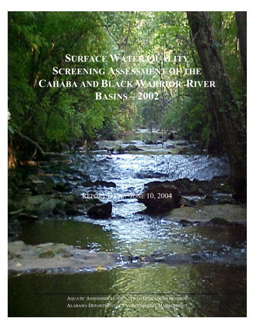
SURFACE WATER QUALITY<br />
SCREENING ASSESSMENT OF THE<br />
CAHABA AND BLACK WARRIOR RIVER<br />
BASINS –2002<br />
REPORT DATE: JUNE 10, 2004<br />
AQUATIC ASSESSMENT UNIT -- FIELD OPERATIONS DIVISION<br />
ALABAMA DEPARTMENT OF ENVIRONMENTAL MANAGEMENT
THIS PROJECT WAS FUNDED OR PARTIALLY FUNDED<br />
BY THE ALABAMA DEPARTMENT OF<br />
ENVIRONMENTAL MANAGEMENT<br />
USING A CLEAN WATER ACT §319(H) NONPOINT SOURCE<br />
DEMONSTRATION GRANT<br />
PROVIDED BY THE U.S. ENVIRONMENTAL<br />
PROTECTION AGENCY - REGION 4.<br />
ADDRESS COMMENTS AND QUESTIONS TO :<br />
AQUATIC ASSESSMENT UNIT–ENVIRONMENTAL INDICATORS SECTION<br />
FIELD OPERATIONS DIVISION–MONTGOMERY BRANCH<br />
ALABAMA DEPARTMENT OF ENVIRONMENTAL MANAGEMENT<br />
P.O. 301463<br />
MONTGOMERY, ALABAMA 36130-1463<br />
ii
Table <strong>of</strong> Contents<br />
TABLE OF CONTENTS<br />
List <strong>of</strong> Tables........................................................................................................................ iv<br />
List <strong>of</strong> Figures ........................................................................................................................v<br />
List <strong>of</strong> Abbreviations........................................................................................................... vii<br />
Introduction ............................................................................................................................1<br />
Methodology ..........................................................................................................................6<br />
Study Area ..........................................................................................................................6<br />
Ecoregions .......................................................................................................................8<br />
Review <strong>of</strong> Available Data.................................................................................................15<br />
NPS Impairment Potential and Sub-watershed Ranking ..................................................17<br />
Site Selection ....................................................................................................................19<br />
Habitat Assessment...........................................................................................................19<br />
Aquatic Macroinvertebrate Assessment ...........................................................................20<br />
Fish IBI Multi-Habitat Assessment...................................................................................21<br />
Chemical Assessment .......................................................................................................22<br />
Chain <strong>of</strong> Custody ..............................................................................................................23<br />
Summary: Black Warrior and Cahaba River Basins............................................................25<br />
Assessment Summaries <strong>of</strong> Impaired Sub-watersheds..........................................................58<br />
Cahaba River CU (0315-0202)......................................................................................59<br />
Mulberry Fork CU (0316-0109) ....................................................................................74<br />
Sipsey Fork CU (0316-0110) ......................................................................................111<br />
Locust Fork CU (0316-0111) ......................................................................................134<br />
Upper Black Warrior River CU (0316-0112)..............................................................152<br />
Lower Black Warrior River CU (0316-0113) .............................................................170<br />
References ..........................................................................................................................190<br />
iii
List <strong>of</strong> Tables<br />
LIST OF TABLES<br />
EXECUTIVE SUMMARY TABLES<br />
1. Estimates <strong>of</strong> % land cover within the minor basins <strong>of</strong> the BWC Basin Group iii<br />
2. Number <strong>of</strong> sub-watersheds with moderate or high impairment potential for iv<br />
rural NPS categories<br />
3. Number <strong>of</strong> sub-watersheds with moderate or high impairment potential for iv<br />
urban NPS categories<br />
4. Projects that have generated monitored assessment information v<br />
5. Sub-watersheds recommended for priority NPS status vii<br />
METHODS TABLES<br />
6. List <strong>of</strong> sub-watersheds located within the Cahaba River Basin 7<br />
7. List <strong>of</strong> sub-watersheds located within each minor basin within the Black 8<br />
Warrior River Basin<br />
8. Current animal unit conversion factors from ADEM Administrative Code 16<br />
Chapter 335-6-7<br />
9. Range <strong>of</strong> values used to define potential for impairment from rural sources 17<br />
10. Range <strong>of</strong> values used to define potential for impairment from urban sources 18<br />
11. Chemical/physical parameters analyzed by ADEM Central Laboratory 23<br />
iv
List <strong>of</strong> Figures<br />
LIST OF FIGURES<br />
1 Cataloging units and sub-watersheds <strong>of</strong> the BWC Basin Group 9<br />
2 Level IV Ecoregions <strong>of</strong> the BWC Basin Group 11<br />
3 CWA §303(d) segments in the BWC Basin Group 27<br />
4 Estimated potential for impairment from rural nonpoint sources 29<br />
5 Estimated potential for impairment from forestry 31<br />
6 Estimated potential for impairment from sedimentation 33<br />
7 Estimated potential for impairment from animal husbandry 35<br />
8 Estimated potential for impairment from pasture grazing 37<br />
9 Estimated potential for impairment from crop run<strong>of</strong>f 39<br />
10 Estimated potential for impairment from mining 41<br />
11 Estimated potential for impairment from aquaculture 43<br />
12 Estimated potential for impairment from urban sources 45<br />
13 Sampling locations within the BWC Basin Group, 1998-2002 47<br />
14 2002 impaired sub-watersheds and §303(d)-listed stream and reservoir segments in 51<br />
the BWC Basin Group<br />
15 2002 impaired sub-watersheds and §303(d)-listed stream segments located within 63<br />
the Cahaba River CU<br />
16 2002 impaired sub-watersheds and §303(d)-listed stream and reservoir segments 77<br />
located within the Mulberry Fork CU<br />
17 2002 impaired sub-watersheds and §303(d)-listed stream segments located within 115<br />
the Sipsey Fork CU<br />
18 2002 impaired sub-watersheds and §303(d)-listed stream segments located within 137<br />
the Locust Fork CU<br />
19 2002 impaired sub-watersheds and §303(d)-listed stream segments located within 155<br />
the U. Black Warrior River CU<br />
20 2002 impaired sub-watersheds within the L. Black Warrior R. CU 173<br />
v
List <strong>of</strong> Appendices<br />
LIST OF APPENDICES<br />
A. Comparison <strong>of</strong> EPA and SWCD landuse estimates<br />
B. NPDES permits, construction/stormwater authorizations, and CAFO<br />
registrations<br />
C. <strong>Water</strong>bodies on <strong>Alabama</strong>’s 2002 CWA §303(d) list<br />
D. NPS impairment potential estimated for each sub-watershed<br />
E. Location descriptions for data collected within the BWC Basin Group<br />
F. List <strong>of</strong> <strong>Alabama</strong> NPS screening assessment stations<br />
G. Summary <strong>of</strong> habitat, aquatic macroinvertebrate and fish assessment results<br />
H. SWCD estimates <strong>of</strong> animal units, % aquaculture, and % acre herbicide/<br />
pesticide applications<br />
I. SWCD Sedimentation rate estimates for each sub-watershed<br />
J. Habitat assessment results: NPS screening assessment stations<br />
K. Bioassessment results: NPS screening assessment stations<br />
L. Field data sheets:<br />
L-1. Riffle-run habitat assessment<br />
L-2. Glide pool habitat assessment<br />
L-3. Physical characterization/water quality data sheet<br />
M. Physical/chemical data collected during the BWC NPS screening assessment<br />
N. Metals data collected during the BWC NPS screening assessment<br />
O. Description <strong>of</strong> ADEM’s Ecoregional Reference Reach Program<br />
O-1. Physical characterization and habitat assessment results, 1998-2002<br />
O-2. Bioassessment results, 1998-2002<br />
O-3. Physical/chemical data, 1998-2002<br />
O-4. Metals data, 1998-2002<br />
P. Description <strong>of</strong> ADEM’s CWA §303(d) Monitoring Program<br />
P-1. Physical characterization and habitat assessment results, 1998-2002<br />
P-2. Bioassessment results, 1998-2002<br />
P-3. Physical/chemical data, 1998-2002<br />
P-4. Metals data, 1998-2002<br />
Q. Description <strong>of</strong> ADEM’s 2002 Periphyton Bioassessment Pilot Project<br />
Q-1. Periphyton and water column chlorophyll a results<br />
R. Description <strong>of</strong> ADEM’s Ambient Monitoring Program<br />
R-1. Physical/chemical data, 1998-2002<br />
S. Description <strong>of</strong> University Tributary Monitoring Project, 1998-1999<br />
S-1. Physical/chemical data<br />
T. Description <strong>of</strong> ADEM’s ALAMAP Program, 1998-2002<br />
T-1. Physical characterization and habitat assessment results<br />
T-2. Physical/chemical data<br />
vi
List <strong>of</strong> Abbreviations<br />
LIST OF ABBREVIATIONS<br />
Abbreviation Interpretation<br />
§ Section<br />
A&I<br />
Agricultural and Industrial <strong>Water</strong> Use Classification<br />
AAU<br />
Aquatic Assessment Unit <strong>of</strong> ADEM's Field Operations Division<br />
ADEM <strong>Alabama</strong> <strong>Department</strong> <strong>of</strong> <strong>Environmental</strong> <strong>Management</strong><br />
ALAMAP <strong>Alabama</strong> Monitoring and Assessment Program<br />
ASWCC State Soil and <strong>Water</strong> Conservation Committee<br />
AU<br />
Animal Unit as defined by ADEM CAFO Rules<br />
BMP<br />
Best <strong>Management</strong> Practices<br />
Br<br />
Branch<br />
BWC Black Warrior/Cahaba River Basin Group<br />
CAFO Concentrated Animal Feeding Operation<br />
cfs<br />
Cubic Feet per Second<br />
C<br />
Chemical/Physical <strong>Water</strong> Quality<br />
Co.<br />
County<br />
Cond. Conductivity<br />
Confl. Confluence<br />
Cr<br />
Creek<br />
CR<br />
County Road<br />
CU<br />
Cataloging Unit<br />
CWA Clean <strong>Water</strong> Act<br />
CWP<br />
Clean <strong>Water</strong> Partnership<br />
DO<br />
Dissolved Oxygen<br />
DRP<br />
Dissolved Reactive Phosphorus<br />
ds<br />
Downstream<br />
EIS <strong>Environmental</strong> Indicators Section <strong>of</strong> ADEM’s Field Operations Division<br />
EPA<br />
U.S. <strong>Environmental</strong> Protection Agency<br />
EPT<br />
Ephemeroptera, Plecoptera, and Trichoptera<br />
F&W Fish and Wildlife <strong>Water</strong> Use Classification<br />
FOD<br />
Field Operations Division<br />
FSR<br />
Forest Service Road<br />
GPS<br />
Global Positioning System<br />
GSA<br />
Geological Survey <strong>of</strong> <strong>Alabama</strong><br />
H<br />
High<br />
IBI<br />
Index <strong>of</strong> Biotic Integrity (fish community)<br />
LWF<br />
Limited Warmwater Fishery<br />
Macroinv. Aquatic Macroinvertebrate<br />
MB-EPT Multihabitat Bioassessment for Ephemeroptera, Plecoptera and Trichoptera<br />
mg/L<br />
Milligrams per Liter<br />
mgd<br />
millions <strong>of</strong> gallons per day<br />
mi 2<br />
square miles<br />
M<br />
Moderate<br />
NPDES National Pollutant Discharge Elimination System<br />
NPS<br />
Nonpoint Source<br />
nr<br />
Near<br />
NRCS Natural Resources Conservation Service<br />
NH 3 -N Ammonia Nitrogen<br />
NO 3 +NO 2 -N Nitrate/Nitrite Nitrogen<br />
OAW Outstanding <strong>Alabama</strong> <strong>Water</strong> Use Classification<br />
ONRW Outstanding National Resource <strong>Water</strong>s Designation<br />
OE/DO Organic Enrichment/Dissolved Oxygen<br />
PWS<br />
Public <strong>Water</strong> Supply <strong>Water</strong> Use Classification<br />
vii
List <strong>of</strong> Abbreviations<br />
R<br />
Rd<br />
RM<br />
S<br />
Sh<br />
SWCD<br />
TDS<br />
TKN<br />
TMDL<br />
TNTC<br />
TN<br />
TOC<br />
TP<br />
TSS<br />
Turb<br />
TVA<br />
µg/g<br />
µg/L<br />
ur<br />
us<br />
UT<br />
WQDS<br />
WWTP<br />
River<br />
Road<br />
River Mile<br />
Swimming and Other Whole Body <strong>Water</strong>-Contact Sports <strong>Water</strong> Use Classification<br />
Shellfish Harvesting <strong>Water</strong> Use Classification<br />
Soil and <strong>Water</strong> Conservation District<br />
Total Dissolved Solids<br />
Total Kjeldahl Nitrogen<br />
Total Maximum Daily Load<br />
Too numerous to count<br />
Total Nitrogen<br />
Total Organic Carbon<br />
Total Phosphorus<br />
Total Suspended Solids<br />
Turbidity<br />
Tennessee Valley Authority<br />
Micrograms per Gram<br />
Micrograms per Liter<br />
Unreported<br />
Upstream<br />
Unnamed tributary<br />
<strong>Water</strong> Quality Demonstration Study<br />
Wastewater Treatment Plant<br />
viii
Introduction<br />
INTRODUCTION<br />
Background: The goal <strong>of</strong> the Clean <strong>Water</strong> Act (CWA) is to restore and maintain the<br />
chemical, physical, and biological integrity <strong>of</strong> the Nation’s <strong>Water</strong>s (<strong>Water</strong> Polution<br />
Control Federation 1987). As the state’s environmental agency, the <strong>Alabama</strong> <strong>Department</strong><br />
<strong>of</strong> <strong>Environmental</strong> <strong>Management</strong> (ADEM) establishes water quality standards and<br />
implements management programs to meet these goals. The ADEM conducts monitoring<br />
to evaluate the effectiveness <strong>of</strong> these programs and to determine water quality status and<br />
trends.<br />
Section 303(d) <strong>of</strong> the CWA (§303(d)) requires that each state identify those waters that<br />
do not currently support water quality standards or designated uses. For each waterbody on<br />
the list, the state is required to establish a Total Maximum Daily Load (TMDL) for the<br />
pollutant or pollutants <strong>of</strong> concern at a level necessary to meet the applicable water quality<br />
standards. Nationwide, this process has been most effective at addressing impairments<br />
caused by point source discharges. However, pollutants from point sources only accounted<br />
for 47 (15%) <strong>of</strong> the 303 total sources on <strong>Alabama</strong>’s 2002 §303(d) list.<br />
In 2003, the USEPA linked CWA §319 funding to the TMDL process to begin to<br />
implement nonpoint source control activities more effectively. To obtain best management<br />
practice implementation funding, a <strong>Water</strong>shed Plan that addresses an approved TMDL<br />
must be developed. The <strong>Water</strong>shed Plan must describe a holistic strategy to improve,<br />
maintain, or protect water quality, it must address both point and nonpoint source issues<br />
within the watershed, and it must describe how nonpoint source load reductions will be<br />
achieved.<br />
ADEM NPS <strong>Management</strong> Strategy: In 1996, the <strong>Alabama</strong> <strong>Department</strong> <strong>of</strong> <strong>Environmental</strong><br />
<strong>Management</strong> (ADEM) adopted an adaptive watershed management strategy to synchronize<br />
water quality monitoring and management. Concentrating planning and implementation<br />
efforts within one basin group allows a focused review <strong>of</strong> available data and provides<br />
coordinated water quality monitoring and assessment efforts, efficient implementation <strong>of</strong><br />
pollution control activities on a geographic basis, and consistent and integrated decisionmaking<br />
for awarding CWA §319 funds.<br />
Since 1998, ADEM’s voluntary, incentive-based nonpoint source management program<br />
has been implemented through ten basinwide Clean <strong>Water</strong> Partnership Projects. Through<br />
these partnerships, management plans are developed and implemented for each basin. The<br />
partnerships allow for participation and collaboration among community-based groups,<br />
government agencies, industry, farms, forestry, special interest groups, and individual<br />
citizens.<br />
ADEM NPS Monitoring Strategy: A 2-tiered monitoring approach is used to identify<br />
impaired waters, determine the causes and sources <strong>of</strong> impairment, and evaluate the<br />
effectiveness <strong>of</strong> pollution control activities. This approach concentrates ADEM’s<br />
resources in areas with the greatest potential for impairment and where more intensive<br />
monitoring is required. Tier I monitoring, completed using ADEM’s basinwide screeninglevel<br />
assessment methods, is conducted on a repeating 5-year management cycle during<br />
1
Introduction<br />
ADEM’s Nonpoint Source (NPS) and CWA §303(d) Monitoring Programs to identify or<br />
verify impaired waters, estimate water quality status and trends, and evaluate causes and<br />
sources <strong>of</strong> impairments. The Aquatic Asesment Unit (AAU) <strong>of</strong> ADEM’s FOD has<br />
completed basinwide NPS screening assessments <strong>of</strong> the Black Warrior (1997), the<br />
Tennessee River basin (1998), the southeast <strong>Alabama</strong> River basins (1999), the <strong>Alabama</strong>,<br />
Coosa, and Tallapoosa River basins (2000), and the Escatawpa, Mobile Bay, and<br />
Tombigbee River basins (2001). Statewide, the results <strong>of</strong> these assessments have<br />
identified 120 sub-watersheds impaired by nonpoint source pollutants. Data and<br />
information collected during these assessments have been used to direct CWA §319 funds,<br />
develop nonpoint source basin management plans, and to update <strong>Alabama</strong>’s list <strong>of</strong><br />
impaired or threatened streams. The results <strong>of</strong> these assessments have been reported in 9<br />
separate documents (ADEM 1999a, ADEM 2000a, ADEM 2002a, ADEM 2002b, ADEM<br />
2002c, ADEM 2002d, ADEM 2002e, ADEM 2002f, ADEM 2003c). Copies can be<br />
downloaded from the <strong>Department</strong>’s website (www.adem.state.al.us/FieldOps/<br />
WQReports/MontRep.htm)<br />
Tier II monitoring projects, completed using watershed-specific, intensive assessment<br />
methods, are implemented at a much smaller scale and a more frequent monitoring cycle.<br />
They are used during ADEM’sNonpoint Source (NPS) <strong>Management</strong> and TMDL<br />
Implementation Programs to quantify causes and sources <strong>of</strong> impairment and to monitor<br />
program effectiveness. In 2003, ADEM initiated Tier II Monitoring Projects in the<br />
Tennessee River Basin to evaluate the effectiveness <strong>of</strong> changing landuses and pollution<br />
control activities in the Sand Mountain and Big Nance River sub-watersheds (ADEM in<br />
prep).<br />
2002 BWC Basinwide Assessment: During 2002, the Aquatic Assessment Unit (AAU) <strong>of</strong><br />
the Field Operations Division completed the 2 nd basinwide screening assessments <strong>of</strong> the<br />
Black Warrior and Cahaba (BWC) River basins. As with all basinwide screening<br />
assessments, the project included reviews <strong>of</strong> landuse, <strong>Department</strong>al regulatory databases,<br />
listing documents, and monitoring data collected by multiple agencies to identify data gaps<br />
and to prioritize sub-watersheds with the greatest potential for point and nonpoint source<br />
impairment. <strong>Water</strong>bodies within Jefferson County were not assessed. Selected sites were<br />
monitored using ADEM’s screening-level assessment techniques. Data were compiled and<br />
analyzed to estimate the level <strong>of</strong> impairment and to evaluate potential causes and sources<br />
<strong>of</strong> that impairment.<br />
Based on analysis <strong>of</strong> recent bioassessment and intensive water quality monitoring data,<br />
forty-one impaired sub-watersheds were identified (Table 1, Fig. 1). The list focuses on<br />
sub-watersheds outside <strong>of</strong> major urban areas (Birmingham, Tuscaloosa, Jefferson County).<br />
Fourteen <strong>of</strong> the 42 sub-watersheds contain CWA §303(d)/TMDL stream or reservoir<br />
segments and are eligible for §319 funding and watershed planning. Data from the<br />
remaining 28 sub-watersheds should be reviewed as potential candidates for §303(d)<br />
listing.<br />
Final Report: The purpose <strong>of</strong> this document is to provide an overview <strong>of</strong> recent data and<br />
assessment information that can be used to identify impaired stream segments for inclusion<br />
on the §303(d) list and to assist with the development <strong>of</strong> NPS watershed plans. The<br />
2
Introduction<br />
document includes a description <strong>of</strong> the methods used during the basinwide screening<br />
assessment. For each <strong>of</strong> the 96 sub-watersheds, landuse, nonpoint source estimates,<br />
permitting information, §303(d)/TMDL waterbodies, monitoring data and other<br />
assessment information are compiled in the Appendices. The document provides a<br />
summary <strong>of</strong> information available for each <strong>of</strong> the 42 impaired sub-watersheds. The<br />
summaries are organized into 6 sections by cataloging unit (CU).<br />
Table 1. List <strong>of</strong> impaired sub-watersheds. Impairment determined by bioassessment and intensive physical/chemical<br />
data collected 1998-2002.<br />
Sub-watershed 303(d)/ Lowest Suspected Cause(s) Suspected nonpoint source(s)<br />
TMDL<br />
Stream a<br />
Station<br />
Assessment<br />
Cahaba R (0315-0202) 303(d)<br />
050 Cahaba R. Poor Sedimentation, Nutrient<br />
enrichment<br />
Pasture grazing, Mining, Urban<br />
development<br />
070 Cahaba R. Fair/Poor Sedimentation, Nutrient Mining, Historical forestry<br />
enrichment, OE/DO<br />
150 Cahaba R. Fair Sedimentation Pasture grazing, Crop run<strong>of</strong>f,<br />
Forestry<br />
170 Cahaba R. TA Poor Pathogens, Sedimentation,<br />
Erosion, Nutrient enrichment<br />
Pasture grazing, Aquaculture, Septic<br />
tank failure<br />
Mulberry Fork (0316-0109)<br />
010 Mulberry Fork Poor Sedimentation, Reduced flow,<br />
Unstable banks, Nutrient<br />
enrichment, OE/DO, Pathogens<br />
020 Duck Cr. TA Poor Reduced flow, sedimentation,<br />
DO/OE, Nutrient enrichment,<br />
Pathogens, Pesticides<br />
030 Brindley Cr. 303(d) Very poor Sedimentation, OE/DO, Nutrient<br />
enrichment, Pathogens, pH,<br />
Reduced flow<br />
040 Eightmile Cr. TA<br />
303(d)<br />
050 Broglen R. TA<br />
303(d)<br />
080 Thacker Cr. TA<br />
303(d)<br />
Fair<br />
Poor<br />
Poor<br />
Pathogens, Sedimentation,<br />
Nutrient enrichment, OE/DO<br />
Sedimentation, Other habitat<br />
alteration OE/DO, Nutrient<br />
enrichment, Pathogens<br />
Pathogens, Ammonia, Nutrient<br />
Enrichment, OE/DO,<br />
Sedimentation, Other habitat<br />
alteration<br />
Animal husbandry, Crop run<strong>of</strong>f,<br />
Pasture grazing, Forestry<br />
Animal husbandry, Crop run<strong>of</strong>f,<br />
Pasture grazing, Forestry<br />
Animal husbandry, Crop run<strong>of</strong>f,<br />
Pasture grazing, Forestry,<br />
Development<br />
WWTP, Urban run<strong>of</strong>f, Animal<br />
husbandry, Pasture grazing, Crop<br />
run<strong>of</strong>f, Forestry<br />
WWTP, Urban run<strong>of</strong>f, Animal<br />
husbandry, Pasture grazing, Crop<br />
run<strong>of</strong>f, Forestry<br />
Animal husbandry, Pasture grazing,<br />
Forestry<br />
100 Sloan Cr. Poor OE/DO, Nutrient enrichment, Forestry, Septic tank failure<br />
Sedimentation<br />
110 Dorsey Cr. Poor Sedimentation, OE/DO, Nutrient<br />
enrichment<br />
Animal husbandry, Pasture grazing,<br />
Mining, Forestry<br />
120 Splunge Cr. Fair Sedimentation Septic tank failure, Pasture grazing,<br />
Animal production, Forestry<br />
130 Blackwater Cr. Poor Sedimentation, pH Animal husbandry, Mining, Pasture<br />
grazing, Forestry, Septic tank failure<br />
170 Lost Cr. 303(d) Poor Sedimentation, OE/DO, Metals, Mining, Forestry, Septic tank failure<br />
pH, Other habitat alteration<br />
180 Wolf Cr. 303(d) Poor Sedimentation, Other habitat Mining, Forestry<br />
alteration, pH, OE/DO<br />
190 Baker Cr. Poor Sedimentation Mining, Forestry, Septic tank failure<br />
a. 303(d):curently on ADEM’s 2002 §303(d) list <strong>of</strong> impaired waters; TA: approved TMDL<br />
3
Introduction<br />
Table 1, cont. List <strong>of</strong> impaired sub-watersheds. Impairment determined by bioassessment and intensive<br />
physical/chemical data collected 1998-2002.<br />
Sub-watershed 303(d)/ Lowest Suspected Cause(s) Suspected nonpoint source(s)<br />
TMDL<br />
<strong>Water</strong>body<br />
Station<br />
Assessment<br />
Sipsey Fork (0316-0110)<br />
010 Sipsey Fork Fair Sedimentation Unknown<br />
030 Upper Brushy<br />
Cr.<br />
Poor Reason unclear Animal husbandry, Pasture<br />
grazing<br />
050 Right Fork<br />
Poor Sedimentation, historic water Pasture grazing, Mining<br />
Clear Cr.<br />
quality problems<br />
080 U. Rock Cr. TA Poor Sedimentation, Pathogens, OE/DO Pasture grazing, Animal<br />
husbandry<br />
090 Crooked Cr. TA Poor Sedimentation, Pathogens,<br />
OE/DO, Ammonia, Nutrient<br />
enrichment<br />
Animal husbandry, Pasture<br />
grazing, Forestry<br />
110 U. Ryan Cr. Poor Sedimentation, Nutrient<br />
enrichment, Pathogens, Flow<br />
modification<br />
130 Sipsey Fork No recent data;<br />
1997 NPS<br />
priority<br />
Locust Fork (0316-0111)<br />
Sedimentation, Nutrient<br />
enrichment<br />
Animal husbandry, crop run<strong>of</strong>f,<br />
Pasture grazing, Forestry, Urban,<br />
Development<br />
Animal husbandry, Pasture<br />
grazing, Mining, Forestry, Septic<br />
tank failure<br />
010 U. Locust Fork No recent data; OE/DO, pH, Sedimentation Animal husbandry, Pasture<br />
1997 NPS<br />
priority<br />
grazing, Mining, Septic tank<br />
failure<br />
020 Bristows Cr. Fair Nutrient enrichment Crop run<strong>of</strong>f, Pasture grazing,<br />
030 Clear Cr. Fair/poor Sedimentation, Nutrient<br />
enrichment<br />
040 Slab Cr. Fair Sedimentation, Nutrient<br />
enrichment<br />
050 Middle Locust<br />
Fork<br />
TA<br />
303(d)<br />
Poor/Very<br />
poor<br />
Nutrients, Ammonia, OE/DO,<br />
Pathogens, Sedimentation, Other<br />
habitat alteration<br />
Septic tank failure<br />
Animal husbandry, Crop run<strong>of</strong>f,<br />
Pasture grazing, Urban, Septic<br />
tank failure, Development<br />
Animal husbandry, Row crops,<br />
Pasture run<strong>of</strong>f, Urban, Septic<br />
tank failure<br />
Animal husbandry, Crop run<strong>of</strong>f,<br />
Pasture grazing, Mining, Septic<br />
tank failure, WWTP<br />
080 Sugar Cr. Fair/poor Sedimentation, Ammonia Crop run<strong>of</strong>f, Pasture grazing,<br />
Mining<br />
a. 303(d): curently on ADEM’s 2002 §303(d) list <strong>of</strong> impaired waters; TA: approved TMDL<br />
4
Introduction<br />
Table 1, cont. List <strong>of</strong> impaired sub-watersheds. Impairment determined by bioassessment and intensive<br />
physical/chemical data collected 1998-2002.<br />
Sub-watershed 303(d)/ Lowest Suspected Cause(s) Suspected nonpoint source(s)<br />
TMDL<br />
<strong>Water</strong>body<br />
Station<br />
Assessment<br />
Upper Black Warrior R. (0316-0112)<br />
050 Upper Big 303(d) Poor Metals, OE/DO, Nutrient Mining<br />
Yellow Cr.<br />
enrichment<br />
070 Blue Cr. Poor Sedimentation, Nutrient Mining<br />
enrichment<br />
080 Davis Cr. Poor Sedimentation, Metals Mining, Forestry<br />
100 L. North R. 303(d) Fair Nutrient enrichment, Siltation,<br />
Other habitat alteration, Pathogens<br />
Mining, Pasture grazing, Animal<br />
husbandry, Forestry, Crop run<strong>of</strong>f<br />
120 Hurricane Cr. 303(d) No recent data; Metals, Pathogens, Nutrient Mining, Land development<br />
1997 NPS<br />
priority<br />
enrichment, Sedimentation, Other<br />
habitat alteration, Turbidity<br />
Lower Black Warrior R. (0316-0113)<br />
030 Big Sandy Cr. Fair Sedimentation, Habitat<br />
degradation<br />
070 Gabriel Cr. No recent data; Sedimentation, Habitat<br />
1997 NPS degradation<br />
priority<br />
110 Minter Cr. Fair Sedimentation, Nutrient<br />
enrichment<br />
120 Big Brush Cr. Poor Sedimentation, Habitat<br />
degradation, Nutrient enrichment,<br />
Pathogens<br />
Animal husbandry, Forestry<br />
Crop run<strong>of</strong>f, Animal husbandry,<br />
Forestry<br />
Animal husbandry, Aquaculture,<br />
Pasture grazing, Forestry<br />
Pasture grazing, Aquaculture, Crop<br />
run<strong>of</strong>f, Urban<br />
140 Dollarhide Cr. Poor Sedimentation, DO/OE, Nutrient<br />
enrichment<br />
Aquaculture, Crop run<strong>of</strong>f, Pasture<br />
grazing, Urban, Septic tank failure<br />
160 B. Prairie Cr. Poor Sedimentation, Nutrient<br />
enrichment, Pathogens<br />
Aquaculture, Row crops, Pasture<br />
run<strong>of</strong>f , Point sources<br />
170 L. Prairie Cr. Fair Sedimentation, Habitat alteration,<br />
Nutrient enrichment, OE/DO<br />
Aquaculture, Row crops, Pasture<br />
run<strong>of</strong>f<br />
a. 303(d): currently on ADEM’s 2002 §303(d) list <strong>of</strong> impaired waters; TA: approved TMDL<br />
5
Methodology<br />
METHODOLOGY<br />
STUDY AREA<br />
The BWC Basin Group contains portions <strong>of</strong> 2 major drainages (Fig. 1). The Black<br />
Warrior River is a main tributary <strong>of</strong> the Tombigbee River. It is comprised <strong>of</strong> five major<br />
tributaries or cataloging units (CU): Mulberry Fork, Sipsey Fork, Locust Fork, Upper Black<br />
Warrior, and Lower Black Warrior (USDASCS 1995). The Cahaba River is a major<br />
tributary or CU <strong>of</strong> the <strong>Alabama</strong> River (USDASCS 1995). Located within portions <strong>of</strong> 21<br />
counties in central <strong>Alabama</strong>, the Black Warrior and Cahaba River basins drain<br />
approximately 8,106 mi 2 (15.5%) <strong>of</strong> the State. Tables 6 and 7 list the 96 sub-watersheds<br />
by CU and basin.<br />
Table 6. Sub-watersheds <strong>of</strong> the Cahaba River CU.<br />
Cataloging Unit<br />
Sub-watershed<br />
0315-0202 Cahaba River<br />
010 Big Black Creek<br />
020 b Little Cahaba River<br />
030 b Cahaba River<br />
040 Cahaba Valley Creek<br />
050 Cahaba River<br />
060 b Shades Creek<br />
070 Cahaba River<br />
080 Shoal Creek<br />
090 Sixmile Creek<br />
100 Little Shultz Creek<br />
110 Shultz Creek<br />
120 a Haysop Creek<br />
130 Rocky Branch Creek<br />
140 a Cahaba River<br />
150 a Cahaba River<br />
160 Oakmulgee Creek<br />
170 a, b Cahaba River<br />
a. 1996/1997 NPS Priority Sub-watershed<br />
b. contains a 2004 §303(d) waterbody or approved TMDL<br />
6
Methodology<br />
Table 7. Sub-watersheds located within the Black Warrior River Basin.<br />
Cataloging<br />
Unit<br />
Sub-watershed<br />
Cataloging<br />
Unit<br />
Sub-watershed<br />
0109 Mulberry Fork 0111 Locust Fork<br />
010 Mulberry Fork 010 a Upper Locust Fork<br />
020 a,b Duck Creek 020 a Bristows Creek<br />
030 a, b Brindley Creek 030 a Clear Creek<br />
040 a, b Eightmile Creek 040 a Slab Creek<br />
050 b Broglen River 050 a, b Middle Locust Fork<br />
060 Blue Springs Creek 060 a Calvert Prong<br />
070 b Mud Creek 070 Blackburn Fork<br />
080 a, b Thacker Creek 080 a Sugar Creek<br />
090 Mill Creek 090 Gurley Creek<br />
100 Sloan Creek 100 Hogeland Creek<br />
110 a Dorsey Creek 110 Turkey Creek<br />
120 a Splunge Creek 120 b Cane Creek<br />
130 Blackwater Creek 130 b Five Mile Creek<br />
140 Little Blackwater Creek 140 b Village Creek<br />
150 Cane Creek 150 b Lower Locust Fork<br />
160 Old Town Creek 0112 Upper Black Warrior<br />
170 b Lost Creek 010 Big Branch<br />
180 a, b Wolf Creek 020 b Upper Valley Creek<br />
190 Baker Creek 030 b Lower Valley Creek<br />
200 Bluff Creek 040 Little Shoal Creek<br />
0110 Sipsey Fork 050 b Upper Big Yellow Creek<br />
010 Sipsey Fork 060 Lower Big Yellow Creek<br />
020 Sipsey Fork 070 Blue Creek<br />
030 Upper Brushy Creek 080 a Davis Creek<br />
040 Lower Brushy Creek 090 a Upper North River<br />
050 a Right Fork Clear Creek 100 a, b Lower North River<br />
060 Clear Creek 110 Yellow Creek<br />
070 Sipsey Fork 120 a, b Hurricane Creek<br />
080 a, b Upper Rock Creek<br />
090 b Crooked Creek<br />
100 Lower Rock Creek<br />
110 Upper Ryan Creek<br />
120 Lower Ryan Creek<br />
130 a Sipsey Fork<br />
a. 1996/1997 NPS Priority Sub-watershed b. contains a 2004 §303(d) waterbody or approved TMDL<br />
7
Methodology<br />
Table 7, cont. Sub-watersheds located<br />
within the Black Warrior River Basin.<br />
Cataloging<br />
Unit<br />
Sub-watershed<br />
0316-0113 Lower Black Warrior<br />
010 Big Creek<br />
020 Cypress Creek<br />
030 a Big Sandy Creek<br />
040 Keaton Lake<br />
050 Grant Creek<br />
060 Elliotts Creek<br />
070 a Gabriel Creek<br />
080 Davis Creek<br />
090 Fivemile Creek<br />
100 Coleman Branch<br />
110 Minter Creek<br />
120 a Big Brush Creek<br />
130 Wright’s Creek<br />
140 Dollarhide Creek<br />
150 Hines Creek<br />
160 a Big Prairie Creek<br />
170 Little Prairie Creek<br />
180 Backbone Creek<br />
190 French Creek<br />
a. 1996/1997 NPS Priority Sub-watershed<br />
Ecoregions<br />
Ecoregions are relatively homogeneous ecological areas defined by similarity <strong>of</strong><br />
climate, landform, soil, natural vegetation, hydrology, or other ecologically relevant<br />
variables. Since 1991, ADEM has maintained a network <strong>of</strong> least-impaired ecoregional<br />
reference sites (ADEM 2002n). Intensive monitoring assessments, including chemical,<br />
physical, habitat, and biological data, are collected to develop baseline reference conditions<br />
for each <strong>of</strong> <strong>Alabama</strong>’s 29 Level IV subecoregions (Grifith et al. 2001). The reference<br />
condition establishes the basis for making comparisons and detecting use impairment<br />
(Omernik and Griffith 1991, Omernik 1995).<br />
Approximately 77% <strong>of</strong> the BWC Basin Group lies above the Fall Line within 7<br />
subecoregions <strong>of</strong> the Ridge and Valley (67) and Southwestern Appalachians (68)<br />
Ecoregions. A small section <strong>of</strong> the Cahaba River CU drains the Piedmont (45) Ecoregion.<br />
8
Methodology<br />
Fig. 1. Cataloging units and sub-watersheds <strong>of</strong> the BWC Basin Group.<br />
N<br />
LAWRENCE<br />
10<br />
30<br />
90<br />
80<br />
110<br />
40 30 20<br />
50<br />
40<br />
20<br />
CULLMAN<br />
100<br />
50<br />
120<br />
60<br />
70 60<br />
WINSTON<br />
Sipsey Fork 70<br />
120<br />
80<br />
80<br />
WALKER<br />
110<br />
90<br />
170<br />
130<br />
130<br />
100<br />
100<br />
Mulberry Fork<br />
140<br />
BLOUN T<br />
150<br />
160<br />
120<br />
180<br />
90<br />
90<br />
200<br />
JEFFERSON<br />
110<br />
FAYETTE<br />
190<br />
Locust Fork<br />
130<br />
50<br />
140<br />
150<br />
60<br />
10<br />
U. Black W arrior R. 70<br />
40<br />
100<br />
20<br />
30<br />
80<br />
30<br />
10<br />
50<br />
60<br />
70<br />
ST CLAIR<br />
10<br />
20<br />
40<br />
MARSHALL<br />
30<br />
20<br />
ETOWAH<br />
10<br />
10<br />
20<br />
110<br />
TUSCALOOSA<br />
120<br />
110<br />
70<br />
60<br />
SHELBY<br />
50<br />
80<br />
40<br />
50<br />
80<br />
40 60<br />
70<br />
HALE<br />
110<br />
100<br />
90<br />
130<br />
L. Black W arrior R . 120<br />
GREENE<br />
140<br />
150<br />
30<br />
140<br />
120<br />
PERRY<br />
100<br />
BIBB<br />
130<br />
160<br />
Cahaba<br />
90<br />
CHILTON<br />
BWC Basin Group<br />
Cataloging U nits<br />
USDA Sub-w atersheds<br />
Counties<br />
Reservoirs<br />
Streams<br />
180<br />
170<br />
160<br />
150<br />
190<br />
MARENGO<br />
DALLAS<br />
170<br />
9
THIS PAGE INTENTIONALLY BLANK<br />
10
Methodology<br />
Fig. 2. Level IV Ecoregions in the BWC Basin Group.<br />
N<br />
BWC Basin Group<br />
Cataloging Units<br />
USDA Sub-watersheds<br />
Counties<br />
Streams<br />
Reservoirs<br />
Level IV Ecoregions<br />
45a<br />
65a<br />
65b<br />
65i<br />
65p<br />
67f<br />
67g<br />
67h<br />
68b<br />
68d<br />
68e<br />
68f<br />
11
THIS PAGE INTENTIONALLY BLANK<br />
12
Methodology<br />
The southern section <strong>of</strong> the BWC Basin Group lies below the Fall Line within the<br />
Southeastern Plains (65) Ecoregion.<br />
The Piedmont (45) Ecoregion comprises a transitional area between the mostly<br />
mountainous ecoregions <strong>of</strong> the Ridge and Valley (67) Ecoregion to the northwest and the<br />
relatively flat coastal plain to the southeast. A small portion <strong>of</strong> the Cahaba River CU lies<br />
within the Southern Inner Piedmont (45a) subecoregion. The landscape is a rolling to hilly<br />
and mostly forested, with major forest types <strong>of</strong> oak-pine and oak-hickory, and some<br />
loblolly-shortleaf pine. Open areas are mostly in pasture, although there are some small<br />
areas <strong>of</strong> cropland. Streams in this subecoregion tend to be low- to moderate-gradient<br />
streams with cobble, gravel, and sandy substrates.<br />
The southern half <strong>of</strong> the Black Warrior and Cahaba River basins lie within the<br />
Southeastern Plains (65) Ecoregion. The Ecoregion is characterized by irregular plains<br />
with broad interstream areas. Natural vegetation is mostly oak-hickory-pine and southern<br />
mixed forest. The soils <strong>of</strong> the region are sands, silts, and clays. Elevations and relief are<br />
less than the Ridge and Valley (67) and Southwestern Appalachians (68) Ecoregions.<br />
The Blackbelt region <strong>of</strong> the extreme southern portion <strong>of</strong> the Black Warrior River Basin<br />
is composed <strong>of</strong> two subecoregions <strong>of</strong> the Coastal Plain: the Blackland Prairie (65a) and the<br />
Flatwoods/Blackland Prairie Margins (65b). Because the regions are narrow and<br />
intermingled, many streams drain through portions <strong>of</strong> both subecoregions. The elevations<br />
in these regions range from 150-250’ in the Blackland Prairie to 100-400’ in the<br />
Flatwoods/Blackland Prairie margins. The soils are primarily clays and loams that weather<br />
into nutrient-rich soils that can bake hard in summers and become very adhesive when wet.<br />
Streams in this region usually erode to chalk bedrock and are noted for variable flows and<br />
high rates <strong>of</strong> run<strong>of</strong>f during storms. In summers, many smaller streams will go dry, and<br />
flow in larger streams becomes quite low. The natural vegetation <strong>of</strong> the Blackland Prairie,<br />
consisting <strong>of</strong> sweetgum, post oak, red cedar, and bluegrass prairie, has been transformed to<br />
cropland and pasture, with small patches <strong>of</strong> mixed hardwoods. Aquaculture, primarily<br />
pond-raised catfish, has increased in recent years. The Flatwoods are comprised <strong>of</strong> a<br />
mostly-forested lowland area <strong>of</strong> little relief, formed primarily on dark, massive marine clay.<br />
The Lower Black Warrior River CU lies mainly within the Fall Line Hills (65i)<br />
subecoregion. Unlike other regions <strong>of</strong> the BWC, streams located within the Fall Line Hills<br />
flow year round due to extensive sand and gravel aquifers in the region (Mettee et al.<br />
1996). Riverine wetlands are characteristic <strong>of</strong> the subecoregion. Within the BWC, the Fall<br />
Line Hills is a transition zone between the Coastal Plain and the Southwestern<br />
Appalachians. It is mostly forested terrain <strong>of</strong> oak-hickory-pine on hills with 200-400 foot<br />
relief. Longleaf pine is being reintroduced in many areas.<br />
The Southeastern Floodplains and Low Terraces (65p) comprise a riverine ecoregion<br />
<strong>of</strong> large sluggish rivers and backwaters with ponds, swamps, and oxbow lakes. River<br />
swamp forests <strong>of</strong> bald cypress, water tupelo, and oak-dominated bottomland hardwood<br />
forests provide important wildlife corridors and habitat. In <strong>Alabama</strong>, cropland is typical on<br />
the higher, better-drained terraces, while hardwoods cover the floodplains.<br />
The Ridge and Valley (67) Ecoregion consists <strong>of</strong> a series <strong>of</strong> folded and faulted parallel<br />
13
Methodology<br />
ridges that trend in the northeast–southwest direction. Ridges are generally made <strong>of</strong><br />
sandstone and chert, while valleys are generally developed on limestone and shale. Springs<br />
and caves are relatively common. Land cover is mixed and present-day forests cover about<br />
50% <strong>of</strong> the region. The ecoregion has diverse aquatic habitat and supports a unique and<br />
species-rich fish fauna. The Upper Cahaba River basin and eastern half <strong>of</strong> the Locust Fork<br />
drain the Ridge and Valley (67) Ecoregion. The area has been extensively developed for<br />
residential and commercial use.<br />
The Southern Limestone/Dolomite Valleys and Low Rolling Hills (67f) is composed<br />
predominantly <strong>of</strong> limestone and cherty dolomite. Landforms are mostly undulating valleys<br />
and rounded ridges and hills, with many caves and springs. Within the Cahaba River,<br />
headwaters <strong>of</strong> tributary streams drain the subecoregion from the east and west. They are<br />
moderate- to low-gradient streams with bedrock, cobble, gravel, and sand substrates. Soils<br />
vary in their productivity, and land cover includes oak-hickory and oak-pine forests,<br />
pasture, intensive agriculture, and urban and industrial.<br />
A distinct segment <strong>of</strong> the Southern Shale Valleys (67g) lies within the Cahaba River<br />
drainage between 67f and 67h. The subecoregion consists <strong>of</strong> undulating to rolling valleys<br />
and some low, rounded hills and knobs that are dominated by shale. The soils formed in<br />
materials weathered from shale, limestone, and clays. They tend to be deep, acidic,<br />
moderately well-drained, and slowly permeable. The steeper slopes are used for pasture or<br />
have reverted to brush and mixed forest land. Streams within the Southern Shale Valleys<br />
tend to be moderate- to low-gradient streams with bedrock, cobble, gravel, and sandy<br />
substrates.<br />
The upper Cahaba River flows through the Southern Sandstone Ridges (67h) subecoregion.<br />
It encompasses major sandstone and shale ridges and conglomerate beds. Streams draining<br />
this subecoregion are high-to-moderate gradient with rocky substrates.<br />
The Southwestern Appalachians (68) contain most <strong>of</strong> the Mulberry Fork, Sipsey Fork,<br />
and western portion <strong>of</strong> the Locust Fork <strong>of</strong> the Black Warrior River basin. Elevations range<br />
from around 1,100’ on the northern slopes to approximately 600’ at the northern boundary<br />
<strong>of</strong> the Fall Line Hills near Tuscaloosa. These low mountains contain a mosaic <strong>of</strong> forest<br />
and woodland with some cropland and pasture. The mixed mesophytic forest is restricted<br />
mostly to the deeper ravines and escarpment slopes, and the summit or tableland forests are<br />
dominated by mixed oaks with shortleaf pine.<br />
Two thin fingers <strong>of</strong> the Sequatchie Valley (68b) subecoregion extend south into the<br />
upper reaches <strong>of</strong> the Mulberry Fork. It is composed mostly <strong>of</strong> limestones, dolomites, and<br />
shales. Streams are moderate- to low-gradient with bedrock, cobble, gravel, and sandy<br />
substrates. Springs are common.<br />
14
Methodology<br />
The Southern Table Plateaus (68d) subecoregion drains the northwest corner <strong>of</strong> Mulberry<br />
Fork and eastern portion <strong>of</strong> Sipsey Fork. This portion <strong>of</strong> the subecoregion is characterized<br />
by a mild climate and gentle topography containing sandstone, shale layers, and coalbearing<br />
strata. Cropland and pasture are common. It is one <strong>of</strong> <strong>Alabama</strong>'s major poultry<br />
production regions and contains small areas <strong>of</strong> coal mining.<br />
The rugged, mostly forested region <strong>of</strong> the Dissected Plateau (68e) subecoregion<br />
contains predominantly strongly sloping land, some steep-sided gorges and sandstone<br />
cliffs, and relief <strong>of</strong> 300-400 feet. The cool canyons and valleys <strong>of</strong>ten contain plant and<br />
animal species usually found further north. Streams are low-to-moderate gradient with<br />
bedrock and boulder substrates. The Bankhead National Forest occupies a large portion <strong>of</strong><br />
68e, providing public recreation, wilderness, and forestry areas. Most <strong>of</strong> the region is<br />
drained by the Sipsey Fork <strong>of</strong> the Black Warrior River. The Sipsey Fork is a National Wild<br />
and Scenic River in its headwaters, and downstream is impounded to form Lewis Smith<br />
Lake.<br />
The Shale Hills (68f) ecoregion, sometimes called the Warrior Coal Field, has<br />
relatively low elevations, but the surface features are characterized by extensive hills and<br />
mostly strongly sloping topography. The shale, siltstone, and sandstone are relatively<br />
impermeable, and streams do not have the base flow found in more permeable adjacent<br />
areas, such as 65i or 67f. The region is mostly forested, but coal mining is a major industry,<br />
and the extensive open-pit mines have altered the landscape, soils, and streams.<br />
REVIEW OF AVAILABLE DATA<br />
The use <strong>of</strong> available data was an important component <strong>of</strong> the NPS screening<br />
assessment <strong>of</strong> the BWC Basin Group because it allowed ADEM to concentrate efforts in<br />
those areas where recent data were not available. Chemical, habitat, and biological data<br />
from other projects were used to supplement data collected during the NPS screening<br />
assessment. However, water quality data and information can range from casual<br />
observations to intensive water chemistry, biological, and physical characterization. To use<br />
existing data to accurately assess conditions within a sub-watershed, it is important to<br />
understand the objectives <strong>of</strong> these projects.<br />
During 2000, ADEM identified two levels <strong>of</strong> waterbody assessments: monitored and<br />
evaluated (ADEM 2000b). When information such as observed conditions, limited water<br />
quality data, water quality data older than 5 years, or estimated impacts from observed or<br />
suspected activities are used as the basis for the assessment, the assessment is generally<br />
refered to as “evaluated”. Evaluated asesments usualy require the use <strong>of</strong> some degree<br />
<strong>of</strong> pr<strong>of</strong>essional judgment by the person making the assessment. Monitored assessments are<br />
based on chemical, physical, and/or biological data collected using commonly accepted and<br />
well-documented methods. There is a higher level <strong>of</strong> certainty associated with monitored<br />
assessments than with evaluated assessments.<br />
Monitored asesments have been conducted in conjunction with ADEM’s Ecoregional<br />
Reference Reach Program (Appendix O), CWA §303(d) <strong>Water</strong>body Monitoring Program<br />
(Appendix P), Reservoir Monitoring Program, Ambient Monitoring Program (Appendix<br />
R), and the 2002 Periphyton Bioassessment Pilot Project (Appendix Q), GSA’s<br />
15
Methodology<br />
Assessment <strong>of</strong> Mulberry Fork (Shepard et al. 2001, Shepard et al. 2002), and the University<br />
Tributary Nutrient Loading Project (Appendix S). Evaluated assessments have been<br />
conducted in conjunction with ADEM’s ALAMAP Program (Appendix T). A summary <strong>of</strong><br />
6 <strong>of</strong> these projects, including lead agency, project objectives, type <strong>of</strong> assessments<br />
conducted and data collected, and applicable quality assurance manuals, is provided in the<br />
appendices.<br />
Other data/information: ADEM’s municipal, industrial, mining, and CAFO databases<br />
were reviewed to eliminate sub-watersheds primarily impacted by point sources or<br />
monitored in conjunction with NPDES permits (ADEM 2002g, 2002h). Biological and<br />
chemical data were also reviewed to locate sampling reaches in areas that had not been<br />
recently assessed.<br />
Landuse: ADEM assigned each sub-watershed an NPS rating based on estimates <strong>of</strong><br />
landuse percentages, animal populations, and sedimentation rates to prioritize subwatersheds<br />
for assessment and to identify potential sources <strong>of</strong> impairment. These<br />
estimates were obtained from information provided to ADEM by the <strong>Alabama</strong> Soil and<br />
<strong>Water</strong> Conservation Committee (ASWCC) and local Soil and <strong>Water</strong> Conservation Districts<br />
(SWCD). This information was provided on Conservation Assessment Worksheets<br />
completed in 1998 (FY97 CWA § 319 Workplan Project #4). Sub-watershed assessment<br />
information is available at www.swcc.state.al.us.<br />
Additional landuse information was obtained from estimates <strong>of</strong> percent land cover for<br />
the entire southeastern U.S. published by EPA (EPA 1997b). These estimates were based<br />
on leaf-<strong>of</strong>f Landsat TM data acquired in 1988, 1990, 1991, 1992, and 1993. Recent<br />
ground-truthing <strong>of</strong> these estimates have indicated 58% accuracy due to a decrease in<br />
agricultural use and an increase in plantation pine in some areas <strong>of</strong> <strong>Alabama</strong> within the last<br />
10 years (Pitt 2000). Use <strong>of</strong> these estimates to locate least-impaired ecoregional reference<br />
sites in Georgia has indicated an accuracy <strong>of</strong> 40-60% (Olson and Gore 2000). Therefore,<br />
only the conservation assessment worksheets were used to evaluate potential for<br />
impairment from nonpoint sources. The EPA Landsat data was provided in ADEM 1999a.<br />
Animal population estimates: The potential NPS impairment from activities associated<br />
with animal husbandry was assessed. The impairment potential among the different animal<br />
types was standardized by converting animal populations into animal units (AU). Animal<br />
unit estimates were calculated for each <strong>of</strong> the animal types based on the current conversion<br />
factors found in ADEM Administrative Code Chapter 335-6-7 (Table 8). These values<br />
considered characteristics such as live weight equivalent waste quantity and constituent<br />
composition (limiting nutrients, moisture, additive compounds, etc.) (ADEM 1999b). AU<br />
estimates for each animal type were further standardized by converting to animal unit<br />
densities (AU/acre <strong>of</strong> sub-watershed).<br />
Forestry practices: Where the information was available, 3 categories were summed to<br />
assess the potential for impairment from forestry practices: percent <strong>of</strong> acres clear-cut,<br />
percent <strong>of</strong> acres harvested annually, and percent <strong>of</strong> forest needing improvement. This<br />
information was provided by the local SWCD and the <strong>Alabama</strong> Forestry Association.<br />
16
Methodology<br />
Table 8. Current conversion factors found in ADEM Administrative Code Chapter<br />
335-6-7 (CAFO Program Rules).<br />
Animal Type<br />
(CAFO Definition)<br />
Numbers <strong>of</strong><br />
Animals<br />
Animal Units<br />
(AU)<br />
Cattle (slaughter, feeder, dairy heifers) 1 1.0<br />
Dairy (mature) 1 1.4<br />
Swine (>55 lbs) 1 0.4<br />
Poultry (Broiler & Layer) 125 1.0<br />
Urban nonpoint sources: Percent urban land, number <strong>of</strong> current construction/stormwater<br />
authorizations, and estimated number <strong>of</strong> failing septic systems were used to identify subwatersheds<br />
potentially impaired by urban landuses and to calculate an overall potential for<br />
impairment from urban sources.<br />
NPS IMPAIRMENT POTENTIAL AND SUB-WATERSHED RANKING<br />
NPS Impairment Potential: For each sub-watershed and CU, potential for NPS impairment<br />
was estimated for several categories: animal husbandry, row crops, pasture run<strong>of</strong>f, mining,<br />
forestry practices, and sedimentation. Each sub-watershed was assigned an impairment<br />
potential for each category. Table 9 shows the range <strong>of</strong> values used to define low,<br />
moderate, and high impairment potential for each category. These ranges were determined<br />
using the mean and standard deviation <strong>of</strong> BWC data for each parameter. A value <strong>of</strong> lessthan-or-equal-to<br />
the calculated mean was assigned a low potential. Values greater than the<br />
mean, but equal-to-or-less-than two-standard deviations above the mean were assigned a<br />
moderate potential and values greater than two-standard deviations above the mean were<br />
assigned a high potential for NPS impairment.<br />
For each sub-watershed and CU, the impairment potential for each category was<br />
converted from low, moderate, and high to scores <strong>of</strong> 1, 3, and 5, respectively. These values<br />
were summed to rate overall NPS impairment potential. Total scores greater than or equal<br />
to the 90th percentile were rated as high; scores greater than the 50 th percentile, but less<br />
than the 90 th percentile were moderate; scores less than the 50 th percentile were low.<br />
Urban Impairment Potential:The “urban” and “other” NPS categories listed in Table 10<br />
were used as indicators <strong>of</strong> potential problems in the watersheds but were not specifically<br />
addressed in this project. Table 10 shows the range <strong>of</strong> values used to define low,<br />
moderate, and high impairment potential for each urban category. These ranges were<br />
determined using the mean and standard deviation <strong>of</strong> BWC data for each parameter. A<br />
value <strong>of</strong> less-than-or-equal-to the calculated mean was assigned a low potential. Values<br />
greater than the mean, but equal-to-or-less-than two-standard deviations above the mean<br />
were assigned a moderate potential and values greater than two-standard deviations above<br />
the mean were assigned a high potential for urban impairment.<br />
For each sub-watershed and CU, the urban impairment potential for each category was<br />
converted from low, moderate, and high to scores <strong>of</strong> 1, 3, and 5, respectively. These values<br />
were summed to rate overall NPS impairment potential. Scores greater than or equal to the<br />
17
Methodology<br />
90th percentile were rated as high; scores greater than the 50 th percentile, but less than the<br />
90 th percentile were moderate; scores less than the 50 th percentile were low.<br />
High ranked sub-watersheds also having a high non-rural NPS potential were further<br />
evaluated to determine the probable source location in relation to potential assessment<br />
sites.<br />
Table 9. Range <strong>of</strong> values used to define “low”, “moderate”, and “high”potential for impairment for<br />
each nonpoint source category.<br />
Category<br />
Impairment Potential<br />
Rural NPS Categories Low Moderate High<br />
% Cropland ≤5.1 >5.1 to≤15.3 >15.3<br />
% Pasture land ≤15.0 >15.0 to≤37.2 >37.2<br />
% Mining ≤3.8 >3.8 to≤11.6 >11.6<br />
% Forestry Activities ≤25.5 >25.5 to≤55.7 >55.7<br />
Animal Units per Acre ≤0.37 >0.37 to≤1.75 >1.75<br />
% Aquaculture (Acres/Acre) ≤0.24 >0.24 to≤0.62 >0.62<br />
Sedimentation rate (tons/acre/yr) ≤7.4 >7.4 to≤22.6 >22.6<br />
Score with 7 categories ≤13 >13 to≤19 >19<br />
Score with 6 categories ≤10 >10 to≤15 >15<br />
Table 10. Range <strong>of</strong> values used to define “low’, “moderate”, and “high” potential for impairment<br />
from each urban or point source category.<br />
Category<br />
Impairment Potential<br />
Urban NPS Categories Low Moderate High<br />
Urban score 10<br />
% Urban ≤5.0% >5.0% to >15.5%<br />
≤15.5%<br />
Development (highest rating)<br />
Total # permits, CSAs/acre <strong>of</strong> subwatershed<br />
≤0.0003 >0.0003 to >0.0008<br />
≤0.0008<br />
# CSA/acre <strong>of</strong> sub-watershed ≤0.0002 >0.0002 to >0.0006<br />
≤0.0006<br />
# <strong>of</strong> failing septic tanks/ac <strong>of</strong> subwatershed<br />
≤0.0052 >0.0052 to<br />
≤0.0145<br />
>0.0145<br />
The values derived for the BWC Basin Group may not be applicable to water quality<br />
conditions and activities in other basins <strong>of</strong> <strong>Alabama</strong>. These categories and ranges are<br />
intended to be descriptive, but are open to differing interpretations considering alternative<br />
data analysis techniques and are subject to refinement as data availability and analysis<br />
warrants.<br />
The local SWCDs also evaluated the streams for each <strong>of</strong> the sub-watersheds located in<br />
their respective counties. These evaluations were discussed during public meetings and<br />
were used to rank the sub-watersheds as to their perceived priority for conducting water<br />
quality improvement projects. The 1 st priority was given to the sub-watershed with the<br />
greatest need. A single sub-watershed may have more than one priority if two or more <strong>of</strong><br />
the counties containing the sub-watershed gave it a top-five priority ranking. This<br />
information was used to supplement the sub-watershed estimates <strong>of</strong> NPS impairment<br />
potential.<br />
18
Methodology<br />
SITE SELECTION<br />
<strong>Alabama</strong>’s 2002 §303(d) list and the NPS impairment potential estimates were used to<br />
rank the sub-watersheds within the BWC Basin Group. Additional review <strong>of</strong> municipal,<br />
industrial, and mining permit tracking databases were used to identify those subwatersheds<br />
with the most potential for impairment from point sources. Existing water<br />
quality reports were used to identify sub-watersheds where recent data were unavailable. A<br />
total <strong>of</strong> 44 sub-watersheds were targeted to select candidate assessment sites and conduct<br />
field reconnaissance. Two hundred three sites were visited to determine the best sampling<br />
locations for the NPS screening assessment. Where possible, assessment sites were located<br />
in relatively small drainages to relate water quality to specific nonpoint sources and to<br />
compare results to ADEM’s network <strong>of</strong> least-impacted reference sites. Appendix F lists<br />
the target sub-watersheds and the sites chosen for assessment.<br />
HABITAT ASSESSMENT<br />
In the absence <strong>of</strong> water quality impairment, biological condition <strong>of</strong> the fish and aquatic<br />
macroinvertebrate communities is generally correlated with the quality <strong>of</strong> available habitat.<br />
The presence <strong>of</strong> stable and diverse habitat generally supports a diverse and healthy aquatic<br />
fauna (Barbour and Stribling 1991, Barbour and Stribling 1994). Therefore, habitat quality<br />
was assessed at each site to evaluate stream condition and to assist in the interpretation <strong>of</strong><br />
biological data. Primary, secondary, and tertiary habitat parameters were evaluated.<br />
Primary habitat parameters evaluate the availability and quality <strong>of</strong> substrate and instream<br />
cover. They include those characteristics that directly support aquatic communities, such<br />
as substrate type and stability. Secondary habitat parameters evaluate channel morphology,<br />
which is determined by flow regime, local geology, land surface form, soil, and human<br />
activities. Channel morphology indirectly affects the biological communities by affecting<br />
sediment movement through a stream (Barbour and Stribling 1991). Secondary habitat<br />
parameters include an evaluation <strong>of</strong> flow regime, sinuosity/ instream geomorphology, and<br />
sediment deposition and scouring. Tertiary habitat characteristics evaluate bank structure<br />
and riparian vegetation. Bank and riparian vegetation prevent bank erosion and protect the<br />
stream from stormwater run<strong>of</strong>f from impervious surfaces. The presence <strong>of</strong> overhanging<br />
riparian vegetation also determines the primary energy source for aquatic<br />
macroinvertebrate communities—the base <strong>of</strong> the fish food chain (Vannote et al. 1980).<br />
Tertiary parameters include bank condition, bank vegetative protection, and riparian zone<br />
width.<br />
The EPA has published 2 versions <strong>of</strong> stream habitat assessment forms to evaluate<br />
primary, secondary, and tertiary habitat parameters (Barbour et al. 1999). ADEM used the<br />
original habitat assessment form from 1989 through 1996. The EPA published revised<br />
habitat assessment forms that evaluated riffle/run and glide/pool streams separately (EPA<br />
1997b). The primary habitat parameters <strong>of</strong> the glide/pool habitat assessment emphasize<br />
characteristics important to this stream-type, primarily pool structure and variability. The<br />
ADEM began using the revised forms in 1996 because they assess habitat quality and<br />
degradation to the glide/pool streams <strong>of</strong> south <strong>Alabama</strong> more accurately (ADEM 1999b).<br />
In addition, because they measure impairment to habitat quality, the scores (converted into<br />
percent <strong>of</strong> maximum score) were comparable between stream types and can be used to<br />
19
Methodology<br />
evaluate streams throughout the basin. At each site, two field personnel completed a<br />
riffle/run or glide/pool habitat assessment. The scores were averaged to obtain a final<br />
habitat assessment score. One physical characterization sheet was filled out at each station.<br />
Field data sheets used by ADEM are provided in Appendix L.<br />
Habitat assessment guidelines: For comparison <strong>of</strong> habitat assessment results among<br />
locations and stream types, the scores for each <strong>of</strong> the 5 major habitat parameters<br />
(availability and quality <strong>of</strong> substrate and instream cover, sediment deposition, channel<br />
morphology, bank structure and stability, and riparian zone protection) are summed and<br />
then converted to percent <strong>of</strong> maximum score. With the exception <strong>of</strong> the Shale Hills (68f)<br />
subecoregion, habitat assessment guidelines for each subecoregion are based on analysis <strong>of</strong><br />
ADEM's ecoregion reference site data collected within that subecoregion from 1991-2002.<br />
Total scores equal to or greater than the 5 th percentile <strong>of</strong> reference site data were designated<br />
as excellent; scores less than the 5 th percentile <strong>of</strong> reference site data were the remaining<br />
three categories were calculated as (low end <strong>of</strong> higher category minus (95th Percentile/4)).<br />
Only one reference reach has been established within the Shale Hills subecoregion (68f),<br />
which covers an area relatively impacted by mining activities and urban run<strong>of</strong>f from<br />
Birmingham. Habitat assessment guidelines for 68f were calculated using reference data<br />
collected in 68f and the 3 surrounding subecoregions: the Fall Line Hills (65i), the<br />
Southern Limestone/Dolomite Valleys and Rolling Hills (67f), and the Dissected Plateau<br />
(68e).<br />
AQUATIC MACROINVERTEBRATE ASSESSMENT<br />
ADEM’s Multihabitat EPT (MB-EPT) screening method was used to collect aquatic<br />
macroinvertebrates at 72 sites within the BWC Basin Group (Appendix F). An in-depth<br />
description <strong>of</strong> the procedures used during an MB-EPT assessment can be found in ADEM<br />
1999b. At each station, basic field parameters were measured and a stream flow was<br />
estimated using an abbreviated cross-section flow measurement technique <strong>of</strong> 6-10<br />
measurements (ADEM 2000c). A Global Positioning System (GPS) Unit was used to<br />
determine the latitude and longitude <strong>of</strong> each station (if possible).<br />
The MB-EPT method is an aquatic macroinvertebrate assessment technique used in<br />
basinwide screening assessments that entails monitoring multiple sites over a large area.<br />
The MB-EPT decreases collection effort and analysis time by processing the samples in the<br />
field and focusing on the collection <strong>of</strong> the pollution-sensitive Ephemeroptera, Plecoptera,<br />
and Trichoptera (EPT) taxa. This method was used to prioritize sub-watersheds most<br />
impaired by NPS pollution. Once priority sub-watersheds are identified, more extensive<br />
Tier II monitoring efforts are used to document and assess trends in water quality after<br />
BMP implementation.<br />
Collect samples from multiple habitats: The productive habitats at a site will differ<br />
naturally between streams above and below the Fall Line. Coastal Plain streams, located<br />
below the Fall Line, are usually low-gradient, “glide-pool” streams, characterized by sandy<br />
substrates, a lack <strong>of</strong> riffle habitat, and meandering flows. Streams located above the Fall<br />
Line are generally moderate-to-high gradient, “rifle-run” streams. Al available habitats<br />
were sampled at each site. Habitats routinely sampled using this method include riffles,<br />
leaf packs, rootbanks, snags/logs and rocks, and sand.<br />
20
Methodology<br />
Process samples in the field: After each habitat was sampled, the organic material was<br />
elutriated from the inorganic material. The inorganic material was visually inspected for<br />
organisms (esp. Trichoptera in stone cases). The organic matter was washed down, and<br />
large debris was visually inspected and removed.<br />
Collect pollution-sensitive taxa: Representative“EPT” organisms were removed from the<br />
sample and preserved in a pre-labeled vial by habitat. The vials for each station were<br />
returned to the lab in a Nalgene container labeled with the station number, date and time<br />
collected, the names <strong>of</strong> the habitats collected at the station, and the initials <strong>of</strong> the team<br />
member who processed the sample. The organisms were identified to family level in the<br />
laboratory.<br />
Field QA/QC procedures: At 10% <strong>of</strong> the field-picked stations, the debris remaining from<br />
each habitat was preserved in wide-mouth containers and returned to the laboratory to<br />
verify the removal <strong>of</strong> all EPT taxa and calculate the accuracy <strong>of</strong> the field-pick method.<br />
Laboratory QA/QC procedures: Laboratory identifications for 10% <strong>of</strong> macroinvertebrate<br />
samples were verified by a second qualified biologist. All data entered in the aquatic<br />
macroinvertebrate mainframe Pace database are verified for accuracy.<br />
Data analysis: The total number <strong>of</strong> pollution-sensitive EPT families collected from each<br />
station was compared to EPT Index data collected from least-impaired ecoregional<br />
reference reaches to evaluate the health <strong>of</strong> each stream reach. Each site was assessed as<br />
excellent, good, fair, or poor based on the number <strong>of</strong> pollution-sensitive EPT families<br />
collected (ADEM 2004a).<br />
MB-EPT assessment guidelines: With the exception <strong>of</strong> the Shale Hills (68f) subecoregion,<br />
MB-EPT assessment guidelines for each subecoregion are based on analysis <strong>of</strong> ADEM's<br />
ecoregion reference site data collected within that subecoregion from 1991-2002. The<br />
Excellent category was equal to 5th-95th percentile <strong>of</strong> reference site data; the remainder <strong>of</strong><br />
the categories were calculated as (low end <strong>of</strong> higher category minus (95th Percentile/4)).<br />
Only one reference reach has been established within the Shale Hills subecoregion (68f),<br />
which covers an area relatively impacted by mining activities and urban run<strong>of</strong>f from<br />
Birmingham. MB-EPT assessment guidelines for 68f were calculated using reference data<br />
collected in 68f and the 3 surrounding subecoregions: the Fall Line Hills (65i), the<br />
Southern Limestone/Dolomite Valleys and Rolling Hills (67f), and the Dissected Plateau<br />
(68e).<br />
FISH IBI MULTI-HABITAT ASSESSMENT<br />
Site selection: Thirty stations within the BWC were selected for the completion <strong>of</strong> fish<br />
community Index <strong>of</strong> Biotic Integrity (IBI) assessments (Appendix F). Fish IBI assessments<br />
were conducted at study reaches if impairment from sedimentation or habitat degradation<br />
was suspected or if the aquatic macroinvertebrate assessment bordered between two<br />
impairment categories.<br />
21
Methodology<br />
Sample collection: The fish IBI assessment methods summarized here are described in<br />
more detail in O’Neil and Shepard (1998). They have been incorporated into the ADEM’s<br />
Fish Community Assessment standard operating procedures manual. Additional<br />
information pertaining to metrics testing and criteria development is included in these<br />
sources.<br />
At each station, one three-person team conducted a timed, multi-habitat assessment <strong>of</strong><br />
the fish community, sampling all available habitats, including riffles, pools, runs, snags,<br />
and undercut banks. Small streams were sampled for 30 minutes while larger streams were<br />
sampled for 1 hour. Nylon minnow seines (1/8 to 3/16-inch mesh) and a portable backpack<br />
shocking unit were used to sample all habitat areas.<br />
In the field, collected specimens were fixed in 10 to 20% formalin and preserved in<br />
70% ethanol. A field sheet was completed at each site. In the laboratory, specimens were<br />
identified to species, measured, and weighed to the nearest gram. Results were converted<br />
into the number <strong>of</strong> fish collected per hour to calculate indices <strong>of</strong> biotic integrity.<br />
Fish IBI metrics: IBI metrics rely on information from several perspectives <strong>of</strong> the aquatic<br />
biota including individual, population, community, ecosystem, and zoogeography (Karr,<br />
1981). ADEM’s fish IBI index is composed <strong>of</strong> 12metrics that evaluate species richness<br />
and composition (number <strong>of</strong> native species, number <strong>of</strong> darter species, number <strong>of</strong> minnow<br />
species, number <strong>of</strong> sunfish species, number <strong>of</strong> sucker species, number <strong>of</strong> intolerant species,<br />
and proportion as sunfishes), trophic composition (proportion as omnivores and herbivores,<br />
proportion as insectivores and cyprinids, and proportion <strong>of</strong> top carnivores), and fish<br />
abundance and condition (number collected per hour, proportion <strong>of</strong> individuals with<br />
disease, tumors, fin damage, and anomalies)(O’Neil and Shepard 1998).<br />
IBI assessment guidelines: Assessment guidelines for each metric were developed<br />
specifically for the Black Warrior and Cahaba River basins. Criteria vary with region<br />
(Appalachian Plateau and Coastal Plain) and stream size.<br />
CHEMICAL ASSESSMENT<br />
Table 11 lists the analysis method and detection limits for parameters analyzed by<br />
ADEM’s Central Laboratoryin conjunction with its monitoring programs. During the<br />
screening assessment <strong>of</strong> the BWC Basin Group, chemical parameters were used as<br />
indicators <strong>of</strong> NPS impairment including sedimentation (total suspended solids, total<br />
dissolved solids), nutrient enrichment (total phosphorus, nitrate/nitrite-nitrogen, CBOD-5),<br />
and mining impacts (total iron, total manganese).<br />
Stream flow estimates, routine field parameters, and water quality samples were<br />
collected at each station during the macroinvertebrate assessment. Field parameters were<br />
also collected during the fish IBI assessment. Chemical analyses <strong>of</strong> water samples were<br />
conducted by ADEM’s Central Laboratory in Montgomery. <strong>Water</strong> quality samples for<br />
laboratory analysis were colected, preserved, and transported to ADEM’s Laboratory as<br />
described in ADEM Field Operations Standard Operating Procedures and Quality Control<br />
Assurance Manual, Volume I - Physical/Chemical (2000c). Laboratory analyses were<br />
conducted in accordance with ADEM’s Quality Asurance Manual for the <strong>Alabama</strong><br />
<strong>Department</strong> <strong>of</strong> <strong>Environmental</strong> <strong>Management</strong> Central Laboratory (ADEM 1999d).<br />
22
Methodology<br />
<strong>Water</strong> quality samples and routine field parameters were collected in conjunction with<br />
several other projects conducted or funded by ADEM. These data and a description <strong>of</strong><br />
each <strong>of</strong> the projects are provided in the Appendices.<br />
QA/QC procedures: Duplicate field parameters were collected during 10% <strong>of</strong> the sampling<br />
events. Duplicate water quality samples were collected during 5% <strong>of</strong> the sampling events.<br />
Assessment guidelines: <strong>Water</strong> quality parameters for several subecoregions within the<br />
BWC basin group (65i, 67h, 68d, 68e, and 68f) were assessed as exceeding or not<br />
exceeding background levels as defined by the 90 th percentile <strong>of</strong> data collected at leastimpaired<br />
ecoregional reference reaches within that subecoregion from 1991-2001 (ADEM<br />
2004a). The 5 th and 95 th percentile were treated as outliers and removed before analysis.<br />
Assessment guidelines for laboratory parameters at the remaining subecoregions were<br />
calculated using the same method but are based on data collected 1991-1999 (ADEM<br />
1999i).<br />
CHAIN OF CUSTODY<br />
The chain-<strong>of</strong>-custody procedure ensures the integrity <strong>of</strong> all samples collected by<br />
creating a written record that can be used to trace possession <strong>of</strong> a sample from the moment<br />
<strong>of</strong> collection through the entire data analysis process. Sample handling and chain-<strong>of</strong>custody<br />
procedures were used for all biological and chemical samples as outlined in<br />
ADEM Field Operations Standard Operating Procedures and Quality Control Assurance<br />
Manual, Volumes I and II to ensure the integrity <strong>of</strong> all samples collected (1999b, 2000c).<br />
FINAL ASSESSMENT AND RANKING OF SUB-WATERSHEDS<br />
Although the phases <strong>of</strong> this project resulted in a fully integrated assessment <strong>of</strong> the<br />
BWC basins, biological, habitat, and chemical assessments were weighted differently in<br />
ranking and prioritizing sub-watersheds. Monitoring biological communities, which<br />
respond to stresses <strong>of</strong> various degrees over time, can detect impairment caused by<br />
infrequent or low-level NPS pollution. The results <strong>of</strong> fish and aquatic macroinvertebrate<br />
assessments and intensive chemical/physical samples were therefore used to identify<br />
impaired sub-watersheds. Landuse patterns, habitat condition, chemical water quality<br />
measurements, and Conservation Assessment Worksheet data were used to evaluate the<br />
cause(s) <strong>of</strong> impairment.<br />
A sub-watershed was identified as impaired if the macroinvertebrate or fish community<br />
was assessed as fair or poor and if rural nonpoint sources were the primary source <strong>of</strong> the<br />
impairment. Within these sub-watersheds, reaches impaired by point sources or urban<br />
run<strong>of</strong>f are discussed.<br />
23
Methodology<br />
Table 11. List <strong>of</strong> parameters analyzed by ADEM Central Laboratory. Analysis method, reference, and<br />
detection limit are also listed.<br />
Parameter Method Reference Detection Limit<br />
Air Temperature Thermometer ADEM SOP Vol. 1 1 o C<br />
<strong>Water</strong> Temperature Thermometer/Thermistor ADEM SOP Vol. 1 1 o C<br />
Dissolved Oxygen<br />
Modified Winkler ADEM SOP Vol. 1 0.1 mg/L<br />
Membrane Electrode<br />
pH Glass Electrode ADEM SOP Vol. 1 0.1 su<br />
Specific Conductance Wheatstone Bridge ADEM SOP Vol. 1 10 µmhos/cm @ 25 o C<br />
Turbidity Nephelometer APHA et al. 1998 0.1 NTU<br />
Stream Flow Modified Cross Sectional ADEM SOP Vol. 1 0.1 cfs<br />
5-day Biochemical Oxygen Demand EPA 405.1 EPA/600/4-79/020 0.1 mg/L<br />
(BOD-5)<br />
Carbonaceous 5-day Biochemical<br />
Oxygen Demand (CBOD-5)<br />
Alkalinity (Alk) EPA 310.1 EPA/600/4-79/020 1 mg/L<br />
Aluminum, Total Recoverable (Al) EPA 200.7 EPA/600/R-94/111 0.2 mg/L<br />
Ammonia-nitrogen (NH 3 -N) EPA 350.1 EPA/600/R-93/100 0.015 mg/L<br />
Arsenic, Total Recoverable (As) EPA 206.2 EPA/600/4-79/020 10 ug/L<br />
Cadmium, Total Recoverable (Cd) EPA 200.7 EPA/600/R-94/111 0.003 mg/L<br />
Carbonaceous BOD-5 (CBOD-5) EPA 405.1 EPA/600/4-79/020 0.1 mg/L<br />
Chloride (Cl) EPA 300.A<br />
EPA/600/R-93/100 0.5 mg/L<br />
EPA 325.1<br />
EPA/600/4-79/020<br />
Chlorophyll a (Chlor a) SM 10200H APHA et al. 1992 0.1 mg/m 3<br />
Chromium, Total Recoverable (Cr-T) EPA 200.7 EPA/600/R-94/111 0.015 mg/L<br />
Copper, Total Recoverable (Cu) EPA 200.7 EPA/600/R-94/111 0.02 mg/L<br />
Fecal Coliform Membrane Filter ADEM SOP Vol. 6 ---<br />
Hardness EPA 130.2 / SM2340B EPA/600/4-79/020 1 mg/L<br />
Hexavalent Chromium (Cr +6 ) SM 3500CrB APHA et al. 1998 0.02 mg/L<br />
Iron, Total Recoverable (Fe) EPA 200.7 EPA/600/R-94/111 0.02 mg/L<br />
Lead, Total Recoverable (Pb) EPA 239.2 EPA/600/4-79/020 2 ug/L<br />
Magnesium, Total Recoverable (Mg) EPA 200.7<br />
EPA/600/R-94/111 0.05 mg/L<br />
EPA 242.1<br />
EPA/600/4-79/020<br />
Manganese, Total Recoverable (Mn) EPA 200.7 EPA/600/R-94/111 0.02 mg/L<br />
Mercury, Total REcoverable (Hg) EPA 245.2<br />
EPA/600/4-79/020 0.3 ug/L<br />
EPA 245.5<br />
EPA/600/4-91/010<br />
Nickel, Total Recoverable (Ni) EPA 200.7 EPA/600/R-94/111 0.03 mg/L<br />
Nitrate/nitrite-nitrogen (NO 3 +NO 2 -N) EPA 353.2 EPA/600/R-93/100 0.003 mg/L<br />
Organochlorine Pesticides SW 8081A EPA 1994 ---<br />
Organophosphorus Pesticides SW 8141 EPA 1994 ---<br />
Ortho-Phosphorus (Ortho-P) EPA 365.3 EPA/600/4-79/020 0.004 mg/L<br />
Selenium, Total (Se) EPA 270.2 EPA/600/4-79/020 10 ug/L<br />
Silver, Total (Ag) EPA 200.7 EPA/600/R-94/111 0.01 mg/L<br />
Total Dissolved Solids (TDS) EPA 160.1 EPA/600/4-79/020 1 mg/L<br />
Total Kjeldahl Nitrogen (TKN) EPA 351.2 EPA/600/R-93/100 0.15 mg/L<br />
Total Organic Carbon (TOC) EPA 415.2 0.5 mg/L<br />
Total Organic Nitrogen (TON) TKN+NH 3 EPA 1994 Calculated value<br />
Total Phosphorus (Total P) EPA 365.4 EPA/600/4-79/020 0.004 mg/L<br />
Total Suspended Solids (TSS) EPA 160.2 EPA/600/4-79/020 1 mg/L<br />
Zinc, Total Recoverable (Zn) EPA 200.7 EPA/600/R-94/111 0.03 mg/L<br />
Zinc, Dissolved (Dis-Zn) EPA 289.2 EPA/600/4-79/020 0.03 mg/L<br />
24
Summary: BWC River Basins<br />
Summary: Black Warrior and Cahaba River Basins<br />
Landuse: Estimates <strong>of</strong> percent land cover for each CU are presented in Table 1. Percent<br />
forest ranged from 55% in the Locust Fork CU to 70% in the Sipsey Fork CU. Percent<br />
land cover as row crop, pasture, and mining ranged from 12% in the Upper Black Warrior<br />
River to 34% in the Lower Black Warrior River. Percent urban area was highest in the<br />
Locust Fork, Upper Black Warrior River, and the Cahaba River CUs.<br />
CWA §303(d)/TDML Status: Ninety-six pollutants in 42 stream and reservoir segments<br />
were listed as causing impairment in the BWC Basin Group (Fig. 3). TMDL’s have been<br />
approved for 21 pollutants, including pathogens (9), organic enrichment/dissolved oxygen<br />
(8), and ammonia (4) (Appendix C-1). Seventy-five pollutants are currently listed on<br />
<strong>Alabama</strong>’s 2002 §303(d) list <strong>of</strong> impaired waters (Appendix C-2). Siltation (19) accounted<br />
for 25% <strong>of</strong> the listed pollutants. Twenty-five percent <strong>of</strong> the listed pollutants were nutrients<br />
(10), organic enrichment/dissolved oxygen (7), and ammonia (2). Metals (7), pH (5), and<br />
turbidity (2) composed 19% <strong>of</strong> the listed pollutants. Other habitat alteration indicates<br />
nonattainment <strong>of</strong> a designated use due to degraded habitat quality for aquatic flora or<br />
fauna. Other habitat alteration (14) and biology (1) accounted for 20% <strong>of</strong> the listed causes<br />
<strong>of</strong> impairment.<br />
Nonpoint source (NPS) impairment potential: The potential for NPS impairment was<br />
estimated for each sub-watershed in the BWC Basin Group using data compiled by the<br />
local Soil and <strong>Water</strong> Conservation Districts (SWCD) (1998) and information on the<br />
number <strong>of</strong> current construction stormwater authorizations (Tables 2 and 3).<br />
Table 1. Estimates <strong>of</strong> percent land cover within the Cahaba and Black Warrior River Basins<br />
(ASWCC 1998).<br />
Cataloging Unit Forest Row<br />
crop<br />
Pasture Mining Urban Open<br />
<strong>Water</strong><br />
Other<br />
Cahaba River 65% 3% 13% 1% 15% 1% 2%<br />
Mulberry Fork 63% 3% 19% 6% 3% 1% 4%<br />
Sipsey Fork 70% 1% 19% 2% 1% 3% 2%<br />
Locust Fork 55% 8% 15% 3% 13% 1% 4%<br />
Upper Black Warrior<br />
River<br />
Lower Black Warrior<br />
River<br />
69% 2% 4% 6% 13% 1% 5%<br />
56% 7% 27% 0% 8% 1% 2%<br />
Based on this information, 32 <strong>of</strong> 96 (33%) sub-watersheds were at risk to rural NPS<br />
impairment in the BWC Basin Group (Fig. 4). Thirteen (65%) <strong>of</strong> the sub-watersheds<br />
located within the Mulberry Fork <strong>of</strong> the Black Warrior River had a moderate or high<br />
potential for NPS impairment. Forestry (Fig. 5), sedimentation (Fig. 6), animal husbandry<br />
(Fig. 7), run<strong>of</strong>f from pasture (Fig. 8) and croplands (Fig. 9), and mining (Fig. 10) were all<br />
concerns within the CU. The primary NPS concerns within the Locust Fork CU were<br />
run<strong>of</strong>f from pasture and crop lands, forestry, sedimentation, animal husbandry, and mining.<br />
25
Summary: BWC River Basins<br />
The main NPS concerns within the Sipsey Fork CU were pasture, animal husbandry,<br />
mining, and forestry. NPS concerns within the U. Black Warrior R. CU were limited to<br />
sedimentation, mining, and forestry. Aquaculture was concentrated in the Blackbelt region<br />
<strong>of</strong> the L. Black Warrior R. (Fig. 11).<br />
Over 40% <strong>of</strong> the sub-watersheds in the Cahaba River, Mulberry Fork, and Locust Fork<br />
CUs were at risk to impairment from urban and point sources (Table 3, Fig. 12).<br />
Table 2. Number <strong>of</strong> sub-watersheds with moderate or high ratings for each NPS category<br />
Overall<br />
Potential<br />
Animal<br />
husbandry<br />
Cataloging Unit Total #<br />
subwatersheds<br />
Aquaculture<br />
Row<br />
crop<br />
Pasture Mining Forestry Sediment<br />
Impaired<br />
(Reported)<br />
Cahaba River 17 2 0 0 1 5 1 2 (9) 8<br />
Mulberry Fork 20 13 10 0 7 10 8 15 (17) 15<br />
Sipsey Fork 13 4 6 0 1 7 4 4 (9) 1<br />
Locust Fork 15 5 4 0 9 9 4 5 (15) 6<br />
U. Black Warrior R. 12 4 0 0 0 0 6 4 (5) 9<br />
L. Black Warrior R. 19 4 0 6 9 7 0 4 (17) 3<br />
Table 3. Number <strong>of</strong> sub-watersheds with moderate or high ratings for each point source<br />
or urban category<br />
Category<br />
Total # subwatersheds<br />
Overall<br />
Potential<br />
% Urban Development Septic tank<br />
failure<br />
Cahaba River 17 7 8 7 5<br />
Mulberry Fork 20 9 5 5 11<br />
Sipsey Fork 13 2 1 1 5<br />
Locust Fork 15 7 8 6 7<br />
U. Black Warrior R. 12 3 4 4 1<br />
L. Black Warrior R. 19 5 7 3 3<br />
Historical data/studies: The Black Warrior and Cahaba River Basins are among the most<br />
well-studied river basins in <strong>Alabama</strong> (Fig. 13). Twenty-two water quality assessment<br />
projects and programs have been conducted since 1998 by ADEM, the U.S. <strong>Environmental</strong><br />
Protection Agency (USEPA), the Geological Survey <strong>of</strong> <strong>Alabama</strong> (GSA), U.S. Geological<br />
Survey (USGS), University <strong>of</strong> <strong>Alabama</strong> (UA and UAB), Jefferson County, and Samford<br />
University (SU).<br />
Data from these projects and programs include both monitored and evaluated<br />
assessments. Monitored assessments are based on chemical, physical, and/or biological<br />
data collected using commonly accepted and well-documented methods. Evaluated<br />
assessments are based on observed conditions, limited water quality data, water quality<br />
data older than 5 years, or estimated impacts from observed or suspected activities.<br />
26
Summary: BWC River Basins<br />
Fig. 3. CWA §303(d) list <strong>of</strong> impaired stream or reservoir segments in the BWC Basin<br />
Group.<br />
10<br />
LAWRENCE<br />
N<br />
30<br />
90<br />
80<br />
50<br />
40<br />
110<br />
40 30 20<br />
20<br />
CULLMAN<br />
100<br />
50<br />
120<br />
60<br />
70 60<br />
WINSTON<br />
Sipsey Fork 70<br />
120<br />
80<br />
80<br />
WALKER<br />
110<br />
90<br />
170<br />
130<br />
130<br />
100<br />
100<br />
Mulberry Fork<br />
140<br />
BLOUNT<br />
150<br />
160<br />
120<br />
90<br />
180<br />
90<br />
200 JEFFERSON<br />
110<br />
FAYETTE<br />
190<br />
Locust Fork<br />
130<br />
50<br />
140<br />
150<br />
60<br />
10<br />
U. Black Warrior R. 70<br />
40<br />
100<br />
20<br />
30<br />
80<br />
30<br />
10<br />
50<br />
60<br />
70<br />
ST CLAIR<br />
10<br />
20<br />
40<br />
MARSHALL<br />
30<br />
20<br />
ETOWAH<br />
10<br />
50<br />
80<br />
110 100<br />
TUSCALOOSA<br />
110<br />
10<br />
120<br />
20<br />
70<br />
110<br />
30<br />
100<br />
40 60<br />
120<br />
BIBB<br />
70<br />
HALE<br />
130<br />
90<br />
130<br />
160<br />
L. Black Warrior R. 120<br />
GREENE<br />
PERRY<br />
140<br />
150<br />
140<br />
170<br />
150<br />
180<br />
160<br />
190<br />
MARENGO<br />
DALLAS<br />
170<br />
60<br />
40<br />
SHELBY<br />
50<br />
80<br />
Cahaba CHILTON<br />
90<br />
BWC Basin Group<br />
Cataloging Units<br />
USDA Sub-watersheds<br />
Counties<br />
2002 303(d) Stream Segments<br />
Streams<br />
2002 303(d) Reservoir Segments<br />
Reservoirs<br />
27
THIS PAGE INTENTIONALLY BLANK<br />
28
Summary: BWC River Basins<br />
Fig. 4. Estimated potential for impairment from rural nonpoint sources.<br />
N<br />
10<br />
LAWRENCE<br />
30<br />
90<br />
80<br />
50<br />
40<br />
110<br />
40 30 20<br />
20<br />
CULLMAN<br />
100<br />
50<br />
120 60<br />
70 60<br />
WINSTON<br />
Sipsey Fork 70<br />
120<br />
80<br />
80<br />
WALKER<br />
110<br />
90<br />
170<br />
130<br />
130<br />
100<br />
100<br />
Mulberry Fork<br />
140<br />
BLOUNT<br />
150<br />
160<br />
120<br />
180<br />
90<br />
90<br />
200 JEFFERSON 110<br />
FAYETTE<br />
190<br />
Locust Fork<br />
130<br />
50<br />
140<br />
150<br />
60<br />
10<br />
U. Black Warrior R. 70<br />
40<br />
100<br />
20<br />
30<br />
80<br />
30<br />
10<br />
50<br />
60<br />
70<br />
ST CLAIR<br />
10<br />
20<br />
40<br />
MARSHALL<br />
30<br />
20<br />
ETOWAH<br />
10<br />
110<br />
TUSCALOOSA<br />
10<br />
120<br />
20<br />
110<br />
50<br />
30<br />
80<br />
40 60<br />
70<br />
120<br />
HALE<br />
110<br />
100<br />
90<br />
130<br />
L. Black Warrior R. 120<br />
GREENE<br />
150<br />
140<br />
140<br />
PERRY<br />
170<br />
150<br />
180<br />
160<br />
70<br />
100<br />
BIBB<br />
130<br />
160<br />
60<br />
40<br />
SHELBY<br />
50<br />
80<br />
Cahaba CHILTON<br />
90<br />
190<br />
MARENGO<br />
DALLAS<br />
170<br />
BWC Basin Group<br />
Cataloging Units<br />
USDA Sub-watersheds<br />
Counties<br />
Streams<br />
Reservoirs<br />
NPS Impairment Potential<br />
High<br />
Moderate<br />
Low<br />
29
THIS PAGE INTENTIONALLY BLANK<br />
30
Summary: BWC River Basins<br />
Fig. 5. Estimated potential for impairment from forestry activities.<br />
10<br />
LAWRENCE<br />
N<br />
30<br />
80<br />
50<br />
40<br />
20<br />
100<br />
120<br />
60<br />
WINSTON<br />
Sipsey Fork 70<br />
WALKER<br />
170<br />
130<br />
130<br />
Mulberry Fork<br />
150<br />
180<br />
90<br />
FAYETTE<br />
190<br />
50<br />
60<br />
10<br />
U. Black Warrior R. 70<br />
40<br />
100<br />
80<br />
140<br />
90<br />
110<br />
40 30 20<br />
CULLMAN 50<br />
70 60<br />
120<br />
80<br />
80<br />
110<br />
90<br />
100<br />
160<br />
120<br />
100 BLOUNT<br />
90<br />
200 JEFFERSON 110<br />
Locust Fork<br />
130<br />
140<br />
150<br />
20<br />
30<br />
30<br />
10<br />
50<br />
60<br />
70<br />
ST CLAIR<br />
10<br />
20<br />
40<br />
MARSHALL<br />
30<br />
20<br />
ETOWAH<br />
10<br />
TUSCALOOSA<br />
110<br />
10<br />
120<br />
20<br />
70<br />
110<br />
50<br />
30<br />
100<br />
40 60<br />
80<br />
120<br />
BIBB<br />
70<br />
HALE<br />
130<br />
110 100<br />
90<br />
130<br />
160<br />
L. Black Warrior R. 120<br />
GREENE<br />
PERRY<br />
150<br />
140<br />
140<br />
170<br />
150<br />
180<br />
160<br />
190<br />
MARENGO<br />
DALLAS<br />
170<br />
90<br />
50<br />
Cahaba<br />
60<br />
SHELBY<br />
80<br />
40<br />
CHILTON<br />
BWC Basin Group<br />
Cataloging Units<br />
USDA Sub-watersheds<br />
Counties<br />
Streams<br />
Reservoirs<br />
NPS Impairment Potential<br />
High<br />
Moderate<br />
Low<br />
Unreported<br />
31
THIS PAGE INTENTIONALLY BLANK<br />
32
Summary: BWC River Basins<br />
Fig. 6. Estimated potential for impairment from sedimentation.<br />
10<br />
LAWRENCE<br />
N<br />
30<br />
80<br />
50<br />
40<br />
20<br />
100<br />
120<br />
60<br />
WINSTON<br />
Sipsey Fork 70<br />
WALKER<br />
170<br />
130<br />
130<br />
Mulberry Fork<br />
150<br />
180<br />
90<br />
FAYETTE<br />
190<br />
50<br />
60<br />
10<br />
U. Black Warrior R. 70<br />
40<br />
100<br />
80<br />
140<br />
90<br />
110<br />
40 30 20<br />
CULLMAN 50<br />
70 60<br />
120<br />
80<br />
80<br />
110<br />
90<br />
100<br />
100 BLOUNT<br />
160<br />
120<br />
90<br />
200 JEFFERSON<br />
110<br />
Locust Fork<br />
130<br />
140<br />
150<br />
20<br />
30<br />
30<br />
10<br />
50<br />
60<br />
70<br />
ST CLAIR<br />
10<br />
20<br />
40<br />
MARSHALL<br />
30<br />
20<br />
ETOWAH<br />
10<br />
110<br />
TUSCALOOSA<br />
10<br />
120<br />
20<br />
70<br />
110<br />
50<br />
30<br />
100<br />
80<br />
40 60<br />
120<br />
BIBB<br />
70<br />
HALE<br />
130<br />
110<br />
100<br />
90<br />
130<br />
160<br />
L. Black Warrior R. 120<br />
PERRY<br />
GREENE<br />
150<br />
140<br />
140<br />
170<br />
150<br />
180<br />
160<br />
190<br />
MARENGO<br />
DALLAS<br />
170<br />
60<br />
40<br />
SHELBY<br />
50<br />
80<br />
Cahaba CHILTON<br />
90<br />
BWC Basin Group<br />
Cataloging Units<br />
USDA Sub-watersheds<br />
Counties<br />
Streams<br />
Reservoirs<br />
NPS Impairment Potential<br />
High<br />
Moderate<br />
Low<br />
33
THIS PAGE INTENTIONALLY BLANK<br />
34
Summary: BWC River Basins<br />
Fig. 7. Estimated potential for impairment from animal husbandry.<br />
N<br />
10<br />
LAWRENCE<br />
30<br />
90<br />
80<br />
110<br />
40<br />
50<br />
40<br />
30 20<br />
20<br />
CULLMAN<br />
100<br />
50<br />
120<br />
60<br />
70 60<br />
WINSTON<br />
Sipsey Fork 70<br />
120<br />
80<br />
80<br />
WALKER<br />
110<br />
90<br />
170<br />
130<br />
130<br />
100<br />
100<br />
Mulberry Fork<br />
140<br />
BLOUNT<br />
150<br />
160<br />
120<br />
90<br />
180<br />
90<br />
200 JEFFERSON<br />
110<br />
FAYETTE<br />
190<br />
Locust Fork<br />
130<br />
50<br />
140<br />
150<br />
60<br />
10<br />
U. Black Warrior R. 70<br />
40<br />
100<br />
20<br />
30<br />
80<br />
30<br />
10<br />
50<br />
60<br />
70<br />
ST CLAIR<br />
10<br />
20<br />
40<br />
MARSHALL<br />
30<br />
20<br />
ETOWAH<br />
10<br />
TUSCALOOSA<br />
110<br />
10<br />
120<br />
20<br />
70<br />
110<br />
50<br />
30<br />
100<br />
40 60<br />
80<br />
120<br />
BIBB<br />
70<br />
HALE<br />
130<br />
110<br />
100<br />
90<br />
130<br />
160<br />
L. Black Warrior R. 120<br />
GREENE<br />
PERRY<br />
150<br />
140<br />
140<br />
170<br />
150<br />
180<br />
160<br />
190<br />
MARENGO<br />
DALLAS<br />
170<br />
60<br />
40<br />
SHELBY<br />
50<br />
80<br />
Cahaba CHILTON<br />
90<br />
BWC Basin Group<br />
Cataloging Units<br />
USDA Sub-watersheds<br />
Counties<br />
Streams<br />
Reservoirs<br />
NPS Impairment Potential<br />
High<br />
Moderate<br />
Low<br />
35
THIS PAGE INTENTIONALLY BLANK<br />
36
Summary: BWC River Basins<br />
Fig. 8. Estimated potential for impairment from pasture grazing.<br />
10<br />
LAWRENCE<br />
N<br />
30<br />
10<br />
90<br />
80<br />
110<br />
40 30 20<br />
50<br />
40<br />
20<br />
CULLMAN<br />
100<br />
50<br />
120<br />
60<br />
50<br />
70 60<br />
WINSTON<br />
Sipsey Fork 70<br />
120<br />
80<br />
80<br />
WALKER<br />
60<br />
110<br />
90<br />
170<br />
130<br />
130<br />
100<br />
70<br />
100<br />
Mulberry Fork<br />
140<br />
BLOUNT<br />
150<br />
160<br />
120<br />
90<br />
180<br />
90<br />
200 JEFFERSON 110<br />
FAYETTE<br />
190<br />
Locust Fork ST CLAIR<br />
130<br />
10<br />
50<br />
140<br />
150<br />
60<br />
10<br />
20<br />
U. Black Warrior R. 70<br />
40<br />
100<br />
20<br />
30<br />
80<br />
30<br />
40<br />
MARSHALL<br />
30<br />
20<br />
ETOWAH<br />
10<br />
50<br />
80<br />
110 100<br />
TUSCALOOSA<br />
110<br />
10<br />
120<br />
20<br />
70<br />
110<br />
30<br />
100<br />
40 60<br />
120<br />
BIBB<br />
70<br />
HALE<br />
130<br />
90<br />
130<br />
160<br />
L. Black Warrior R. 120<br />
GREENE<br />
PERRY<br />
150<br />
140<br />
140<br />
170<br />
150<br />
180<br />
160<br />
190<br />
MARENGO<br />
DALLAS<br />
170<br />
60<br />
40<br />
SHELBY<br />
50<br />
80<br />
Cahaba CHILTON<br />
90<br />
BWC Basin Group<br />
Cataloging Units<br />
USDA Sub-watersheds<br />
Counties<br />
Streams<br />
Reservoirs<br />
NPS Impairment Potential<br />
High<br />
Moderate<br />
Low<br />
37
THIS PAGE INTENTIONALLY BLANK<br />
38
Summary: BWC River Basins<br />
Fig. 9. Estimated potential for impairment from crop run<strong>of</strong>f.<br />
N<br />
LAWRENCE<br />
10<br />
30<br />
90<br />
80<br />
50<br />
40<br />
110<br />
40 30 20<br />
20<br />
CULLMAN<br />
100<br />
50<br />
120<br />
60<br />
70 60<br />
WINSTON<br />
Sipsey Fork 70<br />
120<br />
80<br />
80<br />
WALKER<br />
110<br />
90<br />
170<br />
130<br />
130<br />
100<br />
100<br />
Mulberry Fork<br />
140<br />
BLOUNT<br />
150<br />
160<br />
120<br />
90<br />
180<br />
90<br />
200<br />
JEFFERSON<br />
110<br />
FAYETTE<br />
190<br />
Locust Fork<br />
130<br />
50<br />
140<br />
150<br />
60<br />
10<br />
U. Black Warrior R. 70<br />
40<br />
100<br />
20<br />
30<br />
80<br />
30<br />
10<br />
50<br />
60<br />
70<br />
ST CLAIR<br />
10<br />
20<br />
40<br />
MARSHALL<br />
30<br />
20<br />
ETOWAH<br />
10<br />
10<br />
20<br />
110<br />
TUSCALOOSA<br />
120<br />
110<br />
70<br />
60<br />
SHELBY<br />
50<br />
80<br />
40<br />
110<br />
80<br />
100<br />
50<br />
40<br />
60<br />
70<br />
HALE<br />
90<br />
30<br />
120<br />
100<br />
BIBB<br />
130<br />
Cahaba<br />
90<br />
CHILTON<br />
130<br />
L. Black Warrior R. 120<br />
GREENE<br />
150<br />
140<br />
170<br />
180<br />
160<br />
190<br />
MARENGO<br />
140<br />
160<br />
PERRY<br />
150<br />
DALLAS<br />
170<br />
BWC Basin Group<br />
Cataloging Units<br />
USDA Sub-watersheds<br />
Counties<br />
Streams<br />
Reservoirs<br />
NPS Impairment Potential<br />
High<br />
Moderate<br />
Low<br />
39
THIS PAGE INTENTIONALLY BLANK<br />
40
Summary: BWC River Basins<br />
Fig. 10. Estimated potential for impairment from mining activities.<br />
10<br />
LAWRENCE<br />
N<br />
30<br />
90<br />
80<br />
50<br />
40<br />
110<br />
40 30 20<br />
20<br />
CULLMAN<br />
100<br />
50<br />
120<br />
60<br />
WINSTON<br />
Sipsey Fork 70<br />
70 60<br />
120<br />
80<br />
80<br />
WALKER<br />
110<br />
90<br />
170<br />
130<br />
130<br />
100<br />
100<br />
Mulberry Fork<br />
140<br />
BLOUNT<br />
150<br />
160<br />
120<br />
90<br />
180<br />
90<br />
200 JEFFERSON 110<br />
FAYETTE<br />
190<br />
Locust Fork<br />
130<br />
50<br />
140<br />
150<br />
60<br />
10<br />
U. Black Warrior R. 70<br />
40<br />
100<br />
20<br />
30<br />
80<br />
30<br />
10<br />
50<br />
60<br />
70<br />
ST CLAIR<br />
10<br />
20<br />
40<br />
MARSHALL<br />
30<br />
20<br />
ETOWAH<br />
10<br />
10<br />
20<br />
110<br />
TUSCALOOSA<br />
120<br />
110<br />
70<br />
60<br />
SHELBY<br />
50<br />
80<br />
40<br />
110<br />
80<br />
100<br />
50<br />
40<br />
60<br />
70<br />
HALE<br />
90<br />
30<br />
120<br />
100<br />
BIBB<br />
130<br />
Cahaba<br />
90<br />
CHILTON<br />
130<br />
L. Black Warrior R. 120<br />
GREENE<br />
150<br />
140<br />
170<br />
180<br />
160<br />
190<br />
MARENGO<br />
140<br />
160<br />
PERRY<br />
150<br />
DALLAS<br />
170<br />
BWC Basin Group<br />
Cataloging Units<br />
USDA Sub-watersheds<br />
Counties<br />
Streams<br />
Reservoirs<br />
NPS Impairment Potential<br />
High<br />
Moderate<br />
Low<br />
41
THIS PAGE INTENTIONALLY BLANK<br />
42
Summary: BWC River Basins<br />
Fig. 11. Estimated potential for impairment from aquaculture.<br />
N<br />
LAWRENCE<br />
10<br />
30<br />
90<br />
80<br />
50<br />
40<br />
110<br />
40 30 20<br />
20<br />
CULLMAN 50<br />
100<br />
120<br />
60<br />
WINSTON<br />
Sipsey Fork 70<br />
70 60<br />
120<br />
80<br />
80<br />
WALKER<br />
110<br />
90<br />
170<br />
130<br />
130<br />
100<br />
100<br />
Mulberry Fork<br />
140<br />
BLOUNT<br />
150<br />
160<br />
120<br />
90<br />
180<br />
90<br />
200 JEFFERSON<br />
110<br />
FAYETTE<br />
190<br />
Locust Fork<br />
130<br />
50<br />
140<br />
150<br />
60<br />
10<br />
U. Black Warrior R. 70<br />
40<br />
100<br />
20<br />
30<br />
80<br />
30<br />
10<br />
50<br />
60<br />
70<br />
ST CLAIR<br />
10<br />
20<br />
40<br />
MARSHALL<br />
30<br />
20<br />
ETOWAH<br />
10<br />
TUSCALOOSA<br />
110<br />
10<br />
120<br />
20<br />
70<br />
110<br />
50<br />
30<br />
100<br />
40 60<br />
80<br />
120<br />
BIBB<br />
70<br />
HALE<br />
130<br />
110<br />
100<br />
90<br />
130<br />
160<br />
L. Black Warrior R. 120<br />
GREENE<br />
PERRY<br />
150<br />
140<br />
140<br />
170<br />
150<br />
180<br />
160<br />
190<br />
MARENGO<br />
DALLAS<br />
170<br />
90<br />
50<br />
Cahaba<br />
60<br />
SHELBY<br />
80<br />
40<br />
CHILTON<br />
BWC Basin Group<br />
Cataloging Units<br />
USDA Sub-watersheds<br />
Counties<br />
Streams<br />
Reservoirs<br />
NPS Impairment Potential<br />
High<br />
Moderate<br />
Low<br />
43
THIS PAGE INTENTIONALLY BLANK<br />
44
Summary: BWC River Basins<br />
Fig. 12. Estimated potential for impairment from urban sources.<br />
N<br />
10<br />
LAWRENCE<br />
50<br />
120<br />
60<br />
WINSTON<br />
170<br />
180<br />
90<br />
FAYETTE<br />
50<br />
70<br />
100<br />
30<br />
90<br />
80<br />
110<br />
40<br />
20<br />
CULLMAN<br />
100<br />
40 30 20<br />
50<br />
70<br />
70<br />
120<br />
80<br />
WALKER<br />
130 110<br />
90<br />
130<br />
140<br />
100<br />
100<br />
150<br />
160<br />
120<br />
200 JEFFERSON<br />
110<br />
190<br />
130<br />
140<br />
150<br />
60<br />
10<br />
40<br />
20<br />
30<br />
80<br />
30<br />
60<br />
80<br />
BLOUNT<br />
90<br />
10<br />
50<br />
60<br />
70<br />
ST CLAIR<br />
10<br />
20<br />
40<br />
MARSHALL<br />
30<br />
20<br />
ETOWAH<br />
10<br />
10<br />
20<br />
110<br />
TUSCALOOSA<br />
120<br />
110<br />
70<br />
60<br />
SHELBY<br />
50<br />
80<br />
40<br />
110<br />
80<br />
100<br />
50<br />
40<br />
60<br />
70<br />
HALE<br />
90<br />
30<br />
120<br />
100<br />
BIBB<br />
130<br />
90<br />
CHILTON<br />
130<br />
GREENE<br />
150<br />
140<br />
180<br />
190<br />
120<br />
170<br />
160<br />
MARENGO<br />
140<br />
160<br />
PERRY<br />
150<br />
DALLAS<br />
170<br />
BWC Basin Group<br />
NRCS Sub-watersheds<br />
Counties<br />
Streams<br />
Reservoirs<br />
NPS Impairment Potential<br />
High<br />
Moderate<br />
Low<br />
45
THIS PAGE INTENTIONALLY BLANK<br />
46
Summary: BWC River Basins<br />
Fig. 13. Sampling locations within the BWC Basin Group, 1998-2002.<br />
N<br />
%U#S#S #S<br />
%U %U%U<br />
%U LAWRENCE<br />
10 %U %U#S#S<br />
%U%U %U<br />
#S#S<br />
%U 30<br />
#S#S %U%U#S<br />
%U<br />
%U %U #S#S<br />
#S#S #S#S#S<br />
10<br />
%U%U#S %U%U 90<br />
%U%U #S#S#S#S#S<br />
%U%U#S%U%U %U%U#S<br />
%U%U#S#S#S #S#S<br />
%U %U%U<br />
%U#S#S<br />
#S#S %U%U#S<br />
%U#S %U#S 80<br />
40<br />
MARSHALL<br />
%U%U#S 110<br />
30 20<br />
40 #S<br />
50<br />
%U%U<br />
%U<br />
40<br />
#S<br />
%U%U<br />
%U%U #S#S#S#S #S#S#S %U%U<br />
#S<br />
#S<br />
%U%U #S %U%U<br />
#S<br />
20<br />
CULLMAN<br />
%U%U<br />
%U%U#S<br />
#S 50<br />
%U%U<br />
%U%U<br />
%U $ %U #S #S<br />
100 #S#S<br />
%U 30<br />
%U%U<br />
#S<br />
#S#S%U%U#S<br />
#S%U%U %U%U<br />
#S %U %U<br />
120<br />
60<br />
#S<br />
%U%U %U%U<br />
#S #S#S#S<br />
50<br />
%U %U#S 20<br />
#S #S<br />
%U #S<br />
ETOWAH<br />
#S#S<br />
%U%U<br />
%U%U#S<br />
%U%U#S#S %U%U #S<br />
#S#S #S #S<br />
#S<br />
#S #S #S<br />
70 60 #S#S#S<br />
WINS TON<br />
10<br />
Sipsey Fork 70<br />
#S%U<br />
%U #S<br />
#S<br />
#S 120<br />
80<br />
%U #S<br />
#S<br />
%U%U#S<br />
%U%U %U<br />
#S<br />
#S 80<br />
#S#S<br />
WALKER<br />
%U%U#S<br />
#S<br />
#S<br />
#S<br />
%U%U<br />
%U<br />
60<br />
110<br />
%U%U<br />
#S#S#S %U%U<br />
#S<br />
#S<br />
90 #S %U<br />
170<br />
130<br />
#S<br />
%U%U<br />
%U%U<br />
#S#S #S<br />
130 %U%U<br />
%U%U #S<br />
#S%U#S#S<br />
#S%U%U<br />
#S%U%U 100<br />
#S #S#S%U$<br />
70<br />
%U%U<br />
#S<br />
100<br />
#S<br />
Mulberry Fork<br />
140<br />
#S%U BLOUNT #S#S<br />
#S#S %U%U<br />
#S #S#S<br />
%U<br />
#S #S #S 150 #S<br />
#S %U<br />
160#S<br />
120 #S #S #S<br />
#S<br />
#S%U%U<br />
#S 90 #S<br />
180<br />
#S%U %U$ %U<br />
90<br />
%U<br />
#S%U%U #S#S %U%U<br />
200 #S JEFFERSON<br />
110<br />
FAYETTE<br />
#S 190<br />
#S<br />
%U<br />
#S #S %U #S<br />
Locust Fork ST CLAIR<br />
#S<br />
$<br />
#S<br />
#S#S #S<br />
#S #S<br />
#S<br />
#S#S<br />
#S %U #S<br />
130<br />
10<br />
#S$ %U $<br />
#S<br />
#S#S#S #S $ #S#S$ $ #S#S$é #S<br />
#S<br />
50<br />
#S#S#S<br />
#S<br />
#S #S<br />
#S #S#S #S#S #S<br />
#S#S#S 140<br />
#S#S#S<br />
#S<br />
#S#S #S<br />
$ #S$<br />
#S #S<br />
#S $<br />
#S #S #S #S<br />
#S#S#S<br />
#S#S #S#S #S#S #S<br />
#S #S<br />
150 #S $<br />
#S#S #S%U $ #S<br />
#S#S #S#S<br />
#S#Sé #S<br />
#S #S<br />
#S#S#S#S $<br />
#S#S $ #S #S%Ué<br />
#S 60 #S<br />
#S#S 10<br />
#S #S<br />
#S #S<br />
#S #S<br />
#S<br />
%U<br />
20<br />
U. Black #S Warrior R. 70<br />
#S<br />
$ #S<br />
#S#S<br />
#S<br />
#S$<br />
%U#S#S<br />
$ $<br />
#S #S<br />
#S #S#S#S $<br />
#S#S<br />
40<br />
100<br />
#S #S<br />
#S #S<br />
#S<br />
#S 20<br />
30<br />
$<br />
#S<br />
#S#S$ #S#S%Ué<br />
#S#S<br />
#S<br />
#S#S#S #S<br />
#S #S#S<br />
#S 80<br />
30<br />
#S<br />
#S #S#S#S $ $ #S $%U<br />
#S#S<br />
#S#S<br />
#S #S<br />
$ #S<br />
#S#S#S#S#S #S$%Ué#S#S#S<br />
#S<br />
$<br />
#S #S<br />
60<br />
#S<br />
#S TUSCALOOSA<br />
#S<br />
#S 110 #S<br />
#S#S$ 40<br />
#S<br />
#S#S$#S%Ué<br />
10<br />
#S #S<br />
#S #S #S#S<br />
$ $<br />
$<br />
#S<br />
#S #S #S #S #S SHELBY<br />
#S<br />
120<br />
#S<br />
#S<br />
%U<br />
#S<br />
#S #S 50<br />
20<br />
#S<br />
70<br />
#S $<br />
#S#S<br />
#S<br />
$<br />
#S<br />
110<br />
80<br />
#S<br />
#S#S<br />
%U<br />
#S#S<br />
50 #S #S<br />
#S<br />
Cahaba CHILTON<br />
#S<br />
%U%Ué<br />
#S#S #S<br />
30<br />
100<br />
40 #S 60<br />
#S 80<br />
#S<br />
BIBB<br />
90<br />
120<br />
70<br />
#S<br />
#S#S$%U<br />
#S#S #S<br />
HALE<br />
130<br />
#S<br />
110<br />
100<br />
90<br />
#S<br />
#S<br />
#S<br />
#S<br />
#S<br />
#S<br />
#S #S<br />
#S #S#S 130<br />
#S<br />
#S<br />
160<br />
L. Black Warrior R. 120<br />
#S<br />
GREENE<br />
#S<br />
PERRY<br />
140<br />
150<br />
#S#S<br />
#S<br />
140 #S<br />
#S<br />
$<br />
170<br />
#S<br />
#S<br />
150 #S<br />
#S<br />
#S<br />
180<br />
160<br />
#S<br />
#S<br />
#S #S<br />
$<br />
190<br />
#S<br />
#S<br />
MARENGO<br />
$ DALLAS #S<br />
170<br />
#S<br />
Station Locations, 1998-2002<br />
#S Reference Reach Program<br />
#S 1998 State Parks Project<br />
#S NPS Screening Program<br />
#S Periphyton Bioassessment Pilot Project<br />
#S ADEM Reservoir Monitoring Program<br />
#S Fish Tissue Monitoring<br />
#S 303(d) Monitoring Program<br />
#S Avondale Cr. Special Study<br />
#S 1999 Black Cr. Study<br />
#S WQDS-Riley Maze<br />
#S WQDS-Chitwood Cr.<br />
#S WQDS-Cahaba R.<br />
#S Ambient Monitoring Program<br />
#S ALAMAP Monitoring Program<br />
#S 99-00 University Tributary Nutrient Loading Study<br />
%U GSA Cahaba R. Bioassessment<br />
%U GSA Locust Fork and Valley Cr. Fish Surveys<br />
%U GSA Mulberry Fork Assessment, 1999-2001<br />
%U GSA <strong>Water</strong> Quality Assessment <strong>of</strong> Locust Fork<br />
%U GSA Mulberry Fork Assessment, 1999-2002<br />
$ EPA Cahaba R. Study<br />
$ USGS Sampling Station<br />
$ USGS Assessment <strong>of</strong> Village and Valley Cr.s<br />
$ USGS Landuse Gradient Study<br />
é<br />
é<br />
UAB's Biological Communities <strong>of</strong> the Cahaba R<br />
Samford U's Bioassessment <strong>of</strong> the U Cahaba R<br />
BWC Basin Group<br />
Cataloging Units<br />
USDA Sub-watersheds<br />
Counties<br />
Reservoirs<br />
Streams<br />
47
THIS PAGE INTENTIONALLY BLANK<br />
48
Summary: BWC River Basins<br />
Results <strong>of</strong> monitored assessments were used in this report to assess habitat, biological,<br />
and chemical conditions within a sub-watershed. Monitored assessments were conducted<br />
during 14 projects and programs (Table 4). Evaluated assessments were conducted in<br />
conjunction with ADEM’s ALAMAP Program (Appendix F-7). Recent data and a<br />
summary <strong>of</strong> ADEM’s Ecoregional Reference Reach, §303(d) Monitoring, Ambient<br />
Monitoring and ALAMAP Programs, ADEM’s Periphyton Bioasesment Pilot Project,<br />
and the University Tributary Nutrient Loading Project are included in the appendices. Data<br />
from these programs and projects have not been published or reported in any other source.<br />
Summaries include lead agency, project objectives, data types collected, and applicable<br />
quality assurance manuals.<br />
2002 NPS screening assessment: Forty-four sub-watersheds were selected for assessment<br />
during the screening assessment. Ten sub-watersheds containing CWA §303(d) stream<br />
segments were targeted for sampling to verify or document impaired biological conditions.<br />
Sub-watersheds were also targeted if the potential for impairment from nonpoint sources<br />
was estimated as moderate or high, or if recent (1998-2002) monitoring data were not<br />
available. In addition, 28 sub-watersheds assessed as impaired during the 1996 and 1997<br />
basinwide screening assessments were monitored to evaluate trends in water quality, verify<br />
impairment, or to more accurately determine the source <strong>of</strong> impairment. Appendix F<br />
summarizes each <strong>of</strong> the sub-watersheds targeted during the 2002 NPS screening<br />
assessment. It also lists each <strong>of</strong> the sampling stations.<br />
Sub-watershed assessments: Current and historical monitoring data collected by multiple<br />
agencies were combined to provide a comprehensive assessment <strong>of</strong> the BWC basin group<br />
(Fig. 13). These data included bioassessments and intensive water quality data that met<br />
programmatic requirements, such as well-documented procedures for sample collection and<br />
processing, data interpretation, and an established quality assurance-quality control<br />
program. ADEM’sassessment <strong>of</strong> habitat and biological conditions are based on long-term<br />
data from ADEM’s Ecoregional Reference Reach Program (ADEM 2004a).Assessment<br />
information obtained from GSA are based on long-term data collected and previously<br />
reported by GSA (O’Neil and Shepard 1997, Shepard etal., 1997, Shepard et al., 2001,<br />
Shepard et al. 2002). Appendices referenced in the summaries are located at the end <strong>of</strong><br />
report.<br />
Habitat and biological indicators <strong>of</strong> water quality have been assessed at 180 locations in<br />
64 sub-watersheds since 1998. These data are summarized in Appendix G. ADEM<br />
conducted 127 macroinvertebrate assessments within the BWC basin group, 1998-2002.<br />
One hundred thirty-eight fish community Index <strong>of</strong> Biotic Integrity (IBI) assessments were<br />
conducted by ADEM and GSA. The overall condition for each station was rated as the<br />
lowest biological assessment result obtained. Thirty-four (19%) locations were assessed as<br />
excellent, good, or good/fair. Seventy-six (42%) stations were assessed as fair or fair/poor<br />
and 70 (39%) stations were assessed as poor or very poor. Two locations were assessed as<br />
impaired.<br />
49
Summary: BWC River Basins<br />
Table 4. Types <strong>of</strong> assessments and assessment guidelines for projects that have generated monitored<br />
assessment information.<br />
Program/Project<br />
Assessment<br />
Type a<br />
Statewide<br />
ADEM’s Ecoregional Reference Reach Program<br />
H, C, B<br />
ADEM’s §303(d) <strong>Water</strong>body Monitoring Program<br />
H, C, B<br />
ADEM’s Reservoir Monitoring Program<br />
C, B<br />
ADEM’s Fish Tisue Monitoring Program<br />
C<br />
ADEM’s State Park Asesment Project(ADEM 1999d)<br />
H, C, B<br />
ADEM’s Ambient Monitoring Program<br />
H, C, B<br />
University Tributary Nutrient Project (ADEM 2000d)<br />
C<br />
USGS Landuse Gradient Study (data unavailable)<br />
H, C, B<br />
BWC<br />
ADEM’s Periphyton Bioasesment Pilot Study(ADEM 2004d)<br />
H, C, B<br />
GSA’s Asesment <strong>of</strong> Mulbery Fork, 1999-2002 (Shepard et al. 2001, Shepard H, B<br />
et al. 2002)<br />
USGS’s Asesment <strong>of</strong> <strong>Water</strong>-Quality and Biological Conditions in Village and H, C, B<br />
Valley Creeks<br />
Cahaba River<br />
GSA’s Cahaba River Bioasesment (O’Neil 2002)<br />
H, B<br />
USEPA’s Biological and <strong>Water</strong> Quality Studies <strong>of</strong> the Cahaba River (Howard et H, C, B<br />
al. 2002)<br />
UAB’s Asesment <strong>of</strong> the Cahaba RiverUsing GIS (Angus et al. 1998)<br />
B<br />
1998 Cahaba River WQDS (ADEM 1999k) H, C, B<br />
Historical changes in the Ichthy<strong>of</strong>auna assemblages <strong>of</strong> the Upper Cahaba River B<br />
in <strong>Alabama</strong> associated with extensive urban development in the watershed<br />
(Oronato et al. 2000)<br />
Nutrient utilization and primary production during low flow conditions in the C, B<br />
Cahaba River, <strong>Alabama</strong> (Blancher and Sklenar 1999)<br />
<strong>Water</strong> quality conditions in the Cahaba River and likely pollutant sources (Pitt<br />
2000b)<br />
Report on Fishes and Macroinvertebrates <strong>of</strong> the Upper Cahaba River (Howell B<br />
and Davenport 2001)<br />
Jeferson County’s Cahaba River <strong>Water</strong> Quality Asesment Program<br />
H, C, B<br />
Periphyton Standing Crop in the Cahaba River, <strong>Alabama</strong> During Low-Flow H, B<br />
Conditions, 2001 (TAI 2001)<br />
Big Black Creek <strong>Water</strong> Quality Assessment, 1999-2000 (ADEM 2000e)<br />
H, C, B<br />
Locust Fork<br />
GSA’s <strong>Water</strong> Quality Asesment <strong>of</strong> Locust Fork<br />
C<br />
2001 Chitwood Creek WQDS H, C, B<br />
a. H=habitat; B=Biological; C=chemical<br />
50
Summary: BWC River Basins<br />
Impaired sub-watersheds: A total <strong>of</strong> 41 priority sub-watersheds were identified within the<br />
BWC Basin Group (Table 6). Thirteen (32%) priority sub-watersheds were located within<br />
the Mulberry Fork CU . Sipsey Fork and the Lower Black Warrior River each contained 7<br />
(17%) priority sub-watersheds. Six (14%) priority sub-watersheds were located in Locust<br />
Fork. The Cahaba River and Upper Black Warrior River each contained 4 (10%) priority<br />
sub-watersheds.<br />
Sub-watershed summaries: A summary <strong>of</strong> information available for each <strong>of</strong> the priority<br />
sub-watersheds is provided. The summaries are organized into 6 sections by CU. Each<br />
summary discusses landuse, NPS impairment potential, assessments conducted within the<br />
sub-watershed, and the NPS priority rating based on available data. Appendices are<br />
located at the end <strong>of</strong> the report.<br />
51
Summary: BWC River Basins<br />
Fig. 14. 2002 NPS priority sub-watersheds and §303(d)-listed stream and reservoir segments.<br />
Overall results <strong>of</strong> bioassessments conducted 1998-2002 are also shown.<br />
N<br />
110<br />
#S 80<br />
50<br />
130<br />
#S<br />
L. Black Warrior R. 120<br />
#S<br />
GREENE<br />
#S<br />
150<br />
140 #S #S<br />
180<br />
100<br />
#S<br />
190<br />
LAWRENCE<br />
#S 10 #S #S<br />
#S #S<br />
#S #S<br />
#S<br />
#S 30<br />
#S<br />
#S<br />
#S #S<br />
#S#S #S #S<br />
#S<br />
#S<br />
10<br />
#S 90<br />
#S #S #S<br />
#S<br />
#S<br />
#S<br />
#S<br />
#S<br />
#S<br />
#S #S<br />
#S #S 80<br />
40<br />
110<br />
30 20<br />
50<br />
40<br />
#S<br />
#S<br />
20<br />
#S<br />
#S #S #S<br />
#S #S<br />
CULLMAN<br />
#S<br />
100 #S<br />
50<br />
#S<br />
#S #S<br />
120 #S 60<br />
#S<br />
#S #S<br />
50<br />
#S #S #S<br />
#S 70 60 #S<br />
WINS TON #S #S Sipsey Fork 70<br />
120<br />
#S<br />
#S<br />
80 #S #S #S<br />
#S<br />
#S #S<br />
80<br />
WALKER<br />
#S<br />
#S 60<br />
110 #S #S<br />
90<br />
#S<br />
#S<br />
#S<br />
170<br />
130<br />
#S<br />
#S #S<br />
#S<br />
130 #S<br />
#S<br />
#S<br />
#S<br />
#S<br />
#S 100<br />
#S #S 70<br />
#S<br />
#S<br />
#S<br />
100<br />
Mulberry Fork<br />
140<br />
#S BLOUNT<br />
#S<br />
#S<br />
#S<br />
150<br />
160<br />
120<br />
90<br />
180 #S<br />
90<br />
#S #S #S<br />
200<br />
JEFFERSON<br />
110<br />
FAYETTE<br />
190<br />
#S<br />
#S<br />
Locust Fork ST CLAIR<br />
#S<br />
#S 130<br />
10<br />
#S<br />
#S<br />
#S<br />
50<br />
140<br />
#S #S#S #S<br />
#S #S#S#S<br />
#S<br />
#S<br />
#S #S<br />
#S<br />
150<br />
#S#S<br />
60<br />
10<br />
#S<br />
#S 20<br />
#S<br />
U. Black Warrior R. 70<br />
40<br />
%U<br />
100<br />
#S<br />
20<br />
#S<br />
30<br />
%U<br />
#S<br />
#S<br />
#S<br />
80<br />
30<br />
#S#S<br />
#S<br />
#S<br />
#S<br />
#S #S<br />
#S<br />
60<br />
#S<br />
TUSCALOOSA<br />
110 #S<br />
40<br />
#S<br />
#S<br />
10<br />
SHELBY<br />
120<br />
#S<br />
#S<br />
#S 50<br />
20<br />
70<br />
110<br />
#S<br />
80<br />
#S<br />
#S #S<br />
#S<br />
100<br />
Cahaba CHILTON<br />
30<br />
#S#S<br />
40 60<br />
$T<br />
90<br />
BIBB<br />
$T 120<br />
70<br />
#S<br />
HALE<br />
130<br />
#S<br />
90<br />
#S<br />
170<br />
#S<br />
#S<br />
160<br />
#S<br />
#S<br />
#S<br />
MARENGO<br />
PERRY<br />
140<br />
#S<br />
#S<br />
#S<br />
160<br />
150 #S #S<br />
#S<br />
DALLAS #S<br />
170<br />
40<br />
Lowest Station Bioassessment<br />
#S Excellent<br />
#S Good<br />
$T Good/ Fair<br />
%U Impaired<br />
#S Fair<br />
#S Fair/ Poor<br />
#S Poor<br />
#S Poor/ Very poor<br />
#S Very poor<br />
MARSHALL #S<br />
#S<br />
30<br />
#S 20<br />
ETOWAH<br />
10<br />
BWC Basin Group<br />
Cataloging Units<br />
USDA Sub-watersheds<br />
Counties<br />
2002 303(d) Stream Segments<br />
Streams<br />
2002 303(d) Reservoir Segments<br />
Reservoirs<br />
2002 NPS Priority Sub-watersheds<br />
52
THIS PAGE INTENTIONALLY BLANK<br />
53
Summary: BWC River Basins<br />
Table 5. List <strong>of</strong> impaired sub-watersheds.<br />
Sub-watershed 303(d)/<br />
TMDL<br />
Stream a<br />
Lowest<br />
Station<br />
Assessment<br />
Cahaba R (0315-0202)<br />
Suspected Cause(s)<br />
Suspected nonpoint source(s)<br />
050 Cahaba R. Poor Sedimentation, Nutrient<br />
enrichment<br />
Pasture grazing, Mining, Urban<br />
development<br />
070 Cahaba R. Fair/Poor Sedimentation, Nutrient Mining, Historical forestry<br />
enrichment, OE/DO<br />
150 Cahaba R. Fair Sedimentation Pasture grazing, Crop run<strong>of</strong>f,<br />
Forestry<br />
170 Cahaba R. TA Poor Pathogens, Sedimentation,<br />
Nutrient enrichment<br />
Pasture grazing, Aquaculture, Septic<br />
tank failure, Streambank erosion<br />
Mulberry Fork (0316-0109)<br />
010 Mulberry Fork Poor Sedimentation, Reduced flow,<br />
Unstable banks, Nutrient<br />
enrichment, OE/DO, Pathogens<br />
020 Duck Cr. TA Poor Reduced flow, sedimentation,<br />
DO/OE, Nutrient enrichment,<br />
Pathogens, Pesticides<br />
030 Brindley Cr. 303(d) Very poor Sedimentation, OE/DO, Nutrient<br />
enrichment, Pathogens, pH,<br />
Reduced flow<br />
040 Eightmile Cr. TA<br />
303(d)<br />
050 Broglen R. TA<br />
303(d)<br />
Fair<br />
Poor<br />
Pathogens, Sedimentation,<br />
Nutrient enrichment, OE/DO<br />
Sedimentation, Other habitat<br />
alteration OE/DO, Nutrient<br />
enrichment, Pathogens<br />
080 Thacker Cr. TA Poor Pathogens, Ammonia, Nutrient<br />
enrichment, OE/DO,<br />
Sedimentation, Other habitat<br />
alteration<br />
Animal husbandry, Crop run<strong>of</strong>f,<br />
Pasture grazing, Forestry<br />
Animal husbandry, Crop run<strong>of</strong>f,<br />
Pasture grazing, Forestry<br />
Animal husbandry, Crop run<strong>of</strong>f,<br />
Pasture grazing, Forestry,<br />
Development<br />
WWTP, Urban run<strong>of</strong>f, Animal<br />
husbandry, Pasture grazing, Crop<br />
run<strong>of</strong>f, Forestry<br />
WWTP, Urban run<strong>of</strong>f, Animal<br />
husbandry, Pasture grazing, Crop<br />
run<strong>of</strong>f, Forestry<br />
Animal husbandry, Pasture grazing,<br />
Forestry<br />
100 Sloan Cr. Poor OE/DO, Nutrient enrichment, Forestry, Septic tank failure<br />
Sedimentation<br />
110 Dorsey Cr. Poor Sedimentation, OE/DO, Nutrient<br />
enrichment<br />
Animal husbandry, Pasture grazing,<br />
Mining, Forestry<br />
120 Splunge Cr. Fair Sedimentation Septic tank failure, Pasture grazing,<br />
Animal production, Forestry<br />
130 Blackwater Cr. Poor Sedimentation, pH Animal husbandry, Mining, Pasture<br />
grazing, Forestry, Septic tank failure<br />
170 Lost Cr. 303(d) Poor Sedimentation, OE/DO, Metals, Mining, Forestry, Septic tank failure<br />
pH, Other habitat alteration<br />
180 Wolf Cr. Poor Sedimentation, Other habitat Mining, Forestry<br />
alteration, pH, OE/DO<br />
190 Baker Cr. Poor Sedimentation Mining, Forestry, Septic tank failure<br />
a. 303(d): curently on ADEM’s 2002 §303(d) list <strong>of</strong> impaired waters; TA: approved TMDL<br />
54
Summary: BWC River Basins<br />
Table 5, cont.. List <strong>of</strong> impaired sub-watersheds.<br />
Sub-watershed 303(d)/<br />
TMDL<br />
<strong>Water</strong>bo<br />
dy<br />
Lowest<br />
Station<br />
Assessment<br />
Sipsey Fork (0316-0110)<br />
Suspected Cause(s)<br />
010 Sipsey Fork Fair Sedimentation Unknown<br />
Suspected nonpoint source(s)<br />
030 Upper<br />
Brushy Cr.<br />
Poor Reason unclear Animal husbandry, Pasture<br />
grazing<br />
050 Right Fork<br />
Poor Sedimentation, historic water Pasture grazing, Mining<br />
Clear Cr.<br />
quality problems<br />
080 U. Rock Cr. TA Poor Sedimentation, Pathogens,<br />
OE/DO<br />
Pasture grazing, Animal<br />
husbandry<br />
090 Crooked Cr. TA Poor Sedimentation, Pathogens,<br />
OE/DO, Ammonia, Nutrient<br />
enrichment<br />
Animal husbandry, Pasture<br />
grazing, Forestry<br />
110 U. Ryan Cr. Poor Sedimentation, Nutrient<br />
enrichment, Pathogens, Flow<br />
modification<br />
130 Sipsey Fork No recent<br />
data; 1997<br />
NPS priority<br />
Locust Fork (0316-0111)<br />
Sedimentation, Nutrient<br />
enrichment<br />
Animal husbandry, crop run<strong>of</strong>f,<br />
Pasture grazing, Forestry, Urban,<br />
Development<br />
Animal husbandry, Pasture<br />
grazing, Mining, Forestry, Septic<br />
tank failure<br />
010 U. Locust<br />
Fork<br />
No recent<br />
data; 1997<br />
NPS priority<br />
OE/DO, pH, Sedimentation Animal husbandry, Pasture<br />
grazing, Mining, Septic tank<br />
failure<br />
020 Bristows Cr. Fair Nutrient enrichment Crop run<strong>of</strong>f, Pasture grazing,<br />
030 Clear Cr. Fair/poor Sedimentation, Nutrient<br />
enrichment<br />
040 Slab Cr. Fair Sedimentation, Nutrient<br />
enrichment<br />
050 Middle<br />
Locust Fork<br />
TA<br />
303(d)<br />
Poor/Very<br />
poor<br />
Nutrient enrichment, Ammonia,<br />
OE/DO, Pathogens,<br />
Sedimentation, Other habitat<br />
alteration<br />
Septic tank failure<br />
Animal husbandry, Crop run<strong>of</strong>f,<br />
Pasture grazing, Urban, Septic<br />
tank failure, Development<br />
Animal husbandry, Row crops,<br />
Pasture run<strong>of</strong>f, Urban, Septic<br />
tank failure<br />
Animal husbandry, Crop run<strong>of</strong>f,<br />
Pasture grazing, Mining, Septic<br />
tank failure, WWTP<br />
080 Sugar Cr. Fair/poor Sedimentation, Ammonia Crop run<strong>of</strong>f, Pasture grazing,<br />
Mining<br />
Upper Black Warrior R. (0316-0112)<br />
050 Upper Big 303(d) Poor Metals, OE/DO, Nutrient Mining<br />
Yellow Cr.<br />
enrichment<br />
070 Blue Cr. Poor Sedimentation, Nutrient Mining<br />
enrichment<br />
080 Davis Cr. Poor Sedimentation, Metals Mining, Forestry<br />
100 Lower<br />
North R.<br />
120 Hurricane<br />
Cr.<br />
303(d) Fair Nutrient enrichment, Siltation,<br />
Other habitat alteration,<br />
Pathogens<br />
303(d)<br />
No recent<br />
data; 1997<br />
NPS priority<br />
Metals, Pathogens, Nutrient<br />
enrichment, Sedimentation,<br />
Other habitat alteration,<br />
Turbidity<br />
Mining, Pasture grazing, Animal<br />
husbandry, Forestry, Crop run<strong>of</strong>f<br />
Mining, Land development<br />
a. 303(d): curently on ADEM’s 2002 §303(d) list <strong>of</strong> impaired waters; TA: approved TMDL<br />
55
Summary: BWC River Basins<br />
Table 5. List <strong>of</strong> impaired sub-watersheds.<br />
Sub-watershed 303(d)/<br />
TMDL<br />
<strong>Water</strong>body<br />
Lowest<br />
Station<br />
Assessment<br />
Lower Black Warrior R. (0316-0113)<br />
Suspected Cause(s)<br />
030 Big Sandy<br />
Cr.<br />
Fair Sedimentation, Habitat<br />
degradation<br />
070 Gabriel Cr. No recent data; Sedimentation, Habitat<br />
1997 NPS degradation<br />
priority<br />
110 Minter Cr. Fair Sedimentation, Nutrient<br />
120 Big Brush<br />
Cr.<br />
Poor<br />
enrichment<br />
Sedimentation, Habitat<br />
degradation, Nutrient enrichment,<br />
Pathogens<br />
Suspected nonpoint source(s)<br />
Animal husbandry, Forestry<br />
Crop run<strong>of</strong>f, Animal husbandry,<br />
Forestry<br />
Animal husbandry, Aquaculture,<br />
Pasture grazing, Forestry<br />
Pasture grazing, Aquaculture, Crop<br />
run<strong>of</strong>f, Urban<br />
140 Dollarhide<br />
Cr.<br />
Poor Sedimentation, DO/OE, Nutrient<br />
enrichment<br />
Aquaculture, Crop run<strong>of</strong>f, Pasture<br />
grazing, Urban, Septic tank failure<br />
160 B. Prairie<br />
Cr.<br />
Poor Sedimentation, Nutrient<br />
enrichment, Pathogens<br />
Aquaculture, Row crops, Pasture<br />
run<strong>of</strong>f , Point sources<br />
170 L. Prairie<br />
Cr.<br />
Fair Sedimentation, Habitat alteration,<br />
Nutrient enrichment, OE/DO<br />
Aquaculture, Row crops, Pasture<br />
run<strong>of</strong>f<br />
a. 303(d): curently on ADEM’s 2002 §303(d) list <strong>of</strong> impaired waters; TA: approved TMDL<br />
56
THIS PAGE INTENTIONALLY BLANK<br />
57
ASSESSMENT SUMMARIES OF<br />
IMPAIRED SUB-WATERSHEDS<br />
58
Cahaba River (0315-0202)<br />
Cahaba River CU (0315-0202)<br />
The Cahaba is a major tributary <strong>of</strong> the <strong>Alabama</strong> River containing 17 sub-watersheds<br />
and draining approximately 1,824 mi 2 in 8 counties (ADEM 2003b). Stretching for 191<br />
miles, the Cahaba River is <strong>Alabama</strong>’s longest free-flowing river. Nationwide, the Cahaba<br />
River has the most fish species per mile <strong>of</strong> any river <strong>of</strong> its size (TNC 2002). It supports 10<br />
fish, mussel, and snail species currently listed as threatened or endangered (Federal<br />
Register 1998). The Upper Cahaba River is located within the Ridge and Valley (67)<br />
Ecoregion (Griffith et al. 2001), with its headwaters north and east <strong>of</strong> Birmingham. The<br />
Lower Cahaba River basin crosses the Fall Line and is located in the Southeastern Plains<br />
(65) Ecoregion (Griffith et al. 2001). The river flows through Birmingham, <strong>Alabama</strong>’s<br />
largest city, and is a public water supply to approximately one-fourth <strong>of</strong> the State’s<br />
population.<br />
Landuse: Sixteen miles <strong>of</strong> the Little Cahaba River and 162 miles <strong>of</strong> the Cahaba River are<br />
classified as Outstanding <strong>Alabama</strong> <strong>Water</strong>s (ADEM 2003e). A 13.3 mi. segment <strong>of</strong> the<br />
Upper Cahaba River is designated Public <strong>Water</strong> Supply. Four segments <strong>of</strong> the Cahaba<br />
River, draining 1,027 mi 2 , are currently on <strong>Alabama</strong>’s 2002 §303(d) list <strong>of</strong> impaired waters<br />
for nutrient enrichment, siltation, and pathogens (Appendix C-2). Three segments have<br />
been listed for“other habitat alteration”, which implies impaired aquatic communities<br />
caused by degraded habitat quality. In the Cahaba River, the cumulative stresses <strong>of</strong><br />
excessive nutrients and sedimentation have contributed to impacts to threatened and<br />
endangered species. ADEM is currently developing siltation, pathogen, and nutrient<br />
targets to determine the Total Maximum Daily Load for these pollutants within the Cahaba<br />
River (ADEM 2003d, ADEM 2003f). Segments <strong>of</strong> Lee Branch, Patton Creek, and Shades<br />
Creek are also listed as impaired (Appendix C-2). Total maximum daily loads (TMDLs) <strong>of</strong><br />
pathogens have been developed and approved for segments <strong>of</strong> Cooley Creek, Mill Creek,<br />
Mud Creek, Shades Creek, and Dry Creek (Appendix C-1).<br />
Percent land cover estimated by local SWCD (ASWCC 1998)<br />
Forest Row crop Pasture Mining Urban Open <strong>Water</strong> Other<br />
65% 3% 13% 1% 15% 1% 2%<br />
NPS impairment potential: There was a moderate potential for NPS impairment in 2 subwatersheds.<br />
Pasture grazing, forestry, and sedimentation were the NPS concerns in the<br />
CU. There was a moderate or high potential for impairment from urban sources within 7<br />
sub-watersheds. Sedimentation from land development was also a concern (Appendix I)<br />
Number <strong>of</strong> sub-watersheds with (M)oderate or (H)igh ratings for each nonpoint source category (Appendix D).<br />
Category<br />
Overall<br />
Potential<br />
Animal<br />
husbandry<br />
Aquaculture<br />
Row<br />
crop<br />
Pasture Mining Forestry<br />
(11<br />
reported)<br />
Sediment<br />
Moderate 2 0 1 1 6 0 2 2<br />
High 0 0 0 0 0 1 1 6<br />
59
Cahaba River (0315-0202)<br />
Number <strong>of</strong> sub-watersheds with (M)oderate or (H)igh ratings for each point source<br />
category (Appendix D).<br />
Category<br />
Overall<br />
Potential<br />
% Urban Development Septic tank<br />
failure<br />
Moderate 3 2 2 4<br />
High 4 6 5 1<br />
Historical data/studies: The majority <strong>of</strong> assessments conducted within the Cahaba River<br />
CU were from the 15 projects and programs and listed below. The most recent field<br />
studies by EPA Region IV in 2002 verified that the Cahaba River continues to exhibit<br />
numerous impairments <strong>of</strong> its aquatic life use (O’Neil 2002, Howard et al. 2002). These<br />
results have been supported by extreme diurnal swings <strong>of</strong> dissolved oxygen concentrations<br />
in the lower parts <strong>of</strong> the Cahaba River where nuisance growths <strong>of</strong> periphyton have been<br />
observed during low flow. Causes have been attributed to siltation (embeddedness and bed<br />
load) from urbanized areas and nutrient/eutrophication from urban run<strong>of</strong>f and municipal<br />
WWTPs (O’Neil 2002, USEPA 2003). Excessive sedimentation has been a primary factor<br />
in habitat degradation within Cahaba River (Howard et al. 2002, O’Neil 2002, Hartfield<br />
2002). Two methods <strong>of</strong> siltation loading have been observed in the basin: acute sediment<br />
loadings are discrete, short events occurring during high flows; chronic sediment loadings<br />
describe long-term channel instability caused by magnified stream flows from impervious<br />
surface run<strong>of</strong>f. The worst siltation impacts were observed at Cahaba River at Bains<br />
Bridge, Little Shades Creek, Patton Creek, and at bridge crossings throughout the basin.<br />
Fecal coliform samples collected 1999 through 2003 by ADEM and Jefferson County<br />
indicated very high pathogen concentrations in certain segments after rain events and<br />
during high flows. Pathogen sources include urban run<strong>of</strong>f, failing sanitary sewers, and<br />
failing septic systems (ADEM 2003b).<br />
2002 NPS screening assessment: Seven sub-watersheds were targeted for assessment<br />
during the 2002 NPS Screening Assessment because they were recommended as NPS<br />
priority sub-watersheds in 1997, had a moderate potential for impairment from nonpoint<br />
sources, were on ADEM’s 2002 §303(d) list <strong>of</strong> impaired waters, or recent data were<br />
unavailable. Appendix F lists the 12 stations assessed.<br />
Sub-watershed assessments: Current and historical assessments were combined to provide<br />
a comprehensive assessment. Habitat, chemical/physical, and biological conditions were<br />
assessed in 15 sub-watersheds (Appendix G). Habitat quality was assessed as excellent or<br />
good at 26 stations and fair at 2 stations. Macroinvertebrate assessments were conducted<br />
at 28 stations. Results <strong>of</strong> these assessments indicated the macroinvertebrate community to<br />
be in excellent or good condition at 17 (61%) stations and fair or poor at 3 stations (39%).<br />
Fish communities were assessed as good at 13 stations, fair or fair/poor at 3 stations, and<br />
poor at 4 stations.<br />
60
Cahaba River (0315-0202)<br />
Types <strong>of</strong> assessments and assessment guidelines for projects that have generated monitored<br />
assessment information.<br />
Project<br />
Assessment<br />
Type a<br />
ADEM’s §303(d) <strong>Water</strong>body Monitoring Program b<br />
H, C, B<br />
ADEM’s Reservoir Monitoring Program<br />
C, B<br />
ADEM’s Fish Tisue Monitoring Program<br />
C<br />
ADEM’s State Park Asesment Project(ADEM 1999d)<br />
H, C, B<br />
ADEM’s Ambient Monitoring Program b<br />
H, C, B<br />
University Tributary Nutrient Project b (ADEM 2000d)<br />
C<br />
ADEM’s Periphyton Bioasesment Pilot Study b (ADEM 2004d)<br />
H, C, B<br />
GSA’s Cahaba River Bioasesment (O’Neil 2002)<br />
H, B<br />
USEPA’s Biological and <strong>Water</strong> Quality Studies <strong>of</strong> the Cahaba River(Howard et al. H, C, B<br />
2002)<br />
UAB’s Asesment <strong>of</strong> the Cahaba River Using GIS(Angus et al. 1998)<br />
B<br />
1998 Cahaba River WQDS (ADEM 1999k) H, C, B<br />
Nutrient utilization and primary production during low flow conditions in the Cahaba C<br />
River, <strong>Alabama</strong> (Blancher and Sklenar 1999)<br />
<strong>Water</strong> quality conditions in the Cahaba River and likely pollutant sources (Pitt 2000b) C<br />
Report on Fishes and Macroinvertebrates <strong>of</strong> the Upper Cahaba River (Howell and<br />
B<br />
Davenport 2001)<br />
Jeferson County’s Cahaba River <strong>Water</strong> Quality Assessment Program<br />
H, C, B<br />
Periphyton standing crop in the Cahaba River, <strong>Alabama</strong>, during low-flow conditions, H, B<br />
2001 (TAI 2001)<br />
Big Black Creek <strong>Water</strong> Quality Assessment, 1999-2000 (ADEM 2000e)<br />
H, C, B<br />
a H=habitat; C=chemical/physical; B=biological<br />
b Data and summary <strong>of</strong> project included in Appendices<br />
Overall condition for each station was rated as the lowest assessment result obtained<br />
(Fig. 13, Appendix G). Eighteen stations (47%) were assessed as excellent or good.<br />
Fourteen (37%) stations were assessed as fair. Six (16%) stations were assessed as poor.<br />
Sub-watershed status: Four sub-watersheds were assessed as impaired (Fig. 13, Table 6).<br />
A summary <strong>of</strong> the information available for each <strong>of</strong> these is provided in the following<br />
section. Each summary discusses landuse, nonpoint source impairment potential,<br />
assessments conducted within the sub-watershed, and nonpoint source priority status based<br />
on available data. Appendices are located at the end <strong>of</strong> the report.<br />
List <strong>of</strong> impaired sub-watersheds (a. TA: approved TMDL).<br />
Sub-watershed 303(d)/<br />
TMDL<br />
Stream a<br />
Lowest<br />
Station<br />
Assessment<br />
Suspected Cause(s)<br />
Cahaba R (0315-0202)<br />
Suspected nonpoint source(s)<br />
050 Cahaba R. Poor Sedimentation, Nutrient<br />
enrichment<br />
Pasture grazing, Mining, Urban<br />
development<br />
070 Cahaba R. Fair/Poor Sedimentation, Nutrient Mining, Historical forestry<br />
enrichment, OE/DO<br />
150 Cahaba R. Fair Sedimentation Pasture grazing, Crop run<strong>of</strong>f,<br />
Forestry<br />
170 Cahaba R. TA Poor Pathogens, Sedimentation,<br />
Nutrient enrichment<br />
Pasture grazing, Aquaculture, Septic<br />
tank failure, Streambank erosion<br />
61
THIS PAGE INTENTIONALLY BLANK<br />
62
Cahaba River (0315-0202)<br />
Fig. 15. Impaired sub-watersheds and §303(d)-listed stream and reservoir segments. Overall results<br />
<strong>of</strong> bioassessments conducted 1998-2002 are also shown.<br />
N<br />
Cahababioassessmentsfinal.shp<br />
#S Excellent<br />
#S Good<br />
#S Good/ Fair<br />
#S Fair<br />
#S Fair/ Poor<br />
#S Poor<br />
Cahaba River Basin<br />
Counties<br />
2002 303(d) Stream Segments<br />
Streams<br />
Reservoirs<br />
NRCS Sub-watersheds<br />
Impaired Sub-watersheds<br />
TUSCALOOSA<br />
60<br />
#S<br />
C3<br />
JEFFERSON 20<br />
30<br />
#S<br />
CARJ-1 LCBJ-1<br />
#S<br />
#S#S<br />
GSACR-7 CARS-5<br />
#S<br />
PA1 #S #S<br />
GSACR-6<br />
#S DRYS-1<br />
40<br />
#S<br />
PEAS-1<br />
GSACR-9<br />
#S<br />
10<br />
GSACR-11<br />
#S<br />
GSACR-10<br />
#S BBC-4<br />
#S #S#S#S BBC-3<br />
BBC-2<br />
BBC-1<br />
#S<br />
LC1<br />
AFF-2<br />
120<br />
#S<br />
#S<br />
BLU-1<br />
#S<br />
110<br />
#S<br />
#S<br />
WLT-1<br />
#S<br />
70<br />
BIBB<br />
GSACR-1<br />
130<br />
140<br />
PERRY<br />
160<br />
OTWN-1<br />
#S MIL-1<br />
150<br />
WAT-1<br />
#S #S<br />
#S<br />
#S 50<br />
PMUS-6<br />
GSACR-4<br />
SAVS-7<br />
#S<br />
#S<br />
CAFC-1<br />
#S FRMB-8<br />
#S<br />
#S MAYB-1<br />
GSACR-12<br />
100<br />
#S#S<br />
GSACR-2<br />
GSAMF-17<br />
OAKG-1<br />
90<br />
SHELBY<br />
80<br />
CHILTON<br />
Cahaba River Basin<br />
010 Big Black Cr.<br />
020 L. Cahaba R.<br />
030 Cahaba R.<br />
040 Cahaba Valley Cr.<br />
050 Cahaba R.<br />
060 Shades Cr.<br />
080 Shoal Cr.<br />
070 Cahaba R.<br />
090 Sixmile Cr.<br />
100 L. Shultz Cr.<br />
110 Shultz Cr.<br />
120 Haysop Cr.<br />
130 Rocky Branch Cr.<br />
140 Cahaba R.<br />
150 Cahaba R.<br />
160 Oakmulgee Cr.<br />
170 Cahaba R.<br />
#S<br />
DRY-1<br />
CHIL-2<br />
DALLAS<br />
#S<br />
170<br />
63
THIS PAGE INTENTIONALLY BLANK<br />
64
Cahaba River (0315-0202)<br />
Sub-<strong>Water</strong>shed: Cahaba River NRCS Sub-<strong>Water</strong>shed Number 050<br />
Landuse: The Cahaba River sub-watershed drains approximately 86 mi 2 in Shelby, Bibb,<br />
and Jefferson Counties. Land cover was mainly forest, mixed with pasture lands and urban<br />
areas. This segment <strong>of</strong> the Cahaba River is designated as an Outstanding <strong>Alabama</strong> <strong>Water</strong>.<br />
A total <strong>of</strong> 17 construction/stormwater authorizations, 5 mining, and 1 semi-public/private<br />
NPDES permits have been issued within the sub-watershed (Appendix C).<br />
Percent land cover estimated by local SWCD (Appendix A, ASWCC 1998)<br />
Forest Row crop Pasture Mining Urban Open <strong>Water</strong> Other<br />
53% 1% 19% 4% 19% 3% 2%<br />
NPS impairment potential: Impairment from urban run<strong>of</strong>f and development was the main<br />
concern within the sub-watershed (Appendix D), with developing urban lands contributing<br />
an estimated 38.2 tons/ac/yr (88%) to the total annual sediment load (Appendix I).<br />
However, mining was prevalent within the watershed <strong>of</strong> the site established on Piney<br />
Murry Creek. Sand and gravel pits and gullies contributed approximately 2.7 tons/ac/yr<br />
and 1.6 tons/ac/yr, respectively, to the annual sediment load within the sub-watershed.<br />
Pasture run<strong>of</strong>f was also a concern.<br />
Ratings for each NPS category based on values estimated during the SWCD sub-watershed assessment.<br />
Category<br />
Overall<br />
Potential<br />
Animal<br />
husbandry<br />
Aquaculture<br />
Row<br />
crop<br />
Pasture Mining Forestry Sediment<br />
Value 12 0.01 AU/ac 0.00% 1% 19% 4% ur 43.4<br />
tons/ac/yr<br />
NPS Potential M L L L M M ur H<br />
Appendix D H H A A A I I<br />
Assessments: Piney Murry Creek and Savage Creek were monitored during the 2002 NPS<br />
screening assessment (Appendix F). Appendix E summarizes the locations monitored and<br />
evaluated throughout the sub-watershed.<br />
Beaverdam Creek: At CA01U3-29, Beaverdam Creek is a small, shaded riffle-run stream<br />
located in the Southern Limestone/Dolomite Valleys and Low Rolling Hills (67f)<br />
subecoregion (Appendix T-1). Bottom substrates were a mixture <strong>of</strong> cobble, gravel, and<br />
sand. Results <strong>of</strong> water quality sampling did not detect water quality impairment (Appendix<br />
T-2).<br />
65
Cahaba River (0315-0202)<br />
Assessment stations located within the sub-watershed since 1997. Descriptions provided in Appendix E-1.<br />
Station Assessment Type Date Location Area<br />
(mi 2 )<br />
C3<br />
EPACR-7<br />
CAH-2<br />
GSACR-5<br />
SU-9<br />
UAB-15<br />
GSACR-4<br />
PMUS-6<br />
SAVS-7<br />
Habitat,<br />
Biological,<br />
Chemical<br />
Habitat,<br />
Biological,<br />
Habitat,<br />
Biological,<br />
Chemical<br />
Habitat,<br />
Biological,<br />
Chemical<br />
1974-<br />
1996,<br />
2002<br />
Cahaba R. west <strong>of</strong> Helena at Shelby<br />
CR 52<br />
Classification<br />
335 OAW<br />
2002 Cahaba R. <strong>of</strong>f <strong>of</strong> Shelby CR 251 367 OAW<br />
2002 Piney Murry Cr. at Shelby CR 270 14 F&W<br />
2002 Savage Cr. at Shelby CR 10 8 F&W<br />
CA01U3-29 Habitat, Chemical 1999 Beaverdam Cr. approximately 1/8<br />
mi. west <strong>of</strong> Shelby CR 17 nr mouth<br />
<strong>of</strong> Dry Cr<br />
8 F&W<br />
Piney Murry Creek: At PMUS-6, Piney Murry Creek is a riffle-run stream located in the<br />
Southern Sandstone Ridges (67h) subecoregion (Appendix J). Habitat condition was<br />
assessed as excellent for this stream type. Eight EPT families were collected at the site,<br />
indicating the macroinvertebrate community to be in fair condition (Appendix K).<br />
Conductivity, alkalinity, hardness, and nitrate+nitrite-nitrogen were above background<br />
levels in May <strong>of</strong> 2002 (Appendix M).<br />
Savage Creek: At SAVS-7, Savage Creek is a riffle-run stream located in the Southern<br />
Sandstone Ridges (67h) subecoregion (Appendix J). Habitat condition was assessed as<br />
good for this stream type. However, sediment deposition, primarily silt, was noted to be a<br />
problem. Nine EPT families were collected at the site, indicating the macroinvertebrate<br />
community to be in good condition (Table 22a). Alkalinity and hardness were above<br />
background levels in May <strong>of</strong> 2002 (Appendix M).<br />
Cahaba River: At GSACR-5, Cahaba River is a riffle-run stream characterized by bedrock<br />
and cobble riffles and gravel, cobble, and rubble runs (O’Neil 2002). Pools were a mixture<br />
<strong>of</strong> sand, silt, and deposited organic material. Total taxa richness and darter species was<br />
exceptional, but the total omnivores and herbivores was high, signifying an unbalanced fish<br />
community. Overall biological condition was assessed as fair(O’Neil 2002, Appendix G).<br />
This reach (EPACR-7) was extensively monitored during EPA’s Biological and <strong>Water</strong><br />
Quality Studies, March/April, July, and September, 2002 (Howard et al. 2002).<br />
Sedimentation and nutrient enrichment were found to impact the biological communities at<br />
the site.<br />
Data were collected at this reach (C-3) in conjunction with ADEM’s §303(d)<br />
monitoring program, January <strong>of</strong> 2002 through April <strong>of</strong> 2003 (Appendix P-3). Mean<br />
concentrations <strong>of</strong> total phosphorus, dissolved reactive phosphorus, and nitrate+nitritenitrogen<br />
were 5-16X least-impaired ecoregional reference conditions. The mean hardness<br />
was 104.4 mg/L. Organic nitrogen (TKN), conductivity, total dissolved solids, and total<br />
66
Cahaba River (0315-0202)<br />
suspended solids were periodically elevated. Fecal coliform concentrations were≥1,000<br />
colonies/100 mL during May <strong>of</strong> 2002 and April <strong>of</strong> 2003. A WWTP is upstream <strong>of</strong> the site<br />
and a sewage smell in the sediments was observed. Similar results were obtained during<br />
ADEM’sAmbient Monitoring Program from June <strong>of</strong> 2000 through August <strong>of</strong> 2002<br />
(Appendix R).<br />
Intensive water quality sampling conducted during ADEM’s Ambient Monitoring<br />
Program on the Cahaba River at C3 indicated elevated nutrient concentrations and<br />
periodically elevated total suspended solid concentrations (Appendix R).<br />
At GSACR-4, Cahaba River is a riffle-run stream located in the Southern Sandstone<br />
Ridges (Appendix E). The reach was dominated by cobble and bedrock runs. Riffle<br />
habitat was less available, and characterized by cobble, gravel, and sand. Pools were sandcovered<br />
bedrock. The fish community was assessed as fair at this location. (O’Neil 2002,<br />
Appendix G).<br />
Sub-watershed status: Biological conditions were impaired at Piney Murry Creek, Savage<br />
Creek, and the Cahaba River (Appendix G). Habitat quality at Savage Creek and the<br />
Cahaba River were affected by sedimentation. SWCD estimates also indicated mining and<br />
pasture run<strong>of</strong>f to be potential sources <strong>of</strong> impairment within the sub-watershed. Elevated<br />
conductivities at Piney Murry and Savage Creek may be caused by mining within the subwatershed.<br />
Biological conditions at Cahaba River locations were impacted by<br />
sedimentation and nutrient enrichment. SWCD landuse estimates indicate the impairment<br />
to be from urban sources.<br />
67
Cahaba River (0315-0202)<br />
Sub-<strong>Water</strong>shed: Cahaba River NRCS Sub-<strong>Water</strong>shed Number 070<br />
Landuse: The Cahaba River sub-watershed drains approximately 93 mi 2 in Bibb, Shelby,<br />
and Tuscaloosa Counties. Landuse within the sub-watershed was primarily forest mixed<br />
with mining. This segment <strong>of</strong> the Cahaba River is designated as an Outstanding <strong>Alabama</strong><br />
<strong>Water</strong>. Seven current construction/stormwater authorizations and 5 mining NPDES<br />
permits have been issued in the sub-watershed (Appendix C).<br />
Percent land cover estimated by local SWCD (Appendix A, ASWCC 1998)<br />
Forest Row crop Pasture Mining Urban Open <strong>Water</strong> Other<br />
75% 0% 5% 15% 5% 0% 0%<br />
NPS impairment potential: Overall potential for impairment from nonpoint sources was<br />
moderate. The nonpoint source categories <strong>of</strong> primary concern were mining and<br />
sedimentation. Mining contributed 87% <strong>of</strong> the total sediment load estimated for the subwatershed.<br />
<strong>Water</strong>shed reconnaissance also indicated historical forest harvesting to be a<br />
potential source <strong>of</strong> sediment. Cahaba River was given a 3 rd priority sub-watershed rating<br />
by the SWCD for resource concerns listed in Appendix I. Potential for impairment from<br />
urban sources was estimated as low (Appendix D).<br />
Ratings for each NPS category based on values estimated during the SWCD sub-watershed assessment.<br />
Category<br />
Overall<br />
Potential<br />
Animal<br />
husbandry<br />
Aquaculture<br />
Row<br />
crop<br />
Pasture Mining Forestry Sediment<br />
Value 14 0.02 AU/ac 0.00% 0% 5% 15% ur 31.0 tons/ac/yr<br />
NPS Potential M L L L L H ur H<br />
Appendix D H H A A A I I<br />
Assessments: An assessment was not conducted within the sub-watershed during the 2002<br />
NPS screening assessment (Appendix F). Assessments <strong>of</strong> Caffee Creek, Cane Creek, and<br />
the Cahaba River were conducted during §303(d) Monitoring Program (Appendix E).<br />
Caffee Creek was also assesed during ADEM’s Periphyton Bioasesment Pilot Project<br />
(Appendix E).<br />
Assessment stations located within the sub-watershed. Descriptions provided in Appendix E-1.<br />
Station Assessment Type Date Location Area<br />
(mi 2 )<br />
CAFC-1<br />
Chemical, Habitat,<br />
Biological<br />
Classification<br />
2002 Caffee Cr. at Bibb CR 24 14 F&W<br />
CNC-1 Chemical 2002 Cane Cr. at Bibb CR 21 12 F&W<br />
CABB-2 Chemical 2002 Cahaba R. at Jefferson CR 24 593 OAW<br />
Caffee Creek: At CAFC-1, Caffee Creek is a small, sand-bottomed stream located in the<br />
Southern Sandstone Ridges (67h) subecoregion (Appendix P-1). In May <strong>of</strong> 2002, habitat<br />
quality was assessed as excellent for this stream type although sediment deposition and<br />
embeddedness were noted at the site. Twelve EPT families were collected at the reach,<br />
68
Cahaba River (0315-0202)<br />
indicating the macroinvertebrate community to be in good condition (Appendix P-2). The<br />
fish community was assessed as fair/poor (Appendix P-2). Intensive water quality data<br />
collected from January through August <strong>of</strong> 2002 showed periodically elevated nutrient<br />
concentrations (TP, NO 3 +NO 2 -N, NH 3 -N, and TKN), conductivity, and hardness values<br />
(Appendix P-3).<br />
Cane Creek: Cane Creek is located within the Southern Sandstone Ridges (67h)<br />
subecoregion (Appendix E). Intensive water quality data were collected from Cane Creek<br />
at CNC-1, May through September <strong>of</strong> 1999 (Appendix P-3). Dissolved oxygen<br />
concentrations were
Cahaba River (0315-0202)<br />
Sub-watershed: Cahaba River NRCS Sub-<strong>Water</strong>shed Number 150<br />
Landuse: The Cahaba River sub-watershed drains 125 mi 2 in Perry and Dallas Counties.<br />
Land cover was mainly forest mixed with some pasture and crop lands. The entire length<br />
<strong>of</strong> the Cahaba River in this sub-watershed is designated as an Outstanding <strong>Alabama</strong> <strong>Water</strong><br />
(ADEM 2003e). One municipal NPDES permit has been issued in the sub-watershed<br />
(Appendix B).<br />
Percent land cover estimated by local SWCD (Appendix A, ASWCC 1998)<br />
Forest Row crop Pasture Mining Urban Open <strong>Water</strong> Other<br />
65% 10% 20% 0% 5% 0% 0%<br />
NPS impairment potential: Cahaba River was identified as a NPS priority sub-watershed<br />
in 1996 (O’Neil and Shepard 1997). GSA found the chemical/physical, habitat, and<br />
biological conditions <strong>of</strong> the tributary, Rice Creek, to be impaired by nonpoint run<strong>of</strong>f from<br />
the community <strong>of</strong> Marion, discharge from a WWTP, excessive sediment transport,<br />
excessive nutrients, and high bacteria concentrations.<br />
Based on information from the 1998 SWCD sub-watershed assessments, the main NPS<br />
concerns in the Cahaba River sub-watershed were run<strong>of</strong>f from crops, pastures, and forestry<br />
(Appendix D). Cahaba River was given a 3 rd priority sub-watershed rating by the local<br />
SWCD for resource concerns including excessive erosion <strong>of</strong> cropland and roads and<br />
roadbanks, overgrazed pastures, access <strong>of</strong> livestock to streams and bacteria in surface<br />
waters (Appendix I).<br />
Ratings for each NPS category based on values estimated during the SWCD sub-watershed assessment.<br />
Category<br />
Overall<br />
Potential<br />
Animal<br />
husbandry<br />
Aquaculture<br />
Row<br />
crop<br />
Pasture Mining Forestry Sediment<br />
Value 13 0.05 AU/ac 0.00% 10% 20% 0% 28% 1.0 ton/ac/yr<br />
NPS Potential L L L M M L M L<br />
Appendix D H H A A A I I<br />
Assessments: One sampling location was assessed duringADEM’s2002 NPS screening<br />
assessment <strong>of</strong> the BWC Basin Group (Appendix F). <strong>Water</strong>s Creek was reassessed at a<br />
sampling reach established in 1996 by GSA (Appendix E).<br />
Assessment stations located within the sub-watershed. Descriptions provided in Appendix E-1.<br />
Station Assessment Type Date Location Area<br />
(mi 2 )<br />
WAT-1<br />
Chemical, Habitat,<br />
Biological<br />
Classification<br />
2002 <strong>Water</strong>s Cr. at AL Hwy 14 15 S<br />
<strong>Water</strong>s Creek: Located in the Fall Line Hills (65i) subecoregion, <strong>Water</strong>s Creek at WAT-1<br />
was characterized by small sand and gravel riffles (Appendix J). Habitat quality was<br />
70
Cahaba River (0315-0202)<br />
assessed as good during the 1996 and 2002 asesments (Appendix J, O’Neil and Shepard<br />
1997). However, sediment deposition was noted as a problem at the site during the 2002<br />
assessment. The macroinvertebrate community was generally in good condition during<br />
both asesments (Appendix K, O’Neil and Shepard 1997). Fish asesments conducted in<br />
1996 and 2002 indicated impaired biological conditions (AppendixK, O’Neil and Shepard<br />
1997). Screening-level water quality data suggested slightly elevated total organic carbon<br />
concentrations (Appendix M).<br />
Sub-watershed status: Cahaba River is recommended as a priority NPS sub-watershed due<br />
to the condition <strong>of</strong> the fish community <strong>of</strong> <strong>Water</strong>s Creek at WAT-1. The primary NPS<br />
concerns within the sub-watershed were run<strong>of</strong>f from crops, pastures, and forestry areas.<br />
71
Cahaba River (0315-0202)<br />
Sub-<strong>Water</strong>shed: Cahaba River NRCS Sub-<strong>Water</strong>shed Number 170<br />
Landuse: The Cahaba River sub-watershed drains 78 mi 2 in Perry and Dallas Counties.<br />
Land cover was mainly forest and pasture (Appendix A). Within this sub-watershed, the<br />
Cahaba River is designated as an Outstanding <strong>Alabama</strong> <strong>Water</strong> for its entire length (ADEM<br />
2003e). A 4.5 mile segment <strong>of</strong> Dry Creek is impaired by pathogens from agricultural<br />
sources (Appendix C-1). ADEM’s TMDL for this polutant was approved during 2003and<br />
implementation is pending. Two current construction/stormwater authorizations, one<br />
mining, and 2 semi-public/private NPDES permits have been issued in the sub-watershed<br />
(Appendix B).<br />
Percent land cover estimated by local SWCD (Appendix A, ASWCC 1998)<br />
Forest Row crop Pasture Mining Urban Open <strong>Water</strong> Other<br />
65% 3% 29% 0% 2% 1% 1%<br />
NPS impairment potential: The Cahaba River was identified as a NPS priority subwatershed<br />
in 1996 (O’Neil and Shepard 1997). Based on the 1998 SWCD sub-watershed<br />
assessments, the main NPS concerns were aquaculture, pasture run<strong>of</strong>f, and septic tank<br />
failure (Appendix D). Cahaba River was given 2 nd and 4 th priority sub-watershed ratings<br />
by the Perry and Dallas County SWCDs, respectively. Resource concerns included<br />
excessive erosion <strong>of</strong> cropland and roads, overgrazed pastures, access <strong>of</strong> livestock to<br />
streams, and bacteria in surface waters (Appendix I).<br />
Ratings for each NPS category based on values estimated during the SWCD sub-watershed assessment.<br />
Category<br />
Overall<br />
Potential<br />
Animal<br />
husbandry<br />
Aquaculture<br />
Row<br />
crop<br />
Pasture Mining Forestry Sediment<br />
Value 11 0.12 AU/ac 0.60% 3% 29% 0% 19% 3.6 tons/ac/yr<br />
NPS Potential L L M L M L L L<br />
Appendix D H H A A A I I<br />
Assessments: Childers Creek and Dry Creek were assessed during the 2002 NPS screening<br />
assessment <strong>of</strong> the BWC Basin Group (Appendix F). These sites were previously assessed<br />
by GSA during the 1996 NPS assessment <strong>of</strong> the Lower Cahaba River Basin (Appendix E,<br />
Shepard and O’Neil 1997). The Cahaba River has also been intensively monitored in<br />
conjunction with ADEM’s Reservoir Monitoring Program (Appendix E).<br />
72
Cahaba River (0315-0202)<br />
Assessment stations located within the sub-watershed. Descriptions provided in Appendix E-1.<br />
Station Assessment Type Date Location Area<br />
(mi 2 )<br />
CHIL-2<br />
DRY-1<br />
Habitat Biological<br />
Chemical<br />
Habitat Biological<br />
Chemical<br />
Dannelly6 Biological Chemical 2000<br />
Classification<br />
2002 Childers Cr. at AL Hwy 219 5 F&W<br />
2002 Dry Cr. at Dallas CR 201 9 F&W<br />
Cahaba R. approx. 0.5 mi us <strong>of</strong> confluence<br />
with Dannelly Reservoir<br />
1825 OAW<br />
Cahaba River: Intensive water quality samples were collected monthly during April<br />
through October <strong>of</strong> 2000 near the mouth <strong>of</strong> the Cahaba River (Dannelly6) to evaluate<br />
nutrient and sediment loading as a source <strong>of</strong> water quality impairment to Dannelly<br />
Reservoir (ADEM unpublished res data). The mean total suspended solid concentration at<br />
the Cahaba River embayment was 38.3 mg/L, the highest mean concentration obtained<br />
from reservoir locations within the <strong>Alabama</strong> River basin. Mean concentrations <strong>of</strong><br />
chlorophyll a (9.62 mg/L), total phosphorus (0.027 mg/L), and total nitrogen (0.521 mg/L)<br />
were relatively low in comparison to other tributaries <strong>of</strong> the <strong>Alabama</strong> River.<br />
Childers Creek: Sand comprised approximately 90% <strong>of</strong> the stream bottom <strong>of</strong> Childers<br />
Creek at CHIL-2 (Appendix J). Habitat quality was assessed as fair due to poor bank<br />
stability and a lack <strong>of</strong> instream habitat and riparian buffer. The macroinvertebrate<br />
community was assessed as poor (Appendix K). Cattle had direct access to the creek at<br />
several points along the reach. Anaerobic sediments and heavy erosion were noted at the<br />
site. Total suspended solids, total Kjeldahl nitrogen, and chlorides were elevated<br />
(Appendix M).<br />
Dry Creek: Located in the Blackland Prairie (65a) subecoregion, Dry Creek is a claybottomed,<br />
glide-pool stream (Appendix J). Cattle had direct access to Dry Creek at DRY-<br />
1. Moderate erosion and filamentous green algae observed at the site suggested in-stream<br />
scouring and nutrient enrichment to be potential problems. Instream habitat was limited by<br />
the large proportion <strong>of</strong> hard-pan clay and low flow. The macroinvertebrate community was<br />
assessed as good (Appendix K).<br />
<strong>Water</strong> quality data collected during May <strong>of</strong> 2002 showed elevated concentrations <strong>of</strong><br />
total dissolved solids and chlorides (Appendix M). The fecal coliform count was 210<br />
colonies/100 mL (Appendix M).<br />
Sub-watershed status: A 4.5 mile segment <strong>of</strong> Dry Creek is impaired by pathogens from<br />
pasture grazing. ADEM’s TMDL for this polutant was approved during 2003. Habitat and<br />
biological conditions in Childers and Dry Creek were assessed as impaired during<br />
assessments conducted in 2002. Pasture grazing, aquaculture, and septic tank failure were<br />
the main NPS concerns in the sub-watershed.<br />
73
Mulberry Fork (0316-0109)<br />
Mulberry Fork CU (0316-0109)<br />
The Mulberry Fork CU contains 20 sub-watersheds and drains approximately 1,371 mi 2<br />
in 8 counties. The CU is located within the Southern Table Plateaus (68d), Dissected<br />
Plateau (68e), and Shale Hills (68f) subecoregions <strong>of</strong> the Ridge Southwestern Appalachian<br />
(68) Ecoregion (Griffith et al. 2001).<br />
Landuse: Based on the conservation assessment worksheets completed (1998) by the local<br />
SWCDs, the primary landuses throughout the Mulberry Fork CU were forest, pasture, and<br />
mining. Nine waterbodies located in 7 sub-watersheds are curently on ADEM’s 2002<br />
§303(d) list <strong>of</strong> impaired waters (Appendix C-2). TMDLs have been developed and<br />
approved for 10 pollutants in Long Branch, Duck River, Eightmile Creek, Brogen River,<br />
and Thacker Creek (Appendix C-1).<br />
Percent land cover estimated by local SWCD (ASWCC 1998)<br />
Forest Row crop Pasture Mining Urban Open <strong>Water</strong> Other<br />
63% 3% 19% 6% 3% 1% 4%<br />
NPS impairment potential: There was a moderate or high potential for NPS impairment in<br />
13 sub-watersheds. Forestry, poultry and cattle production, pasture grazing, sedimentation,<br />
mining, and crop run<strong>of</strong>f were all NPS concerns in the CU. There was a moderate or high<br />
potential for impairment from urban sources within 9 sub-watersheds.<br />
Number <strong>of</strong> sub-watersheds with (M)oderate or (H)igh ratings for each nonpoint source category (Appendix D).<br />
Category<br />
Overall<br />
Potential<br />
Animal<br />
husbandry<br />
Aquaculture<br />
Row<br />
crop<br />
Pasture Mining Forestry Sediment<br />
Moderate 5 1 0 7 7 5 8 9<br />
High 8 9 0 0 3 3 10 0<br />
Number <strong>of</strong> sub-watersheds with (M)oderate or (H)igh ratings for each point source<br />
category (Appendix D).<br />
Category<br />
Overall<br />
Potential<br />
% Urban Development Septic tank<br />
failure<br />
Moderate 8 4 5 6<br />
High 1 1 0 5<br />
Historical data/studies: The majority <strong>of</strong> assessments conducted within the Mulberry Fork<br />
CU were from 8 programs and projects conducted by the ADEM and the Geological<br />
Survey <strong>of</strong> <strong>Alabama</strong> (GSA).<br />
These programs produced monitored assessment data based on chemical, physical,<br />
and/or biological data collected using commonly accepted and well-documented methods.<br />
The results <strong>of</strong> monitored assessments were used in this report to assess habitat, biological,<br />
and chemical conditions within a sub-watershed.<br />
Evaluated assessments were conducted in conjunction with ADEM’s ALAMAP<br />
74
Mulberry Fork (0316-0109)<br />
Program (Appendix T). Evaluated assessments are based on observed conditions, limited<br />
water quality data, water quality data older than 5 years, or estimated impacts from<br />
observed or suspected activities. A summary <strong>of</strong> 5 projects or programs completed or<br />
funded by ADEM, is provided in the appendices. The summaries include lead agency,<br />
project objectives, data collected, and applicable quality assurance manuals.<br />
Types <strong>of</strong> assessments and assessment guidelines for projects that have generated monitored assessment<br />
information.<br />
Project<br />
Assessment<br />
Type a<br />
ADEM’s Ecoregional Reference Reach Program b<br />
H, C, B<br />
ADEM’s §303(d) <strong>Water</strong>body Monitoring Program b<br />
H, C, B<br />
ADEM’s Reservoir Monitoring Program<br />
C, B<br />
ADEM’s Fish Tissue Monitoring Program<br />
C<br />
ADEM’s Ambient Monitoring Program b<br />
H, C, B<br />
University Tributary Nutrient Project b (ADEM 2000d)<br />
C<br />
ADEM’s Periphyton Bioasesment Pilot Study b (ADEM 2004d)<br />
H, C, B<br />
GSA’s Asesment <strong>of</strong> Mulbery Fork, 1999-2002 (Shepard et al. 2001,<br />
H, B<br />
Shepard et al. 2002)<br />
a H=habitat; C=chemical/physical; B=biological<br />
b Data and summary <strong>of</strong> project included in Appendices<br />
2002 NPS Screening Assessment: Fourteen sub-watersheds were targeted for assessment<br />
during the 2002 NPS Screening Assessment because they were recommended as NPS<br />
priority sub-watersheds in 1997, had a moderate or high potential for impairment from<br />
nonpoint sources, were on ADEM’s 2002 §303(d) list <strong>of</strong> impaired waters, or recent data<br />
were unavailable. Appendix F lists the 22 stations assessed.<br />
Sub-watershed assessments: Current and historical monitoring data were combined to<br />
provide a comprehensive assessment. Habitat, chemical/physical, and biological indicators<br />
<strong>of</strong> water quality were monitored in 16 sub-watersheds (Appendix G). Habitat quality was<br />
generally excellent or good throughout the sub-watershed. The macroinvertebrate<br />
community was assessed as excellent or good at 7 (29%) stations and fair or poor at 17<br />
stations (71%). Fish communities were assessed as fair or fair/poor at 19 (43%) stations<br />
and poor or poor/very poor at 25 (57%) stations.<br />
Overall condition for each station was rated as the lowest assessment result obtained<br />
(Appendix G). One station (2%) was assessed as good. Twenty-three (43%) stations were<br />
assessed as fair. Twenty-nine (55%) stations were assessed as poor.<br />
Sub-watershed status: Thirteen sub-watersheds were identified as impaired (Table 5). A<br />
summary <strong>of</strong> the information available for each <strong>of</strong> these sub-watersheds is provided in the<br />
following section. Each summary discusses landuse, nonpoint source impairment potential<br />
and assessments conducted within the sub-watershed. The summaries point out significant<br />
data and reference appropriate tables and appendices. Appendices referenced in the<br />
summaries are located at the end <strong>of</strong> the report.<br />
75
THIS PAGE INTENTIONALLY BLANK<br />
76
Mulberry Fork (0316-0109)<br />
Fig. 16. 2002 NPS priority sub-watersheds and §303(d)-listed stream and reservoir segments.<br />
Overall results <strong>of</strong> bioassessments conducted 1998-2002 are also shown.<br />
WINSTON<br />
N<br />
120<br />
GSAMF-12<br />
#S<br />
#S BROW-17<br />
#S<br />
GSAMF-11<br />
#S #S GSAMF-10<br />
GSAMF-9<br />
WALKER<br />
170 #S GSAMF-5<br />
LOSW-2 #S<br />
#S<br />
GSAMF-4<br />
130<br />
BWCUA-1<br />
#S #S GSAMF-8<br />
#S<br />
GSAMF-7<br />
GSAMF-6#S<br />
140<br />
150<br />
40<br />
RMA-3 RMA-2<br />
#S<br />
RMA-4<br />
#S#S #S<br />
GSAMF-51<br />
#S EMIC-73a<br />
#S #S #S GSAMF-50<br />
#S GSAMF-57<br />
20<br />
GSAMF-65 GSAMF-66<br />
CULLMAN<br />
30 #S<br />
DUCC-6 9 #S GSAMF-63<br />
#S<br />
GSAMF-64<br />
#S #S GSAMF-56<br />
10<br />
BINC-190 #S GSAMF-60 #S GSAMF-62<br />
50<br />
#S<br />
GSAMF-61<br />
GSAMF-55<br />
#S #S GSAMF-59 60<br />
70 #S #S #S GSAMF-58<br />
#S<br />
MUDC-2 GSAMF-54<br />
MRTC-1<br />
#S #S GSAMF-53<br />
80<br />
#S<br />
GSAMF-35<br />
GSAMF-33<br />
GSAMF-29 #S<br />
110 GSAMF-49<br />
90<br />
#S CCB-2 a<br />
#S #S<br />
GSAMF-45 #S GSAMF-48 GSAMF-51<br />
#S<br />
SULC-10a BLOUNT<br />
GSAMF-44 #S #S GSAMF-47<br />
#S<br />
100 #S SLOW-11<br />
#S OTC-1<br />
160<br />
#S WOFW-3<br />
180<br />
CANW-2 #S<br />
Mulberry Fork Basin<br />
Lowest Station Bioassessment<br />
#S Good<br />
#S Fair<br />
#S Fair/ Poor<br />
#S Poor<br />
#S Poor/ Very poor<br />
#S Very poor<br />
2002 303(d) Stream Segments<br />
Streams<br />
2002 303(d) Reservoir Segments<br />
Reservoirs<br />
Counties<br />
NRCS Sub-watersheds<br />
2002 Impaired Sub-watersheds<br />
#S GSAMF-3<br />
#S GSAMF-2<br />
190<br />
BAKW-10 #S<br />
200<br />
Mulberry Fork Basin<br />
010 Mulberry Fork<br />
020 Duck Cr.<br />
030 Brindley Cr.<br />
040 Eightmile Cr.<br />
050 Broglen R.<br />
060 Blue Springs Cr.<br />
070 Mud Cr.<br />
080 Thacker Cr.<br />
090 Mill Cr.<br />
100 Sloan Cr.<br />
110 Dorsey Cr.<br />
120 Splunge Cr.<br />
130 Blackwater Cr.<br />
140 L. Blackwater Cr.<br />
150 Cane Cr.<br />
160 Old Town Cr.<br />
170 Lost Cr.<br />
180 Wolf Cr.<br />
190 Baker Cr.<br />
200 Bluff Cr.<br />
77
THIS PAGE INTENTIONALLY BLANK<br />
78
Mulberry Fork (0316-0109)<br />
List <strong>of</strong> impaired sub-watersheds in the Mulberry Fork CU.<br />
Sub-watershed 303(d)/<br />
TMDL<br />
Stream a<br />
Lowest<br />
Station<br />
Assessment<br />
Suspected Cause(s)<br />
010 Mulberry Fork Poor Sedimentation, Reduced flow,<br />
Unstable banks, Nutrient<br />
enrichment, OE/DO, Pathogens<br />
020 Duck Cr. TA Poor Reduced flow, sedimentation,<br />
DO/OE, Nutrient enrichment,<br />
Pathogens, Pesticides<br />
030 Brindley Cr. 303(d) Very poor Sedimentation, OE/DO, Nutrient<br />
enrichment, Pathogens, pH,<br />
040 Eightmile Cr. TA<br />
303(d)<br />
050 Broglen R. TA<br />
303(d)<br />
Fair<br />
Poor<br />
Reduced flow<br />
Pathogens, Sedimentation,<br />
Nutrient enrichment, OE/DO<br />
Sedimentation, Other habitat<br />
alteration OE/DO, Nutrient<br />
enrichment, Pathogens<br />
080 Thacker Cr. TA Poor Pathogens, Ammonia, Nutrient<br />
enrichment, OE/DO,<br />
Sedimentation, Other habitat<br />
alteration<br />
Suspected nonpoint source(s)<br />
Animal husbandry, Crop run<strong>of</strong>f,<br />
Pasture grazing, Forestry<br />
Animal husbandry, Crop run<strong>of</strong>f,<br />
Pasture grazing, Forestry<br />
Animal husbandry, Crop run<strong>of</strong>f,<br />
Pasture grazing, Forestry,<br />
Development<br />
WWTP, Urban run<strong>of</strong>f, Animal<br />
husbandry, Pasture grazing, Crop<br />
run<strong>of</strong>f, Forestry<br />
WWTP, Urban run<strong>of</strong>f, Animal<br />
husbandry, Pasture grazing, Crop<br />
run<strong>of</strong>f, Forestry<br />
Animal husbandry, Pasture grazing,<br />
Forestry<br />
100 Sloan Cr. Poor OE/DO, Nutrient enrichment, Forestry, Septic tank failure<br />
Sedimentation<br />
110 Dorsey Cr. Poor Sedimentation, OE/DO, Nutrient<br />
enrichment<br />
Animal husbandry, Pasture grazing,<br />
Mining, Forestry<br />
120 Splunge Cr. Fair Sedimentation Septic tank failure, Pasture grazing,<br />
Animal production, Forestry<br />
130 Blackwater Cr. Poor Sedimentation, pH Animal husbandry, Mining, Pasture<br />
grazing, Forestry, Septic tank failure<br />
170 Lost Cr. 303(d) Poor Sedimentation, OE/DO, Metals, Mining, Forestry, Septic tank failure<br />
pH, Other habitat alteration<br />
180 Wolf Cr. Poor Sedimentation, Other habitat Mining, Forestry<br />
alteration, pH, OE/DO<br />
190 Baker Cr. Poor Sedimentation Mining, Forestry, Septic tank failure<br />
a. 303(d): curently on ADEM’s 2002 §303(d) list <strong>of</strong> impaired waters; TA: approved TMDL<br />
79
Mulberry Fork (0316-0109)<br />
Sub-<strong>Water</strong>shed: Mulberry Fork NRCS Sub-<strong>Water</strong>shed Number 010<br />
Landuse: Mulberry Fork drains approximately 130 mi 2 in Cullman, Blount, Marshall, and<br />
Morgan Counties. Land cover was a mixture <strong>of</strong> forest, pasture, and crop land (Appendix<br />
A). A total <strong>of</strong> 14 current construction/stormwater authorizations, NPDES permits, and<br />
CAFO registrations have been issued in the sub-watershed (Appendix B).<br />
Percent land cover estimated by local SWCD (Appendix A, ASWCC 1998)<br />
Forest Row crop Pasture Mining Urban Open <strong>Water</strong> Other<br />
39% 11% 38%
Mulberry Fork (0316-0109)<br />
Assessment stations located within the sub-watershed. Descriptions are provided in Appendix E-1.<br />
Station Assessment Type Date Location Area<br />
(mi 2 )<br />
GSAMF-48 a<br />
GSAMF-65 b<br />
GSAMF-48 c<br />
Habitat, Biological,<br />
Chemical<br />
2000<br />
2002<br />
BW07U3-51 Habitat, Chemical 1999 Hurricane Cr. Approx. 0.3<br />
mi. us <strong>of</strong> confluence with<br />
Mulberry Fork<br />
GSAMF-42 a<br />
GSAMF-59 b<br />
GSAMF-47 a<br />
GSAMF-64 b<br />
GSAMF-49 a<br />
GSAMF-66 b<br />
GSAMF-46 a<br />
GSAMF-63 b<br />
GSAMF-46 c<br />
GSAMF-50 a<br />
GSAMF-67 b<br />
GSAMF-50 c<br />
GSAMF-51 a<br />
GSAMF-68 b<br />
GSAMF-51 c<br />
Habitat, Biological,<br />
Chemical<br />
Habitat, Biological,<br />
Chemical<br />
Habitat, Biological,<br />
Chemical<br />
Habitat, Biological,<br />
Chemical<br />
Habitat, Biological,<br />
Chemical<br />
Habitat, Biological,<br />
Chemical<br />
Classification<br />
Hurricane Cr. at Harmony 15 F&W<br />
2000 Mulberry Fork at Blount<br />
CR 47<br />
2000 Mulberry Fork at US Hwy<br />
278<br />
2000 Mulberry Fork at Blount<br />
CR 73<br />
2000<br />
2002<br />
2000<br />
2002<br />
2000<br />
2002<br />
Pan Cr. approximately 2<br />
mi. NE <strong>of</strong> Holly Pond<br />
Warrior Cr. at Strawberry<br />
Bridge<br />
Warrior Cr. at Thrasher<br />
Crossroads<br />
16 F&W<br />
192 F&W<br />
67 F&W<br />
20 F&W<br />
10 F&W<br />
7 F&W<br />
3 F&W<br />
a. GSA Fish IBI assessment location as reported in Shepard et al. (2001); b. GSA Fish IBI assessment location as<br />
reported in Shepard et al. (2002); c. ADEM macroinvertebrate assessment location<br />
Hurricane Creek: Hurricane Creek is a small tributary <strong>of</strong> Mulberry Fork. Landuse within<br />
the watershed has been reported to be agricultural, primarily poultry, cattle, and row crops<br />
(Shepard et al. 2001, Shepard et al. 2002). At GSAMF-48, Hurricane Creek was a rifflerun<br />
stream located within the Southern Table Plateaus (68d) subecoregion (Appendix J).<br />
During the 2002 NPS screening assessment, bottom substrates at the reach were primarily<br />
boulder, cobble, and gravel. A habitat assessment conducted in 2000 found the reach to be<br />
impacted by heavy sand deposits, low flow conditions, and unstable banks (Shepard et al.<br />
2001, Shepard et al. 2002). ADEM collected 12 EPT families at the site, indicating the<br />
macroinvertebrate community to be in good condition (Appendix K). A fish IBI<br />
assessment conducted by GSA in 2000 indicated the community to be in fair condition<br />
(Appendix G, Shepard et al. 2001, Shepard et al. 2002).<br />
ADEM collected water quality data at the reach in June <strong>of</strong> 2002 (Appendix M). Total<br />
phosphorus concentrations were above ecoregional reference conditions. Concentrations<br />
<strong>of</strong> nitrate+nitrite-nitrogen were within the range expected at ADEM’s least-impaired<br />
reference sites.<br />
Hurricane Creek was evaluated at BW07U3-51 during ADEM’s 1999 ALAMAP<br />
Program (Appendix T). The reach was characterized by boulder, cobble, and gravel<br />
substrates mixed with some sand, silt, and clay (Appendix T-1). Habitat quality was<br />
81
Mulberry Fork (0316-0109)<br />
assessed as excellent. Total dissolved solids were elevated, but other parameters were<br />
similar to ecoregional reference conditions (Appendix T-2).<br />
Pan Creek: Landuse within the Pan Creek watershed has been reported to be mainly<br />
pastureland, poultry, cattle, and row crops (Shepard et al. 2001, Shepard et al. 2002). At<br />
GSAMF-46, Pan Creek is a riffle-run stream located within the Southern Table Plateaus<br />
(68d) subecoregion (Appendix J). During the 2002 NPS screening assessment, bottom<br />
substrates at the reach were primarily boulder and sand with some cobble and gravel. Sand<br />
deposits were noted at the site (Appendix J). A habitat assessment conducted in 2000<br />
found the reach to be impacted by sand and silt deposits and low flow conditions (Shepard<br />
et al. 2001, Shepard et al. 2002). ADEM collected 9 EPT families at the site, indicating<br />
the macroinvertebrate community to be in good condition (Appendix K). A fish IBI<br />
assessment conducted by GSA in 2000 indicated the community to be in poor condition<br />
(Appendix G, Shepard et al. 2001, Shepard et al. 2002).<br />
ADEM collected water quality data at the reach in June <strong>of</strong> 2002 (Appendix M).<br />
Chlorophyll a concentrations were elevated, but the dissolved reactive phosphorus<br />
concentration was within the range expected at ADEM’s least-impaired reference sites.<br />
Warrior Creek: Warrior Creek was sampled at two locations during ADEM’s 2002 NPS<br />
screening assessment (Appendix F). At GSAMF-50, Warrior Creek was a riffle-run<br />
stream located within the Southern Table Plateaus (68d) subecoregion (Appendix J).<br />
During the 2002 NPS screening assessment, bottom substrates at the reach were a mixture<br />
<strong>of</strong> bedrock, boulder, cobble, gravel, and sand. Habitat quality was affected by sediment<br />
deposition and a lack <strong>of</strong> adequate riparian buffer. ADEM assessed habitat quality as good<br />
for this stream type (Appendix J). ADEM collected 9 EPT families at the site, indicating<br />
the macroinvertebrate community to be in good condition (Appendix K). A fish IBI<br />
assessment conducted by GSA in 2000 indicated the community to be in poor condition<br />
(Appendix G, Shepard et al. 2001, Shepard et al. 2002).<br />
ADEM collected water quality data at the reach in June <strong>of</strong> 2002 (Appendix M).<br />
Nitrogen concentrations (TKN, NO 3 +NO 2 -N) were higher than concentrations expected at<br />
ADEM’s ecoregional reference reaches. The fecal coliform count was > 660 colonies/100<br />
mL.<br />
At GSAMF-51, bottom substrates were primarily cobble, gravel, and sand (Appendix<br />
J). Habitat quality was affected by sediment deposition and unstable banks. ADEM<br />
assessed habitat quality as good for this stream type (Appendix J). A habitat assessment<br />
conducted in 2000 also found the reach to be impacted by sand deposits (Shepard et al.<br />
2001, Shepard et al. 2002). Shepard et al. (2002) suggested an upstream cow watering<br />
area as a potential source <strong>of</strong> the sediment. ADEM collected 7 EPT families at the site,<br />
indicating the macroinvertebrate community to be in fair condition (Appendix K). A fish<br />
IBI assessment conducted by GSA in 2000 indicated the community to be in poor<br />
condition (Appendix G, Shepard et al. 2001, Shepard et al. 2002).<br />
ADEM collected water quality data at the reach in June <strong>of</strong> 2002 (Appendix M).<br />
Nitrogen and phosphorus concentrations (TKN, NO 2 +NO 3 -N, TP, DRP) were elevated in<br />
comparison to ADEM’s ecoregional reference reaches. The fecal coliform count was<br />
82
Mulberry Fork (0316-0109)<br />
greater than 660 colonies/100 mL. Five-day carbonaceous biochemical oxygen demand<br />
was also elevated.<br />
Mulberry Fork: Mulberry Fork was assessed at 3 locations during GSA’s Mulberry Fork<br />
assessment (Shepard et al. 2001, Shepard et al. 2002, Appendix E). Mulberry Fork at these<br />
3 locations drains highly agricultural areas and landuse is predominantly poultry, cattle,<br />
and crop production. Habitat at GSAMF-66 and GSAMF-59 was affected by heavy<br />
sediment deposition. Eutrophication and nutrient enrichment were problems at GSAMF-<br />
59. Fish IBI assessments conducted by GSA in 2000 indicated the community at all 3<br />
locations to be in fair condition (Appendix G, Shepard et al. 2001, Shepard et al. 2002).<br />
Sub-watershed status: Impaired biological conditions were detected at sampling locations<br />
on Pan Creek, Hurricane Creek, Warrior Creek, and Mulberry Fork. Nutrient<br />
concentrations and total dissolved solids were elevated at Warrior Creek and Hurricane<br />
Creek. Chlorides and total dissolved solids were elevated during one sampling event at<br />
Pan Creek. Based on local SWCD sub-watershed assessments, the primary NPS concerns<br />
within the Mulberry Fork sub-watershed were animal husbandry, run<strong>of</strong>f from crop and<br />
pasturelands, and forestry activities.<br />
83
Mulberry Fork (0316-0109)<br />
Sub-<strong>Water</strong>shed: Duck Creek NRCS Sub-<strong>Water</strong>shed Number 020<br />
Landuse: The Duck Creek sub-watershed drains approximately 63 mi 2 in Cullman County.<br />
Pasture, forest, and crop land were the main land cover types within the sub-watershed.<br />
One construction/stormwater authorization, one semi-public/private NPDES permit, and<br />
10 CAFO registrations have been issued in the sub-watershed (Appendix B). A 2.0 mile<br />
segment <strong>of</strong> Long Branch is impaired by ammonia, organic enrichment/dissolved oxygen,<br />
and pathogens from pasture grazing and intensive animal feeding operations. The entire<br />
length <strong>of</strong> Duck Creek is impaired by organic enrichment/low dissolved oxygen from<br />
pasture grazing and intensive animal feeding operations. The TMDLs for these pollutants<br />
were approved in 2003. Implementation is pending.<br />
Percent land cover estimated by local SWCD (Appendix A, ASWCC 1998)<br />
Forest Row crop Pasture Mining Urban Open <strong>Water</strong> Other<br />
36% 11% 45% 0% 2% 1% 4%<br />
NPS impairment potential: Duck Creek was identified as a NPS priority sub-watershed in<br />
1997. A roadside survey conducted by ADEM in 1997 indicated the sub-watershed to have<br />
the highest concentration <strong>of</strong> poultry operations (ADEM 1999a).<br />
Based on the 1998 SWCD sub-watershed assessment information, the main NPS<br />
concerns within the sub-watershed were animal husbandry and run<strong>of</strong>f from pasture, crop,<br />
and forestry lands. Poultry broilers comprised 92% <strong>of</strong> the total animal units estimated for<br />
the sub-watershed (Appendix H). The overall potential for NPS impairment was estimated<br />
as high. Duck Creek was given a 1 st priority sub-watershed rating by the local SWCD.<br />
Resource concerns included excessive erosion on cropland, nutrients, pesticides, bacteria<br />
in surface waters, and livestock in streams (Appendix I).<br />
Ratings for each NPS category based on values estimated during the SWCD sub-watershed assessment.<br />
Category<br />
Overall<br />
Potential<br />
Animal<br />
husbandry<br />
Aquaculture<br />
Row<br />
crop<br />
Pasture Mining Forestry Sediment<br />
Value 21 3.39 AU/ac 0.00% 11% 45% 0% 34% 1.1 tons/ac/yr<br />
NPS Potential H H L M H L M L<br />
Appendix D H H A A A I I<br />
Assessments: Duck River was assessed at one location during the 2002 NPS screening<br />
assessment (Appendix F). A second location was assessed during GSA’s assessment <strong>of</strong><br />
Mulberry Fork (Appendix E, Shepard et al. 2001, Shepard et al. 2002). One location on<br />
Duck River has been evaluated annually in conjunction with ADEM’s ALAMAP Program.<br />
Smith Branch was evaluated during ADEM’s 1998 ALAMAP Program (Appendix E,<br />
Appendix T).<br />
84
Mulberry Fork (0316-0109)<br />
Assessment stations located within the sub-watershed. Descriptions are provided in Appendix E-1.<br />
Station Assessment Type Date Location Area<br />
(mi 2 )<br />
Classification<br />
DUCC-69<br />
GSAMF-43 a<br />
GSAMF-60 b<br />
BW05U3-5<br />
BW1U4-5<br />
BW1U1-5<br />
BW1U6-5<br />
Biological, Habitat,<br />
Chemical<br />
Biological, Habitat,<br />
Chemical<br />
Habitat, Chemical 1999<br />
2000<br />
2001<br />
2002<br />
2002 Duck R. at Cullman CR 51 30 F&W<br />
2000 Duck R. at Cullman CR 38 57 F&W<br />
Duck R. approx. 0.8 mi ds <strong>of</strong> AL<br />
Hwy 69<br />
17 F&W<br />
BW05U2-5 Habitat, Chemical 1998 Smith Branch approx. 0.1 mi us <strong>of</strong> 1 F&W<br />
confluence with Duck R.<br />
a. GSA Fish IBI assessment location as reported in Shepard et al. (2001); b. GSA Fish IBI assessment location as<br />
reported in Shepard et al. (2002)<br />
Duck River: At DUCC-69, Duck River was a low-gradient stream characterized by<br />
bedrock and boulder substrates covered with sand and silt (Appendix J). Habitat quality<br />
was slightly affected by sediment deposition and unstable banks. Sediment deposition was<br />
also noted during a habitat assessment conducted during 2000 (Shepard et al. 2001,<br />
Shepard et al. 2002). Five EPT families were collected at the site, indicating the<br />
macroinvertebrate community to be in fair condition (Appendix K). The fish community<br />
was also assessed as fair (Appendix K). A fish IBI assessment conducted downstream at<br />
GSAMF-60 indicated the fish community to be in poor condition (Appendix G).<br />
Screening level water quality data were collected at DUCC-69 during June <strong>of</strong> 2002<br />
(Appendix M). Nutrient concentrations (NO 2 +NO 3 -N, TP, TOC) were elevated.<br />
Habitat quality and water quality samples have been collected annually at BW05U3-5<br />
since 1999 (Appendix T-1 and Appendix T-2). Habitat quality has been consistently<br />
assessed as excellent (Appendix T-1). Dissolved oxygen concentrations have ranged from<br />
4.2 mg/L in August <strong>of</strong> 2000 to 9.1 mg/L in August <strong>of</strong> 2001 (Appendix T-2). Five-day<br />
carbonaceous biochemical oxygen demand ranged from 0.5 mg/L in August <strong>of</strong> 2001 to 3.0<br />
mg/L in August <strong>of</strong> 2000. The concentration <strong>of</strong> nitrate+nitrite-nitrogen was 2.4 mg/L in<br />
August <strong>of</strong> 2001.<br />
Smith Branch: Habitat quality and water quality samples were collected at BW05U2-5<br />
during August <strong>of</strong> 1998 (Appendix T-1 and Appendix T-2).<br />
Sub-watershed status: A 2.0 mile segment <strong>of</strong> Long Branch is impaired by ammonia,<br />
organic enrichment/dissolved oxygen, and pathogens from pasture grazing and intensive<br />
animal feeding operations. The entire length <strong>of</strong> Duck Creek, a tributary <strong>of</strong> Duck River, is<br />
impaired by organic enrichment/low dissolved oxygen from pasture grazing and intensive<br />
animal feeding operations. The TMDLs for these pollutants were approved in 2003.<br />
Habitat and biological conditions were assessed as impaired on Duck River at DUCC-69.<br />
The main NPS concerns within the sub-watershed were poultry production and run<strong>of</strong>f from<br />
pasture, crop, and forestry lands.<br />
85
Mulberry Fork (0316-0109)<br />
Sub-<strong>Water</strong>shed: Brindley Creek NRCS Sub-<strong>Water</strong>shed Number 030<br />
Landuse: The Brindley Creek sub-watershed drains approximately 25 mi 2 in Cullman<br />
County. Land cover was a mixture <strong>of</strong> pasture, forest, and crop land. Four current<br />
construction/stormwater authorizations, one industrial NPDES permit, and 3 CAFO<br />
registrations have been issued in the sub-watershed (Appendix B). An 18.8 mile segment<br />
<strong>of</strong> Brindley Creek is on ADEM’s 2002 §303(d) list <strong>of</strong> impaired waters for not meeting its<br />
“Public <strong>Water</strong> Supply” water use classification. It is listed for pathogens, ammonia,<br />
nutrients, and dissolved oxygen impairments caused by urban run<strong>of</strong>f (Appendix C-2).<br />
Percent land cover estimated by local SWCD (Appendix A, ASWCC 1998)<br />
Forest Row crop Pasture Mining Urban Open <strong>Water</strong> Other<br />
39% 14% 40% 0% 1% 1% 5%<br />
NPS impairment potential: Impaired habitat and biological conditions at one location<br />
identified Brindley Creek as a NPS priority sub-watershed in 1997 (ADEM 1999a). Based<br />
on SWCD landuse estimates, animal husbandry, run<strong>of</strong>f from crop and pasture lands,<br />
forestry, and urban development were potential sources <strong>of</strong> NPS impairment within the subwatershed<br />
(Appendix D).<br />
Ratings for each NPS category based on values estimated during the SWCD sub-watershed assessment.<br />
Category<br />
Overall<br />
Potential<br />
Animal<br />
husbandry<br />
Aquaculture<br />
Row<br />
crop<br />
Pasture Mining Forestry Sediment<br />
Value 21 3.71 AU/ac 0.00% 14% 40% 0% 37% 1.8 tons/ac/yr<br />
NPS Potential H H L M H L M L<br />
Appendix D H H A A A I I<br />
Assessments: An assessment was not conducted within the sub-watershed during the 2002<br />
NPS screening assessment. However, four locations on Brindley Creek have been<br />
assessed during ADEM’s §303(d) Monitoring Program (Appendix E, Appendix P). A fifth<br />
location on Brindley Creek was monitored during GSA’s Mulberry Fork Assessment<br />
(Appendix E, Shepard et al. 2001, Shepard et al. 2002).<br />
Brindley Creek: At BINC-190, Brindley Creek is a riffle-run stream located in the<br />
Southern Table Plateau (68d) subecoregion (Appendix J). Habitat quality was impacted by<br />
sediment deposition and unstable banks. A habitat assessment conducted at GSAMF-57<br />
found the site to be characterized by cobble, gravel, and sand substrates covered by a layer<br />
<strong>of</strong> silt (Shepard et al. 002). A macroinvertebrate assessment at BINC-190 found the site to<br />
be in good condition (Appendix K). Results <strong>of</strong> fish IBI assessments indicated the fish<br />
communities to be in poor and poor/very poor condition conducted at BINC-190 and<br />
GSAMF-57, respectively (Appendix K, Shepard et al. 2002). Sedimentation, nutrient<br />
enrichment, and low dissolved oxygen were noted as potential causes <strong>of</strong> the impairment<br />
(Appendix M, Shepard et al. 2002).<br />
86
Mulberry Fork (0316-0109)<br />
Assessment stations located within the sub-watershed. Descriptions are provided in Appendix E-1.<br />
Station Assessment Type Date Location Area<br />
(mi 2 )<br />
BINC-190<br />
Habitat, Biological,<br />
Chemical<br />
2001<br />
2002<br />
2003<br />
BINC-191 Chemical 2001<br />
2002<br />
2003<br />
BINC-192 Chemical 2002<br />
2003<br />
BINC-193 Chemical 2001<br />
2002<br />
2003<br />
GSAMF-40<br />
GSAMF-57<br />
Habitat, Biological,<br />
Chemical<br />
Brindley Cr. at CR just us <strong>of</strong><br />
confluence with Eightmile Cr.<br />
Classification<br />
25 PWS<br />
Brindley Cr. at reservoir forebay 26 PWS<br />
Brindley Cr. at AL Hwy 69 12 PWS<br />
Brindley Cr. at unnamed CR 5 PWS<br />
2001 Brindley Cr. at Cullman CR 1476 10 PWS<br />
Intensive water quality data were collected at 4 locations on Brindley Creek from<br />
November <strong>of</strong> 2001 through April <strong>of</strong> 2003 (Appendix P-3). Brindley Creek at BINC-193<br />
and BINC-192 were located upstream <strong>of</strong> the drinking water reservoir (Appendix E). At<br />
these stations, results indicated nutrient enrichment and sedimentation impacts. Fecal<br />
coliform counts were >2,000 colonies/100 mL at during two (13%) <strong>of</strong> 15 sampling events<br />
at BINC-193 and during one (6%) <strong>of</strong> 16 sampling events at BINC-192 and exceeded the<br />
“Public <strong>Water</strong> Supply” water use classification <strong>of</strong> a geometric mean
Mulberry Fork (0316-0109)<br />
Sub-<strong>Water</strong>shed: Eightmile Creek NRCS Sub-<strong>Water</strong>shed Number 040<br />
Landuse: The Eightmile Creek sub-watershed drains approximately 43 mi 2 in Cullman and<br />
Morgan Counties. Forest, pasture, and urban areas comprised 85% <strong>of</strong> the sub-watershed.<br />
A total <strong>of</strong> 7 current construction/stormwater authorizations, NPDES permits, and CAFO<br />
registrations have been issued in the sub-watershed (Appendix B). A 23.0 mile segment <strong>of</strong><br />
Eightmile Creek is impaired by ammonia, organic enrichment/dissolved oxygen, and<br />
pathogens originating from pasture grazing and urban run<strong>of</strong>f (Appendix C-2). TMDLs for<br />
two <strong>of</strong> these pollutants (ammonia and organic enrichment/dissolved oxygen) have been<br />
approved by EPA (Appendix C-1). The stream is also affected by withdrawals for water<br />
supply and discharges <strong>of</strong> treated wastewater.<br />
Percent land cover estimated by local SWCD (Appendix A, ASWCC 1998)<br />
Forest Row crop Pasture Mining Urban Open <strong>Water</strong> Other<br />
40% 6% 35% 0% 10% 4% 6%<br />
NPS impairment potential: Based on local SWCD information, the main NPS concerns<br />
within the sub-watershed were poultry production and run<strong>of</strong>f from pasture, crop, and<br />
forestry areas (Appendix D). Eightmile Creek was identified as a NPS priority subwatershed<br />
in 1997 (ADEM 1999a) and was given a 4 th priority sub-watershed rating in<br />
1998 by the SWCD. Resource concerns are listed in Appendix I.<br />
Ratings for each NPS category based on values estimated during the SWCD sub-watershed assessment.<br />
Category<br />
Overall<br />
Potential<br />
Animal<br />
husbandry<br />
Aquaculture<br />
Row<br />
crop<br />
Pasture Mining Forestry Sediment<br />
Value 19 3.79 AU/ac 0.00% 6% 35% 0% 38% 2.6 tons/ac/yr<br />
NPS Potential H H L M M L M L<br />
Appendix D H H A A A I I<br />
Assessments: ADEM assessed the aquatic macroinvertebrate and fish communities at one<br />
location on Eightmile Creek (Appendix F). GSA has assessed a second location on<br />
Eightmile Creek (Appendix E).<br />
Assessment stations located within the sub-watershed. Descriptions are provided in Appendix E-1.<br />
Station Assessment Type Date Location Area<br />
(mi 2 )<br />
EMIC-73a<br />
GSAMF-39 a<br />
GSAMF-56 b<br />
Chemical, Habitat,<br />
Biological<br />
Chemical, Habitat,<br />
Biological<br />
Classification<br />
2002 Eightmile Cr. at Mount View 12 PWS<br />
2000 Eightmile Cr. at confluence with<br />
Brindley Cr.<br />
36 F&W<br />
a. GSA Fish IBI assessment location as reported in Shepard et al. (2001); b. GSA Fish IBI assessment location as<br />
reported in Shepard et al. (2002)<br />
88
Mulberry Fork (0316-0109)<br />
Eightmile Creek: Located in the Southern Table Plateau (68d), Eightmile Creek at EMIC-<br />
73a is characterized by bedrock, boulder, and cobble riffles (Appendix J). Impacts from<br />
sedimentation and embeddedness were evident (Appendix J). Ten EPT families were<br />
collected, indicating the macroinvertebrate community to be in good condition (Appendix<br />
K). The fish community was assessed as poor/very poor (Appendix K). <strong>Water</strong> quality<br />
samples collected in June <strong>of</strong> 2002 indicated nitrogen (TKN) and total phosphorus (TP)<br />
concentrations to be elevated (Appendix M). The fecal coliform count was 470<br />
colonies/100 mL.<br />
An assessment conducted <strong>of</strong> Eightmile Creek at GSAMF-56 in August <strong>of</strong> 2000 also<br />
indicated sedimentation impacts (Shepard et al. 2001, Shepard et al. 2002). The fish<br />
community was assessed as poor (Shepard et al. 2001, Shepard et al. 2002).<br />
Sub-watershed status: The main NPS concerns within the sub-watershed were poultry<br />
production and run<strong>of</strong>f from pasture, crop, and forestry areas. A 23.0 mile segment <strong>of</strong><br />
Eightmile Creek is impaired by ammonia, organic enrichment/dissolved oxygen, and<br />
pathogens originating from pasture grazing and urban run<strong>of</strong>f. Fish IBI assessments<br />
conducted in 2000 and 2002 indicated impaired biological conditions at two stream<br />
reaches on Eightmile Creek. Habitat assessment information and water quality data<br />
suggested sedimentation and nutrient enrichment to be possible causes <strong>of</strong> the impairment.<br />
89
Mulberry Fork (0316-0109)<br />
Sub-<strong>Water</strong>shed: Broglen River NRCS Sub-<strong>Water</strong>shed Number 050<br />
Landuse: The Broglen River sub-watershed drains approximately 45 mi 2 in Cullman<br />
County. Land cover was dominated by forest and pasture land. A total <strong>of</strong> 23 current<br />
construction/stormwater authorizations and NPDES permits have been issued in the subwatershed<br />
(Appendix B). The TMDL for a 12.0 mile segment <strong>of</strong> Broglen River impaired<br />
by pathogens from urban and agricultural sources has been approved by EPA (Appendix<br />
C-1). A 18.4 mile segment <strong>of</strong> Mulberry Fork is listed for not meeting its “Fish and<br />
Wildlife” water use classification due to impairments from siltation and other habitat<br />
alteration (Appendix C-2).<br />
Percent land cover estimated by local SWCD (Appendix A, ASWCC 1998)<br />
Forest Row crop Pasture Mining Urban Open <strong>Water</strong> Other<br />
39% 9% 31% 0% 14% 1% 6%<br />
NPS impairment potential: NPS concerns within the sub-watershed included poultry<br />
production, run<strong>of</strong>f from crop and pastureland, and forestry (Appendix D). The city <strong>of</strong><br />
Cullman is located within the Broglen River sub-watershed, making impairment from<br />
urban run<strong>of</strong>f and development a concern.<br />
Ratings for each NPS category based on values estimated during the SWCD sub-watershed assessment.<br />
Category<br />
Overall<br />
Potential<br />
Animal<br />
husbandry<br />
Aquaculture<br />
Row<br />
crop<br />
Pasture Mining Forestry Sediment<br />
Value 12 2.70 Au/ac 0.00% 9% 31% 0% 37% 1.4 tons/ac/yr<br />
NPS Potential M H L M M L M L<br />
Appendix D H H A A A I I<br />
Assessments: An assessment was not conducted within the sub-watershed during the 2002<br />
NPS screening assessment. Broglen River has been monitored in conjunction with<br />
ADEM’s Ambient Monitoring Program (Appendix E, Appendix R). GSA has conducted<br />
fish IBI assessments at locations on Broglen River and Mulberry Fork (Appendix E,<br />
Shepard et al. 2001, Shepard et al. 2002).<br />
Assessment stations located within the sub-watershed. Descriptions are provided in Appendix E-1.<br />
Station Assessment Type Date Location Area<br />
(mi 2 )<br />
Classification<br />
BR-1<br />
GSAMF-38 a<br />
GSAMF-55 b<br />
GSAMF-37 a<br />
GSAMF-54 b<br />
Habitat,<br />
Biological,<br />
Chemical<br />
Habitat,<br />
Biological,<br />
Chemical<br />
1974-<br />
2002<br />
2000<br />
Broglen R. at AL Hwy 91 108 F&W<br />
2000 Mulberry Fork at Blount CR 10 330 F&W<br />
a. GSA Fish IBI assessment location as reported in Shepard et al. (2001); b. GSA Fish IBI assessment location as<br />
reported in Shepard et al. (2002)<br />
90
Mulberry Fork (0316-0109)<br />
Broglen River: Broglen River is located within the Southern Table Plateaus (68d)<br />
subecoregion (Appendix E). A habitat assessment conducted in 2000 by GSA estimated<br />
substrates to be composed <strong>of</strong> boulders and bedrock deeply embedded with sand (Shepard<br />
et al. 2001, Shepard et al. 2002). The fish community was assessed as fair (Appendix G).<br />
Specific conductance was high at the site, possibly due to upstream wastewater discharges<br />
from the city <strong>of</strong> Cullman (Shepard et al. 2001, Shepard et al. 2002). Intensive water<br />
quality data have been collected from the Broglen River at BR-1 since 1974 (ADEM, In<br />
press). <strong>Water</strong> quality data collected since 1998 are provided in Appendix R. Mean<br />
concentrations <strong>of</strong> total dissolved solids, total phosphorus, and nitrate+nitrite-nitrogen were<br />
above background levels.<br />
Mulberry Fork: Mulberry Fork at GSAMF-54 is located within the Southern Table<br />
Plateaus (68d) subecoregion (Appendix E). Although habitat quality was better at<br />
Mulberry Fork, the site was impacted by eutrophication. The fish community was<br />
assessed as fair (Appendix G, Shepard et al. 2001, Shepard et al. 2002).<br />
Sub-watershed status: NPS concerns within the sub-watershed included poultry<br />
production, run<strong>of</strong>f from crop and pastureland, and forestry. Impairment from urban run<strong>of</strong>f<br />
and development was also a concern. EPA has approved the TMDL for a segment <strong>of</strong><br />
Broglen River impaired by pathogens from urban and agricultural sources. A 18.4 mile<br />
segment <strong>of</strong> Mulberry Fork is currently on <strong>Alabama</strong>’s 2002 §303(d) list for impairments<br />
from siltation and other habitat alteration. Results <strong>of</strong> a fish IBI assessment conducted in<br />
2000 support these listings.<br />
91
Mulberry Fork (0316-0109)<br />
Sub-<strong>Water</strong>shed: Thacker Creek NRCS Sub-<strong>Water</strong>shed Number 080<br />
Landuse: The Thacker Creek sub-watershed drains approximately 57 mi 2 in Cullman<br />
County. Land cover was mainly forest mixed with pasture land. Four current<br />
construction/stormwater authorizations and one municipal NPDES permit have been<br />
issued in the sub-watershed (Appendix B). A 9.5 mile segment <strong>of</strong> Thacker Creek is<br />
impaired by ammonia, pathogens, and organic enrichment/dissolved oxygen. EPA has<br />
approved the TMDL for each <strong>of</strong> these pollutants (Appendix C-1). Implementation <strong>of</strong> the<br />
TMDLs is pending. Two segments <strong>of</strong> Mulberry Fork are on ADEM’s 2002 §303(d) list<br />
for impairments caused by nutrients, siltation, and other habitat alteration (Appendix C-2).<br />
Agriculture, municipal, and industrial activities are listed as the sources <strong>of</strong> impairment.<br />
Percent land cover estimated by local SWCD (Appendix A, ASWCC 1998)<br />
Forest Row crop Pasture Mining Urban Open <strong>Water</strong> Other<br />
82% 1% 10% 3% 3%
Mulberry Fork (0316-0109)<br />
Assessment stations located within the sub-watershed. Descriptions are provided in Appendix E-1.<br />
Station Assessment Type Date Location Area<br />
(mi 2 )<br />
GSAMF-33 a<br />
GSAMF-50 b<br />
GSAMF-33 c<br />
MRTC-1<br />
Chemical,<br />
Habitat,<br />
Biological<br />
Chemical,<br />
Habitat,<br />
Biological<br />
2001<br />
2002<br />
Classification<br />
Marriott Cr. nr. I 65 24 F&W<br />
2001 Marriott Cr. at unnamed rd. S <strong>of</strong><br />
Cullman CR 18<br />
9 F&W<br />
BW04U2-37 Habitat, Chemical 1998 Mulberry Fork approx. 3.8 mi. us 417 F&W<br />
<strong>of</strong> confluence with Marriott Cr.<br />
a. GSA Fish IBI assessment location as reported in Shepard et al. (2001); b. GSA Fish IBI assessment location as<br />
reported in Shepard et al. (2002); c. ADEM macroinvertebrate assessment location<br />
quality data collected at this station from March through December <strong>of</strong> 2002 are provided in<br />
Appendix O-3.<br />
At GSAMF-33, the habitat quality <strong>of</strong> Marriott Creek had been impacted by the<br />
construction <strong>of</strong> I-65. The substrate was a mixture <strong>of</strong> cobble, gravel, and sand (Appendix J,<br />
Shepard et al. 2002). Six EPT families were collected, indicating the macroinvertebrate<br />
community to be in fair condition (Appendix K). A fish assessment conducted by GSA in<br />
May <strong>of</strong> 2001 showed the community to be in poor condition (Appendix G, Shepard et al.<br />
2001, Shepard et al. 2002). Attached algae was abundant, suggesting impacts caused by<br />
nutrient enrichment. Conductivity, hardness, and total dissolved solids were elevated at<br />
GSAMF-33 during June <strong>of</strong> 2002 (Appendix M).<br />
Mulberry Fork: Mulberry Fork was evaluated at BW04U2-37 during ADEM’s 1998<br />
ALAMAP Program (Appendix E). Data are provided in Appendix T-1 and T-2.<br />
Sub-watershed status: Approved TMDLs have been developed for ammonia, pathogens,<br />
and organic enrichment/dissolved oxygen impacts on Thacker Creek. Two segments <strong>of</strong><br />
Mulberry Fork are on ADEM’s 2002 §303(d) list for impairments caused by nutrients,<br />
siltation, and other habitat alteration. The sources listed as causing the impairment are<br />
agricultural run<strong>of</strong>f and municipal and industrial discharges. Macroinvertebrate and fish<br />
assessments conducted in 2001 and 2002 indicated impaired biological conditions at two<br />
locations on Marriott Creek. Nutrient enrichment and sedimentation were suspected<br />
causes <strong>of</strong> the impairment. Based on the 1998 SWCD sub-watershed assessment, poultry<br />
production and forestry were the main NPS concerns within the sub-watershed.<br />
93
Mulberry Fork (0316-0109)<br />
Sub-<strong>Water</strong>shed: Sloan Creek NRCS Sub-<strong>Water</strong>shed Number 100<br />
Landuse: The Sloan Creek sub-watershed drains approximately 45 mi 2 in Blount, Walker,<br />
and Jefferson Counties. Forest comprised 76% <strong>of</strong> SWCD percent land cover estimates.<br />
Two current construction/stormwater authorizations have been issued in the sub-watershed<br />
(Appendix B).<br />
Percent land cover estimated by local SWCD (Appendix A, ASWCC 1998)<br />
Forest Row crop Pasture Mining Urban Open <strong>Water</strong> Other<br />
76% 3% 11% 4% 1%
Mulberry Fork (0316-0109)<br />
Assessment stations located within the sub-watershed. Descriptions are provided in Appendix E-1.<br />
Station Assessment<br />
Type<br />
Date Location Area<br />
(mi 2 )<br />
OTC-1<br />
Chemical,<br />
Habitat,<br />
Biological<br />
1999<br />
2002<br />
Classification<br />
Old Town Cr. at Walker CR 81 18 F&W<br />
OTC-2 Chemical 1999 Old Town CR. at Walker CR 22 4 F&W<br />
GSAMF-31 a<br />
GSAMF-48 b<br />
Habitat,<br />
Biological,<br />
Chemical<br />
2000 Mulberry Fork approx. 0.3 mi ds <strong>of</strong><br />
Rice Cr.<br />
478 F&W<br />
GSAMF-30 a<br />
GSAMF-47 b<br />
MUFUA-1<br />
GSAMF-27 a<br />
GSAMF-44 b<br />
SLOW-11<br />
Habitat,<br />
Biological,<br />
Chemical<br />
Habitat,<br />
Biological,<br />
Chemical<br />
Habitat,<br />
Biological,<br />
Chemical<br />
1998-<br />
1999<br />
2000<br />
2002<br />
1999<br />
2002<br />
Mulberry Fork at Blount CR 17 488 F&W<br />
Mulberry Fork approx. 4 mi. N <strong>of</strong><br />
Empire<br />
533 F&W<br />
2002 Sloan Cr. at unnamed CR 3 F&W<br />
a. GSA Fish IBI assessment location as reported in Shepard et al. (2001); b. GSA Fish IBI assessment location as<br />
reported in Shepard et al. (2002)<br />
E). Nitrate+nitrite-nitrogen was elevated at OTC-1. Total Kjeldahl nitrogen was above<br />
background levels at OTC-2.<br />
Sloan Creek: Sloan Creek, located in the Dissected Plateau (68e) subecoregion, was<br />
assessed during June <strong>of</strong> 2002. At SLOW-11, Sloan Creek was characterized by gravel and<br />
cobble riffles and sand (Appendix J). Although overall habitat quality was similar to<br />
reference conditions, sediment deposits and eroded and unstable streambanks were present.<br />
The macroinvertebrate community was assessed as poor (Appendix J). Total dissolved<br />
solids were elevated at Sloan Creek during one sampling event in June <strong>of</strong> 2002 (Appendix<br />
M).<br />
Mulberry Fork: Five fish IBI assessments have been conducted by GSA at 3 locations on<br />
Mulberry Fork (Appendix E, Shepard et al. 2001, Shepard et al. 2002). All three stations<br />
were located below the confluence <strong>of</strong> Duck River and above the confluence with Sipsey<br />
Fork. Landuse in this section <strong>of</strong> the sub-watershed is pine, mixed forest, and pasture<br />
(Shepard et al. 2001, Shepard et al. 2002). Affects <strong>of</strong> sedimentation, eutrophication and<br />
nutrient enrichment were evident at the sites. At GSAMF-48, the upstream-most station,<br />
the fish community was assessed as fair in October <strong>of</strong> 2000 (Appendix G). Two separate<br />
assessments were completed at each <strong>of</strong> the two downstream stations and resulted in overall<br />
assessment ratings <strong>of</strong> fair (Appendix G, Shepard et al. 2001, Shepard et al. 2002).<br />
Intensive water quality data were collected from Mulberry Fork at MUFUA-1<br />
(GSAMF-47) from November <strong>of</strong> 1998 through October <strong>of</strong> 1999 (Appendix S). Nutrient<br />
concentrations (TP, TKN, NO 3 +NO 2 -N), total suspended solids, and total dissolved solids<br />
were elevated, supporting GSA’s bioassessment results.<br />
95
Mulberry Fork (0316-0109)<br />
Sub-watershed status: Impaired biological conditions were detected during 7 separate<br />
assessments conducted at 5 different locations within the sub-watershed. Sedimentation<br />
and nutrient enrichment were likely causes <strong>of</strong> the impairments. SWCD landuse estimates<br />
identified run<strong>of</strong>f from forestry lands, and septic tank failure as the main concerns within<br />
the sub-watershed. Sedimentation from gullies, sand and gravel pits, mined areas, and<br />
streambanks was also a concern.<br />
96
Mulberry Fork (0316-0109)<br />
Sub-<strong>Water</strong>shed: Dorsey Creek NRCS Sub-<strong>Water</strong>shed Number 110<br />
Landuse: The Dorsey Creek sub-watershed drains approximately 74 mi 2 in Cullman and<br />
Walker Counties. Land cover was a mixture <strong>of</strong> forest, pasture, and mining lands. Two<br />
current construction/stormwater authorizations, 5 mining NPDES permits, and 6 CAFO<br />
registrations have been issued in the sub-watershed (Appendix B).<br />
Percent land cover estimated by local SWCD (Appendix A, ASWCC 1998)<br />
Forest Row crop Pasture Mining Urban Open <strong>Water</strong> Other<br />
53% 2% 22% 18% 2%
Mulberry Fork (0316-0109)<br />
Assessment stations located within the sub-watershed. Descriptions are provided in Appendix E-1.<br />
Station Assessment Type Date Location Area<br />
(mi 2 )<br />
GSAMF-29 a<br />
GSAMF-46 b<br />
GSAMF-29 c<br />
GSAMF-28 a<br />
GSAMF-45 b<br />
SULC-10a<br />
Habitat,<br />
Biological,<br />
Chemical<br />
Habitat,<br />
Biological,<br />
Chemical<br />
Habitat,<br />
Biological,<br />
Chemical<br />
2001<br />
2002<br />
Dorsey Cr. approx. 3 mi. E <strong>of</strong><br />
Wilburn<br />
Classification<br />
11 F&W<br />
2000 Dorsey Cr. at AL Hwy 91 26 F&W<br />
2002 Sullivan Cr. at unnamed<br />
Cullman CR nr. Arkadelphia<br />
9 F&W<br />
a. GSA Fish IBI assessment location as reported in Shepard et al. (2001); b. GSA Fish IBI assessment location as<br />
reported in Shepard et al. (2002); c. ADEM macroinvertebrate assessment location<br />
The GSA conducted a fish assessment on Dorsey Creek at GSAMF-45, near its<br />
confluence with Mulberry Fork (Appendix E, Shepard et al. 2001, Shepard et al. 2002).<br />
The streambed was covered with deposited sand and silt. The fish community was<br />
assessed as fair (Appendix G, Shepard et al. 2001, Shepard et al. 2002). Conductivity was<br />
elevated at both sites, suggesting some impacts from mining (Appendix M, Shepard et al.<br />
2002).<br />
Sullivan Creek: Located in the Dissected Plateau (68e) subecoregion, Sullivan Creek is a<br />
bedrock-bottomed, riffle-run stream (Appendix J). Cattle pastures were present on both<br />
banks. During 2002, several large ponds were under construction upstream <strong>of</strong> the<br />
sampling site. The macroinvertebrate community was assessed as fair (Appendix K). In<br />
comparison to data collected at ADEM’s ecoregional reference sites, water quality data<br />
showed high conductivity and concentrations <strong>of</strong> total dissolved solids, dissolved reactive<br />
phosphorus, and total organic carbon at the site (Appendix M).<br />
Sub-watershed status: Dorsey Creek was identified as a NPS priority sub-watershed in<br />
1997. Impaired habitat, chemical/physical, and biological conditions were evident at 4<br />
locations on Dorsey and Sullivan Creeks during assessments conducted 2000-2002.<br />
Biological communities in both streams were adversely impacted by sedimentation and<br />
nutrient enrichment. High conductivity values and total dissolved solid concentrations<br />
suggested mining impacts. Poultry production, pasture grazing, and forestry were also<br />
common throughout the sub-watershed.<br />
98
Mulberry Fork (0316-0109)<br />
Sub-<strong>Water</strong>shed: Splunge Creek NRCS Sub-<strong>Water</strong>shed Number 120<br />
Landuse: The Splunge Creek sub-watershed drains approximately 96 mi 2 in Walker and<br />
Winston Counties. Land cover was mainly forest mixed with pasture land. A total <strong>of</strong> 3<br />
NPDES permits have been issued in the sub-watershed (Appendix B).<br />
Percent land cover estimated by local SWCD (Appendix A, ASWCC 1998)<br />
Forest Row crop Pasture Mining Urban Open <strong>Water</strong> Other<br />
80% 1% 12% 3% 1%
Mulberry Fork (0316-0109)<br />
Assessment stations located within the sub-watershed. Descriptions are provided in Appendix E-1.<br />
Station Assessment Type Date Location Area<br />
(mi 2 )<br />
BROW-17<br />
GSAMF-<br />
10<br />
GSAMF-<br />
12<br />
BW02A2-<br />
41<br />
Habitat,<br />
Biological,<br />
Chemical<br />
Habitat,<br />
Biological,<br />
Chemical<br />
Classification<br />
2002 Brown Cr. <strong>of</strong>f <strong>of</strong> Winston CR 37 22 F&W<br />
2001 Splunge Cr. at Winston CR 37 29 F&W<br />
Habitat, Chemical 1998 Splunge Cr. nr Winston CR 37. 29 F&W<br />
Brown Creek: At BROW-17, Brown Creek was a shaded, riffle-run stream located within<br />
the Dissected Plateau (68e) subecoregion (Appendix J). Sand and silt comprised 60% <strong>of</strong><br />
bottom substrates, suggesting sedimentation impacts. Seven EPT families were collected<br />
at the site, indicating the macroinvertebrate community to be in fair condition (Appendix<br />
K). Screening-level water quality data indicated slightly elevated total organic carbon<br />
concentrations in June <strong>of</strong> 2002 (Appendix M).<br />
Splunge Creek: Splunge Creek was monitored at GSAMF-12 during May <strong>of</strong> 2001 as part<br />
<strong>of</strong> GSA’s assessment <strong>of</strong> Mulberry Fork (Appendix E, Shepard et al. 2001, Shepard et al.<br />
2002). The site, located in the Dissected Plateau (68e) subecoregion (Appendix E), was<br />
characterized by gravel and sand substrates (Shepard et al. 2001, Shepard et al. 2002). The<br />
fish community was assessed as fair (Appendix G, Shepard et al. 2001, Shepard et al.<br />
2002).<br />
Splunge Creek was evaluated at BW02A2-41 during ADEM’s 1998 ALAMAP<br />
Program (Appendix T). The site, located in the Dissected Plateau (68e) subecoregion<br />
(Appendix E), was characterized by silt, sand, and detritus (Appendix T-1). A lack <strong>of</strong><br />
instream habitat, heavy sedimentation, and unstable banks resulted in a habitat assessment<br />
rating <strong>of</strong> fair (Appendix T-1). Results <strong>of</strong> water quality sampling conducted in August <strong>of</strong><br />
1998 are presented in Appendix T-2.<br />
Sub-watershed status: Splunge Creek was identified as a NPS priority sub-watershed in<br />
1997. In 2002, impaired habitat and biological conditions were detected at locations on<br />
Brown Creek and Splunge Creek. Reconnaissance <strong>of</strong> the sub-watershed in 1997 showed<br />
potential for NPS impairment from cattle production and erosion from forestry areas.<br />
100
Mulberry Fork (0316-0109)<br />
Sub-<strong>Water</strong>shed: Blackwater Creek NRCS Sub-<strong>Water</strong>shed Number 130<br />
Landuse: The Blackwater Creek sub-watershed drains approximately 143 mi 2 in Walker<br />
and Winston Counties. Land cover was primarily forest and pasture land. Four current<br />
construction/stormwater authorizations, 4 mining and 4 semi public/private NPDES<br />
permits, and 4 CAFO registrations have been issued in the sub-watershed (Appendix B).<br />
Percent land cover estimated by local SWCD (Appendix A, ASWCC 1998)<br />
Forest Row crop Pasture Mining Urban Open <strong>Water</strong> Other<br />
57%
Mulberry Fork (0316-0109)<br />
Assessment stations located within the sub-watershed. Descriptions are provided in Appendix E-1.<br />
Station Assessment Type Date Location Area<br />
(mi 2 )<br />
GSAMF-9<br />
BWCUA-1 a<br />
BWCUA-1 b<br />
GSAMF-8<br />
GSAMF-7<br />
GSAMF-6<br />
Habitat,<br />
Biological,<br />
Chemical<br />
Habitat,<br />
Biological,<br />
Chemical<br />
Habitat,<br />
Biological,<br />
Chemical<br />
Habitat,<br />
Biological,<br />
Chemical<br />
Habitat,<br />
Biological,<br />
Chemical<br />
Classification<br />
2002 Blackwater Cr. at Walker CR 25 151 F&W<br />
1998-<br />
1999<br />
2002<br />
Blackwater Cr. at AL Hwy 257 181 F&W<br />
2001 Blackwater Cr. at Harris Bridge 197 F&W<br />
2000<br />
2002<br />
2001<br />
2002<br />
Blackwater Cr. at AL Hwy 69 213 F&W<br />
Blackwater Cr. approx. 2 mi. SE<br />
<strong>of</strong> Boldo<br />
229 F&W<br />
BCK-1 Chemical 1999 Buck Cr. at AL Hwy 5 12 F&W<br />
BCK-2 Habitat, Chemical 1999, Buck Cr. at Slicklizzard Rd. 3 F&W<br />
2000<br />
BW10U4-55 Habitat, Chemical 2000 Bunkum Cr 1 F&W<br />
a. Location sampled during the Statewide Tributary Nutrient Loading Study (Appendix S); b. ADEM macroinvertebrate<br />
assessment location<br />
stations (GSAMF-8, GSAMF-7, and GSAMF-6) were assessed as fair (Appendix G,<br />
Shepard et al. 2001, Shepard et al. 2002). The fish community at GSAMF-9 was assessed<br />
as poor (Appendix G, Shepard et al. 2001, Shepard et al. 2002). Slightly acidic pH<br />
readings at GSAMF-7 and GSAMF-8 may have been caused by run<strong>of</strong>f from several strip<br />
mines (Shepard et al. 2001, Shepard et al. 2002).<br />
Intensive water quality data were collected from Blackwater Creek at BWCUA-1 from<br />
November <strong>of</strong> 1998 through October <strong>of</strong> 1999 (Appendix S). Conductivity, turbidity, total<br />
dissolved solids, and nitrogen concentrations (NO 3 +NO 2 -N, TKN) were periodically<br />
elevated.<br />
Buck Creek: Habitat quality <strong>of</strong> Buck Creek was evaluated at BCK-2 during January <strong>of</strong><br />
2000 (Appendix P-1). At BCK-2, Buck Creek is a small, shaded riffle-run stream located<br />
within the Shale Hills (68f) subecoregion (Appendix P-1). Bottom substrates were<br />
predominantly sand, silt, and detritus. Habitat quality was impacted by poor instream<br />
habitat and unstable banks.<br />
Screening level water quality data were collected from Buck Creek at BCK-1 and<br />
BCK-2 during May <strong>of</strong> 1999 (Appendix P-3). The fecal coliform count was 480<br />
colonies/100 mL at BCK-1. Nitrogen concentrations were slightly elevated at both<br />
stations.<br />
102
Mulberry Fork (0316-0109)<br />
Bunkum Creek: At BW10U4-55, Bunkum Creek is a small, riffle-run stream located<br />
within the Dissected Plateau (68e) subecoregion (Appendix T-1). Sand, gravel, and<br />
detritus were the predominant substrates. Habitat quality was assessed as poor due to poor<br />
instream habitat and embeddedness, sediment deposition, unstable banks, and a lack <strong>of</strong><br />
riparian buffer (Appendix T-1). Chemical data are provided in Appendix T-2. The<br />
dissolved oxygen concentration was 4.1 mg/L. However, stream flow was very low and<br />
may have contributed to the low dissolved oxygen concentration during the 2000<br />
assessment. The fecal coliform count and biochemical oxygen demand were elevated.<br />
Sub-watershed status: Biological impairment was detected at 5 locations on Blackwater<br />
Creek. Sedimentation and acidic pH from strip mines were noted as potential causes <strong>of</strong> the<br />
impairment.<br />
103
Mulberry Fork (0316-0109)<br />
Sub-<strong>Water</strong>shed: Lost Creek NRCS Sub-<strong>Water</strong>shed Number 170<br />
Landuse: The Lost Creek sub-watershed drains approximately 204 mi 2 in Walker, Fayette,<br />
and Winston Counties. Land cover was mainly forest mixed with mining and pasture<br />
lands. Eight current construction/stormwater authorizations and 25 mining, 3 municipal,<br />
and one industrial process wastewater NPDES permits have been issued in the subwatershed<br />
(Appendix B). Cane Creek, Black Creek, and two segments <strong>of</strong> Lost Creek are<br />
on ADEM’s 2002 §303(d) list for impairments caused by abandoned surface mines<br />
(Appendix C-2).<br />
Percent land cover estimated by local SWCD (Appendix A, ASWCC 1998)<br />
Forest Row crop Pasture Mining Urban Open <strong>Water</strong> Other<br />
63% 0% 14% 15% 1%
Mulberry Fork (0316-0109)<br />
Assessment stations located within the sub-watershed. Descriptions are provided in Appendix E-1.<br />
Station Assessment Type Date Location Area<br />
(mi 2 )<br />
Classification<br />
CANW-3 Chemical 2002 Cane Cr. at AL Hwy 69 and 18 13 F&W<br />
CANW-2<br />
Habitat,<br />
Chemical,<br />
Biological<br />
2002 Cane Cr. at Dixie Springs Rd. 18 LWF<br />
CANW-1 None conducted 2002 Cane Cr. close to mouth 64 F&W<br />
LOSW-5 Chemical 2002 Lost Cr. at US Hwy 78 28 F&W<br />
LOSW-4 Chemical 2002 Lost Cr. at Ripley Cut<strong>of</strong>f Rd. 66 F&W<br />
LOSW-3 Habitat, 2001 Lost Cr. at Wire Rd. 78 F&W<br />
GSAMF-5 Biological,<br />
Chemical<br />
2002<br />
LOSW-2 Habitat, 2002 Lost Cr. at AL Hwy 124 115 F&W<br />
Biological,<br />
Chemical<br />
LOSW-1 Chemical 2002 Lost Cr. at AL Hwy 69 134 F&W<br />
GSAMF-2 Habitat, 2001 Lost Cr. at mouth <strong>of</strong> Indian Cr. 164 F&W<br />
Biological,<br />
Chemical<br />
GSAMF-3 Habitat, 2000 Lost Cr. at Browns Bridge 143 F&W<br />
Biological,<br />
Chemical<br />
GSAMF-4 Habitat,<br />
Biological,<br />
Chemical<br />
2001 Lost Cr. at McClain Bridge 123 F&W<br />
Bankhead5<br />
LOS1<br />
BW11U4-<br />
59<br />
Biological,<br />
Chemical<br />
2002 Lost Cr. at Lost Cr. embayment,<br />
approx. 0.5 mi. ds <strong>of</strong> Walker CR 53<br />
bridge<br />
Habitat, Chemical 2000 Jess Cr. nr unnamed Walker CR,<br />
just ds <strong>of</strong> confluence with<br />
intermittent tributary<br />
347 F&W<br />
2 F&W<br />
Intensive water quality data were collected from Cane Creek at CANW-2 and CANW-<br />
3 from January <strong>of</strong> 2002 through July <strong>of</strong> 2002 (Appendix P-3). Sampling at CANW-1 was<br />
discontinued due to nonwadeable conditions. Conductivity and hardness at CANW-2 and<br />
CANW-3 were elevated compared to reference conditions. Turbidity measurements and<br />
fecal coliform counts were elevated during the winter season. Dissolved oxygen<br />
concentrations were 3.1 and 4.1 mg/L at CANW-2 and CANW-3, respectively, during the<br />
June 2002 sampling event.<br />
Lost Creek: At LOSW-2, Lost Creek was a moderate gradient stream located within the<br />
Shale Hills (68f) subecoregion (Appendix J). Sand comprised 47% <strong>of</strong> the available<br />
stream bottom. Five EPT families were collected, indicating the macroinvertebrate<br />
community to be in poor condition (Appendix K).<br />
105
Mulberry Fork (0316-0109)<br />
Fish community assessments were conducted at 4 locations on Lost Creek during<br />
GSA’s Assessment <strong>of</strong> Mulberry Fork (Appendix G, Shepard et al. 2001, Shepard et al.<br />
2002). The fish community was assessed as poor at GSAMF-2, GSAMF-4, and GSAMF-<br />
5 and fair at GSAMF-3. Embeddedness and sedimentation were noted as problems<br />
throughout the sub-watershed (Shepard et al. 2001, Shepard et al. 2002).<br />
Intensive water quality monitoring was conducted at 5 sites on Lost Creek during<br />
ADEM’s 2002 §303(d) Monitoring Program (Appendix P-3). Results indicated high<br />
conductivities and elevated hardness concentrations at all 5 sampling reaches. Nutrient<br />
concentrations (TP, DRP, NH 3 -N, TKN) were also periodically elevated.<br />
The Lost Creek embayment was intensively monitored from April through October <strong>of</strong><br />
2002 to estimate nutrient and sediment loading rates to Bankhead Reservoir (ADEM<br />
2004b). Mean concentrations <strong>of</strong> total nitrogen and phosphorus were similar to other<br />
tributaries sampled during ADEM’s Intensive <strong>Water</strong> Quality Survey <strong>of</strong> Black Warrior<br />
River Reservoirs (ADEM 2004b). However, comparison to 1998 data suggest that total<br />
phosphorus concentrations have increased. Mean chlorophyll a concentrations in the Lost<br />
Creek embayment were the third highest <strong>of</strong> the 14 tributary embayments sampled in the<br />
Black Warrior Basin. Total suspended solids were also higher in 2002 than in 1998.<br />
Sub-watershed status: Impaired biological conditions were detected on Cane and Lost<br />
Creek during assessments conducted in 2001 and 2002. Sedimentation was a problem<br />
throughout the sub-watershed, with gullies and mined areas contributing 72% <strong>of</strong> the annual<br />
sediment load (12.6 tons/ac/yr). Fecal coliform counts and nutrient concentrations were<br />
elevated at one location on Lost Creek. Intensive water quality data suggest that<br />
phosphorus and sediment loading from Lost Creek has increased in recent years. Cane<br />
Creek, Black Creek, and two segments <strong>of</strong> Lost Creek are on ADEM’s 2002 §303(d) list for<br />
impairments caused by abandoned surface mines.<br />
106
Mulberry Fork (0316-0109)<br />
Sub-<strong>Water</strong>shed: Wolf Creek NRCS Sub-<strong>Water</strong>shed Number 180<br />
Landuse: The Wolf Creek sub-watershed drains approximately 135 mi 2 in Fayette,<br />
Tuscaloosa, and Walker Counties. Land cover was estimated to be 93% forest. One<br />
current construction/stormwater authorization and one mining NPDES permit have been<br />
issued in the sub-watershed (Appendix B). A 37.2 mile segment <strong>of</strong> Wolf Creek is on<br />
ADEM’s §303(d) list for siltation and other habitat alterations caused by abandoned<br />
surface mines (Appendix C-2).<br />
Percent land cover estimated by local SWCD (Appendix A, ASWCC 1998)<br />
Forest Row crop Pasture Mining Urban Open <strong>Water</strong> Other<br />
93% 0% 2% 2% 0%
Mulberry Fork (0316-0109)<br />
2002).<br />
Intensive water quality data were collected at 3 sites in conjunction with ADEM’s<br />
§303(d) Monitoring Program (Appendix E, Appendix P). Conductivity and hardness<br />
values were elevated at the two downstream-most stations, suggesting mining impacts.<br />
Low dissolved oxygen concentrations and high carbonaceous biochemical oxygen demand<br />
(CBOD5) were detected at these two sites during June <strong>of</strong> 2002. Although dissolved<br />
oxygen was higher at the WOFW-3, located upstream <strong>of</strong> the other two sites and within the<br />
<strong>Management</strong> Area site, the carbonaceous biochemical oxygen demand was high during<br />
June <strong>of</strong> 2002. Nutrient concentrations were periodically elevated at WOFW-1 and<br />
WOFW-3. The fecal coliform count was 900 colonies/100 mL at WOFW-2 during March.<br />
The pH was
Mulberry Fork (0316-0109)<br />
Sub-<strong>Water</strong>shed: Baker Creek NRCS Sub-<strong>Water</strong>shed Number 190<br />
Landuse: The Baker Creek sub-watershed drains approximately 58 mi 2 in Walker County.<br />
Land cover was a mixture <strong>of</strong> forest and mining land. Three current<br />
construction/stormwater authorizations and 9 mining and 1 industrial process wastewater<br />
NPDES permits have been issued in the sub-watershed (Appendix B).<br />
Percent land cover estimated by local SWCD (Appendix A, ASWCC 1998)<br />
Forest Row crop Pasture Mining Urban Open <strong>Water</strong> Other<br />
66% 0% 6% 19% 1%
Mulberry Fork (0316-0109)<br />
Sub-watershed status: Impaired biological conditions were detected at BAKW-10.<br />
Potential causes <strong>of</strong> the impairment included sedimentation, limited habitat availability, and<br />
high ammonia concentrations. SWCD landuse estimates indicated mining, forestry, and<br />
septic tank failure to be potential sources <strong>of</strong> NPS impairment within the sub-watershed<br />
.<br />
110
Mulberry Fork (0316-0110)<br />
Sipsey Fork CU (0316-0110)<br />
The Sipsey Fork CU <strong>of</strong> the Black Warrior River Basin contains 13 sub-watersheds,<br />
draining approximately 996 mi 2 <strong>of</strong> northwest <strong>Alabama</strong>. A significant portion <strong>of</strong> the CU<br />
lies within the boundaries <strong>of</strong> the Bankhead National Forest and a large portion <strong>of</strong> the<br />
headwaters are in the Sipsey Wilderness Area. The headwaters <strong>of</strong> Sipsey Fork and its<br />
tributaries are designated an Outstanding National Resource <strong>Water</strong> (ADEM 2003e) and is<br />
<strong>Alabama</strong>’s only stretch <strong>of</strong> Wild and Scenic River (www.nps.gov/rivers). Rock Creek and<br />
Crooked Creek are currently on ADEM’s 2002 §303(d) list <strong>of</strong> impaired waters for<br />
pathogens from pasture grazing and intensive animal feeding operations (Appendix C).<br />
The CU drains portions <strong>of</strong> the southern Table Plateaus (68d) and the Dissected Plateau<br />
(68e) subecoregions <strong>of</strong> the Southwestern Appalachians (68) Ecoregion.<br />
Landuse: Based on the conservation assessment worksheets completed (1998) by the local<br />
SWCDs, the primary landuses throughout the Sipsey Fork CU were forest and pasture.<br />
Percent land cover estimated by local SWCD (ASWCC 1998)<br />
Forest Row crop Pasture Mining Urban Open <strong>Water</strong> Other<br />
70% 1% 19% 2% 1% 3% 2%<br />
NPS impairment potential: The primary NPS concerns within the Sipsey Fork CU were<br />
pasture grazing, animal husbandry, mining, and forestry. Four sub-watersheds were<br />
estimated to have a moderate or high potential for impairment from nonpoint sources.<br />
Number <strong>of</strong> sub-watersheds with (M)oderate or (H)igh ratings for each nonpoint source category (Appendix D).<br />
Category<br />
Overall<br />
Potential<br />
Animal<br />
husbandry<br />
Aquaculture<br />
Row<br />
crop<br />
Pasture Mining Forestry<br />
(9<br />
reported)<br />
Sediment<br />
Moderate 3 3 0 1 4 4 4 1<br />
High 1 3 0 0 3 0 0 0<br />
Number <strong>of</strong> sub-watersheds with (M)oderate or (H)igh ratings for each<br />
point source category (Appendix D).<br />
Category<br />
Overall<br />
Potential<br />
Urban Development Septic tank<br />
failure<br />
Moderate 2 1 1 4<br />
High 0 0 0 1<br />
Historical data/studies: The majority <strong>of</strong> assessments conducted within the Sipsey Fork CU<br />
were from 6 programs and projects conducted by the ADEM and the Geological Survey <strong>of</strong><br />
<strong>Alabama</strong> (GSA). These programs produced monitored assessment data, including<br />
chemical, physical, and/or biological data collected using commonly accepted and welldocumented<br />
methods. Results from these programs were used in this report to assess<br />
habitat, biological, and chemical conditions within a sub-watershed.<br />
111
Mulberry Fork (0316-0110)<br />
Evaluated assessments were conducted in conjunction with ADEM’s ALAMAP<br />
Program (Appendix T). Evaluated assessments are based on observed conditions, limited<br />
water quality data, water quality data older than 5 years, or estimated impacts from<br />
observed or suspected activities. A summary <strong>of</strong> 4 projects or programs completed or<br />
funded by ADEM, is provided in the appendices. The summaries include lead agency,<br />
project objectives, data collected, and applicable quality assurance manuals.<br />
Types <strong>of</strong> assessments and assessment guidelines for projects that have generated monitored assessment<br />
information.<br />
Project<br />
Assessment<br />
Type a<br />
ADEM’s Ecoregional Reference Reach Program b<br />
H, C, B<br />
ADEM’s Reservoir Monitoring Program<br />
C, B<br />
ADEM’s Fish Tissue Monitoring Program<br />
C<br />
University Tributary Nutrient Project b (ADEM 2000d)<br />
C<br />
ADEM’s Periphyton Bioassessment Pilot Study b (ADEM 2004d)<br />
H, C, B<br />
GSA’s Assessment <strong>of</strong> Mulberry Fork, 1999-2002 (Shepard et al. 2001,<br />
H, B<br />
Shepard et al. 2002)<br />
a H=habitat; C=chemical/physical; B=biological<br />
b Data and summary <strong>of</strong> project included in Appendices<br />
2002 NPS Screening Assessment: Five sub-watersheds were targeted for assessment<br />
during the 2002 NPS Screening Assessment because they were recommended as NPS<br />
priority sub-watersheds in 1997, had a moderate or high potential for impairment from<br />
nonpoint sources, or recent data were unavailable. Appendix F lists the 10 stations<br />
assessed.<br />
Sub-watershed assessments: Current and historical monitoring data were combined to<br />
provide a comprehensive assessment. Habitat, chemical/physical, and biological indicators<br />
<strong>of</strong> water quality were monitored in 8 sub-watersheds (Appendix G). Habitat quality was<br />
assessed as excellent or good at all 12 stations assessed. Macroinvertebrate assessments<br />
were conducted at 14 stations. Results <strong>of</strong> these assessments indicated the<br />
macroinvertebrate community to be in excellent or good condition at 8 stations (57%) and<br />
fair conditions at 6 stations (43%). ADEM and GSA conducted IBI assessments at 34<br />
locations within the Sipsey Fork CU. Fish communities were assessed as good at 4 (12%)<br />
stations, fair at 12 (35%) stations, and fair/poor or poor at 13 (38%) stations. Six<br />
locations were assessed by both agencies (Appendix G). Four <strong>of</strong> these locations were<br />
assessed as fair/poor or poor by both agencies (12%). Additional monitoring is<br />
recommended at two locations that were assessed as good by GSA and fair (SF-2) or<br />
fair/poor (INMW-1) by ADEM.<br />
Overall condition for each station was rated as the lowest assessment result obtained<br />
(Appendix G). Four stations (12%) were assessed as good. Twenty-eight (88%) stations<br />
were assessed as fair, fair/poor, or poor.<br />
Sub-watershed status: Impaired biological conditions were detected at locations in 7 subwatersheds<br />
(Fig. 17). Two are also listed on ADEM’s 2002 §303(d) list <strong>of</strong> impaired<br />
112
Mulberry Fork (0316-0110)<br />
waters. A summary <strong>of</strong> the information available for each <strong>of</strong> the 7 NPS priority subwatersheds<br />
is provided in the following section. Each summary discusses landuse,<br />
nonpoint source impairment potential, assessments conducted within the sub-watershed,<br />
and nonpoint source priority status based on available data. Appendices referenced in the<br />
summaries are located at the end <strong>of</strong> the report.<br />
113
THIS PAGE INTENTIONALLY BLANK<br />
114
Sipsey Fork (0316-0110)<br />
Fig. 17. 2002 NPS priority sub-watersheds and §303(d)-listed stream and reservoir segments.<br />
Overall results <strong>of</strong> bioassessments conducted 1998-2002 are also shown.<br />
N<br />
10<br />
#S TPSL-1 #S GSAMF -25 #S<br />
GSAMF -26<br />
#S BRSL-3<br />
30<br />
#S #S GSAMF -24<br />
GSAMF -21 GSAMF-23<br />
#S GSAMF -33<br />
#S GSAMF -20<br />
GSAMF -31<br />
#S #S<br />
#S<br />
GSAMF -30<br />
GSAMF -32<br />
#S GSAMF-19<br />
#S SF-2<br />
#S INMW-1<br />
50 #S GSAMF -15 WINSTON<br />
#S GSAMF -29<br />
40<br />
#S CLCW-53b #S WIDW-18<br />
#S<br />
LCLW-19<br />
Sipsey Fork<br />
010 Sipsey Fork<br />
020 Sipsey Fork<br />
030 U. Brushy Cr.<br />
040 L. Brushy Cr.<br />
050 Rt. Fork Clear Cr.<br />
060 Clear Cr.<br />
070 Sipsey Fork<br />
080 U. Rock Cr.<br />
090 Crooked Cr.<br />
100 L. Rock Cr.<br />
110 U. Ryan Cr.<br />
120 L. Ryan Cr.<br />
130 Sipsey Fork<br />
LAWRENCE<br />
#S GSAMF-14<br />
60#S<br />
GSAMF -13<br />
20<br />
70<br />
80 #S BLVC -1<br />
ROCW-52b<br />
#S<br />
#S GSAMF -38<br />
#S GSAMF -37<br />
#S GSAMF -35<br />
100<br />
WALKER<br />
Overall Bioassessment<br />
#S Good<br />
#S Fair<br />
#S Fair/ Poor<br />
#S Poor<br />
Sipsey Fork<br />
NRCS Sub-watersheds<br />
2002 303d Stream Segments<br />
Streams<br />
Reservoirs<br />
Counties<br />
2002 Impaired Sub-watersheds<br />
130<br />
90<br />
#S GSAMF -39<br />
#S<br />
GSAMF -40<br />
120<br />
CULLMAN<br />
#S<br />
110<br />
#S GSAMF-43<br />
#S GSAMF-42<br />
RYNC-1<br />
List <strong>of</strong> impaired sub-watersheds in the Sipsey Fork CU (TA: approved TMDL).<br />
Sub-watershed TMDL Station<br />
Assessment<br />
Suspected Cause(s)<br />
Suspected nonpoint source(s)<br />
010 Sipsey Fork Fair Sedimentation Unknown<br />
030 Upper<br />
Poor Reason unclear Animal husbandry, Pasture grazing<br />
Brushy Cr.<br />
050 Right Fork<br />
Poor Sedimentation, historic water Pasture grazing, Mining<br />
Clear Cr.<br />
quality problems<br />
080 U. Rock Cr. TA Poor Sedimentation, Pathogens, OE/DO Pasture grazing, Animal husbandry<br />
090 Crooked Cr. TA Poor Sedimentation, Pathogens,<br />
OE/DO, Ammonia, Nutrient<br />
enrichment<br />
110 U. Ryan Cr. Poor Sedimentation, Nutrient<br />
enrichment, Pathogens, Flow<br />
130 Sipsey Fork 1997 NPS<br />
priority<br />
modification<br />
Sedimentation, Nutrient<br />
enrichment<br />
Animal husbandry, Pasture grazing,<br />
Forestry<br />
Animal husbandry, crop run<strong>of</strong>f, Pasture<br />
grazing, Forestry, Urban, Development<br />
Animal husbandry, Pasture grazing,<br />
Mining, Forestry, Septic tank failure<br />
115
THIS PAGE INTENTIONALLY BLANK<br />
116
Sipsey Fork (0316-0110)<br />
Sub-<strong>Water</strong>shed: Sipsey Fork NRCS Sub-<strong>Water</strong>shed Number 010<br />
Landuse: The Sipsey Fork sub-watershed drains approximately 130 mi 2 in Lawrence,<br />
Winston, and Franklin Counties. Percent land cover was estimated to be 94% forest and<br />
primarily contained within the Bankhead National Forest. No current construction/<br />
stormwater authorizations or NPDES permits have been issued in the sub-watershed<br />
(Appendix B). Upper Sipsey Fork is designated as an Outstanding National Resource<br />
<strong>Water</strong> (ADEM 2003e). It is also <strong>Alabama</strong>’s only <strong>of</strong>icialy designated “Wild and Scenic”<br />
River.<br />
Percent land cover estimated by local SWCD (Appendix A, ASWCC 1998)<br />
Forest Row crop Pasture Mining Urban Open <strong>Water</strong> Other<br />
94% 1% 3% 1% 0%
Sipsey Fork (0316-0110)<br />
Assessment stations located within the sub-watershed. Descriptions are provided in Appendix E-1.<br />
Station<br />
GSAMF-26<br />
GSAMF-15 a<br />
GSAMF-23 b<br />
GSAMF-24<br />
GSAMF-19<br />
GSAMF-25<br />
GSAMF-21<br />
SF-2<br />
GSAMF-13 a<br />
GSAMF-18 b<br />
GSAMF-14 a<br />
GSAMF-20 b<br />
TPSL-1<br />
GSAMF-22<br />
BW01A2-59<br />
Assessment<br />
Type<br />
Habitat,<br />
Biological,<br />
Chemical<br />
Habitat,<br />
Biological,<br />
Chemical<br />
Habitat,<br />
Biological,<br />
Chemical<br />
Habitat,<br />
Biological,<br />
Chemical<br />
Habitat,<br />
Biological,<br />
Chemical<br />
Habitat,<br />
Biological,<br />
Chemical<br />
Habitat,<br />
Biological,<br />
Chemical<br />
Habitat,<br />
Biological,<br />
Chemical<br />
Habitat,<br />
Biological,<br />
Chemical<br />
Habitat,<br />
chemical<br />
Date Location Area<br />
(mi 2 )<br />
Classification<br />
2002 Borden Cr. at FSR 208 15 ONRW/F&W<br />
2001 Borden Cr. at FSR 229 37 ONRW/F&W<br />
2002 Braziel Cr. at confluence with<br />
Borden Cr.<br />
2002 Caney Cr. approx. 2 mi. NE <strong>of</strong><br />
Pleasant Hill<br />
8 ONRW/F&W<br />
15 ONRW/F&W<br />
2002 Flannigan Cr. at FSR 208 9 ONRW/F&W<br />
2002 Hubbard Cr. at FSR 210 11 ONRW/F&W<br />
2001<br />
2002<br />
Sipsey Fork at AL Hwy 33 125 ONRW/F&W<br />
2001 Sipsey Fork at Winston CR 60 90 ONRW/F&W<br />
2002 Thompson Cr. at FSR 208 16 ONRW/F&W<br />
1998 Hagood Cr. approx. 3.3 mi. us <strong>of</strong><br />
confluence with Braziel Cr. and<br />
Borden Cr.<br />
3 ONRW/F&W<br />
a. GSA Fish IBI assessment location as reported in Shepard et al. (2001); b. GSA Fish IBI assessment<br />
location as reported in Shepard et al. (2002)<br />
Flannigan Creek: Flannigan Creek was monitored during GSA’s Asesment <strong>of</strong> Mulbery<br />
Fork (Shepard et al. 2002). The fish community was assessed as good (Appendix G).<br />
Hubbard Creek: Hubbard Creek was monitored during GSA’s Assessment <strong>of</strong> Mulberry<br />
Fork (Shepard et al. 2002). The fish community was assessed as fair (Appendix G).<br />
Sipsey Fork: Sipsey Fork was monitored at two locations duringADEM’s Reference Reach<br />
Program (Appendix O) and 2002 Periphyton Bioassessment Project (Appendix Q) and<br />
GSA’s Asesment <strong>of</strong> Mulbery Fork (Shepard et al. 2002). At SF-2, Sipsey Fork is a lowgradient,<br />
relatively deep creek located in the Dissected Plateau (68e) subecoregion<br />
(Appendix O-1). Sedimentation impacts were noted by both ADEM and GSA (Appendix<br />
O-1, Shepard et al. 2002). The macroinvertebrate community was assessed as good<br />
(Appendix O-2). During 2002, the fish community was assessed as fair by both ADEM<br />
118
Sipsey Fork (0316-0110)<br />
and GSA (Appendix G). The fish community was also assessed as fair at GSAMF-20<br />
(Appendix G).<br />
Thompson Creek: At TPSL-1, Thompson Creek is a riffle-run stream located in the<br />
Dissected Plateau (68e) subecoregion (Appendix O-1). Bottom substrates are a mixture<br />
and gravel, cobble, and sand. Eight EPT families were collected at the site, indicating the<br />
macroinvertebrate community to be in fair condition (Appendix O-2). During 2002,<br />
ADEM and GSA assessed the fish community as fair (Appendix O-2).<br />
ADEM collected intensive water quality data in 1999 and 2002 (Appendix O-3).<br />
Hardness and nutrient concentrations (TP, DRP, NH 3 -N, TKN) were periodically elevated.<br />
Chlorophyll a exceeded background conditions during the March, May, and October 2002<br />
sampling events. Total organic carbon was elevated in March and April <strong>of</strong> 2002.<br />
Sub-watershed status: Impaired biological conditions were detected at 8 sites within the<br />
sub-watershed (Appendix G). Sedimentation impacts were noted at sampling reaches on<br />
Braziel Creek and Sipsey Fork. Sub-watershed assessments conducted by the local SWCD<br />
did not suggest a source <strong>of</strong> the impairment. Further monitoring within the sub-watershed is<br />
recommended.<br />
119
Sipsey Fork (0316-0110)<br />
Sub-<strong>Water</strong>shed: Upper Brushy Creek NRCS Sub-<strong>Water</strong>shed Number 030<br />
Landuse: The Upper Brushy Creek sub-watershed, located primarily within the Bankhead<br />
National Forest, drains approximately 88 mi 2 in Lawrence and Winston Counties. Land<br />
cover was estimated to be 97% forest. A total 1 current construction/stormwater<br />
authorization and 2 CAFO registrations have been issued in the sub-watershed (Appendix<br />
B).<br />
Percent land cover estimated by local SWCD (Appendix A, ASWCC 1998)<br />
Forest Row crop Pasture Mining Urban Open <strong>Water</strong> Other<br />
97%
Sipsey Fork (0316-0110)<br />
Assessment stations located within the sub-watershed. Descriptions are provided in Appendix E-1.<br />
Station<br />
GSAMF-33<br />
BRSL-3<br />
GSAMF-34<br />
GSAMF-17 a<br />
GSAMF-29 b<br />
GSAMF-30<br />
GSAMF-32<br />
Assessment<br />
Type<br />
Habitat,<br />
Biological,<br />
Chemical<br />
Habitat,<br />
Biological,<br />
Chemical<br />
Habitat,<br />
Biological,<br />
Chemical<br />
Habitat,<br />
Biological,<br />
Chemical<br />
Habitat,<br />
Biological,<br />
Chemical<br />
Date Location Area<br />
(mi 2 )<br />
Classification<br />
2002 Beech Cr. at FSR 245 10 F&W<br />
2002 Brushy Cr. at us <strong>of</strong> north loop <strong>of</strong><br />
Lawrence CR 73<br />
9 F&W<br />
2001 Brushy Cr. nr. mouth <strong>of</strong> Capsey Cr. 60 F&W<br />
2002 Capsey Cr. at FSR 266 20 F&W<br />
2002 Collier Cr. at end <strong>of</strong> FSR 253 7 F&W<br />
GSAMF-31 Habitat, 2002 Rush Cr. at FSR 245 12 F&W<br />
Biological,<br />
Chemical<br />
a. GSA Fish IBI assessment location as reported in Shepard et al. (2001); b. GSA Fish IBI assessment location<br />
as reported in Shepard et al. (2002)<br />
GSA’s Mulbery Fork Asesment (Shepard et al. 2002). The macroinvertebrate and fish<br />
communities was assessed as good and fair/poor, respectively (Appendix O-2). GSA<br />
assessed the fish community as poor (Appendix G). <strong>Water</strong> quality data collected at the site<br />
are presented in Appendix O-3.<br />
At GSAMF-29, Brushy Creek is located within the Dissected Plateau (68e)<br />
subecoregion (Appendix E). The reach was asesed during GSA’s Mulbery Fork<br />
Assessment (Shepard et al. 2002). Substrates were a mixture <strong>of</strong> boulder, cobble, gravel,<br />
and sand (Shepard et al. 2002). The fish community was assessed as fair (Appendix G).<br />
Capsey Creek: Capsey Creek was assessed at GSAMF-30during GSA’s Mulbery Fork<br />
Assessment (Shepard et al. 2002, Appendix E). Substrates were a mixture <strong>of</strong> bedrock,<br />
boulder, cobble, gravel, and sand (Shepard et al. 2002). The fish community was assessed<br />
as good (Appendix G).<br />
Collier Creek: Substrate composition <strong>of</strong> Collier Creek at GSAMF-32 was very similar to<br />
Capsey Creek at GSAMF-30 (Shepard et al. 2002). However, the fish community was<br />
assessed as fair (Appendix G).<br />
Rush Creek: At GSAMF-31, Rush Creek is located within the Dissected Plateau (68e)<br />
subecoregion (Appendix E). The reach was asesed during GSA’s Mulbery Fork<br />
Assessment (Shepard et al. 2002). Substrates were a mixture <strong>of</strong> bedrock, boulder, cobble,<br />
gravel, and sand (Shepard et al. 2002). The fish community was assessed as good<br />
(Appendix G).<br />
121
Sipsey Fork (0316-0110)<br />
Sub-watershed status: Fish communities were found to be impaired at sites on Brushy<br />
Creek, Collier Creek, and Beech Creek. The cause <strong>of</strong> the impairment was not identified.<br />
Further investigation is recommended.<br />
122
Sipsey Fork (0316-0110)<br />
Sub-<strong>Water</strong>shed: Right Fork Clear Creek NRCS Sub-<strong>Water</strong>shed Number 050<br />
Landuse: Right Fork <strong>of</strong> Clear Creek drains approximately 84 mi 2 in Winston County. The<br />
SWCD estimated percent land cover as 68% forest and 17% pasture. A total <strong>of</strong> 10<br />
construction/stormwater authorizations and NPDES permits have been issued in the subwatershed<br />
(Appendix B).<br />
Percent land cover estimated by local SWCD (Appendix A, ASWCC 1998)<br />
Forest Row crop Pasture Mining Urban Open <strong>Water</strong> Other<br />
68% 1% 17% 8% 2%
Sipsey Fork (0316-0110)<br />
Assessment stations located within the sub-watershed. Descriptions are provided in Appendix E-1.<br />
Station<br />
CLCW-53b<br />
GSAMF-16<br />
CLCW-53c<br />
GSAMF-15<br />
LCLW-19<br />
WIDW-18<br />
Assessment<br />
Type<br />
Habitat,<br />
Biological,<br />
Chemical<br />
Habitat,<br />
Biological,<br />
Chemical<br />
Habitat,<br />
Biological,<br />
Chemical<br />
Habitat,<br />
Biological,<br />
Chemical<br />
Date Location Area<br />
(mi 2 )<br />
Classification<br />
2002 Clear Cr. at unnamed rd. nr. Winston CR 28 20 F&W<br />
2002 Right Fork Clear Cr. at Winston CR 32 21 F&W<br />
2002 Little Clear Cr. at Winston CR 369 8 F&W<br />
2002 Widow Cr. at AL Hwy 278 8 F&W<br />
Right Fork Clear Creek: Bottom substrates in Right Fork Clear Creek at CLCW-53b were<br />
dominated by sand deposits (Appendix J, Shepard et al. 2002). Ten EPT families were<br />
collected, indicating the macroinvertebrate community to be in fair condition (Appendix<br />
K). ADEM and GSA assessed the fish community as fair/poor and poor, respectively<br />
(Appendix G).<br />
<strong>Water</strong> quality data collected at CLCW-53c during June and July <strong>of</strong> 2002 are<br />
summarized in Appendix M. The chlorophyll a concentration during June was 1.87 mg/L.<br />
Little Clear Creek: At LCLW-19, Little Clear Creek is a low-gradient stream in the<br />
Dissected Plateau (68e) subecoregion (Appendix J). Sand, silt, and cobble were the<br />
dominant substrate types. Habitat quality was impacted by heavy sand deposits. Eleven<br />
EPT families were collected, indicating the macroinvertebrate community to be in good<br />
condition (Appendix K). The fish community was in poor condition (Appendix K).<br />
<strong>Water</strong> quality data collected at LCLW-19 during June and July <strong>of</strong> 2002 are presented in<br />
Appendix M.<br />
Widow Creek: At WIDW-18, Widow Creek is a riffle-run stream in the Dissected Plateau<br />
(68e) subecoregion (Appendix J). Substrate was a mixture <strong>of</strong> bedrock, boulder, cobble,<br />
sand and silt. Habitat quality was impacted by sand deposits. Fourteen EPT families were<br />
collected, indicating the macroinvertebrate community to be in good condition (Appendix<br />
K). However, the fish community was assessed as fair/poor (Appendix K). Ammonia and<br />
nitrate+nitrite-nitrogen concentrations were elevated during June <strong>of</strong> 2002 (Appendix M).<br />
Sub-watershed status: Impaired biological conditions were detected at sites on Clear<br />
Creek, Right Fork Clear Creek, Little Clear Creek, and Widow Creek. Historical water<br />
quality problems have been suggested as the cause for the lack <strong>of</strong> Tuscaloosa darters<br />
(Etheostoma douglasi) within the Clear Creek drainage (Shepard et al. 2002). Substrate<br />
composition at both reaches was dominated by heavy deposits sand (ADEM 1999a). A<br />
source <strong>of</strong> the sedimentation was not determined.<br />
124
Sipsey Fork (0316-0110)<br />
Sub-<strong>Water</strong>shed: Upper Rock Creek NRCS Sub-<strong>Water</strong>shed Number 080<br />
Landuse: The Upper Rock Creek sub-watershed drains approximately 87 mi 2 in Cullman,<br />
Winston, and Lawrence Counties. Forest and pasture comprised 95% <strong>of</strong> land cover within<br />
the sub-watershed. One current construction/stormwater authorization, one semipublic/private<br />
NPDES permit, and 3 CAFO registrations have been issued in the subwatershed<br />
(Appendix B). A 5.0 mile segment <strong>of</strong> Rock Creek is impaired by pathogens<br />
and organic enrichment/dissolved oxygen from agricultural sources (Appendix C-1).<br />
ADEM’s TMDL for these pollutants have been approved by EPA.<br />
Percent land cover estimated by local SWCD (Appendix A, ASWCC 1998)<br />
Forest Row crop Pasture Mining Urban Open <strong>Water</strong> Other<br />
57% 2% 38% 0% 1%
Sipsey Fork (0316-0110)<br />
Assessment stations located within the sub-watershed. Descriptions are provided in Appendix E-1.<br />
Station<br />
ROCW-52b<br />
GSAMF-19 a<br />
GSAMF-36 b<br />
GSAMF-18 a<br />
GSAMF-35 b<br />
BLVC-1<br />
GSAMF-21 a<br />
GSAMF-38 b<br />
GSAMF-20 a<br />
GSAMF-37 b<br />
Assessment<br />
Type<br />
Habitat,<br />
Biological,<br />
Chemical<br />
Habitat,<br />
Biological,<br />
Chemical<br />
Habitat,<br />
Biological,<br />
Chemical<br />
Habitat,<br />
Biological,<br />
Chemical<br />
Habitat,<br />
Biological,<br />
Chemical<br />
Date Location Area<br />
(mi 2 )<br />
2001<br />
2002<br />
Classification<br />
Rock Cr. at Winston CR 80 13 F&W<br />
2001 Rock Cr. at Winston CR 66 79 F&W<br />
2002 Blevens Cr. at Cullman CR west <strong>of</strong> CR 31 9 F&W<br />
2001 Blevens Cr. at Cullman CR 1043 28 F&W<br />
2001 Blevens Cr. at Winston CR 39 44 F&W<br />
a. GSA Fish IBI assessment location as reported in Shepard et al. (2001); b. GSA Fish IBI assessment location<br />
as reported in Shepard et al. (2002)<br />
Blevens Creek: At BLVC-1, Blevens Creek is a riffle-run stream located in the Southern<br />
Table Plateaus (68d) subecoregion (Appendix O-1). The site was assessed during 1998<br />
and 2002 as part <strong>of</strong> ADEM’s Ecoregional Reference Reach Program (Appendix O).<br />
Bottom substrates were generally a mixture <strong>of</strong> boulder, cobble, gravel, and sand (Appendix<br />
O-1). Thirteen EPT families were collected in 1998, indicating the macroinvertebrate<br />
community to be in excellent condition (Appendix K). In 2002, the invertebrate and fish<br />
communities were assessed as good and fair/poor, respectively (Appendix K).<br />
Intensive water quality data were collected at BLVC-1 during 1999 and 2002<br />
(Appendix O-3). Total suspended solids, total dissolved solids, fecal coliform counts, and<br />
nutrient concentrations (DRP, NO 3 +NO 2 -N, TKN) were elevated above least-impaired<br />
ecoregional reference conditions.<br />
Blevens Creek has been asesed at 2 additional locations in conjunction with GSA’s<br />
Assessment <strong>of</strong> Mulberry Fork (Shepard et al. 2001, Shepard et al. 2002). At GSAMF-38,<br />
Blevens Creek is a bedrock, boulder, and cobble stream. The fish community at this<br />
location was assessed as fair (Appendix G). Bedrock comprised a smaller percentage <strong>of</strong><br />
bottom substrates at GSAMF-37 (Shepard et al. 2001, Shepard et al. 2002). The fish<br />
community was assessed as poor at this location (Appendix G).<br />
Sub-watershed status: Rock Creek is one <strong>of</strong> the most highly agricultural areas in <strong>Alabama</strong>.<br />
Estimates <strong>of</strong> poultry and cattle production and pasture run<strong>of</strong>f were the highest in the Sipsey<br />
Fork CU. A 5.0 mile segment <strong>of</strong> Rock Creek is impaired by pathogens and organic<br />
enrichment/dissolved oxygen from agricultural sources. ADEM’s TMDL for these<br />
pollutants have been approved by EPA. Assessments conducted during 2001 and 2002<br />
indicated impaired biological conditions at 5 reaches on Rock Creek and Blevens Creek.<br />
126
Sipsey Fork (0316-0110)<br />
Sub-<strong>Water</strong>shed: Crooked Creek NRCS Sub-<strong>Water</strong>shed Number 090<br />
Landuse: The Crooked Creek sub-watershed drains approximately 58 mi 2 in Cullman<br />
County. Forest and pasture land were the dominant land cover types within the subwatershed.<br />
One construction/stormwater authorization, one semi-public/private NPDES<br />
permit, and 2 CAFO registrations have been issued in the sub-watershed (Appendix B). A<br />
28.0 mile segment <strong>of</strong> Crooked Creek is impaired by ammonia, pathogens and organic<br />
enrichment/dissolved oxygen from intensive animal feeding operations and pasture grazing<br />
(Appendix C-1). ADEM’s TMDLs for these polutants have been approved by EPA.<br />
Implementation <strong>of</strong> these TMDLs is pending.<br />
Percent land cover estimated by local SWCD (Appendix A, ASWCC 1998)<br />
Forest Row crop Pasture Mining Urban Open <strong>Water</strong> Other<br />
51% 2% 43% 0% 2%
Sipsey Fork (0316-0110)<br />
families were collected by ADEM in June <strong>of</strong> 2002, indicating the macroinvertebrate<br />
community to be in fair condition (Appendix K). The fish community was assessed as<br />
fair/poor and poor by ADEM and GSA, respectively (Appendix K, Appendix G, Shepard<br />
et al. 2001).<br />
ADEM assessed Crooked Creek at GSAMF-22 (Appendix F). In June <strong>of</strong> 2002, habitat<br />
quality was impacted by some sediment deposition and unstable banks (Appendix J). Six<br />
EPT families were collected, indicating the macroinvertebrate community to be in fair<br />
condition (Appendix K). The fish community was assessed as poor in May <strong>of</strong> 2001<br />
(Appendix G, Shepard et al. 2001, Shepard et al. 2002).<br />
One-time water quality sampling detected elevated turbidity, fecal coliform counts, and<br />
concentrations <strong>of</strong> total dissolved solids and nutrients (TKN, NO 2 +NO 3 -N and TP) at<br />
CROC-54a and elevated turbidity, total dissolved solids, and nutrients (TKN, NO 2 +NO 3 -N,<br />
TP, DRP, and TOC) at GSAMF-22 (Appendix M).<br />
Sub-watershed status: A 28.0 mile segment <strong>of</strong> Crooked Creek is impaired by ammonia,<br />
pathogens and organic enrichment/dissolved oxygen from intensive animal feeding<br />
operations and pasture grazing. ADEM’s TMDLs for these polutants have been approved<br />
by EPA. Assessments conducted during 2001 and 2001 indicated the macroinvertebrate<br />
and fish communities to be impaired at two reaches on Crooked Creek. Habitat<br />
assessments and water quality sampling suggested sedimentation and nutrient enrichment<br />
as potential causes <strong>of</strong> the impairment.<br />
128
Sipsey Fork (0316-0110)<br />
Sub-<strong>Water</strong>shed: Upper Ryan Creek NRCS Sub-<strong>Water</strong>shed Number 110<br />
Landuse: The Upper Ryan Creek sub-watershed drains approximately 85 mi 2 in Cullman<br />
County. Forest and pasture land were the dominant land cover types within the subwatershed.<br />
A total <strong>of</strong> 20 current construction/stormwater authorizations, NPDES permits,<br />
and CAFO registrations have been issued in the sub-watershed (Appendix B).<br />
Percent land cover estimated by local SWCD (Appendix A, ASWCC 1998)<br />
Forest Row crop Pasture Mining Urban Open <strong>Water</strong> Other<br />
42% 6% 38% 0% 10% 1% 3%<br />
NPS impairment potential: Based on the 1998 SWCD sub-watershed assessment results,<br />
the main NPS concerns within the sub-watershed were poultry and cattle production, run<strong>of</strong>f<br />
from crop and pasture lands, and forestry (Appendix D). Impairment from urban run<strong>of</strong>f<br />
and development were also concerns within the sub-watershed. The sub-watershed was<br />
given a 5 th priority rating by the local SWCD. Resource concerns included crop erosion,<br />
poor management <strong>of</strong> animal waste, low dissolved oxygen, nutrients, and bacteria in surface<br />
waters, and livestock in streams (Appendix I).<br />
Ratings for each NPS category based on values estimated during the SWCD sub-watershed assessment.<br />
Category<br />
NPS<br />
Score<br />
Animal<br />
husbandry<br />
Aquaculture<br />
Row<br />
crop<br />
Pasture Mining Forestry Sediment<br />
Value 19 2.45 AU/ac 0.00% 7% 38% 0% 40% 1.0 ton/ac/yr<br />
NPS Potential H H L M H L M L<br />
Appendix D H H A A A I I<br />
Assessments: Rock Creek and Ryan Creek were monitored during the 2002 NPS screening<br />
assessment (Appendix F). Ryan Creek and Rock Creek have also been monitored in<br />
conjunction with ADEM’s §303(d) Monitoring Program, the 2002 Periphyton<br />
Bioassessment Pilot Project, and GSA’s Mulbery Fork Asesment (Appendix E).<br />
129
Sipsey Fork (0316-0110)<br />
Assessment stations located within the sub-watershed. Descriptions are provided in Appendix E-1.<br />
Station<br />
GSAMF-26 a<br />
GSAMF-43 b<br />
GSAMF-25 a<br />
GSAMF-42 b<br />
RYNC-1<br />
GSAMF-24 a<br />
GSAMF-41 b<br />
RYNC-2<br />
RYNC-3<br />
ROCC-15<br />
Assessment<br />
Type<br />
Habitat,<br />
Biological,<br />
Chemical<br />
Habitat,<br />
Biological,<br />
Chemical<br />
Habitat,<br />
Biological,<br />
Chemical<br />
Habitat,<br />
Chemical<br />
Habitat,<br />
Chemical<br />
Habitat,<br />
Biological,<br />
Chemical<br />
Date Location Area<br />
(mi 2 )<br />
Classification<br />
2001 Ryan Cr. at Cullman CR 436 23 F&W<br />
2001 Ryan Cr. at Cullman CR 438 49 F&W<br />
2001<br />
2002<br />
Ryan Cr. approx. 0.3 mi S <strong>of</strong> Cullman CR<br />
438<br />
62 F&W<br />
2002 Ryan Cr. at Cullman CR 36 43 F&W<br />
2002 Ryan Cr. at US Hwy 278 18 F&W<br />
2002 Rock Cr. at Cullman CR 436 16 F&W<br />
a. GSA Fish IBI assessment location as reported in Shepard et al. (2001); b. GSA Fish IBI assessment location<br />
as reported in Shepard et al. (2002)<br />
Ryan Creek: Ryan Creek is located within the Dissected Plateau (68e) subecoregion<br />
(Appendix E). At RYNC-1, Ryan Creek was characterized by bedrock, boulder, and<br />
cobble substrates (Appendix J). Habitat quality at the reach was affected by sedimentation<br />
(Appendix J, Shepard et al. 2002). Eleven EPT families were collected, indicating the<br />
macroinvertebrate community to be in good condition (Appendix K). The fish community<br />
was assessed as poor by both ADEM and GSA (Appendix K, Appendix G).<br />
GSA conducted fish bioassessments at two additional locations on Ryan Creek<br />
(Appendix E, Shepard et al. 2001, Shepard et al. 2002). Habitat quality at these sites was<br />
less affected by sedimentation. However, the fish community was assessed as poor at<br />
GSAMF-42 and fair at GSAMF-43 (Appendix G).<br />
Intensive water quality monitoring was conducted at 3 locations on Ryan Creek,<br />
January through August <strong>of</strong> 2002 (Appendix P-3). Results showed elevated nutrient<br />
concentrations. Turbidity and conductivity were also periodically higher than background<br />
levels. On March 21, 2001, fecal coliform counts were >1200 colonies/100 mL at all 3<br />
reaches. Fecal coliform counts were elevated at RYNC-1 and RYNC-2 during the June 26<br />
sampling event. At RYNC-1, the geometric mean <strong>of</strong> fecal coliform counts was 221<br />
colonies/100 mL, March 11-April 2, 2002.<br />
Screening-level water quality sampling showed elevated concentrations <strong>of</strong> total<br />
dissolved solids and nutrients (NH 3 -N, TOC) at Rock Creek (Appendix M).<br />
Rock Creek: Rock Creek is located within the Dissected Plateau (68e) subecoregion<br />
(Appendix E). At ROCC-15, Rock Creek was a riffle run stream characterized by boulder,<br />
cobble, and sand substrates (Appendix J). Habitat quality at the reach was affected by<br />
130
Sipsey Fork (0316-0110)<br />
unstable banks (Appendix J, Shepard et al. 2002). Ten EPT families were collected,<br />
indicating the macroinvertebrate community to be in fair condition (Appendix K).<br />
Screening-level water quality sampling showed elevated concentrations <strong>of</strong> total<br />
dissolved solids and nutrients (NH 3 -N, TOC) at Rock Creek (Appendix M).<br />
Sub-watershed status: Assessments indicated impaired macroinvertebrate or fish<br />
communities at 4 locations on Ryan and Rock Creeks. Locations on Ryan Creek were<br />
impacted by sedimentation, pathogens, and nutrient enrichment. The main NPS concerns<br />
within the sub-watershed were poultry and cattle production, run<strong>of</strong>f from crop and pasture<br />
lands, and forestry.<br />
131
Sipsey Fork (0316-0110)<br />
Sub-<strong>Water</strong>shed: Sipsey Fork NRCS Sub-<strong>Water</strong>shed Number 130<br />
Landuse: The Sipsey Fork sub-watershed encompasses 53 mi 2 in Walker and Cullman<br />
Counties. Land cover was mainly forest mixed with some pasture land. A total <strong>of</strong> 4 mining<br />
NPDES permits have been issued in the sub-watershed (Appendix B).<br />
Percent land cover estimated by local SWCD (Appendix A, ASWCC 1998)<br />
Forest Row crop Pasture Mining Urban Open <strong>Water</strong> Other<br />
67% 1% 24% 4%
Sipsey Fork (0316-0110)<br />
conditions at Mill Creek (ADEM 1999a). Poultry and cattle production, pasture run<strong>of</strong>f,<br />
mining, forestry, and septic tank failure were estimated to be main NPS concerns within<br />
the sub-watershed.<br />
.<br />
133
Locust Fork (0316-0111)<br />
Locust Fork CU (0316-0111)<br />
The Locust Fork CU contains 15 sub-watersheds and drains approximately 1,211 mi 2 in<br />
6 counties. The CU is located within the Southern Limestone/Dolomite Valley and Low<br />
Rolling Hills (67f), Southern Table Plateaus (68d), Dissected Plateau (68e), and Shale Hills<br />
(68f) subecoregions <strong>of</strong> the Ridge and Valley (67) and Southwestern Appalachian (68)<br />
Ecoregions (Griffith et al. 2001).<br />
Three segments <strong>of</strong> Locust Fork are listed on ADEM’s §303(d) list <strong>of</strong> impaired waters<br />
(Appendix C-2). Endangered or threatened species have been identified by the EPA within<br />
two <strong>of</strong> these segments (ADEM 1999, Federal Register 1998). Siltation, nutrients, and<br />
habitat alteration are listed as impairments for the protection <strong>of</strong> these listed species. The<br />
third segment is listed for not meeting its“Fish and Wildlife”water use classification due<br />
to organic enrichment/dissolved oxygen impacts from urban sources. ADEM is in the<br />
process <strong>of</strong> developing a nutrient target for Locust Fork to address nutrient impacts within<br />
the river (ADEM 2002i). Four additional waterbodies are also on ADEM’s §303(d) list <strong>of</strong><br />
impaired waters (Appendix C-2).<br />
Landuse: Based on the conservation assessment worksheets completed (1998) by the local<br />
SWCDs, the primary landuses throughout the Locust Fork CU were forest, pasture, and<br />
urban areas. Pesticide/herbicide use was estimated for 590,993 acres in 12 sub-watersheds.<br />
Within these areas, approximately 95,750 acres <strong>of</strong> crop and pastureland (16% <strong>of</strong> total area<br />
reported) were treated with pesticides and/or herbicides.<br />
Percent land cover estimated by local SWCD (ASWCC 1998)<br />
Forest Row crop Pasture Mining Urban Open <strong>Water</strong> Other<br />
55% 8% 15% 3% 13% 1% 4%<br />
NPS impairment potential: There was a moderate potential for NPS impairment in 5 subwatersheds.<br />
Crop and pasture run<strong>of</strong>f, sedimentation, forestry, mining, and animal<br />
husbandry were the primary NPS concerns in the CU. There was a moderate or high<br />
potential for impairment from urban sources within 7 sub-watersheds.<br />
Number <strong>of</strong> sub-watersheds with (M)oderate or (H)igh ratings for each nonpoint source category (Appendix D).<br />
Category<br />
Overall<br />
Potential<br />
Animal<br />
husbandry<br />
Aquaculture<br />
Row<br />
crop<br />
Pasture Mining Forestry Sediment<br />
Moderate 5 4 0 7 9 4 4 5<br />
High 0 0 0 2 0 0 1 1<br />
Number <strong>of</strong> sub-watersheds with (M)oderate or (H)igh ratings for each point source<br />
category (Appendix D).<br />
Category<br />
Overall<br />
Potential<br />
% Urban Development Septic tank<br />
failure<br />
Moderate 4 6 4 5<br />
High 3 2 2 2<br />
134
Locust Fork (0316-0111)<br />
Historical data/studies: The majority <strong>of</strong> assessments conducted within the Locust Fork CU<br />
were from 10 programs and projects conducted by the ADEM and the Geological Survey<br />
<strong>of</strong> <strong>Alabama</strong> (GSA).<br />
Monitored assessment data, including chemical, physical, and/or biological data, were<br />
collected during these programs using commonly accepted and well-documented methods.<br />
Results <strong>of</strong> monitored assessments were used in this report to assess habitat, biological, and<br />
chemical conditions within a sub-watershed.<br />
Evaluated asesments were conducted in conjunction with ADEM’s ALAMAP<br />
Program (Appendix T). Evaluated assessments are based on observed conditions, limited<br />
water quality data, water quality data older than 5 years, or estimated impacts from<br />
observed or suspected activities. A summary <strong>of</strong> 5 projects or programs, completed or<br />
funded by ADEM, is provided in the appendices. The summaries include lead agency,<br />
project objectives, data collected, and applicable quality assurance manuals.<br />
Types <strong>of</strong> assessments and assessment guidelines for projects that have generated monitored<br />
assessment information.<br />
Project<br />
Assessment<br />
Type a<br />
Assessment<br />
Guidelines<br />
(Y/N)<br />
ADEM’s Ecoregional Reference Reach Program b H, C, B Y<br />
ADEM’s §303(d) <strong>Water</strong>body Monitoring Program b H, C, B Y<br />
ADEM’s Reservoir Monitoring Program C, B Y<br />
ADEM’s Fish Tisue Monitoring Program C Y<br />
ADEM’s Ambient Monitoring Program b H, C, B Y<br />
University Tributary Nutrient Project b C Y<br />
ADEM’s Periphyton Bioasesment Pilot Study b H, C, B Y<br />
USGS’s Asesment <strong>of</strong> <strong>Water</strong>-Quality and<br />
H, C, B Y<br />
Biological Conditions in Village and Valley Creeks<br />
GSA’s <strong>Water</strong> Quality Asesment <strong>of</strong> Locust Fork C N<br />
2001 Chitwood Creek WQDS H, C, B Y<br />
a H=habitat; C=chemical/physical; B=biological<br />
Data and summary <strong>of</strong> project included in Appendices<br />
2002 NPS Screening Assessment: Seven sub-watersheds were targeted for assessment<br />
during the 2002 NPS Screening Assessment because they were recommended as NPS<br />
priority sub-watersheds in 1997, had a moderate potential for impairment from nonpoint<br />
sources,were on ADEM’s 2002 §303(d) list <strong>of</strong> impaired waters, or recent data were<br />
unavailable. Appendix F lists the 10 stations assessed.<br />
Sub-watershed assessments: Current and historical monitoring data were combined to<br />
provide a comprehensive assessment. Habitat, chemical/physical, and biological indicators<br />
<strong>of</strong> water quality were monitored in 9 sub-watersheds (Appendix G). Habitat quality was<br />
assessed as excellent or good at 27 stations and fair or impaired at 3 stations.<br />
Macroinvertebrate assessments were conducted at 29 stations. Results <strong>of</strong> these<br />
assessments indicated the macroinvertebrate community to be in excellent or good<br />
condition at 10 (34%) stations and fair or poor at 19 stations (66%). Fish communities<br />
135
Locust Fork (0316-0111)<br />
were assessed as good at one station, fair or fair/poor at 3 stations, and poor or poor/very<br />
poor at 4 stations.<br />
Overall condition for each station was rated as the lowest assessment result obtained<br />
(Appendix G). Five stations (17%) were assessed as excellent or good. Eleven (38%)<br />
stations were assessed as fair. Thirteen (45%) stations were assessed as poor.<br />
Sub-watershed status: Biological conditions were assessed as impaired in 6 subwatersheds<br />
(Table 6). A summary <strong>of</strong> the information available for each <strong>of</strong> these subwatersheds<br />
is provided in the following section. Each summary discusses landuse,<br />
nonpoint source impairment potential, assessments conducted within the sub-watershed,<br />
and nonpoint source priority status based on available data. Appendices referenced in the<br />
summaries are located at the end <strong>of</strong> the report.<br />
List <strong>of</strong> impaired sub-watersheds in the Locust Fork CU.<br />
Sub-watershed 303(d)/<br />
TMDL<br />
<strong>Water</strong>body<br />
Lowest<br />
Station<br />
Assessment<br />
010 U. Locust<br />
Fork<br />
No recent data;<br />
1997 NPS<br />
priority<br />
Suspected Cause(s)<br />
OE/DO, pH, Sedimentation<br />
Suspected nonpoint source(s)<br />
Animal husbandry, Pasture grazing,<br />
Mining, Septic tank failure<br />
020 Bristows Cr. Fair Nutrient enrichment Crop run<strong>of</strong>f, Pasture grazing, Septic<br />
tank failure<br />
030 Clear Cr. Fair/poor Sedimentation, Nutrient<br />
enrichment<br />
Animal husbandry, Crop run<strong>of</strong>f,<br />
Pasture grazing, Urban, Septic tank<br />
failure, Development<br />
040 Slab Cr. Fair Sedimentation, Nutrients Animal husbandry, Row crops,<br />
Pasture run<strong>of</strong>f, Urban, Septic tank<br />
failure<br />
050 Middle<br />
Locust Fork<br />
TA<br />
303(d)<br />
Poor/Very<br />
poor<br />
Nutrients, Ammonia, OE/DO,<br />
Pathogens, Sedimentation, Other<br />
habitat alteration<br />
Animal husbandry, Crop run<strong>of</strong>f,<br />
Pasture grazing, Mining, Septic tank<br />
failure, WWTP<br />
080 Sugar Cr. Fair/poor Sedimentation, Ammonia Crop run<strong>of</strong>f, Pasture grazing,<br />
Mining<br />
a. 303(d): on <strong>Alabama</strong>’s 2002 §303(d) list <strong>of</strong> impaired waters; TA: approved TMDL.<br />
136
Locust Fork (0316-0111)<br />
Fig. 18. 2002 NPS priority sub-watersheds and §303(d)-listed stream and reservoir segments.<br />
Overall results <strong>of</strong> bioassessments conducted 1998-2002 are also shown.<br />
Locust Fork<br />
Overall Bioassessment<br />
#S Excellent<br />
#S Good<br />
#S Fair<br />
#S Fair/ Poor<br />
#S Poor<br />
#S Poor/ Very poor<br />
NRCS Sub-watersheds<br />
Counties<br />
2002 303(d) Stream Segments<br />
Streams<br />
Reservoirs<br />
Impaired Sub-watersheds<br />
N<br />
SUGB-13<br />
#S<br />
80<br />
50<br />
GRVB-4<br />
#S<br />
BLOU NT<br />
#S<br />
DRYB-11 #S CCB-5<br />
#S CCB-4<br />
#S<br />
CCB-1<br />
#S LCPB-23a<br />
60<br />
40<br />
SLAM -22c<br />
#S<br />
MARSHALL<br />
#S CLEM-76a<br />
30<br />
20<br />
GSA-26#S<br />
ETOWAH<br />
10<br />
100<br />
#S LFKB-2<br />
#S WHTB-12<br />
#S LONB-24a<br />
#S HNMB-4<br />
70<br />
120<br />
90<br />
150<br />
JEFFERSON<br />
110<br />
#S NFDJ-1<br />
#S NFDJ-2<br />
130<br />
#S FMCJ-4<br />
TSB-1<br />
#S<br />
FMCJ-14<br />
#S<br />
#S#S #S<br />
AVNJ-2<br />
FMCJ-3 FMCJ-2 VLGJ -1<br />
#S<br />
#S VLGJ -2<br />
140<br />
#S<br />
#S<br />
CMBJ-4<br />
#S CMBJ-3<br />
Locust Fork<br />
010 U. Locust Fork<br />
020 Bristows Cr.<br />
030 Clear Cr.<br />
040 Slab Cr.<br />
050 Middle Locust Fork<br />
060 Calvert Prong<br />
070 Blackburn Fork<br />
080 Sugar Cr.<br />
090 Gurley Cr.<br />
100 Hogeland Cr.<br />
110 Turkey Cr.<br />
120 Cane Cr.<br />
130 Five Mile Cr.<br />
140 Village Cr.<br />
150 L. Locust Fork<br />
137
THIS PAGE INTENTIONALLY BLANK<br />
138
Locust Fork (0316-0111)<br />
Upper Locust Fork NRCS Sub-<strong>Water</strong>shed Number 010<br />
Landuse: The Upper Locust Fork sub-watershed drains approximately 47 mi 2 in Blount<br />
and Etowah Counties. The local SWCD estimated land cover to be primarily forest and<br />
pasture land. No current construction/stormwater authorizations, NPDES permits, or<br />
CAFO registrations have been issued in the sub-watershed (Appendix B).<br />
Percent land cover estimated by local SWCD (Appendix A, ASWCC 1998)<br />
Forest Row crop Pasture Mining Urban Open <strong>Water</strong> Other<br />
61% 4% 29% 3%
Locust Fork (0316-0111)<br />
Sub-<strong>Water</strong>shed: Bristows Creek NRCS Sub-<strong>Water</strong>shed Number 020<br />
Landuse: The Bristows Creek sub-watershed drains approximately 25 mi 2 in Etowah<br />
County. Land cover was mainly forest mixed with some crop and pasture lands. Eight<br />
current construction/stormwater authorizations, 2 mining, and one semi-public/private<br />
NPDES permits have been issued in the sub-watershed (Appendix B).<br />
Percent land cover estimated by local SWCD (Appendix A, ASWCC 1998)<br />
Forest Row crop Pasture Mining Urban Open <strong>Water</strong> Other<br />
60% 14% 20% 2% 0% 1% 3%<br />
NPS impairment potential: Bristow Creek was identified as a priority sub-watershed in<br />
1997 due to biological impairment at one site on Locust Fork (Shepard et al. 1997, ADEM<br />
1999a). Based on the 1998 SWCD sub-watershed assessments, run<strong>of</strong>f from crop and<br />
pasturelands and septic tank failure were NPS concerns within the sub-watershed<br />
(Appendix D).<br />
Ratings for each NPS category based on values estimated during the SWCD sub-watershed assessment.<br />
Category<br />
NPS<br />
Score<br />
Animal<br />
husbandry<br />
Aquaculture<br />
Row<br />
crop<br />
Pasture Mining Forestry Sediment<br />
Value 6 0.16 AU/ac 0.00% 14% 20% 2% 4% 4.4 tons/ac/yr<br />
NPS Potential L L L M M L L L<br />
Appendix D H H A A A I I<br />
Assessments: During the 2002 NPS screening assessment, ADEM monitored Bristows<br />
Creek at a sampling reach established by GSA in 1997 (Appendix E, Appendix F).<br />
Assessment stations located within the sub-watershed. Descriptions are provided in Appendix E-1.<br />
Station<br />
GSA-26<br />
Assessment<br />
Type<br />
Habitat,<br />
Biological,<br />
Chemical<br />
Date Location Area<br />
(mi 2 )<br />
Classification<br />
2002 Bristows Cr. at Pine Grove 20 F&W<br />
Bristows Creek: The substrate at Bristows Creek was composed <strong>of</strong> cobble, gravel, and sand<br />
(Appendix J). Habitat quality was assessed as good. Based on the results <strong>of</strong> ADEM’s<br />
screening-level assessment, the macroinvertebrate community was in fair condition<br />
(Appendix K). One-time water quality sampling conducted in June <strong>of</strong> 2002 showed<br />
elevated conductivity, alkalinity, hardness, total dissolved solids, and nutrients (NO 2 +NO 3 -<br />
N, TP) (Appendix M).<br />
Sub-watershed status: Bristow Creek was identified as a priority sub-watershed in 1997<br />
and 2002 due to biological impairment at one site on Locust Fork (Shepard et al. 1997,<br />
140
Locust Fork (0316-0111)<br />
ADEM 1999a). Run<strong>of</strong>f from crop and pasturelands and septic tank failure were NPS<br />
concerns within the sub-watershed.<br />
141
Locust Fork (0316-0111)<br />
Sub-<strong>Water</strong>shed: Clear Creek NRCS Sub-<strong>Water</strong>shed Number 030<br />
Landuse: The Clear Creek sub-watershed drains approximately 73 mi 2 in Blount, Etowah,<br />
and Marshall Counties. Forest, pasture, and crop land comprised 89% <strong>of</strong> the SWCD land<br />
cover estimates. Eighteen CAFO registrations and one current construction/stormwater<br />
authorization have been issued in the sub-watershed (Appendix B).<br />
Percent land cover estimated by local SWCD (Appendix A, ASWCC 1998)<br />
Forest Row crop Pasture Mining Urban Open <strong>Water</strong> Other<br />
35% 21% 33%
Locust Fork (0316-0111)<br />
and fair/poor, respectively (Appendix K). In May <strong>of</strong> 2002, one-time water quality<br />
sampling showed elevated conductivity, total dissolved solids, chlorides, and nutrients<br />
(NO 2 +NO 3 -N, NH 3 -N, TKN, DRP) (Appendix M).<br />
Big Mud Creek: At BW06U2-38, Big Mud Creek was a low-gradient stream in the<br />
Southern Table Plateaus (68d) subecoregion (Appendix T-1). Substrates were composed <strong>of</strong><br />
sand, bedrock, boulder, and organic materials. Habitat quality was affected by sediment<br />
deposition and unstable banks. Results <strong>of</strong> one-time water quality sampling conducted in<br />
August <strong>of</strong> 1998 are provided in Appendix T-2.<br />
Sub-watershed status: Biological conditions were assessed as impaired within the Clear<br />
Creek sub-watershed in 1997 and 2002. Comparison to 1997 assessment data suggest that<br />
sedimentation impacts have decreased. Nutrient enrichment continues to be a problem at<br />
the site, however.<br />
.<br />
143
Locust Fork (0316-0111)<br />
Sub-<strong>Water</strong>shed: Slab Creek NRCS Sub-<strong>Water</strong>shed Number 040<br />
Landuse: The Slab Creek sub-watershed drains approximately 70 mi 2 in Blount and<br />
Marshall Counties. Land cover was an even mixture <strong>of</strong> forest, pasture, and crop land.<br />
Three current construction/stormwater authorizations, 4 NPDES permits, and 6 CAFO<br />
registrations have been issued in the sub-watershed (Appendix B).<br />
Percent land cover estimated by local SWCD (Appendix A, ASWCC 1998)<br />
Forest Row crop Pasture Mining Urban Open <strong>Water</strong> Other<br />
38% 20% 31% 1% 7% 4% 1%<br />
NPS impairment potential: Based on local SWCD information, the main NPS concerns in<br />
the Slab Creek sub-watershed were cattle and poultry production, pasture grazing, and crop<br />
run<strong>of</strong>f (Appendix D). Additionally, Slab Creek was given a 3 rd priority sub-watershed<br />
rating by the Marshall County SWCD for resource concerns including nutrient, pesticides,<br />
and bacteria in surface waters, excessive erosion and sediment from cropland, and<br />
inadequate management <strong>of</strong> animal waste (Appendix I). The potential for impairment from<br />
urban sources was moderate (Appendix D). Slab Creek was identified as a NPS priority<br />
sub-watershed in 1997 due to impaired habitat quality and biological condition caused by<br />
sedimentation, bank erosion, and nutrient enrichment (ADEM 1999a).<br />
Ratings for each NPS category based on values estimated during the SWCD sub-watershed assessment.<br />
Category<br />
NPS<br />
Score<br />
Animal<br />
husbandry<br />
Aquaculture<br />
Row<br />
crop<br />
Pasture Mining Forestry Sediment<br />
Value 15 1.09 AU/ac 0.00% 20% 31% 1% 16% 2.3 tons/ac/yr<br />
NPS Potential M M L H M L L L<br />
Appendix D H H A A A I I<br />
Assessments: Slab Creek was monitored during ADEM’s 2002 NPS Screening Assessment<br />
(Appendix F). A 2 nd location was monitored during GSA’s <strong>Water</strong> Quality Asesment <strong>of</strong><br />
Locust Fork (Appendix E).<br />
Assessment stations located within the sub-watershed. Descriptions are provided in Appendix E-1.<br />
Station<br />
SLAM-22c<br />
Assessment<br />
Type<br />
Habitat,<br />
Biological,<br />
Chemical<br />
Date Location Area<br />
(mi 2 )<br />
Classification<br />
2002 Slab Cr. at unnamed Marshall CR nr. Douglas 23 F&W<br />
GSA-21 Chemical 1997 Slab Cr. at Marshall CR 39 67 F&W<br />
Slab Creek: At SLAM-22c, Slab Creek is a low-gradient, sand-bottomed stream in the<br />
Southern Table Plateaus (68d) subecoregion (Appendix J). Habitat, biological, and<br />
chemical conditions were surprisingly consistent between the two years. Habitat quality<br />
was assessed as fair (moderately impaired), with sand and silt comprising 80% <strong>of</strong> the<br />
144
Locust Fork (0316-0111)<br />
bottom substrate during both 1997 and 2002 (ADEM 1999a, Appendix J). Four and 5 EPT<br />
families were collected during 1997 and 2002, respectively, showing the macroinvertebrate<br />
community to be in fair condition (Appendix K). Chemical impairment was again<br />
indicated by elevated nutrients (NO 2 +NO 3 -N, NH 3 -N, TP, DRP), conductivity, total<br />
dissolved solids, and chlorides (ADEM 1999a, Appendix M). Fecal coliform<br />
concentrations were also elevated above least-impaired ecoregional reference conditions<br />
(340 colonies/100 mL in 1997 and 360 colonies/100 mL in 2002) (ADEM 1999a,<br />
Appendix M).<br />
<strong>Water</strong> quality data were collected from Slab Creek at GSA-21 on October 23, 2000<br />
during GSA’s water quality asesment <strong>of</strong> the Locust Fork watershed (Appendix E, O’Neil<br />
and Shepard 2001).<br />
Sub-watershed status: Slab Creek was identified as a NPS priority sub-watershed in 1997<br />
due to impaired habitat quality and biological condition caused by sedimentation, bank<br />
erosion, and nutrient enrichment. Similar conditions were observed during the 2002 NPS<br />
screening assessment, identifying Slab Creek as a NPS priority sub-watershed. Cattle and<br />
poultry production, pasture grazing, and crop run<strong>of</strong>f were the main NPS concerns in the<br />
sub-watershed.<br />
145
Locust Fork (0316-0111)<br />
Sub-<strong>Water</strong>shed: Middle Locust Fork NRCS Sub-<strong>Water</strong>shed Number 050<br />
Landuse: The Middle Locust Fork sub-watershed drains approximately 138 mi 2 in Blount<br />
and Etowah Counties. Land cover was forest with some pasture and crop lands. Three<br />
current construction/stormwater authorizations, 7 NPDES permits, and 13 CAFO<br />
registrations have been issued in the sub-watershed (Appendix B). Dry Creek is on<br />
ADEM’s 2002 §303(d) list for only partialy meeting its “Fish and Wildlife” water use<br />
classification. It is listed for several impairments caused by pasture grazing (Appendix C-<br />
2). A 21.8 mile segment <strong>of</strong> Locust Fork is listed for siltation and other habitat alteration<br />
caused by agricultural run<strong>of</strong>f and abandoned surface mines (Appendix C-2). Graves Creek<br />
is impaired by organic enrichment/dissolved oxygen from pasture grazing and industrial<br />
sources. ADEM’s TMDL to reduce these polutants has been approved by EPA (Appendix<br />
C-1).<br />
Percent land cover estimated by local SWCD (Appendix A, ASWCC 1998)<br />
Forest Row crop Pasture Mining Urban Open <strong>Water</strong> Other<br />
51% 13% 19% 5% 4%
Locust Fork (0316-0111)<br />
Assessment stations located within the sub-watershed. Descriptions are provided in Appendix E-1.<br />
Station<br />
Assessment<br />
Type<br />
Date Location Area<br />
(mi 2 )<br />
Classification<br />
DRYB-10 Chemical 2002 Dry Cr. at US Hwy 231 8 F&W<br />
DRYB-11<br />
BW06U3-38<br />
BW3U5-44<br />
Habitat,<br />
Biological,<br />
Chemical<br />
Habitat,<br />
Chemical<br />
Habitat,<br />
Chemical<br />
2002 Dry Cr. at Philip’s Rd. 21 F&W<br />
1999 Dry Cr. approx. 0.5 mi us <strong>of</strong> confluence with<br />
Locust Fork<br />
21 F&W<br />
2001 Dry Cr. approx. 0.2 mi us <strong>of</strong> AL Hwy 75 1 F&W<br />
GRVB-1 Chemical 2000 Graves Cr. at Blount CR 31 3 F&W<br />
GRVB-2 Chemical 2000 Graves Cr. at Blount CR 26 6 F&W<br />
GRVB-3 Chemical 2000 Graves Cr. at unnamed Blount CR (Hamilton<br />
Mountain Rd)<br />
GRVB-4<br />
Habitat,<br />
Biological,<br />
Chemical<br />
2000,<br />
2002<br />
10 F&W<br />
Graves CR. at Martis Mill Rd. 13 F&W<br />
GSA-16 Chemical 2000 Locust Fork at Swann Bridge 310 F&W<br />
GSA-18 Chemical 2000 Locust Fork at Blount CR 26 269 F&W<br />
GSA-19 Chemical 2000 Locust Fork at Blount CR 30 254 F&W<br />
GSA-21 Chemical 2000 Locust Fork at US Hwy 278 219 F&W<br />
GSA-24 Chemical 2000 Locust Fork at Blount CR 36 123 F&W<br />
GSA-20 Chemical 2000 Whipporwill Cr. at unnamed Blount CR 22 F&W<br />
Dry Creek: At DRYB-11, Dry Creek is a moderate-gradient stream located in the Southern<br />
Table Plateaus (68d) subecoregion (Appendix J). ADEM conducted NPS screening<br />
assessments <strong>of</strong> Dry Creek at DRYB-11 in 1997 and 2002 (DRYB-75a) (Appendix E,<br />
Appendix F). Habitat quality at Dry Creek was assessed as good (slightly impaired) during<br />
the 1997 and 2002 assessments (Appendix J, ADEM 1999a). Although instream habitat<br />
appeared to be stable and sediment deposition was limited, there was little riparian buffer<br />
remaining between the creek and pastures existing on both banks. Also, although fencing<br />
kept cattle out <strong>of</strong> the creek, grazing areas were located within the flood zone and below the<br />
high water mark <strong>of</strong> the creek. Six and 5 EPT families were collected at the site during<br />
1997 and 2002, respectively, indicating the macroinvertebrate community to be in fair<br />
(moderately impaired) condition (Appendix K, ADEM 1999a).<br />
Intensive water quality data were collected from Dry Creek at DRYB-11 and DRYB-10<br />
from January to September <strong>of</strong> 2002 (Appendix P-3). Dissolved oxygen concentrations<br />
were below the dissolved oxygen criteria <strong>of</strong> 5.0 mg/L at both sites during September <strong>of</strong><br />
2002. The pH at DRYB-11 was measured at 9.1 s.u. during June and July <strong>of</strong> 2002. Fecal<br />
coliform counts were >1,000 colonies/100mL in 12 (38%) <strong>of</strong> the 32 samples collected from<br />
Dry Creek. Fecal coliform counts were above the Fish and Wildlife water use<br />
classification criteria <strong>of</strong> 2,000 colonies/100mL during 3 (20%) <strong>of</strong> 15 sampling events at<br />
DRYB-11. Conductivity, hardness, carbonaceous biochemical oxygen demand (CBOD5),<br />
147
Locust Fork (0316-0111)<br />
and nutrient concentrations (TP, DRP, NO 3 +NO 2 -N, NH 3 -N, TKN) were above normal at<br />
both sites.<br />
Graves Creek: During the 2002 NPS screening assessment, Graves Creek was monitored at<br />
GRVB-4, downstream <strong>of</strong> reaches established by ADEM and GSA during 1997 (Appendix<br />
E). The reach is directly downstream <strong>of</strong> an unnamed tributary receiving treated effluent<br />
from a WWTP. Located in the southern Table Plateaus (68d) subecoregion, Graves Creek<br />
at GRVB-4 was characterized by bedrock covered with the aquatic macrophyte,<br />
Podostemum spp. Some boulders and sand were also present (Appendix J). The<br />
macroinvertebrate community was assessed as good at this location (Appendix K).<br />
However, the fish community was in poor/very poor condition at this reach.<br />
Intensive water quality data were collected at four sites on Graves Creek from January<br />
to September <strong>of</strong> 2002 (ADEM 303d data). Samples collected from an unnamed tributary at<br />
TYWW-1, downstream <strong>of</strong> a point source discharge , and Graves Creek at GRVB-4 below<br />
the confluence with the unnamed tributary were characterized by conductivities, nutrient<br />
concentrations (TP, NO 3 +NO 2 -N, and NH 3 -N), and hardness values significantly higher<br />
than background levels. Average total phosphorus and nitrate+nitrite-nitrogen<br />
concentrations were 248X and 86X background levels at the unnamed tributary and 72X<br />
and 27X background levels at GRVB-4. Dissolved oxygen concentrations 2,000 colonies/100mL<br />
at GRVB-4 due to a rain event during the March <strong>of</strong> 2001 sampling event.<br />
Graves Creek at GRVB-3, GRVB-2, and GRVB-1 are upstream <strong>of</strong> point source<br />
influences. Landuse upstream <strong>of</strong> these stations is primarily small farms and pastures<br />
(Shepard et al. 1997). Although conductivities and nutrient concentrations were lower at<br />
these upstream stations, there was evidence <strong>of</strong> organic enrichment and low dissolved<br />
oxygen concentrations and eutrophication. At GRVB-3, dissolved oxygen concentrations<br />
were measured at 3.0 mg/L and 4.0 mg/L during September and October <strong>of</strong> 2000. Rain<br />
prior to the March 2001 sampling event increased the fecal coliform count to >2,400<br />
colonies/100 mL. Nutrient concentrations (TP, NO 3 +NO 2 -N, and TKN) were elevated<br />
during 6 (67%) <strong>of</strong> 9 sampling events. Conductivity and hardness values were also<br />
elevated. At GRVB-2, dissolved oxygen concentrations were measured at 2.0 mg/L during<br />
July and September <strong>of</strong> 2000 and 4.0 mg/L during May <strong>of</strong> 2000. Increased flows during<br />
March <strong>of</strong> 2001, resulted in a fecal coliform count <strong>of</strong> >2,400 colonies/100 mL. Nutrient<br />
concentrations (TP, NO 3 +NO 2 -N, and TKN) were elevated during 7 (78%) <strong>of</strong> 9 sampling<br />
events. Conductivity and hardness values were also elevated. At the upstream most<br />
station, GRVB-1, dissolved oxygen was measured at 4.0 mg/L during 3 (33%) <strong>of</strong> 9<br />
sampling events. Nutrient concentrations (TP, NO 3 +NO 2 -N, and TKN) were elevated<br />
during 7 (78%) <strong>of</strong> 9 sampling events. Conductivities and hardness values were also<br />
elevated.<br />
Sub-watershed status: Impaired biological conditions were detected on Graves Creek and<br />
Dry Creek during 2000 and 2002. During 2002, ADEM collected intensive water quality<br />
data that verified impairment on Graves Creek caused by organic enrichment/dissolved<br />
148
Locust Fork (0316-0111)<br />
oxygen. ADEM’s TMDL to reduce thispollutant has been approved by EPA.<br />
Implementation <strong>of</strong> the TMDL is pending.<br />
Dry Creek is on ADEM’s 2002 §303(d) list for only partialy meeting its “Fish and<br />
Wildlife” water use clasification. It is listed for nutrients, ammonia, organic<br />
enrichment/dissolved oxygen, and pathogens from pasture grazing. Intensive water quality<br />
sampling conducted during 2002 support this listing.<br />
149
Locust Fork (0316-0111)<br />
Sub-<strong>Water</strong>shed: Sugar Creek NRCS Sub-<strong>Water</strong>shed Number 080<br />
Landuse: The Sugar Creek sub-watershed encompasses 88 mi 2 in Blount and Jefferson<br />
Counties. Land cover was primarily forest and pasture land. Five current construction/<br />
stormwater authorizations, one mining and 3 semi-public/private NPDES permits have<br />
been issued in the sub-watershed (Appendix B).<br />
Percent land cover estimated by local SWCD (Appendix A, ASWCC 1998)<br />
Forest Row crop Pasture Mining Urban Open <strong>Water</strong> Other<br />
57% 8% 19% 7% 3% 0% 6%<br />
NPS impairment potential: Sugar Creek was identified as a NPS priority sub-watershed in<br />
1997 due to impaired habitat quality and biological condition caused by sedimentation,<br />
bank erosion, and elevated total dissolved solids, sulfates, and conductivity (ADEM<br />
1999a). Based on the 1998 SWCD sub-watershed assessments, the main NPS concerns in<br />
the Sugar Creek sub-watershed were pasture grazing, crop run<strong>of</strong>f, mining, and some cattle<br />
production (Appendix D).<br />
Ratings for each NPS category based on values estimated during the SWCD sub-watershed assessment.<br />
Category<br />
NPS<br />
Score<br />
Animal<br />
husbandry<br />
Aquaculture<br />
Row<br />
crop<br />
Pasture Mining Forestry Sediment<br />
Value 13 0.13 AU/ac 0.00% 8% 19% 7% 20% 4.9 tons/ac/yr<br />
NPS Potential L L L M M M L L<br />
Appendix D H H A A A I I<br />
Assessments: Longs Branch, Sugar Creek, and Whites Creek were monitored during the<br />
2002 NPS screening assessment (Appendix F). Longs Branch and Locust Fork were<br />
evaluated during GSA’s water quality assessment <strong>of</strong> Locust Fork (O’Neil and Shepard<br />
2001, Appendix E).<br />
Assessment stations located within the sub-watershed. Descriptions are provided in Appendix E-1.<br />
Station Assessment Type Date Location Area<br />
(mi 2 )<br />
Classification<br />
LONB-24a Habitat, Biological,<br />
Chemical<br />
2002 Longs Branch at unnamed Blount CR 17 F&W<br />
GSA-11 Chemical 2001 Longs Branch at Blount CR 22 16 F&W<br />
SUGB-13<br />
Habitat, Biological,<br />
Chemical<br />
WHTB-12 Habitat, Biological,<br />
Chemical<br />
2002 Sugar Cr. at Blount CR 45 7 F&W<br />
2002 Whites Cr. at unnamed Blount CR 4 F&W<br />
GSA-13 Chemical 2001 Locust Fork at Blount CR 13 546 F&W<br />
150
Locust Fork (0316-0111)<br />
Longs Branch: Longs Branch at LONB-24a has been monitored duringADEM’s 1997 and<br />
2002 NPS assessments <strong>of</strong> the Black Warrior River basin (Appendix F, Appendix E). At<br />
LONB-24a, Longs Branch is a moderate-gradient stream in the Shale Hills (68f)<br />
subecoregion (Appendix J). Percent sand and silt was lower at Longs Branch (LONB-24a)<br />
in 2002 than in 1997, suggesting a decrease in embeddedness and sediment deposition at<br />
the site (Appendix J, ADEM 1999a). The biological communities also appear to be<br />
improving slightly (Appendix K). Seven EPT were collected in 1997, indicating the<br />
community to be in fair (moderately impaired) condition (ADEM 1999a). In 2002, 12 EPT<br />
families were collected, indicating the community to be in good condition (Appendix K).<br />
A fish assessment conducted by GSA in 1997 indicating the fish community to be in poor<br />
condition (Shepard et al. 1997, ADEM 1999a). In 2002, the fish community was assessed<br />
as fair/poor (Appendix K).<br />
Chemical impairment was indicated during 1997 and 2002 by elevated conductivity,<br />
hardness, and total dissolved solids (ADEM 1999a, Appendix M). Chlorides and ammonia<br />
concentrations were also elevated at the site.<br />
Sugar Creek: The substrate composition <strong>of</strong> Sugar Creek at SUGB-13 was primarily<br />
bedrock with some boulder, cobble, and sand (Appendix J). Habitat quality was assessed<br />
as good despite marginal bank stability and a limited riparian buffer. Fourteen EPT were<br />
collected, indicating the community to be in excellent condition (Appendix K). The fish<br />
community was assessed as fair (Appendix K). Conductivity, alkalinity, and chlorides<br />
were elevated during a one-time water quality assessment conducted in May <strong>of</strong> 2002<br />
(Appendix M).<br />
Whites Creek: The substrate composition <strong>of</strong> Whites Creek at WHTB-13 was a mixture <strong>of</strong><br />
bedrock, boulder, and cobble. Habitat quality was assessed as excellent due to diverse<br />
stable substrate, good bank stability and a good riparian buffer (Appendix J). However,<br />
very little sand and few leafpacks were present at the site, suggesting some scouring <strong>of</strong> the<br />
substrates. A slight WWTP smell was noted in the leafpacks and snags. Eight EPT taxa<br />
were collected, indicating the macroinvertebrate community to be in fair condition<br />
(Appendix K). One-time water quality sampling conducted in May <strong>of</strong> 2002 did not detect<br />
chemical impairment.<br />
Sub-watershed status: Sugar Creek was identified as a NPS priority sub-watershed in 2002<br />
due to impaired habitat quality and biological conditions at Locust Fork, Long Branch,<br />
Sugar Creek, and Whites Creek. Sedimentation and nutrient enrichment were potential<br />
causes <strong>of</strong> the impairments. The main NPS concerns in the Sugar Creek sub-watershed<br />
were pasture grazing, crop run<strong>of</strong>f, mining, and some cattle production (Appendix D).<br />
151
Upper Black Warrior River (0316-0112)<br />
Upper Black Warrior River CU (0316-0112)<br />
The Upper Black Warrior River CU encompasses 1,253 mi 2 in Mobile and Baldwin<br />
Counties in southcentral <strong>Alabama</strong>. It contains 12 sub-watersheds and is located primarily<br />
within the Fall Line Hills (65i) and Shale Hills (68f) subecoregions. The Southeastern<br />
Floodplains and Low Terraces (65p) subecoregion encompasses the Black Warrior River<br />
and its floodplain.<br />
Landuse: Based on the 1998 conservation assessment worksheets completed by the local<br />
SWCDs, the Upper Black Warrior River CU was mainly forest with some urban areas.<br />
Seven stream segments located within 5 sub-watersheds are curently on ADEM’s 2002<br />
CWA §303(d) list <strong>of</strong> impaired waters (Appendix C-2).<br />
Percent land cover estimated by local SWCD (ASWCC 1998)<br />
Forest Row crop Pasture Mining Urban Open <strong>Water</strong> Other<br />
69% 2% 4% 6% 13% 1% 5%<br />
NPS impairment potential: Mining and forestry were the primary NPS concern within the<br />
Upper Black Warrior River CU. Sedimentation from mining, developing urban areas, and<br />
gullies was also a concern within the CU.<br />
Number <strong>of</strong> sub-watersheds with (M)oderate or (H)igh ratings for each nonpoint source category (Appendix D).<br />
Category<br />
Overall<br />
Potential<br />
Animal<br />
husbandry<br />
Aquaculture<br />
Row<br />
crop<br />
Pasture Mining Forestry<br />
(5<br />
reported)<br />
Sediment<br />
Moderate 3 0 0 0 0 2 2 4<br />
High 1 0 0 0 0 4 2 5<br />
Number <strong>of</strong> sub-watersheds with (M)oderate or (H)igh ratings for each point source<br />
category (Appendix D).<br />
Category<br />
Overall<br />
Potential<br />
% Urban Development Septic tank<br />
failure<br />
Moderate 1 1 2 1<br />
High 3 3 2 0<br />
Historical data/studies: The majority <strong>of</strong> assessments conducted within the Upper Black<br />
Warrior River CU were from 5 projects conducted by the ADEM and the U.S. Geological<br />
Survey (USGS).<br />
These data include both monitored and evaluated assessments. Monitored assessments<br />
are based on chemical, physical, and/or biological data collected using commonly accepted<br />
and well-documented methods. Evaluated assessments are based on observed conditions,<br />
limited water quality data, water quality data older than 5 years, or estimated impacts from<br />
observed or suspected activities.<br />
Results <strong>of</strong> monitored assessments were used in this report to assess habitat, biological,<br />
152
Upper Black Warrior River (0316-0112)<br />
and chemical conditions within a sub-watershed. Monitored assessments were conducted<br />
during 5 projects and programs. Evaluated assessments were conducted in conjunction<br />
with ADEM’s ALAMAP Program (Appendix T). A summary <strong>of</strong> each project, including<br />
lead agency, project objectives, data collected, and applicable quality assurance manuals, is<br />
provided in the appendices.<br />
Types <strong>of</strong> assessments and assessment guidelines for projects that have generated monitored<br />
assessment information.<br />
Project<br />
Assessment<br />
Type a<br />
Assessment<br />
Guidelines<br />
(Y/N)<br />
ADEM’s Ecoregional Reference Reach Program b H, C, B Y<br />
ADEM’s §303(d) <strong>Water</strong>body Monitoring Program b H, C, B Y<br />
ADEM’s Reservoir Monitoring Program b C, B Y<br />
ADEM’s Fish Tisue Monitoring Program C Y<br />
ADEM’s Ambient Monitoring Program b H, C, B Y<br />
University Tributary Nutrient Project b C Y<br />
ADEM’s Periphyton Bioasesment Pilot Study b H, C, B Y<br />
a H=habitat; C=chemical/physical; B=biological<br />
Data and summary <strong>of</strong> project included in Appendices<br />
Assessments conducted during the 2002 NPS Screening Assessment: Three subwatersheds<br />
were targeted for assessment during the 2002 NPS Screening Assessment<br />
because they were recommended as NPS priority sub-watersheds in 1997, were on the<br />
2002 §303(d) list <strong>of</strong> impaired waters for nonpoint source impairments, or recent data were<br />
unavailable. Appendix F lists the 3 stations assessed.<br />
Sub-watershed assessments: Current and historical monitoring data were combined to<br />
provide a comprehensive assessment. Habitat, chemical/physical, and biological indicators<br />
<strong>of</strong> water quality have been monitored in 7 sub-watersheds (Appendix G). Habitat quality<br />
was assessed as excellent or good at 9 stations and poor or impaired at 3 stations.<br />
Macroinvertebrate assessments were conducted at 12 stations. Results <strong>of</strong> these<br />
assessments indicated the macroinvertebrate community to be fair, poor, or impaired<br />
condition at all 12 stations. Fish communities were assessed as good at one station and<br />
poor or impaired at 4 (80%) stations.<br />
Overall condition for each station was rated as the lowest assessment result obtained<br />
(Appendix G). Four (33%) stations were assessed as fair. Six (50%) stations were<br />
assessed as poor and 2 (17%) stations were assessed as impaired.<br />
Sub-watershed status: Impaired biological conditions were detected within 4 subwatersheds<br />
(Table 6). A summary <strong>of</strong> the information available for each <strong>of</strong> these subwatersheds<br />
is provided in the following section.<br />
153
THIS PAGE INTENTIONALLY BLANK<br />
154
Upper Black Warrior River (0316-0112)<br />
Fig. 19. Impaired sub-watersheds and §303(d)-listed stream and reservoir segments. Overall results<br />
<strong>of</strong> bioassessments conducted 1998-2002 are also shown.<br />
90<br />
FAY ETTE<br />
#S<br />
NORF-28 c<br />
#S BERT-4<br />
50<br />
#S LYC-1<br />
60<br />
WALKER<br />
10<br />
100<br />
#S<br />
BINT-31f<br />
TUSCALOOSA<br />
70<br />
#S<br />
JK C-1<br />
110 #S 80<br />
PGC-1<br />
40<br />
#S<br />
DAVT-27c<br />
#S<br />
MUDJ-2<br />
30<br />
JE FFERSON<br />
#S VA1<br />
20<br />
#S<br />
USGSVAL-1<br />
USGS VAL-2 #S<br />
#S DNC-1<br />
N<br />
120<br />
U. Black Warrior R.<br />
010 Big Branch<br />
020 U. Valley Cr.<br />
030 L. Valley Cr.<br />
040 L. Shoal Cr.<br />
050 U. Big Yellow Cr.<br />
060 L. Big Yellow Cr.<br />
070 Blue Cr.<br />
080 Davis Cr.<br />
090 U. North R.<br />
100 L. North R.<br />
110 Yellow Cr.<br />
120 Hurricane Cr.<br />
Overall Bioassessment<br />
#S Fair<br />
#S Impaired<br />
#S Poor<br />
U. Black Warrior R.<br />
NRCS Sub-watersheds<br />
Counties<br />
2002 303(d) Stream Segments<br />
Streams<br />
Reservoirs<br />
Impaired Sub-watersheds<br />
155
THIS PAGE INTENTIONALLY BLANK<br />
156
Upper Black Warrior River (0316-0112)<br />
List <strong>of</strong> impaired sub-watersheds in the U. Black Warrior R. CU.<br />
Sub-watershed 303(d)/<br />
TMDL a<br />
Station<br />
Assessment<br />
Suspected Cause(s)<br />
Suspected nonpoint source(s)<br />
010 U. Locust Fk. No recent data;<br />
1997 NPS<br />
priority<br />
OE/DO, pH, Sedimentation<br />
Animal husbandry, Pasture grazing,<br />
Mining, Septic tank failure<br />
020 Bristows Cr. Fair Nutrient enrichment Crop run<strong>of</strong>f, Pasture grazing, Septic<br />
tank failure<br />
030 Clear Cr. Fair/poor Sedimentation, Nutrient<br />
enrichment<br />
Animal husbandry, Crop run<strong>of</strong>f,<br />
Pasture grazing, Urban, Septic tank<br />
failure, Development<br />
040 Slab Cr. Fair Sedimentation, Nutrients Animal husbandry, Row crops,<br />
Pasture run<strong>of</strong>f, Urban, Septic tank<br />
failure<br />
050 M. Locust Fk. TA<br />
303(d)<br />
Poor/Very<br />
poor<br />
Nutrients, Ammonia, OE/DO,<br />
Pathogens, Sedimentation, Other<br />
habitat alteration<br />
Animal husbandry, Crop run<strong>of</strong>f,<br />
Pasture grazing, Mining, Septic tank<br />
failure, WWTP<br />
080 Sugar Cr. Fair/poor Sedimentation, Ammonia Crop run<strong>of</strong>f, Pasture grazing,<br />
Mining<br />
a. 303(d): curently on ADEM’s 2002 §303(d) list <strong>of</strong> impaired waters; TA: approved TMDL<br />
157
Upper Black Warrior River (0316-0112)<br />
Sub-<strong>Water</strong>shed: Upper Big Yellow Creek NRCS Sub-<strong>Water</strong>shed Number 050<br />
Landuse: The Upper Big Yellow Creek sub-watershed drains approximately 46 mi 2 in<br />
Tuscaloosa, Fayette, and Walker Counties. Land cover within the sub-watershed was<br />
primarily forest. No current stormwater authorizations, NPDES permits, or CAFO<br />
registrations have been issued in the sub-watershed (Appendix B). A 20.7 mile segment <strong>of</strong><br />
Big Yelow Creek is on ADEM’s 2002 CWA §303(d) list <strong>of</strong> impaired waterbodies for not<br />
meeting its “Swimming” and “Fish and Wildlife” water use clasifications (Appendix C-2).<br />
It is listed for high metals concentrations from abandoned surface mines.<br />
Percent land cover estimated by local SWCD (Appendix A, ASWCC 1998)<br />
Forest Row crop Pasture Mining Urban Open <strong>Water</strong> Other<br />
88% 1% 8% 1%
Upper Black Warrior River (0316-0112)<br />
Assessment stations located within the sub-watershed. Descriptions are provided in Appendix E-1.<br />
Station Assessment<br />
Type<br />
Date Location Area<br />
(mi 2 )<br />
Classification<br />
LYC-1<br />
LYCT-1<br />
BYC-1<br />
BYET-65a<br />
Habitat,<br />
Biological,<br />
Chemical<br />
Habitat,<br />
Biological,<br />
Chemical<br />
1999,<br />
2002<br />
1999<br />
2002<br />
Little Yellow Cr. at AL Hwy 69 15 F&W<br />
Big Yellow Cr. at AL Hwy 69 14 F&W<br />
Little Yellow Creek: In 1999, a macroinvertebrate assessment <strong>of</strong> Little Yellow Creek at<br />
LYC-1 was conducted to evaluate biological impacts caused by high metals concentrations<br />
(Appendix E). Bottom substrates were primarily bedrock with some sand and clay<br />
(Appendix P-1). Habitat quality was assessed as poor due to a lack <strong>of</strong> instream habitat,<br />
sediment deposition, and a limited riparian zone (Appendix P-1). The macroinvertebrate<br />
community was also assessed as poor (Appendix P-2).<br />
Intensive water quality data were collected at LYC-1 from May through September <strong>of</strong><br />
1999 (Appendix P-3). Although conductivity and total phosphorus concentrations were<br />
periodically elevated, metals concentrations were not above background levels. Similar<br />
results were obtained during 2002 at a second site on Little Yellow Creek (LYCT-1)<br />
(Appendix P-3).<br />
Big Yellow Creek: Intensive water quality data have been collected from one location on<br />
Big Yellow Creek during 1999 and 2002 (Appendix P-3 and Appendix P-4). The dissolved<br />
oxygen concentration was relatively low (4.0 mg/L) during 1 (25%) <strong>of</strong> 4 sampling events in<br />
1999 and 3 (38%) <strong>of</strong> 8 <strong>of</strong> sampling events in 2002. The dissolved oxygen concentration<br />
was 0.0 mg/L during April <strong>of</strong> 2002. Nutrient concentrations were similar to background<br />
levels during the 1999 sampling. However, total phosphorus and ammonia were<br />
periodically elevated in July and August <strong>of</strong> 2002.<br />
Sub-watershed status: The macroinvertebrate community was assessed as poor at one<br />
location on Little Yellow Creek. A segment <strong>of</strong> Big Yellow Creek is onADEM’s 2002<br />
CWA §303(d) list <strong>of</strong> impaired waterbodies due to impairments caused by high metals<br />
concentrations from abandoned surface mines. Intensive sampling conducted in 1999 and<br />
2002 did not detect elevated metals concentrations at Little Yellow Creek or Big Yellow<br />
Creek. However, conductivity and nutrient concentrations (TP, NH 3 -N) were periodically<br />
elevated. Dissolved oxygen concentrations were low at one location on big Yellow Creek.<br />
Habitat quality was impaired at Little Yellow Creek.<br />
159
Upper Black Warrior River (0316-0112)<br />
Sub-<strong>Water</strong>shed: Blue Creek NRCS Sub-<strong>Water</strong>shed Number 070<br />
Landuse: The Blue Creek sub-watershed drains approximately 68 mi 2 in Tuscaloosa<br />
County. The SWCD estimated percent land cover as 85% forest and 13% mining areas. A<br />
total <strong>of</strong> 4 mining NPDES permits have been issued in the sub-watershed (Appendix B).<br />
Percent land cover estimated by local SWCD (Appendix A, ASWCC 1998)<br />
Forest Row crop Pasture Mining Urban Open <strong>Water</strong> Other<br />
85% 0% 0% 13% 1% 1% 1%<br />
NPS impairment potential: The potential for NPS impairment from mining and<br />
sedimentation was estimated as high. Sediment from mining contributed 87% <strong>of</strong> the total<br />
estimated annual sediment load within the sub-watershed. The potential for impairment<br />
from urban development was estimated as low.<br />
Ratings for each NPS category based on values estimated during the SWCD sub-watershed assessment.<br />
Category<br />
NPS<br />
Score<br />
Animal<br />
husbandry<br />
Aquaculture<br />
Row<br />
crop<br />
Pasture Mining Forestry Sediment<br />
Value 14 0.00 AU/ac 0.00% 0% 0% 13% ur 26.7 tons/ac/yr<br />
NPS Potential M L L L L H ur H<br />
Appendix D H H A A A I I<br />
Assessments: An assessment <strong>of</strong> the Blue Creek sub-watershed was not conducted during<br />
the 2002 NPS Screening Assessment. Intensive water quality data was collected at one<br />
location on Blue Creek during a statewide Tributary Nutrient Loading Project. Jock Creek<br />
and Litle Bear Creek were monitored during ADEM’s 1999 §303(d) Monitoring Program.<br />
Intensive water quality data was collected on the Black Warrior River from two locations<br />
within the Holt Reservoir in conjunction withADEM’s Reservoir Monitoring Program.<br />
McDuf Spring Branch and Pewter Creek have been evaluated during ADEM’s ALAMAP<br />
Program.<br />
Jock Creek: At JKC-1, Jock Creek was a cobble-gravel stream located in the Shale Hills<br />
(68f) subecoregion (Appendix P-1). Habitat quality at the site was affected by unstable<br />
banks. The macroinvertebrate community was assessed as poor (Appendix P-2). The pH<br />
at Jock Creek was measured at 6.4 during 1 <strong>of</strong> 4 sampling events. The concentration <strong>of</strong><br />
total phosphorus was slightly elevated during the same sampling event. Conductivity was<br />
elevated at the site.<br />
Little Bear Creek: Little Bear Creek at LBC-1 is located in the Shale Hills (68f)<br />
subecoregion (Appendix E). Intensive water quality data collected from May through<br />
September <strong>of</strong> 1999 are presented in Appendix P-3.<br />
160
Upper Black Warrior River (0316-0112)<br />
Assessment stations located within the sub-watershed. Descriptions are provided in Appendix E-1.<br />
Station Assessment<br />
Type<br />
Date Location Area<br />
(mi 2 )<br />
Classification<br />
JKC-1<br />
Habitat,<br />
Biological,<br />
Chemical<br />
1999 Jock Cr. at mouth 3 F&W<br />
LBC-1 Chemical 1999 L. Bear Cr. at mouth 3 F&W<br />
BLCUA01 Chemical 1998-<br />
1999<br />
Holt2<br />
Holt3<br />
BW02U3-<br />
43<br />
BW4U5-50<br />
Biological,<br />
Chemical<br />
Biological,<br />
Chemical<br />
Habitat,<br />
Chemical<br />
Habitat,<br />
Chemical<br />
Blue Cr. at Old <strong>Water</strong>melon Rd. 38 F&W<br />
Black Warrior R. at directly us <strong>of</strong><br />
Pegues Cr.<br />
Black Warrior R. approx. 0.5 mi ds <strong>of</strong><br />
confluence with Big Indian Cr.<br />
4150 F&W<br />
3981 F&W<br />
1999 McDuff Spring Br. ds <strong>of</strong> AL Hwy 69
Upper Black Warrior River (0316-0112)<br />
Sub-<strong>Water</strong>shed: Davis Creek NRCS Sub-<strong>Water</strong>shed Number 080<br />
Landuse: The Davis Creek sub-watershed drains approximately 171 mi 2 in Tuscaloosa,<br />
Bibb, and Jefferson Counties. Land cover within the sub-watershed was 83% forest. A<br />
total <strong>of</strong> 10 current construction/stormwater authorizations and 24 mining NPDES permits<br />
have been issued in the sub-watershed (Appendix B).<br />
Percent land cover estimated by local SWCD (Appendix A, ASWCC 1998)<br />
Forest Row crop Pasture Mining Urban Open <strong>Water</strong> Other<br />
83%
Upper Black Warrior River (0316-0112)<br />
Assessment stations located within the sub-watershed. Descriptions are provided in Appendix E-1.<br />
Station Assessment<br />
Type<br />
Date Location Area<br />
(mi 2 )<br />
Classification<br />
DAVT-27c<br />
Habitat,<br />
Biological,<br />
Chemical<br />
DACUA01 Chemical 1998-<br />
1999<br />
2002 Davis Cr. nr. Friendship Church in<br />
Tuscaloosa Co.<br />
55 F&W<br />
Davis Cr. at Tuscaloosa CR 59 87 F&W<br />
PDC-1 Chemical 1999 Prudes Cr. approx. 0.3 mi us <strong>of</strong> mouth 5 F&W<br />
PGC-1<br />
Habitat,<br />
Biological,<br />
Chemical<br />
1999 Pegues Cr. approx. 2.1 mi us <strong>of</strong><br />
confluence with Black Warrior R.<br />
DNC-1 Chemical 1999 Daniel Cr. approx. 3.0 mi. us <strong>of</strong><br />
confluence with Black Warrior R.<br />
HNC-1 Chemical 1999 Hanna Mill Cr. approx. 0.9 mi us <strong>of</strong><br />
confluence with Davis Cr.<br />
HOL2 Chemical Holt Reservoir us <strong>of</strong> Old Lock 15<br />
Public Access Area<br />
10 F&W<br />
14 F&W<br />
7 F&W<br />
4175 F&W<br />
HOL3 Chemical Holt Reservoir at RM 353 4205 F&W<br />
Pegues Creek: Pegues Creek at PGC-1 was a riffle-run stream located in the Shale Hills<br />
(68f) subecoregion (Appendix P-1). Substrate was mainly gravel with some cobble and<br />
silt. Habitat quality was impacted by embeddedness, sediment deposition, and eroded<br />
banks. Six EPT families were collected, indicating the macroinvertebrate community to be<br />
in poor condition (Appendix P-2).<br />
Intensive water quality data were collected from Pegues Creek at PGC-1 from May<br />
through September <strong>of</strong> 1999 (Appendix P-3). Mean conductivity was 779 µmhos at 25 o C, 7<br />
times greater than values measured at least-impaired ecoregional reference sites.<br />
Chromium, iron, and manganese were periodically elevated (Appendix P-4).<br />
Daniel Creek: Daniel Creek at DNC-1 is a cobble-gravel stream located in the Shale Hills<br />
(68f) subecoregion (Appendix P-1). Habitat quality was assessed as excellent. Three EPT<br />
families were collected, indicating the macroinvertebrate community to be in poor<br />
condition (Appendix P-2).<br />
Intensive water quality data were collected from Daniel Creek at DNC-1 from May<br />
through September <strong>of</strong> 1999 (Appendix P-3). Total dissolved solids were not measured, but<br />
mean conductivity was 1,922 µmhos at 25 o C, approximately 19 times greater than values<br />
measured at least-impaired ecoregional reference sites (ADEM 2004d). Chromium, iron,<br />
and manganese were periodically elevated (Appendix P-4).<br />
Prudes Creek: Intensive water quality data were collected from Prudes Creek at PDC-1<br />
from May through September <strong>of</strong> 1999 (Appendix P-3). Total dissolved solids were not<br />
collected, but conductivity was slightly elevated during all 3 sampling events. The<br />
concentrations <strong>of</strong> chromium and manganese were periodically elevated (Appendix P-4).<br />
163
Upper Black Warrior River (0316-0112)<br />
Hanna Mill Creek: Intensive water quality data were collected from Hanna Mill Creek at<br />
HNC-1 in May and July <strong>of</strong> 1999 (Appendix P-3). Conductivity was elevated during both<br />
sampling events. The concentrations <strong>of</strong> iron, manganese, and zinc were periodically<br />
elevated (Appendix P-4).<br />
Sub-watershed status: Since 1997, impaired macroinvertebrate communities were detected<br />
at locations on Davis Creek, Daniel Creek, and Pegues Creek. Intensive water quality<br />
sampling indicated high conductivity, total dissolved solids, and metals throughout the subwatershed,<br />
suggesting mining as the source <strong>of</strong> impairment. These results are supported by<br />
the 1998 SWCD sub-watershed assessments that estimated mining and sedimentation from<br />
mining to be the primary concerns within the sub-watershed. However, a roadside survey<br />
conducted in 1997 indicated the sub-watershed to be susceptible to NPS impairment from<br />
roadside erosion and silviculture.<br />
164
Upper Black Warrior River (0316-0112)<br />
Sub-<strong>Water</strong>shed: Lower North River NRCS Sub-<strong>Water</strong>shed Number 100<br />
Landuse: The Lower North River sub-watershed drains approximately 284 mi 2 in Fayette<br />
and Tuscaloosa Counties. Land cover within the sub-watershed was estimated to be 82%<br />
forest. A total <strong>of</strong> 24 current construction/stormwater authorizations, one non-coal<br />
mining/stormwater (
Upper Black Warrior River (0316-0112)<br />
Assessment stations located within the sub-watershed. Descriptions are provided in Appendix E-1.<br />
Station Assessment Type Date Location Area<br />
(mi 2 )<br />
BW6U6-54 Habitat, Chemical 2002 Barbee Cr. approx. ½ mi S <strong>of</strong><br />
Tuscaloosa CR 40<br />
BERT-4<br />
Habitat, Biological,<br />
Chemical<br />
Classification<br />
4 F&W<br />
2002 Bear Cr. at Oregonia Rd 12 F&W<br />
BW5U6-45 Habitat, Chemical 2002 Binion Cr. approx. ¼ mi ds <strong>of</strong><br />
unnamed CR<br />
BINT-31f<br />
Tuscaloosa5<br />
Habitat, Biological,<br />
Chemical<br />
Biological,<br />
Chemical<br />
8 F&W<br />
2002 Binion Cr. at unnamed Tuscaloosa CR 61 F&W<br />
Binion Cr. immediately us <strong>of</strong> US Hwy<br />
43<br />
72 F&W<br />
NRRT-1 Chemical 2002 North R. at Tuscaloosa CR 38 223 F&W<br />
Tuscaloosa2<br />
TUS2<br />
Tuscaloosa4<br />
Tuscaloosa3<br />
Tuscaloosa1<br />
TUS1<br />
Biological,<br />
Chemical<br />
Biological,<br />
Chemical<br />
Biological,<br />
Chemical<br />
Biological,<br />
Chemical<br />
North R. directly ds <strong>of</strong> confluence with<br />
Binion Cr.<br />
North R. immediately us <strong>of</strong> Bull<br />
Slough crossing<br />
360 F&W<br />
362 F&W<br />
North R. 1 mi ds <strong>of</strong> AL Hwy 69 372 F&W<br />
North R. at dam forebay <strong>of</strong> Lake<br />
Tuscaloosa<br />
423 F&W<br />
Binion Creek: Located in the Shale Hills (68f) subecoregion, Binion Creek at BINT-31f<br />
was a sandy-bottomed, glide pool stream (Appendix J). Habitat quality was impaired by<br />
sediment deposition and unstable banks. The macroinvertebrate and fish communities<br />
were assessed as fair and good, respectively (Appendix K). One time water quality<br />
sampling conducted in June <strong>of</strong> 2002 did not indicate a cause <strong>of</strong> the impairment (Appendix<br />
M).<br />
Intensive water quality data were collected monthly from the Binion Creek embayment<br />
at Tuscaloosa5 to determine the sediment and nutrient loading to Tuscaloosa Reservoir<br />
(ADEM 2004b). The site is located within the Fall Line Hills (65i) subecoregion<br />
(Appendix E). Concentrations <strong>of</strong> total nitrogen, total phosphorus, chlorophyll a and total<br />
suspended solids were among the lowest <strong>of</strong> the Black Warrior tributaries (ADEM 2004b).<br />
Binion Creek at BW5U6-45 was evaluated during ADEM’s 2002 ALAMAP Program<br />
(Appendix E). At BW5U6-45, Binion Creek was a small, shaded, bedrock-bottom stream<br />
located within the Fall Line Hills (65i) subecoregion (Appendix T-1). The reach was<br />
characterized by poor instream habitat and riffle quality. Dissolved oxygen was measured<br />
at 0.5 mg/L during a one-time water quality sampling event in August <strong>of</strong> 2002 (Appendix<br />
T-2).<br />
Bear Creek: Bear Creek at BERT-4 has been intensively monitored in conjunction with<br />
ADEM’s EcoregionalReference Reach Program (Appendix E). Located in the Shale Hills<br />
(68f) subecoregion, Bear Creek at BERT-4 is characterized by cobble/gravel riffles<br />
166
Upper Black Warrior River (0316-0112)<br />
(Appendix O-1). In June <strong>of</strong> 2002, 7 EPT families were collected, indicating a fair<br />
macroinvertebrate community (Appendix O-2). Intensive water quality sampling<br />
conducted from March through November <strong>of</strong> 2002 did not indicate a cause <strong>of</strong> the<br />
impairment (O-3).<br />
North River: North River at NRRT-1 is located in the Fall Line Hills (65i) subecoregion<br />
(Appendix E). Intensive water quality sampling was collected on the North River at<br />
NRRT-1 from January through August <strong>of</strong> 2002 (Appendix P-3). Results showed fecal<br />
coliform concentrations >2,000 colonies/100 mL during the May sampling event. Nutrient<br />
concentrations and conductivity were periodically elevated.<br />
Intensive water quality samples were collected monthly during April through October,<br />
2002 in the upper- (Tuscaloosa2 and Tuscaloosa4), mid- (Tuscaloosa3), and lower-<br />
(Tuscaloosa1) reservoir to evaluate nutrient and sediment loading as a source <strong>of</strong> water<br />
quality impairment to Tuscaloosa Reservoir (ADEM 2004b). Mean concentrations <strong>of</strong> total<br />
nitrogen and total phosphorus were among the lowest on the Black Warrior River during<br />
the 2002 sampling season (ADEM 2004b). However, total phosphorus concentrations<br />
have nearly doubled since 1998. Total suspended solids have also increased throughout the<br />
reservoir since 1998.<br />
Barbee Creek: At BW6U6-54, Barbee Creek was a moderate gradient, bedrock-bottomed<br />
stream located in the Fall Line Hills (65i) subecoregion (Appendix T-1). Results <strong>of</strong> water<br />
quality sampling conducted during August <strong>of</strong> 2002 are located in Appendix T-2.<br />
Sub-watershed status: Macroinvertebrate assessments conducted during 2002 indicated<br />
impaired macroinvertebrate communities at locations on Bear and Binion Creek.<br />
Sedimentation was observed at both sites. Roadside surveys conducted in 1997, upstream<br />
<strong>of</strong> each assessment site, indicated cattle production, silviculture, and roadside erosion to be<br />
prevalent throughout the sub-watershed. A 38.0 mile segment <strong>of</strong> the North River is on<br />
ADEM’s 2002 CWA §303(d) list <strong>of</strong> impaired waterbodiesfor nutrient enrichment,<br />
siltation, and other habitat alteration caused by run<strong>of</strong>f from abandoned surface mines.<br />
Total phosphorus concentrations and total suspended solids have increased throughout<br />
the Tuscaloosa Reservoir since 1998. However, monitoring within the Binion Creek and<br />
the Tuscaloosa Reservoir has indicated the potential for nutrient and sediment loading from<br />
these sources to be relatively low.<br />
167
Upper Black Warrior River (0316-0112)<br />
Sub-<strong>Water</strong>shed: Hurricane Creek NRCS Sub-<strong>Water</strong>shed Number 120<br />
Landuse: The Hurricane Creek sub-watershed drains approximately 128 mi 2 in Tuscaloosa<br />
County. Land cover was mainly forest and urban areas. A total <strong>of</strong> 96 current<br />
construction/stormwater authorizations, 5 mining, and 1 semi-public/private NPDES<br />
permits have been issued within the sub-watershed (Appendix B). Three streams are on<br />
<strong>Alabama</strong>’s 2002 CWA §303(d) list for impairments from abandoned surface mines<br />
(Appendix C-2). A 10-mile segment <strong>of</strong> Little Hurricane Creek is listed for high metals<br />
concentrations and pathogens. North Fork <strong>of</strong> Hurricane Creek is listed for high metals<br />
concentrations. Hurricane Creek is impaired by high metals concentrations, pathogens, and<br />
turbidity.<br />
Percent land cover estimated by local SWCD (Appendix A, ASWCC 1998)<br />
Forest Row crop Pasture Mining Urban Open <strong>Water</strong> Other<br />
42% 14% 8% 0% 32% 1% 3%<br />
NPS impairment potential: Biological impairment detected at sites on Hurricane Creek<br />
identified Lower North River as a 1997 NPS priority sub-watershed (ADEM 1999a).<br />
Chemical assessments and roadside surveys conducted in 1997, upstream <strong>of</strong> each<br />
assessment site, suggested mining activity, silviculture, and development to be the primary<br />
stressors throughout the sub-watershed (ADEM 1999a).<br />
Based on the 1998 SWCD sub-watershed assessments, impairment from urban run<strong>of</strong>f<br />
and development was the main concern within the sub-watershed (Appendix D). Mining<br />
was also a concern, contributing 9 tons/ac/yr (67%) to the annual 13.5 tons/ac/yr sediment<br />
load (Appendix I). Lower North River was given a 5 th priority sub-watershed rating by the<br />
Tuscaloosa County SWCD for excessive sediment from roads, roadbanks, and urban<br />
development, inadequate management <strong>of</strong> animal wastes, and access <strong>of</strong> livestock to streams<br />
(Appendix I).<br />
Ratings for each NPS category based on values estimated during the SWCD sub-watershed assessment.<br />
Category<br />
Overall<br />
Potential<br />
Animal<br />
husbandry<br />
Aquaculture<br />
Row<br />
crop<br />
Pasture Mining Forestry Sediment<br />
Value 10 0.03 AU/ac 0.00% 1% 2% 8% ur 13.5<br />
tons/ac/yr<br />
NPS Potential L L L L L M ur M<br />
Appendix D H H A A A I I<br />
Assessments: An assessment has not been conducted within the Hurricane Creek subwatershed<br />
since 1998 (ADEM 1999a).<br />
Sub-watershed status: Hurricane Creek was identified as a NPS priority sub-watershed in<br />
1997. Segments <strong>of</strong> Hurricane Creek, Little Hurricane Creek, and North Fork Hurricane<br />
Creek are on <strong>Alabama</strong>’s 2002 §303(d) list for impairments caused by abandoned surface<br />
168
Upper Black Warrior River (0316-0112)<br />
mines. Biological impairment was detected at 3 sites on Hurricane Creek. Habitat quality<br />
was found to be impaired by a lack <strong>of</strong> instream habitat, sediment deposition, and narrow<br />
riparian buffers. Roadside surveys and local SWCD landuse estimates indicated mining,<br />
silviculture, and urban run<strong>of</strong>f and development to be the main NPS concerns within the<br />
sub-watershed.<br />
169
Lower Black Warrior River (0316-0113)<br />
Lower Black Warrior River CU (0316-0113)<br />
The Lower Black Warrior River CU contains 19 sub-watersheds located within 1,458<br />
mi 2 area in southwest <strong>Alabama</strong>. The entire CU lies below the Fall Line and drains portion<br />
<strong>of</strong> both the Fall Line Hills (65i) and the Blackbelt (65a and 65b) region. Low-gradient,<br />
habitat poor, glide/pool streams are common in the area. Streams in the Blackbelt region<br />
will go dry or become quite low during the summer, while streams located in the Fall Line<br />
Hills (65i) subecoregion flow year round due to extensive sand and gravel aquifers in the<br />
region (Mettee et al. 1996).<br />
Landuse: Based on the conservation assessment worksheets completed (1998) by the local<br />
SWCDs, the primary land-uses throughout the Lower Black Warrior River CU were forest<br />
and pasture. Pesticide/herbicide use was estimated for 14 sub-watersheds (401,871 acres).<br />
Within these sub-watersheds, approximately 24,200 acres <strong>of</strong> crop and pastureland (6% <strong>of</strong><br />
total area reported) were treated with pesticides and/or herbicides.<br />
Percent land cover estimated by local SWCD (ASWCC 1998)<br />
Forest Row crop Pasture Mining Urban Open <strong>Water</strong> Other<br />
56% 7% 27% 0% 8% 1% 2%<br />
NPS impairment potential: Potential for NPS impairment was moderate within 4 <strong>of</strong> the 7<br />
sub-watersheds in the CU. Crop run<strong>of</strong>f, pasture grazing, aquaculture, forestry, and<br />
sedimentation were the primary NPS concerns. Impairment from both urban run<strong>of</strong>f and<br />
development was a concern in 5 sub-watersheds.<br />
Number <strong>of</strong> sub-watersheds with (M)oderate or (H)igh ratings for each nonpoint source category (Appendix D).<br />
Category<br />
Overall<br />
Potential<br />
Animal<br />
husbandry<br />
Aquaculture<br />
Row<br />
crop<br />
Pasture Mining Forestry Sediment<br />
Moderate 4 0 3 8 2 0 4 3<br />
High 0 0 3 1 5 0 0 0<br />
Number <strong>of</strong> sub-watersheds with (M)oderate or (H)igh ratings for each point source<br />
category (Appendix D).<br />
Category<br />
Overall<br />
Potential<br />
% Urban Development Septic tank<br />
failure<br />
Moderate 5 3 3 3<br />
High 0 4 0 0<br />
Historical data/studies: The majority <strong>of</strong> assessments conducted within the Lower Black<br />
Warrior River CU were from 5 projects conducted by the ADEM and the U.S. Geological<br />
Survey (USGS).<br />
These data include both monitored and evaluated assessments. Monitored assessments<br />
are based on chemical, physical, and/or biological data collected using commonly accepted<br />
and well-documented methods. Evaluated assessments are based on observed conditions,<br />
170
Lower Black Warrior River (0316-0113)<br />
limited water quality data, water quality data older than 5 years, or estimated impacts from<br />
observed or suspected activities.<br />
Results <strong>of</strong> monitored assessments were used in this report to assess habitat, biological,<br />
and chemical conditions within a sub-watershed. Monitored assessments were conducted<br />
during 6 projects and programs. Evaluated assessments were conducted in conjunction<br />
with ADEM’s ALAMAP Program (Appendix T). A summary <strong>of</strong> each project, including<br />
lead agency, project objectives, data collected, and applicable quality assurance manuals, is<br />
provided in the appendices.<br />
Projects that have generated monitored assessment information.<br />
Project<br />
Appendix<br />
ADEM’s Ecoregional Reference Reach Program O<br />
ADEM’s §303(d) <strong>Water</strong>body Monitoring Program P<br />
ADEM’s Reservoir Monitoring Program<br />
ADEM<br />
2004b<br />
ADEM’s Ambient Monitoring Program<br />
R<br />
USGS’s <strong>Surface</strong> <strong>Water</strong> Monitoring Program USGS<br />
2003b<br />
University Tributary Loading Study<br />
S<br />
2002 NPS Screening Assessment: Eight sub-watersheds were targeted for assessment<br />
during the 2002 NPS Screening Assessment because they were recommended as NPS<br />
priority sub-watersheds in 1997, had a moderate potential for impairment from nonpoint<br />
sources, or recent data were unavailable. Appendix F lists the 14 stations assessed.<br />
Sub-watershed assessments: Current and historical monitoring data were combined to<br />
provide a comprehensive assessment. Habitat, chemical/physical, and biological indicators<br />
<strong>of</strong> water quality were monitored in 8 sub-watersheds (Appendix G). Habitat quality was<br />
assessed as excellent or good at 8 stations and fair at 4 stations. Macroinvertebrate<br />
assessments indicated the macroinvertebrate community to be in excellent or good<br />
condition at 6 stations (50%) and fair or poor at 6 stations (50%). Fish communities were<br />
assessed as good or good/fair at 2 stations, fair at 2 stations, and poor at one station.<br />
Overall condition for each station was rated as the lowest assessment result obtained<br />
(Appendix G). Five stations (36%) were assessed as good or good/fair. Five (36%)<br />
stations were assessed as fair. Four (28%) stations were assessed as poor.<br />
Sub-watershed status: Biological conditions were impaired in 7 sub-watersheds (Table 6).<br />
A summary <strong>of</strong> the information available for each <strong>of</strong> these sub-watersheds is provided in the<br />
following section. Each summary discusses landuse, nonpoint source impairment<br />
potential, assessments conducted within the sub-watershed, and nonpoint source priority<br />
status based on available data. Appendices referenced in the summaries are located at the<br />
end <strong>of</strong> the report.<br />
171
Lower Black Warrior River (0316-0113)<br />
Fig. 20. 2002 impaired sub-watersheds in the Lower Black Warrior River CU. Overall results <strong>of</strong><br />
bioassessments conducted 1998-2002 are also shown.<br />
10<br />
TUSCALOOSA<br />
20<br />
50<br />
30<br />
80<br />
#S<br />
MING-41a<br />
70<br />
40<br />
60<br />
BIBB<br />
110<br />
100<br />
90<br />
#S<br />
140 130<br />
NHC-2<br />
GREENE<br />
120<br />
150<br />
#S<br />
HINH-43a<br />
#S<br />
BBRH-42f<br />
#S<br />
BBRH-42g<br />
#S<br />
HALE BBRH-42a<br />
170<br />
PERRY<br />
N<br />
L. Black Warrior R.<br />
010 Big Cr.<br />
020 Cypress Cr.<br />
030 B. Sandy Cr.<br />
040 Keaton Lake<br />
050 Grant Cr.<br />
060 Elliotts Cr.<br />
070 Gabriel Cr.<br />
080 Davis Cr.<br />
090 Fivemile Cr.<br />
100 Coleman Br.<br />
110 Minter Cr.<br />
120 B. Brush Cr.<br />
130 Wright's Cr.<br />
140 Dollarhide Cr.<br />
150 Hines Cr.<br />
160 B. Prairie Cr.<br />
170 L. Prairie Cr.<br />
180 Backbone Cr.<br />
190 French Cr.<br />
180<br />
#S<br />
190<br />
YELH-3c<br />
#S<br />
BGEH-46a<br />
#S<br />
#S<br />
LPRH-45b<br />
#S<br />
BPRH-44d<br />
COTH-57c<br />
160<br />
#S BPRH-44b<br />
Lowest Station Bioassessment<br />
#S Good<br />
#S Fair<br />
#S Poor<br />
L. Black Warrior R.<br />
NRCS Sub-watersheds<br />
Counties<br />
Streams<br />
Reservoirs<br />
Impaired Sub-watersheds<br />
172
THIS PAGE INTENTIONALLY BLANK<br />
173
Lower Black Warrior River (0316-0113)<br />
List <strong>of</strong> impaired sub-watersheds in the L. Black Warrior R. CU.<br />
Sub-watershed Lowest<br />
Suspected Cause(s)<br />
Suspected nonpoint source(s)<br />
Station<br />
Assessment<br />
030 Big Sandy Fair Sedimentation, Habitat degradation Animal husbandry, Forestry<br />
Cr.<br />
070 Gabriel Cr. No recent data; Sedimentation, Habitat degradation Crop run<strong>of</strong>f, Animal husbandry,<br />
1997 NPS<br />
Forestry<br />
priority<br />
110 Minter Cr. Fair Sedimentation, Nutrient enrichment Animal husbandry, Aquaculture, Pasture grazing,<br />
Forestry<br />
120 Big Brush Poor Sedimentation, Habitat degradation, Pasture grazing, Aquaculture, Crop run<strong>of</strong>f, Urban<br />
Cr.<br />
Nutrient enrichment, Pathogens<br />
140 Dollarhide<br />
Cr.<br />
Poor Sedimentation, DO/OE, Nutrient<br />
enrichment<br />
Aquaculture, Crop run<strong>of</strong>f, Pasture grazing,<br />
Urban, Septic tank failure<br />
160 B. Prairie Poor Sedimentation, Nutrient enrichment, Aquaculture, Row crops, Pasture run<strong>of</strong>f , Point<br />
Cr.<br />
170 L. Prairie<br />
Cr.<br />
Fair<br />
Pathogens<br />
Sedimentation, Habitat alteration,<br />
Nutrient enrichment, OE/DO<br />
sources<br />
Aquaculture, Row crops, Pasture run<strong>of</strong>f<br />
174
Lower Black Warrior River (0316-0113)<br />
Sub-<strong>Water</strong>shed: Big Sandy Creek NRCS Sub-<strong>Water</strong>shed Number 030<br />
Landuse: The Big Sandy Creek sub-watershed drains approximately 175 mi 2 in Bibb, Hale,<br />
and Tuscaloosa Counties. Land cover within the sub-watershed was predominantly forest.<br />
Thirteen current construction/stormwater authorizations and two mining NPDES permits<br />
have been issued in the sub-watershed (Appendix B).<br />
Percent land cover estimated by local SWCD (Appendix A, ASWCC 1998)<br />
Forest Row crop Pasture Mining Urban Open <strong>Water</strong> Other<br />
90% 2% 5% 0%
Lower Black Warrior River (0316-0113)<br />
Assessment stations located within the sub-watershed. Descriptions are provided in Appendix E-1.<br />
Station Assessment<br />
Type<br />
Date Location Area<br />
(mi 2 )<br />
Classification<br />
BSAT-59b<br />
Habitat,<br />
Biological,<br />
Chemical<br />
BSCUA01 Chemical 1998-<br />
1999<br />
Warrior5<br />
SSB-1<br />
Biological,<br />
Chemical<br />
Habitat,<br />
Biological,<br />
Chemical<br />
2002 Big Sandy Cr. us <strong>of</strong> confluence with<br />
Lye Branch at unnamed Tuscaloosa<br />
CR<br />
18 F&W<br />
Big Sandy Cr. at AL Hwy 69 174 F&W<br />
2002 Big Sandy Cr. approx. 0.5 mi. us <strong>of</strong><br />
confluence with Black Warrior R.<br />
178 F&W<br />
2002 South Sandy Cr. at Talladega NFR 731 21 F&W<br />
Intensive water quality data were collected monthly from the Big Sandy Creek<br />
embayment at Warrior5 to determine the sediment and nutrient loading to Warrior<br />
Reservoir (ADEM 2004b). The site is located within the Southeastern Floodplains and<br />
Low Terraces (65p) subecoregion (Appendix E). Mean total suspended solid<br />
concentrations were the highest <strong>of</strong> all <strong>of</strong> the Black Warrior tributaries (ADEM 2004b)<br />
South Sandy Creek: South Sandy Creek at SSB-1 has been intensively monitored in<br />
conjunction with ADEM’s Ecoregional Reference Reach Program (Appendix E). Located<br />
in the Fall Line Hills (65i) subecoregion, South Sandy Creek at SSB-1 is a low-gradient,<br />
sandy bottomed stream (Appendix O-1). During the 2002 sampling, habitat quality was<br />
slightly impacted by sediment deposition. The macroinvertebrate community was in<br />
excellent condition while the fish community was assessed as good/fair (Appendix O-2).<br />
Results <strong>of</strong> chemical data are presented in Appendix O-3.<br />
Sub-watershed status: Big Sandy Creek was identified as a NPS priority sub-watershed in<br />
1997 due to impaired conditions detected in Big Sandy Creek at BSAT-59b. Although<br />
information from the 1998 SWCD sub-watershed assessments indicated the potential for<br />
NPS impairment to be low, a roadside survey showed the sub-watershed to be susceptible<br />
to impairment from cattle production, forestry, and roadside erosion. In 2002, habitat<br />
quality was again impaired by heavy deposition, poor bank condition, a lack <strong>of</strong> adequate<br />
pool habitat, and a lack <strong>of</strong> riparian vegetation. The fish community was assessed as fair.<br />
Intensive water quality sampling conducted within the Big Sandy Creek embayment<br />
suggested the tributary to be a significant source <strong>of</strong> sediment to the Warrior Reservoir.<br />
176
Lower Black Warrior River (0316-0113)<br />
Sub-watershed: Gabriel Creek NRCS Sub-<strong>Water</strong>shed Number 070<br />
Landuse: The Gabriel Creek sub-watershed drains approximately 68 mi 2 in Hale County.<br />
Land cover within the sub-watershed was predominantly forest with some pasture and crop<br />
lands. One current construction/stormwater authorization and 2 mining NPDES permits<br />
have been issued in the sub-watershed (Appendix B).<br />
Percent land cover estimated by local SWCD (Appendix A, ASWCC 1998)<br />
Forest Row crop Pasture Mining Urban Open <strong>Water</strong> Other<br />
75% 10% 15% 0% 0% 0% 0%<br />
NPS impairment potential: Gabriel Creek was identified as a NPS priority sub-watershed<br />
in 1997 (ADEM 1999a). Roadside surveys conducted in 1997 indicated Millians Creek to<br />
be highly susceptible to impairment from cattle production, forestry, and roadside erosion.<br />
Information from the 1998 SWCD sub-watershed assessments indicated crop run<strong>of</strong>f to be<br />
the main NPS concern within the sub-watershed, but overall potential for impairment from<br />
nonpoint sources was low (Appendix D). Gabriel Creek was given a 4 th priority subwatershed<br />
rating by the local SWCD. Resource concerns within the sub-watershed<br />
included excessive sediment from roads, overgrazed pastures and poor crop soil, bacteria<br />
in surface waters, and livestock in streams (Appendix I).<br />
Ratings for each NPS category based on values estimated during the SWCD sub-watershed assessment.<br />
Category<br />
NPS<br />
Score<br />
Animal<br />
husbandry<br />
Aquaculture<br />
Row<br />
crop<br />
Pasture Mining Forestry Sediment<br />
Value 9 0.02 AU/ac 0.00% 10% 15% 0% 12% 2.3 tons/ac/yr<br />
NPS Potential L L L M L L L L<br />
Appendix D H H A A A I I<br />
Assessments: An assessment has not been conducted within the Gabriel Creek subwatershed<br />
since 1997 (Appendix E).<br />
Sub-watershed status: Gabriel Creek was identified as a NPS priority sub-watershed in<br />
1997. Habitat quality at Gabriel and Millians Creek was impaired by a lack <strong>of</strong> instream<br />
habitat, sediment deposition, eroded stream banks, and small riparian buffers. Biological<br />
impairment was detected at both creeks. Roadside surveys and local SWCD landuse<br />
estimates indicated crop run<strong>of</strong>f, cattle production, forestry, and roadside erosion to be the<br />
main NPS concerns within the sub-watershed.<br />
.<br />
177
Lower Black Warrior River (0316-0113)<br />
Sub-<strong>Water</strong>shed: Minter Creek NRCS Sub-<strong>Water</strong>shed Number 110<br />
Landuse: The Minter Creek sub-watershed drains approximately 52 mi 2 in Greene County.<br />
Forest was the predominant land cover. No current construction/stormwater<br />
authorizations, NPDES permits, or CAFO registrations have been issued in the subwatershed<br />
(Appendix B).<br />
Percent land cover estimated by local SWCD (Appendix A, ASWCC 1998)<br />
Forest Row crop Pasture Mining Urban Open <strong>Water</strong> Other<br />
72% 3% 21% 0% 1% 2% 1%<br />
NPS impairment potential: Based on the 1998 SWCD landuse information, the overall<br />
potential for impairment from all rural and urban nonpoint sources was estimated as low,<br />
but aquaculture, pasture run<strong>of</strong>f, and forestry were NPS concerns within the sub-watershed<br />
(Appendix D). Sediment from sand and gravel pits contributed approximately 3.5<br />
tons/ac/yr (73%) to the estimated total annual sediment load (Appendix I). Minter Creek<br />
was given a 5 th priority sub-watershed rating by the local SWCD for erosion from roads<br />
and agricultural land, overgrazed pastures, and livestock in streams (Appendix I).<br />
Ratings for each NPS category based on values estimated during the SWCD sub-watershed assessment.<br />
Category<br />
NPS<br />
Score<br />
Animal<br />
husbandry<br />
Aquaculture<br />
Row<br />
crop<br />
Pasture Mining Forestry Sediment<br />
Value 13 0.05 AU/ac 0.48% 3% 21% 0% 35% 4.8 tons/ac/yr<br />
NPS Potential L L M L M L M L<br />
Appendix D H H A A A I I<br />
Assessments: Minter Creek was assessed at one location during the 2002 Basinwide NPS<br />
screening assessment <strong>of</strong> the BWC Basin Group (Appendix F).<br />
Assessment stations located within the sub-watershed. Descriptions are provided in Appendix E-1.<br />
Station Assessment<br />
Type<br />
Date Location Area<br />
(mi 2 )<br />
Classification<br />
MING-41a<br />
Habitat,<br />
Biological,<br />
Chemical<br />
2002 Minter Cr. at Greene CR 165 18 F&W<br />
Minter Creek: Minter Creek at MING-41a was a low-gradient, sandy-bottomed stream<br />
located within the Fall Line Hills (65i) subecoregion (Appendix J). Habitat quality was<br />
impaired by heavy sedimentation and unstable and eroding banks (Appendix J). Seven<br />
EPT families were collected, indicating the macroinvertebrate community to be in fair<br />
condition (Appendix K). Total dissolved solids, chlorides, and nutrient concentrations<br />
(NH 3 -N, NO 2 +NO 3 -N, TP, DRP) were elevated (Appendix M).<br />
178
Lower Black Warrior River (0316-0113)<br />
Sub-watershed status: The macroinvertebrate community was assessed as fair at one<br />
location on Minter Creek. Habitat condition was impaired by sedimentation and bank<br />
erosion. Screening-level water quality data suggested elevated total dissolved solids and<br />
nutrient concentrations. Aquaculture, pasture run<strong>of</strong>f, and forestry were NPS concerns<br />
within the sub-watershed.<br />
179
Lower Black Warrior River (0316-0113)<br />
Sub-<strong>Water</strong>shed: Big Brush Creek NRCS Sub-<strong>Water</strong>shed Number 120<br />
Landuse: The Big Brush Creek sub-watershed drains approximately 201 mi 2 in Hale and<br />
Perry Counties. Land cover within the sub-watershed was predominantly forest with some<br />
pasture land. One municipal NPDES permit has been issued in the sub-watershed<br />
(Appendix B).<br />
Percent land cover estimated by local SWCD (Appendix A, ASWCC 1998)<br />
Forest Row crop Pasture Mining Urban Open <strong>Water</strong> Other<br />
69% 4% 20% 0% 7%
Lower Black Warrior River (0316-0113)<br />
Assessment stations located within the sub-watershed. Descriptions are provided in Appendix E-1.<br />
Station Assessment<br />
Type<br />
Date Location Area<br />
(mi 2 )<br />
BBRH-42a<br />
BBRH-42f<br />
BBRH-42g<br />
Habitat,<br />
Biological,<br />
Chemical<br />
Habitat,<br />
Biological,<br />
Chemical<br />
Habitat,<br />
Biological,<br />
Chemical<br />
BBCUA01 Chemical 1998-<br />
1999<br />
Warrior7<br />
Biological,<br />
Chemical<br />
Classification<br />
2002 Polecat Creek at Hale CR 51 26 F&W<br />
2002 Sparks Cr. at AL Hwy 25 22 F&W<br />
2002 Big Brush Cr. at AL Hwy 69 58 F&W<br />
Big Brush Cr. at AL Hwy 60 190 F&W<br />
2002 Big Brush Cr. approx. 0.5 mi. us <strong>of</strong><br />
confluence with Black Warrior R.<br />
202 F&W<br />
Sparks Creek: Sparks Creek at BBRH-42f is a sand-bottom, glide-pool stream located in<br />
the Fall Line Hills (65i) subecoregion (Appendix J). Habitat quality was affected by<br />
sedimentation and eroded stream banks. Seven EPT families were collected, indicating the<br />
macroinvertebrate community to be in fair condition (Appendix K). Chlorides, total<br />
dissolved solids, and dissolved reactive phosphorus were elevated in May <strong>of</strong> 2002<br />
(Appendix M).<br />
Big Brush Creek: At BBRH-42g, Big Brush Creek is located in the Fall Line Hills (65i)<br />
subecoregion (Appendix E). The fish community was in good condition during an<br />
assessment conducted in July <strong>of</strong> 2002 (Appendix J). Fecal coliform counts were 1,190<br />
colonies/100mL during May <strong>of</strong> 2002 (Appendix M). Chlorides and CBOD5 were also<br />
elevated at this site.<br />
Intensive water quality sampling was conducted on Big Brush Creek at BBCUA01<br />
from November <strong>of</strong> 1998 through October <strong>of</strong> 1999. These data are presented in Appendix<br />
S.<br />
Monthly intensive water quality data were collected April through October <strong>of</strong> 2002<br />
from the Big Brush Creek embayment at Warrior7 to evaluate sediment and nutrient<br />
loading to Warrior Reservoir (ADEM 2004b). The site is located within the Southeastern<br />
Floodplains and Low Terraces (65p) subecoregion (Appendix E). Data are currently<br />
unavailable.<br />
Sub-watershed status: Big Brush Creek was identified as a NPS priority sub-watershed in<br />
1997. In 2002, the macroinvertebrate community was assessed as impaired at Polecat<br />
Creek and Sparks Creek. Habitat quality was impaired by sedimentation and eroded stream<br />
banks at both locations. Screening-level water quality data suggested pathogens and<br />
nutrient enrichment to be potential problems within the sub-watershed. Run<strong>of</strong>f from<br />
181
Lower Black Warrior River (0316-0113)<br />
pasture land and urban areas were NPS concerns. <strong>Water</strong>shed reconnaissance conducted<br />
during 2002 showed aquaculture to be increasing within the sub-watershed.<br />
182
Lower Black Warrior River (0316-0113)<br />
Sub-<strong>Water</strong>shed: Dollarhide Creek NRCS Sub-<strong>Water</strong>shed Number 140<br />
Landuse: The Dollarhide Creek sub-watershed drains approximately 86 mi 2 in Greene<br />
County. Land cover within the sub-watershed was predominantly pasture land and forest.<br />
A total <strong>of</strong> 2 NPDES permits have been issued in the sub-watershed (Appendix B).<br />
Percent land cover estimated by local SWCD (Appendix A, ASWCC 1998)<br />
Forest Row crop Pasture Mining Urban Open <strong>Water</strong> Other<br />
34% 6% 40% 0% 10% 5% 5%<br />
NPS impairment potential: There were moderate potentials for rural and urban NPS<br />
impairment within the sub-watershed. Dollarhide Creek was given a 4 th priority subwatershed<br />
rating by the local SWCD for resource concerns including erosion <strong>of</strong> roads and<br />
agricultural land, nutrients in surface waters, overgrazed pastures, and livestock in streams<br />
(Appendix I).<br />
Ratings for each NPS category based on values estimated during the SWCD sub-watershed assessment.<br />
Category<br />
NPS<br />
Score<br />
Animal<br />
husbandry<br />
Aquaculture<br />
Row<br />
crop<br />
Pasture Mining Forestry Sediment<br />
Value 17 0.04 AU/ac 0.59% 6% 40% 0% 19% 4.3 tons/ac/yr<br />
NPS Potential M L M M H L L L<br />
Appendix D H H A A A I I<br />
Assessments: Needham Creek was monitored at one site during the 2002 NPS screening<br />
assessment <strong>of</strong> the BWC basin group (Appendix F). The location was previously assessed<br />
during ADEM’s 1999 §303(d) Monitoring Program (Appendix E).<br />
Assessment stations located within the sub-watershed. Descriptions are provided in Appendix E-1.<br />
Station Assessment<br />
Type<br />
Date Location Area<br />
(mi 2 )<br />
Classification<br />
NHC-2<br />
Habitat,<br />
Biological,<br />
Chemical<br />
1999,<br />
2000<br />
2002<br />
Needham Cr. at US Hwy 43 7 F&W<br />
Needham Creek: At NHC-2, Needham Creek was a small clay-bottomed stream located in<br />
the Blackland Prairie (65a) subecoregion (Appendix J). Flow was reduced to relatively<br />
large pools connected by very small bedrock and gravel riffles. Habitat was assessed as<br />
fair due to eroded banks and poor instream habitat. Similar results were obtained during a<br />
habitat assessment conducted in February <strong>of</strong> 2000 (Appendix P-1). Two EPT families<br />
were collected, indicating the macroinvertebrate community to be in poor condition<br />
(Appendix K). Conductivity and total dissolved solids were elevated during May <strong>of</strong> 2002<br />
(Appendix M). Alkalinity and hardness values were also elevated.<br />
183
Lower Black Warrior River (0316-0113)<br />
During 1999, intensive water quality monitoring was conducted from Needham Creek<br />
at NHC-2 from June to August <strong>of</strong> 1999 (Appendix P-3). Dissolved oxygen and pH were<br />
below“Fish and Wildlife”water use classification criteria during 1 (25%) <strong>of</strong> 4 sampling<br />
events. Turbidity, CBOD5, and nutrient concentrations were elevated during the June<br />
sampling event. TKN was also elevated during the May and July sampling events.<br />
Sub-watershed status: Aquaculture, crop run<strong>of</strong>f, and pasture grazing were the main NPS<br />
concerns within the Dollarhide Creek sub-watershed. Habitat was assessed as fair due to<br />
eroded banks and poor instream habitat. The macroinvertebrate community was assessed<br />
as poor. However, low flow conditions may be partially responsible for the biological<br />
impairment. Intensive water quality data collected in 1999 suggested nutrient enrichment<br />
to be another potential cause <strong>of</strong> the impairment. Further monitoring is recommended for<br />
this sub-watershed.<br />
184
Lower Black Warrior River (0316-0113)<br />
Sub-<strong>Water</strong>shed: Big Prairie Creek NRCS Sub-<strong>Water</strong>shed Number 160<br />
Landuse: The Big Prairie Creek sub-watershed drains approximately 162 mi 2 in Hale,<br />
Marengo, and Perry Counties. Land cover within the sub-watershed was a mixture <strong>of</strong><br />
pasture and forest. Six construction/stormwater authorizations and one municipal NPDES<br />
permit have been issued in the sub-watershed (Appendix B).<br />
Percent land cover estimated by local SWCD (Appendix A, ASWCC 1998)<br />
Forest Row crop Pasture Mining Urban Open <strong>Water</strong> Other<br />
31% 8% 55% 0% 5% 2% 780 colonies/100 mL.<br />
Nutrient concentrations (TKN, NO 2 +NO 3 -N, DRP) were elevated.<br />
185
Lower Black Warrior River (0316-0113)<br />
Assessment stations located within the sub-watershed. Descriptions are provided in Appendix E-1.<br />
Station Assessment<br />
Type<br />
Date Location Area<br />
(mi 2 )<br />
Classification<br />
BPRH-<br />
44a<br />
BPRH-<br />
44b<br />
BPRH-<br />
44d<br />
COTH-<br />
57c<br />
None<br />
conducted<br />
Habitat,<br />
Biological,<br />
Chemical<br />
Habitat,<br />
Biological,<br />
Chemical<br />
Habitat,<br />
Biological,<br />
Chemical<br />
2002 Dry Cr. at AL Hwy 61 24 F&W<br />
2002 Big Prairie Cr. at Perry CR 20 32 F&W<br />
2002 Big Prairie Cr. at AL Hwy 25 100 F&W<br />
2002 Cottonwood Cr. at Hale CR 12 42 F&W<br />
Cottonwood Creek: At COTH-57c, Cottonwood Creek was a low-gradient, clay, gravel,<br />
and sand-bottomed stream located in the Blackland Prairie (65a) subecoregion (Appendix<br />
J). <strong>Water</strong> quality at the site was severely impacted by permitted run<strong>of</strong>f from land<br />
application activities upstream <strong>of</strong> the sampling reach (ADEM in house memo). One-time<br />
water quality sampling was conducted at COTH-57c on May 8 th <strong>of</strong> 2002 (Appendix M).<br />
The dissolved oxygen concentration was measured at 2.2 mg/L. Nutrient concentrations<br />
were very high (NH 3 -N=7.0 mg/L; TKN=7.4 mg/L; TP=2.1 mg/L, DRP=0.5 mg/L).<br />
Conductivity, total dissolved solids, alkalinity, and hardness were also elevated. Habitat<br />
quality was impaired from heavy sedimentation, poor instream habitat, and eroded banks.<br />
Algal mats and decaying algae were common at the site. No EPT families were collected,<br />
indicating the macroinvertebrate community to be in very poor condition (Appendix K).<br />
Sub-watershed status: The fish community was assessed as poor at one location on Big<br />
Prairie Creek. The condition <strong>of</strong> the macroinvertebrate community was assessed as good at<br />
a 2 nd location, but total suspended solids, chlorides, and nutrient concentrations (TKN,<br />
NO 2 +NO 3 -N, DRP) were elevated at one location on Big Prairie Creek. Fecal coliform<br />
concentrations were >780 colonies/100mL <strong>of</strong> surface water. <strong>Water</strong> quality at one site on<br />
Cottonwood Creek was found to be severely impacted by permitted run<strong>of</strong>f from land<br />
application activities upstream <strong>of</strong> the sampling reach. Habitat quality was also impaired<br />
from heavy sedimentation, poor instream habitat, and eroded banks.<br />
186
Lower Black Warrior River (0316-0113)<br />
Sub-<strong>Water</strong>shed: Little Prairie Creek NRCS Sub-<strong>Water</strong>shed Number 170<br />
Landuse: The Little Prairie Creek sub-watershed drains approximately 96 mi 2 in Hale<br />
County. Land cover within the sub-watershed was predominantly pasture. One semipublic/private<br />
NPDES permit has been issued in the sub-watershed (Appendix B).<br />
Percent land cover estimated by local SWCD (Appendix A, ASWCC 1998)<br />
Forest Row crop Pasture Mining Urban Open <strong>Water</strong> Other<br />
5% 15% 75% 0% 5% 0% 0%<br />
NPS impairment potential: The potential for impairment from aquaculture and pasture<br />
run<strong>of</strong>f was high. There was a moderate potential for impairment from cropland run<strong>of</strong>f.<br />
Little Prairie Creek was given a 2 nd priority sub-watershed rating by the local SWCD for<br />
resource concerns including excessive erosion <strong>of</strong> crop and agricultural lands, and roads/<br />
roadbanks, overgrazing <strong>of</strong> pastures, and cattle in streams (Appendix I).<br />
Ratings for each NPS category based on values estimated during the SWCD sub-watershed assessment.<br />
Category<br />
NPS<br />
Score<br />
Animal<br />
husbandry<br />
Aquaculture<br />
Row<br />
crop<br />
Pasture Mining Forestry Sediment<br />
Value 17 0.04 AU/ac 9.78% 15% 75% 0% 2% 3.8 tons/ac/yr<br />
NPS Potential M L L M H L L H<br />
Table D H H A A A I I<br />
Assessments: Big German Creek and Little Prairie Creek were monitored during ADEM’s<br />
2002 NPS Screening Assessment <strong>of</strong> the BWC River Basins (Appendix F).<br />
Assessment stations located within the sub-watershed. Descriptions are provided in Appendix E-1.<br />
Station Assessment Type Date Location Area<br />
(mi 2 )<br />
BGEH-<br />
46a<br />
LPRH-<br />
45b<br />
Habitat, Biological,<br />
Chemical<br />
Habitat, Biological,<br />
Chemical<br />
Classification<br />
2002 Big German Cr. at Hale CR 16 28 F&W<br />
2002 Little Prairie Cr. at Hale CR 9 24 F&W<br />
Big German Creek: At BGEH-46a, Big German Creek is a low-gradient stream located in<br />
the Blackland Prairie (65a) subecoregion (Appendix J). The bottom substrate was<br />
primarily sand overlying hardpan clay. Habitat quality was impaired by poor instream<br />
habitat, eroded banks, and a historically straightened stream channel. Six EPT families<br />
were collected, indicating the macroinvertebrate community to be in good condition<br />
(Appendix K). The fish community was assessed as fair (Appendix K). Nutrient<br />
concentrations (NO 2 +NO 3 -N, DRP) were elevated on May 8 th <strong>of</strong> 2002 (Appendix M). The<br />
dissolved oxygen concentration was 4.9 mg/L on July 12 th <strong>of</strong> 2002.<br />
187
Lower Black Warrior River (0316-0113)<br />
Little Prairie Creek: At LPRH-45b, Little Prairie Creek was a clay-bottomed stream located<br />
in the Blackland Prairie (65a) subecoregion (Appendix J). Habitat quality was impaired by<br />
poor in-stream habitat, sediment deposition, a straightened stream channel, and unstable<br />
banks. The reach was flanked on both sides by cropland. Vegetation, primarily shrubs and<br />
trees, was actively being removed up to the top <strong>of</strong> the stream bank. Five EPT families<br />
were collected, indicating the macroinvertebrate community to be in fair condition<br />
(Appendix K). Nutrient concentrations (TKN, NO 2 +NO 3 -N, DRP) were elevated during a<br />
one-time water quality sampling event on May 8 th <strong>of</strong> 2002 (Appendix M).<br />
Sub-watershed status: Impaired biological conditions were detected at locations on Big<br />
German Creek and Little Prairie Creek. The concentration <strong>of</strong> dissolved oxygen was<br />
measured as 4.9 mg/L at Big German Creek during the July, 2003 sampling event.<br />
Chlorides and nutrient concentrations were elevated at Big German Creek and Little Prairie<br />
Creek during 2003.<br />
188
THIS PAGE INTENTIONALLY BLANK<br />
189
REFERENCES<br />
190
References<br />
ACES. 1997. Soil areas <strong>of</strong> <strong>Alabama</strong> (map and legend description). <strong>Alabama</strong> Cooperative<br />
Extension System and U.S. Dept. <strong>of</strong> Agriculture-Natural Resources Conservation<br />
Service. Auburn, <strong>Alabama</strong>.<br />
ADEM and MDEQ. 1995. <strong>Alabama</strong>/Mississippi pilot reference site project: 1990-1994.<br />
Field Operations Division, <strong>Alabama</strong> <strong>Department</strong> <strong>of</strong> <strong>Environmental</strong> <strong>Management</strong>.<br />
Montgomery, <strong>Alabama</strong>.<br />
ADEM. 1996a. <strong>Alabama</strong> NPS management program: Chapter 11—The nonpoint source<br />
river basin and watershed management approach. <strong>Alabama</strong> <strong>Department</strong> <strong>of</strong><br />
<strong>Environmental</strong> <strong>Management</strong>, Montgomery, <strong>Alabama</strong>.<br />
ADEM. 1996b. Trends in water quality <strong>of</strong> ambient monitoring stations <strong>of</strong> the Coosa and<br />
Tallapoosa watersheds: aquatic macroinvertebrate bioassessments, 1980-1995.<br />
<strong>Alabama</strong> <strong>Department</strong> <strong>of</strong> <strong>Environmental</strong> <strong>Management</strong>. Montgomery, <strong>Alabama</strong>.<br />
ADEM. 1996c. ADEM reservoir water quality monitoring program report: 1990-1995.<br />
Field Operations Division, <strong>Alabama</strong> <strong>Department</strong> <strong>of</strong> <strong>Environmental</strong> <strong>Management</strong>.<br />
Montgomery, <strong>Alabama</strong>.<br />
ADEM. 1996d. ADEM reservoir water quality monitoring program report appendices:<br />
1990-1995. Field Operations Division, <strong>Alabama</strong> <strong>Department</strong> <strong>of</strong> <strong>Environmental</strong><br />
<strong>Management</strong>. Montgomery, <strong>Alabama</strong>.<br />
ADEM. 1996e. Reservoir water quality and fish tissue monitoring program report: 1994-<br />
1995. <strong>Alabama</strong> <strong>Department</strong> <strong>of</strong> <strong>Environmental</strong> <strong>Management</strong>, Montgomery,<br />
<strong>Alabama</strong>.<br />
ADEM. 1997a. ADEM’s strategy for sampling environmental indicators <strong>of</strong> surface water<br />
quality status (ASSESS). <strong>Environmental</strong> Indicators Section, Field Operations<br />
Division, <strong>Alabama</strong> <strong>Department</strong> <strong>of</strong> <strong>Environmental</strong> <strong>Management</strong>, Montgomery,<br />
<strong>Alabama</strong>.<br />
ADEM. 1998. <strong>Water</strong> quality report to congress for calendar years 1996 and 1997. <strong>Alabama</strong><br />
<strong>Department</strong> <strong>of</strong> <strong>Environmental</strong> <strong>Management</strong>. Montgomery, <strong>Alabama</strong>.<br />
ADEM. 1999a. <strong>Surface</strong> water quality screening assessment <strong>of</strong> the Black Warrior River<br />
Basin, <strong>Alabama</strong>. <strong>Alabama</strong> <strong>Department</strong> <strong>of</strong> <strong>Environmental</strong> <strong>Management</strong>.<br />
Montgomery, <strong>Alabama</strong>.<br />
ADEM. 1999b. ADEM administrative code chapter 335-6-7 (CAFO Program Rules).<br />
<strong>Alabama</strong> <strong>Department</strong> <strong>of</strong> <strong>Environmental</strong> <strong>Management</strong>, Montgomery, <strong>Alabama</strong><br />
ADEM. 1999c. <strong>Alabama</strong>’s 1998 CWA § 303(d) list <strong>of</strong> impaired waters. <strong>Alabama</strong><br />
<strong>Department</strong> <strong>of</strong> <strong>Environmental</strong> <strong>Management</strong>, Montgomery, <strong>Alabama</strong>.<br />
ADEM. 1999d. Monitoring <strong>of</strong> <strong>Water</strong>sheds associated with <strong>Alabama</strong> State Parks utilizing<br />
chemical, physical and biological assessments. <strong>Environmental</strong> Indicators Section,<br />
Field Operations Division, <strong>Alabama</strong> <strong>Department</strong> <strong>of</strong> <strong>Environmental</strong> <strong>Management</strong><br />
ADEM. 1999e. Standard operating procedures and quality control assurance manual<br />
Volume II – Freshwater macroinvertebrate biological assessment. <strong>Alabama</strong><br />
<strong>Department</strong> <strong>of</strong> <strong>Environmental</strong> <strong>Management</strong>, Montgomery, <strong>Alabama</strong>.<br />
191
References<br />
ADEM. 1999f. Analysis guidelines for the MB-EPT aquatic macroinvertebrate<br />
bioassessment method and habitat assessment (Draft). <strong>Alabama</strong> <strong>Department</strong> <strong>of</strong><br />
<strong>Environmental</strong> <strong>Management</strong>. Montgomery, <strong>Alabama</strong>.<br />
ADEM. 1999g. Quality assurance manual for the <strong>Alabama</strong> <strong>Department</strong> <strong>of</strong> <strong>Environmental</strong><br />
<strong>Management</strong> Central Laboratory. <strong>Alabama</strong> <strong>Department</strong> <strong>of</strong> <strong>Environmental</strong><br />
<strong>Management</strong>. Montgomery, <strong>Alabama</strong>.<br />
ADEM. 1999h. Summary <strong>of</strong> segments added to the 1998-§303(d) list for impairment due<br />
to aquatic wildlife species. <strong>Alabama</strong> <strong>Department</strong> <strong>of</strong> <strong>Environmental</strong> <strong>Management</strong>,<br />
<strong>Water</strong> Division. Montgomery, <strong>Alabama</strong>.<br />
ADEM. 1999i. Ecoregional analysis guidelines for laboratory parameters (Draft). <strong>Alabama</strong><br />
<strong>Department</strong> <strong>of</strong> <strong>Environmental</strong> <strong>Management</strong>. Montgomery, <strong>Alabama</strong>.<br />
ADEM. 1999j. Brushy Creek <strong>Water</strong>shed water quality assessment report. <strong>Alabama</strong><br />
<strong>Department</strong> <strong>of</strong> <strong>Environmental</strong> <strong>Management</strong>. Montgomery, <strong>Alabama</strong>.<br />
ADEM. 1999k. <strong>Water</strong> quality assessment <strong>of</strong> Cahaba River (Birmingham–Riverview<br />
WWTP), Birmingham (Jefferson County), <strong>Alabama</strong>, June 1998. <strong>Alabama</strong><br />
<strong>Department</strong> <strong>of</strong> <strong>Environmental</strong> <strong>Management</strong>. Montgomery, <strong>Alabama</strong>.<br />
ADEM. 2000a. <strong>Surface</strong> water quality screening assessment <strong>of</strong> the Tennessee River Basin,<br />
<strong>Alabama</strong>. <strong>Alabama</strong> <strong>Department</strong> <strong>of</strong> <strong>Environmental</strong> <strong>Management</strong>. Montgomery,<br />
<strong>Alabama</strong>.<br />
ADEM. 2000b. <strong>Alabama</strong> <strong>Department</strong> <strong>of</strong> <strong>Environmental</strong> <strong>Management</strong> water quality<br />
assessment methodology. <strong>Water</strong> Division, <strong>Alabama</strong> <strong>Department</strong> <strong>of</strong> <strong>Environmental</strong><br />
<strong>Management</strong>. Montgomery, <strong>Alabama</strong>.<br />
ADEM. 2000c. Standard operating procedures and quality assurance manual, Volume I --<br />
physical/chemical. Field Operations Division, <strong>Alabama</strong> <strong>Department</strong> <strong>of</strong><br />
<strong>Environmental</strong> <strong>Management</strong>, Montgomery, <strong>Alabama</strong>.<br />
ADEM. 2000d. <strong>Water</strong> quality monitoring data from tributaries <strong>of</strong> the <strong>Alabama</strong> River basin<br />
reservoirs collected by University <strong>of</strong> <strong>Alabama</strong> (unpublished). Field Operations<br />
Division, <strong>Alabama</strong> <strong>Department</strong> <strong>of</strong> <strong>Environmental</strong> <strong>Management</strong>. Montgomery,<br />
<strong>Alabama</strong>.<br />
ADEM. 2000e. <strong>Water</strong> quality assessment <strong>of</strong> Big Black Creek, St. Clair County, <strong>Alabama</strong>,<br />
January 1999-March 2000 (unpublished preliminary data). Field Operations<br />
Division, <strong>Alabama</strong> <strong>Department</strong> <strong>of</strong> <strong>Environmental</strong> <strong>Management</strong>. Montgomery,<br />
<strong>Alabama</strong>.<br />
ADEM. 2001a. <strong>Alabama</strong> nonpoint source pollution program annual report. Office <strong>of</strong><br />
Education and Outreach, <strong>Alabama</strong> <strong>Department</strong> <strong>of</strong> <strong>Environmental</strong> <strong>Management</strong>.<br />
Montgomery, <strong>Alabama</strong>.<br />
ADEM. 2002a. Nonpoint source screening assessment <strong>of</strong> the southeast <strong>Alabama</strong> River<br />
basins-1999: Chattahoochee and Chipola River basins. Field Operations Division,<br />
<strong>Alabama</strong> <strong>Department</strong> <strong>of</strong> <strong>Environmental</strong> <strong>Management</strong>. Montgomery, <strong>Alabama</strong>.<br />
192
References<br />
ADEM. 2002b. Nonpoint source screening assessment <strong>of</strong> the southeast <strong>Alabama</strong> River<br />
basins-1999: Choctawhatchee River basin. Field Operations Division, <strong>Alabama</strong><br />
<strong>Department</strong> <strong>of</strong> <strong>Environmental</strong> <strong>Management</strong>. Montgomery, <strong>Alabama</strong>.<br />
ADEM. 2002c. Nonpoint source screening assessment <strong>of</strong> the southeast <strong>Alabama</strong> River<br />
basins-1999: Perdido-Escambia River basins. Field Operations Division, <strong>Alabama</strong><br />
<strong>Department</strong> <strong>of</strong> <strong>Environmental</strong> <strong>Management</strong>. Montgomery, <strong>Alabama</strong>.<br />
ADEM. 2002d. <strong>Surface</strong> water quality screening assessment <strong>of</strong> the <strong>Alabama</strong> River Basin–<br />
2000. Field Operations Division, <strong>Alabama</strong> <strong>Department</strong> <strong>of</strong> <strong>Environmental</strong><br />
<strong>Management</strong>. Montgomery, <strong>Alabama</strong>.<br />
ADEM. 2002e. <strong>Surface</strong> water quality screening assessment <strong>of</strong> the Coosa River Basin–<br />
2000. Field Operations Division, <strong>Alabama</strong> <strong>Department</strong> <strong>of</strong> <strong>Environmental</strong><br />
<strong>Management</strong>. Montgomery, <strong>Alabama</strong>.<br />
ADEM. 2002f. <strong>Surface</strong> water quality screening assessment <strong>of</strong> the Tallapoosa River Basin–<br />
2000. Field Operations Division, <strong>Alabama</strong> <strong>Department</strong> <strong>of</strong> <strong>Environmental</strong><br />
<strong>Management</strong>. Montgomery, <strong>Alabama</strong>.<br />
ADEM. 2002g. Concentrated animal feeding operations (CAFO) database retrieval.<br />
Mining and Nonpoint Source Section, Field Operations Division, <strong>Alabama</strong><br />
<strong>Department</strong> <strong>of</strong> <strong>Environmental</strong> <strong>Management</strong>. Montgomery, <strong>Alabama</strong>.<br />
ADEM. 2002h. Mining and construction stormwater database retrievals. Mining and<br />
Nonpoint Source Section, Field Operations Division, <strong>Alabama</strong> <strong>Department</strong> <strong>of</strong><br />
<strong>Environmental</strong> <strong>Management</strong>, Montgomery, <strong>Alabama</strong>.<br />
ADEM. 2002i. Development <strong>of</strong> a nutrient target on the Locust Fork <strong>of</strong> the Black Warrior<br />
River. Prepared by Tetra Tech, Inc. for <strong>Alabama</strong> <strong>Department</strong> <strong>of</strong> <strong>Environmental</strong><br />
<strong>Management</strong>, Montgomery, <strong>Alabama</strong>.<br />
ADEM. 2002j. Aquatic macroinvertebrate bioassessment quality assurance/quality control<br />
assessments from 1991 to 2001. <strong>Alabama</strong> <strong>Department</strong> <strong>of</strong> <strong>Environmental</strong><br />
<strong>Management</strong>. Montgomery, <strong>Alabama</strong>.<br />
ADEM. 2002k. Ecoregional reference data collected by ADEM from 1992 to 2002<br />
(unpublished). <strong>Alabama</strong> <strong>Department</strong> <strong>of</strong> <strong>Environmental</strong> <strong>Management</strong>. Montgomery,<br />
<strong>Alabama</strong>.<br />
ADEM. 2002l. <strong>Water</strong> quality monitoring data collected by ADEM in support <strong>of</strong> CWA<br />
§303(d) listing and de-listing decisions 1999-2002 (unpublished). <strong>Alabama</strong><br />
<strong>Department</strong> <strong>of</strong> <strong>Environmental</strong> <strong>Management</strong>. Montgomery, <strong>Alabama</strong>.<br />
ADEM. 2002m. Ambient water quality monitoring data from the Black Warrior River and<br />
Cahaba River Basins (unpublished data). Field Operations Division, <strong>Alabama</strong><br />
<strong>Department</strong> <strong>of</strong> <strong>Environmental</strong> <strong>Management</strong>. Montgomery, <strong>Alabama</strong>.<br />
ADEM. 2002n. <strong>Alabama</strong> monitoring and assessment program (ALAMAP) data collected<br />
by ADEM 1997 to 2001 (unpublished). <strong>Alabama</strong> <strong>Department</strong> <strong>of</strong> <strong>Environmental</strong><br />
<strong>Management</strong>. Montgomery, <strong>Alabama</strong>.<br />
193
References<br />
ADEM. 2003a. <strong>Alabama</strong>’s 2002 CWA §303(d) list <strong>of</strong> impaired waters. <strong>Alabama</strong><br />
<strong>Department</strong> <strong>of</strong> <strong>Environmental</strong> <strong>Management</strong>. Montgomery, <strong>Alabama</strong>.<br />
ADEM. 2003b. Draft Total Maximum Daily Loads (TMDLs) for the Cahaba River<br />
<strong>Water</strong>shed. <strong>Water</strong> Quality Branch, <strong>Water</strong> Division, <strong>Alabama</strong> <strong>Department</strong> <strong>of</strong><br />
<strong>Environmental</strong> <strong>Management</strong>, Montgomery, <strong>Alabama</strong>.<br />
ADEM. 2003c. <strong>Surface</strong> water quality screening assessment <strong>of</strong> the Escatawpa River, Mobile<br />
Bay, and Upper and Lower Tombigbee River Basins. Field Operations Division,<br />
<strong>Alabama</strong> <strong>Department</strong> <strong>of</strong> <strong>Environmental</strong> <strong>Management</strong>. Montgomery, <strong>Alabama</strong>.<br />
ADEM. 2003d. <strong>Surface</strong> water quality screening assessment <strong>of</strong> the Escatawpa River,<br />
Mobile Bay, and Upper and Lower Tombigbee River Basins: Appendices. Field<br />
Operations Division, <strong>Alabama</strong> <strong>Department</strong> <strong>of</strong> <strong>Environmental</strong> <strong>Management</strong>.<br />
Montgomery, <strong>Alabama</strong>.<br />
ADEM. 2003e. ADEM administrative code chapter 335-6-11 (<strong>Water</strong> Use Classifications).<br />
Revised Feb. 25, 2003. <strong>Alabama</strong> <strong>Department</strong> <strong>of</strong> <strong>Environmental</strong> <strong>Management</strong>.<br />
Montgomery, <strong>Alabama</strong>.<br />
ADEM. 2003f. Development and proposal <strong>of</strong> a nutrient target for the Cahaba River.<br />
Prepared by Tetra Tech, Inc. and the ADEM <strong>Water</strong> Division for the <strong>Alabama</strong><br />
<strong>Department</strong> <strong>of</strong> <strong>Environmental</strong> <strong>Management</strong>, Montgomery, <strong>Alabama</strong>.<br />
ADEM. 2004a. Ecoregional analysis guidelines for the MB-EPT aquatic macroinvertebrate<br />
bioassessment method and habitat assessment (Draft). <strong>Alabama</strong> <strong>Department</strong> <strong>of</strong><br />
<strong>Environmental</strong> <strong>Management</strong>. Montgomery, <strong>Alabama</strong>.<br />
ADEM. 2004b. Intensive water quality survey <strong>of</strong> Black Warrior River Reservoirs: 2002.<br />
Field Operation Division. <strong>Alabama</strong> <strong>Department</strong> <strong>of</strong> <strong>Environmental</strong> <strong>Management</strong>.<br />
Montgomery, <strong>Alabama</strong>.<br />
ADEM. 2004c. Ecoregional analysis guidelines for laboratory parameters (Draft). <strong>Alabama</strong><br />
<strong>Department</strong> <strong>of</strong> <strong>Environmental</strong> <strong>Management</strong>. Montgomery, <strong>Alabama</strong>.<br />
ADEM. 2004. Evaluation <strong>of</strong> three algal bioassessment techniques as indicators <strong>of</strong> nutrient<br />
enrichment and changes in stream loading. Field Operations Division, <strong>Alabama</strong><br />
<strong>Department</strong> <strong>of</strong> <strong>Environmental</strong> <strong>Management</strong>. Montgomery, <strong>Alabama</strong>.<br />
ADEM. In press. Fifty years <strong>of</strong> water quality in <strong>Alabama</strong>; a comparison <strong>of</strong> water quality<br />
data from 1948-1949 through 1999. Field Operations Division. <strong>Alabama</strong><br />
<strong>Department</strong> <strong>of</strong> <strong>Environmental</strong> <strong>Management</strong>. Montgomery, <strong>Alabama</strong>.<br />
ADPH. 2002. <strong>Alabama</strong> fish consumption advisories, April, 2002. <strong>Alabama</strong> <strong>Department</strong> <strong>of</strong><br />
Public Health. Montgomery, <strong>Alabama</strong>.<br />
Angus, R.A., K.R. Marion, and M.M. Lalor, K.L. Lindsey, and D. P. Oronato. 1998. Final<br />
project report: Section II for Modelling biological communities in the Cahaba River<br />
utilizing a geographic information system. University <strong>of</strong> <strong>Alabama</strong> at Birmingham.<br />
Birmingham, <strong>Alabama</strong>.<br />
194
References<br />
APHA, AWWA, and WEF. 1998. Standard methods for the examination <strong>of</strong> water and<br />
wastewater. 20 th Edition. American Public Health Association, American <strong>Water</strong><br />
Works Association, and <strong>Water</strong> Environment Federation. Washington D.C.<br />
ASWCC 1998. Conservation Assessment worksheets completed by Local Soil and <strong>Water</strong><br />
Conservation Districts. <strong>Alabama</strong> Soil and <strong>Water</strong> Conservation Committee,<br />
Montgomery, <strong>Alabama</strong>.<br />
Barbour, M.T. and J.B. Stribling. 1991. Use <strong>of</strong> habitat assessment in evaluating the<br />
biological integrity <strong>of</strong> stream communities, In: Biological Criteria: Research and<br />
Regulation. pp. 25-38. EPA-440/5-91-005. EPA, Office <strong>of</strong> <strong>Water</strong>, Washington,<br />
DC.<br />
Barbour, M.T. and J.B Stribling. 1994. A technique for assessing stream habitat structure.<br />
In Proceedings <strong>of</strong> the conference "Riparian ecosystems <strong>of</strong> the humid United States:<br />
function, values, and management." National Association <strong>of</strong> Conservation Districts,<br />
Washington, D.C. pp. 156-178.<br />
Barbour, M.T., J.L. Plafkin, B.P. Bradley, C.G. Graves, and R.W. Wissemen. 1992.<br />
Evaluation <strong>of</strong> EPA's rapid bioassessment benthic metrics: metric redundance and<br />
variability among reference stream sites. <strong>Environmental</strong> Toxicology and<br />
Chemistry. 11:437-449.<br />
Barbour, M.T., J. Gerritsen, B.D. Snyder, and J.B. Stribling. 1999. Rapid bioassessment<br />
protocols for use in streams and wadeable rivers: periphyton, benthic<br />
macroinvertebrates, and fish. Second edition. EPA 841-B-99-002. Office <strong>of</strong> <strong>Water</strong>,<br />
U.S. <strong>Environmental</strong> Protection Agency. Washington, DC.<br />
Blancher, E.C., and S.A. Sklenar. 1999. Nutrient utilization and primary production during<br />
low-flow conditions in the Cahaba River, <strong>Alabama</strong>. Prepared for Jefferson County<br />
by TAI <strong>Environmental</strong> Sciences Inc., Mobile, <strong>Alabama</strong>.<br />
EPA. 1997a. Monitoring guidance for determining the effectiveness <strong>of</strong> nonpoint source<br />
controls. EPA 841-B-96-004. Office <strong>of</strong> <strong>Water</strong>, U.S. <strong>Environmental</strong> Protection<br />
Agency. Washington, DC.<br />
EPA. 1997b. EROS land cover data set: south-central portion version 1. U.S.<br />
<strong>Environmental</strong> Protection Agency.<br />
EPA. 1999. Revision to Rapid Bioassessment Protocols for Use in Streams and Rivers:<br />
Periphyton, Benthic Macroinvertebrates, and Fish. EPA 841-B-99-002. Office <strong>of</strong><br />
<strong>Water</strong>, U.S. <strong>Environmental</strong> Protection Agency. Washington, DC.<br />
Federal Register. 1998. Endangered and threatened wildlife and plants; endangered status<br />
for three aquatic snails, and threatened status for three aquatic snails in the Mobile<br />
River Basin <strong>of</strong> <strong>Alabama</strong>. U.S. Federal Register Vol. 63, No. 208:57610-57620.<br />
Griffith G.E., J.M. Omernik, J.A. Comstock, S. Lawrence. G. Martin, A. Goddard, V.J.<br />
Hulcher, and T. Foster. 2001. Ecoregions <strong>of</strong> <strong>Alabama</strong> and Georgia, (color poster<br />
with map, descriptive text, summary tables, and photographs): Reston, Virginia,<br />
U.S. Geological Survey (map scale 1:1,700,000).<br />
195
References<br />
Hartfield, P. 2002. Special report: Mussels <strong>of</strong> the Cahaba River, species assessment and<br />
sources <strong>of</strong> information. Prepared for Jefferson County <strong>Environmental</strong> Authority.<br />
May 23, 2002.<br />
Hilsenh<strong>of</strong>f, W.L. 1988. Rapid field assessment <strong>of</strong> organic pollution with a family-level<br />
biotic index. Journal <strong>of</strong> the North American Benthological Society 7:65-68.<br />
Howard, H.S., B. Quinn, M.C. Flexner, R.L. Raschke, and E. Decker. 2002. Cahaba River:<br />
biological and water quality studies, Birmingham, <strong>Alabama</strong>. March/April, July, and<br />
September, 2002. US <strong>Environmental</strong> Protection Agency, Region IV, Science and<br />
Ecosystem Support Division, Ecological Support Branch. Athens, Georgia<br />
(Available at www.epa.gov/regionIV/sesd/reports/2002-0809/cahaba.pdf).<br />
Howell, W.M., and L.J. Davenport. 2001. Report on fishes and macroinvertebrates <strong>of</strong> the<br />
Upper Cahaba River and three additional sites. Completed for Jefferson County by<br />
<strong>Department</strong> <strong>of</strong> Biology, Samford University, Birmingham, <strong>Alabama</strong>.<br />
Karr, J.R. 1981. Assessment <strong>of</strong> biotic integrity using fish communities. Fisheries 6:21-26.<br />
Karr, J.R., Fausch, K.D., Angermeier, P.L., Yant, P.R., and Schlosser, I.J. 1986.<br />
Assessing biological integrity in running waters: a method and its rationale:<br />
Illinois Natural History Survey Special Publication 5. 28pp.<br />
McPherson, A.K., T.A.Abrahamsen, and C.A. Journey. 2002 Investigation <strong>of</strong> water quality<br />
and aquatic community structure in Village and Valley Creeks, City <strong>of</strong><br />
Birmingham, Jefferson County, <strong>Alabama</strong>, 2000-01. <strong>Water</strong>-Resources Investigations<br />
Report 02-4182, U.S. Geological Survey. Montgomery, <strong>Alabama</strong>.<br />
Metee, M.F., O’Neil, P.E., and Pierson, J.M. 1996. Fishes <strong>of</strong> <strong>Alabama</strong> and the Mobile<br />
basin. Oxmoor House, Birmingham, <strong>Alabama</strong>. 820pp.<br />
National Research Council. 1992. Restoration <strong>of</strong> aquatic ecosystems: science,<br />
technology, and public policy. National Academy Press, Washington, D.C.<br />
NCDEM. 1995. Standard operating procedures for biological monitoring. North Carolina<br />
<strong>Department</strong> <strong>of</strong> Environment, Health and Natural Resources, Division <strong>of</strong><br />
<strong>Environmental</strong> <strong>Management</strong>.<br />
NRCS (USDASCS). 1995. State <strong>of</strong> <strong>Alabama</strong> hydrologic unit map with drainage areas by<br />
counties and subwatersheds. U.S. <strong>Department</strong> <strong>of</strong> Agriculture, Natural Resources<br />
Conservation Service (Soil Conservation Service). Auburn, <strong>Alabama</strong>.<br />
Olson, J.R. and J.A. Gore. 2000. Using GIS and landuse data to select candidate reference<br />
sites for stream bioassessment. Oral presentation at the Annual Meeting <strong>of</strong> the<br />
Southeastern <strong>Water</strong> Pollution Biologists Association. Atlantic Beach, North<br />
Carolina. November 6-8, 2000.<br />
Omernik, J.M. 1995. Ecoregions: a spatial framework for environmental management. In:<br />
W.S. Davis and T.P. Simon [eds.] Biological Assessment and Criteria: tools for<br />
water resource planning and decision making. Lewis Publishers. Boca Raton<br />
Florida. 415pp.<br />
196
References<br />
Omernik, J.M. 1996. Level III Ecoregion <strong>of</strong> the Continental United States (Revised Map).<br />
National Health and <strong>Environmental</strong> Effects Research Laboratory, U.S.<br />
<strong>Environmental</strong> Protection Agency, Corvallis, Oregon.<br />
Omernik, J.M. and G.E. Griffith. 1991. Ecological regions versus hydrologic units:<br />
frameworks for managing water quality. Journal <strong>of</strong> Soil and <strong>Water</strong> Conservation<br />
46: 334 - 340.<br />
O’Neil, P.E. 2002. A biological assessment <strong>of</strong> selected sites in the Cahaba River System,<br />
<strong>Alabama</strong>. Geological Survey <strong>of</strong> <strong>Alabama</strong>. Tuscaloosa, <strong>Alabama</strong>.<br />
O’Neil, P.E. and T.E. Shepard. 1997. <strong>Water</strong>-quality assessment <strong>of</strong> the Lower Cahaba River<br />
watershed: a summary report. Geological Survey <strong>of</strong> <strong>Alabama</strong>. Tuscaloosa,<br />
<strong>Alabama</strong>.<br />
O’Neil, P.E. and T.E. Shepard. 1998. Standard operating procedure manual for sampling<br />
freshwater fish communities and application <strong>of</strong> the Index <strong>of</strong> Biotic Integrity for<br />
assessing biological condition <strong>of</strong> flowing, wadeable streams in <strong>Alabama</strong>.<br />
Geological Survey <strong>of</strong> <strong>Alabama</strong>. Tuscaloosa, <strong>Alabama</strong>.<br />
O’Neil, P.E. and T.E. Shepard. 2001. <strong>Water</strong>-quality assessment <strong>of</strong> the Locust Fork<br />
watershed, <strong>Alabama</strong>. Geological Survey <strong>of</strong> <strong>Alabama</strong>. Tuscaloosa, <strong>Alabama</strong>.<br />
Oronato, D., K.R. Marion, and R.A. Angus. 1998. Longitudinal variations in the<br />
ichthy<strong>of</strong>auna assemblages <strong>of</strong> the Upper Cahaba River: possible effects <strong>of</strong><br />
urbanization in a watershed. Journal <strong>of</strong> Freshwater Ecology 13:139-154.<br />
Oronato, D., R.A. Angus, and K.R. Marion. 2000. Historical changes in the ichthy<strong>of</strong>auna<br />
assemblages <strong>of</strong> the Upper Cahaba River in <strong>Alabama</strong> associated with extensive<br />
urban development in the watershed. Journal <strong>of</strong> Freshwater Ecology 15:47-63.<br />
Pitt, R. 2000a. Predicting changes in water quality resulting from changing landuse. Oral<br />
presentation at the Annual <strong>Alabama</strong> <strong>Water</strong> Resources Conference and Symposium.<br />
Gulf Shores, <strong>Alabama</strong>. September 6-8, 2000.<br />
Pitt, R. 2000b. <strong>Water</strong> quality conditions in the Cahaba River and likely pollutant sources.<br />
University <strong>of</strong> <strong>Alabama</strong> at Birmingham. Birmingham, <strong>Alabama</strong>.<br />
Shepard, T.E., P.E. O’Neil, and S.W. McGregor. 1997. Biological asesment <strong>of</strong> the<br />
Locust Fork system. Geological Survey <strong>of</strong> <strong>Alabama</strong>. Tuscaloosa, <strong>Alabama</strong>.<br />
Shepard, T.E., P.E. O’Neil, S.W. McGregor, and W.P.Henderson Jr. 2001. Biomonitoring<br />
in the Mulberry Fork <strong>Water</strong>shed, 1999-2001. Geological Survey <strong>of</strong> <strong>Alabama</strong>.<br />
Tuscaloosa, <strong>Alabama</strong>.<br />
Shepard, T.E., P.E. O’Neil, S.W. McGregor, and W.P. Henderson Jr. 2002. Biomonitoring<br />
in the Mulberry Fork <strong>Water</strong>shed, 1999-2002. Geological Survey <strong>of</strong> <strong>Alabama</strong>.<br />
Tuscaloosa, <strong>Alabama</strong>.<br />
TAI. 2001. Periphyton standing crop in the Cahaba River, <strong>Alabama</strong> during low-flow<br />
conditions, 2001. Prepared for Jefferson County <strong>Environmental</strong> Authority,<br />
<strong>Alabama</strong> by TAI <strong>Environmental</strong> Sciences Inc., Mobile, <strong>Alabama</strong>.<br />
197
References<br />
TNC. 2002. The Nature Conservancy. Federal government buys first pieces <strong>of</strong> Cahaba<br />
Refuge.http://nature.org/wherewework/northamerica/states/alabama/press/press787.<br />
html (11/5/04).<br />
USGS. 2003b. Inventory <strong>of</strong> surface water station data. United States Geological Survey.<br />
www.waterdata.usgs.gov/nwis/inventory.<br />
198
APPENDICES
Appendix A. Land use percentages for the Black Warrior and Cahaba River Basins. Values based on<br />
local SWCD Conservation Assessment Worksheet landuse estimates (ASWCC 1998).<br />
Sub-watershed<br />
Percent Total Landuse<br />
Open <strong>Water</strong> Urban Mines Forest Pasture Row Crops Other<br />
Cahaba River (0315-0202)<br />
010 1 9 1 81 5 1 3<br />
020 7 33 1 34 20 1 5<br />
030 1 54
Appendix A, cont. Land use percentages for the Black Warrior and Cahaba River Basins. Values<br />
based on local SWCD Conservation Assessment Worksheet landuse estimates (ASWCC 1998).<br />
Sub-watershed<br />
Percent Total Landuse<br />
Open <strong>Water</strong> Urban Mines Forest Pasture Row Crops Other<br />
Sipsey Fork (0316-0110)<br />
070 7
Appendix A, cont. Land use percentages for the Black Warrior and Cahaba River Basins. Values<br />
based on local SWCD Conservation Assessment Worksheet landuse estimates (ASWCC 1998).<br />
Sub-watershed<br />
Percent Total Landuse<br />
Open <strong>Water</strong> Urban Mines Forest Pasture Row Crops Other<br />
Lower Black Warrior River (0316-0113)<br />
100 0 5 0 80 10 5 0<br />
110 2 1 0 72 21 3 1<br />
120
Appendix B--Page 1 <strong>of</strong> 3<br />
Appendix B. Number <strong>of</strong> current construction/stormwater authorizations, noncoal mining (
Appendix B--Page 2 <strong>of</strong> 3<br />
Appendix B, cont. Number <strong>of</strong> current construction/stormwater authorizations, noncoal mining (
Appendix B--Page 3 <strong>of</strong> 3<br />
Appendix B, cont. Number <strong>of</strong> current construction/stormwater authorizations, noncoal mining (
Appendix C-1. List <strong>of</strong> approved TMDLs within the Cahaba and the Black Warrior River basins.<br />
<strong>Water</strong>body<br />
Subwatershed<br />
Miles<br />
impaired<br />
Use 1<br />
Support<br />
Status<br />
Suspected Sources<br />
Causes <strong>of</strong> Impairment<br />
Cahaba River (0315-0202)<br />
Cooley Creek 060 3.8 F&W Partial Pasture grazing, Onsite Pathogens<br />
wastewater systems<br />
Mill Creek 060 5.4 F&W Partial Pasture grazing Pathogens<br />
Mud Creek 060 3.7 F&W Partial Pasture grazing Pathogens<br />
Shades Creek 060 55.0 F&W Non Collection system failure,<br />
Hwy/bridge construction,<br />
Land development, Urban<br />
run<strong>of</strong>f/storm sewers, Removal<br />
<strong>of</strong> riparian vegetation, Bank<br />
modification<br />
Pathogens<br />
Dry Creek 170 4.5 F&W Non Pasture grazing Pathogens<br />
Mulberry Fork (0316-0109)<br />
Long Branch 020 2.0 F&W Partial Intensive animal feeding Ammonia<br />
operation, Pasture grazing<br />
Long Branch 020 2.0 F&W Partial Intensive animal feeding OE/DO<br />
operation, Pasture grazing<br />
Long Branch 020 2.0 F&W Partial Intensive animal feeding Pathogens<br />
operation, Pasture grazing<br />
Duck Creek 020 6.4 F&W Non Intensive animal feeding OE/DO<br />
operation, Pasture grazing<br />
Eightmile Creek 040 23.0 F&W, PWS Partial Urban run<strong>of</strong>f, Pasture grazing Ammonia<br />
Eightmile Creek 040 23.0 F&W, PWS Partial Urban run<strong>of</strong>f, Pasture grazing OE/DO<br />
Broglen River 050 12.0 F&W Partial Urban run<strong>of</strong>f, Pasture grazing OE/DO<br />
Thacker Creek 080 9.5 F&W Non Pasture grazing Ammonia<br />
Thacker Creek 080 9.5 F&W Non Pasture grazing OE/DO<br />
Thacker Creek 080 9.5 F&W Non Pasture grazing Pathogens<br />
Sipsey Fork (0316-0110)<br />
Rock Creek 080 5.0 F&W Partial Pasture grazing OE/DO<br />
Rock Creek 080 5.0 F&W Partial Pasture grazing Pathogens<br />
Crooked Creek 090 28.0 F&W Partial Intensive animal feeding Ammonia<br />
operation, Pasture grazing<br />
Crooked Creek 090 28.0 F&W Partial Intensive animal feeding OE/DO<br />
operation, Pasture grazing<br />
Crooked Creek 090 28.0 F&W Partial Intensive animal feeding<br />
operation, Pasture grazing<br />
Pathogens<br />
Locust Fork (0316-0111)<br />
Graves Creek 050 11.2 F&W Partial Pasture grazing, Industrial OE/DO<br />
1. <strong>Water</strong> use classification: A&I=Agriculture and Industry, F&W=Fish and Wildlife, H=Shellfish harvesting, LWWF=Limited<br />
Warmwater Fishery, PWS=Public <strong>Water</strong> Supply, S=Swimming<br />
Appendix C-1--Page 1 <strong>of</strong> 1
Appendix C-2. List <strong>of</strong> waterbodies within the Cahaba and the Black Warrior River basins on ADEM's 2002 CWA §303(d) list<br />
due to unknown or nonpoint source impacts. Sources and causes <strong>of</strong> impairment are listed (ADEM 2002c). Segments shown in<br />
italics are included on the §303(d) list with source(s) other than rural nonpoint.<br />
<strong>Water</strong>body<br />
Subwatershed<br />
Miles<br />
impaired<br />
Use 1<br />
Support<br />
Status<br />
Suspected Sources<br />
Causes <strong>of</strong> Impairment<br />
Cahaba River (0315-0202)<br />
Cahaba River 17.4 F&W Partial Urban run<strong>of</strong>f/storm sewers, Nutrients, Siltation<br />
Municipal<br />
Lee Branch 020 2.5 F&W Non Urban run<strong>of</strong>f/storm sewers Pathogens<br />
Patton Creek 030 5.0 F&W Partial Urban run<strong>of</strong>f/storm sewers OE/DO<br />
Cahaba River 36.9 OAW, PWS Partial Urban run<strong>of</strong>f/storm sewers Siltation, Other habitat<br />
alteration<br />
Cahaba River 26.5 OAW, F&W Partial Municipal, Urban<br />
run<strong>of</strong>f/storm sewers, Land<br />
development<br />
Nutrients, Siltation,<br />
Pathogens, Other<br />
habitat alteration<br />
Shades Creek 060 55.0 F&W Non Collection system failure,<br />
Hwy/bridge construction,<br />
Land development, Urban<br />
run<strong>of</strong>f/storm sewers,<br />
Removal <strong>of</strong> riparian<br />
vegetation, Bank<br />
modification<br />
Cahaba River 24.0 OAW Partial Municipal, Urban<br />
run<strong>of</strong>f/storm sewers, Land<br />
development<br />
Siltation, Other habitat<br />
alteration, Turbidity<br />
Nutrients, Siltation,<br />
Other habitat<br />
alteration<br />
Mulberry Fork (0316-0109)<br />
Brindley Creek 030 18.8 PWS Non Urban run<strong>of</strong>f/storm sewers Ammonia, Nutrients,<br />
OE/DO, Pathogens<br />
Eightmile Creek 040 23.0 F&W, PWS Partial Urban run<strong>of</strong>f, Pasture Pathogens<br />
grazing<br />
Broglen River 050 12.0 F&W Partial Urban run<strong>of</strong>f, Pasture Pathogens<br />
grazing<br />
Mulberry Fork 050 18.4 F&W Non Agriculture Siltation, Other habitat<br />
alteration<br />
Mud Creek 070 4.7 F&W Non Urban run<strong>of</strong>f/storm sewers OE/DO<br />
Mulberry Fork 080 2.5 F&W Non Agriculture, Industrial,<br />
Municipal<br />
Mulberry Fork 080 20.0 F&W Non Agriculture, Industrial,<br />
Municipal<br />
Nutrients<br />
Nutrients, Siltation,<br />
Other habitat alteration<br />
Appendix C-2 -- Page 1 <strong>of</strong> 3
Appendix C-2, cont. List <strong>of</strong> waterbodies within the Cahaba and the Black Warrior River basins on ADEM's 2002 CWA<br />
§303(d) list due to unknown or nonpoint source impacts. Sources and causes <strong>of</strong> impairment are listed (ADEM 2002c).<br />
Segments shown in italics are included on the §303(d) list with source(s) other than rural nonpoint.<br />
<strong>Water</strong>body<br />
Subwatershed<br />
Miles<br />
impaired<br />
Use 1<br />
Support<br />
Status<br />
Suspected Sources<br />
Causes <strong>of</strong> Impairment<br />
Mulberry Fork (0316-0109)<br />
Cane Creek 170 14.7 F&W,<br />
LWWF<br />
Partial <strong>Surface</strong> mining-abandoned,<br />
Municipal<br />
Metals, Nutrients, pH,<br />
OE/DO, Siltation<br />
Black Branch 170 2.9 F&W Non <strong>Surface</strong> mining-abandoned Metals, pH, Siltation,<br />
Other habitat alteration<br />
Lost Creek 170 12.8 F&W Partial <strong>Surface</strong> mining-abandoned Siltation, Other habitat<br />
alteration<br />
Lost Creek 170 17.3 F&W Partial <strong>Surface</strong> mining-abandoned Siltation, Other habitat<br />
alteration<br />
Wolf Creek 180 37.2 F&W Partial <strong>Surface</strong> mining-abandoned Siltation, Other habitat<br />
alteration<br />
Locust Fork (0316-0111)<br />
Dry Creek 050 11.2 F&W Partial Pasture grazing Nutrients, Ammonia,<br />
OE/DO, Pathogens<br />
Locust Fork 050 21.8 F&W Partial Agriculture, <strong>Surface</strong> miningabandoned<br />
Siltation, Other habitat<br />
alteration<br />
Locust Fork 120 47.3 F&W Partial Agriculture, <strong>Surface</strong> miningabandoned<br />
Nutrients, Siltation,<br />
Other habitat alteration<br />
Newfound Creek 130 3.0 F&W Partial Urban run<strong>of</strong>f/storm sewers Biology<br />
Camp Branch 140 10.0 F&W Non <strong>Surface</strong> mining-abandoned,<br />
Subsurface miningabandoned,<br />
Mill tailingsabandoned,<br />
Mine tailingsabandoned,<br />
Landfills<br />
Village Creek 140 12.6 LWWF Non Industrial, Municipal, Urban<br />
run<strong>of</strong>f/storm sewers, <strong>Surface</strong><br />
mining-abandoned,<br />
Subsurface miningabandoned,<br />
Mill tailingsabandoned,<br />
Mine tailingsabandoned<br />
Bayview Lake 140 440 ac. LWWF Non Municipal, Urban<br />
run<strong>of</strong>f/storm sewers,<br />
Industrial, Spills, <strong>Surface</strong><br />
mining-abandoned<br />
pH, Siltation, Other<br />
habitat alteration<br />
Metals, pH, Siltation<br />
Siltation<br />
Locust Fork 150 16.3 F&W Partial Urban run<strong>of</strong>f/storm sewers OE/DO<br />
Appendix C-2 -- Page 2 <strong>of</strong> 3
Appendix C-2, cont. List <strong>of</strong> waterbodies within the Cahaba and the Black Warrior River basins on ADEM's 2002 CWA<br />
§303(d) list due to unknown or nonpoint source impacts. Sources and causes <strong>of</strong> impairment are listed (ADEM 2002c).<br />
Segments shown in italics are included on the §303(d) list with source(s) other than rural nonpoint.<br />
<strong>Water</strong>body<br />
Subwatershed<br />
Miles<br />
impaired<br />
Use 1<br />
Support<br />
Status<br />
Suspected Sources<br />
Causes <strong>of</strong> Impairment<br />
Upper Black Warrior River (0316-0112)<br />
Opossum Creek 020 7.1 A&I Non Industrial, Urban<br />
OE/DO<br />
run<strong>of</strong>f/storm sewers<br />
Mud Creek 030 5.1 F&W Non Unknown source pH, Siltation<br />
Big Yellow Creek 050 20.7 S, F&W Non <strong>Surface</strong> mining-abandoned Metals<br />
North River 100 38.0 F&W Partial <strong>Surface</strong> mining-abandoned Nutrients, Siltation,<br />
Other habitat alteration<br />
Hurricane Creek 120 31.4 F&W Non <strong>Surface</strong> mining-abandoned,<br />
Land development<br />
Metals (Al, Fe),<br />
Pathogens, Turbidity<br />
Little Hurricane<br />
Creek<br />
120 10.0 F&W Non <strong>Surface</strong> mining-abandoned Metals (Al, As, CU,<br />
CrT, Fe), Pathogens<br />
North Fork,<br />
120 6.4 F&W Non <strong>Surface</strong> mining-abandoned Metals (Al)<br />
Hurricane Creek<br />
1. <strong>Water</strong> use classification: A&I=Agriculture and Industry, F&W=Fish and Wildlife, H=Shellfish harvesting, LWWF=Limited<br />
Warmwater Fishery, PWS=Public <strong>Water</strong> Supply, S=Swimming<br />
Appendix C-2 -- Page 3 <strong>of</strong> 3
Appendix D. Estimates <strong>of</strong> (H)igh, (M)oderate, or (L)ow NPS impairment potential for sub-watersheds in the BWC Basin Group. Source categories are based on information provided by the local Soil and<br />
<strong>Water</strong> Conservation Districts (SWCD) on Conservation Assessment Worksheets completed in 1998 and from Construction Stormwater Authorization information provided by the Mining and NPS Section <strong>of</strong><br />
ADEM. The presence <strong>of</strong> a CWA §303(d) stream segment within a sub-watershed raised the sub-watershed to the top <strong>of</strong> the prioritization ranking.<br />
CU<br />
Subwatershed<br />
Overall NPS<br />
Impairment<br />
Score<br />
Raw Data Appendix<br />
Potential NPS<br />
Impairment<br />
Potential Sources <strong>of</strong> Impairment<br />
Rural Landuses<br />
Urban / Suburban / Residential Landuses<br />
Animal<br />
Forestry<br />
Septic Tank Urban Impairment<br />
Aquaculture Row Crops Pasture Run<strong>of</strong>f Mining<br />
Sedimentation Urban Development<br />
Husbandry<br />
Practices<br />
Failure<br />
Potential<br />
H H A A A I I A B I<br />
0315-0202 010 9 L L L L L L L M M H L M<br />
020 13 L L L L M L L H H H H H<br />
030 11 L L L L L L L H H H L H<br />
040 10 L L L L L L ur H H H M H<br />
050 12 M L L L M L ur H H M L M<br />
060 9 L L L L L L L M H H L H<br />
070 14 M L L L L H ur H L L L L<br />
080 13 L L L L M L L H H M L M<br />
090 9 L L L L M L L L L L L L<br />
Appendix D--Page 1 <strong>of</strong> 4<br />
100 6 L L L L L L ur L L L M L<br />
110 6 L L L L L L ur L M L L L<br />
120 6 L L L L L L ur L L L L L<br />
130 7 L L L L L L L L L L L L<br />
140 11 L L L L L L H L L L M L<br />
150 13 L L L M M L M L L L L L<br />
160 9 L L L L L L M L L L L L<br />
170 11 L L M L M L L L L L M L<br />
0316-0109 010 19 H H L M H L M L L L L L<br />
020 21 H H L M H L H L L L L L<br />
030 21 H H L M H L H L L M L L<br />
040 19 H H L M M L H L M L M M<br />
050 19 H H L M M L H L M M L M<br />
060 11 L L L M M L L L M L H M<br />
070 19 H H L M M L H L H M L M<br />
080 15 M H L L L L H L L L L L<br />
090 9 L L L L L L M L L L L L<br />
100 13 L L L L L L H M L L M L<br />
ur= unreported<br />
110 21 H H L L M H H L L L L L<br />
120 7 L L L L L L L L L L M L
Appendix D, cont. Estimates <strong>of</strong> (H)igh, (M)oderate, or (L)ow NPS impairment potential for sub-watersheds in the BWC Basin Group. Source categories are based on information provided by the local Soil and <strong>Water</strong><br />
Conservation Districts (SWCD) on Conservation Assessment Worksheets completed in 1998 and from Construction Stormwater Authorization information provided by the Mining and NPS Section <strong>of</strong> ADEM. The presence <strong>of</strong> a<br />
CWA §303(d) stream segment within a sub-watershed raised the sub-watershed to the top <strong>of</strong> the prioritization ranking.<br />
CU<br />
Subwatershed<br />
Overall NPS<br />
Impairment<br />
Score<br />
Raw Data Appendix<br />
Potential NPS<br />
Impairment<br />
Potential Sources <strong>of</strong> Impairment<br />
Rural Landuses<br />
Urban / Suburban / Residential Landuses<br />
Animal<br />
Forestry<br />
Aquaculture Row Crops Pasture Run<strong>of</strong>f Mining<br />
Sedimentation Urban Development Septic Tank Failure Urban Impairment Potential<br />
Husbandry<br />
Practices<br />
H H A A A I I A B I<br />
0316-0109 130 19 H H L L M M M M L L H M<br />
140 17 M M L L M M M M L L H M<br />
150 13 L L L L L M M M M M H H<br />
160 13 L L L L L M M M L L H M<br />
170 15 M L L L L H M M L L M L<br />
180 13 L L L L L L H M L L L L<br />
190 15 M L L L L H M M L M M M<br />
200 15 M L L L L M H M L L M L<br />
0316-0110 010 7 L L L L L L L L L L L L<br />
Appendix D--Page 2 <strong>of</strong> 4<br />
020 6 L L L L L L ur L L L L L<br />
030 7 L L L L L L L L L L L L<br />
040 6 L L L L L L ur L L L M L<br />
050 10 L L L L M M ur L L L L L<br />
060 6 L L L L L L ur L L L M L<br />
070 11 L L L L L M L M L L M L<br />
080 13 L M L L H L L L L L L L<br />
090 17 M H L L H L M L L L L L<br />
100 13 L M L L M M L L L L L L<br />
110 19 H H L M H L M L M M L M<br />
120 15 M H L L M L M L L L M L<br />
130 15 M M L L M M M L L L H M<br />
0316-0111 010 11 L M L L M L L L L L M L<br />
020 11 L L L M M L L L L L M L<br />
030 15 M M L H M L L L M M H H<br />
040 15 M M L H M L L L M L H M<br />
050 15 M M L M M M L L L L M L<br />
060 11 L L L M M L L L M L M M<br />
070 11 L L L M M L L L L L L L<br />
080 13 L L L M M M L L L L L L
Appendix D, cont. Estimates <strong>of</strong> (H)igh, (M)oderate, or (L)ow NPS impairment potential for sub-watersheds in the BWC Basin Group. Source categories are based on information provided by the local Soil and <strong>Water</strong><br />
Conservation Districts (SWCD) on Conservation Assessment Worksheets completed in 1998 and from Construction Stormwater Authorization information provided by the Mining and NPS Section <strong>of</strong> ADEM. The<br />
presence <strong>of</strong> a CWA §303(d) stream segment within a sub-watershed raised the sub-watershed to the top <strong>of</strong> the prioritization ranking.<br />
CU<br />
Subwatershed<br />
Overall NPS<br />
Impairment<br />
Score<br />
Raw Data Appendix<br />
Potential NPS<br />
Impairment<br />
Potential Sources <strong>of</strong> Impairment<br />
Rural Landuses<br />
Urban / Suburban / Residential Landuses<br />
Animal<br />
Husbandry Aquaculture Row Crops Pasture Run<strong>of</strong>f Mining Forestry<br />
Septic Tank Urban Impairment<br />
Sedimentation Urban Development<br />
Practices<br />
Failure<br />
Potential<br />
H H A A A I I A B I<br />
0316-0111 090 11 L L L L L L M M M L L L<br />
100 13 L L L M M L M L M H M H<br />
110 11 L L L L L L M M M M L M<br />
120 15 M L L M L M M M L M L L<br />
130 9 L L L L L L L M H H L H<br />
140 11 L L L L L L L H H M L M<br />
150 15 M L L L L M H M L L L L<br />
0316-0112 010 19 H L L L L H H H L M L L<br />
020 11 L L L L L L L H H M L M<br />
Appendix D--Page 3 <strong>of</strong> 4<br />
030 17 M L L L L H M H L L L L<br />
040 13 L L L L L L H M L L L L<br />
050 6 L L L L L L ur L L L L L<br />
060 14 M L L L L H M H L L L L<br />
070 14 M L L L L H ur H L L L L<br />
080 10 L L L L L M ur M L L L L<br />
090 8 L L L L L L ur M M L L L<br />
100 6 L L L L L L ur L L L L L<br />
110 6 L L L L L L ur L H H L H<br />
120 10 L L L L L M ur M H H M H<br />
0316-0113 010 8 L L L M L L ur L H M L M<br />
020 6 L L L L L L ur L H M L M<br />
030 7 L L L L L L L L L L L L<br />
040 11 L L L M L L L M H M L M<br />
050 11 L L M M L L L L L L L L<br />
060 11 L L L H L L L L M L L L<br />
070 9 L L L M L L L L L L L L<br />
080 9 L L L L L L M L L L L L<br />
ur= unreported<br />
090 7 L L L L L L L L L L L L<br />
100 7 L L L L L L L L L L L L
Appendix D cont. Estimates <strong>of</strong> (H)igh, (M)oderate, or (L)ow NPS impairment potential for sub-watersheds in the BWC Basin Group. Source categories are based on information provided by the local Soil and <strong>Water</strong><br />
Conservation Districts (SWCD) on Conservation Assessment Worksheets completed in 1998 and from Construction Stormwater Authorization information provided by the Mining and NPS Section <strong>of</strong> ADEM. The presence <strong>of</strong><br />
a CWA §303(d) stream segment within a sub-watershed raised the sub-watershed to the top <strong>of</strong> the prioritization ranking.<br />
CU<br />
Subwatershed<br />
Overall NPS<br />
Impairment<br />
Score<br />
Raw Data Appendix<br />
Potential NPS<br />
Impairment<br />
Potential Sources <strong>of</strong> Impairment<br />
Rural Landuses<br />
Urban / Suburban / Residential Landuses<br />
Animal<br />
Pasture<br />
Forestry<br />
Urban Impairment<br />
Aquaculture Row Crops<br />
Mining<br />
Sedimentation Urban Development Septic Tank Failure<br />
Husbandry<br />
Run<strong>of</strong>f<br />
Practices<br />
Potential<br />
H H A A A I I A B I<br />
0316-0113 110 13 L L M L M L M L L L L L<br />
120 9 L L L L M L L L M L L L<br />
130 9 L L L L L L M L L L L L<br />
140 17 M L M M H L L M M L M M<br />
150 13 L L L M H L L L L L L L<br />
160 17 M L H M H L L L L L L L<br />
170 17 M L H M H L L L L L L L<br />
180 9 L L L L L L M L L L M L<br />
190 17 M L H L H L L M H L M M<br />
Appendix D--Page 4 <strong>of</strong> 4<br />
ur= unreported
Appendix E. Stations assessed in the Black Warrior and Cahaba River Basins since 1992.<br />
CU Sub County Station Stream Station Description Program Most Ecoregion<br />
Lat Dec Lon Dec<br />
recent<br />
data<br />
0202 010 Jefferson CABJ-8 Cahaba R. Cahaba R. at US Hwy 11 303(d) Monitoring Program 2002 67h 33.61900 -86.60394<br />
0202 010 Jefferson EPACRAT-1 Cahaba R. Cahaba R. at US Hwy 11 EPA Cahaba R. Study 2002 67h 33.61900 -86.60394<br />
0202 010 Jefferson CABJ-9 Cahaba R. Cahaba R. at CR 10 at Whites Chapel 303(d) Monitoring Program 2002 67f 33.60192 -86.60282<br />
0202 010 Jefferson C1 Cahaba R. Cahaba R. at CR 10 at Whites Chapel Ambient Monitoring Program 2002 67f 33.60192 -86.60282<br />
0202 010 Jefferson EPACRBT-1 Cahaba R. Cahaba R. at CR 10 at Whites Chapel EPA Cahaba R. Study 2002 67f 33.60192 -86.60282<br />
0202 010 Jefferson UAB-7 Cahaba R. Cahaba R. at CR 10 at Whites Chapel UAB's Biological Communities <strong>of</strong> 1998 67f 33.60192 -86.60282<br />
the Cahaba R<br />
0202 010 Jefferson BBC-1 Big Black Cr Big Black Cr. at CR 10 near Whites Chapel 1999 Black Cr. Study 1999 67h 33.59586 -86.53164<br />
0202 010 St. Clair BBC-2 Big Black Cr Big Black Cr. at old coal wash 1999 Black Cr. Study 1999 67h 33.60556 -86.52733<br />
0202 010 St. Clair BBC-3 Big Black Cr Big Black Cr. northeast end <strong>of</strong> landfill 1999 Black Cr. Study 1999 67h 33.61192 -86.51942<br />
Appendix E--Page 1 <strong>of</strong> 40<br />
0202 010 St. Clair BBC-4 Big Black Cr Big Black Cr. ds <strong>of</strong> Unnamed Trib. 1999 Black Cr. Study 1999 67h 33.61078 -86.51228<br />
0202 010 Jefferson GSACR-11 Cahaba R. Cahaba R. at I-59 GSA Cahaba R. Bioassessment 2002 67f 33.66024 -86.58980<br />
0202 010 Jefferson GSACR-10 Cahaba R. Cahaba R. at Camp Coleman, approximately 2 mi east <strong>of</strong> Trussville GSA Cahaba R. Bioassessment 2002 67h 33.62256 -86.56667<br />
0202 010 Jefferson EPACR-1 Cahaba R. Cahaba R. at CR 132 EPA Cahaba R. Study 2002 67f 33.64344 -86.59681<br />
0202 010 Jefferson EPALCC-1 Little Cahaba R Little Cahaba R. <strong>of</strong>f Camp Coleman Road EPA Cahaba R. Study 2002 67h 33.62650 -86.56636<br />
0202 010 Jefferson EPAUT-1 Unnamed tributary Unnamed trib to Little Cahaba R. <strong>of</strong>f <strong>of</strong> Camp Coleman Road EPA Cahaba R. Study 2002 67h 33.62644 -86.56744<br />
to Little Cahaba R.<br />
0202 010 Jefferson USGSCAJ-1 Cahaba R. Cahaba R. us <strong>of</strong> Oak St. bridge, approximately 0.5 mi east <strong>of</strong> CR 10 in USGS Landuse Gradient Study 1999 67f 33.63056 -86.60278<br />
north Trussville<br />
0202 010 Jefferson 02423120 Cahaba R. Cahaba R. us <strong>of</strong> Oak St. bridge, approximately 0.5 mi east <strong>of</strong> CR 10 in USGS Sampling Station 2000 67f 33.63056 -86.60278<br />
north Trussville<br />
0202 020 Jefferson DRYJ-10 Dry Cr Dry Cr above Leeds WWTP 303(d) Monitoring Program 2002 67f 33.52385 -86.56454<br />
0202 020 Jefferson LCBS-3 Little Cahaba R Little Cahaba at AL Hwy 411 below WWTP 303(d) Monitoring Program 2002 67f 33.57222 -86.51853<br />
0202 020 Jefferson EPALCR-2 Little Cahaba R Little Cahaba at AL Hwy 411 below WWTP EPA Cahaba R. Study 2002 67f 33.57177 -86.51926<br />
0202 020 Jefferson LC1 Little Cahaba R Little Cahaba R. south <strong>of</strong> Leeds ~1 mile below leeds WWTP 303(d) Monitoring Program 2002 67f 33.52128 -86.57939<br />
0202 020 Jefferson LC1 Little Cahaba R Little Cahaba R. south <strong>of</strong> Leeds ~1 mile below leeds WWTP Ambient Monitoring Program 2002 67f 33.52128 -86.57939<br />
0202 020 Jefferson CA01 Little Cahaba R Little Cahaba R. south <strong>of</strong> Leeds ~1 mile below leeds WWTP Clean <strong>Water</strong> Strategy 1996 67f 33.52128 -86.57939
Appendix E. Stations assessed in the Black Warrior and Cahaba River Basins since 1992.<br />
CU Sub County Station Stream Station Description Program Most Ecoregion<br />
Lat Dec Lon Dec<br />
recent<br />
data<br />
0202 020 Jefferson USGSLCJ-1 Little Cahaba R. Little Cahaba R. approximately 0.3 mi SW <strong>of</strong> AL Hwy 119 USGS Landuse Gradient Study 1999 67f 33.53444 -86.56250<br />
0202 020 Jefferson 02423397 Little Cahaba R. Little Cahaba R. approximately 0.3 mi SW <strong>of</strong> AL Hwy 119 USGS Sampling Station 1995 67f 33.53444 -86.56250<br />
0202 020 Jefferson LCRUA01 Little Cahaba R. Little Cahaba R. at Bailey Rd approximately 0.7 miles us <strong>of</strong> Lake Purdy 99-00 University Tributary Nutrient 1999 67f 33.49972 -86.61417<br />
Loading Study<br />
0202 020 Shelby Purdy1 Cahaba R. Deepest point, main R. channel, dam forebay . ADEM Reservoir Monitoring 2002 67f 33.45945 -86.66727<br />
Program<br />
0202 020 Jefferson Purdy2 Cahaba R. Upper reservoir. Deepest point, main R. channel, immed. us <strong>of</strong> Irondale ADEM Reservoir Monitoring 2002 67f 33.48107 -86.62878<br />
Bridge.<br />
Program<br />
0202 020 Jefferson USGSLCR-1 Little Cahaba R. Little Cahaba R. near Jefferson Park USGS Assessment <strong>of</strong> Village and 2002 67f 33.49972 -86.61417<br />
Valley Cr.<br />
0202 020 Jefferson 02423400 Little Cahaba R. Little Cahaba R. near Jefferson Park USGS Sampling Station 1986 67f 33.49972 -86.61417<br />
0202 020 Jefferson PUR1 Lake Purdy Lake Purdy lake wide sampling Fish Tissue Monitoring 2002 67f 33.45917 -86.66667<br />
0202 020 Jefferson EPALCR-1 Little Cahaba R. Little Cahaba R. at CR 10 EPA Cahaba R. Study 2002 67f 33.52823 -86.57051<br />
0202 020 St. Clair USGSLCSC-1 Little Cahaba R Little Cahaba R. near junction <strong>of</strong> I-20 and Hwy 411 in Moody USGS Landuse Gradient Study 2001 67f 33.57053 -86.52127<br />
0202 030 Jefferson CABJ-5 Cahaba R. Cahaba R at Liberty Park Way 303(d) Monitoring Program 2002 67h 33.48562 -86.70727<br />
Appendix E--Page 2 <strong>of</strong> 40<br />
0202 030 Jefferson CABJ-6 Cahaba R. Cahaba R at Grants Mill Road 303(d) Monitoring Program 2002 67h 33.51135 -86.65240<br />
0202 030 Jefferson GSACR-9 Cahaba R. Cahaba R at Grants Mill Road GSA Cahaba R. Bioassessment 2002 67h 33.51135 -86.65240<br />
0202 030 Jefferson UAB-9 Cahaba R. Cahaba R at Grants Mill Road UAB's Biological Communities <strong>of</strong> 1998 67h 33.51135 -86.65240<br />
the Cahaba R<br />
0202 030 Jefferson CABJ-7 Cahaba R. Cahaba R. at AL Hwy 78 303(d) Monitoring Program 2002 67h 33.54324 -86.61696<br />
0202 030 Jefferson CAH3 Cahaba R. Cahaba R. at AL Hwy 78 Fish Tissue Monitoring 2003 67h 33.54324 -86.61696<br />
0202 030 Jefferson UAB-8 Cahaba R. Cahaba R. at AL Hwy 78 UAB's Biological Communities <strong>of</strong> 1998 67h 33.54324 -86.61696<br />
the Cahaba R<br />
0202 030 Shelby LCBJ-1 Little Cahaba R L-C at Cahaba Beach Road below Lake Purdy 303(d) Monitoring Program 2002 67h 33.43671 -86.70297<br />
0202 030 Jefferson PATJ-2 Patton Cr Patton Cr at Dam Forebay 303(d) Monitoring Program 2002 67h 33.37902 -86.81684<br />
0202 030 Jefferson PATJ-3 Patton Cr Patton Cr in the east curve <strong>of</strong> Reservior ~1/2 miles from dam 303(d) Monitoring Program 2002 67h 33.37150 -86.81668<br />
0202 030 Jefferson PATJ-3 Patton Cr Patton Cr in the east curve <strong>of</strong> Reservior ~1/2 miles from dam 303(d) Monitoring Program 2003 67h 33.37150 -86.81668<br />
0202 030 Jefferson PATJ-4 Patton Cr Patton Cr. at Kestwick Dr, just below Golf Course 303(d) Monitoring Program 2002 67h 33.36680 -86.82184<br />
0202 030 Shelby PA1a Patton Cr Patton Cr. 1/4 Mile us from confluence with Cahaba R. Ambient Montoring Program 2002 67h 33.36056 -86.81944<br />
0202 030 Shelby C2 Cahaba R. Cahaba R. at Caldwell Ford Bridge at CR 29 303(d) Monitoring Program 2002 67h 33.41528 -86.74000
Appendix E. Stations assessed in the Black Warrior and Cahaba River Basins since 1992.<br />
CU Sub County Station Stream Station Description Program Most Ecoregion<br />
Lat Dec Lon Dec<br />
recent<br />
data<br />
0202 030 Shelby C2 Cahaba R. Cahaba R. at Caldwell Ford Bridge at CR 29 Ambient Montoring Program 2002 67h 33.41528 -86.74000<br />
0202 030 Shelby EPACRAH-1 Cahaba R. Cahaba R. at Caldwell Ford Bridge at CR 29 EPA Cahaba R. Study 2002 67h 33.41528 -86.74000<br />
0202 030 Shelby CA2U5-27 Little Cahaba R, UT Tributary to Little Cahaba R. approx. 1/8 mile us <strong>of</strong> Little Cahaba R. ALAMAP Monitoring Program 2001 67h 33.43968 -86.69557<br />
to<br />
0202 030 Shelby CARS-5 Cahaba R. ~1.75 mi ds <strong>of</strong> R.view WWTP discharge nr Caldwell Mill Rd crossing, ds WQDS-Cahaba R. 1995 67h 33.41551 -86.73952<br />
<strong>of</strong> lowhead dam (~CR-2 <strong>of</strong> 1995)<br />
0202 030 Shelby CAHS-1 Cahaba R. Cahaba R. at Bains Bridge (Old Montomery Hwy) Co. Hwy 175 303(d) Monitoring Program 2003 67h 33.36331 -86.81360<br />
0202 030 Shelby EPACR-6 Cahaba R. Cahaba R. at Bains Bridge (Old Montomery Hwy) Co. Hwy 175 EPA Cahaba R. Study 2002 67h 33.36331 -86.81360<br />
0202 030 Shelby GSACR-6 Cahaba R. Cahaba R. at Bains Bridge (Old Montomery Hwy) Co. Hwy 175 GSA Cahaba R. Bioassessment 2002 67h 33.36331 -86.81360<br />
0202 030 Shelby SU-6 Cahaba R. Cahaba R. at Bains Bridge (Old Montomery Hwy) Co. Hwy 175 Samford U's Bioassessment <strong>of</strong> the 2001 67h 33.36331 -86.81360<br />
U Cahaba R<br />
0202 030 Shelby UAB-14 Cahaba R. Cahaba R. at Bains Bridge (Old Montomery Hwy) Co. Hwy 175 UAB's Biological Communities <strong>of</strong> 1998 67h 33.36331 -86.81360<br />
the Cahaba R<br />
0202 030 Jefferson PA-1A Patton Cr. Patton Cr. at AL Hwy 150 (Trend Station) 303(d) Monitoring Program 2003 67h 33.36679 -86.82198<br />
0202 030 Jefferson PA-1A Patton Cr. Patton Cr. at AL Hwy 150 (Trend Station) Ambient Monitoring Program 2002 67h 33.36679 -86.82198<br />
Appendix E--Page 3 <strong>of</strong> 40<br />
0202 030 Jefferson PA1A Patton Cr. Patton Cr. at AL Hwy 150 (Trend Station) Periphyton Bioassessment Pilot 2002 67h 33.36679 -86.82198<br />
Project<br />
0202 030 Jefferson PATJ-4 Patton Cr. Patton Cr. at Patton Chapel Rd 303(d) Monitoring Program 2003 67h 33.38894 -86.82718<br />
0202 030 Jefferson EPACRBH-1 Cahaba R. Cahaba R. <strong>of</strong>f <strong>of</strong> unnamed road <strong>of</strong>f <strong>of</strong> Rocky Ridge Rd. at Acton Ford? EPA Cahaba R. Study 2002 67h 33.39300 -86.76728<br />
(GSA description: Cahaba R. nr. Altadena)<br />
0202 030 Jefferson GSACR-7 Cahaba R. Cahaba R. <strong>of</strong>f <strong>of</strong> unnamed road <strong>of</strong>f <strong>of</strong> Rocky Ridge Rd. at Acton Ford? GSA Cahaba R. Bioassessment 2002 67h 33.39300 -86.76728<br />
(GSA description: Cahaba R. nr. Altadena)<br />
0202 030 Jefferson CARJ-1 Cahaba R. Cahaba R. ~100 FT US OF R.view WWTP discharge ds <strong>of</strong> lowhead dam WQDS-Cahaba R. 1998 67h 33.42240 -86.71963<br />
(~CR-1 <strong>of</strong> 1995)<br />
0202 030 Jefferson CARJ-2 Cahaba R. Cahaba R. ~50 ft ds <strong>of</strong> R.view WWTP discharge WQDS-Cahaba R. 1998 67h 33.42242 -86.71963<br />
0202 030 Jefferson USGSPAJ-1 Patton Cr. Patton Cr. near Bluff Park, AL USGS Landuse Gradient Study 1999 67h 33.38870 -86.82755<br />
0202 030 Jefferson 02423515 Patton Cr. Patton Cr. near Bluff Park, AL USGS Sampling Station 1998 67h 33.38870 -86.82755<br />
0202 030 Shelby CARS-3 Cahaba R. Cahaba R. ~0.75 mi ds <strong>of</strong> R.view WWTP dishcarge and ~100 ft us <strong>of</strong> an WQDS-Cahaba R. 1998 67h 33.41389 -86.72846<br />
unnamed trib and Hoover-Inverness WWTP discharge<br />
0202 030 Shelby CARS-4 Cahaba R. Cahaba R. ~100 ft ds <strong>of</strong> Hoover Inverness WWTP discharge WQDS-Cahaba R. 1998 67h 33.41295 -86.72952<br />
0202 030 Shelby CR-2 Cahaba R. Cahaba R. ~1.75 mi ds <strong>of</strong> R.view WWTP discharge nr Caldwell Mill Rd<br />
crossing, ds <strong>of</strong> lowhead dam (~CR-2 <strong>of</strong> 1995)<br />
0202 030 Shelby GSACR-8 Cahaba R. Cahaba R. ~1.75 mi ds <strong>of</strong> R.view WWTP discharge nr Caldwell Mill Rd<br />
crossing, ds <strong>of</strong> lowhead dam (~CR-2 <strong>of</strong> 1995)<br />
0202 030 Shelby SU-3 Cahaba R. Cahaba R. ~1.75 mi ds <strong>of</strong> R.view WWTP discharge nr Caldwell Mill Rd<br />
crossing, ds <strong>of</strong> lowhead dam (~CR-2 <strong>of</strong> 1995)<br />
Cahaba R. Intensive Study 1995 67h 33.41551 -86.73952<br />
GSA Cahaba R. Bioassessment 2002 67h 33.41551 -86.73952<br />
Samford U's Bioassessment <strong>of</strong> the<br />
U Cahaba R<br />
2001 67h 33.41551 -86.73952
Appendix E. Stations assessed in the Black Warrior and Cahaba River Basins since 1992.<br />
CU Sub County Station Stream Station Description Program Most Ecoregion<br />
Lat Dec Lon Dec<br />
recent<br />
data<br />
0202 030 Shelby UAB-11 Cahaba R. Cahaba R. ~1.75 mi ds <strong>of</strong> R.view WWTP discharge nr Caldwell Mill Rd UAB's Biological Communities <strong>of</strong> 1998 67h 33.41551 -86.73952<br />
crossing, ds <strong>of</strong> lowhead dam (~CR-2 <strong>of</strong> 1995)<br />
the Cahaba R<br />
0202 040 Shelby BC04 Buck Cr. Buck Cr. <strong>of</strong>f Shelby CR 52 Clean <strong>Water</strong> Strategy 1996 67f 33.28561 -86.81619<br />
0202 040 Shelby EPABC-1 Buck Cr. Buck Cr. <strong>of</strong>f Shelby CR 52 EPA Cahaba R. Study 2002 67f 33.28561 -86.81619<br />
0202 040 Shelby B-1 Buck Cr. Buck Cr. above dam in Helena <strong>of</strong>f Hwy 261 (RM2.4) 303(d) Monitoring Program 2003 67f 33.29733 -86.84306<br />
0202 040 Shelby B-1 Buck Cr. Buck Cr. above dam in Helena <strong>of</strong>f Hwy 261 (RM2.4) Ambient Montoring Program 2003 67f 33.29694 -86.84264<br />
0202 040 Shelby EPABC-2 Buck Cr. Buck Cr. above dam in Helena <strong>of</strong>f Hwy 261 (RM2.4) EPA Cahaba R. Study 2002 67f 33.29694 -86.84264<br />
0202 040 Shelby DRYS-1 Dry Brook Dry Brook at Shelby CR 35 1998 State Parks Project 1998 67h 33.33386 -86.75117<br />
0202 040 Shelby PEAS-1 Peavine Cr Peavine Cr. at Shelby CR 11 1998 State Parks Project 1998 67f 33.28469 -86.23486<br />
0202 040 Shelby CA01U2-46 Peavine Cr Peavine Cr. approx. 2.3 miles us <strong>of</strong> confluence with Buck Cr.. ALAMAP Monitoring Program 1998 67h 33.26390 -86.79820<br />
0202 040 Shelby BKH-1 Buck Cr. Buck Cr. <strong>of</strong>f <strong>of</strong> Industrial Park Drive WQDS-1991 Buck Cr. 1991 67f 33.29888 -86.83576<br />
0202 040 Shelby BKH-3 Buck Cr. Buck Cr. ds <strong>of</strong> WWTP at Tacoa WQDS-1991 Buck Cr. 1991 67h 33.29963 -86.85274<br />
Appendix E--Page 4 <strong>of</strong> 40<br />
0202 040 Shelby USGSBUS-1 Buck Cr. Buck Cr. at Buck Cr. Park at Alabaster, AL USGS Landuse Gradient Study 1999 67f 33.23831 -86.82486<br />
0202 040 Shelby 02423536 Buck Cr. Buck Cr. at Buck Cr. Park at Alabaster, AL USGS Sampling Station 2000 67f 33.23831 -86.82486<br />
0202 040 Shelby USGSCVS-2 Cahaba Valley Cr Cahaba Valley Cr. at Cross Cr. Road at Pelham, AL USGS Landuse Gradient Study 1999 67g 33.18480 -86.48230<br />
0202 040 Shelby EPABC-3 Buck Cr. Buck Cr. at CR 44 EPA Cahaba R. Study 2002 67f 33.24389 -86.82211<br />
0202 040 Shelby EPABC-4 Buck Cr. Buck Cr. at Keystone Road, <strong>of</strong>f <strong>of</strong> CR 64 EPA Cahaba R. Study 2002 67f 33.26539 -86.81628<br />
0202 040 Shelby USGSCVS-1 Cahaba Valley Cr Cahaba Valley Cr. at Indian Trail Road near Indian Springs, AL USGS Landuse Gradient Study 1999 67f 33.34437 -86.75930<br />
0202 040 Shelby 0242354650 Cahaba Valley Cr Cahaba Valley Cr. at Indian Trail Road near Indian Springs, AL USGS Sampling Station 2000 67f 33.34437 -86.75930<br />
0202 050 Shelby C3 Cahaba R. Cahaba R. west <strong>of</strong> Helena on CR 52 Bridge 303(d) Monitoring Program 2002 67h 33.28442 -86.88256<br />
0202 050 Shelby C3 Cahaba R. Cahaba R. west <strong>of</strong> Helena on CR 52 Bridge Ambient Montoring Program 2002 67h 33.28442 -86.88256<br />
0202 050 Shelby EPA-CR7 Cahaba R. Cahaba R. west <strong>of</strong> Helena on CR 52 Bridge EPA Cahaba R. Study 2002 67h 33.28442 -86.88256<br />
0202 050 Shelby CAH2 Cahaba R. Cahaba R. west <strong>of</strong> Helena on CR 52 Bridge Fish Tissue Monitoring 2003 67h 33.28442 -86.88256<br />
0202 050 Shelby GSACR-5 Cahaba R. Cahaba R. west <strong>of</strong> Helena on CR 52 Bridge GSA Cahaba R. Bioassessment 2002 67h 33.28442 -86.88256<br />
0202 050 Shelby SU-9 Cahaba R. Cahaba R. west <strong>of</strong> Helena on CR 52 Bridge Samford U's Bioassessment <strong>of</strong> the<br />
U Cahaba R<br />
2001 67h 33.28442 -86.88256
Appendix E. Stations assessed in the Black Warrior and Cahaba River Basins since 1992.<br />
CU Sub County Station Stream Station Description Program Most Ecoregion<br />
Lat Dec Lon Dec<br />
recent<br />
data<br />
0202 050 Shelby UAB-15 Cahaba R. Cahaba R. west <strong>of</strong> Helena on CR 52 Bridge UAB's Biological Communities <strong>of</strong> 1998 67h 33.28442 -86.88256<br />
the Cahaba R<br />
0202 050 Shelby PMUS-6 Piney Murry Cr. Piney Murry Cr. at CR 270 NPS Screening Program 2002 67h 33.21078 -86.95475<br />
0202 050 Shelby CA04 Savage Cr. Savage Cr. at CR 10 Clean <strong>Water</strong> Strategy 1996 67h 33.16419 -86.99590<br />
0202 050 Shelby SAVS-7 Savage Cr. Savage Cr. at CR 10 NPS Screening Program 2002 67h 33.16419 -86.99590<br />
0202 050 Shelby CA01U3-29 Beaverdam Cr Beaverdam Cr. approx. 1/8 mile west <strong>of</strong> Shelby CR 17. ALAMAP Monitoring Program 1999 67f 33.22510 -86.86330<br />
0202 050 Shelby GSACR-4 Cahaba R. Cahaba R. <strong>of</strong>f <strong>of</strong> Shelby CR 251 GSA Cahaba R. Bioassessment 2002 67h 33.18557 -87.00092<br />
0202 050 Shelby CA02 Savage Cr. Savage Cr. at mouth Clean <strong>Water</strong> Strategy 1996 67h 33.16917 -87.00860<br />
0202 050 Shelby CA03 Savage Cr., Unnamed trib to Glade Branch <strong>of</strong> Savage Cr. near Eddings Town at CR Clean <strong>Water</strong> Strategy 1996 67h 33.13694 -86.98330<br />
Unnamed trib to 54<br />
0202 060 Jefferson USGSSHJ-2 Shades Cr. Shades Cr. at Lakeshore Dr. near Mountain Brook, AL USGS Landuse Gradient Study 1999 67h 33.48056 -86.75944<br />
0202 060 Jefferson 02423576 Shades Cr. Shades Cr. at Lakeshore Dr. near Mountain Brook, AL USGS Sampling Station 2000 67h 33.48056 -86.75944<br />
0202 060 Shelby 0242354750 Cahaba Valley Cr Cahaba Valley Cr. at Cross Cr. Road at Pelham, AL USGS Sampling Station 1998 67g 33.18480 -86.48230<br />
Appendix E--Page 5 <strong>of</strong> 40<br />
0202 060 Bibb BIBCO Bibb County Lake Bibb County Public Fishing Lake Fish Tissue Monitoring 1994 65i 33.03300 -87.15850<br />
0202 060 Jefferson SH1 Shades Cr Shades Cr. at AL Hwy 150 Ambient Montoring Program 2 67h 33.42861 -86.84667<br />
0202 060 Jefferson SH1a Shades Cr Shades Cr. at AL Hwy 150 near parkwood. Ambient Montoring Program 2002 67g 33.35528 -86.89056<br />
0202 060 Jefferson EPASC-1 Shades Cr. Shades Cr. at CR 12 EPA Cahaba R. Study 2002 67h 33.22108 -87.03267<br />
0202 060 Jefferson USGSLSJ-1 Little Shades Cr. Little Shades Cr. at AL Hwy 150 near Bessemer, AL USGS Landuse Gradient Study 1999 67g 33.38095 -86.92855<br />
0202 060 Jefferson 02423620 Little Shades Cr. Little Shades Cr. at AL Hwy 150 near Bessemer, AL USGS Sampling Station 1980 67g 33.38095 -86.92855<br />
0202 060 Jefferson USGSTSJ-1 Unnamed tributary Unnamed tributary to Shades Cr. at Fedex <strong>of</strong>f Oxmoor Road near USGS Landuse Gradient Study 1999 67g 33.44350 -86.83956<br />
to Shades Cr. Oxmoor, AL<br />
0202 060 Jefferson USGSSHJ-1 Shades Cr. Shades Cr. at Samford University at Homewood, AL USGS Landuse Gradient Study 1999 67f 33.46111 -86.79333<br />
0202 060 Jefferson 02423581 Shades Cr. Shades Cr. at Samford University at Homewood, AL USGS Sampling Station 1998 67f 33.27400 -86.47360<br />
0202 070 Bibb CNC-1 Cane Cr Cane Cr. at Bibb CR 21; approx. 2.5 miles us <strong>of</strong> confluence with Cahaba 303(d) Monitoring Program 1999 67h 33.17180 -87.04940<br />
R.<br />
0202 070 Jefferson CABB-2 Cahaba R. Cahaba R. at CR 24 303(d) Monitoring Program 2002 67h 33.09625 -87.05493<br />
0202 070 Bibb CAFC-1 Caffee Cr Caffee Cr at Co Hwy 24 303(d) Monitoring Program 2002 67h 33.11502 -87.10585<br />
0202 070 Bibb CAFC-1 Caffee Cr Caffee Cr at Co Hwy 24 Periphyton Bioassessment Pilot<br />
Project<br />
2002 67h 33.11502 -87.10585
Appendix E. Stations assessed in the Black Warrior and Cahaba River Basins since 1992.<br />
CU Sub County Station Stream Station Description Program Most Ecoregion<br />
Lat Dec Lon Dec<br />
recent<br />
data<br />
0202 080 Bibb MAYB-1 Mayberry Cr Mayberry Cr. at unnamed Bibb County Rd (May be 24)<strong>of</strong>f <strong>of</strong> Bibb CR 10. Periphyton Bioassessment Pilot 2002 67h 33.07125 -86.93853<br />
Project<br />
0202 080 Bibb MAYB-1 Mayberry Cr Mayberry Cr. at unnamed Bibb County Rd (May be 24)<strong>of</strong>f <strong>of</strong> Bibb CR 10. Reference Reach Program 2003 67h 33.07125 -86.93853<br />
0202 080 Chilton CA01U1 Mahan Cr. Mahan Cr. approx. 10.7 miles us <strong>of</strong> confluence with Little Cahaba R.. ALAMAP Monitoring Program 1997 65i 32.96420 -86.83020<br />
0202 080 Shelby CA3U5-30 Shoal Cr Shoal Cr. approx. 1/4 mile ds <strong>of</strong> Shelby CR 22 crossing. ALAMAP Monitoring Program 2001 67f 33.14629 -86.84689<br />
0202 080 Shelby USGSSPS-1 Spring Cr. Spring Cr. at CR 16 near Moores Crossroads, AL USGS Landuse Gradient Study 2003 67f 33.12869 -86.80927<br />
0202 080 Shelby USGSDRS-1 Dry Cr. Dry Cr. at Spring Cr. Road (CR 12) near Montevallo, AL USGS Landuse Gradient Study 1999 67f 33.10487 -86.83754<br />
0202 090 Bibb FRMB-8 Fourmile Cr Fourmile Cr. at Bibb CR 10 NW <strong>of</strong> Brierfield Periphyton Bioassessment Pilot 2002 67f 33.07702 -86.97035<br />
Project<br />
0202 090 Bibb FRMB-8 Fourmile Cr Fourmile Cr. at Bibb CR 10 NW <strong>of</strong> Brierfield Reference Reach Program 2002 67f 33.07702 -86.97035<br />
0202 090 Bibb GSACR-12 Little Cahaba R. Cahaba R. at Bibb CR 65 GSA Cahaba R. Bioassessment 2002 67f 33.05750 -87.02319<br />
0202 100 Bibb GSACR-2 Cahaba R. Cahaba R. at Bibb CR 26 GSA Cahaba R. Bioassessment 2002 67f 33.01913 -87.07853<br />
0202 100 Bibb GSACR-3 Cahaba R. Cahaba R. at Bibb CR 24 GSA Cahaba R. Bioassessment 2002 67f 33.01934 -87.07832<br />
Appendix E--Page 6 <strong>of</strong> 40<br />
0202 100 Bibb SU-10 Cahaba R. Cahaba R. at Bibb CR 24 Samford U's Bioassessment <strong>of</strong> the 2001 67f 33.01934 -87.07832<br />
U Cahaba R<br />
0202 120 Bibb AFF-1 Affonee Cr Affonee Cr. at unnamed CR southeast <strong>of</strong> Harrisburg 1996 GSA Cahaba NPS Screening 1996 65p 32.86798 -87.21127<br />
Project<br />
0202 120 Bibb AFF-2 Affonee Cr Affonee Cr. at CR 16 1996 GSA Cahaba NPS Screening 1996 65i 32.95031 -87.29941<br />
Project<br />
0202 120 Bibb AFF-2 Affonee Cr Affonee Cr. at CR 16 NPS Screening Program 2002 65i 32.95031 -87.29941<br />
0202 120 Bibb BLU-1 Blue Girth Cr Blue Girth Cr. at unnamed CR 0.5 mi north <strong>of</strong> CR 80 1996 GSA Cahaba NPS Screening 1996 65i 32.87965 -87.28692<br />
Project<br />
0202 120 Bibb BLU-1 Blue Girth Cr Blue Girth Cr. at unnamed CR 0.5 mi north <strong>of</strong> CR 80 NPS Screening Program 2002 65i 32.87965 -87.28692<br />
0202 120 Bibb HAY-1 Haysop Cr Haysop Cr. at AL Hwy 5 1996 GSA Cahaba NPS Screening 1996 65i 32.93081 -87.18067<br />
Project<br />
0202 120 Bibb HAY-2 Haysop Cr Haysop Cr. at unnamed CR 1996 GSA Cahaba NPS Screening 1996 65i 33.03079 -87.23512<br />
Project<br />
0202 120 Bibb HAY-3 Haysop Cr Haysop Cr. tributary at CR 4 1996 GSA Cahaba NPS Screening 1996 65i 32.96280 -87.20017<br />
Project<br />
0202 130 Bibb CAH-7 Cahaba R. Cahaba R at US Hwy 82 1996 GSA Cahaba NPS Screening 1996 65p 32.94456 -87.13983<br />
Project<br />
0202 130 Bibb CABB-1 Cahaba R. Cahaba R at US Hwy 82 303(d) Monitoring Program 2002 65p 32.94456 -87.13983<br />
0202 130 Bibb CAH1 Cahaba R. Cahaba R at US Hwy 82 Fish Tissue Monitoring 2003 65p 32.94456 -87.13983<br />
0202 130 Bibb EPACR-11 Cahaba R. Cahaba R at US Hwy 82 USEPA 2002 Cahaba R. Study 2002 65p 32.94456 -87.13983
Appendix E. Stations assessed in the Black Warrior and Cahaba River Basins since 1992.<br />
CU Sub County Station Stream Station Description Program Most Ecoregion<br />
Lat Dec Lon Dec<br />
recent<br />
data<br />
0202 130 Bibb GSACR-1 Cahaba R. Cahaba R at US Hwy 82 GSA Cahaba R. Bioassessment 2002 65p 32.94456 -87.13983<br />
0202 130 Bibb GUL-1 Gulley Cr Gulley Cr. at AL Hwy 219 1996 GSA Cahaba NPS Screening 1996 65i 32.90062 -87.12365<br />
Project<br />
0202 130 Bibb SAN-1 Sandy Cr. Sandy Cr. at AL Hwy 219 1996 GSA Cahaba NPS Screening 1996 65p 32.92483 -87.12863<br />
Project<br />
0202 130 Bibb WLT-1 Walton Cr. Walton Cr. at CR 51 1996 GSA Cahaba NPS Screening 1996 65i 32.83971 -87.18488<br />
Project<br />
0202 130 Bibb WLT-1 Walton Cr. Walton Cr. at CR 51 NPS Screening Program 2002 65i 32.83971 -87.18488<br />
0202 130 Perry CA1U5-10 Cahaba R. Cahaba R. approx. 1/2 mile ds <strong>of</strong> Bibb/Perry County Line. ALAMAP Monitoring Program 2001 65p 32.82715 -87.21284<br />
0202 140 Perry GOO-1 Goose Cr Goose Cr. at AL Hwy 14 1996 GSA Cahaba NPS Screening 1996 65p 32.66424 -87.22064<br />
Project<br />
0202 140 Perry MIL-1 Mill Cr. Mill Cr. at AL Hwy 183 1996 GSA Cahaba NPS Screening 1996 65p 32.68851 -87.21752<br />
Project<br />
0202 140 Perry MIL-1 Mill Cr. Mill Cr. at AL Hwy 183 NPS Screening Program 2002 65p 32.68851 -87.21752<br />
0202 140 Perry OTWN-1 Old Town Cr. Old Town Cr. at AL Hwy 175 1996 GSA Cahaba NPS Screening 1996 65i 32.71137 -87.27714<br />
Project<br />
0202 140 Perry OTWN-1 Old Town Cr. Old Town Cr. at AL Hwy 175 NPS Screening Program 2002 65i 32.71137 -87.27714<br />
Appendix E--Page 7 <strong>of</strong> 40<br />
0202 140 Perry POP-1 Potato Patch Cr. Potato Patch Cr. at unnamed CR 1996 GSA Cahaba NPS Screening 1996 65p 32.76363 -87.24817<br />
Project<br />
0202 140 Perry TAY-1 Taylor Cr. Taylor Cr. at AL Hwy 5 1996 GSA Cahaba NPS Screening 1996 65p 32.81076 -87.26309<br />
Project<br />
0202 140 Perry WAL-1 Wallace Cr. Wallace Cr. at 0.5 mi west <strong>of</strong> Heiberger, us site unnumbered dirt road 1996 GSA Cahaba NPS Screening 1996 65i 32.75707 -87.29213<br />
Project<br />
0202 140 Perry CAH-5 Cahaba R. Cahaba R. at AL Hwy 183 1996 GSA Cahaba NPS Screening 1996 65p 32.66797 -87.24194<br />
Project<br />
0202 140 Perry 02424500 Cahaba R. Cahaba R. at AL Hwy 183 USGS Sampling Station 65p 32.66797 -87.24194<br />
0202 150 Perry POS-1 Possum Cr. Possum Cr. at AL Hwy 14 1996 GSA Cahaba NPS Screening 1996 65p 32.49728 -87.14700<br />
Project<br />
0202 150 Perry RIC-1 Rice Cr. Rice Cr. at CR 4 1996 GSA Cahaba NPS Screening 1996 65p 32.55728 -87.25377<br />
Project<br />
0202 150 Perry RIC-2 Rice Cr. Rice Cr. at CR 30 1996 GSA Cahaba NPS Screening 1993 65i 32.60242 -87.28611<br />
Project<br />
0202 150 Perry RIC-3 Rice Cr. Rice Cr. at Tutweiler Rd., 0.5 mi northwest <strong>of</strong> intersection <strong>of</strong> AL Hwy 5 1996 GSA Cahaba NPS Screening 1996 65i 32.64232 -87.30200<br />
and AL Hwy 14<br />
Project<br />
0202 150 Perry RIC-4 Rice Cr. Rice Cr. tributary 1 mi southeast <strong>of</strong> Marion nr Pinecrest Cemetery 1996 GSA Cahaba NPS Screening 1996 65i 32.60282 -87.30215<br />
Project<br />
0202 150 Perry WAT-1 <strong>Water</strong>s Cr. <strong>Water</strong>s Cr. at AL Hwy 14 NPS Screening Program 2002 65p 32.59709 -87.20137<br />
0202 150 Perry WAT-1 <strong>Water</strong>s Cr. <strong>Water</strong>s Cr. at AL Hwy 14 1996 GSA Cahaba NPS Screening<br />
Project<br />
0202 150 Perry WEL-1 Wells Cr. Wells Cr. at AL Hwy 14 1996 GSA Cahaba NPS Screening<br />
Project<br />
1996 65p 32.59709 -87.20137<br />
1996 65p 32.63791 -87.21661
Appendix E. Stations assessed in the Black Warrior and Cahaba River Basins since 1992.<br />
CU Sub County Station Stream Station Description Program Most Ecoregion<br />
Lat Dec Lon Dec<br />
recent<br />
data<br />
0202 150 Perry SIL-1 Silver Cr. Silver Cr. at AL Hwy 14 1996 GSA Cahaba NPS Screening 1996 65p 32.52877 -87.17823<br />
Project<br />
0202 150 Bibb CAH-6 Cahaba R. Cahaba R. southeast <strong>of</strong> Harrisburg 1996 GSA Cahaba NPS Screening 1996 65p 32.85722 -87.18611<br />
Project<br />
0202 150 Bibb C4 Cahaba R. Cahaba R. southeast <strong>of</strong> Harrisburg Ambient Monitoring Program 2002 65p 32.85722 -87.18611<br />
0202 150 Perry CAH-4 Cahaba R. Cahaba R. at CR 6 1996 GSA Cahaba NPS Screening 1996 65p 32.52930 -87.19941<br />
Project<br />
0202 150 Perry 02424590 Cahaba R. Cahaba R. at CR 6 USGS Sampling Station 2002 65p 32.52930 -87.19941<br />
0202 160 Dallas OAK-1 Oakmulgee Cr. Oakmulgee Cr. at AL Hwy 219 1996 GSA Cahaba NPS Screening 1996 65i 32.53445 -87.08922<br />
Project<br />
0202 160 Chilton OAK-2 Oakmulgee Cr. Oakmulgee Cr. at AL Hwy 183 1996 GSA Cahaba NPS Screening 1996 65i 32.81030 -86.99250<br />
Project<br />
0202 160 Dallas OAK-3 Little Oakmulgee Little Oakmulgee Cr. at unnamed CR<br />
1996 GSA Cahaba NPS Screening 1996 65i 32.59165 -87.05039<br />
Cr.<br />
Project<br />
0202 160 Dallas OAKG-3 Little Oakmulgee Little Oakmulgee Cr. at unnamed CR NPS Screening Program 2002 65i 32.59165 -87.05039<br />
Cr.<br />
0202 160 Perry OAK-4 Beaverdam Cr Beaverdam Cr. at unnamed CR 1996 GSA Cahaba NPS Screening 1996 65i 32.78074 -87.12462<br />
Project<br />
0202 160 Perry OAKG-4 Beaverdam Cr Beaverdam Cr. at unnamed CR NPS Screening Program 2002 65i 32.78074 -87.12462<br />
Appendix E--Page 8 <strong>of</strong> 40<br />
0202 160 Bibb SAN-2 Sandy Cr. Sandy Cr. at CR 29 1996 GSA Cahaba NPS Screening 1996 65i 32.91096 -87.02759<br />
Project<br />
0202 160 Perry CA1U6-30 Holsombeck Cr N 32.819027933 W 87.03645242 ALAMAP Monitoring Program 2002 65i 32.81903 -87.03645<br />
0202 170 Dallas CHIL-1 Childers Cr Childers Cr. at AL Hwy 22 1996 GSA Cahaba NPS Screening 1996 65p 32.37185 -87.10193<br />
Project<br />
0202 170 Dallas CHIL-2 Childers Cr Childers Cr. at AL Hwy 219 1996 GSA Cahaba NPS Screening 1996 65a 32.44200 -87.08343<br />
Project<br />
0202 170 Dallas CHIL-2 Childers Cr Childers Cr. at AL Hwy 219 NPS Screening Program 2002 65a 32.44200 -87.08343<br />
0202 170 Dallas DRY-1 Dry Cr Dry Cr. at CR 201 1996 GSA Cahaba NPS Screening 1996 65a 32.48515 -87.20550<br />
Project<br />
0202 170 Dallas DRY-1 Dry Cr Dry Cr. at CR 201 NPS Screening Program 2002 65a 32.48515 -87.20550<br />
0202 170 Dallas Dannelly6 Cahaba R. Deepest point, main R. channel, Cahaba R. embayment, approx. 0.5 ADEM Reservoir Monitoring 2000 65p 32.32894 -87.09368<br />
miles us <strong>of</strong> lake confluence.<br />
Program<br />
0202 170 Dallas CAH-1 Cahaba R. Cahaba R. at its mouth 1996 GSA Cahaba NPS Screening 1996 65p 32.31890 -87.09356<br />
Project<br />
0202 170 Dallas CAH-2 Cahaba R. Cahaba R. at AL Hwy 22 1996 GSA Cahaba NPS Screening 1996 65p 32.36009 -87.13380<br />
Project<br />
0202 170 Dallas CAH-3 Cahaba R. Cahaba R. at US Hwy 80 1996 GSA Cahaba NPS Screening 1996 65p 32.44478 -87.17986<br />
Project<br />
0202 170 Dallas 02425000 Cahaba R. Cahaba R. at US Hwy 80 USGS Sampling Station 2002 65p 32.44478 -87.17986<br />
0202 170 Dallas CHIL-3 Childers Cr Childers Cr. at CR 65 1996 GSA Cahaba NPS Screening<br />
Project<br />
1996 65i 32.47312 -87.05979
Appendix E. Stations assessed in the Black Warrior and Cahaba River Basins since 1992.<br />
CU Sub County Station Stream Station Description Program Most Ecoregion<br />
Lat Dec Lon Dec<br />
recent<br />
data<br />
0109 010 Cullman MULC-1 Mulberry Fork Mulberry Fork at AL Hwy 67 1996-Mulberry Fork Intensive 1996 68d 34.21795 -86.54151<br />
Survey<br />
0109 010 Cullman GSAMF-46 Pan Cr. Pan Cr. approx. 2 mi NE <strong>of</strong> Holly Pond GSA Mulberry Fork Assessment, 2001 68d 34.18847 -86.57756<br />
1999-2001<br />
0109 010 Cullman GSAMF-63 Pan Cr. Pan Cr. approx. 2 mi NE <strong>of</strong> Holly Pond GSA Mulberry Fork Assessment, 2002 68d 34.18847 -86.57756<br />
1999-2002<br />
0109 010 Cullman GSAMF-46 Pan Cr. Pan Cr. approx. 2 mi NE <strong>of</strong> Holly Pond NPS Screening Program 2002 68d 34.18847 -86.57756<br />
0109 010 Blount GSAMF-47 Mulberry Fork Mulberry Fork at US Hwy 278 GSA Mulberry Fork Assessment, 2001 68d 34.17364 -86.56114<br />
1999-2001<br />
0109 010 Blount GSAMF-64 Mulberry Fork Mulberry Fork at US Hwy 278 GSA Mulberry Fork Assessment, 2002 68d 34.17364 -86.56114<br />
1999-2002<br />
0109 010 Cullman GSAMF-48 Hurricane Cr Hurricane Cr. at Harmony GSA Mulberry Fork Assessment, 2001 68d 34.24194 -86.54250<br />
1999-2001<br />
0109 010 Cullman GSAMF-65 Hurricane Cr Hurricane Cr. at Harmony GSA Mulberry Fork Assessment, 2002 68d 34.24194 -86.54250<br />
1999-2002<br />
0109 010 Cullman GSAMF-48 Hurricane Cr Hurricane Cr. at Harmony NPS Screening Program 2002 68d 34.24194 -86.54250<br />
Appendix E--Page 9 <strong>of</strong> 40<br />
0109 010 Blount GSAMF-49 Mulberry Fork Mulberry Fork at CR 73 GSA Mulberry Fork Assessment, 2001 68d 34.24253 -86.52339<br />
1999-2001<br />
0109 010 Blount GSAMF-66 Mulberry Fork Mulberry Fork at CR 73 GSA Mulberry Fork Assessment, 2002 68d 34.24253 -86.52339<br />
1999-2002<br />
0109 010 Blount GSAMF-50 Warrior Cr. Warrior Cr. at Strawberry Bridge GSA Mulberry Fork Assessment, 2001 68d 34.24944 -86.49683<br />
1999-2001<br />
0109 010 Blount GSAMF-67 Warrior Cr. Warrior Cr. at Strawberry Bridge GSA Mulberry Fork Assessment, 2002 68d 34.24944 -86.49683<br />
1999-2002<br />
0109 010 Blount GSAMF-50 Warrior Cr. Warrior Cr. at Strawberry Bridge NPS Screening Program 2002 68d 34.24944 -86.49683<br />
0109 010 Cullman GSAMF-51 Warrior Cr. Warrior Cr. at Thrasher Crossroads GSA Mulberry Fork Assessment, 2001 68d 34.27814 -86.47058<br />
1999-2001<br />
0109 010 Cullman GSAMF-68 Warrior Cr. Warrior Cr. at Thrasher Crossroads GSA Mulberry Fork Assessment, 2002 68d 34.27814 -86.47058<br />
1999-2002<br />
0109 010 Cullman GSAMF-51 Warrior Cr. Warrior Cr. at Thrasher Crossroads NPS Screening Program 2002 68d 34.27814 -86.47058<br />
0109 010 Cullman BW07U3-51 Hurricane Cr Hurricane Cr. approx. 1/4 mile us <strong>of</strong> confluence with Mulberry Fork <strong>of</strong> ALAMAP Monitoring Program 1999 68d 34.14060 -86.60480<br />
Black Warrior R..<br />
0109 010 Blount GSAMF-59 Mulberry Fork Mulberry Fork at CR 47 GSA Mulberry Fork Assessment, 2002 68d 34.08669 -86.69739<br />
1999-2002<br />
0109 010 Cullman RMA-1 Tibb Cr Tibb Cr. ~0.25 mi us <strong>of</strong> Arab WWTP discharge WQDS-Riley Maze 1998 68d 34.29600 -86.49322<br />
0109 010 Cullman RMA-2 Riley Maze Cr Riley Maze Cr. ~100 ft ds <strong>of</strong> Arab WWTP discharge WQDS-Riley Maze 1998 68d 34.29058 -86.49689<br />
0109 010 Cullman RMA-3 Riley Maze Cr Riley Maze Cr. ~1.25 mi ds <strong>of</strong> Arab WWTP dishcarge at New Harmony WQDS-Riley Maze 1998 68d 34.28450 -86.51719<br />
Road crossing<br />
0109 010 Cullman RMA-4 Riley Maze Cr Riley Maze Cr. ~1.75 mi ds <strong>of</strong> ArabWWTP discharge at Red Hill Road WQDS-Riley Maze 1998 68d 34.27692 -86.51875<br />
Crossing<br />
0109 020 Cullman DUCC-69 Duck Cr Duck Cr. at Cullman CR 51 NPS Screening Program 2002 68d 34.19629 -86.68747
Appendix E. Stations assessed in the Black Warrior and Cahaba River Basins since 1992.<br />
CU Sub County Station Stream Station Description Program Most Ecoregion<br />
Lat Dec Lon Dec<br />
recent<br />
data<br />
0109 020 Cullman DUCC-69c Duck Cr Duck Cr. at Cullman CR 51 NPS Screening Program 1997 68d 34.19629 -86.68747<br />
0109 020 Cullman DUCC-69 Duck Cr Duck Cr. at Cullman CR 51 Periphyton Bioassessment Pilot 2002 68d 34.19629 -86.68747<br />
Project<br />
0109 020 Cullman BW01U1 Duck R Duck R. approx. 15.2 miles us <strong>of</strong> confluence with Black Warrior R. ALAMAP Monitoring Program 1997 68d 34.22790 -86.65410<br />
(Mulberry Fork).<br />
0109 020 Cullman BW05U3-5 Duck R. Duck R. approx. 3/4 mile ds <strong>of</strong> AL Hwy 69. ALAMAP Monitoring Program 1999 68d 34.23139 -86.65464<br />
0109 020 Cullman BW1U4-5 Duck R. Duck R. approx. 3/4 mile ds <strong>of</strong> AL Hwy 69. ALAMAP Monitoring Program 2000 68d 34.23139 -86.65464<br />
0109 020 Cullman BW1U5-5 Duck R. Duck R. approx. 3/4 mile ds <strong>of</strong> AL Hwy 69. ALAMAP Monitoring Program 2001 68d 34.23139 -86.65464<br />
0109 020 Cullman BW1U6-5 Duck R. Duck R. approx. 3/4 mile ds <strong>of</strong> AL Hwy 69. ALAMAP Monitoring Program 2002 68d 34.23139 -86.65464<br />
0109 020 Cullman BW05U2-5 Smith Br Smith Branch approx. 0.1 mile us <strong>of</strong> confluence with Duck R.. ALAMAP Monitoring Program 1998 68d 34.23400 -86.65520<br />
Appendix E--Page 10 <strong>of</strong> 40<br />
0109 020 Cullman DCK-1 Duck Cr. Duck Cr. at Cullman CR 1518, North <strong>of</strong> Fairview 1997 Intensive <strong>Water</strong> Quality 1997 68d 34.26873 -86.69313<br />
Surveys<br />
0109 020 Cullman DCK-2 Duck Cr. Duck Cr. at Cullman CR 1569, East <strong>of</strong> Fairview 1997 Intensive <strong>Water</strong> Quality 1997 68d 34.25999 -86.66362<br />
Surveys<br />
0109 020 Cullman DCK-3 Duck R. Duck R. at <strong>Alabama</strong> Hwy. 69 East <strong>of</strong> Fairview 1997 Intensive <strong>Water</strong> Quality 1997 68d 34.24416 -86.65225<br />
Surveys<br />
0109 020 Cullman DCK-4 Duck R. Duck R. at Cullman CR, Southeast <strong>of</strong> Fairview 1997 Intensive <strong>Water</strong> Quality 1997 68d 34.21812 -86.66083<br />
Surveys<br />
0109 020 Cullman DCK-5 Long Branch Long Branch at Cullman CR on Section Line 1997 Intensive <strong>Water</strong> Quality 1997 68d 34.26214 -86.64156<br />
Surveys<br />
0109 020 Cullman DCK-6 Wolf Cr. Wolf Cr. at Cullman CR 1579 North <strong>of</strong> Birdsong 1997 Intensive <strong>Water</strong> Quality 1997 68d 34.25192 -86.64515<br />
Surveys<br />
0109 020 Cullman GSAMF-43 Duck R Duck R. at CR 38 GSA Mulberry Fork Assessment, 2001 68d 34.13358 -86.70244<br />
1999-2001<br />
0109 020 Cullman GSAMF-60 Duck R Duck R. at CR 38 GSA Mulberry Fork Assessment, 2002 68d 34.13358 -86.70244<br />
1999-2002<br />
0109 030 Cullman BINC-190 Brindley Cr Brindley Cr. at CR prior to confluence with Eightmile Cr. 303(d) Monitoring Program 2001 68d 34.14623 -86.77397<br />
0109 030 Cullman BINC-190 Brindley Cr Brindley Cr. at CR prior to confluence with Eightmile Cr. 303(d) Monitoring Program 2002 68d 34.14623 -86.77397<br />
0109 030 Cullman BINC-190 Brindley Cr Brindley Cr. at CR prior to confluence with Eightmile Cr. 303(d) Monitoring Program 2003 68d 34.14623 -86.77397<br />
0109 030 Cullman BINC-190 Brindley Cr Brindley Cr. at CR prior to confluence with Eightmile Cr. Periphyton Bioassessment Pilot 2002 68d 34.14623 -86.77397<br />
Project<br />
0109 030 Cullman BINC-191 Brindley Cr Brindley Cr. at the reservoir dam, forebay 303(d) Monitoring Program 2002 68d 34.15121 -86.76345<br />
0109 030 Cullman BINC-191 Brindley Cr Brindley Cr. at the reservoir dam, forebay 303(d) Monitoring Program 2003 68d 34.15121 -86.76345<br />
0109 030 Cullman BINC-191 Brindley Cr Brindley Cr. at the reservoir dam, forebay 303(d) Monitoring Program 2001 68d 34.15121 -86.76345<br />
0109 030 Cullman BINC-192 Brindley Cr Brindley Cr. at State Hwy 69 303(d) Monitoring Program 2002 68d 34.20947 -86.76654
Appendix E. Stations assessed in the Black Warrior and Cahaba River Basins since 1992.<br />
CU Sub County Station Stream Station Description Program Most Ecoregion<br />
Lat Dec Lon Dec<br />
recent<br />
data<br />
0109 030 Cullman BINC-192 Brindley Cr Brindley Cr. at State Hwy 69 303(d) Monitoring Program 2003 68d 34.20947 -86.76654<br />
0109 030 Cullman BINC-193 Brindley Cr Brindley Cr. at CR in the SE 1/4 <strong>of</strong> Sect 15, R2S, T9S 303(d) Monitoring Program 2002 68d 34.24920 -86.72394<br />
0109 030 Cullman BINC-193 Brindley Cr Brindley Cr. at CR in the SE 1/4 <strong>of</strong> Sect 15, R2S, T9S 303(d) Monitoring Program 2003 68d 34.24920 -86.72394<br />
0109 030 Cullman BINC-193 Brindley Cr Brindley Cr. at CR in the SE 1/4 <strong>of</strong> Sect 15, R2S, T9S 303(d) Monitoring Program 2001 68d 34.24920 -86.72394<br />
0109 030 Cullman GSAMF-40 Brindley Cr at Cullman Co. Rd 1476 GSA Mulberry Fork Assessment, 2001 68d 34.23028 -86.75734<br />
1999-2001<br />
0109 030 Cullman GSAMF-57 Brindley Cr at Cullman Co. Rd 1476 GSA Mulberry Fork Assessment, 2002 68d 34.23028 -86.75734<br />
1999-2002<br />
0109 030 Cullman BRIC-72a Brindley Cr at Cullman Co. Rd 1476 NPS Screening Program 1997 68d 34.23028 -86.75734<br />
0109 040 Cullman EMIC-73a Eightmile Cr Eightmile Cr. at Mount View, Cullman Co. NPS Screening Program 2002 68d 34.25086 -86.78933<br />
0109 040 Cullman EMIC-73a Eightmile Cr Eightmile Cr. at Mount View, Cullman Co. NPS Screening Program 1997 68d 34.25086 -86.78933<br />
Appendix E--Page 11 <strong>of</strong> 40<br />
0109 040 Cullman EMIC-73a Eightmile Cr Eightmile Cr. at Mount View, Cullman Co. Periphyton Bioassessment Pilot 2002 68d 34.25086 -86.78933<br />
Project<br />
0109 040 Cullman GSAMF-39 Eightmile Cr Eightmile Cr. at confluence with Brindley Cr. (Buchman Bridge) GSA Mulberry Fork Assessment, 2001 68d 34.14861 -86.76481<br />
1999-2001<br />
0109 040 Cullman GSAMF-56 Eightmile Cr Eightmile Cr. at confluence with Brindley Cr. (Buchman Bridge) GSA Mulberry Fork Assessment, 2002 68d 34.14861 -86.76481<br />
1999-2002<br />
0109 050 Cullman BR1 Broglen R Broglen R. at AL Hwy 91 crossing (RM 4.6) Ambient Monitoring Program 1974 68d 34.08278 -86.73750<br />
0109 050 Cullman BW05 Broglen R Broglen R. at AL Hwy 91 crossing (RM 4.6) Clean <strong>Water</strong> Strategy 1996 68d 34.07558 -86.74467<br />
0109 050 Cullman GSAMF-38 Broglen R Broglen R. at AL Hwy 91 crossing (RM 4.6) GSA Mulberry Fork Assessment, 2001 68d 34.08278 -86.73750<br />
1999-2001<br />
0109 050 Cullman GSAMF-55 Broglen R Broglen R. at AL Hwy 91 crossing (RM 4.6) GSA Mulberry Fork Assessment, 2002 68d 34.07558 -86.74467<br />
1999-2002<br />
0109 050 Blount GSAMF-37 Mulberry Fork Mulberry Fork at CR 10 GSA Mulberry Fork Assessment, 2001 68d 34.05430 -86.70646<br />
1999-2001<br />
0109 050 Blount GSAMF-54 Mulberry Fork Mulberry Fork at CR 10 GSA Mulberry Fork Assessment, 2002 68d 34.05430 -86.70646<br />
1999-2002<br />
0109 060 Blount GSAMF-41 Blue Spring Cr. Blue Spring Cr. nr. Chamblees Mill GSA Mulberry Fork Assessment, 2001 68d 34.05981 -86.66650<br />
1999-2001<br />
0109 060 Blount GSAMF-58 Blue Spring Cr. Blue Spring Cr. nr. Chamblees Mill GSA Mulberry Fork Assessment, 2002 68d 34.05981 -86.66650<br />
1999-2002<br />
0109 070 Cullman MUDC-1 Mud Cr. Mud Cr. at CR 518 303(d) Monitoring Program 2002 68d 34.04883 -86.79584<br />
0109 070 Cullman MCH-4 Mud Cr. Mud Cr. at CR 518 WQDS-1989 Mud Cr. 1989 68d 34.04883 -86.79584<br />
0109 070 Cullman MUDC-2 Mud Cr. Mud Cr. at AL Hwy 31 303(d) Monitoring Program 2002 68d 34.05504 -86.76423<br />
0109 070 Cullman BW06 Mud Cr. Mud Cr. at AL Hwy 31 Clean <strong>Water</strong> Strategy 1996 68d 34.05504 -86.76423
Appendix E. Stations assessed in the Black Warrior and Cahaba River Basins since 1992.<br />
CU Sub County Station Stream Station Description Program Most Ecoregion<br />
Lat Dec Lon Dec<br />
recent<br />
data<br />
0109 070 Cullman MUDC-2 Mud Cr. Mud Cr. at AL Hwy 31 NPS Screening Program 2002 68d 34.05504 -86.76423<br />
0109 070 Cullman MUDC-2 Mud Cr. Mud Cr. at AL Hwy 31 Periphyton Bioassessment Pilot 2002 68d 34.05504 -86.76423<br />
Project<br />
0109 070 Cullman MCH-1 Mud Cr. Mud Cr. at AL Hwy 31 WQDS-1989 Mud Cr. 1989 68d 34.05504 -86.76423<br />
0109 070 Cullman MCH-2 Mud Cr Mud Cr. at CR 532 crossing WQDS-1989 Mud Cr. 1989 68d 34.05517 -86.73967<br />
0109 070 Cullman MCH-3 Mud Cr Mud Cr. <strong>of</strong>f <strong>of</strong> CR 532 where it runs very close to the road WQDS-1989 Mud Cr. 1989 68d 34.04747 -86.73689<br />
0109 080 Cullman MARC-2a Marriott Cr Marriott Cr. at AL Hwy 91 Mulberry Fork Intensive Survey 1996 68e 33.94831 -86.86022<br />
0109 080 Cullman MRTC-1 Marriott Cr Marriott Cr. at unnamed rd south <strong>of</strong> Cullman CR 18 Periphyton Bioassessment Pilot 2002 68e 34.04211 -86.86283<br />
Project<br />
0109 080 Cullman MRTC-1 Marriott Cr Marriott Cr. at unnamed rd south <strong>of</strong> Cullman CR 18 Reference Reach Program 2002 68e 34.04211 -86.86283<br />
0109 080 Cullman THK-1 Thacker Cr Thacker Cr. at AL Hwy 91 1997 Intensive <strong>Water</strong> Quality 1997 68e 33.97584 -86.81866<br />
Surveys<br />
0109 080 Cullman THAC-68 Thacker Cr Thacker Cr. at AL Hwy 91 NPS Screening Program 1997 68e 33.97584 -86.81866<br />
Appendix E--Page 12 <strong>of</strong> 40<br />
0109 080 Cullman GSAMF-33 Marriott Cr. Marriott Cr. nr. US Hwy 65 GSA Mulberry Fork Assessment, 2001 68e 33.98328 -86.85881<br />
1999-2001<br />
0109 080 Cullman GSAMF-50 Marriott Cr. Marriott Cr. nr. US Hwy 65 GSA Mulberry Fork Assessment, 2002 68e 33.98328 -86.85881<br />
1999-2002<br />
0109 080 Cullman GSAMF-33 Marriott Cr. Marriott Cr. nr. US Hwy 65 NPS Screening Program 2002 68e 33.98328 -86.85881<br />
0109 080 Cullman BW04U2-37 Mulberry Fork Black Mulberry Fork <strong>of</strong> Black Warrior R. approx. 3.8 miles us <strong>of</strong> confluence with ALAMAP Monitoring Program 1998 68e 33.95240 -86.82370<br />
Warrior R Marriott Cr..<br />
0109 080 Cullman THK-2 Thacker Cr. Thacker Cr. at Cullman CR just us <strong>of</strong> AL Hwy 91 1997 Intensive <strong>Water</strong> Quality 1997 68e 33.97688 -86.81663<br />
Surveys<br />
0109 080 Cullman THK-3 Thacker Cr. Thacker Cr. approximately 50 yards us <strong>of</strong> mouth at Mulberry Fork 1997 Intensive <strong>Water</strong> Quality 1997 68e 33.95745 -86.81897<br />
Surveys<br />
0109 090 Blount GSAMF-34 Mill Cr. Mill Cr. at Blount CR 5 GSA Mulberry Fork Assessment, 2001 68b 33.92486 -86.80628<br />
1999-2001<br />
0109 090 Blount GSAMF-51 Mill Cr. Mill Cr. at Blount CR 5 GSA Mulberry Fork Assessment, 2002 68b 33.92486 -86.80628<br />
1999-2002<br />
0109 090 Blount GSAMF-35 Mulberry Fork Mulberry Fork at US Hwy 31 GSA Mulberry Fork Assessment, 2001 68e 33.99667 -86.74964<br />
1999-2001<br />
0109 090 Blount GSAMF-52 Mulberry Fork Mulberry Fork at US Hwy 31 GSA Mulberry Fork Assessment, 2002 68e 33.99667 -86.74964<br />
1999-2002<br />
0109 090 Blount GSAMF-35 Mulberry Fork Mulberry Fork at US Hwy 31 NPS Screening Program 2002 68e 33.99667 -86.74964<br />
0109 090 Blount GSAMF-35 Mulberry Fork Mulberry Fork at US Hwy 31 Periphyton Bioassessment Pilot<br />
Project<br />
0109 090 Blount GSAMF-36 Mulberry Fork Mulberry Fork at CR 26 GSA Mulberry Fork Assessment,<br />
1999-2001<br />
0109 090 Blount GSAMF-53 Mulberry Fork Mulberry Fork at CR 26 GSA Mulberry Fork Assessment,<br />
1999-2002<br />
2002 68e 33.99667 -86.74964<br />
2001 68d 34.01142 -86.73558<br />
2002 68d 34.01142 -86.73558
Appendix E--Page 13 <strong>of</strong> 40<br />
Appendix E. Stations assessed in the Black Warrior and Cahaba River Basins since 1992.<br />
CU Sub County Station Stream Station Description Program Most Ecoregion<br />
Lat Dec Lon Dec<br />
recent<br />
data<br />
0109 090 Blount GSAMF-59 Mulberry Fork Mulberry Fork at CR 47 GSA Mulberry Fork Assessment, 2002 68d 34.08669 -86.69739<br />
1999-2002<br />
0109 090 Blount GSAMF-42 Mulberry Fork Mulberry Fork at CR 47 GSA Mulberry Fork Assessment, 2001 68d 34.08669 -86.69739<br />
1999-2001<br />
0109 090 Blount GSAMF-44 Mulberry Fork Mulberry Fork at CR 783 GSA Mulberry Fork Assessment, 2001 68d 34.11697 -86.63442<br />
1999-2001<br />
0109 090 Blount GSAMF-61 Mulberry Fork Mulberry Fork at CR 783 GSA Mulberry Fork Assessment, 2002 68d 34.11697 -86.63442<br />
1999-2002<br />
0109 090 Blount GSAMF-45 Mulberry Fork Mulberry Fork at CR 55 GSA Mulberry Fork Assessment, 2001 68d 34.13608 -86.59497<br />
1999-2001<br />
0109 090 Blount GSAMF-62 Mulberry Fork Mulberry Fork at CR 55 GSA Mulberry Fork Assessment, 2002 68d 34.13608 -86.59497<br />
1999-2002<br />
0109 090 Blount BW04U3-58 Williams Cr Williams Cr. approx. 1.5 miles us <strong>of</strong> Blount CR 26 near Mt. Tabor ALAMAP Monitoring Program 1999 68b 34.03650 -86.65830<br />
Cemetary.<br />
0109 100 Walker OTC-1 Old Town Cr Old Town Cr. at Walker CR 81.; Approx. 0.1 mile us <strong>of</strong> confluence with 303(d) Monitoring Program 1999 68f 33.81640 -87.05490<br />
Black Warrior R.<br />
0109 100 Walker OTC-1 Old Town Cr Old Town Cr. at Walker CR 81.; Approx. 0.1 mile us <strong>of</strong> confluence with NPS Screening Program 2002 68f 33.81640 -87.05490<br />
Black Warrior R.<br />
0109 100 Walker OTC-2 Old Town Cr Old Town Cr. at Walker CR 22.; Approx. 5.2 miles us <strong>of</strong> confluence with 303(d) Monitoring Program 1999 68f 33.78740 -87.00940<br />
Black Warrior R.<br />
0109 100 Walker MFC-4 Mulberry Fork Mulberry Fork approx. 4 mi N <strong>of</strong> Empire 1996-Mulberry Fork Intensive 1996 68f 33.85761 -87.02325<br />
Survey<br />
0109 100 Walker GSAMF-27 Mulberry Fork Mulberry Fork approx. 4 mi N <strong>of</strong> Empire GSA Mulberry Fork Assessment, 2001 68f 33.85761 -87.02325<br />
1999-2001<br />
0109 100 Walker GSAMF-44 Mulberry Fork Mulberry Fork approx. 4 mi N <strong>of</strong> Empire GSA Mulberry Fork Assessment, 2002 68f 33.85761 -87.02325<br />
1999-2002<br />
0109 100 Blount MFC-3 Mulberry Fork Mulberry Fork at CR 17 1997 Intensive <strong>Water</strong> Quality 1997 68e 33.86667 -86.92222<br />
Surveys<br />
0109 100 Blount MUFUA-1 Mulberry Fork Mulberry Fork at CR 17 99-00 University Tributary Nutrient 1999 68e 33.86667 -86.92222<br />
Loading Study<br />
0109 100 Blount GSAMF-30 Mulberry Fork Mulberry Fork at CR 17 GSA Mulberry Fork Assessment, 2001 68e 33.86667 -86.92222<br />
1999-2001<br />
0109 100 Blount GSAMF-47 Mulberry Fork Mulberry Fork at CR 17 GSA Mulberry Fork Assessment, 2002 68e 33.86667 -86.92222<br />
1999-2002<br />
0109 100 Blount GSAMF-31 Mulberry Fork Mulberry Fork approx. 0.25 mi ds <strong>of</strong> Rice Cr. GSA Mulberry Fork Assessment, 2001 68e 33.90853 -86.92428<br />
1999-2001<br />
0109 100 Blount GSAMF-48 Mulberry Fork Mulberry Fork approx. 0.25 mi ds <strong>of</strong> Rice Cr. GSA Mulberry Fork Assessment, 2002 68e 33.90853 -86.92428<br />
1999-2002<br />
0109 100 Blount GSAMF-32 Mulberry Fork Mulberry Fork at US Hwy 65 GSA Mulberry Fork Assessment, 2001 68e 33.93461 -86.86867<br />
1999-2001<br />
0109 100 Blount GSAMF-49 Mulberry Fork Mulberry Fork at US Hwy 65 GSA Mulberry Fork Assessment, 2002 68e 33.93461 -86.86867<br />
1999-2002<br />
0109 100 Walker SLOW-11 Sloan Cr. Sloan Cr. at unnamed CR NPS Screening Program 2002 68e? 33.84451 -86.95998<br />
0109 100 Blount BW2U6-36 UT Mulberry Fork, N 33.87090 W 86.92001 ALAMAP Monitoring Program 2002 68e 33.87090 -86.92001<br />
Warrior R.<br />
0109 110 Cullman DORC-1 Dorsey Cr Dorsey Cr. at AL Hwy 91 1996-Mulberry Fork Intensive<br />
Survey<br />
1996 68d 33.89463 -86.97768
Appendix E. Stations assessed in the Black Warrior and Cahaba River Basins since 1992.<br />
CU Sub County Station Stream Station Description Program Most Ecoregion<br />
Lat Dec Lon Dec<br />
recent<br />
data<br />
0109 110 Cullman GSAMF-28 Dorsey Cr Dorsey Cr. at AL Hwy 91 GSA Mulberry Fork Assessment, 2001 68d 33.89463 -86.97768<br />
1999-2001<br />
0109 110 Cullman GSAMF-45 Dorsey Cr Dorsey Cr. at AL Hwy 91 GSA Mulberry Fork Assessment, 2002 68d 33.89463 -86.97768<br />
1999-2002<br />
0109 110 Cullman DORC-9a Dorsey Cr Dorsey Cr. at AL Hwy 91 NPS Screening Program 1997 68d 33.89463 -86.97768<br />
Appendix E--Page 14 <strong>of</strong> 40<br />
0109 110 Cullman RICC-1 Rice Cr at <strong>Alabama</strong> 91, Cullman Co. Approx 0.9 mi us <strong>of</strong> confluence with Mulberry Fork Intensive Survey 1996 68e 33.92472 -86.92195<br />
Mulberry Fork<br />
0109 110 Cullman RICC-11a Rice Cr at <strong>Alabama</strong> 91, Cullman Co. Approx 0.9 mi us <strong>of</strong> confluence with NPS Screening Program 1997 68e 33.92472 -86.92195<br />
Mulberry Fork<br />
0109 110 Cullman SULC-1 Sullivan Cr Sullivan Cr. at unnamed Cullman Co. Rd us <strong>of</strong> confluence with Mulberry 1996-Mulberry Fork Intensive 1996 68e 33.87269 -86.96095<br />
Fork. nr. Arkadelphia<br />
Survey<br />
0109 110 Cullman SULC-10a Sullivan Cr Sullivan Cr. at unnamed Cullman Co. Rd us <strong>of</strong> confluence with Mulberry NPS Screening Program 2002 68e 33.87269 -86.96095<br />
Fork. nr. Arkadelphia<br />
0109 110 Cullman GSAMF-26 Ryan Cr. Ryan Cr. at CR 436 GSA Mulberry Fork Assessment, 2001 68d 34.14522 -86.89486<br />
1999-2001<br />
0109 110 Cullman GSAMF-43 Ryan Cr. Ryan Cr. at CR 436 GSA Mulberry Fork Assessment, 2002 68d 34.14522 -86.89486<br />
1999-2002<br />
0109 110 Cullman GSAMF-29 Dorsey Cr. Dorsey Cr. approximately 3 mi. E <strong>of</strong> Wilburn GSA Mulberry Fork Assessment, 2001 68e 33.95214 -87.00422<br />
1999-2001<br />
0109 110 Cullman GSAMF-46 Dorsey Cr. Dorsey Cr. approximately 3 mi. E <strong>of</strong> Wilburn GSA Mulberry Fork Assessment, 2002 68e 33.95214 -87.00422<br />
1999-2002<br />
0109 110 Cullman GSAMF-29 Dorsey Cr. Dorsey Cr. approximately 3 mi. E <strong>of</strong> Wilburn NPS Screening Program 2002 68e 33.95214 -87.00422<br />
0109 110 Cullman MFC-1 Mullberry Fork Mulberry Fork at unnamed Cullman CR 508 1997 Intensive <strong>Water</strong> Quality 1997 68e 33.95374 -86.80946<br />
Surveys<br />
0109 110 Blount MFC-2 Mullberry Fork Mulberry Fork at unnamed Blount CR 1997 Intensive <strong>Water</strong> Quality 1997 68e 33.95045 -86.83842<br />
Surveys<br />
0109 120 Winston BLAW-70a Blackwater Cr Blackwater Cr. at unnumbered Winston CR nr Ashbank NPS Screening Program 1997 68f 34.01201 -87.50409<br />
0109 120 Winston GSAMF-10 Splunge Cr Splunge Cr. at Winston CR 37 GSA Mulberry Fork Assessment, 2001 68e 34.02439 -87.49042<br />
1999-2001<br />
0109 120 Winston GSAMF-12 Splunge Cr Splunge Cr. at Winston CR 37 GSA Mulberry Fork Assessment, 2002 68e 34.02439 -87.49042<br />
1999-2002<br />
0109 120 Winston SPLW-71a Splunge Cr Splunge Cr. at Winston CR 37 NPS Screening Program 1997 68e 34.02439 -87.49042<br />
0109 120 Winston BROW-17 Brown Cr Brown Cr. <strong>of</strong>f <strong>of</strong> CR 37 NPS Screening Program 2002 68e 34.01085 -87.46057<br />
0109 120 Winston BW02A2-41 Splunge Cr Splunge Cr. approx. 48.1 miles us <strong>of</strong> confluence with Poley Cr. ALAMAP Monitoring Program 1998 68e 34.01040 -87.46180<br />
0109 130 Walker BCK-1 Buck Cr. Buck Cr. at AL Hwy 5.; approx. 1.1 miles us <strong>of</strong> confluence with 303(d) Monitoring Program 1999 68f 33.93370 -87.40090<br />
Blackwater Cr.<br />
0109 130 Walker BCK-2 Buck Cr. Buck Cr. at Slicklizzard Road.; approx. 6.5 miles us <strong>of</strong> confluence with 303(d) Monitoring Program 1999 68f 33.94420 -87.45830<br />
Blackwater Cr.<br />
0109 130 Walker SPRW-4a Spring Cr Spring Cr. at unnumbered Walker CR nr Jasper NPS Screening Program 1997 68f 33.92361 -87.27500<br />
0109 130 Walker GSAMF-10 Blackwater Cr. Blackwater Cr. approximately 1.25 mi. N <strong>of</strong> Lupton GSA Mulberry Fork Assessment,<br />
1999-2002<br />
2002 68f 33.95619 -87.39081
Appendix E. Stations assessed in the Black Warrior and Cahaba River Basins since 1992.<br />
CU Sub County Station Stream Station Description Program Most Ecoregion<br />
Lat Dec Lon Dec<br />
recent<br />
data<br />
0109 130 Walker GSAMF-11 Blackwater Cr. Blackwater Cr. approximately 3 mi E <strong>of</strong> Nauvoo GSA Mulberry Fork Assessment, 2002 68e 33.98639 -87.43431<br />
1999-2002<br />
0109 130 Walker GSAMF-6 Blackwater Cr Blackwater Cr. approx. 2 mi SE <strong>of</strong> Boldo GSA Mulberry Fork Assessment, 2001 68f 33.84126 -87.15693<br />
1999-2001<br />
0109 130 Walker GSAMF-6 Blackwater Cr Blackwater Cr. approx. 2 mi SE <strong>of</strong> Boldo GSA Mulberry Fork Assessment, 2002 68f 33.84126 -87.15693<br />
1999-2002<br />
0109 130 Walker GSAMF-7 Blackwater Cr Blackwater Cr. at AL Hwy 69 GSA Mulberry Fork Assessment, 2001 68f 33.88519 -87.16151<br />
1999-2001<br />
0109 130 Walker GSAMF-7 Blackwater Cr Blackwater Cr. at AL Hwy 69 GSA Mulberry Fork Assessment, 2002 68f 33.88519 -87.16151<br />
1999-2002<br />
0109 130 Walker GSAMF-8 Blackwater Cr Blackwater Cr. at Walston Bridge GSA Mulberry Fork Assessment, 2001 68f 33.90464 -87.22877<br />
1999-2001<br />
0109 130 Walker GSAMF-8 Blackwater Cr Blackwater Cr. at Walston Bridge GSA Mulberry Fork Assessment, 2002 68f 33.90464 -87.22877<br />
1999-2002<br />
0109 130 Walker GSAMF-9 Blackwater Cr. Blackwater Cr. at CR 25 GSA Mulberry Fork Assessment, 2001 68f 33.95821 -87.40406<br />
1999-2001<br />
0109 130 Walker GSAMF-9 Blackwater Cr. Blackwater Cr. at CR 25 GSA Mulberry Fork Assessment, 2002 68f 33.95821 -87.40406<br />
1999-2002<br />
0109 130 Walker BW10U4-55 Bunkum Cr Bunkum Cr. ALAMAP Monitoring Program 2000 68e 33.99520 -87.38250<br />
0109 130 Walker BWCUA-1 Blackwater Cr Blackwater Cr. at AL Hwy 257 NPS Screening Program 2002 68f 33.90833 -87.25694<br />
Appendix E--Page 15 <strong>of</strong> 40<br />
0109 130 Walker BWCUA-1 Blackwater Cr Blackwater Cr. at AL Hwy 257 Periphyton Bioassessment Pilot 2002 68f 33.90833 -87.25694<br />
Project<br />
0109 130 Walker BWCUA-1 Blackwater Cr Blackwater Cr. at AL Hwy 257 99-00 University Tributary Nutrient 1999 68f 33.90833 -87.25694<br />
Loading Study<br />
0109 130 Walker BW36 Mill Cr. Mill Cr. at CR 51 north <strong>of</strong> Burrows Crossing Clean <strong>Water</strong> Strategy 1996 68f 33.92333 -87.16000<br />
0109 130 Walker BW37 Mill Cr. Near Curry School Clean <strong>Water</strong> Strategy 1996 68f 33.95250 -87.19611<br />
0109 130 Walker BW38 Little Mill Cr. Little Mill Cr. near Valley Hill Church Clean <strong>Water</strong> Strategy 1996 68e 33.94213 -87.16028<br />
0109 140 Walker BW33 Little Blackwater Cr Little Blackwater Cr. at unnamed CR (Old Piney Rd.) approx. 0.3 mi us <strong>of</strong> Clean <strong>Water</strong> Strategy 1996 68f? 33.81469 -87.13754<br />
AL Hwy 5<br />
0109 140 Walker LBWW-9 Little Blackwater Cr L. Blackwater Cr. at unnamed CR (Old Piney Rd.) approx. 0.3 mi us <strong>of</strong> NPS Screening Program 2002 68f? 33.81469 -87.13754<br />
AL Hwy 5<br />
0109 140 Walker BW34 Cow Branch Cow Br. nr Pleasant Hill Church Clean <strong>Water</strong> Strategy 1996 68f 33.86753 -87.11278<br />
<strong>of</strong> Little Blackwater<br />
0109 140 Walker CA1 Cane Cr Cane Cr. near Cordova Ambient Monitoring Program 68f 33.79528 -87.14689<br />
0109 150 Walker TCJ-1 Town Cr Town Cr. approximately 1 mi. us <strong>of</strong> WWTP discharge at 26th St. East WQDS-1987 Town Cr. 1987 68f 33.82488 -87.27584<br />
bridge<br />
0109 150 Walker TCJ-3 Town Cr. Town Cr. aproximately 1/8 mi. ds <strong>of</strong> WWTP discharge located on end <strong>of</strong> WQDS-1987 Town Cr. 1987 68f 33.81063 -87.27199<br />
dirt rd. directly behind plant<br />
0109 150 Walker TCJ-4 Town Cr Town Cr. approximately 0.5 mi ds <strong>of</strong> WWTP located behind mobile home WQDS-1987 Town Cr. 1987 68f 33.80599 -87.27001<br />
park in pasture<br />
0109 150 Walker WALCO Walker County<br />
Public Lake<br />
Walker County Public Fishing Lake Fish Tissue Monitoring 68f 33.79536 -87.22956
Appendix E. Stations assessed in the Black Warrior and Cahaba River Basins since 1992.<br />
CU Sub County Station Stream Station Description Program Most Ecoregion<br />
Lat Dec Lon Dec<br />
recent<br />
data<br />
0109 170 Walker CANW-1 Cane Cr Cane Cr close to mouth 303(d) Monitoring Program 2002 68f 33.68705 -87.30247<br />
0109 170 Walker CANW-2 Cane Cr Cane Cr at Dixie Springs Road 303(d) Monitoring Program 2002 68f 33.70583 -87.38750<br />
0109 170 Walker CANW-2 Cane Cr Cane Cr at Dixie Springs Road Periphyton Bioassessment Pilot 2002 68f 33.70583 -87.38750<br />
Project<br />
0109 170 Walker CANW-3 Cane Cr Cane Cr at Ala Hwy 69&18 303(d) Monitoring Program 2002 68f 33.78917 -87.38750<br />
0109 170 Walker LOSW-1 Lost Cr Lost Cr at Ala Hwy 69 303(d) Monitoring Program 2002 68f 33.76422 -87.35835<br />
0109 170 Walker LOSW-2 Lost Cr Lost Cr at Ala Hwy 124 near Kings Chapel 303(d) Monitoring Program 2002 68f 33.81562 -87.38378<br />
0109 170 Walker LOSW-2 Lost Cr Lost Cr at Ala Hwy 124 near Kings Chapel NPS Screening Program 2002 68f 33.81562 -87.38378<br />
0109 170 Walker LOSW-3 Lost Cr Lost Cr at Wire Road Below Dam 303(d) Monitoring Program 2002 68f 33.85279 -87.44661<br />
0109 170 Walker GSAMF-5 Lost Cr Lost Cr at Wire Road Below Dam GSA Mulberry Fork Assessment, 2001 68f 33.85279 -87.44661<br />
1999-2001<br />
0109 170 Walker GSAMF-5 Lost Cr Lost Cr at Wire Road Below Dam GSA Mulberry Fork Assessment, 2002 68f 33.85279 -87.44661<br />
1999-2002<br />
0109 170 Walker LOSW-4 Lost Cr. Lost Cr. at Ripley Cut<strong>of</strong>f road 303(d) Monitoring Program 2002 68f 33.88121 -87.46363<br />
Appendix E--Page 16 <strong>of</strong> 40<br />
0109 170 Walker LOSW-5 Lost Cr Lost Cr at US Hwy 78 303(d) Monitoring Program 2002 68f 33.88197 -87.51040<br />
0109 170 Walker LOSW-5 Lost Cr Lost Cr at US Hwy 78 NPS Screening Program 2002 68f 33.88197 -87.51040<br />
0109 170 Walker MILW-6a Mill Cr Mill Cr. at Walker CR 11 nr Carbon Hill NPS Screening Program 1997 68f 33.90833 -87.50639<br />
0109 170 Walker GSAMF-2 Lost Cr. Lost Cr. at mouth <strong>of</strong> Indian Cr. nr Odom Memorial Church GSA Mulberry Fork Assessment, 2001 68f 33.71197 -87.29869<br />
1999-2001<br />
0109 170 Walker GSAMF-2 Lost Cr. Lost Cr. at mouth <strong>of</strong> Indian Cr. nr Odom Memorial Church GSA Mulberry Fork Assessment, 2002 68f 33.71197 -87.29869<br />
1999-2002<br />
0109 170 Walker GSAMF-4 Lost Cr. Lost Cr. at McClain Bridge GSA Mulberry Fork Assessment, 2001 68f 33.80258 -87.36742<br />
1999-2001<br />
0109 170 Walker GSAMF-4 Lost Cr. Lost Cr. at McClain Bridge GSA Mulberry Fork Assessment, 2002 68f 33.80258 -87.36742<br />
1999-2002<br />
0109 170 Walker LBW11U4-59 Jess Cr Jess Cr. ALAMAP Monitoring Program 2000 68f 33.82420 -87.50300<br />
0109 170 Walker LOCUA01 Lost Cr. Lost. Cr. at Browns Bridge Rd. 99-00 University Tributary Nutrient 1999 68f 33.74247 -87.32672<br />
Loading Study<br />
0109 170 Walker GSAMF-3 Lost Cr. Lost Cr. at Browns Bridge Road GSA Mulberry Fork Assessment, 2001 68f 33.74247 -87.32672<br />
1999-2001<br />
0109 170 Walker GSAMF-3 Lost Cr. Lost Cr. at Browns Bridge Road GSA Mulberry Fork Assessment, 2002 68f 33.74247 -87.32672<br />
1999-2002<br />
0109 170 WALKER LOS1 Lost Cr Deepest point, main Cr. channel, Lost Cr. embayment. Approx. 0.5 mi. Fish Tissue Monitoring 1998 68f 33.63799 -87.24702<br />
ds <strong>of</strong> Walker CR 53 bridge.<br />
0109 170 Walker Bankhead5 Lost Cr Deepest point, main Cr. channel, Lost Cr. embayment. Approx. 0.5 mi.<br />
ds <strong>of</strong> Walker CR 53 bridge.<br />
Reservoir Tributary Embayment<br />
Monitoring Program<br />
2002 68f 33.62831 -87.24111
Appendix E. Stations assessed in the Black Warrior and Cahaba River Basins since 1992.<br />
CU Sub County Station Stream Station Description Program Most Ecoregion<br />
Lat Dec Lon Dec<br />
recent<br />
data<br />
0109 180 Walker WOLW-51c Wolf Cr at Walker CR 83 nr West Corona NPS Screening Program 1997 68f 33.70942 -87.47747<br />
0109 180 Walker WOFW-1 Wolf Cr Wolf Cr at CR 35 in 303(d) Monitoring Program 2002 68f 33.63139 -87.31694<br />
0109 180 Walker WOFW-1 Wolf Cr Wolf Cr at CR 35 in NPS Screening Program 2002 68f 33.63139 -87.31694<br />
0109 180 Walker BW28 Wolf Cr Wolf Cr at CR 35 in Clean <strong>Water</strong> Strategy 1996 68f 33.63164 -87.31638<br />
0109 180 Walker WOFW-2 Wolf Cr Wolf Cr at AL Hwy 18 303(d) Monitoring Program 2002 68f 33.71025 -87.47772<br />
0109 180 Walker BW30 Wolf Cr Wolf Cr at AL Hwy 18 Clean <strong>Water</strong> Strategy 1996 68f 33.71025 -87.47772<br />
0109 180 Walker GSAMF-1 Wolf Cr Wolf Cr at AL Hwy 18 GSA Mulberry Fork Assessment, 2001 68f 33.71025 -87.47772<br />
1999-2001<br />
0109 180 Walker GSAMF-1 Wolf Cr Wolf Cr at AL Hwy 18 GSA Mulberry Fork Assessment, 2002 68f 33.71025 -87.47772<br />
1999-2002<br />
0109 180 Walker WOFW-3 Wolf Cr Wolf Cr at Ala Hwy 102 in 303(d) Monitoring Program 2002 68f 33.78929 -87.52267<br />
0109 180 Walker BW31 Wolf Cr Wolf Cr at Ala Hwy 102 in Clean <strong>Water</strong> Strategy 1996 68f 33.78929 -87.52267<br />
0109 180 Walker BW29 Wolf Cr. Wolf Cr. at AL Hwy 69 at Enon. Clean <strong>Water</strong> Strategy 1996 68f 33.67239 -87.38782<br />
Appendix E--Page 17 <strong>of</strong> 40<br />
0109 180 Fayette BW32 Wolf Cr. Wolf Cr. at Fayette CR 63 near Howard. Clean <strong>Water</strong> Strategy 1996 68f 33.82475 -87.54126<br />
0109 190 Walker BAKW-10 Baker Cr Baker Cr. at AL Hwy 269 NPS Screening Program 2002 68f? 33.66197 -87.21074<br />
0109 190 Walker Bankhead4 Mulberry Fork Deepest point, main R. channel, Mulberry Fork. Approx. 1.5 mi. us <strong>of</strong> Reservoir Intensive Monitoring<br />
68f 33.57322 -87.20552<br />
Mulberry, Locust confluence.<br />
Program<br />
0109 200 Walker BWR-2 Mulberry Fk Mulberry Fork at RM 391.8 ds <strong>of</strong> Lost Cr. Black Warrior Intensive Survey 1990 68f 33.61506 -87.23714<br />
0109 200 Walker BWR-2 Mulberry Fk Mulberry Fork at RM 391.8 ds <strong>of</strong> Lost Cr. Fish Tissue Monitoring 1994 68f 33.61506 -87.23714<br />
0110 010 Lawrence GSAMF-22 Thompson Cr Thompson Cr. at US Forest Service Rd. 208. in the Bankhead National GSA Mulberry Fork Assessment, 2002 68e 34.34092 -87.47108<br />
Forest<br />
1999-2002<br />
0110 010 Lawrence TPSL-1 Thompson Cr Thompson Cr. at US Forest Service Rd. 208. in the Bankhead National Periphyton Bioassessment Pilot 2002 68e 34.34092 -87.47108<br />
Forest<br />
Project<br />
0110 010 Lawrence TPSL-1 Thompson Cr Thompson Cr. at US Forest Service Rd. 208. in the Bankhead National Reference Reach Program 2002 68e 34.34092 -87.47108<br />
Forest<br />
0110 010 Winston GSAMF-14 Sipsey Fork Sipsey Fork at Winston CR 60 (Cranal Road) GSA Mulberry Fork Assessment, 2001 68e 34.28558 -87.39906<br />
1999-2001<br />
0110 010 Winston GSAMF-20 Sipsey Fork Sipsey Fork at Winston CR 60 (Cranal Road) GSA Mulberry Fork Assessment, 2002 68e 34.28558 -87.39906<br />
1999-2002<br />
0110 010 Winston SF-1 Sipsey Fork Sipsey Fork at Winston CR 60 (Cranal Road) Sipsey Fork Special Study 1992 1992 68e 34.28558 -87.39906<br />
0110 010 Winston GSAMF-13 Sipsey Fork Sipsey Fork at AL Hwy 33 north <strong>of</strong> Double Springs GSA Mulberry Fork Assessment,<br />
1999-2001<br />
0110 010 Winston GSAMF-18 Sipsey Fork Sipsey Fork at AL Hwy 33 north <strong>of</strong> Double Springs GSA Mulberry Fork Assessment,<br />
1999-2002<br />
2001 68e 34.21811 -87.39606<br />
2002 68e 34.21811 -87.39606
Appendix E. Stations assessed in the Black Warrior and Cahaba River Basins since 1992.<br />
CU Sub County Station Stream Station Description Program Most Ecoregion<br />
Lat Dec Lon Dec<br />
recent<br />
data<br />
0110 010 Winston SF-2 Sipsey Fork Sipsey Fork at AL Hwy 33 north <strong>of</strong> Double Springs NPS Screening Program 2002 68e 34.21811 -87.39606<br />
0110 010 Winston SF-2 Sipsey Fork Sipsey Fork at AL Hwy 33 north <strong>of</strong> Double Springs Periphyton Bioassessment Pilot 2002 68e 34.21811 -87.39606<br />
Project<br />
0110 010 Winston SF-2 Sipsey Fork Sipsey Fork at AL Hwy 33 north <strong>of</strong> Double Springs Reference Reach Program 2002 68e 34.21811 -87.39606<br />
0110 010 Winston SF-2 Sipsey Fork Sipsey Fork at AL Hwy 33 north <strong>of</strong> Double Springs Sipsey Fork Special Study 1992 1992 68e 34.21811 -87.39606<br />
0110 010 Winston GSAMF-17 Sandy Cr. Sandy Cr. at Winston CR 18 GSA Mulberry Fork Assessment, 2002 68e 34.18853 -87.36122<br />
1999-2002<br />
0110 080 Winston SANW-12a Sandy Cr Sandy Cr. at Winston CR 12 near Rock Cr. NPS Screening Program 1997 68e 34.18889 -87.35250<br />
0110 010 Winston GSAMF-15 Borden Cr Borden Cr. at FSR 229 GSA Mulberry Fork Assessment, 2001 68e 34.31008 -87.39492<br />
1999-2001<br />
0110 010 Winston GSAMF-23 Borden Cr Borden Cr. at FSR 229 GSA Mulberry Fork Assessment, 2002 68e 34.31008 -87.39492<br />
1999-2002<br />
0110 010 Lawrence BW01A2-59 Hagood Cr Hagood Cr. approx. 3.3 miles us <strong>of</strong> confluence <strong>of</strong> Braziel and Borden Cr. ALAMAP Monitoring Program 1998 68e 34.34440 -87.40220<br />
Appendix E--Page 18 <strong>of</strong> 40<br />
0110 010 Winston GSAMF-19 Caney Cr. Caney Cr. approximately 2 mi NE <strong>of</strong> Pleasant Hill (boat access) GSA Mulberry Fork Assessment, 2002 68e 34.24728 -87.40650<br />
1999-2002<br />
0110 010 Lawrence GSAMF-21 Hubbard Cr. Hubbard Cr. at Forest Service Rd. 210 GSA Mulberry Fork Assessment, 2002 68e 34.30833 -87.50300<br />
1999-2002<br />
0110 010 Lawrence GSAMF-24 Braziel Cr. Braziel Cr. just us <strong>of</strong> confluence with Borden Cr. GSA Mulberry Fork Assessment, 2002 68e 34.31219 -87.39458<br />
1999-2002<br />
0110 010 Lawrence GSAMF-25 Flannagin Cr. Flannagin Cr. at Forest Service Rd. 208 GSA Mulberry Fork Assessment, 2002 68e 34.33806 -87.38528<br />
1999-2002<br />
0110 010 Lawrence GSAMF-26 Borden Cr. Borden Cr. at Forest Service Rd. 208 GSA Mulberry Fork Assessment, 2002 68e 34.32944 -87.37750<br />
1999-2002<br />
0110 010 Winston CANW-13a Cane Cr Cane Cr. at Winston CR 2 nr Double Springs NPS Screening Program 1997 68e 34.16292 -87.32925<br />
0110 020 Winston Smith3 Sipsey Fk Sipsey Fork at deepest point, main R. channel, immed. ds <strong>of</strong> Brushy Cr. Reservoir Intensive Monitoring 2002 68e 34.06350 -87.25840<br />
confluence.<br />
Program<br />
0110 020 Winston Smith5 Sipsey Fk Sipsey Fork at deepest point, main R. channel, approx. 0.5 miles ds <strong>of</strong> Reservoir Intensive Monitoring 2002 68e 34.08218 -87.25805<br />
the confluence with Yellow Cr.<br />
Program<br />
0110 030 Winston BEEW-1 Beech Cr Beech Cr. at Winston CR 70 nr Grayson Brushy Cr. Intensive Survey 1997 68e 34.29723 -87.30594<br />
0110 030 Winston GSAMF-33 Beech Cr Beech Cr. at Winston CR 70 nr Grayson GSA Mulberry Fork Assessment, 2002 68e 34.29723 -87.30594<br />
1999-2002<br />
0110 030 Winston BRSH-1 Brushy Cr Brushy Cr. at unnamed Winston CR nr mouth <strong>of</strong> Capsey Cr. Brushy Cr. Intensive Survey 1997 68e 34.19986 -87.25444<br />
0110 030 Winston GSAMF-17 Brushy Cr Brushy Cr. at unnamed Winston CR nr mouth <strong>of</strong> Capsey Cr. GSA Mulberry Fork Assessment, 2001 68e 34.19986 -87.25444<br />
1999-2001<br />
0110 030 Winston GSAMF-29 Brushy Cr Brushy Cr. at unnamed Winston CR nr mouth <strong>of</strong> Capsey Cr. GSA Mulberry Fork Assessment, 2002 68e 34.19986 -87.25444<br />
1999-2002<br />
0110 030 Lawrence BRUW-14f Brushy Cr Brushy Cr. us <strong>of</strong> North Loop <strong>of</strong> Lawrence CR 73 (east <strong>of</strong> CR 70) in Brushy Cr. Intensive Survey 1997 68e 34.33068 -87.28578<br />
Bankhead National Forest<br />
0110 030 Lawrence GSAMF-34 Brushy Cr Brushy Cr. us <strong>of</strong> North Loop <strong>of</strong> Lawrence CR 73 (east <strong>of</strong> CR 70) in<br />
Bankhead National Forest<br />
GSA Mulberry Fork Assessment,<br />
1999-2002<br />
2002 68e 34.33068 -87.28578
Appendix E. Stations assessed in the Black Warrior and Cahaba River Basins since 1992.<br />
CU Sub County Station Stream Station Description Program Most Ecoregion<br />
Lat Dec Lon Dec<br />
recent<br />
data<br />
0110 030 Lawrence BRSL-3 Brushy Cr Brushy Cr. us <strong>of</strong> North Loop <strong>of</strong> Lawrence CR 73 (east <strong>of</strong> CR 70) in Periphyton Bioassessment Pilot 2002 68e 34.33068 -87.28578<br />
Bankhead National Forest<br />
Project<br />
0110 030 Lawrence BRSL-3 Brushy Cr Brushy Cr. us <strong>of</strong> North Loop <strong>of</strong> Lawrence CR 73 (east <strong>of</strong> CR 70) in Reference Reach Program 2002 68e 34.33068 -87.28578<br />
Bankhead National Forest<br />
0110 030 Winston CPSY-1 Capsey Cr Capsey Cr. at unnamed Winston CR (FS 266) nr Inmanfield Brushy Cr. Intensive Survey 1997 68e 34.26957 -87.21056<br />
0110 030 Winston GSAMF-30 Capsey Cr Capsey Cr. at unnamed Winston CR (FS 266) nr Inmanfield GSA Mulberry Fork Assessment, 2002 68e 34.26957 -87.21056<br />
1999-2002<br />
0110 030 Winston RUSW-1 Rush Cr Rush Cr. at Forest Service Rd. 245 Brushy Cr. Intensive Survey 1997 68e 34.27356 -87.25157<br />
0110 030 Winston GSAMF-31 Rush Cr Rush Cr. at Forest Service Rd. 245 GSA Mulberry Fork Assessment, 2002 68e 34.27356 -87.25157<br />
1999-2002<br />
0110 030 Winston GSAMF-32 Collier Cr. Collier Cr. at end <strong>of</strong> Forest Service Rd. 253 GSA Mulberry Fork Assessment, 2002 68e 34.26036 -87.28261<br />
1999-2002<br />
0110 040 Winston GSAMF-28 Inman Cr Inman Cr. at unnamed Forest Service Rd in the Bankhead National GSA Mulberry Fork Assessment, 2002 68e 34.21525 -87.22447<br />
Forest<br />
1999-2002<br />
0110 040 Winston INMW-1 Inman Cr Inman Cr. at unnamed Forest Service Rd in the Bankhead National Periphyton Bioassessment Pilot 2002 68e 34.21525 -87.22447<br />
Forest<br />
Project<br />
0110 040 Winston INMW-1 Inman Cr Inman Cr. at unnamed Forest Service Rd in the Bankhead National Reference Reach Program 2002 68e 34.21525 -87.22447<br />
Forest<br />
0110 040 Winston BRSH-2 Brushy Cr. Brushy Cr. approximately 1.5 mi. us <strong>of</strong> US Hwy 278 bridge Brushy Cr. Intensive Survey 1997 68e 34.31168 -87.41996<br />
Appendix E--Page 19 <strong>of</strong> 40<br />
0110 040 Winston BRSH-3 Brushy Cr. Brushy Cr. approximately 2.5 mi. us <strong>of</strong> US Hwy 278 Brushy Cr. Intensive Survey 1997 68e 34.27248 -87.38606<br />
0110 040 Winston BRSH-4 Brushy Cr. Brushy Cr. approximately 1.5 mi. us <strong>of</strong> Winston CR 63 Brushy Cr. Intensive Survey 1997 68e 34.21892 -87.37729<br />
0110 040 Winston GSAMF-16 Brushy Cr Brushy Cr. at mouth <strong>of</strong> Inman Cr. (boat access) GSA Mulberry Fork Assessment, 2001 68e 34.19986 -87.25444<br />
1999-2001<br />
0110 040 Winston GSAMF-27 Brushy Cr Brushy Cr. at mouth <strong>of</strong> Inman Cr. (boat access) GSA Mulberry Fork Assessment, 2002 68e 34.19986 -87.25444<br />
1999-2002<br />
0110 050 Winston GSAMF-16 Clear Cr Clear Cr. at unnamed rd nr Winston CR 28 GSA Mulberry Fork Assessment, 2002 68e 34.16667 -87.54167<br />
1999-2002<br />
0110 050 Winston CLCW-53b Clear Cr Clear Cr. at unnamed rd nr Winston CR 28 NPS Screening Program 2002 68e 34.16667 -87.54167<br />
0110 050 Winston CLCW-53b Clear Cr Clear Cr. at unnamed rd nr Winston CR 28 NPS Screening Program 1997 68e 34.16667 -87.54167<br />
0110 050 Winston GSAMF-15 Right Fk Clear Cr Rt. Fork Clear Cr. at Winston CR 32 nr Sutton Cemetery GSA Mulberry Fork Assessment, 2002 68e 34.18803 -87.49792<br />
1999-2002<br />
0110 050 Winston CLCW-53c Right Fk Clear Cr Rt. Fork Clear Cr. at Winston CR 32 nr Sutton Cemetery NPS Screening Program 2002 68e 34.18803 -87.49792<br />
0110 050 Winston CLCW-53c Right Fk Clear Cr Rt. Fork Clear Cr. at Winston CR 32 nr Sutton Cemetery NPS Screening Program 1997 68e 34.18803 -87.49792<br />
0110 050 Winston WIDW-18 Widow Cr. Widow Cr. at AL Hwy 278 NPS Screening Program 2002 68e 34.16467 -87.44898<br />
0110 050 Winston LCLW-19 Little Clear Cr. L. Clear Cr. at unnamed dirt road( CR 369) s <strong>of</strong> AL Hwy 278 NPS Screening Program 2002 68e 34.12919 -87.50901<br />
0110 060 Winston GSAMF-11 Clear Cr Clear Cr. at Winston CR 4 (Otter Cr. Road) GSA Mulberry Fork Assessment,<br />
1999-2001<br />
2001 68e 34.08139 -87.42239
Appendix E. Stations assessed in the Black Warrior and Cahaba River Basins since 1992.<br />
CU Sub County Station Stream Station Description Program Most Ecoregion<br />
Lat Dec Lon Dec<br />
recent<br />
data<br />
0110 060 Winston GSAMF-13 Clear Cr Clear Cr. at Winston CR 4 (Otter Cr. Road) GSA Mulberry Fork Assessment, 2002 68e 34.08139 -87.42239<br />
1999-2002<br />
0110 060 Winston GSAMF-12 Clear Cr Clear Cr. at CR 25 GSA Mulberry Fork Assessment, 2001 68e 34.12333 -87.43272<br />
1999-2001<br />
0110 060 Winston GSAMF-14 Clear Cr Clear Cr. at CR 25 GSA Mulberry Fork Assessment, 2002 68e 34.12333 -87.43272<br />
1999-2002<br />
0110 060 Winston BRSH-5 Brushy Cr Deepest point, main Cr. channel, Brushy Cr. embayment. Brushy Cr. Intensive Survey 1997 68e 34.13657 -87.42720<br />
Appendix E--Page 20 <strong>of</strong> 40<br />
0110 060 Winston Smith4 Brushy Cr Deepest point, main Cr. channel, Brushy Cr. embayment. Reservoir Tributary Embayment 2002 68e 34.13657 -87.42720<br />
Monitoring Program<br />
0110 070 Winston Smith2 Sipsey Fk Deepest point, main R. channel, at Duncan Cr./Sipsey R. confluence. ds Reservoir Intensive Monitoring 2002 68e 33.98607 -87.20529<br />
<strong>of</strong> <strong>Alabama</strong> Hwy 257 bridge.<br />
Program<br />
0110 070 Winston Smith6 Clear Cr Deepest point, main Cr. channel, Clear Cr. embayment. Reservoir Tributary Embayment 2002 68e 34.02100 -87.26300<br />
Monitoring Program<br />
0110 070 Winston Smith7 Dismal Cr Deepest point, main Cr. channel, Dismal Cr. embayment. Reservoir Tributary Embayment 2002 68e 34.01350 -87.19120<br />
Monitoring Program<br />
0110 070 Winston SMI3 Lewis Smith Lewis Smith Reservoir- Mouth Of Clear Cr., Mouth Of Butler Cr. Fish Tissue Monitoring 2002 68e 34.02756 -87.24664<br />
Reservoir<br />
0110 070 Cullman BW07 Mud Cr. Mud Cr. us <strong>of</strong> AL Hwy 31 and ds <strong>of</strong> confluence with unnamed trib from Clean <strong>Water</strong> Strategy 1996 68d 34.05333 -86.76833<br />
the south<br />
0110 080 Winston RCK-1 Rock Cr Rock Cr. at unnamed Winston CR nr Addison 1997 Intensive <strong>Water</strong> Quality 1997 68d 34.22613 -87.14102<br />
Surveys<br />
0110 080 Winston ROCW-52a Rock Cr Rock Cr. at unnamed Winston CR nr Addison NPS Screening Program 1997 68d 34.22613 -87.14102<br />
0110 080 Cullman BLVC-1 Blevens Cr Blevens Cr. at unnamed Cullman Co. Rd west <strong>of</strong> CR. 31 Periphyton Bioassessment Pilot 2002 68d 34.26736 -87.07761<br />
Project<br />
0110 080 Cullman BLVC-1 Blevens Cr Blevens Cr. at unnamed Cullman Co. Rd west <strong>of</strong> CR. 31 Reference Reach Program 2003 68d 34.26736 -87.07761<br />
0110 080 Winston GSAMF-19 Rock Cr Rock Cr. at Winston CR 80 GSA Mulberry Fork Assessment, 2001 68d 34.24094 -87.13542<br />
1999-2001<br />
0110 080 Winston GSAMF-36 Rock Cr Rock Cr. at Winston CR 80 GSA Mulberry Fork Assessment, 2002 68d 34.24094 -87.13542<br />
1999-2002<br />
0110 080 Winston ROCW-52b Rock Cr Rock Cr. at Winston CR 80 NPS Screening Program 1997 68d 34.24094 -87.13542<br />
0110 080 Winston ROCW-52b Rock Cr Rock Cr. at Winston CR 80 NPS Screening Program 2002 68d 34.24094 -87.13542<br />
0110 080 Winston RCK-4 Rock Cr. Rock Cr. at Winston CR 66 1997 Intensive <strong>Water</strong> Quality<br />
Surveys<br />
0110 080 Winston GSAMF-18 Rock Cr. Rock Cr. at Winston CR 66 GSA Mulberry Fork Assessment,<br />
1999-2001<br />
0110 080 Winston GSAMF-35 Rock Cr. Rock Cr. at Winston CR 66 GSA Mulberry Fork Assessment,<br />
1999-2002<br />
0110 080 Winston RCK-6 Blevens Cr Blevens Cr. at Winston CR 39 1997 Intensive <strong>Water</strong> Quality<br />
Surveys<br />
0110 080 Winston GSAMF-20 Blevens Cr Blevens Cr. at Winston CR 39 GSA Mulberry Fork Assessment,<br />
1999-2001<br />
0110 080 Winston GSAMF-37 Blevens Cr Blevens Cr. at Winston CR 39 GSA Mulberry Fork Assessment,<br />
1999-2002<br />
1997 68e 34.15789 -87.16439<br />
2001 68e 34.15789 -87.16439<br />
2002 68e 34.15789 -87.16439<br />
1997 68e 34.18679 -87.13960<br />
2001 68e 34.18679 -87.13960<br />
2002 68e 34.18679 -87.13960
Appendix E. Stations assessed in the Black Warrior and Cahaba River Basins since 1992.<br />
CU Sub County Station Stream Station Description Program Most Ecoregion<br />
Lat Dec Lon Dec<br />
recent<br />
data<br />
0110 080 Cullman GSAMF-21 Blevens Cr. Blevens Cr. at CR 1043 GSA Mulberry Fork Assessment, 2001 68d 34.23144 -87.08732<br />
1999-2001<br />
0110 080 Cullman GSAMF-38 Blevens Cr. Blevens Cr. at CR 1043 GSA Mulberry Fork Assessment, 2002 68d 34.23144 -87.08732<br />
1999-2002<br />
0110 080 Winston RCK-2 Rock Cr. Rock Cr. at Winston CR East <strong>of</strong> the Addison Municipal Airport 1997 Intensive <strong>Water</strong> Quality 1997 68d 34.21730 -87.15332<br />
Surveys<br />
0110 080 Winston RCK-3 Rock Cr. Rock Cr. at Old U.S. Hwy. 278 ds <strong>of</strong> Blevens Cr. 1997 Intensive <strong>Water</strong> Quality 1997 68e 34.18412 -87.14651<br />
Surveys<br />
0110 080 Winston RCK-5 Boone Cr. Boone Cr. at Winston CR North <strong>of</strong> Addison 1997 Intensive <strong>Water</strong> Quality 1997 68d 34.23011 -87.17257<br />
Surveys<br />
0110 090 Cullman CROC-54b Crooked Cr at US Hwy 278 NPS Screening Program 1997 68d?<br />
0110 090 Cullman CRK-3 Crooked Cr Crooked Cr. at Cullman CR 1043 1997 Intensive <strong>Water</strong> Quality 1997 68d 34.20444 -87.02317<br />
Surveys<br />
0110 090 Cullman GSAMF-23 Crooked Cr Crooked Cr. at Cullman CR 1043 GSA Mulberry Fork Assessment, 2001 68d 34.20444 -87.02317<br />
1999-2001<br />
0110 090 Cullman GSAMF-40 Crooked Cr Crooked Cr. at Cullman CR 1043 GSA Mulberry Fork Assessment, 2002 68d 34.20444 -87.02317<br />
1999-2002<br />
0110 090 Cullman CROC-54a Crooked Cr Crooked Cr. at Cullman CR 1043 NPS Screening Program 2002 68d 34.20444 -87.02317<br />
0110 090 Cullman CROC-54a Crooked Cr Crooked Cr. at Cullman CR 1043 NPS Screening Program 1997 68d 34.20444 -87.02317<br />
Appendix E--Page 21 <strong>of</strong> 40<br />
0110 090 Cullman CRK-5 Crooked Cr. Crooked Cr. at Cullman CR 940 1997 Intensive <strong>Water</strong> Quality 1997 68e 34.11528 -87.05953<br />
Surveys<br />
0110 090 Cullman GSAMF-22 Crooked Cr. Crooked Cr. at Cullman CR 940 GSA Mulberry Fork Assessment, 2001 68e 34.11528 -87.05953<br />
1999-2001<br />
0110 090 Cullman GSAMF-39 Crooked Cr. Crooked Cr. at Cullman CR 940 GSA Mulberry Fork Assessment, 2002 68e 34.11528 -87.05953<br />
1999-2002<br />
0110 090 Cullman GSAMF-22 Crooked Cr. Crooked Cr. at Cullman CR 940 NPS Screening Program 2002 68e 34.11528 -87.05953<br />
0110 090 Cullman CRK-1 Crooked Cr. Crooked Cr. at Cullman CR us <strong>of</strong> Al. Hwy. 157 1997 Intensive <strong>Water</strong> Quality 1997 68d 34.26382 -86.98049<br />
Surveys<br />
0110 090 Cullman CRK-2 Crooked Cr. Crooked Cr. at Cullman CR us <strong>of</strong> Jaybird Cr. in 1997 Intensive <strong>Water</strong> Quality 1997 68d 34.22108 -86.97744<br />
Surveys<br />
0110 090 Cullman CRK-4 Crooked Cr. Crooked Cr. near unpaved Cullman CR us <strong>of</strong> Unnamed Tributary 1997 Intensive <strong>Water</strong> Quality 1997 68e 34.14766 -87.04578<br />
Surveys<br />
0110 100 Walker WHEC-17a Whetstone Cr Whetstone Cr. at unnamed Cullman CR nr Crane Hill NPS Screening Program 1997 68e 34.10722 -87.08528<br />
0110 100 Winston WHOC-16a White Oak Cr White Oak Cr. at unnamed Cullman CR nr Mt. Zion NPS Screening Program 1997 68e 34.11400 -87.12656<br />
0110 100 Winston Smith8 Rock Cr Deepest point, main Cr. channel, Rock Cr. embayment. Reservoir Tributary Embayment 2002 68e 33.99874 -87.11970<br />
Monitoring Program<br />
0110 100 Winston Smith9 Crooked Cr Deepest point, main Cr. channel, Crooked Cr. embayment. approx. 1.5 Reservoir Tributary Embayment 2002 68e 34.06271 -87.12304<br />
miles us <strong>of</strong> Winston CR 22 bridge.<br />
Monitoring Program<br />
0110 100 Winston SMI2 Lewis Smith Rock Cr., Lewis Smith Reservoir In Vicinity Of Little Crooked Cr. Fish Tissue Monitoring 2002 68e 34.02169 -87.12319<br />
Reservoir<br />
0110 110 Cullman RYNC-1 Ryan Cr Ryan Cr ~1/4 mile South <strong>of</strong> CR 438/18, below mouth <strong>of</strong> Bavar Cr, 303(d) Monitoring Program 2002 68e 34.08764 -86.92287
Appendix E. Stations assessed in the Black Warrior and Cahaba River Basins since 1992.<br />
CU Sub County Station Stream Station Description Program Most Ecoregion<br />
Lat Dec Lon Dec<br />
recent<br />
data<br />
0110 110 Cullman RYNC-1 Ryan Cr Ryan Cr ~1/4 mile South <strong>of</strong> CR 438/18, below mouth <strong>of</strong> Bavar Cr, NPS Screening Program 2002 68e 34.08764 -86.92287<br />
0110 110 Cullman GSAMF-24 Ryan Cr Ryan Cr ~1/4 mile South <strong>of</strong> CR 438/18, below mouth <strong>of</strong> Bavar Cr, GSA Mulberry Fork Assessment, 2001 68e 34.08764 -86.92287<br />
1999-2001<br />
0110 110 Cullman GSAMF-41 Ryan Cr Ryan Cr ~1/4 mile South <strong>of</strong> CR 438/18, below mouth <strong>of</strong> Bavar Cr, GSA Mulberry Fork Assessment, 2002 68e 34.08764 -86.92287<br />
1999-2002<br />
0110 110 Cullman RYNC-1 Ryan Cr Ryan Cr ~1/4 mile South <strong>of</strong> CR 438/18, below mouth <strong>of</strong> Bavar Cr, Periphyton Bioassessment Pilot 2002 68e 34.08764 -86.92287<br />
Project<br />
0110 110 Cullman RYNC-2 Ryan Cr Ryan Cr at CR 36, 303(d) Monitoring Program 2002 68d 34.12175 -86.90082<br />
0110 110 Cullman RYNC-3 Ryan Cr Ryan Cr at US Hwy 278, 303(d) Monitoring Program 2002 68d 34.17271 -86.89104<br />
0110 110 Cullman GSAMF-25 Ryan Cr. Ryan Cr. at Cullman CR 438 GSA Mulberry Fork Assessment, 2001 68e 34.09125 -86.92236<br />
1999-2001<br />
0110 110 Cullman GSAMF-42 Ryan Cr. Ryan Cr. at Cullman CR 438 GSA Mulberry Fork Assessment, 2002 68e 34.09125 -86.92236<br />
1999-2002<br />
0110 110 Cullman ROCC-15 Rock Cr. Rock Cr. at CR 436 303(d) Monitoring Program 2002 68e? 34.10817 -86.96898<br />
0110 110 Cullman ROCC-15 Rock Cr. Rock Cr. at CR 436 NPS Screening Program 2002 68e? 34.10817 -86.96898<br />
0110 110 Cullman BW10 Bavar Cr. CR 37 at Good Hope. Clean <strong>Water</strong> Strategy 1996 68d 34.09306 -86.88244<br />
Appendix E--Page 22 <strong>of</strong> 40<br />
0110 110 Cullman BW11 Bavar Cr. 1/4 mile from bridge on Ryan Cr (at mouth <strong>of</strong> Bavar Cr). Clean <strong>Water</strong> Strategy 1996 68e 34.08778 -86.92306<br />
0110 120 Cullman BW9U4-53 Little Crooked Cr, Tributary to Little Crooked Cr. immediately us <strong>of</strong> back water from Lewis ALAMAP Monitoring Program 2000 68e 34.02830 -87.09140<br />
UT to<br />
Smith Lake.<br />
0110 120 Cullman Smith1 Sipsey Fk Deepest point, main R. channel, dam forebay. Reservoir Intensive Monitoring 2002 68e 33.94954 -87.11081<br />
Program<br />
0110 120 Cullman Smith10 Ryan Cr Deepest point, main Cr. channel, Ryan Cr. embayment. Reservoir Tributary Embayment 2002 68e 33.96190 -87.10080<br />
Monitoring Program<br />
0110 120 Cullman SMI1 Lewis Smith Ryan Cr., Lewis Smith Reservoir Approx. 2.2 Miles us Of Big Bridge And Fish Tissue Monitoring 2002 68e 34.03603 -87.03286<br />
Reservoir Approx. 12 Miles us Of Sipsey Fork<br />
0110 130 Walker BW35 Mill Cr at unnamed Winston Co. Rd nr Parker Bridge Clean <strong>Water</strong> Strategy 1996 68e 33.91639 -87.09028<br />
0110 130 Walker MILW-18a Mill Cr at unnamed Winston Co. Rd nr Parker Bridge NPS Screening Program 2002 68e 33.91639 -87.09028<br />
0110 130 Walker MILW-18a Mill Cr at unnamed Winston Co. Rd nr Parker Bridge NPS Screening Program 1997 68e 33.91639 -87.09028<br />
0110 130 Walker SIFUA01 Sipsey Fork Sipsey Fork at Lewis Smith Dam Tailrace 99-00 University Tributary Nutrient 1999 68e 33.94056 -87.10778<br />
Loading Study<br />
0111 010 Etowah GSA-25 Locust Fork Locust Fork at unnamed CR approx. 1 mi NNE <strong>of</strong> Walnut Grove GSA <strong>Water</strong> Quality Assessment <strong>of</strong> 2001 67f 34.08444 -86.28917<br />
Locust Fork<br />
0111 010 Etowah GSA-27 Locust Fork Locust Fork at Dee Nix Road GSA <strong>Water</strong> Quality Assessment <strong>of</strong> 2001 68d 33.99556 -86.31028<br />
Locust Fork<br />
0111 010 Etowah GSA-27 Locust Fork Locust Fork at Dee Nix Road GSA <strong>Water</strong> Quality Assessment <strong>of</strong> 2001 68d 33.99556 -86.31028<br />
Locust Fork<br />
0111 010 Etowah GSA-27 Locust Fork Locust Fork at Dee Nix Road NPS Screening Program 2002 68d 33.99556 -86.31028
Appendix E. Stations assessed in the Black Warrior and Cahaba River Basins since 1992.<br />
CU Sub County Station Stream Station Description Program Most Ecoregion<br />
Lat Dec Lon Dec<br />
recent<br />
data<br />
0111 020 Etowah GSA-26 Bristow Cr Bristow Cr. at Pine Grove GSA Locust Fork Fish Assessment 1997 67f 34.08722 -86.25731<br />
0111 020 Etowah GSA-26 Bristow Cr Bristow Cr. at Pine Grove GSA <strong>Water</strong> Quality Assessment <strong>of</strong> 2001 67f 34.08722 -86.25731<br />
Locust Fork<br />
0111 020 Etowah GSA-26 Bristow Cr Bristow Cr. at Pine Grove NPS Screening Program 2002 67f 34.08722 -86.25731<br />
0111 020 Etowah BW02U1 Wade Cr Wade Cr. approx. 0.8 miles us <strong>of</strong> confluence with Bristow Cr.. ALAMAP Monitoring Program 1997 67f 34.11300 -86.18540<br />
0111 030 Marshall CLEM-76a Clear Cr Clear Cr. at Marshall CR 96 NPS Screening Program 2002 68d 34.14290 -86.28380<br />
0111 030 Marshall CLEM-76a Clear Cr Clear Cr. at Marshall CR 96 NPS Screening Program 1997 68d 34.14290 -86.28380<br />
0111 030 Marshall BW06U2-38 Big Mud Cr Big Mud Cr. approx. 6.1 miles us <strong>of</strong> confluence with Locust Fork <strong>of</strong> Black ALAMAP Monitoring Program 1998 68d 34.14330 -86.30750<br />
Warrior R..<br />
0111 030 Blount GSA-24 Locust Fork Locust Fork at CR 36 GSA <strong>Water</strong> Quality Assessment <strong>of</strong> 2001 68d 34.11111 -86.36222<br />
Locust Fork<br />
0111 030 Blount BW08 Locust Fork Locust Fork at AL Hwy 75 Clean <strong>Water</strong> Strategy 1996 68d 34.13411 -86.38428<br />
0111 030 Blount GSA-22 Locust Fork Locust Fork at AL Hwy 75 GSA Locust Fork Fish Assessment 1997 68d 34.13411 -86.38428<br />
0111 030 Blount 2454500 Locust Fork Locust Fork at AL Hwy 75 USGS Sampling Station 68d 34.13411 -86.38428<br />
Appendix E--Page 23 <strong>of</strong> 40<br />
0111 040 Marshall SLAM-22c Slab Cr at unnamed Marshall CR nr Douglas NPS Screening Program 2002 68d 34.21226 -86.27232<br />
0111 040 Marshall SLAM-22c Slab Cr at unnamed Marshall CR nr Douglas NPS Screening Program 1997 68d 34.21226 -86.27232<br />
0111 040 Marshall GSA-21 Slab Cr. Slab Cr. at CR 39 GSA Locust Fork Fish Assessment 1997 68d 34.19500 -86.38778<br />
0111 040 Marshall GSA-22 Slab Cr. Slab Cr. at CR 39 GSA <strong>Water</strong> Quality Assessment <strong>of</strong> 2001 68d 34.19500 -86.38778<br />
Locust Fork<br />
0111 050 Blount GRVB-1 Graves Cr Graves Cr. at Blount CR 31. 303(d) Monitoring Program 2000 68b 34.09990 -86.51110<br />
0111 050 Blount GRVB-2 Graves Cr Graves Cr. at Blount CR 26. 303(d) Monitoring Program 2000 68b 34.08480 -86.52770<br />
0111 050 Blount GRVB-3 Graves Cr Graves Cr. at unnamed Blount CR (Hamilton Mountain Rd.) 303(d) Monitoring Program 2000 68b 34.05740 -86.56540<br />
0111 050 Blount GRVB-4 Graves Cr Graves Cr. at Blount CR (Martis Mill Rd.) 303(d) Monitoring Program 2000 68d 34.04500 -86.57200<br />
0111 050 Blount GSA-19 Graves Cr Graves Cr. at Blount CR GSA Locust Fork Fish Assessment 1997 68d 34.04500 -86.57200<br />
0111 050 Blount GRVB-4 Graves Cr Graves Cr. at Blount CR (Martis Mill Rd.) Periphyton Bioassessment Pilot 2002 68d 34.04500 -86.57200<br />
Project<br />
0111 050 Blount TYWW1 Graves Cr, UT to Tyson-Blountsville Processing Facility; outfall to Graves Cr. us <strong>of</strong><br />
2000 68b 34.04690 -86.57400<br />
confluence with Graves Cr.<br />
0111 050 Blount DRYB-10 Dry Cr. Dry Cr. at US Hwy 231 303(d) Monitoring Program 2002 68d 33.99046 -86.56606<br />
0111 050 Blount DRYB-11 Dry Cr Dry Cr at Phillips Rd 303(d) Monitoring Program 2002 68d 33.97256 -86.60826
Appendix E. Stations assessed in the Black Warrior and Cahaba River Basins since 1992.<br />
CU Sub County Station Stream Station Description Program Most Ecoregion<br />
Lat Dec Lon Dec<br />
recent<br />
data<br />
0111 050 Blount DRYB-11 Dry Cr Dry Cr at Phillips Rd Periphyton Bioassessment Pilot 2002 68d 33.97256 -86.60826<br />
Project<br />
0111 050 Blount DRYB-75a Dry Cr. Dry Cr. at unnamed Blount Co. Rd nr Nectar NPS Screening Program 1997 68d 33.97158 -86.58878<br />
0111 050 Blount GRAB-77a Graves Cr at unnamed Blount CR nr Blountsville NPS Screening Program 1997 68f 33.70942 -87.47747<br />
0111 050 Blount WHIB-74a Wynnville Cr at Blount Co. Rd 36 NPS Screening Program 1997 68d 34.09506 -86.38320<br />
0111 050 Blount GSA-16 Locust Fork Locust Fork at Swann Bridge GSA <strong>Water</strong> Quality Assessment <strong>of</strong> 2001 68d 33.99783 -86.60153<br />
Locust Fork<br />
0111 050 Blount BW09 Locust Fork Locust Fork at CR 26 Clean <strong>Water</strong> Strategy 1996 68d 34.06772 -86.49400<br />
0111 050 Blount GSA-18 Locust Fork Locust Fork at CR 26 GSA <strong>Water</strong> Quality Assessment <strong>of</strong> 2001 68d 34.06772 -86.49400<br />
Locust Fork<br />
0111 050 Blount GSA-19 Locust Fork Locust Fork at CR 30 GSA <strong>Water</strong> Quality Assessment <strong>of</strong> 2001 68b 34.09961 -86.43531<br />
Locust Fork<br />
0111 030 Blount GSA-23 Big Mud Cr Big Mud Cr. at CR 21 GSA Locust Fork Fish Assessment 1997 68d 34.13611 -86.37197<br />
0111 030 Blount GSA-23 Big Mud Cr Big Mud Cr. at CR 21 GSA <strong>Water</strong> Quality Assessment <strong>of</strong> 2001 68d 34.13611 -86.37197<br />
Locust Fork<br />
0111 050 Blount GSA-20 Wynnville Cr Wynnville Cr. at unnamed CR 0.5 mi south <strong>of</strong> CR 14 GSA Locust Fork Fish Assessment 1997 68d 34.10528 -86.41194<br />
Appendix E--Page 24 <strong>of</strong> 40<br />
0111 050 Blount GSA-20 Wynnville Cr Wynnville Cr. at unnamed CR 0.5 mi south <strong>of</strong> CR 14 GSA <strong>Water</strong> Quality Assessment <strong>of</strong> 2001 68d 34.10528 -86.41194<br />
Locust Fork<br />
0111 050 Blount GSA-21 Locust Fork Locust Fork at US Hwy 278 GSA <strong>Water</strong> Quality Assessment <strong>of</strong> 2001 68d 34.13125 -86.41403<br />
Locust Fork<br />
0111 050 Blount BW06U3-38 Dry Cr Dry Cr. approx. 1/2 mile us <strong>of</strong> confluence with Locust Fork <strong>of</strong> Black ALAMAP Monitoring Program 1999 68d 33.97210 -86.60860<br />
Warrior R..<br />
0111 050 Blount BW3U5-44 Dry Cr Dry Cr. approx. 1/8 mile us <strong>of</strong> AL. Hwy 75 crossing. ALAMAP Monitoring Program 2001 68d 34.06732 -86.43026<br />
0111 050 Blount GSA-19 Graves Cr. Graves Cr. at unnumbered road <strong>of</strong>f <strong>of</strong> Ala. Hwy. 79 GSA Locust Fork Fish Assessment 1997 68b 34.05737 -86.56555<br />
0111 060 Blount LCPB-23a Little Warrior R. L. Warrior R. at unnamed Blount CR nr Hortons Mill NPS Screening Program 1997 68d 34.00556 -86.45917<br />
0111 060 Blount LCPB-23a Little Warrior R. L. Warrior R. at unnamed Blount CR nr Hortons Mill NPS Screening Program 2002 68d 34.00556 -86.45917<br />
0111 060 Blount CCB-4 Chitwood Cr Chitwood Cr. at unimproved road crossing, approximately 1.8 mi. ds <strong>of</strong> WQDS-Chitwood Cr. 1994 68d 33.94119 -86.54269<br />
the WWTP discharge.<br />
0111 060 Blount CCB-5 Chitwood Cr Chitwood Cr. at CR 33, approximately 2.8 mi. ds <strong>of</strong> the WWTP discharge WQDS-Chitwood Cr. 1994 68d 33.95269 -86.54606<br />
0111 060 Blount GSA-12 Calvert Prong Calvert Prong at Moss Bridge GSA Locust Fork Fish Assessment 1997 67f 33.93725 -86.58025<br />
0111 060 Blount GSA-14 Calvert Prong Calvert Prong at Moss Bridge GSA <strong>Water</strong> Quality Assessment <strong>of</strong> 2001 67f 33.93725 -86.58025<br />
Locust Fork<br />
0111 060 Blount CCB-6 Calvert Prong Calvert Prong just us <strong>of</strong> Gordon's Dam, approximately 2.4 miles ds <strong>of</strong> the WQDS-Chitwood Cr. 1994 68d 33.94323 -86.55896<br />
confluence <strong>of</strong> Chitwood Cr. with Calvert Prong.<br />
0111 060 Blount GSA-13 Little Calvert Prong Little Calvert Prong at CR 33 GSA Locust Fork Fish Assessment 1997 68d 33.97710 -86.52751
Appendix E. Stations assessed in the Black Warrior and Cahaba River Basins since 1992.<br />
CU Sub County Station Stream Station Description Program Most Ecoregion<br />
Lat Dec Lon Dec<br />
recent<br />
data<br />
0111 060 Blount CCB-2a Chitwood Cr. Chitwood Cr. directly ds <strong>of</strong> discharge WQDS-Chitwood Cr. 2001 68e 33.92919 -86.82852<br />
0111 060 Blount CCB-1 Mill Cr. Mill Cr. just us <strong>of</strong> confluence with unnamed tributary that receives WWTP WQDS-Chitwood Cr. 2001 67f 33.92556 -86.52925<br />
discharge<br />
0111 060 Blount CCB-1 Mill Cr. Mill Cr. just us <strong>of</strong> confluence with unnamed tributary that receives WWTP WQDS-Chitwood Cr. 1994 67f 33.92556 -86.52925<br />
discharge<br />
0111 060 Blount CCB-3 Chitwood Cr Chitwood Cr. below the confluence <strong>of</strong> Cheney Branch and Mill Cr., WQDS-Chitwood Cr. 2001 68d 33.93403 -86.52950<br />
approximately 0.8 mi. ds <strong>of</strong> the current WWTP<br />
0111 060 Blount CCB-3 Chitwood Cr Chitwood Cr. below the confluence <strong>of</strong> Cheney Branch and Mill Cr., WQDS-Chitwood Cr. 1994 68d 33.93403 -86.52950<br />
approximately 0.8 mi. ds <strong>of</strong> the current WWTP<br />
0111 070 Blount BLFB-78a Blackburn Fk at Blount Co. Hwy 20 NPS Screening Program 1997 68d 33.90589 -86.39414<br />
0111 070 Blount GSA-15 Hendrick Mill Br Hendric Mill Br. at Blount CR 15 GSA Locust Fork Fish Assessment 1997 67f 33.87612 -86.56885<br />
0111 070 Blount HNMB-4 Hendrick Mill Br Hendric Mill Br. at Blount CR 15 Periphyton Bioassessment Pilot 2002 67f 33.87612 -86.56885<br />
Project<br />
0111 070 Blount HNMB-4 Hendrick Mill Br Hendric Mill Br. at Blount CR 15 Reference Reach Program 2002 67f 33.87612 -86.56885<br />
0111 070 Blount CCB-2 Cheney Branch Cheney Branch us <strong>of</strong> confluence with Mill Cr. WQDS-Chitwood Cr. 1994 68d 33.92969 -86.32614<br />
0111 070 Blount GSA-14 Blackburn Fk Blackburn Fork at Hendrick Mill on unnamed CR <strong>of</strong>f CR 15 GSA Locust Fork Fish Assessment 1997 67f 33.88269 -86.57731<br />
Appendix E--Page 25 <strong>of</strong> 40<br />
0111 070 Blount GSA-15 Blackburn Fk Blackburn Fork at Hendrick Mill on unnamed CR <strong>of</strong>f CR 15 GSA <strong>Water</strong> Quality Assessment <strong>of</strong> 2001 67f 33.88269 -86.57731<br />
Locust Fork<br />
0111 070 Blount 02455220 Blackburn Fk Blackburn Fork at Hendrick Mill on unnamed CR <strong>of</strong>f CR 15 USGS Sampling Station 1997 67f 33.88269 -86.57731<br />
0111 070 Blount Inland1 Black Warrior R Deepest point, main R. channel, dam forebay. ADEM Reservoir Monitoring 2002 68d 33.83469 -86.55094<br />
Program<br />
0111 070 Blount INL1 Inland Reservoir Inland Reservoir/Black Warrior R. at Remlap Fish Tissue Monitoring 1995 68d 33.83472 -86.54917<br />
0111 070 Blount GSA-11 Blackburn Fork Blackburn Fork at slab on unnumbered CR GSA Locust Fork Fish Assessment 1997 68d 33.93591 -86.61598<br />
0111 070 Blount GSA-16 Blackburn Fork Blackburn Fork approximately 0.5 mi. ds <strong>of</strong> Inland Lake Dam GSA Locust Fork Fish Assessment 1997 68d 33.84119 -86.54835<br />
0111 070 Blount GSA-17 Blackburn Fork Blackburn Fork at Co.Hwy. 27 GSA Locust Fork Fish Assessment 1997 68d 33.86537 -86.44345<br />
0111 070 Blount GSA-18 Little Warrior R. Little Warrior R. at Co. Hwy. 20 GSA Locust Fork Fish Assessment 1997 68d 33.90558 -86.39400<br />
0111 080 Blount LONB-24a Longs Cr Longs Cr. at unnamed Blount CR NPS Screening Program 2002 68f 33.84301 -86.72717<br />
0111 080 Blount LONB-24a Longs Cr Longs Cr. at unnamed Blount CR NPS Screening Program 1997 68f 33.84301 -86.72717<br />
0111 080 Blount GSA-10 Longs Branch Longs Branch at CR 22 GSA Locust Fork Fish Assessment 1997 68d 33.84589 -86.72444<br />
0111 080 Blount GSA-11 Longs Branch Longs Branch at CR 22 GSA <strong>Water</strong> Quality Assessment <strong>of</strong><br />
Locust Fork<br />
0111 080 Blount GSA-13 Locust Fork Locust Fork at CR 13 GSA <strong>Water</strong> Quality Assessment <strong>of</strong><br />
Locust Fork<br />
2001 68d 33.84589 -86.72444<br />
2001 68d 33.94594 -86.66914
Appendix E. Stations assessed in the Black Warrior and Cahaba River Basins since 1992.<br />
CU Sub County Station Stream Station Description Program Most Ecoregion<br />
Lat Dec Lon Dec<br />
recent<br />
data<br />
0111 080 Blount WHTB-12 Whites Cr. Whites Cr. at unnamed CR NPS Screening Program 2002 68e 33.87168 -86.67572<br />
0111 080 Blount SUGB-13 Sugar Cr. Sugar Cr. at CR 45 NPS Screening Program 2002 68d 33.93660 -86.67781<br />
0111 080 Blount LFKB-2 Locust Fork Locust Fork at CR 43 (Vaughns Bridge) 303(d) Monitoring Program 2002 68e 33.88570 -86.69927<br />
0111 080 Blount GSA-12 Locust Fork Locust Fork at CR 43 (Vaughns Bridge) GSA <strong>Water</strong> Quality Assessment <strong>of</strong> 2001 68e 33.88570 -86.69927<br />
Locust Fork<br />
0111 080 Blount LFKB-2 Locust Fork Locust Fork at CR 43 (Vaughns Bridge) NPS Screening Program 2002 68e 33.88570 -86.69927<br />
0111 080 Blount LFKB-2 Locust Fork Locust Fork at CR 43 (Vaughns Bridge) Periphyton Bioassessment Pilot 2002 68e 33.88570 -86.69927<br />
Project<br />
0111 090 Jefferson SFC-1 Self Cr. Self Cr. at Self Cr. Road. 303(d) Monitoring Program 1999 68f 33.78400 -86.75120<br />
0111 090 Jefferson SFC-2 Self Cr. Self Cr. at Old Dixiana Road 303(d) Monitoring Program 1999 68f 33.75230 -86.71070<br />
0111 090 Blount SVC-1 Sand Valley Cr Sand Valley Cr. at Narrows Rd.; approx. 0.3 miles us <strong>of</strong> confluence with 303(d) Monitoring Program 1999 67f 33.78580 -86.64850<br />
Gurley Cr.<br />
0111 090 Blount GSA-9 Sand Valley Cr Sand Valley Cr. at Narrows Rd.; approx. 0.3 miles us <strong>of</strong> confluence with GSA Locust Fork Fish Assessment 1997 67f 33.78580 -86.64850<br />
Gurley Cr.<br />
0111 090 Jefferson GYC-1 Gurley Cr Gurley Cr. at Bone Dry Rd. 303(d) Monitoring Program 1999 68f 33.80270 -86.75300<br />
Appendix E--Page 26 <strong>of</strong> 40<br />
0111 090 Jefferson GYC-2 Gurley Cr Gurley Cr. us <strong>of</strong> AL Hwy 79. 303(d) Monitoring Program 1999 68f 33.79330 -86.68660<br />
0111 090 Blount GYC-3 Gurley Cr Gurley Cr. at unnamed road ds <strong>of</strong> AL Hwy 75. 303(d) Monitoring Program 1999 67f 33.76990 -86.63300<br />
0111 090 Jefferson GSA-8 Gurley Cr Gurley Cr. at Smith Mill Rd. nr Trafford GSA Locust Fork Fish Assessment 1997 68f 33.80656 -86.71083<br />
0111 090 Jefferson GSA-10 Gurley Cr Gurley Cr. at Smith Mill Rd. nr Trafford GSA <strong>Water</strong> Quality Assessment <strong>of</strong> 2001 68f 33.80656 -86.71083<br />
Locust Fork<br />
0111 100 Jefferson GSA-9 Locust Fork Locust Fork at Warrior-Kimberly Road GSA <strong>Water</strong> Quality Assessment <strong>of</strong> 2001 67f 33.80931 -86.80075<br />
Locust Fork<br />
0111 110 Jefferson GSA-7 Turkey Cr. Turkey Cr. at CR 129 GSA <strong>Water</strong> Quality Assessment <strong>of</strong> 2001 68f 33.73450 -86.79872<br />
Locust Fork<br />
0111 110 Jefferson GSA-7 Turkey Cr. Turkey Cr. at Pinson on Turkey Cr. Road GSA Locust Fork Fish Assessment 1997 68f 33.73136 -86.72883<br />
0111 110 Jefferson GSA-8 Turkey Cr. Turkey Cr. at Pinson on Turkey Cr. Road GSA <strong>Water</strong> Quality Assessment <strong>of</strong> 2001 68f 33.73136 -86.72883<br />
Locust Fork<br />
0111 120 Jefferson GSA-6 Crooked Cr Crooked Cr. at CR 144 GSA Locust Fork Fish Assessment 1997 68f 33.73600 -86.86594<br />
0111 120 Jefferson GSA-6 Crooked Cr Crooked Cr. at CR 144 GSA <strong>Water</strong> Quality Assessment <strong>of</strong> 2001 68f 33.73600 -86.86594<br />
Locust Fork<br />
0111 120 Jefferson 02456305 Crooked Cr Crooked Cr. at CR 144 USGS Sampling Station 2001 68f 33.73600 -86.86594<br />
0111 120 Jefferson LOFUA01 Locust Fork Jefferson at unnamed CR. in Sayre, approximately 0.5 mi us <strong>of</strong> LFKJ-18 99-00 University Tributary Nutrient 1999 68f 33.70972 -86.98333<br />
Loading Study<br />
0111 120 Jefferson GSA-5 Ward Cr. Ward Cr. at CR 140 GSA Locust Fork Fish Assessment 1997 68f 33.76453 -86.92498
Appendix E. Stations assessed in the Black Warrior and Cahaba River Basins since 1992.<br />
CU Sub County Station Stream Station Description Program Most Ecoregion<br />
Lat Dec Lon Dec<br />
recent<br />
data<br />
0111 120 Jefferson LFK-1 Locust Fork Locust Fork at U.S. Hwy. 78 1997 Intensive <strong>Water</strong> Quality 1997 68f 33.70469 -86.99163<br />
Surveys<br />
0111 130 Jefferson TSB-1 Tarrant Spring Tarrant Spring Branch at unnamed drive approx. 0.1 mile us <strong>of</strong> 303(d) Monitoring Program 1999 65i 33.61044 -86.73368<br />
Branch<br />
confluence with Fivemile Cr. and 0.5 mi east <strong>of</strong> Robinwood.<br />
0111 130 Jefferson FMCJ-1 Fivemile Cr. Fivemile Cr at Lawson Rd U/S <strong>of</strong> Tributary 303(d) Monitoring Program 2002 67f 33.60756 -86.74306<br />
0111 130 Jefferson USGSFMJ-1 Fivemile Cr. Fivemile Cr at Lawson Rd U/S <strong>of</strong> Tributary USGS Landuse Gradient Study 2003 67f 33.60321 -86.73655<br />
0111 130 Jefferson 02456980 Fivemile Cr. Fivemile Cr at Lawson Rd U/S <strong>of</strong> Tributary USGS Sampling Station 1996 67f 33.60321 -86.73655<br />
0111 130 Jefferson EPAFMC-1 Fivemile Cr. Fivemile Cr. at Lawson Road EPA Cahaba R. Study 2002 67f 33.60758 -86.74261<br />
0111 130 Jefferson FM-1A Fivemile Cr. Fivemile Cr. at CR 77 near Upper Coalburg Ambient Montoring Program 68f 33.60695 -86.85972<br />
0111 130 Jefferson GSA-4 Fivemile Cr. Fivemile Cr. at CR 77 near Upper Coalburg GSA Locust Fork Fish Assessment 1997 68f 33.60695 -86.85972<br />
0111 130 Jefferson FMCJ-2 Fivemile Cr. Fivemile Cr U/S <strong>of</strong> Sloss Discharge 303(d) Monitoring Program 2002 68f 33.58208 -86.79466<br />
0111 130 Jefferson FMCJ-3 Fivemile Cr. Fivemile Cr ~1/2 mile D/S <strong>of</strong> Sloss discharge 303(d) Monitoring Program 2002 68f 33.58329 -86.79739<br />
0111 130 Jefferson FMCJ-4 Fivemile Cr. Fivemile Cr at CR 67 "Republic Rd" 303(d) Monitoring Program 2002 68f 33.61111 -86.88556<br />
Appendix E--Page 27 <strong>of</strong> 40<br />
0111 130 Jefferson FM2 Fivemile Cr. Fivemile Cr at CR 67 "Republic Rd" Ambient Monitoring Program 1976 68f 33.61111 -86.88556<br />
0111 130 Jefferson FMCJ-4 Fivemile Cr. Fivemile Cr at CR 67 "Republic Rd" Periphyton Bioassessment Pilot 2002 68f 33.61111 -86.88556<br />
Project<br />
0111 130 Jefferson NFDJ-1 Newfound Cr Newfound Cr at CR 67 "D/S <strong>of</strong> Impoundment" in 303(d) Monitoring Program 2002 68f 33.67162 -86.88639<br />
0111 130 Jefferson NFDJ-2 Newfound Cr Newfound Cr at CR 112 "Brookside Road" 303(d) Monitoring Program 2002 68f 33.64345 -86.91195<br />
0111 130 Jefferson GSA-4 Fivemile Cr. Fivemile Cr. at US Hwy 78 GSA <strong>Water</strong> Quality Assessment <strong>of</strong> 2001 68f 33.66361 -86.97094<br />
Locust Fork<br />
0111 130 Jefferson USGSFMJ-3 Fivemile Cr. Fivemile Cr. at Fivemile Cr. Road near Huffman, AL USGS Landuse Gradient Study 1999 67f 33.60806 -86.70000<br />
0111 130 Jefferson 02456900 Fivemile Cr. Fivemile Cr. at Fivemile Cr. Road near Huffman, AL USGS Sampling Station 2000 67f 33.60806 -86.70000<br />
0111 130 Jefferson BW7A4-42 Five Mile Cr, UT to Tributary to Fivemile Cr. ALAMAP Monitoring Program 2000 68f 33.64280 -86.97230<br />
0111 130 Jefferson LFK-7 Fivemile Cr Abandoned Bridge ds <strong>of</strong> U.S. Highway 78 1997 Intensive <strong>Water</strong> Quality 1997 68f 33.66222 -86.97361<br />
Surveys<br />
0111 130 Jefferson FICUA01 Fivemile Cr Abandoned Bridge ds <strong>of</strong> U.S. Highway 78 99-00 University Tributary Nutrient 1999 68f 33.66222 -86.97361<br />
Loading Study<br />
0111 130 Jefferson BW4U6-43 UT Five-Mile Cr. N 33.64180 W 86.97292 ALAMAP Monitoring Program 2002 68f 33.64180 -86.97292<br />
0111 130 Jefferson FMCJ-14 Fivemile Cr. Fivemile Cr. at US Hwy 31 303(d) Monitoring Program 2002 68f 33.59111 -86.80361<br />
0111 130 Jefferson FM1 Fivemile Cr. Fivemile Cr. at US Hwy 31 Ambient Monitoring Program 1974 68f 33.59111 -86.80361
Appendix E. Stations assessed in the Black Warrior and Cahaba River Basins since 1992.<br />
CU Sub County Station Stream Station Description Program Most Ecoregion<br />
Lat Dec Lon Dec<br />
recent<br />
data<br />
0111 130 Jefferson GSA-3 Fivemile Cr. Fivemile Cr. at Cardiff Street? in Brookside GSA Locust Fork Fish Assessment 1997 68f 33.64130 -86.92771<br />
0111 140 Jefferson BVLJ-2 Bayview Lake Bayview lake Near the Bayview Lake Community 303(d) Monitoring Program 2002 68f 33.57235 -86.99203<br />
0111 140 Jefferson BVLJ-3 Bayview Lake Bayview lake-Corbet Branch near Power line crossing 303(d) Monitoring Program 2002 68f 33.57044 -86.96238<br />
0111 140 Jefferson BVLJ-4 Bayview Lake Bayview lake-Village Cr ~ 200yds U/S <strong>of</strong> mouth 303(d) Monitoring Program 2002 68f 33.56285 -86.86694<br />
0111 140 Jefferson BVLJ-5 Bayview Lake Bayview lake-Camp Branch "behinds the Knowles Island Area" 303(d) Monitoring Program 2002 68f 33.54954 -86.97151<br />
0111 140 Jefferson VLG-1 Village Cr. Village Cr at 75th Street North in 1997 Intensive <strong>Water</strong> Quality 1997 67f 33.58316 -86.72870<br />
Surveys<br />
0111 140 Jefferson VLGJ-1 Village Cr. Village Cr at 75th Street North in 303(d) Monitoring Program 2002 67f 33.58316 -86.72870<br />
0111 140 Jefferson VLG-3 Village Cr. Village Cr at Vanderbilt Rd 1997 Intensive <strong>Water</strong> Quality 1997 67f 33.56035 -86.78799<br />
Surveys<br />
0111 140 Jefferson VLGJ-2 Village Cr. Village Cr at Vanderbilt Rd 303(d) Monitoring Program 2002 67f 33.56035 -86.78799<br />
0111 140 Jefferson VLG-5 Village Cr. Village Cr at RR Bridge U/S <strong>of</strong> Arkedelphia Rd "US Hwy 78" 1997 Intensive <strong>Water</strong> Quality 1997 67f 33.55081 -86.84271<br />
Surveys<br />
0111 140 Jefferson VLGJ-3 Village Cr. Village Cr at RR Bridge U/S <strong>of</strong> Arkedelphia Rd "US Hwy 78" 303(d) Monitoring Program 2002 67f 33.55081 -86.84271<br />
Appendix E--Page 28 <strong>of</strong> 40<br />
0111 140 Jefferson VLG-6 Village Cr. Village Cr at Avenue F in Ensley 1997 Intensive <strong>Water</strong> Quality 1997 68f 33.56592 -86.92028<br />
Surveys<br />
0111 140 Jefferson VLGJ-4 Village Cr. Village Cr at Avenue F in Ensley 303(d) Monitoring Program 2002 68f 33.56592 -86.92028<br />
0111 140 Jefferson VLGJ-4 Village Cr. Village Cr at Avenue F in Ensley Periphyton Bioassessment Pilot 2002 68f 33.56592 -86.92028<br />
Project<br />
0111 140 Jefferson BVLJ-1 Bayview Lake Bayview lake above dam in 303(d) Monitoring Program 2002 68f 33.57805 -86.99203<br />
0111 140 Jefferson VLG-2 Village Cr. Village Cr. at Tallapoosa Street (CR 79) near Birmingham Airport 1997 Intensive <strong>Water</strong> Quality 1997 67f 33.54855 -86.78063<br />
Surveys<br />
0111 140 Jefferson VI2 Village Cr. Village Cr. at Tallapoosa Street (CR 79) near Birmingham Airport Ambient Montoring Program 67f 33.54855 -86.78063<br />
0111 140 Jefferson VLG-7 Village Cr. Village Cr at Jefferson CR 65 1997 Intensive <strong>Water</strong> Quality 1997 68f 33.54797 -86.92567<br />
Surveys<br />
0111 140 Jefferson VI3 Village Cr. Village Cr at Jefferson CR 65 303(d) Monitoring Program 2002 68f 33.54797 -86.92567<br />
0111 140 Jefferson CMBJ-1 Camp Br Camp Branch at Birmingport Road 303(d) Monitoring Program 2001 68f? 33.53591 -86.96264<br />
0111 140 Jefferson CMBJ-1 Camp Br Camp Branch at Birmingport Road 303(d) Monitoring Program 2002 68f? 33.53591 -86.96264<br />
0111 140 Jefferson CMBJ-2 Camp Br Camp Branch at Wooden Bridge 303(d) Monitoring Program 2002 68f? 33.52452 -86.95741<br />
0111 140 Jefferson CMBJ-2 Camp Br Camp Branch at Wooden Bridge 303(d) Monitoring Program 2001 68f? 33.52452 -86.95741<br />
0111 140 Jefferson CMBJ-3 Camp Br Camp Branch at Mulga Loop Road 303(d) Monitoring Program 2002 68f? 33.51668 -86.95289
Appendix E. Stations assessed in the Black Warrior and Cahaba River Basins since 1992.<br />
CU Sub County Station Stream Station Description Program Most Ecoregion<br />
Lat Dec Lon Dec<br />
recent<br />
data<br />
0111 140 Jefferson CMBJ-3 Camp Br Camp Branch at Mulga Loop Road 303(d) Monitoring Program 2001 68f? 33.51668 -86.95289<br />
0111 140 Jefferson CMBJ-4 Camp Branch U/T to Camp Branch 303(d) Monitoring Program 2001 68f? 33.52051 -86.95407<br />
0111 140 Jefferson CMBJ-4 Camp Branch U/T to Camp Branch 303(d) Monitoring Program 2002 68f? 33.52051 -86.95407<br />
0111 140 Jefferson AVNJ-1 Avondale Cr Avondale Cr. approximately 20' us <strong>of</strong> rr track bridge 1 block us <strong>of</strong> 10 St to Avondale Cr. Special Study 2002 67f 33.53362 -86.78812<br />
approx. 320' us <strong>of</strong> rr bridge<br />
0111 140 Jefferson AVNJ-2 Avondale Cr Avondale Cr. at end <strong>of</strong> 37th Ave., approx. 300m down railroad tracks; Avondale Cr. Special Study 2002 67f 33.54095 -86.78837<br />
REACH: from approx. 100' us <strong>of</strong> I 20 bridge to approx. 400' us <strong>of</strong> I 20<br />
0111 140 Jefferson LFK-8 Village Cr. Village Cr. on CR 45 at Power Plant nr West Jefferson 1997 Intensive <strong>Water</strong> Quality 1997 68f 33.54316 -86.88603<br />
Surveys<br />
0111 140 Jefferson VICUA-1 Village Cr. Village Cr. on CR 45 at Power Plant nr West Jefferson 99-00 University Tributary Nutrient 1999 68f 33.54316 -86.88603<br />
Loading Study<br />
0111 140 Jefferson GSA-1 Village Cr. Village Cr. on CR 45 at Power Plant nr West Jefferson GSA Locust Fork Fish Assessment 1997 68f 33.54316 -86.88603<br />
0111 140 Jefferson GSA-2 Village Cr. Village Cr. on CR 45 at Power Plant nr West Jefferson GSA <strong>Water</strong> Quality Assessment <strong>of</strong> 2001 68f 33.54316 -86.88603<br />
Locust Fork<br />
0111 140 Jefferson USGSVIL-1 Village Cr. Village Cr. at East Lake in Birmingham, AL USGS Assessment <strong>of</strong> Village and 2002 67f 33.56833 -86.72528<br />
Valley Cr.s<br />
0111 140 Jefferson 02458150 Village Cr. Village Cr. at East Lake in Birmingham, AL USGS Sampling Station 1998 67f 33.56833 -86.72528<br />
Appendix E--Page 29 <strong>of</strong> 40<br />
0111 140 Jefferson Bayview1 Bayview Lake Deepest point, main Cr. channel, dam forebay . Reservoir Intensive Monitoring 2002 68f 33.57340 -86.98810<br />
Program<br />
0111 140 Jefferson Bayview2 Bayview Lake Deepest point, main Cr. channel, immed. ds <strong>of</strong> Village Cr. and Camp Cr. Reservoir Intensive Monitoring 2002 68f 33.55500 -86.96850<br />
confluence.<br />
Program<br />
0111 140 Jefferson ABRJ-1 Avondale Br Avondale Branch ~100 yds U/S in NW1/4-Sect 19-T17S-R2W 303(d) Monitoring Program 2003 67f 33.54220 -86.78970<br />
0111 140 Jefferson USGSVIL-2 Village Cr. Village Cr. at 24th Street USGS Assessment <strong>of</strong> Village and 2000 67f 33.54250 -86.81750<br />
Valley Cr.s<br />
0111 140 Jefferson 02458300 Village Cr. Village Cr. at 24th Street USGS Sampling Station 1988 67f 33.54250 -86.81750<br />
0111 140 Jefferson USGSVIL-3 Village Cr. Village Cr. at Avenue W at Ensley USGS Assessment <strong>of</strong> Village and 2000 67f 33.51750 -86.87917<br />
Valley Cr.s<br />
0111 140 Jefferson 02458450 Village Cr. Village Cr. at Avenue W at Ensley USGS Sampling Station 1975 67f 33.51750 -86.87917<br />
0111 140 Jefferson USGSVIL-4 Village Cr. Village Cr. near Docena USGS Assessment <strong>of</strong> Village and 2000 68f 33.54806 -86.93139<br />
Valley Cr.s<br />
0111 140 Jefferson 02458600 Village Cr. Village Cr. near Docena USGS Sampling Station 1996 68f 33.54806 -86.93139<br />
0111 140 Jefferson BAY1 Bayview Lake Bayview Lake/Village Cr. at midchannel <strong>of</strong> forebay area Fish Tissue Monitoring 1994 68f 33.57361 -86.98750<br />
0111 140 Jefferson BAY5 Bayview Lake Bayview Lake, approximately 1/4 mi. us <strong>of</strong> Bayview Fish Tissue Monitoring 1998 68f 33.54861 -86.96583<br />
0111 140 Jefferson VLG-3A Village Cr.<br />
Unnamed Trib to<br />
Tributary to Village Cr. 100 feet us <strong>of</strong> Vanderbilt Road<br />
1997 Intensive <strong>Water</strong> Quality<br />
Surveys<br />
0111 140 Jefferson VLG-4 Village Cr. Village Cr. at Street 400 yards us <strong>of</strong> I-65 near Quarry 1997 Intensive <strong>Water</strong> Quality<br />
Surveys<br />
1997 67f 33.56035 -86.78799<br />
1997 67f 33.53643 -86.82397
Appendix E. Stations assessed in the Black Warrior and Cahaba River Basins since 1992.<br />
CU Sub County Station Stream Station Description Program Most Ecoregion<br />
Lat Dec Lon Dec<br />
recent<br />
data<br />
0111 140 Jefferson VIL1 Village Cr. Village Cr. embayment approximately 0.5 mi us <strong>of</strong> confluence with Fish Tissue Monitoring 1998 68f 33.62314 -87.07236<br />
Warrior R.<br />
0111 140 Jefferson Bankhead8 Village Cr. Village Cr. embayment approximately 0.5 mi us <strong>of</strong> confluence with Reservoir Tributary Embayment 2002 68f 33.62314 -87.07236<br />
Warrior R.<br />
Monitoring Program<br />
0111 140 Jefferson VI1 Village Cr. Village Cr. at on FAS-12 Rd. west <strong>of</strong> Mulga (CM 19.2) Ambient Montoring Program 1999 68f 33.57417 -86.98667<br />
0111 150 Blount LFKB-1 Locust Fork Locust Fork at ALA HWY 231 303(d) Monitoring Program 2002 68d 34.01962 -86.57375<br />
0111 150 Blount GSA-17 Locust Fork Locust Fork at ALA HWY 231 GSA <strong>Water</strong> Quality Assessment <strong>of</strong> 2001 68d 34.01962 -86.57375<br />
Locust Fork<br />
0111 150 Jefferson LFKJ-3 Locust Fork Locust Fork at CR 77 "Hewitt Bridge" 303(d) Monitoring Program 2002 68f 33.74402 -86.91853<br />
0111 150 Jefferson GSA-5 Locust Fork Locust Fork at CR 77 "Hewitt Bridge" GSA <strong>Water</strong> Quality Assessment <strong>of</strong> 2001 68f 33.74402 -86.91853<br />
Locust Fork<br />
0111 150 Jefferson LFK-2 Locust Fork Locust Fork at CR 12 "Flat Top Road" 1997 Intensive <strong>Water</strong> Quality 1997 68f 33.65705 -87.02729<br />
Surveys<br />
0111 150 Jefferson LFKJ-4 Locust Fork Locust Fork at CR 12 "Flat Top Road" 303(d) Monitoring Program 2003 68f 33.64130 -86.92771<br />
0111 150 Jefferson LFKJ-4 Locust Fork Locust Fork at CR 12 "Flat Top Road" 303(d) Monitoring Program 2002 68f 33.65705 -87.02729<br />
Appendix E--Page 30 <strong>of</strong> 40<br />
0111 150 Jefferson GSA-3 Locust Fork Locust Fork at CR 12 "Flat Top Road" GSA <strong>Water</strong> Quality Assessment <strong>of</strong> 2001 68f 33.64130 -86.92771<br />
Locust Fork<br />
0111 150 Jefferson LFK-3 Locust Fork Locust Fork at CR 45 "Porter Road" 1997 Intensive <strong>Water</strong> Quality 1997 68f 33.63653 -87.06124<br />
Surveys<br />
0111 150 Jefferson LFKJ-5 Locust Fork Locust Fork at CR 45 "Porter Road" 303(d) Monitoring Program 2002 68f 33.63653 -87.06124<br />
0111 150 Jefferson LFK-4 Locust Fork Locust Fork at CR 269 "Attwood Ferry Bridge" 1997 Intensive <strong>Water</strong> Quality 1997 68f 33.58333 -87.11006<br />
Surveys<br />
0111 150 Jefferson LFKJ-6 Locust Fork Locust Fork at CR 269 "Attwood Ferry Bridge" 303(d) Monitoring Program 2002 68f 33.58333 -87.11006<br />
0111 150 Jefferson LF1 Locust Fork Locust Fork at CR 269 "Attwood Ferry Bridge" Ambient Monitoring Program 68f 33.38417 -87.11333<br />
0111 150 Jefferson LFK-4 Locust Fork Locust Fork <strong>of</strong> Black Warrior R. near Powhatan (RM 13.4) 1997 Intensive <strong>Water</strong> Quality 1997 68f 33.58333 -87.11006<br />
Surveys<br />
0111 150 Jefferson LF1 Locust Fork Locust Fork <strong>of</strong> Black Warrior R. near Powhatan (RM 13.4) Ambient Montoring Program 1974 68f 33.58333 -87.11006<br />
0111 150 Jefferson LFK-5 Short Cr Short Cr. at Old Strip Mine (SE 1/4, Sec 15 T17S R5W) 1997 Intensive <strong>Water</strong> Quality 1997 68f 33.55744 -87.03914<br />
Surveys<br />
0111 150 Jefferson SHTJ-1 Short Cr Short Cr. at Old Strip Mine (SE 1/4, Sec 15 T17S R5W) 303(d) Monitoring Program 2002 68f 33.55744 -87.03914<br />
0111 150 Jefferson SHTJ-1 Short Cr Short Cr. at Old Strip Mine (SE 1/4, Sec 15 T17S R5W) 303(d) Monitoring Program 2001 68f 33.55744 -87.03914<br />
0111 150 Jefferson SHTJ-2 Short Cr Short Cr. at Jefferson CR 61 (SE 1/4, Sec 18 T17S R5W) 303(d) Monitoring Program 2001 68f 33.55570 -87.09180<br />
0111 150 Jefferson SHTJ-2 Short Cr Short Cr. at Jefferson CR 61 (SE 1/4, Sec 18 T17S R5W) 303(d) Monitoring Program 2002 68f 33.55570 -87.09180<br />
0111 150 Jefferson BWR-1 Locust Fork Locust Fork at RM 388.5 nr Vines Fish Camp Black Warrior Intensive Survey 1990 68f 33.55053 -87.15586
Appendix E. Stations assessed in the Black Warrior and Cahaba River Basins since 1992.<br />
CU Sub County Station Stream Station Description Program Most Ecoregion<br />
Lat Dec Lon Dec<br />
recent<br />
data<br />
0111 150 Jefferson BWR-1 Locust Fork Locust Fork at RM 388.5 nr Vines Fish Camp Fish Tissue Monitoring 1998 68f 33.55053 -87.15586<br />
0111 150 Jefferson GSA-1 Locust Fork Locust Fork approx. 2 mi. us <strong>of</strong> US Hwy 269 GSA <strong>Water</strong> Quality Assessment <strong>of</strong> 2001 68f<br />
Locust Fork<br />
0111 150 Jefferson Bankhead3 Locust Fork Deepest point, main R. channel, Locust Fork. Approx. 1.5 mi. us <strong>of</strong> Reservoir Intensive Monitoring 2002 68f 33.54480 -87.17498<br />
Mulberry, Locust confluence.<br />
Program<br />
0111 150 Jefferson LFKJ-5A Locust Fork Locust Fork at R. Mile 402 303(d) Monitoring Program 2003 68f 33.59088 -87.06816<br />
0111 150 Jefferson LFKJ-7 Locust Fork Locust Fork at R. Mile 396 303(d) Monitoring Program 2002 68f 33.56011 -87.11597<br />
0111 150 Jefferson BW15 Coal Cr. Coal Cr. AL Hwy 269 (dirt access road at bottom <strong>of</strong> hollow to Cr.). Clean <strong>Water</strong> Strategy 1996 68f 33.61248 -87.13851<br />
0111 150 Jefferson BW16 Coal Cr. Coal Cr. at small concrete bridge crossing Cr. on CR 81 under water Clean <strong>Water</strong> Strategy 1996 68f 33.58633 -87.14780<br />
transmission lines.<br />
0111 150 Jefferson LF1A Locust Fork Locust Fork <strong>of</strong> Black Warrior R. us <strong>of</strong> confluence Short Cr. Ambient Montoring Program 68f 33.56306 -87.11306<br />
0111 150 Jefferson LFK-6 Short Cr Short Cr. at CR 67 1997 Intensive <strong>Water</strong> Quality 1997 68f 33.56917 -87.08697<br />
Surveys<br />
0111 150 Jefferson SHT-1 Short Cr Short Cr. at CR 67 1997 Intensive <strong>Water</strong> Quality 1997 68f 33.56917 -87.08697<br />
Surveys<br />
0111 150 Jefferson SHT-1 Short Cr Short Cr. at CR 67 Ambient Montoring Program 68f 33.56917 -87.08697<br />
Appendix E--Page 31 <strong>of</strong> 40<br />
0111 150 Jefferson SHTJ-3 Short Cr Birmingham Rd 269 303(d) Monitoring Program 2001 68f 33.55720 -87.10560<br />
0111 150 Jefferson SHTJ-3 Short Cr Birmingham Rd 269 303(d) Monitoring Program 2002 68f 33.55720 -87.10560<br />
0112 010 Walker BAN2 Black Warrior R Bankhead Reservoir near Taylor's Ferry Fish Camp Fish Tissue Monitoring 68f 33.54644 -87.20264<br />
0112 010 Jefferson BL1 Bankhead Lake Bankhead Lake at bridge near Camp Oliver (RM 388.6) Ambient Monitoring Program 68f 33.53722 -87.22650<br />
0112 010 Jefferson BWR-3 Bankhead Lake Bankhead Lake at bridge near Camp Oliver (RM 388.6) Black Warrior Intensive Survey 1990 68f 33.53722 -87.22650<br />
0112 010 Jefferson BW04 Bankhead Lake Bankhead Lake at bridge near Camp Oliver (RM 388.6) Clean <strong>Water</strong> Strategy 1996 68f 33.53722 -87.22650<br />
0112 020 Jefferson OPOJ-1 Opossum Cr Opossum Cr at Rail Road Crossing just prior to confluence with Valley Cr 303(d) Monitoring Program 2002 67f 33.41945 -86.97224<br />
0112 020 Jefferson OPSM1 Opossum Cr Opossum Cr nr pumping station and spillway ds <strong>of</strong> CSX Rail Road Fish Tissue Monitoring 2002 67f 33.45400 -86.96219<br />
Crossing<br />
0112 020 Jefferson OPSM2 Opossum Cr Opossum Cr us <strong>of</strong> Koppers bridge Fish Tissue Monitoring 2002 67f 33.44411 -86.96219<br />
0112 020 Jefferson OPOJ-2 Opossum Cr Opossum Cr at Woodward Road 303(d) Monitoring Program 2002 67f 33.44368 -86.96272<br />
0112 020 Jefferson BW01 Opossum Cr Opossum Cr at Woodward Road Clean <strong>Water</strong> Strategy 1996 67f 33.43333 -87.95000<br />
0112 020 Jefferson OPOJ-3 Opossum Cr Opossum Cr just above USX weir at pumping station 303(d) Monitoring Program 2002 67f 33.44972 -86.95869<br />
0112 020 Jefferson OPOJ-4 Opossum Cr Opossum Cr just us <strong>of</strong> USX discharge 303(d) Monitoring Program 2002 67f 33.45429 -86.95491
Appendix E. Stations assessed in the Black Warrior and Cahaba River Basins since 1992.<br />
CU Sub County Station Stream Station Description Program Most Ecoregion<br />
Lat Dec Lon Dec<br />
recent<br />
data<br />
0112 020 Jefferson OPOJ-5 Opossum Cr Opossum Cr above old cooling ponds 303(d) Monitoring Program 2002 67f 33.47609 -86.93105<br />
0112 020 Jefferson VAL2 Valley Cr. Valley Cr. ds <strong>of</strong> confluence with Opossum Cr. Fish Tissue Monitoring 2002 67f 33.42200 -86.97011<br />
0112 020 Jefferson VAL3 Valley Cr. Valley Cr. us <strong>of</strong> confluence with Opossum Cr. Fish Tissue Monitoring 2002 67f 33.41889 -86.96400<br />
0112 020 Jefferson BW3U6-38 Valley Cr. N 33.45161 W 86.92030 ALAMAP Monitoring Program 2002 67f 33.45161 -86.92030<br />
0112 020 Jefferson VC-5 Valley Cr. Valley Cr. us <strong>of</strong> 18th Avenue Bridge 303(d) Monitoring Program 2002 67f 33.42003 -86.96483<br />
0112 030 Jefferson LCK-1 Lick Cr Lick Cr. at 15th Street Rd.; approx. 3.5 miles us <strong>of</strong> confluence with Valley 303(d) Monitoring Program 1999 68f 33.43670 -87.05100<br />
Cr.<br />
0112 030 Jefferson UTML-1 Valley Cr, UT to Unnamed tributary to Valley Cr. at Lakeview Estates Drive at NE end <strong>of</strong> 303(d) Monitoring Program 1999 68f 33.40910 -87.02690<br />
Martin lake.; approx 1.3 miles us <strong>of</strong> confluence with Valley Cr.<br />
0112 030 Jefferson GSA-1 Mud Cr Mud Cr. at CR 54 (Lock 17 Rd) GSA Locust Fork and Valley Cr. 2001 68f 33.44251 -87.19544<br />
Fish Surveys<br />
0112 030 Jefferson MUDJ-1 Mud Cr Mud Cr. at CR 54 (Lock 17 Rd) 303(d) Monitoring Program 2002 68f 33.44251 -87.19544<br />
0112 030 Jefferson M1 Mud Cr Mud Cr. at CR 54 (Lock 17 Rd) Ambient Monitoring Program 68f 33.44251 -87.19544<br />
0112 030 Jefferson MUDJ-2 Mud Cr Mud Cr. at Groundhog Road 303(d) Monitoring Program 2002 68f 33.40233 -87.16321<br />
Appendix E--Page 32 <strong>of</strong> 40<br />
0112 030 Jefferson MUDJ-2 Mud Cr Mud Cr. at Groundhog Road 303(d) Monitoring Program 2003 68f 33.40233 -87.16321<br />
0112 030 Jefferson MUDJ-2 Mud Cr Mud Cr. at Groundhog Road Periphyton Bioassessment Pilot 2002 68f 33.40233 -87.16321<br />
Project<br />
0112 030 Jefferson VA1 Valley Cr. Valley Cr. at Jefferson CR 36 (CM 32.3) 303(d) Monitoring Program 2002 68f 33.38694 -87.06783<br />
0112 030 Jefferson VA1 Valley Cr. Valley Cr. at Jefferson CR 36 (CM 32.3) Ambient Montoring Program 2002 68f 33.38694 -87.06783<br />
0112 030 Jefferson BW03 Valley Cr. Valley Cr. at Jefferson CR 36 (CM 32.3) Clean <strong>Water</strong> Strategy 1996 68f 33.38694 -87.06783<br />
0112 030 Jefferson BW14? Valley Cr. Valley Cr. at Jefferson CR 36 (CM 32.3) Clean <strong>Water</strong> Strategy 1996 68f 33.38694 -87.06783<br />
0112 030 Jefferson VA1 Valley Cr. Valley Cr. at Jefferson CR 36 (CM 32.3) Periphyton Bioassessment Pilot 2002 68f 33.38694 -87.06783<br />
Project<br />
0112 030 Jefferson USGSVAL-2 Valley Cr. Valley Cr. at Cleburn Ave at Powderly, AL USGS Assessment <strong>of</strong> Village and 2002 67f 33.46889 -86.88833<br />
Valley Cr.s<br />
0112 030 Jefferson USGSVAL-2 Valley Cr. Valley Cr. at Cleburn Ave at Powderly, AL USGS Landuse Gradient Study 1999 67f 33.46889 -86.88833<br />
0112 030 Jefferson 02461200 Valley Cr. Valley Cr. at Cleburn Ave at Powderly, AL USGS Sampling Station 2000 67f 33.46889 -86.88833<br />
0112 030 Jefferson BW8U4-50 Mud Cr Mud Cr. approx. 1.0 mile us <strong>of</strong> confluence with Valley Cr. ALAMAP Monitoring Program 2000 68f 33.48440 -87.18470<br />
0112 030 Jefferson VACUA01 Valley Cr. Jefferson CR near Oak Grove 99-00 University Tributary Nutrient<br />
Loading Study<br />
0112 030 Jefferson USGSVAL-1 Valley Cr. Valley Cr. at 5th Avenue and 7th Street USGS Assessment <strong>of</strong> Village and<br />
Valley Cr.s<br />
1999 68f 33.44722 -87.12222<br />
2002 67f 33.43528 -86.93750
Appendix E. Stations assessed in the Black Warrior and Cahaba River Basins since 1992.<br />
CU Sub County Station Stream Station Description Program Most Ecoregion<br />
Lat Dec Lon Dec<br />
recent<br />
data<br />
0112 030 Jefferson 02461120 Valley Cr. Valley Cr. at 5th Avenue and 7th Street USGS Sampling Station 2002 67f 33.43528 -86.93750<br />
0112 030 Jefferson USGSVAL-3 Valley Cr. Valley Cr. at US Hwy 11 USGS Assessment <strong>of</strong> Village and 2002 67f 33.43528 -86.93750<br />
Valley Cr.s<br />
0112 030 Jefferson 02461300 Valley Cr. Valley Cr. at US Hwy 11 USGS Sampling Station 2000 67f 33.43528 -86.93750<br />
0112 030 Jefferson BW02 Valley Cr. Center <strong>of</strong> bridge on 18th Ave just west <strong>of</strong> US Pipe. Clean <strong>Water</strong> Strategy 1996 67f 33.42003 -86.96483<br />
0112 030 Jefferson GSA-2 Valley Cr. Valley Cr. at CR 23 GSA Locust Fork and Valley Cr. 2002 68f 33.49475 -87.15653<br />
Fish Surveys<br />
0112 030 Jefferson GSA-3 Valley Cr. Valley Cr. at CR 21 GSA Locust Fork and Valley Cr. 2002 68f 33.64130 -86.92771<br />
Fish Surveys<br />
0112 030 Jefferson BW12 Rock Lakes Rock Lakes (trib to Blue Cr). Clean <strong>Water</strong> Strategy 1996 68f 33.33361 -87.07080<br />
0112 030 Jefferson BW13 Blue Cr. Blue Cr. at abandoned CR near Black Diamond. Clean <strong>Water</strong> Strategy 1996 68f 33.34583 -87.09280<br />
Appendix E--Page 33 <strong>of</strong> 40<br />
0112 040 Jefferson Bankhead2 Black Warrior R Deepest point, main R. channel, mid-reservoir. Approx. 0.5 mi. us <strong>of</strong> Reservoir Intensive Monitoring 2002 68f 33.50949 -87.26372<br />
Little Shoal Cr. confluence.<br />
Program<br />
0112 040 Jefferson VAL1 Valley Cr. Deepest point, main Cr. channel, Valley Cr. embayment. Approx. 1 mile Fish Tissue Monitoring 2002 68f 33.53583 -87.22981<br />
us <strong>of</strong> confluence with Warrior R.<br />
0112 040 Jefferson Bankhead6 Valley Cr. Deepest point, main Cr. channel, Valley Cr. embayment. Approx. 1 mile Reservoir Tributary Embayment 2002 68f 33.52312 -87.22987<br />
us <strong>of</strong> confluence with Warrior R.<br />
Monitoring Program<br />
0112 050 Tuscaloosa LYCT-1 Little Yellow Cr Little Yellow Cr at Ala. Hwy 70 303(d) Monitoring Program 2002 68f 33.56769 -87.40925<br />
0112 050 Tuscaloosa BYC-1 Big Yellow Cr Big Yellow Cr at Ala. Hwy 69 303(d) Monitoring Program 1999 68f 33.57210 -87.40290<br />
0112 050 Tuscaloosa BYET-65a Big Yellow Cr Big Yellow Cr at Ala. Hwy 69 303(d) Monitoring Program 2002 68f 33.57190 -87.40277<br />
0112 050 Tuscaloosa BYET-65a Big Yellow Cr Big Yellow Cr at Ala. Hwy 69 NPS Screening Program 1997 68f 33.57190 -87.40277<br />
0112 050 Tuscaloosa LYC-1 Little Yellow Cr. Little Yellow Cr. at AL Hwy 69 303(d) Monitoring Program 1999 68f 33.56672 -87.41025<br />
0112 050 Tuscaloosa LYET-64a Little Yellow Cr. Little Yellow Cr. at AL Hwy 69 NPS Screening Program 1997 68f 33.56672 -87.41025<br />
0112 060 Tuscaloosa CFC-1 Clifty Cr Clifty Cr. us <strong>of</strong> backwater from Bankhead Lake 303(d) Monitoring Program 1999 68f 33.52920 -87.35880<br />
0112 060 Tuscaloosa BAN1 Black Warrior R Deepest point, main R. channel, dam forebay . Fish Tissue Monitoring 2002 68f 33.46417 -87.35111<br />
0112 060 Tuscaloosa Bankhead1 Black Warrior R Deepest point, main R. channel, dam forebay . Reservoir Intensive Monitoring 2002 68f 33.46637 -87.34811<br />
Program<br />
0112 060 Jefferson BAN6 Black Warrior R Black Warrior R./Bankhead Reservoir in vicinity <strong>of</strong> Valley Cr. Fish Tissue Monitoring 1997 68f 33.54469 -87.23022<br />
0112 060 Tuscaloosa BYEL1 Big Yellow Cr. Big Yellow Cr. embayment, approximately 1 mi us <strong>of</strong> confluence with<br />
Warrior R.<br />
0112 060 Tuscaloosa Bankhead7 Big Yellow Cr. Big Yellow Cr. embayment, approximately 1 mi us <strong>of</strong> confluence with<br />
Warrior R.<br />
0112 Tuscaloosa HCRT-3t Kepple Cr Kepple Cr. at unnamed Tuscaloosa CR approximately 100 yds us <strong>of</strong><br />
confluence with Hurricane Cr.<br />
Fish Tissue Monitoring 1998 68f 33.48760 -87.34430<br />
Reservoir Tributary Embayment 2002 68f 33.50000 -87.38056<br />
Monitoring Program<br />
Hurricane Cr. Intensive Survey 1996
Appendix E. Stations assessed in the Black Warrior and Cahaba River Basins since 1992.<br />
CU Sub County Station Stream Station Description Program Most Ecoregion<br />
Lat Dec Lon Dec<br />
recent<br />
data<br />
0112 060 Jefferson BWR-3a Black Warrior R Bankhead Lake approximately 7 mi ds <strong>of</strong> BWR-3 and approximately 1.8 Black Warrior Intensive Survey 1990 68f 33.47951 -87.28891<br />
mi S <strong>of</strong> Providence<br />
0112 070 Tuscaloosa JKC-1 Jock Cr Jock Cr. at mouth at unnamed road. 303(d) Monitoring Program 1999 68f 33.45310 -87.42820<br />
0112 070 Tuscaloosa LBC-1 Little Bear Cr Little Bear Cr. at mouth 1/4 mile east <strong>of</strong> unnamed road. 303(d) Monitoring Program 1999 68f 33.45490 -87.42110<br />
0112 070 Tuscaloosa BW22 Blue Cr. Blue Cr. at Tuscaloosa CR 38 Clean <strong>Water</strong> Strategy 1996 68f 33.48389 -87.47139<br />
0112 070 Tuscaloosa BLUT-49a Blue Cr. Blue Cr. at Tuscaloosa CR 38 NPS Screening Program 1997 68f 33.48389 -87.47139<br />
0112 070 Tuscaloosa BW02U3-43 McDuff Spring Br McDuff Spring Branch ds <strong>of</strong> AL Hwy 69. ALAMAP Monitoring Program 1999 68f 33.52770 -87.46240<br />
0112 070 Tuscaloosa BW25 McDuff Spring Br McDuff Spring Branch ds <strong>of</strong> AL Hwy 69. Clean <strong>Water</strong> Strategy 1996 68f 33.52770 -87.46240<br />
0112 070 Tuscaloosa BW4U5-50 Pewter Cr Pewter Cr. approx. 2 miles us <strong>of</strong> confluence with Blue Cr.. ALAMAP Monitoring Program 2001 68f 33.51126 -87.43808<br />
Appendix E--Page 34 <strong>of</strong> 40<br />
0112 070 Tuscaloosa BLCUA01 Blue Cr. Blue Cr. at unpaved Tuscaloosa CR (Old <strong>Water</strong>melon Rd. )--only rd. to 99-00 University Tributary Nutrient 1999 68f 33.45000 -87.41250<br />
cross Blue Cr. between its headwaters and mouth<br />
Loading Study<br />
0112 070 Tuscaloosa BW21 Blue Cr. Blue Cr. at unpaved Tuscaloosa CR (Old <strong>Water</strong>melon Rd. )--only rd. to Clean <strong>Water</strong> Strategy 1996 68f 33.45000 -87.41250<br />
cross Blue Cr. between its headwaters and mouth<br />
0112 070 TUSCALOO BLUT-49b Blue Cr. Blue Cr. at unpaved Tuscaloosa CR (Old <strong>Water</strong>melon Rd. )--only rd. to NPS Screening Program 1997 68f 33.45083 -87.41222<br />
SA<br />
cross Blue Cr. between its headwaters and mouth<br />
0112 070 Tuscaloosa BWR-4 Black Warrior R Deepest point, main R. channel, mid-reservoir. Immed. us <strong>of</strong> Pegues Black Warrior Intensive Survey 1990 68f 33.35749 -87.41455<br />
Cr., Black Warrior confluence.<br />
0112 070 Tuscaloosa Holt2 Black Warrior R Deepest point, main R. channel, mid-reservoir. Immed. us <strong>of</strong> Pegues Reservoir Intensive Monitoring 2002 68f 33.35749 -87.41455<br />
Cr., Black Warrior confluence.<br />
Program<br />
0112 070 Tuscaloosa BW23 Blue Cr. Blue Cr. at AL Hwy 69. Clean <strong>Water</strong> Strategy 1996 68f 33.52167 -87.48472<br />
0112 070 Tuscaloosa BW24 Blue Cr. Blue Cr. at unnamed Tuscaloosa CR near Sandtown Cemetary. Clean <strong>Water</strong> Strategy 1996 68f 33.56694 -87.48110<br />
0112 070 Tuscaloosa Holt3 Black Warrior R. Black Warrior R./Holt Reservoir at deepest point, main R. channel, Reservoir Intensive Monitoring 2002 68f 33.44900 -87.36570<br />
approximately 0.5 mi ds <strong>of</strong> confluence with Big Indian Cr.<br />
Program<br />
0112 070 Tuscaloosa BWR-9 Blue Cr. Blue Cr. approximately 1 mi us <strong>of</strong> confluence with Black Warrior R. Black Warrior Intensive Survey 1990 68f 33.44159 -87.38358<br />
0112 070 Tuscaloosa BWR-3b Black Warrior R Black Warrior R. just ds <strong>of</strong> Blue Cr., approximately 2.5 mi ds <strong>of</strong> Black Warrior Intensive Survey 1990 68f 33.42838 -87.38540<br />
Bankhead dam<br />
0112 080 Tuscaloosa PDC-1 Prudes Cr Prudes Cr. 1/4 mile us <strong>of</strong> mouth at unnamed road. 303(d) Monitoring Program 1999 68f 33.38950 -87.29420<br />
0112 080 Tuscaloosa PGC-1 Pegues Cr Pegues Cr. <strong>of</strong>f the end <strong>of</strong> unnamed road in T19S, R8W, S29, SW1/4.; 303(d) Monitoring Program 1999 68f 33.35900 -87.39320<br />
approx. 2.1 miles us <strong>of</strong> confluence with Black Warrior R..<br />
0112 080 Tuscaloosa DNC-1 Daniel Cr Daniel Cr. adjacent to Camp Cherry Austin Rd.; T20S, R8W, S22, 303(d) Monitoring Program 1999 68f 33.29500 -87.36440<br />
NW1/4.; approx. 3.0 miles us <strong>of</strong> confluence with Black Warrior R..<br />
0112 080 Tuscaloosa HNC-1 Hanna Mill Cr Hanna Mill Cr. at Hanna Cr. Road.; approx. 0.9 mile us <strong>of</strong> confluence with 303(d) Monitoring Program 1999 68f 33.32444 -87.25556<br />
Davis Cr.<br />
0112 080 Tuscaloosa BW26 Hanna Mill Cr Hanna Mill Cr. at Hanna Cr. Road.; approx. 0.9 mile us <strong>of</strong> confluence with Clean <strong>Water</strong> Strategy 1996 68f 33.32460 -87.25590<br />
Davis Cr.<br />
0112 080 Tuscaloosa BW27 Hanna Mill Cr Hanna Mill Cr. at Hanna Cr. Road.; approx. 0.9 mile us <strong>of</strong> confluence with Clean <strong>Water</strong> Strategy 1996 68f 33.32460 -87.25590<br />
Davis Cr.
Appendix E. Stations assessed in the Black Warrior and Cahaba River Basins since 1992.<br />
CU Sub County Station Stream Station Description Program Most Ecoregion<br />
Lat Dec Lon Dec<br />
recent<br />
data<br />
0112 080 Tuscaloosa BW19 Davis Cr nr Friendship Church, Tuscaloosa Co Clean <strong>Water</strong> Strategy 1996 68f 33.33194 -87.23833<br />
0112 080 Tuscaloosa DAVT-27c Davis Cr nr Friendship Church, Tuscaloosa Co NPS Screening Program 2002 68f 33.33194 -87.23833<br />
0112 080 Tuscaloosa DAVT-27b Davis Cr at <strong>Alabama</strong> Hwy 216 nr Abernant NPS Screening Program 1997 68f 33.28718 -87.19810<br />
0112 080 Tuscaloosa DACUA-1 Davis Cr Tuscaloosa CR 59 99-00 University Tributary Nutrient 1999 68f 33.38833 -87.29722<br />
Loading Study<br />
0112 080 Tuscaloosa BW20 Davis Cr Tuscaloosa CR 59 Clean <strong>Water</strong> Strategy 1996 68f 33.38806 -87.29667<br />
0112 080 Tuscaloosa HOL2 Holt Reservoir Holt Reservoir us <strong>of</strong> Old Lock 15 Public Access Area at COES RM 360 Fish Tissue Monitoring 1992 68f 33.39106 -87.40122<br />
0112 080 Tuscaloosa HOL3 Holt Reservoir Holt Reservoir/ Black Warrior R. at RM 353 Fish Tissue Monitoring 1997 68f 33.30686 -87.39533<br />
0112 080 Tuscaloosa BW17 Davis Cr. Davis Cr. headwaters at unnamed CR near Woodland Lake Clean <strong>Water</strong> Strategy 1996 68f 33.25528 -87.16083<br />
0112 080 Tuscaloosa BW18 Davis Cr. Davis Cr. us <strong>of</strong> CR 99 bridge, near Davis Cr Church Clean <strong>Water</strong> Strategy 1996 68f 33.30889 -87.21861<br />
0112 090 Tuscaloosa BEAT-67b Bear Cr Bear Cr. at unnamed Tuscaloosa CR NPS Screening Program 1997 68f 33.58333 -87.58333<br />
0112 090 Fayette CEDT-62a Cedar Cr Cedar Cr. at Tuscaloosa CR 63 nr Berry NPS Screening Program 1997 68f 33.61247 -87.60519<br />
Appendix E--Page 35 <strong>of</strong> 40<br />
0112 090 Fayette CLEF-29a Clear Cr Clear Cr. at <strong>Alabama</strong> 13 nr Berry NPS Screening Program 1997 65i 33.67806 -87.66000<br />
0112 090 Tuscaloosa TYRT-61a Tyro Cr Tyro Cr. at unnamed Tuscaloosa CR nr Sterling NPS Screening Program 1997 68f 33.56606 -87.57614<br />
0112 090 Tuscaloosa LCDT-16 Little Cedar Cr. Little Cedar Cr. at Dellert Farm Rd. <strong>of</strong> US Hwy 43 NPS Screening Program 2002 68f? 33.57829 -87.62284<br />
0112 090 Tuscaloosa BW01A3-27 North R North R. at Wittson Bridge near Tuscaloosa CR 55. ALAMAP Monitoring Program 1999 67h 33.54540 -86.60170<br />
0112 090 Fayette BW4U4-39 North R North R. at Fayette and Tuscaloosa County Line. ALAMAP Monitoring Program 2000 68f 33.60810 -87.63230<br />
0112 090 Fayette NRRT-2 North R North R at CR 63 "Goorgas Rd" 303(d) Monitoring Program 2002 68f 33.56193 -87.63026<br />
0112 090 Fayette NORF-28c North R North R at CR 63 "Goorgas Rd" NPS Screening Program 1997 68f 33.56193 -87.63026<br />
0112 090 Fayette NORF-28c North R North R at CR 63 "Goorgas Rd" NPS Screening Program 2002 68f 33.56193 -87.63026<br />
0112 090 Fayette NORF-28c North R North R at CR 63 "Goorgas Rd" Periphyton Bioassessment Pilot 2002 68f 33.56193 -87.63026<br />
Project<br />
0112 100 Fayette NRRF-3 North R North R at State Hwy 18 303(d) Monitoring Program 2002 68f 33.63101 -87.65463<br />
0112 100 Tuscaloosa NRRT-1 North R North R. at CR 38 303(d) Monitoring Program 2002 65i 33.47980 -87.59681<br />
0112 100 Tuscaloosa BINT-31f Binion Cr Binion Cr. at unnamed Tuscaloosa CR NPS Screening Program 2002 65i 33.42492 -87.64236<br />
0112 100 Tuscaloosa BEAT-67a Bear Cr Bear Cr. at "Oregonia Rd" Crossing SE <strong>of</strong> Sterling, AL NPS Screening Program 1997 68f 33.54245 -87.56167
Appendix E. Stations assessed in the Black Warrior and Cahaba River Basins since 1992.<br />
CU Sub County Station Stream Station Description Program Most Ecoregion<br />
Lat Dec Lon Dec<br />
recent<br />
data<br />
0112 100 Tuscaloosa BERT-4 Bear Cr Bear Cr. at "Oregonia Rd" Crossing SE <strong>of</strong> Sterling, AL Periphyton Bioassessment Pilot 2002 68f 33.54245 -87.56167<br />
Project<br />
0112 100 Tuscaloosa BERT-4 Bear Cr Bear Cr. at "Oregonia Rd" Crossing SE <strong>of</strong> Sterling, AL Reference Reach Program 2003 68f 33.54245 -87.56167<br />
0112 100 Tuscaloosa BERT-4 Bear Cr Bear Cr. at "Oregonia Rd" Crossing SE <strong>of</strong> Sterling, AL Reference Reach Program 2002 68f 33.54245 -87.56167<br />
0112 100 Tuscaloosa BINT-31d Barbee Cr Barbee Cr. at unnamed Tuscaloosa CR NPS Screening Program 1997 65i 33.44300 -87.66382<br />
0112 100 Tuscaloosa BINT-31e Binion Cr Binion Cr. at unnamed Tuscaloosa CR NPS Screening Program 1997 65i 33.43697 -87.65639<br />
0112 100 Tuscaloosa CART-30a Carroll Cr Carroll Cr. at <strong>Alabama</strong> Hwy 13 nr Northport NPS Screening Program 1997 65i 33.29374 -87.59854<br />
0112 100 Tuscaloosa CRIT-32a Cripple Cr Cripple Cr. at Tuscaloosa CR 38 NPS Screening Program 1997 65i 87.56229 33.49246<br />
0112 100 Tuscaloosa TUS1 Black Warrior R Black Warrior R. at deepest point, main R. channel, dam forebay . Fish Tissue Monitoring 2002 65i 33.37472 -87.13983<br />
Appendix E--Page 36 <strong>of</strong> 40<br />
0112 100 Tuscaloosa Tuscaloosa1 Black Warrior R Black Warrior R. at deepest point, main R. channel, dam forebay . Reservoir Intensive Monitoring 2002 65i 33.37472 -87.13983<br />
Program<br />
0112 100 Tuscaloosa TUS2 Black Warrior R Black Warrior R. at deepest point, main R. channel, immed. ds <strong>of</strong> Binion Fish Tissue Monitoring 1994 65i 33.37468 -87.59459<br />
Cr. confluence.<br />
0112 100 Tuscaloosa Tuscaloosa2 Black Warrior R Black Warrior R. at deepest point, main R. channel, immed. ds <strong>of</strong> Binion Reservoir Intensive Monitoring 2002 65i 33.37468 -87.59459<br />
Cr. confluence.<br />
Program<br />
0112 100 Tuscaloosa Tuscaloosa3 Black Warrior R Black Warrior R. at deepest point, main R. channel, approx. one mile ds Reservoir Intensive Monitoring 2002 65i 33.34054 -87.56042<br />
<strong>of</strong> AL Hwy 69 bridge.<br />
Program<br />
0112 100 Tuscaloosa BW5U6-45 Binion Cr Binion Cr. at N 33.50003 W 87.70524 ALAMAP Monitoring Program 2002 65i 33.50003 -87.70524<br />
0112 100 Tuscaloosa BW6U6-54 Barbee Cr Barbee Cr. at N 33.50040 W 87.64724 ALAMAP Monitoring Program 2002 65i 33.50040 -87.64724<br />
0112 100 Marengo Tuscaloosa4 North R. North R. immediately us <strong>of</strong> Bull Slough crossing, deepest point, main Reservoir Intensive Monitoring 2002 65i 33.39790 -87.57950<br />
channel<br />
Program<br />
0112 060 Tuscaloosa NOR1 North R. North R. us Of Lake Tuscaloosa Fish Tissue Monitoring 2002 65i 33.39780 -87.58220<br />
0112 100 Tuscaloosa Tuscaloosa5 Binion Cr. Binion Cr., deepest point, main channel, immediately us <strong>of</strong> Hwy 43 Reservoir Tributary Embayment 2002 65i 33.39720 -87.61010<br />
Monitoring Program<br />
0112 110 Tuscaloosa YELH-33a Yellow Cr Yellow Cr. at unnamed Tuscaloosa CR nr CR 89 NPS Screening Program 1997 68f 33.33806 -87.45333<br />
0112 110 Tuscaloosa BW2U4-29 Yellow Cr Yellow Cr. approx. 1/4 mile west <strong>of</strong> unnamed dirt road. T20S, R9W, S34. ALAMAP Monitoring Program 2000 68f 33.26390 -87.46210<br />
0112 110 Tuscaloosa NIC1 Lake Nichol Lake Nichol/Yellow Cr., lake wide sample Fish Tissue Monitoring 1995 68f 33.29058 -87.48328<br />
0112 110 Tuscaloosa OLI2 Black Warrior R. Black Warrior R. at COE RM 344.0-345.0; lat lon calculated at RM 345.0 Fish Tissue Monitoring 1992 65i 33.25131 -87.48328<br />
0112 110 Tuscaloosa Oliver3 Oliver Reservoir Oliver Reservoir at deepest point, main channel, approximately 0.5 mi ds Reservoir Intensive Monitoring 2002 68f 33.25320 -87.46100<br />
<strong>of</strong> confluence with Hurricane Cr.<br />
Program<br />
0112 120 Tuscaloosa BWRUA01 Black Warrior R Black Warrior R. at US Hwy 82 at Oliver Lock & Dam (RM347.1) 99-00 University Tributary Nutrient 1999 65i 33.21139 -87.57834<br />
Loading Study<br />
0112 120 Tuscaloosa W-1 Black Warrior R Black Warrior R. at US Hwy 82 at Oliver Lock & Dam (RM347.1) Ambient Montoring Program 1996 65i 33.21139 -87.57834
Appendix E. Stations assessed in the Black Warrior and Cahaba River Basins since 1992.<br />
CU Sub County Station Stream Station Description Program Most Ecoregion<br />
Lat Dec Lon Dec<br />
recent<br />
data<br />
0112 120 Tuscaloosa NFHT-1 North Fk Hurricane North Fork Hurricane Cr. at at private bridge located at far side <strong>of</strong> Mobile Hurricane Cr. Intensive Survey 1996 68f 33.22328 -87.30665<br />
Cr<br />
Home Park nr Tuscaloosa CR 59<br />
0112 120 Tuscaloosa NFHT-1 North Fk Hurricane North Fork Hurricane Cr. at at private bridge located at far side <strong>of</strong> Mobile NPS Screening Program 1997 68f 33.22328 -87.30665<br />
Cr<br />
Home Park nr Tuscaloosa CR 59<br />
0112 120 Tuscaloosa LHCT-2a Little Hurricane Cr. Little Hurricane Cr. east <strong>of</strong> Tuscaloosa at unnamed ford on unimproved Hurricane Cr. Intensive Survey 1996 68f 33.17839 -87.30900<br />
rd; access from US Hwy 11 near Cedar Cove, AL<br />
0112 120 Tuscaloosa LHCT-2b Little Hurricane Cr Little Hurricane Cr. east <strong>of</strong> Tuscaloosa at unimproved rd. <strong>of</strong>f <strong>of</strong> Hurricane Cr. Intensive Survey 1996 68f 33.18211 -87.31147<br />
Tuscaloosa CR 59<br />
0112 120 Tuscaloosa HCRT-4 Hurricane Cr Hurricane Cr. east <strong>of</strong> Tuscaloosa at AL Hwy 216 Hurricane Cr. Intensive Survey 1996 68f 33.21085 -87.44780<br />
0112 120 Tuscaloosa HCRT-2a Hurricane Cr Hurricane Cr. at east <strong>of</strong> Tuscaloosa at unnamed CR <strong>of</strong>f <strong>of</strong> Tuscaloosa Hurricane Cr. Intensive Survey 1996 68f 33.21350 -87.32009<br />
CR 59<br />
0112 120 Tuscaloosa HCRT-1 Hurricane Cr Hurricane Cr. east <strong>of</strong> Tuscaloosa at unnamed CR bridge Hurricane Cr. Intensive Survey 1996 68f 33.21028 -87.29400<br />
0112 120 Tuscaloosa HCRT-2 Hurricane Cr Hurricane Cr. east <strong>of</strong> Tuscaloosa at CR 59 Hurricane Cr. Intensive Survey 1996 68f 33.22107 -87.31514<br />
0112 120 Tuscaloosa HCRT-3 Hurricane Cr Hurricane Cr. east <strong>of</strong> Tuscaloosa at the end <strong>of</strong> Chigger Ridge Rd. behind Hurricane Cr. Intensive Survey 1996 68f 33.20890 -87.35874<br />
coalbed methane well pad<br />
0112 120 Tuscaloosa BW03U3-53 Kepple Cr, UT to Tributary to Kepple Cr. near Lake Wildwood. ALAMAP Monitoring Program 1999 68f 33.18800 -87.36610<br />
Appendix E--Page 37 <strong>of</strong> 40<br />
0112 120 Tuscaloosa BWRUA02 Black Warrior R Holt Dam tailrace 99-00 University Tributary Nutrient 1999 68f 33.25306 -87.44917<br />
Loading Study<br />
0112 120 Tuscaloosa HUCUA01 Hurricane Cr Tuscaloosa CR 88 approximately 2 mi. west <strong>of</strong> Peterson 99-00 University Tributary Nutrient 1999 68f 33.22861 -87.43889<br />
Loading Study<br />
0112 120 Tuscaloosa BWR-5 Black Warrior R Forebay Area, ds Of Deerlick Cr. Public Access Area Black Warrior Intensive Survey 1990 68f 33.25456 -87.44522<br />
0112 120 Tuscaloosa HOL1 Black Warrior R Forebay Area, ds Of Deerlick Cr. Public Access Area Fish Tissue Monitoring 2002 68f 33.25418 -87.44429<br />
0112 120 Tuscaloosa Holt1 Black Warrior R Forebay Area, ds Of Deerlick Cr. Public Access Area Reservoir Intensive Monitoring 2002 68f 33.25456 -87.44522<br />
Program<br />
0112 120 Tuscaloosa OLI1 Black Warrior R Deepest point, main R. channel, dam forebay. Fish Tissue Monitoring 2002 65i 33.21139 -87.58344<br />
0112 120 Tuscaloosa Oliver1 Black Warrior R Deepest point, main R. channel, dam forebay. Reservoir Intensive Monitoring 2002 65i 33.21458 -87.57175<br />
Program<br />
0112 120 Tuscaloosa Oliver2 Black Warrior R Deepest point, main R. channel, mid-reservoir. Immed. ds <strong>of</strong> North R., Reservoir Intensive Monitoring 2002 65i 33.24257 -87.50428<br />
Black Warrior confluence.<br />
Program<br />
0112 120 Tuscaloosa HUR1 Hurricane Cr. Hurricane Cr. us <strong>of</strong> confluence with the Black Warrior R. Fish Tissue Monitoring 1998 68f 33.25258 -87.46083<br />
0112 120 Tuscaloosa OLI3 Black Warrior R. Oliver Reservoir (BWR) near Tuscaloosa Fish Tissue Monitoring 1989 65i 33.22528 -87.52278<br />
0112 120 Tuscaloosa LHCT-2 Little Hurricane Cr. Little Hurricane Cr. east <strong>of</strong> Tuscaloosa at US Hwy 11 Hurricane Cr. Intensive Survey 1996 68f 33.17712 -87.30867<br />
0112 130 Jefferson USGSFMJ-2 Fivemile Cr. Fivemile Cr. at Freeman Ave. nr McCalla, <strong>Alabama</strong> USGS Landuse Gradient Study 1999 67f 33.36361 -87.01917<br />
0112 130 Jefferson 02461670 Fivemile Cr. Fivemile Cr. at Freeman Ave. nr McCalla, <strong>Alabama</strong> USGS Sampling Station 2000 67f 33.36361 -87.01917<br />
0112 140 Jefferson BW03U2-48 Opossum Cr Opossum Cr. approx. 5.8 miles us <strong>of</strong> confluence with Valley Cr.. ALAMAP Monitoring Program 1998 67f 33.48160 -86.92420
Appendix E. Stations assessed in the Black Warrior and Cahaba River Basins since 1992.<br />
CU Sub County Station Stream Station Description Program Most Ecoregion<br />
Lat Dec Lon Dec<br />
recent<br />
data<br />
0112 120 Tuscaloosa H1 Hurricane Cr Hurricane Cr. at CR 88 (old CR 116) near Peterson (CM 6.9) Ambient Montoring Program 1974 68f 33.22983 -87.46181<br />
0112 120 Tuscaloosa H1 Hurricane Cr Hurricane Cr. at CR 88 (old CR 116) near Peterson (CM 6.9) Hurricane Cr. Intensive Survey 1996 68f 33.22983 -87.46181<br />
0113 010 Tuscaloosa BIGT-34a Big Cr Big Cr. at unnamed Tuscaloosa CR nr Coker NPS Screening Program 1997 65p 33.20639 -87.66667<br />
0113 010 Tuscaloosa LUR1 Lake Lurleen Lake Lurleen, Lake Lurleen State Park, lake wide sample Fish Tissue Monitoring 1995 65i 33.28864 -87.68389<br />
0113 020 Tuscaloosa BW5U4-40 Cypress Cr Cypress Cr. approx. 1/8 mile south <strong>of</strong> Skyland Blvd. T22S, R10W, S1. ALAMAP Monitoring Program 2000 65i 33.16620 -87.52800<br />
0113 020 Tuscaloosa BW6A4-41 Grant Cr Grant Cr. approx. 1/8 mile us <strong>of</strong> unnamed CR ALAMAP Monitoring Program 2000 65i 33.09340 -87.70830<br />
0113 020 Tuscaloosa Warrior4 Warrior Reservoir Warrior Reservoir approximately 3.5 mi us <strong>of</strong> I-59 Reservoir Intensive Monitoring 2002 65p 33.13380 -87.68260<br />
Program<br />
0113 020 Tuscaloosa BWR-6 Black Warrior R. Black Warrior R. at approximately RM 311.5, ds <strong>of</strong> Little Sandy Cr. Black Warrior Intensive Survey 1990 65p 33.07894 -87.58586<br />
0113 020 Tuscaloosa BWR1a Black Warrior R. Black Warrior R. ds <strong>of</strong> Tuscaloosa at RM 334.4 Fish Tissue Monitoring 33.20000 -87.64670<br />
0113 030 Tuscaloosa BSAT-59d Big Sandy Cr Big Sandy Cr. ds <strong>of</strong> the confluence with Bear Cr. at unnamed Tuscaloosa NPS Screening Program 1997 65i 33.05468 -87.44967<br />
CR nr Duncan-ville<br />
0113 030 Tuscaloosa BSAT-59a Bear Cr Bear Cr. at unnamed Tuscaloosa Co. Rd nr AL Hwy 82 NPS Screening Program 1997 65i 33.04253 -87.40722<br />
Appendix E--Page 38 <strong>of</strong> 40<br />
0113 030 Tuscaloosa BSAT-59b Big Sandy Cr Big Sandy Cr. us <strong>of</strong> confluence with Lye Branch at unnamed Tuscaloosa NPS Screening Program 1997 65i 33.08161 -87.35147<br />
CR<br />
0113 030 Tuscaloosa BSAT-59b Big Sandy Cr Big Sandy Cr. us <strong>of</strong> confluence with Lye Branch at unnamed Tuscaloosa NPS Screening Program 2002 65i 33.08161 -87.35147<br />
CR<br />
0113 030 Tuscaloosa BSAT-59c Lye Br Lye Br. at unnamed Tuscaloosa Co. Rd NPS Screening Program 1997 65i 33.08550 -87.39847<br />
0113 030 Tuscaloosa SSAT-58a South Sandy Cr South Sandy Cr. at unnamed Tuscaloosa CR NPS Screening Program 1997 65i 33.04167 -87.50000<br />
0113 030 Bibb SSB-1 South Sandy Cr South Sandy Cr. at Talladega National Forest Rd. 731. Reference Reach Program 2002 65i 32.96994 -87.39775<br />
0113 030 Tuscaloosa BW03U1 Butler Br Butler Branch approx. 0.5 mile us <strong>of</strong> confluence with Big Sandy Cr. ALAMAP Monitoring Program 1997 65i 33.10730 -87.33400<br />
0113 030 Tuscaloosa BSCUA01 Big Sandy Cr Big Sandy Cr. at AL Hwy 69 99-00 University Tributary Nutrient 1999 65p 33.03500 -87.58750<br />
Loading Study<br />
0113 030 Tuscaloosa Warrior5 Big Sandy Cr. Big Sandy Cr., in main channel, approximately 0.5 mi us <strong>of</strong> confluence Reservoir Tributary Embayment 2002 65p 33.04470 -87.62310<br />
with Black Warrior R.<br />
Monitoring Program<br />
0113 030 Tuscaloosa BWR-10 Big Sandy Cr. Big Sandy Cr., in main channel, approximately 1.0 mi us <strong>of</strong> confluence Black Warrior Intensive Survey 1990 65p 33.04258 -87.62011<br />
with Black Warrior R.<br />
0113 040 Tuscaloosa BW2U5-34 Black Warrior R, Tributary to Black Warrior R. approx. 1 mile us <strong>of</strong> confluence with Black ALAMAP Monitoring Program 2001 65p 33.00868 -87.64974<br />
UT to<br />
Warrior R..<br />
0113 040 Hale Warrior3 Black Warrior R Black Warrior R. at deepest point, main R. channel, at Lock 9 Public Use Reservoir Intensive Monitoring 2002 65p 32.99508 -87.70566<br />
Area.<br />
Program<br />
0113 050 Greene BUCG-37a Buck Cr. Buck Cr. at Greene CR 86 NPS Screening Program 1997 65i 33.00303 -87.75361<br />
0113 050 Tuscaloosa GRAT-61a Grant Cr. Grant Cr. at Tuscaloosa CR 10, us <strong>of</strong> US Hwy 43 NPS Screening Program 1997 65i 33.09328 -87.70847
Appendix E. Stations assessed in the Black Warrior and Cahaba River Basins since 1992.<br />
CU Sub County Station Stream Station Description Program Most Ecoregion<br />
Lat Dec Lon Dec<br />
recent<br />
data<br />
0113 050 Greene LBUG-36a Little Buck Cr L. Buck Cr. at Greene CR 220 NPS Screening Program 1997 65p 32.99289 -87.76303<br />
0113 050 Tuscaloosa BWR-7 Black Warrior R Black Warrior R. at approximately RM 307.3, ds <strong>of</strong> Big Sandy Cr. Black Warrior Intensive Survey 1990 65p 33.04439 -87.62708<br />
0113 050 Tuscaloosa BWR-8 Black Warrior R Black Warrior R. at Moundville, approximately RM 302.7 Black Warrior Intensive Survey 1990 65p 33.01057 -87.63768<br />
0113 050 Tuscaloosa BW3U4-37 Grant Cr Grant Cr. approx. 1/8 mile north <strong>of</strong> unnamed dirt road. ALAMAP Monitoring Program 2000 65p 33.02360 -87.69290<br />
0113 050 Tuscaloosa WAR3 Warrior Lake Black Warrior R./Warrior Lake in vicinity <strong>of</strong> Moundville Fish Tissue Monitoring 1997 65p 33.01106 -87.63803<br />
0113 060 Hale ELLH-47a Elliotts Cr Elliotts Cr. at Hale CR 50 NPS Screening Program 1997 65i 32.98369 -87.60440<br />
0113 060 Hale ELLUA01 Elliotts Cr Elliotts Cr. at AL Hwy 69 99-00 University Tributary Nutrient 1999 65p 32.99722 -87.62222<br />
Loading Study<br />
0113 070 Hale MILH-38a Millians Cr Millians Cr. at Hale CR 21 NPS Screening Program 1997 65p 32.95472 -87.67056<br />
0113 070 Hale GABH-39b Gabriel Cr Gabriel Cr. <strong>of</strong>f unnamed Hale CR NPS Screening Program 1997 65i 32.93600 -87.64542<br />
0113 070 Hale GABH-39a Gabriel Cr Gabriel Cr. at Hale CR 21 NPS Screening Program 1997 65i 32.94227 -87.65974<br />
0113 090 Hale FIMH-40c Fivemile Cr. Fivemile Cr. at Hale CR 42 NPS Screening Program 1997 65i 32.89065 -87.73073<br />
Appendix E--Page 39 <strong>of</strong> 40<br />
0113 090 Jefferson Warrior6 Fivemile Cr. Fivemile Cr. approximately 0.5 mi us <strong>of</strong> confluence with Black Warrior R. Reservoir Tributary Embayment 2002 65p 32.89990 -87.75590<br />
Monitoring Program<br />
0113 100 Hale WAR2 Black Warrior R Deepest point, main R. channel, immed. ds <strong>of</strong> Lock 8 Public Use Area. Fish Tissue Monitoring 1993 65p 32.89519 -87.78297<br />
0113 100 Hale Warrior2 Black Warrior R Deepest point, main R. channel, immed. ds <strong>of</strong> Lock 8 Public Use Area. Reservoir Intensive Monitoring 2002 65p 32.89492 -87.78727<br />
Program<br />
0113 110 Greene MING-41a Minter Cr Minter Cr. at Greene CR 231 NPS Screening Program 2002 65i 32.96331 -87.85072<br />
0113 110 Greene MING-41a Minter Cr Minter Cr. at Greene CR 231 NPS Screening Program 1997 65i 32.96331 -87.85072<br />
0113 120 Hale BBRH-42b Big Brush Cr Big Brush Cr. at Hale CR 51 NPS Screening Program 1997 65i 32.74757 -87.54117<br />
0113 120 Hale BBRH-42g Big Brush Cr Big Brush Cr. at AL Hwy 69 NPS Screening Program 1997 65i 32.76052 -87.58511<br />
0113 120 Hale BBRH-42g Big Brush Cr Big Brush Cr. at AL Hwy 69 NPS Screening Program 2002 65i 32.76052 -87.58511<br />
0113 120 Hale BBRH-42a Polecat Cr Polecat Cr. at Hale CR. 51 NPS Screening Program 2002 65i 32.74324 -87.55239<br />
0113 120 Hale BBRH-42a Polecat Cr Polecat Cr. at Hale CR. 51 NPS Screening Program 1997 65i 32.74324 -87.55239<br />
0113 120 Hale BBRH-42f Sparks Cr Sparks Cr. at AL Hwy 25 nr Greensboro NPS Screening Program 1997 65i 32.79167 -87.62500<br />
0113 120 Hale BBRH-42f Sparks Cr Sparks Cr. at AL Hwy 25 nr Greensboro NPS Screening Program 2002 65i 32.79167 -87.62500<br />
0113 120 Hale BBRH-42d Big Brush Cr Big Brush Cr. at CR 21 NPS Screening Program 2002 65i? 32.78504 -87.65406
Appendix E. Stations assessed in the Black Warrior and Cahaba River Basins since 1992.<br />
CU Sub County Station Stream Station Description Program Most Ecoregion<br />
Lat Dec Lon Dec<br />
recent<br />
data<br />
0113 120 Hale BBRH-42c Big Brush Cr Big Brush Cr. at unnamed CR/CR 19 junction NPS Screening Program 2002 65i? 32.76955 -87.61589<br />
0113 120 Hale BBCUA01 Big Brush Cr Big Brush Cr. at AL Hwy 60 north <strong>of</strong> Wedgeworth 99-00 University Tributary Nutrient 1999 65p 32.82000 -87.75389<br />
Loading Study<br />
0113 120 Hale Warrior7 Big Brush Cr. Big Brush Cr. approximately 0.5 mi us <strong>of</strong> confluence with Black Warrior Reservoir Tributary Embayment 2002 65p 32.83340 -87.80380<br />
R.<br />
Monitoring Program<br />
0113 130 Hale BWRUA03 Black Warrior R Selden Dam Tailrace 99-00 University Tributary Nutrient 1999 65p 32.77778 -87.84056<br />
Loading Study<br />
0113 130 Hale WAR1 Black Warrior R Black Warrior R. at deepest point, main R. channel, dam forebay. Fish Tissue Monitoring 2002 65p 32.78131 -87.83589<br />
0113 130 Hale Warrior1 Black Warrior R Black Warrior R. at deepest point, main R. channel, dam forebay. Reservoir Intensive Monitoring 2002 65p 32.78131 -87.83589<br />
Program<br />
0113 140 Greene NHC-2 Needham Cr Needham Cr. at US Hwy 43. 303(d) Monitoring Program 1999 65a 32.69870 -87.90320<br />
0113 140 Greene NHC-2 Needham Cr Needham Cr. at US Hwy 43. NPS Screening Program 2002 65a 32.69870 -87.90320<br />
0113 150 Hale HINH-43a Hines Cr Hines Cr. <strong>of</strong>f unnumbered Hale CR NPS Screening Program 1997 65p 32.69064 -87.76383<br />
0113 150 Hale HINH-43a Hines Cr Hines Cr. <strong>of</strong>f unnumbered Hale CR NPS Screening Program 2002 65p 32.69064 -87.76383<br />
Appendix E--Page 40 <strong>of</strong> 40<br />
0113 160 Hale BPRH-44d Big Prairie Cr Big Prairie Cr. at AL Hwy 25 NPS Screening Program 2002 65a 32.53562 -87.59940<br />
0113 160 Hale BPRH-44d Big Prairie Cr Big Prairie Cr. at AL Hwy 25 NPS Screening Program 1997 65a 32.53562 -87.59940<br />
0113 160 Hale COTH-57c Cottonwood Cr Cottonwood Cr. at Hale CR 12 NPS Screening Program 2002 65a? 32.50946 -87.64409<br />
0113 160 Hale BPRH-44a Dry Cr Dry Cr. at AL Hwy 61 nr Newbern NPS Screening Program 1997 65a 32.53561 -87.53200<br />
0113 160 Hale BPRH-44a Dry Cr Dry Cr. at AL Hwy 61 nr Newbern NPS Screening Program 2002 65a 32.53561 -87.53200<br />
0113 160 Perry BPRH-44b Big Prairie Cr Big Prairie Cr. at Perry CR 20 NPS Screening Program 2002 65a 32.58247 -87.52678<br />
0113 160 Perry BPRH-44b Big Prairie Cr Big Prairie Cr. at Perry CR 20 NPS Screening Program 1997 65a 32.58247 -87.52678<br />
0113 160 Marengo COTH-57a Cottonwood Cr Cottonwood Cr. at AL Hwy 25 Marengo co NPS Screening Program 1997 65a 32.50833 -87.62500<br />
0113 160 Hale BPRH-44c Big Prairie Cr Big Prairie Cr. at CR 10 NPS Screening Program 1997 65a? 32.56380 -87.56066<br />
0113 170 Hale LPRH-45b Little Prairie Cr L. Prairie Cr. at Hale CR 9 NPS Screening Program 2002 65a 32.59289 -87.64610<br />
0113 170 Hale BGEH-46a Big German Cr Big German Cr. at Hale CR 16 NPS Screening Program 1997 65a 32.61250 -87.69389<br />
0113 170 Hale BGEH-46a Big German Cr Big German Cr. at Hale CR 16 NPS Screening Program 2002 65a 32.61250 -87.69389<br />
0113 170 Hale LPRH-45a Little Prairie Cr L. Prairie Cr. at AL Hwy 69 NPS Screening Program 1997 65a 32.59306 -87.64667<br />
0113 180 Marengo DEM2 Black Warrior R. Black Warrior/Demopolis Reservoir in vicinity <strong>of</strong> US Hwy 43 Fish Tissue Monitoring 1997 65p 32.54469 -87.82347<br />
0113 190 Hale YELH-3c Yellow Cr. Yellow Cr. at CR 2 NPS Screening Program 2002 65a 32.52629 -87.76738
Appendix F--Page 1 <strong>of</strong> 2<br />
Appendix F. List <strong>of</strong> stations assessed or attempted as part <strong>of</strong> the 2002 surface water quality NPS screening assessment <strong>of</strong> the BWC Basin Group.<br />
1996/97 NPS<br />
Priority Subwatershed<br />
Subwatershed<br />
M/H NPS<br />
Impairment<br />
Potential<br />
Reason for sampling<br />
Nutrient<br />
Enrichment<br />
303(d) NPS<br />
Impaired<br />
Stream<br />
Recent Data<br />
Unavailable<br />
Stream<br />
Station<br />
Assessment<br />
Type a Subregion b County T / R / S<br />
0315-0202 Cahaba River Basin<br />
050 X X Piney Murry Cr. PMUS-6 H, M, F, C 67h Shelby 21S/4W/16<br />
050 X X Savage Cr. SAVS-7 H, M, F, C 67h Shelby 21S/4W/31<br />
120 X X Affonee Cr. AFF-2 H, M, F, C 65i Bibb 23N/8E/20<br />
120 X X Blue Girth Cr. BLU-1 H, M, C 65i Bibb 22N/8E/17<br />
130 X X Walton Cr. WLT-1 H, M, F, C 65i Bibb 22N/9E/33<br />
140 X X Mill Cr. MIL-1 H, M, F, C 65p Perry 20N/9E/30<br />
140 X X Old Town Cr. OTWN-1 H, M, F, C 65i Perry 20N/8E/16<br />
150 X X <strong>Water</strong>s Cr. WAT-1 H, M, F, C 65p Perry 19N/9E/29<br />
160 X L. Oakmulgee Cr. OAKG-3 H, M, C 65i Dallas 19N/10E/26<br />
160 X Oakmulgee Cr. OAKG-1 F, C 65i Dallas 18N/10E/17<br />
170 X X X Childers Cr. CHIL-2 H, M, C 65a Dallas 17N/10E/21<br />
170 X X X Dry Cr. DRY-1 H, M, C 65a Dallas 17N/9E/6<br />
0316-0109 Mulberry Fork<br />
010 H Hurricane Cr. GSAMF-48 H, M, C 68d Cullman 9S/1E/21<br />
010 H Pan Cr. GSAMF-46 H, M, C 68d Cullman 10S/1E/6<br />
010 H Warrior Cr. GSAMF-50 H, M, F, C 68d Blount 9S/1E/14<br />
010 H Warrior Cr. GSAMF-51 H, M, F, C 68d Cullman 9S/2E/6<br />
020 X H X Duck Cr. DUCC-69 H, M, F, C 68d Cullman 10S/1W/6<br />
030 X H Brindley Cr. BINC-190 H, M, F 68d Cullman 10S/2W/29<br />
040 X H X Eightmile Cr. EMIC-73a H, M, F, C 68d Cullman 9S/2W/18<br />
070 H Mud. Cr. MUDC-2 H, M 68d Cullman 11S/2W/29<br />
080 X M X Marriott Cr. GSAMF-33 H, M, C 68e Cullman 12S/3W/21<br />
090 X Mulberry Fork GSAMF-35 H, M, F, C 68e Blount 12S/2W/16<br />
100 X Old Town Cr. OTC-1 H, M, C 68f Walker 14S/5W/22<br />
100 X Sloan Cr. SLOW-11 H, M, C 68e Walker 14S/4W/9<br />
110 H Dorsey Cr. GSAMF-29 H, M, C 68e Cullman 12S/4W/31<br />
110 X H Sullivan Cr. SULC-10a H, M, C 68e Cullman 13S/4W/33<br />
120 X X Brown Cr. BROW-17 H, M, C 68e Winston 12S/9W/10<br />
130 H Blackwater Cr. BWCUA-1 H, M, F, C 68f Walker 13S/7W/15<br />
170 M X Cane Cr. CANW-2 H, M, F 68f Walker 15S/8W/35<br />
170 M X Lost Cr. LOSW-2 H, M 68f Walker 14S/8W/21<br />
170 M X Lost Cr. LOSW-5 H, M 68f Walker 13S/9W/29<br />
180 X X Wolf Cr. WOFW-1 H, M 68f Walker 16S/7W/19<br />
180 X X Wolf Cr. WOFW-3 H, M 68f Walker 14S/9W/31<br />
190 M X Baker Cr. BAKW-10 H, M, C 68f Walker 16S/6W/7<br />
a. H=habitat; M=macroinvertebrate community; F=fish community; C=water chemistry
Appendix F--Page 2 <strong>of</strong> 2<br />
Appendix F, cont. List <strong>of</strong> stations assessed or attempted as part <strong>of</strong> the 2002 surface water quality NPS screening assessment <strong>of</strong> the BWC Basin Group.<br />
Reason for sampling<br />
1996/97 NPS<br />
Priority Subwatershed<br />
Subwatershed<br />
M/H NPS<br />
Impairment<br />
Potential<br />
Nutrient<br />
Enrichment<br />
303(d) NPS<br />
Impaired<br />
Stream<br />
Recent Data<br />
Unavailable<br />
Stream<br />
Station<br />
Assessment<br />
Type a Subregion b County T / R / S<br />
0316-0110 Sipsey Fork<br />
050 X X Clear Cr. CLCW-53b H, M, C 68e Winston 10S/9W/20<br />
050 X X Little Clear Cr. LCLW-19 H, M, F, C 68e Winston 11S/9W/5<br />
050 X X Rt. Fork Clear Cr. CLCW-53c H, M, F, C 68e Winston 10S/9W/8<br />
050 X X Widow Cr. WIDW-18 H, M, F, C 68e Winston 10S/9W/23<br />
080 X X Rock Cr. ROCW-52b H, M, C 68d Winston 9S/6W/23<br />
090 M X Crooked Cr. CROC-54a H, M, F, C 68d Cullman 10S/4W/6<br />
090 X Crooked Cr. GSAMF-22 H, M, C 68e Cullman 11S/5W/3<br />
110 H Rock Cr. ROCC-15 H, M, C 68e Cullman 11S/4W/14<br />
110 H Ryan Cr. RYNC-1 H, M, F, C 68e Cullman 11S/4W/14<br />
130 X M Mill Cr. MILW-18a H, M, C 68e Walker 13S/5W/17<br />
0316-0111 Locust Fork<br />
010 X X Locust Fork GSA-27 H, M, C 68d Etowah 12S/3E/15<br />
020 X Bristow Cr. GSA-26 H, M, C 67f Etowah 11S/4E/7<br />
030 X M X Clear Cr. CLEM-76a H, M, F, C 68d Marshall 10S/3E/25<br />
040 X M X Slab Cr. SLAM-22c H, M, C 68d Marshall 9S/3E/36<br />
050 X M X Dry Cr. DRYB-11 H, M, F 68d Blount 12S/1W/23<br />
050 X M X Graves Cr. GRVB-4 H, M, F 68d Blount 11S/1E/30<br />
060 X X Little Calvert Prong LCPB-23a H, M, C 68d Blount 12S/2E/8<br />
080 X X Longs Cr. LONB-24a H, M, F, C 68f Blount 14S/2S/3<br />
080 X X Sugar Cr. SUGB-13 H, M, F, C 68d Blount 13S/1W/6<br />
080 X X Whites Creek WHTB-12 H, M, C 68e Blount 13S/1W/30<br />
0316-0112 Upper Black Warrior River<br />
080 X X Davis Cr. DAVT-27c H, M, C 68f Tuscaloosa 20S/7W/2<br />
090 X North R. NORF-28c H, M, F, C 68f Fayette 15S/10W/8<br />
100 X X X Binion Cr. BINT-31f H, M, C 65i Tuscaloosa 19S/11W/1<br />
0316-0113 Lower Black Warrior River<br />
030 X X Big Sandy Cr. BSAT-59b H, M, F, C 65i Tuscaloosa 24N/7E/3<br />
110 X Minter Cr. MING-41a H, M, C 65i Greene 22N/2E/14<br />
120 X X Big Brush Cr. BBRH-42g F, C 65i Hale 21N/5E/28<br />
120 X X Polecat Cr. BBRH-42a H, M, C 65i Hale 21N/5E/35<br />
120 X X Sparks Cr. BBRH-42f H, M, C 65i Hale 21N/5E/35<br />
140 M Needham Cr. NHC-2 H, M, C 65a Greene 20N/2E/20<br />
150 X Hines Cr. HINH-43a H, M, C 65p Hale 20N/3E/22<br />
160 X M X Big. Prairie Cr. BPRH-44b H, F, C 65a Hale 19N/6E/30-31<br />
160 X M X Big Prairie Cr. BPRH-44d H, M, C 65a Hale 18N/5E/17<br />
160 X M X Cottonwood Cr. COTH-57a H, M, C 65a Marengo 17N/5E/5<br />
160 X M X Dry Cr. BPRH-44a H, M, C 65a Hale 18N/5E/13<br />
170 M X Little Prairie Cr. LPRH-45a H, M, C 65a Hale 18N/4E/3<br />
170 M X Big German Cr. BGEH-46a H, M, C 65a Hale 19N/4E/16<br />
190 M X Yellow Cr. YELH-3c H, M, F, C 65a Hale 18N/3E/15<br />
a. H=habitat; M=macroinvertebrate community; F=fish community; C=water chemistry
Appendix G. Summary <strong>of</strong> assessments conducted within the Cahaba and Black Warrior River Basins as a part<br />
<strong>of</strong> the NPS assessment <strong>of</strong> the BWC Basin Group and other available biological and chemical data collected 1998-<br />
Assessment Results<br />
Subwatershed<br />
Station Date Habitat Macroinvertebrate Fish<br />
Lowest Station<br />
Assessment<br />
Cahaba River (0315-0202)<br />
010 a<br />
BBC-1 990706 Excellent Good Good<br />
010 a<br />
BBC-2 990706 Excellent Fair Fair<br />
010 a<br />
BBC-3 990706 Excellent Fair Fair<br />
010 a<br />
BBC-4 990706 Excellent Fair Fair<br />
010 d<br />
GSACR-10 020802 Poor Poor<br />
010 d<br />
GSACR-11 020802 Good Good<br />
020 b<br />
LC1 020521 Excellent Poor Poor<br />
030 b<br />
CABJ-6 020521 Excellent Good Good<br />
030 h<br />
CARJ-1 980629 Excellent Good Good<br />
030 h<br />
CARJ-2 980629 Excellent Fair Fair<br />
030 b<br />
CARS-5 980629 Excellent Fair Fair<br />
030 d<br />
GSACR-8 020801 Good Good<br />
030 d<br />
GSACR-6 020627 Fair Fair<br />
030 d<br />
GSACR-7 020801 Poor Poor<br />
030 d<br />
GSACR-9 020802 Good Good<br />
030 b<br />
LCBJ-1 020521 Excellent Good Good<br />
030 b<br />
PA1 020523 Excellent Fair Fair<br />
30 b<br />
PA1 020729 Fair Fair<br />
040 k<br />
DRYS-1 980514 Excellent Good Good<br />
040 k<br />
DRYS-1 980514 Poor Poor<br />
040 k<br />
PEAS-1 980514 Excellent Excellent Excellent<br />
050 b<br />
C3 020523 Excellent Fair Fair<br />
050 d<br />
GSACR-5 020627 Fair Fair<br />
050 f<br />
PMUS-6 020516 Excellent Fair Fair<br />
050 f<br />
PMUS-6 020726 Poor Poor<br />
050 f<br />
SAVS-7 020516 Good Good Good<br />
050 f<br />
SAVS-7 020726 Fair Fair<br />
050 d<br />
GSACR-4 020626 Fair Fair<br />
070 b<br />
CAFC-1 020515 Excellent Good Good<br />
070 b<br />
CAFC-1 020611 Fair/ Poor Fair/ Poor<br />
080 g<br />
MAYB-1 990615 Good Good Good<br />
080 g<br />
MAYB-1 020516 Excellent Excellent Excellent<br />
080 g<br />
MAYB-1 020618 Good Good<br />
090 g<br />
FRMB-8 020516 Excellent Excellent Excellent<br />
090 g<br />
FRMB-8 020611 Good Good<br />
090 d<br />
GSACR-12 020625 Good Good<br />
100 d<br />
GSACR-2 020624 Good Good<br />
100 d<br />
GSACR-3 020626 Fair Fair<br />
120 f<br />
AFF-2 020515 Good Good Good<br />
120 f<br />
AFF-2 020716 Good/ Fair Good/ Fair<br />
120 f<br />
BLU-1 020515 Excellent Good Good<br />
130 f<br />
WLT-1 020515 Good Good Good<br />
130 f<br />
WLT-1 020716 Good/ Excellent Good/ Excellent<br />
130 d<br />
GSACR-1 020625 Good Good<br />
Appendix G -- Page 1 <strong>of</strong> 6
Appendix G, cont. Summary <strong>of</strong> assessments conducted within the Cahaba and Black Warrior River Basins as a<br />
part <strong>of</strong> the NPS assessment <strong>of</strong> the BWC Basin Group and other available biological and chemical data collected<br />
Assessment Results<br />
Subwatershed<br />
Station Date Habitat Macroinvertebrate Fish<br />
Lowest Station<br />
Assessment<br />
Cahaba River (0315-0202)<br />
140 f<br />
MIL-1 020514 Fair Excellent Excellent<br />
140 f<br />
MIL-1 020711 Good Good<br />
140 f<br />
OTWN-1 020514 Good Good Good<br />
140 f<br />
OTWN-1 020715 Good Good<br />
150 f<br />
WAT-1 020514 Good Excellent Excellent<br />
150 f<br />
WAT-1 020711 Fair Fair<br />
160 f<br />
OAKG-1 020711 Good Good<br />
160 f<br />
OAKG-3 020514 Good Fair Fair<br />
170 f<br />
CHIL-2 020509 Fair Poor Poor<br />
170 f<br />
DRY-1 020509 Good Good Good<br />
Mulberry Fork (0316-0109)<br />
010 j<br />
RMA-2 980603 Excellent Poor Poor<br />
010 j<br />
RMA-3 980603 Good Poor Poor<br />
010 j<br />
RMA-4 980603 Good Fair Fair<br />
010 f<br />
GSAMF-46 020619 Excellent Good Good<br />
010 e<br />
GSAMF-63 000601 Poor Poor<br />
010 f<br />
GSAMF-50 020621 Good Good Good<br />
010 f<br />
GSAMF-50 020719 Poor Poor<br />
010 e<br />
GSAMF-67 000601 Poor Poor<br />
010 f<br />
GSAMF-51 020618 Good Fair Fair<br />
010 f<br />
GSAMF-51 020719 Poor Poor<br />
010 e<br />
GSAMF-68 000601 Poor Poor<br />
010 e<br />
GSAMF-61 000524 Fair Fair<br />
010 e<br />
GSAMF-62 000531 Fair Fair<br />
010 e<br />
GSAMF-64 000531 Fair Fair<br />
010 e<br />
GSAMF-65 000601 Fair Fair<br />
010 f<br />
GSAMF-48 020618 Excellent Good Good<br />
010 e<br />
GSAMF-66 000531 Fair Fair<br />
020 f<br />
DUCC-69 020619 Excellent Fair Fair<br />
020 f<br />
DUCC-69 020620 Fair Fair<br />
020 e<br />
GSAMF-59 001019 Fair Fair<br />
020 e<br />
GSAMF-60 000824 Poor Poor<br />
030 e<br />
GSAMF-57 010517 Very poor Very poor<br />
030 b<br />
BINC-190 020612 Poor Poor<br />
030 b<br />
BINC-190 020620 Good Good Good<br />
040 f<br />
EMIC-73a 020612 Poor/ Very poor Poor/ Very poor<br />
040 f<br />
EMIC-73a 020619 Excellent Good Good<br />
040 e<br />
GSAMF-56 000824 Poor Poor<br />
050 e<br />
GSAMF-54 000524 Fair Fair<br />
050 e<br />
GSAMF-55 000714 Fair Fair<br />
060 e<br />
GSAMF-58 000719 Poor Poor<br />
070 b<br />
MUDC-2 020619 Fair Good Good<br />
080 g<br />
MRTC-1 020612 Fair Fair<br />
080 g<br />
MRTC-1 020620 Good Fair Fair<br />
080 f<br />
GSAMF-33 020619 Good Fair Fair<br />
080 e<br />
GSAMF-50 010517 Poor Poor<br />
Appendix G -- Page 2 <strong>of</strong> 6
Appendix G, cont. Summary <strong>of</strong> assessments conducted within the Cahaba and Black Warrior River Basins as a<br />
part <strong>of</strong> the NPS assessment <strong>of</strong> the BWC Basin Group and other available biological and chemical data collected<br />
Assessment Results<br />
Subwatershed<br />
Station Date Habitat Macroinvertebrate Fish<br />
Lowest Station<br />
Assessment<br />
Mulberry Fork (0316-0109)<br />
090 f<br />
GSAMF-35 020709 Excellent Fair Fair<br />
090 f<br />
GSAMF-35 020729 Fair Fair<br />
090 e<br />
GSAMF-52 991019 Good Good<br />
090 e<br />
GSAMF-52 020503 Fair Fair<br />
090 e<br />
GSAMF-51 000719 Poor Poor<br />
090 e<br />
GSAMF-53 991019 Fair Fair<br />
100 f<br />
OTC-1 020605 Good Poor Poor<br />
100 e<br />
GSAMF-44 991203 Poor Poor<br />
100 e<br />
GSAMF-44 020911 Fair Fair<br />
100 e<br />
GSAMF-47 001019 Fair Fair<br />
100 e<br />
GSAMF-47 020823 Poor Poor<br />
100 e<br />
GSAMF-48 001011 Fair Fair<br />
100 f<br />
SLOW-11 020605 Excellent Poor Poor<br />
110 f<br />
GSAMF-29 020619 Good Fair Fair<br />
110 e<br />
GSAMF-46 010517 Poor Poor<br />
110 e<br />
GSAMF-45 000824 Fair Fair<br />
110 e<br />
GSAMF-49 001011 Fair Fair<br />
110 f<br />
SULC-10a 020619 Excellent Fair Fair<br />
120 f<br />
BROW-17 020613 Excellent Fair Fair<br />
120 e<br />
GSAMF-12 010515 Fair Fair<br />
130 f<br />
BWCUA-1 020605 Excellent Good Good<br />
130 f<br />
BWCUA-1 020619 Poor Poor<br />
130 e<br />
GSAMF-6 010614 Poor Poor<br />
130 e<br />
GSAMF-6 020911 Good Good<br />
130 e<br />
GSAMF-7 000714 Fair Fair<br />
130 e<br />
GSAMF-7 020430 Fair Fair<br />
130 e<br />
GSAMF-8 010514 Fair Fair<br />
130 e<br />
GSAMF-9 020823 Poor Poor<br />
130 e<br />
GSAMF-10 010514 Poor Poor<br />
120 e<br />
GSAMF-11 020823 Poor Poor<br />
170 b<br />
CANW-2 020605 Excellent Fair Fair<br />
170 b<br />
CANW-2 020619 Fair/ Poor Fair/ Poor<br />
170 b<br />
LOSW-2 020605 Excellent Poor Poor<br />
170 e<br />
GSAMF-2 010614 Poor Poor<br />
170 e<br />
GSAMF-3 000614 Fair Fair<br />
170 e<br />
GSAMF-4 010514 Poor Poor<br />
170 e<br />
GSAMF-5 010514 Poor Poor<br />
180 e<br />
GSAMF-1 010514 Poor Poor<br />
180 b<br />
WOFW-3 020606 Good Poor Poor<br />
190 f<br />
BAKW-10 020605 Good Poor Poor<br />
Sipsey Fork (0316-0110)<br />
010 e<br />
GSAMF-19 020502 Good Good<br />
010 e<br />
GSAMF-20 010515 Fair Fair<br />
010 e<br />
GSAMF-21 020516 Fair Fair<br />
Appendix G -- Page 3 <strong>of</strong> 6
Appendix G, cont. Summary <strong>of</strong> assessments conducted within the Cahaba and Black Warrior River Basins as a<br />
part <strong>of</strong> the NPS assessment <strong>of</strong> the BWC Basin Group and other available biological and chemical data collected<br />
Assessment Results<br />
Subwatershed<br />
Station Date Habitat Macroinvertebrate Fish<br />
Lowest Station<br />
Assessment<br />
Sipsey Fork (0316-0110)<br />
010 e<br />
GSAMF-22 020430 Fair Fair<br />
010 g<br />
TPSL-1 020612 Good Fair Fair<br />
010 g<br />
TPSL-1 020716 Fair Fair<br />
010 e<br />
GSAMF-23 010515 Fair Fair<br />
010 e<br />
GSAMF-24 020516 Fair Fair<br />
010 e<br />
GSAMF-25 020501 Good Good<br />
010 e<br />
GSAMF-26 020501 Fair Fair<br />
010 e<br />
GSAMF-17 020502 Fair Fair<br />
010 e<br />
GSAMF-18 010515 Good Good<br />
010 g<br />
SF-2 020612 Excellent Good Good<br />
010 g<br />
SF-2 020724 Fair Fair<br />
030 g<br />
BRSL-3 020612 Good Good Good<br />
030 g<br />
BRSL-3 020716 Fair/ Poor Fair/ Poor<br />
030 e<br />
GSAMF-34 020501 Poor Poor<br />
030 e<br />
GSAMF-30 020502 Good Good<br />
030 e<br />
GSAMF-31 020502 Good Good<br />
030 e<br />
GSAMF-32 020501 Fair Fair<br />
030 e<br />
GSAMF-33 020501 Fair Fair<br />
040 e<br />
GSAMF-27 010509 Poor Poor<br />
040 e<br />
GSAMF-28 020502 Good Good<br />
040 g<br />
INMW-1 010711 Excellent Good Good<br />
040 g<br />
INMW-1 020613 Excellent Good Good<br />
040 g<br />
INMW-1 020724 Fair/ Poor Fair/ Poor<br />
040 e<br />
GSAMF-29 010511 Fair Fair<br />
050 f<br />
CLCW-53b 020612 Good Fair Fair<br />
050 e<br />
GSAMF-16 020516 Fair Fair<br />
050 f<br />
CLCW-53c 020612 Excellent Fair Fair<br />
050 f<br />
CLCW-53c 020725 Fair/ Poor Fair/ Poor<br />
050 e<br />
GSAMF-15 020516 Poor Poor<br />
050 f<br />
LCLW-19 020612 Good Good Good<br />
050 f<br />
LCLW-19 020725 Poor Poor<br />
050 f<br />
WIDW-18 020612 Excellent Good Good<br />
050 f<br />
WIDW-18 020725 Fair/ Poor Fair/ Poor<br />
060 e<br />
GSAMF-13 010515 Fair Fair<br />
060 e<br />
GSAMF-14 010515 Poor Poor<br />
080 g<br />
BLVC-1 020618 Excellent Good Good<br />
080 g<br />
BLVC-1 020620 Fair/ Poor Fair/ Poor<br />
080 g<br />
BLVC-1 980603 Good Excellent Excellent<br />
080 e<br />
GSAMF-36 010511 Poor Poor<br />
080 f<br />
ROCW-52b 020613 Good Good Good<br />
080 e<br />
GSAMF-35 010511 Poor Poor<br />
080 e<br />
GSAMF-37 010511 Poor Poor<br />
080 e<br />
GSAMF-38 010516 Fair Fair<br />
090 f<br />
CROC-54a 020618 Good Fair Fair<br />
090 f<br />
CROC-54a 020730 Fair/ Poor Fair/ Poor<br />
090 e<br />
GSAMF-40 010516 Poor Poor<br />
Appendix G -- Page 4 <strong>of</strong> 6
Appendix G, cont. Summary <strong>of</strong> assessments conducted within the Cahaba and Black Warrior River Basins as a<br />
part <strong>of</strong> the NPS assessment <strong>of</strong> the BWC Basin Group and other available biological and chemical data collected<br />
Assessment Results<br />
Subwatershed<br />
Station Date Habitat Macroinvertebrate Fish<br />
Lowest Station<br />
Assessment<br />
Sipsey Fork (0316-0110)<br />
090 f<br />
GSAMF-22 020618 Excellent Fair Fair<br />
090 e<br />
GSAMF-39 010516 Poor Poor<br />
110 e<br />
GSAMF-41 010509 Poor Poor<br />
110 f<br />
RYNC-1 020612 Poor Poor<br />
110 f<br />
RYNC-1 020619 Excellent Good Good<br />
110 e<br />
GSAMF-42 010516 Poor Poor<br />
110 e<br />
GSAMF-43 010516 Fair Fair<br />
110 f<br />
ROCC-15 020618 Excellent Fair Fair<br />
Locust Fork (0316-0111)<br />
020 f<br />
GSA-26 020619 Good Fair Fair<br />
030 f<br />
CLEM-76a 020530 Excellent Good Good<br />
030 f<br />
CLEM-76a 020719 Fair/ Poor Fair/ Poor<br />
040 f<br />
SLAM-22c 020530 Fair Fair Fair<br />
050 b<br />
DRYB-11 020529 Good Fair Fair<br />
050 b<br />
DRYB-11 020613 Poor Poor<br />
050 b<br />
GRVB-4 020529 Excellent Good Good<br />
050 b<br />
GRVB-4 020613 Poor/ Very poor Poor/ Very poor<br />
060 i<br />
CCB-1 010206 Good Good Good<br />
060 i<br />
CCB-2a 010206 Good Fair Fair<br />
060 i<br />
CCB-4 010206 Excellent Fair Fair<br />
060 i<br />
CCB-5 010206 Excellent Good Good<br />
060 f<br />
LCPB-23a 020529 Excellent Excellent Excellent<br />
070 g<br />
HNMB-4 000613 Excellent Excellent Excellent<br />
070 g<br />
HNMB-4 020529 Excellent Excellent Excellent<br />
070 g<br />
HNMB-4 020613 Poor Poor<br />
080 b<br />
LFKB-2 020702 Excellent Good Good<br />
080 b<br />
LFKB-2 020730 Good Good<br />
080 f<br />
LONB-24a 020528 Excellent Good Good<br />
080 f<br />
LONB-24a 020718 Fair/ Poor Fair/ Poor<br />
080 f<br />
SUGB-13 020528 Good Excellent Excellent<br />
080 f<br />
SUGB-13 020718 Fair Fair<br />
080 f<br />
WHTB-12 020528 Excellent Fair Fair<br />
130 b<br />
FMCJ-2 020522 Excellent Fair Fair<br />
130 b<br />
FMCJ-3 020522 Excellent Poor Poor<br />
130 b<br />
FMCJ-4 020703 Poor Poor<br />
130 b<br />
FMCJ-4 020709 Excellent Fair Fair<br />
130 b<br />
FMCJ-14 020522 Excellent Poor Poor<br />
130 b<br />
NFDJ-1 020528 Excellent Poor Poor<br />
130 b<br />
NFDJ-2 020528 Good Fair Fair<br />
130 b<br />
TSB-1 990617 Excellent Fair Fair<br />
130 b<br />
VLGJ-2 020522 Good Poor Poor<br />
140 c<br />
AVNJ-1 020205 Good Poor Poor<br />
140 c<br />
AVNJ-2 020205 Good Poor Poor<br />
140 b<br />
CMBJ-3 020528 Good Poor Poor<br />
140 b<br />
CMBJ-4 020528 Excellent Poor Poor<br />
Appendix G -- Page 5 <strong>of</strong> 6
Appendix G, cont. Summary <strong>of</strong> assessments conducted within the Cahaba and Black Warrior River Basins as a<br />
part <strong>of</strong> the NPS assessment <strong>of</strong> the BWC Basin Group and other available biological and chemical data collected<br />
Assessment Results<br />
Subwatershed<br />
Station Date Habitat Macroinvertebrate Fish<br />
Lowest Station<br />
Assessment<br />
Locust Fork (0316-0111)<br />
140 b<br />
VLGJ-1 020522 Excellent Poor Poor<br />
140 b<br />
VLGJ-4 020522 Good Poor Poor<br />
140 b<br />
VLGJ-4 020729 Poor/ Very poor Poor/ Very poor<br />
140 l<br />
USGSVIL-1 000609 Impaired Impaired Impaired Impaired<br />
140 l<br />
USGSVIL-3 000615 Impaired Impaired Impaired Impaired<br />
Upper Black Warrior River (0316-0112)<br />
020 b<br />
VA1 020523 Excellent Fair Fair<br />
020 b<br />
VA1 020618 Poor Poor<br />
030 b<br />
MUDJ-2 020523 Excellent Fair Fair<br />
030 b<br />
MUDJ-2 020703 Poor Poor<br />
030 l<br />
USGSVAL-1 000614 Impaired Impaired Impaired Impaired<br />
030 l<br />
USGSVAL-2 000608 Impaired Impaired Impaired Impaired<br />
050 b<br />
LYC-1 990616 Poor Poor Poor<br />
070 b<br />
JKC-1 990615 Excellent Poor Poor<br />
080 f<br />
DAVT-27c 020604 Excellent Fair Fair<br />
080 b<br />
DNC-1 990622 Good Poor Poor<br />
080 b<br />
PGC-1 990622 Excellent Poor Poor<br />
090 f<br />
NORF-28c 020528 Good Fair Fair<br />
090 f<br />
NORF-28c 020619 Good Good<br />
100 g<br />
BERT-4 020604 Good Fair Fair<br />
100 f<br />
BINT-31f 020604 Good Fair Fair<br />
Lower Black Warrior River (0316-0113)<br />
030 f<br />
BSAT-59b 020515 Fair Good Good<br />
030 f<br />
BSAT-59b 020715 Fair Fair<br />
030 g<br />
SSB-1 980506 Excellent Good Good<br />
030 g<br />
SSB-1 990615 Excellent Excellent Excellent<br />
030 g<br />
SSB-1 020515 Excellent Excellent Excellent<br />
030 g<br />
SSB-1 020611 Good/ Fair Good/ Fair<br />
110 f<br />
MING-41a 020507 Good Fair Fair<br />
120 f<br />
BBRH-42a 020507 Excellent Poor Poor<br />
120 f<br />
BBRH-42f 020507 Good Fair Fair<br />
120 f<br />
BBRH-42g 020715 Good Good<br />
140 b<br />
NHC-2 020507 Fair Poor Poor<br />
150 f<br />
HINH-43a 020701 Fair Good Good<br />
160 f<br />
BPRH-44b 020712 Poor Poor<br />
160 f<br />
BPRH-44d 020508 Good Good Good<br />
160 f<br />
COTH-57c 020508 Good Poor Poor<br />
170 f<br />
BGEH-46a 020508 Good Good Good<br />
170 f<br />
BGEH-46a 020712 Fair Fair<br />
170 f<br />
LPRH-45b 020508 Fair Fair Fair<br />
190 f<br />
YELH-3c 020508 Good Good Good<br />
a 1999 Black Creek Study f NPS Screening Program k 1998 State Parks Project<br />
b 303(d) Monitoring Program g Reference Reach Program l USGS Assessment <strong>of</strong> Village and Valley Creeks, 2000-<br />
c Avondale Creek Special Study h WQDS-Cahaba River 2001<br />
d GSA Cahaba River Bioassessment I WQDS-Chitwood Creek m Reference site used for comparison<br />
e GSA Mulberry Fork Assessment 1999-2002 j WQDS-Riley Maze<br />
Appendix G -- Page 6 <strong>of</strong> 6
Appendix H. Estimates <strong>of</strong> animal concentrations, animal units (A.U.), percent aquaculture land use, and percent pesticides/herbicide application in the Cahaba and Black Warrior River Basins.<br />
Numbers <strong>of</strong> animals, aquaculture acres, and pesticides/herbicides listed by acreage and sub-watershed were provided by the local SWCDs on Conservation Assessment Worksheets completed in<br />
1998.<br />
Cataloging Unit<br />
Sub-watershed<br />
County (s) a<br />
Acres Reported (% <strong>of</strong> Total)<br />
010 020 030 040 050 060 070 080 090 100<br />
Jefferson*<br />
St. Clair<br />
Jefferson<br />
St. Clair<br />
Shelby<br />
Jefferson*<br />
St. Clair<br />
Shelby<br />
Shelby<br />
Bibb<br />
Jefferson<br />
Shelby<br />
Cahaba River (0315-0202)<br />
Bibb<br />
Jefferson*<br />
Shelby<br />
Tuscaloosa*<br />
Bibb Shelby<br />
Tuscaloosa<br />
Bibb Chilton*<br />
Perry Shelby<br />
Bibb Chilton*<br />
Shelby<br />
100 100 100 100 93 100 99 100 99 100<br />
Bibb<br />
Appendix H--Page 1 <strong>of</strong> 9<br />
Pesticides<br />
Applied<br />
Cattle<br />
Dairy<br />
Swine<br />
Poultry -<br />
Broilers<br />
Poultry -<br />
Layers<br />
Est. % Reported 5 ur 2 ur ur 6 ur 1
Appendix H, cont. Estimates <strong>of</strong> animal concentrations, animal units (A.U.), percent aquaculture land use, and percent pesticides/herbicide application in the Cahaba and Black<br />
Warrior River Basins. Numbers <strong>of</strong> animals, aquaculture acres, and pesticides/herbicides listed by acreage and sub-watershed were provided by the local SWCDs on<br />
Conservation Assessment Worksheets completed in 1998.<br />
Cataloging Unit<br />
Sub-watershed<br />
County (s)<br />
Acres Reported (% <strong>of</strong> Total)<br />
110 120 130 140 150 160 170 010 020 030<br />
Bibb<br />
Tuscaloosa<br />
Bibb Perry<br />
Tuscaloosa<br />
Cahaba River (0315-0202)<br />
Bibb<br />
Perry*<br />
Bibb Perry Dallas Perry<br />
Bibb<br />
Chilton<br />
Dallas Perry<br />
Dallas<br />
Perry<br />
Mulberry Fork (0316-0109)<br />
Blount*<br />
Cullman*<br />
Marshall*<br />
Morgan<br />
Cullman*<br />
Cullman*<br />
100 96 100 96 99 73 100 100 100 100<br />
Pesticides<br />
Applied<br />
Est. % Total<br />
Reported Acres<br />
ur ur 1 ur ur ur ur 13 4 6<br />
Appendix H--Page 2 <strong>of</strong> 9<br />
Cattle<br />
Dairy<br />
Swine<br />
Poultry -<br />
Broilers<br />
Poultry -<br />
Layers<br />
# / Acre 0.02 0.02 0.05 0.03 0.05 0.04 0.12 0.18 0.21 0.19<br />
A.U./Acre 0.02 0.02 0.05 0.03 0.05 0.04 0.12 0.18 0.21 0.19<br />
# / Acre 0.00 0.00 0.00
Appendix H, cont. Estimates <strong>of</strong> animal concentrations, animal units (A.U.), percent aquaculture land use, and percent pesticides/herbicide application in the<br />
Cahaba and Black Warrior River Basins. Numbers <strong>of</strong> animals, aquaculture acres, and pesticides/herbicides listed by acreage and sub-watershed were provided by<br />
the local SWCDs on Conservation Assessment Worksheets completed in 1998.<br />
Cataloging Unit<br />
Sub-watershed<br />
Mulberry Fork (0316-0109)<br />
040 050 060 070 080 090 100 110 120 130<br />
County (s)<br />
Cullman*<br />
Morgan<br />
Cullman Blount* Cullman* Cullman Blount*<br />
Blount*<br />
Jefferson<br />
Walker<br />
Cullman<br />
Walker<br />
Walker<br />
Winston<br />
Acres Reported (% <strong>of</strong> Total)<br />
96 100 100 100 100 96 98 92 100 96<br />
Appendix H--Page 3 <strong>of</strong> 9<br />
Pesticides Applied<br />
Cattle<br />
Dairy<br />
Swine<br />
Poultry -<br />
Broilers<br />
Poultry -<br />
Layers<br />
Est. %<br />
Reported<br />
3 ur 31 4 ur 11 9 ur ur ur<br />
# / Acre 0.16 0.15 0.14 0.13 0.20 0.04 0.05 0.10 0.06 0.06<br />
A.U./Acre 0.16 0.15 0.14 0.13 0.20 0.04 0.05 0.10 0.06 0.06<br />
# / Acre 0.00 0.00 0.00 0.00 0.00 0.00 0.00 0.00 0.00 0.00<br />
A.U./Acre 0.00 0.00 0.00 0.00 0.00 0.00 0.00 0.00 0.00 0.00<br />
# / Acre 0.02 0.00 0.00 0.00 0.01 0.00 0.19 0.00 0.00 0.00<br />
A.U./Acre 0.01 0.00 0.00 0.00
Appendix H, cont. Estimates <strong>of</strong> animal concentrations, animal units (A.U.), percent aquaculture land use, and percent pesticides/herbicide application in the Cahaba and Black Warrior River<br />
Basins. Numbers <strong>of</strong> animals, aquaculture acres, and pesticides/herbicides listed by acreage and sub-watershed were provided by the local SWCDs on Conservation Assessment Worksheets<br />
completed in 1998.<br />
Cataloging Unit<br />
Sub-watershed<br />
Mulberry Fork (0316-0109)<br />
Sipsey Fork (0316-0110)<br />
140 150 160 170 180 190 200 010 020 030 040 050 060<br />
County (s)<br />
Walker<br />
Walker<br />
Jefferson<br />
Walker<br />
Fayette<br />
Walker<br />
Winston<br />
Fayette<br />
Tuscaloosa<br />
Walker<br />
Walker<br />
Jefferson<br />
Walker<br />
Franklin<br />
Lawrence*<br />
Winston<br />
Winston<br />
Lawrence*<br />
Winston<br />
Winston Winston Winston<br />
Acres Reported (% <strong>of</strong> Total)<br />
100 100 96 98 96 100 97 99 100 100 100 100 100<br />
Pesticides Applied<br />
Est. %<br />
Reported<br />
ur ur ur ur ur ur ur 0 ur 0 ur ur ur<br />
Appendix H--Page 4 <strong>of</strong> 9<br />
Cattle<br />
Dairy<br />
Swine<br />
Poultry -<br />
Broilers<br />
Poultry -<br />
Layers<br />
# / Acre 0.05
Appendix H, cont. Estimates <strong>of</strong> animal concentrations, animal units (A.U.), percent aquaculture land use, and percent pesticides/herbicide application in the Cahaba and Black Warrior River<br />
Basins. Numbers <strong>of</strong> animals, aquaculture acres, and pesticides/herbicides listed by acreage and sub-watershed were provided by the local SWCDs on Conservation Assessment Worksheets<br />
completed in 1998.<br />
Cataloging Unit<br />
Sub-watershed<br />
Sipsey Fork (0316-0110) Locust Fork (0316-0111)<br />
070 080 090 100 110 120 130 010 020 030<br />
County (s)<br />
Walker<br />
Winston<br />
Cullman<br />
Lawrence*<br />
Winston<br />
Cullman<br />
Cullman<br />
Walker<br />
Winston<br />
Cullman<br />
Cullman<br />
Walker<br />
Cullman<br />
Walker<br />
Blount*<br />
Etowah<br />
Etowah<br />
Blount* Etowah<br />
Marshall*<br />
Acres Reported (% <strong>of</strong> Total)<br />
100 100 100 100 100 94 100 100 100 100<br />
Appendix H--Page 5 <strong>of</strong> 9<br />
Pesticides<br />
Applied<br />
Cattle<br />
Dairy<br />
Swine<br />
Poultry -<br />
Broilers<br />
Poultry -<br />
Layers<br />
Est. % Reported ur 0 ur ur ur ur ur 7 ur 34<br />
# / Acre 0.03 0.14 0.20 0.11 0.18 0.14 0.12 0.14 0.16 0.14<br />
A.U./Acre 0.03 0.14 0.20 0.11 0.18 0.14 0.12 0.14 0.16 0.14<br />
# / Acre
Appendix H, cont. Estimates <strong>of</strong> animal concentrations, animal units (A.U.), percent aquaculture land use, and percent pesticides/herbicide application in the Cahaba and Black Warrior<br />
River Basins. Numbers <strong>of</strong> animals, aquaculture acres, and pesticides/herbicides listed by acreage and sub-watershed were provided by the local SWCDs on Conservation Assessment<br />
Worksheets completed in 1998.<br />
Cataloging Unit Locust Fork (0316-0111)<br />
Sub-watershed<br />
040 050 060 070 080 090 100 110 120 130 140 150<br />
County (s)<br />
Blount*<br />
Marshall*<br />
Blount*<br />
Etowah<br />
Blount*<br />
Blount*<br />
Etowah<br />
St. Clair<br />
Blount*<br />
Jefferson<br />
Blount*<br />
Jefferson*<br />
Blount*<br />
Jefferson<br />
Jefferson*<br />
Blount<br />
Jefferson*<br />
Walker<br />
Jefferson*<br />
Jefferson<br />
Jefferson<br />
Walker<br />
Acres Reported (% <strong>of</strong> Total)<br />
100 98 100 100 97 100 100 100 93 100 100 93<br />
Pesticides<br />
Applied<br />
Est. % Total<br />
Reported Acres<br />
47 14 19 17 18 10 6 5 6 2 ur ur<br />
Appendix H--Page 6 <strong>of</strong> 9<br />
Cattle<br />
Dairy<br />
Swine<br />
Poultry -<br />
Broilers<br />
Poultry -<br />
Layers<br />
# / Acre 0.10 0.09 0.09 0.08 0.09 0.05 0.04 0.02 0.02 0.01
Appendix H, cont. Estimates <strong>of</strong> animal concentrations, animal units (A.U.), percent aquaculture land use, and percent pesticides/herbicide application in the Cahaba and Black Warrior River Basins.<br />
Numbers <strong>of</strong> animals, aquaculture acres, and pesticides/herbicides listed by acreage and sub-watershed were provided by the local SWCDs on Conservation Assessment Worksheets completed in<br />
1998.<br />
Cataloging Unit Upper Black Warrior River (0316-0112)<br />
Sub-watershed<br />
010 020 030 040 050 060 070 080 090 100 110 120<br />
County (s)<br />
Jefferson<br />
Jefferson*<br />
Jefferson<br />
Tuscaloosa<br />
Jefferson<br />
Tuscaloosa<br />
Fayette<br />
Tuscaloosa*<br />
Walker<br />
Tuscaloosa*<br />
Walker<br />
Tuscaloosa*<br />
Bibb<br />
Jefferson<br />
Tuscaloosa*<br />
Fayette<br />
Tuscaloosa<br />
Fayette<br />
Tuscaloosa<br />
Tuscaloosa* Tuscaloosa*<br />
Acres Reported (%Total)<br />
100 100 100 90 98 100 100 96 98 100 100 100<br />
Pesticides<br />
Applied<br />
Est. %<br />
Reported<br />
ur 11 ur ur 0 0 0 0 ur ur 0 0<br />
Appendix H--Page 7 <strong>of</strong> 9<br />
Cattle<br />
Dairy<br />
Swine<br />
Poultry -<br />
Broilers<br />
Poultry -<br />
Layers<br />
# / Acre 0.00 0.04 0.01
Appendix H, cont. Estimates <strong>of</strong> animal concentrations, animal units (A.U.), percent aquaculture land use, and percent pesticides/herbicide application in the Cahaba and Black Warrior River<br />
Basins. Numbers <strong>of</strong> animals, aquaculture acres, and pesticides/herbicides listed by acreage and sub-watershed were provided by the local SWCDs on Conservation Assessment Worksheets<br />
completed in 1998.<br />
Cataloging Unit<br />
Sub-watershed<br />
Lower Black Warrior River (0316-0113)<br />
010 020 030 040 050 060 070 080 090 100 110<br />
County (s)<br />
Tuscaloosa*<br />
Tuscaloosa*<br />
Bibb Hale Hale* Greene<br />
Tuscaloosa* Tuscaloosa* Tuscaloosa*<br />
Hale<br />
Tuscaloosa<br />
Hale*<br />
Greene<br />
Tuscaloosa<br />
Bibb Hale*<br />
Perry<br />
Hale*<br />
Greene<br />
Acres Reported (% <strong>of</strong> Total)<br />
100 100 100 100 99 99 100 98 97 100 100<br />
Pesticides<br />
Applied<br />
Est. % Total<br />
Reported Acres<br />
11 0 0 2 6 ur 4 ur 1 0 ur<br />
Appendix H--Page 8 <strong>of</strong> 9<br />
Cattle<br />
Dairy<br />
Swine<br />
Poultry -<br />
Broilers<br />
Poultry -<br />
Layers<br />
Total<br />
# / Acre 0.02 0.01 0.02 0.01 0.03 0.00 0.01 0.02
Appendix H, cont. Estimates <strong>of</strong> animal concentrations, animal units (A.U.), percent aquaculture land use, and percent pesticides/herbicide application in the Cahaba<br />
and Black Warrior River Basins. Numbers <strong>of</strong> animals, aquaculture acres, and pesticides/herbicides listed by acreage and sub-watershed were provided by the local<br />
SWCDs on Conservation Assessment Worksheets completed in 1998.<br />
Cataloging Unit<br />
Sub-watershed<br />
Lower Black Warrior River (0316-0113)<br />
120 130 140 150 160 170 180 190<br />
County (s)<br />
Hale*<br />
Perry*<br />
Hale* Greene Perry Hale*<br />
Hale*<br />
Marengo<br />
Perry<br />
Hale*<br />
Greene<br />
Hale*<br />
Marengo<br />
Acres Reported (% <strong>of</strong> Total)<br />
100 100 100 100 139 100 100 100<br />
Pesticides Applied<br />
Est. %<br />
Reported<br />
Appendix I. Sedimentation estimates by source, forest condition, septic tank information and resource concerns by sub-watershed in the Cahaba and Black Warrior River Basins as provided by the local Soil and<br />
<strong>Water</strong> Conservation Districts (SWCD) on Conservation Assessment Worksheets (ASWCC 1998).<br />
Appendix I--Page 1 <strong>of</strong> 9<br />
Basin Code- Cataloging Unit<br />
Cahaba River (0315-0202)<br />
Sub-watershed 010 020 030 040 050 060 070 080 090 100 110<br />
County/SWCD District<br />
Jefferson,<br />
St. Clair<br />
Jefferson, Shelby,<br />
St. Clair<br />
Jefferson,<br />
Shelby<br />
Shelby<br />
Shelby<br />
Bibb, Jefferson,<br />
Shelby, Tuscaloosa<br />
Bibb<br />
Bibb, Chilton,<br />
Shelby<br />
Bibb,<br />
Chilton<br />
Bibb<br />
Bibb,<br />
Tusculoosa<br />
Forest condition<br />
% Needing forest improvement a 23 14 10 ur ur 18 ur 6 7 ur ur<br />
Potential for forestry NPS L L L L L L<br />
Sedimentation rates (tons/acre/year)<br />
Cropland
Appendix I, cont. Sedimentation estimates by source, forest condition, septic tank information and resource concerns by sub-watershed in the Cahaba and Black Warrior River Basins as provided by the local Soil<br />
and <strong>Water</strong> Conservation Districts (SWCD) on Conservation Assessment Worksheets (ASWCC 1998).<br />
Appendix I--Page 2 <strong>of</strong> 9<br />
Basin Code- Cataloging Unit<br />
Cahaba River (0315-0202) Mulberry Fork (0316-0109)<br />
Sub-watershed 120 130 140 150 160 170 010 020 030 040 050<br />
County/SWCD District Bibb Bibb, Perry Perry Perry<br />
Bibb, Chilton,<br />
Dallas, Perry<br />
Blount, Cullman,<br />
Dallas, Perry<br />
Marshall<br />
Cullman Cullman Cullman Cullman<br />
Forest condition<br />
% Needing forest improvement a ur 4 31 28 27 19 28 34 37 38 37<br />
Potential for forestry NPS L M M M L M M M M M<br />
Sedimentation rates (tons/acre/year)<br />
Cropland 0.1
Appendix I, cont. Sedimentation estimates by source, forest condition, septic tank information and resource concerns by sub-watershed in the Cahaba and Black Warrior River Basins as provided by the<br />
local Soil and <strong>Water</strong> Conservation Districts (SWCD) on Conservation Assessment Worksheets (ASWCC 1998).<br />
Appendix I--Page 3 <strong>of</strong> 9<br />
Basin Code- Cataloging Unit<br />
Mulberry Fork (0316-0109)<br />
Sub-watershed 060 070 080 090 100 110 120 130 140 150 160<br />
County/SWCD District Blount Cullman Cullman Blount<br />
Blount,<br />
Walker<br />
Cullman<br />
Walker,<br />
Wintson<br />
Walker Walker Walker Walker<br />
Forest condition<br />
% Needing forest improvement a 14 40 78 27 33 51 4 42 36 28 46<br />
Potential for forestry NPS L M H M M M L M M M M<br />
Sedimentation rates (tons/acre/year)<br />
Cropland 0.2 0.2
Appendix I, cont. Sedimentation estimates by source, forest condition, septic tank information and resource concerns by sub-watershed in the Cahaba and Black Warrior River Basins as provided by the<br />
local Soil and <strong>Water</strong> Conservation Districts (SWCD) on Conservation Assessment Worksheets (ASWCC 1998).<br />
Appendix I--Page 4 <strong>of</strong> 9<br />
Basin Code- Cataloging Unit<br />
Mulberry Fork (0316-0109) Sipsey Fork (0316-0110)<br />
Sub-watershed 170 180 190 200 010 020 030 040 050 060<br />
County/SWCD District Walker Fayette, Walker Walker Walker<br />
Lawrence,<br />
Winston<br />
Winston<br />
Lawrence,<br />
Winston<br />
Winston Winston Winston<br />
Forest condition<br />
% Needing forest improvement a 52 59 49 60 16 ur 15 ur ur ur<br />
Potential for forestry NPS M H M H L L<br />
Sedimentation rates (tons/acre/year)<br />
Cropland 0.0 0.0 0.0 0.0
Appendix I, cont. Sedimentation estimates by source, forest condition, septic tank information and resource concerns by sub-watershed in the Cahaba and Black Warrior River Basins as provided by the local Soil and<br />
<strong>Water</strong> Conservation Districts (SWCD) on Conservation Assessment Worksheets (ASWCC 1998).<br />
Appendix I--Page 5 <strong>of</strong> 9<br />
Basin Code- Cataloging Unit<br />
Sipsey Fork (0316-0110) Locust Fork (0316-0111)<br />
Sub-watershed 070 080 090 100 110 120 130 010 020 030 040 050<br />
County/SWCD District<br />
Walker,<br />
Winston<br />
Cullman, Lawrence,<br />
Winston<br />
Cullman<br />
Cullman,<br />
Winston<br />
Cullman<br />
Cullman<br />
Cullman,<br />
Walker<br />
Blount,<br />
Etowah<br />
Etowah<br />
Blount, Etowah,<br />
Marshall<br />
Forest condition<br />
% Needing forest improvement a 3 23 49 20 40 41 46 6 4 9 16 18<br />
Potential for forestry NPS L L M L M M M L L L L L<br />
Sedimentation rates (tons/acre/year)<br />
Cropland
Appendix I, cont. Sedimentation estimates by source, forest condition, septic tank information and resource concerns by sub-watershed in the Cahaba and Black Warrior River Basins as provided by the local Soil and<br />
<strong>Water</strong> Conservation Districts (SWCD) on Conservation Assessment Worksheets (ASWCC 1998).<br />
Appendix I--Page 6 <strong>of</strong> 9<br />
Basin Code- Cataloging Unit<br />
Locust Fork (0316-0111) Upper Black Warrior (0316-0112)<br />
Sub-watershed 060 070 080 090 100 110 120 130 140 150 010 020 030<br />
County/SWCD District Blount Blount Blount<br />
Blount,<br />
Jefferson<br />
Blount,<br />
Jefferson<br />
Jefferson Jefferson Jefferson Jefferson Jefferson Jefferson Jefferson Jefferson<br />
Forest condition<br />
% Needing forest improvement a 17 20 20 28 28 34 28 22 4 87 86 5 51<br />
Potential for forestry NPS L L L M M M M L L H H L M<br />
Sedimentation rates (tons/acre/year)<br />
Cropland 0.3 0.2 0.2 0.1 0.3
Appendix I, cont. Sedimentation estimates by source, forest condition, septic tank information and resource concerns by sub-watershed in the Cahaba and Black Warrior<br />
River Basins as provided by the local Soil and <strong>Water</strong> Conservation Districts (SWCD) on Conservation Assessment Worksheets (ASWCC 1998).<br />
Appendix I--Page 7 <strong>of</strong> 9<br />
Basin Code- Cataloging Unit<br />
Upper Black Warrior (0316-0112)<br />
Sub-watershed 040 050 060 070 080 090 100 110 120<br />
County/SWCD District<br />
Jefferson<br />
Fayette,<br />
Tuscaloosa<br />
Tuscaloosa,<br />
Walker<br />
Tuscaloosa Tuscaloosa Fayette<br />
Fayette,<br />
Tuscaloosa<br />
Tuscaloosa<br />
Tuscaloosa<br />
Forest condition<br />
% Needing forest improvement a 88 ur 30 ur ur ur ur ur ur<br />
Potential for forestry NPS H M<br />
Sedimentation rates (tons/acre/year)<br />
Cropland 0.0
Appendix I, cont. Sedimentation estimates by source, forest condition, septic tank information and resource concerns by sub-watershed in the Cahaba and Black Warrior River Basins as provided by the local Soil<br />
and <strong>Water</strong> Conservation Districts (SWCD) on Conservation Assessment Worksheets (ASWCC 1998).<br />
Appendix I--Page 8 <strong>of</strong> 9<br />
Basin Code- Cataloging Unit<br />
Lower Black Warrior (0316-0113)<br />
Sub-watershed 010 020 030 040 050 060 070 080 090 100 110 120<br />
County/SWCD District Tuscaloosa Tuscaloosa<br />
Bibb, Hale,<br />
Tuscaloosa<br />
Hale,<br />
Tuscaloosa<br />
Greene,<br />
Tuscaloosa<br />
Hale Hale Greene Bibb, Hale Hale Greene Hale, Perry<br />
Forest condition<br />
% Needing forest improvement a ur ur 1 11 7 13 12 45 12 9 35 15<br />
Potential for forestry NPS L L L L L M L L M L<br />
Sedimentation rates (tons/acre/year)<br />
Cropland 0.6 0.2 0.1 0.6 0.3 1.8
Appendix I, cont. Sedimentation estimates by source, forest condition, septic tank information and resource concerns by sub-watershed in the BWC<br />
Basin Group as provided by the local SWCD on Conservation Assessment Worksheets (ASWCC 1998).<br />
Appendix I--Page 9 <strong>of</strong> 9<br />
Basin Code- Cataloging Unit<br />
Lower Black Warrior (0316-0113)<br />
Sub-watershed 130 140 150 160 170 180 190<br />
County/SWCD District Hale Greene Hale<br />
Hale, Marengo,<br />
Perry<br />
Hale<br />
Greene<br />
Hale,<br />
Marengo<br />
Forest condition<br />
% Needing forest improvement a 35 19 11 8 2 36 5<br />
Potential for forestry NPS Hale L L L L M L<br />
Sedimentation rates (tons/acre/year)<br />
Cropland 0.0 0.2 1.0 0.5 1.5 0.1 0.2<br />
Sand & gravel pits 0.0 0.4 0.0 0.0 0.0 0.6 0.0<br />
Mined land 0.0 0.0 0.0 0.0 0.0 0.0 1.3<br />
Developing urban land 0.0 6.3 0.0 0.2 0.1 0.0 0.1<br />
Critical areas 0.1
Appendix J. Physical characteristics and habitat quality <strong>of</strong> sites assessed in the Black Warrior and Cahaba River basins during ADEM's 2002 NPS Basinwide Screening Assessment.<br />
CU<br />
Cahaba River<br />
Sub-watershed 050 050 120 120 130 140 140 150 160 170 170<br />
Appendix J--Page 1 <strong>of</strong> 6<br />
Station PMUS-6 SAVS-7 AFF-2 BLU-1 WLT-1 MIL-1 OTWN-1 WAT-1 OAKG-3 CHIL-2 DRY-1<br />
Date (YYMMDD) 020516 020516 020515 020515 20515 020514 020514 020514 020514 020509 020509<br />
Subecoregion 67h 67h 65i 65i 65i 65i 65p 65i 65i 65a 65a<br />
Drainage area (mi 2 )<br />
Width (ft) 20 20 15 30 20 25 15 15 25 5 25<br />
Canopy cover b O S MS S 50/50 S S MO S MS MO<br />
Depth (ft) Riffle 0.4 0.3 1.0 0.1<br />
Run 1.0 1.0 0.5 1.0 0.3 1.0 0.5 2.0 0.2<br />
Pool 2.0 2.0 1.5 3.0 0.5 1.5 2.8 1.0<br />
Substrate (%) Bedrock 0 0 0 0 0 0 0 0 65 (Clay) 0 70 (Clay)<br />
Boulder 3 0 0 0 0 0 0 0 0 0 5 (Clay)<br />
Cobble 10 5 0 0 1 0 0 1 0 0 10 (Clay)<br />
Gravel 46 20 0 0 5 2 1 20 0 0 5 (Clay)<br />
Sand 30 45 87 60 79 65 92 70 19 90 2<br />
Silt 5 15 6 10 5 15 5 4 5 6 5 (Clay)<br />
Detritus 4 7 7 27 8 17 2 5 6 2 3<br />
Clay 2 2 0 0 1 0 0 0 5 2 0<br />
Organic silt 0 1 0 3 1 1 0 0 0 0 0<br />
Habitat assessment form c RR RR GP GP GP GP GP RR GP GP GP<br />
Habitat survey (% maximum)<br />
Instream habitat quality 73 56 48 67 36 43 28 58 58 32 33<br />
Sediment deposition 56 48 74 75 68 53 60 55 81 58 71<br />
Sinuosity 72 20 45 40 43 40 38 68 38 43 45<br />
Bank and vegetative stability 66 59 45 30 40 20 38 56 16 25 31<br />
Riparian measurements 95 98 66 90 90 60 93 74 90 45 88<br />
Habitat assessment score 174 149 129 138 115 94 114 152 126 93 110<br />
% Maximum 72 62 58 63 52 43 52 63 57 42 50<br />
Assessment d Excellent Good Good Excellent Good Fair Good Good Good Fair Good<br />
a. No flow; Assessment not conducted<br />
b. Canopy cover: S=shaded; MS=mostly shaded; 50/50=50% shaded; MO=mostly open; O=open<br />
c. Habitat assessment form: RR=riffle/run (Barbour et al. 1999); GP=glide/pool (Barbour et al. 1999)<br />
d. Assessment guidelines based on data collected at reference sites, 1991-2003; NG=no assessment guidelines<br />
e. Bridge construction; No assessment conducted<br />
f. Algal mats/Decaying algae<br />
g. Beaverdam; Not flowing; Assessment not conducted<br />
h. chemical/physical data collected during ADEM's §303(d) Monitoring Program
Appendix J, cont. Physical characteristics and habitat quality <strong>of</strong> sites assessed in the Black Warrior and Cahaba River basins during ADEM's 2002 NPS Basinwide Screening Assessment.<br />
CU<br />
Mulberry Fork<br />
Sub-watershed 010 010 010 010 020 030 040 070 080 090 100 100<br />
Appendix J--Page 2 <strong>of</strong> 6<br />
Station GSAMF-46 GSAMF-50 GSAMF-51 GSAMF-48 DUCC-69 BINC-190 h EMIC-73a MUDC-2 h GSAMF-33 GSAMF-35 OTC-1 SLOW-11<br />
Date (YYMMDD) 020619 020621 020618 020618 020619 020620 020619 020619 020619 020709 020605 020605<br />
Subecoregion 68d 68d 68d 68d 68d 68d 68d 68d 68e 68e 68f 68e<br />
Drainage area (mi 2 )<br />
Width (ft) 25 20 15 35 55 30 25 15 30 80 45 17<br />
Canopy cover b MS MS MS 50/50 MO MO 50/50 O 50/50 O MO S<br />
Depth (ft) Riffle 0.6 0.5 0.3 1.0 0.3 0.5 0.3 0.6 0.3<br />
Run 1.3 1.0 1.0 1.8 1.0 1.0 1.3 1.0 1.5 2.3 1.0<br />
Pool 2.5 1.5 2.5 3.5 2.5 1.5 3.0 1.2 2.0 3.5+ 2.0<br />
Substrate (%) Bedrock 0 21 1 5 10 0 20 45 0 20 0 5<br />
Boulder 50 31 5 15 50 5 5 12 7 30 5 2<br />
Cobble 5 16 35 25 0 25 10 5 35 11 5 20<br />
Gravel 10 11 35 35 0 30 15 7 30 15 15 20<br />
Sand 20 16 15 10 25 25 35 18 15 5 35 45<br />
Silt 10 2 4 4 10 10 10 5 10 2 10 0<br />
Detritus 5 3 5 5 5 3 5 1 3 2 6 7<br />
Clay 0 0 0 1 0 2 0 7 0 0 14 0<br />
Organic silt 0 0 0 0 0 0 0 0 0 10 f 10 0<br />
Habitat assessment form c RR RR RR RR GP RR RR RR RR GP GP RR<br />
Habitat survey (% maximum)<br />
Instream habitat quality 81 72 76 78 65 77 72 58 61 83 56 66<br />
Sediment deposition 73 56 65 74 70 49 49 45 54 81 63 60<br />
Sinuosity 93 92 78 55 30 72 38 80 68 68 35 80<br />
Bank and vegetative stability 89 84 65 86 64 53 73 40 73 61 39 58<br />
Riparian measurements 90 35 73 90 84 85 91 25 78 78 80 93<br />
Habitat assessment score 203 156 169 191 148 167 162 109 156 170 125 173<br />
% Maximum 85 65 70 80 67 70 67 45 65 77 57 72<br />
Assessment d Excellent Good Good Excellent Excellent Good Excellent Fair Good Excellent Good Excellent<br />
a. No flow; Assessment not conducted<br />
b. Canopy cover: S=shaded; MS=mostly shaded; 50/50=50% shaded; MO=mostly open; O=open<br />
c. Habitat assessment form: RR=riffle/run (Barbour et al. 1999); GP=glide/pool (Barbour et al. 1999)<br />
d. Assessment guidelines based on data collected at reference sites, 1991-2003; NG=no assessment guidelines<br />
e. Bridge construction; No assessment conducted<br />
f. Algal mats/Decaying algae<br />
g. Beaverdam; Not flowing; Assessment not conducted<br />
h. chemical/physical data collected during ADEM's §303(d) Monitoring Program
Appendix J, cont. Physical characteristics and habitat quality <strong>of</strong> sites assessed in the Black Warrior and Cahaba River basins during ADEM's 2002 NPS Basinwide Screening<br />
Assessment.<br />
CU<br />
Mulberry Fork<br />
Sub-watershed 110 110 120 130 130 170 170 170 180 180 190<br />
Appendix J--Page 3 <strong>of</strong> 6<br />
Station GSAMF-29 SULC-10a BROW-17 BWCUA-1 BWCUA-1 CANW-2 h LOSW-2 h LOSW-5 g, h WOFW-1 a, h WOFW-3 h BAKW-10<br />
Date (YYMMDD) 020619 020619 020613 020605 020612 020605 020605 020605 020605 020606 020605<br />
Subecoregion 68e 68e 68e 68f 68f 68f 68f 68f 68f 68f 68f<br />
Drainage area (mi 2 )<br />
Width (ft) 15 12 15 60 60 25 40 30 7<br />
Canopy cover b 50/50 MO S O O 50/50 MS S MO<br />
Depth (ft) Riffle 0.8 0.3 0.5 0.8 1.0 NP 1.0 0.3 0.5<br />
Run 1.2 0.6 1.5 1.5 2.0 1.3 2.0 1.5 1.0<br />
Pool 1.5 2.0 3.5 3.5+ 1.5 3.5 3.5 3.5+ 4.0+<br />
Substrate (%) Bedrock 35 75 0 35 5 0 0 0 0<br />
Boulder 22 8 10 35 50 3 10 5 0<br />
Cobble 15 5 15 5 33 35 10 5 5<br />
Gravel 5 2 10 5 3 35 20 5 10<br />
Sand 15 7 45 5 5 5 47 75 50<br />
Silt 5 1 15 12 1 10 0 5 6<br />
Detritus 3 2 5 3 3 12 12 5 4<br />
Clay 0 0 0 0 0 0 1 5 10<br />
Organic silt 0 0 0 0 0 0 0 0 15<br />
Habitat assessment form c RR RR RR RR RR GP RR RR RR<br />
Habitat survey (% maximum)<br />
Instream habitat quality 78 65 68 90 89 82 71 46 48<br />
Sediment deposition 61 86 60 85 86 81 59 45 34<br />
Sinuosity 85 58 85 53 85 38 80 78 40<br />
Bank and vegetative stability 48 65 61 85 90 38 49 46 81<br />
Riparian measurements 58 74 88 90 91 88 83 90 90<br />
Habitat assessment score 163 168 173 201 213 151 166 146 144<br />
% Maximum 68 71 72 84 89 68 69 61 60<br />
Assessment d Good Excellent Excellent Excellent Excellent Excellent Excellent Good Good<br />
a. No flow; Assessment not conducted<br />
b. Canopy cover: S=shaded; MS=mostly shaded; 50/50=50% shaded; MO=mostly open; O=open<br />
c. Habitat assessment form: RR=riffle/run (Barbour et al. 1999); GP=glide/pool (Barbour et al. 1999)<br />
d. Assessment guidelines based on data collected at reference sites, 1991-2003; NG=no assessment guidelines<br />
e. Bridge construction; No assessment conducted<br />
f. Algal mats/Decaying algae<br />
g. Beaverdam; Not flowing; Assessment not conducted<br />
h. chemical/physical data collected during ADEM's §303(d) Monitoring Program
Appendix J, cont. Physical characteristics and habitat quality <strong>of</strong> sites assessed in the Black Warrior and Cahaba River basins during ADEM's 2002 NPS Basinwide Screening Assessment.<br />
CU<br />
Sipsey Fork<br />
Locust Fork<br />
Sub-watershed 050 050 050 050 080 090 090 110 110 110 130 010 020<br />
Appendix J--Pge 4 <strong>of</strong> 6<br />
Station CLCW-53b CLCW-53c LCLW-19 WIDW-18 ROCW-52b CROC-54a GSAMF-22 ROCC-15 RYNC-1 h RYNC-1 h MILW-18a e GSA-27 a GSA-26<br />
Date (YYMMDD) 020612 020612 020612 020612 020613 020618 020618 020618 020619 020521 020618 020619 020619<br />
Subecoregion 68e 68e 68e 68e 68d 68d 68e 68e 68e 68e 68e 68d 67f<br />
Drainage area (mi 2 )<br />
Width (ft) 25 35 15 25 30 40 60 30 35 40 40<br />
Canopy cover b S MS MS 50/50 50/50 50/50 O MS 50/50 50/50 MO<br />
Depth (ft) Riffle 0.3 0.3 0.5 1.0 0.3 0.7 0.5 0.7<br />
Run 1.0 1.5 1.3 1.3 1.0 1.0 1.5 1.5 1.0 2.0 1.5<br />
Pool 3.0 3.0 3.2 3.5 2.5 2.0 2.5 2.0 2.0 3.5 2.5<br />
Substrate (%) Bedrock 0 0 5 5 5 2 20 5 15 85 0<br />
Boulder 3 2 5 10 24 6 25 37 30 0 5<br />
Cobble 2 2 10 10 24 7 20 25 25 0 30<br />
Gravel 5 5 5 5 24 14 10 5 5 0 30<br />
Sand 55 60 55 48 14 49 20 20 15 0 25<br />
Silt 10 6 15 15 4 9 0 3 5 0 5<br />
Detritus 19 20 5 5 5 10 2 3 3 0 5<br />
Clay 5 5 0 2 0 3 3 2 2 0 0<br />
Organic silt 0 0 0 0 0 0 0 0 0 0 0<br />
Habitat assessment form c GP GP GP RR RR RR RR RR RR RR RR<br />
Habitat survey (% maximum)<br />
Instream habitat quality 57 53 50 63 67 63 80 75 67 39 71<br />
Sediment deposition 73 75 79 58 71 44 73 73 73 95 68<br />
Sinuosity 48 38 55 60 90 45 65 85 55 100 60<br />
Bank and vegetative stability 28 40 50 86 63 75 58 65 58 84 68<br />
Riparian measurements 70 64 86 90 75 86 75 90 89 60 64<br />
Habitat assessment score 121 127 142 179 169 161 173 188 172 173 158<br />
% Maximum 55 58 65 75 70 67 72 78 72 72 66<br />
Assessment d Good Excellent Good Excellent Good Excellent Excellent Excellent Excellent Excellent Good<br />
a. No flow; Assessment not conducted<br />
b. Canopy cover: S=shaded; MS=mostly shaded; 50/50=50% shaded; MO=mostly open; O=open<br />
c. Habitat assessment form: RR=riffle/run (Barbour et al. 1999); GP=glide/pool (Barbour et al. 1999)<br />
d. Assessment guidelines based on data collected at reference sites, 1991-2003; NG=no assessment guidelines<br />
e. Bridge construction; No assessment conducted<br />
f. Algal mats/Decaying algae<br />
g. Beaverdam; Not flowing; Assessment not conducted<br />
h. chemical/physical data collected during ADEM's §303(d) Monitoring Program
Appendix J, cont. Physical characteristics and habitat quality <strong>of</strong> sites assessed in the Black Warrior and Cahaba River basins during ADEM's 2002 NPS Basinwide Screening Assessment.<br />
Appendix J--Page 5 <strong>of</strong> 6<br />
CU<br />
Locust Fork<br />
U. Black Warrior R.<br />
Sub-watershed 030 040 050 050 060 080 080 080 080 090 100<br />
Station CLEM-76a SLAM-22c DRYB-11 h GRVB-4 LCPB-23a LONB-24a SUGB-13 WHTB-12 DAVT-27c NORF-28c BINT-31f<br />
Date (YYMMDD) 020530 020530 020529 020529 020529 020528 020528 020528 020604 020528 020604<br />
Subecoregion 68d 68d 68d 68d 68d 68f 68d 68e 68f 65i 68f<br />
Drainage area (mi 2 )<br />
Width (ft) 35 25 25 50 45 25 20 20 45 30 30<br />
Canopy cover b MS MO O MS MS 50/50 MS 50/50 MS MO 50/50<br />
Depth (ft) Riffle 1.0 0.5 0.3 1.5 0.4 0.5 0.3 0.5 0.3<br />
Run 1.5 2.0 1.0 1.0 2.0 0.8 1.0 0.8 1.5 2.0 2.0<br />
Pool 3.5 3.0+ 1.5 2.0 3.0+ 2.0 2.5 1.0 2.5 3.5 4.0<br />
Substrate (%) Bedrock 0 1 57 60 25 2 50 48 75 60 0<br />
Boulder 50 0 5 13 35 4 10 30 5 5 0<br />
Cobble 10 0 15 5 25 35 15 10 5 5 0<br />
Gravel 10 0 5 2 5 40 5 2 5 10 0<br />
Sand 20 75 5 15 4 10 9 2 5 15 90<br />
Silt 4 5 10 3 3 3 5 5 2 2 5<br />
Detritus 6 15 3 3 3 5 4 3 3 3 5<br />
Clay 0 2 0 0 0 1 2 0 0 0 0<br />
Organic silt 0 2 0 0 0 0 0 0 0 0 0<br />
Habitat assessment form c RR GP RR RR RR RR RR RR RR RR GP<br />
Habitat survey (% maximum)<br />
Instream habitat quality 80 45 58 70 93 77 67 72 76 63 45<br />
Sediment deposition 51 66 70 85 85 68 68 93 81 64 70<br />
Sinuosity 90 63 65 82 75 95 78 70 85 62 58<br />
Bank and vegetative stability 76 26 81 88 91 65 59 88 89 33 28<br />
Riparian measurements 84 51 58 94 95 56 53 76 93 90 90<br />
Habitat assessment score 185 112 162 199 214 168 160 190 205 156 123<br />
% Maximum 77 51 68 83 89 70 66 79 85 65 56<br />
Assessment d Excellent Fair Good Excellent Excellent Excellent Good Excellent Excellent Good Good<br />
a. No flow; Assessment not conducted<br />
b. Canopy cover: S=shaded; MS=mostly shaded; 50/50=50% shaded; MO=mostly open; O=open<br />
c. Habitat assessment form: RR=riffle/run (Barbour et al. 1999); GP=glide/pool (Barbour et al. 1999)<br />
d. Assessment guidelines based on data collected at reference sites, 1991-2003; NG=no assessment guidelines<br />
e. Bridge construction; No assessment conducted<br />
f. Algal mats/Decaying algae<br />
g. Beaverdam; Not flowing; Assessment not conducted<br />
h. chemical/physical data collected during ADEM's §303(d) Monitoring Program
Appendix J, cont. Physical characteristics and habitat quality <strong>of</strong> sites assessed in the Black Warrior and Cahaba River basins during ADEM's 2002 NPS Basinwide Screening Assessment.<br />
Appendix J--Page 6 <strong>of</strong> 6<br />
CU<br />
L. Black Warrior River<br />
Sub-watershed 030 110 120 120 140 150 150 160 160 160 170 170 190<br />
Station BSAT-59b MING-41a BBRH-42a BBRH-42f NHC-2 HINH-43a a HINH-43a BPRH-44a e BPRH-44d COTH-57c BGEH-46a LPRH-45b YELH-3c<br />
Date (YYMMDD) 020515 020507 020507 020507 020507 020508 020701 020508 020508 020508 020508 020508 020508<br />
Subecoregion 65i 65i 65i 65i 65a 65p 65p 65a 65a 65a 65a 65a 65a<br />
Drainage area (mi 2 )<br />
Width (ft) 25 25 20 6 4 30 20 20 25 7<br />
Canopy cover b MO MS 50/50 S MS S 50/50 50/50 S O MS<br />
Depth (ft) Riffle 0.1 0.2 0.4 0.5 0.1<br />
Run 1.0 1.0 1.0 2.0 0.6 0.5 1.0 0.6 1.0 0.4<br />
Pool 2.5 1.5 3.0+ 3.0 1.0 2.0 3.0 2.5 0.8 1.5 0.8<br />
Substrate (%) Bedrock 0 1 (Clay) 0 0 60 (Clay) 0 0 30 (Clay) 25 0 34 (Clay)<br />
Boulder 0 0 0 0 1 (Clay) 0 0 0 0 10 (Clay) 2 (Clay)<br />
Cobble 0 0 0 0 1 (Clay) 0 0 0 0 20 (Clay) 9 (Clay)<br />
Gravel 2 5 1 0 2 0 0 20 5 1 23<br />
Sand 80 80 81 83 2 80 90 25 57 5 21<br />
Silt 10 5 1 0 32 (Clay) 5 2 10 10 25 (Clay) 9 (Clay)<br />
Detritus 8 9 17 17 2 11 6 4 3 35 2<br />
Clay 0 0 0 0 0 3 2 0 0 4 0<br />
Organic silt 0 0 0 0 0 1 0 12 f 0 0 0<br />
Habitat assessment form c GP GP GP GP RR GP GP GP GP GP RR<br />
Habitat survey (% maximum)<br />
Instream habitat quality 43 53 57 50 27 36 36 49 43 57 43<br />
Sediment deposition 63 64 74 70 83 60 56 64 68 56 64<br />
Sinuosity 45 55 65 45 48 55 50 48 38 33 68<br />
Bank and vegetative stability 9 25 31 25 38 26 33 46 45 14 55<br />
Riparian measurements 15 88 90 80 81 81 80 69 68 0 63<br />
Habitat assessment score 86 121 135 122 124 103 112 132 121 88 135<br />
% Maximum 39 55 61 55 52 47 51 60 55 40 56<br />
Assessment d Fair Good Excellent Good Fair Fair Good Good Good Fair Good<br />
a. No flow; Assessment not conducted<br />
b. Canopy cover: S=shaded; MS=mostly shaded; 50/50=50% shaded; MO=mostly open; O=open<br />
c. Habitat assessment form: RR=riffle/run (Barbour et al. 1999); GP=glide/pool (Barbour et al. 1999)<br />
d. Assessment guidelines based on data collected at reference sites, 1991-2003; NG=no assessment guidelines<br />
e. Bridge construction; No assessment conducted<br />
f. Algal mats/Decaying algae<br />
g. Beaverdam; Not flowing; Assessment not conducted<br />
h. chemical/physical data collected during ADEM's §303(d) Monitoring Program
Appendix K. Bioassessment results from sites assessed in the Black Warrior and Cahaba River basins during ADEM's 2002 NPS Basinwide Screening Assessment.<br />
CU<br />
Cahaba River<br />
Sub-watershed 050 050 120 120 130 140 140 150 160 160 170 170<br />
Station PMUS-6 SAVS-7 AFF-2 BLU-1 WLT-1 MIL-1 OTWN-1 WAT-1 OAKG-1 OAKG-3 CHIL-2 DRY-1<br />
Subecoregion 67h 67h 65i 65i 65p 65p 65i 65i 65i 65i 65a 65a<br />
Macroinvertebrate community<br />
Date (yymmdd) 020516 020516 020515 020515 020515 020514 020514 020514 020514 020509 20509<br />
# EPT families 8 9 12 12 11 10 9 10 5 2 7<br />
Assessment Fair Good Good Good Good Excellent Good Excellent Fair Poor Good<br />
Fish community<br />
Date (yymmdd) 020726 020726 020716 020716 020711 020715 020711 020711<br />
Richness measures<br />
# species 12 19 18 21 20 18 16 21<br />
# darter species 2 3 3 2 2 1 1 4<br />
Appendix K--Page 1 <strong>of</strong> 6<br />
# minnow species 5 7 5 8 8 10 8 8<br />
# sunfish species 3 4 4 4 3 2 3 3<br />
# sucker species 1 2 1 3 2 1 1 2<br />
# intolerant species 2 1 3 4 3 3 2 3<br />
Composition measures<br />
% sunfish 30 37 25 8 15 3 3 3<br />
% omnivores and herbivores 8 19 3 10 11 6 17 10<br />
Population measures<br />
% insectivorous cyprinids 29 27 19 62 63 74 68 60<br />
% top carnivores 1 1 11 1 2 1 0 4<br />
# collected per hour 238 208 94 393 390 608 217 314<br />
% disease and anomalies 9 0 0
Appendix K. Bioassessment results from sites assessed in the Black Warrior and Cahaba River basins during ADEM's 2002 NPS Basinwide Screening Assessment.<br />
CU<br />
Mulberry Fork<br />
Sub-watershed 010 010 010 010 020 030 040 070 080 090 100 100 110 110<br />
Station GSAMF-46 GSAMF-50 GSAMF-51 GSAMF-48 DUCC-69 BINC-190 h EMIC-73a MUDC-2 h GSAMF-33 GSAMF-35 OTC-1 SLOW-11 GSAMF-29 SULC-10a<br />
Subecoregion 68d 68d 68d 68d 68d 68d 68d 68d 68e 68e 68f 68e 68e 68e<br />
Macroinvertebrate community<br />
Date (yymmdd) 020619 020621 020618 020618 020619 020620 020619 020619 020619 020709 020605 020605 020619 020619<br />
# EPT families 9 9 7 12 5 8 10 8 6 10 4 5 9 9<br />
Assessment Good Good Fair Good Fair Good Good Good Fair Fair Poor Poor Fair Fair<br />
Fish community<br />
Date (yymmdd) 020719 020719 020620 020612 020612 020729<br />
Richness measures<br />
# species 11 9 16 9 8 12<br />
# darter species 2 1 2 1 1 1<br />
Appendix K--Page 2 <strong>of</strong> 6<br />
# minnow species 2 2 6 3 2 4<br />
# sunfish species 4 2 4 3 2 3<br />
# sucker species 1 2 2 0 0 1<br />
# intolerant species 1 1 2 1 0 1<br />
Composition measures<br />
% sunfish 38 60 15 24 23 8<br />
% omnivores and herbivores 51 26 17 45 75 24<br />
Population measures<br />
% insectivorous cyprinids 0 0 42 30 0 49<br />
% top carnivores 2
Appendix K. Bioassessment results from sites assessed in the Black Warrior and Cahaba River basins during ADEM's 2002 NPS Basinwide Screening Assessment.<br />
CU<br />
Mulberry Fork<br />
Sipsey Fork<br />
Sub-watershed 120 130 170 170 170 180 180 190 050 050 050 050<br />
Station BROW-17 BWCUA-1 CANW-2 h LOSW-2 h LOSW-5 g, h WOFW-1 a, h WOFW-3 h BAKW-10 CLCW-53b CLCW-53c LCLW-19 WIDW-18<br />
Subecoregion 68e 68f 68f 68f 68f 68f 68f 68f 68e 68e 68e 68e<br />
Macroinvertebrate community<br />
Date (yymmdd) 020613 020605 020605 020605 020605 020605 020606 020605 020612 020612 020612 020612<br />
# EPT families 7 12 6 5 5 2 6 10 11 14<br />
Assessment Fair Good Fair Poor Poor Poor Fair Fair Good Good<br />
Fish community<br />
Date (yymmdd) 020619 020619 020725 020725 020725<br />
Richness measures<br />
# species 9 10 12 10 10<br />
# darter species 1 2 1 1 1<br />
Appendix K--Page 3 <strong>of</strong> 6<br />
# minnow species 1 3 5 3 4<br />
# sunfish species 4 3 2 1 2<br />
# sucker species 0 0 0 0 0<br />
# intolerant species 2 1 0 1 0<br />
Composition measures<br />
% sunfish 62 17 14 7 7<br />
% omnivores and herbivores 10 48 5 24 7<br />
Population measures<br />
% insectivorous cyprinids 0 24 28 17 52<br />
% top carnivores 7 1 6 5 11<br />
# collected per hour 84 227 159 72 145<br />
% disease and anomalies 0 0 0 0 0<br />
IBI score 30 36 36 32 38<br />
Assessment Poor Fair/ Poor Fair/ Poor Poor Fair/ Poor<br />
a. No flow; Assessment not conducted<br />
b. Canopy cover: S=shaded; MS=mostly shaded; 50/50=50% shaded; MO=mostly open; O=open<br />
c. Habitat assessment form: RR=riffle/run (Barbour et al. 1999); GP=glide/pool (Barbour et al. 1999)<br />
d. Assessment guidelines based on data collected at reference sites, 1991-2003; NG=no assessment guidelines<br />
e. Bridge construction; No assessment conducted<br />
f. Algal mats/Decaying algae<br />
g. Beaverdam; No flow; Assessment not conducted<br />
h. physical/chemical data collected in conjunction with ADEM's §303(d) Monitoring Program
Appendix K. Bioassessment results from sites assessed in the Black Warrior and Cahaba River basins during ADEM's 2002 NPS Basinwide Screening Assessment.<br />
CU<br />
Sipsey Fork<br />
Locust Fork<br />
Sub-watershed 080 090 090 110 110 130 010 020 030 040 050 050 060 080<br />
Station ROCW-52b CROC-54a GSAMF-22 ROCC-15 RYNC-1 MILW-18a e GSA-27 a GSA-26 CLEM-76a SLAM-22c DRYB-11 h GRVB-4 h LCPB-23a LONB-24a<br />
Subecoregion 68d 68d 68e 68e 68e 68e 68d 67f 68d 68d 68d 68d 68d 68f<br />
Macroinvertebrate community<br />
Date (yymmdd) 020613 020618 020618 020618 020619 020618 020619 020619 020530 020530 020529 020529 020529 020528<br />
# EPT families 11 7 6 10 11 9 10 5 5 10 13 12<br />
Assessment Good Fair Fair Fair Good Fair Good Fair Fair Good Excellent Good<br />
Fish community<br />
Date (yymmdd) 020730 020612 020719 020718<br />
Richness measures<br />
# species 15 10 15 14<br />
# darter species 2 2 3 3<br />
Appendix K--Page 4 <strong>of</strong> 6<br />
# minnow species 4 2 4 4<br />
# sunfish species 4 3 4 4<br />
# sucker species 2 0 1 2<br />
# intolerant species 1 1 1 2<br />
Composition measures<br />
% sunfish 30 8 52 12<br />
% omnivores and herbivores 33 57 20 56<br />
Population measures<br />
% insectivorous cyprinids 20 11 7 18<br />
% top carnivores 1 12 2 1<br />
# collected per hour 210 459 153 162<br />
% disease and anomalies 0 0 0 0<br />
IBI score 36 34 36 36<br />
Assessment Fair/ Poor Poor Fair/ Poor Fair/ Poor<br />
a. No flow; Assessment not conducted<br />
b. Canopy cover: S=shaded; MS=mostly shaded; 50/50=50% shaded; MO=mostly open; O=open<br />
c. Habitat assessment form: RR=riffle/run (Barbour et al. 1999); GP=glide/pool (Barbour et al. 1999)<br />
d. Assessment guidelines based on data collected at reference sites, 1991-2003; NG=no assessment guidelines<br />
e. Bridge construction; No assessment conducted<br />
f. Algal mats/Decaying algae<br />
g. Beaverdam; No flow; Assessment not conducted<br />
h. physical/chemical data collected in conjunction with ADEM's §303(d) Monitoring Program
Appendix K. Bioassessment results from sites assessed in the Black Warrior and Cahaba River basins during ADEM's 2002 NPS Basinwide Screening Assessment.<br />
CU<br />
Locust Fork U. Black Warrior R.<br />
L. Black Warrior River<br />
Sub-watershed 080 080 080 090 100 030 110 120 120 120 140 150 150<br />
Station SUGB-13 WHTB-12 DAVT-27c NORF-28c BINT-31f BSAT-59b MING-41a BBRH-42a BBRH-42f BBRH-42g NHC-2 HINH-43a a HINH-43a<br />
Subecoregion 68d 68e 68f 65i 68f 65i 65i 65i 65i 65i 65a 65p 65p<br />
Macroinvertebrate community<br />
Date (yymmdd) 020528 020528 020604 020528 020604 020515 020507 020507 020507 020507 020508 020701<br />
# EPT families 14 8 5 10 6 10 7 4 7 2 5<br />
Assessment Excellent Fair Fair Fair Fair Good Fair Poor Fair Poor Good<br />
Fish community<br />
Date (yymmdd) 020718 020619 020715 020715<br />
Richness measures<br />
# species 17 21 15 22<br />
# darter species 3 3 3 3<br />
Appendix K--Page 5 <strong>of</strong> 6<br />
# minnow species 5 8 5 8<br />
# sunfish species 4 4 3 4<br />
# sucker species 3 2 1 2<br />
# intolerant species 1 3 3 4<br />
Composition measures<br />
% sunfish 31 10 5 11<br />
% omnivores and herbivores 42 34 37 6<br />
Population measures<br />
% insectivorous cyprinids 15 39 11 52<br />
% top carnivores 1 0 2 5<br />
# collected per hour 286 504 184 194<br />
% disease and anomalies 0 0 0 0<br />
IBI score 42 48 40 48<br />
Assessment Fair Good Fair Good<br />
a. No flow; Assessment not conducted<br />
b. Canopy cover: S=shaded; MS=mostly shaded; 50/50=50% shaded; MO=mostly open; O=open<br />
c. Habitat assessment form: RR=riffle/run (Barbour et al. 1999); GP=glide/pool (Barbour et al. 1999)<br />
d. Assessment guidelines based on data collected at reference sites, 1991-2003; NG=no assessment guidelines<br />
e. Bridge construction; No assessment conducted<br />
f. Algal mats/Decaying algae<br />
g. Beaverdam; No flow; Assessment not conducted<br />
h. physical/chemical data collected in conjunction with ADEM's §303(d) Monitoring Program
Appendix K. Bioassessment results from sites assessed during ADEM's 2002 NPS Basinwide Screening Assessment.<br />
L. Black Warrior R.<br />
Sub-watershed 160 160 160 160 170 170 190<br />
Station BPRH-44a e BPRH-44b BPRH-44d COTH-57c BGEH-46a LPRH-45b YELH-3c<br />
Subecoregion 65a 65a 65a 65a 65a 65a 65a<br />
Macroinvertebrate community<br />
Date (yymmdd) 020508 020508 020508 020508 020508 020508<br />
# EPT families 7 0 6 5 6<br />
Assessment Good Poor Good Fair Good<br />
Fish community<br />
Date (yymmdd) 020712 020712<br />
Richness measures<br />
# species 15 19<br />
# darter species 2 2<br />
Appendix K--Page 6 <strong>of</strong> 6<br />
# minnow species 3 8<br />
# sunfish species 3 4<br />
# sucker species 1 0<br />
# intolerant species 1 1<br />
Composition measures<br />
% sunfish 26 44<br />
% omnivores and herbivores 30 9<br />
Population measures<br />
% insectivorous cyprinids 16 37<br />
% top carnivores 3 2<br />
# collected per hour 78 279<br />
% disease and anomalies 0 0<br />
IBI score 32 40<br />
Assessment Poor Fair<br />
a. No flow; Assessment not conducted<br />
b. Canopy cover: S=shaded; MS=mostly shaded; 50/50=50% shaded; MO=mostly open; O=open<br />
c. Habitat assessment form: RR=riffle/run (Barbour et al. 1999); GP=glide/pool (Barbour et al. 1999)<br />
d. Assessment guidelines based on data collected at reference sites, 1991-2003; NG=no assessment guidelines<br />
e. Bridge construction; No assessment conducted<br />
f. Algal mats/Decaying algae<br />
g. Beaverdam; No flow; Assessment not conducted<br />
h. physical/chemical data collected in conjunction with ADEM's §303(d) Monitoring Program
Appendix L-1. ADEM Riffle/Run habitat assessement field data sheet<br />
Habitat<br />
Category<br />
Parameter Optimal Suboptimal Marginal Poor<br />
1 Instream Cover<br />
>50% mix <strong>of</strong> boulder,<br />
cobble, submerged logs,<br />
undercut banks, or other<br />
stable habitat.<br />
50-30% mix <strong>of</strong> boulder,<br />
cobble, or other stable<br />
habitat; adequate habitat.<br />
30-10% mix <strong>of</strong> boulder,<br />
cobble, or other stable habitat;<br />
habitat availability less than<br />
desirable.<br />
80% <strong>of</strong> the stream<br />
reach channelized and<br />
disrupted.<br />
Score ______ 20 19 18 17 1615 14 13 12 11 10 9 8 7 6 5 4 3 2 1 0<br />
Little or no enlargement <strong>of</strong><br />
islands or point bars and<br />
Some new increase in bar<br />
formation, mostly from<br />
6<br />
less than 5 % <strong>of</strong> the bottom coarse gravel; 5-30% <strong>of</strong> the<br />
Sediment<br />
affected by sediment bottom affected; slight<br />
Deposition deposition.<br />
deposition in pools.<br />
Moderate deposition <strong>of</strong> new<br />
gravel coarse sand on old and<br />
new bars; 30-50% <strong>of</strong> the<br />
bottom affected; sediment<br />
deposits at obstruction,<br />
constriction, and bends;<br />
moderate deposition <strong>of</strong> pools<br />
prevalent.<br />
Heavy deposits <strong>of</strong> fine<br />
material, increased bar<br />
development; > 50% <strong>of</strong> the<br />
bottom changing frequently;<br />
pools almost absent due to<br />
substantial sediment<br />
deposition.<br />
Score ______ 20 19 18 17 1615 14 13 12 11 10 9 8 7 6 5 4 3 2 1 0<br />
7<br />
8<br />
Frequency <strong>of</strong><br />
Riffles (Distance<br />
between riffles/<br />
stream width)<br />
Channel flow<br />
Status<br />
7<br />
35<br />
Score ______ 20 19 18 17 1615 14 13 12 11 10 9 8 7 6 5 4 3 2 1 0<br />
<strong>Water</strong> reaches base <strong>of</strong> both <strong>Water</strong> fills >75% <strong>of</strong> the<br />
lower banks.<br />
available channel.<br />
Condition <strong>of</strong><br />
Banks<br />
<strong>Water</strong> fills 75 - 25% <strong>of</strong> the<br />
available channel and/or riffle<br />
substrates are mostly<br />
exposed.<br />
Very little water in channel and<br />
mostly present as standing<br />
pools.<br />
Score ______ 20 19 18 17 1615 14 13 12 11 10 9 8 7 6 5 4 3 2 1 0<br />
Banks stable; no evidence<br />
Moderately unstable; 30-60%<br />
(90% <strong>of</strong> the stream bank 90-70% <strong>of</strong> the streambank 70-50% <strong>of</strong> the stream bank 1/2 <strong>of</strong> the potential plant<br />
stubble height remaining.<br />
Disruption obvious; patches <strong>of</strong><br />
bare soil or closely cropped<br />
vegetation common; < 1/2 <strong>of</strong><br />
the potential plant stubble<br />
height remaining.<br />
Disruption <strong>of</strong> stream bank<br />
vegetation is very high;<br />
vegetation has been removed<br />
to < 2 inches average stubble<br />
height.<br />
Score (LB) ______ 10 9 8 7 6 5 4 3 2 1 0<br />
Score (RB) ______ 10 9 8 7 6 5 4 3 2 1 0<br />
12<br />
Riparian<br />
vegetative zone<br />
(each bank)<br />
Width <strong>of</strong> riparian zone >60<br />
feet; human activities (i.e.,<br />
parking lots, roadbeds,<br />
clearcuts, lawns, or crops)<br />
have not impacted zone.<br />
Width <strong>of</strong> riparian zone 60 -<br />
40 feet; human activities<br />
have impacted zone only<br />
minimally.<br />
Width <strong>of</strong> riparian zone 40 - 20<br />
feet; human activities have<br />
impacted zone a great deal.<br />
Width <strong>of</strong> riparian zone
Appendix L-2. ADEM Glide/Pool habitat assessment field data sheet<br />
Habitat<br />
Category<br />
Parameter Optimal Suboptimal Marginal Poor<br />
1 Instream Cover<br />
> 50% mix <strong>of</strong> snags,<br />
submerged logs, undercut<br />
banks, or other stable<br />
habitat; rubble, gravel may<br />
be present.<br />
50-30% mix <strong>of</strong> stable<br />
habitat; adequate habitat<br />
for maintenance <strong>of</strong><br />
populations.<br />
30-10% mix <strong>of</strong> stable habitat;<br />
habitat availability less than<br />
desirable.<br />
20<br />
years) may be present, but<br />
not recent.<br />
New embankments present<br />
on both banks; channelization<br />
may be extensive, usually in<br />
urban or agriculture lands;<br />
and > 80% <strong>of</strong> stream reach is<br />
channelized and disrupted.<br />
Extensive channelization;<br />
banks shored with gabion or<br />
cement; heavily urbanized<br />
areas; instream habitat<br />
greatly altered or removed<br />
entirely.<br />
Score ______ 20 19 18 17 16 15 14 13 12 11 10 9 8 7 6 5 4 3 2 1 0<br />
75% <strong>of</strong> the<br />
available channel.<br />
<strong>Water</strong> fills 25-75% <strong>of</strong> the<br />
available channel and/or riffle<br />
substrates are mostly<br />
exposed.<br />
Very little water in channel<br />
and mostly present as<br />
standing pools.<br />
Score ______ 20 19 18 17 16 15 14 13 12 11 10 9 8 7 6 5 4 3 2 1 0<br />
Banks stable; no evidence<br />
Moderately unstable; 30-60%<br />
<strong>of</strong> erosion or bank failure;<br />
<strong>of</strong> banks in reach have areas<br />
90% <strong>of</strong> the stream bank<br />
surfaces covered by<br />
vegetation.<br />
90-70% <strong>of</strong> the streambank<br />
surfaces covered by<br />
vegetation.<br />
70-50% <strong>of</strong> the stream bank<br />
surfaces covered by<br />
vegetation.<br />
1/2 <strong>of</strong> the potential<br />
plant stubble height<br />
remaining.<br />
Disruption obvious; patches<br />
<strong>of</strong> bare soil or closely cropped<br />
vegetation common; 60 Width <strong>of</strong> riparian zone 60 - Width <strong>of</strong> riparian zone 40 - 20 Width <strong>of</strong> riparian zone
Appendix L-3. ADEM - Field Operations Division Physical Characterization Field Data Sheet<br />
Station #______________________ Date____________________ Collector Names______________________________<br />
Reason for Survey □Use Support / 303(d) □Reconnaissance □Pollution Event □Storm Event □Permit Compliance<br />
Reach Description_________________________________________________________________________________________<br />
WATERSHED<br />
FEATURES<br />
RIPARIAN<br />
LANDUSE &<br />
VEGETATION<br />
INSTREAM<br />
FEATURES<br />
AQUATIC<br />
VEGETATION<br />
WATER<br />
QUALITY<br />
INDICATORS<br />
SEDIMENT /<br />
SUBSTRATE<br />
WEATHER<br />
&<br />
FLOW<br />
CONDITIONS<br />
Predominant <strong>Water</strong>shed Land use Local <strong>Water</strong>shed NPS Pollution Local <strong>Water</strong>shed Erosion<br />
□ Forest □Commercial □No Evidence □None<br />
□ Field/Pasture □Industrial □Obvious Sources □Slight<br />
□Agriculture □Mixed Urban □Potential Sources □Moderate<br />
□Residential □____________ □Heavy<br />
Land use at Reach<br />
Dominant Riparian Vegetation Present (60 ft Buffer) (If known)<br />
□Pasture □Field/Pasture □Industrial □Trees □Herbaceous Dominant Species Present:_____________<br />
□Crops □Residential □Mixed Urban □Shrubs ____________________________<br />
□Forest □Commercial □____________ □Grasses __________________________________<br />
Stream Morphology Est. Canopy Cover Stream Depth Est. Gradient Dam Present<br />
Reach Length ________ft □Open 0-20% Riffle _______ft (over 300 ft reach) □No<br />
Stream Width ________ft □Mostly Open 20-40% Run ________ft □Low 3ft □Beaver<br />
Rosgen Stream Type_____ □Shaded 80-100% Riffle_______% □_________<br />
Channelized □Yes □No Run _______% Relation to Reach<br />
d<br />
Type: _______________ Pool _______% □Above□below<br />
Check types present. Estimate the % <strong>of</strong> wetted substrate in the reach with each type, indicate species, if known<br />
Total % <strong>of</strong> wetted reach with aquatic vegetation present_____%<br />
Dominant Vegetation Type:___________________________<br />
Type % <strong>of</strong> Wetted Reach Species Type % <strong>of</strong> Wetted Reach Species<br />
□Rooted Emergent ____% ________________________ □Attached Algae ____% _______________________<br />
□Rooted Floating ____% ________________________ □Floating Algae ____% _______________________<br />
□Rooted Submergent ____% ________________________ □Free Floating ____% _______________________<br />
<strong>Water</strong> Odors <strong>Surface</strong> Oils Turbidity <strong>Water</strong> Color Biological Indicators<br />
□Normal/None □None □None □None □Green □Fish<br />
□Sewage □Flecks □Slightly Turbid □Dk. Tannic □Muddy □Fresh Beaver Sticks<br />
□Petroleum □Sheen □Moderately Turbid □Lt .Tannic □Red (Dye) □Macroinvertebrates<br />
□Chemical □Slick □Severely Turbid □Chalky □Grey □Mussels<br />
□Fishy □Globs □__________ □Snails<br />
□___________ □______________ □__________ □_________________<br />
Sediment Odors Oils Deposits Looking at stones that are<br />
□Normal □Chemical □Absent □Pr<strong>of</strong>use □None □Paper not deeply embedded, are the<br />
□Sewage □Anaerobic □Slight □Sludge □Sand undersides black in color?<br />
□Petroleum □________ □Moderate □Sawdust □Yes □No □N/A<br />
Past<br />
Was Stream Flow Measured?<br />
Now Weather<br />
Flow Stage<br />
Velocity<br />
24 hrs<br />
□Yes<br />
□Fast<br />
□<br />
Clear / Cloudless<br />
□ □Flood (out <strong>of</strong> banks) □No If no reason below<br />
□<br />
Partly Cloudy<br />
□ □Above Normal >3 ft / Sec □not required in Study Plan<br />
□<br />
Mostly Cloudy/Overcast<br />
□ □Normal □Moderate □not wadeable (too deep)<br />
□<br />
Cloudy<br />
□ □Low 1.5 –3 ft / Sec □meter malfunction<br />
□<br />
Light Rain / Drizzle<br />
□ □Dry □Slow □visible but not detectable<br />
Rain<br />
□ □ □Unknown □flow conditions dangerous<br />
ADEM — FIELD OPERATIONS DIVISION<br />
PAGE 2----SUBSTRATE CHARACTERIZATION, HABITAT & WATER QUALITY FIELD DATA SHEET<br />
Est. % Composition In Sampling Area<br />
<strong>Water</strong> Quality Field Measures (Duplicate at 10% <strong>of</strong> Stations)<br />
Type Diameter Percent Stable Parameter Value Duplicate Unit Instrument<br />
Bedrock 1/2 Time hrs (24hrs) □Clock □Sonde<br />
Boulder >10 in. Yes Total Depth ft. □Estimate □Measure<br />
Cobble 2.5 — 10 in. Yes Sampling Depth ft. □Estimate □Measure<br />
Gravel 0.1 — 2.5 in. Yes Air Temp. C □Thermometer<br />
Sand Gritty <strong>Water</strong> Temp. C □Thermometer □Sonde<br />
Silt pH su □pH Meter □Sonde<br />
Clay Slick Conductivity mhos@25C □Meter □Sonde<br />
Detritus<br />
Stick/Wood Yes D.O. mg/L □Winkler □Meter □Sonde<br />
CPOM Turbidity NTU □Meter □Sonde<br />
Muck Fine Organic Stream Flow N/A cfs □AA □Pygmy □Acoustic<br />
Total 100%<br />
Relative Sampling Depth □<strong>Surface</strong> □5 ft □Mid-Depth □Bottom<br />
WATER<br />
SAMPLES<br />
COLLECTED<br />
BIO SAMPLES<br />
COLLECTED<br />
Methods □Grab-Jug/Jar □Bucket □Sampler □Field Filtered (FF)<br />
Preservatives<br />
# <strong>of</strong> Bottles<br />
FF=Field Filtered<br />
IA—Immunoassay<br />
□Iced ½ gal________#<br />
□Iced ¼ gal________#<br />
□Iced 125mL FF_____#<br />
□H2SO4 ½ gal____#<br />
□H2SO4 ¼ gal____#<br />
□MB-I Inverts □MB-EPT Inverts □Fish IBI<br />
□HNO3 ½ gal _______#<br />
□HNO3 ¼ gal _______#<br />
□HNO3 125mL FF___#<br />
□Chlorophyll a<br />
(Collected at 5ft or mid-depth<br />
whichever is less)<br />
□Duplicate Samples (5%<br />
<strong>of</strong> Stations)<br />
□Iced 1L Agl _________#<br />
□Iced 60mL_____# (IA)<br />
□HCL 2x40mL Agl ___#<br />
□Fecal Coliform<br />
(Collected 6-12 inches below<br />
surface)<br />
HABITAT<br />
ASSESSMENT<br />
TALLY<br />
FORMS<br />
Collector 1 Collector 2 Collector 1 Collector 2<br />
Name <strong>of</strong> Collector<br />
Name <strong>of</strong> Collector<br />
Score Score<br />
Riffle / Run HA (LB/RB) (LB/RB)<br />
Glide / Pool HA<br />
1 Instream Cover 1 Instream Cover<br />
2 Epifaunal surface 2 Pool Substrate Char.<br />
3 Embeddedness 3 Pool Variability<br />
4 Velocity/Depth 4 Channel Alteration<br />
5 Channel Alteration 5 Sediment Deposition<br />
6 Sediment Deposition 6 Channel Sinuosity<br />
7 Frequency <strong>of</strong> Riffles 7 Channel Flow Status<br />
8 Channel Flow Status 8 Condition <strong>of</strong> Banks<br />
Score<br />
(LB/RB)<br />
9 Condition <strong>of</strong> Banks 9 Bank Veg. Protection / /<br />
10 Bank Veg. Protection / / 10 Disruptive Pressure / /<br />
11 Disruptive Pressure / / 11 Riparian Veg. Zone / /<br />
12 Riparian Veg. zone / /<br />
Score<br />
(LB/RB)<br />
COMMENTS<br />
Appendix L-3 –Page 2 <strong>of</strong> 2<br />
Rev 1-24-03 vjh
Appendix M--Page 1 <strong>of</strong> 3<br />
Appendix M. <strong>Water</strong> quality data collected from stations in conjunction with the 2002 NPS Screening Assessment <strong>of</strong> the Black Warrior and Cahaba River Basins.<br />
Subwatershed<br />
(yymmdd) (24hr) Temp (mg/L) (su) (µmhos at (ntu) (cfs)<br />
(mg/L) (mg/L) (mg/L) (mg/L)<br />
Station Date Time <strong>Water</strong> D. O. pH Cond. Turb. Flow<br />
Hardness CBOD-5 TDS TSS NH 3 -N<br />
(mg/L)<br />
( o C)<br />
25 o C)<br />
Fecal<br />
Coliform<br />
(col/ 100<br />
mL)<br />
Alkalinity<br />
Total<br />
(mg/L)<br />
Cahaba River (0315-0202)<br />
050 PMUS-6 020516 1050 19.0 8.6 7.5 244.0 4.95 6 12 est. 64 76.6 0.5 64 7
Appendix M--Page 2 <strong>of</strong> 3<br />
Appendix M. <strong>Water</strong> quality data collected from stations in conjunction with the 2002 NPS Screening Assessment <strong>of</strong> the Black Warrior and Cahaba River Basins.<br />
Subwatershed<br />
(yymmdd) (24hr) Temp (mg/L) (su) (µmhos at (ntu) (cfs)<br />
(mg/L) (mg/L) (mg/L) (mg/L)<br />
Station Date Time <strong>Water</strong> D. O. pH Cond. Turb. Flow<br />
Hardness CBOD-5 TDS TSS NH 3 -N<br />
(mg/L)<br />
( o C)<br />
25 o C)<br />
Fecal<br />
Coliform<br />
(col/ 100<br />
mL)<br />
Alkalinity<br />
Total<br />
(mg/L)<br />
Sipsey Fork (0316-0110)<br />
050 CLCW-53b 020612 1555 26.0 8.1 7.0 55.8 3.81 11.7 97<br />
050 CLCW-53c 020612 1720 24.0 7.6 6.8 38.9 5.3 5.6 65 15 10.6 0.5 37 4
Appendix M--Page 3 <strong>of</strong> 3<br />
Appendix M. <strong>Water</strong> quality data collected from stations in conjunction with the 2002 NPS Screening Assessment <strong>of</strong> the Black Warrior and Cahaba River Basins.<br />
Subwatershed<br />
(yymmdd) (24hr) Temp (mg/L) (su) (µmhos at (ntu) (cfs)<br />
(mg/L) (mg/L) (mg/L) (mg/L)<br />
Station Date Time <strong>Water</strong> D. O. pH Cond. Turb. Flow<br />
Hardness CBOD-5 TDS TSS NH 3 -N<br />
(mg/L)<br />
( o C)<br />
25 o C)<br />
Fecal<br />
Coliform<br />
(col/ 100<br />
mL)<br />
Alkalinity<br />
Total<br />
(mg/L)<br />
Lower Black Warrior R. (0316-0113)<br />
140 NHC-2 020507 1030 25.0 7.4 7.7 977.0 2.49 5.5 37 217 278 1.6 994 11
Appendix N. Concentration <strong>of</strong> metals at stations sampled during the 2002 NPS Basinwide Screening<br />
Assessment <strong>of</strong> the BW/C Basin Group.<br />
Subwatershed<br />
Station<br />
Date<br />
(yymmdd)<br />
Time<br />
(24hr)<br />
SO 4<br />
(mg/L)<br />
AL, Total<br />
(mg/L)<br />
Fe, Total<br />
(mg/L)<br />
K, Total<br />
(mg/L)<br />
Mn, Total<br />
(mg/L)<br />
Cahaba River (0315-0202)<br />
050 SAVS-7 020516 0930 26.0
Appendix O. Ecoregional Reference Reach Program<br />
Lead agency: ADEM<br />
Purpose: Ecoregions are relatively homogeneous ecological areas defined by similarity<br />
<strong>of</strong> climate, landform, soil, potential natural vegetation, hydrology, or other ecologically<br />
relevant variables. Since 1991, ADEM has maintained a network <strong>of</strong> least-impaired<br />
ecoregional reference reaches. Intensive monitoring assessments, including chemical,<br />
physical, habitat, and biological data, are collected to develop baseline reference<br />
conditions for each <strong>of</strong> <strong>Alabama</strong>’s 29 Level IV subecoregions (Grifith et al. 2001). The<br />
reference condition establishes the basis for making comparisons and detecting use<br />
impairment.<br />
Appendix O-1. Habitat assessment data<br />
Appendix O-2. Biological assessment data<br />
Appendix O-3. Physical/ chemical data<br />
References:<br />
ADEM. 2002k. Ecoregional reference reach data collected by ADEM 1992 to 2002<br />
(unpublished). Field Operations Division, <strong>Alabama</strong> <strong>Department</strong> <strong>of</strong><br />
<strong>Environmental</strong> <strong>Management</strong>. Montgomery, AL.
Appendix O-1. Physical characteristics and habitat quality <strong>of</strong> sites assessed in the Black Warrior and Cahaba River basins during ADEM's Ecoregional Reference Reach Program, 1998-2002.<br />
CU 0202 0202 0202 0202 0202 0202 0202 0202 0202 0202 0109 0109<br />
Sub-watershed 090 090 090 090 080 080 080 080 080 080 080 080<br />
Appendix O-1--Page 1 <strong>of</strong> 5<br />
Station FRMB-8 FRMB-8 FRMB-8 FRMB-8 MAYB-1 MAYB-1 MAYB-1 MAYB-1 MAYB-1 MAYB-1 MRTC-1 MRTC-1<br />
Date (YYMMDD) 020328 020430 020516 020718 990615 000525 020328 020430 020516 020627 020314 020522<br />
Subecoregion 67f 67f 67f 67f 67h 67h 67h 67h 67h 67h 68e 68e<br />
Drainage area (mi 2 ) 8 8 8 8 12 12 12 12 12 12 9 9<br />
Width (ft) 20 20 15 20 30 30 40 25 15 30 20<br />
Canopy cover b 50/50 MS 50/50 O 50/50 MO MS MO MS<br />
Depth (ft) Riffle 0.4 0.1 0.8 0.4 0.8 0.3 0.3<br />
Run 1.0 0.5 1.0 1.3 1.0 1.0<br />
Pool 2.0 1.0 2.0 3.0 2.0 2.0 1.5<br />
Substrate (%) Bedrock 10 15 5 0 8 10 10 10 30 90 78<br />
Boulder 10 20 15 40 2 17 23 15 10 0 2<br />
Cobble 25 30 30 20 1 5 20 10 10 0 2<br />
Gravel 25 20 30 30 30 30 5 10 20 5 3<br />
Sand 25 15 15 10 50 25 35 45 15 5 9<br />
Silt 1 0 2 0 5 5 5 5 0 0 3<br />
Detritus 4 2 3 0 4 7 2 5 15 0 3<br />
Clay 0 0 0 0 0 1 0 0 0 0 0<br />
Organic silt 0 0 0 0 0 0 0 0 0 0 0<br />
Habitat assessment form c RR RR RR RR RR RR RR RR RR RR RR RR<br />
Instream habitat quality 87 88 80 53 62 78 70 90 78 93 75 55<br />
Sediment deposition 76 84 84 85 51 55 29 56 50 91 95 88<br />
Sinuosity 75 88 90 100 0 53 65 80 73 100 100 85<br />
Bank and vegetative stability 73 96 90 86 48 63 46 64 73 65 88 40<br />
Riparian measurements 93 100 100 100 85 95 45 69 83 75 94 83<br />
Habitat assessment score 200 221 208 196 147 167 138 182 176 203 214 165<br />
% Maximum 83 92 87 81 61 69 58 76 73 84 89 69<br />
Assessment d Excellent Excellent Excellent Excellent Good Excellent Good Excellent Excellent Excellent Excellent Good<br />
a. No flow; Assessment not conducted<br />
b. Canopy cover: S=shaded; MS=mostly shaded; 50/50=50% shaded; MO=mostly open; O=open<br />
c. Habitat assessment form: RR=riffle/run (Barbour et al. 1999); GP=glide/pool (Barbour et al. 1999)<br />
d. Assessment guidelines based on data collected at reference sites, 1991-2003; NG=no assessment guidelines
Appendix O-1. Physical characteristics and habitat quality <strong>of</strong> sites assessed in the Black Warrior and Cahaba River basins during ADEM's Ecoregional Reference Reach Program, 1998-2002.<br />
CU 0109 0109 0109 0109 0110 0110 0110 0110 0110 0110 0110 0110<br />
Sub-watershed 080 080 080 080 010 010 010 010 010 010 010 010<br />
Appendix O-1--Page 2 <strong>of</strong> 5<br />
Station MRTC-1 MRTC-1 MRTC-1 MRTC-1 SF-2 SF-2 TPSL-1 TPSL-1 TPSL-1 TPSL-1 TPSL-1 TPSL-1<br />
Date (YYMMDD) 020620 020701 020716 021114 020606 020612 020320 020605 020612 020806 021106 021218<br />
Subecoregion 68e 68e 68e 68e 68e 68e 68e 68e 68e 68e 68e 68e<br />
Drainage area (mi 2 ) 9 9 9 9 15 15 15 15 15 15<br />
Width (ft) 7 12 40 20 70 80 30 25 25 30 36 25<br />
Canopy cover b S 50/50 50/50 50/50 O 50/50 50/50 50/50 50/50 MO 50/50<br />
Depth (ft) Riffle 0.3 0.2 0.5 0.5 0.5 0.3 0.3 0.5 0.7 0.4<br />
Run 0.5 0.5 1.0 0.8 2.5 2.0 2.5 1.0 1.3 0.1 1.4 0.7<br />
Pool 0.8 1.5 2.0 3.5 4.0 3.0 2.0 4.0 0.0 0.0 1.5<br />
Substrate (%) Bedrock 82 80 75 83 54 36 0 0 0 0 0 2<br />
Boulder 1 5 2.5 5 10 23 0 5 3 5 2 2<br />
Cobble 2 5 2.5 2 1 5 2 42 35 5 2 10<br />
Gravel 3 5 5 5 0 1 50 43 42 50 47 46<br />
Sand 5 5 5 2 30 25 45 5 15 30 46 35<br />
Silt 4 0 5 0 3 6 0 1 2 0 0 1<br />
Detritus 3 0 6 3 2 4 3 4 3 10 3 4<br />
Clay 0 0 0 0 0 0 0 0 0 0 0 0<br />
Organic silt 0 0 0 0 0 0 0 0 0 0 0 0<br />
Habitat assessment form c RR RR RR RR GP GP RR RR RR RR RR RR<br />
Instream habitat quality 58 36 51 61 44 53 71 83 72 55 68 88<br />
Sediment deposition 86 90 58 98 80 83 74 81 75 78 80 78<br />
Sinuosity 50 90 98 100 58 48 85 88 68 100 100 88<br />
Bank and vegetative stability 54 38 59 78 90 79 66 50 49 33 34 88<br />
Riparian measurements 85 100 91 80 95 96 100 90 88 100 98 99<br />
Habitat assessment score 160 160 166 195 159 161 194 185 168 167 175 214<br />
% Maximum 66 66 69 81 72 73 81 77 70 70 73 89<br />
Assessment d Good Good Good Excellent Excellent Excellent Excellent Excellent Good Good Excellent Excellent<br />
a. No flow; Assessment not conducted<br />
b. Canopy cover: S=shaded; MS=mostly shaded; 50/50=50% shaded; MO=mostly open; O=open<br />
c. Habitat assessment form: RR=riffle/run (Barbour et al. 1999); GP=glide/pool (Barbour et al. 1999)<br />
d. Assessment guidelines based on data collected at reference sites, 1991-2003; NG=no assessment guidelines
Appendix O-1. Physical characteristics and habitat quality <strong>of</strong> sites assessed in the Black Warrior and Cahaba River basins during ADEM's Ecoregional Reference Reach Program, 1998-2002.<br />
CU 0110 0110 0110 0110 0110 0110 0110 0110 0110 0110 0110 0110<br />
Sub-watershed 030 030 030 030 040 040 040 040 040 040 080 080<br />
Appendix O-1--Page 3 <strong>of</strong> 5<br />
Station BRSL-3 BRSL-3 BRSL-3 BRSL-3 INMW-1 INMW-1 INMW-1 INMW-1 INMW-1 INMW-1 BLVC-1 BLVC-1<br />
Date (YYMMDD) 020320 020606 020806 021218 020320 020610 020613 020806 021106 021218 020313 020610<br />
Subecoregion 68e 68e 68e 68e 68e 68e 68e 68e 68e 68e 68d 68d<br />
Drainage area (mi 2 ) 4 4 4 4 4 4 9 9<br />
Width (ft) 32 15 15 36 35 20 30 20 21.4 20 20<br />
Canopy cover b MS MS 50/50 MS S MS MS MS 50/50 50/50 50/50 MS<br />
Depth (ft) Riffle 0.6 0.3 0.5 0.5 0.4 0.3 0.3 0.3 0.5 0.2<br />
Run 1.5 0.5 1.0 1.5 1.5 0.5 1.5 1.2 1.0 0.5<br />
Pool 1.5 1.5 1.5 1.3 2.0 0.3 0.0 0.0 0.0 1.5 0.8<br />
Substrate (%) Bedrock 0 0 2 0 5 0 40 0 0 0 0 15<br />
Boulder 10 2 15 5 25 30 10 10 8 5 5 10<br />
Cobble 45 40 50 20 45 50 15 50 40 20 20 20<br />
Gravel 10 20 5 20 5 12 10 10 20 25 20 25<br />
Sand 26 33 20 50 15 2 15 20 27 40 40 15<br />
Silt 5 2 0 2 1 3 7 0 0 5 0 5<br />
Detritus 4 3 8 3 4 3 3 8 5 5 5 5<br />
Clay 0 0 0 0 0 0 0 2 0 0 5 0<br />
Organic silt 0 0 0 0 0 0 0 0 0 0 5 0<br />
Habitat assessment form c RR RR RR RR RR RR RR RR RR RR RR RR<br />
Instream habitat quality 86 83 58 78 90 78 73 84 81 83 75 66<br />
Sediment deposition 88 63 85 64 78 85 76 75 91 73 71 69<br />
Sinuosity 93 85 75 88 85 80 88 83 80 95 100 90<br />
Bank and vegetative stability 93 73 88 78 73 85 81 94 85 80 75 50<br />
Riparian measurements 95 96 100 99 100 96 90 149 149 100 98 90<br />
Habitat assessment score 220 192 199 198 210 204 189 234 235 209 201 174<br />
% Maximum 92 80 83 82 88 85 79 98 98 87 84 73<br />
Assessment d Excellent Excellent Excellent Excellent Excellent Excellent Excellent Excellent Excellent Excellent Excellent Excellent<br />
a. No flow; Assessment not conducted<br />
b. Canopy cover: S=shaded; MS=mostly shaded; 50/50=50% shaded; MO=mostly open; O=open<br />
c. Habitat assessment form: RR=riffle/run (Barbour et al. 1999); GP=glide/pool (Barbour et al. 1999)<br />
d. Assessment guidelines based on data collected at reference sites, 1991-2003; NG=no assessment guidelines
Appendix O-1. Physical characteristics and habitat quality <strong>of</strong> sites assessed in the Black Warrior and Cahaba River basins during ADEM's Ecoregional Reference Reach Program, 1998-2002.<br />
CU 0110 0110 0110 0110 0111 0111 0111 0111 0111 0111 0112 0112<br />
Sub-watershed 080 080 080 080 070 070 070 070 070 070 100 100<br />
Appendix O-1--Page 4 <strong>of</strong> 5<br />
Station BLVC-1 BLVC-1 BLVC-1 BLVC-1 HNMB-4 HNMB-4 HNMB-4 HNMB-4 HNMB-4 HNMB-4 BERT-4 BERT-4<br />
Date (YYMMDD) 020618 020626 020715 021209 000613 020321 020524 020529 020626 021209 020418 020604<br />
Subecoregion 68d 68d 68d 68d 67f 67f 67f 67f 67f 67f 68f 68f<br />
Drainage area (mi 2 ) 9 9 9 9 12 12<br />
Width (ft) 10 10 30 23 10 20 8 15 15 15 20 25<br />
Canopy cover b MS MS MS MO S 50/50 MS MO MS 50/50 50/50 S<br />
Depth (ft) Riffle 0.3 0.2 0.5 0.5 0.5 0.5 0.5 0.2 0.3 0.3<br />
Run 0.8 0.5 1.0 1.0 1.0 1.0 1.3 0.5 0.5 1.5 1.5<br />
Pool 1.0 2.0 3.0 1.5 1.8 1.5 1.0 2.0 3.0<br />
Substrate (%) Bedrock 12 20 0 10 20 5 0 25 20 0 0 0<br />
Boulder 10 25 10 5 14 5 8 10 30 30 5 0<br />
Cobble 25 25 10 10 40 40 50 35 30 20 40 1<br />
Gravel 30 20 10 37 20 40 40 17 10 35 40 2<br />
Sand 15 7 60 36 1 3 10 5 10 3 5 85<br />
Silt 2 3 2 0 1 0 0 2 0 1 5 5<br />
Detritus 6 0 6 2 4 2 2 6 0 11 4 4<br />
Clay 0 0 2 0 0 0 0 0 0 0 0 3<br />
Organic silt 0 0 0 0 0 0 0 0 0 0 1 0<br />
Habitat assessment form c RR RR RR RR RR RR RR RR RR RR RR GP<br />
Instream habitat quality 67 46 72 76 87 81 95 93 87 88 88 42<br />
Sediment deposition 69 84 55 60 94 83 91 90 89 93 90 68<br />
Sinuosity 85 70 60 100 93 100 95 93 95 100 100 38<br />
Bank and vegetative stability 60 60 65 74 81 90 88 93 78 76 68 48<br />
Riparian measurements 93 100 95 100 100 100 94 100 100 100 98 76<br />
Habitat assessment score 177 166 177 196 215 211 218 223 212 217 204 125<br />
% Maximum 74 69 74 81 90 88 91 93 88 90 85 57<br />
Assessment d Excellent Good Excellent Excellent Excellent Excellent Excellent Excellent Excellent Excellent Excellent Good<br />
a. No flow; Assessment not conducted<br />
b. Canopy cover: S=shaded; MS=mostly shaded; 50/50=50% shaded; MO=mostly open; O=open<br />
c. Habitat assessment form: RR=riffle/run (Barbour et al. 1999); GP=glide/pool (Barbour et al. 1999)<br />
d. Assessment guidelines based on data collected at reference sites, 1991-2003; NG=no assessment guidelines
Appendix O-1. Physical characteristics and habitat quality <strong>of</strong> sites assessed in the Black Warrior and Cahaba River basins during<br />
ADEM's Ecoregional Reference Reach Program, 1998-2002.<br />
CU 0112 0112 0113 0113 0113 0113<br />
Sub-watershed 100 100 030 030 030 030<br />
Appendix O-1--Page 5 <strong>of</strong> 5<br />
Station BERT-4 BERT-4 SSB-1 SSB-1 SSB-1 SSB-1<br />
Date (YYMMDD) 020808 021119 020402 020515 020718 030108<br />
Subecoregion 68f 68f 65i 65i 65i 65i<br />
Drainage area (mi 2 ) 12 12 21 21 21 21<br />
Width (ft) 12 25 15 15 16<br />
Canopy cover b S MS MS S MS 50/50<br />
Depth (ft) Riffle 0.2 0.5 0.0<br />
Run 0.5 1.0 1.0 1.0 1.5<br />
Pool 1.0 3.0 2.0 2.5<br />
Substrate (%) Bedrock 0 0 0 0 0 0<br />
Boulder 20 2 0 0 0 0<br />
Cobble 30 20 0 0 0 0<br />
Gravel 30 35 0 0 0 0<br />
Sand 1 35 80 70 80 89<br />
Silt 15 3 5 10 10 2<br />
Detritus 3 5 15 16 10 8<br />
Clay 0 0 0 2 0 1<br />
Organic silt 1 0 0 2 0 0<br />
Habitat assessment form c RR RR GP GP GP GP<br />
Instream habitat quality 76 78 60 56 53 69<br />
Sediment deposition 46 61 83 83 66 84<br />
Sinuosity 73 98 80 53 80 88<br />
Bank and vegetative stability 65 59 58 58 45 88<br />
Riparian measurements 100 93 100 95 100 100<br />
Habitat assessment score 171 190 162 151 147 186<br />
% Maximum 71 79 74 69 67 84<br />
Assessment d Excellent Excellent Excellent Excellent Excellent Excellent<br />
a. No flow; Assessment not conducted<br />
b. Canopy cover: S=shaded; MS=mostly shaded; 50/50=50% shaded; MO=mostly open; O=open<br />
c. Habitat assessment form: RR=riffle/run (Barbour et al. 1999); GP=glide/pool (Barbour et al. 1999)<br />
d. Assessment guidelines based on data collected at reference sites, 1991-2003; NG=no assessment guidelines
Appendix O-2--Page 1 <strong>of</strong> 1<br />
Appendix O-2. Bioassessment results from sites assessed in the Black Warrior and Cahaba River basins as part <strong>of</strong> ADEM's Ecoregional Reference Reach Program,<br />
1998-2002.<br />
CU 0202 0202 0202 0109 0110 0110 0110 0110 0110 0110 0110 0111 0111 0112 0113 0113 0113<br />
Sub-watershed 080 080 090 080 010 010 030 040 040 080 080 070 070 100 030 030 030<br />
Station MAYB-1 MAYB-1 FRMB-8 MRTC-1 TPSL-1 SF-2 BRSL-3 INMW-1 INMW-1 BLVC-1 BLVC-1 HNMB-4 HNMB-4 BERT-4 SSB-1 SSB-1 SSB-1<br />
Subecoregion 67h 67h 67f 68e 68e 68e 68e 68e 68e 68d 68d 67f 67f 68f 65i 65i 65i<br />
Drainage area (mi 2 ) 12 12 8 9 15 125 9 5 5 9 9 7 7 12 21 21 21<br />
Macroinvertebrate community<br />
Date (yymmdd) 990615 020515 020516 020620 020612 020612 020612 010711 020613 980603 020618 000613 020529 020604 980506 990615 020515<br />
# EPT families 11 14 16 8 8 12 14 12 13 13 9 19 18 7 13 14 14<br />
Assessment Good Excellent Excellent Fair Fair Good Good Good Good Excellent Good Excellent Excellent Fair Good Excellent Excellent<br />
Fish community<br />
Date (yymmdd) 020618 020611 020612 020716 020724 020716 020724 020620 020613 020611<br />
Richness measures<br />
# species 22 18 14 11 19 13 12 12 3 16<br />
# darter species 3 3 2 2 7 3 3 1 0 3<br />
# minnow species 7 7 5 3 3 3 3 5 2 6<br />
# sunfish species 4 2 3 2 4 3 5 3 0 2<br />
# sucker species 2 2 2 1 1 0 0 1 0 2<br />
# intolerant species 3 2 3 2 5 0 1 2 0 3<br />
Composition measures<br />
% sunfish 11 9 6 10 31 17 23 5 0 3<br />
% omnivores and herbivores 26 8 65 29 11 23 27 24 8 6<br />
% insectivorous cyprinids 44 75 18 31 10 0 2 36 0 64<br />
% top carnivores 6 3 0 4 5 4 1 0 51 0<br />
Population measures<br />
# collected per hour 358 274 576 186 239 70 138 184 284 214<br />
% disease and anomalies 0 1 0 0 0 0 0 3 0 0<br />
IBI score 50 52 40 42 42 36 36 38 32 46<br />
Assessment Good Good Fair Fair Fair Fair/ Poor Fair/ Poor Fair/<br />
Poor<br />
a. No flow; Assessment not conducted<br />
b. Canopy cover: S=shaded; MS=mostly shaded; 50/50=50% shaded; MO=mostly open; O=open<br />
c. Habitat assessment form: RR=riffle/run (Barbour et al. 1999); GP=glide/pool (Barbour et al. 1999)<br />
d. Assessment guidelines based on data collected at reference sites, 1991-2003; NG=no assessment guidelines<br />
e. Bridge construction; No assessment conducted<br />
f. Algal mats/Decaying algae<br />
g. Beaverdam; No flow; Assessment not conducted<br />
Poor<br />
Good/<br />
Fair
Appendix O-3. Physical/chemical data collected during ADEM's Ecoregional Reference Reach Program, 1998-2002.<br />
Sub Station Date<br />
yymmdd<br />
Time<br />
24hr<br />
T-H2O<br />
C<br />
pH su<br />
DO<br />
mg/L<br />
Turb<br />
NTU<br />
Flow<br />
cfs<br />
Alk<br />
mg/L<br />
Cond<br />
µmhos<br />
@ 25C<br />
Fecal<br />
Coliform<br />
col/100mL<br />
Hard<br />
mg/L<br />
Cahaba R.<br />
080 MAYB-1 990507 1505 19.2 6.8 24.0 8.1 11.6 8.5 12 1 c 1 0.004 0.072
Appendix O-3. Physical/chemical data collected during ADEM's Ecoregional Reference Reach Program, 1998-2002.<br />
Sub Station Date<br />
yymmdd<br />
Time<br />
24hr<br />
T-H2O<br />
C<br />
pH su<br />
DO<br />
mg/L<br />
Turb<br />
NTU<br />
Flow<br />
cfs<br />
Alk<br />
mg/L<br />
Cond<br />
µmhos<br />
@ 25C<br />
Fecal<br />
Coliform<br />
col/100mL<br />
Hard<br />
mg/L<br />
Sipsey Fork<br />
010 TPSL-1 990713 1545 21.4 7.5 78.7 8.9 2.2 23.5 30 42 0.5 c 2 1.3 0.004 0.039
Appendix O-3--Page 3 <strong>of</strong> 4<br />
Appendix O-3. Physical/chemical data collected during ADEM's Ecoregional Reference Reach Program, 1998-2002.<br />
Sub Station Date<br />
yymmdd<br />
Time<br />
24hr<br />
T-H2O<br />
C<br />
pH su<br />
DO<br />
mg/L<br />
Turb<br />
NTU<br />
Flow<br />
cfs<br />
Alk<br />
mg/L<br />
Cond<br />
µmhos<br />
@ 25C<br />
Fecal<br />
Coliform<br />
col/100mL<br />
Hard<br />
mg/L<br />
CBOD5 c<br />
mg/L<br />
Sipsey Fork<br />
080 BLVC-1 980603 1535 24.0 7.6 44.0 7.3 11.9 >1290 15 14.1 2.6 c 26 70 4.12 0.01 0.306
Appendix O-3. Physical/chemical data collected during ADEM's Ecoregional Reference Reach Program, 1998-2002.<br />
Sub Station Date<br />
yymmdd<br />
Time<br />
24hr<br />
T-H2O<br />
C<br />
pH su<br />
DO<br />
mg/L<br />
Turb<br />
NTU<br />
Flow<br />
cfs<br />
Alk<br />
mg/L<br />
Cond<br />
µmhos<br />
@ 25C<br />
Fecal<br />
Coliform<br />
col/100mL<br />
Hard<br />
mg/L<br />
Lower Black Warrior R.<br />
030 SSB-1 990623 1035 21.9 6.2 15.0 7.7 13.4 3.9 560 8 0.4 c 11 3.35 0.021 0.041
Appendix P. §303(d) <strong>Water</strong>body Monitoring Project<br />
Lead agency: ADEM<br />
Purpose: In accordance with §303(d) <strong>of</strong> the Federal Clean <strong>Water</strong> Act, each state must<br />
identify its impaired waterbodies that do not meet surface water quality standards and<br />
submit this list to the EPA. In an effort to address water quality problems within<br />
<strong>Alabama</strong>, some waterbodies included on ADEM’s §303(d) list are only suspected to have<br />
water quality problems based on evaluated assessment data. ADEM conducts monitored<br />
assessments <strong>of</strong> impaired waterbodies to support §303(d) listing and de-listing decisions.<br />
The program includes intensive chemical, habitat, and biological data collected using<br />
ADEM’s SOPs and QA/QC manuals.<br />
Appendix P-1. Habitat assessment data<br />
Appendix P-2. Biological assessment data<br />
Appendix P-3. Physical/chemical data<br />
References:<br />
ADEM. 2002l. <strong>Water</strong> quality monitoring data collected by ADEM in support <strong>of</strong> CWA<br />
§303(d) listing and de-listing decisions 1999-2002 (unpublished). Field<br />
Operations Division, <strong>Alabama</strong> <strong>Department</strong> <strong>of</strong> <strong>Environmental</strong> <strong>Management</strong>.<br />
Montgomery, AL.
Appendix P-1. Physical characteristics and habitat quality <strong>of</strong> sites assessed in the Black Warrior and Cahaba River basins as part <strong>of</strong> ADEM's §303(d) Monitoring Program, 1998-2003.<br />
CU 0202 0202 0202 0202 0202 0202 0202 0202 0202 0202 0202 0202 0202 0202 0202<br />
Sub-watershed 020 020 030 030 030 030 030 030 030 030 030 050 070 070 070<br />
Station LC1 LC1 C2 CABJ-6 CABJ-6 LCBJ-1 PA1 PATJ-3 PATJ-3 PATJ-4 PATJ-4 C3 CAFC-1 CAFC-1 CAFC-1<br />
Appendix P-1--Page 1 <strong>of</strong> 6<br />
Date (YYMMDD)<br />
Subecoregion<br />
Width (ft)<br />
020521 020619 020621 020521 020619 020521 020523 020306 020813 020306 020813 020523 020417 020430 020515<br />
67f 67f 67h 67h 67h 67h 67h 67h 67h 67h 67h 67h 67h 67h 67h<br />
25 30 35 70 50 55 20 10 8 18 20 100 18 40<br />
Canopy cover b S MO MO 50/50 50/50 MO 50/50 50/50 MO MO 50/50 O S 50/50<br />
Depth (ft)<br />
Substrate (%)<br />
Riffle<br />
Run<br />
Pool<br />
Bedrock<br />
Boulder<br />
Cobble<br />
Gravel<br />
Sand<br />
Silt<br />
Detritus<br />
Clay<br />
Organic silt<br />
0.5 0.4 0.5 0.8 0.5 0.2 0.4 0.2 0.7 0.5 0.5<br />
1.5 2.0 1.0 2.5 2.5 1.5 1.0 1.0 0.5 1.8 0.8 1.0<br />
2.5 2.5 1.0 2.5 4.0 3.5 2.0 2.0 1.5 1.8 1.0 3.5 1.5 4.0<br />
5 0 25 20 10 30 0 0 0 60 65 15 0 2 3<br />
35 5 12 12 20 10 15 0 0 5 5 3 5 0 1<br />
20 20 27 20 23 35 20 0 0 5 5 15 5 10 5<br />
16 34 23 20 20 17 25 0 0 5 5 42 0 5 7<br />
10 28 8 18 20 3 10 10 10 10 5 10 80 63 65<br />
5 8 1 3 1 1 20 15 0 5 0 5 0 2 8<br />
4 5 5 7 6 4 8 0 0 5 10 7 10 8 8<br />
5 0 0 2 0 0 2 0 15 5 0 3 0 0 1<br />
0 0 0 0 0 0 0 75 75 0 5 0 0 0 2<br />
Habitat assessment form c, d GPNGP RR RR RR RR RR RR GP NGP GP NGP GP NGP GP NGP RR RR RR RR<br />
Instream habitat quality<br />
78 53 74 78 85 88 74 44 45 65 64 87 16 53 61<br />
Sediment deposition<br />
86 66 81 73 88 91 65 55 51 68 69 84 13 40 61<br />
Sinuosity<br />
43 35 78 73 85 85 48 48 50 25 25 83 13 33 65<br />
Bank and vegetative stability<br />
56 65 56 61 83 88 61 70 71 65 65 64 33 70 68<br />
Riparian measurements<br />
76 86 90 95 100 90 88 86 86 35 35 85 48 93 95<br />
Habitat assessment score<br />
159 161 181 186 213 215 170 139 139 126 124 197 61 151 172<br />
% Maximum<br />
72 67 75 77 89 90 71 63 63 57 56 82 25 63 71<br />
Assessment e Excellent Good Excellent Excellent Excellent Excellent Excellent Good Good Good Good Excellent Good Good Excellent<br />
a. No flow; Assessment not conducted<br />
b. Canopy cover: S=shaded; MS=mostly shaded; 50/50=50% shaded; MO=mostly open; O=open<br />
c. Habitat assessment form: RR=riffle/run (Barbour et al. 1999); GP=glide/pool (Barbour et al. 1999)<br />
d. NGP=no glide/pool assessment guidelines; habitat assessment rating based on riffle/run scoring criteria<br />
e. NG=assessment guidelines; for 68b, used guidelines from adjacent subecoregion 68d; limited reference data available for 68f; 68f guidelines calculated from combintion <strong>of</strong> reference data from 68f, and adjacent subecoregions 65i, 67f, and 68e.<br />
f. nonwadeable; no habitat assessment conducted
Appendix P-1. Physical characteristics and habitat quality <strong>of</strong> sites assessed in the Black Warrior and Cahaba River basins as part <strong>of</strong> ADEM's §303(d) Monitoring Program, 1998-2003.<br />
CU 0109 0109 0109 0109 0109 0109 0109 0109 0109 0109 0109 0109 0109<br />
Sub-watershed 030 030 030 030 070 070 100 130 170 170 170 170 170<br />
Station BINC-190 BINC-192 BINC-192 BINC-193 MUDC-1 MUDC-2 OTC-2 BCK-2 CANW-2 CANW-2 CANW-3 CANW-3 LOSW-1<br />
Appendix P-1--Page 2 <strong>of</strong> 6<br />
Date (YYMMDD)<br />
Subecoregion<br />
Width (ft)<br />
030610 020411 030610 020411 020417 020417 000121 000121 020416 020813 020806 020416 020416<br />
68d 68d 68d 68d 68d 68d 68f NG 68f NG 68f NG 68f NG 68f NG 68f NG 68f NG<br />
30 30 30 15 4 16 11 15 12 40 12 15 50<br />
Canopy cover b 50/50 50/50 MS 50/50 O O S S MS MS MS<br />
Depth (ft)<br />
Riffle<br />
0.6 0.5 0.2 0.4 0.8 1.0 5.0 0.5 1.0<br />
Run<br />
1.5 1.5 0.7 1.0 1.3 1.0 2.0 2.0 1.0 1.5<br />
Pool<br />
2.5 2.5 2.0 4.0 2.0 3.0 4.0 3.0 2.0 3.0<br />
Substrate (%)<br />
Bedrock<br />
1 0 5 0 0 0 20 0 0 0 0 10<br />
Boulder<br />
1 15 20 2 0 0 0 0 0 25 0 10<br />
Cobble<br />
20 20 20 0 4 0 40 8 25 15 25 10<br />
Gravel<br />
29 25 15 0 45 0 24 1 25 25 25 30<br />
Sand<br />
35 35 35 50 35 70 4 35 25 25 25 15<br />
Silt<br />
10 2 3 3 4 5 2 10 10 0 25 5<br />
Detritus<br />
3 3 1 20 3 8 8 45 15 0 0 8<br />
Clay<br />
1 0 1 0 7 15 0 0 0 5 0 7<br />
Organic silt<br />
0 0 0 25 2 3 2 1 0 5 0 5<br />
Habitat assessment form c, d RR RR RR GP NGP RR GP NGP RR RR GP GP GP GP RR<br />
Instream habitat quality<br />
83 78 81 48 69 46 68 37 78 93 78 79 90<br />
Sediment deposition<br />
53 81 59 65 80 48 98 60 65 59 68 74 76<br />
Sinuosity<br />
75 100 73 53 88 28 35 35 60 65 73 73 43<br />
Bank and vegetative stability<br />
46 70 63 16 76 65 80 55 70 66 70 69 61<br />
Riparian measurements<br />
76 71 89 100 55 46 85 100 86 88 70 91 73<br />
Habitat assessment score<br />
168 191 180 126 171 112 192 153 162 171 160 171 177<br />
% Maximum<br />
70 79 75 57 71 51 80 64 73 78 73 78 74<br />
Assessment e Good Excellent Excellent Good Good Fair Excellent Good Excellent Excellent Excellent Excellent Excellent<br />
a. No flow; Assessment not conducted<br />
b. Canopy cover: S=shaded; MS=mostly shaded; 50/50=50% shaded; MO=mostly open; O=open<br />
c. Habitat assessment form: RR=riffle/run (Barbour et al. 1999); GP=glide/pool (Barbour et al. 1999)<br />
d. e. NG=assessment NGP=no glide/pool guidelines; assessment for 68b, guidelines; used guidelines habitat assessment from adjacent ratingsubecoregion based on riffle/run 68d; limited scoring reference criteria data available for 68f; 68f guidelines calculated from combintion <strong>of</strong> reference data from 68f, and adjacent subecoregions 65i, 67f,<br />
and 68e.<br />
f. nonwadeable; no habitat assessment conducted
Appendix P-1. Physical characteristics and habitat quality <strong>of</strong> sites assessed in the Black Warrior and Cahaba River basins as part <strong>of</strong> ADEM's §303(d) Monitoring<br />
Program, 1998-2003.<br />
CU 0109 0109 0109 0109 0109 0110 0110 0111 0111 0111 0111<br />
Sub-watershed 170 180 180 180 180 110 110 050 050 050 050<br />
Station LOSW-3 WOFW-2 WOFW-2 WOFW-3 WOFW-3 RYNC-2 RYNC-3 DRYB-10 DRYB-11 GRVB-1 GRVB-1<br />
Appendix P-1--Page 3 <strong>of</strong> 6<br />
Date (YYMMDD)<br />
Subecoregion<br />
Width (ft)<br />
020416 020416 020806 020416 020606 020521 020521 020716 020716 001213 000504<br />
68f NG 68f NG 68f NG 68f NG 68f NG 68d 68d 68d 68d 68b NG 68b NG<br />
85 20 12 30 44 44 30 15 15 6<br />
Canopy cover b O M MS MS S O 50/50 MS O MO MS<br />
Depth (ft)<br />
Substrate (%)<br />
Riffle<br />
Run<br />
Pool<br />
Bedrock<br />
Boulder<br />
Cobble<br />
Gravel<br />
Sand<br />
Silt<br />
Detritus<br />
Clay<br />
Organic silt<br />
1.0 0.5 0.5 0.3 0.5 0.5 0.3 0.3<br />
2.5 1.0 1.0 1.5 2.0 1.0 0.5 0.8<br />
4.0 1.0 1.5 3.5 3.0 1.5 0.9 1.0<br />
30 0 0 0 45 35 65 50 0 0<br />
25 0 0 5 25 25 10 10 0 0<br />
5 50 50 5 10 15 10 25 2 5<br />
5 25 25 5 5 2 5 5 15 10<br />
15 15 25 75 10 15 5 3 20 15<br />
5 10 0 5 3 1 13 5 20 20<br />
5 0 0 5 3 4 2 2 30 10<br />
5 0 0 50 0 1 0 0 5 10<br />
5 0 0 0 0 2 0 0 8 30<br />
Habitat assessment form c, d RR GP GP GP RR RR RR RR RR RR RR<br />
Habitat assessment score<br />
% Maximum<br />
Instream habitat quality<br />
Sediment deposition<br />
Sinuosity<br />
Bank and vegetative stability<br />
Riparian measurements<br />
60 75 78 83 46 63 58 53 49 48 54<br />
49 79 68 75 45 86 84 54 75 46 43<br />
68 58 75 80 78 100 98 50 58 70 75<br />
68 56 73 75 46 73 79 66 85 48 60<br />
69 78 84 84 90 79 100 69 75 23 83<br />
154 158 166 173 146 186 195 144 170 117 154<br />
64 72 75 79 61 78 81 60 71 49 64<br />
Assessment e Good Excellent Excellent Excellent Good Excellent Excellent Good Good Fair Good<br />
a. No flow; Assessment not conducted<br />
b. Canopy cover: S=shaded; MS=mostly shaded; 50/50=50% shaded; MO=mostly open; O=open<br />
c. Habitat assessment form: RR=riffle/run (Barbour et al. 1999); GP=glide/pool (Barbour et al. 1999)<br />
d. e. NG=assessment NGP=no glide/pool guidelines; assessment for 68b, guidelines; used guidelines habitat assessment from adjacent ratingsubecoregion based on riffle/run 68d; limited scoring reference criteria data available for 68f; 68f guidelines calculated from combintion <strong>of</strong> reference data from 68f, and<br />
adjacent subecoregions 65i, 67f, and 68e.<br />
f. nonwadeable; no habitat assessment conducted
Appendix P-1. Physical characteristics and habitat quality <strong>of</strong> sites assessed in the Black Warrior and Cahaba River basins as part <strong>of</strong> ADEM's §303(d) Monitoring Program, 1998-2003.<br />
CU 0111 0111 0111 0111 0111 0111 0111 0111 0111 0111 0111 0111 0111 0111 0111 0111<br />
Sub-watershed 050 050 050 050 050 050 090 090 130 130 130 130 130 130 130 130<br />
Station GRVB-2 GRVB-2 GRVB-3 GRVB-3 GRVB-4 GRVB-4 GYC -3 SFC-2 FMCJ-2 FMCJ-3 FMCJ-4 NFDJ-1 NFDJ-1 NFDJ-2 NFDJ-2 TSB-1<br />
Appendix P-1--Page 4 <strong>of</strong> 6<br />
Date (YYMMDD)<br />
Subecoregion<br />
Width (ft)<br />
001213 000627 000627 001213 000627 001213 000119 000120 020522 020522 020709 020809 020528 020809 020528 990617<br />
68b NG 68b NG 68b NG 68b NG 68b NG 68b NG 67f 68f NG 68f NG 68f NG 68f NG 68f NG 68f NG 68f NG 68f NG 65i<br />
40 40 10 20 35 40 25 18 30 40 40 10 20 30 17 25<br />
Canopy cover b MO MO MO O S 50/50 O 50/50 MO O MO 50/50 MO MS S<br />
Depth (ft)<br />
Substrate (%)<br />
Riffle<br />
Run<br />
Pool<br />
Bedrock<br />
Boulder<br />
Cobble<br />
Gravel<br />
Sand<br />
Silt<br />
Detritus<br />
Clay<br />
Organic silt<br />
0.3 0.3 0.5 0.3 0.5 0.3 0.5 1.0 0.4 0.3 0.5 0.5<br />
0.5 0.8 1.5 1.0 1.0 1.5 1.3 1.5 0.8 1.0 0.8 1.5 0.5<br />
6.0 5.0 3.5 3.0 2.0 1.5 5.0 5.0 3.0 2.5 4.0 3.0 2.5 2.0<br />
0 0 0 0 50 20 50 25 10 0 40 0 0 0 0 15<br />
0 0 0 0 15 40 5 15 10 30 20 2 5 0 1 7<br />
0 0 15 5 15 12 5 30 25 25 15 35 15 2 30 10<br />
0 0 70 33 10 3 0 19 20 30 10 25 17 68 30 63<br />
0 0 10 12 5 5 1 2 15 10 9 1 40 20 10 2<br />
0 0 1 3 4 3 25 1 5 3 3 3 20 2 10 1<br />
0 0 2 12 1 15 11 7 5 2 3 4 3 5 4 2<br />
0 0 2 35 0 1 1 0 0 0 0 28 0 2 15 0<br />
0 0 0 0 0 1 2 1 0 0 0 2 0 1 0 0<br />
Habitat assessment form c, d GPNGP GP RR RR RR RR RR RR RR RR RR GP GP RR RR RR<br />
Instream habitat quality<br />
0 21 50 58 75 73 30 82 77 78 83 64 60 51 77 72<br />
Sediment deposition<br />
49 50 26 56 78 91 55 93 70 78 70 74 70 50 56 70<br />
Sinuosity<br />
10 45 55 78 93 68 60 90 63 75 85 65 43 65 88 95<br />
Bank and vegetative stability<br />
91 96 43 44 73 74 85 73 71 81 85 59 70 54 33 33<br />
Riparian measurements<br />
86 88 33 13 88 91 40 90 56 66 69 84 76 66 85 90<br />
Habitat assessment score<br />
113 134 108 122 198 199 131 204 169 183 189 147 150 140 161 174<br />
% Maximum<br />
51 61 45 51 82 83 55 85 70 76 79 67 68 58 67 73<br />
Assessment e Fair Good Fair Fair Excellent Excellent Good Excellent Excellent Excellent Excellent Good Excellent Good Good Excellent<br />
a. No flow; Assessment not conducted<br />
b. Canopy cover: S=shaded; MS=mostly shaded; 50/50=50% shaded; MO=mostly open; O=open<br />
c. Habitat assessment form: RR=riffle/run (Barbour et al. 1999); GP=glide/pool (Barbour et al. 1999)<br />
d. NGP=no glide/pool assessment guidelines; habitat assessment rating based on riffle/run scoring criteria<br />
e. NG=assessment guidelines; for 68b, used guidelines from adjacent subecoregion 68d; limited reference data available for 68f; 68f guidelines calculated from combintion <strong>of</strong> reference data from 68f, and adjacent subecoregions 65i, 67f, and 68e.<br />
f. nonwadeable; no habitat assessment conducted
Appendix P-1. Physical characteristics and habitat quality <strong>of</strong> sites assessed in the Black Warrior and Cahaba River basins as part <strong>of</strong> ADEM's §303(d) Monitoring Program, 1998-2003.<br />
CU 0111 0111 0111 0111 0111 0111 0111 0111 0111 0111 0111 0111 0111 0111 0111<br />
Sub-watershed 140 140 140 140 140 140 140 140 140 140 140 140 140 150 150<br />
Station CMBJ-2 CMBJ-3 CMBJ-3 CMBJ-3 CMBJ-4 CMBJ-4 CMBJ-4 VLGJ-1 VLGJ-1 VLGJ-2 VLGJ-2 VLGJ-4 VLGJ-4 LFKB-2 SHTJ-1<br />
Appendix P-1--Page 5 <strong>of</strong> 6<br />
Date (YYMMDD)<br />
Subecoregion<br />
Width (ft)<br />
020528 a 020612 020313 020528 020612 020313 020528 020522 020715 020522 020715 f 020522 020715 020702 020515<br />
68f NG 68f NG 68f NG 68f NG 68f NG 68f NG 68f NG 67f 67f 67f 67f 67f 68f NG 68e 68f NG<br />
6 10 6 12 12 5 25 20 35 30 60 50 110 20<br />
Canopy cover b O 50/50 50/50 S O MO O O MO O 50/50 O O O MS<br />
Depth (ft)<br />
Substrate (%)<br />
Riffle<br />
Run<br />
Pool<br />
Bedrock<br />
Boulder<br />
Cobble<br />
Gravel<br />
Sand<br />
Silt<br />
Detritus<br />
Clay<br />
Organic silt<br />
0.3 0.3 0.5 0.5 0.3 1.0 0.3 0.4 0.5 0.2<br />
0.4 1.0 0.5 1.0 1.5 0.8 1.5 3.0 1.5 0.6 4.0 0.5<br />
0.7 1.5 2.0 1.5 6.0 2.0 5.0 1.5<br />
0 0 0 0 0 0 0 0 5 50 5 0 0 0<br />
0 0 0 0 0 0 15 25 5 20 0 0 5 40<br />
0 0 5 0 0 35 20 30 45 20 10 5 30 30<br />
2 0 5 45 45 25 35 30 35 5 68 50 30 15<br />
45 80 60 50 45 22 25 15 5 5 10 40 24 10<br />
45 0 20 5 0 5 4 0 3 0 5 5 5 3<br />
8 20 5 0 10 3 1 0 2 0 2 0 3 0<br />
0 0 5 0 0 5 0 0 0 0 0 0 3 3<br />
0 0 0 0 0 0 0 0 0 0 0 0 0 0<br />
Habitat assessment form c, d GP GP RR GP GP RR RR RR RR RR RR RR RR<br />
Habitat assessment score<br />
% Maximum<br />
Instream habitat quality<br />
Sediment deposition<br />
Sinuosity<br />
Bank and vegetative stability<br />
Riparian measurements<br />
34 71 38 61 72 73 71 77 73 71 25 81 67<br />
73 78 43 70 63 56 76 45 71 69 49 66 78<br />
50 68 55 60 60 65 83 98 55 55 70 48 100<br />
65 85 53 90 80 66 76 93 61 83 73 78 81<br />
100 90 88 63 61 69 51 53 25 56 89 93 100<br />
133 175 138 148 152 163 173 178 134 160 142 189 199<br />
60 80 58 67 69 68 72 74 56 67 59 79 83<br />
Assessment e Good Excellent Good Good Excellent Excellent Excellent Excellent Good Good Good Excellent Excellent<br />
a. No flow; Assessment not conducted<br />
b. Canopy cover: S=shaded; MS=mostly shaded; 50/50=50% shaded; MO=mostly open; O=open<br />
c. Habitat assessment form: RR=riffle/run (Barbour et al. 1999); GP=glide/pool (Barbour et al. 1999)<br />
d. NGP=no glide/pool assessment guidelines; habitat assessment rating based on riffle/run scoring criteria<br />
e. NG=assessment guidelines; for 68b, used guidelines from adjacent subecoregion 68d; limited reference data available for 68f; 68f guidelines calculated from combintion <strong>of</strong> reference data from 68f, and adjacent subecoregions 65i, 67f, and 68e.<br />
f. nonwadeable; no habitat assessment conducted
Appendix P-1. Physical characteristics and habitat quality <strong>of</strong> sites assessed in the Black Warrior and Cahaba River basins as part <strong>of</strong> ADEM's §303(d)<br />
Monitoring Program, 1998-2003.<br />
CU 0112 0112 0112 0112 0112 0112 0112 0112 0112 0113<br />
Sub-watershed 030 030 050 050 050 070 080 080 100 140<br />
Station MUDJ-2 VA1 BYET-65a LYC-1 LYCT-1 JKC-1 DNC-1 PGC-1 NORF-28c NHC-2<br />
Appendix P-1--Page 6 <strong>of</strong> 6<br />
Date (YYMMDD)<br />
Subecoregion<br />
Width (ft)<br />
020523 020523 020417 f 990616 020417 990616 990622 990622 020528 000210<br />
68f NG 68f NG 68f NG 68f NG 68f NG 68f NG 68f NG 68f NG 68f NG 65a<br />
30 96 30 30 15 25 15 30 12<br />
Canopy cover b S ? MS MO MO S 50/50 50/50 MO 50/50<br />
Depth (ft)<br />
Substrate (%)<br />
Riffle<br />
Run<br />
Pool<br />
Bedrock<br />
Boulder<br />
Cobble<br />
Gravel<br />
Sand<br />
Silt<br />
Detritus<br />
Clay<br />
Organic silt<br />
0.5 0.5 0.3 0.5 0.5 0.3 0.3 0.3<br />
1.5 1.0 4.0 1.3 0.8 0.5 0.5 2.0 1.0<br />
2.8 5.0 2.0 1.8 1.0 3.5 3.0<br />
40 60 78 80 5 0 0 60 0<br />
10 15 1 0 3 5 1 5 0<br />
10 10 3 0 25 10 25 5 0<br />
10 5 0 5 56 60 66 10 2<br />
18 5 5 10 5 3 1 15 29<br />
5 3 10 0 3 20 5 2 22<br />
4 2 3 3 3 2 2 3 4<br />
3 0 0 0 0 0 0 0 40<br />
0 0 0 3 0 0 0 0 3<br />
Habitat assessment form c, d RR RR GP RR RR RR RR RR GP<br />
Habitat assessment score<br />
% Maximum<br />
Instream habitat quality<br />
Sediment deposition<br />
Sinuosity<br />
Bank and vegetative stability<br />
Riparian measurements<br />
65 76 10 15 78 57 65 63 15<br />
74 80 53 26 90 38 60 64 75<br />
75 85 30 33 100 25 95 63 40<br />
83 90 70 36 60 43 83 33 20<br />
95 91 23 48 73 85 88 90 30<br />
189 203 88 73 189 131 176 156 73<br />
79 85 40 30 79 55 73 65 33<br />
Assessment e Excellent Excellent Fair Poor Excellent Good Excellent Good Poor<br />
a. No flow; Assessment not conducted<br />
b. Canopy cover: S=shaded; MS=mostly shaded; 50/50=50% shaded; MO=mostly open; O=open<br />
c. Habitat assessment form: RR=riffle/run (Barbour et al. 1999); GP=glide/pool (Barbour et al. 1999)<br />
d. e. NG=assessment NGP=no glide/pool guidelines; assessment for 68b, guidelines; used guidelines habitat assessment from adjacent ratingsubecoregion based on riffle/run 68d; limited scoring reference criteria data available for 68f; 68f guidelines calculated from combintion <strong>of</strong> reference data from<br />
68f, and adjacent subecoregions 65i, 67f, and 68e.<br />
f. nonwadeable; no habitat assessment conducted
Appendix P-2. Bioassessment results from assessed in the Black Warrior and Cahaba River basins as part <strong>of</strong> ADEM's §303(d) Monitoring Program, 1998-2002.<br />
CU 0202 0202 0202 0202 0202 0202 0202 0111 0111 0111<br />
Sub-watershed 020 030 030 030 030 050 070 080 130 130<br />
Appendix P-2--Page 1 <strong>of</strong> 2<br />
Station LC-1 CABJ-6 CARS-5 LCBJ-1 PA-1 C-3 CAFC-1 LFKB-2 FMCJ-2 FMCJ-3<br />
Subecoregion 67f 67h 67h 67h 67h 67h 67h 68e 68f 68f<br />
Drainage area (mi 2 ) 0015<br />
Macroinvertebrate community<br />
Date (yymmdd) 020521 020521 980629 020521 020523 020523 020515 020702 020522 020522<br />
# EPT families 5 9 8 7 5 6 12 12 6 3<br />
Assessment Poor Good Fair Good Fair Fair Good Good Fair Poor<br />
Fish community<br />
Date (yymmdd) 020729 020611 020730<br />
Richness measures<br />
# species 19 15 22<br />
# darter species 2 4 3<br />
# minnow species 4 4 6<br />
# sunfish species 5 3 3<br />
# sucker species 4 2 2<br />
# intolerant species 2 1 4<br />
Composition measures<br />
% sunfish 41 52 12<br />
% omnivores and herbivores 40 8 26<br />
% insectivorous cyprinids 14 16 54<br />
% top carnivores 4 3 4<br />
Population measures<br />
# collected per hour 612 144 546<br />
% disease and anomalies 0 1 0<br />
IBI score 44 38 48<br />
Assessment Fair Fair/ Poor Good<br />
a. No flow; Assessment not conducted<br />
b. Canopy cover: S=shaded; MS=mostly shaded; 50/50=50% shaded; MO=mostly open; O=open<br />
c. Habitat assessment form: RR=riffle/run (Barbour et al. 1999); GP=glide/pool (Barbour et al. 1999)<br />
d. Assessment guidelines based on data collected at reference sites, 1991-2003; NG=no assessment guidelines<br />
e. Bridge construction; No assessment conducted<br />
f. Algal mats/Decaying algae<br />
g. Beaverdam; No flow; Assessment not conducted
Appendix P-2. Bioassessment results from assessed in the Black Warrior and Cahaba River basins as part <strong>of</strong> ADEM's §303(d) Monitoring Program, 1998-2002.<br />
CU 0111 0111 0111 0111 0111 0111 0111 0111 0111 0111 0112 0112 0112 0112 0112<br />
Sub-watershed 130 130 130 130 130 140 140 140 140 140 020 050 070 080 080<br />
Appendix P-2--Page 2 <strong>of</strong> 2<br />
Station FMCJ-4 FMCJ-14 NFDJ-1 NFDJ-2 TSB-1 CMBJ-3 CMBJ-4 VLGJ-1 VLGJ-2 VLGJ-4 VA-1 LYC-1 JKC-1 DNC-1 PGC-1<br />
Subecoregion 68f 68f 68f 68f 65i 68f 68f 67f 67f 68f 68f 68f 68f 68f 68f<br />
Drainage area (mi 2 )<br />
Macroinvertebrate community<br />
Date (yymmdd) 020709 020522 020528 020528 990617 020528 020528 020522 020522 020522 020523 990616 990615 990622 990622<br />
# EPT families 6 2 3 7 6 3 4 3 2 2 7 2 6 3 6<br />
Assessment Fair Poor Poor Fair Fair Poor Poor Poor Poor Poor Fair Poor Poor Poor Poor<br />
Fish community<br />
Date (yymmdd) 020703 020729 020618<br />
Richness measures<br />
# species 11 5 10<br />
# darter species 2 0 2<br />
# minnow species 3 1 2<br />
# sunfish species 3 1 2<br />
# sucker species 0 0 1<br />
# intolerant species 1 0 0<br />
Composition measures<br />
% sunfish 19 39 10<br />
% omnivores and herbivores 52 57 84<br />
% insectivorous cyprinids 14 0 3<br />
% top carnivores 2 5 1<br />
Population measures<br />
# collected per hour 112 327 212<br />
% disease and anomalies 0 1 1<br />
IBI score 30 24 30<br />
Assessment Poor Poor/ Very<br />
poor<br />
Poor<br />
a. No flow; Assessment not conducted<br />
b. Canopy cover: S=shaded; MS=mostly shaded; 50/50=50% shaded; MO=mostly open; O=open<br />
c. Habitat assessment form: RR=riffle/run (Barbour et al. 1999); GP=glide/pool (Barbour et al. 1999)<br />
d. Assessment guidelines based on data collected at reference sites, 1991-2003; NG=no assessment guidelines<br />
e. Bridge construction; No assessment conducted<br />
f. Algal mats/Decaying algae<br />
g. Beaverdam; No flow; Assessment not conducted
Appendix P-3. Physical/chemical data collected from stations located in the BWC Basin Group as part <strong>of</strong> the CWA §303(d) Monitoring Program, 1999-2002 (ADEM 2002l).<br />
Sub-<br />
<strong>Water</strong>shed<br />
Stream<br />
Station<br />
Date Time <strong>Water</strong><br />
Temp.<br />
DO<br />
pH Conductivi<br />
ty<br />
Turbidity<br />
Flow<br />
Fecal<br />
Coliform<br />
BOD 5* /<br />
CBOD 5<br />
a TSS TDS TOC Total-P DRP<br />
NO 3 +<br />
NO 2 -N NH 3-N TKN Chl a Hardness ALK<br />
Appendix P-3 -- Page 1<strong>of</strong> 27<br />
yymmdd 24hr o C mg/L s.u. µmhos @<br />
25 o C<br />
NTU cfs col/<br />
100mL<br />
mg/L mg/L mg/L mg/L mg/L mg/L mg/L mg/L mg/L mg/m 3 mg/L mg/L<br />
Cahaba River (0315-0202)<br />
010 Cahaba R. CABJ-8 020128 1030 10.9 11.2 7.6 96.0 8.1 58 1.0 2.0 0.004 0.008v 0.319
Appendix P-3. Physical/chemical data collected from stations located in the BWC Basin Group as part <strong>of</strong> the CWA §303(d) Monitoring Program, 1999-2002 (ADEM 2002l).<br />
Sub-<br />
<strong>Water</strong>shed<br />
Stream<br />
Station<br />
Date Time <strong>Water</strong><br />
Temp.<br />
DO<br />
pH Conductivi<br />
ty<br />
Turbidity<br />
Flow<br />
Fecal<br />
Coliform<br />
BOD 5* /<br />
CBOD 5<br />
a TSS TDS TOC Total-P DRP<br />
NO 3 +<br />
NO 2 -N NH 3-N TKN Chl a Hardness ALK<br />
Appendix P-3 -- Page 2 <strong>of</strong> 27<br />
yymmdd 24hr o C mg/L s.u. µmhos @<br />
25 o C<br />
NTU cfs col/<br />
100mL<br />
mg/L mg/L mg/L mg/L mg/L mg/L mg/L mg/L mg/L mg/m 3 mg/L mg/L<br />
Cahaba River (0315-0202)<br />
030 Cahaba R. C2 020523 1120 20.7 10.1 7.8 251.0 74 0.5 4.0 0.202 0.177 0.762
Appendix P-3. Physical/chemical data collected from stations located in the BWC Basin Group as part <strong>of</strong> the CWA §303(d) Monitoring Program, 1999-2002 (ADEM 2002l).<br />
Sub-<br />
<strong>Water</strong>shed<br />
Stream<br />
Station<br />
Date Time <strong>Water</strong><br />
Temp.<br />
DO<br />
pH Conductivi<br />
ty<br />
Turbidity<br />
Flow<br />
Fecal<br />
Coliform<br />
BOD 5* /<br />
CBOD 5<br />
a TSS TDS TOC Total-P DRP<br />
NO 3 +<br />
NO 2 -N NH 3-N TKN Chl a Hardness ALK<br />
Appendix P-3 -- Page 3 <strong>of</strong> 27<br />
yymmdd 24hr o C mg/L s.u. µmhos @<br />
25 o C<br />
NTU cfs col/<br />
100mL<br />
mg/L mg/L mg/L mg/L mg/L mg/L mg/L mg/L mg/L mg/m 3 mg/L mg/L<br />
Cahaba River (0315-0202)<br />
030 L. Cahaba R. LCBJ-1 020213 1315 11.0 11.3 8.2 202.0 3.5 106.9 20 1.1 3.0 0.005
Appendix P-3. Physical/chemical data collected from stations located in the BWC Basin Group as part <strong>of</strong> the CWA §303(d) Monitoring Program, 1999-2002 (ADEM 2002l).<br />
Sub-<br />
<strong>Water</strong>shed<br />
Stream<br />
Station<br />
Date Time <strong>Water</strong><br />
Temp.<br />
DO<br />
pH Conductivi<br />
ty<br />
Turbidity<br />
Flow<br />
Fecal<br />
Coliform<br />
BOD 5* /<br />
CBOD 5<br />
a TSS TDS TOC Total-P DRP<br />
NO 3 +<br />
NO 2 -N NH 3-N TKN Chl a Hardness ALK<br />
Appendix P-3 -- Page 4 <strong>of</strong> 27<br />
yymmdd 24hr o C mg/L s.u. µmhos @<br />
25 o C<br />
NTU cfs col/<br />
100mL<br />
mg/L mg/L mg/L mg/L mg/L mg/L mg/L mg/L mg/L mg/m 3 mg/L mg/L<br />
Cahaba River (0315-0202)<br />
030 Patton Cr. PATJ-3 030717 1200 26.5 5.9 7.3 313.0 7.4<br />
030 Patton Cr. PATJ-4 020130 0910 12.0 9.5 6.5 12.3 53 0.8 6.0 0.080
Appendix P-3 -- Page 5 <strong>of</strong> 27<br />
Appendix P-3. Physical/chemical data collected from stations located in the BWC Basin Group as part <strong>of</strong> the CWA §303(d) Monitoring Program, 1999-2002 (ADEM 2002l).<br />
Sub-<br />
<strong>Water</strong>shed<br />
Stream<br />
Station<br />
Date Time <strong>Water</strong><br />
Temp.<br />
DO<br />
pH Conductivi<br />
ty<br />
yymmdd 24hr o C mg/L s.u. µmhos @<br />
25 o C<br />
Turbidity<br />
Flow<br />
Fecal<br />
Coliform<br />
NTU cfs col/<br />
100mL<br />
BOD 5* /<br />
CBOD 5<br />
a TSS TDS TOC Total-P DRP<br />
NO 3 +<br />
NO 2 -N NH 3-N TKN Chl a Hardness ALK<br />
mg/L mg/L mg/L mg/L mg/L mg/L mg/L mg/L mg/L mg/m 3 mg/L mg/L<br />
Cahaba River (0315-0202)<br />
070 Cahaba R. CABB-2 020807 1020 31.0 7.6 8.0 315.0 7 est. 1.5 9.0 0.109 0.035 0.343
Appendix P-3. Physical/chemical data collected from stations located in the BWC Basin Group as part <strong>of</strong> the CWA §303(d) Monitoring Program, 1999-2002 (ADEM 2002l).<br />
Sub-<br />
<strong>Water</strong>shed<br />
Stream<br />
Station<br />
Date Time <strong>Water</strong><br />
Temp.<br />
DO<br />
pH Conductivi<br />
ty<br />
Turbidity<br />
Flow<br />
Fecal<br />
Coliform<br />
BOD 5* /<br />
CBOD 5<br />
a TSS TDS TOC Total-P DRP<br />
NO 3 +<br />
NO 2 -N NH 3-N TKN Chl a Hardness ALK<br />
Appendix P-3 -- Page 6 <strong>of</strong> 27<br />
yymmdd 24hr o C mg/L s.u. µmhos @<br />
25 o C<br />
NTU cfs col/<br />
100mL<br />
mg/L mg/L mg/L mg/L mg/L mg/L mg/L mg/L mg/L mg/m 3 mg/L mg/L<br />
Mulberry Fork (0316-0109)<br />
030 Brindley Cr. BINC-190 020529 1420 23.0 7.3 7.8 65.0 4.4 8.3 30<br />
030 Brindley Cr. BINC-190 020530 0945 23.0 7.2 8.2 70.0 4.1 9.5 58<br />
030 Brindley Cr. BINC-190 020613 1020 26.0 6.9 7.0 85.0 5.7 2.1 240 0.8 11.0
Appendix P-3. Physical/chemical data collected from stations located in the BWC Basin Group as part <strong>of</strong> the CWA §303(d) Monitoring Program, 1999-2002 (ADEM 2002l).<br />
Sub-<br />
<strong>Water</strong>shed<br />
Stream<br />
Station<br />
Date Time <strong>Water</strong><br />
Temp.<br />
DO<br />
pH Conductivi<br />
ty<br />
Turbidity<br />
Flow<br />
Fecal<br />
Coliform<br />
BOD 5* /<br />
CBOD 5<br />
a TSS TDS TOC Total-P DRP<br />
NO 3 +<br />
NO 2 -N NH 3-N TKN Chl a Hardness ALK<br />
Appendix P-3 -- Page 7 <strong>of</strong> 27<br />
yymmdd 24hr o C mg/L s.u. µmhos @<br />
25 o C<br />
NTU cfs col/<br />
100mL<br />
mg/L mg/L mg/L mg/L mg/L mg/L mg/L mg/L mg/L mg/m 3 mg/L mg/L<br />
Mulberry Fork (0316-0109)<br />
030 Brindley Cr. BINC-192 020529 1555 20.8 7.4 85.0 3.7 100<br />
030 Brindley Cr. BINC-192 020530 1130 23.0 8.7 7.5 90.0 5.1 3.3 176<br />
030 Brindley Cr. BINC-192 020613 1140 24.3 7.8 7.0 135.0 3.7 74 0.7 2.0 0.087 1.153
Appendix P-3. Physical/chemical data collected from stations located in the BWC Basin Group as part <strong>of</strong> the CWA §303(d) Monitoring Program, 1999-2002 (ADEM 2002l).<br />
Sub-<br />
<strong>Water</strong>shed<br />
Stream<br />
Station<br />
Date Time <strong>Water</strong><br />
Temp.<br />
DO<br />
pH Conductivi<br />
ty<br />
Turbidity<br />
Flow<br />
Fecal<br />
Coliform<br />
BOD 5* /<br />
CBOD 5<br />
a TSS TDS TOC Total-P DRP<br />
NO 3 +<br />
NO 2 -N NH 3-N TKN Chl a Hardness ALK<br />
Appendix P-3 -- Page 8 <strong>of</strong> 27<br />
yymmdd 24hr o C mg/L s.u. µmhos @<br />
25 o C<br />
NTU cfs col/<br />
100mL<br />
mg/L mg/L mg/L mg/L mg/L mg/L mg/L mg/L mg/L mg/m 3 mg/L mg/L<br />
Mulberry Fork (0316-0109)<br />
070 Mud Cr. MUDC-2 020717 0930 25.9 7.6 7.9 109.0 13.9 600 0.2 47.0 0.090 0.013 0.307 0.016 0.526 48<br />
070 Mud Cr. MUDC-2 020725 1135 23.7 7.6 7.4 91.0 94.0 7.3 >6000 4.1 54.0 0.414 0.308 0.248
Appendix P-3. Physical/chemical data collected from stations located in the BWC Basin Group as part <strong>of</strong> the CWA §303(d) Monitoring Program, 1999-2002 (ADEM 2002l).<br />
Sub-<br />
<strong>Water</strong>shed<br />
Stream<br />
Station<br />
Date Time <strong>Water</strong><br />
Temp.<br />
DO<br />
pH Conductivi<br />
ty<br />
Turbidity<br />
Flow<br />
Fecal<br />
Coliform<br />
BOD 5* /<br />
CBOD 5<br />
a TSS TDS TOC Total-P DRP<br />
NO 3 +<br />
NO 2 -N NH 3-N TKN Chl a Hardness ALK<br />
Appendix P-3 -- Page 9 <strong>of</strong> 27<br />
yymmdd 24hr o C mg/L s.u. µmhos @<br />
25 o C<br />
NTU cfs col/<br />
100mL<br />
mg/L mg/L mg/L mg/L mg/L mg/L mg/L mg/L mg/L mg/m 3 mg/L mg/L<br />
Mulberry Fork (0316-0109)<br />
170 Lost Cr. LOSW-2 020312 1020 11.5 9.3 8.1 1546.0 15.0 280 0.7 23.0 0.009
Appendix P-3. Physical/chemical data collected from stations located in the BWC Basin Group as part <strong>of</strong> the CWA §303(d) Monitoring Program, 1999-2002 (ADEM 2002l).<br />
Sub-<br />
<strong>Water</strong>shed<br />
Stream<br />
Station<br />
Date Time <strong>Water</strong><br />
Temp.<br />
DO<br />
pH Conductivi<br />
ty<br />
Turbidity<br />
Flow<br />
Fecal<br />
Coliform<br />
BOD 5* /<br />
CBOD 5<br />
a TSS TDS TOC Total-P DRP<br />
NO 3 +<br />
NO 2 -N NH 3-N TKN Chl a Hardness ALK<br />
Appendix P-3 -- Page 10 <strong>of</strong> 27<br />
yymmdd 24hr o C mg/L s.u. µmhos @<br />
25 o C<br />
NTU cfs col/<br />
100mL<br />
mg/L mg/L mg/L mg/L mg/L mg/L mg/L mg/L mg/L mg/m 3 mg/L mg/L<br />
Mulberry Fork (0316-0109)<br />
180 Wolf Cr. WOFW-1 020325 0900 43<br />
180 Wolf Cr. WOFW-1 020402 0950 87<br />
180 Wolf Cr. WOFW-1 020416 1242 21.0 7.9 7.6 373.0 13 0.8 6.0 0.004 0.522v
Appendix P-3. Physical/chemical data collected from stations located in the BWC Basin Group as part <strong>of</strong> the CWA §303(d) Monitoring Program, 1999-2002 (ADEM 2002l).<br />
Sub-<br />
<strong>Water</strong>shed<br />
Stream<br />
Station<br />
Date Time <strong>Water</strong><br />
Temp.<br />
DO<br />
pH Conductivi<br />
ty<br />
Turbidity<br />
Flow<br />
Fecal<br />
Coliform<br />
BOD 5* /<br />
CBOD 5<br />
a TSS TDS TOC Total-P DRP<br />
NO 3 +<br />
NO 2 -N NH 3-N TKN Chl a Hardness ALK<br />
Appendix P-3 -- Page 11 <strong>of</strong> 27<br />
yymmdd 24hr o C mg/L s.u. µmhos @<br />
25 o C<br />
NTU cfs col/<br />
100mL<br />
mg/L mg/L mg/L mg/L mg/L mg/L mg/L mg/L mg/L mg/m 3 mg/L mg/L<br />
Mulberry Fork (0316-0109)<br />
180 Wolf Cr. WOFW-3 020606 0825 24.0 7.3 6.9 57.0 8.7 0.8<br />
180 Wolf Cr. WOFW-3 020613 1010 23.6 6.9 7.7 59.0 10.6 350 5.1 2.0
Appendix P-3. Physical/chemical data collected from stations located in the BWC Basin Group as part <strong>of</strong> the CWA §303(d) Monitoring Program, 1999-2002 (ADEM 2002l).<br />
Sub-<br />
<strong>Water</strong>shed<br />
Stream<br />
Station<br />
Date Time <strong>Water</strong><br />
Temp.<br />
DO<br />
pH Conductivi<br />
ty<br />
Turbidity<br />
Flow<br />
Fecal<br />
Coliform<br />
BOD 5* /<br />
CBOD 5<br />
a TSS TDS TOC Total-P DRP<br />
NO 3 +<br />
NO 2 -N NH 3-N TKN Chl a Hardness ALK<br />
Appendix P-3 -- Page 12 <strong>of</strong> 27<br />
yymmdd 24hr o C mg/L s.u. µmhos @<br />
25 o C<br />
NTU cfs col/<br />
100mL<br />
mg/L mg/L mg/L mg/L mg/L mg/L mg/L mg/L mg/L mg/m 3 mg/L mg/L<br />
Sipsey Fork (0316-0110)<br />
110 Ryan Cr. RYNC-2 020227 1045 6.0 12.6 7.7 53.0 3.4 41.1 2 1.3 6.0 0.004 0.096v 0.980
Appendix P-3. Physical/chemical data collected from stations located in the BWC Basin Group as part <strong>of</strong> the CWA §303(d) Monitoring Program, 1999-2002 (ADEM 2002l).<br />
Sub-<br />
<strong>Water</strong>shed<br />
Stream<br />
Station<br />
Date Time <strong>Water</strong><br />
Temp.<br />
DO<br />
pH Conductivi<br />
ty<br />
Turbidity<br />
Flow<br />
Fecal<br />
Coliform<br />
BOD 5* /<br />
CBOD 5<br />
a TSS TDS TOC Total-P DRP<br />
NO 3 +<br />
NO 2 -N NH 3-N TKN Chl a Hardness ALK<br />
Appendix P-3 -- Page 13 <strong>of</strong> 27<br />
yymmdd 24hr o C mg/L s.u. µmhos @<br />
25 o C<br />
NTU cfs col/<br />
100mL<br />
mg/L mg/L mg/L mg/L mg/L mg/L mg/L mg/L mg/L mg/m 3 mg/L mg/L<br />
Locust Fork (0316-0111)<br />
050 Dry Cr. DRYB-11 020321 0935 14.0 9.6 6.8 90.0 23.8 >6300 1.9 26.0 0.190 0.100 0.694 0.090 650 0.6 8.0 0.112 0.063 0.725
Appendix P-3. Physical/chemical data collected from stations located in the BWC Basin Group as part <strong>of</strong> the CWA §303(d) Monitoring Program, 1999-2002 (ADEM 2002l).<br />
Sub-<br />
<strong>Water</strong>shed<br />
Stream<br />
Station<br />
Date Time <strong>Water</strong><br />
Temp.<br />
DO<br />
pH Conductivi<br />
ty<br />
Turbidity<br />
Flow<br />
Fecal<br />
Coliform<br />
BOD 5* /<br />
CBOD 5<br />
a TSS TDS TOC Total-P DRP<br />
NO 3 +<br />
NO 2 -N NH 3-N TKN Chl a Hardness ALK<br />
Appendix P-3 -- Page 14 <strong>of</strong> 27<br />
yymmdd 24hr o C mg/L s.u. µmhos @<br />
25 o C<br />
NTU cfs col/<br />
100mL<br />
mg/L mg/L mg/L mg/L mg/L mg/L mg/L mg/L mg/L mg/m 3 mg/L mg/L<br />
Locust Fork (0316-0111)<br />
050 Graves Cr. GRVB-3 000712 1145 30.2 7.0 7.8 194.3 5.0 .029 20 0.6 49.0 0.020
Appendix P-3. Physical/chemical data collected from stations located in the BWC Basin Group as part <strong>of</strong> the CWA §303(d) Monitoring Program, 1999-2002 (ADEM 2002l).<br />
Sub-<br />
<strong>Water</strong>shed<br />
Stream<br />
Station<br />
Date Time <strong>Water</strong><br />
Temp.<br />
DO<br />
pH Conductivi<br />
ty<br />
Turbidity<br />
Flow<br />
Fecal<br />
Coliform<br />
BOD 5* /<br />
CBOD 5<br />
a TSS TDS TOC Total-P DRP<br />
NO 3 +<br />
NO 2 -N NH 3-N TKN Chl a Hardness ALK<br />
Appendix P-3 -- Page 15 <strong>of</strong> 27<br />
yymmdd 24hr o C mg/L s.u. µmhos @<br />
25 o C<br />
NTU cfs col/<br />
100mL<br />
mg/L mg/L mg/L mg/L mg/L mg/L mg/L mg/L mg/L mg/m 3 mg/L mg/L<br />
Locust Fork (0316-0111)<br />
090 Gurley Cr. GYC-3 990624 1110 22.8 6.74 7.17 214 9.5 3.5 290 0.6 9.0 2.65 0.032 0.106
Appendix P-3. Physical/chemical data collected from stations located in the BWC Basin Group as part <strong>of</strong> the CWA §303(d) Monitoring Program, 1999-2002 (ADEM 2002l).<br />
Sub-<br />
<strong>Water</strong>shed<br />
Stream<br />
Station<br />
Date Time <strong>Water</strong><br />
Temp.<br />
DO<br />
pH Conductivi<br />
ty<br />
Turbidity<br />
Flow<br />
Fecal<br />
Coliform<br />
BOD 5* /<br />
CBOD 5<br />
a TSS TDS TOC Total-P DRP<br />
NO 3 +<br />
NO 2 -N NH 3-N TKN Chl a Hardness ALK<br />
Appendix P-3 -- Page 16 <strong>of</strong> 27<br />
yymmdd 24hr o C mg/L s.u. µmhos @<br />
25 o C<br />
NTU cfs col/<br />
100mL<br />
mg/L mg/L mg/L mg/L mg/L mg/L mg/L mg/L mg/L mg/m 3 mg/L mg/L<br />
Locust Fork (0316-0111)<br />
130 Fivemile Cr. FMCJ-2 020708 1200 25.6 9.5 8.1 504.0 8.1 220 0.7 11.0 0.057
Appendix P-3. Physical/chemical data collected from stations located in the BWC Basin Group as part <strong>of</strong> the CWA §303(d) Monitoring Program, 1999-2002 (ADEM 2002l).<br />
Sub-<br />
<strong>Water</strong>shed<br />
Stream<br />
Station<br />
Date Time <strong>Water</strong><br />
Temp.<br />
DO<br />
pH Conductivi<br />
ty<br />
Turbidity<br />
Flow<br />
Fecal<br />
Coliform<br />
BOD 5* /<br />
CBOD 5<br />
a TSS TDS TOC Total-P DRP<br />
NO 3 +<br />
NO 2 -N NH 3-N TKN Chl a Hardness ALK<br />
Appendix P-3 -- Page 17 <strong>of</strong> 27<br />
yymmdd 24hr o C mg/L s.u. µmhos @<br />
25 o C<br />
NTU cfs col/<br />
100mL<br />
mg/L mg/L mg/L mg/L mg/L mg/L mg/L mg/L mg/L mg/m 3 mg/L mg/L<br />
Locust Fork (0316-0111)<br />
130 Newfound Cr. NFDJ-2 020417 1130 20.1 9.9 7.3 324.0 4.7 9.6 26 0.3 2.0
Appendix P-3. Physical/chemical data collected from stations located in the BWC Basin Group as part <strong>of</strong> the CWA §303(d) Monitoring Program, 1999-2002 (ADEM 2002l).<br />
Sub-<br />
<strong>Water</strong>shed<br />
Stream<br />
Station<br />
Date Time <strong>Water</strong><br />
Temp.<br />
DO<br />
pH Conductivi<br />
ty<br />
Turbidity<br />
Flow<br />
Fecal<br />
Coliform<br />
BOD 5* /<br />
CBOD 5<br />
a TSS TDS TOC Total-P DRP<br />
NO 3 +<br />
NO 2 -N NH 3-N TKN Chl a Hardness ALK<br />
Appendix P-3 -- Page 18 <strong>of</strong> 27<br />
yymmdd 24hr o C mg/L s.u. µmhos @<br />
25 o C<br />
NTU cfs col/<br />
100mL<br />
mg/L mg/L mg/L mg/L mg/L mg/L mg/L mg/L mg/L mg/m 3 mg/L mg/L<br />
Locust Fork (0316-0111)<br />
140 Bayview Lake BVLJ-4 020305 1340 9.7 11.5 6.6 432.0 4.8 10 est. 2.7 6.0 0.470 0.380 5.590 0.120 0.370 0.8 190<br />
140 Bayview Lake BVLJ-4 020327 1405 15.6 6.5 6.5 319.0 17.7 >1120 2.0 12.0 0.364 0.200 2.750 0.170 1.900 2.67 140<br />
140 Bayview Lake BVLJ-4 020410 1445 18.9 6.4 6.5 428.0 11.1 197 1.3 12.0 0.406 0.265 3.010 0.229 0.797 2.49 199<br />
140 Bayview Lake BVLJ-4 020515 1230 20.7 5.8 7.1 440.0 8.6 220 1.5 13.0 0.669 0.013 4.750 0.479 1.160 2.14 148<br />
140 Bayview Lake BVLJ-4 020604 1315 26.0 5.1 7.3 479.0 5.4 70 0.4 7.0 0.414 0.384 3.830 0.141 1.710 3.2 154<br />
140 Bayview Lake BVLJ-4 020716 1303 23.9 4.9 6.4 235.0 43.2 280 2.5 53.0 0.092 0.027 1.320
Appendix P-3. Physical/chemical data collected from stations located in the BWC Basin Group as part <strong>of</strong> the CWA §303(d) Monitoring Program, 1999-2002 (ADEM 2002l).<br />
Sub-<br />
<strong>Water</strong>shed<br />
Stream<br />
Station<br />
Date Time <strong>Water</strong><br />
Temp.<br />
DO<br />
pH Conductivi<br />
ty<br />
Turbidity<br />
Flow<br />
Fecal<br />
Coliform<br />
BOD 5* /<br />
CBOD 5<br />
a TSS TDS TOC Total-P DRP<br />
NO 3 +<br />
NO 2 -N NH 3-N TKN Chl a Hardness ALK<br />
Appendix P-3 -- Page 19 <strong>of</strong> 27<br />
yymmdd 24hr o C mg/L s.u. µmhos @<br />
25 o C<br />
NTU cfs col/<br />
100mL<br />
mg/L mg/L mg/L mg/L mg/L mg/L mg/L mg/L mg/L mg/m 3 mg/L mg/L<br />
Locust Fork (0316-0111)<br />
140 Camp Br. CMBJ-3 020515 1315 19.0 8.4 7.7 250.0 3.8 1.1 28 1.0 3.0
Appendix P-3. Physical/chemical data collected from stations located in the BWC Basin Group as part <strong>of</strong> the CWA §303(d) Monitoring Program, 1999-2002 (ADEM 2002l).<br />
Sub-<br />
<strong>Water</strong>shed<br />
Stream<br />
Station<br />
Date Time <strong>Water</strong><br />
Temp.<br />
DO<br />
pH Conductivi<br />
ty<br />
Turbidity<br />
Flow<br />
Fecal<br />
Coliform<br />
BOD 5* /<br />
CBOD 5<br />
a TSS TDS TOC Total-P DRP<br />
NO 3 +<br />
NO 2 -N NH 3-N TKN Chl a Hardness ALK<br />
Appendix P-3 -- Page 20 <strong>of</strong> 27<br />
yymmdd 24hr o C mg/L s.u. µmhos @<br />
25 o C<br />
NTU cfs col/<br />
100mL<br />
mg/L mg/L mg/L mg/L mg/L mg/L mg/L mg/L mg/L mg/m 3 mg/L mg/L<br />
Locust Fork (0316-0111)<br />
140 Village Cr. VLGJ-2 020715 1445 29.0 8.0 8.2 430.0 3.7 520 1.9 11.0 0.058 0.055 1.460 0.061 860 1.3 14.0 0.075 0.030 0.634 0.159 0.562 45.6<br />
140 Village Cr. VLGJ-3 020109 1500 10.1 12.5 7.4 457.0 3.3 47 est. 3.5 3.0 0.100 0.006 0.874 0.040 0.440 202<br />
140 Village Cr. VLGJ-3 020212 1545 13.6 13.3 8.2 300.0 4.9 25 1.4 6.0 0.060 0.010 1.060 0.110 0.360 193<br />
140 Village Cr. VLGJ-3 020320 1540 19.0 7.2 7.3 225.0 67.9 >5300 8.1 59.0 0.130 0.030 0.609 0.180 1.190 143<br />
140 Village Cr. VLGJ-3 020508 1515 25.0 8.4 8.2 210.0 6.8 >1420 2.2 11.0 0.039 0.015 1.140 1300 1.1 6.0 0.051 0.012 0.780 0.021 0.296 161<br />
140 Village Cr. VLGJ-3 020709 1200 27.9 8.8 7.6 390.0 1.9 1570 2.2 6.0 0.037 0.008 0.535
Appendix P-3. Physical/chemical data collected from stations located in the BWC Basin Group as part <strong>of</strong> the CWA §303(d) Monitoring Program, 1999-2002 (ADEM 2002l).<br />
Sub-<br />
<strong>Water</strong>shed<br />
Stream<br />
Station<br />
Date Time <strong>Water</strong><br />
Temp.<br />
DO<br />
pH Conductivi<br />
ty<br />
Turbidity<br />
Flow<br />
Fecal<br />
Coliform<br />
BOD 5* /<br />
CBOD 5<br />
a TSS TDS TOC Total-P DRP<br />
NO 3 +<br />
NO 2 -N NH 3-N TKN Chl a Hardness ALK<br />
Appendix P-3 -- Page 21 <strong>of</strong> 27<br />
yymmdd 24hr o C mg/L s.u. µmhos @<br />
25 o C<br />
NTU cfs col/<br />
100mL<br />
mg/L mg/L mg/L mg/L mg/L mg/L mg/L mg/L mg/L mg/m 3 mg/L mg/L<br />
Locust Fork (0316-0111)<br />
150 Locust Fork LFKB-2 020702 1010 24.0 7.6 7.6 228.0 3.3 184.4<br />
150 Locust Fork LFKB-2 020718 1245 28.8 8.5 8.0 204.0 7.1 16 0.6 7.0 0.108 0.079 0.500
Appendix P-3. Physical/chemical data collected from stations located in the BWC Basin Group as part <strong>of</strong> the CWA §303(d) Monitoring Program, 1999-2002 (ADEM 2002l).<br />
Sub-<br />
<strong>Water</strong>shed<br />
Stream<br />
Station<br />
Date Time <strong>Water</strong><br />
Temp.<br />
DO<br />
pH Conductivi<br />
ty<br />
Turbidity<br />
Flow<br />
Fecal<br />
Coliform<br />
BOD 5* /<br />
CBOD 5<br />
a TSS TDS TOC Total-P DRP<br />
NO 3 +<br />
NO 2 -N NH 3-N TKN Chl a Hardness ALK<br />
Appendix P-3 -- Page 22 <strong>of</strong> 27<br />
yymmdd 24hr o C mg/L s.u. µmhos @<br />
25 o C<br />
NTU cfs col/<br />
100mL<br />
mg/L mg/L mg/L mg/L mg/L mg/L mg/L mg/L mg/L mg/m 3 mg/L mg/L<br />
Locust Fork (0316-0111)<br />
150 Locust Fork LFKJ-5A 030325 1300 16.0 10.3 7.7 1141.0 14.2 9 1.9 9.0 167
Appendix P-3. Physical/chemical data collected from stations located in the BWC Basin Group as part <strong>of</strong> the CWA §303(d) Monitoring Program, 1999-2002 (ADEM 2002l).<br />
Sub-<br />
<strong>Water</strong>shed<br />
Stream<br />
Station<br />
Date Time <strong>Water</strong><br />
Temp.<br />
DO<br />
pH Conductivi<br />
ty<br />
Turbidity<br />
Flow<br />
Fecal<br />
Coliform<br />
BOD 5* /<br />
CBOD 5<br />
a TSS TDS TOC Total-P DRP<br />
NO 3 +<br />
NO 2 -N NH 3-N TKN Chl a Hardness ALK<br />
Appendix P-3 -- Page 23 <strong>of</strong> 27<br />
yymmdd 24hr o C mg/L s.u. µmhos @<br />
25 o C<br />
NTU cfs col/<br />
100mL<br />
mg/L mg/L mg/L mg/L mg/L mg/L mg/L mg/L mg/L mg/m 3 mg/L mg/L<br />
Locust Fork (0316-0111)<br />
150 Short Cr. SHTJ-2 020612 1400 30.0 7.0 7.6 800.0 2.6 24 1.8 5.0
Appendix P-3. Physical/chemical data collected from stations located in the BWC Basin Group as part <strong>of</strong> the CWA §303(d) Monitoring Program, 1999-2002 (ADEM 2002l).<br />
Sub-<br />
<strong>Water</strong>shed<br />
Stream<br />
Station<br />
Date Time <strong>Water</strong><br />
Temp.<br />
DO<br />
pH Conductivi<br />
ty<br />
Turbidity<br />
Flow<br />
Fecal<br />
Coliform<br />
BOD 5* /<br />
CBOD 5<br />
a TSS TDS TOC Total-P DRP<br />
NO 3 +<br />
NO 2 -N NH 3-N TKN Chl a Hardness ALK<br />
Appendix P-3 -- Page 24 <strong>of</strong> 27<br />
yymmdd 24hr o C mg/L s.u. µmhos @<br />
25 o C<br />
NTU cfs col/<br />
100mL<br />
mg/L mg/L mg/L mg/L mg/L mg/L mg/L mg/L mg/L mg/m 3 mg/L mg/L<br />
Upper Black Warrior River (0316-0112)<br />
020 Opossum Cr. OPOJ-3 020805 1050 30.5 4.2 8.0 556.0 7.2 30 3.2 5.0 0.103 0.012 0.053 0.050 0.821 146<br />
020 Opossum Cr. OPOJ-4 020124 0920 16.6 9.0 7.7 586.0 3.6 >620 0.8 4.0 0.051 0.018 0.607
Appendix P-3. Physical/chemical data collected from stations located in the BWC Basin Group as part <strong>of</strong> the CWA §303(d) Monitoring Program, 1999-2002 (ADEM 2002l).<br />
Sub-<br />
<strong>Water</strong>shed<br />
Stream<br />
Station<br />
Date Time <strong>Water</strong><br />
Temp.<br />
DO pH Cond. Turbidity<br />
Flow<br />
Fecal<br />
Coliform<br />
BOD 5* /<br />
CBOD 5<br />
a TSS TDS TOC Total-P DRP<br />
NO 3 +<br />
NO 2 -N NH 3-N TKN Chl a Hardness ALK<br />
Appendix P-3 -- Page 25 <strong>of</strong> 27<br />
yymmdd 24hr o C mg/L s.u. µmhos @<br />
25 o C<br />
NTU cfs col/<br />
100mL<br />
mg/L mg/L mg/L mg/L mg/L mg/L mg/L mg/L mg/L mg/m 3 mg/L mg/L<br />
Upper Black Warrior River (0316-0112)<br />
030 Mud Cr. MUDJ-2 020403 1300 16.8 10.9 7.6 691.0 4.2 40.2 16 0.8
Appendix P-3. Physical/chemical data collected from stations located in the BWC Basin Group as part <strong>of</strong> the CWA §303(d) Monitoring Program, 1999-2002 (ADEM 2002l).<br />
Sub-<br />
<strong>Water</strong>shed<br />
Stream<br />
Station<br />
Date Time <strong>Water</strong><br />
Temp.<br />
DO<br />
pH Conductivi<br />
ty<br />
Turbidity<br />
Flow<br />
Fecal<br />
Coliform<br />
BOD 5* /<br />
CBOD 5<br />
a TSS TDS TOC Total-P DRP<br />
NO 3 +<br />
NO 2 -N NH 3-N TKN Chl a Hardness ALK<br />
Appendix P-3 -- Page 26 <strong>of</strong> 27<br />
yymmdd 24hr o C mg/L s.u. µmhos @<br />
25 o C<br />
NTU cfs col/<br />
100mL<br />
mg/L mg/L mg/L mg/L mg/L mg/L mg/L mg/L mg/L mg/m 3 mg/L mg/L<br />
Upper Black Warrior River (0316-0112)<br />
050 L. Yellow Cr. LYCT-1 020605 1330 29.0 8.1 7.4 148.0 1.6 25 0.7 5.0 0.044 0.007 0.052
Appendix P-3. Physical/chemical data collected from stations located in the BWC Basin Group as part <strong>of</strong> the CWA §303(d) Monitoring Program, 1999-2002 (ADEM 2002l).<br />
Sub-<br />
<strong>Water</strong>shed<br />
Stream<br />
Station<br />
Date Time <strong>Water</strong><br />
Temp.<br />
DO<br />
pH Conductivi<br />
ty<br />
Turbidity<br />
Flow<br />
Fecal<br />
Coliform<br />
BOD 5* /<br />
CBOD 5<br />
a TSS TDS TOC Total-P DRP<br />
NO 3 +<br />
NO 2 -N NH 3-N TKN Chl a Hardness ALK<br />
Appendix P-3 -- Page 27 <strong>of</strong> 27<br />
yymmdd 24hr o C mg/L s.u. µmhos @<br />
25 o C<br />
NTU cfs col/<br />
100mL<br />
mg/L mg/L mg/L mg/L mg/L mg/L mg/L mg/L mg/L mg/m 3 mg/L mg/L<br />
Upper Black Warrior River (0316-0112)<br />
080 Pegues Cr. PGC-1 990622 1315 23.8 8.1 7.37 876 3.3 1 35
Appendix Q. Periphyton Bioassessment Pilot Project<br />
Lead agency: ADEM<br />
Purpose: Three periphyton bioassessment methods (periphyton biomass as chlorophyll a,<br />
diatom community assessment, and a field-based rapid periphyton survey) were tested at<br />
20 stream segments with known or suspected impairment caused by nutrient enrichment.<br />
The methods were also tested at 14 ecoregional reference sites for comparison.<br />
Assessments <strong>of</strong> habitat quality, water quality, and the macroinvertebrate and fish<br />
communities are provided in Appendies O and P. <strong>Water</strong> quality data were also collected.<br />
These data are provided in Appendices O and P. Preliminary results suggest that<br />
periphyton chlorophyll a and percent cover <strong>of</strong> suitable substrate (CSS) effectively detect<br />
nutrient enrichment problems.<br />
Appendix Q. Periphyton bioassessment results.<br />
References:<br />
ADEM. 2004. Evaluation <strong>of</strong> three algal bioassessment techniques as indicators <strong>of</strong><br />
nutrient enrichment and changes in stream loading. Field Operations Division,<br />
<strong>Alabama</strong> <strong>Department</strong> <strong>of</strong> <strong>Environmental</strong> <strong>Management</strong>. Montgomery, AL.
Appendix Q. Summary <strong>of</strong> periphyton assessment results. Phosphorus-limited conditions are shown in red.<br />
Reference Reaches<br />
Periphyton Metrics MAYB-1<br />
020430<br />
WLFS-9<br />
020524<br />
BRSL-3<br />
020606<br />
INMW-1<br />
020610<br />
MRTC-1<br />
020522<br />
DRYC-2<br />
020625<br />
FRMB-8<br />
020430<br />
HNMB-4<br />
020524<br />
BERD-9<br />
020625<br />
BLVC-1<br />
020610<br />
TPSL-1<br />
020605<br />
SF-2<br />
020606<br />
Level IV Ecoregion 67h 67g 68e 68e 68e 67h 67f 67f 68d 68d 68e 68e<br />
Mean Diatom<br />
Diversity<br />
3.13 5.36 3.51 3.16 3.20 3.42 3.61 4.47 4.16 3.08 3.14 3.47<br />
Appendix Q--Page 1 <strong>of</strong> 2<br />
Periphyton Chl a 0.97 13.10 2.20 1.81 0.95 4.09 0.68 0.49 1.24 2.03 5.04 2.45<br />
mg/m 2<br />
RPS Mean algal 0.69 0.46 0.56 0.68 0.47 0.93 0.64 0.53 0.61 0.74 0.76 1.48<br />
density<br />
RPS Mean % 9.0 1.0 20.0 22.0 0.0 0.0 24.0 0.0 25.3 34.2 0.0 32.0<br />
filamentous algal<br />
cover<br />
Ave. % Periphyton<br />
cover on suitable<br />
substrate<br />
9.0 2.0 28.0 23.0 0.0 0.0 24.0 0.0 35.3 45.3 0.0 36.0<br />
Ave. Max<br />
Periphyton Length<br />
inches<br />
0.6 0.4 0.5 0.4 0.0 0.0 1.0 0.0 1.0 0.5 0.0 2.1<br />
Max Periphyton<br />
Length inches<br />
3.0 0.4 1.0 2.0 0.0 0.0 1.5 0.0 4.0 1.0 0.0 8.0<br />
Ave TP µg/L 43.8 84.1 43.0 34.8 35.8 29.2 45.4 32.2 28.7 37.8 42.3<br />
Max TP µg/L 77 305 108 74 43 47 76 38 64 51 77<br />
Ave TN µg/L 395 488 241 591 805 236 446 368 1106 5062 321<br />
Max TN µg/L 757 8781 509 1118 1913 596 752 682 4577 31970 1020<br />
TN:TP 9 6 6 17 22 8 10 11 38 139 8
Appendix Q--Page 2 <strong>of</strong> 2<br />
Appendix Q. Summary <strong>of</strong> periphyton assessment results. Phosphorus-limited conditions are shown in red.<br />
Study Reaches<br />
Periphyton CAFC-1 PA-1 BINC- BWCUA-1 CANW-2 DRYB- DUCC- EMIC- FMCJ-4 GRVB-4<br />
Metrics 020430 020613 190<br />
020522<br />
020612 020612 11<br />
020523<br />
69<br />
020523<br />
73a<br />
020523<br />
020612 020523<br />
Level IV<br />
Ecoregion<br />
Mean Diatom<br />
Diversity<br />
MUDC-<br />
2<br />
020621<br />
MUDJ-2<br />
020607<br />
NORF-<br />
28c<br />
020616<br />
RYNC-1<br />
020522<br />
VA-1<br />
020613<br />
VLGJ-4<br />
020613<br />
GSAMF-<br />
35<br />
020709<br />
67h 67h 68d 68f 68f 68d 68d 68d 68f 68d 68d 68f 68f 68e 68f 68f 68e 68e<br />
3.05 4.58 4.31 3.63 3.69 4.02 3.38 4.25 4.11 3.14 3.96 2.94 3.34 4.03 3.68 3.27 4.41 4.44<br />
Periphyton 0.05 11.10 0.86 1.14 9.88 5.44 3.42 7.80 17.10 5.12 5.67 0.45 10.20 22.30 9.93 26.90 18.90<br />
Chl a mg/m 2<br />
RPS Mean 0.32 1.94 0.58 1.47 0.60 2.66 0.61 0.90 0.75 0.49 0.96 0.93 0.81 1.27 1.16 1.62 0.03 0.86<br />
algal density<br />
RPS Mean % 0.0 81.0 24.4 45.0 53.0 80.0 20.0 90.0 0.0 0.0 53.0 12.0 0.0 26.0 26.0 23.0 90.0 31.0<br />
filamentous<br />
algal cover<br />
Ave. % 0.0 81.0 28.0 45.0 61.0 80.0 20.0 92.0 0.0 0.0 63.0 16.0 0.0 31.0 26.0 30.0 93.0 36.0<br />
Periphyton<br />
cover on<br />
suitable<br />
substrate<br />
Ave. Max<br />
Periphyton<br />
Length inches<br />
0.0 6.0 0.5 1.4 0.8 3.6 0.1 0.9 0.0 0.0 0.5 0.2 0.0 0.6 2.4 5.0 7.4 1.1<br />
LFKB-2<br />
020702<br />
Max<br />
Periphyton<br />
Length inches<br />
0.0 24.0 1.1 6.0 2.5 8.0 0.7 2.0 0.0 0.0 1.0 0.7 0.0 1.3 8.0 15.0 24.0 4.0<br />
Ave TP µg/L 446.0 54.6 27.8 30.9 197.1 393.7 103.3 8.4 51.8 236.2 66.5 176.0 77.4<br />
Max TP µg/L 83 84 65 66 346 1140 414 36 82 982 75 176 110<br />
Ave TN µg/L 424 1016 2091 453 411 1149 1740 3755 17342 765 205 292 1477 1268 2405 1264<br />
Max TN µg/L 1145 2414 2984 581 846 1903 1740 5494 43561 2336 721 885 4135 2034 2405 2294<br />
TN:TP 9 19 75 18 13 6 29 9 10 7 24 6 6 19 14 16
Appendix R. Ambient Trend Monitoring Data<br />
Lead agency: ADEM<br />
Purpose: Long-term water quality and biological monitoring has been conducted at fixed<br />
ambient monitoring stations located throughout <strong>Alabama</strong>. Stations were established<br />
primarily to monitor water quality below point source discharges. During 1996, with the<br />
addition <strong>of</strong> ADEM’s ALAMAP Program, the ambient trend monitoring program was<br />
modified to focus on wadeable streams and rivers. Sites more applicable to the rivers and<br />
reservoirs were transferred to ADEM’s Reservoir Monitoring Program.<br />
Eighteen ambient trend monitoring stations were established in the BWC Basin<br />
Group along the mainstem <strong>of</strong> the Cahaba River and Locust Fork and several tributaries.<br />
The program constituted a large portion <strong>of</strong> the data collected within the basins during the<br />
‘70s and ‘80s. In general, intensive water quality sampling was conducted at these sites<br />
using ADEM’s SOP’s and QA/QC manuals. Data colected since 1998 are presented.<br />
Appendix R. Physical/chemical data<br />
References:<br />
ADEM. 2004. In-house Ambient Monitoring Databases.<br />
<strong>Environmental</strong> <strong>Management</strong>. Montgomery, <strong>Alabama</strong>.<br />
<strong>Alabama</strong> <strong>Department</strong> <strong>of</strong><br />
ADEM. In press. Fifty years <strong>of</strong> water quality in <strong>Alabama</strong>; a comparison <strong>of</strong> water quality<br />
data from 1948-1949 through 1999. Field Operations Division. <strong>Alabama</strong><br />
<strong>Department</strong> <strong>of</strong> <strong>Environmental</strong> <strong>Management</strong>. Montgomery, <strong>Alabama</strong>.
Appendix R--Page 1 <strong>of</strong> 5<br />
Appendix R. Physical/chemical data collected in conjunction with ADEM's Ambient Monitoring Program, 1998-2002.<br />
Subwatershed<br />
Station Date Time<br />
24hr<br />
<strong>Water</strong><br />
Temp (oC)<br />
pH<br />
(su)<br />
DO<br />
(mg/L)<br />
Turbidity<br />
(NTU)<br />
Flow<br />
(cfs)<br />
Fecal<br />
Coliform<br />
Air<br />
Temp<br />
(oC)<br />
Cond<br />
(µmhos<br />
@25C)<br />
TDS<br />
(mg/L)<br />
TSS<br />
(mg/L)<br />
TP (mg/L) NO2+NO3-<br />
N (mg/L)<br />
Cahaba River (0315-0202)<br />
010 C1 000606 1140 17.0 22.0 7.5 261.0 8.3 6.9 9.0e 88 232 1 0.934 2.272 0.8
Appendix R--Page 2 <strong>of</strong> 5<br />
Appendix R. Physical/chemical data collected in conjunction with ADEM's Ambient Monitoring Program, 1998-2002.<br />
Subwatershed<br />
Station Date Time<br />
24hr<br />
<strong>Water</strong><br />
Temp (oC)<br />
pH<br />
(su)<br />
DO<br />
(mg/L)<br />
Turbidity<br />
(NTU)<br />
Flow<br />
(cfs)<br />
Fecal<br />
Coliform<br />
Air<br />
Temp<br />
(oC)<br />
Cond<br />
(µmhos<br />
@25C)<br />
TDS<br />
(mg/L)<br />
TSS<br />
(mg/L)<br />
TP (mg/L) NO2+NO3-<br />
N (mg/L)<br />
Cahaba River (0315-0202)<br />
040 B1 020806 1135 31.0 26.6 7.6 436.5 7.2 9.5 16 148 270 13 0.431 2.540 0.4 0.015
Appendix R--Page 3 <strong>of</strong> 5<br />
Appendix R. Physical/chemical data collected in conjunction with ADEM's Ambient Monitoring Program, 1998-2002.<br />
Subwatershed<br />
Station Date Time<br />
24hr<br />
<strong>Water</strong><br />
Temp (oC)<br />
pH<br />
(su)<br />
DO<br />
(mg/L)<br />
Turbidity<br />
(NTU)<br />
Flow<br />
(cfs)<br />
Fecal<br />
Coliform<br />
Air<br />
Temp<br />
(oC)<br />
Cond<br />
(µmhos<br />
@25C)<br />
TDS<br />
(mg/L)<br />
TSS<br />
(mg/L)<br />
TP (mg/L) NO2+NO3-<br />
N (mg/L)<br />
Mulberry Fork (0316-0109)<br />
050 BR1 000606 1005 17.0 21.0 6.6 236.0 6.8 4.0 164 245
Appendix R--Page 4 <strong>of</strong> 5<br />
Appendix R. Physical/chemical data collected in conjunction with ADEM's Ambient Monitoring Program, 1998-2002.<br />
Subwatershed<br />
Station Date Time<br />
24hr<br />
<strong>Water</strong><br />
Temp (oC)<br />
pH<br />
(su)<br />
DO<br />
(mg/L)<br />
Turbidity<br />
(NTU)<br />
Flow<br />
(cfs)<br />
Fecal<br />
Coliform<br />
Air<br />
Temp<br />
(oC)<br />
Cond<br />
(µmhos<br />
@25C)<br />
TDS<br />
(mg/L)<br />
TSS<br />
(mg/L)<br />
TP (mg/L) NO2+NO3-<br />
N (mg/L)<br />
Locust Fork (0316-0111)<br />
140 VI1 010807 1050 24.0 27.5 7.8 164.2 6.7 3.3 300 96 239 16 0.230 3.260 3.6 0.270 18.9<br />
140 VI1 011009 1050 15.3 18.6 8.6 391.0 6.4 1.7 98 38 190 5 0.040 0.280 2.3
Appendix R--Page 5 <strong>of</strong> 5<br />
Appendix R. Physical/chemical data collected in conjunction with ADEM's Ambient Monitoring Program, 1998-2002.<br />
Subwatershed<br />
Station Date Time<br />
24hr<br />
Air<br />
Temp<br />
(oC)<br />
<strong>Water</strong><br />
Temp (oC)<br />
pH<br />
(su)<br />
Cond<br />
(µmhos<br />
@25C)<br />
DO<br />
(mg/L)<br />
Turbidity<br />
(NTU)<br />
Flow<br />
(cfs)<br />
Fecal<br />
Coliform<br />
TDS<br />
(mg/L)<br />
TSS<br />
(mg/L)<br />
TP (mg/L) NO2+NO3-<br />
N (mg/L)<br />
Upper Black Warrior River (0316-0112)<br />
030 VC-5 000607 1010 25.0 21.0 7.4 238.0 7.0 2.7 30 370 219 7
Appendix S. University Reservoir Tributary Nutrient Loading Study<br />
Lead Agencies: Cooperative effort by the University <strong>of</strong> <strong>Alabama</strong>, Auburn University,<br />
Tennessee Valley Authority and Auburn University at Montgomery funded by ADEM.<br />
Purpose: Intensive chemical sampling was conducted October 1998-March 2000 to study<br />
nutrient loading from tributaries to 26 reservoirs in <strong>Alabama</strong>. These data were used to<br />
quantify tributary nutrient loads to reservoirs and to provide estimates <strong>of</strong> nonpoint source<br />
nutrient contributions. These loading estimates wil be esential to the <strong>Department</strong>’s<br />
effort to address lake eutrophication concerns across the state. Samples were collected<br />
monthly, June-November and biweekly, December-May. All samples and in-situ<br />
measures were collected in accordance with ADEM Standard Operating Procedures<br />
manual. Duplicate samples were collected at 10% <strong>of</strong> the stations.<br />
Appendix S. Physical/chemical data<br />
References:<br />
ADEM. 2000d. <strong>Water</strong> quality monitoring data from tributaries <strong>of</strong> the <strong>Alabama</strong> River<br />
basin reservoirs collected by University <strong>of</strong> <strong>Alabama</strong> (unpublished). Field<br />
Operations Division, <strong>Alabama</strong> <strong>Department</strong> <strong>of</strong> <strong>Environmental</strong> <strong>Management</strong>.<br />
Montgomery, <strong>Alabama</strong>.
Appendix S--Page 1 <strong>of</strong> 9<br />
Appendix S. Physical/chemical data collected as part <strong>of</strong> the Statewide Tributary Nutrient Loading Project, 1998-1999.<br />
Subwatershed<br />
Stream Name Station ID Sample Date Sample <strong>Water</strong> Flow, cfs D.O., pH, Cond., Turb, TSS, TDS, TKN, NH3-N, NO2+NO3-N, Total P, mg/L<br />
Time Temp., °C<br />
mg/L s.u. mS/cm NTU mg/L mg/L mg/L mg/L mg/L<br />
Cahaba River<br />
020 L. Cahaba R. LCRUA01 981122 1136 13.2 11.0 9.5 7.3 279.0 5.0 10 255 0.27 BDL 1.27 0.13<br />
020 L. Cahaba R. LCRUA01 981205 1000 16.3 7.1 8.5 8.1 308.0 8.1 9 244 0.37 0.02 1.39 BDL<br />
020 L. Cahaba R. LCRUA01 981219 1200 10.7 15.0 10.6 7.8 375.0 30.0 4 282 0.55 BDL 1.29 BDL<br />
020 L. Cahaba R. LCRUA01 990116 1100 11.0 29.0 7.6 9300.0 5.0 5 275 0.31 0.00 1.05 BDL<br />
020 L. Cahaba R. LCRUA01 990130 1100 15.0 184.0 7.4 179.0 62.0 45 110 0.60 BDL 0.48 0.06<br />
020 L. Cahaba R. LCRUA01 990206 1120 13.5 55.0 10.5 7.7 288.0 4.4 6 209 0.28 BDL 0.82 BDL<br />
020 L. Cahaba R. LCRUA01 990219 1430 14.0 45.0 8.0 6.5 271.0 4.9 6 228 0.30 0.01 0.91 BDL<br />
020 L. Cahaba R. LCRUA01 990312 1330 13.4 55.0 11.7 7.7 247.0 3.3 6 222 0.22 0.00 0.66 0.05<br />
020 L. Cahaba R. LCRUA01 990326 1300 14.5 29.0 12.5 8.2 237.0 8.6 13 142 0.47 BDL 0.94 0.05<br />
020 L. Cahaba R. LCRUA01 990416 1300 16.5 32.0 7.6 7.6 248.0 19.8 9 239 0.29 0.07 1.04 0.05<br />
020 L. Cahaba R. LCRUA01 990430 1400 16.8 19.0 8.9 8.0 379.0 7.8 10 291 0.40 0.11 1.48 BDL<br />
020 L. Cahaba R. LCRUA01 990513 1130 19.8 17.0 8.0 7.9 374.0 6.9 15 272 0.30 0.04 1.15
Appendix S--Page 2 <strong>of</strong> 9<br />
Appendix S. Physical/chemical data collected as part <strong>of</strong> the Statewide Tributary Nutrient Loading Project, 1998-1999.<br />
Subwatershed<br />
Stream Name Station ID Sample Date Sample <strong>Water</strong> Flow, cfs D.O., pH, Cond., Turb, TSS, TDS, TKN, NH3-N, NO2+NO3-N, Total P, mg/L<br />
Time Temp., °C<br />
mg/L s.u. mS/cm NTU mg/L mg/L mg/L mg/L mg/L<br />
Mulberry Fork<br />
100 Mulberry Fk. MUFUA01 990409 1800 20.8 1300.0 8.4 7.2 105.0 13.0 27 47 0.61 0.04 1.99 0.08<br />
100 Mulberry Fk. MUFUA01 990423 1830 21.7 340.0 8.5 6.7 131.0 3.3 5 34 0.31 0.12 2.12 BDL<br />
100 Mulberry Fk. MUFUA01 990513 1330 21.3 520.0 9.6 7.6 113.0 8.4 13 83 0.07 0.03 2.03 0.09<br />
100 Mulberry Fk. MUFUA01 990526 1515 24.7 180.0 7.6 7.6 144.0 6.2 8 130 0.36 0.06 0.39 0.19<br />
100 Mulberry Fk. MUFUA01 990608 1500 26.0 590.0 8.4 7.4 105.0 12.9 27 97 0.69
Appendix S--Page 3 <strong>of</strong> 9<br />
Appendix S. Physical/chemical data collected as part <strong>of</strong> the Statewide Tributary Nutrient Loading Project, 1998-1999.<br />
Subwatershed<br />
Stream Name Station ID Sample Date Sample <strong>Water</strong> Flow, cfs D.O., pH, Cond., Turb, TSS, TDS, TKN, NH3-N, NO2+NO3-N, Total P, mg/L<br />
Time Temp., °C<br />
mg/L s.u. mS/cm NTU mg/L mg/L mg/L mg/L mg/L<br />
Mulberry Fork<br />
170 Lost Cr. LOCUA01 990708 1315 26.9 396.0 7.2 7.8 1628.0 9.3 50 1052 0.35 0.04 0.34
Appendix S--Page 4 <strong>of</strong> 9<br />
Appendix S. Physical/chemical data collected as part <strong>of</strong> the Statewide Tributary Nutrient Loading Project, 1998-1999.<br />
Subwatershed<br />
Stream Name Station ID Sample Date Sample <strong>Water</strong> Flow, cfs D.O., pH, Cond., Turb, TSS, TDS, TKN, NH3-N, NO2+NO3-N, Total P, mg/L<br />
Time Temp., °C<br />
mg/L s.u. mS/cm NTU mg/L mg/L mg/L mg/L mg/L<br />
Locust Fork<br />
120 Locust Fk. LOFUA01 990823 1514 31.6 83.0 5.7 7.7 357.1 4.2 6 232 0.59 0.05 0.20 0.05<br />
120 Locust Fk. LOFUA01 990926 1900 23.1 60.0 8.3 7.7 437.6 3.0 3 269 0.35 0.01 0.03 0.05<br />
120 Locust Fk. LOFUA01 991029 1345 15.9 64.0 8.8 7.7 435.3 4.2 2 252 0.50 0.03 0.04 0.05<br />
130 Five Mile Cr. FICUA01 981120 1530 16.0 19.0 9.3 7.3 686.0 1.8 3 532 0.39 BDL 2.84 0.97<br />
130 Five Mile Cr. FICUA01 981206 1100 17.2 31.0 9.9 8.3 684.0 1.5 1 500 0.63 0.03 3.82 0.48<br />
130 Five Mile Cr. FICUA01 981220 1200 11.7 50.0 11.9 8.2 692.0 11.0 0 485 0.57 0.01 3.81 0.39<br />
130 Five Mile Cr. FICUA01 990117 1140 10.9 175.0 13.7 7.1 8700.0 3.8 7 268 0.46 0.01 1.10 0.15<br />
130 Five Mile Cr. FICUA01 990131 1115 12.5 flood 9.4 7.2 136.0 15.0 121 103 0.82 BDL 0.69 0.09<br />
130 Five Mile Cr. FICUA01 990220 1420 12.6 271.0 11.5 7.7 293.0 3.8 8 321 0.34 0.00 1.14 0.07<br />
130 Five Mile Cr. FICUA01 990226 1645 13.9 128.0 12.7 8.4 407.0 1.0 2 355 0.47 0.00 1.09 0.05<br />
130 Five Mile Cr. FICUA01 990312 1530 12.9 210.0 11.6 7.5 345.0 2.0 4 283 0.39 0.01 3.11 0.09<br />
130 Five Mile Cr. FICUA01 990326 1600 14.7 153.0 13.1 8.8 566.0 2.6 17 150 0.37 0.02 1.72 0.14<br />
130 Five Mile Cr. FICUA01 990416 1400 17.9 101.0 5.1 8.0 334.0 51.2 39 291 0.47 0.04 1.65 0.24<br />
130 Five Mile Cr. FICUA01 990430 1515 18.8 50.0 9.4 8.1 571.0 6.3 8 438 0.73 0.35 2.56 0.36<br />
130 Five Mile Cr. FICUA01 990521 1200 23.5 36.0 11.8 8.7 675.0 2.7 11 496 0.49 0.02 2.34 0.58<br />
130 Five Mile Cr. FICUA01 990525 1500 24.4 52.0 11.5 8.9 498.0 3.9 5 341 0.40 0.01 1.42 0.52<br />
130 Five Mile Cr. FICUA01 990610 1545 27.1 38.0 9.8 8.6 730.0 3.1 5 434 0.54
Appendix S--Page 5 <strong>of</strong> 9<br />
Appendix S. Physical/chemical data collected as part <strong>of</strong> the Statewide Tributary Nutrient Loading Project, 1998-1999.<br />
Subwatershed<br />
Stream Name Station ID Sample Date Sample <strong>Water</strong> Flow, cfs D.O., pH, Cond., Turb, TSS, TDS, TKN, NH3-N, NO2+NO3-N, Total P, mg/L<br />
Time Temp., °C<br />
mg/L s.u. mS/cm NTU mg/L mg/L mg/L mg/L mg/L<br />
Upper Black Warrior<br />
030 Valley Cr. VACUA01 981123 1620 16.2 117.0 10.0 8.3 492.0 2.0 2 429 0.50 0.12 3.77 0.74<br />
030 Valley Cr. VACUA01 981205 1515 18.5 92.0 13.0 8.9 700.0 1.6 1 451 0.74 0.04 6.50 0.42<br />
030 Valley Cr. VACUA01 981219 1630 11.4 148.0 11.7 8.4 615.0 15.0 5 417 0.45 BDL 3.96 0.28<br />
030 Valley Cr. VACUA01 990116 1630 11.2 240.0 14.1 8.0 10200.0 3.0 1 315 0.75 BDL 2.16 0.17<br />
030 Valley Cr. VACUA01 990130 1645 15.8 3490.0 4.8 131.0 91.0 95 89 0.71 BDL 0.47 0.12<br />
030 Valley Cr. VACUA01 990206 1600 14.9 35.0 11.7 8.0 382.0 3.0 3 328 0.36 0.04 1.46 0.07<br />
030 Valley Cr. VACUA01 990220 1130 12.4 373.0 11.9 7.7 327.0 4.5 4 334 0.48 0.01 1.76 0.08<br />
030 Valley Cr. VACUA01 990305 1400 13.3 477.0 11.9 6.8 6650.0 2.5 5 312 0.07 0.11 0.90 0.10<br />
030 Valley Cr. VACUA01 990319 1340 16.6 443.0 13.6 8.1 297.0 2.9 9 150 0.40 BDL 1.33 0.10<br />
030 Valley Cr. VACUA01 990409 1400 22.6 240.0 10.9 8.5 532.0 3.0 2 372 0.36 0.02 2.30 0.20<br />
030 Valley Cr. VACUA01 990423 1500 22.9 148.0 10.6 7.1 656.0 2.1 1 388 0.49 0.13 2.42 0.25<br />
030 Valley Cr. VACUA01 990507 1545 21.7 337.0 8.1 7.8 397.0 17.2 9 343 0.96 0.55 0.75 0.26<br />
030 Valley Cr. VACUA01 990924 1740 21.0 85.0 9.9 8.5 521.0 3.1 2 289 0.81 0.14 3.92 0.42<br />
030 Valley Cr. VACUA01 991025 1555 14.4 88.0 12.7 8.5 574.0 4.2 1 369 0.40 0.01 4.15 0.05<br />
030 Valley Cr. VACUA02 990525 1245 24.2 134.0 9.4 8.5 589.0 1.5 1 438 0.62 0.05 2.13 0.31<br />
030 Valley Cr. VACUA03 990610 1300 26.0 108.0 9.8 8.6 5.8 1.8 5 422 0.46
Appendix S--Page 6 <strong>of</strong> 9<br />
Appendix S. Physical/chemical data collected as part <strong>of</strong> the Statewide Tributary Nutrient Loading Project, 1998-1999.<br />
Subwatershed<br />
Stream Name Station ID Sample Date Sample <strong>Water</strong> Flow, cfs D.O., pH, Cond., Turb, TSS, TDS, TKN, NH3-N, NO2+NO3-N, Total P, mg/L<br />
Time Temp., °C<br />
mg/L s.u. mS/cm NTU mg/L mg/L mg/L mg/L mg/L<br />
Upper Black Warrior<br />
080 Davis Cr. DACUA01 990219 1300 11.8 205.0 10.5 7.6 443.0 4.3 6 432 0.32 0.01 0.16 BDL<br />
080 Davis Cr. DACUA01 990226 1315 12.6 93.0 11.2 7.8 656.0 1.1 2 738 0.44 0.01 0.16 BDL<br />
080 Davis Cr. DACUA01 990312 1800 12.2 175.0 10.7 7.5 556.0 2.5 5 411 0.18 BDL 0.11 BDL<br />
080 Davis Cr. DACUA01 990329 1240 14.3 142.0 13.1 7.4 575.0 3.5 9 141 0.19 0.02 0.11 BDL<br />
080 Davis Cr. DACUA01 990409 1320 21.4 108.0 8.3 8.1 777.0 1.7 1 605 0.23 0.02 0.14 BDL<br />
080 Davis Cr. DACUA01 990423 1335 21.9 59.0 8.8 6.9 1000.0 1.4 1 725 0.42 0.09 0.08 BDL<br />
080 Davis Cr. DACUA01 990507 1445 21.8 95.0 9.0 8.1 720.0 6.4 14 716 0.25 0.01 0.04
Appendix S--Page 7 <strong>of</strong> 9<br />
Appendix S. Physical/chemical data collected as part <strong>of</strong> the Statewide Tributary Nutrient Loading Project, 1998-1999.<br />
Subwatershed<br />
Stream Name Station ID Sample Date Sample <strong>Water</strong> Flow, cfs D.O., pH, Cond., Turb, TSS, TDS, TKN, NH3-N, NO2+NO3-N, Total P, mg/L<br />
Time Temp., °C<br />
mg/L s.u. mS/cm NTU mg/L mg/L mg/L mg/L mg/L<br />
Upper Black Warrior<br />
120 Selden Dam BWRUA02 990413 1412 20.0 5070.0 10.5 7.2 138.0 9.2 29 191 0.55 0.02 0.55 BDL<br />
120 Selden Dam BWRUA02 990427 1745 22.3 3700.0 10.7 6.9 229.0 9.9 17 172 0.40 0.13 0.37 0.06<br />
120 Selden Dam BWRUA02 990519 1230 25.2 150.0 9.1 7.9 289.0 6.9 12 174 0.30 0.02 0.34 0.06<br />
120 Selden Dam BWRUA02 990524 1245 26.4 2750.0 8.4 7.9 271.0 6.8 9 177 0.46 0.04 0.08
Appendix S--Page 8 <strong>of</strong> 9<br />
Appendix S. Physical/chemical data collected as part <strong>of</strong> the Statewide Tributary Nutrient Loading Project, 1998-1999.<br />
Subwatershed<br />
Stream Name Station ID Sample Date Sample <strong>Water</strong> Flow, cfs D.O., pH, Cond., Turb, TSS, TDS, TKN, NH3-N, NO2+NO3-N, Total P, mg/L<br />
Time Temp., °C<br />
mg/L s.u. mS/cm NTU mg/L mg/L mg/L mg/L mg/L<br />
Lower Black Warrior<br />
030 Big Sandy Cr. BSCUA01 990830 1530 25.8 98.7 7.7 7.6 272.5 5.2 5 145 0.53 0.04 0.07 0.05<br />
030 Big Sandy Cr. BSCUA01 990913 1500 23.7 53.7 8.4 7.4 262.3 7.7 8 133 0.38 0.03 0.08 0.05<br />
030 Big Sandy Cr. BSCUA01 991022 1355 14.7 68.6 10.0 7.3 295.8 6.4 6 150 0.30 0.01 0.06 0.05<br />
060 Elliot's Cr. ELLUA01 981115 1605 15.5 107.0 8.2 6.7 50.0 7.9 18 105 0.45 0.04 0.03 BDL<br />
060 Elliot's Cr. ELLUA01 981206 1400 19.0 24.0 8.1 6.3 19.2 5.7 5 54 0.32 0.06 0.11 BDL<br />
060 Elliot's Cr. ELLUA01 981227 1130 12.8 44.0 8.5 6.5 20.0 4.7 16 70 0.23 1.00 0.11 BDL<br />
060 Elliot's Cr. ELLUA01 990115 1400 10.5 45.0 11.5 6.7 15.7 33.0 3 58 0.17 BDL 0.08 BDL<br />
060 Elliot's Cr. ELLUA01 990121 1354 15.4 32.0 9.3 5.3 17.2 3.0 4 66 0.37 BDL 0.10 BDL<br />
060 Elliot's Cr. ELLUA01 990203 1500 15.5 113.0 9.1 6.0 15.1 4.6 5 81 0.36 0.03 0.07 BDL<br />
060 Elliot's Cr. ELLUA01 990222 1520 9.1 37.0 11.4 5.5 14.7 2.5 3 129 0.29 0.00 0.11 BDL<br />
060 Elliot's Cr. ELLUA01 990310 1745 15.9 61.0 10.1 5.8 13.8 3.0 4 80 0.26 0.01 0.07 0.05<br />
060 Elliot's Cr. ELLUA01 990316 1325 12.4 68.0 10.7 5.8 12.0 39.0 16 69 0.29 BDL 0.07 0.06<br />
060 Elliot's Cr. ELLUA01 990406 1530 22.7 41.0 8.1 5.8 34.6 6.0 6 23 0.36 0.02 0.09 BDL<br />
060 Elliot's Cr. ELLUA01 990427 1600 21.2 36.0 8.4 6.4 24.7 9.7 12 70 1.77 0.14 0.16 BDL<br />
060 Elliot's Cr. ELLUA01 990519 1100 19.9 21.0 8.4 6.6 23.5 8.6 16 51 1.22 0.04 0.17
Appendix S. Physical/chemical data collected as part <strong>of</strong> the Statewide Tributary Nutrient Loading Project, 1998-1999.<br />
Subwatershed<br />
Stream Name Station ID Sample Date Sample <strong>Water</strong> Flow, cfs D.O., pH, Cond., Turb, TSS, TDS, TKN, NH3-N, NO2+NO3-N, Total P, mg/L<br />
Time Temp., °C<br />
mg/L s.u. mS/cm NTU mg/L mg/L mg/L mg/L mg/L<br />
Lower Black Warrior<br />
130 Holt Dam BWRUA03 990222 1610 13.4 12800.0 9.8 6.9 207.0 1.5 4 231 0.46 0.02 1.11 BDL<br />
130 Holt Dam BWRUA03 990227 0804 12.6 11400.0 9.3 6.8 152.0 1.5 3 198 0.35 0.01 1.05 BDL<br />
130 Holt Dam BWRUA03 990310 1345 13.7 20700.0 12.1 6.4 169.0 2.0 4 169 0.29 0.00 0.84 0.05<br />
130 Holt Dam BWRUA03 990329 1120 14.1 7690.0 10.1 6.5 157.0 7.4 3 106 0.59 0.01 0.75 BDL<br />
130 Holt Dam BWRUA03 990406 1340 16.8 12700.0 10.5 7.8 179.0 3.4 3 72 0.32 0.03 0.63 BDL<br />
130 Holt Dam BWRUA03 990427 1400 20.7 4630.0 9.6 6.8 189.0 3.5 3 185 1.71 0.11 0.63 0.05<br />
130 Holt Dam BWRUA03 990511 1230 23.3 12100.0 8.7 7.3 234.0 2.4 11 218 0.31 0.04 0.50
Appendix T. ALAMAP (<strong>Alabama</strong> Monitoring and Assessment Program)<br />
Lead agencies: ADEM and USEPA<br />
Purpose: ADEM’s ALAMAP Program is made up <strong>of</strong> two separate components that<br />
monitor <strong>Alabama</strong>’s coastal and upland waters. The Upland ALAMAP (ALAMAP-U)<br />
Program is a statewide monitoring effort to provide data that can be used to estimate the<br />
current status <strong>of</strong> all wadeable streams within <strong>Alabama</strong>. Evaluated assessment data,<br />
including chemical, physical, and habitat parameters are collected once at 250 stations,<br />
randomly selected by USEPA-Gulf Breeze over a 5-year period using ADEM’s SOPs and<br />
QA/QC manuals.<br />
Appendix T-1. ALAMAP-U habitat assessment data<br />
Appendix T-2. ALAMAP U physical/chemical data<br />
References:<br />
ADEM. 2002n. <strong>Alabama</strong> Monitoring and Assessment Program (ALAMAP-U) data<br />
collected by ADEM 1997 to 2002 (unpublished). Field Operations Division,<br />
<strong>Alabama</strong> <strong>Department</strong> <strong>of</strong> <strong>Environmental</strong> <strong>Management</strong>. Montgomery, <strong>Alabama</strong>.
Appendix T-1. Results <strong>of</strong> habitat assessments conducted in the Black Warrior and Cahaba River Basins during ADEM's ALAMAP Program, 1998-2002.<br />
CU 0202 0202 0202 0202 0202 0202 0109 0109 0109 0109 0109 0109<br />
Sub-watershed 030 040 050 080 130 160 010 020 020 020 020 020<br />
Station CA2U5-27 CA01U2-46 h CA01U3-29 CA3U5-30 CA1U5-10 e CA1U6-30 BW07U3-51 BW05U3-5 BW1U4-5 BW1U5-5 BW1U6-5 BW05U2-5 a<br />
Appendix T-1--Page 1 <strong>of</strong> 4<br />
Date (YYMMDD) 010807 980818 990811 010807 010814 020806 990818 990818 000808 010815 020808 980818<br />
Subecoregion 67h 67h 67f 67f 65p 65i 68d 68d 68d 68d 68d 68d<br />
Width (ft) 4 20 10 20 250 15.00 8 20 50 40 37.00 20<br />
Canopy cover b MS O S MS O MS MS MO 50/50 MO MO 50/50<br />
Depth (ft) Riffle 0.3 0.5 0.5 0.5 0.2 0.2 0.0 0.5 0.1<br />
Run 0.5 1.5 0.8 2.0 0.8 0.5 1.5 1.0 1.0 2.0<br />
Pool 1.0 3.0 4.0 2.5 2.5 2.5 2.0 2.0 4.5<br />
Substrate (%) Bedrock 17 0 0 6 0 0 0 0 15 30 6 35<br />
Boulder 8 0 1 1 0 0 20 20 15 30 30 35<br />
Cobble 20 5 30 18 0 0 40 30 25 10 34 5<br />
Gravel 40 10 25 35 0 0 20 20 10 10 1 5<br />
Sand 5 15 30 12 0 67 5 5 10 15 12 5<br />
Silt 5 45 5 8 0 16 5 5 5 0 5 10<br />
Detritus 5 5 7 12 0 10 5 10 15 5 10 2<br />
Clay 0 10 0 3 0 0 0 5 0 0 0 0<br />
Organic silt 0 10 2 5 0 7 5 5 5 0 2 3<br />
Habitat assessment form c RR RR RR GP GP GP RR RR RR RR RR GP<br />
Instream habitat quality 70 48 67 72 23 53 50 50 74 87 80 53<br />
Sediment deposition 76 40 53 65 55 68 80 75 69 91 66 65<br />
Sinuosity 100 55 45 70 60 33 100 90 78 88 98 50<br />
Bank and vegetative stability 54 70 68 59 40 73 60 93 66 88 76 80<br />
Riparian measurements 81 85 85 38 100 100 100 100 76 90 94 93<br />
Habitat assessment score 178 153 165 148 129 158 173 184 177 215 194 158<br />
% Maximum 74 64 69 67 59 72 72 77 74 90 81 72<br />
Assessment j Excellent Good Excellent Good NG Excellent Excellent Excellent Excellent Excellent Excellent Excellent<br />
a. Small stream; unable to measure flow<br />
b. Canopy cover: S=shaded; MS=mostly shaded; 50/50=50% shaded; MO=mostly open; O=open<br />
c. Habitat assessment form: RR=riffle/run (Barbour et al. 1999); GP=glide/pool (Barbour et al. 1999)<br />
d. Stream no longer existed<br />
e. Not wadeable; No flow taken<br />
f. No flow; did not collect samples, habitat assessment, or flow<br />
g. No flow, standing pools only<br />
h. No flow measured<br />
i. Habitat assessment not conducted<br />
j. NG=no assessment guidelines; for 68b, used guidelines from adjacent subecoregion 68d; limited reference data available for 68f; 68f guidelines calculated from combintion <strong>of</strong> reference data from 68f, and adjacent subecoregions 65i, 67f, and 68e.
Appendix T-1. Results <strong>of</strong> habitat assessments conducted in the Black Warrior and Cahaba River Basins during ADEM's ALAMAP Program, 1998-2002.<br />
CU 0109 0109 0109 0109 0109 0109 0110 0110 0111 0111<br />
Sub-watershed 080 090 100 120 130 170 010 120 030 050<br />
Appendix T-1--Page 2 <strong>of</strong> 4<br />
Station BW04U2-37 a BW04U3-58 f BW2U6-36 f BW02A2-41 BW10U4-55 BW11U4-59 BW01A2-59 a BW9U4-53 g, i BW06U2-38 BW06U3-38<br />
Date (YYMMDD) 980825 990818 020813 980812 000809 000809 980813 000808 980819 990818<br />
Subecoregion 68e 68b 68e 68e 68e 68f 68e 68e 68d 68d<br />
Width (ft) 115 6.00 30 5 10 28 7 12 30<br />
Canopy cover b O S 50/50 MS MO MS S 50/50 50/50<br />
Depth (ft) Riffle 1.0 0.2 0.3 0.3 0.0 0.1<br />
Run 2.5 0.8 0.5 0.5 0.0 0.5<br />
Pool 3.0 1.5 1.5 1.0 0.5 4.0<br />
Substrate (%) Bedrock 0 0 0 0 5 50 0 20 70<br />
Boulder 0 30 2 3 10 0 65 12 15<br />
Cobble 0 40 0 2 25 35 10 0 5<br />
Gravel 0 20 2 10 25 10 5 2 3<br />
Sand 88 5 15 65 5 5 15 40 2<br />
Silt 5 0 60 5 5 0 0 2 0<br />
Detritus 7 5 11 10 10 0 5 20 3<br />
Clay 0 0 0 0 15 0 0 2 0<br />
Organic silt 0 0 10 5 0 0 0 2 2<br />
Habitat assessment form c GP RR RR RR RR GP RR<br />
Instream habitat quality 35 33 40 65 47 60 32<br />
Sediment deposition 40 15 33 45 93 35 95<br />
Sinuosity 35 100 35 70 100 60 100<br />
Bank and vegetative stability 50 20 15 33 85 50 75<br />
Riparian measurements 70 100 5 30 100 70 95<br />
Habitat assessment score 106 128 80 124 188 135 171<br />
% Maximum 48 53 33 52 78 61 71<br />
Assessment j Fair Fair Poor Fair Excellent Good Good<br />
a. Small stream; unable to measure flow<br />
b. Canopy cover: S=shaded; MS=mostly shaded; 50/50=50% shaded; MO=mostly open; O=open<br />
c. Habitat assessment form: RR=riffle/run (Barbour et al. 1999); GP=glide/pool (Barbour et al. 1999)<br />
d. Stream no longer existed<br />
e. Not wadeable; No flow taken<br />
f. No flow; did not collect samples, habitat assessment, or flow<br />
g. No flow, standing pools only<br />
h. No flow measured<br />
i. Habitat assessment not conducted<br />
j. NG=no assessment guidelines; for 68b, used guidelines from adjacent subecoregion 68d; limited reference data available for 68f; 68f guidelines calculated from combintion <strong>of</strong> reference data from 68f, and adjacent subecoregions 65i, 67f,<br />
and 68e.
Appendix T-1. Results <strong>of</strong> habitat assessments conducted in the Black Warrior and Cahaba River Basins during ADEM's ALAMAP Program, 1998-2002.<br />
CU 0111 0111 0111 0112 0112 0112 0112 0112 0112 0112<br />
Sub-watershed 050 130 130 020 030 070 070 090 090 100<br />
Station BW3U5-44 a BW7A4-42 d BW4U6-43 f BW3U6-38 BW8U4-50 g BW02U3-43 BW4U5-50 a BW01A3-27 BW4U4-39 BW6U6-54<br />
Appendix T-1--Page 3 <strong>of</strong> 4<br />
Date (YYMMDD) 010815 000802 020814 020814 000802 990825 010823 990824 000802 020820<br />
Subecoregion 68d 68f 68f 67f 68f 68f 68f 67h 68f 65i<br />
Width (ft) 1 10 53 50 5 5 40 35 15<br />
Canopy cover b S S MO MS S S MO MO S<br />
Depth (ft) Riffle 0.1 1.0 0.1 0.1 0.5 0.3 0.2<br />
Run 0.2 1.3 2.0 0.5 0.3 2.0 0.6 0.5<br />
Pool 0.5 5.0 1.0 1.5 2.5<br />
Substrate (%) Bedrock 0 0 18 40 20 0 20 40 70<br />
Boulder 0 0 5 1 24 30 15 5 0<br />
Cobble 1 30 16 20 24 40 20 10 1<br />
Gravel 45 35 33 4 20 10 15 10 1<br />
Sand 7 35 19 30 4 13 20 10 23<br />
Silt 5 0 5 1 5 4 8 15 1<br />
Detritus 20 0 3 1 3 3 2 10 3<br />
Clay 20 0 0 1 0 0 0 0 0<br />
Organic silt 2 0 1 2 0 0 0 0 1<br />
Habitat assessment form c RR GP RR RR RR RR RR RR<br />
Instream habitat quality 60 61 54 80 74 53 58 23<br />
Sediment deposition 45 68 65 90 90 65 73 83<br />
Sinuosity 60 20 5 90 100 10 50 13<br />
Bank and vegetative stability 63 76 98 95 79 75 46 79<br />
Riparian measurements 60 98 75 100 100 75 80 94<br />
Habitat assessment score 149 160 163 210 201 152 157 148<br />
% Maximum 62 73 68 88 84 63 65 62<br />
Assessment j Good Excellent Excellent Excellent Excellent Good Good Good<br />
a. Small stream; unable to measure flow<br />
b. Canopy cover: S=shaded; MS=mostly shaded; 50/50=50% shaded; MO=mostly open; O=open<br />
c. Habitat assessment form: RR=riffle/run (Barbour et al. 1999); GP=glide/pool (Barbour et al. 1999)<br />
d. Stream no longer existed<br />
e. Not wadeable; No flow taken<br />
f. No flow; did not collect samples, habitat assessment, or flow<br />
g. No flow, standing pools only<br />
h. No flow measured<br />
i. Habitat assessment not conducted<br />
j. NG=no assessment guidelines; for 68b, used guidelines from adjacent subecoregion 68d; limited reference data available for 68f; 68f guidelines calculated from combintion <strong>of</strong> reference data from 68f, and adjacent subecoregions 65i,<br />
67f, and 68e.
Appendix T-1. Results <strong>of</strong> habitat assessments conducted in the Black Warrior and Cahaba River Basins during ADEM's ALAMAP Program, 1998-2002.<br />
CU 0112 0112 0112 0112 0113 0113 0113 0113<br />
Sub-watershed 100 110 120 140 020 020 040 050<br />
Station BW5U6-45 BW2U4-29 BW03U3-53 i BW03U2-48 a BW5U4-40 BW6A4-41 BW2U5-34 f BW3U4-37<br />
Appendix T-1--Page 4 <strong>of</strong> 4<br />
Date (YYMMDD) 020820 000803 990825 980818 000803 000803 010821 000825<br />
Subecoregion 65i 68f 65i 67f 65i 65i 65p 65p<br />
Width (ft) 50 6 6 18 40<br />
Canopy cover b O MO S MS MS MS<br />
Depth (ft) Riffle 0.1 0.2 0.0<br />
Run 0.3 0.5 1.0 1.0<br />
Pool 4.0 0.5 1.5 3.0 2.0<br />
Substrate (%) Bedrock 0 14 0 0 0<br />
Boulder 0 0 0 0 0<br />
Cobble 0 5 0 0 0<br />
Gravel 0 60 10 0 0<br />
Sand 0 20 75 50 0<br />
Silt 0 0 5 5 0<br />
Detritus 15 1 8 15 55<br />
Clay 0 0 0 5 30<br />
Organic silt 85 0 2 25 15<br />
Habitat assessment form c GP GP RR RR GP GP<br />
Instream habitat quality 80 63 67 38 64 52<br />
Sediment deposition 55 60 83 9 25 50<br />
Sinuosity 30 60 65 63 55 63<br />
Bank and vegetative stability 90 61 93 10 59 56<br />
Riparian measurements 95 100 100 10 91 76<br />
Habitat assessment score 179 167 203 56 148 145<br />
% Maximum 81 76 85 23 67 66<br />
Assessment j Excellent Excellent Excellent Poor Excellent NG<br />
a. Small stream; unable to measure flow<br />
b. Canopy cover: S=shaded; MS=mostly shaded; 50/50=50% shaded; MO=mostly open; O=open<br />
c. Habitat assessment form: RR=riffle/run (Barbour et al. 1999); GP=glide/pool (Barbour et al. 1999)<br />
d. Stream no longer existed<br />
e. Not wadeable; No flow taken<br />
f. No flow; did not collect samples, habitat assessment, or flow<br />
g. No flow, standing pools only<br />
h. No flow measured<br />
i. Habitat assessment not conducted<br />
j. NG=no assessment guidelines; for 68b, used guidelines from adjacent subecoregion 68d; limited reference data available for 68f; 68f guidelines calculated from combintion <strong>of</strong> reference data from 68f, and adjacent<br />
subecoregions 65i, 67f, and 68e.
Appendix T-2--Page 1 <strong>of</strong> 1<br />
Appendix T-2. Physical/chemical water quality data collected in conjunction with ADEM's ALAMAP Program, 1998-2002.<br />
Sub Station <strong>Water</strong>body Date Time Temp-H 2 O DO SpCond Turb pH Flow BOD 5 CBOD 5 TDS TSS Chloride NO 3 +NO 2 -N TP DRP Coliform<br />
yymmdd 24 hr<br />
o C mg/L mmho/cm NTU su cfs mg/L mg/L mg/L mg/L mg/L mg/L mg/L mg/L org/100 mL<br />
Cahaba River (0315-0202)<br />
030 CA2U5-27 Tributary to Little Cahaba R. 010807 1040 23.8 8.24 170.0 33.1 7.51 0.1 2.6 116 20 3.5 0.130