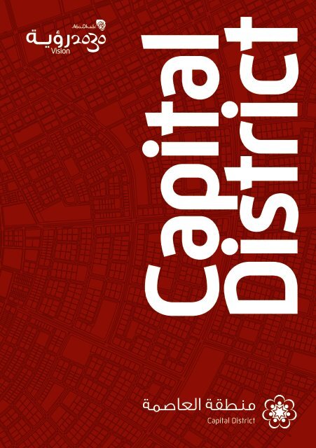
Capital District
Capital District
Capital District

Create successful ePaper yourself
Turn your PDF publications into a flip-book with our unique Google optimized e-Paper software.
<strong>Capital</strong><br />
<strong>District</strong><br />
<strong>Capital</strong> <strong>District</strong>
Masterplan Summary<br />
<strong>Capital</strong> <strong>District</strong>
Mandate
The Abu Dhabi Urban Planning Council was created<br />
by Emiri Decree number 23 of the year 2007 and is<br />
the agency responsible for the future of Abu Dhabi’s<br />
urban environments, and the expert authority behind<br />
the visionary Plan Abu Dhabi 2030 Urban Structure<br />
Framework Plan published September 2007. Chaired<br />
by His Highness Sheikh Mohamed Bin Zayed Al Nahyan,<br />
Crown Prince of Abu Dhabi and Chairman of the Abu<br />
Dhabi Executive Council, the Abu Dhabi Urban Planning<br />
Council defines the shape of the Emirate, ensuring<br />
factors such as sustainability, infrastructure capacity,<br />
community planning and quality of life, by overseeing<br />
development across the city and the Emirate as a<br />
whole. The Abu Dhabi Urban Planning Council ensures<br />
best practice in planning for both new and existing<br />
urban areas.<br />
HH Sheikh Khalifa bin Zayed Al Nahyan<br />
President of the United Arab Emirates<br />
Ruler of Abu Dhabi<br />
The Abu Dhabi Urban Planning Council’s primary<br />
purpose is to deliver the vision of His Highness Sheikh<br />
Khalifa Bin Zayed Al Nahyan, President of the UAE, Ruler<br />
of Abu Dhabi for the continued fulfilment of the grand<br />
design envisaged by the late Sheikh Zayed Bin Sultan<br />
Al Nahyan and the ongoing evolution of Abu Dhabi as a<br />
global capital city.<br />
The late Sheikh Zayed bin Sultan Al Nahyan<br />
Founder of the United Arab Emirates.
Contents
Foreword Page 1<br />
Creating a Global <strong>Capital</strong> Page 5<br />
Masterplan Vision Page 11<br />
Masterplan Process Page 15<br />
Site Location & Context Page 19<br />
Guiding Principles Page 27<br />
Urban Design Layers Page 39<br />
Land Use Strategies Page 43<br />
Precinct Summaries Page 59<br />
Next Generation Planning Page 91<br />
Appendix Design Guidelines Page 95
Foreword
The <strong>Capital</strong> <strong>District</strong> is a key project of Plan Abu<br />
Dhabi 2030, a monumental planning initiative<br />
envisaged by the late Sheikh Zayed bin Sultan<br />
Al Nahyan to guide and promote the ongoing<br />
evolution of Abu Dhabi as a global capital city.<br />
The <strong>Capital</strong> <strong>District</strong> Masterplan, developed by the Abu Dhabi<br />
Urban Planning Council, is designed to manage the development<br />
of the new city through a long term vision. It represents a unique<br />
opportunity to create an authentic sustainable modern Arab capital,<br />
which will shape the future of the region by defining a unique and<br />
contemporary urbanism.<br />
2<br />
At the heart of the <strong>Capital</strong> <strong>District</strong> will be a Federal Precinct, which<br />
will serve as the national seat of government for the United Arab<br />
Emirates. At the city’s centre, a radial pattern of streets surrounds a<br />
central monumental space. From this point, a series of seven grand<br />
boulevards, representing the seven emirates, connect this symbolic<br />
centre with surrounding districts. Along primary boulevards and at<br />
gateways to the city, monuments and public spaces will reinforce<br />
the city’s ceremonial and symbolic function. The creation of distinct<br />
districts and national institutions connected by grand boulevards,<br />
walkable streets and monumental spaces will symbolically link<br />
national government, city life and Emirati culture.<br />
Central to the <strong>Capital</strong> <strong>District</strong> Masterplan is the commitment to<br />
create a sense of identity and community. The Masterplan aims to<br />
preserve the traditions, heritage and way of life for Emirati’s, while<br />
being flexible enough to accommodate the needs of the Emirate’s<br />
diverse population. Each neighbourhood will be well-served by a<br />
wide range of community services and amenities.<br />
The <strong>Capital</strong> <strong>District</strong> will also become a centre of learning and<br />
excellence. New universities, a medical campus and biomedical<br />
research facilities offering great potential for synergies with the<br />
private sector, will all be housed here. A world-class transportation<br />
system will connect neighbourhoods within the <strong>Capital</strong> <strong>District</strong> and<br />
connect the City to the wider region. An extensive public transit<br />
network will provide a focus for high density development, alleviate<br />
traffic congestion and reduce reliance on the automobile.<br />
Developed over an eighteen month period between late 2007<br />
and early 2009, the <strong>Capital</strong> <strong>District</strong> Masterplan will serve as the<br />
foundation upon which all future land use, transportation, and<br />
urban planning decisions in this new city will be made. As a road<br />
map for the future, the Masterplan establishes quantifiable targets<br />
for population, land uses, transportation and pedestrian access. It<br />
covers the location and quantity of mosques, parks, schools and<br />
utilities, as well as building and open space performance targets<br />
for meeting Estidama goals. In addition, the Masterplan describes<br />
the design intent and character of individual precincts, districts and<br />
neighbourhoods. Design considerations, such as the relationship<br />
between buildings and spaces, architectural character, and sense of<br />
place are all addressed.<br />
The Masterplan will serve as an evolving tool to assist the UPC,<br />
government officials, and land owners to implement the <strong>Capital</strong><br />
<strong>District</strong> in keeping with the goals and principles of Plan Abu Dhabi<br />
2030 and its vision for creating a sustainable, world-class <strong>Capital</strong><br />
City for the United Arab Emirates.<br />
Our ultimate goal is to create a cohesive, contemporary and<br />
sustainable urban fabric for this new city. The Masterplan provides<br />
the clarity and direction for achieving this goal in a way that serves<br />
the various and distinctive community expectations, now and well<br />
into the future.<br />
H.E. Falah Al Ahbabi,<br />
General Manager,<br />
Abu Dhabi Urban Planning Council
Creating a<br />
Global <strong>Capital</strong>
8<br />
In 2006, His Highness Sheikh Mohamed Bin Zayed Al<br />
Nahyan, Crown Prince of Abu Dhabi and Chairman of<br />
the Executive Council, mandated the Executive Affairs<br />
Authority to design and implement a planning initiative to<br />
guide the evolution of Abu Dhabi as a Global <strong>Capital</strong> City.<br />
Trends that influenced this initiative include:<br />
• The continued expansion of the economy<br />
• Rapid population growth<br />
• Liberalized real estate laws<br />
• Significant foreign investment<br />
• Construction projects of unprecedented size<br />
A distinguished Taskforce that included local government leaders and international<br />
experts was appointed to create a long term urban plan for Metropolitan Abu<br />
Dhabi to the year 2030 based on the following two core objectives:<br />
• Create an attractive/livable and sustainable managed urban environment in<br />
which all necessary services and infrastructure are provided.<br />
• Ensure a vibrant mix of cultures is able to flourish in Abu Dhabi’s livable<br />
spaces, while maintaining the unique traditions and cultures of the Emirates.<br />
The Taskforce was also mandated to recommend the most effective regulatory<br />
and institutional framework for managing and implementing the plan.<br />
The resulting Plan Abu Dhabi 2030: Urban Structure Framework Plan and<br />
terms of reference for the Urban Planning Council were prepared by the<br />
Taskforce and adopted by the Abu Dhabi Executive Affairs Authority in 2007.<br />
Articulating a clear direction and description of future growth, the Plan<br />
anticipates a population of 3 million by 2030 centred on the themes of<br />
sustainability, economy and environment. In addition to offering far reaching<br />
land use proposals, it embodies a framework for the management of Abu<br />
Dhabi’s future growth according to the following overarching principles:<br />
• Abu Dhabi will be a contemporary expression of an Arab city<br />
• Growth in the city will be measured to reflect a sustainable economy<br />
• Development in the city will respect, be scaled to, and be shaped by the<br />
natural environment of coastal and desert ecologies<br />
• Abu Dhabi will manifest its role and stature as a capital city<br />
• The urban fabric and community infrastructure will enable the values,<br />
social arrangements and culture of an Arab city<br />
Plan Abu Dhabi 2030 envisions two major urban cores linked by a worldclass<br />
transit system. The first is the historic centre of Abu Dhabi at the<br />
northern tip of Abu Dhabi Island. Together with designated near shore<br />
islands currently under development, this area is visualized as an expanded<br />
and enhanced Central Business <strong>District</strong> (CBD) with a concentrated focus of<br />
commercial activity surrounded by higher density residential communities.<br />
The second urban core is an entirely new <strong>Capital</strong> <strong>District</strong>, located south<br />
of Abu Dhabi Island between Mohamed bin Zayed City and Abu Dhabi<br />
International Airport. Positioned where the desert meets the sea, and<br />
shaped by a rich heritage, the <strong>Capital</strong> <strong>District</strong> will serve as a second<br />
downtown for Abu Dhabi and be a sustainable, authentic and modern<br />
Arab city. It will be planned and designed to manifest Abu Dhabi’s role<br />
as a capital city, with a Federal Precinct at its heart that will serve as the<br />
national seat of government.
Masterplan<br />
Vision
With an area of forty-five square kilometres, and a projected<br />
population of three hundred and seventy thousand residents, the<br />
<strong>Capital</strong> <strong>District</strong> is one of the most ambitious urban development<br />
projects being planned in the United Arab Emirates.<br />
The <strong>Capital</strong> <strong>District</strong> Masterplan provides a long term vision toward<br />
2030 for the development of a global, 21st Century capital based on<br />
sound planning principles, sustainable criteria toward environmental<br />
quality and energy consumption and a desire to provide the highest<br />
quality of life possible for all its citizens.<br />
13<br />
In creating this new city, the Masterplan has capitalized on the site’s<br />
physical assets - its centrality within the region and accessibility<br />
to both Abu Dhabi Island and to emerging developments on the<br />
mainland; its proximity to a well-connected highway network;<br />
coastal climate and breezes; and its adjacencies to existing<br />
residential neighbourhoods. The site’s triangular shape provided<br />
strong cues for organizing development around proposed high<br />
capacity transit lines through the site and in creating a series<br />
of symbolic and visual axes that link important civic spaces and<br />
landmarks, terminating at a central civic space that will represent<br />
the nation.<br />
The <strong>Capital</strong> <strong>District</strong> is planned as a sustainable, compact, mixeduse<br />
city, comprised of high-density transit-oriented communities,<br />
employment, major universities, hospitals and knowledgebased<br />
employment sectors, as well as a lower density Emirati<br />
Neighbourhood. A central driver behind the Masterplan vision is<br />
the symbiotic relationship between land use and transportation in<br />
the creation of high quality, attractive district and neighbourhood<br />
centres, vibrant streets and public spaces, and well-planned<br />
cultural and community facilities, all served by a world-class public<br />
transportation system.<br />
The <strong>Capital</strong> <strong>District</strong> will be the new seat of national government and<br />
house a diplomatic and embassy neighbourhood. It will also serve<br />
as the city of Abu Dhabi’s second business district, providing over<br />
one hundred thousand jobs in a dynamic mixed-use urban core. In<br />
addition to a dense network of open spaces and community uses to<br />
support the local population, the <strong>Capital</strong> <strong>District</strong> will host an Olympic<br />
calibre 65,000 seat National Stadium as well as various sports<br />
venues and conference facilities. New universities and research<br />
facilities will position the city as a hub for education and research.<br />
The new city will also be a leader in environmental sustainability,<br />
with requirements for the use of highly energy efficient building<br />
structures, district cooling systems, water sensitive landscaping<br />
and irrigation and an overall urban design plan that promotes<br />
connectivity and walkability.
Masterplan<br />
Process
While Plan Abu Dhabi 2030 provides the overall context for the project, a<br />
number of efforts shaped the principles and design of the <strong>Capital</strong> <strong>District</strong> and<br />
served as the foundation for the <strong>Capital</strong> <strong>District</strong> Masterplan.<br />
November 2007 March 2008<br />
16<br />
<strong>Capital</strong> <strong>District</strong> Concept Plan<br />
The <strong>Capital</strong> <strong>District</strong> Concept Plan was developed during a series of<br />
workshops during the fall of 2007 and involved UPC staff and a<br />
team of international experts including architects, urban planners,<br />
urban designers transportation engineers and transportation<br />
planners. The goal of these sessions was to brainstorm and work<br />
towards a preferred concept plan for the <strong>Capital</strong> <strong>District</strong> based on<br />
principles of urban livability and high quality urbanism, sustainable<br />
transport and infrastructure, cultural vibrancy, and energy efficient<br />
landscapes and buildings. The Final Concept Plan was approved in<br />
2007 and provided the blueprint for the Masterplan.<br />
UAE <strong>Capital</strong> <strong>District</strong> Symposium<br />
A UAE <strong>Capital</strong> <strong>District</strong> Symposium was held at the Emirates Palace<br />
Hotel in Abu Dhabi over three days from March 30th to April 1st,<br />
2008. The Symposium gathered key figures in the local leadership<br />
and planning community as well as delegates and experts from<br />
around the world, to present, discuss and frame recommendations<br />
about issues of importance to contemporary capital cities, with<br />
specific focus on creating a sustainable <strong>Capital</strong> <strong>District</strong> for Abu Dhabi.<br />
A key recommendation of the Symposium was the creation of a<br />
<strong>Capital</strong> Planning Commission to manage UAE Federal assets within<br />
the <strong>Capital</strong> as well as assist in the planning and programming of the<br />
symbolic, commemorative, and celebratory aspects of the <strong>Capital</strong><br />
<strong>District</strong>.<br />
The Symposium was an officially-sanctioned meeting of the<br />
<strong>Capital</strong>s Alliance, an organization consisting of the capital planning<br />
commissions of Australia, Brazil, Canada and the United States of<br />
America and is part of an ongoing broader program, initiated by the<br />
Abu Dhabi leadership, to bring the most progressive urban planning<br />
approaches and practices to the UAE.
March 2009<br />
17<br />
Final <strong>Capital</strong> <strong>District</strong> Masterplan<br />
The <strong>Capital</strong> <strong>District</strong> Masterplan was initiated in early 2008 based on<br />
the final Concept Plan and was developed by a consortium of interdisciplinary<br />
consulting teams and international experts.<br />
The preparation of the Masterplan involved extensive consultation<br />
with government agencies and stakeholders in all aspects of<br />
planning and design including: the definition and refinement of land<br />
use and development requirements; architectural, urban design and<br />
landscape architectural strategies; the articulation of sustainability<br />
criteria and parameters; transportation modelling and intersection<br />
analysis; distribution of utilities and infrastructure; and the<br />
development of safety and security guidelines.<br />
The <strong>Capital</strong> <strong>District</strong> public transport network was also planned in<br />
close collaboration with the Department of Transport (DoT) and in<br />
parallel with the preparation of the Surface Transport Masterplan<br />
(STMP), an initiative commissioned by the DoT to translate the<br />
conceptual transport strategy outlined in Plan Abu Dhabi 2030 into a<br />
detailed Masterplan and implementation programme.<br />
This Masterplan Summary provides an overview of the background<br />
and concept planning process, and distills the key land use, urban<br />
design, transportation and sustainability strategies that combine<br />
to make up the <strong>Capital</strong> <strong>District</strong> Masterplan. The documents that<br />
collectively comprise the <strong>Capital</strong> <strong>District</strong> Masterplan include:<br />
• <strong>Capital</strong> <strong>District</strong><br />
– Federal Precinct Masterplan and Development Requirements<br />
• <strong>Capital</strong> <strong>District</strong><br />
– City Centre Masterplan and Development Requirements<br />
• <strong>Capital</strong> <strong>District</strong><br />
– Emirati Neighbourhood Masterplan and Development<br />
Requirements<br />
• <strong>Capital</strong> <strong>District</strong><br />
– Infrastructure Masterplan (Volume I & Volume II)<br />
• <strong>Capital</strong> <strong>District</strong><br />
– Transit Network Design (Volume I & Volume II)
Site<br />
Location &<br />
Context
Arabian Gulf<br />
Mina Zayed<br />
Saadiyat Island<br />
Lulu Island<br />
Al Sowwah Island<br />
Al Reem Island<br />
20<br />
Abu Dhabi City<br />
Zayed Sports City<br />
Location<br />
The current Abu Dhabi CBD is situated at the western tip of Abu<br />
Dhabi Island. Plan 2030 proposes that this CBD be revitalised and<br />
extended onto near shore islands and connected through a series<br />
of bridges. Because of its constrained position, future development<br />
growth on the island is restricted.<br />
Mussafah<br />
To accommodate and concentrate future growth in the region, Plan<br />
2030 identified the former Khalifa City C site, a triangular area of<br />
land between Abu Dhabi International Airport and Mohamed bin<br />
Zayed City, as the second downtown for Abu Dhabi and the new<br />
<strong>Capital</strong> <strong>District</strong>.
Yas Island<br />
21<br />
Abu Dhabi International Airport<br />
Raha Beach<br />
Al Falah<br />
Masdar<br />
Khalifa A<br />
Motor World<br />
Khalifa B<br />
Mohamed Bin<br />
Zayed City<br />
Baniyas<br />
North Wahthba
Existing Features<br />
22<br />
Transportation Access<br />
At approximately 45 square kilometres, the site is at the centre<br />
of development activity on the Abu Dhabi Mainland and has the<br />
highest accessibility in the region. Two major highways – the E20<br />
and E22 – bound its north and west sides and intersect at its apex,<br />
while highway E11 runs along its south side. The site is strategically<br />
located to connect with the key areas of the Abu Dhabi metropolitan<br />
area such as the Airport, Al Raha Beach, Emirates Palace, Palaces<br />
<strong>District</strong>, CBD, Corniche <strong>District</strong>, Cultural <strong>District</strong> on Sadiyaat Island<br />
and the new developments on the mainland: Masdar, Mohamed bin<br />
Zayed City and Khalifa Cities A and B.<br />
The Surface Transport Masterplan for Abu Dhabi envisions a highly<br />
integrated transportation system comprised of improved highway<br />
links and connections to surrounding communities; a high-speed rail<br />
service to Abu Dhabi; some 131 KM of metro railway; regional rail<br />
connections to nearby urban centres, including Al Ain; and a finegrained<br />
network of surface tram and bus service.<br />
The <strong>Capital</strong> <strong>District</strong> will benefit from this comprehensive intermodal<br />
network, which will offer residents, employees and visitors<br />
convenient and alternative methods of movement and connections<br />
throughout the new city and to the surrounding region. And it will<br />
encourage pedestrian activity and alleviate traffic congestion as the<br />
city and surrounding region undergoes phased development and an<br />
increase in population.
23<br />
E20<br />
<strong>Capital</strong> <strong>District</strong><br />
E22<br />
E11<br />
Surface Transport Masterplan, Abu Dhabi Department of Transport
Existing Features<br />
Although the majority of the <strong>Capital</strong> <strong>District</strong> site<br />
is vacant, there are a number of constraints and<br />
opportunities facing development.<br />
24<br />
Airport<br />
The Abu Dhabi International Airport is within five kilometres of<br />
<strong>Capital</strong> <strong>District</strong> CBD and has impacts on building heights due to flight<br />
patterns. The airport and highway along the northern edge are also<br />
high volume noise sources.<br />
Existing Land Uses<br />
Existing land uses consist primarily of Abu Dhabi University, a<br />
cemetery and military complex along the western edge of the site.<br />
Subsurface Conditions<br />
Subsurface conditions on the site are characterized by a high water<br />
table and high soil salinity. Through evaporation of ground water<br />
this condition can result in underground cavities.<br />
Utility Infrastructure<br />
A number of utility corridors exist along the west edge of the site,<br />
including high voltage overhead power lines and gas lines. As part of<br />
implementation, these lines will be relocated.<br />
Climate<br />
Situated at the northwest-facing coastline of the Arabian Gulf, the<br />
climate of Abu Dhabi is affected by the sea to the north and the<br />
desert to the south. Proximity to the desert results in high solar<br />
radiation and high daytime temperatures. During mid-summer<br />
months, the sun is almost directly overhead for most of the<br />
afternoon, creating a harsh outdoor environment for pedestrians.<br />
Abu Dhabi’s location near water provides a northwestern wind<br />
occurring from noon until late evening nearly every day. This wind<br />
transports fresh air from the sea, purging used and polluted air out<br />
of the city and replacing it with fresh air. It also creates a cooling<br />
effect even though the air temperature is generally high.
<strong>Capital</strong> <strong>District</strong> Site Constraints, <strong>Capital</strong> <strong>District</strong> Concept Plan<br />
25
Guiding<br />
Principles
Culture<br />
The <strong>Capital</strong> <strong>District</strong> is grounded in principles of Estidama, or sustainability,<br />
and as such, will be a city where cultural, social, economic and<br />
environmental systems thrive, for present and future generations. The<br />
following core principles guided the <strong>Capital</strong> <strong>District</strong> Masterplan.<br />
28<br />
A Livable, and Modern<br />
Arab <strong>Capital</strong><br />
The structure of the <strong>Capital</strong> <strong>District</strong> is based on creating a culturally<br />
symbolic, vital, contemporary and distinct Arab urban form for this<br />
new city. The plan proposes a high degree of land use mix and<br />
diversity, with neighbourhoods linked by walkable streets and a<br />
world-class public transport network.
A Global <strong>Capital</strong><br />
At the heart of the <strong>Capital</strong> <strong>District</strong> will be a Federal Precinct, which<br />
will serve as the national seat of government for the United Arab<br />
Emirates and be designed to celebrate the identity, culture and<br />
values of the Emirates. Government buildings, national institutions<br />
and embassies along grand boulevards will provide a symbolic<br />
and memorable approach to the <strong>Capital</strong> <strong>District</strong>. Contemporary<br />
Arab architecture and a strong international diplomatic presence<br />
will reinforce the cultural diversity of the Emirates’ population.<br />
Along primary boulevards and at gateways to the city, distinct<br />
public spaces and commemorative places will reinforce the city’s<br />
ceremonial and symbolic function and provide the space for the<br />
parades, celebrations, and events that are an integral part of the life<br />
of a global capital city.<br />
29
Social<br />
30<br />
Complete Communities<br />
Central to the Plan for the <strong>Capital</strong> <strong>District</strong> is the commitment to create<br />
a sense of community. The plan seeks to preserve the traditions,<br />
heritage and way of life of Emirati’s and is flexible enough to<br />
accommodate the needs of the Emirate’s diverse population, ensuring<br />
everyone can live and work in peace and harmony.<br />
The <strong>Capital</strong> <strong>District</strong> will provide a wide range of housing options<br />
for all income levels. Residential neighbourhoods are designed<br />
to accommodate the various needs and desires of Abu Dhabi’s<br />
diverse population including Emirati extended families, -ex-patriot<br />
households and guest workers.<br />
Each neighbourhood will be well served by community services and<br />
amenities, including cultural centres, youth centres, post offices,<br />
women’s centres, libraries, and mosques. Mosques have been sited<br />
to be within walking distance of nearby residents. Two hospitals<br />
will provide quality healthcare to the city and support the vision of<br />
creating a healthcare precinct.<br />
In the <strong>Capital</strong> <strong>District</strong>, open space is a strategic planning component<br />
that greatly contributes to quality of life. Throughout the city there<br />
is a hierarchy of open spaces - from large commemorative places,<br />
to civic plazas to neighbourhood parks - which will provide a focus<br />
for national and local celebrations and be accessible to all residents<br />
within a 5 minute walk.
Economic<br />
34<br />
Diverse and Healthy Economy<br />
A prosperous economy that benefits all citizens is a primary attribute<br />
of all vital cities of the world. The plan for the <strong>Capital</strong> <strong>District</strong><br />
is oriented towards facilitating the growth of Abu Dhabi’s key economic<br />
sectors including healthcare, education and tourism.<br />
The <strong>Capital</strong> <strong>District</strong> will host an Olympic calibre 65,000 seat National<br />
Stadium as well as various sports venues and conference facilities.<br />
New universities and research facilities will position the city as a<br />
hub for education and research.<br />
Office zones are poised to accommodate government functions, as<br />
well as high end office tenants and multinational corporations seeking<br />
presence in the Arabian Gulf.<br />
The strategic placement of land uses is based on maximizing their<br />
inherent economic, as well as cultural synergies. The <strong>Capital</strong> <strong>District</strong><br />
CBD offers the highest concentration of office use in order to attract<br />
commerce and trade oriented towards the global needs of the modern<br />
business world. Along the north and south transit spines, local<br />
retail and transit-oriented development nodes provide a range of<br />
retail and employment opportunities within close proximity to transit<br />
and residential neighbourhoods.<br />
High-quality<br />
Development Opportunities<br />
The plan is grounded in the practical and functional aspects of<br />
creating high quality development parcels. Each city block and<br />
parcel is designed to provide maximum value for its intended use.<br />
The block and parcel dimensions are the result of an in-depth<br />
study of comparable cities and best practices of modern high<br />
rise development around the world. With the intention of rapid<br />
development it is important that the land parcels be as efficient and<br />
flexible to accommodate the evolution of development requirements<br />
over time.<br />
To maximize development value, the majority of parking in the<br />
<strong>Capital</strong> <strong>District</strong> will be provided in underground parking garages up<br />
to four levels. In addition to underground parking, district parking<br />
facilities are located to serve the total parking needs of visitors and<br />
working population.<br />
Streets in the <strong>Capital</strong> <strong>District</strong> have been designed to make the<br />
most efficient use of space within the right-of-way. Select<br />
utilities have been placed beneath the roadway, and buildings and<br />
shading devices will provide maximum street enclosure to create a<br />
comfortable, human-scaled streetscape.
35<br />
Height/Density Strategy<br />
121-150 meters<br />
91-120 meters<br />
71-90 meters<br />
51-70 meters<br />
31-50 meters<br />
15-30 meters<br />
Environment<br />
36<br />
A Connected <strong>Capital</strong><br />
As the City of Abu Dhabi plans for regional mobility into the 21st<br />
century it is important that this emerging capital district is based on<br />
strategic integration of land uses that balance development densities<br />
with transportation access. The Masterplan has identified a model<br />
split goal of 40% of the trip generation to be accommodated by<br />
public transportation by 2030 through the implementation of an<br />
extensive network of regional rail, metro rail, street trams and feeder<br />
bus systems.<br />
The distribution of land uses and densities in the <strong>Capital</strong> <strong>District</strong><br />
is based on Transit Oriented Development (TOD) model that<br />
concentrates a mix of transit supported land uses and development<br />
densities strategically at transit station locations. This will provide<br />
employment opportunities within walkable and relatively short<br />
commute distances of residential areas.<br />
Pedestrian Accessibility<br />
With the predominance of the automobile as the only means of<br />
transportation in Abu Dhabi today, the Masterplan promotes a<br />
strong pedestrian bias. The development of the proposed transit<br />
network will generate more pedestrians on the street in the <strong>Capital</strong><br />
<strong>District</strong>. However, it is important that there is an inviting pedestrian<br />
oriented network from transit stations to final destinations to ensure<br />
adequate ridership of the transit system. The design of the <strong>Capital</strong><br />
<strong>District</strong> encourages walking as preferred means of transportation by<br />
providing seamless pedestrian accessibility and inviting streetscapes.<br />
Dedicated bike routes will be integrated into the streetscape and offer<br />
opportunities for safe and convenient travel across the city.<br />
A Sustainable <strong>Capital</strong><br />
Abu Dhabi’s desert and coastal climate poses some significant<br />
challenges to maintaining human comfort in outside urban<br />
environments.<br />
The Plan seeks to mitigate the negative impacts of thermal heat gain<br />
through comprehensive systems of shade and ventilation throughout<br />
the urban environment. The fundamental planning principles guiding<br />
the geometry of the plan seek to naturally ventilate the city by<br />
having roadways, block orientation, landscape and building form<br />
being oriented towards the prevailing winds.<br />
Shading devices such as arcades, trellis and landscaped canopies<br />
are thought of as a complex network of places that allow pedestrian<br />
movement, solar protection and refuge from the harsh climatic<br />
conditions of Abu Dhabi.<br />
Sustainable practices towards conservation of energy and water<br />
are a key stone of the Plan. The plan optimises building energy use<br />
and water consumption through the application of “green building”<br />
practices as defined by the government’s Estidama Program.<br />
Recycling centres will be located within the ground floor of public<br />
parking facilities and encourage individuals and households to recycle.<br />
Fresh water is a precious resource in the Emirates. The plan offers the<br />
best practices for the future through the integration of design strategies<br />
and guidelines to ensure that open spaces are designed and managed to<br />
reflect the desert environment of Abu Dhabi and to conserve our scarce<br />
water resources.
Throughout the planning process, design scenarios were<br />
tested in order to understand the implications from a wind<br />
and cooling standpoint. Based on the results from this<br />
modelling and additional scientific research, strategies were<br />
developed to guide decision-making with regard to the<br />
orientation of streets and the positioning and dimensioning<br />
of buildings in order to best take advantage of the wind.<br />
37
Urban<br />
Design<br />
Layers
Urban Design Layers<br />
The Masterplan can be broken down into a series of strategic layers that<br />
form the basic urban design framework for the <strong>Capital</strong> <strong>District</strong>.<br />
40<br />
Radial Streets<br />
The city structure links national government, city life and Emirati<br />
culture through creation of distinct districts and national institutions<br />
connected by grand boulevards, walkable streets, monumental<br />
spaces and a world class public transit system.<br />
At the city’s centre, a radial pattern of streets surrounds a central<br />
monumental space. This radial pattern of streets is the primary<br />
framework for identity and place making and provides the structure<br />
for neighbourhoods and connectivity within the <strong>District</strong>.<br />
Grand Boulevards and<br />
Institutions<br />
A series of seven, tree-lined grand boulevards, representing the<br />
seven emirates, connect the symbolic centre with surrounding<br />
districts, large civic institutions, and regional access routes. The<br />
monumental <strong>Capital</strong> Boulevard provides a beautiful and dramatic<br />
connection between the Presidential Palace and the Grand Mosque<br />
on Abu Dhabi Island.<br />
Precinct Identity<br />
The Plan strives to create a coherent sense of place that provides<br />
precinct and neighbourhood identity through land use mix,<br />
block structure, streetscape design, architectural expression,<br />
district amenities, vibrant civic spaces and landscape expression.<br />
Within each of the Plan’s six precincts are several smaller and<br />
neighbourhoods formed around retail and transit streets, community<br />
facilities, schools and local parks.<br />
FEDERAL<br />
PRECINCT<br />
SPORTS HUB<br />
PRECINCT<br />
Central<br />
Business<br />
<strong>District</strong><br />
CITY<br />
CENTRE<br />
PRECINCT<br />
North<br />
Spine<br />
<strong>District</strong><br />
PALACE<br />
PRECINCT<br />
Souk<br />
<strong>District</strong><br />
Federal<br />
Mosque<br />
<strong>District</strong><br />
EMIRATI<br />
NEIGHBOURHOOD<br />
SOUTH SPINE<br />
PRECINCT
Transit<br />
The location of the public transport network has significant impacts<br />
on land use, density, pedestrian access and overall district character,<br />
and was a fundamental urban design device in the Masterplan.<br />
Regional Rail<br />
The regional rail will connect the <strong>Capital</strong> <strong>District</strong> with Al Ain, Dubai,<br />
the Airport and downtown Abu Dhabi. A multi- modal transportation<br />
hub will provide a world-class interchange for metro, fast train,<br />
trams, buses and taxis and be a focal point for high density retail<br />
and office development in the CBD.<br />
41<br />
Regional rail alignment.<br />
Metro<br />
Metro stations will be conveniently located within walking distance<br />
of the highest density areas in order to serve the largest population<br />
and reduce reliance on driving. Transit-oriented development at each<br />
station will provide a range of housing, shopping, employment and<br />
community services.<br />
Metro / subway alignment.<br />
Trams<br />
An extensive and interconnected network of trams throughout the<br />
majority of the city will ensure that no resident is less than a five<br />
minute walk from transit.<br />
Tram alignment.
Land Use<br />
Strategies
Land Use Summary<br />
44<br />
The designation of land uses in the <strong>Capital</strong> <strong>District</strong> is supportive of<br />
creating high-quality, mixed-use and transit-oriented urban districts<br />
and neighbourhoods. Of the total site area there is approximately 26<br />
million square metres of developable land area with approximately 33<br />
million square metres of building gross floor area (GFA). Total open<br />
space accounts for 178 195 hectares, or approximately 6% of the<br />
total developed area of the <strong>Capital</strong> <strong>District</strong>. About 15 million square<br />
metres make up the city’s roadway network which includes areas<br />
dedicated to pedestrian and bicyles, desert landscaping, and public<br />
transportations systems such as surface tram line and bus routes.<br />
Residential uses account for almost 60 percent of building GFA<br />
within the <strong>Capital</strong> <strong>District</strong> and occupy the greatest land area. The<br />
highest density residential areas are located in the CBD, with more<br />
medium density neighbourhoods located along the North and South<br />
Spine. Lower residential densities are located in the Mosque <strong>District</strong><br />
as well as west of the CBD. While residential areas in the CBD are,<br />
for the most part, mixed with office uses, residential uses along<br />
the North Spine, South Spine and the Mosque <strong>District</strong> have a strong<br />
neighborhood presence and will benefit from close access to tramserving<br />
retail streets and metro stations. Lower density residential<br />
uses surround the City Centre Precinct and offer a range of housing<br />
options for nationals and expatriate households. These areas are also<br />
well served by schools, community facilities and commercial centres.<br />
Office uses account for the second largest percentage of building GFA<br />
(12%). The majority of general office use is in the CBD, which has<br />
over 80% of the overall general office space in the <strong>Capital</strong> <strong>District</strong>.<br />
A lower density office zone surrounds the central ceremonial space<br />
where upper floors of buildings will house professional services or<br />
residential uses and lower floors will host a variety of specialized<br />
office spaces relating to cultural activities and civic organizations.<br />
The remaining general office space is located at TOD nodes along the<br />
north and south transit spines, and in small amounts within the Sports<br />
Hub and mixed-use buildings within the Federal Precinct.<br />
Hotel, Government Office and Healthcare have the third largest<br />
amount of building GFA and are concentrated in specific areas, or as<br />
in the case of hotels, located on a few parcels with taller buildings.<br />
Hotels throughout the City Centre, Sports Hub, and North and South<br />
Spines, and at entries into the Federal Precinct will serve commercial,<br />
business and healthcare uses in addition to supporting tourism. At<br />
full build-out, a total of approximately 4,600 hotel rooms and 2,030<br />
serviced apartments will be available.<br />
Within the Federal Precinct, federal government office uses are<br />
concentrated in a single area at the northwest edge of the CBD<br />
and extend towards the centre of the city. Major embassies<br />
and significant national institutions are located along the <strong>Capital</strong><br />
Boulevard, providing a visible and prestigious address for these<br />
buildings. A mix of housing, for diplomats and private residences,<br />
along with other major and minor embassies and government offices<br />
are located on either side of the <strong>Capital</strong> Boulevard. Opposite the<br />
Federal Precinct, at the edge of the CBD Federal Mosque <strong>District</strong>, is<br />
a concentration of lower rise office buildings that will house Abu<br />
Dhabi government departments and agencies and serve city centre<br />
businesses and nearby residential communities.<br />
A variety of retail strategies are utilized throughout the Plan to support<br />
a vibrant street environment and provide residents and visitors with<br />
the high quality services they need. Retail venues such as a regional<br />
mall, the multi-modal transportation hub, and high end retail locations<br />
in the CBD and Souk Market, will showcase the city’s retail diversity<br />
and excellence. Transit-oriented mixed-use retail streets along the<br />
north spine, within the Federal Precinct, the Mosque <strong>District</strong>, and the<br />
Emirati Neighbourhood, will serve people living and working nearby.<br />
Safety and security facilities will service neighbouring areas with<br />
appropriate emergency services. In addition, utility facilities<br />
necessary for appropriate city function and service stations for those<br />
driving in an out of the City Centre will be integrated into the city’s<br />
urban character.
Mixed Use<br />
(within other land use)<br />
Medium-Density Res (R3)<br />
(20 - 60 units / hectare)<br />
Embassy / Diplomatic Area<br />
Hotel / Resort<br />
Civic / Institutional<br />
Cultural / Community<br />
Utilities<br />
Landmark (Tall)<br />
Tram<br />
High-Density Res (R6)<br />
(301 + units / hectare)<br />
Medium-Density Res (R2)<br />
(5 - 20 units / hectare)<br />
General Office<br />
Undeveloped Open Space<br />
Religious<br />
Safety / Security<br />
Service Station<br />
Landmark<br />
Metro<br />
High-Density Res (R5)<br />
(151 - 300 units / hectare)<br />
Low-Density Res (R1)<br />
(3 - 5 units / hectare)<br />
Government Office<br />
Open Space / Recreation<br />
School<br />
Transportation<br />
Parking<br />
High Speed Rail<br />
High-Density Res (R4)<br />
(60 - 150 units / hectare)<br />
Palace<br />
Retail<br />
Sports / Entertainment Center<br />
Healthcare<br />
Conference Center<br />
Bus Route<br />
45<br />
The Land Use Plan represents the recommended<br />
designations for use and pattern of future<br />
development in the <strong>Capital</strong> <strong>District</strong>. The plan<br />
will direct the provision of public infrastructure<br />
and guide all future land use and development<br />
decisions. The table at right provides the<br />
population and land use designations by Precinct.<br />
* includes Palace Precinct<br />
Precinct<br />
City Centre Precinct<br />
Gross Land<br />
Area<br />
Residential Office Retail Institutional<br />
Cultural /<br />
Community<br />
Mosques<br />
Schools<br />
Open<br />
Space<br />
Total GFA<br />
Ha GFA, m2 GFA, m2 GFA, m2 GFA, m2 GFA, m2 GFA, m2 GFA, m2 Ha GFA, m2<br />
Residential<br />
Population<br />
Daytime<br />
Population<br />
CBD & Souk <strong>District</strong> 243 3,399,121 1,808147 323,162 101,574 21,369 28,810 64,838 17 5,682,183 67,982 179,994<br />
North Spine <strong>District</strong> 713 6,036,152 377,113 128,000 117,851 60,188 61,342 868,339 49 6,780,646 120,651 246,623<br />
Mosque <strong>District</strong> 176 733,281 169,016 16,000 69,659 11,064 55,011 196,428 19 1,054,031 14,666 40,595<br />
Federal Precinct 310 628,746 1,604,457 30,521 253,784 45,692 21,755 77,576 33 2,584,955 12,575 77,072<br />
Sports Hub Precinct 140 381,539 - 15,000 - 8,400 23,465 23,610 19 428,404 7,592 21,991<br />
Emirati Neighbourhood* 1,865 5,026,478 - 57,872 - 40,418 221,776 508,800 36 5,346,544 69,728 115,677<br />
South Spine Precinct 982 3,785,300 221,530 64,286 - 92,000 87,100 136,500 22 4,250,216 74,059 131,698<br />
TOTALS 4,429 19,990,617 4,180,263 634,841 542,868 279,131 499,259 1,876,091 195 26,126,979 367,253 813,650
FAR/Density<br />
46<br />
The Masterplan promotes a mix of densities across the city<br />
appropriate to the location and mix of uses, transit access and<br />
district character. Maximizing density and population can help<br />
create successful places that can support local business, services<br />
and facilities. In line with the strategy for building heights (facing<br />
page), the floor to area ratio (FAR) is greater towards the centre of<br />
the city, with the greatest density occurring above and around the<br />
transportation hub and around the inner ring of the CBD.<br />
Along the north and south spines, the highest densities are within<br />
a 300m radius of each metro station. In between these mixed-use<br />
TODs and along the spine edges, densities decrease to accommodate<br />
a more mid-rise apartments and courtyard buildings.<br />
Lower density residential neighbourhoods are located along the<br />
edges of the city, within the Federal Precinct, adjacent to the north<br />
and south spines and between the CBD and Emirati Neighbourhood.<br />
In these neighbourhoods, a variety of housing forms, from row<br />
housing, to apartments to single family villas provide housing<br />
options for a variety of household sizes and types.<br />
0m 200m 400m 1km<br />
DENSITY / FAR<br />
0-2.0<br />
2.1 - 4.0<br />
4.1 - 6.0<br />
6.1 - 8.0<br />
8.1 - 10.0<br />
10.1 - 14 .0
Building Heights<br />
Proposed building heights relate to a variety of urban design, land<br />
use, transportation and environmental considerations. The highest<br />
buildings are strategically located along view corridors, adjacent to<br />
civic and open spaces, at significant entry points into the CBD and<br />
at transit hubs. The inner ring boulevard in the CBD will have the<br />
tallest buildings. Predominantly office towers these buildings will<br />
define the image of the city and form gateways to the two spines<br />
and other important arterial boulevards. They will stand in contrast<br />
to the lower rise Souk <strong>District</strong> in the city centre and surrounding<br />
residential neighbourhoods in outer rings.<br />
47<br />
Building heights are calibrated to the location of transit service<br />
and a high degree of land use mix. On the North and South Spines,<br />
building heights increase at each of the metro stations, while<br />
between metro stations and along the edges of the spine building<br />
heights decrease. This height strategy support the creation of high<br />
density nodes at transit hubs, while also allows cool breezes to be<br />
channelled through tall buildings to lower density neighbourhoods<br />
beyond.<br />
0m 200m 400m 1km<br />
BUILDING HEIGHTS<br />
Movement & Connections<br />
48<br />
A world-class transportation system will connect<br />
neighbourhoods within the <strong>Capital</strong> <strong>District</strong> and connect<br />
the district to the wider region. The system will include<br />
high-speed rail, metro rail, a surface network of trams<br />
and buses, and a fine-grain interconnected network of<br />
streets and sidewalks.<br />
Streets<br />
The Masterplan for the <strong>Capital</strong> <strong>District</strong> continues and extends Abu<br />
Dhabi’s traditional urban grid with an interconnected street system<br />
designed to encourage walking, especially for short distances.<br />
Streets are classified according to a hierarchy of arterial, collector<br />
and local streets. This hierarchy was established through careful<br />
modelling of predicted vehicular traffic volumes combined with a<br />
desire to achieve a high quality streetscape environment and provide<br />
comfortable micro-climates at the street level.<br />
The generous widths of the Entry and Radial Boulevards (70 – 75m)<br />
allow for vehicular traffic to be accompanied by a surface tram line<br />
network, providing various modes of transport to a variety of land<br />
uses. The Central Boulevard (62m) in the North and South Spines<br />
carries significant traffic volumes from the east into the CBD. This<br />
key arterial will also house the underground metro system and<br />
the relating surface metro stops and will provide the opportunity<br />
for transit-oriented development. On either side of the Central<br />
Boulevard, tram streets provide surface transit within a high-quality<br />
pedestrian environment. On the outer edges of the spines, are major<br />
collector routes (41 – 48m) that will efficiently move traffic in<br />
and out of the city. In contrast to the main boulevards, local streets<br />
(16 – 33m) connect short distances between residential, office,<br />
religious and other community activities within a district. These<br />
streets create more pedestrian scale spaces within neighbourhoods,<br />
while allowing for local vehicular traffic movement. Rear alleys<br />
(6.5m) provide for flexible building service access, and maintain<br />
street fronts free of undesirable activities.<br />
To provide efficient links between the <strong>Capital</strong> <strong>District</strong> and the<br />
surrounding region, a number of highway access improvements<br />
are proposed. This includes: upgrading existing interchanges to a<br />
more “urban” standard, proposing six new access points to the City,<br />
including a direct ceremonial connection to the Federal Precinct at<br />
its apex, and providing new overpasses to Khalifa A to the north and<br />
Mohamad Bin Zayed City to the west.
49<br />
STREET HEIRARCHY<br />
Major Arterial - Entry Boulevards<br />
Major Arterial - Radial Boulevards<br />
Major Arterial - Central Boulevards<br />
Collector<br />
Collector - <strong>Capital</strong> Boulevard<br />
Local Street<br />
Pedestrian Only<br />
Minor Street<br />
Service Alley<br />
0m 200m 400m 1km
Movement & Connections<br />
Transit<br />
50<br />
As part of the Abu Dhabi Surface Transport Masterplan, the Masterplan<br />
for <strong>Capital</strong> <strong>District</strong> proposes a highly integrated public transportation<br />
network that will provide high capacity, high frequency service<br />
to the majority of the region. This network will cover the <strong>Capital</strong><br />
<strong>District</strong> with the aim that a substantial proportion of the population,<br />
and all key destinations, are within a 5 minute walk (or 300 metres)<br />
of public transport.<br />
The modes of public transport that will operate within the <strong>Capital</strong><br />
<strong>District</strong> include:<br />
• A high-speed regional rail connecting Dubai, Abu Dhabi International<br />
Airport, <strong>Capital</strong> <strong>District</strong>, Downtown Abu Dhabi and Al Ain.<br />
• A metro system providing high capacity, high frequency service<br />
along the north and south spines, and through the Federal<br />
Precinct. A total of 10 metro stations are proposed and provide a<br />
focus for high density, mixed use development in order to serve<br />
the largest population and reduce reliance on driving.<br />
• A comprehensive network of tram and bus routes with<br />
interchanges provided at most metro stations.<br />
• A major multi-modal interchange at the centre of the city will<br />
serve metro, fast train, trams, buses and taxis and house high<br />
density retail and office development.<br />
• Park and ride facilities will be integrated with transportation<br />
interchanges and located just outside the city to serve regional<br />
commuter traffic and reduce traffic congestion within the city.<br />
0m 200m 400m 1km<br />
TRANSIT PLAN<br />
Metro<br />
High Speed Train<br />
Tram<br />
Major Bus Route<br />
Metro Stop<br />
Transit Hub<br />
Park and Ride
Walking and Cycling<br />
One of the key aspirations of Plan Abu 2030 and of the <strong>Capital</strong><br />
<strong>District</strong> Masterplan is to create vibrant urban places that both welcome<br />
and encourage pedestrian activity. This is achieved through<br />
the provision of high-quality streetscapes, a diverse mix of uses<br />
and concentration of densities, and an emphasis on an integrated<br />
public transport network, which supports the idea that every transit<br />
passenger is also a pedestrian. The Masterplan addressed three<br />
primary challenges in creating a comprehensive pedestrian network:<br />
1) providing an attractive and accessible pedestrian environment by<br />
keeping blocks small, providing generous and shaded sidewalks and<br />
providing frequent crossing points; 2) controlling the climate through<br />
the creation of arcade zones, street and building orientation; and 3)<br />
carefully distributing the mix and concentration of uses to support<br />
vibrant, livable neighbourhoods.<br />
51<br />
The creation of a walkable <strong>Capital</strong> is also extended to the definition<br />
of an integrated bike network, which provides dedicated routes<br />
throughout the city. On the widest and busiest vehicular streets,<br />
these paths are separated from vehicular traffic, and given dedicated<br />
space within the sidewalk realm. On more local, narrower streets,<br />
it is envisioned that bikes will share the road space, through the<br />
provision of clear pavement markings that delineate bike zones from<br />
vehicular zones.<br />
0m 200m 400m 1km<br />
TRANSIT WALKING PLAN AND CYCLING<br />
Metro 5 minute walking distance from transit Metro Stop<br />
High Speed Train<br />
Tram<br />
Major Tram Bus StopRoute<br />
Metro Stop<br />
Transit Hub<br />
Park and Ride<br />
Dedicated Bike Route
Open Space<br />
52<br />
The <strong>Capital</strong> <strong>District</strong> has been designed to maximise<br />
opportunities for residents to enjoy a high-quality public<br />
realm through a linked system of open spaces. Throughout<br />
the <strong>Capital</strong> <strong>District</strong> there is a hierarchy of public spaces that<br />
are located within easy access to all residents.<br />
An integrated planning approach incorporates these various open<br />
space types collectively to define an interconnected network of<br />
open space that includes the pedestrian zones in rights-of-way,<br />
public transportation and bicycle corridors, public parks, plazas,<br />
recreation areas, and private open space. The urban street is an<br />
important open space corridor and streetscape designs respond<br />
to the adjacent land use, scale of building and intended district<br />
character. This significant open space network will enhance the<br />
overall character and identity of the <strong>Capital</strong> <strong>District</strong> by providing<br />
great spaces for commemoration, celebration and the activities of<br />
civic life.<br />
Open Space Typology<br />
All the open spaces are categorized into specific typologies based<br />
on the size of the parcel, scale and intended character of the<br />
space. These typologies include: ceremonial open spaces, district or<br />
recreational parks, neighbourhood parks, civic plazas, linear parks and<br />
pedestrian spaces in relation to street right-of-ways.<br />
Open Space Distribution<br />
The distribution of open space in the city is based on balancing<br />
open standards with overall land densities and neighbourhood<br />
populations. The <strong>Capital</strong> <strong>District</strong> aims to provide approximately 1<br />
hectare of open space for every 1,000 people which is a substantial<br />
amenity in a dense urban environment and significantly greater than<br />
many world class cities.<br />
Sustainable Landscapes<br />
The design of landscapes and open spaces in the <strong>Capital</strong> <strong>District</strong> will<br />
respond to the desert environment of Abu Dhabi, and will respect<br />
local ecological conditions and scarcity of fresh water. Conservation<br />
of water is a primary concern and is reflected in the urban design<br />
in coordination with the proposed water and irrigation network and<br />
water management zones. All open spaces are classified as low,<br />
medium or high water use areas, with specific horticultural goals<br />
and guidelines associated with each.
53<br />
0m 200m 400m 1km<br />
OPEN SPACE<br />
Ceremonial<br />
Civic Plaza<br />
Linear<br />
Recreation<br />
Neighbourhood<br />
Public Reserve
Landmarks, Institutions &<br />
Commemorative Sites<br />
54<br />
Due to their location and urban design significance,<br />
certain parcels throughout the <strong>Capital</strong> <strong>District</strong> are<br />
designated as landmark buildings and commemorative<br />
sites. These sites will express and embrace the identity,<br />
history, achievements and culture of the Emirates<br />
through exemplary architectural, public realm, and<br />
landscape architectural design.<br />
Landmark Buildings<br />
Landmark buildings will emphasize the skyline at important radial<br />
axes and are opportunities for extraordinary architectural design<br />
solutions. Landmark buildings within the CBD are required to be 150<br />
metres in height. Landmark buildings along the transit spine are to<br />
be 110 metres in height.<br />
Commemorative Sites<br />
Seven central axes lead into the CBD, symbolically representing<br />
the seven Emirates. A series of monumental sites and national<br />
institutions will reinforce the ceremonial character of these central<br />
boulevards which either terminate or create view corridors into the<br />
central monumental elliptical park. Another strong visual connection<br />
is along the <strong>Capital</strong> Boulevard in the Federal Precinct, across<br />
the National Square and central oval, to the Federal Mosque. This<br />
visual connection is reinforced by large rectilinear ceremonial parks<br />
and landmark buildings. In addition, important monuments at key<br />
intersections form important gateways supported by the buildings’<br />
unique character, elaborate landscape elements, signage and public<br />
art. Smaller monuments become points of interest in smaller civic<br />
plazas and neighbourhood parks.<br />
Institutional Sites<br />
Institutional and civic facilities have been located at key locations<br />
throughout the city. The Federal Precinct has the highest<br />
concentration of institutional sites with a total of 30 sites being<br />
reserved for the most prominent national and civic institutions, such<br />
as museums, galleries, and centres. The majority of these sites face<br />
onto the <strong>Capital</strong> Boulevard, extending the federal government focus of<br />
the ministries zone. In the City Centre there are 14 Institutional / Civic<br />
sites with a total of approximately 347,000 square metres of facility<br />
space. Institutional and civic institutions serve as part of a gateway at<br />
the eastern end of the North Spine as well as key places of interest at<br />
entry points to the CBD and other North Spine neighbourhoods.<br />
These institutional and civic facilities will be composed of public<br />
uses that are either publicly owned or operated by nonprofit<br />
organisations. Examples include local museums, central post office<br />
facilities, main libraries and civic uses that provide educational,<br />
cultural, recreational and other similar public services.
55<br />
0m 200m 400m 1km<br />
LANDMARKS, MONUMENTS AND COMMEMORATIVE SITES<br />
Tall Landmark Buildings Major Entry / Gateway<br />
Landmark Buildings<br />
Secondary Entry / Gateway<br />
Small Monuments<br />
Primary Ceremonial Route<br />
Large Monuments<br />
Visual Connection
Community Facilities<br />
The provision of accessible, high-quality community<br />
services and facilities is essential to the future of<br />
any sustainable development and to the creation of<br />
successful communities.<br />
56<br />
Based on local and international best practices, a range of community<br />
facilities have been proposed within mixed use blocks within the<br />
<strong>Capital</strong> <strong>District</strong>. Identified as community and cultural centres within<br />
the plan, these centres will have a variety of community services<br />
uses, including mosques, play grounds, health care centres, post<br />
offices, recreational facilities, and women’s centres.<br />
A range of school sites and sizes have been provided throughout the<br />
city, with the largest sites being along the north and south spine and<br />
within the Emirati Neighbourhood.<br />
In addition to underground parking on every building site, district<br />
parking facilities are located in above ground garages and below a<br />
number of public parks to serve the total parking needs of visitors<br />
and working population. Recycling centres will be located within<br />
the ground floor of public garages and encourage individuals and<br />
households to recycle.<br />
Service stations are distributed throughout the city and located close<br />
to regional routes to allow for easy access.
57<br />
0m 200m 400m 1km<br />
COMMUNITY FACILITIES<br />
Schools<br />
Mosques<br />
Hospitals<br />
Civil Defence / Police<br />
Community / Cultural Centres<br />
Petrol Stations<br />
Major Sports / Recreation<br />
Public Parking & Recycling Centre<br />
Public Underground Parking
Precinct<br />
Summaries
60<br />
FEDERAL<br />
PRECINCT<br />
SPORTS HUB<br />
PRECINCT<br />
Central<br />
Business<br />
<strong>District</strong><br />
CITY<br />
CENTRE<br />
PRECINCT<br />
Souk<br />
<strong>District</strong><br />
Federal<br />
Mosque<br />
<strong>District</strong><br />
SOUTH SPINE<br />
PRECINCT
PALACE<br />
PRECINCT<br />
North<br />
Spine<br />
<strong>District</strong><br />
61<br />
EMIRATI<br />
NEIGHBOURHOOD<br />
The success of the <strong>Capital</strong> <strong>District</strong> relies on the creation of<br />
distinct and identifiable and neighbourhoods and places.<br />
The Masterplan has identified six major precincts, each of<br />
which are distinguished by unique characteristics such as<br />
land use distribution, density, built form, location to transit<br />
infrastructure, and open space. Within each of these<br />
precincts are several smaller districts, or neighbourhoods,<br />
formed around retail and transit streets, community<br />
facilities, schools and local parks.<br />
1. Federal Precinct<br />
2. City Centre Precinct<br />
Central Business <strong>District</strong><br />
Souk <strong>District</strong><br />
North Spine <strong>District</strong><br />
Federal Mosque <strong>District</strong><br />
3. Emirati Neighbourhood<br />
4. Sports Hub Precinct*<br />
5. South Spine Precinct*<br />
6. Palace Precinct*<br />
* Currently under design development
Federal Precinct<br />
62<br />
The Federal Precinct is located at the northwestern apex<br />
of the <strong>Capital</strong> <strong>District</strong> and will serve as the national seat of<br />
government for the United Arab Emirates. The plan for the<br />
Federal Precinct supports the goal of making the <strong>Capital</strong><br />
<strong>District</strong> a contemporary expression of an Arab City, with<br />
people living, working and thriving in healthy, supportive<br />
proximity of each other.<br />
Precinct Structure<br />
The structural organization of the Federal Precinct is based on the<br />
visual and physical connection of the existing Abu Dhabi city centre<br />
to National Square in the heart of the <strong>Capital</strong> <strong>District</strong>. The hierarchy<br />
of land uses places the larger more significant public institutions,<br />
such as libraries, museums, and government offices framing and<br />
reinforcing the monumental <strong>Capital</strong> Boulevard while allowing a<br />
fine grain mix of uses to promote viable streets that are activated<br />
throughout the day. Smaller scale embassies, offices, associated<br />
housing and services interface with medium density residential uses<br />
border the Federal Precinct.<br />
The block structure acknowledges the future role of transit by<br />
creating direct routes from all parts of the site to the proposed<br />
future transit stations. Transit stations are located at key points to<br />
provide comfortable walking distances to the public institutions and<br />
major community parks and facilities.<br />
Blocks<br />
The building blocks of the Precinct are combined to create a<br />
hierarchy of building types and uses, define edges and nodes, and<br />
provide landmarks for orientation within the greater community.<br />
The blocks are designed to ensure a fine grain street grid in order to<br />
allow maximum permeability throughout the neighbourhood and to<br />
allow for linkages to surrounding neighbourhoods.<br />
Streets<br />
<strong>Capital</strong> Boulevard is a ceremonial route which serves as a visual<br />
continuation from the Grand Mosque and Presidential Palace on Abu<br />
Dhabi Island into the centre of the <strong>Capital</strong> <strong>District</strong>. From Highways E20<br />
and E22, two Gateway Boulevards provide access to the edges of the<br />
Federal Precinct and direct access to the <strong>Capital</strong> <strong>District</strong> radial boulevards.<br />
There are four collector routes which lead to the central International<br />
Park from the Gateway Boulevards and a network of local streets which<br />
serve to disperse and distribute traffic.<br />
Architectural Character<br />
The overall architectural vision for the Federal Precinct is to create<br />
a grand sense of arrival to the capital of one of the world’s most<br />
prosperous nations. This vision will achieved through distinguishing<br />
characteristics appropriate to each individual zone within the Precinct,<br />
while achieving an overall cohesive image. Each zone shall reflect a<br />
unique expression of building materials, colours, finishing techniques,<br />
landscape features, signage, roof forms, and climatic response.<br />
The distinguishing elements are intended to reinforce the varying<br />
experiences of the place at a pedestrian scale, and respect the specific<br />
use and function of buildings and spaces. A cohesive architectural<br />
character will be achieved in elements such as horizontal roof forms,<br />
deep set windows and shade devices, a muted, desert colour palette,<br />
sturdy and durable materials, and elegant facade massing to express a<br />
dignified image for the <strong>Capital</strong>.<br />
Safety and Security<br />
All government buildings, streets, and public spaces throughout the<br />
Federal Precinct will be carefully designed to incorporate security<br />
measures and best practices into their plans to preserve and protect<br />
Federal government assets and ensure the safety and well-being of<br />
all residents and visitors.
Federal Precinct<br />
Character Zones<br />
The Federal Precinct is divided into four character<br />
zones, distinguished by their unique use, built form,<br />
character, and function within the Precinct.<br />
64<br />
Ministries Zone<br />
This zone is located at the eastern end of the Federal Precinct<br />
and integrated into the surrounding <strong>Capital</strong> <strong>District</strong> CBD. In<br />
the planning of this district the challenge was to create a<br />
high-quality urban environment with pedestrian-oriented<br />
streets and plazas, within a government office district. The<br />
zone is comprised of urban blocks of stately courtyard<br />
buildings ranging from 4 to 7 storeys with taller architectural<br />
expressions permitted at corner sites, marking major streets.<br />
A proportion of government buildings are allowed street<br />
fronting retail uses in order to provide services and amenities<br />
for employees and visitors.<br />
International Park is located in the centre of the Ministries<br />
zone to provide a community open space focus which can<br />
be shared by residents, visitors, shoppers, and workers. As<br />
part of the overall <strong>Capital</strong> Boulevard, this space will also host<br />
ceremonial events, and two smaller institutional pavilions<br />
could become venues for celebrating local, national and<br />
international cultures.<br />
Institution Zone<br />
Located in the western area of the Federal Precinct, the<br />
Institutional Zone frames either side of the <strong>Capital</strong> Boulevard.<br />
Architecturally, building design and character will be bold, with<br />
particular focus given to distinct roof forms, and subtle wall<br />
articulation to achieve larger scaled massing and variety in<br />
elevation. Generous ‘green’ edges along <strong>Capital</strong> Boulevard, will<br />
reinforcing a dignified and stately entry into the <strong>Capital</strong> <strong>District</strong>.<br />
Diplomatic Zone<br />
The diplomatic zone consists primarily of embassies and a<br />
variety of residential types with two small local shopping<br />
nodes, together with schools, cultural/civic buildings,<br />
and utility plots. A variety of embassy sites mixed with<br />
residential plots will create a finer grain character to the<br />
neighbourhood. Two large local parks in the heart of the<br />
two diplomatic housing and embassy neighbourhoods will<br />
serve the diplomatic residents and workers. The Diplomatic<br />
Zone is connected via a regular grid of local roads of varying<br />
widths which link into a two-way sub-arterial that runs<br />
the perimeter of the neighbourhood and connects the two<br />
Gateway Boulevards. Within the Ministries Zone the street<br />
blocks are delineated by narrower pedestrian friendly local<br />
streets that integrate into the CBD block pattern.<br />
High Streets<br />
Mixed-Use (Commercial/Residential) land uses are<br />
concentrated along tram streets leading from the north and<br />
south to the centre of the Precinct and will form a vibrant<br />
commercial gateway to the area. Two smaller neighbourhood<br />
mixed-use zones in the Diplomatic Zone will service the<br />
residents and workers of the diplomatic neighbourhoods.<br />
The overall focus is on creating mixed-use shopping streets<br />
for the neighbourhoods with retail uses on the ground floor<br />
and residential and office above. Retail uses on the ground<br />
floor will stimulate pedestrian flow and street activity. Major<br />
landmark uses such as hotels and office centres, and higher<br />
density housing, are to be located at the gateway Entry<br />
Boulevards in order to provide activity anchors for streets.
65<br />
Ministries Zone<br />
Institutions Zone<br />
Diplomatic Zone<br />
High Streets<br />
High Density Areas
Federal Precinct<br />
Open Space<br />
66<br />
A well defined public realm in the Federal Precinct<br />
provides a diversity of opportunities for expressing<br />
local and national heritage and identity and for the<br />
programming of events, celebrations, monuments and<br />
commemorative spaces that reflect the unique history of<br />
the UAE.<br />
Major Commemorative Spaces<br />
Three major public spaces will provide ceremonial and symbolic<br />
anchors for the Federal Precinct: National Square, located within the<br />
monumental central oval space, International Park located between<br />
the Ministries Zone and the Institutions Zone, and Monument Park,<br />
located at the apex of the Federal Precinct.<br />
<strong>Capital</strong> Boulevard<br />
Connecting the Major Commemorative spaces is <strong>Capital</strong> Boulevard, a<br />
major formal and ceremonial axis through the centre of the Federal<br />
precinct, which provides a significant visual axis into the centre of<br />
the city, and beyond, to the National Mosque. At the eastern end<br />
of the <strong>Capital</strong> Boulevard, the grounds of a major civic / institutional<br />
building will serve as a National Square for the <strong>Capital</strong> City of the<br />
United Arab Emirates.<br />
Neighbourhood Parks<br />
Two large neighbourhood parks in the Diplomatic Zone provide<br />
passive and active spaces for residents and visitors to the area.<br />
Local Parks and Plazas<br />
Throughout the Precinct are smaller gathering spaces consisting of<br />
planted and paved plazas, featuring formal landscaping and tensile<br />
shade structures.<br />
Linear Parks<br />
Linear parks will provide pleasant walking and cycling connecting<br />
between districts and neighbourhoods.<br />
Streetscapes<br />
Throughout the Precinct, a varied palette of streetscapes designed<br />
with generous sidewalk space, street furniture, shade and<br />
landscaping, will invite pedestrian activity and ensure that public<br />
spaces are activated throughout the day and evening.
67<br />
4<br />
3<br />
1c<br />
5<br />
1b<br />
5<br />
3<br />
1a<br />
4<br />
5<br />
1 Major Commemorative Spaces<br />
a. National Square<br />
b. International Park<br />
c. Monument Park<br />
2 <strong>Capital</strong> Boulevard<br />
3 Neighbourhood Parks<br />
4 Local Parks and Plazas<br />
5 Linear Parks
City Centre Precinct<br />
The City Centre Precinct is comprised of four distinct<br />
districts or neighbourhoods: The Central Business<br />
<strong>District</strong>, the Souk Market <strong>District</strong>, North Spine <strong>District</strong><br />
and the National Mosque <strong>District</strong>.<br />
Central Business <strong>District</strong><br />
68<br />
The Central Business <strong>District</strong> (CBD) is at the centre of the <strong>Capital</strong><br />
<strong>District</strong> with high density office and residential uses combined with<br />
a diversity of cultural and social amenities. It will be the largest<br />
concentration of high density office, residential and commercial<br />
uses outside of the Abu Dhabi Island. Land uses consist of Class<br />
A office space providing over 150,000 jobs and residential<br />
neighbourhoods of 3 million square metres offering a live work<br />
environment for almost 70,000 residents.<br />
A key organizing principle of the CBD is the close integration of<br />
land use and transportation networks supported by high-quality<br />
pedestrian-oriented urban design and vibrant open spaces to create<br />
livable neighbourhood centres.<br />
Residential developments offering a range of housing options are<br />
clustered primarily within the south and north neighbourhoods,<br />
and including local mosques, women and youth centres, libraries,<br />
local retail shops and recreational facilities serve as central spaces<br />
of gathering. These neighbourhoods are framed by office and hotel<br />
uses located along main radial streets leading into the CBD.<br />
The CBD offers a range of retail, cultural and entertainment<br />
opportunities. High-end and local retail streets provide a diverse<br />
range of shopping experiences while a large retail and entertainment<br />
node in the eastern CBD will serve residents of the <strong>Capital</strong> <strong>District</strong><br />
and surrounding region.<br />
Buildings, streets, and open spaces within the CBD are aligned to<br />
maximize natural ventilation and the circulation of afternoon breezes<br />
through the public realm. A series of linear open spaces provides<br />
pedestrian connectivity through the district, with building podiums<br />
and shade structures providing much needed shade during the<br />
hottest parts of the day.<br />
National institutions and landmark buildings at key entry points to<br />
the City provide opportunities for distinctive architecture and frame<br />
visual gateways to the CBD.
City Centre Precinct<br />
Central Business <strong>District</strong><br />
High Density Ring<br />
70<br />
This iconic zone of the CBD will be a showplace of important<br />
business in the <strong>Capital</strong> <strong>District</strong>. These buildings will be the highest<br />
and most visible buildings. In the entire <strong>Capital</strong> <strong>District</strong>. It is primarily<br />
a high-end office zone with mixed-use retail as well as some<br />
residential and hotel uses.<br />
Regional Transit Hub<br />
A multi-modal transportation hub will provide a world-class<br />
interchange for metro, fast train, trams, buses and taxis and be a<br />
focal point for high density retail and office development in the<br />
CBD. This important regional transportation node will be the entry<br />
point for all visitors, and residents of the <strong>Capital</strong> <strong>District</strong> and will be<br />
designed to express the status of Abu Dhabi as a global capital city.<br />
Regional Shopping<br />
A large city-serving retail and entertainment node, this<br />
neighbourhood will be important for all residents of the <strong>Capital</strong><br />
<strong>District</strong> and surrounding region. The neighbourhood also serves as<br />
an important transition between the North Spine and the CBD.<br />
Government Offices<br />
Adjacent to the landmark Federal Mosque and open spaces of<br />
national importance is a node of government office uses. These<br />
buildings will house local Abu Dhabi government agencies and that<br />
will benefit from being located within the high density CBD.<br />
Medium and High Density Residential<br />
Neighbourhoods<br />
These neighbourhoods make up the majority of the CBD. Office and<br />
hotels uses are located along main radial streets leading into the CBD<br />
while mosques and community facilities serve as central spaces<br />
of gathering. In general the neighbourhood will be a dense urban<br />
residential zone with a wide variety of services easily accessible for<br />
the pedestrian.<br />
Cultural / Community Services<br />
Within each residential neighbourhood are cultural and community<br />
services, located adjacent to parks and mosques, which will provide<br />
a variety of services for local residents. A number of compact school<br />
sites at the edges of the CBD will serve the school-aged population<br />
of these neighbourhoods.<br />
CBD Height Character<br />
The inner ring of the CBD will be the location for<br />
some of the tallest buildings in the <strong>Capital</strong> <strong>District</strong><br />
and will be a showcase of important business in<br />
the <strong>Capital</strong> <strong>District</strong>. These buildings will define the<br />
image of the CBD and begin to form gateways to the<br />
two spines and other important arterial boulevards.<br />
This high density zone will stand in contrast to<br />
the central International Souk Market and the<br />
surrounding residential neighbourhoods.
71<br />
High Density Ring<br />
High Density Ring<br />
Regional Transportation Hub<br />
Regional Transportation Shopping Hub<br />
Regional Shopping<br />
Local Government Offices<br />
Local Government Offices<br />
Medium & High Density Residential Neighbourhoods<br />
Medium & High Cultural Density / Residential Community Neighbourhoods<br />
Uses<br />
Cultural / Community
City Centre Precinct<br />
Souk <strong>District</strong><br />
72<br />
The Souk Precinct is the symbolic nucleus of the <strong>Capital</strong><br />
<strong>District</strong>, instantly recognizable on any map with the<br />
National Square at its centre and radiating roadway<br />
pattern spreading out in all directions, like spokes on a<br />
wheel.<br />
The seven Emirates are represented in the radial roads, along with<br />
a central monumental boulevard representing the collective UAE<br />
federation. This axial boulevard is unique in its design with extensive<br />
parkways and string of ceremonial parks connecting the two<br />
governmental /cultural anchors of the <strong>Capital</strong> <strong>District</strong>, the Federal<br />
Precinct to the west and the Federal Mosque <strong>District</strong> to the east.<br />
The urban form of this district is based on the Middle Eastern<br />
souk, or bazaar, which is one of the classic defining features of a<br />
traditional Islamic town.<br />
Great Civilizations of the World<br />
The leadership of the Emirates is seeking recognition of the great<br />
civilizations of the world within the design of the <strong>Capital</strong> <strong>District</strong>.<br />
The intention is to promote world peace, tolerance and acceptance<br />
of many cultures through the creation of great public places. The<br />
challenge is how to produce an authentic architectural image for<br />
this concept of great civilizations that does not appear historically<br />
overly simplified. The Souk International Market Place was identified<br />
as one place where there could be natural synergies between the<br />
concept of great civilizations and the design of a vibrant international<br />
market place. A market district could be easily transformed by the<br />
exquisite iconography of the ancient civilizations. For example, vivid<br />
imagery from the civilizations of the Mediterranean and Middle<br />
East could utilize art, symbolic designs and materials from the time<br />
of the Egyptians, Mesopotamians, Greeks and Romans; or Asian,<br />
European and South American civilizations. Through art, signage<br />
and thoughtful translations of the historical artefacts, the history<br />
of the world could be a lively underpinning for a modern day Souk<br />
celebrating the international market place of today.
City Centre Precinct<br />
Souk <strong>District</strong><br />
Inner Oval Zone<br />
74<br />
The Souk <strong>District</strong> will house important <strong>Capital</strong> <strong>District</strong> cultural and<br />
civic offices adjacent to the ceremonial open space and Federal<br />
Precinct and will define the edge of the oval park. The development<br />
program for this zone is comprised of stately buildings that are<br />
home to a mix of prominent cultural institutions, non-governmental<br />
agency offices, and other uses seeking a prestigious address. Also<br />
interspersed amongst the office uses, there will be small boutique<br />
hotels, restaurants, cafes, branch offices of major banks, airlines and<br />
other places of importance to visitors.<br />
International Souk Market Place<br />
The Souk Market Place is imagined to be one of Abu Dhabi’s most<br />
popular shopping venues, attracting both residents and city visitors<br />
alike to a diverse and exciting market experience.<br />
Recalling the traditional markets of the Middle East it will also<br />
encourage a mixing of cultural backgrounds in a city that promotes<br />
tolerance and acceptance. It will have a high concentration of “fine<br />
grained” retail development with a street-front focus and be a<br />
popular tourist destination.<br />
Covered Market Streets<br />
The key element of the Souk <strong>District</strong> is the network of narrow<br />
shopping/market streets that make up the districts circulation system.<br />
The primary shopping street in the centre of the souk district<br />
provides over two kilometres of retail street frontage. At this scale<br />
the souk identity is defined by a multitude of destinations and<br />
places. Based on the geography of the land uses and road way<br />
geometries in the CBD, the Souk International Market Place is<br />
composed three major sub-districts.<br />
• High-end International Boutique Market<br />
• Tourist / Local Products Market<br />
• International Food / Produce Market<br />
Plaza Souk Entry Points<br />
The tram will circumnavigate the outer edge of the Souk district. Tram<br />
stations have been located at the large public plazas are located at<br />
the key assess points to Souk. These plazas will civic destinations<br />
with hotels, restaurants and shops along the perimeter with artful<br />
landscapes, water features and shading devices establishing the<br />
design character of the place. The intended atmosphere of the plaza<br />
the draws inspiration from urban piazzas of Italy.<br />
Linear Green Spaces and View Corridors<br />
These linear parks will allow the Souk district to connect back to other<br />
CBD neighbourhoods. They act as both green pedestrian corridors and<br />
as visual/axis corridors into the central oval park space.
75<br />
Inner Oval Zone<br />
Inner Oval Zone<br />
International Souk Market Place<br />
International Souk Market Place<br />
Covered Shopping Streets<br />
Covered Market Streets<br />
Plaza Souk Entry Points<br />
Linear Green Spaces and View Corridors<br />
Plaza Souk Entry Points<br />
Linear Green Spaces and View Corridors
City Centre Precinct<br />
Souk <strong>District</strong><br />
Souk <strong>District</strong> Building Prototype Organization<br />
76<br />
This district design incorporates a variety of land uses intended to<br />
enhance the symbolic character of the district and overall urban<br />
vitality of the City Centre Precinct.<br />
The unique urban design of the Souk <strong>District</strong> is a combination of<br />
many factors including a specific land development approach.<br />
In the Souk Market Place a multi-block development strategy is<br />
recommended for creating a parking structure under multiple blocks<br />
that serves that portion of the district. This will probably require<br />
that multiple parcels be developed by a single entity to ensure<br />
access and service.<br />
The Souk <strong>District</strong> is composed of three distinct components and<br />
corresponding building prototypes:<br />
1) Inner Oval<br />
2) Souk Market Place<br />
3) Souk Outer Edge<br />
4) Plaza Buildings<br />
The low density and scale of the Souk <strong>District</strong> is accentuated by the<br />
high density tall buildings of the inner ring boulevard.<br />
The podiums of these high density buildings area required to be 3-4<br />
floors high to create a consistent perimeter street wall defining Souk<br />
Market <strong>District</strong>.<br />
Section Diagram from Inner Oval to Landmark Buildings Sites<br />
Inner<br />
Oval<br />
Inner Oval<br />
Buildings<br />
Pedestrian Street<br />
Buildings<br />
Tram Plaza<br />
Buildings<br />
5 to 7 storeys 3 to 4 storeys 7 to 8 storeys<br />
Inner Ring Boulevard<br />
3-4 floor<br />
Podium<br />
Height<br />
Landmark<br />
Buildings<br />
Tram<br />
Lobbies & Retail<br />
Continuous Below Grade Parking & Service Deck<br />
Souk Retail<br />
Section Through Souk <strong>District</strong> (A)
(A)<br />
77<br />
Pedestrian Street Buildings<br />
Tram Plaza Buildings<br />
Inner Oval Buildings<br />
Building Prototype Principal Zones<br />
Ring Boulevard Buildings<br />
1 Inner Oval Buildings<br />
2 Souk Market Place<br />
Pedestrian Street Buildings<br />
3 Souk Outer Edge Ring<br />
Boulevard Buildings<br />
4 Souk Plaza Buildings<br />
• 5 to 7 storeys<br />
• Building facades create an urban<br />
wall at the central ceremonial space.<br />
• Defines street wall.<br />
• 3 to 4 storeys<br />
• Located within the Souk on<br />
pedestrian retail street.<br />
• Defines pedestrian retail zone.<br />
Shading device required.<br />
• 5 to 7 storeys<br />
• Plots located on outer ring road of<br />
the Souk.<br />
• Defines the street wall.<br />
• 7 to 8 storeys<br />
• Plots located next to transit piazzas.<br />
• Height serves as way-finding device<br />
in Souk. Unique identity to exterior<br />
envelope including a tower element<br />
within the plaza.
City Centre Precinct<br />
North Spine <strong>District</strong><br />
PALACE PRECINCT<br />
78<br />
The design of the North Spine focuses on creating a<br />
critical mass of mixed-use development and a highly<br />
pedestrian-oriented street environment at each transit<br />
node in order to build high transit ridership and create<br />
unique district identity. Supporting this primary focus<br />
are major civic facilities, retail-mixed use nodes at<br />
tram stations, and a diverse mix of housing types,<br />
which combine to create a series of attractive urban<br />
neighbourhoods along the northern length of the city.<br />
Transit Oriented Development<br />
A central concept behind the design of the North Spine is the<br />
creation of transit-oriented development (TOD) nodes at each metro<br />
station. Transit oriented development is a place that, by design,<br />
encourages transit use through a dense concentration and mix of<br />
land uses, pedestrian-oriented streets, high-quality urban design, all<br />
supported by high capacity and frequent transit service. Clusters of<br />
high- and mid-rise office, hotel and residential buildings will anchor<br />
each metro station. These locations will feature the highest density<br />
development along the spine, and offer opportunities for landmark<br />
buildings. Between metro stations, residential blocks, consisting of a<br />
variety of housing types and densities, will be within easy walking<br />
distance of tram and metro service.<br />
Arcade Streets<br />
Along retail streets, and in conjunction with tram stops, buildings<br />
will be designed with arcade zones. These arcade systems will be<br />
the main route for pedestrians through the district and will connect<br />
key public places within the city. The primary purpose for the<br />
arcade zones is to provide pedestrian comfort. This zone will create<br />
a shaded environment to encourage on-street activity at all times<br />
of the day. This shaded zone will also protect the ground floor of<br />
buildings from the highest density areas are located adjacent to<br />
metro station and retail streets..<br />
Arcade Streets
North Spine General Height Character<br />
79
City Centre Precinct<br />
North Spine <strong>District</strong><br />
PALACE PRECINCT<br />
Retail Streets<br />
80<br />
At each metro station will be a transit-oriented development node.<br />
Coinciding with each of these nodes will be an intimate retail street<br />
that provides a link between each neighbourhood. This retail street<br />
will be lined with neighbourhood retail and services and have a<br />
high-quality pedestrian environment consisting of shaded arcades,<br />
street trees and street furnishings. Restaurants and cafes will serve<br />
area residents, office employees and visitors, while businesses along<br />
these streets will take advantage of the pedestrian traffic generated<br />
by metro and tram stations.<br />
Neighbourhood Tram Streets<br />
Running the entire length of the spine, neighbourhood tram<br />
streets provide pedestrian oriented, walkable, and human-scaled<br />
streetscapes.<br />
Central Boulevard<br />
The Central Boulevard running the length of the north Spine will<br />
serve as a symbolic entrance to the city. Public art, monuments,<br />
national institutions, and mosques will provide visual diversity<br />
and interest along this long corridor, and offer opportunities for<br />
expressing the culture and identity of the Emirates.<br />
Cultural / Community Services Blocks<br />
Each neighbourhood will have a mixed-use block with several<br />
types of cultural and community services, such as women’s<br />
centres, libraries, youth centres, and mosques. Each of these blocks<br />
is associated with a neighbourhood park space that will provide<br />
passive recreation opportunities and serve as a gathering space for<br />
local neighbourhood events. Underground parking for mosques will<br />
be provided under the open space area.<br />
Universities<br />
Supporting the vision of <strong>Capital</strong> <strong>District</strong> as a centre for higher learning,<br />
the North Spine will be home to two major universities - Zayed<br />
University and Khalifa University for Science and Advanced Research.<br />
Hospital Campus<br />
A major hospital campus at the eastern end of the North Spine is<br />
within easy access of regional transport routes and tram routes.<br />
Occupying twelve city blocks, the campus will have a significant<br />
mixed-use component with retail and health care related commercial<br />
uses along ground floors, and will be designed to sensitively fit into<br />
the surrounding residential neighbourhood context. The campus is<br />
anchored by large open and recreational spaces, which provide a<br />
gateway into the <strong>Capital</strong> <strong>District</strong> and will provide a significant amenity<br />
to hospital users and neighbourhood residents.
81<br />
Retail Retail Streets Streets<br />
Neighbourhood Tram Tram Streets Street<br />
Central Boulevard<br />
Central Boulevard<br />
Universities<br />
Conference Centre<br />
Hospital Campus<br />
Universities<br />
Conference Centre<br />
Hospital Campus<br />
Conference Centre<br />
Directly adjacent to the CBD is a multipurpose<br />
conference centre and concert hall. Hotels and<br />
retail uses are organized to draw users through<br />
the site from all sides via a linked pedestrian<br />
system while spaces within and around the<br />
venue are generously shaded to accommodate<br />
a range of public and cultural events.
City Centre Precinct<br />
Federal Mosque <strong>District</strong><br />
The Federal Mosque <strong>District</strong> will provide a variety of low and<br />
medium-density housing options intertwined with vibrant open<br />
spaces and community and cultural uses. At the heart of the <strong>District</strong>,<br />
a national mosque will preserve the nation’s Islamic identity and<br />
local government offices will anchor a major civic open space.<br />
82<br />
The Federal Mosque <strong>District</strong>’s character is that of a lower scale<br />
residential neighbourhood, especially along its central core. Low-rise<br />
buildings complemented by large open spaces and schools create<br />
a strong community environment. The Federal Mosque <strong>District</strong> is<br />
surrounded by the CBD, the North Spine, the Emirati neighbourhood<br />
(a low density residential zone) and the South Spine (with similar<br />
uses as the North Spine). Streets along the Mosque <strong>District</strong> connect<br />
to these adjacent neighbourhoods making it a convenient place of<br />
residence.
City Centre Precinct<br />
Federal Mosque <strong>District</strong><br />
A Distinct Residential Neighbourhood<br />
84<br />
The Federal Mosque <strong>District</strong> acts as a buffer between the high<br />
density CBD and the low density zone to the south east, the Emirati<br />
neighbourhood. A range of housing types and arrangements, from<br />
single family villas, to town homes and row-houses, to courtyard<br />
apartment buildings provide housing options for residents and contribute<br />
to the area’s quiet, residential character. Villas along the Emirati<br />
Neighbourhood serve as a buffer between the higher density<br />
areas of the Mosque <strong>District</strong> and the Emirati neighbourhood.<br />
A diversity of public open spaces, streetscapes and private open<br />
spaces add to the Mosque <strong>District</strong>’s neighbourhood feel.<br />
Along the central collector street are a series of neighbourhood retail<br />
centres, which coincide with tram station locations.<br />
Civic and Institutional Spaces<br />
One of the defining elements of this district is the large formal open<br />
space at its centre. This space is important to the overall form of the<br />
<strong>Capital</strong> <strong>District</strong>, and relates to a prominent visual axis between the<br />
Federal Mosque, the National Oval and the Federal Precinct.<br />
A large institutional facility is located opposite to the Federal Mosque<br />
and becomes the focal terminus of this grand civic space.<br />
There are eight large school parcels in the district, located in close<br />
proximity to neighbourhood open space and community facilities.<br />
Local Government Office Zone<br />
Adjacent to the landmark Federal Mosque and open spaces of<br />
national importance is this node of Government office uses. These<br />
buildings will house important local institutions and agencies that<br />
will benefit from being located within the high density CBD.
85<br />
Civic and Institutional Spaces<br />
Civic and Institutional Spaces<br />
Local Government Offices<br />
Low Local & Medium Government Density Offices Residential Neighbourhoods<br />
Low & Medium Density Housing
Emirati Neighbourhood<br />
86<br />
The Emirati neighbourhood is an integral element of the <strong>Capital</strong><br />
<strong>District</strong> that will provide a more peaceful and relaxed low-density<br />
ambience than will exist in the largely middle and high density<br />
districts surrounding it. The goal of the Emirati neighbourhood is to<br />
create a residential community for Emirati national families living<br />
in villas that reflect the current standards and aspirations of the<br />
community and provide residences for some 3,000 families.<br />
Each of the twelve individual sub-neighbourhoods is comprised of<br />
individually owned villa plots with all the necessary support facilities and<br />
amenities will be woven into the neighbourhood including the following:<br />
1. Cycle 1 – 3 schools, both public and private.<br />
2. Parks and recreational facilities<br />
3. Neighbourhood centres with small scale retail and community<br />
development.<br />
4. Mosques of three different size footprints:<br />
a. 2,000 sq m.<br />
b. 500 sq m.<br />
c. 200 sq m.<br />
5. Civil defence facilities.<br />
6. One large retail centre<br />
The Emirati neighbourhood will create an attractive and comfortable<br />
environment for all residents while employing state of the art<br />
sustainable planning and landscape design principles.
Emirati Neighbourhoods<br />
CAPITAL CITY DISTRICT<br />
A B U D H A B I, U A E<br />
Tram Line<br />
88<br />
Athletic Field<br />
See Emirati Neighbout hood document<br />
Utility Transformers<br />
Figure 13. Key Plan<br />
Sub-Neighborhood CD 1 - Components<br />
185 Total Neighborhood Area (hectares)<br />
Neighborhood<br />
Center<br />
Neighborhood Park Mosque<br />
Friday Mosques<br />
441 Total Villa Plots<br />
142 1,115 sq m. (12,000 sq ft.)<br />
51 2,090 sq m. (22,500 sq ft.)<br />
247 2,785 sq m. (30,000 sq ft.)<br />
1 4,180 sq m. (45,000 sq ft.)<br />
Neighborhood<br />
Park<br />
Page 31<br />
1 Neighborhood Center<br />
4.8 Total Neighborhood Center Area (hectares)<br />
6,000 GLA Retail Development (sq m.)<br />
3,900 GFA Community Development (sq m.)<br />
Villa Plots<br />
5 Neighborhood Parks<br />
4.4 Total Area (hectares)<br />
Playgrounds<br />
1 Friday Mosque (2,000 sq m.)<br />
5 Neighborhood Park Mosques (200 sq m.)<br />
2 Primary School Sites<br />
9.7 Total School Site Area (hectares)<br />
School Site, Separation<br />
by Age Groups<br />
See Section 4.0 Neighborhood Centers for detailed<br />
information regarding the neighborhood center<br />
parcel distribution.<br />
Scale: 1:10,000<br />
Figure 14. Sub-Neighborhood CD 1 Rendered Plan<br />
Neighbourhood Centres<br />
Cultural and Community Facilities<br />
O K R E N T A S S O C I A T E S<br />
Daniel Weinbach & Partners, Ltd.<br />
Emirati Neighborhood<br />
Masterplan<br />
16<br />
At the heart of each of the sub-neighbourhoods within the Emirati<br />
neighbourhood is a neighbourhood centre. Along with mosques and<br />
parks, these centres will be the main focus of community activity.<br />
Neighbourhood centres will contain multiple local services including<br />
commercial and retail establishments, and community support<br />
facilities such as recreation centres, day-care centres, medical<br />
clinics and men’s and women’s health clubs.<br />
There are two types of retail activity within the Emirati<br />
Neighbourhood. The first consists of small scale, local shops located<br />
within each neighbourhood centre. The amount of retail in each<br />
neighbourhood is based upon it’s population. Examples of local retail<br />
businesses are restaurants, barber shops, pharmacy’s and medium<br />
size grocery or convenience stores. The second type is a lager retail<br />
centre, centrally located in sub-neighbourhood CD 3. This retail<br />
centre terminates the axis extending from the <strong>Capital</strong> <strong>District</strong> centre<br />
circle and is bordered by the tram line providing adequate pedestrian<br />
access to the centre from all of the <strong>Capital</strong> <strong>District</strong>.<br />
Adjacency to the higher density districts in the <strong>Capital</strong> <strong>District</strong>s<br />
will allow residents of the Emirati neighbourhood to take short<br />
trips to reach their work place, while still maintaining the relaxed<br />
ambience in the Emirati neighbourhood. Emirati schools are also<br />
well distributed throughout for closer proximity to maximum<br />
neighbourhood residents.<br />
Local neighbourhood centres will provide residents with places to<br />
gather including spaces for mosques, retail centres, recreational<br />
open spaces and community centres.<br />
Mosques are distributed throughout the neighbourhoods so that<br />
each mosque is within a maximum 5 minute walk of all residents.<br />
The mosques can accommodate approximately two hundred<br />
worshippers, in keeping with the populations of their service<br />
areas. They are located adjacent to the neighbourhood parks and<br />
neighbourhood centres, reinforcing the role of these amenities as<br />
community gathering spaces. There are also five significantly larger<br />
mosques intended to serve the broader public for Friday prayers,<br />
and will be designed to accommodate up to 3,000 worshipers. They<br />
are located in several of the larger neighbourhood centres where<br />
users can take advantage of existing parking facilities as well as<br />
the surrounding retail and community developments. The mosque<br />
distribution is designed to encourage pedestrian movement through<br />
the neighbourhood streets. In keeping with design principles found<br />
within the Pearls Design System for New Communities, the short<br />
walk to a mosque from any place within the neighbourhood will be<br />
along pleasant, tree lined, pedestrian friendly streets, reducing the<br />
necessity for car use.
40 m Right - of - Way Streetscape<br />
Several collector streets in each sub-neighborhood<br />
will provide entry points, and connect directly to the<br />
neighborhood centers. These streets have a 40m<br />
ROW, allowing for a staggered double row of shade<br />
trees lining each side of the street (Figures 98 & 99).<br />
The tree rows will ank the walkways, creating a very<br />
well shaded pedestrian environment as illustrated to<br />
the right. Species with wide canopies will be selected<br />
for optimal shade production. With good soils,<br />
drainage and irrigation, the streetscapes should thrive<br />
and grow to maturity. The 40m ROW also contains a<br />
bicycle lane which runs parallel to the walkway. The<br />
two are separated by a 1m - 1.7m wide tree planting<br />
strip. The bicycle lane will further support the Pearls<br />
Design System principles by enhancing the pedestrian<br />
connectivity, while reducing the need for vehicular<br />
transportation throughout the Emirati neighborhood.<br />
The other streetscape design elements are the same<br />
as described earlier for the 30m ROW.<br />
Shade Trees with Intermittent<br />
Planting Below<br />
Figure 98. 40 Meter ROW Streetscape Section<br />
CAPITAL CITY DISTRICT<br />
A B U D H A B I, U A E<br />
Intermittent Planting<br />
with Stone Mulch<br />
Scale: Not to Scale<br />
89<br />
Page 73<br />
Shade Trees with Intermittent<br />
Planting Below<br />
Decorative Stone Mulch<br />
Between Trees<br />
Intermittent Planting with<br />
Stone Mulch<br />
Figure 99. 40 Meter ROW Streetscape Plan<br />
Precast Pavers in Park Lane,<br />
Carriage Walk and Sidewalk<br />
Scale: Not to Scale<br />
O K R E N T A S S O C I A T E S<br />
Daniel Weinbach & Partners, Ltd.<br />
Emirati Neighborhood<br />
Masterplan<br />
66<br />
Community Parks<br />
The intention of the Emirati neighbourhood open space plan is to<br />
provide park facilities strategically located within walking distances<br />
to the residents. Park spaces are connected to each other and to the<br />
neighbourhoods by a high quality streetscape and sidewalk network<br />
that promotes and encourages pedestrian activity.<br />
Neighbourhood parks are carefully located throughout the Emirati<br />
neighbourhoods at approximately the same frequency as mosques.<br />
That is, every villa will be within a five minute walk of a public park.<br />
The design of the parks will accommodate small gatherings, events<br />
and a variety of recreational activities.<br />
The <strong>Capital</strong> <strong>District</strong> will employ aggressive guidelines for water<br />
conservation in open spaces and use only grey water for irrigating<br />
public areas. As such, the parks will take on a non-traditional, yet<br />
exciting new appearance. There will be a strong emphasis on shade<br />
producing canopies, both natural and man made, and turf grass will<br />
be minimized in all parks, in favour of more drought tolerant, climate<br />
appropriate plant species.<br />
Connections<br />
The street system in the Emirati Neighbourhood is designed to allow<br />
for efficient travel through the neighbourhood on an interconnected<br />
system of arterials and collectors, while preserving the quality and<br />
character of each individual sub-neighbourhood. A tram service will<br />
be provided to connect the neighbourhood with the high density<br />
CBD and the neighbouring Khalifa City B development.<br />
The fine-grain network of streets are intended to promote pedestrian<br />
connectivity and social interaction. All streets have generous<br />
sidewalks on both sides of the street and the primary collector routes<br />
have dedicated bicycle paths. Most importantly, all neighbourhood<br />
streets will be lined with shade trees. Shade trees produce the most<br />
positive impact on the landscape with an efficient use of irrigation<br />
water. The trees will form a living canopy over the sidewalks,<br />
providing much needed shade as well as colour, movement and<br />
natural beauty. The result will be an inviting streetscape, encouraging<br />
people to walk short distances in lieu of driving.
90Next<br />
Generation<br />
Planning
92<br />
A number of influences - cultural, political,<br />
social, environmental and aesthetic - are shaping<br />
the <strong>Capital</strong> <strong>District</strong>’s identity. These influences<br />
allow Emirati communities to share the<br />
development of their city and the overall vision<br />
of Plan Abu Dhabi 2030. The foresight to plan<br />
for infrastructure ahead of time will ensure that<br />
a difference is made to the next generation’s<br />
individual lives.<br />
Abu Dhabi’s Plan 2030 has established a clear vision for sustainability<br />
as the foundation of the new <strong>Capital</strong> <strong>District</strong> development. This<br />
commitment is a reflection of the values and ideals of the Emirati<br />
nation. This clearly explains why the <strong>Capital</strong> <strong>District</strong> Masterplan is<br />
based on creating culturally rich, vital, architecturally attractive and<br />
sustainable urban form for this new <strong>Capital</strong>.<br />
<strong>Capital</strong> <strong>District</strong> is the symbol of an inspired vision for governance and<br />
community development. It promotes a new mind-set for building<br />
and promoting a forward thinking global capital through four<br />
predefined pillars: environmental, economic, social and cultural.<br />
Abu Dhabi is a cultural icon of the Middle East region. The emirate<br />
is a leading financial centre, a major industrial zone and home<br />
to a truly cosmopolitan population that promotes tolerance and<br />
acceptance. The importance of the overall quality of the <strong>Capital</strong><br />
<strong>District</strong>’s urban development is based on many factors. These<br />
factors address specific community concerns and present a<br />
multidimensional view of urbanization, acting as the model for the<br />
new kinds of leadership that will make the next generations proud<br />
of their <strong>Capital</strong>. The Masterplan projects a vision of a controlled<br />
development within a harmonious society. Encompassing the vision<br />
of a society which is diverse, culturally rich and evolving into a<br />
continuously stable environment.<br />
This vision will make a truly impactful difference to the future of the<br />
next generation.
Design<br />
Guidelines<br />
94<br />
Appendix
World class cities, especially high density downtown<br />
environments, demand a coordinated approach to<br />
building design and the creation of inviting public spaces.<br />
A number of influences – cultural, ecological, political,<br />
social, and aesthetic – shape the built environment and<br />
public realm and the proper urban design framework can<br />
allow a variety of players to share in the development<br />
of the city without compromising the overall vision and<br />
character of the environment.<br />
95<br />
Urban design guidelines can assist city planners in<br />
setting up parameters by which to review and endorse<br />
proposed projects; they also provide a description of a<br />
community’s expectations to developers who will play a<br />
key role in shaping the built environment. Derived from a<br />
thoughtful awareness of relevant market conditions and<br />
influences, an appropriate set of design guidelines for<br />
any site should consider the context within which the<br />
building sits and the desired street character.<br />
The design guidelines for the <strong>Capital</strong> <strong>District</strong> are an<br />
important element of achieving the Masterplan vision.<br />
The primary purpose of the guidelines is to ensure the<br />
design intent of the Masterplan and of Plan 2030 is<br />
carried forward to the development of individual sites<br />
and plots.<br />
This section includes a representative summary of<br />
design guidelines for buildings, public open space, and<br />
transportation taken from the individual Masterplans for<br />
the Federal Precinct, City Centre Precinct and the Emirati<br />
Neighbourhood. While not meant to be an exhaustive<br />
summary, it illustrates in more detail a number<br />
of specific design requirements and performance<br />
parametres that will guide all future development within<br />
the <strong>Capital</strong> <strong>District</strong>.
Development Guidelines<br />
Federal Precinct - Ministries Zone<br />
Setbacks<br />
96<br />
• Setbacks, as depicted below, are build-to lines.<br />
• Minimum setbacks are indicated on the setback plan and are<br />
relative to the parcel property line.<br />
• Setbacks have been created to maintain a prominent streetwall<br />
and urban edge along boulevards and city streets while<br />
maintaining recommended distances between street curb and<br />
building face for security reasons.<br />
Ministries zone
Permitted Uses - Government Office/<br />
Ministries<br />
• Government office buildings shall be predominantly for<br />
government office use including administrative offices,<br />
ministerial offices, and other government-related functions.<br />
• Ground-floor uses such as retail, restaurants or other offices are<br />
permitted to provide services for government employees and<br />
customers and to maintain the continuity urban street activity<br />
through the Ministries Zone.<br />
• Ground floor retail uses shall not be permitted along the <strong>Capital</strong><br />
Boulevard in order to maintain a street frontage with a visible<br />
Government presence.<br />
• Public access shall be allowed to the retail frontages only. There<br />
shall be no internal public accessibility from the retail to the<br />
government offices, in order to maintain secure building access.<br />
• A Government Service Building shall be located along the North<br />
Gateway Boulevard as shown below.<br />
97<br />
Ministries zone
Development Guidelines<br />
Federal Precinct - Institutions Zone<br />
Building Entries<br />
98<br />
• Pedestrian entries are to be located to minimize a change in<br />
grade from the sidewalk.<br />
• Entries are to be universally accessible.<br />
• The entry door may be recessed to provide a more articulated<br />
and fine grain appearance.<br />
• Location of entries are to comply with the Building Entries Plan<br />
which indicates acceptable locations.<br />
• Buildings fronting along the <strong>Capital</strong> Boulevard should have<br />
visually prominent entries which address the <strong>Capital</strong> Boulevard.<br />
No minor or service entries are permitted. Minor building entries,<br />
such as service entries or employee entries, are permitted along<br />
other streets.<br />
Institutions zone
Parking Entries - Underground Parking<br />
• The majority of parking is provided in underground garages.<br />
• Underground car parks may be located anywhere within the<br />
parcel boundaries.<br />
• Access to, and use of, the underground parking shall be easy,<br />
legible, comfortable, and secure.<br />
• The number of access points to underground parking shall<br />
be limited to key locations to facilitate traffic management,<br />
wayfinding, and to minimize the visual impact of parking entries<br />
on the streetscape.<br />
• Car park locations shall be limited to locations indicated in the<br />
parking entries plan.<br />
• Within the underground parking, vertical circulation cores should<br />
provide obvious and safe access to the street level above.<br />
• Entries to underground car parks shall be clearly identified with<br />
appropriately scaled and discrete signage.<br />
• Lighting within car parks must provide sufficient illumination<br />
levels to ensure visibility and safety.<br />
• Any car parks located above ground shall be sleeved with<br />
building uses.<br />
• Entries shall be perpendicular to the street.<br />
• Parking entries shall be spaced 30 m minimum.<br />
• Parking entries shall be 8 m to 12 m wide.<br />
• High quality materials shall frame entries and wrap one metre<br />
minimum into the portal.<br />
• A minimum 3m setback from the property line is required for all<br />
underground parking.<br />
Institutions zone<br />
Fig. E21<br />
99<br />
Fig. E20<br />
Institutions zone
Development Guidelines<br />
Federal Precinct - Building Massing Prototypes<br />
100<br />
Ministries zone<br />
Building height max. 5<br />
stories min. 4 storeys<br />
Building height max. 7<br />
stories min. 5 storeys<br />
Institutions zone
Buidling Building height height max. max. 5<br />
storeys, 5 storeys, min. min. 4 storeys 4<br />
storeys<br />
Building height max. 7<br />
stories Buidling min. height 5 storeys max. 7<br />
stories min. 5 storeys<br />
Institutions zone<br />
Fig. E7<br />
101<br />
Building height max. 5<br />
stories min. 4 storeys<br />
Building height max. 7<br />
stories min. 5 storeys<br />
Institutions zone<br />
Building height max.<br />
7 stories , min. 4<br />
stories<br />
Building height max.<br />
15 stories , min. 10<br />
stories<br />
High Density Block<br />
Diplomatic zone
Development Guidelines<br />
Federal Precinct - Building Edges and Articulation<br />
Variation of Streetwall - Ministries<br />
102<br />
• The overall intent is that the various streetwalls should<br />
demonstrate variation in how building facades address the<br />
varying street types.<br />
• The various streetwall articulations should be suited to the<br />
mix of uses which may exist within the vertical space of each<br />
building and block.<br />
• There are certain common elements that should be evident<br />
throughout and be afforded similar expression, particularly a<br />
general stepping back of the facade at the top 1 or 2 floors<br />
by 1.5 m minimum, responding to the base, middle and top<br />
conditions, and generous roof overhangs.<br />
• A predominantly 5-7 story building height should exist along the<br />
<strong>Capital</strong> Boulevard. Other major boulevards have varying building<br />
heights minimum 2 stories - maximum 7 stories.<br />
Vertical Articulation Examples<br />
Roof overhang encouraged<br />
1.5m min.<br />
Roof overhang encouraged<br />
1.5m min.<br />
Top Level Setback<br />
1-2 floors<br />
Top Level Setback<br />
1-2 floors<br />
Base Level<br />
May be set back<br />
Base Level<br />
May be set back<br />
Vertical streetwall articulation along <strong>Capital</strong> Boulevard<br />
Vertical streetwall articulation along <strong>Capital</strong> Boulevard<br />
Top Level Setback<br />
1-2 floors<br />
1.5m min.<br />
Top Level Setback<br />
1-2 floors on buildings<br />
+ 2 stories<br />
Sun Protection<br />
2 Story<br />
minimum<br />
streetwall<br />
Building recessed at entry<br />
Vertical streetwall articulation along <strong>Capital</strong> Boulevard depicting entries.<br />
Vertical streetwall articulation along collector and local streets.
Building Edges - High Density Blocks<br />
• The overall intent is to create continuous 10 - 15 story<br />
streetwall along the Gateway Boulevard.<br />
• Building edges should be residential, diplomatic, or office in use.<br />
• A green planted edge for government or other office shall be<br />
provided to provide a buffer of privacy and security for ground<br />
floor office users.<br />
• Green edges shall consist of a raised planter separating the<br />
sidewalk or pedestrian area from the building. The width of this<br />
planter may vary due to servicing and/or security requirements<br />
along various street types.<br />
• Breaks in the planting treatment shall be allowed for building<br />
entries.<br />
• Benches, seating, and appropriate planting shall be required in<br />
order to create a high quality pedestrian environment.<br />
103<br />
10 Stories 7 stories<br />
7 stories 10 Stories 7 stories 10 Stories<br />
Interior<br />
Interior<br />
Interior<br />
5 Courtyards 5 5 Courtyards 5<br />
5 Courtyards 5<br />
15 Stories 15 Stories<br />
15 Stories<br />
Gateway Entry Boulevard<br />
4 FAR High Density Block - Illustrative Plan<br />
4 FAR High Density Block - Gateway Boulevard Elevation
Development Guidelines<br />
City Centre Precinct - North Spine <strong>District</strong><br />
PALACE PRECINCT<br />
Building Massing/Urban Design<br />
104<br />
• The Primary Mass in this diagram represents the location on a site<br />
where the majority of the building’s mass should be located to satisfy<br />
the urban design goals for the Precinct.<br />
• The diagram does not seek to represent any particular building shape or<br />
height but rather to show recommended mass locations.<br />
• The street wall should be defined by buildings or their podiums. Podium<br />
minimum height requirements are identified in the diagram. In lower<br />
density zones the street wall will be defined by the mass of the building.<br />
This is identified as a requirement for facades at the build-to line.<br />
• Podiums should be continuous, especially along major ring and radial<br />
boulevards, in order to form a strong street edge and shape the scale and<br />
proportion of these important streets.<br />
Key<br />
Recommended Primary Mass*<br />
Primary Mass<br />
Minimum 4 floor podium required at build-to line<br />
Minimum 3 floor podium required at build-to line<br />
<br />
Podium<br />
Required facade at the build-to line<br />
<br />
<br />
<br />
<br />
<br />
<br />
<br />
* Heights and floor plates of building elements will vary per FAR, building prototype guidelines, and precinct height requirements.
Streetscape Continuity<br />
To maintain a pleasant and safe pedestrian zone along the street it is<br />
desirable to avoid service directly into the pedestrian way.<br />
Service Access<br />
<br />
<br />
<br />
<br />
<br />
<br />
<br />
Key<br />
Allowable Service Access<br />
Location<br />
Recommended Primary<br />
Entrance Location<br />
Allowable Secondary Use<br />
Entrances<br />
105<br />
<br />
<br />
<br />
<br />
<br />
<br />
<br />
<br />
<br />
• All building service entries should be from service alleys when available.<br />
• When a service alley is not available, service entrances should be<br />
clustered and avoid major streets.<br />
• Access for service areas, and for parking ramps should not interfere<br />
with the pedestrian way.<br />
• Curb cuts should be minimized on radial boulevards to maintain their<br />
symbolic identity.<br />
• Trash collection will be handled from service alleys and service streets.<br />
• Primary building access should be located along boulevards, ring<br />
roads, at tram stops and near the corner of the block.<br />
• The primary building access location should be used to enhance<br />
the pedestrian way and the image of the district.<br />
• Awnings and other types of shading devices should be used<br />
to identify the primary entrance location and provide weather<br />
protection to pedestrians.<br />
<br />
<br />
<br />
<br />
<br />
<br />
<br />
<br />
<br />
<br />
<br />
<br />
<br />
<br />
<br />
<br />
<br />
<br />
<br />
<br />
<br />
<br />
<br />
<br />
Primary Building Access<br />
• Landscaping is encouraged to enhance the pedestrian space and<br />
give identity to the building’s street frontage.<br />
• Secondary Use Entrances<br />
• For secondary uses on the parcel, entrances should not compete<br />
with the primary building entrance character but work with it to<br />
create a cohesive street edge.<br />
• Secondary entrances should also create shelter for pedestrians.<br />
Arcades may be required when secondary entrances are located<br />
on a major street or tram stop. See Arcade Zones diagram for<br />
more information.
Development Guidelines<br />
City Centre Precinct - North Spine <strong>District</strong><br />
<br />
<br />
<br />
106<br />
<br />
<br />
<br />
<br />
<br />
<br />
<br />
<br />
<br />
<br />
<br />
<br />
<br />
<br />
<br />
<br />
<br />
<br />
<br />
<br />
<br />
<br />
<br />
<br />
<br />
<br />
<br />
<br />
<br />
<br />
<br />
<br />
<br />
<br />
<br />
<br />
<br />
<br />
<br />
<br />
<br />
<br />
<br />
<br />
<br />
<br />
<br />
<br />
<br />
Arcade Overview<br />
Arcade zones are located in relation to major streets, in conjunction<br />
with retail or tram stops, and on government offices. The Arcade<br />
system will be the main route for pedestrians through the district<br />
and aims to connect key public places in the city.<br />
The primary propose for arcade zones along the ground floor is to<br />
provide pedestrian comfort. This zone will create a shaded pedestrian<br />
environment to encourage on-street activity at all times of<br />
the day. This shaded zone shall also protect the ground floor of the<br />
building from heat gain throughout the day.<br />
Ground floor secondary uses are encouraged within the arcade zone<br />
to activate the space (for example retail and lobbies).<br />
<br />
<br />
<br />
<br />
Arcade Requirements<br />
<br />
• Areas requiring an arcade zone must incorporate a minimum of a<br />
four meter setback along the street frontage.<br />
• This space must be a minimum of 5 metres high.<br />
• Transparency in the facade of this zone is required (see Building<br />
Design Guidelines) to create a pleasant pedestrian environment.<br />
<br />
<br />
<br />
<br />
<br />
<br />
<br />
<br />
<br />
<br />
<br />
<br />
<br />
<br />
<br />
Key<br />
<br />
<br />
<br />
<br />
Required Arcade Frontage<br />
<br />
<br />
<br />
<br />
<br />
<br />
<br />
<br />
<br />
<br />
<br />
<br />
<br />
<br />
<br />
<br />
<br />
<br />
<br />
<br />
<br />
<br />
<br />
<br />
<br />
<br />
<br />
<br />
<br />
<br />
<br />
<br />
<br />
<br />
<br />
<br />
<br />
<br />
<br />
<br />
<br />
<br />
<br />
<br />
<br />
<br />
<br />
<br />
<br />
<br />
<br />
<br />
<br />
Floor to Floor<br />
Height 5 - 7m<br />
<br />
<br />
Storefront<br />
(Transparency)<br />
<br />
<br />
<br />
<br />
<br />
<br />
<br />
<br />
<br />
<br />
<br />
<br />
<br />
<br />
<br />
Building Setback<br />
4 m minimum
<strong>District</strong> Parking Strategy<br />
<br />
<br />
<br />
<br />
<br />
<br />
<br />
<br />
<br />
<br />
<br />
• Parking in the precinct will be handled through a combination of<br />
limited above grade garages and below grade parking structures.<br />
• All residential parking will be in private below grade parking<br />
structures within buildings.<br />
• Many of the streets will allow on-street parking which will<br />
provide alternative parking for retail and other first floor uses.<br />
• Parking needs in this district associated with the mosque or<br />
community facilities will be handled with two below grade<br />
parking structures that will have green roof parks above.<br />
• Precinct recycling centres should be located on the ground floor<br />
of public parking garages and on the first level of underground<br />
parking structures.<br />
107<br />
<br />
<br />
<br />
<br />
<br />
<br />
<br />
<br />
<br />
<br />
<br />
<br />
<br />
<br />
<br />
<br />
<br />
<br />
<br />
<br />
<br />
<br />
<br />
<br />
<br />
<br />
<br />
<br />
<br />
<br />
<br />
Key<br />
<br />
<br />
<br />
<br />
<br />
<br />
<br />
<br />
On-Street Parking - Daily<br />
On-Street Parking - Off Peak<br />
<br />
<br />
<br />
<br />
<br />
<br />
<br />
<br />
<br />
<br />
<br />
<br />
<br />
<br />
Public Parking Garage<br />
<br />
<br />
<br />
<br />
<br />
<br />
<br />
<br />
<br />
<br />
<br />
<br />
<br />
<br />
<br />
<br />
<br />
<br />
<br />
Underground Parking
Development Guidelines<br />
City Centre Precinct<br />
108<br />
Prototype Considerations<br />
Individual development projects can affect their surrounding environment<br />
in many ways – both positively and negatively. In particular, high rise<br />
urban buildings are complex and if not designed in a sensitive manner<br />
they run the risk of creating a unpleasant street level environment.<br />
Therefore, high rise buildings require careful design at three levels: street,<br />
podium, and tower. Through the use of building prototypes, this chapter<br />
outlines design parametres at each of those scales.<br />
These three scales, however, cannot be addressed in isolation and<br />
must be considered holistically at the precinct level to ensure that<br />
the building design will support the character of the entire street by<br />
contributing the right mix of activities, services, and access points. As<br />
such, the building prototypes must be utilized in conjunction with the<br />
Precinct Guidelines which provide details on the desired character of<br />
each district within the City Centre.<br />
The Precinct Guidelines provide the relative location of a parcel within<br />
a given Precinct. They also provide general direction on district level<br />
requirements that include the following building guidelines;:<br />
• Podium Streetwall<br />
• Primary Entrance Locations<br />
• Transportation Requirements<br />
• Allowable Service and Parking Access Points<br />
Arcades<br />
A building prototype is a simplified architectural form that is typical<br />
of the modern requirements and needs of todays office, residential,<br />
retail, hotel or community functions. In an urban environment<br />
these prototypes can vary greatly based on height, parcel size or<br />
geometry. In particular, urban high rise buildings require significant<br />
coordination to address streetwall design, retail storefront, arcades,<br />
stacking of uses, appropriate floor plate sizes and tower orientation.<br />
The pages that follow provide direction on how the development of<br />
parcels should occur in regard to:<br />
• Architectural massing<br />
• Tower position and setback<br />
• Streetwall character<br />
• Building frontage of podium<br />
• Floor to floor heights<br />
Architectural Massing<br />
The mass of a building, its three-dimensional form, must be shaped<br />
in order to provide an appropriate scale and relationship to exterior<br />
spaces. In the City Centre, architectural massing is characterized by a<br />
multi-story podium structure combined with single or double tower<br />
structures above. The following additional conditions shall be met:<br />
• Architectural design of urban buildings must address the building base<br />
or street level, middle or mid-rise podium streetwall and tower form.<br />
• Architectural expression of landmark buildings should provide<br />
an impressive skyline image through the use of strong vertical<br />
forms and expressive roof design.<br />
• The podium structure contains lobbies and service areas, parking<br />
access and retail areas at the street level.<br />
• Podium floors above the street level may contain permitted uses<br />
(see last page of this chapter) and parking areas as required.<br />
• In order to create a largely continuous street wall, a portion of<br />
the podium façade is required to be built along the parcel line.<br />
• Towers for the primary building use are positioned above the<br />
podium. Guidelines for maximum height, orientation and position<br />
are established in the Precinct Guidelines.<br />
• Below grade levels are required for parking and building service<br />
levels. Specific requirements are established in the Parking<br />
Strategies portion of the Precinct Guidelines.<br />
Detail of illustrative massing model showing portions of the CBD, Souk Precinct and the North Spine.
Building Prototype Overview<br />
The building prototype design guidelines provide a framework for the type<br />
of building that is allowed to be built on a specific site. These prototypes are<br />
designated within the precinct guidelines. There are 16 building prototypes for<br />
the City Centre <strong>District</strong> separated by program type:<br />
Office = O<br />
Hotel = H<br />
Residential = R<br />
Souk = S<br />
The prototypes are further categorized by density:<br />
High-Rise = HR<br />
Mid-Rise = MR<br />
Low-Rise =LR<br />
Hence, the prototype label for an office high rise would be O-HR.2 - the<br />
number indicates floor plan type (e.g., single tower, two tower, etc.).<br />
Requirements associated with each prototype are detailed in the plot<br />
development standards.<br />
109<br />
Souk<br />
Office<br />
O-MR.3 (red line indicates line<br />
between midrise and highrise)<br />
O-MR.2 (red line indicates line<br />
between midrise and highrise)<br />
S-LR.<br />
‘O’ Courtyard Low-Rise<br />
S-LR.O<br />
Office<br />
S-LR.H<br />
Hotel<br />
S-LR.R<br />
Residential<br />
Souk Prototypes<br />
Souk building programs<br />
vary based on their<br />
office, hotel or residential<br />
overlay. Generally, the<br />
arrangement would be<br />
a courtyard building<br />
serviced below grade with<br />
a shared parking facility.<br />
Retail is also a significant<br />
component of the ground<br />
floor program.<br />
O-LR.1<br />
Square Shaped Courtyard Low Rise<br />
O-MR.1<br />
Single Tower Mid-Rise<br />
O-HR.2<br />
Single Tower High-Rise<br />
O-HR.1<br />
Office Prototypes<br />
Office buildings contain<br />
class A, B & C office<br />
spaces, health care and /<br />
or medical studios above<br />
the second floor. See<br />
Permitted Land Uses<br />
section for more specific<br />
information.<br />
Hotel<br />
Hotel Prototypes<br />
Hotel buildings contain<br />
hotel rooms and / or<br />
service apartments above<br />
the second floor. See<br />
Permitted Land Uses<br />
section for more specific<br />
information.<br />
Residential<br />
H-MR.1<br />
Square Shaped Courtyard Mid-Rise<br />
H-HR.3<br />
Single Tower High-Rise<br />
H-HR.2<br />
‘L’ Shaped Courtyard<br />
High-Rise<br />
R-MR.2 (red line indicates line<br />
between midrise and highrise)<br />
H-HR.1<br />
‘U’ Shaped Courtyard<br />
High-Rise<br />
Residential Prototypes<br />
Residential buildings<br />
contain multi family and<br />
/ or senior housing above<br />
the second floor. See<br />
Permitted Land Uses<br />
section for more specific<br />
information.<br />
R-TH.1<br />
Townhouse Low-Rise<br />
R-LR.2<br />
Square Shaped Courtyard Low-Rise<br />
R-LR.1<br />
‘L’ Shaped Courtyard<br />
Low-Rise<br />
R-MR.1<br />
‘U’ Shaped Courtyard<br />
Mid-Rise<br />
R-HR.3<br />
Two Tower High-Rise<br />
R-HR.2<br />
Point Tower High-Rise<br />
R-HR.1<br />
Single Tower High-Rise
Sustainable Building<br />
Performance<br />
Introduction<br />
110<br />
Sustainability is one of the key imperatives of the design<br />
of the <strong>Capital</strong> <strong>District</strong> and must be manifested in the<br />
<strong>Capital</strong> <strong>District</strong>. Plan Abu Dhabi 2030 outlines three basic<br />
elements of sustainability:<br />
1. The natural environment,<br />
2. Economic development, and<br />
3. Cultural heritage<br />
The following guidelines aim to facilitate these elements, and<br />
are meant to function in concert with the directives of the Urban<br />
Planning Council’s (UPC) Pearls Design System for Estidama,<br />
whose mandate is to achieve the highest level of sustainable<br />
built-environment in the UAE building on a foundation of five core<br />
elements:<br />
• Integrative Design Process<br />
• Living Systems<br />
• Liveable Buildings, Livable City<br />
• Precious Water<br />
• Resourceful Energy<br />
• Stewarding Materials<br />
The following provides an overview of broad strategies for building<br />
design that should be employed through the design of the <strong>Capital</strong><br />
<strong>District</strong>, using the above core elements as touchstones.<br />
Ancient Watchtower on Abu Dhabi Coast
111
Sustainable Building<br />
Performance<br />
Building: Performance Standards<br />
The guidelines outlined below are intended to complement the<br />
Estidama Pearls Rating System in the following categories:<br />
112<br />
• Solar Protection<br />
• Roof Design<br />
• Wall Systems<br />
• Mechanical Ventilation<br />
• Solar Energy<br />
Solar Protection<br />
In Abu Dhabi, shading is required throughout the year; there are<br />
only a couple of days in winter season where passive solar gains<br />
will be welcome in residential settings. As a result, the general rule<br />
is to protect all facades from excessive amount of solar radiation.<br />
In summer, north and south facades get only limited solar radiation<br />
due to the high sun altitude at noon time. In winter, the sun rises<br />
in the south east and climbs up to 45 degree altitude. Hence, south<br />
facades can get shading by horizontal louvers such as the brisesoleil.<br />
East and west facades receive a high portion of solar radiation<br />
at low sun angles; hence, fixed horizontal louvers, as applicable<br />
for south facades, are not so effective. For east and west facades,<br />
moveable shading systems are recommended.<br />
The table below details the best shading device based on amounts<br />
of solar energy directed toward the building’s surface.<br />
The main function of windows is to provide views to the outside<br />
and natural daylight for the indoor environment. For the purpose of<br />
daylight supply, a limited amount of windows in the facade will be<br />
sufficient due to Abu Dhabi’s location in relation to the path of the<br />
sun. The highest window-to-wall ratio will occur in commercial<br />
settings, where desire for a maximum amount of daylight supply<br />
and a minimum of cooling load exists. For unobstructed facades of<br />
this type, the optimum window-to-wall ratio is about 30 percent.<br />
12 pm<br />
10 am,<br />
roof shading using bright colours<br />
green roofs in front of north facades,<br />
shaded by the towers<br />
reflected ray<br />
south facade street wall should<br />
incorporate shading devices<br />
Solar Protection Criteria<br />
Facade orientation Total solar energy/year Recommended shading<br />
North 550 kWh/m² Shallow horizontal louvers/awning<br />
South 1250 kWh/m² Horizontal louvers/awning with depth-to-distance ratio of 1:1<br />
East 1050 kWh/m² Adjustable external shading<br />
West 1100 kWh/m² Adjustable external shading<br />
Horizontal roof 2200 kWh/m² Fixed horizontal shading<br />
Northwest 700 kWh/m² Horizontal and/or north oriented vertical louvers<br />
Northeast 700 kWh/m² Horizontal and/or north oriented vertical louvers<br />
Southeast 1250 kWh/m² Adjustable external shading<br />
Southwest 1300 kWh/m² Adjustable external shading<br />
5 m R.O.W<br />
5 m<br />
Solar shading from streetwall setbacks and overhangs provide shading.<br />
Shading device recommendations relative to facade orientation. Solar<br />
energy measured in watts per square metre per kelvin, or W/m²K.
Roof Design<br />
The design of a building’s roof system plays an important role in<br />
reducing energy consumption. For example, a non-insulated dark<br />
roof can transfer high heat gains into the interior of a building,<br />
inducing uncomfortably hot temperatures at the ceiling level<br />
and creating a large cooling load. There are two mechanisms<br />
determining the heat transfer from outside to inside.<br />
1. The heat transfer caused by the air temperature difference<br />
between outside and inside. It is express by the U-value,<br />
measured in W/m2K, describing the amount of heat travelling<br />
through a component. Typical values range from 0.1 W/m2K<br />
(well insulated roof) to 6.0 W/m2k (single pane glass).<br />
Wall insulation system<br />
with polystyrene layer<br />
and plaster. Applicable<br />
inside or outside.<br />
Wall insulation between<br />
the building structure<br />
and decorative brick<br />
work.<br />
113<br />
2. The solar heat gain caused by the absorbance of solar energy,<br />
which is then converted into heat. A part of this heat travels to<br />
the inside. This part is expressed as solar heat gain coefficient or<br />
g-value, measured as a number between 0 and 1 or percentage.<br />
It is defined for opaque and transparent components. At well<br />
insulated components, like roof constructions with bright<br />
exterior colour, the solar heat gain coefficient is below 2%.<br />
There are a number of ways to reduce the heat gain at the roof level<br />
including:<br />
• Material and colour selection - Bright and light-coloured surfaces<br />
will do a better job of reflecting solar radiation, reducing the heat<br />
gain absorbed by the roof.<br />
• Increased insulation - Common materials for roof insulation are<br />
polyurethane, polystyrene, mineral wool, and foam.<br />
• Green vegetated roofs - A green roof is one that is partially<br />
or completely covered with vegetation and soil or a growing<br />
medium, planted over a waterproofing membrane. A green<br />
roof does not replace insulation layers, but affects the surface<br />
temperature in a positive way, reducing the heat island<br />
effect. Extensive green roof systems operated with low water<br />
consumption plans and, due to low water availability in Abu<br />
Dhabi, such a system is recommended over any other.<br />
Wall Systems<br />
Although most vertical building walls do not obtain solar heat<br />
throughout the entire day, like roof systems, they present another<br />
opportunity to improve the thermal performance of a building.<br />
Wall insulation can be achieved in several ways using the same<br />
materials as roof insulation: polystyrene, polyurethane, and<br />
mineral wool. Additionally, there are also monolithic blocks from<br />
clay or aerulated concrete that achieve good thermal insulation<br />
performance. All construction methods demand consideration of<br />
vapour transfer from outside to inside, which is present year round<br />
in Abu Dhabi. The merits of wall insulation are not only cooling<br />
energy savings, but also improvement of thermal comfort by getting<br />
interior surface temperatures closer to air temperature (both in cold<br />
and in hot weather)<br />
Solar Energy<br />
Example of a low-irrigation green roof.<br />
As described above, in the worst case scenario, solar energy<br />
received by the facade will be converted into cooling load; however,<br />
these guidelines strive for the better solution of converting solar<br />
energy received into useful energy such as light and electric energy.<br />
At least 10% of the total energy consumption in the <strong>Capital</strong> <strong>District</strong><br />
should be generated by renewable sources.<br />
Sunlight can be converted into electricity using photovoltaics,<br />
concentrating solar power, and various experimental technologies.<br />
Photovoltaics have mainly been used to power small and medium<br />
sized applications, from the calculator powered by a single solar<br />
cell to entire homes powered by a photovoltaic array. Horizontally<br />
positioned receivers are not recommended for Abu Dhabi because of<br />
the potential for sand and dust collection on the horizontal surface;<br />
however, solar thermal evacuated tube collectors are a better<br />
alternative. Solar receivers should be either tilted or mounted on<br />
vertical planes to minimize the collection of dust.<br />
The most applicable technique would be electricity generation from<br />
photovoltaic cells. They can be applied on horizontal roofs (best<br />
location), but also on east, south or west oriented facades, although<br />
the output will be about 50% of a roof mounted system.<br />
Solar thermal collectors generate hot water with an efficiency much<br />
higher than the electric efficiency of photovoltaic cells. However,<br />
the application of hot water is limited to residential units with<br />
domestic hot water demand or to solar thermal cooling systems.<br />
Tilted roof-mounted solar panels.
Sustainable Building<br />
Performance<br />
Summary of Building Performance Guidelines<br />
114<br />
Based on the conditions, tools, and techniques described above, the<br />
following are the key recommendations for building construction<br />
that, in conjunction with the Estidama guidelines, developers and<br />
builders should be well equipped to enjoy the benefits associated<br />
with high performance buildings.<br />
• Thermal insulation of the building envelope will reduce the<br />
cooling load and, in combination with thermal mass, eliminate<br />
the heating demand. Moreover, it enhances the level of thermal<br />
comfort. A proper thermal insulation is, therefore, the most<br />
important measure for a new construction. Adding insulation<br />
to an existing building is costly, complicated and often less<br />
effective.<br />
• Air leakage of the building envelope is to be minimized in order<br />
to reduce the infiltration of humid outdoor air.<br />
• Roofs shall be generously insulated to reduce solar gains and<br />
indoor ceiling temperature. The minimum thermal insulation<br />
shall be equivalent to 20 centimetres of polystyrene. In addition,<br />
bright exterior colours help both by reducing the cooling load of<br />
the building and reducing the heat island effect caused by the<br />
roof surface temperature.<br />
• Green roofs shall be applied in combination with regular<br />
insulation only. Due to scarcity of water, green roofs using lowirrigation<br />
planting is recommended.<br />
• Walls shall have a thermal insulation equivalent to 6 centimetres<br />
of polystyrene. This can also be achieved by monolithic<br />
constructions, such as porous bricks and aerulated concrete<br />
blocks.<br />
• Windows shall use solar control glasses with high light<br />
transmittance and low solar energy transmittance. Good glass<br />
achieves two times higher light than solar energy transmittance.<br />
• The facade shall provide openings for natural ventilation which<br />
can replace mechanical ventilation in winter season.<br />
• Office buildings need a minimum amount of windows in order to<br />
fulfil the indoor daylight requirements. All other utilization types<br />
should minimize window size.<br />
• Mechanical ventilation systems with outdoor air supply shall be<br />
equipped with enthalpy recovery systems in order to reduce the<br />
sensible and latent cooling load due to fresh air supply.<br />
• Provide energy metering per each unit (apartment, office, shop).
115
Parks & Open Space Guidelines<br />
Federal Precinct<br />
Landscape<br />
116<br />
Landscapes should be categorized according to management zones<br />
and water use. High water use plants may be most appropriate for<br />
concentrated areas that require texture, colour and shade such as<br />
plazas and parks. Medium to low water use plant material and indigenous<br />
species may be best suited to areas that have lower density/<br />
use levels such as streetscapes and perimeter landscapes. All plant<br />
material to be robust and suitable to an arid and urban environment.<br />
• Planting size (at maturity) should be used to enhance the<br />
pedestrian scale of public spaces.<br />
• Use tree planting to help unify the public realm and provide<br />
definition to edges. Trees can help create the sense of ‘outdoor<br />
rooms’.<br />
• Use planting to help define specific spaces by using different<br />
planting themes or species in different areas.<br />
• Use landscaping to provide shade during the summer and help<br />
ameliorate unpleasant climatic conditions.<br />
• Use plant material native to the Middle East wherever possible<br />
to minimize water requirements, to provide food and habitat to<br />
native wildlife, and to reduce chemical pesticides and fertilizers.<br />
• Plants that are arranged in massing should have similar<br />
hydrazone characteristics to reduce maintenance and water<br />
requirements.<br />
• Sufficient planting depth and width should be provided when<br />
planting over built structures such as parkade roofs.<br />
Landscape Typology:<br />
• Commemorative Plazas Landscape<br />
• <strong>Capital</strong> Boulevard Landscape<br />
• Parks Landscape<br />
• Street Landscape
117
Parks & Open Space Guidelines<br />
Federal Precinct<br />
General Tree Selection<br />
• Tree selection is critical to the sustainability and usability of<br />
public spaces.<br />
118<br />
• Trees should be durable, well adapted to urban environments,<br />
and have low water requirements.<br />
• Specific selection should be determined by height, spread,<br />
character, litter production (from fruit, seeds, leaves, etc), and<br />
root ball size.<br />
• Tree should provide relief from intense summer heat and the<br />
sun’s glare. The growth habit of the tree should be wide enough<br />
(8m or larger is recommended) to provide significant shade.<br />
• Deciduous trees may be appropriate for areas that would benefit<br />
from increased solar access in winter.<br />
• Evergreens should suit areas that require visual screening and<br />
maximum sun protection.<br />
Tree Planting Typology<br />
• Commemorative Plazas / Parks Trees<br />
• Iconic Street Trees<br />
• Street Trees<br />
• Retail Street Trees<br />
• Lane Trees<br />
The following lists the types of trees that are appropriate to major<br />
areas of the public realm:<br />
Commemorative Plazas / Park Trees<br />
• Tree should contain a broad mix of palms, shade trees and<br />
ornamental trees.<br />
• Tree should contain a mix of evergreen and deciduous.<br />
• Trees should be selected that support the character of the<br />
particular park or square. For example, formal Islamic gardenstyle<br />
areas can contain traditional species like date palms, citrus,<br />
and almond trees. In contrast, desert garden-style spaces can<br />
emphasize smaller-scale trees and large shrubs that are found in<br />
dry, rocky escarpments and canyons.<br />
Boulevard (Iconic) Street Trees<br />
• Trees should be a mix of palm trees and full canopy decidious.<br />
• Tree planting should contain formal, grid-like planting structure<br />
with on-centre spacing ranging from 4 m to 10 m.<br />
• Trees should have a compact root habit.<br />
• Trees should be easy to maintain and have adequate clearance<br />
for cars and pedestrians.<br />
• Trees should create a legible rhythm of vertical forms that<br />
compliments the rhythm of the architecture and site elements.<br />
Retail Street Trees<br />
• Trees should have the same features as street trees, except they<br />
should have a more ornamental and visually distinct habit.<br />
• Features of the trees may include decorative flowers, special<br />
foliage, deciduous or evergreen species, or interesting branching<br />
structure.<br />
• Trees should provide ample shade during summer months.<br />
Lane Trees<br />
• Trees shall be placed within private setbacks<br />
• Smaller evergreen and/or deciduous trees, 3-5 m in spread and<br />
height is recommended.<br />
• Tree placement should not interfere with lighting or access to<br />
garages.<br />
Local Street Trees<br />
• Trees should provide ample shade for pedestrians, cyclists<br />
and parked vehicles. Dense canopied, evergreen trees are<br />
recommended.<br />
• Trees should typically be 8-10 m in spread and height.<br />
• Tree spacing should reflect the mature size of the street tree.<br />
Trees should be planted with ample canopy and root space.<br />
8-12 m on-centre spacing is recommended.<br />
• Tree spacing should work in unison with crosswalks, on-street<br />
parking, light poles, and bicycle parking.
Street Lighting<br />
• Lighting to aid vehicle movement and safety.<br />
• Lighting should be pole mounted with outreach arms.<br />
• The style and height of the poles should be compliant with the<br />
local authority.<br />
• Fixtures should have an optical lens with no upward light spill.<br />
• Major streets should have high-intensity lighting (metal halide<br />
fixtures.)<br />
119<br />
Pedestrian Lighting<br />
• Lighting to aid pedestrian movement and safety.<br />
• Lighting should be situated at a lower level than Street Lighting<br />
and consist of post top/pole mount luminaries, fixtures under<br />
canopies and wall-mounted lights.<br />
• The distribution and positioning of poles should comply with<br />
local authority requirements.<br />
• Lights should be low intensity (high-pressure sodium.)<br />
Crossing Lighting<br />
Lighting<br />
• Lighting within the public realm together with borrowed light<br />
from buildings should create an identity and ambience which<br />
reinforces the character of spaces at night.<br />
• All pedestrian streets should be lit.<br />
• Lighting should clarify and highlight linkages and aid in<br />
wayfinding and orientation.<br />
• Lighting should promote the perceived and actual safety, as well<br />
as security of spaces.<br />
• Lighting should emphasize the hierarchy, function, and use of<br />
spaces in the public realm.<br />
• Lighting should be easy to install, respond to crime prevention,<br />
and be low maintenance.<br />
• Lighting should illuminate key features and focal points to help<br />
enliven spaces and provide a sense of drama that in turn can<br />
help activate the public realm at night.<br />
• Lighting should minimize the amount of light pollution or<br />
obtrusive spillover into surrounding residential areas.<br />
• Lighting should utilize building facades as a surface on which to<br />
mount lighting fixtures for the public realm as well as enhancing<br />
building image.<br />
• Lighting to aid pedestrian movement and safety.<br />
• Provide lighting that increases awareness and that intensifies<br />
the illumination at pedestrian crossing points.<br />
Wayfinding Lighting<br />
• Lighting aids in pedestrian direction and circulation.<br />
• Lighting should be low intensity such as bollards, in-ground<br />
lights, step and wall lights. Lights should supplement<br />
pedestrian lighting but not substitute it.<br />
Feature Lighting<br />
• Lighting to highlight and focus attention.<br />
• Lighting should display and accentuate a space, structure,<br />
artwork, or monument. Lights include in ground up-lights,<br />
floodlighting that provide colour and movement. Location,<br />
positioning and specific fitting types should be tailored for the<br />
subject matter.<br />
Landscape Lighting<br />
• Lighting to highlight landscape and foliage.<br />
• Lighting should consist of fittings suitable for highlighting<br />
shrubs, trees, and flower beds and should compliment<br />
pedestrian and wayfinding lighting.<br />
• Lighting should provide a family of fixtures compatible and<br />
consistent in colour and character.<br />
• Lighting should establish a hierarchy of functional luminaires for<br />
specific uses to comply with mandatory code requirements and<br />
standards.<br />
Lighting Typology<br />
• Commemorative Plazas / <strong>Capital</strong> Boulevard<br />
• Parks<br />
• Retail Streets<br />
• Major Streets<br />
• Internal Streets
Parks & Open Space Guidelines<br />
Federal Precinct<br />
Monument Park Character<br />
120<br />
• Monument Park contains an iconic monument that pays homage<br />
to the heritage of UAE. The monument should be a distinctive<br />
architectural and/or sculptural structure that is a unique landmark for<br />
the Federal Precinct.<br />
• The UAE Monument should act as a point of legibility within the<br />
<strong>Capital</strong> <strong>District</strong>. It should be visible from a great distance - easily seen<br />
when approaching from Dubai, Al Ain and the Western <strong>District</strong> of Al<br />
Gharbria, and on departing the island of Abu Dhabi.<br />
• The park provides a public gathering space that serves as a transition<br />
from the ‘urban’ character of the Federal Precinct to the ‘natural’<br />
character of the desert. In addition, it references the forms and<br />
principles of the traditional Islamic garden.<br />
• The park should function as a major amenity providing distinctive and<br />
iconic open space. It should be a dynamic area with multiple uses and<br />
activities including a water feature, a shady square with seating, and<br />
cafes.<br />
• The park should emphasize a ‘desert’ environment with soft and hard<br />
paving, palm trees, and shade structures.<br />
• The park should emphasize a clear site line to National Square and the<br />
National Mosque.<br />
Key Uses Legend<br />
1. UAE Monument with viewing deck, shaded<br />
perimeter, water feature at base and cafe<br />
2. Entry plaza with seating, palms and<br />
dynamic lighting<br />
3. Perimeter plaza with decorative soft<br />
surface paving, arid planting, water rills<br />
and palms<br />
3<br />
1<br />
2
<strong>Capital</strong> Boulevard Character<br />
• <strong>Capital</strong> Boulevard West is the western portion of the civic and<br />
open space spine of the Federal Precinct. It connects Monument<br />
Park to International Park.<br />
• It is comprised of a series of character sections at block<br />
level. The character of these sections transition from a more<br />
arid, desert feel of at the western end to a more lush area at<br />
International Park.<br />
• The built form along the edges of the Boulevard are primarily<br />
embassies in this zone.<br />
• The civic spine should host a variety of monuments that<br />
celebrate the history of UAE.<br />
• In order to provide significant pedestrian amenity, water features<br />
should be incorporated along the spine. Water features should<br />
be proportional to the width of the boulevard.<br />
Key Uses Legend<br />
1. Gathering area with water feature, seating<br />
and shade<br />
2. Central promenade with decorative paving,<br />
water rills, seating, lighting and palms<br />
3. Commemorative monuments<br />
121<br />
SECTION ONE SECTION TWO<br />
1<br />
2<br />
1<br />
3
Parks & Open Space Guidelines<br />
Federal Precinct<br />
122<br />
International Park Character<br />
• International Park is the large circular focal open space at<br />
the heart of the Federal Precinct. It should contain lush and<br />
comfortable outdoor spaces.<br />
• The park is organized on a four-quadrant grid that references<br />
Islamic traditions. A mix of shady and sunny spaces can be<br />
achieved through the use of bosques of palms and shade trees.<br />
• The park should accommodate a variety of uses including<br />
recreation, civic, cultural, and religious amenity.<br />
• The park should include underground parking, with appropriate<br />
parking access (entry and exit) points as needed.<br />
Key Uses Legend<br />
1. Cultural Amenity Building<br />
2. Central promenade<br />
3. Perimeter arbour<br />
4. Monuments / garage vents / water<br />
features<br />
5. Cafe / kiosk / pedestrian garage access<br />
6. Play equipment and washroom<br />
7. Formal gardens and seating<br />
8. Botanic gardens and lush planting<br />
9. Multi-use turf Areas<br />
10. Vehicular parking access<br />
11. Tram Route<br />
8<br />
4<br />
4<br />
9<br />
10<br />
7<br />
6<br />
2<br />
1<br />
5<br />
11<br />
1<br />
3
National Square Character<br />
••<br />
National Square is the oval-shaped open space at the centre of<br />
the <strong>Capital</strong> <strong>District</strong>.<br />
••<br />
It should be a highly formal and commemorative space that<br />
serves as a dignified compliment to a stately government<br />
building..<br />
123<br />
••<br />
The plazas and the architecture should be integrated both<br />
visually and functionally. This can be achieved through the<br />
use of a large shade structure and/or floating roof that extends<br />
from the building into the space, by having a common family of<br />
materials, and design details between the architecture and the<br />
public realm.<br />
••<br />
Clear sitelines should be maintained along the central axis of<br />
<strong>Capital</strong> Boulevard to Monument Park to the west and the National<br />
Mosque to the east.<br />
Key Uses Legend:<br />
1. Precinct Plaza with multi-function decorative<br />
paving area, interactive fountain, seating and<br />
dynamic lighting<br />
2. Government building with floating roof<br />
structure<br />
3. Commemorative monuments may be<br />
incorporated into supports for floating roof<br />
4. CBD Plaza with decorative paving area,<br />
interactive fountain, bench seating and<br />
dynamic lighting<br />
5. Perimeter arbour<br />
6. Decorative arid gardens<br />
7. Building access aligned with street axial points<br />
5<br />
1<br />
3<br />
2<br />
2<br />
4<br />
.key plan<br />
7<br />
6
R<br />
R<br />
R<br />
R<br />
R<br />
R<br />
R<br />
R<br />
Parks & Open Space Guidelines<br />
City Centre Precinct<br />
Distribution Overview<br />
124<br />
The City Centre Precinct has a population of approximately 200,000<br />
residents which is 55% of the entire residential population residing<br />
on 11% of the land area within the boundaries of the <strong>Capital</strong><br />
City. The distribution of open space in the City Centre is based on<br />
balancing open standards with overall land densities and precinct<br />
populations.<br />
The City Centre project area provides approximately 1 hectare of<br />
open space for every 1,000 people which is a substantial amenity<br />
in a dense urban environment and significantly greater than many<br />
world class cities. This ratio compares very favourably with other<br />
cities (New York City, San Francisco, Washington DC). The <strong>Capital</strong><br />
<strong>District</strong> as a whole seeks to achieve Estidama goals of 2 hectares<br />
of open space for every 1,000 people, which will incorporate the<br />
lower residential population areas.<br />
The diagram below illustrates the location of the various park<br />
spaces and the summary of the land area dedicated to open space<br />
in each precinct.<br />
0 50m 100m<br />
6.7 ha<br />
8.0 ha<br />
3.6 ha<br />
5.0 ha<br />
4.7 ha<br />
2.6 ha<br />
5.5 ha<br />
7.0 ha<br />
5.9 ha<br />
3.3 ha<br />
5.3 ha<br />
5.3 ha<br />
5.1 ha<br />
10.5 ha<br />
4.8 ha<br />
1:10000<br />
NO
R<br />
R<br />
R<br />
R<br />
R<br />
R<br />
R<br />
R<br />
Irrigation Management Overview<br />
Open spaces are managed according to the amount of water<br />
consumed with the areas of highest water consumption getting the<br />
greatest amount of horticultural care. The management strategy<br />
involves the use of plant materials and other landscape components<br />
that do not put additional strain on scarce natural resources.<br />
125<br />
It has been conceived to support the reuse of Treated Sewage<br />
Effluent (TSE), with a goal of keeping it under 50% of the total<br />
TSE produced. This strategy will allow for the potential of using the<br />
excess TSE within the private domain, as a primary irrigation source.<br />
The purpose of the management zone designation is to coordinate<br />
open space and landscape plantings with management strategies<br />
for the City Centre. These water management requirements provide<br />
enough flexibility to create a variety of high-quality public and<br />
private open spaces, while achieving city-wide water use and<br />
sustainability goals.<br />
An overall goal for water consumption within the public realm for the<br />
<strong>Capital</strong> <strong>District</strong> is that irrigation should consume no more than 50% of<br />
total available TSE (<strong>Capital</strong> <strong>District</strong> Infrastructure Masterplan).<br />
Irrigation & Management Zones<br />
High Irrigation Management<br />
Zone<br />
4-5 gal / M 2 / day<br />
Average: 70 gal / tree / day<br />
Medium Irrigation Management<br />
Zone<br />
2-4 gal / M 2 / day<br />
Average: 50 gal / tree / day<br />
Low Irrigation Management<br />
Zone<br />
Less than 2 gal / M 2 / day<br />
Average: 30 gal / tree / day<br />
1:10000<br />
NORTH
Parks & Open Space Guidelines<br />
City Centre Precinct<br />
Example of Treated Sewage<br />
Effluent (TSE) Use Analysis<br />
126<br />
The table below illustrates a method for calculating the irrigation<br />
requirements for Precinct Seven, taking into account the open space<br />
types within the precinct.<br />
The water use calculations separate street trees from park land<br />
areas. Street trees water needs are based on a linear street<br />
frontage, corresponding number of street trees and water use by<br />
plant species. Where as park and other planted areas rely on a water<br />
use per square meter of park space.<br />
Sub-Precinct Seven, on the North Spine, has a sum of 266, 211<br />
gallons of TSE required for public space and 177,629 gallons<br />
required for private domain spaces for a total of 443,840 gallons of<br />
TSE required.<br />
The projected population for Sub-Precinct Seven is 27,848<br />
residents, with each generating 60.72 gals. for a total of 1,690,930<br />
gals of TSE. This indicates that only 26% of the TSE generated by<br />
the population is required for irrigation, which is substantially below<br />
the 50% goal of TSE for irrigation use. This leaves a substantial<br />
amount of TSE water available for to provide water features and<br />
other Precinct water 7related elements within the new <strong>Capital</strong> <strong>District</strong>.<br />
Prototype analysis of IRRIGATION and TSE<br />
Refer to appendix for assumptions<br />
ROW's<br />
Trees/Shrubs Net (L) Tree spacing No. of trees TSE per tree Total TSE<br />
S 9‐30 4790 8 599 30 17963<br />
S 12‐41 4872 8 609 50 30450<br />
S 7‐21 5450 8 681 30 20438<br />
S 13‐62 2410 8 301 50 15063<br />
sidewalk 2410 8 301 50 15063<br />
Plantings<br />
ROW's Planted Area (SM) TSE/gal/ SM L/SM Total TSE<br />
S 13 Median 7840 3 23520<br />
sidewalk 2410 1 2410<br />
0<br />
S 12 median 9930 3 29790<br />
sidewalk 4872 1 4872<br />
0<br />
Parks 0<br />
NP (1‐6) 13037.5 4.5 58669<br />
0 0<br />
RP (1‐3) 9248.4 4.5 41618<br />
0 0<br />
CP (1‐2) 737.8 3 2213<br />
0 0<br />
LP (1‐4) 1381.45 3 4144<br />
0<br />
266211<br />
Priv. Domain Open Space Planted TSE/gal/ SM Total TSE<br />
78946 39473 4.5 177629
Park Typology Overview<br />
All open spaces in the City Centre are categorized into specific<br />
typologies based on the size, scale, and intended character of<br />
the space. These typologies include: ceremonial open spaces,<br />
recreational parks, neighbourhood parks, civic plazas, linear parks<br />
and pedestrian spaces within street rights-of ways.<br />
127<br />
Ceremonial Open Space<br />
Ceremonial open spaces represent the largest parks in the plan and are intended to<br />
serve the entire population of the <strong>Capital</strong> <strong>District</strong>. These significant open spaces are<br />
intended to be the setting for national and local events, celebrations and locations of<br />
significant monuments and architecture.<br />
This dramatic green space connecting the central Oval Park with the Federal Mosque<br />
depicted in the adjacent diagram is one of the primary and symbolic ceremonial open<br />
spaces in the City Centre. This space is composed on the following elements: a grand<br />
central Federal Mosque, a boulevard lined with monumental alee of trees; a wide<br />
variety of shade structures and garden spaces; and a significant civic gathering space.<br />
As a symbol of the City, it is important the landscape design and water irrigation<br />
requirements for the ceremonial open spaces adhere to the Abu Dhabi sustainability<br />
goals and seek to conserve water use through strategic horticulture design and use of<br />
native desert materials, where possible.
Open Space Overview<br />
City Centre Precinct<br />
Neighbourhood Park<br />
128<br />
Neighbourhood Parks on average are less than<br />
one hectare in size and are designed to -serve<br />
the needs of a single residential neighbourhood.<br />
Typically located near Cultural Centres and<br />
Mosques, neighbourhood parks provide places for<br />
small community gatherings and recreation. The<br />
design should be neighbourhood oriented and can<br />
encompass children’s play equipment, informal<br />
recreational/ multi-use turf areas, picnic areas,<br />
plaza, public gardens and seating areas.<br />
The basic design parametres should have<br />
approximately 67% of the land area dedication<br />
towards active uses; with approximately 30%<br />
dedicated towards sports fields and the rest<br />
designed towards playgrounds and passive uses.<br />
From a sustainability perspective, the design of<br />
neighbourhood parks should reflect their water<br />
management zone. However the water usage<br />
can variety through-out the park allowing for<br />
some higher and lush vegetative areas while still<br />
maintaining the average water use as defined<br />
by the water management zone. It is assumed<br />
that approximately 33% of the land area will<br />
be soft or vegetative surfaces versus hard or<br />
paved surfaces. Creating shading devices for<br />
neighbourhood gatherings are very important and<br />
it is recommended that 67% of the land area have<br />
shading devices.<br />
Civic Plaza<br />
Civic Plazas should be an aesthetically inviting<br />
space that works in concert with the immediate<br />
surroundings to create a sense of place. These<br />
plazas can range in size from small scale pocket<br />
parks to larger monument plazas surrounded<br />
by civic buildings. In the City centre these<br />
plazas tend to be located at important roadway<br />
intersections. Civic Plazas are typically adjacent<br />
to office, government office or institutional<br />
uses and should be designed to relate to<br />
adjacent entrances and uses. Typically civic<br />
plazas are designed for passive uses and do not<br />
accommodate sport facilities.<br />
From a sustainability perspective, the design<br />
of civic plazas should reflect their water<br />
management zone. However the water<br />
usage can vary allowing for some higher and<br />
lush vegetative areas while still maintaining<br />
the average water use as defined by the<br />
water management zone. It is assumed that<br />
approximately 40% of the land area will be<br />
soft or vegetative surfaces versus 60% hard<br />
or paved surfaces. Creating shading devices<br />
for urban settings is very important and it is<br />
recommended that 75% of the land area have<br />
shading devices.
Linear Park<br />
Linear Parks vary in length, width and scale<br />
and are designed to encourage pedestrian<br />
movement through public places in the city.<br />
These linear corridors may run through several<br />
precincts with visual connection and provide<br />
opportunities for locating monuments along<br />
strong visual / linear corridors. These spaces<br />
are often oriented towards the prevailing<br />
wind to encourage cooling through natural<br />
ventilation. Many of the linear parks in the<br />
City centre are designed with a formal line of<br />
trees flanking either side of a paved pedestrian<br />
walkway with opportunities for pavilions for<br />
bazaars or festivals.<br />
129<br />
The design of linear parks should reflect their<br />
water management zone. However the water<br />
usage can vary allowing for some higher and<br />
lush vegetative areas while still maintaining<br />
the average water use as defined by the<br />
water management zone. It is assumed that<br />
approximately 20% of the land area will be<br />
soft or vegetative surfaces versus 80% hard<br />
or paved surfaces. Creating shading devices<br />
for urban settings is very important and it is<br />
recommended that 80% of the land area have<br />
shading devices.<br />
Recreational Park<br />
Typically these recreational parks range<br />
from 1 to 2.5 hectares and serve the greater<br />
population beyond a single precinct or<br />
neighbourhood. These parks are oriented<br />
towards active recreation with many sports<br />
facilities incorporated in the design; including<br />
but not limited to playgrounds, soccer fields,<br />
tennis courts, swimming pools, cricket fields<br />
and indoor recreation facilities.<br />
In the City Centre recreational park spaces<br />
are typically located adjacent to schools and<br />
Cultural Centres to encourage opportunities<br />
for shared use and neighbourhood gatherings.<br />
The basic design parametres should have<br />
approximately 80% of the land area dedication<br />
towards active uses; of that 60% dedicated<br />
towards sports fields and 20% dedicated<br />
towards playgrounds.<br />
From a sustainability perspective, the design<br />
of recreational parks should reflect their water<br />
management zone. However the water usage<br />
can variety through-out the park allowing<br />
for some higher and lush vegetative areas<br />
while still maintaining the average water use<br />
as defined by the water management zone.<br />
It is assumed that approximately 50% of the<br />
land area will be soft or vegetative surfaces<br />
versus hard or paved surfaces. Creating shading<br />
devices for recreation sports is very important<br />
and it is recommended that 50% of the land<br />
area have shading devices that are designed to<br />
address the specific sport needs.
Transportation & Circulation<br />
Streets<br />
Within the <strong>Capital</strong> <strong>District</strong> there are three major types of<br />
streets, each relating to the scale of the traffic volume it<br />
is intended to carry and the type of character the street<br />
is intended to have.<br />
130<br />
• Retail Streets (e.g., S7 - 21m) make up some of the narrowest<br />
right of ways within the plan. These streets are intended to<br />
be easily crossed by pedestrian traffic and have a small-scale<br />
character.<br />
• Neighbourhood Streets (e.g. S8 - 25m and S9 - 30m), are<br />
mostly residential streets; these streets make up the majority<br />
of the plan. They have a pedestrian focus, but also connect<br />
neighbourhoods and connect traffic to major arterial streets.<br />
• Boulevards in the plan are both symbolic and functional. Arterial<br />
boulevards move traffic in and out of the <strong>Capital</strong> <strong>District</strong> (e.g.<br />
S15 - 62m and S14m-48). They are also symbolically important<br />
to the city and will have national and local institutions, as well as<br />
public art along them. These will begin to form gateways to the<br />
City Centre. The widest and most important boulevards are the<br />
Outer Ring Boulevards (e.g. S17- 75m), which are circular and<br />
form the basic geometry of the plan.<br />
Retail Streets<br />
Neighbourhood Streets<br />
Illustrative retail street site plan.<br />
Illustrative neighbourhood street site plan.<br />
Illustrative retail street section.<br />
llustrative neighbourhood street section.
131<br />
Arterial Boulevards<br />
Outer Ring Boulevard<br />
Illustrative arterial boulevard street site plan.<br />
Illustrative arterial boulevard street site plan.<br />
Illustrative arterial boulevard street section.<br />
Illustrative arterial boulevard street section.
Transportation & Circulation<br />
Streets<br />
Scale and Proportion of Primary Boulevards<br />
132<br />
1. Vehicular corridor<br />
1a. The vehicular corridors are anchored by tall canopy trees that<br />
establish the overall scale.<br />
1b. Opposite travel lanes are scaled down by medians planted<br />
with medium sized trees. Planting in the medians should be<br />
designed to create long views and a variety of experiences<br />
for the driver and passenger.<br />
1c. Emphasis should be on informal groupings of multi-stemmed<br />
trees and shrubs set amidst native grasses, low woody<br />
ground cover, and desert elements.<br />
2. Bicycle paths should be separated from the pedestrian and<br />
vehicular realm by two-layered planting with breaks for special<br />
events, creating intimate gathering spaces where pedestrians<br />
and bicyclists can interact and rest.<br />
3. The pedestrian realm weaves through arcades and shaded<br />
sidewalks to create a varied environment for social interaction<br />
and an active street life.<br />
1a<br />
3<br />
1b<br />
1b<br />
2<br />
1<br />
2 3<br />
Conceptual primary street section highlighting key elements of scale, character and proportion.<br />
Tree Structures<br />
A B C<br />
Multi layered Structure Low Structure Canopy Structure<br />
Types of tree structures appropriate to the Abu Dhabi streetscape.<br />
A<br />
B<br />
C<br />
A<br />
B<br />
C<br />
A. Multi Layered Structure at Parks and<br />
wide medians of Boulevards.<br />
B. Low Structure at medians less than<br />
1m wide and surrounding areas at<br />
City edges<br />
C. Canopy Structure at sidewalks.<br />
B. Low Structure at medians less than<br />
1m wide and surrounding areas at<br />
City edges<br />
C. Canopy Structure at sidewalks.<br />
C. Canopy Structure at sidewalks.
Scale and Proportion of Retail and<br />
Neighbourhood Streets<br />
1. In these small streets the arcades in front of the stores become<br />
important part of the public space.<br />
2. To reinforce this extension of the public realm, the elaborate<br />
paving pattern under the arcade spills onto the public side<br />
3. The planting is designed to create a tall shaded canopy over the<br />
whole corridor.<br />
4. This elevated canopy allows visual connection across the street<br />
to encourage crossover retail activity.<br />
5. The intimate spaces reinforce an animated street life.<br />
133<br />
4<br />
1<br />
4<br />
2 3<br />
5<br />
Conceptual retail and neighborhood street section highlighting key elements of scale, character and proportion.<br />
Arcades<br />
••<br />
Building setback of 4m on the ground level.<br />
••<br />
First level minimum floor to floor height: 5m.<br />
••<br />
Transparency along the ground floor is required.<br />
Floor to Floor height<br />
Building Setback<br />
Transparency
Transportation & Circulation<br />
Typical Street Sections<br />
134<br />
Illustrative Street Section - 48M<br />
CBD Illustrative Street Section - Middle Ring - 43M<br />
Sidewalk<br />
Landscape & Bike Lane<br />
Off Peak Parking Lane<br />
Vehicle Lanes<br />
Landscape<br />
Vehicle Lanes<br />
Off Peak Parking Lane<br />
Landscape & Bike Lane<br />
Sidewalk<br />
Sidewalk<br />
Tram<br />
Off Peak Parking Lane<br />
Vehicle Lane<br />
Landscape<br />
Vehicle Lane<br />
Off Peak Parking Lane<br />
Tram<br />
Sidewalk<br />
Spine Illustrative Street Section - Centre Spine - 62M<br />
CBD Illustrative Street Section - Outer Ring 75M<br />
Sidewalk<br />
Landscape & Bike Lane<br />
Off Peak Parking Lane<br />
Vehicle Lanes<br />
Landscape<br />
Vehicle Lanes<br />
Off Peak Parking Lane<br />
Landscape & Bike Lane<br />
Sidewalk<br />
Sidewalk & Landscape<br />
Tram<br />
Landscape<br />
Off Peak Parking Lane<br />
Vehicle Lanes<br />
Landscape<br />
Vehicle Lanes<br />
Off Peak Parking Lane<br />
Bike Lane & Landscape<br />
Sidewalk<br />
Illustrative Centre Spine street section.<br />
Illustrative CBD outer ring street section.
135<br />
Mosque <strong>District</strong> Illustrative Street Section - Primary Road 25M<br />
Mosque <strong>District</strong> Illustrative Street Section- Secondary Road 16M<br />
Spine Illustrative Street Section - Retail Street 21M<br />
Sidewalk & Landscape<br />
Parking Lane<br />
Vehicle Lanes<br />
Parking Lane<br />
Sidewalk & Landscape<br />
Sidewalk & Landscape<br />
Parking Lane<br />
Vehicle Lanes<br />
Sidewalk & Landscape<br />
Sidewalk & Landscape<br />
Parking Lane<br />
Vehicle Lanes<br />
Parking Lane<br />
Sidewalk & Landscape<br />
Illustrative Mosque <strong>District</strong> street sections.<br />
Illustrative retail street sections.<br />
CBD Illustrative Street Section - Oval Ring 41M Illustrative Street Sections - 11 M / 38M / 6.5M<br />
Sidewalk<br />
Tram & Landscape<br />
Sidewalk<br />
Landscape & Bike Lane<br />
Off Peak Parking Lane<br />
Vehicle Lanes<br />
Landscape<br />
Vehicle Lanes<br />
Off Peak Parking Lane<br />
Landscape & Bike Lane<br />
Sidewalk<br />
Sidewalk<br />
Vehicle Lanes<br />
Sidewalk<br />
Sidewalk<br />
Tram & Landscape<br />
Off Peak Parking Lane<br />
Vehicle Lanes<br />
Off Peak Parking Lane<br />
Illustrative CBD oval ring street section.<br />
Illustrative street sections.
Transportation & Circulation<br />
Transit Stations<br />
Metro Station Plazas Plan<br />
136<br />
A Metro station access will be provided through station portals<br />
within the public realm. Locating metro station access points<br />
within commercial buildings may be an option during more<br />
detailed design stages. All metro stations will have a minimum of<br />
four station entries and a maximum of six (at either end of the<br />
platform and at mid-platform).<br />
B Boulevard ends create the opportunity for public art and signage<br />
that relate to the retail street and neighbourhood character.<br />
C A potential gateway condition at the entry to the retail street.<br />
The gateway could be marked with special sculpture, kiosks,<br />
plantings, or archway.<br />
D The retail corridor.<br />
E Plantings may vary at each corner, and in different zones. The<br />
character of the landscape at each plaza should be different.<br />
F Different types of paving will enhance the feel of the street.<br />
D<br />
A<br />
A<br />
C<br />
E<br />
E<br />
B<br />
F<br />
A<br />
E<br />
C<br />
A<br />
D<br />
Illustrative metro station plaza area site plan highlighting key elements.
Tram Station Requirements<br />
Tram stations are an opportunity to create wonderful pedestrian<br />
oriented public spaces in the City Centre. The tram station can be<br />
a great neighbourhood amenity beyond the original purpose of<br />
providing transportation. For example, the platform can be designed<br />
to provide an inviting streetscape with shade trellises, landscape,<br />
benches, fountains, street trees, way finding signage and public art.<br />
In many cases, the station area is integrated with the retail street<br />
and will share arcades and public spaces. In some cases, the tram<br />
station is adjacent to recreation parks and civic plazas creating a<br />
landscaped edge to the station platform.<br />
137<br />
Tram Stations in this section are organized based on the particular<br />
street configurations and fall into the following general categories.<br />
TRAM STATION<br />
<br />
<br />
<br />
<br />
<br />
<br />
<br />
<br />
<br />
<br />
<br />
<br />
<br />
<br />
<br />
<br />
<br />
<br />
<br />
<br />
<br />
<br />
<br />
<br />
<br />
<br />
<br />
<br />
<br />
<br />
<br />
<br />
<br />
<br />
<br />
<br />
<br />
TRAM STATION
138 Acknowledgements
The <strong>Capital</strong> <strong>District</strong> Masterplan was developed between February<br />
2008 and March 2009 by the Urban Planning Council under the<br />
direction of Falah Al Ahbabi. The development of the Masterplan<br />
was undertaken by a several inter-disciplinary consulting teams and<br />
international experts and managed by UPC Policy and Plans Division<br />
with extensive involvement from other UPC departments and<br />
government agencies.<br />
139<br />
UPC Project Team<br />
Jody Andrews, Director <strong>Capital</strong> <strong>District</strong> Development<br />
Michael White, Senior Manager<br />
Yousif Al Fahim, Planning Professional<br />
Alan Perkins, Senior Manager, Transportation<br />
Bill Lashbrook, Planning Manager, Transportation<br />
Peter Wong, Planning Professional, Transportation<br />
Neil Mallen, Planning Manager, Environment<br />
Garry Papers, Planning Manager, Development Review And Urban Design<br />
UPC Editorial Team<br />
UPC Corporate Communications Team:<br />
Budour Rawas Al-Rashedi, Ghadeer Al Mansoori, Fouad Kassem,<br />
Jean-Philippe Coulaud<br />
Abu Dhabi Department of Transport<br />
Jumana Nabti, Public Transport Strategy And Policy Specialist<br />
Khaled Jamil Shammout, Transport Planning Specialist<br />
Graphic Design and Layout:<br />
Arian Hashemi-Tafreshi - Brand Faith, Abu Dhabi<br />
Masterplan Consultant Teams<br />
Federal Precinct Masterplan<br />
CIVITAS Urban Design and Planning<br />
Busby, Perkins + Will<br />
City Centre Masterplan<br />
Solomon Cordwell Buenz in association<br />
with TransSolar and Andropogon<br />
Associates<br />
Emirati Neighbourhood Masterplan<br />
KEO International in association with<br />
Dan Weinbach & Partners<br />
Transportation and Infrastructure<br />
Masterplan<br />
KEO International<br />
Transit Network Design<br />
Mott MacDonald<br />
Masterplan & Urban Design Advisors<br />
CIVITAS Urban Design and Planning<br />
Beasley and Associates