Serbian Geoportal and IGIS Web Portals.pdf - INSPIRATION
Serbian Geoportal and IGIS Web Portals.pdf - INSPIRATION
Serbian Geoportal and IGIS Web Portals.pdf - INSPIRATION

You also want an ePaper? Increase the reach of your titles
YUMPU automatically turns print PDFs into web optimized ePapers that Google loves.
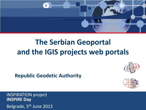
The <strong>Serbian</strong> <strong>Geoportal</strong><br />
<strong>and</strong> the <strong>IGIS</strong> projects web portals<br />
Republic Geodetic Authority<br />
<strong>INSPIRATION</strong> project<br />
INSPIRE Day<br />
Belgrade, 5 th June 2013
Initial geoportal<br />
The Initial <strong>Geoportal</strong> ’geoSrbija’ was launched on 27 th November 2009<br />
Discovery <strong>and</strong> view services<br />
Public access to geoinformation from different sources<br />
Multilingual interface (<strong>Serbian</strong> + English)<br />
Promotion of NSDI + Data transparency<br />
OpenLayers + UMN Mapserver + PostgreSQL/PostGis solution<br />
www.geosrbija.rs
<strong>Geoportal</strong><br />
<strong>Geoportal</strong> is ‘window’ for view of a spatial data
<strong>Geoportal</strong><br />
Cadastral parcels + ortophoto
Cadastral Parcels status<br />
Digital Cadastral Maps [DCM]<br />
Overview of DCM on the geoportal<br />
~50% in official use<br />
REC web service: Knweb<br />
http://katastar.rgz.gov.rs/Kn<strong>Web</strong>Public
<strong>Geoportal</strong>/Traffic<br />
0.05<br />
0.08<br />
0.03<br />
0.08<br />
0.13<br />
0.11<br />
0.12<br />
0.13<br />
0.10<br />
0.17<br />
0.20<br />
0.19<br />
0.22<br />
0.28<br />
0.21<br />
0.22<br />
0.31<br />
0.37<br />
0.61<br />
0.64<br />
0.58<br />
0.69<br />
0.70<br />
1.09<br />
1.43<br />
2.49<br />
2.46<br />
2.35<br />
2.50 2.27<br />
2.27<br />
1.89<br />
1.89<br />
2.37<br />
2.56<br />
3.35<br />
3.19<br />
2.65<br />
3.34<br />
3.92<br />
4.62<br />
3.85<br />
2.78<br />
0<br />
0.5<br />
1<br />
1.5<br />
2<br />
2.5<br />
3<br />
3.5<br />
4<br />
4.5<br />
5<br />
Traffic: hits per month
10.01<br />
Orthophoto-40cm<br />
10.07<br />
Cadastral Parcel<br />
8.31<br />
Orthophoto-10cm<br />
5.68<br />
Street<br />
5.46<br />
Orthophoto-20cm<br />
5.12<br />
Building<br />
3.88<br />
House Number<br />
4.00<br />
Place name<br />
3.45<br />
Overview_DKP area<br />
3.29<br />
Cadastral municipality<br />
3.24<br />
Orthophoto-10cm_2011<br />
1.88<br />
Municipality<br />
1.67<br />
Settlement<br />
1.03<br />
Local community<br />
0.99<br />
City<br />
<strong>Geoportal</strong>/Traffic<br />
12.00<br />
10.00<br />
Trafic: Hits per themes [million]<br />
8.00<br />
6.00<br />
4.00<br />
2.00<br />
0.00
<strong>Geoportal</strong> development<br />
Extended functionality of geoportal:<br />
• Adaptive II realise 2012 with new administrator module<br />
• PostGIS search function<br />
• Transition to new default Special Reference System<br />
from Gauss-Kruger to ETRS89/UTM Zone 34N<br />
Possibility to digitise via the geoportal:<br />
• Digitise object for point, line, polygon, text with basic<br />
attributes (category, name, symbol)<br />
• Digitise theme for predefined attributes in line with specific<br />
needs<br />
Proposed for registered/professional users
<strong>Geoportal</strong> development<br />
The new Adaptive realise 2012: upgrade + new administrator
<strong>Geoportal</strong> development<br />
The new Search function
<strong>IGIS</strong> project: scope<br />
The <strong>IGIS</strong> concept is comprised of two core components:<br />
1) Data: provides the content of the SDI <strong>and</strong> the corresponding data that describe the dataset<br />
2) Services: enable access to <strong>and</strong> use of the data<br />
Data<br />
Satellite imagery<br />
Digital aerial survey <strong>and</strong> LIDAR acquisition<br />
Remote sensing: l<strong>and</strong> use, environmental <strong>and</strong><br />
agriculture maps<br />
Stereo plotting: production of 3D vector<br />
topographic data base<br />
Map editing: digital <strong>and</strong> hardcopy maps<br />
INSPIRE themes covered<br />
Services<br />
Technical infrastructure:<br />
Archiving <strong>and</strong> hosting capabilities<br />
Central Data Repository<br />
<strong>Web</strong> <strong>Portals</strong> for data <strong>and</strong> service dissemination<br />
METIS<br />
INSPIRE compliance<br />
<strong>Web</strong>Boutique/DataDoors
Technical Infrastructure<br />
Central Data Repository = CDR<br />
• Core of the <strong>IGIS</strong> solution<br />
• Allow the storage <strong>and</strong> the cataloguing of geographic data<br />
• Input data (sensor data <strong>and</strong> external data)<br />
• Produced data (the workshops data)<br />
• The CDR is the data source for the processing workshops<br />
• Provide services to publish data on the <strong>Web</strong> <strong>Portals</strong><br />
Software components:<br />
• ESRI ArcGis Server (St<strong>and</strong>ard Edition)<br />
Host the web services used by<br />
INSPIRE <strong>Web</strong> Portal <strong>and</strong><br />
MultiCatalog FACEO/METIS Portal<br />
• Database : PostgreSQL
METIS web portal<br />
METIS web portal / MultiCatalog FACEO<br />
Mission:<br />
• Geo-demonstrator for internal RGA use (touch screen)<br />
• Federated access to different catalogues (<strong>IGIS</strong> <strong>and</strong> Spot Image)<br />
• Display in an unified view from multiple <strong>and</strong> remote catalogues
METIS web portal<br />
METIS web portal / MultiCatalog FACEO<br />
Functions overview:<br />
• Discovery by Attributes/AOI/ Catalogue<br />
• Display of the metadata<br />
• Visualization of data (WMS)<br />
Catalogue Access:<br />
• <strong>IGIS</strong> INSPIRE <strong>Web</strong> Portal Catalogue<br />
• <strong>IGIS</strong> DataDoors Catalogue<br />
• Spot Image Catalogues (DALI)
INSPIRE <strong>Web</strong> Portal/Partner portal<br />
INSPIRE <strong>Web</strong> Portal/Partner portal<br />
Mission:<br />
• Allow the discovery, the view <strong>and</strong> an optionally download function of the<br />
published data<br />
• Provide a first step to INSPIRE (discovery <strong>and</strong> view services, metadata)
INSPIRE <strong>Web</strong> Portal/Partner portal<br />
INSPIRE <strong>Web</strong> Portal/Partner portal<br />
Software solutions:<br />
• ESRI ArcGis Server : WMS, WCS, WFS<br />
• ESRI <strong>Geoportal</strong> Extension for ArcGis Server + PostgreSQL: Catalog service<br />
• <strong>IGIS</strong> Data Management Capabilities (DMC): data publishing<br />
Targeted users:<br />
• Internal <strong>and</strong> RGA Partners<br />
Network positioning:<br />
• Extranet: access from Internet with an authentication procedure
DataDoors web portal<br />
DataDoors/<strong>Web</strong> Boutique web portal<br />
Mission:<br />
• Distribute/sell geodata to Internet users (private company, partners …)<br />
• No particular objectives in INSPIRE Compliance but the INSPIRE XML metadata<br />
file can be delivered with the data ordered
DataDoors/<strong>Web</strong> Boutique web portal<br />
DataDoors/<strong>Web</strong> Boutique web portal<br />
Functions overview:<br />
• Ingestion of data<br />
• Management of user access rights on data<br />
• Discovery / Visualization with a dedicated <strong>Web</strong> client<br />
• Ordering<br />
Definition of the product, Data Format, Projection, Delivery definition<br />
• Billing (optional)<br />
Management of products price<br />
Pricing strategy via back office<br />
Payment by Visa card, purchase order<br />
[supported by e-Government]<br />
• Data delivery<br />
notification by mail <strong>and</strong> download using FTP
www.rgz.gov.rs<br />
www.geosrbija.rs