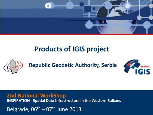
Products of IGIS Project.pdf - INSPIRATION
Products of IGIS Project.pdf - INSPIRATION
Products of IGIS Project.pdf - INSPIRATION

Create successful ePaper yourself
Turn your PDF publications into a flip-book with our unique Google optimized e-Paper software.
<strong>Products</strong> <strong>of</strong> <strong>IGIS</strong> project<br />
Republic Geodetic Authority, Serbia<br />
2nd National WorkShop<br />
<strong>INSPIRATION</strong> - Spatial Data Infrastructure in the Western Balkans<br />
Belgrade, 06 th – 07 th June 2013
INSPIRE direktive<br />
INfrastructure for SPatial InfoRmation in Europe<br />
http://inspire.jrc.ec.europa.eu<br />
Implementation 2007 – 2020<br />
EU INSPIRE directive lays foundation for comprehensive harmonization<br />
<strong>of</strong> geoinformation within EU for environmental policy making.<br />
A uniform infrastructure enables data exchange and makes geodata<br />
available on national level and across Europe.
<strong>IGIS</strong> project implementation in Serbia<br />
National Spatial Data Infrastructure<br />
and Remote-Sensing Centre<br />
for the Republic <strong>of</strong> Serbia<br />
based on <strong>IGIS</strong> (Integrated Geo-Information Solution)
<strong>IGIS</strong> project<br />
<strong>IGIS</strong> project<br />
National Spatial Data Infrastructure<br />
and Remote-Sensing Centre<br />
for the Republic <strong>of</strong> Serbia based on <strong>IGIS</strong> (Integrated Geo-Information Solution)<br />
EADS Astrium<br />
IGN France<br />
<strong>Project</strong> partners:<br />
Republic Geodetic Authority<br />
Kick-<strong>of</strong>f meeting on 22. September 2010
<strong>IGIS</strong> project - concept<br />
The <strong>IGIS</strong> concept is comprised <strong>of</strong> two core components:<br />
1) Data: provides the content <strong>of</strong> the SDI and the corresponding data that describe<br />
the dataset;<br />
2) Services: enable access to and use <strong>of</strong> the data.<br />
Data:<br />
Satellite imagery and digital aerial imagery;<br />
LIDAR data;<br />
Remote sensing data:<br />
land use, agriculture, hazard and<br />
environmental maps;<br />
3D topographic vector data (TDB);<br />
Digital and hardcopy maps;<br />
Services:<br />
Technical infrastructure:<br />
Archiving and hosting capabilities<br />
Central Data Repository<br />
Web Portals for data and service dissemination<br />
METIS<br />
INSPIRE compatible<br />
WebBoutique/DataDoors
<strong>IGIS</strong> project - planning<br />
Space & aerial data over 4 years (Spot 4, Spot5, Geoeye, ADS80, UCXp, LIDAR,<br />
other available satellite data …);<br />
Infrastructure delivery in Nov 2011;<br />
Large phase <strong>of</strong> training/know-how transfer over 3 years;<br />
+ 1 year <strong>of</strong> maintenance: 2014.<br />
System design<br />
Site recommendations<br />
Infrastructure<br />
Customization<br />
Training planning<br />
Data delivery planning<br />
First Dataset deliveries<br />
Parameter setting<br />
Adaptations<br />
Tests & assembly<br />
Validation<br />
Following Data sets<br />
delivery<br />
Maintenance<br />
Support<br />
Training & know how<br />
transfer<br />
3 years project
<strong>IGIS</strong> project - components<br />
Base data [Satellite, aerial & LiDAR]<br />
Production Workshops<br />
Infrastructure<br />
[Data repository & WEB portals]<br />
Sensor and<br />
External Data<br />
LiDAR<br />
workshop<br />
Geometric<br />
workshop<br />
Remote<br />
Sensing<br />
workshop<br />
Access services<br />
Data<br />
Repository<br />
[SDI]<br />
Stereo-<br />
Plotting<br />
workshop<br />
Map Editing<br />
workshop<br />
WEB portals
<strong>IGIS</strong> project – Production Workshops<br />
Production chain<br />
Base Data<br />
‘End User’ <strong>Products</strong><br />
Base<br />
Aerial<br />
Data<br />
Base<br />
Satellite<br />
Data<br />
Geometric<br />
workshop<br />
Remote<br />
Sensing<br />
workshop<br />
Stereo-<br />
Plotting<br />
workshop<br />
Vector Topo <strong>Products</strong><br />
Agro-Environmental<br />
<strong>Products</strong><br />
Map Editing<br />
workshop<br />
Maps<br />
LiDAR<br />
Data<br />
LiDAR<br />
workshop<br />
Digital Terrain Model
<strong>IGIS</strong> project - Geometric Workshop<br />
The Geometric workshop is designed to support:<br />
• Acquisition <strong>of</strong> aerial and procurement <strong>of</strong> satellite data as well as its verification;<br />
• Generation <strong>of</strong> specific products (DTM,DSM, DOP, true-DOP, mosaics etc.) through<br />
Pixel Factory s<strong>of</strong>tware solution;<br />
• Provision <strong>of</strong> elementary data for Remote Sensing (ortho scenes), Stereo Plotting<br />
(stereo pairs) and Map Editing workshop (digital terrain model);
<strong>IGIS</strong> project - Geometric Workshop<br />
Acquisition <strong>of</strong> aerial data:<br />
• National coverage<br />
(ADS80 & UCXp sensors, GSD 40cm,<br />
60%-30% overlap);<br />
• 90 urban areas<br />
(UCX, UCXp & ADS80 sensors, GSD 10cm,<br />
60%-30% overlap);<br />
• 2 main cities<br />
(UCXp sensor,GSD 10cm, 80%-80%<br />
overlap).
<strong>IGIS</strong> project - Geometric Workshop<br />
Procurement <strong>of</strong> satellite data:<br />
• National coverage<br />
(SPOT5, pan 2.5m/ms 10m);<br />
• Area <strong>of</strong> AP K&M<br />
(Geoeye, pan 0.41/ms 1.65m);<br />
• Areas in Vojvodina, central and south Serbia<br />
(SPOT 4: pan 10/ms 20m, SPOT5: pan 2.5/ms 10m,<br />
SPOT6:pan 1.5/ms 6m);<br />
• Scenes for urgent purposes<br />
(appropriate and available satellite system).
<strong>IGIS</strong> project - Geometric Workshop<br />
<strong>Products</strong> <strong>of</strong> the Geometric workshop:<br />
• Satellite mosaics <strong>of</strong> the whole country;<br />
• Orthorectified satellite scenes;<br />
• Digital terrain models;
<strong>IGIS</strong> project - Geometric Workshop<br />
<strong>Products</strong> <strong>of</strong> the Geometric workshop:<br />
• Digital orthophotos <strong>of</strong> 2.5m GSD;<br />
• Digital orthophotos <strong>of</strong> 10cm and 40cm GSD;<br />
• True-orthophotos <strong>of</strong> 10cm GSD.
<strong>IGIS</strong> project - LiDAR Workshop<br />
LiDAR workshop is designed to support:<br />
• Acquisition <strong>of</strong> LiDAR data and its verification;<br />
• Generation <strong>of</strong> high precision DTMs.<br />
Acquisition <strong>of</strong> LiDAR data:<br />
• Flood prone area <strong>of</strong> Tisa River (1900 km 2 );<br />
• ALS70 sensor, 2.3 pnts/sqm in nadir,<br />
pnts density 0.60/0.70m;<br />
• Applied SQM_2011.
<strong>IGIS</strong> project - LiDAR Workshop<br />
Product <strong>of</strong> LiDAR workshop:<br />
• High precision DTM <strong>of</strong> 15cm average height accuracy and grid <strong>of</strong> 1m.<br />
Tools:<br />
• Bentley-MicroStation<br />
• TerraSolid.<br />
LiDAR movie
<strong>IGIS</strong> project – Remote Sensing Workshop<br />
The Remote Sensing workshop is designed to enable RGA to produce:<br />
• Land use and land use changes maps;<br />
• Environmental maps and/or indicators to feed natural monitoring program<br />
(e.g. deforestation);<br />
• A range <strong>of</strong> agriculture maps to support ministry <strong>of</strong> Agriculture to<br />
monitor/control crop-lands with respect to national or European standards;<br />
• Wide range <strong>of</strong> thematic mapping products (hazards maps, habitat maps etc.).<br />
April 2011<br />
June 2011<br />
August 2011<br />
September 2011
<strong>IGIS</strong> project – Remote Sensing Workshop<br />
Available satellite imagery from the project:<br />
• SPOT4<br />
10 m panchromatic imagery;<br />
20 m multi-spectral imagery;<br />
• SPOT5<br />
2.5 m panchromatic imagery;<br />
10 m multi-spectral imagery;<br />
• SPOT6 (in 2013)<br />
Ortophoto imagery – 0.4 m<br />
Satellite imagery– SPOT5 10m<br />
1.5 m panchromatic imagery;<br />
6 m multi-spectral imagery;<br />
Available DOP/ortho images-GSD 0.40m:<br />
• CARDS project;<br />
•<strong>IGIS</strong> project<br />
Classified content
<strong>IGIS</strong> project – Remote Sensing Workshop<br />
Outcomes <strong>of</strong> imagery processing<br />
• Biophysical parameters<br />
Satellite imagery<br />
WaterCoverFraction<br />
CanopyShadowFactor<br />
GreenCoverFraction<br />
• Land cover map<br />
• Agriculture Land Cover Map<br />
Tools:<br />
• Overland;<br />
• eCognition.
<strong>IGIS</strong> project – Remote Sensing Workshop<br />
Overview <strong>of</strong><br />
demonstrated areas<br />
in the project<br />
Agriculture<br />
Land Cover Map<br />
Biophysical<br />
parameters<br />
Land cover<br />
map
<strong>IGIS</strong> project – Remote Sensing Workshop<br />
Data Quality Control/Validation<br />
• GHCP (Ground Habitat Control Points) for validation<br />
<strong>of</strong> Land Cover Map and Agriculture Land Cover Map<br />
• GRID control points [2km]<br />
for validation <strong>of</strong> Land Cover Map<br />
Ortophoto imagery<br />
Satellite imagery
<strong>IGIS</strong> project – Remote Sensing Workshop<br />
Sample: Land Cover Map
<strong>IGIS</strong> project – Remote Sensing Workshop<br />
Sample: Agriculture Land Cover Map
<strong>IGIS</strong> project – Stereo Plotting Workshop<br />
The Stereo Plotting workshop is designed to support:<br />
•The production <strong>of</strong> 3D vector topographic layer from aerial image stereo pairs;<br />
•GIS unit to structure a vector data base from 3D digitising;<br />
Tools:<br />
• GeoView s<strong>of</strong>tware with 3D visualisation capabilities;<br />
•Spatial data base (ArcGIS geodata base; PostGreSQL/PostGIS server data base).
<strong>IGIS</strong> project – Stereo Plotting Workshop<br />
The Stereo Plotting workshop is linked directly with:<br />
The geometric workshop<br />
Input: stereo pairs + parameters for orientation <strong>of</strong> imagery<br />
The map editing workshop<br />
Output: vector data base for a map publishing and printing
<strong>IGIS</strong> project – Stereo Plotting Workshop<br />
Vector data gathering in stereo-model
<strong>IGIS</strong> project – Stereo Plotting Workshop<br />
Generating <strong>of</strong> contour lines
<strong>IGIS</strong> project – Stereo Plotting Workshop<br />
Topographic-cartographic data base<br />
Overview <strong>of</strong> production
<strong>IGIS</strong> project – Map Editing Workshop<br />
Map Editing Workshop allows from the vector data captured in the Stereo-<br />
Plotting workshop:<br />
• Generation <strong>of</strong> digital and hardcopy maps (with assigned symbology and design)<br />
from vector data automatically;<br />
• Design <strong>of</strong> any derived maps as per customised requirement.<br />
Production process from vector data base to maps for printing or for the Internet:<br />
Definition <strong>of</strong> templates;<br />
Automatic map generation from the Data Base;<br />
Design <strong>of</strong> on-demand products for any scale.
<strong>IGIS</strong> project – Map Editing Workshop<br />
Tools:<br />
LorikGISMapper provides customisable and automatic processes for association <strong>of</strong><br />
data base to library <strong>of</strong> graphic styles as well as automatic cartographic generalisation.<br />
LorikPublisher automatically generates maps from cartographic repositories or GIS<br />
sources varying in format and structure through fully customizable layout models.It is<br />
used for manual map generalisation and map preparation for printing.
<strong>IGIS</strong> project – Map Editing Workshop<br />
Topographic map 1:20 000
<strong>IGIS</strong> project – Overall logistical architecture<br />
Sensor Data + External product<br />
Geometric WS<br />
Pixel Factory<br />
Remote Sensing WS<br />
Lidar WS<br />
Overland<br />
Definiens<br />
Biotope<br />
Sensor data<br />
Ortho<br />
Mosaic<br />
Lidar sensor<br />
Ortho<br />
Mosaic<br />
St pairs<br />
DTM/DSM<br />
Thematic<br />
Maps<br />
DTM<br />
Central Data Repository<br />
Servers & Storage<br />
View<br />
+<br />
ArcGIS Server<br />
<strong>IGIS</strong> DMC Server<br />
WMS WCS<br />
Topographic<br />
DB<br />
Maps<br />
Stereo Pairs<br />
Ortho image<br />
Mosaic<br />
Stereo Plotting WS<br />
Geoview<br />
ArcGIS client<br />
Topographic db<br />
Map editing WS<br />
Lorik Mapper<br />
Lorik publisher<br />
INSPIRE Web<br />
Portal Server<br />
(Geoportal Extension)<br />
CSW<br />
Copy <strong>of</strong> Ortho, Mosaic,Thematic<br />
maps, Vector from CDR<br />
Discover<br />
Web boutique<br />
Datadoors<br />
DataDoors Web Client<br />
Web public user<br />
Request<br />
Federated Catalog<br />
Access<br />
Metis<br />
Discover +<br />
download Discover +<br />
view<br />
Metis Client<br />
Intranet user<br />
External Catalog<br />
(Spot Image)<br />
Discover<br />
View +<br />
Download<br />
Flex Client<br />
RGZ Partner<br />
users
<strong>IGIS</strong> project – Training, expertise & know how transfer<br />
Smooth handover towards RGA staff:<br />
Study Tour in France<br />
At Factory Training in Astrium and IGN France<br />
On Site Training in Serbia<br />
On the Job Training in Serbia<br />
Support<br />
Maintenance up to 2014
<strong>IGIS</strong> project – Outcomes<br />
Development <strong>of</strong> capabilities for production, update and dissemination <strong>of</strong><br />
geoinformation for the benefit <strong>of</strong> Serbian citizens, as well as the public and private<br />
sectors;<br />
Efficient and optimised process to maintain the spatial data up to date;<br />
Production <strong>of</strong> new databases within the RGA is in progress according to INSPIRE<br />
Annex I data models;<br />
Access to metadata, spatial data and services via the Internet;<br />
Improved and efficient communication as well as geoinformation exchange<br />
between the public authorities.
Geoportal ‘GeoSerbia’
Geoportal ‘GeoSerbia’
Space is connecting people<br />
www.rgz.gov.rs<br />
www.geosrbija.rs<br />
Thank you on your attention!