Download services - INSPIRATION
Download services - INSPIRATION
Download services - INSPIRATION

You also want an ePaper? Increase the reach of your titles
YUMPU automatically turns print PDFs into web optimized ePapers that Google loves.
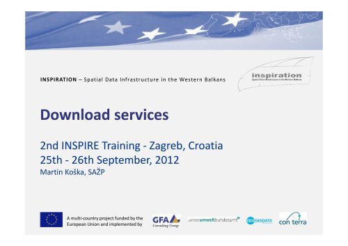
<strong>INSPIRATION</strong> – Spatial Data Infrastructure in the Western Balkans<br />
<strong>Download</strong> <strong>services</strong><br />
2nd INSPIRE Training - Zagreb, Croatia<br />
25th - 26th September, 2012<br />
Martin Koška, SAŽP<br />
A multi-country project funded by the<br />
European Union and implemented by
I N S P I R AT I O N – S p a t i a l D a t a I n f r a s t r u c t u r e i n t h e W e s t e r n B a l k a n s<br />
Outlines<br />
Legislation regarding INSPIRE download <strong>services</strong><br />
Implementation of INSPIRE download <strong>services</strong><br />
ATOM implementation<br />
WFS implementation<br />
Demonstration of WFS <strong>services</strong> - examples<br />
A multi-country project funded by the<br />
European Union and implemented by
I N S P I R AT I O N – S p a t i a l D a t a I n f r a s t r u c t u r e i n t h e W e s t e r n B a l k a n s<br />
INSPIRE architecture<br />
A multi-country project funded by the<br />
European Union and implemented by
I N S P I R AT I O N – S p a t i a l D a t a I n f r a s t r u c t u r e i n t h e W e s t e r n B a l k a n s<br />
General usage scenario of SDI<br />
A multi-country project funded by the<br />
European Union and implemented by
I N S P I R AT I O N – S p a t i a l D a t a I n f r a s t r u c t u r e i n t h e W e s t e r n B a l k a n s<br />
INSPIRE legislation and guidelines<br />
Directive 2007/2/EC of the European Parliament and of the<br />
Council of 14 March 2007 establishing an Infrastructure for<br />
Spatial Information in the European Community (INSPIRE)<br />
[INS DIR]<br />
Commission Regulation amending Regulation (EC) No<br />
976/2009 as regards download <strong>services</strong> and transformation<br />
service<br />
Technical Guidance for the implementation of INSPIRE<br />
<strong>Download</strong> Services published 12-06-2012, Version 3.0 (not<br />
legally binding)<br />
A multi-country project funded by the<br />
European Union and implemented by
I N S P I R AT I O N – S p a t i a l D a t a I n f r a s t r u c t u r e i n t h e W e s t e r n B a l k a n s<br />
Implementing Rule versus Technical<br />
Guidance<br />
A multi-country project funded by the<br />
European Union and implemented by
I N S P I R AT I O N – S p a t i a l D a t a I n f r a s t r u c t u r e i n t h e W e s t e r n B a l k a n s<br />
Standards regarding download <strong>services</strong><br />
ISO 19142:2010 Geographic information - Web Feature<br />
Service, ISO 19142<br />
ISO 19143:2010 Geographic information - Filter encoding, ISO<br />
19143<br />
IETF RFC 4287 The Atom Syndication Format, ATOM<br />
GeoRSS-Simple The Simple Serialization of GeoRSS,<br />
http://www.georss.org/simple GeoRSS<br />
OpenSearch Description Document format,<br />
http://www.opensearch.org/Specifications/OpenSearch/1.1 OpenSearch<br />
A multi-country project funded by the<br />
European Union and implemented by
I N S P I R AT I O N – S p a t i a l D a t a I n f r a s t r u c t u r e i n t h e W e s t e r n B a l k a n s<br />
Related subjects<br />
XML - Extensible Markup Language - is a markup language that defines a set of rules for encoding documents in<br />
a format that is both human-readable and machine-readable. It is defined in the XML 1.0 Specification<br />
produced by the W3C, and several other related specifications<br />
XML is common interchange data format<br />
XML uses easy syntax for structuring information (elements, atributes, processing instructions ...)<br />
XML “X“ stands for extensible -> it means everybody can make new elements<br />
XML SCHEMA - is formal language which allows user to define specific class of XML document<br />
<br />
<br />
Helps to define structure of class of documents in terms of allowed elements their attributes, cardinality<br />
of elements and their content.<br />
Then it is possible to validate XML document against XML schema<br />
GML - Geography Markup Language Encoding Standard - XML grammar defined by the Open Geospatial<br />
Consortium (OGC) to express geographical features, which uses XML schemas as technology<br />
GML application schemas (actually 3.2.1 in OGC specidication) - the basis for domain - or community-specific<br />
"Application Schemas", which in turn support data interoperability within a community of interest.<br />
All 34 INSPIRE datasets are represented by GML application schemas which extends basic GML<br />
A multi-country project funded by the<br />
European Union and implemented by
I N S P I R AT I O N – S p a t i a l D a t a I n f r a s t r u c t u r e i n t h e W e s t e r n B a l k a n s<br />
What is download service<br />
Chapter IV, Article 11 (Network <strong>services</strong>) of the Directive define<br />
download service as:<br />
“<strong>Download</strong> <strong>services</strong> enabling copies of complete spatial datasets,<br />
or of parts of such sets, to be downloaded.”<br />
A multi-country project funded by the<br />
European Union and implemented by
I N S P I R AT I O N – S p a t i a l D a t a I n f r a s t r u c t u r e i n t h e W e s t e r n B a l k a n s<br />
When is implementation required<br />
Article 4: Not later than 28 June 2012, Member States shall<br />
provide the <strong>Download</strong> Services with initial operating<br />
capability.<br />
Article 4: Not later than 28 December 2012, Member States<br />
shall provide the <strong>Download</strong> Services in conformity with this<br />
Regulation.<br />
A multi-country project funded by the<br />
European Union and implemented by
I N S P I R AT I O N – S p a t i a l D a t a I n f r a s t r u c t u r e i n t h e W e s t e r n B a l k a n s<br />
Non-Interoperable and Interoperable<br />
<strong>Download</strong> Services<br />
A multi-country project funded by the<br />
European Union and implemented by
I N S P I R AT I O N – S p a t i a l D a t a I n f r a s t r u c t u r e i n t h e W e s t e r n B a l k a n s<br />
Legal Requirements<br />
ANNEX I - QUALITY OF SERVICE<br />
For the Get <strong>Download</strong> Service Metadata operation, the response time for sending the initial<br />
response shall be maximum 10 seconds in normal situation.<br />
For the Get Spatial Data Set operation and for the Get Spatial Object operation, and for a<br />
query consisting exclusively of a bounding box, the response time for sending the initial<br />
response shall be maximum 30 seconds in normal situation then, and still in normal situation,<br />
the download service shall maintain a sustained response greater than 0,5 Megabytes per<br />
second or greater than 500 Spatial Objects per second.<br />
For the Describe Spatial Data Set operation and for the Describe Spatial Object Type<br />
operation, the response time for sending the initial response shall be maximum 10 seconds in<br />
normal situation then, and still in normal situation, the download service shall maintain a<br />
sustained response greater than 0,5 Megabytes per second or greater than 500 descriptions<br />
of Spatial Objects per second.<br />
A multi-country project funded by the<br />
European Union and implemented by
I N S P I R AT I O N – S p a t i a l D a t a I n f r a s t r u c t u r e i n t h e W e s t e r n B a l k a n s<br />
Legal Requirements<br />
ANNEX I - CAPACITY<br />
The minimum number of simultaneous requests to a download service to be served in<br />
accordance with the quality of service performance criteria shall be 10 requests per second.<br />
The number of requests processed in parallel may be limited to 50.<br />
ANNEX I – AVAILABILITY<br />
The probability of a network service to be available shall be 99 % of the time.<br />
A multi-country project funded by the<br />
European Union and implemented by
I N S P I R AT I O N – S p a t i a l D a t a I n f r a s t r u c t u r e i n t h e W e s t e r n B a l k a n s<br />
Mandatory Operations<br />
ANNEX IV - <strong>Download</strong> Operations<br />
All download <strong>services</strong><br />
<br />
<br />
<br />
<br />
Get <strong>Download</strong> Service Metadata - Provides all necessary information about the service, the available<br />
Spatial Data Sets, and describes the service capabilities.<br />
Get Spatial Data Set - The Get Spatial Data Set operation allows the retrieval of a Spatial Data Set.<br />
Describe Spatial Data Set - This operation returns the description of all the types of Spatial Objects<br />
contained in the Spatial Data Set.<br />
Link <strong>Download</strong> Service - Allows the declaration, by a Public Authority or a Third Party, of the availability of<br />
a <strong>Download</strong> Service for downloading Spatial Data Sets or, where practicable, Spatial Objects, through the<br />
Member State’s <strong>Download</strong> Service while maintaining the downloading capability at the Public Authority or<br />
the Third Party location.<br />
Direct access<br />
<br />
<br />
Get Spatial Object - This operation allows the retrieval of Spatial Objects based upon a query.<br />
Describe Spatial Object Type - This operation returns the description of the specified Spatial Objects<br />
types.<br />
A multi-country project funded by the<br />
European Union and implemented by
I N S P I R AT I O N – S p a t i a l D a t a I n f r a s t r u c t u r e i n t h e W e s t e r n B a l k a n s<br />
Types of INSPIRE <strong>Download</strong> Service<br />
Pre-Defined <strong>Download</strong> Service<br />
<br />
<br />
<br />
One or more files representing either the full dataset or subsets<br />
These files are accessed via a file or data repository (e.g. FTP)<br />
<strong>Download</strong>ed in their entirety and the content cannot be changed (i.e. encoding, CRS)<br />
Direct Access <strong>Download</strong> Service<br />
Users define a set of request criteria that subsets the data to return only the features needed:<br />
<br />
<br />
<br />
<br />
Select all data within a bounding box<br />
Select only feature type arbitrary<br />
Select feature by identifier<br />
Select all features using temporal criteria within and area of interest<br />
A multi-country project funded by the<br />
European Union and implemented by
I N S P I R AT I O N – S p a t i a l D a t a I n f r a s t r u c t u r e i n t h e W e s t e r n B a l k a n s<br />
Implementing INSPIRE <strong>Download</strong><br />
Services<br />
Possible ways for implementation of INSPIRE <strong>Download</strong> Services<br />
<br />
Atom-based implementation - The Atom syndication format provides a simple, widely understood<br />
mechanism for publishing information on the web in the form of feeds in a way that is compatible with<br />
existing web architecture and many tools.<br />
<br />
WFS-based implementation - The OGC Web Feature Service allows a client to retrieve and update<br />
geospatial data encoded in Geography Markup Language (GML)* from multiple Web Feature Services.<br />
WFS provides much more sophisticated web service for downloading and directly access data online. WFS<br />
supports the ability for users to retrieve only the data they are interested in.<br />
*geospatial data can be encoded in different formats<br />
A multi-country project funded by the<br />
European Union and implemented by
I N S P I R AT I O N – S p a t i a l D a t a I n f r a s t r u c t u r e i n t h e W e s t e r n B a l k a n s<br />
Options for implementing INSPIRE<br />
<strong>Download</strong> Services<br />
3 options for implementing INSPIRE <strong>Download</strong> Services (in present):<br />
1. ATOM Feed providing access to pre-defined datasets<br />
2. OGC WFS 2.0 serving pre-defined datasets<br />
3. OGC WFS 2.0 serving features (Direct Access)<br />
Conformance Class<br />
Atom Feed<br />
Pre-defined WFS<br />
Direct access WFS<br />
Quality of service<br />
Obligation<br />
C<br />
(M, if WFS (Predefined) is not<br />
conformed to)<br />
C<br />
(M, if Atom Feed is not<br />
conformed to)<br />
O<br />
M<br />
A multi-country project funded by the<br />
European Union and implemented by
I N S P I R AT I O N – S p a t i a l D a t a I n f r a s t r u c t u r e i n t h e W e s t e r n B a l k a n s<br />
Introduction to ATOM<br />
<br />
<br />
<br />
<br />
<br />
XML based web content and metadata syndication format (similar as RSS)<br />
Application-level protocol for publishing and editing web resources belonging to periodically updated<br />
websites<br />
ATOM feeds push links to updated content to subscribed users<br />
Removes need for user to repeatedly return to source to check for updates<br />
Minimal implementation cost and complexity<br />
ATOM Feed readers<br />
<br />
<br />
<br />
Web Browser (e.g. Firefox, Opera, IE, Safari, Chrome)<br />
Web-based feed reader (e.g. Google Reader)<br />
Desktop feed reader (e.g. MS Outlook)<br />
ATOM feed contains:<br />
<br />
<br />
Descriptive metadata describing the feed itself<br />
One or more entries that describes the content (i.e. pre-defined dataset)<br />
A multi-country project funded by the<br />
European Union and implemented by
I N S P I R AT I O N – S p a t i a l D a t a I n f r a s t r u c t u r e i n t h e W e s t e r n B a l k a n s<br />
Example of atom feed<br />
A multi-country project funded by the<br />
European Union and implemented by
I N S P I R AT I O N – S p a t i a l D a t a I n f r a s t r u c t u r e i n t h e W e s t e r n B a l k a n s<br />
Atom feeds to make available pre-defined datasets for<br />
INSPIRE download <strong>services</strong><br />
<br />
<br />
<br />
<br />
A single Atom feed is published as a top-level “<strong>Download</strong> Service Feed”.<br />
This feed contains a link to an OpenSearch description document which provides operations metadata for<br />
the <strong>Download</strong> Service. The OpenSearch description document provides information about the operations<br />
implemented by the download service.<br />
This feed contains one or more Atom entries: one per pre-defined data set.<br />
Each of these Atom entries shall contain a link to another Atom Feed (a “Dataset Feed”) that<br />
describes the particular pre-defined data set.<br />
<br />
<br />
Each of these “Dataset Feeds” shall contain Atom Entries with links to download the predefined dataset in<br />
different formats (e.g. in GML, ShapeFile etc) and in different Coordinate Reference Systems. One link shall<br />
be provided for each format/CRS combination.<br />
Feeds may be provided in multiple languages<br />
A multi-country project funded by the<br />
European Union and implemented by
I N S P I R AT I O N – S p a t i a l D a t a I n f r a s t r u c t u r e i n t h e W e s t e r n B a l k a n s<br />
Overview of Atom feed structures<br />
A multi-country project funded by the<br />
European Union and implemented by
I N S P I R AT I O N – S p a t i a l D a t a I n f r a s t r u c t u r e i n t h e W e s t e r n B a l k a n s<br />
Elements required to describe feed and<br />
entries<br />
Feed<br />
<br />
<br />
<br />
<br />
<br />
Title<br />
ID<br />
Author<br />
Update<br />
Rights<br />
Subtitle, GeoRSS polygon (Dataset Feed)<br />
Links to related metadata and content:<br />
<br />
<br />
<br />
<br />
<br />
INSPIRE ISO Metadata<br />
OpenSearch Description<br />
Spatial object description<br />
Self Referencing Link<br />
Optional link to alternate representations of feed<br />
Entries<br />
<br />
<br />
<br />
<br />
<br />
Title<br />
ID<br />
Update<br />
Category (CRS)<br />
Link(s) to Content<br />
<br />
<br />
URL for Dataset Feed (Top Feed)<br />
URL for Dataset (Dataset Feed)<br />
A multi-country project funded by the<br />
European Union and implemented by
I N S P I R AT I O N – S p a t i a l D a t a I n f r a s t r u c t u r e i n t h e W e s t e r n B a l k a n s<br />
WFS implementation of download<br />
<strong>services</strong><br />
<br />
The Web Feature Service (WFS) represents a change in the way geographic information is created,<br />
modified and exchanged on the Internet. Rather than sharing geographic information at the file level using<br />
File Transfer Protocol (FTP), for example, the WFS offers direct access to geographic information at the<br />
feature and feature property level. Web feature <strong>services</strong> allow clients to only retrieve or modify the data<br />
they are seeking, rather than retrieving a file that contains the data they are seeking and possibly much<br />
more. That data can then be used for a wide variety of purposes, including purposes other than their<br />
producers' intended ones.<br />
<br />
In the taxonomy of <strong>services</strong> defined in ISO 19119, the WFS is primarily a feature access service but also<br />
includes elements of a feature type service, a coordinate conversion/transformation service and<br />
geographic format conversion service<br />
OpenGIS Web Feature Service 2.0 Interface Standard equals ISO 19142<br />
Other standards – WFS 1.0.0, WFS 1.1.0<br />
A multi-country project funded by the<br />
European Union and implemented by
I N S P I R AT I O N – S p a t i a l D a t a I n f r a s t r u c t u r e i n t h e W e s t e r n B a l k a n s<br />
Main operations<br />
<br />
<br />
<br />
<br />
<br />
<br />
<br />
GetCapabilities (discovery operation)<br />
DescribeFeatureType (discovery operation)<br />
GetPropertyValue (query operation)<br />
GetFeature (query operation)<br />
GetFeatureWithLock (query & locking operation)<br />
LockFeature (locking operation)<br />
Transaction (transaction operation)<br />
<br />
<br />
<br />
<br />
CreateStoredQuery (stored query operation)<br />
DropStoredQuery (stored query operation)<br />
ListStoredQueries (stored query operation)<br />
DescribeStoredQueries (stored query operation)<br />
New in WFS 2.0.0 used by INSPIRE<br />
A multi-country project funded by the<br />
European Union and implemented by
I N S P I R AT I O N – S p a t i a l D a t a I n f r a s t r u c t u r e i n t h e W e s t e r n B a l k a n s<br />
GetCapabilities operation<br />
The GetCapabilities operation generates a service metadata document<br />
describing a WFS service provided by a server.<br />
Parameters<br />
ServiceType = "WFS"<br />
A multi-country project funded by the<br />
European Union and implemented by
I N S P I R AT I O N – S p a t i a l D a t a I n f r a s t r u c t u r e i n t h e W e s t e r n B a l k a n s<br />
DescribeFeatureType operation<br />
The DescribeFeatureType operation returns a schema description of feature<br />
types offered by a WFS instance.<br />
Parameters<br />
service :"WFS"<br />
version : "2.0.0“<br />
typeName - A comma separated list of feature types to describe. If no<br />
value is specified, then all feature types are returned.<br />
outputFormat : "text/xml; subtype=gml/3.2"<br />
A multi-country project funded by the<br />
European Union and implemented by
I N S P I R AT I O N – S p a t i a l D a t a I n f r a s t r u c t u r e i n t h e W e s t e r n B a l k a n s<br />
GetFeature operation<br />
The GetFeature operation returns a selection of features from a data store. A<br />
WFS processes a GetFeature request and returns a response document to<br />
the client that contains zero or more feature instances that satisfy the<br />
query expressions specified in the request.<br />
Parameters<br />
service :"WFS"<br />
version : "2.0.0“<br />
Typename - A list of feature type names to query<br />
Output format - The output format used to describe feature data returned by WFS<br />
Result type<br />
Maxfeatures<br />
Filter - A filter specification describes a set of features to operate upon. The filter is defined<br />
as specified in the OGC Filter Encoding Specification<br />
A multi-country project funded by the<br />
European Union and implemented by
I N S P I R AT I O N – S p a t i a l D a t a I n f r a s t r u c t u r e i n t h e W e s t e r n B a l k a n s<br />
Mapping to WFS requests<br />
<br />
<br />
<br />
<br />
Get <strong>Download</strong> Service Metadata - GetCapabilities<br />
Get Spatial Data Set - GetFeature<br />
Describe Spatial Data Set - DescribeFeatureType<br />
Link <strong>Download</strong> Service - PublishMetadata function of an INSPIRE compliant discovery service<br />
A multi-country project funded by the<br />
European Union and implemented by
I N S P I R AT I O N – S p a t i a l D a t a I n f r a s t r u c t u r e i n t h e W e s t e r n B a l k a n s<br />
Mapping INSPIRE download service requests<br />
to WFS requests – predefined datasets<br />
Mapping to WFS requests<br />
<br />
<br />
<br />
<br />
Get <strong>Download</strong> Service Metadata – GetCapabilities - The Get <strong>Download</strong> Service Metadata request is a<br />
GetCapabilities request to the WFS indicated in the metadata record<br />
Get Spatial Data Set – GetFeature - ISO 19142 describes the operations ListStoredQueries and<br />
DescribeStoredQueries. The former is used to retrieve a list of stored queries that are available and the<br />
later is used to request more information about a particular stored query (or queries) such as the<br />
parameter arguments that are required to make a GetFeature request using the stored query<br />
Describe Spatial Data Set - DescribeFeatureType<br />
Link <strong>Download</strong> Service - PublishMetadata function of an INSPIRE compliant discovery service<br />
A multi-country project funded by the<br />
European Union and implemented by
I N S P I R AT I O N – S p a t i a l D a t a I n f r a s t r u c t u r e i n t h e W e s t e r n B a l k a n s<br />
Mapping INSPIRE download service requests<br />
to WFS requests – direct access<br />
Mapping to WFS requests<br />
<br />
<br />
<br />
<br />
<br />
<br />
Get <strong>Download</strong> Service Metadata - GetCapabilities<br />
Get Spatial Data Set - GetFeature<br />
Describe Spatial Data Set - DescribeFeatureType<br />
Link <strong>Download</strong> Service - PublishMetadata function of an INSPIRE compliant discovery service<br />
Get Spatial Object - GetFeature request with required query arguments is made to the WFS<br />
Describe Spatial Object Type – GetCapabilities - The WFS responds with the XML schema for the<br />
requested Spatial Object types<br />
A multi-country project funded by the<br />
European Union and implemented by
I N S P I R AT I O N – S p a t i a l D a t a I n f r a s t r u c t u r e i n t h e W e s t e r n B a l k a n s<br />
Examples of requests-responses from<br />
WFS server<br />
Geoserver – open source software providing several kind of <strong>services</strong> also WFS service<br />
In present time provide data also in GML format using interface WFS 1.0.0, WFS 1.1.0<br />
Link:<br />
• http://geoserver.org<br />
• Scenario: how to serve district borders layer using WFS (download) service and make it<br />
permanently actual<br />
A multi-country project funded by the<br />
European Union and implemented by
I N S P I R AT I O N – S p a t i a l D a t a I n f r a s t r u c t u r e i n t h e W e s t e r n B a l k a n s<br />
Examples of using WFS service<br />
Biodiversity web application SK, BG, AT<br />
INSPIRE mashup application which provides:<br />
- Filtering the features<br />
- <strong>Download</strong> features<br />
- Weaving (portrayal) the features<br />
- Possibility to supplement the application by other data from other countries<br />
Components:<br />
Database and data<br />
Link:<br />
• http://geo.enviroportal.sk/geoserver/www/ps_mashup/index.html<br />
A multi-country project funded by the<br />
European Union and implemented by
I N S P I R AT I O N – S p a t i a l D a t a I n f r a s t r u c t u r e i n t h e W e s t e r n B a l k a n s<br />
Thank you.<br />
http://geoportal.sazp.sk<br />
http://geo.enviroportal.sk<br />
http://inspire.gov.sk<br />
http://www.enviroportal.sk<br />
http://www.sazp.sk<br />
A multi-country project funded by the<br />
European Union and implemented by