

Burren Connect Project - Geological Survey of Ireland
Burren Connect Project - Geological Survey of Ireland
Burren Connect Project - Geological Survey of Ireland

Create successful ePaper yourself
Turn your PDF publications into a flip-book with our unique Google optimized e-Paper software.
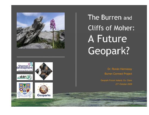
<strong>Burren</strong> and The<br />
<strong>of</strong> Moher: Cliffs<br />
Future A<br />
Dr. Ronán Hennessy<br />
Geopark?<br />
<strong>Burren</strong> <strong>Connect</strong> <strong>Project</strong><br />
Geopark Forum <strong>Ireland</strong>, Co. Clare<br />
21 st October 2009
<strong>Burren</strong> <strong>Connect</strong><br />
<strong>Project</strong>;<br />
Linking Environment,<br />
Community and<br />
Tourism to conserve<br />
the <strong>Burren</strong>
Managing access<br />
+<br />
Supporting<br />
education<br />
+<br />
Promoting<br />
ecotourism
County Council Clare<br />
Development Shannon<br />
<strong>Survey</strong> <strong>of</strong> <strong>Ireland</strong> <strong>Geological</strong><br />
Periphery Programme InterregNorthern<br />
The Heritage Council<br />
Currentfunding
Area <strong>of</strong> approx. 360km2<br />
The <strong>Burren</strong>
Carboniferous: ~360 –320 million years<br />
Siltstone Sandstone<br />
Limestone<br />
Shale<br />
The <strong>Burren</strong>
GSI 1:100,000 Bedrock Map in Google Earth<br />
The <strong>Burren</strong>
GSI Bedrock Cross Section in Google Earth<br />
The <strong>Burren</strong>
Soil Map in Google Earth<br />
The <strong>Burren</strong>
3D HillshadeMap in Google Earth<br />
The <strong>Burren</strong>
GeositePhoto-tour in Google Earth<br />
The <strong>Burren</strong>
GeositePhoto-tour in Google Earth<br />
The <strong>Burren</strong>
1stEdition GSI Field Sheets in Google Earth The <strong>Burren</strong>
A Geopark in the <strong>Burren</strong> -Why?<br />
for its rocky terrain •Renowned<br />
region for tourism and research •Popular<br />
karst landscape in NW European Isles •Largest<br />
tourist management strategies •Existent<br />
Moher –over 900,000 visitors annually •Cliffs<strong>of</strong>
<strong>Geological</strong> Heritage<br />
360 -320 Ma Limestone / Shale / Sandstone •Carboniferous<br />
Brachiopods / Crinoids / Corals / Goniatites •Fossiliferousformations<br />
limestone landscape Caves / Turloughs / Clints& Grikes •Karst<br />
geomorphology Erratics/ Drumlins / Pre-glacial features •Glacial
Natural & Cultural Heritage<br />
> 6000 years <strong>of</strong> settlement Neolithic / Bronze Age / Early Christian / Medieval •Archaeology<br />
Areas <strong>of</strong> Conservation (SACs) Five SACs / EU Habitats Directive protection •Special<br />
& Fauna Co-existing Arctic/Alpine & Mediterranean Flora •Flora<br />
& Food ‘Winterage’farming / Slow Food Clare •Farming
Education & Information Facilities<br />
11 Visitor & Centres<br />
9 ‘Information Points’ •<br />
2 Educational • 2 Research Centres •<br />
NEEDgeo-education programme •<br />
Ecobeoeducation • <strong>Burren</strong>Lifeeducation programme • National Park • A network <strong>of</strong> walking trails •
Eco-Tourism<br />
Fáilte<strong>Ireland</strong> Pilot with 19 <strong>Burren</strong> businesses •<br />
Training & Accreditation on-going •<br />
Promotion <strong>of</strong> <strong>Burren</strong> as an accredited ecotourism destination in 2010 •
<strong>Burren</strong> Geopark Consultees<br />
& Individuals •Locals<br />
•Landowners<br />
representatives •Community<br />
Businesses •Regional<br />
and organisations •Groups
<strong>Burren</strong> Geopark Consultees-Groups<br />
<strong>Connect</strong> •<strong>Burren</strong> Life <strong>Project</strong> •<strong>Burren</strong><br />
IFA •<strong>Burren</strong>beo Trust •<strong>Burren</strong><br />
<strong>of</strong> Moher Centre •Cliffs<br />
Clare Area Network •<strong>Burren</strong> <strong>Connect</strong> Advisory •North<br />
Ecotourism Working Group •<strong>Geological</strong> <strong>Survey</strong> <strong>of</strong> <strong>Ireland</strong> •<strong>Burren</strong><br />
Parks and Wildlife Service •National<br />
•National Monuments Service
Geopark -Actions and Initiatives<br />
<strong>Geological</strong> Map <strong>of</strong> the <strong>Burren</strong> GSI 1:50,000 Landscape and Geology •<br />
Training CD-Rom for local businesses Geology & Landscape / Archaeology / Flora & Fauna •<br />
Farm Tours Co-op Feasabilitystudy <strong>of</strong> farmer led tours •<strong>Burren</strong><br />
19 <strong>Geological</strong> Info Sheets burrenconnect.ie •
Geopark-Actions and Initiatives<br />
Journal January –July 2009 •Geopark<br />
Geopark Leaflet Campaign <strong>Burren</strong> Wide Distribution •<br />
Rocks! Week May 2009 •<strong>Burren</strong><br />
<strong>of</strong> 30 potential geosites Assessed geological importance & site accessibility •Identification
Education Initiatives<br />
Northern Environmental Education Development Geo-education learning environments NPP Funding •<br />
Ecobeoprimary school programme 20 week EcoBeoEducation Programme / Nine Schools •<br />
Geology training for staff at visitor centres Cliffs <strong>of</strong> Moher / <strong>Burren</strong> Centre Kilfenora •<br />
Geology training for <strong>Burren</strong> Farm Tours Co-Op Individual farm geology info sheets / Farm visits •<br />
• Public Walks and Talks
Work Plan 2009/2010<br />
Complete assessment <strong>of</strong> geosites • Develop interpretation plan for geosites •<br />
Develop geo-guides for existing walking routes • Agree management plan with local authority •<br />
Public meetings Oct ’09 to present Geopark plan • Continue educational & events programmes •<br />
Complete Geopark application by Oct 2010 •
The <strong>Burren</strong> and<br />
Cliffs <strong>of</strong> Moher:<br />
A Future<br />
Geopark...<br />
Dr. Ronán Hennessy<br />
<strong>Burren</strong> <strong>Connect</strong> <strong>Project</strong><br />
rhennessy@burren.ie<br />
Geopark Forum <strong>Ireland</strong>, Co. Clare<br />
21 st October 2009


