Dudgeon Point Coal Terminals Project â Q and As - North ...
Dudgeon Point Coal Terminals Project â Q and As - North ...
Dudgeon Point Coal Terminals Project â Q and As - North ...

Create successful ePaper yourself
Turn your PDF publications into a flip-book with our unique Google optimized e-Paper software.
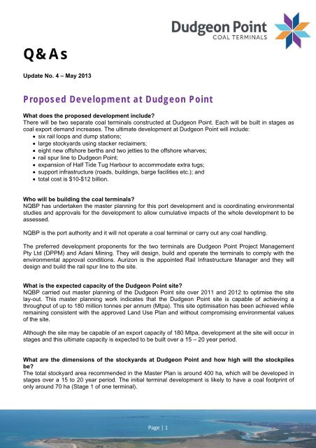
Q&<strong>As</strong><br />
Update No. 4 – May 2013<br />
Proposed Development at <strong>Dudgeon</strong> <strong>Point</strong><br />
What does the proposed development include?<br />
There will be two separate coal terminals constructed at <strong>Dudgeon</strong> <strong>Point</strong>. Each will be built in stages as<br />
coal export dem<strong>and</strong> increases. The ultimate development at <strong>Dudgeon</strong> <strong>Point</strong> will include:<br />
six rail loops <strong>and</strong> dump stations;<br />
large stockyards using stacker reclaimers;<br />
eight new offshore berths <strong>and</strong> two jetties to the offshore wharves;<br />
rail spur line to <strong>Dudgeon</strong> <strong>Point</strong>;<br />
expansion of Half Tide Tug Harbour to accommodate extra tugs;<br />
support infrastructure (roads, buildings, barge facilities etc.); <strong>and</strong><br />
total cost is $10-$12 billion.<br />
Who will be building the coal terminals?<br />
NQBP has undertaken the master planning for this port development <strong>and</strong> is coordinating environmental<br />
studies <strong>and</strong> approvals for the development to allow cumulative impacts of the whole development to be<br />
assessed.<br />
NQBP is the port authority <strong>and</strong> it will not operate a coal terminal or carry out any coal h<strong>and</strong>ling.<br />
The preferred development proponents for the two terminals are <strong>Dudgeon</strong> <strong>Point</strong> <strong>Project</strong> Management<br />
Pty Ltd (DPPM) <strong>and</strong> Adani Mining. They will design, build <strong>and</strong> operate the terminals to comply with the<br />
environmental approval conditions. Aurizon is the appointed Rail Infrastructure Manager <strong>and</strong> they will<br />
design <strong>and</strong> build the rail spur line to the site.<br />
What is the expected capacity of the <strong>Dudgeon</strong> <strong>Point</strong> site?<br />
NQBP carried out master planning of the <strong>Dudgeon</strong> <strong>Point</strong> site over 2011 <strong>and</strong> 2012 to optimise the site<br />
lay-out. This master planning work indicates that the <strong>Dudgeon</strong> <strong>Point</strong> site is capable of achieving a<br />
throughput of up to 180 million tonnes per annum (Mtpa). This site optimisation has been achieved while<br />
remaining consistent with the approved L<strong>and</strong> Use Plan <strong>and</strong> without compromising environmental values<br />
of the site.<br />
Although the site may be capable of an export capacity of 180 Mtpa, development at the site will occur in<br />
stages <strong>and</strong> this ultimate capacity is expected to be built over a 15 – 20 year period.<br />
What are the dimensions of the stockyards at <strong>Dudgeon</strong> <strong>Point</strong> <strong>and</strong> how high will the stockpiles<br />
be?<br />
The total stockyard area recommended in the Master Plan is around 400 ha, which will be developed in<br />
stages over a 15 to 20 year period. The initial terminal development is likely to have a coal footprint of<br />
only around 70 ha (Stage 1 of one terminal).<br />
Page | 1
NQBP owns 1400 ha of l<strong>and</strong> at <strong>Dudgeon</strong> <strong>Point</strong>, with around 700 ha being allocated to conservation <strong>and</strong><br />
general buffer zones. The stockyard heights are expected to be similar to current terminals at Hay <strong>Point</strong>.<br />
Stockpile heights will be up to 15 m.<br />
Is any development proposed at the community of Louisa Creek?<br />
The proposed port expansion does not involve any terminal development at Louisa Creek. There will be<br />
no conveyor or road connections across Louisa Creek from the current Dalrymple Bay <strong>Coal</strong> Terminal.<br />
The proposed project does not require resumptions of any properties at Louisa Creek based on the<br />
current knowledge of impacts.<br />
Some support services, however, are being considered for the Louisa Creek area. These include a<br />
Temporary Workforce Accommodation Village on Louisa Creek Road <strong>and</strong> a possible power connection<br />
across NQBP’s l<strong>and</strong> at Louisa Creek (the power route is still being studied by Ergon).<br />
The Accommodation Village on Louisa Creek Road is only expected to be required if both coal terminals<br />
were under construction at the same time.<br />
Why is dredging needed <strong>and</strong> how much material is being dredged?<br />
Dredging is needed to increase the water depth available for the international shipping using the port.<br />
Dredging for the project will be carried out in stages to match the development of offshore berths. A total<br />
of 14 million cubic metres of material will need to be dredged in the offshore berth area for ship berth<br />
pockets <strong>and</strong> extension of the ship departure path. The maximum amount that will be dredged in any one<br />
year is 5.6 million cubic metres.<br />
To put this into context, in 2006, NQBP dredged around 9 million cubic metres of material in the Port of<br />
Hay <strong>Point</strong> <strong>and</strong> relocated it to an offshore relocation area in the Great Barrier Reef Marine Park. There<br />
were no significant or long term environmental impacts from the dredging apart from increased water<br />
turbidity during the dredging itself. No impacts on fishery values were reported.<br />
Where will the dredged material be moved to?<br />
Extensive studies have been carried out on disposal options, including recycling, reuse, disposal on<br />
shore <strong>and</strong> relocation offshore. Independent consultants have recommended relocating the clean<br />
dredged material to a new offshore relocation area to provide the best overall environmental outcomes.<br />
The relocation area is in deep water of around 22-24 metres deep <strong>and</strong> has been surveyed to ensure<br />
there is no significant habitat in the area. Modelling of the dredge plume indicates no environmentally<br />
significant habitats will be materially affected.<br />
Material for ocean disposal is tested under rigorous requirements set out by the National Australian<br />
Guidelines for Dredging (NADG) in accordance with London Protocol, an international agreement<br />
relating to the disposal of dredged material in Australian waters. Only material that has been tested <strong>and</strong><br />
determined suitable for ocean disposal is disposed of at sea.<br />
Page | 2
<strong>Project</strong> Timing<br />
When will the <strong>Dudgeon</strong> <strong>Point</strong> <strong>Coal</strong> <strong>Terminals</strong> be built?<br />
Should the appropriate approvals be obtained, construction of at least one of the two terminals is<br />
currently expected to commence in late 2015 <strong>and</strong> start operations in 2018/19. The terminals will each be<br />
built in stages over a 15 to 20 year period to match coal export dem<strong>and</strong>. However, the start of<br />
construction is subject to both the State <strong>and</strong> Commonwealth first approving the proposed project to<br />
proceed <strong>and</strong> the proposed terminal developers assessing the financial feasibility of proceeding based on<br />
final approval conditions <strong>and</strong> the coal market at the time.<br />
When will a decision be made to build the coal terminal?<br />
The decision is dependent on obtaining the required environmental approvals. The proposed timeline is:<br />
Early 2014 Submission of Draft Environmental Impact Statement (EIS)<br />
Mid 2014<br />
Anticipated gaining of State <strong>and</strong> Federal Government approvals<br />
Mid to late 2015 Begin construction of support facilities (rail, roads, buildings, dredging)<br />
Late 2015<br />
Begin construction of one or both coal terminals<br />
2018/9 Stage 1 of the development begins exporting coal.<br />
Environmental Studies <strong>and</strong> Approvals<br />
What approvals are required for the proposed project?<br />
The <strong>Project</strong> requires both State <strong>and</strong> Commonwealth approvals before it can proceed. State assessment<br />
occurs under State Development Public Works Organisation Act 1971 <strong>and</strong> approvals under numerous<br />
pieces of State legislation are required. Commonwealth approvals under the Environment Protection <strong>and</strong><br />
Biodiversity Conservation Act <strong>and</strong> the Environment Protection (Sea Dumping) Act are required.<br />
Both State <strong>and</strong> Commonwealth Governments have requested that an Environmental Impact Statement<br />
(EIS) be prepared, which will provide the information required by government agencies to assess the<br />
<strong>Project</strong>.<br />
What is the purpose of an EIS?<br />
One of the major purposes of an EIS is to study the existing environment to determine environmental<br />
<strong>and</strong> social values in the development area, to determine potential impacts from the proposed<br />
development, <strong>and</strong> to recommend appropriate measures to mitigate or control any adverse impacts of this<br />
proposal.<br />
All levels of government consider this information in deciding whether or not they will grant approvals<br />
<strong>and</strong> under what conditions approvals will be granted to allow development.<br />
Who does the EIS <strong>and</strong> what is included in the studies?<br />
The studies are undertaken by environmental specialists independent of NQBP <strong>and</strong> the other project<br />
proponents. The government determines the scope of the studies specific to each development proposal<br />
(Terms of Reference) <strong>and</strong> these include the study of the following for <strong>Dudgeon</strong> <strong>Point</strong>:<br />
flora <strong>and</strong> fauna impacts;<br />
impacts on water quality (ground <strong>and</strong> marine) <strong>and</strong> hydrology;<br />
marine impacts (turtles, whales, dolphins, seagrasses, water quality etc.);<br />
Page | 3
modelling of offshore water flows <strong>and</strong> sediment transport;<br />
noise <strong>and</strong> dust impacts;<br />
amenity impacts;<br />
traffic studies;<br />
shipping impacts;<br />
fishing impacts;<br />
housing impacts;<br />
native title <strong>and</strong> cultural heritage;<br />
emergency response; <strong>and</strong><br />
full Social Impact <strong>As</strong>sessment <strong>and</strong> Social Impact Management Plan.<br />
Will there be any studies that investigate on the impact of people’s health caused by the new<br />
terminals?<br />
The Queensl<strong>and</strong> Government establishes health parameters <strong>and</strong> acceptable levels of coal dust <strong>and</strong><br />
noise for all new projects in Queensl<strong>and</strong>. The parameters are determined <strong>and</strong> established through<br />
evidence-based research to ensure that st<strong>and</strong>ards are sufficient to protect health.<br />
The EIS will use noise <strong>and</strong> dust modelling to predict air <strong>and</strong> noise quality levels when the terminals are<br />
operating to allow a comparison with health st<strong>and</strong>ards set by government.<br />
What other impact issues are being considered?<br />
A Social Impact <strong>As</strong>sessment (SIA) <strong>and</strong> Social Impact Management Plan (SIMP) for the proposed<br />
development are being carried out. Studies included in this assessment comprise:<br />
demographic profile;<br />
employment <strong>and</strong> economic profile;<br />
housing;<br />
health;<br />
local community profile; <strong>and</strong><br />
mitigation/management strategies.<br />
These studies will be presented to the public <strong>and</strong> agencies as part of the EIS.<br />
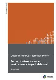
The proposed project was declared significant by the Coordinator-General. What does this mean<br />
for approvals?<br />
The Coordinator-General has declared <strong>Dudgeon</strong> <strong>Point</strong> <strong>Coal</strong> <strong>Terminals</strong> a “significant project for which an<br />
EIS is required” under Section 26 (1) (a) of the State Development Public Works Organisation Act 1971.<br />
This declaration requires the proposal to carry out a comprehensive environmental assessment for<br />
submission to government. The proposed project must still obtain all the necessary environmental or<br />
development approvals required in Queensl<strong>and</strong> <strong>and</strong> it must still comply with all environmental or<br />
planning legislation.<br />
The Coordinator-General determined the environmental studies to be undertaken for its thorough<br />
assessment of the proposed project through preparation of Terms of Reference for the EIS. The public<br />
provided comments on the Terms of Reference before it was finalised in June 2012.<br />
Page | 4
When is the EIS expected to be released?<br />
The EIS is not expected to be released for public comment before the end of 2013.<br />
At the time of designation of the project, the State Development Public Works Organisation Act 1971<br />
sets a requirement that the EIS must be released for public comment within two years of finalisation of<br />
the EIS Terms of Reference. The project is therefore required to release the EIS by June 2014 at the<br />
latest.<br />
Air Quality <strong>and</strong> Dust<br />
How is dust monitored at the existing coal terminals?<br />
There is an extensive noise <strong>and</strong> dust monitoring system around the port <strong>and</strong> in the local communities.<br />
This program has been operating for twenty years <strong>and</strong> is funded by the operators of the two Hay <strong>Point</strong><br />
coal terminals <strong>and</strong> NQBP.<br />
There are 19 dust deposition gauges, as well as four community-based stations that continuously<br />
monitor noise <strong>and</strong> dust. Dust samples from community areas are analysed for coal dust content monthly.<br />
Monthly dust monitoring reports are published on NQBP’s website when received from the independent<br />
consultant analysing the results.<br />
The continuous noise <strong>and</strong> dust monitoring stations are located at Half Tide, Salonika <strong>and</strong> two are at<br />
either end of Louisa Creek.<br />
NQBP <strong>and</strong> its program partners have recently extended its dust monitoring program to include McEwens<br />
Beach. Dust monitoring equipment which measures PM 10 <strong>and</strong> PM 2.5 was installed in McEwens Beach in<br />
March 2013. The PM 2.5 dust monitor will be a mobile unit so it will be able to be moved to different<br />
locations to provide information for other communities as required.<br />
Is there going to be an increase in noise <strong>and</strong> dust as a result of this development?<br />
Because new noise <strong>and</strong> dust sources are being introduced, there is likely to be an increase in dust <strong>and</strong><br />
noise for some residents. However, dust <strong>and</strong> noise modelling is being undertaken to predict any potential<br />
increases. This information will be used to recommend appropriate controls to minimise community<br />
impacts.<br />
How are dust modelling studies carried out?<br />
NQBP engaged Katestone Environmental to undertake modelling of dust impacts. Using existing air<br />
quality as a basis, modelling is used to predict the cumulative impact of the development i.e. the<br />
expected future air quality once the new terminals are fully operational.<br />
Predicting coal dust impacts before the terminal is in operation is based on scientific 3D modelling<br />
assuming maximum capacity of stockpiling <strong>and</strong> coal movements <strong>and</strong> worst case wind conditions. The<br />
model uses data from the long-term dust monitoring program around the port plus emissions data<br />
established from Australian <strong>and</strong> U.S. studies to make accurate predictions.<br />
Dust modelling studies will be published in the EIS for agency <strong>and</strong> public comment. Preliminary results<br />
were presented to local communities at a special Community Reference Group meeting in August 2012.<br />
Page | 5
How will dust be controlled during the construction phase?<br />
The main sources of dust during the construction phase come from clearing, earth moving <strong>and</strong> vehicle<br />
movements on the site. Management of dust during construction will primarily involve management<br />
techniques including the application of water/dust suppressant, or minimising dust-producing activities in<br />
dry <strong>and</strong> windy periods or when in close proximity to affected communities.<br />
Studies are being undertaken for the EIS to identify <strong>and</strong> mitigate noise issues during the construction<br />
phase. These studies will be presented in the EIS.<br />
How will dust be controlled once the proposed <strong>Dudgeon</strong> <strong>Point</strong> <strong>Coal</strong> <strong>Terminals</strong> are operating?<br />
The main sources of potential dust at the proposed terminals will be from the coal stockpiles, coal<br />
unloading facilities at the railway loop <strong>and</strong> coal load-out facilities.<br />
Detailed dust modelling has been undertaken during the EIS development <strong>and</strong> mitigation measures will<br />
be incorporated in the operational procedures in an Environmental Management Plan.<br />
Dust control measures to be employed will include:<br />
moisture monitoring <strong>and</strong> control at the rail receival area;<br />
rail unloading in buildings for dust containment;<br />
computer-controlled water spray systems in the stockyard to keep coal moist, which minimises<br />
dustiness;<br />
use of dust suppressants on stockpiles in high wind conditions;<br />
belt scrapers <strong>and</strong> water wash on conveyor belt returns; <strong>and</strong><br />
equipment designs to reduce dust generation.<br />
The complete list of dust controls will be provided in the EIS.<br />
How will dust from rail wagons be managed?<br />
Aurizon (formerly QR National) has carried out trials on dust suppressants applied to the top of the coal<br />
in wagons. Monitoring has shown the dust suppressant/veneer will stay in place for the rail journey to the<br />
port <strong>and</strong> significantly reduces dust emissions from rail wagons.<br />
There are 19 mines which use the Goonyella rail system to transport coal to the Port of Hay <strong>Point</strong>. Of<br />
these, seven mines have had a coal veneering station installed, three mines have started installing a<br />
station, <strong>and</strong> the remaining nine mines plan to have stations installed by the end of 2013.<br />
All coal mines exporting coal from <strong>Dudgeon</strong> <strong>Point</strong> will be required to apply veneer before transportation<br />
to the Port.<br />
Noise<br />
How will noise be controlled once the proposed <strong>Dudgeon</strong> <strong>Point</strong> <strong>Coal</strong> <strong>Terminals</strong> are operating?<br />
The main sources of operational noise at the proposed terminals will be generated by train movements,<br />
coal receiving stations, conveyors, stacker-reclaimers <strong>and</strong> coal load-out facilities. The terminals will be<br />
located approximately one kilometre from the western end of the closest community at Louisa Creek <strong>and</strong><br />
four kilometres from McEwens Beach.<br />
Page | 6
Noise emissions at the proposed terminals will be managed through the following:<br />
environmental bunds <strong>and</strong> structural noise barriers adjacent to the rail line near any communities;<br />
rail unloading in a noise-insulated building;<br />
use of low noise idlers on conveyors; <strong>and</strong><br />
the use of low noise drives for conveyors <strong>and</strong> yard machines.<br />
A noise <strong>and</strong> vibration assessment is being undertaken as part of the EIS. Noise modelling will be used to<br />
determine where noise mitigation measures are required. These studies will be published in the EIS.<br />
Noise monitoring (in conjunction with dust monitoring described above) is carried out in four community<br />
based locations. A noise monitor will be installed at McEwens Beach in the near future to provide<br />
background data ahead of the proposed construction at <strong>Dudgeon</strong> <strong>Point</strong>.<br />
Will the trains be operating all hours?<br />
Yes, the trains will be operating 24 hours a day, seven days a week. The trains are similar to those<br />
which transport coal to the existing coal terminals, that is, two kilometres in length. Double length trains,<br />
that is, up to four kilometres long, may access the site at a future time, though no plans have been<br />
determined.<br />
How many trains will operate each day?<br />
Train numbers will gradually increase as the terminal capacity at <strong>Dudgeon</strong> <strong>Point</strong> is exp<strong>and</strong>ed.<br />
After both terminals reach their ultimate capacity in 15- 20 years, there would be an average of 40 trains<br />
per day going both to as well as from the <strong>Dudgeon</strong> <strong>Point</strong> <strong>Coal</strong> <strong>Terminals</strong> when eventually exp<strong>and</strong>ed to<br />
their ultimate capacity. Train numbers will be much less in the early years of the proposed project.<br />
What is the anticipated noise level from the proposed <strong>Dudgeon</strong> <strong>Point</strong> <strong>Coal</strong> <strong>Terminals</strong>?<br />
Noise is additive, so the noise level at any location will depend on the existing noise environment e.g.<br />
proximity to roads etc. Noise generated by the project will be estimated <strong>and</strong> noise contours in areas<br />
around the port will be presented in the EIS. This noise modelling will be used to indicate where<br />
additional noise controls may need to be applied.<br />
Will diesel locomotives be used into <strong>Dudgeon</strong> <strong>Point</strong>?<br />
The rail system servicing mines in the Bowen Basin is electrified <strong>and</strong> mines transporting to existing Hay<br />
<strong>Point</strong> coal terminals currently all use electric locomotives, although an occasional diesel locomotive has<br />
been used to ship coal to the port for rail operational needs. The Bowen Basin mines transporting to<br />
<strong>Dudgeon</strong> <strong>Point</strong> are also expected to use electric locomotives.<br />
Trains to the more northern Port of Abbot <strong>Point</strong> are all diesel locomotives because its rail system is not<br />
fully electrified. Mines in the Galilee Basin will largely go to Abbot <strong>Point</strong> however the Carmichael <strong>Coal</strong><br />
Mine in the Galilee Basin is expected to rail some coal to Adani’s proposed terminal at <strong>Dudgeon</strong> <strong>Point</strong>.<br />
This coal will, of necessity, be railed using diesel locomotives. Consequently, a small proportion of the<br />
trains to <strong>Dudgeon</strong> <strong>Point</strong> could use diesel locomotives.<br />
Noise studies indicate that the diesel <strong>and</strong> electric locomotives have similar noise levels, but the noise<br />
from the diesel locomotives is lower in frequency <strong>and</strong> may be more noticeable at a distance. Noise<br />
modelling includes the effect of diesel locomotives <strong>and</strong> the results will be presented in the EIS.<br />
Page | 7
Roads <strong>and</strong> Traffic<br />
How is the increased traffic on Hay <strong>Point</strong> Road going to be managed during construction?<br />
The construction of the <strong>Dudgeon</strong> <strong>Point</strong> <strong>Coal</strong> <strong>Terminals</strong>, offshore wharves, the railway spur <strong>and</strong><br />
supporting infrastructure will be carried out in stages, with construction of the stages likely to occur<br />
intermittently over a 10 to 20-year period. This will generate an increase in road traffic on Hay <strong>Point</strong><br />
Road.<br />
To reduce the volume of construction worker vehicles on the local roads, workers will be largely<br />
transported by bus to <strong>and</strong> from the site from pick-up points in Mackay <strong>and</strong> Sarina.<br />
The BMA HPX3 expansion will be completed before commencement of the <strong>Dudgeon</strong> <strong>Point</strong> <strong>Coal</strong><br />
<strong>Terminals</strong> which will reduce the number of construction vehicles as a baseline. The development has<br />
been designed as a cut <strong>and</strong> fill operation to minimise the volume of material imported or exported by<br />
earth moving trucks from the site. Rock revetment walls will be required for some marine works that will<br />
require transport of rocks early in the development stage only. The EIS will document any of these<br />
requirements.<br />
Further, a large number of large construction components are expected to be shipped to the Port of<br />
Mackay, offloaded <strong>and</strong> barged to the <strong>Dudgeon</strong> <strong>Point</strong> site or Half Tide Tug Harbour to reduce the<br />
transport of oversize loads to the port.<br />
The impact of an increase in traffic will be considered as part of the EIS process.<br />
How is the increased traffic on Hay <strong>Point</strong> Road going to be managed once the proposed <strong>Dudgeon</strong><br />
<strong>Point</strong> <strong>Coal</strong> <strong>Terminals</strong> are operational?<br />
When construction has been completed <strong>and</strong> coal exports started, a workforce of operational <strong>and</strong><br />
maintenance staff (around 640 after all three stages per terminal have been completed) will be employed<br />
or contracted at the terminals. It is anticipated that these workers will live in the local region. They will<br />
enter the <strong>Dudgeon</strong> <strong>Point</strong> site through the new port road that will be next to the rail line into the site.<br />
Will Bally Keel Road be the main access route for <strong>Dudgeon</strong> <strong>Point</strong>?<br />
The main access road to <strong>Dudgeon</strong> <strong>Point</strong> will be through a new road built by NQBP near the Bensons<br />
Road/Hay <strong>Point</strong> Road intersection. NQBP proposes to build a haul road into the <strong>Dudgeon</strong> <strong>Point</strong> site as<br />
part of the first site works, which will greatly minimise the use of Bally Keel Road, except for the very<br />
initial earthworks.<br />
Bally Keel Road will only be available to emergency services as an alternative entry site in the event of<br />
an emergency situation.<br />
Why are the rail lines into <strong>Dudgeon</strong> <strong>Point</strong> going over Hay <strong>Point</strong> Road?<br />
A flat entry for a full train length (two kilometres) into the rail unloading station is required because the<br />
trains need to move slowly <strong>and</strong> controlled through the unloading station. Due to the higher elevations of<br />
the site in the unloading area, this places the rail line at an elevation well above Hay <strong>Point</strong> Road.<br />
The rail lines will be on a rail overpass over Hay <strong>Point</strong> Road to prevent disruptions to Hay <strong>Point</strong> Road.<br />
Eight rail lines are proposed over the road – six into <strong>Dudgeon</strong> <strong>Point</strong> <strong>and</strong> two departure lines. A clearance<br />
of eight metres will be required to allow for the transportation of large equipment to the existing<br />
terminals.<br />
Page | 8
Will the entrance/exit to Timberl<strong>and</strong>s be upgraded with the proposed rail overpass being<br />
constructed?<br />
The entrance to Timberl<strong>and</strong>s is well distanced from the <strong>Dudgeon</strong> <strong>Point</strong> road <strong>and</strong> rail location into the<br />
port. However, consideration is being given to provision of turning lanes into the Timberl<strong>and</strong>s entrance<br />
road from the west <strong>and</strong> the east to enhance safety for Timberl<strong>and</strong>s residents <strong>and</strong> visitors.<br />
How will be the Bruce Highway be affected?<br />
The Bruce Highway between Mackay <strong>and</strong> the Hay <strong>Point</strong> Road intersection is currently being upgraded<br />
<strong>and</strong> it will have sufficient capacity for the expected increase in traffic from the construction activities.<br />
The Department of Transport <strong>and</strong> Main Roads has announced construction of a roundabout at the<br />
intersection of the Bruce Highway <strong>and</strong> Hay <strong>Point</strong> Road which will be completed before commencement<br />
of construction activities. This roundabout will manage the expected increase in traffic at this intersection<br />
during the construction period.<br />
Additional traffic on the highway will be minimised by transporting construction workers from Mackay <strong>and</strong><br />
Sarina by bus.<br />
Shipping<br />
What is the expected increase in shipping numbers?<br />
The Port of Hay <strong>Point</strong> has h<strong>and</strong>led up to 1100 ships in a year. The <strong>Dudgeon</strong> <strong>Point</strong> <strong>Project</strong> will increase<br />
ship numbers through the port, increasing in number as the various stages of development occur on the<br />
site.<br />
Under the expected moderate growth scenario (PGM, 2013) which is the most likely scenario, shipping<br />
in the ship is expected to reach 1530 ships by 2020, 2125 ships by 2025 <strong>and</strong> 2380 ships by 2032. This<br />
represents only an average of 6-7 ships per day leaving the port in twenty years’ time.<br />
What controls will there be over shipping?<br />
Commercial shipping has been occurring in the Great Barrier Reef area for more than 100 years.<br />
Commercial shipping is highly regulated by International, Commonwealth, State <strong>and</strong> local regulations<br />
<strong>and</strong> reef-specific policies.<br />
A Reef VTS (reef vessel traffic service) actively monitors the movement of all ships through the entire<br />
Great Barrier Reef region 24 hours a day, 7 days per week – via m<strong>and</strong>atory reporting protocols<br />
(automatically sent from ships to the Reef VTS centre).<br />
What is the anticipated impact of the expansion of shipping lanes/channels?<br />
Master planning studies have indicated that the existing departure path does not need to be widened.<br />
Deepening of the departure path is not proposed, but may be required at some later date to<br />
accommodate increasing larger ships using the port.<br />
Will the tug harbour continue to be open to the public during the construction phase?<br />
Yes. The tug harbour contains the public boat ramp <strong>and</strong> associated parking facilities <strong>and</strong> these will be<br />
maintained throughout any development work.<br />
Page | 9
Property<br />
Will the government or NQBP buy properties affected by dust <strong>and</strong> noise?<br />
NQBP is continuing to voluntarily purchase properties at Louisa Creek which commenced 15 years ago.<br />
However, NQBP has no plans to extend a house buy-back scheme to any other area around the port.<br />
Are properties going to be resumed by the State Government?<br />
NQBP owns sufficient l<strong>and</strong> (around 1400 hectares) at <strong>Dudgeon</strong> <strong>Point</strong> to carry out the development of the<br />
proposed new terminals at <strong>Dudgeon</strong> <strong>Point</strong> without resumption of properties. In addition, NQBP already<br />
owns a transport corridor approximately 6 kilometres long <strong>and</strong> 70-90 metres wide which runs adjacent to<br />
the Fenechvale Estate area to <strong>Dudgeon</strong> <strong>Point</strong>.<br />
The proposed rail route through Fenechvale will require significant excavation in some of the elevated<br />
hilly areas. To accommodate this, it is anticipated that a limited amount of l<strong>and</strong> along the corridor will<br />
need to be purchased or resumed. The affected l<strong>and</strong>owners will be consulted as part of the EIS<br />
consultation process. No houses will be affected by the l<strong>and</strong> requirements as the cuttings occur in<br />
pastoral areas.<br />
What is the extent of the buffer zones separating the development from communities?<br />
The 2010 Hay <strong>Point</strong> L<strong>and</strong> Use Plan designates significant buffer areas around the <strong>Dudgeon</strong> <strong>Point</strong><br />
development. The Hay <strong>Point</strong> L<strong>and</strong> Use Plan can be accessed at www.nqbp.com.au.<br />
In the Timberl<strong>and</strong>s area, the separation between the closest rail line <strong>and</strong> the closest house is<br />
approximately 300 metres. The development proposes to use vegetated earth mounds between this<br />
traffic corridor <strong>and</strong> Timberl<strong>and</strong>s to minimise noise <strong>and</strong> minimise amenity impacts for residents such that<br />
the trains are not visible to residents.<br />
Is NQBP going to buy more properties to buffer port activities?<br />
NQBP does not have any current plans to purchase additional properties as a buffer to port activities<br />
because of the extensive buffer areas designated around the <strong>Dudgeon</strong> <strong>Point</strong> development in the L<strong>and</strong><br />
Use Plan. NQBP, however, will continue its voluntary buy-back scheme at Louisa Creek which has been<br />
in place for fifteen years.<br />
Accommodation Village<br />
Why is a construction workforce accommodation village required?<br />
For expansions undertaken of the existing coal terminals in the port, most of the construction workforce<br />
was sourced locally <strong>and</strong> already lived in the Mackay/Sarina region. The current HPX3 expansion of<br />
HPCT has been managed with a very low number of FIFO construction workers. A similar situation is<br />
expected to occur for construction of the <strong>Dudgeon</strong> <strong>Point</strong> <strong>Coal</strong> <strong>Terminals</strong>. If only one terminal is<br />
constructed at once, it is similarly expected that few FIFO construction workers will be required <strong>and</strong><br />
accommodation impacts will be low. Accommodation villages approved or planned in Mackay <strong>and</strong> Sarina<br />
would likely be sufficient for this small number of FIFO workers.<br />
Page | 10
However, construction of two terminals could occur at the same time during some stage of the site<br />
development. In this instance, some workers may need to be brought in from other Queensl<strong>and</strong> areas<br />
where unemployment is higher (such as Cairns, Brisbane, Gold Coast etc.), to supplement the local<br />
workforce. If an accommodation village was not provided, this would place regional housing under<br />
significant pressure, forcing an increase in house prices <strong>and</strong> rentals, which affect the most vulnerable in<br />
the community. A temporary workers’ accommodation village is therefore required to accommodate<br />
workers flying or driving in from other regions.<br />
If an Accommodation village is required, where will it be sited?<br />
A village is proposed in the Louisa Creek area if two terminals are under construction at the same time. It<br />
is set on a 100 acre lot of NQBP l<strong>and</strong> <strong>and</strong> it maintains wide buffers from any neighbouring residents. The<br />
village will be designed to minimise visual impacts by being set behind an existing line of vegetation line<br />
<strong>and</strong> by having a high st<strong>and</strong>ard of finish to the site, including l<strong>and</strong>scaping. It is proposed to set up a<br />
management committee for the village to include police, council <strong>and</strong> local residents to provide feedback<br />
to the village operators to minimise impacts on the local community.<br />
How will a village impact on nearby residents?<br />
Construction villages will cater to both male <strong>and</strong> female construction workers. Villages will provide<br />
recreational facilities for its village residents such as gyms, swimming pools etc. <strong>and</strong> provide full mess<br />
facilities. Construction workers are in dem<strong>and</strong> <strong>and</strong> they expect a high st<strong>and</strong>ard of facilities. Villages also<br />
set a high st<strong>and</strong>ard of behaviour for its village residents <strong>and</strong> usually have a “one strike <strong>and</strong> you’re out<br />
policy”. Eviction from the village would normally result in loss of employment, so village residents are<br />
well behaved.<br />
Fishing, Recreation <strong>and</strong> Community<br />
Will there be extra wide jetty spans on the new jetties? Will this allow access to <strong>and</strong> from Louisa<br />
Creek?<br />
The new jetty structures for <strong>Dudgeon</strong> <strong>Point</strong> are expected to be similar in size to the current jetty at<br />
DBCT. It is proposed to provide a single designated passageway under each of the new jetty structures<br />
that lead to the offshore wharves at <strong>Dudgeon</strong> <strong>Point</strong>. The designated passageway would have lighting<br />
<strong>and</strong> safeguards installed to prevent objects falling from above. The passageway would be 22 metres<br />
wide <strong>and</strong> have a clearance of 10-16 metres between high <strong>and</strong> low tide, which will be adequate to allow<br />
passage of recreational fishing craft.<br />
These new arrangements, however, cannot be applied to the existing jetties in the port because they<br />
have not been designed for vessels to pass under them without some risk to the boaties.<br />
Will it still be possible to fish in the <strong>Dudgeon</strong> <strong>Point</strong> area <strong>and</strong> around Porters Creek <strong>and</strong><br />
S<strong>and</strong>ringham Bay?<br />
Access to S<strong>and</strong>ringham Bay, Porters Creek <strong>and</strong> the <strong>Dudgeon</strong> <strong>Point</strong> headl<strong>and</strong> will not be affected by the<br />
proposed development of coal terminals at <strong>Dudgeon</strong> <strong>Point</strong>. There is no offshore infrastructure located in<br />
these areas.<br />
The proposed development of the <strong>Dudgeon</strong> <strong>Point</strong> <strong>Coal</strong> <strong>Terminals</strong> would only limit access to areas<br />
around the proposed terminals, marine offloading facilities <strong>and</strong> offshore infrastructure.<br />
Page | 11
What effect will the jetty have on tidal movement in S<strong>and</strong>ringham Bay?<br />
Water moves smoothly around the pilings of jetties <strong>and</strong> does not impede water flow or change sediment<br />
movement.<br />
Will the development cause more erosion of the beach at McEwens Beach <strong>and</strong> is this erosion<br />
related to dredging activities at the Port of Hay <strong>Point</strong>?<br />
Erosion of McEwens Beach is a naturally occurring event <strong>and</strong> is similar to coastal erosion occurring<br />
along the whole Queensl<strong>and</strong> coast. Government regulations now prohibit new development within<br />
several hundred metres of Queensl<strong>and</strong> coastlines because of this natural phenomenon. S<strong>and</strong> movement<br />
in the McEwens Beach area <strong>and</strong> other local beachfront areas has taken place for decades.<br />
Dredging of the departure path at Hay <strong>Point</strong> is a recent occurrence, commencing in 2006 <strong>and</strong> is not<br />
related to any issues at McEwens Beach. The departure path is located well offshore <strong>and</strong> the offshore<br />
currents move north following the coast, well distanced from McEwens Beach.<br />
Will the proposed stockpiles at <strong>Dudgeon</strong> <strong>Point</strong> be visible from McEwens Beach?<br />
<strong>Dudgeon</strong> <strong>Point</strong> is around 4 km from McEwens Beach <strong>and</strong> is visible in the distance. The stockpiles will be<br />
partially visible from McEwens Beach, with the degree of visibility depending on the atmospheric<br />
conditions. Trees will be planted to visually screen the stockyard from residents’ view to reduce any<br />
amenity impact. Drawings of the expected views from community viewpoints were provided to Port of<br />
Hay <strong>Point</strong> Community Reference Group members at the May 2013 meeting.<br />
For further project information:<br />
Email: info@nqbp.com.au<br />
Phone: Justine Thorp on (07) 4969 0730<br />
Page | 12