terraet aqua editorial - Dredging Engineering Research Laboratory
terraet aqua editorial - Dredging Engineering Research Laboratory
terraet aqua editorial - Dredging Engineering Research Laboratory

Create successful ePaper yourself
Turn your PDF publications into a flip-book with our unique Google optimized e-Paper software.
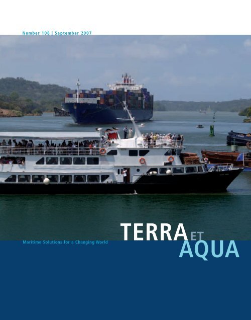
Number 108 | September 2007<br />
Maritime Solutions for a Changing World<br />
TERRAET<br />
AQUA
MEMBERSHIP LIST IADC 2007<br />
Through their regional branches or through representatives, members of IADC operate directly at all locations worldwide<br />
AFRICA<br />
<strong>Dredging</strong> and Reclamation Jan De Nul Ltd., Lagos, Nigeria<br />
<strong>Dredging</strong> International Services Nigeria Ltd., Ikoyi Lagos, Nigeria<br />
Nigerian Westminster <strong>Dredging</strong> and Marine Ltd., Lagos, Nigeria<br />
Van Oord Nigeria Ltd., Ikeja-Lagos, Nigeria<br />
<strong>Dredging</strong> International - Tunisia Branch, Tunis, Tunisia<br />
Boskalis South Africa, Pretoria, South Africa<br />
ASIA<br />
Far East <strong>Dredging</strong> (Taiwan) Ltd., Taipei, Taiwan ROC<br />
Far East <strong>Dredging</strong> Ltd. Hong Kong, P.R. China<br />
Van Oord ACZ Marine Contractors b.v. Hong Kong Branch, Hong Kong, P.R. China<br />
Van Oord ACZ Marine Contractors b.v. Shanghai Branch, Shanghai, P.R. China<br />
P.T. Boskalis International Indonesia, Jakarta, Indonesia<br />
P.T. Penkonindo LLC, Jakarta, Indonesia<br />
Van Oord India Pte. Ltd., Mumbai, India<br />
Boskalis <strong>Dredging</strong> India Pvt Ltd., Mumbai, India<br />
Van Oord ACZ India Pte. Ltd., Mumbai, India<br />
Jan De Nul <strong>Dredging</strong> India Pvt. Ltd., India<br />
Penta-Ocean Construction Co. Ltd., Tokyo, Japan<br />
Toa Corporation, Tokyo, Japan<br />
Hyundai <strong>Engineering</strong> & Construction Co. Ltd., Seoul, Korea<br />
Van Oord <strong>Dredging</strong> and Marine Contractors b.v. Korea Branch, Busan, Republic of Korea<br />
Ballast Ham <strong>Dredging</strong> (Malaysia) Sdn. Bhd., Johor Darul Takzim, Malaysia<br />
Tideway DI Sdn. Bhd., Kuala Lumpur, Malaysia<br />
Van Oord (Malaysia) Sdn. Bhd., Selangor, Malaysia<br />
Van Oord <strong>Dredging</strong> and Marine Contractors b.v. Philippines Branch, Manilla, Philippines<br />
Boskalis International Pte. Ltd., Singapore<br />
<strong>Dredging</strong> International Asia Pacific (Pte) Ltd., Singapore<br />
Jan De Nul Singapore Pte. Ltd., Singapore<br />
Van Oord <strong>Dredging</strong> and Marine Contractors b.v. Singapore Branch, Singapore<br />
AUSTRALIA<br />
Boskalis Australia Pty. Ltd., Sydney, Australia<br />
Dredeco Pty. Ltd., Brisbane, QLD, Australia<br />
Van Oord Australia Pty. Ltd., Brisbane, QLD, Australia<br />
WA Shell Sands Pty. Ltd., Perth, Australia<br />
NZ <strong>Dredging</strong> & General Works Ltd., Maunganui, New Zealand<br />
EUROPE<br />
DEME Building Materials N.V. (DBM), Zwijndrecht, Belgium<br />
<strong>Dredging</strong> International N.V., Zwijndrecht, Belgium<br />
International Seaport Private Ltd., Zwijndrecht, Belgium<br />
Jan De Nul n.v., Hofstede/Aalst, Belgium<br />
N.V. Baggerwerken Decloedt & Zoon, Oostende, Belgium<br />
Boskalis Westminster <strong>Dredging</strong> & Contracting Ltd., Cyprus<br />
Van Oord Middle East Ltd., Nicosia, Cyprus<br />
Brewaba Wasserbaugesellschaft Bremen m.b.H., Bremen, Germany<br />
Heinrich Hirdes G.m.b.H., Hamburg, Germany<br />
Nordsee Nassbagger - und Tiefbau G.m.b.H., Wilhelmshaven, Germany<br />
Terramare Eesti OU, Tallinn, Estonia<br />
DRACE, Madrid, Spain<br />
Dravo SA, Madrid, Spain<br />
Sociedade Española de Dragados S.A., Madrid, Spain<br />
Terramare Oy, Helsinki, Finland<br />
Atlantique Dragage S.A., Nanterre, France<br />
Atlantique Dragage Sarl, Paris, France<br />
Société de Dragage International ‘SDI’ S.A., Lambersart, France<br />
Sodranord SARL, Le Blanc - Mesnil Cédex, France<br />
<strong>Dredging</strong> International (UK) Ltd., Weybridge, UK<br />
Jan De Nul (UK) Ltd., Ascot, UK<br />
Rock Fall Company Ltd., Aberdeen, UK<br />
Van Oord UK Ltd., Newbury, UK<br />
Westminster <strong>Dredging</strong> Co. Ltd., Fareham, UK<br />
Irish <strong>Dredging</strong> Company, Cork, Ireland<br />
Van Oord Ireland Ltd., Dublin, Ireland<br />
Boskalis Italia, Rome, Italy<br />
Dravo SA, Italia, Amelia (TR), Italy<br />
Societa Italiana Dragaggi SpA ‘SIDRA’, Rome, Italy<br />
European <strong>Dredging</strong> Company s.a., Steinfort, Luxembourg<br />
TOA (LUX) S.A., Luxembourg, Luxembourg<br />
<strong>Dredging</strong> and Maritime Management s.a., Steinfort, Luxembourg<br />
Baltic Marine Contractors SIA, Riga, Latvia<br />
Aannemingsbedrijf L. Paans & Zonen, Gorinchem, Netherlands<br />
Baggermaatschappij Boskalis B.V., Papendrecht, Netherlands<br />
Ballast Nedam Baggeren b.v., Rotterdam, Netherlands<br />
Boskalis B.V., Rotterdam, Netherlands<br />
Boskalis International B.V., Papendrecht, Netherlands<br />
Boskalis Offshore b.v., Papendrecht, Netherlands<br />
<strong>Dredging</strong> and Contracting Rotterdam b.v., Bergen op Zoom, Netherlands<br />
Ham <strong>Dredging</strong> Contractors b.v., Rotterdam, Netherlands<br />
Mijnster zand- en grinthandel b.v., Gorinchem, Netherlands<br />
Tideway B.V., Breda, Netherlands<br />
Van Oord ACZ Marine Contractors b.v., Rotterdam, Netherlands<br />
Van Oord Nederland b.v., Gorinchem, Netherlands<br />
Van Oord n.v., Rotterdam, Netherlands<br />
Van Oord Offshore b.v., Gorinchem, Netherlands<br />
Van Oord Overseas b.v., Gorinchem, Netherlands<br />
Water Injection <strong>Dredging</strong> b.v., Rotterdam, Netherlands<br />
Dragapor Dragagens de Portugal S.A., Alcochete, Portugal<br />
Dravo S.A., Lisbon, Portugal<br />
Baggerwerken Decloedt en Zoon N.V., St Petersburg, Russia<br />
Ballast Ham <strong>Dredging</strong>, St. Petersburg, Russia<br />
Boskalis Sweden AB, Gothenburg, Sweden<br />
MIDDLE EAST<br />
Boskalis Westminster M.E. Ltd., Abu Dhabi, U.A.E.<br />
Gulf Cobla (Limited Liability Company), Dubai, U.A.E.<br />
Jan De Nul <strong>Dredging</strong> Ltd. (Dubai Branch), Dubai, U.A.E.<br />
Van Oord Gulf FZE, Dubai, U.A.E.<br />
Boskalis Westminster Middle East Ltd., Manama, Bahrain<br />
Boskalis Westminster (Oman) LLC, Muscat, Oman<br />
Boskalis Westminster Middle East, Doha, Qatar<br />
Boskalis Westminster Al Rushaid Co. Ltd., Al Khobar, Saudi Arabia<br />
HAM Saudi Arabia Company Ltd., Damman, Saudi Arabia<br />
THE AMERICAS<br />
Van Oord Curaçao n.v., Willemstad, Curaçao<br />
Compañía Sud Americana de Dragados S.A., Buenos Aires, Argentina<br />
Van Oord ACZ Marine Contractors b.v. Argentina Branch, Buenos Aires, Argentina<br />
Ballast Ham <strong>Dredging</strong> do Brazil Ltda., Rio de Janeiro, Brazil<br />
Dragamex S.A. de C.V., Coatzacoalcos, Mexico<br />
<strong>Dredging</strong> International Mexico S.A. de C.V., Veracruz, Mexico<br />
Mexicana de Dragados S.A. de C.V., Mexico City, Mexico<br />
Coastal and Inland Marine Services Inc., Bethania, Panama<br />
Stuyvesant <strong>Dredging</strong> Company, Louisiana, U.S.A.<br />
Boskalis International Uruguay S.A., Montevideo, Uruguay<br />
Dravensa C.A., Caracas, Venezuela<br />
<strong>Dredging</strong> International N.V. - Sucursal Venezuela, Caracas, Venezuela<br />
Terra et Aqua is published quarterly by the IADC, The International Association of<br />
<strong>Dredging</strong> Companies. The journal is available on request to individuals or organisations<br />
with a professional interest in dredging and maritime infrastructure projects including<br />
the development of ports and waterways, coastal protection, land reclamation,<br />
offshore works, environmental remediation and habitat restoration. The name Terra et<br />
Aqua is a registered trademark.<br />
© 2007 IADC, The Netherlands<br />
All rights reserved. Electronic storage, reprinting or abstracting of the contents is<br />
allowed for non-commercial purposes with permission of the publisher.<br />
ISSN 0376-6411<br />
Typesetting and printing by Opmeer Drukkerij bv, The Hague, The Netherlands.
Contents 1<br />
CONTENTS<br />
EDITORIAL 2<br />
ENVIRONMENTAL MONITORING AND MANAGEMENT OF 3<br />
RECLAMATIONS WORKS CLOSE TO SENSITIVE HABITATS<br />
STÉPHANIE M. DOORN-GROEN<br />
Feedback monitoring provides quantifiable compliance targets thus<br />
allowing reclamation activities to proceed in close proximity to<br />
Singapore’s most import marine habitats.<br />
PLANNING FOR THE FUTURE – GROUND IMPROVEMENT TRIALS 19<br />
AT THE PORT OF BRISBANE<br />
PETER BOYLE, JAY AMERATUNGA, CYNTHIA DE BOK AND BILL TRANBERG<br />
Historically the consolidation of reclaimed land takes about 10 years, but<br />
with the urgent need for land expansion, new ground improvement techniques<br />
are being tested to shorten the timeframe for preparing the land for use.<br />
PANAMA CANAL ATLANTIC ENTRANCE EXPANSION PROJECT 27<br />
JAN NECKEBROECK<br />
The challenge of widening and deepening the Canal without obstructing<br />
the heavy vessel traffic in transit was met by using state-of-the-art, large<br />
capacity, self-propelled dredging equipment.<br />
BOOKS/PERIODICALS REVIEWED 32<br />
Useless Arithmetic by Pilkey and Pilkey-Jarvis challenges conventional<br />
wisdom about the accuracy of predicative modeling.<br />
SEMINARS/CONFERENCES/EVENTS 33<br />
Autumn conferences in Bulgaria, Antwerp, London and<br />
Rotterdam are scheduled as well as a Call for Papers for CEDA<br />
<strong>Dredging</strong> Days 2008 in Belgium.
2 Terra et Aqua | Number 108 | September 2007<br />
EDITORIAL<br />
TERRAET<br />
AQUA<br />
According to the Merriam-Webster Online dictionary, innovation means driven by “the introduction<br />
of something new; a new idea, method or device”. Innovation is the major source for new products<br />
and new technologies. In other words, the major source for progress.<br />
We view the activities of the dredging industry as drivers of progress; but constructing new land,<br />
building coastal defence systems and maintaining and expanding our ports are not without impacts.<br />
To achieve lasting progress in maritime construction requires innovations that balance the economy<br />
and the ecology.<br />
For the international dredging and maritime construction industry, innovation is an ever-present and<br />
continuous process. It is the driver that keeps the industry at the top of its game. Innovation means<br />
constantly striving to be better, to find more cost-effective dredging methods, more efficient ships<br />
and technologies, improved means of site investigations, and advanced environmental impact<br />
assessments. In recent decades, numerous innovations in the modern dredging industry have made<br />
it possible to reshape many regions and coastal areas.<br />
In this issue of Terra three large infrastructure projects in very different areas of the world are<br />
represented: Singapore; Brisbane, Australia; and the Panama Canal. Each of these projects is<br />
characterised by the significance of seeking, and finding, new ways to serve economic and<br />
environmental interests alike.<br />
In Singapore’s sensitive coral reef habitats, traditional methods for environmental management were<br />
not sufficient. This IADC Award-winning paper from WODCON XVIII explains the intricacies of an<br />
environmental monitoring and management system that helps dredgers comply with the strictest<br />
environmental standards and ensure the preservation of the priceless coral reefs.<br />
In Australia, the need for new land is outpacing the ability to create it. The Port of Brisbane Corporation,<br />
therefore, has started trials to find innovative ways to hasten the preparation of land reclamations so<br />
that the land can be utilised more quickly. The aim is to cut the time needed for the new land to<br />
consolidate from 10 years to 5 years.<br />
And in this post-Panamax age, widening and deepening the Panama Canal – one of the essential<br />
arteries for world trade – has become a priority. Thanks to the unique capabilities of the modern<br />
international fleet of large, sophisticated dredging vessels, some of this work has already been<br />
successfully completed at an accelerated rate and without disturbance or interruption of vessels<br />
transiting the Canal.<br />
None of these projects would have been possible without the commitment of the dredging industry<br />
and its suppliers to research and development. The quest for innovation energizes the industry’s<br />
engineers, scientists and project managers to meet the daily challenges that come with maritime<br />
construction. It also inspires them to look to the future and to seek long-term solutions for potential<br />
challenges. At the same time, these creative, innovative technologies provide clients and the public<br />
at large with the economic progress and the ecological sustainability they desire and deserve.<br />
Robert van Gelder<br />
President, IADC Board of Directors
Environmental Monitoring and Management of Reclamations Works Close to Sensitive Habitats 3<br />
STÉPHANIE M. DOORN-GROEN<br />
ENVIRONMENTAL MONITORING AND<br />
MANAGEMENT OF RECLAMATIONS WORKS<br />
CLOSE TO SENSITIVE HABITATS<br />
ABSTRACT<br />
Traditional methods for environmental<br />
management of marine reclamation works<br />
close to sensitive habitats have generally<br />
not provided the level of control necessary<br />
to ensure preservation of these habitats.<br />
Obtaining the level of control necessary to<br />
assure authorities and non-governmental<br />
organisations (NGOs) of compliance with<br />
environmental quality objectives, requires<br />
quantifiable compliance targets covering<br />
multiple temporal and spatial scales.<br />
Of equal importance to allow feedback of<br />
monitoring results into compliance targets<br />
and work methods are effective and rapid<br />
response mechanisms. This article describes<br />
the successful implementation of<br />
comprehensive Environmental Monitoring<br />
and Management Plans (EMMP), based<br />
upon such feedback principles, which allow<br />
reclamation activities to proceed in close<br />
proximity to Singapore’s most important<br />
marine habitats under third party scrutiny.<br />
Specific focus is placed on describing the<br />
methods utilised to quantify compliance<br />
with daily spill budget targets and how<br />
such targets and compliances are assessed.<br />
To improve reliability, the spill budgets take<br />
into account specific habitat tolerance limits<br />
for varying magnitudes and durations of<br />
sediment loading. Refinements to sediment<br />
plume models were undertaken to enhance<br />
their ability to hindcast impacts from the<br />
contractors’ complex reclamation schedules.<br />
Methods for segregation of impacts and<br />
assessment of cumulative impacts were also<br />
integrated into the hindcast procedures.<br />
Finally, the article describes the updating<br />
of tolerance limits and confirmation of spill<br />
budgets via targeted habitat monitoring.<br />
To date, the EMMPs have been able to<br />
document compliance of the works to all<br />
pre-project environmental quality objectives<br />
at a level of reliability that cannot be refuted<br />
by third parties. This has minimised the<br />
developers’ and contractors’ exposure to<br />
public complaints and liabilities associated<br />
with environmental impacts. The EMMPs<br />
have thus allowed the reclamation activities<br />
to proceed in an efficient manner, whilst<br />
ensuring protection of the environment.<br />
The author wishes to acknowledge the<br />
important contributions of Thomas M. Foster,<br />
Above, For coral reef areas subject to direct impact,<br />
coral relocation is undertaken prior to the start of<br />
reclamations works.<br />
Regional Director Southeast Asia, DHI Water<br />
& Environment (S) Pte Ltd to this research.<br />
This paper was first presented at WODCON<br />
XVIII in June 2007 and was published in the<br />
conference Proceedings. It is reprinted here<br />
in a slightly revised version with permission.<br />
INTRODUCTION<br />
The tropical waters in Singapore provide<br />
excellent conditions for marine life, owing<br />
to relatively constant tropical water<br />
temperatures and frequent fresh ocean<br />
through flow from both the South China<br />
Sea and Melaka Straits. Coral, seagrass and<br />
mangrove habitats have been found to be<br />
relatively rich in Singapore. The diversity of<br />
the coral habitats in Singapore is confirmed<br />
by the fact that of the 106 coral genera<br />
existing world wide (Veron et al. 2000),<br />
55 genera are documented in Singapore<br />
waters alone (Tun et al. 2004), compared<br />
to 13 genera found in the Caribbean.<br />
For seagrass habitats, 12 species out of 57<br />
known species are found in Singapore<br />
(Waycott et al. 2004), whereas 24 out of<br />
54 true and minor mangrove species have<br />
been found in Singapore so far (Thomlinson<br />
1999). These numbers document the high<br />
diversity of marine habitats in a relatively
4 Terra et Aqua | Number 108 | September 2007<br />
small environment as Singapore and<br />
emphasize the importance of marine<br />
habitat conservation in Singapore.<br />
Owing to the confined nature of Singapore<br />
waters and the presence of a large number<br />
of patch reefs, reclamation and associated<br />
dredging activities (in the following referred<br />
to generically as reclamation activities),<br />
often take place in very close proximity to<br />
coral reefs and seagrass areas. In addition,<br />
increasing industrial development results<br />
in developments also occurring close to<br />
sensitive industrial water intakes.<br />
Recognizing the value of these marine<br />
habitat and industrial resources, Singapore<br />
has established strict Environmental Quality<br />
Objectives (EQO) for marine construction<br />
activities. In order to document compliance<br />
with these EQOs, pro-active Environmental<br />
Monitoring and Management Plans (EMMP)<br />
based upon feedback monitoring principles<br />
are required for marine construction activities<br />
to proceed, when these are in close<br />
proximity to key environmental receptors.<br />
Introduced in Europe in the 1990s and<br />
refined during the EMMP works for the<br />
Øresund Link between Denmark and<br />
Sweden (Møller 2000) and Bali Turtle Island,<br />
Indonesia (Driscoll et al. 1997), feedback<br />
EMMP provides the level of responsiveness<br />
and documentation necessary to assure<br />
both authorities and other interest groups<br />
that the works meet the EQOs throughout<br />
the construction period.<br />
Based upon the strict nature of the EQOs,<br />
EMMPs in Singapore are required to<br />
establish compliance of the works across<br />
multiple temporal and spatial scales:<br />
• Compliance assessment against daily<br />
spill budget targets at the work area;<br />
• Real-time monitoring and compliance<br />
assessment against response limits,<br />
particularly for intakes and reefs in<br />
close proximity to the work area;<br />
• Compliance assessment against results<br />
of daily hindcast modelling compared<br />
to habitat tolerance limits throughout<br />
the potential impact area.<br />
The feedback mechanism allows for<br />
updating of the spill budget limits, response<br />
limits and tolerance limits, based on the<br />
results of sedimentation monitoring and<br />
habitat monitoring. To ensure the accuracy<br />
of the entire system, the performance is<br />
confirmed on a daily basis via control<br />
monitoring of sediment spill.<br />
This article presents how the various<br />
components of the EMMP are established and<br />
executed, together with the refinements<br />
necessary to ensure a level of responsiveness<br />
appropriate to the importance of the<br />
receptors.<br />
BASIC COMPONENTS OF THE EMMP<br />
The EMMP is the primary method of control<br />
to ensure EQOs relating to marine habitats<br />
and other environmental receptors are met.<br />
The EMMP is further a tool to:<br />
• detect any unexpected impacts at an<br />
early stage,<br />
• establish the response necessary to<br />
address such impacts, and<br />
• confirm that appropriate tolerance<br />
limits have been adopted.<br />
The feedback approach of the EMMP is<br />
pro-active. It links the results of detailed<br />
numerical hindcast models of the sediment<br />
plumes resulting from reclamation activities<br />
with the results from online turbidity and<br />
current sensors, daily spill measurements<br />
and periodic habitat surveys, and compares<br />
these against the spill budget.<br />
The spill budget is the maximum allowable<br />
spill (daily, weekly and fortnightly limits<br />
are set), which will still ensure (based on<br />
the results of sediment plume forecast<br />
modelling) that the EQOs are met.<br />
As environmental receptors, like corals,<br />
have a different tolerance against<br />
suspended sediment levels than for example<br />
mangroves, individual tolerance limits are<br />
defined for each environmental receptor.<br />
The tolerance limits play an important role<br />
throughout the project, as the daily spill<br />
budget is based on these individual limits.<br />
Both tolerance limits and spill budgets are<br />
evaluated and updated during the project,<br />
based on results of the habitat monitoring<br />
campaigns.<br />
The main components of Feedback EMMPs,<br />
as implemented in Singapore are:<br />
i) Environmental Baseline<br />
Feedback variables are identified,<br />
instrumented and monitored for a<br />
statistically significant period prior<br />
to construction, which is typically<br />
in the order of 3 to 6 months.<br />
Variables monitored include all<br />
key environmental receptors such<br />
as corals reefs, seagrass beds,<br />
mangroves, turbidity, water quality,<br />
currents and sedimentation.<br />
This phase also includes the<br />
confirmation of the environmental<br />
quality objectives for the project<br />
and environmental tolerance limits.<br />
If compensatory works are required,<br />
such as coral relocation from direct<br />
impact areas, this is also undertaken<br />
at this stage of the EMMP.<br />
ii)<br />
Elaboration of work plans<br />
The appointed reclamation contractor<br />
elaborates a work plan, specifying the<br />
distribution of the work in time and<br />
space, procedures and equipment.<br />
iii) Assessment of work plans<br />
The effect of performing the work plan<br />
on the environment is assessed through<br />
the use of numerical sediment plume<br />
forecast modelling.<br />
vi) Revision of work plans<br />
If the forecasted impact resulting from<br />
implementation of the work plan leads<br />
to unacceptable effects, i.e. violation<br />
of EQOs, the work plan is revised and<br />
reassessed. Once the work plan is<br />
finalised a final EMMP specification<br />
document is drawn up that specifies<br />
the detailed execution, response and<br />
management process for the EMMP.<br />
In particular, the final EMMP specification<br />
includes a spill budget (for each phase<br />
of the reclamation), which is the limiting<br />
amount of spill that will still result in the<br />
EQOs being met and against which the<br />
day-to-day control of the reclamation<br />
work can be assessed.<br />
v) Construction phase<br />
Reclamation commences.
Environmental Monitoring and Management of Reclamations Works Close to Sensitive Habitats 5<br />
Stéphanie M. Doorn-Groen receiving an IADC<br />
Award for young authors from Constantijn<br />
Dolmans, Secretary General of IADC.<br />
IADC AWARD 2007<br />
PRESENTED AT WODCON XVIII,<br />
ORLANDO, FLORIDA, USA<br />
MAY 27-JUNE 1, 2007<br />
An IADC Best Paper Award was presented to<br />
Stéphanie M. Doorn-Groen, Manager <strong>Engineering</strong><br />
Services at DHI Singapore, who has been based<br />
in Southeast Asia since May 2002 and joined DHI<br />
Singapore in January 2004. She graduated in<br />
2000 with a BSc (Civil <strong>Engineering</strong>) from the<br />
Polytechnic The Hague, the Netherlands and in<br />
2002 with a MSc (Civil <strong>Engineering</strong> Management<br />
& Geotechnology) from South Bank University<br />
London, UK. Her previous experience was as a<br />
geotechnical adviser for Fugro Onshore<br />
Geotechnical bv, as a superintendent and<br />
technical employee for the dredging company<br />
Van Oord bv and for Municipal Works, Ports,<br />
Design & Construct, Rotterdam, the Netherlands.<br />
Each year at selected conferences, the<br />
International Association of <strong>Dredging</strong> Companies<br />
grants awards for the best papers written by<br />
younger authors. In each case the Conference<br />
Paper Committee is asked to recommend a<br />
prizewinner whose paper makes a significant<br />
contribution to the literature on dredging and<br />
related fields. The purpose of the IADC Award is<br />
“to stimulate the promotion of new ideas and<br />
encourage younger men and women in the<br />
dredging industry”. The winner of an IADC Award<br />
receives Euros 1000 and a certificate of<br />
recognition and the paper may then be published<br />
in Terra et Aqua.<br />
vi) Compliance monitoring<br />
Monitoring of daily compliance variables<br />
against the pre-determined sediment<br />
spill limits (spill budget). If daily<br />
compliance limits are violated, mitigation<br />
actions are established and implemented.<br />
If no violations of limits occur, reclamation<br />
work and daily monitoring continue.<br />
Compliance monitoring is reported on<br />
a daily basis and to ensure the level of<br />
responsiveness, reporting is required a<br />
maximum of 45 hours in arrears of any<br />
reclamation activity.<br />
vii) Control monitoring<br />
Monitoring of real time measurements<br />
and comparison to response limits,<br />
such as online turbidity data or weekly<br />
sedimentation data. If no violations of<br />
limits occur, work and control monitoring<br />
continue. Control monitoring is reported<br />
to the time scale of the monitoring<br />
activity (daily or weekly).<br />
viii) Spill hindcast<br />
Spill hindcast documents the impact<br />
of the reclamation progress on the<br />
environment remote to the work site.<br />
The spill hindcast is based upon realized<br />
production schedules, composition of<br />
fill material and actual tide conditions.<br />
The assessment is made through the<br />
use of numerical sediment plume<br />
hindcast modelling, with the hindcast<br />
updated every day. Reporting of the<br />
hindcast is made a maximum of three<br />
days in arrears of the actual progress of<br />
the reclamation works so that remote<br />
impacts are captured prior to them<br />
becoming significant.<br />
ix) Habitat monitoring<br />
Monitoring of biological habitat<br />
feedback variables is performed to an<br />
appropriate time schedule for the<br />
anticipated response rates. This is typically<br />
once every three months for coral reefs,<br />
seagrass beds and mangrove areas.<br />
x) Evaluation of construction phase<br />
Based on the results of the biological<br />
monitoring of feedback variables and<br />
the results of the numerical spill<br />
hindcast modelling of the realized<br />
construction process, the temporal and<br />
spatial impacts of the construction<br />
phase are assessed. If EQOs are violated,<br />
mitigation actions are established,<br />
assessed and undertaken. On the basis<br />
of the realized impacts, environmental<br />
criteria (tolerance limits) and compliance<br />
criteria (spill budgets) for the next<br />
construction phase are updated (the<br />
feedback loop).<br />
xi) Next construction phase<br />
The construction and monitoring process<br />
returns to task v) for each major stage<br />
of the reclamation and the process is<br />
repeated until reclamation is complete.<br />
xii) Completion of construction<br />
An environmental audit is produced at<br />
the end of the construction period as<br />
formal documentation of the impacts<br />
realised during the construction phase.<br />
This is based upon the result of the<br />
compliance, control, habitat and support<br />
monitoring together with the results of<br />
the hindcast modelling of impacts. The<br />
environmental audit is based on a final<br />
habitat survey usually carried out three<br />
months after the end of construction.<br />
The main advantages of this approach to<br />
EMMPs are:<br />
• Compliance measurements are targeted<br />
in the sediment plume resulting from<br />
dredging and reclamation activities,<br />
as close as possible to the source of<br />
spill at the given time of measurement.<br />
This provides a much more accurate<br />
measurement of suspended sediment<br />
spill than can be achieved via fixed<br />
turbidity sensor stations, which often<br />
lie outside the sediment plume for<br />
individual dredging or reclamation<br />
operations.<br />
• Numerical sediment plume forecast<br />
models allow assessment of changes<br />
to the spill budget for variations in<br />
complex reclamation schedules and<br />
varying tide and ocean current<br />
conditions, thereby ensuring the spill<br />
budget is the most appropriate for the<br />
given stage of the works given the<br />
specific equipment to be utilized and<br />
timing of the activity.<br />
• The hindcast model documents the<br />
spatial distribution of impacts at all
6 Terra et Aqua | Number 108 | September 2007<br />
the receptor sites in the vicinity of the<br />
reclamation site with far broader spatial<br />
scale and finer temporal resolution than<br />
can be achieved via habitat monitoring<br />
in isolation.<br />
• The hindcast model keeps a running<br />
balance of the cumulative sedimentation<br />
impact levels based on actual production<br />
provided by the reclamation contractor.<br />
Increasing levels of sedimentation can be<br />
detected at an early stage and mitigating<br />
measures can be applied, if necessary.<br />
• The combined use of daily spill<br />
compliance monitoring, control<br />
monitoring and hindcast modelling allows<br />
the EMMP to respond rapidly and reliably<br />
to different temporal impact scales (from<br />
for example, short term exceedences<br />
resulting from, for example, unexpected<br />
events, to long-term trends resulting<br />
from, for example, deterioration in the<br />
quality of fill material).<br />
• The feedback loop ensures that tolerance<br />
limits and resultant spill budgets are<br />
consistent with the specific sensitivity<br />
of the environmental receptors in the<br />
impact area.<br />
ENVIRONMENTAL QUALITY OBJECTIVES<br />
In order to set EQOs for a project, it is<br />
essential that a classification scale is adopted<br />
to define the scale of impacts that may be<br />
allowed at a given environmental receptor.<br />
The following scale of impact classifications<br />
has been adopted for several projects in<br />
Singapore:<br />
• No impact: Changes are significantly<br />
below physical detection level and<br />
below the reliability of numerical<br />
models, so that no change to the<br />
quality or functionality of the receptor<br />
will occur.<br />
• Slight impact: Changes can be resolved<br />
by numerical sediment plume models,<br />
but are difficult to detect in the field as<br />
they are associated with changes that<br />
cause stress, not mortality, to marine<br />
ecosystems. Slight impacts may be<br />
recoverable once the stress factor has<br />
been removed.<br />
• Minor impact: Changes can be resolved<br />
by the numerical models and are likely<br />
to be detected in the field as localized<br />
mortalities, but to a spatial scale that<br />
is unlikely to have any secondary<br />
consequences.<br />
• Moderate impact: Changes can be<br />
resolved by the numerical models and are<br />
detectable in the field. Moderate impacts<br />
are expected to be locally significant.<br />
• Major impact: Changes are detectable<br />
in the field and are likely to be related<br />
to complete habitat loss. Major impacts<br />
are likely to have secondary influences<br />
on other ecosystems.<br />
The task of defining EQOs rests with the<br />
authorities and is made on an area by area,<br />
habitat by habitat basis. For reclamation<br />
projects in Singapore, “Slight Impact” is<br />
typically allowed in the area immediately<br />
adjacent to (within 500 m) of the work<br />
area, whilst “No Impact” is required for all<br />
environmental receptors remote from the<br />
work area. For coral reef areas subject to<br />
direct impact (i.e. under the reclamation<br />
profile), it is presently common practice in<br />
Singapore to compensate for the habitat<br />
loss by undertaking a coral relocation<br />
exercise prior to start of reclamation works.<br />
TOLERANCE LIMITS AND<br />
ENVIRONMENTAL QUALITY OBJECTIVES<br />
The linkage between project EQOs and<br />
spill budget depends on the method of<br />
reclamation and on the tolerance limits of<br />
the various environmental receptors, which<br />
in turn depends upon the pre-project<br />
external stress levels on the ecosystem.<br />
In Singapore, initial tolerance limits for<br />
the most sensitive marine habitats (corals<br />
and seagrass) have been established based<br />
upon extensive literature review and DHI’s<br />
experience from similar projects in the<br />
South East Asia region.<br />
These tolerance limits have then been<br />
refined over the course of several projects<br />
in Singapore, based upon the results of<br />
project specific habitat monitoring.<br />
Presently, these limits, as presented below,<br />
are believed to be the most relevant set of<br />
tolerance data available for coral reefs and<br />
seagrass beds subject to incremental<br />
reclamation impacts on top of elevated<br />
external (non-project related) stress levels.<br />
Coral tolerance to suspended<br />
sediments<br />
In simplified terms, as hard corals are<br />
dependent on symbiotic photosynthesizing<br />
zooxanthellae for their nutrient supply and<br />
survival, they are sensitive to increased<br />
turbidity levels as the reduction in light<br />
penetration through the water column<br />
adversely affects the photosynthesis<br />
process. Perhaps more seriously, elevated<br />
sedimentation levels can clog the corals’<br />
respiratory and feeding system, whilst also<br />
causing complete light extinction to the<br />
impacted area of the colony.<br />
The level of sensitivity depends on the<br />
characteristics of the corals, with plate<br />
corals like Pachyseris sp. proving the most<br />
sensitive to increased sedimentation and<br />
least sensitive to reduction in light<br />
penetration. Conversely, branching corals<br />
such as Acropora sp. show the opposite<br />
sensitivity trend. Clearly, other impacts such<br />
as degradation of substrate impacting<br />
attachment of coralline larvae are also<br />
important to the overall impact level<br />
experienced by a reef. However, the present<br />
state of the art cannot quantify such<br />
details, which are therefore captured via<br />
the habitat monitoring component of the<br />
EMMP rather than via the tolerance limits.<br />
Background levels vary from region to<br />
region and are very site specific. <strong>Research</strong><br />
from the Barrier Reef (Harriot et al. 1988)<br />
indicates that these corals are tolerant to<br />
levels of suspended sediments up to 4 mg/l<br />
(absolute concentration). However, studies<br />
in Hong Kong have shown tolerance levels<br />
up to 10 mg/l. Extensive monitoring data<br />
from multiple projects in Singapore (where<br />
changes in reef health, measured as a<br />
function of live hard coral cover and<br />
diversity, has been compared to measured<br />
and predicted suspended sediment and<br />
sedimentation levels), has allowed the<br />
development of an coral tolerance matrix<br />
for excess (above background) suspended<br />
sediment concentrations, see Table I.<br />
This table is found to be applicable for the<br />
elevated background turbidity levels common<br />
in Singapore and the typical Singapore reef<br />
morphology, which is dominated by the<br />
more resilient massive corals and plate<br />
corals, as shown in Figure 1.
Figure 1. Typical coral habitats in Singapore.<br />
Coral tolerance to sedimentation<br />
Coral sensitivities to sedimentation are<br />
determined largely by the particle-trapping<br />
properties of the colony and the ability of<br />
individual polyps to reject settled materials<br />
(Figure 2). Horizontal plate-like colonies and<br />
massive growth forms present large stable<br />
surfaces for the interception and retention<br />
of settling solids. Conversely, vertical plates<br />
and upright branching forms are less likely<br />
to retain sediments.<br />
A threshold (absolute) value of 0.1 kg/m 2 /day<br />
has previously been adopted as the critical<br />
value for corals in Environmental Impact<br />
Assessments in Hong Kong. However,<br />
monitoring data from Singapore indicates<br />
that an incremental value of 0.05 kg/m 2 /day<br />
is more appropriate for the type of coral<br />
habitats and existing stress levels in Singapore<br />
waters. Based on these Singapore data sets,<br />
the tolerance limits presented in Table II are<br />
found to be relevant for sedimentation<br />
impact on corals for reefs with naturally high<br />
background sedimentation levels, assuming<br />
a net deposition density of 400 kg/m 3 .<br />
Seagrass tolerance to suspended<br />
sediments<br />
Productivity of seagrass can be limited owing<br />
to reduced light penetration resulting from<br />
the presence of algal blooms and suspended<br />
sediments. Seagrass requirements for light<br />
penetration have been well described by<br />
multiple authors, with the habitat being<br />
confined to water depths where light levels<br />
are above 10% to 15% of surface<br />
irradiance. For the normal tidal range<br />
experienced in the Singapore area, these<br />
Table I. Impact severity matrix for suspended sediments on corals in<br />
environments with high background concentrations<br />
Severity<br />
No Impact<br />
Slight Impact<br />
Minor Impact<br />
Moderate Impact<br />
Major Impact<br />
figures concur well with observations within<br />
Singapore waters, which indicates that<br />
seagrass are generally limited to seabed<br />
areas shallower than –1 m CD. At low tide,<br />
many seagrass beds in the Singapore area<br />
Definition (excess concentration)<br />
Excess Suspended Sediment Concentration > 5 mg/l<br />
for less than 5% of the time<br />
Excess Suspended Sediment Concentration > 5 mg/l<br />
for less than 20% of the time<br />
Excess Suspended Sediment Concentration > 10 mg/l<br />
for less than 5% of the time<br />
Excess Suspended Sediment Concentration > 5 mg/l<br />
for more than 20% of the time<br />
Excess Suspended Sediment Concentration > 10 mg/l<br />
for less than 20% of the time<br />
Excess Suspended Sediment Concentration > 10 mg/l<br />
for more than 20% of the time<br />
Excess Suspended Sediment Concentration > 25 mg/l<br />
for more than 5% of the time<br />
Excess Suspended Sediment Concentration > 25 mg/l<br />
for more than 20% of the time<br />
Excess Suspended Sediment Concentration > 100 mg/l<br />
for more than 1% of the time<br />
Table II. Impact severity matrix for sedimentation impact on corals<br />
Severity<br />
Definition (excess sedimentation)<br />
No Impact<br />
Sedimentation < 0.05 kg/m 2 /day (
Figure 2. Sedimentation impact on corals and expulsion of sediment via mucus generation.<br />
suspended sediment load in the Singapore<br />
area, it is reasonable to assume that the<br />
outer limits of the seagrass are well<br />
adapted (in terms of water depth) to shortterm<br />
fluctuations in the background<br />
concentration of 5 to 10 mg/l, such that<br />
excess loadings higher than 5 mg/l will be<br />
required to stimulate a noticeable habitat<br />
change. These findings, coupled with<br />
monitoring experience from the SE Asia<br />
region, result in the proposed impact<br />
severity matrix presented in Table III.<br />
Seagrass tolerance to sedimentation<br />
The growth rates of seagrass are high.<br />
Growth in the order of 1 to 2 cm per day<br />
has been recorded for example for<br />
Thalassia sp. (Durate et al. 1999) whilst<br />
growth rates in the order of 0.6 cm per day<br />
have been recorded for Enhalus sp. in Malaysia.<br />
Therefore, the short-term survival of<br />
seagrass beds, which depends on anaerobic<br />
performance, will only be impacted in the<br />
case of very high sedimentation rates. Such<br />
critical sedimentation rates will normally<br />
only occur very close to a reclamation site.<br />
Based on experience in the SE Asia region,<br />
the following impact severity matrix is<br />
presented for sedimentation impact on<br />
seagrass (see Table IV). Other impacts<br />
resulting from increased sedimentation,<br />
such as change in composition of substrate,<br />
are clearly also important to the overall<br />
impact levels experienced by a seagrass bed,<br />
but such detailed impacts are difficult to<br />
quantify and are therefore captured via the<br />
habitat monitoring component of the EMMP.<br />
Table III. Impact severity matrix for suspended sediment impact on Seagrass<br />
in high background environments<br />
Severity<br />
No Impact<br />
Slight Impact<br />
Minor Impact<br />
Moderate Impact<br />
Major Impact<br />
Definition (excess concentrations)<br />
Excess Suspended Sediment Concentration > 5 mg/l<br />
for less than 20% of the time<br />
Excess Suspended Sediment Concentration > 5 mg/l<br />
for more than 20% of the time<br />
Excess Suspended Sediment Concentration > 10 mg/l<br />
for less than 20% of the time<br />
Excess Suspended Sediment Concentration > 25 mg/l<br />
for less than 5% of the time<br />
Excess Suspended Sediment Concentration > 25 mg/l<br />
for more than 20% of the time<br />
Excess Suspended Sediment Concentration > 75 mg/l<br />
for less than 1% of the time<br />
Excess Suspended Sediment Concentration > 75mg/l<br />
for more than 20% of the time<br />
Table IV. Impact severity matrix for sedimentation impact on Seagrass in high<br />
background environments<br />
Severity<br />
Definition (Excess sedimentation)<br />
No Impact Sedimentation < 0.1 kg/m 2 /day (
Environmental Monitoring and Management of Reclamations Works Close to Sensitive Habitats 9<br />
Mangrove tolerance to suspended<br />
sediments and sedimentation<br />
Mangroves can be considered to be very<br />
tolerant to the range of suspended<br />
sediment loads that may be generated<br />
from dredging and reclamation activities.<br />
Of the various mangrove species, those<br />
with pneumatophore root systems are the<br />
most sensitive to sedimentation (Thampanya<br />
et al. 2002), but even mangroves with<br />
pneumatophore root systems are only<br />
likely to be stressed when prolonged<br />
sedimentation reach levels from 10 cm up<br />
to 30 cm. This level of sedimentation is<br />
unlikely to occur outside the work area,<br />
and mangroves are thus not considered as<br />
sensitive receptors. Never-the-less, as EQOs<br />
are normally specified for mangrove areas,<br />
they are normally included in the habitat<br />
monitoring campaigns for reclamation<br />
EMMP in Singapore. Figure 4 presents a<br />
typical mangrove habitat in Singapore area.<br />
Figure 4. Typical mangrove habitat in Singapore: Avicennia pneumatophore system (foreground) and<br />
Rhizophora stilt root system (background).<br />
Visual impact and detection limits<br />
In the turbid environments that are found<br />
around Singapore, low concentration<br />
sediment plumes in the surface of the<br />
water column are generally not visible<br />
(based upon results of remote sensing<br />
analysis) if the excess concentration above<br />
background does not exceed 5 mg/l.<br />
A realistic measurable visual detection limit<br />
for non-recreational areas (in the Singapore<br />
high background turbidity context) would<br />
be a reoccurring plume present for<br />
30-40 minutes per 12 hour daylight period,<br />
i.e. an exceedence of about 5% per day,<br />
whilst for recreation areas a limit of 2.5%<br />
exceedence proves to be appropriate.<br />
Intake tolerance limits to suspended<br />
sediments<br />
For many industrial intakes the absolute<br />
tolerance limit to suspended sediments is<br />
not known by the operators. In such cases,<br />
the most practical method for establishing<br />
a tolerance limit is to carry out statistical<br />
analysis on long-term background suspended<br />
sediment data from the immediate area of<br />
the intake. It is then possible to carry out a<br />
test for no statistical change (at a confidence<br />
limit agreed with the operator) for the<br />
various time scales of interest (daily, weekly,<br />
monthly and 6 monthly tests are normally<br />
considered in Singapore).<br />
DAILY COMPLIANCE MONITORING<br />
Based on the EQOs, spill budgets are<br />
defined for each stage of the reclamation<br />
works. The spill budgets are updated as<br />
work progresses and feedback information<br />
confirms their applicability or indicates a<br />
relaxation or tightening is warranted.<br />
The contractor’s compliance to the daily spill<br />
budget is assessed on a daily basis against daily<br />
spill budget targets and on a weekly basis<br />
against weekly and fortnightly spill budget<br />
targets. Typically, the fortnightly spill budget is<br />
60% of the daily spill budget, reflecting the<br />
ability of most receptors to cope with higher<br />
levels of stress if they are short-term or intermittent<br />
in nature. Daily compliance to spill<br />
budget targets must be established within a<br />
time frame which will allow response before<br />
any non-compliance will pose a threat to the<br />
environment. Therefore, daily compliance<br />
monitoring requires strict daily procedures for<br />
data delivery from the contractor, to ensure<br />
daily spill calculations, laboratory analysis daily<br />
compliance analysis and reporting can be<br />
carried out in a timely manner.<br />
On daily basis the contractor supplies:<br />
• Realised dredging volumes per dredger<br />
for every single trip, including location<br />
and method;<br />
• Start and end time of dredging cycle,<br />
including delays;<br />
• Realised reclamation volumes per<br />
dredger for every single trip, including<br />
location and method;<br />
• Start and end time of reclamation cycle,<br />
including delays;<br />
• Representative sediment samples from<br />
each load to be analyzed for fine<br />
contents by an external laboratory.<br />
In addition to the data provided by the<br />
contractor, suspended sediment samples<br />
are taken in the main plume discharge of<br />
the reclamation site (either as suspended<br />
sediment samples (TSS) or sediment flux<br />
measurements using acoustic backscatter<br />
technology). The location and the time of<br />
the sampling reflect the reclamation<br />
activities of the contractor and the samples<br />
are analysed for TSS by an external laboratory.<br />
This analysis provides a second method of<br />
control and serves as a validation for the<br />
spill calculation and performance of the<br />
numerical hindcast models. Based upon the<br />
fines content of the fill and dredge material<br />
and method of reclamation an empirical<br />
estimate of the total spill is made, for each<br />
reclamation/dredging operation over the<br />
preceding 24 hr period. The resultant total<br />
can then be compared to the spill budget
10 Terra et Aqua | Number 108 | September 2007<br />
Figure 5. Daily operating procedure for<br />
daily compliance monitoring.<br />
on the level of compliance established for<br />
the 24 hr period. A typical example is shown<br />
below for rainbowing operations.<br />
Spill of fines leaving immediate dredging<br />
area = Load volume * fines % * 25%<br />
Although it is recognised that the specific<br />
spill is dependent on many factors such as<br />
the prevailing water depth and current<br />
speed, this simple empirical formula has<br />
proved to be a reliable method for<br />
estimation of spill for sand placement in<br />
the typical range of physical conditions<br />
encountered in Singapore.<br />
Validation of the spill calculation is<br />
subsequently provided by the TSS or<br />
sediment flux measurements in the plume.<br />
However, for the purpose of the daily<br />
compliance monitoring a simple, yet<br />
reliable, empirical formulation is required<br />
to meet the reporting time scale.<br />
Figure 5 presents a general flowchart of<br />
the complex daily operating procedures<br />
required to establish compliance with spill<br />
budget targets to a time frame which will<br />
allow response before any non-compliance<br />
will pose a threat to the environment,<br />
which has been defined as a maximum of<br />
45 hrs in arrears of any activity on site.<br />
Figure 6 presents an example of the daily<br />
spill calculations over a period of five<br />
months based on the empirical methods<br />
described above and validated by the<br />
control sampling in the sediment plume.<br />
This figure indicates that the daily spill<br />
budget was exceeded for a period in<br />
April. Mitigating measures were introduced<br />
and subsequently the spill budget was<br />
achieved for the remainder of the<br />
reclamation work.<br />
Figure 6. Spill results from<br />
reclamation operations.
Environmental Monitoring and Management of Reclamations Works Close to Sensitive Habitats 11<br />
Figure 7. DHI’s Singapore Straits regional<br />
675 m grid model with nested<br />
intermediate 225 m grid and local<br />
75 m grid sub-domain models.<br />
DAILY HINDCAST MODELLING<br />
Based upon the information provided by<br />
the contractor in terms of time and location<br />
of activities and the calculated spill, daily<br />
spill hindcast simulations are run in order to<br />
establish the temporal and spatial impacts<br />
of the sediment plumes released from the<br />
work area.<br />
Hydrodynamic model setup and<br />
performance<br />
The daily hindcast modelling is based upon<br />
DHI’s extensively verified 675/225/75/25 m<br />
MIKE 21 nested grid hydrodynamic model<br />
of the Singapore Straits, which was<br />
developed in 2001 and is being continuously<br />
refined on the basis of daily real time current<br />
measurements.<br />
Figure 7 shows the overall regional model<br />
grid coverage utilised for EMMP projects in<br />
the Singapore area, whilst Figure 8 presents<br />
an example of the model performance<br />
which meets relevant international standards<br />
such as UK Foundation for Water <strong>Research</strong><br />
Publication Ref FR0374 “A framework for<br />
marine and estuarine model specification in<br />
the UK”. The 25 m Model resolution is<br />
adopted in the specific area of reclamation<br />
to ensure all relevant local hydrodynamic<br />
factors, which may affect the plume<br />
transport and dispersion are resolved.<br />
Bathymetric survey data are taken directly<br />
from digital navigation charts,<br />
supplemented by project specific survey<br />
data, which is updated on a weekly basis<br />
for reclamation progress in the specific<br />
project areas.<br />
Figure 8. Example performance of DHI’s Singapore<br />
Straits current forecast model. RMS error on current<br />
speed at presented validation point = 0.09 m/s.
12 Terra et Aqua | Number 108 | September 2007<br />
Sediment plume model set-up and<br />
performance<br />
Calibration and validation of DHI’s sediment<br />
plume hindcast model for Singapore waters<br />
has been carried out over the course of<br />
several projects. A typical example of the<br />
model performance is provided in Figure 9.<br />
Throughout the course of the EMMP, the<br />
performance of the model is verified on a<br />
daily basis, either by direct TSS measurements<br />
within the sediment plume or via sediment<br />
flux transects through the plume.<br />
Critical shear stress for erosion and<br />
deposition<br />
A vital factor to the performance of the model<br />
in terms of documenting impacts on coral reef<br />
habitats is the parameterisation of the critical<br />
shear stress for erosion and deposition over<br />
the reef areas. The complex morphology of<br />
coral reefs on both micro and macro scales,<br />
leads to an increased tendency for deposition<br />
to occur and a reduced tendency for<br />
re-suspension. Extensive testing and<br />
comparison to sediment trap data collected<br />
on a weekly basis has been undertaken,<br />
leading to the following conclusions<br />
concerning average critical shear stress<br />
parameters for deposition and re-suspension<br />
of fines over coral reef areas in Singapore:<br />
Figure 9. Location and magnitude of the sediment plume predicted by DHI’s hindcast model<br />
and the location of the survey vessel during plume transects.<br />
Table V. Example of model performance measured against reef<br />
sedimentation data<br />
Location survey vessel<br />
Water samples were taken<br />
TSS results:<br />
Point 15: 2.5 mg/l<br />
Point 16: 12.0 mg/l<br />
Point 17: 40.0 mg/l<br />
Point 18: 6.0 mg/l<br />
Point 19: 1.8 mg/l<br />
• Critical shear stress for deposition of<br />
fine material over coral reef: 0.6 N/m 2<br />
• Critical shear stress for re-suspension of<br />
initial deposits over coral reef: 1.5 N/m 2<br />
Measured incremental<br />
sedimentation<br />
Kg/m 2 /day<br />
Predicted incremental<br />
sedimentation without<br />
adjustment of critical<br />
shear stress parameters<br />
Predicted incremental<br />
sedimentation with<br />
adjustment of critical<br />
shear stress parameters<br />
Figure 10 presents the example maps of<br />
critical shear stress in South-West<br />
Singapore, whilst Table V presents an<br />
example of model performance against<br />
measured sediment trap data.<br />
0.02<br />
0.04<br />
< 0.01<br />
< 0.01<br />
0.04<br />
0.04<br />
Figure 10. Maps of critical shear stress for erosion (left) and deposition (right) covering<br />
SW Singapore for sediment released from dredging and reclamation operations.
Environmental Monitoring and Management of Reclamations Works Close to Sensitive Habitats 13<br />
Fraction 1 60% contribution<br />
Representative fall velocity v = 0.00075 m/s<br />
Coarse fines: settles quickly outside the work<br />
area<br />
Fraction 2 36% contribution<br />
Representative fall velocity v = 0.00027 m/s<br />
Medium fines: can be transported large<br />
distances during spring tide, prime case of<br />
remote sedimentation<br />
Fraction 3 4% contribution<br />
Representative fall velocity v = 0.000067 m/s<br />
Fine fines: regularly transported large<br />
distances, generally will not settle out,<br />
contributing to suspended sediment impacts<br />
Figure 11. Example sediment fall velocity distribution from Owen Tube test of fine material content of reclamation fill.<br />
Sediment settling velocity<br />
In order to reliably simulate the transport<br />
and fate of the fine material released from<br />
dredging and reclamation activities, it also<br />
proves necessary to divide the sediment<br />
spill into a number of sediment fractions.<br />
After testing of various options, 6 fractions<br />
(3 for reclamation fill and 3 for dredge<br />
material) have been found to provide a<br />
generally consistent compromise between<br />
model reliability and computational time,<br />
which is critical to the reporting schedule.<br />
In order to establish the characteristics of<br />
the 6 sediment fractions, fall velocity<br />
testing of the fine material present in the<br />
reclamation and dredge material is carried<br />
out on a regular basis via Owen tube tests.<br />
Fall velocity characteristics are typically<br />
updated on a monthly basis (separately for<br />
reclamation fill and dredged material), or<br />
when the daily control measurements in<br />
the sediment plume indicate a necessity for<br />
updating. An example of the Owen tube<br />
test results is provided in Figure 11.<br />
Execution of daily hindcast<br />
Based on the contractor’s activity information<br />
and calculated spill, the numerical spill<br />
hindcast is carried out on a daily basis for<br />
the actual reclamation operations. The result<br />
of the daily EMMP hindcast model are<br />
validated against the daily control samples<br />
taken in the sediment plumes originating<br />
from the reclamation.<br />
The daily hindcast is processed to allow<br />
direct comparison to the EQOs with the<br />
following key outputs:<br />
• Time series and tabulation of excess<br />
suspended sediment concentration at<br />
the various environmental receptors;<br />
• Maps of exceedences of 5, 10 and<br />
25 mg/l excess concentration;<br />
• Animations of concentration maps.<br />
UPDATING OF TOLERANCE LIMITS AND<br />
SPILL BUDGET<br />
As the spill budget is dependent on the<br />
tolerance limits of the various environmental<br />
receptors, it is critical that the reliability of<br />
these limits is confirmed at an early stage<br />
of the construction works, with continuous<br />
refinement carried out throughout the<br />
construction period. The tolerance limits are<br />
confirmed (or refined) based upon the<br />
results of quarterly habitat monitoring of<br />
key environmental indicators compared to<br />
the results of the sediment plume hindcast<br />
and sedimentation monitoring.<br />
Habitat monitoring<br />
Quarterly control habitat monitoring surveys<br />
are carried out to establish the status of the<br />
various marine habitats near the development<br />
site. The choice of survey locations is based<br />
upon three criteria:<br />
• Importance and/or sensitivity of the<br />
habitat;<br />
• Expected level of impact (based upon<br />
the sediment plume forecast); and<br />
• Control stations outside the potential<br />
impact area (based upon the sediment<br />
plume forecast).<br />
For each survey station key indicators are<br />
identified and the survey sites laid out to<br />
facilitate exact replicate surveys.<br />
Coral habitat monitoring<br />
Coral surveys are primarily carried out using<br />
the Line Intercept Transect (LIT) method, as<br />
shown in Figure 12, which is recommended<br />
by the Global Coral Reef Monitoring Network<br />
(English et al. 1997, Hill et al. 2004) for<br />
quantification of the percentage cover of<br />
reef building corals, coral diversity, as well<br />
as other benthic life forms. The LIT<br />
methodology, which provides a good<br />
method for identification of mortalities of<br />
larger reef areas, is supplemented by exact<br />
repeat surveys of selected individual colonies,
14 Terra et Aqua | Number 108 | September 2007<br />
Figure 12. LIT Coral habitat survey in Singapore.<br />
which is required to establish changes in<br />
stress levels or partial mortalities of colonies<br />
lying off the transect line.<br />
Example results from a repeat LIT survey<br />
close to the reclamation site at station<br />
CR07 are presented in Table VI. The LIT<br />
surveys indicate no significant change in<br />
reef characteristics as illustrated by the plot<br />
in Figure 13.<br />
For the exact repeat colony monitoring at<br />
the same site, 50% of the colonies showed<br />
some form of improvement in life form<br />
characteristics. 30% showed no change<br />
and 2 colonies (20%) were noted to have<br />
declined as a result of physical damage not<br />
directly attributable to the reclamation works.<br />
The sediment loading from the reclamation<br />
works at this site over the monitoring<br />
period is tabulated in Table VII. Comparison<br />
with the coral tolerance limits presented<br />
in Table I and Table II indicates that the<br />
sediment loading falls in the No Impact<br />
category. This is consistent with the<br />
recoded LIT and exact repeat results<br />
confirming, in this case, the applicability of<br />
the tolerance limits (at the No Impact level).<br />
Tolerance limits were therefore not updated<br />
and spill budget limits for the period after<br />
August 2006 were not adjusted.<br />
Seagrass monitoring<br />
Parameters used to assess the health of the<br />
seagrass areas include seagrass spatial<br />
distribution and composition, seagrass<br />
percent cover, seagrass diversity and<br />
evenness, seagrass biomass, sediment level<br />
and composition.<br />
Measures Analysis of Variance on Ranks,<br />
which is commonly used for comparison<br />
between two datasets, is used for the<br />
statistical analysis of sediment level and<br />
seagrass cover for comparison of the<br />
baseline and repeat surveys. Figure 14 shows<br />
an example from a seagrass bed close to the<br />
reclamation site. The mean seagrass cover<br />
documents a general increase between the<br />
baseline and the first Repeat Survey, but a<br />
decrease of approximately 20% documented<br />
between the first and second repeat.<br />
The corresponding sediment loading from<br />
the reclamation works at this site over the<br />
monitoring period is tabulated in Table VIII.<br />
This indicates the seagrass bed lie in the<br />
No-Impact zone, though a moderate decrease<br />
Table VI. Comparison of mean percent cover and standard deviation<br />
for the major benthic categories at CR07<br />
Baseline Repeat Survey 1 Repeat Survey 2<br />
Major Category August-05 May-06 August-06<br />
Mean Cover (%) STDEV Mean Cover (%) STDEV Mean Cover (%) STDEV<br />
Hard Coral 24.66 8.73 26.87 6.95 26.61 8.45<br />
Dead Coral 0.28 0.31 0.38 0.53 1.01 0.78<br />
Soft Coral 1.34 1.46 0.86 0.58 0.75 0.40<br />
Sponge 2.55 2.19 3.84 2.19 3.66 2.39<br />
Other Fauna 16.13 4.35 14.10 8.28 13.44 9.46<br />
Algae 19.93 8.01 27.87 8.76 30.36 12.86<br />
Rubble 32.72 16.21 21.86 8.62 22.02 9.51<br />
Rock 0.00 0.00 0.00 0.00 0.00 0.00<br />
Silt 0.00 0.00 1.94 2.50 1.63 2.16<br />
Sand 2.39 1.76 2.28 1.61 0.52 0.83<br />
Other 0.00 0.00 0.00 0.00 0.00 0.00
Environmental Monitoring and Management of Reclamations Works Close to Sensitive Habitats 15<br />
Figure 13. Changes in the mean percentage cover of<br />
the major benthic categories.<br />
in cover was identified by the habitat<br />
monitoring. In this case the hindcast<br />
models are conclusive in confirming that<br />
there is no direct flow of sediment from<br />
the reclamation area to this seagrass site,<br />
such that it can be firmly concluded that<br />
the decrease in seagrass cover is not<br />
attributable to the reclamation works.<br />
Tolerance limits were therefore not updated<br />
and spill budget limits for the period after<br />
August 2006 were not adjusted. The ability<br />
to isolate impacts from a development<br />
project from other third part or regional<br />
impacts is a major advantage of the feedback<br />
EMMP system adopted in Singapore.<br />
Table VII. Summary of percentage exceedence of suspended sediment<br />
and sedimentation loading over the coral reef monitoring site CR07<br />
presented in Table VI<br />
Date<br />
March April May June July August<br />
2006 2006 2006 2006 2006 2006<br />
% Exceedence 5 mg/l < 5% < 5% < 5% < 5% < 5% < 5%<br />
Nett sedimentation kg/m 2 /day < 0.05 < 0.05 < 0.05 < 0.05 < 0.05 < 0.05<br />
Table VIII. Summary of sedimentation loading over the seagrass monitoring<br />
sites presented in Figure 14<br />
March April May June July August<br />
Date<br />
2006 2006 2006 2006 2006 2006<br />
Nett sedimentation kg/m 2 /day < 0.1 < 0.1 < 0.1 < 0.1 < 0.1 < 0.1<br />
Sedimentation monitoring<br />
Sediment traps are deployed on the reef<br />
crest, close to the LIT monitoring sites.<br />
These measurements document<br />
sedimentation levels along the reef area,<br />
which is used in part to validate the results<br />
of the sediment plume hindcast models<br />
(incremental sedimentation above<br />
background values) and in part to confirm<br />
tolerance limits. Sediment traps function as<br />
a measuring device for sedimentation on<br />
the reef area and are deployed in three<br />
replicates; each consisting of three<br />
cylindrical small tubes attached together.<br />
The theory and dimension of the sediment<br />
trap follows those recommended in the<br />
Survey Manual for Tropical Marine Resources<br />
(English et al, 1997). See Figure 15 for an<br />
impression of the sediment traps deployed.<br />
Figure 14. Comparison of mean seagrass cover along transect CY03.<br />
Baseline (Sep 05)<br />
Repeat 1 (May 06)<br />
Repeat 2 (Aug 06)<br />
To function reliably in the high sedimentation<br />
environment present in Singapore, sediment<br />
traps are recovered every fortnight. As a<br />
result of the large number of traps<br />
deployed in Singapore, ease of underwater<br />
service is important. This has lead DHI to<br />
develop a single point of attachment<br />
system that is operated by the single Allen<br />
screw seen in Figure 15. This system<br />
reduces the underwater service time by<br />
approximately 50%, improves the reliability<br />
of the data by reducing sediment loss<br />
during recovery and also reduces<br />
expenditures associated with cable ties and<br />
other consumables by approximately 50%.
16 Terra et Aqua | Number 108 | September 2007<br />
Figure 16 presents an example of the<br />
absolute sedimentation rates close to the<br />
work area at the same reef monitoring<br />
presented in Table VI. This shows an<br />
average declining sedimentation rate<br />
between 0.08~0.11 kg/m 2 /day after<br />
baseline. The results presented in the figure<br />
indicate that no sedimentation impact at<br />
station CR07 during July and August falls<br />
within the No Impact limits. These results<br />
are consistent with the results of the<br />
sediment plume hindcast and habitat<br />
surveys (see Table VI for details of change in<br />
live coral cover at CR07) and fall within the<br />
EQOs for the project.<br />
Figure 15. Three sedimentation traps are<br />
fixed at each site located on the reef slope<br />
close to the coral LIT sites. The height of the<br />
trap from the reef surface to the opening is<br />
35 cm. The sediment traps are held vertically<br />
by angle-bars hammered deep into the<br />
ground in an area of dead coral.<br />
The actual dimension of the sediment trap is:<br />
height 15 cm and Ø 5 cm.<br />
Figure 16. Average sedimentation<br />
rates at station CR07.<br />
Online turbidity sensors<br />
Online turbidity sensors are deployed at key<br />
environmental receptors (coral reefs and<br />
intakes) in close proximity to the reclamation<br />
area in order to provide an initial response<br />
mechanism to any transients in suspended<br />
sediment concentrations and to provide<br />
supplementary validation data for the<br />
sediment plume hindcast models.<br />
The instruments are vertically secured to a<br />
platform deployed on the seabed, and held<br />
approximately 1 metre above the seabed.<br />
Data recorded is transformed from NTU to<br />
TSS via site-specific validation curves, which<br />
are updated on a weekly basis based on<br />
measurements taken during instrument<br />
servicing. The data is transmitted to a<br />
Data Information System that is used to<br />
disseminate all EMMP related data to the<br />
authorities and contractors.<br />
Average Sedimentation Rate [kg/m 2 /day]<br />
Average Sedimentation<br />
CR07<br />
Baseline<br />
10 Jul ‘06<br />
08 Aug ‘06<br />
Figure 17. Left: deployed YSI turbidity sensor. Right: Time series of turbidity measurements.
Environmental Monitoring and Management of Reclamations Works Close to Sensitive Habitats 17<br />
Figure 18. A noise meter, built into a switch box.<br />
Figure 19. An Acoustic Doppler Current Profiler mounted on a stainless steel frame and about to be<br />
deployed on the seabed.<br />
Figure 17 presents a typical picture of the<br />
online sensor and an example of mean<br />
turbidity levels. The increase in turbidity<br />
levels observed in this example above the<br />
baseline mean results from sensor fouling,<br />
which is a significant problem in Singapore<br />
waters owing to high rates of algae<br />
growth, despite automatic sensor cleaning<br />
and weekly equipment service.<br />
As the turbidity measurements provide only<br />
a second level of EMMP response the<br />
reliability of the overall EMMP is not<br />
influenced by this fouling problem, which<br />
would otherwise be critical to management<br />
plans reliant purely on static monitoring.<br />
Other online instrumentation used for<br />
control monitoring include, for example,<br />
noise meters (Figure 18) and Acoustic<br />
Doppler Current Profilers (ADCP) (Figure 19).<br />
Noise meters are generally deployed at<br />
receptor sites (residential buildings and/or<br />
work sites) to document noise levels from<br />
the construction. ADCPs are deployed<br />
on the seabed for current and wave<br />
measurements.<br />
CONCLUSION<br />
The feedback approach to the Environmental<br />
Monitoring and Management of reclamation<br />
works summarised in Figure 20, which has<br />
been adopted in Singapore, provides a<br />
practical and reliable method for the<br />
pro-active management of potential<br />
environmental impacts resulting from<br />
reclamation works.<br />
The responsiveness of the system allows<br />
unexpected impacts to be mitigated prior<br />
to them becoming a serious threat to the<br />
environment. Importantly, the level of<br />
documentation provided ensures that<br />
developers and contractors are not exposed<br />
to unwarranted claims concerning<br />
environmental degradation as the EMMP<br />
approach allows full segregation of project<br />
impacts from other third party disturbances.<br />
In order to obtain the level of reliability and<br />
responsiveness required to meet strict EQOs<br />
relating to marine habitats and other<br />
environmental receptors in Singapore, several<br />
enhancements to various components of<br />
the EMMP have had to be realised. These<br />
include empirical methods for estimation of<br />
spill based upon sediment characteristics<br />
and type of operation, adapting sediment<br />
plume models to cater for complex dredging<br />
and reclamation schedules, plus specific<br />
adjustment of settling and re-suspension<br />
characteristics to cater for the complexities<br />
of reef morphology.<br />
The performance of the feedback EMMP in<br />
terms of meeting EQOs has been verified<br />
by habitat monitoring which also confirm<br />
adopted tolerance limits for corals and<br />
seagrass in high background suspended<br />
sediment and sedimentation environments<br />
such as those encountered in Singapore.<br />
The EMMP techniques presented here have<br />
also been successfully adopted for the<br />
environmental management of other<br />
dredging and reclamation projects in the<br />
region, including Bintulu and Kota Kinabalu,<br />
Malaysia and previously mentioned Bali Turtle<br />
Island, Indonesia. The EMMP techniques are<br />
thus becoming accepted best practice<br />
methodologies in the South East Asia Region.
18 Terra et Aqua | Number 108 | September 2007<br />
Figure 20. Summary of the prime components of feedback EMMP adopted in Singapore.<br />
REFERENCES<br />
Duarte, C.M. & Chiscano, C.L. (1999) Seagrass<br />
biomass and production: A reassessment.<br />
Aquatic Botany, Vol. 65, 159-174.<br />
Driscoll, A.M., Foster, T., Rand, P. and Tateishi, Y.<br />
(1997). Environmental Modelling and<br />
Management of Marine Construction Works in<br />
Tropical Environments, 2 nd ASIAN and Australian<br />
Ports and Harbours Conference organised by<br />
the Eastern <strong>Dredging</strong> Association, Vietnam.<br />
English, S., Wilkinson, C. and Baker, V. (1997).<br />
Survey Manual for Tropical Marine Resources<br />
(2 nd Edition), ASEAN-Australia Marine Science<br />
Project: Living Coastal Resources. Australian<br />
Institute of Marine Science, Townsville.<br />
Harriott, V.J. and Fisk, D.A, (1988). Accelerated<br />
regeneration of hard corals: a manual for<br />
coral reef users and managers. Technical<br />
memorandum GBRMPA-TM-16. Great Barrier<br />
Reef Marine Park Authority, Townsville. 42 pp.<br />
Hill, J. and C. Wilkinson (2004). Methods for<br />
Ecological Monitoring of Coral Reefs. Australian<br />
Institute of Marine Science, Townsville: 117 pp.<br />
Møller J.S. (2000) Environmental Management of<br />
the Oresund Bridge, Littoral 2000, Nice.<br />
Thampanya, U., Vermaat, J.E., Terrados, J. (2002).<br />
The effect of increasing sediment accretion on<br />
the seedlings of three common Thai mangrove<br />
species. Aquatic Botany 74, pp. 315-325.<br />
Tomlinson, P.B. (1999) The botany of mangroves.<br />
Cambridge University Press, United Kingdom.<br />
Tun, K., Chou, L.M., Cabanban, A., Tuan, V.S.,<br />
Reefs, Ph. Yeemin, Th., Suharsono, Sour, K., and<br />
Lane, D. (2004). Chapter 9 Status of Coral Reefs,<br />
Coral Reef Monitoring and Management in<br />
Southeast Asia, 2004. In: Status of Coral Reefs<br />
of the World, 2004. pp. 235-275.<br />
Veron, J., Stafford-Smith, M. (2000) Corals of<br />
the world, Volume I, II, III. Australian Institute<br />
of Marine Science and CRR, QLD Pty. Ltd.<br />
Waycott, M., McMahon, K., Mellors, J.,<br />
Calladine, A., and Kleine, D. (2004). A guide to<br />
Tropical Seagrasses of the Indo-West Pacific.<br />
James Cook University, Townsville. 72 pp.
Planning for the Future – Ground Improvement Trials at The Port of Brisbane 19<br />
PETER BOYLE, JAY AMERATUNGA, CYNTHIA DE BOK AND BILL TRANBERG<br />
PLANNING FOR THE FUTURE –<br />
GROUND IMPROVEMENT TRIALS<br />
AT THE PORT OF BRISBANE<br />
ABSTRACT<br />
The Port of Brisbane is located at the<br />
mouth of the Brisbane River at Fisherman<br />
Islands in Brisbane. In recent years, Port land<br />
has seen rapid development as a result of<br />
increased trade growth. This growth in the<br />
South East Queensland region is expected<br />
to continue for the next 25 years and<br />
beyond. The expansion and development<br />
of future Port land will see the reclamation<br />
of about 235 ha of existing tidal flats<br />
bounded by the FPE (Future Port Expansion)<br />
Seawall which was constructed to contain<br />
the reclamation. The reclamation will be<br />
carried out using channel maintenance<br />
dredging materials consisting of river muds<br />
capped with sand, as has been the past<br />
practice. The seabed conditions, however,<br />
are significantly different in the seawall area<br />
because of the high water table, in-situ<br />
compressible clays over 30 metres deep and<br />
the increased thickness of up to 7 to 9 metres<br />
of river muds to be deposited into the<br />
reclamation.<br />
Whilst historically it has taken about 10 years<br />
for reclaimed land to be available for<br />
commercial use, it is currently anticipated<br />
that this timeline will have to reduce to less<br />
than 5 years to meet demand. Therefore<br />
there is a critical need to accelerate the<br />
consolidation of the reclaimed land as<br />
traditional surcharging used at the Port in the<br />
past will not meet the future development<br />
timelines. In order to optimise various<br />
ground improvement techniques and assess<br />
their suitability for the local conditions,<br />
the Port of Brisbane Corporation invited<br />
expressions of interest from specialist<br />
ground improvement contractors for the<br />
design, supply and installation of ground<br />
improvement techniques to carry out full<br />
scale trials in the existing reclaimed land.<br />
Based on this process three internationally<br />
known contractors were appointed to<br />
conduct trials using wick drains and vacuum<br />
consolidation. Relevant performance criteria<br />
were established to assess performance<br />
throughout the design and installation<br />
phases to enable a successful Trialist and<br />
system or systems to be selected next year to<br />
start the broad-scale roll-out programme.<br />
Port of Brisbane Corporation and Coffey<br />
Geotechnics wish to acknowledge the<br />
professional and cooperative manner in which<br />
the three Trialists, namely, Van Oord, Boskalis<br />
Australia and Austress Menard have gone<br />
Above, Aerial view of the Port of Brisbane showing<br />
the reclamation areas including the trial areas.<br />
about their works during the design and<br />
installation phases. This paper was first<br />
presented at the Coasts & Ports 2007<br />
Conference, Melbourne, Australia in July 2007<br />
and is published here in an adapted version<br />
with permission.<br />
INTRODUCTION<br />
The Port of Brisbane is located at the mouth<br />
of the Brisbane River at Fisherman Islands.<br />
In recent years, the modern purpose-built<br />
Port has seen rapid development as a result<br />
of increased trade growth. This growth in<br />
the South East Queensland region is expected<br />
to continue for the next 25 years and<br />
beyond. The expansion and development<br />
of future Port land is critical to ensure that<br />
the Port’s facilities can expand at a rate to<br />
meet this growth. In 1999 the Port<br />
embarked on plans to investigate the<br />
expansion of a 235 ha area immediately<br />
to the east of the existing reclaimed area.<br />
In 2002, an Alliance Contract was formed<br />
between Port of Brisbane Corporation (PBC),<br />
geotechnical consultants Coffey Geotechnics<br />
(CG), coastal engineers WBM Oceanics,<br />
civil consultants Parsons Brinckerhoff and<br />
constructor Leighton Contractors, to deliver
20 Terra et Aqua | Number 108 | September 2007<br />
Figure 1. Site layout.<br />
the Future Port Expansion (FPE) Seawall,<br />
a 4.6 km long perimeter rockwall which<br />
encloses the future expansion area.<br />
The Seawall construction, being the first stage<br />
in the expansion process, was completed in<br />
early 2005 (Ameratunga et al. 2003 and<br />
Andrews et al. 2005). PBC has since<br />
engaged CG as their geotechnical advisor<br />
for development of the reclamation areas.<br />
CREATION OF NEW PORT LANDS<br />
The Seawall allows for the containment of<br />
the progressive reclamation of about 235 ha<br />
of existing sub-tidal flats. The reclamation will<br />
be carried out using channel maintenance and<br />
berth dredging materials consisting of several<br />
metres of river mud capped off with sand.<br />
At the existing reclamation area (Figure 1)<br />
approximately 60 ha remains to be<br />
developed (in 2006-2007), but is at a more<br />
advanced state of filling and capping than<br />
the FPE area. The subsurface conditions in<br />
the seawall area and the existing reclamation<br />
area are significantly different from the<br />
developed areas (Figure 1), because of the<br />
high water table, in-situ compressible clays<br />
over 30 m thick and the increased thickness<br />
of up to 7 m to 9 m of river muds to be<br />
deposited into the reclamation. Generally<br />
consolidation timings for these undeveloped<br />
areas are predicted to be well in excess of<br />
50 years if surcharging is the only treatment<br />
employed, as has been past practice.<br />
Settlements in the range of 2.5 m to 4 m<br />
are also forecast. Given the pressures of<br />
creating additional usable Port land in time<br />
frames approximately half of those achieved<br />
in the past, a decision was taken that new<br />
techniques to speed up the consolidation<br />
process need to be employed to meet the<br />
land development timings.<br />
TREATMENTS TO SPEED UP LAND<br />
CREATION<br />
Clearly, filling the reclamation areas with<br />
sand sourced from the Moreton Bay<br />
channels instead of dredged mud would<br />
reduce the total thickness of soft clay and<br />
therefore minimise the impacts of filling the<br />
reclamation areas.<br />
However, as PBC must maintain navigable<br />
depths in its river channels and berths,<br />
some 500.000 m 3 of mud on average is<br />
dredged annually and must be disposed of<br />
in an environmentally friendly manner<br />
within the Port’s reclamation areas.<br />
Substantial research and investigation by PBC<br />
and CG into local and overseas practices of<br />
treatment of soft soil found that two main<br />
groupings of techniques are available to<br />
treat and improve the reclamation sediment<br />
and in-situ soils.<br />
Groupings of available ground<br />
treatments<br />
Apart from conventional surcharging,<br />
techniques to improve the ground can be<br />
grouped into two main areas, namely:<br />
1. Consolidation of the soft highly<br />
compressible soils by installing vertical<br />
drains or using vacuum consolidation<br />
with surcharging or;<br />
2. Improve, reinforce or stabilise the soils<br />
to reduce settlements and improve shear<br />
strength and stiffness.<br />
The suite of techniques falling under group 1<br />
comprises the installation of vertical drains,<br />
including sand drains or prefabricated vertical<br />
drains (PVDs), in a square or triangular<br />
pattern, generally spaced at 1 m to 2 m.
Planning for the Future – Ground Improvement Trials at The Port of Brisbane 21<br />
PETER BOYLE<br />
holds a Queensland University of<br />
Technology (QUT) civil engineering degree<br />
and is a Fellow of the Institution of<br />
Engineers, Australia. He has over 25 years<br />
of experience in the public and private<br />
sectors covering all facets of port<br />
development. He was the Alliance Design<br />
Manager for the construction of the<br />
Port of Brisbane’s FPE Seawall Project.<br />
He currently has the lead technical role in<br />
the reclamation and development of some<br />
300 hectares of future Port Lands.<br />
JAY AMERATUNGA<br />
obtained his BSc degree from the<br />
University of Sri Lanka, MEng from AIT,<br />
Bangkok and PhD from Monash University<br />
in Australia. He has over 30 years<br />
experience and is currently a Senior<br />
Principal at Coffey Geotechnics Pty Ltd,<br />
Queensland. His expertise is in the areas<br />
of soft soils, construction and numerical<br />
analysis, and he works predominantly on<br />
infrastructure and marginal lands projects.<br />
CYNTHIA DE BOK<br />
received her BSc and MSc in engineering<br />
geology, from the Delft University of<br />
Technology (TU Delft), the Netherlands.<br />
She joined Coffey Geotechnics Pty Ltd,<br />
Queensland in 2004 and initially worked<br />
on the Wivenhoe Dam project before<br />
taking on the challenge of the<br />
geotechnical design and coordination<br />
activities for the Port of Brisbane’s<br />
Ground Improvement Trials.<br />
BILL TRANBERG<br />
holds a civil engineering degree and a<br />
PhD in engineering from the University<br />
of Queensland and is a Fellow of the<br />
Institution of Engineers, Australia.<br />
He has been involved with port<br />
planning, design and construction<br />
activities at the port for over 25 years.<br />
A recent highlight was the 4.6 km long<br />
FPE Seawall project, enclosing a<br />
reclamation area of 235 hectares.<br />
Bill currently has technical oversight<br />
of all engineering development works<br />
for the Port of Brisbane Corporation.<br />
Vacuum consolidation is a process whereby<br />
a vacuum pressure is applied to an area<br />
already installed with pvd’s to potentially<br />
increase their effectiveness. Generally all<br />
techniques here require the application of a<br />
surcharge loading to squeeze water out of<br />
the soft clay soils. Such loading must be<br />
equal to or in excess of the service loading<br />
the developed land will be subjected to.<br />
In vacuum consolidation, the vacuum pressure<br />
applied contributes to the surcharge loading,<br />
and therefore actual surcharge heights are<br />
reduced. An additional important advantage<br />
of the vacuum is the isotropic nature of<br />
the vacuum pressure and the correlated<br />
improvement of the stability under preloading,<br />
reducing considerably the risk of slope<br />
failure resulting from the surcharge.<br />
Methods falling under group 2 include<br />
stone columns, piling the ground, mass<br />
mixing the soils, or local mixing of the soils<br />
over some form of grid by soil mixing.<br />
Where a grid of columns, piles, or in-situ<br />
mixed columns is used, a bridging mattress<br />
may be required across the site to transfer<br />
the surface loadings into the discrete soil<br />
supports. Significantly less or no surcharging<br />
is required with these techniques, and they<br />
generally provide a significant time saving.<br />
However, these treatments are typically<br />
more costly. In certain parts of the world,<br />
freezing of the ground can even be<br />
considered as a viable solution.<br />
Selection of Preferred Treatment<br />
Solutions<br />
Consideration was given to the most likely<br />
treatment technique applicable for use in a<br />
broad scale application. The conclusion was<br />
that the techniques available under group 1<br />
would most likely be best suited for broad<br />
scale treatment. In addition they would<br />
pose no boundary differences with present<br />
sites, where land consolidation techniques<br />
using surcharging alone have occurred.<br />
With relevance to the Port of Brisbane<br />
reclamation area, group 1 techniques i.e.<br />
PVDs, shaped as the preferred treatment<br />
over vacuum for mass application, primarily<br />
because of the necessity of a 15 m deep<br />
cut-off wall to mitigate the local site<br />
conditions (i.e. the occurrence of sandy<br />
layers) at the paddocks. Conversely, the<br />
vacuum consolidation process and solutions<br />
available under group 2 are considered to<br />
have merit in special situations such as<br />
edge treatments for berths or surcharge<br />
stability. The mixing of techniques from<br />
both groups, however, poses difficulties at<br />
transition zones which would need to be<br />
carefully considered.<br />
EXISTING GROUND CONDITIONS AND<br />
DESIGN PARAMETERS<br />
Target service loading and settlement<br />
criteria<br />
Historically, ground treatment for the Port’s<br />
developed existing reclamation area was<br />
designed for an in-service settlement<br />
criterion after construction of 150 mm in<br />
20 years. This criterion was associated with<br />
nominated design service loadings applied<br />
to the adopted finished design pavement<br />
levels as follows:<br />
• 36 kPa at marine terminal areas<br />
• 15 kPa at warehousing areas and road<br />
corridors.<br />
In planning for the future, however, PBC is<br />
considering increasing the design service<br />
loading of the marine terminals for future<br />
berths up to 50-60 kPa. Further, new land<br />
zoning of integrated logistics has been<br />
created, sandwiched between the marine<br />
terminals and warehousing zones, with an<br />
applicable design service loading of 36 kPa.<br />
This new zone covers areas previously<br />
gazetted as warehousing and subjected to<br />
a design service load of only 15 kPa. The<br />
increased service loadings, if adopted pose<br />
further challenges to the land development<br />
process in the new areas. Current thinking<br />
is that PBC may need to adopt two<br />
acceptance target service criteria in future<br />
as follows:<br />
• Where the total thickness of<br />
compressible clays and mud is less than<br />
a nominated thickness, say 10 m to<br />
15 m, retain 150 mm residual settlement<br />
in 20 years of service;<br />
• Where the total thickness exceeds the<br />
nominated thickness adopt an increased<br />
target of 250 mm in 20 years of service.<br />
Currently it is considered that a target of<br />
150 mm of residual settlement may not be<br />
feasible when using group 1 techniques,
22 Terra et Aqua | Number 108 | September 2007<br />
Figure 2. Basal surface of Holocene layer (in m RL, with RL 0m equal to Low Water Port Datum).<br />
particularly where soft compressible clay<br />
thicknesses including mud can total in<br />
excess of 30 metres. In such cases the<br />
creep settlement contribution from the<br />
deeper layers, which may be only slightly<br />
over-consolidated with respect to the<br />
design service loading, may be significant<br />
and may not be easily built out.<br />
Geological Units<br />
In the existing reclamation and FPE areas,<br />
four distinct geological units have been<br />
recognised and they are listed from the<br />
top down in Table 1 and are described below.<br />
The most compressible units at the site are:<br />
• Recent unit (dredged mud layer)<br />
• Holocene unit (clay layers)<br />
In Figure 2 the basal surface of the<br />
Holocene unit underlying the study areas is<br />
shown in relative levels. The final design<br />
surface elevations of the paddocks vary<br />
from 6m to 9m RL.<br />
Recent sediments<br />
These materials generally consist of modern<br />
dune and beach deposits and dredged fill.<br />
The soil types consist of silt, clay and fine to<br />
Table I. Geological Units<br />
Unit<br />
Recent<br />
Holocene<br />
Pleistocene<br />
Tertiary<br />
Description<br />
coarse grained sand with interbedded<br />
layers of silt and clay. Shell layers may also<br />
be present. Material dredged from the river<br />
channels are deposited in the paddocks<br />
from a single point discharge, generating<br />
variable profiles in deposited materials.<br />
Holocene sediments<br />
Previous investigations have subdivided the<br />
Holocene sediments into an Upper and<br />
Lower layer of low strength silty clay with<br />
shell bands (“marine clay”) separated by a<br />
discontinuous layer of sand. The Upper<br />
Holocene layer generally consists of sand<br />
layers interspersed with layers of soft clays<br />
and silts. Sand layers or lenses are relatively<br />
few or absent within the Lower Holocene<br />
layer.<br />
Dredged mud, marine and dune sands with layers of silt and clay.<br />
This material may include fill, including dredged fill.<br />
Normally consolidated marine clay, silt and sand.<br />
Generally over-consolidated clay, sand and gravel.<br />
Weathered basalt bedrock of the Petrie Formation.<br />
Pleistocene sediments<br />
The Pleistocene layer is an older alluvial<br />
deposit below the Holocene deposit and<br />
comprises mainly over consolidated, very<br />
stiff to hard clays and medium dense to<br />
dense sands and gravel immediately<br />
overlying the bedrock. The compressibility<br />
of these materials is relatively low<br />
compared to the soft/firm clays of the<br />
Holocene deposit.<br />
Tertiary basalt<br />
The weathered basalt bedrock of the Petrie<br />
Formation underlies the site and is described<br />
as grey-green clay (extremely weathered<br />
basalt) grading downwards into dark grey<br />
to black, moderately to slightly weathered<br />
basalt.
Planning for the Future – Ground Improvement Trials at The Port of Brisbane 23<br />
Preliminary Geotechnical Parameters<br />
Based on initial ground investigations of the<br />
study areas an average set of geotechnical<br />
material parameters for the dredged mud<br />
and the Holocene clay was chosen. It also<br />
enabled the creation of basic soil models at<br />
the various study sites. These details were<br />
included in the documentation package<br />
to be issued to the various prospective<br />
Contractors to enable them to undertake<br />
system selection and preliminary designs<br />
and provide associated pricing applicable to<br />
their systems and solutions. Creating such<br />
details would enable CG and PBC to make<br />
fair comparisons between any proposals<br />
received for ground improvement works.<br />
These investigations also indicated low values<br />
for the coefficient of consolidation (c h<br />
),<br />
compared to previous results for the dredged<br />
mud layer and the Lower Holocene layer.<br />
The c h<br />
relates to the dissipation rate of<br />
water from the clay and therefore together<br />
with the clay thickness and presence of<br />
sand layers determines the consolidation<br />
time. Settlement information from other<br />
older reclamation paddocks tends to indicate<br />
higher rates of dissipation, likely to be due<br />
to greater distribution of sand lenses within<br />
the dredged mud layer.<br />
METHODOLOGY FOR SELECTION OF<br />
OPTIMAL GROUND IMPROVEMENT<br />
SYSTEM<br />
After due consideration of all known<br />
available ground treatment techniques,<br />
PBC decided to invite Expressions of<br />
Interest (EOI) from specialist ground<br />
improvement Contractors, either local or<br />
from overseas, interested in providing<br />
services for the design, supply, installation<br />
and monitoring of suitable specialist<br />
ground improvement systems to the<br />
existing reclamation areas at the Port of<br />
Brisbane.<br />
Expressions of interest<br />
The EOI document indicated that such systems<br />
should enable the reclaimed areas to be<br />
developed by the Port in a considerably<br />
shorter time frame than that achieved by<br />
surcharging alone, providing acceptable<br />
in-service settlements and at the same time<br />
resulting in cost effective and optimum<br />
treatment solutions. Whilst the EOI<br />
document permitted any and all solutions,<br />
it did indicate that vertical drains including<br />
PVDs and sand drains were likely solutions.<br />
Sand drains were included on account of<br />
the ready availability of sand at the Port<br />
sourced from the bay shipping channels.<br />
To enable the actual performance and<br />
cost of any proposed ground treatment<br />
solution put forward by Contractors to<br />
be evaluated, the EOI document proposed<br />
that one or two suitably qualified short<br />
listed Contractors would be selected and<br />
allowed to trial their systems on a four (4)<br />
hectare site. The documentation sought<br />
that Contractors provide preliminary costed<br />
designs and forecasts within their proposals<br />
for their systems of ground improvement<br />
based on the initial geotechnical parameters<br />
and basic soil models provided by<br />
CG and PBC and other relevant information<br />
contained in the EOI documentation.<br />
Assessment of proposals received<br />
At the closing of EOI submissions, eight<br />
proposals were received. Proposals were<br />
received from both local and overseas<br />
Contractors. Overseas Contractors from<br />
The Netherlands, Germany, France and<br />
SE Asia were keen to offer their respective<br />
expertise. The submissions received<br />
generally supported the use of PVDs as<br />
the preferred solution for the Port sites.<br />
The EOI document contained six selection<br />
criteria that Contractors were advised<br />
would have their proposals assessed<br />
against. These criteria are listed in Table II.<br />
PBC and CG assessed all Proposals received<br />
by scoring them against the selection<br />
criteria. This resulted in the short-listing<br />
of three preferred proposals. These three<br />
submissions could not be substantially<br />
separated in terms of the selection criteria,<br />
with all three offering PVD solutions.<br />
Two of the three Contractors offered<br />
vacuum consolidation systems as possible<br />
solutions in addition to PVDs.<br />
Trials scheme adopted<br />
PBC decided that there was considerable<br />
merit in trialling all three Contractors rather<br />
than further reducing the number of trials<br />
and trialists from 3 to 2 or even to 1.<br />
Also, plans to develop future Berths 11<br />
and 12 and associated backup lands further<br />
advanced as the EOI process progressed.<br />
Accordingly PBC decided to expand the<br />
trials scheme previously proposed to include<br />
three trialists and trial PVDs over 3 sites<br />
of 3 ha each with a further special edge<br />
area of 2.5 ha set aside for a vacuum<br />
consolidation trial. The successful trialists<br />
included three international companies:<br />
Van Oord, Boskalis Australia and Austress<br />
Menard (Menard). Contracts were<br />
subsequently successfully negotiated with<br />
each Trialist.<br />
In addition, a scheme of assessment for the<br />
Trials during the design and construction<br />
phase was established and agreed with all<br />
three trialists. These criteria are largely<br />
based on expanding upon the criteria<br />
contained in Table II. It is further proposed<br />
to place a control or reference surcharge<br />
embankment, fully instrumented but<br />
without PVDs, for performance comparison<br />
purposes.<br />
TRIALS PROGRAMME<br />
A 3 ha site was provided to each Trialist for<br />
PVD installation. Each Trialist was given the<br />
opportunity to propose a trial scheme<br />
which would generally enable maximum<br />
learnings for each. The design proposals<br />
put forward by the companies have shown a<br />
large degree of thought and individualism.<br />
The trials utilise several different PVDs,<br />
varying both in core and filter type and a<br />
range of different spacings.<br />
Boskalis is also trialling its BeauDrain-S<br />
vacuum consolidation system, which is an<br />
Australian first. Menard is trialling their<br />
proprietary vacuum consolidation system<br />
along a special edge site. The system<br />
proposed includes a cut-off wall around the<br />
perimeter of the site to cut off the effects<br />
of sand lenses in the upper Holocene layer.<br />
This is the first such application in Australia.<br />
A Menard vacuum system, without a<br />
cut-off wall, is currently installed in the<br />
Ballina By-Pass Project, located in New<br />
South Wales, Australia.
24 Terra et Aqua | Number 108 | September 2007<br />
Table II. EOI assessment criteria<br />
Criteria<br />
Overall Price<br />
Past experience as designer & installer of<br />
ground improvement systems<br />
Ability to meet or exceed design criteria<br />
and timings nominated<br />
Proponent’s Financial capacity<br />
Warranties or Performance Guarantees<br />
QA, Environmental, and Loss Control systems<br />
Issues<br />
One of the key factors in the assessment will be the all-up price for the ground<br />
improvement treatment system, i.e. including all surcharging costs, monitoring, etc.<br />
A Proponent who has a demonstrated history as a proven ground improvement specialist<br />
with sound results in projects similar to that to be undertaken at the Port of Brisbane will<br />
be ranked highly against this criterion. This will also include expertise of personnel<br />
nominated to work on the project(s).<br />
Proponents who can deliver the works to PBC’s preferred timelines whilst meeting the set<br />
criteria for the project will be ranked highly against this criterion. Ability to identify all risks<br />
and provide acceptable contingency measures will also rank highly.<br />
Proponents will need to demonstrate an adequate financial capacity to undertake the<br />
project to be ranked highly against this criterion.<br />
Proponents who submit warranties or performance guarantees to deliver the areas within<br />
the residual settlement criteria nominated under the nominated loadings and design<br />
criteria will be highly ranked.<br />
PBC is strongly committed to ensuring all its activities are carried out to the highest<br />
possible standards, including those relating to health, safety and the environment.<br />
Proponents who can demonstrate a similarly high commitment to these standards shall<br />
be ranked highly under this criterion.<br />
Figure 3. The Boskalis/Cofra rig installing wick drains<br />
in the Terminal 11 Trial area. Rig is an 80t machine<br />
with 45 metre mast. The dredge pipe is in the<br />
foreground. A Car Carrier vessel departing the<br />
Brisbane River is visible in the background.<br />
Figure 4. Close up of the Boskalis/Cofra rig during<br />
installation of BeauDrain-S.
Planning for the Future – Ground Improvement Trials at The Port of Brisbane 25<br />
Figure 5. Van Oord is also a trialist in the<br />
Terminal 11 Area. Stitching Rig is being filled<br />
with new reel of wick drain. Note wick<br />
anchor plates used to mark location of each<br />
wick prior to installation.<br />
Field trials progress<br />
As at June 2007, Boskalis Australia had<br />
completed installation of all wick drains and<br />
the BeauDrain-S system (Figures 3 and 4).<br />
Van Oord had also completed all PVD<br />
installation works (Figure 5). After rather<br />
extensive preparatory works, including<br />
constructing the 15 metre deep perimeter<br />
vacuum cutoff wall, Austress Menard<br />
completed wick drain installation to all trial<br />
areas in May. The vacuum consolidation<br />
system installation including membrane,<br />
pipework and pumps was completed and<br />
the system commissioned in June 2007<br />
(Figure 6).<br />
The aerial photo (Figure 7) taken in June<br />
2007 shows the Austress Menard site<br />
located in the S3A Trial area adjacent the<br />
Port’s Bird Roost with the Moreton Bay<br />
Marine Park in the foreground, and the Port<br />
in the background. The black L is the<br />
vacuum trial area with (black) membrane,<br />
pipework and pumps installed. Behind this<br />
is the white sand drainage layer placed over<br />
the wick drain trial areas which extend up<br />
to the future road alignment. Surcharge<br />
placement across both the wick drain and<br />
vacuum trial areas is currently underway.<br />
The 15 m deep cutoff wall was installed<br />
around the perimeter of the L.<br />
Given the expanded area of the trials and<br />
increased loading parameters, some 1.5 million<br />
cubic metres of surcharge is required to be<br />
placed following the contractors’ installation<br />
works. Installation of an extensive number<br />
and type of monitoring instruments<br />
including piezometers, extensometers, deep<br />
settlement plates, load cells and inclinometers<br />
is now complete. Surface settlement<br />
markers on a 25 m grid are also in place.<br />
The common view of the trialists is that<br />
meaningful interpretations of the measured<br />
performances of each trial area will be able<br />
to be made 6 months after the surcharge is<br />
Figure 6. The 80t excavator from Austress Menard<br />
excavating the cutoff wall with the PVD<br />
installation rig working in the background.
26 Terra et Aqua | Number 108 | September 2007<br />
placed to full load. PBC plans to have the<br />
results reviewed by CG experts, including<br />
Prof Harry Poulos, and externally by an<br />
appropriate expert. PBC is currently sourcing<br />
a suitable data capture and presentation<br />
software system for use during the Trials.<br />
Trialists have submitted samples of all PVD<br />
types being used in the Trials to enable<br />
relevant laboratory testing of the PVDs to<br />
be undertaken, including horizontal and<br />
vertical flow capacities in unkinked and<br />
kinked states. Kinking of PVDs is a possible<br />
outcome with certain PVD cores subjected<br />
to large settlements.<br />
Anticipated outcomes<br />
PBC and CG expect to achieve the following<br />
outcomes from the trials:<br />
1. Identify the effectiveness of PVDs for<br />
local site conditions, including thickness<br />
and depth of dredged mud and soft<br />
clays plus natural drainage conditions<br />
2. Identify the performance of PVDs for<br />
different spacings in relation to local<br />
conditions<br />
3. Identify differences in PVD performance<br />
and cost implications<br />
4. Verify consolidation times, and required<br />
surcharge loadings using PVDs and using<br />
vacuum consolidation<br />
5. Identify performance of Contractors in<br />
relation to design and construction.<br />
As regards comparison of design and<br />
construction capabilities of three world-class<br />
contractors, as the size of the trials has<br />
expanded, the 6 months results are not<br />
expected to be available before the middle<br />
of 2008.<br />
CONCLUSIONS<br />
PBC identified that no single optimum solution<br />
existed to accelerate the consolidation of<br />
soils and dredged sediment to develop land<br />
within the future Port reclamation areas.<br />
Indeed several techniques are available and<br />
all have their advantages and disadvantages<br />
in relation to time, cost and performance.<br />
By calling and receiving expressions of<br />
interest from specialist contractors both<br />
Figure 7. An aerial photo taken in June 2007 shows the Austress Menard site located in the S3A Trial area adjacent<br />
the Port’s Bird Roost with the Moreton Bay Marine Park in the foreground, and the Port in the background.<br />
locally and overseas and subsequently<br />
engaging three world-class contractors to<br />
undertake an extensive suite of trials,<br />
PBC believes it will arrive at an optimum<br />
solution or series of working solutions.<br />
These solutions will be able to be utilized<br />
to develop large tracks of reclaimed land<br />
suitable for Port industries and meet a<br />
range of future time demands.<br />
Whilst undertaking trials over an area of<br />
11.5 ha looks excessive, it needs to be<br />
realized that this only equates to less than<br />
4% of the land areas to be developed<br />
(see Figure 1). It is considered that the<br />
additional costs associated in undertaking<br />
the trials, such as extra field and laboratory<br />
testing and intense performance monitoring,<br />
will be recovered in the first couple of years<br />
of optimized broad scale treatment rollout.<br />
Further, it will provide for a significant<br />
degree of confidence in land availability<br />
timelines going forward that can be taken<br />
with confidence to the market place.<br />
Implementing results of the Trials will allow<br />
quality land parcelling for development that<br />
can be released in a staged, timely manner.<br />
PBC is aware and currently addressing the<br />
logistical issues in instrumenting numerous<br />
large trial sites, data capture, processing<br />
and presentation and the placement of<br />
1.5 million cubic metres of surcharge in<br />
an obstacle intense area.<br />
The Trials have already generated significant<br />
interest from industry, both Client and<br />
Contractor.<br />
REFERENCES<br />
Ameratunga, J., Shaw, P. and Boyle, P. (2003).<br />
Challenging Geotechnical Conditions at the<br />
Seawall Project in Brisbane, Coasts and Ports<br />
Conference (PIANC) 2003, Auckland, NZ.<br />
Andrews, M., Boyle, P., Ameratunga, J. and<br />
Jordan, K. (2005) Sophisticated and Interactive<br />
Design Process Delivers Success for Brisbane’s<br />
Seawall Project, Coasts and Ports Conference<br />
2005, Adelaide, Australia.
Panama Canal Atlantic Entrance Expansion Project 27<br />
JAN NECKEBROECK<br />
PANAMA CANAL ATLANTIC ENTRANCE<br />
EXPANSION PROJECT<br />
ABSTRACT<br />
The commercial importance of the Panama<br />
Canal for over some 90 years cannot be<br />
overstated. Vessels transiting through the<br />
Canal between the Atlantic to Pacific Oceans<br />
save an enormous amount of time bringing<br />
goods to market. However, given the<br />
increasing size of cargo vessels, known as<br />
post-Panamax, and the longer wait times<br />
for slots to transit the Canal, the need for<br />
widening and deepening the Canal became<br />
obvious. The Autoridad del Canal de Panama<br />
(Panama Canal Authority; ACP) is responsible<br />
for all dredging operations in the Canal<br />
and at the Atlantic and Pacific Entrance<br />
Channels. Usually dredging activities are<br />
carried out by its own fleet of dredgers,<br />
including the hydraulic dredger Mindi and<br />
dipper dredger Rialto M. Christensen for<br />
deepening and maintaining the waterway.<br />
However, considering the scope of the<br />
work, the ACP decided to offer an<br />
international tender for deepening and<br />
widening the Entrance Channels. This<br />
proved to be a good choice as one of the<br />
most serious challenges to any dredging<br />
operation in the Canal is that vessels<br />
transiting the Canal must always have<br />
priority. In fact during the execution of this<br />
project, at least half of the channel width<br />
had to remain available for transiting vessels<br />
at all times. With these requirements in<br />
mind, the ACP opted to employ international<br />
state-of-the-art dredging equipment to<br />
facilitate the dredging operations necessary<br />
to keep the Canal functioning efficiently.<br />
The large capacity of these dredging ships<br />
plus their self-propelling capability allowed<br />
them to avoid obstructing transiting vessels<br />
and to expedite the work.<br />
INTRODUCTION<br />
The Panama Canal, which first opened in<br />
1915, is an 80 km long waterway between<br />
the Atlantic and Pacific Oceans. The Canal<br />
was cut through the narrowest part of the<br />
isthmus in Central America that connects<br />
North and South America eliminating the<br />
long and treacherous voyage around South<br />
America. The importance of the Panama<br />
Canal for the world economy cannot be<br />
emphasised enough. Every year more than<br />
13.000 ships are transiting the Canal,<br />
Above, <strong>Dredging</strong> operations in the Panama Canal must<br />
always yield to the ongoing traffic of vessels transiting<br />
the Canal. Under no circumstances may the transiting<br />
vessels be obstructed.<br />
ranging from private yachts to luxury cruisers<br />
to Panamax cargo vessels. The commercial<br />
transportation activities via the Canal<br />
represent approximately 5% of the world’s<br />
trade and this figure continues to rise.<br />
Currently waiting times to find a slot<br />
(a confirmed time to transit the Canal)<br />
can take several days. Given the Canal’s<br />
economic importance this situation is<br />
unacceptable and therefore plans have been<br />
adopted to widen and deepen the Canal.<br />
The Panama Canal consists in total of three<br />
sets of locks; the Gatún locks at the Atlantic<br />
coast and the Pedro Miguel and Miraflores<br />
Locks at the Pacific coast (Figure 1). The entity<br />
of the Government of the Republic of Panama<br />
in charge of the operation, administration,<br />
management, maintenance and modernisation<br />
of the Canal is the Autoridad del Canal de<br />
Panamá (Panama Canal Authority; ACP).<br />
All operations within the boundaries of the<br />
Panama Canal are managed by the ACP.<br />
The entrance channel approaching the<br />
outer locks (Gatún Locks at the Atlantic<br />
side and Miraflores Locks at the Pacific side)<br />
also are part of the jurisdiction of ACP.<br />
Given the scope of the work, on<br />
November 11, 2003, the ACP launched<br />
international tenders for “Deepening of the
28 Terra et Aqua | Number 108 | September 2007<br />
Figure 1. Location map of the Panama Canal<br />
and the area to be dredged.<br />
Pacific Entrance” and the “Deepening<br />
and Widening of the Atlantic Entrance” of<br />
the Panama Canal. On the 22 July 2004<br />
Jan De Nul NV received the Notice of Award<br />
for the Deepening and Widening of the<br />
Atlantic Entrance.<br />
The contract works included the dredging<br />
at the Atlantic Entrance Reach station<br />
–1K + 036 m up to the Gatún Locks North<br />
Approach Reach station 10K + 250 m.<br />
The navigation channel of the Atlantic<br />
Entrance, as from the outer breakwater till<br />
the locks, over a length of 11.286 km had<br />
to be dredged till –14.2 m and the eastern<br />
side of the Entrance Channel had to be<br />
widened with 22.86 m up to 99.6 m.<br />
After the dredging, the total width of the<br />
Entrance Channel would become 198.12 m<br />
with a slope 1V : 3H from –1K + 036 till<br />
5K + 000 and a slope 1 V : 1 H from<br />
5K + 010 to 10K + 250. In total a volume<br />
of some 2.360.000 m 3 had to be removed<br />
and placed at the designated disposal areas.<br />
CHALLENGES<br />
Several boundaries were contractually<br />
applicable that presented significant<br />
challenges to the dredging operation.<br />
For instance, the Contract stipulated that<br />
the dredging works were to be completed<br />
within a period of 24 months as from the<br />
Notice to Proceed. In addition, under no<br />
circumstances could the transit of vessels<br />
be obstructed and strict limitations both in<br />
place and time were imposed upon the<br />
Contractor for the duration of the Contract.<br />
Traffic in transit<br />
Everyday a convoy of southbound ships<br />
(primarily Panamax vessels) starts its voyage<br />
to transit the Panama Canal, leaving the<br />
anchor areas around 6 in the morning at the<br />
Atlantic side. As from 6.00 am until approximately<br />
noontime vessels sail continuously<br />
through the dredging area towards the Gatún<br />
Locks. At the same time the northbound<br />
ships (also Panamax vessels) start transiting<br />
the Miraflores Locks at the Pacific Side. These<br />
convoys cross each other within the Gatún<br />
Lake. Around 1 pm (13.00) the first northbound<br />
vessels start to transit the Gatún<br />
Locks and sail towards the Atlantic Ocean.<br />
Normally around 8 pm (20.00) the<br />
northbound convoy has transited the Canal.<br />
Traffic, however, does not stop at 8 pm.<br />
During the night is the time for the smaller<br />
ships (small bulk carriers, tugboats, yachts<br />
and such) to transit the Canal. In view of<br />
the daily schedule of the convoys in transit,<br />
ACP ruled out the presence of dredging<br />
equipment in the areas 10K + 250 to<br />
8K + 400 (the narrowest part of the<br />
Atlantic Entrance, close to the Gatún Locks)<br />
from 5.00 am to 8.00 pm. Additionally,<br />
during the execution of the dredging<br />
works, at least half of the channel width<br />
had to remain available for transiting<br />
vessels at all times.<br />
Communications<br />
In order to optimise communications between<br />
the dredging vessels and the transiting vessels,<br />
ACP ordered the presence of an ACP pilot<br />
onboard the main dredging units (trailing<br />
hopper dredgers and a cutter suction<br />
dredger) and a first mate of ACP onboard<br />
of all of the auxiliary equipment such as<br />
multicast and tugboats.<br />
Close coordination with all involved<br />
departments within ACP was crucial for the<br />
smooth execution of the project. The Port<br />
captains at Cristobal Port, the Pilot<br />
department, the Survey department and<br />
the Safety and Environmental departments<br />
were involved at each stage of the project<br />
and had to be informed about the progress<br />
and the interfaces of the dredging project<br />
on regular basis.<br />
Soil conditions<br />
A particular challenge for the successful<br />
execution of any project in the Panama<br />
Canal is the ever- changing soil conditions.<br />
In order to define the soil conditions of this<br />
particular section to be deepened and<br />
widened, an extensive soil investigation was<br />
carried out. This included geo-electrical
JAN NECKEBROECK<br />
graduated in 1998 as a MSc in<br />
Constructional <strong>Engineering</strong> at the<br />
Ghent University (Belgium) and joined<br />
the Jan De Nul Group the same year.<br />
For the last 9 years, he has been<br />
employed in the Operational<br />
Department on projects in the<br />
Philippines, India, United Arab Emirates,<br />
Singapore, Brazil, Argentina, Honduras,<br />
Nicaragua and El Salvador. For the<br />
Panama Project, he was the Project<br />
Manager for execution of the dredging<br />
works at the Atlantic Entrance.<br />
Presently he is working as Deputy Area<br />
Manager for the Americas at the head<br />
office in Aalst, Belgium.<br />
Figure 2. The Rialto M. Christensen has been at work in the Canal for 30 years.<br />
surveys, side-scan sonar surveys, a resistivity<br />
study and a bore-hole campaign. All of<br />
these were performed during the tender<br />
period by the interested Contractors. In the<br />
end, the diversity of material to be dredged<br />
at the Atlantic side ranged from silt, clay<br />
and fine sand to medium and hard rock<br />
(siltstone type Gatún).<br />
The contracts for the dredging of the<br />
Atlantic and Pacific Approaches were the<br />
first major dredging contracts, other than<br />
a sporadic maintenance contract, for which<br />
ACP had issued an international tender.<br />
Up to then, ACP had performed maintenance<br />
and capital dredging works within the Canal<br />
utilising its own equipment, mainly the<br />
64 year old cutter suction dredger Mindi<br />
and the 30 year old mechanical dipper<br />
dredger Rialto M. Christensen (Figure 2).<br />
The first phase<br />
The execution of the works started<br />
immediately with the trailing suction hopper<br />
dredger Francesco di Giorgio, a dredger<br />
with a 4400 m 3 hopper capacity and a total<br />
installed power of 6330 kW (Figure 3).<br />
The TSHD Francesco di Giorgio was<br />
constructed at the Astillero de Gijon – IZAR<br />
in 2003 and is equipped with 2 electrichydraulic<br />
Schottel rudder propellers of<br />
2150 kW and a Schottel transverse bowthruster<br />
system of 550 kW. These latter<br />
installations ensure a very high maneuverability<br />
of the dredging vessel, which was very<br />
important during the operations in the<br />
Canal, particularly near the locks, because<br />
of the almost continuous traffic.<br />
During the first phase of operations,<br />
the dredger removed the soft material at<br />
the northern end of the Canal (between<br />
–1K + 036 and 4K + 000). This material,<br />
mainly silt and fine sand, was deposited at<br />
the Northwest Breakwater Disposal Area<br />
(offshore from the Northern breakwater).<br />
Some soft material was also removed<br />
between stations 4K + 000 and 8K + 400.<br />
However, the steep slopes and hard material<br />
required further use of a cutter suction<br />
dredger in that area.<br />
During this phase a total volume of<br />
approximately 1.000.000 m 3 was dredged<br />
after which the Francesco di Giorgio was<br />
temporarily demobilised from the site.<br />
As was expected, because of the high<br />
manoeuverability of this dredger, no<br />
problems with the transiting vessels were<br />
encountered during the execution of the<br />
first phase.<br />
EXECUTION OF THE DEEPENING AND<br />
WIDENING OF THE ATLANTIC ENTRANCE<br />
After submission of the insurance certificates,<br />
the Quality Control Plan, the Method<br />
Statements, the Work Schedule and the<br />
<strong>Dredging</strong> Execution Plan and their approval,<br />
ACP issued the Order to Proceed on<br />
October 2 2004.<br />
Figure 3. TSHD Francesco di Giorgio working at<br />
Atlantic Entrance with continuous freight traffic.
Figure 4. Arrival CSD JFJ De Nul, transiting through Miraflores Locks.<br />
The second phase<br />
While the dredging operations with the<br />
hopper dredger were going on, preparation<br />
for the second phase of the works was<br />
started. A cutter suction dredger (CSD) had<br />
to be used to remove the medium to hard<br />
Gatún rock in the Entrance Channel and to<br />
dredge the steep slopes. The hard material<br />
to be removed was mainly situated in the<br />
southern part of the Entrance Channel<br />
(8K + 400 to 10K + 250) and at the eastern<br />
side. Additionally some hard spots between<br />
3K + 500 and 4K + 000 were encountered<br />
in the middle of the canal.<br />
In total three inland disposal areas for<br />
the materials of the CSD were prepared:<br />
Davis Landing Disposal Area, Sherman<br />
Center Disposal Area and Telfers Inland<br />
Disposal Area. Davis Landing Disposal Area<br />
is situated at the eastern side of the Canal<br />
between 9K + 100 and 9K + 500.<br />
The distance between the middle of the Canal<br />
and Davis is approx. 250 m. The disposal<br />
capacity of this area was approx. 150.000 m 3 .<br />
Telfers Inland Disposal Area, also situated<br />
at the eastern side of the Canal between<br />
5K + 000 and 5K + 800, is situated at a<br />
distance of approximately 500 m from the<br />
Canal axis. Sherman Center, with a disposal<br />
capacity of approximately 650.000 m 3 ,<br />
is situated at the western side of the Canal<br />
at a distance of 200 m from the Canal axis.<br />
To accomplish the task, the self-propelled<br />
CSD JFJ De Nul was mobilised and came<br />
over from Russia (Figure 4). This vessel, with<br />
a total installed diesel power of 27,240 kW,<br />
was built by IHC Holland in 2003. The fact<br />
that the cutter is self-propelled proved to<br />
be an invaluable asset for the successful<br />
execution of the Project. Time lost because<br />
of continuous vessel traffic could be<br />
substantially compensated for because of<br />
the efficient shifting of the CSD back to her<br />
position.<br />
The JFJ De Nul arrived at the Port of Cristobal,<br />
Panama in mid January 2005. The challenge<br />
of the rigorous restrictions of ACP regarding<br />
working hours at the southern part of the<br />
Entrance Channel (from 8.00 pm till 5.00 am<br />
between 8K + 400 and 10K + 250) quickly<br />
became obvious. As stated earlier, the<br />
self-manoeuvering capability of the CSD<br />
proved to be an asset. In addition, the<br />
good communication and interaction<br />
between the ACP pilots (both onboard the<br />
JFJ De Nul and onboard the transiting<br />
vessels) and the crew, meant that the<br />
effective operation time could be improved<br />
considerably, even though the restrictions<br />
of the minimum availability of half the<br />
Canal for traffic and the priority for the<br />
transiting vessels was always observed<br />
(Figure 5).<br />
<strong>Dredging</strong> at the eastern side commenced<br />
and the material was pumped via 500 m<br />
floating pipes and shore pipes to the<br />
Davis Disposal Area and the Telfers Inland<br />
Disposal Area. Because of the limited size<br />
of the Davis Disposal Area and the location<br />
of the Telfers Inland Disposal Area, part of<br />
the material from the eastern side had to<br />
be pumped towards the Sherman Center<br />
Disposal Area on the opposite bank as well.<br />
For this purpose a sinker pipeline was placed<br />
on the bed of the Panama Canal in an area<br />
that was previously dredged, which ensured<br />
that it would avoid being a hindrance to the<br />
transiting vessels. The installation of the
Panama Canal Atlantic Entrance Expansion Project 31<br />
Figure 5. CSD JFJ De Nul working at<br />
Atlantic Entrance simultaneously<br />
with transiting vessels.<br />
sinker pipeline was carefully prepared and<br />
ultimately done during a traffic window<br />
(2-3 hours at noontime) without disruption<br />
of traffic (Figure 6).<br />
After the widening of the eastern side the<br />
CSD JFJ De Nul was sent to deepen the<br />
western side of the Canal. Most of the<br />
material collected there was pumped into<br />
Sherman Center Disposal Area. In the centre<br />
of the canal some hard material was precut<br />
for later removal by a trailing hopper dredger.<br />
Owing to the presence of siltstone (Gatún<br />
formation), the contract specifications<br />
prescribed a slope of 1V : 1H at the eastern<br />
side of the Canal between 8K + 400 and 10K<br />
+ 250. Nevertheless between 9K + 800 and<br />
10K + 250 soft plastic clay was encountered<br />
and the 1V : 1H slope proved unstable. In this<br />
section additional shore protection was<br />
placed in order to achieve a stable slope.<br />
In total a volume of 590 m 3 of revetment<br />
material “Matacan 12-24 inch” was placed<br />
by dry equipment to protect the slope.<br />
The cutter operations took in total around<br />
two months with a total volume of<br />
approximately 1.300.000 m 3 being dredged.<br />
During the whole execution period everything<br />
was done to minimise interference with the<br />
traffic. As a result none of the transiting<br />
vessels ran into delays because of the<br />
ongoing dredging operations.<br />
Francesco di Giorgio was remobilised to the<br />
job by mid March 2005. At the same time a<br />
sweeping operation was performed in<br />
order to remove the last high spots.<br />
At the end of the Original Contract, taking<br />
advantage of the presence of this TSHD<br />
and convinced of the possibilities of the<br />
vessel to work in confined areas, ACP<br />
decided to issue a Variation Order to carry<br />
out some maintenance dredging in front of<br />
the Gatún Locks (10K + 250 – 10K + 750).<br />
After the official out-survey was carried<br />
out and further approval of all involved<br />
departments (Port Captain, ACP Contracting<br />
Division, ACP Survey Department, ACP Pilots<br />
and so on) had been obtained, the Final<br />
Acceptance of the Contract on May 12, 2005<br />
was received. The execution period took<br />
only slightly over 7 months instead of the<br />
24 months as foreseen in the tender<br />
documents. The decision to work with<br />
modern state-of-the-art vessels proved to be<br />
correct choice for both Client and Contractor.<br />
CONCLUSIONS<br />
Working in such a dynamic environment as<br />
the Panama Canal, where the first and only<br />
priority is to get the transiting vessels swiftly<br />
and safely to the other end of the Canal,<br />
proved to be a major challenge for the<br />
Contractor. The fact that under no<br />
circumstances could the transit of vessels be<br />
obstructed meant that strict limitations both<br />
in place and time were imposed upon the<br />
Contractor for the duration of the Contract.<br />
This challenge could only be converted into<br />
a successful project by applying the highest<br />
quality standards and utilising modern stateof-the-art<br />
vessels. As a result none of the<br />
transiting vessels ran into delays because of<br />
the ongoing dredging operations nor were<br />
the dredging operations hindered by the<br />
transiting vessels. In the end, because of<br />
this, the execution period for widening and<br />
deepening the Canal took only slightly over<br />
7 months, far less than the 24 months<br />
allowed for in the tender documents.<br />
For the final clean up and for the removal<br />
of the material that had been precut, the<br />
Figure 6. Sinker operations by<br />
means of a Multicat.
32 Terra et Aqua | Number 108 | September 2007<br />
BOOKS/PERIODICALS REVIEWED<br />
The second example concerns the radioactive<br />
distribution of high-level radioactive waste.<br />
How does this distribute over the years through the<br />
groundwater flow? Also here the modelling has to<br />
take into account many unknowns. For example,<br />
to know the groundwater flow, one has to know<br />
the exact permeability to make a good prediction.<br />
It is almost impossible to know this for the whole<br />
area concerned.<br />
Useless Arithmetic. Why Environmental Scientists<br />
Can’t Predict the Future.<br />
BY ORRIN H. PILKEY & LINDA PILKEY-JARVIS<br />
Published by Columbia University Press, New York,<br />
NY. 2007. 248 pages. Illustrated. Hardcover.<br />
Price: US$ 29.95<br />
After teaching mathematics for 15 years, it was a bit<br />
awkward to receive a request to write a critical note<br />
on a book with such a provocative title. Still it was<br />
also a challenge not to look at the book too much<br />
through the eyes of an engineer.<br />
When I saw the title of the book I had to think of one<br />
of the statements in my PhD thesis written in 1987:<br />
Modelling is the attempt to describe reality without<br />
pretending to be reality. With this in mind the reader<br />
can approach the book in the right perspective.<br />
The authors are both scientists. Orrin H. Pilkey is the<br />
James B. Duke Professor Emeritus of Geology and<br />
Director of the Program for the Study of Developed<br />
Shorelines at Duke University's Nicholas School of the<br />
Environment. Linda Pilkey-Jarvis is a geologist in the<br />
State of Washington's Department of Ecology, where<br />
she helps manage the State's oil spills programme.<br />
They use a number of explicit examples to prove<br />
that the future cannot be predicted.<br />
The first one is cod fishing near Newfoundland.<br />
Based on models the quota for cod fishing were<br />
determined, but this did not lead to a stable situation.<br />
The reality was much more complicated than the<br />
models assumed. In addition, the models required a<br />
good description of the starting situation, which in<br />
fact was not available. Even with the perfect model<br />
the rule applies: “garbage in, garbage out”.<br />
The third example is the rise of the sea level. There<br />
is no doubt that the sea level is subject to change.<br />
But whether or not this is caused by human<br />
interference is difficult to determine. There are too<br />
many parameters involved of which many are almost<br />
impossible to ascertain.<br />
As a scientist and an engineer I do believe that it is<br />
possible to create models for many physical<br />
phenomena. In engineering we already have many<br />
models that have proven their usefulness. The fact<br />
that we can do strength and stiffness calculations and<br />
predictions for many systems and constructions, like<br />
bridges, without these constructions to fail, proves<br />
that there are many models that are reliable. We can<br />
send people to the moon, based on mathematical<br />
models.<br />
One of the main reasons for rejecting the use of<br />
mathematical models, the authors say, is the lack of<br />
knowledge of initial conditions, confirming the<br />
statement of “garbage in, garbage out”.<br />
After reading the book, my opinion about the use of<br />
mathematical models has not changed. The book<br />
might put mathematical modelling in another<br />
perspective; the use of mathematical models to<br />
predict the future in any discipline depends on the<br />
modelling itself and on the input. If one of them is<br />
not accurate or complete, the results will be doubtful.<br />
This does not, however, mean we should stop creating<br />
more and more advanced models. One day we will be<br />
able to predict things that we cannot predict now.<br />
But we should stand with both our feet on the ground<br />
and realize which models are ready for use in the real<br />
world and which models should be kept in the<br />
scientist’s environment for further development.<br />
The book is available from Columbia University Press<br />
at http://www.columbia.edu/cu/cup<br />
DR.IR. S.A. MIEDEMA
Seminars/Conferences/Events 33<br />
SEMINARS/CONFERENCES/EVENTS<br />
4 th International Conference on Port<br />
Development and Coastal Environment (PDCE)<br />
VARNA, BULGARIA<br />
SEPTEMBER 25-28, 2007<br />
Conference on Contract Management<br />
for Land Reclamation<br />
LONDON, UK<br />
OCTOBER 23-24, 2007<br />
PDCE 2007 is being organised by the Black Sea Association<br />
(BSCA) and supported by the Central <strong>Dredging</strong> Association<br />
(CEDA). The day before the conference, the CEDA<br />
Environmental Steering Committee will sponsor a one-day<br />
training seminar on environmental aspects of dredging.<br />
The seminar will be open to all conference participants.<br />
The ESC will also present its 2007 year Best Paper Award<br />
at this conference.<br />
For further information contact:<br />
PDCE 2007 Conference Secretariat<br />
Black Sea Coastal Association<br />
Capt. R. Serafimov 1, 9021 Varna, Bulgaria<br />
Tel/Fax: +359 52 39 14 43<br />
Email: office@bsca.bg<br />
CEDA website: http://www.dredging.org/event<br />
BSCA website: www.bsc.bg<br />
23 rd Annual International Conference on<br />
Contaminated Soils, Sediments and Water<br />
UNIVERSITY OF MASSACHUSETTS,<br />
AMHERST, MASSACHUSETTS, USA<br />
OCTOBER 15-18, 2007<br />
The Annual Conference on Soils, Sediments and Water<br />
has become the preeminent national conference in this<br />
important environmental area. The conference attracts<br />
700-800 attendees annually from Asia, Africa, Europe as<br />
well as South and North America, in which a wide variety<br />
of representation from state and federal agencies; military;<br />
a number of industries including railroad, petroleum,<br />
transportation, utilities; the environmental engineering<br />
and consulting community; and academia are present.<br />
“Expediting and Economizing Cleanups”, this conference’s<br />
theme, will be supported by the development of a strong<br />
and diverse technical programme in concert with a variety<br />
of educational opportunities available to attendees.<br />
For more information contact:<br />
www.UMassSoils.com or<br />
Denise Leonard, Conference Coordinator<br />
Tel.: +1 413 545 12 39<br />
Email: dleonard@schoolph.umass.edu.com<br />
or info@UMassSoils.com<br />
Organised by CEDA, IADC and ICE, this event follows the<br />
very successful Conference on Contract Management for<br />
<strong>Dredging</strong> and Maritime Construction held in October 2006.<br />
The Conference is divided into lectures presented by invited<br />
specialists from all sides of the industry. Their presentations<br />
will be followed by workshops in which aspects of the key<br />
topics will be examined in more detail. With a focus on<br />
large reclamation works, the subjects addressed will<br />
include: Relation between end use and requirements;<br />
boundary conditions (economical, ecological, social), subsoil<br />
conditions and borrow area conditions; quality assurance in<br />
project execution, contract management in practice and<br />
pricing and valuation of contracts. In addition to the views<br />
of experts, the aim is to have an open, constructive<br />
dialogue amongst the main players, dredging contractors<br />
and their clients and dredging and maritime consultants.<br />
According to participants of the previous conference, such<br />
dialogues are essential for planning and implementing<br />
dredging works to the satisfaction of all parties. For all<br />
those involved in reclamation works – clients, consulting<br />
engineers, designers, dredging contractors, project<br />
managers or construction lawyers – this event is a must.<br />
For further information contact:<br />
info@iadc-dredging or ceda@dredging.org<br />
www.dcm-conference.org or Richard Hart,<br />
Tel.: +44 1460 259 776<br />
E-mail: richard.hart@event-logistics.co.uk<br />
Port & Terminal Technology 2007<br />
ANTWERP, BELGIUM<br />
OCTOBER 29-31, 2007<br />
This Conference & Exhibition is aimed at those involved in<br />
the effective development and operations of container port<br />
and terminal facilities. It examines new trends and<br />
technology to successfully develop and operate ports and<br />
terminals. Topics in the conference programme are:<br />
Port automation, Maintenance, Paving, Simulation, Cargo<br />
handling, Security, Increasing capacity, Terminal design and<br />
lighting, Fender systems, Increasing productivity for cargo<br />
handling, Port & terminal efficiency, Impact of larger ships<br />
on port infrastructures, and Environment.<br />
For further information contact:<br />
www.millenniumconferences.com
34 Terra et Aqua | Number 108 | September 2007<br />
Europort Maritime<br />
AHOY’ ROTTERDAM, THE NETHERLANDS<br />
NOVEMBER 6-9, 2007<br />
Europort Maritime is one of the foremost international<br />
trade fairs for maritime technology in ocean shipping,<br />
inland shipping, shipbuilding, dredging, fishing and<br />
related sectors. In addition to the exhibition which<br />
attracts high-quality participants and visitors, the CEDA<br />
<strong>Dredging</strong> Days are held simultaneously during the Europort<br />
Maritime 2007 Exhibition.<br />
For information on participation in the Exhibition contact:<br />
Elly van der Loo at Ahoy’ Rotterdam:<br />
Tel.: +31 10 293 32 50<br />
Email: e.vanderloo@ahoy.nl<br />
Mr. J. Teunisse, Senior Account Manager<br />
Tel.: +31 10 293 32 07<br />
Email: j.teunisse@ahoy.nl<br />
www.europortmaritime.nl<br />
CEDA <strong>Dredging</strong> Days 2007<br />
AHOY’ ROTTERDAM, THE NETHERLANDS<br />
NOVEMBER 7-9, 2007<br />
Management Section (CMS), Dubai Municipality, Dubai,<br />
UAE; Dr Ian Selby, Operations and Resources Director,<br />
Hanson Aggregates Marine Ltd, UK; Dr. Ole Larsen, General<br />
Manager, DHI Wasser &Umwelt GmbH, Germany; and<br />
G. van Raalte, Royal Boskalis Westminster, the Netherlands.<br />
An IADC Award for the best paper by a younger author<br />
will be presented. To complement the conference, a small<br />
dredging exhibition will be located in the area adjacent to<br />
the technical session room. A Poster Competition will be<br />
held for students and young professionals. The submission<br />
deadline is October 15. The CEDA <strong>Dredging</strong> Days 2007 are<br />
held in association with Europort Maritime 2007 Exhibition<br />
for the international maritime industry.<br />
For more information contact the CEDA Secretariat:<br />
Tel.: +31 15 268 25 75<br />
Email: ceda@dredging.org<br />
or the <strong>Dredging</strong> Days website: www.dredgingdays.org<br />
37 th <strong>Dredging</strong> <strong>Engineering</strong> Short Course<br />
CENTER FOR DREDGING STUDIES,<br />
TEXAS A&M UNIVERSITY COLLEGE STATION,<br />
TEXAS USA<br />
JANUARY 7-11, 2008<br />
The theme of CEDA <strong>Dredging</strong> Days 2007 Conference is<br />
“The Day After We Stop <strong>Dredging</strong> - <strong>Dredging</strong> for<br />
Infrastructure and Public Welfare”. Before almost every<br />
dredging project begins the question arises, “What will<br />
the effects of dredging be?” Taking the offensive this time,<br />
CEDA is reversing the question and asking, “What are<br />
the consequences if we do not dredge?” CEDA intends<br />
to raise a wider awareness of just how vital dredging is to<br />
our infrastructure and to our economic and social welfare.<br />
In five main sessions, international keynote speakers will tell<br />
about typical issues in their area of work that have led or<br />
had the potential to lead to the cessation of dredging or to<br />
reducing dredging effort. They will answer questions such<br />
as, Will our coasts be put at risk? What are the financial<br />
and environmental costs of the alternatives? What will<br />
happen to our domestic and social commerce? Will we get<br />
the gravel we need for our buildings from land-based<br />
quarries? Should we leave the contaminated sediment<br />
where it is?<br />
The dredging engineering short course includes a mixture<br />
of lectures, laboratories and discussions at the Texas A&M<br />
University campus. The course is administered by the<br />
Center for <strong>Dredging</strong> Studies, Ocean <strong>Engineering</strong> Program,<br />
Zachry Department of Civil <strong>Engineering</strong>. Two textbooks<br />
and course notes on all lecture material are provided.<br />
A certificate and continuing education units are earned.<br />
For further information contact:<br />
Dr. RE Randall, Director<br />
Tel: +1 979 845 45 68<br />
Fax: +1 979 862 81 62<br />
Email: r-randall@tamu.edu<br />
www.oceaneng.civil.tamu.edu<br />
PIANC COPEDEC VII<br />
DUBAI UNITED ARAB EMIRATES<br />
FEBRUARY 24-28, 2008<br />
The Keynote Address will be given by Ronald E. Waterman,<br />
MP, Province of South-Holland; Senior Adviser to the<br />
Ministry of Transport, Public Works & Water Management.<br />
Other Keynote speakers are Freddy Aerts, Head of Division,<br />
Ministry of the Flemish Community, Maritime Access,<br />
Belgium; Dr. Gary Patrick Mocke, Head, Coastal<br />
After its successful start in 1983, it was decided to organise<br />
the International Conference on Coastal and Port <strong>Engineering</strong><br />
in Developing Countries (COPEDEC) once every four years in<br />
a different developing country. At the September 2003<br />
meeting in Sri Lanka a merger agreement between COPEDEC<br />
and PIANC (the International Navigation Association) was
Seminars/Conferences/Events 35<br />
CALL FOR PAPERS<br />
signed and the tradition will be continued under the auspices<br />
of the two organisations. For this reason, the newest<br />
conference is being held with a five year interim instead of<br />
four. The theme of COPEDEC VII will be “Best Practices in<br />
the Coastal Environment”. Topics will include:<br />
• Port, harbour and marina infrastructure engineering;<br />
• Port, harbour and marina planning and management;<br />
• Coastal stabilisation and waterfront development;<br />
• Coastal sediment and hydrodynamics;<br />
• Coastal zone management and environment;<br />
• Coastal risk management;<br />
• Short sea shipping and coastal navigation.<br />
For further information on registration, participation<br />
and conference organisation contact:<br />
International Organising Committee, PIANC-COPEDEC<br />
c/o Lanka Hydraulic Institute Ltd.<br />
177, John Rodirigo Mawatha, Katubedda,<br />
Moratuwa, Sri Lanka<br />
Tel.: +94 11 265 13 06 / 265 04 71<br />
Fax: +94 11 265 04 70<br />
Email: Copedec@lhi.lk<br />
www.pianc-aipcn.org<br />
Oceanology International 2008<br />
LONDON, UK<br />
MARCH 11-13, 2008<br />
OI 2008 conference will be themed ‘Technology,<br />
Sustainability and the Ocean Environment” and will explore<br />
the vital role of marine science and ocean technology in<br />
meeting the interlocking challenges posed by climate<br />
change, satisfying future energy needs and ensuring<br />
environmental and civil security. For 2008 the OI team has<br />
partnered with the Institute of Marine <strong>Engineering</strong>, Science<br />
and Technology (IMarEST) who will partner with the Society<br />
for Underwater Technology (SUT) to develop the event’s<br />
agenda-setting conference. The OI conference 2008<br />
continues to be free of charge to visitors.<br />
OI 2008 will be a combination of:<br />
• a conference organised by the IMArEST and the SUT<br />
• a large selection of suppliers for marine science and ocean<br />
technology<br />
• product demonstrations on the latest product<br />
developments<br />
• education and training on up-to-date issues<br />
• a participating ships programme featuring vessels from<br />
around the globe.<br />
For further information contact:<br />
www.oceanologyinternational.com<br />
Brazil Chapter Annual Meeting<br />
Western <strong>Dredging</strong> Association<br />
INTERCONTINENTAL RIO HOTEL<br />
RIO DE JANERIO, BRAZIL<br />
DECEMBER 9-12, 2007<br />
WEDA’s Brazil Chapter Conference presents "<strong>Dredging</strong> in<br />
South America" at the Intercontinental Rio Hotel, Rio de<br />
Janerio, Brazil. Spurred on by the success of the Panama<br />
Chapter, WEDA is organising this First Brazilian Chapter<br />
meeting. The congress and exhibition will focus on<br />
dredging throughout South America, its impact on the<br />
ever-expanding Global Economy and the areas Marine<br />
Environment.<br />
The theme of the conference will provide a unique forum<br />
for all those working in the Western Hemisphere – <strong>Dredging</strong><br />
Contractors, Port & Harbor Authorities, Government Agencies,<br />
Environmentalists, Consultants, Civil & Marine Engineers,<br />
Surveyors, Ship Yards, Vendors, and Academicians – to<br />
exchange information and knowledge with their professional<br />
counterparts who work in the exciting and challenging fields<br />
related to dredging. Important discussions on the history of<br />
dredging in South America, as well as the impact that<br />
dredging or the inability to dredge has on the world<br />
economy and its environment will highlight the programme.<br />
This announcement is a call for papers for this three-day<br />
technical programme and exhibition. Topics of interest<br />
include, but are not limited to:<br />
• Current <strong>Dredging</strong> in Brazil<br />
• Environmental Concerns<br />
• History of <strong>Dredging</strong> in Brazil<br />
• Rivers and Inland <strong>Dredging</strong><br />
• Beneficial Uses of Dredged Material<br />
• Geotechnical Aspects<br />
• Wetland Creation & Restoration<br />
• <strong>Dredging</strong> for Beach Nourishment<br />
• <strong>Dredging</strong> Systems & Techniques<br />
• Automation in <strong>Dredging</strong><br />
• New <strong>Dredging</strong> Equipment<br />
• Numerical Modeling<br />
• Surveying and Equipment<br />
• Contaminated Sediments<br />
• Cost Estimating<br />
• <strong>Dredging</strong> & Navigation<br />
• Economic Benefits of <strong>Dredging</strong><br />
• Project Case Studies<br />
The Technical Papers Committee will review all one-page<br />
abstracts received and notify authors of acceptance. Final<br />
Manuscripts are not required. Proceedings will be published<br />
from power point presentations. Submission of abstracts
36 Terra et Aqua | Number 108 | September 2007<br />
imply a firm commitment from the authors to make a<br />
presentation at the conference<br />
All interested authors, including CEDA and EADA authors,<br />
should mail their one page abstract to one of the following<br />
members of the WEDA/Brazil Chapter Technical Papers<br />
Committee. Submission deadlines are the following:<br />
Submission of one-page abstracts: September 15, 2007<br />
Notification of presenters: October 10, 2007<br />
Dr. Ram K. Mohan, Chair<br />
Blasland, Bouck & Lee<br />
500 North Gulp Road, Ste 401<br />
King of Prussia, PA 19496<br />
Tel.: +610 337 76 01<br />
Fax: +610 337 76 09<br />
Email: rkm@bbl-inc.com<br />
Mr. Paulo Roberto Rodriguez<br />
Director General<br />
Terpasa Dragagem<br />
Campo de Sao Cristovao<br />
348 Grupo 502 Sao Cristovao<br />
Rio de Janeiro +20 92 14 40<br />
Tel/Fax: +21 38 60 88 66<br />
Email: Terpasa@uol.com.br<br />
Dr. Robert E. Randall<br />
Dept. of Civil <strong>Engineering</strong><br />
Texas A&M University<br />
College Station, TX 77843-3136<br />
Tel.: +979 845 45 68<br />
Fax: +979 862 81 62 45 68<br />
Email: r-randall@tamu.edu<br />
CEDA <strong>Dredging</strong> Days 2008<br />
CONFERENCE CENTRE ‘T ELZENVELD<br />
ANTWERP, BELGIUM<br />
OCTOBER 1-3, 2008<br />
With the title “<strong>Dredging</strong> facing Sustainability” CEDA<br />
Belgium intends to rais a wider awareness of the<br />
stakeholders to the efforts of the dredging world<br />
– contractors, shipyards and consultants – to sustainable<br />
development.<br />
Topics include:<br />
• How to tackle sea level rise – dredging for coastal flood<br />
protection.<br />
• <strong>Dredging</strong> as a key player in the energy discussion.<br />
• Creating estuarine wetlands – vital ecosystems for<br />
sustainable development.<br />
• <strong>Dredging</strong> in sensitive areas<br />
– balancing between socio-economic development and<br />
nature conservation<br />
– improving technology to achieve “no impact”.<br />
• Efforts to reduce emissions in the <strong>Dredging</strong> Industry.<br />
• Sustainability concerning decision process<br />
For each of these themes the Papers Committee invites<br />
submissions presenting recent challenging case studies<br />
and precise descriptions of the ongoing developments.<br />
Preference will be given to papers illustrating a multidisciplinary<br />
approach and highlighting special positive<br />
contributions to sustainable development.<br />
Abstracts (maximum 300 words) of papers to be considered<br />
for the conference should be submitted by December 15,<br />
2007 on-line to the <strong>Dredging</strong> Days. The Technical Papers<br />
Committee will assess the abstracts.<br />
Authors will be informed of the acceptance of their<br />
abstract not later than February 15, 2008 and will be<br />
invited to submit their full manuscript. They will also receive<br />
the author’s instructions for the preparation of the full<br />
manuscript, and the copyright transfer form.<br />
Draft manuscripts, with a text of 4000 - 6000 words must<br />
reach the conference secretariat before May 1, 2008.<br />
All manuscripts will be refereed for quality, correctness,<br />
originality and relevance. To assist in revision of the<br />
manuscripts for the final submission, reviewer’s comments<br />
will be sent to the authors by July 1, 2008.<br />
The final camera-ready papers must be received by<br />
September 1, 2008.<br />
For further information contact:<br />
Technologisch Instituut<br />
Att: Rita Peys<br />
Desguinlei 214<br />
BE 2018 Antwerpen, Belgium<br />
Tel.: +32 3 260 08 61<br />
Fax: +32 3 216 06 89<br />
Email: rita.peys@ti.kviv.be<br />
www.dredgingdays.org/20008
Editor<br />
Marsha R. Cohen<br />
Editorial Advisory Committee<br />
Roel Berends, Chairman<br />
Constantijn Dolmans<br />
Hubert Fiers<br />
Bert Groothuizen<br />
Philip Roland<br />
Heleen Schellinck<br />
Roberto Vidal Martin<br />
Hugo De Vlieger<br />
IADC Board of Directors<br />
R. van Gelder, President<br />
Y. Kakimoto, Vice President<br />
C. van Meerbeeck, Treasurer<br />
C. Marconi<br />
P. de Ridder<br />
P.G. Roland<br />
G. Vandewalle<br />
IADC<br />
Constantijn Dolmans, Secretary General<br />
Alexanderveld 84<br />
2585 DB The Hague<br />
Mailing adress:<br />
P.O. Box 80521<br />
2508 GM The Hague<br />
The Netherlands<br />
T +31 (70) 352 3334<br />
F +31 (70) 351 2654<br />
E info@iadc-dredging.com<br />
I www.iadc-dredging.com<br />
I www.terra-et-<strong>aqua</strong>.com<br />
International Association of <strong>Dredging</strong> Companies<br />
Please address enquiries to the editor. Articles in<br />
Terra et Aqua do not necessarily reflect the opinion<br />
of the IADC Board or of individual members.<br />
COVER<br />
Traffic on the Panama Canal is constant, day and night, with more than 13,000 ships, from private yachts to<br />
Panamax cargo vessels, transiting everyday. Even crucial dredging operations for deepening and widening the<br />
Canal are not allowed to interrupt the flow of vessels (see page 27).
International Association of <strong>Dredging</strong> Companies