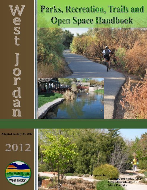
Parks, Recreation, Trails and Open Space Handbook - West Jordan
Parks, Recreation, Trails and Open Space Handbook - West Jordan
Parks, Recreation, Trails and Open Space Handbook - West Jordan

Create successful ePaper yourself
Turn your PDF publications into a flip-book with our unique Google optimized e-Paper software.
<strong>Parks</strong>, <strong>Recreation</strong>, <strong>Trails</strong> <strong>and</strong> <strong>Open</strong> <strong>Space</strong> H<strong>and</strong>book 1<br />
Adopted on July 25, 2012<br />
Prepared by:<br />
Jennifer Jastremsky, AICP<br />
Greg Mikolash, AICP<br />
Mark Forsythe
<strong>Parks</strong>, <strong>Recreation</strong>, <strong>Trails</strong> <strong>and</strong> <strong>Open</strong> <strong>Space</strong> H<strong>and</strong>book 2<br />
Contents<br />
Page<br />
I. Purpose ..................................................................... 3<br />
II. <strong>Parks</strong> <strong>and</strong> <strong>Recreation</strong> ................................................. 4<br />
III. Trials .......................................................................... 7<br />
IV. <strong>Open</strong> <strong>Space</strong> ................................................................ 9<br />
V. Capital Improvements Plan ........................................ 14<br />
VI. Maintenance Plan ...................................................... 15<br />
Appendix<br />
A. Existing <strong>Parks</strong> List ....................................................... 17<br />
B. Future <strong>Parks</strong> <strong>and</strong> <strong>Trails</strong> List ........................................ 20<br />
C. Park Amenity List ....................................................... 22<br />
D. Park Deficiency List .................................................... 23<br />
E. Maintenance Levels for Park Properties ..................... 24<br />
F. Existing <strong>and</strong> Future <strong>Parks</strong> <strong>and</strong> <strong>Open</strong> <strong>Space</strong> Map ......... 29<br />
G. <strong>West</strong> <strong>Jordan</strong> <strong>Trails</strong> Map ............................................. 30<br />
H. Creeks <strong>and</strong> Washes Map ............................................ 31
<strong>Parks</strong>, <strong>Recreation</strong>, <strong>Trails</strong> <strong>and</strong> <strong>Open</strong> <strong>Space</strong> H<strong>and</strong>book 3<br />
Purpose<br />
This h<strong>and</strong>book is a supplemental tool meant to provide reference material <strong>and</strong> additional guidelines for<br />
parks, recreation, trails <strong>and</strong> open space planning within <strong>West</strong> <strong>Jordan</strong> City.<br />
Provided within the h<strong>and</strong>book is information <strong>and</strong> guidelines for how parks, recreation spaces, trails <strong>and</strong><br />
open space should be developed within the City. It also includes general information on the amount of<br />
park l<strong>and</strong> <strong>and</strong> trail lengths, existing amenities within parks, park deficiencies, <strong>and</strong> proposed future park<br />
locations within the City. The <strong>West</strong> <strong>Jordan</strong> City Comprehensive General Plan provides information on<br />
goals <strong>and</strong> policies for parks, recreation, trails <strong>and</strong> open space planning <strong>and</strong> development, including long<br />
term goals. The Comprehensive General Plan also provides specifics on trails, types of recreational<br />
facilities <strong>and</strong> parks.<br />
This h<strong>and</strong>book includes excerpts from the former <strong>Parks</strong>, <strong>Recreation</strong> <strong>and</strong> <strong>Trails</strong> Master Plan <strong>and</strong> the<br />
former <strong>Open</strong> <strong>Space</strong> Master Plan. A Joint Committee was convened in January 2011 to review the various<br />
City goals <strong>and</strong> policies on parks <strong>and</strong> open space. The committee evaluated eight areas of focus: <strong>Open</strong><br />
L<strong>and</strong>s, Veterans Memorial Park, <strong>Trails</strong>, Level of Service, Mix <strong>and</strong> Distribution, Maintenance Rehabilitation<br />
<strong>and</strong> Reconstruction, Multi-jurisdictional Facilities, <strong>and</strong> Funding. The committee recommendations have<br />
been included in both the goals <strong>and</strong> policies as found in the Comprehensive General Plan <strong>and</strong> this<br />
h<strong>and</strong>book.<br />
The h<strong>and</strong>book is intended to be a living document, meaning it will be updated to reflect changes in policy<br />
<strong>and</strong> changes in the city’s parks, recreation, trails <strong>and</strong> open space system as these changes occur. This will<br />
ensure residents, business owners <strong>and</strong> developers have the most up to date information on the City’s<br />
parks, recreation, trails <strong>and</strong> open space systems. Certain items within this h<strong>and</strong>book can also be found<br />
within City Code requirements, such as trail way st<strong>and</strong>ards along creeks <strong>and</strong> washes which are a<br />
requirement of the Subdivision Ordinance, while other items are not required by City Code but are a<br />
suggestion in order to better facilitate design.<br />
The h<strong>and</strong>book will help the City to promote efficient <strong>and</strong> aesthetically pleasing use of park <strong>and</strong> open<br />
space l<strong>and</strong> within the City as promoted in the Comprehensive General Plan. The hope is to create the<br />
most user friendly parks, trails <strong>and</strong> open spaces as possible for <strong>West</strong> <strong>Jordan</strong> residents to enjoy. The<br />
appendixes will be especially useful for residents as a reference on existing facilities <strong>and</strong> amenities within<br />
the City.
<strong>Parks</strong>, <strong>Recreation</strong>, <strong>Trails</strong> <strong>and</strong> <strong>Open</strong> <strong>Space</strong> H<strong>and</strong>book 4<br />
<strong>Parks</strong> <strong>and</strong> <strong>Recreation</strong><br />
NRPA<br />
The Comprehensive General Plan calls for the use of National <strong>Recreation</strong> Park Association (NRPA)<br />
st<strong>and</strong>ards to determine the amount of parkl<strong>and</strong> necessary to serve residents in the community. This<br />
national organization provides information <strong>and</strong> statistics on parks research <strong>and</strong> should be used as a<br />
resource to ensure City policies match the latest research in park development <strong>and</strong> community<br />
needs.<br />
Distribution<br />
Existing park <strong>and</strong> recreation development within<br />
<strong>West</strong> <strong>Jordan</strong> is weighted heavily to the built<br />
areas of the City, primarily on the east side of the<br />
City. New park <strong>and</strong> recreation development will<br />
be concentrated in new growth areas, primarily<br />
on the west side of the City. A list of all existing<br />
parks within the City can be found in Appendix A.<br />
The Existing <strong>and</strong> Future <strong>Parks</strong> <strong>and</strong> <strong>Open</strong> <strong>Space</strong><br />
Map can be found as Appendix F. Included as<br />
Appendix C is a list of amenities which can be<br />
found in each park.<br />
As the City continues to develop, greater<br />
emphases should be placed on ensuring a balance of park <strong>and</strong> recreational facilities between the<br />
east <strong>and</strong> west sides of the City. The focus for development should be on community <strong>and</strong><br />
neighborhood parks, while new mini parks should not be built due to the large amount of time it<br />
takes to maintain mini parks compared to other parks.<br />
Maintenance<br />
There are 15 elements that comprise a park maintenance plan. Any of these elements can be<br />
adjusted based on budget <strong>and</strong> policy direction. For example, lawns can be mowed more often,<br />
l<strong>and</strong>scaping can be fertilized less or weed control measures can be done less often, depending on<br />
the desired service level. City parks are currently serviced at a level of 2.5, on a scale of 1-3, with 1<br />
being the highest level of service. Appendix E<br />
outlines specific characteristics of each<br />
maintenance level based on the 15 elements.<br />
Maintenance of City parks, recreation, trails <strong>and</strong><br />
open space areas are important for the safety of<br />
those using the spaces as well as ensuring the<br />
continued long term use of these spaces.<br />
There are other opportunities the City should<br />
review which may increase service <strong>and</strong><br />
maintenance levels, while also potentially saving<br />
money in the long run. Park amenities should be
<strong>Parks</strong>, <strong>Recreation</strong>, <strong>Trails</strong> <strong>and</strong> <strong>Open</strong> <strong>Space</strong> H<strong>and</strong>book 5<br />
made of materials that require minimal maintenance <strong>and</strong> have a long life span. When park<br />
amenities deteriorate, they should be replaced with products that will require less maintenance <strong>and</strong><br />
last longer than the former amenity.<br />
The City contains many neighborhoods which are willing to participate in the well-being of their<br />
neighborhood parks. The City should look into the utilization of neighborhood volunteers for the<br />
installation of new parks, park improvements, large projects <strong>and</strong> clean-up efforts. The weekly <strong>and</strong><br />
monthly maintenance of parks should be left to City Staff as regular maintenance by private citizens<br />
may not be reliable. A volunteer coordinator within the City could help organize volunteer efforts<br />
for various programs. The City should look into possible organization formats for volunteer<br />
programs, including a City staffed coordinator.<br />
Park Deficiencies<br />
The Public Works Department has created a list of<br />
known park deficiencies within the City, as shown<br />
in Appendix D. The list includes 36 parks, <strong>and</strong> $4.9<br />
million worth of improvements that are required<br />
within the existing parks. These improvements<br />
range from small items such as the need for a new<br />
sign or fixing of concrete work to large ticket items<br />
such as a new irrigation system, new playgrounds<br />
or the installation of new ball courts. The City<br />
should provide a budget for existing park upgrades<br />
within the Capital Improvements Plan <strong>and</strong> tackle<br />
each item based on a set prioritization. Continued<br />
repair, restoration <strong>and</strong> renovation within parks are important to the longevity of the City’s park<br />
system <strong>and</strong> to ensure these parks are the safest they can be for their users. The Public Works<br />
Department will continue tracking these deficiencies as they develop <strong>and</strong> our park system continues<br />
to age.<br />
Design<br />
Greater attention should be paid to the types of amenities which are placed within parks in order to<br />
ensure the most efficient access to various types of amenities City-wide. Existing parks should be<br />
upgraded so as to meet l<strong>and</strong>scaping, water conservation <strong>and</strong> design st<strong>and</strong>ards, when necessary.<br />
The focus for neighborhood <strong>and</strong><br />
community parks should be on<br />
creating more multi-use fields,<br />
trails <strong>and</strong> amenities which will<br />
appeal to a broad range of age<br />
demographics. As the<br />
surrounding population ebbs <strong>and</strong><br />
flows from young families to<br />
empty nesters <strong>and</strong> back to young families, parks should be able to serve a uniform set of residents<br />
that can equally benefit from the amenities. Creating a more uniform park with age diverse
<strong>Parks</strong>, <strong>Recreation</strong>, <strong>Trails</strong> <strong>and</strong> <strong>Open</strong> <strong>Space</strong> H<strong>and</strong>book 6<br />
amenities will ensure that all age groups will be motivated to use the facilities, instead of rendering<br />
a park useless during the times that it may not be age appropriate for its surrounding residents.<br />
At the same time, park amenities should be coordinated with attention to the needs of the<br />
surrounding neighborhoods. <strong>Parks</strong> located within close proximity to each other do not have to<br />
provide the same types of amenities beyond a playground <strong>and</strong> pavilion. Tennis courts can draw from<br />
a larger area than the immediate neighborhood. In order to provide the most services to the<br />
community it may be possible to stagger certain amenities rather than provide them in each park.<br />
There should be a certain level of service provided in each park. The level of service should be kept<br />
minimal in small parks <strong>and</strong> increase according to need in larger parks, especially in parks where<br />
larger crowds are drawn by sports fields or other amenities. All amenities should be chosen with use<br />
<strong>and</strong> maintenance in mind, <strong>and</strong> the city may want to look into the st<strong>and</strong>ardization of amenity<br />
facilities in order to ease maintenance burdens <strong>and</strong> obtain bulk pricing discounts. Other items to<br />
consider when purchasing amenities are: graffiti resistant surfaces, heavy duty hardware, ease of<br />
winterization, parts readily available, walking paths amenable to walking, etc. Below is a list of basic<br />
amenities which should be included in parks, based on size <strong>and</strong> function:<br />
1. Mini <strong>Parks</strong>- Existing facilities should be maintained <strong>and</strong> replaced as needed. No new<br />
amenities are recommended as mini parks are not recommended for development.<br />
2. Neighborhood <strong>Parks</strong> (small)- Pavilion, playground, structure lighting, picnic tables,<br />
benches <strong>and</strong> electrical outlets<br />
3. Neighborhood <strong>Parks</strong> – above amenities +<br />
multiple <strong>and</strong>/or larger pavilions <strong>and</strong><br />
perimeter path/trails<br />
4. Neighborhood <strong>Parks</strong> (large or crowd<br />
drawing, such as sports fields)- above<br />
amenities + drinking fountain <strong>and</strong> bathroom<br />
5. Community <strong>Parks</strong>- larger <strong>and</strong> more of above<br />
amenities. This size park should have a<br />
development plan to help coordinate<br />
design, layout <strong>and</strong> amenities.<br />
The size of playground areas should also be based on the size of a park, to ensure adequate facilities<br />
for those who may utilize the park. The Public Works Department recommends the following<br />
playground area space, based on park size.<br />
1. Small Neighborhood parks equaling 1-5 acres in size should have a 35’x35’ playground<br />
area,<br />
2. Large neighborhood parks equaling 5-10 acres in size should have a 50’x50’ playground<br />
area, <strong>and</strong><br />
3. Community parks <strong>and</strong> parks greater than 10 acres in size should have a 60’x60’<br />
playground area.
<strong>Parks</strong>, <strong>Recreation</strong>, <strong>Trails</strong> <strong>and</strong> <strong>Open</strong> <strong>Space</strong> H<strong>and</strong>book 7<br />
<strong>Trails</strong><br />
The City has design st<strong>and</strong>ards for multi-use, equestrian,<br />
<strong>and</strong> pedestrian trails, including along creeks <strong>and</strong><br />
washes. These design st<strong>and</strong>ards are required for any<br />
subdivision taking place along the creeks <strong>and</strong> washes or<br />
those providing general trail ways, <strong>and</strong> are described<br />
textually within the Subdivision Ordinance, <strong>and</strong> visually<br />
below. As the City looks to further develop its trail<br />
network a connection between the <strong>Jordan</strong> River Trail<br />
<strong>and</strong> the Bonneville Shoreline Trail should be included.<br />
Both of these trails are a part of a county wide trail<br />
system. Connecting the trails through the City trail<br />
network will provide residents with convenient access<br />
to the overall county trail system <strong>and</strong> broaden access to City trails.<br />
Trail design along the <strong>Jordan</strong> River should be guided by three documents: 1) Salt Lake County <strong>Jordan</strong><br />
River Trail Master Plan, a county wide document which studies the needs <strong>and</strong> future of the <strong>Jordan</strong><br />
River, 2) Blueprint <strong>Jordan</strong> River, a multi-jurisdictional document which studies the entire <strong>Jordan</strong><br />
River corridor <strong>and</strong> possible future amenities along the river, <strong>and</strong> 3) <strong>West</strong> <strong>Jordan</strong> City Trail Action<br />
Plan for the 7800 South to 9000 South <strong>Jordan</strong> River Trail Connection, a concept plan being created<br />
by the Rivers, <strong>Trails</strong> <strong>and</strong> Conservation Assistance Program of the National Park Service to help<br />
facilitate the completion of the <strong>Jordan</strong> River Trail in <strong>West</strong> <strong>Jordan</strong> City.<br />
Below are trail corridor plans <strong>and</strong> cross sections for those trails which may be constructed along<br />
Barney’s Creek or Barney’s Wash. The City may wish to create trail sections <strong>and</strong> plans for other types<br />
of trail ways described in the Subdivision Ordinance to help clarify st<strong>and</strong>ards for developers.<br />
Generally trail ways should follow the designs as depicted below. Trail Corridors should include<br />
native l<strong>and</strong>scapes, trees <strong>and</strong> l<strong>and</strong>scape restoration. The <strong>West</strong> <strong>Jordan</strong> <strong>Trails</strong> Map can be found as<br />
Appendix G. A map of the creeks <strong>and</strong> washes can be found as Appendix H.<br />
Proposed Barney’s Creek Multi-Use /Maintenance Trail
<strong>Parks</strong>, <strong>Recreation</strong>, <strong>Trails</strong> <strong>and</strong> <strong>Open</strong> <strong>Space</strong> H<strong>and</strong>book 8<br />
Sample Plan View of Barney’s Creek Multi-Use / Maintenance Trail<br />
Proposed Clay Hollow Wash Multi-Use / Maintenance / Equestrian Trail (Alternative A)<br />
Proposed Clay Hollow Wash Multi-Use / Maintenance / Equestrian Trail (Alternative B)
<strong>Parks</strong>, <strong>Recreation</strong>, <strong>Trails</strong> <strong>and</strong> <strong>Open</strong> <strong>Space</strong> H<strong>and</strong>book 9<br />
<strong>Open</strong> <strong>Space</strong><br />
CEDAR<br />
<strong>Open</strong> space can come in several different types of l<strong>and</strong> which serve to reinforce cultural heritage,<br />
ecological needs <strong>and</strong> recreational desires. The different types of l<strong>and</strong> can be referred to by a single<br />
acronym, CEDAR. CEDAR st<strong>and</strong>s for Cultural, Environmental, Developmental, Agricultural, <strong>and</strong><br />
<strong>Recreation</strong>al. The CEDAR categories were created by the Center for Green <strong>Space</strong> Design. These<br />
categories are one part of a comprehensive open space planning technique that is based on a<br />
careful inventory of a communities open l<strong>and</strong>s <strong>and</strong> resources. While the City has not conducted the<br />
comprehensive open space planning technique designed by the Center for Green <strong>Space</strong> Design, the<br />
CEDAR categories can help the City to identify those properties which are important for preservation<br />
<strong>and</strong> inclusion in its open space system. Each category is described below.<br />
Cultural (Historical): These features of the<br />
l<strong>and</strong>scape are rich in cultural tradition <strong>and</strong> a<br />
significant part of the City’s history. Cultural<br />
components include view sheds, plazas, civic <strong>and</strong><br />
entertainment centers, <strong>and</strong> beautiful l<strong>and</strong>scapes.<br />
Visual resources that are enjoyed by the<br />
community are a part of this open l<strong>and</strong> category<br />
because they are shared by everyone <strong>and</strong> have<br />
that intangible quality that seems to defy<br />
regulatory qualifications. These visual resources<br />
exp<strong>and</strong> across the community’s l<strong>and</strong>scape, <strong>and</strong><br />
are difficult to define even though everyone knows that they are present. View sheds to the west<br />
foothills <strong>and</strong> east to the Wasatch Range are considered cultural elements.<br />
Environmental (Ecological): This category of open l<strong>and</strong> can give permanent protection to important<br />
natural resources <strong>and</strong> environmentally sensitive l<strong>and</strong>s. This includes wetl<strong>and</strong>s <strong>and</strong> wildlife habitats<br />
as well as ground water<br />
recharge areas <strong>and</strong> l<strong>and</strong><br />
with natural limitations<br />
such as steep slopes<br />
<strong>and</strong>/or unstable soils<br />
that make it unsuitable<br />
for development.<br />
<strong>West</strong> <strong>Jordan</strong> has valuable<br />
wetl<strong>and</strong>s <strong>and</strong> abundant wildlife on its east border. The west side of the City also has a large variety<br />
<strong>and</strong> diversity of wildlife. While the east side wetl<strong>and</strong>s are generally protected through l<strong>and</strong><br />
acquisition by the City <strong>and</strong> other public agencies, more needs to be done to maintain or improve<br />
habitat for the upl<strong>and</strong> wildlife to the west, as this area continues to develop. We also need to<br />
maintain west side open l<strong>and</strong> corridors that are wide enough to permit the natural movement <strong>and</strong>
<strong>Parks</strong>, <strong>Recreation</strong>, <strong>Trails</strong> <strong>and</strong> <strong>Open</strong> <strong>Space</strong> H<strong>and</strong>book 10<br />
migration of the wildlife species found there. A key component of successful environmental open<br />
space is to ensure the open space has been restored, where necessary, in a manner that is<br />
ecologically responsible <strong>and</strong> helpful to the wildlife <strong>and</strong> native plant species. This will encourage its<br />
use by both residents <strong>and</strong> the wildlife.<br />
Developmental: Examples of developmental open<br />
l<strong>and</strong>s include canals <strong>and</strong> associated maintenance<br />
roads, utility corridors like the Rocky Mountain<br />
Power corridor, road <strong>and</strong> railroad rights-of-way <strong>and</strong><br />
City owned parcels. <strong>Open</strong> l<strong>and</strong>s that are designed as<br />
a part of residential, commercial, <strong>and</strong> industrial<br />
developments provide important isl<strong>and</strong>s of respite<br />
from wall-to-wall buildings <strong>and</strong> paved surfaces.<br />
Most l<strong>and</strong> uses can <strong>and</strong> should exist in harmony<br />
with green spaces on the same parcel of l<strong>and</strong>. This<br />
can be done in a way that preserves a significant<br />
portion of the development as open l<strong>and</strong> without<br />
jeopardizing the economic return to the owner.<br />
Taking the various types of open l<strong>and</strong>s that are already present in an existing built environment, <strong>and</strong><br />
retrofitting them into an eventual open l<strong>and</strong> network is a difficult <strong>and</strong> expensive challenge. <strong>Parks</strong>,<br />
rights-of-way, public parcels, niche ecological isl<strong>and</strong>s, recreational facilities, <strong>and</strong> all the other<br />
disjointed open l<strong>and</strong>s in a community that have evolved over the years represent a valuable open<br />
l<strong>and</strong> inventory to include in the overall plan for protection.<br />
Agricultural: Farms, ranches <strong>and</strong> crops are typical agricultural uses. Today people value the<br />
remaining farms <strong>and</strong> ranches in the community for the open l<strong>and</strong> values they provide. In addition,<br />
they have economic value because of the food <strong>and</strong> livestock feed they produce. Even though these<br />
l<strong>and</strong>s are not untouched <strong>and</strong> pristine, they are<br />
still more “open” than subdivisions <strong>and</strong> other<br />
types of developed l<strong>and</strong>, providing the<br />
uncluttered views <strong>and</strong> breathing room that is not<br />
found with developed l<strong>and</strong>. <strong>Open</strong> l<strong>and</strong> networks<br />
can preserve selected agricultural l<strong>and</strong>s within<br />
<strong>and</strong> at the fringes of the community, protecting<br />
them now <strong>and</strong> in the future from the<br />
development pressures.<br />
Current agricultural l<strong>and</strong>s were identified on both<br />
sides of the City. Special consideration should be<br />
given to those agricultural l<strong>and</strong>s typically considered too small for commercial scale operations, but<br />
appropriate for future use as community gardens, tree farms <strong>and</strong> niche vegetable <strong>and</strong> livestock feed<br />
production for local markets.
<strong>Parks</strong>, <strong>Recreation</strong>, <strong>Trails</strong> <strong>and</strong> <strong>Open</strong> <strong>Space</strong> H<strong>and</strong>book 11<br />
<strong>Recreation</strong>al: This category includes existing <strong>and</strong><br />
proposed l<strong>and</strong>s earmarked for any recreational<br />
purposes, ranging from highly developed sports fields<br />
to undeveloped hiking trails. <strong>Recreation</strong>al l<strong>and</strong>s are<br />
designed to be used, visited, walked on, hiked on,<br />
picnicked on, biked on <strong>and</strong> played on. These l<strong>and</strong>s<br />
enrich people’s lives by giving them opportunities to<br />
participate in a wide spectrum of exercise, sports, <strong>and</strong><br />
other recreational activities that make life more fun<br />
<strong>and</strong> healthy.<br />
Connecting Corridors<br />
In addition to the five CEDAR categories discussed above, the City must include connecting<br />
corridors. Connecting corridors turn individual open l<strong>and</strong>s into open l<strong>and</strong> networks. An open l<strong>and</strong><br />
network is an inter-linked system of open l<strong>and</strong>s <strong>and</strong> connecting corridors in <strong>and</strong> around the<br />
community that has been legally <strong>and</strong> permanently preserved. Without the elements of connectivity,<br />
open l<strong>and</strong>s are merely a series of isl<strong>and</strong>s rather than integrated, inter-connected systems. Once the<br />
connections are made <strong>and</strong> permanently preserved<br />
through the measures such as public property<br />
acquisition or conservation easements, <strong>West</strong><br />
<strong>Jordan</strong> will have achieved an open l<strong>and</strong> network.<br />
Connecting corridors typically provide excellent<br />
walking, hiking, biking, <strong>and</strong> running paths, as well<br />
as wildlife corridors. They also allow people to<br />
move from one open l<strong>and</strong> parcel to another<br />
without leaving the network. In addition,<br />
connecting corridors should provide <strong>West</strong> <strong>Jordan</strong><br />
residents <strong>and</strong> visitors with convenient access to<br />
the open l<strong>and</strong> network. This is important because<br />
the open l<strong>and</strong> network should be designed in a way that allows everyone in the community to get to<br />
some part of it, by walking, in ten minutes or less. Connection corridors for open l<strong>and</strong> are often long<br />
<strong>and</strong> narrow. Their linear nature requires special design approaches as development occurs.<br />
Connecting open l<strong>and</strong>s should be a high priority<br />
within the City.<br />
Access<br />
Access is crucial in terms of maintenance <strong>and</strong><br />
ownership, however; there are two types of access,<br />
visual <strong>and</strong> physical. Visual access may have a<br />
psychological effect on the person viewing the open<br />
l<strong>and</strong>. There may be a feeling of openness even<br />
though there is no physical access to the property.<br />
Physical access allows a person to enjoy open space<br />
on a “pedestrian” level (i.e. the ability to set foot on<br />
the property). Much of this l<strong>and</strong> will remain in
<strong>Parks</strong>, <strong>Recreation</strong>, <strong>Trails</strong> <strong>and</strong> <strong>Open</strong> <strong>Space</strong> H<strong>and</strong>book 12<br />
private ownership <strong>and</strong> provide only visual open l<strong>and</strong> relief. Property used for physical access should<br />
be publicly owned <strong>and</strong> maintained.<br />
CEDAR Protections<br />
There are several ways to protect l<strong>and</strong>s within the CEDAR categories. These include conservation<br />
easements, outright purchase by the City, performance zoning, purchase of development rights,<br />
zoning to encourage infill development, l<strong>and</strong> trusts, <strong>and</strong> l<strong>and</strong>owner compacts. Each option offers its<br />
own unique opportunities <strong>and</strong> challenges. Multiple strategies should be used within the City in order<br />
to provide the best chance to protect open space.<br />
Selection Criteria<br />
The City can employ a number of tools to evaluate <strong>and</strong> select<br />
projects. The foundations for these tools are the goals <strong>and</strong><br />
policies established in the Comprehensive General Plan. Though<br />
not a comprehensive list, the following are criteria which should<br />
be considered during the acquisition decision process.<br />
Consistency with one or all of these factors is not necessarily<br />
required for the City to choose to proceed (or not proceed) with<br />
a project.<br />
These criteria are not intended to limit the discussion of the<br />
positive or negative attributes of a proposed acquisition by the<br />
City. Instead, they should be used to assist in the analysis of<br />
whether a particular parcel or resource should be protected by<br />
the City. These criteria should not be considered static <strong>and</strong><br />
should be modified to address changing conditions <strong>and</strong> unique<br />
circumstances.<br />
Seek open l<strong>and</strong>s that overlap multiple CEDAR categories.<br />
Attract willing sellers by identifying mutually beneficial l<strong>and</strong> management opportunities.<br />
Select projects based on strategic location of the proposed acquisition in that the<br />
protection of the l<strong>and</strong> is key to protecting other open l<strong>and</strong> in the same area.<br />
Project size <strong>and</strong> what effect it might have on whether the l<strong>and</strong> type or resource can be<br />
maintained over time.<br />
Viability of agricultural use in the long-term.<br />
Connectivity to intact or relatively intact natural areas.<br />
Proximity to existing protected l<strong>and</strong>s.<br />
Ability of l<strong>and</strong> to provide connectivity options with existing protected l<strong>and</strong>s.<br />
Ecological value (unique habitat, species diversity, protection of listed species or species<br />
in local decline, etc.)<br />
High risk of loss of exceptional open l<strong>and</strong> resources without participation by the City.<br />
Outst<strong>and</strong>ing scenic values (views of significant local or regional l<strong>and</strong>marks, community<br />
gateways, etc.)<br />
High recreational value that is consistent with the City’s open l<strong>and</strong>s protection goals <strong>and</strong><br />
provides opportunities for achieving recreational needs (i.e. wildlife viewing, hiking,<br />
etc.)
<strong>Parks</strong>, <strong>Recreation</strong>, <strong>Trails</strong> <strong>and</strong> <strong>Open</strong> <strong>Space</strong> H<strong>and</strong>book 13<br />
L<strong>and</strong>owner commitment to conservation values (sustainable farming practices,<br />
voluntary protection of sensitive natural resources, etc.)<br />
L<strong>and</strong> or conservation easement can be acquired at reasonable effort in relation to its<br />
costs.<br />
City effort required to enforce <strong>and</strong>/or monitor an easement.<br />
Potential impacts of adjacent properties on the conservation value of the protected l<strong>and</strong><br />
or resource.<br />
Title issues, boundary disputes, or pending legal actions associated with the l<strong>and</strong> or<br />
easement.
<strong>Parks</strong>, <strong>Recreation</strong>, <strong>Trails</strong> <strong>and</strong> <strong>Open</strong> <strong>Space</strong> H<strong>and</strong>book 14<br />
Capital Improvements Plan<br />
Future <strong>Parks</strong><br />
The City’s population is expected to reach 155,000 by 2031. New parks <strong>and</strong> recreational facilities will<br />
be required to service these new residents. The Existing <strong>and</strong> Future <strong>Parks</strong> <strong>and</strong> <strong>Open</strong> <strong>Space</strong> Map, in<br />
conjunction with the Comprehensive General Plan, depicts where future parks may be located based<br />
on existing development, expected future development <strong>and</strong> potential park needs. It is understood<br />
that the majority of new parks will be planned <strong>and</strong> constructed as new development takes place in<br />
the City. <strong>Parks</strong> associated with new growth areas are expected to equal 298.03 total acres. A<br />
recreation center should be built on the west side of the City, although no timeline or location has<br />
been identified. A possible location for a recreation center could be Ron Woods Park, a regional park<br />
already located on the west side of the City. The Existing <strong>and</strong> Future <strong>Parks</strong> <strong>and</strong> <strong>Open</strong> <strong>Space</strong> Map can<br />
be found as Appendix F.<br />
Capital Improvements Plan<br />
The <strong>West</strong> <strong>Jordan</strong> Public Works Department maintains a Capital Improvements Plan (CIP). The CIP<br />
lists future infrastructure projects the City plans on building. Included in this plan are all future parks<br />
<strong>and</strong> recreational facilities, <strong>and</strong> to a lesser extent open space areas where improvements to the site<br />
are required. The purpose of the CIP is to provide a list which outlines funding sources <strong>and</strong> a time<br />
line for the various projects. The CIP is a priority ranked list broken into 5 year increments of what<br />
the City plans on actually building. A list of those future parks <strong>and</strong> trails shown on the Existing <strong>and</strong><br />
Future <strong>Parks</strong> <strong>and</strong> <strong>Open</strong> <strong>Space</strong> Map <strong>and</strong> the <strong>Trails</strong> Map can be found as Appendix B. The CIP list will<br />
narrow these amenities down based on their priority <strong>and</strong> allocated/potential funding sources.
<strong>Parks</strong>, <strong>Recreation</strong>, <strong>Trails</strong> <strong>and</strong> <strong>Open</strong> <strong>Space</strong> H<strong>and</strong>book 15<br />
Maintenance Plan<br />
The City should provide a maintenance plan for all proposed parks, recreation, trails <strong>and</strong> open<br />
space facilities prior to approval <strong>and</strong> in conjunction with the preliminary design stage. Such a plan<br />
should be part of any review for approval of a proposed facility in order to ensure the City has<br />
reviewed the annual costs <strong>and</strong> the life cycle costs of the proposed amenity. Annual costs represent<br />
the typical maintenance cost for the facility over a period of one year. Life cycle costs include the<br />
costs for property acquisition, design, construction, operation, maintenance, replacement <strong>and</strong><br />
renovation over the entire lifetime of a particular facility or amenity. Life cycle costs will allow the<br />
City to not only take into account the typical annual maintenance costs but also big ticket items,<br />
like the eventual replacement of specific amenities within the facility. By providing this information,<br />
the city will be able to make an educated decision on whether to approve a proposed facility, not<br />
only based on the cost to construct the facility but on the ability of the City to maintain the facility<br />
once construction is complete.<br />
The final design <strong>and</strong> construction stage may then take into account the annual <strong>and</strong> life cycle costs<br />
associated with the facility. If a change is made to the proposed facility or amenity during design or<br />
construction, an amendment to the maintenance plan should be done <strong>and</strong> will show how the<br />
proposed change will affect the facility or amenity in relation to costs over its lifetime <strong>and</strong> annually.<br />
For example, a change in material used for an amenity may save money during the construction<br />
phase, but may increase annual maintenance costs <strong>and</strong>/or speedup replacement timelines. Having<br />
knowledge of how a change will affect cost <strong>and</strong> maintenance will help the City to ensure adequate<br />
maintenance will be provided throughout the lifetime of the facility or amenity.
<strong>Parks</strong>, <strong>Recreation</strong>, <strong>Trails</strong> <strong>and</strong> <strong>Open</strong> <strong>Space</strong> H<strong>and</strong>book 16<br />
Appendix<br />
Lists<br />
A. Existing <strong>Parks</strong> List<br />
B. Future <strong>Parks</strong> <strong>and</strong> <strong>Trails</strong> List<br />
C. Park Amenity List<br />
D. Park Deficiency List<br />
E. Maintenance Levels for Park Properties<br />
Maps<br />
F. Existing <strong>and</strong> Future <strong>Parks</strong> <strong>and</strong> <strong>Open</strong> <strong>Space</strong> Map<br />
G. <strong>West</strong> <strong>Jordan</strong> <strong>Trails</strong> Map<br />
H. Creeks <strong>and</strong> Washes Map
<strong>Parks</strong>, <strong>Recreation</strong>, <strong>Trails</strong> <strong>and</strong> <strong>Open</strong> <strong>Space</strong> H<strong>and</strong>book 17<br />
A. Existing <strong>Parks</strong> List<br />
Mini <strong>Parks</strong><br />
Name Address Acreage Type*<br />
Beargrass Park 6727 S Beargrass Rd 0.40 Active<br />
Country Squire Park 3756 W Saddler Dr 0.66 Active<br />
Lobellia Park 6460 S Lobelia Dr 0.43 Active<br />
Noble Heights Park 3774 W 7910 S 0.61 Active<br />
Old Chaplin Property 2205 W 7800 S 0.35 Passive<br />
Salt Lake County Park (Owned by Salt Lake<br />
County) 5920 W Cedar Hill Rd 0.69 Active<br />
Facet Way Park 5370 W 8180 S 0.66 Passive<br />
Sycamore Trail Park 7208 W New Sycamore Dr 0.64 Active<br />
WJ Fairway Estates Special Service <strong>Recreation</strong><br />
District 2355 W 8450 S 0.37 Active<br />
WJ Fairway Estates Special Service <strong>Recreation</strong><br />
District 8552 S 2390 W 0.50 Passive<br />
WJ Fairway Estates Special Service <strong>Recreation</strong><br />
District 8510 S 2280 W 0.36 Passive<br />
<strong>West</strong> <strong>Jordan</strong> Meadows 3 5446 W Bridle Vista Cir 0.70 Passive<br />
Youth Force Park (Crus Corvi) (Owned by Salt Lake<br />
County) 5310 W 6765 S 0.44 Active<br />
Total Acreage 6.81<br />
Neighborhood <strong>Parks</strong><br />
Name Address Acreage Type*<br />
Bateman Pond 1200 W Bateman Ponds Way 5.22 Passive<br />
Bicentennial Park 1900 W 7000 S 1.55 Active<br />
Brigadoon Park 9331 S Mac Duff Ln 2.34 Active<br />
Browns Meadow Park 2526 W Jody St 5.89 Active<br />
Camelot Park 2030 W Robin Way 2.24 Active<br />
Colonial Estates Park 6888 S Lexington Dr 2.81 Active<br />
Constitution Park 3251 W 7000 S 13.65 Active<br />
Dixie Valley Park 6449 S Kentucky Dr 3.82 Active<br />
Dorilee Park 8620 S Bingham View Dr 2.94 Active<br />
Eagle Park 7493 S Bridle Mark Way 1.43 Passive<br />
Grizzly Park 5130 W Saddle Park Dr 4.05 Passive<br />
H<strong>and</strong> Cart Park 2868 W 6620 S 1.30 Active<br />
Harvest Estates Park 2304 W Straw Cir 2.95 Active<br />
<strong>Jordan</strong> Meadows Park 7430 S 2200 W 4.09 Active<br />
Lindsay Estates Park (Paul D 8015 S 3850 W 1.58 Active
<strong>Parks</strong>, <strong>Recreation</strong>, <strong>Trails</strong> <strong>and</strong> <strong>Open</strong> <strong>Space</strong> H<strong>and</strong>book 18<br />
Henderson Memorial Park)<br />
Maples <strong>Open</strong> <strong>Space</strong> Park 7800 S 6700 W 12.80 Passive<br />
Maples Park 2 7498 S Valley Maple Dr 2.00 Active<br />
McHeather Park 6935 S Brae Lin Way 1.60 Active<br />
Meadow Greens Farm Park 2931 W 8565 S 1.57 Active<br />
Oaks East Park 6129 W 8200 S 3.06 Active<br />
Oaks Park 6739 W 8200 S 4.37 Active<br />
Oquirrh Highl<strong>and</strong>s Park<br />
(Owned by Salt Lake County) 6670 S High Bluff Dr 5.07 Active<br />
Park Village Park 4858 W Park Village Dr 4.85 Active<br />
Plum Creek Park 8380 S Stratford Ln 3.66 Active<br />
Rail Road Park 8447 S Festive Way 6.53 Active<br />
Ranches Park Common 5286 W Ranches Park Ln 1.49 Active<br />
Senior Housing Park 2000 W Sugar Factory Rd 2.53 Active<br />
Shadow Mountain South Park 7400 S Grizzly Way 7.2 Active<br />
Siena Vista Park 5600 W 7000 S 1.57 Passive<br />
Stone Creek Park 1 5058 W Amethyst Dr 2.60 Active<br />
Stone Creek Park 2 7982 S 4800 W 1.85 Active<br />
Sunset Park 4810 W New Bingham Hwy 2.13 Active<br />
Sycamore Ridge Park 7398 W New Sycamore Dr 1.43 Active<br />
Sycamores Park 1 8100 S 7025 W 4.81 Passive<br />
Sycamores Park 2 7800 S New Sycamore Dr 1.87 Passive<br />
Teton Estates Park 9339 S Targhee Dr 11.28 Active<br />
Vista <strong>West</strong> Park 9120 S 3730 W 2.68 Passive<br />
Vista <strong>West</strong> Park 9120 S 3730 W 2.33 Active<br />
Vista <strong>West</strong> Park Extension 9256 S 4000 W 4.45 Passive<br />
<strong>West</strong> <strong>Jordan</strong> Meadows B Park 5348 W 7530 S 1.01 Passive<br />
Wildflower Park 5149 W Wisteria Way 5.75 Active<br />
Total Acreage 157.54
<strong>Parks</strong>, <strong>Recreation</strong>, <strong>Trails</strong> <strong>and</strong> <strong>Open</strong> <strong>Space</strong> H<strong>and</strong>book 19<br />
Community <strong>Parks</strong><br />
Name Address Acreage Type*<br />
Cougar Lane Park (Owned<br />
by Salt Lake County) 6400 S 4800 W 30.07 Active<br />
Dog Park (Owned by Salt<br />
Lake County) 5900 W New Bingham Hwy 3.81 Active<br />
Ron Wood Memorial Park<br />
(Developed Area Only) 5900 W New Bingham Hwy 24.46 Active<br />
Stone Creek <strong>Open</strong> <strong>Space</strong> 8141 S Grizzly Way 29.19 Passive<br />
Sycamores <strong>Open</strong> <strong>Space</strong> 7401 W 7800 S 59.29 Passive<br />
Utah Youth Sports Complex 7965 S 4000 W 97.30 Active<br />
Veterans Memorial Park 2011 W 7800 S 89.80 Active<br />
Total Acreage 333.92<br />
Total Park L<strong>and</strong> – 498.27 acres<br />
* Parkl<strong>and</strong> can be divided into two types of parks: active <strong>and</strong> passive. Active parks are characterized<br />
by having some sort of designed activity, such as a playground, ball fields or picnic areas. Passive<br />
parkl<strong>and</strong> is characterized by not having developed recreational activities <strong>and</strong> will generally include<br />
open space with trails or large green areas without any specific activity designation.
<strong>Parks</strong>, <strong>Recreation</strong>, <strong>Trails</strong> <strong>and</strong> <strong>Open</strong> <strong>Space</strong> H<strong>and</strong>book 20<br />
B. Future <strong>Parks</strong> <strong>and</strong> <strong>Trails</strong> List<br />
Neighborhood <strong>Parks</strong><br />
Name Approximate Address Approximate Acreage<br />
<strong>Jordan</strong> Hills <strong>West</strong> Park 7200 W 7500 S 9.01<br />
(Future Park)<br />
Fire Station Park (Future 6400 W 7800 S 15.54<br />
Park)<br />
Southwest Park #1 (Future 7400 W 9000 S 12.30<br />
Park)<br />
Southwest Park #2 (Future 6850 W NBH 33.31<br />
Park)<br />
Central <strong>West</strong> Park (Future 6400 W 9000 S 6.56<br />
Park)<br />
Northwest Park (Future Park) 6000 W 7500 S 10.08<br />
Maple Hills Park (Future Park) 6400 W 7400 S 11.86<br />
Future Park #1 7500 W 9800 S 8.46<br />
Future Park #2 7600 W 9700 S 8.24<br />
Future Park #3 7300 W 9000 S 20.11<br />
Future Park #4 7500 W 8300 S 23.92<br />
Future Park #5 7800 S 7800 W 7.80<br />
Future Park #6 8500 S 7300 W 27.56<br />
Future Park #7 5732 W 8200 S 9.33<br />
Total Acreage 204.08<br />
Community <strong>Parks</strong><br />
Name Approximate Address Approximate Acreage<br />
Ron Wood Memorial Park 5900 W NBH 37.61<br />
(Planned Development Areas<br />
Only)<br />
Veterans Memorial Park 2150 W Sugar Factory Rd 6.90<br />
Future Park 6400 W 7400 S 56.34<br />
Total Acreage 100.85
<strong>Parks</strong>, <strong>Recreation</strong>, <strong>Trails</strong> <strong>and</strong> <strong>Open</strong> <strong>Space</strong> H<strong>and</strong>book 21<br />
<strong>Trails</strong><br />
Name Approximate Address Approximate Linear Feet<br />
<strong>Jordan</strong> River Trail 8600 S 800 W 5,481<br />
<strong>Trails</strong> in Developed Areas General Trail Development, 93,530<br />
including Bingham Creek,<br />
North <strong>Jordan</strong> Canal, South<br />
<strong>Jordan</strong> Canal, Utah <strong>and</strong> Salt<br />
Lake Canal, Utah Lake<br />
Irrigation Canal, Rail Road at<br />
4600 <strong>West</strong>, <strong>Jordan</strong> River<br />
Parkway Neighborhood<br />
Connections. Pedestrian<br />
Bridges will be required in at<br />
least 3 locations.<br />
<strong>Trails</strong> in New Growth Areas General Trail Development, 100,206<br />
including Barney's Creek,<br />
Barney's Wash, No Name<br />
(High School Wash, plus 3<br />
others), Clay Hollow Wash,<br />
Dry Wash, Bonneville<br />
Shoreline Trail.<br />
5800 W Utility Corridor 5800 W 23,783<br />
Total Linear Feet 223,000<br />
Total Miles 42.2<br />
Total Future Park L<strong>and</strong> –304.93 acres
C. Park Amenity List<br />
<strong>Parks</strong>, <strong>Recreation</strong>, <strong>Trails</strong> <strong>and</strong> <strong>Open</strong> <strong>Space</strong> H<strong>and</strong>book 22
CITY OF WEST JORDAN INVENTORY<br />
Property<br />
Address<br />
Acres/ seats<br />
Pavilion / Reservable<br />
Pavilion<br />
Reservable Indoor<br />
Room<br />
Bathrooms<br />
RESERVABLE PROPERTIES<br />
Seats<br />
City Hall Community Room 8000 S. Redwood Rd. 102 x x x x x<br />
City Hall Room 331 8000 S. Redwood Rd. 15 x x x x x<br />
City Hall Council Chambers 8000 S. Redwood Rd. 126 x x x x x<br />
Justice Center Community Room 8040 S. Redwood Rd. 164 x x x x x<br />
Schorr Gallery 8000 S. Redwood Rd. 50 x x x x x<br />
Surgar Factory Playhouse 8060 S. Redwood Rd. 260 x x x x x<br />
<strong>West</strong> <strong>Jordan</strong> Arena 8035 S. 2200 W. 4800 x x x x x x x x<br />
PARKS/FACILITIES AMMENITIES<br />
Acres<br />
Bateman pond/Park 7100 S. 1140 W. 5.22<br />
Bicentennial 7000 S. 1890 W. 1.55 x x<br />
Bearsgrass Park 5113 w Crus Corvi Rd 0.4 x<br />
Brigadoon 9300 S. 1400 W. 2.34 x x<br />
Browns Meadow 9160 S. 2490 W. 5.89 x x x x x x<br />
Camelot 7230 S. 1975 W. 2.24 x x<br />
Colonial 6890 S. 2040 W. 2.81 x x x x x x Minimal<br />
Constitution 7000W. 3200 W. 13.65 X x x x x x x Minimal x x<br />
Country Squire 8570 S. 3740 W. 0.66 x<br />
Cruz Corvi park 5294 W Cruz Corvi Rd 0.44<br />
Dixie Valley 6420 W. 3620 W. 3.82 x x x x x Minimal<br />
Dora Lee 8615 S. 4480 W. 2.94 x x x<br />
Eagle Park 7530 S. 5200 W. 1.43 x x<br />
Facet Way 8140 S 5300 W 0.66<br />
Grizzly Park 7400 S. Grizzly Way 4.05 x x<br />
H<strong>and</strong>cart 6620 S. 2850 W. 1.3 x x<br />
Harvest Estates 6855 S. 2300 W. 2.95 x x x x<br />
<strong>Jordan</strong> Meadows 7480 S. 2290 W. 4.09 x x x<br />
Lindsey Estates 8000 S. 3850 W. 1.58 x x<br />
Lobelia Park 6466 S Lobelia Dr 0.43 x<br />
Maples Park 7540 S.6730 W. 2 x x<br />
McHeather 6940 S. 1440 W. 1.6 x x x<br />
Meadow Green 8400 W. 3000 S. 1.57 x x xx<br />
Noble Heights 7910 S. 3700 W. 0.61 x x<br />
Oaks Park East 8235 S. Fall Oak Dr 3.06 x x<br />
Oaks Park <strong>West</strong> 8200 S. 6700 W. 4.37 x x x x x<br />
Park Village 7630 S. 4800 W. 4.85 x x<br />
Plum Creek/Urban Fishery 8300 S. 1500 W. 3.66 x x x<br />
Pocket Park 7800 S. 2200 W. 0.35<br />
Rail Road 8418 S. 4580 W. 9.4 x<br />
Ranches Commons 7950 S. 5300 W. 1.49 x<br />
Rodeo Arena 80350 S 2200 W 8.75<br />
Ron Wood Complex 6000 W. New Bingham 24.46 x x x x x x x x<br />
Senior Housing Park 2200 W. Sugar Factory 2.53 x<br />
Shadow Mountain 7360 S. 5000 W. 7.02 x x x<br />
Sienna Vista 7000 S. 5600 W. 1.57<br />
Soccer Phase 1 7876 S. 4000 W. 21.71 X x x x x x x x x<br />
Soccer Phase 2 8070 S. 4000 W. 75.59 X x x x x x x x x<br />
Stone Creek 4860 W. 8030 S. 6.1 x x x x Minimal<br />
Sycamores park (Stoksley) 7208 <strong>West</strong> New Sycamore Dr 0.64 x xMinimal<br />
Sycamores park (Cricket ) 7398 <strong>West</strong> New Sycamore Dr 1.43 x x xMinimal<br />
Sunset 4800 W. New Bingham 2.13 x x<br />
Teton Estates 9380 S. 4170 W. 11.28 x x x x Minimal<br />
Veterans Memorial 8000 S. 1900 W. 81.05 X x x 5 x x x x x x x x<br />
Fountain/water<br />
Hook up<br />
playgrounds<br />
Basketball<br />
Softball fields<br />
Soccer fields<br />
Baseball Fields<br />
Parking<br />
Electricity<br />
Concesssion grills<br />
Concession<br />
Refrigerators<br />
Concessions/Kitchen<br />
Updated 10/17/2011
Vista <strong>West</strong> 9120 S. 3730 W. 2.33 x x<br />
<strong>West</strong> <strong>Jordan</strong> B 7530 S. 5360 W. 1.01<br />
<strong>West</strong> <strong>Jordan</strong> C 8180 S. 5370 W. 0.84<br />
Wildflower detention park 9200S. 5200 W. 5.75 x x<br />
<strong>Parks</strong> under development<br />
Totals 345.6 4 29 0 6 11 44 8 7 2 4 12 6 1 3 5<br />
Updated 05‐02‐2012<br />
Updated 10/17/2011
D. Park Deficiency List<br />
<strong>Parks</strong>, <strong>Recreation</strong>, <strong>Trails</strong> <strong>and</strong> <strong>Open</strong> <strong>Space</strong> H<strong>and</strong>book 23
Appendix D Page 1<br />
Park Deficiency List<br />
Priority Park Location<br />
Size<br />
(acres)<br />
Costs<br />
Bicentennial 7000 S. 1800 W. 1.55<br />
7 zones x 2 hrs x 22.98=321.72.<br />
1 Valve replacement.<br />
$100 per valve x 7 $1,021.72<br />
2 ADA Accessibility, $2,000.00<br />
$23.22 x 3 people 3hrs=208.98.<br />
Excavation112.5cy x $13.60 per<br />
cy=$1530.<br />
Soft<br />
3 New fall material in the playground,<br />
fall material $2250 $3,988.00<br />
4 Pavilion painting, $3,000.00<br />
5 Upgraded toy $24,200.00<br />
6 Install park sign Estimated cost $2,500.00<br />
TOTAL $36,709.72<br />
Beargrass Park 6705 S 5095 W 0.4<br />
3 Repair sunken concrete Estimated cost $3,500.00<br />
1 Additional soft fall added to play structure $900.00<br />
2 Replace wooden benches $3,500.00<br />
4 Inastall park sign Estimated cost $2,500.00<br />
TOTAL $10,400.00<br />
Brigadoon 9300 S. 1400 W. 2.34<br />
9 zones x 2hours x<br />
22.98=413.64. $100 per valve x<br />
1 Irrigation valve replacement.<br />
9 $1,313.64<br />
2 ADA accessibility entry into playground $2,000.00<br />
3 Install park sign Estimated cost $2,500.00<br />
TOTAL $5,813.64<br />
Browns Meadow 9160 S. 2490 W. 5.89<br />
1 L<strong>and</strong>scape SE corner of property by pavilion. 5750 sq ft x 2.00 $11,500.00<br />
2 Install park sign Estimated cost $2,500.00<br />
TOTAL $14,000.00<br />
Camelot 7230 S. 1975 W. 2.24<br />
1 ADA accessibility to the playground, $2,000.00<br />
2 Install new playground fall surface<br />
23.22 x 3people=$208.98<br />
Excavavtion 266.6cy x $13.60<br />
per cy=3617.60.<br />
Softfall material $20 per<br />
cy=$5332 $9,158.58<br />
Tear out s<strong>and</strong> volleyball court install cement Basketball<br />
court. $27,477.00<br />
3<br />
4 Install park sign Estimated cost $2,500.00<br />
TOTAL $41,135.58
Appendix D Page 2<br />
Priority Park Location<br />
Size<br />
(acres)<br />
Colonial Estates Park 6890 S. 2040 W. 2.81<br />
2 ADA accessibility entry into playground $2,000.00<br />
3 Upgrade playground system 35"x35" play system $24,200.00<br />
Costs<br />
Concrete=400sq ftx 6.00 per sq<br />
ft=$2400-Installation $3000.<br />
Pavillion kit $10,500 $15,900.00<br />
1 Install new Pavilion<br />
4 New water fountain $2500ea + 500 labor/parts $3,000.00<br />
5 Install park sign Estimated cost $2,500.00<br />
TOTAL $47,600.00<br />
Constitution 7000 S. & 3200 W. 13.65<br />
4 ADA accessibility entry into playground $2,000.00<br />
2 New irrigation system<br />
30 Zones @ $4000 per zone<br />
installed $120,000.00<br />
1 Hazard trees removed, root trip hazards removed,<br />
Tree removal will be contracted<br />
out (Estimated cost) $25,000.00<br />
3 Rebuild or refurbish bathrooms/concession building, 50x25x125 per sq ft=$156,250 $156,250.00<br />
Concrete=400sq ftx 6.00 per sq<br />
ft=$2400 Installation<br />
$3000. Pavillion kit<br />
7 Update existing pavilions,<br />
$10,500 $15,900.00<br />
8 Install new water fountains, $2500ea + 500 labor/parts $6,000.00<br />
6 Install new palyground fall surface<br />
23.22 x 3people= $208.98<br />
Excavavtion 207.5cy x $13.60<br />
per cy=$2822.<br />
Softfall material $20 per<br />
cy=4150 $7,181.00<br />
5 Upgrade playground system 60x60 play system $55,450.00<br />
9 Install concrete dugouts on the north ball diamond. 374 sq ft x 6.00 $2,244.00<br />
10 Install park sign Estimated cost $2,500.00<br />
TOTAL $392,525.00<br />
Country Squire 3710 W. 8550 South 0.66<br />
4 ADA accessibility entry into playground $2,000.00<br />
3 Install new playground fall surface<br />
23.22 x 3 people x 3hrs=208.98.<br />
Excavavtion 83.7cy x $13.60<br />
per cy=$1138.32.<br />
Softfall material $20 per<br />
cy=$1674. $3,021.30<br />
2 Upgrade playground system. 35'x35' $24,200.00<br />
1 Install updated irrigation system 8-2" zones @ 2000ea $16,000.00<br />
5 Install park sign Estimated cost $2,500.00<br />
TOTAL $47,721.30<br />
Crus Corvi Park 5294 W Crus Corvi Rd 0.44<br />
1 Install additional softfall material in the playground $800.00<br />
2 Replace wooden tables <strong>and</strong> benches Estimated cost $3,500.00<br />
3 Reapair park lighting Estimated cost $3,000.00<br />
4 Replace sunken <strong>and</strong> cracked concrete Estimated cost $4,500.00<br />
5 Install park sign Estimated cost $2,500.00<br />
TOTAL $14,300.00<br />
Dixie Valley 6420 S. 3620 W. 3.82<br />
6 ADA accessibility entry into playground $2,000.00<br />
3 Overlay parking lot, 81x65=5265 sq ft $3,081.55<br />
5 Install new playground fall surface 284 cy<br />
23.22 x 3people x 3=208.98.<br />
Excavavtion 83.7cy x $13.60<br />
per cy=$1138.32.<br />
Softfall material $20 per<br />
cy=$1674. $3,021.30<br />
4 Upgradeplayground system 35'x35' $24,200.00<br />
1 Install new irrigation system, 15 zones @ $2000ea $30,000.00<br />
2<br />
Clean <strong>and</strong> update pavilion, rebuild/fix up baseball back<br />
stops<br />
Sanblast & paint metal on<br />
pavillion (estimated cost) $3,000.00<br />
7 Install park sign Estimated cost $2,500.00<br />
TOTAL $67,802.85
Appendix D Page 3<br />
Priority Park Location<br />
Size<br />
(acres)<br />
Dora Lee 8615 S. 4480 W. 2.94<br />
1 ADA accessibility $2,000.00<br />
2 Install new playground surfacing 90.7cy<br />
Costs<br />
23.22 x 3people x 3hrs=208.98.<br />
Excavavtion 90.7cy x $13.60<br />
per cy=$1233.52.<br />
Softfall material $20 per<br />
cy=$1814. $3,256.50<br />
2040 sq ft x $6.00 concrete w /<br />
st<strong>and</strong>ards=$15,890<br />
Excavation=90.7cy x<br />
$13.60=$1233.52 $16,013.52<br />
Replace s<strong>and</strong> volleyball court with a concrete basketball<br />
3 court<br />
4 Install park sign Estimated cost $2,500.00<br />
TOTAL $23,770.02<br />
Eagle Park 1.43<br />
1 Overseed park after construction $1.50 per lb 10lbs an acre $8,950.00<br />
2 Install park sign Estimated cost $2,500.00<br />
TOTAL $11,450.00<br />
H<strong>and</strong>cart 6620 S. 2850 W. 1.3<br />
2 ADA accessibility into playground $2,000.00<br />
3 New playground surface, 96cy<br />
23.22 x 3people x 3hrs=208.98.<br />
Excavavtion 96cy x $13.60 per<br />
cy=$1305.60. Softfall material<br />
$20 per cy=$1920. $3,434.58<br />
1 Install new pavilion<br />
Concrete=400sq ftx 6.00 per sq<br />
ft=$2400-Installation $3000.<br />
Pavillion kit $10,500 $15,900.00<br />
4<br />
Remove s<strong>and</strong> volleyball court <strong>and</strong> replace with concrete<br />
basketball court<br />
concrete <strong>and</strong> st<strong>and</strong>ards<br />
2088'x6.00 $16,168.00<br />
5 Install park sign Estimated cost $2,500.00<br />
TOTAL $40,002.58<br />
Harvest Estates Park 6855 S. 2300 W. 2.95<br />
4 ADA accessibility entry into playground $2,000.00<br />
1 Install new irrigation system 10 zones @ $2000ea $20,000.00<br />
3 Install new upgraded play system 35'x35' play equipment only $24,200.00<br />
2 Install secondary water pump (if water rights are available) See page 2 for costs $22,727.10<br />
6 Install park sign Estimated cost $2,500.00<br />
TOTAL $71,427.10<br />
Henderson Park 3850 W. 8006 South 1.58<br />
3 ADA accessibility entry into playground $2,000.00<br />
5<br />
Remove s<strong>and</strong> volleyball court install concrete basketball<br />
court 3200 sq ft x 6.00/ w st<strong>and</strong>ards $26,040.00<br />
4 Install new playground surfacing material,<br />
23.22 x 3people x 3hrs=208.98.<br />
Excavavtion 96cy x $13.60 per<br />
cy=$1305.60. Softfall material<br />
$20 per cy=$1920.<br />
2 Replace irrigation valves, 8 zones x 2000ea $16,000.00<br />
Install Secondary water pump (if water rights are available<br />
on that particular canal) See page 2 for costs $22,727.10<br />
1<br />
6 Install park sign Estimated cost $2,500.00<br />
TOTAL $69,267.10<br />
<strong>Jordan</strong> Meadows 2350 W. 7520 South 4.09<br />
2 ADA accessibility into playground $2,000.00<br />
4 Install new water fountain $2500ea + 500 labor/parts $3,000.00<br />
contracted out single post<br />
trension court $50,000.00<br />
3 Resurface tennis courts/Install post tension court<br />
1 Upgrade playground 35' x 35' $24,200.00<br />
5 Install park sign Estimated cost $2,500.00<br />
TOTAL $81,700.00<br />
Lobelia Park 6466 S Lobelia Dr 0.43<br />
2 Replace wooden benches $3,500.00<br />
3 Repair <strong>and</strong> replace sunken <strong>and</strong> broken concrete $3,500.00<br />
1 Add additional soft fall to play structure $900.00<br />
4 Install park sign $2,500.00<br />
TOTAL $10,400.00
Appendix D Page 4<br />
Priority Park Location<br />
Size<br />
(acres)<br />
Maples 7540 S. 6730 W. 2<br />
2 Add additional trees 10 trees @ $150 ea $1,500.00<br />
1 Add playground surface fall material 103.7cy<br />
23.22 x 3people x 3hrs=208.98.<br />
Excavavtion 103.7cy x $13.60<br />
per cy=$1410.32.<br />
Softfall material $20 per<br />
cy=2074. $3,693.30<br />
3 Install park sign Estimated cost $2,500.00<br />
TOTAL $7,693.30<br />
Meadow Greens 2941 W. 8489 South 1.57<br />
1 ADA accessibility entry into playground $2,000.00<br />
3 Install new playground system 35'x35' equipment only $24,200.00<br />
4 Install new playground surfacing 170.3cy<br />
Costs<br />
23.22 x 3people x 3hrs=208.98.<br />
Excavavtion 170.3cy x $13.60<br />
per cy=$2316.08.<br />
Softfall material $20 per<br />
cy=$3406. $5,931.06<br />
Concrete=400sq ftx 6.00 per sq<br />
ft=$2400-Installation $3000.<br />
Pavillion kit $10,500 $15,900.00<br />
2 Install new pavilion<br />
5 Replace water fountain $2500ea + 500 labor/parts $3,000.00<br />
6 Overlay parking lot 20x94=1880 sq ft $1,771.56<br />
7 Install park sign Estimated cost $2,500.00<br />
TOTAL $55,302.62<br />
McHeather 6940 S. 1440 W. 1.6<br />
3 ADA accessibility entry into playground system $2,000.00<br />
1 Install new irrigation system 12 zones @ $2000ea $24,000.00<br />
23.22 x 3people x 3hrs=208.98.<br />
Excavavtion 96 cy x $13.60<br />
5 Install new playground system <strong>and</strong> fall surfacing material<br />
per cy=$1305.60. Softfall<br />
material $20 per cy=1920 $3,434.58<br />
4 Install new playground 35'x35' play system equip only $24,200.00<br />
6 Install park sign Estimated cost $2,500.00<br />
TOTAL $56,134.58<br />
Oaks <strong>West</strong> Park 6715 W. 8200 South 4.37<br />
Additional point of connection for the irrigation system<br />
1 (current POC is not adequate for the park) $7,282.60<br />
2 Install park sign Estimated cost $2,500.00<br />
TOTAL $9,782.60<br />
Park Village 7630 S. 4800 W. 4.85<br />
3 ADA accessibility entry into park $2,000.00<br />
1 Install new Pavillion<br />
Concrete=400sq ftx 6.00 per sq<br />
ft=$2400-<br />
Installation $3000.<br />
Pavillion kit $10,500 $15,900.00<br />
2 Play ground border 1600' x 4x6.00 $3,600.00<br />
4 Install park sign Estimated cost $2,500.00<br />
TOTAL $24,000.00<br />
Plum Creek 8300 S. 1500 W. 3.66<br />
Guard rail around west side of toy for fall prevention into<br />
1 the playground 51.00 per foot $2,040.00<br />
2 Install Pond Aerification system $3,000.00<br />
3 Install park sign Estimated cost $2,500.00<br />
TOTAL $7,540.00<br />
Railroad Park 8100 S. 4615 W. 9.4<br />
2 L<strong>and</strong>scape North Basin 169,261 sq ft x 2.00 $338,522.00<br />
1 Repair drainage problems in existing l<strong>and</strong>scaped basins 20'x20'x6' $1,280.00<br />
3 Install park sign Estimated cost $2,500.00<br />
TOTAL $342,302.00<br />
Ranches Park 7950 S. 5300 W. 1.49<br />
1 ADA accessibility entry into playground $2,000.00<br />
2 Install new pavilion<br />
Concrete=400sq ftx 6.00 per sq<br />
ft=$2400-Installation $3000.<br />
Pavillion kit $10,500 $15,900.00<br />
3 Install park sign Estimated cost $2,500.00<br />
TOTAL $20,400.00
Appendix D Page 5<br />
Priority Park Location<br />
Size<br />
(acres)<br />
Ron Wood Baseball complex 6000 W. N.B.H. 62<br />
1 Install Water water meters $5,213.00<br />
3 Install new Baseball diamond mix<br />
Field 1 (1064 Cubic Yards)<br />
Excavation=$14,470<br />
$59 per cy for field mix<br />
$62,776 $77,246.00<br />
Field 2 (1079 Cubic Yards)<br />
$13.60 per cy for<br />
Excavation=$14,674<br />
$59 per cy for field mix<br />
$63,661 $78,335.00<br />
Field 3 (414 Cubic Yards)<br />
$13.60 per cy for<br />
Excavation=$5,630<br />
$59 per cy for field mix<br />
$24,426 $30,056.00<br />
Field 4 (414 Cubic Yards)<br />
$13.60 per cy for<br />
Excavation=$5,630<br />
$59 per cy for field mix<br />
$24,426 $30,056.00<br />
Costs<br />
$13.60 per cy for<br />
Excavation=$14,728<br />
$59 per cy for field mix<br />
$63,897 $78,625.00<br />
Field 5 (1083 Cubic yards)<br />
9 Plant trees along NBH Screening of the complex 53 trees at $150ea $8,000.00<br />
6 Install concrete fence along NBH, $51 per ft x 1000ft $51,000.00<br />
4 Install Trash cans in dug outs $350 per can x 15 cans $5,250.00<br />
7 Replace dugout roofs with metal roofing material $3.00 per ft x 3000 $9,000.00<br />
2 Build maintenance building facility $125-150 per sq ft (40x40) $200,000.00<br />
8 Finish the l<strong>and</strong>scape at the Animal Shelter<br />
5 Install rubberized protection around the backstops $5,000.00<br />
10 Install park sign Estimated cost $2,500.00<br />
TOTAL $580,281.00<br />
Shadow Mountain 7360 S 5000 W 7.2<br />
3000 sq ft x 6.00/concrete.<br />
Excavation 37.5cy x<br />
$13.60=$510.00 $18,510.00<br />
1 Install new play ground border with sidewalk<br />
Install new irrigation system for efficient watering current<br />
2 system is inadequate for park area 25 Zones @ 2000ea $50,000.00<br />
3 Install park sign Estimated cost $2,500.00<br />
TOTAL $71,010.00<br />
Stone Creek Phase 1 8030 S. 4800 W. 2.6<br />
1 Concrete repair at the pavilion 288 sq ft x 6.00 $1,728.00<br />
2 Install park sign Estimated cost $2,500.00<br />
TOTAL $4,228.00<br />
Sunset NBH 4800 W. 2.13<br />
1 Install park sign Estimated cost $2,500.00<br />
TOTAL $2,500.00<br />
Teton Estates 9140 S. 4170 W. 11.28<br />
7 ADA accessibility entry into playground<br />
6 Instal new playg ground border 1260 sq ft x 6.00 $7,560.00<br />
5 Install new upgraded playground system Equipment Only (60'x60') $64,675.00<br />
1<br />
Install railing or fence next to drop offs for liability due to<br />
fall hazard 110 ft x 51.0- $5,610.00<br />
4 Install Secondary water pump for the irrigation system See page 2 for costs $22,727.10<br />
3 Install new irrigation system 30 zones x $2000 per zone $60,000.00<br />
2<br />
Tennis courts need to be rebuilt <strong>and</strong> the appropriate<br />
material installed (Post Tension court)<br />
Post tension single court<br />
( Contractor cost) $50,000.00<br />
8 Install park sign Estimated cost $2,500.00<br />
TOTAL $213,072.10<br />
Vista <strong>West</strong> 9120 S. 3730 W. 2.33<br />
5 ADA accessibility entry into playground $2,000.00<br />
2 Install new irrigation system 15 zones x $2000ea $30,000.00<br />
3 Install new upgraded playground system 35'x35' equipment only $24,200.00<br />
Concrete=400sq ftx 6.00 per sq<br />
ft=$2400-<br />
Installation $3000.<br />
Pavillion kit $10,500 $15,900.00<br />
4 Install new pavilion<br />
1 Remove hazard trees, 15x740 $11,400.00<br />
6 Install park sign Estimated cost $2,500.00<br />
TOTAL $86,000.00
Appendix D Page 6<br />
Priority Park Location<br />
Size<br />
(acres)<br />
Wight’s Fort Cemetery<br />
7acres 9000 S.3457 W. 7<br />
1 Install new irrigation system, 15 Zones @ 2000ea $30,000.00<br />
3 Refurbish historical sign on west side of property. Estimated cost $2,000.00<br />
4 Re-l<strong>and</strong>scape flower bed around the sign. Estimated cost $3,000.00<br />
2 Paint iron fence. Estimated cost $8,500.00<br />
TOTAL $43,500.00<br />
WJ B 7630 S. 5438 W. 1.01<br />
2 Install park sign Estimated cost $2,500.00<br />
TOTAL $2,500.00<br />
WJ C 7540 S. 6730 W. 0.84<br />
1 Install AC <strong>and</strong> controller that is located on the property Estimated cost $7,000.00<br />
2 Install park sign Estimated cost $2,500.00<br />
TOTAL $9,500.00<br />
Soccer Complex 7800 S 4000W 97.3<br />
1 Install water meter on 10" culinary line $9,722.00<br />
4' sidewalks-2592 ft x $21.35.<br />
8 Finish sidewalks on phase 2<br />
7' sidewalks 38.10 ft x $135.00 $60,482.70<br />
2 Install new upgraded pump station Quoted from Bartok Controls $114,000.00<br />
11<br />
10<br />
9<br />
6<br />
7<br />
L<strong>and</strong>scape irrigation holding pond to create more parking<br />
stalls<br />
Install cement floor in irrigation holding pond to<br />
accommodate silt clean out with a ramp for maintenance<br />
vehicle access.<br />
Finish concrete walls on the west side of the soccer<br />
Costs<br />
44700sq ft -24816pond<br />
area=19884 x$2.00per sq<br />
ft(Contractors Costs) $39,768.00<br />
24816 sq ft x $6.00 per sq ft<br />
=$148,896<br />
Excavation $13.60 per cy x<br />
310cy=$4216.00 $153,112.00<br />
complex 1674 ft x 235 $393,390.00<br />
Install bathroom <strong>and</strong> pavilion on the east end of phase 2<br />
with coaches’ locker room with additional parking. 80x80 125 per sq ft $800,000.00<br />
Reroof all building in the complex with metal roofing (To<br />
eliminate repairing the asphalt shingles every spring <strong>and</strong><br />
fall due to wind damage. (phase 1 & 2 ) Previous quote $84,000.00<br />
Repair or eliminate air conditioning units on soccer<br />
13 complex buildings. Estimated cost $10,000.00<br />
12 Insulate building roofs on Phase 2 $6,000.00<br />
4<br />
Install additional parking to accommodate the present use<br />
of the complex.<br />
Depends on where the new<br />
Public Works building will be<br />
situated $0.00<br />
5<br />
Remove league storage units that are stored on soccer<br />
complex property also to accommodate more parking area. Sports Leagues responsibilty $0.00<br />
14<br />
Go through all electrical& lighting in the soccer complex &<br />
Identify breakers <strong>and</strong> repair all electrical & lighting issues Estimated cost $20,000.00<br />
3 Address electrical problems on the scoreboards. $2,000.00<br />
TOTAL $1,692,474.70
Appendix D Page 7<br />
Priority Park Location<br />
Size<br />
(acres)<br />
Veterans Memorial 8000s 1900w 81.05<br />
1 Install piping in the north ditch <strong>and</strong> the south ditch down to $101,300.00<br />
2<br />
L<strong>and</strong>scape in front of the maintenance yard. This includes<br />
irrigation, 20 parking stalls, trees, sidewalk, top soil <strong>and</strong><br />
sod. (Contracted work) $103,700.00<br />
3<br />
Install concrete apron around the leathers playground. This<br />
includes excavation, base, concrete work, irrigation repair,<br />
top soil, <strong>and</strong> sod work. (Contracted work) (If you add this<br />
item to the refurbishing all the structure wood <strong>and</strong> yearly<br />
maintenance. $37,300.00<br />
4 New upgraded irrigation pump station.(Contracted work) $114,000.00<br />
5<br />
Mow strip under all existing fence lines in all properties.<br />
(Contracted work) $78,600.00<br />
6 Concrete medians on 7800 south. (Contracted work) $33,800.00<br />
7<br />
Leathers playground overhaul. (Contracted work)<br />
Measurement 125'x150' Estimated figure $300000 $0.00<br />
8<br />
Install new fencing on the baseball diamonds. (Contracted<br />
work) $52,000.00<br />
9<br />
Tree replacement in all properties. (One time catch up, but<br />
there needs to be a yearly replacement plan in place.)<br />
(Contracted work) $23,300.00<br />
10<br />
Install stationary garbage cans throughout all properties.<br />
(Contracted work) $34,700.00<br />
11<br />
New playground toy in 2200 west playground. (Contracted<br />
work) Measurements 50x50 Equpiment cost only 33545<br />
12<br />
Dumpster ramp built in maintenance yard area. This<br />
includes retaining wall, fill, <strong>and</strong> asphalt. (Contracted work) $52,100.00<br />
13<br />
Install emergency turn around for apartment complex. This<br />
includes curb, gutter, sidewalk, <strong>and</strong> asphalt. (Contracted<br />
work) $56,800.00<br />
14<br />
Replace planting material/re-do on City Hall l<strong>and</strong>scape.<br />
(Contracted work) $37,700.00<br />
15 Replant 7800 south. (Contracted work) $18,700.00<br />
TOTAL $777,545.00<br />
Updated-<br />
12-2-2011 Total Deficiency $4,991,790.79<br />
Costs
<strong>Parks</strong>, <strong>Recreation</strong>, <strong>Trails</strong> <strong>and</strong> <strong>Open</strong> <strong>Space</strong> H<strong>and</strong>book 24<br />
E. Maintenance Levels for Park Properties<br />
Each level contains fifteen elements for maintaining the parks <strong>and</strong> facilities, trail systems <strong>and</strong><br />
open space:<br />
1. Turf Care-- mowing, aeration, reseeding or sodding, weed control<br />
2. Fertilizer-- fertilization of turf, trees, shrubs or floral plantings<br />
3. Irrigation-- automated or manual watering of turf, trees, shrubs or floral plantings<br />
4. Litter Control-- pick-up <strong>and</strong> disposal of trash, receptacle service <strong>and</strong> cleaning<br />
5. Pruning-- growth control of trees, shrubs <strong>and</strong> floral plantings<br />
6. Disease & Insect Control-- prevention, correction <strong>and</strong> management of disease <strong>and</strong>/or insects in<br />
turf<br />
7. Snow Removal-- removal of snow <strong>and</strong> ice from roadways, parking areas, walkways, <strong>and</strong><br />
administrative properties.<br />
8. Lighting-- cleaning, lamp replacement <strong>and</strong> maintenance of security, field, accent, or walkway<br />
lights<br />
9. Surfaces & Sweeping-- cleaning, washing <strong>and</strong> maintenance of walkways, floors or play surfaces<br />
10. Repairs-- maintenance required by inspection or schedule to facilities <strong>and</strong> equipment<br />
11. Inspection-- visual <strong>and</strong> physical examination of a park, facility, equipment or component of the<br />
park amenities to insure compliance, safety, <strong>and</strong> proper operation<br />
12. Restrooms-- cleaning, sweeping, washing <strong>and</strong> stocking of restrooms<br />
13. Special Features-- fountains, sculptures, speaker systems, flag poles, goals, nets, screens,<br />
parking devices, tables, benches, play units, signs <strong>and</strong> any equipment or special facility within a<br />
park or building. Special maintenance of equipment or facilities such as fountains, drinking<br />
fountains, reflection ponds, monuments, etc.<br />
14. Weed Abatement—the removal of weeds, by either the use of equipment or herbicides<br />
15. Special Events—those events beyond informal park use or use of sports fields<br />
Service Levels- 1) High 2) Medium 3) Low
<strong>Parks</strong>, <strong>Recreation</strong>, <strong>Trails</strong> <strong>and</strong> <strong>Open</strong> <strong>Space</strong> H<strong>and</strong>book 25<br />
Level I Maintenance<br />
State of the art maintenance applied to a high quality diverse l<strong>and</strong>scape. Usually associated with<br />
high traffic urban areas such as public parks, park strips, trails, open space <strong>and</strong> administrative<br />
properties.<br />
1. Turf Care-- Grass height maintained according to species <strong>and</strong> variety of grass. Mowed at least<br />
once every five working days. Aeration as required, not less than four times per year. Reseeding or<br />
sodding as needed. Weed control should be practiced so that no more than two percent of the<br />
surface has weeds present.<br />
2. Fertilizer-- Adequate fertilization applied to turf. Application rates <strong>and</strong> times should ensure an<br />
even supply of nutrients throughout the year. Nitrogen, phosphorus <strong>and</strong> potassium percentages<br />
should follow turf species <strong>and</strong> needs. This would require three applications per year for optimum<br />
growth, vigor, resilience <strong>and</strong> resistance to disease.<br />
3. Irrigation-- System checks would be conducted weekly on all park properties <strong>and</strong> proper<br />
adjustments made according to temperature, rainfall, <strong>and</strong> dem<strong>and</strong>s of plant material.<br />
4. Litter Control-- Minimum of once per day, seven days per week. Extremely high visitation may<br />
increase the frequency. Receptacles should be plentiful enough to hold all trash generated between<br />
servicing without normally overflowing.<br />
5. Pruning-- Frequency dictated primarily by species <strong>and</strong> variety of trees <strong>and</strong> shrubs, length of<br />
growing season, design concept, <strong>and</strong> local code requirements.<br />
6. Disease & Insect Control-- Control program may use any of three philosophies:<br />
1.) Preventative: a scheduled chemical or cultural program designed to prevent significant<br />
damage.<br />
2.) Corrective: application of chemical or mechanical controls designed to eliminate observed<br />
problems.<br />
3.) Integrated pest management: withholding any controls until such time as pests or disease<br />
demonstrate damage to plant materials or become a demonstrated irritant.<br />
7. Snow Removal-- Snow removal starts the same day as accumulations of 1/2 inch are present. At<br />
no time will snow be permitted to cover administration, fire stations, park sidewalks <strong>and</strong> also safe<br />
passage sidewalk surfaces longer than noon of the day after the snow stops. Applications of snow<br />
melting compounds are appropriate when necessary to reduce the danger of injury due to falls.<br />
8. Lighting-- Maintenance should preserve the original design. Damaged systems should be repaired<br />
within ten working days of the reported problem.<br />
9. Surfaces & Sweeping-- Sweeping, cleaning <strong>and</strong> washing of surfaces on a bi-monthly basis, in an<br />
effort to eliminate accumulations of s<strong>and</strong>, dirt <strong>and</strong> leaves which distract from the looks or safety of<br />
the area. Repainting or re-staining of structures should occur following semi-annual inspections in<br />
an effort to eliminate weather or wear deterioration of the structure. Wood surfaces requiring oiling
<strong>Parks</strong>, <strong>Recreation</strong>, <strong>Trails</strong> <strong>and</strong> <strong>Open</strong> <strong>Space</strong> H<strong>and</strong>book 26<br />
should be done a minimum of four times per year. Stains to surfaces should be taken off within five<br />
working days. Graffiti should be washed off or painted over the next working day after being<br />
reported.<br />
10. Repairs-- Repairs to all elements of the design (play systems, pavilions, fencing, etc.) should be<br />
done immediately upon discovery of problem provided replacement parts <strong>and</strong> staff are available to<br />
accomplish the job. When disruption to the public might be major <strong>and</strong> the repair not critical, repairs<br />
may be postponed to a time period which is least disruptive.<br />
11. Inspections-- Should be done daily by a member of parks staff. Playground inspection will be<br />
conducted weekly.<br />
12. Restrooms-- Will normally receive no less than once per day servicing. Especially high traffic<br />
areas may require multiple servicing or a person assigned as a restroom <strong>and</strong> facility attendant.<br />
14. Special Features-- Features such as fountains, drinking fountains, flag poles or parking <strong>and</strong><br />
crowd control devices may be part of the integral design. Maintenance requirements can vary<br />
drastically but for this mode it should be of the highest possible order.<br />
15. Weed Abatement-- Undeveloped city owned property will be maintained on a monthly basis<br />
based on the weed growing season. Complaints will be completed within ten days of notice.<br />
16. Special Events-- <strong>Parks</strong> Department will assist with all special events with coordination <strong>and</strong> set up<br />
as needed <strong>and</strong> directed.<br />
Level II Maintenance<br />
High level maintenance-- associated a with high traffic urban areas such as public parks, park<br />
strips, trails, open space <strong>and</strong> administrative properties.<br />
1. Turf Care-- Grass cut once every 8-10 working days. Aeration as required but not less than two<br />
times per year. Reseeding or sodding when bare spots are present. Weed control practiced when<br />
weeds present visible problem or when weeds represent five percent of the turf surface. Some preemergent<br />
products may be utilized at this level.<br />
2. Fertilizer-- Adequate fertilization applied to turf. Application rates <strong>and</strong> times should ensure an<br />
even supply of nutrients throughout the year. Nitrogen, phosphorus <strong>and</strong> potassium percentages<br />
should follow turf species <strong>and</strong> needs. This would require two applications per year for moderate<br />
growth, vigor, resilience, <strong>and</strong> resistance to disease.<br />
3. Irrigation-- System checks would be conducted bi-weekly on all park properties <strong>and</strong> proper<br />
adjustments made according to temperature, rainfall, <strong>and</strong> dem<strong>and</strong>s of plant material <strong>and</strong> staff<br />
availability.<br />
4. Litter Control-- Minimum of once per day, five days a week. Off-site movement of trash<br />
dependent on size of containers <strong>and</strong> use by the public. High use may dictate once per day cleaning<br />
or more. Containers are serviced.
<strong>Parks</strong>, <strong>Recreation</strong>, <strong>Trails</strong> <strong>and</strong> <strong>Open</strong> <strong>Space</strong> H<strong>and</strong>book 27<br />
5. Pruning-- Usually done at least once per season unless species planted dictates more frequent<br />
attention. Sculptured hedges or high growth species may dictate a more frequent requirement than<br />
most trees <strong>and</strong> shrubs in natural growth style plantings.<br />
6. Disease & Insect Control-- Usually done when disease or insects are inflicting noticeable damage,<br />
reducing vigor of plant materials or could be considered a bother to the public. Some preventative<br />
measures may be utilized such as systemic chemical treatments. Cultural prevention of disease<br />
problems can reduce time spent in this category. Some minor problems may be tolerated at this<br />
level.<br />
7. Snow Removal-- Snow removed 24 hours following snowfall. Snow melt may be utilized to reduce<br />
ice accumulation.<br />
8. Lighting-- Replacement or repair of fixtures when observed or reported as not working.<br />
9. Surfaces & Sweeping-- Should be cleaned, repaired, repainted or replaced when appearance has<br />
noticeably deteriorated.<br />
10. Repairs-- Should be done whenever safety, function, or bad appearance is in question.<br />
11. Inspections-- Inspection by parks staff member on a weekly basis. Playgrounds will be inspected<br />
on a bi-weekly basis.<br />
12. Restrooms-- When present, should be maintained at least once per day as long as they are open<br />
to public use. High use may dictate two servicing or more per day. Servicing period should ensure an<br />
adequate supply of paper <strong>and</strong> that restrooms are reasonably clean <strong>and</strong> free from bad odors.<br />
14. Special Features-- Should be maintained for safety, function <strong>and</strong> high quality appearance as per<br />
established design.<br />
15. Weed Abatement-- Undeveloped city owned property will be maintained on an as needed basis.<br />
Complaints will be completed with fifteen working days from the time it is received.<br />
16. Special Events-- <strong>Parks</strong> Department will assist with event setup <strong>and</strong> coordination on an as needed<br />
basis.<br />
Level III Maintenance<br />
Moderate level maintenance-- associated with high traffic urban areas such as public parks, park<br />
strips, trails, open space <strong>and</strong> administrative properties.<br />
1. Turf Care-- Cut once every 12-15 working days. Normally not aerated unless turf quality indicates<br />
a need or in anticipation of an application of fertilizer. Reseeding or re-sodding done only when<br />
major bare spots appear. Weed control measures normally used when fifty percent of small areas<br />
are weed infested or general turf quality is low.
<strong>Parks</strong>, <strong>Recreation</strong>, <strong>Trails</strong> <strong>and</strong> <strong>Open</strong> <strong>Space</strong> H<strong>and</strong>book 28<br />
2. Fertilizer-- Applied only when turf vigor seems to be low. Low level application done on a once<br />
per year basis. Rate suggested is one-half the level recommended for our particular turf species <strong>and</strong><br />
variety.<br />
3. Irrigation-- System checks would be conducted monthly on all park properties <strong>and</strong> proper<br />
adjustments made according to temperature, rainfall, <strong>and</strong> dem<strong>and</strong>s of plant material, plant stress<br />
<strong>and</strong> staff availability.<br />
4. Litter Control-- Minimum servicing of two to three times per week during summer months.<br />
Containers serviced by ACE disposal once weekly.<br />
5. Pruning-- When required for safety purposes only. With most tree <strong>and</strong> shrub species this would<br />
not be more frequent than once every two or three years.<br />
6. Disease & Insect Control-- Done only on epidemic or serious complaint basis. Control measures<br />
may be put into effect when the health or survival of the plant material is threatened or where<br />
public's comfort is concerned.<br />
7. Snow Removal-- Snow removal done based on local code requirements but generally<br />
accomplished by the day following snowfall. Some safe passages or surfaces may not be cleared at<br />
all.<br />
8. Lighting-- Replacement or repair of fixtures when report filed or when noticed by employees.<br />
9. Surfaces & Sweeping-- Cleaned on complaint basis. Repaired or replaced as budget allows.<br />
10. Repairs-- Should be done whenever safety or function is in question.<br />
11. Facility Inspections-- As time permits, possibly once a month.<br />
12. Restrooms-- When present serviced a minimum of five times per week. Seldom more than once<br />
each day.<br />
13. Special Features-- Minimum allowable maintenance for features present with function <strong>and</strong><br />
safety in mind.<br />
14. Weed Abatement-- Very limited maintenance, with attention being paid to high fire risk areas<br />
only. Complaint will be h<strong>and</strong>led as time allows.<br />
15. Special Events-- <strong>Parks</strong> Department will assist with city sponsored events only.
F. Existing <strong>and</strong> Future <strong>Parks</strong> <strong>and</strong> <strong>Open</strong> <strong>Space</strong> Map<br />
<strong>Parks</strong>, <strong>Recreation</strong>, <strong>Trails</strong> <strong>and</strong> <strong>Open</strong> <strong>Space</strong> H<strong>and</strong>book 29
6400<br />
COUGAR<br />
2700<br />
Existing <strong>and</strong> Future<br />
<strong>Parks</strong> <strong>and</strong> <strong>Open</strong> <strong>Space</strong><br />
5600<br />
AIRPORT<br />
7000<br />
7000<br />
2700<br />
6400<br />
4800<br />
BANGERTER NB<br />
3200<br />
7800<br />
7800<br />
6400 W<br />
6400<br />
NEW BINGHAM<br />
9000<br />
5600<br />
9000<br />
4000<br />
BANGERTER SB<br />
JAGUAR<br />
2200<br />
REDWOOD<br />
9000<br />
TEMPLE<br />
9400<br />
9400<br />
U-111<br />
OLD BINGHAM<br />
Type<br />
Total Acreage<br />
Existing <strong>Parks</strong> 577.53<br />
Existing <strong>Open</strong> <strong>Space</strong> 210.91<br />
Future <strong>Parks</strong> 305.00<br />
Future <strong>Open</strong> <strong>Space</strong> 1357.19<br />
Private <strong>Parks</strong> <strong>and</strong> <strong>Open</strong> <strong>Space</strong> 69.18<br />
Agricultural <strong>Open</strong> <strong>Space</strong> 165.69<br />
Total 2685.50<br />
Legend<br />
Existing <strong>Parks</strong><br />
Existing <strong>Open</strong> <strong>Space</strong><br />
Future <strong>Parks</strong><br />
Future <strong>Open</strong> <strong>Space</strong><br />
Private <strong>Parks</strong> <strong>and</strong> <strong>Open</strong> <strong>Space</strong><br />
Schools<br />
Agricultural <strong>Open</strong> <strong>Space</strong><br />
Specific Area Plan<br />
Mountain View Corridor<br />
City Boundary<br />
<br />
May 2012<br />
City of <strong>West</strong> <strong>Jordan</strong><br />
For Reference Purposes Only<br />
0 0.25 0.5 1 1.5 2<br />
Miles<br />
Note: Specific Area Plan denotes areas of future study where the<br />
l<strong>and</strong> use may change depending on the results of said future study.<br />
T:\Planning & Zoning\`Users Sub-Folders\<br />
Common Folder\ArcGIS\<strong>Open</strong> <strong>Space</strong> Maps\<br />
Combined Existing <strong>and</strong> Future <strong>Parks</strong> Map.mxd
G. <strong>West</strong> <strong>Jordan</strong> <strong>Trails</strong> Map<br />
<strong>Parks</strong>, <strong>Recreation</strong>, <strong>Trails</strong> <strong>and</strong> <strong>Open</strong> <strong>Space</strong> H<strong>and</strong>book 30
6400<br />
COUGAR<br />
2700<br />
<strong>West</strong> <strong>Jordan</strong> City<br />
<strong>Trails</strong> Map<br />
5600<br />
AIRPORT<br />
7000<br />
7000<br />
2700<br />
6400<br />
4800<br />
BANGERTER NB<br />
3200<br />
7800<br />
7800<br />
6400 6400 W<br />
6400 W<br />
NEW BINGHAM<br />
9000<br />
5600<br />
9000<br />
4000<br />
BANGERTER SB<br />
JAGUAR<br />
2200<br />
REDWOOD<br />
9000<br />
TEMPLE<br />
U-111<br />
9400<br />
9400<br />
Legend<br />
Existing <strong>Trails</strong><br />
Type<br />
Existing Bike Lane<br />
Existing Multi-use Trail<br />
Future <strong>Trails</strong><br />
Type<br />
Future Bike Lane<br />
Future Multi-use Trail<br />
<br />
OLD BINGHAM<br />
0 0.25 0.5 1 1.5 2<br />
Miles<br />
Existing Urban Trail<br />
Planned <strong>Trails</strong><br />
Type<br />
Planned Bike Lane<br />
Planned Multi-use Trail<br />
Future Multi-use <strong>and</strong> Equestrian Trail<br />
Future Urban Trail<br />
Bonneville Shoreline Trail<br />
W<strong>Jordan</strong>Jan2012<br />
MVC<br />
boundary07<br />
May 2012<br />
City of <strong>West</strong> <strong>Jordan</strong><br />
For Reference Purposes Only<br />
T:\Planning & Zoning\`Users Sub-Folders\<br />
Common Folder\ArcGIS\<strong>Open</strong> <strong>Space</strong> Maps\<br />
WJC <strong>Trails</strong> Map.mxd
H. Creeks <strong>and</strong> Washes Map<br />
<strong>Parks</strong>, <strong>Recreation</strong>, <strong>Trails</strong> <strong>and</strong> <strong>Open</strong> <strong>Space</strong> H<strong>and</strong>book 31
6700 W<br />
6400 W<br />
C r e e k / W a s h M a p ( W e s t S i d e )<br />
Clay Hollow Wash<br />
Dry Wash<br />
µ<br />
7800 S<br />
SR-111<br />
Barney's Creek<br />
No Name<br />
(High School Wash)<br />
5600 W<br />
8200 S<br />
6000 W<br />
New Bingham Hwy<br />
8600 S<br />
Barney's Creek<br />
Barney's Wash<br />
Grizzly Way