SMART Shuttles - Sonoma Marin Area Rail Transit - Home Page
SMART Shuttles - Sonoma Marin Area Rail Transit - Home Page
SMART Shuttles - Sonoma Marin Area Rail Transit - Home Page

Create successful ePaper yourself
Turn your PDF publications into a flip-book with our unique Google optimized e-Paper software.
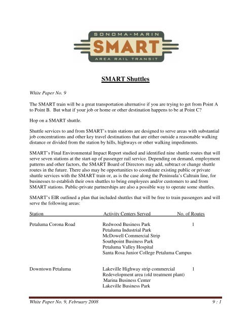
<strong>SMART</strong> <strong>Shuttles</strong><br />
White Paper No. 9<br />
The <strong>SMART</strong> train will be a great transportation alternative if you are trying to get from Point A<br />
to Point B. But what if your job or home or other destination happens to be at Point C?<br />
Hop on a <strong>SMART</strong> shuttle.<br />
Shuttle services to and from <strong>SMART</strong>’s train stations are designed to serve areas with substantial<br />
job concentrations and other key travel destinations that are either outside a reasonable walking<br />
distance or divided from the station by hills, highways or other walking impediments.<br />
<strong>SMART</strong>’s Final Environmental Impact Report studied and identified nine shuttle routes that will<br />
serve seven stations at the start-up of passenger rail service. Depending on demand, employment<br />
patterns and other factors, the <strong>SMART</strong> Board of Directors may add, subtract or change shuttle<br />
routes in the future. There also may be opportunities to coordinate existing public or private<br />
shuttle services with the <strong>SMART</strong> train or, as is the case along the Peninsula’s Caltrain line, for<br />
businesses to establish their own shuttles to bring employees and/or customers to and from<br />
<strong>SMART</strong> stations. Public-private partnerships are also a possible way to operate some shuttles.<br />
<strong>SMART</strong>’s EIR outlined a plan that included shuttles that will be free to train passengers and will<br />
serve the following areas:<br />
Station Activity Centers Served No. of Routes<br />
Petaluma Corona Road Redwood Business Park 1<br />
Petaluma Industrial Park<br />
McDowell Commercial Strip<br />
Southpoint Business Park<br />
Petaluma Valley Hospital<br />
Santa Rosa Junior College Petaluma Campus<br />
Downtown Petaluma Lakeville Highway strip commercial 1<br />
Redevelopment area (old treatment plant)<br />
<strong>Marin</strong>a Business Center<br />
Lakeville Business Park<br />
White Paper No. 9, February 2008 9 : 1
Oakmead Northbay Business Park<br />
Kaiser Permanente Clinic<br />
Novato North Historic Downtown / City Offices 1<br />
Fireman’s Fund<br />
Redwood Boulevard / Auto Row<br />
Vintage Oaks Shopping Center<br />
Sutter North Community Hospital<br />
Novato South Bel <strong>Marin</strong> Keys office complex 1<br />
<strong>Marin</strong> Civic Center County Administration Center 2<br />
Northgate Mall Shopping Center<br />
<strong>Marin</strong> Technology Center<br />
Light industry along Professional Center Parkway,<br />
Redwood Highway, Fair Isaacs<br />
Downtown San Rafael Downtown San Rafael 2<br />
East / West Francisco Blvd. Business Strip<br />
Larkspur Larkspur Ferry Terminal 1<br />
San Quentin Prison<br />
<strong>Marin</strong> General Hospital<br />
College of <strong>Marin</strong><br />
Again, the <strong>SMART</strong> shuttle plan may be modified or expanded to meet demand at and around<br />
various stations. Since the EIR was completed, for example, <strong>SMART</strong> has had discussions with<br />
public transit agencies and private entities about the<br />
possibility of providing shuttle service between<br />
<strong>SMART</strong>’s station in downtown Santa Rosa and that<br />
city’s Courthouse Square-<strong>Transit</strong> Mall area. A shuttle<br />
also has been suggested between the Windsor Station<br />
and the <strong>Sonoma</strong> County Airport. <strong>SMART</strong>’s shuttle<br />
plan is intended to be flexible and responsive to the<br />
needs of <strong>SMART</strong> passengers, and will continue to be<br />
refined as the rail system moves closer to operation.<br />
<strong>SMART</strong> shuttles will supplement, not replace,<br />
existing transit services. <strong>SMART</strong>’s proposed schedule and station locations are designed to allow<br />
the train to work in harmony with local transit. <strong>SMART</strong> will cooperate with local transit districts<br />
to ensure that future routes and schedules maximize opportunities for rail-transit connections<br />
throughout <strong>Marin</strong> and <strong>Sonoma</strong> counties.<br />
<strong>SMART</strong>’s shuttles are modeled after successful shuttles that serve other major rail systems in the<br />
Bay <strong>Area</strong>. For example, more than 25 shuttles link BART to business parks, shopping districts,<br />
airports, hospitals and universities. On the Caltrain line, 42 shuttles funded through public-<br />
White Paper No. 9, February 2008 9 : 2
private partnerships serve a wide variety of destinations. The Altamont Commuter Express<br />
(ACE) rail line from Stockton to San Jose links to a series of color-coded shuttles in San Jose, in<br />
addition to light rail and bus connections.<br />
A number of public-private partnerships also have helped develop additional shuttle services to<br />
rail corridors. Examples include shuttles connecting to Caltrain for employees and students at<br />
Google, Genentech and Stanford University. The highly successful San Francisco State<br />
University shuttle connects the university directly to the Daly City BART Station.<br />
Some local governments have chosen to fund shuttles to<br />
supplement existing transit service, particularly to downtown<br />
shopping areas or community facilities. Examples include<br />
the Burlingame Trolley Shuttle, the Foster City Community<br />
Shuttle and the San Benito County Shuttle – all of which<br />
connect to the Caltrain system.<br />
In its Expenditure Plan, <strong>SMART</strong> included funding for nine<br />
shuttles at rail service start-up. The proposed shuttle system<br />
would be operated under contract to <strong>SMART</strong>, with the rail<br />
district responsible for hiring the contractor, planning shuttle<br />
routes and schedules and monitoring the quality of service. It<br />
is assumed the selected contractor(s) would own and<br />
maintain the shuttle vehicles.<br />
<strong>SMART</strong> shuttle ridership is projected at 500-600 passenger trips per weekday in the year 2025.<br />
As a portion of total daily rail ridership, this estimate is consistent with both MetroLink’s experience<br />
with its southern California commuter rail system and Caltrain’s experience with its<br />
Peninsula commuter rail system.<br />
The routing and scheduling of shuttles would create a 25-minute<br />
circuit, or loop, from departure at a rail station to return. During peakhours<br />
when trains are running at 30-minute intervals, this would permit<br />
a timed transfer at the rail station of five minutes or less. The shuttles<br />
would generally be timed to meet the peak-direction train – southbound<br />
in the morning and northbound in the evening – but could be used by<br />
both southbound and northbound travelers.<br />
The shuttle system is intended to be flexible and may be subject to change<br />
as ridership and future changes in employment patterns warrant. If passenger loads are more or<br />
less than expected, larger or smaller vehicles can be substituted. If traffic congestion increases<br />
the shuttles’ cycle times, the route can be adjusted to fit within the required timing. <strong>Shuttles</strong> may<br />
be added at other stations in the future, subject to <strong>SMART</strong> Board approval.<br />
For more information about <strong>SMART</strong>’s rail and trail project, go to www.sonomamarintrain.org or call<br />
<strong>SMART</strong>’s information lines in <strong>Marin</strong>, 415-419-3510, or <strong>Sonoma</strong>, 707-583-2323.<br />
White Paper No. 9, February 2008 9 : 3
Long<br />
Straub<br />
Petersen<br />
<strong>SMART</strong> Shuttle Routes<br />
Denman<br />
Old Redwood<br />
Ormsby<br />
Carr<br />
Fair<br />
Magnolia<br />
Skillman<br />
Chapman<br />
Western<br />
Holm<br />
McDowell<br />
Paula<br />
Elm<br />
Cherry<br />
Corona<br />
Bodega<br />
Dana<br />
Hill<br />
Oak<br />
Howard<br />
Upham<br />
English<br />
Webster Webster<br />
West<br />
Kent<br />
Keokuk<br />
B<br />
Petaluma<br />
Keller<br />
Riesling<br />
Lynch<br />
<strong>Sonoma</strong> Mtn Mtn<br />
Silva<br />
Drake<br />
A<br />
Ely<br />
Christensen<br />
Redwood<br />
Business Park<br />
Frances<br />
Wagner<br />
Bionda<br />
Stony Stony Point<br />
Bailey<br />
Eastman<br />
Marty<br />
Pereira<br />
Horn<br />
Volkers<br />
Spring Hill<br />
Industrial<br />
Lohrman<br />
Boom<br />
Marshall<br />
Bundesen<br />
Eugenia<br />
Cleveland<br />
A<br />
Stub<br />
Petaluma<br />
Industrial Park<br />
Barre<br />
Century<br />
Ruttenberry<br />
Price<br />
Clegg<br />
Cambridge<br />
Rand<br />
Gossage<br />
Berger<br />
Brayton<br />
Bantam<br />
Samuel<br />
Pamela<br />
Fowler<br />
Cindy<br />
Jessie<br />
Schuman<br />
Amber<br />
Laurel<br />
Napa<br />
<strong>Sonoma</strong><br />
Hill<br />
Andover<br />
Park<br />
Galland<br />
Baker<br />
Haven<br />
Stonehenge<br />
Sycamore<br />
Hayes<br />
Marble<br />
<strong>Sonoma</strong> Mtn<br />
Petaluma Corona Station<br />
A<br />
South Point<br />
Business Center<br />
Florence<br />
Bassett<br />
D<br />
Capri<br />
Sunrise<br />
A<br />
Post<br />
Douglas<br />
10th<br />
C<br />
Serpilio<br />
12th<br />
Oakwood<br />
C<br />
8th<br />
Draco<br />
Transport<br />
Us Hwy 101<br />
<strong>SMART</strong> Corridor<br />
Corridor<br />
4th<br />
E<br />
11th<br />
Holly<br />
Wilson<br />
E<br />
F<br />
7th<br />
G<br />
1st<br />
5th<br />
6th<br />
H<br />
A<br />
Acadia<br />
Banff<br />
Madison<br />
Edith<br />
2nd<br />
I<br />
Sequoia<br />
Ellis<br />
J<br />
Olive<br />
Grant<br />
Rainier<br />
Professional<br />
<strong>Marin</strong><br />
7th<br />
Santa Rosa<br />
Junior College, Petaluma<br />
H<br />
A<br />
A<br />
K<br />
Selmart<br />
Halsey<br />
Clary<br />
Monroe<br />
Madison<br />
Jester<br />
Kenilworth<br />
Washington<br />
Stuart<br />
Mission<br />
Colinda<br />
Mcnear<br />
<strong>Page</strong><br />
Ingram<br />
Rene<br />
Lakeville<br />
McDowell<br />
Linnet<br />
Eastside<br />
Sarah<br />
Alta Alta<br />
Marian<br />
A<br />
Aaron<br />
Albert<br />
Weaverly<br />
Sarkesian<br />
Pacific<br />
Country Club Club<br />
Willow<br />
Petaluma Valley Hospital<br />
A<br />
Crinella<br />
Ivy<br />
Eastside<br />
Appaloosa<br />
McDowell Commercial <strong>Area</strong><br />
Kiwi<br />
Baywood<br />
Ielmorini<br />
Weatherby<br />
Daniel<br />
Garfield<br />
Bluegrass<br />
Ely<br />
Louise<br />
Mark<br />
Downtown Petaluma Station<br />
Redevelopment<br />
<strong>Area</strong><br />
<strong>Marin</strong>a<br />
Business Park<br />
Anna<br />
Lila<br />
Dutch Hill Hill<br />
St Augustine<br />
Juliet<br />
San <strong>Marin</strong>o <strong>Marin</strong>o<br />
Henry<br />
State Hwy 116<br />
A<br />
Bond<br />
Lakeville Hwy<br />
Commercial <strong>Area</strong><br />
Wren<br />
Casa Grande Grande<br />
A<br />
Mcdowell Blvd<br />
A<br />
Oakmead<br />
Northbay<br />
Business Park<br />
Adobe<br />
Adobe Creek Creek<br />
Frates<br />
Frates<br />
Lakeville<br />
Business Park<br />
Pine View<br />
A<br />
Kaiser<br />
Permanente<br />
Sunny Hill Hill<br />
Windsor<br />
Pinnacle<br />
Redwood<br />
Sunnyslope<br />
Mtn View<br />
View<br />
<strong>SMART</strong> Corridor<br />
Corridor<br />
Oxford<br />
Buckeye<br />
Jonas<br />
Highway 101 101<br />
Smith<br />
Westridge<br />
Note: Shuttle Routes are conceptual and will depend on traffic and demand at time of train service start-up.<br />
PETALUMA CORONA STATION & DOWNTOWN PETALUMA STATION<br />
<strong>SMART</strong> Station<br />
<strong>SMART</strong> Corridor<br />
Shuttle Route X<br />
Shuttle Route Y<br />
Miles<br />
0 0.25 0.5 1<br />
Major Road<br />
Road<br />
A<br />
Activity Center<br />
Served by Shuttle<br />
Waterway<br />
May 2008
<strong>SMART</strong> Shuttle Routes<br />
Fireman’s Fund<br />
A<br />
Campus Dr<br />
Novato North Station<br />
Bahia Dr<br />
Laguna Vista Dr<br />
Topaz Dr<br />
Albatross Dr<br />
Marion Ave<br />
Novato Blvd<br />
Grove Ln<br />
Bird Ct<br />
Ignacio Blvd<br />
7th St<br />
Redwood Blvd.<br />
Auto Row<br />
Center Rd<br />
Canyon Rd<br />
Hill Rd<br />
Indian Valley Rd<br />
Garner Dr<br />
6th St<br />
4th St<br />
3rd St<br />
Grant t Ave<br />
Downtown<br />
Novato.<br />
Delmar Ave<br />
Diablo Ave<br />
2nd St<br />
Arthur St<br />
1st St<br />
Elm Dr DrA<br />
Pierce Ln<br />
Redwood Blvd<br />
Nave Ct<br />
A<br />
Reichert eichert Ave<br />
Ave<br />
Hart Ct<br />
Drakewood Pl<br />
Redwood d Blvd<br />
Yukon Way<br />
Novato Blvd<br />
Balra Dr<br />
Palm Dr<br />
Cherry St<br />
Chase St<br />
Landing Ct<br />
Ford Way<br />
Cambridge St<br />
View Ct<br />
Leafwood Dr<br />
Plum St<br />
Lynwood Dr<br />
Midway Blvd<br />
Terry Cir<br />
Equestrian Ct<br />
Davidson St<br />
A<br />
A<br />
Rowland Blvd<br />
A<br />
Silvo Ln<br />
Lea Dr<br />
Larch Dr<br />
Bugeia Ln<br />
Novato Downtown Station<br />
(Alternate)<br />
US HWY 101<br />
Samrose Dr<br />
<strong>SMART</strong> Corridor Corridor<br />
Rose Ct<br />
Sutter North<br />
Community Hospital.<br />
City Hall Offices<br />
Vintage Oaks<br />
Shopping Center<br />
H Ln<br />
Olive Ave<br />
Deer Island Ln<br />
Atherton Ave<br />
School Rd<br />
STATE HWY 37<br />
Sutton Ln<br />
Summit Ln<br />
Tamarin Ln<br />
Montego Key Blvd<br />
Ignacio Wye Station<br />
(Alternate)<br />
Caribe Isle<br />
Crest Rd<br />
Channel Dr<br />
Glen Ln<br />
Harbor Dr<br />
Renaissance Rd<br />
Bel <strong>Marin</strong> Keys Blvd<br />
Bermuda Harbour<br />
MARIN COUNTY<br />
Grandview Ave<br />
Sullivan Rd<br />
Cedar Ave<br />
Hemlock Ave<br />
Oak Ave<br />
Sunset Pky<br />
Prestwick Ct<br />
Indian Way<br />
Wentworth Ln<br />
Aaron Dr<br />
Germaine Pl<br />
San Jose Blvd<br />
Country Club Dr<br />
Fairway Dr<br />
Carnoustie Dr<br />
Ignacio Blvd<br />
Via del Plano<br />
Calle Empinado<br />
Hamilton ilton Dr Dr<br />
Entrada Dr<br />
Jafco Ct<br />
Calle Arboleda<br />
Galli Dr<br />
Dr<br />
A<br />
Digital Dr<br />
Bel <strong>Marin</strong> Keys<br />
Business Center<br />
Commercial Blvd<br />
Novato South Station<br />
Nave Dr<br />
Martin Dr<br />
C St<br />
Palm Dr<br />
Hamilton Station<br />
(Alternate)<br />
Note: Shuttle Routes are conceptual and will depend on traffic and demand at time of train service start-up.<br />
NOVATO NORTH STATION & NOVATO SOUTH STATION<br />
<strong>SMART</strong> Station<br />
Novato South<br />
Station Alternative<br />
<strong>SMART</strong> Corridor<br />
Major Road<br />
Road<br />
A<br />
Shuttle Route X<br />
Shuttle Route Y<br />
Activity Center<br />
Served by Shuttle<br />
Waterway<br />
Miles<br />
0 0.25 0.5 1<br />
May 2008
<strong>SMART</strong> Shuttle Routes<br />
Pelican Ln<br />
Blackstone Dr<br />
Lucas Valley Rd<br />
Kernberry Dr<br />
Cedarberry Ln<br />
Miller Creek Rd<br />
Quietwood Dr<br />
Cedar Hill Dr<br />
Elvia Ct<br />
Ellen Dr<br />
US HWY 101<br />
<strong>SMART</strong> Corridor<br />
North Ave<br />
Canyon Oak Dr<br />
Duran Dr<br />
Las Colindas Rd<br />
<strong>Marin</strong> Technology<br />
Center<br />
Los Gamos Rd<br />
A<br />
Smith Ranch Rd<br />
Paul Dr<br />
A<br />
Fair Isaac<br />
Caleta Ave<br />
Del Ganado Rd<br />
Butternut Dr<br />
Forrest Ln<br />
Elda Dr<br />
Kaiser Medical Center<br />
Trellis Dr<br />
Hickory Ln<br />
Nova Albion Way<br />
Oleander Dr<br />
Las Gallinas Ave<br />
A<br />
A<br />
Northgate Mall<br />
A<br />
Mark Dr<br />
Professional Center<br />
Parkway<br />
Memorial Memorial Dr Dr<br />
San Pedro Rd<br />
Schmidt Ln<br />
Rosal Way<br />
Oxford Dr<br />
<strong>Marin</strong> Civic Center Station<br />
Upper Rd<br />
Bayhills Dr<br />
Civic Center Center Dr<br />
Foothill Rd<br />
Butterfield Rd<br />
Fern Ln<br />
Ridge Rd<br />
Brookside Dr<br />
Center Blvd<br />
Miwok Dr<br />
Sir Francis Drake Blvd<br />
Los Angeles Blvd<br />
San Francisco Blvd<br />
Luna Ln<br />
San Anselmo Ave<br />
Shaw Dr<br />
East Ln<br />
Ray Ct<br />
Sequoia Dr<br />
Greenfield Ave<br />
5th Ave<br />
Ridgewood Dr<br />
Solano St<br />
Robert Ct<br />
Sunset Way<br />
4th St<br />
Forbes Ave<br />
Scenic Ave<br />
Ranch Rd<br />
H St<br />
G St<br />
Los Ranchitos Rd<br />
Quarry Rd<br />
Chula Vista Dr<br />
A<br />
County Administration<br />
Center<br />
Prospect Dr<br />
Villa Ave<br />
Nye St<br />
Lincoln Ave<br />
Aquinas Dr<br />
Grand Ave<br />
Belle Ave<br />
Jewell St<br />
Mountain View Ave<br />
Acacia Ave<br />
Palm Ave<br />
Margarita Dr<br />
Fairway Dr<br />
Mann Dr<br />
Note: Shuttle Routes are conceptual and will depend on traffic and demand at time of train service start-up.<br />
MARIN CIVIC CENTER STATION<br />
<strong>SMART</strong> Station<br />
<strong>SMART</strong> Corridor<br />
Shuttle Route X<br />
Shuttle Route Y<br />
Miles<br />
0 0.25 0.5 1<br />
Major Road<br />
Road<br />
A<br />
Activity Center<br />
Served by Shuttle<br />
Waterway<br />
May 2008
Circle Rd<br />
Riviera Cir<br />
<strong>SMART</strong> Shuttle Routes<br />
Farm Rd<br />
<strong>SMART</strong> Corridor<br />
Corridor<br />
Aquinas Dr<br />
Oakdale Ave<br />
Knight Dr<br />
Moody St<br />
Jordan Ave<br />
Forbes Ave<br />
Happy Ln<br />
Ridgewood Dr<br />
Forbes Ave<br />
Coleman Dr<br />
Villa Ave<br />
Lincoln Ave<br />
Grand Ave<br />
Mountain View Ave<br />
Palm Ave<br />
Margarita Dr<br />
Fairway Dr<br />
Mann Dr<br />
Robinhood Dr<br />
Bayview Dr<br />
Castlewood Dr<br />
Main Dr<br />
Surfwood Cir<br />
US Hwy 101<br />
Las Casas Rd<br />
Miracle Mile<br />
Downtown San Rafael<br />
Lochinvar Rd<br />
Kinross Dr<br />
Goodhill Rd<br />
Evergreen Dr<br />
Rancheria Rd<br />
Canyon Rd<br />
College Ave<br />
Magnolia Ave<br />
Skilark Dr<br />
Citron Ave<br />
Poplar Dr<br />
Laurel Grove Ave<br />
G St<br />
Bon Air Rd<br />
Hawthorne Ave<br />
Madrone Ave<br />
Clark St<br />
4th St<br />
2nd St<br />
Locust Ave<br />
Bayview St<br />
D St<br />
Holcomb Ave<br />
3rd St StA<br />
C St<br />
B St<br />
Oak Ave<br />
Meyer Rd<br />
2nd St<br />
Vista Grande<br />
Lindaro St<br />
Doherty Dr<br />
Irwin St<br />
4th St<br />
Woodland Ave<br />
Bret Harte Rd<br />
Sir Francis Drake Blvd<br />
William Ave<br />
Elm Ave<br />
Jordan St<br />
Picnic Ave<br />
Cielo Dr<br />
Paseo Way<br />
Birch Ave<br />
Bret Ave<br />
Billou St<br />
Lucky Dr<br />
Tamal Vista Blvd<br />
Rose St<br />
Canal St<br />
Novato St<br />
Belvedere St<br />
Bellam Blvd<br />
Jacoby St<br />
Kerner Blvd<br />
Andersen Dr<br />
Irene St<br />
East Francisco Francisco Blvd<br />
Blvd<br />
Point San Pedro Rd<br />
Bellevue Ave<br />
Plom Bo Pl<br />
Main St<br />
Beach Dr<br />
Oak Dr<br />
Monte Alegre Rd<br />
A<br />
Oak Rd<br />
Makin Grd<br />
College of <strong>Marin</strong><br />
Berens Dr<br />
Lilac Ave<br />
Holly Ave<br />
Clayton St<br />
A<br />
Grove St<br />
Opel St<br />
Rice Ln<br />
C St<br />
5th Ave<br />
Diane Ln<br />
McCoy Rd<br />
<strong>Marin</strong><br />
General Hospital<br />
Ash Ave<br />
Tamal Plz<br />
Downtown San Rafael Station<br />
Hillview Ave<br />
East Francisco Blvd<br />
West Francisco Blvd<br />
Via Navarro<br />
East/West Francisco Blvd<br />
Business <strong>Area</strong><br />
A<br />
Andersen Dr<br />
Oakhurst Rd<br />
A<br />
Bahia Ln<br />
Larkspur Station<br />
Larkspur<br />
Ferry Terminal<br />
Bellam Blvd<br />
Kerner Blvd<br />
A<br />
San Quentin<br />
Prison<br />
I-580<br />
Note: Shuttle Routes are conceptual and will depend on traffic and demand at time of train service start-up.<br />
DOWNTOWN SAN RAFAEL STATION & LARKSPUR STATION<br />
<strong>SMART</strong> Station<br />
<strong>SMART</strong> Corridor<br />
Shuttle Route X<br />
Shuttle Route Y<br />
Miles<br />
0 0.25 0.5 1<br />
Major Road<br />
Shuttle Route Z<br />
Road<br />
Waterway<br />
A<br />
Activity Center<br />
Served by Shuttle<br />
May 2008