

Strategic Flood Risk Assessment - Hambleton District Council
Strategic Flood Risk Assessment - Hambleton District Council
Strategic Flood Risk Assessment - Hambleton District Council

You also want an ePaper? Increase the reach of your titles
YUMPU automatically turns print PDFs into web optimized ePapers that Google loves.
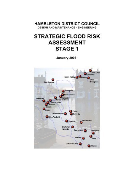
HAMBLETON DISTRICT COUNCIL<br />
DESIGN AND MAINTENANCE - ENGINEERING<br />
STRATEGIC FLOOD RISK<br />
ASSESSMENT<br />
STAGE 1<br />
January 2006
CONTENTS<br />
• INTRODUCTION Pages 3-14<br />
• SUMMARY OF FLOODING ISSUES Page 16<br />
• STOKESLEY AREA - DISCUSSION<br />
DISCUSSION<br />
• Stokesley Page 18-19<br />
• Great Ayton Page 19<br />
• Great Broughton Page 20<br />
• Hutton Rudby & Rudby Page 20<br />
• NORTHALLERTON AREA - DISCUSSION<br />
• Northallerton Page 21-22<br />
• Brompton Page 21-22<br />
• Romanby Page 21-22<br />
• East Cowton Page 22-23<br />
• Morton-on-Swale Page 23<br />
• BEDALE AREA - DISCUSSION<br />
• Bedale Page 24<br />
• Aiskew Page 24<br />
• Crakehall Page 24-25<br />
• Leeming Bar & Leeming Page 25<br />
• Snape Page 25-26<br />
• West Tanfield Page 26<br />
• THIRSK AREA - DISCUSSION<br />
• Thirsk Page 27<br />
• Sowerby Page 27<br />
• Carlton Miniott Page 27-28<br />
• Dalton Page 28<br />
• Topcliffe Page 29<br />
• EASINGWOLD AREA - DISCUSSION<br />
• Easingwold Page 30<br />
• Brafferton and Helperby Page 30<br />
• Huby Page 31<br />
• Husthwaite Page 31<br />
• Linton-on-Ouse Page 31-32<br />
• Shipton Page 32<br />
• Stillington Page 32-33<br />
• Tollerton Page 33<br />
1
CONTENTS – continued:-<br />
• PLANS – General Key Page 34<br />
• STOKESLEY AREA - PLANS<br />
• Stokesley Page 36-37<br />
• Great Ayton Page 38-40<br />
• Great Broughton Page 41<br />
• Hutton Rudby & Rudby Page 42<br />
• NORTHALLERTON AREA - PLANS<br />
• Northallerton Page 43-45<br />
• Romanby Page 46-48<br />
• Brompton Page 49-50<br />
• East Cowton Page 51<br />
• Morton-on-Swale Page 52<br />
• BEDALE AREA - PLANS<br />
• Bedale Page 53<br />
• Aiskew Page 54<br />
• Crakehall Page 55<br />
• Leeming Bar & Leeming Page 56-57<br />
• Snape Page 58<br />
• West Tanfield Page 59<br />
• THIRSK AREA - PLANS<br />
• Thirsk Page 60-62<br />
• Sowerby Page 63-64<br />
• Carlton Miniott Page 65<br />
• Dalton Page 66-68<br />
• Topcliffe Page 69-70<br />
• EASINGWOLD AREA - PLANS<br />
• Easingwold Page 71-72<br />
• Brafferton and Helperby Page 73<br />
• Huby Page 74<br />
• Husthwaite Page 75<br />
• Linton-on-Ouse Page 76-77<br />
• Shipton Page 78-79<br />
• Stillington Page 80<br />
• Tollerton Page 81<br />
• ANNEX A – SUMMARY OF CONSULTATION RESPONSES Page 82<br />
• ANNEX B – STRATEGIC FLOOD ZONE PLANS Page 86<br />
• Stokesley area<br />
• Northallerton area<br />
• Bedale area<br />
• Thirsk area<br />
• Easingwold area<br />
2
1.0 INTRODUCTION<br />
1.1 <strong>Hambleton</strong> <strong>District</strong> <strong>Council</strong> Engineering Section was commissioned in July<br />
2004 to undertaking a Stage 1 <strong>Flood</strong> <strong>Risk</strong> <strong>Assessment</strong> study as part of the<br />
preparation of the Local Development Framework (LDF). The LDF will replace<br />
the current <strong>District</strong> Wide Local Plan and will set out policies and proposals for<br />
the development of the <strong>District</strong> to 2021.<br />
1.2 This Stage 1 assessment identifies:-<br />
• Areas which could be developable subject to the sequential<br />
characterisation of flood risk and the provision of an appropriate <strong>Flood</strong><br />
<strong>Risk</strong> <strong>Assessment</strong> where required (i.e. those areas in <strong>Flood</strong> Zones 1, 2 &<br />
3).<br />
• Areas where potential additional flood risks have been identified. These<br />
areas could be developable subject to the provision of an appropriate<br />
<strong>Flood</strong> <strong>Risk</strong> <strong>Assessment</strong>.<br />
1.3 Detailed assessments of individual sites are to be undertaken where<br />
necessary under a Stage 2 process outside the remit of this report once<br />
‘Preferred Option’ allocation proposals have been developed.<br />
1.4 All of the maps and plans in this report are based from the Environment<br />
Agency September 2005 <strong>Flood</strong> Zone map. The Agency has a continuous<br />
programme of reviewing its assessments of flood risk. This may lead to<br />
adjustments to those areas defined as at risk, and updated <strong>Flood</strong> Zone maps<br />
are regularly issues. This document should therefore be cross referenced<br />
with the latest <strong>Flood</strong> Zone maps, which can be viewed on the Environment<br />
Agency’s website – www.environment-agency.gov.uk.<br />
1.5 The data on the <strong>Flood</strong> Zone map illustrates <strong>Flood</strong> Zones as defined by the<br />
Government’s Planning Policy Guidance Note 25 on “Development and <strong>Flood</strong><br />
<strong>Risk</strong>” for England (PPG25) dated July 2001. These <strong>Flood</strong> Zones illustrate the<br />
probability of flooding across England for planning.<br />
1.6 Three levels of risk are identified:-<br />
Zone 3 - High <strong>Risk</strong> This is the Agency’s best estimate of the area of land at<br />
risk in a flood with a 1% (1 in 100) chance or greater of occurring in any in<br />
any year from rivers and 0.5% (1 in 200) chance or greater from the sea.<br />
Zone 2 – Low to Medium <strong>Risk</strong> This is the Agency’s best estimate of the area<br />
of land at risk in a flood with between a 0.1% (1 in 1000) chance or greater<br />
and a 1% (1 in 100) chance of occurring in any one year from rivers. And<br />
between 0.1% (1 in 1000) or greater and 0.5% (1 in 200) chance of occurring<br />
in any one year from the sea.<br />
Zone 1 – Little or No <strong>Risk</strong> The remaining land is the Agency’s best estimate<br />
of the area of land at risk in a flood with a 0.1% (1 in 1000) chance or less of<br />
occurring in any one year from river, tidal or sea.<br />
3
1.8 The absence of <strong>Flood</strong> Zone 2 and 3 areas does guarantee that there is little<br />
or no risk of flooding. Small watercourse catchments i.e. less than 3sqkm may<br />
not be accurately mapped for flooding purposes due to current survey<br />
technology. So it should be noted that locations next to rivers and streams<br />
may be at some risk of flooding even where the Environment Agency’s <strong>Flood</strong><br />
Zone map indicates that they are in <strong>Flood</strong> Zone 1. It is also possible that<br />
locations remote from watercourses may also be at risk from flooding e.g.<br />
during intense rainfall events.<br />
1.9 The plans in this report also include information on the recorded sandbag<br />
allocations by <strong>Hambleton</strong> <strong>District</strong> <strong>Council</strong> during the period from<br />
October/November 2000 to present. This information is not fully<br />
comprehensive as it may not include the full list of bags collected by the<br />
public direct from the depot and bulk allocations. It should also be noted that<br />
the allocation of sandbags to a property does not necessarily mean that<br />
flooding actually occurred at the property or indicate the type of the flooding if<br />
it did occur.<br />
1.10 The main bulk of the records are based on allocations during the following<br />
heavy rain events: -<br />
• October / November 2000<br />
• 31 July 2002<br />
• 10 August 2003<br />
• 18-19 April 2004<br />
• 23 June 2004<br />
1.11 Also marked on the plans are areas, generally located within <strong>Flood</strong> Zone 1,<br />
where potential additional flood risks have been identified. These may be due<br />
to high-water table, land drainage issues, highway or sewerage infrastructure<br />
or overland flows.<br />
1.12 The supplemental flood risk information is based on <strong>Hambleton</strong> <strong>District</strong><br />
<strong>Council</strong>’s in-house knowledge of problems that may cause an increased flood<br />
risk.<br />
2.0 ROLES AND RESPONSIBILITIES<br />
2.1 Roles and responsibilities in relation to development and flood risk lie with a<br />
range of bodies. To summarise:<br />
2.2 The Owner – Landowners have the primary responsibility for safeguarding<br />
their land and other property against natural hazards such as flooding.<br />
Individual property users and owners are also responsible for managing the<br />
drainage of their land in such a way as to prevent, as far as is reasonably<br />
practicable, adverse impacts on neighbouring land.<br />
2.3 The Developer – potential developers must demonstrate that their proposals<br />
are consistent with national and local policies on flooding, assess whether the<br />
proposed development would be affected by flooding or whether it would<br />
increase flood risk elsewhere, and demonstrate that any flood risks arising<br />
from the development would be properly managed.<br />
4
2.4 The Government – There is no general statutory responsibility on the<br />
Government to protect land or property against flooding. The Government<br />
does however recognise the need for action to safeguard the wider social and<br />
economic wellbeing of the country, including adapting to the impacts of<br />
climate change. The Department for Environment, Food and Rural Affairs<br />
provide national strategic guidance and specialist advice on flooding. They<br />
fund most of the Environment Agency’s activities in this area and provide<br />
grant aid for flood management schemes to the Environment Agency, Internal<br />
Drainage Boards and Local Authorities.<br />
2.5 The Local Planning Authority – must consult the Environment Agency when<br />
considering planning applications which may have an impact on flood risk. In<br />
preparing their Local Development Frameworks they should ensure that land<br />
allocations, development control policies and sustainability appraisals are<br />
informed by a <strong>Strategic</strong> <strong>Flood</strong> <strong>Risk</strong> <strong>Assessment</strong>.<br />
2.6 Operating Authorities – which include the Environment Agency, Local<br />
Authorities and Internal Drainage Boards – have permissive powers to carry<br />
out or maintain land drainage or flood defence works in the public interest.<br />
2.7 Highway Authorities – The Highways Agency is responsible for managing<br />
road drainage from trunk roads. Local Authority highways i.e. North Yorkshire<br />
County <strong>Council</strong> have responsibility for managing drainage from roads on their<br />
road network, in so far as ensuring that drains which are their responsibility<br />
are maintained.<br />
2.8 Sewerage Undertakers – Sewerage Undertakers are responsible for the<br />
public foul and surface water sewerage infrastructure.<br />
2.9 Further details on roles and responsibilities in relation to development and<br />
flood risk are set out in PPG25.<br />
3.0 THE STRATEGIC APPROACH TO MANAGING FLOOD RISK<br />
3.1 <strong>Flood</strong>ing from rivers and coastal waters is a natural process that plays an<br />
important role in shaping the natural environment. The damage that results to<br />
people and property is a consequence of previous human decisions about the<br />
location and nature of settlement and land use. Such damage cannot be<br />
prevented entirely, although its effects can be reduced.<br />
3.2 <strong>Flood</strong>ing can cause substantial damage to property and threaten human life.<br />
The Easter floods of 1998 caused 5 deaths, £400M damage and resulted in<br />
1500 people being evacuated from their homes. The more recent floods of<br />
autumn 2000 flooded approximately 10,000 properties and businesses in 700<br />
locations and 11,000 families were evacuated. The damage estimates for the<br />
flood event and associated wind storms are £700M 1 .<br />
3.3 It is estimated that five million properties are now at risk from flooding in<br />
England and Wales. Two million homes have been built in the natural flood<br />
plain of rivers or the coast and are vulnerable to flooding. The value of<br />
property, land and assets at risk from flooding in England and Wales is £214<br />
billion. Scientists predict that climate change may lead to more frequent<br />
flooding in the future.<br />
1 Figures relate to England and Wales.<br />
5
3.4 It is recognised that it is unsustainable to continue to build flood defences to<br />
protect development from flooding. And by developing in inappropriate<br />
locations with or without flood protection the number of properties subject to<br />
flood risk will increase.<br />
3.5 The Environment Agency has developed a strategic approach towards<br />
managing flood risk. This has five main strands:<br />
• Catchment/land management<br />
• Utilisation of natural washlands<br />
• Managing development through planning<br />
• <strong>Flood</strong> forecasting, Emergency response and self-help<br />
• Traditional flood defences<br />
Planning Policy Guidance Note 25: Development and <strong>Flood</strong> <strong>Risk</strong> 2<br />
3.6 Planning Policy Guidance Note 25 sets out Government policy on planning for<br />
flood risk. It explains how flood risk should be considered at all stages of the<br />
planning and development process in order to reduce risk to people and the<br />
built and natural environment.<br />
3.7 PPG25 makes it clear that the planning system should ensure that new<br />
development is safe and not exposed unnecessarily to flooding by<br />
considering flood risk on a catchment wide basis and, where necessary<br />
across administrative boundaries. <strong>Flood</strong> risk should be reduced where<br />
possible and certainly not increased. <strong>Flood</strong> plains should be used for their<br />
natural purposes, enabled to continue to function effectively, and be protected<br />
from inappropriate development.<br />
3.8 PPG25 particularly advises Local Authorities to apply a precautionary<br />
principle to the issue of flood risk, using a risk based sequential test approach<br />
to avoid risk where possible and manage it elsewhere.<br />
3.9 The guidance also states that:<br />
• the susceptibility of land to flooding is a material planning consideration;<br />
• the Environment Agency has the lead role in providing advice on flood<br />
issues, at a strategic level and in relation to planning applications;<br />
• policies in development plans should outline the consideration which will<br />
be given to flood issues, recognising uncertainties that are inherent in the<br />
prediction of flooding and that flood risk is expected to increase as a<br />
result of climate change;<br />
• planning authorities should recognise the importance of functional flood<br />
plains, where water flows or is held at times of flood, and avoid<br />
inappropriate development on undeveloped and undefended flood plains;<br />
2 At the time of going to print consultation was underway on Planning Policy Statement 25:<br />
Development and <strong>Flood</strong> <strong>Risk</strong>. This, when final, will replace PPG25.<br />
6
• developers should fund the provision and maintenance of flood defences<br />
that are required because of the development; and<br />
• planning policies and decisions should recognise that the consideration of<br />
flood risk and its management needs to be applied on a whole-catchment<br />
basis and not be restricted to flood plains.<br />
3.10 Reducing the vulnerability of the country to the dangers and damage caused<br />
by unmanaged flood contributes to the achievement of a better quality of life<br />
and the objectives of sustainable development. Local planning authorities<br />
should, therefore, address the problems which flooding can cause by:<br />
• recognising that the susceptibility of land to flooding is a material planning<br />
consideration;<br />
• giving appropriate weight to information on flood-risk and how it might be<br />
affected by climate change in preparing development plans and<br />
considering individual proposals for development;<br />
• consulting the Environment Agency which has the lead role in providing<br />
advice on flood issues at a strategic level and in relation to planning<br />
applications and other relevant organisations;<br />
• applying the ‘precautionary principle’ to decision making so that risk is<br />
avoided where possible and managed elsewhere;<br />
• improving information available to the public about the risks of locating<br />
human activities in areas susceptible to flooding;<br />
• taking into account the responsibility of owners for safeguarding their own<br />
property as far as is reasonably practicable;<br />
• recognising that flood plains 3 and washlands 4 have a natural role as a<br />
form of flood defence as well as providing important wildlife habitats and<br />
adding to landscape value and;<br />
• recognising that engineered flood reduction measures may not always be<br />
the appropriate solution, since they can have economic and<br />
environmental costs and impacts on the natural and built environment,<br />
need maintenance and replacement and cannot eliminate all risk of<br />
flooding<br />
3.11 The guidance set out in PPG25, and in particular the sequential test,<br />
should be applied in determining the allocation of land for future<br />
3 All land adjacent to a watercourse, as defined in the Land Drainage Act 1991, or coast over<br />
which water flows in time of flood or would flood but for the presence of flood defences where<br />
they exist.<br />
4 Area of flood plain where water is stored in time of flood. Such an area may have its<br />
effectiveness enhanced by the provision of structures to control the amount of water stored<br />
and the timing of its release to alleviate peak flood flows downstream.<br />
7
development within <strong>Hambleton</strong> through the <strong>Hambleton</strong> Local<br />
Development Framework. Further information on the sequential test is<br />
given later in this report.<br />
Sustainable Development and the Precautionary Principle<br />
3.12 In 1987 the Bruntland commission defined sustainability as “Meeting the<br />
needs of the present generation without compromising the ability of the future<br />
generations to meet their own needs”.<br />
3.13 In terms of flood risk it is recognised that we cannot continue to allow<br />
development within flood plains and in tandem allow the construction of<br />
engineered flood defences to protect that development. We must use a<br />
sustainable approach to flood risk which may involve avoiding additional<br />
development in some areas. Where this is not possible, developments need<br />
to be of a design and with an appropriate level of protection to ensure that the<br />
risk of damage from flooding is minimised, while not increasing the risk of<br />
flooding elsewhere.<br />
3.14 The threat of flooding needs to be managed in an environmentally sensitive<br />
way. <strong>Flood</strong>ing is part of the natural cycle of events. In extreme circumstances<br />
however and sometimes when human activity has worsened its impact, it can<br />
lead to the destruction of ecosystems and habitats, and destroy buildings and<br />
infrastructure on which the economy and society are dependent.<br />
3.15 Potential damage from flooding can be both unpredictable and uncertain, but<br />
can be significant and in some circumstances potentially irreversible.<br />
Because of this we should use the precautionary principle in the planning<br />
system to manage development and flood risk to help achieve the objectives<br />
of sustainable development.<br />
3.16 The precautionary principle states – “where there are threats of serious or<br />
irreversible damage, lack of full scientific certainty shall not be used as a<br />
reason for postponing cost-effective measures to prevent environmental<br />
degradation”. The application of the principle to the hazard of flooding<br />
acknowledges the uncertainty inherent in flood estimation and, by proceeding<br />
from the known facts and taking a precautionary approach to uncertainties,<br />
enables more open and better-informed decisions to be made.<br />
3.17 While there remain uncertainties, the importance of acting on a precautionary<br />
basis in relation to development and flood risk has increased in recent years<br />
by:<br />
• the growth in knowledge of the likely impacts of climate change and their<br />
effect on flood risk over time;<br />
• more sustainable alternatives to conventional drainage systems, which<br />
can assist in reducing downstream flooding;<br />
• advances in management planning in relation to both river catchments<br />
and coastal cells.<br />
<strong>Flood</strong> Zone Maps<br />
3.18 As part of the strategic approach to flood risk management the Government<br />
made available the indicative flood plain maps, subsequently with<br />
improvements in technology, information on the maps has been improved and<br />
8
latterly the maps were reissued in April 2004 as <strong>Flood</strong> Maps with <strong>Flood</strong> Zones<br />
incorporated for use by local planning authorities. These maps are regularly<br />
updated by the Environment Agency and are published on their website.<br />
3.19 The <strong>Flood</strong> Map is a tool to raise awareness of flood risk with the public, local<br />
authorities, emergency services and drainage authorities. The <strong>Flood</strong> Zones<br />
are incorporated within the <strong>Flood</strong> Map so that Planning Authorities can have<br />
easy access to information to support the implementation of PPG25 and the<br />
sequential test.<br />
3.20 The flood map information is indicative rather than specific and recipients of<br />
the flood map may need to consult the Environment Agency where<br />
appropriate. The Environment Agency will update this data as better<br />
information becomes available e.g. changes in hydrological river response,<br />
observations following flood events or improved modelling techniques.<br />
<strong>Risk</strong>-based approach and the sequential test<br />
3.21 LPA’s should adopt a risk-based approach to proposals for development in or<br />
affecting flood-risk areas. The assessment of risk should take account of:<br />
• the area liable to flooding;<br />
• the probability of it occurring, both now and over time;<br />
• the extent and standard of existing flood defences and their effectiveness<br />
over time;<br />
• the likely depth of flooding;<br />
• the rates of flow likely to be involved;<br />
• the likelihood of impacts to other areas, properties and habitats;<br />
• the effects of climate change;<br />
• the nature and current expected lifetime of the development proposed and<br />
the extent to which it is designed to deal with flood risk.<br />
3.22 The Government expects local planning authorities to apply a risk-based<br />
approach to the preparation of development plans and their decisions on<br />
development control through a sequential test. Developers seeking sites for<br />
housing and other development should also have regard to this test.<br />
3.23 Accordingly, in drawing up or revising policies in development plans and in<br />
considering applications for development in cases where plans do not yet<br />
reflect the following, local planning authorities should give priority in allocating<br />
or permitting sites for development, in descending order to the <strong>Flood</strong> Zones<br />
set out below, including sub-divisions in Zone 3. When allocating land in<br />
development plans or deciding applications for development at a particular<br />
location, those responsible for the decision would be expected to demonstrate<br />
that there are no reasonable options available in a lower-risk category,<br />
consistent with other sustainable objectives.<br />
3.24 Locally in all zones, an assessment may be needed of the risk of groundwater<br />
flooding or local flooding due to overland sheet flow or run-off exceeding the<br />
capacity of the drainage systems during prolonged or intense rainfall. <strong>Flood</strong>resistant<br />
construction may be required in all areas, depending on the results<br />
of that assessment. The run-off implications of development should be<br />
assessed for all zones and controlled, where possible through the use of<br />
sustainable drainage systems (SUDS).<br />
9
The sequential characterisation of flood risk<br />
<strong>Flood</strong> Zone 1 – Little or no risk<br />
3.25 Annual probability of flooding: River, tidal and coastal
Residential uses should be limited to job-related accommodation (e.g.<br />
caretakers and operational staff). Caravan and camping sites should<br />
generally not be located in these areas. Where, exceptionally, development is<br />
permitted, it should be provided with the appropriate minimum standard of<br />
flood defence and should not impede flood flows or result in a net loss of<br />
flood-plain storage.<br />
3.32 c. Functional flood plains<br />
Notes:<br />
These areas may be suitable for some recreation, sport, amenity and<br />
conservation uses (provide adequate warning and evacuation procedures are<br />
in place). Built development should be wholly exceptional and limited to<br />
essential transport and utilities infrastructure that has to be there. Such<br />
infrastructure should be designed and constructed so as to remain<br />
operational even at times of flood, to result in no net loss of flood-plain<br />
storage, not to impede water flows and not to increase flood risk elsewhere.<br />
There should be a presumption against provision of camping and caravan<br />
sites.<br />
(a) All risks relate to the time at which a land allocation decision is made or an<br />
application submitted. The Environment Agency will publish maps of these<br />
<strong>Flood</strong> Zones. <strong>Flood</strong> Zones should be identified from Agency flood data<br />
ignoring the presence of flood defences. Local planning authorities should,<br />
with the Agency, identify those areas currently protected by defences and the<br />
standard of protection provided by those defences.<br />
(b) Development should not be permitted where existing sea or river defences,<br />
properly maintained would not provide an acceptable standard of safety over<br />
the lifetime of the development, as such land would be extremely vulnerable<br />
should a flood defence embankment or sea wall be breached, in particular<br />
because of the speed of flooding in such circumstances.<br />
3.33 Further considerations<br />
Within the sequential test there are exceptions and further considerations.<br />
3.34 1. Insurance considerations<br />
The insurance industry has become increasingly concerned about<br />
environmental risks, including flooding, and the scale of claims to which they<br />
give rise. So the industry is continuing to assess and review its position in<br />
respect of flood risk, particularly in response to the November 2000 flooding<br />
events. Companies are employing increasingly sophisticated techniques to<br />
identify the risk to specific properties, notably ‘Norwich Union’. It follows that<br />
developments subject to flood risk could face increasing difficulties with the<br />
cost and availability of insurance, which in turn could cause problems for<br />
property buyers in obtaining mortgages. Typically insurers are seeking flood<br />
protection against a 1 in 75 year return period flooding event, otherwise there<br />
maybe restrictions in policy coverage or the availability of insurance.<br />
3.35 2. Previously developed land<br />
11
The Government places great emphasis on the need for urban regeneration<br />
and the redevelopment of previously developed land (brown-field land) to<br />
minimise the need for development of green-field land. Much of the past<br />
development took place alongside rivers so some previously developed land<br />
may be vulnerable to flooding. This does preclude development on affected<br />
sites, though in seeking to redevelop such land, then the risk of flooding, the<br />
standards of existing flood defences and the ability to improve them should be<br />
taken into account. Known risks of flooding can be mitigated by confirmed<br />
good levels of flood protection, including protected access, prudent design of<br />
development and effective warning mechanisms.<br />
3.36 3. <strong>Flood</strong> defences<br />
Government and Environment Agency resources are directed at protecting<br />
existing developments, where this can be achieved at reasonable economic<br />
and environmental cost in relation to the numbers of people at risk and the<br />
value of protected assets. Resources are not available to provide defences in<br />
anticipation of possible future development.<br />
3.37 Plans should not provide for development in undeveloped high-risk areas that<br />
are not currently protected to an appropriate standard, unless that location is<br />
essential for particular development or there are no alternative locations in<br />
lower risk area. However the development should be designed to cope with<br />
the risk of flooding or include effective proposals to protect the land. <strong>Flood</strong><br />
defence work must be fully funded including provision for long term<br />
maintenance as part of the development.<br />
3.38 It should be noted that flood defences can only reduce the risk of flooding,<br />
they cannot eliminate it entirely. <strong>Flood</strong> defences designed to protect against a<br />
certain level of flood event can be overtopped by a flood event of greater<br />
magnitude.<br />
3.39 4. <strong>Flood</strong> <strong>Risk</strong> sites<br />
Development sites which are likely to require particular consideration of flood<br />
risk include:<br />
• those within a river flood plain or washland shown on the <strong>Flood</strong> Map<br />
prepared by the Environment Agency;<br />
• within or adjacent to any watercourse, particularly where there might be<br />
potential for flash flooding;<br />
• adjacent to or including any flood bank or other flood control structure;<br />
• situated in an area where the Agency have indicated that there may be<br />
drainage problems;<br />
• likely to involve the culverting or diverting of any watercourse; or<br />
• of such a size or nature relative to the receiving watercourse/drainage<br />
system that there could be a significant increase in the surface water runoff<br />
from the area.<br />
12
3.40 5. Development behind existing flood defences<br />
For development behind river flood defences, subject to the sequential test<br />
such development should not be permitted where existing flood defences,<br />
properly maintained and in combination with agreed warning and evacuation<br />
arrangements, would not provide an acceptable standard of safety.<br />
4.0 FUTURE LEGISLATION AND STRATEGY<br />
4.1 Two Government initiatives which will shape the how flooding is managed in<br />
the future are now part way through their cycle.<br />
4.2 The ‘Making Space for Water’ consultation document was published in July<br />
2004, setting out the strategy for managing flood and coastal erosion risk over<br />
the medium term, i.e. the 10 to 20 year horizon. The thrust of the strategy is<br />
to develop a risk based approach to manage flood and coastal erosion rooted<br />
in sustainable development principles. Also to develop a holistic approach<br />
involving all stakeholders and ensuring adaptability to climate change<br />
becomes an integral part of all flooding and coastal erosion management<br />
decisions.<br />
4.3 Following a positive response to the strategy consultation document the<br />
Government is now looking at how the strategy can be delivered.<br />
4.4 The second Government initiative is Planning Policy Statement 25 (PPS 25),<br />
this is currently out for consultation and will in due course replace Planning<br />
Policy Guidance 25 (PPG 25). The aim of PPS 25 is to focus on national<br />
policy and to provide clarity on what is required at regional and local levels to<br />
ensure that decisions are made at the most appropriate level and in a timely<br />
fashion to deliver sustainable planning for development and flood risk.<br />
4.5 The PPS draft has been developed to reflect the direction set out in ‘Making<br />
Space for Water’ (Defra 2004) and support the holistic approach to flood and<br />
coastal erosion risk management.<br />
4.6 Consultation on PPS25 closes at the end of February 2006.<br />
5.0 STUDY FINDINGS AND RECOMMENDATIONS<br />
5.1 Survey work has been undertaken to identify flood risk issues in <strong>Hambleton</strong>’s<br />
five market towns and a selection of the <strong>District</strong>’s larger villages in order to<br />
identify any flooding related issues that will need to be taken into account if<br />
land in or adjacent to those settlements is to be allocated for future<br />
development in the new <strong>Hambleton</strong> Local Development Framework.<br />
5.2 At the time of commissioning the study it was not known which settlements<br />
would require allocations. The inclusion of a settlement in the list below does<br />
not therefore indicate that it will have allocations in the Local Development<br />
Framework. Similarly the absence of a settlement from the list does not<br />
indicate that it will not have allocations.<br />
5.3 Market Towns Covered by the Study<br />
Stokesley<br />
Northallerton with Romanby<br />
13
Bedale with Aiskew<br />
Thirsk with Sowerby<br />
Easingwold<br />
5.4 Villages Covered by the Study<br />
Stokesley area:<br />
Great Ayton<br />
Great Broughton<br />
Hutton Rudby (Incl. Rudby)<br />
Northallerton area:<br />
Brompton<br />
East Cowton<br />
Morton on Swale<br />
Bedale area:<br />
Crakehall<br />
Leeming Bar and Leeming<br />
West Tanfield<br />
Thirsk area:<br />
Carlton Miniott<br />
Dalton<br />
Topcliffe<br />
Easingwold area:<br />
Brafferton<br />
Helperby<br />
Huby<br />
Husthwaite<br />
Linton-on-Ouse<br />
Shipton<br />
Stillington<br />
Shipton<br />
5.5 This document has been produced in consultation with the Environment Agency,<br />
relevant Internal Drainage Boards, Parish and Town <strong>Council</strong>s representing those<br />
settlements covered in the report, North Yorkshire County <strong>Council</strong>, Yorkshire<br />
Water Services and Northumbrian Water. Details of the responses are contained<br />
in Annex A.<br />
14
<strong>Flood</strong> <strong>Risk</strong> <strong>Assessment</strong>s Stage 1 - Summary Chart<br />
This chart summarises the various known type of flooding conditions and ancillary information indicated within the bounds of each town or village detailed in this report.<br />
Stokesley Area<br />
Northallerton<br />
Area<br />
Bedale<br />
Area<br />
Thirsk<br />
Area<br />
Easingwold Area<br />
Town / Village<br />
100 year<br />
<strong>Flood</strong>plain<br />
1000 year<br />
<strong>Flood</strong>plain<br />
Sandbags<br />
Record<br />
Highway<br />
<strong>Flood</strong>ing<br />
High-water<br />
table<br />
Overflow from<br />
piped system<br />
Watercourse /<br />
Culvert<br />
Pending<br />
Alleviation<br />
Stokesley Yes Yes Yes Yes Yes Yes<br />
Great Ayton Yes Yes Yes Yes<br />
Great Broughton Yes Yes<br />
Rudby Yes Yes Yes Yes Yes<br />
Hutton Rudby Yes Yes<br />
Northallerton Yes Yes Yes Yes Yes Yes<br />
Brompton Yes Yes Yes Yes Yes<br />
Romanby Yes Yes Yes Yes Yes<br />
East Cowton Yes Yes<br />
Morton on Swale Yes Yes Yes Yes Yes<br />
Bedale Yes Yes<br />
Aiskew Yes Yes<br />
Crakehall Yes Yes<br />
Leeming Bar / Leeming Yes Yes Yes Yes Yes Yes<br />
Snape Yes Yes<br />
West Tanfield Yes Yes Yes Yes<br />
Thirsk Yes Yes Yes Yes<br />
Sowerby Yes Yes Yes Yes<br />
Carlton Miniott Yes Yes Yes Yes Yes<br />
Dalton Yes Yes Yes Yes<br />
Topcliffe Yes Yes Yes Yes Yes<br />
Easingwold Yes Yes Yes<br />
Brafferton & Helperby Yes Yes<br />
Huby No No Yes Yes<br />
Husthwaite Yes Yes<br />
Linton-on-Ouse Yes Yes Yes Yes<br />
Shipton Yes Yes Yes Yes<br />
Stillington Yes Yes Yes Yes<br />
Tollerton Yes Yes Yes Yes<br />
Existing<br />
Defences
DISCUSSION<br />
STOKESLEY AREA<br />
• Stokesley<br />
Background<br />
Stokesley is situated in a generally flat landscape. The River Leven flows through the town<br />
and the River Tame flows past it to the north and west. The two rivers converge to the south<br />
west of the town.<br />
After a series of flooding events in Stokesley during the 1960’s a flood defence channel (FDC)<br />
was installed in 1978, such that high flows in the river could by-pass the town. The FDC<br />
provides protection against a 1 in 40 year flood event.<br />
Further flooding affected the town and surrounding areas during the wider national flooding<br />
event in November 2000, this was one of the catalysts that led to a reassessment of flood risk<br />
in the upper Leven catchment in which Stokesley is situated. The EA commissioned a<br />
<strong>Strategic</strong> Review of <strong>Flood</strong> <strong>Risk</strong> Management along the upper reaches of the Upper Leven.<br />
The Strategy is seeking to identify flood risk management issues and develop sustainable<br />
options for flood alleviation over a long term period.<br />
The outcome of the study revealed that the existing FDC continues to provide its original<br />
design standard of flood protection to Stokesley, i.e. protection against 1 in 40 year flood<br />
event. This relatively high base level of protection means that the provision of a higher level of<br />
flood defence is not economically justifiable at this time, so from the review it was determined<br />
that a targeted programme of maintenance be developed to sustain the present standard of<br />
flood protection to Stokesley and that the flood risk management strategy be subject to<br />
periodic review.<br />
The introduction of <strong>Flood</strong> Zones by the Environment Agency in July 2004 in accordance with<br />
PPG25 coincided with new flood mapping technology and a significant reduction in the<br />
extents of <strong>Flood</strong> Zone 3 (1 in 100 year flooding).<br />
<strong>Flood</strong>ing<br />
The major influences on the extents of <strong>Flood</strong> Zones 2 and 3 and the flooding events in<br />
Stokesley are the Leven and Tame rivers.<br />
The reduction in the extents of the <strong>Flood</strong> Zone 2 and 3 areas mentioned above has<br />
particularly affected land to the north and west of the town, though there are still areas of<br />
<strong>Flood</strong> Zones 2 & 3 in that area in association with the River Tame. A further area to the north<br />
of the town, along the B1365, has been identified as having land drainage issues as it is<br />
subject to surface water ponding during storm events.<br />
The other area of potential concern is the greenfield land on the north western side of the<br />
town between the existing development and the <strong>Flood</strong> Zone 2 and 3 extents associated with<br />
the River Tame. During the course of previous development areas with high water table have<br />
been identified. This does not preclude development, though further investigation should be<br />
undertaken to determine the extent and nature of the high water table and whether it will<br />
effect potential development.<br />
<strong>Flood</strong> Zones 2 and 3 still extend over much of the land to the south and east of the town,<br />
including existing residential areas. This potentially places a significant restriction on<br />
development.<br />
18
Most of the industry in Stokesley is located on the industrial park to the south-east of the<br />
town. The <strong>Flood</strong> Defence Channel (FDC) that passes the northern side of the industrial park<br />
provides a natural barrier to development in that area. The land immediately to the south,<br />
south west and south east of the industrial park is unaffected by flooding.<br />
There are areas of brownfield land within the town that may be available for redevelopment<br />
following the relocation of some companies to the industrial estate. An extensive area of the<br />
town centre is within the <strong>Flood</strong> Zone 2 and 3 area so there will have to be careful<br />
consideration of Brownfield development sites that fall in these areas to ensure that the<br />
development is appropriate and flood risk is dealt with.<br />
The <strong>Flood</strong> Defence Channel (FDC) was originally designed to provide flood protection to a 1<br />
in 40 year flood event standard. The recent Environment Agency review of flood risk in the<br />
Upper Leven area indicates that this level of protection has been maintained. PPG 25<br />
recognises that development behind existing defences is extremely vulnerable in the event of<br />
overtopping or breaching of the defences. Subject to the sequential test development should<br />
not be permitted behind flood defences that will not provide an acceptable standard of safety.<br />
See plans on pages 36-37<br />
• Great Ayton<br />
Background<br />
The main influence on flooding in and around Great Ayton is the River Leven which flows<br />
through the centre of the village. The contoured landscape means that the <strong>Flood</strong> Zone<br />
extents are concentrated close to the watercourse.<br />
Great Ayton has a long history of flooding, and as a result the gradient of the river has been<br />
altered through the construction of a series of fords and weirs and the river banks have been<br />
reinforced. Great Ayton was subject to flooding in November 2000 and as a consequence<br />
was included in the Upper Leven <strong>Flood</strong> <strong>Risk</strong> Management Strategy.<br />
<strong>Flood</strong>ing<br />
The <strong>Flood</strong> Zone 2 and 3 extents are concentrated around the River Leven. Two further areas<br />
of flooding are identified in residential areas remote from the <strong>Flood</strong> Zones 2 and 3 – in the<br />
Angrove Close and Farm Garth areas. The flooding in these two locations is thought to be<br />
principally related to insufficient capacity or defects in the drainage infrastructure, though a<br />
contributory effect from overland flows from adjacent agricultural land has been noted in<br />
relation to the flooding at Angrove Close.<br />
The Upper Leven <strong>Flood</strong> <strong>Risk</strong> Management Strategy identified that restrictions on the Leven<br />
as it flows through the centre of Great Ayton were the main contributory factors to flooding<br />
events, in particular the Holly Garth Bridge. However the assessment of possible flood<br />
management options including the alteration of the Holly Garth Bridge indicated it was not<br />
economically justifiable at this time to carry out major works to alter or remove the restrictions,<br />
though this will remain subject to periodic re-evaluation. A targeted programme of<br />
maintenance will be developed to reduce flood risk on an incremental basis and to remove or<br />
lessen the influence of restrictions as opportunities arise.<br />
See plans on pages 38-40<br />
19
• Great Broughton<br />
Background<br />
Great Broughton is situated just below the steep escarpment to the Cleveland Hills. The<br />
contours of the village slope gently from south to north. The <strong>Flood</strong> Zone 2 and 3 areas are<br />
concentrated along the Broughton/Holmes Beck which runs generally parallel and to the west<br />
of with the Main Street.<br />
<strong>Flood</strong>ing<br />
The extents of the <strong>Flood</strong> Zone 2 and 3 areas associated with Broughton/Holmes Beck are<br />
generally restricted to the localised low ground around the watercourse.<br />
No additional areas of flood risk have been identified in Great Broughton.<br />
See plan page 41<br />
• Hutton Rudby and Rudby<br />
Background<br />
Hutton Rudby and Rudby are situated on a contoured landscape with the River Leven flowing<br />
in a steep sided valley between the two communities. The extents of the <strong>Flood</strong> Zones 2 and 3<br />
are within the valley where there is little or no developable land.<br />
Hutton Rudby and Rudby are not in the area being investigated by the Upper Leven <strong>Flood</strong><br />
<strong>Risk</strong> Management Strategy.<br />
<strong>Flood</strong>ing - Rudby<br />
An additional area subject to flooding has been identified on the eastern edge of the existing<br />
development on Stokesley Road, Rudby. A combination of drainage infrastructure capacity<br />
problems in this area and overland flows from adjacent agricultural land, can lead to flooding<br />
of the agricultural land and nearby residential properties. It should be ensured that any<br />
development taking place in the Rudby area does not contribute to existing problems in this<br />
area.<br />
<strong>Flood</strong>ing – Hutton Rudby<br />
The natural contoured landscape means that there is a general absence of additional flood<br />
risk to greenfield land and existing developed areas in and around Hutton Rudby.<br />
There is however a small watercourse called Hundale Gill flowing along the north western<br />
edge of the village. This should be protected from receiving excess run-off or discharges from<br />
any new development as increased flows in the watercourse could have a detrimental affect<br />
on existing development adjacent to the watercourse.<br />
See plan on page 42<br />
20
NORTHALLERTON AREA<br />
• Northallerton, Brompton & Romanby<br />
Background<br />
The central area of Northallerton is situated on generally flat ground, with the eastern side<br />
built on rising ground and lower ground situated towards the south west.<br />
The town is located on the confluence of the Willow Beck, Sun Beck and Turker Beck. These<br />
watercourses and their associated <strong>Flood</strong> Zone 2 and 3 areas are the main influences on<br />
flooding within the town and impose the main restrictions on development.<br />
Northallerton along with the neighbouring village Brompton and to a lesser degree Romanby<br />
has been subject to significant flooding on four occasions since 1979 and records indicate<br />
that major flooding events have occurred prior to this date, though there is a lack of reliable<br />
information relating to these earlier flood events. <strong>Flood</strong>ing has been fluvial i.e. related to<br />
watercourses, and in combination with drainage and sewerage infrastructure inadequacies.<br />
A severe flooding event in November 2000 affecting Brompton, Northallerton and Romanby<br />
again highlighted the level of flood risk in the community and prompted the establishment of a<br />
multi-agency <strong>Flood</strong>ing Forum to investigate and implement a scheme to alleviate flooding<br />
within the community. The Forum includes representatives from <strong>Hambleton</strong> <strong>District</strong> <strong>Council</strong>,<br />
North Yorkshire County <strong>Council</strong>, Yorkshire Water, Environment Agency, Northumbrian Water,<br />
Internal Drainage Boards, as well as Parish and Town <strong>Council</strong>s.<br />
With assistance from the <strong>Flood</strong> Forum North Yorkshire County <strong>Council</strong> and its consultants<br />
Mouchel Parkman have developed a flood alleviation scheme (FAS) to provide 1 in 100 year<br />
flood event standard protection for Brompton, Northallerton and Romanby. The proposed<br />
works are being phased. Stage one works, which were essentially small scale interim<br />
measures which could be carried out quickly to provide an immediate reduction in flooding<br />
risk, have now been completed.<br />
Planning permission has now been granted for the stage two works, which it is anticipated will<br />
commence in spring 2006. These major works comprise five rural and one urban surface<br />
water storage areas that will control watercourse flow rates through the urban area and will inturn<br />
provide the 1 in 100 year flood event protection to Brompton, Northallerton and<br />
Romanby.<br />
Following on from the formation of the <strong>Hambleton</strong> <strong>Flood</strong> Forum and following a process of<br />
public consultation and study of its sewerage infrastructure, Yorkshire Water Services has<br />
undertaken significant investment to resolve problems associated with the public foul and<br />
surface water sewerage systems. The works are being carried out using an integrated<br />
catchment management approach that encompasses all the known flooding drivers and<br />
concerns.<br />
<strong>Flood</strong>ing<br />
The main influences on flooding are the watercourses flowing through Brompton,<br />
Northallerton and Romanby in combination with drainage and sewerage infrastructure<br />
inadequacies and surface water run-off.<br />
The two principle restrictions on development in Brompton, Northallerton and Romanby are<br />
the <strong>Flood</strong> Zones and the stage two flood alleviation scheme works. <strong>Flood</strong> Zone 2 and 3 areas<br />
generally follow the watercourses and are present within certain residential areas and on<br />
greenfield land in and around the three settlements.<br />
One of the main causes of flooding in Brompton, Northallerton and Romanby is that surface<br />
water flows from rural and farm land and urban areas peak together. The proposed FAS<br />
seeks to reduce the peak flow rate through the urban area which will in-turn enable the<br />
21
existing drainage and sewerage infrastructure to cope with the reduced flows and in-turn<br />
reduce the risk of flooding.<br />
In addition to the 2 stage FAS mentioned above a separate investigation has been carried out<br />
by North Yorkshire County <strong>Council</strong> into the causes of flooding to residential properties in the<br />
St Johns Close area adjacent to College Stell on the southern edge of Romanby.<br />
Improvement work to the flood embankment between the Stell and the residential properties<br />
has been carried out by the River Wiske Internal Drainage Board. The NYCC investigation<br />
indicates that improvements to the main surface water headwall structure on College Stell<br />
adjacent to St John’s Close, in combination with the embankment improvement should<br />
alleviate flooding and reduce flood risk to existing properties in that area.<br />
Most industry in Northallerton is concentrated to the north-west of the town adjacent to the<br />
A167. This area is largely unaffected by flooding, though the existing surface water storage<br />
area located between Northallerton and Brompton is on the edge of the developable area and<br />
on the eastern edge of the existing industrial area.<br />
Drainage and sewerage design on new developments both on green and brownfield site must<br />
take into consideration particularly surface flows and run-off and the possible consequential<br />
flooding risks to existing developed areas.<br />
At this stage until the FAS is actually constructed and the <strong>Flood</strong> Zone extents remodelled it is<br />
unclear as to the extent of the areas benefiting from defences and whether there will be any<br />
new development opportunities. However it should be stressed that the purpose of publicly<br />
funded flood defences is not to provide new development opportunities, moreover it is to<br />
alleviate flooding, reduce flood risk to existing property and reduce the risk of loss of life.<br />
PPG25 recognises that development behind defences is extremely vulnerable in the event of<br />
any overtopping or breaching of the defences.<br />
See plans on pages 43-50<br />
• East Cowton<br />
Background<br />
The existing development in East Cowton is set-out along the main street, with the older<br />
properties located on the elevated ground to the west and east of the village. Newer<br />
development in the village since the 1950’s, has focused on land to the south of the main<br />
street, initially on the high ground to the west, though latterly to the lower lying ground in the<br />
centre of the village.<br />
The <strong>Flood</strong> Zone 2 and 3 areas are associated with The Stell, which is a tributary of the River<br />
Wiske to south of the village.<br />
Properties and land in the central low lying area of the village were affected by flooding on<br />
two occasions recently firstly in June 1998 and then in November 2000. The principal cause<br />
of the flooding was inundation of the urban drainage infrastructure by overland surface water<br />
flows from the existing developed areas and the higher land around the developed areas.<br />
Since the flooding event in November 2000, improvements have been carried out by the<br />
Parish <strong>Council</strong> to land drainage, by North Yorkshire County <strong>Council</strong> to the highway drainage<br />
and Yorkshire Water Services Limited to the foul sewerage system, all of which were subject<br />
to inundation during the flood events.<br />
<strong>Flood</strong>ing<br />
Although <strong>Flood</strong> Zones 2 and 3 do not extend into the village an area of flood risk is identified<br />
close to the existing properties in the low-lying central area of the village and extending to<br />
22
greenfield agricultural land to the south which is on the edge of the <strong>Flood</strong> Zone 2 area. This<br />
area was affected by flooding during the recent flooding events and despite the improvements<br />
made to the local drainage infrastructure, development in this area will continue to be subject<br />
to additional flood risk and there is a likelihood that new development would result in an<br />
increased flood risk elsewhere.<br />
Development on any greenfield land or brownfield sites in and around the village should be<br />
treated with extreme caution as new development could increase the flood risk to the central<br />
and other low-lying areas of the village.<br />
There should be careful consideration of any development proposals including the provision<br />
of flood risk assessments of any sites under consideration, to determine the nature of the<br />
flood risk associated with new development. There may be opportunities for new development<br />
that does not increase flood risk and that can contribute to the reduction of flood risk.<br />
See plans on page 51<br />
• Morton-on-Swale<br />
Background<br />
Morton-on-Swale is situated on locally elevated ground with its neighbouring community of<br />
Ainderby Steeple. The landscape is gently sloping with some undulations, Morton-on-Swale is<br />
on the lower ground to the west adjacent the River Swale with Ainderby Steeple on the higher<br />
ground to the east.<br />
The <strong>Flood</strong> Zone 2 and 3 areas associated with the River Swale do not extend into the existing<br />
residential areas of Morton or Ainderby.<br />
<strong>Flood</strong>ing<br />
The River Swale and associated <strong>Flood</strong> Zone 2 and 3 areas to the west of Morton-on-Swale<br />
create a natural restriction to any westward development of the village.<br />
A localised area of flood risk is highlighted in a low spot on the Main Street. This area has<br />
been affected during intense rainfall events when the capacity of the local drainage<br />
infrastructure has been exceeded. There should be caution in developing any sites in this<br />
area to ensure that run-off from the development does not increase the risk of flooding to the<br />
properties in the low lying areas of the village.<br />
See plans on page 52<br />
23
BEDALE AREA<br />
• Bedale<br />
Background<br />
Bedale is situated in a contoured landscape with generally elevated ground to the North West<br />
and the lower ground to the south east. Bedale Beck flows between Bedale and Aiskew.<br />
There are <strong>Flood</strong> Zone 2 and 3 areas adjacent to the watercourse.<br />
<strong>Flood</strong>ing<br />
The <strong>Flood</strong> Zone 2 and 3 areas along the Bedale Beck watercourse extend slightly into already<br />
developed areas. The contoured landscape of Bedale means that the existing developed<br />
areas are generally well drained, and no specific areas of additional flood risk have been<br />
identified.. The main risk potentially associated with new development is additional surface<br />
water run-off which could create flood risk to the development itself of increase <strong>Flood</strong> Zone 2<br />
and 3 area extents.<br />
An area with potential land drainage issues has been identified to the South East of the town.<br />
New development particularly on the lower ground towards the south east along Firby Road,<br />
Exelby Road and near the Iddison Drive/Peirse Close area, should be sympathetic to the<br />
existing land drainage arrangements. If development is considered in these areas individual<br />
flood risk assessments of the sites will be required.<br />
See plan on page 53<br />
• Aiskew<br />
Background<br />
Aiskew is situated on generally elevated ground. The Wensleydale railway loops around the<br />
eastern, southern and western sides of the village on lower ground. The naturally contoured<br />
landscape means the village does not suffer the flooding difficulties associated with flat<br />
landscapes.<br />
The major watercourse in the area is Bedale Beck; this loops around the west of Aiskew from<br />
North to South and then onto the River Swale to the east. Bedale Beck is the receiving<br />
watercourse for surface water run-off from development in Aiskew.<br />
<strong>Flood</strong>ing<br />
The <strong>Flood</strong> Zone 2 and 3 areas do not extend into developed areas or onto agricultural land in<br />
the vicinity of Aiskew, and no additional areas of flood risk have been identified in or adjacent<br />
to the settlement.<br />
See plan on page 54<br />
• Crakehall<br />
Background<br />
The Crakehall community consists of Little and Great Crakehall, with Bedale Beck flowing in<br />
the valley between the two communities.<br />
24
The residential areas are mainly located on the elevated ground away from Bedale Beck and<br />
are not therefore affected by the <strong>Flood</strong> Zone 2 and 3 areas which are concentrated on the low<br />
lying areas in the immediate vicinity of the watercourse.<br />
<strong>Flood</strong>ing<br />
The naturally contoured landscape on which the Crakehall community is situated means that<br />
the land and surface water can drain readily to the watercourse, this results in an absence of<br />
significant flood risk affecting the main residential areas. There are no identified areas of<br />
additional flood risk in Crakehall.<br />
See plan on page 55<br />
• Leeming Bar & Leeming<br />
Background<br />
Leeming Bar and Leeming are situated on level ground north and south respectively of the<br />
Bedale Beck which runs in a small valley between the two settlements. The northern part of<br />
Leeming Bar, beyond the railway line, is situated on ground which rises gradually to the north.<br />
The <strong>Flood</strong> Zone 2 and 3 areas are concentrated along the sides of Bedale Beck. They do not<br />
extend into the existing developed areas of Leeming or Leeming Bar and are not present in<br />
the vicinity of Leeming Bar Industrial Estate,<br />
<strong>Flood</strong>ing - Leeming<br />
The historic flooding issues in Leeming village are associated with the local drainage<br />
infrastructure, particularly during flash storm conditions or prolonged periods of wet weather.<br />
Areas are highlighted showing drainage difficulties. It should be ensured through appropriate<br />
<strong>Flood</strong> <strong>Risk</strong> <strong>Assessment</strong>s that new development does not add to the flood risk in these and<br />
other locations.<br />
There are issues associated with the waste water treatment infrastructure; the indicative area<br />
affected is highlighted on the plans. Yorkshire Water Services have stated that the waste<br />
water treatment works serving the Leeming / Leeming Bar / Londonderry area is at capacity<br />
and any development in and around this area will have to be co-coordinated with YWS as<br />
additional treatment capacity will need to be created.<br />
<strong>Flood</strong>ing – Leeming Bar<br />
There are no specific areas of additional flood risk identified in Leeming Bar. There are<br />
however issues associated with the waste water treatment infrastructure; the indicative area<br />
affected is highlighted on the plans. Yorkshire Water Services have stated that the waste<br />
water treatment works serving Leeming / Leeming Bar / Londonderry area is at capacity and<br />
any development in and around this area will have to be co-coordinated with YWS as<br />
additional treatment capacity will need to be created.<br />
See plans on pages 56-57<br />
• Snape<br />
Background<br />
Snape is situated on a gently sloping landscape with the slightly higher ground to the west.<br />
There is a network of un-named watercourses and drainage ditches in and around the village.<br />
25
<strong>Flood</strong>ing<br />
Extensive areas of the village and surrounding land are within the <strong>Flood</strong> Zone 2 and 3 areas<br />
associated with the network of watercourses and drainage ditches in the vicinity of the village,<br />
including the principal watercourse which runs through the village from east to west. This<br />
includes existing residential properties and parts of the Hares of Snape site.<br />
No areas of additional flood risk have been identified.<br />
See plan on page 58<br />
• West Tanfield<br />
Background<br />
West Tanfield is set on a sloping landscape with the higher ground generally located to the<br />
north. The landscape then slopes down to the lower ground adjacent to the River Ure on the<br />
southern side of the village.<br />
<strong>Flood</strong> defences are shown on the South side of the River Ure, these provide some protection<br />
to agricultural land on the south of the river but do not impact on flood risk in the village itself.<br />
<strong>Flood</strong>ing<br />
The extents of the <strong>Flood</strong> Zone 2 and 3 areas on the West Tanfield bank of the River Ure are<br />
minimal, with the main flood plain area located on the opposite southern bank.<br />
No additional areas of flood risk have been identified.<br />
The River Ure provides a natural boundary to the village as well as being the <strong>District</strong> <strong>Council</strong>’s<br />
boundary with Harrogate Borough <strong>Council</strong>.<br />
See plan on page 59<br />
26
THIRSK AREA<br />
• Thirsk & Sowerby<br />
Background<br />
Thirsk and Sowerby are situated on a gently sloping landscape with slightly elevated ground<br />
to the north and lower ground to the south. The area has been subject to significant flooding<br />
on average every 25 years, with smaller scale events in between.<br />
Cod Beck and Whitelass Beck are the main influences on flooding in Thirsk and Sowerby.<br />
The higher risk <strong>Flood</strong> Zone 3 areas are concentrated alongside these watercourses and<br />
extend into some existing residential areas as well as the town centre. The <strong>Flood</strong> Zone 2<br />
areas are more extensive and cover large areas of Old Thirsk and the Industrial Park on the<br />
eastern side of the Cod Beck.<br />
Following the November 2000 flooding the Environment Agency carried out a Section 105<br />
study of flooding that affects Thirsk. Following this <strong>Hambleton</strong> <strong>District</strong> <strong>Council</strong> commissioned<br />
a two stage feasibility study to determine whether an economically viable flood alleviation<br />
scheme could be provided for Thirsk. The feasibility study indicated that under the DEFRA<br />
flood management grant aid funding criteria for 2005/06 it should be possible to provide an<br />
economically viable flood alleviation scheme for Thirsk, and proposed a scheme based on a<br />
rural water storage area combined with minimal flood defences alongside the Cod Beck<br />
where it flows through the urban area.<br />
Due to its strategic importance the Environment Agency are planning to enmain the Cod Beck<br />
in April 2006. This will mean it is given main river status and will come under the supervisory<br />
responsibility of the Environment Agency. Once this takes place only the Environment Agency<br />
will be able to carry out flood protection works on the watercourse. Presently whilst the<br />
watercourse retains ordinary watercourse status flood protection works fall to the Local<br />
Authority or the Cod Beck Internal Drainage Board.<br />
<strong>Flood</strong>ing<br />
The <strong>Flood</strong> Zone 3 areas to the north and south of existing development largely extend over<br />
natural floodplain or washlands. Development of these areas should be avoided. The <strong>Flood</strong><br />
Zone 3 area extents also affect both brownfield and greenfield land within the existing<br />
developed areas alongside the Cod Beck,<br />
The <strong>Flood</strong> Zone 2 areas extend over a wider area of Thirsk and in some instances to<br />
greenfield land adjacent to existing development to both the north and south of the<br />
settlement. .The presence of the <strong>Flood</strong> Zone 2 areas does not wholly preclude development,<br />
but does place restrictions on development subject to the sequential test set out in PPG25.<br />
Additional areas of flood risk have not been identified.<br />
See plans on pages 60-64<br />
• Carlton Miniott<br />
Background<br />
Carlton Miniott is situated on an almost flat landscape. There are no <strong>Flood</strong> Zone 2 and 3<br />
areas within the village, though there are a number of small drainage channels and<br />
watercourses that flow from south to north through the village and a number of large ponds<br />
close to residential areas.<br />
27
<strong>Flood</strong>ing<br />
There are no development restrictions imposed by the presence of <strong>Flood</strong> Zones in the Carlton<br />
Miniott area. The area is however crossed by a number of small drainage channels and<br />
watercourses shown in red on the plan, and a large area between the two areas of Carlton<br />
Miniott is subject to land drainage issues associated with the adjacent watercourse.<br />
There could be increased flood risks and potential land drainage issues associated any new<br />
development that takes place alongside the drainage channels and watercourses. The<br />
increased risks are most likely to manifest themselves during flash flood or prolonged wet<br />
weather conditions.<br />
As Carlton Miniott is situated on a flat landscape then there is potential for localised flooding<br />
problems if surface water drainage channels and culverts are not properly maintained.<br />
See plans on page 65<br />
• Dalton<br />
Background<br />
Dalton village and Dalton Airfield Industrial Estate are situated on a flat landscape. The main<br />
influences on the <strong>Flood</strong> Zone 2 and 3 extents are the three principal watercourses in the area.<br />
Old Beck flows through the centre of the village, Cod Beck is located to the west of Dalton<br />
and the River Swale is located immediately South of the industrial estate.<br />
The major flooding event in November 2000 caused flooding in around Dalton village and the<br />
industrial estate. In Dalton village the flooding affected low lying properties in the village<br />
centre adjacent to Old Beck. A further principal difficulty affecting both the village and<br />
industrial estate was that the access roads were flooded. At the height of the flood the only<br />
clear access road into the village was via the minor road from Sessay to the east.<br />
The main access road to the industrial park immediately to the east of the A168 slip-road on<br />
Dalton Lane at Dalton Bridges was flooded for a number of days during November 2000 and<br />
flooding has reoccurred during subsequent significant storm events, creating access<br />
difficulties to Dalton village and the industrial estate from the A168.<br />
<strong>Flood</strong> defences are shown to both sides of the River Swale to the south of the industrial<br />
estate; these provide some protection to agricultural land but do not impact on flood risk to the<br />
industrial estate or the village itself.<br />
<strong>Flood</strong>ing<br />
In Dalton village the Zone 2 and 3 extents are restricted to the low lying areas immediately<br />
adjacent the Old Beck. Due to the access restrictions to the village that occur during<br />
significant flood events careful consideration should be given to whether or not vulnerable<br />
developments as identified in PPG25 should be located in this area (including residential<br />
developments).<br />
The industrial estate can only be accessed by Eldmire Lane. Access to Eldmire Lane is<br />
available from the A168 via Dalton Lane (this is the preferred access route) or through Dalton<br />
village via Dalton Lane. Careful consideration should be given to the type of facilities that are<br />
permitted on the industrial estate as access can be severely restricted during flood and storm<br />
events.<br />
See plans on pages 66-68<br />
28
• Topcliffe<br />
Background<br />
Topcliffe is located on elevated ground between the River Swale and Thacker/Cod Becks,<br />
with the watercourses converging south of the village. The watercourses each have extensive<br />
<strong>Flood</strong> Zone 2 and 3 areas associated with them. The A168 trunk road runs past the east of<br />
the village.<br />
<strong>Flood</strong>ing<br />
The major influence on flooding in Topcliffe is the River Swale and its associated <strong>Flood</strong> Zone<br />
2 and 3 areas to the west and south of the village. This limits the developable area in<br />
combination with the A168 which provides a natural boundary on the eastern side of the<br />
village. The majority of existing development, and land to the north and north east of the<br />
village are not within the flood zone 2 and 3 extents.<br />
An area subject to additional flooding problems has been highlighted at the junction of East<br />
Lea, Back Lane and Long Street. This is related to surface water run-off from the adjacent<br />
field and highway drainage inadequacies on the unadopted East Lea. No further areas of<br />
additional flood risk have been identified.<br />
See plans on pages 69-70<br />
29
EASINGWOLD AREA<br />
• Easingwold<br />
Background<br />
Easingwold is situated on a sloping landscape, with the higher ground to the north and east<br />
and the lower ground to the south and west.<br />
<strong>Flood</strong>ing<br />
The main influences on flooding in the vicinity of Easingwold are the network of watercourses<br />
to the south east of the town; though there are no areas of <strong>Flood</strong> Zones 3 or 2 within the<br />
existing developed area or on the greenfield land immediately adjacent to the town.<br />
No areas of additional flood risk have been identified within the existing developed areas.<br />
The main area of concern in respect of additional flood risk to greenfield land is adjacent to<br />
the south-east corner of the town. This area, close to the <strong>Flood</strong> Zone 2 and 3 areas south of<br />
the town associated with Longbridge Beck, has a high water table. There are additional areas<br />
with land drainage issues to the south of the town on either side of York Road. If new<br />
development is be considered in these areas then more detailed <strong>Flood</strong> <strong>Risk</strong> <strong>Assessment</strong>s will<br />
need to be undertaken to determine the extent and nature of the flood risk and determine<br />
whether it will prevent or limit development. The landscape in this area is relatively flat which<br />
means there is potential for localised flooding problems if surface water drainage channels<br />
and culverts are not properly maintained.<br />
See plans on pages 71-72<br />
• Brafferton and Helperby<br />
Background<br />
The communities of Brafferton and Helperby are located on a undulating landscape, with<br />
higher ground located to the north and south of the developed area. Brafferton to the North is<br />
situated on higher ground and Helperby is situated on higher ground to the south and lower<br />
ground in the village centre. From the western edge of the villages land slopes down towards<br />
the River Swale.<br />
<strong>Flood</strong>ing<br />
The main influence on flooding are the <strong>Flood</strong> Zone 2 and 3 extents associated with the River<br />
Swale located to the west of the developed area. These extend over greenfield land between<br />
the river and the western edge of the settlement and effectively form a natural limit to<br />
development in that area.<br />
There are no identified areas of additional flood risk in the existing settlement or on greenfield<br />
land to the north east or south. However, the greenfield land on the outskirts of the villages is<br />
generally on the higher ground, so care should be taken to ensure that any new development<br />
in those areas does not increase flood risk to existing development.<br />
See plans on pages 73<br />
30
• Huby<br />
Background<br />
Huby is situated on gently sloping ground. The north side of the village is elevated and slopes<br />
gently towards the lower ground to the south.<br />
An extensive new foul and surface water sewerage system was installed in Huby in the<br />
1980’s and as a consequence there have been few sewerage infrastructure related flooding<br />
problems.<br />
<strong>Flood</strong>ing<br />
There are no <strong>Flood</strong> Zone 2 or 3 areas in the immediate vicinity of the village and there are no<br />
identified areas of additional flood risk which may affect new development on Brownfield sites<br />
in the existing residential areas.<br />
There are no specific additional flooding issues in the village or on the greenfield land<br />
surrounding it. Huby is however situated on a flat landscape and there is potential for<br />
localised flooding problems if surface water drainage channels and culverts are not properly<br />
maintained.<br />
See plan on page 74<br />
• Husthwaite<br />
Background<br />
Husthwaite is situated on a sloping landscape with the higher part of the village to the east<br />
and the lower part to the west.<br />
<strong>Flood</strong>ing<br />
The <strong>Flood</strong> Zone 2 and 3 areas are located to the east of the village and are associated with<br />
Ings Beck.<br />
There are no <strong>Flood</strong> Zone 2 or 3 areas in the immediate vicinity of the village and there are no<br />
identified areas of additional flood risk which would limit new development within the village or<br />
on the greenfield land immediately adjacent to it. Huby is however situated on a flat<br />
landscape and there is potential for localised flooding problems if surface water drainage<br />
channels and culverts are not properly maintained.<br />
See plan on page 75<br />
• Linton-on-Ouse<br />
Background<br />
Linton-on-Ouse is situated on a generally flat landscape; the residential areas are situated<br />
along the Main Street on land which is slightly higher than the River Ouse which flows to the<br />
south of the village. The River Kyle also flows past the village to the east.<br />
<strong>Flood</strong>ing<br />
The main influences on flooding in the Linton area are the <strong>Flood</strong> Zone 2 and 3 areas<br />
associated with the River Ouse and River Kyle and their respective tributaries, situated to the<br />
south and east of existing residential areas.<br />
31
One area of potential additional flood risk has been identified outside of the <strong>Flood</strong> Zone 2 and<br />
3 areas; this is on greenfield land adjacent to a small un-named watercourse flowing from<br />
west to east between the main village and the Linton Woods residential area.<br />
A further flood issue relates to access. During past flood events the road from Linton-on-Ouse<br />
to Newton-on-Ouse has become impassable. This is the main access route from the village to<br />
York and alternative routes may also be affected. There should be careful consideration given<br />
to the type of development permitted or encouraged in the village in the future due to the<br />
potential reoccurrence of access restrictions.<br />
The presence of flood defences is noted on the plans. On the basis of the known extents of<br />
past flooding events it is apparent that the existing defences provide only a limited level of<br />
flood defence and do not alter the area’s <strong>Flood</strong> Zone 2 and 3 extents. Their presence does<br />
not therefore present any additional development opportunities.<br />
The Environment Agency commissioned a <strong>Flood</strong> <strong>Risk</strong> Management Strategy for the River<br />
Ouse in late 2004 to determine the best ways of managing flood risk to people, property and<br />
land in the long term. A preferred strategy has now been developed and is out to consultation<br />
until 10 February 2006.<br />
The Environment Agency study indicated that climate change is likely to increase the flood<br />
risk associated with the River Ouse in the Linton area, though should their proposed strategy<br />
be adopted the present moderate level of flood risk can be maintained in the long term. (0-<br />
100 year time frame)<br />
See plans on pages 76-77<br />
• Shipton<br />
Background<br />
Shipton is situated on a generally flat landscape, though the village area itself is slightly<br />
elevated in relation to the surrounding agricultural land.<br />
<strong>Flood</strong>ing<br />
There are no <strong>Flood</strong> Zone 2 or 3 areas within the village or on the greenfield land immediately<br />
surrounding it.<br />
There are no specific additional flooding risks associated with existing residential areas, the<br />
brownfield site on Main Street occupied by a derelict garage, or the greenfield land adjacent<br />
to the village. Shipton is however situated on a flat landscape and there is potential for<br />
localised flooding problems if surface water drainage channels and culverts are not properly<br />
maintained.<br />
See plans on pages 78-79<br />
• Stillington<br />
Background<br />
The main residential area of Stillington is situated on elevated ground, with lower ground<br />
surrounding the village.<br />
32
<strong>Flood</strong>ing<br />
The main influence on flooding is the River Foss and its associated <strong>Flood</strong> Zone 2 and 3 areas<br />
on the eastern edge of the village, though these areas do not extend into the main residential<br />
area.<br />
The elevated and sloping nature of the residential area of Stillington means that there is low<br />
flood risk within the majority of the existing residential area, and this extends to the majority of<br />
the Greenfield land in close proximity to the developed areas.<br />
Two areas of potential additional flood risk have been highlighted on the eastern edge of the<br />
village which are in close proximity to the <strong>Flood</strong> Zone 2 and 3 areas. A more detailed flood<br />
risk study would be needed to look at the nature of this flood risk should development be<br />
considered in this area.<br />
An area of highway flooding is shown on the southern edge of the village which relates to<br />
highway drainage, a scheme is proposed to alleviate the existing flooding, though there may<br />
be an increased flood risk if surface water flows to this area are increased.<br />
See plans on page 80<br />
• Tollerton<br />
Background<br />
Tollerton is situated on a gently sloping landscape with the slightly elevated ground located to<br />
the south east and lower ground towards the North West.<br />
<strong>Flood</strong>ing<br />
Historic flooding problems in the village were linked to poor surface water sewerage<br />
infrastructure in Station Road; however the Station Road surface water sewerage scheme<br />
which was completed approximately 4 years ago has remedied this problem.<br />
The main remaining influence on flooding is the River Kyle and its associated <strong>Flood</strong> Zone 2<br />
and 3 areas located to the south west of the village.<br />
No areas of additional flood risk in the existing developed areas have been identified.<br />
Three greenfield areas on the northern side of Tollerton have been identified where there are<br />
possible additional flood risks related to land drainage and overland flows. If these areas are<br />
to be considered for development then more detailed flood risk assessments will be required.<br />
See plans on page 81<br />
33
E.A. <strong>Flood</strong> Zone 2<br />
0.1% annual<br />
flooding probability<br />
General Key to Plans<br />
HDC requested<br />
sandbags Oct 2000<br />
to present.<br />
E.A. <strong>Flood</strong> Zone 3<br />
1% annual flooding<br />
probability<br />
Watercourses,<br />
ditches and/or<br />
culvert issues<br />
Land drainage<br />
issues<br />
High Water<br />
Table<br />
Waste Water<br />
Treatment<br />
Issues<br />
Highway drainage<br />
issues<br />
Sewerage<br />
infrastructure issues<br />
Potential flood<br />
storage reservoirs<br />
Ponds<br />
<strong>Flood</strong> Defences<br />
34
THIS PAGE HAS BEEN LEFT INTENTIALLY BLANK<br />
35
Stokesley Town<br />
Areas of potential<br />
high-water table<br />
Land drainage issues<br />
<strong>Flood</strong> Defences<br />
36
Stokesley Industrial Park<br />
<strong>Flood</strong> Defences<br />
37
Great Ayton<br />
38
Great Ayton – Highway Issue (North)<br />
39
Great Ayton – Highway Issue (South)<br />
Land drainage<br />
issues<br />
40
Great Broughton<br />
41
Hutton Rudby and Rudby<br />
Rudby<br />
Variety of drainage issues<br />
Hundale Gill watercourse<br />
42
Northallerton<br />
Turker Beck Rural Storage<br />
Area<br />
Sun Beck Rural<br />
Storage Area<br />
College Stell Issues<br />
43
North-east Northallerton<br />
Brompton Road<br />
Highway <strong>Flood</strong>ing<br />
Quaker Lane<br />
Highway <strong>Flood</strong>ing<br />
Turker Beck Rural Storage<br />
Area<br />
Bullamoor<br />
Storage Tank<br />
44
Northallerton, Sun Beck – Rural Storage Area<br />
Sun Beck <strong>Flood</strong> Rural Storage Area<br />
45
Romanby<br />
College Stell Issues<br />
46
Romanby West<br />
47
Romanby East – College Stell<br />
College Stell<br />
48
Brompton<br />
49
Brompton/Northallerton – North Beck Rural Storage Area<br />
North Beck Rural Storage<br />
Area<br />
50
East Cowton<br />
Highway and Property <strong>Flood</strong>ing<br />
Area at risk from<br />
Overland flows<br />
51
Morton-on-Swale Drainage Issues<br />
<strong>Flood</strong> Defences<br />
Drainage Infrastructure<br />
Issues<br />
52
Bedale<br />
Land drainage<br />
issues<br />
53
Aiskew<br />
54
Crakehall<br />
55
Leeming Bar and Leeming<br />
Waste water treatment issues<br />
56
Leeming Village – Drainage Issues<br />
Waste water treatment issues<br />
Land drainage issues<br />
Highway drainage issues<br />
57
Snape<br />
58
West Tanfield<br />
<strong>Flood</strong> Defences<br />
59
Thirsk - North<br />
60
Thirsk - South<br />
61
Thirsk - Central<br />
62
Sowerby<br />
63
Sowerby – Moor Lane Stell<br />
64
Carlton Miniott<br />
Ponds<br />
Watercourse<br />
Land drainage issues<br />
associated with watercourse<br />
65
Dalton<br />
Road access<br />
restrictions during<br />
flood conditions<br />
66
Dalton – A168 Junctions<br />
Road access<br />
restrictions during<br />
flood conditions<br />
67
Dalton – <strong>Flood</strong> Defences<br />
<strong>Flood</strong> Defences<br />
68
Topcliffe<br />
69
Topcliffe – Drainage Issues<br />
70
Easingwold<br />
71
Easingwold South<br />
High water table<br />
Land drainage<br />
issues<br />
72
Brafferton-Helperby<br />
73
Huby<br />
Pond – high ground water<br />
table<br />
74
Husthwaite<br />
75
Linton on Ouse<br />
<strong>Flood</strong> Defences<br />
76
Linton on Ouse (East)<br />
Susceptible area from watercourse<br />
77
Shipton<br />
78
Shipton – Drainage Issues<br />
Watercourses to be<br />
maintained<br />
Land drainage<br />
considerations<br />
79
Stillington<br />
Further Investigation<br />
Required<br />
Local Drainage Infrastructure<br />
Issues<br />
80
Tollerton<br />
Further Investigation<br />
Required<br />
81
ANNEX A<br />
SUMMARY OF CONSULATION RESPONSES<br />
82
THIS PAGE HAS BEEN LEFT INTENIONALLY BLANK<br />
83
ANNEX A<br />
SFRA CONSULTATIONS - TRANCHE 1<br />
Consultees Comments Actions<br />
PARISH/TOWN COUNCILS<br />
Ainderby Steeple No flooding issues, PM would like seperation from Morton-on-Swale Ainderby Steeple removed from study as secondary village<br />
Aiskew with Leeming Bar No response No actions required<br />
Bedale Two areas adajcent to Bedale Beck identified Two areas identified are within flood zone 3 already no further action required<br />
Brafferton No response No actions required<br />
Brompton No response No actions required<br />
Carlton Miniott No response No actions required<br />
Crakehall No response No actions required<br />
Dalton No response No actions required<br />
Easingwold<br />
New areas on York Road and Stillington Road, Historic problem at Ninevah<br />
Cottages mentioned<br />
York Road and Stillington Road areas added, Ninevah Cottages problem now<br />
resolved no need mention<br />
East Cowton Comments on flooding issues and meeting with CT Comments taken into account in narrative<br />
Great Ayton No additional information supplied in response No actions required<br />
Great Broughton No response No actions required<br />
Helperby No response No actions required<br />
Huby No response No actions required<br />
Husthwaite No response No actions required<br />
Hutton Rudby Detailed response supplied Amendments made to introductory text and extent of flooding problems in the parish<br />
noted in text and on plans<br />
Leeming No response No actions required<br />
Linton-on-Ouse<br />
Concern raised over the vunerability of the Waste Water Treatment Works YWS to be advised regards WWTW concerns. Access road comments to be added.<br />
and flooding to main access road from Newton-on-Ouse<br />
Morton-on-Swale<br />
Additional flooded property noted on Main Street and concerns raised if flood Main street problem to be added to plans<br />
banks fail<br />
Northallerton Quaker Lane and Friarage Street identified as problem areas Aware of these problems, Quaker lane an infrastructure issue, Friarage street in flood<br />
zone 3 area.<br />
Romanby No response No actions required<br />
Rudby see Hutton Rudby see Hutton Rudby<br />
Shipton No additional information supplied in response No actions required<br />
Snape No response No actions required<br />
Sowerby<br />
Advised of property flooding issue and Blakey Bridge flooding. Also query Problem areas will be added to plans. Will respond regards Thirsk<br />
regards Thirsk<br />
Stillington No response No actions required<br />
Stokesley No additional information supplied in response No actions required
Consultees Comments Actions<br />
PARISH/TOWN COUNCILS contd.<br />
Thirsk Detailed response supplied Amendments made to introductory text and extent of flooding problems in the parish<br />
noted in text and on plans<br />
Tollerton No response No actions required<br />
Topcliffe<br />
Confirmed existing areas identified in SFRA. Other comments made<br />
Othe comments passed to forward plans<br />
regarding development location preferences<br />
West Tanfield No additional information supplied in response No actions required<br />
IDB's<br />
Bedale and Upper Swale Concerns raised regarding the suggested reduced maintenance along Bedale No actions required<br />
Beck<br />
Cod Beck A number of problem areas identified in area of IDB responsibility Problem areas in or close to urban areas added to plans<br />
Foss Existing problem area at Mill adjacent Stillington identified Already noted on plans<br />
Kyle and Upper Ouse No additional flooding information supplied in response No actions required<br />
Lower Swale A number of problem areas identified in area of IDB responsibility Problem areas in or close to urban areas added to plans<br />
River Wiske A number of problem areas identified in area of IDB responsibility Problem areas in or close to urban areas added to plans<br />
ORGANISATIONS<br />
Environment Agency EA positive about the SFRA, identified some alterations to introductory text Introductory text altered to reflect EA comments<br />
Yorkshire Water<br />
Comments and suggested alterations to introductory text and village<br />
narratives<br />
Introductory text and village narratives altered as appropriate also provides useful<br />
evidence base<br />
Northumbrian Water Comments on village narratives in NWL area We are aware of most issues raised, minor alterations to narrative text<br />
NYCC - Richmond General information provided on villages Minor alterations to village narratives<br />
NYCC - Thirsk Limited response only concerning Stillington Already aware of issue raised no alterations required<br />
NYCC - Mike Roberts Comments on village narratives Alterations made to village narratives and provides useful evidence base<br />
NYCC - Fiona Stone No comments No action required
ANNEX B<br />
STRATEGIC FLOOD ZONE PLANS<br />
86
0 2 4 8 Miles<br />
Stokesley <strong>Flood</strong> Zone<br />
Legend<br />
<strong>Flood</strong> Zone 3 (High <strong>Risk</strong>)<br />
Licence No: 100018555<br />
Reproduced from the Ordnance Survey mapping with the permission of the<br />
Controller of Her Majesty's Stationery Office (c) Crown Copyright.<br />
Unauthorised reproduction infringes Crown Copyright and may<br />
lead to prosecution or civil proceedings.<br />
<strong>Flood</strong> Zone 2 (Low <strong>Risk</strong>)<br />
<strong>Hambleton</strong> CIP Areas
0 2 4 8 Miles<br />
Northallerton <strong>Flood</strong> Zone<br />
Legend<br />
<strong>Flood</strong> Zone 3 (High <strong>Risk</strong>)<br />
Licence No: 100018555<br />
Reproduced from the Ordnance Survey mapping with the permission of the<br />
Controller of Her Majesty's Stationery Office (c) Crown Copyright.<br />
Unauthorised reproduction infringes Crown Copyright and may<br />
lead to prosecution or civil proceedings.<br />
<strong>Flood</strong> Zone 2 (Low <strong>Risk</strong>)<br />
<strong>Hambleton</strong> CIP Areas
0 1.25 2.5 5 Miles<br />
Bedale <strong>Flood</strong> Zone<br />
Legend<br />
<strong>Flood</strong> Zone 3 (High <strong>Risk</strong>)<br />
Licence No: 100018555<br />
Reproduced from the Ordnance Survey mapping with the permission of the<br />
Controller of Her Majesty's Stationery Office (c) Crown Copyright.<br />
Unauthorised reproduction infringes Crown Copyright and may<br />
lead to prosecution or civil proceedings.<br />
<strong>Flood</strong> Zone 2 (Low <strong>Risk</strong>)<br />
<strong>Hambleton</strong> CIP Areas
0 2 4 8 Miles<br />
Thirsk <strong>Flood</strong> Zone<br />
Legend<br />
<strong>Flood</strong> Zone 3 (High <strong>Risk</strong>)<br />
Licence No: 100018555<br />
Reproduced from the Ordnance Survey mapping with the permission of the<br />
Controller of Her Majesty's Stationery Office (c) Crown Copyright.<br />
Unauthorised reproduction infringes Crown Copyright and may<br />
lead to prosecution or civil proceedings.<br />
<strong>Flood</strong> Zone 2 (Low <strong>Risk</strong>)<br />
<strong>Hambleton</strong> CIP Areas
0 2 4 8 Miles<br />
Easingwold <strong>Flood</strong> Zone<br />
Legend<br />
<strong>Flood</strong> Zone 3 (High <strong>Risk</strong>)<br />
Licence No: 100018555<br />
Reproduced from the Ordnance Survey mapping with the permission of the<br />
Controller of Her Majesty's Stationery Office (c) Crown Copyright.<br />
Unauthorised reproduction infringes Crown Copyright and may<br />
lead to prosecution or civil proceedings.<br />
<strong>Flood</strong> Zone 2 (Low <strong>Risk</strong>)<br />
<strong>Hambleton</strong> CIP Areas


