City of Alpharetta 2030 Comprehensive Plan_v3covers_PH.indd
City of Alpharetta 2030 Comprehensive Plan_v3covers_PH.indd
City of Alpharetta 2030 Comprehensive Plan_v3covers_PH.indd

Create successful ePaper yourself
Turn your PDF publications into a flip-book with our unique Google optimized e-Paper software.
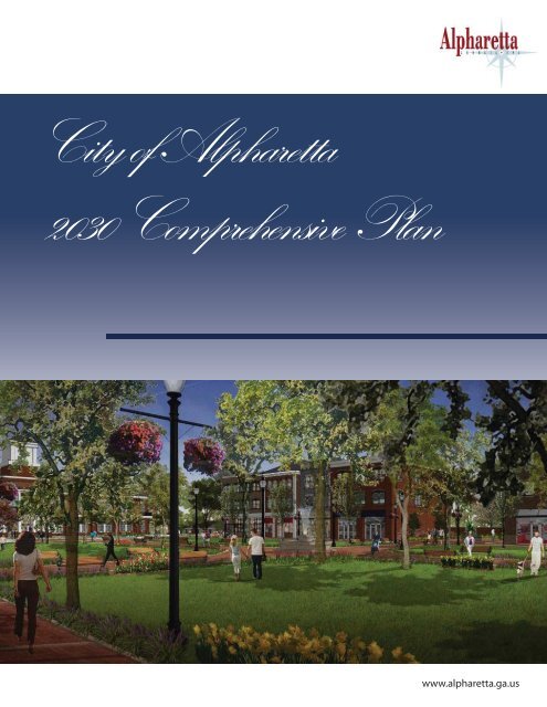
<strong>City</strong> <strong>of</strong> <strong>Alpharetta</strong><br />
<strong>2030</strong> <strong>Comprehensive</strong> <strong>Plan</strong><br />
www.alpharetta.ga.us<br />
www.alpharetta.ga.us
<strong>City</strong> <strong>of</strong> <strong>Alpharetta</strong><br />
<strong>2030</strong> <strong>Comprehensive</strong> <strong>Plan</strong><br />
Community Agenda<br />
Prepared for:<br />
<strong>City</strong> <strong>of</strong> <strong>Alpharetta</strong><br />
<strong>Alpharetta</strong>, Georgia<br />
By:<br />
AMEC E&I, Inc.<br />
Atlanta
ACKNOWLEDGEMENTS<br />
MAYOR AND CITY COUNCIL<br />
Arthur Letchas Mike Kennedy<br />
Mayor<br />
<strong>City</strong> Council – Post 2<br />
Cheryl Oakes<br />
<strong>City</strong> Council – Post 4<br />
D. C. Aiken<br />
<strong>City</strong> Council – Post 6<br />
Douglas J. DeRito<br />
<strong>City</strong> Council – Post 1<br />
Chris Owens<br />
<strong>City</strong> Council – Post 3<br />
Jim Paine<br />
<strong>City</strong> Council – Post 5<br />
CITY STAFF<br />
Bob Regus<br />
<strong>City</strong> Administrator<br />
Diana Wheeler<br />
Community Development<br />
Department Director<br />
Lynn Pierson<br />
<strong>Plan</strong>s Administrator/<br />
Zoning Administrator<br />
Dora Tejada<br />
GIS Specialist<br />
Kathi Cook<br />
Boards Administrator<br />
Eric Graves<br />
<strong>City</strong> Traffic Engineer<br />
STEERING COMMITTEE<br />
Larry Attig<br />
Kyle Caswell<br />
Downtown Property Owner Kimball Bridge Area<br />
Paul Gwyn<br />
Downtown Property Owner<br />
Richard Kramer<br />
Design Review Board<br />
Fred Smith<br />
Downtown Property Owner<br />
Georgia Barrow<br />
Development Authority<br />
Dennis Chapman<br />
North Farm Subdivision<br />
Bill Johnson<br />
WCSA (Windward)<br />
Tom Miller<br />
Windward Subdivision<br />
Jeff Stallard<br />
Design Review Board<br />
Fergal Brady<br />
Northeast Area<br />
Richard Debban<br />
Downtown Property Owner<br />
Eamon Keegan<br />
Youth Population<br />
Cheryl Rand<br />
Recreation Commission<br />
Richard Wernick<br />
Private Sector Developer<br />
Howard Carson<br />
Private Sector Developer<br />
Tom DiGiovani<br />
Berkshire Manor Subdivision<br />
Mike Kennedy<br />
<strong>City</strong> Council<br />
Ted Schwartz<br />
Commercial Broker<br />
PLANNING COMMISSION<br />
Michael Tomy Will Gurley<br />
Chairman<br />
Fergal Brady<br />
Nancy Bristol<br />
Kyle Caswell<br />
Francis Kung’u<br />
Rob Partee<br />
Alternates<br />
Jill Reynolds<br />
Ron Carter<br />
COMMUNITY PARTICIPANTS<br />
<strong>City</strong> <strong>of</strong> <strong>Alpharetta</strong> stakeholders submitted 350 community questionnaires online and more than 100 people<br />
attended workshops and meetings over a 10-month period <strong>of</strong> time.<br />
AMEC E&I, INC.<br />
Ron Huffman, ASLA, AICP<br />
Lee Walton, AICP<br />
Marty Sewell, AICP<br />
Paige Hatley, AICP<br />
Brad Davis, AICP<br />
Cover rendering <strong>of</strong> <strong>City</strong> Center prepared by Urban Collage, October, 2011.
Community Agenda<br />
<strong>City</strong> <strong>of</strong> <strong>Alpharetta</strong> – <strong>2030</strong> <strong>Comprehensive</strong> <strong>Plan</strong><br />
TABLE OF CONTENTS<br />
ACKNOWLEDGEMENTS ................................................................................................ II<br />
ADOPTION RESOLUTION ........................................................................................... III<br />
INTRODUCTION ............................................................................................................. 1<br />
Purpose and Scope ............................................................................................................................................ 1<br />
Why We <strong>Plan</strong> ..................................................................................................................................................... 2<br />
Community Participation and <strong>Plan</strong> Development ..................................................................................... 2<br />
Document Summary ......................................................................................................................................... 5<br />
PART 1: CITYWIDE FOCUS ........................................................................................... 7<br />
Vision Statement ................................................................................................................................................ 8<br />
Vision Themes .................................................................................................................................................... 8<br />
PART 2: CHARACTER AREA FOCUS ......................................................................... 27<br />
Character Area Based <strong>Plan</strong>ning Overview ................................................................................................ 27<br />
Character Area Policy .................................................................................................................................... 30<br />
Future Development Map ............................................................................................................................. 67<br />
PART 3: IMPLEMENTATION ........................................................................................ 77<br />
Implementation Tools .................................................................................................................................... 77<br />
Short Term Work Program ......................................................................................................................... 78<br />
Policy Statements ............................................................................................................................................ 83<br />
<strong>Plan</strong> Maintenance ............................................................................................................................................. 85<br />
APPENDIX…………………. ............................................................................................ 91<br />
AMEC E&I, Inc. – Project 6151-10-0175<br />
i
Community Agenda<br />
<strong>City</strong> <strong>of</strong> <strong>Alpharetta</strong> – <strong>2030</strong> <strong>Comprehensive</strong> <strong>Plan</strong><br />
LIST OF MAPS AND TABLES<br />
Map 1: Future Development Map ........................................................................................................... 69<br />
Table 1: Character Area Design Principles Matrix ............................................................................... 71<br />
Table 2: Future Land Use and Zoning Matrix ........................................................................................ 72<br />
Table 3: Quality Community Objectives/Character Area Analysis Matrix .................................... 76<br />
Table 4 Short Term Work Program 2012-2016 ................................................................................. 79<br />
Table 5: Report <strong>of</strong> Accomplishments ...................................................................................................... 87<br />
Table 6: Estimated Quantities <strong>of</strong> Land Area by Future Land Use Classification .......................... 91<br />
AMEC E&I, Inc. – Project 6151-10-0175<br />
ii
Community Agenda<br />
<strong>City</strong> <strong>of</strong> <strong>Alpharetta</strong> – <strong>2030</strong> <strong>Comprehensive</strong> <strong>Plan</strong><br />
ADOPTION RESOLUTION<br />
AMEC E&I, Inc. – Project 6151-10-0175<br />
iii
Community Agenda<br />
<strong>City</strong> <strong>of</strong> <strong>Alpharetta</strong> – <strong>2030</strong> <strong>Comprehensive</strong> <strong>Plan</strong><br />
This page was intentionally left blank for two-sided printing.<br />
iv<br />
AMEC E&I, Inc. – Project 6151-10-0175
Community Agenda<br />
<strong>City</strong> <strong>of</strong> <strong>Alpharetta</strong> – <strong>2030</strong> <strong>Comprehensive</strong> <strong>Plan</strong><br />
INTRODUCTION<br />
Introduction to the Community Agenda for the <strong>City</strong> <strong>of</strong><br />
<strong>Alpharetta</strong>, Georgia<br />
Located in Fulton County within the Atlanta-Marietta-Sandy<br />
Springs-GA Metropolitan Statistical Area (MSA) and in close<br />
proximity to important regional cities and other job centers,<br />
<strong>Alpharetta</strong> is on track to become the premier community in<br />
Georgia. In an effort to meet the community’s future needs,<br />
<strong>Alpharetta</strong> coordinated the efforts <strong>of</strong> citizens, elected <strong>of</strong>ficials,<br />
pr<strong>of</strong>essional leaders, property owners, and major employers to<br />
create a community vision for the future that will be guided by the<br />
<strong>City</strong> <strong>of</strong> <strong>Alpharetta</strong> <strong>2030</strong> <strong>Comprehensive</strong> <strong>Plan</strong> – Community Agenda.<br />
Year<br />
COMMUNITY SNAPSHOT<br />
POPULATION TRENDS<br />
<strong>City</strong> <strong>of</strong><br />
<strong>Alpharetta</strong><br />
Fulton<br />
County<br />
Atlanta<br />
Region<br />
1990 13,002 648,951 2,513,612<br />
2000 34,854 816,006 3,429,379<br />
2010 57,551 920,581 4,107,750<br />
Source: U.S. Census Bureau<br />
PURPOSE AND SCOPE<br />
The Community Agenda represents the community vision, goals,<br />
policies, primary issues and opportunities that the community has<br />
chosen to address, and a plan <strong>of</strong> action for implementation. In<br />
addition, it outlines desired development patterns and supporting<br />
land uses with a future development guide for the city.<br />
The Community Agenda serves the purpose <strong>of</strong> meeting the intent <strong>of</strong><br />
the Georgia Department <strong>of</strong> Community Affairs’ (DCA) “Standards<br />
and Procedures for Local <strong>Comprehensive</strong> <strong>Plan</strong>ning,” as established<br />
on May 1, 2005. Preparation in accordance with these standards is<br />
an essential requirement in maintaining status as a Qualified Local<br />
Government (QLG). QLG status allows communities to be eligible<br />
for state assistance programs.<br />
The <strong>Comprehensive</strong> <strong>Plan</strong> also includes the Community Participation<br />
Program, Community Assessment and Analysis <strong>of</strong> Supporting Data.<br />
These two separate reports were prepared prior to the<br />
development <strong>of</strong> the Community Agenda. These documents provide a<br />
preliminary look at the issues and opportunities, areas requiring<br />
special attention and an analysis <strong>of</strong> existing development patterns<br />
that include recommended “Character Areas.”<br />
2000-<br />
2010<br />
%<br />
Change<br />
Ave.<br />
Annual<br />
Source: U.S. Census Bureau<br />
Year<br />
GROWTH RATES<br />
<strong>City</strong> <strong>of</strong><br />
<strong>Alpharetta</strong><br />
Fulton<br />
County<br />
Atlanta<br />
Region<br />
65.1% 12.8% 19.8%<br />
5.1% 1.2% 1.8%<br />
POPULATION PROJECTIONS<br />
<strong>City</strong> <strong>of</strong> <strong>Alpharetta</strong><br />
2015 62,577<br />
2020 67,494<br />
2025 72,638<br />
<strong>2030</strong> 77,035<br />
Source: <strong>City</strong> <strong>of</strong> <strong>Alpharetta</strong> Community Development Department 2011<br />
1<br />
AMEC E&I, Inc. – Project 6151-10-0175
Community Agenda<br />
<strong>City</strong> <strong>of</strong> <strong>Alpharetta</strong> – <strong>2030</strong> <strong>Comprehensive</strong> <strong>Plan</strong><br />
WHY WE PLAN<br />
<strong>Comprehensive</strong> planning is an important management tool for<br />
promoting a strong, healthy community. A comprehensive plan<br />
provides a vision, clearly stated and shared by all, that describes the<br />
future <strong>of</strong> the community. It protects private property rights and<br />
also encourages and supports economic development. The plan can<br />
be used to promote orderly and rational development so the city<br />
can remain physically attractive and economically viable while<br />
preserving important natural and historic resources.<br />
The comprehensive plan provides the basis to become more<br />
certain about where development will occur, what it will be like,<br />
when it will happen, and how the costs <strong>of</strong> development will be met.<br />
It provides a tool for the community to achieve the development<br />
pattern it desires, addressing factors such as traditional<br />
neighborhoods, infill development, creating a sense <strong>of</strong> place,<br />
providing transportation alternatives, permitting mixed uses,<br />
protecting natural resources and encouraging economic growth.<br />
<strong>Plan</strong>ning also helps the city invest its money wisely in infrastructure<br />
such as roads, water and sewer service, parks and green space, and<br />
other facilities to maintain and improve the quality <strong>of</strong> life for the<br />
residents <strong>of</strong> the city.<br />
The Community Agenda represents these and additional ideas<br />
discussed during the public participation process. The Community<br />
Agenda does not restate the data included in the Community<br />
Assessment. . Instead, it lists prioritized issues and opportunities, a<br />
community vision that includes goals, policies and strategies<br />
organized by Vision Themes, a Future Development Guide that<br />
describes desired development with the Future Development Map,<br />
Character Area Policy, and Character Area Implementation<br />
Strategies, and an Implementation Program that prioritizes and<br />
assigns costs and responsible parties to the strategies presented<br />
throughout the plan.<br />
WHY WE PLAN<br />
• Maintain a high standard for protecting<br />
natural and cultural resources<br />
• Promote desired patterns <strong>of</strong><br />
development<br />
• Facilitate economic development<br />
• Accommodate a range <strong>of</strong> housing and<br />
transportation optionsons<br />
• Prioritize capital expenditures<br />
• Enhance quality <strong>of</strong> life<br />
Framework Workshop in January 2011<br />
COMMUNITY PARTICIPATION AND<br />
PLAN DEVELOPMENT<br />
Creating a functional comprehensive plan begins by defining a<br />
common vision for the future development <strong>of</strong> the community. A<br />
community vision is the overall image <strong>of</strong> what the community<br />
wants to be and how it wants to look at some point in the future.<br />
It is the starting point for creating a plan and actions to implement<br />
the plan. A successful visioning process requires meaningful<br />
participation from a wide range <strong>of</strong> community stakeholders.<br />
<strong>Alpharetta</strong> residents, , property owners, business owners and other<br />
stakeholders contributed to the production <strong>of</strong> the Community<br />
Agenda. . Due to the participation involved in developing the plan,<br />
the Community Agenda should generate local pride and enthusiasm<br />
about the future <strong>of</strong> the city – encouraging citizens to remain<br />
engaged in the development process in order to ensure that each<br />
local government implements the plan. .<br />
Visioning Workshop in December 2010<br />
2<br />
AMEC E&I, Inc. – Project 6151-10-0175
Community Agenda<br />
<strong>City</strong> <strong>of</strong> <strong>Alpharetta</strong> – <strong>2030</strong> <strong>Comprehensive</strong> <strong>Plan</strong><br />
Visioning Process<br />
The Visioning Process, or citizen participation process, for the <strong>City</strong><br />
<strong>of</strong> <strong>Alpharetta</strong> <strong>2030</strong> <strong>Comprehensive</strong> <strong>Plan</strong> included multiple layers <strong>of</strong><br />
participation from the residents and stakeholders. A Kick-Off<br />
Meeting, Visioning Workshops, , Framework Workshop, Open<br />
House and Public Hearings at Mayor and <strong>City</strong> Council meetings<br />
provided opportunities for input. In addition, a Steering Committee<br />
added considerable input into the planning process.<br />
Kick<strong>of</strong>f Meeting<br />
The Kick-Off Meeting took place in early November at the<br />
Crabapple Government Center. . Questionnaires were distributed<br />
at the meeting and made available for wider distribution by posting<br />
the survey on the project website. Responses received by the<br />
consultant team helped supplement and expand the list <strong>of</strong><br />
preliminary issues and opportunities presented in the Community<br />
Assessment.<br />
Visioning Workshops<br />
Participants provided their input on the future <strong>of</strong> <strong>Alpharetta</strong> during<br />
the four workshops held during November and December 2010 at<br />
three locations throughout the city. Workshop attendees<br />
participated in prioritization exercises, facilitated discussion and<br />
one-on-one conversations with the planning team.<br />
Visioning Workshop participants prioritized and contributed to a<br />
list <strong>of</strong> preliminary issues and opportunities identified during<br />
preparation <strong>of</strong> the Community Assessment, from online<br />
questionnaire responses, and discussions with the Steering<br />
Committee. . The exercises organized information into the following<br />
categories: Economic Development; Natural, Historic and Cultural<br />
Resources; Housing; Transportation; Community Facilities and<br />
Services; Land Use; and Intergovernmental Coordination.<br />
Participants also provided input during a facilitated mapping<br />
exercise where they identified specific areas related to Issues,<br />
Assets, and Dreams in the community as well as provided input<br />
specifically related to the recommended character areas and the<br />
future development pattern.<br />
Framework Workshop<br />
The Framework Workshop was held in late January at <strong>Alpharetta</strong><br />
<strong>City</strong> Hall. Participants had the opportunity to review the input<br />
from the four Visioning Workshops s that included a preliminary list<br />
<strong>of</strong> Goals and Policies related to the Community Vision and the<br />
framework for the Future Development Guide. Presentation <strong>of</strong> the<br />
Future Development Guide included summaries <strong>of</strong> the proposed<br />
character areas and a conceptual Future Development Map.<br />
Feedback on the information presented was provided to the<br />
consultant team through one-on-one conversations, a facilitated<br />
group discussion, and comment forms provided to participants.<br />
VISIONING MILESTONES<br />
Kick<strong>of</strong>f Meeting<br />
• Crabapple Government Center<br />
Nov. 9, 2010<br />
Visioning Workshops<br />
• Crabapple Government Center<br />
Nov. 29, 2010 (morning)<br />
• Marriott <strong>Alpharetta</strong><br />
Nov. 29, 2010 (evening)<br />
• <strong>Alpharetta</strong> High School<br />
Dec. 7, 2010<br />
• Crabapple Government Center<br />
Dec. 9, 2010<br />
Framework Workshop<br />
• <strong>Alpharetta</strong> <strong>City</strong> Hall<br />
Jan. 20, 2010<br />
Open House<br />
• <strong>Alpharetta</strong> <strong>City</strong> Hall<br />
March 22, 2010<br />
Visioning Workshop in December 2010<br />
Visioning Workshop in December 2010<br />
3<br />
AMEC E&I, Inc. – Project 6151-10-0175
Community Agenda<br />
<strong>City</strong> <strong>of</strong> <strong>Alpharetta</strong> – <strong>2030</strong> <strong>Comprehensive</strong> <strong>Plan</strong><br />
Open House<br />
The public was then presented the “preliminary draft” Community<br />
Agenda at an Open House held in March. The format allowed<br />
participants to drop in at their convenience and stay as little or as<br />
long as they desired. Participants viewed the Community Agenda<br />
document, large scale maps, and spoke individually with planning<br />
team members to present questions or concerns.<br />
Public Hearings<br />
The “final draft” Community Agenda document was prepared after<br />
the Open House. . The “final draft,” which included minor updates<br />
based on input received from the staff and public in attendance at<br />
the Open House along with input from the Steering Committee,<br />
was presented at a regularly-scheduledd meeting <strong>of</strong> the Mayor and<br />
<strong>City</strong> Council. The meeting included public hearings providing<br />
opportunities for stakeholders to <strong>of</strong>fer additional input. Following<br />
the public hearing, the Mayor and <strong>City</strong> Council adopted a<br />
resolution authorizing the transmittal <strong>of</strong> the Community Agenda to<br />
ARC and DCA for review.<br />
Steering Committee<br />
In addition to meetings designed to solicit input from the general<br />
public, the planning team also organized the Steering Committee<br />
that provided important input and feedback into the planning<br />
process. The committee included residents from various parts <strong>of</strong><br />
the city as well as local business and representatives <strong>of</strong> special<br />
populations. Meetings were facilitated by the planning consultant<br />
team and supported by <strong>City</strong> <strong>of</strong> <strong>Alpharetta</strong> staff.<br />
The committee assisted in defining the prioritized issues and<br />
opportunities, defining Character Areas and preparing the<br />
Implementation n Program. Committee members also reviewed<br />
drafts <strong>of</strong> plan components at various points during its development<br />
and provided critical feedback and insight based on their<br />
experience dealing with the important issues facing the cities on a<br />
daily basis. Involvement <strong>of</strong> staff members was crucial since these<br />
staff members will be coordinating the execution <strong>of</strong> many <strong>of</strong> the<br />
strategies identified in the Implementation Program or<br />
administering polices defined in the plan. The committee members<br />
held a total <strong>of</strong> five meetings during the planning process.<br />
Open House held at <strong>City</strong> Hall in March 2011<br />
Open House held at <strong>City</strong> Hall in March 2011<br />
Steering Committee meeting held at AMEC’s <strong>Alpharetta</strong><br />
<strong>of</strong>fice in January 2011<br />
4<br />
AMEC E&I, Inc. – Project 6151-10-0175
Community Agenda<br />
<strong>City</strong> <strong>of</strong> <strong>Alpharetta</strong> – <strong>2030</strong> <strong>Comprehensive</strong> <strong>Plan</strong><br />
DOCUMENT SUMMARY<br />
The sequence <strong>of</strong> chapters in the Community Agenda is structured to implement the vision, goals,<br />
policies and strategies contained within each section and to answer the questions “Where do<br />
we want to be in 20 years?” and “How do we get there?”. The Community Agenda is structured<br />
into the following parts:<br />
Part 1: <strong>City</strong>wide Focus<br />
Part 2: Character Area Focus<br />
Part 3: Implementation<br />
Part 1: <strong>City</strong>wide Focus<br />
The <strong>City</strong>wide Focus reflects the community’s citywide vision for growth and development for<br />
the next 20 years. This vision, which was developed with an extensive public visioning process,<br />
is defined by Vision Themes. The Vision Themes organize a series <strong>of</strong> primary<br />
issues/opportunities, goals, policies and strategies that address specific areas <strong>of</strong> focus. The Vision<br />
Themes are: Economic Development; Natural, Historic and Cultural Resources; Housing;<br />
Transportation; Community Facilities and Services; Land Use; and Intergovernmental<br />
Coordination. The primary issues/opportunities represent important topics discovered during<br />
the analysis <strong>of</strong> existing conditions (Community Assessment) and supplemented and prioritized<br />
during the Visioning Process. Included in each vision theme is a series <strong>of</strong> Goals, Policies and<br />
Strategies. The Strategies are used to create the Implementation Program chapter.<br />
Part 2: Character Area Focus<br />
A <strong>Comprehensive</strong> <strong>Plan</strong> is a general policy document used to guide the physical development <strong>of</strong> a<br />
community. Character Area Focus is the future development guide that defines the city’s<br />
desired development patterns and guides future decision-making related to the physical<br />
development <strong>of</strong> the city. It also includes the Quality Community Objectives pursued by each<br />
Character Area. Character Area Focus is comprised <strong>of</strong> two sections: Character Area Policy and<br />
Implementation Strategy and Future Development Map.<br />
The Future Development Map section presents the Future Development Map. The Future<br />
Development Map identifies the location <strong>of</strong> Character Areas and clarifies where and what type<br />
<strong>of</strong> development should occur.<br />
The Character Area Policy and Implementation Strategy section describes the intent,<br />
general characteristics, application, primary land uses, appropriate zoning districts and design<br />
principles for each Character Area, which are areas with unique quality worth preserving or<br />
areas that have been identified with the potential to develop into something new or different.<br />
This section also identifies specific, actionable strategies intended to achieve the desired<br />
development patterns described by the Character Areas.<br />
AMEC E&I, Inc. – Project 6151-10-0175<br />
5
Community Agenda<br />
<strong>City</strong> <strong>of</strong> <strong>Alpharetta</strong> – <strong>2030</strong> <strong>Comprehensive</strong> <strong>Plan</strong><br />
Part 3: Implementation<br />
Implementation identifies specific actions necessary to achieve the community’s vision. This<br />
chapter incorporates the strategies presented within Parts 1 and 2 into a plan <strong>of</strong> action.<br />
Implementation includes ordinances, programs, community improvements or investments,<br />
additional plans or studies, administrative systems and financing arrangements or other<br />
initiatives to be put in place to implement the comprehensive plan. The Short-Term Work<br />
Program prioritizes the strategies presented throughout the comprehensive plan to be<br />
implemented over the next five years and assigns responsible parties, identifies potential funding<br />
sources, and provides a timeline for completion <strong>of</strong> each. Part 3 also details the specifics <strong>of</strong><br />
maintaining the comprehensive plan. Maintenance <strong>of</strong> the plan includes major and minor plan<br />
amendments, updates <strong>of</strong> the plan, or required periodic updates <strong>of</strong> the Community Agenda. Finally,<br />
Part 3 includes the Report <strong>of</strong> Accomplishments, which highlights actions completed by the city<br />
since submittal (to ARC/DCA) <strong>of</strong> its most recent STWP.<br />
AMEC E&I, Inc. – Project 6151-10-0175<br />
6
Community Agenda<br />
<strong>City</strong> <strong>of</strong> <strong>Alpharetta</strong> – <strong>2030</strong> <strong>Comprehensive</strong> <strong>Plan</strong><br />
PART<br />
1<br />
PART 1: CITYWIDE FOCUS<br />
Presenting the Community Vision Statement and Community<br />
Vision Themes for the <strong>City</strong> <strong>of</strong> <strong>Alpharetta</strong><br />
In order to implement the community’s vision <strong>of</strong> the future, the comprehensive plan should be<br />
guided by a decision-making framework related to growth and development. This plan is based<br />
on the community’s VISION for growth and development over the next 20 years. Developed<br />
with input from citizens, elected <strong>of</strong>ficials, and community stakeholders, the vision focuses<br />
attention on the future <strong>of</strong> the community and defines the ideal image <strong>of</strong> what the <strong>City</strong> should be<br />
in the future.<br />
To achieve the community vision, GOALS are developed to help define the desired future<br />
state <strong>of</strong> the community. Goals also provide guidance related to the long-term decision making<br />
<strong>of</strong> the community.<br />
Because goals are typically related to big picture ideas and a long-term view <strong>of</strong> development,<br />
POLICIES are used to guide everyday decisions related to achieving the community vision.<br />
Policies are more specific than goals and provide measurable actions. Policies are represented in<br />
this plan by the policy statements presented in this chapter, the Character Area Policy narrative,<br />
and the Future Development Map.<br />
In order to accomplish the vision, goals and policies <strong>of</strong> the community, STRATEGIES are<br />
created. Strategies are specific action steps that when completed should implement the vision,<br />
goals, policies <strong>of</strong> the community. Strategies are represented in this plan by the Character Area<br />
implementation strategies and the strategies associated with goal and policy statements<br />
presented in the Community Vision chapter. They are further described in Part 3:<br />
Implementation.<br />
Part 2: <strong>City</strong>wide Focus, which was developed with an extensive public visioning process<br />
described in the Introduction section, uses the following sections to organize the community’s<br />
overall vision for the future.<br />
• The Vision Statement describes the overall idea <strong>of</strong> what the community desires to<br />
be in the future.<br />
• The Vision Themes organize a series <strong>of</strong> goals, policies and strategies that address<br />
the community’s issues and opportunities.<br />
AMEC E&I, Inc. – Project 6151-10-0175<br />
7
Community Agenda<br />
<strong>City</strong> <strong>of</strong> <strong>Alpharetta</strong> – <strong>2030</strong> <strong>Comprehensive</strong> <strong>Plan</strong><br />
VISION STATEMENT<br />
The Community Vision Statement is a formal description <strong>of</strong> what the community wants to<br />
become. Input from stakeholders gathered during the visioning process (see Introduction) forms<br />
the basis for the Community Vision Statement. Vision Themes presented along with the<br />
presentation <strong>of</strong> the Community Vision Statement in the following pages and Part 2: Character<br />
Area Focus tie these descriptions <strong>of</strong> a desired future to specific goals, policies and strategies.<br />
Our Community Vision is to advance <strong>Alpharetta</strong> as a Signature <strong>City</strong> by…<br />
• Offering the highest quality <strong>of</strong> environment for our residents and<br />
businesses;<br />
• Fostering strong sense <strong>of</strong> community including safety and<br />
security; and<br />
• Providing a business climate that attracts the top echelon<br />
companies.<br />
VISION THEMES<br />
The Vision Themes organize primary issues/opportunities, goals, policies and strategies. The<br />
goals, policies, and strategies were developed to address the primary issues and opportunities.<br />
Vision Themes represent the ideas and concerns <strong>of</strong> participants in the planning process and<br />
narrow the big picture vision to specific strategies that aim to make the Community Vision a<br />
reality. The themes presented are:<br />
Economic Development<br />
Land Use<br />
Transportation<br />
Housing<br />
Natural, Historic and Cultural Resources<br />
Community Facilities and Services<br />
Intergovernmental Coordination<br />
In addition to providing a structure to help achieve the community’s vision, the vision themes<br />
are also used to support the Quality Community Objectives (QCO) as set forth by DCA (see<br />
Chapter 2 for the QCO list).<br />
Economic Development<br />
Primary Issues and Opportunities<br />
Few attractions for residents and visitors – While <strong>Alpharetta</strong> attractions such as Big<br />
Creek Greenway, Verizon Wireless Amphitheatre at Encore Park, and the regional shopping<br />
destination anchored by North Point Mall provide opportunities for residents and visitors, most<br />
choose to leave the city for a wider range <strong>of</strong> entertainment and cultural attractions <strong>of</strong>fered in<br />
other parts <strong>of</strong> the metro area.<br />
Proliferation <strong>of</strong> corporate chains and lack <strong>of</strong> “mom and pop” businesses – Residents<br />
enjoy the convenience <strong>of</strong>fered by <strong>Alpharetta</strong>’s array <strong>of</strong> choices for shopping and dining, but they<br />
also desire more locally-owned, “mom and pop” businesses unique to <strong>Alpharetta</strong> that would<br />
add variety, charm and local flare and enhance the city’s economy and sense <strong>of</strong> community.<br />
AMEC E&I, Inc. – Project 6151-10-0175<br />
8
Community Agenda<br />
<strong>City</strong> <strong>of</strong> <strong>Alpharetta</strong> – <strong>2030</strong> <strong>Comprehensive</strong> <strong>Plan</strong><br />
Life-cycle <strong>of</strong> retail space – Success as a regional retail center has brought <strong>Alpharetta</strong> great<br />
value over the last two decades. Although new retail space is still available, older centers are<br />
now facing the prospect <strong>of</strong> redevelopment. Opportunities exist to repurpose older centers or<br />
create second generation spaces within existing retail areas. In addition, vacant properties<br />
provide an opportunity for creative economic development efforts by serving as flex space for<br />
<strong>of</strong>fices, artist studios, business incubators, etc.<br />
Unappealing Main Street/GA-9 gateways – The development character <strong>of</strong> the<br />
underperforming commercial properties fronting South Main Street/GA-9between Downtown<br />
<strong>Alpharetta</strong> and the Roswell city limits is not in keeping with the city’s otherwise nicelymaintained,<br />
clean, attractive streetscapes.<br />
Demographics <strong>of</strong> economic importance – The pr<strong>of</strong>essional workforce that is currently in<br />
the 20s to 30s age cohort is the key demographic for the future <strong>of</strong> economic growth in<br />
<strong>Alpharetta</strong>. To remain an attractive community for this demographic group, the city must<br />
accomplish key transformations such as creating a strong, active and viable downtown that<br />
provides desired local amenities and character.<br />
Regional nature <strong>of</strong> infrastructure – Due to the nature <strong>of</strong> environmental systems and the<br />
level <strong>of</strong> development across north Fulton County, key infrastructure systems such as that for<br />
stormwater must be planned and developed in a regional fashion. The regional approach to<br />
water-related infrastructure such as supported by the Metropolitan North Georgia Water<br />
<strong>Plan</strong>ning District (MNGWPD) will result in major long term cost savings, opportunities for<br />
development <strong>of</strong> amenities as byproducts <strong>of</strong> infrastructure development, and an overall higher<br />
quality <strong>of</strong> life.<br />
Desire to maintain high standard for quality <strong>of</strong> life – <strong>Alpharetta</strong>’s residents have<br />
expressed a strong desire to maintain a high quality <strong>of</strong> life in the city. This demonstrated<br />
commitment continues to make the city attractive to potential new residents, visitors,<br />
businesses and employers.<br />
Regional corporate <strong>of</strong>fice leader – Despite some losses during the economic downturn,<br />
<strong>Alpharetta</strong> remains a solid regional employment center, with more than 19.3 million square feet<br />
devoted to <strong>of</strong>fice use; 37.5% <strong>of</strong> all <strong>of</strong>fice space in North Fulton County. Of that, 63% is<br />
considered “Class A” <strong>of</strong>fice space.<br />
Regional retail center – <strong>Alpharetta</strong> has 29% <strong>of</strong> all retail space in North Fulton County,<br />
approximately 8.24 million square feet. This existing, established retail base provides a platform<br />
for economic growth.<br />
Master plan to guide economic development underway – The <strong>City</strong> has an economic<br />
development plan that includes a proactive strategy to guide business recruitment and economic<br />
expansion.<br />
College satellite campuses – Georgia State University, Reinhardt College, DeVry Institute <strong>of</strong><br />
Technology, and Georgia Perimeter College each have campuses in <strong>Alpharetta</strong>, providing area<br />
residents with convenient opportunities to pursue educational goals and improve job skills.<br />
Students travel to <strong>Alpharetta</strong> from throughout the region, which provides an economic impact<br />
to the city, as well.<br />
Presence <strong>of</strong> local economic development advocates – There are several development<br />
agencies and authorities working on behalf <strong>of</strong> <strong>Alpharetta</strong> to support strategic economic<br />
development, including the <strong>City</strong>’s Office <strong>of</strong> Economic Development, <strong>Alpharetta</strong> Development<br />
Authority, Greater North Fulton Chamber <strong>of</strong> Commerce and the Development Authority <strong>of</strong><br />
Fulton County. Acting in a coordinated and proactive manner, these established economic<br />
development advocates give <strong>Alpharetta</strong> an advantage in the competitive field <strong>of</strong> corporate and<br />
business recruitment.<br />
AMEC E&I, Inc. – Project 6151-10-0175<br />
9
Community Agenda<br />
<strong>City</strong> <strong>of</strong> <strong>Alpharetta</strong> – <strong>2030</strong> <strong>Comprehensive</strong> <strong>Plan</strong><br />
Goals, Policies and Strategies<br />
ED Goal: Strengthen and sustain the economic base <strong>of</strong> <strong>Alpharetta</strong>.<br />
ED Policy 1: Maintain a highly viable, growing and attractive downtown.<br />
ED Strategy 1.1: Fully implement the Downtown Master <strong>Plan</strong>.<br />
ED Strategy 1.2: Complete annual updates to the Downtown Master <strong>Plan</strong> during regular<br />
public meetings to ensure consistency <strong>of</strong> the plan with community needs and goals.<br />
ED Strategy 1.3: Encourage continued investment in historic downtown through façade grants<br />
and other incentives.<br />
ED Strategy 1.4: Coordinate with the Downtown <strong>Alpharetta</strong> Business Association on<br />
downtown marketing efforts.<br />
ED Strategy 1.5: Promote downtown <strong>Alpharetta</strong> as a prime location for college campus<br />
facilities (including satellite campuses).<br />
ED Strategy 1.6: Maintain community-oriented foot patrol policing for Downtown <strong>Alpharetta</strong>.<br />
ED Strategy 1.7: Continue to pursue designation as Georgia Main Street Community and<br />
develop annual work plans to guide downtown development initiatives within the framework <strong>of</strong><br />
the national Main Street approach to revitalization.<br />
ED Policy 2: Attract highly-skilled and pr<strong>of</strong>essional-level employment to corporate<br />
and industrial development areas while also focusing efforts to retain and grow<br />
existing quality businesses.<br />
ED Strategy 2.1: Coordinate a technology forum to encourage an environment <strong>of</strong> innovation,<br />
build linkages between technology companies with a presence in the community, and attract<br />
new technology firms.<br />
ED Strategy 2.2: Implement the <strong>City</strong>'s economic development action plan to ensure<br />
consistency with overall community objectives and needs.<br />
ED Strategy 2.3: Implement a business calling and retention program to encourage existing<br />
quality businesses to remain and grow in the city.<br />
ED Strategy 2.4: Research the critical employment age group <strong>of</strong> 20 to 40 years and establish<br />
planning and change strategies appropriate to make <strong>Alpharetta</strong> an attractive place to live.<br />
ED Policy 3: Continue to attract quality retailers for commercial areas throughout<br />
the city.<br />
ED Strategy 3.1: Provide mobility options such as improved public and private transportation<br />
for the retail and service employees who work in commercial centers.<br />
ED Strategy 3.2: Support the development <strong>of</strong> locally-owned, unique shopping, dining and<br />
entertainment opportunities.<br />
ED Strategy 3.3: Maintain a healthy and attractive retail environment that continues to draw<br />
expenditures from households outside the <strong>City</strong> <strong>of</strong> <strong>Alpharetta</strong>.<br />
ED Strategy 3.4: Inventory all vacant, underperforming and distressed retail properties in<br />
order to inform the creation <strong>of</strong> targeted development strategies.<br />
AMEC E&I, Inc. – Project 6151-10-0175<br />
10
Community Agenda<br />
<strong>City</strong> <strong>of</strong> <strong>Alpharetta</strong> – <strong>2030</strong> <strong>Comprehensive</strong> <strong>Plan</strong><br />
ED Policy 4: Maintain a high aesthetic standard and enhance architectural quality.<br />
ED Strategy 4.1: Maintain and enforce high aesthetic standards and appropriate<br />
architectural guidelines.<br />
ED Policy 5: Participate in regional efforts that support economic development.<br />
ED Strategy 5.1: Coordinate with regional economic development partners and marketing<br />
efforts to the benefit <strong>of</strong> North Fulton.<br />
ED Strategy 5.2: Support regional efforts to solve environmental and infrastructure problems,<br />
such as those for water being addressed by the MNGWPD.<br />
Land Use<br />
Primary Issues and Opportunities<br />
<strong>City</strong>wide sense <strong>of</strong> place and distinguishable character –<strong>Alpharetta</strong> is not a new city,<br />
however most existing single-family residential, retail commercial and <strong>of</strong>fice campus<br />
development is modern and auto-oriented. Though this is mostly high-quality development, it<br />
generally lacks the character-defining pedestrian scale, architectural diversity and civic spaces<br />
found in cities that develop more slowly over many decades. <strong>Alpharetta</strong> lacks an identifiable<br />
image or unique iconic element such as a distinguishable civic building, vibrant town square, or<br />
landmark.<br />
Downtown revitalization – A small portion <strong>of</strong> Downtown <strong>Alpharetta</strong> remains true to the<br />
traditional “Main Street” style, but most <strong>of</strong> downtown generally lacks the vibrancy and vitality<br />
deserving <strong>of</strong> a 50,000-plus resident city. Downtown lacks the essential mix <strong>of</strong> boutiques, unique<br />
restaurants, residences, public gathering places, cultural <strong>of</strong>ferings, entertainment venues,<br />
creative <strong>of</strong>fice space, iconic landmarks, and community and government institutions. Finally, it<br />
lacks walkability and connectivity to important community spaces such as Wills Park.<br />
Understanding these realities, the <strong>City</strong> has embraced the need for change and put forth a plan <strong>of</strong><br />
action that has led to policies intended to create a true mixed use activity downtown centered<br />
on a historic architectural theme.<br />
Slow pace <strong>of</strong> Downtown redevelopment – Some improvements have occurred in<br />
Downtown due to investments in infrastructure and programs that provide façade assistance for<br />
local businesses, however the Downtown area has not yet attracted the large-scale<br />
development that would provide the level <strong>of</strong> activity envisioned by the Downtown Master <strong>Plan</strong>.<br />
Prospect Park development site – The northwest corner <strong>of</strong> the GA-400/Old Milton<br />
Parkway interchange is a local example <strong>of</strong> the impacts <strong>of</strong> the recent national economic crisis.<br />
Cleared <strong>of</strong> trees in order to construct Westside Parkway and make way for a mixed use<br />
lifestyle center, the site today sits vacant due to a series <strong>of</strong> foreclosures. The 64-acres that this<br />
site occupies is at a prime intersection in the city and is expected to realize its development<br />
potential in the future.<br />
South Main Street corridor/greyfield redevelopment – The character <strong>of</strong> land uses along<br />
South Main Street/GA-9conflicts with the “Traditional Main Street” style desired for Downtown<br />
<strong>Alpharetta</strong>. The corridor’s fast-food restaurants and other freestanding businesses, each with<br />
separated parking lots and curb cuts, form a pattern that undermines the corridor’s vitality and<br />
pedestrian friendliness.<br />
AMEC E&I, Inc. – Project 6151-10-0175<br />
11
Community Agenda<br />
<strong>City</strong> <strong>of</strong> <strong>Alpharetta</strong> – <strong>2030</strong> <strong>Comprehensive</strong> <strong>Plan</strong><br />
These underutilized, under-performing structures generally lack the visual appeal necessary to<br />
seriously contend for tenants the community desires. A greyfield redevelopment approach,<br />
however, would provide an opportunity to create commercial and mixed-use centers that<br />
provide jobs. The section <strong>of</strong> South Main Street between Academy Street and Old Milton<br />
Parkway is part <strong>of</strong> the GA-9 corridor and falls within the review jurisdiction <strong>of</strong> the Design<br />
Review Board.<br />
Shifting focus <strong>of</strong> growth away from annexation – Past comprehensive plans for<br />
<strong>Alpharetta</strong> assumed growth would continue via annexation into previously unincorporated areas<br />
<strong>of</strong> North Fulton County. However, no unincorporated areas remain in North Fulton County<br />
following the incorporation <strong>of</strong> Johns Creek and Milton. This change presents both a challenge<br />
and an opportunity to <strong>Alpharetta</strong> leaders. The city can now focus all <strong>of</strong> its long-range planning<br />
efforts on property within the existing city limits to plan for revitalization <strong>of</strong> aging commercial<br />
strips, creation <strong>of</strong> flex space for small business in underutilized shopping centers, and mixed use<br />
infill development or redevelopment in strategic areas.<br />
Livable Center Initiative (LCI) study areas – The two most significant <strong>Alpharetta</strong> activity<br />
centers proposed for long range development and revitalization as mixed use centers are<br />
included in the Atlanta Regional Commission’s Livable Centers Initiative program. The LCI<br />
program was established by ARC to encourage city and county governments in the Atlanta<br />
Region to plan and implement strategies that link transportation improvements with land use<br />
development strategies, with an overarching goal <strong>of</strong> creating sustainable and livable communities<br />
that complement regional development policies. North Point Activity Center LCI designation<br />
followed completion <strong>of</strong> the North Pont Activity Center LCI Study in 2007. ARC designated<br />
Downtown <strong>Alpharetta</strong> as an LCI area by grandfathering the Downtown Master <strong>Plan</strong> as an LCI.<br />
Designation qualifies each area for grant money that the <strong>City</strong> can use to implement each plan<br />
(e.g. transportation infrastructure improvements, preparation <strong>of</strong> specific development<br />
regulations/guidelines, etc). <strong>Alpharetta</strong> and Milton jointly applied for LCI funding for a GA-<br />
9/North Main Street/<strong>Alpharetta</strong> Highway Corridor study, and the planning study currently<br />
underway will result in an LCI designation for that corridor.<br />
Design guidelines and Design Review Board – Design guidelines are in place to ensure<br />
new and infill development appropriately complements the character <strong>of</strong> the community. As<br />
development occurs over time, the application <strong>of</strong> these guidelines will result in high quality,<br />
higher value development. The Design Review Board reviews site plans, landscape plans,<br />
exterior elevations and materials, and exterior signage for development proposed within<br />
designated Interchange Areas <strong>of</strong> Influence (i.e. areas within 1,000 feet <strong>of</strong> a GA-400 interchange),<br />
Corridors <strong>of</strong> Influence (portions <strong>of</strong> Windward Parkway, North Point Parkway, West Side<br />
Parkway, Main Street/GA-9, Old Milton Parkway, Haynes Bridge Road and Mansell Road), and in<br />
Downtown. The exceptions within these areas are single-family detached residential<br />
developments, which are not subject to review by the Design Review Board.<br />
Coordinate land use and transportation planning – Coordination <strong>of</strong> land use planning<br />
with transportation planning will remain a critical need in <strong>Alpharetta</strong>’s future. Development<br />
should be planned to reduce daily vehicle use, improve air quality, promote a transit-supportive<br />
infrastructure, create a pedestrian-friendly environment, improve roadway connectivity, and<br />
integrate mixed-use development. <strong>Alpharetta</strong> can implement the recently-adopted North Fulton<br />
<strong>Comprehensive</strong> Transportation <strong>Plan</strong> with recommended transportation improvements that are<br />
coordinated with past and projected development trends<br />
AMEC E&I, Inc. – Project 6151-10-0175<br />
12
Community Agenda<br />
<strong>City</strong> <strong>of</strong> <strong>Alpharetta</strong> – <strong>2030</strong> <strong>Comprehensive</strong> <strong>Plan</strong><br />
Goals, Policies and Strategies<br />
LU Goal: Develop a land use pattern and structure that fully complements the<br />
vision <strong>of</strong> <strong>Alpharetta</strong> as a signature community in the region.<br />
LU Policy 1: Encourage the continued revitalization and redevelopment <strong>of</strong><br />
Downtown <strong>Alpharetta</strong> for culture, government, dining, residential, entertainment,<br />
and retail diversity.<br />
LU Strategy 1.1: Continue to implement the vision detailed in the Downtown Master <strong>Plan</strong>.<br />
LU Strategy 1.2: Support improvements to Downtown that will result in a compact<br />
arrangement <strong>of</strong> retail and commercial enterprises with <strong>of</strong>fice, financial, entertainment,<br />
governmental and certain residential development, all designed and situated to permit internal<br />
pedestrian circulation.<br />
LU Strategy 1.3: Encourage residential uses in the Downtown at higher densities and in<br />
mixed use buildings in order to support the viability <strong>of</strong> Downtown.<br />
LU Strategy 1.4: Continue to encourage revitalization <strong>of</strong> Downtown through major<br />
streetscape improvements, landscaping, formal open spaces, and transportation network<br />
connectivity.<br />
LU Policy 2: Ensure that future land use and development decisions are consistent<br />
with the <strong>Comprehensive</strong> <strong>Plan</strong> and that such decisions promote social and economic<br />
well-being.<br />
LU Strategy 2.1: Encourage and promote clean, high tech business activity that strengthens<br />
the economic base <strong>of</strong> the community and minimizes air and water pollution.<br />
LU Strategy 2.2: Promote development that is pedestrian-oriented and minimizes vehicular<br />
trips.<br />
LU Strategy 2.3: Encourage creative urban design solutions that improve physical character.<br />
LU Policy 3: Promote establishment <strong>of</strong> a compact urban area and assure the<br />
availability <strong>of</strong> utilities concurrent with development.<br />
LU Strategy 3.1: Use infrastructure as a tool to guide development into locations where the<br />
land is most cost effective to service (i.e., accessible to police, fire, sewer and the urban road<br />
network).<br />
LU Strategy 3.2: When decisions are made about development densities, give due<br />
consideration to investments in infrastructure that have been made by the <strong>City</strong>.<br />
LU Strategy 3.3: Monitor the impact <strong>of</strong> new development and projected infrastructure<br />
capacities.<br />
AMEC E&I, Inc. – Project 6151-10-0175<br />
13
Community Agenda<br />
<strong>City</strong> <strong>of</strong> <strong>Alpharetta</strong> – <strong>2030</strong> <strong>Comprehensive</strong> <strong>Plan</strong><br />
LU Policy 4: Preserve and protect the quality <strong>of</strong> existing neighborhoods proactively<br />
through code enforcement and land use decisions that protect neighborhood<br />
integrity <strong>of</strong> these areas.<br />
LU Strategy 4.1: Preserve residential estate properties in Northwest <strong>Alpharetta</strong> and the Big<br />
Creek Overlook community by maintaining development densities that are generally at much<br />
lower levels than that <strong>of</strong> the rest <strong>of</strong> the city (see Part 2: Character Area Focus Character Area<br />
Policy for detailed policy for each area). In addition, investigate opportunities to provide<br />
incentives through zoning, services, taxes, etc. to preserve the estate land use densities.<br />
LU Strategy 4.2: Develop neighborhood-specific plans to identify issues within neighborhoods,<br />
identify design strategies, and prioritize reinvestment strategies and projects.<br />
LU Strategy 4.3: Maintain code enforcement efforts to ensure that all residential, commercial<br />
and industrial properties are appropriately maintained in accordance with property<br />
maintenance codes.<br />
LU Policy 5: Require subdivision design that fosters a sense <strong>of</strong> community and<br />
promotes pedestrian mobility, community recreation and an abundance <strong>of</strong> public<br />
open space.<br />
LU Strategy 5.1: Ensure that roads and sidewalks designed for new suburban neighborhood<br />
developments connect with adjacent established neighborhoods to provide connectivity to parks,<br />
greenspace, community amenities and commercial services.<br />
LU Policy 6: Support the success and expansion <strong>of</strong> employment centers.<br />
LU Strategy 6.1: Support flexibility in employment centers that allows the potential for a<br />
corporate campus environment to include a mix <strong>of</strong> <strong>of</strong>fice uses and discreet<br />
warehouse/distribution facilities (typically accommodated to the rear <strong>of</strong> the buildings).<br />
LU Strategy 6.2: Designate major entranceways to the city, (the interchanges along GA-400)<br />
for <strong>of</strong>fice use in order to preserve the corporate campus business environment (as described in<br />
Part 2: Character-Area Focus for individual Character Areas).<br />
LU Strategy 6.3: Limit industrial land uses to light industry only.<br />
LU Policy 7: Ensure context-sensitive infill and redevelopment.<br />
LU Strategy 7.1: Compile an inventory <strong>of</strong> vacant, tax delinquent, or government entity-owned<br />
properties that may be appropriate for infill development to enhance existing neighborhoods<br />
and encourage development in locations already served with supporting infrastructure.<br />
LU Strategy 7.2: Establish an Infill Development Guide and associated regulations to address<br />
appropriate site design standards for context sensitive infill development, allowing for<br />
accommodation <strong>of</strong> infill housing with building setbacks and minimum lots sizes that are<br />
compatible with surrounding homes.<br />
LU Policy 8: Support mixed-use neighborhood and community centers.<br />
LU Strategy 8.1: Allow mixed use patterns that will create activity nodes in appropriate<br />
areas, as established by the Future Development Map, that provide jobs and services within<br />
walking distance <strong>of</strong> residences, preserve open spaces, and make public transportation more<br />
effective.<br />
AMEC E&I, Inc. – Project 6151-10-0175<br />
14
Community Agenda<br />
<strong>City</strong> <strong>of</strong> <strong>Alpharetta</strong> – <strong>2030</strong> <strong>Comprehensive</strong> <strong>Plan</strong><br />
LU Strategy 8.2: Focus regional-scaled, suburban, and big box commercial development into<br />
development and redevelopment nodes, rather than allowing commercial development along<br />
the full length <strong>of</strong> major corridors. In addition, promote development <strong>of</strong> smaller-scaled<br />
neighborhood centers as well as revitalization and enhancement <strong>of</strong> existing small-scale<br />
commercial centers.<br />
LU Strategy 8.3: Encourage owners/developers with large land holdings to plan for multiple<br />
land uses.<br />
LU Strategy 8.4: Establish varying levels <strong>of</strong> mixed use development densities, through overlay<br />
districts or other means, such that the highest densities <strong>of</strong> <strong>of</strong>fice, retail and residential<br />
development will be located along the GA-400 corridor.<br />
LU Policy 9: Promote redevelopment <strong>of</strong> highway corridors into pedestrian-friendly,<br />
mixed use environments.<br />
LU Strategy 9.1: Support a cohesive approach to providing retail sales and service nodes<br />
within the city, thereby avoiding strip commercial patterns along arterial routes; these nodes<br />
should be developed on a scale that is compatible with residential development and pedestrian<br />
access.<br />
LU Strategy 9.2: Define the boundaries <strong>of</strong> retail areas to avoid “retail creep” beyond<br />
designated retail areas.<br />
LU Strategy 9.3: Sponsor corridor plans to identify specific needs, identify design strategies,<br />
and prioritize infrastructure and facilities investments. Specifically, a corridor plan is needed for<br />
South Main Street from Old Milton Parkway south to the Roswell city boundary in order to<br />
define a clear vision for future development and craft appropriate individualized strategies for<br />
implementation. 1<br />
LU Strategy 9.4: Establish and maintain attractive gateway features at major entranceways<br />
into the city, including guidelines for future development.<br />
LU Strategy 9.5: Maintain the visual aesthetics <strong>of</strong> GA-400 by preserving and enhancing the<br />
tree buffer and prohibiting retail at the interchanges.<br />
LU Strategy 9.6: Adopt a Main Street/GA-9 overlay zoning district that allows for a vertical<br />
mix including higher density residential, <strong>of</strong>fice, and commercial uses; that promotes compact,<br />
interconnected development; and that continues traditional “Main Street” development<br />
patterns.<br />
Transportation<br />
Primary Issues and Opportunities<br />
Traffic congestion – The most vocal complaint that <strong>Alpharetta</strong> residents have about their city<br />
concerns its traffic congestion. Increased regional traffic and peak-period congestion are<br />
reducing the level <strong>of</strong> service <strong>of</strong> many <strong>of</strong> the city’s arterial roadways. Congestion is aggravated by<br />
limited connectivity <strong>of</strong> secondary streets that increases the traffic burden on arterial roads,<br />
1<br />
Includes coordination with the <strong>City</strong> <strong>of</strong> Milton on the GA-9 LCI Study as well as consideration to apply for a 2012 LCI<br />
grant to fund a potential GA-9/South Main Street Corridor (potentially coordinated jointly with the <strong>City</strong> <strong>of</strong> Roswell).<br />
AMEC E&I, Inc. – Project 6151-10-0175<br />
15
Community Agenda<br />
<strong>City</strong> <strong>of</strong> <strong>Alpharetta</strong> – <strong>2030</strong> <strong>Comprehensive</strong> <strong>Plan</strong><br />
especially on the city’s west side. The city’s lack <strong>of</strong> cross-town routes also contributes to<br />
congestion.<br />
GDOT plans for Main Street – <strong>Plan</strong>s by GDOT to reduce congestion on GA-9 as it passes<br />
through <strong>Alpharetta</strong> currently include access management controls such as landscaped median,<br />
wider sidewalks, and fewer driveway entrances to individual properties. The plans also remove<br />
existing on-street parking.<br />
Many residents and business owners in the area have expressed concern that these plans will do<br />
more harm than good. Most agree that improvements are needed for GA-9, but many prefer<br />
options that reduce the traffic volume rather than allow for a more continuous traffic flow. One<br />
option that has been discussed is that in the future GA-9 should be shifted from Main Street to<br />
Westside Parkway through the city, thus allowing for improvements on Main Street that would<br />
create a more walkable, vibrant town center.<br />
Bicycle and pedestrian infrastructure – <strong>Alpharetta</strong> provides an expansive system <strong>of</strong><br />
sidewalks and pedestrian paths that is a community asset. However, some areas <strong>of</strong> the city<br />
continue to lack sidewalks, or are crossed by wide roads that hamper pedestrian safety. As<br />
stated in the 2008-2013 <strong>Alpharetta</strong> Recreation and Parks Master <strong>Plan</strong>, more work is needed to<br />
connect the city’s greenway and pedestrian system to schools, parks, neighborhoods, activity<br />
centers, and other civic attractions. Notably absent is a connection between Big Creek<br />
Greenway and Downtown <strong>Alpharetta</strong>. In general, residents expressed a strong desire to expand<br />
the greenway and provide more bike and pedestrian connectivity citywide. Bike lanes are<br />
available in some locations, but cyclists must still share the road along most <strong>of</strong> the city’s<br />
corridors. Implementation <strong>of</strong> bicycle/pedestrian recommendations from previous studies can<br />
enhance connectivity and transportation choice.<br />
Public transit service – Though limited compared with many other employment centers <strong>of</strong><br />
equal size in the Metro Atlanta region, MARTA provides bus service to retail and employment<br />
centers in <strong>Alpharetta</strong>, connecting workers and residents to the rail system via the North Springs<br />
MARTA Station in Sandy Springs. Expanded bus service and extension <strong>of</strong> MARTA rail to the<br />
North Point activity center would provide increased mobility and opportunities for mixed-use,<br />
transit-oriented development. Additional public transit access would provide those who live and<br />
work in <strong>Alpharetta</strong> with additional transportation choice while also reducing traffic on alreadycongested<br />
corridors.<br />
Inter-parcel connectivity and access management – Recently improved corridors in the<br />
city are well-designed for access management and inter-parcel connectivity. The city’s more<br />
mature corridors, however, have experienced increased peak-period traffic congestion, and<br />
sprawling unconnected development.<br />
<strong>Comprehensive</strong> multi-modal transportation plan – ARC and North Fulton municipalities<br />
together prepared and adopted a comprehensive multi-modal transportation plan that<br />
addresses parking, traffic and transit, both at local and regional levels. Implementation <strong>of</strong> the<br />
projects recommended by this plan will provide some relief to the city’s congestion problems<br />
and increase transportation mode choice.<br />
Community Complete Streets –<strong>Alpharetta</strong> considers all modes <strong>of</strong> travel to accommodate<br />
all users <strong>of</strong> all ages and abilities as it maintains and enhances its transportation system. Policies<br />
adopted in the <strong>Alpharetta</strong> Green Community Ordinance; the Green <strong>City</strong> Resolution, the<br />
<strong>Comprehensive</strong> <strong>Plan</strong> 2025; the <strong>Comprehensive</strong> Transportation <strong>Plan</strong>, 2002; the Unified Development<br />
Code; as well as the LCI plans including the Downtown Development <strong>Plan</strong>, the Downtown Circulation<br />
Study, and the North Point Activity Center LCI <strong>Plan</strong>; all support and require augmenting the <strong>City</strong>’s<br />
bicycle and pedestrian infrastructure, accommodating access to existing and future transit<br />
services while striving to facilitate safe and efficient passenger vehicle and freight movement.<br />
The <strong>City</strong>’s engineering department requires private developers, <strong>City</strong> consultants, and <strong>City</strong><br />
maintenance personnel to follow the latest state and national design guidelines and standards,<br />
promoting sustainable infrastructure in a context sensitive manor. Such guidelines and<br />
standards support vehicle and freight movement while accommodating alternative modes <strong>of</strong><br />
AMEC E&I, Inc. – Project 6151-10-0175<br />
16
Community Agenda<br />
<strong>City</strong> <strong>of</strong> <strong>Alpharetta</strong> – <strong>2030</strong> <strong>Comprehensive</strong> <strong>Plan</strong><br />
travel. In addition, current standards require accommodating individuals with disabilities as well<br />
as the young and elderly. Furthermore, the <strong>City</strong> is actively working with the North Fulton CID<br />
as this business organization pursues Travel Demand Management programs and privately<br />
funded shuttle transit services.<br />
Using CID to finance improvements – North Fulton CID financing supports much needed<br />
transportation infrastructure improvements within the designated area, which in turn<br />
encourages private investment. Transportation projects needing state and federal funding<br />
become more competitive due to matching funds provided by the CID. The CID is positioned<br />
to continue to help solve transportation problems.<br />
Goals, Policies and Strategies<br />
T Goal: Provide a transportation system that continues to keep pace with growth<br />
and integrates various modes <strong>of</strong> travel in order to allow mobility options.<br />
T Policy 1: Increase transportation accessibility and mobility.<br />
T Strategy 1.1: Enhance connectivity to community destinations with a street network that<br />
expands route options for people driving, biking, walking and riding public transportation.<br />
T Strategy 1.2: Support transit friendly streets, bicycle routes and walkable communities that<br />
provide linkages to activity centers within the city.<br />
T Strategy 1.3: Promote the development <strong>of</strong> compact mixed-use and transit-oriented<br />
development exclusively in the GA-400 corridor.<br />
T Policy 2: Provide multi-modal transportation options.<br />
.<br />
T Strategy 2.1: Develop “Complete Streets” guidelines that encourage a system that<br />
accommodates all modes <strong>of</strong> travel while still providing flexibility to allow designers to tailor the<br />
project to unique circumstances.<br />
T Strategy 2.2: Continue to facilitate the <strong>City</strong>’s traffic calming program that involves physical<br />
improvements designed to decrease traffic speed and increase the walkability <strong>of</strong> roadways.<br />
Methods to be used can include raised crosswalks, narrower traffic lanes, addition <strong>of</strong> on-street<br />
parking, and landscaped medians.<br />
T Strategy 2.3: Ensure that safe, adequate and well-designed facilities are provided for<br />
cyclists, including pavement markings, signage and intersection crossings to make biking a safe<br />
and convenient transportation option and recreation activity throughout the city. Require that<br />
new developments include dedicated bicycle facilities lanes/route as well as bike- and<br />
pedestrian-friendly streetscapes.<br />
T Strategy 2.4: Encourage an interconnected public sidewalk and trail network within new<br />
developments and enhance connectivity area wide by linking new sidewalks and trails to existing<br />
sidewalks and trails in adjacent neighborhoods. In addition, the system should link residential<br />
areas to commercial, schools, employment centers, transit and parks.<br />
T Strategy 2.5: Investigate the feasibility <strong>of</strong> rail service to <strong>Alpharetta</strong>, improve park and ride<br />
lots, provide express bus service and expand local bus and shuttle services.<br />
T Strategy 2.6: While examining new development proposals, assess their ability to <strong>of</strong>fer<br />
transportation alternatives and reduce the number <strong>of</strong> vehicular trips.<br />
T Strategy 2.7: Explore the development <strong>of</strong> an express bikeway on the west side <strong>of</strong> GA-400<br />
17<br />
AMEC E&I, Inc. – Project 6151-10-0175
Community Agenda<br />
<strong>City</strong> <strong>of</strong> <strong>Alpharetta</strong> – <strong>2030</strong> <strong>Comprehensive</strong> <strong>Plan</strong><br />
T Policy 3: Improve transportation safety and neighborhood livability.<br />
T Strategy 3.1: Identify roads that need to be upgraded to <strong>City</strong> standards.<br />
T Strategy 3.2: Encourage greater levels <strong>of</strong> school bus ridership.<br />
T Strategy 3.3: Develop an interconnected system <strong>of</strong> sidewalks that extends citywide.<br />
T Strategy 3.4: Provide interparcel connectivity within commercial areas.<br />
T Strategy 3.5: Minimize cut-through traffic on local roads, and reduce speed limits, where<br />
appropriate.<br />
T Strategy 3.6: Continue development and operation <strong>of</strong> the city's Traffic Control Center.<br />
T Policy 4: Improve the environment and air quality.<br />
T Strategy 4.1: Minimize transportation impacts on social, environmental, and historic<br />
resources by reducing total vehicle emissions.<br />
T Strategy 4.2: Encourage development designs to promote pedestrian activity that reduces<br />
on-site vehicular dependence.<br />
T Strategy 4.3: Encourage accommodations for alternative fuel vehicles.<br />
T Policy 5: Maintain and preserve the existing transportation system.<br />
T Strategy 5.1: Maintain the <strong>City</strong>’s transportation plan on an annual basis.<br />
T Strategy 5.2: Promote efficient use <strong>of</strong> the existing system, through improved operational<br />
and maintenance strategies, including access management along major corridors.<br />
T Strategy 5.3: Encourage transportation demand management (e.g., vanpools, carpools,<br />
telecommuting, etc.) in the private and public sector, and greater development <strong>of</strong> HOV lanes on<br />
major corridors.<br />
T Policy 6: Develop a network <strong>of</strong> interconnected streets to provide more access<br />
routes and less dependence on the arterial and major collector street system.<br />
T Strategy 6.1: Support development <strong>of</strong> an interconnected public street network within new<br />
developments that links new streets and neighborhoods to existing public streets and adjacent<br />
subdivisions, allowing for more than one way in and one way out as well as providing for<br />
multiple route options within the development.<br />
T Policy 7: Maintain active involvement in state and regional transportation<br />
planning activities.<br />
T Strategy 7.1: Coordinate with North Fulton cities, North Fulton CID and ARC to implement<br />
the North Fulton <strong>Comprehensive</strong> Transportation <strong>Plan</strong>.<br />
AMEC E&I, Inc. – Project 6151-10-0175<br />
18
Community Agenda<br />
<strong>City</strong> <strong>of</strong> <strong>Alpharetta</strong> – <strong>2030</strong> <strong>Comprehensive</strong> <strong>Plan</strong><br />
Housing<br />
Primary Issues and Opportunities<br />
Increased number <strong>of</strong> higher density residential – <strong>Alpharetta</strong>’s housing stock throughout<br />
its history was primarily comprised <strong>of</strong> single-family, low-to-medium density suburban-scale<br />
development. In recent years, however demand in the city and throughout the Metro Atlanta<br />
area has grown rapidly for walkable, mixed-use centers and a wider range <strong>of</strong> housing types.<br />
Some residents see the increase <strong>of</strong> apartments and condos as a threat to the city’s quality <strong>of</strong> life.<br />
Others see it as necessary to provide opportunities for those who work in the city to live in the<br />
city. The lack <strong>of</strong> consensus for this neighborhood concept highlights the need for the city’s plans<br />
to be even more specific about the appropriate locations where this type <strong>of</strong> development is<br />
allowed. Equally important is that a measurable balance is retained among housing options.<br />
Infill housing – Infill housing opportunities abound near Downtown <strong>Alpharetta</strong>. Infill housing<br />
development can contribute to an affordable housing stock as well as help to stabilize and<br />
enhance established neighborhoods. It allows the reuse <strong>of</strong> underutilized and neglected<br />
properties in areas with existing infrastructure such as roads, water and sewer. It can also<br />
improve neighborhood housing options and create additional opportunities to enhance the<br />
neighborhood’s visual character and function.<br />
Increasing need for retirement and elderly housing – Approximately 21.4% <strong>of</strong> the city’s<br />
residents are at or near retirement age. This age group experienced considerable growth in the<br />
city from 2000 to 2008 at a time when there were few noticeable changes in development<br />
patterns that anticipate retired/elderly needs. At this time, only four assisted living centers<br />
operate within the city and there are few affordable senior housing opportunities.<br />
Aging in place – As the “Baby Boom” population ages, there is a need to find ways to<br />
encourage seniors to continue to live in <strong>Alpharetta</strong>. Retention <strong>of</strong> this demographic can help the<br />
social, cultural and economic well-being <strong>of</strong> the community.<br />
Goals, Policies and Strategies<br />
H Goal: Capture the major market share <strong>of</strong> executive housing while providing<br />
opportunities for first-time home buyers and limited number <strong>of</strong> quality rental<br />
options<br />
H Policy 1: Promote and encourage residential densities and designs that ensure<br />
varied living areas and housing types.<br />
H Strategy 1.1: Encourage development, through a public/private venture, for the<br />
incorporation <strong>of</strong> housing in Downtown <strong>Alpharetta</strong>.<br />
H Strategy 1.2: Encourage higher residential densities and appropriate mix <strong>of</strong> uses close to<br />
Downtown <strong>Alpharetta</strong> and in the GA-400 corridor.<br />
H Strategy 1.3: Review residential plans and master plans (existing and proposed) to<br />
determine their response to providing a variety <strong>of</strong> housing choices as to size and costs.<br />
H Strategy 1.4: Encourage large land holdings to plan for multiple land uses.<br />
H Strategy 1.5: Promote subdivisions that foster a sense <strong>of</strong> community and promote<br />
pedestrian mobility, the natural environment, community recreation and public open space.<br />
AMEC E&I, Inc. – Project 6151-10-0175<br />
19
Community Agenda<br />
<strong>City</strong> <strong>of</strong> <strong>Alpharetta</strong> – <strong>2030</strong> <strong>Comprehensive</strong> <strong>Plan</strong><br />
H Policy 2: Maintain a balance between residential buildings designed “for sale” and<br />
residential buildings designed “for rent” in <strong>Alpharetta</strong> such that at least 85% <strong>of</strong> the<br />
housing stock is “for sale.”<br />
H Strategy 2.1: Continue to maintain a database to track the number <strong>of</strong> “for sale” and “for<br />
rent” units located in <strong>Alpharetta</strong>.<br />
H Strategy 2.2: Update and expand the computerized system for maintaining land<br />
development records, building permits, and engineering plans.<br />
H Strategy 2.3: Update and expand the <strong>City</strong>'s GIS capabilities and systems.<br />
H Policy 3: Preserve the character <strong>of</strong> distinct residential areas.<br />
H Strategy 3.1: Preserve Canton Street between Church Street and Vaughan Drive as<br />
residential and designate it as the ‘Garden District’ <strong>of</strong> <strong>Alpharetta</strong>.<br />
H Strategy 3.2: Protect all neighborhood character areas from urban development and<br />
incompatible land uses.<br />
H Policy 4: Balance residential development on the east and west sides <strong>of</strong> the city.<br />
H Strategy 4.1: Encourage initiatives that target capital investment in parks, roads and public<br />
buildings, and encourage private investment in business and residential development on the<br />
west side <strong>of</strong> the city in order to balance development on the east and west sides.<br />
H Policy 5: Design quality and long-term value into residential development to<br />
maintain appearance and property values.<br />
H Strategy 5.1: Ensure that at the very beginning <strong>of</strong> the design process, consideration is given<br />
to the natural environment (i.e. topography, tree preservation, creek flows), and<br />
accommodations and made for amenities (i.e. sidewalks, lighting, open spaces), in order to<br />
support a high quality residential product.<br />
H Policy 6: Assure that people who work in <strong>Alpharetta</strong> have the opportunity to live<br />
in <strong>Alpharetta</strong> by maintaining a housing-to-jobs balance.<br />
H Strategy 6.1: Preserve existing neighborhoods as a source <strong>of</strong> affordable housing.<br />
H Strategy 6.2: Assess the need <strong>of</strong> providing additional affordable housing.<br />
H Policy 7: Promote opportunities for “aging in place”.<br />
H Strategy 7.1: Encourage development <strong>of</strong> housing opportunities for seniors that<br />
accommodates the needs <strong>of</strong> the aging population.<br />
H Strategy 7.2: Permit development <strong>of</strong> accessory dwelling units or elderly cottage housing (i.e.<br />
granny flats) by-right in all residential areas.<br />
H Strategy 7.3: Encourage the location <strong>of</strong> senior-oriented and age-restricted housing<br />
developments near shopping and health-related services as well as centrally-located areas that<br />
provide goods and services such as downtown.<br />
H Strategy 7.4: Improve access to transit and sidewalks as transportation alternatives.<br />
AMEC E&I, Inc. – Project 6151-10-0175<br />
20
Community Agenda<br />
<strong>City</strong> <strong>of</strong> <strong>Alpharetta</strong> – <strong>2030</strong> <strong>Comprehensive</strong> <strong>Plan</strong><br />
Natural, Historic and Cultural Resources<br />
Primary Issues and Opportunities<br />
Floodplain – With less undeveloped land remaining for new construction within the city limits,<br />
there is potential for increased development pressure within flood prone areas and within areas<br />
that could impact flooding on surrounding properties.<br />
Water Quality in streams – Increased development in and around riparian buffers along<br />
creeks and streams degrades water quality in the streams.<br />
Loss <strong>of</strong> trees and greenbelts to development – With less undeveloped land remaining for<br />
new construction within the city limits, there is potential for increased development pressure<br />
on remaining vacant properties, which in many cases feature old growth trees and riparian<br />
buffers along creeks and streams.<br />
Green space for passive recreation – A growing population means the city will need to<br />
preserve more greenspace for both passive recreation and environmental sustainability.<br />
Threat <strong>of</strong> remaining farms/estates converting to suburban residential – Suburban<br />
residential development has surrounded the remaining large estates and horse farms located on<br />
the city’s west side. These properties have defined the character <strong>of</strong> this area for much <strong>of</strong> the<br />
community’s history. <strong>Alpharetta</strong> residents continue to value history and character, and<br />
expressed concern that suburban-scale residential infill could eventually replace the<br />
farms/estates.<br />
Threat <strong>of</strong> losing “small town charm” – <strong>Alpharetta</strong>’s rapid growth during the last two<br />
decades has recast the city from a bedroom suburb to an economic hub with highly-valued<br />
executive residential housing. As change continues, many residents have expressed concern that<br />
the city could further lose the small town charm for which <strong>Alpharetta</strong> was widely identified.<br />
Regional air quality – <strong>Alpharetta</strong> is within the Atlanta region’s air quality non-attainment zone<br />
for ozone and particulate matter. The <strong>City</strong> must continue to work with regional neighbors to<br />
improve air quality and public health.<br />
Tree city – <strong>Alpharetta</strong>’s arborist and Natural Resource Commission work together to<br />
maintain the city’s urban forest, as required by the Tree Preservation Ordinance. The Arbor<br />
Day Foundation has designated <strong>Alpharetta</strong> as a “Tree <strong>City</strong> USA.” Protecting the city’s tree<br />
canopy touches the lives <strong>of</strong> people within the community who benefit daily from the cleaner air,<br />
shadier streets, and natural beauty provided by healthy, well-managed urban forests. In addition,<br />
it helps present the kind <strong>of</strong> image that most citizens want to have for the place they live or<br />
conduct business.<br />
Goals, Policies and Strategies<br />
NHCR Goal: Protect and nurture natural, cultural and historic resources.<br />
NHCR Policy 1: Protect the natural, historic and scenic qualities <strong>of</strong> the city,<br />
including water resources.<br />
NHCR Strategy 1.1: Encourage preservation and enhancement <strong>of</strong> historic structures and<br />
street tree canopies, especially in the downtown area.<br />
NHCR Strategy 1.2: Protect the natural environment and areas that contribute to the unique<br />
character <strong>of</strong> the city by ensuring a balance between the natural and the built environment,<br />
continued use <strong>of</strong> buffers and other techniques.<br />
AMEC E&I, Inc. – Project 6151-10-0175<br />
21
Community Agenda<br />
<strong>City</strong> <strong>of</strong> <strong>Alpharetta</strong> – <strong>2030</strong> <strong>Comprehensive</strong> <strong>Plan</strong><br />
NHCR Strategy 1.3: Explore regional-level partnerships to protect and enhance the natural<br />
environment, without being tied to political boundaries.<br />
NHCR Strategy 1.4: Enlist non-pr<strong>of</strong>it land trusts to help preserve open space through<br />
voluntary land conservation agreements.<br />
NHCR Strategy 1.5: Maintain the scenic tree-lined view along GA-400 through corridor<br />
setbacks, clearing and grading setbacks and signage and lighting height limitations.<br />
NHCR Strategy 1.6: Continue to enforce standards and enact ordinances for tree protection,<br />
signage, landscaping, streetscape design, sidewalks, bicycle paths, greenways, open space<br />
preservation and water quality protection requirements.<br />
NHCR Strategy 1.7: Continue to study, update, and enforce best available data for<br />
floodplains and future floodplains.<br />
NHCR Strategy 1.8: Continue to evaluate water quality in <strong>City</strong> streams. Develop projects<br />
and regulations that will improve stream water quality. Continue to regulate new development<br />
with required discharge water quality measures. Encourage the use <strong>of</strong> low impact design and<br />
reuse water.<br />
NHCR Policy 2: Promote environmental awareness through education.<br />
NHCR Strategy 2.1: Promote environmental awareness among the general public and the<br />
development community through educational programs.<br />
NHCR Strategy 2.2: Continue to utilize environmental education programs for both the<br />
general public and development through the <strong>City</strong>’s stormwater group in the Engineering/Public<br />
Works Department.<br />
NHCR Strategy 2.3: Continue to emphasize education and current programs to reduce the<br />
solid waste stream even further.<br />
NHCR Policy 3: Permanently protect existing greenspace and purchase or protect<br />
additional greenspace to meet a 20% open space objective.<br />
NHCR Strategy 3.1: Study applicability <strong>of</strong> incentives such as the transfer <strong>of</strong> development<br />
rights or tax abatements to encourage preservation <strong>of</strong> greenspace.<br />
NHCR Policy 4: Continue to lead by example by incorporating green,<br />
environmentally-friendly technology into the <strong>City</strong>’s day-to-day operations.<br />
NHCR Strategy 4.1: Utilize sustainable green design for new public buildings (and facilities)<br />
to create resource-efficient facilities that reduce cost <strong>of</strong> operation and maintenance, and<br />
address issues such as historic preservation, access to public transit and other community<br />
infrastructure systems.<br />
NHCR Strategy 4.2: Implement technologies that lessen dependence on fossil fuels and<br />
reduce waste by replacing low-mileage vehicles with more fuel-efficient models (e.g. hybrids,<br />
electric, natural gas, etc.), use <strong>of</strong> solar panels, reuse <strong>of</strong> waste etc.<br />
NHCR Policy 5: Encourage green building design, technology and sustainable site design.<br />
NHCR Strategy 5.1: Promote low-impact development through stormwater management,<br />
wastewater management, heat island mitigation and light pollution mitigation requirements.<br />
AMEC E&I, Inc. – Project 6151-10-0175<br />
22
Community Agenda<br />
<strong>City</strong> <strong>of</strong> <strong>Alpharetta</strong> – <strong>2030</strong> <strong>Comprehensive</strong> <strong>Plan</strong><br />
NHCR Strategy 5.2: Continue to <strong>of</strong>fer incentives such as expedited plan review, inspections,<br />
etc. as incentives to encourage the use <strong>of</strong> “green” materials, systems, and practices.<br />
NHCR Strategy 5.3: Develop a Sustainable Site Design Guide to describe sustainable site<br />
design best practices.<br />
NHCR Strategy 5.4: Continue to enforce water conservation measures in all new<br />
development in the <strong>City</strong>.<br />
Community Services and Facilities<br />
Primary Issues and Opportunities<br />
Independence High School in Downtown <strong>Alpharetta</strong> – The old Milton High School<br />
(MHS), now Independence High School (IHS), occupies a large parcel <strong>of</strong> property in Downtown<br />
<strong>Alpharetta</strong>. When MHS moved to its new campus in Milton, Fulton County Schools opened IHS<br />
as its “alternative” high school. The property is in a strategic location relative to plans for<br />
downtown revitalization. While it currently does little to attract customers to existing<br />
establishments, there is potential for a new use such as a technical college campus or another<br />
educational use to provide a catalyst for the continued redevelopment and remaking <strong>of</strong><br />
Downtown <strong>Alpharetta</strong>.<br />
Outdated <strong>City</strong> Hall – <strong>City</strong> Hall has limited space for <strong>of</strong>fices and services and has not<br />
expanded along with the city’s soaring population growth and service needs. There is<br />
opportunity for space needs to be met as part <strong>of</strong> a larger-scale mixed-use development project<br />
that would both provide room for city services and <strong>of</strong>fer opportunities for private sector retail<br />
commercial space.<br />
Library services – <strong>Alpharetta</strong> has expressed interest in expanding the existing Atlanta-Fulton<br />
County library branch and would like to incorporate a regional library into a downtown, civiccentered<br />
development project.<br />
Expanded recycling efforts desired – Residents have expressed a desire to place higher<br />
priority on recycling in <strong>Alpharetta</strong>. An example is the desire to provide a service similar to that<br />
provided by the recycling center operated by the <strong>City</strong> <strong>of</strong> Roswell.<br />
Cultural arts facility desired – As noted under previous vision themes, cultural arts <strong>of</strong>ferings<br />
in <strong>Alpharetta</strong> do not match the expectations <strong>of</strong> residents, to the point that many leave the city<br />
for <strong>of</strong>ferings in Roswell, Atlanta and other areas. Residents expressed a desire to support more<br />
art galleries, theater, ballet performances, music, and other cultural <strong>of</strong>ferings in <strong>Alpharetta</strong>.<br />
Regional water supply – Water availability remains one <strong>of</strong> the Atlanta region’s most<br />
important issues. Fulton County provides the <strong>City</strong> with water service. <strong>Alpharetta</strong> must continue<br />
to work with Fulton County and regional partners to ensure long-term access to a sufficient<br />
water supply for the existing population and new growth.<br />
Maintaining quality city services – Surveys have revealed that residents are generally<br />
pleased with their local government’s level <strong>of</strong> service. In the face <strong>of</strong> rapid residential and<br />
economic growth, the <strong>City</strong> has met the challenge <strong>of</strong> providing quality services to a growing<br />
population and expanded geography. Continued population growth, demographic shifts toward<br />
an older population and future development will continue to challenge the <strong>City</strong> to provide<br />
quality services to residents and businesses.<br />
Greenspace, parks and trails – The need for parks expansion and greenspace preservation<br />
will increase as growth continues. The 2008-2013 <strong>Alpharetta</strong> Recreation and Parks Master <strong>Plan</strong><br />
addresses these needs.<br />
AMEC E&I, Inc. – Project 6151-10-0175<br />
23
Community Agenda<br />
<strong>City</strong> <strong>of</strong> <strong>Alpharetta</strong> – <strong>2030</strong> <strong>Comprehensive</strong> <strong>Plan</strong><br />
Goals, Policies and Strategies<br />
CSF Goal: Provide high quality, sustainable public facilities and services for the<br />
citizens and businesses within the city<br />
CSF Policy 1: Encourage infrastructure development that keeps pace with growth<br />
and develops concurrently with the city’s population, including water and sewer<br />
service, public safety, parks and recreation, and general government services.<br />
CSF Strategy 1.1: Ensure that infrastructure and public services are adequately positioned to<br />
provide coverage to areas where higher intensity developments planned.<br />
CSF Strategy 1.2: Continue application <strong>of</strong> the Cost <strong>of</strong> Government Services Land Use Model<br />
to forecast fiscal impacts <strong>of</strong> land use decisions within the city.<br />
CSF Strategy 1.3: Maintain the capital improvements plan and program that is tied to the<br />
<strong>Comprehensive</strong> <strong>Plan</strong> to ensure that infrastructure keeps pace with new development.<br />
CSF Strategy 1.4: Revise the Capital Improvements <strong>Plan</strong> annually as part <strong>of</strong> the budget<br />
process.<br />
CSF Strategy 1.5: Coordinate development activities with Fulton County to ensure that water<br />
and wastewater treatment capacities are sufficient to meet future demand and establish<br />
agreements with Fulton County concerning the volume <strong>of</strong> water the <strong>City</strong> can acquire and the<br />
reserve capacities for sewer effluent.<br />
CSF Policy 2: Meet the health needs <strong>of</strong> residents through a combination <strong>of</strong> private<br />
and public sources.<br />
CSF Strategy 2.1: Continue to work with the Fulton County Health Department to develop<br />
and expand programming to meet the needs <strong>of</strong> <strong>Alpharetta</strong> residents.<br />
CSF Policy 3: Enhance the quality <strong>of</strong> life for residents through the provision <strong>of</strong><br />
greenspace, parks and recreational facilities, and cultural opportunities that are<br />
convenient to all city residents.<br />
CSF Strategy 3.1: Create a public art program to promote public art that will foster<br />
community pride and improve the visual attractiveness <strong>of</strong> public spaces.<br />
CSF Strategy 3.2: Continue expansion <strong>of</strong> the <strong>City</strong>'s Greenway Program including the<br />
northernmost segment extending to the city limits.<br />
CSF Strategy 3.3: Construct a greenway trail to enhance pedestrian connectivity between the<br />
Big Creek Greenway, Wills Park and the downtown core.<br />
CSF Strategy 3.4: Continue development <strong>of</strong> the Encore Center for the Arts to include a 2,000<br />
seat multi-use performance hall and a 500 seat black box theater.<br />
CSF Strategy 3.5: Expand the Senior Activity Center and explore the need for a satellite<br />
facility.<br />
CSF Strategy 3.6: Maintain a regionally recognized equestrian center.<br />
CSF Strategy 3.7: Encourage developers to build recreational opportunities in conjunction<br />
with new development, and encourage permanent protection <strong>of</strong> open space for future<br />
generations to enjoy.<br />
AMEC E&I, Inc. – Project 6151-10-0175<br />
24
Community Agenda<br />
<strong>City</strong> <strong>of</strong> <strong>Alpharetta</strong> – <strong>2030</strong> <strong>Comprehensive</strong> <strong>Plan</strong><br />
CSF Policy 4: Support an educational system that achieves a higher standard <strong>of</strong><br />
learning and meets current and future population needs.<br />
CSF Strategy 4.1: Communicate with the Fulton County Board <strong>of</strong> Education concerning future<br />
growth areas <strong>of</strong> the city and the school board’s plans for provision <strong>of</strong> public schools to meet<br />
future capacities.<br />
CSF Strategy 4.2: Continue to promote local opportunities for education and related human<br />
resource development and employee training.<br />
CSF Policy 5: Support the expansion <strong>of</strong> library facilities within <strong>Alpharetta</strong> to meet<br />
the growing population needs.<br />
CSF Strategy 5.1: Investigate the feasibility <strong>of</strong> developing a museum focused on local heritage<br />
and culture.<br />
CSF Strategy 5.2: Encourage the Atlanta-Fulton County Library Board to develop a library<br />
facility that will meet <strong>Alpharetta</strong>’s needs through the year <strong>2030</strong> and beyond.<br />
Intergovernmental Coordination<br />
Primary Issues and Opportunities<br />
Milton County – Efforts to create Milton County have thus far failed to gain support from the<br />
Georgia General Assembly, however different results may come from future legislative sessions.<br />
The <strong>City</strong> must continue to weigh the potential opportunities and challenges that the<br />
establishment <strong>of</strong> Milton County might create for <strong>Alpharetta</strong> in order to prepare for the future.<br />
Cooperation with neighbors and regional partners – <strong>Alpharetta</strong> <strong>of</strong>ficials will maintain<br />
active involvement in ongoing coordinated transportation planning activities with ARC and<br />
GRTA. Transportation issues affect everyone and are the foundation for many home purchases,<br />
employment selections and economic development decisions. The North Fulton <strong>Comprehensive</strong><br />
Transportation <strong>Plan</strong> provided a tremendous opportunity for <strong>Alpharetta</strong> to collaborate with other<br />
North Fulton County communities to address regional transportation planning issues. Also,<br />
working with North Fulton CID, in coordination with Roswell, to develop and now implement<br />
the Blueprint North Fulton was (and remains) an example <strong>of</strong> <strong>Alpharetta</strong> working in a proactive<br />
manner with its neighbors.<br />
Goals, Policies and Strategies<br />
IC Goal: Coordination with adjacent local governments as well as regional, state<br />
and federal agencies<br />
IC Policy 1: Support coordination efforts with the county and the adjacent<br />
municipalities <strong>of</strong> Forsyth County, <strong>City</strong> <strong>of</strong> Milton, <strong>City</strong> <strong>of</strong> John’s Creek and <strong>City</strong> <strong>of</strong><br />
Roswell.<br />
IC Policy 2: Promote partnerships between the <strong>City</strong> and county Board <strong>of</strong><br />
Education.<br />
AMEC E&I, Inc. – Project 6151-10-0175<br />
25
Community Agenda<br />
<strong>City</strong> <strong>of</strong> <strong>Alpharetta</strong> – <strong>2030</strong> <strong>Comprehensive</strong> <strong>Plan</strong><br />
IC Policy 3: Coordinate efforts with regional, state and federal agencies.<br />
IC Strategy 1.1: Continue to be actively involved in ongoing transportation planning activities<br />
with ARC and the North Fulton CID.<br />
IC Strategy 1.2: Continue to work with the Atlanta Regional Commission to coordinate<br />
planning and development efforts in the region.<br />
IC Strategy 1.3: Work with state and federal agencies to identify funding opportunities to<br />
address community development and transportation needs.<br />
IC Strategy 1.4: Coordinate and participate with the Metropolitan North Georgia Water<br />
<strong>Plan</strong>ning District. Establish local goals and implementation programs consistent with the water<br />
planning goals and objectives.<br />
IC Strategy 1.5: Continue to coordinate with surrounding municipalities on watershed wide<br />
studies, projects, and improvements.<br />
AMEC E&I, Inc. – Project 6151-10-0175<br />
26
Community Agenda<br />
<strong>City</strong> <strong>of</strong> <strong>Alpharetta</strong> – <strong>2030</strong> <strong>Comprehensive</strong> <strong>Plan</strong><br />
PART<br />
2<br />
PART 2: CHARACTER AREA FOCUS<br />
Character Area Policy, Implementation Strategies and Future Development Map for<br />
the <strong>City</strong> <strong>of</strong> <strong>Alpharetta</strong><br />
A key component <strong>of</strong> the comprehensive planning process is the creation <strong>of</strong> the Future<br />
Development Guide which is expressed by focusing on specific areas <strong>of</strong> the city. The guide uses<br />
Character Areas and future land use categories to describe in detail the vision for growth and<br />
development for the next 20 years. This vision, which was developed with a public planning<br />
process, is expressed by unique Character Areas.<br />
The Future Development Guide presents the introduction to Character Area-based planning,<br />
policies and strategies associated with Character Areas, and the associated map within the four<br />
sections described below:<br />
Character Area-Based <strong>Plan</strong>ning Overview<br />
Character Area Policy and Implementation Strategy<br />
Future Development Map<br />
Quality Community Objectives<br />
CHARACTER AREA BASED PLANNING OVERVIEW<br />
Character Area based planning focuses on the way an area is used, how it looks and how it<br />
functions. A community is defined by more than the activity that happens on an individual<br />
property or what happens within public spaces. In the physical sense, a community is defined by<br />
the sum <strong>of</strong> its parts, both public and private, and how all <strong>of</strong> the parts function together.<br />
Character Areas are used to describe and capture this notion.<br />
Tailored strategies are applied to each area, with the goal <strong>of</strong> enhancing the existing<br />
character/function or promoting a desired new character for the future. Character Areas define<br />
areas that presently have unique or special characteristics that need to be preserved, have<br />
potential to evolve into unique areas or that require special attention because <strong>of</strong> unique<br />
development issues. Additionally, Character Areas describe intent for future development.<br />
The Character Areas described in this plan are grouped based on four essential development<br />
patterns, or Community Elements, that when combined define a complete community. They<br />
provide a basic framework to describe how certain areas should function and develop. The<br />
Character Area names include a unique descriptor as well as a Community Element name to<br />
link the character area to a particular type <strong>of</strong> development pattern.<br />
AMEC E&I, Inc. – Project 6151-10-0175<br />
27
Community Agenda<br />
<strong>City</strong> <strong>of</strong> <strong>Alpharetta</strong> – <strong>2030</strong> <strong>Comprehensive</strong> <strong>Plan</strong><br />
Community Elements<br />
The Community Elements used in the Character Area<br />
Policy section <strong>of</strong> this chapter describe general development<br />
patterns that have unique characteristics. These elements are<br />
represented by the following:<br />
Community Elements<br />
Open Space<br />
Neighborhoods<br />
Centers<br />
Corridors<br />
Below is a summary diagram as well as a summary table <strong>of</strong> the<br />
general characteristics <strong>of</strong> each Community Element.<br />
Summary <strong>of</strong> Community Elements<br />
Community<br />
Element<br />
Diagram<br />
Summary<br />
Open Space<br />
• Limited or no development<br />
• Broadly includes natural areas, parks, recreation areas, etc.<br />
Neighborhood<br />
• Primary area <strong>of</strong> residence<br />
• Provide diversity <strong>of</strong> housing<br />
• Usually features housing located near corridors, activity<br />
centers and open spaces<br />
Center<br />
• General gathering places within neighborhoods or at the edges<br />
<strong>of</strong> neighborhoods<br />
• Provide access to wide range <strong>of</strong> retail and commercial services,<br />
civic functions, etc.<br />
• Typically represent highest level <strong>of</strong> activity and intensity <strong>of</strong><br />
development within community<br />
Corridor<br />
• Primary link between neighborhoods, activity centers and<br />
other communities<br />
• Primarily includes transportation corridors connecting different<br />
neighborhoods and centers<br />
• Function either as throughways or destinations, depending on<br />
land uses<br />
28<br />
AMEC E&I, Inc. – Project 6151-10-0175
Community Agenda<br />
<strong>City</strong> <strong>of</strong> <strong>Alpharetta</strong> – <strong>2030</strong> <strong>Comprehensive</strong> <strong>Plan</strong><br />
Relationship <strong>of</strong> Future Development Map to Zoning<br />
<strong>City</strong> zoning consists <strong>of</strong> both a zoning map and a written ordinance that divides the city into<br />
zoning districts, including various residential, commercial, mixed-use and industrial districts. The<br />
zoning regulations describe what types <strong>of</strong> land uses and specific activities are permitted in each<br />
district, and also regulate how buildings, signs, parking and other construction may be placed on<br />
a lot. The zoning regulations also provide procedures for rezoning and other applications.<br />
The zoning map and zoning regulations provide property owners in <strong>Alpharetta</strong> with certain<br />
rights to development, while the Community Agenda’s Future Development Map serves as a guide<br />
to the future development <strong>of</strong> property. The Future Development Map and Character Area<br />
Policy should be used as a guide for future rezoning decisions.<br />
How to Use the Future Development Map<br />
The future development guide serves many functions and should be used to make decisions<br />
about public projects and private development. For public projects, the future development<br />
guide should be used to assess the context for a project and the desired character where a<br />
project will be located. Public projects should be designed to support the desired character for<br />
public space within the character area(s), serve adjacent private properties in an appropriate<br />
manner and support the larger vision and goals for the city.<br />
For private projects, the future development guide should be used to identify the type and<br />
location <strong>of</strong> new development as well as make decisions about re-zoning applications. If a<br />
proposed project requires a rezoning to create the project, the character area policy and the<br />
future development map should be used to identify what other zoning categories are<br />
appropriate for the property.<br />
Decisions about rezoning applications should be made using the character area policy and the<br />
future development map, which applies future land use classifications to properties. Each future<br />
land use classification includes a list <strong>of</strong> appropriate zoning districts that apply to that particular<br />
future land use classification.<br />
<strong>City</strong> <strong>of</strong>ficials and private developers proposing public infrastructure/building projects and private<br />
sector development requiring an application for rezoning should follow the Future Development<br />
Guide decision-making process described below:<br />
Identify which character area(s) the proposed project is located in.<br />
Read the character area description to understand the desired context and character for<br />
the project.<br />
• For public projects, such as a park or transportation project, use the character area<br />
description to determine how to plan and design the project. Be sure that the<br />
project fits within the context <strong>of</strong> the character area while also meeting the vision and<br />
goals for the city as a whole.<br />
• For private development, read the character area description to understand the<br />
context and vision for the area where the project is located. Next identify the<br />
future land use classification for the project property using the future development<br />
map.<br />
For rezoning applications, make a decision for or against the rezoning based on the<br />
information within the character area policy and the future land use designation for the<br />
property.<br />
AMEC E&I, Inc. – Project 6151-10-0175<br />
29
Community Agenda<br />
<strong>City</strong> <strong>of</strong> <strong>Alpharetta</strong> – <strong>2030</strong> <strong>Comprehensive</strong> <strong>Plan</strong><br />
CHARACTER AREA POLICY<br />
The Future Development Guide Character Area Policy is presented in narrative and graphic<br />
form in this section, and is physically depicted in the Future Development Map. The policy<br />
represents and describes a unique strategy and development pattern that links intent with<br />
design strategies to help achieve the community vision.<br />
The presentation <strong>of</strong> the Character Area Policy takes place in text sub-sections organized by<br />
Community Elements. Each sub-section begins with a general description <strong>of</strong> the Community<br />
Element and lists the Character Areas categorized under each element. Narratives for each<br />
Character Area follow the element description. Each Character Area Policy presented in the<br />
narrative incorporates the following components:<br />
• Intent describes the policy intent <strong>of</strong> each Character Area, specifically to preserve,<br />
maintain, enhance or create a desired character.<br />
• General Characteristics provides a summary <strong>of</strong> the desired development pattern<br />
in terms <strong>of</strong> land uses, site design, green space, transportation system and future<br />
development priorities.<br />
• Application provides a general description <strong>of</strong> the location <strong>of</strong> the character area<br />
within <strong>Alpharetta</strong>, the general boundaries <strong>of</strong> the character area, the zoning nature <strong>of</strong><br />
the area and the level/type <strong>of</strong> change envisioned for the area.<br />
• Design Principles describes the form, function and character <strong>of</strong> physical features <strong>of</strong><br />
development within the Character Area. This includes site design, density/intensity,<br />
green space (including appropriate park types described in the Recreation and Parks<br />
Master <strong>Plan</strong>), transportation, future land use and compatible zoning districts.<br />
• Future Land Use Categories with Compatible Zoning Districts lists the<br />
future land uses within the character area and the zoning districts that apply to each<br />
future land use category (see Future Land Use category definitions on page 31).<br />
• Supporting <strong>Plan</strong>s/Studies list previously adopted planning initiatives that provide<br />
more detailed planning information about an area within the character area or that<br />
identify projects that will influence the character area.<br />
• Unique Issues and Opportunities lists the priority issues and opportunities that<br />
apply specifically to the character area. They were identified and prioritized during<br />
the Community Assessment and public participation process.<br />
• Visual Character Description provides illustrative descriptions <strong>of</strong> the desired<br />
development character specifically for development patterns, transportation and<br />
green space.<br />
• Character Area Map provides a character area close-up <strong>of</strong> the Future Development<br />
Map.<br />
AMEC E&I, Inc. – Project 6151-10-0175<br />
30
Community Agenda<br />
<strong>City</strong> <strong>of</strong> <strong>Alpharetta</strong> – <strong>2030</strong> <strong>Comprehensive</strong> <strong>Plan</strong><br />
FUTURE LAND USE CLASSIFICATION DESCRIPTIONS<br />
The Future Land Use Classification<br />
descriptions below include a brief<br />
summary <strong>of</strong> the type, scale and<br />
intensity <strong>of</strong> development associated<br />
with the classification. Compatible<br />
zoning districts for each classification<br />
are presented within the description <strong>of</strong><br />
each character area on the preceding<br />
pages.<br />
Residential Estate – Personal<br />
Agricultural uses, such as farms and<br />
gardens, as well as single-family<br />
detached houses on lots that are 3<br />
acres and greater in size.<br />
Very Low Density Residential – “For<br />
sale” detached houses on lots <strong>of</strong> 1<br />
acre and 22,000 sq. ft. with a max.<br />
development density <strong>of</strong> 1 to 2 units/<br />
acre.<br />
Low Density Residential – “For sale”<br />
detached house on lots from 15,000<br />
to 12,000 sq. ft. with a max.<br />
development density <strong>of</strong> 2 to 3<br />
units/acre.<br />
Medium Density Residential – “For<br />
sale” detached house with min. lot<br />
size <strong>of</strong> 10,000 sq. ft. as well as “for<br />
sale” attached houses with a max.<br />
density <strong>of</strong> 4 units/acre.<br />
High Density Residential – “For sale”<br />
attached houses with a max. density<br />
<strong>of</strong> 10 units/acre as well as “for rent”<br />
apartments with a max. density <strong>of</strong> 10<br />
units/acre.<br />
Pr<strong>of</strong>essional/Business Office – Office<br />
developments with businesses such as<br />
pr<strong>of</strong>essional services, financial<br />
institutions and medical services.<br />
Corporate Campus Office – Corporate<br />
campus and businesses park<br />
development that primarily includes<br />
<strong>of</strong>fice buildings. Commercial uses are<br />
acceptable but they should be<br />
secondary to <strong>of</strong>fice uses and be<br />
oriented to serve the businesses in the<br />
immediate area.<br />
Commercial – Businesses that provide<br />
goods and services such as shopping<br />
centers, grocery stores, retail stores,<br />
restaurants, entertainment, lodging and<br />
other general services to meet the<br />
daily needs <strong>of</strong> the community.<br />
Central Business District – Mixed use<br />
development typical <strong>of</strong> a traditional<br />
downtown including <strong>of</strong>fices, shops,<br />
residences and civic uses.<br />
Mixed Use – Office, commercial and<br />
residential uses mixed vertically within<br />
a building and/or horizontally within a<br />
development.<br />
Business/Manufacturing/Warehousing/<br />
Light Industrial – Businesses with a<br />
focus on research and development,<br />
low-impact distribution and<br />
warehousing as well as low impact<br />
manufacturing.<br />
Public Institutional – Civic uses such<br />
as schools, places <strong>of</strong> worship,<br />
government buildings, public safety<br />
buildings, etc.<br />
Parks/Recreation/Open Space – Public<br />
and private active and passive open<br />
space such as floodplains, nature<br />
preserves, golf courses, playgrounds,<br />
recreation centers, parks, etc.<br />
AMEC E&I, Inc. – Project 6151-10-0175<br />
31
Community Agenda<br />
<strong>City</strong> <strong>of</strong> <strong>Alpharetta</strong> – <strong>2030</strong> <strong>Comprehensive</strong> <strong>Plan</strong><br />
Open Space<br />
Open space is the least developed Community Element, but it is also an important component<br />
<strong>of</strong> a community’s quality <strong>of</strong> life. Open space ranges from natural areas, such as nature preserves,<br />
as well as formal parks, such as neighborhood greens or recreation facilities.<br />
Natural areas are important to preserve because they provide important environmental services<br />
as well as an opportunity for the community to connect with and enjoy nature. Emphasis should<br />
be placed on connecting natural features to support a healthy natural environment. When<br />
natural environments are interrupted or segregated by the built environment, their functional<br />
health is reduced. These special areas can be both public and private. Public natural areas can<br />
be in the form <strong>of</strong> parks or government owned land, such as Big Creek Greenway. Privately<br />
owned natural areas can be in the form <strong>of</strong> conservation easements or undesirable areas for<br />
development because <strong>of</strong> sensitive natural features, such as private property within the<br />
floodplain.<br />
Formal open spaces provide opportunities for active recreation as well as places for a<br />
community to gather for leisure activities, special events and civic functions. They also help<br />
create an active, healthy community for all ages by providing opportunities to socialize and play.<br />
These open spaces range in size, context and function. Within neighborhoods, formal parks can<br />
be small passive parks, parks pocket, or larger neighborhood or community recreation areas.<br />
Within activity centers or along corridors, open space should serve as a focal point and<br />
compliment the adjacent higher intensity uses. Examples include plazas, courtyards and squares.<br />
For existing parks, emphasis should be on maintenance <strong>of</strong> facilities, if any, as well as<br />
enhancements. Enhancements should include expansion <strong>of</strong> recreation facilities based on the<br />
needs <strong>of</strong> the community as well as accessibility to and from the park for pedestrians, bike riders<br />
and vehicles.<br />
Because open spaces are located throughout <strong>Alpharetta</strong>, and in many cases cross character area<br />
boundaries, there are no open space character areas. Instead, open space policies are set within<br />
each character area using text descriptions and future land uses. Below is a graphic showing the<br />
general location <strong>of</strong> open space in <strong>Alpharetta</strong>.<br />
AMEC E&I, Inc. – Project 6151-10-0175<br />
32
Community Agenda<br />
<strong>City</strong> <strong>of</strong> <strong>Alpharetta</strong> – <strong>2030</strong> <strong>Comprehensive</strong> <strong>Plan</strong><br />
Neighborhood Character Areas<br />
Neighborhood Character Areas are the primary areas <strong>of</strong> residence for the community and they<br />
can range in development pattern, size, price point and style. In general terms, neighborhoods<br />
provide a diversity <strong>of</strong> housing to meet the needs <strong>of</strong> all residents in the community and the<br />
needs <strong>of</strong> residents at every point in the life cycle.<br />
Neighborhood Character Areas range in character and development form. Factors influencing<br />
the character <strong>of</strong> a neighborhood include development intensity, the transportation network,<br />
green space, the balance <strong>of</strong> natural and built features, and proximity to activity centers and<br />
corridors.<br />
Residential land uses predominate in each <strong>of</strong> the Neighborhood Character Areas. Other major<br />
land uses include civic uses, such as places <strong>of</strong> worship, or green space, such as public parks.<br />
Commercial land uses that meet the immediate needs <strong>of</strong> the surrounding households can be<br />
appropriate, but theses uses typically locate at the edge <strong>of</strong> a Neighborhood Character Area or<br />
within Activity Centers and Corridors character areas.<br />
The intensity <strong>of</strong> residential development ranges throughout the community. Single-family<br />
detached homes generally define the character <strong>of</strong> <strong>Alpharetta</strong> neighborhoods with higher<br />
intensity residential uses located either at the edge or within activity centers and along<br />
corridors. Higher intensity residential uses, such as townhomes or multi-story apartments can<br />
also provide a transition from higher intensity non-residential development and established<br />
single-family.<br />
Regardless <strong>of</strong> the type, scale and intensity <strong>of</strong> development, Neighborhood Character Areas<br />
generally should focus on maintenance <strong>of</strong> established communities, providing for appropriatelyplaced<br />
(per the Future Development Map) housing diversity and enhancing connectivity.<br />
Housing diversity refers to providing a range <strong>of</strong> housing options to meet the needs <strong>of</strong> the entire<br />
community.<br />
The Neighborhood Character Areas in <strong>Alpharetta</strong> include the following:<br />
1. Central Neighborhoods<br />
2. Northwest Neighborhoods<br />
3. Kimball Bridge Neighborhoods<br />
4. Windward Neighborhoods<br />
AMEC E&I, Inc. – Project 6151-10-0175<br />
33
Community Agenda<br />
<strong>City</strong> <strong>of</strong> <strong>Alpharetta</strong> – <strong>2030</strong> <strong>Comprehensive</strong> <strong>Plan</strong><br />
Central Neighborhoods<br />
Intent: MAINTAIN and ENHANCE established neighborhoods, as<br />
well as connectivity to corridors and activity centers with vehicular,<br />
pedestrian and bicycle improvements. CREATE opportunities for<br />
new, more intense residential development at the edge <strong>of</strong> the character<br />
area that provide a transition from a mix <strong>of</strong> uses in activity centers and<br />
corridors to single-family residential neighborhood uses.<br />
General Description: Central Neighborhoods Character Area is<br />
characterized by a mix <strong>of</strong> residential uses including single-family,<br />
detached residential subdivisions, townhomes and apartments. Singledefines<br />
the general development pattern.<br />
use activity on individual lots Street networks have curvilinear streets with moderate distances<br />
between intersections. Buildings have moderate to shallow setbacks and<br />
use the building structure or landscaping to frame the street.<br />
Green space is largely incorporated on individual lots, but small<br />
neighborhood parks in neighborhoods can enhance the quality <strong>of</strong> life.<br />
Streetscape elements such as street trees and other plantings may also<br />
enhance the character <strong>of</strong> streets.<br />
Connectivity is moderate for vehicles, pedestrians, bicycle users and<br />
public transit riders. Roadway, curb and gutter, sidewalks, and formal<br />
landscaping at the edge <strong>of</strong> the public right-<strong>of</strong>-way and private property<br />
typically define roadway cross sections.<br />
Future development should emphasize connectivity and housing<br />
diversity. It should also focus on creating a pedestrian-friendly<br />
environment by adding sidewalks and encouraging bicycle use with<br />
infrastructure that makes biking safe and convenient. This complete<br />
transportation system should link residential areas to the broader<br />
community and major destinations such as schools, parks, commercial<br />
clusters, adjacent activity centers, corridors, etc.<br />
Application: Central Neighborhoods is generally located in central<br />
<strong>Alpharetta</strong> and is bound by the Downtown Activity Center and the<br />
North Main, Windward and Old Milton Corridors.<br />
The area is<br />
primarily zoned residential and is envisioned to remain residential.<br />
DESIGN PRINCIPLES<br />
Site Design<br />
• Vehicular access from private driveways,<br />
alleys or side streets.<br />
• Moderate to shallow setbacks are<br />
generally 40 to 20 feet in depth<br />
• Low to moderate lot coverage with<br />
small to medium building footprint in<br />
relation to lot size<br />
Density/Intensity<br />
• Low to high density/intensity<br />
• 1 to 3 story buildings<br />
Green Space<br />
• Informal landscaping with passive use<br />
areas<br />
• Formal landscaping with built areas<br />
• Neighborhood Parks<br />
Transportation<br />
• Moderate pedestrian and bicycle<br />
connectivity with sidewalks, bikeways<br />
and greenways<br />
• Moderate vehicular connectivity with<br />
curvilinear streets and moderate<br />
distance between intersections<br />
• Low to moderate access to public<br />
transportation<br />
Supporting <strong>Plan</strong>s/Studies<br />
• N. Fulton Comp. Transportation <strong>Plan</strong><br />
• 2008-13 Recreation & Parks Master <strong>Plan</strong><br />
• Upper Foe Killer Creek Watershed Study<br />
34<br />
AMEC E&I, Inc. – Project 6151-10-0175
Community Agenda<br />
<strong>City</strong> <strong>of</strong> <strong>Alpharetta</strong> – <strong>2030</strong> <strong>Comprehensive</strong> <strong>Plan</strong><br />
Future Land Use Categories with Compatible Zoning Districts<br />
Very Low Density Residential: R and R-22<br />
Low Density Residential: R-15, R-12 and CUP 2<br />
Medium Density Residential: R-10, R-4A and CUP 3<br />
High Density Residential: R-8A, R-10M and CUP 4<br />
Commercial: C-1, C-2, PSC and CUP 5<br />
Public/Institutional/Education: SU<br />
Parks/Recreation/Open Space: OSR, SU, CUP 6<br />
Unique Issues and Opportunities<br />
Neighborhoods are transitioning from single-family subdivisions to higher density<br />
residential developments<br />
Remains an attractive place to live due to convenient access to main roadways<br />
Generally located within walking or biking distance <strong>of</strong> destinations such as<br />
Downtown or Wills Park<br />
Limited bike and pedestrian connectivity<br />
Visual Character Description<br />
Development Pattern Transportation Green Space<br />
2<br />
With single-family detached residential designation<br />
3<br />
With single-family detached residential designation and single-family attached residential designation<br />
4<br />
With single-family attached residential designation and multi-family residential designation<br />
5<br />
With commercial designation<br />
6<br />
With open space designation<br />
AMEC E&I, Inc. – Project 6151-10-0175<br />
35
Community Agenda<br />
<strong>City</strong> <strong>of</strong> <strong>Alpharetta</strong> – <strong>2030</strong> <strong>Comprehensive</strong> <strong>Plan</strong><br />
Northwest Neighborhoods<br />
Intent: MAINTAIN and ENHANCE established neighborhoods, the<br />
character <strong>of</strong> residential estate properties as well as connectivity to<br />
corridors and activity centers with vehicular, pedestrian and bicycle<br />
improvements.<br />
General Description: Northwest Neighborhoods Character Area is<br />
defined largely by single-family, detached residential subdivisions with a<br />
lot sizes ranging from large residential estate to smaller-lot. Townhome<br />
and apartment clusters also are in the character area; however, the<br />
“horse-farm” and estate quality <strong>of</strong> area should be preserved.<br />
Single-use activity on individual lots defines the general development<br />
pattern. Street networks have curvilinear streets with moderate<br />
distances between intersections. Buildings have moderate to shallow<br />
setbacks. Building structures or landscaping frame the street.<br />
Green space is largely incorporated on individual lots, but small<br />
neighborhood and community parks in neighborhoods enhance the<br />
quality <strong>of</strong> life. Wills Park and <strong>Alpharetta</strong> Park currently serve this area<br />
<strong>of</strong> the city. Streetscape elements such as street trees and other<br />
plantings may also enhance the character <strong>of</strong> streets.<br />
Connectivity is moderate for vehicles and low to moderate for<br />
pedestrians, bicycle users and public transit riders. Roadway, curb and<br />
gutter, sidewalks, and formal landscaping at the edge <strong>of</strong> the public righttypically<br />
define roadway cross sections for<br />
<strong>of</strong>-way and private property all areas but those with residential estate character.<br />
Future development should emphasize connectivity enhancement,<br />
maintenance <strong>of</strong> neighborhoods, maintenance <strong>of</strong> estate lot character<br />
while also creating a pedestrian-friendly environment by adding<br />
sidewalks and encouraging bicycle use with infrastructure that makes<br />
biking safe and convenient. This complete transportation system should<br />
link residential areas to the broader community and major destinations<br />
such as schools, parks, downtown, commercial clusters, adjacent<br />
activity centers, corridors, etc.<br />
Application: Northwest Neighborhoods is generally located in<br />
northwest <strong>Alpharetta</strong> and generally bound by the Downtown and<br />
Crabapple Activity Centers, the Windward, North Main and South<br />
Main Corridors as well as the cities <strong>of</strong> Milton and Roswell. The area is<br />
primarily zoned residential and is envisioned to remain residential.<br />
DESIGN PRINCIPLES<br />
Site Design<br />
• Vehicular access from private driveways<br />
• Moderate to shallow setbacks are<br />
generally 40 to 20 feet in depth as<br />
well as larger lots <strong>of</strong> 1.0+ acres in<br />
size with 100-foot setbacks.<br />
• Low to moderate lot coverage with<br />
small to medium building footprint in<br />
relation to lot size<br />
Density/Intensity<br />
• Low to moderate density/intensity<br />
• 1 to 3 story buildings<br />
Green Space<br />
• Informal landscaping with passive use<br />
areas<br />
• Formal landscaping with built areas<br />
• Neighborhood Parks<br />
• Community Parks<br />
Transportation<br />
• Low to moderate pedestrian and bicycle<br />
connectivity with sidewalks, bikeways<br />
and greenways<br />
• Moderate vehicular connectivity with<br />
curvilinear streets and moderate<br />
distance between intersections<br />
• Low to moderate access to public<br />
transportation<br />
Supporting <strong>Plan</strong>s/Studies<br />
• N. Fulton Comp. Transportation <strong>Plan</strong><br />
• 2008-13 Recreation & Parks Master <strong>Plan</strong><br />
• Upper Foe Killer Creek Watershed Study<br />
• Etowah Habitat Conservation <strong>Plan</strong><br />
36<br />
AMEC E&I, Inc. – Project 6151-10-0175
Community Agenda<br />
<strong>City</strong> <strong>of</strong> <strong>Alpharetta</strong> – <strong>2030</strong> <strong>Comprehensive</strong> <strong>Plan</strong><br />
Future Land Use Categories with Compatible Zoning Districts<br />
Residential Estate: AG, RE and R<br />
Very Low Density Residential: R and R-22<br />
Low Density Residential: R-15, R-12 and CUP 7<br />
Public/Institutional/Education: SU<br />
Parks/Recreation/Open Space: OSR, SU, CUP 8<br />
Unique Issues and Opportunities<br />
Undeveloped estate properties exist that may remain as is or change to single family<br />
developments typical <strong>of</strong> the area<br />
Traffic congestion along major roads such as Rucker Road impacts residential quality <strong>of</strong> life<br />
Limit uses or expansion <strong>of</strong> uses that generate additional roadway trips<br />
Limited vehicular, bike and pedestrian connectivity<br />
Visual Character Description<br />
Development Pattern Transportation Green Space<br />
7<br />
With single-family detached residential designation<br />
8<br />
With open space designation<br />
AMEC E&I, Inc. – Project 6151-10-0175<br />
37
Community Agenda<br />
<strong>City</strong> <strong>of</strong> <strong>Alpharetta</strong> – <strong>2030</strong> <strong>Comprehensive</strong> <strong>Plan</strong><br />
Kimball Bridge Neighborhoods<br />
Intent: MAINTAIN existing suburban-scale neighborhoods and<br />
ENHANCE connectivity to corridors and activity centers with<br />
vehicular, pedestrian and bicycle improvements.<br />
General Description: Kimball Bridge Neighborhoods Character Area<br />
is defined largely by single-family, detached residential subdivisions,<br />
many <strong>of</strong> which are part <strong>of</strong> planned neighborhood developments. While<br />
clusters <strong>of</strong> townhomes and apartments define the western edge <strong>of</strong> the<br />
character area, single-use activity on individual lots defines the general<br />
development pattern. Street networks have curvilinear streets and<br />
moderate distances between intersections. Buildings have moderate<br />
setbacks and use the building structure or landscaping to frame the<br />
street.<br />
Green space is largely incorporated on individual lots, but<br />
neighborhood and community parks in neighborhoods enhance the<br />
quality <strong>of</strong> life. Streetscape elements such as street trees and other<br />
plantings may also enhance the character <strong>of</strong> streets.<br />
Connectivity is moderate for vehicles and low to moderate for<br />
pedestrians, bicycle users and public transit riders. Roadway, curb and<br />
gutter, sidewalks, and formal landscaping at the edge <strong>of</strong> the public righttypically<br />
define roadway cross sections.<br />
Future development should emphasize connectivity enhancement,<br />
<strong>of</strong>-way and private property creating a pedestrian-friendly environment by linking sidewalks and<br />
encouraging bicycle use with infrastructure that makes biking safe and<br />
convenient. This complete transportation system should link residential<br />
areas to the broader community and major destinations such as<br />
schools, Big Creek Greenway, parks, commercial clusters, adjacent<br />
activity centers, corridors, etc.<br />
Application: Kimball Bridge Neighborhoods is generally located in<br />
southeast <strong>Alpharetta</strong> and generally bound by the Kimball Bridge Activity<br />
Center, Old Milton Corridor and the cities <strong>of</strong> Roswell and Johns Creek.<br />
The area is primarily zoned residential and is envisioned to remain<br />
residential.<br />
DESIGN PRINCIPLES<br />
Site Design<br />
• Vehicular access from private driveways<br />
• Moderate to shallow setbacks are<br />
generally 40 to 20 feet in depth<br />
• Low to moderate lot coverage with<br />
small to medium building footprint in<br />
relation to lot size<br />
Density/Intensity<br />
• Low to moderate density/intensity<br />
• 1 to 3 story buildings<br />
Green Space<br />
• Informal landscaping with passive use<br />
areas<br />
• Formal landscaping with built areas<br />
• Neighborhood Parks<br />
• Community Parks<br />
Transportation<br />
• Low to moderate pedestrian and bicycle<br />
connectivity with sidewalks, bikeways<br />
and greenways<br />
• Moderate vehicular connectivity with<br />
curvilinear streets and generous to<br />
moderate distance between intersections<br />
• Low to moderate access to public<br />
transportation<br />
Supporting <strong>Plan</strong>s/Studies<br />
• N. Fulton Comp. Transportation <strong>Plan</strong><br />
• 2008-13 Recreation & Parks Master <strong>Plan</strong><br />
• Big Creek Watershed Study<br />
38<br />
AMEC E&I, Inc. – Project 6151-10-0175
Community Agenda<br />
<strong>City</strong> <strong>of</strong> <strong>Alpharetta</strong> – <strong>2030</strong> <strong>Comprehensive</strong> <strong>Plan</strong><br />
Future Land Use Categories with Compatible Zoning Districts<br />
Low Density Residential: R-15, R-12 and CUP 9<br />
Medium Density Residential: R-10, R-4A and CUP 10<br />
High Density Residential: R-8A, R-10M and CUP 11<br />
Public/Institutional/Education: SU<br />
Parks/Recreation/Open Space: OSR, SU, CUP 12<br />
Unique Issues and Opportunities<br />
Near Old Milton Parkway, Kimball Bridge Road and GA-400 as well as Big Creek Greenway<br />
Schools, parks and recreation areas are community assets<br />
Limited bike and pedestrian connectivity<br />
Traffic challenges associated with east-west traffic volumes on Kimball Bridge Road<br />
Prevent retail creep up North Point Parkway<br />
Visual Character Description<br />
Development Pattern Transportation Green Space<br />
9<br />
With single-family detached residential designation<br />
10<br />
With single-family detached residential designation and single-family attached residential designation<br />
11<br />
With single-family attached residential designation and multi-family residential designation<br />
12<br />
With open space designation<br />
AMEC E&I, Inc. – Project 6151-10-0175<br />
39
Community Agenda<br />
<strong>City</strong> <strong>of</strong> <strong>Alpharetta</strong> – <strong>2030</strong> <strong>Comprehensive</strong> <strong>Plan</strong><br />
Windward Neighborhoods<br />
Intent: MAINTAIN existing planned, suburban-scale neighborhoods<br />
and ENHANCE connectivity to corridors and activity centers with<br />
pedestrian and bicycle improvements.<br />
General Description: Most <strong>of</strong> Windward Neighborhoods was part <strong>of</strong><br />
a large planned community characterized by suburban-scale residential<br />
neighborhoods. Single-use activity on individual lots defines the general<br />
development pattern. Street networks have curvilinear streets with<br />
moderate distances between intersections. Buildings have moderate to<br />
shallow setbacks and use the building structure or landscaping to frame<br />
the street.<br />
Green space is largely incorporated on individual lots, but small<br />
neighborhood parks in neighborhoods enhance the quality <strong>of</strong> life.<br />
Windward Neighborhoods, however, also includes the existing Golf<br />
Club <strong>of</strong> Georgia and Lake Windward. Streetscape elements such as<br />
street trees and other plantings also enhance the character and<br />
appearance <strong>of</strong> streets.<br />
Connectivity is moderate for vehicles and low to moderate for<br />
pedestrians, bicycle users and public transit riders. Roadway, curb and<br />
gutter, sidewalks, and formal landscaping at the edge <strong>of</strong> the public righttypically<br />
define roadway cross sections.<br />
Future development should emphasize connectivity and maintenance <strong>of</strong><br />
<strong>of</strong>-way and private property existing character by creating a more pedestrian-friendly environment<br />
by linking sidewalks and encouraging bicycle use with infrastructure that<br />
makes biking safe and convenient. This complete transportation system<br />
should link residential areas to the broader community and major<br />
destinations such as schools, Big Creek Greenway, Webb Bridge Park,<br />
commercial clusters, adjacent activity centers, corridors, etc.<br />
Application: Windward Neighborhoods is generally located in<br />
northeast <strong>Alpharetta</strong>, primarily zoned for suburban-scale residential,<br />
and is envisioned to remain residential.<br />
DESIGN PRINCIPLES<br />
Site Design<br />
• Vehicular access from private driveways<br />
• Moderate to shallow setbacks are<br />
generally 40 to 20 feet in depth<br />
• Low to moderate lot coverage with<br />
small to medium building footprint in<br />
relation to lot size<br />
Density/Intensity<br />
• Low to moderate density/intensity<br />
• 1 to 3 story buildings<br />
Green Space<br />
• Informal landscaping with passive use<br />
areas<br />
• Formal landscaping with built areas<br />
• Golf Course<br />
• Neighborhood Parks<br />
• Community Park – Webb Bridge Park<br />
Transportation<br />
• Low to moderate pedestrian and bicycle<br />
connectivity with sidewalks, bikeways<br />
and greenways<br />
• Moderate vehicular connectivity with<br />
curvilinear streets and generous to<br />
moderate distance between intersections<br />
• Low to moderate access to public<br />
transportation<br />
Supporting <strong>Plan</strong>s/Studies<br />
• N. Fulton Comp. Transportation <strong>Plan</strong><br />
• 2008-13 Recreation & Parks Master <strong>Plan</strong><br />
• Windward Master <strong>Plan</strong><br />
• Big Creek Watershed Study<br />
40<br />
AMEC E&I, Inc. – Project 6151-10-0175
Community Agenda<br />
<strong>City</strong> <strong>of</strong> <strong>Alpharetta</strong> – <strong>2030</strong> <strong>Comprehensive</strong> <strong>Plan</strong><br />
Future Land Use Categories with Compatible Zoning Districts<br />
Residential Estate: AG, RE and R<br />
Low Density Residential: R-15, R-12 and CUP 13<br />
Medium Density Residential: R-10, R-4A and CUP 14<br />
High Density Residential: R-8A, R-10M and CUP 15<br />
Commercial: C-1, C-2, PSC and CUP 16<br />
Pr<strong>of</strong>essional/Business Office: O-P and CUP 17<br />
Public/Institutional/Education: SU<br />
Parks/Recreation/Open Space: OSR, SU, CUP 18<br />
Unique Issues and Opportunities<br />
Primarily developed as a large planned community<br />
Near Windward Parkway, Old Milton Parkway and GA-400 as well as Big Creek Greenway<br />
Schools, parks and recreation areas are community assets<br />
Resist development pressure on remaining designated greenspace<br />
Visual Character Description<br />
Development Pattern Transportation Green Space<br />
13<br />
With single-family detached residential designation<br />
14<br />
With single-family detached residential designation and single-family attached residential designation<br />
15<br />
With single-family attached residential designation and multi-family residential designation<br />
16<br />
With commercial designation<br />
17<br />
With <strong>of</strong>fice and light industrial designation<br />
18<br />
With open space designation<br />
AMEC E&I, Inc. – Project 6151-10-0175<br />
41
Community Agenda<br />
<strong>City</strong> <strong>of</strong> <strong>Alpharetta</strong> – <strong>2030</strong> <strong>Comprehensive</strong> <strong>Plan</strong><br />
This page was intentionally left blank for two-sided printing.<br />
42<br />
AMEC E&I, Inc. – Project 6151-10-0175
Community Agenda<br />
<strong>City</strong> <strong>of</strong> <strong>Alpharetta</strong> – <strong>2030</strong> <strong>Comprehensive</strong> <strong>Plan</strong><br />
Corridor Character Areas<br />
Corridors provide linkages between neighborhoods, activity centers and to other communities.<br />
They range in character depending on the design and function <strong>of</strong> the roadway and adjacent land<br />
uses. Additionally, corridors can function as throughways or destinations, depending on the land<br />
uses.<br />
The general development pattern is linear along a major roadway. In suburban settings, lots are<br />
typically moderate to deep with building setbacks that are adequate to accommodate<br />
landscaping. Land uses are predominantly commercial and <strong>of</strong>fice uses, with the highest activity<br />
uses typically clustered around major intersections. Some higher-intensity intensity residential uses, such<br />
as multi-story apartments, can be found along suburban corridors, usually located between<br />
major intersections.<br />
In urban settings, lots are more commonly shallow to moderate in depth. Buildings are located<br />
closer to the street with moderate to shallow setbacks. Land uses are mixed and can include<br />
residential and non-residential uses.<br />
Corridors should be designed in context, both to the character and uses along the roadway as<br />
well as the neighborhoods and activity centers that connect to the corridor. The highest<br />
intensity uses should generally be clustered around major intersections with less intense uses,<br />
such as residential or <strong>of</strong>fices, located between major intersections.<br />
Additionally, corridor development and transportation improvements should focus on<br />
expanding transportation mode options including driving, walking, biking and public<br />
transportation. ation. This effort also includes linking adjacent residential areas to major destinations<br />
along the corridor and creating a safe and convenient throughway to other destinations in the<br />
community.<br />
The Corridor Character Areas in <strong>Alpharetta</strong> include the following:<br />
1. Old Milton Corridor<br />
2. Mansell Corridor<br />
3. Windward Corridor<br />
4. North Main Corridor<br />
5. South Main Corridor<br />
AMEC E&I, Inc. – Project 6151-10-0175<br />
43
Community Agenda<br />
<strong>City</strong> <strong>of</strong> <strong>Alpharetta</strong> – <strong>2030</strong> <strong>Comprehensive</strong> <strong>Plan</strong><br />
Old Milton Corridor<br />
Intent: ENHANCE existing commercial and <strong>of</strong>fice character along<br />
the corridor with streetscape and property improvements, as well as<br />
vehicular, pedestrian, bicycle and public transportation connectivity to<br />
destinations along the corridor, activity centers and neighborhoods.<br />
CREATE opportunities for mixed use, commercial, <strong>of</strong>fice and medium<br />
and high density residential developments.<br />
General Description: Old Milton Corridor Character Area is<br />
characterized by a linear mix <strong>of</strong> commercial, <strong>of</strong>fice pr<strong>of</strong>essional and<br />
residential uses along Old Milton Parkway. Single-use activity on<br />
individual lots defines the general development pattern. The street<br />
network has curvilinear streets with moderate distances between<br />
intersections. Buildings have moderate to shallow setbacks and use the<br />
building structure or landscaping to frame the street.<br />
Green space is largely incorporated on individual lots, but small<br />
neighborhood parks along the corridor can enhance the quality <strong>of</strong> life.<br />
Streetscape enhancements that include street trees and other plantings<br />
may also enhance the character <strong>of</strong> streets.<br />
Connectivity is moderate for vehicles and public transit riders and<br />
moderate to high for pedestrians and bicycle users. Roadway, curb and<br />
gutter, sidewalks, and formal landscaping at the edge <strong>of</strong> the public righttypically<br />
define roadway cross sections.<br />
Future development should emphasize connectivity and diversity <strong>of</strong> land<br />
<strong>of</strong>-way and private property uses, while also expanding the street network and enhancing the<br />
pedestrian environment by adding and/or linking sidewalks. Bicycle use<br />
should also be encouraged with infrastructure that makes biking safe<br />
and convenient. This complete transportation system should link<br />
adjacent residential areas to major destinations along the corridor or<br />
serve as a safe and convenient throughway to other destinations in the<br />
community.<br />
Application: Old Milton Corridor Character Area stretches east to<br />
west through the middle <strong>of</strong> <strong>Alpharetta</strong> as shown on the Future<br />
Development Map. It is primarily zoned for a mix <strong>of</strong> residential, <strong>of</strong>fice,<br />
commercial and mixed use. West <strong>of</strong> GA-400, the corridor is envisioned<br />
to evolve into a mixed use corridor with reduced front setbacks along<br />
Old Milton Parkway. East <strong>of</strong> GA-400, 0, the corridor is envisioned to<br />
evolve as a <strong>of</strong>fice/commercial corridor, although with a more compact,<br />
walkable development pattern.<br />
DESIGN PRINCIPLES<br />
Site Design<br />
• Vehicular access from private driveways,<br />
alleys, side streets and frontage roads<br />
• Deep to moderate setbacks are<br />
generally 40 feet or greater in depth<br />
• Moderate to high lot coverage with<br />
medium to large building footprint in<br />
relation to lot size<br />
Density/Intensity<br />
• Moderate to high density/intensity<br />
• 1 to 10 story buildings<br />
Green Space<br />
• Formal landscaping with built areas<br />
• Neighborhood Parks<br />
• Community Parks<br />
Transportation<br />
• Moderate to high pedestrian and bicycle<br />
connectivity with sidewalks, bikeways<br />
and greenways<br />
• Moderate vehicular connectivity with<br />
curvilinear streets and moderate<br />
distance between intersections<br />
• Moderate access to public transportation<br />
Supporting <strong>Plan</strong>s/Studies<br />
• N. Fulton Comp. Transportation <strong>Plan</strong><br />
• 2008-13 Recreation & Parks Master <strong>Plan</strong><br />
• Upper Foe Killer Creek Watershed Study<br />
• Big Creek Watershed Study<br />
44<br />
AMEC E&I, Inc. – Project 6151-10-0175
Community Agenda<br />
<strong>City</strong> <strong>of</strong> <strong>Alpharetta</strong> – <strong>2030</strong> <strong>Comprehensive</strong> <strong>Plan</strong><br />
Future Land Use Categories with Compatible Zoning Districts<br />
Low Density Residential: R-15, R-12 and CUP 19<br />
Medium Density Residential: R-10, R-4A and CUP 20<br />
High Density Residential: R-8A, R-10M and CUP 21<br />
Commercial: C-1, C-2, PSC and CUP 22<br />
Corporate Campus Office: O-I and CUP 23<br />
Pr<strong>of</strong>essional/Business Office: O-P and CUP 24<br />
Mixed Use: MU<br />
Public/Institutional/Education: SU<br />
Parks/Recreation/Open Space: OSR, SU, CUP 25<br />
Unique Issues and Opportunities<br />
Primary east-west route– connecting to GA-400, downtown and to the east and west<br />
Traffic congestion along parkway<br />
Need to balance the corridor’s role as transportation corridor with continued growth <strong>of</strong> the<br />
corridor as a major destination<br />
West <strong>of</strong> GA-400, development should transition to traditional Main Street<br />
Visual Character Description<br />
Development Pattern Transportation Green Space<br />
19<br />
With single-family detached residential designation<br />
20<br />
With single-family detached residential designation and single-family attached residential designation<br />
21<br />
With single-family attached residential designation and multi-family residential designation<br />
22<br />
With commercial designation<br />
23<br />
With <strong>of</strong>fice and light industrial designation<br />
24<br />
With <strong>of</strong>fice and light industrial designation<br />
25<br />
With open space designation<br />
AMEC E&I, Inc. – Project 6151-10-0175<br />
45
Community Agenda<br />
<strong>City</strong> <strong>of</strong> <strong>Alpharetta</strong> – <strong>2030</strong> <strong>Comprehensive</strong> <strong>Plan</strong><br />
Mansell Corridor<br />
Intent: ENHANCE existing commercial and <strong>of</strong>fice character with<br />
streetscape and property improvements, as well as vehicular,<br />
pedestrian, bicycle and public transportation connectivity to<br />
destinations along the corridor, activity centers and neighborhoods.<br />
CREATE opportunities for mixed use, commercial, <strong>of</strong>fice and medium<br />
and high density residential developments.<br />
General Description: Mansell Corridor Character Area is<br />
characterized by a linear mix <strong>of</strong> commercial, light industrial, <strong>of</strong>fice<br />
pr<strong>of</strong>essional and residential uses along Mansell Road. Single-use activity<br />
on individual lots defines the general development pattern. The street<br />
network has curvilinear streets with moderate distances between<br />
intersections. Buildings have moderate to shallow setbacks and use the<br />
building structure or landscaping to frame the street.<br />
Green space is largely incorporated on individual lots, but small<br />
neighborhood parks along the corridor can enhance the quality <strong>of</strong> life.<br />
Streetscape enhancements that include street trees and other plantings<br />
may also enhance the character <strong>of</strong> streets.<br />
Connectivity is moderate for vehicles and public transit riders and<br />
moderate to high for pedestrians and bicycle users. Roadway, curb and<br />
gutter, sidewalks, and formal landscaping at the edge <strong>of</strong> the public righttypically<br />
define roadway cross sections.<br />
Future development should emphasize connectivity and diversity <strong>of</strong> land<br />
uses, expanding the street network, and creating a pedestrian-friendly<br />
<strong>of</strong>-way and private property environment by adding sidewalks and streetscape. Bicycle use should<br />
also be encouraged with infrastructure that makes biking safe and<br />
convenient. This complete transportation system should link adjacent<br />
residential areas to major destinations along the corridor and also serve<br />
as a safe and convenient throughway to other destinations in the<br />
community.<br />
Application: Mansell Corridor Character Area extends east to west<br />
along the southern edge <strong>of</strong> <strong>Alpharetta</strong>, as shown on the Future<br />
Development Map. The area is zoned a mix <strong>of</strong> residential, <strong>of</strong>fice and<br />
commercial. West <strong>of</strong> GA-400, the corridor is envisioned to evolve into<br />
a mixed use corridor. East <strong>of</strong> GA-400, the corridor is envisioned to<br />
evolve as a <strong>of</strong>fice/commercial corridor, although with a more compact,<br />
walkable development pattern.<br />
DESIGN PRINCIPLES<br />
Site Design<br />
• Vehicular access from private driveways,<br />
alleys and side streets<br />
• Deep to moderate setbacks are<br />
generally 40 feet or greater in depth<br />
• Moderate to high lot coverage with<br />
medium to large building footprint in<br />
relation to lot size<br />
Density/Intensity<br />
• Moderate to high density/intensity<br />
• 1 to 3 story buildings<br />
Green Space<br />
• Formal landscaping with built areas<br />
• Big Creek buffer areas<br />
Transportation<br />
• Moderate to high pedestrian and bicycle<br />
connectivity with sidewalks, bikeways<br />
and greenways<br />
• Moderate vehicular connectivity with<br />
curvilinear streets and moderate<br />
distance between intersections<br />
• Moderate to high access to public<br />
transportation<br />
Supporting <strong>Plan</strong>s/Studies<br />
• N. Fulton Comp. Transportation <strong>Plan</strong><br />
• 2008-13 Recreation & Parks Master <strong>Plan</strong><br />
• North Point Activity Center LCI Study<br />
• Big Creek Watershed Study<br />
46<br />
AMEC E&I, Inc. – Project 6151-10-0175
Community Agenda<br />
<strong>City</strong> <strong>of</strong> <strong>Alpharetta</strong> – <strong>2030</strong> <strong>Comprehensive</strong> <strong>Plan</strong><br />
Future Land Use Categories with Compatible Zoning Districts<br />
Low Density Residential: R-15, R-12 and CUP 26<br />
Medium Density Residential: R-10, R-4A and CUP 27<br />
High Density Residential: R-8A, R-10M and CUP 28<br />
Commercial: C-1, C-2, PSC and CUP 29<br />
Pr<strong>of</strong>essional/Business Office: O-P and CUP 30<br />
Corporate Campus Office: O-I and CUP 31 with ‘Office and Light Industrial’ designation<br />
Mixed Use: MU<br />
Public/Institutional/Education: SU<br />
Parks/Recreation/Open Space: OSR, SU, CUP 32<br />
Unique Issues and Opportunities<br />
Gateway to city with access to Big Creek Greenway, GA-400, <strong>Alpharetta</strong>, Roswell, Johns Creek<br />
MARTA Park-and-Ride provides a public transit connection<br />
Limited bike and pedestrian connectivity<br />
Visual Character Description<br />
Development Pattern Transportation Green Space<br />
26<br />
With single-family detached residential designation<br />
27<br />
With single-family detached residential designation and single-family attached residential designation<br />
28<br />
With single-family attached residential designation and multi-family residential designation<br />
29<br />
With commercial designation<br />
30<br />
With <strong>of</strong>fice and light industrial designation<br />
31<br />
With <strong>of</strong>fice and light industrial designation<br />
32<br />
With open space designation<br />
AMEC E&I, Inc. – Project 6151-10-0175<br />
47
Community Agenda<br />
<strong>City</strong> <strong>of</strong> <strong>Alpharetta</strong> – <strong>2030</strong> <strong>Comprehensive</strong> <strong>Plan</strong><br />
Windward Corridor<br />
Intent: ENHANCE existing commercial, <strong>of</strong>fice and residential<br />
character with streetscape and property improvements, as well as<br />
vehicular, pedestrian, bicycle and public transportation connectivity to<br />
destinations along the corridor, activity centers and neighborhoods.<br />
CREATE opportunities for mixed use, commercial, <strong>of</strong>fice and medium<br />
and high density residential developments.<br />
General Description: Windward Corridor Character Area is<br />
characterized by a linear mix <strong>of</strong> commercial, <strong>of</strong>fice pr<strong>of</strong>essional and<br />
residential uses along Windward Parkway and the northern section <strong>of</strong><br />
Westside Parkway. Single-use activity on individual lots defines the<br />
general development pattern. The street network has curvilinear<br />
streets with moderate distances between intersections. Buildings have<br />
moderate to shallow setbacks and use the building structure or<br />
landscaping to frame the street.<br />
Green space is largely incorporated on individual lots, but small<br />
neighborhood and community parks along the corridor can enhance the<br />
quality <strong>of</strong> life. Streetscape enhancements that include street trees and<br />
other plantings may also define and enhance the character <strong>of</strong> streets.<br />
Connectivity is moderate for vehicles and public transit riders and<br />
moderate to high for pedestrians and bicycle users. Roadway, curb and<br />
gutter, sidewalks, and formal landscaping at the edge <strong>of</strong> the public righttypically<br />
define roadway cross sections.<br />
Future development should emphasize connectivity and diversity <strong>of</strong> land<br />
<strong>of</strong>-way and private property uses, expanding the street network, , and creating a more pedestrianand/or<br />
linking sidewalks. Bicycle use<br />
should also be encouraged with infrastructure that makes biking safe<br />
friendly environment by adding and convenient. This complete transportation system should link<br />
adjacent residential areas to major destinations along the corridor or<br />
serve as a safe and convenient throughway to other destinations in the<br />
community.<br />
Application: Windward Corridor extends west from GA-400 along<br />
the northern edge <strong>of</strong> <strong>Alpharetta</strong>, as shown on the Future Development<br />
Map. The area is zoned for a mix <strong>of</strong> residential, <strong>of</strong>fice and commercial.<br />
Windward Parkway is envisioned to evolve as a more compact,<br />
walkable <strong>of</strong>fice/commercial l corridor, while Westside Parkway is<br />
envisioned to evolve an <strong>of</strong>fice, commercial and residential use mix.<br />
DESIGN PRINCIPLES<br />
Site Design<br />
• Vehicular access from private driveways,<br />
alleys, side streets and frontage roads<br />
• Deep to moderate setbacks are<br />
generally 40 feet or greater in depth<br />
• Moderate to high lot coverage with<br />
medium to high building footprint in<br />
relation to lot size<br />
Density/Intensity<br />
• Moderate density/intensity<br />
• 1 to 3 story buildings<br />
Green Space<br />
• Formal landscaping with built areas<br />
• Neighborhood Parks<br />
• Community Parks<br />
Transportation<br />
• Moderate to high pedestrian and bicycle<br />
connectivity with sidewalks, bikeways<br />
and greenways<br />
• Moderate vehicular connectivity with<br />
curvilinear streets and generous to<br />
moderate distance between intersections<br />
• Moderate access to public transportation<br />
Supporting <strong>Plan</strong>s/Studies<br />
• N. Fulton Comp. Transportation <strong>Plan</strong><br />
• 2008-13 Recreation & Parks Master <strong>Plan</strong><br />
• Big Creek Watershed Study<br />
• Upper Foe Killer Creek Watershed Study<br />
48<br />
AMEC E&I, Inc. – Project 6151-10-0175
Community Agenda<br />
<strong>City</strong> <strong>of</strong> <strong>Alpharetta</strong> – <strong>2030</strong> <strong>Comprehensive</strong> <strong>Plan</strong><br />
Future Land Use Categories with Compatible Zoning Districts<br />
Low Density Residential: R-15, R-12 and CUP 33<br />
Medium Density Residential: R-10, R-4A and CUP 34<br />
Commercial: C-1, C-2, PSC and CUP 35<br />
Corporate Campus Office: O-I and CUP 36<br />
Public/Institutional/Education: SU<br />
Parks/Recreation/Open Space: OSR, SU, CUP 37<br />
Unique Issues and Opportunities<br />
Convenient proximity and access to GA-400<br />
Major transportation link between GA-400 and Milton<br />
Traffic congestion along major roads<br />
Connectivity is limited for people walking and biking<br />
Visual Character Description<br />
Development Pattern Transportation Green Space<br />
33<br />
With single-family detached residential designation<br />
34<br />
With single-family detached residential designation and single-family attached residential designation<br />
35<br />
With commercial designation<br />
36<br />
With <strong>of</strong>fice and light industrial designation<br />
37<br />
With open space designation<br />
AMEC E&I, Inc. – Project 6151-10-0175<br />
49
Community Agenda<br />
<strong>City</strong> <strong>of</strong> <strong>Alpharetta</strong> – <strong>2030</strong> <strong>Comprehensive</strong> <strong>Plan</strong><br />
North Main Corridor<br />
Intent: MAINTAIN and ENHANCE established <strong>of</strong>fice/residential<br />
along Main Street/GA-9 with streetscape and property improvements,<br />
as well as vehicular, pedestrian and bicycle connectivity to destinations<br />
along the corridor, activity centers and neighborhoods. CREATE<br />
opportunities for new, neighborhood-scaled <strong>of</strong>fice and residential<br />
development along the corridor.<br />
General Description: North Main Corridor Character Area is<br />
characterized by a linear mix <strong>of</strong> commercial, <strong>of</strong>fice pr<strong>of</strong>essional,<br />
residential uses and residential-to-commercial conversions along Main<br />
Street/GA-9. Single-use activity on individual lots defines the general<br />
development pattern. The street network has curvilinear streets with<br />
moderate distances between intersections. Buildings have moderate to<br />
shallow setbacks and use the building structure or landscaping to frame<br />
the street.<br />
Green space is largely incorporated on individual lots, but small<br />
neighborhood parks along the corridor can enhance the quality <strong>of</strong> life.<br />
Streetscape enhancements that include street trees, wide sidewalks and<br />
other plantings may also enhance the character <strong>of</strong> streets.<br />
Connectivity is moderate to high for vehicles, pedestrians and bicycle<br />
users and moderate for public transit riders. Roadway, curb and gutter,<br />
sidewalks, and formal landscaping at the edge <strong>of</strong> the public right-<strong>of</strong>-way<br />
and private property typically define roadway cross sections.<br />
Future development should emphasize connectivity, neighborhood scale<br />
and diversity <strong>of</strong> land uses. It should also focus on creating a pedestrianfriendly<br />
environment by adding sidewalks and encouraging bicycle use<br />
with infrastructure that makes biking safe and convenient. This<br />
complete transportation system should link adjacent residential areas to<br />
major destinations along the corridor or serve as a safe and convenient<br />
throughway to other destinations in the community.<br />
Application: North Main Corridor extends north to south from<br />
Mayfield Road to Vaughn Road. The area is zoned for a mix <strong>of</strong><br />
residential, <strong>of</strong>fice and commercial and is envisioned to evolve as a<br />
compact, walkable area with a mix <strong>of</strong> residential-scale <strong>of</strong>fice,<br />
commercial and residential uses.<br />
DESIGN PRINCIPLES<br />
Site Design<br />
• Vehicular access from private driveways,<br />
alleys, and side streets<br />
• Moderate to shallow setbacks are<br />
generally 40 feet or less in depth<br />
• Moderate to high lot coverage with<br />
medium to large building footprint in<br />
relation to lot size<br />
Density/Intensity<br />
• High density/intensity<br />
• 1 to 3 story buildings<br />
Green Space<br />
• Formal landscaping with built areas<br />
• Neighborhood Parks<br />
• Community Parks<br />
Transportation<br />
• Moderate to high pedestrian<br />
connectivity with sidewalks and<br />
bikeways<br />
• Moderate to high vehicular connectivity<br />
with curvilinear and linear streets and<br />
moderate to short distance between<br />
intersections<br />
• Moderate access to public transportation<br />
Supporting <strong>Plan</strong>s/Studies<br />
• N. Fulton Comp. Transportation <strong>Plan</strong><br />
• 2008-13 Recreation & Parks Master <strong>Plan</strong><br />
• Upper Foe Killer Creek Watershed Study<br />
50<br />
AMEC E&I, Inc. – Project 6151-10-0175
Community Agenda<br />
<strong>City</strong> <strong>of</strong> <strong>Alpharetta</strong> – <strong>2030</strong> <strong>Comprehensive</strong> <strong>Plan</strong><br />
Future Land Use Categories with Compatible Zoning Districts<br />
Medium Density Residential: R-10, R-4A and CUP 38<br />
Commercial: C-1, C-2, PSC and CUP 39<br />
Pr<strong>of</strong>essional/Business Office: O-P and CUP 40<br />
Unique Issues and Opportunities<br />
Residence transitioning to commercial/<strong>of</strong>fice businesses<br />
Shallow lot depth/lot size limits development options<br />
Traffic congestion<br />
GDOT plans for roadway expansion<br />
Near downtown<br />
Connectivity is limited for people walking and biking<br />
Visual Character Description<br />
Development Pattern Transportation Green Space<br />
38<br />
With single-family detached residential designation and single-family attached residential designation<br />
39<br />
With commercial designation<br />
40<br />
With <strong>of</strong>fice and light industrial designation<br />
AMEC E&I, Inc. – Project 6151-10-0175<br />
51
Community Agenda<br />
<strong>City</strong> <strong>of</strong> <strong>Alpharetta</strong> – <strong>2030</strong> <strong>Comprehensive</strong> <strong>Plan</strong><br />
South Main Corridor<br />
Intent: ENHANCE established commercial along Main Street/GA-9<br />
with streetscape and property improvements, as well as vehicular,<br />
pedestrian, bicycle and public transportation connectivity to<br />
destinations along the corridor, activity centers, neighborhoods, and<br />
Wills Park. CREATE opportunities for new mixed use, commercial,<br />
<strong>of</strong>fice and medium- and high-density residential development along the<br />
corridor.<br />
General Description: South Main Corridor Character Area is<br />
characterized by a linear mix <strong>of</strong> commercial, <strong>of</strong>fice pr<strong>of</strong>essional and<br />
residential uses along Main Street/GA-9. Single-use activity on individual<br />
lots defines the general development pattern. The street network has<br />
curvilinear streets with moderate to short distances between<br />
intersections. Buildings have moderate to shallow setbacks and use the<br />
building structure or landscaping to frame the street.<br />
Green space is largely incorporated on individual lots, but siting small<br />
neighborhood pocket parks within new development along the<br />
corridor, as well as improved connectivity to Wills Park can enhance<br />
the quality <strong>of</strong> life. Streetscape enhancements that include wide<br />
sidewalks, street trees and other plantings may also enhance the<br />
character <strong>of</strong> streets.<br />
Connectivity is moderate to high for vehicles, pedestrians and bicycle<br />
users and moderate for public transit riders. Roadway, curb and gutter,<br />
sidewalks, and formal landscaping at the edge <strong>of</strong> the public right-<strong>of</strong>-way<br />
and private property typically define roadway cross sections.<br />
Future development should emphasize connectivity and redevelopment<br />
with higher intensity mixed use and <strong>of</strong>fice/commercial uses fronting<br />
South Main Street backed by less intense residential. Wide sidewalks, a<br />
cohesive streetscape, and direct links to Wills Park will improve<br />
pedestrian safety while bicycle infrastructure will make biking safe and<br />
convenient. This complete transportation system should link adjacent<br />
residences and the park to activity along the corridor.<br />
Application: South Main Corridor Character Area extends south<br />
from downtown to the Roswell city limit. The area is zoned for a mix<br />
<strong>of</strong> residential, <strong>of</strong>fice and commercial and is envisioned to evolve as a<br />
compact, walkable mixed use corridor with a mix <strong>of</strong> <strong>of</strong>fice, commercial<br />
and residential uses.<br />
DESIGN PRINCIPLES<br />
Site Design<br />
• Vehicular access from private driveways,<br />
alleys, and side streets<br />
• Moderate to shallow setbacks are<br />
generally 40 feet or less in depth<br />
• Moderate to high lot coverage with<br />
medium to large building footprint in<br />
relation to lot size<br />
Density/Intensity<br />
• High density/intensity<br />
• 1 to 5 story buildings<br />
Green Space<br />
• Formal landscaping with built areas<br />
• Neighborhood Parks<br />
• Community Parks<br />
Transportation<br />
• Moderate to high pedestrian<br />
connectivity with sidewalks, bikeways<br />
and greenways<br />
• Moderate to high vehicular connectivity<br />
with curvilinear streets and moderate to<br />
short distance between intersections<br />
• Moderate access to public transportation<br />
Supporting <strong>Plan</strong>s/Studies<br />
• N. Fulton Comp. Transportation <strong>Plan</strong><br />
• 2008-13 Recreation & Parks Master <strong>Plan</strong><br />
• Upper Foe Killer Creek Watershed Study<br />
52<br />
AMEC E&I, Inc. – Project 6151-10-0175
Community Agenda<br />
<strong>City</strong> <strong>of</strong> <strong>Alpharetta</strong> – <strong>2030</strong> <strong>Comprehensive</strong> <strong>Plan</strong><br />
Future Land Use Categories with Compatible Zoning Districts<br />
Commercial: C-1, C-2, PSC and CUP 41<br />
Pr<strong>of</strong>essional/Business Office: O-P and CUP 42<br />
Mixed Use: MU<br />
Unique Issues and Opportunities<br />
Aging strip commercial and unappealing look/aesthetic quality<br />
Traffic congestion and limited bike/pedestrian connectivity<br />
Proximity to Downtown and Wills Park<br />
Investments/revitalization needed to improve visual quality and economic competitiveness <strong>of</strong><br />
corridor<br />
Connectivity between Wills Park and Downtown<br />
Opportunities for redevelopment and the chance to promote unique, local businesses<br />
Visual Character Description<br />
Development Pattern Transportation Green Space<br />
41<br />
With commercial designation<br />
42<br />
With <strong>of</strong>fice and light industrial designation<br />
AMEC E&I, Inc. – Project 6151-10-0175<br />
53
Community Agenda<br />
<strong>City</strong> <strong>of</strong> <strong>Alpharetta</strong> – <strong>2030</strong> <strong>Comprehensive</strong> <strong>Plan</strong><br />
This page was intentionally left blank for two-sided printing.<br />
54<br />
AMEC E&I, Inc. – Project 6151-10-0175
Community Agenda<br />
<strong>City</strong> <strong>of</strong> <strong>Alpharetta</strong> – <strong>2030</strong> <strong>Comprehensive</strong> <strong>Plan</strong><br />
Activity Center Character Areas<br />
Activity Center Character Areas tend to be located at the edge <strong>of</strong> neighborhoods or end <strong>of</strong><br />
corridors and typically represent the highest level <strong>of</strong> activity and intensity <strong>of</strong> development within<br />
a community. Activity centers provide access to a wide range <strong>of</strong> retail and commercial services,<br />
employment opportunities, civic uses and sometimes housing options.<br />
The Activity Center Character Areas in <strong>Alpharetta</strong> range in scale, size and function. They include<br />
the downtown area with mixed-use buildings, walkable streets and important civic functions such<br />
as <strong>City</strong> Hall; corporate <strong>of</strong>fice campus clusters that serve as business and job clusters; and regional<br />
entertainment destinations for shopping and dining.<br />
Development within Activity Center Character Areas should be designed in accordance with the<br />
unique needs and function <strong>of</strong> uses within each center. Land uses that generate a high level <strong>of</strong><br />
activity should be located within Activity Centers and should be supported by a complete<br />
transportation system. This system should include a well-defined and compact street network,<br />
enhanced public transportation service, a well-defined pedestrian environment and bicycle<br />
infrastructure that makes biking safe and convenient.<br />
Activity Centers should be linked to adjacent neighborhoods and corridors to make access to<br />
major destinations within the activity centers safe and convenient. Where Activity Centers share<br />
an edge with a neighborhood, slightly higher-density residential development should be permitted<br />
to provide a transition between higher intensity uses within the activity center and the residential<br />
areas. This transition allows for higher-density residential uses that support commercial and<br />
<strong>of</strong>fice uses within the activity center while also providing a natural transition in development<br />
character, building type and form.<br />
The Activity Center Character Areas in <strong>Alpharetta</strong> include the following:<br />
1. Downtown Activity Center<br />
2. North Point Activity Center<br />
3. Windward Activity Center<br />
4. Kimball Bridge Activity Center<br />
5. Crabapple Activity Center<br />
AMEC E&I, Inc. – Project 6151-10-0175<br />
55
Community Agenda<br />
<strong>City</strong> <strong>of</strong> <strong>Alpharetta</strong> – <strong>2030</strong> <strong>Comprehensive</strong> <strong>Plan</strong><br />
Downtown Activity Center<br />
Intent: PRESERVE and ENHANCE historic buildings and smalla<br />
central “heart” <strong>of</strong> the city and a<br />
community destination for civic activities, shopping, businesses and<br />
town character. CREATE residences. It is the intent to encourage a true mixed use destination<br />
that creates a walkable and vibrant community center.<br />
General Description: Downtown Activity Center Character Area is<br />
the historic center <strong>of</strong> <strong>Alpharetta</strong> and includes a mix <strong>of</strong> commercial,<br />
<strong>of</strong>fice, residential and civic uses. Mixed-use, “traditional main street”<br />
buildings along with single-use activity on individual lots defines the<br />
general development pattern. The street network is composed <strong>of</strong> linear<br />
streets with short distances between intersections. Buildings have<br />
moderate to shallow setbacks and use the building structure or<br />
landscaping to frame the street.<br />
Green space is limited on individual lots and is instead primarily located<br />
in shared spaces such as along street edges or in public parks.<br />
Neighborhood and community parks take the form <strong>of</strong> pocket parks,<br />
plazas and greens which provide recreation and community gathering<br />
opportunities. Streetscape enhancements that include wide sidewalks,<br />
street furniture, street trees and other plantings are necessary to define<br />
and enhance the character <strong>of</strong> streets.<br />
Connectivity is high for vehicles, pedestrians, bicycle users and public<br />
transit riders. Roadway cross sections are typically defined by the<br />
roadway, curb and gutter, sidewalks and a well defined pedestrian<br />
environment.<br />
Future development should emphasize connectivity with uses that<br />
generate a high level <strong>of</strong> activity and reinforce a walkable, “traditional<br />
main street” development pattern through building placement, lighting,<br />
site features and street design. The historic building stock should be<br />
retained and enhanced with appropriate maintenance and rehabilitation<br />
while adding vertically mixed-use buildings that make downtown a<br />
vibrant town center and community destination.<br />
Application: Downtown Activity Center Character Area is centrally<br />
located within <strong>Alpharetta</strong> with Main Street/GA-9 passing north to south<br />
through the center <strong>of</strong> the character area, as shown in the Future<br />
Development Map. It is primarily zoned for a mix <strong>of</strong> residential, <strong>of</strong>fice,<br />
commercial and mixed use and is envisioned to evolve as a compact,<br />
walkable mixed-use town center with a mix <strong>of</strong> <strong>of</strong>fice, commercial,<br />
residential and civic uses.<br />
DESIGN PRINCIPLES<br />
Site Design<br />
• Vehicular access from private driveways,<br />
alleys and side streets<br />
• Shallow setbacks are generally 20 feet<br />
or less in depth<br />
• High lot coverage with large building<br />
footprint in relation to lot size<br />
Density/Intensity<br />
• High density/intensity<br />
• 1 to 5 story buildings<br />
Green Space<br />
• Formal landscaping with built areas<br />
• Neighborhood Parks<br />
• Community Parks<br />
Transportation<br />
• High pedestrian and bicycle connectivity<br />
with sidewalks and bikeways<br />
• High vehicular connectivity with linear<br />
streets and moderate to short distance<br />
between intersections<br />
• Moderate to high access to public<br />
transportation<br />
Supporting <strong>Plan</strong>s/Studies<br />
• N. Fulton Comp. Transportation <strong>Plan</strong><br />
• 2008-13 Recreation & Parks Master <strong>Plan</strong><br />
• Downtown Master <strong>Plan</strong><br />
• Downtown Circulation <strong>Plan</strong><br />
• Downtown Zoning/Incentive Package<br />
• Upper Foe Killer Creek Watershed Study<br />
• Big Creek Watershed Study<br />
56<br />
AMEC E&I, Inc. – Project 6151-10-0175
Community Agenda<br />
<strong>City</strong> <strong>of</strong> <strong>Alpharetta</strong> – <strong>2030</strong> <strong>Comprehensive</strong> <strong>Plan</strong><br />
Future Land Use Categories with Compatible Zoning Districts<br />
See ‘Downtown Zoning/Incentive Package’ for development guidance.<br />
Low Density Residential: R-15, R-12 and CUP 43<br />
High Density Residential: R-8A, R-10M and CUP 44<br />
Central Business District: C-2, MU and the ‘Downtown Zoning/Incentive Package’<br />
Commercial: C-1, C-2, PSC and CUP 45<br />
Pr<strong>of</strong>essional/Business Office: O-P and CUP 46<br />
Public/Institutional/Education: SU<br />
Parks/Recreation/Open Space: OSR, SU, CUP 47<br />
Unique Issues and Opportunities<br />
Find/maintain balance between preservation <strong>of</strong> historic qualities and need for new investment and activity<br />
Traffic congestion<br />
Enhancement needed facilitate for walking, biking and transit<br />
Civic spaces and enhanced connections to Wills Park needed<br />
Residential development to support retail, restaurant, and entertainment<br />
Develop special design standards to accommodate unique signage, murals, street furniture and outdoor art<br />
Visual Character Description<br />
Development Pattern Transportation Green Space<br />
43<br />
With single-family detached residential designation<br />
44<br />
With single-family attached residential designation and multi-family residential designation<br />
45<br />
With commercial designation<br />
46<br />
With <strong>of</strong>fice and light industrial designation<br />
47<br />
With open space designation<br />
AMEC E&I, Inc. – Project 6151-10-0175<br />
57
Community Agenda<br />
<strong>City</strong> <strong>of</strong> <strong>Alpharetta</strong> – <strong>2030</strong> <strong>Comprehensive</strong> <strong>Plan</strong><br />
North Point Activity Center<br />
Intent: PRESERVE the North Point area as a regional destination for<br />
shopping, jobs and entertainment, and ENHANCE the area with<br />
improvements and new development that supports a walkable and<br />
vibrant community destination with places to shop, work, entertain and<br />
live.<br />
General Description: North Point Activity Center is a regional<br />
shopping and entertainment destination with a mix <strong>of</strong> commercial,<br />
<strong>of</strong>fice, residential and entertainment uses. Single-use activity on<br />
individual lots as well as mixed-use development defines the general<br />
development pattern. The street network has curvilinear streets and<br />
linear streets with moderate to short distances between intersections.<br />
Buildings have moderate to shallow setbacks and use the building<br />
structure and streetscape features to frame the street.<br />
Green space is incorporated on individual lots as well as shared spaces<br />
such as along streets or in public parks. Neighborhood and community<br />
parks take the form <strong>of</strong> pocket parks, plazas, greens and greenways and<br />
should be used for recreation and community gathering opportunities.<br />
Streetscape enhancements that include street trees and other plantings<br />
enhance the character <strong>of</strong> streets.<br />
Connectivity is moderate to high for vehicles, pedestrians, bicycle users<br />
and public transit riders. Roadway, curb and gutter, sidewalks, and a<br />
well-defined pedestrian environment define roadway cross sections.<br />
Future development should emphasize connectivity, uses that generate<br />
a high level <strong>of</strong> activity and transit-oriented development that anticipates<br />
the extension <strong>of</strong> MARTA rail service to the area. It should reinforce a<br />
walkable, mixed-use destination supported by a range <strong>of</strong> housing types<br />
and transportation modes. It should also focus on expanding the street<br />
network, enhancing public transit service, creating a pedestrian-friendly<br />
environment by adding sidewalks and supporting bicycle use with<br />
infrastructure that makes biking safe and convenient. This complete<br />
transportation system should link adjacent residential, <strong>of</strong>fice and<br />
commercial areas to major destinations within the activity center or<br />
serve as a safe and convenient connection to other destinations in the<br />
community. Expand entertainment uses and capitalize on amphitheater<br />
location.<br />
Application: North Point Activity Center is located in the southern<br />
portion <strong>of</strong> <strong>Alpharetta</strong> with Westside Parkway, GA-400 and North Point<br />
Parkway passing south to north through the character area, as shown in<br />
the Future Development Map.<br />
The area is zoned for a mix <strong>of</strong><br />
residential, <strong>of</strong>fice, commercial and industrial and is envisioned to evolve<br />
as a compact, walkable mixed-use center with a mix <strong>of</strong> <strong>of</strong>fice,<br />
commercial, residential and mixed use uses.<br />
DESIGN PRINCIPLES<br />
Site Design<br />
• Vehicular access from private driveways,<br />
alleys, side streets and frontage roads<br />
• Moderate to shallow setbacks are<br />
generally 40 feet or less in depth<br />
• Moderate to high lot coverage with<br />
medium to large building footprint in<br />
relation to lot size<br />
Density/Intensity<br />
• Moderate to high density/intensity<br />
• 1 to 10 story buildings<br />
Green Space<br />
• Formal landscaping with built areas<br />
• Neighborhood Parks<br />
• Community Parks<br />
Transportation<br />
• Moderate to high pedestrian and bicycle<br />
connectivity with sidewalks, bikeways<br />
and greenways<br />
• Moderate to high vehicular connectivity<br />
with curvilinear streets and moderate to<br />
short distance between intersections<br />
• Moderate to high access to public<br />
transportation<br />
Supporting <strong>Plan</strong>s/Studies<br />
• N. Fulton Comp. Transportation <strong>Plan</strong><br />
• 2008-13 Recreation & Parks Master <strong>Plan</strong><br />
• North Point Activity Center LCI Study<br />
• Downtown Circulation <strong>Plan</strong><br />
• Big Creek Watershed Study<br />
58<br />
AMEC E&I, Inc. – Project 6151-10-0175
Community Agenda<br />
<strong>City</strong> <strong>of</strong> <strong>Alpharetta</strong> – <strong>2030</strong> <strong>Comprehensive</strong> <strong>Plan</strong><br />
Future Land Use Categories with Compatible Zoning Districts<br />
High Density Residential: R-8A, R-10M and CUP 48<br />
Commercial: C-1, C-2, PSC and CUP 49<br />
Pr<strong>of</strong>essional/Business Office: O-P and CUP 50<br />
Mixed Use: MU<br />
Business/Manufacturing/Warehousing/Light Industrial: LI and CUP 51<br />
Public/Institutional/Education: SU or other districts where specific civic uses are permitted<br />
Parks/Recreation/Open Space: OSR, SU, CUP 52 and other districts where specific conservation or<br />
recreation uses are permitted<br />
Unique Issues and Opportunities<br />
Potential for redevelopment <strong>of</strong> commercial or under-utilized properties into mixed use<br />
developments<br />
Potential to extend MARTA rail service to North Point area<br />
GA-400 <strong>of</strong>fers access from many areas <strong>of</strong> North Fulton<br />
Verizon Wireless Amphitheater at Encore Park and North Point Mall are unique, large-scale assets<br />
Visual Character Description<br />
Development Pattern Transportation Green Space<br />
48<br />
With single-family attached residential designation and multi-family residential designation<br />
49<br />
With commercial designation<br />
50<br />
With <strong>of</strong>fice and light industrial designation<br />
51<br />
With <strong>of</strong>fice and light industrial designation<br />
52<br />
With open space designation<br />
AMEC E&I, Inc. – Project 6151-10-0175<br />
59
Community Agenda<br />
<strong>City</strong> <strong>of</strong> <strong>Alpharetta</strong> – <strong>2030</strong> <strong>Comprehensive</strong> <strong>Plan</strong><br />
Windward Activity Center<br />
Intent: PRESERVE and ENHANCE corporate campuses,<br />
businesses, parks and shopping areas as well as connectivity to<br />
neighborhoods, activity centers and other communities with vehicular,<br />
pedestrian, bicycle and public transportation improvements. CREATE<br />
development and redevelopment that supports the <strong>of</strong>fice character <strong>of</strong><br />
the area and also includes complimentary uses, such as daily<br />
convenience retail, restaurants, health clubs and medium and high<br />
density residential, to provide convenient access to daily goods and<br />
services as well as jobs and living opportunities.<br />
General Description: Windward Activity Center is a regional<br />
employment hub with a significant corporate presence. Corporate<br />
campuses, business parks, and single use activity on individual lots<br />
defines the general development pattern. The street network has<br />
curvilinear streets with moderate distances between intersections<br />
define the street networks. Buildings have deep to shallow setbacks and<br />
use the building structure or streetscape features to frame the street.<br />
Green space is provided within corporate campus properties, on<br />
individual lots, , and in shared spaces such as along streets or in public<br />
parks. Neighborhood and community parks take the form <strong>of</strong> pocket<br />
parks, plazas, greens and greenways and provide recreation and<br />
community gathering opportunities. Streetscape enhancements that<br />
include street trees and other plantings may also define and enhance<br />
the character <strong>of</strong> streets.<br />
Connectivity is moderate to high for vehicles, pedestrians, bicycle users<br />
and public transit riders. Roadway, curb and gutter, sidewalks and a well<br />
defined pedestrian environment typically define roadway cross sections.<br />
Future development should emphasize connectivity and accommodate<br />
the unique needs <strong>of</strong> corporate campuses, business parks and the overall<br />
mixed use environment. It should balance and enhance transportation<br />
options and take advantage <strong>of</strong> the MARTA Park-and-Ride service that<br />
connects the area to the larger metro region. Key focus areas include<br />
expanding the street network, enhancing public transit service, creating<br />
a pedestrian-friendly environment by adding sidewalks and supporting<br />
bicycle use with infrastructure that makes biking safe and convenient.<br />
This complete transportation system should link adjacent residential,<br />
<strong>of</strong>fice and commercial areas to major destinations within the activity<br />
center and also serve as a safe and convenient connection to other<br />
destinations in the community.<br />
Application: Windward Activity Center is located along the east side<br />
<strong>of</strong> GA-400 in northeast <strong>Alpharetta</strong>, as shown in the Future<br />
Development Map. The area is zoned for a mix <strong>of</strong> <strong>of</strong>fice, residential or<br />
is part <strong>of</strong> a planned community development. The area is envisioned to<br />
continue to evolve as a business center, with commercial, mixed use<br />
and residential clustered at the intersection <strong>of</strong> GA-400 interchange<br />
along Windward Parkway.<br />
DESIGN PRINCIPLES<br />
Site Design<br />
• Vehicular access from private driveways,<br />
alleys, side streets and frontage roads<br />
• Deep to shallow setbacks are generally<br />
20 feet or greater in depth<br />
• Moderate to high lot coverage with<br />
medium to large building footprint in<br />
relation to lot size<br />
Density/Intensity<br />
• Moderate density/intensity<br />
• 1 to 10 story buildings<br />
Green Space<br />
• Formal landscaping with built areas<br />
• Neighborhood Parks<br />
• Community Parks<br />
Transportation<br />
• Moderate to high pedestrian and bicycle<br />
connectivity with sidewalks, bikeways<br />
and greenways<br />
• Moderate to high vehicular connectivity<br />
with curvilinear streets and moderate to<br />
short distance between intersections<br />
• Moderate to high access to public<br />
transportation<br />
Supporting <strong>Plan</strong>s/Studies<br />
• N. Fulton Comp. Transportation <strong>Plan</strong><br />
• 2008-13 Recreation & Parks Master <strong>Plan</strong><br />
• Big Creek Watershed Study<br />
60<br />
AMEC E&I, Inc. – Project 6151-10-0175
Community Agenda<br />
<strong>City</strong> <strong>of</strong> <strong>Alpharetta</strong> – <strong>2030</strong> <strong>Comprehensive</strong> <strong>Plan</strong><br />
Future Land Use Categories with Compatible Zoning Districts<br />
Very Low Density Residential: R, R-22<br />
High Density Residential: R-8A, R-10M and CUP 53<br />
Corporate Campus Office: O-I and CUP 54<br />
Commercial: C-1, C-2, PSC and CUP 55<br />
Mixed Use: MU<br />
Public/Institutional/Education: SU<br />
Parks/Recreation/Open Space: OSR, SU, CUP 56<br />
Unique Issues and Opportunities<br />
Near GA-400 and residential areas<br />
Significant corporate presence<br />
Traffic congestion along major roads<br />
MARTA Park-and-Ride provides a public transit connection to other areas <strong>of</strong> Metro Atlanta<br />
Visual Character Description<br />
Development Pattern Transportation Green Space<br />
53<br />
With single-family attached residential designation and multi-family residential designation<br />
54<br />
With <strong>of</strong>fice and light industrial designation<br />
55<br />
With commercial designation<br />
56<br />
With open space designation<br />
AMEC E&I, Inc. – Project 6151-10-0175<br />
61
Community Agenda<br />
<strong>City</strong> <strong>of</strong> <strong>Alpharetta</strong> – <strong>2030</strong> <strong>Comprehensive</strong> <strong>Plan</strong><br />
Kimball Bridge Activity Center<br />
Intent: PRESERVE and ENHANCE corporate campuses,<br />
businesses, parks and shopping areas as well as connectivity to<br />
neighborhoods, corridors and other communities with vehicular,<br />
pedestrian, bicycle and public transportation improvements. CREATE<br />
development and redevelopment that incorporates a variety <strong>of</strong><br />
businesses, employment opportunities, retail and commercial services<br />
as well as residential options.<br />
General Description: Kimball Bridge Activity Center includes a mix<br />
<strong>of</strong> commercial, <strong>of</strong>fice, residential and civic uses. The general<br />
development pattern is defined by corporate campuses, business parks<br />
and single use activity on individual lots. The street network has<br />
curvilinear streets and moderate to short distances between<br />
intersections. Buildings have moderate to shallow setbacks and use the<br />
building structure or streetscape features to frame the street.<br />
Green space is accommodated within corporate campuses, on<br />
individual lots as well as shared spaces such as along streets or in public<br />
parks. Neighborhood and community parks take the form <strong>of</strong> pocket<br />
parks, plazas, greens and greenways that provide recreation and<br />
community gathering opportunities. Streetscape enhancements that<br />
include street trees and other plantings are appropriate to define and<br />
enhance the character <strong>of</strong> streets.<br />
Connectivity is moderate to high for vehicles, pedestrians, bicycle users<br />
and public transportation riders. Roadway cross sections are typically<br />
defined by the roadway, curb and gutter, sidewalks and a well defined<br />
pedestrian environment.<br />
Future development should emphasize connectivity and accommodate<br />
the unique needs <strong>of</strong> corporate campuses and business parks, as well as<br />
commercial and residential areas. Focus should be on expanding the<br />
street network, enhancing public transportation service, creating a<br />
pedestrian-friendly environment by adding sidewalks, and supporting<br />
bicycle use with infrastructure that makes biking safe and convenient.<br />
This complete transportation system should link adjacent residential,<br />
<strong>of</strong>fice and commercial areas to major destinations within the activity<br />
center or serve as a safe and convenient connection to other<br />
destinations in the community.<br />
Application: Kimball Bridge Activity Center is located along GA-400<br />
in central <strong>Alpharetta</strong>.<br />
It is generally bound by the Kimball Bridge<br />
Neighborhoods, the South Main and Old Milton Corridors, and the<br />
North Point Activity Center. The area is zoned for a mix <strong>of</strong> <strong>of</strong>fice,<br />
commercial, residential or is part <strong>of</strong> a planned community development.<br />
The area is envisioned to continue to evolve as a job center and hub for<br />
major businesses. Commercial, mixed use and residential development<br />
should be clustered west <strong>of</strong> GA-400 0 or between North Point Parkway<br />
and the Big Creek Greenway.<br />
DESIGN PRINCIPLES<br />
Site Design<br />
• Vehicular access from private driveways,<br />
alleys and side streets<br />
• Moderate to shallow setbacks are<br />
generally 40 feet or less in depth<br />
• Moderate to high lot coverage with<br />
medium to large building footprint in<br />
relation to lot size<br />
Density/Intensity<br />
• Moderate to high density/intensity<br />
• 1 to 10 story buildings<br />
Green Space<br />
• Formal landscaping with built areas<br />
• Neighborhood Parks<br />
• Community Parks<br />
Transportation<br />
• Moderate to high pedestrian and bicycle<br />
connectivity with sidewalks, bikeways<br />
and greenways<br />
• Moderate to high vehicular connectivity<br />
with curvilinear streets and moderate to<br />
short distance between intersections<br />
• Moderate to high access to public<br />
transportation<br />
Supporting <strong>Plan</strong>s/Studies<br />
• N. Fulton Comp. Transportation <strong>Plan</strong><br />
• 2008-13 Recreation & Parks Master <strong>Plan</strong><br />
• North Point Activity Center LCI Study<br />
• Downtown Circulation <strong>Plan</strong><br />
• Big Creek Watershed Study<br />
62<br />
AMEC E&I, Inc. – Project 6151-10-0175
Community Agenda<br />
<strong>City</strong> <strong>of</strong> <strong>Alpharetta</strong> – <strong>2030</strong> <strong>Comprehensive</strong> <strong>Plan</strong><br />
Future Land Use Categories with Compatible Zoning Districts<br />
Medium Density Residential: R-10, R-4A and CUP 57<br />
High Density Residential: R-8A, R-10M and CUP 58<br />
Corporate Campus Office: O-I and CUP 59<br />
Pr<strong>of</strong>essional/Business Office: O-P and CUP 60<br />
Commercial: C-1, C-2, PSC and CUP 61<br />
Mixed Use: MU<br />
Public/Institutional/Education: SU<br />
Parks/Recreation/Open Space: OSR, SU, CUP 62<br />
Unique Issues and Opportunities<br />
Centrally located within <strong>Alpharetta</strong><br />
Near GA-400 and residential areas<br />
Growing issue with traffic congestion along major roads at the edge <strong>of</strong> the character area as well<br />
as those that pass through the area<br />
Visual Character Description<br />
Development Pattern Transportation Green Space<br />
57<br />
With single-family detached residential designation and single-family attached residential designation<br />
58<br />
With single-family attached residential designation and multi-family residential designation<br />
59<br />
With <strong>of</strong>fice and light industrial designation<br />
60<br />
With <strong>of</strong>fice and light industrial designation<br />
61<br />
With commercial designation<br />
62<br />
With open space designation<br />
AMEC E&I, Inc. – Project 6151-10-0175<br />
63
Community Agenda<br />
<strong>City</strong> <strong>of</strong> <strong>Alpharetta</strong> – <strong>2030</strong> <strong>Comprehensive</strong> <strong>Plan</strong><br />
Crabapple Activity Center<br />
Intent: PRESERVE and ENHANCE established shopping and<br />
business destinations at a major crossroads intersection as well as<br />
connectivity to neighborhoods, corridors and other communities with<br />
vehicular, pedestrian, bicycle and public transportation improvements.<br />
CREATE new shopping and business opportunities that support the<br />
surrounding neighborhoods.<br />
General Description: Crabapple Activity Center is the commercial<br />
center <strong>of</strong> the Crabapple community and includes a mix <strong>of</strong> commercial<br />
and <strong>of</strong>fice/pr<strong>of</strong>essional uses.<br />
Single-use activity on individual lots located around a major cross-roads<br />
intersection defines the general development pattern. The street<br />
network has curvilinear streets with moderate distances between<br />
intersections define the street networks. Buildings have moderate to<br />
shallow setbacks and use the building structure or streetscape features<br />
to frame the street.<br />
Green space is largely incorporated on individual lots as in shared<br />
spaces such as along streets or in public parks. Neighborhood and<br />
community parks take the form <strong>of</strong> pocket parks, plazas and greens and<br />
should be used to enhance recreation and community gathering<br />
opportunities. Streetscape enhancements that include street trees and<br />
other plantings enhance the character <strong>of</strong> streets.<br />
Connectivity is moderate for vehicles and public transit riders and<br />
moderate to high for pedestrians and bicycle users. Roadway, curb and<br />
gutter, sidewalks, and a well defined pedestrian environment typically<br />
define roadway cross sections.<br />
Future development should emphasize connectivity, neighborhood scale<br />
and uses that serve the surrounding neighborhoods. It should also focus<br />
on creating a pedestrian-friendly environment by adding sidewalks and<br />
encouraging bicycle use with infrastructure that makes biking safe and<br />
convenient. This complete transportation system should link adjacent<br />
residential areas to major destinations within the character area or<br />
serve as a safe and convenient throughway to other destinations in the<br />
community.<br />
Application: Crabapple Activity Center is located at the western edge<br />
<strong>of</strong> <strong>Alpharetta</strong> a at the intersection <strong>of</strong> Crabapple Road/GA-372 and Houze<br />
Road/GA-140, as shown on the Future Development Map. It is<br />
primarily zoned for a mix <strong>of</strong> <strong>of</strong>fice and commercial and is envisioned to<br />
remain non-residential. This area also includes <strong>City</strong> Court Services and<br />
some <strong>of</strong> the <strong>City</strong>’s Recreation Services.<br />
DESIGN PRINCIPLES<br />
Site Design<br />
• Vehicular access from private driveways,<br />
alleys and side streets<br />
• Moderate to shallow setbacks are<br />
generally 40 feet or less in depth<br />
• Moderate to lot coverage with medium<br />
building footprint in relation to lot size<br />
Density/Intensity<br />
• Moderate density/intensity<br />
• 1 to 3 story buildings<br />
Green Space<br />
• Formal landscaping with built areas<br />
• Neighborhood Parks<br />
• Community Parks<br />
Transportation<br />
• Moderate to high pedestrian and bicycle<br />
connectivity with sidewalks and<br />
bikeways<br />
• Moderate vehicular connectivity with<br />
curvilinear streets and moderate<br />
distance between intersections<br />
• Moderate access to public transportation<br />
Supporting <strong>Plan</strong>s/Studies<br />
• N. Fulton Comp. Transportation <strong>Plan</strong><br />
• 2008-13 Recreation & Parks Master <strong>Plan</strong><br />
• Crabapple Overlay/Northwest Overlay<br />
• Etowah Habitat Conservation <strong>Plan</strong><br />
64<br />
AMEC E&I, Inc. – Project 6151-10-0175
Community Agenda<br />
<strong>City</strong> <strong>of</strong> <strong>Alpharetta</strong> – <strong>2030</strong> <strong>Comprehensive</strong> <strong>Plan</strong><br />
Future Land Use Categories with Compatible Zoning Districts<br />
Pr<strong>of</strong>essional/Business Office: O-P and CUP 63<br />
Commercial: C-1, C-2, PSC and CUP 64<br />
Public/Institutional/Education: SU<br />
Parks/Recreation/Open Space: OSR, SU, CUP 65<br />
Unique Issues and Opportunities<br />
Neighborhood shopping and business cluster at major crossroads intersection that serves many<br />
Roswell, Milton and <strong>Alpharetta</strong> residents<br />
Visual Character Description<br />
Development Pattern Transportation Green Space<br />
63<br />
With <strong>of</strong>fice and light industrial designation<br />
64<br />
With commercial designation<br />
65<br />
With open space designation<br />
AMEC E&I, Inc. – Project 6151-10-0175<br />
65
Community Agenda<br />
<strong>City</strong> <strong>of</strong> <strong>Alpharetta</strong> – <strong>2030</strong> <strong>Comprehensive</strong> <strong>Plan</strong><br />
This page was intentionally left blank for two-sided printing.<br />
66<br />
AMEC E&I, Inc. – Project 6151-10-0175
Community Agenda<br />
<strong>City</strong> <strong>of</strong> <strong>Alpharetta</strong> – <strong>2030</strong> <strong>Comprehensive</strong> <strong>Plan</strong><br />
FUTURE DEVELOPMENT MAP<br />
The Future Development Map identifies the geographic location <strong>of</strong> the Character Areas within<br />
the <strong>City</strong> <strong>of</strong> <strong>Alpharetta</strong> (Map 1). This map is intended to guide decision making related to the<br />
physical location <strong>of</strong> development and where the most appropriate scale and intensity <strong>of</strong><br />
development should occur. Specifically, the Future Development Map is used to guide future<br />
rezoning <strong>of</strong> property. Proposed zone change requests are reviewed for consistency with the<br />
Character Area Policy associated with the Future Development Map. While the Future<br />
Development Maps recommend land uses and development patterns for a 20-year planning<br />
horizon, it is important that they be reviewed on a regular basis to determine if amendments<br />
are needed based on changing market and demographic trends.<br />
A table indicating the estimated quantities <strong>of</strong> land area associated with each Future Land Use<br />
classification is included in the appendix to this document.<br />
AMEC E&I, Inc. – Project 6151-10-0175<br />
67
Community Agenda<br />
<strong>City</strong> <strong>of</strong> <strong>Alpharetta</strong> – <strong>2030</strong> <strong>Comprehensive</strong> <strong>Plan</strong><br />
This page was intentionally left blank for two-sided printing.<br />
68<br />
AMEC E&I, Inc. – Project 6151-10-0175
Community Agenda<br />
<strong>City</strong> <strong>of</strong> <strong>Alpharetta</strong> – <strong>2030</strong> <strong>Comprehensive</strong> <strong>Plan</strong><br />
Map 1: Future Development Map<br />
69<br />
AMEC E&I, Inc. – Project 6151-10-0175
Community Agenda<br />
<strong>City</strong> <strong>of</strong> <strong>Alpharetta</strong> – <strong>2030</strong> <strong>Comprehensive</strong> <strong>Plan</strong><br />
This page was intentionally left blank for two-sided printing.<br />
70<br />
AMEC E&I, Inc. – Project 6151-10-0175
Community Agenda<br />
<strong>City</strong> <strong>of</strong> <strong>Alpharetta</strong> – <strong>2030</strong> <strong>Comprehensive</strong> <strong>Plan</strong><br />
Future Development Matrices<br />
Table 1: Character Area Design Principles Matrix presents the design policies shown for each character area and<br />
previously individually presented within the character area narratives’ “Design Principles” sidebar. The matrix<br />
allows one to compare principles defined for each character area. Table 2: Future Land Use and Zoning Matrix<br />
presents the appropriate zoning districts for future land use categories defined for each character area as<br />
previously individually presented within the character area narratives.<br />
Table 1:<br />
Character Area Design Principles Matrix<br />
Neighborhoods Corridors Activity Centers<br />
Character Area Design Principles<br />
Northwest<br />
Central<br />
Kimball Bridge<br />
Windward<br />
Old Milton<br />
Mansell<br />
North Main<br />
South Main<br />
Windward<br />
Kimball Bridge<br />
Crabapple<br />
North Point<br />
Downtown<br />
Windward<br />
Side<br />
Design<br />
Density/<br />
Intensity<br />
Green<br />
Space<br />
Transportation<br />
Vehicular Access Private Driveways ̌ ̌ ̌ ̌ ̌ ̌ ̌ ̌ ̌ ̌ ̌ ̌ ̌ ̌<br />
Alleys ̌ ̌ ̌ ̌ ̌ ̌ ̌ ̌ ̌ ̌ ̌<br />
Side Streets ̌ ̌ ̌ ̌ ̌ ̌ ̌ ̌ ̌ ̌ ̌<br />
Frontage Roads ̌ ̌ ̌ ̌<br />
Building<br />
Setback<br />
Deep ̌ ̌ ̌ ̌ ̌<br />
Moderate ̌ ̌ ̌ ̌ ̌ ̌ ̌ ̌ ̌ ̌ ̌ ̌ ̌<br />
Shallow ̌ ̌ ̌ ̌ ̌ ̌ ̌ ̌ ̌ ̌ ̌<br />
Lot Coverage Low ̌ ̌ ̌ ̌<br />
Moderate ̌ ̌ ̌ ̌ ̌ ̌ ̌ ̌ ̌ ̌ ̌ ̌ ̌<br />
High ̌ ̌ ̌ ̌ ̌ ̌ ̌ ̌ ̌<br />
Density/Intensity Low ̌ ̌ ̌ ̌<br />
Moderate ̌ ̌ ̌ ̌ ̌ ̌ ̌ ̌ ̌ ̌ ̌<br />
High ̌ ̌ ̌ ̌ ̌ ̌ ̌<br />
Building Height 1 to 3 stories ̌ ̌ ̌ ̌ ̌ ̌ ̌ ̌<br />
1 to 5 stories ̌ ̌<br />
1 to 10 stories ̌ ̌ ̌ ̌<br />
Landscaping Informal ̌ ̌ ̌ ̌<br />
Formal ̌ ̌ ̌ ̌ ̌ ̌ ̌ ̌ ̌ ̌ ̌ ̌ ̌ ̌<br />
Park Types Neighborhood ̌ ̌ ̌ ̌ ̌ ̌ ̌ ̌ ̌ ̌ ̌ ̌ ̌<br />
Community ̌ ̌ ̌ ̌ ̌ ̌ ̌ ̌ ̌ ̌ ̌ ̌<br />
Connectivity<br />
(Bike/Ped)<br />
Connectivity<br />
(Vehicular)<br />
Connectivity<br />
(Public Transit)<br />
Block Length<br />
(distance b/n<br />
intersections)<br />
Golf Course<br />
̌<br />
Low ̌ ̌ ̌ ̌<br />
Moderate ̌ ̌ ̌ ̌ ̌ ̌ ̌ ̌ ̌ ̌ ̌ ̌ ̌<br />
High ̌ ̌ ̌ ̌ ̌ ̌ ̌ ̌ ̌ ̌<br />
Low<br />
Moderate ̌ ̌ ̌ ̌ ̌ ̌ ̌ ̌ ̌ ̌ ̌ ̌ ̌<br />
High ̌ ̌ ̌ ̌ ̌ ̌<br />
Low ̌ ̌ ̌ ̌<br />
Moderate ̌ ̌ ̌ ̌ ̌ ̌ ̌ ̌ ̌ ̌ ̌ ̌ ̌ ̌<br />
High ̌ ̌ ̌ ̌ ̌<br />
Short ̌ ̌ ̌ ̌ ̌ ̌<br />
Moderate ̌ ̌ ̌ ̌ ̌ ̌ ̌ ̌ ̌ ̌ ̌ ̌ ̌ ̌<br />
Generous ̌ ̌ ̌<br />
71<br />
AMEC E&I, Inc. – Project 6151-10-0175
Community Agenda<br />
<strong>City</strong> <strong>of</strong> <strong>Alpharetta</strong> – <strong>2030</strong> <strong>Comprehensive</strong> <strong>Plan</strong><br />
Table 2:<br />
Future Land Use and Zoning Matrix<br />
Character<br />
Area<br />
Central<br />
Neighborhoods<br />
Northwest<br />
Neighborhoods<br />
Kimball<br />
Bridge<br />
Neighborhoods<br />
Windward<br />
Neighborhoods<br />
Old Milton<br />
Corridor<br />
Future<br />
Land<br />
Use<br />
AG<br />
RE<br />
R-1<br />
R-22<br />
R-15<br />
R-12<br />
R-10<br />
R-4A<br />
R-8A<br />
VLDR<br />
̌ ̌<br />
LDR ̌ ̌ ̌ 1<br />
MDR ̌ ̌ ̌ 2<br />
HDR ̌ ̌ ̌ 3<br />
C ̌ 4 ̌ ̌ ̌<br />
PIE<br />
̌ ̌<br />
PROS ̌ 5 ̌ ̌<br />
RE ̌ ̌ ̌<br />
VLDR<br />
̌ ̌<br />
LDR ̌ ̌ ̌ 1<br />
MDR ̌ ̌ ̌ 2<br />
HDR ̌ ̌ ̌ 3<br />
C ̌ 4 ̌ ̌ ̌<br />
PIE<br />
̌ ̌<br />
PROS ̌ 5 ̌ ̌<br />
LDR ̌ ̌ ̌ 1<br />
MDR ̌ ̌ ̌ 2<br />
HDR ̌ ̌ ̌ 3<br />
PBO ̌ 6 ̌<br />
PIE<br />
̌ ̌<br />
PROS ̌ 5 ̌ ̌<br />
LDR ̌ ̌ ̌ 1<br />
MDR ̌ ̌ ̌ 2<br />
HDR ̌ ̌ ̌ 3<br />
C ̌ 4 ̌ ̌ ̌<br />
PBO ̌ 4 ̌<br />
BMWLI ̌ 6 ̌<br />
PIE<br />
̌ ̌<br />
PROS ̌ 5 ̌ ̌<br />
LDR ̌ ̌ ̌ 1<br />
MDR ̌ ̌ ̌ 2<br />
HDR ̌ ̌ ̌ 3<br />
C ̌ 4 ̌ ̌ ̌<br />
PBO ̌ 6 ̌<br />
CCO ̌ 6 ̌<br />
MU ̌ 7 ̌<br />
PIE<br />
̌ ̌<br />
PROS ̌ 5 ̌ ̌<br />
R-10M<br />
Zoning<br />
CUP<br />
O-P<br />
O-I<br />
C-1<br />
C-2<br />
PSC<br />
L-1<br />
OSR<br />
SU<br />
MU<br />
1<br />
With single-family detached residential designation<br />
2<br />
With single-family detached residential and single-family attached residential designation<br />
3<br />
With single-family attached residential designation and multi-family residential designation<br />
4<br />
With commercial designation<br />
5<br />
With open space designation<br />
6<br />
With <strong>of</strong>fice and light industrial designation<br />
7<br />
With vertical mixed use designation (proposed)<br />
AMEC E&I, Inc. – Project 6151-10-0175<br />
72
Community Agenda<br />
<strong>City</strong> <strong>of</strong> <strong>Alpharetta</strong> – <strong>2030</strong> <strong>Comprehensive</strong> <strong>Plan</strong><br />
Character<br />
Area<br />
Future<br />
Land<br />
Use<br />
AG<br />
RE<br />
R-1<br />
R-22<br />
R-15<br />
R-12<br />
R-10<br />
R-4A<br />
R-8A<br />
R-10M<br />
Zoning<br />
CUP<br />
O-P<br />
O-I<br />
C-1<br />
C-2<br />
PSC<br />
L-1<br />
OSR<br />
SU<br />
MU<br />
Mansell<br />
Corridor<br />
Windward<br />
Corridor<br />
North Main<br />
Corridor<br />
South Main<br />
Corridor<br />
Downtown<br />
Activity Center<br />
North Point<br />
Activity Center<br />
LDR ̌ ̌ ̌ 1<br />
MDR ̌ ̌ ̌ 2<br />
HDR ̌ ̌ ̌ 3<br />
C ̌ 4 ̌ ̌ ̌<br />
PBO ̌ 6 ̌<br />
CCO ̌ 6 ̌<br />
MU ̌ 7 ̌<br />
PIE ̌ ̌<br />
PROS ̌ 5 ̌ ̌<br />
LDR ̌ ̌ ̌ 1<br />
MDR ̌ ̌ ̌ 2<br />
C ̌ 4 ̌ ̌ ̌<br />
CCO ̌ 6 ̌<br />
PBO ̌ 6 ̌<br />
PIE ̌ ̌<br />
PROS ̌ 5 ̌ ̌<br />
MDR ̌ ̌ ̌ 2<br />
C ̌ 4 ̌ ̌ ̌<br />
PBO ̌ 6 ̌<br />
C ̌ 4 ̌ ̌ ̌<br />
MU ̌ 7 ̌<br />
PBO ̌ 6 ̌<br />
LDR ̌ ̌ ̌ 1<br />
HDR ̌ ̌ ̌ 3<br />
CBD ̌ ̌<br />
C ̌ 4 ̌ ̌ ̌<br />
PBO ̌ 6 ̌<br />
PIE ̌ ̌<br />
PROS ̌ 5 ̌ ̌<br />
HDR ̌ ̌ ̌ 3<br />
C ̌ 4 ̌ ̌ ̌<br />
PBO ̌ 6 ̌<br />
MU 7<br />
̌<br />
BMWLI ̌ 6 ̌<br />
PIE ̌ ̌<br />
PROS ̌ 5 ̌ ̌<br />
1<br />
With single-family detached residential designation<br />
2<br />
With single-family detached residential and single-family attached residential designation<br />
3<br />
With single-family attached residential designation and multi-family residential designation<br />
4<br />
With commercial designation<br />
5<br />
With open space designation<br />
6<br />
With <strong>of</strong>fice and light industrial designation<br />
7<br />
With vertical mixed use designation (proposed)<br />
AMEC E&I, Inc. – Project 6151-10-0175<br />
73
Community Agenda<br />
<strong>City</strong> <strong>of</strong> <strong>Alpharetta</strong> – <strong>2030</strong> <strong>Comprehensive</strong> <strong>Plan</strong><br />
Character<br />
Area<br />
Windward<br />
Activity Center<br />
Kimball Bridge<br />
Activity Center<br />
Crabapple<br />
Activity Center<br />
Future<br />
Land<br />
Use<br />
AG<br />
RE<br />
R-1<br />
R-22<br />
R-15<br />
R-12<br />
R-10<br />
R-4A<br />
R-8A<br />
VLDR<br />
̌ ̌<br />
HDR ̌ ̌ ̌ 3<br />
C ̌ 4 ̌ ̌ ̌<br />
PBO ̌ 6 ̌<br />
MU ̌ 7 ̌<br />
CCO ̌ 6 ̌<br />
PIE ̌ ̌ ̌<br />
PROS ̌ 5 ̌ ̌<br />
MDR ̌ ̌ ̌ 2<br />
HDR ̌ ̌ ̌ 3<br />
CCO ̌ 6 ̌<br />
PBO ̌ 6 ̌<br />
C ̌ 4 ̌ ̌ ̌<br />
MU ̌ 7 ̌<br />
PIE<br />
̌ ̌<br />
PROS ̌ 5 ̌ ̌<br />
PBO ̌ 6 ̌<br />
C ̌ 4 ̌ ̌ ̌<br />
PIE<br />
̌ ̌<br />
PROS ̌ 5 ̌ ̌<br />
R-10M<br />
Zoning<br />
CUP<br />
O-P<br />
O-I<br />
C-1<br />
C-2<br />
PSC<br />
L-1<br />
OSR<br />
SU<br />
MU<br />
1<br />
With single-family detached residential designation<br />
2<br />
With single-family detached residential and single-family attached residential designation<br />
3<br />
With single-family attached residential designation and multi-family residential designation<br />
4<br />
With commercial designation<br />
5<br />
With open space designation<br />
6<br />
With <strong>of</strong>fice and light industrial designation<br />
7<br />
With vertical mixed use designation (proposed)<br />
Quality Community Objectives<br />
The Quality Community Objectives (QCO) analysis presented in Table 3 identifies the QCOs<br />
pursued by each character area. The Georgia Department <strong>of</strong> Community Affairs (DCA)<br />
adopted QCOs to measure how communities preserve their unique resources while<br />
accommodating future development. The QCOs are as follows:<br />
Traditional Neighborhood – Traditional neighborhood development patterns should be<br />
encouraged, including use <strong>of</strong> more human scale development, mixing <strong>of</strong> uses within easy walking<br />
distance <strong>of</strong> one another, and facilitating pedestrian activity.<br />
Infill Development – Communities should maximize the use <strong>of</strong> existing infrastructure and<br />
minimize the conversion <strong>of</strong> undeveloped land at the urban periphery by encouraging<br />
development or redevelopment <strong>of</strong> sites closer to the downtown or traditional urban core <strong>of</strong><br />
the community.<br />
AMEC E&I, Inc. – Project 6151-10-0175<br />
74
Community Agenda<br />
<strong>City</strong> <strong>of</strong> <strong>Alpharetta</strong> – <strong>2030</strong> <strong>Comprehensive</strong> <strong>Plan</strong><br />
Sense <strong>of</strong> Place – Traditional downtown areas should be maintained as the focal point <strong>of</strong> the<br />
community or, for newer areas where this is not possible, the development <strong>of</strong> activity centers<br />
that serve as community focal points should be encouraged. These community focal points<br />
should be attractive, mixed-use, pedestrian-friendly places where people choose to gather for<br />
shopping, dining, socializing, and entertainment.<br />
Transportation Alternatives – Alternatives to transportation by automobile, including mass<br />
transit, bicycle routes and pedestrian facilities, should be made available in each community.<br />
Greater use <strong>of</strong> alternate transportation should be encouraged.<br />
Regional Identity – Regions should promote and preserve an “identity,” defined in terms <strong>of</strong><br />
traditional regional architecture, common economic linkages that bind the region together, or<br />
other shared characteristics.<br />
Heritage Preservation – The traditional character <strong>of</strong> the community should be maintained<br />
through preserving and revitalizing historic areas <strong>of</strong> the community, encouraging new<br />
development that is compatible with the traditional features <strong>of</strong> the community, and protecting<br />
other scenic or natural features that are important to defining the community’s character.<br />
Open Space Preservation – New development should be designed to minimize the amount<br />
<strong>of</strong> land consumed, and open space should be set aside from development for use as public parks<br />
or as greenbelts/wildlife corridors.<br />
Environmental Protection – Air quality and environmentally sensitive areas should be<br />
protected from negative impacts <strong>of</strong> development. Environmentally sensitive areas deserve<br />
special protection, particularly when they are important for maintaining traditional character or<br />
quality <strong>of</strong> life <strong>of</strong> the community or region. Whenever possible, the natural terrain, drainage, and<br />
vegetation <strong>of</strong> an area should be preserved.<br />
Growth Preparedness – Each community should identify and put in place the prerequisites<br />
for the type <strong>of</strong> growth it seeks to achieve. These may include housing and infrastructure (roads,<br />
water, sewer and telecommunications) to support new growth, appropriate training <strong>of</strong> the<br />
workforce, ordinances to direct growth as desired, or leadership capable <strong>of</strong> responding to<br />
growth opportunities.<br />
Appropriate Businesses – The businesses and industries encouraged to develop or expand in<br />
a community should be suitable for the community in terms <strong>of</strong> job skills required, linkages to<br />
other economic activities in the region, impact on the resources <strong>of</strong> the area, and future<br />
prospects for expansion and creation <strong>of</strong> higher-skill job opportunities.<br />
Employment Options – A range <strong>of</strong> job types should be provided in each community to meet<br />
the diverse needs <strong>of</strong> the local workforce.<br />
Housing Choices – Quality housing and a range <strong>of</strong> housing size, cost, and density should be<br />
provided in each community, to make it possible for all who work in the community to also live<br />
in the community.<br />
Educational Opportunities – Educational and training opportunities should be readily<br />
available in each community to permit community residents to improve their job skills, adapt to<br />
technological advances, or to pursue entrepreneurial ambitions.<br />
Regional Cooperation – Regional cooperation should be encouraged in setting priorities,<br />
identifying shared needs, and finding collaborative solutions, particularly where it is critical to<br />
success <strong>of</strong> a venture, such as protection <strong>of</strong> shared natural resources.<br />
Regional Solutions – Regional solutions to needs shared by more than one local jurisdiction<br />
are preferable to separate local approaches, particularly where this will result in greater<br />
efficiency and less cost to the taxpayer.<br />
AMEC E&I, Inc. – Project 6151-10-0175<br />
75
Community Agenda<br />
<strong>City</strong> <strong>of</strong> <strong>Alpharetta</strong> – <strong>2030</strong> <strong>Comprehensive</strong> <strong>Plan</strong><br />
Table 3:<br />
Quality Community Objectives/Character Area Analysis Matrix<br />
Quality Community Objective<br />
Open Space<br />
Northwest<br />
Neighborhoods Corridors Activity Centers<br />
Central<br />
Kimball Bridge<br />
Windward<br />
Traditional Neighborhoods ̌ ̌ ̌ ̌ ̌<br />
Infill Development ̌ ̌ ̌ ̌ ̌ ̌ ̌ ̌ ̌ ̌ ̌<br />
Sense <strong>of</strong> Place ̌ ̌ ̌ ̌ ̌ ̌ ̌ ̌ ̌ ̌<br />
Transportation Alternatives ̌ ̌ ̌ ̌ ̌ ̌ ̌ ̌ ̌ ̌ ̌ ̌ ̌ ̌ ̌<br />
Regional Identity ̌ ̌ ̌<br />
Heritage Preservation ̌ ̌ ̌ ̌ ̌ ̌ ̌ ̌ ̌<br />
Open Space Preservation ̌ ̌ ̌ ̌ ̌ ̌ ̌ ̌ ̌ ̌ ̌ ̌ ̌ ̌ ̌<br />
Environmental Protection ̌<br />
Growth Preparedness ̌ ̌ ̌ ̌ ̌ ̌ ̌ ̌ ̌ ̌ ̌ ̌ ̌ ̌<br />
Appropriate Businesses ̌ ̌ ̌ ̌ ̌ ̌ ̌ ̌ ̌ ̌<br />
Employment Options ̌ ̌ ̌ ̌ ̌ ̌ ̌ ̌ ̌ ̌<br />
Housing Choices ̌ ̌ ̌ ̌ ̌ ̌ ̌ ̌ ̌ ̌<br />
Educational Opportunities ̌ ̌ ̌ ̌ ̌ ̌ ̌ ̌<br />
Regional Cooperation ̌ ̌ ̌ ̌ ̌ ̌ ̌ ̌ ̌ ̌ ̌<br />
Old Milton<br />
Mansell<br />
North Main<br />
South Main<br />
Windward<br />
Kimball Bridge<br />
Crabapple<br />
North Point<br />
Downtown<br />
Windward<br />
AMEC E&I, Inc. – Project 6151-10-0175<br />
76
Community Agenda<br />
<strong>City</strong> <strong>of</strong> <strong>Alpharetta</strong> – <strong>2030</strong> <strong>Comprehensive</strong> <strong>Plan</strong><br />
PART<br />
3<br />
PART 3: IMPLEMENTATION<br />
Presents the short-term work program, long range project list and plan maintenance outline<br />
designed to implement the Community Vision<br />
The Implementation Program outlines the overall strategy for achieving the Community Vision<br />
for Future Development and for implementing the future development guide. This section<br />
identifies the specific measures to be undertaken by each jurisdiction to implement the<br />
Community Agenda. The Implementation Program includes the following elements:<br />
Implementation Tools<br />
2011-2015 STWP<br />
Policy Statements<br />
<strong>Plan</strong> Maintenance<br />
Report <strong>of</strong> Accomplishments<br />
IMPLEMENTATION TOOLS<br />
The city has several tools that are or that can be used to manage and shape the development <strong>of</strong><br />
the city. A summary <strong>of</strong> these tools is below and includes the Unified Development Code,<br />
detailed planning studies, Capital Improvements Program, and inducements<br />
Unified Development Code<br />
The Unified Development Code (UDC) is a valuable and necessary tool for the implementation<br />
<strong>of</strong> the <strong>Comprehensive</strong> <strong>Plan</strong> and for the creation <strong>of</strong> quality developments within <strong>Alpharetta</strong>. It<br />
combines the land use regulatory aspects <strong>of</strong> a zoning ordinance with the land development<br />
aspects <strong>of</strong> subdivision regulations. The UDC regulates the use <strong>of</strong> the lot, lot size, building bulk<br />
and height, and setbacks. In addition, the UDC regulates the manner in which land may be<br />
subdivided to ensure that each subdivision meets standards as to minimum block and lot sizes,<br />
streets, relationship to existing streets, and provisions for open space, schools, and other public<br />
facilities.<br />
Detailed <strong>Plan</strong>ning Studies<br />
Detailed plans, such as the Downtown Master <strong>Plan</strong>, Livable Centers Initiative plans, Solid Waste<br />
Management <strong>Plan</strong>, Park and Recreation <strong>Plan</strong>, Major Thoroughfare <strong>Plan</strong>, streetscape plans, small<br />
area studies and design guidelines may be adopted as implementing measures <strong>of</strong> the<br />
<strong>Comprehensive</strong> <strong>Plan</strong>. These are more detailed planning studies for specific goals and policies<br />
described within the plan. The facility improvements recommended by these plans will conform<br />
to the overall <strong>Comprehensive</strong> <strong>Plan</strong>.<br />
AMEC E&I, Inc. – Project 6151-10-0175<br />
77
Community Agenda<br />
<strong>City</strong> <strong>of</strong> <strong>Alpharetta</strong> – <strong>2030</strong> <strong>Comprehensive</strong> <strong>Plan</strong><br />
Capital Improvements Program<br />
The <strong>Alpharetta</strong> Capital Improvements Program (CIP) provides the link between the planning<br />
effort and the operational budget <strong>of</strong> the <strong>City</strong>. Capital improvement programming is the<br />
scheduling <strong>of</strong> selected physical plans and facilities over a five-year period. These improvements<br />
are based on a series <strong>of</strong> priorities, according to the need for such improvements and the<br />
present and expected financial capabilities. The CIP also provides the basis for substantiating<br />
impact fees in the community. Currently, the <strong>City</strong> charges an impact fee for road improvement<br />
projects, parks and recreation projects, and public safety projects.<br />
Inducements<br />
The <strong>City</strong> can implement inducements to encourage certain types <strong>of</strong> private development that<br />
will contribute significantly to the public good. Several development options, such as point<br />
systems that promote good design and protection <strong>of</strong> natural resources, a performance based<br />
system and an overall streamlining <strong>of</strong> the regulatory process, have been the focus <strong>of</strong> the<br />
development regulations. Typically these inducements relate to the creation <strong>of</strong> favorable<br />
financial arrangements, including:<br />
Low-interest loans<br />
Tax exemptions<br />
Fee waivers<br />
Aids in land acquisition, or<br />
Direct subsidy payments.<br />
At times land use controls may provide positive inducements to develop in a more favorable<br />
manner. For example, in community unit plans where large parcels may be developed with more<br />
latitude as to site development, there is much more attention to common areas and open space<br />
than would be possible through traditional zoning controls on residential densities.<br />
SHORT TERM WORK PROGRAM<br />
The Short-Term Work Program (STWP), shown in Table 4, identifies specific implementation<br />
actions the city or other entities intend to take during the first five-year timeframe <strong>of</strong> the<br />
planning period. This includes programs, ordinances, administrative systems, community<br />
improvements or investments, and financing arrangements or other programs/initiatives to be<br />
put in place to implement the Community Agenda. The subsection titled “Description <strong>of</strong> Specific<br />
Actions” provides additional detail for the major actions presented in the STWP. For each<br />
action the STWP outlines the following information:<br />
Brief description<br />
Timeframe for undertaking the activity (2012-2016)<br />
Responsible party for implementing the activity<br />
Cost estimate<br />
Funding source<br />
AMEC E&I, Inc. – Project 6151-10-0175<br />
78
Community Agenda<br />
<strong>City</strong> <strong>of</strong> <strong>Alpharetta</strong> – <strong>2030</strong> <strong>Comprehensive</strong> <strong>Plan</strong><br />
Community Facilities<br />
Table 4 Short Term Work Program 2012-2016<br />
Activity<br />
Continue expansion <strong>of</strong> the <strong>City</strong>'s Greenway Program including the<br />
northernmost segment to Windward Pkwy. (CSF Strategy 3.2)<br />
Develop the Encore Center for the Arts to include a 12,000 seat<br />
amphitheater, a 2,000 seat multi-use performance hall, and a 500 seat<br />
black box theater (CSF Strategy 3.4)<br />
Construct a greenway trail to enhance pedestrian connectivity between<br />
the Big Creek Greenway, Wills Park and the Downtown core (CSF<br />
Strategy 3.3)<br />
Year<br />
2011-2012<br />
(underway)<br />
2011-2013<br />
(underway)<br />
2011-2012<br />
(underway)<br />
Expand the Senior Activity Center (CSF Strategy 3.5) 2011-2012<br />
<strong>Alpharetta</strong> Community Center Phase III 2011-2012<br />
Brooke Street Park design and construction 2012<br />
Install synthetic turf at North Park<br />
Install synthetic turf at Wills Park<br />
Expand the <strong>City</strong>'s internal fiber optic and wireless networks<br />
Construction and Implementation <strong>of</strong> Data Center / Network<br />
Telephony Voice Over IP (VOIP)<br />
Revise the Capital Improvements <strong>Plan</strong> annually as part <strong>of</strong> the budget<br />
process (CSF Strategy 1.4)<br />
Create a public art program to promote public art that will foster<br />
community pride and improve the visual attractiveness <strong>of</strong> public spaces<br />
(CSF Strategy 3.1)<br />
Investigate the feasibility <strong>of</strong> developing a museum focused on local<br />
heritage and culture (CSF Strategy 5.1)<br />
Encourage the Atlanta-Fulton County Library Board to develop a library<br />
facility that will meet <strong>Alpharetta</strong>’s needs through the year <strong>2030</strong> and<br />
beyond (CSF Strategy 5.2)<br />
Economic Development<br />
Through regular public meetings, complete annual updates to the<br />
Downtown Development <strong>Plan</strong> to ensure consistency <strong>of</strong> the plan with<br />
community needs and goals (ED Strategy 1.2)<br />
2011<br />
(underway)<br />
2011<br />
(underway)<br />
2011-2012<br />
(underway)<br />
2011<br />
(underway)<br />
2011<br />
(underway)<br />
Responsible<br />
Party<br />
Rec. & Parks Dept. ,<br />
Engineering / Public<br />
Works Dept.<br />
Comm. Dev. Dept.,<br />
Woodruff Arts Center<br />
(WAC)<br />
Public Works Dept.,<br />
Comm. Dev. Dept.<br />
Rec. & Parks Dept. ,<br />
Engineering / Public<br />
Works Dept.<br />
Rec. & Parks Dept. ,<br />
Engineering / Public<br />
Works Dept.<br />
Rec. & Parks Dept. ,<br />
Engineering / Public<br />
Works Dept.<br />
Rec. & Parks Dept. ,<br />
Engineering / Public<br />
Works Dept.<br />
Rec. & Parks Dept. ,<br />
Engineering / Public<br />
Works Dept.<br />
Cost<br />
Estimate<br />
$5 million<br />
$70 million<br />
$2 million<br />
Funding<br />
Source<br />
Impact Fees, <strong>City</strong>, GO<br />
Bond Funds<br />
<strong>City</strong>, Fulton County,<br />
Woodruff Arts Center<br />
(WAC), Amphitheater<br />
revenues<br />
GO Bond Funds,<br />
Impact Fees, TE<br />
Funds<br />
$200,000 <strong>City</strong>, CDBG Funds<br />
$5,000,000 <strong>City</strong><br />
$800,000 <strong>City</strong><br />
$800,000 <strong>City</strong><br />
$800,000 <strong>City</strong><br />
Dept. <strong>of</strong> Info. Tech. $700,000 <strong>City</strong><br />
Dept. <strong>of</strong> Info. Tech. $500,000 <strong>City</strong><br />
Dept. <strong>of</strong> Info. Tech. $300,000 <strong>City</strong><br />
2011-2013 Finance Dept. N/A N/A<br />
2013<br />
2013<br />
2012-2016<br />
Recreation & Parks<br />
Dept.<br />
Recreation & Parks<br />
Dept.<br />
Library Board, Comm.<br />
Dev. Dept.<br />
$25,000 <strong>City</strong><br />
TBD<br />
Staff time<br />
<strong>City</strong><br />
<strong>City</strong><br />
Annually Comm. Dev. Dept. $1,000 <strong>City</strong><br />
AMEC E&I, Inc. – Project 6151-10-0175<br />
79
Community Agenda<br />
<strong>City</strong> <strong>of</strong> <strong>Alpharetta</strong> – <strong>2030</strong> <strong>Comprehensive</strong> <strong>Plan</strong><br />
Activity<br />
Update the <strong>City</strong>'s economic development action plan to ensure<br />
consistency with overall community objectives and needs<br />
(ED Strategy 2.3)<br />
Coordinate a technology forum to encourage an environment <strong>of</strong><br />
innovation, build linkages between technology companies with a presence<br />
in the community, and attract new technology firms<br />
(ED Strategy 2.1)<br />
Encourage continued investment in historic downtown through façade<br />
grants and other incentives (ED Strategy 1.3)<br />
Research the critical employment age group <strong>of</strong> 20 to 40 years and<br />
establish planning and change strategies appropriate to make <strong>Alpharetta</strong><br />
an attractive place to live (ED Strategy 2.4)<br />
Continue to pursue designation as a Georgia Main Street community and<br />
develop annual work plans (ED Strategy 1.7)<br />
Inventory vacant, underperforming, and distressed retail properties to<br />
inform creation <strong>of</strong> targeted redevelopment strategies (ED Strategy 3.3)<br />
Year<br />
2011-2012<br />
(underway)<br />
2011-2012<br />
Responsible<br />
Party<br />
Comm. Dev. Dept.,<br />
<strong>Alpharetta</strong><br />
Development<br />
Authority<br />
Comm. Dev. Dept.,<br />
Greater N. Fulton<br />
Chamber, private<br />
sector<br />
Cost<br />
Estimate<br />
$100,000<br />
$7,000 annually<br />
Funding<br />
Source<br />
<strong>City</strong> and Development<br />
Authority<br />
Participants, private<br />
donations<br />
Ongoing Comm. Dev. Dept. $40,000 annually <strong>City</strong><br />
2012-2013 Comm. Dev. Dept. $20,000 <strong>City</strong><br />
2012-2014<br />
Downtown <strong>Alpharetta</strong><br />
Trade Association<br />
$20,000-$60,000<br />
annual program<br />
expenses<br />
Various<br />
Ongoing Comm. Dev. Dept. Staff Time <strong>City</strong><br />
Transportation<br />
Develop “Complete Streets” guidelines (T Strategy 2.1) 2012-2013<br />
Maintain transportation plan on an annual basis (T Strategy 5.1)<br />
Continue development and operation <strong>of</strong> the city's Traffic Control Center<br />
(T Strategy 3.6)<br />
Identify roads that need to be upgraded to <strong>City</strong> standards<br />
(T Strategy 3.1)<br />
Explore the development <strong>of</strong> an express bikeway on the west side <strong>of</strong> GA-<br />
400 (T Strategy 2.7)<br />
Intersection Improvements:<br />
Annually<br />
2011-2012<br />
2012-2013<br />
Kimball Bridge Rd. @ Waters Rd. 2011<br />
Webb Bridge Rd. @ Park Bridge Rd./Shirley Bridge Rd. 2011<br />
Old Milton Pkwy. @ North Point Pkwy. 2011-2012<br />
Roads and Right-<strong>of</strong>-Way:<br />
Engineering / Public<br />
Works Dept.<br />
Engineering / Public<br />
Works Dept.<br />
Engineering / Public<br />
Works Dept.<br />
Engineering / Public<br />
Works Dept.<br />
Engineering / Public<br />
Works Dept.<br />
Engineering / Public<br />
Works Dept.<br />
Engineering / Public<br />
Works Dept.<br />
Engineering / Public<br />
Works Dept./GDOT<br />
Staff Time<br />
Staff Time<br />
$200,000<br />
$1,200,000<br />
$1,200,000<br />
<strong>City</strong><br />
<strong>City</strong><br />
GO Bond Funds,<br />
Impact Fees, <strong>City</strong>,<br />
GDOT<br />
GO Bond Funds,<br />
Impact Fees, <strong>City</strong>,<br />
GDOT<br />
GO Bond Funds,<br />
Impact Fees, <strong>City</strong>,<br />
GDOT<br />
GO Bond Funds,<br />
Impact Fees, <strong>City</strong>,<br />
GDOT<br />
GO Bond Funds,<br />
Impact Fees, <strong>City</strong>,<br />
GDOT<br />
$2,000,000 GO Bond, GDOT<br />
Kimball Bridge Rd. and Bridge over Big Creek 2011<br />
Engineering / Public<br />
Works Dept.<br />
$500,000<br />
GO Bonds, Impact<br />
Fees, <strong>City</strong>, GDOT<br />
Downtown connector road between Old Milton Pkwy. and Milton Ave. 2011-2012<br />
Engineering / Public<br />
Works Dept.<br />
$3,500,000<br />
GO Bonds, Impact<br />
Fees, <strong>City</strong>, Grants<br />
80<br />
AMEC E&I, Inc. – Project 6151-10-0175
Community Agenda<br />
<strong>City</strong> <strong>of</strong> <strong>Alpharetta</strong> – <strong>2030</strong> <strong>Comprehensive</strong> <strong>Plan</strong><br />
Sidewalks:<br />
Other:<br />
Housing<br />
Activity<br />
Year<br />
Devore Rd. 2011-2012,<br />
Windward Pkwy. from North Point Pkwy. to Camp Creek 2011-2012<br />
North Point Pkwy. from Encore Pkwy. to Haynes Bridge Rd. 2011-2012<br />
Traffic Signal Interconnect 2011-2012<br />
Continue to maintain a database to track the number <strong>of</strong> “for sale” and<br />
“for rent” units located in <strong>Alpharetta</strong> (H Strategy 2.1)<br />
Update and expand the computerized system for maintaining land<br />
development records, building permits, and engineering plans<br />
(H Strategy 2.2)<br />
Update and expand the <strong>City</strong>'s GIS capabilities and systems<br />
(H Strategy 2.3)<br />
Assess the need <strong>of</strong> providing additional affordable housing<br />
(H Strategy 6.2)<br />
Encourage development, through a public / private venture, for the<br />
incorporation <strong>of</strong> housing in the Downtown Area<br />
(H Strategy 1.2)<br />
Encourage the development <strong>of</strong> a wide variety <strong>of</strong> housing types to<br />
accommodate diverse ages and income levels (H Strategy 1.1)<br />
Encourage development <strong>of</strong> housing opportunities for seniors that<br />
accommodates the needs <strong>of</strong> the aging population (H Strategy 7.1)<br />
Land Use<br />
Develop neighborhood-specific plans to identify issues within<br />
neighborhoods (LU Strategy 4.2)<br />
Responsible<br />
Party<br />
Engineering / Public<br />
Works Dept.<br />
Engineering / Public<br />
Works Dept.<br />
Engineering / Public<br />
Works Dept.<br />
Engineering / Public<br />
Works Dept.<br />
Cost<br />
Estimate<br />
$219,000<br />
$500,000<br />
Funding<br />
Source<br />
GO Bonds, Impact<br />
Fees<br />
GO Bonds, Impact<br />
Fees<br />
GO Bonds, Impact<br />
Fees<br />
GO Bonds, Impact<br />
Fees, <strong>City</strong>, Grants<br />
Ongoing Comm. Dev. Dept. Staff time <strong>City</strong><br />
2011-2012<br />
Dept. <strong>of</strong> Info. Tech.,<br />
Engineering / Public<br />
Works Dept., Comm.<br />
Dev. Dept.<br />
$25,000 <strong>City</strong><br />
2011-2012, Dept. <strong>of</strong> Info. Tech. $500,000 <strong>City</strong><br />
2013-2014 Comm. Dev. Dept. $20,000 <strong>City</strong><br />
2012-2016 Comm. Dev. Dept. N/A N/A<br />
2012-2016 Comm. Dev. Dept. N/A N/A<br />
2012-2016 Comm. Dev. Dept. N/A N/A<br />
2012-2016 Comm. Dev. Dept. $100,000 <strong>City</strong><br />
Compile an inventory <strong>of</strong> vacant properties (LU Strategy 7.1) 2012 Comm. Dev. Dept. Staff time <strong>City</strong><br />
Establish an Infill Development Guide and associated regulations to<br />
address appropriate site design standards for context sensitive infill<br />
development (LU Strategy 7.2)<br />
Sponsor corridor plans to identify specific needs (North Main St/South<br />
Main St./GA-9) (includes coordination with <strong>City</strong> <strong>of</strong> Milton on the GA-9<br />
LCI Study; as well as consideration <strong>of</strong> submittal <strong>of</strong> an LCI Study<br />
application in 2012 for GA-9/S. Main St. corridor – potentially as a<br />
joint study with the <strong>City</strong> <strong>of</strong> Roswell) (LU Strategy 9.3)<br />
Establish and maintain attractive gateway features at major entranceways<br />
into the city (LU Strategy 9.4)<br />
2013-2014 Comm. Dev. Dept. Staff time <strong>City</strong><br />
2011-2014 Comm. Dev. Dept. $100,000 <strong>City</strong>, ARC<br />
2012-2013<br />
Comm. Dev. Dept.,<br />
North Fulton CID<br />
$35,000<br />
<strong>City</strong>, North Fulton<br />
CID<br />
AMEC E&I, Inc. – Project 6151-10-0175<br />
81
Community Agenda<br />
<strong>City</strong> <strong>of</strong> <strong>Alpharetta</strong> – <strong>2030</strong> <strong>Comprehensive</strong> <strong>Plan</strong><br />
Activity<br />
Year<br />
Responsible<br />
Party<br />
Cost<br />
Estimate<br />
Funding<br />
Source<br />
Adopt a Main St./GA-9 overlay zoning district that allows for a vertical<br />
mix including higher density residential (LU Strategy 9.6)<br />
Continue application <strong>of</strong> the Cost <strong>of</strong> Government Services Land Use Model<br />
to forecast fiscal impacts <strong>of</strong> land use decisions within the <strong>City</strong><br />
Continue integration <strong>of</strong> the <strong>City</strong>'s land use and transportation plans 2011-2012<br />
Natural, Historic and Cultural Resources<br />
Enlist non-pr<strong>of</strong>it land trusts to help preserve open space through<br />
voluntary land conservation agreements (NHCR Strategy 1.4)<br />
Promote environmental awareness among the general public and the<br />
development community through educational programs<br />
(NHCR Strategies 2.1, 2.2, and 2.3)<br />
Study applicability <strong>of</strong> incentives such as the transfer <strong>of</strong> development<br />
rights or tax abatements to encourage preservation <strong>of</strong> greenspace<br />
(NHCR Strategy 3.1)<br />
2012-2014 Comm. Dev. Dept. Staff time <strong>City</strong><br />
2011-2012 Comm. Dev. Dept. N/A N/A<br />
2012-2016<br />
2011-2014<br />
2011<br />
Comm. Dev. Dept.,<br />
Engineering / Public<br />
Works Dept.<br />
Comm. Dev. Dept.,<br />
Recreation & Parks<br />
Dept.<br />
Engineering / Public<br />
Works Dept.<br />
Engineering / Public<br />
Works Dept., Comm.<br />
Dev. Dept.<br />
N/A<br />
Staff time<br />
N/A<br />
<strong>City</strong><br />
$8,000 <strong>City</strong><br />
N/A<br />
N/A<br />
Park land acquisition 2011-2014<br />
Recreation & Parks<br />
Dept<br />
$10,000,000<br />
GO Bond Funds,<br />
Impact Fees, Grants<br />
Develop a Sustainable Site Design Guide to describe sustainable site<br />
design best practices (NHCR Strategy 5.3)<br />
2013<br />
Engineering / Public<br />
Works Dept., Comm.<br />
Dev. Dept.<br />
Staff time<br />
<strong>City</strong><br />
Study and implement 100 year floodplains and future floodplains down<br />
to the 100-acre basin (NHCR Strategy 1.7)<br />
2011-2014<br />
(ongoing)<br />
Engineering / Public<br />
Works Dept.<br />
$165,000 <strong>City</strong><br />
Continue to study and evaluate stream water quality on Foe Killer and<br />
Big Creek and identify stream improvement projects (NHCR Strategy 1.8)<br />
2011-2016<br />
(ongoing)<br />
Engineering / Public<br />
Works Dept.<br />
$50,000 and Staff<br />
Time<br />
<strong>City</strong><br />
Other Considerations<br />
Develop a records management system for city-wide document storage 2011-2012<br />
Dept. <strong>of</strong> Info. Tech.,<br />
Finance Dept.<br />
$350,000 <strong>City</strong><br />
AMEC E&I, Inc. – Project 6151-10-0175<br />
82
Community Agenda<br />
<strong>City</strong> <strong>of</strong> <strong>Alpharetta</strong> – <strong>2030</strong> <strong>Comprehensive</strong> <strong>Plan</strong><br />
POLICY STATEMENTS<br />
Vision Theme: Economic Development (ED)<br />
ED Goal: Strengthen and sustain the economic base <strong>of</strong> <strong>Alpharetta</strong>.<br />
ED Policy 1: Maintain a highly viable, growing and attractive downtown.<br />
ED Policy 2: Attract highly-skilled and pr<strong>of</strong>essional-level employment to corporate and<br />
industrial development areas while also focusing efforts to retain and grow existing<br />
quality businesses.<br />
ED Policy 3: Continue to attract quality retailers for commercial areas throughout the<br />
city.<br />
ED Policy 4: Maintain a high aesthetic standard and enhance architectural quality.<br />
ED Policy 5: Participate in regional efforts that support economic development.<br />
Vision Theme: Land Use (LU)<br />
LU Goal: Develop a land use pattern and structure that fully complements the<br />
vision <strong>of</strong> <strong>Alpharetta</strong> as a signature community in the region.<br />
LU Policy 1: Encourage the continued revitalization and redevelopment <strong>of</strong> Downtown<br />
<strong>Alpharetta</strong> for culture, government, dining, residential, entertainment, and retail diversity.<br />
LU Policy 2: Ensure that future land use and development decisions are consistent with<br />
the <strong>Comprehensive</strong> <strong>Plan</strong> and that such decisions promote social and economic wellbeing.<br />
LU Policy 3: Promote establishment <strong>of</strong> a compact urban area and assure the availability <strong>of</strong><br />
utilities concurrent with development.<br />
LU Policy 4: Preserve and protect the quality <strong>of</strong> existing neighborhoods proactively<br />
through code enforcement and land use decisions that protect neighborhood integrity <strong>of</strong><br />
these areas.<br />
LU Policy 5: Require subdivision design that fosters a sense <strong>of</strong> community and promotes<br />
pedestrian mobility, community recreation and an abundance <strong>of</strong> public open space.<br />
LU Policy 6: Support the success and expansion <strong>of</strong> employment centers.<br />
LU Policy 7: Ensure context-sensitive infill and redevelopment.<br />
LU Policy 8: Support mixed-use neighborhood and community centers.<br />
LU Policy 9: Promote redevelopment <strong>of</strong> highway corridors into pedestrian-friendly, mixed<br />
use environments.<br />
Vision Theme: Transportation (T)<br />
T Goal: Provide a transportation system that continues to keep pace with growth<br />
and integrates various modes <strong>of</strong> travel in order to allow mobility options.<br />
T Policy 1: Increase transportation accessibility and mobility.<br />
T Policy 2: Provide multi-modal transportation options.<br />
AMEC E&I, Inc. – Project 6151-10-0175<br />
83
Community Agenda<br />
<strong>City</strong> <strong>of</strong> <strong>Alpharetta</strong> – <strong>2030</strong> <strong>Comprehensive</strong> <strong>Plan</strong><br />
T Policy 3: Improve transportation safety and neighborhood livability.<br />
T Policy 4: Improve the environment and air quality.<br />
T Policy 5: Maintain and preserve the existing transportation system.<br />
T Policy 6: Develop a network <strong>of</strong> interconnected streets to provide more access routes<br />
and less dependence on the arterial and major collector street system.<br />
T Policy 7: Maintain active involvement in state and regional transportation planning<br />
activities.<br />
Vision Theme: Housing (H)<br />
H Goal: Capture the major market share <strong>of</strong> executive housing while providing<br />
opportunities for first-time home buyers and quality rental options<br />
H Policy 1: Promote and encourage residential densities and designs that ensure varied<br />
living areas and housing types.<br />
H Policy 2: Maintain a balance between residential buildings designed “for sale” and<br />
residential buildings designed “for rent” in <strong>Alpharetta</strong> such that at least 85% <strong>of</strong> the<br />
housing stock is “for sale.”<br />
H Policy 3: Preserve the character <strong>of</strong> distinct residential areas.<br />
H Policy 4: Balance residential development on the east and west sides <strong>of</strong> the city.<br />
H Policy 5: Design quality and long-term value into residential development to maintain<br />
appearance and property values.<br />
H Policy 6: Assure that people who work in <strong>Alpharetta</strong> have the opportunity to live in<br />
<strong>Alpharetta</strong> by maintaining a housing-to-jobs balance.<br />
H Policy 7: Promote opportunities for “aging in place”.<br />
Vision Theme: Natural, Cultural and Historic Resources<br />
(NHCR)<br />
NHCR Goal: Protect and nurture natural, cultural and historic resources.<br />
NHCR Policy 1: Protect the natural, historic and scenic qualities <strong>of</strong> the city, including<br />
water resources.<br />
NHCR Policy 2: Promote environmental awareness through education.<br />
NHCR Policy 3: Permanently protect existing greenspace and purchase or protect<br />
additional greenspace to meet a 20% open space objective.<br />
NHCR Policy 4: Continue to lead by example by incorporating green, environmentallyfriendly<br />
technology into the <strong>City</strong>’s day-to-day operations.<br />
NHCR Policy 5: Encourage green building design, technology and sustainable site design.<br />
AMEC E&I, Inc. – Project 6151-10-0175<br />
84
Community Agenda<br />
<strong>City</strong> <strong>of</strong> <strong>Alpharetta</strong> – <strong>2030</strong> <strong>Comprehensive</strong> <strong>Plan</strong><br />
Vision Theme: Community Services and Facilities (CSF)<br />
CSF Goal: Provide high quality, sustainable public facilities and services for the<br />
citizens and businesses within the city<br />
CSF Policy 1: Encourage infrastructure development that keeps pace with growth and<br />
develops concurrently with the city’s population, including water and sewer service,<br />
public safety, parks and recreation, and general government services.<br />
CSF Policy 2: Meet the health needs <strong>of</strong> residents through a combination <strong>of</strong> private and<br />
public sources.<br />
CSF Policy 3: Enhance the quality <strong>of</strong> life for residents through the provision <strong>of</strong><br />
greenspace, parks and recreational facilities, and cultural opportunities that are<br />
convenient to all city residents.<br />
CSF Policy 4: Support an educational system that achieves a higher standard <strong>of</strong> learning<br />
and meets current and future population needs.<br />
CSF Policy 5: Support the expansion <strong>of</strong> library facilities within <strong>Alpharetta</strong> to meet the<br />
growing population needs.<br />
Vision Theme: Intergovernmental Coordination (IC)<br />
IC Goal: Provide high quality, sustainable public facilities and services for the<br />
citizens and businesses within the city<br />
IC Policy 1: Support coordination efforts with the county and the adjacent municipalities<br />
<strong>of</strong> Forsyth County, <strong>City</strong> <strong>of</strong> Milton, <strong>City</strong> <strong>of</strong> John’s Creek and <strong>City</strong> <strong>of</strong> Roswell.<br />
IC Policy 2: Promote partnerships between the <strong>City</strong> and county Board <strong>of</strong> Education.<br />
IC Policy 3: Coordinate efforts with regional, state and federal agencies.<br />
PLAN MAINTENANCE<br />
The <strong>Alpharetta</strong> <strong>City</strong> Council is responsible for maintaining the <strong>2030</strong> <strong>Comprehensive</strong> <strong>Plan</strong> to<br />
accurately reflect current community conditions and the community’s vision and priorities for<br />
the future. Maintenance <strong>of</strong> the plan includes major and minor plan amendments, updates <strong>of</strong> the<br />
plan, or required periodic updates <strong>of</strong> the Community Agenda. Each is discussed in below.<br />
<strong>Plan</strong> Review and Update<br />
To be a useful and influential tool in guiding growth and development in the future and in<br />
ultimately realizing <strong>Alpharetta</strong>’s community Vision for the future, the <strong>Comprehensive</strong> <strong>Plan</strong> must<br />
be kept current. Over time, changes will occur in the community that may not have been<br />
anticipated and over which the community may have no control—changing lifestyles, national or<br />
regional economic shifts, the impact <strong>of</strong> telecommuting or internet access on working and<br />
shopping patterns, etc. Annually monitoring these shifts against progress in plan implementation<br />
may lead to the need for amendments to the plan. At a minimum, a substantial Update will have<br />
to be undertaken five years from adoption, and a 10th year Major Update will be required after<br />
ten years, as per State requirements.<br />
AMEC E&I, Inc. – Project 6151-10-0175<br />
85
Community Agenda<br />
<strong>City</strong> <strong>of</strong> <strong>Alpharetta</strong> – <strong>2030</strong> <strong>Comprehensive</strong> <strong>Plan</strong><br />
Updates to the STWP<br />
At a minimum, the <strong>City</strong> Council must prepare and submit annual updates or five-year updates to<br />
the STWP portion <strong>of</strong> the Community Agenda. The STWP is presented in Part 3: Implementation<br />
<strong>of</strong> this plan. These updates must be submitted to ARC for review in order to maintain Quality<br />
Local Government status.<br />
Annual <strong>Plan</strong> Review<br />
The annual review is to be accomplished in coordination with the annual budgeting and<br />
CIE/STWP update process. At a minimum, the annual review should review:<br />
• Pace <strong>of</strong> growth, in terms <strong>of</strong> housing units built and land absorbed by nonresidential<br />
development.<br />
• Land development approvals over the past year as a score card <strong>of</strong> the<br />
<strong>Comprehensive</strong> <strong>Plan</strong>’s Vision.<br />
• Zoning approvals over the past year in relation to the Future Development Map.<br />
• Future Development <strong>Plan</strong> Map changes.<br />
• <strong>Plan</strong>ned Short Term Work Program activities compared to actual accomplishments.<br />
<strong>Plan</strong> Amendments<br />
Minor <strong>Plan</strong> Amendments<br />
As a result <strong>of</strong> the annual plan review, amendments to the <strong>Comprehensive</strong> <strong>Plan</strong> may be<br />
appropriate. If the needed changes are strictly local and not considered to have an effect on<br />
another local government, the changes may be adopted as a minor amendment to the <strong>Plan</strong> at<br />
any time during the year by action <strong>of</strong> the <strong>City</strong> Council. At the end <strong>of</strong> each year, along with the<br />
annual update to the STWP, a summary <strong>of</strong> all minor amendments is to be sent to ARC with a<br />
statement that the individual and cumulative effects <strong>of</strong> the minor amendments do not<br />
significantly alter the basic tenets <strong>of</strong> the approved <strong>Plan</strong>.<br />
Major <strong>Plan</strong> Amendments<br />
If, as a result <strong>of</strong> the annual plan review process, conditions or policies on which the <strong>Plan</strong> is<br />
based have changed significantly so as to alter the basic tenets <strong>of</strong> the <strong>Plan</strong>, the <strong>City</strong> will initiate a<br />
major <strong>Plan</strong> amendment. The public will be involved in preparation <strong>of</strong> the <strong>Plan</strong> amendment to the<br />
extent warranted by the degree <strong>of</strong> change that has occurred. Following State procedural<br />
guidelines, a public hearing will be held to inform the public <strong>of</strong> the community’s intent to amend<br />
the <strong>Plan</strong>, and to seek public participation.<br />
Report <strong>of</strong> Accomplishments<br />
The Report <strong>of</strong> Accomplishments (ROA), shown in Table 5, provides a status <strong>of</strong> each work item<br />
identified in the 2010 Short Term Work Program. The ROA identifies whether each activity<br />
was completed, postponed, or dropped, or if it is underway and provides brief explanations for<br />
dropped or postponed activities. Activities labeled “underway” include projected completion<br />
dates.<br />
AMEC E&I, Inc. – Project 6151-10-0175<br />
86
Community Agenda<br />
<strong>City</strong> <strong>of</strong> <strong>Alpharetta</strong> – <strong>2030</strong> <strong>Comprehensive</strong> <strong>Plan</strong><br />
Table 5:<br />
Report <strong>of</strong> Accomplishments<br />
Activity<br />
Community Facilities<br />
Expand the Community Policing Program to continue meeting<br />
the <strong>City</strong>'s level <strong>of</strong> service <strong>of</strong> 2.6 sworn <strong>of</strong>ficers per 1,000<br />
residents<br />
Develop a veterans and public safety personnel memorial park<br />
at the corner <strong>of</strong> Westside Pkwy. and Old Milton Pkwy. on the<br />
grounds <strong>of</strong> Police Headquarters<br />
Continue expansion <strong>of</strong> the <strong>City</strong>'s Greenway Program including<br />
the northernmost segment to Windward Parkway<br />
Develop the Encore Center for the Arts to include a 12,000<br />
seat amphitheater, a 2,000 seat multi-use performance hall,<br />
and a 500 seat black box theater<br />
Construct a greenway trail to enhance pedestrian connectivity<br />
between the Big Creek Greenway Wills Park and the Downtown<br />
core<br />
Expand the Senior Activity Center<br />
<strong>Alpharetta</strong> Community Center Phase III<br />
Brooke Street Park design and construction<br />
Install synthetic turf at North Park<br />
Install synthetic turf at Wills Park<br />
Expand the <strong>City</strong>'s internal fiber optic and wireless networks<br />
Construction and Implementation <strong>of</strong> Data Center / Network<br />
Telephony Voice Over IP (VOIP)<br />
Economic Development<br />
Through regular public meetings, complete annual updates to<br />
the Downtown Development <strong>Plan</strong> to ensure consistency <strong>of</strong> the<br />
plan with community needs and goals<br />
Update the <strong>City</strong>'s economic development action plan to ensure<br />
consistency with overall community objectives and needs<br />
Coordinate a technology forum to encourage an environment <strong>of</strong><br />
innovation, build linkages between technology companies with a<br />
presence in the community, and attract new technology firms<br />
Encourage continued investment in historic downtown through<br />
façade grants and other incentives.<br />
Transportation<br />
Intersection Improvements<br />
Mayfield Road @ Canton Street<br />
Hembree Road and Maxwell Road<br />
Status<br />
Complete Underway Postponed Dropped<br />
̌<br />
̌<br />
̌<br />
̌<br />
̌<br />
̌<br />
̌<br />
̌<br />
̌<br />
̌<br />
̌<br />
̌<br />
̌<br />
̌<br />
̌<br />
̌<br />
̌<br />
̌<br />
̌<br />
Notes/Reason Postponed or<br />
Dropped<br />
AMEC E&I, Inc. – Project 6151-10-0175<br />
87
Community Agenda<br />
<strong>City</strong> <strong>of</strong> <strong>Alpharetta</strong> – <strong>2030</strong> <strong>Comprehensive</strong> <strong>Plan</strong><br />
Activity<br />
Kimball Bridge Road @ Waters Road<br />
Webb Bridge Road @Park Bridge/Shirley Bridge<br />
Old Milton Pkwy. @ North Point Pkwy.<br />
Kimball Bridge Road @ North Point Pkwy.<br />
GA-9 @ Vaughn<br />
Roads / Bike Lanes and Right-<strong>of</strong>-Way<br />
Kimball Bridge Road, bike lane and Bridge over Big Creek<br />
Downtown connector road and bike lane between Old Milton<br />
Pkwy. and Milton Avenue<br />
Downtown alley project<br />
Sidewalks<br />
Bethany Road<br />
Devore Road<br />
Mid-Broadwell Road<br />
Other<br />
Traffic Signal Interconnect<br />
Traffic Control Center<br />
Housing<br />
Encourage development, through a public / private venture, for<br />
the incorporation <strong>of</strong> housing in the Downtown Area<br />
Encourage the development <strong>of</strong> a wide variety <strong>of</strong> housing types<br />
to accommodate diverse ages and income levels.<br />
Encourage development <strong>of</strong> housing opportunities for seniors<br />
that accommodates the needs <strong>of</strong> the aging population.<br />
Encourage and promote higher density residential development<br />
along transportation corridors.<br />
Land Use<br />
Continue application <strong>of</strong> the Cost <strong>of</strong> Government Services Land<br />
Use Model to forecast fiscal impacts <strong>of</strong> land use decisions<br />
within the <strong>City</strong><br />
Continue integration <strong>of</strong> the <strong>City</strong>'s land use and transportation<br />
plans<br />
Status<br />
Complete Underway Postponed Dropped<br />
̌<br />
̌<br />
̌<br />
̌<br />
̌<br />
̌<br />
̌<br />
̌<br />
̌<br />
̌<br />
̌<br />
̌<br />
̌<br />
̌<br />
̌<br />
̌<br />
̌<br />
̌<br />
̌<br />
Notes/Reason Postponed or<br />
Dropped<br />
Working with GDOT for<br />
operational improvement<br />
Pursue annexation <strong>of</strong> the remaining unincorporated islands that<br />
currently exist within the main boundaries <strong>of</strong> the <strong>City</strong> <strong>of</strong><br />
<strong>Alpharetta</strong> and between the boundaries <strong>of</strong> the <strong>City</strong> and<br />
surrounding jurisdictions, to which we currently provide services<br />
̌<br />
AMEC E&I, Inc. – Project 6151-10-0175<br />
88
Community Agenda<br />
<strong>City</strong> <strong>of</strong> <strong>Alpharetta</strong> – <strong>2030</strong> <strong>Comprehensive</strong> <strong>Plan</strong><br />
Activity<br />
Natural and Cultural Resources<br />
Promote environmental awareness among the general public<br />
and the development community through educational programs<br />
Study applicability <strong>of</strong> incentives such as the transfer <strong>of</strong><br />
development rights or tax abatements to encourage<br />
preservation <strong>of</strong> greenspace<br />
Park land acquisition<br />
Other Considerations<br />
Install tornado alert sirens in newly annexed portions <strong>of</strong> the<br />
<strong>City</strong><br />
To enhance public safety and improve traffic movement through<br />
the <strong>City</strong>, install red light cameras at "high incident"<br />
intersections<br />
Expand the <strong>City</strong>'s Geographic Information System (GIS)<br />
capabilities and systems<br />
General <strong>Plan</strong>ning<br />
Update and expand the computerized system for maintaining<br />
land development records, building permits, and engineering<br />
plans<br />
Update and expand the <strong>City</strong>'s GIS capabilities and systems<br />
Revise the Capital Improvements <strong>Plan</strong> annually as part <strong>of</strong> the<br />
budget process<br />
Develop a records management system for city-wide document<br />
storage<br />
Status<br />
Complete Underway Postponed Dropped<br />
̌<br />
̌<br />
̌<br />
̌<br />
̌<br />
̌<br />
̌<br />
̌<br />
̌<br />
̌<br />
Notes/Reason Postponed or<br />
Dropped<br />
AMEC E&I, Inc. – Project 6151-10-0175<br />
89
Community Agenda<br />
<strong>City</strong> <strong>of</strong> <strong>Alpharetta</strong> – <strong>2030</strong> <strong>Comprehensive</strong> <strong>Plan</strong><br />
This page was intentionally left blank for two-sided printing.<br />
90<br />
AMEC E&I, Inc. – Project 6151-10-0175
Community Agenda<br />
<strong>City</strong> <strong>of</strong> <strong>Alpharetta</strong> – <strong>2030</strong> <strong>Comprehensive</strong> <strong>Plan</strong><br />
:APPENDIX<br />
Table 6: Estimated Quantities <strong>of</strong> Land Area by Future Land Use Classification<br />
Future Land Use Classification<br />
(as shown on Future Development Map)<br />
Acreage<br />
Percentage<br />
Residential<br />
Residential Estate 0.9 0.0%<br />
Very Low Density Residential 1,083.1 6.2%<br />
Low Density Residential 4,891.2 28.0%<br />
Medium Density Residential 803.9 4.6%<br />
High Density Residential 607.5 3.5%<br />
Non-Residential<br />
Commercial 662.2 3.8%<br />
Pr<strong>of</strong>essional Business Office 308.2 1.8%<br />
Corporate Campus Office 2,459.3 14.1%<br />
Central Business District 106.0 0.6%<br />
Mixed Use 726.8 4.2%<br />
Business, Manufacturing, Warehousing, Light Industrial 219.3 1.3%<br />
Civic<br />
Public, Institutional, Education 692.6 4.0%<br />
Parks, Recreation, Open Space* 2,682.2 15.3%<br />
Transportation, Communications, Utilities** 2,241.6 12.8%<br />
* includes floodplains and lakes<br />
** includes road rights-<strong>of</strong>-way<br />
AMEC E&I, Inc. – Project 6151-10-0175<br />
91
<strong>City</strong> <strong>of</strong> <strong>Alpharetta</strong><br />
<strong>2030</strong> <strong>Comprehensive</strong> <strong>Plan</strong><br />
Community Assessment<br />
Prepared for:<br />
<strong>City</strong> <strong>of</strong> <strong>Alpharetta</strong><br />
<strong>Alpharetta</strong>, Georgia<br />
By:<br />
AMEC E&I, Inc.<br />
Atlanta
Community Assessment<br />
<strong>City</strong> <strong>of</strong> <strong>Alpharetta</strong> <strong>2030</strong> <strong>Comprehensive</strong> <strong>Plan</strong><br />
This page was intentionally left blank for two-sided printing.<br />
AMEC E&I, Inc. – Project 6151-10-0075
Community Assessment<br />
<strong>City</strong> <strong>of</strong> <strong>Alpharetta</strong> <strong>2030</strong> <strong>Comprehensive</strong> <strong>Plan</strong><br />
TABLE OF CONTENTS<br />
INTRODUCTION .......................................................................................................................................... 1<br />
Purpose ............................................................................................................................................................................................ 1<br />
Scope ................................................................................................................................................................................................ 2<br />
Chapter Summaries ...................................................................................................................................................................... 2<br />
IDENTIFICATION OF POTENTIAL ISSUES AND OPPORTUNITIES ................................................. 3<br />
Population ....................................................................................................................................................................................... 4<br />
Economic Development ............................................................................................................................................................... 5<br />
Housing ............................................................................................................................................................................................ 6<br />
Natural and Cultural Resources ................................................................................................................................................. 8<br />
Community Facilities and Services ............................................................................................................................................. 8<br />
Land Use .......................................................................................................................................................................................... 9<br />
Transportation ............................................................................................................................................................................. 10<br />
Intergovernmental Coordination ............................................................................................................................................. 11<br />
ANALYSIS OF EXISTING DEVELOPMENT PATTERNS ..................................................................... 13<br />
Existing Land Use ........................................................................................................................................................................ 13<br />
Areas Requiring Special Attention ........................................................................................................................................... 18<br />
Recommended Character Areas.............................................................................................................................................. 29<br />
ANALYSIS OF CONSISTENCY WITH QUALITY COMMUNITY OBJECTIVES .............................. 35<br />
AMEC E&I, Inc. – Project 6151-10-0075
Community Assessment<br />
<strong>City</strong> <strong>of</strong> <strong>Alpharetta</strong> <strong>2030</strong> <strong>Comprehensive</strong> <strong>Plan</strong><br />
LIST OF MAPS<br />
Map 1 Existing Land Use ......................................................................................................................................... 17<br />
Map 2 Areas Requiring Special Attention: Significant Natural and Cultural Resources ......................... 19<br />
Map 3 Areas Requiring Special Attention: Major Development Corridors .............................................. 23<br />
Map 4 Areas Requiring Special Attention: Opportunity Investment Areas .............................................. 26<br />
Map 5 Areas Requiring Special Attention: Infill Opportunities .................................................................... 28<br />
Map 6 <strong>Alpharetta</strong> Recommended Character Areas ......................................................................................... 34<br />
LIST OF TABLES<br />
Table 1 Population Projections ................................................................................................................................ 4<br />
Table 2 Number <strong>of</strong> Single and Multi-Family Households ................................................................................... 4<br />
Table 3 Description <strong>of</strong> Existing Land Use Classifications ................................................................................ 13<br />
Table 4 Existing Land Use ........................................................................................................................................ 14<br />
Table 5 Summary <strong>of</strong> Community Elements ......................................................................................................... 29<br />
Table 6 Quality Community Objectives Analysis .............................................................................................. 35<br />
AMEC E&I, Inc. – Project 6151-10-0075
Community Assessment<br />
<strong>City</strong> <strong>of</strong> <strong>Alpharetta</strong> <strong>2030</strong> <strong>Comprehensive</strong> <strong>Plan</strong><br />
CHAPTER<br />
1<br />
INTRODUCTION<br />
Introduction to the Community Assessment for the city <strong>of</strong> <strong>Alpharetta</strong><br />
The <strong>City</strong> <strong>of</strong> <strong>Alpharetta</strong> <strong>2030</strong> <strong>Comprehensive</strong> <strong>Plan</strong> is a long-range plan for guiding development in the<br />
city for the next 20 years. Located in the North Fulton County and part <strong>of</strong> the U.S. Census<br />
Bureau-defined Atlanta-Sandy Springs-Marietta Metropolitan Statistical Area, the city <strong>of</strong><br />
<strong>Alpharetta</strong> covers 27.3 square miles <strong>of</strong> suburban and urban landscape. Home to major<br />
corporations, small businesses, and many neighborhoods, the city has a major influence on the<br />
Atlanta Region.<br />
Past comprehensive plans for <strong>Alpharetta</strong> encompassed adjacent, formerly unincorporated areas<br />
that the <strong>City</strong> could potentially consider for future annexation. The <strong>2030</strong> <strong>Comprehensive</strong> <strong>Plan</strong><br />
focuses exclusively on land within the city limits <strong>of</strong> <strong>Alpharetta</strong>. All previously unincorporated land<br />
adjacent to the city limits within Fulton County, either incorporated into the new cities <strong>of</strong> Johns<br />
Creek and Milton, or became part <strong>of</strong> <strong>Alpharetta</strong> and Roswell via annexation.<br />
<strong>Alpharetta</strong> has been on the forefront <strong>of</strong> planning for almost three decades. The <strong>City</strong> revised its<br />
original <strong>Comprehensive</strong> <strong>Plan</strong> in 1973, and subsequently adopted a major update in 1989 following<br />
a period <strong>of</strong> extraordinary growth in land area and development activity. The <strong>City</strong> supplemented<br />
the 1989 update by adopting an addendum in 1992 that incorporated 1990 Census data and<br />
included items then required to meet the state’s new comprehensive plan guidelines. The <strong>City</strong><br />
adopted major updates in 1995, 2000 and 2005, extending the planning horizon to 2025,<br />
consolidating various portions <strong>of</strong> past plan publications and separate functional plans into a single<br />
text, and adding a number <strong>of</strong> items needed to meet state guidelines. The overall goal <strong>of</strong> the<br />
current comprehensive plan (which this process will update) was to accommodate development<br />
in a timely, orderly, and efficient arrangement <strong>of</strong> land uses and public facilities and services that<br />
meet the needs <strong>of</strong> the present and future residents and businesses <strong>of</strong> <strong>Alpharetta</strong>.<br />
PURPOSE<br />
The Community Assessment is the first step in the planning process for the <strong>City</strong> <strong>of</strong> <strong>Alpharetta</strong> <strong>2030</strong><br />
<strong>Comprehensive</strong> <strong>Plan</strong>. It provides a factual and conceptual foundation for the remaining work<br />
involved in preparing the comprehensive plan update. Production <strong>of</strong> the Community Assessment<br />
involved the collection and analysis <strong>of</strong> community data and information. This document<br />
represents the final product <strong>of</strong> that analysis and presents a concise, informative report that forms<br />
the basis for developing the Community Agenda. The Community Agenda will express the<br />
community’s vision, goals, policies, key issues and opportunities and will include an action plan<br />
highlighting the necessary tools for implementing the plan. The Community Agenda will be<br />
prepared within the context <strong>of</strong> an overall vision that stakeholders will develop during the<br />
planning process. This vision will guide the goals, policies and strategies, as well as overall<br />
implementation <strong>of</strong> the plan’s recommendations. The Community Agenda will stand as the <strong>City</strong>'s<br />
vision and intent to provide guidance for future growth.<br />
AMEC E&I, Inc. – Project 6151-10-0075<br />
1
Community Assessment<br />
<strong>City</strong> <strong>of</strong> <strong>Alpharetta</strong> <strong>2030</strong> <strong>Comprehensive</strong> <strong>Plan</strong><br />
The Community Assessment will be submitted to the Atlanta Regional Commission and the<br />
Georgia Department <strong>of</strong> Community Affairs (DCA) for review and approval. This Community<br />
Assessment meets the intent <strong>of</strong> the DCA “Standards and Procedures for Local <strong>Comprehensive</strong><br />
<strong>Plan</strong>ning,” as established on May 1, 2005. Preparation in accordance with these standards is an<br />
essential requirement for maintaining Qualified Local Government status.<br />
SCOPE<br />
The Community Assessment encompasses all <strong>of</strong> <strong>Alpharetta</strong>. It includes the following information,<br />
consistent with DCA Standards:<br />
<br />
<br />
<br />
Listing <strong>of</strong> potential issues and opportunities<br />
Analysis <strong>of</strong> existing development patterns<br />
Analysis <strong>of</strong> consistency with the Quality Community Objectives recommended within<br />
the State <strong>Plan</strong>ning Goals and Objectives.<br />
The Community Assessment serves as an executive summary <strong>of</strong> community analyses in order to<br />
provide an easy reference for stakeholders who will need to refer to the information throughout<br />
the planning process. More detailed presentations <strong>of</strong> data and analysis can be found in the<br />
Community Assessment Appendix: Analysis <strong>of</strong> Supporting Data.<br />
CHAPTER SUMMARIES<br />
Chapter 1: Introduction<br />
The introduction provides a brief summary <strong>of</strong> the contents <strong>of</strong> the plan and outlines the overall<br />
framework <strong>of</strong> the Community Assessment document.<br />
Chapter 2: Identification <strong>of</strong> Potential Issues and Opportunities<br />
The Issues and Opportunities chapter presents a summary <strong>of</strong> potential issues and opportunities<br />
identified from a review <strong>of</strong> the Community Assessment Appendix: Analysis <strong>of</strong> Supporting Data,<br />
discussions with government staff, review <strong>of</strong> recently completed plans, review <strong>of</strong> plans currently<br />
under development, and other initiatives.<br />
Chapter 3: Analysis <strong>of</strong> Existing Development Patterns<br />
The Analysis <strong>of</strong> Existing Development Patterns chapter presents an analysis <strong>of</strong> development<br />
conditions and growth patterns currently occurring “on the ground” in <strong>Alpharetta</strong> by considering<br />
three aspects <strong>of</strong> the existing development: existing land use, areas requiring special attention, and<br />
recommended character areas.<br />
Chapter 4: Analysis <strong>of</strong> Consistency with Quality Community<br />
Objectives<br />
The Analysis <strong>of</strong> Consistency with Quality Community Objectives (QCO) is an evaluation <strong>of</strong><br />
<strong>Alpharetta</strong>’s current policies, activities, and development patterns for consistency with the<br />
QCOs contained in the State <strong>Plan</strong>ning Goals and Objectives.<br />
AMEC E&I, Inc. – Project 6151-10-0075<br />
2
Community Assessment<br />
<strong>City</strong> <strong>of</strong> <strong>Alpharetta</strong> <strong>2030</strong> <strong>Comprehensive</strong> <strong>Plan</strong><br />
CHAPTER<br />
2<br />
IDENTIFICATION OF<br />
POTENTIAL ISSUES AND<br />
OPPORTUNITIES<br />
Identification <strong>of</strong> potential issues and opportunities based on an analysis <strong>of</strong> supporting data and<br />
initial stakeholder input<br />
The potential issues and opportunities included in this chapter are based on review <strong>of</strong> the<br />
Community Assessment Appendix: Analysis <strong>of</strong> Supporting Data, discussions with <strong>City</strong> <strong>of</strong> <strong>Alpharetta</strong><br />
staff, discussions with the Steering Committee (see Community Participation Program for a full<br />
description <strong>of</strong> the Steering Committee), review <strong>of</strong> recently completed plans, review <strong>of</strong> plans<br />
currently under development, and information from other initiatives. This analysis included an<br />
examination <strong>of</strong> the state’s Quality Community Objectives (see the full analysis <strong>of</strong> these objectives<br />
in Chapter 4). This section organizes potential issues and opportunities by the major topics<br />
defined in the DCA Local <strong>Plan</strong>ning Requirements. The assessment topics include the following<br />
areas:<br />
Population<br />
Housing<br />
Economic Development<br />
Natural and Cultural Resources<br />
Community Facilities and Services<br />
Land Use<br />
Transportation<br />
Intergovernmental Coordination<br />
Some statements organized under the heading “issues” could also be considered as<br />
“opportunities” and vice versa. Potential issues and opportunities statements presented in this<br />
chapter will be refined during the public planning process and recast as primary issues and<br />
opportunities in the Community Agenda document.<br />
AMEC E&I, Inc. – Project 6151-10-0075<br />
3
Community Assessment<br />
<strong>City</strong> <strong>of</strong> <strong>Alpharetta</strong> <strong>2030</strong> <strong>Comprehensive</strong> <strong>Plan</strong><br />
POPULATION<br />
Issues<br />
Growing population – <strong>Alpharetta</strong>’s population increased from 34,854 in 2000 to 57,551 in<br />
2010, which represented a 65.1% increase. The city’s growth rate outpaced that <strong>of</strong> Fulton<br />
County (county), Atlanta Regional Commission counties (region), Atlanta-Sandy Springs-Marietta<br />
Metropolitan Statistical Area (MSA) and the State <strong>of</strong> Georgia (state). Population increases<br />
occurred due to greenfield suburban development as well as annexation. In 2010, <strong>Alpharetta</strong> was<br />
the fourth largest city in North Fulton County behind Roswell, Sandy Springs and Johns Creek.<br />
<strong>Alpharetta</strong> is projected to grow to a population <strong>of</strong> 77,035 by <strong>2030</strong>. The existing city limits must<br />
accommodate population growth since annexation is no longer possible. Table 1 indicates the<br />
anticipated population projections for the <strong>City</strong> <strong>of</strong> <strong>Alpharetta</strong> to <strong>2030</strong>. <strong>Alpharetta</strong> experienced a<br />
54% increase in housing units, growing from 13,894 in 2000 to 20,894 in 2009 as a direct<br />
consequence. Some <strong>of</strong> this increase is a result <strong>of</strong> recent annexations. This rate <strong>of</strong> growth is not<br />
expected to continue. Table 2 shows the 2010 breakdown <strong>of</strong> single-family and multi-family<br />
households.<br />
Table 1<br />
Population Projections<br />
2010 2011 2012 2013 2014 2015 2016 2017 2018 2019 2020 2025 <strong>2030</strong><br />
57,551 58,546 59,559 60,590 61,683 62,577 63,531 64,500 65,483 66,481 67,494 72,638 77,035<br />
Source: <strong>City</strong> <strong>of</strong> <strong>Alpharetta</strong> Community Development<br />
Table 2<br />
Number <strong>of</strong> Single and Multi-Family Households<br />
Single-Family<br />
Multi-Family<br />
15,535 5,396<br />
Source: <strong>City</strong> <strong>of</strong> <strong>Alpharetta</strong> Community Development June 2010<br />
Age – Median age increased from 33.2 years in 2000 to 35.9 years in 2008, which is slightly older<br />
than the county, MSA and state, but slightly younger than the nation. Over the long term, an<br />
aging population can have implications on planning such as providing for aging in place (as<br />
described in Housing potential opportunities section).<br />
Opportunities<br />
Household income distribution – <strong>Alpharetta</strong> experienced significant growth (75.1%) from<br />
2000 to 2010 in the percent <strong>of</strong> households in the upper income brackets. Households earning<br />
more than $100,000 made up 49.5% <strong>of</strong> all city households, compared to 31.1%, 25.1% and 19.3%<br />
for the county, MSA and state, respectively. Inflation-adjusted median income increased 7.1%<br />
compared to only 3.5% for the county, while the MSA, state and nation each recorded a<br />
decrease.<br />
Low prevalence <strong>of</strong> poverty – Less than 4.0% <strong>of</strong> <strong>Alpharetta</strong>’s total population (all ages) lived in<br />
poverty compared to more than 13% for the county, state and nation in 2008.<br />
Highly educated population – <strong>Alpharetta</strong> residents were almost twice as likely as those in the<br />
MSA, state and nation to hold a bachelor’s degree or higher. At 62.8%, this level <strong>of</strong> educational<br />
attainment also exceeds the 46.3% countywide level. More than 20% <strong>of</strong> <strong>Alpharetta</strong> residents held<br />
graduate or pr<strong>of</strong>essional degrees, which is also well ahead <strong>of</strong> the county, state and nation.<br />
AMEC E&I, Inc. – Project 6151-10-0075<br />
4
Community Assessment<br />
<strong>City</strong> <strong>of</strong> <strong>Alpharetta</strong> <strong>2030</strong> <strong>Comprehensive</strong> <strong>Plan</strong><br />
ECONOMIC DEVELOPMENT<br />
Issues<br />
Slow pace <strong>of</strong> Downtown redevelopment – While improvements have occurred in<br />
downtown due to investments in infrastructure and programs that provide façade assistance for<br />
local businesses, the Downtown area has not attracted the large-scale development that would<br />
provide the level <strong>of</strong> activity envisioned by the Downtown Master <strong>Plan</strong>.<br />
Bedroom community – Recognizing that the latest Census data available is dated (and will be<br />
updated once 2010 Census data becomes available), approximately 69.2% <strong>of</strong> <strong>Alpharetta</strong>’s<br />
employed labor force worked outside the city in 2000, which was down from 79.7% in 1990 and<br />
was lower than the 76.4% recorded by Roswell residents. However, this statistic means that<br />
most residents worked in areas outside the city and spent additional time and money getting to<br />
and from work. It is anticipated that the number <strong>of</strong> residents leaving the city for work decreased<br />
even more after 2000.<br />
Opportunities<br />
Labor force growth – <strong>Alpharetta</strong>’s labor force grew at a faster rate (84.1%) than the county<br />
(22.7%), MSA (75.7%), state (14.3%) and nation (8.2%) from 2000 to 2008.<br />
Balanced base <strong>of</strong> employment – Retail trade represented the largest share <strong>of</strong> the city’s<br />
employment in 2009 at 17.8%, compared to 7.6% for the county and 11.3% for the MSA. High<br />
prevalence <strong>of</strong> lower-paying retail jobs, however, are <strong>of</strong>fset by the proportion <strong>of</strong> higher-paying<br />
jobs represented by pr<strong>of</strong>essional, scientific and technical services 12.6% (compared to10.5% in the<br />
county and 7.2% in the MSA) and information 11.2% (compared to 6.6% in the county and 3.6% in<br />
the MSA). This balanced base <strong>of</strong> employment provides economic stability.<br />
Regional <strong>of</strong>fice and retail center – <strong>Alpharetta</strong> is a regional jobs center, with more than 19.3<br />
million square feet devoted to <strong>of</strong>fice use. Office space in <strong>Alpharetta</strong> represents 37.5% <strong>of</strong> all <strong>of</strong>fice<br />
space in North Fulton County. Of that, 63% is considered “Class A” <strong>of</strong>fice space. The city also<br />
contains 29% <strong>of</strong> all retail space in North Fulton County, which represents 8.24 million square<br />
feet. This existing, established infrastructure provides a base for economic growth.<br />
Master plan to guide economic development underway – The city is currently initiating<br />
an economic development plan that will include a proactive strategy to guide future recruitment<br />
<strong>of</strong> <strong>of</strong>fice and commercial development. The results <strong>of</strong> this focused economic study are expected<br />
in early 2011 and will be used to inform recommendations in the Community Agenda.<br />
Management and pr<strong>of</strong>essional occupations well represented in city labor force – The<br />
city labor force was more likely than the county, MSA or statewide labor force to hold<br />
management, pr<strong>of</strong>essional and related occupations and less likely to hold positions in lower-paying<br />
and lower-skilled production, transportation and material moving occupations. In 2008, 60.2% <strong>of</strong><br />
<strong>Alpharetta</strong>’s labor force was in management, pr<strong>of</strong>essional and related occupations (compared to<br />
45.3% for the county, 37.8% for the MSA and 34.0% for the state). In 2008, 46.8% <strong>of</strong> the labor<br />
force was employed in the services industry (compared to 49.5% for the county, 43.6% for the<br />
MSA and 42.7% for the state) and 12.5% in finance, insurance and real estate industry (compared<br />
to 10.2%, 8.0% and 6.8% for the county, MSA and state, respectively). <strong>Alpharetta</strong>’s prominence in<br />
management and pr<strong>of</strong>essional occupations positions the community to attract economic<br />
development at a high level.<br />
Job and business establishment growth from 1999 to 2007 – The number <strong>of</strong> jobs within<br />
the zip codes that include <strong>Alpharetta</strong> increased 54.7% from 101,894 in 1999 to 157,675 in 2007.<br />
Establishments increased 68.7% from 5,235 to 8.833. This represents a positive trend, though it is<br />
important to note that the available data predates economic challenges associated with the<br />
national economic recession.<br />
AMEC E&I, Inc. – Project 6151-10-0075<br />
5
Community Assessment<br />
<strong>City</strong> <strong>of</strong> <strong>Alpharetta</strong> <strong>2030</strong> <strong>Comprehensive</strong> <strong>Plan</strong><br />
College satellite campuses – Georgia State University, Reinhardt College, DeVry Institute <strong>of</strong><br />
Technology, and Chubb Institute each have campuses in <strong>Alpharetta</strong>, providing area residents with<br />
convenient opportunities to pursue educational goals and improve job skills.<br />
Presence <strong>of</strong> local economic development advocates – <strong>Alpharetta</strong> has several<br />
development agencies and authorities that support economic development activity, including the<br />
<strong>City</strong>’s Office <strong>of</strong> Economic Development, <strong>Alpharetta</strong> Development Authority, Greater North<br />
Fulton Chamber <strong>of</strong> Commerce and the Development Authority <strong>of</strong> Fulton County. If they operate<br />
in a proactive manner, these established economic development advocates can give <strong>Alpharetta</strong> an<br />
advantage in the competitive field <strong>of</strong> corporate and business recruitment.<br />
HOUSING<br />
Issues<br />
Increasing number <strong>of</strong> housing units – <strong>Alpharetta</strong> experienced an estimated net increase <strong>of</strong><br />
7,000 new housing units from 2000 to 2009, growing from 13,894 in 2000 to 20,894 units in<br />
2009. This 50.4% growth rate outpaced that <strong>of</strong> the county and state. Some <strong>of</strong> the increase<br />
occurred due to annexation. <strong>Alpharetta</strong> issued 3,973 building permits during the same period,<br />
which included 2,219 new single-family homes, 917 single-family additions and 837 multi-family<br />
units. Fast growth has the potential to tax civic infrastructure. Growth has slowed in recent<br />
years, however.<br />
Housing types – Single-family, 1 unit detached houses represented 58.6% <strong>of</strong> <strong>Alpharetta</strong>’s housing<br />
units in 2008 (an increase from 52.0% in 1990 and 55.1% in 2000). The number <strong>of</strong> single-family, 1<br />
unit attached houses (e.g. townhomes) increased 177.4% from 2000 to 2008 and represented<br />
10.6% <strong>of</strong> the city’s housing units. The number <strong>of</strong> housing units in multi-family structures with 10<br />
or more units increased 42.2% from 2000 to 2008.<br />
Overall, the city’s share <strong>of</strong> multi-family units was higher than that <strong>of</strong> the MSA and state, and<br />
slightly lower than that <strong>of</strong> the county. Meanwhile, the city’s share <strong>of</strong> single-family, 1 unit detached<br />
houses was slightly higher than the county, but lower than the MSA and state.<br />
Median property values – <strong>Alpharetta</strong>’s inflation-adjusted median property value increased<br />
more rapidly than that <strong>of</strong> the MSA and state, but slower than the countywide rate from 2000 to<br />
2008. The city’s median property value <strong>of</strong> $340,500 in 2008, however, was 124% <strong>of</strong> that <strong>of</strong> the<br />
county, 176.1% <strong>of</strong> that <strong>of</strong> the MSA and 208.3% <strong>of</strong> that <strong>of</strong> the state. While higher than average<br />
property values are a positive indicator <strong>of</strong> community quality, they can present affordability<br />
challenges for many, as well.<br />
Median rent – <strong>Alpharetta</strong>’s inflation-adjusted median rent fell 12.9% from 2000 to 2009, but<br />
remained 116.7% <strong>of</strong> that <strong>of</strong> the county, 121.0% <strong>of</strong> that <strong>of</strong> the MSA and 123.0% <strong>of</strong> that <strong>of</strong> the<br />
state. The median rent fell from $1,025 in 2000 to $893 in 2008. The decrease in rent was much<br />
higher than the decrease experienced by the state and MSA, while the countywide median rent<br />
did not increase or decrease. Though falling rental housing rates may benefit those seeking<br />
affordable rental housing options, they may also represent challenges associated with quality <strong>of</strong><br />
some existing apartment complexes.<br />
Increasing need for retirement and elderly housing – Approximately 15.4% <strong>of</strong> the city’s<br />
residents were at or near retirement in 2008. Approximately 6.0% were at retirement age or<br />
older. While the share <strong>of</strong> population in these groups for the city is much lower than the same for<br />
the county, MSA, state and nation, this fact still highlights the need for housing options and<br />
designs that address the needs <strong>of</strong> the elderly population. Especially considering that these age<br />
groups experienced considerable growth in the city from 2000 to 2008 at a time when there<br />
were few noticeable changes in development patterns that anticipate retired/elderly needs.<br />
AMEC E&I, Inc. – Project 6151-10-0075<br />
6
Community Assessment<br />
<strong>City</strong> <strong>of</strong> <strong>Alpharetta</strong> <strong>2030</strong> <strong>Comprehensive</strong> <strong>Plan</strong><br />
Opportunities<br />
Newer housing stock – Of <strong>Alpharetta</strong>’s housing stock in 2008, 49.0% <strong>of</strong> the units were<br />
constructed from 1990 to 1999, 19.0% from 2000 to 2004 and 4.9% after 2005. The city added<br />
units at a faster rate than the county, MSA and state during the 1990 to 1999 and 2000 to 2004<br />
time periods, but only outpaced the state after 2005 (as the county and MSA added homes at a<br />
faster rate than the city).<br />
Housing and employment balance – Based on ARC’s jobs-housing balance toolkit<br />
<strong>Alpharetta</strong>’s balance <strong>of</strong> housing to jobs and jobs to labor force were each considered “ideal” in<br />
2009. This indicates that <strong>Alpharetta</strong> residents and workers have opportunity to live and work in<br />
the same community in greater numbers than many <strong>of</strong> the region’s similarly-situated suburban<br />
cities.<br />
Low foreclosure rates – <strong>Alpharetta</strong> has experienced relatively low foreclosure rates. From<br />
2007 to 2008, the city’s 1.5% foreclosure rate compared favorably to countywide and MSA rates<br />
<strong>of</strong> 4.9% and the state rate <strong>of</strong> 5.0%. It was also slightly lower than rates recorded in Roswell<br />
(1.7%) and Sandy Springs (1.6%). The foreclosure crisis remains a destabilizing condition in<br />
neighborhoods throughout the nation. <strong>Alpharetta</strong> has thus far fared well in comparison.<br />
Preservation <strong>of</strong> historic buildings – <strong>Alpharetta</strong>’s historic resources contribute to the city’s<br />
value and character and opportunities remain to identify incentives that encourage owners,<br />
business or residential, to improve or maintain the historic appearance <strong>of</strong> buildings located in the<br />
city’s historic areas. A Design Review Boards and design guidelines are in place to help.<br />
Aging in place – As the “Baby Boom” population ages, finding ways to encourage seniors to<br />
continue to live in <strong>Alpharetta</strong> can help the social, cultural and economic well-being <strong>of</strong> the<br />
community. Options to consider include:<br />
<br />
<br />
Providing access to shopping and health-related services when use <strong>of</strong> a car is no<br />
longer viable allowing residents to otherwise live independently in their homes;<br />
Establishing close proximity <strong>of</strong> senior-oriented housing developments to convenient<br />
or centrally-located areas <strong>of</strong> goods and services such as downtown;<br />
Keeping flexible zoning that facilitates TND communities such as integrating<br />
commercial uses (e.g. pharmacies, neighborhood grocery stores, etc.) into a<br />
residential development and allowing “in-law suites”;<br />
Infill housing – Infill housing opportunities, including accessory housing units, can contribute to<br />
an affordable housing stock as well as help to stabilize and enhance established neighborhoods.<br />
Compiling an inventory <strong>of</strong> vacant, tax delinquent, or government entity-owned properties that<br />
may be appropriate for infill development would enhance existing neighborhoods and encourage<br />
development in locations already served with urban and suburban-scale infrastructure. Infill<br />
housing opportunities abound near Downtown <strong>Alpharetta</strong>. This topic is discussed further in<br />
Chapter 3 in the section titled “Areas Requiring Special Attention”.<br />
Home ownership and occupancy – <strong>Alpharetta</strong>’s 64.5% home ownership rate far exceeded that<br />
<strong>of</strong> the county (49.4%) and exceeded that <strong>of</strong> the MSA (61.1%) and state (58.7%) in 2008. The city’s<br />
2008 occupancy rate was 93.1% compared to 83.7% for the county, 88.4% for the MSA and<br />
86.6% for the state. High rates <strong>of</strong> home ownership and housing occupancy are indicators <strong>of</strong> a<br />
healthy housing market.<br />
Downtown housing – Downtown <strong>Alpharetta</strong> can accommodate a greater mix in housing types<br />
(e.g. l<strong>of</strong>t apartments or condominiums) within close proximity to shopping, recreation and<br />
employment. The adopted Downtown Master <strong>Plan</strong> encourages housing and recognizes its role in<br />
enhancing the vitality and economic potential <strong>of</strong> Downtown.<br />
AMEC E&I, Inc. – Project 6151-10-0075<br />
7
Community Assessment<br />
<strong>City</strong> <strong>of</strong> <strong>Alpharetta</strong> <strong>2030</strong> <strong>Comprehensive</strong> <strong>Plan</strong><br />
NATURAL AND CULTURAL RESOURCES<br />
Issues<br />
Air quality – <strong>Alpharetta</strong> is within the Atlanta Region’s air quality non-attainment zone for ozone<br />
and particulate matter. <strong>Alpharetta</strong> will need to continue to work with regional neighbors to<br />
improve air quality and public health.<br />
Lacking locally-designated historic ordinance – Although <strong>Alpharetta</strong> has adopted the<br />
“Downtown Incentive Zoning” classification in the Zoning Ordinance to regulate land uses and<br />
building design for downtown property, the lack <strong>of</strong> a historic preservation ordinance prevents<br />
the city from qualifying for potential grant funding and technical assistance to assist with the<br />
protection <strong>of</strong> historic resources. Adoption <strong>of</strong> a historic preservation ordinance and appointment<br />
<strong>of</strong> a historic preservation commission is needed to allow the city to identify and designate local<br />
historic districts, review major exterior changes and demolition by a body specifically established<br />
for this purpose, and become eligible to apply for federal historic preservation funds upon<br />
successful designation as a Certified Local Government (CLG) and Preserve America<br />
Community.<br />
Opportunities<br />
Tree canopy protection – <strong>Alpharetta</strong> protects its Tree Canopy with its Tree Preservation<br />
Ordinance. The city’s arborist and Tree Commission work together to maintain the city’s urban<br />
forest. Due to this and other tree protection measures, the Arbor Day Foundation has<br />
designated <strong>Alpharetta</strong> as a “Tree <strong>City</strong> USA.” Protecting the city’s tree canopy touches the lives<br />
<strong>of</strong> people within the community who benefit daily from cleaner air, shadier streets, and aesthetic<br />
beauty that healthy, well-managed urban forests provide. In addition, it helps present the kind <strong>of</strong><br />
image that most citizens want to have for the place they live or conduct business. As a “Tree<br />
<strong>City</strong> USA” designee, <strong>Alpharetta</strong> is able to make a statement to visitors, through signage, that it is<br />
a city that cares about its environment.<br />
Regulations in place that protect environmental features – <strong>Alpharetta</strong> protects a wide<br />
range <strong>of</strong> sensitive environmental features with adopted environmental planning regulations. These<br />
include provisions for watershed protection, groundwater recharge areas, and wetlands, flood hazard,<br />
soil erosion and sedimentation control, and stormwater management ordinances to protect<br />
floodplains, wetlands, water resources and soil. In addition, with its water conservation permit<br />
(requires a minimum <strong>of</strong> 10% water use reduction for new construction projects) <strong>Alpharetta</strong><br />
encourages site planning and design based on the understanding that water is a valuable natural<br />
resource that should be used conservatively, cleaned, and reused on-site.<br />
Potential for locally-designated historic district – The boundaries <strong>of</strong> the <strong>Alpharetta</strong><br />
Historic District (boundary drawn for Downtown Incentive Zoning), have the potential to form a<br />
locally-designated historic district. This designation would protect remaining buildings from<br />
inappropriate exterior alterations, signage, infill development, as well as demolition due to a<br />
required design review process.<br />
COMMUNITY FACILITIES AND SERVICES<br />
Issues<br />
Library services – <strong>Alpharetta</strong> has expressed interest in expanding the existing Atlanta-Fulton<br />
County library branch and has considered the option <strong>of</strong> investing in a city-owned facility. The city<br />
has explored the possibility <strong>of</strong> creating its own library separate from the Atlanta-Fulton County<br />
system.<br />
AMEC E&I, Inc. – Project 6151-10-0075<br />
8
Community Assessment<br />
<strong>City</strong> <strong>of</strong> <strong>Alpharetta</strong> <strong>2030</strong> <strong>Comprehensive</strong> <strong>Plan</strong><br />
Greenspace, parks and trails – The need for parks and greenspace preservation will increase<br />
as growth continues countywide. The 2008-2013 <strong>Alpharetta</strong> Recreation and Parks Master <strong>Plan</strong><br />
addresses these needs.<br />
Opportunities<br />
Water supply – Water availability remains one <strong>of</strong> the Atlanta Region’s most important issues.<br />
Fulton County Public Works Department provides <strong>Alpharetta</strong> with water service. <strong>Alpharetta</strong> will<br />
need to continue to work with the county and regional partners to ensure long-term access to a<br />
sufficient water supply to support the existing population and new growth.<br />
Sewage treatment capacity – While Fulton County provides wastewater treatment services,<br />
<strong>Alpharetta</strong> works with the county to ensure that capacity is available for new development in<br />
<strong>Alpharetta</strong>. Sewer service is currently available for all but a few parcels (located in northwest<br />
<strong>Alpharetta</strong>).<br />
Infill development – Opportunities exist within the city limits to take advantage <strong>of</strong> existing<br />
infrastructure and undeveloped property by encouraging appropriately planned, scaled and<br />
designed infill development.<br />
Schools – Fulton County’s public schools serving the <strong>Alpharetta</strong> area are excellent and are a<br />
selling point for the community.<br />
Excellent city services – Services provided by <strong>Alpharetta</strong> receive high marks from residents<br />
who have participated in a variety <strong>of</strong> surveys over the years. Having a reputation as an excellent<br />
service provider is a selling point for <strong>Alpharetta</strong>.<br />
Excellent park and recreation system – Parks and recreation in the city, the focus <strong>of</strong> much<br />
previous planning and investment, is a selling point and major quality <strong>of</strong> life factor in <strong>Alpharetta</strong>.<br />
Providing “green” government services – Local governments can lead by example by<br />
incorporating green, environmentally-friendly technology into day-to-day operations. This<br />
includes becoming less dependence on fossil fuels by replacing low-mileage vehicles with more<br />
fuel-efficient models (e.g. hybrids) as well as better reuse <strong>of</strong> waste, incorporation <strong>of</strong> solar energy,<br />
etc. A testament to the city’s green leadership, <strong>Alpharetta</strong> was one <strong>of</strong> the first local governments<br />
certified by ARC as a “Green Community.”<br />
LAND USE<br />
Issues<br />
Suburban development patterns – Since <strong>Alpharetta</strong>’s population growth primarily took<br />
place after 1980, much <strong>of</strong> the development occurred in a widely spread-out suburban, cardependent<br />
land use pattern. Retail and employment opportunities are primarily relegated to<br />
major corridors (e.g. Old Milton Parkway, Main Street, etc.) and the North Point Mall area along<br />
North Point Parkway.<br />
Strip commercial development – The land uses along some highway corridors, in particular<br />
GA-9 north and south <strong>of</strong> Downtown, form stereotypical commercial strips that detract from the<br />
city’s character. Many <strong>of</strong> the conventional strip malls lack visual appeal and consist <strong>of</strong> aging<br />
structures in need <strong>of</strong> revitalization in order to seriously contend for the types <strong>of</strong> tenants the<br />
community desires. GA-9 development has formed streetscapes with unnecessary vehicular<br />
access conflicts and challenging situations for pedestrians.<br />
<strong>Plan</strong>ning for mixed use – The 2025 <strong>Comprehensive</strong> <strong>Plan</strong> Future Land Use Map included areas<br />
where mixed use development could occur, however, the plan did not include a specific “mixed<br />
use” category. If the city wishes to promote a mix <strong>of</strong> fuses through redevelopment and infill,<br />
AMEC E&I, Inc. – Project 6151-10-0075<br />
9
Community Assessment<br />
<strong>City</strong> <strong>of</strong> <strong>Alpharetta</strong> <strong>2030</strong> <strong>Comprehensive</strong> <strong>Plan</strong><br />
more modification will be needed to zoning districts to allow for parcel by parcel mix <strong>of</strong> uses<br />
rather than wait for assemblage <strong>of</strong> parcels with large acreage. The city currently requires a<br />
minimum <strong>of</strong> 25 acres for mixed use zoning.<br />
Opportunities<br />
Design guidelines and Design Review Board – Design guidelines are in place to ensure<br />
appropriate new and infill development that complements the character <strong>of</strong> the community. As<br />
development occurs over time, the impact <strong>of</strong> these guidelines will result in high quality, higher<br />
value development.<br />
Redevelopment – Redevelopment <strong>of</strong> highway corridors provides an opportunity to create a<br />
more seamless transition <strong>of</strong> land uses between existing sprawling single-use commercial strips<br />
and low-density single family residential. As opportunities for redevelopment <strong>of</strong> underutilized and<br />
under-performing properties arise along commercial corridors, the <strong>City</strong> and economic<br />
development advocates should recruit developers capable <strong>of</strong> providing commercial and mixeduse<br />
centers that produce tax revenue and provide jobs that may reduce commuting patterns for<br />
residents who commute to jobs in other parts <strong>of</strong> the region.<br />
North Point Activity Center LCI area – New development in the North Point Activity<br />
Center LCI study area could improve the pedestrian environment and character <strong>of</strong> streets.<br />
Development standards that improve the design <strong>of</strong> the public realm, by addressing building<br />
orientation, location and architecture, could create a well-defined character for the LCI study<br />
area.<br />
Mixed-use development – While community development patterns in much <strong>of</strong> the city<br />
separate residential from commercial uses, future development in the city’s designated activity<br />
centers and corridors should allow mixed-use patterns creating activity nodes that provide jobs<br />
and services within walking distance <strong>of</strong> residences and preserve open space.<br />
Traditional neighborhood development (TND) – TND can provide a wide range <strong>of</strong><br />
housing types in newly-developing areas with a connected, pedestrian-friendly street system and<br />
ample open space. <strong>Alpharetta</strong> can encourage clustering <strong>of</strong> community facilities including schools,<br />
fire stations, libraries and parks within TNDs in order to create a sense <strong>of</strong> place.<br />
TRANSPORTATION<br />
Issues<br />
Automobile dependence and congestion – The dependence on the private automobile for<br />
most trips in the city contributes to the region’s air and water pollution problems. Increased<br />
regional traffic and peak-period congestion are reducing the level <strong>of</strong> service on many <strong>of</strong> the city’s<br />
arterial roadways and the neighboring Interstate system.<br />
Inter-parcel connectivity and access management – Arterial corridors have experienced<br />
increased peak-period traffic congestion, unattractive commercial sign clutter, and sprawling<br />
unconnected development. Inter-parcel connectivity is needed within new developments. While<br />
newly constructed corridors in the city handle access management and inter-parcel connectivity<br />
well, the city’s more mature development corridors face conditions described in this paragraph,<br />
especially along GA-9 south <strong>of</strong> Downtown.<br />
Bicycle and pedestrian infrastructure – <strong>Alpharetta</strong> provides an expansive system <strong>of</strong><br />
sidewalks and pedestrian paths. The pedestrian infrastructure provided is far superior to most<br />
Atlanta region suburban cities. Some areas <strong>of</strong> the city continue to have intermittent sidewalks,<br />
lack <strong>of</strong> sidewalks or are crossed by wide roads that hamper pedestrian safety. As stated in the<br />
city’s Recreation and Park Master <strong>Plan</strong>, more work is needed to connect the city’s greenway and<br />
AMEC E&I, Inc. – Project 6151-10-0075<br />
10
Community Assessment<br />
<strong>City</strong> <strong>of</strong> <strong>Alpharetta</strong> <strong>2030</strong> <strong>Comprehensive</strong> <strong>Plan</strong><br />
pedestrian system to schools, parks and other civic attractions (as well as connecting to activity<br />
centers). Bicycle infrastructure in the city is less prevalent, however. Bike lanes are available in<br />
some locations, but cyclists must still share the road along most <strong>of</strong> the city’s corridors.<br />
Opportunities<br />
Public transit service – MARTA provides bus service to retail and employment centers in<br />
<strong>Alpharetta</strong>, connecting workers and residents to the rail system via the North Springs MARTA<br />
Station in Sandy Springs. Expanded bus service and extension <strong>of</strong> MARTA rail to the North Point<br />
Mall and <strong>of</strong>fice concentration would provide increased mobility and opportunities for mixed-use,<br />
transit-oriented development.<br />
<strong>Comprehensive</strong> multi-modal transportation plan – ARC and North Fulton municipalities<br />
are currently working together to create and adopt a comprehensive multi-modal transportation<br />
plan (e.g. includes parking, traffic and transit, both local and regional).<br />
GA-400 Corridor – The GA-400 corridor connects <strong>Alpharetta</strong> to major job and entertainment<br />
centers in Downtown Atlanta (and throughout the region via connection to the interstate<br />
system), in addition to connecting workers region-wide to jobs in <strong>Alpharetta</strong>.<br />
Implementation <strong>of</strong> bicycle/pedestrian improvements – Implementation <strong>of</strong><br />
bicycle/pedestrian recommendations from previous studies can enhance connectivity and<br />
transportation choice. In addition, the city could require that new developments include bicycle<br />
facilities (e.g. lanes, routes, etc.) as well as expand bike- and pedestrian-friendly streetscapes.<br />
Potential for MARTA heavy rail or BRT service – Long-range potential for heavy rail<br />
service from MARTA (extending from North Springs Station in Sandy Springs). Additional public<br />
transit access would provide those who live in work in <strong>Alpharetta</strong> with additional transportation<br />
choice while also reducing traffic on already-congested corridors.<br />
Mixed-use development patterns – The city promote mixed-use development patterns that<br />
blend uses by incorporating housing, jobs, and recreation. These development patterns provide<br />
activity nodes that make public transportation more effective as well as create dynamic<br />
destinations that draw community residents together.<br />
Improve access management as corridor redevelopment occurs – Access management<br />
plans can be developed for corridors experiencing heavy traffic flow. This involves management<br />
<strong>of</strong> access points to homes and businesses along busy corridors. The city could improve access<br />
management along its more maturely developed corridors by requiring redevelopment projects<br />
to included shared access points for multiple businesses (including reduction in driveways and/or<br />
curb cuts) as new development occurs. Providing greater distances between entrances, a<br />
requirement that could vary depending upon the road type and land use, would facilitate better<br />
operations along heavily-traveled corridors without adding new lanes.<br />
Using CID to finance improvements – North Fulton CID financing supports much needed<br />
transportation infrastructure improvements within the designated area which in turn encourages<br />
private investment. Transportation projects needing state and federal funding become more<br />
competitive due to matching funds provided by the CID. This in turn can help the area within the<br />
CID tackle its transportation challenges.<br />
INTERGOVERNMENTAL COORDINATION<br />
Issues<br />
Annexation no longer an option for growth – Past comprehensive plans for <strong>Alpharetta</strong><br />
assumed growth would continue via annexation into previously unincorporated areas <strong>of</strong> North<br />
AMEC E&I, Inc. – Project 6151-10-0075<br />
11
Community Assessment<br />
<strong>City</strong> <strong>of</strong> <strong>Alpharetta</strong> <strong>2030</strong> <strong>Comprehensive</strong> <strong>Plan</strong><br />
Fulton County. However, no unincorporated areas remain in North Fulton County following the<br />
incorporation <strong>of</strong> Johns Creek and Milton, along with annexation efforts in Roswell and<br />
<strong>Alpharetta</strong>. This change presents both a challenge and an opportunity to <strong>Alpharetta</strong> leaders.<br />
Milton County – Efforts to create Milton County have thus far failed to gain support from the<br />
Georgia Legislature, however, efforts will likely continue in future legislative sessions. As these<br />
efforts take place, the city must continue to weigh the potential positive and negative impacts a<br />
new county might create for <strong>Alpharetta</strong> in order to prepare for the future.<br />
Opportunities<br />
Inward focus – The city can now focus all <strong>of</strong> its long-range planning efforts on property within<br />
the existing city limits and look for ways to continue to raise the city’s pr<strong>of</strong>ile such as<br />
revitalization <strong>of</strong> aging commercial strips, creating flex space for small business in underutilized<br />
shopping centers and adding mixed use in strategic areas.<br />
Cooperation with neighbors and regional partners – <strong>Alpharetta</strong> <strong>of</strong>ficials will maintain<br />
active involvement in ongoing transportation planning activities with ARC and GRTA.<br />
Transportation issues affect everyone and are the foundation for many home purchases,<br />
employment selections and economic development decisions. The North Fulton <strong>Comprehensive</strong><br />
Transportation <strong>Plan</strong> has provided a tremendous opportunity for <strong>Alpharetta</strong> and other North<br />
Fulton County communities to work together to address regional transportation planning issues.<br />
Working with North Fulton CID, in coordination with Roswell, to develop and now implement<br />
the Blueprint North Fulton was (and remains) an example <strong>of</strong> <strong>Alpharetta</strong> working in a proactive<br />
manner with its neighbors.<br />
AMEC E&I, Inc. – Project 6151-10-0075<br />
12
Community Assessment<br />
<strong>City</strong> <strong>of</strong> <strong>Alpharetta</strong> <strong>2030</strong> <strong>Comprehensive</strong> <strong>Plan</strong><br />
CHAPTER<br />
3<br />
ANALYSIS OF EXISTING<br />
DEVELOPMENT<br />
PATTERNS<br />
Analysis <strong>of</strong> the existing land use, areas requiring special<br />
attention and recommended character areas<br />
This chapter describes development conditions and growth<br />
patterns in <strong>Alpharetta</strong> and further explores issues and<br />
opportunities related to the physical environment. The<br />
following analysis considers three aspects <strong>of</strong> the existing<br />
development patterns:<br />
<br />
<br />
<br />
Existing Land Use<br />
Areas Requiring Special Attention<br />
Recommended Character Areas.<br />
EXISTING LAND USE<br />
Map 1 displays the current state <strong>of</strong> land use and<br />
development in <strong>Alpharetta</strong>, categorized into 11 existing<br />
land use classifications, which are organized by four major<br />
groups: residential, commercial, industrial and other. Table<br />
1 defines each <strong>of</strong> the existing land use classifications<br />
presented in Map 1. Table 2 presents <strong>Alpharetta</strong>’s existing<br />
land use data. Existing land use information presented in<br />
these maps is derived from multiple sources, including the<br />
city’s land use database, the tax digest data provided by<br />
Fulton County, aerial photography and windshield surveys.<br />
<strong>Alpharetta</strong>’s existing land use pattern is defined by<br />
proximity to major streets, GA-400 and natural features<br />
such as Big Creek and Lake Windward. The most intense<br />
development is clustered near GA-400 with many<br />
corporate <strong>of</strong>fices and regional shopping centers located<br />
along several parkways. On either side <strong>of</strong> the GA-400<br />
development corridor are large suburban neighborhood<br />
areas with parks and institutional uses. A detailed analysis<br />
<strong>of</strong> land use classifications is provided in the following pages,<br />
with classifications grouped under the headings residential,<br />
commercial, industrial and other.<br />
Table 3<br />
Classification<br />
Residential<br />
Residential Estate<br />
Low Density<br />
High Density<br />
Commercial<br />
Pr<strong>of</strong>essional/<br />
Office<br />
Retail Sales and<br />
Services<br />
Industrial<br />
Business,<br />
Manufacturing<br />
and Warehousing<br />
Light Industrial<br />
Other<br />
Public/<br />
Institutional<br />
Parks/Recreation/<br />
Open Space<br />
Transportation/<br />
Communication/<br />
Utilities<br />
Vacant/<br />
Undeveloped<br />
Description <strong>of</strong> Existing Land Use<br />
Classifications<br />
Description<br />
Personal agricultural uses (horse barns,<br />
etc.) and single-family detached houses<br />
on lots larger than 3 acres<br />
Single-family detached houses on lots<br />
less than 3 acres<br />
Single family attached houses;<br />
apartments and condominiums;<br />
townhomes<br />
Corporate headquarters; engineering<br />
companies; financial institutions;<br />
Insurance and real estate companies;<br />
medical and dental clinics; or other<br />
similar type uses<br />
Shopping centers; entertainment;<br />
hotels/motels; or other similar retail<br />
sales, <strong>of</strong>fices and service related<br />
businesses.<br />
Research and development services;<br />
<strong>of</strong>fice-warehouse developments;<br />
administrative and sales space; or other<br />
similar type uses.<br />
Light manufacturing or processing;<br />
wholesale businesses; warehousing and<br />
distribution facilities; or other similar<br />
type uses.<br />
Federal, state and local government uses<br />
such as city hall, fire stations, and<br />
libraries; schools, colleges and<br />
universities; hospitals; nursing homes<br />
and assisted living facilities<br />
Public and private passive and active<br />
uses such as playgrounds, ball fields,<br />
parks, nature preserves, golf courses;<br />
cemeteries.<br />
Electric substations; radio/TV/cable<br />
broadcasting; transportation facilities<br />
such as park-and-ride lots; and other<br />
similar utility facilities.<br />
No structure or no active use; vacant<br />
property with potential for development<br />
13<br />
AMEC E&I, Inc. – Project 6151-10-0075
Community Assessment<br />
<strong>City</strong> <strong>of</strong> <strong>Alpharetta</strong> <strong>2030</strong> <strong>Comprehensive</strong> <strong>Plan</strong><br />
Residential<br />
Residential represents 46.2% <strong>of</strong> <strong>Alpharetta</strong> land use and is defined<br />
largely by single-family residential developments. This group<br />
includes residential estate, low density residential, and high density<br />
residential.<br />
Residential estate uses (lots larger than three acres) are primarily<br />
located west <strong>of</strong> Main Street/<strong>Alpharetta</strong> Highway and near Creek<br />
View Elementary. Many, previously large, rural lots near residential<br />
estate uses in this area have transitioned to more dense residential<br />
infill development, taking advantage <strong>of</strong> existing infrastructure that<br />
supports suburban-scale development.<br />
Low density residential uses (single-family lots less than three acres)<br />
account for most <strong>of</strong> <strong>Alpharetta</strong>’s residential uses (35.6%). Firstgeneration<br />
residential suburbs west <strong>of</strong> GA-400 and near<br />
Downtown and Main Street define one primary low density<br />
residential cluster. Post-1990 suburban neighborhoods define<br />
another major cluster east <strong>of</strong> GA-400.<br />
High density residential uses (single-family attached, apartments,<br />
condominiums and townhomes) generally occur near GA-400 and<br />
along other major transportation corridors. The size and scale <strong>of</strong><br />
these developments ranges from large apartment complexes to<br />
small townhouse clusters.<br />
Since <strong>Alpharetta</strong> can no longer annex, future residential<br />
development will increasingly result from infill development on<br />
vacant parcels or redevelopment within existing residential and<br />
commercial areas. For example, developers may view existing<br />
vacant/undeveloped and residential estate uses for their potential to<br />
transition to low density residential development. Major corridors<br />
and activity centers may be seen as more supportive <strong>of</strong> high density<br />
residential development.<br />
Commercial<br />
Commercial uses represent 17.1% <strong>of</strong> <strong>Alpharetta</strong> and include<br />
pr<strong>of</strong>essional/<strong>of</strong>fice and retail sales/services uses. Pr<strong>of</strong>essional/<strong>of</strong>fice uses<br />
represent 10.0% <strong>of</strong> the city and take two primary forms: large<br />
corporate <strong>of</strong>fice parks and smaller-scale neighborhood <strong>of</strong>fice uses.<br />
Corporate <strong>of</strong>fice park pr<strong>of</strong>essional/<strong>of</strong>fice uses occur primarily near<br />
GA-400 with deep setbacks, significant landscaping, large parking<br />
areas and small building footprints in relation to parcel size. Smallscale<br />
pr<strong>of</strong>essional/<strong>of</strong>fice uses (e.g. small businesses such as a<br />
doctor’s <strong>of</strong>fice, law <strong>of</strong>fice, etc.) are located along commercial<br />
corridors such as Main Street and Old Milton Parkway.<br />
Table 4<br />
Classification<br />
Existing Land Use<br />
% <strong>of</strong><br />
Total<br />
Residential 46.2%<br />
Residential Estate 5.0%<br />
Low Density Residential 35.6%<br />
High Density Residential 5.6%<br />
Commercial 17.1%<br />
Pr<strong>of</strong>essional/Office 10.0%<br />
Retail Sales/Services 7.1%<br />
Industrial 1.5%<br />
Business, Manufacturing, Warehousing 0.7%<br />
Light Industrial 0.8%<br />
Other 35.1%<br />
Public/Institutional 4.9%<br />
Parks/Recreation/Open Space 11.6%<br />
Transportation/Communication/Utilities 7.4%<br />
Vacant/Undeveloped 11.2%<br />
Single-family subdivisions account for most <strong>of</strong> the<br />
residential development in <strong>Alpharetta</strong>.<br />
Higher density residential development, such as these<br />
apartments for seniors, are developing along major<br />
corridors.<br />
14<br />
AMEC E&I, Inc. – Project 6151-10-0075
Community Assessment<br />
<strong>City</strong> <strong>of</strong> <strong>Alpharetta</strong> <strong>2030</strong> <strong>Comprehensive</strong> <strong>Plan</strong><br />
Retail, sale and services uses are typically mixed with pr<strong>of</strong>essional/<strong>of</strong>fice<br />
uses. Regional retail outlets are clustered near GA-400. Regional<br />
retail uses include big box retailers and North Point Mall. Smaller<br />
retail and service uses, located along major corridors, include uses<br />
such as dry cleaners and restaurants.<br />
Industrial<br />
Residential and <strong>of</strong>fice growth has historically outpaced industrial<br />
growth. Industrial uses only account for 1.5% <strong>of</strong> the city’s total area,<br />
but they represent an important source <strong>of</strong> jobs and tax revenue.<br />
Industrial uses include business, manufacturing and warehousing and<br />
light industry.<br />
Primary industrial use, business, manufacturing and warehousing,<br />
describes developed centers located primarily near Windward<br />
Parkway. Light industrial uses generally located along Westside<br />
Parkway and west <strong>of</strong> Haynes Bridge Road are also part <strong>of</strong> the<br />
<strong>Alpharetta</strong>-Roswell industrial business cluster that includes the area<br />
between Westside Parkway and <strong>Alpharetta</strong> Highway/GA-9.<br />
Corporate <strong>of</strong>fice parks represent the majority <strong>of</strong> pr<strong>of</strong>essional/<br />
<strong>of</strong>fice uses.<br />
Other Land Uses<br />
Other land use categories in <strong>Alpharetta</strong> include public/institutional,<br />
parks/recreation/open space, transportation/communication/utilities, and<br />
vacant/undeveloped. Public/Institutional uses include schools and<br />
government buildings, with the majority <strong>of</strong> such land in <strong>Alpharetta</strong><br />
devoted to school properties.<br />
Parks/recreation/open space represents 11.6% <strong>of</strong> the city. The primary<br />
land uses associated with this category are city parks, Big Creek<br />
Greenway and the Golf Club <strong>of</strong> Georgia. Additionally, many <strong>of</strong> the<br />
residential neighborhoods have private recreation amenities, such as<br />
golf courses, playgrounds, tennis courts and clubhouses, which<br />
provide recreation opportunities.<br />
Transportation/communication/utilities uses represent 7.4% <strong>of</strong> the city,<br />
the majority <strong>of</strong> which accounts for utility substations and<br />
telecommunication towers.<br />
Significant areas <strong>of</strong> undeveloped/vacant land remain within the city<br />
(11.2% <strong>of</strong> the city) in spite <strong>of</strong> <strong>Alpharetta</strong>’s rapid growth during the<br />
last 20 years, especially near GA-400 and in northwest <strong>Alpharetta</strong>.<br />
The undeveloped/vacant northwest cluster may experience pressure<br />
to develop housing (including infill development) as the <strong>Alpharetta</strong><br />
area continues to rise as a regional job center.<br />
Retail, sales and service uses are primarily located along the<br />
major transportation corridors, such as this development<br />
along Windward Parkway.<br />
Public/Institutional uses include schools and government<br />
services, such as the new Department <strong>of</strong> Public Safety<br />
complex at Westside Parkway and Old Milton Parkway.<br />
15<br />
AMEC E&I, Inc. – Project 6151-10-0075
Community Assessment<br />
<strong>City</strong> <strong>of</strong> <strong>Alpharetta</strong> <strong>2030</strong> <strong>Comprehensive</strong> <strong>Plan</strong><br />
Land Use Patterns at the <strong>City</strong>’s Edge<br />
Land use patterns near the edge <strong>of</strong> <strong>Alpharetta</strong>’s city limits are also<br />
important to note. How areas at the city’s fringe develop will<br />
influence development patterns and impact infrastructure and<br />
transportation systems in <strong>Alpharetta</strong>. Additionally, knowing how<br />
adjacent communities are developing will help inform planning<br />
decisions about <strong>Alpharetta</strong>.<br />
A prime example is the development along McGinnis Ferry Road,<br />
which serves as the Fulton County-Forsyth County boundary (and<br />
also <strong>Alpharetta</strong>’s city boundary). <strong>Alpharetta</strong>’s side consists <strong>of</strong><br />
suburban residential neighborhoods, while Forsyth County’s side has<br />
transitioned in part to commercial. While these two development<br />
types can complement one another by locating residents in close<br />
proximity to goods and services, the development pattern will also<br />
impact traffic on McGinnis Ferry Road.<br />
Other important development areas at the edge <strong>of</strong> the city include<br />
commercial development in Milton along Cumming Highway/GA-9,<br />
in Roswell along <strong>Alpharetta</strong> Highway/GA-9, and at the intersection<br />
<strong>of</strong> Old Milton Parkway and Kimball Bridge Road. These areas have<br />
experienced significant commercial development or are established<br />
commercial areas. They are either established destinations for retail<br />
and pr<strong>of</strong>essional services or are emerging areas for commercial<br />
growth. Special attention should be given to these areas in terms <strong>of</strong><br />
transportation planning as well as commercial. These areas will<br />
continue to compete for market share within <strong>Alpharetta</strong> and<br />
adjacent communities.<br />
The majority <strong>of</strong> development at the edge <strong>of</strong> <strong>Alpharetta</strong> is residential.<br />
This holds true along the majority <strong>of</strong> city’s border with Johns Creek,<br />
Roswell and Milton. These areas will likely remain low density<br />
residential areas.<br />
The majority <strong>of</strong> future change and redevelopment may happen along<br />
the commercial corridors connecting <strong>Alpharetta</strong> to Milton, Johns<br />
Creek, Roswell and Forsyth County. Cooperation among these<br />
jurisdictions to plan and construct needed transportation<br />
improvements is essential to ensure appropriate transitions between<br />
<strong>Alpharetta</strong> and adjacent communities, as well as to improve access<br />
and mobility.<br />
Strip commercial development is emerging in Forsyth<br />
County and along McGinnis Ferry Road.<br />
The majority <strong>of</strong> development at <strong>Alpharetta</strong>’s edge is<br />
residential, such as this suburban development pattern<br />
along the <strong>Alpharetta</strong>-Johns Creek border.<br />
16<br />
AMEC E&I, Inc. – Project 6151-10-0075
Community Assessment<br />
<strong>City</strong> <strong>of</strong> <strong>Alpharetta</strong> <strong>2030</strong> <strong>Comprehensive</strong> <strong>Plan</strong><br />
Map 1 Existing Land Use<br />
17<br />
AMEC E&I, Inc. – Project 6151-10-0075
Community Assessment<br />
<strong>City</strong> <strong>of</strong> <strong>Alpharetta</strong> <strong>2030</strong> <strong>Comprehensive</strong> <strong>Plan</strong><br />
AREAS REQUIRING SPECIAL<br />
ATTENTION<br />
Growth inevitably impacts natural, built and cultural elements <strong>of</strong> the<br />
community as well as the community facilities, services, and<br />
infrastructure required to service residents and businesses. State<br />
planning standards require the identification <strong>of</strong> important<br />
preservation areas and areas where there is potential for significant<br />
growth, change, or need for special planning attention. The sections<br />
that follow identify:<br />
<br />
<br />
<br />
<br />
Significant Natural and Cultural Resources<br />
Major Development Corridors<br />
Opportunity Investment Areas<br />
Infill Opportunity Areas<br />
Big Creek Greenway is used for recreation and preservatioin<br />
<strong>of</strong> natural areas along Big Creek.<br />
Significant Natural and Cultural Resources<br />
The preservation <strong>of</strong> <strong>Alpharetta</strong>’s natural resources is important for<br />
community health and the wellbeing <strong>of</strong> the region’s ecosystem. Map<br />
2 presents the city’s significant natural and cultural resources that<br />
require special attention during the planning process as well as when<br />
reviewing future specific development proposals. Those natural<br />
resources that are most sensitive to development should be given<br />
special preservation treatment as the city grows. Steep slopes and<br />
floodplains represent <strong>Alpharetta</strong>’s two most sensitive (to<br />
development impacts) natural features.<br />
<strong>Alpharetta</strong> has adopted measures to preserve sensitive natural<br />
features including stream buffers to regulate site development and a<br />
greenway program associated with Big Creek. Big Creek Greenway<br />
preserves an important natural area while providing recreation and<br />
educational opportunities for users.<br />
<strong>Alpharetta</strong>’s cultural resources that require special consideration<br />
include the city’s historic central business district, cemeteries, and<br />
new cultural venues such as Verizon Wireless Amphitheatre at<br />
Encore Park. Downtown provides a historic and cultural important<br />
connection to the <strong>Alpharetta</strong>’s past. The city is currently<br />
implementing the Downtown Master <strong>Plan</strong> to enhance the area with<br />
improved public spaces, retail and residential development.<br />
Cemeteries represent another important cultural resource. These<br />
important resources connect the community to its past, and along<br />
with <strong>Alpharetta</strong>’s other cultural resources, should be preserved to<br />
ensure their continued significance.<br />
In three years the Verizon Wireless Amphitheatre at Encore Park<br />
has quickly become the entertainment destination for music lovers<br />
across the region. Set on 45 acres <strong>of</strong> beautifully-landscaped wooded<br />
land, the 12,000-seat venue provides a unique setting for both music<br />
lovers and first-time concertgoers.<br />
Downtown <strong>Alpharetta</strong> is an important economic and cultural<br />
resource connecting the city to its past.<br />
Several small cemeteries are located throughtout the city,<br />
including Maxwell Cemetery along Westside Parkway.<br />
18<br />
AMEC E&I, Inc. – Project 6151-10-0075
Community Assessment<br />
<strong>City</strong> <strong>of</strong> <strong>Alpharetta</strong> <strong>2030</strong> <strong>Comprehensive</strong> <strong>Plan</strong><br />
Map 2 Areas Requiring Special Attention: Significant Natural and Cultural Resources<br />
AMEC E&I, Inc. – Project 6151-10-0075<br />
19
Community Assessment<br />
<strong>City</strong> <strong>of</strong> <strong>Alpharetta</strong> <strong>2030</strong> <strong>Comprehensive</strong> <strong>Plan</strong><br />
Major Development Corridors<br />
Major corridors in <strong>Alpharetta</strong> that will require special attention<br />
during the planning process, as well as during future review <strong>of</strong><br />
specific development proposals, are shown in Map 3 and include:<br />
Windward Parkway Corridor<br />
Old Milton Parkway Corridor<br />
North Point Parkway Corridor<br />
Haynes Bridge Road Corridor<br />
Westside Parkway Corridor<br />
<strong>Alpharetta</strong> Highway Corridor<br />
These corridors have either developed and are in need <strong>of</strong> new<br />
investment, or are developing and will absorb a significant<br />
proportion <strong>of</strong> the city’s future growth. To ensure these corridors<br />
remain economically competitive and that development along these<br />
corridors continues to improve the community, transportation and<br />
land use decisions need to be coordinated. These thoroughfares<br />
connect major destinations within the city and connect the city to<br />
other important regional destinations. They include the majority <strong>of</strong><br />
the city’s jobs, retail and commercial services, and entertainment<br />
services. The paragraphs that follow provide a brief summary <strong>of</strong><br />
each corridor, including issues and opportunities associated with<br />
each.<br />
Windward Parkway Corridor<br />
Windward Parkway is a major east-west connector in north<br />
<strong>Alpharetta</strong> and runs from McGinnis Ferry Road on the east<br />
westward to <strong>Alpharetta</strong> Highway/GA-9. From McGinnis Ferry Road<br />
to Big Creek, development along the corridor is single-family<br />
residential subdivisions and greenspace associated with the Golf<br />
Club <strong>of</strong> Georgia. Big Creek serves as a natural buffer between this<br />
residential development and the commercial and <strong>of</strong>fice development<br />
that lines the remainder <strong>of</strong> the corridor until its intersection with<br />
<strong>Alpharetta</strong> Highway.<br />
The Windward Parkway corridor experienced significant<br />
commercial and <strong>of</strong>fice growth near the GA-400 interchange. In<br />
addition to the corporate <strong>of</strong>fices that have located along the<br />
corridor, several shopping centers and hotels have been developed<br />
to serve both the daytime employees and the surrounding<br />
residential areas. Moving forward, transportation and congestion<br />
conditions will need to be reviewed and addressed as the area<br />
continues to grow as an important employment center.<br />
The Windward Parkway Corridor has a mix <strong>of</strong> uses<br />
including this new commercial development just west <strong>of</strong><br />
GA-400.<br />
Old Milton Parkway is a primary east-west connector in<br />
<strong>Alpharetta</strong>.<br />
Old Milton Parkway Corridor<br />
Old Milton Parkway is a primary east-west route through <strong>Alpharetta</strong><br />
and connects residents to GA-400, Downtown <strong>Alpharetta</strong>, and<br />
areas to the east and west <strong>of</strong> the city. From the eastern edge <strong>of</strong> the<br />
city to Wills Park, the majority <strong>of</strong> development along the corridor is<br />
a mix <strong>of</strong> commercial and institutional uses. From Wills Park,<br />
AMEC E&I, Inc. – Project 6151-10-0075<br />
20
Community Assessment<br />
<strong>City</strong> <strong>of</strong> <strong>Alpharetta</strong> <strong>2030</strong> <strong>Comprehensive</strong> <strong>Plan</strong><br />
development along Old Milton Parkway is defined by a mix <strong>of</strong> higher<br />
density residential development and single-family neighborhoods.<br />
Because <strong>of</strong> the corridor’s access to GA-400, as well as its<br />
intersections with major north-south connectors North Point<br />
Parkway, Westside Parkway, Haynes Bridge Road and <strong>Alpharetta</strong><br />
Highway, the corridor will continue to be a major transportation<br />
route. Future development planning should balance the<br />
transportation needs to move people around the city with the<br />
continued growth <strong>of</strong> the corridor as a major destination itself.<br />
Access management issues and improved connections to residential<br />
areas adjacent to the corridor will be important issues to address in<br />
the future.<br />
North Point Parkway Corridor<br />
The North Point Parkway Corridor is the most heavily developed<br />
non-residential corridor in <strong>Alpharetta</strong>. The corridor, as shown in<br />
Map 3, covers a wide area between GA-400 and Big Creek. North<br />
Point Parkway is lined by a mix <strong>of</strong> retail and entertainment<br />
destinations, corporate <strong>of</strong>fices, schools, churches and some high<br />
density residential development. It connects North Point Mall (and<br />
surrounding big box commercial) to residential and employment<br />
destinations. Due to its access to GA-400, other major east-west<br />
streets, and proximity to Big Creek Greenway, the area has<br />
emerged as an attractive location for mixed use development. The<br />
physical barriers <strong>of</strong> GA-400 and Big Creek help relieve development<br />
pressure on lower density residential development to the east <strong>of</strong> Big<br />
Creek. Future issues and opportunities related to the corridor<br />
include managing traffic congestion, improving access to the<br />
corridor from GA-400 and residential areas to the east, improving<br />
the transportation infrastructure to support walking, biking, driving<br />
and public transportation, and continuing to promote new<br />
development that enhances the mixed-use development trend in the<br />
area.<br />
Haynes Bridge Road Corridor<br />
The Haynes Bridge Road Corridor is a major north-south route in<br />
<strong>Alpharetta</strong> connecting Downtown <strong>Alpharetta</strong> and residential<br />
development in south <strong>Alpharetta</strong>, Roswell and Johns Creek to GA-<br />
400. Through <strong>Alpharetta</strong>, the majority <strong>of</strong> the corridor is defined by<br />
a mix <strong>of</strong> commercial and higher density residential. At the northern<br />
end <strong>of</strong> the corridor, Haynes Bridge Road dead-ends into Downtown<br />
<strong>Alpharetta</strong>. At the southern end <strong>of</strong> the corridor in <strong>Alpharetta</strong>,<br />
Haynes Bridge Road is lined by residential subdivisions. Because <strong>of</strong><br />
the access that Haynes Bridge Road provides to major destination<br />
such as North Point Mall, GA-400 and Downtown <strong>Alpharetta</strong>, the<br />
corridor will continue to be an attractive location for commercial<br />
and higher density residential development. Additionally, because<br />
the corridor has less traffic demand than other major routes in<br />
<strong>Alpharetta</strong>, it is an attractive bicycle and pedestrian route to<br />
connect residential areas east <strong>of</strong> GA-400 and the Big Creek<br />
Greenway to Downtown <strong>Alpharetta</strong>.<br />
The south end <strong>of</strong> the North Point Parkway Corridor is<br />
anchored by the North Point Mall.<br />
The Haynes Bridge Road Corridor is an emerging corridor<br />
with a mix <strong>of</strong> commercial and residential uses.<br />
21<br />
AMEC E&I, Inc. – Project 6151-10-0075
Community Assessment<br />
<strong>City</strong> <strong>of</strong> <strong>Alpharetta</strong> <strong>2030</strong> <strong>Comprehensive</strong> <strong>Plan</strong><br />
Westside Parkway Corridor<br />
Westside Parkway is the major north-south connector west <strong>of</strong> GA-<br />
400. The corridor runs from Holcomb Bridge Road (just outside <strong>of</strong><br />
<strong>Alpharetta</strong>) in the south to Cumming Highway/GA-9, which is just<br />
north <strong>of</strong> <strong>Alpharetta</strong>. Through <strong>Alpharetta</strong>, Westside Parkway<br />
connects with Mansell Road, Haynes Bridge Road, Old Milton<br />
Parkway, Webb Bridge Road and Windward Parkway. From Mansell<br />
Road to Old Milton Parkway, development along Westside Parkway<br />
is a mix <strong>of</strong> corporate <strong>of</strong>fices, light industrial, warehouses and retail<br />
businesses. From Old Milton Parkway to Windward Parkway,<br />
development along the Parkway is mix <strong>of</strong> commercial and higher<br />
density residential development in close proximity. As <strong>Alpharetta</strong><br />
continues to grow, the Westside Parkway will be an attractive<br />
location for more mixed use development that puts jobs,<br />
entertainment and higher density residential in close proximity.<br />
Additionally, there are several large, undeveloped tracks <strong>of</strong> land<br />
between Westside Parkway and GA-400 with potential for new<br />
higher intensity development.<br />
<strong>Alpharetta</strong> Highway Corridor<br />
The <strong>Alpharetta</strong> Highway Corridor is the oldest commercial corridor<br />
in <strong>Alpharetta</strong>. <strong>Alpharetta</strong> Highway runs through Downtown<br />
<strong>Alpharetta</strong> and is the primary route connecting Cumming,<br />
<strong>Alpharetta</strong>, and Roswell. Development along the corridor is<br />
primarily a mix <strong>of</strong> commercial and civic uses. However, the<br />
character changes depending on which stretch <strong>of</strong> the corridor one is<br />
on. Along the southern edge <strong>of</strong> <strong>Alpharetta</strong> to Downtown<br />
<strong>Alpharetta</strong>, development is defined by auto-oriented strip<br />
commercial shopping centers. Through Downtown <strong>Alpharetta</strong>,<br />
development is reflective <strong>of</strong> a traditional town center. North <strong>of</strong><br />
Downtown <strong>Alpharetta</strong>, development is defined by small-scale<br />
commercial with many <strong>of</strong> the businesses occupying converted singlefamily<br />
houses. Around the corridor’s intersection with Windward<br />
Parkway, development transitions back to auto-oriented strip<br />
commercial developments.<br />
The corridor has been negatively impacted by the newer<br />
commercial development that has taken place along the GA-400<br />
corridor. To encourage new investment along <strong>Alpharetta</strong> Highway,<br />
transportation enhancements as well as development incentives will<br />
need to be pursued. Because <strong>of</strong> the corridor’s proximity residential<br />
areas and its smaller-scale, it is an attractive corridor for retail,<br />
entertainment, and <strong>of</strong>fice uses that can serve the adjacent<br />
neighborhoods. Additionally, the corridor is an attractive location<br />
for medium density residential development, such as townhomes,<br />
that can provide new housing options in <strong>Alpharetta</strong> beyond the<br />
single-family home and large apartment complexes.<br />
The Westside Parkway Corridor is experiencing but new<br />
development, such as these residential townhomes.<br />
Many <strong>of</strong> the residential buildings along the <strong>Alpharetta</strong><br />
Highway Corridor north <strong>of</strong> Downtown <strong>Alpharetta</strong> have<br />
converted to commercial and <strong>of</strong>fice uses.<br />
22<br />
AMEC E&I, Inc. – Project 6151-10-0075
Community Assessment<br />
<strong>City</strong> <strong>of</strong> <strong>Alpharetta</strong> <strong>2030</strong> <strong>Comprehensive</strong> <strong>Plan</strong><br />
Map 3 Areas Requiring Special Attention: Major Development Corridors<br />
AMEC E&I, Inc. – Project 6151-10-0075<br />
23
Community Assessment<br />
<strong>City</strong> <strong>of</strong> <strong>Alpharetta</strong> <strong>2030</strong> <strong>Comprehensive</strong> <strong>Plan</strong><br />
Opportunity Investment Areas<br />
<strong>Alpharetta</strong>’s opportunity investment areas requiring special<br />
attention during the planning process are shown in Map 4. Several<br />
have been identified as priority areas for infrastructure and<br />
development investment. New investment is needed in these areas<br />
because they are in need <strong>of</strong> revitalization, revitalization/<br />
enhancement or because they are locations that have been identified<br />
as having capacity to absorb significant new development as the<br />
North Fulton area continues to grow. Below is a brief summary <strong>of</strong><br />
each <strong>of</strong> the following areas and the issues and opportunities<br />
associated with each:<br />
<br />
<br />
<br />
<br />
North Point Activity Center LCI Area<br />
<strong>Alpharetta</strong> Highway Corridor<br />
Downtown <strong>Alpharetta</strong> Master <strong>Plan</strong> Area<br />
North Fulton Community Improvement District Area<br />
North Point Activity Center Livable Centers Initiative<br />
(LCI) Area<br />
The area around North Point Mall has been identified as an activity<br />
center with the potential to transition from an auto-oriented retail<br />
destination to a mixed-use activity center that supports a range <strong>of</strong><br />
transportation options. In 2007, ARC awarded <strong>Alpharetta</strong> a Livable<br />
Centers Initiative grant to fund a planning study for the North Point<br />
Mall area. The study area generally covers the area from Mansell<br />
Road to Haynes Bridge Road and Big Creek to the Roswell-<br />
<strong>Alpharetta</strong> boarder west <strong>of</strong> GA-400.<br />
The LCI study outlined several goals and strategies for the area<br />
including promotion <strong>of</strong> multi-story mixed use development, creating<br />
new publicly-accessible open spaces, enhancing pedestrian and<br />
bicycle connectivity, creating a new transit stop in the area to<br />
enhance regional connectivity and reduce traffic congestion, and<br />
improving transportation connectivity across GA-400 for all modes<br />
<strong>of</strong> transportation. The LCI designation brings with it eligibility for<br />
transportation enhancement funds needed to implement many <strong>of</strong><br />
the goals described in the study. The North Point area is an<br />
attractive area for transportation investments and new mixed-use<br />
development due to both access to special transportation funds and<br />
because the area is identified as a potential location for a new<br />
MARTA transit station.<br />
<strong>Alpharetta</strong> Highway Corridor<br />
The <strong>Alpharetta</strong> Highway Corridor is the oldest commercial corridor<br />
in <strong>Alpharetta</strong> and is in need <strong>of</strong> enhancements to improve its<br />
character and competitiveness. As other commercial corridors in<br />
<strong>Alpharetta</strong> continue to grow and develop due to strong market<br />
demand, the <strong>City</strong> will need to adopt targeted policies and programs<br />
to maintain this corridors’ commercial competitiveness.<br />
Transportation improvements, such as streetscape projects and<br />
bicycle and pedestrian projects, can help connect the surrounding<br />
The vision for the future <strong>of</strong> the North Point Activity<br />
Center LCI study area is a transit-oriented and mixed<br />
use center.<br />
Infill development and transportation enhancements are<br />
needed along the Alpahretta Highway Corridor to<br />
improve the area’s image and competitiveness to attract<br />
quality development.<br />
24<br />
AMEC E&I, Inc. – Project 6151-10-0075
Community Assessment<br />
<strong>City</strong> <strong>of</strong> <strong>Alpharetta</strong> <strong>2030</strong> <strong>Comprehensive</strong> <strong>Plan</strong><br />
residential areas to the retail and commercial businesses along<br />
<strong>Alpharetta</strong> Highway. Additionally, promoting new mixed use and<br />
residential development along the corridor can help improve the<br />
character <strong>of</strong> the area if new development is <strong>of</strong> high quality and good<br />
design. One competitive advantage <strong>of</strong> the corridor over other major<br />
commercial corridors in <strong>Alpharetta</strong> is its scale. Because the roadway<br />
and adjacent development have developed at a smaller scale, the<br />
corridor can make an easier transition to a walkable and bikable<br />
corridor.<br />
Downtown <strong>Alpharetta</strong> Master <strong>Plan</strong> Area<br />
Downtown <strong>Alpharetta</strong> has been identified as an important<br />
investment opportunity and the <strong>City</strong> has taken several steps to<br />
support Downtown improvements. In 2003, the <strong>City</strong> adopted the<br />
Downtown Master <strong>Plan</strong> and in 2008 adopted the Downtown Circulation<br />
Study to identify transportation improvements. Additionally, the <strong>City</strong><br />
adopted incentive zoning for the area intended to implement the<br />
Downtown Master <strong>Plan</strong> and encourage new development. The <strong>City</strong><br />
has invested significant time and funds into developing a long-term<br />
vision and continued public and private investment will be needed to<br />
ensure the realization <strong>of</strong> its goals.<br />
North Fulton Community Improvement District (CID)<br />
Area<br />
The North Fulton CID was developed in 2003 to maintain and<br />
enhance the quality <strong>of</strong> life and economic competitiveness <strong>of</strong> North<br />
Fulton. Primarily covering the GA-400 corridor through Roswell and<br />
<strong>Alpharetta</strong>, the CID’s mission is guide planning efforts and<br />
transportation improvements within its boundaries. The CID is a<br />
self-taxing district that uses the funds raised to compete for<br />
transportation funding and leverage the transportation investments<br />
to spur new economic growth in the area. Because the CID has<br />
developed a long-term strategy for the district, the GA-400 corridor<br />
will continue to be priority investment area for new growth. North<br />
Fulton CID produced Blueprint North Fulton, which included the<br />
North Point Activity Center LCI Study area as well as other interchange<br />
areas and property near GA-400.<br />
Significant planning efforts have been completed to<br />
encourage new development in Dowtnown <strong>Alpharetta</strong>.<br />
Transportation improvements are a key strategy to<br />
improve the qaulity <strong>of</strong> life and economic competitiveness<br />
for the North Fulton CID.<br />
25<br />
AMEC E&I, Inc. – Project 6151-10-0075
Community Assessment<br />
<strong>City</strong> <strong>of</strong> <strong>Alpharetta</strong> <strong>2030</strong> <strong>Comprehensive</strong> <strong>Plan</strong><br />
Map 4 Areas Requiring Special Attention: Opportunity Investment Areas<br />
AMEC E&I, Inc. – Project 6151-10-0075<br />
26
Community Assessment<br />
<strong>City</strong> <strong>of</strong> <strong>Alpharetta</strong> <strong>2030</strong> <strong>Comprehensive</strong> <strong>Plan</strong><br />
Infill Opportunities<br />
<strong>Alpharetta</strong>’s development infill opportunities that are here described<br />
as areas requiring special attention are shown in Map 5. Infill<br />
opportunities include areas where there are a significant number <strong>of</strong><br />
vacant or undeveloped parcels or where large residential parcels are<br />
likely to transition to more dense residential development. In<br />
<strong>Alpharetta</strong>, there are three primary infill opportunity areas:<br />
<br />
<br />
<br />
Downtown <strong>Alpharetta</strong>,<br />
GA-400 corridor<br />
Northwest <strong>Alpharetta</strong><br />
Downtown <strong>Alpharetta</strong> Infill Opportunities<br />
The Downtown area has been targeted as the city’s civic and<br />
cultural center. Additionally, there is a desire to grow the<br />
Downtown with new mixed-use development. These goals are<br />
supported by the Downtown Master <strong>Plan</strong>, Incentive Zoning, and<br />
Downtown Circulation <strong>Plan</strong> that have been adopted by the <strong>City</strong>.<br />
The <strong>City</strong> has put extensive planning effort into improving the<br />
economic competitiveness <strong>of</strong> Downtown, and because <strong>of</strong> this the<br />
area is an attractive location for new infill projects.<br />
Georgia 400 Corridor<br />
Along the GA-400 corridor there are a significant number <strong>of</strong> vacant<br />
or undeveloped parcels. Many <strong>of</strong> these parcels are relatively large<br />
tracts <strong>of</strong> land. These conditions can allow the corridor to absorb<br />
new growth and development. The corridor has already developed<br />
as a major job and retail center. While this is the case, the GA-400<br />
corridor is not built out and has many infill opportunities for<br />
businesses and residential development.<br />
Several properties in Downtown Alpahretta are<br />
underdeveloped and are ideal locations for new mixeduse<br />
development.<br />
Large, undeveloped properties are still located along the<br />
GA-400 corridor and represent opporuntieis for mew<br />
business and residential development.<br />
Northwest <strong>Alpharetta</strong> Residential Infill Opportunities<br />
The Northwest portion <strong>of</strong> <strong>Alpharetta</strong> includes by residential<br />
subdivisions and single-family homes. While the area is largely built<br />
out, there are a significant number <strong>of</strong> undeveloped parcels and large<br />
lot residential estates. Developers may view these larger lots and<br />
undeveloped properties as attractive locations for new, or infill,<br />
residential development, especially as demand continues for<br />
residential development in North Fulton.<br />
The remaining vacant and residential estate properties<br />
in Northwest <strong>Alpharetta</strong> are potential locations for infill<br />
development.<br />
27<br />
AMEC E&I, Inc. – Project 6151-10-0075
Community Assessment<br />
<strong>City</strong> <strong>of</strong> <strong>Alpharetta</strong> <strong>2030</strong> <strong>Comprehensive</strong> <strong>Plan</strong><br />
Map 5 Areas Requiring Special Attention: Infill Opportunities<br />
AMEC E&I, Inc. – Project 6151-10-0075<br />
28
Community Assessment<br />
<strong>City</strong> <strong>of</strong> <strong>Alpharetta</strong> <strong>2030</strong> <strong>Comprehensive</strong> <strong>Plan</strong><br />
RECOMMENDED CHARACTER AREAS<br />
Character area-based planning focuses on the way an area looks and how it<br />
functions. Tailored strategies are applied to each area, with the goal <strong>of</strong><br />
enhancing the existing character/function or promoting a desired character for<br />
the future. This technique helps to guide future development using policies and<br />
implementation strategies that support the desired character <strong>of</strong> an area.<br />
Applying development strategies to character areas in <strong>Alpharetta</strong> can preserve<br />
existing areas from future development, where appropriate (e.g. sensitive<br />
environmental features like wetlands), or help other areas to function better<br />
and become more attractive (e.g. urban areas in need <strong>of</strong> new investment and<br />
redevelopment).<br />
Community Elements<br />
The Recommended Character Areas shown in the Community Assessment<br />
represent a starting point in the discussion to create the Future Development<br />
Map that will be a key component <strong>of</strong> the Community Agenda. General areas<br />
shown in the Community Assessment Recommended Character Area map will be<br />
refined through community participation and continued planning analysis.<br />
Boundaries, descriptions and vision statements for the future <strong>of</strong> these areas will<br />
be developed during the community visioning process and the development <strong>of</strong><br />
the Community Agenda.<br />
The Community Elements describe unique development patterns and character elements in the <strong>City</strong>. For example,<br />
the development pattern for a neighborhood is different than that <strong>of</strong> a major transportation corridor. For this<br />
reason, the Community Elements to help describe in greater detail the form and function <strong>of</strong> different areas in the<br />
community. The Community Elements are described below in Table 3.<br />
Table 5<br />
Summary <strong>of</strong> Community Elements<br />
Community<br />
Element<br />
Diagram<br />
Summary<br />
Open Space<br />
<br />
<br />
Ranges from woodlands and floodplains in natural areas to parks and squares in urban<br />
areas<br />
Creates areas that preserve natural features and functions, and provides places for the<br />
community to connect with nature or play<br />
Corridor<br />
<br />
<br />
Primary link between neighborhoods and communities<br />
Functions as either a throughway or a destination, depending on uses along corridor<br />
Neighborhood<br />
<br />
<br />
<br />
Primary area <strong>of</strong> residence for most <strong>of</strong> community<br />
Provides diversity <strong>of</strong> housing<br />
Locates housing in proximity to corridors, centers and open space<br />
Activity Center<br />
<br />
<br />
<br />
General gathering places within neighborhoods or at the edge <strong>of</strong> neighborhoods<br />
Characterized by access to full range <strong>of</strong> retail and commercial services and civic uses<br />
Typically represents highest level <strong>of</strong> activity within the community<br />
AMEC E&I, Inc. – Project 6151-10-0075<br />
29
Community Assessment<br />
<strong>City</strong> <strong>of</strong> <strong>Alpharetta</strong> <strong>2030</strong> <strong>Comprehensive</strong> <strong>Plan</strong><br />
The Recommended Character Areas Map represents the first step<br />
in the development <strong>of</strong> the final character-based future development<br />
recommendations for the Community Agenda. The Recommended<br />
Character Areas map and associated character area descriptions will<br />
be refined during the community participation process, with the final<br />
character-based recommendations providing detailed descriptions <strong>of</strong><br />
the type, scale, design and intensity <strong>of</strong> development that is<br />
appropriate in each character area. The recommended character<br />
areas are summarized below and presented in Map 6.<br />
Open Space/Natural Areas<br />
Recreation/Conservation<br />
The Recreation/Conservation character area represents passive<br />
open space in the form <strong>of</strong> natural areas, and active open space in the<br />
form <strong>of</strong> city parks. The conservation areas are primarily associated<br />
with the natural land within the 100 year floodplain. These sensitive<br />
environmental areas require special protection to preserve their<br />
natural function. The city parks support a healthy life-style and<br />
provide a place to play and socialize with others in the community.<br />
Preserving natural resources, such as creeks and<br />
floodplains, will be important as <strong>Alpharetta</strong> continues to<br />
grow.<br />
Corridors<br />
Mansell Road Corridor<br />
The Mansell Road Corridor is one <strong>of</strong> the gateways to <strong>Alpharetta</strong>.<br />
When driving to <strong>Alpharetta</strong> from the south on GA-400, Mansell<br />
Road is the first entry point to the city. West <strong>of</strong> GA-400,<br />
development is a mix <strong>of</strong> strip commercial development, automotive<br />
dealers and some residential developments. East <strong>of</strong> GA-400, there is<br />
some commercial development but development is also restricted<br />
by Big Creek’s floodplain. Because Mansell Road will continue to be<br />
a major gateway to the city, emphasis on transportation<br />
improvements and mixed use development will likely be important.<br />
Old Milton Parkway Corridor<br />
Old Milton Parkway Corridor stretches from Kimball Bridge Road<br />
to Downtown <strong>Alpharetta</strong>. As the major east-west route in<br />
<strong>Alpharetta</strong>, Old Milton Parkway connects to many important<br />
transportation routes including Northside Parkway, GA-400,<br />
Westside Parkway, Haynes Bridge Road, and Main Street/GA-9. The<br />
corridor is fully developed from its eastern edge to GA-400 with a<br />
mix <strong>of</strong> commercial, residential and public/institutional uses. From<br />
GA-400 to Downtown, the corridor is transitioning from an<br />
undeveloped and small-scale commercial corridor to a more<br />
prominent regional destination. Future development along this<br />
corridor could include a mix <strong>of</strong> more intense residential,<br />
commercial and civic uses. Transportation improvements along the<br />
corridor could include vehicular, pedestrian, bicycle and public<br />
transit improvements that are supportive <strong>of</strong> mixed use<br />
development.<br />
The Mansell Road Corridor will continue to be a gateway<br />
to <strong>Alpharetta</strong>.<br />
Old Milton Parkway Corridor will continue to grow as<br />
both an important transportation route and destination.<br />
30<br />
AMEC E&I, Inc. – Project 6151-10-0075
Community Assessment<br />
<strong>City</strong> <strong>of</strong> <strong>Alpharetta</strong> <strong>2030</strong> <strong>Comprehensive</strong> <strong>Plan</strong><br />
North Main Street Corridor<br />
The North Main Street Corridor is a corridor in transition.<br />
Traveling north from Downtown <strong>Alpharetta</strong>, development is a mix<br />
<strong>of</strong> residential-to-commercial conversions and new, neighborhood<br />
commercial development. The scale <strong>of</strong> development along the<br />
majority <strong>of</strong> the corridor is small in comparison to commercial<br />
development closer to GA-400. At the north end <strong>of</strong> the corridor,<br />
development is defined by larger-scale strip commercial<br />
development. Future development along this corridor could be in<br />
the form <strong>of</strong> neighborhood commercial and high density residential<br />
development.<br />
South Main Street Corridor<br />
The South Main Street Corridor is the oldest commercial corridor<br />
in <strong>Alpharetta</strong> and is in need <strong>of</strong> enhancement. The corridor has<br />
struggled to maintain its competitiveness with other commercial<br />
areas in North Fulton. This corridor is a good candidate for mixed<br />
use infill development such as townhomes, apartments, retail<br />
businesses and civic uses such as churches. Because the scale <strong>of</strong><br />
development is smaller than other regional commercial corridors,<br />
this corridor has the opportunity to transform in to a unique and<br />
walkable mixed use corridor.<br />
Accommodating new development while preserving the<br />
small-scale character <strong>of</strong> the North Main Street Corridor<br />
could be accomplished with new, compact residential<br />
development.<br />
Neighborhoods<br />
Central Neighborhood<br />
As one <strong>of</strong> the first generation suburban neighborhoods <strong>of</strong><br />
<strong>Alpharetta</strong>, Central Neighborhood is an established residential area.<br />
With <strong>Alpharetta</strong>’s continued growth, this area is transitioning from<br />
single-family subdivisions to higher density development. Because<br />
the neighborhood is bound on all sides by commercial development<br />
and major transportation corridors, it can accommodate higher<br />
density residential development. With convenient access to GA-400<br />
and <strong>Alpharetta</strong>’s major roadways, the area will continue to be an<br />
attractive place to live.<br />
Transportation enhancements along the South Main Street<br />
Corridor could support new development while making it<br />
more walkable by adding wider sidewalks, more<br />
pronounced cross walks, on-street parking, street trees, a<br />
tree-lined and landscaped median and buildings built to<br />
the edge <strong>of</strong> the sidewalk, as shown in this example<br />
photo.<br />
Windward Neighborhood<br />
The majority <strong>of</strong> Windward Neighborhood is part <strong>of</strong> a large planned<br />
development. The development is defined by single-family<br />
subdivisions, many <strong>of</strong> which are built around the Golf Club <strong>of</strong><br />
Georgia and Lake Windward. Because the Windward<br />
Neighborhood is comprised <strong>of</strong> established residential subdivisions,<br />
future planning efforts will largely be focused on maintenance and<br />
enhancement.<br />
Maintaining single-family subdivisions will be a primary<br />
strategy for the Windward Neighborhood.<br />
31<br />
AMEC E&I, Inc. – Project 6151-10-0075
Community Assessment<br />
<strong>City</strong> <strong>of</strong> <strong>Alpharetta</strong> <strong>2030</strong> <strong>Comprehensive</strong> <strong>Plan</strong><br />
Kimball Ridge Neighborhood<br />
The Kimball Ridge Neighborhood includes the residential<br />
development between Old Milton Parkway, Big Creek and Haynes<br />
Bridge Road. Development in this neighborhood is exclusively<br />
residential, with single-family subdivisions and a few apartments<br />
adjacent to Big Creek. The future development strategy for Kimball<br />
Ridge will likely be similar to Windward Neighborhood – preserve<br />
and maintain the established residential subdivisions.<br />
Old Milton Neighborhood<br />
The Old Milton Neighborhood is bounded by Big Creek, Old Milton<br />
Parkway, Kimball Bridge Road, and Webb Bridge Road. The<br />
neighborhood includes a mix <strong>of</strong> single-family subdivisions, higher<br />
density residential developments, schools and small-scale<br />
commercial uses at its eastern edge. With a mix <strong>of</strong> complimentary<br />
neighborhood uses, the Old Milton neighborhood could<br />
accommodate higher density, walkable development while also<br />
preserving and enhancing the established residential areas.<br />
Northwest Neighborhood<br />
The Northwest Neighborhood covers the majority <strong>of</strong> northwest<br />
<strong>Alpharetta</strong> and incorporates the residential areas west <strong>of</strong> Main<br />
Street/GA-9. Residential development is almost exclusively singlefamily<br />
subdivisions with the exception <strong>of</strong> some higher density<br />
developments along major roads and some remaining residential<br />
estate properties. The neighborhood is largely built out, and future<br />
development will require residential estate and vacant properties to<br />
convert to single-family developments. Future planning efforts<br />
should focus on maintaining and enhancing the established<br />
neighborhoods and, were appropriate, encouraging residential infill.<br />
Activity Centers<br />
The Windward Activity Center is envisioned to include<br />
new mixed used development.<br />
The established vision for the North Point Activity Center<br />
is to redevelop into an area that is walkable, bikable<br />
and is served by a new MARTA transit station.<br />
Windward Activity Center<br />
The Windward Activity Center incorporates the majority <strong>of</strong> the<br />
North Fulton CID’s Windward Parkway Concept area. Prior planning<br />
efforts have identified several mixed use development along<br />
Windward Parkway. To date, development opportunities along the<br />
parkway include a mix <strong>of</strong> strip commercial shopping centers,<br />
corporate <strong>of</strong>fice parks, and manufacturing and warehouse uses.<br />
While the area is largely built out, there are several large,<br />
undeveloped areas that present opportunities for mixed use<br />
developments.<br />
New mixed use development typical <strong>of</strong> a traditional town<br />
center is desired in the Downtown Activity Center.<br />
32<br />
AMEC E&I, Inc. – Project 6151-10-0075
Community Assessment<br />
<strong>City</strong> <strong>of</strong> <strong>Alpharetta</strong> <strong>2030</strong> <strong>Comprehensive</strong> <strong>Plan</strong><br />
North Point Activity Center<br />
The North Point Activity Center was the focus <strong>of</strong> a Livable Centers<br />
Initiative (LCI) planning study. The redevelopment concept for the<br />
North Point Mall area includes the long-term intent to create<br />
transit-oriented development surrounding a new MARTA transit<br />
station. Future planning and development in this area will be focused<br />
on creating a walkable, mixed use destination. Transportation<br />
changes will focus on making walking, biking and public transit use<br />
more convenient.<br />
Downtown Activity Center<br />
Downtown <strong>Alpharetta</strong> Activity Center has grown and changed over<br />
<strong>Alpharetta</strong>’s history – transitioning from <strong>Alpharetta</strong>’s true economic<br />
center to one <strong>of</strong> many mixed use nodes. Recent planning efforts in<br />
Downtown have focused on revitalization needed to re-establish the<br />
area as <strong>Alpharetta</strong>’s true city center. Transportation improvements<br />
have been planned and development incentives adopted to<br />
encourage new investment in Downtown. According to the master<br />
plan, future development will include higher density mixed use and<br />
residential components.<br />
Crabapple Activity Center<br />
The Crabapple Activity Center is a small commercial center at the<br />
western edge <strong>of</strong> <strong>Alpharetta</strong>. The activity center sits at the crossroads<br />
<strong>of</strong> GA-140, GA-372 and the cities <strong>of</strong> Roswell, Milton and<br />
<strong>Alpharetta</strong>. The area has historically been a commercial services<br />
destination for many in North Fulton. Future planning and<br />
development efforts will likely include maintenance and<br />
enhancement elements to ensure the area continues to serve the<br />
immediate residential areas.<br />
Strategies for the Crabapple Activity Center include<br />
preserving the existing commercial development and<br />
creating opportunities for new infill commercial projects,<br />
such as shown here near the Lindbergh MARTA Station<br />
in Buckhead.<br />
33<br />
AMEC E&I, Inc. – Project 6151-10-0075
Community Assessment<br />
<strong>City</strong> <strong>of</strong> <strong>Alpharetta</strong> <strong>2030</strong> <strong>Comprehensive</strong> <strong>Plan</strong><br />
Map 6 <strong>Alpharetta</strong> Recommended Character Areas<br />
AMEC E&I, Inc. – Project 6151-10-0075<br />
34
Community Assessment<br />
<strong>City</strong> <strong>of</strong> <strong>Alpharetta</strong> <strong>2030</strong> <strong>Comprehensive</strong> <strong>Plan</strong><br />
CHAPTER<br />
4<br />
ANALYSIS OF CONSISTENCY WITH<br />
QUALITY COMMUNITY OBJECTIVES<br />
Evaluation <strong>of</strong> the community’s current policies, activities and development patterns for consistency with the<br />
Quality Community Objectives established by DCA<br />
This chapter presents an evaluation <strong>of</strong> the community’s current policies, activities, and development patterns for<br />
consistency with DCA’s Quality Community Objectives (QCO) contained in the State <strong>Plan</strong>ning Goals and<br />
Objectives. The QCO analysis (see Table 4) evaluates local government progress toward reaching these objectives.<br />
It consists <strong>of</strong> a series <strong>of</strong> questions associated with each objective. The “Y” represents an answer <strong>of</strong> “yes,” while the<br />
“N” means an answer <strong>of</strong> “no.” Additional notes that provide information are included in the comments column for<br />
some <strong>of</strong> the questions.<br />
Table 6<br />
Quality Community Objectives Analysis<br />
Traditional Neighborhoods<br />
Traditional neighborhood development patterns should be encouraged, including use <strong>of</strong> more human scale development, mixing <strong>of</strong> uses<br />
within easy walking distance <strong>of</strong> one another, and facilitating pedestrian activity.<br />
Question YES/NO Comments<br />
1. If we have a zoning code, it does not separate<br />
commercial, residential and retail uses in every district.<br />
Yes<br />
MU and CUP allow for mix <strong>of</strong> commercial, residential<br />
and retail.<br />
2. We have ordinances in place that allow neo-traditional<br />
development “by right” so that developers do not have to<br />
go through a long variance process.<br />
3. We have a street tree ordinance that requires new<br />
development to plant shade-bearing trees appropriate to<br />
our climate.<br />
4. We have an organized tree-planting campaign in public<br />
areas that will make walking more comfortable in the<br />
summer.<br />
5. We have a program to keep our public areas<br />
(commercial, retail districts, parks) clean and safe.<br />
6. Our community maintains its sidewalks and vegetation<br />
well so that walking is an option some would choose.<br />
Yes<br />
Yes<br />
Yes<br />
Yes<br />
Yes<br />
Developers can build TNDs with CUP and MU without<br />
variances. Both require approval <strong>of</strong> a master plan.<br />
UDC Sec. 3.2 governs overall tree protection.<br />
Downtown Incentive Zoning Package includes<br />
specific street tree planting requirements for the<br />
downtown area. Design Review Board (DRB)<br />
Ordinance and Design Guidelines provide specific<br />
tree planting requirements for the city’s “corridors <strong>of</strong><br />
influence” (defined in the ordinance as Westside<br />
Parkway, Old Milton Parkway, Haynes Bridge Road, and<br />
Mansell Rd.).<br />
Sustainable Community Forestry Program in place; city<br />
is a Tree city USA; Tree Commission works with the<br />
<strong>City</strong> Arborist to plan and manage the city’s urban forest.<br />
Sanitation division <strong>of</strong> Public Works provides effective<br />
community cleanliness services.<br />
Engineering/Public Works Dept. maintains sidewalks and<br />
associated vegetation within the ROW.<br />
7. In some areas several errands can be made on foot. Yes<br />
Downtown provides for multiple errands on foot.<br />
Sidewalks are located throughout the city connecting<br />
neighborhoods to parks and other civic uses. However,<br />
connections to commercial areas could be improved.<br />
35<br />
AMEC E&I, Inc. – Project 6151-10-0075
Community Assessment<br />
<strong>City</strong> <strong>of</strong> <strong>Alpharetta</strong> <strong>2030</strong> <strong>Comprehensive</strong> <strong>Plan</strong><br />
Question YES/NO Comments<br />
8. Some <strong>of</strong> our children can and do walk to school safely. Yes<br />
9. Some <strong>of</strong> our children can and do bike to school safely. Yes<br />
Sidewalks are provided near schools. Data not available<br />
regarding actual number <strong>of</strong> children who walk to school.<br />
Bicycle infrastructure is limited, but growing. Data not<br />
available regarding actual number <strong>of</strong> children who bike<br />
to school.<br />
10. Schools are located in or near neighborhoods. Yes Schools are located near neighborhoods.<br />
Infill Development<br />
Communities should maximize the use <strong>of</strong> existing infrastructure and minimize the conversion <strong>of</strong> undeveloped land at the urban periphery by<br />
encouraging development or redevelopment <strong>of</strong> sites closer to the downtown or traditional urban core <strong>of</strong> the community.<br />
Question YES/NO Comments<br />
1. Our community has an inventory <strong>of</strong> vacant sites and<br />
buildings that are available for redevelopment and/or infill<br />
development.<br />
Yes<br />
Primarily for undeveloped commercial, <strong>of</strong>fice, industrial<br />
and warehousing space (economic development), but<br />
not for housing within existing neighborhoods<br />
2. Our community is actively working to promote<br />
Brownfield redevelopment.<br />
3. Our community is actively working to promote<br />
greyfield redevelopment.<br />
4. We have areas <strong>of</strong> our community that are planned for<br />
nodal development (compacted near intersections rather<br />
than spread along a major road).<br />
5. Our community allows small lot development (5,000<br />
square feet or less) for some uses.<br />
No<br />
Yes<br />
Yes<br />
Yes<br />
Sense <strong>of</strong> Place<br />
Brownfields have not been identified within the city.<br />
North Point Activity Center LCI Study included focus<br />
on converting some existing parking and single-story,<br />
single-use shop areas into mixed use. In addition, the<br />
<strong>City</strong> uses retail space in an underperforming shopping<br />
center for the Community Development Department.<br />
The <strong>City</strong> will need continued focus more on greyfield<br />
redevelopment, especially since annexation is not longer<br />
an option for economic growth.<br />
<strong>Plan</strong>s that have established specific development nodes<br />
include 2025 <strong>Comprehensive</strong> <strong>Plan</strong>, Downtown Master <strong>Plan</strong>,<br />
North Point Activity Center LCI, Blueprint North Fulton, etc.<br />
C-2 and OSR each have no lot size requirement. R-8A,<br />
R-10A, MU, CUP, and PSC have no lot size<br />
requirement for lots within the overall development, but<br />
have a minimum overall development lot size <strong>of</strong> greater<br />
than 5,000 sq. ft. Lot sizes are not smaller or larger<br />
based on use within any <strong>of</strong> the UDC zoning districts.<br />
Traditional downtown areas should be maintained as the focal point <strong>of</strong> the community or, for newer areas where this is not possible, the<br />
development <strong>of</strong> activity centers that serve as community focal points should be encouraged. These community focal points should be<br />
attractive, mixed-use, pedestrian-friendly places where people choose to gather for shopping, dining, socializing, and entertainment.<br />
AMEC E&I, Inc. – Project 6151-10-0075<br />
Question YES/NO Comments<br />
1. If someone dropped from the sky into our community,<br />
he or she would know immediately where he or she was,<br />
based on our distinct characteristics.<br />
2. We have delineated the areas <strong>of</strong> our community that<br />
are important to our history and heritage, and have taken<br />
steps to protect those areas.<br />
3. We have ordinances to regulate the aesthetics <strong>of</strong><br />
development in our highly visible areas.<br />
4. We have ordinances to regulate the size and type <strong>of</strong><br />
signage in our community.<br />
5. We <strong>of</strong>fer a development guidebook that illustrates the<br />
type <strong>of</strong> new development we want in our community.<br />
36<br />
Yes<br />
Yes & No<br />
Yes<br />
Yes<br />
Yes<br />
Distinctive areas include the North Point Mall activity<br />
center, Downtown <strong>Alpharetta</strong>, Big Creek Greenway,<br />
Windward.<br />
While no historic districts have been established<br />
(National Register or locally-designated via Historic<br />
Preservation Ordinance), the <strong>City</strong> protects the historic<br />
character <strong>of</strong> Downtown <strong>Alpharetta</strong> with design<br />
guidelines and Downtown Incentive Zoning with DRB<br />
reviews <strong>of</strong> all development plans.<br />
DRB reviews all development plans to ensure Design<br />
Guidelines are followed potentially to promote<br />
aesthetics. Corridors <strong>of</strong> Influence and Downtown<br />
<strong>Alpharetta</strong> have been specifically called out to ensure<br />
quality design in these areas.<br />
Our sign ordinance limits size and type <strong>of</strong> signage and<br />
promotes monument size <strong>of</strong>f premise signs thereby<br />
reducing roadside clutter.<br />
DRB Design Guidelines
Community Assessment<br />
<strong>City</strong> <strong>of</strong> <strong>Alpharetta</strong> <strong>2030</strong> <strong>Comprehensive</strong> <strong>Plan</strong><br />
Question YES/NO Comments<br />
6. If applicable, our community has a plan to protect<br />
designated farmland.<br />
N/A<br />
Transportation Alternatives<br />
However, the northwest area <strong>of</strong> the city is characterized<br />
by rural density that is protected with the Future Land<br />
Use map and current zoning.<br />
Alternatives to transportation by automobile, including mass transit, bicycle routes and pedestrian facilities, should be made available in each<br />
community. Greater use <strong>of</strong> alternate transportation should be encouraged.<br />
Question YES/NO Comments<br />
1. We have public transportation in our community. Yes<br />
MARTA operates 3 bus routes within the city. Each links<br />
to the North Springs MARTA rail station in Sandy<br />
Springs. GRTA operates 1 stagecoach bus route (along<br />
GA-400) within the city connecting to Downtown<br />
Atlanta. However, the GRTA bus does not actually<br />
make stops in <strong>Alpharetta</strong>.<br />
2. We require that new development connects with<br />
existing development through a street network, not a<br />
single entry/exit.<br />
3. We have a good network <strong>of</strong> sidewalks to allow people<br />
to walk to a variety <strong>of</strong> destinations.<br />
4. We have a sidewalk ordinance in our community that<br />
requires all new development to provide user-friendly<br />
sidewalks.<br />
5. We require that newly built sidewalks connect to<br />
existing sidewalks wherever possible.<br />
6. We have a plan for bicycle routes through our<br />
community.<br />
7. We allow commercial and retail development to share<br />
parking areas wherever possible.<br />
Yes & No<br />
Yes<br />
Yes<br />
Yes<br />
Yes<br />
Yes<br />
Regional Identity:<br />
Developments must provide more than one entrance.<br />
However, they are not required to connect to adjacent<br />
neighborhood streets.<br />
Sidewalks are prevalent in Downtown and in new<br />
developments. However, sidewalks are lacking some <strong>of</strong><br />
the older suburban neighborhoods. Safe quality<br />
sidewalks are lacking along older commercial corridors<br />
where existing sidewalks are narrow and placed close to<br />
automobile traffic<br />
Sidewalks are required on both sides <strong>of</strong> the street for all<br />
new development.<br />
Regional bike plan and Big Creek Greenway (see Map 15<br />
in the Appendix: Analysis <strong>of</strong> Supporting Data).<br />
Downtown incentive zoning.<br />
Regions should promote and preserve an “identity,” defined in terms <strong>of</strong> traditional regional architecture, common economic linkages that<br />
bind the region together, or other shared characteristics.<br />
Question YES/NO Comments<br />
1. Our community is characteristic <strong>of</strong> the region in terms<br />
<strong>of</strong> architectural styles and heritage.<br />
2. Our community is connected to the surrounding region<br />
for economic livelihood through businesses that process<br />
local agricultural products.<br />
3. Our community encourages businesses that create<br />
products that draw on our regional heritage (mountain,<br />
agricultural, metropolitan, coastal, etc.).<br />
4. Our community participates in the Georgia Department<br />
<strong>of</strong> Economic Development’s regional tourism partnership.<br />
5. Our community promotes tourism opportunities based<br />
on the unique characteristics <strong>of</strong> our region.<br />
6. Our community contributes to the region, and draws<br />
from the region, as a source <strong>of</strong> local culture, commerce,<br />
entertainment and education.<br />
Yes/No<br />
No<br />
No<br />
Yes<br />
Yes<br />
Yes<br />
<strong>Alpharetta</strong>’s history differs from many other cities in the<br />
region since it grew along GA-400 rather than along a<br />
historic railroad. No railroads pass through the city.<br />
However, its rate <strong>of</strong> suburbanization is comparable with<br />
many other suburbs in the northern part <strong>of</strong> the region.<br />
While the city was historically a trading post and based<br />
on agricultural production in surrounding areas, the<br />
current economy is based heavily in service related<br />
industry.<br />
There’s currently no specific program, but the Economic<br />
Development <strong>Plan</strong> (currently underway) could address<br />
this).<br />
<strong>Alpharetta</strong> Convention and Visitor’s Bureau<br />
Verizon Wireless Amphitheater at Encore Park, Big<br />
Creek Greenway, North Point Mall, college satellite<br />
campuses, many corporate <strong>of</strong>fices and business centers<br />
for pr<strong>of</strong>essional employment.<br />
AMEC E&I, Inc. – Project 6151-10-0075<br />
37
Community Assessment<br />
<strong>City</strong> <strong>of</strong> <strong>Alpharetta</strong> <strong>2030</strong> <strong>Comprehensive</strong> <strong>Plan</strong><br />
Heritage Preservation<br />
The traditional character <strong>of</strong> the community should be maintained through preserving and revitalizing historic areas <strong>of</strong> the community,<br />
encouraging new development that is compatible with the traditional features <strong>of</strong> the community, and protecting other scenic or natural<br />
features that are important to defining the community’s character.<br />
Question YES/NO Comments<br />
1. We have designated historic districts in our community. Yes & No<br />
No locally-designated historic districts within the city.<br />
However, downtown is protected via the city’s<br />
Downtown Incentive Zoning and DRB Design<br />
Guidelines.<br />
2. We have an active historic preservation commission. No<br />
DRB is not established as a Historic Preservation<br />
Commission.<br />
3. We want new development to complement our historic<br />
development; ordinances are in place to ensure this.<br />
Yes<br />
<strong>City</strong> has adopted incentive-based zoning that promotes<br />
compatible design for Downtown.<br />
Open Space Preservation<br />
New development should be designed to minimize the amount <strong>of</strong> land consumed, and open space should be set aside from development for<br />
use as public parks or as greenbelts/wildlife corridors.<br />
Question YES/NO Comments<br />
1. Our community is actively preserving greenspace, either<br />
through direct purchase or by encouraging set-asides in<br />
new development.<br />
2. We have a local land conservation program, or we<br />
work with state or national land conservation programs,<br />
to preserve environmentally important areas.<br />
Yes<br />
Yes<br />
Recreation Master <strong>Plan</strong> and Greenways <strong>Plan</strong> encourage<br />
set-asides in many <strong>of</strong> the zoning districts. The <strong>City</strong> has<br />
purchased property for the Big Creek Greenway and<br />
other parks.<br />
Variety <strong>of</strong> conservation entities associated with Big<br />
Creek Greenway.<br />
3. We have a conservation subdivision ordinance for<br />
residential development that is widely used and protects<br />
open space in perpetuity.<br />
Yes<br />
Conservation subdivision development standards are<br />
located in UDC Sec. 3.3.11<br />
Environmental Protection<br />
Air quality and environmentally sensitive areas should be protected from negative impacts <strong>of</strong> development. Environmentally sensitive areas<br />
deserve special protection, particularly when they are important for maintaining traditional character or quality <strong>of</strong> life <strong>of</strong> the community or<br />
region. Whenever possible, the natural terrain, drainage, and vegetation <strong>of</strong> an area should be preserved.<br />
Question YES/NO Comments<br />
1. Our community has a comprehensive natural resources<br />
inventory.<br />
2. We use this resource inventory to steer development<br />
away from environmentally sensitive areas.<br />
3. We have identified our defining natural resources and<br />
taken steps to protect them.<br />
4. Our community has adopted and enforces the<br />
applicable “Part V” environmental ordinances<br />
5. Our community has a tree preservation ordinance<br />
which is actively enforced.<br />
6. We have a tree-replanting ordinance for new<br />
development.<br />
7. We are using stormwater best management practices<br />
for all new development.<br />
Yes<br />
Yes<br />
Yes<br />
Yes<br />
GIS database includes environmental layers, and<br />
inventory has been included in previous comprehensive<br />
plans.<br />
Included in review <strong>of</strong> development requests. This<br />
includes Floodplain (UDC Sec. 3.4), Stormwater<br />
Management (UDC Sec. 3.3), Erosion and Sediment<br />
Control (UDC Sec. 3.1.1), Stream Buffer (UDC Sec.<br />
3.3.6).<br />
Buffer ordinance, construction <strong>of</strong> Big Creek Greenway,<br />
Tree Protection Ordinance (UDC Sec. 3.2).<br />
Water Supply Watershed (UDC Sec. 3.3.12);<br />
Groundwater Recharge (UDC Sec. 3.3.13);<br />
Wetlands (UDC Sec. 3.3.7).<br />
Yes Tree Preservation Ordinance (UDC Sec. 3.2)<br />
Yes<br />
Yes<br />
Tree Preservation Ordinance (UDC Sec. 3.2), in<br />
addition to tree planting requirements within DRB<br />
Design Guidelines.<br />
Described in Article 3 <strong>of</strong> the UDC.<br />
8. We have land use measures that will protect the natural<br />
resources in our community (steep slope regulations,<br />
floodplain or marsh protection, etc.).<br />
Yes<br />
Floodplain Protection, Other regulations cited within<br />
this section (above).<br />
38<br />
AMEC E&I, Inc. – Project 6151-10-0075
Community Assessment<br />
<strong>City</strong> <strong>of</strong> <strong>Alpharetta</strong> <strong>2030</strong> <strong>Comprehensive</strong> <strong>Plan</strong><br />
AMEC E&I, Inc. – Project 6151-10-0075<br />
Growth Preparedness<br />
Each community should identify and put in place the prerequisites for the type <strong>of</strong> growth it seeks to achieve. These may include housing and<br />
infrastructure (roads, water, sewer and telecommunications) to support new growth, appropriate training <strong>of</strong> the workforce, ordinances to<br />
direct growth as desired, or leadership capable <strong>of</strong> responding to growth opportunities.<br />
Question YES/NO Comments<br />
1. We have population projections for the next 20 years<br />
that we refer to when making infrastructure decisions.<br />
2. Our local governments, local school board, and other<br />
decision-makers use the same population projections.<br />
3. Our elected <strong>of</strong>ficials understand the land-development<br />
process in our community.<br />
4. We have reviewed our development regulations and/or<br />
zoning code recently, and believe that our ordinances will<br />
help us achieve our QCO goals.<br />
5. We have a CIP that supports current and future growth. Yes<br />
6. We have designated areas <strong>of</strong> our community where we<br />
would like to see growth, and these areas are based on a<br />
natural resources inventory <strong>of</strong> our community.<br />
7. We have clearly understandable guidelines for new<br />
development.<br />
8. We have a citizen-education campaign to allow all<br />
interested parties to learn about development processes in<br />
our community.<br />
9. We have procedures in place that make it easy for the<br />
public to stay informed about land use issues, zoning<br />
decisions, and proposed new development.<br />
10. We have a public-awareness element in our<br />
comprehensive planning process.<br />
39<br />
Yes<br />
No<br />
Yes<br />
Yes<br />
Yes<br />
Yes<br />
Yes<br />
Yes<br />
Yes<br />
Appropriate Businesses<br />
<strong>City</strong> maintains estimates for existing population and for<br />
future population and uses these for long-range planning<br />
across the board.<br />
Elected <strong>of</strong>ficials receive training and are very involved<br />
and have qualified, pr<strong>of</strong>essional staff.<br />
Reviewed in association with comprehensive plan<br />
Community Assessment.<br />
Capital Improvement Element <strong>of</strong> the 2025<br />
<strong>Comprehensive</strong> <strong>Plan</strong><br />
Future Land Use <strong>Plan</strong> from 2025 <strong>Comprehensive</strong> <strong>Plan</strong><br />
and other studies prepared since 2005.<br />
Website, <strong>Plan</strong>ning Commission, DRB, <strong>City</strong> Council, etc.<br />
public meetings.<br />
Website, <strong>Plan</strong>ning Commission, DRB, <strong>City</strong> Council, etc.<br />
public meetings.<br />
Community Participation Program.<br />
The businesses and industries encouraged to develop or expand in a community should be suitable for the community in terms <strong>of</strong> job skills<br />
required, linkages to other economic activities in the region, impact on the resources <strong>of</strong> the area, and future prospects for expansion and<br />
creation <strong>of</strong> higher-skill job opportunities.<br />
Question YES/NO Comments<br />
1. Our economic development organization has<br />
considered our community’s strengths, assets and<br />
weaknesses, and has created a business development<br />
strategy based on them.<br />
2. Our economic development organization has<br />
considered the types <strong>of</strong> businesses we have, and has a plan<br />
to recruit compatible businesses and/or industries.<br />
3. We recruit firms that provide or create sustainable<br />
products.<br />
4. We have a diverse jobs base, so that one employer<br />
leaving would not cripple our economy.<br />
Yes<br />
Yes<br />
Yes<br />
Yes<br />
Employment Options<br />
Community Development Department’s Economic<br />
Development Division is currently preparing and<br />
Economic Development <strong>Plan</strong><br />
Community Development Department’s Economic<br />
Development Division is currently preparing and<br />
Economic Development <strong>Plan</strong><br />
<strong>City</strong> and Fulton County level emphasis on sustainable<br />
industries.<br />
Strong economic base that includes retail, services,<br />
corporate management, pr<strong>of</strong>essional, and industrial.<br />
A range <strong>of</strong> job types should be provided in each community to meet the diverse needs <strong>of</strong> the local workforce.<br />
1. Our economic development program has an<br />
entrepreneur support program.<br />
Question YES/NO Comments<br />
2. Our community has jobs for skilled labor. Yes<br />
Yes<br />
Described on website www.alpharetta.ga.us (Economic<br />
Development Division).<br />
3. Our community has jobs for unskilled labor. Yes Primarily via retail and domestic services.<br />
4. Our community has pr<strong>of</strong>essional and managerial jobs. Yes
Community Assessment<br />
<strong>City</strong> <strong>of</strong> <strong>Alpharetta</strong> <strong>2030</strong> <strong>Comprehensive</strong> <strong>Plan</strong><br />
Housing Choices<br />
Quality housing and a range <strong>of</strong> housing size, cost, and density should be provided in each community, to make it possible for all who work in<br />
the community to also live in the community.<br />
Question YES/NO Comments<br />
1. Our community allows accessory units like garage<br />
apartments or mother-in-law units.<br />
2. People who work in our community can also afford to<br />
live in the community.<br />
3. Our community has enough housing for each income<br />
level (low, moderate and above-average).<br />
4. We encourage new residential development to follow<br />
the pattern <strong>of</strong> our original town, continuing the existing<br />
street design and maintaining small setbacks.<br />
5. We have options available for l<strong>of</strong>t living, downtown<br />
living, or “neo-traditional” development.<br />
6. We have vacant and developable land available for<br />
multifamily housing.<br />
No<br />
Yes & No<br />
Yes<br />
Yes<br />
Yes<br />
Many who work in the city cannot afford to live in the<br />
city. However, many can, as well (see Chapters 3 and 4<br />
<strong>of</strong> the Appendix: Analysis <strong>of</strong> Supporting Data).<br />
Where appropriate and specifically for areas<br />
surrounding Downtown.<br />
Although currently few options are available. The<br />
Downtown Master <strong>Plan</strong> encourages this type <strong>of</strong> housing in<br />
Downtown. The North Point Activity Center LCI also<br />
encourages this housing type for that area.<br />
Especially in the vicinity <strong>of</strong> GA-400.<br />
7. We allow multifamily housing development. Yes R-10A and MU<br />
8. We support community development corporations that<br />
build housing for lower-income households.<br />
9. We have housing programs that focus on households<br />
with special needs.<br />
10. We allow small houses built on small lots (less than<br />
5,000 square feet) in appropriate areas.<br />
Yes<br />
No<br />
Yes/No<br />
Educational Opportunities<br />
North Central Georgia Habitat for Humanity<br />
Fulton County provides these services.<br />
CUP and MU all homes on lots smaller than 1,000,<br />
however both require a minimum square footage for<br />
dwelling space.<br />
Educational and training opportunities should be readily available in each community – to permit community residents to improve their job<br />
skills, adapt to technological advances, or to pursue entrepreneurial ambitions.<br />
Question YES/NO Comments<br />
1. Our community provides workforce training options for<br />
its citizens.<br />
Yes<br />
<strong>City</strong> promotes state and federal training assistance<br />
programs associated with corporate location and<br />
expansion incentives.<br />
2. Our workforce training programs provide citizens with<br />
skills for jobs that are available in our community.<br />
3. Our community has higher education opportunities, or<br />
is close to a community that does.<br />
4. Our community has job opportunities for college<br />
graduates, so that our children may live and work here if<br />
they choose.<br />
Yes<br />
Yes<br />
Yes<br />
Regional Solutions<br />
<strong>City</strong> promotes and encourages use <strong>of</strong> state and federal<br />
workforce development programs.<br />
Georgia State University, Reinhardt College and DeVry<br />
University each have <strong>Alpharetta</strong> campuses. Dozens <strong>of</strong><br />
institutions <strong>of</strong> higher learning are also easily accessible<br />
within the region.<br />
Opportunities in the wide range <strong>of</strong> industries that are in<br />
<strong>Alpharetta</strong> economy.<br />
Regional solutions to needs shared by more than one local jurisdiction are preferable to separate local approaches, particularly where this<br />
will result in greater efficiency and less cost to the taxpayer.<br />
Question YES/NO Comments<br />
1. We participate in regional economic development<br />
organizations.<br />
2. We participate in regional environmental organizations<br />
and initiatives, especially regarding water quality and<br />
quantity issues.<br />
Yes<br />
Yes<br />
North Fulton Chamber <strong>of</strong> Commerce<br />
Participating member <strong>of</strong> the Metropolitan North<br />
Georgia Water <strong>Plan</strong>ning District<br />
40<br />
AMEC E&I, Inc. – Project 6151-10-0075
Community Assessment<br />
<strong>City</strong> <strong>of</strong> <strong>Alpharetta</strong> <strong>2030</strong> <strong>Comprehensive</strong> <strong>Plan</strong><br />
Question YES/NO Comments<br />
3. We work with other local governments to provide or<br />
share appropriate services (e.g. such as transit, libraries,<br />
special education, tourism, parks and recreation,<br />
emergency response, E-911, homeland security, etc.)<br />
4. Our community thinks regionally, especially in terms <strong>of</strong><br />
land use, transportation and housing, understanding that<br />
these go beyond local government borders.<br />
Yes<br />
Yes<br />
Regional Cooperation<br />
MARTA (transit via Fulton County sales tax), Fulton<br />
County (libraries, education)<br />
For example, currently working with North Fulton<br />
municipalities on the North Fulton <strong>Comprehensive</strong><br />
Transportation <strong>Plan</strong><br />
Regional cooperation should be encouraged in setting priorities, identifying shared needs, and finding collaborative solutions, particularly<br />
where it is critical to success <strong>of</strong> a venture, such as protection <strong>of</strong> shared natural resources.<br />
1. We plan jointly with our cities and county for<br />
comprehensive planning purposes.<br />
Question YES/NO Comments<br />
2. We are satisfied with our Service Delivery Strategy. Yes<br />
Yes<br />
<strong>Comprehensive</strong> <strong>Plan</strong>s prepared separately. Currently<br />
preparing North Fulton <strong>Comprehensive</strong> Transportation <strong>Plan</strong><br />
in conjunction with ARC, GDOT, Fulton County, Johns<br />
Creek, Milton, Mountain Park, Roswell and Sandy<br />
Springs.<br />
3. We initiate contact with other local governments and<br />
institutions in our region in order to find solutions to<br />
common problems, or to craft region-wide strategies.<br />
4. We meet regularly with neighboring jurisdictions to<br />
maintain contact, build connections, and discuss issues <strong>of</strong><br />
regional concern.<br />
Yes<br />
Yes<br />
41<br />
AMEC E&I, Inc. – Project 6151-10-0075
<strong>City</strong> <strong>of</strong> <strong>Alpharetta</strong><br />
<strong>2030</strong> <strong>Comprehensive</strong> <strong>Plan</strong><br />
Community Assessment Appendix:<br />
Analysis <strong>of</strong> Supporting Data<br />
Prepared for:<br />
<strong>City</strong> <strong>of</strong> <strong>Alpharetta</strong><br />
<strong>Alpharetta</strong>, Georgia<br />
By:<br />
AMEC E&I, Inc.<br />
Atlanta
Analysis <strong>of</strong> Supporting Data<br />
<strong>City</strong> <strong>of</strong> <strong>Alpharetta</strong> <strong>2030</strong> <strong>Comprehensive</strong> <strong>Plan</strong><br />
This page was intentionally left blank for two-sided printing.<br />
ii<br />
AMEC E&I, Inc. – Project 6151-10-0075
Analysis <strong>of</strong> Supporting Data<br />
<strong>City</strong> <strong>of</strong> <strong>Alpharetta</strong> <strong>2030</strong> <strong>Comprehensive</strong> <strong>Plan</strong><br />
TABLE OF CONTENTS<br />
1. INTRODUCTION .............................................................................................................. 1-1<br />
2. POPULATION ................................................................................................................... 2-1<br />
2.1. Total Population ........................................................................................................................................................ 2-1<br />
2.1.1. Historic Population .................................................................................................................................................................. 2-1<br />
2.1.2. Population Projections ............................................................................................................................................................. 2-1<br />
2.1.3. Population Growth in Surrounding Areas .......................................................................................................................... 2-1<br />
2.1.4. Household Size ......................................................................................................................................................................... 2-2<br />
2.2. Age ............................................................................................................................................................................... 2-2<br />
2.2.1. Age Distribution ........................................................................................................................................................................ 2-2<br />
2.2.2. Median Age ............................................................................................................................................................................... 2-4<br />
2.3. Race and Ethnicity ..................................................................................................................................................... 2-4<br />
2.3.1. Racial and Ethnic Makeup .................................................................................................................................................... 2-4<br />
2.4. Income ......................................................................................................................................................................... 2-5<br />
2.4.1. Household Income ................................................................................................................................................................... 2-5<br />
2.4.2. Median Household income ................................................................................................................................................... 2-5<br />
2.4.3. Per Capita Income ................................................................................................................................................................... 2-6<br />
2.4.4. Personal Income ....................................................................................................................................................................... 2-6<br />
2.4.5. Poverty ........................................................................................................................................................................................ 2-6<br />
2.5. Educational Attainment ............................................................................................................................................ 2-7<br />
3. ECONOMIC DEVELOPMENT ......................................................................................... 3-1<br />
3.1. Introduction ................................................................................................................................................................ 3-1<br />
3.2. Economic Base ........................................................................................................................................................... 3-1<br />
3.2.1. Employment .............................................................................................................................................................................. 3-1<br />
3.2.2. Labor Force ................................................................................................................................................................................ 3-3<br />
3.3. Economic Resources ................................................................................................................................................ 3-4<br />
3.3.1. Development Agencies ........................................................................................................................................................... 3-4<br />
3.3.2. Programs .................................................................................................................................................................................... 3-5<br />
3.3.3. Tools ............................................................................................................................................................................................ 3-6<br />
3.3.4. Education and Training .......................................................................................................................................................... 3-8<br />
3.4. Economic Trends ...................................................................................................................................................... 3-9<br />
3.4.1. Regional and State Context .................................................................................................................................................. 3-9<br />
3.4.2. Important New Developments ............................................................................................................................................. 3-9<br />
3.4.3. Unique Economic Situations ............................................................................................................................................... 3-10<br />
4. HOUSING ........................................................................................................................... 4-1<br />
4.1. Housing Types and Trends ...................................................................................................................................... 4-1<br />
4.1.1. Number <strong>of</strong> Housing Units ..................................................................................................................................................... 4-1<br />
4.1.2. Composition <strong>of</strong> Housing Stock ............................................................................................................................................. 4-1<br />
4.2. Condition and Occupancy ....................................................................................................................................... 4-3<br />
AMEC E&I, Inc. – Project 6151-10-0075<br />
i
Analysis <strong>of</strong> Supporting Data<br />
<strong>City</strong> <strong>of</strong> <strong>Alpharetta</strong> <strong>2030</strong> <strong>Comprehensive</strong> <strong>Plan</strong><br />
4.2.1. Housing Age .............................................................................................................................................................................. 4-3<br />
4.2.2. Housing Condition ................................................................................................................................................................... 4-3<br />
4.2.3. Housing Occupancy and Tenure ......................................................................................................................................... 4-3<br />
4.3. Housing Costs ............................................................................................................................................................ 4-4<br />
4.3.1. Median Property Value........................................................................................................................................................... 4-4<br />
4.3.2. Median Rent ............................................................................................................................................................................. 4-4<br />
4.3.3. Affordability for Residents and Workers ........................................................................................................................... 4-5<br />
4.3.4. Cost-Burdened Households ................................................................................................................................................... 4-5<br />
4.3.5. Foreclosures ............................................................................................................................................................................... 4-6<br />
4.4. Special Housing Needs ............................................................................................................................................. 4-6<br />
4.4.1. Elderly and Frail Elderly.......................................................................................................................................................... 4-6<br />
4.4.2. Persons with Disabilities ......................................................................................................................................................... 4-7<br />
4.4.3. Mental Illness ............................................................................................................................................................................ 4-7<br />
4.4.4. Persons with Alcohol or Substance Abuse Problems ...................................................................................................... 4-7<br />
4.4.5. Domestic Violence ................................................................................................................................................................... 4-7<br />
4.4.6. Persons with HIV/AIDS ........................................................................................................................................................... 4-8<br />
4.4.7. Homeless ................................................................................................................................................................................... 4-8<br />
4.4.8. Migrant Farm Workers .......................................................................................................................................................... 4-8<br />
4.5. Job-Housing Balance ................................................................................................................................................. 4-8<br />
4.5.1. Supply <strong>of</strong> Affordable Housing ............................................................................................................................................... 4-8<br />
4.5.2. Barriers to Affordability ........................................................................................................................................................ 4-10<br />
5. NATURAL AND CULTURAL RESOURCES .................................................................. 5-1<br />
5.1. Physiography ............................................................................................................................................................... 5-1<br />
5.2. Environmental <strong>Plan</strong>ning Criteria ............................................................................................................................ 5-1<br />
5.3. Other Environmentally Sensitive Areas ................................................................................................................ 5-2<br />
5.3.1. Water Quality ........................................................................................................................................................................... 5-2<br />
5.3.2. Air Quality .................................................................................................................................................................................. 5-3<br />
5.3.3. Steep Slopes .............................................................................................................................................................................. 5-3<br />
5.3.4. Floodplains ................................................................................................................................................................................. 5-3<br />
5.3.5. Soils .............................................................................................................................................................................................. 5-4<br />
5.3.6. <strong>Plan</strong>t and Animal Habitats .................................................................................................................................................... 5-6<br />
5.4. Significant Natural Resources ................................................................................................................................. 5-8<br />
5.4.1. Scenic Areas, Forests, Recreation and Conservation Areas .......................................................................................... 5-8<br />
5.4.2. Agriculture and Forested Land ............................................................................................................................................. 5-8<br />
5.4.3. Urban Forest Protection ......................................................................................................................................................... 5-8<br />
5.5. Significant Cultural Resources ................................................................................................................................ 5-9<br />
5.5.1. Local History ............................................................................................................................................................................. 5-9<br />
5.5.2. Historic Resources ................................................................................................................................................................. 5-10<br />
5.5.3. Historic Resource Protection Tools .................................................................................................................................... 5-12<br />
5.5.4. Cemeteries ............................................................................................................................................................................... 5-13<br />
6. COMMUNITY FACILITIES AND SERVICES ................................................................. 6-1<br />
6.1. Water Supply and Treatment ................................................................................................................................. 6-1<br />
6.1.1. Existing Facilities ...................................................................................................................................................................... 6-1<br />
6.1.2. Improvement <strong>Plan</strong>s .................................................................................................................................................................. 6-1<br />
6.2. Sewerage System and Wastewater Treatment ................................................................................................... 6-2<br />
6.2.1. Existing Facilities ...................................................................................................................................................................... 6-2<br />
6.2.2. Improvement <strong>Plan</strong>s .................................................................................................................................................................. 6-2<br />
6.3. Other Facilities and Services ................................................................................................................................... 6-2<br />
6.3.1. Public Safety .............................................................................................................................................................................. 6-2<br />
6.3.2. Parks and Recreation .............................................................................................................................................................. 6-3<br />
6.3.3. Stormwater Management ..................................................................................................................................................... 6-5<br />
6.3.4. Solid Waste Management .................................................................................................................................................... 6-5<br />
AMEC E&I, Inc. – Project 6151-10-0075<br />
ii
Analysis <strong>of</strong> Supporting Data<br />
<strong>City</strong> <strong>of</strong> <strong>Alpharetta</strong> <strong>2030</strong> <strong>Comprehensive</strong> <strong>Plan</strong><br />
6.3.5. Education ................................................................................................................................................................................... 6-6<br />
6.3.6. Libraries ...................................................................................................................................................................................... 6-7<br />
6.3.7. Public Health Care Facilities and Services ......................................................................................................................... 6-7<br />
7. INTERGOVERNMENTAL COORDINATION ................................................................ 7-1<br />
7.1. Adjacent Local Governments ................................................................................................................................. 7-1<br />
7.2. Independent Agencies, Boards and Authorities .................................................................................................. 7-1<br />
7.3. School Board .............................................................................................................................................................. 7-2<br />
7.4. Regional and State Programs .................................................................................................................................. 7-2<br />
7.4.1. Regional ...................................................................................................................................................................................... 7-2<br />
7.4.2. State ............................................................................................................................................................................................ 7-2<br />
7.5. Consistency with Service Delivery Strategy ........................................................................................................ 7-3<br />
8. TRANSPORTATION SYSTEM ........................................................................................ 8-1<br />
8.1. Introduction ................................................................................................................................................................ 8-1<br />
8.1.1. North Fulton Transportation <strong>Plan</strong> ....................................................................................................................................... 8-1<br />
8.1.2. Envision6 .................................................................................................................................................................................... 8-2<br />
8.2. Road Network ........................................................................................................................................................... 8-2<br />
8.2.1. Jurisdiction .................................................................................................................................................................................. 8-2<br />
8.2.2. Functional Classification ......................................................................................................................................................... 8-2<br />
8.2.3. Lanes ........................................................................................................................................................................................... 8-3<br />
8.2.4. Medians ...................................................................................................................................................................................... 8-3<br />
8.2.5. Level <strong>of</strong> Service ......................................................................................................................................................................... 8-4<br />
8.2.6. Improvement Projects ............................................................................................................................................................. 8-4<br />
8.3. Bridges ......................................................................................................................................................................... 8-6<br />
8.4. Railroads ...................................................................................................................................................................... 8-6<br />
8.5. Trucking ...................................................................................................................................................................... 8-6<br />
8.6. Airports ....................................................................................................................................................................... 8-7<br />
8.7. Pedestrian and Bicycle Facilities ............................................................................................................................. 8-7<br />
8.8. Public Transit .............................................................................................................................................................. 8-8<br />
8.9. Private Transit System.............................................................................................................................................. 8-9<br />
8.10. Parking ......................................................................................................................................................................... 8-9<br />
8.11. Transportation and Land Use Connection ....................................................................................................... 8-10<br />
9. ATLAS OF MAPS .............................................................................................................. 9-1<br />
(See List <strong>of</strong> Maps)<br />
AMEC E&I, Inc. – Project 6151-10-0075<br />
iii
Analysis <strong>of</strong> Supporting Data<br />
<strong>City</strong> <strong>of</strong> <strong>Alpharetta</strong> <strong>2030</strong> <strong>Comprehensive</strong> <strong>Plan</strong><br />
LIST OF TABLES, FIGURES AND MAPS<br />
Tables<br />
Table 2-1 Historic Population 1960-2010 ......................................................................................................................... 2-1<br />
Table 2-2 Historic Population Growth Rates 1960-2010 .............................................................................................. 2-1<br />
Table 2-3 Population Projections ........................................................................................................................................ 2-1<br />
Table 2-4 Population Growth in Surrounding Areas ...................................................................................................... 2-2<br />
Table 2-5 Historical and Projected Average Household Size 1990, 2000, 2010 and 2015 .................................... 2-2<br />
Table 2-6 Average Household Size 2008 .......................................................................................................................... 2-2<br />
Table 2-7 Age Distribution: Historical (1990, 2000, 2010) and Projection (2015).................................................. 2-3<br />
Table 2-8 Age Distribution Comparison 2008 ................................................................................................................. 2-3<br />
Table 2-11 Race and Hispanic Origin Share <strong>of</strong> Population 1990, 2000, 2010 and 2015 ........................................... 2-4<br />
Table 2-9 Median Age 1990, 2000 and 2008 .................................................................................................................... 2-4<br />
Table 2-10 Race and Hispanic Origin 2008 ......................................................................................................................... 2-4<br />
Table 2-12 Household Income Distribution 2000, 2010, 2015 ...................................................................................... 2-5<br />
Table 2-13 Household Income Distribution 2008 ............................................................................................................. 2-5<br />
Table 2-14 Median Household Income 1990, 2000 and 2008 ......................................................................................... 2-5<br />
Table 2-15 Per Capita Income 1989, 1999, 2008 .............................................................................................................. 2-6<br />
Table 2-16 Personal Income 1990 and 2000 ...................................................................................................................... 2-6<br />
Table 2-17 Percent <strong>of</strong> Specified Age Groups in Poverty 1989, 1999 and 2008 .......................................................... 2-6<br />
Table 2-18 Educational Attainment 1990, 2000 and 2008 ............................................................................................... 2-7<br />
Table 2-19 Educational Attainment 2008 ............................................................................................................................ 2-7<br />
Table 3-1 Number <strong>of</strong> Employees 1999-2007 – Zip Codes 30004, 30005, 30009, 30022 and 30076 .................. 3-1<br />
Table 3-2 Top 15 Employers ............................................................................................................................................... 3-1<br />
Table 3-3 Average Monthly Employment and Average Weekly Wage 2009 ............................................................ 3-2<br />
Table 3-4 Historical Labor Force Size 1990, 2000 and 2008 ........................................................................................ 3-3<br />
Table 3-5 Labor Force Employment Status 1990, 2000 and 2008 ............................................................................... 3-3<br />
Table 3-6 Civilian Labor Force Employment by Occupation 2008 .............................................................................. 3-3<br />
Table 3-7 Labor Force Employment by Industry 2008 ................................................................................................... 3-4<br />
Table 3-8 Labor Force by Place <strong>of</strong> Work 1990 and 2000 ............................................................................................. 3-4<br />
Table 4-1 Historical Number <strong>of</strong> Housing Units 1990, 2000, 2009, 2014 ................................................................... 4-1<br />
Table 4-2 Housing Unit Trends 2000 and 2008............................................................................................................... 4-1<br />
Table 4-3 Types <strong>of</strong> Housing and Mix (units in structure) 1990, 2000, 2008 ............................................................. 4-2<br />
Table 4-4 Types <strong>of</strong> Housing and Mix 2008 ....................................................................................................................... 4-2<br />
Table 4-5 Residential Building Permits 2000-2009 ......................................................................................................... 4-2<br />
Table 4-6 Housing Age 2008 ................................................................................................................................................ 4-3<br />
Table 4-7 Housing Condition 2008 .................................................................................................................................... 4-3<br />
Table 4-8 Housing Occupancy and Tenure 2008 ............................................................................................................ 4-3<br />
Table 4-9 Housing Occupancy and Tenure 1990, 2000 and 2009 ............................................................................... 4-4<br />
Table 4-10 Median Property Value 1990, 2000 and 2008 ................................................................................................ 4-4<br />
Table 4-11 Median Rent 1990, 2000 and 2008 ................................................................................................................... 4-5<br />
Table 4-12 Cost-Burdened Households 1990 and 2000 .................................................................................................. 4-5<br />
Table 4-13 Foreclosure Starts and Rate 2007-2008 ......................................................................................................... 4-6<br />
Table 4-14 Type <strong>of</strong> Disabilities 2000 .................................................................................................................................... 4-7<br />
Table 4-15 Jobs-Housing Balance 2009 ................................................................................................................................ 4-8<br />
AMEC E&I, Inc. – Project 6151-10-0075<br />
i
Analysis <strong>of</strong> Supporting Data<br />
<strong>City</strong> <strong>of</strong> <strong>Alpharetta</strong> <strong>2030</strong> <strong>Comprehensive</strong> <strong>Plan</strong><br />
Table 4-16 Correlation <strong>of</strong> Average Weekly Wages to Housing Prices for Workers 2009 ..................................... 4-9<br />
Table 4-17 Correlation <strong>of</strong> Household Income to Housing Prices for <strong>City</strong> Residents 2000 and 2009 ................ 4-10<br />
Table 5-1 Compliance with Rules for Environmental <strong>Plan</strong>ning Criteria ..................................................................... 5-1<br />
Table 5-2 Local Protection Measures for Environmentally Sensitive Areas .............................................................. 5-2<br />
Table 5-3 Soil Associations .................................................................................................................................................. 5-4<br />
Table 5-4 Fulton County Soil Suitability for Septic Tank Absorption Fields ............................................................. 5-5<br />
Table 5-6 Species <strong>of</strong> Special Concern in Fulton County – Animals ............................................................................. 5-7<br />
Table 5-7 Species <strong>of</strong> Special Concern in Fulton County – <strong>Plan</strong>ts ................................................................................ 5-7<br />
Table 5-5 Federal and State Species Status Definitions .................................................................................................. 5-7<br />
Table 5-8 Percent <strong>of</strong> Fulton County Land in Farms – 1982, 1989, 1997 and 2007 ................................................. 5-8<br />
Table 5-9 Percent <strong>of</strong> Fulton County Land Forested– 1982, 1989, 1997 and 2007 .................................................. 5-8<br />
Table 5-10 Historic Resource Survey Results (Buildings)............................................................................................. 5-10<br />
Table 5-11 Housing Units Built Prior to 1960 ................................................................................................................. 5-12<br />
Table 6-1 Public Safety Facilities .......................................................................................................................................... 6-3<br />
Table 6-2 Parks and Recreation .......................................................................................................................................... 6-4<br />
Table 6-3 Public Schools in <strong>Alpharetta</strong> .............................................................................................................................. 6-6<br />
Table 6-4 Public Charter Schools in <strong>Alpharetta</strong> .............................................................................................................. 6-7<br />
Table 6-5 Private Schools in <strong>Alpharetta</strong> ............................................................................................................................ 6-7<br />
Table 7-1 Fulton County Service Delivery Strategy Summary ..................................................................................... 7-3<br />
Table 8-1 Functional Classification <strong>of</strong> Road Network .................................................................................................... 8-3<br />
Table 8-2 Number <strong>of</strong> Travel Lanes .................................................................................................................................... 8-3<br />
Table 8-3 Medians .................................................................................................................................................................. 8-3<br />
Table 8-4 Envision 6 Roadway Improvement Projects ................................................................................................... 8-4<br />
Table 8-5 Local Roadway Improvement Projects ............................................................................................................ 8-5<br />
Table 8-6 FY2008-2013 TIP Bridge Projects .................................................................................................................... 8-6<br />
Table 8-7 Public Transit Routes .......................................................................................................................................... 8-8<br />
Table 8-8 FY2008-2013 TIP Transit Projects ................................................................................................................... 8-9<br />
Figures<br />
Figure 5-1 General Soil Map for Fulton County (<strong>Alpharetta</strong> Area) .............................................................................. 5-5<br />
Figure 5-2 <strong>Alpharetta</strong> Area Soil Suitability for Septic Tank Absorption ...................................................................... 5-6<br />
Maps<br />
Map 1 – Study Area ........................................................................................................................................................................ 9-2<br />
Map 2 – Regional Context ............................................................................................................................................................ 9-3<br />
Map 3 – Environmental <strong>Plan</strong>ning Criteria .................................................................................................................................. 9-4<br />
Map 4 – Slope Analysis .................................................................................................................................................................. 9-5<br />
Map 5 – Floodplains ........................................................................................................................................................................ 9-6<br />
Map 6 – Soils <strong>of</strong> Statewide Importance ...................................................................................................................................... 9-7<br />
Map 7 – Scenic Areas/Forests/Recreation and Conservation Areas ................................................................................... 9-8<br />
Map 8 – Cultural and Historic Resources ................................................................................................................................. 9-9<br />
Map 9 – Public Safety .................................................................................................................................................................. 9-10<br />
Map 10 – Community Facilities ................................................................................................................................................. 9-11<br />
Map 11 – ARC Regional Transportation <strong>Plan</strong> Projects ........................................................................................................ 9-12<br />
Map 12 – Functional Classification ........................................................................................................................................... 9-13<br />
Map 13 – Regional Truck Routes ............................................................................................................................................. 9-14<br />
Map 14 – Sidewalk Network ..................................................................................................................................................... 9-15<br />
Map 15 – Bicycle Facilities .......................................................................................................................................................... 9-16<br />
Map 16 – Public Transportation ............................................................................................................................................... 9-17<br />
AMEC E&I, Inc. – Project 6151-10-0075<br />
ii
Analysis <strong>of</strong> Supporting Data<br />
<strong>City</strong> <strong>of</strong> <strong>Alpharetta</strong> <strong>2030</strong> <strong>Comprehensive</strong> <strong>Plan</strong><br />
This page was intentionally left blank for two-sided printing.<br />
iii<br />
AMEC E&I, Inc. – Project 6151-10-0075
Analysis <strong>of</strong> Supporting Data<br />
<strong>City</strong> <strong>of</strong> <strong>Alpharetta</strong> <strong>2030</strong> <strong>Comprehensive</strong> <strong>Plan</strong><br />
CHAPTER<br />
1<br />
1. INTRODUCTION<br />
Introduction to the Analysis <strong>of</strong> Supporting Data for the <strong>City</strong> <strong>of</strong> <strong>Alpharetta</strong>, Georgia<br />
The Analysis <strong>of</strong> Supporting Data follows the guidelines <strong>of</strong> the Rules <strong>of</strong> Georgia Department <strong>of</strong> Community Affairs<br />
(DCA), Chapter 110-12-1, Standards and Procedures for Local <strong>Comprehensive</strong> <strong>Plan</strong>ning, effective May 1, 2005.<br />
This document presents the full collection <strong>of</strong> analysis and supporting data that provides the backbone <strong>of</strong> the<br />
Community Assessment. Maps associated with this document can be found in Appendix A: Atlas <strong>of</strong> Supportive Maps.<br />
<strong>Alpharetta</strong>, shown in Map 1: Study Area, covers approximately 27.3 square miles <strong>of</strong> predominantly suburban<br />
landscape and is part <strong>of</strong> the Atlanta Regional Commission (ARC), as defined by DCA for the purpose <strong>of</strong> regional<br />
planning. The ARC, referred to as the region in this report, includes the following 10 counties (inner 10):<br />
Cherokee, Clayton, Cobb, DeKalb, Douglas, Fayette, Fulton, Gwinnett, Henry and Rockdale. ARC also produces<br />
and collects data for a larger, 20-county area for air quality purposes. These include the inner 10 counties above<br />
plus Barrow, Bartow, Carroll, Coweta, Forsyth, Hall, Newton, Paulding, Spalding and Walton counties (outer 10).<br />
Map 2: Regional Context shows <strong>Alpharetta</strong> in relation to the 20-county ARC air quality area.<br />
The U.S. Census Bureau defines <strong>Alpharetta</strong> as part <strong>of</strong> the 28-county Atlanta-Sandy Springs-Marietta Metropolitan<br />
Statistical Area, referred to as the MSA throughout this report. The MSA includes Barrow, Bartow, Butts, Carroll,<br />
Cherokee, Clayton, Cobb, Coweta, Dawson, DeKalb, Douglas, Fayette, Forsyth, Fulton, Gwinnett, Haralson,<br />
Heard, Henry, Jasper, Lamar, Meriwether, Newton, Paulding, Pickens, Pike, Rockdale, Spalding and Walton.<br />
The federal government defines the <strong>Alpharetta</strong> area as part <strong>of</strong> the 18-county Metropolitan <strong>Plan</strong>ning Organization,<br />
referred to as MPO in this report, for regional transportation planning to meet air quality standards and for<br />
programming projects to implement the adopted Regional Transportation <strong>Plan</strong>. The MPO includes Barrow,<br />
Bartow, Cherokee, Clayton, Cobb, DeKalb, Douglas, Fayette, Fulton, Gwinnett, Henry, Newton, Rockdale,<br />
Spalding, and Walton counties.<br />
AMEC E&I, Inc. – Project 6151-10-0075<br />
1-1
Analysis <strong>of</strong> Supporting Data<br />
<strong>City</strong> <strong>of</strong> <strong>Alpharetta</strong> <strong>2030</strong> <strong>Comprehensive</strong> <strong>Plan</strong><br />
This page was intentionally left blank for two-sided printing.<br />
1-2<br />
AMEC E&I, Inc. – Project 6151-10-0075
Analysis <strong>of</strong> Supporting Data<br />
<strong>City</strong> <strong>of</strong> <strong>Alpharetta</strong> <strong>2030</strong> <strong>Comprehensive</strong> <strong>Plan</strong><br />
CHAPTER<br />
2<br />
2. POPULATION<br />
Identification <strong>of</strong> trends and issues in population growth and significant changes in the<br />
demographic characteristics <strong>of</strong> the community<br />
2.1. Total Population<br />
2.1.1. Historic Population<br />
<strong>Alpharetta</strong>’s total population grew<br />
significantly over the past 50 years, from 1960<br />
to 2010, as shown in Tables 2-1 and 2-2.<br />
<strong>Alpharetta</strong> experienced population growth<br />
during each <strong>of</strong> these last five decades.<br />
Population increases have occurred in recent<br />
years thanks to a combination <strong>of</strong> annexation<br />
and development <strong>of</strong> new housing in<br />
previously undeveloped areas. The most<br />
dramatic population increase occurred<br />
between 1980 and 2000. Since 2000, the<br />
population has continued to grow rapidly,<br />
however at slower rate compared to the<br />
previous two decades.<br />
2.1.2. Population Projections<br />
<strong>Alpharetta</strong>’s population is projected to<br />
increase from 57,551 in 2010 to 77,035 in<br />
<strong>2030</strong>, a 34% increase, as shown in Table 2-3.<br />
This represents a 1.47% average annual<br />
growth rate over the 20 year period.<br />
2.1.3. Population Growth in<br />
Surrounding Areas<br />
As shown in Table 2-4, <strong>Alpharetta</strong>’s 2000 to<br />
2010 growth rate outpaced that <strong>of</strong> Mountain<br />
Park and Roswell as well as the county, MSA<br />
and state. While areas within the current<br />
boundaries <strong>of</strong> Johns Creek, Milton, and Sandy<br />
Springs also grew during this period, the<br />
three municipalities were not incorporated in<br />
2000.<br />
Table 2-1 Historic Population 1960-2010<br />
1960 1970 1980 1990 2000 2010<br />
1,349 2,455 3,000 13,002 34,854 57,551<br />
Source: U.S. Census Bureau: 2000 and 2010; <strong>City</strong> <strong>of</strong> <strong>Alpharetta</strong><br />
Table 2-2 Historic Population Growth Rates 1960-2010<br />
Calculation<br />
1960-<br />
1970<br />
1970-<br />
1980<br />
1980-<br />
1990<br />
1990-<br />
2000<br />
2000-<br />
2010<br />
Percent Change 82.0% 22.2% 333.4% 168.1% 65.1%<br />
Ave. Annual<br />
Rate <strong>of</strong> Change<br />
6.2% 2.0% 15.8% 10.4% 5.14%<br />
Source: U.S. Census Bureau: 2000 and 2010; <strong>City</strong> <strong>of</strong> <strong>Alpharetta</strong><br />
Table 2-3<br />
Population Projections<br />
2010 2015 2020 2025 <strong>2030</strong><br />
57,551 62,577 67,494 72,638 77,035<br />
Source: <strong>City</strong> <strong>of</strong> <strong>Alpharetta</strong> Community Development<br />
2-1<br />
AMEC E&I, Inc. – Project 6151-10-0075
Analysis <strong>of</strong> Supporting Data<br />
<strong>City</strong> <strong>of</strong> <strong>Alpharetta</strong> <strong>2030</strong> <strong>Comprehensive</strong> <strong>Plan</strong><br />
Table 2-4<br />
Population Growth in Surrounding Areas<br />
Area<br />
Total Population 1990-2000 2000-2010<br />
1990 2000 2010 % Change<br />
Ave. Annual<br />
Rate<br />
% Change<br />
Ave. Annual<br />
Rate<br />
<strong>Alpharetta</strong> 13,002 34,854 57,551 168.1% 10.4% 65.1% 5.14%<br />
Johns Creek NA NA 76,728 NA NA NA NA<br />
Milton NA NA 32,661 NA NA NA NA<br />
Mountain Park 554 506 547 -8.7% -0.9% 8.1% 0.8%<br />
Roswell 47,923 79,334 88,346 65.5% 5.2% 11.4% 1.1%<br />
Sandy Springs NA NA 93,853 NA NA NA NA<br />
Fulton County 648,951 816,006 920,581 25.7% 2.3% 12.8% 1.2%<br />
Atlanta Region (10-County Core) 2,513,612 3,429,379 4,107,750 36.4% 3.2% 19.8% 1.8%<br />
Atlanta Region (20-County) 3,040,502 4,228,492 5,260,436 39.1% 3.4% 24.4% 2.2%<br />
Atlanta-Sandy Springs-Marietta MSA 2,833,511 4,247,981 5,268,860 49.9% 4.1% 24.0% 2.2%<br />
State <strong>of</strong> Georgia 6,478,216 8,186,453 9,687,653 26.4% 2.4% 18.3% 1.7%<br />
Source: U.S. Census Bureau; <strong>City</strong> <strong>of</strong> <strong>Alpharetta</strong>; Atlanta Regional Commission<br />
2.1.4. Household Size<br />
<strong>Alpharetta</strong>’s average household size grew<br />
from 2.45 persons per household in 1990 to<br />
2.73 in 2009. As shown in Table 2-5, the<br />
city’s average household size is projected to<br />
remain constant through 2015. The city’s<br />
2009 average household size was larger than<br />
the county and state, but slightly smaller than<br />
the MSA, as shown in Table 2-6. Average<br />
household size does not include those living<br />
in group quarters. The increasing average<br />
household size is inconsistent with both<br />
state and national trends. The trend,<br />
however, is typical for a growing community<br />
that adds young families with children in a<br />
larger proportion than it adds childless<br />
households.<br />
2.2. Age<br />
Table 2-5<br />
Historical and Projected Average Household<br />
Size 1990, 2000, 2010 and 2015<br />
1990 2000 2010 2015<br />
2.45 2.5 2.73 2.73<br />
Source: U.S. Census Bureau: 1990 and 2000; ESRI Business Analyst Online<br />
Table 2-6 Average Household Size 2008<br />
Area 2008<br />
<strong>Alpharetta</strong> 2.74<br />
Fulton County 2.65<br />
MSA 2.77<br />
State <strong>of</strong> Georgia 2.69<br />
Source: American Community Survey 2008 (2006-2008 three-year estimate)<br />
2.2.1. Age Distribution<br />
Age distribution affects a variety <strong>of</strong> needs and services as the city plans for future housing, commercial<br />
development, public institutions, and recreational facilities. Table 2-7 shows the historical and projected age<br />
distribution for <strong>Alpharetta</strong>. The school age groups (those 5 to 19 years old) increased significantly since 1990. In<br />
doing so, these age groups increased their share <strong>of</strong> the overall population from 1990 to 2000, but then<br />
experienced slight declines in overall share from 2000 to 2010 as other age groups grew more rapidly. Increases<br />
for the 0 to 18 years group impact public services aimed at children (e.g. parks and recreation, social services,<br />
etc.).<br />
AMEC E&I, Inc. – Project 6151-10-0075<br />
2-2
Analysis <strong>of</strong> Supporting Data<br />
<strong>City</strong> <strong>of</strong> <strong>Alpharetta</strong> <strong>2030</strong> <strong>Comprehensive</strong> <strong>Plan</strong><br />
One reason for the reduction in share for the school age groups is the growth <strong>of</strong> age groups in retirement or<br />
nearing retirement. For example, from 2000 to 2010 the 45 to 54 years and 55 to 64 years groups grew by 62.2%<br />
and 89.8%, respectively. The 85 years and older group increased by 69.8% between 2000 and 2010. Increases in the<br />
85 years and older group, which follow state and national trends, also impact social services provided for seniors<br />
and the health care industry.<br />
Age Group<br />
Table 2-7 Age Distribution: Historical (1990, 2000, 2010) and Projection (2015)<br />
1990 2000 2010 2015 % Change<br />
Total % <strong>of</strong> Total Total % <strong>of</strong> Total Total % <strong>of</strong> Total Total % <strong>of</strong> Total 1990-2000 2000-2010<br />
Under 5 years 1,108 8.5% 3,748 12.3% 4,332 8.3% 6,085 8.0% 238.3% 15.6%<br />
5 to 9 years 843 6.5% 3,654 12.0% 4,281 8.2% 6,075 8.0% 333.4% 17.2%<br />
10 to 14 years 708 5.4% 3,183 10.4% 4,266 8.1% 5,869 7.7% 349.6% 34.0%<br />
15 to 19 years 695 5.3% 2,182 7.2% 3,483 6.6% 5,034 6.6% 214.0% 59.6%<br />
20 to 24 years 952 7.3% 1,955 6.4% 2,719 5.2% 4,168 5.5% 105.3% 39.1%<br />
25 to 34 years 3,178 24.4% 7,757 25.4% 7,204 13.7% 11,329 14.9% 144.1% -7.1%<br />
34 to 44 years 2,531 19.5% 9,467 31.0% 9,765 18.6% 12,544 16.4% 274.0% 3.2%<br />
45 to 54 years 1,380 10.6% 5,606 18.4% 9,096 17.3% 12,439 16.3% 306.2% 62.2%<br />
55 to 64 years 750 5.8% 2,404 7.9% 4,563 8.7% 7,723 10.1% 220.5% 89.8%<br />
65 to 74 years 509 3.9% 1,205 4.0% 1,725 3.3% 3,409 4.5% 136.8% 43.1%<br />
75 to 84 years 284 2.2% 636 2.1% 781 1.5% 1,172 1.5% 123.8% 22.9%<br />
85 years and older 64 0.5% 164 0.5% 278 0.5% 421 0.6% 155.8% 69.8%<br />
Source: <strong>City</strong> <strong>of</strong> <strong>Alpharetta</strong>; U.S. Census Bureau 1990, 2000; 2010 estimate and 2015 projection based on <strong>City</strong> <strong>of</strong> <strong>Alpharetta</strong> population data and ESRI<br />
Business Analyst data.<br />
As shown in Table 2-8, the age distribution <strong>of</strong><br />
<strong>Alpharetta</strong> in 2008 included a slightly smaller<br />
proportion <strong>of</strong> the population in the younger<br />
age group categories and slightly larger<br />
proportion in the older age group categories,<br />
consistent with that for the county and nation.<br />
The share <strong>of</strong> school age population for<br />
<strong>Alpharetta</strong> was slightly higher than that <strong>of</strong> the<br />
county, MSA, state and nation. The share <strong>of</strong><br />
those 65 years and older in the city (6.0%) was<br />
significantly lower than the county, MSA, state<br />
and nation. However, those in the city<br />
approaching retirement age (45 to 64 years)<br />
accounted for 25% <strong>of</strong> the city’s population.<br />
The anticipated shifts in the overall age<br />
distribution <strong>of</strong> residents in <strong>Alpharetta</strong> are not<br />
predicted to change significantly in the next<br />
five years. The population in each age group is<br />
projected to see continued growth, increasing<br />
significantly the number <strong>of</strong> retirement-age and<br />
school-age residents. The rate <strong>of</strong> growth in<br />
total population will lead to significant growth<br />
for each age group and will impact the service<br />
demands for each group. National projections<br />
anticipate that the senior citizen share <strong>of</strong> the<br />
Age<br />
Groups<br />
Table 2-8 Age Distribution Comparison 2008<br />
<strong>Alpharetta</strong><br />
Fulton<br />
County<br />
MSA<br />
State <strong>of</strong><br />
Georgia<br />
United<br />
States<br />
Under 5 years 8.4% 7.2% 7.8% 7.6% 6.9%<br />
5 to 9 years 9.3% 7.0% 7.4% 7.2% 6.6%<br />
10 to 14 years 7.9% 6.7% 7.3% 7.2% 6.8%<br />
15 to 19 years 6.1% 6.9% 6.9% 7.3% 7.2%<br />
20 to 24 years 3.1% 6.5% 6.3% 6.9% 6.9%<br />
25 to 34 years 12.9% 14.7% 14.6% 14.1% 13.3%<br />
34 to 44 years 20.6% 17.3% 16.8% 15.4% 14.3%<br />
45 to 54 years 16.2% 14.9% 14.6% 14.2% 14.6%<br />
55 to 64 years 9.4% 10.9% 10.0% 10.2% 10.8%<br />
65 to 74 years 3.2% 4.6% 4.8% 5.6% 6.5%<br />
75 to 84 years 2.3% 2.3% 2.5% 3.2% 4.4%<br />
85 years and older 0.5% 1.1% 0.9% 1.2% 1.7%<br />
Source: ESRI Business Analyst Online, American Community Survey 2006-2008<br />
2-3<br />
AMEC E&I, Inc. – Project 6151-10-0075
Analysis <strong>of</strong> Supporting Data<br />
<strong>City</strong> <strong>of</strong> <strong>Alpharetta</strong> <strong>2030</strong> <strong>Comprehensive</strong> <strong>Plan</strong><br />
population will increase significantly during this<br />
time period. For example, the number <strong>of</strong><br />
Americans aged 45 to 65 (who will reach age 65<br />
over the next two decades) increased by 39%<br />
from 1994 to 2004, according to the U.S.<br />
Department <strong>of</strong> Health and Human Services’<br />
Administration on Aging. The nation’s 25 to 54<br />
age groups are projected to increase from 55%<br />
to 59% between 2005 and <strong>2030</strong>.<br />
2.2.2. Median Age<br />
<strong>Alpharetta</strong>’s median age, as shown in Table 2-9,<br />
increased from 33.2 years in 2000 to 35.9 years<br />
by 2008, making the city’s population slightly<br />
older than the county, MSA, and state, but<br />
younger than the national median <strong>of</strong> 36.7.<br />
2.3. Race and Ethnicity<br />
2.3.1. Racial and Ethnic Makeup<br />
White residents comprised the largest share <strong>of</strong><br />
<strong>Alpharetta</strong>’s population in 2010 with an<br />
estimated 77.6%, as shown in Table 2-11. African<br />
American residents comprised 6.7% and Asian<br />
residents 9.0%. The Census defines Hispanic origin<br />
as “ethnicity” rather than “race,” therefore<br />
Hispanic origin generally includes portions <strong>of</strong><br />
more than one racial group. As a group, Hispanic<br />
origin population is projected to reach 6,271 by<br />
2015. By comparison, <strong>Alpharetta</strong>’s 2008<br />
population was less diverse than that <strong>of</strong> the<br />
county, MSA and state, as shown in Table 2-10.<br />
Table 2-9 Median Age 1990, 2000 and 2008<br />
Year 1990 2000 2008<br />
<strong>Alpharetta</strong> NA 33.2 35.9<br />
Fulton County 32.0 32.8 35.5<br />
MSA 31.5 33.0 34.8<br />
State <strong>of</strong> Georgia 31.6 33.4 34.8<br />
United States 32.6 35.3 36.7<br />
Source: U.S. Census Bureau: 2000 Census, American Community Survey 2008<br />
(2006-2008 three-year estimate)<br />
Table 2-10 Race and Hispanic Origin 2008<br />
Category<br />
<strong>Alpharetta</strong><br />
Fulton<br />
County<br />
MSA<br />
State <strong>of</strong><br />
Georgia<br />
White alone 77.1% 48.4% 58.3% 62.2%<br />
African American alone 9.4% 42.5% 31.1% 29.7%<br />
American Indian alone 0.0% 0.2% 0.2% 0.2%<br />
Asian alone 9.7% 4.2% 4.1% 2.8%<br />
Pacific Islander alone 0.8% 0.1% 0.1% 0.0%<br />
Other Race 1 3.1% 4.7% 6.2% 5.0%<br />
Hispanic Origin (any race) 7.1% 8.0% 9.3% 7.7%<br />
1 Other Race includes the following categories: Some Other Race Alone and<br />
Two or More Races<br />
Source: U.S. Census Bureau: American Community Survey 2008 (2006-2008<br />
three-year estimate)<br />
Area<br />
Table 2-11 Race and Hispanic Origin Share <strong>of</strong> Population 1990, 2000, 2010 and 2015<br />
1990 2000 2010 2 2015 2 % Change<br />
2000-2010<br />
Number % <strong>of</strong> Total Number % <strong>of</strong> Total Number % <strong>of</strong> Total Number % <strong>of</strong> Total<br />
White alone 12,380 95.2% 29,150 83.6% 40,734 77.6% 43,500 77.0% 39.7%<br />
African American alone 332 2.6% 2,256 6.5% 3,517 6.7% 3,446 6.1% 55.9%<br />
American Indian alone 27 0.2% 68 0.2% 157 0.3% 169 0.3% 131.6%<br />
Asian alone 175 1.3% 1,998 5.7% 4,724 9.0% 5,593 9.9% 136.5%<br />
Pacific Islander alone 2 0.0% 7 0.0% 52 0.1% 56 0.1% 649.9%<br />
Other Race 1 86 0.7% 1,375 3.9% 3,307 6.3% 3,729 6.6% 140.5%<br />
Hispanic Origin (any race) 240 1.8% 1,927 5.5% 5,144 9.8% 6,271 11.1% 167.0%<br />
1 Other Race includes the following categories: Some Other Race Alone and Two or More Races<br />
2<br />
2010 and 2015 are projections based on ESRI Business Analyst Online and <strong>City</strong> <strong>of</strong> <strong>Alpharetta</strong> projections.<br />
Source: <strong>City</strong> <strong>of</strong> <strong>Alpharetta</strong>; U.S. Census Bureau (SF1); ESRI Business Analyst Online<br />
AMEC E&I, Inc. – Project 6151-10-0075<br />
2-4
Analysis <strong>of</strong> Supporting Data<br />
<strong>City</strong> <strong>of</strong> <strong>Alpharetta</strong> <strong>2030</strong> <strong>Comprehensive</strong> <strong>Plan</strong><br />
2.4. Income<br />
2.4.1. Household Income<br />
As shown in Table 2-12,<br />
household income distribution<br />
changed between 2000 and 2010,<br />
shifting a larger share <strong>of</strong> the city’s<br />
total households to higher<br />
income brackets, as evidenced by<br />
a 24.1% drop in households in the<br />
$15,000-$24,999 category and<br />
large percentage increases in<br />
households earning more than<br />
$50,000. Inflation and rising<br />
incomes both contributed to<br />
these shifts. The $200,000+<br />
bracket experienced the largest<br />
2000-2010 percentage increase<br />
(94.8%).<br />
As shown in Table 2-13, the<br />
share <strong>of</strong> those in the city’s highest<br />
income brackets (more than<br />
$100,000) in 2008 was higher<br />
than the county, MSA and<br />
statewide share for those<br />
categories. Proportions <strong>of</strong> the<br />
population in <strong>Alpharetta</strong> within<br />
the middle income brackets<br />
(ranging from $35,000 to<br />
$99,999) and the lowest income<br />
brackets (incomes up to $34,999)<br />
were lower than those for the<br />
county, MSA and state.<br />
2.4.2. Median Household<br />
income<br />
As shown in Table 2-14, median<br />
household income in <strong>Alpharetta</strong><br />
increased by 7.1% from 2000 to<br />
2008. During the same period,<br />
median household income<br />
decreased by 7.3%, 7.8% and 3.9%<br />
in the MSA, state and nation,<br />
respectively while rising<br />
countywide.<br />
Table 2-12 Household Income Distribution 2000, 2010, 2015<br />
Household Median<br />
Income Category<br />
Number<br />
2000 2010 2015 %<br />
% <strong>of</strong><br />
Total<br />
Number<br />
% <strong>of</strong><br />
Total<br />
Number<br />
% <strong>of</strong><br />
Total<br />
Change<br />
2000-10<br />
Less than $15,000 859 4.7% 852 3.5% 545 2.0% -0.8%<br />
$15,000 - $24,999 874 4.8% 663 2.7% 475 1.7% -24.1%<br />
$25,000 - $34,999 1247 6.9% 802 3.3% 490 1.8% -35.7%<br />
$35,000 - $49,999 2,356 13.0% 2,382 9.8% 1,494 5.4% 1.1%<br />
$50,000 - $74,999 3,447 19.0% 4,174 17.2% 4,693 16.8% 21.1%<br />
$75,000 - $99,999 2,940 16.2% 4,047 16.7% 4,117 14.8% 37.7%<br />
$100,000 - $149,999 3,408 18.7% 6,094 25.2% 8,439 30.2% 78.8%<br />
$150,00 - $199,999 1,563 8.6% 2,318 9.6% 3,230 11.6% 48.3%<br />
$200,000 + 1,485 8.2% 2,893 11.9% 4,426 15.9% 94.8%<br />
Source: ESRI Business Analyst Online<br />
Table 2-13 Household Income Distribution 2008<br />
Category<br />
<strong>Alpharetta</strong><br />
Fulton<br />
County<br />
MSA<br />
State <strong>of</strong><br />
Georgia<br />
Less than $15,000 3.5% 12.0% 9.6% 13.4%<br />
$15,000 - $24,999 3.2% 8.1% 8.3% 10.5%<br />
$25,000 - $34,999 5.3% 8.9% 9.6% 10.8%<br />
$35,000 - $49,999 8.0% 12.6% 14.1% 14.7%<br />
$50,000 - $74,999 18.5% 16.3% 19.7% 19.0%<br />
$75,000 - $99,999 12.0% 11.0% 13.6% 12.1%<br />
$100,000 - $149,999 23.3% 13.5% 14.3% 11.5%<br />
$150,00 - $199,999 11.0% 6.9% 5.4% 4.0%<br />
$200,000 + 15.2% 10.7% 5.4% 3.8%<br />
Source: U.S. Census Bureau: American Community Survey 2008 (2006-2008 three-year estimate)<br />
Table 2-14 Median Household Income 1990, 2000 and 2008<br />
Area 1990 2000 2008<br />
% Change<br />
1990-2000 1990-2000<br />
<strong>Alpharetta</strong> $76,980 $92,023 $98,535 19.5% 7.1%<br />
Fulton County $48,393 $59,261 $61,332 22.5% 3.5%<br />
MSA $57,941 $64,587 $59,882 11.5% -7.3%<br />
State <strong>of</strong> Georgia $50,389 $54,837 $50,549 8.8% -7.8%<br />
United States $52,186 $54,270 $52,175 4.0% -3.9%<br />
Note: Values shown for 1990 and 2000 are adjusted for inflation to year 2008 dollars<br />
based on the Consumer Price Index.<br />
Source: U.S. Census Bureau (SF3 1990, 2000); 2006-2008 American Community Survey 2006-<br />
2008 three- year estimates. Dollar adjustments provided by U.S. Bureau <strong>of</strong> Labor Statistics<br />
Consumer Price Index Inflation Calculator.<br />
2-5<br />
AMEC E&I, Inc. – Project 6151-10-0075
Analysis <strong>of</strong> Supporting Data<br />
<strong>City</strong> <strong>of</strong> <strong>Alpharetta</strong> <strong>2030</strong> <strong>Comprehensive</strong> <strong>Plan</strong><br />
2.4.3. Per Capita Income<br />
Per capita income is the average<br />
money income received in a given<br />
year computed for every resident<br />
<strong>of</strong> a geographic area. It is derived<br />
by dividing the total income <strong>of</strong> all<br />
people 15 years old and over in a<br />
geographic area by the area’s total<br />
population. Income is not factors<br />
for people under 15 years old even<br />
though those people are included<br />
in the denominator <strong>of</strong> per capita<br />
income. Money income includes<br />
amounts reported separately for<br />
wage or salary income; net selfemployment<br />
income; interest,<br />
dividends, or net rental or royalty<br />
income or income from estates<br />
and trusts; Social Security or<br />
Railroad Retirement income;<br />
Supplemental Security Income<br />
(SSI); public assistance or welfare<br />
payments; retirement, survivor, or<br />
disability pensions; and all other<br />
income. As shown in Table 2-15,<br />
inflation-adjusted per capita<br />
income in <strong>Alpharetta</strong> decreased<br />
significantly (7.4%) from 1999 to<br />
2008. The county, MSA, state and<br />
nation each experienced decreases<br />
<strong>of</strong> 2.1%, 7.5%, 3.7% and 1.5%,<br />
respectively.<br />
2.4.4. Personal Income<br />
The most recent available and<br />
comparable data for personal<br />
income for <strong>Alpharetta</strong> is the 2000<br />
Census. As shown in Table 2-16,<br />
residents received 84.4% <strong>of</strong> their<br />
personal income from wages and<br />
salaries in 2000, compared to<br />
78.4% for the county, 81.4% for<br />
the MSA and 78.7% for the state.<br />
2.4.5. Poverty<br />
The share <strong>of</strong> <strong>Alpharetta</strong> residents<br />
living in households considered<br />
below the poverty thresholds in<br />
2008, set by the U.S. Census<br />
Bureau, fell from 5.2% in 1999 to<br />
3.8% in 2008, as shown in Table 2-<br />
17.<br />
Table 2-15 Per Capita Income 1989, 1999, 2008<br />
Area 1989 1999 2008<br />
% Change<br />
1989-1999 1999-2008<br />
<strong>Alpharetta</strong> $35,627 $50,959 $47,198 43.0% -7.4%<br />
Fulton County $32,038 $38,774 $37,976 21.0% -2.1%<br />
MSA $28,540 $32,031 $29,623 12.2% -7.5%<br />
State <strong>of</strong> Georgia $21,692 $25,774 $25,676 18.8% -3.7%<br />
United States $19,828 $27,897 $27,466 40.7% -1.5%<br />
Note: Values shown for 1989 and 1999 are adjusted for inflation to year 2008 dollars via CPI.<br />
Source: U.S. Census Bureau (SF3 1990, 2000); American Community Survey 2006-2008 three-year<br />
estimates. Dollar adjustments provided by U.S. Bureau <strong>of</strong> Labor Statistics Consumer Price Index<br />
Inflation Calculator.<br />
Category<br />
Wages and/or<br />
Salaries<br />
Table 2-16 Personal Income 1990 and 2000<br />
<strong>Alpharetta</strong><br />
Fulton<br />
County<br />
MSA<br />
State <strong>of</strong><br />
Georgia<br />
1990 2000 1990 2000 1990 2000 1990 2000<br />
86.0% 84.4% 76.8% 78.4% 81.3% 81.4% 78.5% 78.7%<br />
Other types 1.0% 1.1% 0.9% 1.2% 0.9% 1.3% 1.1% 1.7%<br />
Self employment 4.2% 5.8% 7.6% 6.6% 6.2% 5.6% 6.3% 5.6%<br />
Interest, dividends,<br />
or net rental<br />
4.7% 5.2% 8.4% 7.8% 5.6% 5.0% 5.6% 5.3%<br />
Social Security 2.1% 1.4% 3.2% 2.4% 3.0% 2.8% 4.3% 4.1%<br />
Public assistance 0.1% 0.1% 0.6% 0.5% 0.4% 0.4% 0.7% 0.0%<br />
Retirement 1.9% 2.0% 2.6% 3.1% 2.7% 3.5% 3.4% 4.6%<br />
Source: U.S. Bureau <strong>of</strong> the Census 1990 (STF-3) and 2000 (SF3)<br />
Table 2-17<br />
Age<br />
Group<br />
All Ages in<br />
Poverty<br />
Ages 0-17 in<br />
Poverty<br />
Ages 5-17 in<br />
Poverty<br />
Percent <strong>of</strong> Specified Age Groups in Poverty 1989, 1999 and<br />
2008<br />
Area 1989 1999 2008<br />
<strong>Alpharetta</strong> 3.7% 5.2% 3.8%<br />
Fulton County 20.0% 14.6% 14.9%<br />
State <strong>of</strong> Georgia 14.9% 12.7% 14.7%<br />
United States 12.8% 11.9% 13.2%<br />
<strong>Alpharetta</strong> 0.6% 5.4% 5.3%<br />
Fulton County 30.4% 22.0% 19.7%<br />
State <strong>of</strong> Georgia 21.1% 18.3% 20.2%<br />
United States 19.6% 17.1% 18.2%<br />
<strong>Alpharetta</strong> 0.3% 6.2% 3.9%<br />
Fulton County 28.1% 20.2% 17.9%<br />
State <strong>of</strong> Georgia 19.4% 16.8% 18.3%<br />
United States 17.7% 15.9% 16.5<br />
Source: U.S. Census Bureau: Small Area Income & Poverty Estimates 1989, 1999 and 2008<br />
2-6<br />
AMEC E&I, Inc. – Project 6151-10-0075
Analysis <strong>of</strong> Supporting Data<br />
<strong>City</strong> <strong>of</strong> <strong>Alpharetta</strong> <strong>2030</strong> <strong>Comprehensive</strong> <strong>Plan</strong><br />
2.5. Educational<br />
Attainment<br />
Overall, educational<br />
attainment <strong>of</strong> <strong>Alpharetta</strong><br />
residents exceeds that <strong>of</strong> the<br />
county, MSA, state and<br />
nation. As shown in Table 2-<br />
18, the share <strong>of</strong> <strong>Alpharetta</strong>’s<br />
25-and-over age group with a<br />
bachelor’s degree or higher<br />
increased from 36.9% in<br />
1990 to 62.8% in 2008. The<br />
proportion <strong>of</strong> those without<br />
a high school diploma<br />
decreased during this same<br />
period.<br />
In 2008, as shown in Table 2-<br />
19, the proportion <strong>of</strong><br />
<strong>Alpharetta</strong>’s population in<br />
the high school graduate or<br />
higher category (95.9%) was<br />
significantly higher than that<br />
<strong>of</strong> the county, MSA, state and<br />
nation. The proportion <strong>of</strong><br />
city residents within the<br />
bachelor’s degree or higher<br />
category (62.8%) was also<br />
significantly higher than that<br />
<strong>of</strong> the county, MSA, state and<br />
nation.<br />
Table 2-18 Educational Attainment 1990, 2000 and 2008<br />
Educational Attainment<br />
1990 2000 2008<br />
Number % <strong>of</strong> Total Number % <strong>of</strong> Total Number % <strong>of</strong><br />
Total<br />
Less than 9th grade 192 2.2% 298 1.3% 772 1.8%<br />
9th to 12th grade, no diploma 460 5.3% 788 3.5% 1,082 2.5%<br />
High school graduate 1 1,881 21.7% 2,755 12.4% 5,977 13.6%<br />
Some college, no degree 2,266 26.1% 4,350 19.5% 6,245 14.2%<br />
Associate's degree 677 7.8% 1370 6.1% 2325 5.3%<br />
Bachelor's degree 2,329 26.8% 8,751 39.2% 18,801 42.7%<br />
Graduate or pr<strong>of</strong>essional degree 879 10.1% 4004 18.0% 8,869 20.1%<br />
1 Includes high school equivalency<br />
Source: ESRI Business Analyst Online<br />
Category<br />
Table 2-19 Educational Attainment 2008<br />
<strong>Alpharetta</strong><br />
Fulton<br />
County<br />
MSA<br />
State <strong>of</strong><br />
Georgia<br />
United<br />
States<br />
Less than 9th grade 1.8% 4.3% 5.0% 6.2% 6.4%<br />
9th to 12th grade, no diploma 2.5% 7.3% 8.5% 10.9% 9.1%<br />
High school graduate 1 13.6% 21.0% 26.5% 30.0% 29.6%<br />
Some college, no degree 14.0% 16.3% 19.5% 19.5% 20.1%<br />
Associate's degree 5.3% 4.8% 6.6% 6.5% 7.4%<br />
Bachelor's degree 42.7% 29.8% 22.5% 17.6% 17.3%<br />
Graduate or pr<strong>of</strong>essional degree 20.1% 16.6% 11.5% 9.5% 10.1%<br />
Percent high school<br />
graduate or higher<br />
Percent bachelor's degree<br />
or higher<br />
1 Includes high school equivalency<br />
95.9% 88.4% 86.5% 82.9% 84.5%<br />
62.8% 46.3% 34.0% 27.0% 27.4%<br />
Source: U.S. Census Bureau: American Community Survey 2008 (2006-2008 three-year estimate)<br />
2-7<br />
AMEC E&I, Inc. – Project 6151-10-0075
Analysis <strong>of</strong> Supporting Data<br />
<strong>City</strong> <strong>of</strong> <strong>Alpharetta</strong> <strong>2030</strong> <strong>Comprehensive</strong> <strong>Plan</strong><br />
This page was intentionally left blank for two-sided printing.<br />
2-8<br />
AMEC E&I, Inc. – Project 6151-10-0075
Analysis <strong>of</strong> Supporting Data<br />
<strong>City</strong> <strong>of</strong> <strong>Alpharetta</strong> <strong>2030</strong> <strong>Comprehensive</strong> <strong>Plan</strong><br />
CHAPTER<br />
3<br />
3. ECONOMIC DEVELOPMENT<br />
Identification <strong>of</strong> trends and issues related to the economic<br />
characteristics <strong>of</strong> <strong>Alpharetta</strong><br />
3.1. Introduction<br />
Data collected for and analyzed in this section comes from a variety <strong>of</strong><br />
sources that include the Georgia Bureau <strong>of</strong> Labor, Georgia<br />
Department <strong>of</strong> Economic Development, U.S. Census Bureau, and U.S.<br />
Bureau <strong>of</strong> Labor Statistics. The national economic recession greatly<br />
impacted <strong>Alpharetta</strong>, the state, MSA nation. Data presented in this<br />
chapter can indicate little <strong>of</strong> this impact since much <strong>of</strong> the data<br />
reflecting the job losses and economic hardship was not available at<br />
the time this report was prepared. The 2010 Census, when available,<br />
will provide an updated assessment <strong>of</strong> economic.<br />
<strong>Alpharetta</strong>’s Community Development Department is currently<br />
initiating a focused economic development study with a planned<br />
completion date <strong>of</strong> December 2010. When available, applicable data<br />
and findings will be used to inform the comprehensive planning<br />
process.<br />
3.2. Economic Base<br />
The section defines “employment” as the jobs located in <strong>Alpharetta</strong><br />
with no concern for where the employees live (Section 3.2.1). This<br />
section defines “labor force” as the eligible working population <strong>of</strong><br />
<strong>Alpharetta</strong> with no concern for the location <strong>of</strong> the job (Section 3.2.2).<br />
3.2.1. Employment<br />
Table 3-1 shows the number <strong>of</strong> establishments and employees from<br />
1999 through 2007 within zip codes 30004, 30005, 30009, 30022, and<br />
30076. While these zip code boundaries do not match perfectly with<br />
the city limits, analysis <strong>of</strong> these areas can provide a view into local<br />
employment. The number <strong>of</strong> establishments and number <strong>of</strong> employees<br />
within these zip codes increased steadily from 1999 to 2007, though<br />
this trend most likely reversed during the recession. The largest<br />
employer in <strong>Alpharetta</strong> in 2009 was AT&T, as shown in Table 3-2,<br />
followed by Verizon Wireless and ADP Inc. In total, the top 15<br />
employers in 2009 employed approximately 30% <strong>of</strong> the total number<br />
<strong>of</strong> employees who work in <strong>Alpharetta</strong>.<br />
Table 3-1 Number <strong>of</strong> Employees<br />
1999-2007 – Zip Codes 30004, 30005, 30009,<br />
30022 and 30076<br />
Year<br />
Number <strong>of</strong><br />
Establishments Employees<br />
1999 5,325 101,894<br />
2000 5,776 112,802<br />
2001 1 6,147 NA<br />
2002 1 6,563 NA<br />
2003 6,919 128,366<br />
2004 7,613 138,307<br />
2005 7,900 143,749<br />
2006 8,196 142,057<br />
2007 8,833 157,675<br />
1 The number <strong>of</strong> employees not disclosed by<br />
U.S. Census Bureau<br />
Source: U.S. Census Bureau Zip Code Business<br />
Patterns<br />
Table 3-2<br />
Top 15 Employers<br />
Number <strong>of</strong><br />
Employer<br />
Employees<br />
AT&T 3,500<br />
Verizon Wireless 3,000<br />
ADP, Inc./National Account Services 2,100<br />
McKesson Provider Technologies 1,500<br />
Hewlett Packard Co. 1,200<br />
ChoicePoint, Inc. 1,100<br />
UPS Supply Chain Solutions 880<br />
AIG Agency Auto 800<br />
Comcast Cable 750<br />
Alcatel-Lucent 700<br />
Source: <strong>City</strong> <strong>of</strong> <strong>Alpharetta</strong> website; 1 st Q 2009<br />
3-1<br />
AMEC E&I, Inc. – Project 6151-10-0075
Analysis <strong>of</strong> Supporting Data<br />
<strong>City</strong> <strong>of</strong> <strong>Alpharetta</strong> <strong>2030</strong> <strong>Comprehensive</strong> <strong>Plan</strong><br />
Table 3-3 compares <strong>Alpharetta</strong>’s employment to the average monthly employment by NAICS sector to that <strong>of</strong> the<br />
county and MSA. Retail Trade represented the largest share <strong>of</strong> the city’s employment at 17.8%, which is significantly<br />
higher than the percentage recorded for the county and MSA, thanks in large part to the North Point Mall and<br />
surrounding retail area. Pr<strong>of</strong>essional, Scientific and Technical Services represented the second-largest private<br />
employment sector in <strong>Alpharetta</strong> at 12.6% followed by Information at 11.2%. Government sector (including local,<br />
state and federal employees) represented 1.5%. Government sector’s share <strong>of</strong> total employment is significantly<br />
lower than that <strong>of</strong> the county and MSA.<br />
Wages<br />
The average weekly wages <strong>of</strong>fered by employers located in Fulton County were well above those for the MSA in<br />
almost every NAICS sector in 2009, also shown in Table 3-3. Wage data is not available at the city level.<br />
<strong>Alpharetta</strong>’s largest NAICS sector, Retail Trade, brought in an average weekly wage <strong>of</strong> $569 in 2009, which is only<br />
slightly higher than that <strong>of</strong> the MSA. The highest paying sector, Finance and Insurance, made up 8.3% <strong>of</strong> the jobs in<br />
<strong>Alpharetta</strong>.<br />
Table 3-3 Average Monthly Employment and Average Weekly Wage 2009<br />
NAICS Sector<br />
2009<br />
Average Monthly Employment<br />
<strong>Alpharetta</strong><br />
Fulton<br />
County<br />
MSA<br />
Average Weekly Wage<br />
Fulton<br />
County<br />
Goods Producing 6,087 9.8% 6.4% 11.4% NA NA<br />
Agriculture, Forestry, Fishing and Hunting 50 0.1% 0.0% 0.1% $1,063 $694<br />
Mining 53 0.1% 0.0% 0.0% NA $1,130<br />
Construction 2,603 4.2% 3.9% 4.5% $1,106 $961<br />
Manufacturing 3,381 5.4% 2.4% 6.7% $1,431 $1,082<br />
% <strong>of</strong><br />
Total<br />
Service-Providing 54,460 87.4% 79.4% 73.4%<br />
Utilities 7 0.0% 0.6% 0.5% $1,857 $1,586<br />
Wholesale Trade 1,462 2.3% 5.5% 6.0% $1,572 $1,289<br />
Retail Trade 11,067 17.8% 7.6% 11.3% $569 $522<br />
Transportation and Warehousing 622 1.0% 4.5% 4.9% $1,087 $954<br />
Information 6,962 11.2% 6.6% 3.6% $1,741 $1,537<br />
Finance and Insurance 5,143 8.3% 6.8% 4.6% $1,870 $1,485<br />
Real Estate and Rental & Leasing 1,737 2.8% 2.7% 1.8% $1,099 $958<br />
Pr<strong>of</strong>essional, Scientific & Technical Svc 7,831 12.6% 10.5% 7.2% $1,700 $1,453<br />
Management <strong>of</strong> Companies and Enterprises 26 0.0% 2.3% 1.8% $1,760 $1,717<br />
Admin., Support, Waste Mgmt, Remediation 2,073 3.3% 7.3% 7.2% $799 $683<br />
Education Services 2,407 3.9% 1.9% 1.9% $815 $949<br />
Health Care and Social Assistance 6,029 9.7% 9.3% 9.6% $1,000 $877<br />
Arts, Entertainment, and Recreation 410 0.7% 1.6% 1.2% $945 $611<br />
Accommodation and Food Services 4,666 7.5% 9.4% 9.0% $445 $337<br />
Other Services (except Public Admin.) 4,018 6.5% 2.9% 2.6% $669 $611<br />
Unclassified - industry not assigned 807 1.3% 0.1% 0.1% $1,283 $1,063<br />
Total - Private Sector 61,354 98.5% 85.9% 84.9% $1,235 $934<br />
Total - Government 929 1.5% 14.1% 15.1% $1,087 $871<br />
All Industries 62,283 100.0% 100.0% 100.0% $1,151 $924<br />
Source: Georgia Department <strong>of</strong> Labor, U.S. Bureau <strong>of</strong> Labor Statistics, ESRI Business Analyst Online<br />
MSA<br />
AMEC E&I, Inc. – Project 6151-10-0075<br />
3-2
Analysis <strong>of</strong> Supporting Data<br />
<strong>City</strong> <strong>of</strong> <strong>Alpharetta</strong> <strong>2030</strong> <strong>Comprehensive</strong> <strong>Plan</strong><br />
3.2.2. Labor Force<br />
Participation<br />
Labor force describes the<br />
workers who live in <strong>Alpharetta</strong><br />
without regard for the location<br />
<strong>of</strong> their employment. As<br />
presented in Table 3-4, the<br />
<strong>Alpharetta</strong> labor force grew at a<br />
significantly higher rate than that<br />
<strong>of</strong> the county, MSA, state and<br />
nation from 1990 to 2000 and<br />
continued this trend from 2000<br />
to 2008. The city’s 84.1% labor<br />
force growth rate from 2000 to<br />
2008 was almost four times that<br />
<strong>of</strong> the county.<br />
Employment Status<br />
As shown in Table 3-5, in 2008,<br />
an estimated 73.9% <strong>of</strong> all persons<br />
16 years and over participated in<br />
<strong>Alpharetta</strong>’s labor force in 2008,<br />
down from 76.5% in 2000.<br />
<strong>Alpharetta</strong>’s civilian labor force<br />
unemployment rate for increased<br />
slightly from 2000 to 2008.<br />
Additionally, the rate <strong>of</strong> the<br />
population 16 years and over and<br />
not in the labor force also<br />
increased slightly during the same<br />
period.<br />
Occupations<br />
The share <strong>of</strong> <strong>Alpharetta</strong>’s<br />
residents in specified occupation<br />
categories in 2008, shown in<br />
Table 3-6, differed significantly<br />
from the county, MSA and state.<br />
The city recorded a higher share<br />
<strong>of</strong> those working in management,<br />
pr<strong>of</strong>essional, and related<br />
occupations (60.2%) and a lower<br />
share <strong>of</strong> those working in the<br />
service, sales and <strong>of</strong>fice,<br />
construction, extraction and<br />
maintenance, and production,<br />
transportation and material moving<br />
occupations.<br />
Table 3-4 Historical Labor Force Size 1990, 2000 and 2008<br />
Labor Force<br />
<strong>Alpharetta</strong><br />
Fulton<br />
County<br />
MSA<br />
State <strong>of</strong><br />
Georgia<br />
United States<br />
1990 7,880 344,956 1,705,341 3,300,136 125,840,000<br />
2000 19,696 431,553 2,272,077 4,242,889 142,583,000<br />
2008 36,266 529,318 3,991,402 4,847,650 154,287,000<br />
Growth Rates1990-2000<br />
% Change 150.0% 25.1% 33.2% 28.6% 13.3%<br />
Ave. Annual Rate 10.0% 2.3% 2.9% 2.5% 1.3%<br />
Growth Rates 2000-2008<br />
% Change 84.1% 22.7% 75.7% 14.3% 8.2%<br />
Ave. Annual Rate 7.9% 2.6% 7.3% 1.7% 1.0%<br />
Note: Labor force includes residents who are employed or actively seeking employment<br />
Source: U.S. Census Bureau 1990 and 2000; American Community Survey 2008 (2006-2008).<br />
Table 3-5 Labor Force Employment Status 1990, 2000 and 2008<br />
Category<br />
Population 16<br />
years and over<br />
Number<br />
1990 2000 2008<br />
% <strong>of</strong><br />
Total<br />
Number % <strong>of</strong> Total Number<br />
% <strong>of</strong><br />
Total<br />
10,184 100% 25,755 100% 49.072 100%<br />
In labor force 7,880 77.4% 19,696 76.5% 36,266 73.9%<br />
Civilian labor<br />
force employed<br />
Civilian labor force<br />
unemployed<br />
7,657 75.2% 19,059 74.0% 35,140 71.6%<br />
207 2.0% 637 2.5% 1,126 2.3%<br />
Armed forces 16 0.2% 0 0.0% 0 0.0%<br />
Not in labor force 2,304 22.6% 6,059 23.5% 12,806 26.1%<br />
Source: U.S. Census Bureau 1990 and 2000, American Community Survey 2008 (2006-2008)<br />
Table 3-6 Civilian Labor Force Employment by Occupation 2008<br />
Occupation<br />
<strong>Alpharetta</strong><br />
Total % <strong>of</strong> Total<br />
Fulton<br />
County<br />
MSA<br />
State <strong>of</strong><br />
Georgia<br />
Management, pr<strong>of</strong>essional, and related 21,158 60.2% 45.3% 37.8% 34.0%<br />
Service 2,657 7.6% 14.6% 14.2% 15.5%<br />
Sales and <strong>of</strong>fice 8,702 24.8% 26.4% 27.2% 26.0%<br />
Farming, fishing, and forestry 29 0.1% 0.1% 0.1% 0.6%<br />
Construction, extraction, and<br />
maintenance<br />
Production, transportation, and<br />
material moving<br />
1,326 3.8% 6.2% 9.9% 10.5%<br />
1,268 3.6% 7.5% 10.7% 13.4%<br />
Source: U.S. Census Bureau - American Community Survey 2008 (2006-2008 three-year estimate)<br />
3-3<br />
AMEC E&I, Inc. – Project 6151-10-0075
Analysis <strong>of</strong> Supporting Data<br />
<strong>City</strong> <strong>of</strong> <strong>Alpharetta</strong> <strong>2030</strong> <strong>Comprehensive</strong> <strong>Plan</strong><br />
Labor Force Employment by<br />
Industry<br />
As shown in Table 3-7, <strong>Alpharetta</strong>’s<br />
employed civilian labor force in 2008<br />
relied heaviest on the services industry<br />
(46.8%) followed by the finance,<br />
insurance and real estate (12.5%),<br />
manufacturing (9.4%) and retail trade<br />
(8.9%) industries. The proportion <strong>of</strong><br />
the city’s labor force in the services<br />
industry was similar to that <strong>of</strong> the<br />
county, MSA and state. While retail<br />
trade made up 17.8% <strong>of</strong> the jobs<br />
located in <strong>Alpharetta</strong> (see Table 3-3),<br />
the industry employed only 8.9% <strong>of</strong><br />
the city’s labor force, which means a<br />
majority <strong>of</strong> those who work in the<br />
city’s retail establishments do not live<br />
in the city.<br />
Labor Force by Place <strong>of</strong> Work<br />
As shown in Table 3-8, 30.8% <strong>of</strong><br />
<strong>Alpharetta</strong>’s employed civilian labor<br />
force worked within the city<br />
boundaries in 2000 (the most recent<br />
year for which data is available at the<br />
city level), up from 20.3% in 1990.<br />
This represented a smaller share <strong>of</strong><br />
the population who worked in their<br />
place <strong>of</strong> residence (i.e. city) than was<br />
recorded in Roswell.<br />
Table 3-7 Labor Force Employment by Industry 2008<br />
Industry<br />
<strong>Alpharetta</strong><br />
Total % <strong>of</strong> Total<br />
Fulton<br />
County<br />
MSA<br />
State <strong>of</strong><br />
Georgia<br />
Agriculture, Forestry, Fishing, hunting<br />
and mining<br />
130 0.4% 0.2% 0.3% 1.2%<br />
Construction 1,443 4.1% 6.2% 8.7% 8.6%<br />
Manufacturing 3,314 9.4% 6.2% 8.8% 11.4%<br />
Wholesale Trade 2,296 6.5% 3.6% 4.1% 3.6%<br />
Retail Trade 3,130 8.9% 10.4% 11.7% 11.6%<br />
Transportation, warehousing, and<br />
utilities<br />
1,126 3.2% 5.5% 6.7% 6.2%<br />
Information 2,484 7.1% 4.7% 3.8% 2.9%<br />
Finance, Insurance, and Real Estate 4,388 12.5% 10.2% 8.0% 6.8%<br />
Services 16,449 46.8% 49.5% 43.6% 42.7%<br />
Public Administration 380 1.1% 3.5% 4.4% 5.2%<br />
Source: U.S. Census Bureau - American Community Survey 2008 (2006-2008 three-year estimate)<br />
Table 3-8 Labor Force by Place <strong>of</strong> Work 1990 and 2000<br />
Category<br />
<strong>Alpharetta</strong><br />
Roswell<br />
1990 2000 1990 2000<br />
Worked in place <strong>of</strong> residence 20.3% 30.8% 23.6% 23.6%<br />
Worked outside place <strong>of</strong> residence 79.7% 69.2% 76.4% 76.4%<br />
Source: U.S. Census Bureau (SF1)<br />
3.3. Economic Resources<br />
3.3.1. Development Agencies<br />
<strong>Alpharetta</strong> Office <strong>of</strong> Economic Development<br />
<strong>Alpharetta</strong> maintains an <strong>of</strong>fice <strong>of</strong> Economic Development staffed by a pr<strong>of</strong>essional Economic Development<br />
Coordinator. The <strong>of</strong>fice is an integral part <strong>of</strong> the city’s Department <strong>of</strong> Community Development. The <strong>of</strong>fice<br />
maintains a database <strong>of</strong> available buildings and sites, tracks, business financing programs and assists entrepreneurs<br />
in starting businesses in the city. Additionally, it is the center <strong>of</strong> economic development planning and marketing and<br />
is responsible for assisting and building relationships with existing businesses and industries.<br />
The <strong>of</strong>fice also administers the Downtown Facade Grant program. In the program, a business owner can receive a<br />
grant matching their investment up to $1,500 to make improvements to business fronts – or the back side <strong>of</strong> the<br />
buildings located in Downtown <strong>Alpharetta</strong> New awnings, new signs, paint and perhaps more major exterior work<br />
on structures not compatible with the prevailing architecture <strong>of</strong> downtown <strong>Alpharetta</strong> could be funded through<br />
the matching grant program. The program requires the business owner to match the grant. Applications are<br />
reviewed first by city staff and then by the Design and Review Board.<br />
AMEC E&I, Inc. – Project 6151-10-0075<br />
3-4
Analysis <strong>of</strong> Supporting Data<br />
<strong>City</strong> <strong>of</strong> <strong>Alpharetta</strong> <strong>2030</strong> <strong>Comprehensive</strong> <strong>Plan</strong><br />
<strong>Alpharetta</strong> Development Authority<br />
<strong>Alpharetta</strong> <strong>City</strong> Council created the <strong>Alpharetta</strong> Development Authority in 1995. The body, considered a<br />
“dependent” authority, was activated in 1997 and has since held the primary role <strong>of</strong> financing targeted<br />
development projects through the issuance <strong>of</strong> revenue bonds.<br />
Greater North Fulton Chamber <strong>of</strong> Commerce<br />
The Greater North Fulton Chamber <strong>of</strong> Commerce promotes, advances and supports the business, civic and<br />
community interests <strong>of</strong> North Fulton County. Originally founded in 1972 as the North Fulton Chamber <strong>of</strong><br />
Commerce, the chamber now represents businesses throughout North Fulton, including businesses in <strong>Alpharetta</strong>,<br />
Johns Creek, Milton, Mountain Park, Roswell and Sandy Springs. The Chamber <strong>of</strong>fers several programs for both<br />
businesses and potential employees including programs for small business assistance and counseling, business<br />
development and job training workshops. The Chamber is also active in promoting transportation improvements<br />
and business-to-government relationships that support the high quality <strong>of</strong> life in the area.<br />
Georgia Economic Development Administration (EDA)<br />
EDA provides funding for public facility expansion essential to industrial and commercial growth. Typical projects<br />
include industrial parks, access roads, water transmission and sewer collection lines; and airport terminal<br />
developments<br />
Fulton County Economic Development Department<br />
Fulton County’s Economic Development Department markets and promotes Fulton County through<br />
comprehensive programs designed to promote the location <strong>of</strong> new and expanding business. Marketing, Financial<br />
Services and Business Services are the three divisions <strong>of</strong> the Economic Development Department. The services<br />
provided are designed to encourage residential, commercial and industrial growth in Fulton County, thereby<br />
creating jobs and expanding the tax base.<br />
3.3.2. Programs<br />
Several agencies provide economic development assistance to <strong>Alpharetta</strong> including Georgia Power, the Technical<br />
College System <strong>of</strong> Georgia’s Quick Start program, the University <strong>of</strong> Georgia’s Small Business Development Center<br />
and the Georgia Department <strong>of</strong> Economic Development. Additionally, the North Fulton CID and development<br />
impact fees are two local programs <strong>Alpharetta</strong> uses to support economic development efforts.<br />
Georgia Power<br />
Georgia Power <strong>of</strong>fers assistance through its Community Development Department and its Resource Center. The<br />
Community Development Department <strong>of</strong>fers development assistance in six program areas: research and<br />
information, business retention and expansion, leadership development, downtown revitalization, board<br />
governance, industrial location and demographic and labor market analysis. The Resource Center maintains a<br />
database <strong>of</strong> industrial parks and sites located throughout the State and serves as an entrée to the State’s economic<br />
development resources for prospective out-<strong>of</strong>-state and international industries.<br />
Technical College System <strong>of</strong> Georgia Quick Start Employee Training Program<br />
The Quick Start Employee Training Program, which operates under the wing <strong>of</strong> the Technical College System <strong>of</strong><br />
Georgia, is designed to train workers for specific, clearly designed jobs in a new or expanding company. Employees<br />
learn new skills and receive the opportunity to earn higher pay. Additionally, the company realizes one <strong>of</strong> its<br />
primary goals: increase production with minimum expenditures <strong>of</strong> time and money. The program provides<br />
customized comprehensive training at no cost to the company. Quick Start can provide pre-hire and post-hire<br />
training on-site with Quick Start trainers.<br />
AMEC E&I, Inc. – Project 6151-10-0075<br />
3-5
Analysis <strong>of</strong> Supporting Data<br />
<strong>City</strong> <strong>of</strong> <strong>Alpharetta</strong> <strong>2030</strong> <strong>Comprehensive</strong> <strong>Plan</strong><br />
University <strong>of</strong> Georgia Small Business Development Center (SBDC)<br />
The University <strong>of</strong> Georgia’s SBDC provides management consulting for entrepreneurs and conducts marketing<br />
analyses and surveys designed to evaluate a community’s economic development potential.<br />
Georgia Department <strong>of</strong> Labor<br />
The Georgia Department <strong>of</strong> Labor can provide labor recruiting and screening services for each available position<br />
for new or expanding companies.<br />
North Fulton Community Improvement District (CID)<br />
The North Fulton CID was formed in 2003 by a group <strong>of</strong> business leaders committed to maintaining and enhancing<br />
the North Fulton community. Focusing on transportation planning, investment and improvement, the North Fulton<br />
CID is a self-taxing district that spans from Mansell Road north to McGinnis Ferry Road. A voluntary tax, paid by<br />
commercial property owners within the District’s boundaries, funds the CID’s efforts to improve the area. The<br />
cities <strong>of</strong> <strong>Alpharetta</strong>, Milton and Roswell fall within the CID’s boundaries, and all three cities partner with the CID<br />
on projects, planning and initiatives.<br />
Since its inception, the CID has invested more than $7 million in the North Fulton community, leveraging<br />
investment dollars to create almost $60 million in new infrastructure. In 2009, the CID spent $2.6 million to<br />
advance the design <strong>of</strong> 10 projects, including designs for a new bridge at Encore Parkway that would include a<br />
pedestrian connection to the Big Creek Greenway and significant congestion relief at Windward Parkway and GA-<br />
400.<br />
Development Impact Fees<br />
<strong>Alpharetta</strong> was the first community in the state to adopt impact fees after enactment <strong>of</strong> the Georgia Development<br />
Impact Fee Act in 1988. The fees have produced considerable income that can be seen today in improved roads,<br />
fire services, and parks and recreation facilities. Fair and reasonable development impact fees can be a useful tool in<br />
encouraging economic development when the development community recognizes that adequate public facilities<br />
are important to attracting buyers and tenants to their developments. This maintains the long-range health <strong>of</strong> the<br />
community and therefore the continued ability <strong>of</strong> development to be a pr<strong>of</strong>itable enterprise. Impact fees are also a<br />
mechanism to ensure that new growth and development contributes its share <strong>of</strong> infrastructure costs, thereby<br />
lessening the tax burden on the existing community.<br />
3.3.3. Tools<br />
Freeport Tax Exemption<br />
Freeport is the general term used for the exemption <strong>of</strong> ad valorem tax on inventories as defined by Georgia law.<br />
The law <strong>of</strong>fers manufacturers, distributors, wholesalers and warehouse operations an attractive inventory tax<br />
exemption. <strong>Alpharetta</strong> voters approved, via local referendum, the Freeport Tax Exemption in 2005. The Freeport<br />
Tax Exemption approved in <strong>Alpharetta</strong> exempts the following:<br />
<br />
<br />
<br />
100% <strong>of</strong> raw materials and goods in process<br />
Finished goods <strong>of</strong> a Georgia manufacturer that are held for less than 12 months; and<br />
Finished goods destined for out-<strong>of</strong>-state shipment typically stored in distribution warehouses from<br />
payment <strong>of</strong> personal property tax.<br />
Georgia. Business Expansion Support Act<br />
In 1994, the State passed legislation for tax credits against state income taxes to encourage economic development<br />
in Georgia. Some <strong>of</strong> the programs are targeted to specific industry groups such as manufacturing, warehousing and<br />
distribution, processing, telecommunications, tourism, or research and development (but does not include retail<br />
business).<br />
AMEC E&I, Inc. – Project 6151-10-0075<br />
3-6
Analysis <strong>of</strong> Supporting Data<br />
<strong>City</strong> <strong>of</strong> <strong>Alpharetta</strong> <strong>2030</strong> <strong>Comprehensive</strong> <strong>Plan</strong><br />
Job tax credits and investment tax credits are available to the targeted industry groups at different levels,<br />
depending on the relative need <strong>of</strong> the area for economic development. Some credits are available to specific<br />
industry groups, while others apply to all employers. Overall, Fulton County and its cities are categorized as “Tier<br />
3” communities within the plan and qualifying companies are eligible for associated credits. The following is a<br />
summary <strong>of</strong> the various provisions <strong>of</strong> the Act as they relate to <strong>Alpharetta</strong>:<br />
Job Tax Credit<br />
The job tax credit applies to business or headquarters <strong>of</strong> a business engaged in manufacturing, warehousing and<br />
distribution, processing, tourism, and research and development industries. It does not include retail businesses. In<br />
<strong>Alpharetta</strong>, companies creating fifteen or more new jobs may receive a $1,500tax credit. Wages for the new jobs<br />
must be at least ten percent (10%) above the average wage <strong>of</strong> the county<br />
Investment Tax Credit<br />
The investment tax credit allows a corporation or person, which has operated an existing manufacturing or<br />
telecommunications support facility in the state for the previous three years to obtain a credit against income tax<br />
liability. Such companies expanding in <strong>Alpharetta</strong> that invest a minimum <strong>of</strong> $50,000 qualify for a 1% credit. That<br />
credit increases to 3% for recycling, pollution control and defense conversion activities. Taxpayers qualifying for<br />
the investment tax credit may choose an optional investment tax credit with the following threshold criteria. In<br />
Tier 3 a minimum investment <strong>of</strong> $20 million would qualify for a 6% tax credit. A taxpayer must choose either the<br />
regular or optional investment tax credit. Once this election is made, it is irrevocable.<br />
Child Care Credit<br />
Any employer in <strong>Alpharetta</strong> that provides or sponsors childcare for employees is eligible for a tax credit <strong>of</strong> up to<br />
75% <strong>of</strong> the direct cost <strong>of</strong> operation to the employer. In addition, employers who purchase qualified childcare<br />
property will receive a credit totaling one hundred percent <strong>of</strong> the cost <strong>of</strong> such property. The credit is claimed at<br />
the rate <strong>of</strong> 10% per year for 10 years. These two childcare credits can be combined.<br />
Research and Development Tax Credit<br />
A tax credit is allowed for research expenses for research conducted within Georgia for any business or<br />
headquarters or any business engaged in manufacturing, warehousing and distribution, processing,<br />
telecommunications, tourism, or research and development industries. The credit is 10% <strong>of</strong> the additional research<br />
expense over the “base amount” provided that the business enterprise for the same taxable year claims and is<br />
allowed a research credit under Section 41 <strong>of</strong> the Internal Revenue Code <strong>of</strong> 1986.<br />
Small Business Growth Companies Tax Credit<br />
A tax credit is granted for any business or headquarters <strong>of</strong> any business engaged in manufacturing, warehousing<br />
and distribution, processing, telecommunications, tourism, or research and development industries having a state<br />
net taxable income which is 20% or more above that <strong>of</strong> the preceding year if its net taxable income in each <strong>of</strong> the<br />
two preceding years was also 20% more.<br />
Ports Activity Job and Investment Tax Credits<br />
Businesses or the headquarters that increase their port traffic tonnage through Georgia ports by more than 10%<br />
over their 1997 base year reported traffic, or by more than 10% over 75 net tons, 5 containers, or 10 20-foot<br />
equivalent units (TEUs) during the previous 12-month period are qualified for increased job tax credits or<br />
investment tax credits. In <strong>Alpharetta</strong> companies can receive an additional $500 per job or 5% investment tax credit<br />
or 10% optional investment tax credit. Companies that create 400 or more new jobs, invest $20 million or more<br />
in new and expanded facilities and increase their port traffic by more than 20% above their base year port traffic<br />
may take both job credits and investment tax credits.<br />
AMEC E&I, Inc. – Project 6151-10-0075<br />
3-7
Analysis <strong>of</strong> Supporting Data<br />
<strong>City</strong> <strong>of</strong> <strong>Alpharetta</strong> <strong>2030</strong> <strong>Comprehensive</strong> <strong>Plan</strong><br />
Retraining Tax Credit<br />
Any employer in <strong>Alpharetta</strong> that provides retraining for employees to use new equipment, new technology, or new<br />
operating systems is eligible for a tax credit worth up to 50% <strong>of</strong> the direct cost <strong>of</strong> retaining full-time employees up<br />
to $500 per employee per approved retaining program per year<br />
Headquarters Tax Credit<br />
Companies establishing their headquarters (or relocating their headquarters) within <strong>Alpharetta</strong> that pay at least<br />
110% <strong>of</strong> the average wage <strong>of</strong> the county, invest a minimum <strong>of</strong> $1 million dollars and create 100 new jobs may take<br />
a credit equal to $2,500 annually per full-time job (or $5,000 if the average wage <strong>of</strong> the new full-time job is 200%<br />
above the average wage <strong>of</strong> the county).<br />
Sales Tax Exemptions<br />
Several sales tax exemptions are available within the <strong>City</strong>:<br />
<br />
<br />
<br />
Manufacturing Machinery and Computer;<br />
Primary Materials Handling<br />
Electricity<br />
3.3.4. Education and Training<br />
Higher Education Opportunities<br />
<strong>Alpharetta</strong> residents have access to local higher education and training opportunities at the <strong>Alpharetta</strong> campuses <strong>of</strong><br />
Georgia State University, Reinhardt College, DeVry Institute <strong>of</strong> Technology, and Chubb Institute. These provide<br />
access to education opportunities for residents as well as recruiting opportunities for businesses in the city or<br />
looking to locate to the city.<br />
Atlanta Regional Workforce Board<br />
The Atlanta Regional Commission coordinates the Local Regional Workforce Board that provides job training and<br />
job seeking resources to Atlanta Region residents, including <strong>Alpharetta</strong> residents.<br />
Fulton County Human Services Department<br />
The Fulton County Workforce Preparation Employment Service <strong>of</strong>fers a variety <strong>of</strong> services through four "onestop"<br />
career centers and 22 electronic access network sites strategically located throughout Fulton County.<br />
Employment and training services, as well as associated supportive services are provided to area youth, adults and<br />
dislocated workers. Through these facilities, and in collaboration with numerous State and local agencies and<br />
organizations, employers and job seekers alike have access to free individualized services that link current labor<br />
market and financial information, employment readiness, skill upgrade and support services to a single unified<br />
system.<br />
Electronic Access Network<br />
The Georgia Department <strong>of</strong> Labor has developed an automated system that supports the delivery <strong>of</strong> Workforce<br />
Investment Act (WIA) services and meets WIA reporting and performance accountability requirements. These<br />
automated systems are part <strong>of</strong> Georgia's One Stop Career Network and are known in Fulton County as the<br />
Electronic Access Network Sites.<br />
Youth Services<br />
The Youth Services Program (provided by Fulton County’s Human Services Department) is designed to provide<br />
assistance to youth in obtaining vocational training and unsubsidized employment. The program targets in-school,<br />
out <strong>of</strong> school and at-risk youth. These resources are provided through collaborations with existing providers.<br />
Where gaps in service exist, services are purchased through community providers.<br />
AMEC E&I, Inc. – Project 6151-10-0075<br />
3-8
Analysis <strong>of</strong> Supporting Data<br />
<strong>City</strong> <strong>of</strong> <strong>Alpharetta</strong> <strong>2030</strong> <strong>Comprehensive</strong> <strong>Plan</strong><br />
Other Education and Training Options<br />
The HOPE Scholarship Program is Georgia's unique scholarship program that provides financial assistance in<br />
degree, diploma and certificate programs at any eligible Georgia public or private college, university or public<br />
technical college.<br />
The Intellectual Capital Partnership Program (ICAPP) provides one-stop entry to the intellectual capital <strong>of</strong> the<br />
University System <strong>of</strong> Georgia - its education programs, faculty expertise, and research and development facilities.<br />
ICAPP Advantage is a direct economic development incentive that helps companies meet immediate human<br />
resources needs. Through this program, Georgia's public colleges and universities can expedite the education <strong>of</strong><br />
highly skilled workers to meet specific work force needs. Companies specify the knowledge areas to be taught,<br />
then recruit and select the participants they will sponsor to be educated in those skills. These programs can be<br />
funded through the HOPE Scholarship program.<br />
3.4. Economic Trends<br />
This section provides an overview <strong>of</strong> <strong>Alpharetta</strong>’s economic status and trends. <strong>Alpharetta</strong> is committed to<br />
retaining existing quality businesses and to further strengthening the economic base. Recent trends include the<br />
redevelopment <strong>of</strong> vacant retail centers and revitalization <strong>of</strong> the downtown area. <strong>Alpharetta</strong> remains a strong<br />
employment center for <strong>of</strong>fice and retail, and in 2010 had 4,079 total businesses employing 69,698 (source: <strong>City</strong> <strong>of</strong><br />
<strong>Alpharetta</strong> Community Development Department, June 2010).<br />
3.4.1. Regional and State Context<br />
In Georgia, the government, retail trade, and manufacturing NAICS sectors account for the greatest percentage <strong>of</strong><br />
jobs (17.1%, 11.5% and 10.1%, respectively). Health care and social assistance and accommodation and food services<br />
follow with 9.5% and 8.7%, respectively. Following national trends, the number <strong>of</strong> jobs in manufacturing fell during<br />
the last decade; the information industry also lost ground during this time period. Pr<strong>of</strong>essional and business services,<br />
education and health services, construction, and leisure and hospitality gained between 9% (pr<strong>of</strong>essional and business<br />
services) and 6.7% (leisure and hospitality). The trade and government sectors also added jobs. 1<br />
Fulton County and the Atlanta Region are expected to continue to grow, although the types <strong>of</strong> industry jobs are<br />
changing. The recent shifts in the information industry have hit the Metro-Atlanta region hard. According to ARC,<br />
between 2002 and 2005 the region lost approximately 14,000 jobs in the information sector. When the region<br />
began to rebound after 2003, jobs gained were primarily in the lower-wage sectors. During the most recent<br />
downturn, the region’s economy shed thousands <strong>of</strong> jobs, as well.<br />
3.4.2. Important New Developments<br />
North Point Activity Center Livable Centers Initiative (LCI)<br />
The North Point Activity Center LCI Study was developed in 2009 after a year-long planning process focusing on<br />
the area around North Point Mall and Verizon Wireless Amphitheatre at Encore Park. More specifically, the study<br />
included properties along GA-400 bounded on the south by Mansell Road, the north by Haynes Bridge Road, the<br />
east by Big Creek, and the west (primarily) by the Roswell-<strong>Alpharetta</strong> boundary.<br />
The study was developed with funding assistance from North Fulton CID and ARC. The goal <strong>of</strong> the LCI program is<br />
to encourage planning and investment in existing activity centers, integrate land use and transportation planning<br />
and encourage the creation <strong>of</strong> more sustainable, livable communities consistent with regional development policies.<br />
Communities who successfully complete and adopt LCI plans and show progress toward meeting the plan’s<br />
initiatives through enacting appropriate development regulations, approving commensurate development projects,<br />
and showing local commitment toward necessary transportation improvements may be awarded up to $4 million<br />
in funding toward each <strong>of</strong> two pre-qualified transportation improvement projects. The study provided an<br />
opportunity for <strong>Alpharetta</strong> to prepare for the future <strong>of</strong> the activity center and prioritize transportation<br />
1 Selig Center, University <strong>of</strong> Georgia<br />
AMEC E&I, Inc. – Project 6151-10-0075<br />
3-9
Analysis <strong>of</strong> Supporting Data<br />
<strong>City</strong> <strong>of</strong> <strong>Alpharetta</strong> <strong>2030</strong> <strong>Comprehensive</strong> <strong>Plan</strong><br />
improvements, including opportunities for future transit, to address existing congestion and provide for future<br />
growth. The plan also <strong>of</strong>fered a future vision and redevelopment strategy for the district’s major retail properties<br />
as many <strong>of</strong> them enter the second half <strong>of</strong> their life cycle. The plan considered existing and projected market<br />
conditions in addition to analysis <strong>of</strong> pertinent land use, urban design, transportation, natural resources, and cultural<br />
resources.<br />
The plan recommended:<br />
<br />
<br />
<br />
A mixed use village center within 0.5-miles <strong>of</strong> Encore Parkway between North Pont Parkway and<br />
Westside Parkway with a vision for a concentrated, mixed use, walkable district that would reconnect the<br />
east and west sides <strong>of</strong> GA-400.<br />
Mixed use commercial centers that take advantage <strong>of</strong> GA-400, Mansell Road and Haynes Bridge Road to<br />
accommodate high intensity uses within a short distance <strong>of</strong> the GA-400 interchanges.<br />
Transitional areas west <strong>of</strong> Westside Parkway and east <strong>of</strong> North Point Parkway as mixed use areas with<br />
diminishing building intensities as it moves from the core <strong>of</strong> the activity center.<br />
Downtown Development<br />
The Downtown Master <strong>Plan</strong> was adopted in 2003 and followed up with the Downtown Circulation Study in 2008.<br />
Each study focused on encouraging redevelopment and enhancement <strong>of</strong> Downtown as well as overall multi-modal<br />
connectivity. Incentive zoning was also adopted for the area that is designed to encourage walkable, mixed use<br />
development to the area.<br />
Annexations and incorporation <strong>of</strong> Milton and Johns Creek<br />
State legislation in 2005 cleared the way for referendums in 2006 to create the cities <strong>of</strong> Milton and Johns Creek.<br />
Milton incorporated all remaining unincorporated properties north <strong>of</strong> <strong>Alpharetta</strong> while Johns Creek incorporated<br />
all remaining unincorporated properties east <strong>of</strong> <strong>Alpharetta</strong>. Prior to the existence <strong>of</strong> these two cities, <strong>Alpharetta</strong><br />
considered much <strong>of</strong> this North Fulton area as having potential for annexation. The 2025 <strong>Comprehensive</strong> <strong>Plan</strong><br />
included a future land use map for these areas to guide the city in the event <strong>of</strong> annexation. Now that annexation is<br />
no longer an option, <strong>Alpharetta</strong> must refocus its vision to reflect the fact that future growth must focus on<br />
remaining undeveloped land inside the existing city boundary as well as redevelopment <strong>of</strong> underutilized,<br />
underperforming commercial, industrial and residential areas, especially along corridors located west <strong>of</strong> GA-400.<br />
Corridor such as GA-9 and centers such as Downtown and nearby retail centers each provide potential for<br />
redevelopment that can take advantage <strong>of</strong> nearby job centers, retail, park land and the city’s high quality <strong>of</strong> life.<br />
3.4.3. Unique Economic Situations<br />
Location in the Metro Area and Proximity to GA-400<br />
The area’s proximity to Atlanta and easy access to the interstate system via GA-400 make <strong>Alpharetta</strong> attractive for<br />
new <strong>of</strong>fice and residential development.<br />
Regional Job Center<br />
<strong>Alpharetta</strong> is a major corporate <strong>of</strong>fice center in the Atlanta MSA. The city includes 540 <strong>of</strong>fice buildings with a total<br />
<strong>of</strong> 19.3 million square feet. The North Fulton <strong>Comprehensive</strong> Transportation <strong>Plan</strong> Needs Assessment included an<br />
inventory <strong>of</strong> existing market conditions in North Fulton County (included cities <strong>of</strong> <strong>Alpharetta</strong>, Johns Creek, Milton,<br />
Mountain Park, Roswell and Sandy Springs). According to that study, <strong>Alpharetta</strong> <strong>of</strong>fice space represents 37.5% <strong>of</strong> all<br />
<strong>of</strong>fice space in North Fulton County. The city has roughly 347 square feet <strong>of</strong> <strong>of</strong>fice space per resident. Of the<br />
available <strong>of</strong>fice space in the city, 63% is considered “Class A”, 32% “Class B” and 5% “Class C”. In addition to <strong>of</strong>fice<br />
space, <strong>Alpharetta</strong> also has the highest concentration <strong>of</strong> warehouse space in North Fulton County. While a hotbed<br />
for corporate <strong>of</strong>fice space, there will likely be limited demand for local serving <strong>of</strong>fice space during the planning<br />
period.<br />
Future industrial growth in North Fulton will be limited by the lack <strong>of</strong> available land and interstate access. Adjacent<br />
areas <strong>of</strong> Forsyth County with GA-400 access will likely absorb demand for most industrial space in the area.<br />
AMEC E&I, Inc. – Project 6151-10-0075<br />
3-10
Analysis <strong>of</strong> Supporting Data<br />
<strong>City</strong> <strong>of</strong> <strong>Alpharetta</strong> <strong>2030</strong> <strong>Comprehensive</strong> <strong>Plan</strong><br />
Former retail sites throughout <strong>Alpharetta</strong> and North Fulton County, however, can potentially provide much<br />
needed flex space, which can help solve the problem <strong>of</strong> the area’s overabundance <strong>of</strong> retail space.<br />
Retail Center<br />
<strong>Alpharetta</strong> is also a major regional retail player in the Atlanta MSA. The city includes 309 retail buildings with a<br />
total <strong>of</strong> 8.24 million square feet, which represents 29% <strong>of</strong> all retail space in North Fulton County. The city has<br />
roughly 138.3 square feet <strong>of</strong> retail per resident, which dwarfs the national average <strong>of</strong> 43.7 square feet <strong>of</strong> retail per<br />
person. The median year built <strong>of</strong> retail buildings in the city is 1997, compared to 1993 for North Fulton County,<br />
2006 for Milton, 2000 for Johns Creek, 1987 for Roswell and 1983 for Sandy Springs. Over time, much <strong>of</strong> North<br />
Futon County’s retail centers will need to be revitalized and re-tented or demolished and replaced with a new use.<br />
Limited land remaining for development<br />
There is not a great deal <strong>of</strong> land remaining in <strong>Alpharetta</strong> for large-scale single-family detached development, but<br />
due to the tremendous potential for long-term <strong>of</strong>fice and retail development, it is anticipated that there will be a<br />
demand for additional housing close to the city’s job centers.<br />
AMEC E&I, Inc. – Project 6151-10-0075<br />
3-11
Analysis <strong>of</strong> Supporting Data<br />
<strong>City</strong> <strong>of</strong> <strong>Alpharetta</strong> <strong>2030</strong> <strong>Comprehensive</strong> <strong>Plan</strong><br />
This page was intentionally left blank for two-sided printing.<br />
3-12<br />
AMEC E&I, Inc. – Project 6151-10-0075
Analysis <strong>of</strong> Supporting Data<br />
<strong>City</strong> <strong>of</strong> <strong>Alpharetta</strong> <strong>2030</strong> <strong>Comprehensive</strong> <strong>Plan</strong><br />
CHAPTER<br />
4<br />
4. HOUSING<br />
Evaluation <strong>of</strong> adequacy and suitability <strong>of</strong> the existing housing stock to serve current<br />
and future community needs<br />
4.1. Housing Types and Trends<br />
4.1.1. Number <strong>of</strong> Housing Units<br />
The number <strong>of</strong> housing units in <strong>Alpharetta</strong> grew by 50.4% from 2000 to 2009, according to <strong>City</strong> <strong>of</strong> <strong>Alpharetta</strong><br />
estimates. The number <strong>of</strong> units increased from 13,894 in 2000 to 20,894 in 2009. The rate increase outpaced the<br />
county (26.9%) and state (22.7%). Projections shown in Table 4-1 indicate this trend should continue through<br />
2014. The increase occurred as a result <strong>of</strong> new construction and annexation. Table 4-2 compares trends in<br />
<strong>Alpharetta</strong> to those recorded in the county and state.<br />
4.1.2. Composition <strong>of</strong> Housing Stock<br />
The 2008 American Community Survey<br />
provides the most recent data for housing<br />
types within the city, as presented in Table 4-<br />
3. The city’s 1 unit, 10 or more units and Mobile<br />
Home and Other housing types increased their<br />
share <strong>of</strong> the total housing stock from 2000 to<br />
2008 while the 2 to 4 units and 5 to 9 units<br />
housing types decreased their share <strong>of</strong> the<br />
total housing stock over the same period. 1<br />
unit (detached) represented 55.1% <strong>of</strong> the total<br />
units in 2000 and 58.6% in 2008. The largest<br />
increase from 1990 to 2000 occurred in the<br />
10 or more units category (185.3%) while the<br />
largest increase from 2000 to 2008 occurred<br />
in the 1 unit (attached) category (177.4%). The<br />
largest decrease (-47.2%) from 1990 to 2000<br />
occurred in the mobile home and other<br />
category. The largest decrease from 2000 to<br />
2008 occurred in the 2 to 4 units and 5 to 9<br />
units categories. These trends show that low<br />
density attached housing units are being<br />
replaced with detached housing units and<br />
some higher density residential developments.<br />
Table 4-1 Historical Number <strong>of</strong> Housing Units 1990, 2000,<br />
2009, 2014<br />
1990 2000 2009 2014<br />
% Change<br />
1990-2000 2000-2009 2009-2014<br />
5,887 13,894 20,894 23,925 136.0% 50.4% 14.5%<br />
Source: U.S. Census Bureau; <strong>City</strong> <strong>of</strong> <strong>Alpharetta</strong>; ESRI Business Analyst Online<br />
Table 4-2 Housing Unit Trends 2000 and 2008<br />
Number <strong>of</strong> Units 2000-2008<br />
Category<br />
Ave. Annual<br />
2000 2008 % Change<br />
Growth Rate<br />
<strong>Alpharetta</strong> 13,984 20,862 49.2% 5.1%<br />
Fulton County 348,632 442,481 26.9% 3.0%<br />
State <strong>of</strong> Georgia 3,281,737 4,026,082 22.7% 2.6%<br />
Source: U.S. Census Bureau - Annual Estimates <strong>of</strong> Housing Units for Counties in<br />
Georgia: April 1, 2000 to July 1, 2008; <strong>City</strong> <strong>of</strong> <strong>Alpharetta</strong><br />
4-1<br />
AMEC E&I, Inc. – Project 6151-10-0075
Analysis <strong>of</strong> Supporting Data<br />
<strong>City</strong> <strong>of</strong> <strong>Alpharetta</strong> <strong>2030</strong> <strong>Comprehensive</strong> <strong>Plan</strong><br />
Category<br />
Table 4-3 Types <strong>of</strong> Housing and Mix (units in structure) 1990, 2000, 2008<br />
Number<br />
<strong>of</strong> Units<br />
1990 2000 2008<br />
% <strong>of</strong> Total<br />
Number<br />
<strong>of</strong> Units<br />
% <strong>of</strong> Total<br />
Number<br />
<strong>of</strong> Units<br />
% <strong>of</strong> Total<br />
% Change<br />
1990-2000<br />
% Change<br />
2000-2008<br />
1 unit (detached) 3,064 52.0% 7,705 55.1% 12,225 58.6% 151.5% 58.7%<br />
1 unit (attached) 511 8.7% 797 5.7% 2,211 10.6% 56.0% 177.4%<br />
2 to 4 units 401 6.8% 517 3.7% 355 1.7% 29.0% -31.5%<br />
5 to 9 units 603 10.2% 1,356 9.7% 939 4.5% 124.9% -30.8%<br />
10 or more units 1255 21.3% 3,580 25.6% 5,090 24.4% 185.3% 42.2%<br />
Mobile home and other 53 0.9% 28 0.2% 31 0.1% -47.2% 10.8%<br />
Source: U.S. Census Bureau 1990, 2000, American Community Survey 2008 (2006-2008 three-year estimate); <strong>City</strong> <strong>of</strong> <strong>Alpharetta</strong><br />
Table 4-4 compares the city’s types <strong>of</strong> housing and<br />
mix to that <strong>of</strong> the county, MSA and state in 2008.<br />
The proportion <strong>of</strong> housing units in the 1 unit<br />
(detached) category was less than that <strong>of</strong> the MSA<br />
and state but greater than that <strong>of</strong> the county. The<br />
city’s proportion <strong>of</strong> the 2 to 4 units and 5 to 9 units<br />
housing types was less than that <strong>of</strong> the county,<br />
MSA and state. For the 10 or more units category,<br />
<strong>Alpharetta</strong> had a greater proportion than the MSA<br />
and state but lower than that <strong>of</strong> the county.<br />
Table 4-5 presents building permit data from 2000<br />
to 2009, as recorded by the <strong>City</strong> <strong>of</strong> <strong>Alpharetta</strong><br />
Community Development Department. This<br />
provides insight into the variety <strong>of</strong> housing types<br />
constructed in <strong>Alpharetta</strong> since the 2000. The<br />
issuance <strong>of</strong> a building permit does not always<br />
translate into construction <strong>of</strong> new housing units<br />
since plans for construction sometime change.<br />
The number <strong>of</strong> permitted units peaked in 2006 at<br />
651 and fell to a decade low <strong>of</strong> only 191 units in<br />
2009. Seventy nine percent (2,219 <strong>of</strong> the 3,973<br />
units) <strong>of</strong> the permits issued from 2000 to 2009<br />
were for detached housing units. Conversely, 21%<br />
(837 <strong>of</strong> the 3,973 units) <strong>of</strong> the permits issued from<br />
2000 to 2009 were for attached housing units.<br />
Detached ‘for sale’ housing units have been the<br />
predominate housing type permitted over the past<br />
decade. Since 2006, no ‘for rent’ housing units<br />
have been permitted and only 102 ‘for rent’<br />
housing units have been permitted since 2003.<br />
Table 4-4 Types <strong>of</strong> Housing and Mix 2008<br />
Category<br />
<strong>Alpharetta</strong><br />
Fulton<br />
County<br />
MSA<br />
State <strong>of</strong><br />
Georgia<br />
1 unit (detached) 58.6% 51.1% 67.3% 66.2%<br />
1 unit (attached) 10.6% 6.3% 4.7% 3.5%<br />
2 to 4 units 1.7% 5.5% 4.2% 5.5%<br />
5 to 9 units 4.5% 9.5% 6.3% 5.3%<br />
10 or more units 24.4% 27.3% 14.0% 9.3%<br />
Mobile home and other 0.1% 0.3% 3.4% 10.2%<br />
Source: U.S. Census Bureau - American Community Survey 2008 (2006-<br />
2008 three-year estimate)<br />
Table 4-5 Residential Building Permits 2000-2009<br />
Year<br />
Single Family<br />
New<br />
Additions<br />
Multi<br />
Family<br />
Total<br />
2000 1 76 0 308 384<br />
2001 1 433 0 139 572<br />
2002 79 166 275 520<br />
2003 245 83 13 341<br />
2004 150 70 0 220<br />
2005 424 88 0 512<br />
2006 474 75 102 651<br />
2007 222 86 0 308<br />
4-2<br />
2008 84 190 0 274<br />
2009 32 159 0 191<br />
Total 2000-2009 2,219 917 837 3,973<br />
1 Single-family (SF) data for 2000 and 2001 was not divided into New SF<br />
and SF Additions building permits. SF data represents building permits both<br />
new SF and SF Additions.<br />
Source: <strong>City</strong> <strong>of</strong> <strong>Alpharetta</strong><br />
AMEC E&I, Inc. – Project 6151-10-0075
Analysis <strong>of</strong> Supporting Data<br />
<strong>City</strong> <strong>of</strong> <strong>Alpharetta</strong> <strong>2030</strong> <strong>Comprehensive</strong> <strong>Plan</strong><br />
4.2. Condition and Occupancy<br />
4.2.1. Housing Age<br />
As shown in Table 4-6, 23.9% <strong>of</strong> the city’s<br />
housing units in 2008 were built after 2000,<br />
compared to 18% for the county, 21.8% for the<br />
MSA, and 17.7% for the state. In fact, 72.9% <strong>of</strong><br />
the city’s housing units were built after 1990. The<br />
city’s housing stock is new relative to the county,<br />
MSA and state.<br />
4.2.2. Housing Condition<br />
Table 4-7 presents the housing conditions<br />
recorded in <strong>Alpharetta</strong>, the county, MSA, and<br />
state in 2008. The city had much lower rates<br />
than the county, MSA and state in both the<br />
lacking plumbing facilities and lacking complete<br />
kitchen facilities categories.<br />
4.2.3. Housing Occupancy and<br />
Tenure<br />
Table 4-8 compares the latest housing occupancy<br />
and tenure figures for the city to that <strong>of</strong> the<br />
county, MSA and state. Table 4-9 presents the<br />
city’s historical housing occupancy and tenure.<br />
<strong>Alpharetta</strong> recorded a vacancy rate <strong>of</strong> 6.9% in<br />
2008, significantly lower than the county, MSA,<br />
and state figures <strong>of</strong> 16.3%, 11.6% and 13.4%,<br />
respectively. Roughly 70% <strong>of</strong> the city’s housing<br />
units were owner occupied in 2008, compared to<br />
49.4% for the county, 61.1% for the MSA and<br />
58.7% for the state. The number <strong>of</strong> owner<br />
occupied units in <strong>Alpharetta</strong> increased at a faster<br />
rate than renter occupied units from 2000 to 2008.<br />
70%<br />
60%<br />
50%<br />
40%<br />
30%<br />
20%<br />
10%<br />
0%<br />
<strong>Alpharetta</strong><br />
County<br />
MSA<br />
State<br />
Category<br />
Table 4-6 Housing Age 2008<br />
<strong>Alpharetta</strong><br />
Units<br />
% <strong>of</strong> Total<br />
Fulton<br />
County<br />
MSA<br />
State <strong>of</strong><br />
Georgia<br />
Built 2005 or later 1,301 4.9% 5.5% 5.5% 4.4%<br />
Built 2000 to 2004 5,025 19.0% 12.5% 16.3% 13.3%<br />
Built 1990 to 1999 12, 988 49.0% 18.2% 23.0% 22.0%<br />
Built 1980 to 1989 5,230 19.7% 16.5% 20.1% 18.7%<br />
Built 1970 to 1979 1,205 4.5% 12.2% 14.1% 15.4%<br />
Built 1960 to 1969 290 1.1% 13.3% 9.3% 10.2%<br />
Built 1950 to 1959 254 1.0% 10.4% 5.8% 7.2%<br />
Built 1940 to 1949 27 0.1% 4.0% 2.3% 3.4%<br />
Built before 1940 166 0.6% 7.5% 3.6% 5.3%<br />
Source: U.S. Census Bureau American Community Survey 2008 (2006-<br />
2008 three-year estimate)<br />
Area<br />
Table 4-7 Housing Condition 2008<br />
Lacking Plumbing<br />
Facilities<br />
Lacking complete<br />
kitchen facilities<br />
Units % <strong>of</strong> Total Units % <strong>of</strong> Total<br />
<strong>Alpharetta</strong> 49 0.2% 97 0.4%<br />
Fulton County 8,100 1.9% 12,797 3.0%<br />
MSA 22,970 1.1% 42,784 2.0%<br />
State <strong>of</strong> Georgia 68,336 1.7% 102,121 2.6%<br />
Source: U.S. Census Bureau - American Community Survey 2008 (2006-<br />
2008 three-year estimate)<br />
Table 4-8 Housing Occupancy and Tenure 2008<br />
Category<br />
<strong>Alpharetta</strong><br />
Fulton<br />
County<br />
MSA<br />
State <strong>of</strong><br />
Georgia<br />
Occupied 93.1% 83.7% 88.4% 86.6%<br />
Owner occupied 64.5% 49.4% 61.1% 58.7%<br />
Renter occupied 28.6% 34.2% 27.3% 27.8%<br />
Vacant 6.9% 16.3% 11.6% 13.4%<br />
Source: U.S. Census Bureau - American Community Survey 2008 (2006-<br />
2008 three-year estimate)<br />
4-3<br />
AMEC E&I, Inc. – Project 6151-10-0075
Analysis <strong>of</strong> Supporting Data<br />
<strong>City</strong> <strong>of</strong> <strong>Alpharetta</strong> <strong>2030</strong> <strong>Comprehensive</strong> <strong>Plan</strong><br />
Table 4-9 Housing Occupancy and Tenure 1990, 2000 and 2009<br />
Category<br />
1990 2000 2008 2009 % Change<br />
# <strong>of</strong> Units % <strong>of</strong> Total # <strong>of</strong> Units % <strong>of</strong> Total # <strong>of</strong> Units % <strong>of</strong> Total # <strong>of</strong> Units % <strong>of</strong> Total 1990-2000 2000-08<br />
Occupied 5,265 89.4% 13,843 94.5% 24,651 93.1% 23,494 92.3% 162.9% 69.7%<br />
Owner occupied 3,001 51.0% 8,327 56.9% 17,082 69.3% 15,476 60.8% 177.5% 85.9%<br />
Renter occupied 2,264 38.5% 5,516 37.7% 7,569 30.7% 8,018 31.5% 143.6% 45.4%<br />
Vacant 622 10.6% 802 5.5% 1,835 6.9% 1,960 7.7% 28.9% 144.4%<br />
Source: Census 1990 (DP-1, STF-1), 2000; American Community Survey 2008 (2006-2008 three-year estimate), ESRI Business Analyst Online 2009<br />
4.3. Housing Costs<br />
4.3.1. Median Property Value<br />
<strong>Alpharetta</strong>’s inflation-adjusted median property value increased (from 2000 to 2008) more rapidly than the MSA<br />
and state, but more slowly than the county. Additionally, the city experienced a greater increase in property value<br />
from 1990 to 2008 than the county, MSA and state. While the consistent and steady increase in property values<br />
has benefitted property owners, it has also effectively decreased statistical affordability relative to the county, MSA<br />
and state. The city’s median property value in 2008 was 124.3% <strong>of</strong> that <strong>of</strong> the county, 176.1% <strong>of</strong> that <strong>of</strong> the MSA<br />
and 208.3% <strong>of</strong> that recorded for the state.<br />
Table 4-10 Median Property Value 1990, 2000 and 2008<br />
Area 1990 2000 2008<br />
% Change Area as a % <strong>of</strong> in 2008:<br />
1990-2000 2000-2008 1990-2008 County MSA State<br />
<strong>Alpharetta</strong> $196,853 $282,944 $340,500 43.7% 20.3% 73.0% 124.3% 176.1% 208.3%<br />
Fulton County $160,930 $225,899 $273,900 28.8% 21.2% 70.2% 100.0% 141.6% 167.5%<br />
MSA $144,829 $167,663 $193,400 13.6% 15.4% 33.5% 70.6% 100.0% 118.3%<br />
State <strong>of</strong> Georgia $116,465 $139,034 $163,500 16.2% 17.6% 40.4% 59.7% 84.5% 100.0%<br />
Note: 1990 and 2000 values shown have been adjusted to 2008 dollars for comparison<br />
Source: U.S. Census Bureau 1990 and 2000; American Community Survey 2008 (2006-2008 three-year estimates)<br />
4.3.2. Median Rent<br />
As presented in Table 4-11, the city’s median rent was higher than that <strong>of</strong> the county, MSA and state in 2008.<br />
<strong>Alpharetta</strong>, the MSA and the state all experienced inflation-adjusted decreases in median rent from 2000 to 2008<br />
while median rent in Fulton County remained held steady. Fair Housing Rents (issued by HUD) for 2010 the<br />
county and MSA are $757, $820, $912, $1,110, and $1,211 (values are the same for both the county and MSA).<br />
AMEC E&I, Inc. – Project 6151-10-0075<br />
4-4
Analysis <strong>of</strong> Supporting Data<br />
<strong>City</strong> <strong>of</strong> <strong>Alpharetta</strong> <strong>2030</strong> <strong>Comprehensive</strong> <strong>Plan</strong><br />
Table 4-11 Median Rent 1990, 2000 and 2008<br />
Area 1990 2000 2008<br />
% Change Area as a % <strong>of</strong> in 2008:<br />
1990-2000 2000-2008 County MSA State<br />
<strong>Alpharetta</strong> $1,037 $1,025 $893 -1.2% -12.9% 116.7% 121.0% 143.6%<br />
Fulton County $789 $765 $765 -3.0% 0.0% 100.0% 103.7% 123.0%<br />
MSA $871 $805 $738 -7.6% -8.3% 96.5% 100.0% 118.6%<br />
State <strong>of</strong> Georgia $713 $631 $622 -11.5% -1.4% 81.3% 84.3% 100.0%<br />
Note: 1990 and 2000 values shown have been adjusted to 2008 dollars for comparison<br />
Source: U.S. Census Bureau 1990 and 2000; American Community Survey 2008 (2006-2008 three-year estimates),<br />
4.3.3. Affordability for Residents and Workers<br />
As demonstrated in Table 4-10, inflation-adjusted median property values increased from 2000 to 2009 in<br />
<strong>Alpharetta</strong>. Conversely, Table 4-11 shows that inflation-adjusted median rent decreased (from $1,025 to $893).<br />
The increasing property values can be attributed to the growing demand for owner-occupied housing in the city.<br />
<strong>Alpharetta</strong> includes a lower proportion <strong>of</strong> renter-occupied units and multi-family units than the county, MSA and<br />
state. Few multi-family units have come online in the city since 2000, according to building permit data. Hence, the<br />
share <strong>of</strong> single-family detached units has increased since 2000.<br />
4.3.4. Cost-Burdened Households<br />
Table 4-12 presents cost-burdened household information for <strong>Alpharetta</strong> households as calculated by the U.S.<br />
Department <strong>of</strong> Housing and Urban Development (HUD) in 2000 (note: update <strong>of</strong> these statistics will be possible<br />
following release <strong>of</strong> 2010 Census data).<br />
Table 4-12 Cost-Burdened Households 1990 and 2000<br />
1990 2000<br />
Area<br />
30% to 49%<br />
30% to 49% 50% and Greater<br />
Total Units<br />
% <strong>of</strong> Total Units<br />
% <strong>of</strong><br />
% <strong>of</strong><br />
Units<br />
Units<br />
Units<br />
Total<br />
Total<br />
Total<br />
<strong>Alpharetta</strong> 5,887 752 12.8% 14,645 1,866 12.7% 1,097 7.5%<br />
Fulton County 297,503 80,559 27.1% 348,632 33,080 9.5% 42,534 12.2%<br />
State <strong>of</strong> Georgia 2,638,418 521,113 19.8% 3,281,737 397,964 12.1% 278,401 8.5%<br />
* Rent 0-30% = Units with gross rent (rent and utilities) that are affordable to households with incomes below 30% <strong>of</strong> HUD Area Median<br />
Family Income. Affordable is defined as gross rent less than or equal to 30% <strong>of</strong> a household's gross income.<br />
** Value 0-50% = Homes with values affordable to households with incomes at or below 50% <strong>of</strong> HUD Area Median Income. Affordable is<br />
defined as annual owner costs less than or equal to 30% <strong>of</strong> annual gross income. Annual costs are estimated assuming the cost <strong>of</strong> purchasing<br />
a home at the time <strong>of</strong> the Census based on reported value <strong>of</strong> the home. Assuming a 7.9% interest rate and national averages for utility costs,<br />
taxes, and hazard and mortgage insurance, multiplying income times 2.9 represents the value <strong>of</strong> a home a person can afford to purchase. For<br />
example, a household with an annual gross income <strong>of</strong> $30,000 is estimated to be able to afford an $87,000 home without having total costs<br />
exceed 30% <strong>of</strong> their annual household income.<br />
Source: Georgia Department <strong>of</strong> Community Affairs<br />
AMEC E&I, Inc. – Project 6151-10-0075<br />
4-5
Analysis <strong>of</strong> Supporting Data<br />
<strong>City</strong> <strong>of</strong> <strong>Alpharetta</strong> <strong>2030</strong> <strong>Comprehensive</strong> <strong>Plan</strong><br />
4.3.5. Foreclosures<br />
The U.S. Department <strong>of</strong> Housing and<br />
Community Development (HUD) estimates<br />
foreclosures (based on risk) and vacancy<br />
rates to assist state and local governments in<br />
their efforts to target the communities and<br />
neighborhoods with the greatest needs. The<br />
HUD estimates, shown in Table 4-13,<br />
represent the estimated number and<br />
percent <strong>of</strong> foreclosure starts from January<br />
2007 through June 2008. North Fulton<br />
County communities experienced lower<br />
foreclosure rates than the county, MSA and<br />
state. <strong>Alpharetta</strong>’s 1.5% foreclosure rate was<br />
lower than the adjacent cities Rowell and<br />
Sandy Springs during the reporting period.<br />
4.4. Special Housing<br />
Needs<br />
At this time, most special needs housing data is only available at the county level. Fulton County has several special<br />
needs populations with particular housing needs, including elderly, frail elderly, persons with severe mental and<br />
physical disabilities, substance abuse, and those with HIV/AIDS. Households may have one or more persons with<br />
these special housing needs. Comparable data was not available at the city level; however, it is assumed that<br />
<strong>Alpharetta</strong> includes only a very small portion <strong>of</strong> Fulton County’s special needs population at this time. Since<br />
information is not available at the city level, there is no accurate way to assess whether the needs <strong>of</strong> these<br />
populations within the city are being met through city and county services. For example, multiple mental health,<br />
mental retardation and/or substance abuse service providers are available to <strong>Alpharetta</strong> residents throughout the<br />
North Fulton County area. Fulton County has the largest population and probably one the most diverse in<br />
Georgia. Many county residents have special housing needs. This section provides a brief overview <strong>of</strong> special needs<br />
housing as presented in Focus Fulton 2025, the county’s <strong>Comprehensive</strong> <strong>Plan</strong>, and based on available city data.<br />
4.4.1. Elderly and Frail Elderly<br />
Table 4-13 Foreclosure Starts and Rate 2007-2008<br />
This population includes those persons 65 years <strong>of</strong> age or older, with incomes up to 80% <strong>of</strong> average median<br />
income, spending more than half <strong>of</strong> their incomes on housing. In 2010, an estimated 5.3% <strong>of</strong> the <strong>Alpharetta</strong><br />
population was represented in the 65 years and older category. Frail elderly are those individuals with two or<br />
more “personal care limitations.” These are physical or mental disabilities that substantially limit one or more basic<br />
physical activities such as walking, climbing stairs, reaching, lifting, or carrying. Frail elderly residents <strong>of</strong>ten require<br />
some type <strong>of</strong> supportive living arrangement such as an assisted living community, skilled nursing facility, or an<br />
independent living situation with in-home health care.<br />
With fixed and/or reduced incomes, the affordability <strong>of</strong> elderly-occupied housing is an important issue. HUD<br />
(2000) estimates nationwide that 30% <strong>of</strong> elderly households pay more than 30% <strong>of</strong> their income for housing and<br />
14% pay more than 50% toward housing. HUD reports that millions <strong>of</strong> elderly households live in housing that is in<br />
substandard condition or that fails to accommodate their physical capabilities or assistance needs. Lower-income<br />
elderly households, in particular, are more likely to live in physically substandard housing. Households with elderly<br />
occupants age 85 and over are particularly vulnerable to the above mentioned housing problems.<br />
There are a variety <strong>of</strong> facilities and services available for the elderly and the frail elderly in North Fulton County,<br />
many <strong>of</strong> which are located in <strong>Alpharetta</strong>.<br />
Area<br />
Foreclosure<br />
Starts<br />
Number <strong>of</strong><br />
Mortgages<br />
Foreclosure<br />
Rates<br />
<strong>Alpharetta</strong> 217 14,474 1.5%<br />
Roswell 424 24,472 1.7%<br />
Sandy Springs 353 21825 1.6%<br />
Fulton County 12,407 255,621 4.9%<br />
Atlanta-Sandy Springs-<br />
Marietta MSA<br />
64,994 1,357,537 4.9%<br />
State <strong>of</strong> Georgia 101,630 1,981,801 5.1%<br />
Note: Estimates are based on Federal Reserve Home Mortgage Disclosure<br />
Act Data on high cost loans, Office <strong>of</strong> Federal Housing Enterprise Oversight<br />
Data on falling home prices, and Bureau <strong>of</strong> Labor Statistics data on place and<br />
county unemployment rates. Recorded from January 2007 through June 2008.<br />
Source: U.S. Department <strong>of</strong> Housing and Community Development 2008<br />
Neighborhood Stabilization Data by County and Place<br />
AMEC E&I, Inc. – Project 6151-10-0075<br />
4-6
Analysis <strong>of</strong> Supporting Data<br />
<strong>City</strong> <strong>of</strong> <strong>Alpharetta</strong> <strong>2030</strong> <strong>Comprehensive</strong> <strong>Plan</strong><br />
4.4.2. Persons with Disabilities<br />
The U.S. Census defines persons with mental<br />
disabilities as those with a condition that<br />
substantially limits one or more basic mental Type <strong>of</strong> Disability<br />
activities such as learning, remembering, and<br />
concentrating. This definition is quite broad,<br />
encompassing all types <strong>of</strong> individuals with varying<br />
degrees <strong>of</strong> mental ability. The Census defines<br />
persons with physical disabilities as those with a<br />
condition that substantially limits one or more<br />
basic physical activities such as walking, climbing<br />
stairs, reaching, lifting, or carrying. This definition<br />
encompasses a wide spectrum <strong>of</strong> people, including<br />
those in wheelchairs or in need <strong>of</strong> a mobility device<br />
for support, those with sensory or respiratory<br />
discrepancies that impair short-term or long-term<br />
mobility, and those who require assistance with<br />
dressing or eating. Persons with disabilities in<br />
<strong>Alpharetta</strong> is presented and compared with those <strong>of</strong> the State in Table 4-14.<br />
The Fulton Regional Mental Health, Mental Retardation, and Substance Abuse Board (Fulton MHMRSA Regional<br />
Board) provides a “comprehensive assessment <strong>of</strong> the demographic description” and “estimate <strong>of</strong> need” <strong>of</strong> persons<br />
with mental and developmental disabilities and substance abuse problems. According to their FY 2001 Annual <strong>Plan</strong>,<br />
there are an estimated 52,864 adults and children with severe emotional disturbance (SED), serious mental illness<br />
(SMI), or mental retardation and other developmental disabilities (MR/DD). Of the estimated population, a little<br />
over one-fourth (13,619) depend on public sector resources.<br />
While figures regarding the housing costs <strong>of</strong> persons with disabilities in Fulton County are not available, it can be<br />
assumed that the majority <strong>of</strong> this population spends over 50% <strong>of</strong> their income on housing. The National Low<br />
Income Coalition (1999) reports that people with disabilities receiving Social Security Insurance are among the<br />
lowest income households in the country and that there is not a single housing market area in the U.S. where a<br />
person with a disability receiving SSI benefits can afford to rent a modest efficiency apartment.<br />
4.4.3. Mental Illness<br />
There are an estimated 30,732 persons in Fulton County who are severely mentally ill. Approximately 31% are in<br />
need <strong>of</strong> public sector mental health services. Approximately 5,300 individuals are receiving some public services.<br />
These estimates are not available at the city level.<br />
4.4.4. Persons with Alcohol or Substance Abuse Problems<br />
Individuals with chemical dependencies are <strong>of</strong>ten unable to maintain permanent housing. Without supportive<br />
services to help them overcome their addictions, many are at risk <strong>of</strong> becoming homeless. Relevant statistics are<br />
not available at the city level.<br />
4.4.5. Domestic Violence<br />
Table 4-14 Type <strong>of</strong> Disabilities 2000<br />
Number<br />
<strong>Alpharetta</strong><br />
% <strong>of</strong> All<br />
Disabilities<br />
State <strong>of</strong><br />
Georgia<br />
% <strong>of</strong> All<br />
Disabilities<br />
Total 5,435 100.0% 100%<br />
Sensory 483 8.9% 9.7%<br />
Physical 989 18.2% 23.0%<br />
Mental 873 16.1% 13.6%<br />
Self-care 256 4.7% 7.4%<br />
Go-outside home 1,295 23.8% 21.2%<br />
Employment 1,539 28.3% 25.2%<br />
Source: U.S. Census Bureau 2000 (SF3).<br />
In Fulton and DeKalb Counties and the <strong>City</strong> <strong>of</strong> Atlanta, an estimated 500 individuals and 995 families with children<br />
are in need <strong>of</strong> emergency shelter from domestic violence. Certified shelters for women and children fleeing<br />
domestic violence are located throughout the region. Specific estimates are not available at the city level.<br />
AMEC E&I, Inc. – Project 6151-10-0075<br />
4-7
Analysis <strong>of</strong> Supporting Data<br />
<strong>City</strong> <strong>of</strong> <strong>Alpharetta</strong> <strong>2030</strong> <strong>Comprehensive</strong> <strong>Plan</strong><br />
4.4.6. Persons with HIV/AIDS<br />
Using current national statistics, it can be estimated that one in every 250 persons is HIV-positive. When applying<br />
this estimated rate to <strong>Alpharetta</strong>’s population, the estimated number <strong>of</strong> HIV-positive city residents would be<br />
approximately 264. Since this is a relatively small number <strong>of</strong> persons, it is assumed that Fulton County’s programs<br />
are adequate to address these needs at the current time and will continue to do so throughout the next 20 years.<br />
4.4.7. Homeless<br />
Homeless shelters and services in are not currently provided in <strong>Alpharetta</strong>. However, services are available<br />
throughout the region where there are identified needs.<br />
4.4.8. Migrant Farm Workers<br />
Based on the 2007 Census <strong>of</strong> Agriculture, there is not a significant enough population <strong>of</strong> migrant farm workers to<br />
warrant special housing in Fulton County.<br />
4.5. Job-Housing Balance<br />
The jobs-to-housing ratio compares the number <strong>of</strong> jobs in the<br />
city to the number <strong>of</strong> residents in the city. The ratio is a useful<br />
analysis tool because housing location decisions, in relation to<br />
Table 4-15 Jobs-Housing Balance 2009<br />
workplace, affect commute times, costs, and congestion. An<br />
Category 2009<br />
ideal community would provide housing for the labor force near<br />
employment centers that give the workers transportation<br />
choices (e.g., walking, biking, driving, public transit, etc.).<br />
Bedroom community suburbs <strong>of</strong>ten develop without such<br />
balance and require the labor force to commute to work in<br />
private automobiles along major arterials resulting in congestion<br />
and other quality <strong>of</strong> life challenges.<br />
Communities can use two jobs/housing balance ratios to<br />
monitor their ability to achieve a balance <strong>of</strong> jobs and housing:<br />
Population<br />
Average Household Size<br />
Housing Units<br />
Labor Force<br />
Employment<br />
Employment/Housing Unit Ratio<br />
Employment/Labor Force Ratio<br />
52,415<br />
2.7<br />
20,894<br />
35383<br />
29,972<br />
1.43<br />
0.85<br />
(1) employment (jobs)/housing unit ratio, and (2)<br />
employment/labor force ratio. According to the Jobs/Housing<br />
Source: ESRI Business Analyst Online, <strong>City</strong> <strong>of</strong> <strong>Alpharetta</strong><br />
Balance Community Choices Quality Growth Toolkit, prepared by<br />
the Atlanta Regional Commission, an employment (jobs)/housing ratio <strong>of</strong> between 1.3 and 1.7 implies an ideal<br />
balance with 1.5 as the standard target. An employment (jobs)/labor force (employed residents) ratio <strong>of</strong> between<br />
0.8 and 1.25 implies a balance for that ratio with 1:1 as the standard target.<br />
Table 4-15 presents the employment/housing ratio and employment/labor force ratio for <strong>Alpharetta</strong>. The 2009<br />
employment/housing ratio <strong>of</strong> 1.43 falls within the ideal range <strong>of</strong> 1.3 to 1.7. This ratio means that there are more<br />
jobs than the number <strong>of</strong> housing units. Table 4-15 also presents the employment/labor force ratio for the city. The<br />
2009 ratio <strong>of</strong> 0.85 also falls within the ideal range <strong>of</strong> 0.8 to 1.25. This ratio means that the labor force is larger than<br />
the number <strong>of</strong> jobs available in the city.<br />
4.5.1. Supply <strong>of</strong> Affordable Housing<br />
Table 4-16 relates the average weekly wages received by employees who work in Fulton County to the housing<br />
values afforded by their wages. Table 4-16 also provides housing affordability ranges (based on 2.5 and 3.0<br />
multipliers that are widely used to calculate affordable housing prices) for each employment sector based on the<br />
average wages paid by Fulton County employers in 2008.<br />
AMEC E&I, Inc. – Project 6151-10-0075<br />
4-8
Analysis <strong>of</strong> Supporting Data<br />
<strong>City</strong> <strong>of</strong> <strong>Alpharetta</strong> <strong>2030</strong> <strong>Comprehensive</strong> <strong>Plan</strong><br />
Table 4-16 Correlation <strong>of</strong> Average Weekly Wages to Housing Prices for Workers 2009<br />
Sector<br />
Average Weekly<br />
Wage<br />
Average Wage<br />
Average Annual<br />
Wage<br />
Average Monthly<br />
Wage<br />
Monthly<br />
Income<br />
Available<br />
for Housing<br />
(30%)<br />
Equivalent<br />
House Price 1<br />
(2.5 multiplier)<br />
Equivalent<br />
House Price 1<br />
(3.5 multiplier)<br />
Agriculture, forestry, & fishing $1,063 $55,276 $4,252 $1,276 $138,190 $193,466<br />
Mining 2 ** ** ** ** ** **<br />
Construction $1,106 $57,512 $4,424 $1,327 $143,780 $201,292<br />
Manufacturing $1,431 $74,412 $5,724 $1,717 $186,030 $260,442<br />
Utilities $1,857 $96,564 $7,428 $2,228 $241,410 $337,974<br />
Wholesale trade $1,572 $81,744 $6,288 $1,886 $204,360 $286,104<br />
Retail trade $569 $29,588 $2,276 $683 $73,970 $103,558<br />
Transportation and warehousing $1,087 $56,524 $4,348 $1,304 $141,310 $197,834<br />
Information $1,741 $90,532 $6,964 $2,089 $226,330 $316,862<br />
Finance and insurance $1,870 $97,240 $7,480 $2,244 $243,100 $340,340<br />
Real estate and rental and leasing $1,099 $57,148 $4,396 $1,319 $142,870 $200,018<br />
Pr<strong>of</strong>essional, scientific/tech services $1,700 $88,400 $6,800 $2,040 $221,000 $309,400<br />
Mgt companies/enterprises $1,760 $91,520 $7,040 $2,112 $228,800 $320,320<br />
Administrative and waste services $799 $41,548 $3,196 $959 $103,870 $145,418<br />
Educational services $815 $42,380 $3,260 $978 $105,950 $148,330<br />
Health care and social services $1,000 $52,000 $4,000 $1,200 $130,000 $182,000<br />
Arts, entertainment and recreation $945 $49,140 $3,780 $1,134 $122,850 $171,990<br />
Accommodation and food services $445 $23,140 $1,780 $534 $57,850 $80,990<br />
Other services (except government) $669 $34,788 $2,676 $803 $86,970 $121,758<br />
Government $1,087 $56,524 $4,348 $1,304 $141,310 $197,834<br />
All industries - County 2000 3 $1,043 $54,236 $4,172 $1,252 $135,590 $189,826<br />
All industries - County 2008 $1,151 $59,852 $4,604 $1,381 $149,630 $209,482<br />
All industries - State 2009 $824 $42,848 $3,296 $989 $107,120 $149,968<br />
1<br />
Multipliers are applied to the Average Annual Wage - 2.5 and 3.5 are used widely to calculate affordable housing prices<br />
2<br />
BLS did not release data for this sector in Fulton County<br />
3<br />
Adjusted 2000 dollars to 2009 via the BLS Inflation Calculator<br />
Source: Georgia Department <strong>of</strong> Labor (these data represent jobs that are covered by unemployment insurance laws), U.S. Bureau <strong>of</strong> Labor Statistics<br />
Approximately 70% <strong>of</strong> <strong>Alpharetta</strong>’s labor force (<strong>Alpharetta</strong> residents) commuted to workplaces outside <strong>of</strong> the city<br />
in 2000, the latest year for which these statistics are available from the Census. This means a large portion <strong>of</strong> those<br />
working in <strong>Alpharetta</strong> commuted to the city from outside <strong>of</strong> the city limits, as well.<br />
The city’s largest employment category in 2009 was retail trade (17.8% <strong>of</strong> all jobs). Wages for this job sector in<br />
Fulton County are among the lowest <strong>of</strong> all categories reported. Retail trade paid an average weekly wage <strong>of</strong> $569,<br />
which translates into income available to purchase a home in the range <strong>of</strong> $73,970 to $103,558 (or monthly rent <strong>of</strong><br />
$683). Pr<strong>of</strong>essional, scientific/tech services, the second largest sector, paid an average weekly wage <strong>of</strong> $1,700, which<br />
translates into income available to purchase a home in the range <strong>of</strong> $221,000 to $309,400 (or a monthly rent <strong>of</strong><br />
$2,040).<br />
AMEC E&I, Inc. – Project 6151-10-0075<br />
4-9
Analysis <strong>of</strong> Supporting Data<br />
<strong>City</strong> <strong>of</strong> <strong>Alpharetta</strong> <strong>2030</strong> <strong>Comprehensive</strong> <strong>Plan</strong><br />
The <strong>Alpharetta</strong> median household income in 2009 was $96,515. As shown in Table 4-17, that income level<br />
theoretically supports purchase <strong>of</strong> a home within the range <strong>of</strong> $241,288 to $337,803. As shown previously, the<br />
median property value in <strong>Alpharetta</strong> in 2009 was $340,500. This comparison <strong>of</strong> median income with median<br />
property value suggests that the housing market in the <strong>Alpharetta</strong> area may be trending towards losing its ability to<br />
provide affordable homes for those who work in the area. The availability <strong>of</strong> housing for the median and/or<br />
average income households does not mean the community has met the housing needs <strong>of</strong> those employed within its<br />
boundaries, however. Statistically, the lower-paid workers employed in the city can face challenges in finding<br />
quality, affordable housing close to their place <strong>of</strong> work.<br />
Table 4-17 Correlation <strong>of</strong> Household Income to Housing Prices for <strong>City</strong> Residents 2000 and 2009<br />
Annual Household Income<br />
Maximum<br />
Annual<br />
Income<br />
Maximum<br />
Monthly<br />
Income<br />
Maximum<br />
Monthly<br />
Income for<br />
Housing (30 %)<br />
Equivalent<br />
House Price<br />
(2.5 multiplier)*<br />
Equivalent<br />
House Price<br />
(3.5 multiplier)*<br />
Less than $15,000 $15,000 $1,250 $375 $37,500 $52,500<br />
$15,000-24,999 $25,000 $2,083 $625 $62,500 $87,500<br />
$25,000-$34,999 $35,000 $2,917 $875 $87,500 $122,500<br />
$35,000-$49,999 $50,000 $4,167 $1,250 $125,000 $175,000<br />
$50,000-$74,999 $75,000 $6,250 $1,875 $187,500 $262,500<br />
$75,000-$99,999 $100,000 $8,333 $2,500 $250,000 $350,000<br />
$100,000-$149,999 $150,000 $12,500 $3,750 $375,000 $525,000<br />
$150,000-$249,999 $250,000 $20,833 $6,250 $625,000 $875,000<br />
$250,000-$499,999 $500,000 $41,667 $12,500 $1,250,000 $1,750,000<br />
$500,000 or more NA NA NA NA NA<br />
Mean Household Income (in 2008 dollars)<br />
2000 $123,408 $10,284 $3,085 $308,520 $431,928<br />
2009 $137,491 $11,458 $3,437 $343,728 $481,219<br />
Median Household Income (in 2008 dollars)<br />
2000 $95,845 $7,987 $2,396 $239,613 $335,458<br />
2009 $96,515 $8,043 $2,413 $241,288 $337,803<br />
**Multipliers are applied to the Average Annual Wage - 2.5 and 3.5 are used widely to calculate affordable housing prices<br />
Source: ESRI Business Analyst Online<br />
4.5.2. Barriers to Affordability<br />
While <strong>Alpharetta</strong> provides a wide range <strong>of</strong> affordable housing options, statistics suggest that there are barriers to<br />
affordable housing that would be expected to hinder and/or limit affordable housing opportunities for those<br />
earning lower incomes (80% <strong>of</strong> AMI or below). A number <strong>of</strong> these obstacles are common in Metropolitan Atlanta<br />
regardless <strong>of</strong> geographic location and include the following:<br />
AMEC E&I, Inc. – Project 6151-10-0075<br />
4-10
Analysis <strong>of</strong> Supporting Data<br />
<strong>City</strong> <strong>of</strong> <strong>Alpharetta</strong> <strong>2030</strong> <strong>Comprehensive</strong> <strong>Plan</strong><br />
Increasing Land Prices and Costs <strong>of</strong> Development<br />
Once data is reported for the 2010 Census, an analysis most likely will show that in <strong>Alpharetta</strong>, housing is<br />
becoming less affordable for many who are employed in the city as a result <strong>of</strong> the rapidly increasing costs <strong>of</strong><br />
housing (especially new single-family housing). Even after some cost/value reduction during the economic recession<br />
<strong>of</strong> the past few years, it is reasonable to presume that for a variety <strong>of</strong> reasons, including increasing land and<br />
development costs, market-rate housing remains out <strong>of</strong> the affordable range for a segment <strong>of</strong> the population.<br />
Burdensome Federal and State Regulations<br />
Federal and State programs and regulations <strong>of</strong>ten place requirements on local jurisdictions which drive up the cost<br />
<strong>of</strong> development. They frequently do not allow the flexibility needed for local communities to devise cost efficient<br />
solutions to their particular affordable housing problems.<br />
Lack <strong>of</strong> Public/Private Partnerships with Financial Institutions<br />
More lender involvement in affordable housing efforts is needed. There is also a need for more affordable housing,<br />
community awareness and homebuyer education. This can assist the critical local workforce such as teachers, law<br />
enforcement and other vital service providers. Homebuyer education programs are growing, and can be<br />
strengthened and expanded.<br />
Despite these obstacles, <strong>Alpharetta</strong> has a history <strong>of</strong> integrating affordable housing into its community. The fist<br />
Habitat for Humanity subdivision, Fuller Farms, was built in <strong>Alpharetta</strong>. It was located across the street from<br />
affluent homes to prevent the segregation <strong>of</strong> residential areas by income that <strong>of</strong>ten leads to the erosion <strong>of</strong><br />
property values. In addition, federally-supported Section 8 rental housing can be found in <strong>Alpharetta</strong> as well as<br />
subsidized apartments for seniors. Residents, businesses, churches and other organizations have strongly<br />
supported non-pr<strong>of</strong>it groups such as the Habitat for Humanity North Central Georgia Chapter, which has added<br />
numerous affordable housing units to the area over many years. While there are many success stories, there are<br />
also challenges to continuing non-pr<strong>of</strong>it housing development in the <strong>Alpharetta</strong> area due to cost and availability <strong>of</strong><br />
land, limited numbers <strong>of</strong> existing non-pr<strong>of</strong>it housing developers or private developers willing to construct<br />
affordable housing for low-income homebuyers and limited financial incentive programs to do so. To a great<br />
extent, affordability is a function <strong>of</strong> project economics which is driven by market forces. <strong>Alpharetta</strong>’s challenge is<br />
to continue to reduce barriers to affordability by facilitating appropriate options in conjunction with housing<br />
development.<br />
AMEC E&I, Inc. – Project 6151-10-0075<br />
4-11
Analysis <strong>of</strong> Supporting Data<br />
<strong>City</strong> <strong>of</strong> <strong>Alpharetta</strong> <strong>2030</strong> <strong>Comprehensive</strong> <strong>Plan</strong><br />
This page was intentionally left blank for two-sided printing.<br />
4-12<br />
AMEC E&I, Inc. – Project 6151-10-0075
Analysis <strong>of</strong> Supporting Data<br />
<strong>City</strong> <strong>of</strong> <strong>Alpharetta</strong> <strong>2030</strong> <strong>Comprehensive</strong> <strong>Plan</strong><br />
CHAPTER<br />
5<br />
5. NATURAL AND CULTURAL RESOURCES<br />
Evaluation <strong>of</strong> how new development is likely to impact Natural and Cultural Resources<br />
along with an identification <strong>of</strong> needed regulations and policies<br />
5.1. Physiography<br />
<strong>Alpharetta</strong> is located entirely within the Atlanta Plateau <strong>of</strong> the Appalachian chain with an average elevation <strong>of</strong> 1,050<br />
feet above sea level. Rolling, well-drained terrain with coarse loamy soils on the surface and clayey subsoils<br />
characterize the area’s topography. Underlying geology consists <strong>of</strong> igneous rocks, a prevalent characteristic<br />
throughout the Atlanta Plateau.<br />
5.2. Environmental <strong>Plan</strong>ning Criteria<br />
Georgia Department <strong>of</strong> Natural Resources (DNR) developed minimum standards and procedures, Rules for<br />
Environmental <strong>Plan</strong>ning Criteria (Chapter 391-3-16 and also known as Part V Criteria), to protect the state’s natural<br />
resources and environment. Part V Criteria require city comprehensive plans to identify whether five specific<br />
critical environmental resources exist within the city limits and if so, whether the city has adopted ordinances that<br />
protect each resource. Table 5-1 lists and describes the three applicable Part V Criteria-addressed critical<br />
environmental resources and indicates the presence <strong>of</strong> three resources in <strong>Alpharetta</strong>. The <strong>City</strong> Council has<br />
adopted local ordinances that specifically address each resource and meet the “Part V Criteria” requirements. Map<br />
3: Environmental <strong>Plan</strong>ning Criteria depicts the location <strong>of</strong> each resource.<br />
Table 5-1<br />
Compliance with Rules for Environmental <strong>Plan</strong>ning Criteria<br />
Critical<br />
Environmental<br />
Resource<br />
Definition 1<br />
Is the Critical<br />
Environmental Resource<br />
present within <strong>Alpharetta</strong>?<br />
Ordinance<br />
Adopted<br />
Water Supply<br />
Watershed<br />
Area <strong>of</strong> land upstream <strong>of</strong> a governmentally-owned<br />
public drinking water intake.<br />
Yes (UDC Sec. 3.3.12). See Map 3:<br />
Environmental <strong>Plan</strong>ning Criteria for<br />
general location.<br />
Adopted<br />
2001<br />
Groundwater<br />
Recharge Areas<br />
Any portion <strong>of</strong> the earth’s surface where water<br />
infiltrates into the ground to replenish an aquifer.<br />
Yes (UDC 3.3.13). See Map 3:<br />
Environmental <strong>Plan</strong>ning Criteria for<br />
general location.<br />
Adopted<br />
2001<br />
Wetlands<br />
Areas that are inundated or saturated by surface or<br />
groundwater at a frequency and duration sufficient to<br />
support, and that under normal circumstances do<br />
support, a prevalence <strong>of</strong> vegetation typically adapted<br />
for life in saturated soil conditions.<br />
Yes (UDC 3.3.7). See Map 3:<br />
Environmental <strong>Plan</strong>ning Criteria for<br />
general location.<br />
Adopted<br />
2001<br />
1 Defintions taken from DNR Rules for Environmental <strong>Plan</strong>ning Criteria (Chapter 391-3-16)<br />
AMEC E&I, Inc. – Project 6151-10-0075<br />
5-1
Analysis <strong>of</strong> Supporting Data<br />
<strong>City</strong> <strong>of</strong> <strong>Alpharetta</strong> <strong>2030</strong> <strong>Comprehensive</strong> <strong>Plan</strong><br />
5.3. Other Environmentally Sensitive Areas<br />
5.3.1. Water Quality<br />
<strong>Alpharetta</strong> is located in the Chattahoochee River Basin and is drained by Big Creek, Foe Killer Creek, and their<br />
associated tributaries. <strong>Alpharetta</strong> receives its water supply from the Chattahoochee River via the Fulton County<br />
Department <strong>of</strong> Public Works, which has permitted water rights to withdraw water. The city’s Public Works<br />
Department operates a laboratory that tests source water samples collected weekly from lakes, streams, ponds,<br />
storm drain outfalls and other drainage pipes. The department uses the data to identify problems, such as erosion<br />
and sewer spills, as well as develop policy recommendations.<br />
<strong>Alpharetta</strong> has adopted ordinances that address stormwater issues and watershed protection in addition to the<br />
“Part V Criteria” ordinances described in Section 5.2 and shown in Table 5-1. The city’s Metropolitan North<br />
Georgia Water <strong>Plan</strong>ning District (MNGWPD) membership requires local adoption <strong>of</strong> environmental-protectionmeasure<br />
model ordinances (developed by the state) to improve water quality. Table 5-2 lists <strong>Alpharetta</strong>’s local<br />
protection measures and describes the areas protected by the ordinances. Together, these ordinances help<br />
mitigate land development’s negative impacts on water quality by managing stormwater, soil erosion, and<br />
sedimentation pollution. In addition, they also help preserve natural areas adjacent to water bodies.<br />
Ordinance<br />
Floodplain<br />
Management and<br />
Flood Damage<br />
Prevention<br />
Stream Buffer<br />
Protection<br />
Table 5-2<br />
Required by<br />
MNGWPD<br />
Yes<br />
UDC<br />
Sec. 3.4<br />
Yes<br />
UDC<br />
Sec. 3.3.6<br />
Local Protection Measures for Environmentally Sensitive Areas<br />
Purpose<br />
Floodplain regulations and development restrictions can greatly reduce flooding impacts, preserve<br />
greenspace and habitat, and protect their function in safely conveying floodwaters and protection<br />
water quality. The ordinance aims to help areas avoid potential flood damage by regulating futureconditions<br />
floodplains and providing building standards in flood-prone areas.<br />
Stream buffers, along with other protection measures, can help protect streams and preserve water<br />
quality by filtering <strong>of</strong> pollutants, reducing erosion and sedimentation, protecting and stabilizing stream<br />
banks, preserving vegetation and providing both aquatic and land habitat. This ordinance provides a<br />
framework to develop buffer zones for streams as well as the requirements that minimize land<br />
development within those buffers. It is the purpose <strong>of</strong> these buffer zone requirements to protect and<br />
stabilize stream banks, protect water quality and preserve aquatic and riparian habitat.<br />
The city has adopted more stringent requirements than the Metropolitan River Protection Act. UDC<br />
Sec. 3.3.6 Stream Buffer Protection requires a 100-foot undisturbed buffer and a 150-foot impervious<br />
setback on perennial streams and a 50-foot undisturbed buffer and 75-foot impervious setback on<br />
non-perennial streams.<br />
Illicit Discharge and<br />
Illegal Connection<br />
Post Development<br />
Stormwater Run<strong>of</strong>f<br />
Litter Control<br />
Soil Erosion and<br />
Sedimentation<br />
Control<br />
<strong>Alpharetta</strong><br />
Chattahoochee<br />
River Protection<br />
Ordinance<br />
An illicit discharge is defined as any discharge to a storm drainage system or surface water that is not<br />
Yes<br />
composed entirely <strong>of</strong> stormwater run<strong>of</strong>f (except for discharge allowed under an NPDES permit or<br />
UDC<br />
waters used for firefighting operations). The ordinance provides <strong>Alpharetta</strong> the authority to deal with<br />
Sec. 3.3.9.C &<br />
illicit discharges and establishes enforcement actions for those properties found to be in<br />
Sec. 3.3.9.D<br />
noncompliance or that refuse to allow access to their facilities.<br />
Yes<br />
UDC<br />
Sec. 3.3.4 &<br />
Sec. 3.3.5<br />
Yes<br />
<strong>City</strong> Code, I-B-<br />
10-10<br />
Yes<br />
UDC<br />
Sec. 3.1.1<br />
No<br />
The ordinance provides post-development stormwater management requirements for new<br />
development and redevelopment in <strong>Alpharetta</strong>. The ordinance defines requirements for development<br />
to address stormwater run<strong>of</strong>f quality and quantity impacts following construction resulting from the<br />
permanent alteration <strong>of</strong> the land surface as well as the nonpoint source pollution from land use<br />
activities.<br />
Litter found throughout the community <strong>of</strong>ten finds its way into the region’s streams, rivers and lakes<br />
and detracts from area’s quality <strong>of</strong> life. The ordinance provides a prohibition against littering and<br />
provides an enforcement mechanism with penalties for dealing with those found littering. The<br />
ordinance helps <strong>Alpharetta</strong> address the impacts trash and debris have on water resources.<br />
Soil erosion and sedimentation <strong>of</strong> water bodies can be a significant and negative environmental impact<br />
during development protections. To mitigate the negative impacts, <strong>Alpharetta</strong> has adopted this<br />
ordinance to manage and limit soil erosion and sedimentation during development and land<br />
disturbance projects.<br />
The water quality <strong>of</strong> the Chattahoochee River depends largely on the water quality its tributaries. To<br />
ensure adequate water quality <strong>of</strong> the Chattahoochee’s tributaries in <strong>Alpharetta</strong>, the ordinance requires<br />
the creation <strong>of</strong> vegetative buffers along these tributaries and where land disturbances occur within<br />
these buffers, that the disturbances are regulated with requiring a permit to begin activity.<br />
AMEC E&I, Inc. – Project 6151-10-0075<br />
5-2
Analysis <strong>of</strong> Supporting Data<br />
<strong>City</strong> <strong>of</strong> <strong>Alpharetta</strong> <strong>2030</strong> <strong>Comprehensive</strong> <strong>Plan</strong><br />
5.3.2. Air Quality<br />
Environmental concern for air quality has become increasingly important region-wide during the last two decades.<br />
Air quality has a direct impact on public health and certain groups within the community, primarily young children,<br />
the elderly, and people with asthma and other respiratory ailments. These groups are especially vulnerable to<br />
polluted air conditions.<br />
<strong>Alpharetta</strong> is within the Atlanta non-attainment area for ozone and particulate matter. As the regional<br />
transportation planning agency, ARC’s policies and implementation measures must comply with the federal Clean<br />
Air Act. Compliance is established through monitoring and management <strong>of</strong> federally-regulated industries as well as<br />
transportation planning. ARC’s responsibilities include developing transportation and land use measures that can<br />
help improve the region’s air quality, when implemented at the local and regional level. These measures include<br />
supporting development patterns that reduce the number <strong>of</strong> vehicle miles traveled and reduce the number <strong>of</strong><br />
vehicle trips. <strong>Alpharetta</strong> works with ARC to implement these development patterns and transportation projects to<br />
help reduce air pollution and improve the region’s air quality.<br />
5.3.3. Steep Slopes<br />
Areas with a grade <strong>of</strong> 15% or greater are considered steep slopes. These areas are typically more prone to soil<br />
erosion and vegetation loss as a result <strong>of</strong> development, making it necessary to identify and manage them. Gentlyrolling<br />
terrain slopping from 0% to 15% makes up the majority <strong>of</strong> <strong>Alpharetta</strong>. Consequently, much <strong>of</strong> the city’s<br />
existing development occurred in these areas. Several steep slope areas exist in <strong>Alpharetta</strong>. Most are associated<br />
with creeks and the associated stream banks and are located east <strong>of</strong> GA-400 and in areas currently undeveloped<br />
For more detail see Map 4: Slope Analysis.<br />
<strong>Alpharetta</strong> has adopted development regulations, such as the Soil Erosion and Sedimentation Control ordinance<br />
(UDC Sec. 3.1.1) and the Floodplain Management ordinance (UDC Sec. 3.4) to address steep slope development<br />
and to manage water quality and erosion. As a result, developers in <strong>Alpharetta</strong> must take additional measures<br />
necessary to limit soil erosion and sedimentation pollution in waterways, as well as development encroachment<br />
into sensitive environmental areas. The city also requires the notation <strong>of</strong> steep slopes on site plans during the land<br />
development process in order to identify negative impacts on areas with steep slopes.<br />
5.3.4. Floodplains<br />
Flooding is the temporary covering <strong>of</strong> soil with water from overflowing streams and by run<strong>of</strong>f from adjacent<br />
slopes. Water standing for short periods after rainfalls is not considered flooding, nor is water in swamps. A<br />
floodplain is any land area susceptible to being inundated by water from any source. Floodplains in their natural or<br />
relatively undisturbed state are important water resource areas. They serve three major purposes: natural water<br />
storage and conveyance, water quality maintenance, and groundwater recharge. Unsuitable development can<br />
destroy their value. For example, any fill material placed in the floodplain eliminates essential water storage<br />
capacity, causing water elevation to rise, resulting in the flooding <strong>of</strong> previously dry land. <strong>Alpharetta</strong>’s 100 and 500-<br />
year floodplains are shown on Map 5: Floodplains. The city regulates floodplain development with the Floodplain<br />
Management ordinance (UDC Sec. 3.4).<br />
Moderate flooding occurs periodically along Big Creek and its associated tributaries in east <strong>Alpharetta</strong>. Because the<br />
city has identified these areas as prone to flooding and an important natural resource, much <strong>of</strong> the floodplain <strong>of</strong> Big<br />
Creek and its associated tributaries (including Long Indian Creek) has been designated as open space and is being<br />
incorporated into the city’s greenway system. Foe Killer Creek’s floodplain impacts areas <strong>of</strong> west <strong>Alpharetta</strong><br />
Additionally, the Federal Emergency Management Agency (FEMA) has identified and mapped areas <strong>of</strong> the city that<br />
have the highest risk <strong>of</strong> flooding in order to establish actuarial flood insurance rates and promote sound floodplain<br />
management planning. To meet FEMA’s floodplain management standards, the city has adopted the Floodplain<br />
Management ordinance, as shown in Table 5-2. The ordinance regulates new development based on FEMA’s<br />
regulatory flood definition, which means the flood has a 1% chance <strong>of</strong> being equaled or exceeded in any given year<br />
assuming the drainage basin is fully developed. Among the requirements <strong>of</strong> the ordinance is that new development<br />
be at least 1 foot above the regulatory flood level.<br />
AMEC E&I, Inc. – Project 6151-10-0075<br />
5-3
Analysis <strong>of</strong> Supporting Data<br />
<strong>City</strong> <strong>of</strong> <strong>Alpharetta</strong> <strong>2030</strong> <strong>Comprehensive</strong> <strong>Plan</strong><br />
The city is working in conjunction with DNR and FEMA to update the current flood maps. Preliminary maps are<br />
expected July 2011. Open house meetings will be schedule for the public to view the maps and a 90-day comment<br />
period will follow for the public to make appeals and protests to items shown on the maps. The city expects to<br />
adopt final maps in July 2012. When finished, the new digital flood maps will provide detailed, property-specific<br />
flood risk data to guide construction and flood insurance decisions. <strong>Alpharetta</strong> residents and business owners will<br />
have up-to-date, reliable, Internet-accessible data about the flood hazards they face.<br />
5.3.5. Soils<br />
Soils regulate water, sustain plant and animal life, filter potential pollutants, cycle nutrients and support structures.<br />
Knowledge <strong>of</strong> soil types in an area provides a good indication <strong>of</strong> topography (slope), erosion patterns, the<br />
presence and depth <strong>of</strong> rock, and the presence <strong>of</strong> water, as in wetland or floodplain areas. These characteristics in<br />
turn help indicate whether a soil type is suitable for a specific land use.<br />
Soil Types<br />
<strong>Alpharetta</strong> area soils include Congaree-Chewacla-Wickham, Cecil-Lloyd-Appling, Madison-Louisa, Lloyd-Cecil-<br />
Madison, and Appling-Cecil. Well-drained and moderately-permeable soils make up much <strong>of</strong> the city. These soils<br />
impose no potential development limitations, such as low-bearing capacity, poor soil drainage or other factors<br />
affecting suitability <strong>of</strong> the land for development.<br />
The General Soil Map for Fulton County, as defined by the Natural Resources Conservation Service (NRCS) <strong>of</strong> the<br />
U.S. Department <strong>of</strong> Agriculture (USDA), defines six soil associations for Fulton County. Figure 5-1 presents the<br />
<strong>Alpharetta</strong> area <strong>of</strong> the General Soil Map. Five <strong>of</strong> the soil associations are applicable for the <strong>Alpharetta</strong> area and<br />
described in Table 5-3.<br />
Table 5-3<br />
Soil Associations<br />
Soil Association<br />
Description<br />
Congaree-<br />
Chewacla-<br />
Wickham (1)<br />
Cecil-Lloyd-<br />
Appling (2)<br />
Madison-<br />
Louisa (3)<br />
Lloyd-Cecil-<br />
Madison (4)<br />
Appling-Cecil<br />
(5)<br />
Occurs in irregular and comparatively narrow strips on first bottoms and terraces along the Chattahoochee and Little<br />
rivers and their tributaries. While drainage is good along the rivers (outside <strong>of</strong> <strong>Alpharetta</strong>), drainage can be somewhat<br />
poor along the small streams as sediment and undergrowth have clogged the stream channels and raised the water<br />
table. The natural fertility <strong>of</strong> the soils is moderate to high. They are largely covered with forest or bushes and waterloving<br />
grasses.<br />
Occurs chiefly on rolling and hilly uplands, although some areas along drainageways are steep and others on interstream<br />
ridges are undulating. Includes a well-developed dendritic drainage system and natural drainage ranges from good to<br />
excessive. The natural fertility <strong>of</strong> the soils is low to medium. Moderate to severe erosion is common. The soils are best<br />
suited for forest, though much <strong>of</strong> the association has been cleared or are in second-growth pine. These soils are<br />
located primarily west <strong>of</strong> Big Creek.<br />
Occupies the most dissected uplands <strong>of</strong> the Chattahoochee and its larger tributaries and is characterized by steep V-<br />
shaped valleys and sharp ridge tops. The association has a well-developed dendritic drainage system and its soils are<br />
well drained to excessively drained. Soil fertility is low. These soils are associated with pine and hardwoods. These soils<br />
have limited occurrence in <strong>Alpharetta</strong>.<br />
Occurs on rolling to hilly uplands. The association has a well-developed dendritic drainage pattern and its soils are well<br />
to somewhat excessively drained. Soil fertility is low to medium. Erosion is moderate to somewhat severe for this<br />
association. Most <strong>of</strong> the land has been cleared. This is the largest soil association in the city and is primarily located near<br />
Big Creek on the east side <strong>of</strong> the city and includes a large swath <strong>of</strong> west <strong>Alpharetta</strong><br />
Made up <strong>of</strong> grayish sandy soil on rolling to hilly uplands. Deep soils are underlain by granite and gneiss having a high<br />
content <strong>of</strong> quartz. The association has a well-developed dendritic drainage system and its soils are well to somewhat<br />
excessively drained. Soil fertility is low. These soils occur mainly on the smoother areas. Erosion is generally moderate.<br />
Most <strong>of</strong> the association has been cleared, but much <strong>of</strong> it is idle or covered with second-growth pine. These soils are<br />
located primarily along GA-9.<br />
Note: Number shown in parenthesis corresponds to areas shown in Figure 5-1<br />
Source: Natural Resources Conservation Service <strong>of</strong> the U.S. Department <strong>of</strong> Agriculture<br />
AMEC E&I, Inc. – Project 6151-10-0075<br />
5-4
Analysis <strong>of</strong> Supporting Data<br />
<strong>City</strong> <strong>of</strong> <strong>Alpharetta</strong> <strong>2030</strong> <strong>Comprehensive</strong> <strong>Plan</strong><br />
Figure 5-1<br />
General Soil Map for Fulton County (<strong>Alpharetta</strong> Area)<br />
Source: Soil Survey <strong>of</strong> Fulton County, Georgia, Natural Resources Conservation Service, U.S. Department <strong>of</strong> Agriculture<br />
Prime Farmland and Soils <strong>of</strong> Statewide Importance<br />
Limited farmland or farming remains in within the city limits <strong>of</strong> <strong>Alpharetta</strong> due to wide-scale suburbanization.<br />
Scattered gardens, limited crop fields and a few pastures are all that remain <strong>of</strong> the city’s agricultural past. Horse<br />
farms primarily devoted to boarding horses for pleasure and personal enjoyment dot the western portion <strong>of</strong> the<br />
city. Map 6: Soils <strong>of</strong> Statewide Importance shows the general locations <strong>of</strong> these important soils in the <strong>Alpharetta</strong><br />
area. These soils are primarily located in west <strong>Alpharetta</strong>, west <strong>of</strong> Foe Killer Creek and along GA-400 and North<br />
Point Mall.<br />
Suitability for Septic Systems<br />
The use <strong>of</strong> private septic systems is permissible in <strong>Alpharetta</strong> if public sewer is unavailable. Generally, septic<br />
systems are more common in recently-incorporated areas previously under the planning jurisdiction <strong>of</strong> Fulton<br />
County. Currently, Fulton County provides or has the potential to provide sewer service to approximately threequarters<br />
<strong>of</strong> the land area <strong>of</strong> <strong>Alpharetta</strong>. The nonserviceable<br />
area, located in the northwest portion <strong>of</strong> the<br />
city, depends on individual septic tanks for waste water<br />
disposal and is characterized by low-density residential<br />
development.<br />
Some soils, however, exhibit limitations for development<br />
with septic tanks and should be evaluated when planning for<br />
locations suitable for accommodating future growth. With<br />
respect to the effluent absorption capacity <strong>of</strong> a soil, NRCS<br />
data rates portions <strong>of</strong> land in <strong>Alpharetta</strong> area as “Very<br />
Limited” or “Somewhat Limited”. “Very limited” indicates<br />
that the soil has one or more limiting features that<br />
generally cannot be overcome without major soil<br />
AMEC E&I, Inc. – Project 6151-10-0075<br />
5-5<br />
Table 5-4<br />
Fulton County Soil Suitability for<br />
Septic Tank Absorption Fields<br />
Rating Acres % <strong>of</strong> Total<br />
Very Limited 116,570 34.1%<br />
Somewhat Limited 83,666 24.5%<br />
Null or Not Rated 141,879 41.5%<br />
Totals 342,115 100.0%<br />
Source: U.S. Department <strong>of</strong> Agriculture , Natural<br />
Resources Conservation Service
Analysis <strong>of</strong> Supporting Data<br />
<strong>City</strong> <strong>of</strong> <strong>Alpharetta</strong> <strong>2030</strong> <strong>Comprehensive</strong> <strong>Plan</strong><br />
reclamation, special design, or expensive installation procedures, likely resulting in poor performance and high<br />
maintenance. These areas are primarily associated with the creeks and streams in the area. “Somewhat limited"<br />
indicates that the soil has features that can be overcome or minimized by special planning, design, or installation.<br />
These areas are primarily located adjacent to GA-400 and in northwest portions <strong>of</strong> the city.<br />
The NRCS ratings for septic tank absorption fields (areas in which effluent for a septic tank is distributed into the<br />
soil) are based on the soil properties that affect absorption, construction and maintenance <strong>of</strong> the system, and<br />
public health. Overall ratings are currently only available by county, as shown in Table 5-4 and mapped in Figure 5-<br />
2. Red indicates “Very Limited”, yellow indicates “Somewhat Limited” and white indicates “Null or Not Rated”.<br />
Figure 5-2<br />
<strong>Alpharetta</strong> Area Soil Suitability for Septic Tank Absorption<br />
Note: Red indicates “Very Limited”, yellow indicates “Somewhat Limited” and white indicates “Null or Not Rated”.<br />
Source: Natural Resources Conservation Service, U.S. Department <strong>of</strong> Agriculture<br />
5.3.6. <strong>Plan</strong>t and Animal Habitats<br />
The Fish and Wildlife Service <strong>of</strong> the U.S. Department <strong>of</strong> the Interior defines habitat as a combination <strong>of</strong><br />
environmental factors that provides food, water, cover and space that living beings need to survive and reproduce.<br />
Habitat types include: coastal and estuarine, rivers and streams, lakes and ponds, wetlands, riparian areas, deserts,<br />
grasslands/prairie, forests, coral reefs, marine, perennial snow and ice, and urban areas. These habitats are<br />
vulnerable to land development and are in danger <strong>of</strong> becoming permanently altered or completely lost because <strong>of</strong><br />
sporadic land development in and around ecologically sensitive areas. Ecologically sensitive areas include wetland,<br />
forests, and river corridor, and plant and animal habitats. Habitats specific to any endangered or threatened species<br />
should also be carefully protected. Endangered and threatened species are listed only by county and not at the city<br />
level. However, the county level should provide a close enough look at species that may be endangered in<br />
<strong>Alpharetta</strong>, as listed in the Tables 5-6 and 5-7.<br />
To counteract negative or potentially negative impacts on the habitats <strong>of</strong> these plants and animals, the city has<br />
adopted several policies to protect important natural habitats. During both the master plan process and land<br />
disturbance-permitting process, the city requires identification <strong>of</strong> any plant or animal habitats. Additionally, as part<br />
<strong>of</strong> the city’s Tree Protection Ordinance, developments must retain certain existing mature trees and replant<br />
additional trees. Native vegetation is suggested to provide habitat for indigenous birds and animals.<br />
AMEC E&I, Inc. – Project 6151-10-0075<br />
5-6
Analysis <strong>of</strong> Supporting Data<br />
<strong>City</strong> <strong>of</strong> <strong>Alpharetta</strong> <strong>2030</strong> <strong>Comprehensive</strong> <strong>Plan</strong><br />
Species <strong>of</strong> Special Concern<br />
DNR maintains an inventory <strong>of</strong> federally<br />
protected, state-protected, and other rare or<br />
imperiled plants and animals. This working<br />
“special concerns list” includes 22 species <strong>of</strong><br />
plants and animals in Fulton County that are<br />
tracked by the Nongame Conservation Section<br />
<strong>of</strong> the DNR Wildlife Resources Division. The<br />
list identifies species thought to be in need <strong>of</strong><br />
conservation. Some listed species are currently<br />
protected by state or federal laws. <strong>Alpharetta</strong><br />
does not currently provide additional<br />
protection for these species. Tables 5-6<br />
through 5-7 list the species <strong>of</strong> special concern<br />
in Fulton County. Table 5-5 lists definitions <strong>of</strong><br />
the federal and state status designations and<br />
provides the abbreviations for each that are<br />
used in Tables 5-6 and 5-7.<br />
Table 5-5<br />
Listed As<br />
Endangered<br />
(LE)<br />
Threatened<br />
(LT)<br />
Candidate<br />
Species (C)<br />
Listed As<br />
Endangered<br />
(E)<br />
Threatened<br />
(T)<br />
Rare<br />
(R)<br />
Unusual<br />
(U)<br />
Federal and State Species Status Definitions<br />
Federal Status<br />
Definition<br />
Most critically imperiled species; a may become extinct or<br />
disappear from a significant part <strong>of</strong> its range if not<br />
immediately protected<br />
Most critical level <strong>of</strong> threatened species; may become<br />
endangered if not protected<br />
Enough scientific information to warrant proposing these<br />
species for listing as endangered or threatened<br />
State Status<br />
Listed As<br />
In danger <strong>of</strong> extinction throughout all or part <strong>of</strong> its range<br />
Likely to become an endangered species in the<br />
foreseeable future throughout all or parts <strong>of</strong> its range<br />
A species which may not be endangered or threatened<br />
but which should be protected because <strong>of</strong> its scarcity<br />
Unusual, thus deserving <strong>of</strong> special consideration; includes<br />
plants subject to commercial exploitation<br />
Table 5-6<br />
Species <strong>of</strong> Special Concern in Fulton County – Animals<br />
Species<br />
Status<br />
Habitat<br />
US GA<br />
Bachman's Sparrow Aimophila aestivalis R Open pine or oak woods; old fields; brushy areas<br />
Chattahoochee Crayfish Cambarus howardi T Moderate to swiftly flowing streams with rocky or rubble substrate<br />
Bluestripe Shiner Cyprinella callitaenia R Flowing areas in large creeks and medium-sized rivers over rocky substrates<br />
Delicate Spike Elliptio arctata E<br />
Large rivers and creeks with some current in sand and sand and limestone<br />
rock substrates<br />
Cherokee Darter Etheostoma scotti LT T Small to medium-sized creeks with moderate current and rocky substrates<br />
Peregrine Falcon Falco peregrinus R Rocky cliffs & ledges; seacoasts<br />
Shinyrayed Pocketbook Hamiota subangulata LE E Sandy/rocky medium-sized rivers & creeks<br />
Four-toed Salamander Hemidactylium scutatum Swamps; boggy streams & ponds; hardwood forests<br />
Gulf Moccasinshell Medionidus penicillatus LE E Sandy/rocky medium-sized rivers & creeks<br />
Highscale Shiner Notropis hypsilepis R Flowing areas <strong>of</strong> small to large streams over sand or bedrock substrates<br />
Sculptured Pigtoe<br />
Quincuncina infucata<br />
Source: Georgia Department <strong>of</strong> Natural Resources, Wildlife Resources Division – Updated May 27, 2008<br />
Main channels <strong>of</strong> rivers and large streams with moderate current in sand and<br />
limestone rock substrate<br />
Table 5-7<br />
Species <strong>of</strong> Special Concern in Fulton County – <strong>Plan</strong>ts<br />
Species<br />
Status<br />
US GA<br />
Habitat<br />
Pink Ladyslipper Cypripedium acaule U Upland oak-hickory-pine forests; piney woods<br />
Large-flowered Yellow<br />
Ladyslipper<br />
Cypripedium parviflorum var.<br />
pubescens<br />
Upland oak-hickory-pine forests; mixed hardwood forests<br />
Log Fern Dryopteris celsa Floodplain forests; lower slopes <strong>of</strong> rocky woods<br />
Mountain Witch-alder Fothergilla major T Rocky (sandstone, granite) woods; bouldery stream margins<br />
Harper Wild Ginger<br />
Hexastylis shuttleworthii var.<br />
harperi<br />
Low terraces in floodplain forests; edges <strong>of</strong> bogs<br />
Southern Twayblade Listera australis Poorly drained circumneutral soils<br />
Sweet Pinesap Monotropsis odorata T Upland forests<br />
AMEC E&I, Inc. – Project 6151-10-0075<br />
5-7
Analysis <strong>of</strong> Supporting Data<br />
<strong>City</strong> <strong>of</strong> <strong>Alpharetta</strong> <strong>2030</strong> <strong>Comprehensive</strong> <strong>Plan</strong><br />
Species<br />
Status<br />
US GA<br />
Habitat<br />
American Ginseng Panax quinquefolius Mesic hardwood forests; cove hardwood forests<br />
Bay Star-vine Schisandra glabra T Rich woods on stream terraces and lower slopes<br />
Georgia Aster<br />
Symphyotrichum<br />
georgianum<br />
C T<br />
Upland oak-hickory-pine forests and openings; sometimes with Echinacea<br />
laevigata or over amphibolite<br />
Barren Strawberry Waldsteinia lobata R Stream terraces and adjacent gneiss outcrops<br />
Source: Georgia Department <strong>of</strong> Natural Resources, Wildlife Resources Division – Updated May 27, 2008<br />
5.4. Significant Natural Resources<br />
5.4.1. Scenic Areas, Forests, Recreation and Conservation Areas<br />
Substantial development and redevelopment have occurred in <strong>Alpharetta</strong>, particularly along the GA-400 corridor.<br />
As a result <strong>of</strong> this development, few significant scenic views or visual landmarks remain within the city. However,<br />
while no major federal or state parks, recreation or conservation areas are located in <strong>Alpharetta</strong>, the city does<br />
maintain the Big Creek Greenway. The city created the greenway to help preserve the creek and adjacent natural<br />
areas while also providing a place for the public to connect with nature.<br />
Additionally, portions <strong>of</strong> the Environmental Protection Agency’s Southeastern Ecological Framework (SEF) cover<br />
<strong>Alpharetta</strong>. The SEF is an EPA program meant to identify primary ecological areas, identify ecological corridors that<br />
can link the primary ecological areas, and create a green infrastructure network throughout the Southeastern<br />
United States. The areas within <strong>Alpharetta</strong> that have been identified as part <strong>of</strong> the SEF are primarily associated with<br />
land adjacent to the creeks and streams, as well as some large clusters <strong>of</strong> preserved forests. These areas are<br />
important for the natural health <strong>of</strong> the community and<br />
can serve as a guide for preserving important natural<br />
features in <strong>Alpharetta</strong>. Map 7: Scenic, Recreation and<br />
Table 5-8 Percent <strong>of</strong> Fulton County Land in<br />
Farms – 1982, 1989, 1997 and 2007<br />
Conservation Areas shows the greenway system, city<br />
parks, and the Southeastern Ecological Framework areas.<br />
1987 1992 1997 2002 2007<br />
<strong>City</strong> parks and recreation areas are discussed in more<br />
detail in Section 6.3.2.<br />
9.6% 6.4% 7.9% 8.2% 4.5%<br />
5.4.2. Agriculture and Forested Land<br />
Farming and forestry activities are not significant in<br />
Fulton County, and do not occur in <strong>Alpharetta</strong>. These<br />
activities will most likely not play a role in the local<br />
economy over the planning period. The countywide<br />
percentage <strong>of</strong> land in farms (see Table 5-8) and as<br />
forested land (see Table 5-9) has decreased over the past<br />
20 years.<br />
Table 5-9 Percent <strong>of</strong> Fulton County Land<br />
Forested– 1982, 1989, 1997 and 2007<br />
1982 1989 1997 2008<br />
50.4% 41.1% 37.2% 35.3%<br />
Source: Center for Agribusiness and Economic Development,<br />
Cooperative Extension Service, University <strong>of</strong> Georgia (Tables 5-8<br />
and 5-9)<br />
5.4.3. Urban Forest Protection<br />
<strong>Alpharetta</strong> protects its Tree Canopy with its Tree Preservation Ordinance (UDC 3.2). This ordinance governs<br />
conservation, planting and replacement <strong>of</strong> trees citywide. The regulations are in place to prevent the indiscriminate<br />
removal <strong>of</strong> trees without denying the reasonable use and enjoyment <strong>of</strong> real property. The regulations require<br />
reasonable efforts to preserve and retain certain existing, self-supporting trees.<br />
AMEC E&I, Inc. – Project 6151-10-0075<br />
5-8
Analysis <strong>of</strong> Supporting Data<br />
<strong>City</strong> <strong>of</strong> <strong>Alpharetta</strong> <strong>2030</strong> <strong>Comprehensive</strong> <strong>Plan</strong><br />
The Tree Commission, which was also established by the Tree Protection Ordinance, give advises <strong>City</strong> Council<br />
based on an annual re-evaluation <strong>of</strong> experience under the ordinance, provides leadership in the development <strong>of</strong><br />
understanding <strong>of</strong> the objectives and methods <strong>of</strong> the tree program, and assist the city staff in the development and<br />
maintenance <strong>of</strong> technical specifications and guidelines.<br />
In addition, the Design Review Board (DRB) Ordinance and Design Guidelines provide specific tree planting<br />
requirements for the city’s “corridors <strong>of</strong> influence” (defined in the ordinance as Westside Parkway, Old Milton<br />
Parkway, Haynes Bridge Road, and Mansell Road).<br />
The Downtown Incentive Zoning Package includes specific street tree planting and tree protection requirements<br />
specifically for Downtown <strong>Alpharetta</strong>, as defined in the ordinance. <strong>Plan</strong>ting requirements are presented in Chapter<br />
5 <strong>of</strong> the Downtown Incentive Zoning Package and include detailed specifications for each <strong>of</strong> the major corridors<br />
(as well as corridors planned in the Downtown Master <strong>Plan</strong>). Tree protection requirements include protection <strong>of</strong><br />
the critical root zone as well as protection <strong>of</strong> specific specimen trees located in Downtown <strong>Alpharetta</strong> and<br />
documented in maps included in the Downtown Incentive Zoning Package. This zoning designation seeks to<br />
preserve as many specimen trees as feasible, and encourages incorporation <strong>of</strong> these existing trees into<br />
development plans.<br />
Due to this and other tree protection measures, the Arbor Day Foundation has designated <strong>Alpharetta</strong> as a “Tree<br />
<strong>City</strong> USA.” Protecting the city’s tree canopy touches the lives <strong>of</strong> people within the community who benefit daily<br />
from cleaner air, shadier streets, and aesthetic beauty that healthy, well-managed urban forests provide. In<br />
addition, it helps present the kind <strong>of</strong> image that most citizens want to have for the place they live or conduct<br />
business. As a “Tree <strong>City</strong> USA” designee, <strong>Alpharetta</strong> is able to make a statement to visitors, through signage, that<br />
it is a city that cares about its environment.<br />
5.5. Significant Cultural Resources<br />
Cultural resources include structures, sites, and districts <strong>of</strong> historic, cultural or archaeological significance. Such<br />
resources provide a context for recent and current events due to their influence on development patterns and<br />
characteristics <strong>of</strong> a community.<br />
The Historic Preservation Division (HPD) <strong>of</strong> the DNR is the delegated, state-level authority in matters <strong>of</strong> historic<br />
preservation. HPD also acts as the State Historic Preservation Office (SHPO), mandated by the federal Historic<br />
Preservation Act <strong>of</strong> 1966. HPD holds advocacy and administrative roles while coordinating statewide preservation<br />
initiatives, providing technical assistance, and allocating federal funding for local preservation-oriented projects. The<br />
protection <strong>of</strong> cultural resources is best accomplished on the local level with historic preservation planning,<br />
creation <strong>of</strong> appropriate growth strategies, comprehensive planning, the adoption <strong>of</strong> local protective ordinances,<br />
and coordination between all groups (those appointed by the local government and those organized by concerned<br />
private individuals) interested in preserving and promoting the community’s history.<br />
5.5.1. Local History<br />
Early Settlement<br />
Settlement <strong>of</strong> New Prospect Campground, the first settlement in present-day <strong>Alpharetta</strong>, began in the 1830s<br />
following the relocation <strong>of</strong> the Cherokee Nation. The camp and surrounding farming lands established the area as<br />
a trading post for Native Americans and settlers. The town was chartered on December 11, 1858 as the “Town <strong>of</strong><br />
Milton” and county seat <strong>of</strong> Milton County, including lands within a half-mile radius <strong>of</strong> what would become the<br />
courthouse (constructed shortly after the charter). The town was renamed <strong>Alpharetta</strong> from the Greek words<br />
alpha, meaning first, and retta, meaning town. When the Civil War began, <strong>Alpharetta</strong> was home to three hotels,<br />
several mercantile shops, numerous churches and a school and surrounded by small, family farms.<br />
Railroads spurred much <strong>of</strong> the residential and economic development in Atlanta and surrounding towns during<br />
after the Civil War and through the Great Depression periods. <strong>Alpharetta</strong> lacked railroad service, and thus only<br />
experienced steady, limited growth. The city lost its county seat status when the General Assembly combined<br />
Milton and Fulton counties in the 1930s in order to spare Milton County from bankruptcy. <strong>Alpharetta</strong>’s downtown<br />
and business district grew with the new investment in paved roads and other infrastructure that followed the<br />
AMEC E&I, Inc. – Project 6151-10-0075<br />
5-9
Analysis <strong>of</strong> Supporting Data<br />
<strong>City</strong> <strong>of</strong> <strong>Alpharetta</strong> <strong>2030</strong> <strong>Comprehensive</strong> <strong>Plan</strong><br />
merger. From 1940 and into 1960s <strong>Alpharetta</strong> evolved into a cross-roads community catering to salesmen,<br />
travelers and residents, but remained largely a community focused on farming and cotton production. Suburban<br />
growth began as outmigration occurred from Atlanta during the1960s and 1970s. By the 1980s, continued<br />
commercial and <strong>of</strong>fice development made <strong>Alpharetta</strong> a major business and residential area. The 1990s and 2000s<br />
saw an accelerated continuation <strong>of</strong> the city’s residential and commercial growth. Today, the city is home to major<br />
corporations and is among the largest cities in the Atlanta.<br />
5.5.2. Historic Resources<br />
Historic Resource Surveys<br />
Over the past twenty years, several historic resource surveys have been conducted in the <strong>Alpharetta</strong> area. Several<br />
<strong>of</strong> these surveys have been uploaded to the Georgia Natural, Archeological and Historic Resources Geographic<br />
Information System (NAHRGIS) database. The most recent survey to be uploaded to the database was conducted<br />
in 2000.<br />
Table 5-10 below presents summary information about the resources identified in <strong>Alpharetta</strong>. Several resources<br />
are listed more than once in the database, but are presented only once for brevity. The NAHRGIS ID column lists<br />
all ID numbers for each resource. Additionally, many <strong>of</strong> the resources may have been lost since they were<br />
documented due to new development. Where this is the case, the resource’s location could serve as a place for a<br />
historic marker to document the resources significance. The resources are also presented in Map 8: Cultural and<br />
Historic Resources.<br />
Table 5-10<br />
Historic Resource Survey Results (Buildings)<br />
Map<br />
ID Resource Name Address<br />
AMEC E&I, Inc. – Project 6151-10-0075<br />
5-10<br />
National<br />
Register<br />
Const.<br />
Year<br />
Survey<br />
Date<br />
NAHR ID<br />
1 None 10480 Waters Rd. No c1930-39 1995 32221<br />
2 Rayner House 3610 Kimball Bridge Rd. No c1910-19 1995 32222<br />
3 Carter-Spruell House 3523 Spruell Cir. No c1870 -79 1995 32223<br />
4 None Clement Dr. and 0.1mi. E <strong>of</strong> Bailey Johnson Rd. intersection No c1928 1995 32224<br />
5 Jackson house 10210 Jone Bridge Rd. No c1910 1995 32211<br />
6 None Kimball Bridge Rd. and 0.25 mi. S <strong>of</strong> State Br. Rd. intersection No c1890-99 1995 32212<br />
7 None Rucker Rd. across from Michaela Dr. intersection No c1910-19 1995 32281<br />
8 None 1475 Rucker Rd. No c1936 1995 32282<br />
9 Newport Broadwell House 12590 Broadwell Rd. No c1910-19 1995 32323<br />
10 Rucker House 1225 Rucker Rd. No c1895 1995 32295<br />
11 Rucker-Wright House 1045 Rucker Rd. No c1920-29 1995 32297<br />
12 None Charlotte Rd. and 0.3 mi. N <strong>of</strong> Rucker Rd. intersection No c1890-99 1995 32298<br />
13 Joel Jackson Rucker Home 760 Old Rucker Rd. No c1903 1995 32300<br />
14 None 418 Brady St. No c1940-49 2000 32755<br />
15 None 388 Brady St. No c1930-39 2000 32756<br />
16 None 378 Brady St. No c1940-49 2000 32757<br />
17 None 370 Brady St. No c1940-49 2000 32758<br />
18 None 341 Brady St. No c1920-29 2000 32759<br />
19 None 365 Brady St. No c1910-19 2000 32760<br />
20 None 350 Brady St. No c1930-39 2000 32761<br />
21 Chelsea Antiques 356 S. Main St. No c1929- 34 2000 32762; 32291<br />
22 Vordermeier Insurance 372 S. Main St. No c1920-29 2000 32763; 32294<br />
23 None 12989 Providence Rd. No c1930-39 1995 32263<br />
24 Reece-Krough-Lightsey House 1750 Mayfield Rd. No c1830-39 1995 32264
Analysis <strong>of</strong> Supporting Data<br />
<strong>City</strong> <strong>of</strong> <strong>Alpharetta</strong> <strong>2030</strong> <strong>Comprehensive</strong> <strong>Plan</strong><br />
Map<br />
ID Resource Name Address<br />
National<br />
Register<br />
Const.<br />
Year<br />
Survey<br />
Date<br />
NAHR ID<br />
25 None 371 S. Main St. No c1920-29 2000 32764<br />
26 None 3310 Webb Rd. No c1910-19 1995 32235<br />
27 None 13630 Cogburn Rd. No c1890-99 1995 32245<br />
28 Smith-Blaizer-Haigler house 1825 Mayfield Rd. No c1910-19 1995 32285<br />
29 None 341 Brady Pl. No c1930-39 1995 32289<br />
30 Neal Gentry Cobb House 365 Brady Pl. No c1898 1995 32290<br />
31 Matilda's Hen House 371 1/2 S. Main St. No c1930-39 2000 32765<br />
32 None 935 Maxwell Rd. No c1935-44 2000 32767<br />
33 None 1225 Harris Rd. No c1920-29 2000 32768<br />
34 None 1080 Rucker Rd. No c1910-19 2000 32769; 32296<br />
35 None 12330 Broadwell Rd. No c1920-29 1995 32326<br />
36 None 342 Main St. No c1940- 49 1995 32292<br />
37 None 348 S. Main St. No c1940-49 1995 32293<br />
38<br />
39<br />
Big Creek Primitive Baptist<br />
Church<br />
Rucker, Simeon and Jane, Log<br />
House<br />
Kimball Bridge Rd. and 1000 ft. E <strong>of</strong> State Bridge Rd.<br />
intersection<br />
No c1890-99 1995 32421<br />
755 Old Rucker Rd. Yes c1833 1997<br />
Source: Georgia Natural, Archeological and Historic Resources Geographic Information System (NARGIS) database<br />
81283; 32299;<br />
32820<br />
Downtown <strong>Alpharetta</strong><br />
Although not a designated historic district, Downtown <strong>Alpharetta</strong>, shown in Map 8: Cultural and Historic<br />
Resources, includes several structures with historic significance connecting the city to its small-town roots. A 1989<br />
survey <strong>of</strong> downtown district structures determined 51% <strong>of</strong> the buildings were built after 1960. Continued interest<br />
in the downtown as a tourist and activity destination continues. Historic building preservation and maintenance will<br />
allow the city to retain its history while maintaining the area as a viable commercial area <strong>of</strong> the city.<br />
In 2005, the city has adopted an overlay zoning district to implement the Downtown Master <strong>Plan</strong>. The overlay<br />
district supplements the development standards in <strong>Alpharetta</strong>’s Unified Development Code and includes design<br />
standards for new development as well as incentives to promote new development. Protecting existing<br />
development rights, protecting adjacent residential development, creating new residential and mixed use<br />
development, improving development review and promoting a high standard <strong>of</strong> design are all goals supported by<br />
the Historic Downtown Overlay District.<br />
The city administers a grant façade grant program to assist Downtown in making improvements to business fronts<br />
– or the back side <strong>of</strong> the buildings located in Downtown <strong>Alpharetta</strong>. Section 3.1.1 describes this program in detail..<br />
National Register Listing<br />
The National Register <strong>of</strong> Historic Places (National Register) is the <strong>of</strong>ficial list <strong>of</strong> the nation’s historic and<br />
archaeological resources worthy <strong>of</strong> protection. A program <strong>of</strong> the National Park Service, the National Register<br />
identifies, evaluates and protects historic places. It is an honorary designation and places no obligations or<br />
restrictions on private owners. However, in order to take advantage <strong>of</strong> incentive-based preservation programs<br />
such as the 20% federal tax credit (Federal Historic Preservation Tax Incentives Program), rehabilitation projects<br />
must retain a property’s historic character by following the Secretary <strong>of</strong> the Interior’s Standards for Rehabilitation.<br />
The Rucker, Simeon and Jane Log House located at 755 Old Rucker Road is <strong>Alpharetta</strong>’s one listing (built in 1833<br />
and nominated to the register in 1997). This listing is also shown in Map 8: Cultural and Historic Resources.<br />
AMEC E&I, Inc. – Project 6151-10-0075<br />
5-11
Analysis <strong>of</strong> Supporting Data<br />
<strong>City</strong> <strong>of</strong> <strong>Alpharetta</strong> <strong>2030</strong> <strong>Comprehensive</strong> <strong>Plan</strong><br />
Housing Units Built Prior to 1960<br />
As buildings age, they become suitable candidates for future historic<br />
resource surveys and/or nominations to the National Register <strong>of</strong><br />
Historic Places. Table 5-11 identifies the number <strong>of</strong> housing units that<br />
may have historic value (at least 50 years old) based on 2008 U.S.<br />
Census Bureau American Community Survey data.<br />
Table 5-11 Housing Units<br />
Built Prior to 1960<br />
Number <strong>of</strong><br />
Category<br />
Housing<br />
Units<br />
Built 1950 - 1959 254<br />
Built 1940 - 1949 27<br />
Locally Designated Historic Districts<br />
Built before 1940 166<br />
While National Register designation is largely symbolic, a locallydesignated<br />
historic district can afford real protection to a historic<br />
Total Built before 1960 447<br />
resource. Local designation, accomplished by adoption <strong>of</strong> an ordinance,<br />
Source: U.S. Census Bureau 2008<br />
requires review and approval <strong>of</strong> proposed exterior alterations to an<br />
affected property. A historic preservation commission (HPC) is appointed as the reviewing body, as authorized by<br />
a historic preservation ordinance, and approvals are granted in the form <strong>of</strong> a Certificate <strong>of</strong> Appropriateness<br />
(COA).<br />
An HPC is also authorized to review and approve the proposed relocation or demolition <strong>of</strong> a building. A COA<br />
must be granted before building permits are issued. Paint colors and general maintenance items are not required to<br />
be reviewed, although guidance can be provided at the request <strong>of</strong> a property owner to help maintain the historic<br />
integrity <strong>of</strong> a building and neighboring properties. In <strong>Alpharetta</strong>, there are no districts that have been designated<br />
upon adoption <strong>of</strong> a historic preservation ordinance and establishment <strong>of</strong> a historic preservation commission.<br />
Even though the city has not designated its downtown as a historic district, it has been focused on supporting the<br />
historic character <strong>of</strong> the area. Many investments have been made to enhance the livability and viability <strong>of</strong> the<br />
district that include streetscape enhancements, historic remodeling, façade improvements, road improvements and<br />
pedestrian connections. The city has also instituted a low interest loan program, with the help <strong>of</strong> local community<br />
banks, to assist property owners in improving their properties. In addition, the Design Review Board for the<br />
district reviews projects for aesthetic and architectural control.<br />
Several organizations promote the unique character and history <strong>of</strong> the district that includes Awesome <strong>Alpharetta</strong><br />
Welcome Center, the Greater North Fulton Chamber <strong>of</strong> Commerce, the <strong>Alpharetta</strong> Historic Society and the<br />
downtown merchants through special events and festivals.<br />
5.5.3. Historic Resource Protection Tools<br />
<strong>Alpharetta</strong> Historical Society<br />
The <strong>Alpharetta</strong> Historical Society, whose mission is to preserve, document, and promote the history <strong>of</strong> the city,<br />
provides a variety <strong>of</strong> services and programs to its members and the public. Among the services the society<br />
provides are: historical and genealogical research, preservation and restoration projects, historical programs for<br />
Society members and the public, presentations and demonstrations for schools, and publications <strong>of</strong> local research.<br />
Additionally, the society manages two historic buildings: the Mansell House and the Log Cabin at Milton High<br />
School. The Mansell House, a Queen Anne style house constructed in 1912, is owned by the <strong>City</strong> <strong>of</strong> <strong>Alpharetta</strong><br />
and is used as a special events facility. The Log Cabin at Milton High School, originally constructed between 1934<br />
and 1935 by the Future Farmers <strong>of</strong> American Milton High School Chapter, is owned by the Fulton County Board<br />
<strong>of</strong> Education. Both <strong>of</strong> these buildings are maintained as collaborations between the <strong>Alpharetta</strong> Historical Society<br />
and the <strong>City</strong> <strong>of</strong> <strong>Alpharetta</strong>. More information about the <strong>Alpharetta</strong> Historical Society and its work can be found at<br />
their website: http://www.ahsga.org/about.htm.<br />
AMEC E&I, Inc. – Project 6151-10-0075<br />
5-12
Analysis <strong>of</strong> Supporting Data<br />
<strong>City</strong> <strong>of</strong> <strong>Alpharetta</strong> <strong>2030</strong> <strong>Comprehensive</strong> <strong>Plan</strong><br />
Georgia Main Street Designation<br />
The Georgia Main Street Program is an initiative <strong>of</strong> the National Trust for Historic Preservation that is<br />
administered at the state level by the Georgia Department <strong>of</strong> Community Affairs’ (DCA) Office <strong>of</strong> Downtown<br />
Development. This nationally-recognized program combines historic preservation with economic development and<br />
focuses on the four-point approach” <strong>of</strong> design organization, economic restructuring, and promotion to restore<br />
prosperity and vitality to downtowns and neighborhood business districts. Cities accepted for participation in the<br />
Georgia Main Street Program are eligible to receive assistance in the form <strong>of</strong> technical services, networking,<br />
training and information.<br />
DCA also administers the Affiliate Program under the Main Street umbrella. The Affiliate Program is a new<br />
concept that may be appropriate for communities just beginning to explore downtown revitalization, those that do<br />
not wish to become a designated Main Street community, or those that wish to use the Main Street Approach in a<br />
non-traditional commercial setting. <strong>Alpharetta</strong> is not a designated Main Street or Affiliate community.<br />
Certified Local Government Program<br />
HPD provides state-level administration <strong>of</strong> the federal Certified Local Government Program (CLG). Any city,<br />
town, or county that has enacted a historic preservation ordinance and enforces that ordinance through a local<br />
preservation commission is eligible to become a CLG. The benefits <strong>of</strong> becoming a CLG include eligibility for federal<br />
historic preservation grant funds, the opportunity to review local nominations for the National Register prior to<br />
consideration by the Georgia National Register Review Board, opportunities for technical assistance, and improved<br />
communication and coordination among local, State, and federal preservation activities. <strong>Alpharetta</strong> has not adopted<br />
a historic preservation ordinance and has not established a historic preservation commission, currently making the<br />
city ineligible to apply to the CLG Program.<br />
5.5.4. Cemeteries<br />
There are eight cemeteries located in <strong>Alpharetta</strong>, as shown in Map 8: Cultural and Historic Resources. Most <strong>of</strong><br />
cemeteries are small and associated with older churches. The largest cemetery is located in Downtown <strong>Alpharetta</strong><br />
and directly across the street from Independence High School. The Downtown cemetery serves as an important<br />
historic and cultural resource <strong>of</strong> <strong>Alpharetta</strong> as well as a prominent green space. Development around all <strong>of</strong> these<br />
cemeteries should give special consideration to the cultural and historic significant <strong>of</strong> these areas.<br />
AMEC E&I, Inc. – Project 6151-10-0075<br />
5-13
Analysis <strong>of</strong> Supporting Data<br />
<strong>City</strong> <strong>of</strong> <strong>Alpharetta</strong> <strong>2030</strong> <strong>Comprehensive</strong> <strong>Plan</strong><br />
This page was intentionally left blank for two-sided printing.<br />
5-14<br />
AMEC E&I, Inc. – Project 6151-10-0075
Analysis <strong>of</strong> Supporting Data<br />
<strong>City</strong> <strong>of</strong> <strong>Alpharetta</strong> <strong>2030</strong> <strong>Comprehensive</strong> <strong>Plan</strong><br />
CHAPTER<br />
6<br />
6. COMMUNITY FACILITIES AND SERVICES<br />
Service areas and levels <strong>of</strong> services <strong>of</strong> public facilities and services with an evaluation <strong>of</strong><br />
the adequacy and useful life<br />
This chapter provides an assessment <strong>of</strong> the community facilities and services in <strong>Alpharetta</strong>. Community facilities<br />
and services assessed were organized into the following major categories shown in the sections that follow: water<br />
supply and treatment, sewerage system and wastewater treatment, other facilities and services.<br />
6.1. Water Supply and Treatment<br />
6.1.1. Existing Facilities<br />
Water availability is one <strong>of</strong> the most important factors in planning current and potential land use. Water service<br />
availability is primarily governed by the permitted withdrawal rate from the Chattahoochee River as allowed by the<br />
Environmental Protection Division <strong>of</strong> the Georgia Department <strong>of</strong> Natural Resources. Secondary factors that affect<br />
service availability include the reservoir impoundment volume, water treatment capacity and the hydraulic capacity<br />
<strong>of</strong> the distribution system. <strong>Alpharetta</strong>’s water is provided by the Fulton County Department <strong>of</strong> Public Works from<br />
the Atlanta - Fulton Water Resources Commission (AFCWRC) Water Treatment <strong>Plan</strong>t. Fulton County owns and<br />
operates water lines in <strong>Alpharetta</strong>.<br />
An extensive infrastructure network <strong>of</strong> six-to 24-inch diameter water lines is currently in place and adequately<br />
serves the average and peak daily needs <strong>of</strong> <strong>Alpharetta</strong> residents and businesses. Deficiencies which have been<br />
identified in the system hydraulic capacity to meet sufficient water flows for firefighting needs are currently being<br />
addressed by Fulton County through both capital improvement projects and annual replacement projects.<br />
The construction <strong>of</strong> several large water mains in the north <strong>Alpharetta</strong> and Johns Creek areas help meet current<br />
and projected demand for potable water. Fulton County has also added three elevated storage tanks and two new<br />
booster pump stations to insure proper pressure during the day.<br />
Using the Fulton County consumption rates <strong>of</strong> 92 gallons per day (GPD) per resident, 210 GPD per industrial<br />
employee and 32 GPD for other employees 2 ,in the year <strong>2030</strong> <strong>Alpharetta</strong>’s 69,395 residents will need 6.4 million<br />
gallons per day (MGD), and its 129,000 employees will consume 4.6 million gallons per day, for a total <strong>of</strong> 9.0<br />
million gallons per day.<br />
6.1.2. Improvement <strong>Plan</strong>s<br />
It is expected that new development will continue to extend water distribution lines where necessary. It is the goal<br />
<strong>of</strong> Fulton County Public Works to design new water lines to meet both present and future demands. The <strong>City</strong> will<br />
continue to coordinate development activities with Fulton County to insure adequate water capacities are planned<br />
to meet future demands, and to enforce water conservation measures in all new development in the <strong>City</strong>.<br />
2 Fulton County Public Works Department<br />
AMEC E&I, Inc. – Project 6151-10-0075<br />
6-1
Analysis <strong>of</strong> Supporting Data<br />
<strong>City</strong> <strong>of</strong> <strong>Alpharetta</strong> <strong>2030</strong> <strong>Comprehensive</strong> <strong>Plan</strong><br />
6.2. Sewerage System and Wastewater Treatment<br />
6.2.1. Existing Facilities<br />
An adequate infrastructure <strong>of</strong> sewer lines serves the existing development in <strong>Alpharetta</strong>. Fulton County currently<br />
provides service all but a small triangle area north <strong>of</strong> Mayfield Road between Freemanville Road and Bethany Roads<br />
(near the Milton/<strong>Alpharetta</strong> city boundary) that drains to Cooper Sandy Creek (Little River). Few areas in<br />
downtown are on septic tanks and will be sewered through sewer petitions as they come up. The Big Creek<br />
Water Reclamation <strong>Plan</strong>t provides wastewater treatment to <strong>Alpharetta</strong>. The Big Creek Water Reclamation <strong>Plan</strong>t<br />
has a current capacity <strong>of</strong> 24 MGD and has planned to increase to 38 MGD in the next five years.<br />
Fulton County estimates sewage generation in the Big Creek Basin at 100 GPD per resident, 230 GPD per<br />
industrial employee and 60 GPD for other employees. 3 Total demand at the plant is projected to reach 27 MGD in<br />
the year 2010. Breaking out the <strong>City</strong> <strong>of</strong> <strong>Alpharetta</strong>, in the year <strong>2030</strong> <strong>Alpharetta</strong>’s 69,395 residents will generate 6.9<br />
MGD, and its employment <strong>of</strong> 129,000 will generate 7.6 MGD for a total <strong>of</strong> 12.4 MGD. Maximum wastewater flow<br />
and pollutant loadings are currently being established by the EPD for the Chattahoochee River below the Big<br />
Creek Wastewater Reclamation Facility. According to EPD, the maximum amount <strong>of</strong> wastewater that can be safely<br />
discharged into the Chattahoochee River is 358 MGD. Currently, jurisdictions have been permitted for 302 MGD<br />
<strong>of</strong> wastewater discharge. Total sewer plant expansions, if approved, would increase wastewater flows to<br />
approximately 361 MGD within the next ten years; therefore, EPD is investigating several alternative options for<br />
wastewater treatment in the future, including enhanced treatment, implementing better stormwater management<br />
techniques and encouraging water conservation.<br />
6.2.2. Improvement <strong>Plan</strong>s<br />
While the current infrastructure <strong>of</strong> sewer lines in <strong>Alpharetta</strong> is adequate to serve the area, new infrastructure will<br />
be extended to accommodate new development as necessary. It is the policy <strong>of</strong> the <strong>City</strong> that new sewer lines be<br />
designed per Fulton County Standards to meet both present and future service demands and that lines should be<br />
sited to accommodate growth at the time <strong>of</strong> installation.<br />
6.3. Other Facilities and Services<br />
6.3.1. Public Safety<br />
Existing Facilities<br />
The Department <strong>of</strong> Public Safety combines Police, Fire and E-911, and the Office <strong>of</strong> Emergency Management into a<br />
singular department. This public safety model <strong>of</strong>fers a command and administrative structure that provides a<br />
coordinated emergency response. Police-fire collaboration has led to service enhancements that go beyond<br />
addressing routine issues. Daily collaboration between police and fire commanders on crime, fire, and quality-<strong>of</strong>-life<br />
issues has established a strong base upon which to build a comprehensive emergency preparedness program.<br />
Fire and Emergency Services<br />
The Fire and Emergency Services Division provides fire protection and EMS to areas within the incorporated city<br />
limits. As shown in Map 9: Public Safety and described in Table 6-2, Fire and Emergency Services operates six fire<br />
stations with a total <strong>of</strong> 99 certified fire fighters. The city has an outstanding ISO rating <strong>of</strong> 2. The Fire Marshall's<br />
Office reviews all new and remodeling plans for businesses and conducts site inspections during construction.<br />
3 Fulton County Public Works Department<br />
AMEC E&I, Inc. – Project 6151-10-0075<br />
6-2
Analysis <strong>of</strong> Supporting Data<br />
<strong>City</strong> <strong>of</strong> <strong>Alpharetta</strong> <strong>2030</strong> <strong>Comprehensive</strong> <strong>Plan</strong><br />
Police Services<br />
The Police Services Division delivers full service law enforcement<br />
to the city in addition to management and operation <strong>of</strong> a<br />
detention center and Emergency 911 center. The division<br />
currently employs 104 sworn police <strong>of</strong>ficers and is<br />
headquartered at 2565 Old Milton Parkway. Using <strong>Alpharetta</strong>’s<br />
current 2010 population <strong>of</strong> 52,493, and to provide the highest<br />
level <strong>of</strong> public safety protection, the division staffs roughly 2<br />
<strong>of</strong>ficers for every 1,000 residents. The city does however have a<br />
sizable non-residential population and therefore the current<br />
supply <strong>of</strong> <strong>of</strong>ficers is not overly generous.<br />
Table 6-1<br />
Fire Station 1<br />
Fire Station 2<br />
Fire Station 3<br />
Fire Station 4<br />
Fire Station 5<br />
Fire Station 6<br />
Station<br />
Public Safety Headquarters<br />
Joint and Other Services<br />
The Department <strong>of</strong> Public Safety operates the Georgia’s only<br />
ESU (Emergency Services Unit) vehicle. This special duty vehicle<br />
Detention Center<br />
Emergency 911 Center<br />
2565 Old Milton Pkwy.<br />
2565 Old Milton Pkwy.<br />
is staffed by police <strong>of</strong>ficers who have been and are also trained Source: <strong>City</strong> <strong>of</strong> <strong>Alpharetta</strong> Public Safety Department<br />
certified firefighters. This specialized vehicle and staff can<br />
respond to a scene and handle initial medical, fire or a law enforcement response. The department has a total <strong>of</strong><br />
eight staff members who hold both the police and firefighter certifications. In addition, the department operates a<br />
reserve police <strong>of</strong>ficer program allowing for 25 unpaid reserve police <strong>of</strong>ficers who donate countless free policing<br />
services. The reserve <strong>of</strong>ficers must serve 20 hours each month to maintain their law enforcement certifications.<br />
Improvement <strong>Plan</strong>s<br />
There are currently no near-term plans for major changes to Public Safety related facilities.<br />
Public Safety Facilities<br />
Location<br />
2920 Webb Bridge Rd.<br />
3070 Market Place Blvd.<br />
9800 Westside Pkwy.<br />
525 Park Bridge Pkwy.<br />
1475 Mid Broadwell Rd.<br />
3275 Kimball Bridge Rd.<br />
2565 Old Milton Pkwy.<br />
6.3.2. Parks and Recreation<br />
Existing Facilities<br />
The Recreation and Parks Department, with a staff <strong>of</strong> 51, is responsible for providing safe and pleasant recreation<br />
conditions for city residents and visitors. The department provides year-round sports, activities, and special events<br />
for children, adults and seniors and manages and operates park and recreation facilities located on approximately<br />
754 acres that are presented in Table 6-2. The Recreation Commission, a nine-member board appointed by the<br />
Mayor, is charged with directing the city’s recreation programs to include budgeting, planning and staffing. The<br />
commission adopts and implements the city’s Recreation Master <strong>Plan</strong>, which serves as the blueprint for<br />
development <strong>of</strong> facilities and programs.<br />
In addition to the parks shown in Table 6-2, several small pocket parks are also located throughout the city,<br />
including the downtown area <strong>City</strong> Square Park (a.k.a. Ole Milton Park), a greenspace adjacent to the <strong>Alpharetta</strong><br />
Convention and Visitors Center, a pocket park at the intersection <strong>of</strong> South Main Street and Marietta Street, a<br />
pocket park at the Roswell Street/Canton Street intersection, and the Crabapple Silos Park. All parks in <strong>Alpharetta</strong><br />
are shown in Map 10: Community Facilities. Although not counted towards public park and recreation needs,<br />
private parks complement the overall park system and help to satisfy the recreation needs <strong>of</strong> the citizens. Here are<br />
many private parks and recreation facilities located in <strong>Alpharetta</strong> such as the YMCA, the American Legion facility,<br />
the First Baptist Church, the Gold Club <strong>of</strong> Georgia and single and multi-family recreational facilities.<br />
AMEC E&I, Inc. – Project 6151-10-0075<br />
6-3
Analysis <strong>of</strong> Supporting Data<br />
<strong>City</strong> <strong>of</strong> <strong>Alpharetta</strong> <strong>2030</strong> <strong>Comprehensive</strong> <strong>Plan</strong><br />
Table 6-2<br />
Parks and Recreation<br />
Park/Facility Name Location Acres Activities/Facilities<br />
<strong>Alpharetta</strong><br />
Community Center<br />
175 Roswell St. 10 2 gymnasiums, gymnastics area, outdoor track, dance room and restroom<br />
Big Creek Greenway<br />
Trail<br />
Big Creek 400<br />
Cogburn Road Park 12825 Cogburn Rd. 5.1<br />
Crabapple<br />
Government Center<br />
North Park (includes<br />
<strong>Alpharetta</strong> Adult<br />
Activity Center)<br />
Rock Mill Park<br />
7.2-mile walking trail/path (12-foot-wide concrete path) along Big Creek and<br />
parallel to North Point Pkwy. from Webb Bridge Rd. south to Mansell Rd. and<br />
restroom facilities<br />
Walking path, passive play area, 2 pavilions, children’s playground, arboretum and<br />
restroom facilities<br />
12624 Broadwell Rd. 2 Gymnasium, multi-purpose room, classrooms<br />
13450 Cogburn Rd. 97<br />
3100 Kimball Bridge<br />
Rd.<br />
Union Hill Park 1590 Little Pine Tr. 12.4<br />
Willis Park (includes<br />
<strong>Alpharetta</strong> <strong>City</strong> Pool,<br />
Equestrian Center and<br />
Recreation Center)<br />
Windward Soccer<br />
Complex<br />
11925 Willis Rd. 110<br />
6435 Windward Pkwy. 2.3 Youth soccer field<br />
Webb Bridge Park 4780 Webb Bridge Rd. 109<br />
Source: <strong>Alpharetta</strong> Recreation Department<br />
6<br />
North Park includes 7 tennis courts, 2 football fields, 3 picnic pavilions, 8 s<strong>of</strong>tball<br />
fields, 2 children’s playgrounds, 3 meeting rooms, walking trail/path, North Park<br />
Adapted Sports Complex, and restroom facilities; <strong>Alpharetta</strong> Adult Activity<br />
Center includes 3 meeting rooms, 3 arts and crafts rooms, and computer room<br />
Green ro<strong>of</strong> pavilion, outdoor classroom, small-group pavilion, restrooms, visitor<br />
comfort station, with trails that connect to the Big Creek Greenway.<br />
2 outdoor roller hockey rinks (1 covered and 1 uncovered), and restroom<br />
concession building.<br />
Willis Park with 10 youth baseball fields, 6 tennis courts, 4 picnic pavilions, 3<br />
children’s playgrounds, 1 disc golf course, 4 stables (covered area/show rings),<br />
Olympic-size swimming pool/wading pool, walking trail/path, dog park, arboretum,<br />
community garden, restrooms. <strong>Alpharetta</strong> <strong>City</strong> Pool 50 meter pool, locker room,<br />
concession stand; Equestrian Center includes 50 acres (which is part <strong>of</strong> the 110<br />
acres) show grounds/woods, 8 shed row barns with 298 stalls, 3 open and<br />
1covered show rings, bleachers, picnic area, viewing room, meeting groom, 40<br />
camper hook-ups and restrooms. Recreation Center includes a meeting room and<br />
gymnasium<br />
4 youth baseball fields, 3 youth soccer fields, 4 tennis courts, 3 picnic pavilions,<br />
children’s playground, walking trail/path, arboretum, multi-purpose open field area<br />
and restrooms<br />
Improvement <strong>Plan</strong>s<br />
The 2008-2013 <strong>Alpharetta</strong> Recreation and Parks Master <strong>Plan</strong> established a vision for ensuring that the city’s parks,<br />
greenways, and recreation facilities and programs continue to be an integral part <strong>of</strong> the community fabric. This<br />
document included an analysis <strong>of</strong> existing facilities and programs, provided updated standards, outlined strategic<br />
initiatives to guide future park development and detailed costs associated with priority projects. The plan’s “Areas<br />
<strong>of</strong> Interest Chapter (Chapter 7) identified a wide-range <strong>of</strong> policies and projects, the highlights <strong>of</strong> these that impact<br />
the city’s overall planning and community development include:<br />
<br />
<br />
<br />
Establish more small, neighborhood parks that <strong>of</strong>fer opportunities for public interaction and passive<br />
recreation uses, and locate these parks within walking distance <strong>of</strong> residential areas (incorporated into the<br />
greenway system to improve connectivity, where possible). A specific need exists to provide more parks<br />
in the northwest. This includes providing more playgrounds, including destination playgrounds that<br />
parents drive to as well as smaller neighborhood playgrounds within walking distance <strong>of</strong> where people<br />
live.<br />
Add facilities for senior citizens and different cultural groups that have not traditionally been reflected.<br />
Create conceptual site master plans for each park site and open space that promote appropriate active<br />
and passive recreational use as well as environmental sustainability, presenting a functional vision for each<br />
site.<br />
6-4<br />
AMEC E&I, Inc. – Project 6151-10-0075
Analysis <strong>of</strong> Supporting Data<br />
<strong>City</strong> <strong>of</strong> <strong>Alpharetta</strong> <strong>2030</strong> <strong>Comprehensive</strong> <strong>Plan</strong><br />
<br />
<br />
<br />
<br />
<br />
<br />
<br />
<br />
<br />
Develop more multi-purpose rectangular fields that can be used for a variety <strong>of</strong> uses, including soccer,<br />
rugby, lacrosse, cricket and other activities.<br />
Develop an additional dog park on the east side <strong>of</strong> town.<br />
Develop a community center on the east side near Webb Bridge that includes a premier multi-use facility<br />
with an indoor Olympic size pool, multi-use courts, meeting rooms, and an exercise facility for all ages.<br />
This facility should be viewed as an opportunity to work jointly with Johns Creek, since Webb Bridge is<br />
near the <strong>Alpharetta</strong>-Johns Creek boundary (and since there is no similar facility in that particular area <strong>of</strong><br />
Johns Creek).<br />
Expand the existing adult activity center in order to accommodate the changing demographics. In addition,<br />
develop a master plan for the adult activity center and tennis center that could review the large number<br />
<strong>of</strong> activities taking place in a relatively small area.<br />
Expand the Willis Park pool to help accommodate demand.<br />
Implement Phase II <strong>of</strong> the <strong>Alpharetta</strong> Community center that includes addition <strong>of</strong> a fitness facility, indoor<br />
track, meeting space and additional staff <strong>of</strong>fice space. Invest more in horticulture, the use <strong>of</strong> indigenous<br />
flowers and plans, and the greening <strong>of</strong> parks. Undisturbed greenspace should be set aside at each part to<br />
maintain a “green” feel in the city. This could include looking at community gardens and specialty gardens<br />
(such as butterfly gardens).<br />
Explore options for incorporating more tennis courts in the city. The city does not meet standards<br />
established in the plan for tennis courts per capita.<br />
Expand the existing greenway and create more connections with other trail systems, parks, greenspace,<br />
public gathering areas, and residential areas. Linear parks and greenways should help connect other parks<br />
in the city system.<br />
Aggressively pursue acquisition <strong>of</strong> land as it becomes available, especially for neighborhood parks and<br />
public gathering places. A second priroti8y is to acquire land for greenspace, multipurpose trails and<br />
cultural and natural resource protection. The third priority is to acquire land for active recreation use.<br />
6.3.3. Stormwater Management<br />
Stormwater can be a significant non-point source <strong>of</strong> water pollution. The impervious surfaces associated with<br />
development and public infrastructure, such as roads, can dramatically change the hydrological function <strong>of</strong> an area<br />
and degrade water quality. Impervious surfaces reduce ground water recharge, increase water run-<strong>of</strong>f rates and<br />
increase sediment and other pollutant levels in water bodies. The city maintains an inventory <strong>of</strong> more than 300<br />
private stormwater outfall locations that discharge into waters <strong>of</strong> the state. A random audit <strong>of</strong> these outfalls is<br />
performed by the city on a yearly basis. In addition, the city Engineering/Public Works Department inspects and<br />
maintains 30 stormwater structures located on city properties on a yearly basis. The department also enforces the<br />
city’s Stormwater Management ordinance (UDC Sec. 3.3). <strong>Alpharetta</strong> encourages site planning and design based on<br />
the understanding that water is a valuable natural resource that should be used conservatively, cleaned, and reused<br />
on-site. However, Downtown <strong>Alpharetta</strong> includes common, shared stormwater detention facilities, since the urban<br />
development pattern makes providing onsite detention for individual parcels impracticable.<br />
6.3.4. Solid Waste Management<br />
<strong>Alpharetta</strong> has no solid waste disposal system <strong>of</strong> its own and contracts with Republic for solid waste collection,<br />
recycling and disposal. The city provides yard trimmings collection and disposal services. The city started the<br />
RecycleBank program in April 2010. RecycleBank is a rewards program that motivates participants to recycle by<br />
<strong>of</strong>fering valuable Recycling Points for recycling efforts. Participants can save over $100 annually through this<br />
rewards program.<br />
AMEC E&I, Inc. – Project 6151-10-0075<br />
6-5
Analysis <strong>of</strong> Supporting Data<br />
<strong>City</strong> <strong>of</strong> <strong>Alpharetta</strong> <strong>2030</strong> <strong>Comprehensive</strong> <strong>Plan</strong><br />
6.3.5. Education<br />
Public Schools<br />
Existing Facilities<br />
Fulton County Schools provides public school services for all <strong>of</strong> Fulton County, with the exception <strong>of</strong> the city <strong>of</strong><br />
Atlanta. Nine county schools are located within the <strong>Alpharetta</strong> city limits. However, more than 25 county schools<br />
serve <strong>Alpharetta</strong> residents since district boundaries are not based on city boundaries. Three charter schools also<br />
operate in the city. County schools located in <strong>Alpharetta</strong> are shown in Table 6-3 (See Map 10: Community<br />
Facilities) along with 2009-2010 enrollment, capacities and enrollment forecasts for future years. Five <strong>of</strong> the nine<br />
county schools located in <strong>Alpharetta</strong> operated near or over their specified capacity during the 2009-2010 school<br />
year. School capacity numbers do not tell the full story on whether a school is overcrowded or not. Particularly at<br />
the elementary school level, some programs (e.g. special education) require certain classroom sizes. The school<br />
board uses a model based on classroom allocations to determine space. Charter schools located in <strong>Alpharetta</strong> are<br />
shown in Table 6-4 and in Map 10: Community Facilities.<br />
Table 6-3<br />
Public Schools in <strong>Alpharetta</strong><br />
2009-10<br />
2009-10 Forecasted<br />
School<br />
School<br />
Address<br />
School Year<br />
% <strong>of</strong> Enrollment Range<br />
Name<br />
Capacity<br />
Enrollment<br />
Capacity 2010-11 2014-15<br />
<strong>Alpharetta</strong> Elementary 192 Mayfield Rd. 711 775 91.7% 688 619 PK-5<br />
Creek View Elementary 3995 Webb Bridge Rd. 960 850 112.9% 969 974 PK-5<br />
Lake Windward Elementary 11770 E. Fox Ct. 851 875 97.3% 852 806 PK-5<br />
Manning Oaks Elementary 405 Cumming St. 756 843 89.7% 826 843 PK-5<br />
New Prospect Elementary 3055 Kimball Bridge Rd. 612 515 118.8% 583 515 PK-5<br />
Haynes Bridge Middle 10665 Haynes Bridge Rd. 625 1,000 62.5% 630 679 6-8<br />
Webb Bridge Middle 455 Webb Bridge Rd. 1,357 1,223 111.0% 1,302 1,223 6-8<br />
<strong>Alpharetta</strong> High 3595 Webb Bridge Rd. 2,254 2,125 106.1% 2,303 2,172 9-12<br />
Independence High 1 86 School Dr. 400 NA NA NA NA 9-12<br />
1 Forecasted enrollment not included for Independence High because it is an open campus school without a regular attendance zone, instead<br />
drawing students from throughout Fulton County.<br />
Source: Fulton County Schools<br />
Improvement <strong>Plan</strong>s<br />
Fulton County Schools does not currently have plans for new schools or expansion <strong>of</strong> existing schools located in<br />
<strong>Alpharetta</strong>, based on forecasted enrollment figures. However, they do plan to open a new high school for the<br />
2012-2013 school year at the corner <strong>of</strong> Bethany Bend and Cogburn Road in Milton. As the school board prepares<br />
to open this school, they will modify other high school attendance zones in the area and may potentially consider<br />
modification <strong>of</strong> some middle and elementary school attendance zones. These modifications will impact forecasted<br />
enrollment numbers for each school.<br />
AMEC E&I, Inc. – Project 6151-10-0075<br />
6-6
Analysis <strong>of</strong> Supporting Data<br />
<strong>City</strong> <strong>of</strong> <strong>Alpharetta</strong> <strong>2030</strong> <strong>Comprehensive</strong> <strong>Plan</strong><br />
Private Schools<br />
There are five private secondary schools operating<br />
in <strong>Alpharetta</strong> (or on properties adjacent to the city<br />
limits) that <strong>of</strong>fer post-kindergarten education. Table<br />
6-5 presents the detailed list <strong>of</strong> private schools in<br />
<strong>Alpharetta</strong>. Private school locations are shown in<br />
Map 10: Community Facilities.<br />
Post-Secondary Education<br />
Residents have access to higher education and<br />
training opportunities at the <strong>Alpharetta</strong> campuses<br />
<strong>of</strong> DeVry Institute <strong>of</strong> Technology, Reinhardt<br />
College, and Georgia State University. In addition,<br />
there are a multitude <strong>of</strong> post-secondary<br />
opportunities at locations throughout the Atlanta<br />
region. Post-secondary education facility locations<br />
are shown in Map 10: Community Facilities.<br />
6.3.6. Libraries<br />
The <strong>Alpharetta</strong> Branch Library, a branch library<br />
that is part <strong>of</strong> the 35-branch Atlanta-Fulton Public<br />
Library System (AFPLS) is located at 238 Canton<br />
Street in <strong>Alpharetta</strong>. In its 35 years <strong>of</strong> operation,<br />
the <strong>Alpharetta</strong> Branch Library has grown from a<br />
collection <strong>of</strong> approximately 7,000 books to 80,000<br />
books and currently ranks third in usage among the<br />
AFPLS branches, according to the Friends <strong>of</strong> the<br />
<strong>Alpharetta</strong> Library.<br />
Table 6-4<br />
School<br />
Name<br />
Public Charter Schools in <strong>Alpharetta</strong><br />
Address<br />
2009-10<br />
School Year<br />
Enrollment<br />
Range<br />
Amana Academy 285 S. Main St. 425 K-8<br />
Fulton Science<br />
Academy Middle 1675 Hembree Rd. 503 6-8<br />
School<br />
Tech. Enriched<br />
Accelerated Charter<br />
High (TEACH) School<br />
4100 Old Milton Pkwy. 190 9-12<br />
Source: Georgia Charter Schools Association<br />
Table 6-5<br />
School<br />
Name<br />
<strong>Alpharetta</strong> Christian<br />
Academy<br />
<strong>Alpharetta</strong><br />
International Academy<br />
King’s Ridge Christian<br />
School<br />
Preston Ridge<br />
Montessori School<br />
Private Schools in <strong>Alpharetta</strong><br />
Address<br />
2009-10<br />
School Year<br />
Enrollment<br />
Range<br />
44 Academy St. 351 PK-5<br />
4772 Webb Bridge Rd. 164 PK-3<br />
2765 Bethany Bend 533 K-12<br />
3800 North Point Pkwy. 87 PK-K<br />
Rivers Academy 38 N. Main St. 5-12<br />
Source: greatschools.org<br />
6.3.7. Public Health Care Facilities and<br />
Services<br />
Major public health care facilities are shown in Map 10: Community Facilities. These include Public Safety<br />
Department resources as well as private hospitals and medical centers.<br />
<strong>Alpharetta</strong> Fire and Emergency Services maintain a proactive emergency medical services (EMS) system. All engine<br />
companies are equipped with advanced cardiac life support supplies and tools to render emergency pre-hospital<br />
life support. Other first-line equipment that maintains basic cardiac life support includes semi-automatic<br />
defibrillators. Fire and Emergency Services manages and coordinates the service delivery <strong>of</strong> emergency medical<br />
transport services as provided by Fulton County approved third-party vendor.<br />
Northside Hospital <strong>Alpharetta</strong> Medical Campus is located at the GA-400/Old Milton Parkway interchange area. It<br />
<strong>of</strong>fers a variety <strong>of</strong> comprehensive outpatient services. It includes the Pediatric Imaging Center. Full-service<br />
Northside Hospital locations are located 12 miles north <strong>of</strong> the center in Cumming and 13 miles south in Sandy<br />
Springs. North Fulton Hospital located on Hospital Boulevard in Roswell (near the Roswell-<strong>Alpharetta</strong> border and<br />
the intersection <strong>of</strong> GA-9 and Hembree Road) provides the closest full-care hospital services to residents <strong>of</strong><br />
<strong>Alpharetta</strong>. The North Fulton Health Center is located at 3155 Royal Drive in <strong>Alpharetta</strong>, operated by the Fulton<br />
County Department <strong>of</strong> Health and Wellness.<br />
AMEC E&I, Inc. – Project 6151-10-0075<br />
6-7
Analysis <strong>of</strong> Supporting Data<br />
<strong>City</strong> <strong>of</strong> <strong>Alpharetta</strong> <strong>2030</strong> <strong>Comprehensive</strong> <strong>Plan</strong><br />
This page was intentionally left blank for two-sided printing.<br />
6-8<br />
AMEC E&I, Inc. – Project 6151-10-0075
Analysis <strong>of</strong> Supporting Data<br />
<strong>City</strong> <strong>of</strong> <strong>Alpharetta</strong> <strong>2030</strong> <strong>Comprehensive</strong> <strong>Plan</strong><br />
CHAPTER<br />
7<br />
7. INTERGOVERNMENTAL COORDINATION<br />
Identification <strong>of</strong> existing coordination mechanisms and process with adjacent local<br />
governments, independent special authorities and districts, independent development<br />
authorities and districts, school boards, and programs<br />
This chapter identifies existing coordination mechanisms and processes in <strong>Alpharetta</strong>. These include<br />
intergovernmental agreements, service delivery, joint planning and service agreements, special legislation or joint<br />
meetings or work groups for the purpose <strong>of</strong> coordination. Sections below outline the independent agencies,<br />
boards and authorities, regional programs, and consistency with the Fulton County Service Delivery Strategy. This<br />
chapter accesses the adequacy and suitability <strong>of</strong> existing coordination mechanisms to serve the current and future<br />
needs <strong>of</strong> the community.<br />
7.1. Adjacent Local Governments<br />
<strong>Alpharetta</strong> shares municipal borders with the cities <strong>of</strong> Johns Creek, Milton and Johns Creek. In addition, the<br />
northeastern boundary is shared with the Fulton County-Forsyth County boundary. A substantial portion <strong>of</strong><br />
intergovernmental coordination is achieved through informal processes, such as the exchange <strong>of</strong> data between<br />
<strong>Alpharetta</strong> and Fulton County government agencies. These informal processes are useful and effective, but formal<br />
mechanisms for intergovernmental coordination are also necessary to address some issues that cannot always be<br />
resolved through informal methods. The following sections will detail some <strong>of</strong> the many formal and informal<br />
coordination mechanisms that exist between <strong>Alpharetta</strong> and adjacent local governments.<br />
7.2. Independent Agencies, Boards and Authorities<br />
Development Authority <strong>of</strong> Fulton County<br />
The <strong>Alpharetta</strong> Development Authority is a dependent state-enabled authority created by the Mayor and Council<br />
pursuant to O.C.G.A. 36-62-1. The city, however, does partner from time-to-time with the Development<br />
Authority <strong>of</strong> Fulton County (DAFC). An independent authority set up by the Fulton County Commission pursuant<br />
to O.C.G.A. 36-62-1. DAFC can serve as a tool by which commercial projects are attracted to the city. The<br />
Downtown Development Authority, discussed previously in this document, is also a dependent authority.<br />
North Fulton Community Improvement District<br />
North Fulton Community Improvement District (CID) is a self-taxing district that uses additional property taxes to<br />
help accelerate transportation and infrastructure improvement projects. CIDs are leading the charge to implement<br />
vital transportation enhancements coupled with land use and zoning strategies that will enhance mobility and<br />
improve access to the North Fulton activity centers. One seat on the North Fulton CID is appointed by the <strong>City</strong><br />
<strong>of</strong> <strong>Alpharetta</strong>.<br />
AMEC E&I, Inc. – Project 6151-10-0075<br />
7-1
Analysis <strong>of</strong> Supporting Data<br />
<strong>City</strong> <strong>of</strong> <strong>Alpharetta</strong> <strong>2030</strong> <strong>Comprehensive</strong> <strong>Plan</strong><br />
Atlanta Fulton County Water Resources Commission<br />
The Atlanta Fulton County Water Resources Commission (AFCWRC) oversees issues relating to a contract<br />
signed between the <strong>City</strong> <strong>of</strong> Atlanta and Fulton County for the provision <strong>of</strong> water to the residents <strong>of</strong> North Fulton<br />
County, including the city <strong>of</strong> <strong>Alpharetta</strong>. The Fulton County Department <strong>of</strong> Public Works is the department with<br />
responsibility for coordinating with the AFCWRC.<br />
7.3. School Board<br />
Fulton County Board <strong>of</strong> Education<br />
<strong>Alpharetta</strong> is served by the Futon County Board <strong>of</strong> Education. The board’s purpose is to manage the public school<br />
system and its facilities in Fulton County. The board is created by the state and receives its powers from state<br />
legislation. The board is governed by an elected seven-member board. <strong>Alpharetta</strong> is served by 15 elementary,<br />
seven middle and four high schools operated by the Fulton County Board <strong>of</strong> Education.<br />
7.4. Regional and State Programs<br />
7.4.1. Regional<br />
Atlanta Regional Commission (ARC)<br />
<strong>Alpharetta</strong> is within the service area <strong>of</strong> the ARC, the regional planning and intergovernmental coordination agency<br />
for local governments in the Atlanta metro area. ARC provides aging services, community services, environmental<br />
planning, government services, job training, land use and public facilities planning, and data gathering and analysis.<br />
ARC works with DCA to oversee the development <strong>of</strong> <strong>Comprehensive</strong> <strong>Plan</strong>s in accordance with the Georgia<br />
<strong>Plan</strong>ning Act and to enforce the Part V planning criteria. ARC also acts as the Metropolitan <strong>Plan</strong>ning Organization<br />
for area-wide transportation planning. ARC’s service area includes ten counties: Cherokee, Clayton, Cobb,<br />
DeKalb, Douglas, Fayette, Fulton, Gwinnett, Henry and Rockdale; and the 63 incorporated municipalities.<br />
Metropolitan North Georgia Water <strong>Plan</strong>ning District (MNGWPD)<br />
<strong>Alpharetta</strong> is a municipality within the MNGWPD. The MNGWPD develops regional plans for stormwater<br />
management, wastewater management, and water supply and conservation in a 16-county area comprised <strong>of</strong><br />
Bartow, Cherokee, Clayton, Cobb, Coweta, DeKalb, Douglas, Fayette, Fulton, Forsyth, Gwinnett, Hall, Henry,<br />
Paulding, Rockdale and Walton Counties. As such, the <strong>City</strong> is required to abide by the guidelines established by<br />
these plans.<br />
Metropolitan Atlanta Rapid Transit Authority (MARTA)<br />
MARTA is a public authority with a governing board including the <strong>City</strong> <strong>of</strong> Atlanta and the counties <strong>of</strong> Fulton,<br />
DeKalb, Clayton and Gwinnett for the purposes <strong>of</strong> planning, constructing, financing and operating a public<br />
transportation system. Although MARTA is governed by the aforementioned city and counties, the <strong>City</strong> <strong>of</strong> Atlanta,<br />
Fulton County and DeKalb County are the only local governments that contribute to the financing <strong>of</strong> the system.<br />
MARTA’s revenue source is generated from fares and a 1% sales tax levied on the <strong>City</strong> <strong>of</strong> Atlanta, Fulton County<br />
and DeKalb County. As a city in Fulton County, <strong>Alpharetta</strong> is subjected to this sales tax. MARTA has bus routes<br />
that connect <strong>Alpharetta</strong> to the regional system.<br />
7.4.2. State<br />
Department <strong>of</strong> Transportation (GDOT)<br />
GDOT plans, constructs, maintains and improves the State and federal roads and bridges in <strong>Alpharetta</strong>. GDOT<br />
provides planning and financial support for other modes <strong>of</strong> transportation, including mass transit and airports.<br />
GDOT is the contractual agency for all transportation projects funded with federal dollars.<br />
AMEC E&I, Inc. – Project 6151-10-0075<br />
7-2
Analysis <strong>of</strong> Supporting Data<br />
<strong>City</strong> <strong>of</strong> <strong>Alpharetta</strong> <strong>2030</strong> <strong>Comprehensive</strong> <strong>Plan</strong><br />
Georgia Regional Transportation Authority (GRTA)<br />
GRTA‘s mission is to combat air pollution, traffic congestions and poorly planned development in the metropolitan<br />
Atlanta region. Most <strong>of</strong> GRTA’s activities pertain to the transportation, land use and economic development<br />
elements <strong>of</strong> the comprehensive plan. GRTA’s legislation requires that it review Developments <strong>of</strong> Regional Impacts<br />
(DRI) within its jurisdiction. DRIs are large-scale developments likely to have effects outside the local government<br />
jurisdiction in which they are located. The Georgia <strong>Plan</strong>ning Act <strong>of</strong> 1989 authorizes DCA to establish procedures<br />
for intergovernmental review <strong>of</strong> large-scale projects. The procedures are designed to improve communication<br />
between affected governments and to provide a means <strong>of</strong> assessing potential impacts <strong>of</strong> large-scale developments<br />
before related conflicts arise.<br />
Department <strong>of</strong> Community Affairs (DCA)<br />
DCA has several management responsibilities for the state’s coordinated planning program and reviews plans for<br />
compliance with minimum planning standards. DCA provides a variety <strong>of</strong> technical assistance and grant funding to<br />
county and cities.<br />
Department <strong>of</strong> Natural Resources (DNR)<br />
DNR is available to provide assistance and guidance to the local governments in a number <strong>of</strong> important areas<br />
including: water conservation, environmental protection, wildlife preservation and historic preservation. It is the<br />
mission <strong>of</strong> the DNR to sustain, enhance, protect and conserve Georgia’s historic and cultural resources for<br />
present and future generations, while recognizing the importance <strong>of</strong> promoting the development <strong>of</strong> commerce and<br />
utilizing sound environmental practices. The department has nine divisions working to accomplish this mission:<br />
Environmental Protection Division (EPD), the Coastal Resources Division, Pollution Prevention Assistance<br />
Division, Wildlife Resources Division, Water Conservation Program, and the Program Support Division.<br />
EPD is charged with protection <strong>of</strong> Georgia’s air, land and water resources through the authority <strong>of</strong> state and<br />
federal environmental statues. These laws regulate public and private facilities in areas <strong>of</strong> air quality, water quality,<br />
hazardous waste, water supply, solid waste, surface mining, underground storage tanks and others. EPD issues and<br />
enforces all State permits in these areas and has full delegation for federal environmental permits except Section<br />
404 (wetland) permits.<br />
Department <strong>of</strong> Human Resources (DHR)<br />
DHR is responsible for the delivery <strong>of</strong> health and social services. It is one <strong>of</strong> the largest agencies in state<br />
government and serves all Georgia citizens through regulatory inspection, direct service and financial assistance<br />
programs.<br />
7.5. Consistency with Service Delivery Strategy<br />
In 1997, the Georgia General Assembly passed the Service Delivery Strategy Act (HB489). This law mandates the<br />
cooperation <strong>of</strong> local governments with regard to service deliver issues. The act required each county to adopt a<br />
Service Delivery Strategy (SDS). Table 7-1 provides a summary <strong>of</strong> services provided in <strong>Alpharetta</strong>.<br />
Table 7-1<br />
Fulton County Service Delivery Strategy Summary<br />
Electricity<br />
Service Provided<br />
Economic Development<br />
Drug Task Force<br />
Law Enforcement (Police, Sheriff,<br />
Marshall)<br />
Summary <strong>of</strong> Service Delivery Strategy as it pertains to <strong>Alpharetta</strong><br />
<strong>Alpharetta</strong> provides this service within its boundaries via a franchise agreement.<br />
<strong>Alpharetta</strong> also provides this service within its boundaries. Fulton Co. provides the service<br />
countywide.<br />
<strong>Alpharetta</strong> provides this service within its boundaries. The GBI and DEA provide overlapping<br />
support to <strong>Alpharetta</strong>.<br />
<strong>Alpharetta</strong> provides this service (police) within its boundaries. Fulton Co. provides this service<br />
(Sheriff and Marshall) to <strong>Alpharetta</strong> via the Sheriff’s duties and the Marshall’s duties associated<br />
with the State and Magistrate Courts <strong>of</strong> Fulton Co.<br />
7-3<br />
AMEC E&I, Inc. – Project 6151-10-0075
Analysis <strong>of</strong> Supporting Data<br />
<strong>City</strong> <strong>of</strong> <strong>Alpharetta</strong> <strong>2030</strong> <strong>Comprehensive</strong> <strong>Plan</strong><br />
Service Provided<br />
Building Inspection and Permits ,<strong>Plan</strong>ning<br />
and Zoning, Environmental Regulation,<br />
Environmental Health, Computer Maps,<br />
Code Enforcement, Engineering, Refuse<br />
Collection, Recycle/Curb, Yard Waste<br />
Collection, Street Maintenance, Street<br />
Construction, Storm Water, Building<br />
Maintenance, Vehicle Maintenance,<br />
Purchasing, Management Info. Systems,<br />
Jail, Fire, EMS, 911, Senior Centers, Parks,<br />
Recreation Programs, Art Programs<br />
Courts<br />
Solicitor<br />
Elections<br />
Tax Collection<br />
Housing<br />
Water Treatment, Water Distribution,<br />
Waste Water Treatment, Waste Water<br />
Collection, Tax Assessment, Voter<br />
Registration, Medical Examiner, District<br />
Attorney, Public Defender, Disability<br />
Affairs, Workforce Development<br />
Board <strong>of</strong> Education<br />
Fulton Co. Airport<br />
Atlanta Hartsfield Jackson Int’l Airport<br />
Indigent Care<br />
Animal Control<br />
Physical Health<br />
Mental Health/Mental<br />
Retardation/Substance Abuse<br />
Welfare Service<br />
Atlanta/Fulton Public Library<br />
Arts Service Grants<br />
Compatible Land Use <strong>Plan</strong> Agreement<br />
Policies<br />
Extraterritorial Water and Sewer Services<br />
Consistency with Land Use <strong>Plan</strong>s and<br />
other Ordinances Agreement Summary<br />
Summary <strong>of</strong> Service Delivery Strategy as it pertains to <strong>Alpharetta</strong><br />
<strong>Alpharetta</strong> provides these services within its boundaries.<br />
<strong>Alpharetta</strong> provides this service within its incorporated boundaries via municipal courts within<br />
its jurisdiction. Fulton Co. provides this service to <strong>Alpharetta</strong> via Probate, Juvenile, State and<br />
Superior Courts.<br />
<strong>Alpharetta</strong> provides this service within its boundaries for violations <strong>of</strong> <strong>Alpharetta</strong> ordinances.<br />
Fulton Co. provides this service to <strong>Alpharetta</strong> for countywide <strong>of</strong>fenses (i.e. misdemeanors and<br />
Fulton Co. ordinance violations).<br />
<strong>Alpharetta</strong> provides this service within its boundaries for municipal elections. Fulton Co. will<br />
provide the service countywide for county, state and national elections.<br />
<strong>Alpharetta</strong> provides this service within its incorporated boundaries to provide collection <strong>of</strong><br />
municipal property taxes. Fulton Co. provides this service to <strong>Alpharetta</strong> via tax collection<br />
services for the Fulton Co. General Fund and the Fulton Co. School System.<br />
<strong>Alpharetta</strong> does not provide this service. Fulton Co. provides this service to <strong>Alpharetta</strong> via<br />
administrative program oversight, down payment assistance, housing rehabilitation program,<br />
rental rehabilitation, tenant based rental assistance and housing enterprise zones. The Fulton<br />
Co. Housing Authority provides this service to <strong>Alpharetta</strong> via Section 8 voucher and certificate<br />
Program and the tax exempt bond program.<br />
Fulton Co. provides these services to <strong>Alpharetta</strong>.<br />
Fulton Co. Board <strong>of</strong> Education provides this service to <strong>Alpharetta</strong>.<br />
Fulton Co. provides this service to <strong>Alpharetta</strong> via the Charlie Brown Airport.<br />
Atlanta provides this service countywide.<br />
Fulton Co. provides this service to <strong>Alpharetta</strong> via the Fulton-DeKalb Hospital Authority<br />
(Grady Hospital)<br />
Fulton County Animal Services provides this service to <strong>Alpharetta</strong> via a management contract<br />
with Barking Hound Village Foundation, Inc..<br />
Fulton Co. provides this service to <strong>Alpharetta</strong> via the Fulton Co. Dept. <strong>of</strong> Health and<br />
Wellness.<br />
Fulton Co. provides this service to <strong>Alpharetta</strong> via the Fulton Co. Dept. <strong>of</strong> Mental<br />
Health/Mental Retardation/Substance Abuse.<br />
Fulton Co. provides this service to <strong>Alpharetta</strong> via the Fulton Co. Dept. <strong>of</strong> Family and Children<br />
Services.<br />
Atlanta-Fulton Public Library System provides this service to <strong>Alpharetta</strong>.<br />
Fulton Co. provides this service to <strong>Alpharetta</strong> via funding grants (with required municipal<br />
matching funds) available through the Fulton Co. Arts Council.<br />
Fulton Co., <strong>Alpharetta</strong> and the remaining cities in Fulton Co. have signed intergovernmental<br />
agreements establishing compatible land use plan agreement policies as well as a land use<br />
conflict identification and resolution procedure.<br />
Fulton Co., <strong>Alpharetta</strong> and the remaining cities in Fulton Co. have signed intergovernmental<br />
agreements establishing the provision <strong>of</strong> extraterritorial water and sewer extension and any<br />
associated conflicts associated with land use and annexation.<br />
Source: Fulton County Service Delivery Strategy 2002<br />
7-4<br />
AMEC E&I, Inc. – Project 6151-10-0075
Analysis <strong>of</strong> Supporting Data<br />
<strong>City</strong> <strong>of</strong> <strong>Alpharetta</strong> <strong>2030</strong> <strong>Comprehensive</strong> <strong>Plan</strong><br />
CHAPTER<br />
8<br />
8. TRANSPORTATION SYSTEM<br />
Identification and evaluation <strong>of</strong> the adequacy <strong>of</strong> the road network, alternative<br />
transportation modes, railroads, trucking, airports and the transportation-land use<br />
connection<br />
8.1. Introduction<br />
The following section provides an inventory <strong>of</strong> the <strong>Alpharetta</strong>’s existing transportation infrastructure, plans and<br />
projects. This inventory will provide a basis for future analyses and help identify an appropriate mix <strong>of</strong> strategies<br />
and projects necessary to address transportation and land use needs. Information from this section comes in part<br />
from the North Fulton <strong>Comprehensive</strong> Transportation <strong>Plan</strong> (CTP), which is currently being developed, and Envision6,<br />
the Regional Transportation <strong>Plan</strong> (RTP) for the Atlanta region.<br />
8.1.1. North Fulton Transportation <strong>Plan</strong><br />
The Atlanta Regional Commission (ARC) is working cooperatively with <strong>Alpharetta</strong> and the cities <strong>of</strong> Johns Creek,<br />
Milton, Mountain Park Roswell and Sandy Springs to develop a multi-modal comprehensive transportation plan for<br />
North Fulton County. The CTP made up <strong>of</strong> three parts: Existing Conditions Report, Needs Assessment, and<br />
Recommendations. To date, the Existing Conditions Report and Needs Assessment have been completed. The<br />
Recommendations portion will be guided by the CTP vision statement that was developed at the outset <strong>of</strong> the<br />
project, as follows:<br />
The North Fulton <strong>Comprehensive</strong> Transportation <strong>Plan</strong>’s vision is to develop a functional, reliable and implementable<br />
transportation system that…<br />
<br />
<br />
<br />
Supports economic vitality, environmental responsibility, innovation and quality <strong>of</strong> life<br />
Is designed to achieve safety, connectivity, accessibility, and mobility for users <strong>of</strong> all modes and support lifelong<br />
communities enabling independence as citizens age<br />
Works cooperatively with the area’s infrastructure and jurisdictional land use policies<br />
Is developed cooperatively with respect for the preservation <strong>of</strong> individual jurisdiction’s community character<br />
The goals, needs and priorities identified in the completed NFCTP will help the city plan for improvements to the<br />
transportation system in <strong>Alpharetta</strong> while also informing the regional transportation planning process.<br />
AMEC E&I, Inc. – Project 6151-10-0075<br />
8-1
Analysis <strong>of</strong> Supporting Data<br />
<strong>City</strong> <strong>of</strong> <strong>Alpharetta</strong> <strong>2030</strong> <strong>Comprehensive</strong> <strong>Plan</strong><br />
8.1.2. Envision6<br />
The RTP is developed by the Atlanta Regional Commission (ARC), which acts as the federally-designated<br />
Metropolitan <strong>Plan</strong>ning Organization (MPO) for an 18-county area in metro Atlanta. The MPO was created in<br />
response to the Federal Aid Highway Act <strong>of</strong> 1962 that required transportation projects in urbanized areas with<br />
50,000 or more in population be based on “comprehensive, coordinated, and continuing (3-C)” planning process.<br />
Envision6 examines the region’s transportation needs through the year <strong>2030</strong> and provides a framework to address<br />
anticipated growth, enhance mobility, reduce congestion and meet air quality standards through systems and<br />
policies. A six-year Transportation Improvement Program (TIP) allocates federal funds to construct the highest<br />
priority transportation projects in the near term <strong>of</strong> the RTP. The TIP identifies federally-funded highway and bridge<br />
projects; safety and maintenance projects; bicycle and pedestrian projects; public transit projects; and State and<br />
locally funded transportation projects having regional significance. Both the RTP and FY2008-2013 TIP were<br />
approved in 2007. A major update to the RTP began in 2009 and is slated for completion in 2011. The resulting<br />
<strong>Plan</strong> 2040 will also include a comprehensive regional development plan for the 10-county ARC area. <strong>Alpharetta</strong><br />
related projects are described in tables presented in the following sections and collectively shown in Map 11: ARC<br />
Regional Transportation <strong>Plan</strong> Projects.<br />
8.2. Road Network<br />
8.2.1. Jurisdiction<br />
The <strong>Alpharetta</strong> roadway network is comprised <strong>of</strong> a system <strong>of</strong> U.S., state and local (i.e. city) routes. The following is<br />
a listing <strong>of</strong> the major roads in <strong>Alpharetta</strong>:<br />
<br />
<br />
<br />
<br />
<br />
<br />
<br />
GA-400/US-19 (more commonly known as GA-400) is the principal expressway connecting North Fulton<br />
to other areas <strong>of</strong> the Atlanta Region. South <strong>of</strong> <strong>Alpharetta</strong>, GA-400 connects with I-285 and I-85.<br />
<strong>Alpharetta</strong> has four GA-400 exits: Mansell Road, Haynes Bridge Road, Old Milton Parkway and Windward<br />
Parkway.<br />
GA-120/Old Milton Parkway runs east to west through <strong>Alpharetta</strong> and connects the city to Johns Creek,<br />
Duluth and I-85 to the east and Roswell, Marietta and I-75 to the west.<br />
GA-9/<strong>Alpharetta</strong> Highway a primary north-south corridor west <strong>of</strong> GA-400 and connects <strong>Alpharetta</strong> to<br />
Milton and Cumming to the north and Roswell, Sandy Springs, Atlanta and I-285 to the south. the primary<br />
north-south connector to Downtown <strong>Alpharetta</strong>.<br />
Westside Parkway is a primary north-south corridor west <strong>of</strong> GA-400. The Parkway runs from Mansell<br />
Road to the south and to Windward Parkway to the north.<br />
North Point Parkway is the primary north-south corridor east <strong>of</strong> GA-400. It runs from Mansell Road to<br />
the south, and to Windward Pkwy to the north. Additionally, the roadway connects two major activity<br />
center, North Point Mall and the Windward Parkway Business Corridor.<br />
Windward Parkway is a major east-west connector on the north side <strong>of</strong> <strong>Alpharetta</strong> that connects to GA-<br />
400 and is a major employment corridor with many large businesses located nearby.<br />
Haynes Bridge Road is the only major north-south roadway that connects to GA-400. North <strong>of</strong> GA-400,<br />
Haynes Bridge Road connects to Downtown <strong>Alpharetta</strong> and <strong>Alpharetta</strong> Highway. South <strong>of</strong> GA-400, and<br />
to connects to North Point Mall and residential developments south <strong>of</strong> the city.<br />
8.2.2. Functional Classification<br />
<strong>Alpharetta</strong>’s road network is classified by function (service area, traffic mobility and volumes, trip length, land<br />
access) under the Georgia Department <strong>of</strong> Transportation (GDOT) functional classification system. Table 8-1<br />
highlights the functional classification system for urban areas, including a description <strong>of</strong> the road type and<br />
corresponding roads inside the city limits (See Map 12: Functional Classification). The functional classifications<br />
assigned to the listed roadways are current as <strong>of</strong> October 1, 2009.<br />
AMEC E&I, Inc. – Project 6151-10-0075<br />
8-2
Analysis <strong>of</strong> Supporting Data<br />
<strong>City</strong> <strong>of</strong> <strong>Alpharetta</strong> <strong>2030</strong> <strong>Comprehensive</strong> <strong>Plan</strong><br />
8.2.3. Lanes<br />
The number <strong>of</strong> available<br />
lanes on a road largely<br />
determines the roadway<br />
capacity, or the maximum<br />
traffic flow obtainable. In<br />
<strong>Alpharetta</strong>, most roads are<br />
two-lane (one lane in each<br />
direction). Roads that are<br />
designed to accommodate<br />
higher traffic volumes have<br />
additional lanes. These are<br />
generally arterial roads and<br />
freeways, although some<br />
collector and local roads<br />
may exceed two lanes due<br />
to their function. Primary<br />
examples are North Point<br />
Parkway (local road) and<br />
Westside Parkway<br />
(collector road), which<br />
have four to six lanes to<br />
facilitate access to regional<br />
commercial areas. Table 8-<br />
2 indicates the roads<br />
within the city that have<br />
more than two travel<br />
lanes.<br />
8.2.4. Medians<br />
Medians separate opposite<br />
direction travel lanes and<br />
may take the form <strong>of</strong><br />
raised concrete,<br />
landscaping, a center twoway<br />
left-turn lane, or<br />
striped pavement not<br />
intended for travel. They<br />
are used to ensure the<br />
safe, efficient movement <strong>of</strong><br />
travel, as an access<br />
management tool to<br />
control left-turn<br />
movements, or as a refuge<br />
for pedestrians crossing<br />
multi-lane roads. Table 8-3<br />
lists the type and location<br />
<strong>of</strong> medians located in<br />
<strong>Alpharetta</strong>.<br />
Table 8-1<br />
Functional<br />
Classification<br />
Interstate<br />
and<br />
Freeway<br />
Principal<br />
Arterial<br />
Minor<br />
Arterial<br />
Collector<br />
Street<br />
Local Road<br />
Functional Classification <strong>of</strong> Road Network<br />
Description<br />
• Highest mobility and heaviest traffic volumes<br />
• Serve longer distance travel<br />
• Support regional mobility<br />
• Access only at grade-separated interchanges<br />
• Funded by GDOT<br />
• Serve medium to longer distance travel<br />
• Tightly-controlled access with few, if any,<br />
individual site driveways<br />
• Funded by local governments and GDOT<br />
• Heavy traffic volumes<br />
• Trips <strong>of</strong> medium length<br />
• Provides intra-community connectivity<br />
• Some emphasis on land access<br />
• Funded primarily by local governments<br />
• Medium traffic volumes<br />
• Trips <strong>of</strong> moderate length<br />
• Provides intra-community connectivity<br />
• Some emphasis on land access<br />
• Funded generally by local governments<br />
• Lower traffic volumes<br />
• Moderate trip lengths<br />
• Highest access and least mobility<br />
• Least mobility and lowest traffic volumes<br />
• Funded generally by local governments<br />
Source: Georgia Department <strong>of</strong> Transportation<br />
Number <strong>of</strong> Lanes<br />
Four (two in each<br />
direction)<br />
Six (three in each<br />
direction)<br />
Eight (four in each direction)<br />
Type<br />
Concrete median<br />
Landscaped median<br />
Two-way left turn lane<br />
Striped median<br />
Table 8-2<br />
Roadway in <strong>Alpharetta</strong><br />
• Interstate: None<br />
• Freeway: GA-400 (with<br />
interchanges at Mansell Rd., Haynes<br />
Bridge Rd., Old Milton Pkwy., and<br />
Windward Pkwy.).<br />
• GA-9<br />
• GA-120<br />
• Old Milton Pkwy.<br />
Number <strong>of</strong> Travel Lanes<br />
• Rucker Rd./Marietta St.<br />
• Mid Broadwell Rd./Milton Ave.<br />
• Mansell Rd.<br />
• Haynes Bridge Rd.<br />
• McGinnis Ferry Rd.<br />
• Mayfield Rd.<br />
• Cogburn Rd.<br />
• Webb Bridge Rd.<br />
• Kimball Bridge Rd.<br />
• Waters Rd.<br />
• Westside Pkwy. (west <strong>of</strong> GA-400)<br />
• Located throughout <strong>Alpharetta</strong><br />
(includes North Point Pkwy. and<br />
Windward Pkwy. east <strong>of</strong> GA-400)<br />
Roadway<br />
• GA-9<br />
• Old Milton Pkwy. (east <strong>of</strong> GA-400)<br />
• Mansell Rd.<br />
• Westside Pkwy.<br />
• North Point Pkwy. (north <strong>of</strong> Kimball Bridge Rd.)<br />
• Old Milton Pkwy. (west <strong>of</strong> GA-400<br />
• North Point Pkwy. (south <strong>of</strong> Kimball Bridge Rd.)<br />
• Haynes Bridge Rd. (north <strong>of</strong> North Point Pkwy.)<br />
• GA-400<br />
Table 8-3<br />
Medians<br />
Roadway<br />
• GA-400<br />
• Westside Pkwy. at Mansell Rd.<br />
• North Point Pkwy.<br />
• Westside Pkwy.<br />
• Windward Pkwy.<br />
• Webb Bridge Rd. (from GA-400 to North Point Pkwy.)<br />
• Haynes Bridge Rd. (from <strong>of</strong> GA-400 to North Point Pkwy.)<br />
• Mansell Rd. (from Westside Pkwy. to Haynes Bridge Rd.)<br />
• Old Milton Pkwy.<br />
• Portions <strong>of</strong> GA-9<br />
• Westside Pkwy. at Haynes Bridge Rd.<br />
• Haynes Bridge Rd. at Roswell city limits<br />
Source: North Fulton <strong>Comprehensive</strong> Transportation <strong>Plan</strong>, Existing Conditions Report (includes Tables 8-2<br />
and 8-3)<br />
8-3<br />
AMEC E&I, Inc. – Project 6151-10-0075
Analysis <strong>of</strong> Supporting Data<br />
<strong>City</strong> <strong>of</strong> <strong>Alpharetta</strong> <strong>2030</strong> <strong>Comprehensive</strong> <strong>Plan</strong><br />
8.2.5. Level <strong>of</strong> Service<br />
The Highway Capacity Manuel states that Level-<strong>of</strong>-Service (LOS) is a measure <strong>of</strong> operating conditions experienced<br />
by motorists. The LOS is an indication <strong>of</strong> delay and is measured on a grading scale from A to F, with A representing<br />
best conditions and F representing the worst conditions. LOS A typically occurs on roadways with free-flowing<br />
conditions and little delay, while LOS F typically occurs on roadways with high congestion and heavy delay<br />
(approaching gridlock). The NFCTP’s Existing Conditions identified the following roadway segments with daily LOS F<br />
within <strong>Alpharetta</strong>:<br />
<br />
<br />
<br />
<br />
<br />
<br />
<br />
GA-9 from northern Fulton County line to Academy Street<br />
Windward Parkway From GA-9 to Windward Concourse<br />
McGinnis Ferry Road from Morris Road to the eastern Fulton County line<br />
Rucker Road from Arnold Mill Road to GA-9<br />
GA-120 from GA-400 to Jones Bridge Road<br />
Kimball Bridge Road/Waters Road from North Point Parkway to Jones Bridge Road<br />
Mansell Road from GA-9 to GA-400<br />
8.2.6. Improvement Projects<br />
The RTP identified improvement projects based on an evaluation <strong>of</strong> the number and type <strong>of</strong> regional land use<br />
objectives and growth policies that each transportation project supports, including system management (i.e. signal<br />
timing, access management), connectivity to activity centers transit amenities, and bike/pedestrian elements. Road<br />
improvement projects that are located in <strong>Alpharetta</strong> are listed in Table 8-2 and shown in Map 11: ARC RTP<br />
Projects. The list includes projects located entirely within the city limits as well as those where the project termini<br />
may be outside <strong>of</strong> the city. Projects identified as “programmed” are those for which one or more phases<br />
(preliminary engineering, right-<strong>of</strong>-way acquisition or construction) are scheduled to be undertaken during the years<br />
covered by the TIP (2008-2013). “long range” projects are those where all <strong>of</strong> the phases are not scheduled until<br />
2014 or later. Local roadway improvement projects are also identified in several planning studies completed in<br />
recent years. Recommended projects are listed in Table 8-4.<br />
Table 8-4<br />
Envision 6 Roadway Improvement Projects<br />
ARC ID Project Type Project Description Status<br />
AR-936<br />
General Purpose Roadway Capacity<br />
FN-003A General Purpose Roadway Capacity<br />
AMEC E&I, Inc. – Project 6151-10-0075<br />
GA-400 Flexible Shoulder Lanes from Spalding Dr. in North<br />
Fulton Co. to McFarland Rd. in Forsyth Co.<br />
GA-120 (Kimball Bridge Rd./Abbotts Bridge Rd.) from State<br />
Bridge Rd./Old Milton Pkwy. in Fulton Co. to Peachtree<br />
Industrial Blvd. In Gwinnett Co.<br />
8-4<br />
<strong>Plan</strong>ned<br />
Completion<br />
Date<br />
Long Range? 2011<br />
Long Range 2020<br />
FN-031B General Purpose Roadway Capacity Haynes Bridge Rd. from Mansell Rd. to Old Alabama Rd. Long Range 2020<br />
FN-067A General Purpose Roadway Capacity<br />
GA-9 (N. Main St./Cumming Hwy.) from Academy St. to<br />
Windward Pkwy.<br />
Long Range <strong>2030</strong><br />
FN-067B General Purpose Roadway Capacity GA-9 (S. Main St.) from Upper Hembree Rd. to Academy St. Long Range <strong>2030</strong><br />
FN-107<br />
FN-126<br />
General Purpose Roadway Capacity<br />
General Purpose Roadway Capacity<br />
FN-173A General Purpose Roadway Capacity<br />
Kimball Bridge Rd. from North Point Pkwy. to State Bridge<br />
Rd. / Old Milton Pkwy.<br />
GA-140 (Houze Rd. / Arnold Mill Rd.) from Mansell Rd. to<br />
Ranchette Rd.<br />
Westside Pkwy Segment 2 from 1,000’ south <strong>of</strong> Mansell Rd.<br />
to Rock Mill Rd. at Sanctuary Park<br />
Long Range 2020<br />
Long Range 2020<br />
Programmed 2009<br />
FN-192A Intersection Improvements Webb Bridge Rd. at Park Bridge Pkwy. / Shirley Bridge Rd. Programmed 2011<br />
FN-199<br />
FN-201<br />
FN-202<br />
ITS 1 -Smart Corridor<br />
ITS-Other<br />
ITS-Other<br />
GA-9 ATMS (Advanced Traffic Management System) from<br />
Abernathy Rd. to Forsyth Co. Line<br />
Windward Pkwy. Traffic Signal Interconnections from GA- 9<br />
(<strong>Alpharetta</strong> Rd.) to McGinnis Ferry Rd.<br />
North Point Pkwy. Traffic Signal Interconnections from<br />
Mansell Rd. to Windward Pkwy.<br />
Programmed 2011<br />
Programmed 2011<br />
Programmed 2011
Analysis <strong>of</strong> Supporting Data<br />
<strong>City</strong> <strong>of</strong> <strong>Alpharetta</strong> <strong>2030</strong> <strong>Comprehensive</strong> <strong>Plan</strong><br />
ARC ID Project Type Project Description Status<br />
<strong>Plan</strong>ned<br />
Completion<br />
Date<br />
FN-215 Intersection Improvements Kimball Bridge Rd. at Waters Rd. Programmed 2011<br />
FN-222 General Purpose Roadway Capacity GA-9 (Cumming Hwy.) from Windward Pkwy. to Forsyth Co. Long Range <strong>2030</strong><br />
FN-233A General Purpose Roadway Capacity McGinnis Ferry Rd. seg. 1 from Union Hill Rd. to Sargent Rd. Programmed 2020<br />
FN-242 Roadway Operational Upgrades GA-140 (Houze Rd.) Traffic Signal Upgrades at four locations Programmed 2009<br />
FN-246<br />
Roadway Maintenance/ Operations<br />
GA-9 (Atlanta St.) Repaving from Chattahoochee River to<br />
GA-120 (Marietta Hwy.)<br />
Programmed 2009<br />
Source: Envision6 Regional Transportation <strong>Plan</strong> (RTP), FY 2008-2013 Transportation Improvement Program (Updated 06/24/10); <strong>City</strong> <strong>of</strong> <strong>Alpharetta</strong><br />
1 Intelligent Transportation Systems (ITS)<br />
Table 8-5<br />
Local Roadway Improvement Projects<br />
Source<br />
<strong>Comprehensive</strong> <strong>Plan</strong> 2025<br />
(<strong>City</strong> <strong>of</strong> <strong>Alpharetta</strong>, 2006)<br />
Downtown Circulation Study<br />
(<strong>City</strong> <strong>of</strong> <strong>Alpharetta</strong>, 2008)<br />
North Point Activity Center Livable<br />
Centers Initiative<br />
(<strong>City</strong> <strong>of</strong> <strong>Alpharetta</strong>, 2008)<br />
Blueprint North Fulton Master <strong>Plan</strong><br />
(North Fulton Community<br />
Improvement District, 2008)<br />
<strong>City</strong> <strong>of</strong> <strong>Alpharetta</strong> Capital Budget for<br />
Fiscal Year 2011<br />
Project Description<br />
• Webb Ridge Rd. fom Red Oak Ln. to GA-400<br />
• Future Westside Pkwy. from Mansell Rd. to Old Milton Pkwy.<br />
• Norcross St. from Marietta St. to Thompson St.<br />
• Westside Pkwy. from Old Milton Pkwy. To Windward Pkwy.<br />
• Mansell Rd. from Old Roswell Rd. to GA-400<br />
• Webb Ridge Rd. from GA-400 to Kimball Bridge Rd.<br />
• <strong>Alpharetta</strong> Rd. from Canton St. to Windward Pkwy.<br />
• Haynes Bridge Rd. from Mansell Rd. to County Line<br />
• Install a median along Main St. from Old Milton Ave. to Mayfield Rd.<br />
• Reassign GA-9 designation to other city streets<br />
• Reduce lane widths <strong>of</strong> Old Milton Pkwy. to Mayfield Rd.<br />
• Dual right-turn lane NB Main St. to EB Old Milton Pkwy.<br />
• New roadway extending from Encore Pkwy. To Mansell Rd. and<br />
from GA-400 to North Point Pkwy.<br />
• Advanced traffic management system for North Point Activity<br />
Center, including Mansell Rd. and Haynes Bridge Rd.<br />
• Mansell Rd. Triple-left-turn-lane onto North Point Pkwy.<br />
• Windward Pkwy. Right-turn lane at GA-400 exit<br />
• <strong>Alpharetta</strong> Intersection Improvements<br />
• Key Corridor Signal Timing<br />
• Reconstruct Windward Pkwy./Windward Concourse intersection<br />
• Old Milton Pkwy. at GA-9 intersection improvement project<br />
Timeframe for<br />
Completion<br />
Short Term<br />
Intermediate<br />
Long Term<br />
Short Term<br />
TBD commensurate<br />
with development<br />
2010<br />
2010<br />
2011<br />
2010-2011<br />
Ongoing<br />
Short Term<br />
Priority II<br />
AMEC E&I, Inc. – Project 6151-10-0075<br />
8-5
Analysis <strong>of</strong> Supporting Data<br />
<strong>City</strong> <strong>of</strong> <strong>Alpharetta</strong> <strong>2030</strong> <strong>Comprehensive</strong> <strong>Plan</strong><br />
8.3. Bridges<br />
Seventeen bridges are located in <strong>Alpharetta</strong>, and they are inspected by GDOT every two years as required by the<br />
Federal Highway Administration. The bridges are assigned a sufficiency rating to provide an overall measure <strong>of</strong><br />
their condition and to determine eligibility for federal funds. Bridges with a sufficiency rating <strong>of</strong> 50.0 or below<br />
qualify for federal replacement funds. Based on the Existing Conditions report from the NFCTP, four bridges in the<br />
city have a rating below 50.0:<br />
Windward Parkway EBL over Big Creek<br />
Windward Parkway WBL over Big Creek<br />
Douglas Road over Caney Creek<br />
Rockmill Way over Foe Killer Creek<br />
The long-range RTP includes two bridge projects in <strong>Alpharetta</strong>, both <strong>of</strong> which are in the short-term TIP, as<br />
identified in Table 8-6 and shown in Map 11: ARC RTP Projects. In addition, <strong>Alpharetta</strong>’s Capital Budget for Fiscal<br />
Year 2011 (July 1, 2010 through June 30, 2011) identifies maintenance measures for several city-owned bridges in<br />
response to biennial inspections by GDOT inspectors. The measures are intended to prevent further deterioration<br />
<strong>of</strong> bridge conditions at the following locations:<br />
Mansell Road over Big Creek (two bridges)<br />
Windward Parkway over Camp Creek (two bridges)<br />
Windward Parkway over Big Creek (two bridges)<br />
Rucker Road over Foe Killer Creek Tributary (one bridge)<br />
McGinnis Ferry Road over Big Creek (one bridge)<br />
Waters Road over Long Indian Creek (one bridge)<br />
Windward Parkway over Big Creek Tributary (one bridge)<br />
Deck joint/other repairs for bridges throughout the city<br />
The city also plans to replace the Douglas Road bridge at Caney Creek in order to improve vehicular safety and<br />
pedestrian safety and connectivity.<br />
Table 8-6<br />
FY2008-2013 TIP Bridge Projects<br />
ARC ID Project Type Project Description<br />
FN-165<br />
Bridge Replacement<br />
Kimball Bridge Rd. at Big Creek (includes sidewalks, bike lanes and Big Creek<br />
Greenway underpass)<br />
FN-173B Bridge Capacity Westside Pkwy Segment 2 – Rock Mill Rd. / Old Roswell Rd. at Foe Killer Creek 2009<br />
Source: FY 2008-2013 Transportation Improvement Program (Updated 06/24/10)<br />
<strong>Plan</strong>ned<br />
Completion Date<br />
2011<br />
8.4. Railroads<br />
The Atlanta region is served by two primary Class 1 railroads, CSX Transportation and Norfolk Southern, and<br />
three smaller rail lines: Georgia Northeastern, Fulton County Railway, and GDOT-owned rail lines. None <strong>of</strong> these<br />
railroads transverse <strong>Alpharetta</strong>.<br />
8.5. Trucking<br />
There are two <strong>of</strong>ficially-designated truck routes in <strong>Alpharetta</strong>, shown in Map 13: Regional Truck Routes, which<br />
include GA-400 and a portion <strong>of</strong> GA-9. Designated truck routes are part <strong>of</strong> a national network <strong>of</strong> highways<br />
suitable for safely and efficiently accommodating large vehicles authorized by provisions <strong>of</strong> the Surface<br />
Transportation Assistance Act <strong>of</strong> 1982 (STAA) as amended. However, the Atlanta Regional Freight Mobility <strong>Plan</strong><br />
identifies an Atlanta Regional Priority Freight Highway Network. This network includes GA-92 and GA-120, in<br />
addition to GA-400.<br />
AMEC E&I, Inc. – Project 6151-10-0075<br />
8-6
Analysis <strong>of</strong> Supporting Data<br />
<strong>City</strong> <strong>of</strong> <strong>Alpharetta</strong> <strong>2030</strong> <strong>Comprehensive</strong> <strong>Plan</strong><br />
8.6. Airports<br />
There are no airports within the city boundaries. <strong>Alpharetta</strong> residents and workers are served primarily by<br />
Hartsfield-Jackson-Atlanta International Airport along with several small airports that do not <strong>of</strong>fer commercial<br />
flights. No airports are located in <strong>Alpharetta</strong>.<br />
8.7. Pedestrian and Bicycle Facilities<br />
The sidewalk network in <strong>Alpharetta</strong> includes the presence <strong>of</strong> sidewalks along one or both sides <strong>of</strong> arterial and<br />
collector streets, and sidewalks on local streets in most neighborhoods, as shown in Map 14: Sidewalk Network.<br />
As shown in Map 15 Bicycle Network, bicycle facilities include a designated bike lane on Windward Parkway from<br />
a shopping center driveway west <strong>of</strong> GA-400 to North Point Parkway, a paved shoulder on Kimball Bridge Road<br />
from Bridgeway Christian Academy to Jones Bridge Road, a designated bike lane at the intersection <strong>of</strong> Mayfield and<br />
Providence Roads, as well as a segment <strong>of</strong> the Northern Crescent State Bicycle Route. The Northern Crescent in<br />
an unmarked route that connects the Cities <strong>of</strong> Woodstock (Cherokee County) and Suwanee (Gwinnett County)<br />
and passes through <strong>Alpharetta</strong> along Webb Bridge Road and Mayfield Road.<br />
The NFCTP’s Existing Conditions assigns a LOS grade (A through F) based on how well a roadway segment<br />
accommodates the needs <strong>of</strong> pedestrians and bicyclists. Segments with graded “E” or “F” are considered to operate<br />
at a poor LOS. In <strong>Alpharetta</strong> LOS E or F roadways with respect to pedestrian use are Rucker Road and Old Milton<br />
Parkway / GA-20 east <strong>of</strong> North Point Parkway. Poorly operating segments for bicycling are GA-9, Old Milton<br />
Parkway east <strong>of</strong> North Point Parkway, McGinnis Ferry Road, and the eastern most portion <strong>of</strong> Windward Parkway.<br />
Walking and cycling opportunities are combined in the city’s multi-use paths at North Park, Wills Park and<br />
Recreation Center, and Webb Bridge Park, in addition to the Big Creek Greenway. The greenway extends from<br />
the southern end <strong>of</strong> the city just east <strong>of</strong> GA-400 to Webb Ridge Road. The city is currently constructing an<br />
extension <strong>of</strong> Big Creek Greenway, for completion in fall 2011. The project will extend the greenway from Webb<br />
Bridge Road to Marconi Drive. Further extensions are recommended in the North Point Activity Center Livable<br />
Centers Initiative (LCI) study, resulting in phased connections to and along Haynes Bridge Road and North Point<br />
Parkway from 2015 to 2017. Ultimately, the greenway is planned to connect to Forsyth County’s greenway system<br />
to the north.<br />
Several pedestrian and bicycle improvement projects were recommended in recent planning studies conducted by<br />
the city. Priority projects in the <strong>Alpharetta</strong> Downtown Circulator Study include the installation <strong>of</strong> new midblock<br />
crossings adjacent to the Smokejack Restaurant (South Main Street) and north <strong>of</strong> the South Main Street/Marietta<br />
Street intersection; associated projects are the reduction <strong>of</strong> lane widths on Main Street and the reassignment <strong>of</strong><br />
GA-9 markers to other city streets. Other recommended priority projects are trail and path connections around<br />
the west and northwest sections <strong>of</strong> the Downtown area near Independence High School, bicycle enhancements<br />
(signage, striping, or shared lane symbol) along the Big Creek Greenway connection via Webb Ridge Road and<br />
Academy Street, and the Downtown Greenway to connect Old Milton Parkway and Milton Avenue.<br />
In addition to the Big Creek Greenway extension projects, North Point Activity Center LCI recommendations include<br />
the construction <strong>of</strong> bicycle and pedestrian facilities on Mansell Road from Big Creek to the MARTA Park and Ride<br />
Lot, as well as the installation <strong>of</strong> sidewalks and bicycle lanes on Encore Parkway and its bridge over GA-400. The<br />
Blueprint North Fulton Master <strong>Plan</strong>, sponsored by the North Fulton Community Improvement District (CID), echoes<br />
the LCI recommendations related to Encore Parkway. The CID is currently coordinating with the city on the<br />
Encore Parkway Corridor Improvement project, which in addition to bike/pedestrian improvements is proposed<br />
to include median improvements and landscape upgrades.<br />
The city is in the process <strong>of</strong> completing two local sidewalk construction projects: Mid-Broadwell Road Sidewalk<br />
(Phase II), which will connect Downtown <strong>Alpharetta</strong> and Wills Park, and Webb Bridge Road Sidewalk, which will<br />
connect surrounding neighborhoods with Creekview Elementary School. The city’s FY2011 Capital Budget includes<br />
the construction <strong>of</strong> sidewalks on Devore Road and a northern segment <strong>of</strong> Houze Road.<br />
AMEC E&I, Inc. – Project 6151-10-0075<br />
8-7
Analysis <strong>of</strong> Supporting Data<br />
<strong>City</strong> <strong>of</strong> <strong>Alpharetta</strong> <strong>2030</strong> <strong>Comprehensive</strong> <strong>Plan</strong><br />
8.8. Public Transit<br />
The Metropolitan Atlanta Rapid Transit Authority (MARTA) has several bus routes that pass through <strong>Alpharetta</strong>,<br />
and Georgia Regional Transportation Authority (GRTA) Xpress Regional Commuter Service is accessible. GDOT<br />
Rideshare park-and-ride lots are located within at the GA-400-Mansell Road interchange and at the GA-<br />
400/Windward Parkway interchange, allowing commuters to ride a bus to the North Springs MARTA rapid rail<br />
station. Area MARTA bus routes are shown in Table 8-5 and in Map 16: Public Transportation. While Xpress’ GA-<br />
400 Cumming to North Springs/Atlanta route passes through <strong>Alpharetta</strong>, it does not have an <strong>Alpharetta</strong> stop.<br />
<strong>Alpharetta</strong> residents who wish to use the service must take MARTA (or drive) to North Springs Station or travel<br />
north to the Cumming Park and Ride lot.<br />
Table 8-7<br />
Public Transit Routes<br />
Service<br />
Provider<br />
Route<br />
Number/Name<br />
Route<br />
Description<br />
MARTA 140 – North Point/Mansell Park & Ride Service between Mansell Park and Ride in <strong>Alpharetta</strong> and the North Springs Station<br />
MARTA<br />
MARTA<br />
GRTA<br />
143 – Windward Park & Ride<br />
185 – <strong>Alpharetta</strong>/Holcomb Bridge Rd.<br />
400 – Cumming to North<br />
Springs/Atlanta<br />
Service from the Windward Pkwy. corridor and Windward Park & Ride (via US-<br />
19/GA-400) in <strong>Alpharetta</strong> to the North Springs Station<br />
Service between Windward Park and Ride in <strong>Alpharetta</strong> and the North Springs<br />
Station. Provides service between <strong>Alpharetta</strong> and the northern portion <strong>of</strong> Roswell<br />
along GA-9/GA-120.<br />
Service between the Cumming Park and Ride lot in Forsythe County to the North<br />
Springs Station in Sandy Springs.<br />
Source: North Fulton <strong>Comprehensive</strong> Transportation <strong>Plan</strong> Existing Conditions Report 2010<br />
In 2008 a long-range transit vision, Concept 3, was developed by the Transit <strong>Plan</strong>ning Board (TPB), a joint venture<br />
<strong>of</strong> MARTA, ARC and the Georgia Regional Transportation Authority (GRTA). In 2009, the Atlanta Regional<br />
Transit Implementation Board (TIB) was established to guide the implementation <strong>of</strong> Concept 3. TIB is a partnership<br />
between MARTA, ARC, GRTA and GDOT. Concept 3’s recommendations include major transit corridors for the<br />
North Fulton area, including bus rapid transit (BRT) systems on GA-9 and GA-120 and an extension <strong>of</strong> the<br />
MARTA North Line from the North Springs Station to Windward Parkway. In addition, the North Point Activity<br />
Center LCI study recommends the preservation <strong>of</strong> land for a future North Point station. The study also addresses<br />
the potential for a circulator/shuttle system. Although a 2008 North Fulton CID feasibility study showed there is<br />
the potential for a CID-wide commuter shuttle, the LCI study indicated a local shuttle in the city is not currently<br />
feasible due to development patterns, densities and cost.<br />
The Needs Assessment report <strong>of</strong> the NFCTP summarizes transit-related needs based on stakeholder input. The<br />
primary need for <strong>Alpharetta</strong> was local bus service improvements, including the following examples:<br />
<br />
<br />
Improved east-west service (potentially along GA-120) to provide access to key destinations within North<br />
Fulton without having to go through Atlanta;<br />
Enhanced service to LCI areas in Downtown <strong>Alpharetta</strong>, the North Point area, and Windward Parkway;<br />
and<br />
Working with the North Fulton CID to coordinate employer shuttle service between the MARTA North<br />
Springs Station and the major employment centers.<br />
Bus service improvements are reflected in the study recommendations <strong>of</strong> the <strong>Alpharetta</strong> Downtown Circulator Study,<br />
which proposes upgraded bus stops at 12 locations throughout the Downtown area. Other local transit-related<br />
projects identified for the city include those in the <strong>City</strong> <strong>of</strong> <strong>Alpharetta</strong> <strong>Comprehensive</strong> <strong>Plan</strong> 2025, as follows:<br />
<br />
<br />
<br />
<br />
<br />
Maxwell Road/Main Street from Upper Hembree Road to North Point Center East<br />
Hardscrabble Road/Houze Road/Hembree Road from County Line to city Limit<br />
GA-400 from <strong>City</strong> Limit to Windward Parkway<br />
North Point Center East from North Point Circle to Upper Hembree Road<br />
North Point Center East/North Point Parkway/State Bridge Road from North Point Circle to county line<br />
AMEC E&I, Inc. – Project 6151-10-0075<br />
8-8
Analysis <strong>of</strong> Supporting Data<br />
<strong>City</strong> <strong>of</strong> <strong>Alpharetta</strong> <strong>2030</strong> <strong>Comprehensive</strong> <strong>Plan</strong><br />
Morris Road from North Point Parkway to North Point Parkway<br />
The current TIP includes one project that support transit, as identified in Table 8-9 and shown in Map 11: ARC<br />
RTP Projects. Previous to October, 2009 the TIP included the “MARTA Rail Line Extension – Feasibility Study and<br />
Alternatives Analysis, North Springs Station to Vicinity <strong>of</strong> North Point Mall”; however an amendment to the TIP<br />
removed the study.<br />
Table 8-8<br />
FY2008-2013 TIP Transit Projects<br />
ARC ID Project Type Project Description Status<br />
<strong>Plan</strong>ned<br />
Completion<br />
Date<br />
AR-H-400 HOV Lanes GA-400 Managed Lanes (Bus/Auto) from I-285 to McFarland Rd. Programmed 2020<br />
Source: FY 2008-2013 Transportation Improvement Program (Updated 06/24/10)<br />
8.9. Private Transit System<br />
Passenger rail in Georgia is provided by Amtrak, which is the only entity authorized to operate on any freight<br />
railroad in the railroad. The Crescent line <strong>of</strong>fers daily trips between New Orleans and New York <strong>City</strong> via Atlanta.<br />
The closest Amtrak station to <strong>Alpharetta</strong> is near downtown Atlanta. The closest Greyhound intercity bus stop is<br />
in downtown Atlanta.<br />
8.10. Parking<br />
Free parking is available throughout the city and primarily consists <strong>of</strong> privately owned surface parking lots located<br />
in front <strong>of</strong> individual developments as well as city-managed on-street parking in the downtown area. The GDOT<br />
Rideshare park-and-ride lots are currently underutilized and not convenient to transit users. Structured parking<br />
facilities are located at many <strong>of</strong> the city’s <strong>of</strong>fice parks, and large amounts <strong>of</strong> surface parking are provided with retail<br />
land uses.<br />
Surface parking is particularly abundant east <strong>of</strong> GA-400 at North Point Mall and the large commercial centers along<br />
North Point Parkway. The North Point LCI study estimates there are more than 27,600 private parking spaces<br />
provided with the area’s major <strong>of</strong>fice and retail developments. The study also noted that the parking lots<br />
associated with the retail development provide interparcel access between outparcel uses and the inparcel uses;<br />
however this access does not benefit pedestrians due to a lack <strong>of</strong> sidewalks as well as the large size <strong>of</strong> the parking<br />
lots. The study points to these strip retail centers with their large parking areas as redevelopment opportunities<br />
over the next 5-10 years.<br />
In the Downtown area, parking was first addressed in the Downtown Master <strong>Plan</strong> (2003), which indicated there is a<br />
perception <strong>of</strong> inadequate parking serving local businesses and identified new locations for potential municipal<br />
private lots and decks. The 2008 Downtown Circulator Study further evaluated the topic, and determined that there<br />
is an adequate supply <strong>of</strong> parking that should be used more efficiently and supplemented with additional parking in<br />
select locations. The study recommended several strategies in support <strong>of</strong> the overall objective to improve, expand,<br />
and better facilitate parking in and around the downtown area, as follows:<br />
Recommendation: Parking by Street/Corridor<br />
<br />
<br />
Move exclusive parking along Milton Avenue west <strong>of</strong> Roswell Street out to street and open to general<br />
use; add a defined sidewalk with streetscaped elements<br />
Enforce or meter Old Roswell Street lot in one- or two-hour increments<br />
Recommendation: Parking Structure<br />
<br />
Build a multi-story parking structure on the existing Roswell Street lot<br />
AMEC E&I, Inc. – Project 6151-10-0075<br />
8-9
Analysis <strong>of</strong> Supporting Data<br />
<strong>City</strong> <strong>of</strong> <strong>Alpharetta</strong> <strong>2030</strong> <strong>Comprehensive</strong> <strong>Plan</strong><br />
<br />
Enhance driveway/entrance to attract downtown visitors to the structure’s location<br />
Recommendation: Improve Visibility <strong>of</strong> Signage<br />
<br />
Erect signs directing drivers to “Public Parking” on Main Street, Milton Avenue, Canton/Roswell Streets,<br />
and Old Roswell/Old Canton Streets<br />
For Additional Discussion<br />
<br />
<br />
<br />
Partner with the two churches adjacent to the downtown area to lease parking Monday to Saturday.<br />
Purchase new properties (such as the large residential track close to the Old Roswell/Roswell Street<br />
intersection) for potential parking lot/structure locations<br />
Consider a new <strong>Comprehensive</strong> Parking Strategy Study that is implementable and has broad political and<br />
business support<br />
8.11. Transportation and Land Use Connection<br />
Transportation has had a significant impact on development patterns and opportunities in <strong>Alpharetta</strong>. In the latter<br />
1980s, construction <strong>of</strong> GA-400 helped stimulate commercial and residential development east <strong>of</strong> the traditional<br />
city center, including concentrated <strong>of</strong>fice development along Windward Parkway and continued retail growth <strong>of</strong><br />
the North Point Mall area. GA-400 also provided the city with accessibility to a major commuting and commerce<br />
route as well as Hartsfield-Jackson Atlanta International Airport.<br />
Due to the intensity <strong>of</strong> development that has occurred along GA-400, much <strong>of</strong> the corridor and adjacent areas in<br />
<strong>Alpharetta</strong> has been designated as a “Mega Corridor” on ARC’s Unified Growth Policy Map. The map was<br />
developed in 2008 as part <strong>of</strong> the Envision 6 regional planning process for use in guiding future growth patterns. It<br />
identifies and encourages growth in established areas, including North Point Mall and Windward Parkway “regional<br />
centers,” and Downtown <strong>Alpharetta</strong>. The remaining areas in the city are identified as “suburban neighborhoods”<br />
intended to maintain the existing development pattern. The following land use policies are associated with the<br />
map, specifically for developed areas:<br />
<br />
<br />
<br />
<br />
<br />
<br />
Promote sustainable economic growth in all areas <strong>of</strong> the region<br />
Encourage development within principal transportation corridors, the Central Business District, activity<br />
centers and town centers<br />
Increase opportunities for mixed–use development, transit-oriented development, infill and<br />
redevelopment<br />
At strategic regional locations, plan and retain industrial freight land uses<br />
Design transportation infrastructure to protect the context <strong>of</strong> adjoining development and provide a sense<br />
<strong>of</strong> place appropriate for our communities<br />
Promote the reclamation <strong>of</strong> brownfield development sites<br />
In support <strong>of</strong> these policies, the Downtown Master <strong>Plan</strong> envisions Downtown <strong>Alpharetta</strong> as a mixed-use center that<br />
provides a variety <strong>of</strong> housing types to attract a residential population who can support area businesses and reduce<br />
commute times to local employers. A key to realizing this vision is enhancing connectivity within Downtown and<br />
to surrounding activity areas. The Downtown Circulation Study cites the importance <strong>of</strong> concentrating infill<br />
development or redevelopment opportunities in the city’s Historic Businesses District and encouraging denser<br />
development patterns beyond the downtown core in order to maximize connectivity and walkability in the area.<br />
In the North Point Activity Center, defined in the LCI Study as an area that includes North Point Mall, a collection<br />
<strong>of</strong> retail commercial developments, and the Big Creek Greenway on the eastern side <strong>of</strong> GA-400, a development<br />
framework <strong>of</strong> more compact mixed-use village and commercial centers is recommended. To that end, the study’s<br />
transportation recommendations address:<br />
<br />
Providing multi-modal connectivity throughout the study area;<br />
AMEC E&I, Inc. – Project 6151-10-0075<br />
8-10
Analysis <strong>of</strong> Supporting Data<br />
<strong>City</strong> <strong>of</strong> <strong>Alpharetta</strong> <strong>2030</strong> <strong>Comprehensive</strong> <strong>Plan</strong><br />
<br />
<br />
Leveraging the existing transportation network for vehicular and alternative mode travel;<br />
Creating an <strong>of</strong>f-road network for pedestrian and bicycle travel; and<br />
Supporting potential future transit investments.<br />
The potential for transit opportunities to increase in an area is dependent largely on the density, diversity, and<br />
design <strong>of</strong> future land uses, as summarized in the NFCTP’s Existing Conditions report. MARTA’s North Line Transit<br />
Oriented Development Study (2006) was developed to assess the potential for transit oriented development<br />
(TOD) and encourage new development patterns along the GA-400 corridor that could support future MARTA<br />
expansion in North Fulton County. The selection <strong>of</strong> an area best suited for a future TOD prototype was guided by<br />
a development strategy that encouraged a mix <strong>of</strong> commercial, residential and recreational uses, housing,<br />
transportation options, and connectivity to cities and major activity and employment centers. The North Point<br />
area was selected as the most viable option.<br />
As these recent planning studies have illustrated, and consistent with Envision6 policies, it is important to continue<br />
to coordinate transportation and land use planning. Development patterns should reduce daily vehicle use,<br />
improve air quality, and promote a transit-supportive infrastructure, a pedestrian-friendly environment, improved<br />
roadway connectivity and integrated mixed-use development.<br />
AMEC E&I, Inc. – Project 6151-10-0075<br />
8-11
Analysis <strong>of</strong> Supporting Data<br />
<strong>City</strong> <strong>of</strong> <strong>Alpharetta</strong> <strong>2030</strong> <strong>Comprehensive</strong> <strong>Plan</strong><br />
This page was intentionally left blank for two-sided printing.<br />
8-12<br />
AMEC E&I, Inc. – Project 6151-10-0075
Analysis <strong>of</strong> Supporting Data<br />
<strong>City</strong> <strong>of</strong> <strong>Alpharetta</strong> <strong>2030</strong> <strong>Comprehensive</strong> <strong>Plan</strong><br />
CHAPTER<br />
9<br />
9. ATLAS OF MAPS<br />
Map 1 – Study Area ........................................................................................................................................................................ 9-2<br />
Map 2 – Regional Context ............................................................................................................................................................ 9-3<br />
Map 3 – Environmental <strong>Plan</strong>ning Criteria .................................................................................................................................. 9-4<br />
Map 4 – Slope Analysis .................................................................................................................................................................. 9-5<br />
Map 5 – Floodplains ........................................................................................................................................................................ 9-6<br />
Map 6 – Soils <strong>of</strong> Statewide Importance ...................................................................................................................................... 9-7<br />
Map 7 – Scenic Areas/Forests/Recreation and Conservation Areas ................................................................................... 9-8<br />
Map 8 – Cultural and Historic Resources ................................................................................................................................. 9-9<br />
Map 9 – Public Safety .................................................................................................................................................................. 9-10<br />
Map 10 – Community Facilities ................................................................................................................................................. 9-11<br />
Map 11 – ARC Regional Transportation <strong>Plan</strong> Projects ........................................................................................................ 9-12<br />
Map 12 – Functional Classification ........................................................................................................................................... 9-13<br />
Map 13 – Regional Truck Routes ............................................................................................................................................. 9-14<br />
Map 14 – Sidewalk Network ..................................................................................................................................................... 9-15<br />
Map 15 – Bicycle Facilities .......................................................................................................................................................... 9-16<br />
Map 16 – Public Transportation ............................................................................................................................................... 9-17<br />
AMEC E&I, Inc. – Project 6151-10-0075<br />
9-1
Analysis <strong>of</strong> Supporting Data<br />
<strong>City</strong> <strong>of</strong> <strong>Alpharetta</strong> <strong>2030</strong> <strong>Comprehensive</strong> <strong>Plan</strong><br />
Map 1 – Study Area<br />
9-2<br />
AMEC E&I, Inc. – Project 6151-10-0075
Analysis <strong>of</strong> Supporting Data<br />
<strong>City</strong> <strong>of</strong> <strong>Alpharetta</strong> <strong>2030</strong> <strong>Comprehensive</strong> <strong>Plan</strong><br />
Map 2 – Regional Context<br />
9-3<br />
AMEC E&I, Inc. – Project 6151-10-0075
Analysis <strong>of</strong> Supporting Data<br />
<strong>City</strong> <strong>of</strong> <strong>Alpharetta</strong> <strong>2030</strong> <strong>Comprehensive</strong> <strong>Plan</strong><br />
Map 3 – Environmental <strong>Plan</strong>ning Criteria<br />
9-4<br />
AMEC E&I, Inc. – Project 6151-10-0075
Analysis <strong>of</strong> Supporting Data<br />
<strong>City</strong> <strong>of</strong> <strong>Alpharetta</strong> <strong>2030</strong> <strong>Comprehensive</strong> <strong>Plan</strong><br />
Map 4 – Slope Analysis<br />
9-5<br />
AMEC E&I, Inc. – Project 6151-10-0075
Analysis <strong>of</strong> Supporting Data<br />
<strong>City</strong> <strong>of</strong> <strong>Alpharetta</strong> <strong>2030</strong> <strong>Comprehensive</strong> <strong>Plan</strong><br />
Map 5 – Floodplains<br />
9-6<br />
AMEC E&I, Inc. – Project 6151-10-0075
Analysis <strong>of</strong> Supporting Data<br />
<strong>City</strong> <strong>of</strong> <strong>Alpharetta</strong> <strong>2030</strong> <strong>Comprehensive</strong> <strong>Plan</strong><br />
Map 6 – Soils <strong>of</strong> Statewide Importance<br />
9-7<br />
AMEC E&I, Inc. – Project 6151-10-0075
Analysis <strong>of</strong> Supporting Data<br />
<strong>City</strong> <strong>of</strong> <strong>Alpharetta</strong> <strong>2030</strong> <strong>Comprehensive</strong> <strong>Plan</strong><br />
Map 7 – Scenic Areas/Forests/Recreation and Conservation Areas<br />
AMEC E&I, Inc. – Project 6151-10-0075<br />
9-8
Analysis <strong>of</strong> Supporting Data<br />
<strong>City</strong> <strong>of</strong> <strong>Alpharetta</strong> <strong>2030</strong> <strong>Comprehensive</strong> <strong>Plan</strong><br />
Map 8 – Cultural and Historic Resources<br />
9-9<br />
AMEC E&I, Inc. – Project 6151-10-0075
Analysis <strong>of</strong> Supporting Data<br />
<strong>City</strong> <strong>of</strong> <strong>Alpharetta</strong> <strong>2030</strong> <strong>Comprehensive</strong> <strong>Plan</strong><br />
Map 9 – Public Safety<br />
9-10<br />
AMEC E&I, Inc. – Project 6151-10-0075
Analysis <strong>of</strong> Supporting Data<br />
<strong>City</strong> <strong>of</strong> <strong>Alpharetta</strong> <strong>2030</strong> <strong>Comprehensive</strong> <strong>Plan</strong><br />
Map 10 – Community Facilities<br />
9-11<br />
AMEC E&I, Inc. – Project 6151-10-0075
Analysis <strong>of</strong> Supporting Data<br />
<strong>City</strong> <strong>of</strong> <strong>Alpharetta</strong> <strong>2030</strong> <strong>Comprehensive</strong> <strong>Plan</strong><br />
Map 11 – ARC Regional Transportation <strong>Plan</strong> Projects<br />
AMEC E&I, Inc. – Project 6151-10-0075<br />
9-12
Analysis <strong>of</strong> Supporting Data<br />
<strong>City</strong> <strong>of</strong> <strong>Alpharetta</strong> <strong>2030</strong> <strong>Comprehensive</strong> <strong>Plan</strong><br />
Map 12 – Functional Classification<br />
9-13<br />
AMEC E&I, Inc. – Project 6151-10-0075
Analysis <strong>of</strong> Supporting Data<br />
<strong>City</strong> <strong>of</strong> <strong>Alpharetta</strong> <strong>2030</strong> <strong>Comprehensive</strong> <strong>Plan</strong><br />
Map 13 – Regional Truck Routes<br />
9-14<br />
AMEC E&I, Inc. – Project 6151-10-0075
Analysis <strong>of</strong> Supporting Data<br />
<strong>City</strong> <strong>of</strong> <strong>Alpharetta</strong> <strong>2030</strong> <strong>Comprehensive</strong> <strong>Plan</strong><br />
Map 14 – Sidewalk Network<br />
9-15<br />
AMEC E&I, Inc. – Project 6151-10-0075
Analysis <strong>of</strong> Supporting Data<br />
<strong>City</strong> <strong>of</strong> <strong>Alpharetta</strong> <strong>2030</strong> <strong>Comprehensive</strong> <strong>Plan</strong><br />
Map 15 – Bicycle Facilities<br />
9-16<br />
AMEC E&I, Inc. – Project 6151-10-0075
Analysis <strong>of</strong> Supporting Data<br />
<strong>City</strong> <strong>of</strong> <strong>Alpharetta</strong> <strong>2030</strong> <strong>Comprehensive</strong> <strong>Plan</strong><br />
Map 16 – Public Transportation<br />
9-17<br />
AMEC E&I, Inc. – Project 6151-10-0075
<strong>City</strong> <strong>of</strong> <strong>Alpharetta</strong><br />
<strong>2030</strong> <strong>Comprehensive</strong> <strong>Plan</strong><br />
Community Participation Program<br />
Prepared for:<br />
<strong>City</strong> <strong>of</strong> <strong>Alpharetta</strong><br />
<strong>Alpharetta</strong>, Georgia<br />
By:<br />
AMEC E&I, Inc.<br />
Atlanta
Community Participation Program<br />
<strong>City</strong> <strong>of</strong> <strong>Alpharetta</strong> <strong>2030</strong> <strong>Comprehensive</strong> <strong>Plan</strong><br />
This page was intentionally left blank for two-sided printing.<br />
i<br />
AMEC E&I, Inc. – Project 6151-10-0175
Community Participation Program<br />
<strong>City</strong> <strong>of</strong> <strong>Alpharetta</strong> <strong>2030</strong> <strong>Comprehensive</strong> <strong>Plan</strong><br />
TABLE OF CONTENTS<br />
INTRODUCTION .......................................................................................................................................... 3<br />
Purpose ............................................................................................................................................................................................ 3<br />
Scope ................................................................................................................................................................................................ 3<br />
IDENTIFICATION OF STAKEHOLDERS .................................................................................................. 5<br />
Mayor and <strong>City</strong> Council ............................................................................................................................................................... 5<br />
Steering Committee ...................................................................................................................................................................... 5<br />
Project Management Team.......................................................................................................................................................... 5<br />
Specific Groups Targeted for Outreach ................................................................................................................................... 6<br />
PARTICIPATION TECHNIQUES ............................................................................................................... 7<br />
Steering Committee ...................................................................................................................................................................... 7<br />
General Public Meetings .............................................................................................................................................................. 7<br />
Additional Information Gathering Techniques ........................................................................................................................ 9<br />
Public Relations Strategies ........................................................................................................................................................... 9<br />
SCHEDULE FOR COMPLETION OF THE COMMUNITY AGENDA ..................................................... 11<br />
AMEC E&I, Inc. – Project 6151-10-0175<br />
i
Community Participation Program<br />
<strong>City</strong> <strong>of</strong> <strong>Alpharetta</strong> <strong>2030</strong> <strong>Comprehensive</strong> <strong>Plan</strong><br />
This page was intentionally left blank for two-sided printing.<br />
AMEC E&I, Inc. – Project 6151-10-0175<br />
2
Community Participation Program<br />
<strong>City</strong> <strong>of</strong> <strong>Alpharetta</strong> <strong>2030</strong> <strong>Comprehensive</strong> <strong>Plan</strong><br />
CHAPTER<br />
1<br />
INTRODUCTION<br />
Introduction to the Community Participation Program for <strong>Alpharetta</strong><br />
PURPOSE<br />
The purpose <strong>of</strong> the Community Participation Program is to ensure that the <strong>City</strong> <strong>of</strong> <strong>Alpharetta</strong> <strong>2030</strong><br />
<strong>Comprehensive</strong> <strong>Plan</strong> reflects the full range <strong>of</strong> the community’s values and desires, by involving a<br />
diverse group <strong>of</strong> stakeholders in the development <strong>of</strong> the plan. This broad-based participation,<br />
through stakeholder commitment and involvement, will help ensure that the plan is implemented.<br />
SCOPE<br />
The Community Participation Program provides a schedule to guide the development <strong>of</strong> the<br />
Community Agenda, including planned community participation events or meetings at key points<br />
during the process. This document includes three required steps described in the sections<br />
below:<br />
<br />
<br />
<br />
Identification <strong>of</strong> Stakeholders<br />
Identification <strong>of</strong> Participation Techniques<br />
Schedule for Completion <strong>of</strong> the Final <strong>Plan</strong><br />
AMEC E&I, Inc. – Project 6151-10-0175<br />
3
Community Participation Program<br />
<strong>City</strong> <strong>of</strong> <strong>Alpharetta</strong> <strong>2030</strong> <strong>Comprehensive</strong> <strong>Plan</strong><br />
This page was intentionally left blank for two-sided printing.<br />
AMEC E&I, Inc. – Project 6151-10-0175<br />
4
Community Participation Program<br />
<strong>City</strong> <strong>of</strong> <strong>Alpharetta</strong> <strong>2030</strong> <strong>Comprehensive</strong> <strong>Plan</strong><br />
CHAPTER<br />
2<br />
IDENTIFICATION OF<br />
STAKEHOLDERS<br />
Outline <strong>of</strong> the <strong>Comprehensive</strong> <strong>Plan</strong>’s diverse group <strong>of</strong> community stakeholders set to be involved in the<br />
development <strong>of</strong> the Community Agenda<br />
Coordination and oversight are very important parts <strong>of</strong> the overall work effort for this project.<br />
This approach, to ensure proper management <strong>of</strong> the process, includes oversight by the<br />
<strong>Alpharetta</strong> Mayor and <strong>City</strong> Council, Steering Committee and city staff.<br />
MAYOR AND CITY COUNCIL<br />
Arthur Letchas<br />
Mayor<br />
Douglas J. DeRito<br />
<strong>City</strong> Council – Post I<br />
Mike Kennedy<br />
<strong>City</strong> Council – Post 2<br />
Chris Owens<br />
<strong>City</strong> Council – Post 3<br />
Cheryl Oakes<br />
<strong>City</strong> Council – Post 4<br />
D. C. Aiken<br />
<strong>City</strong> Council – Post 6<br />
STEERING COMMITTEE<br />
Larry Attig<br />
Downtown Property Owner<br />
Kyle Caswell<br />
<strong>Plan</strong>ning Commission<br />
Eric Graves<br />
<strong>City</strong> Staff–Traffic Engineering<br />
Mike Kennedy<br />
<strong>City</strong> Council<br />
Cheryl Rand<br />
Recreation Commission<br />
Georgia Barrow<br />
Development Authority<br />
Dennis Chapman<br />
North Farm Subdivision<br />
Paul Gwyn<br />
Downtown Property Owner<br />
Debbie Michelet<br />
Senior Population<br />
Fred Smith<br />
Downtown Property Owner<br />
Fergal Brady<br />
Code Enforcement Board<br />
Richard Debban<br />
Downtown Property Owner<br />
Bill Johnson<br />
WCSA (Windward)<br />
Tom Miller<br />
Windward Subdivision<br />
Jeff Stallard<br />
Design Review Board<br />
Howard Carson<br />
Private Sector Developer<br />
Tom DiGiovani<br />
Berkshire Manor Subdivision<br />
Eamon Keegan<br />
Youth Population<br />
John Monson<br />
Arrowood Subdivision<br />
Richard Wernick<br />
Private Sector Developer<br />
PROJECT MANAGEMENT TEAM<br />
Diana Wheeler<br />
<strong>City</strong> <strong>of</strong> <strong>Alpharetta</strong><br />
Community Development<br />
Director<br />
Lynn Pierson<br />
<strong>City</strong> <strong>of</strong> <strong>Alpharetta</strong> <strong>Plan</strong>s<br />
Administrator/<br />
Zoning Administrator<br />
Christopher Jones<br />
<strong>City</strong> <strong>of</strong> <strong>Alpharetta</strong> Economic<br />
Development Coordinator<br />
Dora Tejada<br />
<strong>City</strong> <strong>of</strong> <strong>Alpharetta</strong><br />
GIS Specialist<br />
Bog Regus<br />
<strong>City</strong> Administrator<br />
Ron Huffman, AICP, ASLA<br />
AMEC<br />
Lee Walton, AICP<br />
AMEC<br />
Brad Davis, AICP<br />
AMEC<br />
Marty Sewell, AICP<br />
AMEC<br />
Paige Hatley, AICP<br />
AMEC<br />
AMEC E&I, Inc. – Project 6151-10-0175<br />
5
Community Participation Program<br />
<strong>City</strong> <strong>of</strong> <strong>Alpharetta</strong> <strong>2030</strong> <strong>Comprehensive</strong> <strong>Plan</strong><br />
SPECIFIC GROUPS TARGETED FOR OUTREACH<br />
Developing a shared vision for the community requires input from all segments <strong>of</strong> the population.<br />
As recommended by DCA, the planning process will incorporate techniques (described in<br />
Chapter 3 <strong>of</strong> this document) that target outreach to the following diverse range <strong>of</strong><br />
stakeholders/stakeholder groups in order to provide each with the opportunity to participate:<br />
<br />
<br />
<br />
<br />
<br />
<br />
<br />
<br />
<br />
<br />
<br />
<br />
<br />
<br />
<br />
<br />
<br />
<br />
<br />
<br />
<br />
Banks<br />
Beautification/community cleanup<br />
organizations<br />
Bicycle, hiking clubs<br />
Business owners, managers<br />
Greater North Fulton Chamber <strong>of</strong><br />
Commerce<br />
Churches, ecumenical councils<br />
Community development<br />
corporations<br />
Community residents representing<br />
a diverse range <strong>of</strong> backgrounds and<br />
interests<br />
Community service organizations<br />
Convention and Visitors Bureaus<br />
or other local/regional tourism<br />
<strong>of</strong>ficials<br />
Developers (pr<strong>of</strong>it and non-pr<strong>of</strong>it)<br />
and related planning and design<br />
consultants<br />
Downtown or area business<br />
people<br />
Entrepreneurs<br />
Environmental organizations<br />
Federal, state, regional agencies<br />
with local jurisdiction<br />
High school/college student<br />
representatives<br />
Insurance companies<br />
Land trusts<br />
Library boards<br />
Local Family Connection<br />
Collaborative<br />
Local/regional news media<br />
<br />
<br />
<br />
<br />
<br />
<br />
<br />
<br />
<br />
<br />
<br />
<br />
<br />
<br />
<br />
<br />
<br />
<br />
<br />
<br />
<br />
Local/regional tourism <strong>of</strong>ficials<br />
Low income groups<br />
Major employers<br />
Municipal agencies and authorizes<br />
Neighborhood organizations<br />
(including HOAs)<br />
Other interested community<br />
parties not included in this list<br />
<strong>Plan</strong>ning commission, design review<br />
board, board <strong>of</strong> zoning appeals,<br />
preservation commission, and key<br />
staff<br />
Preservation organization and<br />
historical societies<br />
Property owners, including major<br />
land holders<br />
Public and private schools systems<br />
and colleges and universities<br />
Public and private Utility<br />
Boards/Directors<br />
Public Community Health Officials<br />
Public safety <strong>of</strong>ficials<br />
Real estate pr<strong>of</strong>essionals<br />
Regional <strong>of</strong>fice <strong>of</strong> the Georgia EPD<br />
School boards<br />
Senior Population<br />
North Fulton Community<br />
Improvement District<br />
State agencies with substantial local<br />
facilities in the area<br />
Trade associations (home builders,<br />
etc)<br />
Under-represented, marginalized<br />
groups<br />
AMEC E&I, Inc. – Project 6151-10-0175<br />
6
Community Participation Program<br />
<strong>City</strong> <strong>of</strong> <strong>Alpharetta</strong> <strong>2030</strong> <strong>Comprehensive</strong> <strong>Plan</strong><br />
CHAPTER<br />
3<br />
PARTICIPATION<br />
TECHNIQUES<br />
Identification <strong>of</strong> the specific techniques to be used during the <strong>Comprehensive</strong> <strong>Plan</strong> planning process that<br />
will help develop the Community Agenda<br />
<strong>Alpharetta</strong> will rely heavily on public input during the preparation <strong>of</strong> the Community Agenda.<br />
Techniques described below will include stakeholder interviews, Steering Committee meetings,<br />
interviews, workshops, the creation <strong>of</strong> a web site, press releases, an open house, public hearings,<br />
and presentations to elected <strong>of</strong>ficials.<br />
STEERING COMMITTEE<br />
The Steering Committee is charged with providing feedback, advising the AMEC Team, and<br />
providing assistance in shaping the overall planning process. Individuals invited to participate on<br />
the Steering Committee represent a wide range <strong>of</strong> interest groups and, to some extent, are<br />
intended to serve as a microcosm <strong>of</strong> the community. They may include a mix <strong>of</strong> key property<br />
owners, neighborhood leaders, local business and other economic development pr<strong>of</strong>essionals,<br />
community service providers, areas residents, and others vested in the future development <strong>of</strong><br />
the city and region (see list on page 2-1). The committee will meet regularly during the planning<br />
process <strong>of</strong>ten meeting in advance <strong>of</strong> major public meetings. The Steering Committee will assist<br />
with keeping the project on schedule, reviewing the preliminary data and findings, providing a<br />
“reality check” to the staff and planning team, and serving as a political barometer for plan<br />
recommendations.<br />
GENERAL PUBLIC MEETINGS<br />
Kick<strong>of</strong>f Meeting<br />
The purpose <strong>of</strong> the Kick<strong>of</strong>f Meeting is to announce the beginning <strong>of</strong> the planning process to the<br />
citizens and other stakeholders and provide opportunity to view a presentation covering the<br />
project purpose and general plan approach. Initial opinion surveys and volunteer sign up forms<br />
are available at this meeting.<br />
Community Workshops<br />
<strong>Alpharetta</strong> will conduct two phases <strong>of</strong> community workshops during the development <strong>of</strong> the<br />
plan. Visioning workshops will make up phase one. A Framework workshop makes up phase<br />
two. Each phase is briefly described below.<br />
AMEC E&I, Inc. – Project 6151-10-0175<br />
7
Community Participation Program<br />
<strong>City</strong> <strong>of</strong> <strong>Alpharetta</strong> <strong>2030</strong> <strong>Comprehensive</strong> <strong>Plan</strong><br />
Visioning Workshops<br />
The visioning workshops (five total held in locations throughout the city) are facilitated meetings<br />
designed to determine the community vision and address the three key planning questions –<br />
“What do we have?” “What do we want?” and “How will we get it?” These will be highly<br />
interactive meetings where attendees work in groups to draw maps, develop goals and policies,<br />
and design their community. The AMEC Team will use the input from the workshops to finalize<br />
the issues and opportunities, character areas and to define the community vision. An evaluation<br />
<strong>of</strong> a series <strong>of</strong> visual images categorized by housing types and styles, streetscape appearance, open<br />
space, commercial areas, and other design or use types will take place. The planning team will ask<br />
participants to state a preference as images showing alternative designs are displayed side by side.<br />
The planning team will tabulate the results for presentation in later meetings.<br />
Framework Workshops<br />
A framework workshop will take place following the visioning workshop. The workshop will<br />
include a presentation <strong>of</strong> the information gathered during the visioning workshop, including<br />
recommendations for addressing the issues and opportunities. The AMEC Team will facilitate<br />
exercises with the participants intended to fine tune the community vision, including a discussion<br />
<strong>of</strong> the draft Future Development Map. The framework workshop provides the opportunity to<br />
specifically discuss key areas <strong>of</strong> the community where more specific implementation plans are<br />
warranted to ensure implementation <strong>of</strong> the community vision. The AMEC Team will use the<br />
input from the workshop to prepare a final draft <strong>of</strong> the issues and opportunities, character areas<br />
and community vision and to begin exploring specific strategies designed to implement the<br />
community vision.<br />
Open House<br />
The open house will take place following the framework workshop in advance <strong>of</strong> the Transmittal<br />
Public Hearings for the Community Agenda. Participants will view the Community Agenda, including<br />
the Future Development Map and implementation plan, and will also have the opportunity to<br />
<strong>of</strong>fer comments that may result in changes to the plan. The open house format allows<br />
participants to drop in at their convenience and stay as long as they wish.<br />
Public Hearings<br />
Public hearings will be held in two rounds during the planning process at the meetings <strong>of</strong> the<br />
<strong>Alpharetta</strong> <strong>City</strong> Council. The first public hearing, the Transmittal Resolution for the Community<br />
Assessment and Community Participation Program, will announce to the public that the planning<br />
process for updating the comprehensive plan is underway. The second public hearing, the<br />
Transmittal Resolution for the Community Agenda, will brief the community on the contents <strong>of</strong><br />
the Community Agenda. The following paragraphs describe the two public meetings in greater<br />
detail.<br />
Public Hearing I: Transmittal <strong>of</strong> Community Assessment/Community<br />
Participation Program<br />
This public hearing will inform the public <strong>of</strong> the Community Participation Program, including the<br />
project schedule and how the community can get involved as outlined in this document. It also<br />
provides the community an opportunity to comment on the draft Community Assessment. The<br />
Community Assessment highlights the issues and opportunities that will be taken into consideration<br />
in developing the Community Agenda. Following the public hearing, and based on input from the<br />
public and city <strong>of</strong>ficials, the Community Assessment, Analysis <strong>of</strong> Supporting Data, and Community<br />
AMEC E&I, Inc. – Project 6151-10-0175<br />
8
Community Participation Program<br />
<strong>City</strong> <strong>of</strong> <strong>Alpharetta</strong> <strong>2030</strong> <strong>Comprehensive</strong> <strong>Plan</strong><br />
Participation Program documents will be transmitted to the Atlanta Regional Commission for<br />
review and comment.<br />
Public Hearing 2: Transmittal <strong>of</strong> the Community Agenda<br />
At this public hearing, the consultant team will present the Community Agenda to the <strong>City</strong> Council<br />
following an Open House. The hearing provides an opportunity for residents to make final<br />
suggestions, additions, or revisions and to be informed <strong>of</strong> when the Community Agenda will be<br />
submitted to ARC for review. Following the public hearing, and based on input from the public<br />
and city <strong>of</strong>ficials, the Community Agenda will be transmitted to ARC for review and comment.<br />
ADDITIONAL INFORMATION GATHERING TECHNIQUES<br />
Stakeholder Interviews<br />
During the development <strong>of</strong> the plan, the AMEC Team will conduct one-on-one interviews with<br />
key community leaders using a standardized series <strong>of</strong> questions designed to gather detailed<br />
information about <strong>Alpharetta</strong>’s future. Information collected during stakeholder interviews will<br />
assist in the development <strong>of</strong> the goals, objectives, and strategies for the comprehensive planning<br />
process.<br />
Community Survey<br />
The planning team will distribute a community survey to those who attended the Kick<strong>of</strong>f meeting<br />
in order to solicit comments, seek opinions, and begin to identify community goals. The AMEC<br />
Team and county and city staff will meet with the local newspaper and request that each include<br />
in multiple editions a copy <strong>of</strong> a printed survey that residents can complete and submit for<br />
consideration in the planning process. The survey provides an opportunity for stakeholders to<br />
provide the AMEC Team input related to the issues and opportunities facing <strong>Alpharetta</strong>. Surveys<br />
will also be made available for distribution strategically-located properties, such as the Crabapple<br />
Government Center, <strong>City</strong> Hall, and the Roswell Street Community Center. In addition, the<br />
survey will be made available online on the project website. Surveys may also be made available<br />
at an information table at <strong>City</strong> Hall.<br />
PUBLIC RELATIONS STRATEGIES<br />
Press Releases<br />
Press releases will be prepared and distributed to the newspapers that serve the <strong>Alpharetta</strong> area.<br />
The press releases will be used to announce public meetings and the posting <strong>of</strong> documents for<br />
public review. Press releases will include contact information for <strong>Alpharetta</strong> public <strong>of</strong>ficials and<br />
consultant team staff.<br />
Web Site<br />
The consultant team has created a project website, www.alpharettaplan.com, to serve as a portal<br />
for plan information throughout the planning process. Browsers will be able to download the<br />
documents for review as well as agendas and presentations from public meetings in PDF. The<br />
AMEC E&I, Inc. – Project 6151-10-0175<br />
9
Community Participation Program<br />
<strong>City</strong> <strong>of</strong> <strong>Alpharetta</strong> <strong>2030</strong> <strong>Comprehensive</strong> <strong>Plan</strong><br />
website will include meeting schedules, background information regarding planning in Georgia,<br />
and links to sources for additional information. It will also include contact information in order to<br />
submit comments by traditional mail, by e-mail, or by telephone. A link to the site will be<br />
provided on the city’s website.<br />
Email “blast” Database<br />
Periodic mass mailings by email to provide important notices and other information are also a<br />
tool for distributing information. At public meetings, attendees can provide their e-mail addresses<br />
on the sign in sheet. Periodic progress e-mails and future meeting announcements will then be<br />
sent to the distribution list.<br />
Other Methods<br />
Beyond the use <strong>of</strong> newspapers and the Internet for notification, there are many other<br />
alternatives for getting the word out.<br />
Newsletter<br />
Newsletters <strong>of</strong> community groups and neighborhood associations are a great way to target<br />
information <strong>of</strong> interest in a particular geographic area or to specific interest groups.<br />
Flyers<br />
The consultant team will prepare an announcement flyer to be printed and post – with<br />
permission – in high traffic areas such as libraries, shopping areas, schools, and colleges.<br />
Information Display<br />
An information display can be set up in the lobby <strong>of</strong> <strong>City</strong> Hall that includes a display <strong>of</strong><br />
photographs, maps, and planning features for all visitors to the building to visit.<br />
Online Social Media<br />
The planning team will incorporate social media to further inform the public and provide<br />
opportunities for input. The team will set up a Facebook page and a Twitter account.<br />
AMEC E&I, Inc. – Project 6151-10-0175<br />
10
Community Participation Program<br />
<strong>City</strong> <strong>of</strong> <strong>Alpharetta</strong> <strong>2030</strong> <strong>Comprehensive</strong> <strong>Plan</strong><br />
CHAPTER<br />
4<br />
SCHEDULE FOR COMPLETION OF<br />
THE COMMUNITY AGENDA<br />
Outline <strong>of</strong> the schedule proposed for preparation, review and adoption <strong>of</strong> the <strong>City</strong> <strong>of</strong> <strong>Alpharetta</strong> <strong>2030</strong><br />
<strong>Comprehensive</strong> <strong>Plan</strong> Community Agenda<br />
The full proposed schedule for completion <strong>of</strong> the <strong>Plan</strong> is as follows:<br />
Community Assessment/Community Participation Program Transmittal<br />
Resolution Public Hearings<br />
September 27, 2010<br />
Public <strong>City</strong>wide Kick<strong>of</strong>f Meeting<br />
November 9, 2010<br />
Visioning Workshops (five total)<br />
Week <strong>of</strong> November 29, 2010<br />
Week <strong>of</strong> December 6, 2010<br />
Framework Workshop<br />
January 11, 2011<br />
Steering Committee Meetings<br />
July 19, 2010<br />
August 17, 2010<br />
October 26, 2010<br />
January 31, 2011<br />
March 3, 2011 (conducted in<br />
conjunction with the regularlyscheduled<br />
<strong>Plan</strong>ning Commission<br />
meeting)<br />
March 31, 2011<br />
Open House and Final <strong>Plan</strong> Draft Review<br />
March 22, 2011<br />
Community Agenda Transmittal Resolution Public Hearings<br />
May 23, 2011<br />
Adoption<br />
August to October 2011<br />
AMEC E&I, Inc. – Project 6151-10-0175<br />
11