A case study of fish farming impacts on malaria prevalence in - lumes
A case study of fish farming impacts on malaria prevalence in - lumes
A case study of fish farming impacts on malaria prevalence in - lumes

You also want an ePaper? Increase the reach of your titles
YUMPU automatically turns print PDFs into web optimized ePapers that Google loves.
Mandere’s remark forms the rati<strong>on</strong>ale <str<strong>on</strong>g>of</str<strong>on</strong>g> this <str<strong>on</strong>g>study</str<strong>on</strong>g> which is to establish the correlati<strong>on</strong><br />
between <str<strong>on</strong>g>fish</str<strong>on</strong>g> <str<strong>on</strong>g>farm<strong>in</strong>g</str<strong>on</strong>g> development and the <strong>in</strong>crease <strong>in</strong> <strong>malaria</strong> <strong>prevalence</strong> <strong>in</strong> Kabale.<br />
Rutaisire et al. (2009) noted that the private sector has started to ga<strong>in</strong> <strong>in</strong>terest <strong>in</strong> <str<strong>on</strong>g>fish</str<strong>on</strong>g><br />
<str<strong>on</strong>g>farm<strong>in</strong>g</str<strong>on</strong>g> thus <strong>in</strong>creas<strong>in</strong>g <strong>in</strong>vestment <strong>in</strong> <str<strong>on</strong>g>fish</str<strong>on</strong>g> <str<strong>on</strong>g>farm<strong>in</strong>g</str<strong>on</strong>g> projects. This might exacerbate the<br />
<strong>malaria</strong> transmissi<strong>on</strong> if the relati<strong>on</strong>ship exits not <strong>on</strong>ly to those liv<strong>in</strong>g <strong>in</strong> areas with high<br />
<str<strong>on</strong>g>fish</str<strong>on</strong>g> p<strong>on</strong>d density and number but also to the entire country.<br />
2.3 Study area<br />
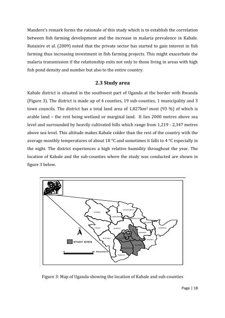
Kabale district is situated <strong>in</strong> the southwest part <str<strong>on</strong>g>of</str<strong>on</strong>g> Uganda at the border with Rwanda<br />
(Figure 3). The district is made up <str<strong>on</strong>g>of</str<strong>on</strong>g> 4 counties, 19 sub-counties, 1 municipality and 3<br />
town councils. The district has a total land area <str<strong>on</strong>g>of</str<strong>on</strong>g> 1,827km 2 most (93 %) <str<strong>on</strong>g>of</str<strong>on</strong>g> which is<br />
arable land – the rest be<strong>in</strong>g wetland or marg<strong>in</strong>al land. It lies 2000 metres above sea<br />
level and surrounded by heavily cultivated hills which range from 1,219 - 2,347 metres<br />
above sea level. This altitude makes Kabale colder than the rest <str<strong>on</strong>g>of</str<strong>on</strong>g> the country with the<br />
average m<strong>on</strong>thly temperatures <str<strong>on</strong>g>of</str<strong>on</strong>g> about 18 °C and sometimes it falls to 4 °C especially <strong>in</strong><br />
the night. The district experiences a high relative humidity throughout the year. The<br />
locati<strong>on</strong> <str<strong>on</strong>g>of</str<strong>on</strong>g> Kabale and the sub-counties where the <str<strong>on</strong>g>study</str<strong>on</strong>g> was c<strong>on</strong>ducted are shown <strong>in</strong><br />
figure 3 below.<br />
IKUMBA<br />
KASHAMBYA<br />
HAMURWA<br />
RWAMUCUCU<br />
BUKINDA<br />
N<br />
MUKO<br />
BUBALE<br />
KAMWEZI<br />
KNZ<br />
KCZ<br />
KSZ<br />
KYANAMIRA<br />
KAHARO<br />
STUDY SITES<br />
BUFUNDI<br />
KITUMBA<br />
MAZIBA<br />
BUHARA<br />
KAMUGANGUZI<br />
0 20 Kilometers<br />
RUBAYA<br />
Figure 3: Map <str<strong>on</strong>g>of</str<strong>on</strong>g> Uganda show<strong>in</strong>g the locati<strong>on</strong> <str<strong>on</strong>g>of</str<strong>on</strong>g> Kabale and sub-counties<br />
Page | 18