Stowmarket Mill Lane Development Ltd, 2010 - Mid Suffolk District ...
Stowmarket Mill Lane Development Ltd, 2010 - Mid Suffolk District ...
Stowmarket Mill Lane Development Ltd, 2010 - Mid Suffolk District ...

You also want an ePaper? Increase the reach of your titles
YUMPU automatically turns print PDFs into web optimized ePapers that Google loves.
NOTES
Landscaping Key:<br />
Main Features Key:<br />
1 40 m Structural planting belt sloping<br />
up embankment to road level<br />
2 3m Open unmanaged rail margin<br />
fenced off from development zone<br />
3 Existing wood to be retained and<br />
fenced off from development zone<br />
4 Wetland area with raised footpath and<br />
planting to EA and <strong>Suffolk</strong><br />
Wildlife approval<br />
5 40 m Structural Planting belt<br />
incorporating public footpath<br />
6 20-30m Structural Planting Belt<br />
11<br />
12<br />
10<br />
16<br />
Phase 1 boundary<br />
Business warehouse and industrial develpoment<br />
Business units<br />
Business units, replica agricultural buildings<br />
Business community centre and bus stop<br />
Recreation ground<br />
Urban Gateway Opportunity for Landmark Building<br />
7 Ling / Tye with drainage/ pond features<br />
8 Tapering max 40m Structural Planting belt<br />
incorporating public footpath<br />
9 Mixed depth New wood/Planting Belt Min<br />
40m depth avoiding Floodplain<br />
where applicable<br />
10 New Ridge Top wood 100m depth<br />
incorporating woodland ‘ride’ and sloping<br />
up embankment to road level<br />
11 Existing Hedgerow to <strong>Mill</strong> <strong>Lane</strong> retained<br />
12 2.5m wide combined public footpath/<br />
cycleway with 5m planting either side<br />
13 3m wide combined public footpath/<br />
cycleway with 5m planting either side<br />
14 3m wide combined public footpath/<br />
cycleway with 0.75m low durable hedge to<br />
carriageway and 5m planting to inner side<br />
2<br />
1<br />
15<br />
13<br />
13<br />
14<br />
14<br />
6<br />
7<br />
12<br />
8<br />
9<br />
Green/ ecological/ environmental land uses<br />
Bus layby and truck turn<br />
Phase 2, 6 years onwards<br />
Phase 2 business park<br />
Open Ling/ Tye<br />
Informal recreation area and community wetland<br />
Structural Planting<br />
Water features<br />
Existing Tree Belt<br />
15 3m wide combined public footpath/<br />
cycleway with 5m planting increasing<br />
to 40m<br />
16 Off site Phase 2 Planting belt<br />
3<br />
5<br />
New recreational footway/ Cycleway through newly created habitat<br />
mosaic linking residents of Cedar Park with River Gipping path and<br />
Creeting footpath<br />
Dual and single carriageway, New Proposed A1120/ <strong>Mill</strong> <strong>Lane</strong> link road<br />
Existing East West Road Links<br />
2<br />
Phase 2 development Road Access from year 6<br />
Possible Pedestrian footbridge link funded by others<br />
Stretch of <strong>Mill</strong> <strong>Lane</strong> closed to traffic<br />
4<br />
Overhead cables and electricity pylons<br />
Maximum eaves height 6.5 metres<br />
Maximum eaves height 8 metres<br />
Maximum eaves height 13 metres<br />
Swales and new planting along land profiling cuts<br />
<strong>Stowmarket</strong> <strong>Mill</strong> <strong>Lane</strong> <strong>Development</strong> <strong>Ltd</strong>.<br />
Plan 3, Delivery of Open Space & Access to <strong>Development</strong><br />
February <strong>2010</strong><br />
01
NOTES
SITE LAYOUT PRINCIPLES<br />
INDICATIVE LAND USES<br />
ESTATE INFRASTRUCTURE<br />
BUILT DESIGN<br />
The development of the area is predicated on<br />
the construction of the new link road between<br />
<strong>Mill</strong> <strong>Lane</strong> and the A1120 Tesco roundabout.<br />
To maximise views into open countryside and provide a focal<br />
point the link road will follow a straight line between the<br />
roundabout and the Clamp Farm cluster of buildings. Where<br />
the new road veers east to avoid the cluster and intercept<br />
with <strong>Mill</strong> <strong>Lane</strong>, the open view will be maintained by the<br />
creation of an open area replicating the Tye /Ling feature<br />
found in many <strong>Suffolk</strong> villages (yellow on Masterplan).<br />
The new link road and central roundabout will be designed<br />
and constructed to <strong>Suffolk</strong> County Council approval and<br />
to a specification providing adequate capacity for Phase 1<br />
and Phase 2 and local traffic diverted from <strong>Mill</strong> <strong>Lane</strong>. It is<br />
anticipated that this will dictate that elements of the road<br />
will be twin lane.<br />
Dispersal of the road network to Phase 2 in the north and<br />
the warehouse zone in the south will be via distributor<br />
roads aligned with the Overhead High Voltage Power Lines<br />
thus minimising disruption and loss of developable area to<br />
these cables and preserving open access to them.<br />
The Link road and these distributor roads will be<br />
constructed to <strong>Suffolk</strong> County Council approval and<br />
offered for adoption by the Council Highways authority.<br />
Following construction of the new link road <strong>Mill</strong> <strong>Lane</strong><br />
will be closed to through traffic and temporary access<br />
allowed for Braziers Hall and <strong>Mill</strong> lane cottages westwards<br />
to Creeting Road shared with pedestrian and cycleways<br />
utilizing the former lane.<br />
The Phase 2 Business Park will be the subject of a separate<br />
planning application but will be accessed via the northern<br />
distributor road within the Phase 1 Site as indicated white<br />
on the Masterplan<br />
The Masterplan illustrates indicative layout<br />
principles such as the location and extent of<br />
the proposed public and business land uses. A<br />
mix of predominantly B1, B2 and B8 land uses<br />
will be permitted in the following<br />
approximate proportions :<br />
Total<br />
Area in<br />
Hectares<br />
(Ha)<br />
Total<br />
Employment<br />
Area<br />
(Ha)<br />
Area<br />
of B1<br />
Offices<br />
(Ha)<br />
Area of<br />
Other<br />
Business<br />
Units<br />
(Ha)<br />
Phase 1 58 29.0 2 6 21.0<br />
Phase 2 21 10.5 2 4.5 4.0<br />
Total 79 39.5 4 10.5 25.0<br />
Other Uses including Sui Generis use and those within<br />
Use Class D commonly found on Business parks will be<br />
considered . The distribution of Uses within the Site will<br />
depend upon type of user and quality of the particular<br />
development but will be subject to additional specific<br />
guidance as below:<br />
Keys sites for landmark buildings are identified.<br />
These will mark junctions and activity nodes and aid<br />
navigation whilst simultaneously masking poorer visual<br />
aspects (eg the view of the maltings) . Such buildings<br />
might be approved from any use class but will be<br />
distinctive and memorable incorporating high quality<br />
materials and landscaping.<br />
The blue plot of circa 0.5 ha denotes a Business Park<br />
central services facility housing mixed facilities such<br />
as a Town Edge Bus Stop with ‘Real Time Passenger<br />
Information’ (RTPI), taxi rank, waiting area, small<br />
shop, small cafeteria, offices, crèche.<br />
Area of<br />
Warehouses<br />
(Ha)<br />
Two plots of circa 0.5 ha coloured Khaki denote business<br />
units designed and constructed to resemble traditional<br />
agricultural buildings<br />
The main estate/ link road (dark red), north<br />
south distributor roads (white) will be<br />
constructed in the approximate locations<br />
indicated on the Masterplan to adoption<br />
standards and incorporate the planting<br />
designs specified on the Landscape key of<br />
the Masterplan.<br />
Additional minor plot access roads will be constructed<br />
within the framework of the main estate roads, land use<br />
zones and landscaping belts also to adoptable standard and<br />
offered for adoption. The design will specify carriageway<br />
and hardened footpath up to plot boundary.<br />
A cohesive standard of paving materials, signage , lighting,<br />
planting and boundary treatments will be agreed with the<br />
Planning Authority and County Highways Authority to<br />
create a high quality public realm with a sense of identity.<br />
Street Lighting will be designed to minimise light pollution<br />
and negative impact on the adjoining countryside. Lighting<br />
of key features and Landmark Buildings will be employed<br />
to aid legibility of the area and a sense of security after sun<br />
down. This will also be designed to minimise light pollution.<br />
Within the cohesive framework of the estate<br />
infrastructure the design of individual<br />
buildings will not be subject to any common<br />
design theme but will encourage differing<br />
approaches to include the use of sustainable<br />
materials and construction methods and,<br />
for buildings over 1,000 sq m, achieve at<br />
minimum an equivalent rating to BREEAM<br />
Very Good standard.<br />
The Masterplan illustrates maximum eaves heights<br />
appropriate to the various developments plots thus<br />
ensuring that the tallest buildings are located on the valley<br />
floor alongside the existing multi storey maltings buildings<br />
all of which will be hidden from external view as the<br />
planting belts mature<br />
Lighting will be designed to minimise light pollution.<br />
Illuminated bollards will be used where possible as a means<br />
of providing subtle low-level lighting and picking out routes.<br />
A plot of circa 1 ha coloured Lime Green denotes an<br />
area reserved for ‘green’ uses which may include the<br />
construction of low impact buildings and infrastructure.<br />
02
NOTES
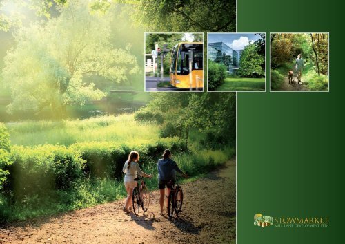
TRAFFIC AND TRANSPORT<br />
Transport Assessment<br />
AIR QUALITY<br />
ARCHAEOLOGY<br />
The Site presents an opportunity to contribute to<br />
local transport strategy in several important ways:<br />
Creation of a new direct road access between <strong>Mill</strong><br />
<strong>Lane</strong> and the A1120 Tesco Roundabout. This allows<br />
the closure of the dangerous contraflow on the A14<br />
wets bound slip road, and removes vehicles, including<br />
commercial traffic from existing businesses in Creeting,<br />
from the Cedars Park residential areas.<br />
Provision of job opportunities matched to existing<br />
and future housing areas will significantly reduce the<br />
trend for outward commuting from <strong>Stowmarket</strong> to<br />
employment opportunities to the west and east along the<br />
A14 thereby reducing car use and A14 congestion.<br />
Re-use of the abandoned <strong>Mill</strong> <strong>Lane</strong> road bridge as<br />
a combined cycle and pedestrian route linking back<br />
through residential areas to the town centre combined<br />
with a public transport hub within the Park housing<br />
a Town Edge Bus Stop with ‘Real Time Passenger<br />
Information’ (RTPI), taxi rank, waiting area will<br />
present workers with a range of transport modes and<br />
promote reduced car use in the area.<br />
Cycle and pedestrian traffic entering the site from the<br />
<strong>Mill</strong> <strong>Lane</strong> road bridge in the north east will be connected<br />
through the site by new tree lined pathways to the existing<br />
Gipping Valley footpath in the south west corner of the<br />
site providing a circular route back to <strong>Stowmarket</strong> town<br />
centre. Additional cycle /pedestrian links to the north west<br />
corner will provide enhanced public footpath access under<br />
the A14 to Creeting St Peter.<br />
A combined pedestrian / cycle route will be constructed<br />
leading into the site from the A1120 Cedras Link south<br />
of gthe ‘Tesco’ roundabout and an appropriate sized plot<br />
left available for the construction of a footbridge over<br />
the A1120 by others. The footbridge does not form part<br />
of the Site infrastructure proposals .<br />
Footpaths will be designed to afford the disabled a route<br />
from the north western boundary with the A1120 to the<br />
River Gipping bank in the south west.<br />
A Transport Assessment<br />
based on predicted worker numbers based on the Land<br />
Use areas tabled above<br />
incorporating all modes of access and<br />
examining the inter –relationship of the combination of<br />
proposed road improvements and Business Park traffic<br />
generation with the local highway network and the A14<br />
trunk route is produced as Appendix 2 .<br />
A Green Travel Plan prepared in accordance with latest<br />
government guidance will accompany any planning<br />
application and the Business Park Management Company<br />
will be required through planning condition to implement<br />
and monitor the approved measures on an ongoing basis.<br />
NOISE AND VIBRATION<br />
The site is bounded to the north by the A14<br />
trunk road, to the west by the A1120 dual<br />
carriageway and to the south by the main<br />
London to Norwich railway bounded by a<br />
chemical plant and a maltings.<br />
In accordance with PPG 24 an assessment was undertaken<br />
in 2007 of the likely impact of noise and vibration<br />
generated by the development of a notional business<br />
park occupying Phase 1. The report considered both<br />
the construction and operational phases in the context<br />
of the site, immediate environs and local road network.<br />
A Baseline noise level survey was undertaken, nearby<br />
receptors identified and noise levels from the proposed<br />
development were predicted using known data for plant,<br />
equipment and traffic British Standard BS5228 Noise and<br />
Vibration Control on Construction and Open sites).<br />
The report concluded that with best practice measures noise<br />
and vibration during the construction phase would not<br />
be significant. The report predicted that operational noise<br />
would affect residents in the cluster of dwellings at Clamp<br />
Farm and that mitigation measures would be needed.<br />
The site is bounded to the north by the A14<br />
trunk road, to the west by the A1120 dual<br />
carriageway and to the south by the main<br />
London to Norwich railway bounded by a<br />
chemical plant and a maltings.<br />
An assessment was undertaken in 2007 of the likely<br />
impact of dust and air pollution of a notional business<br />
park occupying Phase 1.In accordance with guidance in<br />
PPS23 the report considered both the construction and<br />
operational phases in the context of the site, immediate<br />
environs and local road network.<br />
The report concluded that the nuisance impact of dust<br />
arising from the construction phase was unlikely to be<br />
significant assuming adherence to good practice for the<br />
minimisation of dust.<br />
The report considered existing background levels of<br />
pollutants and modelled the impact of the proposed<br />
development using the Highways Agency Design Manual<br />
for Roads and Bridges screening technique and found<br />
that the impact on air quality would be ‘negligible in the<br />
context of both existing concentrations and the air quality<br />
objectives for the protection of human health.’<br />
It is anticipated that any planning application for either<br />
phase will incorporate this initial report together with an<br />
update considering any implications of any significant<br />
changes in traffic generation as further detail of the exact<br />
nature and extent of land uses becomes known.<br />
In 2007 a desk based archaeological<br />
assessment was undertaken focussing on the<br />
Phase 1 Area but reporting on all relevant<br />
evidence within a radius of circa half mile<br />
including the Phase 2 Area.<br />
No finds from any period were recorded other than an<br />
iron-age rotary quern found near the bank of the River<br />
Gipping. The study reported that an area close to the<br />
A1120 contained small explosive stores in 1915 but<br />
that investigation of this area in the 1990s had found<br />
no remains either above or below ground. Nevertheless,<br />
the assessment suggested that the area had archaeological<br />
potential as it had been ‘utilised from the prehistoric period<br />
onwards’ and that a programme of archaeological works<br />
should be undertaken. Subsequent correspondence with<br />
<strong>Suffolk</strong> County Council Archaeological Service confirmed<br />
that these works should include; aerial photograph<br />
assessment, field walking and metal –detecting survey,<br />
linear trial trenching , a geo-archaeological evaluation of<br />
areas of the floodplain to be built on.<br />
Any Planning Applications will refer to this correspondence<br />
and anticipate a condition requiring a written scheme of<br />
investigation covering the works described above and mitigate<br />
any finds made prior to commencement of development .<br />
Planning applications will incorporate this initial report<br />
together with an update considering any implications of<br />
any significant changes in traffic generation as further detail<br />
of the exact nature and extent of land uses becomes known.<br />
03
NOTES
LANDSCAPE AND VISUAL AMENITY<br />
The Landscaping strategy for the Site is intended<br />
to not only provide mitigation of the<br />
visual intrusion of new roads and buildings<br />
but will simultaneously improve existing<br />
landscape and visual amenity by eliminating<br />
the existing poor quality views of the Maltings<br />
and chemical works from the A14 and Cedars<br />
Link. Public access from the town’s residential<br />
areas to the countryside will be improved by<br />
the provision of tree lined pedestrian and cycle<br />
ways around the periphery of the site breaking<br />
out from the existing hard urban edge of<br />
Cedars Link and linking to the existing River<br />
Gipping footpath.<br />
The Masterplan indicates the location of all landscaping<br />
features and includes a separate Key giving detailed<br />
specification of each element. Variations to the general<br />
theme of masking all development with tree screening may<br />
be considered :<br />
Where a prominent well designed building is an<br />
acceptable substitute for tree screening.<br />
At entrance points to individual plots and entrances to<br />
minor roads<br />
Where overhead cables prevent tree planting and lower<br />
growing species will be substituted<br />
ECOLOGY<br />
An extended Habitat Survey was undertaken in<br />
The Phase 1 area in 2006 and supplemented by<br />
a Great Crested newt survey of ponds within a<br />
500m radius in 2007.<br />
No protected species were identified other than traces<br />
in the River Gipping flood plain which is to remain<br />
undeveloped. A field walking study of the Phase 2 area<br />
was undertaken in 2009 and this also found only minor<br />
traces of protected species. The absence of protected<br />
species is unsurprising given that the site is open arable<br />
farmland with few trees or hedgerows.<br />
Any planning applications will be accompanied by an<br />
updated scoping report covering all potential protected<br />
species and, if necessary, updated field walking and<br />
protected species surveys will be undertaken to establish<br />
whether BAP species have migrated on to the site in the<br />
intervening period. If so, mitigation measures will<br />
be undertaken .<br />
In addition, the development proposals will include<br />
significant enhancement of the potential for bio-diversity<br />
through the planting of structural landscaping particularly<br />
in the North east and South East corners. Any planning<br />
application will anticipate a condition to undertake<br />
habitat enhancement works agreed with the appropriate<br />
statutory authority.<br />
WATER QUALITY FLOODING<br />
AND DRAINAGE<br />
Extensive correspondence has been exchanged<br />
with the Environment Agency over a 3 year<br />
period establishing their requirements for any<br />
proposed development. This work has included<br />
a Flood Risk Assessment and detailed<br />
drainage designs for a synthesised development<br />
layout on Phase 1.<br />
The site overlies a minor aquifer and it is anticipated<br />
that all planning permissions will incorporate conditions<br />
requiring appropriate pollution prevention measures such<br />
as petrol interceptors.<br />
The site contains two distinct areas within the critical 1 in<br />
100 year floodplain. The north- eastern boundary of Phase<br />
2 comprises a minor watercourse cut into the landscape.<br />
A 20 m (average) margin from this drain is designated<br />
floodplain. More significantly, approximately 10 hectares<br />
comprising the south-eastern corner of Phase 1 are low<br />
lying meadows adjoining the River Gipping and are<br />
designated floodplain. No construction will be proposed<br />
in these areas. The floodplain areas have been included in<br />
landscape tree planting areas but detail of the extent of such<br />
planting and any footpath or other necessary infrastructure<br />
will be agreed with the Environment Agency and any<br />
measures they require to ensure the continued functioning<br />
of the floodplain will be incorporated in the design.<br />
The effect of the development upon peak rates of surface<br />
water discharge will be mitigated by inclusion within the<br />
design of Sustainable Urban Drainage techniques (SUDS)<br />
such as attenuation ponds and oversized pipes. Where<br />
ground conditions allow, infiltration into the sub strata will<br />
be utilised. It is anticipated that any planning permission<br />
will be subject to a condition that , through these<br />
techniques, storm water discharge rates will be restricted to<br />
existing “Greenfield” run off rates.<br />
INFRASTRUCTURE DELIVERY<br />
PROGRAMME<br />
TASK<br />
Construction of <strong>Mill</strong> <strong>Lane</strong><br />
Link Road<br />
Closure of <strong>Mill</strong> <strong>Lane</strong> and street<br />
furniture / improvements for<br />
combined footpath / cycleway<br />
Planting of perimeter tree screen<br />
and construction of footpath<br />
within phase 1 area and Phase 1<br />
Structural Belts and Ling Tye<br />
Laying out, seeding and<br />
equipment of recreation ground<br />
Construction of footpath across<br />
wetland including signage,<br />
seating and bins. Planting<br />
and Habitat improvement to<br />
floodplain area<br />
Construction of Business Park<br />
centre and Terminus<br />
TIMESCALE<br />
Before Occupation<br />
of First Unit<br />
Before Occ of<br />
First Unit<br />
Before Occ of<br />
First Unit<br />
Before Occ of<br />
First Unit<br />
Before Occ of<br />
First Unit<br />
PHASE 2 WILL COMMENCE FROM<br />
2017 ONWARDS<br />
Phase 2 Planting including off<br />
site planting<br />
Complete Phase 2 access along<br />
route indicated white through<br />
Phase 1<br />
Within 36 months of<br />
start of Phase 1<br />
Before Occ of 1st<br />
Phase 2 Unit<br />
Before Occ of 1st<br />
Phase 2 Unit<br />
Completion of phase 2<br />
recreation facility<br />
Before Occ of 1st<br />
Phase 2 Unit<br />
04
<strong>Stowmarket</strong> <strong>Mill</strong> <strong>Lane</strong> <strong>Development</strong> <strong>Ltd</strong>.<br />
Garset House, St Andrews Hall Plain, Norwich, Norfolk, NR3 1AU<br />
Email: info@stowmill.com<br />
Tel: 01603 Fax: 01603 Mob: 07711 440667