Stowmarket Mill Lane Development Ltd, 2010 - Mid Suffolk District ...
Stowmarket Mill Lane Development Ltd, 2010 - Mid Suffolk District ...
Stowmarket Mill Lane Development Ltd, 2010 - Mid Suffolk District ...

Create successful ePaper yourself
Turn your PDF publications into a flip-book with our unique Google optimized e-Paper software.
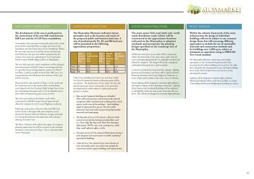
SITE LAYOUT PRINCIPLES<br />
INDICATIVE LAND USES<br />
ESTATE INFRASTRUCTURE<br />
BUILT DESIGN<br />
The development of the area is predicated on<br />
the construction of the new link road between<br />
<strong>Mill</strong> <strong>Lane</strong> and the A1120 Tesco roundabout.<br />
To maximise views into open countryside and provide a focal<br />
point the link road will follow a straight line between the<br />
roundabout and the Clamp Farm cluster of buildings. Where<br />
the new road veers east to avoid the cluster and intercept<br />
with <strong>Mill</strong> <strong>Lane</strong>, the open view will be maintained by the<br />
creation of an open area replicating the Tye /Ling feature<br />
found in many <strong>Suffolk</strong> villages (yellow on Masterplan).<br />
The new link road and central roundabout will be designed<br />
and constructed to <strong>Suffolk</strong> County Council approval and<br />
to a specification providing adequate capacity for Phase 1<br />
and Phase 2 and local traffic diverted from <strong>Mill</strong> <strong>Lane</strong>. It is<br />
anticipated that this will dictate that elements of the road<br />
will be twin lane.<br />
Dispersal of the road network to Phase 2 in the north and<br />
the warehouse zone in the south will be via distributor<br />
roads aligned with the Overhead High Voltage Power Lines<br />
thus minimising disruption and loss of developable area to<br />
these cables and preserving open access to them.<br />
The Link road and these distributor roads will be<br />
constructed to <strong>Suffolk</strong> County Council approval and<br />
offered for adoption by the Council Highways authority.<br />
Following construction of the new link road <strong>Mill</strong> <strong>Lane</strong><br />
will be closed to through traffic and temporary access<br />
allowed for Braziers Hall and <strong>Mill</strong> lane cottages westwards<br />
to Creeting Road shared with pedestrian and cycleways<br />
utilizing the former lane.<br />
The Phase 2 Business Park will be the subject of a separate<br />
planning application but will be accessed via the northern<br />
distributor road within the Phase 1 Site as indicated white<br />
on the Masterplan<br />
The Masterplan illustrates indicative layout<br />
principles such as the location and extent of<br />
the proposed public and business land uses. A<br />
mix of predominantly B1, B2 and B8 land uses<br />
will be permitted in the following<br />
approximate proportions :<br />
Total<br />
Area in<br />
Hectares<br />
(Ha)<br />
Total<br />
Employment<br />
Area<br />
(Ha)<br />
Area<br />
of B1<br />
Offices<br />
(Ha)<br />
Area of<br />
Other<br />
Business<br />
Units<br />
(Ha)<br />
Phase 1 58 29.0 2 6 21.0<br />
Phase 2 21 10.5 2 4.5 4.0<br />
Total 79 39.5 4 10.5 25.0<br />
Other Uses including Sui Generis use and those within<br />
Use Class D commonly found on Business parks will be<br />
considered . The distribution of Uses within the Site will<br />
depend upon type of user and quality of the particular<br />
development but will be subject to additional specific<br />
guidance as below:<br />
Keys sites for landmark buildings are identified.<br />
These will mark junctions and activity nodes and aid<br />
navigation whilst simultaneously masking poorer visual<br />
aspects (eg the view of the maltings) . Such buildings<br />
might be approved from any use class but will be<br />
distinctive and memorable incorporating high quality<br />
materials and landscaping.<br />
The blue plot of circa 0.5 ha denotes a Business Park<br />
central services facility housing mixed facilities such<br />
as a Town Edge Bus Stop with ‘Real Time Passenger<br />
Information’ (RTPI), taxi rank, waiting area, small<br />
shop, small cafeteria, offices, crèche.<br />
Area of<br />
Warehouses<br />
(Ha)<br />
Two plots of circa 0.5 ha coloured Khaki denote business<br />
units designed and constructed to resemble traditional<br />
agricultural buildings<br />
The main estate/ link road (dark red), north<br />
south distributor roads (white) will be<br />
constructed in the approximate locations<br />
indicated on the Masterplan to adoption<br />
standards and incorporate the planting<br />
designs specified on the Landscape key of<br />
the Masterplan.<br />
Additional minor plot access roads will be constructed<br />
within the framework of the main estate roads, land use<br />
zones and landscaping belts also to adoptable standard and<br />
offered for adoption. The design will specify carriageway<br />
and hardened footpath up to plot boundary.<br />
A cohesive standard of paving materials, signage , lighting,<br />
planting and boundary treatments will be agreed with the<br />
Planning Authority and County Highways Authority to<br />
create a high quality public realm with a sense of identity.<br />
Street Lighting will be designed to minimise light pollution<br />
and negative impact on the adjoining countryside. Lighting<br />
of key features and Landmark Buildings will be employed<br />
to aid legibility of the area and a sense of security after sun<br />
down. This will also be designed to minimise light pollution.<br />
Within the cohesive framework of the estate<br />
infrastructure the design of individual<br />
buildings will not be subject to any common<br />
design theme but will encourage differing<br />
approaches to include the use of sustainable<br />
materials and construction methods and,<br />
for buildings over 1,000 sq m, achieve at<br />
minimum an equivalent rating to BREEAM<br />
Very Good standard.<br />
The Masterplan illustrates maximum eaves heights<br />
appropriate to the various developments plots thus<br />
ensuring that the tallest buildings are located on the valley<br />
floor alongside the existing multi storey maltings buildings<br />
all of which will be hidden from external view as the<br />
planting belts mature<br />
Lighting will be designed to minimise light pollution.<br />
Illuminated bollards will be used where possible as a means<br />
of providing subtle low-level lighting and picking out routes.<br />
A plot of circa 1 ha coloured Lime Green denotes an<br />
area reserved for ‘green’ uses which may include the<br />
construction of low impact buildings and infrastructure.<br />
02