(mm/yr) (mm/yr) (mm/yr)
(mm/yr) (mm/yr) (mm/yr)
(mm/yr) (mm/yr) (mm/yr)

Create successful ePaper yourself
Turn your PDF publications into a flip-book with our unique Google optimized e-Paper software.
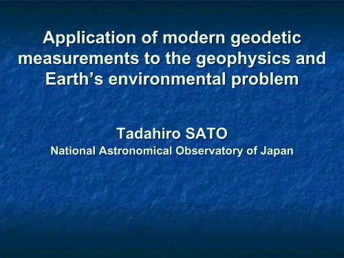
Application of modern geodetic<br />
measurements to the geophysics and<br />
Earth’s s environmental problem<br />
Tadahiro<br />
SATO<br />
National Astronomical Observatory of Japan
For the geosciences based on the<br />
data obtained from the modern geodetic<br />
measurements, GIA (Glacial<br />
Isostatic Adjustment)<br />
is important to study the Earth’s viscoelastic<br />
structure and dynamics, and the<br />
environmental problem of the Erath.
Following two topicst<br />
will be introduced;<br />
/ Experience at Ny-Ålesund<br />
lesund, , Svalbard in the<br />
Arctic,<br />
/ Japan–US joint observation project in<br />
Southern Alaska started in 2005**.<br />
**<br />
Abstract #053 of P41 by Freymueller et al.<br />
last day talk closely relates to the 2 nd topics.
Experience at Ny-Ålesund<br />
lesund,<br />
Svalbard in the Arctic<br />
(Sato et al., 2006, GJI, in press)
Geodetic observations at Ny-Ålesund<br />
AG: Absolute Gravimeter<br />
SG: Superconducting<br />
Gravimeter<br />
NALL & NAL1: GPS sites<br />
VLBI: VLBI site<br />
TG: Tide Gauge<br />
L&R: LaCoste & Romberg<br />
Gravimeter
Secular uplift rates at Ny-Ålesund<br />
(<strong>mm</strong>/<strong>yr</strong>)<br />
VLBI 4.8 (1.1)<br />
GPS (NYA1) 4.8 (1.5)*<br />
GPS (NALL) 5.3 (0.9)*<br />
Tide Gauge 5.2 (0.3)**<br />
----------------------------------<br />
Mean 5.2 (0.6)<br />
The GPS solutions derived by<br />
Heflin (2004).<br />
* The GPS rates shown here are corrected<br />
for a GPS scale rate error of +1.6 <strong>mm</strong>/<strong>yr</strong> to<br />
the VLBI rate, which was found from a<br />
comparison between VLBI and GPS at the 30<br />
collocation sites in the world.<br />
** Assumed 1.7 <strong>mm</strong>/<strong>yr</strong> as a rate of global<br />
secular sea level change
Absolute gravity observations<br />
• Rate: -2.5+/ 2.5+/-0.9<br />
μGal/<strong>yr</strong><br />
AG measurement in 2002 carried<br />
out by the Luxembourg group.
Predicted PGR (Post Glacial Rebound) :<br />
no more than 2-32<br />
3 <strong>mm</strong>/<strong>yr</strong><br />
Observed uplift rates:<br />
5.2+/-0.6 <strong>mm</strong>/<strong>yr</strong><br />
**Observation is two times larger than the<br />
proposed model results for the PGR effect.<br />
References: Lambeck 1995; Kaufmann & Wolf 1996;<br />
Kaufmann & Wu 1998; Scherneck et al. . 2002.
Possible origins that we studied;<br />
(1) Effect of the secular sea level (SSL(<br />
SSL)<br />
of a few 10 years in the oceans of the<br />
northern part of Europe,<br />
(2) Effect of the present-day ice melting<br />
(PDIM),<br />
(3) Effect of the ambiguity in the modeling<br />
of PGR.
Computation of the PDIM effect<br />
Method:<br />
Convolution of the changing<br />
mass with the loading Green’s<br />
function (for the PREM earth<br />
model) over the main 16 glaciers<br />
approximated their shape with<br />
elliptical cylinder.<br />
Results:<br />
Uplift: 2.04 <strong>mm</strong>/<strong>yr</strong><br />
Gravity: -0.53<br />
μGal/<strong>yr</strong><br />
SVAL model by<br />
Hagedoorn & Wolf<br />
(2003)<br />
For a mean melting rate of -45 cm/<strong>yr</strong><br />
over Svalbard that was inferred from<br />
glaciology data.
Sensitivity test of the PGR rate<br />
Large ice model<br />
● : ARC3+ANT4<br />
▼ : ICE-3G (large ice model)<br />
Small ice model:<br />
○ : ANU+ANT4<br />
Computed by Okuno
Comparison between the observation and the prediction<br />
• Displacement<br />
NS EW Vertical<br />
Gravity<br />
(<strong>mm</strong>/<strong>yr</strong>) (<strong>mm</strong>/<strong>yr</strong>) (<strong>mm</strong>/<strong>yr</strong>) (μGal(<br />
Gal/<strong>yr</strong>)<br />
Observation Mean 0.1 (0.4) -1.8 (0.4) 5.2 (0.6) -2.5 (0.9)<br />
Corrections<br />
1. RSL 0.00 -0.01 0.12 -0.04<br />
2. PDIM SVAL model 0.05 -0.83 2.04 -0.53<br />
3. PGR ANU+ANT4 0.53 -0.71 1.18 -0.33<br />
ARC3+ANT4 1.30 -2.98 1.46 -0.29<br />
ICE-3G<br />
1.16 -2.43 1.88 -0.31<br />
Sum of the corrections<br />
ANU+ANT4 0.58 -1.54 3.33 -0.88<br />
ARC3+ANT4 1.35 -3.82<br />
3.61 -0.84<br />
ICE-3G<br />
1.21 -3.26 4.03 -0.86
A geophysical interpretation<br />
Assumed melting rate vs Estimated PDIM effect
Su<strong>mm</strong>ary<br />
Both the observed uplift and gravity rates at Ny-Ålesund<br />
are larger than that expected from the PGR effects.<br />
Our study indicates;<br />
(1) Relative sea level (RSL) changes:<br />
not major origin<br />
(2) Present-day ice melting (PDIM):<br />
If the recent ice melting rate increases, it can be<br />
a strong candidate to explain the difference between the t<br />
observed ed rates and the predicted ones.<br />
(3) Ambiguity of the computation of PGR effect:<br />
Computation is sensitive to both the ice mode and Earth’s<br />
structural parameters.<br />
At Ny-Ålesund<br />
lesund, the horizontal rates are useful to<br />
constrain the discussion of the vertical rate of the PGR.
Japan–US joint observation project<br />
Period: 2005-2008<br />
2008<br />
in Southern Alaska<br />
Leaders:<br />
S. Miura (Tohoku Univ.)<br />
J. T. Freymueller (Univ. Alaska, Fairbanks)<br />
Members:<br />
T. Sato (NAOJ),<br />
H. Fujimoto (Tohoku Univ.),<br />
Y. Miyagi, M. Kasahara, , H. Takahashi (Hokkaido Univ.),<br />
T. Sugano, W. Sun, J. Okuno (ERI, Univ. Tokyo),<br />
C. F. Larsen, R. Motyka (Univ. Alaska, Fairbanks) .
Glacier Bay in Southern Alaska<br />
60N<br />
160W<br />
140W<br />
after C. Larsen (2002)
Rapid Uplift Rate Observed in Southern Alaska<br />
GPS and tide gauges give consistent uplift rates each other.<br />
after Larsen, C. F. et al., 2004 and 2005
Intensive GIA study was done in this area<br />
by University of Alaska, Fairbanks<br />
C.. F. Larsen, R. J. Motyka, , J. T. Freymueller,<br />
K. A. Echelmeyer and E. R. Ivins,<br />
Rapid uplift of southern 1118, Alaska caused by recent ice<br />
loss,<br />
Geophys. . J. Int., (2004) Vol. 158, P.<br />
C. F. Larsen, R. J. Motyka, , J. T. Freymueller,<br />
K. A. Echelmeyer, , E. R. Ivins<br />
Rapid viscoelastic uplift in southeast Alaska caused<br />
by post-Little Ice Age glacial retreat,<br />
EPSL, (2005) 237, p. 548
Su<strong>mm</strong>ary of the study by Alaskan group<br />
1. Large uplift rates: 30 <strong>mm</strong>/<strong>yr</strong> at the maximum.<br />
2. The observed rapid rates may not explain from the<br />
tectonic rate.<br />
3. The uplift pattern estimated from the GPS and TG data is<br />
consistent each other in general.<br />
4. A two-layer<br />
viscoelastic model (i.e. Elastic crust and Low<br />
viscosity half-space mantle) is not adequate to explain all<br />
three data sets of the GPS, TG and raised shore line.<br />
Three-layer<br />
viscoelastic earth model (i.e.<br />
Elastic<br />
lithosphere,<br />
low-viscosity<br />
athenosphere and<br />
high-<br />
viscosity lower mantle) is favorable to explain<br />
consistently all three data sets.<br />
5. For the observed viscous motion to the long-term forcing,<br />
there is a possibility that the effect of post-Little Ice Age<br />
contributes.
Subjects in the project<br />
1. Which global past-ice model among those now<br />
proposed is the best to explain the data obtained in<br />
Southern Alaska<br />
2. What is the best combination of the viscoelastic<br />
structural parameters for the study area<br />
3. How we can precisely separate two contributions<br />
from the past-ice and from the present-day ice<br />
These questions are closely linked each other.
GPS measurements<br />
100 km<br />
after C. F. Larsen (2003)<br />
45 Sites<br />
Red: good data<br />
Blue: need to be visited again
Collocation observation of GPS and gravity<br />
• By collocating the position and gravity measurements.<br />
we have an opportunity to discuss the elastic and<br />
viscous problems separately (Wahr(<br />
et al. . ,1995)<br />
Key numbers;<br />
+6.5 <strong>mm</strong>/μGal<br />
Gal: : a ratio of the viscous displacement<br />
to the viscous gravity change due to<br />
the mass redistribution in the mantle.<br />
-0.3<br />
μGal/<strong>mm</strong>: Free-air gravity change<br />
-0.15<br />
μGal/<strong>mm</strong><br />
(i.e. -0.3+1/6.5):<br />
viscous gravity rate
Observation and study in this project<br />
1. Observation<br />
/ GPS:<br />
Survey at some sites which are suggested to visit again<br />
from the previous observations<br />
Continuous observations<br />
/ Absolute<br />
and relative gravity measurements<br />
Gravity measurements with FG5 absolute gravimeter<br />
Continuous observation of the gravity tide<br />
2. Modeling<br />
/ Modeling of PGR & PDIM<br />
/ Improving the ocean tide model around the field<br />
/ Application of GRACE data to this area by increasing<br />
the spatial resolution of the analysis
Observation plan<br />
● AG, ○ Tidal Gravity, ●, Continuous GPS, ● GPS survey
Absolute gravityg<br />
measurement in Southern Alaska
Results of the AG measurement in 1987<br />
9.81832420 (±2.8 Gal)<br />
Sasagawa et al. (1989)<br />
Expected gravity change:<br />
δh = 18*(2006-1987)<br />
= 342 <strong>mm</strong><br />
δg = -0.2*342<br />
= 68 μGal at least
Tide Gauge Stations<br />
100 km<br />
after C. F. Larsen (2003)<br />
20 sites<br />
Black: Permanent site
Effect of the Ocean tide in Southern Alaska (SA)<br />
The ocean tide in SA is very large. Moreover, SA is a place at<br />
where the accuracy of the modern ocean tide models are low,<br />
i.e. difference among the models are large.<br />
This is a reason why we do the observation of gravity tide in<br />
SA.<br />
Ny-Ålesund<br />
1<strong>yr</strong><br />
Ocean (cm) 6.1<br />
Vertical (<strong>mm</strong>) 3.1<br />
Gravity (μGal) 1.2<br />
8 m<br />
Alaska<br />
Ocean (cm) 39<br />
Vertical (<strong>mm</strong>) 18<br />
Gravity (μGal) 6
Su<strong>mm</strong>ary<br />
/ Experiences in Svalbard and Southern Alaska<br />
introduced here also show that the modern<br />
geodetic measurements are worth very much<br />
not only the GIA problem but also a tool to<br />
consider the Earth’s s environmental problem via<br />
the present-day ice melting.<br />
/ Experiences in Ny-Ålesund<br />
suggest that the<br />
horizontal displacements are important to<br />
constrain the ice problem, especially for an area<br />
which locates at an edge of past- or present-<br />
day ice sheets.<br />
/ GRACE data may help to determine the low-<br />
order gravity changes and its results should be<br />
used by combing with the data from the ground<br />
observations.
Thanks for your attention.
Observed displacement rates<br />
• NS EW Vertical<br />
• (<strong>mm</strong>/<strong>yr</strong>) (<strong>mm</strong>/<strong>yr</strong>) (<strong>mm</strong>/<strong>yr</strong>)<br />
• VLBI 14.4 (0.5) 10.3 (0.5) 5.1 (1.1)<br />
• 13.8 11.3 4.8<br />
• GPS (NYA1) 14.6 (0.6) 10.0 (0.6) 6.6 (1.5)<br />
• 13.8 10.7 6.4<br />
• GPS (NALL) 14.2 (0.5) 10.7 (0.5) 7.0 (0.9)<br />
• 13.5 11.4 6.9<br />
• NUVEL1A-NNR NNR 13.6 13.0 -------<br />
Note:<br />
The first line for the VLBI and GPS (Heflin, 2004) indicates rates given in an<br />
ITRF2000 frame. The second line indicates rates in a NNR-NUVEL-1A frame.