

200 - Typhoon Committee
200 - Typhoon Committee
200 - Typhoon Committee

Create successful ePaper yourself
Turn your PDF publications into a flip-book with our unique Google optimized e-Paper software.
ESCAP/WMO<br />
<strong>Typhoon</strong> <strong>Committee</strong><br />
TCAR<br />
Annual Review<br />
Over 40 years of International Cooperation<br />
<strong>200</strong>7<br />
Kong-Rey<br />
Yutu<br />
Toraji<br />
Man-Yi<br />
Usagi<br />
Pabuk<br />
Wutip<br />
Sepat<br />
Fitow<br />
Danas<br />
Nari<br />
Wipha<br />
Francisco<br />
Lekima<br />
Krosa<br />
Haiyan<br />
Podul<br />
Lingling<br />
Kajiki<br />
Faxai<br />
Peipah<br />
Tapah<br />
Mitag<br />
Hagibis<br />
ESCAP/ WMO<br />
<strong>Typhoon</strong> <strong>Committee</strong><br />
1
ESCAP/WMO<br />
<strong>Typhoon</strong> <strong>Committee</strong> Annual Review <strong>200</strong>7<br />
On the Cover:<br />
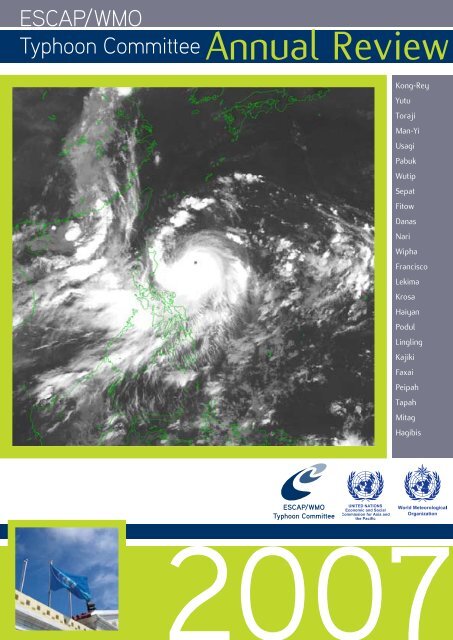
MTSAT-1R VS imagery of SEPAT (0708) at 00UTC, 16 August <strong>200</strong>7.(By courtesy of Japan Meteorological Agency)<br />
The headquarters of the <strong>Typhoon</strong> <strong>Committee</strong> Secretariat.<br />
2
TCAR<br />
Contents<br />
<strong>200</strong>7<br />
CONTENTS<br />
ESCAP, WMO and the ESCAP/WMO <strong>Typhoon</strong> <strong>Committee</strong> 7<br />
<strong>Typhoon</strong> <strong>Committee</strong> (<strong>200</strong>6 – <strong>200</strong>7) 9<br />
ESCAP/WMO <strong>Typhoon</strong> <strong>Committee</strong> Annual Review <strong>200</strong>7 Editorial Board 11<br />
Foreword 13<br />
Introduction 15<br />
Chapter 1 <strong>Typhoon</strong> <strong>Committee</strong> Activities <strong>200</strong>7<br />
1.1 Meteorology 17<br />
1.2 Hydrology 105<br />
1.3 Disaster Prevention and Preparedness (DPP) 153<br />
1.4 <strong>Typhoon</strong> <strong>Committee</strong> Secretariat (TCS) 195<br />
Chapter 2 Tropical Cyclones in <strong>200</strong>7<br />
2.1 Overview 197<br />
2.2 Report on individual tropical cyclones which affected<br />
Members of the <strong>Typhoon</strong> <strong>Committee</strong><br />
2.2.1 Kong-Rey (0701) 204<br />
2.2.2 Yutu (0702) 206<br />
2.2.3 Toraji (0703) 208<br />
2.2.4 Man-Yi (0704) 210<br />
2.2.5 Usagi (0705) 212<br />
2.2.7 Wutip (0707) 216<br />
2.2.8 Sepat (0708) 218<br />
2.2.9 Fitow (0709) 220<br />
2.2.10 Danas (0710) 222<br />
2.2.11 Nari (0711) 224<br />
2.2.12 Wipha (0712) 226<br />
2.2.13 Francisco (0713) 228<br />
2.2.14 Lekima (0714) 230<br />
2.2.15 Krosa (0715) 232<br />
2.2.16 Haiyan (0716) 234<br />
2.2.17 Podul (0717) 236<br />
2.2.18 Lingling (0718) 238<br />
2.2.19 Kajiki (0719) 240<br />
2.2.20 Faxai (0720) 242<br />
2.2.21 Peipah (0721) 244<br />
2.2.22 Tapah (0722) 246<br />
2.2.23 Mitag (0723) 248<br />
2.2.24 Hagibis (0724) 250<br />
3
ESCAP/WMO<br />
<strong>Typhoon</strong> <strong>Committee</strong> Annual Review <strong>200</strong>7<br />
Chapter 3<br />
Contributed Papers<br />
Zhiyu Liu,<br />
Bureau of Hydrology, Ministry of Water Resources of China<br />
“Mountainous Torrent Disasters and Approaches<br />
to Flash Flood Early Warning in China” 253<br />
Mr. S. W. Li<br />
Hong Kong, China<br />
“Tropical Cyclone Information Processing Systems”. 262<br />
Ms. Sandy M.K. Song<br />
Hong Kong, China<br />
“CAeM pilot project -<br />
Aviation-Weather Disaster Risk Reduction (ADRR) Website”. 267<br />
Mr. Kunio SAKURAI<br />
Japan Meteorological Agency<br />
“<strong>Typhoon</strong> Ensemble Prediction System<br />
developed at the Japan Meteorological Agency.” 273<br />
Mr. QIAN Chuanhai<br />
CMA, China<br />
“Social Economic Benefits Evaluation<br />
of <strong>Typhoon</strong> Disaster Mitigation in China” 277<br />
Dr. Eun Mi Chang<br />
KSIC, Rep. of Korea<br />
“TCDIS - <strong>Typhoon</strong> <strong>Committee</strong> Disaster Information System” 284<br />
Dr. Le-Huu Ti<br />
ESCAP<br />
“Monitoring of Investment and Results in Water Resources” 288<br />
Dr. Le-Huu Ti<br />
ESCAP<br />
“Tool and Practices in Adaptation Planning” 291<br />
Chapter 4<br />
WMO Tropical Cyclone Programme News<br />
4.1 Introduction 295<br />
4.2 Programme Activities in <strong>200</strong>7 297<br />
4
TCAR<br />
Contents<br />
<strong>200</strong>7<br />
Appendix I<br />
Revised Tropical Cyclone Names 303<br />
Appendix II<br />
Chairmen of the <strong>Typhoon</strong> <strong>Committee</strong> 305<br />
5
6<br />
ESCAP/WMO<br />
<strong>Typhoon</strong> <strong>Committee</strong> Annual Review <strong>200</strong>7
TCAR<br />
ESCAP, WMO and the ESCAP/WMO <strong>Typhoon</strong> <strong>Committee</strong><br />
<strong>200</strong>7<br />
ECONOMIC AND SOCIAL COMMISSION<br />
FOR ASIA AND THE PACIFIC (ESCAP)<br />
The Economic and Social Commission for Asia and<br />
the Pacific (ESCAP) aims to initiate and participate in<br />
measures for concerted action towards the development<br />
of Asia and the Pacific, including the social aspects of<br />
such development, with a view to raising the level of<br />
economic activity and standards of living and maintaining<br />
and strengthening the economic relations of countries<br />
and territories in the region, both among themselves and<br />
with other countries in the world.<br />
The Commission also:<br />
• provides substantive services, secretariats and<br />
documentation for the Commission and its subsidiary<br />
bodies;<br />
• undertakes studies, investigations and other activities<br />
within the Commission’s terms of reference;<br />
• provides advisory services to Governments at their<br />
request;<br />
• contributes to the planning and organization of<br />
programmes of technical cooperation and acts<br />
as executing agency for those regional projects<br />
decentralized to it.<br />
WORLD METEOROLOGICAL<br />
ORGANIZATION (WMO)<br />
The World Meteorological Organization (WMO), a<br />
specialized agency of the United Nations, serves:<br />
• to facilitate international cooperation in the<br />
establishment of networks of stations and centres<br />
to provide meteorological and hydrological services<br />
and observations;<br />
• to promote the establishment and maintenance of<br />
systems for rapid exchange of meteorological and<br />
related information;<br />
• to promote standardization of meteorological<br />
and related observations and ensure the uniform<br />
publication of observations and statistics;<br />
• to further the application of meteorology to aviation,<br />
shipping, water problems, agriculture and other<br />
human activities;<br />
• to promote activities in operational hydrology and<br />
to further close cooperation between Meteorological<br />
and Hydrological Services;<br />
• to encourage research and training in meteorology<br />
and, as appropriate, in related fields.<br />
ESCAP/WMO TYPHOON COMMITTEE (TC)<br />
Under the auspices of ESCAP and WMO, the <strong>Typhoon</strong><br />
<strong>Committee</strong> was constituted with a view to promoting<br />
and coordinating efforts for minimizing tropical cyclone<br />
damage in the ESCAP region. The incipient stage of the<br />
<strong>Typhoon</strong> <strong>Committee</strong> dated back to 1964 when the United<br />
Nations Economic Commission for Asia and the Far East<br />
(ECAFE)1 at its twentieth session recommended that the<br />
Secretariat, in cooperation with WMO, should study<br />
the practical means of initiating a joint programme of<br />
investigations of tropical cyclones in the ECAFE region.<br />
Accordingly, a meeting of the Working Group of Experts<br />
on <strong>Typhoon</strong> was organized by ECAFE and WMO with<br />
financial assistance from the United Nations Development<br />
Programme (UNDP) in Manila in December 1965. Noting<br />
the extensive damage caused by tropical cyclones in the<br />
region, the meeting recommended that a Preparatory<br />
Mission on <strong>Typhoon</strong>s be organized to visit the countries<br />
in the ECAFE region and neighbouring countries affected<br />
by tropical cyclones, in order to formulate an action<br />
programme to mitigate tropical cyclone damage. It<br />
also recommended that a second meeting of experts be<br />
convened to examine the report of the Mission.<br />
Consequently, the ECAFE/WMO Preparatory Mission<br />
on <strong>Typhoon</strong>s was organized during the period from<br />
December 1966 to February 1967, with financial<br />
assistance from UNDP. Broadly, the report of<br />
the Mission provided recommendations to improve<br />
meteorological observing networks, telecommunication<br />
facilities, tropical cyclone forecasting and arrangements<br />
for warnings. It also described requirements for the<br />
improvement or establishment of new pilot flood<br />
forecasting and warning systems on a key river basin<br />
in each of the countries visited. The establishment of<br />
a Regional <strong>Typhoon</strong> Centre was also dealt with in the<br />
report.<br />
The second meeting of the Working Group of Experts on<br />
<strong>Typhoon</strong> was held in Bangkok in October 1967 and the<br />
meeting endorsed the report of the Preparatory Mission<br />
and reiterated the need for early action to mitigate<br />
tropical cyclone damage as a means of speeding<br />
economic development in the region. It also re-affirmed<br />
that national as well as joint efforts were necessary to<br />
combat effectively the detrimental effect of tropical<br />
cyclones. Accordingly, the meeting recommended that<br />
a <strong>Typhoon</strong> <strong>Committee</strong> with a Regional <strong>Typhoon</strong> Centre<br />
as its executive body be established under the auspices<br />
of ECAFE in cooperation with WMO; and the ECAFE<br />
and WMO secretariats were requested to draft jointly<br />
the statute and rules of procedure of the proposed<br />
1 ECAFE was changed to ESCAP (Economic and Social<br />
Commission for Asia and the Pacific) in 1974<br />
7
ESCAP/WMO<br />
<strong>Typhoon</strong> <strong>Committee</strong> Annual Review <strong>200</strong>7<br />
<strong>Typhoon</strong> <strong>Committee</strong> and to convene an ad hoc meeting<br />
of government representatives to consider and finalize<br />
the drafts.<br />
The ad hoc meeting on the statute of the <strong>Typhoon</strong><br />
<strong>Committee</strong> was held in Bangkok from 29 February to<br />
2 March 1968. The meeting, besides finalizing and<br />
adopting the statute and rules of procedure of the<br />
<strong>Typhoon</strong> <strong>Committee</strong>, recommended that the statute of<br />
the <strong>Typhoon</strong> <strong>Committee</strong> be submitted to the twentyfourth<br />
session of ECAFE and the appropriate body of<br />
WMO for consideration. It also recommended that ECAFE<br />
and WMO should provide a small staff to undertake the<br />
preparatory work required for the implementation of the<br />
programme recommended by the Mission.<br />
At its twenty-fourth session in April 1968, ECAFE<br />
endorsed the establishment of the <strong>Typhoon</strong> <strong>Committee</strong><br />
in accordance with the statute as adopted by the ad<br />
hoc meeting. In a parallel action, the WMO Executive<br />
<strong>Committee</strong>, at its twentieth session in 1968, endorsed the<br />
establishment of the <strong>Typhoon</strong> <strong>Committee</strong>.<br />
The inaugural session of the <strong>Typhoon</strong> <strong>Committee</strong> was<br />
convened in Bangkok in December 1968.<br />
The functions of the <strong>Committee</strong> are to:<br />
• review regularly the progress made in the various<br />
fields of tropical cyclone damage prevention;<br />
• recommend to the participating Government plans<br />
and measures for the improvement of meteorological<br />
and hydrological facilities needed for tropical<br />
cyclone damage prevention;<br />
• recommend to the participating Government plans<br />
and measures for the improvement of community<br />
preparedness and disaster prevention;<br />
• promote the establishment of programmes and<br />
facilities for training personnel from countries of the<br />
region in tropical cyclone forecasting and warning,<br />
flood hydrology and control within the region and<br />
arrange for training outside the region, as necessary;<br />
promote, prepare and submit to participating<br />
Governments and other interested organizations<br />
plans for coordination of research programmes and<br />
activities concerning tropical cyclones;<br />
• consider, upon request, possible sources of<br />
financial and technical support for such plans and<br />
programmes;<br />
• prepare and submit, at the request and on behalf<br />
of the participating Governments, requests for<br />
technical, financial and other assistance offered<br />
under the UNDP and by other organizations and<br />
contributors.<br />
In carrying out these functions, the <strong>Typhoon</strong> <strong>Committee</strong><br />
maintains and implements action programmes under<br />
the five components, namely meteorology, hydrology,<br />
disaster prevention and preparedness, training, and<br />
research with contributions and cooperation from its<br />
Members and assistance by the UNDP, ESCAP, WMO<br />
and other agencies.<br />
The <strong>Typhoon</strong> <strong>Committee</strong> is currently composed of<br />
14 Members: Cambodia, China, Democratic People’s<br />
Republic of Korea (DPRK), Hong Kong-China, Japan, Lao<br />
PDR, Macau-China, Malaysia, the Philippines, Republic<br />
of Korea, Singapore, Thailand, Viet Nam and the United<br />
States of America.<br />
8
TCAR<br />
ESCAP/WMO <strong>Typhoon</strong> <strong>Committee</strong><br />
<strong>200</strong>7<br />
TYPHOON COMMITTEE (<strong>200</strong>7)<br />
Chairman : Dr. Fong Soi Kun (Macao, China)<br />
<strong>Typhoon</strong> <strong>Committee</strong> Secretariat<br />
Secretary : Mr. Olavo Rasquinho<br />
Meteorologist : Mr. Derek Leong<br />
Hydrologist : Mr. Liu Jinping<br />
Administrative Staff : Ms. Denise Lau<br />
Ms. Lisa Kou<br />
9
10<br />
ESCAP/WMO<br />
<strong>Typhoon</strong> <strong>Committee</strong> Annual Review <strong>200</strong>7
TCAR<br />
ESCAP/WMO <strong>Typhoon</strong> <strong>Committee</strong><br />
ESCAP/WMO TYPHOON COMMITTEE<br />
ANNUAL REVIEW <strong>200</strong>7<br />
Chief Editor<br />
Mr. Olavo Rasquinho<br />
(<strong>Typhoon</strong> <strong>Committee</strong> Secretariat)<br />
National Editors<br />
<strong>200</strong>7<br />
Ms. Seth Vannareth<br />
Mr. Zhang Guocai<br />
Dr. Kang Bom Jin<br />
Mr. Leung Wing-Mo<br />
Mr Noritake Nishide<br />
Mrs. Souvanny Phonevilay<br />
Ms. Leong Ka Cheng, Florence<br />
Mr. Subramaniam Moten<br />
Mr. Roberto T. Rivera<br />
Dr. Eun-Jeong Cha<br />
Ms. Wong Chin Ling<br />
Ms. Pham Thi Thanh Nga<br />
Mr. Sampan Thaikruawan<br />
Ms. Genevieve C. Miller<br />
(Cambodia)<br />
(China)<br />
(Democratic People’s Republic of Korea)<br />
(Hong Kong, China)<br />
(Japan)<br />
(Lao People’s Democratic Republic)<br />
(Macao, China)<br />
(Malaysia)<br />
(Philippines)<br />
(Republic of Korea)<br />
(Singapore)<br />
(Socialist Republic of Viet Nam)<br />
(Thailand)<br />
(United States of America)<br />
11
12<br />
ESCAP/WMO<br />
<strong>Typhoon</strong> <strong>Committee</strong> Annual Review <strong>200</strong>7
TCAR<br />
Foreword<br />
<strong>200</strong>7<br />
Foreword<br />
The ESCAP/WMO <strong>Typhoon</strong><br />
<strong>Committee</strong> has been<br />
established for more than<br />
four decades and enters its<br />
forty-first year of existence<br />
jointly sponsored by the<br />
United Nations Economic and<br />
Social Commission for Asia and<br />
Pacific (ESCAP) and the World<br />
Meteorological Organization<br />
(WMO), and has made excellent<br />
progress in various aspects through close co-operation<br />
among Members.<br />
The ESCAP/WMO <strong>Typhoon</strong> <strong>Committee</strong> Annual Review<br />
(TCAR) in its twenty-fourth issue, almost a quarter of<br />
a century, is already a legacy publication in the field<br />
of meteorology, hydrology, disaster prevention and<br />
preparedness, training and research from Members in<br />
Asia/Pacific area.<br />
Considering the colossal social and economic impacts of<br />
the global warming/climate change, I am therefore very<br />
pleased at the work in different Working Groups of the<br />
<strong>Typhoon</strong> <strong>Committee</strong> which took working on the impacts<br />
of the climate change especially in regard to the activity<br />
of tropical cyclones and in suggesting appropriate<br />
actions.<br />
Macao, China is the smallest Member, in terms of land<br />
area and population, among its fourteen Members but<br />
is big in aspirations. Since becoming Member in 1992,<br />
Macauo, China has worked together with all Members<br />
and already hosted three annual sessions in sixteen<br />
years of time-span; this shows the absolute will to<br />
cooperate with Members of <strong>Typhoon</strong> <strong>Committee</strong> to<br />
achieve a win-win situation. Furthermore, 13 February<br />
<strong>200</strong>7 was a remarkable date for Macao, China as it got<br />
the confidence of Members of <strong>Typhoon</strong> <strong>Committee</strong><br />
to relocate the Secretariat from Manila to Macao and<br />
contribute financial support for its operation.<br />
Here, I wish to take the opportunity to place on record<br />
on behalf of the ESCAP/WMO <strong>Typhoon</strong> <strong>Committee</strong> my<br />
appreciation and thanks of the efforts of Macao, China<br />
through the years. I would also like to urge Members to<br />
forge stronger and closer links in the protection of lives<br />
and property.<br />
It has been my great honor to serve as Chairman of<br />
the ESCAP/WMO <strong>Typhoon</strong> <strong>Committee</strong> for <strong>200</strong>7-<strong>200</strong>8. I<br />
wish to extend my sincere appreciation and thanks to all<br />
Members for their support and confidence.<br />
On behalf of the <strong>Typhoon</strong> <strong>Committee</strong>, I wish to express<br />
my sincere thanks to Dr. Olavo Valente Francisco<br />
Rasquinho, Secretary of the <strong>Typhoon</strong> <strong>Committee</strong>, for<br />
the service of the Chief Editor and for undertaking the<br />
preparation of the first issue in a format in line with the<br />
seven Key Result Areas adopted by <strong>Typhoon</strong> <strong>Committee</strong>.<br />
Expressions of gratitude are also due to the National<br />
Editors for their co-operation in bringing forth an<br />
excellent Review.<br />
Dr. Fong Soi Kun<br />
Chairman<br />
<strong>Typhoon</strong> <strong>Committee</strong><br />
(<strong>200</strong>7-<strong>200</strong>8)<br />
13
14<br />
ESCAP/WMO<br />
<strong>Typhoon</strong> <strong>Committee</strong> Annual Review <strong>200</strong>7
TCAR<br />
Introduction<br />
<strong>200</strong>7<br />
Introduction<br />
The <strong>Typhoon</strong> <strong>Committee</strong> Annual Review (TCAR) has<br />
been published since 1985. From 1985 to 1994, the Royal<br />
Observatory of Hong Kong provided a chief editor for<br />
the preparation and publication of the annual review.<br />
In 1995, the <strong>Typhoon</strong> <strong>Committee</strong> Secretariat (TCS) took<br />
over the task of the publication of TCAR. The <strong>Typhoon</strong><br />
<strong>Committee</strong>, in its 39 th Session held in Manila, Philippines,<br />
from 4 to 9 December <strong>200</strong>6, appointed the <strong>Typhoon</strong><br />
<strong>Committee</strong> Secretary as the Chief Editor.<br />
Chapter 1 provides an overview of the activities of the<br />
<strong>Typhoon</strong> <strong>Committee</strong> in <strong>200</strong>7. It contains detailed information<br />
of its Members’ respective national programmes and<br />
activities related to meteorology, hydrology, disaster<br />
prevention and preparedness, training and research, as<br />
well as the achievements of ESCAP and WMO related<br />
to water resources management and disaster prevention<br />
and preparedness. It also includes the technical and<br />
administrative support provided by TCS and its activities<br />
undertaken in <strong>200</strong>7.<br />
Chapter 2 includes a summary of the 24 tropical cyclones<br />
with tropical storm intensity or higher, in <strong>200</strong>7. A new<br />
method of assigning Asian names to tropical cyclones<br />
in the Western North Pacific and South China Sea was<br />
implemented on 1 January <strong>200</strong>0. Each tropical cyclone<br />
is identified by a four-digit code assigned by the Japan<br />
Meteorological Agency (JMA). In accordance with the<br />
WMO Guide to Marine Meteorological Sciences (WMO-<br />
No. 471) and WMO Manual on Marine Meteorological<br />
Services (WMO-No. 558), the intensity of a tropical<br />
cyclone is classified following the table below.<br />
This chapter also includes the narrative accounts of<br />
tropical cyclones in <strong>200</strong>7 based on post analyses<br />
submitted by Members. Each report includes an account<br />
of the movement and intensity change of the tropical<br />
cyclone. The extent of damage caused by the tropical<br />
cyclone is documented as accurately as possible utilizing<br />
available data supplied by the national editors.<br />
Sustained winds as referred to are wind speeds<br />
averaged over a period of 10 minutes. The velocity unit<br />
of kilometers per hour (kph) is used for wind speed<br />
as well as speed of movement of tropical cyclones<br />
and other weather systems. The SI unit of hectoPascal<br />
(hPa) is used for atmospheric pressure. Reference<br />
times used in this Chapter are primarily in Coordinated<br />
Universal Time (UTC). Whenever possible, station names<br />
and numbers contained in WMO Weather Reporting-<br />
Observing Stations (WMO-No. 9, Volume A) are used for<br />
geographical references. Composite tracks and satellite<br />
images of the tropical cyclones are provided as well.<br />
Are also provided 00 UTC Sea Level Synoptic Analysis<br />
Charts on the day, a day before and a day after peak<br />
intensity was attained and upper air charts referring to<br />
the day when maximum strength was reached.<br />
Chapter 3 consists of 8 contributed papers, which were<br />
presented at the 40 th TC session by ESCAP, Republic<br />
of Korea, China, Japan, and Hong Kong. Chapter 4, the<br />
final chapter, provides the <strong>200</strong>7 activities of the WMO<br />
Tropical Cyclone Programme.<br />
The TCAR has been published through the joint support<br />
of ESCAP and WMO. It would have not been made<br />
possible without the contributions of the National Editors<br />
of Members of the <strong>Typhoon</strong> <strong>Committee</strong>.<br />
Special thanks to TCS staff Mr. Leong Kai Hong (Derek),<br />
meteorologist, Mr. Liu Jinping, hydrologist and Ms.<br />
Denise Lau, senior administrative secretary for assisting<br />
in the editorial work and layout.<br />
Chief Editor<br />
November <strong>200</strong>7, Macao<br />
CLASSIFICATION<br />
MAXIMUM SUSTAINED WINDS<br />
Mps Knots Kph<br />
(a) Tropical Depression up to 17.2 Up to 34 up to 62<br />
(b) Tropical Storm 17.2 - 24.4 34 – 47 62 – 88<br />
(c) Severe Tropical Storm 24.5 - 32.6 48 – 63 89 – 117<br />
(d) <strong>Typhoon</strong> 32.7 or more 64 or more 118 or more<br />
15
16<br />
ESCAP/WMO<br />
<strong>Typhoon</strong> <strong>Committee</strong> Annual Review <strong>200</strong>7
TCAR<br />
CHAPTER 1 - TYPHOON COMMITTEE ACTIVITIES <strong>200</strong>7<br />
<strong>200</strong>7<br />
1.1 Meteorology<br />
People’s Republic of China,<br />
1. Progress in Member’s Regional<br />
Cooperation and Selected Strategic<br />
Plan Goals and Objectives<br />
a. Hardware and/or Software Progress<br />
• Satellite Observation System<br />
The new geostationary satellite FY-2D was launched on<br />
Dec. 8, <strong>200</strong>6. It consists of a twin satellite observation<br />
system with FY-2C. The observation coverage of the two<br />
satellites expands from 26.5°E to165°E and the overlap<br />
region is at about 101.5°. The figure below gives the<br />
and evolutions. The central meteorological office and<br />
each local meteorological bureau along the coastline<br />
highly commended the value of the twin satellite data<br />
in monitoring and forecasting TCs in the flood-prone<br />
season.<br />
FY-1D was launched on May 15, <strong>200</strong>2 and it has a 10-<br />
Channels radiometer. It is now operating over the<br />
designed lifetime and still in a healthy operation, it<br />
plays an important role in the typhoon monitoring.<br />
Its horizontal resolution at the nadir is 1.1km, and can<br />
provide more high space resolution images for typhoon<br />
monitoring. This facilitates the study on the fine structure<br />
of typhoon cloud, especially the mid and lower level cloud<br />
around the typhoon eyes. In the typhoon monitoring in<br />
Fig. 2.1 The observation coverage of the FY-2C & FY-2D<br />
observation coverage of the FY-2C & FY-2D. During the<br />
flooding season of the year, according to the demands for<br />
making TCs’ analysis, the NSMC switched on the multitemporal<br />
twin satellite observational-mode i.e. producing<br />
96 pictures (once quarter an hour) everyday from the<br />
FY-2C and FY-2D satellites. Through the higher temporal<br />
resolution satellite data, the characteristic of TCs can be<br />
better derived, such as TC occurrences, developments<br />
<strong>200</strong>7, FY-1D satellite data were used in estimating and<br />
precisely locating cloud systems, in making structure<br />
analysis, and in modifying the location and strength of<br />
typhoons based on the geostationary meteorological<br />
satellites. At the same time, other foreign polar orbiting<br />
meteorological satellites such as NOAA series (NOAA-16,<br />
NOAA-17, NOAA-18) and EOS series (TERRA and AQUA)<br />
of the USA are also used in daily typhoon monitoring,<br />
17
ESCAP/WMO<br />
<strong>Typhoon</strong> <strong>Committee</strong> Annual Review <strong>200</strong>7<br />
such that polar orbital meteorological satellites provide<br />
continuous monitoring imagery of typhoons and they<br />
decision-making and forecasters. In the TC services of<br />
this year, NSMC gave much attention to public serves.<br />
Based on the illustrative & vivid satellite data, NSMC<br />
produced 3-D satellite cloud imageries, TC cross-section<br />
charts, etc. These products are made available to the<br />
meteorological TV programs on a regular basis, so as to<br />
enable the viewers to better understand the motions and<br />
the possible impacts of TCs.<br />
• RADAR Observation System<br />
Fig. 2.2 A monitoring image of PABUK taken by FY-1D<br />
become the important supplements to the geostationary<br />
meteorological satellites for making typhoon analysis<br />
Up to October 14, <strong>200</strong>7, the National Satellite Meteorological<br />
Center (NSMC) has monitored and analyzed 19 Tropical<br />
Cyclones (TCs) with the meteorological satellites. The<br />
tasks not only include TC center locating, strength<br />
estimation, track monitoring, structure analysis, but also<br />
cover analysis on the distribution of the gale region,<br />
the heaviest rainfall area, etc. NSMC releases the realtime<br />
results of the TCs’ analysis, such as TCs’ locations,<br />
intensity, tracks, comprehensive analysis reports and<br />
multiple relevant data & products on the website. The<br />
web site is http://dear.cma.gov.cn.<br />
In <strong>200</strong>7, TCs were formed later than other years, but<br />
there are many strong TCs influencing China after<br />
August. Not only ‘Pabuk’, ‘Wutip’,‘Sepat’, but also<br />
‘Wipha’, ‘Lekima’ and ‘Krosa’, binging about serious<br />
impacts to the Chinese mainland. NSMC actively<br />
attended the emergency services of TCs organized by<br />
the China Meteorological Administration (CMA) and<br />
carried out 24-hour continuous satellite monitoring<br />
and analysis of TCs which were approaching to land<br />
and causing potential severe damages. NSMC attended<br />
dozens of weather consultation teleconferences focusing<br />
on TCs, which were organized by CMA. During these<br />
TC weather discussion meetings, NSMC presented<br />
satellite TC observations, the atmospheric status from<br />
the remote sensing, physical quantity distributions, etc.,<br />
and it provided advisory opinions about the possible<br />
change of the future weather. In the meantime, NSMC<br />
put forward 13 satellite monitoring reports on tropical<br />
cyclones to provide key satellite features for the<br />
According to the latest plan, 158 new generation Doppler<br />
weather radars -- CINRAD will constitute the China New<br />
Generation Doppler Radars Network . 118 CINRAD radars<br />
have already deployed in China and used in observing<br />
hail,rainstorm and typhoon monitoring. It has provided<br />
encouraging contribution to the disastrous weather<br />
prevention & mitigation in a large number of provinces.<br />
So far, 14 typhoons have affected China, i.e. super<br />
typhoons “Sepat”, “Wipha”, “Krosa”, especially the<br />
Chinese southeast foreland, causing great impacts.<br />
In Southeast China, the radar at Zhoushan, Zhejiang<br />
province, and radars located at Fuzhou ,Xiamen,<br />
Jianyang in Fujian province were successfully used to<br />
monitor “Sepat”, ”Wipha”, “Krosa” and contributed to<br />
accurate forecasts. They have made due contribution to<br />
prevention and mitigation of disastrous weather events.<br />
Up to end of this year, about 125 CINRAD radars will be<br />
setup in mainland, and 10 or so CINRAD radars will be<br />
built in next year.<br />
• Upper air sounding observation<br />
In order to strengthen the monitoring of the super<br />
typhoons “Sepat”, “Wipha”, “Krosa”, CMA intensified<br />
the upper-air observations during the alert period of<br />
the 3 approaching super typhoons .26 upper-air stations<br />
of 9 provinces, during the landing period of “Sepat”,<br />
40 upper-air stations in13 provinces intensified their<br />
observations for “Wipha”, 15 upper-air sounding stations<br />
in 6 provinces increased their observations for “Krosa”.<br />
• Surface Observation<br />
About 2134 AWSs operated by CMA has become<br />
operational by now.<br />
The other surface observations include:<br />
• weather radar<br />
• in-situ meteorological observations<br />
18
TCAR<br />
CHAPTER 1 - TYPHOON COMMITTEE ACTIVITIES <strong>200</strong>7<br />
<strong>200</strong>7<br />
analysis & forecasting operations and thus made social<br />
contributions.<br />
c. Communication with users, other<br />
Members, and/or other components<br />
Fig. 2.3 precipitation retrieval products for tropical cyclone<br />
b. Implications to Operational Progress<br />
Based on the monitoring requirements when typhoon<br />
is over the ocean, NSMC developed the precipitation<br />
retrieval products of tropical cyclones by combining the<br />
precipitation from the infrared & microwave channels<br />
and provided more precise precipitation estimation<br />
over the ocean. In making the landing TC analyses and<br />
forecasts in <strong>200</strong>7, the satellite precipitation products<br />
discovered the distribution pattern of typhoon rainfall and<br />
provided the useful information about typhoon-induced<br />
heavy rainfall & disasters. This strongly supported TC<br />
CMA’s satellite-based broadcasting system PCVSAT was<br />
running in a stable manner in <strong>200</strong>7. There was a new<br />
remote station, Dhaka PCVSAT reception-only station,<br />
installed outside China in the year. Currently, PCVSAT<br />
system totally has exceeded 2500 remote stations, and its<br />
average daily broadcasting data volume is over 2.8 GB,<br />
including surface observations, upper-air observations,<br />
aircraft observations, weather radar data & products,<br />
satellite data & products, as well as NWP products<br />
generated by numerical weather and climate models.<br />
At RTH Beijing, the upgrading for GTS links made good<br />
progress in <strong>200</strong>7. Beijing-Pyongyang link was upgraded<br />
from 75Bauds ASYNC circuit to 64kbps IP link in April,<br />
<strong>200</strong>7. The GTS links to Offenbach, Tokyo, Moscow and<br />
New Delhi was upgraded from FR VPN to MPLS VPN<br />
in July, <strong>200</strong>7, and the port speed for Beijing side was<br />
increased from 256 kbps to 2 Mbps. And, a new link,<br />
Beijing-EUMETSAT link, was also established over MPLS<br />
VPN in July, <strong>200</strong>7 to exchange satellite data, including<br />
the observations and products of FY-2C, METEOSAT<br />
7, METEOSAT 9, GOES 11 and 12, between CMA and<br />
EUMETSAT on real-time basis.<br />
Fig. 2.4 GTS circuits connected with RTH Beijing<br />
19
ESCAP/WMO<br />
<strong>Typhoon</strong> <strong>Committee</strong> Annual Review <strong>200</strong>7<br />
CMA’s Internet system was built in 1997. Nowadays it<br />
has established internet access to two different ISPs,<br />
which access internet through firewall with a bi-routing<br />
100M-Bandwidth link. As the network-based platform<br />
provides the available meteorological information, the<br />
internet system offers WWW, E-mail and DNS services.<br />
Meanwhile, internet system also provides network access<br />
and data exchange service from the meteorological<br />
information service website, such as the official website<br />
of CMA (www.cma.gov.cn), international communications<br />
systems and for other international meteorological<br />
services, e.g. WIS.<br />
d. Training Progress<br />
The education & training infrastructure was improved,<br />
like new meeting halls, case study training rooms as well<br />
as other training facilities. Distance education & training<br />
platforms and the Internet based education training<br />
environment were also implemented. The preparation<br />
of training materials & course wares were continued,<br />
which were used and distributed in the training courses<br />
of both residence and distance events through multiple<br />
channels.<br />
The typhoon forecast, warning, disaster prevention &<br />
mitigation were also applied to the international training<br />
seminars in CMA.<br />
e. Research Progress<br />
The researches on tropical cyclone mainly focused on<br />
the following aspects in the past year: tropical cyclone<br />
structure, intensity and its changes, precipitation<br />
mechanism, prediction techniques and tropical cyclone<br />
climatic characteristics, etc.<br />
• TC Structure<br />
More attention was paid on the mesoscale wave activities<br />
in typhoon in order to better understand TC structures<br />
and their changes. Using the barotropic shallow water<br />
equations and baroclinic disturbance equations in the<br />
cylindrical coordinates, 2 kinds of vortex Rossby Wave<br />
(VRW) in a typhoon are separated. One (barotropic VRW)<br />
is generated with the second order radial horizontal shear<br />
of tangential base flow or the radial change of vertical<br />
vorticity in it. If a second order vertical shear in the<br />
tangential base flow is allowed for, the expression could<br />
be found for phase speed of second VRW (baroclinic<br />
VRW) in a typhoon. If wind speed of the tangential base<br />
flow experiences linear shear only, no VRW occurs at all,<br />
except the internal inertia gravity wave.<br />
A numerical study shows that the mesoscale waves in<br />
typhoon possess the mixed features of inertia gravity<br />
waves and vortex Rossby waves. The mesoscale waves<br />
show the features of strong convergence, divergence<br />
and ageostrophic wind. And the maximum perturbation<br />
occurs near the maximum wind radius in typhoon. The<br />
formation of polygonal eye wall in typhoon is possibly<br />
related to the mesoscale waves.<br />
In addition, based on the f-plane shallow water model,<br />
the interaction between the fast inertia gravity wave<br />
(FAGW) and balance vortex was studied. Results indicate<br />
that the vortex could intensify and the wind distribution<br />
of the vortex would become asymmetric when the FAGW<br />
is transmitted into the vortex area. However, the vortex<br />
would recover after the FAGW leaves.<br />
• Intensity and Intensity Change<br />
Generally, tropical cyclones will decrease while some of<br />
them could intensify greatly when they are approaching<br />
to the land. Statistical analysis on the TC in the northern<br />
South China Sea from 1960-<strong>200</strong>2 has been made. It is<br />
found that there are 6.7 TCs on annual average and 4.9<br />
of them may experience sudden intensity change. About<br />
3% of the total strengthens abruptly, 72% decreases<br />
rapidly and 25% tend to intensify and decay suddenly.<br />
<strong>Typhoon</strong> Saomai (<strong>200</strong>6) intensified remarkably when it<br />
approached to the coastal zone of China. Resent studies<br />
indicate that its sudden intensification is closely related<br />
to the entrainment of vorticity belt into its circulation<br />
from the remnant of typhoon Bopha (<strong>200</strong>6), which<br />
was next to Saomai. In addition, Numerical experiment<br />
results showed that the sudden intensification of Saomai<br />
also was associated with the sea surface temperature<br />
(SST) change, Saomai would increase its minimum sea<br />
level pressure by 17hPa if the SST were reduced by 2<br />
degrees Celsius.<br />
Intensification of northwardly typhoons is closely<br />
related to its extratropical transition (ET) process. The<br />
baroclinic potential energy can be converted into TC<br />
kinetic energy due to the interaction between TC and<br />
baroclinic systems. This is the way to intensify TC<br />
depression during its ET process. <strong>Typhoon</strong> Winnie(1997)<br />
underwent transformation and re-intensification process<br />
and caused a large scale heavy rainfall after its landfall.<br />
Mesoscale numerical model MM5v3 was used to testify<br />
and compare the effects of different troughs on Winnie ET<br />
process. The results indicate that ET process is sensitive<br />
to the intensity of upper trough, which throws its effects<br />
in terms of temperature advection, vorticity advection<br />
and upper divergence associated with the upper trough.<br />
20
TCAR<br />
CHAPTER 1 - TYPHOON COMMITTEE ACTIVITIES <strong>200</strong>7<br />
<strong>200</strong>7<br />
The stronger the upper trough is, the faster the TC<br />
re-intensifies. Besides, the PV analysis of simulations<br />
results show that Winnie ET and re-intensification is<br />
related to the interactions of TC circulation with lower<br />
layer front and PV downward transportation from upper<br />
troposphere.<br />
• TC precipitation<br />
The mechanism of TC periphery rainfall brought more<br />
attention in the past year. Based on intensive surface<br />
observation data, remotely sensed data and newgeneration<br />
Doppler weather radar products, the heavy<br />
rainstorm process induced by the inverted trough of<br />
typhoon Haitang on July 22, <strong>200</strong>5 was studied. The<br />
results indicate that the rainstorm is related to interaction<br />
between the northwardly inverted trough of typhoon<br />
Haitang and weak cold wave. Abundant heat and water<br />
vapor are transported by southeasterly jet on the<br />
eastern side of the inverted trough. Severe convection<br />
likely occurs on its left frontage area.<br />
An analysis was made to investigate the structure features<br />
of the extensive heavy rainfall left by typhoon Matsa,<br />
after its landfall in mainland China in August <strong>200</strong>5, based<br />
on a wide range of observational results, including<br />
surface intensive observation data, TBB data from China’s<br />
FY-2 satellite, and NCEP 1°×1° reanalysis data. Results<br />
show that Matsa rainbands, extending as far as <strong>200</strong>0 km<br />
northwardly from the typhoon center, have the features<br />
of noticeable wave train distribution and long distance<br />
propagation with 500-1000 km in wavelength and 12-24 h<br />
in time period. The wave structure of Matsa rainbands is<br />
closely associated with the corresponding wave variation<br />
of the ambient 3-D atmospheric structures, including<br />
disturbance vorticity, divergence field, vertical motion<br />
field, water vapor flux divergence field, etc. Moreover,<br />
both observational facts and theoretical analysis show<br />
that the northward extending typhoon rainbands are<br />
associated with the mixed effects of atmospheric inertia<br />
wave and internal gravity wave. It’s found that only<br />
under proper atmospheric stratification and vertical<br />
wave number of gravity wave, can a typhoon stimulate<br />
such a wave reach such a distance, and lead to extending<br />
wavy rainbands.<br />
• TC forecasting<br />
The technique of ensemble prediction still was a<br />
research focus in the past year. Ensemble Kalman<br />
Filter (EnKF) data assimilation was applied to tropical<br />
cyclone track prediction by using MM5 model. Various<br />
parameterization schemes were used to design 9 groups<br />
of model configurations, 45-,60- and 75-minute forecasts<br />
were conducted for each situation. With the “mirror<br />
imaging method”, 18 different initial conditions were<br />
obtained to provide the initial ensemble numbers. The<br />
initial fields were also obtained from different models.<br />
For example, using three numerical models, 16 different<br />
initial fields were produced. Based on the comparison<br />
of the results of numerical experiments on 9 TC cases<br />
in <strong>200</strong>4, seven cases were selected as initial ensemble<br />
members for TC track forecast in the South China Sea<br />
or nearby areas. Besides, there were two main sources<br />
for estimating uncertainty in Numerical Weather<br />
Prediction (NWP), i.e., initial value-related uncertainty<br />
and model-related uncertainty. A 20-member mesoscale<br />
ensemble forecasting system including these two kinds<br />
of uncertainty was identified to simulate tropical cyclone<br />
Danny (1997). It was found the ensemble approach<br />
was the best compared with all 20 members after 12-h<br />
integration time.<br />
In addition, TC intensity forecasting method was studied<br />
too. Using genetic algorithm and artificial neural network,<br />
an experiment for establishing a forecasting model was<br />
implemented to predict TC intensity based on TC data over<br />
the South China Sea area in July and August respectively<br />
from 1960 to <strong>200</strong>1. The method of genetic algorithm<br />
combining with artificial neural network was compared<br />
with the Climatology and Persistence (CLIPER) method. It<br />
was found that the former was better than the latter.<br />
• TC climatic feature<br />
The climatically characteristics of wind vectors on 100<br />
hPa and 850 hPa level and the relationship between<br />
the tropical easterly current on the 100 hPa level and<br />
tropical cyclone frequency were analyzed using NCEP/<br />
NCAR reanalysis data and the tropical cyclone data from<br />
JTWC (Joint <strong>Typhoon</strong> Warning Center) over the Arabian<br />
Sea, the Bay of Bengal and the South China Sea during<br />
the period 1958-1998. The result showed a high positive<br />
correlation between tropical easterly current and the TC<br />
frequency over the Arabian Sea and the Bay of Bengal.<br />
However, the TC frequency in the South China Sea was<br />
closely related to the intensity change of meridional<br />
wind at 100hPa level.<br />
• An improved cumulus parameterization scheme for<br />
typhoon numerical prediction<br />
As cumulus parameterization defines the sub-grid scale<br />
convective activities in a numerical model and it is crucial<br />
for typhoon numerical prediction. In a study, according<br />
21
ESCAP/WMO<br />
<strong>Typhoon</strong> <strong>Committee</strong> Annual Review <strong>200</strong>7<br />
to three typical typhoons made landfall at East China in<br />
<strong>200</strong>6, 15 numerical experiments were implemented with<br />
three most popular cumulus parameterization schemes,<br />
namely, Kain-Fritsch, Betts-Miller and Grell, to evaluate<br />
their performance. It was concluded that Kain-Fritsch<br />
scheme was more stable and appreciable in heavy rainfall<br />
and track prediction. While admitting its advantages, it<br />
was also noted that Kain-Fritsch scheme was necessary<br />
to be improved in the case of weak environmental<br />
forcing. Particularly, the parameterization of convective<br />
parcel’s temperature perturbation with environmental<br />
vertical velocity in convective triggering function was<br />
not so robust, which may be applicable only when the<br />
prerequisite of moisture transportation was satisfied. To<br />
alleviate this deficiency, spatial temperature anomaly as<br />
well as the effect of moisture advection were taken into<br />
account in determine convective parcel’s temperature<br />
perturbation, where the contribution from boundary<br />
layer heat and moisture flux was treated explicitly.<br />
Contrast with the original scheme, this technique could<br />
eliminate the convective instability more effectively for<br />
the rainfall simulation.<br />
• Sheared-Super-Helicity and its application in rainfall<br />
prediction<br />
Based on the vertical super-vorticity equation, the<br />
conception of Sheared-Super-Helicity is proposed,<br />
which means the interaction between vertical wind shear<br />
and mesoscale coupled vortex, or in other words, the<br />
tussling between vertical wind shear induced horizontal<br />
vortex tube and horizontal nonuniform vertical vorticity.<br />
Preliminary case studies show that the new idea of<br />
Sheared-Super-Helicity is valuable in nowcasting on<br />
supercell-induced deep convection and heavy rainfall.<br />
• Generation and merging of the meso-vortices in a<br />
landfall tropical depression<br />
A heavy rain event resulting from the interaction between<br />
a landed tropical depression (TD) and its adjacent<br />
mesoscale vortices was studied. Generation and merging<br />
processes of these mesoscale vortices around the TD<br />
were examined through observations and numerical<br />
simulations. The large-scale environment was quite<br />
favorable for convection to be organized. A diagnosis<br />
of the potential vorticity (PV) equation showed strong<br />
interaction between the TD and the newly-generated<br />
vortices. A newly-generated vortex finally replaced the<br />
TD due to horizontal PV advection. The PV advection and<br />
diabatic heating terms became primary sources of PV<br />
for the mesoscale vortices generation and development<br />
of the east. These newly-generated mesoscale vortices<br />
moved cyclonically and approached to each other under<br />
the effect of the cyclonic circulation associated with the<br />
remnants of the TD. Due to PV advection, two vortices<br />
finally merged and the weakened TD began to reintensify,<br />
which directly causes the heavy rain.<br />
• Prognostics for quantitative precipitation forecast of<br />
landfall typhoon<br />
Through case study of Talim (<strong>200</strong>5), several parameters<br />
were compared on their prognostic capability in rainfall<br />
distribution and variation, including vorticity, potential<br />
vorticity, helicity, and so on. A synthetic parameter wa<br />
proposed, which was found to be better than any single<br />
one in diagnosing rain distribution and enhancement<br />
with a lead time of 1-5 hours.<br />
• Vertical wind shear and inner core asymmetric<br />
convection of typhoon<br />
Based on a high-resolution numerical simulation of<br />
<strong>Typhoon</strong> Rananim (<strong>200</strong>4), the shear-induced vortex tilt<br />
and storm-relative asymmetric winds were examined to<br />
investigate how vertical shear impacted the asymmetric<br />
convection in the inner core region. It was found that<br />
the inner core vertical shear was non-unidirectional, and<br />
induces a non-unidirectional vortex tilt. The distribution<br />
of asymmetric convection was inconsistent with the<br />
typical downshear-left pattern for considering a deep<br />
layer shear. Qualitative agreement was found between<br />
the divergence pattern and the storm-relative flow<br />
with convergence (divergence) generally connected<br />
with asymmetric inflow (outflow) in the eyewall. In<br />
conclusion, the collocation between the inflow-induced<br />
lower-level convergence in the boundary layer and in<br />
the lower troposphere and mid-level divergence led<br />
to shallow updrafts in eyewall, while the deep and<br />
strong upward motion in the eyewall was in conjunction<br />
with the corresponding collocation between the net<br />
convergence associated with the strong asymmetric flow<br />
in the mid troposphere and the inflow near 400 hPa and<br />
the divergence in the outflow layer.<br />
• Climatic variation of tropical cyclone activity<br />
The interannual, interdecadal and intercential variation<br />
of typhoon affecting East China during AD1450 - AD1949<br />
22
TCAR<br />
CHAPTER 1 - TYPHOON COMMITTEE ACTIVITIES <strong>200</strong>7<br />
<strong>200</strong>7<br />
was analyzed and 50-yr trend analyses were performed<br />
on the frequency and intensity of typhoons making<br />
landfall in China, as well as the precipitation and high<br />
winds brought by typhoons to China.<br />
f. Other Cooperative/Strategic Plan<br />
Progress<br />
Nil<br />
2. Progress in Member’s Important, High-<br />
Priority Goals and Objectives<br />
(towards the goals and objectives of the<br />
<strong>Typhoon</strong> <strong>Committee</strong>)<br />
a. Hardware and/or Software Progress<br />
<br />
IBM HP Computer System<br />
CMA imported IBM CLUSTER 1600 parallel computer<br />
system in July <strong>200</strong>4. It consists of 376 nodes, 3152 CPUs,<br />
8224GB memory, 8 I/O nodes and 128TB capacity of disks.<br />
Its theoretic peak performance can reach 21 TFLOPS,<br />
and serves as the platform of running 7*24 short-term<br />
climate forecast, ensemble forecast and some other<br />
high-resolution regional weather forecast models.<br />
advantages in terms of higher data transmission rates<br />
and lower costs for remote stations due to standard DVB<br />
technology.<br />
At present, the total broadcasting rate for the new<br />
system is 8.5 Mbps, and the daily broadcasting data<br />
volume is over 25GB, including the traffic of FY satellite<br />
observations and products at 30 minutes intervals.<br />
Currently, it has a hub station installed at National<br />
Meteorological Information Center and about 350<br />
receiving stations deployed at all provincial centers and<br />
city level centers. And its services will be extended to all<br />
level stations gradually.<br />
c. Interaction with users, other Members,<br />
and/or other components<br />
d. Training Progress<br />
• Training Course on Application of the New-generation<br />
Doppler Weather Radar<br />
From October <strong>200</strong>6 to September <strong>200</strong>7, China<br />
Meteorological Administration Training Centre (CMATC)<br />
has held 4 training courses on application of the newgeneration<br />
Doppler weather radar and 2 seminars on<br />
application of the subject with about 300 participants.<br />
The training mainly included the principles of the newgeneration<br />
Doppler weather radar, locating the typhoon<br />
center with the Radar, estimation of wind intensity, the<br />
echo characteristics of the radar in convective weather<br />
and the cases studies, estimation of typhoon precipitation<br />
as well as warnings of the severe convective weather<br />
related to typhoon spiral rain band, etc.<br />
• Training Course on Application of Meteorological<br />
Satellite Data<br />
Fig. 2.5 IBM HP Computer System<br />
b. Implications to Operational Progress<br />
CMA is building a new satellite-based broadcasting<br />
system, DVB-S system, for replacing the current PCVSAT<br />
system. The new system has run in parallel with PCVSAT<br />
since April, <strong>200</strong>6. It supports the services of prioritiesbased<br />
data broadcasting, which disseminates warning<br />
messages and information to users with highest priority,<br />
and multimedia program broadcasting. Comparing with<br />
the current PCVSAT system, the new system has the main<br />
From January 6 to 16, <strong>200</strong>7, CMATC held one training<br />
course on application of meteorological satellite data<br />
with 86 participants. The main training content covered<br />
the basic principles of meteorological satellites and<br />
satellite imagery interpretation, making weather forecast<br />
with satellite data, the production and application<br />
of SST data, the production and application of TOVS<br />
data, location and intensity estimation of <strong>Typhoon</strong> with<br />
satellite images, the interaction of typhoon and the<br />
mid-latitude weather system, methods of estimating<br />
precipitation with satellite data, analysis and application<br />
of water vapor images, etc.<br />
<br />
Advanced Training Course for Senior Forecasters<br />
23
ESCAP/WMO<br />
<strong>Typhoon</strong> <strong>Committee</strong> Annual Review <strong>200</strong>7<br />
From October to December, <strong>200</strong>6, CMATC held one<br />
Advanced Training Course for Senior Forecasters,<br />
37 forecasters took part in the training. They studied<br />
the radar detection and warning of severe convective<br />
weather, analysis of satellite image, estimation of<br />
typhoon precipitation, forecasts of torrential rains and<br />
severe convective weather systems, calculation of severe<br />
convection parameters, forecast of tropical cyclones, the<br />
small systems of torrential rains and severe convective<br />
weather, the echo characteristics of the Radar in<br />
convective weather and the case studies, etc.<br />
• Training Course for Fresh Forecasters<br />
The original vortex relocation technique of GRAPES-<br />
TCM encounters difficulty in the case of strong storm<br />
prediction for the deficiency in upgrading the intensity<br />
of the initial vortex. An improved vortex initialization<br />
scheme was proposed for picking up the TC vortex<br />
from the prediction at a previous time, which represents<br />
better the observed one in terms of intensity, scale and<br />
asymmetry. This vortex was then assimilated into the<br />
model with 3-DVAR to ensure the harmony between<br />
vortex and environmental field. Integrations for typhoons<br />
making landfall on East China in <strong>200</strong>6 showed positive<br />
performance as compared to the old vortex initialization<br />
technique.<br />
From September to December, <strong>200</strong>6, CMATC held a Training<br />
Course for Fresh Forecasters with 38 participants. The<br />
training contents included locating the center of <strong>Typhoon</strong><br />
by use of Radar echo and satellite image, estimating the<br />
intensity of winds, analysis of satellite image, estimating<br />
typhoon precipitation, the interaction of typhoon and<br />
the mid-latitude weather system, forecasting torrential<br />
rains and severe convective weather, forecasting tropical<br />
cyclones, the small systems of torrential rains and severe<br />
convective weather, the echo characteristics of the radar<br />
in convective weather and case studies, etc.<br />
• The Training Course on <strong>Typhoon</strong> Forecasting<br />
Techniques<br />
From August 11 to 15, Shanghai <strong>Typhoon</strong> Institute held a<br />
Training Course on <strong>Typhoon</strong> Forecasting Techniques for<br />
army meteorologists. More than 10 army meteorologists<br />
attended this training course. The training included the<br />
forecast of typhoon track and intensity, typhoon climate<br />
and short-range climate prediction, typhoon numerical<br />
forecast, typhoon data, marine meteorology, typhoon<br />
monitoring and forecasting techniques, the landfall<br />
process of typhoon, etc.<br />
• The Training Course in <strong>Typhoon</strong> Season<br />
On July 23, <strong>200</strong>7, China Southern Airlines Shantou<br />
Company held one training course focusing on the<br />
typhoon season. Engineers of Shantou Air Control Agency<br />
and Weather Stations illustrated the typhoon weather<br />
features and track changing situations and other related<br />
themes such as the safety precautions against typhoon.<br />
Participants of the training are staffs of the Airlines.<br />
e. Research Progress<br />
• An improved vortex initialization scheme for GRAPES-<br />
TCM<br />
• An improved BDA scheme for STI-TCM<br />
Treated in Shanghai <strong>Typhoon</strong> Numerical Model<br />
symmetrically, the structure of bogus vortex in BDA<br />
may be quite different with the real situation in some<br />
occasions. Thus a new bogus vortex scheme was designed<br />
to improve the depiction of the initial vortex. In this<br />
new scheme, a model constrained vortex from model<br />
integration was used to replace the original statistical<br />
vortex defined by symmetric sea level pressure. While<br />
performing the new scheme, the NCAR-AFWA method,<br />
which proved to be more efficient than its counterpart<br />
in GFDL model in keeping consistency among vortex<br />
variables, was used to pick up the original vortex from the<br />
background field. Case study on typhoon numbered 0701<br />
showed the improvement of the new scheme, by which<br />
the average track prediction errors were 120 km/24h, 161<br />
km/48h and 148 km/60h respectively, better than the<br />
original BDA scheme with 160 km/24h, 213 km/48h and<br />
212km/60h. This study also showed the particular role of<br />
asymmetric vortex in typhoon initialization.<br />
• Operational experiments on bogus vortex and satellite<br />
data assimilation<br />
Operational experiments on vortex initialization were<br />
conducted with satellite-derived and bogus vortex data<br />
and 3DVAR technique based on the understanding of the<br />
observational error of Satellite-derived wind, QuikSCAT<br />
sea wind and AMSU-retrieved temperature. Statistics<br />
on a number of simulations identified particular effects<br />
of various types of datasets. Experiment for typhoons<br />
making landfall on East China in <strong>200</strong>6 showed the benefit<br />
of joint assimilation of satellite datasets and bogus<br />
vortex, as compared with that of BDA.<br />
24
TCAR<br />
CHAPTER 1 - TYPHOON COMMITTEE ACTIVITIES <strong>200</strong>7<br />
<strong>200</strong>7<br />
• An ensemble prediction system for typhoon tracks<br />
An ensemble prediction system was set up for typhoon<br />
track prediction based on GRAPES-TCM model. 21<br />
prediction members constituted the system. Each of<br />
the members had a horizontal resolution of 0.5 degree,<br />
in which the Breeding Method was employed for<br />
initial perturbation. In addition, vortex relocation and<br />
bogus vortex were also implemented during the quasioperational<br />
experiments. Presently, 0-72h prediction on<br />
typhoon track’s probability was made twice a day on<br />
00UTC and 12 UTC.<br />
• Evaluation on the performance of typhoon numerical<br />
model in QPF<br />
The performance of GRAPES-TCM in Quantitative<br />
Precipitation Forecast (QPF) was evaluated for cases<br />
making landfall on East China in <strong>200</strong>6. The results were<br />
also compared with those of Shanghai Regional Numerical<br />
Prediction Model and TRaP (Tropical Rainfall Potential<br />
Technique). It showed that GRAPES-TCM could represent<br />
generally well the coverage of rainfall and outperformed<br />
the other two methods, due mainly to the consistency<br />
between the vortex structure and environmental field<br />
with the updated relocation technique.<br />
• An updated model output statistical tropical cyclone<br />
intensity prediction scheme for the western North<br />
Pacific<br />
An updated model output statistical tropical cyclone<br />
intensity prediction scheme for the western North Pacific<br />
(MSTIP) was developed based on samples stronger than<br />
17.2m/s from 1996 to <strong>200</strong>2. All the samples were divided<br />
into 3 sub-groups according to the initial position: the<br />
region near the coast of East China (ECR), the South<br />
China Sea region (SCR), and the far ocean region (FOR).<br />
Regression equations were developed respectively<br />
for each region, with major predictors different for<br />
different regions. 5 versions of MSTIP were developed<br />
using different operational model output. Independent<br />
test and operational experiment in <strong>200</strong>6 showed that<br />
the version based on T213 model operating at National<br />
Meteorological Center and the one based on GFS had<br />
positive skills.<br />
• An updated consensus scheme for tropical cyclone<br />
track forecast<br />
The consensus scheme for typhoon track prediction was<br />
updated by replacing 3 statistical sub-methods with 3<br />
numerical prediction models, Shanghai <strong>Typhoon</strong> model,<br />
GRAPES-TCM, and the <strong>Typhoon</strong> model operating at<br />
National Meteorological Center. The forecast leading<br />
time was extended from 48 hour to 72 hour. Mean errors<br />
of the updated scheme for <strong>200</strong>6 were 74.8, 116.9, 158.9,<br />
208.3, 239.1, and 311km for 12, 24, 36, 48, 60, and 72 h<br />
forecast, respectively. It was put into operation in May<br />
<strong>200</strong>7.<br />
Operational system<br />
No changes in the operational system<br />
Research and development on TC track prediction<br />
1) A new vortex initialization scheme was developed<br />
and used in the new experimental TC track prediction<br />
system based on the SSI data assimilation system. The<br />
mean track errors are greatly reduced. The differences<br />
between the operational system and the new TC track<br />
prediction system are as table 1.<br />
Table 1. The difference between the operational system<br />
and the experimental system<br />
Dada assimilation<br />
Vortex initialization<br />
Operation TC<br />
System<br />
OI<br />
BOGUS vortex<br />
New TC System SSI New vortex scheme<br />
The results from the operational system and the new<br />
experimental system for <strong>200</strong>7 are shown as figure 1.<br />
2) The TC track numerical ensemble prediction system<br />
was developed and put into real time running in July<br />
<strong>200</strong>7<br />
The TC track numerical ensemble prediction system was<br />
developed based on the global medium range numerical<br />
ensemble prediction system and the BOGUS vortex<br />
technique used in the operation TC track prediction<br />
system in <strong>200</strong>6 and put into real time run in <strong>200</strong>7. The<br />
ensemble tracks and the strike probability (shown as<br />
figure 2 and figure 3) are provided to the forecasting<br />
office in NMC.<br />
25
ESCAP/WMO<br />
<strong>Typhoon</strong> <strong>Committee</strong> Annual Review <strong>200</strong>7<br />
800<br />
700<br />
mean track errors (km)<br />
600<br />
500<br />
400<br />
300<br />
<strong>200</strong><br />
100<br />
Oper.<br />
T est<br />
0<br />
0 12 24 36 48 60 72 84 90 108 120<br />
TIme (h)<br />
Fig. 1 mean track errors from the operation system and the experimental system<br />
for <strong>200</strong>7<br />
Fig. 2 Ensemble tracks from the TC track EPS<br />
Fig. 3 Strike probability with 120h<br />
<br />
Field experiments for landfall typhoon<br />
Special field experiments were conducted with two<br />
landfall typhoons, Sepat (<strong>200</strong>7) and Wipha (<strong>200</strong>7), by<br />
using GPS sonde, mobile wind profiler, sonic anemometer/<br />
thermometer, and AWSs. Real time data were provided<br />
consecutively to weather forecast centers during each<br />
experiment. The collected data were processed and<br />
analyzed.<br />
3. Opportunities for Further Enhancement of<br />
Regional Cooperation<br />
Nil.<br />
f.<br />
Nil.<br />
Other Cooperative/Strategic Plan Progress<br />
26
TCAR<br />
CHAPTER 1 - TYPHOON COMMITTEE ACTIVITIES <strong>200</strong>7<br />
<strong>200</strong>7<br />
In Hong Kong<br />
1. Progress in Member’s Regional<br />
Cooperation and Selected Strategic<br />
Plan Goals and Objectives<br />
a. Hardware and/or Software Progress<br />
Nil.<br />
b. Implications to Operational Progress<br />
Nil.<br />
c. Interaction with users, other Members,<br />
and/or other components<br />
The WMO RA II Pilot Project on the Provision of City-<br />
Specific Numerical Weather Prediction (NWP) Products<br />
to Developing Countries via the Internet, approved by<br />
the Thirteenth Session of the RA II in <strong>200</strong>4, was in good<br />
progress. As of 30 September <strong>200</strong>7, 18 RA II Members,<br />
of which 4 are <strong>Typhoon</strong> <strong>Committee</strong> Members, had<br />
participated in the project. Currently, three NWP centres<br />
from Japan, Republic of Korea and Hong Kong, China<br />
had been providing forecast products for a total of 160<br />
cities, including 33 cities of the 4 <strong>Typhoon</strong> <strong>Committee</strong><br />
Members. Besides graphical format, forecast products in<br />
text format are also available to facilitate post-processing<br />
by participants.<br />
Based on the findings of a joint research project between<br />
HKO and the Japan Meteorological Agency (JMA) on the<br />
utilization and verification of JMA’s Ensemble Prediction<br />
System (EPS) tropical cyclone track data, a number of<br />
forecasting tools were developed and put into operational<br />
trials in <strong>200</strong>7, including: (i) EPS-based strike probability<br />
maps fine-tuned using the latest tropical cyclone fixes<br />
(Figure 2); and (ii) ensemble mean of JMA EPS tropical<br />
cyclone intensity forecasts calibrated using an artificial<br />
neural network (Figure 3).<br />
Figure 2 Left panel – the strike probability map of <strong>Typhoon</strong> Cimaron (0619) derived from JMA EPS data (initial time: 12<br />
UTC, 31 October <strong>200</strong>6). Right panel – the same map fine-tuned with the latest fixes. The most probable movement<br />
of Cimaron stands out more clearly on the fine-tuned map. The black lines with circles and dots denote the track of<br />
Cimaron.<br />
27
ESCAP/WMO<br />
<strong>Typhoon</strong> <strong>Committee</strong> Annual Review <strong>200</strong>7<br />
Figure 3 . Intensity forecast of <strong>Typhoon</strong> Yutu (0702) calibrated using an artificial neural network.<br />
Mr. C.Y. Lam, the Director of HKO, and Professor Johnny<br />
Chan of the City University of Hong Kong, co-chaired the<br />
Sixth WMO International Workshop on Tropical Cyclone<br />
(IWTC-VI) convened in San José, Costa Rica in November<br />
<strong>200</strong>6. Apart from making a number of recommendations<br />
on various aspects of tropical cyclones, a consensus<br />
statement on tropical cyclones and climate change was<br />
formulated and released at the end of the Workshop<br />
(http://www.wmo.int/pages/prog/arep/tmrp/documents/<br />
iwtc_statement.pdf).<br />
d. Training Progress<br />
Nil.<br />
e.Research Progress<br />
A study on the recent decline of typhoon activities<br />
in the South China Sea was carried out and the main<br />
results were presented in the International Conference<br />
on Climate Change held in Hong Kong in May <strong>200</strong>7.<br />
f. Other Cooperative/Strategic Plan Progress<br />
The Expanded Best Track (EBT) data for <strong>200</strong>6 in respect<br />
of Hong Kong-China was compiled and sent to the<br />
Regional Specialized Meteorological Center (RSMC),<br />
Tokyo in March <strong>200</strong>7.<br />
2. Progress in Member’s Important, High-<br />
Priority Goals and Objectives<br />
a. Hardware and/or Software Progress<br />
A suite of new tropical cyclone forecasting tools was<br />
launched in <strong>200</strong>7 to support operational forecast<br />
activities:<br />
(i) time-series of strike probability based on European<br />
Centre for Medium Range Weather Forecast (ECMWF)<br />
and JMA EPS tropical cyclone tracks – strike probabilities<br />
for the tropical cyclone centres to be within 120 nm (the<br />
conventional distance threshold) and other thresholds<br />
varying from 60 to 300 nm are provided;<br />
(ii) probability of strong/gale winds based on ECMWF<br />
EPS – derived from climatological probability isopleths<br />
for occurrence of strong and gale force winds, coupled<br />
with the uncertainties in position and intensity as<br />
indicated by EPS members; and<br />
(iii) tropical cyclone intensity forecasts from ECMWF<br />
– deterministic and EPS ensemble mean forecasts<br />
derived from the full resolution datasets of ECMWF T799<br />
deterministic and T399 EPS models.<br />
To prepare for the cessation of High Resolution Image Data<br />
28
TCAR<br />
CHAPTER 1 - TYPHOON COMMITTEE ACTIVITIES <strong>200</strong>7<br />
<strong>200</strong>7<br />
(HiRID) broadcast from JMA’s Multi-functional Transport<br />
Satellite-1R (MTSAT-1R) in March <strong>200</strong>8, a new ground<br />
reception system was installed in early <strong>200</strong>7 to receive<br />
MTSAT data in both High Rate Information Transmission<br />
(HRIT) and Low Rate Information Transmission (LRIT)<br />
formats. The new system was put into operation in August<br />
<strong>200</strong>7 for monitoring the development and movement of<br />
tropical cyclones over the western North Pacific and the<br />
South China Sea.<br />
An automatic windshear alerting algorithm, using data<br />
from the infrared Doppler LIght Detection And Ranging<br />
(LIDAR) system, provided windshear alerts to HKO’s<br />
Windshear and Turbulence Warning System at the Hong<br />
Kong International Airport (HKIA) under non-rainy<br />
condition, including rain-free areas between the rainbands<br />
of tropical cyclones. An additional LIDAR was installed<br />
at HKIA in October <strong>200</strong>6 as a backup and for enhancing<br />
windshear detection over the most used arrival runway.<br />
HKO’s achievements in windshear alerting services won<br />
the championship in the “Specialized Service” category<br />
of the Civil Service Outstanding Service Award Scheme<br />
<strong>200</strong>7 of the Hong Kong Government in September <strong>200</strong>7.<br />
A decision-support system comprising the nextgeneration<br />
Meteorological Information Dissemination<br />
System (MINDS2), a Meteorological Information Display<br />
and Analysis System (MIDAS) and an Integrated Weather<br />
Monitoring Panel (IWMP) have been progressively put<br />
into operation since early <strong>200</strong>7. MINDS2 supports the<br />
operations of the forecasting office and provided userfriendly<br />
features for the preparation and dissemination<br />
of weather forecasts, reports and warnings to the public,<br />
relevant government bureaux/departments, and special<br />
clients. A workflow engine is incorporated in MINDS2 to<br />
provide decision support functions to forecasters during<br />
inclement weather conditions. The MIDAS provides an<br />
integrated facility for visualizing meteorological data<br />
and NWP products while the IWMP monitors the warning<br />
status and provides real-time alarms to alert forecasters<br />
when pre-set conditions are met.<br />
b. Implications to Operational Progress<br />
Nil.<br />
c. Interaction with Users, other Members,<br />
and/or other Components<br />
Two HKO officers attended the “7 th <strong>Typhoon</strong> <strong>Committee</strong><br />
Roving Seminar” held in Manila, Philippines on 5 - 8<br />
September <strong>200</strong>7. The themes of the seminar were<br />
on radar and satellite analysis techniques, as well as<br />
interaction of tropical cyclones with monsoon systems.<br />
e. Research Progress<br />
The following tropical cyclone related research projects<br />
were undertaken in <strong>200</strong>7:<br />
(a) A joint research project between HKO and the<br />
Physics Department of the Chinese University<br />
of Hong Kong to develop a prediction scheme<br />
for tropical cyclone intensity forecast.<br />
(b) Computation of turbulence intensity profiles<br />
in the vicinity of the HKIA using LIDAR and<br />
mini-SODAR data with applications to tropical<br />
cyclone cases.<br />
(c) Large eddy simulation of turbulence intensity<br />
at HKIA, including application to a tropical<br />
cyclone episode with the largest number of<br />
turbulence reports from the pilots at HKIA.<br />
(d) A research project for generating probability<br />
maps for severe turbulence over HKIA under<br />
the influence of tropical cyclones was carried<br />
out.<br />
A list of tropical cyclone related reports or papers<br />
published during the year is given in Appendix I.<br />
f. Other Co-operative/Strategic Plan Progress<br />
Under the <strong>Typhoon</strong> <strong>Committee</strong> Research Fellowship<br />
Scheme, Mr. Nguyen Dang-Quang of the Viet Nam<br />
National Center for Hydro-Meteorological Forecasting<br />
began a two-month attachment to HKO in mid-September<br />
<strong>200</strong>7 to study the use of ensemble prediction system<br />
data in tropical cyclone track forecasting.<br />
3. Opportunities for further Enhancement<br />
of Regional Co-operation<br />
Nil.<br />
Nil.<br />
d. Training Progress<br />
29
ESCAP/WMO<br />
<strong>Typhoon</strong> <strong>Committee</strong> Annual Review <strong>200</strong>7<br />
In Japan<br />
1. Progress in Members’ Regional<br />
Cooperation and Selected Strategic<br />
Plan Goals and Objectives<br />
a. Hardware and/or Software Progress<br />
a.1 Observation<br />
(a) Satellite observation<br />
The Multi-functional Transport Satellite-1R (MTSAT-<br />
1R) has been operating in geostationary orbit at 140<br />
degrees East since 28 June <strong>200</strong>5, while the Multifunctional<br />
Transport Satellite-2 (MTSAT-2), launched on<br />
18 February <strong>200</strong>6, has been on standby in orbit at 145<br />
degrees East since 4 September <strong>200</strong>6. In the event that<br />
MTSAT-1R fails to collect imagery for a certain period,<br />
MTSAT-2 will take over the operational role until the<br />
former recovers functionality. The meteorological<br />
payload of MTSAT-2 will become operational from<br />
around 2010, at which point it will succeed MTSAT-1R as<br />
the operational satellite.<br />
High Rate Information Transmission (HRIT), High<br />
Resolution Imager Data (HiRID, compatible with<br />
S-VISSR), Low Rate Information Transmission (LRIT) and<br />
WEFAX imagery are disseminated from MTSAT as direct<br />
broadcasting services. HiRID and WEFAX dissemination<br />
are scheduled for continuation until 12 March <strong>200</strong>8 for<br />
S-VISSR/WEFAX users in transition to HRIT/LRIT.<br />
The Japan Meteorological Agency (JMA) presents the<br />
latest information on the MTSAT series on its website at<br />
http://www.jma.go.jp/jma/jma-eng/satellite/index.html.<br />
(b) Surface observation<br />
JMA operates 20 weather radars equipped with<br />
processing systems. Half these radars are remotely<br />
controlled from the Agency’s headquarters, while the<br />
others are administered from District Observatories.<br />
Various products (such as CAPPIs* at 15 vertical levels,<br />
echo tops and composite low-level CAPPIs calibrated<br />
with rain gauge data) are provided and disseminated to<br />
local observatories via JMA’s network.<br />
In March <strong>200</strong>7, JMA upgraded two units to Doppler<br />
radars, meaning that it currently operates four such<br />
radars.<br />
JMA’s synoptic observation system consists of about 150<br />
synoptic stations. The current setup enables automated<br />
data quality control and housekeeping self-diagnosis.<br />
As of the end of <strong>200</strong>7, 68 unmanned synoptic stations<br />
out of about 150 are equipped with present-weather<br />
sensors (visibility sensors) as well as other conventional<br />
sensors.<br />
* Products utilizing a Constant Altitude Plane Position<br />
Indicator<br />
(c) Upper-air observation<br />
Rawinsonde observations are routinely made at 00<br />
and 12 UTC through 18 upper-air stations, and JMA<br />
also makes observations at 06 and 18 UTC if there is a<br />
typhoon within 300 km of the Japanese mainland. JMA<br />
operates the wind profiler network (WINDAS), which<br />
consists of 31 wind profilers and makes upper-wind<br />
observation every ten minutes up to a height of six or<br />
seven km in summer and three or four km in winter.<br />
(d) Oceanographic observation<br />
JMA performs oceanographic and marine meteorological<br />
observation in the seas adjacent to Japan and in the<br />
western North Pacific using five research vessels (the<br />
Ryofu Maru, Keifu Maru, Kofu Maru, Chofu Maru and<br />
Seifu Maru). In <strong>200</strong>7, JMA carried out five cruises for<br />
marine meteorological observation in the typhoon<br />
genesis area of the western North Pacific. During June<br />
and July <strong>200</strong>7, the Chofu Maru and Seifu Maru took part<br />
in a field experiment by JMA’s Meteorological Research<br />
Institute (MRI) on the Baiu Front to observe the storms<br />
associated with this front over the sea west of Kyushu<br />
and the Sea of Japan. Observational data from this<br />
experiment will be used in the improvement of a highresolution<br />
numerical prediction model.<br />
a.2 Telecommunications circuits<br />
In June <strong>200</strong>7, the Beijing-Tokyo and New Delhi-Tokyo<br />
GTS circuits were improved from frame relay to MPLS<br />
(Multi-protocol Label Switching) technique. The new<br />
access line from Tokyo to both circuits is 1 Mbps. In<br />
September, the Khabarovsk-Tokyo GTS circuit was<br />
also improved from 14.4 kbps (analogue) to 64 kbps<br />
(digital).<br />
a.3 Global numerical weather prediction model<br />
(a) Assimilation of WV CSR from MTSAT-1R in the JMA<br />
30
TCAR<br />
CHAPTER 1 - TYPHOON COMMITTEE ACTIVITIES <strong>200</strong>7<br />
<strong>200</strong>7<br />
global 4D-VAR system<br />
On 7 June <strong>200</strong>7, JMA began operational use of clear-sky<br />
radiances of the water vapor channel (WV CSRs) from<br />
MTSAT-1R in its global four-dimensional variational data<br />
assimilation system (4D-VAR). WV CSRs are generated<br />
by averaging the radiances of cloud-free pixels in 16<br />
x 16 pixel areas (60 km x 60 km at nadir). WV CSRs<br />
contain information on middle- and upper-tropospheric<br />
humidity.<br />
Several quality control procedures are applied to WV<br />
CSR data before assimilation in 4D-VAR. The data are<br />
thinned to 2.0 degrees spatially and every one hour<br />
temporally. In the procedure, data with a low percentage<br />
of clear pixels, a large standard deviation of brightness<br />
temperature or a large departure (observation minus<br />
first guess) are eliminated. Bias correction is conducted<br />
using a variational bias correction scheme in the 4D-<br />
VAR system.<br />
Observing System Experiments were carried out to<br />
evaluate the impact of WV CSRs on both analysis<br />
and forecast quality for August <strong>200</strong>6 and January<br />
<strong>200</strong>7. Assimilation of WV CSRs slightly reduced dry<br />
biases of the first guess and analysis with respect to<br />
the radiosondes of the mid-troposphere in the Tropics<br />
and the Southern Hemisphere. In the boreal summer<br />
experiment, the assimilation of WV CSRs also reduced<br />
the root mean square errors (RMSEs) of forecasts<br />
with respect to analysis for 500 hPa of geopotential<br />
height in the Tropics and the Northern Hemisphere.<br />
The cold temperature biases at 850 hPa in global areas<br />
were also improved, and typhoon track forecast errors<br />
were clearly reduced (Figure 1). In the boreal winter<br />
experiment, the assimilation reduced the RMSEs for 500<br />
hPa of geopotential height and 850 hPa of zonal wind<br />
velocity in the Tropics.<br />
(b) Introduction of a new version of the thirdgeneration<br />
MRI-III wave model<br />
On 30 May <strong>200</strong>7, JMA began operating the new version<br />
of the third-generation global wave model (MRI-III).<br />
The new model is run with surface winds predicted by<br />
JMA’s Global Spectral Model (GSM). The resolution<br />
of the model is 0.5 degrees x 0.5 degrees in latitude<br />
and longitude, with 25 frequencies and 36 directions<br />
of wave spectrum component. In this model, a swell<br />
dissipation term is newly introduced to improve the<br />
representation of swell. The model’s predictions show<br />
a closer correspondence to actual observations than<br />
the previous model (Figure 2), especially in the oceans<br />
of the Southern Hemisphere.<br />
Positional Error (km)<br />
500<br />
450<br />
400<br />
350<br />
300<br />
250<br />
<strong>200</strong><br />
150<br />
100<br />
50<br />
0<br />
no WV CSR<br />
WV CSR<br />
0 12 24 36 48 60 72 84<br />
Forecast Time (hours)<br />
Figure 1: <strong>Typhoon</strong> track forecast<br />
errors of the run with WV CSR (blue<br />
line) and without (red line) in August<br />
<strong>200</strong>6.<br />
Figure 2: Scatter plots of significant wave height from the<br />
global wave model and from observation by Jason-1. The<br />
correlation and root mean square error (RMSE) are 0.87 and<br />
0.64 m respectively for the new model (right), while 0.84 and<br />
0.76 m are the values for the previous model (left).<br />
31
ESCAP/WMO<br />
<strong>Typhoon</strong> <strong>Committee</strong> Annual Review <strong>200</strong>7<br />
b. Implications for Operational Progress<br />
b.1 RSMC Data Serving System<br />
Since 25 October <strong>200</strong>5, JMA has operated a new RSMC<br />
Data Serving System (DSS) to stably provide users with<br />
higher accessibility to the Agency’s products through<br />
the Internet.<br />
WMO general file name conventions are applied in the<br />
new DSS to facilitate users’ identification of the data<br />
required. In addition to the data and products provided<br />
through the old DSS, high-density atmospheric motion<br />
vectors derived from MTSAT-1R images have been<br />
available to users through the new DSS since 2 August<br />
<strong>200</strong>6. The system provides 14 user countries/territories<br />
with the data and products shown in Tables 1 and 2 as<br />
of October <strong>200</strong>7. On 21 November <strong>200</strong>7, the system will<br />
start providing products of GSMs four times a day.<br />
Table 1 List of GPV Products on the RSMC Data Serving<br />
System<br />
Oct <strong>200</strong>7<br />
Model GSM GSM GSM<br />
Area and<br />
resolution<br />
Levels and<br />
elements<br />
Forecast<br />
hours<br />
Whole globe, 1.25° × 1.25°<br />
10 hPa: Z, U, V, T<br />
20 hPa: Z, U, V, T<br />
30 hPa: Z, U, V, T<br />
50 hPa: Z, U, V, T<br />
70 hPa: Z, U, V, T<br />
100 hPa: Z, U, V, T<br />
150 hPa: Z, U, V, T<br />
<strong>200</strong> hPa: Z, U, V, T, ψ, χ<br />
250 hPa: Z, U, V, T<br />
300 hPa: Z, U, V, T, H, ω<br />
400 hPa: Z, U, V, T, H, ω<br />
500 hPa: Z, U, V, T, H, ω, ζ<br />
600 hPa: Z, U, V, T, H, ω<br />
700 hPa: Z, U, V, T, H, ω<br />
850 hPa: Z, U, V, T, H, ω, ψ, χ<br />
925 hPa: Z, U, V, T, H, ω<br />
1000 hPa: Z, U, V, T, H, ω<br />
Surface: P, U, V, T, H, R†<br />
0–84 every 6 hours and<br />
96–192 every 12 hours<br />
† Except analysis<br />
10 hPa: Z*, U*, V*, T*<br />
20°S–60°N, 60°E–160°W<br />
1.25° × 1.25°<br />
Whole globe, 2.5° × 2.5°<br />
10 hPa: Z, U, V, T<br />
20 hPa: Z, U, V, T<br />
Surface: P , U , V , T , D , R <br />
30 hPa: Z, U, V, T<br />
20 hPa: Z*, U*, V*, T*<br />
50 hPa: Z, U, V, T<br />
30 hPa: Z°, U°, V°, T°<br />
70 hPa: Z, U, V, T<br />
50 hPa: Z°, U°, V°, T°<br />
100 hPa: Z, U, V, T<br />
70 hPa: Z°, U°, V°, T°<br />
150 hPa: Z, U, V, T<br />
100 hPa: Z°, U°, V°, T°<br />
<strong>200</strong> hPa: Z § , U § , V § , T § , ψ, χ 150 hPa: Z*, U*, V*, T*<br />
250 hPa: Z, U, V, T<br />
<strong>200</strong> hPa: Z, U, V, T<br />
300 hPa: Z, U, V, T, D<br />
250 hPa: Z°, U°, V°, T°<br />
400 hPa: Z, U, V, T, D<br />
300 hPa: Z, U, V, T, D*‡<br />
500 hPa: Z § , U § , V § , T § , D § , ζ 400 hPa: Z*, U*, V*, T*, D*‡<br />
700 hPa: Z § , U § , V § , T § , D § , ω 500 hPa: Z, U, V, T, D*‡<br />
850 hPa: Z § , U § , V § , T § , D § , ω, 700 hPa: Z, U, V, T, D<br />
ψ, χ<br />
850 hPa: Z, U, V, T, D<br />
925 hPa: Z, U, V, T, D, ω<br />
1000 hPa: Z, U*, V*, T*, D*‡<br />
1000 hPa: Z, U, V, T, D<br />
Surface: P, U, V, T, D‡, R†<br />
0–84 every 6 hours<br />
§<br />
additional 96–192 every 24<br />
hours for 12 UTC<br />
<br />
0–192 every 6 hours<br />
Initial times 00, 06 1) ,12,18 1) UTC 00, 06 1) ,12,18 1) UTC<br />
0–72 every 24 hours and<br />
96–192 every 24 hours<br />
for 12 UTC<br />
° 0–120 for 12 UTC<br />
† Except analysis<br />
* Analysis only<br />
00 UTC and 12 UTC<br />
‡ 00 UTC only<br />
Model GSM Mid-range EPS<br />
Area and 20°S–60°N, 80°E–<strong>200</strong>°E<br />
Whole globe, 2.5° × 2.5°<br />
resolution<br />
2.5°× 2.5°<br />
100 hPa: Z, U, V, T<br />
150 hPa: Z, U, V, T<br />
250 hPa: µU, σU, µV, σV<br />
<strong>200</strong> hPa: Z, U, V, T<br />
500 hPa: µZ, σZ<br />
250 hPa: Z, U, V, T<br />
Levels and<br />
850 hPa: µU, σU, µV, σV, µT,<br />
300 hPa: Z, U, V, T<br />
elements<br />
σT<br />
500 hPa: Z, U, V, T, D, ζ<br />
1000 hPa: µZ, σZ<br />
700 hPa: Z, U, V, T, D, ω<br />
Surface: µP, σP<br />
850 hPa: Z, U, V, T, D, ω<br />
Surface: P, U, V, T, D, R<br />
Forecast<br />
hours<br />
0–36 every 6 hours, 48, 60<br />
and 72<br />
Initial times 00 UTC and 12 UTC 12 UTC<br />
0–192 every 12 hours<br />
32
TCAR<br />
CHAPTER 1 - TYPHOON COMMITTEE ACTIVITIES <strong>200</strong>7<br />
<strong>200</strong>7<br />
Note: Z: geopotential height U: eastward wind<br />
V: northward wind<br />
T: temperature D: dewpoint depression<br />
H: relative humidity<br />
ω: vertical velocity (: vorticity<br />
ψ: stream function<br />
χ: velocity potential P: sea level pressure R: rainfall<br />
The prefixes µ and σ represent the average and standard<br />
deviations of ensemble prediction results respectively.<br />
The symbols °, *, , §, ‡ and † indicate limitations on<br />
the forecast hours or initial time as shown in the notes<br />
below.<br />
1) 06 and 18 UTC are to be provided after 21 Nov <strong>200</strong>7.<br />
Table 2 List of Other Products and<br />
Data on the RSMC Data Serving System<br />
Oct <strong>200</strong>7<br />
Data Satellite wind data <strong>Typhoon</strong> information Wave data Observational data<br />
Content/<br />
frequency<br />
(initial time)<br />
High-density atmospheric<br />
motion vectors (BUFR)<br />
(a) MTSAT-1R<br />
(VIS, IR, WV)<br />
VIS: 00 and 06 UTC<br />
IR, WV: 00, 06, 12<br />
and 18 UTC<br />
(b) METEOSAT-7<br />
(VIS, IR, WV)<br />
VIS: every 1.5 hours<br />
Between 01:30<br />
and 15:00 UTC<br />
IR, WV: every 1.5 hours<br />
Tropical cyclone<br />
Related information<br />
(BUFR)<br />
• tropical cyclone<br />
analysis data<br />
00, 06, 12 and 18<br />
UTC<br />
Global Wave Model<br />
(GRIB)<br />
• significant<br />
wave height<br />
• prevailing<br />
wave period<br />
• wave direction<br />
Forecast hours:<br />
0–84 every 6 hours<br />
(00 UTC)<br />
0–84 every 6 hours<br />
and 96–192 every<br />
12 hours<br />
(12 UTC)<br />
(a) Surface data<br />
(SYNOP, SHIP, BUOY)<br />
Mostly four times a day<br />
(b) Upper-air data<br />
(TEMP, parts A-D)<br />
(PILOT, parts A-D)<br />
Mostly twice a day<br />
b.2 Provision of satellite imagery data through the Internet<br />
In March <strong>200</strong>7, JMA extended its service to provide all HRIT imagery for registered National Meteorological and<br />
Hydrological Services (NMHSs) through the Internet as a backup to the direct broadcast. As of 1 November <strong>200</strong>7,<br />
21 countries/territories were registered to access the data. JMA also plans to start providing JPEG images over the<br />
Internet by the end of <strong>200</strong>7.<br />
b.3 Provision of satellite imagery and NWP products as a WIS prototype service<br />
JMA started providing MTSAT imagery and NWP products transformed for display with Satellite Animation and<br />
Interactive Diagnosis (SATAID) software as a WMO Information System (WIS) prototype service on 27 March<br />
<strong>200</strong>7. This software can be used to superimpose NWP products onto satellite imagery. As of 1 November <strong>200</strong>7, 13<br />
Members of the WMO (six of whom are TC Members) had applied for the service.<br />
b.4 JMA Ensemble Prediction System Website - EPSWEB<br />
Since June <strong>200</strong>6, JMA has operated the Ensemble Prediction System Website (EPSWEB) as a pilot project, with the<br />
aim of improving the EPS and increasing the availability of its products to National Meteorological and Hydrological<br />
Services (NMHSs). On this website, weather chart guidance (stamp maps), probability guidance (probability<br />
maps) and time-series point guidance (EPSgrams) are available. In August <strong>200</strong>7, JMA renewed EPSWEB and started<br />
providing EPSgrams to WMO Region II (Asia) countries/territories.<br />
b.5 Provision of information under GMDSS<br />
Since 1992, JMA has provided meteorological messages for shipping safety under the framework of the Global<br />
Maritime Distress and Safety System (GMDSS). These messages are broadcast via the two independent systems<br />
33
ESCAP/WMO<br />
<strong>Typhoon</strong> <strong>Committee</strong> Annual Review <strong>200</strong>7<br />
of SafetyNET and NAVTEX. SafetyNET broadcasts<br />
messages for ocean regions through Inmarsat-C, while<br />
NAVTEX uses MF transmission to cover coastal areas.<br />
SafetyNET<br />
JMA is responsible for the preparation and issuance of<br />
meteorological messages for METAREA XI (referred to<br />
below as the AREA – see Figure 3) with the cooperation<br />
of the Hong Kong Observatory (HKO) and the Australian<br />
Bureau of Meteorology (BoM), which cover the South<br />
China Sea and the seas south of the equator in the<br />
AREA respectively. The messages give warnings and<br />
analytical information on disturbances in the AREA, and<br />
are issued four times a day for the north of the equator<br />
in the AREA and twice a day for the region south of<br />
the equator as described in Table 3. When unexpected<br />
developments are identified in the disturbances, urgent<br />
messages are issued at any of the four scheduled times<br />
as necessary.<br />
In addition, JMA issues messages on tropical cyclones<br />
for the north of the equator in the AREA when tropical<br />
cyclones form in the region. These messages are issued<br />
four times a day for individual storms. If a storm is<br />
expected to reach (or has developed to) STS intensity,<br />
urgent messages are also issued four times a day<br />
between routine issuances.<br />
Figure 3 METAREA XI<br />
Table 3 SafetyNET meteorological messages and their issuance schedule<br />
For general disturbances<br />
34
TCAR<br />
CHAPTER 1 - TYPHOON COMMITTEE ACTIVITIES <strong>200</strong>7<br />
<strong>200</strong>7<br />
Type of message Prepared by Issuance times (UTC) Broadcast area<br />
Routine<br />
Urgent<br />
JMA and HKO<br />
0230, 0830<br />
1430, 2030<br />
BoM 0815, 2015<br />
JMA<br />
HKO<br />
BoM<br />
0530, 1130<br />
1730, 2330<br />
0500, 1100<br />
1700, 2300<br />
Four times a day for<br />
each disturbance<br />
North of the equator in<br />
METAREA XI<br />
South of the equator<br />
in METAREA XI<br />
Circular area centered on<br />
the disturbance<br />
South China Sea<br />
South of the equator<br />
in METAREA XI<br />
For tropical cyclones<br />
Type of message Prepared by Issuance times (UTC) Broadcast area<br />
Routine<br />
Urgent<br />
JMA<br />
JMA<br />
0110*, 0710*<br />
1310*, 1910*<br />
0410*, 1010*<br />
1610*, 2210*<br />
North of the equator in<br />
METAREA XI<br />
Circular area centered on<br />
the tropical cyclone<br />
Note: *Approximate times<br />
NAVTEX<br />
NAVTEX covers the area within 300 nautical miles of Japan’s coastline. The NAVTEX area is divided into 12 regions<br />
consisting of 37 sub-regions. Meteorological messages for NAVTEX are prepared by 12 regional JMA forecast<br />
centers, and are transmitted as one bulletin at the intervals shown below to the five NAVTEX operation centers<br />
via the Japan Coast Guard. The NAVTEX messages provide vital warnings (typhoon, storm and gale), important<br />
warnings (near-gale, swell, fog and ice) and forecasts (disturbances affecting the 12 regional areas within 24 hours)<br />
as presented in Table 4.<br />
Table 4 Issuance times and intervals of NAVTEX meteorological messages<br />
NAVTEX meteorological message<br />
Issuance interval<br />
Issuance time (UTC)<br />
(observation time)<br />
Vital warnings<br />
<strong>Typhoon</strong> warning<br />
Storm warning<br />
Gale warning<br />
3 hours<br />
0020 (21), 0320 (00)<br />
0620 (03), 0920 (06)<br />
1220 (09), 1520 (12)<br />
1820 (15), 2120 (18)<br />
Important warnings<br />
Near-gale, swell,<br />
fog, ice<br />
No warning<br />
6 hours<br />
0320 (00), 0920 (06)<br />
1520 (12), 2120 (18)<br />
Forecasts 12 hours 0045 (21), 1245 (09)<br />
35
ESCAP/WMO<br />
<strong>Typhoon</strong> <strong>Committee</strong> Annual Review <strong>200</strong>7<br />
c. Interaction with Users, Other Members<br />
and/or Other Components<br />
There are no updates this year.<br />
d. Training Progress<br />
d.1 Seventh <strong>Typhoon</strong> <strong>Committee</strong> training seminar<br />
JMA, which is in charge of the Regional Specialized<br />
Meteorological Centre for tropical cyclones within the<br />
framework of the WMO (through the RSMC Tokyo -<br />
<strong>Typhoon</strong> Center), assists <strong>Typhoon</strong> <strong>Committee</strong> (TYC)<br />
Members in the improvement of typhoon monitoring<br />
through the provision of typhoon analysis/forecast<br />
products and the implementation of typhoon analysis/<br />
forecast training.<br />
As part of these activities, the Center has conducted<br />
an annual TYC Training Seminar at JMA headquarters<br />
in agreement with the TYC since <strong>200</strong>1. In <strong>200</strong>7, the<br />
seventh seminar was held from 18 to 27 July with the<br />
participation of two female forecasters from Cambodia<br />
and the Philippines. In the seminar, they received onthe-job<br />
training in typhoon analysis using the SATAID<br />
software developed by JMA, and attended lectures on<br />
typhoon analysis/forecasting as well as the typhoonrelated<br />
operations of JMA.<br />
As no tropical cyclone formed for tracking during the<br />
seminar, the forecasters tackled the Dvorak analysis<br />
using previous satellite images of tropical cyclones<br />
including MAN-YI (0704).<br />
Figure 4 Seventh <strong>Typhoon</strong> <strong>Committee</strong> training seminar<br />
d.2 Group training course in meteorology<br />
JMA has conducted group training courses in<br />
meteorology since 1973, and the course was renewed<br />
in <strong>200</strong>3. The current training course focuses on the<br />
utilization of satellite data including neph-analysis, and<br />
the application of numerical weather predictions and<br />
climate information/data. In September <strong>200</strong>7, the threemonth<br />
course for the year started with eight participants<br />
from eight countries, including Thailand from among<br />
the TC member countries.<br />
d.3 Dispatch of an expert to the roving seminar<br />
In September <strong>200</strong>7, JMA dispatched an expert to the<br />
roving seminar held in Manila to lecture on the topic<br />
of The Interaction of Tropical Cyclones with Monsoon<br />
Systems.<br />
d.4 Technical cooperation<br />
Since July <strong>200</strong>6, Japan has implemented a technical<br />
cooperation project in Lao PDR with a view to developing<br />
human resources on meteorology and hydrology<br />
through the Japan International Cooperation Agency<br />
(JICA). The project is scheduled for continuation until<br />
the beginning of 2010.<br />
An expert dispatched in December <strong>200</strong>6 by JICA to the<br />
Department of Meteorology in Cambodia continues to<br />
be engaged in the rehabilitation/improvement of civil<br />
aviation meteorology in the country. The expert is<br />
scheduled to be in Cambodia until early next year.<br />
e. Research Progress<br />
e.1 Improvement of the initialization scheme for tropical<br />
cyclones<br />
JMA has confirmed an improvement in numerical<br />
tropical cyclone (TC) track prediction as a result of<br />
modifying the operational initialization scheme for TCs<br />
(i.e. the <strong>Typhoon</strong>-Bogus scheme) in the global spectral<br />
model (GSM-TL959L60).<br />
In the <strong>Typhoon</strong>-Bogus scheme, several “pseudo”<br />
observational data are deployed inside a circle around<br />
the observed center position of the TC. These data are<br />
taken into account in the 4D-VAR global data assimilation<br />
process. The radius of the circle is called the Bogus-<br />
Radius. While this value for each TC of Tropical Storm<br />
(TS) intensity or higher is specified with a function of<br />
the radius of 30 kt winds and the Coriolis parameter<br />
at the center of the TC, a fixed radius of 360 km has<br />
been used as the Bogus-Radius for tropical depressions<br />
(TDs), since TDs have no analysis of the 30 kt wind<br />
radius.<br />
However, the fixed Bogus-Radius for TDs has occasionally<br />
worked inadequately and failed in appropriately<br />
correcting erroneous TD positions in the first-guess<br />
field. To alleviate the problem, a function has been<br />
introduced to enable variation of the Bogus-Radius<br />
for TDs depending on their strength and latitudinal<br />
location. The newly introduced Bogus-Radius for TDs<br />
is defined as a function of their central pressure and<br />
the latitude of their center position, with a lower limit<br />
36
TCAR<br />
CHAPTER 1 - TYPHOON COMMITTEE ACTIVITIES <strong>200</strong>7<br />
<strong>200</strong>7<br />
of 360 km. The function has been determined on the<br />
basis of regression analysis for the parameters of TCs<br />
that have just developed to TS intensity. With this<br />
modification, TC track predictions by GSM-TL959L60<br />
have shown a significant improvement in the case of<br />
<strong>Typhoon</strong> RANANIM in <strong>200</strong>4.<br />
The new function for the Bogus-Radius in the case of TDs<br />
will be adopted into GSM-TL959L60 at the beginning of<br />
its operation in November <strong>200</strong>7.<br />
<strong>Typhoon</strong> model beyond the first three days. More<br />
importantly, verification has also shown that the<br />
<strong>Typhoon</strong> EPS provides accurate TC strike probability<br />
and an informative spread-skill relationship.<br />
Issues to be tackled in this area include: 1) the introduction<br />
of a stochastic physics method that addresses forecast<br />
uncertainties caused by imperfections in the NWP<br />
model itself, and 2) the improvement of application for<br />
more beneficial use of the EPS in both deterministic and<br />
probabilistic forecasts.<br />
ff. Other Cooperative/ Strategic Plans<br />
There are no updates this year.<br />
2. Progress in Members’ Important High-<br />
Priority Goals and Objectives (towards<br />
the goals and objectives of the <strong>Typhoon</strong><br />
<strong>Committee</strong>)<br />
Figure 5 Mean tropical cyclone track prediction error of<br />
the GSM-TL959L60 run for typhoon RANANIM (0413)<br />
comparing runs with (red squares) and without (blue<br />
circles) the modification of the <strong>Typhoon</strong>-Bogus scheme.<br />
The dashed black line shows the number of cases<br />
involved.<br />
e.2 Development of a <strong>Typhoon</strong> Ensemble Prediction<br />
System<br />
JMA has developed the <strong>Typhoon</strong> EPS, a new ensemble<br />
prediction system aimed at further improving both<br />
deterministic and probabilistic forecasts of tropical<br />
cyclone (TC) movements. Its full operation will start no<br />
later than the beginning of the typhoon season in <strong>200</strong>8,<br />
following a period of preliminary operation conducted<br />
since May <strong>200</strong>7.<br />
In the <strong>Typhoon</strong> EPS, 11 initial fields are prepared for<br />
integration by the JMA global spectral model (GSM)<br />
with horizontal spectral truncation TL319 and 60 vertical<br />
layers. The EPS is focused on TCs in the western North<br />
Pacific Ocean and the South China Sea (0-60N, 100E-<br />
180E), and runs four times a day (not fixed) at 0000,<br />
0600, 1<strong>200</strong> and 1800 UTC with a forecast range of 132<br />
hours (not fixed), which covers five-day forecasts. A<br />
singular vector method is employed to make initial<br />
perturbations.<br />
In numerical experiments prior to preliminary operation,<br />
statistical verification of TC track forecasts has shown<br />
that errors in deterministic predictions obtained using<br />
the ensemble mean of the <strong>Typhoon</strong> EPS are smaller<br />
than those obtained using the deterministic GSM or<br />
a. Hardware and/or Software Progress<br />
There are no updates this year.<br />
b. Implications for Operational Progress<br />
b.1 Improvement of tropical cyclone information<br />
As a contribution to the mitigation of typhoon-related<br />
disasters, JMA provides improved analysis and forecast<br />
information for tropical cyclones (TCs) formed on and<br />
after 18 April <strong>200</strong>7 as described below.<br />
For all TCs:<br />
- Addition of wind gusts to analysis and forecasts<br />
- Provision of analysis and forecasts for tropical<br />
depressions expected to attain tropical storm (TS)<br />
intensity within the next 24 hours<br />
For TCs expected to affect Japan:<br />
- Provision of three-hourly forecasts up to the next<br />
24 hours<br />
- Provision of distribution charts for 50-kt wind<br />
probability (shown in Figure 6)<br />
- Provision of analysis and forecasts as TC<br />
information for disturbances transforming from TCs<br />
into extratropical cyclones that are still expected<br />
to bring serious damage to Japan<br />
In addition to these improvements, JMA introduced the<br />
following updates to the TC information chart (shown in<br />
Figure 7) on the JMA website at http://www.jma.go.jp/<br />
en/typh/:<br />
- Change in the display style for storm warning areas<br />
from circles at each forecast time (the next 12, 24, 48<br />
37
ESCAP/WMO<br />
<strong>Typhoon</strong> <strong>Committee</strong> Annual Review <strong>200</strong>7<br />
and 72 hours) to a closed line surrounding the area<br />
for the whole forecast time (up to the next 72 hours<br />
ahead)<br />
c. Interaction with Users, Other Members<br />
and/or Other Components<br />
There are no updates this year.<br />
d. Training Progress<br />
d.1 Expert services<br />
- A JMA expert on the application of numerical weather<br />
prediction to city forecasts visited China in November<br />
<strong>200</strong>6.<br />
- A JMA expert on numerical weather prediction visited<br />
KMA in October/November <strong>200</strong>6.<br />
- Three JMA experts on numerical weather prediction<br />
visited the Hong Kong Observatory in January <strong>200</strong>7.<br />
d.2 Technical visits to JMA<br />
- An expert from the Thai Meteorological Department<br />
visited JMA for technical exchange on Radar<br />
Meteorology from August - November <strong>200</strong>7.<br />
- Two experts from the Hong Kong Observatory visited<br />
JMA for technical exchange on numerical weather<br />
prediction in November/December <strong>200</strong>7.<br />
Figure 6 Distribution chart of 50-kt wind probabilities (06<br />
UTC, 12 July <strong>200</strong>7)<br />
e. Research Progress<br />
e.1 Numerical study on the heavy rainfall associated<br />
with <strong>Typhoon</strong> Meari (<strong>200</strong>4)<br />
Figure 7 TC information<br />
chart (00 UTC, 14<br />
September <strong>200</strong>7)<br />
38
TCAR<br />
CHAPTER 1 - TYPHOON COMMITTEE ACTIVITIES <strong>200</strong>7<br />
<strong>200</strong>7<br />
Investigation of the heavy rainfall event associated with<br />
<strong>Typhoon</strong> Meari in the mountainous Kii Peninsula of Japan<br />
in <strong>200</strong>4 has been carried out using JMA’s nonhydrostatic<br />
model (JMA-NHM) with a horizontal resolution of 1 km.<br />
The precipitation efficiency was calculated in order<br />
to elucidate the mechanisms of the heavy rains. The<br />
efficiency, defined as the amount of rainfall reaching the<br />
ground divided by the sum of vertically accumulated<br />
condensation and deposition, is higher in the period of<br />
heavy precipitation. The increased rainfall efficiency<br />
is attributed to the greater rate of conversion of cloud<br />
water to rainwater via accretion of cloud water by rain.<br />
Higher clouds in moving precipitation systems provide<br />
raindrops for the accretion of cloud droplets in lower<br />
clouds in the stationary precipitation system.<br />
e.2 Numerical simulations of the tornado-producing<br />
supercell storm and tornado associated with <strong>Typhoon</strong><br />
Shanshan (<strong>200</strong>6)<br />
On 17 September <strong>200</strong>6, three tornadoes hit Kyusyu<br />
Island in western Japan during the passage of the<br />
outer rainband that accompanied <strong>Typhoon</strong> Shanshan.<br />
Numerical simulations were conducted to shed light<br />
on the environmental field, the tornado-producing<br />
storm and the generation processes of tornadoes.<br />
The simulated rainband on the right-front quadrant of<br />
the typhoon consists of a number of isolated active<br />
convective cells as observed by JMA’s radar network.<br />
Some convective cells have a hook pattern and a<br />
bounded weak region of hydrometeors, which are<br />
identical to the mini-supercell seen in many previous<br />
studies. Simulation using a horizontal grid spacing of<br />
50 m successfully reproduced a tornado spawned by<br />
a mini-supercell. The diameter of the vortex near the<br />
surface was about 500 m, the vertical vorticity reached<br />
0.7 s and surface pressure drop was about 12 hPa. The<br />
model’s results indicate that the enhancement of lowlevel<br />
vertical vorticity is essential to the genesis of a<br />
tornado.<br />
the thermodynamic fields caused by the environmental<br />
vertical wind shear.<br />
e.4 Investigation of sea state dependency of momentum<br />
flux in high wind conditions using a coupled atmospherewave<br />
model<br />
The effect of sea state (i.e. ocean waves) on typhoon<br />
intensity was investigated through numerical<br />
experimentation using a coupled atmosphere-wave<br />
model. For this study, JMA’s NHM was coupled<br />
with the third-generation MRI-III wave model. Since<br />
there are many formulae to describe the sea state<br />
dependency of momentum flux, three typical formulae<br />
for the drag coefficient were tested and compared<br />
to each other. While the three coupled simulations<br />
showed different evolutions of momentum flux, the<br />
following two features were commonly observed in<br />
the simulations: (a) weakening of surface wind by<br />
increased drag coefficients, and (b) enhancement<br />
of frictional convergence and shrinking of eyewall<br />
rainbands, leading to stronger storm intensities at later<br />
times than in uncoupled cases. Further investigation<br />
is underway to clarify the mechanisms responsible for<br />
these features.<br />
f. Other Cooperative/ Strategic Plans<br />
There are no updates this year.<br />
3. Opportunities for Further Enhancement<br />
of Regional Cooperation<br />
There are no updates this year.<br />
e.3 Numerical study on the vertical tilt of a typhoon<br />
vortex<br />
The relationship between the vertical tilt of a typhoon<br />
vortex and the asymmetric components of its<br />
thermodynamic fields was investigated in a quantitative<br />
manner based on the numerical simulation data obtained<br />
for <strong>Typhoon</strong> Chaba in <strong>200</strong>4. In order to understand<br />
the mechanism by which the tilt occurs, a Lagrangian<br />
trajectory analysis as well as a two-dimensional<br />
theoretical formulation were developed and applied<br />
to the numerical model data. The results suggest that<br />
the robust features of the vortex tilt observed in the<br />
simulated data are strongly linked to the asymmetries of<br />
39
ESCAP/WMO<br />
<strong>Typhoon</strong> <strong>Committee</strong> Annual Review <strong>200</strong>7<br />
IN LAOS<br />
I. Meteorological Component<br />
1.1<br />
Improvement of Facilities progress<br />
For the year under review on progress activity,<br />
Department of Meteorology and<br />
Hydrology has continued receive assistance from JICA<br />
to install the new Operational Weather Monitoring and<br />
Forecasting at Head quarter (DMH) of Lao PDR, under<br />
the Project for Establishment of Disastrous weather<br />
Monitoring System, Grant aid from the People of<br />
Japan.<br />
Radar System: radiates the radio wave of 250 KW<br />
amplified by the klystron, processes the signal of the<br />
echoes reflected from precipitation and detects various<br />
weather data (integrating rainfall, wind direction, wind<br />
velocity, etc….).<br />
MTSAT receiving system: receives and displays the<br />
cloud image data transmitted from Multi – Functional<br />
Transport Satellite (MTSAT) of Japan.<br />
• Establishment of the VCP on Broadband Internet<br />
Connection in Lao PDR that the service delivery made by<br />
the IT Com. was completed and the testing of operation<br />
was carried out since 24th May <strong>200</strong>7. For the monthly<br />
payment for the service to ISP which WMO supports for<br />
the first year. The ADSL LAN components that mainly<br />
composed of one Server Unit, four workstation Units,<br />
one printer, ADSL Modem and switch Hub.<br />
• In the end of year <strong>200</strong>6 Data Receiving station<br />
has been completed install data<br />
Receiving station at DMH office. The observation data<br />
is collected from NHMs of Hanoi by Internet to input<br />
to the chart plotter was operated (bilateral cooperation<br />
between NHMs of R. Vietnam and Lao PDR).<br />
40
TCAR<br />
CHAPTER 1 - TYPHOON COMMITTEE ACTIVITIES <strong>200</strong>7<br />
<strong>200</strong>7<br />
peripherals) were delivering by a local supplier in<br />
August <strong>200</strong>7.<br />
Data collection and transmissions:<br />
- National level: Public telephone, Email, Facsimile and<br />
High Frequency (HF) radio transceivers network that are<br />
used for domestic data collection and dissemination.<br />
- International level: The connection between<br />
Vientiane and Regional Telecommunication Hub<br />
(RTH) Bangkok is by Global Telecommunication<br />
System (GTS) under VCP of WMO. Total of 20<br />
stations of synoptic data observation are<br />
transmitting every day to Sub- regional II Bangkok<br />
Thailand through GTS. The Weather Forecasting has<br />
access to the Global Telecommunication System<br />
Bangkok, SENERGIE server system that very useful<br />
for forecasting. DMH receive only the observation<br />
data from NHMs of Hanoi by Internet.<br />
Tropical Cyclone Monitoring:<br />
1.2<br />
Implication to Operational Progress:<br />
Meteorological network:<br />
- Main Synoptic stations 17 (at provinces)<br />
- Secondary Synoptic Climatological stations 33<br />
(at provinces)<br />
- Rain gauge 113 (at provinces)<br />
- Doppler Radar 01 (at Head quarter DMH)<br />
- MTSAT–1R Meteorological satellite receiver<br />
station 01 (at Radar building DMH)<br />
Synoptic data observation:<br />
- Under inter Technical Meeting of DMH at the beginning<br />
of <strong>200</strong>7, the time of Synoptic data observation for 6<br />
stations: Phongsaly, Oudomxay, Samneu, Phonhong, KM<br />
20 and Paksan has been extended from 4 times (00, 03,<br />
06, 09 UTC) in to 5 times (00 , 03, 06 , 09 and 12 UTC).<br />
- Only 4 stations: Luangprabang, DMH head quarter,<br />
Savannakhet and Pakse available 8 times synoptic<br />
data (00, 03, 06, 09, 12, 15, 18 GMT).<br />
- About 10 stations: Viengxay, Xiengkhuang, Luangnamtha,<br />
Hoeixay, Xayaboury, Thakhek, Seno, Saravane, Attapeu<br />
and Sekong available 4 times synoptic data (00, 03, 06,<br />
09 GMT).<br />
- Meteorological data quality Control under project of<br />
TCP, JICA. The equipments (HF transceivers, PC and<br />
Various observational data were applied to reveal<br />
tropical cyclone monitoring such as:<br />
- Meteorological observation data<br />
- Weather maps<br />
- Satellite imageries<br />
- Doppler Radar data<br />
- Utilize the typhoon forecast and NWP Products from<br />
ECWMF, RSMC (JMA) Tokyo,<br />
KMA, Hong Kong and other centre trough GTS and<br />
Internet.<br />
Tropical cyclone forecast methodology:<br />
The forecasts and warnings for the whole country<br />
are issued by the weather forecast Division at DMH<br />
Headquarter. The forecast methodologies used are:<br />
- Track forecasting method: by using the computation of<br />
the current surface geostrophic steering of the tropical<br />
cyclone and estimate of direction of motion.<br />
- Pressure falling method: the use of pressure changes<br />
can be especially helpful in short range forecasting.<br />
- Operational Tropical Cycle analysis and forecasting:<br />
With the utility of MTSAT in Tropical Cyclones, Department<br />
of Meteorology and Hydrology has improved the<br />
operational work in analysing satellite data imageries. The<br />
procedure is based on the method delivered by Dvorak<br />
technique. The weather forecasters use the determination<br />
of the cloud pattern by applying to the typical model of<br />
41
ESCAP/WMO<br />
<strong>Typhoon</strong> <strong>Committee</strong> Annual Review <strong>200</strong>7<br />
development of Tropical Cyclone as shown from satellite<br />
images (cited from Dvorak, 1992). By using both VIS<br />
(visible) and IR (infrared) imageries from MTSAT, the<br />
weather forecasters understood that more clearly to<br />
identify the cloud pattern such as: Cb cluster, curved<br />
band, Embed (CDO), eye, shear and low-level vortex<br />
patterns. After having practiced many exercises by<br />
using different categories / conditions of cloud, by those<br />
Forecasters can identify the cloud pattern. Determine<br />
cloud system centre (CSC), determine T number (DT),<br />
model expected T number (MET), Pattern T number (PT)<br />
and Final T number (FT). The EIR analysis using and we<br />
analysis using VIS images enhanced infrared images to<br />
estimate intensity. Analysis Cloud system of development<br />
and weakening of Tropical Cyclones. Analyse surface<br />
observation by using compass method to determine<br />
pressure center of Tropical Cyclone. MTSAT water vapour<br />
channel could reveal the moisture transport at mid and<br />
upper levels and utilise the rainfall estimation products<br />
from other center for combining, DMH could understand<br />
the moisture field within a tropical Cyclone environment.<br />
On analysing Satellite imageries by applying DVORAK<br />
technique are helpful to accurate forecast and issue<br />
warning timely for assistance government and public to<br />
take prevention and activities in Lao PDR.<br />
• Interaction with users<br />
Since <strong>200</strong>7 DMH improved delivering the daily weather<br />
forecast by real voice of forecaster through telephone<br />
line and broadcast on air by National Radio station. DMH<br />
website has been established and provides many products<br />
through this web page such as: Radar observation,<br />
satellite imageries, data observation (minimum and<br />
maximum temperature and daily rainfall) for 22 stations,<br />
Daily forecast, 3 day city forecast, Weekly forecast,<br />
flood forecast and other…. Many agencies could access<br />
and utilize the weather forecast products from DMH and<br />
general users could already watch DMH products under<br />
WMO website. Under project of establishment of the VCP<br />
(WMO) on Broadband Internet Connection in Lao PDR<br />
that the DMH staffs could access through internet more<br />
rapidly to get information, products of NWP models,<br />
weather forecast for various times, climate products,<br />
tropical cyclone advisory, home page etc.. Huge centres<br />
such as: National climate data USA, seasonal forecast<br />
UK, JMA, KMA and other meteorological centres in the<br />
world.<br />
- Open house in DMH (observation station, data<br />
collection and transmission, forecasting, Radar tower)<br />
for elementary and high school students was conducted<br />
on 15 and 16 October <strong>200</strong>7 (about <strong>200</strong> students have<br />
been visited). The purpose of this activity is to supply<br />
to them with the basis knowledge about the role of DMH<br />
so that some of them will be come interested in science<br />
and technology.<br />
- Seminar at DMH on 18 October, <strong>200</strong>7 for the Mass<br />
– media ( TV , Radio , Newspaper, Magazines) and line<br />
Agencies (information users, about 30 persons). The<br />
purpose of this activity is to supply the basis knowledge<br />
to them so that they will become able to use information<br />
effectively to contribute the protection of people’s lives<br />
and property.<br />
- Workshop at DMH on 22 - 23 October, <strong>200</strong>7 for the staff<br />
of PHMS (provincial Meteorological and Hydrological<br />
Station) , line agencies and school teachers ( 30<br />
persons). The purpose of this activity is to supply<br />
the basis knowledge to them and to encourage them to<br />
teach the knowledge to the school student and the local<br />
people.<br />
42
TCAR<br />
CHAPTER 1 - TYPHOON COMMITTEE ACTIVITIES <strong>200</strong>7<br />
<strong>200</strong>7<br />
1.3 Training progress<br />
Under Technical Cooperation Project, Grant aid from<br />
the People of Japan (JICA). The Meteorological and<br />
Hydrological Services Improvement project has<br />
conducted several local trainings at Department of<br />
Meteorology and Hydrology of Lao PDR such as the<br />
following:<br />
- OJT for maintenance (Operation and maintenance of<br />
weather Radar).<br />
- Lecture on PC architecture (Computer network<br />
management) at DMH, Head Office.<br />
- Training in creation of web pages, using Dream weaver<br />
was conducted at Weather Forecasting Division (DMH).<br />
- Training on archiving of the Weather Radar data was<br />
commenced from the beginning of rainy season<br />
<strong>200</strong>7, include analysis of Radar Data, calibration of<br />
rainfall between radar data and rain gauge observation.<br />
- Training course in Aviation Weather was conducted at<br />
DMH head office in Vientiane<br />
for the seven local Meteorologists and six air traffic<br />
controllers.<br />
Personnel from DMH participated in numerous<br />
international Trainings, Workshops<br />
Seminars, Conference, Meetings and Forum related to<br />
meteorology such as: Regional Climate monitoring,<br />
Climate information and prediction, Annual flood Forum<br />
of MRC and other.. that were held internationally.<br />
Related to the Tropical cyclone seminar, DMH staff<br />
participated to the international workshop on Tropical<br />
cyclone Disaster reduction at Guangzhou, China. Some<br />
of the International seminars, workshop, meeting, forum<br />
of Meteorology, Hydrology and Disaster management,<br />
which attended by DMH staffs from 1 October <strong>200</strong>6 to 31<br />
Seminar/Workshops/ Conference/<br />
Meetings / Forum<br />
The 14 th Registration Steering<br />
<strong>Committee</strong> Meeting<br />
Duration<br />
F i n a n c i a l<br />
support<br />
Places<br />
16 – 20 Oct. 06 IHP Thailand<br />
Number of<br />
participant<br />
CLIP (Climate Information and Prediction) 15 – 27 Jan. 07 WMO Thailand 1<br />
GIS 15 – 30 Jan. 07 MRC Thailand 1<br />
Evaluation and improvement of Flood<br />
Forecasting<br />
5 –7 Feb. 07 MOCT Korea<br />
Annual flood Report evaluation 12 – 14 Feb. 07 MRC Cambodia 1<br />
Implementation strategy <strong>200</strong>7 - 2010 4 – 5 May 07 WMO<br />
Training -Workshop on Solar Radiation on<br />
Potential<br />
Seminar on Aeronautical Meteorology<br />
Service<br />
Macao,<br />
China<br />
7 – 9 Mar. 07 Thailand Thailand 7<br />
6 – 8 Mar. 07 WMO China 1<br />
RANET 20 – 23 Mar. 07 NOAA, USAID Indonesia 2<br />
Data base information 22 – 23 Mar. 07 MRC VIETNAM 1<br />
Response and Rescue Operation 25 Mar. – 7 Apr.07 Malaysia Malaysia 2<br />
1<br />
1<br />
1<br />
Tropical Cyclone Disaster Reduction 26-31 Mar. 07 WMO<br />
Natural Resource Management and Rural<br />
Development<br />
Third Session of the Forum on Regional<br />
Climate Monitoring<br />
JOMSRE ( Joint Oceanography Marine<br />
Science research expedition between<br />
Vietnam and Philippine<br />
Guangzhou,<br />
China<br />
24 Apr. – 4 May.07 GTZ Cambodia 1<br />
4 – 6 Apr.07 BCC, China China 1<br />
8 Apr.– 6 May.07 Vietnam<br />
Vietnam,<br />
Philippine<br />
1<br />
1<br />
The 5 th Mekong Flood Forum 17–18 May.07 MRC VIETNAM 2<br />
Asian Seasonal International Climate<br />
Forecasting<br />
21–31 May.07 NOAA Singapore 2<br />
43
ESCAP/WMO<br />
<strong>Typhoon</strong> <strong>Committee</strong> Annual Review <strong>200</strong>7<br />
HYMET, Advances HYMOS and Flood<br />
Forecasting<br />
28 May. – 5 Jun. 07 MRC Cambodia 2<br />
3rd TTF (Technical Task Force) meeting 18 – 19 Jun. 07 BMG Indonesia 1<br />
Climate Field School and Validation of<br />
ASEAN<br />
3 – 6 Jul. 07 BMG Indonesia 1<br />
SIGMET Seminar for Asia/Pacific Region 11–13 Jul. 07 WMO Thailand 1<br />
The 29 th Meeting of Asian Sub<br />
– <strong>Committee</strong> on Meteorology and<br />
Geophysics<br />
Disaster Risk Management<br />
17 –18 Jul. 07 Lao PDR Philippines 2<br />
13 – 19 Aug.07<br />
Asian Disaster<br />
Secretariat<br />
Beijing,<br />
China<br />
2nd Meeting of WGDPP 22 – 24 Aug.07 NIDP/NEMA Korea 1<br />
1<br />
Agro meteorological Service for<br />
Sustainable Agriculture<br />
The Implementation – Coordination<br />
Meeting on the WMO‘s Information<br />
System (WIS) and GTS in the Regional<br />
Association II Asia Pacific.<br />
27 Aug – 7 Sep. 07 WMO/CMA<br />
Beijing,<br />
China<br />
10 – 12 Sep. 07 WMO RUSSIA 1<br />
1<br />
Management for Meteorological<br />
Administration in Africa and Asia Country<br />
12 – 26 Sep. 07 China<br />
Nanjing,<br />
China<br />
2<br />
Communication Ocean and<br />
Meteorological Satellite (COMS) program,<br />
Analysis of COMS Data<br />
2 -17 Sep. 07 KOICA Korea 1<br />
Social-economic Impact of Extreme<br />
<strong>Typhoon</strong>-related Event<br />
10 – 14 Sep. 07<br />
TCTF<br />
MOCT<br />
IDI<br />
Thailand 3<br />
Hydrological data observation Lao - Thai 19 Sep. 07 MRC Thailand 1<br />
GEOSS Information Access and Donation<br />
of FUNGYUN Cast<br />
Operational Flood Forecasting System<br />
and its Application<br />
11 –12 Oct. 07 CMA China 2<br />
15 – 21 Oct. 07 TC /WMO China 1<br />
Training course for Developing Countries<br />
on Earthquake Disaster emergency<br />
Response and rescue<br />
20 Oct. – 3 Nov. 07 China<br />
Beijing,<br />
China<br />
1<br />
Conference on Climate Change 29 – 30 Oct. 07 UK Gov. Malaysia 2<br />
South and Southeast Asia Workshop on<br />
Climate Change<br />
29 – 31 Oct. 07 ECBU Thailand 1<br />
October <strong>200</strong>7, are listed in the table 1.<br />
<strong>200</strong>9)<br />
1.4<br />
Nil<br />
Research<br />
1.5 Other Cooperative / strategy plan<br />
Progress:<br />
Ongoing project of TCP assistance from JICA (<strong>200</strong>6 –<br />
Project Title: Improvement Meteorology and<br />
Hydrology services in Lao PDR.<br />
Continue dispatch of 11 Japanese experts to DMH on:<br />
• Meteorological Data Radar operation and<br />
maintenance<br />
• Meteorological Data Quality control<br />
(replacements of the existing meteorological equipment<br />
for 4 observation stations: Takhek, Km 20, Sayaboury<br />
and Napok (under project of TCP, JICA). Drawing of the<br />
44
TCAR<br />
CHAPTER 1 - TYPHOON COMMITTEE ACTIVITIES <strong>200</strong>7<br />
<strong>200</strong>7<br />
standard (equipment layout in observation field, shelter,<br />
foundation of equipment, field walking path, field fence,<br />
HF antenna pole etc…), which will become part of the<br />
observation gridline for Meteorological observation.<br />
• Promotion of Meteorological and Hydrological<br />
information for Disaster Management<br />
• Weather Forecast / Meteorological Radar Data<br />
Analysis / Aviation Weather<br />
• Computer network Management<br />
• Dispatching of long tern Japanese expert (2<br />
years) on Agro- meteorological for implementing and<br />
upgrading of Agro-meteorological activities.<br />
Bilateral cooperation between DMH and NHMs of R.<br />
Vietnam<br />
Submit proposal: Through Government Diplomatic<br />
channel on Meteorological and Hydrological services<br />
improvement and to set up data collection by meteo –<br />
television system.<br />
Grant aid assistance from Government of China<br />
Ongoing Project to Establish: 2 Seismic stations and<br />
Seismic data Center by cooperation with CEA, china.<br />
Cooperate with Other Agencies<br />
• Establishment of facilities for NWP, i.e. Hardware<br />
and appropriate Models<br />
• Personnel Training on both NWP Products<br />
Utilization for Weather Forecasting and NWP Model<br />
Development for Application in Lao PDR.<br />
• Improvement of the quality of weather<br />
forecasting products and services to Aviation by applying<br />
the outcomes of two WMO RA.II projects, ASEAN-ROK<br />
projects and by a close Cooperation with & Support by<br />
KMA.<br />
• Request bilateral assistance from KMA for<br />
migration to and application of PC Clusters NWP systems<br />
along with capacity building.<br />
• Installation and utilization of Fenyun Cast –<br />
Satellite receiption System of CMA, from <strong>200</strong>8 .<br />
•<br />
Improvement of national and regional telecommunication<br />
systems:<br />
• DMH would like to improve existing link by<br />
application of ADSL (Asynchronous Digital Subscriber<br />
Link) Internet as back up leased line 64 kbps.<br />
• DMH planning for migration from analogy alpha<br />
numeric code to TDCF<br />
• Increase the frequency of issuing forecasts<br />
45
ESCAP/WMO<br />
<strong>Typhoon</strong> <strong>Committee</strong> Annual Review <strong>200</strong>7<br />
and warnings and uploading into DMH Web page, and<br />
through mass media to public and directly to concerned<br />
end users.<br />
In Macao<br />
1. Progress in Member’s Regional Cooperation<br />
and Selected Strategic Plan<br />
Goals and Objectives:<br />
1a. Hardware and/or Software Progress<br />
Nil.<br />
1b. Implications for Operational Progress<br />
Nil.<br />
1c. Interaction with users, other Members, and/or<br />
other components<br />
At the invitation of Minister of Transport and<br />
Communications, and Minister of Interior of the<br />
Democratic Republic of Timor-Leste, a WMO fact-finding<br />
mission to Timor-Leste was carried out by a team of<br />
representatives and experts from WMO, Australia,<br />
Indonesia, Macao-China, Portugal and two collaborating<br />
UN Agencies: IOC/UNESCO and UN-ISDR, from 29th<br />
January to 2nd February <strong>200</strong>7 in order to assist in<br />
assessing the basic meteorological infrastructure and<br />
to make recommendations for the development of a<br />
National Meteorological Service and the establishment<br />
of a Meteorological Emergency Management Office. This<br />
mission was headed by Dr. Tokiyoshi Toya, Regional<br />
Director for Asia and the South-West Pacific. Mr. António<br />
Viseu, deputy director of SMG, was the chairman of the<br />
Co-ordination Meeting that led to more than twenty<br />
recommendations for the Timor-Leste Government to<br />
develop its National Meteorological Service and Mr. Hao<br />
I Pan, senior meteorologist of SMG, made a presentation<br />
on climate data monitoring and prediction.<br />
The High-Level Workshop on the <strong>Typhoon</strong> <strong>Committee</strong><br />
Strategic Plan Implementation was held in Macao between<br />
13 and 14 February <strong>200</strong>7, covering the fields of: Concept<br />
of the Strategic Plan, <strong>200</strong>7-2011, and the UNESCAP/WMO<br />
context; Relevant <strong>Typhoon</strong> <strong>Committee</strong> and International<br />
Framework; and Strategic Plan implementation in the<br />
perspectives of the Members. Nearly all Members<br />
attended this Workshop with the presence of Dr. Roman<br />
L. Kintanar, honorable former Coordinator and Secretary<br />
of the <strong>Typhoon</strong> <strong>Committee</strong>.<br />
46
TCAR<br />
CHAPTER 1 - TYPHOON COMMITTEE ACTIVITIES <strong>200</strong>7<br />
<strong>200</strong>7<br />
The provision of Portuguese version of the WMO/<br />
WWIS (World Weather Information Service) homepage<br />
was transferred from Macao, China to Portugal during<br />
the year <strong>200</strong>7. Collaborations were received from Hong<br />
Kong Observatory, webmaster of this website, and<br />
Portuguese Institute of Meteorology.<br />
Overseas Training Course/Seminar/Workshop Venue Duration<br />
2 nd Training Course for New Forecasters Beijing, China<br />
11 Sep – 7 Dec<br />
<strong>200</strong>6<br />
No. of<br />
participants<br />
Training Course on Nowcasting of Serious Convection Beijing, China 11-21 Oct <strong>200</strong>6 1<br />
1<br />
21 st Guangdong-Hong Kong-Macao Seminar on<br />
Meteorological Science and Technology<br />
Management <strong>Committee</strong> Meeting and Working Group<br />
Meeting of COST Action 728 – Enhancing Musicale<br />
Meteorological Modeling Capabilities for Air Pollution<br />
and Dispersion Applications<br />
Seminar on Climate Forecasting in South China during<br />
the Rainy Seasons of <strong>200</strong>7<br />
Session of the Forum on Regional Climate Monitoring,<br />
Assessment and Prediction for Asia<br />
Hong Kong, China 24-26 Jan <strong>200</strong>7 9<br />
Bessel, Belgium 1-2 Mar <strong>200</strong>7 1<br />
Guangzhou, China 15-17 Mar <strong>200</strong>7 1<br />
Beijing, China<br />
04-06 Apr <strong>200</strong>7<br />
1<br />
Visit to Hong Kong Observatory Hong Kong, China 22 May <strong>200</strong>7 7<br />
Workshop on Climate Forecasting Hong Kong, China 06 Jul <strong>200</strong>7 2<br />
Eleventh Meeting of the Communications/Navigation/<br />
Surveillance and Meteorology Sub-Group of APANPIRG<br />
Integrated Workshop on Social-economic Impacts of<br />
Extreme <strong>Typhoon</strong>-related Events<br />
3 rd Training Course for New Forecasters Beijing, China<br />
Bangkok, Thailand 16-20 July <strong>200</strong>7 1<br />
Bangkok, Thailand 10-14 Sep <strong>200</strong>7 3<br />
12 Sep – 7 Dec<br />
<strong>200</strong>7<br />
Visit to Guangzhou Airport Guangzhou, China 27-28 Sep <strong>200</strong>6 2<br />
2<br />
1d. Training progress<br />
Overseas training opportunities/courses/seminars/workshops attended by SMG personnel:<br />
1e. Research Progress<br />
Four papers were presented by SMG colleagues at the 21st Guangdong-Hong Kong-Macao Seminar on Meteorological<br />
Science and Technology held in Hong Kong, China on January 24-26 <strong>200</strong>7, as follows:<br />
(1) Diurnal corrections of surface temperature forecasts using the Kalman filter;<br />
(2) The climatic characteristics of maintaining periods of South China Sea summer monsoon;<br />
(3) Review of the new thunderstorm warning system for Macau International Airport; and<br />
(4) Preliminary study in establishing forecast model on monthly temperature in Macao.<br />
Two papers was presented by SMG colleagues at the Atmospheric Remote Sensing and Lidar Workshop held in<br />
Macao, China on 17-19 April <strong>200</strong>7, as follows:<br />
(1) Atmospheric remote sensing using lidar technology; and<br />
(2) Methods of Atmospheric Measurement and Remote Sensing – Examples and Case Studies.<br />
Three papers were presented by SMG colleagues at the 4th Meteorological Technical Conference among China,<br />
Macao and Portugal held in Macao, China on 12-14 June <strong>200</strong>7, as follows:<br />
47
ESCAP/WMO<br />
<strong>Typhoon</strong> <strong>Committee</strong> Annual Review <strong>200</strong>7<br />
(1) Atmospheric remote sensing using lidar<br />
technology;<br />
(2) Effect of condensational heating over the Bay<br />
of Bengal on the onset of the South China Sea<br />
monsoon in 1998; and<br />
(3) Diurnal corrections of surface temperature<br />
forecasts using the Kalman filter.<br />
1f. Other Cooperative/Strategic Plan Progress<br />
The signing ceremony of the “Host Country Agreement Between the Government of People’s Republic of China and<br />
the <strong>Typhoon</strong> <strong>Committee</strong> Regarding the <strong>Typhoon</strong> <strong>Committee</strong> Secretariat” took place in the Manila Hotel, Manila, at<br />
10:30 on 7th December <strong>200</strong>6. The Agreement was signed by Excellency Ambassador of People’s Republic of China to<br />
the Philippines, Ambassador Li Jinjun, and by the Chairman of the <strong>Typhoon</strong> <strong>Committee</strong> Dr Prisco D. Nilo, Officerin-Charge,<br />
Philippine Atmospheric, Geophysical and Astronomical Administration.<br />
48
TCAR<br />
CHAPTER 1 - TYPHOON COMMITTEE ACTIVITIES <strong>200</strong>7<br />
<strong>200</strong>7<br />
Another document the “Agreement between the<br />
Macao Government of Special Administrative Region<br />
of People’s Republic of China and the <strong>Typhoon</strong><br />
<strong>Committee</strong> Regarding Administrative, Financial and<br />
Related Matters Arrangements for the Secretariat of the<br />
<strong>Typhoon</strong> <strong>Committee</strong>”, was signed at the Government<br />
Headquarters, Macao-China, at 15:00 on 13 February<br />
<strong>200</strong>7, by Excellency the Secretary for Administration and<br />
Justice of the Government of the Macao SAR, Dr. Florinda<br />
da Rosa Silva Chan, and the Chairman of the TC, with<br />
the presence of His Excellency the Chief Executive of<br />
the Government of the Macao SAR, Dr. Edmund Ho Hau<br />
Wah, to witness this important historic moment, in order<br />
to complement the above-mentioned Agreement.<br />
of <strong>200</strong>8.<br />
One new-generation automatic weather station was<br />
established for weather observations. It is planned to<br />
replace all existing stations in the current network.<br />
The Oracle Database was upgraded to the version<br />
10g from existing version 8i database server. Also,<br />
applications from Oracle Form to Java based services<br />
with application servers were renewed and replaced.<br />
Improvement of Linux Cluster continued by joining new<br />
real servers to internal cluster, replacing out-of-date<br />
servers, connecting files system to SAN and rearranging<br />
server room cabling and rack mounting.<br />
Applications and operating system settings were readjusted<br />
to integrate the new modem pool hardware of<br />
AWS systems.<br />
XML meteorological data were provided to government<br />
sites, including government portal website and LED<br />
display board on bridge and road-side.<br />
The 2nd Asian Indoor Games, Macao <strong>200</strong>7 website was<br />
opened for this big occasion as a supporting service.<br />
2b. Implications for Operational Progress<br />
Nil.<br />
The Expanded Best Track (EBT) data of Macao for <strong>200</strong>6<br />
were compiled and sent to the Regional Specialized<br />
Meteorological Center (RSMC), Tokyo in March <strong>200</strong>7.<br />
2. Progress in Member’s Important, High-<br />
Priority Goals and Objectives<br />
2a. Hardware and/or Software Progress<br />
The purchase of MTSAT (JMA’s Multi-functional Transport<br />
Satellite-1R) receiving and display system started in <strong>200</strong>7<br />
and is expected to put into operation in the beginning<br />
2c. Interaction with users, other Members, and/or other<br />
components<br />
The Tropical Cyclone Name Nomination Contest was<br />
opened to Macao citizens as the first commemoration<br />
activity of the World Meteorological Day <strong>200</strong>7, with<br />
the main objectives of promoting public awareness of<br />
the hazards related to tropical cyclones and enhancing<br />
public understanding of the Tropical Cyclone Signal<br />
49
ESCAP/WMO<br />
<strong>Typhoon</strong> <strong>Committee</strong> Annual Review <strong>200</strong>7<br />
System in Macao.<br />
The annual <strong>Typhoon</strong> Exercise named LOUCHU, schemed<br />
by Macao Security Forces Coordination Office, took<br />
place on 24th April <strong>200</strong>7 with more than 30 organizations<br />
from both private and public sectors participating.<br />
2d. Training progress<br />
Seven SMG colleagues obtained Higher Diploma in<br />
Meteorology granted by Macao Polytechnic Institute in<br />
March <strong>200</strong>7.<br />
Fourteen meteorological personnel of our Bureau are<br />
expected to complete the 2-year training course for<br />
Meteorological Technicians (MT), according to the<br />
requirements of ‘Guidelines for the education and training<br />
of personnel in meteorology and operational hydrology’<br />
(WMO-No. 258), by the end of <strong>200</strong>7.<br />
A 3-month training course for operational meteorologists<br />
was run at the beginning of <strong>200</strong>7 for seven new members<br />
of our staff with Bachelor’s degree in Meteorology.<br />
Another 2-month training course for operational<br />
meteorologists started in September <strong>200</strong>7 for two<br />
meteorological personnel holding Higher Diploma in<br />
Meteorology.<br />
2e. Research Progress<br />
Meteorological research in collaboration with<br />
Department of Atmospheric Physics of Sun Yat-sen<br />
University, Guangzhou, China continued. Seven research<br />
papers were published in different scientific journals and<br />
proceedings from October <strong>200</strong>6 to September <strong>200</strong>7, as<br />
follows,<br />
(1) Numerical comparison study of cloud<br />
microphysical parameterization schemes for<br />
a moderate snowfall event in North China;<br />
Meteorology and Atmospheric Physics; Vol. 95,<br />
No. 3-7, <strong>200</strong>7, p. 195-204;<br />
(2) Numerical simulation of impact of the<br />
microphysical parameterization on snowfall;<br />
plateau meteorology; Vol. 26, No.1, <strong>200</strong>7, p.<br />
105-115;<br />
(3) Climatic characteristics of the retreat of South<br />
China Sea summer monsoon I – 40-yearmeans;<br />
Journal of Tropical Meteorology, Vol.<br />
23, No. 1, <strong>200</strong>7, p. 7-13;<br />
(4) Analyzing continuous rainstorm in southern<br />
China in June <strong>200</strong>5; Journal of Tropical<br />
Meteorology, Vol. 23, No.1, <strong>200</strong>7, p. 90-97;<br />
(5) A numerical study of the influence of urban<br />
expansion on monthly climate in dry autumn<br />
over the Pearl River Delta, China; Theoretical<br />
and Applied Climatology; Vol. 89, No. 1-2,<br />
<strong>200</strong>7, p. 63-72;<br />
(6) Numerical experiment research on air pollutants<br />
during atmospheric haze over the multi-cities<br />
of Pearl River Delta region; Journal of Sun Yatsen<br />
University (Version of Natural Science),<br />
Vol. 46, <strong>200</strong>7, p.103-107; and<br />
(7) Numerical simulation of <strong>Typhoon</strong> Krovanh (0312)<br />
and typhoon-induced ocean waves; Journal of<br />
Tropical Meteorology, Vol. 23, No.5, <strong>200</strong>7, p.<br />
48-53.<br />
2f. Other Co-operative/ Strategic Plan Progress<br />
“Cooperation Agreement between Meteorological<br />
and Geophysical Bureau and the Macao University of<br />
Science and Technology in the area of remote sensing”<br />
was signed on World Meteorological Day <strong>200</strong>7. The<br />
first co-operative 3-year project will be “Development<br />
of Nocturnal Atmospheric Water Vapor Raman Lidar”<br />
headed by Prof. Y. S. Cheng with funding of around 4.89<br />
million Macao patacas from Science and Technology<br />
Development Fund of the Macao SAR.<br />
The Atmospheric Remote Sensing and Lidar Workshop<br />
was held in Macao, China on 17-19 April <strong>200</strong>7. Experts<br />
from both educational and operational organizations from<br />
China, Hong Kong-China, Macao-China and Australia<br />
were invited to share their knowledge and experience<br />
in lidar networking, airborne atmospheric measurement,<br />
atmospheric modeling and air quality monitoring.<br />
50
TCAR<br />
CHAPTER 1 - TYPHOON COMMITTEE ACTIVITIES <strong>200</strong>7<br />
<strong>200</strong>7<br />
4. Opportunities for Further Enhancement of Regional<br />
Co-operation<br />
Nil.<br />
The 4th Meteorological Technical Conference among<br />
China, Macao and Portugal was held in Macao, China<br />
from 12-14 June <strong>200</strong>7. Besides Portugal, five Portuguese<br />
speaking countries, including Angola, Cape Vert, East<br />
Timor, Guine-Bissau and Mozambique, were invited<br />
to present their meteorological achievements, so as<br />
to broaden the meteorology knowledge in Macao and<br />
enhance the cooperation of China and Portuguese<br />
speaking countries.<br />
51
ESCAP/WMO<br />
<strong>Typhoon</strong> <strong>Committee</strong> Annual Review <strong>200</strong>7<br />
In Malaysia<br />
Progress in Member’s Regional Cooperation,<br />
Important, High-Priority Goals and<br />
Objectives<br />
a. Hardware and/or Software Progress<br />
JMA-MMD Storm Surge Model<br />
Malaysian Meteorological Department (MMD), with the<br />
consent from Japan Meteorological Agency (JMA), runs<br />
a JMA Storm Surge Model on operational mode since<br />
July <strong>200</strong>7. It is a numerical model developed by JMA<br />
to simulate and predict storm surges, especially those<br />
caused by tropical cyclones. The numerical scheme<br />
of the model is based on the shallow water equations<br />
and thus this model is two-dimensional. The model has<br />
features as listed below:<br />
(a) It computes storm surges due to wind setup and<br />
inverted barometer effect;<br />
(b) Accepts two types of meteorological forcing<br />
data:<br />
(i) GRIB format files containing surface wind and<br />
pressure fields, and<br />
(ii) Tropical Cyclone Best Track Data provided<br />
by the Regional Specialized Meteorological Centre<br />
Tokyo - <strong>Typhoon</strong> Center.<br />
(c) Writes the storm surge calculation results in a<br />
GRIB file using FORTRAN 77 and displays using Grid<br />
Analysis and Display System (GrADS).<br />
The model calculates the storm surges anomaly every<br />
hour. However the model output is displayed at<br />
6-hourly interval together with wind field map up to 7<br />
days forecast.<br />
Example of<br />
JMA–MMD<br />
Storm Surge<br />
model output:<br />
52
TCAR<br />
CHAPTER 1 - TYPHOON COMMITTEE ACTIVITIES <strong>200</strong>7<br />
<strong>200</strong>7<br />
PRECIS (Providing Regional Climate for Impacts<br />
Studies)<br />
PRECIS model is being run at the Malaysian Meteorological<br />
Department and the National University of Malaysia to<br />
understand the climate change projections for Malaysia.<br />
Further collaborative program is to run various<br />
greenhouse gas emission scenarios in order to capture<br />
the full spectrum of future climate change projections<br />
in our region using Grid Computing Facilities. This<br />
collaboration is one of the outcomes of the PRECIS<br />
workshop successful hosted by MMD from 7th-11th<br />
August <strong>200</strong>6.<br />
Station Network System<br />
MMD had upgraded the telecommunication network<br />
line from dial-up line to broad band internet line called<br />
Streamyx for all the principal stations (except for Batu<br />
Embun station) throughout the country. However,<br />
the dial-up lines are still maintained as back up to the<br />
Streamyx. The upgrading allows the transmission of<br />
meteorological data from the stations to headquarter at<br />
a much faster speed of 1 Mbps.<br />
The least line connecting the five regional forecast offices<br />
(Bayan Lepas, Butterworth, Kuantan, Kota Kinabalu and<br />
Kuching offices) have also been upgraded from 256 kbps<br />
to 512 kbps.<br />
The upgrading of these telecommunication network lines<br />
help to deliver meteorological data at a much faster rate<br />
so that timely weather forecasts and severe weather as<br />
well as strong winds and rough sea warnings could be<br />
issued.<br />
conditions and development of the whole country and<br />
region and thus contributing to a more consistent and<br />
improve forecasts.<br />
MMD has started using SMS system to send warnings of<br />
severe weather as well as earthquake information and<br />
tsunami warnings to disaster management agencies.<br />
Fixed line alert system (FLAS) or disaster alert system<br />
(DAS)<br />
MMD, with the cooperation with Telekom Malaysia Berhad<br />
(TM), had initiated Fixed Line Alert System (FLAS) or<br />
Disaster Alert System (DAS) that enable the government<br />
to disseminate early warning messages to selected<br />
community via fixed telecommunication line provided<br />
by TM. Although the system is initially developed for<br />
tsunami warning, it will be able to incorporate early<br />
warnings for other type of disasters, such as weather<br />
related hazards and disasters. The system provides short<br />
and precise messages timely to a large number of the<br />
targeted regional community.<br />
Satellite Ground Station<br />
MMD has established two (2) Medium Scale Data<br />
Utilization Station (MDUS) for the geostationary satellite<br />
to receive MTSAT-1R and FY-2C data downlink at half<br />
hourly interval. This space-based observation system,<br />
also known as GEO satellite, will basically optimize the<br />
equatorial location for efficient coverage. At the same<br />
time, MMD also receives and processes satellite data<br />
from polar orbiting satellites, which is from the NOAA<br />
Series (18, 17, 16 and 15 ) and FY-1D.<br />
Information and Communication Technology (ICT)<br />
MMD had installed video conferencing system<br />
to enable face-to-face communication among the<br />
weather forecasters working at five different regional<br />
meteorological offices throughout the country. Through<br />
this system, the duty forecasters are able to discuss and<br />
share their understandings and experience on the weather<br />
b. Implications to Operational Progress<br />
The upgrading of observation facilities, forecast models<br />
and ICT systems has enhanced the MMD’s capacity and<br />
capability in providing timely and improved weather<br />
forecast services and weather warning services to the<br />
public as well as the disaster management agencies,<br />
53
ESCAP/WMO<br />
<strong>Typhoon</strong> <strong>Committee</strong> Annual Review <strong>200</strong>7<br />
necessary for the protection of life and property and<br />
reduction of the economic loss due to weather related<br />
disasters<br />
MMD had also made available its operational intranet<br />
web site to a few disaster management agencies, such<br />
as the National Security Council of the Prime Minister<br />
Department and the Drainage and Irrigation Department,<br />
to assess to all the information on weather development<br />
and forecasts and warnings so as to enhance their<br />
operation in disaster mitigation and management.<br />
c. Interaction with users, other Members,<br />
and/or other components<br />
MMD continues its endeavor to improve interactions<br />
with users, other Members, and/or other components.<br />
MMD meets the users of meteorological services by<br />
conducting regular client’s day. Discussions with the<br />
disaster management agencies and mass media were<br />
also regular activities of MMD. MMD also encourages<br />
and receives visits from schools, institutions of higher<br />
learning and government and private agencies so as to<br />
enhance public awareness. These activities had helped<br />
MMD to further understand the user requirement and<br />
enhance the services provided.<br />
During year <strong>200</strong>6/<strong>200</strong>7, MMD is actively involved in and<br />
had also hosted a number of international and national<br />
workshop/seminar/meeting on meteorological and<br />
seismological related issues. These involvements help to<br />
enhance MMD’s human capacity and capability buildings<br />
as well as national and international cooperation and<br />
collaboration. The WMO Regional Seminar on Enhancing<br />
Service Delivery by National Meteorological and<br />
Hydrological Services in Regional Association V (South-<br />
West Pacific) was held in Petaling Jaya from 4 to 7 April<br />
<strong>200</strong>7. It was held back to back with the Seminar on<br />
Tsunami Warning Operations under the Pacific Tsunami<br />
Warning and Mitigation System (PTWS), 2 –3 April <strong>200</strong>7,<br />
in cooperation with International Tsunami Information<br />
Centre, UNESCO, Intergovernmental Oceanographic<br />
Commission and the Intergovernmental Coordination<br />
Group for the Pacific Tsunami Warning and Mitigation<br />
System.<br />
The National Seminar on Socio-Economic Impact of<br />
Extreme Weather and Climate Change was held in<br />
Putrajaya on 21-22 June <strong>200</strong>7.<br />
d. Training Progress<br />
PRECIS (Providing Regional Climates for Impacts Studies)<br />
Workshop<br />
MMD successfully hosted the PRECIS Workshop at its<br />
Headquarters in Petaling Jaya from 7-12 August <strong>200</strong>6.<br />
The workshop was sponsored by the Hadley Centre<br />
for Climate Research, United Kingdom. A total of 22<br />
participants who are researchers and meteorologists<br />
from Thailand, Viet Nam, Philippines, Indonesia,<br />
Singapore, Brunei Darussalam and Malaysia attended<br />
the Workshop. The objectives of this workshop were<br />
to introduce climatological science, climate change<br />
and climatological projection model to the participants<br />
as well as to train them to run and use the numerical<br />
climate model for the purpose of generating regional<br />
climate change scenario.<br />
<strong>Typhoon</strong> <strong>Committee</strong> Roving Seminar<br />
Two officers from MMD had participated in the <strong>Typhoon</strong><br />
<strong>Committee</strong> Roving Seminar held in Manila, Philippines,<br />
5-8 September <strong>200</strong>7. The main objective of the seminar<br />
was for capacity building purposes, especially on<br />
research and operational aspects of typhoons. The<br />
seminar had successful and fruitful outcome in providing<br />
expert training on topics such as microwave satellite<br />
images analysis, Doppler radar analysis and tropical<br />
cyclones’ interaction with monsoon systems.<br />
Integrated Workshop on Social-economic Impacts of<br />
Extreme <strong>Typhoon</strong>-related Event<br />
Malaysian participants also contributed in the discussion<br />
at the Integrated Workshop on Social-economic Impacts<br />
54
TCAR<br />
CHAPTER 1 - TYPHOON COMMITTEE ACTIVITIES <strong>200</strong>7<br />
<strong>200</strong>7<br />
of Extreme <strong>Typhoon</strong>-related Events, held in Bangkok, 10-<br />
14 September <strong>200</strong>7. The integrated workshop discussed<br />
issues and explored in depth ideas on research projects<br />
and operational aspects of typhoons.<br />
Others<br />
MMD had also participated actively in other international<br />
trainings, workshops, seminars and conferences, including<br />
those related to typhoons, disaster management and<br />
floods, such as the followings:<br />
(i) International Roundtable on: Lessons from<br />
Natural Disasters, Policy Issues and Mitigation<br />
Strategies;<br />
(ii) High-level Workshop on the Implementation<br />
of the Strategic Plan <strong>200</strong>7 - 2011 of the <strong>Typhoon</strong><br />
<strong>Committee</strong>;<br />
(iii) WMO International Conference on “Secure and<br />
Sustainable Living: Social and Economic Benefits of<br />
Weather, Climate and Water Services”;<br />
(iv) WMO International Training Workshop on<br />
Tropical Cyclone Disaster reduction and<br />
(v) Training Course on Severe Convective Storm<br />
Nowcasting<br />
e. Research Progress<br />
The recently completed research activities at MMD are<br />
the followings:<br />
(i) The Regional Intra-Seasonal Rainfall Distribution<br />
Associated With The El Niño Southern Oscillation<br />
(ENSO) Events;<br />
(ii) The Influence of Regional Sea Surface<br />
Temperature (SST) on the South China Sea Near-<br />
Equatorial Vortices During Northern Winter Monsoon;<br />
(iii) Air Quality Trends and Climate Change in<br />
Malaysia and<br />
(iv) Testing of different cumulus parameterization<br />
schemes, different time steps and different moisture<br />
schemes<br />
The current on-going research activities at MMD are the<br />
followings:<br />
(i) Tropical Cyclone Landfall Mode over Indochina<br />
and Its Effects on the Malaysian Rainfall and<br />
(i) Local Extreme Weather Events: Mesoscale<br />
Convective Complexes and Their Evolutions over<br />
Peninsular Malaysia.<br />
55
ESCAP/WMO<br />
<strong>Typhoon</strong> <strong>Committee</strong> Annual Review <strong>200</strong>7<br />
In Philippines<br />
Sustainable Socio-Economic Development in Mindanao<br />
1 Progress in Regional Cooperation and<br />
Selected RCPIP Goals and Objectives<br />
a. Progress in Hardware and/or Software<br />
Development and Applications<br />
a.1 Progress in Doppler Weather Radar Acquisition<br />
PAGASA has three projects geared towards the<br />
acquisition of Doppler radars in northern Philippines<br />
(Subic and Tagaytay), central Philippines (Cebu) and<br />
southern Philippines (Mindanao).<br />
a.1.1 Doppler Weather Radar Network for Disaster<br />
Prevention and Preparedness in Metro Manila (Subic and<br />
Tagaytay)<br />
This proposed network was part of the country report<br />
submitted to the 39 th Session by PAGASA. It envisions to<br />
enhance the early warning system in Metro Manila thru<br />
the establishment of two Doppler radars to the west and<br />
southeast of the capital city. As of August, the Doppler<br />
site in Subic has completed its construction of a radar<br />
control room; installation of electrical, plumbing and<br />
drainage systems and excavation of electrical linkages<br />
from the building to the power house site. The facilitiy<br />
in Tagaytay has yet to accomplish the achievements<br />
made in Subic but excavations for the foundations has<br />
already started. Efforts in bidding at the procurement<br />
service and in the securing of the required permits and<br />
clearances from the national agencies concerned are still<br />
ongoing.<br />
a.1.2 Doppler Weather Radar Network for Disaster<br />
Prevention and Preparedness in Cebu and Adjacent<br />
Areas<br />
This project was approved in the latter part of <strong>200</strong>6<br />
and was requested for funding in March of the current<br />
year. However, the request is still on hold. As of August,<br />
detailed specifications for the Cebu Doppler radar were<br />
the subject of a consolidated working meeting. A site<br />
selection for the proposed radar station in the province<br />
of Cebu is still ongoing.<br />
a.1.3<br />
Doppler Weather Radar Network to Support<br />
Right after the budget for the project was endorsed in<br />
June, PAGASA requested for a joint survey with defense<br />
officials for possible sites in Mount Manticao and other<br />
Armed Forces of the Philippines (AFP)-owned lands in<br />
Mindanao. Like the similar project in Cebu, the fund<br />
request is still on hold.<br />
a. 2 Installation of MTSAT Receiving Facilities<br />
A year after the installation of the NOAA HRPT Receiving<br />
System in <strong>200</strong>6, the Weather Forecasting Section of<br />
PAGASA got another boost with the acquisition and<br />
installation of an MTSAT receiving facility. It comes with<br />
a DirectMet Analysis software which brings satellite<br />
images (ref. Figure 8) in any form the user wants.<br />
The software ingests satellite data in raw form and<br />
automatically creates specified image products in the<br />
frequency bands desired. Once the product is displayed,<br />
DirectMet provides enhancement functions, temperature<br />
measurements, map projections and other functions<br />
geared towards ease in manipulation of data.<br />
a.3 Tropical Cyclone Information Processing Systems<br />
PAGASA’s Weather Forecasting Section (WFS), thru<br />
cooperation with the Meteorological Systems Section of<br />
the Commonwealth Bureau of Meteorology of Australia,<br />
acquired an application which provides functionality for<br />
the tracking of tropical cyclones. Called the Tropical<br />
Cyclone Module (TC Module), the software also provides<br />
a framework for enhancements such as integrated display<br />
tools for satellite imagery, radar data, numerical model<br />
output and observational data. Its flexibility and ease in<br />
deployment on laptop and personal computers affords<br />
convenience for familiarization and training purposes.<br />
These efforts are currently in progress (ref. Figure 9) but<br />
currently is not optimally exercised due to manpower<br />
requirements and to the usual priorities encountered<br />
during the summer season.<br />
a.4 Consensus Tracks<br />
In line with the regional thrusts towards consensus<br />
forecasting, PAGASA has recently started producing<br />
images detailing the forecast tropical cyclone tracks<br />
(ref. Figure 10) from various numerical models and<br />
meteorological centers. Plotted in ACAD <strong>200</strong>0 software,<br />
56
TCAR<br />
CHAPTER 1 - TYPHOON COMMITTEE ACTIVITIES <strong>200</strong>7<br />
<strong>200</strong>7<br />
the lat-lon positions are still encoded manually and no<br />
averaged track is produced. The agency could, in the<br />
future, do away with this present setup as the recentlyintroduced<br />
TC Module could afford a much better<br />
platform for data encoding, averaging and processing.<br />
Figure 8. User interface for the DirectMet Analysis software (MSF-WB-PAGASA)<br />
!<br />
Figure 9. A sample exercise on the TC Module by personnel of the Weather Forecasting<br />
Section (WFS), PAGASA (WFS-WB-PAGASA)<br />
!<br />
57
ESCAP/WMO<br />
<strong>Typhoon</strong> <strong>Committee</strong> Annual Review <strong>200</strong>7<br />
a.5 Storm Surge Model<br />
The storm surge model was the latest in the inventory of<br />
numerical aids in PAGASA’s Numerical Modeling Group<br />
(NMG). Still on experimental mode, the model is based<br />
on Japan Meteorological Agency’s Storm Surge Model<br />
and was introduced into the country during the WMOsponsored<br />
4th Regional Workshop on Storm Surge<br />
and Wave Forecasting in <strong>200</strong>6. The dynamical scheme<br />
involves the shallow-water equations and computes<br />
storm surges due to wind setup and inverted barometer<br />
effect. Currently, the model utilizes the external forcing<br />
data containing the GRIB format files of the recently-<br />
introduced High Resolution Model (HRM). Bogusing could<br />
be applied where the pressure and wind regimes of the<br />
HRM fails. Its outputs include a time series of thirty-six<br />
(36) coastal points throughout the country (ref. Figure<br />
11). A deficiency of continuous observational datasets,<br />
however, is the major restraint in the verification of the<br />
model. Examination of in-situ observations from previous<br />
field studies are verified against the forcings of Tropical<br />
Cyclone Best Track Data which is being provided by<br />
RSMC-Tokyo. This comes as a result of the relatively<br />
new process of archiving numerical data in the agency.<br />
Figure 10. Tracks available for consensus during the occurrence of typhoon DURIAN (0621/local name:Reming) inside<br />
the area of responsibility (TDS-WB-PAGASA)<br />
a.6 Repair of the GTS Message Switching System in NMC Manila<br />
An earthquake near southern Taiwan in December <strong>200</strong>6 caused PAGASA to request assistance from the WMO<br />
Voluntary Cooperation Programme (VCP) on a restoration project geared towards the urgent repair of its damaged<br />
GTS Message Switching System. A review of the initial damage revealed a permanent setback to one of the MSS<br />
servers including hardware and disk drives. Very important parameter files and other information also went missing.<br />
After assessing the beneficial considerations to the national development plan of the Philippines and also the<br />
implications to the World Weather Watch (WWW) and World Information System (WIS), WMO accorded favorably<br />
to PAGASA’s request for assistance<br />
58
TCAR<br />
CHAPTER 1 - TYPHOON COMMITTEE ACTIVITIES <strong>200</strong>7<br />
<strong>200</strong>7<br />
!<br />
Figure 11. A sample time-series output of the JMA Storm Surge Model. Initial forcings for the model comes from the<br />
GRIB analysis fields of the High Resolution Model (HRM), a limited-area model used in PAGASA. (NMG-PAGASA)<br />
Following discussions with the Japan Meteorological<br />
Agency, Oriental Electronic Inc., Kyoto, Japan, has<br />
agreed to offer the hardware and software for a new<br />
MSS as its contribution to VCP. Other expert services<br />
include GTS communication and performance test and<br />
on-the-job training on maintenance and operation to<br />
PAGASA personnel. As of early September, these efforts<br />
are still in progress.<br />
Circuit configuration speeds for the new GTS MSS to<br />
and from Tokyo as well as Singapore will be 64 kbps<br />
Frame Relay. A summary of the upgrade is shown in<br />
Figure 12. Very notable in the envisioned set-up is a data<br />
visualization software called the Digital Atmosphere<br />
(ref. Figure 13). Like the TC Module, the software<br />
affords a future ‘one-stop-shop’ facility for weather and<br />
tropical cyclone analysis. The software also affords an<br />
opportunity for the weather forecasters to do away with<br />
manual chart analysis.<br />
particularly in Cebu, Davao, Subic Bay and the Diosdado<br />
Macapagal Airport in Pampanga. PAGASA is set to install<br />
the second AvIS at Mactan International Airport in the<br />
central Philippine city of Cebu. This comes after the<br />
installation of the MTSAT facilities were completed. Cebu<br />
will act as a redundant station for PAGASA.<br />
The AvIS software includes multi-level wind and<br />
temperature forecasts from six to thirty-six (36) hours<br />
in the future (updated at least twice daily), among<br />
others. This will guide pilots and dispatchers to calculate<br />
the expected fuel requirements of both domestic and<br />
international flights. By the end of the year, a similar<br />
software will also be installed at the Clark International<br />
Airport in Pampanga. There are no significant efforts yet<br />
on AvIS in the main southern island Of Mindanao.<br />
a.7 Further Expansion of the World Area Forecast<br />
System (WAFS)<br />
Last year, the World Area Forecast System (locally called<br />
the AvIS or Aviation Information Service), was installed<br />
at the Ninoy Aquino International Airport (NAIA) in<br />
Manila with future plans of setting-up complimentary<br />
AvIS centers at other international airports in the country<br />
59
ESCAP/WMO<br />
<strong>Typhoon</strong> <strong>Committee</strong> Annual Review <strong>200</strong>7<br />
Figure 12. Upgrade system diagram of the new GTS Message Switching System for PAGASA/NMC Manila (MTS-WB-<br />
PAGASA)<br />
a.8 Migration to Table Driven Codes<br />
Although no definite date is clear, PAGASA’s<br />
efforts towards migration may be earlier than expected.<br />
The repair of the GTS systems in NMC-Manila included<br />
enhancements which are geared to support PAGASA’s<br />
future plan of migration towards Table Driven Codes<br />
(TDCF). The new system could decode data from the<br />
regional telecommunications hub but is still lacking in<br />
software and other associated technicalities for data<br />
encoding. As of current, a request for assistance on<br />
this matter was sent to WMO’s Voluntary Cooperation<br />
Programme (VCP).<br />
Figure 13. User interface for a data<br />
visualization software (Digital Atmosphere)<br />
included in the restoration project of the<br />
GTS MSS of NMC-Manila (WFS-WB-<br />
PAGASA)<br />
60
TCAR<br />
CHAPTER 1 - TYPHOON COMMITTEE ACTIVITIES <strong>200</strong>7<br />
<strong>200</strong>7<br />
a.9 Repair and Strengthening of the Observational<br />
Capabilities of PAGASA Stations<br />
For this year, seven (7) agrometeorological and eight<br />
(8) synoptic stations were repaired and its observational<br />
capabilities strengthened. Rehabilitation of three more<br />
agrometeorological stations are currently in progress.<br />
Enhancing community-based observations of rainfall<br />
remain a primary focus on this year’s activities. In<br />
Southern Leyte, the province where the disastrous<br />
Ginsaugon landslides occurred early last year, twentythree<br />
(23) rain gauges, twelve (12) water level gauges<br />
and twenty-three (23) flood markers were installed at<br />
the request of the local government. These are parallel<br />
efforts to last year’s community-based projects in<br />
eastern Luzon and Mindanao.<br />
b. Implications to Operational Progress<br />
b.1 Storm Surge Forecasting<br />
The local adaptation of the JMA Storm Surge Model<br />
is part of a worldwide effort aimed at increasing the<br />
capability of tropical cyclone-prone areas to mitigate<br />
its adverse effects. The Philippines, with a coastline of<br />
roughly 17,800 kms, could benefit in many ways. Aside<br />
from formulating forecasts having a higher degree<br />
of confidence, experimentations on the model using<br />
perturbed tropical cyclone tracks could enhance the<br />
probabilistic thrusts of PAGASA. By also helping raise<br />
attention to the need for addressing the vulnerability of<br />
coastal areas and forecasting not only hazards but risks,<br />
the introduction of the model could open new endeavors<br />
geared towards observational automation. This will help<br />
address the current restraints on model verifications.<br />
b.2 Telecommunications Upgrade / Migration<br />
The new GTS systems in NMC Manila include<br />
enhancements aimed at accelerating migration efforts<br />
towards Table Driven Code Forms (TDCFs). Data ingested<br />
in BUFR and CREX formats afford human readability and<br />
condensation. With its exhaustible storage facilities,<br />
PAGASA could stand to benefit from the new protocol’s<br />
significant compression of data. This will also provide<br />
more efficient use of bandwidths and thereby reduce the<br />
overhead for software maintenance and development.<br />
b.3 Integrated Information Processing Platforms<br />
The recently installed information processing softwares<br />
( TC Module, Digital Atmosphere and DirectMet Analysis<br />
softwares) afford ‘one-stop-shop’ facilities to forecasters<br />
while in performance of their tasks. Digital Atmosphere<br />
could lead efforts towards abandoning the traditional<br />
practice of manual analysis in the Weather Forecasting<br />
Section. The TC Module could perform vector averaging<br />
functions on specified tropical cyclone forecast tracks.<br />
This comes at a time when consensus forecasting has<br />
become a trend despite the procedure’s lack in physical<br />
meaning. All these are highly synonymous to convenience<br />
and ease in data centralization, manipulation and<br />
analysis..<br />
b.4 Observational Systems / Facilities Upgrade<br />
The continued rehabilitation on the existing observational<br />
facilities constitute PAGASA’s grassroot effort in<br />
providing timely and reliable forecasts. Because rainfall<br />
has become a critical client commodity, the agency also<br />
endeavors on increasing rainfall resolution thru rain<br />
gauge installations particularly in high-risk areas. These<br />
information are critical in forecast formulations and<br />
although a majority of these observations are still not<br />
sent on real-time, short-messaging has become crucial<br />
with regards to its transmittal. The impending expansion<br />
of the WAFS facilities will further improve the provision<br />
of quality and consistent en route guidance of air traffic<br />
to different airports in the country.<br />
c. Interaction with users, other members<br />
and/or other components<br />
c.1 Information Education and Communications<br />
(IEC)<br />
The IEC is a public service activity of the PAGASA aimed<br />
at increasing awareness on natural disasters that may<br />
result from tropical cyclones, thunderstorms, floods,<br />
storm surges and other extreme weather events. Recently,<br />
resource persons were deployed to different parts of<br />
the country to accommodate invitations from different<br />
organizations for lectures and presentations. Topics<br />
range from beginner’s courses to seasonal outlooks on<br />
tropical cyclones.<br />
c.1 Community-based Efforts<br />
Community-based efforts involve the tapping of<br />
manpower from the Local Government Units (LGUs) and<br />
organizing them into an expanded rainfall monitoring<br />
network. The whole system is manned by trained<br />
municipal personnel and its capacities enhanced thru<br />
constant exchange of information, dry-runs and regular<br />
disaster information activities.<br />
An inter-agency collaboration (of which PAGASA is one<br />
of the responsible agencies) called the Hazards Mapping<br />
and Assessment for Effective Community-Based Disaster<br />
61
ESCAP/WMO<br />
<strong>Typhoon</strong> <strong>Committee</strong> Annual Review <strong>200</strong>7<br />
Risk Management (READY) was formed and aims to<br />
empower, at a community level, the most vulnerable<br />
municipalities and cities in the country and enable<br />
them to prepare disaster risk management plans. This<br />
was in direct response to the disastrous flash floods of<br />
December <strong>200</strong>4 in eastern Luzon. It targets twenty seven<br />
(27) high-risk areas in the Philippines. As of current,<br />
READY focuses on the provinces in Leyte (ref. Section<br />
a.9) and Bohol. After preliminary discussions with<br />
disaster officials in the region, preliminary hazard maps<br />
for Southern Leyte were completed and submitted to the<br />
country’s lead mapping agency (NAMRIA).<br />
d. Training progress<br />
From the start of <strong>200</strong>7 up to current, 48 foreign<br />
workshops, trainings, fellowship and seminars were<br />
attended by PAGASA personnel. From all these, 35 were<br />
held in Asia; 7 in the Australia-Pacific region; 4 in Europe<br />
and 2 in the Americas. Local trainings and lectures were<br />
also conducted in <strong>200</strong>7. These are shown in Table 3.<br />
Table 3. Local trainings/seminars/lectures conducted by PAGASA in year <strong>200</strong>7<br />
Course/Lecture Title<br />
Seminar Workshop in Message Switching System (24 training<br />
hours)<br />
Date<br />
5-7 February<br />
Number of<br />
Graduates<br />
30<br />
Chief Meteorological Officers (CMO) Congress (24 seminar/<br />
workshop hours)<br />
20-22 March 67<br />
Training Course in LINUX for IT Personnel (38 training hours) 23-27 April 29<br />
Training on the Use of Weather and Climate Information and<br />
New Technologies in Improving Agricultural Production (80<br />
training hours) 4-15 June 36<br />
Meteorological Technicians Training Course (1,920 training<br />
hours)<br />
Tentative start date on 19<br />
November up to 18 April <strong>200</strong>8<br />
-<br />
e. Research Progress<br />
The status of research and development thrusts in PAGASA are shown in Table 4.<br />
Table 4. Ongoing and completed researches/studies conducted by PAGASA as of September <strong>200</strong>7<br />
Title<br />
Low Cost Automatic Weather Station<br />
(DOST-WIND Tunnel Project )<br />
(Technical report completed as of June <strong>200</strong>7)<br />
Philippines-China Protocol Program on Geomagnetic Field Survey and Modeling in<br />
the Philippines and South China Sea (Technical paper completed as of June <strong>200</strong>7)<br />
Statistical Rainfall Forecasting over Metro<br />
Manila (continuing research / data extraction on-going)<br />
Probabilistic Quantitative Precipitation<br />
Forecasting (continuing research / drafting of technical report on-going)<br />
Study of Storm Surge affecting Western<br />
Philippine Seas (San Fernando basin- Cape<br />
Boreador area) (continuing research / data collection on-going)<br />
Correlation of the Phases of the Moon onTropical Cyclone (continuing research )<br />
author / proponent<br />
Ferdinand Y. Barcenas<br />
Dr. Bernardo M. Soriano /<br />
Dr. Carina G. Lao<br />
Juanito S. Galang<br />
Shirley J. David<br />
Marino Mendoza<br />
DL de la Cruz et al<br />
Feasibility Study of Nightime Cloudiness in the Philippines (continuing research) Salvador G. Quirimit et al<br />
62
TCAR<br />
CHAPTER 1 - TYPHOON COMMITTEE ACTIVITIES <strong>200</strong>7<br />
<strong>200</strong>7<br />
In Republic Of Korea<br />
1. Progress in Regional Cooperation and<br />
Selected Strategic Plan Goals and Objectives<br />
of the Republic of Korea:<br />
a. Hardware and Software Progress<br />
NTR (Not To Report).<br />
b. Implications in Operational Progress<br />
Development of combined system for typhoon forecast<br />
based on the web<br />
KMA has been developing a various tools for typhoon<br />
forecast based on the web since <strong>200</strong>6.<br />
In initial stage of typhoon, it is hard to detect typhoon<br />
formation with only a few observations over the sea and<br />
model results. The components affecting typhoon generation<br />
were investigated to develop the “typhoon formation<br />
guidance”. This guidance consists of ten components<br />
such as existence of cyclonic circulation, maximum wind<br />
at the center, central pressure, sea surface temperature,<br />
and so on (Fig. 1.1 (a)). The “typhoon intensity forecasting<br />
guidance” was also developed in July <strong>200</strong>6 (Fig. 1.1 (b)).<br />
The intensity guidance focuses on depicting the trend of<br />
each component. These two guidances have been used for<br />
the operational typhoon forecast since August <strong>200</strong>6.<br />
In <strong>200</strong>7, two systems were developed such as “typhoon<br />
search system” and “typhoon forecast verification system”.<br />
The “typhoon search system” (Fig. 1.1 (c)) provides the track,<br />
intensity of the past typhoon records from 1951 to <strong>200</strong>6. The<br />
typhoon forecaster can be used for easy searching of the<br />
past typhoon tracks and intensities which are similar to the<br />
current typhoon. Forecasters can also look up the synoptic<br />
charts along with tracks and intensities of past typhoons.<br />
The “typhoon forecast verification system” (Fig. 1.1 (d)),<br />
it provides the verification results of typhoon forecast<br />
produced by operational meteorological centers and<br />
numerical models. The verifications results can be<br />
introduced into new forecasts on real time basis.<br />
KMA is developing new tool for typhoon forecast and<br />
analysis, Integrated <strong>Typhoon</strong> Analysis and Prediction<br />
System (iTAPS). This system will integrate various functions<br />
for typhoon analysis and forecast. The National <strong>Typhoon</strong><br />
Center of KMA which will be opened in March <strong>200</strong>8 and<br />
will introduce iTAPS as a main tool for typhoon analysis<br />
and forecast. KMA will be willing to support this system to<br />
other TC member countries via TC in the future.<br />
!<br />
63
ESCAP/WMO<br />
<strong>Typhoon</strong> <strong>Committee</strong> Annual Review <strong>200</strong>7<br />
c. Interaction with users, other Members,<br />
and/or other components<br />
NTR.<br />
d. Education and training<br />
Education and Training Activities<br />
The Course on Information and Communication<br />
Technologies for Meteorological Services was held<br />
by the Korea Meteorological Administration (KMA)<br />
sponsored by the Korea International Cooperation<br />
Agency from June 3 to July 2, <strong>200</strong>7, and was attended by<br />
14 participants from 13 countries, including two ESCAP/<br />
WMO <strong>Typhoon</strong> <strong>Committee</strong> member countries – Viet<br />
Nam and the Philippines (Fig. 1.2).<br />
This training course was designed to help the participants<br />
improve their IT-related jobs in meteorological services<br />
by broadening the understanding of both basic and<br />
state-of the-art ICT that are used in WMO IT Programs<br />
and meteorological services in NMSs.<br />
The curriculum includes:<br />
Forecaster’s Analysis System, Meteorological service<br />
using web technology, Introduction to the Combined<br />
Meteorological Information System (COMIS), Use of<br />
KMA NWP products<br />
3) IT Applications in Agrometeorology<br />
Introduction to WAMIS (AgroMeteorological Information<br />
Service), Operational technology of Agrometeorological<br />
models, Application of GIS to Agrometeorology<br />
4) Presentation and Discussion<br />
Presentation of Country Report by the participants,<br />
Group Discussion<br />
And one of the most important training course conducted<br />
by the KMA is the Upgrading Course for Career<br />
Forecaster, which is special course begun newly this<br />
year for the staff engaging in forecasting. The objective<br />
is to train the next generation of excellent forecaster with<br />
both meteorological theory and practical affairs, and to<br />
strengthen the prediction ability for severe weather such<br />
as typhoon, torrential rain, heavy snow. The curriculum<br />
includes the latest meteorological theory, weather<br />
forecasting and warning issuing, case studies of severe<br />
weather causing disaster, etc.<br />
1) Meteorological Information and Communication<br />
Basic Linux, Network basic, Network security, Internet<br />
protocol, FTP server, Data management, WMO Information<br />
System (WIS)<br />
2) Meteorological Information Service<br />
PC-clustering and its application, Introduction to the<br />
International Training Course on Analysis of COMS Data<br />
The KMA and the Korea International Cooperation Agency<br />
(KOICA) jointly organized the First International Training<br />
Course on Analysis of COMS (Communication, Ocean,<br />
and Meteorological Satellite) Data. The Course took<br />
!<br />
64
TCAR<br />
CHAPTER 1 - TYPHOON COMMITTEE ACTIVITIES <strong>200</strong>7<br />
<strong>200</strong>7<br />
place at KMA in Seoul, Republic of Korea during 2-17<br />
September <strong>200</strong>7 (Fig. 1.3). The objectives of the course<br />
is to introduce the COMS which is the first geostationary<br />
meteorological satellite to be launched by Korea in <strong>200</strong>9;<br />
to understand the COMS program such as development<br />
plan, satellite system, and data processing system; and<br />
to form a user community to share various information<br />
on the COMS.<br />
The participants came from 13 countries in Asia-Pacific<br />
area, namely: Bangladesh, East Timor, Fiji, Indonesia,<br />
Laos, Mongolia, Myanmar, Nepal, Pakistan, Philippines,<br />
Sri Lanka, Thailand, and Vietnam. There were given 17<br />
lectures including ‘COMS Meteorological Imager (MI)’,<br />
‘Production and Application of COMS Meteorological<br />
Data’, and ‘Dissemination Plans of COMS MI User<br />
Data’. The participants also presented the status of<br />
meteorological satellite services in their own countries<br />
and experienced Korean culture as well. KMA is planning<br />
to hold this training course every year to extend the<br />
user community of the COMS in the Asia-Pacific area.<br />
training course instructors and staff members of KMA with the 13 participants from 13<br />
developing countries at the training course on analysis of COMS data<br />
!<br />
1 st JCOMM Scientific and Technical Symposium on Storm Surges<br />
One of the most important objectives of the Joint Technical Commission for Oceanography and Marine Meteorology<br />
(JCOMM) of the World Meteorological Organization (WMO) and the Intergovernmental Oceanographic Commission<br />
(IOC) of UNESCO is to facilitate and support the delivery of the most visible operational outputs of the world’s<br />
marine meteorological and oceanographic organizations, including warning of gales, storms, severe tropical weather<br />
systems, such as typhoons, hurricanes and tropical cyclones, and ocean associated phenomena and other marine<br />
hazards. The continuing provision of safety-related weather and oceanographic products and services is an absolutely<br />
fundamental priority of JCOMM (Fig. 1.4).<br />
In this context, the second session of JCOMM (JCOMM-II, September <strong>200</strong>6, Halifax) addressed the importance of<br />
enhancing storm surge forecasting capabilities, and the need to complement other international efforts including the<br />
series of capacity building workshops on storm surge and wave forecasting (organized by JCOMM and the WMO<br />
Tropical Cyclone Program) and JCOMM efforts in assisting the development of marine-related hazards warning<br />
system.<br />
To this end, the 1 st JCOMM Scientific/Technical Symposium on Storm Surges did take place at the Convention &<br />
Exhibition center (COEX), in Seoul. Republic of Korea, from 2 to 6 October <strong>200</strong>7. The focus of the Symposium<br />
was similar to the very successful JCOMM Scientific and technical workshops in other related fields, including the<br />
International Workshop on Wave Hindcasting and Forecasting and the CLIMAR Workshop on Advances in Marine<br />
Climatology. The 150 scientist of 26 countries was participated in this symposium and the oral presentations were<br />
over 50.<br />
Attending WMO Congress in Geneva<br />
65
ESCAP/WMO<br />
<strong>Typhoon</strong> <strong>Committee</strong> Annual Review <strong>200</strong>7<br />
!<br />
When he was elected as a member of the WMO Executive<br />
Council (EC) during the 15th World Meteorological<br />
Congress, Mr. Man-Ki Lee, Administrator of the KMA,<br />
pledged KMA’s further expanded contribution to the<br />
capacity building of in particular developing countries in<br />
meteorological and hydrological services (Fig. 1.5).<br />
Tropical Cyclones (JWTC) every year from <strong>200</strong>8 (Fig.<br />
1.6).<br />
As part of efforts to meet the expected role, KMA is<br />
planning to expand the scope of training areas and the<br />
number of trainees from developing countries and will<br />
actively participate in the WMO Voluntary Cooperation<br />
Programme by increasing its contribution of funding and<br />
in kind.<br />
The ninth session of the joint working group in the field<br />
of Meteorology between KMA and CMA<br />
The Ninth Session of the joint Working Group on<br />
Cooperation (JWG-9) in the field of Meteorology between<br />
KMA and the China Meteorological Administration (CMA)<br />
was held from 10 to 12 October <strong>200</strong>7 in Seoul. At the<br />
session both sides decided to hold Joint Workshop on<br />
right and Mr. Shen Xiaonong, Deputy<br />
Administrator of CMA) of the session signed<br />
on the summary report<br />
As a follow-up to JWG-9, several KMA experts were sent<br />
to the Shanghai <strong>Typhoon</strong> Institute from 6 to 9 November<br />
<strong>200</strong>7 in order to participate in the 14th National Workshop<br />
on Tropical cyclones (NWTC-XIV) of China, where they<br />
had a working-level discussion about some practical<br />
issues such as agenda to be addressed at the first JWTC<br />
to be held in Seoul, <strong>200</strong>8.<br />
e. Research Progress<br />
Predicting the extratropical transition of typhoons<br />
A number of tropical cyclones usually move into<br />
the midlatitudes and some of them transform into<br />
extratropical cyclones. This process is referred to as<br />
extratropical transition (ET). The storms undergoing ET<br />
experience an asymmetric thermal structure with the<br />
approach into the baroclinic midlatitude environment<br />
66
TCAR<br />
CHAPTER 1 - TYPHOON COMMITTEE ACTIVITIES <strong>200</strong>7<br />
<strong>200</strong>7<br />
and get a cold-core structure. As a result of this ET,<br />
the cyclones produce intense rainfall and strong winds.<br />
Presently, universally accepted definition of ET of tropical<br />
cyclones has not existed yet, and forecasters depend on<br />
the subjective experiences for the ET onset and complete.<br />
KMA is developing an objective method to determine<br />
the extratropical transition of tropical cyclones over the<br />
North western Pacific following the Evans and Hart’s<br />
(<strong>200</strong>2) scheme which is based upon the Cyclone Phase<br />
Space (CPS) using the three parameters : 1) 600-900hPa<br />
lower-tropospheric thermal wind – V t L , 2) 300-600hPa<br />
upper-tropospheric thermal wind –Vt U , 3) parameter B<br />
calculated as the area averaged difference of 600hPa<br />
and 900hPa geopotential heights at the right side of<br />
the storm motion minus the same term but evaluated at<br />
the left side of the storm motion to represent the level<br />
of the lower-tropospheric thermal asymmetry. These<br />
parameters are calculated in a cylinder of radius 500km<br />
surrounding the cyclone center.<br />
An example of the CPS diagram for typhoon ‘SHANSHAN<br />
(0613)’ is shown in Fig.<br />
1.7. The ET for this typhoon was declared to take place<br />
at 12 UTC 18 September by the Regional Specialized<br />
Meteorological Center (RSMC)-Tokyo, and Fig. 1.7 shows<br />
that CPS prediction of ET timing is in good agreement<br />
with the observation. This ET prediction system is under<br />
verification and will be put into operation for the typhoon<br />
forecasters.<br />
ocean. The water temperature data from the International<br />
ARGO (Array for Real-time Geostrophic Oceanography)<br />
Project were used in this study. TOHCI showed that the<br />
higher thermal energy of ocean could more decrease<br />
the central pressure of typhoon indicating that TOHCI<br />
could be an excellent potential indicator to predict the<br />
typhoon intensity change.<br />
Fig. 1.8 shows an example of comparison of sea surface<br />
temperature and TOHCI with the intensity change<br />
of typhoon ‘EWINIAR (0603)’. We divided into<br />
two phases centered on July 5, <strong>200</strong>6: before and<br />
after typhoon intensification. The Sea surface<br />
temperature (SST) was almost homogeneous<br />
above 29 °C from July 1 to July 5 (upper left<br />
panel in Fig. 1.8 (b)) even the typhoon intensity<br />
was continuously increased. After July 5,<br />
typhoon EWINIAR started to become weakened<br />
and made the ocean surface cooling. One thing<br />
interesting is that the typhoon was already<br />
under the decaying processes after July 5 even<br />
SST was over 29 °C. The TOHCI plots of lower<br />
two panels in Fig. 1.8 (b) explain the reason<br />
for the rapid intensification of typhoon over the<br />
high thermal energy area in the ocean during<br />
July 2-4 as well as the weakening over the low<br />
thermal energy area after July 5.<br />
(photo)<br />
Fig. 1.7 An example of CPS Diagram for typhoon<br />
‘SHANSHAN (0613)’. In panel (a) when both –Vt L and<br />
–Vt U<br />
values belong to cold-core range, it is assumed<br />
that the extratropical transition of typhoon takes place.<br />
This is the same in panel (b) except that B value is in the<br />
asymmetric range for ET<br />
<strong>Typhoon</strong>-Ocean Interaction: Ocean heat content and<br />
typhoon intensity<br />
The upper oceanic thermal structure has been suggested<br />
as an indicator of the hurricane intensity change.<br />
Recently, Hong et al. (<strong>200</strong>0) reported the intensification of<br />
hurricane by warm core ring which has relatively higher<br />
thermal energy than around. KMA has been carrying out<br />
a study of relationship between the typhoon intensity<br />
change and oceanic heat. A <strong>Typhoon</strong>-related Oceanic<br />
Heat Content Index (TOHCI) was defined to represent the<br />
ocean thermal heat energy. The TOHCI was calculated by<br />
integrating the vertical temperature of the layer whose<br />
value is over 26 ° C, which is considered as a potential<br />
energy source for the typhoon to be intensified over the<br />
67
ESCAP/WMO<br />
<strong>Typhoon</strong> <strong>Committee</strong> Annual Review <strong>200</strong>7<br />
(a)<br />
<strong>Typhoon</strong> model development based on the WRF<br />
KMA has been running the global and regional models<br />
together with one barotropic model for typhoon<br />
prediction. The performance of these models in typhoon<br />
prediction has not been fully satisfactory, especially<br />
in the intensity prediction, and the necessity of new<br />
dynamic model which is solely dedicated to typhoon<br />
prediction has been raised with years. The National<br />
Institute of Meteorological Research (new name of the<br />
Meteorological Research Institute, METRI) of KMA set<br />
the goal to develop new typhoon model TWRF (<strong>Typhoon</strong><br />
Weather and Research Forecasting) based on the WRF<br />
model of NCAR. Since the KWRF (KMA WRF) which will<br />
be the KMA’s next regional model already started parallel<br />
run this year with the old regional model Regional Data<br />
Assimilation and Prediction System (RDAPS) with an aim<br />
for KWRF to replace the RDAPS from May <strong>200</strong>8, KWRF<br />
system is selected as an appropriate model to start with.<br />
KWRF will be optimized in the grid system and physics for<br />
the best typhoon prediction, and the GFDL type typhoon<br />
bogussing scheme will be implemented to improve the<br />
initial field within and around the <strong>Typhoon</strong>.<br />
Verification of the numerical typhoon track forecasts<br />
Four numerical models predicted the typhoon tracks<br />
in <strong>200</strong>6: the Global Data Assimilation and Prediction<br />
System of T426L40 (GDAPS), RDAPS, Double Fourier<br />
Series Barotropic <strong>Typhoon</strong> Model (DBAR) and Ensemble<br />
Prediction System of T213L40 (EPS). Fig. 9 shows the<br />
verified model performance in the track prediction against<br />
the best track data from the RSMC-Tokyo <strong>Typhoon</strong><br />
Center. RDAPS showed best prediction capability overall<br />
in <strong>200</strong>6, and GDAPS was the next in TC track prediction<br />
longer than 1 day.<br />
68
TCAR<br />
CHAPTER 1 - TYPHOON COMMITTEE ACTIVITIES <strong>200</strong>7<br />
<strong>200</strong>7<br />
f. Other Cooperative/RCPIP Progress<br />
NTR.<br />
2. Progress in Important, High-Priority Goals<br />
and Objectives of the Republic of Korea<br />
a. Hardware and Software Progress<br />
Expansion and improvement of upper-air observation<br />
network<br />
KMA has been constructing the KMA wind profiler network<br />
(KWPN) composed of ten wind profilers since <strong>200</strong>3 to<br />
improve the temporal and spatial resolution of upper-air<br />
observation network (Fig. 2.1). In the beginning of Munsan<br />
and Gangneung in <strong>200</strong>3, the wind profiler was installed<br />
at Gunsan in <strong>200</strong>4 and at Masan in <strong>200</strong>5. KMA operates<br />
currently five wind profilers including the one that was<br />
installed at Haenam by METRI. In <strong>200</strong>7, five more wind<br />
profilers will be installed at Uljin, Chupungnyeong, Wonju,<br />
Cheolwon and the Base Station of Oceanic-Meteorological<br />
Observation 75 km off the west coast of Korea and then<br />
the KWPN will be completed. The horizontal resolution of<br />
the upper-air observation network in Korea will be highly<br />
improved from 128 km in <strong>200</strong>2 to 74 km in <strong>200</strong>7.<br />
Wind data up to 5 km is collected every 10-minute through<br />
the KWPN and then assimilated in the operational regional<br />
numerical model after the automatic quality control. It<br />
may improve the prediction accuracy of heavy rain,<br />
heavy snow and typhoon track.<br />
Nine microwave radiometers will be also installed at the<br />
sites of the wind profilers in <strong>200</strong>8 to acquire the various<br />
information on the upper-air, such as wind, temperature,<br />
humidity, liquid water and etc. The integrated upperair<br />
observation network will be established, which is<br />
composed of GPS observation network as well as wind<br />
profiler and microwave radar.<br />
!<br />
!<br />
69
ESCAP/WMO<br />
<strong>Typhoon</strong> <strong>Committee</strong> Annual Review <strong>200</strong>7<br />
Enforcement of the law on Standardizing Meteorological<br />
Observation<br />
KMA published the law on standardizing meteorological<br />
observation in Korea on December 31, <strong>200</strong>5. The law has<br />
been in force since July 1, <strong>200</strong>6 to protect the lives and<br />
property of the people from the meteorological disaster<br />
and promote social benefits by improving the quality<br />
of meteorological data and public use of the data (Fig.<br />
2.2).<br />
34 governmental and public organizations in Korea have<br />
been separately operating meteorological instruments<br />
and data acquisition facilities for their own purposes.<br />
These separate operations resulted in not only duplicate<br />
investments, but also difficulties in sharing the data with<br />
each other.<br />
Now, in accordance with the law on standardizing<br />
meteorological observation, Korea expects to establish<br />
more efficient meteorological observation network<br />
and then to reduce meteorological disasters including<br />
typhoon. All the data acquired by each organization<br />
will be collected to KMA and their quality will be<br />
automatically checked in real time. Additionally, we can<br />
quickly cope with severe weather events and expect to<br />
increase positive economic effects in fields of various<br />
industries.<br />
KMA will assess the grade of all the meteorological<br />
observation facilities in Korea, on the basis of the<br />
observation site and its exposure, meteorological<br />
instrument, observation procedure, data quality control<br />
and data exchange, and so on. The facilities in lower<br />
grade will be improved or removed.<br />
Northeast Asia) and extension to global (GoWAM, 1.25°<br />
resolution) domain. In <strong>200</strong>5, the KMA replaced the NEC<br />
SX5 with a 1024-CPU Cray X1E system, which is a Parallel<br />
Vector Processor (PVP) machine with 128 node modules.<br />
The coastal ocean wave prediction system (CoWAM),<br />
which may comply intricate those environment, is<br />
designed and under testing mode. The mesh size of<br />
1km with 6 encompassing 3° longitude and 2° latitude<br />
domains nested inside regional ocean wave prediction<br />
system. The directional wave spectra at boundaries were<br />
provided from 1/12° upgraded version of operational<br />
ReWAM. The WAVEWATCH-III code (developed at NOAA)<br />
is used for the upgraded ReWAM and new CoWAM<br />
system. To secure the required model performance in<br />
MPP architecture of new supercomputer, the Message<br />
Passing Interface (MPI) is realized in model source level.<br />
The sea surface wind and significant wave height are<br />
verified routinely in monthly bases. The global moored<br />
buoy data including the coastal ones operated by KMA<br />
and remote sensing data from Topex/Poseidon, Jason<br />
retrieval wave height and QuikSCAT retrieval wind data<br />
are used for verification of wave prediction system.<br />
The third generation WAM cycle 4 (WAMDI, 1988) was<br />
adopted in application of Northeast Asia and global<br />
wave prediction. Two wave prediction system GoWAM<br />
(Global WAve Model), ReWAM (Regional WAve Model)<br />
are running operationally twice daily (00 & 12UTC) since<br />
then (Park, <strong>200</strong>0). The two systems are set up on a fairly<br />
standard configuration. The wave spectrum is resolved<br />
into 24 angle bins at 15 degree resolution and 25 frequency<br />
bins from 0.0418 Hz to 0.4114 Hz. The source terms and<br />
propagation terms are integrated every 6 minutes for<br />
Ocean Wind Wave Prediction System<br />
KMA has operated numerical ocean wave prediction<br />
system since 1992. The 1st major upgrade had been done<br />
in 1999 with adaptation of the 3rd generation wave model<br />
(WAM) for regional (ReWAM, 0.25° resolution, covers<br />
ReWAM and 12 minutes for GoWAM. The GDAPS T426L40<br />
provides the sea surface wind in every 12-hour interval<br />
for GoWAM and the RDAPS 30km for ReWAM in every<br />
3-hour interval. As the wave observation data are not<br />
assimilated in both systems, the previous 12 hour job<br />
70
TCAR<br />
CHAPTER 1 - TYPHOON COMMITTEE ACTIVITIES <strong>200</strong>7<br />
<strong>200</strong>7<br />
time’s forecast wave spectrum is used as an initial<br />
spectrum for the next job time integration.<br />
The Cray X1E system is a Parallel Vector Processor (PVP)<br />
machine with 128 node modules housed in 8 cabinets.<br />
Each node module has eight Multi-Streaming Processors<br />
(MSP) with 32 Gigabytes of globally addressable<br />
shared memory. An MSP, providing 18.08 Gigaflops<br />
of peak performance, is composed of four internal<br />
Single-Streaming Processors (SSP), each containing<br />
both a superscalar processing unit and a two-pipe<br />
vector processing unit. This machine is ranked at the<br />
16thamong the most powerful supercomputers of the<br />
world with sustained speed of 15.7 Teraflops at the time<br />
of installation.<br />
The main focus of<br />
new system lies in<br />
accommodating coastal<br />
high resolution wave<br />
prediction. The western<br />
and southern coastal area<br />
of Korean peninsular is<br />
one of challenging places<br />
in ocean modeling for<br />
accurate prediction of<br />
wave and tide conditions.<br />
To resolve the scattered<br />
islands and complex<br />
coastal lines, the spatial<br />
mesh of 1/120° (near 1km)<br />
with 3° longitude by<br />
2°latitude size domain<br />
was established. The<br />
directional discretion is<br />
also increased from 15 to10<br />
degrees. Those systems<br />
for coastal wave named<br />
CoWAM (Coastal WAve<br />
Model), and there are<br />
6 CoWAM domains corresponding to regional marine<br />
forecast zones. The 6 CoWAMs are nested inside the<br />
ReWAM which has increased spatial resolution from 1/4°<br />
to 1/12°after examining the boundary spectra made from<br />
it. The period of boundary spectra generation is set for<br />
20 minutes interval. The bathymetry for each CoWAM<br />
domains is provided by KORDI (Korea Oceanographic<br />
Research and Development Institute). Another major shift<br />
from current system is changing the source code from<br />
WAM to WAVEWATCH III (Tolman, <strong>200</strong>2). Although both<br />
model show similar performance, the latter supports<br />
optional MPI interface and user friendly pre and post<br />
modules.<br />
The WAVEWATCH-III codes supply optional choice<br />
of OpenMP and MPI switch to on and off for parallel<br />
computation. Although the MPI is platform independent<br />
interface, several modifications were needed. The<br />
original ‘persistent’ point-to-point MPI communication<br />
in W3GATH and W3SCAT modules are replaced by<br />
‘collective’ all-to-all MPI communication to speed up.<br />
Another optimization of code was done in increasing<br />
the vector length of ‘do-loop’ to optimal use of multi<br />
streaming vector processors (MSP). The calculation<br />
speed of 32 MSPs cut down to 13% of 1 MSP. With new<br />
ReWAM configuration, it takes 560 seconds in 48 hour<br />
forecast. The case of typhoon ‘SHANSHAN (0613)’ in<br />
<strong>200</strong>6 was examined under new wave prediction system.<br />
The CoWAM results of Southwest and Southeast domains<br />
are shown with point spectrum at KMA buoy locations<br />
in Fig. 2.3. The model spectra are presented in polar<br />
plots with concentric circles representing frequencies<br />
linearly increasing from 0.05 Hz (inner circle) to 0.25<br />
Hz (outer circle) in 0.05 Hz interval. The isopleths of<br />
wave energy are in normalized units of m 2 /Hz/rad in the<br />
direction to which waves are traveling. The significant<br />
wave height in number and wind vector in center of<br />
plot are also shown. The high and mid frequency range<br />
spectra directs southwestward while the low frequency<br />
range spectra moves northward. The sea surface wind<br />
directs southward in both locations. The CoWAM 12 hour<br />
prediction at those two buoy location shows 3.41 m and<br />
3.95m while the observed height on corresponding time<br />
was 2.5 m and 3.5 m.<br />
71
ESCAP/WMO<br />
<strong>Typhoon</strong> <strong>Committee</strong> Annual Review <strong>200</strong>7<br />
KEOP (Korea Enhanced Observing Program)<br />
In order to mitigate the weather disaster and find out<br />
the occurrence and development of the high-impact<br />
weather, KEOP project was started from <strong>200</strong>1. The major<br />
goals of KEOP are<br />
1) the establishment of intensive observation<br />
network<br />
2) the observation of high impact weathers such as<br />
typhoon, Changma front, meso<br />
scale convective system, and heavy snowfall<br />
3) the verification of the characteristics of high<br />
impact weather<br />
4) the accuracy improvement of numerical weather<br />
prediction<br />
A. National Center for the Intensive Observation (NCIO)<br />
of Severe Weathers<br />
The NCIO was established at Haenam (south-western<br />
part of the Korean peninsula) in <strong>200</strong>2-<strong>200</strong>3 for observing<br />
and watching three dimensional structure of high-impact<br />
weather. An unmanned automatic balloon launcher was<br />
installed for upper air observation and a flux<br />
observation tower was established for measuring<br />
the latent and sensible heat and radiation. Also,<br />
micro rain radar and optical rain gauge for cloud<br />
and precipitation research and a wind profiler<br />
for wind sounding observation were set up. In<br />
<strong>200</strong>7, a microwave radiometer was installed for<br />
vertical temperature and humidity sounding<br />
observation. These unmanned equipments have<br />
been operated stably at the NCIO until now<br />
(Table 2.1).<br />
B. Intensive Observation Periods (IOPs)<br />
In order to verify mechanism of high-impact<br />
weather, IOPs have been archived since <strong>200</strong>1<br />
(Table 2.2). The first phase (<strong>200</strong>1-<strong>200</strong>5), we<br />
focused on the better understanding and<br />
predictability of typhoon using aerosonde,<br />
Changma fronts and anti-cyclones at the NICO<br />
which located in the south-western part of<br />
the Korean peninsula. Although most highimpact<br />
weathers were passed through at NCIO,<br />
the observation at the NCIO was not enough<br />
to verify high-impact weathers. The reasons<br />
were very serious weathers with small scales<br />
occurred over whole area frequently. From the<br />
second phase (<strong>200</strong>6-2010), we extended our<br />
observation network into the whole area over<br />
South Korea.<br />
In <strong>200</strong>6, intensive observation during summer time was<br />
performed at three sites including NCIO for two weeks<br />
(21 Jun. to 5 Jul.) with the scientific aiming at research of<br />
mesoscale phenomena in the Changma front.<br />
In <strong>200</strong>7, intensive observation (KEOP-<strong>200</strong>7) was made<br />
from 15 June to 15 July. During KEOP-<strong>200</strong>7, high<br />
resolution upper air observations in time and space were<br />
conducted. For increasing space resolution, additional<br />
three observational sites were added including the<br />
ordinary five KMA upper air observational sites (Fig.<br />
2.4). Also, for increasing time resolution, two more<br />
times per a day were also conducted. Using KEOP-<strong>200</strong>7<br />
data, the dynamic structure and evolution of high impact<br />
weather, especially Changma front, can be resolved. We<br />
implemented the experiments which examine the impact<br />
of enhanced rawinsonde observations at initial state by<br />
the assimilation using the KMA unified 3DVAR system.<br />
The cumulus parameterization scheme (CPS) at 3.3 km<br />
grid spacing domain was employed or not to test the<br />
impact of CPS on the high resolution model.<br />
Table 2.1 The observation equipments at the NCIO Table<br />
2.2 History of the KEOP intensive observations since <strong>200</strong>1<br />
Equipment Observation<br />
Windprofiler<br />
(Sumitomo)<br />
Autosonde<br />
(Vaisala)<br />
Micro Rain Radar<br />
(Met-tech)<br />
Optical Rain Gauge<br />
(STCI)<br />
Flux Tower<br />
(Campbell/ADTEC)<br />
Microwave<br />
radiometer<br />
(Radiometrics)<br />
Wind speed<br />
(U,V,W) Wind<br />
direction Signal to<br />
Noise Ratio<br />
Pressure / Height<br />
Temperature<br />
Humidity Wind<br />
speed Wind<br />
direction<br />
Precipitation<br />
intensity<br />
Reflectivity<br />
Precipitation type<br />
Precipitation<br />
intensity<br />
Flux Wind speed<br />
Wind direction<br />
Concentration of<br />
CO2 and H2O<br />
Temperature<br />
Humidity<br />
Brightness<br />
Temperature<br />
Installation<br />
date<br />
Dec. <strong>200</strong>2<br />
Jan. <strong>200</strong>2<br />
May <strong>200</strong>2<br />
May <strong>200</strong>2<br />
Jul. <strong>200</strong>2<br />
Jul. <strong>200</strong>7<br />
Picture<br />
72
TCAR<br />
CHAPTER 1 - TYPHOON COMMITTEE ACTIVITIES <strong>200</strong>7<br />
<strong>200</strong>7<br />
Year Times Target of intensive observation<br />
<strong>200</strong>1 One <strong>Typhoon</strong> ‘LEKIMA’<br />
<strong>200</strong>2 Four<br />
Summer/Winter, <strong>Typhoon</strong> ‘RUSA’,<br />
Atmosphere flux<br />
<strong>200</strong>3 Three Spring/Summer and <strong>Typhoon</strong> ‘MAEMI’<br />
<strong>200</strong>4 Eight<br />
Spring/Summer/Winter and <strong>Typhoon</strong><br />
‘MEGI’, Anti-cyclone<br />
<strong>200</strong>5 Three Spring/Summer/Winter<br />
<strong>200</strong>6 Two Spring/Summer<br />
<strong>200</strong>7 Three Winter/Summer and <strong>Typhoon</strong> ‘NARI’<br />
C. <strong>Typhoon</strong> ‘NARI (0711)’ intensive observation<br />
<strong>Typhoon</strong> ‘NARI’ occurred on 13 September and it passed<br />
through south-western part of the Korean peninsula<br />
between 16 and 17 September (Fig. 2.5). During this<br />
period, we observed typhoon ‘NARI’ using the wind<br />
profiler and the microwave radiometer at the NCIO.<br />
From the observation, the vertical structure and its<br />
characteristics of typhoon ‘NARI’ can be resolved (Fig.<br />
2.6 (a) and (b)).<br />
!<br />
73
ESCAP/WMO<br />
<strong>Typhoon</strong> <strong>Committee</strong> Annual Review <strong>200</strong>7<br />
<strong>Typhoon</strong> Analysis Using Meteorological Satellite Images<br />
Geostationary Meteorological Satellites and Polar Orbit<br />
Satellites data are very useful tools for analysis of<br />
typhoon center position and intensity. KMA has received<br />
and used satellite data from GMS, GOES-9, MTSAT-1R,<br />
Aqua and so on.<br />
After the termination of GMS-5 and GOES-9, MTSAT-1R<br />
mission has been replaced by GMS-5 and GOES-9. Since<br />
July 1, <strong>200</strong>5, KMA has operated the receiving and analysis<br />
system of MTSAT-1R satellite’s HiRID data and has been<br />
developing a new system for typhoon analysis using<br />
them. This typhoon analysis system utilizes SSEC/UW-<br />
Madison (Space Science Engineering Center/University<br />
of Wisconsin-Madison)’s Advanced Objective Dvorak<br />
Technique which is based on satellite observations<br />
(Dvorak Technique).<br />
Dvorak Technique (Subjective Dvorak Technique, SDT)<br />
relies on image pattern recognition along with analyst<br />
interpretation of empirically-based rules regarding the<br />
structure of convection surrounding the storm center.<br />
While this method performs well enough in most cases to<br />
be employed operationally, there are situations that the<br />
estimated centers of the same typhoon by the analysts<br />
are different form one another. In an attempt to eliminate<br />
this subjectivity resulting from analyst interpretation<br />
of the standard Dvorak methodology, Velden et al.<br />
(1998) of SSEC/UW-Madison (Space Science Engineering<br />
Center/University of Wisconsin-Madison) developed<br />
AODT (Advanced Dvorak Technique, AODT). AODT is a<br />
computer-based algorithm to objectively analyze the<br />
digital infrared information and KMA adopted AODT and<br />
has been testing it. However, since AODT was developed<br />
mainly for hurricane occurred in the Atlantic Ocean, there<br />
is a difficulty in its application to typhoons occurring in<br />
northwestern Pacific Ocean.<br />
KMA analyzed Current Intensity (CI) number using SDT<br />
for <strong>200</strong>4 typhoons and took AODT results from SSEC/<br />
UW-Madison for the same events and compared them.<br />
The correlation coefficient between SDT CI number and<br />
AODT CI number is as high as 0.85 and the regression<br />
coefficient is 0.7861 and the bias is 1.1361 when significant<br />
level is 0.95. Although the correlation coefficient is<br />
large, the systematic bias is more than 1 and so the<br />
results of AODT should be corrected. Moreover, the<br />
difference between both indices depends on CI number<br />
and so KMA tried to analyze the nonlinearity of them.<br />
Hsieh (<strong>200</strong>4) introduced nonlinear multi-variable time<br />
series analysis through Neural Network (NN) and KMA<br />
used that method for seeking applicable correction<br />
equation of AODT. As expected, the obvious nonlinearity<br />
appears on nonlinear regression analysis and there is a<br />
distinct difference between both CI numbers in case that<br />
CI number estimated by AODT is small. Those results<br />
represent the systematic bias is relatively large in the<br />
initial and extinct stage of typhoon. Therefore, the cause<br />
of this systematic bias should be found in order to<br />
estimate the exact typhoon CI number in northwestern<br />
Pacific Ocean.<br />
For availability and easy accessibility, KMA developed<br />
web-based Satellite Image Analysis System, which is<br />
included in AODT algorithm version 6.3. This web-based<br />
system can access satellite DBMS system on a real time<br />
basis as user-friendly system via KMA’s intranet and<br />
display lots of satellites’ data from MTSAT-1R, NOAA<br />
QuikSCAT, AMSR-E on user personal computer screen.<br />
In addition to these, this system provides image overlay,<br />
image and graphic editing, simple statistical function for<br />
comparison with other typhoon information like that<br />
of RSMC, Satellite Report (SAREP) and Joint <strong>Typhoon</strong><br />
Warning Center (JTWC).<br />
The Supercomputer Systems<br />
As weather and climate forecasting requires massive<br />
computing resources, KMA is exploiting the power<br />
of the 2 nd<br />
supercomputer, Cray X1E system procured<br />
in <strong>200</strong>4 and <strong>200</strong>5. By replacing the 1 st super computer<br />
NEC SX-5, KMA has met the goal of providing enough<br />
computing power for numerical weather prediction<br />
operated in recent years. KMA is also using the X1E<br />
system to develop high resolution numerical models for<br />
more accurate forecasts.<br />
The X1E supercomputer system is composed of the<br />
main computing server with eight main frame cabinets,<br />
login servers, pre/post servers and storage systems. The<br />
theoretical performance of the computing server is 18.5<br />
TFlops and the sustained performance is 15.7 TFlops. The<br />
X1E system is a liquid cooled parallel vector processor<br />
system. As of June <strong>200</strong>7, the X1E system at KMA is ranked<br />
as the 53 rd supercomputer, according to TOP500.org.<br />
KMA has two major plans with regard to the future<br />
supercomputing needs. One is to procure a new<br />
supercomputer system with estimated performance<br />
of over <strong>200</strong> TFlops and the other is to build a new<br />
supercomputer center which accommodates the 3 rd and<br />
4 th supercomputer systems in the future (Fig. 2.8).<br />
<strong>Typhoon</strong> Prediction System<br />
A. Improvement of Regional Forecast System<br />
The most significant event of <strong>200</strong>7 in the numerical<br />
weather prediction was the launch of new regional<br />
forecast system. The 10km resolution regional prediction<br />
model based on NCAR-WRF model was introduced into<br />
the semi operational suite. The WRF is the regional<br />
74
TCAR<br />
CHAPTER 1 - TYPHOON COMMITTEE ACTIVITIES <strong>200</strong>7<br />
<strong>200</strong>7<br />
(a) (b)<br />
(c) (d)<br />
75
ESCAP/WMO<br />
<strong>Typhoon</strong> <strong>Committee</strong> Annual Review <strong>200</strong>7<br />
atmospheric model that was developed for both the<br />
operational use and research purpose, focusing on<br />
scales of 1~10 km. KWRF was coupled with KMA unified-<br />
3dvar which was made by expanding NCAR WRF-3dvar<br />
on the purpose to use for KMA global model as well as<br />
a regional model. KWRF has been operated twice a day<br />
as 6-hour data assimilation cycle since May <strong>200</strong>7 and<br />
will completely replace the current operational RDAPS<br />
based on MM5, in summer of <strong>200</strong>8. Figure 2.9 shows the<br />
example of typhoon forecast produced by KWRF.<br />
The verification result states that KWRF has the<br />
superiority against the current regional model in<br />
simulating convective rainfall in point of its amount as<br />
well as its location. Figure<br />
2.10 shows the threat score of precipitation from the<br />
current regional forecast system (RDAPS) and KWRF,<br />
where RDAPS-5mm and KWRF-5mm are for 5mm<br />
threshold and RDAPS-25mm and KWRF-25mm are for<br />
25 mm threshold. Improvements at high thresholds of<br />
precipitation were more significant.<br />
!<br />
B. KWRF Configuration<br />
o Governing Eq.: Primitive Equations based on the<br />
non-hydrostatic frame.<br />
o Resolution: (1) Horizontal resolution : 574x514 grids<br />
(10km interval)<br />
(2) Vertical resolution : 30 sigma levels<br />
o Initial condition : 3dvar analysis (Unified 3dvar)<br />
o Boundary condition: GDAPS T426L40 forecast<br />
o Physics : new Kain-Fritsch scheme for deep<br />
convection, Non-local boundary layer,Dudhia<br />
radiation and NOAH land surface scheme with 4-soil<br />
layers.<br />
<strong>Typhoon</strong> bogus with KWRF<br />
<strong>Typhoon</strong> bogusing process was applied to KWRF and<br />
the impact was tested. The typhoon bogus module was<br />
brought from KMA GDAPS. GDAPS typhoon bogus uses<br />
the Fujita (1952)’s formula to correct the sea level pressure<br />
with the typhoon observation data in the typhoon area.<br />
It also determines the geopotential height through the<br />
empirical formula which explains the relation between<br />
the geopotential height and surface pressure. The wind<br />
76
TCAR<br />
CHAPTER 1 - TYPHOON COMMITTEE ACTIVITIES <strong>200</strong>7<br />
<strong>200</strong>7<br />
components are derived by the relation of gradient wind<br />
and the temperature is calculated referring to the lapse<br />
rate.<br />
The impact of typhoon bogus was evaluated for the<br />
selected case in July <strong>200</strong>6 and <strong>200</strong>7. Fig. 2.11 indicates<br />
that the typhoon track predicted by bogused KWRF<br />
(KWRF_TYBS) is closer to the best track than that of<br />
KWRF without typhoon bogus (KWRF_CNTL) and RDAPS<br />
for the case of typhoon ‘EWINIA (0603)’. The distance<br />
error of typhoon center location was decreased (Fig.<br />
2.12). The typhoon intensity is also improved a little bit,<br />
especially within 24 hour forecast (Fig. 2.13).<br />
77
ESCAP/WMO<br />
<strong>Typhoon</strong> <strong>Committee</strong> Annual Review <strong>200</strong>7<br />
D. QuikSCAT sea surface wind data assimilation in<br />
KWRF<br />
The QuikSCAT Operational Standard Data Products (Level<br />
2.0), which have been processed and distributed by the<br />
NASA Jet Propulsion Laboratory (JPL), were assimilated<br />
in KWRF and its impact was evaluated. The width of<br />
swath of QuikSCAT/Sea Winds is 1800 km with a spatial<br />
resolution of 25 km. It provides valuable information over<br />
the ocean, so it makes positive effect to improve forecast<br />
accuracy. Especially, it is crucial to forecast the position<br />
of typhoon because typhoon originates over the ocean<br />
where few conventional soundings or surface data are<br />
available. The QuikSCAT data assimilation will be applied<br />
to KWRF operational cycle in November <strong>200</strong>7.<br />
To evaluate capability of the QuikSCAT assimilation in<br />
regional forecast system, the following 3 experiments<br />
were compared.<br />
o KWRF_OPER : The operational KWRF as a control<br />
run<br />
o KWRF_QS : The experiment including QuikSCAT<br />
without data thinning<br />
o KWRF_QS_thinned : The experiment including the<br />
thinned QuikSCAT<br />
Both two experiments with QuikSCAT data assimilation<br />
gave the more improved typhoon track forecast than the<br />
control run (KWRF_OPER) (Fig. 2.14). Between KWRF_<br />
QS and KWRF_QS_thinned, KWRF_QS_thinned showed<br />
better typhoon track result than KWRF_QS (Table 2.3).<br />
But, in case of the typhoon intensity, KWRF_QS showed<br />
stronger intensity than KWRF_OPER and KWRF_QS_<br />
thinned, suggesting that enough QuikSCAT data make<br />
typhoon intensity strengthen (Fig. 2.14).<br />
Table 2.3 Distance error (km) of typhoon center<br />
location from KWRF_QS_thin, KWRF_QS<br />
and KWRF_OPER for the typhoon ‘MAN-YI<br />
(0704)’<br />
TIME 0 6 12 18 24 30 36<br />
KWRF_<br />
QS_thin 0<br />
166 89 46 37 102 131<br />
KWRF_QS 0 182 106 80 11 77 138<br />
KWRF_<br />
OPER<br />
0 210 110 118 83 99 154<br />
TIME 42 48 54 60 MEAN<br />
KWRF_<br />
QS_thin<br />
118 216 311 397 147<br />
KWRF_QS 151 266 380 483 170<br />
KWRF_<br />
OPER<br />
174 274 391 555 197<br />
b. Implications for Operational Progress<br />
Combined Meteorological Information<br />
System<br />
The main telecommunication system of KMA is called<br />
COMIS (Combined Meteorological Information System,<br />
operated with forecasting, satellite data processing,<br />
research systems and so on. The COMIS consists of<br />
the systems for data communication, web display<br />
and database. This system collects, analyzes, and<br />
disseminates the enormous amount of data on real-time<br />
basis. It also exchanges meteorological data with other<br />
78
TCAR<br />
CHAPTER 1 - TYPHOON COMMITTEE ACTIVITIES <strong>200</strong>7<br />
<strong>200</strong>7<br />
countries through the Global Telecommunication System<br />
(GTS), under which KMA is connected to Regional<br />
Telecommunication Hub (RTH) Tokyo and Beijing with<br />
the dedicated lines. More than 20 kinds of surface and<br />
upper air observation data and severe weather prediction<br />
maps are disseminated to all domestic weather stations<br />
and relevant organizations.<br />
The Information Service System for Disaster Prevention<br />
(MISS-DP) is a homepage especially designed for<br />
governmental organizations involved in disaster<br />
prevention. It provides integrated meteorological<br />
information in real time. Authorized organizations<br />
can access to MISS-DP to monitor the severe weather<br />
events.<br />
The wide area telecommunication network of KMA<br />
has been established using the Asynchronous Transfer<br />
Mode (ATM). It integrates all of the data lines for voice,<br />
facsimile transmission, video, alpha/numeric and graphic<br />
data. The main trunk circuit of this network is the ATM of<br />
e-Government Network of Korea.<br />
easily overlay, combine, and animate different types of<br />
data and analysis (Fig. 2.16). The FAS consists of the<br />
several display workstations and servers based on LINUX<br />
OS with the many advantages of the vendor independent<br />
system for the data processing. The operational FAS has<br />
been launched at the KMA headquarters, six regional<br />
offices in April <strong>200</strong>2 and 38 Weather Stations in July <strong>200</strong>3.<br />
Also, FAS has been released as an educational tool over<br />
the 14 universities since<br />
<strong>200</strong>5. The FAS keeps up the<br />
routine maintenance and<br />
upgrade of the capabilities<br />
over the year. It was<br />
refreshed by including a<br />
state-of-the-art System<br />
for Convection Analysis<br />
and Nowcasting (SCAN)<br />
– an integrated suite of<br />
multi-sensor applications<br />
which detects, analyzes<br />
and monitors convection<br />
and generates short-term<br />
probabilistic forecast. SCAN<br />
also generates warning<br />
guidance for severe<br />
weather automatically<br />
within FAS, and it is now<br />
being used for severe<br />
weather detection (Fig.<br />
2.17).<br />
Nowadays by rapid developing of information technology<br />
and infra-structure, KMA is developing the construction<br />
WebFAS which allows the users to easily use and<br />
access at any places from <strong>200</strong>6. The basic mission of<br />
the WebFAS is easily to deal with real time numerical<br />
model outputs, remote-sensing observation data, as well<br />
as synoptic data and synthetically to analyze relating<br />
dataset for forecast (Fig. 2.18). KMA hopes and supports<br />
that WebFAS will be available at any member country<br />
from <strong>200</strong>8.<br />
Forecaster’s Analysis System (FAS)<br />
KMA has been developing a forecaster’s workstation<br />
with new forecast preparation concepts and interactive<br />
display in cooperation with the NOAA Earth System<br />
Research Laboratory (ESRL) in the US since <strong>200</strong>0. It is<br />
a two-dimensional forecaster workstation developed<br />
to serve the National Weather Service (NWS) by ESRL.<br />
This system was designed to query all kinds of weather<br />
information interactively on a single display and can<br />
79
ESCAP/WMO<br />
<strong>Typhoon</strong> <strong>Committee</strong> Annual Review <strong>200</strong>7<br />
!<br />
!<br />
KMA digital forecast system<br />
While the formal conventional forecast is<br />
committed to the forecast for a wide area<br />
like a city or province, KMA Digital forecast<br />
system provides the detailed weather<br />
information focusing on small region like a<br />
village or town. It is a quantitative forecast<br />
for 12 sensible weather elements and the<br />
detailed forecast that is produced every<br />
three hours up to 48 hours based on 5<br />
km horizontal resolution over the Korean<br />
peninsula.<br />
Digital Forecast system (DFS) consists of<br />
!<br />
80
TCAR<br />
CHAPTER 1 - TYPHOON COMMITTEE ACTIVITIES <strong>200</strong>7<br />
<strong>200</strong>7<br />
MOS (Model Output Statistics) or PPM (Perfect Prog.<br />
Method), GEM (Graphic Editing Module), and WEM<br />
(Web Editing Module). The digital forecast data which<br />
is produced by MOS or PPM are modified and edited<br />
by forecasters using GEM and displayed on the web by<br />
WEM (Fig. 2.19).<br />
Several improvements will be made this year to upgrade<br />
DFS. In order to facilitate MOS development, an automatic<br />
production tool for MOS will be devised. It will enable<br />
users to construct MOS easier and faster. A smart<br />
tool that helps the forecasters to use GEM effectively<br />
by providing a way to select the graphic technique<br />
optionally and the improved version of WEM with higher<br />
performance and speed are to be developed.<br />
!<br />
Public Relations related <strong>Typhoon</strong><br />
KMA issued press releases periodically during the whole life of typhoons and had interviews with the media<br />
effectively to disseminate the information of typhoons to the public.<br />
KMA produced also some VNRs (Video News Releases) itself, such as forecast commentary videos, aimed at the<br />
people’s understanding and utilization of meteorological information (Fig. 2.20). KMA provided VNRs to the public<br />
through KMA’s homepage at “http://www.kma.go.kr” and the Internet Meteorological Broadcasting System at “http://<br />
tv.kma.go.kr” so that people could be effectively prepared against meteorological disasters (Fig. 2.21).<br />
In addition, KMA has tried to perform the public activities in order for the public to understand meteorological<br />
phenomena and minimize the damages by natural disasters, through diversified ways as follows;<br />
- Running of the video for the prevention from disasters by typhoons through the gigantic electric outdoor<br />
boards in downtown and KMA headquarters<br />
- Campaigns for the reduction of disasters by typhoons with the broadcasting media<br />
- Publicity activities through scientific exhibition events, such as “Korea Science Festival <strong>200</strong>7” held in Seoul,<br />
Korea (Fig. 2.22)<br />
- Contribution to daily newspapers and magazines including the KMA’s magazine, called GISANGSOSIC<br />
81
ESCAP/WMO<br />
<strong>Typhoon</strong> <strong>Committee</strong> Annual Review <strong>200</strong>7<br />
!<br />
!<br />
!<br />
82
TCAR<br />
CHAPTER 1 - TYPHOON COMMITTEE ACTIVITIES <strong>200</strong>7<br />
<strong>200</strong>7<br />
Significant improvement in operational typhoon<br />
prediction of <strong>200</strong>7<br />
A. Improvement of the next generation <strong>Typhoon</strong> Analysis<br />
and Prediction System<br />
KMA is developing new tool for typhoon forecast and<br />
analysis Integrated <strong>Typhoon</strong> Analysis and Prediction<br />
System (iTAPS). This system will integrate various<br />
functions for typhoon analysis and forecast. The National<br />
<strong>Typhoon</strong> Center of KMA which will be opened in March<br />
<strong>200</strong>8 and will introduce iTAPS as a main tool for typhoon<br />
analysis and forecast. KMA will be willing to support<br />
this system to other TC member countries via TC in the<br />
future.<br />
B. Seminars by invited experts<br />
1<br />
- Name : Prof. R. L. Elsberry<br />
- Affiliation : Graduate School of Engineering and Applied<br />
Science Department of Meteorology Naval Postgraduate<br />
School<br />
- Date : 19~20 March <strong>200</strong>7<br />
- Title : Some recent research to improve 120-hour<br />
tropical cyclone track forecasts<br />
- Name : Dr. T. Nakazawa<br />
- Affiliation : Meteorological Research Institute/JMA<br />
-Date : 19 April <strong>200</strong>7<br />
- Title : New challenges for <strong>Typhoon</strong> Mitigation<br />
3<br />
- Name : Mr. E. Fukada<br />
- Affiliation : Joint <strong>Typhoon</strong> Warning Center (JTWC)<br />
-Date : 18 May <strong>200</strong>7<br />
- Title : The discussion of forecaster’s training in JTWC<br />
and advice of role of National <strong>Typhoon</strong> Center<br />
4<br />
- Name : Prof. M. C. Morgan<br />
- Affiliation : University of Wisconsin - Madison<br />
-Date : 11 June <strong>200</strong>7<br />
- Title : An adjoint –derived forecast sensitivity study of<br />
Hurricane Floyd (1999)<br />
C. Set up KMA’s own criteria for extratropical transition<br />
When typhoons are under decaying stage in middle<br />
and high latitudes, in general, typhoons change to<br />
extratropical low. Extratropical transition (ET) means<br />
the changing process from typhoon to extratropical low.<br />
Although the decision whether a tropical cyclone is still<br />
keeping typhoon or changes to extratropical low is very<br />
significant work for not only meteorology, but also other<br />
fields such as hydrology and disaster prevention, it is<br />
not a quite easy job to decide ET or make extratropical<br />
low in operational field because even the definition of<br />
the ET is not very clear yet. Thus, the ET affair has been<br />
one of the most scientifically challenging problems for<br />
typhoon forecasters. As the first step to set up the ET affair<br />
scientifically, KMA established criteria for extratropical<br />
transition in August <strong>200</strong>7. The criteria consist of five steps<br />
including many components such as wind speed, satellite<br />
image, sounding, and so on (Fig 2. 24). KMA has been<br />
employed operationally this criteria for announcement of<br />
extratropical lows on typhoons since August <strong>200</strong>7.<br />
Welcoming typhoon expert and organizing typhoon<br />
expert committee<br />
KMA has held several technical seminars to improve<br />
typhoon analysis and forecast skills with invited overseas<br />
typhoon experts. In the seminars, there were fruitful<br />
discussion between invited experts and KMA experts on<br />
the overall fields related to tropical cyclones.<br />
KMA has also been cooperating with academies through<br />
organizing typhoon expert committee. KMA lets the theoretical<br />
knowledge and operational skills for typhoon be harmonized<br />
and be developed with the expert committee. In particular,<br />
the “definition of super typhoon” and its meteorological and<br />
social meaning were discussed at the expert meeting of super<br />
typhoon in 14 May <strong>200</strong>7 (Fig. 2.24). Many experts proposed<br />
the new classification of typhoon intensity in this meeting<br />
due to the outbreak possibility of super typhoon. KMA is<br />
considering new classification of typhoon intensity positively<br />
according to the suggestion by the committee.<br />
83
ESCAP/WMO<br />
<strong>Typhoon</strong> <strong>Committee</strong> Annual Review <strong>200</strong>7<br />
Launch of the National <strong>Typhoon</strong> Center in <strong>200</strong>8<br />
The construction of the National <strong>Typhoon</strong> Center (NTC)<br />
is now under way in Korea for more timely and effective<br />
typhoon forecast (Fig. 2.25 and Fig. 2.26). The NTC will<br />
be located at Jeju Island, Korea and will be completed in<br />
December, <strong>200</strong>7. Thus, KMA will conduct forecasting and<br />
monitoring of typhoons at the NTC from early <strong>200</strong>8. The<br />
mission of this center is to produce more accurate and<br />
appropriate typhoon forecast for all typhoons generated<br />
in the Northwest Pacific as well as when the typhoons are<br />
drawing close to the Korean Peninsula. In addition, it is<br />
expected that disasters by typhoons would be mitigated<br />
by promoting the cooperative activities and researches<br />
with other countries and international organizations.<br />
!<br />
!<br />
c. Interaction with users, other Members, and/or other components<br />
NTR.<br />
d. Training progress<br />
NTR.<br />
84
TCAR<br />
CHAPTER 1 - TYPHOON COMMITTEE ACTIVITIES <strong>200</strong>7<br />
<strong>200</strong>7<br />
e. Research Progress<br />
Seasonal Prediction of the Tropical Cyclone Activity over<br />
the Western North Pacific and the Korean Peninsula<br />
Tropical cyclone is the most destructive natural<br />
phenomenon in the world. To predict this destructive<br />
tropical cyclone there have been many prediction<br />
studies using a statistical model or a dynamical model.<br />
A statistical model has been developed for the purpose<br />
of predicting the seasonal activity of tropical cyclones<br />
over the Western North Pacific (WNP) and the Korean<br />
peninsula. The predictors are the number of tropical<br />
cyclones (TC), tropical cyclones that exceed typhoon<br />
strength (TY) and the overall TC activity index which is<br />
referred to as Normalized <strong>Typhoon</strong> Activity (NTA) index<br />
during summer period (June to August), fall period<br />
(September to November), and over the whole year<br />
(May to December).<br />
Using the lag correlation among synoptic predictors such as sea surface temperature (SST) and mean sea level<br />
pressure (MSLP) and the frequency of typhoon genesis, high lag correlation predictors used for statistical models<br />
were selected. After making three sets of data based on closest months, highest correlation and subjective choice,<br />
the prediction equations were derived by using selected predictors in the multiple linear regression applying the<br />
30 year moving window method-after creating a prediction value, produces prediction value with a same method by<br />
moving one year by one year, and the combination of independent variables with the lowest root prediction error of<br />
sum of squares (RPRESS) from all the possible combinations was selected. In addition, to reduce the uncertainty of<br />
forecast existing when predicting by a single prediction value, the ensemble model of 60 members for the frequency<br />
of tropical cyclones was predicted by differentiating validation periods. From 1972 to <strong>200</strong>4 typhoon data reported at<br />
RSMC-Tokyo are used as variables. Using the data such as 500 hPa geopotential height, monthly sea level pressure,<br />
SST, 850 hPa temperature, and 850 hPa meridian velocity from May 1971 to August <strong>200</strong>4, 30 ensemble forecasts are<br />
made for predicting typhoon activity. Fig. 2.27 shows the flow chart for processing the statistical model.<br />
TC, TY, and NTA index are ensemble predicted by a statistical model in three summer months, fall months, and over<br />
the whole year in WNP and TC that may affect over the Korean Peninsula is also ensemble predicted in three summer<br />
and fall months. Table 2.4 shows the predicted TC, TY, and NTA over the western North Pacific and TC forecasts<br />
!<br />
85
ESCAP/WMO<br />
<strong>Typhoon</strong> <strong>Committee</strong> Annual Review <strong>200</strong>7<br />
over the Korea peninsula from statistical model. As a<br />
result, over the western North Pacific, 19.6~25.9 TC was<br />
predicted for May-December, 4.2~13.4 for June-August,<br />
and 7.9~12.1 for September-November. With respect<br />
to the frequency of cyclones that may affect over<br />
the Korean Peninsula, 1.6~4.2 was predicted for June-<br />
August, and 0.3~1.4 for September-November. For in the<br />
whole year, TY is predicted between 9.8 and 17.2 and<br />
NTA index is predicted between 103.5 and 176.9 over<br />
the western North Pacific. For in three summer months,<br />
TY is predicted between 5.4 and 8.7 and NTA index is<br />
predicted between 20.3 and 47.7 over the western North<br />
Pacific. For in three fall months, TY is predicted between<br />
3.1 and 6.2 and NTA index is predicted between 40.6 and<br />
79.2 over the western North Pacific.<br />
Ensemble predictions of the three summer months, three<br />
fall months, and over the whole month in WNP and the<br />
three summer months and three fall months in Korea<br />
are verified by Reliability, Brier score (BS), Relative<br />
operating characteristic (ROC), Economic value (EV)<br />
from 1994 to <strong>200</strong>5. It is verified by category because<br />
there are a few ensemble data, and added the each of<br />
prediction variables, object season, category of above<br />
normal, normal, and below normal. Above normal is<br />
the best result in the verification methods, but normal<br />
and below normal also show good results. Generally,<br />
the statistical model show high forecast in all of the<br />
verification methods. The seasonal prediction of the TC<br />
activity over the western North Pacific and Korea with<br />
this scheme has been applied over the <strong>200</strong>7 year. It<br />
turns out that the overall TC activity of <strong>200</strong>7 was slightly<br />
overestimated while the TC activity which affects Korea<br />
was reasonably successful (Table 2.4).<br />
f. Other Cooperative/RCPIP Progress<br />
NTR.<br />
3. Opportunities for further Enhancement of<br />
Regional Cooperation<br />
NTR.<br />
Table 2.4 Ensemble prediction result of 60 members by statistic<br />
model in <strong>200</strong>7 and climatology and observation<br />
data over WNP and the Korean peninsula.<br />
<strong>200</strong>7<br />
Predictand<br />
variable<br />
Ensemble Prediction<br />
(Spread)<br />
Observation<br />
Climatology<br />
TC 23.0 (19.6-25.9) 17 + 25.0<br />
WNP<br />
May-Dec TY 14.4 (9.8-17.2) 13 + 12.5<br />
NTA 141.5 (103.5-176.9) 71.0 + 128.4<br />
Jun-Aug<br />
TC 10.2 (4.2-13.4) 7 11.2<br />
TY 6.8 (5.4-8.7) 5 5.0<br />
NTA 34.7 (20.3-47.7) 32.3 48.1<br />
TC 9.6 (7.9-12.1) 8 + 11.5<br />
Sep-Nov<br />
TY 5.1 (3.1-6.2) 6 + 6.4<br />
NTA 63.2 (40.6-79.2) 31.2 + 68.1<br />
Korea<br />
Jun-Aug TC 2.4 (1.6-4.2) 2 2.4<br />
Sep-Nov TC 0.8 (0.3-1.4) 1 + 1.0<br />
86
TCAR<br />
CHAPTER 1 - TYPHOON COMMITTEE ACTIVITIES <strong>200</strong>7<br />
<strong>200</strong>7<br />
In Singapore<br />
1. Progress in Member’s Regional<br />
Cooperation and Selected Strategic Plan<br />
Goals and Objectives:<br />
a. Hardware and/or Software Progress.<br />
Nil<br />
b. Implications to Operational Progress<br />
Nil<br />
c. Interaction with users, other Members,<br />
and/or other components<br />
The International Research Institute for Climate and<br />
Society (established through a cooperative agreement<br />
between Columbia University and the National<br />
Oceanic and Atmospheric Administration of the United<br />
States of America -NOAA) and the ASEAN Specialized<br />
Meteorological Centre (ASMC) conducted a joint<br />
training workshop on the ASEAN Seasonal-Interannual<br />
Climate Prediction and its Applications in Singapore on<br />
21-30 May <strong>200</strong>7.<br />
The workshop provided participants with an overview of<br />
seasonal forecasting methods, with a focus on statistical<br />
downscaling. The central theme was the tailoring<br />
of forecast and other climate information for risk<br />
management applications, for which practical statistical<br />
approaches were introduced.<br />
The workshop was hosted by ASEAN Specialized<br />
Meteorological Centre (ASMC) which is co-located<br />
in Meteorological Services Division (MSD) of the<br />
National Environment Agency (NEA). It was held at<br />
NEA, Environment Building, Singapore. This workshop<br />
was a collaborative activity under the Memorandum<br />
of Understanding between NOAA and NEA-MSD for<br />
Technical Cooperation in Meteorology and Climate.<br />
This <strong>200</strong>7 workshop is a follow up of the <strong>200</strong>6 activities. In<br />
Nov <strong>200</strong>6, a team of scientists from five ASEAN countries<br />
(Indonesia, the Philippines, Singapore, Thailand, and<br />
Vietnam) were invited by International Research Institute<br />
(IRI) for a one month working visit in IRI. The attachment<br />
to IRI involved the study of the correlations of various<br />
large-scale global circulation data and SSTs with the<br />
local rain fall gauges data, brought by the participants.<br />
The result of the attachment is the selection of an IRIdeveloped<br />
statistical tool, Climate Prediction Tool, and<br />
the use of appropriate data sets, namely the global<br />
climate model, ECHAM, and tropical SSTs, for the <strong>200</strong>7<br />
workshop.<br />
The model outputs are currently being used in MSD in<br />
addition to other tools.<br />
d. Training progress<br />
With the establishment of the Tsunami Early Warning<br />
System, MSD has in the past year been very active in<br />
staff training in both professional and administrative<br />
fields. The following lists the participations in regional<br />
training programs.<br />
• Three meteorological officers are currently<br />
attending the “Applied Meteorology Course for<br />
Forecasters” at Nanjing University of Information<br />
Science & Technology (NUIST), China from May<br />
<strong>200</strong>7 – January <strong>200</strong>8.<br />
• One meteorological officer participated in the<br />
<strong>Typhoon</strong> <strong>Committee</strong> Roving Seminar held in Manila,<br />
Philippines on 3–8 Sept <strong>200</strong>7.<br />
• One meteorological officer participated in the<br />
“3 rd Session of the Forum on Regional Climate<br />
Monitoring Assessment & Prediction for Asia” on<br />
3–7 April <strong>200</strong>7 in Beijing Climate Centre, Beijing,<br />
China.<br />
• One meteorological officer attended the “WMO<br />
Regional Seminar on Enhancing Service Delivery” in<br />
Kuala Lumpur, Malaysia on 1-6 April <strong>200</strong>7.<br />
• One meteorological officer attended the “Training<br />
Course on Severe Convective Storm Nowcasting in<br />
Beijing, China on 31 March–13 April <strong>200</strong>7.<br />
• One meteorological officer attended the WMO<br />
International Training Workshop on Tropical<br />
Cyclone Disaster Reduction on 25 March-1 April<br />
<strong>200</strong>7 in Guangzhou, China.<br />
• The ASEAN Specialised Meteorological Centre<br />
(ASMC) in collaboration with NOAA-IRI organized a<br />
“Workshop on ASEAN Seasonal-Interannual Climate<br />
Forecasting and its Applications in Singapore on<br />
21–31 May <strong>200</strong>7. The Workshop was attended<br />
by officers from the ASEAN Member countries<br />
(Indonesia, Laos, Malaysia, Myanmar, Philippines,<br />
Singapore, Thailand and Vietnam). Climate experts<br />
87
ESCAP/WMO<br />
<strong>Typhoon</strong> <strong>Committee</strong> Annual Review <strong>200</strong>7<br />
from USA, Australia, Indonesia and Singapore were<br />
invited as lecturers at the Workshop.<br />
A number of the above were <strong>Typhoon</strong> <strong>Committee</strong><br />
sponsored training programs. MSD would like to express<br />
her gratitude to the host countries for providing the<br />
opportunities.<br />
e. Research Progress<br />
f. Other Cooperative/<br />
Strategic Plan Progress.<br />
2. Progress in Member’s Important,<br />
High-Priority Goals and Objectives (towards<br />
the goals and objectives of the <strong>Typhoon</strong><br />
<strong>Committee</strong>).<br />
a. Hardware and/or Software Progress<br />
Development of National Tsunami Early Warning<br />
System<br />
The development of Singapore’s national Tsunami Early<br />
Warning System comprises the enhancement of the<br />
seismic and tidal monitoring systems, development of<br />
tsunami modelling capability as well as a national tsunami<br />
response plan. The objective of the system is to enable<br />
Singapore to better assess potential impacts of tsunamis<br />
on the country, enhance its national preparedness and<br />
contribute to regional and international efforts to monitor<br />
and mitigate potential disasters. The upgrade of the<br />
seismic and tidal gauge systems and the development<br />
of the tsunami modeling capability are in progress and<br />
is expected to be completed as planned in Aug <strong>200</strong>8.<br />
A national tsunami task force led by MSD has been<br />
formed to coordinate the efforts of the various response<br />
agencies to deal with a tsunami incident. A preliminary<br />
response plan has been formulated to guide agencies in<br />
the event of a tsunami incident.<br />
Migration of the Main Computing System<br />
The mainframe computer is the core data processing<br />
system in MSD and handles the processing of weather<br />
data generated locally as well as those received from<br />
weather stations around the world. These data are used<br />
for performing weather analysis and forecast and for<br />
the generation of specialized products and services<br />
customized to meet the specific requirements of MSD<br />
main user groups. The current mainframe computer<br />
system which was installed in 1994, is in the process of<br />
being replaced with an open system based on a J2EE<br />
3-tier (web, application and database) architecture,<br />
which will facilitate further development and integration<br />
of various computing resources in MSD. The migration<br />
process which has taken about a year and a half is close<br />
to completion and is expected to be rolled out to users<br />
by Nov <strong>200</strong>7. The new system will present users with<br />
a more user-friendly web portal interface as well as<br />
support the provision of web services to users.<br />
Revamp of Weather Information Dissemination System<br />
MSD is currently in the process of upgrading its<br />
integrated weather information dissemination system,<br />
which provides weather information to the public through<br />
various communication channels (such as interactive<br />
voice, fax, pager and SMS). With the increasing popularity<br />
of mobile phones, the system has been enhanced to<br />
enable the dissemination of a large volume of SMS<br />
to users in a very short period of time. This system<br />
is currently used for automatically disseminating SMS<br />
alerts of earthquakes/tremors and heavy rain incidents<br />
to public agencies as well as lightning risk warnings to<br />
subscribers.<br />
b. Implications to Operational Progress<br />
(including exchange of in situ and remotely<br />
sensed data and uses; development of<br />
guidance and data requirements; improved<br />
use of consensus/ensemble model guidance;<br />
exchange of information with other Members<br />
via the internet; validation and verification<br />
activities; exchange/provision of information<br />
among Members; use of these exchanged<br />
data/information for improved forecasts;<br />
establishment of networks; expansion of the<br />
area coverage of forecasts and warnings;<br />
improvement of accuracy of forecasts/<br />
warnings; development of related tools and<br />
techniques; and improvement of timeliness<br />
of forecasts/warnings dissemination).<br />
c. Interaction with users, other Members,<br />
and/or other components (including<br />
improvement of meteorological products to<br />
meet users’ requirements and expectation;<br />
enhancement of community participation;<br />
88
TCAR<br />
CHAPTER 1 - TYPHOON COMMITTEE ACTIVITIES <strong>200</strong>7<br />
<strong>200</strong>7<br />
linkage with other components (hydrology<br />
and DPP); use of integrated meteorological<br />
products and services in capacity building and<br />
sustainability decisions; and development of<br />
regional requirements; new dissemination<br />
methods).<br />
d. Training Progress (As in 1d)<br />
f. Other Cooperative/<br />
Strategic Plan Progress.<br />
Nil<br />
3. Opportunities for Further Enhancement of<br />
Regional Cooperation<br />
Nil.<br />
e. Research Progress<br />
The Research and Development Section of MSD has<br />
developed the Systematic Objective Area Prediction<br />
(SOAP) system which uses WRF as the underlying<br />
mesoscale prediction model. The system is developed in<br />
Linux with open-source tools and shell scripting. SOAP<br />
is on operational trial and is evaluated daily with the<br />
images from of the precipitation radar.<br />
Figure 1 Radar Images of rainfall over Singapore on the 6 Sep <strong>200</strong>7<br />
!<br />
!<br />
Figure 2 SOAP prediction<br />
for the same day, issued a<br />
day earlier on the 5th Sep<br />
3pm.<br />
89
ESCAP/WMO<br />
<strong>Typhoon</strong> <strong>Committee</strong> Annual Review <strong>200</strong>7<br />
In Thailand<br />
1. Progress in Member’s Regional<br />
Cooperation and Selected Strategic Plan<br />
Goals and Objectives:<br />
a. Hardware and/or Software Progress<br />
+The tropical cyclones and other NWP forecasts<br />
from other forecasting centers such as RSMC<br />
Tokyo, ECMWF, IMD, KMA, and BOM have been<br />
taken in to considerations together with TMD’s<br />
NWP products for more forecasting accuracy, in<br />
both medium and long range terms.<br />
c. Interaction with users, other Members,<br />
and/or other components<br />
+ To enhance data exchanges among the TC<br />
Members, the Bangkok – Singapore GTS circuit<br />
has been upgraded from X.25, speed 9.6Kbps to<br />
the TCP/IP Frame Relay with the speed of 16 Kbps<br />
(CIR), and Bangkok – Phnom Penh GTS circuit has<br />
also been connected using VPN via internet.<br />
+To strengthen the Indian Ocean Tsunami<br />
Warning System, TMD in collaboration with NOAA<br />
will deploy 2 more DART Bouys (Deep-ocean<br />
Assessment and Reporting of Tsunami) in <strong>200</strong>7-<br />
<strong>200</strong>8 after the first DART Bouy was installed in<br />
December <strong>200</strong>6. It will be a major milestone of the<br />
Tsunami warning system in the region for all 27<br />
Indian Ocean countries. The detected information<br />
and Tsunami warning message will be disseminated<br />
via the GTS of TMD for all to access.<br />
+ TMD has developed a website at Suvarnabhumi<br />
Airport to facilitate data users( Air lines) to immediately<br />
access necessary data for the Take-off Condition, and<br />
other data including TAFOR, SIGMET, and METAR.<br />
d. Training Progress<br />
During 1 October <strong>200</strong>6 – 30 September <strong>200</strong>7, the staff of<br />
the TMD has opportunities to participate in the overseas<br />
training courses as shown below:<br />
+ Installed a new communication system to<br />
improve the stability and speed of international<br />
data exchanges, and developed the Tsunami<br />
information check and monitoring system from<br />
GTS.<br />
+To support Tsunami warning system, 9 tidal<br />
gauges will be added to the existing 9 tidal<br />
gauges deployed in the Andaman Sea along<br />
the coastal areas of Southern Thailand. The<br />
installations are expected to completed by <strong>200</strong>8 .<br />
With the expanding coverage of the tidal gauges,<br />
TMD assures that the tidal wave monitoring will<br />
contribute beneficial information for the betterment<br />
of Tsunami warning in the Indian Ocean region..<br />
b. Implications to Operational Progress<br />
90
TCAR<br />
CHAPTER 1 - TYPHOON COMMITTEE ACTIVITIES <strong>200</strong>7<br />
<strong>200</strong>7<br />
No. Course Title (s) Duration Country<br />
1 Training Course on Nowcasting of Serious Convection<br />
2<br />
3<br />
4<br />
5<br />
6<br />
Training Course on Agrometeorological Information<br />
Services<br />
Training Course on Numerical Weather Prediction<br />
Products (ASEAN-ROK)<br />
Training on Seasonal Climate Information for Climate<br />
Risk Management<br />
Training Course on The Use and Interpretation of Cityspecific<br />
Numerical Weather Prediction Products<br />
Training Course on Emergency Network Implementation<br />
Technology<br />
11 Oct.- 21 Oct.<br />
06<br />
No. of<br />
participant<br />
(s)<br />
China 1<br />
23 Oct.-3 Nov. 06 China 1<br />
30 Oct.-3 Nov.06 Korea 2<br />
30 Oct.-27 Nov.<br />
06<br />
USA 1<br />
31 Oct.-3 Nov. 06 Hong Kong 1<br />
5 Nov.-18 Nov.06 Japan 1<br />
7 Regional Training Workshop on Water Affairs 4 Dec.-7 Dec.06 Vietnam 1<br />
8<br />
Training Course on Integrated Approach and Sustainable<br />
Management of Adverse Climate Changes Drought and<br />
Desertidiation<br />
9 The RANET Training Course Technology for Operator<br />
10<br />
11<br />
Training Course on Severe Convective Storm<br />
Nowcasting<br />
Training on “Third Session of the Forum on Regional<br />
Climate Monitoring Assessment and Prediction for Asia”<br />
4 Dec.-22 Dec. 06 Israel 1<br />
20 Mar.- 23<br />
Mar.07<br />
Indonesia 1<br />
1 Apr.-12 Apr.07 China 1<br />
4 Apr.-6 Apr. 07 China 1<br />
12 Training Course on Forecaster Foundation 14 Apr.-22 Jul. 07 UK 1<br />
13 Training Course on Satellite and Radar Meteorology<br />
14<br />
15<br />
16<br />
17<br />
Training Course on Seismology, Seismic Data Analysis,<br />
Hazard Assessment and Risk Mitigation<br />
Training Course on Coastal Zone Natural Disaster<br />
Prevention & Warning<br />
Training Course on Agrometeorological Services for<br />
Sustainable Agriculture<br />
28 Apr.-27 May.<br />
07<br />
Attachment training on Quality Management System 24-28 Sep. 07<br />
China 1<br />
5 Aug.-8 Sep.07 Germany 1<br />
25 Jul.- 8 Aug.07 China 1<br />
27 Aug.-7 Sep.07 China 1<br />
Airport<br />
Meteorological<br />
Office, Hong<br />
Kong, China<br />
2<br />
e. Research Progress<br />
+TMD, in cooperation with Asian Disaster<br />
Preparedness Centre (ADPC), initiated a joint<br />
research project on “Investigation of the <strong>200</strong>6<br />
Utaradit Major Flash Flood using WRF”. The<br />
success of the joint research would hopefully<br />
reveal meteorological mechanisms behind this<br />
hazardous flood.<br />
f. Other Cooperative/<br />
Strategic Plan Progress<br />
+The workshop on formulating the TMD Strategic<br />
Plan ( <strong>200</strong>8-2011) has been organized with great<br />
assistance of <strong>Typhoon</strong> <strong>Committee</strong> ‘s AWG expert,<br />
Mr. James Weyman. The findings of the workshop<br />
would be important for TMD to develop a more<br />
comprehensive Strategic Plan to effectively<br />
address the challenges that lay ahead of us.<br />
+TMD and WMO/UNESCAP, with the collaborative<br />
efforts of the Ministry of Construction and<br />
Transportation of Republic of Korea (MOCT), Korea<br />
Institute of Construction Technologies (KICT),<br />
Korea Water Resources Corporation (K-Water),<br />
the Ministry of Land, Infrastructure and Transport<br />
91
ESCAP/WMO<br />
<strong>Typhoon</strong> <strong>Committee</strong> Annual Review <strong>200</strong>7<br />
of Japan (MLIT), the Infrastructure Development<br />
Institute – Japan (IDI) and the National Institute of<br />
for Land and Infrastructure Management (NILIM)<br />
jointly hosted the “<strong>Typhoon</strong> <strong>Committee</strong> Integrated<br />
Workshop on Socio-economic impacts of extreme<br />
<strong>Typhoon</strong>-related Events ” from 10-14 September<br />
<strong>200</strong>7 at UNCC building, Bangkok, Thailand. It is<br />
TMD’s pleasure to play one of the important roles<br />
of <strong>Typhoon</strong> <strong>Committee</strong><br />
2. Progress in Member’s Important,<br />
High-Priority Goals and Objectives<br />
a. Hardware and/or Software Progress<br />
+ Three C-band Doppler radars have been added<br />
to the existing 20 stations in the TMD’s Radar<br />
Network in order to enhance the radar observation<br />
of the country to closely monitor rainfall pattern,<br />
cloud movement, and its intensity in the remote<br />
areas.<br />
+ Replacing volunteer rainfall stations in northern<br />
Thailand with 110 automatic raingauge stations,<br />
apart form the existing 161 automatic stations in<br />
the telemetring system of TMD. Data from the<br />
automatic stations will be incorporated into the<br />
existing telemetering network to strengthen flood<br />
monitoring and warning in the critical flood-risk<br />
areas of the country. Moreover, additional 820<br />
stations will be incorporated into TMD’s automatic<br />
raingauge network by <strong>200</strong>8.<br />
+ Each TMD meteorological station will be<br />
equipped with an automatic station, thus there<br />
will be additional 87 automatic stations in TMD<br />
meteorological observation network by <strong>200</strong>8.<br />
+ The Vaisala Model RP20 will replace the Vaisala<br />
’s retired model at 4 upper air stations, the<br />
installations are expected to complete in <strong>200</strong>8.<br />
+ The improvement of observation for aviation by the<br />
deployment of 3 Automatic Weather Observation<br />
System (AWOS) at 3 local airports of the<br />
country.<br />
+ GIS-based <strong>Typhoon</strong> information system was<br />
developed to transform the recorded typhoon<br />
data into GIS for further development of TMD’s<br />
<strong>Typhoon</strong> Information Processing system (TIPs).<br />
b. Implications to Operational Progress<br />
+Newly designed main website of TMD, in both<br />
Thai language and English, has been improved<br />
to incorporated more information of tropical<br />
cyclones, including tracks, radar observations,<br />
satellite imageries and NWP products to be more<br />
user-friendly warning tool.<br />
c. Interaction with users, other Members,<br />
and/or other components<br />
+ To give warning messages to people promptly,<br />
79 Disaster Warning Towers have been<br />
constructed in 6 provinces directly affected by<br />
the Tsunami as a result of the tragedies due to<br />
the 26 December <strong>200</strong>4 Tsunami Event. However,<br />
to be able to cost-effectively use and cover all<br />
types of natural disasters, including torrential<br />
rain, flash floods, and landslide etc. apart from<br />
Tsunami and earthquake, TMD has constructed 48<br />
more Warning Towers in the disasters prone areas<br />
of the country. Totally there are 127 multi-hazard<br />
Warning Towers in National Warning System of<br />
Thailand which will play the major role to deliver<br />
disaster warning to public more timely, and 144<br />
more towers will be constructed by <strong>200</strong>8.<br />
+ In <strong>200</strong>7, the continuation of the outreach program<br />
on disaster alert focusing on school children in<br />
disaster prone communities around the country has<br />
equipped more than 60,000 students with general<br />
knowledge and understanding of natural disasters<br />
that may take place in their communities.<br />
d. Training Progress<br />
+ TMD in cooperation with the Hong Kong<br />
Observatory (HKO) jointly organized the<br />
training course on Aviation Weather during 20-<br />
26 July <strong>200</strong>7 at TMD’s Bureau of Meteorology<br />
for Transportation, Suvarnabhumi Airport, to<br />
enhance the capacity in aviation forecasting, with<br />
participations of more than 50 meteorologists<br />
from TMD and Cambodia. Lectures on low-level<br />
windshear, thunderstorms, and lightening have<br />
been given by Mr. C.M. Shun, Acting assistant<br />
Director of HKO ,and Dr. P.W. Li, Senior Scientific<br />
Officer of HKO.<br />
+ As a part of capacity building, TMD has<br />
cooperated with the Hydrometeorological service<br />
92
TCAR<br />
CHAPTER 1 - TYPHOON COMMITTEE ACTIVITIES <strong>200</strong>7<br />
<strong>200</strong>7<br />
of Macedonia holding the training courses to TMD<br />
staff and other related governmental agencies<br />
on 1.)Hydrological Forecast and Flood Warning<br />
System, and 2.) 3D Cloud Model Application<br />
during June and August <strong>200</strong>7. The training courses<br />
provided participants with better understanding<br />
of processes behind convective cloud formation,<br />
and will strengthen research activity of TMD.<br />
e. Research Progress<br />
In <strong>200</strong>7, a number of research topics have been<br />
done by TMD staff to support the improvement<br />
of severe weather and meteorological-related<br />
forecasting. The researches range from monsoonal<br />
study, heavy rain, tropical cyclone to Tsunami,<br />
and drought issues, including:<br />
1. Thailand Monsoon Onset Estimation Using MM5<br />
Model,<br />
2. Meteorological indicators for Heavy Rainfall<br />
Forecast: Case study of June <strong>200</strong>6 Heavy rainfall<br />
in the North and Northeast of Thailand,<br />
3.Application of GIS for Tropical Storm-induced<br />
Windstorm Assessment over Thailand,<br />
4 The correlation between Run up of Tsunami and<br />
Coastal Characteristics,<br />
5. A Study of Meteorological Drought Index Model<br />
for Drought Areas in Northeastern Thailand.<br />
+TMD strengthened technical cooperation with<br />
the Regional Meteorological Training Center,<br />
Israel in the area of agro-meteorology focusing<br />
on hydrological assessment and drought<br />
determination for crop plantations. Seminar at TMD<br />
and expert attachment to Israel Meteorological<br />
Department were successfully carried out as the<br />
initiative of the cooperation. In <strong>200</strong>7, the wok shop<br />
on “Application of Meteorology in Agriculture<br />
and Water Management” was organized at TMD<br />
with 40 participants from TMD and other related<br />
organizations.<br />
+In Mid-December <strong>200</strong>7, TMD is very pleased to<br />
collaborate with WMO and NOAA to host the “WMO<br />
Multidisciplinary Workshop on the Exchange of<br />
Tsunami Warning, Related Information and other<br />
Warning in the Indian Ocean” at Bangkok, Thailand.<br />
The participants will be from the NMCs/NMHSs of<br />
the Indian Ocean countries and other international<br />
centers concerned.<br />
f. Other Cooperative/ Strategic Plan<br />
Progress<br />
Nil<br />
3. Opportunities for Further Enhancement<br />
of Regional Cooperation<br />
+Thai Meteorological Department in collaboration<br />
with the WMO hosted the WMO CLIPS Training<br />
workshop for RA II (Eastern Part) for two weeks<br />
in Bangkok from 15 to 27 January <strong>200</strong>7 to enhance<br />
understanding the CLIPS project by the Focal<br />
Points, and to improve the capabilities of the<br />
NMHSs in the provision of climate information and<br />
prediction services. The workshop was attended<br />
by 26 participants, representing the CLIPS focal<br />
points from 12 countries in Eastern Asia, and<br />
invited resource persons from well-recognized<br />
institutes and universities. The outcomes from the<br />
meeting will benefit the RA II members particularly<br />
in climate-related issues.<br />
93
ESCAP/WMO<br />
<strong>Typhoon</strong> <strong>Committee</strong> Annual Review <strong>200</strong>7<br />
In Usa<br />
I. Weather Forecast Office (WFO) Guam,<br />
Micronesia, Western North Pacific<br />
a. Meteorology<br />
United States of America (U.S.) tropical cyclone<br />
activities in Micronesia involve the U.S. National<br />
Weather Service (NWS) and the U.S. military’s Joint<br />
<strong>Typhoon</strong> Warning Center (JTWC). The NWS Weather<br />
Forecast Office (WFO) Guam, which is part of the<br />
National Oceanic and Atmospheric Administration<br />
(NOAA) under the U.S. Department of Commerce<br />
(DOC), provides weather forecasts, and watches,<br />
warnings and advisories within its AOR, which<br />
encompasses an ocean area of more than four million<br />
square miles with more than <strong>200</strong>0 Micronesian islands<br />
(see Figure 1). The AOR includes the Commonwealth<br />
of the Northern Mariana Islands (CNMI), Republic of<br />
Palau (ROP), Federated States of Micronesia (FSM),<br />
Republic of the Marshall Islands (RMI), and the U.S.<br />
Territory of Guam. The FSM includes the States of<br />
Chuuk, Yap, Pohnpei, and Kosrae.<br />
Figure 1. WFO Guam’s<br />
area of responsibility<br />
(AOR). Within this AOR,<br />
WFO Guam issues<br />
tropical cyclone watch,<br />
warning and advisory<br />
products based on<br />
JTWC tropical cyclone<br />
forecasts.<br />
1. Progress in Member’s Regional Cooperation and Selected RCPIP Goals and<br />
Objectives:<br />
a.<br />
Hardware and/or Software Progress.<br />
Nothing to report (NTR).<br />
b.<br />
NTR<br />
c.<br />
b. Implications to Operational Progress.<br />
Interaction with users, other Members, and/or other components<br />
94
TCAR<br />
CHAPTER 1 - TYPHOON COMMITTEE ACTIVITIES <strong>200</strong>7<br />
<strong>200</strong>7<br />
• German Film Crew. During October 9-13, <strong>200</strong>6, a<br />
German film crew spent a week on Guam filming<br />
a documentary on the birthplace of typhoons.<br />
Two days were spent filming at WFO Guam.<br />
This was the final leg of a trip that included<br />
the Observatory in Hong Kong and the RSMC<br />
Tokyo. The WFO Guam Warning Coordination<br />
Meteorologist (WCM) also took the crew to<br />
many locations around the island. They were<br />
able to film the birth and development of a<br />
tropical cyclone (<strong>Typhoon</strong> Soulik), WFO Guam in<br />
action providing real tropical cyclone support,<br />
regional response to the cyclone (Saipan and<br />
Agrihan islands), weather and surf, and many<br />
other aspects of WFO Guam activities. A high<br />
surf event on the island provided for some great<br />
footage. Initially, the producers wanted to<br />
attribute western Pacific typhoon and weather<br />
activity to Global Warming. However, once<br />
it was explained why it was not scientifically<br />
possible to do so due to database limitations<br />
and high uncertainty about affects in the tropics,<br />
the story line then focused on the birthplace of<br />
typhoons.<br />
• IWTC-VI Participation. The WFO Guam WCM<br />
attended the 6th WMO International Workshop<br />
on Tropical Cyclones (IWTC-VI) from 20-<br />
30 November <strong>200</strong>6 in San Jose, Costa Rica.<br />
In addition to co-writing two subject area<br />
rapporteur reports, the WCM was a member of<br />
the Recommendations <strong>Committee</strong>. The WCM<br />
was also selected to rewrite the WMO Guide<br />
to Tropical Cyclone Forecasting and to develop<br />
a program to catalogue tropical cyclone<br />
intensity databases and to try to resolve large<br />
discrepancies in intensity analysis. The Group<br />
also developed a statement on Global Warming<br />
and Hurricanes that was later adopted by the<br />
WMO and the American Meteorological Society.<br />
Although he did not attend the Workshop, the<br />
WFO Guam Science and Operations Officer<br />
(SOO) also co-authored two of the subject<br />
area rapportuer reports on uses of microwave<br />
imagery and scatterometry for tropical cyclone<br />
analysis. A listing of available training material<br />
for these new technologies was also presented.<br />
• USPACOM Tropical Cyclone Conference (TCC).<br />
WFO Guam Meteorologist-in-Charge (MIC)<br />
participated in the <strong>200</strong>7 TCC on 6-8 February.<br />
The Joint <strong>Typhoon</strong> Warning Center plays a<br />
major role in the distribution of tropical cyclone<br />
forecasts in the Western North Pacific. WFO<br />
Guam bases its Public Advisories and Local<br />
Statements on the guidance provided by JTWC.<br />
Much of the conference focused on the changes<br />
experienced by the DOD organizations around<br />
the Pacific Rim regarding weather support<br />
and the decrease in funding support. It also<br />
emphasized bridging the gap between the<br />
research community and operations.<br />
• Korean Broadcasting System Visit to Guam.<br />
During September <strong>200</strong>7, the Korean Broadcasting<br />
System (KBS) visited WFO Guam to film part of<br />
a documentary on typhoons and disasters. The<br />
crew interviewed the Guam SOO on methods of<br />
detecting tropical cyclones and was particularly<br />
interested in learning about variations in<br />
seasonal formation from one year to the next<br />
in the western North Pacific due to changes<br />
in ocean temperature and on such large scale<br />
effects such as El Nino and Global Warming.<br />
a. Training Progress<br />
• University of Guam Environmental Science<br />
students. A basic meteorology lesson including<br />
various topics such as typhoons, ENSO, climate,<br />
climate change or tsunamis and tour of the<br />
WFO Guam facilities are an integral part of the<br />
University of Guam’s Environmental Science<br />
class. Each semester, WFO Guam hosts the<br />
students for a 2-hour lecture, an office tour and<br />
the highlight of the weather balloon launch. In<br />
<strong>200</strong>7, an estimated 250 students participated in<br />
the classes.<br />
• Educators Academy. On 2 March, the WFO<br />
Guam WCM made three 1.5-hour presentations<br />
at an annual Educator’s Academy on Guam. The<br />
presentations attracted over 90 participants.<br />
Topics included climate change, tsunamis,<br />
tropical cyclones, and El Nino. The Educators’<br />
Academy is a professional development<br />
conference for all the teachers, nurses,<br />
counselors and administrators from the Guam<br />
Public School System.<br />
• Meteorologist Internship. Ms. Meiang Chin,<br />
Micronesian Meteorologist Intern, completed<br />
her internship on Guam on 9 March. Ms. Chin<br />
is the sixth Meteorologist from Micronesia and<br />
the second from the Republic of Palau to have<br />
graduated from the National Weather Service<br />
Pacific Region Micronesian Meteorologist Intern<br />
Program. The program was developed to allow<br />
islanders to attend the University of Hawaii and<br />
obtain a degree in meteorology. Graduates<br />
from this program are not only familiar with<br />
95
ESCAP/WMO<br />
<strong>Typhoon</strong> <strong>Committee</strong> Annual Review <strong>200</strong>7<br />
the NWS products, operations, training, and<br />
science, but will be able to develop their own<br />
effective outreach and preparedness programs<br />
using their own languages. Ms. Chin completed<br />
several weeks of training on all WFO Guam<br />
programs including satellite analysis, Micronesia<br />
climatology, and marine forecasting, and spent<br />
several hours on outreach materials associated<br />
with the annual tropical cyclone disaster<br />
preparedness training. She also networked with<br />
officials from the University of Guam Water and<br />
Environmental Research Institute, Pacific ENSO<br />
Applications Center and PEACESAT, a satellitebased<br />
distance education program located at the<br />
University of Guam and the University of Hawaii<br />
with nodes scattered throughout the North and<br />
South Pacific.<br />
• Marine Patrol Training. Over 30 officers from<br />
the Guam Police Department received basic<br />
weather training from WFO Guam as part of<br />
their recruitment to the Marine Patrol Division.<br />
In addition to learning basic water safety, the<br />
officers rely on the National Weather Service<br />
for sea and surf training and basic weather<br />
understanding. The visits are normally 2 hours<br />
long. On one such visit in July, officers were<br />
able to watch the staff in action during real-time<br />
tropical cyclone operations as Tropical Storm<br />
Man-Yi moved through the region.<br />
NTR<br />
d. Training Progress.<br />
NTR.<br />
e. Research Progress.<br />
NTR.<br />
f. Other Cooperative/RCPIP Progress.<br />
NTR.<br />
3. Opportunities for Further<br />
Enhancement of Regional<br />
Cooperation (including<br />
identification of other<br />
meteorological-related topics and<br />
opportunities, possible further<br />
exchange of information and<br />
priority needs for assistance).<br />
II.Regional Specialized Meteorological<br />
Centre (RSMC) Honolulu / Weather Forecast<br />
Office (WFO) Honolulu<br />
B. Meteorology<br />
1. Progress in Member’s Regional<br />
Cooperation and Selected RCPIP Goals and<br />
Objectives:<br />
e. Research Progress<br />
NTR<br />
f. Other Cooperative/RCPIP Progress.<br />
NTR<br />
2. Progress in Member’s Important,<br />
High-Priority Goals and Objectives<br />
(towards the goals and objectives<br />
of the <strong>Typhoon</strong> <strong>Committee</strong>).<br />
a. Hardware<br />
Progress.<br />
and/or Software<br />
NTR.<br />
b. Implications<br />
Progress.<br />
to Operational<br />
NTR.<br />
c. Interaction with users, other Members,<br />
and/or other components.<br />
NTR<br />
a. Hardware and/or Software Progress.<br />
• Interactive Forecast Preparation System (IFPS)<br />
and the Graphical Forecast Editor (GFE). This<br />
is the main forecast system in the U.S. NOAA<br />
National Weather Service which produces the<br />
forecast by first having the meteorologists<br />
prepare a set of gridded data for all elements of<br />
the forecast and then use automatic formatters<br />
to take these gridded data to generate a worded<br />
forecast. The meteorologists have new tools to<br />
edit the digital forecast database in this system,<br />
which can import the tropical cyclone maximum<br />
sustained wind and wind radii from RSMC<br />
Honolulu’s tropical cyclone track and intensity<br />
forecast and apply them to the local domain<br />
of gridded data which has a resolution of 2.5<br />
km. Forecasters can apply an appropriate eye<br />
diameter for the tropical cyclone, and a wind<br />
speed reduction factor over land. This provides<br />
higher resolution spatial and temporal weather<br />
information to local disaster preparedness<br />
personnel.<br />
96
TCAR<br />
CHAPTER 1 - TYPHOON COMMITTEE ACTIVITIES <strong>200</strong>7<br />
<strong>200</strong>7<br />
• High Resolution Weather and Research<br />
Forecasting (WRF) Model - Nonhydrostatic<br />
Mesoscale Model (NMM) data. RSMC Honolulu<br />
began ingesting high resolution WRF-NMM<br />
data from the University of Hawaii Mesoscale<br />
Modeling Group into the Interactive Forecast<br />
Preparation System approximately 20 July <strong>200</strong>7.<br />
The model is comprised of several different<br />
domains, with a maximum spatial resolution of<br />
3 km over Maui and the Big Island of Hawaii,<br />
and 1.5 km over Kauai and Oahu. The model will<br />
provide forecasters with high resolution wind<br />
fields over the islands and provide insight into<br />
meso beta and gamma-scale terrain-forced local<br />
wind effects.<br />
• Hurricane WRF. Forecasters at RSMC Honolulu<br />
began utilizing and evaluating the new Hurricane<br />
WRF model provided by the National Centers for<br />
Environmental Prediction (NCEP) during the <strong>200</strong>7<br />
tropical cyclone season. The Hurricane WRF is<br />
eventually expected to replace the Geophysical<br />
Fluid Dynamics Laboratory (GFDL) model.<br />
• Probabilistic Wind Guidance. RSMC Honolulu<br />
began generating graphical and text products<br />
of probabilistic guidance of 34, 50, and 64 knot<br />
winds for discrete and cumulative time periods<br />
from 0-120 hours in <strong>200</strong>6. However, there were<br />
no significant land-based threats to Hawaii in<br />
<strong>200</strong>6. With the approach of Hurricane Flossie,<br />
this was the first opportunity that land-based<br />
users had to evaluate the guidance during a<br />
significant threat to the Hawaiian Islands.<br />
• Graphical Watches and Warnings. RSMC<br />
Honolulu implemented graphical depiction of<br />
tropical cyclone watches and warnings on the<br />
RSMC Honolulu webpage. This is in addition<br />
to graphical depiction of tropical cyclone track<br />
forecasts, both deterministic and probabilistic.<br />
• Targeted Email Notification. RSMC Honolulu<br />
began targeted email service (listserv) to those<br />
key customers requesting delivery of RSMC<br />
Honolulu products via email. Approximately<br />
1000 customers signed up for the service for<br />
Hurricane Flossie.<br />
b. Implications to Operational Progress.<br />
• Hurricane Flossie. Hurricane Flossie entered<br />
the Central Pacific on 11 August as a major<br />
hurricane, and was the first serious threat to<br />
the Hawaiian Islands in several years. Many<br />
significant advances have taken place in tropical<br />
cyclone detection and forecasting since the<br />
last major hurricane threatened Hawaii, and<br />
Hurricane Flossie allowed RSMC Honolulu<br />
Hurricane Specialists to evaluate many of<br />
them. The ability to use the Interactive Forecast<br />
Preparation System (IFPS) and the Graphical<br />
Forecast Editor (GFE) to both ingest RSMC<br />
Honolulu wind fields and manipulate those<br />
fields to represent localized topographic effects<br />
both on land and in the nearby channels gave<br />
the Weather Forecast Office (WFO) Honolulu<br />
forecasters the ability to add mesoscale details<br />
to the wind forecasts of far greater detail than<br />
in the past. Probabilistic wind guidance gave<br />
users the ability to judge the threat to their<br />
respective interests quantitatively for each<br />
wind field (34, 50, and 64 knots). The Director<br />
of RSMC Honolulu requested deployment of<br />
the Hurricane Hunters (4 C-130s), which flew<br />
numerous critical missions into the cyclone until<br />
the threat passed. Intensity estimates from<br />
both manual and automated Dvorak techniques<br />
were compared with reconnaissance data, and<br />
were shown to be very accurate. Along with<br />
the reconnaissance data, remotely sensed<br />
wind fields from the QuikSCAT and ASCAT<br />
satellite microwave sensors provided valuable<br />
information on the aerial extent of critical wind<br />
speeds. Additional microwave imagery from<br />
polar orbiting satellites, such as the 85 GHz and<br />
37 GHz channels, provided valuable information<br />
to RSMC Honolulu Hurricane Specialists on<br />
storm structure. Wind shear analysis through<br />
the University of Wisconsin Cooperative Institute<br />
for Meteorological Satellite Studies (CIMSS) was<br />
ported directly to RSMC Honolulu, and used<br />
by Hurricane Specialists for both intensity and<br />
track forecasts.<br />
c. Interaction with users, other Members,<br />
and/or other components.<br />
• IWTC VI. The RSMC Honolulu Deputy Director<br />
participated in the WMO International Workshop<br />
on Tropical Cyclones held in San Jose Costa Rica<br />
21-30 November, <strong>200</strong>6.<br />
d.<br />
Training Progress<br />
• International Pacific Desk Training Internship.<br />
The WMO Regional Association (RA) V Pacific<br />
97
ESCAP/WMO<br />
<strong>Typhoon</strong> <strong>Committee</strong> Annual Review <strong>200</strong>7<br />
Desk Internship program trained 6 students from<br />
Solomon Islands, Kiribati, Tonga, Philippines,<br />
Samoa, and Niue.<br />
• Dvorak Training. RSMC Honolulu conducted<br />
its annual internal Dvorak Satellite Analysts’<br />
Training on 31 July.<br />
• Annual CPHC Training. RSMC Honolulu conducted<br />
its annual training on 25 May and 7 June. Major<br />
topics included discussion of technical advances<br />
in tropical cyclone observations and forecasting<br />
from the WMO IWTC VI.<br />
• Regional Assimilation System. RSMC Honolulu<br />
attended an online training workshop on the<br />
University of Wisconsin’s Cooperative Institute<br />
for Meteorological Satellite Studies (CIMSS)<br />
Regional Assimilation System on 25 January.<br />
e. Research Progress<br />
• Storm Inundation. RSMC Honolulu identified<br />
specific requirements for enhancements to<br />
storm inundation modeling in the Hawaiian<br />
Islands. This effort will focus on very high<br />
resolution storm inundation modeling for island<br />
environments. The RSMC and the University of<br />
Hawaii secured preliminary funding for detailed<br />
numerical modeling of storm inundation for a<br />
portion of the densely populated south shore<br />
of Oahu.<br />
• American Meteorological Society Paper.<br />
RSMC Honolulu submitted an abstract which<br />
was accepted for presentation at the Tropical<br />
Meteorology Special Symposium of the 88th<br />
Annual Meeting of the American Meteorological<br />
Society. The paper is titled “Building Capacity<br />
to Forecast and Respond to Storm Inundation<br />
in Hawaii”.<br />
f. Other Cooperative/RCPIP Progress.<br />
NTR<br />
2. Progress in Member’s Important,<br />
High-Priority Goals and Objectives<br />
(towards the goals and objectives<br />
of the <strong>Typhoon</strong> <strong>Committee</strong>).<br />
a. Hardware<br />
Progress.<br />
and/or Software<br />
NTR.<br />
b. Implications<br />
Progress.<br />
to Operational<br />
NTR.<br />
c. Interaction with users, other Members,<br />
and/or other components.<br />
NTR.<br />
d. Training Progress.<br />
NTR.<br />
e. Research Progress.<br />
NTR.<br />
f. Other Cooperative/RCPIP Progress.<br />
NTR.<br />
3. Opportunities for Further Enhancement of Regional<br />
Cooperation (including identification of other<br />
meteorological-related topics and opportunities, possible<br />
further exchange of information and priority needs for<br />
assistance).<br />
• WMO Fact Finding Mission to RSMC Nadi. The<br />
RSMC Honolulu Deputy Director was a member<br />
of a WMO fact-finding mission to Nadi, Fiji. The<br />
WMO fact-finding mission to Fiji was carried<br />
out from 9 to 13 July <strong>200</strong>7 with the purpose<br />
of: (a) finding out the status of RSMC Nadi-<br />
TCC operation and services; and (b) discussing<br />
and finding ways to assist FMS/RSMC Nadi<br />
with the aim of sustaining and enhancing<br />
national and regional meteorological services<br />
and dissemination of information and warnings<br />
to users in the region. The final report was<br />
presented to the WMO in August.<br />
In Vietnam<br />
1. Progress in Member’s Regional<br />
Cooperation and Selected RCPIP Goals and<br />
Objectives:<br />
a. Hardware and Software Progress<br />
a.1 Observation network: NIL<br />
98
TCAR<br />
CHAPTER 1 - TYPHOON COMMITTEE ACTIVITIES <strong>200</strong>7<br />
<strong>200</strong>7<br />
a.2 Technical advancement<br />
• Visible and other imageries from MTSAT (JMA) were<br />
used in operational forecasting.<br />
• Microwave imagery from the US Naval Research<br />
Laboratory website was used to support forecasters in<br />
locating the TC intensity and position<br />
a.3 Data exchange: NIL<br />
a.4 Numerical Weather Prediction<br />
• The High Resolution Model (HRM) is operationally<br />
running with the increased horizontal resolution of<br />
14km x 14km with the initial and boundary conditions<br />
interpolated from the DWD’s global model GME. From<br />
24 October, <strong>200</strong>7, the multi-layer soil model comprises<br />
seven active layers for the heat (energy) and six for the<br />
soil moisture (water) budget has been used in GME.<br />
a.5 The use of ensemble products<br />
• Multi-model ensemble and consensus forecasts of<br />
tropical cyclone tracks are used during the course of<br />
producing tropical cyclone warnings. The picture below<br />
illustrates probability forecast 24h and 48h conducted<br />
from forecasts system of kilo-members ensemble based<br />
on WBAR model.<br />
b. Implication to Operational Progress<br />
• The outputs of the higher resolution version of HRM<br />
model, especially its rainfall forecasts (for the cases<br />
when typhoons affect our coastal areas) showed a good<br />
guidance in indicating the regions of heavy rainfall. It<br />
is especially true for the central part of Vietnam where<br />
high mountains are very close to the sea, and thus,<br />
the detailed topography of the model are helpful in<br />
representing the precipitating effects of the tropical<br />
cyclone circulation. The picture below demonstrates the<br />
Fig 4: Example of accumulated probability forecast 24h and 48h conducted from forecasts system of kilo-members<br />
ensemble based on WBAR model<br />
accumulated 72h rainfall forecast from HRM model with the new seven layer soil model of GME.<br />
• With the intensive utilization of numerical guidance and multi-model consensus forecasts from different NWP<br />
models as well as subjective TC advisories, operational predictions and warnings of TC tracks performed quite well.<br />
The main statistics of 24h forecast errors are illustrated below.<br />
• Interaction with users, other Members: NIL<br />
d. Training Progress<br />
99
ESCAP/WMO<br />
<strong>Typhoon</strong> <strong>Committee</strong> Annual Review <strong>200</strong>7<br />
• 1 staff from NHMS attended the WMO’s Training course<br />
on Tropical storms’ damage reduction in China from 26<br />
to 31 March <strong>200</strong>6.<br />
• 1 staff from NHMS attended the Training program on<br />
Disaster Prevention and Preparedness in Taiwan from 5<br />
– 11 May, <strong>200</strong>7.<br />
• 1 staff from NHMS attended Climate Prediction and<br />
application in Asia -Pacific at Singapore, from 21 to 31<br />
May <strong>200</strong>7.<br />
• 2 staffs from NHMS attended Integrated Workshop<br />
on Social – Economic Impacts of Extreme <strong>Typhoon</strong> –<br />
related Events in Thailand from 10 – 14 Sep <strong>200</strong>7.<br />
• 1 staff from NHMS attended to work on the project<br />
“Using ensemble prediction system (EPS) information in<br />
tropical cyclone forecasting: under the fellowship scheme<br />
in Hong Kong Observatory from Sep to Nov <strong>200</strong>7.<br />
• 3 staffs attended The <strong>Typhoon</strong> <strong>Committee</strong> Roving<br />
Seminar <strong>200</strong>7: Doppler radar analysis (rain and wind),<br />
Satellite Analysis (Quikscat and Microwave Imageries),<br />
Interaction of Tropical Cyclones with Monsoon Systems<br />
in Philippines from 5 – 8 Sep <strong>200</strong>7<br />
• Research Progress: NIL<br />
• Other Cooperative Progress: NIL<br />
2. Progress in Member’s Important, High-<br />
Priority Goals and Objectives<br />
a. Hardware and Software Progress<br />
a.1 Observation network<br />
• Complement 47 Young wind measurement for coastal<br />
and island stations.<br />
• Installed 3 barometers for island stations<br />
Mean Error (km)<br />
24h 48h<br />
DPE 135.4 281.2<br />
No.Cases 128 53<br />
• Add 11 flow measurements for 11 stations in the whole<br />
country<br />
a.2 Software for interactive operational forecasting<br />
• The GEMPAK/N-AWIPS package from UNIDATA/UCAR<br />
has been installed, studied and undergone the adaptation<br />
to be used with the data feed from local sources at<br />
NCHMF.<br />
• New tropical storms forecast supporting software,<br />
TCAids, was designed and installed for operational<br />
works.<br />
100
TCAR<br />
CHAPTER 1 - TYPHOON COMMITTEE ACTIVITIES <strong>200</strong>7<br />
<strong>200</strong>7<br />
b. Implication to Operational Progress<br />
• Establishing a good relationship with the national<br />
television channels to improve the weather forecast<br />
programs’ contents and quality. Forecasted parameters,<br />
fields and forecast discussions are automatically sent to<br />
the TV and the Central <strong>Committee</strong> for Flood and Storm<br />
Control (CCFSC).<br />
• In the case of extreme weathers such as tropical<br />
Fig 6: Example of new forecaster supporting software, TCAids<br />
cyclone, more details are provided to the TV weather interpreters so that the weather situations can be better<br />
explained to the public. As a result, the weather forecasts as well as tropical cyclone warnings have become more<br />
popular and understandable to the public.<br />
• PC-Linux Cluster system (8 nodes, 16CPUs, RAM 16GB (2x8) has been put into operation at NCHMF since May,<br />
<strong>200</strong>7. This system has replaced the old one (4 nodes, 8CPUs that had been out of service in May.<br />
• The numerical model MM5 was applied to tropical cyclone track and intensity forecasts. The figure below shows<br />
the graphic map based on MM5’s output<br />
c. Training Progress<br />
d. Research Progress<br />
• • Research on the implementation of 3D-VAR data assimilation scheme for HRM model using conventional<br />
observations is being carry-out and will be put into operation in the 1st quarter, <strong>200</strong>8. The picture bellows illustrates<br />
analyzed mean sea level pressure (MSLP) from original GME model (left) and after applying 3D-VAR assimilation<br />
101
ESCAP/WMO<br />
<strong>Typhoon</strong> <strong>Committee</strong> Annual Review <strong>200</strong>7<br />
scheme (right)<br />
Fig 7: Example of MM5’s TC track forecast<br />
Fig 8: MSLP at 00UTC-30/09/<strong>200</strong>6 during TYP.<br />
XANGSANE (0615) (112.3 E, 15.5 N, observed<br />
pressure was 955 hPa) from original HRM model (HRM_<br />
GME, left) and after applying 3DVAR scheme (3DVAR_<br />
DFI, right)<br />
• Research on applying Weather and Research Forecasting<br />
(WRF) model for tropical storm track forecasts.<br />
102
TCAR<br />
CHAPTER 1 - TYPHOON COMMITTEE ACTIVITIES <strong>200</strong>7<br />
<strong>200</strong>7<br />
Fig 9: Direct Position Error (DPE) for 5 typhoon seasons (<strong>200</strong>3-<strong>200</strong>6) and averaged over whole period based on the<br />
analyzed data (518 cases of 31 TS)<br />
• Research on applying the ensemble and consensus<br />
forecast for tropical storm tracks<br />
e. Other Cooperative Progress<br />
NIL<br />
3. Opportunities for Further Enhancement of<br />
Regional Cooperation<br />
NIL<br />
Fig 10. Direct Position Error (DPE) for typhoon season <strong>200</strong>6 for 4 TC Cimaron,Chebi, Durian, Utor and averaged over 4<br />
TCs (real-time forecast)<br />
103
ESCAP/WMO<br />
<strong>Typhoon</strong> <strong>Committee</strong> Annual Review <strong>200</strong>7<br />
Fig 11: STAMP maps of the geopotential height at 850hPa valid at 00UTC 2 August <strong>200</strong>5 (Initial time at 00UTC-30 July<br />
<strong>200</strong>5) from multi-models and the ensemble result (bottom, right) after removing bias<br />
104
TCAR<br />
CHAPTER 1 - TYPHOON COMMITTEE ACTIVITIES <strong>200</strong>7<br />
<strong>200</strong>7<br />
1.2 Hydrology<br />
In Cambodia<br />
1- General situation<br />
In Cambodia conditions of flood season during the <strong>200</strong>7<br />
were under average in terms of volume.<br />
In general we face on two kinds of flood.<br />
-Firstly flood by overflow of the mekong river and river<br />
tributaries.<br />
-Secondly flood local/flash flood by rainfall. The major<br />
causes relevant to the series weather phenomenon such as<br />
strong mansson wind, ITCZ and especially tropical storms.<br />
2-Flood in the year <strong>200</strong>7<br />
cambodia facing on two seriouesly flood.<br />
-The firsrt flood occured in 1-4 June was in one province<br />
in the Nortwestern part of country and causes effected<br />
of Inter-Tropical Convergence Zone, there was heavy<br />
rain in several day.<br />
-The second flash flood occured in 4-6 August was in<br />
three provinces in the Central and Norteastern part of<br />
country causes effected by Tropical Storm, It’s tracks<br />
along the central coastal line of Viet nam, there was<br />
heavy rain and overflow of tributaries.<br />
REPORT OF FLOOD VICTIMS IN <strong>200</strong>7<br />
Flood Affected Areas Affected people Rice field (Ha) Livestock<br />
Province<br />
Evacuation<br />
Family Person<br />
Death flooded demaged Buffalo dead<br />
Battey Manchey 16000 16000<br />
Preah Vihear 2 3000 2400 100<br />
Kompong Thom 3000 15000 15000 1<strong>200</strong>0<br />
Rattanakiri 1660 1328<br />
Total 3000 15000 2 35660 31728 100<br />
Amongst threcorded over the last 80 or more years. The maximum discharge for the year occurred in mid August,<br />
after which water levels decreased considerably until early October and the passage across the region of Severe<br />
Tropical Storm Xangsane. This weather system generated a slightly lower second peak in mid October, an uncommon<br />
feature of the annual hydrograph. As a result of these below normal seasonal flows no significant crop losses were<br />
reported, with the exception of the fact that the unseasonally late second peak led to the inundation of some low<br />
lying areas. Some early flood recession rice plantings were lost and a second replanting was required.<br />
No flood damage to infrastructure was recorded for the year.<br />
4.2 Lessons learnt from a field trip to Kampong Cham, Kratie and Stung Treng—24th to<br />
26th October <strong>200</strong>6<br />
• Kampong Cham: The major flood related issues here are river bank erosion, the regular loss of crops and<br />
damage to property, domestic and commercial disruption, low levels of social awareness of the flood hazard,<br />
inadequate institutional capacity to receive and disseminate flood warnings and inadequate investment in<br />
105
ESCAP/WMO<br />
<strong>Typhoon</strong> <strong>Committee</strong> Annual Review <strong>200</strong>7<br />
flood mitigation and rehabilitation measures.<br />
• Kampong Cham: The present warning flood stage<br />
of the Mekong at Kampong Cham needs urgent<br />
review since in the recent past, during <strong>200</strong>0, <strong>200</strong>1,<br />
<strong>200</strong>2, parts of the city were flooded despite the<br />
fact that the flood stage of 16.20 masl had not been<br />
reached. Frequency analyses of long term annual<br />
maximum water levels between 1930 and <strong>200</strong>6<br />
indicate that the flood warning stage of 15.20 masl<br />
has a return period of less than 4 years.<br />
• Kratie: The western part of the town was flooded<br />
at a Mekong River level of 22.05 masl, noting that<br />
the flood level at the hydrometric gauge is 21.9<br />
masl. (Appendix 2). The <strong>200</strong>6 maximum flood did<br />
not reach the warning level at any of the villages<br />
equipped with flood referencing facilities. It would<br />
be useful to establish the flood marks from the<br />
most recent <strong>200</strong>0–<strong>200</strong>2 floods at each village as<br />
reference levels for issuing flood warning.<br />
• Kratie: The province has identified a total of 97<br />
safe areas. Some provide emergency<br />
living accommodation during floods<br />
while others provide refuge for farm<br />
stock, which is generally the major family<br />
asset. Accessibility can be difficult during<br />
the dry season since access roads can<br />
be very poor. During the flood season,<br />
however, they are easily accessible by<br />
boat. One pilot site with an area of 55 ha<br />
has been identified and will be equipped<br />
with facilities such as water supply,<br />
sanitation and proper access roads.<br />
• Stung Treng: The town has no<br />
protection from flood inundation, which<br />
is mainly caused by high water levels in<br />
the Mekong mainstream and backwater<br />
in three major local tributaries.<br />
• Stung Treng:The strategic location of<br />
the Stung Treng hydrometric station<br />
at the head of the major part of the<br />
Cambodian floodplain downstream is a<br />
key element within the regional flood<br />
forecasting network. The reliability of<br />
the station is not, however, what it<br />
should be under these circumstances.<br />
Forecasting accuracy could be improved<br />
in conjunction with data observed<br />
at Siem Pang and Chant Ngoy on the<br />
Sekong, at Andaung Meas, Veun Sai and Ban<br />
Kamphun on the Se San and at the Lumphat on the<br />
Sre Pok. Some of these stations, however, have<br />
ceased to operate and transmit data due to poor<br />
maintenance schedules and a lack of investment<br />
• Stung Treng. The reference levels used by<br />
the Regional Flood Management and Mitigation<br />
Centre at the Stung Treng are 10.7 masl for the<br />
alarm stage and 12.0 masl for the flood stage.<br />
These correspond to annual return periods of two<br />
and slightly less than fifteen years, which appears<br />
to be inconsistent and illogical.<br />
• Stung Treng: Provincially, 116 flood refuges have<br />
been identified, though only a few are equipped<br />
with even basic facilities such as water supply and<br />
toilets. Effective evacuation to them during a flood<br />
emergency is a village responsibility, though the<br />
capacity to organise and coordinate the process<br />
is not well developed. Nor are the means in place<br />
to transmit prompt flood warnings to vulnerable<br />
villages.<br />
106
TCAR<br />
CHAPTER 1 - TYPHOON COMMITTEE ACTIVITIES <strong>200</strong>7<br />
<strong>200</strong>7<br />
In China<br />
1. Progress in Member’s Regional<br />
Cooperation and Selected Strategic Plan<br />
Goals and Objectives<br />
a.<br />
Hardware and Software Progress<br />
b. Project of Flood Risk Mapping and<br />
System of Mud-Rock Flow Warning and<br />
Forecasting<br />
China took active part in all the 11 cooperative projects,<br />
especially took part in the local experiments of Flood<br />
Risk Mapping and System of Mud-Rock Flow Warning<br />
and Forecasting, of which Japan was in charge. Chinese<br />
representative introduced their task in flood risk maps<br />
and mountain heavy rain disaster prevention. As for<br />
the local experiments of Manual of Reservoir Operation<br />
and Evaluation of Flood Forecasting Model, of which<br />
the Public of Korea was in charge, China made its<br />
contribution.<br />
In recent years, China has continuously has worked<br />
on flood risk maps and has achieved some success.<br />
In <strong>200</strong>5, the State Headquarters of Flood Control and<br />
Drought Relief requested various river basin authorities<br />
to select 2-3 provinces as experimental areas to prepare<br />
flood risk maps. The graphic information is important<br />
for managements of rivers, reservoirs and flooding<br />
plains. The Guidance of Flood Risk Mapping was issued<br />
and the project for developing Flood Risk Mapping &<br />
Management Platform Software was initiated by the<br />
State Headquarters of Flood Control and Drought Relief.<br />
Meanwhile, a specific website has been set up as a platform<br />
for studying, discussing and exchanging experience<br />
in flood risk mapping. Based on the experience from<br />
this pilot project, the Guidance on Flood Risk Mapping<br />
was revised. Now, the universal flood risk mapping &<br />
management software, the platform and the technical<br />
standards & methods for flood risk mapping are still<br />
under research and preparation.<br />
China continuously made progress in monitoring<br />
mud-rock flow. Ministry of Water Resources, China<br />
Meteorological Administration, Ministry of Land<br />
and Resources, Ministry of Construction and State<br />
Environmental Protection Administration have together<br />
prepared the plan and design for the study on mudrock<br />
flow & landslide monitoring techniques, with the<br />
main objectives include creation of a monitoring system<br />
with high and new technologies, development of both<br />
hydrostatic & dynamic models for detecting mudrock<br />
flows & landslides, their forecasting, and offering<br />
preventive measures to avoid or reduce the losses from<br />
these events. The plan is involved with the mountainous<br />
and hilly areas in the 29 provinces, focusing on smaller<br />
basins of less than <strong>200</strong> km 2 as the main targets, involving<br />
32753 small river basins. The investment is about 25<br />
billion USD. Now, the plan of disaster prevention has<br />
been approved by the Chinese government.<br />
• International Activities<br />
China takes active part in the cooperation with the<br />
international hydrological organizations, neighboring<br />
countries and Members of <strong>Typhoon</strong> <strong>Committee</strong>. China<br />
has being exchanging and sharing the hydrologic<br />
data with other countries and organizations including<br />
Russia, Korea, Vietnam, India, Kazakhstan and Mekong<br />
<strong>Committee</strong>.<br />
c.<br />
Nil.<br />
Implications to Operational Progress<br />
Interaction with users, other Members,<br />
d.<br />
and/or other components<br />
Since the workshop on “Living with Risk: Dealing with<br />
<strong>Typhoon</strong>-related Disasters as Part of the Integrated<br />
Water Resources Management”, held in Seoul, the Public<br />
of Korea in September <strong>200</strong>4, China has taken active<br />
part in such projects as RCPIP (Regional Cooperative<br />
Programme Implementation Plan) and DPP (Disaster<br />
Prevention and Preparedness).<br />
In <strong>200</strong>7, China sent 7 representatives to Bangkok,<br />
Thailand attending the Integrated Workshop on Socialeconomic<br />
Impacts of Extreme <strong>Typhoon</strong>-related Events,<br />
and 4 representatives actively joined in the discussions<br />
of working group on hydrology and work group on<br />
disaster prevention and mitigation.<br />
e.<br />
Training Progress<br />
• International Training Class on the Flood Forecasting<br />
107
ESCAP/WMO<br />
<strong>Typhoon</strong> <strong>Committee</strong> Annual Review <strong>200</strong>7<br />
System and Application<br />
In order to quicken the project of application of<br />
flood forecasting system to the selected river basins,<br />
to promote Chinese flood forecasting system, and to<br />
increase technical exchanges and cooperation between<br />
the members of <strong>Typhoon</strong> <strong>Committee</strong>, Bureau of<br />
Hydrology, Ministry of Water Resources, PRC, would hold<br />
an international training class of the flood forecasting<br />
system and application in Beijing. <strong>Typhoon</strong> <strong>Committee</strong><br />
will sponsor 5000 Dollars as the international traveling<br />
expenses for the trainees, while China will sponsor 25000<br />
US Dollars as the training and board/dodging expenses<br />
for the foreign trainees in Beijing.<br />
After discussing with Secretariat of <strong>Typhoon</strong> <strong>Committee</strong>,<br />
Bureau of Hydrology, Ministry of Water Resources, PRC,<br />
decided to hold the international training class of the<br />
flood forecasting system and application in Beijing from<br />
15 to 21 October <strong>200</strong>7, where the trainees would study<br />
the basic theory and knowledge in flood forecasting,<br />
especially the technology and experience of flood<br />
forecasting system. Through lectures and exchanging<br />
experience, the trainees would learn some theoretical<br />
and practical knowledge of the flood forecasting<br />
systems, which could be put in their future operational<br />
forecasting.<br />
professors from IWHR, Qinghua University and Bureau of<br />
Hydrology were invited to give lectures and tutorship.<br />
f.<br />
Nil.<br />
g.<br />
Nil.<br />
Research Progress<br />
Other Cooperative/RCPIP Progress<br />
2. Progress in Member’s Important,<br />
High-Priority Goals and Objectives (Towards<br />
the goals and objectives of the <strong>Typhoon</strong><br />
<strong>Committee</strong>)<br />
a.<br />
Hardware and Software Progress<br />
• National Flood Control Commanding System<br />
(NFCCS)<br />
After substantial efforts made in the past 50 years, general<br />
floods for large rivers could be controlled. In order to<br />
ensure the sustainable development of China’s national<br />
economy, a nationwide flood control & management<br />
as well as flood disaster reduction system need to be<br />
established. Therefore, the Chinese government decided<br />
to develop the National Flood Control Commanding<br />
System (NFCCS).<br />
The 10 foreign trainees are from 7 countries of Korea,<br />
Laos, Malaysia, Philippines, Thailand, Vietnam and<br />
Singapore while the Chinese trainees were from the Yellow<br />
River Water Resources Commission and the provinces<br />
of Sichuan, Shaanxi, Shandong and Guangdong. Mr.<br />
Olavo Rasquinho, Secretary of <strong>Typhoon</strong> <strong>Committee</strong>,<br />
Mr. Liu Jinping, Vice Chair of the Working Group on<br />
Hydrology and the leaders from China Meteorological<br />
Administration, Bureau of Hydrology and the Department<br />
of International Cooperation and Science Technology of<br />
Ministry of Water Resources of China would attend the<br />
opening ceremony.<br />
In the training, there would be 1-2 day lectures, and<br />
3-day hand-on practices and summaries. The foreign<br />
trainees would study the Xianjiang flood forecasting<br />
model and application software of flood forecasting<br />
system of China, set up the flood forecasting schemes<br />
of their test basins with the Chinese flood forecasting<br />
system, and simulate operational flood forecasting.<br />
The teaching materials were prepared for the trainees,<br />
including CD of China”s flood forecasting system, the<br />
technical report and manual of the Chinese National<br />
Flood Forecasting System (in English). The experts and<br />
The system is divided into 4 sub-systems: information<br />
collecting, telecommunication, computer network and<br />
decision-making support. The target and strategy of the<br />
NFCCS are to be:<br />
• A capacity of monitoring observed maximum historic<br />
floods shall be built for the hydrological stations<br />
that are mandated to report/release hydrological<br />
information to the State Flood Control and Drought<br />
Relief Headquarters (SFCDRH).<br />
• Hydrological information shall be transmitted from<br />
local stations to the SFCDRH within 30 minutes.<br />
• Information collection for flood, drought and<br />
flood-control water projects shall be carried out<br />
on the basis of standardization, normalization, and<br />
digitization.<br />
• Real-time or near real-time monitoring hydrological,<br />
engineering and disaster information on the key<br />
river stretches of 7 major rivers and for the key<br />
flood control areas, shall improve the accuracy<br />
in predicting floods or droughts, which provides<br />
scientific basis and technical support for decision-<br />
108
TCAR<br />
CHAPTER 1 - TYPHOON COMMITTEE ACTIVITIES <strong>200</strong>7<br />
<strong>200</strong>7<br />
making and flood commanding.<br />
• China sponsored <strong>Typhoon</strong> <strong>Committee</strong>’s international<br />
In the first stage, NFCCS will be completed by <strong>200</strong>8. China<br />
is planning to construct 224 sub-centers of hydrological<br />
information. 125 sub-centers will have been set up under<br />
the National Flood Control Commanding System by the<br />
end of <strong>200</strong>7.<br />
• Wide Band Network<br />
• China will continue to take active part in the<br />
By <strong>200</strong>5, a wide band network of 2 Mbps connecting the<br />
Ministry of Water Resources, river basins authorities and<br />
provincial hydrological departments has been constructed<br />
and put into operation, which significantly improved the<br />
time efficiency of information transmission. At present,<br />
about 40% of the 3<strong>200</strong> central flood-reporting stations<br />
measure and report information in an automatic way,<br />
over 80% of the hydrological information from the 3<strong>200</strong><br />
central flood reporting stations can be transmitted to<br />
Bureau of Hydrology, MWR, within 30 minutes on the<br />
WRN of real time flood information.<br />
• The urban typhoon disaster risk management<br />
• Developments of Operational Systems<br />
Currently, 1,134 hydrometric stations are involved for<br />
hydrological forecasting. Flood forecasting schemes<br />
are made for major flood control stations along the<br />
mainstream and tributaries of the 7 major rivers, reservoirs<br />
and flood storage and detention areas. Operational<br />
systems developed by the Bureau of Hydrology such as<br />
Comprehensive Hydrolo-Meteorological System for Flood<br />
Control and Drought Relief, WEB-based Hydrological<br />
Information Inquiry System for Flood Control and<br />
Drought Relief, China National Flood Forecasting System,<br />
Hydrological Consultation System for Flood Control and<br />
Drought Relief, Information Release System have been<br />
put into full use, achieving noticeable benefits in terms<br />
of flood control and drought relief over the years.<br />
b. Implications to Operational Progress<br />
Nil.<br />
c. Training Progress<br />
Nil.<br />
d. Research Progress<br />
Nil.<br />
e. Other Cooperative/RCPIP Progress<br />
Nil<br />
3. Opportunities for Further Enhancement<br />
of Regional Cooperation<br />
training class on the flood forecasting system<br />
and application in October, <strong>200</strong>7. If the members<br />
of <strong>Typhoon</strong> <strong>Committee</strong> want to use the flood<br />
forecasting system of China, technical support<br />
could be provided. China would send experts to<br />
assist Malaysia in the training class in Jan., <strong>200</strong>8.<br />
regional cooperation under the plan of the <strong>Typhoon</strong><br />
<strong>Committee</strong>, such as regional pilot projects on<br />
flood risk mapping, heavy rain & mud-rock flow<br />
forecasting, reservoir forecasting & regulation,<br />
flood forecasting model verification & improvement<br />
and disaster information system. China will provide<br />
the available information both at home and abroad.<br />
Meanwhile, China will exchange relevant information<br />
on typhoon prevention with other countries to<br />
improve the database.<br />
project led by China has been endorsed by the<br />
<strong>Typhoon</strong> <strong>Committee</strong> as the cooperative project<br />
with its various working groups. The results of the<br />
project will be submitted to the Water Conference<br />
and Water Forum of Asia and Pacific Region.<br />
109
ESCAP/WMO<br />
<strong>Typhoon</strong> <strong>Committee</strong> Annual Review <strong>200</strong>7<br />
In Hong Kong<br />
1. Progress in Member’s Regional Cooperation<br />
and Selected Strategic Plan Goals<br />
and Objectives<br />
SWIRLS (Short-range Warning of Intense Rainstorms<br />
in Localized Systems), HKO provided the Drainage<br />
Services Department (DSD) with 1-hour rainfall forecast<br />
in graphical form starting <strong>200</strong>6 to facilitate their flood<br />
control operations.<br />
Nil.<br />
2. Progress in Member’s Important,<br />
High-Priority Goals and Objectives<br />
a. Hardware and Software Progress<br />
Hong Kong is often affected by flooding induced by<br />
rainstorms associated with tropical cyclones and other<br />
severe weather systems.<br />
Since 1997, about HK$8 billion worth of major rivertraining<br />
works and flood-control projects have been<br />
completed in the New Territories (NT) over the northern<br />
part of Hong Kong. As a result, the flooding situation in<br />
NT had improved significantly.<br />
To alleviate flooding in low-lying villages, the Hong Kong<br />
Special Administrative Region (HKSAR) Government had<br />
already completed 27 village flood pumping stations<br />
to protect 35 villages where river-training works could<br />
not be effectively undertaken due to low ground<br />
topography.<br />
For the rural areas, the construction of 26 km of drainage<br />
channels and 23 km of stormwater drains were in<br />
progress. Major flood prevention works under planning<br />
and design include 16 km of drainage channels and 1 km<br />
of stormwater drains.<br />
For the urban area in West Kowloon, 45 km of stormwater<br />
drains had been completed. Plan is also in hand to<br />
construct another 4-km drainage tunnel.<br />
For other urban areas, the construction of 22 km of<br />
stormwater drains was underway. Further major flood<br />
prevention works under planning and design include 9<br />
km of stormwater drains and 16 km of drainage tunnels.<br />
b. Implications to Operational Progress<br />
Based on outputs generated by the nowcasting system<br />
Data from raingauges operated by the DSD and<br />
Geotechnical Engineering Office of the HKSAR Government<br />
are relayed to HKO to support the operation of the<br />
Rainstorm Warning System, the Special Announcement<br />
on Flooding in the northern New Territories and the<br />
Landslip Warning System. Saving in operational cost was<br />
achieved by using the government-wide data network<br />
instead of commercial leased lines. The General Packet<br />
Radio Services (GPRS) mobile network and solar panels<br />
were used for data acquisition in some out-stations<br />
where land-based telemetry and electricity supply were<br />
unreliable. Over 65 automated gauging stations have<br />
been installed at major river channels in the territory to<br />
provide round-the-clock real-time monitoring of water<br />
depth, flow velocity and video surveillance.<br />
The rainfall threshold criteria for the issuance of the<br />
Special Announcement on Flooding in the northern New<br />
Territories were revised in March <strong>200</strong>6 and continued in<br />
use in <strong>200</strong>7, taking into account the improvement work<br />
of the drainage systems in flood prone areas. The time<br />
taken for flood water to recede would also be considered<br />
in canceling the Special Announcement. Operation of the<br />
announcement under the new criteria was satisfactory.<br />
Over 2,400 km of drains, engineered channels, culverts<br />
and watercourses were inspected and maintained in <strong>200</strong>6<br />
(updates to be available at end of <strong>200</strong>7). At locations<br />
where flooding might cause high risks to the local<br />
residents, local flood warning systems were installed to<br />
monitor the flooding situations and to alert them about<br />
the arrival of floodwater. To effectively and precisely<br />
alert the residents and shop-keepers in a local lowlying<br />
urban district in the heart of Hong Kong Island<br />
for possible flooding due to coincidence of high tide<br />
and heavy rainstorm, an automated flooding information<br />
dissemination system has been implemented since<br />
the <strong>200</strong>6 wet season. When the forecast or recorded<br />
hydrological data reach the triggering criteria, advisory<br />
flood alerts would be sent to registered users via mobile<br />
phone SMS messages or pre-recorded voice phone<br />
calls. A list of flooding blackspots was also compiled<br />
to facilitate the deployment of resources to carry out<br />
110
TCAR<br />
CHAPTER 1 - TYPHOON COMMITTEE ACTIVITIES <strong>200</strong>7<br />
<strong>200</strong>7<br />
immediate relief measures during adverse weather<br />
situations.<br />
c. Interaction with users, other Members,<br />
and/or other components<br />
DSD liaised closely with other relevant Government<br />
departments and personnel in charge of construction sites<br />
to avoid flooding due to blockage of roadside gullies,<br />
drains or watercourses by rubbish or construction waste.<br />
A television announcement was broadcast from time to<br />
time soliciting the support of the public to keep the<br />
drainage system from blockage.<br />
DSD had set up a 24-hour hotline to facilitate reception<br />
of flooding complaints and to mobilize DSD’s labour<br />
force and contractors. Complaints received by DSD<br />
were recorded by a computerized Drainage Complaints<br />
Information System so that data could be retrieved<br />
and analyzed later. When the situation warranted, an<br />
Emergency Control Centre under the charge of senior<br />
professionals would be activated.<br />
d. Training Progress<br />
analysis of the hydraulic effect of mangrove growth in<br />
river estuary and an analysis of effects of climate change<br />
on stormwater drainage system. A project to derive the<br />
2-hour Probable Maximum Precipitation (PMP) for Hong<br />
Kong to support flood risk assessment has also been<br />
completed in collaboration with HKO.<br />
A study to identify the critical input parameters of<br />
the MIKE11 model and assess the significance of their<br />
uncertainties and the effects on the flood risk assessment<br />
is being carried out.<br />
f. Other Co-operative/Strategic Plan<br />
Progress<br />
Nil.<br />
3. Opportunities for Further Enhancement<br />
of Regional Co-operation<br />
Nil.<br />
Staff of DSD attended various training classes, workshops<br />
and conferences (both local and overseas) to acquire<br />
the latest knowledge on advanced technology relating<br />
to flood prevention, including flooding caused by<br />
tropical cyclones. Overseas experts were also invited<br />
to Hong Kong to provide in-house training to DSD staff<br />
on the advanced hydraulic modelling techniques for the<br />
drainage systems.<br />
e. Research Progress<br />
Dynamic hydrological and hydraulic computer models<br />
for the drainage systems in Hong Kong managed by DSD<br />
were developed to provide quantitative information on<br />
the risk of flooding, impacts of development and the<br />
performance of various flood loss mitigation options.<br />
In particular, all the trunk and major branch river<br />
channels in the most flood-prone river basins in the<br />
northern part of Hong Kong had been digitized into<br />
the MIKE11 model which was used for the review of the<br />
hydrological criteria for the release of basin-wide flood<br />
warning in the region. A computerized stormwater<br />
drainage asset inventory and maintenance system<br />
has also been developed. In the past year, DSD had<br />
completed several research studies including a review<br />
on the triggering criteria for the Special Announcement<br />
on Flooding in the northern New Territories, a sensitivity<br />
111
ESCAP/WMO<br />
<strong>Typhoon</strong> <strong>Committee</strong> Annual Review <strong>200</strong>7<br />
In Japan<br />
1. Progress in Member’s Regional<br />
Cooperation and Selected Strategic Plan<br />
Goals and Objectives<br />
1.1 Flood Hazard Mapping Project<br />
In the Flood Hazard Mapping Project, the <strong>Typhoon</strong><br />
<strong>Committee</strong> member countries have been called on to<br />
make efforts to reduce damage, particularly harm to<br />
humans, from flood disasters inflicted by typhoons.<br />
To do this, it is essential that flood forecasts and<br />
warnings and evacuation advisories and directives be<br />
made functional and effective. Therefore improving the<br />
accuracy and the dissemination of flood forecasts and<br />
warnings is of extreme importance, as is the creation of<br />
flood hazard maps providing knowledge of flood risks<br />
and when evacuation would be needed. It is expected<br />
that the synergetic effect of these efforts will lead to<br />
voluntary and rapid evacuation when necessary.<br />
The year <strong>200</strong>7 is the first year of a three-year extension<br />
of this effort. The WS, which was held in Bangkok,<br />
Thailand, from September 10 to 15, <strong>200</strong>7, confirmed the<br />
activities undertaken in the past year and also discussed<br />
the action plan for <strong>200</strong>8. The Flood Hazard Map (FHM)<br />
session of the WS invited, in addition to members of the<br />
<strong>Typhoon</strong> <strong>Committee</strong>, five persons (China, Malaysia, the<br />
Philippines, Thailand, and Vietnam) who have completed<br />
the FHM training course conducted by JICA/PWRI-<br />
ICHARM. Examples of efforts with FHM are introduced<br />
here.<br />
Initially, Japan, which has provided leadership in<br />
this project, gave a detailed presentation on (1) FHM<br />
activities, (2) the history and recent trends in the use<br />
of FHM in Japan, and (3) the next steps to be taken.<br />
Specifically, (1) included providing a help desk and<br />
uploading good practices; (2) outlining the history of<br />
FHM utilization up to now and the “Ubiquitous Flood<br />
Hazard Maps” program; and (3) while discussing future<br />
activities, proposing that the relationship between TC<br />
members and those who have completed JICA FHM<br />
training be strengthened.<br />
The Japanese presentation was followed by reports from<br />
various countries on their efforts related to FHM. China<br />
and Malaysia reported that large-scale FHM projects<br />
had been approved and would begin this year.<br />
In <strong>200</strong>8, a project undertaken by China and Malaysia,<br />
as described above, will be promoted. In addition, the<br />
Philippines will proceed with preparation and utilization<br />
of community-based FHM. The Philippines, Thailand,<br />
and Vietnam also plan to prepare FHM for specific<br />
areas. Japan also intends to introduce a manual and<br />
good practices for the Ubiquitous Flood Hazard Maps<br />
program. Finally, it was decided to proceed with these<br />
activities by promoting FHM through cooperation<br />
between the TC members and those who have completed<br />
the JICA FHM course.<br />
1.2 Project to establish a flash flood warning system,<br />
including debris flow and landslide warnings<br />
Japan is a leading participant in the project to “establish<br />
a flash flood warning system, including debris flow and<br />
landslide warnings.” At the 39th general assembly in<br />
Manila, members agreed on the following actions: (a)<br />
Establishing a Technical Help Desk in Japan. and starting<br />
technical consultation; (b) Implementing Critical Line<br />
utilization in the pilot area selected in the Philippines; (c)<br />
Implementing Critical Line use in at least one additional<br />
Member’s selected area; and (d) Collecting data from<br />
pilot areas and analyzing use of critical lines.<br />
At the <strong>200</strong>7 Workshop in Bangkok, China, Malaysia, the<br />
Philippines, Thailand, Viet Nam and Japan reported on<br />
their progress. Regarding progress made on action (a),<br />
Fig. 1 Web-page of the Technical Help Desk<br />
112
TCAR<br />
CHAPTER 1 - TYPHOON COMMITTEE ACTIVITIES <strong>200</strong>7<br />
<strong>200</strong>7<br />
Japan reported that it had opened a technical help desk<br />
with access provided at the following web-page address:<br />
http://www.sabo-int.org/index.html. Figure 1 provides an<br />
image of the technical help desk. The web-page space is<br />
provided by the International Sabo Network in Japan. The<br />
technical help desk has just started, so the contents were<br />
only electrical data of the guideline that was distributed<br />
at the previous TC workshop. In the future, Japan will<br />
improve the contents to make the technical help desk<br />
more functional. The Philippines reported that the pilot<br />
area to be selected will be near Mayon Volcano, the area<br />
struck by <strong>Typhoon</strong> Durian which caused flash floods and<br />
landslides in November, <strong>200</strong>6. Viet Nam reported that the<br />
two pilot areas it selected were in the Ngoi Lao River and<br />
Ngoi Pha River, areas. Rainfall data-collecting systems<br />
have been installed and activated. Viet Nam also plans<br />
to add some pilot areas. China, Malaysia and Thailand<br />
reported on the progress they have made and the results<br />
of the collection of rainfall data. Noteworthy was China<br />
reporting that it had developed three useful methods:<br />
a Critical Rainfall Method, a Maximum Rainfall Method,<br />
and a Return Period Method. China also reported on<br />
the results achieved so far by applying them. The <strong>200</strong>7<br />
Bangkok workshop also confirmed that members have<br />
made progress on the four actions.<br />
1.3 Disaster Management Policy Program: Water-related<br />
Risk Management Course<br />
Water-related disasters such as floods occur all over the<br />
world. This year alone, major flood events have inflicted<br />
severe damage on different parts of the world, including<br />
southern China, Britain, India, Nepal, and parts of Africa.<br />
To cope with this growing threat, there is an urgent need<br />
to build a community of experts and professionals to deal<br />
with water-related disasters, particularly in developing<br />
countries that have proven to be more vulnerable to<br />
natural disasters. Such experts are expected to acquire a<br />
broad understanding of all facets of disaster management<br />
so that, from the professional engineering and social<br />
scientific standpoints, they can contribute to improving<br />
disaster preparedness and recovery and rehabilitation in<br />
times of crisis.<br />
To respond to this need, ICHARM has launched a new<br />
Master’s Degree Program called the “Water-related Risk<br />
Management Course in Disaster Management Policy<br />
Program,” which started on October 9, <strong>200</strong>7. The date<br />
for launching this course was chosen to coincide closely<br />
with International Disaster Prevention Day on October<br />
10.<br />
It is a one-year program jointly organized by ICHARM and<br />
the National Graduate Institute for Policy Studies (GRIPS)<br />
with the support of the Japan International Cooperation<br />
Agency (JICA). Ten students from Bangladesh, China,<br />
India, Nepal, the Philippines and Japan are currently<br />
studying in the program.<br />
The inauguration ceremony for the program was held<br />
at ICHARM on October 4 in the presence of Mr. Makoto<br />
Aoki (Director General of JICA Tsukuba), Dr. Tadahiko<br />
Sakamoto (PWRI Chief Executive), Dr. Kuniyoshi Takeuchi<br />
(ICHARM Director) and others.<br />
113
ESCAP/WMO<br />
<strong>Typhoon</strong> <strong>Committee</strong> Annual Review <strong>200</strong>7<br />
1.4 Implementation of a JICA group training program,<br />
“Rivers and Dam Engineering”<br />
The River Bureau of the Ministry of Land, Infrastructure<br />
and Transport (MLIT) and the National Institute for Land<br />
and Infrastructure Management, PWRI, and JICA have<br />
served as implementing agencies in the JICA group<br />
training program, “Rivers and Dam Engineering” that<br />
began in 1973.<br />
They have provided engineers working on flood control<br />
administration and water resource development plans all<br />
over the world to give lectures on how the Japanese<br />
Government has addressed flood disaster prevention.<br />
They have also conducted exercises related to<br />
hydrological statistics and runoff analysis, lectures and<br />
exercises on dam design and construction, and on-thespot<br />
visits to relevant facilities. As of <strong>200</strong>7, engineers<br />
have been invited from Cambodia, China, Georgia,<br />
Myanmar, Nepal, Sri Lanka and Sudan during the period<br />
from August to November for training.<br />
1.5 “Flood Hazard Mapping” training course in PWRI<br />
(ICHARM)<br />
The “Flood Hazard Mapping” training course in the<br />
PWRI (ICHARM) is implemented as a five-year plan from<br />
<strong>200</strong>4 in cooperation with JICA. The target countries are<br />
Cambodia, China, Indonesia, Lao Republic, Malaysia, the<br />
Philippines, Thailand, and Viet Nam. As of November<br />
<strong>200</strong>7, this ongoing training course had 18 participants<br />
from 8 countries and 2 other others from Sri Lanka and<br />
Thailand have been invited. Further, as mentioned above,<br />
11 students in the master course have been sharing the<br />
curriculum with this training course.<br />
The curriculum of the course consists of Getting the<br />
knowledge and technique of (1) making Flood Hazard<br />
Map through lectures and exercises, and (2) utilization<br />
and dissemination of Flood Hazard Maps through<br />
exercises named “Town Watching” and discussion.<br />
In addition, ICHARM conducted a seminar as a follow-up<br />
to the FHM training course in cooperation with DID of<br />
Malaysia in February <strong>200</strong>7. Attending were 17 ex-trainees<br />
from the eight countries, 15 Malaysian government<br />
engineers, 7 secretariat members from Japan and two<br />
invited lecturers from AIT and ICIMOD.<br />
Information on Flood Hazard Mapping and map<br />
dissemination was shared. The discussions also covered<br />
what should be done to promote FHM. Through this<br />
seminar, the information network among FHM-related<br />
organizations was strengthened and everyone was<br />
encouraged to make further progress toward FHM.<br />
Five ex-FHM trainees from China, Malaysia, the<br />
Philippines, Thailand and Vietnam participated in the<br />
Integrated TC workshop in Bangkok in September <strong>200</strong>7,<br />
where they reported on plans to contribute to developing<br />
FHMs in each country. This was highly appreciated along<br />
with the expectation that those who had gone through the<br />
FHM training course would collaborate with hydrologists<br />
involved in TC to facilitate the development of FHMs in<br />
the TC region.<br />
2. Progress in Member’s Important,<br />
High-Priority Goals and Objectives<br />
2.1 Using aerial laser measurement to evaluate<br />
flood control safety of small- and medium-sized rivers<br />
In recent years, climate change has led to heightened risk<br />
of flood damage. For large rivers as well as small and<br />
medium rivers, therefore, highly accurate control and<br />
highly effective maintenance needs to be implemented<br />
to maintain and improve the functions of rapid and<br />
efficient disaster-prevention<br />
facilities. However, a problem in<br />
Japan is that medium- and smallsize<br />
rivers are considerably longer<br />
than large rivers. In addition,<br />
appropriate longitudinal and crosssection<br />
surveys of the channels and<br />
observations of the water level and<br />
discharge capacity have not been<br />
made for many lengths of rivers.<br />
The actual situation is therefore<br />
a lack of basic information, such<br />
as the discharge capacity, etc. of<br />
small- and medium-sized rivers.<br />
The problem has been that the<br />
safety of the river systems as a<br />
whole is not well understood.<br />
114
TCAR<br />
CHAPTER 1 - TYPHOON COMMITTEE ACTIVITIES <strong>200</strong>7<br />
<strong>200</strong>7<br />
Fig. 2 Outline of aerial laser measurement<br />
In Japan, this issue is being addressed by utilizing aerial<br />
laser measurement that can capture wide-area terrain data<br />
simply with high density. With these measurements, the<br />
channel cross-section of medium- and small-size rivers<br />
is grasped, followed by calculation of flow capacity,<br />
which in turn contributes to surveys and evaluations of<br />
the flood safety of rivers.<br />
Aerial laser measurement is a technology to obtain the<br />
three-dimensional terrain data on the basis of the distance<br />
to the ground determined from the time difference<br />
between the laser irradiation from the air-borne laser<br />
scanner to the ground and the laser reflection from the<br />
ground as well as the location data of aircraft obtained<br />
with GPS locators and IMU (Inertia Measurement Unit).<br />
In turn, the three-dimensional data leads to a channel<br />
cross-section profile or topographical condition of<br />
floodplains, which makes evaluation of the flow capacity<br />
possible.<br />
To evaluate the flood safety of medium- and small-size<br />
rivers by using aerial laser measurement, measurement<br />
of about 50,000 km 2 was made in <strong>200</strong>5 on model rivers.<br />
In <strong>200</strong>6 and after, aerial laser measurement was made<br />
of about 120,000 km 2 (of 380,000 km 2 of the national<br />
land) for all Class-A rivers. As of July <strong>200</strong>7, aerial laser<br />
measurement was nearly done, and a primary evaluation<br />
of the flow capacity was completed for 72 river<br />
systems (of a total 109). Future plans include surveys,<br />
evaluations, and official announcements of flood control<br />
safety, which are scheduled for all Class-A rivers by the<br />
end of fiscal <strong>200</strong>7.<br />
2.2 Publication of “Guideline on Warning and Evacuation<br />
for Sediment-Related Disaster Prevention”<br />
It is necessary to mitigate Sediment-Related (S.R.) Disaster<br />
damage by dispensing information warning people about<br />
the degree of risk of S.R. Disasters occurring. Early<br />
Fig. 3 Image of results of evaluation on flood safety of rivers<br />
evacuation of local residents is a key use of the warning<br />
information. For that purpose, the Sabo Department of<br />
the MLIT, Japan formulated a “Guideline on Warning and<br />
Evacuation for Sediment-related Disaster Prevention,”<br />
which was issued in April <strong>200</strong>7. Additionally, most<br />
prefectural governments in Japan began issuing warning<br />
and evacuation information this year.<br />
With a focus on lessons learned from recent problems<br />
in warnings and evacuations related to S.R. Disasters,<br />
the Guideline was produced to establish preparedness in<br />
cities, governments and communities at the local level.<br />
The main ideas the Guideline puts forward is that<br />
communities and governments should have a common<br />
understanding of the characteristics of S.R. Disasters<br />
and their role sharing and that they must cooperate<br />
to promote community preparedness. Based on these<br />
ideas, practical procedures involved in “Information<br />
Communication,” “Issuing an Evacuation Advice,” “the<br />
Creation and Operation of an Evacuation Center,”<br />
“Support for the Weak,“ and “Raising Disaster-Prevention<br />
Awareness” are covered in the Guideline.<br />
Today, each city in Japan has begun promoting community<br />
preparedness as recommended by the Guideline. Also,<br />
an English version will be uploaded to the “International<br />
Sabo Network” Web site by the end this year.<br />
“An S.R. Disaster Warning” is issued to support<br />
the judgment of the head of the local authority that<br />
officially announces an evacuation advice and voluntary<br />
evacuation of inhabitants when an S.R. Disaster caused<br />
by heavy rain is likely. Detailed information is also<br />
provided through the homepage. It combines distribution<br />
of hazard-level information and S.R. Disaster hazard<br />
maps to promote an understanding of which areas need<br />
to be evacuated.<br />
Warning services were available in 38 prefectures as<br />
of September 30, <strong>200</strong>7, and will be available in all 47<br />
115
ESCAP/WMO<br />
<strong>Typhoon</strong> <strong>Committee</strong> Annual Review <strong>200</strong>7<br />
Fig. 4 Hazard distribution displayed<br />
the Minister of Land, Infrastructure and Transport<br />
requested recommendations from the chairman of Council<br />
for Social Infrastructure in July <strong>200</strong>7 on the theme,<br />
“How flood control efforts to adapt to climate change<br />
should proceed.” In response to the request, the River<br />
Subcommittee of the Council for Social Infrastructure<br />
established a “Review Subcommittee on Flood Control<br />
Measures Adaptive to Climate Change” (chaired by<br />
Professor S. Fukuoka, Research and Development<br />
Mechanism, Chuo University). This subcommittee is<br />
conducting analyses and evaluations of the changes in<br />
such characteristics as the frequency or scale of flood<br />
damage, sediment disaster, and storm surge disasters<br />
caused by climate change, as well as their effects on<br />
society. The subcommittee is also reviewing adaptive<br />
measures to cope with these factors.<br />
prefectures in Japan by March, <strong>200</strong>8.<br />
2.3 Review of measures to adapt to climate changes<br />
As described in the fourth report of the Inter-<br />
Governmental Panel on Climate Change (IPCC), global<br />
warming is a threat to the safety of human beings. It<br />
is also expected that water-related disasters will be<br />
aggravated along with climate change due to global<br />
warming. According to the fourth report of the IPCC,<br />
even the most aggressive efforts to alleviate this trend<br />
cannot help avoid the effects of climate change in the<br />
coming decades. In this context, adaptation is said to be<br />
particularly indispensable to coping with the short-term<br />
effects. The importance of the measures to adapt is a<br />
well-known fact.<br />
Japan recognizes that the government has the basic<br />
obligation to assure the safety and security of the people.<br />
It is also necessary to implement, from an early stage<br />
and from a long-term perspective, adaptive measures,<br />
specifically, the development of preventive facilities to<br />
cope with the impact of climate change. In this context,<br />
3. Opportunities for Further Enhancement<br />
of Regional Cooperation<br />
3.1 International Centre for Water Hazard and Risk<br />
Management (ICHARM) under the auspices of<br />
UNESCO<br />
On 3 March <strong>200</strong>6, agreements between the Japanese<br />
government, UNESCO, and the Public Works Research<br />
Institute were reached to establish ICHARM, which was<br />
officially established on 6 March <strong>200</strong>6.<br />
ICHARM currently has three research teams: the<br />
International Technical Exchange Team, the Disaster<br />
Prevention Research Team, and the Hydrologic<br />
Engineering Research Team. The International Technical<br />
Exchange Team is primarily responsible for planning<br />
and implementing training programs and following up<br />
on such programs. It is also responsible for the overall<br />
adjustment of the Centre’s information networking<br />
activities. The Disaster Prevention Research Team<br />
is responsible for research activities related to risk<br />
assessment and risk management of water-related<br />
116
TCAR<br />
CHAPTER 1 - TYPHOON COMMITTEE ACTIVITIES <strong>200</strong>7<br />
<strong>200</strong>7<br />
Fig. 5 Three pillars of ICHARM<br />
disasters. The Hydrologic Engineering Research Team<br />
is responsible for research activities in the field of<br />
hydrological observation, hydrological forecasting,<br />
and hydrological analysis, which form the base of<br />
the Centre’s research activities.<br />
The following types of basic information is posted on<br />
GFAS on the IFNet Web site for free access: http://www.<br />
internationalfloodnetwork.org/index.html<br />
- Global map of daily and three-day rainfall, and<br />
areas with heavy rain, etc.<br />
- Nine regional maps of daily and three-day<br />
rainfall, heavy rain areas, etc.<br />
- Text data of global daily rainfall (1,440 x 480<br />
meshes) and others<br />
Figure 6 is an example of a regional map for the<br />
Southeast Asia Region. The left side is a daily rainfall,<br />
and on the right, displays of rainfall areas in blue, and<br />
heavy rain areas exceeding the five-year return period,<br />
in this case, in red.<br />
Fig. 6 Example of a regional map (Southeast Asia)<br />
ICHARM initially places its priority on risk<br />
management in relation to flood-related disasters.<br />
Research, training and information networking are<br />
the three pillars of ICHARM activities to produce<br />
the best practicable strategies for diverse localities<br />
worldwide and to assist in their implementation.<br />
ICHARM integrates and carries out these activities<br />
in alliance with a large number of relevant<br />
organizations all over the world. ICHARM calls<br />
for an “Alliance for Localism” to reduce the risk of<br />
water-related disasters.<br />
3.2 Approach of the International Flood Network<br />
(IFNet) and Global Flood Alert System (GFAS)<br />
IFNet is operating a Global Flood Alert System (GFAS),<br />
which is a project offering the information needed to<br />
rank the risk of flood occurrence by utilizing satellite<br />
observation of rainfall amounts. GFAS started automatic<br />
distribution of information in June <strong>200</strong>6. GFAS consists<br />
of supplying, via IFNet, rainfall information and flood<br />
occurrence probability (flood possibility) based on<br />
global rainfall data observed every three hours by<br />
multiple earth observation satellites. This is expected<br />
to provide valuable information for flood forecasting<br />
and warnings in areas along large rivers where it takes<br />
several days for data on rainfall in upstream areas to<br />
reach downstream areas, where telemeter systems have<br />
not been developed, or in international rivers where it<br />
is difficult to transmit information on upstream areas to<br />
downstream areas. GFAS has two types of services. One<br />
is providing basic information. The other is providing<br />
customized information.<br />
(2) Customized Information<br />
Customized information includes single river basin<br />
maps, e-mail notification of heavy rainfall, etc., which<br />
is prepared on request from hydrological services/river<br />
authorities of registered IFNet members. The operation<br />
of the e-mail notification system enables e-mails to be<br />
automatically sent to the registered address when the<br />
mean basin rainfall of registered river basins exceeds<br />
a predetermined threshold (5-year or 10-year return<br />
periods).<br />
A sample e-mail is shown below.<br />
(3) Prospects for further system development<br />
Sample:<br />
Heavy rain information for ZZ basin.<br />
Mean basin rainfall of YY mm/day exceeding 5<br />
year return period rain was observed on (date).<br />
Please check on http://xxxxxxxxxxxxxxxxxxxxxx<br />
(1) Basic Information<br />
117
ESCAP/WMO<br />
<strong>Typhoon</strong> <strong>Committee</strong> Annual Review <strong>200</strong>7<br />
To improve the newly launched system and further<br />
explore the possibility of satellite rainfall reports/<br />
forecasts in flood forecasting, the following activities,<br />
through the delivery of GFAS information and users’<br />
needs/feedback, shall be continued:<br />
- Satellite data verification in foreign rivers,<br />
- Addition of a GFAS menu,<br />
- Project finding and formulation to apply GFAS<br />
information to flood forecasting using suitable<br />
run-off models.<br />
A runoff calculation is performed using satellite rainfall<br />
data through GPM and the basin model based on global<br />
At the beginning of last year, preparation of a “Flood<br />
Disaster Alleviation Action Report” was started to support<br />
wide sharing of lessons learned from flood measures in<br />
countries or regions. This report was presented at the<br />
4th World Water Forum held in Mexico in March <strong>200</strong>6,<br />
and it was disseminated for utilization.<br />
The First Asia-Pacific Water Summit will be held in<br />
December <strong>200</strong>7 in Beppu City, Japan. IFNet will be<br />
holding a session there as well to provide a venue for<br />
reports on efforts in the area of flood countermeasures<br />
and to exchange information in other areas of concern.<br />
mapping data is used. This calculation makes it possible<br />
to forecast not only discharge, but also the inundation<br />
state at arbitrary spots.<br />
The forecasting result obtained through runoff calculation<br />
is used by the flood alert system as well as various<br />
water management groups such as flood control and<br />
water resources agencies.<br />
To make the information service more valuable and<br />
useful, the Flood Runoff Model will be used to improve<br />
the system on the basis of users’ opinions and requests<br />
of the GFAS.<br />
Figure 7 shows a concept of a flood runoff calculation model.<br />
(4) Others<br />
118
TCAR<br />
CHAPTER 1 - TYPHOON COMMITTEE ACTIVITIES <strong>200</strong>7<br />
<strong>200</strong>7<br />
In Laos<br />
II. Hydrological Component<br />
2.1. Improvement of Facilities progress<br />
Hydrological activities (Department of Meteorology<br />
and Hydrology) being carried out during 01 October<br />
<strong>200</strong>6 to 31 October <strong>200</strong>7 in Lao PDR as the following:<br />
- Almost of 21 Hydrological stations was installed at<br />
Nam Ngum River Basin (Nam Ngum River). The real<br />
time Hydrological has been more effected for inflow<br />
forecast, under Num Ngnum River Sector Development<br />
Project (Loan Fund from ADB)<br />
- Since April <strong>200</strong>7 Hydrological data collection for Hydro<br />
Power of Nam Xekong 4 and Namkong 1 (tributary of Nam<br />
Xekong) was commenced, under Project of RUSSIA.<br />
- Continue to collect of Hydrological data for Hydro<br />
Power Namtheun II, under Project of Namtheun II.<br />
- HYMOS software has been installed at Hydrological<br />
Division (DMH) for processing and Analysis stream flow,<br />
under Project of MRC<br />
- In cooperation with Regional Flood forecast Centre<br />
of MRC program for data exchange,<br />
the HYMET (Hydro – meteorological) software was<br />
installed for 4 countries: Lao PDR, Thailand, Vietnam<br />
and Cambodia. Department of Meteorology are sending<br />
and getting the real time of Hydrological data from<br />
riparian countries of lower Mekong Basin by HYMET<br />
software. DMH receives Flood Forecast products from<br />
MRC by Internet.<br />
- Under project WUP (Water Utilization Program) of<br />
MRC, the software SWAT ( Soil<br />
Water Assessment Tool), IQQM (Integrated Quantity and<br />
Quality Model), ISIS<br />
(Hydrodynamic<br />
Model) were installed at Hydrological Division (DMH).<br />
The Hydrologist could operate and provided the flood<br />
mapping for specific flood risk areas such as: Flood<br />
mapping for Num Ngum Reservoir, Flood Mapping for<br />
Mahaxay district (Xebangfay river) and Xebanghieng<br />
river. DSF Decision Support Framework Data archiving.<br />
- Under project of TCP (Technical Cooperation Program)<br />
Grant aid from JICA. During this period JICA dispatched<br />
2 Japanese experts on sub - project of Hydrological<br />
Measurement and Analysis and Data quality Control.<br />
The data base system that monitors all the Hydrological<br />
stations managed by DMH and achieves Hydrological<br />
observation data was developed. Although the<br />
improvement of Hydrological quality will not give<br />
direct impacts to the societies around distributaries,<br />
improvement of reliability of the Hydrological data will<br />
strengthen the accuracy of the flood forecast, and will<br />
contribute to the disaster management and agriculture<br />
development.<br />
Implication to Operational Progress:<br />
Hydrological network in Lao PDR<br />
The hydrological observation network over Lao<br />
PDR consists of total Staff gauges 109 stations and<br />
Discharge 49 stations.<br />
Hydrological data collection and Flood Forecasting:<br />
For flood forecasting data collection, Hydrological<br />
Division receives real -time data: water level and rainfall<br />
observed at 7:00 am (00:00 UTC) from 7 major stations<br />
at the main stream (Pakbeng, Luangprabang, Vientiane,<br />
Paksane, Thakhek Savannakhet, Pakse) and main<br />
tributaries of Mekong River by High Frequency / Single<br />
Side Band (HF/SSB) and telephone. Supplementary<br />
information real-time data (water level and rainfall)<br />
observed at 7:00 am (00:00 UTC) is collected by e-mail<br />
from the two upstream stations of the Mekong River in<br />
China (Yanjinghon 92980 and Hana 92600).<br />
DMH data exchange in form mathematically model by<br />
e-mail with the Mekong River Commission (MRC). In<br />
other hand the real – time data are sending by HYMET<br />
software between 4 countries of the lower Mekong basin<br />
and every day receive the MRC’s flood forecasting<br />
products through Internet. Additional real-time rainfall,<br />
synoptic, climatic data, weather situation, satellite<br />
imageries, Radar products (Rain CAPPI for each catchment<br />
under coverage of Radar) and other information are<br />
received from the Weather Forecasting Division of DMH.<br />
The flood forecasting at mainstream of the Mekong River<br />
in Lao PDR continuing to use method of stage correlation<br />
regression, between upstream and downstream of water<br />
levels with related a flood propagation time of one day<br />
or 2 days. All the necessary data are processed and<br />
analysed base on micro soft excel by using statistical<br />
formula<br />
The preparation of flood forecast bulletins have be<br />
119
ESCAP/WMO<br />
<strong>Typhoon</strong> <strong>Committee</strong> Annual Review <strong>200</strong>7<br />
completed at 10:00 am every day. The products of flood<br />
forecasting lead-time is 48 hours (from 07:00 am today<br />
to 07:00 am day after tomorrow) and update every day.<br />
The main contain of the forecasts are water levels and<br />
forecast includes 6 stations only (for Pakbeng Station is<br />
not working):<br />
- Training on PC architecture course computer network<br />
and management at DMH head office on 5 th July <strong>200</strong>7.<br />
- Hydrologists has been participated to many international<br />
Workshops, Seminars, meeting and other... Please find<br />
on the Training progress table .1<br />
1.<br />
2.<br />
3.<br />
4.<br />
5.<br />
6.<br />
Luangprabang<br />
Vientiane<br />
Paksane<br />
Thakhek<br />
Savannakhet<br />
Pakse<br />
The capacity of providing the flash flood forecast at<br />
DMH Lao PDR is based on rainfall estimation, but we<br />
need also other criteria to forecast flash flood in the<br />
future.<br />
The inflow forecast for Num Ngum Reservoir to control<br />
water, DMH use inflow run off model<br />
Interaction with users:<br />
The HF/SSB Radio transceivers network, Public telephone,<br />
Facsimile, e-mail and web site is used for delivering<br />
the Hydrological products, Warnings information to the<br />
concerned organizations and to local authorities. The<br />
flood forecast is shown in the DMH web site before 12:00<br />
noon every day. . The products of flood forecasting lead<br />
-time has been extended from 24 hours in to 48 hours<br />
(from 07:00 am today to 07:00 am day after tomorrow)<br />
and update every day. DMH also divided the flood<br />
warning criteria, which consists as the fallowing:<br />
Nearly warning: In case the water level forecast at that<br />
station will expect below 0.50 m below to Warning level.<br />
DMH have to provide the warnings and timely delivering<br />
to users.<br />
Urgent warning: In case the water level exceeds the<br />
warning level, DMH have to provide the urgent warning<br />
and rapidly sent to focus areas. Almost the remote areas<br />
people can be received flood and warning information<br />
trough local authority.<br />
2.2 Training progress:<br />
2.3 Research progress:<br />
Nil<br />
2.4 Other Cooperative / strategy plan<br />
Progress:<br />
• Continue of Hydrological data collection over the<br />
country, data processing and Analysing.<br />
• Continuous of Hydrological data exchange<br />
between riparian countries of the Lower Mekong<br />
Basin with Regional Flood Forecasting Centre of<br />
MRC program.<br />
• Hydrological data collection at Xekong 5<br />
(Xekong River) will be extended, under Project<br />
of RUSSIA.<br />
• About 6 Hydrological stations will be rehabilitated,<br />
under project of Mekong Hydrological Cycle<br />
Observing System (Mekong – HYCOS) of MRC.<br />
The data will be transmitted by satellite system<br />
from remote station to National data terminal<br />
Centre for flood forecasting purpose and data<br />
will be shared between 4 countries in the Lower<br />
Mekong Basin.<br />
• Will be rehabilitated of 4 Hydrological stations by<br />
technical Cooperation Project (JICA) and the data<br />
will be transmitted by Telemetry system for flood<br />
forecasting purpose.<br />
• Improvement flood forecasting methodologies for<br />
Mekong River and will extend to large tributaries<br />
site in central and Southern parts of Lao PDR.<br />
• Publish Hydrological yearbook for <strong>200</strong>7.<br />
• Submitted proposal: on flood hazard mapping<br />
for Vientiane plain through diplomatic Channel<br />
(Ministry of Foreign Affairs, KOREA Embassy in<br />
LAO PDR).<br />
- The local technical seminar concerning of the<br />
data base that is utilized for the management of the<br />
Hydrological stations and the Observation data was held<br />
at Hydrological division of DMH on 18 th June <strong>200</strong>7. At<br />
the seminar, the Hydrological Data base with Microsoft<br />
visual basic was developed.<br />
•<br />
Cooperate with regional and International<br />
organizations in term of Water resources<br />
development.<br />
120
TCAR<br />
CHAPTER 1 - TYPHOON COMMITTEE ACTIVITIES <strong>200</strong>7<br />
<strong>200</strong>7<br />
In Macao<br />
1. Progress in Member’s Regional Cooperation<br />
and Selected Strategic Plan<br />
Goals and Objectives:<br />
1c. Interaction with users, other Members, and/or<br />
other components<br />
The annual Seminar on Climate Forecasting in South<br />
China during the Rainy Seasons of <strong>200</strong>7, with special<br />
focus on rainfall prediction, was held with neighboring<br />
meteorological bureaus at Guangzhou, China on 15-17<br />
March.<br />
2. Progress in Member’s Important,<br />
High-Priority Goals and Objectives<br />
2c. Interaction with users, other Members, and/or<br />
other components<br />
Local seasonal rainfall forecasts are submitted to<br />
Excellency the Secretary for Transport and Public Works<br />
as reference in monitoring and predicting the salinity<br />
of tap water and making appropriate measures and<br />
policies.<br />
3. Opportunities for Further Enhancement<br />
of Regional Co-operation<br />
Nil<br />
121
ESCAP/WMO<br />
<strong>Typhoon</strong> <strong>Committee</strong> Annual Review <strong>200</strong>7<br />
In Malaysia<br />
Progress in Member’s Regional Cooperation,<br />
Important, High-Priority Goals and<br />
Objectives<br />
a. Hardware and/or Software Progress<br />
Improvement of Facilities<br />
The Department of Irrigation and Drainage (DID) to date<br />
has installed about 375 telemetric stations in 38 river<br />
basins. A total of 405 manual river gauges and 1019 stick<br />
gauges in floods prone areas have been set up to provide<br />
additional information during the floods season. As part<br />
of the local floods warning system, about 272 automatic<br />
floods warning sirens and 147 floods warning boards<br />
are being operated. Of this a total of 44 stations have<br />
been installed this year which comprises 27 new water<br />
level telemetry stations and 32 new rainfall telemetry<br />
No<br />
River Basin<br />
Catchment Area<br />
(km 2 )<br />
stations.<br />
A web-based and online early warning system known<br />
as “The Debris and Mudflow Warning System for<br />
Cameron Highlands in the State” has been developed<br />
by the working group on hydrology under the Regional<br />
Cooperation Project and Implementation Programme<br />
(RCPIP). Similar project will be expanded to other area<br />
namely Bukit Damansara, Kuala Lumpur which is prone<br />
to land slide. The implementation of floods hazard<br />
mapping projects has been initiated for the districts of<br />
Muar and Kota Tinggi in the southern region of Peninsular<br />
Malaysia. The districts will be the target area for this<br />
pilot project (<strong>200</strong>7-2010) as they were severely hit by<br />
the recent December <strong>200</strong>6 and January <strong>200</strong>7 floods.<br />
Technical Advancement<br />
The website InfoBanjir website (http://infobanjir.water.gov.<br />
my) continues to be enhanced and improved in terms<br />
of IT technology, hardwares, procurement and network<br />
expansion as well as its contents to meet the customer’s<br />
requirement.<br />
Floods Forecasting and Warning (basin in operation)<br />
Floods forecasting operations were carried out during the<br />
floods seasons by the respective DID state offices with<br />
technical assistance from the National Flood Forecasting<br />
Centre at DID Headquarter. The river basins which have<br />
been provided Number with of forecasting models Forecasting are summarized<br />
Model<br />
in the Forecasting following Table: Point<br />
1 Muda River 4,300 2 Stage Regression<br />
2 Perak River 14,700 3 Stage Regression<br />
3 Muar River 6,600 2 Linear Transfer Function<br />
4 Batu Pahat River 2,600 2 Stage Correlation<br />
5 Johor River 3,250 2 Regression Model<br />
6 Pahang River 29,300<br />
3 Linear Transfer Function and<br />
Stage Regression (back-up)<br />
7 Kuantan River 2,025 1 Tank Model<br />
8 Besut River 1,240 1 Stage Regression<br />
Tank Model and<br />
9 Kelantan River 13,100 2<br />
Stage Regression<br />
(back-up)<br />
10 Golok River 2,175 1 Stage Regression<br />
Catchment Area<br />
Number of<br />
No<br />
River Basin<br />
(km 2 )<br />
Forecasting Point<br />
Forecasting Model<br />
11 Sadong River 3,640 1 Linear Transfer Function<br />
12 Kinabatangan River 17,000 1 Linear Transfer Function<br />
13 Sg Klang 1280 5 Flood Watch<br />
122
TCAR<br />
CHAPTER 1 - TYPHOON COMMITTEE ACTIVITIES <strong>200</strong>7<br />
<strong>200</strong>7<br />
Some of the floods forecasting models were being revised<br />
early this year with a view to evaluate their performance<br />
and subsequently to make necessary improvement where<br />
and when necessary.<br />
b. Implications to Operational Progress<br />
The improvement on facilities and forecasting tools and<br />
models had helped DID to enhance its an early warning<br />
system for hydrological related hazards, especially on<br />
floods. Timely and appropriate preventive and mitigation<br />
actions can be taken to reduce loss of lives and socioeconomic<br />
damages.<br />
c. Interaction with users, other Members,<br />
and/or other components<br />
The active on going projects are as follows:<br />
(i) Sg. Kerayong Urban Hydrology Study funded by<br />
the Intensified Research Priority Areas (IRPA);<br />
(ii) Flood Diversion (Keruh Diversion, Gombak<br />
Diversion etc.) and<br />
(iii) Detention Pond (Sri Johor, Taman Desa, Batu,<br />
Jinjang etc.)<br />
Notably, Kuala Lumpur Stormwater and Management<br />
Road Tunnel Project (SMART) is currently 100%<br />
completed and it has been operated since 23 June <strong>200</strong>7.<br />
It has successfully undergone a wet test where traffic<br />
was diverted for safe passage of floods water into the<br />
tunnel.<br />
DID continue to interact with the public and mass<br />
media to improve public awareness on water related<br />
disaster as well as sustainability. Cooperation with<br />
disaster management agencies, including Malaysian<br />
Meteorological Department, is essential element in<br />
mitigating hydrological related disasters.<br />
To improve its capacity buildings as well as national<br />
and international cooperation and collaboration, DID is<br />
actively involved in international and national seminar/<br />
workshop/meeting on hydrological related issues.<br />
d. Training Progress<br />
During this year, the following courses/workshops/<br />
seminars related to flood hydrology were organized:<br />
(ii) A course on “Flood Forecasting Application for<br />
Engineers”, Kota Samarahan, Sarawak, 7 - 9<br />
Mac <strong>200</strong>6;<br />
(iii) A course on “Flood Forecasting Application for<br />
Supporting Officers” Kota Bharu, Kelantan, 22<br />
- 24 August <strong>200</strong>6;<br />
(iv) A Workshop on “Flood Hazard Mapping for<br />
Flood Hazard and Risk Management in East and<br />
Southeast Asia Regions”, Kuala Lumpur, 7 - 9<br />
February <strong>200</strong>7;<br />
(v) A course on “Flood Forecasting Application for<br />
Supporting Officers” Kota Bharu, Kelantan, 3 -<br />
5 September <strong>200</strong>7 and<br />
(vi) A course on “Flood Forecasting Application for<br />
Engineers” Kota Samarahan, Sarawak, 24 - 25<br />
July 20<br />
e. Research Progress<br />
123
ESCAP/WMO<br />
<strong>Typhoon</strong> <strong>Committee</strong> Annual Review <strong>200</strong>7<br />
In Phillipnes<br />
1 Progress In Member’s Regional<br />
Cooperation and Selected RCPIP Goals and<br />
Objectives<br />
The Philippines, has been actively involved in the<br />
implementation of several regional hydrological<br />
projects in line with the goals and objectives of the TC.<br />
From the establishment of the Flood Forecasting Branch<br />
of PAGASA, the Agency has progressively improved<br />
its hydrological services through the various technical<br />
assistance contributed by TC Members.<br />
a. Flood Hazard Mapping Project<br />
The production of flood hazard maps for two<br />
barangays of Metro Manila, i.e., San Bartolome and<br />
one locality affected by the overflowing of San Juan<br />
River, was the result of the concerted effort of PAGASA<br />
, the barangay disaster coordinating council and<br />
the Department of Public Order and Safety (DPOS)<br />
of Quezon City. The locals were introduced to the<br />
importance of these maps through public information<br />
drive and the holding of flood drills. The activity is<br />
programmed to be replicated to the other barangays<br />
of MetroManila. Negotiations with other local officials<br />
regarding this activity has been initiated by the DPOS.<br />
b. Landslides and Debris Flow Warning Project<br />
The Philippines has been subjected to a number<br />
of disastrous landslides due to continuous heavy<br />
downpour during the past years. Iin <strong>200</strong>6, one of<br />
the worst landslides hit Guinsaugon village in St.<br />
Bernard, Leyte, in southern Philippines, where over<br />
1000 people were killed. To help address these<br />
alarming consequences, the Philippines decided<br />
to join the project of Japan to seek technical<br />
assistance. As a pilot area, the locality of Santa<br />
Maria in Central Luzon was chosen. Completion<br />
of database of the pilot project has been initiated.<br />
operation of the dams with PAGASA as the lead<br />
agency in protecting the locals downstream of<br />
the dams through the provision of flood warning<br />
information The dam information when flooding<br />
downstream due dam release is eminent or solely<br />
due to inclement weather. The Philippines, through<br />
the TC WGH Workshops, contributed to this project<br />
of the Republic of Korea by providing dam safety<br />
practices adopted in the country..<br />
d. Improvement of User Products in Response to Users’<br />
Needs<br />
Preliminary consultation with WGH Members was<br />
initiated early this year regarding their respective<br />
practices in this endeavor. As a follow-up , a<br />
questionnaire is presently being finalized for the<br />
in-depth analysis of the formats adopted by<br />
the members in the production of hydrological<br />
information for various sectors. The initial draft<br />
guidelines in the production of hydrological<br />
information customized to users’ needs will be<br />
circulated next year.<br />
e. Community-based Flood Forecasting/Warning System<br />
(CBFFWS)<br />
The draft guidelines for the CBFFWS, Philippine<br />
setting, has been distributed to the TC WGH<br />
Members for comments. The guidelines detail the<br />
comprehensive account of the Agency’s experiences<br />
in this area, where the empowerment of vulnerable<br />
communities are being pushed. It include, among<br />
others, the initial steps to be undertaken which is<br />
the coordination calls for the active involvement<br />
of the local governmental units and its constituents<br />
in the process, the establishment of the system,<br />
operation and maintenance , and the proposed<br />
activities to be undertaken for its sustainability.<br />
The final guidelines to be adopted by the TC region<br />
will be made in time for the next TC WGH Workshop<br />
in <strong>200</strong>9.<br />
c. Reservoir Operation and Guidelines<br />
Flood forecasting and warning system for dam<br />
operation is one of the major functions of the<br />
Flood Forecasting Branch of PAGASA. This is in<br />
coordination with the National Power Corporation<br />
and the National Irrigation Administration. The<br />
dam authorities are responsible in the efficient<br />
2 Progress in Member’s Important, High-<br />
Priority Goals and Objectives (towards<br />
the goals and objectives of the <strong>Typhoon</strong><br />
<strong>Committee</strong>).<br />
a. For flood forecasting and warning operation, 108<br />
124
TCAR<br />
CHAPTER 1 - TYPHOON COMMITTEE ACTIVITIES <strong>200</strong>7<br />
<strong>200</strong>7<br />
flood bulletins were issued for the 4 telemetered<br />
river basins and 34 general flood advisories for<br />
ungaged basins of the country. b) Implemented<br />
the community-based flood warning system in<br />
several communities in the Bulacan Province d)<br />
Coordinated with dam authorities in relation to the<br />
flood forecasting activities downstream of four major<br />
dams in Luzon, including the holding of regular<br />
JOMC meetings with the dam authorities and other<br />
water agencies for the sustainability of the flood<br />
forecasting activities downstream of the dam c)<br />
Continued to conduct hydrologic researches on the<br />
applicability of several hydrologic models (physical<br />
and statistical models) to gaged basins.<br />
b. Flood Hazard Mapping Projects<br />
Two complementary projects on flood hazard<br />
mapping are currently being undertaken by the<br />
Agency. One project is UNDP-funded and the<br />
other is under the appropriations of the Philippine<br />
government. This endeavor is an integral part of a<br />
systematic approach to community-based disaster<br />
risk management towards the formulation of an<br />
efficient non-structural measure for flood mitigation.<br />
Based from the pooled hydrological information<br />
all over the country, 27 provinces were identified<br />
as prone to flooding incidents. Consultation with<br />
local officials, field survey, ground truthing and<br />
development of inundation maps are among the<br />
activities of the first phase of the project.<br />
3 Hardware and software progress<br />
3.3.1 Hardware<br />
a) To ensure the optimum usage of the existing<br />
telemetry system, both preventive and emergency<br />
maintenance were carried out before the onset of<br />
the rainy season, i.e., a) de-clogging and de-silting<br />
of stilling type of water level stations, including the<br />
physical maintenance of all stations.<br />
b) Conducted VHF propagation and Radio Propagation<br />
tests with the JICA Mission Study team for the new<br />
location of the Flood Forecasting Center for the<br />
Pampanga River Basin.<br />
c) Replacement of water level gages of two stations of<br />
the Bicol river basin, shifting from the stilling well<br />
to the pressure type.<br />
d) Continued the use of SMS technology in the retrieval<br />
of data from the three telemeterized basins in Luzon<br />
(Agno, Bicol and Cagayan river basins).<br />
e) Entered into an agreement with Globe<br />
telecommunications re the provision of an alternate<br />
Microwave link for the Tarlac-Mt. Ampucao<br />
segment.<br />
f) Installation of raingage and water level stations in<br />
flood-prone areas under the community-based flood<br />
early warning scheme of the READY project.<br />
3.3.2 Software<br />
In support of the WMO’s hydrologic data rescue project<br />
, the following activities were highlighted:<br />
a) formulation of a computer program to capture<br />
hydrologic data from over a hundred stations coded in<br />
random access format.<br />
b) Conversion of 70% of daily rainfall strip charts into<br />
digital form through the application of AUTOCAD and<br />
Excel VBA.<br />
3.4 Implications to operational progress<br />
PAGASA, through the Flood Forecasting Branch , will<br />
ensure the progress on its hydrological researches<br />
for operational and structural design purposes with the<br />
availability of more hydrologic data for analysis.<br />
3.5 Interaction with users, other Members, and/or other<br />
components<br />
The Agency has been in constant coordination with the<br />
multi-users of hydrological information in the country.<br />
Briefings/lectures on hydro-meteorological conditions<br />
were conducted to various sectors of the society.<br />
Recipients of these lectures were the following , i.e.,<br />
a) on-site: 2,186 persons b) In-house: 355 persons<br />
c) tri-media: live and taped interviews. The Agency<br />
maintained strong collaboration with the various levels<br />
of disaster coordinating councils, from the national<br />
down to the barangay levels for flood mitigation.<br />
As part of the regional activities of the TC WGH, the<br />
Philippines took part in two separate events: the weeklong<br />
evaluation of flood forecasting models in Korea and<br />
training on flood forecaditng systems in China.<br />
3.6 Training /workshops/seminars/Scholarships<br />
3.6.1 Foreign:<br />
a) TC Hydrological Component WS on Evaluation of<br />
Flood Forecasting Models in Korea<br />
b) MS in Water Resources - Netherlands<br />
c) WMO/SOPAC Pacific HYCOS WS – Australia<br />
d) Disaster Risk Reduction in Taipei – Taiwan<br />
e) Hydro-Infra Reservoir development and Management<br />
– Korea<br />
f) TC WS on Integrated Workshop on Social-economic<br />
Impacts of Extreme <strong>Typhoon</strong>-related Events -<br />
Thailand<br />
125
ESCAP/WMO<br />
<strong>Typhoon</strong> <strong>Committee</strong> Annual Review <strong>200</strong>7<br />
3.6.2 Local<br />
a) National Workshop on Coastal Hazards Mgmt<br />
Program<br />
b) Workshop on the Result of Multi-Hazard Mapping &<br />
Early Warning System<br />
3.7 Research Progress<br />
a) Continued researches on the applicability of physical<br />
and statistical hydrologic models for the telemeterized<br />
basins<br />
b) To explore the applicability of the High resolution<br />
model (HRM) to forecast rainfall amounts as input to<br />
hydrologic models.<br />
126
TCAR<br />
CHAPTER 1 - TYPHOON COMMITTEE ACTIVITIES <strong>200</strong>7<br />
<strong>200</strong>7<br />
In Republic of Korea<br />
1. Progress in Regional Cooperation and<br />
Selected Strategic Plan Goals and Objectives<br />
of the Republic of Korea:<br />
a. Hardware and Software Progress<br />
Nil.<br />
b. Implications in Operational Progress<br />
Nil.<br />
c. Interaction with users, other Members,<br />
and/or other components<br />
Nil.<br />
d. Education and training<br />
<strong>200</strong>7 <strong>Typhoon</strong> <strong>Committee</strong> WGH Seoul Workshop<br />
As a part of ongoing project about application of<br />
improvement technique in ‘Evaluation and Improvement<br />
of Operational Flood Forecasting System Focusing on<br />
Model Performance’, UNESCAP <strong>Typhoon</strong> committee<br />
workshop was held in Seoul, Korea from February 5 to 7<br />
<strong>200</strong>7. This workshop was held under the joint auspices of<br />
MOCT and KICT and several representatives participated<br />
from 6 countries among the 14 member countries except<br />
Republic of Korea. The main objectives are as follows:<br />
1 - Information exchange about present state of<br />
Flood forecasting system management<br />
2 - Promote member countries to apply the<br />
assessment system of national flood forecasting system<br />
3 - Master the basic data for the application to<br />
optimum technique of model<br />
0 - Collect the national reports related to Flood<br />
forecasting systems<br />
1 And the main subjects of workshop are :<br />
4 - Introduce the present state of flood<br />
forecasting system in each member countries<br />
5 - Introduce and apply the improvement<br />
technique for input data of the flood forecasting model<br />
6 - Introduce and apply the improvement<br />
technique for output data of the flood forecasting<br />
model<br />
7 - Training for assessment of Flood forecasting<br />
model in each countries 43<br />
8 - Select the basic items for preparing<br />
guidelines<br />
At the beginning of the workshop, Kim Hyung-Ryul<br />
director of river management department from MOCT<br />
gave a address of welcome and Dr. Le Huu Ti, the<br />
representative of UNESCAP and Dr. Katshhito Miyake,<br />
director of hydrological department of <strong>Typhoon</strong><br />
<strong>Committee</strong> delivered congratulatory addresses. And Wang<br />
Guangsheng from China, Kazuhiko Fukami from Japan,<br />
Dang Thanh Mai from Vietnam, Pichaid Varoonchotikul<br />
from Thailand, Rosa T. Perez from Philippine and<br />
Somphanh Vithaya from Lao PDR presented about flood<br />
forecasting system in each countries.<br />
And Prof. Lee Joo-Heon of Joongbu University and Prof.<br />
Kang Boo-Sik of Dankook University presented Measure<br />
of Flood Forecasting System (MOFFS). Moreover,<br />
participants were trained and practiced MOFF to apply<br />
it in each member countries and they encouraged to<br />
present, compare and examine the results. Researcher<br />
Kim Sang-Ug, Park Yong-Woon of KICT presented about<br />
the improvement technique for input data of the flood<br />
forecasting model and Prof. Kim Hyung-Soo of Inha<br />
University presented the improvement technique for<br />
output data of the flood forecasting model. Lastly,<br />
participants exchanged their opinion to apply MOFF and<br />
coordinated the issues arose during the workshop.<br />
Through the workshop, it was able to realize the<br />
fundamental aim to transfer the techniques by<br />
participants training for applying MOFF in member<br />
countries as well as to collect the national reports<br />
and the hydrological documents of member countries<br />
for the progress of the project about ‘Evaluation and<br />
Improvement of Operational Flood Forecasting System<br />
Focusing on Model Performance’.<br />
e. Research Progress<br />
Nil.<br />
f. Other Cooperative/RCPIP Progress<br />
Nil.<br />
127
ESCAP/WMO<br />
<strong>Typhoon</strong> <strong>Committee</strong> Annual Review <strong>200</strong>7<br />
Figure 1.1 Participants of <strong>200</strong>7 Seoul Workshop<br />
2. Progress in Important, High-Priority<br />
Goals and Objectives of the Republic of<br />
Korea<br />
a. Hardware and Software Progress<br />
Improvement of stage & rainfall gauging stations<br />
Starting with Hangang Riv. in 1974, the Ministry of<br />
Construction and Transportation (MOCT) have installed<br />
telemetry monitoring facilities at five major rivers<br />
(Hangang, Nakdonggang, Geumgang, Youngsangang,<br />
and Somjingang). To expand the flood forecasting<br />
system, MOCT have installed additional telemetry<br />
monitoring facilities at eight small and medium sized<br />
rivers (Imjingang, Anseongcheon, Sapgyocheon,<br />
Mangyeonggang, Hyoungsangang, Dongjingang,<br />
Taewhagang and Tamjingang) since 1996.<br />
Table 2.1 shows the status of the gauging system of water<br />
stage and rainfall for the five large river basins.<br />
Improvement with Raingauge Radar Observatory<br />
The Ministry of Construction and Transportation has<br />
measured the rainfall in the northern region of the<br />
Imjingang Riv., which was hardly possible before,<br />
issuing the flood forecasting in this area. To minimize<br />
flood damages in this area, the ministry installed a radar<br />
raingauge of Korea in Kanghwa-Do Province, in July <strong>200</strong>0<br />
for the first time and has been continually upgrading the<br />
system. The future strategy for radar raingauge is as<br />
follows:<br />
1 - <strong>200</strong>4 ~ <strong>200</strong>5 yr: Completion of execution<br />
planning (Nakdonggang Riv.)<br />
2 - <strong>200</strong>5 ~ <strong>200</strong>6 yr: Completion of execution<br />
planning (Seomjingang & Youngsangang Riv.)<br />
3 - <strong>200</strong>6 ~ <strong>200</strong>7 yr: Installation (Nakdonggang<br />
Riv.)<br />
4 - <strong>200</strong>7 ~ 2011 yr: Installation (Hangang Riv.,<br />
Geumgang Riv. and etc.)<br />
5 - 2011 yr: Completion of radar rainfall<br />
observatory system<br />
The main purpose of the radar system is improvement<br />
of accuracy in the flash flood forecasting caused by<br />
localized torrential rainfall. Figure 2.1 and Table 2.2 show<br />
the present state of installed radar rainguage and future<br />
strategy. The Large size radar is 6 and the small size<br />
radar is 5. They are 2 in Hangang basin, 2 in Nakdonggang<br />
basin, 1 in Geumgang basin, 1 in Younsangang basin<br />
128
TCAR<br />
CHAPTER 1 - TYPHOON COMMITTEE ACTIVITIES <strong>200</strong>7<br />
<strong>200</strong>7<br />
(above-mentioned 6 is the large size radar), 1 in North<br />
Hangang upstream basin, 1 in north of East Sea, 2 in<br />
midsection of East Sea and 1 in south of East Sea(abovementioned<br />
5 is the small size radar).<br />
Table 2.1 Description of the rainfall and stage gauging stations (Jan. <strong>200</strong>7)<br />
Basin<br />
Rainfall and stage gauging stations<br />
Total Stage guage Rainfall guage<br />
Sum Recor. T/M Sum Recor. T/M Sum Recor. T/M<br />
Total 794 53 741 348 14 334 446 39 407<br />
Hangang 155 23 132 60 2 58 95 21 74<br />
5 Major<br />
riverbasin<br />
Nakdonggang 198 10 188 76 3 73 122 7 115<br />
Geumgang 109 13 96 55 7 48 54 6 48<br />
Seomjingang 46 0 46 18 0 18 28 0 28<br />
Yongsangang 40 0 40 26 0 26 14 0 14<br />
Anseongcheon 20 0 20 7 0 7 13 0 13<br />
Imjingang 27 0 27 9 0 9 18 0 18<br />
Small<br />
and<br />
medium<br />
sized<br />
riverbasin<br />
Hyunsangang 17 0 17 5 0 5 12 0 12<br />
Sapgyocheon 26 0 26 16 0 16 10 0 10<br />
Mangyonggang 20 0 20 12 0 12 8 0 8<br />
Dongjingang 15 0 15 9 0 9 6 0 6<br />
Tamjingang 9 0 9 4 0 4 5 0 5<br />
Taehwagang 9 0 9 3 0 3 6 0 6<br />
Joongrangcheon 8 0 8 3 0 3 5 0 5<br />
Anyangcheon 9 0 9 4 0 4 5 0 5<br />
Tancheon 8 0 8 2 0 2 6 0 6<br />
Tributary<br />
Wangsookcheon 10 0 10 5 0 5 5 0 5<br />
Gabcheon 14 0 14 9 0 9 5 0 5<br />
Jiseokcheon 12 0 12 7 0 7 5 0 5<br />
Geumhogang 21 0 21 8 0 8 13 0 13<br />
Other basins 21 7 14 10 2 8 11 5 6<br />
129
ESCAP/WMO<br />
<strong>Typhoon</strong> <strong>Committee</strong> Annual Review <strong>200</strong>7<br />
Figure 2.1 The present state of installed radar rainguage<br />
and future strategy Table 2.2 The present state of installed<br />
radar rainguage and future strategy<br />
Topographical data of river basin which decide the spatial<br />
characteristics and the rainfall data during a flood is the<br />
most important input data. There are potentialities of<br />
missing out the data which fulfill the required period due<br />
to disorder of transmission device or poor observation<br />
instrument. So in this case, missing rainfall data should<br />
be complemented through the specific measures.<br />
Though the methods to supplement missing rainfall data<br />
are Thiessen coefficient regulation method, method of<br />
using daily rainfall data or using correlation formula<br />
by correlation analysis and RDS(Reciporical Distance<br />
Squared) method, they are traditional supplementary<br />
scheme. Characteristic of parameter depends on distance<br />
between guages and they have a weak point that doesn’t<br />
have spatial continuity.<br />
The method of CCWM(Correlation Coefficient Weighting<br />
Method) and Kriging were applied and the final results<br />
were compared with RDS. In the majority of case of<br />
the result about missing data, it is proposed that use<br />
more than two complementary methods rather than one.<br />
Geumgang river basin was selected to target area and<br />
it was divided into the upstream and the downstream<br />
basin for correlation analysis for complement of missing<br />
data of flux observation post. After select the voluntary<br />
missing time of flood event, to verify the each of the<br />
Proposed<br />
Site<br />
Basin Band Location Proposed Site Basin Band Location<br />
Mt. Biseul<br />
Nakdonggang<br />
(main stream)<br />
S<br />
Yooga,<br />
Dalseong,<br />
Daegu<br />
Mt. Baegam<br />
North Hangang<br />
(upstream)<br />
C,X<br />
Naechon,<br />
Hongcheon,<br />
Gangwon<br />
Mt. Mohoo<br />
Yongsangang<br />
(main stream)<br />
S<br />
Nam,<br />
Hwasoon,<br />
Jeonnam<br />
Sokcho East Sea(north) C,X<br />
Daepo, Sokcho,<br />
Gangwon<br />
Mt. Gari<br />
Hangang<br />
(upstream)<br />
S<br />
Doochon,<br />
Hongcheon,<br />
Gangwon<br />
Gangneung<br />
East Sea<br />
(midsection)<br />
C,X<br />
Seongsan,<br />
Gangneung,<br />
Gangwon<br />
Mt.<br />
Geomdan<br />
Mt.<br />
Sobaek<br />
Mt.<br />
Seodae<br />
Hangang<br />
(main stream)<br />
South<br />
Hangang,<br />
Nakdonggang<br />
upstream<br />
Geumgang<br />
(main stream)<br />
S<br />
S<br />
S<br />
Changwoo,<br />
Hanam,<br />
Gyeonggi<br />
Gagok,<br />
Danyang,<br />
Chungbuk<br />
Chubu,<br />
Geumsan,<br />
Chungnam<br />
Samcheok<br />
Uljin<br />
East Sea<br />
(midsection)<br />
East Sea<br />
(south)<br />
C,X<br />
C,X<br />
Namyang,<br />
Samcheok,<br />
Gangwon<br />
Uljin, Uljin,<br />
Gyeongbuk<br />
Improvements of software in data processing and<br />
analysis<br />
1) Improvement of method to supplement the<br />
rainfall data<br />
methods, the target data were estimated and compared<br />
with practically observed rainfall data. And the rainfall<br />
data related to missing time were complemented with<br />
the selected method ahead and the rainfall events, also<br />
selected two method which have the most approximate<br />
130
TCAR<br />
CHAPTER 1 - TYPHOON COMMITTEE ACTIVITIES <strong>200</strong>7<br />
<strong>200</strong>7<br />
value with the actual observation values of each rainfall<br />
event.<br />
According to the result, Kriging and CCWM for the upper<br />
Guemgang river basin, Kringing and RDS for lower basin<br />
proved better outcomes.<br />
Table 2.3 Result of method to supplement the missing data<br />
Basin<br />
Rainfall<br />
events<br />
Observation<br />
post<br />
complementary<br />
method for<br />
missing data<br />
Basin<br />
Rainfall<br />
events<br />
Observation post<br />
Complementary<br />
method for<br />
missing data<br />
rank 1 rank 2 Rank 1 Rank 2<br />
No.1 Moopung CCWM Kriging No.1 kanggyung RDS CCWM<br />
Sinham RDS Kriging Cheongju Kriging RDS<br />
Upstream No.2 Mooju Kriging RDS Downstream No.2 Jochiwon Kriging RDS<br />
of<br />
Geumgang<br />
river basin<br />
No.3<br />
Boeun Kriging RDS<br />
Moopung CCWM Kriging<br />
Cheongsung Kriging<br />
CCWM<br />
of Geumgang<br />
riverbasin<br />
No.3<br />
Cheongyang RDS CCWM<br />
BokryongHoeideok<br />
CCWM<br />
CCWM<br />
Kriging<br />
Kriging<br />
No.4<br />
Boeun Kriging CCWM<br />
Choobu CCWM RDS<br />
No.4<br />
YangchonJeungpyung<br />
RDS<br />
Kriging<br />
Kriging<br />
CCWM<br />
Suggested Method Kriging, CCWM Suggested Method Kriging, RDS<br />
2) Improvement of method to supplement the<br />
parameters<br />
To select the suitable revision methods about Flood<br />
forecasting models of member countries, the result were<br />
computed and analyzed with application to revision<br />
methods which conducted comparative analysis up to<br />
3rd year in the target basin of member countries. As a<br />
basic task to perform this work, the result was calculated<br />
by applying to the target area with the revision method<br />
and the models applied to national basins and also the<br />
target basin was built take advantage of the data which<br />
offered from researchers of member countries.<br />
For this work, the revision method and the models were<br />
applied to the existing Vietnam basins. But the outcome<br />
of the basins by the subbasin rainfall about 6 hours<br />
represented a little difference in the outcomes from<br />
Miho-stream basin in Korea. (While there are minute<br />
differences between objective function of SSR and WSSR<br />
in Miho-stream basin, there is a big gap in Vietnam<br />
basin) Therefore, the revision method and the models<br />
were applied to the Japan basins which is similar to<br />
Korea in the aspects of rainfalls per hours, and the result<br />
were compared with Vietnam basins.<br />
To improve parameter of flood forecasting model, it is<br />
evaluated application and valuation function for making<br />
out selection guide and evaluation guide which apply to<br />
external and internal under the applied result at home<br />
and abroad. although we evaluated model, selection<br />
conditions of object function on a membership nation<br />
included internal area, a characteristic of phase is more<br />
important than that of model because the deviation of<br />
regional difference and idea is larger than difference of<br />
models.<br />
As a result of applying it seems to be different that object<br />
function and model which having a high application<br />
on Japan and Vietnam basin because of difference of<br />
water material’s a variation. In a similar applying way<br />
to internal, difference between SSR and WSSR isn’t large<br />
in case of Japan, but application of WSSR is higher than<br />
that of SSR in Vietnam.<br />
b. Implications in Operational Progress<br />
Quality control system for Hydrological data<br />
The hydrological data such as rainfall data and stage<br />
data is basic and important data to grasp and manage the<br />
national wide water resources. Therefore, it is necessary<br />
to construct infra structure which provides high quality<br />
131
ESCAP/WMO<br />
<strong>Typhoon</strong> <strong>Committee</strong> Annual Review <strong>200</strong>7<br />
hydrological data, quality management system, and<br />
improvement of the related technology.<br />
In the quality control system, it is impossible to construct<br />
the fully perfect automatic system by mathematical<br />
algorithms or methods. Although the fully perfect<br />
automatic system is constructed, it can be undesirable<br />
because this system can not treat all outlier data.<br />
Therefore, it is required that quality control system should<br />
include the manual procedure and treatment procedure.<br />
Also, before the construction of the system, all guideline<br />
which deals with outlier data and its treatment procedure<br />
should be determined. Figure 2.2 shows the procedure<br />
of quality control system. Figure 2.3 and 2.4 represents<br />
graphic user interface of the quality system for rainfall<br />
data and stage data.<br />
It is very important to confirm and check out the<br />
hydrological data because the hydrological data have<br />
many margins occurred error caused by environmental<br />
change in the field, miss-operation of observation<br />
instrument, mistake of person observing in field and any<br />
other factor. Therefore observed record(original data)<br />
that is acquired from field observation, magnetic record,<br />
data logger, telemeter and so on must be confirmed and<br />
checked out to use it.<br />
Figure 2.2 Procedure of quality control system Figure 2.3 Quality control of rainfall data Figure 2.4 Quality control of<br />
stage data<br />
132
TCAR<br />
CHAPTER 1 - TYPHOON COMMITTEE ACTIVITIES <strong>200</strong>7<br />
Table 2.4 Process and management method of hydrological data<br />
<strong>200</strong>7<br />
Division<br />
Contents<br />
Rainfall<br />
Stage<br />
missing<br />
data / check<br />
abnormal data<br />
(automatic)<br />
-Check the abnormal data<br />
and missing data (excessive<br />
data, too big difference with<br />
RDS, CCWM)<br />
-Check the abnormal data and<br />
missing data (comparison with<br />
slope, same water level, past data)<br />
missing data<br />
/ process<br />
abnormal data<br />
(passivity)<br />
- Modification by normal<br />
observed data - Modification<br />
of missing data and<br />
abnormal data by using<br />
the close guage data (the<br />
arithmetic mean, RDS<br />
weighted mean, using<br />
the close guage data) -A<br />
person in charge could<br />
judge and modify (need for<br />
judgement base and record<br />
of modification method)<br />
- Modification by normal observed<br />
data - Modification by linear<br />
interpolation - Modification<br />
by French curve method -<br />
Modification by using the relational<br />
expression with close guage data<br />
-A person in charge could judge<br />
and modify (need for judgement<br />
base and record of modification<br />
method)<br />
- first process / complement -<br />
second check<br />
grant of quality<br />
level<br />
- Grant of quality level by<br />
modification method for data<br />
that is available modification<br />
and supplementation - Grant<br />
of quality level by data<br />
condition for the other data<br />
- Grant of quality level by<br />
modification method for data<br />
that is available modification and<br />
supplementation - Grant of quality<br />
level by data condition for the<br />
other data<br />
- last grant of quality level<br />
The others<br />
- Quality level for data condition by the first automatic check and<br />
quality level for data condition by the last passive modification and<br />
supplementation - Record of reference item for data condition<br />
Magnetic record method<br />
Digital logger method<br />
Figure 2.5 Procedure<br />
of hydrological data<br />
control<br />
133
ESCAP/WMO<br />
<strong>Typhoon</strong> <strong>Committee</strong> Annual Review <strong>200</strong>7<br />
Flash flood monitoring and prediction system<br />
1) Meteorological characteristics<br />
This study introduced flash flood prediction system<br />
to the country for the improvement of severe weather<br />
prediction and the measure to minimize the damage<br />
by a short period and localized torrential rainfall. And<br />
this study developed flash flood estimation model to<br />
use practically radar rainfall data through a connecting<br />
project with ‘Rainfall radar system project’. Also<br />
applicability and validity is examined by means of<br />
applying the developed flash flood model to the study<br />
area and web-based flash flood prediction system is<br />
constructed for the study area. The main contents are<br />
as follow.<br />
1 (1) The method to correction real-time<br />
radar rainfall data and development of module to<br />
use by hydrological data that is radar rainfall data<br />
observed from Injingang radar.<br />
2 (2) Development of Korean style flash<br />
flood estimation model(F2MAP) that is suitable within<br />
the country basin by considering meteorological data,<br />
hydrological data and GIS data useable within the<br />
country basin.<br />
3 (3) Analysis of the past flood event<br />
after developing the Korean style flash flood index to<br />
classify preexistent flood and flash flood.<br />
4 (4) Development of web-based flash flood<br />
monitoring and prediction system connecting with realtime<br />
Injingang radar rainfall observation system.<br />
Flood control of seomjin River in <strong>200</strong>7<br />
From July to September, heavy rain due to <strong>Typhoon</strong><br />
and Monsoon has produced a lot of flood in southwest<br />
area of Korea. Particularly between 13th and 16th of<br />
September, high atmospheric pressure of the North<br />
Pacific, which had gone out to the east in the beginning<br />
of September, expanded its strength and stayed near<br />
the Korean Peninsula. As well, the atmosphere near the<br />
Korean Peninsula was unstable due to the inflow of cold<br />
air caused by cold high atmospheric pressure of the<br />
Chinese continent. Moreover, a tropical cyclone and<br />
<strong>Typhoon</strong> 11 and 12, ‘Nari’ and ‘Wipha’ moved northward<br />
in succession from the southern sea between two high<br />
atmospheric pressure. They brought about a big torrential<br />
rainfall around Jeju island and the southern coast.<br />
By this condition of the atmosphere, record-breaking<br />
rainfall was concentrated in the southern region. Severe<br />
rainfall was concentrated in Seomjin River basin. During<br />
this period, the total rainfalls of 317mm and 160mm in<br />
Juam and Seomjingang Dam basin located in Seomjin<br />
River basin were recorded respectively. As a result of<br />
this event, 225MCM(million cubic meter) and 108MCM<br />
of flood water flowed into each Dam.<br />
2) Reservoir Operation<br />
During the flood season, Juam and Seomjingang dams<br />
played a major role to decrease flood damage in<br />
Seomjin River basin, which located in the Southwest<br />
region of Korea. Before the rainfall began, water level<br />
Figure 2.6 Web-based radar rainfall observation Figure 2.7 Web-based real-time monitoring<br />
134
TCAR<br />
CHAPTER 1 - TYPHOON COMMITTEE ACTIVITIES <strong>200</strong>7<br />
<strong>200</strong>7<br />
of Juam Dam had been lowered to EL.107.55m that is<br />
decreased in 0.95m comparing with RWL, Restricted<br />
Water Level, EL.108.5m and that of Seomjingang Dam<br />
had been lowered to EL.193.24m that is decreased to<br />
3.26m in RWL, EL.196.5m.<br />
After a rainfall of 317mm and 106mm had occurred in<br />
each Dam basin since September 13, Water Resources<br />
Operations Center analyzed a tough realtime rainfallrunoff<br />
forecast for each Dam’s flood control in this<br />
basin. On the rainfall-runoff forecasting results, suitable<br />
release magnitude and timing of the dam were decided<br />
to control downstream rising stage and to minimize<br />
flood damage.<br />
The maximum peak flow of 3,362m3/s flowed into Juam<br />
Dam, and dam release through the gate attained to<br />
1,982m3/s, 48% of maximum design release 4,154m3/s<br />
on September 15. As a result of the flood control, water<br />
level of Juam Dam was reached to EL.109.73m which is<br />
0.77m lower than Design Flood Water Level 110.5m.<br />
Also the maximum peak flow of Seomjingang Dam,<br />
640m3/s occurred and spillway release of the dam attained<br />
to 413m3/s, 22% of maximum design release 1,868m3/s<br />
on September 17. As a result of the flood control, water<br />
level of Juam Dam was reached to EL.194.07m which is<br />
3.63m lower than Design Flood Water Level 197.70m.<br />
3) Analysis of Flood Control Effect<br />
Table 2.5 shows the effect evaluation method of<br />
flood control in multupurpose dam. Flood control effect<br />
of the dam is that how much is reduced the release<br />
magnitude of dam about given inflow condition. Also,<br />
downstream flood control evaluation is that how much<br />
is reduced the downstream stage or flood flow under<br />
given constraint condition.<br />
135
ESCAP/WMO<br />
<strong>Typhoon</strong> <strong>Committee</strong> Annual Review <strong>200</strong>7<br />
Table 2.5 Flood Control Effect Evaluation of Dam<br />
Items<br />
Control rate of peak inflow<br />
Downstream flood control<br />
Evaluation Method<br />
(peak inflow - max. outflow) / peak inflow<br />
water level difference without and with dam or flow difference without and<br />
with dam<br />
Table 2.6 Flood Control Result of Each Dam<br />
Items Juam Dam Seomjingang Dam Sum<br />
Rainfall(mm) 317 160<br />
Dam Storage (106m3) 105 22 127<br />
Dam’s flood<br />
control ratio<br />
Max. Inflow 3,362 640<br />
Max. release 1,982 413<br />
Control rate(%) 40 36<br />
Design flood(m3/s) 4,154 1,868<br />
During this flood event, a storage for two dams attained<br />
to 127MCM Due to this volume stored in Juam and<br />
Seomjingang Dam, flood damage at up- and downstream<br />
sites of two dams was very largely mitigated.<br />
Also the water level of Songjung point in downstream<br />
site of two dams was lowered to 1.76m from EL14.85m<br />
without Dam to EL13.09m with Dam along with this flood<br />
control.<br />
4) Conclusion and Recommendation<br />
During this heavy rain periods, flood control at two dams<br />
and downstream major points was performed successfully<br />
by reasonable reservoir operation in Seomjin River basin.<br />
Recently abnormal weather and typhoon have induced<br />
severe tropical storm or flash flood. The flood damage<br />
has been increased by progressing urbanization and<br />
industrialization. On the other hand, water resources<br />
facilities such as multipurpose dam for flood regulation<br />
is difficult to build for the antagonism of residents.<br />
According as scientifically flood control system between<br />
stream and flood regulation structures is able to maximize<br />
flood control ability and the reliable meteorological/<br />
hydrological analysis system can reduce flood damage,<br />
the more scientific flood control management system<br />
have to be developed consecutively.<br />
Use of integrated data service system<br />
The Water and Management Information System(WAMIS;<br />
Water Management Information System) is a integrated<br />
system which can service the discharge, water quality,<br />
meteorological data, etc.<br />
This system was based on the cooperation with<br />
three organizations(Ministry of Construction and<br />
Transportation, Ministry of Government Administration<br />
and Home Affairs and Ministry of Environment) related<br />
to water and environment. Figure 2.10 shows the service<br />
interface to the stage data.<br />
c. Interaction with users, other Members,<br />
and/or other components<br />
136
TCAR<br />
CHAPTER 1 - TYPHOON COMMITTEE ACTIVITIES <strong>200</strong>7<br />
<strong>200</strong>7<br />
Figure 2.10 Service interface to stage data<br />
d. Education and training<br />
The four Flood Control Centers under the MOCT<br />
have held the annual workshops for the operators engaged<br />
in the hydrological observations. In particular, prior to<br />
the rainy season, commanding post exercise (CPX) was<br />
carried out for the flood forecasting services.<br />
e. Research Progress<br />
Urban Flood Disaster Management Research<br />
As a recent large scale flood disaster in urban area, it<br />
is a very immediate problem to improve and develop<br />
the plan, design and management technique in urban<br />
stream. Therefore MOCT organized research center by<br />
adopting ‘Urban Flood Disaster Management Techniques’<br />
as a prior research project of ‘The Core Construction<br />
Technology Development Project’ .<br />
The objectives of this research are to develop algorithms<br />
for solving the various urban flood problems and to<br />
support the theory and technology for establishment<br />
of urban flood control and management planning. The<br />
algorithms and technologies include urban flood analysis,<br />
urban flood forecasting and inundation analysis system<br />
development, structural and nonstructural urban flood<br />
disaster mitigation and management methods.<br />
analysis of urban flood -Development of technique<br />
for flood forecast and warning system, and for the<br />
prediction of inundated area<br />
2 - Development of technique to mitigate urban<br />
flood disaster<br />
3 - Development of technique for defense plan<br />
and management for urban flood<br />
As a result of research, the fundamental<br />
theory and the previous investigation concerning the<br />
urban flood problems such as flood runoff analysis,<br />
drainage network design, rainfall forecasting and<br />
inundation analysis, structural flood damage reduction<br />
measures(levee, diversion canal, underground storage<br />
etc), operation of flood forecasting system and<br />
management of urban drainage system are investigated.<br />
All these results are used for the field application to<br />
urban flood control, management planning and stream<br />
design. In addition, the establishment of fundamental<br />
theory for urban flood forecasting and inundation<br />
analysis system can be useful for the practical<br />
applications of hydraulic structure design and flood<br />
prevention planning.<br />
1<br />
-Development of technique for disaster<br />
137
ESCAP/WMO<br />
<strong>Typhoon</strong> <strong>Committee</strong> Annual Review <strong>200</strong>7<br />
Table 2.7 Result of urban flood disaster management research<br />
Figure 2.11 Application plan of result<br />
Division Contents Result<br />
Research<br />
Center<br />
(generalization)<br />
◦ Development of<br />
technique for disaster<br />
analysis of urban flood<br />
◦ Development of technique<br />
for flood forecast and<br />
warning system, and for the<br />
prediction of inundated area<br />
◦ Development of<br />
technique to mitigate<br />
urban flood disaster<br />
◦ Development of<br />
technique for defense<br />
plan and management<br />
for urban flood<br />
- Development of design technique for runoff analysis and river<br />
design in urban river basin - Development of design technic for<br />
urban river drainage system - Development of design technic<br />
for urban river structures - Development of technique for<br />
ecological hydraulic analysis and restoration in urban river basin<br />
-Establishment and Operation of representative urban river basin<br />
- Development of technique for rainfall analysis and forecasting in<br />
urban basin - Development of technique for practical use of urban<br />
flood forecast and warning system - Development of technique for<br />
the bank failure characteristics and hydraulic analysis at urban river -<br />
Development of technique for the forecast of inundation at urban area<br />
- Development of design technique for urban river bank -<br />
Development of design technique for underground outlet and<br />
diversion channel - Development of design technique for underground<br />
multi-purpose detention pond - Development of design technique for<br />
the mitigation facilities of urban flood discharge<br />
- Development of technique to set up comprehensive urban<br />
river basin flood control plan -Development of operation and<br />
maintenance technique for urban internal drainage system<br />
-Development of evaluation technique for potential risk and the<br />
damage due to urban flood - Development of technique for urban<br />
disaster prevention plan and non-structural flood defense<br />
138
TCAR<br />
CHAPTER 1 - TYPHOON COMMITTEE ACTIVITIES <strong>200</strong>7<br />
<strong>200</strong>7<br />
Improvement of the<br />
accuracy of flow<br />
measurement using<br />
Automatic gauge<br />
A difficult of the<br />
h y d r o l o g i c a l<br />
measurement is<br />
caused by natural<br />
randomness. As the<br />
stage and flow velocity<br />
are changed by the<br />
boundary condition<br />
such as bed condition, the parameters become unknown.<br />
Therefore, hydrological measurement includes the more<br />
uncertainties. In spite of high cost to improve the<br />
hydrological measurement, the sufficient accuracy has<br />
not yet been insured by due to of uncertainties.<br />
In recently, automatic measurement technologies are<br />
developed to improve the accuracy of the hydrological<br />
data. To keep pace with the developed information<br />
technology, many instruments to measure the<br />
hydrological data have been applied in hydrological<br />
measurement field.<br />
In this study, the variety of the improved hydrological<br />
measurement such as ADCP(Acoustic Doppler Current<br />
Profiler), stage gauge using CCTV, LSPIV (Large Scale<br />
Particle Image Velocimetry), ultrasonic velocity meter<br />
and ADVM(Acoustic Doppler Velocity Meter) are applied<br />
to the many gauge station.<br />
Figure 2.12 show the conception of the LSPIV. Also, Figure 2.13<br />
shows the installation of the ultrasonic discharge guage.<br />
Figure 2.13 Installation of the ultrasonic discharge gauge<br />
Development of the ubiquitous river buoy (R2V2; River<br />
Robot for Velocity & Volume) for the measurement of<br />
water depth, velocity and environment<br />
The purpose of this research is to develop a remotecontrolled<br />
river boat system for the data acquisition of<br />
river information (depth, velocity and environment). It<br />
can be substituted as a new measurement system for<br />
exist manual methods in river or reservoir. The manual<br />
methods are that some man carried on the measurement<br />
in the river or used a motor boat, but that was grossly<br />
inefficient, dangerous and uneconomic methods.<br />
Developed ubiquitous river buoy (R2V2; River Robot for<br />
Velocity & Volume) is gathering river information with<br />
freely moving in field and transmit to computer through<br />
wireless RF (Radio Frequency) or CDMA (Code<br />
Division Multiple Access). So this system has<br />
meaning that begin home production of the<br />
measurement system for river data acquisition<br />
and has led to a possible gathering the river<br />
information economically and safely.<br />
Figure 2.12 Conception of the LSPIV<br />
139
ESCAP/WMO<br />
<strong>Typhoon</strong> <strong>Committee</strong> Annual Review <strong>200</strong>7<br />
Figure 2.14 The structure of the<br />
ubiquitous river buoy (R2V2)<br />
Figure 2.15 River information measurement using R2V2<br />
f. Other Cooperative/RCPIP Progress<br />
Nil.<br />
140
TCAR<br />
CHAPTER 1 - TYPHOON COMMITTEE ACTIVITIES <strong>200</strong>7<br />
<strong>200</strong>7<br />
In Singapore<br />
Hydrology<br />
(Hydrology matters are handled the Public Utilities<br />
Board (PUB) in Singapore. The activities will not reported<br />
here)<br />
In Thailand<br />
1. Progress in Member’s Regional<br />
Cooperation and Selected Strategic Plan<br />
Goals and Objectives:<br />
a. Hardware and/or Software Progress<br />
+ The Royal Irrigation Department (RID) installed<br />
the upper Chao Phraya telemetering projects<br />
in the Chao Phraya river basin to link with the<br />
lower part that started from Ayuthaya province<br />
down to the gulf of Thailand. The real-time in situ<br />
and remotely sensed data collection is on hourly<br />
basis.<br />
+ Department of Water Resources (DWR) has<br />
cooperation with Mekong River Commission<br />
Secretariat (MRCS) and other Mekong River<br />
Country (Lao’s PDR, Cambodia and Vietnam) to<br />
improve the hydro-meteorological monitoring<br />
network in Mekong Mainstream under the<br />
Appropriate Hydrological Network Improvement<br />
Project (AHNIP), Basin development plan, Water<br />
utilization program, Environment program, Flood<br />
mitigation management program and drought<br />
management program, Mekong HYCOS and start<br />
up integrated knowledge management program.<br />
+ Department of Water Resources as the National<br />
<strong>Committee</strong> of Thailand for the International<br />
Hydrology Program (IHP) held the 14 th meeting of<br />
Regional Steering <strong>Committee</strong> at Bangkok, Thailand.<br />
Moreover, we support the proposal framework<br />
for IHP-VII and prepare the Catalog River of<br />
Bangpakong basin. Some specific highlighted<br />
issues are as follows;<br />
- Methodologies for integrated river<br />
basin management.<br />
- Promotion of public awareness<br />
rising on water management.<br />
- Institutional development and<br />
networking for WET.<br />
- Guidelines on the sustainable and<br />
integrated water management with<br />
due consideration to public’s living<br />
quality and participation.<br />
141
ESCAP/WMO<br />
<strong>Typhoon</strong> <strong>Committee</strong> Annual Review <strong>200</strong>7<br />
-<br />
-<br />
Increasing the available sources<br />
water by improving both existing<br />
natural and man-made sources.<br />
Flood and drought management<br />
b. Implications to Operational Progress<br />
Many telemetering projects of RID starting in the<br />
past few years were reported to be adequate in<br />
warning people in those commanded areas. There<br />
are flood defense committees in the area to work<br />
accordingly to the situations happened at that<br />
moment.<br />
c. Interaction with users, other Members,<br />
and/or other components<br />
+At this moment, RID disseminated the forecasted<br />
results and warning to the concerned agency via<br />
internet, radios and televisions.<br />
+At present, Department of Water Resources<br />
has cooperation with Mekong River Commission<br />
Secretariat in the hydro-meteorological monitoring<br />
network in Mekong Mainstream and linkage<br />
hydrological data (automatic water level).<br />
d. Training Progress<br />
+ RID’s training programs are regularly scheduled<br />
only to the concern local staff and will be provided<br />
to other in the future.<br />
+ DWR has 3 overseas training activities of which<br />
cooperated with MRCS as follows;<br />
1. Training in HYMOS software in August,<br />
<strong>200</strong>7 at Cambodia.<br />
2. Training program Mike 11 for modeler<br />
in July – September, <strong>200</strong>7, Thailand<br />
and Laos.<br />
3. Training in decision support framework<br />
in Mae Kok basin and Nam Songkhram<br />
basin, June 25-29, <strong>200</strong>7, Thailand and<br />
Laos<br />
e. Research Progress.<br />
Nil<br />
f. Other Cooperative/Strategic Plan<br />
Progress.<br />
Nil<br />
2. Progress in Member’s Important,<br />
High-Priority Goals and Objectives (towards<br />
the goals and objectives of the <strong>Typhoon</strong><br />
<strong>Committee</strong>).<br />
a. Hardware and Software Progress<br />
+ RID expanded area of coverage in case of Chao<br />
Phraya river basin by installing the upper Chao<br />
Phraya telemetering system to strengthen the<br />
forecasting results in Chao Phraya river basin<br />
which is the largest basin in Thailand.<br />
+Department of Water Resources (DWR) has<br />
developed and improved in the hydrological<br />
and meteorological monitoring network in<br />
Bangpakong river basin and Prachup Khirikhan,<br />
located at Eastern of Thailand for water resources<br />
management, including flood forecasting and<br />
management. Moreover, telemetering hydrometeorological<br />
stations was established in Mun<br />
and Chi river basin for flood forecasting and<br />
management. This project aimed to set up the<br />
hydro-meteorological stations network and early<br />
warning system.<br />
+Department of Water Resources (DWR) has been<br />
setting up Early Warning System since <strong>200</strong>5. At<br />
present, it continues to develop and set up a<br />
flood and landslide warning system in mountain<br />
and upland area cover 53 risky villages, dealing<br />
with system alerts activated heavy rainfall and<br />
rising of river levels to monitor at appropriated<br />
site. Early warning signal were sent in advance to<br />
subscribers and communities in real time of the<br />
impact of disasters, provided time for people to<br />
take response actions.<br />
+Improving the hydrological database system<br />
for water resources management, planning,<br />
construction, and maintenance of hydraulic<br />
structures and for scientific research, called HYDRO<br />
WEBBASE which established at Department of<br />
Water Resources (DWR) and continued for more<br />
effectives useful.<br />
+Providing E-Service Hydrological data, called<br />
IS Hydro, via Department of Water Resources’<br />
website.<br />
142
TCAR<br />
CHAPTER 1 - TYPHOON COMMITTEE ACTIVITIES <strong>200</strong>7<br />
<strong>200</strong>7<br />
+Department of Water Resources (DWR) set up a<br />
master national plan of Flood mitigation for short<br />
and long term.<br />
b. Implications to Operational Progress<br />
Exchange of the RID ‘s in situ and remotely sensed<br />
data and uses can be easily done in the future<br />
via the internet. The information gains during this<br />
period will improve forecasted results.<br />
c. Interaction with users, other Members,<br />
and/or other components<br />
+The interaction among members will be increased<br />
which will improve the hydrological products<br />
of RID to meet our requirement. The integrated<br />
meteorological products and services are essential<br />
in better flood forecasting.<br />
+At present, Department of Water Resources<br />
has cooperation with Mekong River Commission<br />
Secretariat in the hydro-meteorological<br />
monitoring network in Mekong Mainstream and<br />
linkage hydrological data (automatic water level).<br />
The forecasted results in the risky area from early<br />
warning system and water crisis will be transmitted<br />
to the related/concerned department and the<br />
outside concerned departments via internet, SMS,<br />
television, radio, mobile telephone and facsimile<br />
by Water Crisis Prevention Center, Department of<br />
Water Resources.<br />
d. Training Progress<br />
The training in flood forecasting will be carried<br />
out in Beijing, China this year. The outcome will<br />
be fruitful to those participants who join the<br />
programme. The result will be reported in next<br />
year.<br />
+For DWR, there are 7 training activities as<br />
follows;<br />
1. Training in research training for new<br />
researcher, August 30-31, <strong>200</strong>7,<br />
Bangkok.<br />
2. Training in decision support framework in<br />
Mae Kok basin and Nam Songkhram basin,<br />
June 25-29, <strong>200</strong>7, Bangkok.<br />
3. Training in applied GIS for water resources<br />
management, June 25-26, <strong>200</strong>7, Bangkok.<br />
4. Train the trainer in the Integrated Water<br />
Resources Management in June, <strong>200</strong>7.<br />
5. Training in hydrology and applied<br />
hydrology, May 14-18, <strong>200</strong>7,<br />
Kanchanaburi province.<br />
6. Training in telemetry and MIKE II model,<br />
January 22-26, <strong>200</strong>7, Bangkok.<br />
7. Training in Hydro database, January<br />
2207, Bangkok<br />
e. Research Progress.<br />
+Department of Water Resources had been done<br />
7 researches as listed bellows<br />
1.The Delineation of River Basin Boundaries<br />
(25 Major river basins including 254 subriver<br />
basins).<br />
2.Integrated Water Resources Management:<br />
Case study in lower Loei basin.<br />
3. NDVI (Normalize Differential Vegetable<br />
Index) for drought forecasting.<br />
4. API application in flash flood and<br />
landslide.<br />
5. Application of local wisdom in water<br />
resources management.<br />
6. The development of participatory<br />
process to empower local community in<br />
water resources management: Case study<br />
in Mun basin.<br />
7. The study in the risk factors and<br />
community livelihood in flood and landslide<br />
hazard area: Case study in upper Ping river<br />
basin.<br />
f. Other Cooperative/ Strategic Plan<br />
Progress.<br />
Nil<br />
3. Opportunities for Further Enhancement<br />
of Regional Cooperation<br />
Nil<br />
143
ESCAP/WMO<br />
<strong>Typhoon</strong> <strong>Committee</strong> Annual Review <strong>200</strong>7<br />
In USA<br />
I. Weather Forecast Office (WFO) Guam,<br />
Micronesia, Western North Pacific<br />
1. Progress in Member’s Regional<br />
Cooperation and Selected RCPIP Goals and<br />
Objectives:<br />
a. Hardware and Software Progress<br />
NTR<br />
b. Implications to Operational Progress.<br />
• Hydrologic Outlook. A Hydrologic Outlook<br />
was issued on 5 February for Guam and the<br />
Marianas, indicating that the Mariana Islands<br />
could expect significantly drier than normal<br />
conditions for the next several months. A new<br />
Outlook was subsequently sent out weekly until<br />
30 April, when the threat of drought no longer<br />
existed. The Hydrologic Outlook and the release<br />
of the 4th Intergovernmental Panel Report on<br />
Climate Change triggered several newspaper<br />
and TV interviews with the Guam WCM.<br />
c. Interaction with users, other Members,<br />
and/or other components.<br />
NTR<br />
d. Training Progress.<br />
• Fire Weather Workshop. A Fire Weather<br />
Workshop was held on 22 February and<br />
included members of the Guam Forest<br />
Service, Guam Fire Departments, and military<br />
counterparts. The Workshop discussed such<br />
topics as the causes of drought in the region,<br />
key meteorological parameters that are critical<br />
to drought assessment and fire danger ratings,<br />
and the specific fire weather products produced<br />
by the WFO Guam.<br />
• The WFO Guam Hydrological Focal Point<br />
attended a workshop at the NWS Training Center<br />
in Kansas City on the WFO Hydrologic Forecast<br />
System (WHFS). The objective of the workshop<br />
was to improve operational understanding of the<br />
various types of software available in assisting<br />
in the hydrologic forecast and warning decision<br />
process, specifically within the Advanced<br />
Weather Interactive Processing Systems (AWIPS).<br />
The Workshop focused on WHFS applications,<br />
and provided an overall understanding of how<br />
the databases are organized and maintained.<br />
At another Workshop, the Focal Point also<br />
received training on Advanced Hydrological<br />
Applications. This training provided detailed<br />
instruction on the management of the many<br />
hydrologic applications located in AWIPS<br />
with emphasis on the WHFS database. While<br />
WHFS software consists of various programs,<br />
at present, the Hydroview program is probably<br />
the most useful for Micronesia. This program<br />
can monitor hydro-meteorological data, such<br />
as stream-gage readings and precipitation<br />
amounts. While no stream gages are presently<br />
monitored in real-time, precipitation amounts<br />
from across Micronesia are monitored in<br />
near real-time. This will assist forecasters in<br />
tracking precipitation rates and accumulations<br />
for forecasting flood and mudslide events.<br />
e. Research Progress.<br />
• Coordination efforts are underway with the<br />
U.S. Geological Survey (USGS) to transmit realtime<br />
data from their stream gage and rain gage<br />
networks on Guam. Although this telemetry<br />
process is commonly used in the United<br />
States using the GOES satellite, GOES satellite<br />
coverage is unavailable for the area west of the<br />
International Date Line. Therefore, USGS plans<br />
to telemeter the rain- and stream-gage data via<br />
radio or cell phone to WFO Guam, where it will<br />
be placed on a server for transmission to the<br />
US. The data will also be available for flash<br />
flood and mudslide forecasting at WFO Guam.<br />
f. Other Cooperative/RCPIP Progress.<br />
• Guidance to Republic of the Marshall Islands.<br />
Guidance from the WFO Guam on drought<br />
conditions for the Republic of the Marshall<br />
Islands helped the local government initiate<br />
water conservation efforts early enough to<br />
avoid a major drought crisis. The government<br />
deployed reverse osmosis units to strategic<br />
144
TCAR<br />
CHAPTER 1 - TYPHOON COMMITTEE ACTIVITIES <strong>200</strong>7<br />
<strong>200</strong>7<br />
areas in Majuro so that the general public can<br />
get drinking water and water for preparing<br />
food. The government also conducted water<br />
conservation education and public service<br />
announcements through government radio<br />
broadcasts and the Marshall Islands Journal<br />
newspaper. Finally, the Government shipped<br />
drinking water to several of the northern islands,<br />
where water resources were even scarcer than<br />
on Majuro.<br />
2. Progress in Member’s Important,<br />
High-Priority Goals and Objectives (towards<br />
the goals and objectives of the <strong>Typhoon</strong><br />
<strong>Committee</strong>).<br />
a. Hardware and Software Progress.<br />
NTR<br />
b. Implications to Operational Progress.<br />
NTR.<br />
c. Interaction with users, other Members,<br />
and/or other components.<br />
NTR.<br />
d. Training Progress.<br />
NTR<br />
e. Research Progress.<br />
NTR.<br />
f. Other Cooperative/RCPIP Progress.<br />
NTR.<br />
3. Opportunities for Further Enhancement<br />
of Regional Cooperation (including<br />
identification of other hydrological-related<br />
topics and opportunities, possible further<br />
exchange of information and priority needs<br />
for assistance).<br />
NTR.<br />
II. Regional Specialized Meteorological<br />
Centre (RSMC) Honolulu / Weather Forecast<br />
Office (WFO) Honolulu<br />
1. Progress in Member’s Regional<br />
Cooperation and Selected RCPIP Goals and<br />
Objectives:<br />
a.<br />
Hardware and Software Progress.<br />
• RSMC Honolulu implemented software tools<br />
within the Gridded Forecast Editor (GFE) system<br />
to facilitate easier quantitative precipitation<br />
forecast (QPF) production. The tools, also known<br />
as “Smart Tools”, allow for the adjustment of<br />
forecasted physical parameters to determine<br />
precipitation totals quickly for all 2.5 x 2.5 km<br />
grid points in the Honolulu Forecast Office’s<br />
domain. Production of experimental QPF grids<br />
started in late <strong>200</strong>6 and continues through<br />
<strong>200</strong>7. Grids cover all the main Hawaiian Islands<br />
through at least the 3-day forecast though<br />
forecasts are often available through 7-days.<br />
b. Implications to Operational Progress.<br />
• The Honolulu Forecast Office will start operational<br />
QPF grids by the end of <strong>200</strong>7. Forecasts will also<br />
cover anticipated precipitation from tropical<br />
cyclones and remnants of tropical cyclones.<br />
c. Interaction with users, other Members,<br />
and/or other components.<br />
NTR<br />
d. Training Progress.<br />
• RSMC Honolulu conducted in-house training<br />
for QPF production in late-<strong>200</strong>6 and into<br />
early-<strong>200</strong>7.<br />
e. Research Progress.<br />
NTR.<br />
f. Other Cooperative/RCPIP Progress.<br />
NTR.<br />
2. Progress in Member’s Important,<br />
High-Priority Goals and Objectives (towards<br />
the goals and objectives of the <strong>Typhoon</strong><br />
<strong>Committee</strong>).<br />
145
ESCAP/WMO<br />
<strong>Typhoon</strong> <strong>Committee</strong> Annual Review <strong>200</strong>7<br />
a.<br />
NTR<br />
Hardware and Software Progress<br />
b. Implications to Operational Progress.<br />
NTR<br />
c. Interaction with users, other Members,<br />
and/or other components.<br />
NTR.<br />
d.<br />
Training Progress.<br />
NTR<br />
e. Research Progress.<br />
NTR.<br />
f. Other Cooperative/RCPIP Progress.<br />
NTR.<br />
3. Opportunities for Further Enhancement<br />
of Regional Cooperation (including<br />
identification of other hydrological-related<br />
topics and opportunities, possible further<br />
exchange of information and priority needs<br />
for assistance).<br />
NTR.<br />
146
TCAR<br />
CHAPTER 1 - TYPHOON COMMITTEE ACTIVITIES <strong>200</strong>7<br />
<strong>200</strong>7<br />
In Vietnam<br />
1. Progress in Regional Cooperation and<br />
Selected RCPIP Goals and 1. Progress in<br />
Regional Cooperation and Selected RCPIP<br />
Goals and Objectives:<br />
NIL<br />
2. Progress in Member’s Important, High-<br />
Priority Goals and Objectives:<br />
a.1 Observation network<br />
• Established the flash flood warning system with 7<br />
automatic rainfall gauges in Ngan Sau and Ngan Pho<br />
rivers of Ha Tinh province.<br />
Thewarning system in NganSau NganPho rivers<br />
The flash flood forecasting and warning system in Ngan<br />
Sau – N gan Pho river basins from early <strong>200</strong>7 year with:<br />
7 automatic rain gauges)<br />
A utomatic rain gauges<br />
, 10 14 September <strong>200</strong>7<br />
• Established the flash flood warning system with 2<br />
automatic rainfall gauges in Ngoi Lao and Ngan Pha<br />
rivers of Yen Bai province.<br />
a.2 Technical advancement<br />
, 10 14 September <strong>200</strong>7<br />
-Improvements of software in data processing and<br />
analysis: Continued to develop the software for the<br />
preservation of hydro-meteorological database, for<br />
hydrological data collection, processing and timely<br />
transmitting hydrological information and forecasts to<br />
end-users.<br />
-Develop some software for automatically input and<br />
output of the new hydrological models MARINE, FIRR,<br />
Hydraulic model and model for reservoir’s regulation.<br />
Ngoi Lao River Basin: 49.3 km<br />
Ngoi Pha RiverBasin:A rea : 54.5 km 2<br />
River Length: 26.2 km<br />
-Improvements in hydrological forecast models:<br />
147
ESCAP/WMO<br />
<strong>Typhoon</strong> <strong>Committee</strong> Annual Review <strong>200</strong>7<br />
Empirical method<br />
Mike-11 model (Danish model)<br />
Marine model (French)<br />
TANK model (Japanese)+Muskingum+Cung (Vietnamese)<br />
For all rivers<br />
Lower Red river<br />
Da river<br />
For Short-range and for medium flood<br />
forecasting in most rivers of the North Viet Nam<br />
NAM model (Danish model)+ Muskingum<br />
Ca River in the Central Vietnam<br />
1-D Hydraulic model (TL2) (Vietnamese) Lower Red river<br />
Reservoir Flood Routing (Vietnamese)<br />
For Hoabinh Reservoir operation<br />
HydroGIS (Vietnamese)<br />
Lower Mekong river<br />
WETSPA (Belgium model)<br />
Thu Bon – Vu Gia river in the Central Vietnam<br />
148
TCAR<br />
CHAPTER 1 - TYPHOON COMMITTEE ACTIVITIES <strong>200</strong>7<br />
<strong>200</strong>7<br />
Hydrological model for Ca River in the Central Viet Nam Hydraulic model for lower Red River<br />
1 Employ the MARINE and FIRR models to forecast flow in upstream area of Da, Thao, Lo rivers,<br />
Reservoir Flood Routing model for reservoir’s regulation in Da river and create the input for the Hydraulic<br />
model TL2 in lower stream of Red river.<br />
2 Developing the TANK Model for flood forecasting with lead time 120h and time step of 6h since<br />
flood season of <strong>200</strong>5<br />
149
ESCAP/WMO<br />
<strong>Typhoon</strong> <strong>Committee</strong> Annual Review <strong>200</strong>7<br />
for flood forecasting with lead time 120h<br />
1<br />
2<br />
Developing MIKE-11 Model for flow forecasting with lead time 48h in the lower Red river.<br />
Developing the HydroGIS model for flood forecasting with lead time 5 days in lower Mekong River.<br />
150
TCAR<br />
CHAPTER 1 - TYPHOON COMMITTEE ACTIVITIES <strong>200</strong>7<br />
<strong>200</strong>7<br />
b. Implications to Operational Progress<br />
-In 1 June <strong>200</strong>7 year, the Prime Minister promulgated the<br />
guideline for operation 3 reservoirs: Hoa Binh, Thac Ba,<br />
Tuyen Quang. It is implemented for flood season of this<br />
year (<strong>200</strong>7).<br />
c. Interaction with users, other Members,<br />
and/or other components<br />
-Improvement of hydrological products to meet users’<br />
requirements and expectation:<br />
1 Improvement of hydrological forecasting<br />
products for Hoa Binh (in Da River) and Tuyen Quang<br />
hydro-electric power regulation and Tuyen Quang (in<br />
Gam River).<br />
2 Improvement of hydrological forecasting<br />
products for the building of new hydro-electric<br />
power Son La in Da River and Huoi Quang, Ban Chat<br />
reservoirs in Nam Mu river.<br />
d.Training Progress<br />
1<br />
One staff attended the International workshop<br />
on technologies of assessment and improvement<br />
operation of flood forecasting system, Seoul, Korea<br />
from 05 th to 07 th February <strong>200</strong>7.<br />
2 One staff attended the International Conference<br />
on Every five year flood reports in the Mekong River<br />
commission in Cambodia at 12 th February <strong>200</strong>7.<br />
3 One staff attended the Technical Training<br />
course on Flood forecasting and data management of<br />
Hydro-meteorological observation system in Cambodia<br />
from 28 th May to 5 th June <strong>200</strong>7.<br />
4 One staff attended the training program for<br />
mitigation of flood, typhoon-related natural disaster in<br />
Taiwan from 7 th to 11 th May, <strong>200</strong>7<br />
5 One staff attended the training workshop on<br />
Flood forecasting system in Beijing, China from 15 th to<br />
21 st October, <strong>200</strong>7<br />
6 Three staffs attended the 3 months -training<br />
course on using of Mike -11 model in DHI, Denmark,<br />
from 2 nd November <strong>200</strong>7 to 2 nd January <strong>200</strong>8.<br />
7 One staff attended the training course on<br />
Flood control and management in Berlin, Germany from<br />
18 th October to 08 th November <strong>200</strong>7.<br />
8 One staff attended the training course on<br />
River environment control in Sweden from 05 th to 23 rd<br />
November <strong>200</strong>7<br />
151
ESCAP/WMO<br />
<strong>Typhoon</strong> <strong>Committee</strong> Annual Review <strong>200</strong>7<br />
e. Research Progress.<br />
• Continued project “The guideline for the<br />
operation 4 hydropower in Da and Lo rivers”. Its deadline<br />
is expected to be by the end of March <strong>200</strong>7.<br />
Currently, in Vietnam were being built 30 hydropower<br />
dams at upstream of the main rivers, especially the<br />
multipurpose ones such as:<br />
-Son La Reservoir in Da River is expected to be<br />
commissioned by the year <strong>200</strong>8.<br />
-Ban Trac, Quang in Da River, Na Le (Chay River), Bao<br />
Lac (Gam River), Lai Chau (Da River) reservoirs (2013).<br />
• 2 projects are continuous executing:<br />
-Flash flood mapping Project with purposes: drawing up<br />
of flash flood map and establishing flash flood warning<br />
system in the North Viet Nam (the first phase <strong>200</strong>6-<strong>200</strong>8<br />
in Ha Giang provinces with more than 70 automatically<br />
rainfall stations)<br />
- Establish the alerts system of water level in<br />
Vietnam.<br />
On-going National Project: Development and application<br />
of the American NWSRFS Model for Flood and inundation<br />
forecasting and warning in Hong – Thai Binh river<br />
system.<br />
On-going Ministry Project: Development of flood<br />
prediction and inundation warning technology in Ve –<br />
Tra Khuc river system, the technological experiment and<br />
transfer.<br />
On-going Ministry Project: Development of 5-day flow<br />
prediction technology to large reservoirs in Da and Lo<br />
river system.<br />
On-going Ministry Project: Development and application<br />
of the WETSPA and HECRAS for flood simulation and<br />
prediction in Thu Bon – Vu Gia river system.<br />
Other Cooperative/RCPIP Progress.<br />
Existing agreements between China Government,<br />
Mekong committee and Vietnam NHMS for exchanging<br />
the hydrological data from China, Thailand, Laos and<br />
Cambodia.<br />
Existing cooperation between HMS Vietnam and DHI for<br />
using Mike-11 model to flood forecasting.<br />
3. Opportunities for Further Enhancement of<br />
Regional Cooperation<br />
NIL<br />
152
TCAR<br />
CHAPTER 1 - TYPHOON COMMITTEE ACTIVITIES <strong>200</strong>7<br />
<strong>200</strong>7<br />
1.3 Disaster Prevention and Preparedness<br />
In China<br />
1. Progress in Member’s Regional<br />
Cooperation and Selected Strategic Plan<br />
Goals and Objectives<br />
a. Hardware and/or Software Progress<br />
b. Implications to Operational Progress<br />
Nil.<br />
b.<br />
Interaction with users, other Members, and/or other<br />
components<br />
On September 25, <strong>200</strong>7, the participants who took part<br />
in Administrator Seminar of Emerge Disasters over<br />
Developing Countries visited CMA. They listened to<br />
the report of CMA’s work on meteorological disaster<br />
prevention & mitigation system and got an overview of<br />
observations, forecasts for preventing meteorological<br />
disaster in China.<br />
coming from 11 countries attended the workshop, and<br />
45 were operational forecasters from the five tropical<br />
cyclone regional bodies while the workshop lecturers<br />
were leading experts in the field of tropical cyclone<br />
research and forecasting which included Russell<br />
Elsberry, Peter Black, Chen Lianshou, and Charles<br />
Guard, et al.<br />
This research-oriented international training workshop<br />
provided training and experience on new knowledge<br />
gained from recent advances on tropical cyclone<br />
research and how best to apply these to operational<br />
prediction activities in order to enhance the accuracy<br />
and usefulness of tropical cyclone forecasts and<br />
warnings. It also enabled participants to be aware of<br />
the issues associated with disaster mitigation, such as<br />
factors contributing to human and economic losses,<br />
conveying forecasting and warning information to<br />
stakeholders, users and the general public, evaluating<br />
the effectiveness of warning systems, mitigation<br />
strategies and community capacity-building for<br />
disaster reduction. The abstracts of the nine lectures<br />
were printed in a booklet and distributed to all the<br />
participants before the workshop.<br />
The meeting will provide opportunities for further<br />
enhancement of regional cooperation in future.<br />
• The Training Seminar on Meteorological Disasters<br />
Forecast, Prevention and Mitigation<br />
c.<br />
Fig. 4.1 The participants of Seminar on Emerge Disasters<br />
for Directors from the Developing Countries visited CMA<br />
Training Progress<br />
• The international training workshop on tropical<br />
cyclone disaster reduction<br />
The international training workshop on tropical cyclone<br />
disaster reduction was held in Guangzhou, China in 26-<br />
31 March <strong>200</strong>7. It was organized by WMO and CMA and<br />
hosted by Chinese Academy of Meteorological Science<br />
and Guangdong Meteorological Bureau. 60 participants<br />
From May 21 to June 8, <strong>200</strong>7, CMATC held Training Seminar<br />
on Meteorological Disasters Forecast, Prevention and<br />
Mitigation with 45 foreign participants from 25 counties.<br />
Professor Chen Lianshou from the Chinese Academy of<br />
Meteorological Sciences, an Academician of the Chinese<br />
Academy of Engineering Sciences, was invited to give a<br />
lecture to the participants. The main theme of his lecture<br />
was the prediction and prevention of typhoon which<br />
covered the typhoon types, analysis of typhoon tracks,<br />
its moving speed, destructiveness and some effective<br />
measures for the prediction and prevention.<br />
• The International Training Course on Coastal Zone<br />
Natural Disaster Prevention and Warning<br />
From July 25 to August 8, <strong>200</strong>7, CMATC sponsored another<br />
International Training Course on Coastal Zone Natural<br />
Disaster Prevention and Warning with 10 participants<br />
from 8 countries in the class. Professor Chen Lianshou,<br />
one Academician of CEA, gave the participants a lecture<br />
on the Natural Disaster and Scientific Issues for Landfall<br />
Tropical Cyclones, which includes scientific issues of track<br />
turns with the abrupt change of structure and intensity,<br />
storm surge, heavy rainfall, dissipating and sustaining as<br />
well as the monitoring, forecasting and warning Systems.<br />
153
ESCAP/WMO<br />
<strong>Typhoon</strong> <strong>Committee</strong> Annual Review <strong>200</strong>7<br />
Professor Jiang Jixi, Senior researcher of National Satellite<br />
Meteorological Centre, also was invited to give a lecture<br />
on the monitoring, analysis, and techniques for the<br />
tropical weather systems based on satellite observation,<br />
which included tropical cyclogenesis, locating tropical<br />
cyclone centre, tropical cyclone intensity analysis,<br />
tropical cyclone thermal structure, tropical cyclone<br />
motion forecasting, Intertropical Convergence Zone<br />
(ITCZ), upper tropspheric cold vortex, easterly wave,<br />
an operational auto-monitoring for the EL Nino episodes<br />
and a primary study for summer monsoon index over<br />
the South China Sea and East Asia based on satellite<br />
observation.<br />
e. Research Progress<br />
f. Other Cooperative/RCPIP Progress<br />
Nil.<br />
2. Progress in Member’s Important, High-<br />
Priority Goals and Objectives<br />
(Towards the goals and objectives of the<br />
<strong>Typhoon</strong> <strong>Committee</strong>)<br />
a. Hardware and/or Software Progress<br />
• Reference Standard for Severity of Tropical<br />
Cyclone<br />
On June <strong>200</strong>7, CMA set the reference standards for<br />
severity of tropical cyclones. This standard gives different<br />
severities of tropical cyclones, including the potential<br />
impacts & damages on vessels and building, etc. The<br />
new standard serves as a platform for providing effective<br />
meteorological services for prevention of tropical<br />
cyclone-induced disasters. It provides for government<br />
and relevant agencies to take effective measure.<br />
• Warning Signal of Meteorological Disasters<br />
On June <strong>200</strong>7, in order to make a unified system for<br />
issuing warning signal of the meteorological disasters,<br />
CMA amended and published the Methods for Issuing<br />
and Broadcasting the Warning Signals of Meteorological<br />
Disaster. The warning signals on potential disasters will<br />
be broadcasted on a timely basis according to the new<br />
methods. By so doing, the warning signals of potential<br />
disasters such as typhoon can reach to public more<br />
quickly and effectively.<br />
• Atlas of China Disastrous Weather and Climate<br />
Implications to Operational Progress<br />
• Investigations on landing typhoon-induced<br />
disasters<br />
There are several typhoons choose to land on China<br />
each year. Investigations on landing typhoon-induced<br />
disasters may help to better understand variations of<br />
typhoon strength, impact area, associated disasters and<br />
losses, etc. The investigations may also give reference<br />
information for preventing and mitigating typhooninduced<br />
disasters. This year, before the landing of some<br />
strong tropical storms, CMA had sent teams to coastal<br />
provinces. They arranged preparatory work in advance<br />
and carried out post event investigations.<br />
• Meteorological Disasters Yearbook of China<br />
In <strong>200</strong>7, CMA also continued to publish Meteorological<br />
Disasters Yearbook of China. It compiles the main<br />
meteorological disasters took place in China in the year.<br />
The Yearbook also includes the information about severe<br />
meteorological disastrous events in the world during the<br />
previous year.<br />
• Disseminations of Messages of <strong>Typhoon</strong> Warning<br />
Technological methods were used to issue messages<br />
of typhoon warnings. The public may get warning<br />
messages in time and take relevant prevent measure.<br />
The systems to issue message includes mobile phone<br />
message, TV, radio, newspaper, websites, electronic<br />
display screen, serving station of messages at villages,<br />
96121 phone line. People can get warning messages<br />
from different message sending systems. All levels of<br />
meteorological bureaus had sent 48,000 pieces of free<br />
warning messages from January <strong>200</strong>7 to August <strong>200</strong>7.<br />
There were about 1,<strong>200</strong>,000,000 times and persons who<br />
had got these messages.<br />
During the typhoon season, more than 900 pieces of news<br />
on typhoon have been published by new website (http://<br />
www.nmc.gov.cn/typhoon.phpcode=722) for typhoon and<br />
service; symbols on the topic of typhoon changed for<br />
17 times, the satellite cloud pictures, the radar echoes<br />
composite maps, the latest forecast of typhoon and<br />
other relevant information were issued in real time. 7<br />
experts-online and 2 specialized websites on typhoon<br />
were created. Some information on typhoon and as how<br />
to prevent typhoon was sent out.<br />
Atlas of China Disastrous Weather and Climate was<br />
published at September <strong>200</strong>7. The content includes<br />
typhoon and temporal and spatial varieties of its<br />
disasters. The book provides an important reference for<br />
government decision and academic research, and offers<br />
a textbook for occasional people to know the disaster of<br />
typhoon and timely prevent the disasters.<br />
Fig. 4.2 In <strong>200</strong>7, mobile telephone short messages were<br />
added to routine typhoon forecast and service.<br />
154
TCAR<br />
CHAPTER 1 - TYPHOON COMMITTEE ACTIVITIES <strong>200</strong>7<br />
<strong>200</strong>7<br />
Fig. 4.3 new website for typhoon and service.<br />
c. Interaction with users, other Members,<br />
and/or other components<br />
Chinese government attaches great importance to<br />
prevention and reduction of typhoon disasters.<br />
Governments at all levels request the relevant agencies to<br />
take the preventive measures when they received warning<br />
message of typhoon. When information is received, the<br />
relevant agencies shall monitor typhoon’s motions and<br />
coordinate their actions in preventing typhoon disasters.<br />
These preparations reduce casualties of people as result<br />
of typhoon landing. During the invasion of <strong>Typhoon</strong><br />
SEPAT and VIPA, authorities in the coastal provinces<br />
timely organized evacuations of 4.65 million people into<br />
some safety area against strong wind. These measures<br />
effectively reduced casualties and loss of properties.<br />
In September <strong>200</strong>7, the National Meteorological Disaster<br />
Prevention and Mitigation Conference was hold at Beijing.<br />
Its’ main topic is to prevent and mitigate meteorological<br />
disasters. At the conference, Vice Premier Hui Liangyu<br />
pointed out that it was a top priority to prevent and<br />
mitigate meteorological disasters in this new period. The<br />
leaders of some relevant provinces and major agencies<br />
and meteorologists discussed the topic and exchanged<br />
the experiences in meteorological disasters prevention<br />
at the conference. The national program for preventing<br />
meteorological disasters from <strong>200</strong>7 to 2010 was revised at<br />
the conference. This event increased governmental and<br />
public awareness of meteorological disasters in China.<br />
CMA cooperates with a wide range of agencies in the<br />
certification of national comprehensive disaster prevention<br />
projects for the 11th 5-year National Development Plan<br />
period and revision of the National Emergency Response<br />
to Natural Disasters. This work is an important part of<br />
the national disaster prevention & mitigation work.<br />
Fig. 4.3 The National Meteorological Disaster Prevention<br />
and Mitigation Conference was held in Beijing in Sept.<br />
<strong>200</strong>7<br />
d. Training Progress<br />
Nil.<br />
e. Research Progress<br />
The causes of typhoon-induced disasters and their<br />
assessment methods were studied in the past year. A<br />
set of disaster economic loss indices (DELI), including<br />
disaster loss degree (DLD) and environmental instability<br />
(EI) was identified to analyze the trend of economic loss<br />
as result of typhoon disasters. The result shows that<br />
DELI is a reasonable element in making economic loss<br />
assessment, which is not limited by temporal and special<br />
factors and it is easy for comparisons. Based on disaster<br />
system theory, in combination of wind, rain, water and<br />
tide conditions, typhoon disaster chain model in Fujian<br />
was built up, including 3 continuous and simultaneous<br />
disaster chains, i.e. typhoon-winds, typhoon-stormfloods<br />
and storm surges. Analysis on typhoon Longwang<br />
showed that disaster was mostly due to the heavy<br />
precipitation induced by topographic effects and weak<br />
cold-air intrusion from the north.<br />
f. Other Cooperative/RCPIP Progress<br />
Nil.<br />
3. Opportunities for Further Enhancement of<br />
Regional Cooperation<br />
Nil<br />
155
ESCAP/WMO<br />
<strong>Typhoon</strong> <strong>Committee</strong> Annual Review <strong>200</strong>7<br />
In Hong Kong<br />
1. Progress in Member’s Regional Cooperation<br />
and Selected Strategic Plan Goals<br />
and Objectives<br />
a. Hardware and/or Software Progress<br />
Nil.<br />
b. Implications to Operational Progress<br />
Hong Kong, China continued to operate the Severe<br />
Weather Information Centre (SWIC) website for WMO.<br />
The total page view amounted to about 13 million in the<br />
12-month period since October <strong>200</strong>6, roughly the same<br />
as compared with the previous 12 months. On 23 March<br />
<strong>200</strong>7, a hyperlink to the Meteoalarm website was added<br />
in SWIC to provide an easy access to severe weather<br />
information in Europe.<br />
c. Interaction with users, other Members<br />
and/or other components<br />
Endorsed by the 13th session of the Commission for<br />
Aeronautical Meteorology of the WMO, a website on<br />
“Aviation-weather Disaster Risk Reduction” (ADRR)<br />
(http://adrr.weather.gov.hk) was developed by HKO for<br />
Members in RA II and RA V and aviation stakeholders<br />
to evaluate the benefits of extended aviation weather<br />
forecasts and warnings for tropical cyclones for 24-48<br />
hours ahead. The website contains tropical cyclone<br />
warnings issued by China, Japan, Hong Kong-China,<br />
and the Philippines, advisories issued by the Tropical<br />
Cyclone Advisory Centre (TCAC) Tokyo of Japan, and<br />
Joint <strong>Typhoon</strong> Warning Centre (JTWC) of the USA, as<br />
well as numerical forecasts of the ECMWF. Using the<br />
HKIA as an example, forecasts of weather conditions,<br />
e.g. crosswind and turbulence, which might bring airport<br />
disruption, are also provided on the website (see sample<br />
products in Figure 4).<br />
Figure 4 Sample products on the ADRR website: tropical<br />
cyclone strike probability forecast by ECMWF (left) and<br />
extended take-off forecast for HKIA (right).<br />
d. Training Progress<br />
One officer participated in the “International Training<br />
Workshop on Tropical Cyclone Disaster Reduction “, in<br />
Guangzhou, China from 26 to 31 March <strong>200</strong>7. Furthermore,<br />
Mr. C.Y. Lam, Director of the HKO and Mr. S.T. Lai of the<br />
HKO served as lecturers of the Workshop.<br />
Three meteorologists from <strong>Typhoon</strong> <strong>Committee</strong> Members<br />
were among the ten participants from overseas weather<br />
services attending the WMO Voluntary Co-operation<br />
Programme training course on “The Use and Interpretation<br />
of City-specific Numerical Weather Prediction Products”<br />
held at HKO from 31 October to 3 November <strong>200</strong>6.<br />
Experience sharing during the course included the<br />
interpretation of numerical weather prediction product<br />
during tropical cyclone situations.<br />
156
TCAR<br />
CHAPTER 1 - TYPHOON COMMITTEE ACTIVITIES <strong>200</strong>7<br />
<strong>200</strong>7<br />
e. Research Progress<br />
Nil.<br />
f. Other Cooperative/Strategic Plan<br />
Progress<br />
Nil.<br />
2. Progress in Member’s Important,<br />
High-Priority Goals and Objectives<br />
A warning panel on localized gales over Hong Kong<br />
would be put into trial in October <strong>200</strong>7 for the Home<br />
Affairs Department (HAD) which provides shelter and<br />
welfare to the needy. This warning panel (Figure 6)<br />
gives easily recognizable visual and audio alerts when<br />
gales are reported at any of the 8 different districts in<br />
Hong Kong. It alerts HAD officials to make decision on<br />
the opening of temporary shelters for people affected<br />
by inclement weather during the passage of tropical<br />
cyclones.<br />
a. Hardware and/or Software Progress<br />
The Tropical Cyclone Information Processing System<br />
(TIPS) continued to provide support to forecasters during<br />
tropical cyclone situations (Figure 5). The program was<br />
enhanced by including tropical cyclone forecast tracks<br />
from the China Meteorological Administration numerical<br />
model and ECMWF ensemble model for reference by HKO<br />
forecasters and for generation of the ensemble track. And<br />
as a result of the recent tropical cyclone warning signal<br />
system review, new tools were built into the system for<br />
calculating key parameters such as location and timing<br />
of closest approach of the tropical cyclone, duration of<br />
strong and gale force winds and local storm surge levels<br />
and timings to aid warning decision. Furthermore, in<br />
response to comments from forecasters, quality control<br />
measures such as range checking on the tropical cyclone<br />
positions was incorporated into the data input stage to<br />
reduce the chance of human errors.<br />
Figure 6 Localized gales warning panel for the Home<br />
Affairs Department of Government of the Hong Kong<br />
Special Administrative Region.<br />
Furthermore, a specialized “Weather Information for<br />
Schools” webpage was introduced in April <strong>200</strong>7 to<br />
provide the latest weather forecasts and warnings,<br />
rainfall distribution, regional wind condition as well as<br />
other information relevant to school teachers, parents<br />
and students, to enable them to better plan their<br />
activities and take appropriate precautions against<br />
inclement weather.<br />
b. Implications to Operational Progress<br />
Nil.<br />
c. Interaction with users, other Members<br />
and/or other components<br />
Figure 5 TIPS displays NWP forecast tracks and the<br />
multi-model ensemble track (thick black line) to support<br />
forecasting operations during Severe Tropical Storm<br />
Lekima in September-October <strong>200</strong>7.<br />
As a continuing effort to promote awareness and<br />
preparedness of natural disasters, courses, lectures,<br />
briefings and visits to HKO were held for the general<br />
public. HKO also paid visits to relevant government<br />
departments and organizations to review disaster<br />
preparedness and prevention procedures for tropical<br />
cyclones and rainstorms. Briefings and visits to HKO<br />
were held for government departments, transport<br />
operators, container terminal operators, insurance<br />
157
ESCAP/WMO<br />
<strong>Typhoon</strong> <strong>Committee</strong> Annual Review <strong>200</strong>7<br />
sectors, parent teacher associations and fisherman<br />
associations to promote the effective use of the weather<br />
forecasting and warning services provided by HKO. A<br />
number of lectures on HKO’s warning services were also<br />
given to the public, outdoor workers, district councilors,<br />
teachers and school principals. For instance, a series<br />
of public seminars on “Weather and Life” at various<br />
districts in Hong Kong was held between 19 April and 9<br />
May <strong>200</strong>7. The seminars elaborated weather phenomena<br />
affecting the daily life and the precautionary measures<br />
during tropical cyclones and severe weather. Attracting<br />
some 500 participants, this series of talks received very<br />
positive feedback with an overall rating of 4.26 on a<br />
5-point scale.<br />
Following the adoption of the new tropical cyclone names<br />
“Pakhar”, “Doksuri” and “Haikui” by the 39 th Session of<br />
the ESCAP/WMO <strong>Typhoon</strong> <strong>Committee</strong>, a press release<br />
was issued to publicize these new tropical cyclone<br />
names in the local community.<br />
higher than the general wind condition affecting the<br />
territory, stepping up wider distribution of regional<br />
wind information and alerting the public about possible<br />
disruption of flight operations at the airport under<br />
certain weather conditions.<br />
To familiarize the public with the new measures, the HKO<br />
organized publicity activities including public lectures,<br />
seminars with stakeholders, distribution of revised<br />
warning pamphlets, as well as broadcast of radio and TV<br />
publicity announcements.<br />
To promote public awareness and preparedness on the<br />
threats of tropical cyclones, public announcements were<br />
produced and broadcast on local TV and radio stations.<br />
In addition, a radio meteorological series comprising<br />
episodes on tropical cyclones was broadcast on a local<br />
radio station starting from July <strong>200</strong>7.<br />
d. Training Progress<br />
In response to evolving needs of the public, the HKO<br />
conducted a comprehensive review of the tropical<br />
cyclone warning system in Hong Kong in late <strong>200</strong>6. In<br />
the process, views of the public and major stakeholders<br />
were extensively collected. Over 20 meetings were<br />
organized involving over 800 participants, representing<br />
the public, education, transport, logistics and commercial<br />
sectors etc. An advisory committee comprising local<br />
academics and scholars from different disciplines<br />
was also established to assist the Observatory in<br />
understanding and reviewing the warning system from<br />
the social, political and cultural angles. To gain further<br />
insights into the public’s requirements of the warning<br />
system, a company was commissioned to independently<br />
conduct a survey through telephone interviews of over<br />
100 families.<br />
Having carefully considered the views collected, balanced<br />
the needs of different user sectors and made reference<br />
to scientific analyses of historical data, the HKO put<br />
forth revised criteria for the Strong Wind Signal as well<br />
as the Gale or Storm Wind Signal for implementation in<br />
the typhoon season in <strong>200</strong>7. The revised criteria involved<br />
expanding the reference for the issue of these signals<br />
from the Victoria Harbour to a network of eight reference<br />
anemometers near sea level covering the whole of Hong<br />
Kong and the signals would be issued when half or<br />
more of the reference network register or are expected<br />
to register the respective wind speed thresholds. The<br />
revised criteria would also be complemented by a suite<br />
of service enhancement measures including highlighting<br />
to the public areas where winds would be significantly<br />
The annual pre-typhoon season internal seminar,<br />
highlighting the latest development in operational<br />
forecasting techniques and procedures during tropical<br />
cyclone situations, was conducted for HKO staff in June<br />
<strong>200</strong>7. Drills were conducted before the typhoon season<br />
to reinforce participants’ compatibility in carrying out<br />
relevant forecasting duties.<br />
e. Research Progress<br />
Nil.<br />
f. Other Cooperative/Strategic Plan<br />
Progress<br />
Nil.<br />
3. Opportunities for Further Enhancement<br />
of Regional Cooperation<br />
Nil.<br />
158
TCAR<br />
CHAPTER 1 - TYPHOON COMMITTEE ACTIVITIES <strong>200</strong>7<br />
<strong>200</strong>7<br />
In Japan<br />
1. Progress in Member’s Regional<br />
Cooperation and Selected Strategic Plan<br />
Goals and Objectives:<br />
c. Interaction with users, other Members,<br />
and/or other component<br />
c-1. Asian Conference on Disaster Reduction <strong>200</strong>7<br />
The Asian Conference on Disaster Reduction (ACDR) <strong>200</strong>7<br />
took place for the first time in Central Asia, in Astana,<br />
Republic of Kazakhstan on 25 to 27 June <strong>200</strong>7 to review<br />
the progress made since the ACDR<strong>200</strong>6, identify the<br />
challenges still exist and propose the way forward to<br />
accelerate the implementation of the Hyogo Framework<br />
for Action (HFA) with a view to achieving its goals and<br />
ensuring sustainable social and economic development<br />
in the region.<br />
A total of 136 participants attended the Conference.<br />
Those include dignitaries and government officials from<br />
22 countries and representatives from 32 organizations<br />
such as UN and international organizations, NGOs,<br />
financial sector, and civil society as well as experts<br />
from academic institutions of meteorology, hydrology,<br />
geology, environment and development fields.<br />
As a regional forum that fosters dialogue, information<br />
sharing and cooperation among member countries of<br />
the Asian Disaster Reduction Center, the Conference<br />
reported on significant accomplishments and major<br />
gaps in the implementation of the HFA in the region. It<br />
also identified and discussed critical issues and concerns<br />
as well as effective strategies to meeting challenges<br />
ahead.<br />
Further information can be found on the webpage<br />
dedicated to the ACDR<strong>200</strong>7 (http://web.adrc.or.jp/<br />
acdr<strong>200</strong>7astana/index.html).<br />
< Outline of the Conference ><br />
(1) Date: 25 (Mon.) – 27 (Wed.) June <strong>200</strong>7<br />
(2) Organizers: Government of Japan, Government<br />
of Republic of Kazakhstan, United Nations Inter-<br />
Agency Secretariat of the International Strategy for<br />
Disaster Reduction (UN/ISDR), World Meteorological<br />
Organization (WMO), United Nations Development<br />
Programme (UNDP), and Asian Disaster Reduction<br />
Center (ADRC)<br />
(3) Participants: 136 (government officials from ADRC<br />
member countries, representatives of international<br />
and regional organizations and others)<br />
(4) Venue: InterContinental Hotel, Astana, Republic of<br />
Kazakhstan<br />
< Progress and challenges in implementing<br />
the HFA: Conference Summary ><br />
The participants conveyed their resolve to preserve<br />
and to sustain the gains in disaster risk reduction and<br />
to promote further cooperation among countries and<br />
partner stakeholders in the region. They also recognized<br />
the need for accelerating the implementation of the<br />
HFA priorities for action at various levels.<br />
[Major concerns and challenges to be addressed]<br />
(1) Effective governance for disaster risk reduction<br />
(2) Education and training for effective disaster risk<br />
reduction and building a collective culture of safety<br />
(3) Raising awareness and understanding on natural<br />
hazards and risks, climate change adaptation, and<br />
disaster risk reduction through public outreach and<br />
people-centered early warning systems<br />
(4) Capacity development for earthquake risk<br />
mitigation and ensuring building safety<br />
Science and advanced technology in support of<br />
disaster risk reduction<br />
Public-private sector partnership and resource<br />
mobilization<br />
(7) Holistic and integrated approach and innovative<br />
strategies for disaster risk reduction<br />
In conclusion, the Conference presented and<br />
reviewed significant accomplishments, noteworthy<br />
achievements, and good practices in disaster risk<br />
reduction at local, national, regional, and international<br />
levels, including the progress of member countries in<br />
line with the implementation of the HFA priorities for<br />
action. Moreover, the participants expressed renewed<br />
commitment to move forward and to accelerate the<br />
implementation of the HFA with a view to achieving<br />
its goals and ensuring sustainable social and economic<br />
development in the region.<br />
159
ESCAP/WMO<br />
<strong>Typhoon</strong> <strong>Committee</strong> Annual Review <strong>200</strong>7<br />
d. Training Progress<br />
d-1. Activities of Disaster Reduction in ADRC<br />
(Urban Search-and-Rescue Training in Singapore)<br />
d-2. Visiting Researchers from ADRC’s Member<br />
Countries<br />
The Singaporean government holds a training course<br />
every year for search and rescue officers. The course<br />
has been receiving trainees from outside Singapore for<br />
the past 7 years and providing training on search-andrescue<br />
expertise required in urban disaster situations.<br />
The training facility complex of the Civil Defence<br />
Academy (CDA) of the Singapore Civil Defence Force<br />
(SCDF) is one of the top-notch facilities in Asia. In an<br />
effort to utilize their expertise and facilities, ADRC has<br />
been inviting relevant officers from member countries to<br />
the training course since <strong>200</strong>1.<br />
The ADRC has been receiving visiting researchers from<br />
member countries. To date, 34 officials from member<br />
countries have taken part in this program.<br />
In the sixth ADRC International Meeting held in January<br />
<strong>200</strong>4, “Networking of ADRC Visiting Researchers” was<br />
proposed by Mr. V. P. Pasrija, former visiting researcher<br />
from India. This network is expected to strengthen disaster<br />
management capacities of their countries by promoting<br />
further information sharing among the network members<br />
and ADRC.<br />
The list of the visiting researchers in the network is<br />
attached below.<br />
Name Country Terms of the VR in ADRC<br />
1 Shim Kee-Oh Republic of Korea 1999/07/23 - 1999/10/11<br />
2 Ngo Van Sinh Vietnam 1999/12/10 - <strong>200</strong>0/03/17<br />
3 Lek Nath Pokharel Nepal <strong>200</strong>0/01/12 - <strong>200</strong>0/05/07<br />
4 Nimal D. Hettiarachchi Sri Lanka <strong>200</strong>0/04/13 - <strong>200</strong>0/10/12<br />
5 M. Babul Aknter Bangladesh <strong>200</strong>0/05/12 - <strong>200</strong>0/11/16<br />
6 W. A. Chulananda Perera Sri Lanka <strong>200</strong>0/11/13 - <strong>200</strong>1/04/05<br />
7 Hiripsime Vardanyan Armenia <strong>200</strong>1/03/09 - <strong>200</strong>1/06/04<br />
8 Philomena Miria Papua New Guinea <strong>200</strong>1/06/04 - <strong>200</strong>1/12/03<br />
9 So Ban Heang Cambodia <strong>200</strong>1/06/04 - <strong>200</strong>1/12/04<br />
10 Md. Atikuzzaman Bangladesh <strong>200</strong>2/01/09 - <strong>200</strong>2/06/30<br />
11 Tigran Sayiyan Armenia <strong>200</strong>2/02/23 - <strong>200</strong>2/08/22<br />
12 Khun Sokha Cambodia <strong>200</strong>2/07/29 - <strong>200</strong>2/12/25<br />
13 V. P. Pasrija India <strong>200</strong>2/10/05 - <strong>200</strong>2/12/25<br />
14 Dilli Pd. Shiwakoti Nepal <strong>200</strong>3/01/08 - <strong>200</strong>3/07/02<br />
15 Bolormaa Borkhuu Mongolia <strong>200</strong>3/01/08 - <strong>200</strong>3/07/05<br />
16 Vilayphong Sisomvang Lao PDR <strong>200</strong>3/07/08 - <strong>200</strong>3/12/25<br />
17 Rachman Sobarna Indonesia <strong>200</strong>3/07/09 - <strong>200</strong>3/09/30<br />
18 Om Prakash India <strong>200</strong>3/10/08 - <strong>200</strong>3/12/24<br />
19 Rahmonov Suhrobsho Tajikistan <strong>200</strong>4/01/14 - <strong>200</strong>4/06/10<br />
20 Nguyen Thanh Phuong Vietnam <strong>200</strong>4/01/27 - <strong>200</strong>4/06/29<br />
21 Yuan Yi China <strong>200</strong>4/07/19 - <strong>200</strong>4/10/15<br />
22 Bouasy Thammasack Lao PDR <strong>200</strong>4/07/21 - <strong>200</strong>4/12/24<br />
23 Shyam Sunder India <strong>200</strong>5/10/02 - <strong>200</strong>5/12/25<br />
24 Ross Sovann Cambodia <strong>200</strong>5/01/23 - <strong>200</strong>6/06/30<br />
25 Bal Bahadur Malla Nepal <strong>200</strong>5/01/30 - <strong>200</strong>6/06/29<br />
26 Maria Matilde Limpahan Go Philippines <strong>200</strong>5/07/13 - <strong>200</strong>5/12/27<br />
27 Diloro Mirzovatanovna Mirova Tajikistan <strong>200</strong>5/07/15 - <strong>200</strong>5/12/21<br />
28 Lyudmila Harutyunyan Armenia <strong>200</strong>6/01/11 - <strong>200</strong>6/04/10<br />
29 G.M.J.K. Gunawardana Sri Lanka <strong>200</strong>6/03/01 - <strong>200</strong>6/06/30<br />
30 San-Hyeok Kang Republic of Korea <strong>200</strong>6/07/01 - <strong>200</strong>6/12/15<br />
31 Altanchimeg Shaazan Mongolia <strong>200</strong>7/01/09 - <strong>200</strong>7/06/30<br />
32 Arun Pinta Thailand <strong>200</strong>7/01/14 - <strong>200</strong>7/06/30<br />
33 Nwet Yin Aye Myanmar <strong>200</strong>7/07/06 -<br />
34 Karybai uulu Kanat Kyrgyz Republic <strong>200</strong>7/07/04 -<br />
160
TCAR<br />
CHAPTER 1 - TYPHOON COMMITTEE ACTIVITIES <strong>200</strong>7<br />
<strong>200</strong>7<br />
2. Progress in Member’s Important,<br />
High-Priority Goals and Objectives<br />
c. Interaction with users, other Members,<br />
and/or other components<br />
c-1. Major Disaster and Response Measures since<br />
October <strong>200</strong>6<br />
Since October <strong>200</strong>6 until October <strong>200</strong>7, Japan has suffered<br />
meteorological or hydrological disasters including a<br />
tornado in Saroma, <strong>Typhoon</strong> MAN-YI, <strong>Typhoon</strong> USAGI,<br />
<strong>Typhoon</strong> FITOW and <strong>Typhoon</strong> NARI. (Table 4-1).<br />
In particular, with the tornado in Saroma, Hokkaido, and<br />
a tornado which occurred in September in Miyazaki, the<br />
total number of people killed by tornados in <strong>200</strong>6 had<br />
become twelve. This was a historical record as only one<br />
person was killed by tornado in Japan in the last ten<br />
years. Bearing in mind these severe damages, an interministry<br />
meeting was established in November <strong>200</strong>6 to<br />
strengthen measures to reduce damage from tornados.<br />
The meeting convened three times, involving professors<br />
and researchers who specialize in tornados. Along with<br />
this meeting, a mission to the United States was conducted<br />
to research their countermeasures against tornados.<br />
Based on these findings, the meeting developed and<br />
agreed on the following: 1) the content of a pamphlet<br />
which contains the characteristics of tornados in Japan<br />
and the ways on how to protect oneself against a<br />
tornado, and 2) programs by relevant ministries towards<br />
strengthening countermeasures against tornados in the<br />
next three years. The pamphlet was widely distributed<br />
through ministries and local governments to raise<br />
awareness of the population.(Figure 4-1)<br />
Figure 4-1 Pamphlet to raise awareness against tornados<br />
(page 1 and page 8)<br />
c-2. Technical Investigation on Large-Scale Flood<br />
Countermeasures<br />
There has been a large reduction in terms of the<br />
area inundated by flood disasters due to improvement<br />
of weather forecasting systems and promotion of land<br />
conservation and flood control projects over many<br />
years. However, the amount of general assets damaged<br />
in flooded areas has greatly increased in recent years<br />
(Figure 4-2). Additionally, as a trend of the last thirty<br />
years, downpours whose rainfall was recorded more<br />
than 100mm/hr tend to increase throughout the country<br />
(Figure 4-3).<br />
The increasing trend of downpours in recent years<br />
requires the strengthening of countermeasures for quick<br />
and smooth evacuation and relief activities assuming<br />
the occurrence of enormous floods. The Central Disaster<br />
Management Council* is working on the analysis of<br />
anticipated situations and the review of countermeasures<br />
against large-scale flood disasters that are supposed to<br />
Table 4-1 Major disasters of meteorological/hydrological<br />
origin since Oct. <strong>200</strong>6<br />
Date<br />
<strong>200</strong>6<br />
Oct.<br />
6-9<br />
Event<br />
Depression<br />
Casualty<br />
killed /<br />
missing<br />
injured<br />
Damage to Housing<br />
half<br />
collapsed<br />
collapsed<br />
1 43 1 18 293<br />
Nov.7 Tornado in Saroma 9 31 7 7 -<br />
damaged<br />
under<br />
water<br />
<strong>200</strong>7<br />
Jul.<br />
5-16<br />
Aug.<br />
2-4<br />
Sep.<br />
4-7<br />
Sep.<br />
15-18<br />
<strong>Typhoon</strong> MAN-YI (T0704)<br />
and heavy rainfall<br />
in monsoon rain front<br />
7 79 26 26 420<br />
<strong>Typhoon</strong> USAGI (T0705) 0 30 2 8 146<br />
<strong>Typhoon</strong> FITOW (T0709) 3 90 10 27 415<br />
<strong>Typhoon</strong> NARI (T0711)<br />
and heavy rainfall<br />
in rain front<br />
4 7 19 239 401<br />
161
ESCAP/WMO<br />
<strong>Typhoon</strong> <strong>Committee</strong> Annual Review <strong>200</strong>7<br />
cause immense damage to the capital region.<br />
* The Central Disaster Management Council<br />
promotes comprehensive disaster countermeasures<br />
in which the Prime Minister takes the chair and other<br />
Ministers of State are members.<br />
Figure 4-2<br />
Amount of general assets damaged in flooded areas<br />
Figure 4-3<br />
Tendency of downpours (over 100mm/hr)<br />
Figure 4-4<br />
Zero-meter area in the metropolitan area<br />
162
TCAR<br />
CHAPTER 1 - TYPHOON COMMITTEE ACTIVITIES <strong>200</strong>7<br />
<strong>200</strong>7<br />
In Laos<br />
Disaster Prevention and Preparedness (DPP)<br />
Component<br />
1.1 Introduction<br />
Natural Disaster prevention and mitigation is one of<br />
measures that contribute to the poverty alleviation<br />
strategy of the Lao PDR government. The strategy on<br />
disaster management of Lao PDR with the aims to:<br />
• Safeguard sustainable development and reduce<br />
the damage of natural or manmade disasters to<br />
community, society and country economy;<br />
• Shift strategy from relief and mitigation after disaster<br />
impact to community, society and economy of<br />
government organizations to preparedness before<br />
disaster strike emphasizing on flood, drought,<br />
landslide and fire parallel with continuing in mitigate<br />
in post disaster period;<br />
• Turn from responsibility of only government agency<br />
to people centred in dealing with disaster by building<br />
capability for community;<br />
• Promote forever protection of the environment and<br />
country rich such as: forest, land and water.<br />
•<br />
Disaster Management Institutions And main<br />
responsibility<br />
The NDMC consisting of representative from 12 key<br />
ministries and Lao Red Cross:<br />
- Minister of MLSW Chairman<br />
- Vice-Minister of MAF Vice–Chairman<br />
- Chief of Cabinet of MFA Vice-Chairman<br />
- Chief of Cabinet of MOD Member<br />
- Chief of Cabinet of MOI Member<br />
- Chief of Cabinet of MOE Member<br />
- Director of Budget Dept. MOF Member<br />
- Director of Transport Dept. MCTPC Member<br />
- Director of Industry Dept. MIH Member<br />
- Director of Hygiene Dept. MOH Member<br />
- Director of Mass Media Dept. MIC Member<br />
- Director of Social Welfare Dept. MLSW Member<br />
- Chairman of Lao Red Cross Member<br />
The following ministries such as: WREA, LNMRC,<br />
Energy and Mine, Planning and Investment, Science and<br />
Technology ministries will be come member of NDMC.<br />
According to the national policy of the flood management<br />
and damage mitigation, the Ministry of Communication,<br />
Transport, Post and Construction responsible for flood<br />
protection in the urban/city areas. The Ministry of<br />
Agriculture and Forestry responsible for flood protection<br />
for the agriculture land and other hand MAF provided<br />
services through DMH by issue of weather and flood<br />
warnings with higher level of accuracy and lead - time<br />
can contribute to the protection of life and property,<br />
mitigation of natural disaster.<br />
NDMO is coordinating activities of other national<br />
and international organizations active in the field of<br />
disaster preparedness, response and mitigation. NDMO<br />
is the main government agency to implement disaster<br />
management programmes. The flood management and<br />
mitigation implementation consists as the following:<br />
- Extend of flood management network from centre<br />
down to local level;<br />
- Establish focal point and identify contact person on<br />
flood management;<br />
- Establish and improve the regulation for flood<br />
preparedness;<br />
- Establish of effective early warning system and<br />
information/ data collection<br />
- Prepare stock or place/areas where can keep food and<br />
basic need;<br />
- Training for communities about cause and effect of<br />
flood;<br />
- Training for government staff and private sectors about<br />
flood management;<br />
- Establish flood rescue and quick response teams;<br />
- Set up data centre and data exchange;<br />
- Organize a demonstration/ practice on flood rescue;<br />
- Link or combine the flood management project with<br />
development activities;<br />
- Monitoring of the implementation of the management<br />
laws: forestry, land use, water Resource and natural<br />
disasters.<br />
•<br />
Disaster Management Institutional Strengthening<br />
during the year<br />
- NDMC has met and discussed twice in annually<br />
(Before and after disaster), or call urgent<br />
Meeting in case of emergency.<br />
- NDMC and PDMC development.<br />
- Up to now, 139 districts had established DM committee,<br />
and there are around<br />
100 villages were set the VDPU at disaster prone<br />
districts.<br />
- 3 provinces (Saravan, Khammouane, and Savannakhet)<br />
163
ESCAP/WMO<br />
<strong>Typhoon</strong> <strong>Committee</strong> Annual Review <strong>200</strong>7<br />
created the Provincial DM Plan.<br />
• Partnership and Cooperation on DRM<br />
Within the Country:<br />
- UNDMT, IASC.<br />
- UNDP, WFP, UNICEF, UN Avian Influenza Coordination,<br />
MRC<br />
- Oxfam Aus, WVL, Care International, CWW, SCA,<br />
Outside the Country:<br />
- ACDM (ARPDM, AADMER).<br />
- UNOCHA, UNDAC, UNISDR, UNESCAP, ADPC, ADRC,<br />
JAXA,<br />
• Interaction with users<br />
From <strong>200</strong>5 lesson learnt, Department of Meteorology<br />
and Hydrology has been improved the procedure of<br />
the delivering the early warning that: The National level<br />
an announcement on <strong>Typhoon</strong> warning, heavy rainfall,<br />
flood warnings, flood preparedness and mitigation<br />
will be provided by MAF (Ministry of Agriculture and<br />
Forestry) and Prime Minister’s Office. An announcement<br />
is delivered by facsimile from Prime Minister’s Office<br />
to provincial governor Office, concerned line agencies<br />
and broadcasts through mass media. NDMC (NDMO)<br />
also delivered the urgent warning to PDMC. The<br />
provincial governor offices with PDMC continued deliver<br />
an announcement by public telephone and facsimile to<br />
governor districts. The warning will be reached to Chief<br />
of villages by mobile phone or by transportation. Good<br />
example to learn from Khongxedon (Saravan province),<br />
the warning has been broadcasted 4 to 5 times a day<br />
through district’s radio speaker and Chief of villages also<br />
broadcasted the warning to people through radio speaker.<br />
Weather and flood information monitored are necessary<br />
for local authority official for food prevention.<br />
Celebration of AEAN Day on DM and International Day<br />
on DR 10 Th October.<br />
- Meeting and Walking for Health<br />
- Advertising through media means: TV, Radio, and<br />
Newspaper.<br />
- Pictures exhibition, questionnaires and fire fighting<br />
simulation exercise.<br />
- Banner sticking along the main road in Vientiane<br />
Capital<br />
3.2 Training progress:<br />
At least 4 times a year Disaster Risk Management course<br />
had been conducted for local disaster management<br />
committees, police, and army and media staffs. CBDM<br />
course also conducted for District disaster management<br />
committees and communities at the village level under<br />
the project cooperated with NGOs.<br />
Flood preparedness planning training guideline had<br />
developed and conducted for the provincial disaster<br />
management committees at flood prone provinces in<br />
central and southern part of the country under MRC<br />
project.<br />
Flood preparedness Project NongBok , Khammouane<br />
province<br />
- Publish Training Manual on Flood Preparedness in<br />
Lao language and distribute<br />
- Conduct one Provincial Training Course on Planning<br />
and Implementation of Flood<br />
Preparedness Program for Khammouane PDMC<br />
- Preparation of Flood Preparedness<br />
- Program in Khammouane Province and Nong Bok<br />
district<br />
- National and Regional Experience Sharing<br />
Workshops<br />
Mainstreaming DRM into School Curriculum :<br />
Implementing the project on Mainstreaming Disaster<br />
Risk Reduction into Education Sector in Lao PDR, project<br />
cooperative with ADPC. The project theme is to:<br />
- Incorporate DRM modules into the school curriculum.<br />
- Construct all new schools located in hazard - prone<br />
areas to higher standards of hazard<br />
resilience<br />
- Add features in schools in hazard prone areas for use<br />
as emergency shelters such as<br />
facilities for water, sanitation and cooking.<br />
3.3 Research progress:<br />
Nil<br />
3.4 Other Cooperative / strategy plan<br />
Progress:<br />
Up Coming Projects (<strong>200</strong>7 – 2011) , Under the LANGOCA<br />
PROGRAMS:<br />
Cooperation with SCA, ADPC, WVL and Oxfam Aus:<br />
☻ SIHMP - Sayaboury Integrated Hazard Management<br />
Program (Long Term)<br />
☻ TDRA - Tools for District Risk Assessment (Short<br />
Term)<br />
☻ DREC - Disaster Risk Education for Children (Short<br />
Term)<br />
☻ CBDRR – Capacity Building Disaster Risk reduction<br />
project (Long Term).<br />
164
TCAR<br />
CHAPTER 1 - TYPHOON COMMITTEE ACTIVITIES <strong>200</strong>7<br />
<strong>200</strong>7<br />
In Macao<br />
Disaster Prevention and Preparedness (Input<br />
from Macao Security Forces Coordination<br />
Office)<br />
1. Progress in Member’s Regional Cooperation<br />
and Selected Strategic Plan Goals<br />
and Objectives<br />
Nil<br />
2. Progress in Member’s Important,<br />
High-Priority Goals and Objectives<br />
Overview of impact of strong natural phenomena on<br />
Macao and relative situations during the year<br />
Until September 30, <strong>200</strong>7, it is fortunate that there has<br />
been no direct attack of various strong natural phenomena<br />
on Macao for the past 12 months. This is because of<br />
the contributions of Macao government’s continuous<br />
improvement and its optimization in entire infrastructure<br />
on civil protection and operation of related organization<br />
structure. It is also the integration of past experience in<br />
various emergency responses to Macao’s current and<br />
actual situations, as well as establishment of measures<br />
and decision-making timely aimed at multi-situations.<br />
Consequently, there was no great impact on Macao’s<br />
society, neither serious casualties, nor incidents, even<br />
though the entire Framework of Civil Protection System<br />
and the mechanism of unified coordination and monitor<br />
by the Central Command Center for Civil Protection<br />
Action, located in Macao’s Security Forces Coordination<br />
Office, have not been activated. Moreover, there also<br />
has been no large impact on Macao’s economic damage,<br />
nor attack on Macao’s entire social order.<br />
Besides the Civil Protection Plan for <strong>Typhoon</strong>, there is<br />
still another Emergency Response Plan for Rainstorm,<br />
which is mainly composed of the public sectors such as<br />
the Macao Meteorological and Geophysical Bureau, the<br />
Education and Youth Affairs Bureau, the Fire Brigade, the<br />
Public Security Police and so on, and is in coordination<br />
with the Security Forces Coordination Office. In the last<br />
12 months, there have only been 2 rainstorm signals<br />
issued in Macao as shown in table below.<br />
Date Time Signal<br />
<strong>200</strong>7-05-20 10:10 ~ 12:45 Rainstorm<br />
<strong>200</strong>7-06-10 02:55 ~ 04:00 Rainstorm<br />
According to the regulations of the plan mentioned<br />
above, the relevant government departments are<br />
requested to submit a report on the casualties, incidents<br />
and damages by a specified period. In accordance with<br />
the data analysis, the statistics of damage are listed in<br />
following table.<br />
Flooding<br />
Tree<br />
Collapses<br />
Advertisement<br />
board fallen or<br />
tottering<br />
Debris<br />
fallen off<br />
from wall<br />
Scaffolding/<br />
crane<br />
collapses<br />
or tottering<br />
Window<br />
fallen or<br />
tottering<br />
Eaves<br />
collapses<br />
or<br />
tottering<br />
Landslide<br />
9 1<br />
Human<br />
injuries<br />
or<br />
deaths<br />
5 3 1 1<br />
The operation and preparation of the Framework for<br />
Macao’s Civil Protection System<br />
The Security Forces Coordination Office working as a<br />
specialized department in civil protection related field<br />
has never been complacent at decrease of the impact<br />
of various natural phenomena, it keeps on searching<br />
for many kinds of essential infrastructure facility and<br />
equipment progressively for better and more efficient<br />
165
ESCAP/WMO<br />
<strong>Typhoon</strong> <strong>Committee</strong> Annual Review <strong>200</strong>7<br />
development of all available policies or measures, which<br />
are close to the pace of exiting social development in<br />
accordance with its established duties and missions of<br />
the relevant legal provisions, so as to conform with<br />
Macao’s future development plans.<br />
Macao’s future development strategies in the aspect of<br />
civil protection<br />
The Security Forces Coordination Office will keep<br />
on following the goals of cooperation closely and<br />
information exchange among members by participating<br />
actively in meetings for better interchanging of ideas<br />
and enhancing related knowledge as what has been done<br />
before. Therefore, we have joined such large cooperative<br />
meetings as the 39th Session of <strong>Typhoon</strong> <strong>Committee</strong><br />
Meeting held in Manila, Philippines, the 2nd Meeting<br />
of Working Group on DPP held in Seoul, Korea, and<br />
the Integrated Workshop on Social-economic Impacts<br />
of Extreme <strong>Typhoon</strong>-related Events held in Bangkok,<br />
Thailand, on 4~9 December <strong>200</strong>6, 22~24 August <strong>200</strong>7 and<br />
10~15 September <strong>200</strong>7 respectively, during the past year.<br />
The Macao’s participants of these meetings were not<br />
only able to commit to Macao’s civil protection policies<br />
but also able to exchange information on all aspects of<br />
civil protection related issues with members directly and<br />
disinterestedly, as well as further understanding of their<br />
thoughts and situations on various levels of related field.<br />
These, consequently, benefit each member in carrying<br />
out its civil protection policies by enriching the related<br />
cognition.<br />
In addition, Macao’s organizations for civil protection are also able to exchange data on nature disasters and use<br />
the information as a reference, through the <strong>Typhoon</strong> <strong>Committee</strong> Disaster Information System (TCDIS) established by<br />
the Working Group on Disaster Prevention and Preparedness (WGDPP). Regarding the data analyzing and facilities<br />
monitoring relative to Meteorology and Hydrology, as well as the issuance of relative information, all are organized<br />
by Macao Meteorological and Geophysical Bureau, while some other practical coordinating actions relative to civil<br />
security are undertaken by the Security Forces Coordination Office.<br />
166
TCAR<br />
CHAPTER 1 - TYPHOON COMMITTEE ACTIVITIES <strong>200</strong>7<br />
<strong>200</strong>7<br />
Finally, the WGDPP, under the leadership and fully<br />
support of the United Nations Economic and Social<br />
Commission for Asia and the Pacific (UNESCAP) as<br />
well as the World Meteorological Organization (WMO),<br />
together with the cooperation with the working groups<br />
on Meteorology and Hydrology, is expected to make its<br />
utmost contributions and use its influences thoroughly<br />
on all aspects of DPP.<br />
3. Opportunities for Further Enhancement of<br />
Regional Co-operation<br />
Nil<br />
167
ESCAP/WMO<br />
<strong>Typhoon</strong> <strong>Committee</strong> Annual Review <strong>200</strong>7<br />
In Malaysia<br />
IV. Disaster Prevention and Preparedness<br />
(DPP)<br />
Malaysia experiences various natural disasters such as<br />
floods, fire, landslide, typhoon, tsunami etc. However,<br />
the incident of disasters in Malaysia is minor as<br />
compared to many other countries affected by disaster<br />
in this region. In the month of December <strong>200</strong>6 and<br />
February <strong>200</strong>7, southern states of Peninsular Malaysia<br />
such as Johor, Malacca, Negeri Sembilan and Pahang<br />
were affected by severe floods. About 92,000 families<br />
or 340,000 people received services provided by various<br />
government agencies and NGO’s as a disaster victim in<br />
relief centres and their relative houses.<br />
Every year, just before the onset of the northeast<br />
or winter monsoon, the Honourable Deputy Prime<br />
Minister of Malaysia, as the chair of National Disaster<br />
Management and Relief <strong>Committee</strong>, would chair the<br />
flood disaster preparation and mitigation meeting.<br />
All disaster management agencies involved would<br />
assess and report on their preparedness on emergency<br />
response, recovery and rehabilitation for the flood<br />
disaster victims. Similar preparation and mitigation<br />
meetings are also held at the state and district levels.<br />
Progress in Member’s Regional Cooperation,<br />
Important, High-Priority Goals and<br />
Objectives<br />
(a)<br />
Hardware and/or Software Progress<br />
Structural Designs for Floods Mitigation<br />
Structural mitigation measures in both engineered<br />
and non-engineered structures are implemented to<br />
minimise flood, such as through the construction of<br />
river embankments and Stormwater Management and<br />
Road Tunnel (SMART) system and through international<br />
cooperation.<br />
Government Integrated Radio Network (GIRN)<br />
The Government has recently introduced an integrated<br />
radio network project. This project will provide secure<br />
digital trunk radio system for the various government<br />
agencies involved in disaster management.<br />
Fixed Line Alert System (FLAS)<br />
The Fixed Line Alert System (FLAS) or Disaster Alert<br />
System (DAS) will enable the government to disseminate<br />
timely, short and precise early warning messages to a<br />
large number of targeted regional communities.<br />
(b)<br />
Implications to Operational Progress<br />
Directive No.20 of the National Security Council (NSC)<br />
In order to facilitate the management of disaster, the<br />
National Security Council is tasked to coordinate<br />
efforts among the various agencies involved in disaster<br />
management. Under the Directive, when a severe<br />
disaster occurs meeting will be immediately convened<br />
by the Disaster Management and Relief <strong>Committee</strong>.<br />
A Disaster Control and Operation Centre will also be<br />
operationalised. The operation of the Disaster Control<br />
and Operation Centre will be established based on the<br />
disasters which could either be at the District, State or<br />
National level. Today, the NSC is taking steps by having<br />
meetings at regular intervals with the various agencies<br />
to further strengthen cooperation in disaster prevention<br />
and preparedness.<br />
LUPar Programme<br />
The purpose of LUPar is to provide general guidelines<br />
for policy makers, decision makers, national disaster<br />
managers, local authorities on the type of development<br />
to be allowed in hazard prone areas and to provide<br />
mitigation measures for the areas. The main goal for<br />
the LUPar programme is to encourage policy makers<br />
to apply the principles and practices of community<br />
based disaster management into their relevant Acts and<br />
legislations.<br />
c. Interaction with users, other Members,<br />
and/or other components<br />
National Disaster Management Strategy<br />
The national disaster management strategy is to advance<br />
effective coordination and integrated approach in<br />
developing the culture of prevention and mitigation as<br />
well as providing safety for the community. The main<br />
components of the strategy are as follows:<br />
(i)<br />
(ii)<br />
Development – reduce the risk of<br />
disaster for the through continuing<br />
development of disaster management<br />
capabilities in mitigation, preparedness,<br />
response and recovery processes;<br />
Partnership – establish a national<br />
approach to disaster management<br />
through coordinated and integrated<br />
system involving multi-agency<br />
and private sector including nongovernmental<br />
organizations and civil<br />
society;<br />
168
TCAR<br />
CHAPTER 1 - TYPHOON COMMITTEE ACTIVITIES <strong>200</strong>7<br />
<strong>200</strong>7<br />
(iii)<br />
(iv)<br />
(v)<br />
(vi)<br />
Education and Training – develop and<br />
encourage participation in providing<br />
literature education and training to<br />
enhance awareness and effective<br />
disaster handling among officials of<br />
various agencies and the community;<br />
Community Awareness – develop<br />
a national approach to foster and<br />
enhance community awareness of risks,<br />
preparedness, response and recovery<br />
strategy through drills;<br />
Total Defence / Public Participation<br />
– promote and develop concept of<br />
Total Defence as a mean to enhance<br />
Public Safety capability and resilience<br />
in response to threats of hazards and<br />
disasters; and<br />
International Cooperation - promote<br />
and develop international cooperation<br />
network by exchanging, sharing<br />
experiences and best practices as well<br />
as training on disaster management.<br />
management. The objectives of these trainings are to<br />
provide knowledge and skills for officers and volunteers<br />
to work professionally in helping the disaster victims.<br />
Disaster Management Exercise<br />
NSC conducted exercises to ensure high level of<br />
responsiveness among the relevant agencies involved in<br />
disaster management in areas such as decision-making<br />
and implementation of procedures and guidelines.<br />
Although some of these exercises are not related to<br />
typhoon disaster threat management these exercises<br />
help to strengthen cooperation and to consolidate effort<br />
in multi-agency tasking. These exercises were held during<br />
the first quarter to third quarter of <strong>200</strong>7:<br />
(i) Disaster and crisis management exercise in<br />
various field;<br />
(ii) Nuclear, biological and chemical exercise;<br />
(iii) Influenza pandemic simulation exercise;<br />
and<br />
(iv) Tsunami emergency drill.<br />
Enhancement of Public Education and Awareness<br />
To enhance disaster preparedness, the Malaysian<br />
government has continuously carried out public education<br />
program on disasters prevention to people living in<br />
flood prone areas with the objectives of protecting<br />
human lives and property; minimizing or to avoid social<br />
disruption and economic losses. Public education and<br />
awareness programmes are carried out through various<br />
media including TV and radio broadcasts. Among the<br />
programmes and activities that have been implemented<br />
to enhance public awareness are as follow:<br />
(i)<br />
(ii)<br />
(iii)<br />
Dissemination of information on<br />
hazards and warnings to the public<br />
through pamphlets and mass media;<br />
“Roadshow” on disaster awareness and<br />
management at the State and district<br />
levels; and<br />
Campaign on the annual “National<br />
Disaster Awareness Day” on 26<br />
December.<br />
d. Training Progress<br />
Training activities are organized at national and states<br />
level to cater for Social Welfare Officers and volunteers<br />
to work in disaster management. In the month of August<br />
<strong>200</strong>7, the Department of Social Welfare organised<br />
special workshop in disaster management for national<br />
level. Other training modules include working at<br />
multi disciplines level, disaster technical management,<br />
rehabilitation and other issues related to disaster<br />
169
ESCAP/WMO<br />
<strong>Typhoon</strong> <strong>Committee</strong> Annual Review <strong>200</strong>7<br />
In Philippines<br />
4.1 Progress In Member’s Regional<br />
Cooperation and Selected RCPIP<br />
Goals and Objectives<br />
As Member of the WGDPP of the TC, the Philippines’<br />
contribution towards regional cooperation for the<br />
following activities are cited below:<br />
4.1 Strengthening of the disaster preparedness<br />
and prevention capacity of people at local level and<br />
encourage local level participation.<br />
a) Establishment of Community Based Disaster<br />
Management training for flood prone areas.<br />
b) Provision of the necessary equipment and<br />
training for hydrometric data observation and<br />
notification of local flood conditions, forecasts,<br />
and / or warnings.<br />
4.1.2 <strong>Typhoon</strong> <strong>Committee</strong> Database Information<br />
System (TCDIS)<br />
a) Make available disaster preparedness and<br />
mitigation information via internet to TC<br />
Members.<br />
b) Enhance list of Internet web sites which<br />
Member can access for disaster preparedness and<br />
prevention information.<br />
c) Members share sound practice of existing system<br />
in use for Flood Early Warning System.<br />
4.2 Interaction with users, other Members,<br />
and/or other components<br />
a. Flood Hazard Mapping<br />
a. With regards to the highest policy making,<br />
coordinating, and supervisory body at the national level<br />
for disaster management in the country, the National<br />
Disaster Coordinating Council (NCCC) announced its<br />
4-point Plan of Action for multi-hazard mitigation:<br />
- Upgrading of PAGASA and PHIVOLCS forecasting<br />
capability<br />
- Enhancement of the public information campaign<br />
on disaster preparedness<br />
-. Capacity building for local government units in<br />
identified vulnerable areas.<br />
- Mechanism of the govt and private sector<br />
partnership in relief and rehabilitation<br />
In line with the above-mentioned plan of action,<br />
the Hazard Mapping and Assessment for effective<br />
community-based disaster risk management which is<br />
also known as READY Project, was conceived. This<br />
4-year project is funded by UNDP and AuSAID , with<br />
the Office of Civil Defense as the executing Agency.<br />
This is in collaboration with the following government<br />
agencies, namely: Philippine Institute of Volcanology<br />
and Seismology (PHIVOLCS), Philippine Atmospheric,<br />
Geophysical, Astronomical and Services Administration<br />
(PAGASA), Mines and Geosciences Bureau (MGB) and the<br />
National Mapping Resource and Information Authority<br />
(NAMRIA). The project covers 27 highly risk provinces,<br />
in terms of earthquakes, volcanic eruption, floods and<br />
rain-induced landslides.<br />
The main activities of the project are:<br />
- Production of multi-hazard mapping for earthquake<br />
and volcanic hazards<br />
- Production of hazard mapping for floods and raininduced<br />
landslides<br />
- Public Education Campaign for realistic disaster<br />
preparedness plan for land-use planning.<br />
In collaboration with PAGASA hydrologists, the DPP<br />
group of Quezon City conducted public information<br />
campaign and flood drills in San Bartolome, one of<br />
the Barangays in Quezon City, where the importance<br />
of the flood hazard map during emergency evacuation<br />
was emphasized.<br />
4.3 Progress in Member’s Important, High-<br />
Priority Goals and Objectives<br />
Below are the main activities of the DPP group in<br />
the Philippines<br />
b. Community-based Flood Warning System – Urban<br />
Setting<br />
In collaboration with the hydrologists of PAGASA, below<br />
are activities spearheaded by the disaster prevention<br />
and preparedness group of the Department of Public<br />
Order and Safety of Quezon City :<br />
- Established a model project on Community-based<br />
Flood Warning System in urban setting, that<br />
enhances local level participation and partnership<br />
with non-government organizations for flood<br />
forecasting, warning notification, and response<br />
170
TCAR<br />
CHAPTER 1 - TYPHOON COMMITTEE ACTIVITIES <strong>200</strong>7<br />
<strong>200</strong>7<br />
activities. The pilot project is Barangay San<br />
Bartolome of Quezon City.<br />
- Organized community dialogues in 4 barangays<br />
of Quezon City; i.e., San Bartolome, Roxas,<br />
Damayang Lagi, and Dona Imelda, on the<br />
importance of local level participation regarding<br />
the monitoring of floods.<br />
- Coordinated with the Quezon City officials<br />
leading to the passing of a resolution on the<br />
Establishment of a Flood Early Warning System in<br />
all flood-prone barangays of the City.<br />
- Initiated the promotion of an inter-local<br />
government units cooperation on Flood Warning<br />
System.<br />
Management<br />
- International Training Program for <strong>Typhoon</strong> and<br />
Flood Disaster Reduction <strong>200</strong>7<br />
4.4 Implications to operational Progress<br />
Effective flood warning system at the community level is<br />
a result of the close coordination between the hydrology<br />
and DPP sectors. This system encourages the active<br />
participation of the locals living in vulnerable areas to<br />
partake in flood forecasting/warning activities in their<br />
locality. This practice will strengthen their ability to<br />
cope up with floods or any other rain-induced hazard<br />
in their area.<br />
4.5 Researches<br />
Ongoing operational researches led by PAGASA are<br />
the following:<br />
-Hydrometeorological Hazard Assessment<br />
-Flood Hazard Mapping and Vulnerability Analysis<br />
-Special Tropical Cyclone reconnaissance, Information<br />
and damage evaluation<br />
- Tropical Cyclone Disaster review<br />
-Multi-vernacular Meteorologically-induced Disaster<br />
glossary<br />
- Hardware and/or Software Progress<br />
4.6 Training Progress<br />
A number of local and foreign training programs were<br />
attended by PAGASA personnel, from October <strong>200</strong>6 to<br />
September <strong>200</strong>7:<br />
Local:<br />
- National Workshop on Coastal Hazards Management<br />
Program<br />
- Workshop on the Result of Multi-Hazard Mapping<br />
& Early Warning System<br />
Foreign:<br />
- WMO International Training on Tropical Cyclone<br />
Disaster Reduction<br />
- Multi-Hazard Risk Assessment Course<br />
- Workshop on the Physics of Tsunami, hazard<br />
Assessment Methods and Disaster Risk<br />
171
ESCAP/WMO<br />
<strong>Typhoon</strong> <strong>Committee</strong> Annual Review <strong>200</strong>7<br />
In Republic Of Korea<br />
I. Geomorphologic and Climatic Characteristics<br />
II. Disasters in Korea<br />
I. Geomorphologic and Climatic<br />
Characteristics<br />
The Korean peninsula is located in the Far East facing<br />
the Chinese continent on its west and the Japanese<br />
archipelago on its east. About 70% of the total land<br />
area (220,848 km 2 ) is mountainous area and Korea has a<br />
temperate climate with four distinct seasons characterized<br />
by many arid days in spring, substantial rain in summer<br />
and much snow in winter. <strong>Typhoon</strong>s occur mostly from<br />
July to September with two or three affecting Korea<br />
directly or indirectly.<br />
Torrential rain generally occurs from June to August.<br />
About two thirds of the annual average precipitation<br />
amounting to 1,274mm is concentrated during this<br />
period.<br />
<br />
II. Disasters in South Korea<br />
The Republic of Korea has been suffering from about 10<br />
natural disasters per year causing 119 deaths and US$ 1.9<br />
billion property damages annually and the recovery cost<br />
is about US$ 3 billion. The types of disasters are typhoon,<br />
torrential rain, heavy snow and these are about 85 % of<br />
total disaster types causing 95% of total damages.<br />
Two to three typhoons hit Korea every year and two third<br />
of annual precipitation are concentrated during July and<br />
September. Unpredictable and localized torrential rains<br />
are occurring during June and August and heavy snow<br />
usually occurs during December and March causing<br />
damages in green houses in the rural area and traffic<br />
accidents.<br />
Drought causes damages in agriculture areas and drinking<br />
172
TCAR<br />
CHAPTER 1 - TYPHOON COMMITTEE ACTIVITIES <strong>200</strong>7<br />
<strong>200</strong>7<br />
water shortage during March to June. Earthquake occurs<br />
about 27 times in Korea, but no substantial damages.<br />
III. Organization of Disaster Management<br />
The republic of Korea has 18 Ministries, 4 Central<br />
Offices, and 18 Agencies and each body has different<br />
roles in disaster management. The National Emergency<br />
Management Agency (NEMA) has an overall coordinating<br />
function in the national level.<br />
<br />
The Central Disaster and Safety Countermeasures<br />
Headquarters (CDSCH) formulized as an ad hog<br />
organization during disaster period executing necessary<br />
measures in disaster prevention, status control, and<br />
recovery plans. The organization head or chief director<br />
is Minister of the Ministry of Government Administration<br />
and Home Affairs and deputy is Administrator of NEMA.<br />
Other committees support CDSCH.<br />
Management System><br />
Item<br />
Current<br />
Response<br />
and Central<br />
Oriented<br />
Future<br />
Mitigation and<br />
Community Oriented<br />
Target Hazards Vulnerability<br />
Activity Reactive Proactive<br />
Authority Single Agency Partnership<br />
Tool<br />
Theme<br />
Relationship<br />
Science Driven<br />
Response<br />
Management<br />
for<br />
Communities<br />
Multi-disciplinary<br />
approach<br />
Risk Management<br />
with Communities<br />
IV. Innovative National<br />
Disaster Management<br />
System<br />
<br />
To offer a holistic approach in disaster management<br />
protecting people’s lives, an innovative national disaster<br />
management system has been proposed in March <strong>200</strong>7.<br />
ESCAP/WMO<br />
<strong>Typhoon</strong> <strong>Committee</strong> Annual Review <strong>200</strong>7<br />
2. Disaster Countermeasures in the New<br />
System<br />
A. Improvement of Disaster-Prevention Facility<br />
Different Ministries have different roles in<br />
maintaining facilities such as rivers, dams<br />
and reservoirs, and steep slopes, in disaster<br />
prevention management system. These scattered<br />
functions sometimes cause problems when setting<br />
up a comprehensive plan.<br />
To integrate these functions, census on the national<br />
disaster management will be implemented every<br />
five years and the “National Disaster Prevention<br />
Standard Improvement <strong>Committee</strong>” will be set up<br />
to review the census and propose improvement<br />
plans.<br />
<br />
174
TCAR<br />
CHAPTER 1 - TYPHOON COMMITTEE ACTIVITIES <strong>200</strong>7<br />
<strong>200</strong>7<br />
B. Increase of Mitigation Budget<br />
Due to the aged infrastructures and shortage of disasterrelated<br />
facilities, stable budget for disaster prevention<br />
needs to be secured. Prioritization, allocation, and<br />
evaluation of the budget will be implemented in the new<br />
system.<br />
C. Improvement Recovery<br />
Previously, damaged facilities and rivers were repairs to<br />
their original status, which sometimes causes redundant<br />
damages. Design criteria are improved, relocation policy<br />
is highly enforced, and comprehensive flood measures<br />
are introduced based on the basin-level analysis. To<br />
select damaged sites which will be improved, disaster<br />
cause survey team is set up with local people and<br />
civilian experts.<br />
D. Scientific Disaster Management<br />
Korea invests reasonable research and development<br />
budget every year as a part of the National R&D program.<br />
Cyber safety checking system, damage prediction with<br />
disaster function, status control based on the sensor<br />
network, and ubiquitous disaster free city are some of<br />
on-going R&D projects.<br />
E. Comprehensive Disaster Management<br />
System<br />
Based on the “Integrated Water and Wind Related Disaster<br />
Management System”, weather information, disaster<br />
site situation, damage prediction, mitigation, response,<br />
recovery, and assessment are integrated in one system<br />
and used to support activities in disaster phases.<br />
F. Autonomous and Responsible Capacity<br />
Building<br />
To decrease budget burden and to reduce moral hazard<br />
natural disaster insurance program similar to the<br />
National Flood Insurance is practiced. Safety Culture<br />
Promotion Basic Law is also introduced. Development of<br />
objective assessment indices and various manuals is an<br />
essential part in the disaster cycle. Reliable and efficient<br />
assessment system and various SOPs are established<br />
to guarantee strengthening assessment and feedback<br />
functions.<br />
V. Major Disasters in <strong>200</strong>7<br />
1. Overview<br />
In <strong>200</strong>7 Korea suffers from 13 natural disasters losing<br />
19 people and US$ 244 million as of September. The<br />
recovery cost is US$ 492 million.<br />
2. Major Disasters<br />
A. March 4th High Wind Disaster<br />
Due to wind in the sea and land, southern part of the<br />
Korean peninsula were damaged, especially in agricultural<br />
areas, and 29 people were evacuated and US$ 23 million<br />
property damage were reported.<br />
B. August 4th High Wind and Torrential Rain Disaster<br />
Due to the torrential rain and high wind in the sea and<br />
land, middle and southern parts<br />
of the Korean peninsula were damaged, especially in<br />
agricultural areas, military facilities, and bridges. 46<br />
people were evacuated and US$ 32 million property<br />
damage was reported.<br />
C. September 14th <strong>Typhoon</strong> “NARI” Disaster<br />
Due to 11th <strong>Typhoon</strong> NARI, high wind and recordbreaking<br />
rainfall record in Jeju Island. Southern part of<br />
the Korean peninsula was damaged. 18 people lost their<br />
lives, 14,170 people were evacuated and US$ 1.6 billion<br />
property damage was occurred.<br />
IV. Disaster Statistics<br />
1. Overview<br />
During the period of October 1 to December 31 in <strong>200</strong>6,<br />
2 people died and cause approximately US$ 80 million<br />
property damage by strong winds. During the period<br />
of January 1 to September 31 in <strong>200</strong>7, 19 people died<br />
and approximately US$ 244 million worth of property<br />
damage was incurred due to major disasters such heavy<br />
rains and typhoons.<br />
< Damages Caused by Natural Disasters><br />
2. Report on the Damage Caused by <strong>Typhoon</strong>-related<br />
Disasters<br />
175
ESCAP/WMO<br />
<strong>Typhoon</strong> <strong>Committee</strong> Annual Review <strong>200</strong>7<br />
Oct. 1, <strong>200</strong>6 ~ Dec. 31, <strong>200</strong>6<br />
176
TCAR<br />
CHAPTER 1 - TYPHOON COMMITTEE ACTIVITIES <strong>200</strong>7<br />
<strong>200</strong>7<br />
177
178<br />
ESCAP/WMO<br />
<strong>Typhoon</strong> <strong>Committee</strong> Annual Review <strong>200</strong>7
TCAR<br />
CHAPTER 1 - TYPHOON COMMITTEE ACTIVITIES <strong>200</strong>7<br />
<strong>200</strong>7<br />
Jan. 1, <strong>200</strong>7 ~ Sept. 31, <strong>200</strong>7<br />
179
180<br />
ESCAP/WMO<br />
<strong>Typhoon</strong> <strong>Committee</strong> Annual Review <strong>200</strong>7
TCAR<br />
CHAPTER 1 - TYPHOON COMMITTEE ACTIVITIES <strong>200</strong>7<br />
<strong>200</strong>7<br />
181
182<br />
ESCAP/WMO<br />
<strong>Typhoon</strong> <strong>Committee</strong> Annual Review <strong>200</strong>7
TCAR<br />
CHAPTER 1 - TYPHOON COMMITTEE ACTIVITIES <strong>200</strong>7<br />
<strong>200</strong>7<br />
In Singapore<br />
1. Progress in Member’s Regional Cooperation<br />
and Selected Strategic Plan Goals and<br />
Objectives:<br />
a. Hardware and/or Software Progress<br />
(See item II 2a)<br />
b. Implications to Operational Progress<br />
c. Interaction with users, other Members,<br />
and/or other components.<br />
d. Training Progress<br />
In view of an increased expectation from the public and<br />
media on early warnings and alerts on severe weather<br />
conditions, NEA had organized a 2-day Intensive Level<br />
Media Management Training Seminar to equip staff<br />
with media handling skills. More than 10 NEA senior<br />
staff members including those from MSD attended the<br />
seminar. Some specific skills and difficulties related to<br />
the recent Severe Monsoon Season were discussed.<br />
However, historical record shows that tropical cyclone<br />
“Vamei” came as close as 50 km from Singapore on<br />
27 December <strong>200</strong>1. The event did not cause significant<br />
damage to Singapore due to its rapid weakening on<br />
approaching land.<br />
Under the backdrop of climate change, a multi-agency task<br />
force called Extreme Weather Group (EWG) was formed.<br />
The EWG was tasked to study the how best the impact of<br />
similar events in the future could be mitigated. The study<br />
has concluded and has provided recommendations for<br />
various agencies. A follow-up more-detailed investigation<br />
–Climate Change Vulnerability Study which is a joint<br />
effort between NEA and National University of Singapore<br />
has also been initiated. The ongoing study is looking into<br />
impacts of possible sea-level rise and extreme weather<br />
conditions.<br />
e. Research Progress.<br />
f. Other Cooperative/ Strategic Plan<br />
Progress.<br />
3. Opportunities for Further Enhancement<br />
of Regional Cooperation<br />
Nil<br />
e. Research Progress.<br />
f. Other Cooperative/ Strategic Plan<br />
Progress.<br />
2. Progress in Member’s Important, High-<br />
Priority Goals and Objectives (towards<br />
the goals and objectives of the <strong>Typhoon</strong><br />
<strong>Committee</strong>).<br />
a. Hardware and/or Software Progress<br />
b. Implications to Operational Progress<br />
c. Interaction with users, other Members,<br />
and/or other components<br />
Singapore is located close to the equator (1.5 N) and<br />
normally not affected by tropical cyclone directly.<br />
183
ESCAP/WMO<br />
<strong>Typhoon</strong> <strong>Committee</strong> Annual Review <strong>200</strong>7<br />
In Thailand<br />
1. Progress in Member’s Regional<br />
Cooperation and Selected Strategic Plan<br />
Goals and Objectives:<br />
a. Hardware and/or Software Progress<br />
Nil<br />
b. Implication to Operational Progress<br />
Nil<br />
C. Interaction with users, other Members,<br />
and/or other components<br />
+ One delegate from DDPM, Ministry of Interior, Thailand<br />
attended the Integrated Workshop on Social-economic<br />
Impacts of Extreme <strong>Typhoon</strong>-related Events held during<br />
10-14 September <strong>200</strong>7 at UN Conference Center in<br />
Thailand.<br />
d. Training Progress<br />
Nil<br />
e. Research Progress<br />
Nil<br />
f. Other Cooperative /RCPIP Progress<br />
Nil<br />
2. Progress in Member’s Important,<br />
High-Priority Goals and Objectives<br />
a. Hardware and/or Software Progress<br />
The <strong>200</strong>7 key projects of disaster management are as<br />
follows:<br />
+ The continual CBDRM Approach<br />
Department of Disaster Prevention and Mitigation--DDPM<br />
has continually implemented project of Community-<br />
Based Disaster Risk Management--CBDRM from <strong>200</strong>4<br />
aiming to 1) prepare community in risk areas to enable<br />
in disaster management by themselves, 2) create<br />
disaster prevention and mitigation network in the village/<br />
community level and 3) set up village working group<br />
responsible on disaster management in the village. Up<br />
to date, there are 1,676 at risk communities passing the<br />
CBDRM training courses. Furthermore , DDPM has<br />
collaborated with the international organizations and<br />
related governmental bodies to launch these following<br />
CBDRM projects:<br />
- German by GTZ has Implemented CBDRM in 2 pilot<br />
areas. One is Tsunami disaster risk areas in Mooban<br />
Taplamu, Lamkaen Sub-district, Training District, Phang<br />
Ngaprovince and the other area is flood disaster risk<br />
areain Mooban Tung Kraborg. Sator Sub-district,<br />
Kaosaming District, Trd province.<br />
- The Asian Disaster Reduction Center--ADRC coordinated<br />
with the Ministry of Education conducted the Education<br />
for Disaster Preparedness in Primary School Project in 2<br />
pilot schools in Phang Nga.<br />
- DDPM, in collaboration with JICA and other relevant<br />
agencies, have conducted a program to enhance the<br />
disaster management capacities for government officials<br />
in relevant sectors as well as the community members.<br />
The project places its focus in 3 pilot provinces namely<br />
Chumporn (flood), Phuket (tsunami) and Mae Hong Son<br />
(landslide). Started in August <strong>200</strong>6, this program will<br />
terminate in August <strong>200</strong>8.<br />
+ OTOS Project<br />
DDPM has recognized the immediate need to establish<br />
a range of search and rescue capacities at national,<br />
provincial and most importantly, local levels. Thus,<br />
DDPM has launched the “One tambon One Search and<br />
Rescue Team--OTOS Programme” which will resulted in<br />
the establishment, training and long- term maintenance<br />
of specially trained search and rescue team in every<br />
tambon community.<br />
DDPM, has incorporated various government agencies<br />
and NGO such as Department of Local Administration,<br />
Health Insurance Office, Office of Health Promotion<br />
and Support Fund, and Thai Red Cross, to achieve the<br />
following OTOS objectives;<br />
• To ensure the safety of life, and the<br />
rapid and efficient search and rescue<br />
operation,<br />
• To establish efficient search and rescue<br />
team at every provinces, district and<br />
tambon in the country,<br />
• To enhance capacity and efficient search<br />
and rescue team through technical<br />
training and drilling,<br />
• To provide first aid treatment and rapid<br />
transfer to the appropriate medical<br />
184
TCAR<br />
CHAPTER 1 - TYPHOON COMMITTEE ACTIVITIES <strong>200</strong>7<br />
<strong>200</strong>7<br />
establishment.<br />
OTOS programme has been expected to complete in<br />
<strong>200</strong>8. Upon the completion, there will be a SAR team<br />
(10 members) based in each tambon (7,255tambons)<br />
throughout the country.<br />
+ The Flashflood and Mudslide Warning Programme<br />
The Royal Thai Government has realized that natural<br />
disaster of flashflood and mudslide is becoming<br />
Thailand’s current threatening hazards. In this regard,<br />
DDPM has collaborated with Department of Provincial<br />
Administration, Department of Local Administration, the<br />
Meteorological Department, Mineral Resources, National<br />
Park, Wildlife and Plant Conservation Department and<br />
National Disaster Warning Center to implement the<br />
project called “Mr. Disaster Warning” from <strong>200</strong>6 to<br />
<strong>200</strong>7.<br />
This course aims at creating disaster warning network<br />
in flashflood and mudslide prone village. “Mr. Disaster<br />
Warning” is the village volunteer who has been selected<br />
and trained to function as a vigilant, a forewarner and a<br />
coordinator. As the vigilant, he will keep the close watch<br />
on the development of the potential flood and mudslide<br />
and check the level of rainwater in the simple rain gauge<br />
installed in his village. As the forewarner, he will report<br />
the village headman if there is any indication that these<br />
will be an emergency, then the headman will signed the<br />
manual siren to warn the villagers to evacuate to the<br />
safe area. As the coordinator, functions as the contact<br />
person or the coordinators between his community and<br />
the agencies concerned to arrange the warning system<br />
and evacuation drill in his village. Since the inception<br />
of the programme, approximately 6,455 villagers were<br />
trained and assigned to be “Mr. Disaster Warning”.<br />
+ Civil Defense Volunteers (CDVs)<br />
CDVs play an important role in disaster management in<br />
Thailand. Authorized by the Civil Defense Act 1979 and<br />
MOI’s Civil Defense Regulations <strong>200</strong>5, Local governments<br />
can recruit local residents with age over 18 years to have<br />
5-days trainings and then grant them the CDV status.<br />
Roles of CDVs can be found in disaster response, relief,<br />
recovery, prevention, mitigation and preparedness. In<br />
other words, all activities in disaster management have<br />
been involved by the volunteers. CDVs have been also<br />
engaged in general activities organized by government<br />
agencies at national, provincial and local level. Normally,<br />
CDVs are not paid by the governments. They work on a<br />
voluntary basis. At present, there are around 835,000<br />
CDVs in the country (about 1.3% of the total population).<br />
But due to the increase in number, scale and complexity<br />
of disaster, MOI has planed to increase the number of<br />
CDV to 2 millions (2% of the population) within the year<br />
<strong>200</strong>7.<br />
b. Implications to Operational Progress<br />
+ In <strong>200</strong>6, there have been 120 batches (360 communities/<br />
villages) of community-based disaster risk management<br />
courses conducted. The training course was implemented<br />
in the communities which are prone to flooding and<br />
landslide.<br />
+ The training of 435 provincial SAR Team members to<br />
be SAR instructors has been completed. In district level,<br />
the 4,400 district SAR team is now undergoing. DDPM is<br />
expected the total number of 72,550 tambon SAR team<br />
member will be trained completely<br />
+ Since in August <strong>200</strong>6, DDPM in cooperation with the<br />
earlier mentioned government agencies, had launched<br />
this training course in flood and mudslide prone villagers<br />
of 51 provinces (out 76 provinces) nationwide. The total<br />
number of 6,455 “Mr. Disaster Warning” have been<br />
designated and tasked as the “village – based disaster<br />
warning volunteers in their respective villages” DDPM<br />
made “Mr. Disaster Warning” manual and distribute to<br />
villages and agencies concerned.<br />
c. Interaction with users, other Members,<br />
and or other components<br />
- DDPM has continuously disseminated disaster –related<br />
information to the public through the mass media, with<br />
the close coordination with concerned agencies such<br />
as National Disaster Warning Center, Department of<br />
Meteorological, the Royal Irrigation Department and<br />
Department of Water Resources during the occurrence<br />
of disasters.<br />
d. Training Progress<br />
+ DDPM has promoted the officials to attend the<br />
workshops, meetings, conferences and exercises in a<br />
number of countries in Asia, Europe and elsewhere<br />
+ The DDPM has sent their staffs to attend the “Disaster<br />
Management” training course in such as chemical<br />
disaster prevention and Disaster Management by Thai<br />
government fund and foreign countries.<br />
+ DDPM’s Disaster Prevention and Mitigation Academy<br />
(DPMA) has conducted a number of disaster management<br />
training courses for DDPM officials, local government<br />
185
ESCAP/WMO<br />
<strong>Typhoon</strong> <strong>Committee</strong> Annual Review <strong>200</strong>7<br />
staffs and volunteers. Since its establishments, DPMA<br />
has trained more than<br />
e. Research Progress<br />
DDPM in conjunction with Vietnam has planned to<br />
implement a co-research program on GIS for flood area<br />
management.<br />
f. Other Cooperative/Strategic Plan Progress<br />
Department of Water Resources has implemented the<br />
work plans set forth in the national water policy, one<br />
is the accelerate preparation of plans for flood and<br />
drought protection. In the year <strong>200</strong>7, completed and<br />
ongoing projects are supported as follows;<br />
Promote the year of National water agenda in various<br />
campaign weeks.<br />
1. Preparation and promotion the master<br />
plan for short term and long term plan<br />
national flood mitigation.<br />
2. Optimization of hydrological and<br />
meteorological monitoring network in<br />
Bangpakong river basin and Prachup<br />
Khirikhan coast basin.<br />
3. Flood and landslide early warning system<br />
cover on 53 villages risk area.<br />
4. The telemetering of hydrological network<br />
and regional center for flood forecasting<br />
in Chi and Mun basin.<br />
5. Strengthening cooperation with other<br />
countries in lower Mekong river basin.<br />
6. Raise public awareness and education in<br />
Integrated water resources management.<br />
7. Raise public participation in Integrated<br />
water resources management.<br />
3. Opportunities for Further Enhancement of<br />
Regional Cooperation<br />
Nil<br />
186
TCAR<br />
CHAPTER 1 - TYPHOON COMMITTEE ACTIVITIES <strong>200</strong>7<br />
<strong>200</strong>7<br />
In USA<br />
I. Weather Forecast Office (WFO) Guam,<br />
Micronesia, Western North Pacific<br />
1. Progress in Member’s Regional<br />
Cooperation and Selected RCPIP Goals and<br />
Objectives:<br />
a. Hardware and/or Software Progress.<br />
• HURREVAC information software. During his<br />
annual training visits to Micronesia, the Guam<br />
WCM implemented and/or updated HURREVAC<br />
typhoon tracking and evacuation management<br />
software and provided refresher training at<br />
the Micronesian Weather Service Offices and<br />
Disaster Management Offices. This software<br />
allows for improved tropical cyclone response<br />
and recovery. Also during the year, WFO<br />
Guam provided refresher training to Guam Civil<br />
Defense and CNMI Emergency Management<br />
Office users of HURREVAC.<br />
• FM Weather Radio Broadcast for Chuuk. An<br />
FM radio station was installed at the Chuuk,<br />
FSM Weather Service Office (WSO). This<br />
station provides an inexpensive method for the<br />
residents of the Chuuk Lagoon islands to obtain<br />
weather information and warnings. This FM<br />
station can reach about 30,000 of the 40,000<br />
residents in the Lagoon. A repeater will placed<br />
in the Lagoon to extend the signal to other<br />
residents. Broadcasting weather information on<br />
FM radios will provide vital weather information<br />
and warnings to a population that has only very<br />
limited radio transmission capabilities. This<br />
is the first step toward developing an early<br />
warning system for Chuuk State.<br />
• FM Weather Radio Broadcast for Majuro. An<br />
FM radio station similar to the one placed at<br />
the Chuuk WSO will be placed at the Majuro<br />
WSO in <strong>200</strong>8. This station will provide weather<br />
information and warnings to the 35,000 residents<br />
of Majuro Atoll and the 1,000 residents of Arno<br />
Atoll.<br />
• NOAA All Hazards Radio to public schools.<br />
WFO Guam MIC and WCM presented twenty six<br />
NOAA All-Hazards Radios to the Commonwealth<br />
of the Northern Marianas (CNMI) Public School<br />
System (PSS). Several Principals and staff,<br />
Emergency Management Office (EMO) officials<br />
and the Governor of the CNMI’s Senior Policy<br />
Advisor were in attendance for this ceremony.<br />
The Guam MIC acquainted the group with the<br />
background of the NWR program and its history<br />
in the Marianas. The WCM provided training to<br />
PSS staff and EMO staff on how to use, program,<br />
and register the radios.<br />
b. Implications to Operational Progress.<br />
NTR.<br />
c. Interaction with users, other Members,<br />
and/or other components.<br />
• <strong>Typhoon</strong> Exercise. On 26 October <strong>200</strong>6,<br />
WFO Guam and Guam Civil Defense held the<br />
annual typhoon exercise that normally involves<br />
key Government agencies, military and Non-<br />
Governmental Organization representatives,<br />
and emergency managers. With Guam having<br />
just been recognized as StormReady and<br />
TsunamiReady, the Guam Civil Defense opted<br />
to conduct a table-top exercise that would test<br />
specific capabilities and new plans. The scenario<br />
involved a weak typhoon that was forecast<br />
to pass well south of the island, but instead,<br />
rapidly intensified into a Category 4 typhoon<br />
and moved straight toward the island in the<br />
early morning hours. This “worst case” scenario,<br />
revealed some weaknesses in the system, and<br />
allowed the emergency managers to strengthen<br />
procedures. The exercise lasted 5 hours.<br />
• Media Workshop. The media is extremely<br />
important for getting WFO Guam weather<br />
information and warnings out to the general<br />
population. Because of this important<br />
partnership, WFO Guam provided three Media<br />
Workshops on Guam and one on Saipan. The<br />
Workshops included presentations on WFO<br />
Guam operations and products, tropical<br />
cyclone hazards and behavior, and tsunami<br />
behavior. Each attendee was also provided a<br />
comprehensive 54-page Media Reference Guide<br />
with detailed information on each WFO Guam<br />
product and program.<br />
• Tropical Cyclone and Disaster Preparedness<br />
Workshops. The WCM conducted 2-day<br />
Tropical Cyclone, Disaster Preparedness, and<br />
Climate Workshops at: Saipan, Rota, and Tinian<br />
in the CNMI; Koror, Republic of Palau; Pohnpei,<br />
Kosrae, Chuuk, and Yap in the FSM; at Majuro<br />
in the Republic of the Marshall Islands; and on<br />
Guam. In Palau, twelve Environmental Biology<br />
and Marine Science Students and two science<br />
instructors from the Palau Community College<br />
attended the entire workshop. Each workshop<br />
included: tropical cyclone characteristics,<br />
behavior and hazards; WFO Guam tropical<br />
cyclone program and products; the timing of the<br />
products; causes of the weather at the specific<br />
island states and nations; other meteorological<br />
and ocean hazards; rip currents, volcanoes and<br />
187
ESCAP/WMO<br />
<strong>Typhoon</strong> <strong>Committee</strong> Annual Review <strong>200</strong>7<br />
tsunamis; tropical cyclone plotting and speeddistance-time<br />
computations; climate and climate<br />
change, and the potential affects on Micronesia;<br />
ENSO and its impacts and status, and rainfall,<br />
tropical cyclone, and sea-level forecasts; the<br />
Saffir-Simpson Tropical Cyclone Scale and<br />
how the Scale was used to assess the winds<br />
associated with <strong>Typhoon</strong> Chaba (August <strong>200</strong>4);<br />
and tropical cyclone decision making. The<br />
Workshop is tailored for each of the locations<br />
and is updated and improved annually. A<br />
Certificate of Achievement was presented to all<br />
that completed the course.<br />
• Visits to College of Micronesia Campuses.<br />
At the request of the U.S Ambassador to the<br />
Federated States of Micronesia (FSM), the WFO<br />
Guam WCM makes annual presentations at the<br />
campuses of the College of Micronesia. The<br />
topic in <strong>200</strong>6 was: “<strong>Typhoon</strong>s on [Yap] [Chuuk]<br />
[Pohnpei] [Kosrae]: Past, Present, and Future”.<br />
The topic in <strong>200</strong>7 is “Climate Variability and<br />
Change: Implications for [Palau] [Yap]. Over <strong>200</strong><br />
students, faculty and guests attended the four<br />
presentations. Radio interviews (1.5 hr) were<br />
also given on Yap and on Pohnpei.<br />
• WMO Guangzhou. At the invitation of<br />
the Chairman of the Chinese Academy of<br />
Meteorological Sciences, the Guam WCM<br />
attended the WMO Workshop on Tropical<br />
Cyclone Disaster Reduction in Guangzhou,<br />
China from 26-30 March <strong>200</strong>7. The WCM joined<br />
several esteemed lecturers from the US and Asia<br />
to address methods and techniques that could<br />
help reduce tropical cyclone-related disasters.<br />
The WCM gave three very popular presentations<br />
and provided numerous training materials to<br />
the 52 participants from many Pacific and Indian<br />
Ocean nations, and from as far away as Cuba.<br />
• Disaster Prevention and Preparedness Meeting.<br />
The Disaster Preparedness and Prevention (DPP)<br />
working group of the <strong>Typhoon</strong> <strong>Committee</strong> held<br />
its second meeting on 22-24 August <strong>200</strong>7 in Seoul,<br />
Korea. The WFO Guam WCM participated in<br />
the meeting, where the purpose was to develop<br />
the prototype <strong>Typhoon</strong> <strong>Committee</strong> Disaster<br />
Information System (TCDIS). Once the WCM<br />
returned Guam, he developed and provided the<br />
needed input for the basic information system.<br />
This information included the basic disaster<br />
preparedness and prevention organizational<br />
structures, programs, and methods of the<br />
various island nations of Micronesia.<br />
• StormReady and TsunamiReady designation<br />
for Saipan. On 20 August <strong>200</strong>7, Saipan joined<br />
Guam as the second location in Micronesia<br />
to be designated as both StormReady and<br />
TsunamiReady. StormReady and TsunamiReady<br />
are two prestigious NOAA programs that<br />
recognize locations as being highly prepared<br />
to respond to and recover from severe storms<br />
and tsunamis. The Island of Saipan successfully<br />
completed a comprehensive 1-year evaluation of<br />
its programs and capabilities in order to earn this<br />
distinction. WFO Guam, the Saipan Emergency<br />
Management Office, the Saipan Mayor’s Office,<br />
the Commonwealth of the Northern Mariana<br />
Islands (CNMI) Red Cross Executive Director, and<br />
the Coastal Resources Management Department<br />
comprised the evaluation committee. Rota and<br />
Tinian in the CNMI will be the next Micronesian<br />
locations to work toward becoming StormReady<br />
and TsunamiReady.<br />
• ESCAP Integrated Workshop. MIC participated<br />
in the Integrated Workshop on Social-Economic<br />
Impacts of Extreme <strong>Typhoon</strong>-related Events<br />
held 10-14 September at Bangkok Thailand. MIC<br />
represented the USA in the Working Group<br />
on Disaster Prevention and Preparedness. The<br />
primary objectives of the workshop were to<br />
exchange information on priorities and key<br />
areas related to assessment and mitigation of<br />
social-economic impacts of extreme typhoonrelated<br />
disasters as part of the implementation<br />
of the Strategic Plan of the <strong>Typhoon</strong> <strong>Committee</strong><br />
and to review progress in the working groups,<br />
their achievements of priority projects, and<br />
identifying priority needs of the <strong>Typhoon</strong><br />
<strong>Committee</strong> in promoting an integrated multihazard<br />
early warning system.<br />
• Participation in TOPOFF 4. The WFO Guam WCM<br />
was part of the Guam Venue Core Planning team<br />
for the nation’s largest anti-terrorism exercise.<br />
The exercise occurred in October <strong>200</strong>7, and<br />
involved 15,000 participants in four different<br />
US venues including Guam. The results of this<br />
exercise will improve inter-agency coordination<br />
at local, regional and national levels that will<br />
further improve preparedness, response, and<br />
recovery for all kinds of natural and man-made<br />
disasters. This massive, extremely complex<br />
exercise was two years in the planning.<br />
d. Training Progress.<br />
• Spotter training. The WCM provided spotter<br />
training for the mayors of Guam and their<br />
staffs, for several Ham Radio operators, and<br />
for members of the Homeland Security/Office of<br />
Civil Defense. The training included tsunamis,<br />
tropical cyclones, lightning, waterspouts and<br />
funnel clouds, hazardous surf, and volcanic ash/<br />
haze. A total of 53 people attended the three<br />
training sessions. In addition, the WCM provided<br />
surf observation training to three observers in<br />
the Marshall Islands, eight observers in the<br />
CNMI and five observers on Guam during the<br />
year.<br />
e. Research Progress.<br />
NTR<br />
f. Other Cooperative/RCPIP Progress.<br />
• Boating Safety/Fishing Derby. In August, WFO<br />
Guam set up a display at the annual Boating<br />
Safety and Fishing Derby. The display drew<br />
about 150 visitors. A new brochure entitled:<br />
Break the Grip of the Rip to Avoid the Grief<br />
188
TCAR<br />
CHAPTER 1 - TYPHOON COMMITTEE ACTIVITIES <strong>200</strong>7<br />
<strong>200</strong>7<br />
of the Reef was a very popular handout at the<br />
event.<br />
• National Disaster Preparedness Month. On 28<br />
September <strong>200</strong>7, WFO Guam members joined<br />
with local Government, US military, Non-<br />
Governmental Organizations, and emergency<br />
management representatives in providing a large<br />
collection of displays at a popular shopping mall<br />
to culminate Disaster Preparedness Month. The<br />
WFO Guam display drew some 300 visitors.<br />
2. Progress in Member’s Important,<br />
High-Priority Goals and Objectives (towards<br />
the goals and objectives of the <strong>Typhoon</strong><br />
<strong>Committee</strong>).<br />
a. Hardware and/or Software Progress<br />
NTR.<br />
b. Implications to Operational Progress.<br />
NTR.<br />
c. Interaction with users, other Members,<br />
and/or other components.<br />
• Extended Tropical Cyclone Best Track data<br />
sent to RSMC Tokyo. The WCM completed<br />
the compilation of tropical storm and typhoon<br />
landfall data for Micronesian locations for<br />
all storms from 1995 affecting the Area of<br />
Responsibility. As per US agreement with the<br />
WMO, these data will be appended to the official<br />
RSMC-Tokyo Best Track data sets to augment<br />
them for research and reassessment purposes.<br />
d. Training Progress.<br />
• Participation in the Roving Seminar <strong>200</strong>7<br />
in Manila, Philippines from 5-8 September.<br />
Altogether, 43 participants from eight Member<br />
countries attended this 4-day seminar. The<br />
WFO Guam Science and Operations Officer<br />
(SOO) participated as one of two US invited<br />
lecturers, and one from Japan. The lecturers<br />
provided expert training on topics such as<br />
microwave satellite imagery and scatterometer<br />
interpretation, Doppler radar analysis and<br />
tropical cyclones’ interaction with monsoon<br />
systems. Feedback was very favorable on<br />
the seminar with nearly all trainees indicating<br />
that the knowledge and techniques acquired<br />
would be operationally useful. Over 90% of<br />
the respondents indicated that they would be<br />
able to apply such knowledge and techniques<br />
operationally within five years, and nearly 60%<br />
of respondents in a matter of two years.<br />
e. Research Progress.<br />
NTR.<br />
f. Other Cooperative/RCPIP Progress.<br />
• Micronesia Managers Pre-Meeting. Managers<br />
from the Weather Service Offices of Koror<br />
(Republic of Palau), Yap, Chuuk and Pohnpei<br />
(Federated States of Micronesia) and Majuro<br />
(Republic of the Marshall Islands) gathered at<br />
the WFO Guam from 23 to 27 July. This meeting<br />
precedes the annual meeting of all Managers in<br />
the Pacific Region. The purpose of this meeting<br />
was to deal with issues closer to home and in<br />
the charge of the WFO Guam. In addition to<br />
discussions on operations, equipments, and<br />
communications in Micronesia, the Managers<br />
were treated to presentations from the<br />
University of Guam Water and Environmental<br />
Research Institute and a tour at the U.S. Coast<br />
Guard Facility.<br />
3. Opportunities for Further Enhancement<br />
of Regional Cooperation. (including<br />
identification of other DPP-related topics<br />
and opportunities, possible further exchange<br />
of information and priority needs for<br />
assistance).<br />
II. Regional Specialized Meteorological<br />
Centre (RSMC) Honolulu / Weather Forecast<br />
Office (WFO) Honolulu<br />
1. Progress in Member’s Regional<br />
Cooperation and Selected RCPIP Goals and<br />
Objectives:<br />
a. Hardware and/or Software Progress.<br />
• RSMC Honolulu Tropical Cyclone Mailing List.<br />
RSMC Honolulu tropical cyclone mailing list was<br />
implemented and heavily advertised prior to<br />
the <strong>200</strong>7 Central Pacific Hurricane Season. The<br />
mailing list allows subscribers to receive RSMC<br />
Honolulu bulletins via email within minutes of<br />
being issued. There are nearly 1,000 active<br />
subscriptions.<br />
• Tropical Cyclone Graphics. RSMC Honolulu<br />
implemented several new tropical cyclone<br />
graphics for the <strong>200</strong>7 Central Pacific Hurricane<br />
Season. The principal graphic illustrated the track<br />
and intensity forecast, cone of error, and active<br />
watches and warnings. Other graphics detailed<br />
the maximum 1-minute wind speed forecast and<br />
probabilities, and swaths of tropical storm and<br />
hurricane force winds. These graphics debuted<br />
during Hurricane Flossie and were well received<br />
by the public. RSMC Honolulu web sites received<br />
over 3 million hits in a four day period as Flossie<br />
approached then passed south of Hawaii.<br />
189
ESCAP/WMO<br />
<strong>Typhoon</strong> <strong>Committee</strong> Annual Review <strong>200</strong>7<br />
b. Implications to Operational Progress.<br />
• Hawaii State Hazard Mitigation Plan Update.<br />
The Hawaii State Hazard Mitigation Forum,<br />
of which RSMC Honolulu is a member, was<br />
tasked with updating the Hawaii State Hazard<br />
Mitigation Plan in <strong>200</strong>7. Forum members met<br />
regularly and completed the draft, as approved<br />
by the Governor of Hawaii, and submitted to<br />
FEMA for final approval on July 31, <strong>200</strong>7. The<br />
purpose of the mitigation plan is to protect lives<br />
and property from loss and destruction during<br />
a natural hazard.<br />
c. Interaction with users, other Members,<br />
and/or other components.<br />
• Press Tour of RSMC Honolulu and WFO Honolulu.<br />
The Director and Warning Coordination<br />
Meteorologist hosted a press tour of RSMC<br />
Honolulu and Weather Forecast Office Honolulu<br />
on May 18, <strong>200</strong>7. The tour was attended by<br />
station directors, weather anchors, assignment<br />
managers, public information officials, and copy<br />
editors representing local newspaper agencies,<br />
television stations, radio stations, and the State<br />
of Hawaii Civil Defense Agency. Background<br />
information, weather products, and services of<br />
RSMC Honolulu/WFO Honolulu were presented,<br />
along with a demonstration of the various<br />
software packages used to create weather and<br />
tropical cyclone forecasts.<br />
• RSMC Honolulu Press Conference for the <strong>200</strong>7<br />
Central Pacific Hurricane Season. RSMC Honolulu<br />
hosted a press conference to announce the<br />
<strong>200</strong>7 Central Pacific Hurricane Season Outlook<br />
on May 21, <strong>200</strong>7. Following opening remarks<br />
from the RSMC Honolulu Director, Bill Unruh<br />
gave a brief talk about surviving Hurricane<br />
Ioke while on Johnston Island. Governor Linda<br />
Lingle provided the keynote address, signed a<br />
proclamation declaring the week of May 20-26,<br />
<strong>200</strong>7 as Hurricane Awareness Week in Hawaii,<br />
and signed several bills relating to hurricane<br />
preparedness. The press conference concluded<br />
with a brief overview of new RSMC Honolulu<br />
products and services followed the <strong>200</strong>7<br />
outlook. Notable attendees included Nancy<br />
Ward, Director, FEMA Region IX.<br />
• Hurricane Preparedness Workshops. RSMC<br />
Honolulu personnel conducted 7 hurricane<br />
preparedness workshops on four islands.<br />
Combined, over <strong>200</strong> representatives from<br />
banks, insurance companies, hospitals, county<br />
government agencies, media outlets, and<br />
military bases attended. The workshops brought<br />
key representatives together to foster better<br />
collaboration and communication in the event<br />
of a tropical cyclone impacting the islands.<br />
• Hurricane Preparedness Workshops for visitor<br />
industry groups. RSMC Honolulu provided<br />
six presentations on hurricane safety and<br />
preparedness to visitor industry groups in<br />
Hawaii. These presentations, given to the Hawaii<br />
Hotel and Visitor Industry Security Association,<br />
Sheraton Waikiki Resort, Waikiki Parc Hotel, and<br />
the Halekulani Hotel, aid the planning effort<br />
to ensure visitor safety if a tropical cyclone<br />
threatens the State of Hawaii.<br />
• After Dark in the Park Series Talk: “Central<br />
Pacific Hurricanes and Possible Impacts from<br />
Global Climate Change”. The Director of RSMC<br />
Honolulu reviewed important hurricanes of<br />
past years, announced the <strong>200</strong>7 Central Pacific<br />
Hurricane Season outlook, and discussed how<br />
certain conditions of climate change and global<br />
warming may affect future hurricane activity and<br />
intensity for Hawaii. To help residents prepare,<br />
the Director covered hurricane preparedness,<br />
family action plans, and a state program to<br />
partially pay for retrofitting homes to reduce<br />
storm damage. “After Dark in the Park” is a<br />
weekly lecture series hosted by the USGS Hawaii<br />
Volcanoes Observatory.<br />
• NOAA Lecture Series at Bishop Museum,<br />
Honolulu: The 4th in a six month series of<br />
lectures by NOAA scientists was given by<br />
Central Pacific Hurricane Center Director. His<br />
presentation, “Hurricanes and Climate Change:<br />
Preparing for the Worst,” was accompanied by<br />
satellite data images on Science on a Sphere.<br />
The lectures were open to the public.<br />
• Emergency Preparedness Seminars and Expos.<br />
RSMC Honolulu participated in several events to<br />
promote safety and disaster preparedness in the<br />
event of a tropical cyclone. Various RSMC staff<br />
members gave presentations, staffed booths and<br />
handed out hurricane safety and preparedness<br />
brochures at events sponsored by the American<br />
Red Cross Hawaii Chapter, Maui County, Sam’s<br />
Club warehouse store and Zephyr Insurance<br />
Company.<br />
• RSMC Honolulu Visit by Hawaii Civil Defense<br />
Agency (HCDA) and Disability Communications<br />
Access Board (DCAB). The RSMC Honolulu<br />
Warning Coordination Meteorologist hosted<br />
an office tour for Danny Tengan, HCDA, and<br />
Kristine Pagano, DCAB, at RSMC Honolulu on<br />
June 5, <strong>200</strong>7. Kristine is working with HCDA to<br />
ensure people with disabilities and other special<br />
needs are adequately served during disasters<br />
such as hurricanes, tsunamis, and severe<br />
weather. Participants discussed several options<br />
available on modern NOAA Weather Radio’s for<br />
people with disabilities, including strobe lights<br />
and vibrating pads.<br />
• Tour of RSMC by Naval Maritime Forecast<br />
Center personnel. The Warning Coordination<br />
Meteorologist provided a tour of RSMC Honolulu<br />
for 3 new staff members of the Naval Maritime<br />
Forecast Center, the parent agency of the Joint<br />
<strong>Typhoon</strong> Warning Center located at Pearl Harbor,<br />
Hawaii. The staff members wanted to familiarize<br />
themselves with RSMC Honolulu operations. The<br />
Warning Coordination Meteorologist provided<br />
in-depth demonstrations of the IFPS/GFE, NMAP,<br />
and AWIPS software packages.<br />
190
TCAR<br />
CHAPTER 1 - TYPHOON COMMITTEE ACTIVITIES <strong>200</strong>7<br />
<strong>200</strong>7<br />
d. Training Progress.<br />
StormReady/TsunamiReady. Maui and Kauai Counties<br />
successfully renewed their StormReady/TsunamiReady<br />
recognition through 2010. StormReady and TsunamiReady<br />
are programs of the U.S. National Weather Service (NWS).<br />
In conjunction with emergency managers, the NWS<br />
completes a checklist of various items that are necessary<br />
for a county or community to be prepared for hazardous<br />
weather situations. The items on the checklist include<br />
ensuring the community has a 24 hour point of contact,<br />
multiple ways of receiving NWS watches and warnings,<br />
multiple ways to dissemination the NWS watches and<br />
warnings once they receive them, and adequate plans<br />
for various types of hazardous weather. In <strong>200</strong>4, Hawaii<br />
was the first state in the United States to be StormReady<br />
and TsunamiReady statewide.<br />
Makani Pahili Hurricane Exercise. The annual Makani<br />
Pahili Hurricane Exercise, coordinated by Hawaii State<br />
Civil Defense in partnership with the National Weather<br />
Service Forecast Office in Honolulu, began messages on<br />
Friday, 10 May <strong>200</strong>7. This year’s exercise brought a<br />
fictitious category 4 storm directly over the island of<br />
Oahu and the city of Honolulu. Local, state, and federal<br />
government agencies, as well as military partners<br />
participated in the week-long exercise. Businesses,<br />
hospitals, infrastructure companies, and other entities<br />
also planned internal exercises of varying scopes. RSMC<br />
Honolulu exercised coordination procedures with civil<br />
defense and military partners around Hawaii during the<br />
exercise.<br />
d. Training Progress.<br />
NTR.<br />
e. Research Progress.<br />
NTR.<br />
f. Other Cooperative/RCPIP Progress.<br />
NTR.<br />
3. Opportunities for Further<br />
Enhancement of Regional Cooperation<br />
(including identification of other DPP-related<br />
topics and opportunities, possible further<br />
exchange of information and priority needs<br />
for assistance).<br />
e. Research Progress.<br />
NTR.<br />
f. Other Cooperative/RCPIP Progress.<br />
NTR.<br />
2. Progress in Member’s Important,<br />
High-Priority Goals and Objectives (towards<br />
the goals and objectives of the <strong>Typhoon</strong><br />
<strong>Committee</strong>).<br />
a. Hardware and/or Software Progress<br />
NTR.<br />
b. Implications to Operational Progress.<br />
NTR.<br />
c. Interaction with users, other Members,<br />
and/or other components.<br />
NTR.<br />
191
ESCAP/WMO<br />
<strong>Typhoon</strong> <strong>Committee</strong> Annual Review <strong>200</strong>7<br />
In Vietnam<br />
2. Progress in Member’s Important, High-<br />
Priority Goals and Objectives:<br />
1. Progress in Member’s Regional Cooperation<br />
and Selected RCPIP Goals and Objectives:<br />
a. Hardware and Software Progress<br />
NIL<br />
b. Implication to Operational Progress<br />
NIL<br />
c. Interaction with users, other Members<br />
NIL<br />
d. Training Progress<br />
• Some training courses on Natural Disaster<br />
Prevention and Preparedness have been organized<br />
for communities and local staffs at Dien Bien, Thua<br />
thieen – Hue, Ben Tre with the help of ChurchWorld<br />
Service, Oxfam – Hong Kong…<br />
• Two staffs of CCFSC attended training course the<br />
Advanced seminar on Puplic Health and Medicine<br />
on Emergency Situations for the Asian Expert to be<br />
held on 4 – 10 June,<strong>200</strong>7 in Jakarta, Indonesia.<br />
• One staff of CCFSC attended ASEAN Regional<br />
disaster Emergency Response Simulation Exercise (<br />
22-25 Oct, <strong>200</strong>7).<br />
• One staff of CCFSC attended Workshop on Disaster<br />
Risk Reduction 23-27. Oct, <strong>200</strong>7 in Chiang-mai,<br />
Thailand help by Help Age International Asia/ Pacific<br />
Regional Development Center.<br />
• One staff of CCFSC attended Regional Workshop on<br />
Innovative Approaches to flood Risk Reduction in<br />
the Mekong Basin, 17-19 Oct, <strong>200</strong>7 Khon Kaen, Thai<br />
Lan.<br />
• One staff of CCFSC attended training on Post-<br />
Disaster recovery and rehabilitation Management in<br />
Beijing, China 19/11-3/12-<strong>200</strong>7.<br />
e. Research Progress<br />
NIL<br />
f. Other Cooperative Progress<br />
NIL<br />
a. Hardware and Software Progress<br />
NIL<br />
b. Implication to Operational Progress<br />
• Regular maintaining and upgrading the dikes systems<br />
and hydraulic structures for dyke system in Bac Bo<br />
area and northern part of Central Viet Nam.<br />
• Continue the Riverbank Erosion Control program by<br />
building new riverbank protection’s structure.<br />
• Implement the emergency relief and recovery<br />
program for overcome disaster consequences.<br />
• Implement the bamboo’s planting to protect dykes<br />
from water’s waves.<br />
• Implement a program to relocate residents living in<br />
disaster prone areas<br />
• Implement a program to improve the safety for<br />
fisherman.<br />
• Workshop of Strategic plan on CBDRM, 9-10 August<br />
<strong>200</strong>7, Ha Noi, Viet Nam).<br />
• Relocated people & social-economic development<br />
Program in disaster prone areas, extremely difficult<br />
areas, border areas, island areas, unplanned<br />
migration, critical areas of protective forest from<br />
<strong>200</strong>6-2010. A project for transferring and resettling<br />
people from low areas and prone -landslide areas<br />
has been carried out in almost provinces.<br />
• Strengthening and improve sea dike in the Northern<br />
part of Vietnam from Quang Ninh province to<br />
Quang Nam province, on-developing program for<br />
the Southern part of Viet Nam from Quang Ngai to<br />
Kien Giang<br />
c. Interaction with users, other Members<br />
A special program has been settled up at Viet Nam<br />
Television (Channel 2) to propagate knowledge and raise<br />
the community awareness on natural disasters.<br />
d. Training Progress<br />
¬ Workshop on integrate indicators related to<br />
children into natural disaster statistical data (June, <strong>200</strong>7,<br />
Ha Noi, Viet Nam).<br />
• Workshop on sharing experience in building and<br />
implementing disaster risk reduction projects<br />
192
TCAR<br />
CHAPTER 1 - TYPHOON COMMITTEE ACTIVITIES <strong>200</strong>7<br />
<strong>200</strong>7<br />
according to the integrated approaches, 23 April<br />
<strong>200</strong>7, Danang city, Vietnam.<br />
• Workshop on flash flood for the mountainous areas<br />
in the Northern of Viet Nam, Mong Cai town, Viet<br />
Nam.<br />
e. Research Progress<br />
NIL<br />
f. Other Cooperative Progress<br />
NIL<br />
3. Opportunities for Further Enhancement of<br />
Regional Cooperation<br />
NIL<br />
193
194<br />
ESCAP/WMO<br />
<strong>Typhoon</strong> <strong>Committee</strong> Annual Review <strong>200</strong>7
TCAR<br />
CHAPTER 1 - TYPHOON COMMITTEE ACTIVITIES <strong>200</strong>7<br />
<strong>200</strong>7<br />
1.4 <strong>Typhoon</strong> <strong>Committee</strong> Secretariat (TCS)<br />
The <strong>Typhoon</strong> <strong>Committee</strong> Secretariat was transferred from<br />
Manila, Philippines, to Macao, Special Administrative<br />
Region of China, in the beginning of <strong>200</strong>7 and it began<br />
officially to work on February 13, date of the signature of<br />
the Agreement between the Government of Macao SAR<br />
and the TC. This Agreement complements the previous<br />
“Host Country Agreement” between People’s Republic of<br />
China and TC, signed in Manila, on December 7, <strong>200</strong>6.<br />
A series of events were organized to celebrate the<br />
inauguration of the new premises of the TCS on<br />
February 13 and 14, <strong>200</strong>7, in collaboration with Macao<br />
Meteorological and Geophysical Bureau and the cosponsorship<br />
of Macao Foundation.<br />
One of these events consisted of the “High-Level<br />
Workshop on the TC Strategic Plan Implementation” with<br />
the purpose to enhance the cooperation among the TC<br />
Members for a more effective implementation of the TC<br />
Strategic Plan, which had been adopted in December<br />
<strong>200</strong>6 at the 39th TC Session in Manila.<br />
The ceremony of the inauguration of the new<br />
premises was attended by members of the Macao SAR<br />
Government, representatives of the Central Government<br />
of PR of China, ESCAP, WMO, ADRC, and high officers of<br />
Macao Administration. During this ceremony it was also<br />
inaugurated the library of TCS, to which it was given the<br />
name “Dr. Roman L. Kintanar Library”, in recognition of<br />
the long and devoted services rendered by Dr. Kintanar<br />
to the <strong>Committee</strong> during the past 39 years. Dr. Kintanar<br />
unveiled the a plaque at the entrance of the library.<br />
Two short term missions of Ms Bella Mendoza, from<br />
PAGASA, of one week and one month, respectively in<br />
April and October/November, were achieved in order to<br />
give continuity to the practices of TCS.<br />
The Secretary of TC attended the 63 rd Session of ESCAP,<br />
held in Almaty, Kazakhstan, 17-23 May <strong>200</strong>7, where he<br />
presented the Report of the <strong>Typhoon</strong> <strong>Committee</strong> - <strong>200</strong>6,<br />
under the item “Report of Regional Intergovernmental<br />
Bodies”.<br />
The meteorologist of TCS, Mr. Leong Kai Hong, in<br />
representation of the TC Secretary, participated in the<br />
Asian Conference on Disaster Reduction <strong>200</strong>7, held in<br />
Astana, Kazakhstan, from 25 to 27 June <strong>200</strong>7, invited<br />
by the Director of Asian Disaster Reduction Center. He<br />
participated as panelist in the discussions.<br />
TCS coordinated, with Mr. Edwin Lai, Chairman of<br />
the TRCG, and RSMC the attachment of two women<br />
forecasters from Cambodia and Philippines at RSMC<br />
Tokyo on 18 – 27 July. The training attachment was<br />
successfully completed and details can be found in the<br />
TRCG and RSMC Tokyo annual reports.<br />
TCS also coordinated the participation of the attendants,<br />
together with the Chairman of TRCG and PAGASA, to<br />
the Seventh Roving Seminar of the <strong>Typhoon</strong> <strong>Committee</strong><br />
which was held at the Tiara Oriental Hotel, in Makati<br />
City, Philippines, from 5 to 8 September <strong>200</strong>7. It was<br />
attended by a total of 43 participants, which included 2<br />
from China; 2 from Hong Kong, China; 2 from Malaysia;<br />
3 from Viet Nam; 1 each from Singapore, Republic of<br />
Korea and Thailand; 27 from the Philippines; as well as<br />
3 lecturers from the USA and Japan. The Secretary of the<br />
<strong>Typhoon</strong> <strong>Committee</strong> delivered his opening message and<br />
also read the message of Mr. Edwin S.T. Lai, Chairman of<br />
the Training and Research Coordination Group (TRCG).<br />
The Secretary, the Meteorologist Leong Kai Hong,<br />
Derek and the Administrative Senior Secretary, Denise<br />
Lau participated in the Integrated Workshop on Socialeconomic<br />
Impacts of Extreme Typhoo-related Events,<br />
Bangkok, Thailand,10-14 September <strong>200</strong>7. A message was<br />
addressed by the Secretary at the opening Ceremony.<br />
The Bureau of Hydrology (BoH) of the Ministry of Water<br />
Resources of People’s Republic of China, TRCG and TCS<br />
collaborated in the organization of the Training Course on<br />
Flood Forecasting System and Its Application (OFFSIA),<br />
which was held in Beijing, from 15 to 21 October <strong>200</strong>7,<br />
under the auspices of the BoH. The training course was<br />
attended by 10 overseas participants from 7 selected<br />
Members of the <strong>Typhoon</strong> <strong>Committee</strong>. The TC Secretary<br />
addressed a message on behalf of the Chairman of<br />
TC and made a presentation on the TC activities. The<br />
Secretary also had the opportunity to visit CMA and the<br />
Bureau of Hydrology.<br />
Actions were taken to recruit a Hydrologist for TCS. For<br />
that purpose the vacant notice TCS/VN001-<strong>200</strong>7 dated 25<br />
April <strong>200</strong>7 was issued for all Members. There were three<br />
candidates and, in order to proceed to the selection<br />
of the most suitable one, it was constituted a panel of<br />
evaluation. The selected Hydrologist was Mr. Jinping<br />
195
ESCAP/WMO<br />
<strong>Typhoon</strong> <strong>Committee</strong> Annual Review <strong>200</strong>7<br />
Liu, from the Bureau of Hydrology, Ministry of Water<br />
Resources of China. The process of recruitment was<br />
completed with the signature of a letter of agreement<br />
between TCS and the BoH. The current composition of<br />
TCS is as follows:<br />
Secretary: Olavo Rasquinho<br />
Meteorologist: Leong Kai Hong, Derek<br />
Hydrologist: Jinping Liu (starts to work in December)<br />
Senior Administrative Secretary: Denise Lau<br />
Senior Finance Clerk - Kou Meng Kit, Lisa:<br />
The previous Website contract with Philippines Online<br />
finished in September of <strong>200</strong>7. TCS staff in collaboration<br />
with the Macao Meteorological and Geophysical<br />
Bureau (SMG) created the Website of TC.<br />
In accomplishment of a TC decision taken in the 39 th<br />
Session the TCS developed an implementation plan<br />
for the “Roman L. Kintanar Award for <strong>Typhoon</strong>-related<br />
Disaster Mitigation”, which will substitute in the near<br />
future the “ESCAP/WMO <strong>Typhoon</strong> <strong>Committee</strong> Natural<br />
Disaster Prevention Award”.<br />
The ESCAP/WMO <strong>Typhoon</strong> <strong>Committee</strong> Natural Disaster<br />
Prevention Award was given in <strong>200</strong>7 to the Civic and<br />
Municipal Affairs Bureau of Macao in recognition of<br />
its relevant services in support of mitigation of the<br />
consequences of typhoons.<br />
196
TCAR<br />
CHAPTER 2 - TROPICAL CYCLONES IN <strong>200</strong>7<br />
<strong>200</strong>7<br />
1.4 <strong>Typhoon</strong> <strong>Committee</strong> Tropical Cyclones Secretariat in (TCS) <strong>200</strong>7<br />
1.1 Overview<br />
This is a summary of the tropical cyclones that developed<br />
over the western North Pacific and the adjacent seas<br />
bounded by the Equator 45 o N, 100 o E and 180 o E. In <strong>200</strong>7,<br />
a total number of 24 tropical cyclones developed and<br />
affected this region, of which 15 reached typhoon (T)<br />
intensity, 4 attained severe tropical storm (STS) intensity,<br />
and 5 attained tropical storm intensity (TS). The total<br />
number of tropical cyclones with tropical storm intensity<br />
or higher is less than the 30 year average (1971-<strong>200</strong>0) of<br />
26.7.<br />
As a result of low convective activities until July in <strong>200</strong>7,<br />
there are less tropical cyclones developments than usual<br />
in this period. Only five tropical cyclones occurred in the<br />
western North Pacific and South China Sea from January<br />
to July. However, the enhanced convection and cyclonic<br />
wind shear in the lower troposphere were apparent from<br />
August to November. The rest of the 19 tropical cyclones<br />
formed between August and November.<br />
There were no tropical cyclones developed over the<br />
western North Pacific and South China Sea from January<br />
to March. The first tropical cyclone for the year <strong>200</strong>7<br />
occurred in April with the formation of Kong-rey. The<br />
most intense tropical cyclone was Sepat (0708) which<br />
had an estimated maximum wind of about 204 km/h and<br />
a minimum sea-level pressure of about 910 hPa.<br />
KONG-REY (0701) formed as a tropical depression (TD)<br />
over the western North Pacific around the Marshall<br />
Islands at 12 UTC in 30 March <strong>200</strong>7 and moved westnorthwestwards.<br />
Kong-rey intensified into a tropical<br />
storm on 1 April. Keeping the northwestward track, it<br />
intensified into a severe tropical storm on 2 April and<br />
further into a typhoon the next day. After turning eastnortheastward,<br />
it was downgraded to tropical storm<br />
intensity on 5 April and then transformed into an extratropical<br />
cyclone east of Minamitorishima Islands the next<br />
day. Moving to the east, it dissipated on 7 April.<br />
YUTU (0702) formed as a tropical depression over the<br />
western North Pacific around the Caroline Islands on<br />
15 May <strong>200</strong>7 and moved westward. It intensified into a<br />
tropical storm and turned to a northwesterly track on<br />
17 May and continued intensified into a severe tropical<br />
storm the next day. Moving northwestward, it was<br />
upgraded to typhoon intensity over the sea east of the<br />
Philippines on 18 May. It turned to a northeasterly track<br />
on 20 May and then weakened into a tropical storm on<br />
22 May. Keeping its east-northwestward track, it became<br />
an extra-tropical cyclone over the sea east of Japan. It<br />
crossed longitude 180 degrees east of the sea south of<br />
the Aleutian Islands on 25 May.<br />
TORAJI (0703) formed as a tropical depression over<br />
the South China Sea on 3 July and moved generally<br />
northwestwards. It was upgraded to tropical storm<br />
intensity around the southern coast of Hainan the next<br />
day. Toraji crossed Hainan that afternoon and entered<br />
Beibu Wan on the morning of 5 July. It made landfall<br />
near Dongxing at the coast of Guangxi that evening and<br />
then weakened to tropical depression and dissipated on<br />
6 July.<br />
MAN-YI (0704) developed as a tropical depression over<br />
the sea around the Caroline Islands on 7 July <strong>200</strong>7.<br />
Moving north-westward, it intensified into a severe<br />
tropical storm on 9 July and further into a typhoon over<br />
the sea far east of the Philippines. Man-yi turned to<br />
move north-northwestward on 12 July and then further<br />
northwards on 13 July. It recurved off the west coast of<br />
Okinawa Island the next day and turned to the northeast<br />
and made landfall in Kyusyu with typhoon intensity on<br />
14 July. Man-yi weakened into a severe tropical storm.<br />
After skirting alone the coast of the Japanese Islands, it<br />
was downgraded to tropical storm intensity on 15 July,<br />
and transformed into an extra-tropical cyclone over the<br />
sea east of Japan on 16 July.<br />
USAGI (0705) developed as a tropical depression over<br />
the sea south of Minamitorishima Island on 27 July <strong>200</strong>7<br />
and moved generally westwards. It developed into a<br />
tropical storm on 29 July and then a severe tropical<br />
storm the next day. Turning to the northwest, it was<br />
further intensified into a typhoon over the sea south<br />
of Iwojima Island. Usagei then turned north and made<br />
landfall on Kyushu the next day. After recurvature, it<br />
was downgraded to tropical storm on the same day<br />
and moved westward over the Sea of Japan and made<br />
landfall in the northern part of Honshu on 4 August.<br />
It then weakened into a tropical depression and then<br />
transformed into an extra-tropical cyclone over the sea<br />
south of Hokkaido. Moving eastward, it dissipated on 5<br />
August.<br />
PABUK (0706) formed as a tropical depression over the<br />
197
ESCAP/WMO<br />
<strong>Typhoon</strong> <strong>Committee</strong> Annual Review <strong>200</strong>7<br />
sea far east of the Philippines on 4 August <strong>200</strong>7 and<br />
moved generally west-northwestwards. It intensified into<br />
a severe tropical storm on 5 August. After crossing the<br />
southern tip of Taiwan, Pabuk weakened into tropical<br />
storm over the sea east of Hong Kong and then weakened<br />
into a tropical depression off the southern coast of Hong<br />
Kong. It turned northeastwards and crossed the western<br />
part of Hong Kong and made landfall in Zhongshan.<br />
Moving to the northeast, it entered the East China Sea<br />
on 12 August. Pabuk then turned to moving northwards<br />
and transformed into an extra-tropical cyclone over the<br />
northern part of the Korean Peninsula on 14 August.<br />
WUTIP (0707) formed as a tropical depression over the<br />
sea east of the Philippines on 6 August <strong>200</strong>7. Wutip<br />
moved northwestwards and intensified into a tropical<br />
storm on 8 August. Moving to the northwest, Wutip<br />
rapidly dissipated off the eastern coast of Taiwan on 8<br />
August.<br />
SEPAT (0708) formed as a tropical depression over the<br />
sea far east of the Philippines on 12 August <strong>200</strong>7. Moving<br />
westwards, it was upgraded into the tropical storm<br />
intensity and then further into a typhoon on 14 August<br />
over the same sea. After turning to the northwest, it hit<br />
Taiwan on 17 August. After the landfall near Quanshou<br />
City in Fujian Province, Sepat was downgraded to tropical<br />
storm intensity and then further to tropical storm on 19<br />
August. It moved to the west and dissipated over the<br />
southeastern China on 24 August.<br />
FITOW (0709) formed as a tropical depression over<br />
the sea south of Minamitorishima Island on 27 August<br />
and moved northeastwards. It developed into a tropical<br />
storm on 29 August and gradually turned to take a<br />
westerly track, Fitow intensified into a typhoon on 31<br />
August. Moving to the west, Fitow was downgraded to<br />
a severe tropical storm over the sea east of Chichijima<br />
Island on 3 September but re-intensified into a typhoon<br />
on 5 September. After turning to the north and crossing<br />
the eastern part of Honshu on 6 September, Fitow<br />
weakened into a tropical storm on 7 September and then<br />
transformed into an extra-tropical cyclone near Hokkaido<br />
on 8 September.<br />
DANAS (0710) formed as a tropical depression over the<br />
sea east of Minamitorishima Island on 6 September <strong>200</strong>7<br />
and move generally northwestwards. It intensified into<br />
a tropical storm the next day. During the recurvature,<br />
Danas further intensified into a sever tropical storm<br />
on 9 September. Moving eastward, it weakened into a<br />
tropical storm and then an extra-tropical cyclone over<br />
the western North Pacific to the east of Japan on 11<br />
September.<br />
NARI (0711) formed as a tropical depression over the sea<br />
far east of the Philippines on 11 September and moved<br />
generally northwestwards. Moving west-northwestwards,<br />
it intensified into tropical storm and then rapidly<br />
developed into typhoon on 13 September. After passing<br />
to the southwest of Okinawa, Nari turned to move north<br />
and then crossed the southeastern part of Korea on 16<br />
September. Nari became an extra-tropical cyclone over<br />
the Sea of Japan the next day.<br />
WIPHA (0712) formed as a tropical depression over the<br />
sea far east of the Philippines on 15 September <strong>200</strong>7<br />
and moved west-north-westwards. It intensified into<br />
a tropical storm and then a severe tropical storm the<br />
next day. Moving to the northwest, it further intensified<br />
into typhoon on 17 September and passed to the north<br />
of Taiwan. Wipah made landfall on Zhejiang on 18<br />
September. Turning to the north, it rapidly weakened<br />
into tropical storm and became an extra-tropical storm<br />
over the Yellow Sea on 20 September.<br />
FRANCISCO (0713) formed as a tropical cyclone over the<br />
sea to the north of Luzon Island on 21 September and<br />
moved westwards. It intensified into tropical cyclone on<br />
23 September over the sea south of Hong Kong. Francisco<br />
made landfall over Hainan on 24 September and then<br />
weakened into a tropical depression and crossed the<br />
Beibu Wan the next day. After landfall over Vietnam, it<br />
dissipated on 26 September.<br />
LEKIMA (0714) formed as a tropical depression over the<br />
sea east of Luzon Island on 28 September. Moving westsouthwestward,<br />
it crossed Luzon Island and developed<br />
into a tropical storm in the South China Sea on 30<br />
September. Turning to the northwest, it further intensified<br />
into severe tropical storm on 1 October. After turning to<br />
the west, Lekima hit Vietnam the next day. Keeping its<br />
westward track, Lekima weakened into tropical storm on<br />
3 October and then dissipated inland afterwards.<br />
KROSA (0715) formed as a tropical depression over the<br />
sea east of the Philippines on 1 October and was almost<br />
stationary. Then it intensified into tropical storm on the<br />
same day, and further into a typhoon the 3 October over<br />
the same sea. It crossed the northern part of Taiwan on<br />
6 October. Weakening in intensity it made landfall over<br />
the coast of southeast China on 7 October. Then it was<br />
downgraded into a tropical depression the next day and<br />
moved east-northeastwards. It later transformed into an<br />
extra-tropical cyclone around the coast of China on the<br />
same day.<br />
198
TCAR<br />
CHAPTER 2 - TROPICAL CYCLONES IN <strong>200</strong>7<br />
<strong>200</strong>7<br />
HAIYAN (0716) developed as a tropical depression over<br />
the sea west of the Midway Islands on 30 September.<br />
After turning in a counterclockwise circle, it was<br />
upgraded into a tropical storm on 5 October. Turning to<br />
the north, Haiyan weakened into a tropical depression<br />
and dissipated over the same sea on 7 October.<br />
PODUL (0717) formed as a tropical depression over the<br />
western North Pacific around the Mariana Islands on<br />
3 October and moved generally to the northeast, and<br />
then was upgraded into a tropical storm on 5 October.<br />
Moving northeastward, Podul further intensified into a<br />
severe tropical storm the next day. As Podul continued<br />
to move northeastward, it transformed into an extratropical<br />
cyclone over the sea far east of Japan on 7<br />
October and then dissipated on 9 October.<br />
LINGLING (0718) formed as a tropical depression over<br />
the sea east of Wake Island on 10 October <strong>200</strong>7 and<br />
moved generally northwestwards. It intensified into<br />
a tropical storm the next day. Turning to move from<br />
northwestwards to northeastward over the sea east of<br />
Japan over the sea east of Japan, Lingling transformed<br />
into an extra-tropical cyclone over the sea south of the<br />
Aleutian Islands on 15 October.<br />
KAJIKI (0719) formed as a tropical depression over the<br />
western North Pacific around the northern part of the<br />
Mariana Islands on 18 October and moved generally<br />
northwestward. It intensified into a tropical storm and<br />
then a severe tropical storm the next day. Kajiki rapidly<br />
developed into a typhoon on 20 October and turned to<br />
move northwards. It moved over the sea east of Japan<br />
and gradually turned to move eastwards on 21 October<br />
and weakened into a severe tropical storm. Later, Kajiki<br />
became an extra-tropical cyclone far east of Japan on<br />
22 October.<br />
FAXAI (0720) formed as a tropical depression over the<br />
sea east of the Philippines on 25 October and moved<br />
northwestwards. It intensified into tropical storm and<br />
turned to move northwards. Turning to the northeast<br />
and accelerating, Faxai further intensified into a severe<br />
tropical storm on the same day. Keeping its northeastward<br />
track, Faxai passed around the Izu Islands and then<br />
became an extra-tropical cyclone over the sea east of<br />
Japan on 27 October.<br />
PEIPAH (0721) formed as a tropical depression over the<br />
sea east of Philippines on 1 November <strong>200</strong>7 and moved<br />
westwards. It intensified into a tropical storm on 3<br />
November. Keeping its westward track, it was upgraded<br />
to a severe tropical storm on 4 November and crossed<br />
Luzon. Then it entered the South China Sea on 5 November<br />
and slowed down. Peipah intensified into a typhoon on<br />
6 November. Peipah turned to move southwestwards<br />
the next day and weakened into a tropical storm on 7<br />
November. After weakening into a tropical depression on<br />
8 November at 18UTC on 8 November, it hit the southern<br />
part of Vietnam on 10 November and then dissipated at<br />
18UTC the same day.<br />
TAPAH (0722) formed as a tropical depression over the<br />
sea south of Iwojima Island on 11 November and moved<br />
generally northeastwards. It intensified into a tropical<br />
storm on 12 November. Tapah weakened into a tropical<br />
depression at 18 UTC the same day and then dissipated<br />
over the sea north of Minamitorishima the next day.<br />
MITAG (0723) formed as a tropical depression over the<br />
sea east of the Philippines on 19 November and moved<br />
generally west-northwestwards. It developed into a<br />
tropical storm on 20 November. Keeping its westerly<br />
track, it intensified into a typhoon on 22 November. It<br />
turned to move northwest on 23 November and crossed<br />
Luzon on 26 November then moved northwestwards.<br />
It gradually weakened into severe tropical storm, then<br />
a tropical storm on the same day. It was downgraded<br />
to a tropical depression and then dissipated on 27<br />
November.<br />
HAGIBIS (0724) formed as a tropical depression over the<br />
sea east of Mindanao Island on 18 November and moved<br />
westward to cross the Philippines on 19 November.<br />
It intensified into tropical storm, then severe tropical<br />
storm on 20 and 21 November. After turning to the<br />
west-northwest, it intensified further into a typhoon on<br />
22 November. Hagibis turned to move the east on 23<br />
November and then weakened into tropical storm on 25<br />
November. After crossing the central Philippines on 27<br />
November, it weakened into a tropical depression and<br />
dissipated over the sea east of Luzon the next day.<br />
Of the 15 tropical cyclones affecting the Members of<br />
<strong>Typhoon</strong> <strong>Committee</strong>, disastrous events occurred in<br />
China, Republic of Korea, the Philippines, Japan and<br />
Vietnam. List of tropical cyclones affecting Members of<br />
the <strong>Typhoon</strong> <strong>Committee</strong> is shown on table 2.1.2., and list<br />
of casualties and damage sustained by Members of the<br />
<strong>Typhoon</strong> <strong>Committee</strong> due to tropical cyclones in <strong>200</strong>7 is<br />
shown on table 2.1.3.<br />
In China, the economic losses caused by typhoons<br />
were less severe compared with the last 10 years and<br />
the least severe one in the past 4 years. According to<br />
the preliminary statistics, more than 27 million people<br />
199
ESCAP/WMO<br />
<strong>Typhoon</strong> <strong>Committee</strong> Annual Review <strong>200</strong>7<br />
and 11800 km2 farmland were affected. 61 people were<br />
killed and 18 people were missing. 57 thousands houses<br />
destroyed and 143 thousands houses were damaged. The<br />
direct economic losses were about 2 billion US dollars.<br />
There were seven tropical cyclones which affected<br />
Japan, and three of them actually made landfalls. The<br />
most severe impact was due to Man-yi which caused<br />
seven death and 80 people injured.<br />
In Korea, 19 people died and approximately 230 million<br />
US dollars worth of property damage occurred due to<br />
the impacts of typhoons. In Vietnam and the Philippines,<br />
causalities and property were significant due to the<br />
passage of typhoons.<br />
There were no disastrous events due to the tropical<br />
cyclones were reported in the remaining Members of the<br />
<strong>Typhoon</strong> <strong>Committee</strong> in the year <strong>200</strong>7.<br />
<strong>200</strong>
TCAR<br />
CHAPTER 2 - TROPICAL CYCLONES IN <strong>200</strong>7<br />
Table 2.1.1 List of tropical cyclones in <strong>200</strong>7<br />
Name of Tropical Cyclones<br />
Date<br />
<strong>200</strong>7<br />
Beginning of Composite Track End of Composite Track<br />
Time Position<br />
Time Position<br />
o Date<br />
UTC N<br />
o E UTC<br />
o N<br />
o E<br />
Maximum Intensity1∗<br />
Maximum<br />
sustained<br />
surface wind<br />
(km/h)<br />
T KONG-REY (0701) 30 Mar 12 5.8 158.2 06 Apr 18 27.1 166.3 148 960<br />
T YUTU (0702) 15 May 06 8.1 146.6 25 May 00 36.6 183.0 176 935<br />
TS TORAJI (0703) 03 Jul 00 15.4 111.7 06 Jul 00 22.6 105.2 65 994<br />
T MAN-YI (0704) 07 Jul 06 5.6 148.9 23 Jul 06 49.5 180.1 176 930<br />
T USAGI (0705) 27 Jul 12 19.0 155.3 04 Aug 18 42.3 148.9 167 945<br />
T PABUK (0706) 04 Aug 18 18.4 137.5 15 Aug 06 44.4 133.6 120 975<br />
TS WUTIP (0707) 02 Aug 12 15.0 130.0 08 Aug 18 22.9 121.7 65 990<br />
T SEPAT (0708) 12 Aug 00 17.6 135.8 24 Aug 06 25.0 106.0 204 910<br />
T FITOW (0709) 27 Aug 18 16.7 152.5 08 Sept 00 43.4 141.0 130 965<br />
STS DANAS (0710) 06 Sept 00 23.6 161.3 13 Sept 00 41.9 182.0 102 990<br />
T NARI (0711) 11 Sept 12 18.6 138.8 18 Sept 00 39.0 138.4 185 935<br />
T WIPHA (0712) 15 Sept 00 19.4 133.6 20 Sept 12 37.9 123.9 185 925<br />
TS FRANCISCO (0713) 21 Sept 12 19.5 122.0 26 Sept 00 20.7 105.3 74 990<br />
STS LEKIMA (0714) 28 Sept 18 17.3 125.0 04 Oct 18 17.5 100.8 111 975<br />
T KROSA (0715) 01 Oct 06 17.6 130.6 14 Oct 00 47.1 183.3 194 925<br />
T HAIYAN (0716) 30 Sept 18 27.8 172.9 07 Oct 00 33.6 170.7 74 994<br />
STS PODUL (0717) 03 Oct 00 19.7 146.7 08 Oct 18 47.9 172.7 102 985<br />
TS LINGLING (0718) 10 Oct 12 21.1 175.7 15 Oct 12 37.5 181.2 83 994<br />
T KAJIKI (0719) 18 Oct 12 17.6 145.8 23 Oct 12 37.9 182.4 167 945<br />
STS FAXAI (0720) 25 Oct 06 18.8 134.4 28 Oct 18 42.8 162.9 102 975<br />
T PEIPAH (0721) 1 Nov 18 18.1 132.5 10 Nov 12 10.7 107.1 130 970<br />
TS TAPAH (0722) 11 Nov 12 20.5 140.5 13 Nov 00 28.2 152.4 65 996<br />
T MITAG (0723) 19 Nov 18 10.0 140.0 27 Nov 12 20.6 124.0 148 955<br />
T HAGIBIS (0724) 18 Nov 18 8.9 127.0 27 Nov 18 14.2 124.5 130 970<br />
Minimum<br />
central<br />
pressure<br />
(hPa)<br />
∗<br />
Maximum peak intensity from available post analyses<br />
() The 4-digit codes for tropical cyclones are assigned by RSMC Tokyo-<strong>Typhoon</strong> Center<br />
201
ESCAP/WMO<br />
<strong>Typhoon</strong> <strong>Committee</strong> Annual Review <strong>200</strong>7<br />
Table 2.1.2 List of tropical cyclones affecting Members<br />
of the <strong>Typhoon</strong> <strong>Committee</strong> in <strong>200</strong>7<br />
Name of Tropical Cyclones<br />
Beginning of Composite Track End of Composite Track<br />
Date<br />
Time Position<br />
Time Position<br />
o<br />
UTC N<br />
o E Date UTC<br />
o N<br />
o E<br />
Maximum Intensity 1∗<br />
Maximum Minimum<br />
sustained central<br />
surface wind pressure<br />
(km/h)<br />
(hPa)<br />
TS TORAJI (0703) 03 Jul 00 15.4 111.7 06 Jul 00 22.6 105.2 65 994<br />
T MAN-YI (0704) 07 Jul 06 5.6 148.9 23 Jul 06 49.5 180.1 176 930<br />
T USAGI (0705) 27 Jul 12 19.0 155.3 04 Aug 18 42.3 148.9 167 945<br />
T PABUK (0706) 04 Aug 18 18.4 137.5 15 Aug 06 44.4 133.6 120 975<br />
TS WUTIP (0707) 02 Aug 12 15.0 130.0 08 Aug 18 22.9 121.7 65 990<br />
T SEPAT (0708) 12 Aug 00 17.6 135.8 24 Aug 06 25.0 106.0 204 910<br />
T FITOW (0709) 27 Aug 18 16.7 152.5 08 Sept 00 43.4 141.0 130 965<br />
T NARI (0711) 11 Sept 12 18.6 138.8 18 Sept 00 39.0 138.4 185 935<br />
T WIPHA (0712) 15 Sept 00 19.4 133.6 20 Sept 12 37.9 123.9 185 925<br />
TS FRANCISCO (0713) 21 Sept 12 19.5 122.0 26 Sept 00 20.7 105.3 74 990<br />
STS LEKIMA (0714) 28 Sept 18 17.3 125.0 04 Oct 18 17.5 100.8 111 975<br />
T KROSA (0715) 01 Oct 06 17.6 130.6 14 Oct 00 47.1 183.3 194 925<br />
T PEIPAH (0721) 1 Nov 18 18.1 132.5 10 Nov 12 10.7 107.1 130 970<br />
T MITAG (0723) 19 Nov 18 10.0 140.0 27 Nov 12 20.6 124.0 148 955<br />
T HAGIBIS (0724) 18 Nov 18 8.9 127.0 27 Nov 18 14.2 124.5 130 970<br />
∗<br />
Maximum peak intensity from available post analyses<br />
() The 4-digit codes for tropical cyclones are assigned by RSMC Tokyo-<strong>Typhoon</strong> Center<br />
202
TCAR<br />
CHAPTER 2 - TROPICAL CYCLONES IN <strong>200</strong>7<br />
Table 2.1.3 Causalities and damage sustained by Members<br />
of the <strong>Typhoon</strong> <strong>Committee</strong> due to the tropical cyclones in <strong>200</strong>7<br />
Name of<br />
Tropical<br />
Cyclones<br />
Date Member of<br />
<strong>Typhoon</strong><br />
<strong>Committee</strong><br />
Substained<br />
Damage<br />
<strong>200</strong>7<br />
Causalities Damage<br />
Persons Houses Homeless Affected<br />
Dead Missing Injured Destroyed Damaged Affected Persons Families Persons Families<br />
Damage in monetary terms<br />
(in million USD)<br />
Agriculture Total<br />
Infrastructure<br />
Production Damage<br />
TS TORAJI 3 – 6 Jul China 4000 29400 1113000 10<br />
T MAN-YI 7 -23 Jul Japan 6 82 32 29 4443 16,480<br />
T USAGI 27 Jul - 4 Aug Japan 30 2 8 894 3,329<br />
T PABUK 4 - 15 Aug China 1 64<strong>200</strong> 1131000 220<br />
TS WUTIP 6 – 8 Aug China 3 900 2700<br />
T SEPAT 12 – 24 Aug China 62 35<strong>200</strong> 75500 354120 11423300 740<br />
Philippines 5 1 716386 148700 1.5<br />
T FITOW<br />
27 Aug – 8<br />
Sept<br />
Japan 3 90 10 27 2598 10000<br />
T NARI 11 – 18 Sept Japan 2 14 22 117 273<br />
Korea 2 61 151 5115 605 230<br />
T WIPHA 15 – 20 Sept China 13 16100 64<strong>200</strong> 563980 13933900 1010<br />
TS<br />
FRANCISCO<br />
STS LEKIMA<br />
Philippines 1 4 62975 12595<br />
21 – 26 Sept China 5600 198000<br />
28 Sept – 4<br />
Oct<br />
Philippines 9 1 1 12370 2503 0.23<br />
Vietnam 88 8 180 1853<br />
T KROSA 1 – 13 Oct China 7000000 850<br />
T PEIPAH 1 – 10 Nov Philippines 7 600000<br />
T MITAG 19 – 27 Nov Philippines 12 3.8<br />
T HAGIBIS 18 – 27 Nov Philippines 14<br />
TOTAL 228 9 390 42072 94537 77367 1017300 36191536 163798 33147.53<br />
Note: Causalities and damage figures were complied from Member’s country report and the ADRC web site.<br />
203
ESCAP/WMO<br />
<strong>Typhoon</strong> <strong>Committee</strong> Annual Review <strong>200</strong>7<br />
2.2. NARRATIVE REPORTS OF INDIVIDUAL TROPICAL CYCLONES<br />
WHICH AFFECTED MEMBERS OF THE TYPHOON COMMITTEE<br />
2.2.1 KONG-REY (0701)<br />
30 Mar – 6 April<br />
Stage<br />
JAPAN<br />
Times from Available Post Analysis<br />
HONG KONG<br />
TD 12UTC 30/03 06UTC 31/03<br />
TS 00UTC 01/04 18UTC 31/03<br />
STS 18UTC 01/04 18UTC 01/04<br />
T 00UTC 03/04 00UTC 03/04<br />
STS 18UTC 04/04 06UTC 04/04<br />
TS 06UTC 05/04 06UTC 05/04<br />
LOW 00UTC 06/04 -<br />
DISSIPATION 00UTC 07/04 -<br />
KONG-REY (0701) formed as a tropical depression (TD)<br />
over the western North Pacific around the Marshall<br />
Islands at 12UTC on 30 March <strong>200</strong>7 and moved westnorthwestwards.<br />
Kong-rey intensified into a tropical<br />
storm on 1 April. Keeping the northwestward track, it<br />
intensified into a severe tropical storm at 18UTC on 2<br />
April and further into a typhoon at 00UTC on 3 April.<br />
Kong-rey attained the peak strength with maximum<br />
sustained wind of 148 km/h and central pressure of 960<br />
hPa at 12UTC on 3 April. After turning east-northeastward,<br />
it was downgraded to tropical storm intensity at 06UTC<br />
on 5 April and then transformed into an extra-tropical<br />
cyclone east of Minamitorishima Islands the next day.<br />
Moving to the east, it dissipated on 7 April.<br />
204
TCAR<br />
CHAPTER 2 - TROPICAL CYCLONES IN <strong>200</strong>7<br />
<strong>200</strong>7<br />
Figure 2.2.1a MTSAT - IR VS imagery of Kong-rey (0701) at 12UTC on 03 April.<br />
(Courtesy of Japan Meteorologyical Agency-JMA)<br />
Figure 2.2.1b Track of Kong-rey (0701).<br />
(Courtesy of Japan Meteorologyical Agency-JMA)<br />
205
ESCAP/WMO<br />
<strong>Typhoon</strong> <strong>Committee</strong> Annual Review <strong>200</strong>7<br />
2.2.2 YUTU (0702)<br />
15 – 24 May<br />
Stage<br />
Times from Available Post Analysis<br />
JAPAN<br />
HONG KONG<br />
TD 06UTC 15/05 06UTC 16/05<br />
TS 18UTC 17/05 12UTC 17/05<br />
STS 06UTC 18/05 06UTC 10/05<br />
T 18UTC 18/05 00UTC 19/05<br />
STS 12UTC 22/05 12UTC 22/05<br />
TS 18UTC 22/05 18UTC 22/05<br />
LOW 00UTC 23/05 -<br />
YUTU (0702) formed as a tropical depression over<br />
the western North Pacific around the Caroline Islands<br />
at 06UTC on 15 May <strong>200</strong>7 and moved westwards. It<br />
intensified into a tropical storm at 18UTC on 17 May and<br />
turned to a northwesterly track. Then it continued to<br />
intensify into a severe tropical storm at 06UTC the next<br />
day. Moving northwestward, it was upgraded to typhoon<br />
intensity over the sea east of the Philippines at 18UTC on<br />
18 May. Yutu reached its peak strength with maximum<br />
wind of 176 km/h with a central pressure of 935 hPa<br />
at 12UTC on 20 May. It turned to a northeasterly track<br />
on 20 May and then weakened into a tropical storm at<br />
18UTC on 22 May. Keeping its east-northwestward track,<br />
it became an extra-tropical cyclone over the sea east of<br />
Japan. It crossed longitude 180 degrees east of the sea<br />
south of the Aleutian Islands on 25 May.<br />
206
TCAR<br />
CHAPTER 2 - TROPICAL CYCLONES IN <strong>200</strong>7<br />
<strong>200</strong>7<br />
Figure 2.2.2a MTSAT - IR VS imagery of Yutu (0702) at 12UTC on 20 May.<br />
(Courtesy of Japan Meteorologyical Agency-JMA)<br />
Figure 2.2.2b Track of Yutu (0702).<br />
(Courtesy of Japan Meteorologyical Agency-JMA)<br />
207
ESCAP/WMO<br />
<strong>Typhoon</strong> <strong>Committee</strong> Annual Review <strong>200</strong>7<br />
2.2.3 TORAJI (0703)<br />
3 - 6 July<br />
Stage<br />
Times from Available Post Analysis<br />
JAPAN<br />
HONG KONG<br />
TD 00UTC 03/07 06UTC 04/07<br />
TS 06UTC 04/07 06UTC 05/07<br />
TD 18UTC 05/07 18UTC 05/07<br />
DISSIPATED 06UTC 06/07 -<br />
TORAJI (0703) formed as a tropical depression over<br />
the South China Sea on 3 July and moved generally<br />
northwestwards. It was upgraded to tropical storm<br />
intensity around the southern coast of Hainan at 06UTC<br />
on 4 July. Troaji crossed Hainan with maximum sustained<br />
wind of 65 km/h with a central pressure of 994 hPa at<br />
18UTC the same day. It entered Beibu Wan and made<br />
landfall near Dongxing at the coast of Guangxi on 5 July.<br />
Toraji then weakened to tropical depression at 18UTC on<br />
5 July and then dissipated at 06UTC on 6 July. About<br />
4000 rooms were destroyed and more than 1 million<br />
people were affected. The direct economic loss was<br />
estimated about 10 million US dollars.<br />
208
TCAR<br />
CHAPTER 2 - TROPICAL CYCLONES IN <strong>200</strong>7<br />
<strong>200</strong>7<br />
Figure 2.2.3a MTSAT - IR VS imagery of Toraji (0703) at 18UTC on 04 July.<br />
(Courtesy of Japan Meteorologyical Agency-JMA)<br />
Figure 2.2.3b Track of Toraji (0703).<br />
(Courtesy of Japan Meteorologyical Agency-JMA)<br />
209
ESCAP/WMO<br />
<strong>Typhoon</strong> <strong>Committee</strong> Annual Review <strong>200</strong>7<br />
2.2.4 MAN-YI (0704)<br />
7 -23 July<br />
Stage<br />
Times from Available Post Analysis<br />
JAPAN<br />
HONG KONG<br />
TD 06UTC 07/07 12UTC 07/07<br />
TS 00UTC 09/07 18UTC 08/07<br />
STS 18UTC 09/07 00UTC 10/07<br />
T 18UTC 10/07 18UTC 10/07<br />
STS 18UTC 14/07 00UTC 15/07<br />
TS 12UTC 15/07 12UTC 15/07<br />
LOW 00UTC 16/07 -<br />
MAN-YI (0704) developed as a tropical depression over<br />
the sea around the Caroline Islands at 06UTC on 7 July<br />
<strong>200</strong>7. Moving north-westward, it intensified into a severe<br />
tropical storm at 18UTC on 9 July and further into a<br />
typhoon at 18UTC the next day over the sea far east<br />
of the Philippines. It attained its peak intensity with<br />
maximum sustained wind of 176 km/h with a central<br />
pressure of 930 hPa at 00UTC on 12 July. Man-yi turned<br />
to move north-northwestward on 12 July and then further<br />
to the north on 13 July. It recurved off the west coast of<br />
Okinawa Island the next day and turned to the northeast<br />
and made landfall in Kyusyu with typhoon intensity on<br />
14 July. Man-yi weakened into a severe tropical storm<br />
at 18UTC on 14 July. After skirting alone the coast of<br />
the Japanese Islands, it was downgraded to tropical<br />
storm intensity at 12UTC on 15 July, and transformed<br />
into an extra-tropical cyclone over the sea east of Japan<br />
at 00UTC on 16 July. Man-Yi caused major damages<br />
in Kyushu region. Six people were dead and one was<br />
missing, and 79 people were injured due to strong<br />
winds, heavy rain and flooding. About 32 houses were<br />
destroyed and 4500 houses were affected. Man-yi also<br />
cut-off power supply in Okinawa and Kyushu. Hundreds<br />
of flights were cancelled. The direct economic loss was<br />
estimated about 16 billion US dollars.<br />
210
TCAR<br />
CHAPTER 2 - TROPICAL CYCLONES IN <strong>200</strong>7<br />
<strong>200</strong>7<br />
Figure 2.24a MTSAT - IR VS imagery of Man-yi (0704) at 00UTC on 12 July.<br />
(Courtesy of Japan Meteorologyical Agency-JMA)<br />
Figure 2.2.4b Track of Man-yi (0704).<br />
(Courtesy of Japan Meteorologyical Agency-JMA)<br />
211
ESCAP/WMO<br />
<strong>Typhoon</strong> <strong>Committee</strong> Annual Review <strong>200</strong>7<br />
2.2.5 USAGI (0705)<br />
27 July - 4 August<br />
Stage<br />
Times from Available Post Analysis<br />
JAPAN<br />
HONG KONG<br />
TD 12UTC 27/07 18UTC 27/07<br />
TS 06UTC 29/07 06UTC 29/07<br />
STS 00UTC 30/07 00UTC 30/07<br />
T 12UTC 30/07 00UTC 31/07<br />
STS 12UTC 02/08 12UTC 02/08<br />
TS 21UTC 02/08 00UTC 03/08<br />
TD 06UTC 04/08 00UTC 04/08<br />
DISSIPATED 00UTC 05/08 -<br />
USAGI (0705) developed as a tropical depression over the<br />
sea south of Minamitorishima Island on 27 July <strong>200</strong>7 and<br />
moved generally westwards. It developed into a tropical<br />
storm at 06UTC on 29 July and then a severe tropical<br />
storm at 00UTC the next day. Turning to the northwest, it<br />
was further intensified into a typhoon over the sea south<br />
of Iwojima Island at 12UTC on 30 July. Usagi attained the<br />
peak strength with maximum sustained wind of 167 km/h<br />
with a central pressure of 945 hPa at 00UTC on 1 August.<br />
Usagei then turned north and made landfall on Kyushu<br />
the next day. After recurvature, it was downgraded to<br />
tropical storm at 21UTC on the same day and moved<br />
westward over the Sea of Japan and made landfall in the<br />
northern part of Honshu on 4 August. It then weakened<br />
into a tropical depression at 06UTC on 4 August and then<br />
transformed into an extra-tropical cyclone over the sea<br />
south of Hokkaido. Moving eastward, it dissipated on 5<br />
August. 30 people were injured and about 900 houses<br />
were affected. The estimated economic loss due to Usagi<br />
in Japan was 3.3 billion US dollars.<br />
212
TCAR<br />
CHAPTER 2 - TROPICAL CYCLONES IN <strong>200</strong>7<br />
<strong>200</strong>7<br />
Figure 2.2.5a MTSAT - IR VS imagery of Usagi (0705) at 00UTC on 01 August.<br />
(Courtesy of Japan Meteorologyical Agency-JMA)<br />
Figure 2.2.5b Track of Usagi (0705).<br />
(Courtesy of Japan Meteorologyical Agency-JMA)<br />
213
ESCAP/WMO<br />
<strong>Typhoon</strong> <strong>Committee</strong> Annual Review <strong>200</strong>7<br />
2.2.6 PAPUK (0706)<br />
4 – 15 August<br />
Stage<br />
Times from Available Post Analysis<br />
JAPAN<br />
HONG KONG<br />
TD 18UTC 04/08 06UTC 31/07<br />
TS 06UTC 05/08 06UTC 01/08<br />
STS 18UTC 06/08 18UTC 01/08<br />
T 09UTC 07/08 12UTC 02/08<br />
STS 18UTC 07/08 18UTC 03/08<br />
TS 12UTC 08/08 00UTC 04/08<br />
TD 06UTC 09/08 12UTC 04/08<br />
DISSIPATED 12UTC 15/08 -<br />
PABUK (0706) formed as a tropical depression over the<br />
sea far east of the Philippines at 18UTC on 4 August <strong>200</strong>7<br />
and moved generally west-northwestwards. It intensified<br />
into a severe tropical storm at 06UTC on 5 August. Pabuk<br />
reached its peak intensity with maximum sustained wind<br />
of 120 km/h and a central pressure of 975 hPa at 09UTC<br />
on 7 August. After crossing the southern tip of Taiwan,<br />
Pabuk weakened into tropical storm at 12UTC on 8 August<br />
over the sea east of Hong Kong and then weakened into<br />
a tropical depression at 06UTC on 9 August off the<br />
southern coast of Hong Kong. It turned northeastwards<br />
and crossed the western part of Hong Kong and made<br />
landfall in Zhongshan. The direct economic loss was<br />
estimated about 220 million US dollars. Moving to the<br />
northeast, it entered the East China Sea on 12 August.<br />
Pabuk then turned to moving northwards and transformed<br />
into an extra-tropical cyclone over the northern part of<br />
the Korean Peninsula on 14 August.<br />
214
TCAR<br />
CHAPTER 2 - TROPICAL CYCLONES IN <strong>200</strong>7<br />
<strong>200</strong>7<br />
Figure 2.2.6a MTSAT - IR VS imagery of Pabuk (0706) at 09UTC on 07 August.<br />
(Courtesy of Japan Meteorologyical Agency-JMA)<br />
Figure 2.2.6b Track of Pabuk (0706).<br />
(Courtesy of Japan Meteorologyical Agency-JMA)<br />
215
ESCAP/WMO<br />
<strong>Typhoon</strong> <strong>Committee</strong> Annual Review <strong>200</strong>7<br />
2.2.7 WUTIP (0707)<br />
6 – 8 August<br />
Stage<br />
Times from Available Post Analysis<br />
JAPAN<br />
HONG KONG<br />
TD 12UTC 06/08 18UTC 06/08<br />
TS 00UTC 08/08 06UTC 08/08<br />
TD - 00UTC 09/08<br />
DISSIPATED 21UTC 08/08 -<br />
WUTIP (0707) formed as a tropical depression over the<br />
sea east of the Philippines at 12UTC on 6 August <strong>200</strong>7.<br />
Wutip moved northwestwards and intensified into a<br />
tropical storm at 00UTC on 8 August. It reached its peak<br />
intensity with maximum sustained wind of 65 km/h and<br />
a central pressure of 990 hPa at 03UTC on 8 August.<br />
Moving to the northwest, Wutip rapidly dissipated off<br />
the eastern coast of Taiwan on 8 August<br />
216
TCAR<br />
CHAPTER 2 - TROPICAL CYCLONES IN <strong>200</strong>7<br />
<strong>200</strong>7<br />
Figure 2.2.7a MTSAT - IR VS imagery of Wutip (0707) at 03UTC on 08 August.<br />
(Courtesy of Japan Meteorologyical Agency-JMA)<br />
Figure 2.2.7b Track of Wutip (0707).<br />
(Courtesy of Japan Meteorologyical Agency-JMA)<br />
217
ESCAP/WMO<br />
<strong>Typhoon</strong> <strong>Committee</strong> Annual Review <strong>200</strong>7<br />
2.2.8 SEPAT (0708)<br />
12 -24 August<br />
Stage<br />
Times from Available Post Analysis<br />
JAPAN<br />
HONG KONG<br />
TD 00UTC 12/08 06UTC 12/08<br />
TS 18UTC 12/08 18UTC 12/08<br />
STS 06UTC 13/08 06UTC 13/08<br />
T 00UTC 14/08 00UTC 14/08<br />
STS 03UTC 18/08 18UTC 18/08<br />
TS 00UTC 19/08 00UTC 19/08<br />
TD 12UTC 19/08 18UTC 19/08<br />
DISSIPATED 12UTC 24/08 -<br />
SEPAT (0708) formed as a tropical depression over the<br />
sea far east of the Philippines at 00UTC on 12 August<br />
<strong>200</strong>7. Moving westwards, it was upgraded into a severe<br />
tropical storm at 06UTC on 13 August and then further<br />
into a typhoon at 00UTC on 14 August over the same sea.<br />
It reached its peak intensity with maximum sustained<br />
wind of 204 km/h and a central pressure of 910 hPa at<br />
00UTC on 16 August. After turning to the northwest, it<br />
hit Taiwan on 17 August, and caused one people dead<br />
and 24 injured. After the landfall near Quanzhou City<br />
in Fujian Province, Sepat was downgraded to tropical<br />
storm intensity at 00UTC on 19 August and then further<br />
to tropical depression at 12UTC on 19 August. It moved<br />
to the west and dissipated over the in Hunan province,<br />
China on 24 August. The direct economic loss was<br />
estimated about 740 million US dollars. 25 people died<br />
and 13 people missing were reported.<br />
218
TCAR<br />
CHAPTER 2 - TROPICAL CYCLONES IN <strong>200</strong>7<br />
<strong>200</strong>7<br />
Figure 2.2.8a MTSAT - IR VS imagery of Sepat (0708) at 00UTC on 16 August.<br />
(Courtesy of Japan Meteorologyical Agency-JMA)<br />
Figure 2.2.8b Track of Sepat (0708).<br />
(Courtesy of Japan Meteorologyical Agency-JMA)<br />
219
ESCAP/WMO<br />
<strong>Typhoon</strong> <strong>Committee</strong> Annual Review <strong>200</strong>7<br />
2.2.9 FITOW (0709)<br />
27 August - 8 September<br />
Stage<br />
Times from Available Post Analysis<br />
JAPAN<br />
HONG KONG<br />
TD 18UTC 27/08 00UTC 28/08<br />
TS 00UTC 29/08 06UTC 29/08<br />
STS 12UTC 29/08 12UTC 29/08<br />
T 12UTC 30/08 12UTC 30/08<br />
STS 12UTC 03/09 12UTC 03/09<br />
T 21UTC 04/09 00UTC 05/09<br />
STS 21UTC 06/09 00UTC 07/09<br />
TS 12UTC 07/09 12UTC 07/09<br />
LOW 00UTC 08/09 -<br />
FITOW (0709) formed as a tropical depression over<br />
the sea south of Minamitorishima Island at 18UTC on<br />
27 August and moved northeastwards. It developed into<br />
a tropical storm at 00UTC on 29 August and gradually<br />
turned to take a westerly track. Fitow intensified into a<br />
typhoon at 12UTC on 31 August, and reached its peak<br />
intensity with maximum wind of 130 km/h with a central<br />
pressure of 965 hPa at 00UTC on 1 September. Moving<br />
to the west, Fitow was downgraded to a severe tropical<br />
storm over the sea east of Chichijima Island at 12UTC on<br />
3 September but re-intensified again into a typhoon at<br />
21UTC on 4 September. After turning to the north and<br />
crossing the eastern part of Honshu on 6 September,<br />
Fitow weakened into a tropical storm at 12UTC on 7<br />
September and then transformed into an extra-tropical<br />
cyclone near Hokkaido on 8 September. In Japan, 3<br />
people were reported dead or missing and more than<br />
2500 houses were affected. The estimated economic is 10<br />
billion US dollars.<br />
220
TCAR<br />
CHAPTER 2 - TROPICAL CYCLONES IN <strong>200</strong>7<br />
<strong>200</strong>7<br />
Figure 2.2.9a MTSAT - IR VS imagery of Fitow (0709) at 00UTC on 01 September.<br />
(Courtesy of Japan Meteorologyical Agency-JMA)<br />
Figure 2.2.9b Track of Fitow (0709).<br />
(Courtesy of Japan Meteorologyical Agency-JMA)<br />
221
ESCAP/WMO<br />
<strong>Typhoon</strong> <strong>Committee</strong> Annual Review <strong>200</strong>7<br />
2.2.10 DANAS (0710)<br />
6 - 12 September<br />
Stage<br />
Times from Available Post Analysis<br />
JAPAN<br />
HONG KONG<br />
TD 00UTC 06/09 06UTC 06/09<br />
TS 06UTC 07/09 12UTC 07/09<br />
STS 12UTC 09/09 00UTC 10/09<br />
TS 12UTC 11/09 12UTC 11/09<br />
LOW 18UTC 11/09 -<br />
DANAS (0710) formed as a tropical depression over<br />
the sea east of Minamitorishima Island at 00UTC on 6<br />
September <strong>200</strong>7 and move generally northwestwards. It<br />
intensified into a tropical storm at 06UTC the next day.<br />
During the recurvature, Danas further intensified into a<br />
sever tropical storm at 12UTC on 9 September. Danas<br />
attained the peak intensity with maximum wind of 102<br />
km/h and a central pressure of 990 hPa at 18UTC on 10<br />
September. Moving eastward, it weakened into a tropical<br />
storm at 12UTC and then an extra-tropical cyclone over<br />
the western North Pacific to the east of Japan on 11<br />
September. No significant damages were reported.<br />
222
TCAR<br />
CHAPTER 2 - TROPICAL CYCLONES IN <strong>200</strong>7<br />
<strong>200</strong>7<br />
Figure 2.2.10a MTSAT - IR VS imagery of Danas (0710) at 18UTC on 10 September.<br />
(Courtesy of Japan Meteorologyical Agency-JMA)<br />
Figure 2.2.8b Track of Danas (0710).<br />
(Courtesy of Japan Meteorologyical Agency-JMA)<br />
223
ESCAP/WMO<br />
<strong>Typhoon</strong> <strong>Committee</strong> Annual Review <strong>200</strong>7<br />
2.2.11 NARI (0711)<br />
11 -18 September<br />
Stage<br />
Times from Available Post Analysis<br />
JAPAN<br />
HONG KONG<br />
TD 12UTC 11/09 18UTC 12/09<br />
TS 00UTC 13/09 06UTC 13/09<br />
STS 12UTC 13/09 12UTC 13/09<br />
T 18UTC 13/09 00UTC 14/09<br />
STS - 12UTC 16/09<br />
TS 12UTC 16/09 18UTC 16/09<br />
LOW 00UTC 17/09 -<br />
NARI (0711) formed as a tropical depression over the<br />
sea far east of the Philippines at 12UTC on 11 September<br />
and moved generally northwestwards. It intensified into<br />
tropical storm at 00UTC and then rapidly developed<br />
into typhoon at 18UTC on 13 September. Nari attained<br />
its peak intensity with maximum wind of 185 km/h and a<br />
central pressure of 935 hPa at 12UTC on 14 September.<br />
Nari passed to the southwest of Okinawa and a number<br />
of people were injured. Nari then turned to move north<br />
and then crossed the southeastern part of Korea on 16<br />
September. Cheju Island suffered from heavy rainfall<br />
due to passage of the typhoon. 16 people were reported<br />
dead and missing and 13 people were injured. The<br />
total estimated damages were 230 million US dollars.<br />
Nari became an extra-tropical cyclone at 00UTC on 17<br />
September over the Sea of Japan.<br />
224
TCAR<br />
CHAPTER 2 - TROPICAL CYCLONES IN <strong>200</strong>7<br />
<strong>200</strong>7<br />
Figure 2.2.11a MTSAT - IR VS imagery of Nari (0711) at 12UTC on 14 September.<br />
(Courtesy of Japan Meteorologyical Agency-JMA)<br />
Figure 2.211b Track of Nari (0711).<br />
(Courtesy of Japan Meteorologyical Agency-JMA)<br />
225
ESCAP/WMO<br />
<strong>Typhoon</strong> <strong>Committee</strong> Annual Review <strong>200</strong>7<br />
2.2.12 WIPHA (0712)<br />
15 – 20 September<br />
Stage<br />
Times from Available Post Analysis<br />
JAPAN<br />
HONG KONG<br />
TD 00UTC 15/09 00UTC 15/09<br />
TS 00UTC 16/09 00UTC16/09<br />
STS 12UTC 16/09 12UTC 16/09<br />
T 00UTC 17/09 00UTC 17/09<br />
STS 00UTC 19/09 00UTC 19/09<br />
TS 06UTC 19/09 06UTC 19/09<br />
TD 12UTC 19/09 -<br />
LOW 00UTC 20/09 -<br />
WIPHA (0712) formed as a tropical depression over the<br />
sea far east of the Philippines at 00UTC on 15 September<br />
<strong>200</strong>7 and moved west-north-westwards. It intensified into<br />
a tropical storm 00UTC and then a severe tropical storm<br />
at 12UTC on 16 September. Moving to the northwest, it<br />
further intensified into a typhoon at 00UTC and attained<br />
its peak intensity with maximum wind of 185 km/h and<br />
a central pressure of 925 hPa at 18UTC on 17 September<br />
and passed to the north of Taiwan. Wipah made landfall<br />
on Zhejiang on 18 September. Turning to the north,<br />
it rapidly weakened into tropical storm and tropical<br />
depression, and then became an extra-tropical storm<br />
over the Yellow Sea on 20 September. Many places over<br />
East China were affected with heavy flooding caused by<br />
Wipha and cold air from north. It was reported 8 people<br />
died, 3 people missing and 2539 thousands people<br />
transfer in this period. The direct economic loss was<br />
estimated about 1010 million dollars.<br />
226
TCAR<br />
CHAPTER 2 - TROPICAL CYCLONES IN <strong>200</strong>7<br />
<strong>200</strong>7<br />
Figure 2.2.12a MTSAT - IR VS imagery of Wipha (0712) at 18UTC on 17 September.<br />
(Courtesy of Japan Meteorologyical Agency-JMA)<br />
Figure 2.2.8b Track of Wipha (0712).<br />
(Courtesy of Japan Meteorologyical Agency-JMA)<br />
227
ESCAP/WMO<br />
<strong>Typhoon</strong> <strong>Committee</strong> Annual Review <strong>200</strong>7<br />
2.2.13 FRANCISCO (0713)<br />
21 – 26 September<br />
Stage<br />
Times from Available Post Analysis<br />
JAPAN<br />
HONG KONG<br />
TD 12UTC 21/09 06UTC 22/09<br />
TS 12UTC 23/09 06UTC 23/09<br />
TD 06UTC 25/09 18UTC 24/09<br />
DISSIPATED 06UTC 26/09 -<br />
FRANCISCO (0713) formed as a tropical cyclone over the<br />
sea to the north of Luzon Island at 12UTC on 21 September<br />
and moved westwards. It intensified into tropical storm<br />
at 12UTC on 23 September over the sea south of Hong<br />
Kong. It attained its peak intensity with maximum wind<br />
of 74 km/h and a central pressure of 990 hPa at 18UTC<br />
on 23 September. Francisco made landfall and traversed<br />
Hainan on 24 September and then it weakened into a<br />
tropical depression at 06UTC on 25 September and<br />
crossed the Beibu Wan. After landfall over Vietnam,<br />
Francisco dissipated at 06UTC on 26 September. The<br />
direct economic loss was estimated about 26 million US<br />
dollars.<br />
228
TCAR<br />
CHAPTER 2 - TROPICAL CYCLONES IN <strong>200</strong>7<br />
<strong>200</strong>7<br />
Figure 2.2.13a MTSAT - IR VS imagery of Francisco (0713) at 18UTC on 23 September.<br />
(Courtesy of Japan Meteorologyical Agency-JMA)<br />
Figure 2.2.13b Track of Francisco (0713).<br />
(Courtesy of Japan Meteorologyical Agency-JMA)<br />
229
ESCAP/WMO<br />
<strong>Typhoon</strong> <strong>Committee</strong> Annual Review <strong>200</strong>7<br />
2.2.14 LEKIMA (0714)<br />
28 September – 4 October<br />
Stage<br />
Times from Available Post Analysis<br />
JAPAN<br />
HONG KONG<br />
TD 18UTC 28/09 00UTC 29/09<br />
TS 00UTC30/09 00UTC 30/09<br />
STS 00UTC 01/10 00UTC 01/10<br />
T - 06UTC 03/10<br />
TS 18UTC 03/10 18UTC 03/10<br />
TD 06UTC 04/10 06UTC04/10<br />
DISSIPATED 00UTC 05/10 -<br />
LEKIMA (0714) formed as a tropical depression over<br />
the sea east of Luzon Island at 18UTC on 28 September.<br />
Moving west-southwestward, it crossed Luzon Island<br />
and developed into a tropical storm at 00UTC on 30<br />
September in the South China Sea. In the Philippines,<br />
Lekima caused 10 people dead or missing. The total<br />
damage is about 230 thousand US dollars. Turning to the<br />
northwest, it further intensified into severe tropical storm<br />
at 00UTC on 1 October, and attained its peak intensity<br />
with maximum wind of 111 km/h and a central pressure of<br />
975 hPa at 00UTC on 2 October. After turning to the west,<br />
Lekima hit Vietnam the next day. It was reported that 88<br />
people dead, 180 people injured and 8 missing and 1853<br />
houses collapsed in Vietnam. Keeping its westward<br />
track, Lekima weakened into tropical storm at 18UTC on<br />
3 October and then dissipated inland afterwards.<br />
230
TCAR<br />
CHAPTER 2 - TROPICAL CYCLONES IN <strong>200</strong>7<br />
<strong>200</strong>7<br />
Figure 2.2.14a MTSAT - IR VS imagery of Lekima (0714) at 00UTC on 02 October.<br />
(Courtesy of Japan Meteorologyical Agency-JMA)<br />
Figure 2.2.14b Track of Lekima (0714).<br />
(Courtesy of Japan Meteorologyical Agency-JMA)<br />
231
ESCAP/WMO<br />
<strong>Typhoon</strong> <strong>Committee</strong> Annual Review <strong>200</strong>7<br />
2.2.15 KROSA (0715)<br />
1 – 13 October<br />
Stage<br />
JAPAN<br />
Times from Available Post Analysis<br />
HONG KONG<br />
TD 06UTC 01/10 06UTC 01/10<br />
TS 18UTC 01/10 18UTC 01/10<br />
STS 06UTC 02/10 18UTC 02/10<br />
T 00UTC 03/10 00UTC 03/10<br />
STS 00UTC 07/10 12UTC 07/10<br />
TS 12UTC 07/10 00UTC 08/10<br />
TD 00UTC 08/10 12UTC 08/10<br />
LOW 06UTC 08/10 -<br />
KROSA (0715) formed as a tropical depression over the<br />
sea east of the Philippines at 06UTC on 1 October and<br />
was almost stationary. Then it intensified into tropical<br />
storm at 18UTC on the same day, and further into a<br />
typhoon at 00UTC on 3 October over the same sea.<br />
Krosa attained its peak intensity with maximum wind of<br />
194 km/h and a central pressure of 925 hPa at 06UTC<br />
on 5 October. It crossed the northern part of Taiwan<br />
on 6 October. Weakening in intensity it made landfall<br />
over the coast of southeast China on 7 October. Krosa<br />
brought heavy rain to Zhejiang where some 7 million<br />
people were affected. It was downgraded into a tropical<br />
depression at 00UTC and then extra-tropical cyclone at<br />
06UTC on 8 September and moved east-northeastwards.<br />
It continued to move eastward in East China Sea and<br />
then over the sea south of Japan. Damage to houses and<br />
farm products were reported in Japan.<br />
232
TCAR<br />
CHAPTER 2 - TROPICAL CYCLONES IN <strong>200</strong>7<br />
<strong>200</strong>7<br />
Figure 2.2.15a MTSAT - IR VS imagery of Krosa (0715) at 06UTC on 05 October.<br />
(Courtesy of Japan Meteorologyical Agency-JMA)<br />
Figure 2.2.15b Track of Krosa (0715).<br />
(Courtesy of Japan Meteorologyical Agency-JMA)<br />
233
ESCAP/WMO<br />
<strong>Typhoon</strong> <strong>Committee</strong> Annual Review <strong>200</strong>7<br />
2.2.16 HAIYAN (0716)<br />
30 September – 7 October<br />
Stage<br />
Times from Available Post Analysis<br />
JAPAN<br />
HONG KONG<br />
TD 18UTC 30/09 06UTC 04/10<br />
TS 00UTC 05/10 00UTC 05/10<br />
TD 06UTC 06/10 06UTC 06/10<br />
DISSIPATED 06UTC 07/10 -<br />
HAIYAN (0716) developed as a tropical depression<br />
over the sea west of the Midway Islands at 18UTC<br />
on 30 September. After turning in a counterclockwise<br />
circle, it was upgraded into a tropical storm at 00UTC<br />
on 5 October. Haiyan attained its peak intensity with<br />
maximum wind of 74 km/h and a central pressure of 994<br />
hPa at 12UTC on the same day. Turning to the north,<br />
Haiyan weakened into a tropical depression at 06UTC<br />
on 6 October and dissipated over the same sea on 7<br />
October.<br />
234
TCAR<br />
CHAPTER 2 - TROPICAL CYCLONES IN <strong>200</strong>7<br />
<strong>200</strong>7<br />
Figure 2.2.16a MTSAT - IR VS imagery of Haiyan (0716) at 12UTC on 05 October.<br />
(Courtesy of Japan Meteorologyical Agency-JMA)<br />
Figure 2.2.16b Track of Haiyan (0716).<br />
(Courtesy of Japan Meteorologyical Agency-JMA)<br />
235
ESCAP/WMO<br />
<strong>Typhoon</strong> <strong>Committee</strong> Annual Review <strong>200</strong>7<br />
2.2.17 PODUL (0717)<br />
3 October – 8 October<br />
Stage<br />
Times from Available Post Analysis<br />
JAPAN<br />
HONG KONG<br />
TD 00UTC 03/10 06UTC 03/10<br />
TS 00UTC 05/10 12UTC 03/10<br />
STS 00UTC 06/10<br />
LOW 06UTC 07/10 -<br />
DISSIPATED 00UTC 09/10 -<br />
PODUL (0717) formed as a tropical depression over<br />
the western North Pacific around the Mariana Islands<br />
at 00UTC on 3 October and moved generally to the<br />
northeast, and then was upgraded into a tropical storm<br />
at 00UTC on 5 October. Moving northeastward, Podul<br />
further intensified into a severe tropical storm at 00UTC<br />
and attained its peak intensity with maximum wind of<br />
102 km/h and a central pressure of 985 hPa at 06UTC on<br />
6 October. As Podul continued to move northeastward,<br />
it transformed into an extra-tropical cyclone over the<br />
sea far east of Japan at 06 UTC on 7 October and then<br />
dissipated on 9 October.<br />
236
TCAR<br />
CHAPTER 2 - TROPICAL CYCLONES IN <strong>200</strong>7<br />
<strong>200</strong>7<br />
Figure 2.2.17a MTSAT - IR VS imagery of Podul (0717) at 06UTC on 06 October.<br />
(Courtesy of Japan Meteorologyical Agency-JMA)<br />
Figure 2.2.17b Track of Podul (0717).<br />
(Courtesy of Japan Meteorologyical Agency-JMA)<br />
237
ESCAP/WMO<br />
<strong>Typhoon</strong> <strong>Committee</strong> Annual Review <strong>200</strong>7<br />
2.2.18 LINGLING (0718)<br />
10 – 15 October<br />
Stage<br />
Times from Available Post Analysis<br />
JAPAN<br />
HONG KONG<br />
TD 12UTC 10/10 06UTC 11/10<br />
TS 18UTC 11/10 00UTC 12/10<br />
TD - 18UTC 13/10<br />
TS - 06UTC 14/10<br />
TD - 00UTC 15/10<br />
LOW 06UTC 15/10 -<br />
LINGLING (0718) formed as a tropical depression over<br />
the sea east of Wake Island at 12UTC on 10 October <strong>200</strong>7<br />
and moved generally northwestwards. It intensified into<br />
a tropical storm at 18UTC the next day. Lingling attained<br />
its peak intensity with maximum wind of 83 km/h and<br />
a central pressure of 994 hPa at 12UTC on 12 October.<br />
Turning to move from northwestwards to northeastwards<br />
over the sea east of Japan, Lingling transformed into an<br />
extra-tropical cyclone at 06UTC on 15 October. Then it<br />
moved northeastward and crossed longitude 180 degrees<br />
east on the same day.<br />
238
TCAR<br />
CHAPTER 2 - TROPICAL CYCLONES IN <strong>200</strong>7<br />
<strong>200</strong>7<br />
Figure 2.2.18a MTSAT - IR VS imagery of Lingling (0718) at 12UTC on 12 October.<br />
(Courtesy of Japan Meteorologyical Agency-JMA)<br />
Figure 2.2.18b Track of LinglIng (0718).<br />
(Courtesy of Japan Meteorologyical Agency-JMA)<br />
239
ESCAP/WMO<br />
<strong>Typhoon</strong> <strong>Committee</strong> Annual Review <strong>200</strong>7<br />
2.2.19 KAJIKI (0719)<br />
18 – 23 October<br />
Stage<br />
Times from Available Post Analysis<br />
JAPAN<br />
HONG KONG<br />
TD 12UTC18/10 12UTC 18/10<br />
TS 00UTC 19/10 06UTC19/10<br />
STS 12UTC19/10 18UTC 19/10<br />
T 00UTC 20/10 00UTC 20/10<br />
STS 18UTC 21/10 18UTC 21/10<br />
LOW 06UTC 22/10 -<br />
KAJIKI (0719) formed as a tropical depression over the<br />
western North Pacific around the northern part of the<br />
Mariana Islands at 12UTC on 18 October and moved<br />
generally northwestward. It intensified into a tropical<br />
storm at 00UTC and then a severe tropical storm at 12UTC<br />
on 19 October. Kajiki rapidly developed into a typhoon<br />
at 00UTC on 20 October and turned to move northwards.<br />
It attained its peak intensity with maximum wind of 167<br />
km/h and a central pressure of 945 hPa at 18UTC on<br />
20 October. It moved over the sea east of Japan and<br />
gradually turned to move eastwards and weakened into<br />
a severe tropical storm at 18UTC on 21 October. Later,<br />
Kajiki became an extra-tropical cyclone far east of Japan<br />
on 22 October.<br />
240
TCAR<br />
CHAPTER 2 - TROPICAL CYCLONES IN <strong>200</strong>7<br />
<strong>200</strong>7<br />
Figure 2.2.19a MTSAT - IR VS imagery of Kajiki (0719) at 18UTC on 20 October.<br />
(Courtesy of Japan Meteorologyical Agency-JMA)<br />
Figure 2.2.19b Track of Kajiki (0719).<br />
(Courtesy of Japan Meteorologyical Agency-JMA)<br />
241
ESCAP/WMO<br />
<strong>Typhoon</strong> <strong>Committee</strong> Annual Review <strong>200</strong>7<br />
2.2.20 FAXAI (0720)<br />
25 – 28 October<br />
Stage<br />
Times from Available Post Analysis<br />
JAPAN<br />
HONG KONG<br />
TD 06UTC 25/10 06UTC 25/10<br />
TS 00UTC 26/10 06UTC 26/10<br />
STS 12UTC 26/10 00UTC 27/10<br />
TS - 12UTC 27/10<br />
LOW 12UTC 27/10 -<br />
FAXAI (0720) formed as a tropical depression over the<br />
sea east of the Philippines at 06UTC on 25 October and<br />
moved northwestwards. It intensified into tropical storm<br />
at 00UTC the next day and turned to move northwards.<br />
Turning to the northeast and accelerating, Faxai further<br />
intensified into a severe tropical storm at 12UTC on the<br />
same day. It attained its peak intensity with maximum<br />
wind of 102 km/h and a central pressure of 975 hPa at<br />
00UTC on 27 October. Keeping its northeastward track,<br />
Faxai passed around the Izu Islands and then became<br />
an extra-tropical cyclone over the sea east of Japan at<br />
12UTC on 27 October.<br />
242
TCAR<br />
CHAPTER 2 - TROPICAL CYCLONES IN <strong>200</strong>7<br />
<strong>200</strong>7<br />
Figure 2.2.20a MTSAT - IR VS imagery of Faxai (0720) at 00UTC on 27 October.<br />
(Courtesy of Japan Meteorologyical Agency-JMA)<br />
Figure 2.2.20b Track of Faxai (0720).<br />
(Courtesy of Japan Meteorologyical Agency-JMA)<br />
243
ESCAP/WMO<br />
<strong>Typhoon</strong> <strong>Committee</strong> Annual Review <strong>200</strong>7<br />
2.2.21 PEIPAH (0721)<br />
1 November – 10 November<br />
Stage<br />
Times from Available Post Analysis<br />
JAPAN<br />
HONG KONG<br />
TD 18UTC 01/11 06UTC 03/11<br />
TS 12UTC 03/11 18UTC 03/11<br />
STS 00UTC 04/11 06UTC 04/11<br />
TS 06UTC 05/11 -<br />
STS 12UTC 05/11 -<br />
T 06UTC 06/11 06UTC 06/11<br />
STS 06UTC 07/11 06UTC 07/11<br />
TS 18UTC 07/11 12UTC 07/11<br />
TD 18UTC 08/11 00UTC 09/11<br />
PEIPAH (0721) formed as a tropical depression over the<br />
sea east of Philippines at 18UTC on 1 November <strong>200</strong>7 and<br />
moved westwards. It intensified into a tropical storm at<br />
12UTC on 3 November. Keeping its westward track, it<br />
was upgraded to a severe tropical storm at 00UTC on 4<br />
November and crossed Luzon. Peipah caused 7 deaths<br />
in Philippines. Then it entered the South China Sea on 5<br />
November and weakened to a tropical storm at 06UTC.<br />
Then Peipah slowed down and intensified again into a<br />
typhoon at 06UTC on 6 November. It attained its peak<br />
intensity with maximum wind of 130 km/h and a central<br />
pressure of 970 hPa at 12UTC on 6 November. Peipah<br />
turned to move southwestwards and weakened into a<br />
tropical storm at 18UTC on 7 November. After weakening<br />
into a tropical depression at 18UTC on 8 November, it hit<br />
the southern part of Vietnam on 10 November and then<br />
dissipated at 18UTC the same day.<br />
244
TCAR<br />
CHAPTER 2 - TROPICAL CYCLONES IN <strong>200</strong>7<br />
<strong>200</strong>7<br />
Figure 2.2.21a MTSAT - IR VS imagery of Peipah (0721) at 12UTC on 06 November.<br />
(Courtesy of Japan Meteorologyical Agency-JMA)<br />
Figure 2.2.21b Track of Peipah (0721).<br />
(Courtesy of Japan Meteorologyical Agency-JMA)<br />
245
ESCAP/WMO<br />
<strong>Typhoon</strong> <strong>Committee</strong> Annual Review <strong>200</strong>7<br />
2.2.22 TAPAH (0722)<br />
11 – 13 November<br />
Stage<br />
Times from Available Post Analysis<br />
JAPAN<br />
HONG KONG<br />
TD 12UTC 11/11 12UTC 11/11<br />
TS 00UTC 12/11 00UTC 12/11<br />
TD 00UTC 13/11 18UTC 112/11<br />
DISSIPATED 06UTC 13/11 -<br />
TAPAH (0722) formed as a tropical depression over the<br />
sea south of Iwojima Island at 12UTC on 11 November<br />
and moved generally northeastwards. It intensified into<br />
a tropical storm at 00UTC and attained its peak intensity<br />
with the maximum sustained wind of 65 km/h and<br />
central pressure of 996 hPa at 06UTC on 12 November.<br />
Tapah weakened into a tropical depression at 18 UTC<br />
the same day and then dissipated over the sea north of<br />
Minamitorishima on 13 November.<br />
246
TCAR<br />
CHAPTER 2 - TROPICAL CYCLONES IN <strong>200</strong>7<br />
<strong>200</strong>7<br />
Figure 2.2.22a MTSAT - IR VS imagery of Tapah (0722) at 06UTC on 12 November.<br />
(Courtesy of Japan Meteorologyical Agency-JMA)<br />
Figure 2.2.22b Track of Tapah (0722).<br />
(Courtesy of Japan Meteorologyical Agency-JMA)<br />
247
ESCAP/WMO<br />
<strong>Typhoon</strong> <strong>Committee</strong> Annual Review <strong>200</strong>7<br />
2.2.23 MITAG (0723)<br />
19 – 27 November<br />
Stage<br />
Times from Available Post Analysis<br />
JAPAN<br />
HONG KONG<br />
TD 18UTC 19/11 06UTC 2011<br />
TS 12UTC 20/11 00UTC 21/11<br />
STS 12UTC 21/11 18UTC 21/11<br />
T 00UTC 22/11 06UTC 22/11<br />
STS 00UTC 26/11 00UTC 27/11<br />
TS 18UTC 26/11 06UTC 27/11<br />
TD 12UTC 27/11 18UTC 27/11<br />
DISSIPATED 18UTC 27/11 -<br />
MITAG (0723) formed as a tropical depression over the<br />
sea east of the Philippines at 18UTC on 19 November<br />
and moved generally west-northwestwards. It developed<br />
into a tropical storm at 12UTC on 20 November. Keeping<br />
its westerly track, it intensified into a typhoon at 00UTC<br />
and attained the peak intensity with maximum sustained<br />
wind of 148 km/h and central pressure of 955 hPa at<br />
12UTC on 22 November. It turned to move northwest<br />
on 23 November and crossed Luzon on 26 November<br />
then moved northwestwards. Mitag caused 3.8 million<br />
US dollars worth of damage to farmlands, houses<br />
and infrastructure and killed at least 12 people in the<br />
Philippines. It gradually weakened into severe tropical<br />
storm at 00UTC, then a tropical storm at 18UTC on the<br />
same day. It was downgraded to a tropical depression at<br />
12UTC and then dissipated on 27 November.<br />
248
TCAR<br />
CHAPTER 2 - TROPICAL CYCLONES IN <strong>200</strong>7<br />
<strong>200</strong>7<br />
Figure 2.2.23a MTSAT - IR VS imagery of Mitag (0723) at 12UTC on 22 November.<br />
(Courtesy of Japan Meteorologyical Agency-JMA)<br />
Figure 2.2.23b Track of Mitag (0723).<br />
(Courtesy of Japan Meteorologyical Agency-JMA)<br />
249
ESCAP/WMO<br />
<strong>Typhoon</strong> <strong>Committee</strong> Annual Review <strong>200</strong>7<br />
2.2.24 HAGIBIS (0724)<br />
18 – 27 November<br />
Stage<br />
JAPAN<br />
Times from Available Post Analysis<br />
HONG KONG<br />
TD 18UTC 18/11 12UTC 20/11<br />
TS 18UTC 20/11 00UTC 21/11<br />
STS 12UTC 21/11 18UTC21/11<br />
T 00UTC 22/11 -<br />
STS 18UTC 23/11 -<br />
TS 00UTC 25/11 00UTC 25/11<br />
TD 12UTC 27/11 00UTC 28/11<br />
LOW 00UTC 28/11 -<br />
HAGIBIS (0724) formed as a tropical depression over the<br />
sea east of Mindanao Island at 18UTC on 18 November<br />
and moved westward to cross the Philippines on 19<br />
November. It intensified into tropical storm at 18UTC<br />
on 20 November, then severe tropical storm at 12UTC<br />
on 21 November. After turning to the west-northwest, it<br />
intensified further into a typhoon at 00UTC at attained<br />
its peak intensity with maximum sustained wind of 130<br />
km/h and a central pressure of 970 hpa at 06UTC on<br />
22 November. Hagibis turned to move to the east on<br />
23 November and then weakened into tropical storm<br />
at 00UTC on 25 November. After crossing the central<br />
Philippines on 27 November, it weakened into a tropical<br />
depression at 12UTC on 27 November and dissipated over<br />
the sea east of Luzon the next day. In the Philippines, 14<br />
people were killed under the influence of Hagibis.<br />
250
TCAR<br />
CHAPTER 2 - TROPICAL CYCLONES IN <strong>200</strong>7<br />
<strong>200</strong>7<br />
Figure 2.2.24a MTSAT - IR VS imagery of Hagibis (0724) at 06UTC on 22 November.<br />
(Courtesy of Japan Meteorologyical Agency-JMA)<br />
Figure 2.2.24b Track of Hagibis (0724).<br />
(Courtesy of Japan Meteorologyical Agency-JMA)<br />
251
252<br />
ESCAP/WMO<br />
<strong>Typhoon</strong> <strong>Committee</strong> Annual Review <strong>200</strong>7
TCAR<br />
CHAPTER 3 - CONTRIBUTED PAPERS<br />
<strong>200</strong>7<br />
Contributed Papers<br />
Mountain Torrents Disaster and Mountain Flood Monitoring<br />
and Warning System in China<br />
LIU Zhiyu<br />
Bureau of Hydrology, Ministry of Water Resources of China<br />
253
254<br />
ESCAP/WMO<br />
<strong>Typhoon</strong> <strong>Committee</strong> Annual Review <strong>200</strong>7
TCAR<br />
CHAPTER 3 - CONTRIBUTED PAPERS<br />
<strong>200</strong>7<br />
255
256<br />
ESCAP/WMO<br />
<strong>Typhoon</strong> <strong>Committee</strong> Annual Review <strong>200</strong>7
TCAR<br />
CHAPTER 3 - CONTRIBUTED PAPERS<br />
<strong>200</strong>7<br />
257
258<br />
ESCAP/WMO<br />
<strong>Typhoon</strong> <strong>Committee</strong> Annual Review <strong>200</strong>7
TCAR<br />
CHAPTER 3 - CONTRIBUTED PAPERS<br />
<strong>200</strong>7<br />
259
260<br />
ESCAP/WMO<br />
<strong>Typhoon</strong> <strong>Committee</strong> Annual Review <strong>200</strong>7
TCAR<br />
CHAPTER 3 - CONTRIBUTED PAPERS<br />
<strong>200</strong>7<br />
261
ESCAP/WMO<br />
<strong>Typhoon</strong> <strong>Committee</strong> Annual Review <strong>200</strong>7<br />
Tropical Cyclone Information Processing System (TIPS)<br />
S.W. LI<br />
Hong Kong Observatory<br />
262
TCAR<br />
CHAPTER 3 - CONTRIBUTED PAPERS<br />
<strong>200</strong>7<br />
263
264<br />
ESCAP/WMO<br />
<strong>Typhoon</strong> <strong>Committee</strong> Annual Review <strong>200</strong>7
TCAR<br />
CHAPTER 3 - CONTRIBUTED PAPERS<br />
<strong>200</strong>7<br />
265
266<br />
ESCAP/WMO<br />
<strong>Typhoon</strong> <strong>Committee</strong> Annual Review <strong>200</strong>7
TCAR<br />
CHAPTER 3 - CONTRIBUTED PAPERS<br />
<strong>200</strong>7<br />
WMO CAeM Pilot Project on Aviation-weather Disaster Risk<br />
Reduction (ADRR)<br />
Sandy Song<br />
Hong Kong Observatory<br />
267
268<br />
ESCAP/WMO<br />
<strong>Typhoon</strong> <strong>Committee</strong> Annual Review <strong>200</strong>7
TCAR<br />
CHAPTER 3 - CONTRIBUTED PAPERS<br />
<strong>200</strong>7<br />
269
270<br />
ESCAP/WMO<br />
<strong>Typhoon</strong> <strong>Committee</strong> Annual Review <strong>200</strong>7
TCAR<br />
CHAPTER 3 - CONTRIBUTED PAPERS<br />
<strong>200</strong>7<br />
271
272<br />
ESCAP/WMO<br />
<strong>Typhoon</strong> <strong>Committee</strong> Annual Review <strong>200</strong>7
TCAR<br />
CHAPTER 3 - CONTRIBUTED PAPERS<br />
<strong>200</strong>7<br />
<strong>Typhoon</strong> Ensemble Prediction System<br />
developed at the Japan Meteorological Agency<br />
Kunio SAKURAI<br />
Director-General of Forecast Department<br />
Japan Meteorological Agency<br />
273
274<br />
ESCAP/WMO<br />
<strong>Typhoon</strong> <strong>Committee</strong> Annual Review <strong>200</strong>7
TCAR<br />
CHAPTER 3 - CONTRIBUTED PAPERS<br />
<strong>200</strong>7<br />
275
276<br />
ESCAP/WMO<br />
<strong>Typhoon</strong> <strong>Committee</strong> Annual Review <strong>200</strong>7
TCAR<br />
CHAPTER 3 - CONTRIBUTED PAPERS<br />
<strong>200</strong>7<br />
<strong>Typhoon</strong> Disaster Assessment in China<br />
Qian Chuanhai<br />
National Meteorological Center, China<br />
277
278<br />
ESCAP/WMO<br />
<strong>Typhoon</strong> <strong>Committee</strong> Annual Review <strong>200</strong>7
TCAR<br />
CHAPTER 3 - CONTRIBUTED PAPERS<br />
<strong>200</strong>7<br />
279
280<br />
ESCAP/WMO<br />
<strong>Typhoon</strong> <strong>Committee</strong> Annual Review <strong>200</strong>7
TCAR<br />
CHAPTER 3 - CONTRIBUTED PAPERS<br />
<strong>200</strong>7<br />
281
282<br />
ESCAP/WMO<br />
<strong>Typhoon</strong> <strong>Committee</strong> Annual Review <strong>200</strong>7
TCAR<br />
CHAPTER 3 - CONTRIBUTED PAPERS<br />
<strong>200</strong>7<br />
283
ESCAP/WMO<br />
<strong>Typhoon</strong> <strong>Committee</strong> Annual Review <strong>200</strong>7<br />
<strong>Typhoon</strong> <strong>Committee</strong>Disaster Information System : now and future<br />
Jitea Kim / Eun Mi Chang<br />
Korean geoSpatial Information Communication<br />
NIDP KSIC<br />
284
TCAR<br />
CHAPTER 3 - CONTRIBUTED PAPERS<br />
<strong>200</strong>7<br />
285
286<br />
ESCAP/WMO<br />
<strong>Typhoon</strong> <strong>Committee</strong> Annual Review <strong>200</strong>7
TCAR<br />
CHAPTER 3 - CONTRIBUTED PAPERS<br />
<strong>200</strong>7<br />
287
ESCAP/WMO<br />
<strong>Typhoon</strong> <strong>Committee</strong> Annual Review <strong>200</strong>7<br />
Summary Report of Theme C on<br />
Monitoring of Investment and Results<br />
Ti Le-Huu (UNESCAP)<br />
On behalf of Thierry Facon (FAO) and Noriko Yamaguchi (JWF)<br />
288
TCAR<br />
CHAPTER 3 - CONTRIBUTED PAPERS<br />
<strong>200</strong>7<br />
289
290<br />
ESCAP/WMO<br />
<strong>Typhoon</strong> <strong>Committee</strong> Annual Review <strong>200</strong>7
TCAR<br />
CHAPTER 3 - CONTRIBUTED PAPERS<br />
<strong>200</strong>7<br />
UNESCAP Experiences in Policy Tools and<br />
Practices in Adaptation Planning<br />
Ti Le-Huu<br />
Sustainable Development and Water Resources Section<br />
Environment and Sustainable Development Division<br />
UNESCAP<br />
291
292<br />
ESCAP/WMO<br />
<strong>Typhoon</strong> <strong>Committee</strong> Annual Review <strong>200</strong>7
TCAR<br />
CHAPTER 3 - CONTRIBUTED PAPERS<br />
<strong>200</strong>7<br />
293
294<br />
ESCAP/WMO<br />
<strong>Typhoon</strong> <strong>Committee</strong> Annual Review <strong>200</strong>7
TCAR<br />
CHAPTER 4 - WMO Tropical Cyclone Programme News<br />
<strong>200</strong>7<br />
WMO Tropical Cyclone Programme<br />
WMO Tropical Cyclone<br />
Programme News in <strong>200</strong>7<br />
4.1 Introduction<br />
The WMO Tropical Cyclone Programme (TCP) carries<br />
out various activities under the guidance of WMO<br />
Congress (Cg) and Executive Council (EC) to contribute<br />
to the relevant objectives of the WMO Strategic Plan.<br />
The Programme comprises two components: a general<br />
component concerned with methodology and transfer<br />
of technology and a regional component devoted to<br />
the activities of five regional tropical cyclone bodies.<br />
The updated list of Members of these regional bodies is<br />
shown in Appendix I.<br />
4.2 The 15th WMO Congress<br />
The 15th WMO Congress was held in Geneva from 7 to 25<br />
in May <strong>200</strong>7. The Congress expressed its appreciation<br />
for the achievements and progress being made by both<br />
the general and regional components of TCP, especially<br />
in association with the International Strategy for Disaster<br />
Reduction (ISDR). Those include the progress in improving<br />
the operational system as a result of the comprehensive<br />
regional cooperation programmes of the TCP regional<br />
bodies and the valuable guidance materials published<br />
under the general component of the Programme<br />
The Congress stressed that the TCP should continue to give<br />
priority to capacity building, through activities of training<br />
including attachments for forecasters of developing<br />
countries and the provision of guidance materials, with<br />
a view to upgrading further the capabilities of Members<br />
to provide better tropical cyclone, flood and storm<br />
surge forecasts and warnings, which is essential for a<br />
sustained augmentation of the tropical cyclone warning<br />
services provided by NMHSs, particularly in Small Island<br />
Developing States (SIDS) in the tropical cyclone basins<br />
and Least Developed Countries (LDCs) that are equally<br />
vulnerable to tropical cyclones. In this respect, the<br />
Congress placed a high value on continuation of the cosponsorship<br />
by WMO for the annual RA IV Workshops on<br />
Hurricane Forecasting and Warning organized by NOAA<br />
at the RSMC Miami, the biennial Southern Hemisphere<br />
Training Courses on Tropical Cyclones by the Australian<br />
Bureau of Meteorology, and the biennial RA I Training<br />
Courses on Tropical Cyclones by Météo-France at the<br />
RSMC La Réunion, and training attachment of operational<br />
forecasters at TC RSMCs and TCWCs during the cyclone<br />
season, and storm-surge experts at the Indian Institute of<br />
Technology in India, noting the significant effectiveness<br />
in operational practice, and therefore requested the<br />
Secretary-General to enhance the coordination with<br />
those Centres to promote such activities.<br />
The Congress noted with satisfaction that the TCP had<br />
strengthened cooperation with the Public Weather Services<br />
Programme (PWS) in implementing training workshops<br />
with a common aim to assist Members to improve their<br />
provision of support for safety of life and property, and<br />
stressed that those workshops should continue to be<br />
organized on modern techniques of tropical cyclone<br />
forecasting and warning and skills for interaction with<br />
the media, with special focus on operational forecaster<br />
responsibilities during tropical cyclone events. The<br />
Congress also strongly supported collaboration between<br />
the TCP and the Marine Meteorology and Oceanography<br />
Programme (MMoP), through JCOMM, in the series of<br />
Regional Workshop on Storm Surge and Wave Forecasting<br />
as an important initiative of WMO and IOC to enhance<br />
capabilities of Members in the field of natural disaster<br />
prevention and mitigation. The Congress was pleased to<br />
note that those workshop was effective in transferring<br />
operational wave and storm surge forecasting skills,<br />
as well as technology transfer in the form of freeware<br />
for storm surge and wave modelling and forecasting.<br />
The Congress agreed that those activities should be<br />
continued and further strengthened in the future and, in<br />
this context, noted with appreciation that consideration<br />
was being given to including elements of inundation<br />
modelling in these workshops, in collaboration with the<br />
hydrological community, through the Commission for<br />
Hydrology. The Congress noted with appreciation that<br />
the “First JCOMM Scientific and Technical Symposium<br />
on Storm Surges” wouldl be held in Seoul, Republic of<br />
Korea in October <strong>200</strong>7 and encouraged the participation<br />
of tropical cyclone experts in this symposium.<br />
The Congress noted the need for closer liaison and<br />
enhanced coordination among the six TC RSMCs and<br />
TCWCs concerned. To this end, the Congress agreed on<br />
the continuation of the series of technical coordination<br />
meetings among the six TC RSMCs and TCWCs concerned<br />
295
ESCAP/WMO<br />
<strong>Typhoon</strong> <strong>Committee</strong> Annual Review <strong>200</strong>7<br />
with regard to their role, function and responsibility, and<br />
to technical matters of common interest. The Congress<br />
approved the organization of the Sixth TC RSMCs/<br />
TCWCs Technical Coordination Meeting in <strong>200</strong>9. In this<br />
connection, the Congress noted with appreciation that<br />
the Government of Indonesia has agreed to fund the<br />
establishment of Jakarta TCWC, which would start in<br />
early <strong>200</strong>8.<br />
Noting the requirements within the framework of the five<br />
regional tropical cyclone bodies for further strengthening<br />
of warning systems and measures to minimize disasters<br />
caused by tropical cyclones and associated storm<br />
surges, floods and landslides, the Congress emphasized<br />
the importance of developing collaborations through<br />
concrete initiatives in linking three major components of<br />
their activities, i.e. operational meteorology, hydrology,<br />
and disaster risk reduction from the viewpoint of a multihazard<br />
early warning system. To this effect, it agreed<br />
that there was an urgent need to encourage proactive<br />
participation of hydrologists and DRR experts in the<br />
regular sessions of the five tropical cyclone regional<br />
bodies to identify gaps and requirements that could be<br />
addressed through collaborations and partnerships to<br />
support enhanced coastal and marine risk management<br />
decision-processes.<br />
The Congress stressed critical contributions of the<br />
TCP to the WMO Disaster Risk Reduction Programme<br />
(DRR) and noted with appreciation efforts underway<br />
for coordination of the TCP, the Hydrology and Water<br />
Resources Programme (HWR) and DRR activities in<br />
this regard. It encouraged the TC RSMCs to promote<br />
research on the impact of global warming on tropical<br />
cyclones. This may be of great significance to many<br />
nations, particularly to small islands and low-lying<br />
coastal countries.<br />
The Congress requested TCP to strengthen its study on<br />
the categorization of tropical cyclone intensity toward<br />
the establishment of a universal categorization of<br />
tropical cyclones.<br />
In view of the great benefits of the International Workshop<br />
on Tropical Cyclones (IWTC), the Congress requested<br />
the Secretary-General to pursue, as appropriate, the<br />
recommendations from IWTC-VI and agreed to support<br />
the Seventh International Workshop on Tropical Cyclones<br />
(IWTC-VII). In this regard, the Congress noted that France<br />
offered to host the IWTC‐VII in La Réunion in 2010.<br />
resourced to ensure continued delivery to the essential<br />
work of the Programme and its key contribution to<br />
disaster prevention and mitigation.<br />
The Congress endorsed continuation of the following<br />
TCP sub-projects for the period (<strong>200</strong>8-2011):<br />
(a) TCP sub-project No. 23: Combined effects of<br />
storm surges/wind waves and river floods in lowlying<br />
areas;<br />
(b) TCP sub-project No. 25: Study on the economic<br />
and societal impacts of tropical cyclones;<br />
(c) TCP sub-project No. 26: Evaluation of tropical<br />
cyclone warning systems (their effectiveness and<br />
deficiencies).<br />
In view of the Tropical Cyclone Programme that has much<br />
to contribute to reduction of risks of disasters caused by<br />
tropical cyclones and related hazards, and hence to the<br />
active involvement in activities of DRR and the ISDR and<br />
to helping Members achieve sustainable development,<br />
the Congress decided:<br />
(1) That the WMO Tropical Cyclone Programme<br />
shall be further strengthened;<br />
(2) That the activities of the Tropical Cyclone<br />
Programme shall comply with the WMO Strategic<br />
Plan (<strong>200</strong>8-2011) adopted under Resolution 6.2/1<br />
(Cg‐XV), with its major contributions focused on the<br />
following Expected Results:<br />
I. Enhanced capabilities of Members to produce<br />
better weather forecasts and warnings;<br />
III. Enhanced capabilities of Members to provide<br />
better hydrological forecasts and assessments;<br />
VI. Enhanced capabilities of Members in multihazard<br />
early warning and disaster prevention<br />
and preparedness;<br />
VIII. Broader use of weather, climate and water<br />
outputs for decision-making and implementation<br />
by Members and partner organizations;<br />
IX. Enhanced capabilities of Members in developing<br />
countries, particularly Least Developed Countries,<br />
to fulfil their mandates;<br />
In this connection, the Congress urged the WMO Members<br />
to ensure that their Meteorological, Hydrological and<br />
Disaster Risk Reduction Services take whatever steps<br />
are within their competence and coordinate with the<br />
appropriate authorities:<br />
The Congress urged the Secretary-General to ensure<br />
that the TCP Office of the Secretariat be appropriately<br />
(a) To promote awareness of the risks associated<br />
with tropical cyclones and related hazards;<br />
296
TCAR<br />
CHAPTER 4 - WMO Tropical Cyclone Programme News<br />
<strong>200</strong>7<br />
(b) To continue to strengthen their forecasting and<br />
warning capabilities and ensure wide dissemination,<br />
understanding and utilization of their products,<br />
particularly at the community and local level;<br />
(c) To see that the measures necessary to<br />
save human lives and reduce damage are carried<br />
out at all levels, including the community level, as<br />
a consequence of tropical cyclone forecasts and<br />
warnings;<br />
(d) To continue to work regionally through<br />
sharing of knowledge, skills, experience and<br />
resources to save human lives and reduce damaging<br />
impacts.<br />
The Congress called for the continuation of the fruitful and<br />
close cooperation with other international organizations,<br />
especially the United Nations Economic and Social<br />
Commission for Asia and the Pacific (UNESCAP),<br />
ISDR System partners, the International Civil Aviation<br />
Organization (ICAO), and regional disaster mitigation and<br />
preparedness agencies, and with other WMO Programmes<br />
and Technical Commissions, such as JCOMM, to promote<br />
a multidisciplinary approach towards the attainment of<br />
the humanitarian goals of the programme, and appealed<br />
to the Voluntary Cooperation Programme donor<br />
Members, the United Nations Development Programme<br />
(UNDP), Development Banks and other international<br />
organizations and funding agencies concerned with the<br />
goals of TCP to give the maximum possible support to<br />
those activities by contributing the resources essential<br />
for their expeditious implementation;<br />
The Congress requested the Secretary-General:<br />
(1) To bring this resolution to the attention of all<br />
concerned;<br />
(2) To keep Members concerned fully informed of<br />
progress and of developments in the planning and<br />
implementation of the programme;<br />
(3) To assist Members in their efforts to safeguard<br />
life and property from tropical cyclones and related<br />
hazards by supporting, to the maximum extent<br />
possible within the available budgetary resources,<br />
activities related to the programme and especially<br />
those directly linked with the provision of accurate<br />
and timely warnings and the organization of proper<br />
community response.<br />
4.3 TCP Activities in <strong>200</strong>7<br />
Main activities under the general component continued<br />
to be directed towards the publication of manuals and<br />
reports, which provide information and guidance to<br />
Members to assist them in the increased application of<br />
scientific knowledge and technology for the improvement<br />
of warning and disaster prevention and preparedness<br />
systems. Under this component, attention was also<br />
given to the broader aspects of training under the TCP.<br />
Ppriority was given to capacity building to address<br />
the issue of sustainable development with emphases<br />
particularly on attachments of forecasters from<br />
developing countries at the different Regional<br />
Specialized Meteorological Centres (RSMCs) during the<br />
cyclone season and storm surge/wave experts at the<br />
Indian Institute of Technology in Kharagpur, India, a<br />
number of workshops and several joint training events in<br />
cooperation with the Public Weather Service Programme.<br />
These activities are in accordance with the Programme’s<br />
objective to facilitate the transfer of knowledge and<br />
technology to improve the institutional efficiency of<br />
the NMHSs leading to the provision of better tropical<br />
cyclone track and intensity forecasts and associated<br />
flood and storm surge forecasts.<br />
TCP was engaged in the study on suitable conversion<br />
factors between the WMO 10-minute standard average<br />
wind and 1-minute, 2‐minute and 3-minute “sustained”<br />
winds. This undertaking is on schedule to look into<br />
determining the conversion factors connecting the various<br />
wind averaging periods and its subsequent inclusion into<br />
the Global Guide to Tropical Cyclone Forecasting and<br />
the Operational Plans/Manual of the TC regional bodies.<br />
A draft report on the study was prepared by Systems<br />
Engineering Australia Pty Ltd (SEA).<br />
Many activities were also carried out under the<br />
regional component with a view to minimizing tropical<br />
cyclone disasters through close regional cooperation<br />
and coordination. Major emphasis was placed on<br />
improvement in the accuracy of the forecasts, provision<br />
of timely early warnings and on the establishment of<br />
necessary disaster preparedness measures. Each of the<br />
tropical cyclone bodies has in place a formally adopted<br />
tropical cyclone operational plan or manual, aimed at<br />
ensuring the most effective tropical cyclone forecasting<br />
and warning system with existing facilities, through<br />
cooperative agreement on sharing of responsibilities<br />
and on coordinated activities within the respective<br />
region. Each of these bodies was giving attention to<br />
the implementation of their technical plan for future<br />
development of services to meet regional needs for<br />
upgrading forecasting and warning facilities and services<br />
for tropical cyclones and associated floods and storm<br />
surges, as well as for related disaster prevention and<br />
preparedness measures and supporting activities in<br />
training and research.<br />
297
ESCAP/WMO<br />
<strong>Typhoon</strong> <strong>Committee</strong> Annual Review <strong>200</strong>7<br />
During <strong>200</strong>7, the following events were organized or cosponsored<br />
under TCP:<br />
- Training on Operational Tropical Cyclone Forecasting<br />
(RSMC New Delhi, India; 29 January - 9 February);<br />
- WMO/ESCAP Panel on Tropical Cyclones, thirtyfourth<br />
session (Male, Maldives, 25 February – 1<br />
March);<br />
- RA IV Hurricane <strong>Committee</strong>, twenty-ninth session<br />
(Curacao, Netherlands Antilles, 27 March – 3<br />
April);<br />
RA IV Workshop on Hurricane Forecasting and<br />
Warning (Miami, Florida, USA, 16-28 April);<br />
- <strong>Typhoon</strong> Operational Forecasting Training at RSMC<br />
Tokyo-<strong>Typhoon</strong> Center (Tokyo, Japan, 18 to 27 July);-<br />
Attachment of Storm Surge Experts from Bangladesh<br />
and Pakistan to the Indian Institute of Technology<br />
(Kharagpur, India, 20 August to 2 September);<br />
- <strong>Typhoon</strong> <strong>Committee</strong> Roving Seminar (Manila; 5-8<br />
September);<br />
<strong>Typhoon</strong> <strong>Committee</strong> Workshop on Social Economic<br />
Impacts of Extreme <strong>Typhoon</strong>-related Events<br />
(Bangkok, Thailand; 10-14 September);<br />
- 7th Southern Hemisphere Training Course on<br />
Tropical Cyclones (Melbourne, Australia; 10-28<br />
September);<br />
- ESCAP/WMO <strong>Typhoon</strong> <strong>Committee</strong>, 40th session<br />
(Macao, China; 21-26 November);<br />
- Training on Operational Tropical Cyclone Forecasting<br />
(RSMC Nadi, Fiji; 3 - 13 December);<br />
In addition, staff of the TCP Division participated<br />
in the following activities:<br />
• Training on Operational Tropical Cyclone Forecasting<br />
(RSMC New Delhi, India; 29 January - 9 February);<br />
• WMO/ESCAP Panel on Tropical Cyclones, thirtyfourth<br />
session (Male, Maldives, 25 February – 1<br />
March);<br />
• RA IV Hurricane <strong>Committee</strong>, twenty-ninth session<br />
(Curacao, Netherlands Antilles, 27 March – 3<br />
April);<br />
• RA IV Workshop on Hurricane Forecasting and<br />
Warning (Miami, Florida, USA, 16-28 April);<br />
• <strong>Typhoon</strong> <strong>Committee</strong> Workshop on Social Economic<br />
Impacts of Extreme <strong>Typhoon</strong>-related Events<br />
(Bangkok, Thailand; 10-14 September);<br />
• 7th Southern Hemisphere Training Course on<br />
Tropical Cyclones (Melbourne, Australia; 10-28<br />
September);<br />
• ESCAP/WMO <strong>Typhoon</strong> <strong>Committee</strong>, Fortieth session<br />
(Macao, China, 21 to 26 November).<br />
4.4 Activities of TCP Regional Bodies in<br />
Other Basins<br />
The thirty-fourth session of the WMO/ESCAP Panel on<br />
Tropical Cyclones was held in Male, Maldives from 25<br />
February to 1 March <strong>200</strong>7. The session was attended by<br />
27 participants from seven (out of eight) Members of<br />
the Panel, namely, Bangladesh, India, Maldives, Oman,<br />
Pakistan, Sri Lanka and Thailand. It was also attended<br />
by observers from China, Asian Disaster Reduction<br />
Center (ADRC), Indian Institute of Technology (IIT)-<br />
Kharagpur, International Civil Aviation Organization,<br />
(ICAO), International Federation of Red Cross and Red<br />
Crescent Societies (IFRC), United Nations Development<br />
Programme (UNDP) and representatives from WMO,<br />
UNESCAP and Technical Support Unit (TSU).<br />
Under the Panel, attachment of three forecasters from<br />
Bangladesh, Myanmar and Sri Lanka was arranged by<br />
WMO and the RSMC New Delhi from 12 to 23 February <strong>200</strong>7<br />
for the on-the-job training at the RSMC on operational<br />
analysis and forecasting of tropical cyclone. Panel News<br />
No.22 was published in March <strong>200</strong>6, No. 23 in February<br />
<strong>200</strong>7, and No.24 in October <strong>200</strong>7, by TSU and distributed<br />
to the Members and others concerned. The Panel’s<br />
Annual Review for the year <strong>200</strong>6 which was consolidated<br />
and finalized by the Chief Editor, Mr A. K. Bhatnagar<br />
(India) with contributions from the National Editors was<br />
submitted to WMO in March <strong>200</strong>7 for publication.<br />
The twenty-ninth annual session of the Hurricane<br />
<strong>Committee</strong> was held in Curacao, Netherlands Antilles, 27<br />
March – 3 April <strong>200</strong>7. The meeting was represented by<br />
almost all the Members of WMO Regional Association IV<br />
(RA IV), as well as several other participants from Spain,<br />
Caribbean Institute for Meteorology and Hydrology<br />
(CIMH), International Federation of Red Cross (IFRC),<br />
International Strategy for Disaster Reduction (ISDR) and<br />
Caribbean Meteorological Organization (CMO). The<br />
Government of the USA hosted an RA IV Workshop on<br />
Hurricane Forecasting and Warning, and Public Weather<br />
Services in Miami, 16 - 28 April <strong>200</strong>7. It was organized<br />
by the NWS/NOAA Tropical Prediction Center/National<br />
Hurricane Center in cooperation with WMO (TCP Division<br />
and PWS Unit). The workshop was conducted in English,<br />
and attended from eleven Members of RA IV.<br />
The Latin America-Caribbean Hurricane Awareness Tour<br />
(LACHAT) took place from 16 to 22 April <strong>200</strong>7. The U.S.<br />
Air Force C-130 (J-model) Hurricane Hunter plane visited<br />
Campeche and Cozumel, Mexico; Grand Cayman Island;<br />
Santo Domingo, Dominican Republic; St Croix, US Virgin<br />
Islands; and San Juan, Puerto Rico. As in past years,<br />
298
TCAR<br />
CHAPTER 4 - WMO Tropical Cyclone Programme News<br />
<strong>200</strong>7<br />
the CHAT successfully conveyed the importance of the<br />
team effort involved in the hurricane preparedness<br />
programme and the need for advance planning in<br />
high‐risk communities. The CHAT enhanced the visibility<br />
of the participating country’s weather forecasting<br />
and emergency management offices. Slightly over<br />
12,000 persons toured the plane.<br />
Eleven WMO/RA IV Members attended the American<br />
Meteorological Society (AMS) Annual Meeting in San<br />
Antonio, Texas from 13 -19 January <strong>200</strong>7. The eleven<br />
RA IV members joined colleagues from NMHSs from<br />
around the world to participate in the AMS International<br />
Sessions on Global Challenges Facing National Hydro-<br />
Meteorological Services (NMHSs) and Capacity-Building<br />
Workshop on Numerical Weather Prediction (NWP).<br />
For the members of RA I and RA V Tropical Cyclone<br />
<strong>Committee</strong>s, the seventh Southern Hemisphere Training<br />
Course on Tropical Cyclones and Workshop on Public<br />
Weather Services was held, Melbourne, Australia, from<br />
10 21 September <strong>200</strong>7. Thirteenth participants from ten<br />
countries participated in these two events, building<br />
their capacity in modern techniques of tropical cyclone<br />
forecasting and warning, and skills for delivering those<br />
products through the national Public Weather Service<br />
programmes and activities. Also, the Training Course<br />
in Marine Meteorology for the Pacific Small Island<br />
Developing States (SIDS) National Meteorological<br />
Services (NMS) was organized in Tahiti, French Polynesia,<br />
from 8 to 12 October <strong>200</strong>7.<br />
The <strong>200</strong>6 and <strong>200</strong>7 Pacific International Desk Training<br />
Programme were conducted in Honolulu, Hawaii Islands,<br />
USA. About ten participants from about seven countries<br />
participated in this programme during the <strong>200</strong>6-<strong>200</strong>7<br />
period.<br />
4.5 Cooperation with Other<br />
Organizations<br />
In accordance with the wishes of the WMO Congress,<br />
close cooperation with other international and regional<br />
organizations has strengthened. Thus, there has been<br />
close cooperation and collaboration with the Economic<br />
and Social Commission for Asia and the Pacific (ESCAP),<br />
the International Strategy for Disaster Reduction (ISDR)<br />
Secretariat, the Asian Disaster Reduction Center (ADRC),<br />
the International Federation of Red Cross and Red<br />
Crescent Societies (IFRC), the Joint WMO/IOC Technical<br />
Commission for Oceanography and Marine Meteorology<br />
(JCOMM) and other organizations, on a variety of<br />
matters of common concern. The main items include<br />
ESCAP’s co‐sponsorship of the <strong>Typhoon</strong> <strong>Committee</strong><br />
and the Panel on Tropical Cyclones, as well as the ISDR<br />
Secretariat and the ADRC’s involvement in the disaster<br />
prevention and preparedness component of the TCP, in<br />
particular in the context of the ISDR.<br />
As part of the long-established close working relationship<br />
between WMO and the International Civil Aviation<br />
Organization (ICAO), a number of the TC RSMCs and<br />
Tropical Cyclone Warning Centres have also been<br />
designated as ICAO Tropical Cyclone Advisory Centres<br />
(TCAC) by ICAO Regional Air Navigation Agreements.<br />
The centres, listed below, provide specialized tropical<br />
cyclone warning services for the aviation community:<br />
RSMC/TCWC<br />
Darwin (Australia)<br />
Honolulu (USA)<br />
La Réunion (France)<br />
Miami (USA)<br />
Nadi (Fiji)<br />
New Delhi (India)<br />
Tokyo (Japan)<br />
Area of responsibility<br />
South-eastern Indian Ocean,<br />
South-western Pacific Ocean<br />
Central North Pacific<br />
South-western Indian Ocean<br />
North Atlantic, Caribbean,<br />
Eastern North Pacific<br />
Southern Pacific<br />
Bay of Bengal and the Arabian<br />
Sea, i.e. N: Coastal line; S:<br />
5N/10N; E:100E; W: 45E<br />
Western North Pacific, including<br />
the South China Sea<br />
On a regional basis, WMO, through its Tropical<br />
Cyclone Programme, has fostered and maintained<br />
close collaboration and fruitful coordination with<br />
regional bodies concerned with disaster preparedness,<br />
prevention and mitigation issues, in particular with<br />
the Asian Disaster Preparedness Center (ADPC), the<br />
Asian Disaster Reduction Center (ADRC), the Caribbean<br />
Disaster Emergency Response Agency (CDERA), and the<br />
South Pacific Regional Environment Programme (SPREP),<br />
and UN-ISDR Africa and Central America.<br />
4. 6 TCP planned activities for <strong>200</strong>8<br />
TCP covers a wide range of activities which are of a<br />
continuing and long-term nature. Preceding sections of<br />
this report contain an overview of several of the ongoing<br />
activities and, in some instances, indications have been<br />
given of the plans for the period ahead. The main parts<br />
of the <strong>200</strong>8 programme are set out below in summary<br />
form:<br />
General component<br />
(a) Follow-up activities on the WMO Strategic<br />
Plan;<br />
(b) Updating of the TCP home page within the<br />
WMO Web site, and developing the Tropical Cyclone<br />
299
ESCAP/WMO<br />
<strong>Typhoon</strong> <strong>Committee</strong> Annual Review <strong>200</strong>7<br />
Forecaster web site (TCP Sub-project No. 24) which<br />
will serve as a source for tropical cyclone forecasters<br />
to obtain forecasting and analytical tools for tropical<br />
cyclone development, motion, intensification, and<br />
wind distribution;<br />
(c) Attachment of forecasters to all six TC RSMCs<br />
during the cyclone season;<br />
(d) Continue to implement the following TCP subprojects,<br />
endorsed by Congress XV (Geneva, <strong>200</strong>7)<br />
• Sub-project No. 23 - “Combined Effects of<br />
Storm Surges and River Floods in Low Lying<br />
Areas”;<br />
• Sub-project No. 25 - “Study on the economic<br />
and societal impacts of tropical cyclones”;<br />
• Sub-project No. 26: “Evaluation of tropical<br />
cyclone warning systems (their effectiveness<br />
and deficiencies)”.<br />
Outreach to media and general public by posting<br />
tropical cyclone information to the WMO news<br />
website, and responding by email to inquiries related<br />
to tropical cyclones around the globe.<br />
Regional component<br />
Under the regional component, the programme will be<br />
mainly concerned with the activities undertaken by the five<br />
regional tropical cyclone bodies and the implementation<br />
of the decisions they make. A provisional schedule of<br />
meetings and training events for <strong>200</strong>8 within or related<br />
to the TCP, is given below:<br />
th<br />
• WMO/ESCAP Panel on Tropical Cyclones, 35 session<br />
(Manama, Bahrain, 5 – 10 May <strong>200</strong>8);<br />
• RA IV Workshop on Hurricane Forecasting and<br />
Warning, and Public Weather Services (Miami, USA,<br />
7-19 April <strong>200</strong>8);<br />
th<br />
• RA IV Hurricane <strong>Committee</strong>, 30 session (Orland,<br />
USA, 23-29 April <strong>200</strong>8);<br />
• RA I Workshop on Tropical Cyclone Research (La<br />
Reunion, 23-26 May <strong>200</strong>8<br />
• <strong>Typhoon</strong> Operational Forecasting Training (RSMC<br />
Tokyo, Japan; 23 July – 1 August <strong>200</strong>8);<br />
• Training on Storm Surge Forecasting at Indian<br />
Institute of Technology (IIT)<br />
(Delhi,<br />
India; planned in November <strong>200</strong>8);<br />
th<br />
• RA V Tropical Cyclone <strong>Committee</strong> 12 Session (Alofi,<br />
Niue; 11 – 17 July <strong>200</strong>8);<br />
th<br />
• RA I Tropical Cyclone <strong>Committee</strong> 18 Session, Co<br />
joint with DRR Project Planning Meeting for Early<br />
Warning System (Lilongwe, Malawi; 6 – 10 October<br />
<strong>200</strong>8).<br />
Important activities in the year projected will include:<br />
• As appropriate, preparation, editing, publication and<br />
distribution of new editions or supplements to the<br />
Tropical Cyclone Operational Plans for the Bay of<br />
Bengal and Arabian Sea (English only), the South-<br />
West Indian Ocean (English and French), the South<br />
Pacific and the South-East Indian Ocean (English and<br />
French), the Hurricane <strong>Committee</strong> Region (English<br />
and Spanish) and the Operational Manual for the<br />
<strong>Typhoon</strong> <strong>Committee</strong> Area (English only);<br />
• Distribution of updated technical plans for<br />
further development of the Regional Cooperation<br />
Programmes of the five regional tropical cyclone<br />
bodies;<br />
• Preparation and publication of Panel on Tropical<br />
Cyclones Annual Review for <strong>200</strong>7and Panel News.<br />
and, in more general terms:<br />
• Activities for the implementation of the Tropical<br />
Cyclone Programme section of the WMO Strategic<br />
Plan;<br />
• Implementation of activities within the framework<br />
of the International Strategy for Disaster Reduction<br />
(ISDR);<br />
• Follow-up activities aimed at implementation of<br />
decision of the UN World Conference of Small Island<br />
Developing States (SIDS) (Mauritius, January <strong>200</strong>5)<br />
and the World Conference on Disaster Reduction<br />
(Kobe, Japan, January <strong>200</strong>5);<br />
• Continued activities for the implementation of the<br />
Regional Cooperation Programmes, Technical Plans<br />
and other work programmes of the regional tropical<br />
cyclone bodies;<br />
• Work of study groups, sub-groups and rapporteurs<br />
established by the regional tropical cyclone bodies, e.g.<br />
training and research activities in the meteorological<br />
component of the <strong>Typhoon</strong> <strong>Committee</strong>'s programme<br />
under the leadership of the Secretary, typhoon<br />
Training and Research Coordinating Group (TRCG),<br />
and the rapporteur on updating of the <strong>Typhoon</strong><br />
<strong>Committee</strong> Operational Manual, the Working Group<br />
on the Panel on Tropical Cyclones Coordinated<br />
Technical Plan, the implementation of satellite based<br />
telecommunications regional networks, and on<br />
regional activities on storm surges<br />
• Action on further proposals made by the Fifteenth<br />
WMO Congress, the Executive Council, the Regional<br />
Associations concerned and the regional tropical<br />
cyclone bodies.<br />
______________________<br />
300
TCAR<br />
CHAPTER 4 - WMO Tropical Cyclone Programme News<br />
ESCAP/WMO TYPHOON<br />
COMMITTEE<br />
(14 Members)<br />
(8 Members)<br />
CAMBODIA<br />
CHINA<br />
DEM. PEOPLE’S REP. OF KOREA<br />
HONG KONG, CHINA*<br />
JAPAN @<br />
LAO PDR<br />
MACAO, CHINA*<br />
MALAYSIA<br />
PHILIPPINES<br />
REPUBLIC OF KOREA<br />
SINGAPORE<br />
THAILAND<br />
USA<br />
VIET NAM, SOCIALIST REPUBLIC<br />
OF<br />
@ RSMC Tokyo - <strong>Typhoon</strong> Center<br />
<strong>200</strong>7<br />
* Member Territorie<br />
TCP REGIONAL BODIES<br />
Appendix I<br />
WMO/ESCAP PANEL<br />
ON TROPICAL CYCLONES<br />
RA I TROPICAL CYCLONE<br />
COMMITTEE FOR THE<br />
S.W. INDIAN OCEAN<br />
RA IV HURRICANE COMMITTEE<br />
RA V TROPICAL CYCLONE<br />
COMMITTEE FOR THE S.<br />
PACIFIC AND S.E. INDIAN<br />
OCEAN<br />
(15 Members)<br />
(26 Members)<br />
(17 Members)<br />
BANGLADESH<br />
INDIA @<br />
MALDIVES<br />
MYANMAR<br />
OMAN<br />
PAKISTAN<br />
SRI LANKA<br />
THAILAND<br />
BOTSWANA<br />
COMOROS<br />
FRANCE @<br />
KENYA<br />
LESOTHO<br />
MADAGASCAR<br />
MALAWI<br />
MAURITIUS<br />
MOZAMBIQUE<br />
NAMIBIA<br />
REP. OF SOUTH AFRICA<br />
SEYCHELLES<br />
SWAZILAND<br />
UNITED REPUBLIC OF TANZANIA<br />
ZIMBABWE<br />
ANTIGUA & BARBUDA<br />
BAHAMAS<br />
BARBADOS<br />
BELIZE<br />
BRITISH CARIBBEAN TERRITORIES*<br />
CANADA<br />
COLOMBIA<br />
COSTA RICA<br />
CUBA<br />
DOMINICA<br />
DOMINICAN REPUBLIC<br />
EL SALVADOR<br />
FRANCE<br />
GUATEMALA<br />
HAITI<br />
HONDURAS<br />
JAMAICA<br />
MEXICO<br />
NETH. ANTILLES AND ARUBA*<br />
NICARAGUA<br />
PANAMA<br />
ST. LUCIA<br />
TRINIDAD AND TOBAGO<br />
UK<br />
USA @<br />
VENEZUELA<br />
AUSTRALIA<br />
COOK ISLANDS<br />
FIJI @<br />
FRENCH POLYNESIA*<br />
INDONESIA<br />
KIRIBATI<br />
MICRONESIA<br />
NEW CALEDONIA*<br />
NEW ZEALAND<br />
NIUE<br />
PAPUA NEW GUINEA<br />
SAMOA<br />
SOLOMON ISLANDS<br />
TONGA<br />
UNITED KINGDOM<br />
USA #<br />
VANUATU<br />
Non-Members of WMO (6):<br />
- EAST TIMOR<br />
- MARSHALL ISLANDS<br />
- NAURU<br />
- PALAU<br />
- TOKELAU<br />
- TUVALU<br />
@<br />
RSMC-Tropical Cyclones-New<br />
Delhi<br />
@<br />
RSMC La Réunion - Tropical<br />
Cyclone Centre<br />
@<br />
RSMC Miami - Hurricane Centre<br />
@<br />
RSMC Nadi - Tropical Cyclone<br />
Centre<br />
#<br />
RSMC Honolulu - Hurricane Centre<br />
301
302<br />
ESCAP/WMO<br />
<strong>Typhoon</strong> <strong>Committee</strong> Annual Review <strong>200</strong>7
TCAR<br />
APPENDIX I - TROPICAL CYCLONES NAMES<br />
<strong>200</strong>7<br />
List of Names for Tropical Cyclones<br />
Adopted by the <strong>Typhoon</strong> <strong>Committee</strong> for the<br />
Western North Pacific Ocean and the South China Sea<br />
Contributed by<br />
I<br />
Name<br />
II<br />
Name<br />
III<br />
Name<br />
IV<br />
Name<br />
V<br />
Name<br />
Cambodia Damrey Kong-rey Nakri Krovanh Sarika<br />
China Haikui Yutu Fengshen Dujuan Haima<br />
DPR Korea Kirogi Toraji Kalmaegi Mujigae Meari<br />
Hong Kong, China Kai-tak Man-yi Fung-wong Choi-wan Ma-on<br />
Japan Tembin Usagi Kammuri Koppu Tokage<br />
Lao PDR Bolaven Pabuk Phanfone Ketsana Nock-ten<br />
Macau Chanchu Wutip Vongfong Parma Muifa<br />
Malaysia Jelawat Sepat Nuri Melor Merbok<br />
Micronesia Ewiniar Fitow Sinlaku Nepartak Nanmadol<br />
Philippines Bilis Danas Hagupit Lupit Talas<br />
Rep. of Korea Kaemi Nari Changmi Mirinae Noru<br />
Thailand Prapiroon Wipha Mekkhala Nida Kulap<br />
U.S.A. Maria Francisco Higos Omais Roke<br />
Viet Nam Saomai Lekima Bavi Conson Sonca<br />
Cambodia Bopha Krosa Maysak Chanthu Nesat<br />
China Wukong Haiyan Haishen Dianmu Haitang<br />
DPR Korea Sonamu Podul Noul Mindulle Nalgae<br />
Hong Kong, China Shanshan Lingling Dolphin Lionrock Banyan<br />
Japan Yagi Kajiki Kujira Kompasu Washi<br />
Lao PDR Xangsane Faxai Chan-hom Namtheun Pakhar<br />
Macau Bebinca Peipah Linfa Malou Sanvu<br />
Malaysia Rumbia Tapah Nangka Meranti Mawar<br />
Micronesia Soulik Mitag Soudelor Fanapi Guchol<br />
Philippines Cimaron Hagibis Molave Malakas Talim<br />
Rep. of Korea Chebi Noguri Koni Megi Doksuri<br />
Thailand Durian Rammasun Morakot Chaba Khanun<br />
U.S.A. Utor Matmo Etau Aere Vicente<br />
Viet Nam Trami Halong Vamco Songda Saola<br />
303
304<br />
ESCAP/WMO<br />
<strong>Typhoon</strong> <strong>Committee</strong> Annual Review <strong>200</strong>7
TCAR<br />
APPENDIX II - CHAIRMEN OF THE TYPHOON COMMITTEE<br />
<strong>200</strong>7<br />
CHAIRMEN OF THE TYPHOON COMMITTEE<br />
SESSION PLACE DATE CHAIRMAN VICE-CHAIRMAN<br />
1 st Bangkok 17-20 Dec 1968<br />
2 nd Manila 2-8 Dec 1969<br />
3 rd Bangkok 18-24 Nov 1970<br />
4 th Tokyo 4-11 Oct 1971<br />
5 th Bangkok 15-21 Nov 1972<br />
6 th Bangkok 18-26 Nov 1973<br />
7 th Manila 8-14 Oct 1974<br />
8 th Bangkok 11-17 Nov 1975<br />
9 th Manila 23-29 Nov 1976<br />
10 th Tokyo 25-31 Oct 1977<br />
11 th Bangkok 3-9 Oct 1978<br />
12 th Bangkok 13-19 Nov 1979<br />
13 th Bangkok 10-21 Mar 1980<br />
14 th Manila 10-16 Nov 1981<br />
15 th Bangkok 9-15 Nov 1982<br />
16 th Tokyo 6-12 Dec 1983<br />
17 th Manila 4-10 Dec 1984<br />
18 th Beijing 8-14 Oct 1985<br />
19 th Bangkok<br />
28 Oct - 3 Nov<br />
1986<br />
Vice Adm Sanit Vesa-Rajananda<br />
Thailand<br />
Dr. Roman L. Kintanar<br />
Philippines<br />
Dr. Charoen Charoen-Rajapark<br />
Thailand<br />
Dr. Shigenobu Sakano<br />
Japan<br />
Dr. Charoen Charoen-Rajapark<br />
Thailand<br />
Mr. Gordon J. Bell<br />
Hong Kong<br />
Mr. Khamtanh Kanhalikham<br />
Laos<br />
Dr. Roman L. Kintanar<br />
Philippines<br />
Dr. Roman L. Kintanar<br />
Philippines<br />
Mr. Kazuto Nakazawa<br />
Japan<br />
Mr. Gordon J. Bell<br />
Hong Kong<br />
Mr. Patrick Sham<br />
Hong Kong<br />
Dr. Roman L. Kintanar<br />
Philippines<br />
Dr. Roman L. Kintanar<br />
Philippines<br />
Mr. Patrick Sham<br />
Hong Kong<br />
Dr. Ryuichi Iida<br />
Japan<br />
Dr. Roman L. Kintanar<br />
Philippines<br />
Mr. Luo Jibin<br />
China<br />
Mr. Patrick Sham<br />
Hong Kong<br />
Dr. Roman L. Kintanar<br />
Philippines<br />
Mr. Tatsuo Kawagoe<br />
Japan<br />
Dr. Roman L. Kintanar<br />
Philippines<br />
Mr. Gordon J. Bell<br />
Hong Kong<br />
Dr. In Ki Yang<br />
Republic of Korea<br />
Mr. Khamtanh<br />
Kanhalikham<br />
Laos<br />
Col. Ramon Macabuhay<br />
Philippines<br />
Dr. Charoen Charoen-<br />
Rajapark<br />
Thailand<br />
Dr. In Ki Yang<br />
Republic of Korea<br />
Mr. Ho Tong Yuen<br />
Malaysia<br />
Mr. P Markandam<br />
Malaysia<br />
Mr. Twee Montrivade<br />
Thailand<br />
Mr. Itsuro Shimizu<br />
Japan<br />
Mr. Twee Montrivade<br />
Thailand<br />
Dr. Lim Joo Tick<br />
Malaysia<br />
Mr. Ho Tong Yuen<br />
Malaysia<br />
Mr. Luo Jibin<br />
China<br />
Mr. Ho Tong Yuen<br />
Malaysia<br />
Mr. Catalino Arafiles<br />
Philippines<br />
305
ESCAP/WMO<br />
<strong>Typhoon</strong> <strong>Committee</strong> Annual Review <strong>200</strong>7<br />
20 th Bangkok 20-26 Oct 1987<br />
21 st Manila 22-28 Nov 1988<br />
22 nd Tokyo<br />
30 Oct-6 Nov<br />
1989<br />
23 rd Seoul 13-19 Nov 1990<br />
1 st JS Pattaya 18-27 Feb 1992<br />
25 th Zhuhai 8-14 Dec 1992<br />
26 th Manila 2-8 Nov 1993<br />
27 th Macau 6-12 Dec 1994<br />
28 th Kuala Lumpur 5-11 Dec 1995<br />
2 nd JS Phuket 20-28 Feb 1997<br />
th Hong Kong,<br />
30<br />
China<br />
25 Nov - 1 Dec<br />
1997<br />
31 st Manila 1-7 Dec 1998<br />
32 nd Seoul 23-29 Nov 1999<br />
33 rd Macao<br />
34 th Honolulu<br />
28 Nov-4 Dec<br />
<strong>200</strong>0<br />
28 Nov-4 Dec<br />
<strong>200</strong>1<br />
35 th Chiang Mai 19-25 Nov <strong>200</strong>2<br />
36 th Petaling Jaya 15-20 Dec <strong>200</strong>3<br />
37 th Shanghai 16-20 Nov <strong>200</strong>4<br />
38 th Viet Nam 16-20 Nov <strong>200</strong>5<br />
39 th Manila 4-9 Dec <strong>200</strong>6<br />
40 TH Macao 21-26 Nov <strong>200</strong>7<br />
Mr. Luo Jibin<br />
China<br />
Dr. Roman L. Kintanar<br />
Philippines<br />
Mr. Patrick Sham<br />
Hong Kong<br />
Mr. Yong-Dai Park<br />
Republic of Korea<br />
Mr. FM Qasim Malik<br />
Pakistan<br />
Mr. Yan Hong<br />
China<br />
Mr. Fortunato M. Dejoras<br />
Philippines<br />
Mr. Antonio Costa Malheiro<br />
Macau<br />
Mr. Cheang Boon Khean<br />
Malaysia<br />
Mr. Smith Tumsaroch<br />
Thailand<br />
Dr. Hung Kwan Lam<br />
Hong Kong<br />
Dr. Leoncio A. Amadore<br />
Philippines<br />
Dr. Sung-Euii Moon<br />
Republic of Korea<br />
Mr. Fong Soi Kun<br />
Macao<br />
Mr. James C. Weyman<br />
USA<br />
Dr. Prapansak Buranaprapa<br />
Thailand<br />
Dr. Chow Kok Kee<br />
Malaysia<br />
Dr. Xu Xiaofeng<br />
China<br />
Dr. Bui Van Duc<br />
Viet Nam<br />
Dr. Prisco D. Nilo<br />
Philippines<br />
Dr. Fong Soi Kun<br />
Macao<br />
Mr. Crisostomo C.<br />
Reyes<br />
Philippines<br />
Mr. Patrick Sham<br />
Hong Kong<br />
Mr. Luo Jibin<br />
China<br />
Mr. Luo Jibin<br />
China<br />
Dr. Patipat Patvivatsiri<br />
Thailand<br />
Mr. P. Markandam<br />
Malaysia<br />
Dr. Patipat Patvivatsiri<br />
Thailand<br />
Mr. Toshiyuki Ono<br />
Japan<br />
Dr. Patipat Patvivatsiri<br />
Thailand<br />
Mr. Yan Hong<br />
China<br />
Dr. Lim Joo Tick<br />
Malaysia<br />
Dr. Sung-Euii Moon<br />
Republic of Korea<br />
Dr. Hung Kwan Lam<br />
Hong Kong<br />
Dr. Lim Joo Tick<br />
Malaysia<br />
Mr. Richard Hagemeyer<br />
USA<br />
Dr. Chow Kok Kee<br />
Malaysia<br />
Dr. Hung Kwan Lam<br />
Hong Kong<br />
Mr. R. Jeffrey LaDouce<br />
U S A<br />
Mr. R. Jeffrey LaDouce<br />
U S A<br />
Mr. R. Jeffrey LaDouce<br />
U S A<br />
Dr. Yap Kok Seng<br />
Malaysia<br />
Mr. Suparerk<br />
Transriratanawong<br />
Thailand<br />
Dr. MC Wong<br />
Hong Kong<br />
306
TCAR<br />
APPENDIX II - CHAIRMEN OF THE TYPHOON COMMITTEE<br />
<strong>200</strong>7<br />
307


