

200 - Typhoon Committee
200 - Typhoon Committee
200 - Typhoon Committee

You also want an ePaper? Increase the reach of your titles
YUMPU automatically turns print PDFs into web optimized ePapers that Google loves.
ESCAP/WMO<br />
<strong>Typhoon</strong> <strong>Committee</strong> Annual Review <strong>200</strong>7<br />
development of Tropical Cyclone as shown from satellite<br />
images (cited from Dvorak, 1992). By using both VIS<br />
(visible) and IR (infrared) imageries from MTSAT, the<br />
weather forecasters understood that more clearly to<br />
identify the cloud pattern such as: Cb cluster, curved<br />
band, Embed (CDO), eye, shear and low-level vortex<br />
patterns. After having practiced many exercises by<br />
using different categories / conditions of cloud, by those<br />
Forecasters can identify the cloud pattern. Determine<br />
cloud system centre (CSC), determine T number (DT),<br />
model expected T number (MET), Pattern T number (PT)<br />
and Final T number (FT). The EIR analysis using and we<br />
analysis using VIS images enhanced infrared images to<br />
estimate intensity. Analysis Cloud system of development<br />
and weakening of Tropical Cyclones. Analyse surface<br />
observation by using compass method to determine<br />
pressure center of Tropical Cyclone. MTSAT water vapour<br />
channel could reveal the moisture transport at mid and<br />
upper levels and utilise the rainfall estimation products<br />
from other center for combining, DMH could understand<br />
the moisture field within a tropical Cyclone environment.<br />
On analysing Satellite imageries by applying DVORAK<br />
technique are helpful to accurate forecast and issue<br />
warning timely for assistance government and public to<br />
take prevention and activities in Lao PDR.<br />
• Interaction with users<br />
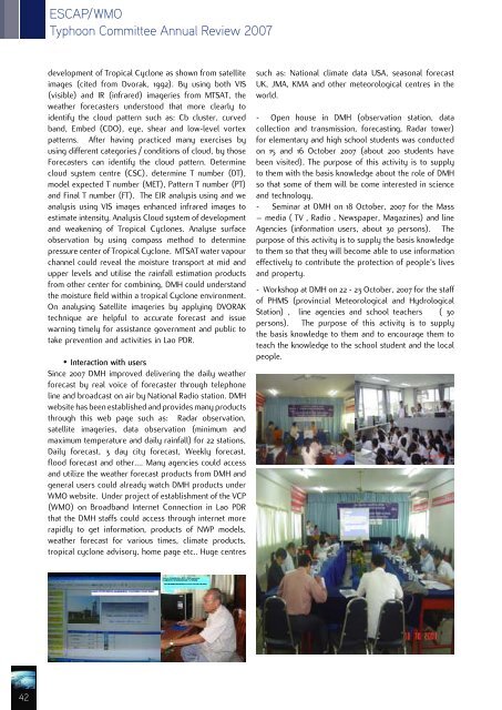
Since <strong>200</strong>7 DMH improved delivering the daily weather<br />
forecast by real voice of forecaster through telephone<br />
line and broadcast on air by National Radio station. DMH<br />
website has been established and provides many products<br />
through this web page such as: Radar observation,<br />
satellite imageries, data observation (minimum and<br />
maximum temperature and daily rainfall) for 22 stations,<br />
Daily forecast, 3 day city forecast, Weekly forecast,<br />
flood forecast and other…. Many agencies could access<br />
and utilize the weather forecast products from DMH and<br />
general users could already watch DMH products under<br />
WMO website. Under project of establishment of the VCP<br />
(WMO) on Broadband Internet Connection in Lao PDR<br />
that the DMH staffs could access through internet more<br />
rapidly to get information, products of NWP models,<br />
weather forecast for various times, climate products,<br />
tropical cyclone advisory, home page etc.. Huge centres<br />
such as: National climate data USA, seasonal forecast<br />
UK, JMA, KMA and other meteorological centres in the<br />
world.<br />
- Open house in DMH (observation station, data<br />
collection and transmission, forecasting, Radar tower)<br />
for elementary and high school students was conducted<br />
on 15 and 16 October <strong>200</strong>7 (about <strong>200</strong> students have<br />
been visited). The purpose of this activity is to supply<br />
to them with the basis knowledge about the role of DMH<br />
so that some of them will be come interested in science<br />
and technology.<br />
- Seminar at DMH on 18 October, <strong>200</strong>7 for the Mass<br />
– media ( TV , Radio , Newspaper, Magazines) and line<br />
Agencies (information users, about 30 persons). The<br />
purpose of this activity is to supply the basis knowledge<br />
to them so that they will become able to use information<br />
effectively to contribute the protection of people’s lives<br />
and property.<br />
- Workshop at DMH on 22 - 23 October, <strong>200</strong>7 for the staff<br />
of PHMS (provincial Meteorological and Hydrological<br />
Station) , line agencies and school teachers ( 30<br />
persons). The purpose of this activity is to supply<br />
the basis knowledge to them and to encourage them to<br />
teach the knowledge to the school student and the local<br />
people.<br />
42


