Gravity Field - International Association of Geodesy
Gravity Field - International Association of Geodesy
Gravity Field - International Association of Geodesy
Create successful ePaper yourself
Turn your PDF publications into a flip-book with our unique Google optimized e-Paper software.
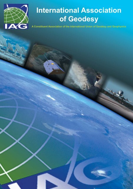
<strong>International</strong> <strong>Association</strong><br />
<strong>of</strong> <strong>Geodesy</strong><br />
A Constituent <strong>Association</strong> <strong>of</strong> the <strong>International</strong> Union <strong>of</strong> <strong>Geodesy</strong> and Geophysics
What is <strong>Geodesy</strong><br />
The Earth is not composed <strong>of</strong> solid rock, but<br />
due to the increase <strong>of</strong> temperature towards its<br />
centre it is built up from a mixture <strong>of</strong> viscous<br />
and solid materials. Thus the shape <strong>of</strong> the<br />
Earth is oblate, because the centrifugal force<br />
stemming from its rotational motion thrusts<br />
the masses out at the equatorial bulge.<br />
What about the hills, mountain ranges,<br />
and deep sea trenches<br />
These ‘topographic features’ are quite small<br />
compared to the size <strong>of</strong> our planet. Of course<br />
they are measured and drawn on maps, but<br />
in <strong>Geodesy</strong> their contribution to the shape <strong>of</strong><br />
the planet is quite small.<br />
These topographic features range from about<br />
9 km above sea level (Mount Everest) to<br />
approximately 12 km below sea level (Mariana<br />
Trench). The diameter <strong>of</strong> the Earth is roughly<br />
12756 km.<br />
However, as the accuracy <strong>of</strong> our observation<br />
techniques improves, the geodetic influence <strong>of</strong><br />
topographic features become more and more<br />
important. For example, the gravitational<br />
effects <strong>of</strong> the topographic masses are no longer<br />
negligible for geodetic investigations.<br />
Quite simply: <strong>Geodesy</strong> is the science<br />
concerned with the study <strong>of</strong> the shape, size<br />
and gravity field <strong>of</strong> the Earth.<br />
The Earth seems to be round, is it not<br />
In reality the Earth is not a perfect sphere.<br />
Knowledge <strong>of</strong> the exact shape <strong>of</strong> the Earth<br />
provides us with accurate maps <strong>of</strong> the Earth.<br />
During the evolution <strong>of</strong> geodetic science, it<br />
has been discovered that the shape <strong>of</strong> the Earth<br />
is not round, but it ‘bulges’ outward along the<br />
equator. Even this is an over simplification.<br />
The Earth has many ‘hills and troughs’ in the<br />
gravity potential field, indicating significant<br />
departures from symmetric mass distribution<br />
within the solid Earth. This is superimposed<br />
on the topographic variability we are all familiar<br />
with.<br />
Why do we need accurate maps<br />
Recall the old saying:<br />
Permanent GPS Station in southern Greenland,<br />
part <strong>of</strong> the GNET Project (Photo: M. Bevis)<br />
“You can not tell where you are going unless<br />
you know where you have been.”<br />
Maps play an important role in our lives.<br />
We need them to find our way in the world – to<br />
navigate. In ancient times mankind used<br />
landmarks to navigate their way to friends, to<br />
towns and ports, or other places <strong>of</strong> interest.<br />
Today we <strong>of</strong>ten use urban landmarks, such<br />
as shopping malls, churches, skyscrapers,<br />
road intersections, and other points <strong>of</strong> interest.<br />
But what happens, if we are not familiar with<br />
the town or rural area<br />
Then we need accurate maps to navigate,<br />
but also to indicate geometric relations<br />
between points or landmarks depicted on the<br />
map, to display information on areal extent <strong>of</strong><br />
different vegetation landuse, to design large<br />
infrastructure and transportation problems,<br />
and so on.<br />
In order to create accurate maps we need a<br />
well-defined spatial reference system. A spatial<br />
reference system defines the coordinate system<br />
and datum in which all landmarks have a<br />
unique “address” or position (i.e., coordinates).<br />
1
What is Gravitation<br />
From the Apple ...<br />
Photo: iStockPhoto (dra_schwartz, hidesy,<br />
Zhenikeyev)<br />
Detailed knowledge <strong>of</strong> the Gravitational <strong>Field</strong><br />
<strong>of</strong> the Earth does improve our lives, and<br />
provides us to benefit both economically and<br />
socially. It helps us understand climate<br />
change, sea level rise, and geological hazards<br />
(e.g., earthquakes, volcanoes); and it underpins<br />
practically all satellite applications, as well as<br />
precise navigation systems.<br />
Since our planet is composed <strong>of</strong> different<br />
materials, its gravitational field shows local<br />
variations (called “anomalies”). Observing these<br />
anomalies can help us to explore the subsurface<br />
mass distribution <strong>of</strong> our planet. In this<br />
way, we may look into the interior <strong>of</strong> the Earth.<br />
What affects the gravitational field<br />
The gravitational field is affected by many<br />
factors, including:<br />
• mass density variatons inside the Earth;<br />
• the oceans - the level <strong>of</strong> oceans changes<br />
due to temperature, ocean currents, etc.<br />
Changes in the level <strong>of</strong> oceans also change<br />
the gravitational field.<br />
• the Sun, Moon and other planets - the<br />
gravitational effects <strong>of</strong> the Sun, Moon and<br />
the planets vary according to their position<br />
relative to the Earth.<br />
• ice sheets - they compress the Earth's<br />
crust beneath them. Changes in the ice<br />
caps (e.g., melting due to the Greenhouse<br />
Effect) may reduce this compression, and<br />
thus change the gravitational field.<br />
These effects are only examples. However we<br />
can see how complicated our planet is, and can<br />
get a sense <strong>of</strong> how these components interact<br />
with one another.<br />
In the previous page we defined <strong>Geodesy</strong> as<br />
the science <strong>of</strong> studying the Shape, Size and<br />
<strong>Gravity</strong> <strong>Field</strong> <strong>of</strong> the Earth. But what is the <strong>Gravity</strong><br />
<strong>Field</strong>, and why is it important<br />
<strong>Gravity</strong> in a nutshell<br />
Gravitation is a force that pulls or attracts<br />
all bodies in the universe that have a mass<br />
towards each other. Planets remain in their<br />
orbits around the Sun due to this force. The<br />
gravitational force depends on the amount <strong>of</strong><br />
mass <strong>of</strong> the bodies. In <strong>Geodesy</strong> we usually<br />
distinguish “gravity” as gravitation plus centrifugal<br />
acceleration due to Earth's rotation<br />
because traditionally we can measure gravity,<br />
not gravitation, at points on the rotating Earth.<br />
Newton's apple<br />
Sir Isaac Newton postulated that the Earth's<br />
gravitation causes such things as the fabled<br />
apple to fall, yet it is the same force that keeps<br />
planets in their orbits. For example, he figured<br />
out that the Moon would travel in a straight<br />
line without the attraction from the Earth<br />
pulling it into a curved orbit.<br />
2
... To the Satellites<br />
Why do we need to study the gravitational<br />
field<br />
Gravitation affects almost everything in our<br />
lives. From precise clocks to hydroelectric<br />
dams, from the tides in the oceans to blood<br />
circulation.<br />
We study the Earth's gravitational field to<br />
learn more about our planet. This knowledge<br />
can lead us to new ways <strong>of</strong> doing things with<br />
greater awareness towards sustainability <strong>of</strong> our<br />
environment for future generations.<br />
How can the satellites help<br />
If we want to study the gravitational field globally,<br />
terrestrial gravity data have severe limitations,<br />
mostly because they do not cover the<br />
whole globe with a homogeneous set <strong>of</strong> measurements.<br />
Moreover, in some places in the<br />
world, these observations are highly confidential<br />
because gravity measurements lead<br />
exploration geophysicists to oil fields and<br />
mineral deposits, and assist military planners<br />
to guide missiles to their intended targets.<br />
Satellite missions such as CHAMP<br />
(CHAllenging Minisatellite Payload), GRACE<br />
(<strong>Gravity</strong> Recovery And Climate Experiment) and<br />
GOCE (<strong>Gravity</strong> <strong>Field</strong> and Steady-state Ocean<br />
Circulation Explorer) help us to study the global<br />
gravitational field <strong>of</strong> the Earth. These Low-Earth<br />
Orbiters (LEOs) provide geodesists with a<br />
global, homogeneous coverage <strong>of</strong> gravitational<br />
measurements.<br />
The effect <strong>of</strong> the Sumatra earthquake on<br />
gravity recovered from GRACE observations<br />
(NASA/JPL).<br />
GRACE satellites observing the gravity field <strong>of</strong><br />
the Earth<br />
3 (Image courtesy <strong>of</strong> NASA/JPL)
<strong>Geodesy</strong> <strong>of</strong> Today<br />
When checking the meaning <strong>of</strong> the term<br />
<strong>Geodesy</strong> in the major encyclopedias, we find<br />
it is usually described as the science concerned<br />
with the Shape, Size, and <strong>Gravity</strong> <strong>Field</strong> <strong>of</strong> the<br />
Earth. Webster’s dictionary even defines it as<br />
a branch <strong>of</strong> applied mathematics!<br />
<strong>Geodesy</strong> today is much more than that. It is<br />
a geoscience that treats the Earth as a complex<br />
dynamic system, a body consisting <strong>of</strong> many<br />
layers, surrounded by atmosphere and oceans.<br />
<strong>Geodesy</strong> is required to model the system’s<br />
behaviour in space and time so as to provide<br />
the basic framework needed across a wide<br />
range <strong>of</strong> Earth sciences. For example, it does<br />
not make sense to speak <strong>of</strong> global sea level<br />
rise without referring to the cm-accurate (timevariable)<br />
terrestrial reference system, or the<br />
precise global gravity field determined from<br />
satellite tracking, or the sea surface<br />
topography maps established by a long<br />
sequence <strong>of</strong> altimeter satellite missions.<br />
The title page <strong>of</strong> Peter Apian’s work<br />
Introductio Geographica, published in 1533,<br />
proves, on the other hand, that <strong>Geodesy</strong> is a<br />
rather old science (the term <strong>Geodesy</strong> may not<br />
yet have existed at that time).<br />
The illustration at the top <strong>of</strong> the page indicates<br />
that:<br />
1) State-<strong>of</strong>-the-art measurements and their<br />
correct mathematical treatment were, and<br />
are, <strong>of</strong> central importance.<br />
2) The same measurement techniques are<br />
used for the most demanding as well as<br />
“everyday” purposes.<br />
3) Geodetic techniques provide the basis for<br />
applications <strong>of</strong> crucial importance and relevance<br />
to mankind, such as Precise Positioning<br />
(from the global scale down to the<br />
maintenance <strong>of</strong> cadastres) and Navigation<br />
(illustrated in the figure by the measurement<br />
<strong>of</strong> “lunar distances”).<br />
4) <strong>Geodesy</strong> provides the link to Astronomy (indicated<br />
by the measurement <strong>of</strong> so-called<br />
“lunar distances”, allowing the reconstruction<br />
<strong>of</strong> Universal Time (UT) in connection<br />
with astronomical almanacs).<br />
The Space Age, and the development <strong>of</strong> space<br />
geodetic observation techniques associated<br />
with it, revolutionized our understanding <strong>of</strong><br />
<strong>Geodesy</strong>: Distance and distance difference measurements<br />
complemented and, to a certain<br />
extent, replaced the measurement <strong>of</strong> angles,<br />
making possible the establishment <strong>of</strong> truly global<br />
reference systems (geometric and gravitational).<br />
The growth <strong>of</strong> space geodesy have<br />
yielded positioning at the millimetre-level routine,<br />
enabling the detection <strong>of</strong> crustal movement<br />
and strain with unprecedented accuracy<br />
and high time resolution.<br />
<strong>Geodesy</strong> continues to provide, with state<strong>of</strong>-the-art<br />
measurement tools, the scientific<br />
basis <strong>of</strong> Navigation, e.g., by the exploitation <strong>of</strong><br />
the existing and planned Global Navigation<br />
Satellite Systems (GNSS), such as GPS,<br />
GLONASS, and GALILEO, and the link to fundamental<br />
Astronomy via the global terrestrial<br />
reference system, by monitoring the rotational<br />
motion <strong>of</strong> our planet, by space geodetic techniques,<br />
and by establishing the celestial reference<br />
system and UT (reflecting Earth rotation).<br />
Modern <strong>Geodesy</strong> is experiencing spectacular<br />
growth and each year new frontiers <strong>of</strong> Earth<br />
science knowledge are being explored, such as<br />
temporal variations <strong>of</strong> positions and gravity<br />
(land deformations, post-glacial rebound, sea<br />
level rise, etc.). It is a fundamental science,<br />
which is vital for both everyday mapping and<br />
navigation purposes, and for the scientific understanding<br />
<strong>of</strong> our living planet.<br />
4
Photo: iStockPhoto (AB DESIGN)<br />
Why is <strong>Geodesy</strong> Fundamental<br />
to Society<br />
Traditionally, <strong>Geodesy</strong> has been viewed as<br />
a service science, providing an important utility<br />
to other geosciences, and supporting many<br />
applications. In the past, the main ”customers”<br />
<strong>of</strong> <strong>Geodesy</strong> came from the surveying and<br />
mapping pr<strong>of</strong>ession, while today <strong>Geodesy</strong><br />
serves all Earth sciences, including the<br />
geophysical, oceanographic, atmospheric,<br />
hydrological and environmental science<br />
communities.<br />
Traditionally <strong>Geodesy</strong><br />
served the society by<br />
providing reference<br />
frames ...<br />
<strong>Geodesy</strong> is crucial<br />
not only for Earth<br />
observation and<br />
science, but today<br />
it is also indispensable<br />
for the maintenance <strong>of</strong> many<br />
activities in a modern society. Traditionally,<br />
<strong>Geodesy</strong> has served society by providing<br />
reference frames for a wide range <strong>of</strong> practical<br />
applications, such as from regional to global<br />
navigation on land, sea and in the air, and from<br />
construction <strong>of</strong> infrastructure to the<br />
determination <strong>of</strong> reliable boundaries <strong>of</strong> real<br />
estate properties. Reference frames were,<br />
however, national or regional in scope, and<br />
they were suited for the determination <strong>of</strong><br />
coordinates relative to a network <strong>of</strong> ground<br />
reference points. Thus, determination <strong>of</strong><br />
precise point coordinates required<br />
simultaneous measurements at several points.<br />
Today, GNSS provides access to precise point<br />
coordinates in a global reference frame anytime<br />
and anywhere on the Earth’s surface with<br />
centimetre-level accuracy.<br />
This technological development has stimulated<br />
new applications demanding even greater<br />
accuracy and better access to geodetically<br />
determined positions. On local to regional<br />
scales, applications such as land surveying,<br />
deformation monitoring <strong>of</strong> infrasructure,<br />
prevention and mitigation <strong>of</strong> the impacts <strong>of</strong><br />
environmental hazards, and numerous tech-<br />
Triangulation tower (“ground reference<br />
point”) in the Struve Chain, a member <strong>of</strong><br />
UNESCO’s World Heritage List<br />
5
nical applications require more or less instantaneous<br />
access to geodetic positions in a<br />
reliable reference frame with centimetre-level<br />
accuracy or better. Already today, the economic<br />
benefit <strong>of</strong> the geodetic reference frame is<br />
enormous. The availability <strong>of</strong> a global geodetic<br />
reference frame, such as the <strong>International</strong><br />
Terrestrial Reference Frame (ITRF), and the<br />
tools to determine precise point coordinates<br />
anytime and anywhere on the Earth has a<br />
pr<strong>of</strong>ound effect on almost all sections <strong>of</strong><br />
society.<br />
A deeper understanding<br />
<strong>of</strong> the Earth system is not<br />
possible without sufficient<br />
observations <strong>of</strong> a large set<br />
<strong>of</strong> parameters characteristic<br />
<strong>of</strong> various Earth<br />
system processes. Earth<br />
observations are not only<br />
necessary for a scientific<br />
understanding <strong>of</strong> the Earth,<br />
Earth observations<br />
are<br />
vital for the<br />
society in the<br />
area <strong>of</strong> disaster<br />
prevention,<br />
climate<br />
change, etc.<br />
but they are also fundamental for most societal<br />
benefit areas, ranging from disaster prevention<br />
and mitigation, the provision <strong>of</strong> resources such<br />
as energy, water and food, achieving an<br />
understanding <strong>of</strong> climate change, the<br />
protection <strong>of</strong> the biosphere, the environment,<br />
and human health, and to the building and<br />
management <strong>of</strong> a prosperous global society.<br />
increasing spatial and temporal resolution,<br />
increasing accuracy, and with decreasing<br />
latency.<br />
The societal impacts <strong>of</strong> Space <strong>Geodesy</strong> are<br />
fundamental. The technological development<br />
facilitated through the new space geodetic<br />
techniques for navigation and positioning<br />
poses new and difficult challenges, and<br />
increases the requirements for accessibility,<br />
accuracy and long-term stability. The new<br />
geodetic technologies are leading to<br />
fundamental changes not only in all areas <strong>of</strong><br />
navigation and transport, but also for<br />
applications in process control (e.g., farming,<br />
construction, mining, resource management),<br />
construction and monitoring <strong>of</strong> infrastructure<br />
(e.g., <strong>of</strong>f-shore platforms, reservoirs, dams,<br />
bridges, and other large engineering structures),<br />
surveying and mapping, and Earth<br />
observation. Geodetic techniques are crucial<br />
in the assessment <strong>of</strong> geohazards and anthropogenic<br />
hazards, and they will play a pivotal<br />
role in early warning systems <strong>of</strong> such hazards<br />
and helping to mitigate resultant disasters.<br />
<strong>Geodesy</strong> therefore contributes to increased<br />
security, a better use <strong>of</strong> resources, and in<br />
general progress towards sustainable<br />
development.<br />
<strong>Geodesy</strong> is fundamental in meeting these<br />
global challenges because it provides the<br />
foundation in which all Earth observation<br />
systems are ultimately built. But Modern<br />
<strong>Geodesy</strong> does more: with its „three pillars” <strong>of</strong><br />
geokinematics, Earth’s gravity field, and Earth<br />
rotation, it also provides comprehensive<br />
observations <strong>of</strong> changes in the Earth’s shape,<br />
gravity field and rotation. These fundamental<br />
geodetic quantities are intimately related to<br />
mass transport in the fluid envelope <strong>of</strong> the<br />
solid Earth and its interior, as well as the<br />
dynamics <strong>of</strong> the Earth System.<br />
<strong>Geodesy</strong> is currently in transition due to the<br />
fact that the advent <strong>of</strong> space geodetic<br />
techniques and the rapid improvement <strong>of</strong><br />
communication technologies have fundamentally<br />
changed, perhaps revolutionized,<br />
<strong>Geodesy</strong> and its methods. While previously<br />
point coordinates were defined with respect to<br />
local or regional reference frames, with space<br />
geodetic techniques positions can now be<br />
expressed with respect to a global reference<br />
frame with unprecedented accuracy. Based on<br />
these techniques, changes in Earth’s shape,<br />
rotation and gravity field are provided with<br />
The Struve Geodetic Arc (a member <strong>of</strong> the World<br />
Heritage List) was established between 1816 and 1855<br />
to determine the size and the shape <strong>of</strong> the Earth.<br />
6
Photo: iStockPhoto (dra_schwartz, hidesy,<br />
Zhenikeyev)<br />
The <strong>Association</strong><br />
The <strong>International</strong> <strong>Association</strong> <strong>of</strong> <strong>Geodesy</strong><br />
(IAG) is the scientific organization responsible<br />
for the field <strong>of</strong> <strong>Geodesy</strong>. The origin <strong>of</strong> the IAG<br />
goes back to 1862, the year, in which the<br />
“Mitteleuropäische Gradmessung”, predecessor<br />
<strong>of</strong> the IAG was established. It<br />
promotes scientific cooperation and geodetic<br />
research on a global scale, and contributes to<br />
it through its various research bodies. It is an<br />
active member <strong>of</strong> the <strong>International</strong> Union <strong>of</strong><br />
<strong>Geodesy</strong> and Geophysics (IUGG), which itself<br />
is a member <strong>of</strong> the <strong>International</strong> Council for<br />
Science (ICSU).<br />
The scientific work <strong>of</strong> the <strong>Association</strong> is<br />
performed within a component structure<br />
consisting <strong>of</strong>:<br />
• Commissions<br />
• Inter-commission Committees<br />
• Services<br />
• The Global Geodetic Observing System<br />
(GGOS)<br />
• The Communication and Outreach<br />
Branch (COB), and<br />
• IAG Projects<br />
IAG mission<br />
The Mission <strong>of</strong> the <strong>Association</strong> is the advancement<br />
<strong>of</strong> <strong>Geodesy</strong>, an Earth science that<br />
includes the study <strong>of</strong> the planets and their satellites.<br />
The IAG implements its mission by:<br />
• advancing geodetic theory through research<br />
and teaching,<br />
• collecting, analysing and modelling observational<br />
data,<br />
• stimulating technological development,<br />
and<br />
• providing a consistent representation <strong>of</strong><br />
the figure, rotation and gravity field <strong>of</strong> the<br />
Earth and planets, and their temporal<br />
variations.<br />
IAG objectives<br />
• To foster geodetic research and development,<br />
• to support and maintain geodetic reference<br />
systems,<br />
• to provide observational and processed<br />
data, standards, methodologies and models,<br />
• to stimulate development <strong>of</strong> space techniques<br />
to increase the resolution <strong>of</strong> geodetic<br />
data,<br />
• to initiate, coordinate and promote international<br />
cooperations, and<br />
• to promote the development <strong>of</strong> geodetic activities<br />
across the globe, especially in developing<br />
countries.<br />
IAG meetings<br />
The IAG holds its own General Assembly<br />
every four years in conjunction with the<br />
General Assembly <strong>of</strong> the IUGG, at the same<br />
time and in the same country. In addition, the<br />
<strong>Association</strong> organizes Scientific Assemblies,<br />
independently from the IUGG, generally in the<br />
mid-term between the General Assemblies.<br />
Other meetings that the IAG sponsors or<br />
supports include numerous international<br />
symposia and workshops covering broad fields<br />
<strong>of</strong> <strong>Geodesy</strong> and closely associated sciences and<br />
engineering.<br />
7
The Very Large Array radiotelescope (Image courtesy <strong>of</strong> NRAO/AUI and Laure Wilson Neish)<br />
Commission 1 - Reference Frames<br />
IAG Commission 1 deals with geodetic<br />
reference frames. These reference frames are<br />
the basis for three-dimensional, timedependent<br />
positioning in global, regional and<br />
national geodetic networks, for spatial<br />
applications such as the cadastre, engineering<br />
construction, precise navigation, geoinformation<br />
acquisition, geodynamics, sea level<br />
and other geoscientific studies.<br />
The geodetic reference frames are necessary<br />
to consistently reference or tag parameters<br />
using geodetic observations, e.g., station<br />
coordinates, crustal motion, Earth orientation<br />
information, and so on. Ground observations<br />
<strong>of</strong> GPS and other satellites, or radiotelescope<br />
observations <strong>of</strong> distant quasars, enable us to<br />
define not only the reference frame, but also<br />
to derive other parameters such as:<br />
Crustal motion: for example, by estimating<br />
the coordinates <strong>of</strong> continuously operating GPS<br />
reference stations, their long-term changes in<br />
coordinates can be derived. These are typically<br />
caused by the motion <strong>of</strong> the tectonic plates,<br />
hence the velocities <strong>of</strong> the tectonic plates can<br />
also be estimated by monitoring these ground<br />
reference stations.<br />
Earth Orientation Parameters: reference<br />
frames are also vital for the determination <strong>of</strong><br />
parameters such as the direction <strong>of</strong> the Earth’s<br />
rotation axis, and the Earth’s rotational velocity<br />
and its variation.<br />
Geocentre Motion: a reference frame clearly<br />
needs an origin. This is typically taken to be<br />
at the centre <strong>of</strong> mass <strong>of</strong> the Earth, however<br />
the location <strong>of</strong> this origin relative to the solid<br />
Earth is not constant. Satellite techniques<br />
provide the tool to monitor the motion <strong>of</strong> the<br />
geocentre.<br />
Commission 1 is focused on the scientific<br />
research associated with the definition and<br />
realization <strong>of</strong> global and regional reference<br />
frames, as well as the development <strong>of</strong> analysis<br />
and processing methods for relevant geodetic<br />
observations.<br />
8
Commission 2 - <strong>Gravity</strong> <strong>Field</strong><br />
Knowledge <strong>of</strong> the Earth’s gravity field, as well<br />
as its temporal variation, is <strong>of</strong> prime importance<br />
for <strong>Geodesy</strong>, Navigation, Geophysics,<br />
Geodynamics, and related disciplines. We have<br />
noted in the definition <strong>of</strong> <strong>Geodesy</strong> that the gravity<br />
field is affected by many terrestrial as well<br />
as extra-terrestrial phenomena. The observation<br />
<strong>of</strong> the gravity field, and the analysis and<br />
modelling <strong>of</strong> these observations, can help us<br />
find answers to important questions such as:<br />
What causes the temporal variations in the gravity<br />
signals<br />
Temporal variations in the gravity field are<br />
due to tidal forces from our Moon, Sun, and<br />
nearby planets. They are also caused by<br />
seasonal changes such as those associated<br />
with hydrological systems, by changes in the<br />
Earth’s rotation, by mass redistribution in the<br />
interior <strong>of</strong> the Earth and tectonical movements,<br />
by melting <strong>of</strong> the ice caps, etc. One can see<br />
that many <strong>of</strong> the Earth’s environments (ocean,<br />
crust, hydrosphere, polar ice caps, atmosphere)<br />
can be investigated by studying the<br />
gravity field.<br />
How do the density variations <strong>of</strong> subsurface<br />
masses express themselves<br />
The answer to this question is particularly<br />
important for geophysical exploration <strong>of</strong><br />
natural resources, such as oil, gas, minerals,<br />
etc. However, gravity maps also help to delineate<br />
and understand active crustal fault regions,<br />
contour the “topography” <strong>of</strong> the ocean<br />
bottom, and help to monitor ocean currents.<br />
In each case, the spatial variations <strong>of</strong> gravity<br />
are a direct consequence <strong>of</strong> subsurface<br />
mass variations. Understanding these<br />
variations and how they change in time is also<br />
extremely important in regions <strong>of</strong> active volcanoes<br />
where subsurface mass changes is one<br />
<strong>of</strong> the warning signals for an imminent eruption.<br />
Which way does water flow<br />
GOCE Satellite (Image courtesy <strong>of</strong> ESA)<br />
This trivial question is perhaps the most<br />
fundamental in <strong>Geodesy</strong> because it relates to<br />
the definition <strong>of</strong> regional and national height<br />
systems. Much effort has been expended in<br />
the past to determine a level surface that can<br />
serve as an accessible reference for heights.<br />
This reference is called the “geoid”. Heights<br />
help to define the direction <strong>of</strong> water flow, and<br />
are useful to hydrological engineers and<br />
oceanographers (who wish to map the oceans<br />
currents). <strong>Gravity</strong> is inexorably intertwined<br />
with these concepts and provides the necessary<br />
foundation for many <strong>of</strong> the related science<br />
activities already mentioned.<br />
The <strong>Gravity</strong> <strong>Field</strong> Commission fosters and encourages<br />
research in the areas <strong>of</strong><br />
• gravimetry and gravity networks,<br />
• spatial and temporal gravity field and geoid<br />
modeling,<br />
• dedicated satellite gravity mapping missions,<br />
and<br />
• regional geoid determination.<br />
The Commission interfaces with other<br />
commissions <strong>of</strong> the IAG and the Inter-<br />
Commission Committee on Theory (ICCT),<br />
which plays an extremely vital role in<br />
advancing the methods <strong>of</strong> analysis and<br />
modelling, particularly as new types <strong>of</strong><br />
instruments are developed, making possible<br />
new ways <strong>of</strong> observing the Earth’s gravity field.<br />
9
The Kvarken Archipelago - a member <strong>of</strong> UNSECO’s World Heritage List (Image courtesy <strong>of</strong> the Finnish Environment Institute - FEI)<br />
Commission 3 - Earth Rotation and<br />
Geodynamics<br />
The Earth is a ‘living’ planet that is continuously<br />
changing on its surface, as well as<br />
within its interior. Geodynamics is the study<br />
<strong>of</strong> the deformation <strong>of</strong> the Earth’s crust, which<br />
is mainly (but not exlusively) caused by the<br />
motion and collision <strong>of</strong> tectonic plates. A better<br />
knowledge <strong>of</strong> the movements <strong>of</strong> tectonic plates<br />
may help us to understand the evolution <strong>of</strong><br />
earthquakes and other tectonic phenomena.<br />
On the other hand, the movements <strong>of</strong> the<br />
tectonic plates are driven by material flows<br />
within the Earth’s interior. In addition, mass<br />
transports in the atmosphere-hydrospheresolid<br />
Earth-core system, or the “global<br />
geophysical fluids” as they are <strong>of</strong>ten referred<br />
to, will cause observable geodynamic effects<br />
on a broad time scale. Although relatively<br />
small, these geodynamic effects have been<br />
measured by space geodetic techniques with<br />
increasing accuracy, opening up important<br />
new avenues <strong>of</strong> research that will lead to a<br />
better understanding <strong>of</strong> global mass transport<br />
processes and the Earth’s dynamic responses.<br />
The variations <strong>of</strong> the Earth’s gravity field and<br />
the deformation <strong>of</strong> the Earth’s body induced<br />
by the tidal forces, i.e., the forces acting on<br />
the Earth due to differential gravitation <strong>of</strong> the<br />
Sun, Moon and the planets, are called “Earth<br />
Tides”. The investigation <strong>of</strong> Earth Tides is also<br />
an important topic <strong>of</strong> Commission 3. It also<br />
studies - among others - post-glacial rebound<br />
at all spatial scales, and also the elastic deformation<br />
taking place in the near-field <strong>of</strong> existing<br />
ice sheets and glaciers.<br />
Commission 3 works to develop cooperation<br />
and collaboration in computation, in theory<br />
and in observation <strong>of</strong> Earth rotation and<br />
geodynamics.<br />
(Image courtesy <strong>of</strong> FEI)<br />
Geodynamics in the broader and most<br />
traditional sense addresses the forces that act<br />
on the Earth, whether they derive from outside<br />
or inside <strong>of</strong> our planet, and the way in which<br />
the Earth moves and deforms in response to<br />
these forces. This includes the entire range <strong>of</strong><br />
phenomena associated with Earth rotation and<br />
Earth orientation, such as polar motion, length<br />
<strong>of</strong> day (LOD) variation, precession and nutation,<br />
the observation and understanding <strong>of</strong><br />
which are critical to the transformation<br />
between terrestrial and celestial reference<br />
frames.<br />
Since the Earth is not a solid object, it<br />
changes its shape if the gravity field changes.<br />
The Kvarken Archipelago<br />
in western Finland is an outstanding example <strong>of</strong> post-glacial uplift.<br />
About 20000 years ago, during the last Ice Age, the centre <strong>of</strong> the<br />
continental glacier was located in this area. The ice mass pressed<br />
the earth's crust almost a kilometer downwards. As the glacier got<br />
thinner, the surface <strong>of</strong> the earth started to rise back. The ground is<br />
still rising, about 8 mm a year in the Kvarken area, thus new land is<br />
emerging from the water.<br />
10
(Image courtesy <strong>of</strong> Charles K. Toth, OSU)<br />
Commission 4 - Positioning and<br />
Applications<br />
Commission 4 focuses on the<br />
determination <strong>of</strong> positions using various<br />
instruments, such as inertial navigation<br />
systems (INS), Global Navigation Satellite<br />
Systems (GNSS), InSAR (Interferometric<br />
Synthetic Aperture Radar), and other<br />
technologies, for a wide range <strong>of</strong><br />
applications.<br />
Commission 4 carries out research and<br />
other activities that address the broader<br />
areas <strong>of</strong> multi-sensor system theory and<br />
applications, with a special emphasis on<br />
integrated guidan-ce, navigation,<br />
positioning and orientation <strong>of</strong> airborne and<br />
land-based platforms. Such systems can<br />
be used for direct georeferencing and<br />
digital imaging and scanner systems,<br />
monitoring <strong>of</strong> the deformation <strong>of</strong><br />
engineering structures, navigation <strong>of</strong><br />
people and cars, robotics, and so on.<br />
GNSS, such as GPS, GLONASS, and the<br />
planned GALILEO and COMPASS systems,<br />
can also be used to monitor changes in<br />
the atmosphere. Due to the fact that the<br />
GNSS signals travel through the<br />
atmosphere, they can be used to derive<br />
some important parameters such as:<br />
• the total electron content <strong>of</strong> the ionosphere,<br />
and<br />
• the precipitable water vapour in the<br />
troposphere.<br />
Thus GNSS systems are also used to<br />
enhance the near real-time water vapour<br />
estimation, which is useful for weather<br />
forecasting.<br />
Recent advances in tomographic modelling and<br />
the availability <strong>of</strong> spaceborne GPS observations<br />
has also made possible 3-D pr<strong>of</strong>iling <strong>of</strong> electron<br />
density and atmospheric refractivity. With<br />
plans for a significant increase in the number<br />
<strong>of</strong> GNSS satellites in the next decade, it is clear<br />
that GNSS atmospheric sounding will become<br />
a valuable atmospheric remote sensing tool.<br />
Commission 4 also promotes research into<br />
the development <strong>of</strong> a number <strong>of</strong> geodetic tools<br />
that have practical applications to engineering<br />
and mapping. Hence there are many joint<br />
conferences with sister organizations such as<br />
the FIG (<strong>International</strong><br />
Federation<br />
<strong>of</strong> Surveyors) and<br />
ISPRS (<strong>International</strong><br />
Society <strong>of</strong> Photogrammetry<br />
and Remote<br />
Sensing).<br />
There are networks<br />
<strong>of</strong> permanent<br />
GPS stations established<br />
locally, regionally<br />
and globally to<br />
perform not only<br />
geodetic research,<br />
but also to support<br />
surveying, engineering,<br />
precise navigation,<br />
and data<br />
acquisition for Geospatial<br />
Information<br />
Systems (GISs).<br />
(Image courtesy <strong>of</strong> M. Bevis)<br />
Permanent GPS Station in southern<br />
Greenland, part <strong>of</strong> the GNET project<br />
11
IAG ICC on<br />
Theory (ICCT)<br />
The InterCommission Committee on Theory<br />
(ICCT) was established to interact actively and<br />
directly with other IAG entities. Recognizing<br />
that geodetic observing systems have advanced<br />
to such an extent that geodetic measurements<br />
(i) are now <strong>of</strong> unprecedented accuracy and<br />
quality, can readily cover a region <strong>of</strong> any scale<br />
up to tens <strong>of</strong> thousands <strong>of</strong> kilometres, yield<br />
non-conventional data types, and can be<br />
provided continuously; and (ii) consequently,<br />
demand advanced mathematical modelling in<br />
order to obtain the maximum benefit <strong>of</strong> such<br />
technological advance, the ICCT<br />
• strongly encourages frontier<br />
mathematical and physical research, directly<br />
motivated by geodetic need/practice, as a<br />
contribution to science/engineering in general<br />
and the foundations <strong>of</strong> <strong>Geodesy</strong> in particular;<br />
• provides the channel <strong>of</strong> communication<br />
amongst the different IAG entities <strong>of</strong><br />
commissions/services/projects on the ground<br />
<strong>of</strong> theory and methodology, and directly<br />
cooperates with and supports these entities<br />
in the topic-oriented work;<br />
• helps the IAG in articulating<br />
mathematical and physical challenges <strong>of</strong><br />
<strong>Geodesy</strong> as a subject <strong>of</strong> science and in<br />
attracting young talents to <strong>Geodesy</strong>. The ICCT<br />
strives to attract and serve as home to mathematically<br />
motivated/oriented geodesists and<br />
to applied mathematicians; and<br />
• encourages closer research ties with and<br />
gets directly involved in relevant areas <strong>of</strong> the<br />
Earth sciences, bearing in mind that <strong>Geodesy</strong><br />
has been always playing an important role in<br />
understanding the physics <strong>of</strong> the Earth.<br />
IAG<br />
Publications<br />
The IAG Publications include:<br />
• the Journal <strong>of</strong> <strong>Geodesy</strong>;<br />
• the Geodesist’s Handbook;<br />
• the IAG Newsletter;<br />
• the “Travaux de l’<strong>Association</strong><br />
<strong>International</strong>e de Géodésie”;<br />
• the IAG Special Publications; and<br />
• the IAG Symposia series.<br />
Photo: iStockPhoto (Georgo, catherine_jones)<br />
The Journal <strong>of</strong> <strong>Geodesy</strong> is an international<br />
journal concerned with the study <strong>of</strong> scientific<br />
problems <strong>of</strong> <strong>Geodesy</strong> and related<br />
interdisciplinary sciences. Peer-reviewed<br />
papers are published on theoretical or<br />
modelling studies, and on results <strong>of</strong><br />
experiments and interpretations.<br />
Every four years after a General Assembly,<br />
the IAG publishes The Geodesist’s Handbook.<br />
This Handbook provides information on the <strong>Association</strong>,<br />
including the reports <strong>of</strong> the President<br />
and Secretary General, the resolutions,<br />
and the <strong>Association</strong> structure.<br />
The IAG Newsletter is published monthly<br />
electronically. A reduced version is also<br />
published in the Journal <strong>of</strong> <strong>Geodesy</strong> regularly.<br />
The original Newsletters are available at the<br />
IAG website: http://www.iag-aig.org.<br />
After each General and Scientific Assembly,<br />
a collection <strong>of</strong> the reports by the <strong>Association</strong><br />
components is published in the “Travaux de<br />
l’<strong>Association</strong> <strong>International</strong>e de Géodésie”<br />
electronically. Printed copies are available on<br />
request.<br />
Proceedings <strong>of</strong> IAG symposia are typically<br />
published in the IAG Symposia Series.<br />
12
IAG Services<br />
The IAG is the home <strong>of</strong> a number <strong>of</strong> scientific<br />
services whose goals are to provide the user<br />
community with various geodetic products<br />
and/or information and to foster international<br />
cooperation.<br />
BGI (Bureau Gravimetrique <strong>International</strong>)<br />
URL: http://bgi.cnes.fr<br />
The main task <strong>of</strong> the BGI is to collect, on a<br />
worldwide basis, all existing gravity<br />
measurements and pertinent information<br />
about the gravity field <strong>of</strong> the Earth, to compile<br />
them and store them in a computerized<br />
database, and to redistribute them on request<br />
to scientific users.<br />
BIPM (Bureau <strong>International</strong> de Poids<br />
et Measures) -Section Time, Frequency<br />
and Gravimetry<br />
URL: http://www.bipm.org/en/scientific/tfg/<br />
The Bureau <strong>International</strong> des Poids et<br />
Mesures (BIPM) is responsible for the<br />
maintenance <strong>of</strong> the <strong>International</strong> Atomic Time<br />
(TAI) scale and <strong>of</strong> the Coordinated Universal<br />
Time (UTC) scale. The BIPM ensures that TAI<br />
and UTC are available in the standards<br />
laboratories around the world, and is<br />
responsible for the worldwide coordination <strong>of</strong><br />
time comparisons.<br />
IBS (IAG Bibliographic Service)<br />
URL:http://www.bkg.bund.de<br />
The service maintains a literature database for<br />
geodesy, photogrammetry and cartography<br />
(GEOPHOKA), which is housed at the federal<br />
agency BKG (Bundesamt für Kartografie und<br />
Geodäsie), in Germany.<br />
ICET (<strong>International</strong> Centre for Earth<br />
Tides)<br />
URL: http://www.astro.oma.be/ICET<br />
The ICET collects all available measurements<br />
on Earth Tides. It evaluates these data<br />
in order to reduce the very large amount <strong>of</strong><br />
measurements to a limited number <strong>of</strong> parameters<br />
which contain all required geophysical<br />
information, and compares the data from different<br />
instruments and different stations distributed<br />
all over the world.<br />
ICGEM (<strong>International</strong> Center for Global<br />
<strong>Gravity</strong> <strong>Field</strong> Models)<br />
URL: http://icgem.gfz-potsdam.de/ICGEM<br />
The ICGEM collects all existing gravity field<br />
models and provides on-line interfaces to<br />
download and visualize these models, and to<br />
calculate functionals (e.g., geoid heights or<br />
gravity anomalies) from these models on userdefined<br />
geographic grids.<br />
Photo: iStockPhoto (hidesy),<br />
NRAO/AUI and Laure Wilson<br />
Neish<br />
IAS (<strong>International</strong> Altimetry Service)<br />
URL:http://ias.dgfi.badw.de<br />
The IAS ·provides a point <strong>of</strong> contact for<br />
general information on satellite altimetry and<br />
its applications; promotes satellite altimetry as<br />
a core element <strong>of</strong> Global Earth Observing Systems;<br />
and helps users to compile and analyse<br />
data.<br />
IDEMS (<strong>International</strong> Digital Elevation<br />
Model Service)<br />
URL: http://www.cse.dmu.ac.uk/EAPRS/iag<br />
The IDEMS collects and validates digital representations<br />
<strong>of</strong> the global topography (Digital<br />
Elevation Models-DEMs). The centre <strong>of</strong> IDEMS<br />
places a particular emphasis on water representation<br />
in DEMs.<br />
13
IDS (<strong>International</strong> DORIS Service)<br />
URL: http://ids.cls.fr<br />
The primary objective <strong>of</strong> the IDS is to operate<br />
a service to provide Doppler Orbitography<br />
and Radiopositioning Integrated by Satellite<br />
(DORIS) data and data products, useful to a<br />
wide range <strong>of</strong> scientific and practical applications.<br />
IERS (<strong>International</strong> Earth Rotation<br />
and Reference Systems Service)<br />
URL: http://www.iers.org<br />
The primary objectives <strong>of</strong> the IERS are to<br />
serve the astronomical, geodetic and<br />
geophysical communities by providing the<br />
following: a) The <strong>International</strong> Celestial<br />
Reference System (ICRS) and its realization, the<br />
<strong>International</strong> Celestial Reference Frame (ICRF);<br />
b) The <strong>International</strong> Terrestrial Reference<br />
System (ITRS) and its realization, the<br />
<strong>International</strong> Terrestrial Reference Frame<br />
(ITRF); c) Earth orientation parameters required<br />
to study Earth orientation variations and to<br />
transform between the ICRF and the ITRF; d)<br />
Geophysical data to interpret time/space<br />
variations in the ICRF, ITRF or Earth<br />
orientation parameters, and model such<br />
variations; e) Standards, constants and models,<br />
and encouraging international adherence to its<br />
conventions.<br />
IGeS (<strong>International</strong> Geoid Service)<br />
URL: http://www.iges.polimi.it<br />
The main tasks <strong>of</strong> the IGeS are to collect<br />
s<strong>of</strong>tware and data referring to the geoid, validate<br />
them and disseminate them upon request<br />
among the scientific community. IGeS is also<br />
organizing regularly the “<strong>International</strong> School<br />
on the Determination and Use <strong>of</strong> the Geoid”.<br />
IGFS (<strong>International</strong> <strong>Gravity</strong> <strong>Field</strong> Service)<br />
URL: http://www.igfs.net<br />
IGFS is a unified service which is responsible<br />
for gravity data collection, validation, archiving<br />
and dissemination, as well as s<strong>of</strong>tware<br />
collection, evaluation, dissemination for the<br />
purpose <strong>of</strong> determining, with various degrees<br />
<strong>of</strong> accuracy and resolution, the Earth’s surface<br />
and gravity potential, or any <strong>of</strong> its functionals.<br />
The temporal variations <strong>of</strong> the gravity field are<br />
also studied. It comprises BGI, ICET, ICGEM,<br />
IDEMS, IGeS and IAS.<br />
IGS (<strong>International</strong> GNSS Service)<br />
URL: http://igscb.jpl.nasa.gov<br />
The Global Positioning System (GPS) is an<br />
extremely versatile technology that enables<br />
precise ground and space-based positioning,<br />
timing and navigation anywhere in the world.<br />
The use <strong>of</strong> GPS and GNSS, particularly for<br />
Earth sciences applications, stems largely<br />
from activities <strong>of</strong> the <strong>International</strong> GNSS Service<br />
(IGS). More than 200 organizations in 80<br />
countries contribute daily to the IGS, which is<br />
dependent upon a cooperative global tracking<br />
network <strong>of</strong> over 350 GPS stations.<br />
IGS provides various important data and<br />
products to the users.<br />
ILRS (<strong>International</strong> Laser Ranging<br />
Service)<br />
URL: http://ilrs.gsfc.nasa.gov<br />
The ILRS collects, merges, analyzes and<br />
distributes Satellite Laser Ranging (SLR) and<br />
Lunar Laser Ranging (LLR) observation data<br />
sets <strong>of</strong> sufficient accuracy to satisfy a wide<br />
range <strong>of</strong> applications. The basic observable is<br />
the precise time-<strong>of</strong>-flight <strong>of</strong> a laser pulse to<br />
and from retroreflectors on a satellite (in the<br />
case <strong>of</strong> SLR), and on the Moon (in the case <strong>of</strong><br />
LLR).<br />
IVS (<strong>International</strong> VLBI Service for<br />
<strong>Geodesy</strong> and Astrometry)<br />
URL: http://ivscc.gsfc.nasa.gov<br />
The IVS coordinates Very Long Baseline<br />
Interferometry (VLBI) observing programs, sets<br />
performance standards for VLBI stations,<br />
develops conventions for VLBI data formats<br />
and data products, issues recommendations<br />
for VLBI data analysis s<strong>of</strong>tware, sets standards<br />
for VLBI analysis documentation, and<br />
institutes appropriate VLBI product delivery<br />
methods to ensure suitable product quality<br />
and timeliness.<br />
PSMSL (Permanent Service for Mean<br />
Sea Level)<br />
URL: http://www.pol.ac.uk/psmsl<br />
The PSMSL is responsible for the collection,<br />
publication, analysis and interpretation <strong>of</strong> sea<br />
level data from the global network <strong>of</strong> tide<br />
gauges. These data are used for a wide range<br />
<strong>of</strong> scientific uses, including the long-term sea<br />
level change assessments <strong>of</strong> the<br />
Intergovernmental Panel on Climate Change<br />
(IPCC). The PSMSL also manages the delayedmode<br />
activity <strong>of</strong> the Global Sea Level Observing<br />
System (GLOSS).<br />
14
The Global Geodetic<br />
Observing System (GGOS)<br />
Photo: GGOS<br />
The Global Geodetic Observing<br />
System (GGOS)<br />
was established by the<br />
IAG in July 2003 as a<br />
project. In April 2004 the<br />
IAG, represented by<br />
GGOS, became a participating<br />
organization <strong>of</strong><br />
the Group on Earth Observations<br />
(GEO), in May 2006 GGOS was accepted<br />
as a member <strong>of</strong> the Integrated Global<br />
Observation Strategy Partnership (IGOS-P) and<br />
in July 2007 at the IUGG General Assembly<br />
GGOS became an <strong>of</strong>ficial component <strong>of</strong> the<br />
IAG, i.e., the Global Geodetic Observing System<br />
<strong>of</strong> the IAG.<br />
GGOS contributes to the Global Earth<br />
Observing System <strong>of</strong> Systems (GEOSS) not only<br />
with the accurate reference frame required for<br />
many components <strong>of</strong> GEOSS but also with<br />
observations related to the global hydrological<br />
cycle, the dynamics <strong>of</strong> the atmosphere and the<br />
oceans, and geohazards. GGOS acts as the<br />
interface between the geodetic services<br />
andexternal users such as GEOSS, IGOS-P,<br />
and United Nations authorities. A major goal<br />
is to ensure the interoperability <strong>of</strong> the IAG<br />
services and GEOSS.<br />
GGOS provides observations <strong>of</strong> the three<br />
fundamental geodetic observables and their<br />
variations, that is, the Earth’s shape, the<br />
Earth’s gravity field, and the Earth’s rotational<br />
motion.<br />
GGOS integrates different geodetic<br />
techniques, different models and different<br />
approaches in order to ensure a long-term,<br />
precise monitoring <strong>of</strong> the geodetic observables<br />
in agreement with the Integrated Global<br />
Observing Strategy (IGOS). GGOS provides the<br />
observational basis to maintain a stable,<br />
accurate and global reference frame, and in<br />
this function is crucial for all Earth observation<br />
and many practical applications.<br />
(Image courtesy <strong>of</strong> NERC,UK)<br />
The Herstmonceaux Satellite Laser Ranging<br />
Telescope in operation<br />
15
GGOS is built on the IAG Services (IGS, IVS,<br />
ILRS, IDS, IERS, IGFS, etc.) and the products<br />
they derive on an operational basis for Earth<br />
monitoring making use <strong>of</strong> a large variety <strong>of</strong><br />
space- and ground -based geodetic techniques,<br />
such as Very Long Baseline Interferometry<br />
(VLBI), Satellite and Lunar Laser Ranging (SLR/<br />
LLR), Global Navigation Satellite Systems<br />
(GNSS), Doppler Orbitography and<br />
Radiopositioning Integrated by Satellite<br />
(DORIS), altimetry, InSAR (Interferometric<br />
Synthetic Aperture Radar) and gravity satellite<br />
missions (CHAMP, GRACE, GOCE), gravimetry,<br />
etc.<br />
All <strong>of</strong> these observation techniques are<br />
considered integral parts <strong>of</strong> GGOS, allowing the<br />
monitoring <strong>of</strong> the Earth’s shape and<br />
deformation (including water surface), the<br />
Earth’s orientation and rotation and the Earth’s<br />
gravity field and its temporal variations with<br />
an unprecedented accuracy. The observed<br />
quantities give direct evidence <strong>of</strong> many global<br />
processes that have a crucial impact on human<br />
society such as earthquakes, volcanism, floods,<br />
sea level change, climate change, water<br />
redistribution, mass balance <strong>of</strong> the polar ice<br />
sheets, post-glacial rebound, etc.<br />
consisting mainly <strong>of</strong> high quality services,<br />
standards and references, theoretical and<br />
observation innovations.<br />
GGOS and its related research and Services’<br />
porducts will address the relevant science<br />
issues related to geodesy and geodynamics in<br />
the 21st century, but also issues relevant to<br />
society (global risk management, geo-hazards,<br />
natural resources, climate change, severe<br />
storm forecasting, sea-level estimations and<br />
ocean forecasting, space weather, and others).<br />
It is an ambitious program <strong>of</strong> a dimension that<br />
goes beyond IAG, requring a strong cooperation<br />
within the geodetic, geodynamic and<br />
geophysical communities, and externally, to<br />
related endeavours and communities.<br />
Mission<br />
The mission <strong>of</strong> GGOS is to promote the<br />
application <strong>of</strong> geodetic Earth observation<br />
methods to the solution <strong>of</strong> Earth science<br />
problems. GGOS accomplishes its mission: a)<br />
by defining the geodetic infrastructure that is<br />
needed to meet scientific and societal<br />
requirements; b) by advocating for the<br />
establishment and maintenance <strong>of</strong> this geodetic<br />
infrastructure; c) by coordinating interaction<br />
between the IAG Services, Commissions or<br />
other geodetic entities; d) by improving<br />
accessibility to geodetic observations and<br />
products; and e) by educating the scientific<br />
community about the benefits <strong>of</strong> geodetic<br />
research and the public about the role that<br />
<strong>Geodesy</strong> plays in society.<br />
GGOS provides the basis on which future<br />
advances in geosciences can be built. By<br />
considering the Earth system as a whole<br />
(including the geosphere, hydrosphere,<br />
cryosphere, atmosphere and biosphere),<br />
monitoring Earth system components and tehir<br />
interactions by geodetic techniques and<br />
studying them from the geodetic point <strong>of</strong> view,<br />
the geodetic community provides the global<br />
geosciences community with a powerful tool<br />
Observing the Earth with various geodetic methods<br />
(Very Long Baseline Interferometry, GPS, DORIS,<br />
Low Earth Orbiters - LEO, Altimetry, SLR, LLR)<br />
For more information, please visit the GGOS<br />
website:<br />
http://www.ggos.org<br />
16
Links<br />
<strong>International</strong> Union <strong>of</strong> <strong>Geodesy</strong><br />
and Geophysics (IUGG)<br />
(www.iugg.org)<br />
The IUGG comprises <strong>of</strong> the following seven<br />
semi-autonomous <strong>Association</strong>s beside IAG:<br />
<strong>International</strong> <strong>Association</strong> <strong>of</strong><br />
Cryospheric Sciences (IACS)<br />
(www.cryosphericsciences.org)<br />
<strong>International</strong> <strong>Association</strong> <strong>of</strong> Geomagnetism<br />
and Aeronomy (IAGA)<br />
(www.iugg.org/IAGA)<br />
<strong>International</strong> <strong>Association</strong> <strong>of</strong> Hydrological<br />
Sciences (IAHS)<br />
(http://iahs.info)<br />
<strong>International</strong> <strong>Association</strong> <strong>of</strong> Meteorology<br />
and Atmospheric Sciences<br />
(IAMAS)<br />
(www.iamas.org)<br />
<strong>International</strong> <strong>Association</strong> for the<br />
Physical Sciences <strong>of</strong> the Oceans<br />
(IAPSO)<br />
(iapso.iugg.org)<br />
<strong>International</strong> <strong>Association</strong> <strong>of</strong> Seismology<br />
and Physics <strong>of</strong> the Earth’s<br />
Interior (IASPEI)<br />
(www.iaspei.org)<br />
<strong>International</strong> <strong>Association</strong> <strong>of</strong> Volcanology<br />
and Chemistry <strong>of</strong> the<br />
Earth’s Interior (IAVCEI)<br />
(www.iavcei.org)<br />
Links to other organizations:<br />
<strong>International</strong> Astronomical Union<br />
(IAU)<br />
(www.iau.org)<br />
<strong>International</strong> Union <strong>of</strong> Geological<br />
Sciences (IUGS)<br />
(www.iugs.org)<br />
<strong>International</strong> Federation <strong>of</strong> Surveyors<br />
(FIG)<br />
(www.fig.net)<br />
<strong>International</strong> Society for Photogrammetry<br />
and Remote Sensing (ISPRS)<br />
(www.isprs.org)<br />
<strong>International</strong> Cartographic <strong>Association</strong><br />
(ICA)<br />
(cartography.tuwien.ac.at/ica)<br />
<strong>International</strong> Society <strong>of</strong> Mine Surveying<br />
(ISM)<br />
(www.ism.bw-art.de)<br />
<strong>International</strong> Hydrographic Organization<br />
(IHO)<br />
(www.iho.shom.fr)<br />
American Geophysical Union (AGU)<br />
(www.agu.org)<br />
European Geosciences Union<br />
(EGU)<br />
(www.copernicus.org/EGU/EGU.html)<br />
Global Spatial Data Infrastructure<br />
<strong>Association</strong> (GSDI)<br />
(www.gsdi.org)<br />
Federation <strong>of</strong> Astronomical and<br />
Geophysical Data Analysis<br />
Services (FAGS)<br />
(www.icsu-fags.org)<br />
The Institute <strong>of</strong> Navigation<br />
(www.ion.org)<br />
Photo: iStockPhoto (sweetym)<br />
17
Membership<br />
The membership <strong>of</strong> the IAG comprises<br />
countries and individuals. Any member<br />
country <strong>of</strong> the IUGG is regarded as a National<br />
Member <strong>of</strong> the IAG and may, through its<br />
adhering body, appoint a National Delegate to<br />
the <strong>Association</strong>. National Delegates represent<br />
their countries in IAG Council meetings and<br />
act as correspondents for their countries<br />
between General Assemblies. Individual<br />
scientists may become Members and Fellows<br />
<strong>of</strong> the IAG. The IAG Executive Committee, upon<br />
the recommendation <strong>of</strong> the Secretary General,<br />
accepts individuals as Members. Applications<br />
for individual membership are made to the<br />
Bureau.<br />
Benefits <strong>of</strong> individual membership include<br />
substantial reduction on the individual<br />
subscription rate to the Journal <strong>of</strong> <strong>Geodesy</strong>,<br />
the right to participate in the IAG election<br />
process both as a nominator and a nominee,<br />
and a reduction <strong>of</strong> the registration fee for many<br />
IAG meetings. The individual members also<br />
receive the monthly IAG Newsletter.<br />
IAG Members have access to the Members’<br />
Area <strong>of</strong> the IAG website, where they can browse<br />
among the contact data <strong>of</strong> other international<br />
scientists. The Members’ Area contains<br />
electronic materials related to the latest<br />
achievements <strong>of</strong> <strong>Geodesy</strong>.<br />
IAG Members are entitled to use the private<br />
billboard service <strong>of</strong> the IAG website to exchange<br />
their views about issues related to <strong>Geodesy</strong>.<br />
Past Officers <strong>of</strong> the <strong>Association</strong> are eligible<br />
to become Fellows and are invited to become<br />
such. The IAG Executive Committee makes<br />
these appointments.<br />
IAG COB<br />
The Communication and Outreach Branch<br />
(COB) provides the IAG with communication,<br />
educational/public information and outreach<br />
links to the membership, to other scientific<br />
associations and to the world as a whole.<br />
The responsibilities <strong>of</strong> the COB include<br />
promotion <strong>of</strong> the IAG (at meetings and<br />
conferences), membership development,<br />
maintenance <strong>of</strong> the IAG website, publications<br />
(newsletters), and creation <strong>of</strong> a resource base<br />
for educators, developing countries and our<br />
global community.<br />
The COB maintains the <strong>of</strong>ficial IAG website,<br />
where one can find all the latest news about<br />
IAG and <strong>Geodesy</strong> in general.<br />
For further information please browse the<br />
IAG website, or contact us on the following e-<br />
mail address:<br />
URL: http://www.iag-aig.org<br />
E-mail: iagcob@iag-aig.org<br />
Photo: iStockPhoto (Andrew<br />
Johnson, andipantz)<br />
Acknowledgements: This brochure has been prepared,<br />
under the supervision <strong>of</strong> the IAG Executive Committee, in<br />
arrangement <strong>of</strong> the IAG Communication and Outreach<br />
Branch (COB). Contributions to this brochure came from<br />
many sources, especially the IAG entities (Commissions,<br />
GGOS, Services) Chairs and the new IAG Statutes and Bylaws,<br />
supplemented by valuable suggestions from the IAG<br />
Central Bureau, the COB Steering Committee (SC) serving<br />
in 2003-2007 and a number <strong>of</strong> individual scientists. A<br />
first draft text, synthesizing the original input material was<br />
prepared by József Ádám (COB President), Szabolcs Rózsa<br />
(COB Secretary) and Markku Poutanen (COB SC Member).<br />
Revisions and additional material were provided by<br />
Riccardo Barzaghi, Gerhard Beutler, René Forsberg, Chris<br />
Jekeli, Ron Noomen, Chris Rizos, Fernando Sansó, Michael<br />
G. Sideris and C. Christian Tscherning. The contribution<br />
<strong>of</strong> Szabolcs Rózsa to its design and for the editing is particularly<br />
acknowledged.<br />
18
Official IAG Website:<br />
Website <strong>of</strong> the IAG Office:<br />
http://www.iag-aig.org<br />
http://iag.dgfi.badw.de<br />
Commissions:<br />
Commission 1 - Reference Frames<br />
Commission 2 - <strong>Gravity</strong> <strong>Field</strong><br />
Commission 3 - Earth Rotatation and Geodynamics<br />
Commission 4 - Positioning and Applications<br />
ICCT (InterCommission Committee on Theory)<br />
Services:<br />
BGI - <strong>International</strong> Gravitmetric Bureau<br />
BIPM - Bureaus <strong>International</strong> de Poids at Measures -<br />
Section Time, Frequency and Gravimetry<br />
IAS - <strong>International</strong> Altimertry Service<br />
IBS - IAG Bibliographic Service<br />
ICET - <strong>International</strong> Centre for Earth Tides<br />
ICGEM - Int.Center for Global Earth Models<br />
IDEMS - <strong>International</strong> DEM Service<br />
IDS - <strong>International</strong> DORIS Service<br />
IERS - Int. Earth Rotation and Ref. Frames Service<br />
IGeS - <strong>International</strong> Geoid Service<br />
IGFS - <strong>International</strong> <strong>Gravity</strong> <strong>Field</strong> Service<br />
IGS - <strong>International</strong> GNSS Service<br />
ILRS - <strong>International</strong> Laser Ranging Service<br />
IVS - <strong>International</strong> VLBI Service<br />
PSMSL - Permanent Service for Mean Sea Level<br />
http://bgi.cnes.fr<br />
http://www.bipm.org/en/<br />
scientific/tfg<br />
http://ias.dgfi.badw.de<br />
http://www.bkg.bund.de<br />
http://www.astro.oma.be/ICET<br />
http://icgem.gfz/potsdam.de/<br />
ICGEM<br />
http://www.cse.dmu.acu.uk/<br />
EAPRS/iag/<br />
http://ids.cls.fr<br />
http://www.iers.org<br />
http://www.iges.polimi.it<br />
http://www.igfs.net<br />
http://igscb.jpl.nasa.gov<br />
http://ilrs.gsfc.nasa.gov<br />
http://ivscc.gsfc.nasa.gov<br />
http://www.pol.ac.uk/psmsl<br />
GGOS (Global Geodetic Observing System)<br />
http://www.ggos.org<br />
IAG Office<br />
Deutsches Geodaetisches<br />
Forschungsinstitut<br />
(DGFI)<br />
Alfons Goppel Str. 11.<br />
D-80539 Munich<br />
Germany<br />
E-mail: iag@dgfi.badw.de<br />
IAG<br />
Communication and Outreach Branch<br />
Department <strong>of</strong> <strong>Geodesy</strong> and Surveying<br />
HAS-BME Res. Group for Phys. Geod. and<br />
Geodynamics<br />
Budapest University <strong>of</strong> Technology and<br />
Economics<br />
H-1521 Budapest<br />
P.O. Box. 91<br />
Hungary<br />
E-mail: iagcob@iag-aig.org


