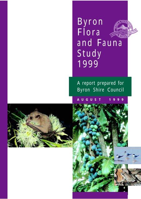
Byron Flora and Fauna Study 1999 - Byron Shire Council
Byron Flora and Fauna Study 1999 - Byron Shire Council
Byron Flora and Fauna Study 1999 - Byron Shire Council

You also want an ePaper? Increase the reach of your titles
YUMPU automatically turns print PDFs into web optimized ePapers that Google loves.
<strong>Byron</strong><br />
<strong>Flora</strong><br />
<strong>and</strong> <strong>Fauna</strong><br />
<strong>Study</strong><br />
<strong>1999</strong><br />
A report prepared for<br />
<strong>Byron</strong> <strong>Shire</strong> <strong>Council</strong><br />
A U G U S T 1 9 9 9
BYRON FLORA AND FAUNA STUDY, <strong>1999</strong><br />
<strong>Byron</strong><br />
<strong>Flora</strong><br />
<strong>and</strong> <strong>Fauna</strong><br />
<strong>Study</strong><br />
<strong>1999</strong><br />
A U G U S T 1 9 9 9<br />
A report prepared for<br />
<strong>Byron</strong> <strong>Shire</strong> <strong>Council</strong> by:<br />
L<strong>and</strong>mark Ecological Services Pty Ltd<br />
(A.C.N. 064 548 876)<br />
PO Box 100<br />
Suffolk Park, NSW 2480<br />
Phone/fax: 02 6685 4430 or 02 6684 0127<br />
email: l<strong>and</strong>mark@nrg.com.au<br />
Ecograph<br />
Ecological <strong>and</strong> Geographical Information<br />
Systems Consultants<br />
Limpinwood Valley Rd<br />
Limpinwood via Murwillumbah NSW 2484<br />
Phone: 02 6679 3479<br />
Fax: 02 6679 3419<br />
email: info@ecograph.com.au<br />
Terrafocus Pty Ltd<br />
PO Box 694<br />
Mullumbimby NSW 2482<br />
Phone: 02 6684 0073<br />
email: terrafocus@bigpond.com.au<br />
1
A GREENPRINT FOR A SUSTAINABLE FUTURE<br />
<strong>Byron</strong> <strong>Flora</strong> <strong>and</strong> <strong>Fauna</strong> <strong>Study</strong> <strong>1999</strong><br />
August <strong>1999</strong><br />
ISBN: 0 9588294 8 9<br />
© <strong>1999</strong> <strong>Byron</strong> <strong>Shire</strong> <strong>Council</strong><br />
PO Box 219, Mullumbimby NSW Australia 2482<br />
Phone: +61-2-6626 7000 Fax: +61-2-6684 3018<br />
E-mail: council@byron.nsw.gov.au<br />
This work is copyright. Apart from any use permitted under the Copyright Act, 1968, no part may be<br />
reproduced without permission from <strong>Byron</strong> <strong>Shire</strong> <strong>Council</strong>.<br />
Copyright to photographs remains with the photographers.<br />
Produced by Environmental Planning Services, <strong>Byron</strong> <strong>Shire</strong> <strong>Council</strong><br />
Designed <strong>and</strong> typeset in <strong>Byron</strong> <strong>Shire</strong> by Gatya Kelly, Doric Order, The Pocket<br />
Imageset in <strong>Byron</strong> <strong>Shire</strong> by Graphic Expressions, <strong>Byron</strong> Bay<br />
Printed in <strong>Byron</strong> <strong>Shire</strong> by Keith Dubber Printing, Mullumbimby<br />
Cover photography of <strong>Byron</strong> <strong>Shire</strong> flora <strong>and</strong> fauna:<br />
Common Blossom-bat Syconycteris australis by: D.R. Milledge<br />
Davidson’s Plum Davidsonia pruriens var. jerseyana by: H.R.W. Nicholson<br />
Crested Tern Sterna bergii by: D.R. Milledge<br />
Fletcher’s Frog Lechriodus fletcheri by: D.R. Milledge<br />
Copies of this document may be purchased from <strong>Byron</strong> <strong>Shire</strong> <strong>Council</strong> at the above address<br />
Disclaimer<br />
Any representation, statement, opinion or advice, expressed or implied in this publication is made in good<br />
faith but on the basis that <strong>Byron</strong> <strong>Shire</strong> <strong>Council</strong>, its agents, consultants <strong>and</strong> employees are not liable (whether<br />
by reason of negligence, lack of care or otherwise) to any person for damage or loss whatsoever which has<br />
occurred or may occur in relation to that person taking or not taking (as the case may be) action in respect<br />
of any representation, statement or advice referred to above.<br />
2
BYRON FLORA AND FAUNA STUDY, <strong>1999</strong><br />
Contents<br />
List of appendices 6<br />
List of tables 6<br />
List of maps 7<br />
List of figures 7<br />
List of photographs 8<br />
The project team 9<br />
Acknowledgements 10<br />
Mayor’s foreword 11<br />
Director’s comments 12<br />
Executive summary 13<br />
1 Introduction 17<br />
1.1 Background 17<br />
1.2 <strong>Study</strong> area 17<br />
1.3 On-going processes 18<br />
2 The environment of <strong>Byron</strong> <strong>Shire</strong> 19<br />
2.1 Location <strong>and</strong> physiography 19<br />
2.1.1 Coastline 19<br />
2.1.2 Coastal Plain 19<br />
2.1.3 Coastal ridges 19<br />
2.1.4 Undulating volcanic plateau 20<br />
2.1.5 Mountain ranges <strong>and</strong> valleys 20<br />
2.2 Climate, temperature, rainfall <strong>and</strong> seasonality 20<br />
2.3 L<strong>and</strong> tenure, protected areas 20<br />
2.4 Geology <strong>and</strong> soils 21<br />
2.5 <strong>Flora</strong> 22<br />
2.6 <strong>Fauna</strong> 22<br />
3 Databases <strong>and</strong> GIS as basis for data management 24<br />
3.1 Introduction 24<br />
3.2 Geographical Information Systems (GIS) 24<br />
3.3 Field survey database 25<br />
3.4 <strong>Study</strong> outcomes 25<br />
3.5 Database management 25<br />
3.6 Future directions 25<br />
4 Vegetation mapping 27<br />
4.1 Introduction 27<br />
4.2 Previous studies 28<br />
4.3 Recommendations for <strong>Byron</strong> <strong>Flora</strong> <strong>and</strong> <strong>Fauna</strong> <strong>Study</strong> 28<br />
4.4 Methods 28<br />
4.4.1 Aerial Photographic Interpretation 28<br />
Photography 29; Photo preparation 29; API pathway 29; Minimum polygon size 30;<br />
Vegetation communities <strong>and</strong> associations 30; Crown Cover Percentage 30; Percentage of<br />
(soft) weed <strong>and</strong> pasture 30; Senescence in eucalypt species 30; Verification 30; Figs 31<br />
3
A GREENPRINT FOR A SUSTAINABLE FUTURE<br />
4<br />
4.4.2 Ground-truthing 34<br />
4.4.3 Incorporation into GIS databases 34<br />
4.4.4 Plot-based vegetation survey 34<br />
Site selection 34; Survey methods 34<br />
4.5 Limitations 35<br />
4.6 Results <strong>and</strong> discussion 35<br />
4.6.1 Representation of vegetation mapping units 35<br />
4.6.2 Distribution of vegetated l<strong>and</strong> 39<br />
4.6.3 Abundance <strong>and</strong> distribution of Camphor Laurel 39<br />
4.6.4 Abundance <strong>and</strong> distribution of old growth eucalypt forest 40<br />
4.6.5 Figs 41<br />
4.6.6 Other vegetation attributes 41<br />
4.7 Description of the vegetation units 41<br />
4.7.1 Rainforest (minimal Camphor Laurel presence) 41<br />
Rainforest
BYRON FLORA AND FAUNA STUDY, <strong>1999</strong><br />
5.3 <strong>Flora</strong> species of conservation significance – definitions 62<br />
5.4 Methods 65<br />
5.5 Results <strong>and</strong> discussion 67<br />
5.5.1 Threatened <strong>and</strong> ROTAP species 67<br />
5.5.2 Regionally significant species 67<br />
5.5.3 Reservation adequacy 68<br />
5.5.4 Threats 72<br />
5.5.5 Conclusion 72<br />
6 <strong>Fauna</strong> 73<br />
6.1 Introduction 73<br />
6.1.1 Rainforest <strong>and</strong> wet sclerophyll forest species 73<br />
6.1.2 Dry sclerophyll forest species 73<br />
6.1.3 Swamp sclerophyll forest, woodl<strong>and</strong> <strong>and</strong> coastal scrub species 74<br />
6.1.4 Freshwater species 74<br />
6.1.5 Ephemeral habitat species 74<br />
6.1.6 Saltmarsh, mangrove, estuaries <strong>and</strong> marine shore species 74<br />
6.1.7 Ecological guilds 74<br />
6.1.8 Migration 75<br />
6.2 Methods 75<br />
6.2.1 Collection <strong>and</strong> verification of existing information 75<br />
6.2.2 Field surveys 76<br />
6.3 Results 77<br />
6.3.1 Vertebrate species occurring in <strong>Byron</strong> <strong>Shire</strong> 77<br />
6.3.2 <strong>Byron</strong> <strong>Shire</strong> Threatened <strong>Fauna</strong> Species Database 78<br />
7 Threats <strong>and</strong> amelioration 82<br />
7.1 Vegetation clearing 82<br />
7.2 Vegetation connectivity <strong>and</strong> fragmentation 83<br />
7.3 Environmental weeds 84<br />
7.4 Fire 86<br />
7.5 Grazing 88<br />
7.6 Predation by introduced animals 88<br />
7.7 Development 89<br />
8 Ecological assessment 90<br />
8.1 Introduction 90<br />
8.2 Methods 90<br />
8.3 Results <strong>and</strong> discussion 90<br />
9 References 93<br />
5
A GREENPRINT FOR A SUSTAINABLE FUTURE<br />
List of appendices<br />
Appendix 1 Soil l<strong>and</strong>scape mapping units, with definitions <strong>and</strong> areas 101<br />
Appendix 2 Plot-based vegetation survey – survey data form 103<br />
Appendix 3 Plot-based vegetation survey – computer database record form 105<br />
Appendix 4 Plot-based vegetation survey – summary of site data 106<br />
Appendix 5 List of plant species referred to in the <strong>Byron</strong> <strong>Flora</strong> <strong>and</strong> <strong>Fauna</strong> <strong>Study</strong> or in the database 112<br />
Appendix 6 Questionnaire sent to public after media advertisement of <strong>Byron</strong> <strong>Flora</strong> <strong>and</strong> <strong>Fauna</strong> <strong>Study</strong> 130<br />
Appendix 7 Threatened flora species profiles <strong>and</strong> maps showing locations of records within <strong>Byron</strong> <strong>Shire</strong> 133<br />
Appendix 8 References to other sources of information used to compile the <strong>Byron</strong> <strong>Shire</strong> Threatened<br />
<strong>Fauna</strong> Database 194<br />
Appendix 9 A call survey of bats of <strong>Byron</strong> <strong>Shire</strong>, NSW 197<br />
Appendix 10 Terrestrial vertebrate species recorded in <strong>Byron</strong> <strong>Shire</strong> 205<br />
Appendix 11 Examples of profiles of Threatened fauna species recorded in <strong>Byron</strong> <strong>Shire</strong> 213<br />
Appendix 12 List of plant species which are known or potential environmental weeds in <strong>Byron</strong> <strong>Shire</strong> 228<br />
Appendix 13 Notes on ecological significance of the l<strong>and</strong> units delineated by ecological assessment 230<br />
6<br />
List of tables<br />
Table 4.1 Vegetation mapping in <strong>Byron</strong> <strong>Shire</strong> prior to current study 27<br />
Table 4.2 Data sources used to complement the plot-based vegetation survey 35<br />
Table 4.3 Areal extent of vegetation mapping units (including plantations <strong>and</strong> unassessed l<strong>and</strong>s) 36<br />
Table 4.4 Areal extent of vegetation associations (excluding plantations <strong>and</strong> unassessed l<strong>and</strong>s) 37<br />
Table 4.5 Areal occurrence of vegetation mapping units <strong>and</strong> associations by geology/soil type 38<br />
Table 4.6 Old growth eucalypt forest – % of eucalypt crowns showing senescence 40<br />
Table 4.7 Conservation status of the vegetation associations 57<br />
Table 5.1 Definitions – TSC Act status (Threatened Species Conservation Act, 1995) 63<br />
Table 5.2 Definitions – ROTAP status (Rare or Threatened Australian Plants after Briggs <strong>and</strong> Leigh<br />
(1996) 63<br />
Table 5.3 Definitions – regionally significant species after Sheringham <strong>and</strong> Westaway (1995) 64<br />
Table 5.4 Example page from <strong>Byron</strong> <strong>Shire</strong> Threatened <strong>Flora</strong> Database 66<br />
Table 5.5 Summary of records of Rare or Threatened flora species 67<br />
Table 5.6 Summary of characteristics of Threatened flora species of the <strong>Byron</strong> <strong>Shire</strong> 69<br />
Table 5.7 Summary of records of TSC Act scheduled flora species 71<br />
Table 6.1 Threatened fauna species recorded in <strong>Byron</strong> <strong>Shire</strong> <strong>and</strong> analysis of records from the <strong>Byron</strong><br />
<strong>Shire</strong> Threatened fauna database 79<br />
Table 6.2 Example of Threatened vertebrate database used to produce maps of Threatened vertebrate<br />
fauna distribution in <strong>Byron</strong> <strong>Shire</strong> 81<br />
Table 8.1 Summary of ecological assessment 92
BYRON FLORA AND FAUNA STUDY, <strong>1999</strong><br />
List of maps (located between pages 16 <strong>and</strong> 17)<br />
Map 1<br />
Map 2<br />
Map 3<br />
Map 4<br />
Map 5<br />
Map 6<br />
Map 7<br />
Location of <strong>Byron</strong> <strong>Shire</strong> study area<br />
Soil l<strong>and</strong>scapes of <strong>Byron</strong> <strong>Shire</strong><br />
Vegetation of <strong>Byron</strong> <strong>Shire</strong><br />
Distribution of Camphor Laurel in <strong>Byron</strong> <strong>Shire</strong><br />
Old growth eucalypt forest<br />
<strong>Byron</strong> <strong>Shire</strong> ecological assessment – areas of high ecological significance<br />
Locations of native fig trees in <strong>Byron</strong> <strong>Shire</strong><br />
List of figures<br />
Figure 4.1 Aerial photo with overlay marked with polygon boundaries <strong>and</strong> vegetation classification codes 31<br />
Figure 4.2 Example of aerial photo overlay 32<br />
Figure 4.3 Aerial Photographic Interpretation (API) pathway 33<br />
7
A GREENPRINT FOR A SUSTAINABLE FUTURE<br />
8<br />
List of photographs (located between pages 72 <strong>and</strong> 73)<br />
Photo 1 Subtropical rainforest, Wanganui Gorge. Photo D. Milledge i<br />
Photo 2 Brush Box forest, Broken Head. Photo A. McKinley i<br />
Photo 3 Scribbly Gum forest, Taylors Lake. Photo A. McKinley ii<br />
Photo 4 Blackbutt forest, west of Taylors Lake. Photo A. McKinley ii<br />
Photo 5 Clay heath, Patersons Hill. Nominated as an Endangered Ecological Community (TSC Act,<br />
1995). Photo P. Hamilton iii<br />
Photo 6 Coastal mosaic, Cibum Margil Swamp, including (foreground to back) clay heath, Paperbark<br />
forest, sedgel<strong>and</strong>, Wallum Banksia heathl<strong>and</strong>, <strong>and</strong> Horse-tail She-oak. Photo P. Hamilton iii<br />
Photo 7 Paperbark forest, north Ocean Shores. Photo D. Milledge iv<br />
Photo 8 Camphor Laurel-dominated forest (yellow-green foliage), Wilsons Creek. Photo B. Stewart<br />
(inset) Camphor Laurel foliage <strong>and</strong> fruit. Photo H. Nicholson iv<br />
Photo 9 Blackwood regrowth with lantana understorey, Upper Wilsons Creek. Photo B. Stewart v<br />
Photo 10 Sedgel<strong>and</strong> <strong>and</strong> mangrove forest, Marshalls Creek. Photo D. Milledge v<br />
Photo 11 Ball Nut Floydia praealta, Vulnerable (TSC Act, 1995). Photo H. Nicholson vi<br />
Photo 12 Spiny Gardenia R<strong>and</strong>ia moorei, Endangered (TSC Act, 1995). Photo H. Nicholson vi<br />
Photo 13 Durobby Syzygium moorei, Vulnerable (TSC Act, 1995). Photo D. Milledge vi<br />
Photo 14 Isoglossa Isoglossa eranthemoides, Endangered (TSC Act, 1995). Photo H. Nicholson vii<br />
Photo 15 Red Boppel Nut Hicksbeachia pinnatifolia, Vulnerable (TSC Act, 1995). Photo H. Nicholson vii<br />
Photo 16 Smooth Davidsonia Davidsonia sp. A, Endangered (TSC Act, 1995). Photo H. Nicholson vii<br />
Photo 17 Wallum Tree Frog Litoria olongburensis, Vulnerable (TSC Act, 1995). Photo D. Milledge viii<br />
Photo 18 Loveridge’s Frog Philoria loveridgei, Vulnerable (TSC Act, 1995). Photo D. Milledge viii<br />
Photo 19 Blue Speckled Forest Skink Eulamprus murrayi, rainforest skink. Photo D. Milledge ix<br />
Photo 20 Southern Forest Dragon Hypsilurus spinopes. Photo H. Bower ix<br />
Photo 21 Stephen’s B<strong>and</strong>ed Snake Hoplocephalus stephensii, Vulnerable (TSC Act, 1995). Photo P.<br />
German<br />
x<br />
Photo 22 Whimbrel Numenius phaeopus, protected by international treaties for migratory birds. Photo<br />
D. Milledge x<br />
Photo 23 Rose-crowned Fruit-dove Ptilinopus regina, Vulnerable (TSC Act, 1995). Photo G. Threlfo xi<br />
Photo 24 Albert’s Lyrebird Menura alberti, Vulnerable (TSC Act, 1995). Photo G. Threlfo xi<br />
Photo 25 Wompoo Fruit-dove Ptilinopus magnificus, Vulnerable (TSC Act, 1995). Photo G. Threlfo xii<br />
Photo 26 Marbled Frogmouth Podargus ocellatus, Vulnerable (TSC Act, 1995). Photo D. Milledge xii<br />
Photo 27 Golden-tipped Bat Kerivoula papuensis, Vulnerable (TSC Act, 1995). Photo P. German xii<br />
Photo 28 Common Planigale Planigale maculatus, Vulnerable (TSC Act, 1995). Photo D. Milledge xiii<br />
Photo 29 Koala Phascolarctos cinereus, Vulnerable (TSC Act, 1995). Photo H. Bower xiii<br />
Photo 30 Eastern Tube-nosed Bat Nyctimene robinsoni, Vulnerable (TSC Act, 1995). Photo P. German xiii<br />
Photo 31 Large-leaved Privet Ligustrum lucidum, environmental weed. Photo H. Nicholson xiv<br />
Photo 32 Mickey Mouse Plant Ochna serrulata, environmental weed. Photo H. Nicholson xiv<br />
Photo 33 Ground Asparagus Protasparagus aethiopicus <strong>and</strong> Fish-bone Fern Nephrolepis cordifolia,<br />
environmental weeds. Photo A. McKinley. xv<br />
Photo 34 Madeira Vine Anredera cordifolia, environmental weed, in flower, vine smothering a rainforest<br />
tree <strong>and</strong> (inset) aerial tubers. Photo H. Nicholson. xv<br />
Photo 35 Booyong <strong>Flora</strong> <strong>and</strong> <strong>Fauna</strong> Reserve, internally fragmented rainforest remnant. Photo D.<br />
Milledge<br />
xvi<br />
Photo 36 Riparian vegetation fringing Mullumbimby Creek, with Mt Chincogan in background. Photo B.<br />
Stewart<br />
xvi
BYRON FLORA AND FAUNA STUDY, <strong>1999</strong><br />
The project team<br />
The project was managed by L<strong>and</strong>mark Ecological Services Pty Ltd (Annette McKinley, David Milledge,<br />
Hugh Nicholson, Nan Nicholson <strong>and</strong> Barbara Stewart).<br />
The flora component of the study (including vegetation surveys, Threatened species searches,<br />
interpretation of vegetation mapping <strong>and</strong> description of vegetation units, Threatened flora profiles<br />
<strong>and</strong> database, ecological assessment <strong>and</strong> flora report) was undertaken by Barbara Stewart <strong>and</strong> Annette<br />
McKinley. The fauna component of the study (including fauna survey, fauna species profiles <strong>and</strong> fauna<br />
report) was managed by David Milledge. Harry Parnaby carried out bat surveys. Alistair Stewart <strong>and</strong><br />
Tom Milledge assisted in the office <strong>and</strong> in the field.<br />
Peter Hall, Sunniva Boulton <strong>and</strong> Mark Kingston from Ecograph managed the GIS <strong>and</strong> data management<br />
component of the study including design of the GIS <strong>and</strong> vegetation survey databases, digitising, map<br />
production <strong>and</strong> reporting for Section 3.<br />
Marg East <strong>and</strong> Chris Carson from Terra Focus Pty Ltd undertook the aerial photo interpretation <strong>and</strong> groundtruthing<br />
<strong>and</strong> prepared Sections 4.4.1-4.4.3 of this report.<br />
Sue Walker co-ordinated the project <strong>and</strong> Hank Bower managed the final report production.<br />
9
A GREENPRINT FOR A SUSTAINABLE FUTURE<br />
Acknowledgments<br />
Many people contributed to this study, including an overwhelming majority of enthusiastic l<strong>and</strong>holders who<br />
allowed access to their properties <strong>and</strong> provided information on local fauna <strong>and</strong> flora.<br />
Thanks are also due to the people who assisted with the project by providing information on Threatened<br />
flora <strong>and</strong> fauna species, including Andrew Benwell, Glenn Hoye, Andrew Murray, Brad McDonald, Charlie<br />
Ohle, Dave Stewart, Di Mackey, Glenn Holmes, Hank Bower, Harry Parnaby, Jack Willows, Jan Oliver,<br />
Jenny Holmes, Justin Miller, Mort Kaveney, Mark Fitzgerald, Rob Doolan, Rob Kooyman, Bob Oehlman,<br />
Peter Parker, S<strong>and</strong>y Gilmore, Stan Scanlon, Bob Gray, Liz Gray, Gary Opit, Steve Phillips, Sue Bower, Val<br />
Scanlon, Merv Whicker <strong>and</strong> other residents of <strong>Byron</strong> <strong>Shire</strong> who responded to the Threatened Species<br />
Questionnaire. Andrew Murray, Andrew Benwell, S<strong>and</strong>y Gilmore <strong>and</strong> Peter Parker provided information<br />
on previously mapped areas of <strong>Byron</strong> <strong>Shire</strong> (in particular Broken Head, Jones Rd, Cape <strong>Byron</strong> <strong>and</strong> Ewingsdale).<br />
Andrew Benwell, Andrew Murray, Hank Bower <strong>and</strong> Sue Bower contributed site data.<br />
10
BYRON FLORA AND FAUNA STUDY, <strong>1999</strong><br />
Mayor’s foreword<br />
The <strong>Byron</strong> <strong>Flora</strong> <strong>and</strong> <strong>Fauna</strong> <strong>Study</strong> was initiated in response to a strong community desire to preserve flora<br />
<strong>and</strong> fauna through the promotion of ecologically sustainable l<strong>and</strong> use planning <strong>and</strong> decision making. The<br />
<strong>Study</strong> provides detailed ecological information, including the occurrence <strong>and</strong> distribution of the <strong>Shire</strong>’s<br />
vegetation associations <strong>and</strong> flora <strong>and</strong> fauna species (with particular regard to Threatened <strong>and</strong> significant<br />
species). The <strong>Study</strong> relied on the involvement of the community, environmental consultants <strong>and</strong> government<br />
agencies. L<strong>and</strong>owners were particularly helpful in providing access to their properties for the collection <strong>and</strong><br />
verification of field <strong>and</strong> mapping data. I am grateful to everyone who was involved in its preparation.<br />
The <strong>Study</strong> shows that much of the <strong>Shire</strong>’s vegetation has been heavily impacted by rural <strong>and</strong> urban development<br />
over the past 100 years. This has resulted in a matrix of fragmented patches of remnant vegetation <strong>and</strong> the<br />
establishment of large areas of regrowth forests, many of which are dominated by environmental weeds,<br />
particularly the exotic tree Camphor Laurel. Despite this the <strong>Shire</strong> remains an area of extremely high<br />
biodiversity, with amongst the highest number of Threatened flora <strong>and</strong> fauna species in NSW. The sort of<br />
knowledge gained through this <strong>Study</strong> places a great obligation on the <strong>Council</strong>, l<strong>and</strong>holders <strong>and</strong> the community<br />
to protect remaining habitats outside of conservation reserves <strong>and</strong> develop appropriate strategies <strong>and</strong> priorities<br />
for the restoration <strong>and</strong> enhancement of degraded l<strong>and</strong>s <strong>and</strong> species habitats.<br />
If the ‘green image’ of the <strong>Shire</strong> is to survive actions are needed to incorporate specific ecological requirements<br />
for species, populations <strong>and</strong> ecological communities into l<strong>and</strong> management <strong>and</strong> development processes.<br />
The challenge ahead is to protect, restore <strong>and</strong> manage our biodiversity in a manner that enhances the social,<br />
economic <strong>and</strong> ecological attributes of our community <strong>and</strong> the lifestyles it supports. The <strong>Study</strong> provides a<br />
benchmark by which future generations can measure how well today’s generation met this challenge.<br />
Tom Wilson,<br />
Mayor<br />
February 2000<br />
11
A GREENPRINT FOR A SUSTAINABLE FUTURE<br />
Director’s comments<br />
The <strong>Byron</strong> <strong>Flora</strong> <strong>and</strong> <strong>Fauna</strong> <strong>Study</strong> provides the foundation for preparing the <strong>Byron</strong> Biodiversity Conservation<br />
Strategy, the Wildlife Corridor <strong>and</strong> Environmental Repair <strong>and</strong> Enhancement Local Environmental Plan<br />
Amendment, a <strong>Shire</strong>-wide Vegetation Plan <strong>and</strong> a <strong>Shire</strong>-wide Koala Management Plan. I also hope this <strong>Study</strong><br />
will prove useful for l<strong>and</strong>holders, community groups, private consultants, students, government agencies<br />
<strong>and</strong> <strong>Council</strong> staff in assessing the conservation significance of areas <strong>and</strong> in the implementation of restoration<br />
actions throughout the <strong>Shire</strong>. The <strong>Flora</strong> <strong>and</strong> <strong>Fauna</strong> <strong>Study</strong> is your <strong>Study</strong> so please use it to help the community<br />
develop its pathway to an ecologically sustainable future.<br />
David Kanaley,<br />
Director<br />
Environmental Planning Services<br />
12
BYRON FLORA AND FAUNA STUDY, <strong>1999</strong><br />
Executive summary<br />
STUDY OUTCOMES<br />
4 Major outcomes from the study include:<br />
• Vegetation mapping<br />
• Senescent old growth eucalypt mapping<br />
• <strong>Flora</strong> <strong>and</strong> fauna species records<br />
• Camphor Laurel mapping<br />
• Location of native fig trees<br />
• Vegetation communities <strong>and</strong> associations descriptions<br />
• Area of each vegetation association<br />
• Level of verification/field assessment<br />
• Percentage <strong>and</strong> description of Camphor Laurel<br />
• Percentage <strong>and</strong> description of weed <strong>and</strong> pasture<br />
• GIS databases<br />
• Field Survey Database<br />
• Rare or Threatened <strong>Flora</strong> Species Database<br />
• Threatened <strong>Fauna</strong> Species Database<br />
The <strong>Study</strong> provides excellent information for <strong>Shire</strong>-wide planning. However, at the property level further<br />
field validation by expert practitioners is required to validate vegetation mapping <strong>and</strong> to undertake targeted<br />
flora <strong>and</strong> fauna surveys. Information from such assessments should be provided for inclusion into <strong>Council</strong>’s<br />
database. Minimum st<strong>and</strong>ards for survey methodology will be set by <strong>Council</strong> to ensure data is acceptable for<br />
inclusion into <strong>Council</strong>’s database.<br />
OVERALL<br />
4 <strong>Byron</strong> <strong>Shire</strong> is an area of extremely high biodiversity (ecosystems, species <strong>and</strong> genetic diversity).<br />
4 Many plant <strong>and</strong> animal species with origins in the tropics <strong>and</strong> temperate zones occur in the <strong>Shire</strong>.<br />
That is, many species are at their southern limit of distribution (tropical species) while others are<br />
at their northern limit (temperate species). Additionally, the <strong>Shire</strong> provides important relictual<br />
habitat for subtropical rainforest species.<br />
4 Several primitive rainforest plant species which are related to ancient families are found here.<br />
4 The <strong>Shire</strong> has one of the highest numbers of Threatened flora <strong>and</strong> fauna species in NSW.<br />
VEGETATION<br />
4 17,720 ha, representing 34% of the <strong>Shire</strong> study area, is vegetated with native or introduced trees<br />
<strong>and</strong> shrubs <strong>and</strong> wetl<strong>and</strong> plants. The native vegetation has been extensively depleted, fragmented,<br />
largely disturbed <strong>and</strong> degraded <strong>and</strong> in some localities is dominated by exotic species.<br />
13
A GREENPRINT FOR A SUSTAINABLE FUTURE<br />
4 Some types of native vegetation have been more heavily impacted than others. Vegetation growing<br />
on prime agricultural l<strong>and</strong>, <strong>and</strong> l<strong>and</strong> favoured for settlement <strong>and</strong> coastal development, has been<br />
targeted for development to a greater extent than vegetation on soils of low fertility, on steep slopes<br />
<strong>and</strong> in the less accessible hinterl<strong>and</strong>. As a result, vegetation types such as lowl<strong>and</strong> rainforest are<br />
now scarce in the <strong>Shire</strong> <strong>and</strong> in the Northern Rivers region when compared to their previous<br />
distribution.<br />
4 The remaining native vegetation is distributed unevenly, with the hinterl<strong>and</strong> <strong>and</strong> the less fertile<br />
coastal areas containing the most extensive cover <strong>and</strong> the coastal plains <strong>and</strong> ridges being<br />
predominantly cleared.<br />
4 The coastal plain is severely denuded of tree cover, <strong>and</strong> the remaining native vegetation is present<br />
as small fragments.<br />
4 The most abundant vegetation association involves the introduced tree, Camphor Laurel Cinnamomum<br />
camphora, which occupies more than one quarter of the vegetated area of the <strong>Shire</strong>. Blackbutt<br />
Eucalyptus pilularis <strong>and</strong> rainforest are the next most abundant, while only tiny amounts of other<br />
vegetation types such as Pink Bloodwood Corymbia intermedia, Scribbly Gum Eucalyptus signata-Red<br />
Bloodwood Corymbia gummifera <strong>and</strong> Black She-oak Allocasuarina littoralis occur.<br />
4 Camphor Laurel dominated forests now cover 4,696 ha. Of these 1,532 ha are forest with Camphor<br />
Laurel comprising more than 81% of the canopy cover. Camphor Laurel was mainly recorded on<br />
basalt derived soils.<br />
4 Big Scrub rainforest remnants are located in small fragments on the <strong>Shire</strong>’s basalt plateau.<br />
4 Rainforest provides habitat for a high number of Threatened plant species.<br />
4 A number of the vegetation associations are of high conservation significance. Most exist as small<br />
percentages of their estimated pre-1750 areas in north-east NSW. Many are poorly reserved,<br />
e.g. Forest Red Gum Eucalyptus tereticornis, Scribbly Gum, Swamp Oak Casuarina glauca <strong>and</strong> Black<br />
She-oak.<br />
4 Most of the <strong>Shire</strong>’s eucalypt-dominated forest has little or no old growth component, reflecting a<br />
history of logging, clearing or inappropriate fire regimes. Old growth eucalypt is important habitat<br />
for Threatened fauna species.<br />
4 Only 510 ha (1% of the study area) has a high proportion of old (senescing) eucalypt trees <strong>and</strong><br />
these areas are located only in the forested hinterl<strong>and</strong> of the <strong>Shire</strong>. No areas with a high proportion<br />
of old eucalypts were found on the coastal plains. A further 772 ha (1.5% of study area) has an<br />
intermediate proportion of old trees <strong>and</strong> these areas are also found in the forested hinterl<strong>and</strong>.<br />
However, importantly, small coastal areas of eucalypt old growth are found at North Ocean Shores,<br />
near the Brunswick River west of Mullumbimby, Tyagarah, Skinners Shoot, south of Suffolk Park<br />
<strong>and</strong> south of the Broken Head Beach Road. A further 2,547 ha has a low proportion of old (senescing)<br />
eucalypt trees.<br />
FLORA<br />
4 Important timber <strong>and</strong> bush food species are native to the <strong>Shire</strong>, as well as many other species with<br />
actual <strong>and</strong> potential economic value.<br />
4 38 plant species recognised as Threatened (listed as Endangered or Vulnerable under the TSC Act,<br />
1995) have been recorded in the <strong>Shire</strong>.<br />
4 With two exceptions, all the <strong>Shire</strong>’s Threatened plant species are considered to be inadequately<br />
reserved in formal conservation reserves. Adequate reservation for many of the <strong>Shire</strong>’s Threatened<br />
species is often not possible, due to the extensive clearing of their habitat on the coastal lowl<strong>and</strong>s.<br />
14
BYRON FLORA AND FAUNA STUDY, <strong>1999</strong><br />
4 Some Threatened plant species are actually locally common in some areas in the <strong>Shire</strong>; however,<br />
their distribution outside the <strong>Shire</strong> is extremely limited. That is, the <strong>Shire</strong> provides the core habitat<br />
for these plants <strong>and</strong> it is essential that their populations are maintained in the <strong>Shire</strong>.<br />
4 Environmental weeds are a major threat to Threatened plant species.<br />
4 Some of the listed Threatened plant species are ‘ecologically extinct’; meaning that they have<br />
regeneration failure <strong>and</strong> an inability to disperse seeds effectively. This will lead to the decline of the<br />
species as existing plants senesce. Smooth Davidsonia Davidsonia sp. A <strong>and</strong> Hairy Qu<strong>and</strong>ong Elaeocarpus<br />
williamsianus are species that never or rarely reproduce by seed <strong>and</strong> they rely on root suckers. The<br />
future survival of such species is in jeopardy, as they cannot disperse to new sites. Habitat<br />
rehabilitation <strong>and</strong> active management is required to conserve these species effectively in the long term.<br />
FAUNA<br />
4 The <strong>Shire</strong> is part of a region which is one of the richest <strong>and</strong> most diverse in Australia. Habitats are<br />
diverse <strong>and</strong> there is a particularly wide variety of niches for animals. The ranges of many tropical<br />
<strong>and</strong> temperate species overlap here.<br />
4 420 terrestrial vertebrate species (30 amphibians, 45 reptiles, 283 birds <strong>and</strong> 62 mammals) are<br />
known from the <strong>Shire</strong>. One amphibian, five birds <strong>and</strong> six mammals are naturalised exotic species.<br />
70 species or 17% are regarded as Threatened (listed as Endangered or Vulnerable under the TSC<br />
Act, 1995).<br />
4 Targeted surveys were carried out for poorly known Threatened species (Loveridge’s Frog Philoria<br />
loveridgei, Stephen’s B<strong>and</strong>ed Snake Holocephalus stephensii, Square-tailed Kite Lophoictinia isura,<br />
Comb-crested Jacana Irediparra gallinacea, Powerful Owl Ninox strenua, Masked Owl Tyto<br />
novaeholl<strong>and</strong>iae, Marbled Frogmouth Podargus ocellatus, Rufous Scrub-bird Atrichornis rufescens, Barred<br />
Cuckoo-shrike Coracina lineata).<br />
4 Bats are widely distributed in the <strong>Shire</strong>. Significant bat assemblages are present <strong>and</strong> Vulnerable<br />
species (e.g. Eastern Tube-nosed Bat Nyctimene robinsoni, Yellow-bellied Sheathtail Bat Saccolaimus<br />
flaviventris, Golden-tipped Bat Kerivoula papuensis, Large-eared Pied Bat Chalinolobus dwyeri, Greater<br />
Broad-nosed Bat Scoteanax rueppellii) were detected during the surveys.<br />
4 Surveys were carried out for microchiropteran bats, using ultrasonic detection methods, <strong>and</strong><br />
targeting nine Vulnerable species at 52 sites.<br />
4 Distribution maps were generated for all 70 Threatened fauna species from the database <strong>and</strong> are<br />
stored on <strong>Council</strong>’s GIS.<br />
HABITAT BLOCKS<br />
4 Core areas of native vegetation with major importance as fauna habitat blocks are located mainly in<br />
the north <strong>and</strong> north-west of the <strong>Shire</strong> <strong>and</strong> along the coastal strip. These areas should be given<br />
priority for revegetation <strong>and</strong> rehabilitation.<br />
WILDLIFE CORRIDORS<br />
4 A severance of the hinterl<strong>and</strong> forests from the coastal vegetation systems has resulted from large<br />
scale clearing of the coastal plain <strong>and</strong> the basalt plateau. A tenuous connection remains in the<br />
Marshalls Ridge area in the north of the <strong>Shire</strong> linking Billinudgel Nature Reserve at North Ocean<br />
Shores to Inner Pocket Nature Reserve <strong>and</strong> through Tweed <strong>Shire</strong> to Mt Warning National Park.<br />
Other connections consist of a series of ‘isl<strong>and</strong>s’ of vegetation.<br />
4 A narrow coastal corridor exists but it is interrupted by settlements <strong>and</strong> clearings.<br />
15
A GREENPRINT FOR A SUSTAINABLE FUTURE<br />
4 Corridors do not necessarily consist of continuous vegetation as some animals (particularly the<br />
more mobile species) are capable of ‘isl<strong>and</strong> hopping’ between patches of vegetation <strong>and</strong> isolated<br />
trees. It should be a priority to establish links between vegetation patches within a functioning<br />
wildlife corridor.<br />
4 Consolidation <strong>and</strong> expansion of habitat patches may sometimes be a better use of resources than<br />
the creation of a corridor. However, this needs to be considered on a site by site basis <strong>and</strong> l<strong>and</strong>scape<br />
context needs to be taken into consideration.<br />
WEEDS AND REHABILITATION<br />
4 Environmental weeds seriously threaten the <strong>Shire</strong>’s biodiversity. A large number of environmental<br />
weeds are known in the <strong>Shire</strong>. To guide management, further ground-based surveys are required<br />
to determine their distribution <strong>and</strong> abundance.<br />
4 Education of the community <strong>and</strong> the horticultural industry is needed to prevent planting of<br />
ecologically damaging species, <strong>and</strong> to prevent dumping of garden refuse.<br />
4 Some weed species, which are problematic in the region, are absent or in small localised infestations<br />
within the <strong>Shire</strong>. An opportunity exists to eliminate or contain them.<br />
4 Integrated rehabilitation techniques that aim to restore important ecosystem functions are<br />
recommended as they will improve an ecosystem’s ability to naturally regenerate <strong>and</strong> promote<br />
conditions that will disadvantage the establishment of exotic species. Weed removal strategies that<br />
target single species are only recommended where early intervention of a serious weed will prevent<br />
the spread or establishment of a more serious infestation. In these instances the removal of seed<br />
sources (propagules) is a primary aim.<br />
4 The value of some weeds for fauna food resources <strong>and</strong> shelter must be considered in any strategy.<br />
THE FUTURE<br />
4 Despite some areas of the <strong>Shire</strong>’s vegetation being in a degraded condition, they still possess high<br />
conservation values for fauna habitat attributes <strong>and</strong> the presence of Rare or Threatened plant<br />
species, <strong>and</strong> excellent potential for consolidation <strong>and</strong> rehabilitation.<br />
4 As native vegetation cover is already severely depleted in the <strong>Shire</strong>, it is now essential to retain <strong>and</strong><br />
enhance the remaining native vegetation <strong>and</strong> revegetate to the extent that other l<strong>and</strong> uses <strong>and</strong><br />
available resources will allow. Measures required include:<br />
16<br />
• protection of remaining vegetation<br />
• rehabilitation of degraded vegetation<br />
• enrichment of species-poor regrowth<br />
• natural regeneration, with management where necessary<br />
• direct seeding<br />
• planting<br />
4 There is a strong need to protect <strong>and</strong> manage the rainforest remnants <strong>and</strong> small forested areas with<br />
old trees, particularly those remnant areas on the coastal plain.<br />
4 Protection <strong>and</strong> enhancement of vegetation, flora <strong>and</strong> fauna on private l<strong>and</strong> is a special responsibility<br />
for l<strong>and</strong>owners <strong>and</strong> managers in this biologically important region. Conservation agreements <strong>and</strong><br />
co-operative local strategies, coupled with liaison with NSW NPWS where management of<br />
Threatened species <strong>and</strong> their habitats is involved, are suggested.<br />
4 Existing GIS <strong>and</strong> databases are in a form which can readily be built on to assist management on<br />
<strong>Shire</strong>-wide or local scales.
BYRON FLORA AND FAUNA STUDY, <strong>1999</strong><br />
1<br />
Introduction<br />
1.1 BACKGROUND<br />
L<strong>and</strong>mark Ecological Services Pty Ltd were engaged by <strong>Byron</strong> <strong>Shire</strong> <strong>Council</strong> to conduct a study of the flora<br />
<strong>and</strong> fauna of the <strong>Shire</strong>. Terrafocus Pty Ltd was sub-contracted to undertake Aerial Photo Interpretation <strong>and</strong><br />
Ecograph Pty Ltd was sub-contracted to design <strong>and</strong> construct a field survey database <strong>and</strong> GIS databases,<br />
digitise mapping <strong>and</strong> undertake tasks associated with map layout <strong>and</strong> production.<br />
The aim of the study was:<br />
to provide <strong>Council</strong> with information on the distribution of plant communities <strong>and</strong> associations, <strong>and</strong><br />
Threatened <strong>and</strong> significant flora <strong>and</strong> fauna species throughout the <strong>Shire</strong>.<br />
This information is important to enable <strong>Council</strong> to be appropriately advised in its decision making <strong>and</strong> to<br />
ensure it achieves its goal of ecologically sustainable development, particularly the principle of the conservation<br />
of biological diversity.<br />
The <strong>Study</strong> Brief states:<br />
The <strong>Flora</strong> <strong>and</strong> <strong>Fauna</strong> <strong>Study</strong> entails the systematic collation of existing records, vegetation mapping<br />
<strong>and</strong> flora <strong>and</strong> fauna surveys. The <strong>Study</strong> places an emphasis on Threatened species of flora <strong>and</strong> fauna<br />
<strong>and</strong> significant plant associations. The results will be collected in a format suitable for analysis in<br />
<strong>Council</strong>’s Geographical Information System.<br />
The outcomes of the <strong>Study</strong> are intended to provide comprehensive information on species<br />
distributions <strong>and</strong> biodiversity management issues. This information is essential to achieve ecological<br />
sustainability, a cornerstone of which is biodiversity conservation <strong>and</strong> management. Ecologically<br />
sustainable use of natural resources can only be achieved by incorporating detailed biological resource<br />
information <strong>and</strong> sound ecological principles into l<strong>and</strong> use planning.<br />
The study was carried out by L<strong>and</strong>mark Ecological Services Pty Ltd, Ecograph <strong>and</strong> Terrafocus Pty Ltd over<br />
two years from January 1997 to December <strong>1999</strong>. Data collection <strong>and</strong> compilation essentially ceased in<br />
August 1998, though some modifications <strong>and</strong> additions were made during the draft preparation, public<br />
exhibition period <strong>and</strong> finalisation of the report (see also Section 1.3).<br />
Subsequent to public exhibition <strong>Council</strong> in collaboration with L<strong>and</strong>mark Ecological Services Pty Ltd made<br />
further amendments to the <strong>Study</strong> in response to the public submissions. <strong>Council</strong> made these amendments<br />
in recognition of the planning process currently underway on the proposed Wildlife Corridor <strong>and</strong><br />
Environmental Repair <strong>and</strong> Enhancement Zone <strong>and</strong> the proposed Biodiversity Conservation Strategy.<br />
1.2 STUDY AREA<br />
The study area defined for the purposes of this document includes all private l<strong>and</strong>, Crown l<strong>and</strong> <strong>and</strong> <strong>Council</strong>owned<br />
l<strong>and</strong> within <strong>Byron</strong> <strong>Shire</strong> (as at August 1998). The study area occupied 51,453 ha of the <strong>Byron</strong> <strong>Shire</strong>’s<br />
total area of 56, 642 ha. Information about the flora <strong>and</strong> fauna of l<strong>and</strong>s outside the study area (State Forests,<br />
17
A GREENPRINT FOR A SUSTAINABLE FUTURE<br />
National Parks, Nature Reserves <strong>and</strong> other reserves) was usually held by the relevant l<strong>and</strong> managers, <strong>and</strong><br />
vegetation mapping for State Forests <strong>and</strong> the National Parks estate was in progress during the study period.<br />
Therefore, these public l<strong>and</strong>s were not included in the study area. However, these additional l<strong>and</strong>s provide<br />
context for the study of biodiversity elsewhere in the <strong>Shire</strong>, <strong>and</strong> inevitably required consideration. Generally,<br />
public l<strong>and</strong>s were considered during the study but were usually treated differently from the study area<br />
(described in each relevant section).<br />
At the commencement of the study, terrestrial vascular flora <strong>and</strong> terrestrial vertebrate fauna were the only<br />
groups of species occurring within <strong>Byron</strong> <strong>Shire</strong> that were represented on the Schedules of the TSC Act,<br />
1995. Consultation with <strong>Byron</strong> <strong>Shire</strong> <strong>Council</strong> resulted in a decision to restrict the study to these groups.<br />
1.3 ON-GOING PROCESSES<br />
Changes to l<strong>and</strong> tenure <strong>and</strong> assessment of conservation status are on-going <strong>and</strong> have taken place during the<br />
study period. Major changes to l<strong>and</strong> tenure, involving the transfer of the bulk of the <strong>Shire</strong>’s State Forests <strong>and</strong><br />
Crown L<strong>and</strong> to the National Parks estate took place at the end of the study period. These changes will alter<br />
the areas of some vegetation mapping units, the reservation status of some species, vegetation communities<br />
<strong>and</strong> associations, <strong>and</strong> will decrease some threats to some species.<br />
Schedules of the TSC Act, 1995 have been modified <strong>and</strong> extended during the study period. The status of<br />
two Threatened flora species that occur in the <strong>Shire</strong> has changed whilst an invertebrate fauna species (the<br />
l<strong>and</strong> snail Thersites mitchelliae, known from the Cumbebin Swamp area) has been listed as Endangered. Two<br />
new Key Threatening Processes have been declared, being the Invasion of Native Plant Communities by<br />
Bitou Bush Chrysanthemoides monilifera <strong>and</strong> Predation by the Plague Minnow (or Mosquito Fish) Gambusia<br />
holbrooki. In addition Lowl<strong>and</strong> Rainforest on Floodplain has been declared an Endangered Ecological<br />
Community <strong>and</strong> aquatic vertebrate species have been listed as Threatened under the Fisheries Management<br />
Act, 1994.<br />
These changes have been incompletely incorporated into this report <strong>and</strong> associated databases <strong>and</strong> maps, as<br />
noted in the relevant sections.<br />
18
BYRON FLORA AND FAUNA STUDY, <strong>1999</strong><br />
2<br />
The environment of<br />
<strong>Byron</strong> <strong>Shire</strong><br />
2.1 LOCATION AND PHYSIOGRAPHY<br />
<strong>Byron</strong> <strong>Shire</strong> is located in the far north-eastern corner of NSW between Tweed <strong>Shire</strong> in the north, City of<br />
Lismore to the west <strong>and</strong> Ballina <strong>Shire</strong> to the south (Map 1). The north-eastern corner of the <strong>Shire</strong> is located<br />
approximately 2 km south of Wooyung <strong>and</strong> the north-western corner extends into the upper catchment of<br />
the Brunswick River. The western boundary runs through Mount Jerusalem <strong>and</strong> Nightcap National Parks,<br />
follows Coopers Creek <strong>and</strong> then continues south to, but not including the village of Clunes, <strong>and</strong> then to the<br />
Wilson River. The southern boundary follows the Wilson River upstream to Skinners Creek, to the headwaters<br />
of Skinners Creek across to Piccadilly Hill, Newrybar, Broken Head <strong>and</strong> the coast.<br />
The <strong>Shire</strong> comprises five l<strong>and</strong> form units - coastline, coastal lowl<strong>and</strong>s, coastal ridges, the undulating volcanic<br />
plateau <strong>and</strong> mountain ridges <strong>and</strong> valleys (Planning Workshop 1983).<br />
2.1.1 Coastline<br />
The coastline north of Cape <strong>Byron</strong> has been formed by the dominant south-easterly swell conditions, which<br />
refract around Cape <strong>Byron</strong> <strong>and</strong> Julian Rocks producing a hooked region in the south which smooths out to<br />
the north (Planning Workshop 1983).<br />
Between Cape <strong>Byron</strong> <strong>and</strong> Brunswick Heads lies an extensive system of shoreline parallel ridges spaced from<br />
150 metres to 180 metres apart. These were formed during a rise in sea level when barrier-building s<strong>and</strong>s<br />
were moved onshore (Planning Workshop 1983). To the north of Brunswick Heads, the ridge system<br />
becomes narrow <strong>and</strong> discontinuous, generally varying in height from 3 metres to 9 metres above sea level.<br />
An eroded dune scarp 2 metres to 6 metres high backs the present-day beach. At Brunswick Heads, a low<br />
but well-developed fore-dune extends 2 kilometres to the south. This dune is the result of localised accretion<br />
behind the breakwater (Planning Workshop 1983).<br />
2.1.2 Coastal plain<br />
The coastal plain is a low-lying area situated between the base of the escarpment, coastal ridges <strong>and</strong> the<br />
coastal dune system. The plain has an upper elevation of 10 to 20 metres <strong>and</strong> slopes varying from 0 - 5%<br />
<strong>and</strong> is comprised of stream alluvium <strong>and</strong> s<strong>and</strong> deposited over time from offshore. The l<strong>and</strong> is low lying with<br />
several areas of surface water, e.g. Cumbebin Swamp <strong>and</strong> Belongil Swamp. An extensive heathl<strong>and</strong> lies north<br />
from the Belongil Swamp to the Brunswick River. This heathl<strong>and</strong>, which is incorporated into Tyagarah<br />
Nature Reserve, grows largely on an extensive hind-dune system, the dunal swales strongly aligned in a<br />
north-south direction parallel to the coastline.<br />
2.1.3 Coastal ridges<br />
Most of the coastal ridges run east-west. These ridges may attain a height of 100 metres inl<strong>and</strong> <strong>and</strong> drop to<br />
around 50 metres above sea level as they approach the coastal dune system. They are predominantly higher<br />
in the north of the <strong>Shire</strong>.<br />
19
A GREENPRINT FOR A SUSTAINABLE FUTURE<br />
Ridges in the far north of the <strong>Shire</strong> still contain areas of eucalypt <strong>and</strong> Brush Box forests, but the ridges<br />
further south have been largely cleared for dairying <strong>and</strong> grazing.<br />
2.1.4 Undulating volcanic plateau<br />
An undulating volcanic plateau (altitude 100-250 m above sea level) covers the majority of the southwestern<br />
portion of the <strong>Shire</strong>. The plateau has resulted from long term erosion of the massive volcanic lava<br />
flows from Mt Warning. The eastern boundary is sharply defined by the coastal escarpment (Planning<br />
Workshop 1983).<br />
2.1.5 Mountain ranges <strong>and</strong> valleys<br />
Mountains <strong>and</strong> valleys comprise the north-west of the <strong>Shire</strong>. The mountain ranges constitute the easterly<br />
portion of the Nightcap Range, the dominant peaks being Mt Jerusalem (800 m), Mt Boogarem (640 m)<br />
<strong>and</strong> Mt Peak (600 m). Mt Chincogan (307 m) st<strong>and</strong>s isolated, to the north of Mullumbimby.<br />
The <strong>Shire</strong> includes the catchment of the Brunswick River <strong>and</strong> its tributaries (Kings Creek, Mullumbimby<br />
Creek, Yankee Creek, Blindmouth Creek, Lacks Creek, Yelgun Creek) <strong>and</strong> the catchments of the large<br />
coastal creeks, Marshalls Creek, Simpsons Creek, Belongil Creek <strong>and</strong> Tallow Creek. Coopers Creek <strong>and</strong><br />
Wilsons Creek flow out of the <strong>Shire</strong> <strong>and</strong> drain into the Richmond River system.<br />
2.2 CLIMATE, TEMPERATURE, RAINFALL AND SEASONALITY<br />
The <strong>Shire</strong>’s climate is warm subtropical with heavy summer rainfall (January to March) <strong>and</strong> a dry winter<br />
<strong>and</strong> spring. Rainfall is high – a result of mountainous topography close to the coast (Forestry Commission<br />
of NSW 1996). The average annual rainfall tends to decrease from east to west across the <strong>Shire</strong> from 1,868<br />
mm at Cape <strong>Byron</strong>, 1,856 mm at Newrybar, 1,880 mm at Bangalow, 1,773 mm at Mullumbimby, 1,763<br />
mm at Federal <strong>and</strong> 1,429 mm at Dunoon. The Nightcap <strong>and</strong> Koonyum Ranges in the northwestern <strong>and</strong><br />
western parts of the <strong>Shire</strong> experience higher rainfall (Planning Workshop 1983). During the wet season,<br />
heavy mists frequently cover the higher peaks <strong>and</strong> ranges <strong>and</strong> in the warmer summer-autumn months,<br />
tropical cyclones often move down the Queensl<strong>and</strong> coast from the Coral Sea <strong>and</strong> affect <strong>Byron</strong> <strong>Shire</strong>, bringing<br />
flood rains <strong>and</strong> strong winds (Forestry Commission of NSW 1996).<br />
The only weather station that collects systematic temperature readings for <strong>Byron</strong> <strong>Shire</strong> is located at Cape<br />
<strong>Byron</strong>. The mean maximum temperature recorded at Cape <strong>Byron</strong> in July is 19.3° Celsius <strong>and</strong> in January<br />
27.5°. The mean minimum temperature recorded at Cape <strong>Byron</strong> in July is 11.5° <strong>and</strong> in January 20.8°.<br />
2.3 LAND TENURE, PROTECTED AREAS<br />
National Parks (NP) (which combine conservation with recreational opportunities) <strong>and</strong> Nature Reserves<br />
(NR) (which are reserved primarily for conservation <strong>and</strong> research) occupied 2,637.9 ha <strong>and</strong> made up 4.7%<br />
of the <strong>Shire</strong> at the commencement of this study. Reserved areas in the hinterl<strong>and</strong> are Nightcap NP (part),<br />
Mt Jerusalem NP <strong>and</strong> Inner Pocket NR. Small rainforest remnant reserves are Snows Gully NR, Andrew<br />
Johnston Big Scrub NR <strong>and</strong> Hayters Hill NR. Coastal reserves are Billinudgel NR (part), Brunswick Heads<br />
NR, Tyagarah NR <strong>and</strong> Broken Head NR. The proclamation of the proposed Arakwal National Park at <strong>Byron</strong><br />
Bay had not been finalised at the time of this study. In addition, a small rainforest reserve at Booyong is<br />
administered by a trust.<br />
Up until November 1998 when the State Government legislated its Regional Forest Agreement, State<br />
Forests (SF) occupied 2,551.7 ha <strong>and</strong> made up 4.5% of the <strong>Shire</strong>. The <strong>Shire</strong>’s State Forests were in the<br />
hinterl<strong>and</strong> at higher altitudes <strong>and</strong> included Whian Whian SF (part), Nullum SF <strong>and</strong> Goonengerry SF. State<br />
Forests are dedicated for timber production but are also managed for conservation <strong>and</strong> recreation, <strong>and</strong><br />
include specific conservation reserves (Minyon Falls <strong>Flora</strong> Reserve in Whian Whian SF <strong>and</strong> Boogarem Falls<br />
<strong>Flora</strong> Reserve in Nullum SF).<br />
20
BYRON FLORA AND FAUNA STUDY, <strong>1999</strong><br />
In November 1998 the State Government revoked the State Forests in <strong>Byron</strong> <strong>Shire</strong> <strong>and</strong> gazetted them as<br />
National Parks. This resulted in part Whian Whian SF (excluding Rummery Park area) being added to<br />
Nightcap NP, Nullum SF being added to Mt Jerusalem NP <strong>and</strong> Goonengerry SF becoming Goonengerry<br />
NP. Further to this in March <strong>1999</strong>, the State Government declared some Crown l<strong>and</strong> as Nature Reserves.<br />
This resulted in Marshalls Creek NR (112 ha), Cumbebin Swamp NR (40 ha), additions to Tyagarah NR<br />
(12 ha) <strong>and</strong> additions to Brunswick Heads NR (115 ha).<br />
The recent additions to National Parks <strong>and</strong> Nature Reserves in <strong>Byron</strong> <strong>Shire</strong> include approximately 2,830<br />
ha. These additions were made at the conclusion of this study. There is now a need to update the information<br />
on conservation status (Section 4.8). Overall, it has resulted in a doubling of the area protected in National<br />
Parks <strong>and</strong> Nature Reserves, with approximately 10% of the <strong>Shire</strong> being protected for conservation.<br />
Reserved areas are concentrated in the hinterl<strong>and</strong> <strong>and</strong> along the coastal strip. The coastal plains <strong>and</strong> basalt<br />
plateau are poorly represented in the reserve system.<br />
2.4 GEOLOGY AND SOILS<br />
Existing geological mapping is coarse in relation to the scale desirable for the purposes of this study. Excellent<br />
soil l<strong>and</strong>scape mapping has been carried out recently (Mor<strong>and</strong> 1994, 1996). The soil l<strong>and</strong>scape units have<br />
been grouped into categories relevant to flora <strong>and</strong> fauna distribution (mainly based on geological parent<br />
material) to produce a geology/soils map (Map 2). Descriptions of the soil l<strong>and</strong>scape mapping units, groupings<br />
used for this study, <strong>and</strong> areal occurrence of each category are appended (Appendix 1).<br />
The oldest or basement rocks of <strong>Byron</strong> <strong>Shire</strong> are comprised of Neranleigh-Fernvale metasediments from<br />
the Brisbane Metamorphic Series. These rocks are of palaeozoic age (500-250 million years ago) <strong>and</strong> consist<br />
of siltstones <strong>and</strong> mudstones with s<strong>and</strong>stones <strong>and</strong> conglomerates. The basement metasediments are exposed<br />
in a number of localities along the coast including Cape <strong>Byron</strong> <strong>and</strong> Broken Head, <strong>and</strong> can also be seen at the<br />
base of the coastal escarpment (Planning Workshop 1983).<br />
The basement rocks are overlain in part by mesozoic sediments formed by erosion during the Triassic,<br />
Jurassic <strong>and</strong> Cretaceous periods (210-135 million years ago) (Richmond Valley Naturalists Club 1975).<br />
These sediments consisting of conglomerates, s<strong>and</strong>stones, silt-stones, shale <strong>and</strong> carboniferous shale can be<br />
seen in the cliffs behind <strong>Byron</strong> Hills Estate to the west of Suffolk Park.<br />
The mesozoic sediments are in turn overlain by Mt Warning volcanics. These volcanics consist of a sequence<br />
of lava flows from Mt Warning. It is estimated that the first flow occurred about 23-21 million years ago <strong>and</strong><br />
comprised an olivine-rich, low viscosity basalt now known as the ‘Lismore basalt’ (Planning Workshop<br />
1983). Most of the basalt has eroded from the ranges to the north of Mullumbimby but some areas of<br />
Lismore basalt still remain in the northern ranges (Chinamans Hill <strong>and</strong> Chincogan). The volcanic plateau to<br />
the west of <strong>Byron</strong> is comprised of Lismore basalt. A second major flow occurred, consisting of a highly<br />
viscous acid flow, which solidified to form rhyolite. To the north of Mullumbimby on Mt Chincogan, a small<br />
area of this rhyolite still remains overlying the Lismore basalt. Goonengerry, Mount Jerusalem <strong>and</strong> Nightcap<br />
National Parks are located on rhyolite-based soils. Volcanic activity from Mt Warning ended about 20<br />
million years ago with the ‘Blue Knob’ basalt forming the last flow. Mt Jerusalem National Park still contains<br />
areas of Blue Knob basalt overlying the rhyolite <strong>and</strong> Lismore basalt layers which in turn cover the Neranleigh-<br />
Fernvale metasediments (Forestry Commission of NSW 1996, Figure 8-1).<br />
Following the cessation of volcanic activity, differential uplift <strong>and</strong> erosion occurred, causing faster water<br />
movement <strong>and</strong> increased erosion in creek <strong>and</strong> river systems. Fluctuations in sea levels during the Quaternary<br />
period caused alluvial deposition of sequences of fluvial <strong>and</strong> marine sediments. When sea levels dropped,<br />
streams carried down eroded material, which was deposited, partly filling valleys. In turn, high sea levels<br />
brought marine sediments into the valley embayments. As sea levels dropped again, further stream material<br />
was deposited over the marine sediments, forming the coastal plain (Planning Workshop 1983).<br />
21
A GREENPRINT FOR A SUSTAINABLE FUTURE<br />
2.5 FLORA<br />
<strong>Byron</strong> <strong>Shire</strong> lies within an area of extremely high biodiversity, the biogeographic province known as the<br />
McPherson-Macleay overlap zone. Botanist Nancy Burbidge first described this zone in 1960 when she was<br />
mapping the biogeographical provinces of Australia (Burbidge 1960). As a result of both climatic <strong>and</strong><br />
geographic conditions within this zone, many species with tropical or temperate origins reach their southern<br />
<strong>and</strong> northern limits respectively.<br />
Within <strong>Byron</strong> <strong>Shire</strong> the range of environmental factors such as topography, altitude, aspect, geology <strong>and</strong><br />
climate have produced a diversity of available habitats, which support a high diversity of plants at both the<br />
species <strong>and</strong> community level. More than half the 6,363 vascular plant species identified in NSW occur in<br />
north-eastern NSW. In comparison Tasmania is twice the size of north-eastern NSW but has less than half<br />
the number of vascular plants (Resource <strong>and</strong> Conservation Assessment <strong>Council</strong> 1996). Many of the plant<br />
species occurring in the region are of particular significance for their endemism, rarity, degree of threat,<br />
distributional limits <strong>and</strong> disjunctions <strong>and</strong> attributes of other scientific interest such as primitiveness.<br />
148 plant species are currently recognised as being endemic to north-eastern New South Wales <strong>and</strong> southern<br />
Queensl<strong>and</strong> (Resource <strong>and</strong> Conservation Assessment <strong>Council</strong> 1996). These species include Threatened<br />
species (TSC Act, 1995) such as the Minyon Qu<strong>and</strong>ong Elaeocarpus sp. 2 ‘Minyon’, Hairy Qu<strong>and</strong>ong Elaeocarpus<br />
williamsianus, Davidson’s Plum Davidsonia pruriens var. jerseyana, Smooth Davidson’s Plum Davidsonia sp. A.<br />
(Photo 16), Corokia Corokia whiteana, Spiny Gardenia R<strong>and</strong>ia moorei (Photo 12), Isoglossa Isoglossa eranthemoides<br />
(Photo 14), Lismore Muttonwood Rapanea sp. 1 <strong>and</strong> Peach Myrtle Uromyrtus australis.<br />
The North Coast of NSW (coastal areas east of the Dividing Range between the Hunter River in the south<br />
to the Queensl<strong>and</strong> border in the north) has the highest number of Rare or Threatened plant species in the<br />
State. Using nation-wide conservation assessment <strong>and</strong> coding, 28 species are classed as Endangered, 55 as<br />
Vulnerable <strong>and</strong> 122 as Rare (Briggs <strong>and</strong> Leigh 1996).<br />
The Upper North East NSW region (the Tweed, Brunswick, Richmond <strong>and</strong> Clarence River catchments)<br />
contains high numbers of species that have been identified as ‘significant’ according to criteria developed by<br />
Sheringham <strong>and</strong> Westaway (1995) (Section 5.2 <strong>and</strong> Table 5.3).<br />
Several primitive genera are found in Upper North East NSW. Most of these members of ancient Gondwanan<br />
families are restricted to rainforests. Such genera include Tasmannia from the Winteraceae family, Wilkiea<br />
from Monimiaceae <strong>and</strong> Hicksbeachia from Proteaceae. Hibbertia from the Dilleniaceae family is an example<br />
of a primitive genus not restricted to rainforests (Resource <strong>and</strong> Conservation Assessment <strong>Council</strong> 1996).<br />
Representatives of these families also occur in Africa <strong>and</strong> in South America, attesting to their Gondwanan<br />
origins.<br />
2.6 FAUNA<br />
<strong>Byron</strong> <strong>Shire</strong> is at the centre of one of the richest <strong>and</strong> most diverse regions for vertebrate fauna in Australia.<br />
On a unit/area basis, the NSW North Coast region (north-eastern NSW-south-eastern Queensl<strong>and</strong>, Thackway<br />
<strong>and</strong> Cresswell 1995) has the highest frog, non-Ctenotus skink, snake <strong>and</strong> marsupial species diversity in<br />
Australia (Pianka <strong>and</strong> Schall 1981) <strong>and</strong> the bird species diversity is exceeded only by the Queensl<strong>and</strong> wet<br />
tropics (NSW National Parks <strong>and</strong> Wildlife Service 1995). The reason for this diversity is predominantly due<br />
to palaeogeographical <strong>and</strong> neogeographical factors (CSIRO Division of Wildlife <strong>and</strong> Ecology 1996).<br />
At a palaeogeographic level, all five of the biotas which currently comprise the Australian terrestrial fauna<br />
(Schodde <strong>and</strong> Calaby 1972, Schodde <strong>and</strong> Faith 1991, Schodde 1991) are represented in the region. However,<br />
most species are contributed by three of these – the Torresian, Bassian <strong>and</strong> Tumbunan. The Torresian <strong>and</strong><br />
Bassian biotas merge in the area, recognised as the McPherson-Macleay overlap zone (Burbidge 1960), but<br />
probably the most important of the three from a regional perspective is the Tumbunan. This comprises the<br />
subtropical rainforest biota which was formerly distributed continuously across the continent during wetter<br />
periods (Schodde <strong>and</strong> Calaby 1972, Schodde <strong>and</strong> Faith 1991, Schodde 1991). The Tumbunan fauna is now<br />
22
BYRON FLORA AND FAUNA STUDY, <strong>1999</strong><br />
essentially relictual, having contracted to two main cores centred on the NSW North Coast <strong>and</strong> the Herbert-<br />
Daintree upl<strong>and</strong>s of North East Queensl<strong>and</strong>, <strong>and</strong> is characterised by species with restricted distributions<br />
<strong>and</strong> specialised ecological requirements. Examples occurring in <strong>Byron</strong> <strong>Shire</strong> are the Pouched Frog Assa<br />
darlingtoni, Fletcher’s Frog Lechriodus fletcheri, Great Barred Frog Mixophys fasciolatus, Loveridge’s Frog Philoria<br />
loveridgei (Photo 18), Southern Forest Dragon Hypsilurus spinopes (Photo 20), Three-toed Snake-tooth Skink<br />
Coeranoscincus reticulatus, Blue-speckled Forest-skink Eulamprus murrayi (Photo 19), Stephen’s B<strong>and</strong>ed Snake<br />
Holocephalus stephensii (Photo 21), Rose-crowned Fruit-dove Ptilinopus regina (Photo 23), Topknot Pigeon<br />
Lopholaimus antarcticus, Sooty Owl Tyto tenebricosa, Marbled Frogmouth Podargus ocellatus (Photo 26), Albert’s<br />
Lyrebird Menura alberti (Photo 24), Rufous Scrub-bird Atrichornis rufescens, Brown Gerygone Gerygone mouki,<br />
Pale-yellow Robin Tregellasia capito, Logrunner Orthonyx temminckii, Paradise Riflebird Ptilorus paradiseus, Green<br />
Catbird Ailuroedus crassirostris, Regent Bowerbird Sericulus chrysocephalus, Red-legged Pademelon Thylogale thetis<br />
<strong>and</strong> Parma Wallaby Macropus parma.<br />
The Torresian fauna of the tropical, grassy savanna woodl<strong>and</strong>s of northern Australia is represented in the<br />
<strong>Shire</strong> by species such as the Rocket Frog Litoria nasuta, Northern Banjo Frog Limnodynastes terraereginae,<br />
Robust Ctenotus Ctenotus robustus, Major Skink Egernia frerei, Brown Tree Snake Boiga irregularis, Freshwater<br />
Snake Tropidonophis mairii, Bar-shouldered Dove Geopelia humeralis, Grass Owl Tyto capensis, Forest Kingfisher<br />
Todirhamphus macleayi, Red-backed Fairy-wren Malura melanocephalus, Little Friarbird Philemon citreogularis,<br />
Blue-faced Honeyeater Entomyzon cyanotis, White-throated Honeyeater Melithreptus albogularis, White-bellied<br />
Cuckoo-shrike Coracina papuensis, White-breasted Woodswallow Artamus leucorhynchus, Chestnut-breasted<br />
Mannikin Lonchura castaneothorax, Common Planigale Planigale maculatus (Photo 28), Northern Brown<br />
B<strong>and</strong>icoot Isoodon macrourus, Hoary Wattled Bat Chalinolobus nigrogriseus <strong>and</strong> Grassl<strong>and</strong> Melomys Melomys<br />
burtoni.<br />
Examples of the Bassian fauna of the eucalypt-dominated sclerophyll forests of southern Australia present<br />
in <strong>Byron</strong> <strong>Shire</strong> are the Common Eastern Froglet Crinia signifera, Brown-striped Frog Limnodynastes peronii,<br />
Lace Monitor Varanus varius, Dark-flecked Garden Sunskink Lampropholis delicata, Eastern Blue-tongued<br />
Lizard Tiliqua scincoides, Red-bellied Black Snake Pseudechis porphyriacus, Wonga Pigeon Leucosarcia melanoleuca,<br />
Yellow-tailed Black-cockatoo Calyptorhynchus funereus, Crimson Rosella Platycercus elegans, Red-browed<br />
Treecreeper Climacteris erythrops, Superb Fairy-wren Malurus cyaneus, Striated Thornbill Acanthiza lineata, Eastern<br />
Spinebill Acanthorhynchus tenuirostris, Satin Flycatcher Myiagra cyanoleuca, Bassian Thrush Zoothera lunulata,<br />
Spotted-tailed Quoll Dasyurus maculatus, Koala Phascolarctos cinereus (Photo 29)Eastern Pygmy-possum Cercartetus<br />
nanus, Greater Glider Petauroides volans, Eastern Falsistrelle Falsistrellus tasmaniensis <strong>and</strong> Bush Rat Rattus fuscipes.<br />
The two other biota present, the Irian <strong>and</strong> Eyrean, comprise a much smaller complement of species. The<br />
Irian biota, extending from the lowl<strong>and</strong> rainforests <strong>and</strong> savanna woodl<strong>and</strong>s of New Guinea, is represented<br />
in the <strong>Shire</strong> by the Green Tree Frog Litoria caerulea, Superb Fruit-dove Ptilinopus superbus, Rainbow Lorikeet<br />
Trichoglossus haematodus, Little Bronze-cuckoo Chrysococcyx minutillus, White-eared Monarch Monarcha leucotis,<br />
Scarlet Honeyeater Myzomela sanguinolenta, Common Blossom-bat Syconycteris australis, Eastern Tube-nosed<br />
Bat Nyctimene robinsoni (Photo 30) <strong>and</strong> Black Flying-fox Pteropus alecto. Members of the Eyrean fauna of arid<br />
central Australia are mainly recent colonists which have taken advantage of habitats associated with human<br />
settlement. Species present include Burton’s Snake-lizard Lialis burtonis, the Crested Pigeon Ocyphaps lophotes,<br />
Galah Cacatua roseicapilla, Striped Honeyeater Plectorhyncha lanceolata <strong>and</strong> Pied Butcherbird Cracticus nigrogularis.<br />
In addition to the major biota, a narrow section of the <strong>Shire</strong>’s coastal plain constitutes part of a smaller<br />
biogeographic region known as the Wallum (Coaldrake 1961). Wallum supports fire-prone sclerophyllous<br />
vegetation on low-nutrient s<strong>and</strong>s <strong>and</strong> is characterised by a small group of vertebrate species represented in<br />
the <strong>Shire</strong> by the Wallum Froglet Crinia tinnula, Freycinet’s Frog Litoria freycineti, Wallum Tree Frog Litoria<br />
olongburensis (Photo 17) <strong>and</strong> Southern Emu-wren Stipiturus malachurus.<br />
Neogeographically, <strong>Byron</strong> <strong>Shire</strong>’s combination of coastal location, wide elevational <strong>and</strong> topographic variation,<br />
fertile soils interspersed with infertile soils, high rainfall <strong>and</strong> mild climatic regime provide conditions resulting<br />
in a mosaic of vegetation communities <strong>and</strong> promoting plant growth throughout the year (Nix 1976), in turn<br />
maximising niches for fauna (CSIRO Division of Wildlife <strong>and</strong> Ecology 1996).<br />
23
A GREENPRINT FOR A SUSTAINABLE FUTURE<br />
3<br />
24<br />
Databases <strong>and</strong> GIS as<br />
basis for data management<br />
3.1 INTRODUCTION<br />
In a time of rapid change it is important to be able to track changes in the environment so that policy too<br />
can adapt. Also, given the large <strong>and</strong> complex nature of the datasets involved in environmental management<br />
it is important that this information can be readily accessed, visualized, summarized <strong>and</strong> updated.<br />
Due to their ability to meet these requirements Geographical Information Systems (GIS) are increasingly<br />
being utilized as a major tool for planning <strong>and</strong> management.<br />
3.2 GEOGRAPHICAL INFORMATION SYSTEMS (GIS)<br />
GIS are simply extensions of more traditional data management systems such as relational databases, or in<br />
simplified form, spreadsheets. Unlike these systems however, GIS utilise a graphical interface whereby<br />
database attributes are attached to point, line, or polygon graphical elements. Apart from the benefits of<br />
visualization, <strong>and</strong> a mechanism for advanced data storage <strong>and</strong> retrieval, this functionality also permits<br />
cartographic map production, detailed data interrogation <strong>and</strong> query, <strong>and</strong> spatial modelling.<br />
The spatial nature of GIS facilitates the integration of many disparate datasets. For example, for any single<br />
location there may exist information related to tenure, ownership, slope, soil type, l<strong>and</strong> use, agricultural<br />
suitability, zoning, vegetation type, ecological attributes, rare plants <strong>and</strong> animals. Where resources are limited<br />
<strong>and</strong> potential planning <strong>and</strong> management constraints are significant, it is important to achieve optimal<br />
outcomes. The ability to perform spatial modelling tasks is a unique feature of GIS, which can be used to<br />
optimize l<strong>and</strong> use, or examine the effects of different environmental management scenarios.<br />
This study established comprehensive database layers from existing <strong>and</strong> new survey result information.<br />
Existing data<br />
Existing data layers used were:<br />
• Contours<br />
• Cadastre<br />
• <strong>Council</strong> zoning<br />
• Soil l<strong>and</strong>scapes<br />
Major derived layers<br />
In the course of this study, new data layers derived were:<br />
• Vegetation mapping (Section 4)<br />
• Reserved areas (National Parks, Nature Reserves, State Forests)<br />
• Records of significant flora (Section 5)<br />
• Records of significant fauna (Section 6)<br />
• Ecological attributes (Section 8)<br />
• Locations of native fig trees in cleared areas
BYRON FLORA AND FAUNA STUDY, <strong>1999</strong><br />
3.3 FIELD SURVEY DATABASE<br />
This study also established a field survey database (Section 4.4.3) recording new survey results <strong>and</strong><br />
incorporating existing information of appropriate quality <strong>and</strong> format. The database is designed for on-going<br />
use, providing a means of rapid assessment yet permitting the storage <strong>and</strong> retrieval of detailed information<br />
e.g. full flora <strong>and</strong> fauna species lists.<br />
The database consists of a series of related tables, many with fixed categories to facilitate interpretation.<br />
Data is entry-assisted by a ‘user friendly’ front end, which ensures referential integrity. Data entry therefore<br />
requires minimal knowledge of the database itself. The data entry interface can also be used to restrict<br />
access on the basis of user permissions.<br />
3.4 STUDY OUTCOMES<br />
Major outcomes from the study include:<br />
• Map products – Vegetation mapping <strong>and</strong> derivatives, ecological attributes. Maps e.g. for LAMP<br />
(Local Area Management Planning) areas, as required. Threatened species distribution maps<br />
• Location of native fig trees<br />
• GIS databases<br />
• Field Survey Database<br />
• Rare or Threatened <strong>Flora</strong> Species Database<br />
• Threatened <strong>Fauna</strong> Species Database<br />
• Statistical data generated as required (areas with specified attributes, single criteria or intersection<br />
of data sets – vegetation by soil type, vegetation by zoning etc.)<br />
3.5 DATABASE MANAGEMENT<br />
The present <strong>and</strong> continuing usefulness, <strong>and</strong> future development of the databases, will require attention to<br />
its administrative requirements. <strong>Council</strong> will be responsible for the following:<br />
• periodic update (entry of new field survey database records, flora <strong>and</strong> fauna of conservation<br />
significance)<br />
• validation of data (data to be validated by experts, or clearly coded as unvalidated)<br />
• security <strong>and</strong> access issues (including data to be secured to prevent unauthorised alteration to<br />
data or restriction of access to data such as location of rare orchid species)<br />
• compliance with license or confidentiality conditions associated with the supply of datasets<br />
Ecological information collected in surveys, environmental assessments <strong>and</strong> by enthusiastic amateurs is<br />
inconsistent in its quality. It is extremely important that the value of the existing data is not<br />
degraded by the incorporation of unvalidated data, or data for which the origin is untraceable.<br />
3.6 FUTURE DIRECTIONS<br />
The study to date has produced mapping <strong>and</strong> survey data on clearly stated scales <strong>and</strong> accuracies. The<br />
limitations <strong>and</strong> confidence levels of any particular data set or data record will be apparent from scrutiny of<br />
the methodology in conjunction with databases. The level of detail in the data will be appropriate for broad<br />
planning <strong>and</strong> many other purposes. It is unlikely that resources will be available for unlimited additions to<br />
all data sets <strong>Shire</strong>-wide. Prioritisation of data sets for augmentation, <strong>and</strong> targeting of geographical areas<br />
(catchment, areas of high biodiversity, those to which particular threats apply or those identified for<br />
coordinated environmental rehabilitation strategies) will be more effective. Some individual Local Management<br />
Areas (or Property Management Planning), for instance, may require mapping on a finer scale <strong>and</strong> more<br />
detailed systematic survey effort. A targeted approach combined with opportunistic additions to all databases<br />
will result in a steady improvement in the level of ecological underst<strong>and</strong>ing <strong>Shire</strong>-wide <strong>and</strong> very good<br />
knowledge in sections of the <strong>Shire</strong> with special needs or intrinsic interest.<br />
25
A GREENPRINT FOR A SUSTAINABLE FUTURE<br />
There are a number of areas for which significant enhancements can be made to the databases associated<br />
with the <strong>Flora</strong> <strong>and</strong> <strong>Fauna</strong> <strong>Study</strong>. Extensions <strong>and</strong> integration can be made to the existing field survey database,<br />
by means of construction <strong>and</strong> linkage of additional database modules:<br />
• <strong>Flora</strong> – to include more detail for common species as well as those of conservation significance,<br />
detailed information for weed species<br />
• <strong>Fauna</strong> – to include more detail for common species as well as those of conservation significance,<br />
feral animals<br />
• References to site-specific <strong>and</strong> general literature<br />
• Additional field survey data<br />
• Additional GIS mapping <strong>and</strong> layers (including s<strong>and</strong> mining history, recently available)<br />
• General species lists (e.g. incorporation of information from EISs etc, subject to data validation)<br />
<strong>and</strong><br />
• Implementation strategies for proposed management on LAMP, catchment or ecological l<strong>and</strong><br />
unit<br />
In the future, full geo-referencing of all records will be desirable. For ease of use <strong>and</strong> maintenance, it is<br />
suggested that records be referenced by all or any of the following: Australian Map Grid (AMG) coordinates,<br />
Real Property Description (RPD) numbers (ie Digital Cadastral Database), grid cells, or mapped polygons,<br />
lines, or points. GIS mechanisms to transfer between these locational features would also be beneficial. At<br />
present, the locations of all field survey plots <strong>and</strong> records of significant flora <strong>and</strong> fauna are incorporated into<br />
GIS layers. The associated databases are currently independent of the GIS though linked by site numbers<br />
<strong>and</strong> grid references. Direct linking of survey site data <strong>and</strong> records to points/polygons on a GIS layer will be<br />
possible in the future.<br />
The spatial modelling capabilities of the GIS make possible a variety of analytical approaches to the<br />
interpretation of the data. Ultimately, the results must be assessed by experts with scientific ecological<br />
background, excellent local knowledge <strong>and</strong> an appreciation of the strengths <strong>and</strong> limitations of the<br />
underlying data.<br />
To be most effective, ecological assessments need to remain independent of local planning considerations,<br />
<strong>and</strong> focus rather on issues affecting the ecological viability of the <strong>Shire</strong>’s environment. Planning issues can<br />
be addressed within a subsequent conservation assessment, as is proposed in the <strong>Byron</strong> Biodiversity<br />
Conservation Strategy.<br />
Further developments can also facilitate community <strong>and</strong> user access to the data. The GIS databases, in<br />
Arcview format, could be available at venues such as the <strong>Council</strong> front desk <strong>and</strong> local libraries. <strong>Council</strong> can<br />
interrogate the databases or print maps to the community’s or individual requirements. Confidentiality<br />
requirements need to be met, <strong>and</strong> clear statements of the limitations of the data must be supplied along<br />
with such an arrangement.<br />
26
BYRON FLORA AND FAUNA STUDY, <strong>1999</strong><br />
4<br />
Vegetation mapping<br />
Note: All areal statistics presented in this section refer to the study area defined in Section 1.2 <strong>and</strong> National Parks, Nature<br />
Reserves <strong>and</strong> State Forests as at August 1998. The results of the vegetation mapping are reported in Maps 1-5 <strong>and</strong> 7.<br />
Maps 1-5 show l<strong>and</strong> tenure as at August 1998; l<strong>and</strong> tenures have been updated on Map 7.<br />
Table 4.1 Vegetation mapping in <strong>Byron</strong> <strong>Shire</strong> prior to current study<br />
Reference<br />
Firth, D. 1979<br />
Gilmore, A.M. 1983<br />
Milledge, D., Parker, P., Bekker, R., Mackey, D,<br />
Probert, S. <strong>and</strong> Stoddart, C. 1986<br />
Parker, P. 1989<br />
Murray, A. <strong>and</strong> Baverstock, P. 1991<br />
Milledge, D. <strong>and</strong> McKinley, A. 1992<br />
Parker, P. 1992a, 1992b<br />
Lott, R. H. <strong>and</strong> Duggin, J. A., 1993<br />
Parker, P. 1993a<br />
Parker, P. 1993b<br />
Milledge, D., McKinley, A., Nicholson, H.<br />
<strong>and</strong> Nicholson, N. 1995<br />
Forestry Commission of NSW 1996<br />
Milledge, D. <strong>and</strong> McKinley, A. 1996a<br />
Parker, P. 1996a<br />
Parker, P. 1997<br />
Area mapped<br />
<strong>Byron</strong> <strong>Shire</strong> – mapping of Camphor Laurel<br />
distribution<br />
Cape <strong>Byron</strong><br />
Coastal <strong>Byron</strong> <strong>Shire</strong><br />
Cape <strong>Byron</strong><br />
Broken Head<br />
Brunswick Heads<br />
Belongil – Club Med site<br />
Big Scrub rainforest remnants<br />
Broken Head<br />
Ewingsdale, Skinners Shoot areas<br />
Skinners Shoot<br />
Hinterl<strong>and</strong>, adjacent to State Forest areas<br />
Skinners Shoot, Ewingsdale wetl<strong>and</strong>s,<br />
Cumbebin, Old Bangalow Rd, Cape <strong>Byron</strong><br />
to South <strong>Byron</strong> Sewage Treatment Works<br />
Belongil Sporting Fields<br />
Ewingsdale<br />
4.1 INTRODUCTION<br />
Assessment of the flora <strong>and</strong> fauna values of <strong>Byron</strong> <strong>Shire</strong> required knowledge of the extent, composition <strong>and</strong><br />
intactness of vegetation cover in the <strong>Shire</strong>. The vegetation of the <strong>Shire</strong> had not previously been mapped<br />
(Section 4.2) <strong>and</strong> was therefore given priority. Vegetation mapping commenced immediately after the project<br />
was approved. The mapping assisted other aspects of the study, which were being undertaken simultaneously<br />
27
A GREENPRINT FOR A SUSTAINABLE FUTURE<br />
(e.g. identifying areas considered likely to provide habitat for Threatened flora <strong>and</strong> fauna species, such as<br />
remnant rainforest <strong>and</strong> old growth eucalypt forest). The mapping component provided data on extent of<br />
remnant <strong>and</strong> regrowth native vegetation, extent of Camphor Laurel cover <strong>and</strong> an indication of the areal<br />
extent of different vegetation associations present in the <strong>Shire</strong>.<br />
4.2 PREVIOUS STUDIES<br />
The vegetation of <strong>Byron</strong> <strong>Shire</strong> had not previously been mapped, although parts had been treated in studies<br />
using differing methodologies (Table 4.1). As some aspects of vegetation cover change relatively quickly,<br />
often it is only the most recent studies which are useful as an indication of current vegetation.<br />
In June 1996 L<strong>and</strong>mark Ecological Services Pty Ltd was engaged by <strong>Byron</strong> <strong>Shire</strong> <strong>Council</strong> to carry out a pilot<br />
vegetation mapping project as part of the planning for the major flora <strong>and</strong> fauna study of the <strong>Shire</strong> (Milledge<br />
<strong>and</strong> McKinley 1996). The principal objective was to design a vegetation mapping system incorporating<br />
structural <strong>and</strong> floristic attributes at a scale of 1:25,000 which would provide sufficient detail to be useful for<br />
l<strong>and</strong> use planning purposes. The area selected for the pilot project comprised the coast <strong>and</strong> hinterl<strong>and</strong><br />
about Cape <strong>Byron</strong> <strong>and</strong> <strong>Byron</strong> Bay.<br />
4.3 RECOMMENDATIONS FOR BYRON FLORA AND FAUNA STUDY<br />
(based on Milledge <strong>and</strong> McKinley 1996)<br />
A multi-attribute approach with vegetation structure (following Walker <strong>and</strong> Hopkins 1990) as the primary<br />
classification variable was initially used for vegetation mapping but this resulted in an extremely complex<br />
map, difficult to interpret <strong>and</strong> of limited use for l<strong>and</strong>-use planning. The complexity was primarily due to the<br />
highly disturbed nature of the pilot project area, which has resulted in a mosaic of regrowth communities<br />
with rapidly changing structural attributes. For example, major differences were apparent in the height <strong>and</strong><br />
density of some st<strong>and</strong>s as depicted in the 1991 aerial photographs <strong>and</strong> as they presently exist. Even if<br />
mapped in current form, it is likely that these st<strong>and</strong>s would be structurally different again in a few years.<br />
While structure may change rapidly, floristic changes tend to be slower. Mapping based on floristics produced<br />
a more homogeneous map, which allowed easier interpretation <strong>and</strong> provided useful information more<br />
readily.<br />
The Pilot <strong>Study</strong> was intended as a multi-attribute approach with structure as the primary classifying variable<br />
but the method proved to be impractical <strong>and</strong> was ab<strong>and</strong>oned in favour of a mapping system using floristics<br />
as the primary classification variable (Milledge <strong>and</strong> McKinley 1996). The latter method adopted floristic<br />
communities <strong>and</strong> associations as mapping units identified by dominant species in the upper stratum, although<br />
structural attributes were also included in the classification as a secondary variable, identified by a coding<br />
system.<br />
4.4 METHODS<br />
4.4.1 Aerial Photographic Interpretation (API)<br />
Interpretation of aerial photographs for the purpose of vegetation identification is a cost effective <strong>and</strong><br />
proven method for mapping large areas of vegetation.<br />
Identification of various vegetation types is undertaken in the field <strong>and</strong> identified via the use of a stereoscope,<br />
with the corresponding features on the photo. Field observations are then extrapolated <strong>and</strong> marked onto<br />
plastic overlays on the photo.<br />
Accuracy in API is dependent on several factors. These include the age <strong>and</strong> quality of photographs, the<br />
accessibility of areas for fieldwork, <strong>and</strong> the amount of resources <strong>and</strong> therefore time available for both the<br />
fieldwork <strong>and</strong> the mapping.<br />
28
BYRON FLORA AND FAUNA STUDY, <strong>1999</strong><br />
Photography<br />
The photography available for use at the beginning of the project was July 1991 1:25000 scale colour<br />
photographs produced by the NSW Department of L<strong>and</strong> <strong>and</strong> Water Conservation. 1997 photography became<br />
available late in the course of the study <strong>and</strong> was used to a limited extent for checking areas for which 1991<br />
photography was of poor quality. The blue/green colour balance of the 1991 photography varied between<br />
<strong>and</strong> within runs. Poor <strong>and</strong> inconsistent colour balance inhibits photo interpretation.<br />
1991 Photographs used were:<br />
Tweed Heads Run 10 Nos 2-3<br />
Murwillumbah Run 10 Nos 4-10<br />
Ballina Run 1 Nos 57-59<br />
Lismore Run 1 Nos 60-65<br />
Ballina Run 2 No 54<br />
Lismore Run 2 Nos 45-53<br />
Ballina Run 3 Nos 4-6<br />
Lismore Run 3 Nos 7-11<br />
Ballina Run 4 Nos 103-110<br />
Lismore Run 4 Nos 111-113<br />
Ballina Run 5 Nos 95-99<br />
Lismore Run 5 Nos 91-94<br />
Ballina Run 6 Nos 2-7<br />
Lismore Run 6 Nos 8-11<br />
Ballina Run 7 Nos 154-157<br />
Lismore Run 7 Nos 158-161<br />
The mapping of the <strong>Shire</strong>’s vegetation is therefore representative of the vegetation types <strong>and</strong> boundaries<br />
present in 1991 <strong>and</strong> does not reflect changes in vegetation types or boundaries that have occurred since the<br />
date of the photography. These changes may include clearance of vegetation due to roadworks <strong>and</strong> by<br />
l<strong>and</strong>holders, although l<strong>and</strong> clearing is limited through tree removal restrictions imposed by the <strong>Shire</strong>’s Tree<br />
Preservation Order. Increases in vegetation due to the spread of Camphor Laurel or the regeneration of<br />
native species in previously cleared areas may have also occurred to modify boundaries since 1991.<br />
Photo preparation<br />
The photographs (example, Fig. 4.1) were prepared by attaching three clear overlays to each photograph.<br />
These were marked with fiducial points, 1:25,000 photo name, run number, photo number <strong>and</strong> north<br />
point to enable identification <strong>and</strong> accurate replacement of overlays should they need to be removed. The<br />
overlays are used for field notes, fig tree locations <strong>and</strong> the vegetation boundaries (example, Fig. 4.2).<br />
API pathway<br />
The API pathway developed for the project (Fig. 4.3) has built upon the methodology developed in the<br />
1996 Pilot Vegetation Mapping Project (Milledge <strong>and</strong> McKinley 1996).<br />
Initially, areas which were excluded from the vegetation classification were delineated. These areas included<br />
grazing or agricultural l<strong>and</strong> with less than 10% tree cover <strong>and</strong>/or native vegetation, water bodies <strong>and</strong> urban<br />
areas.<br />
The mapping of large native fig trees however was an exception to this rule. The locations of individual fig<br />
trees were mapped throughout the <strong>Shire</strong> including those areas that were exempt from the general vegetation<br />
classification.<br />
Vegetation mapping units <strong>and</strong> vegetation associations (Section 4.6.1) were delineated as polygons. These<br />
polygons were assigned a code for crown cover percentage (CCP) <strong>and</strong> (soft) weed/pasture percentage.<br />
Eucalypt communities were examined for the presence of senescent crowns <strong>and</strong> assigned to a percentage<br />
senescence category. Each polygon was also assigned a verification code based on the level of field assessment.<br />
29
A GREENPRINT FOR A SUSTAINABLE FUTURE<br />
Minimum polygon size<br />
An area depicted by an enclosed boundary line is called a polygon. In determining a minimum polygon size<br />
for this survey, the following factors were taken into account:<br />
• scale of photography<br />
• the ability to accurately transfer detailed information to the GIS<br />
• the fragmented <strong>and</strong> highly disturbed nature of much of the vegetation in the <strong>Shire</strong><br />
• the amount of time available for the project<br />
• obtaining the maximum amount of detail given the above factors<br />
This survey has used a minimum polygon size of 5 ha in areas with contiguous vegetation. In order to<br />
capture remnant or regrowth patches of native vegetation in largely cleared areas a minimum size of<br />
approximately 1 ha has been used. Individual fig trees were mapped as point locations (Map 7). Fig trees<br />
included in the mapping were identifiable by API <strong>and</strong> were generally of a medium to large size.<br />
Vegetation communities <strong>and</strong> associations<br />
(see Section 4.6.1)<br />
Crown Cover Percentage<br />
Crown Cover Percentage (CCP) is a measure of woody plant cover developed by Walker <strong>and</strong> Hopkins<br />
(1990). The area covered by the vertical projection of the periphery of the tree crowns is estimated as a<br />
percentage of the polygon area. The tree crowns are treated as opaque. CCP can be applied to other growth<br />
forms in this way. It is used here to indicate the CCP of the vegetation community to which the polygon is<br />
assigned.<br />
Percentage of (soft) weed <strong>and</strong> pasture<br />
This assessment provides a basic indication of the level of soft weeds <strong>and</strong> pasture present within a polygon<br />
as observed from aerial photography. The percentage of soft weeds or pasture within each polygon can be<br />
used as an indication of disturbance. ‘Soft weeds’ include herbaceous pasture weeds <strong>and</strong> shrubs such as<br />
Lantana Lantana camara <strong>and</strong> significant cover of pasture or introduced vine species but excludes tree weeds<br />
such as Camphor Laurel Cinnamomum camphora <strong>and</strong> privet species Ligustrum spp.<br />
This assessment however, is not intended to indicate the level of weed/pasture which exists under the<br />
canopy <strong>and</strong> is therefore not assessable by API.<br />
Senescence in eucalypt species<br />
Late-mature <strong>and</strong> senescent eucalypt trees as defined by Jacobs (1955) are generally considered to be of<br />
significant habitat value for fauna.<br />
Eucalypt trees in these growth stages often display distinctive crown characteristics that make them<br />
distinguishable by API. A code indicating the percentage of senescent crowns has been applied to the<br />
eucalypt polygons.<br />
The use of the codes is illustrated in Fig. 4.2 <strong>and</strong> Fig. 4.3.<br />
Verification<br />
Each polygon was also assigned a code to indicate how the polygon was assessed.<br />
30<br />
1 – Walk through (field assessment within the polygon)<br />
2 - Assessment from the edge of the polygon<br />
3 – Assessment from a distance (e.g. from a vantage point with/without the aid of binoculars)<br />
4 – API only (extrapolation of information from other field sources)<br />
5 – Verification from other sources
BYRON FLORA AND FAUNA STUDY, <strong>1999</strong><br />
Figs<br />
There is a high degree of difficulty in distinguishing fig trees from large Camphor Laurels in disturbed<br />
environments. Both species exhibit a very similar aerial photo appearance <strong>and</strong> due to the isolated nature of<br />
many specimens in agricultural l<strong>and</strong>s there is little or no contextual information to enlighten the interpretation.<br />
In contiguous areas of rainforest however, there is sometimes enough contextual information (such as the<br />
emergent nature of figs) to provide reasonable surety on the location of large figs. Therefore, in highly<br />
disturbed areas, only figs that have been field checked have been mapped. These figs represent the majority<br />
of the figs that were mapped. In areas of largely contiguous rainforest, figs that display emergent characteristics<br />
have been mapped either by API <strong>and</strong> by field checking. Figs were not identified to species level due to the<br />
amount of time that would be needed. Exotic species (such as those at the <strong>Byron</strong> Bay turnoff) have not been<br />
included in the mapping.<br />
Fig. 4.1 Aerial photo with overlay marked with polygon boundaries <strong>and</strong> vegetation classification codes<br />
Source: © The L<strong>and</strong> Information Centre, Panorama Avenue Bathurst 2795. www.lic.gov.au<br />
31
A GREENPRINT FOR A SUSTAINABLE FUTURE<br />
Fig. 4.2 Example of aerial photo overlay. The numerical vegetation association codes shown on the overlay<br />
were later converted to the alphabetical codes shown on map legends<br />
32
BYRON FLORA AND FAUNA STUDY, <strong>1999</strong><br />
33
A GREENPRINT FOR A SUSTAINABLE FUTURE<br />
4.4.2 Ground-truthing<br />
Ground-truthing involved driving <strong>and</strong> walking throughout the project area validating <strong>and</strong> checking boundaries<br />
of polygons mapped from the API (Section 4.4.1). Basic structural (crown cover) <strong>and</strong> floristic (dominant<br />
species of the upper stratum) attributes of polygons were recorded.<br />
In addition, the previous studies carried out in the <strong>Shire</strong> (Table 4.1) were used to validate the interpretation<br />
of some polygons. The use of previous work was limited to cases where the methodologies could be adapted<br />
to the requirements of this study, <strong>and</strong> when the studies were recent enough to be reliable for the vegetation type.<br />
Plot-based vegetation surveys (Section 4.4.4) also provided validation for a number of polygons.<br />
The location of native fig trees was recorded throughout the ground-truthing process.<br />
4.4.3 Incorporation into GIS databases<br />
Polygon boundaries from aerial photo overlays were digitised, <strong>and</strong> identifiable ground control points were<br />
used to compensate for distortion in the aerial photography <strong>and</strong> allow incorporation as a layer into the GIS<br />
mapping system. Codes (Fig. 4.3) linked to each polygon were entered into a database.<br />
4.4.4 Plot-based vegetation survey<br />
Site selection<br />
Survey sites were located to illustrate the major vegetation associations identified by API, <strong>and</strong> were chosen<br />
to sample sites that capture a broad representation of the environmental variability found across the <strong>Shire</strong>.<br />
Many environmental attributes are useful predictors of the distribution of floral <strong>and</strong> faunal groups. A suite<br />
of environmental domains (synthesized by numerical classification techniques from a broad spectrum of<br />
environmental information) developed by CSIRO was the basis of initial site selection.<br />
Other considerations were:<br />
34<br />
• the inclusion of areas identified during API ground-truthing as having particular significance (e.g.<br />
areas of old-growth)<br />
• the inclusion of at least one, <strong>and</strong> usually two, sites in each vegetation association with low to<br />
substantial representation in the <strong>Shire</strong> (some associations with very low occurrence remained<br />
unsurveyed)<br />
• a good geographical spread of sites across the <strong>Shire</strong><br />
• the limitations of available survey effort<br />
Survey methods<br />
Sites were located within relatively homogeneous vegetation patches <strong>and</strong> comprised an area of 0.283 ha<br />
(circle of 30 m radius). Species composition <strong>and</strong> abundance (semi-quantitative) was recorded for each<br />
vegetation stratum. Where time permitted, comprehensive species lists were recorded, otherwise the lists<br />
were confined to the dominant species in each stratum. Environmental weeds were listed separately.<br />
Physical details of the site (altitude, slope, aspect, morphology <strong>and</strong> geology), flora <strong>and</strong> fauna habitat attributes<br />
(old-growth characteristics, epiphytes, the density of the leaf litter <strong>and</strong> the presence of rocks <strong>and</strong> surface<br />
water), disturbance history (evidence of fire, logging, clearing <strong>and</strong>/or grazing) were recorded. The conservation<br />
significance was assessed (direct or indirect evidence of Threatened flora <strong>and</strong> fauna species, relationship to<br />
reserved l<strong>and</strong> <strong>and</strong> other vegetated areas, <strong>and</strong> need/potential for rehabilitation).<br />
In the field, data were recorded onto the Field Survey Data Form (Appendix 2), <strong>and</strong> later entered into the<br />
computer Database Record Form (Appendix 3).<br />
Data from other studies: In addition, data from additional reliable sources were incorporated into the<br />
database. As methodologies differed slightly in other studies, the site numbers were coded to distinguish<br />
between data sources.
BYRON FLORA AND FAUNA STUDY, <strong>1999</strong><br />
Table 4.2<br />
Data sources used to complement the plot-based vegetation survey<br />
Site code Data source Fields Methodology notes<br />
P Current <strong>Study</strong>, Pottsville mapsheet all as detailed in this report<br />
BH Current <strong>Study</strong>, Brunswick Heads all as detailed in this report<br />
mapsheet<br />
BB Current <strong>Study</strong>, <strong>Byron</strong> Bay mapsheet all as detailed in this report<br />
BU Current <strong>Study</strong>, Burringbar mapsheet all as detailed in this report<br />
H Current <strong>Study</strong>, Huonbrook mapsheet all as detailed in this report<br />
D Current <strong>Study</strong>, Dunoon mapsheet all as detailed in this report<br />
PS <strong>Byron</strong> <strong>Shire</strong> <strong>Flora</strong> Survey Pilot <strong>Study</strong> general additional data available<br />
(Milledge <strong>and</strong> McKinley 1996) site data in Pilot <strong>Study</strong> database<br />
AB Private survey data all<br />
(A. Benwell pers. comm.)<br />
Z1, 14 Holmes (1987) general site species list refers to<br />
data <strong>and</strong> vegetation polygon<br />
species list<br />
only<br />
Z15, 16 Floyd, A.G. (undated a; 1990b) “ “<br />
Z2, 4, 6, 7, H. & S. Bower (unpubl. data) “ “<br />
9, 12, 17<br />
Z3 S. Bower (unpubl. data) “ “<br />
Z5 H. & S. Bower (unpubl. data with “ “<br />
additions from Holmes 1987)<br />
Z8 H. & S. Bower (unpubl. data with “ “<br />
additions from Biosis 1990)<br />
Z10, 11 H. Bower (unpubl. data) “ “<br />
Nomenclature used normally followed Harden (1990, 1991, 1992, 1993). Where older nomenclature has<br />
been used in species lists incorporated from other sources, the original names have been retained except<br />
where they can unambiguously be converted to current nomenclature.<br />
4.5 LIMITATIONS<br />
Only a selected set of sites was sampled across the mapped vegetation units (Section 4.7) <strong>and</strong> these cannot<br />
be regarded as providing comprehensive coverage of the <strong>Shire</strong>. Because of the intrinsic variation inherent in<br />
larger patches of vegetation <strong>and</strong> between scattered patches of vegetation, the relative abundance of canopy<br />
species described for some sites may not precisely reflect the canopy species composition across all occurrences<br />
of the one mapping unit.<br />
4.6 RESULTS AND DISCUSSION<br />
4.6.1 Representation of vegetation mapping units<br />
Thirteen vegetation mapping units were recognized (Table 4.3). Vegetation dominated by the introduced<br />
Camphor Laurel was the most abundant vegetation type, occupying more than one quarter of the vegetated<br />
area of the <strong>Shire</strong>. Moist to dry sclerophyll forest <strong>and</strong> rainforest were the next most abundant vegetation<br />
categories, while only tiny amounts of the coastal vegetation types (Scribbly Gum Eucalyptus signata-Red<br />
Bloodwood Corymbia gummifera, Wallum Banksia Banksia aemula-Scribbly Gum, Cypress Pine Callitris columellaris,<br />
Mangrove forest <strong>and</strong> Sedgel<strong>and</strong>-Fernl<strong>and</strong>/Grassl<strong>and</strong>) were recorded.<br />
35
A GREENPRINT FOR A SUSTAINABLE FUTURE<br />
Table 4.3 Areal extent of vegetation mapping units (incl. plantations <strong>and</strong> unassessed)<br />
Vegetation mapping unit area (ha) % of vegetated % of <strong>Shire</strong><br />
l<strong>and</strong> (including (minus NP<br />
plantations <strong>and</strong> <strong>and</strong> SF)<br />
unassessed)<br />
Rainforest (minimal Camphor Laurel presence) 2122.31 11.98 4.12<br />
Rainforest (low to moderate Camphor 1563.79 8.82 3.04<br />
Laurel presence)<br />
Camphor Laurel +/- naturalized exotic 4658.68 26.29 9.06<br />
tree species<br />
Brush Box forest 949.05 5.36 1.84<br />
Wet to moist sclerophyll forest 1897.90 10.71 3.69<br />
Moist to dry sclerophyll forest 2780.55 15.69 5.41<br />
Wattle/Mixed regrowth forest <strong>and</strong> shrubl<strong>and</strong> 1039.10 5.86 2.02<br />
Swamp sclerophyll forest 1754.78 9.90 3.42<br />
Heathl<strong>and</strong>/Shrubl<strong>and</strong> 533.70 3.01 1.04<br />
Sedgel<strong>and</strong>-Fernl<strong>and</strong>/Grassl<strong>and</strong> 98.67 0.56 0.19<br />
Mangrove forest 96.24 0.54 0.19<br />
Unassessed 153.63 0.87 0.30<br />
Plantation 72.33 0.41 0.14<br />
TOTAL 17720.72 100.00 34.46<br />
Thirty-eight vegetation associations were recognised (Table 4.4).<br />
Areal occurrence of vegetation mapping units <strong>and</strong> associations by geology/soil type were calculated (Table 4.5).<br />
36
BYRON FLORA AND FAUNA STUDY, <strong>1999</strong><br />
Table 4.4 Areal extent of vegetation associations (excl. plantations <strong>and</strong> unassessed)<br />
Vegetation mapping unit <strong>and</strong> association area (ha) % of vegetated % of <strong>Shire</strong><br />
l<strong>and</strong> (excluding (minus NP<br />
plantations <strong>and</strong> <strong>and</strong> SF)<br />
unassessed)<br />
Rainforest (min. Camphor Laurel presence) 4.12<br />
Rainforest 51% 10.19 0.06 0.02<br />
Brush Box forest 1.84<br />
Brush Box 949.05 5.42 1.84<br />
Wet to moist sclerophyll forest 3.69<br />
Eucalypt spp. (not specified) 842.45 4.81 1.64<br />
Eucalypt spp. <strong>and</strong>/or Brush Box + Camphor Laurel 601.31 3.44 1.17<br />
Flooded Gum 426.28 2.44 0.83<br />
Tallowwood 27.85 0.16 0.05<br />
Moist to dry sclerophyll forest 5.41<br />
Blackbutt 2325.44 13.29 4.52<br />
Black She-oak 37.15 0.21 0.07<br />
Coast Banksia 150.74 0.86 0.29<br />
Cypress Pine 23.40 0.13 0.05<br />
Eucalypt spp. not specified 15.70 0.09 0.03<br />
Forest Red Gum 64.87 0.37 0.13<br />
Grey Ironbark-Pink Bloodwood 19.56 0.11 0.04<br />
Mixed eucalypt spp. 53.45 0.30 0.10<br />
Pink Bloodwood 5.53 0.03 0.01<br />
Scribbly Gum 84.18 0.48 0.16<br />
Scribbly Gum-Red Bloodwood 2.74 0.02 0.01<br />
Wattle/Mixed regrowth forest <strong>and</strong> shrubl<strong>and</strong> 2.02<br />
Mixed regrowth 1024.67 5.86 1.99<br />
Wattle spp. > 60% +/- other species 14.43 0.08 0.03<br />
Swamp sclerophyll forest 3.42<br />
Swamp sclerophyll forest 126.54 0.72 0.25<br />
Mixed eucalypt spp. 199.15 1.14 0.39<br />
Paperbark 1115.05 6.37 2.17<br />
Swamp Mahogany/Swamp Box 132.30 0.76 0.26<br />
Swamp Oak +/- Paperbark 181.73 1.04 0.35<br />
Heathl<strong>and</strong>/Shrubl<strong>and</strong> 1.04<br />
Wallum Banksia/Dwarf Banksia/Coast Banksia 305.18 1.74 0.59<br />
Wallum Banksia-Scribbly Gum 67.16 0.38 0.13<br />
Bitou Bush-Coastal Wattle-Coast Banksia 23.46 0.13 0.05<br />
Coast Banksia 30.46 0.17 0.06<br />
Horsetail She-oak-Coast Banksia-Bitou Bush 61.34 0.35 0.12<br />
Teatree 46.10 0.26 0.09<br />
Sedgel<strong>and</strong>-Fernl<strong>and</strong>/Grassl<strong>and</strong> 0.19<br />
Sedgel<strong>and</strong>-Fernl<strong>and</strong>/Grassl<strong>and</strong> 98.67 0.56 0.19<br />
Mangrove forest 0.19<br />
Grey Mangrove/River Mangrove 60.24 0.34 0.12<br />
Grey Mangrove-River Mangrove-Swamp Oak 36.00 0.21 0.07<br />
TOTAL 17496.9 100 34.02<br />
37
A GREENPRINT FOR A SUSTAINABLE FUTURE<br />
Table 4.5 Areal occurrence of vegetation mapping units <strong>and</strong> associations by geology/soil type<br />
basalt metamorphic rhyolite aeolian rhyolite/bas alluvial sediments swamp beach s<strong>and</strong> water estuarine disturbed (blank) TOTAL<br />
Rainforest (min Camphor Laurel presence) 2122.31<br />
Rainforest 51% 8.02 0.00 1.04 0.00 1.13 0.00 0.00 0.00 0.00 0.00 0.00 0.00 0.00 10.19<br />
Brush Box forest 949.05<br />
Brush Box 162.20 468.34 182.07 5.28 59.25 9.51 59.14 0.11 0.00 0.00 1.44 1.33 0.39 949.05<br />
Wet to moist sclerophyll forest 1897.90<br />
Eucalyptus spp. not specified 223.53 366.18 214.16 1.54 7.69 6.42 20.02 0.63 0.00 1.87 0.00 0.26 0.16 842.45<br />
Eucalypt spp. <strong>and</strong>/or Brush Box + Camphor Laurel 86.96 456.45 4.94 3.27 20.45 28.72 0.00 0.00 0.00 0.52 0.00 0.00 0.00 601.31<br />
Flooded Gum 121.97 77.50 163.93 4.25 42.88 4.79 10.96 0.00 0.00 0.00 0.00 0.00 0.00 426.28<br />
Tallowwood 0.00 21.22 0.00 0.00 0.00 5.18 1.45 0.00 0.00 0.00 0.00 0.00 0.00 27.85<br />
Moist to dry sclerophyll forest 2782.75<br />
Blackbutt 446.53 906.57 744.78 33.32 3.82 27.33 154.18 1.10 0.00 0.08 0.00 7.60 0.12 2325.44<br />
Black She-oak 0.00 0.53 36.43 0.00 0.19 0.00 0.00 0.00 0.00 0.00 0.00 0.00 0.00 37.15<br />
Coast Banksia 0.00 123.35 0.00 7.71 0.00 0.14 12.95 0.00 6.59 0.00 0.00 0.00 0.00 150.74<br />
Cypress Pine 0.00 1.31 0.00 20.98 0.00 0.00 0.00 0.00 0.00 0.04 0.29 0.79 0.00 23.40<br />
Eucalyptus spp. not specified 0.00 0.00 15.70 0.00 0.00 0.00 0.00 0.00 0.00 0.00 0.00 0.00 0.00 15.70<br />
Forest Red Gum 0.33 14.71 0.00 49.08 0.00 0.00 0.00 0.00 0.00 0.02 0.39 0.33 0.00 64.87<br />
Grey Ironbark-Pink Bloodwood 0.00 17.66 0.00 0.00 0.00 0.00 1.90 0.00 0.00 0.00 0.00 0.00 0.00 19.56<br />
Mixed eucalypt spp. 2.20 16.95 0.00 0.63 0.00 1.05 32.62 0.00 0.00 0.00 0.00 0.00 0.00 53.44<br />
Pink Bloodwood 0.00 0.00 0.00 0.00 0.00 0.00 5.53 0.00 0.00 0.00 0.00 0.00 0.00 5.53<br />
Scribbly Gum 14.52 9.89 57.53 2.07 0.16 0.00 0.00 0.00 0.00 0.00 0.00 0.00 0.01 84.18<br />
Scribbly Gum-Red Bloodwood 0.00 0.00 0.00 1.00 0.00 0.00 1.75 0.00 0.00 0.00 0.00 0.00 0.00 2.74<br />
Wattle/Mixed regrowth forest <strong>and</strong> shrubl<strong>and</strong> 1039.10<br />
Mixed regrowth 317.96 289.05 195.02 11.90 167.66 5.28 37.59 0.00 0.00 0.00 0.00 0.00 0.21 1024.67<br />
Wattle spp. > 60% +/- other species 5.54 4.75 4.12 0.00 0.00 0.02 0.00 0.00 0.00 0.00 0.00 0.00 0.00 14.43<br />
Swamp sclerophyll forest 1754.78<br />
Swamp sclerophyll forest 0.92 5.15 0.00 101.36 0.00 14.54 0.00 0.00 0.00 3.09 0.00 1.47 0.00 126.54<br />
Mixed eucalypt spp. 1.64 0.00 0.00 106.86 0.00 70.11 6.73 0.00 0.00 10.82 2.36 0.63 0.00 199.15<br />
Paperbark 18.65 56.17 0.00 680.63 0.00 108.28 17.30 212.43 1.07 2.86 2.56 14.97 0.13 1115.06<br />
Swamp Mahogany/Swamp Box 0.00 18.18 0.00 84.81 0.00 24.36 3.55 0.01 0.00 1.39 0.00 0.00 0.00 132.30<br />
Swamp Oak +/- Paperbark 0.00 8.62 0.00 84.72 0.00 60.09 0.00 10.62 0.00 5.28 7.58 4.81 0.00 181.73<br />
Heathl<strong>and</strong>/Shrubl<strong>and</strong> 533.70<br />
Wallum Banksia/Dwarf Banksia/Coast Banksia 0.04 68.56 0.00 204.05 0.00 0.44 5.06 0.00 20.72 0.10 0.00 6.23 0.00 305.18<br />
Wallum Banksia-Scribbly Gum 0.00 0.00 0.00 63.82 0.00 0.00 3.33 0.00 0.00 0.00 0.00 0.00 0.00 67.16<br />
Bitou Bush-Coastal Wattle-Coast Banksia 0.00 1.25 0.00 19.52 0.00 0.00 0.00 0.00 2.69 0.00 0.00 0.00 0.00 23.46<br />
Coast Banksia 0.00 0.65 0.00 22.96 0.00 0.00 0.00 0.00 6.15 0.70 0.00 0.00 0.00 30.46<br />
Horsetail She-oak-Coast Banksia-Bitou Bush 0.00 0.26 0.00 9.14 0.00 0.00 0.00 0.00 49.92 1.52 0.49 0.00 0.01 61.34<br />
Teatree 0.00 0.55 1.76 39.84 0.00 0.00 3.48 0.00 0.33 0.00 0.00 0.14 0.00 46.10<br />
Sedgel<strong>and</strong>-Fernl<strong>and</strong>/Grassl<strong>and</strong> 98.67<br />
Sedgel<strong>and</strong>-Fernl<strong>and</strong>/Grassl<strong>and</strong> 0.00 5.70 0.00 85.54 0.00 0.00 1.49 2.86 0.33 2.67 0.00 0.00 0.08 98.67<br />
Mangrove forest 96.24<br />
Grey Mangrove/River Mangrove 0.01 0.00 0.00 8.19 0.00 11.01 0.00 0.68 0.00 13.50 26.21 0.65 0.00 60.24<br />
Grey Mangrove-River Mangrove-Swamp Oak 0.00 0.00 0.00 6.60 0.00 6.04 0.00 0.00 0.00 14.97 7.39 1.00 0.00 36.00<br />
TOTAL 6290.81 4521.87 2261.88 1697.00 957.83 715.36 531.66 228.44 100.10 67.76 50.43 41.62 32.21 17496.97<br />
38
BYRON FLORA AND FAUNA STUDY, <strong>1999</strong><br />
4.6.2 Distribution of vegetated l<strong>and</strong><br />
As described in Section 4.4 the areas mapped excluded polygons of grazing or agricultural l<strong>and</strong> with less<br />
than 10% tree cover (or native vegetation), water bodies <strong>and</strong> urban areas.<br />
A vegetation map of <strong>Byron</strong> <strong>Shire</strong> (Map 3) was produced from the results of the API/ground truthing/site<br />
survey.<br />
A total of 1749.96 ha of l<strong>and</strong> in the study area was found to be vegetated (excluding plantations <strong>and</strong><br />
unassessed l<strong>and</strong>s). The vegetated areas of National Parks, Nature Reserves <strong>and</strong> State Forests must be added<br />
to obtain a figure for the total vegetated area in the <strong>Shire</strong>. The mapped vegetated area in the study area<br />
represents 34.02% of the <strong>Shire</strong>.<br />
The mapped area underestimates the total vegetation cover since only vegetation patches greater than 1 ha<br />
in area were included. Small vegetation patches, isolated trees <strong>and</strong> thin roadside, creekside <strong>and</strong> fenceline<br />
strips have been excluded. On the other h<strong>and</strong>, some small cleared areas are included within the mapped<br />
polygons <strong>and</strong> at their edges where boundaries have been smoothed. The Crown Cover Percentage (Section<br />
4.4.1) which has been estimated for each polygon is indicative, <strong>and</strong> can be retrieved from the GIS database.<br />
The vegetation cover is distributed unevenly across the <strong>Shire</strong>. In the north-west of the <strong>Shire</strong>, the rainforest<br />
valleys of the Brunswick River, Wilsons Creek <strong>and</strong> Coopers Creek have good vegetation cover, though<br />
typically the valley floors are cleared. The Burringbar Range <strong>and</strong> ridges in the Goonengerry area are also<br />
well vegetated.<br />
A very narrow coastal strip of vegetation has been partly retained, interrupted by urban development at<br />
New Brighton, Ocean Shores, Brunswick Heads, <strong>Byron</strong> Bay <strong>and</strong> Suffolk Park.<br />
That part of the former Big Scrub rainforest which is located within the <strong>Shire</strong>’s basalt plateau area now<br />
consists of small fragments of remnant rainforest <strong>and</strong> regrowth of exotic species. The coastal plain is severely<br />
denuded of tree cover, <strong>and</strong> the remaining vegetation is present as tiny fragments.<br />
An overall picture of extreme depletion <strong>and</strong> fragmentation of vegetation cover is evident from the vegetation<br />
map. Closer examination during ground-truthing of API <strong>and</strong> representative site surveys in each vegetation<br />
association shows that the existing vegetation is largely disturbed <strong>and</strong> degraded, <strong>and</strong> in some localities in<br />
particular, is dominated by exotic species. Despite its degraded condition, such vegetation frequently has<br />
high conservation value for its fauna habitat attributes <strong>and</strong> presence of Rare or Threatened plant species,<br />
<strong>and</strong> excellent potential for consolidation <strong>and</strong> rehabilitation (Section 7.2).<br />
4.6.3 Abundance <strong>and</strong> distribution of Camphor Laurel<br />
More than one quarter of the vegetated area of the <strong>Shire</strong> consists of Camphor Laurel-dominated vegetation.<br />
Camphor Laurel also commonly co-occurs as smaller (< 50% canopy cover) components of rainforest <strong>and</strong><br />
moist sclerophyll vegetation (Table 4.4). As the large numbers of isolated trees, thin vegetation strips <strong>and</strong><br />
small (
A GREENPRINT FOR A SUSTAINABLE FUTURE<br />
establishment conditions <strong>and</strong> l<strong>and</strong> use practices. Shade <strong>and</strong> ornamental plantings, particularly in school<br />
grounds, have acted as centres for dispersal, with greatest concentration of the species within 2 km of these<br />
centres at the time of his study. Firth found that red krasnozem soils were the preferred substrate, <strong>and</strong><br />
ab<strong>and</strong>oned banana plantations were frequently seen to be ready colonisation sites. Localities with the greatest<br />
cover were centred in old banana plantations at Upper Coopers Creek, The Pocket, Possum Creek <strong>and</strong><br />
Wilsons Creek, mostly on valley sides adjacent to me<strong>and</strong>ering creeks. Each of these areas had their source in<br />
old planted trees in school grounds.<br />
These general patterns can be discerned again in the results of this study, but differences in the methodologies<br />
between the two mapping exercises do not permit detailed or quantitative comparisons.<br />
Firth (1979) noted that the lowl<strong>and</strong> areas of <strong>Byron</strong> <strong>Shire</strong> were colonised widely, perhaps because the red<br />
krasnozem alluvium may be more suited to establishment of Camphor Laurel than the yellow earth <strong>and</strong><br />
chocolate soil alluvium in similar environments elsewhere.<br />
Firth also found that no Camphor Laurel had invaded the eucalypt wet sclerophyll forest vegetation on the<br />
Nightcap, Gibbergunyah <strong>and</strong> Koonyum Ranges. Most of these forests were outside the study area, but the<br />
mapping of 601 ha of eucalypt spp. <strong>and</strong>/or Brush Box Lophostemon confertus + Camphor Laurel (Table 4.4)<br />
in this study may be indicative of increasing invasion of Camphor Laurel into sclerophyll forests. Recent<br />
observations suggest that in the hinterl<strong>and</strong> Camphor Laurel is readily establishing in wet sclerophyll forest<br />
with a sparse understorey. This is particularly evident beneath roost sites of the Topknot Pigeon <strong>and</strong>/or Pied<br />
Currawong (Hank Bower, pers. comm).<br />
4.6.4 Abundance <strong>and</strong> distribution of old growth eucalypt forest<br />
Old growth eucalypt forests have significant habitat value for hollow-dependent Threatened fauna species.<br />
These include Stephen’s B<strong>and</strong>ed Snake, the large forest owls <strong>and</strong> a number of arboreal marsupials <strong>and</strong><br />
microchiropteran bats (Section 6).<br />
The extent of senescence in crowns of eucalypts, as assessed from API, shows that most of the <strong>Shire</strong>’s<br />
eucalypt-dominated forest has little or no old growth component (Table 4.6), reflecting a history of logging,<br />
clearing or inappropriate fire regimes.<br />
Table 4.6 Old growth eucalypt forest - % of eucalypt crowns showing senescence<br />
% of eucalypt crowns showing area (ha) % of % of <strong>Shire</strong><br />
senescence eucalypt (NP, NR<br />
dominated <strong>and</strong> SF)<br />
vegetation<br />
30% 510.27 13.32 0.99<br />
TOTAL 3829.92 100.00 7.44<br />
A map of eucalypt old growth (Map 5) shows areas with high old growth values bordering Mount Jerusalem<br />
National Park. Small areas with intermediate old growth values include the Taylors Lake-Broken Head area,<br />
bordering Tyagarah Nature Reserve, Brunswick Heads, Marshalls Creek <strong>and</strong> around Goonengerry.<br />
40
BYRON FLORA AND FAUNA STUDY, <strong>1999</strong><br />
4.6.5 Figs<br />
A total of 808 fig trees were identified <strong>and</strong> mapped (Map 6). As the trees were mapped only when their<br />
identity was certain (Section 4.4.2) this figure is an underestimate of the number of medium to large native<br />
fig trees in the study area.<br />
4.6.6 Other vegetation attributes<br />
Vegetation attributes described (Section 4.4.1) are held for each polygon in the GIS database <strong>and</strong> can be<br />
retrieved <strong>and</strong> represented in map form if required.<br />
4.7 DESCRIPTION OF THE VEGETATION UNITS<br />
The vegetation units are described below. Association headings include alphabetical symbols used to designate<br />
the association in the database, <strong>and</strong> site codes for plot-based vegetation locations (Appendix 4).<br />
4.7.1 Rainforest (minimal Camphor Laurel presence)<br />
Rainforest
A GREENPRINT FOR A SUSTAINABLE FUTURE<br />
Subtropical rainforest on basalt soils<br />
(Sites H1, BB6, BU3, H8; PS4, H12, H13, H14, BB17, BB26, Z2, Z4, Z3,<br />
Z16, Z5, Z6, Z7, Z15, Z9, Z14, Z17, BB27, BH13)<br />
Subtropical rainforest on basalt soils commonly included Red Cedar Toona ciliata, figs Ficus spp., White<br />
Booyong Heritiera trifoliolata, Native Tamarind Diploglottis australis, White Beech Gmelina leichhardtii, Maiden’s<br />
Blush Sloanea australis, Bangalow Palm Archontophoenix cunninghamiana <strong>and</strong> Silver Qu<strong>and</strong>ong Elaeocarpus kirtonii.<br />
Along creek-lines on basaltic alluvium (e.g. Upper Coopers Creek in the Wanganui Gorge) Blue Qu<strong>and</strong>ong<br />
Elaeocarpus gr<strong>and</strong>is, Water Gum Tristaniopsis laurina, Red Cedar <strong>and</strong> Maiden’s Blush were common species in<br />
the overstorey. The Rare Stream Lily Helmholtzia glaberrima was a common groundcover species in this area.<br />
On deeper soils but in proximity to the creek, species such as Black Bean Castanospermum australe, Pepperberry<br />
Cryptocarya obovata <strong>and</strong> Red Bean Dysoxylum mollissimum were often present.<br />
Raine <strong>and</strong> Golding (1994) found that most sites in the Brunswick catchment on quaternary alluvium with<br />
basaltic influence were dominated by Weeping Lilly Pilly but on the Triassic Chillingham volcanics, Blue<br />
Qu<strong>and</strong>ong dominated. Blue Qu<strong>and</strong>ong was also found on quaternary alluvium. They found that along<br />
‘streams with small catchments, large-sized bed-material <strong>and</strong> relatively steep channel slopes’ Blue Qu<strong>and</strong>ong<br />
tended to be dominant or at least common whilst on the lower sections Water Gum <strong>and</strong> Weeping Lilly Pilly<br />
tended to dominate. Raine <strong>and</strong> Golding (1994) suggested that Blue Qu<strong>and</strong>ong (with its extensive root<br />
system) was better able to cope with the torrential floodwaters upstream.<br />
Site H1 on Mt Chincogan was dominated by Red Kamala. The upper stratum also included Twin-leaved<br />
Coogera Arytera distylis <strong>and</strong> Bauerella Sarcomelicope simplicifolia. The midstratum included Red Ash, Green<br />
Bolly Gum Neolitsea australiensis, Whalebone Tree Streblus brunonianus, Stinking Cryptocarya Cryptocarya foetida,<br />
Oliver’s Sassafras Cinnamomum oliveri <strong>and</strong> Staghorn Platycerium superbum.<br />
Site BH13 was located north of Quarry Lane adjacent to an area of swamp sclerophyll forest. Moreton Bay<br />
Fig Ficus macrophylla was emergent. The upper stratum included Native Tamarind, Bangalow Palm, Red<br />
Bean, Brush Box <strong>and</strong> Ribbonwood Euroschinus falcata var. falcata. Hairy Walnut Endi<strong>and</strong>ra pubens, Bangalow<br />
Palm, Black Walnut, Native Tamarind, Maiden’s Blush, Whip Vine Flagellaria indica, Native Wisteria Millettia<br />
megasperma <strong>and</strong> Red Kamala were present in the mid <strong>and</strong> lower strata. The ground stratum included Giant<br />
Maidenhair Adiantum formosum, Gristle Fern <strong>and</strong> rainforest seedlings.<br />
Black Walnut, a Rare rainforest species (Briggs <strong>and</strong> Leigh 1996) is usually found on metasediments although<br />
it has been recorded on rhyolite in the Koonyum Range. This record, on basalt soil is probably the southern<br />
extremity of its range.<br />
Subtropical rainforest on alluvial soils<br />
(Sites H9, Z1)<br />
90% of the original floodplain subtropical rainforest has been cleared for agriculture with remnant areas<br />
being largely confined to the edges of watercourses.<br />
A relatively large (13 ha) remnant is conserved in the Booyong <strong>Flora</strong> <strong>and</strong> <strong>Fauna</strong> Reserve. Its diversity is<br />
highlighted by the recording of 90 tree species (Floyd 1990b) with White Booyong dominant. Threatened<br />
species present include one of the largest known populations of the herb Isoglossa.<br />
Other tiny patches include one at Azalea Ave, Mullumbimby, where the Threatened species Fragrant Myrtle<br />
Austromyrtus fragrantissima <strong>and</strong> Ball Nut Floydia praealta (Photo 11) are recorded.<br />
Site H9 was situated on the creek flat at Wanganui. The upper stratum was dominated by Bangalow Palm.<br />
Red Carabeen Geissois benthamii <strong>and</strong> Black Bean were also present. The midstratum included Black Bean,<br />
Bangalow Palm, S<strong>and</strong>paper Fig Ficus coronata, Giant Pepper Vine Piper novaeholl<strong>and</strong>iae <strong>and</strong> Climbing Fishbone<br />
Fern Arthropteris tenella. The introduced W<strong>and</strong>ering Dew Tradescantia albiflora dominated the ground stratum.<br />
42
BYRON FLORA AND FAUNA STUDY, <strong>1999</strong><br />
Subtropical rainforest near the coast – littoral rainforest<br />
(Sites BB5, BB7, BB16, BB17, BB30, BB36)<br />
Littoral rainforest contains species that are also found in dry rainforest sub-formations <strong>and</strong> are able to<br />
withst<strong>and</strong> high levels of airborne salt (Floyd 1990b).<br />
In <strong>Byron</strong> <strong>Shire</strong>, littoral rainforest (Beach Acronychia Acronychia imperforata-Tuckeroo Cupaniopsis<br />
anacardioides -Three-veined Cryptocarya Cryptocarya triplinervis-Beach Alectryon Alectryon coriaceus associations)<br />
occurred in sheltered, fire-protected sites on siliceous s<strong>and</strong>s with Coast Banksia Banksia integrifolia common<br />
in the canopy where there was an increase in fire frequency. At Cape <strong>Byron</strong>, littoral rainforest occurred on<br />
metasediments with Brush Box often present in the canopy.<br />
Site BB36 was located on coastal s<strong>and</strong> south of Broken Head. The upper stratum was dominated by Brush<br />
Box <strong>and</strong> Broad-leaved Lilly Pilly. Other species present in the upper stratum included Hard Corkwood<br />
Endi<strong>and</strong>ra sieberi, Pink Bloodwood Corymbia intermedia, Strangling Fig Ficus watkinsiana <strong>and</strong> Hoop Pine. The<br />
midstratum included Red Pear-fruit Mischocarpus australis, Stinking Cryptocarya, Scented Acronychia Acronychia<br />
littoralis, Saffron Heart Halfordia kendack, Bennett’s Ash <strong>and</strong> Tuckeroo. Sessile Burrawang Lepidozamia<br />
peroffskyana, Crow’s Nest Fern Asplenium australasicum, Stinking Cryptocarya, Hoop Pine <strong>and</strong> Prickly Alyxia<br />
Alyxia ruscifolia were present in the lower stratum. The ground stratum comprised Kreysigia Tripladenia<br />
cunninghamii, Midgen Berry Austromyrtus dulcis, Cabbage Palm Livistona australis <strong>and</strong> Blue Flax Lily Dianella<br />
caerulea.<br />
Below the escarpment <strong>and</strong> to the west of <strong>Byron</strong> Hills, a suburb of <strong>Byron</strong> Bay, the substrate consisted of s<strong>and</strong><br />
enriched with basalt (washed down from the soils on the plateau above the escarpment). At Site BB16 the<br />
upper stratum comprised Brush Box with rainforest species such as Bennett’s Ash, Australian Teak, Crow’s<br />
Ash Pentaceras australe, Cudgerie, Firewheel Tree Stenocarpus sinuatus <strong>and</strong> Brown Bolly Gum Litsea australis in<br />
the overstorey. The midstratum included Veiny Lace-flower Archidendron muellerianum, White Lace-flower<br />
Archidendron hendersonii, Saffron Heart, Hoop Pine, Crystal Creek Walnut <strong>and</strong> Three-veined Laurel. The<br />
lower stratum included Guioa Guioa semiglauca, Stinking Cryptocarya, Lantana <strong>and</strong> Brush Caper Berry<br />
Capparis arborea. The ground stratum was dominated by rainforest seedlings.<br />
Rainforest
A GREENPRINT FOR A SUSTAINABLE FUTURE<br />
Such areas tend to be regarded as being of low conservation significance but often provide habitat for<br />
Threatened species. The Endangered Davidson’s Plum was recorded in several areas which fell into this<br />
category. This association was mapped mainly on basaltic soils but was also recorded on rhyolite,<br />
metasediments, sediments, alluvium <strong>and</strong> aeolian s<strong>and</strong>s.<br />
Rainforest regrowth typically included (in addition to Camphor Laurel), pioneer <strong>and</strong> midstage species such<br />
as Umbrella Cheese Tree Glochidion sumatranum, Cheese Tree Glochidion ferdin<strong>and</strong>i, Guioa, Red Ash, Blackwood,<br />
Brown Kurrajong Commersonia bartramia, Red Cedar, Crow’s Ash <strong>and</strong> Cudgerie. The mid <strong>and</strong> lower strata<br />
included a high diversity of rainforest species in addition to weed species, e.g. Lantana). The ground stratum<br />
included species such as Blue Flax Lily, Native Ginger <strong>and</strong> Common Ground Fern Calochlaena dubia.<br />
Most areas of rainforest regrowth included a significant proportion of exotic plants (e.g. Small-leaved Privet<br />
Ligustrum sinense, Large-leaved Privet L. lucidum (Photo 31), Crofton Weed Ageratina adenophora, Mistweed,<br />
Mickey Mouse Plant <strong>and</strong> White Passionflower Passiflora subpeltata).<br />
4.7.3 Camphor Laurel +/- naturalised exotic tree species<br />
Camphor Laurel forest <strong>and</strong> woodl<strong>and</strong> <strong>and</strong> other naturalised exotic tree species<br />
Camphor Laurel was recorded mainly on basalt-derived soils <strong>and</strong> to a lesser extent on metamorphic soils.<br />
Small areas were mapped on alluvium, rhyolitic-basaltic soils, rhyolite, sediments <strong>and</strong> aeolian substrates.<br />
Although Camphor Laurel dominated the canopy, the mid <strong>and</strong> lower strata varied considerably. At some<br />
sites the mid <strong>and</strong> lower strata were sparse with few species present, in other areas the Camphor Laurel<br />
forest contained a structurally <strong>and</strong> floristically diverse rainforest understorey.<br />
Camphor Laurel 51-80% (cL1)<br />
Camphor Laurel (51-80%) +/- subtropical rainforest spp. +/- Eucalyptus spp. +/-<br />
Brush Box +/- Acacia spp.<br />
(Sites PS11, H26)<br />
On Pleistocene s<strong>and</strong>s (Site PS11) Camphor Laurel was recorded as the dominant species in the upper<br />
stratum with Brush Box, Paperbark <strong>and</strong> Flooded Gum Eucalyptus gr<strong>and</strong>is subdominant. The mid <strong>and</strong> lower<br />
strata were dominated by Callicoma Callicoma serratifolia, Umbrella Cheese Tree, Bangalow Palm <strong>and</strong> Paperbark<br />
<strong>and</strong> Tall Saw Sedge, Eared Swamp Fern Blechnum camfieldii <strong>and</strong> Spreading Shield Fern Sticherus lobatus.<br />
At Wilsons Creek Road on basalt soils (Site H26, Photo 8) Camphor Laurel dominated forest included<br />
Flooded Gum <strong>and</strong> Tallowwood Eucalyptus microcorys in the upper stratum. The midstratum was dominated by<br />
Camphor Laurel with rainforest species present including Crow’s Ash, Guioa <strong>and</strong> Sweet Pittosporum<br />
Pittosporum undulatum. The lower strata included Lantana <strong>and</strong> Bracken Fern <strong>and</strong> the ground stratum was<br />
dominated by Mistweed.<br />
Camphor Laurel 81-100% (cL2)<br />
Camphor Laurel (81-100%) +/- subtropical rainforest spp.<br />
(Sites PS3, BB23)<br />
Site P3 at McGettigan’s Lane was located in Camphor Laurel forest on basaltic soils. Camphor Laurel was<br />
the only species present in the upper stratum. The midstratum was sparse but dominated by Camphor<br />
Laurel. The introduced Loquat Eriobotrya japonica was also common in the midstratum <strong>and</strong> White Bolly<br />
Gum Neolitsea dealbata was present but not common. The ground stratum was dominated by Camphor<br />
Laurel. Guioa seedlings were present in the ground stratum but were uncommon.<br />
On metasediments at Broken Head (BB23), Camphor Laurel was the only species present in the upper<br />
stratum. The mid <strong>and</strong> lower strata were dominated by Camphor Laurel with Sweet Pittosporum, Guioa <strong>and</strong><br />
Lantana also present. The ground stratum comprised rainforest seedlings, Harsh Ground Fern Hypolepis<br />
muelleri <strong>and</strong> Camphor Laurel seedlings.<br />
44
BYRON FLORA AND FAUNA STUDY, <strong>1999</strong><br />
Privet >51% (P)<br />
Privet +/- Camphor Laurel +/- subtropical rainforest spp.<br />
(Site H6)<br />
A dense forest of Large-leaved Privet was recorded on basalt soils on western Mt Chincogan. Camphor<br />
Laurel was sub-dominant <strong>and</strong> a few rainforest species, ie Red Kamala <strong>and</strong> Sweet Pittosporum were recorded<br />
in the mid <strong>and</strong> lower strata. There were no species present in the ground stratum at the site.<br />
4.7.4 Brush Box forest<br />
Brush Box (Bb)<br />
(Sites BH1, P1, H4, H2, H11, P4, BB9, LE758, H15, P9, H24, H19, BB43)<br />
Brush Box occurred on well-drained, medium to high fertility soils in sheltered, less fire-prone areas (Photo<br />
2). On moist soils, rainforest species were often present in the canopy <strong>and</strong> in these situations if the forest<br />
remains undisturbed, rainforest may eventually replace the Brush Box forest. Eucalyptus species were often<br />
emergent in the canopy suggesting a transition stage from eucalypt forest to rainforest with Brush Box<br />
providing the intermediate stage in the transition. This transition was probably taking place due to changes<br />
in l<strong>and</strong> practices, ie burning less frequently.<br />
Brush Box was recorded mainly on metasediments in <strong>Byron</strong> <strong>Shire</strong>, with smaller areas mapped on rhyolite,<br />
basalt, sediments, alluvium <strong>and</strong> s<strong>and</strong>.<br />
Site P4 was located on metasediments at Marshalls Ridges. Brush Box dominated the upper stratum but<br />
Small-fruited Grey Gum Eucalyptus propinqua, Forest Red Gum Eucalyptus tereticornis <strong>and</strong> Broad-leaved White<br />
Mahogany Eucalyptus carnea were also present. Brush Box <strong>and</strong> Sweet Pittosporum comprised the sparse<br />
midstratum. The lower stratum was dominated by Lantana with Brush Ironbark Wattle Acacia aulacocarpa,<br />
Tuckeroo, Large-leaved Privet <strong>and</strong> Guioa also present. Blady Grass Imperata cylindrica <strong>and</strong> Kangaroo Grass<br />
Themeda australis were present in the ground stratum.<br />
Site H2 was located on Mt Chincogan on rhyolitic soils. Brush Box, Forest Oak Allocasuarina torulosa <strong>and</strong><br />
Tree Bitter Pea Daviesia arborea dominated the upper stratum. The midstratum included a grass tree Xanthorrhoea<br />
sp., Sweet Pittosporum <strong>and</strong> Lantana. The ground stratum included Kangaroo Grass, an orchid Dendrobium<br />
kingianum <strong>and</strong> a mat-rush Lom<strong>and</strong>ra sp.<br />
Site H15 was located on basaltic soils near Wilsons Creek, Goonengerry. Brush Box dominated the higher<br />
stratum <strong>and</strong> rainforest species such as Bennett’s Ash, Rose Walnut Endi<strong>and</strong>ra discolor, Yellow Pear-fruit<br />
Mischocarpus pyriformis, Guioa, Blunt-leaved Steelwood Toechima dasyrrache <strong>and</strong> Brown Bolly Gum were present<br />
in the midstratum. Scaly Myrtle Austromyrtus hillii dominated the lower stratum with Blue Lilly Pilly Syzygium<br />
oleosum <strong>and</strong> Quassia Quassia sp. A also present. The sparse ground stratum included Blue Flax Lily <strong>and</strong><br />
Wonga Vine P<strong>and</strong>orea p<strong>and</strong>orana.<br />
On s<strong>and</strong> substrates at Cosy Corner <strong>and</strong> on the hind-dunes along <strong>Byron</strong> Bay beach Brush Box was recorded<br />
with Coast Banksia, Pink Bloodwood <strong>and</strong> Tuckeroo.<br />
4.7.5 Wet to moist sclerophyll forest<br />
Eucalyptus spp. (not specified) (El)<br />
These areas were identified as eucalypt forest during aerial photo interpretation but were not ground-truthed.<br />
Eucalyptus spp. <strong>and</strong>/or Brush Box + Camphor Laurel (EBc)<br />
(Site BB41)<br />
Eucalyptus spp./Brush Box/Camphor Laurel was mapped mainly on metasediments with small areas also<br />
recorded on basalt, rhyolite, sediments <strong>and</strong> alluvium.<br />
Grey Ironbark, Wattle spp., Camphor Laurel <strong>and</strong> Brush Box were co-dominant canopy species in tall open<br />
forest at Site BB41 on metasediments at Hilan’s Corner, north-east of Mt Chincogan. The midstratum was<br />
comprised of rainforest species, the lower stratum was dominated by Lantana <strong>and</strong> the ground stratum was<br />
dominated by Mistweed.<br />
45
A GREENPRINT FOR A SUSTAINABLE FUTURE<br />
Flooded Gum (fG)<br />
(Sites BH3, H3, BU1, BH9, H27)<br />
Flooded Gum generally occurred on lower, sheltered slopes with an increase in soil fertility <strong>and</strong> was recorded<br />
mainly on rhyolitic <strong>and</strong> basaltic-derived soils <strong>and</strong> on metasediments. Smaller areas were mapped on sediments,<br />
alluvium <strong>and</strong> aeolian substrates.<br />
At site H27 Flooded Gum was located on a ridgeline at Wilsons Creek, Goonengerry on rhyolitic soils with<br />
Brush Box, Thin-leaved Stringybark Eucalyptus eugenioides, Cudgerie <strong>and</strong> Tallowwood. The midstratum was<br />
dominated by Stringybark Pine Callitris macleayana, Brush Box, <strong>and</strong> Turpentine Syncarpia glomulifera. Camphor<br />
Laurel <strong>and</strong> Sweet Pittosporum were also present. The ground stratum included S<strong>and</strong>fly Zieria, Manyflowered<br />
Mat-rush, Spiny-headed Mat-rush, Blue Flax Lily <strong>and</strong> Bracken Fern.<br />
On Pleistocene s<strong>and</strong>s at Tyagarah Creek, Flooded Gum dominated the upper stratum with Red Mahogany<br />
Eucalyptus resinifera <strong>and</strong> Wallum Banksia also present (Site BH9). The mid <strong>and</strong> lower strata included Wallum<br />
Banksia, Hard Corkwood <strong>and</strong> Blue Lilly Pilly. The ground stratum comprised Spiny-headed Mat-rush,<br />
Midgen Berry, Bracken Fern <strong>and</strong> rainforest seedlings.<br />
Flooded Gum was recorded with Pink Bloodwood on alluvial soils on the Brunswick River. The dense<br />
rainforest midstratum was dominated by Cabbage Palm <strong>and</strong> Hoop Pine (Site BH3). Cabbage Palm <strong>and</strong><br />
Hoop Pine seedlings were present in the sparse ground stratum.<br />
Site H3 was located on metasediments. Flooded Gum was the only species present in the upper stratum.<br />
The midstratum was dominated by Camphor Laurel <strong>and</strong> Brush Box. The Rare Black Walnut <strong>and</strong> Veiny<br />
Lace-flower were present in the lower stratum. Rough Maidenhair Adiantum hispidulum <strong>and</strong> Mistweed<br />
dominated the ground stratum.<br />
At Main Arm, Flooded Gum was recorded on basalt soils with Brush Box <strong>and</strong> rainforest species dominating<br />
the midstratum (Site BU1). Camphor Laurel <strong>and</strong> Lantana dominated the lower <strong>and</strong> ground strata.<br />
Tallowwood (TW)<br />
(Sites P7, LE756, H21)<br />
The area mapped does not reflect the true extent of this association in <strong>Byron</strong> <strong>Shire</strong>. An accurate assessment<br />
would require further survey work <strong>and</strong> substantial ground-truthing. Tallowwood was commonly recorded<br />
as a sub-dominant in other Eucalyptus associations, e.g. Flooded Gum, Blackbutt, Mixed eucalypt <strong>and</strong> Pink<br />
Bloodwood. Tallowwood was recorded mainly on metasediments with smaller areas recorded on alluvium,<br />
sediments <strong>and</strong> basalt. This species is also found on rhyolitic soils although Tallowwood-dominated forest on<br />
rhyolite was not mapped during the survey.<br />
At Yelgun (Site P7), Tallowwood occurred on metasediments with Brush Box <strong>and</strong> Flooded Gum sub-dominant<br />
in the upper stratum <strong>and</strong> Brush Box <strong>and</strong> rainforest species dominating the midstratum. The ground stratum<br />
was dominated by Gristle Fern. Approximately 17 ha of Tallowwood forest was also mapped on metasediments<br />
in the Broken Head area<br />
At Wilsons Creek, Goonengerry (Site H21), Tallowwood was recorded on rhyolite with Pink Bloodwood<br />
present in the canopy <strong>and</strong> a midstratum dominated by Brush Box, Turpentine, Forest Oak <strong>and</strong> Pink<br />
Bloodwood. The sparse ground stratum was dominated by Spiny-headed Mat-rush.<br />
At Byrangery Travelling Stock Reserve (Site LE756), Tallowwood was recorded on basalt soils, on a ridge<br />
with Pink Bloodwood <strong>and</strong> Brush Box sub-dominant in the upper stratum. The midstratum was dominated<br />
by Brush Box <strong>and</strong> Forest Oak. The ground stratum was dominated by Kangaroo Grass. This area, less than<br />
1 ha, was not included in the mapping.<br />
4.7.6 Moist to dry sclerophyll forest<br />
Blackbutt (BB)<br />
Blackbutt +/- other Eucalyptus spp.<br />
(Sites BH6, BU2, PS18, PS19, BB14, BB18, BB25, P10, H17)<br />
Blackbutt was recorded mainly on metasediments during the survey. Large areas of Blackbutt also occurred<br />
on rhyolite <strong>and</strong> basalt although most of the rhyolite area is within National Parks <strong>and</strong> Nature Reserves in<br />
46
BYRON FLORA AND FAUNA STUDY, <strong>1999</strong><br />
<strong>Byron</strong> <strong>Shire</strong>. Smaller areas were mapped on sediments, aeolian substrates, alluvium, on rhyolite-basalt <strong>and</strong><br />
on disturbed soils.<br />
Blackbutt was widespread on the coastal ridges <strong>and</strong> on the mountainous areas to the north-west of the<br />
<strong>Shire</strong>. Blackbutt tended to dominate the drier ridge-tops but was also found on old coastal s<strong>and</strong>s. On drier<br />
ridgetops, Blackbutt formed a dry sclerophyll forest with xerophytic plants in the mid <strong>and</strong> lower strata <strong>and</strong><br />
grasses such as Kangaroo Grass dominating the ground cover.<br />
On metasediments at Upper Main Arm (Site BU2), Blackbutt dominated the upper stratum. The mid <strong>and</strong><br />
lower strata were comprised of Blackbutt, Pink Bloodwood, Tallowwood, Forest Oak, Blueberry Ash,<br />
Turpentine <strong>and</strong> Forest Maple Cryptocarya rigida. The ground stratum included Native Ginger, Blue Flax Lily,<br />
a grass-tree Xanthorrhoea sp. <strong>and</strong> the ground herb Goodenia hederacea.<br />
At Yelgun (Site P10), Blackbutt was recorded on metasediments with Brush Box <strong>and</strong> Pink Bloodwood also<br />
present in the canopy. The midstratum comprised Forest Oak, Pink Bloodwood, Camphor Laurel, the Rare<br />
Veiny Lace-flower <strong>and</strong> Black Walnut, Riberry <strong>and</strong> Hoop Pine. The lower stratum included Tree Heath<br />
Trochocarpa laurina, Guioa <strong>and</strong> Long-leaved Tuckeroo Cupaniopsis newmannii. Common Ground Fern dominated<br />
the ground stratum with Gristle Fern also present.<br />
On rhyolite in the Koonyum Range (Site H17), Blackbutt occurred with Forest Oak <strong>and</strong> Callicoma codominant<br />
in the upper stratum. Bangalow Palm <strong>and</strong> Callicoma dominated the midstratum. The ground<br />
stratum was dominated by juvenile rainforest species <strong>and</strong> included Walking Stick Palm Linospadix monostachya,<br />
Brush Pepper Bush, Black Walnut, Gristle Fern, Kreysigia <strong>and</strong> Tall Sword Sedge Lepidosperma elatius.<br />
Blackbutt was recorded on aeolian substrates (coastal s<strong>and</strong>s) at Broken Head. No other species were recorded<br />
in the upper stratum at this site. The mid <strong>and</strong> lower strata included Turpentine, Hard Corkwood, Saffron<br />
Heart, Prickly Alyxia <strong>and</strong> Narrow-leaf Wattle Acacia longissima.<br />
West of Taylors Lake on coastal s<strong>and</strong>s near Batson’s quarry (Site BB14, Photo 4), Blackbutt was the only<br />
species recorded in the upper stratum. Turpentine dominated the upper midstratum with Wallum Banksia<br />
sub-dominant <strong>and</strong> Red Bloodwood present but not common. The mid <strong>and</strong> lower strata included Sweet<br />
Wattle Acacia suaveolens, Large-leaf Hop-bush Dodonaea triquetra, Yellow Tea-tree Leptospermum polygalifolium<br />
<strong>and</strong> Midgen Berry. The ground stratum was dominated by Bracken Fern Pteridium esculentum <strong>and</strong> Blady<br />
Grass.<br />
Site BH6 on coastal s<strong>and</strong>s at Brunswick River was located in Blackbutt tall open forest. Blackbutt dominated<br />
the upper stratum <strong>and</strong> upper midstratum. Other midstratum species included Brush Ironbark Wattle,<br />
Beach Acronychia <strong>and</strong> Plum Myrtle Pilidiostigma glabrum. The ground stratum was dominated by Tall Saw<br />
Sedge Gahnia clarkei, Spiny-headed Mat-rush <strong>and</strong> Blue Flax Lily.<br />
Black She-oak (bO)<br />
(Sites PS2, BB40)<br />
Only small areas of Black She-oak Allocasuarina littoralis were mapped during the survey <strong>and</strong> are probably a<br />
conservative estimate of the actual extent of this association in <strong>Byron</strong> <strong>Shire</strong>. The largest areas were mapped<br />
on rhyolite soils.<br />
At Broken Head on metasediments Black She-oak was dominant with Brush Box also present in the upper<br />
stratum (Site BB40). The mid <strong>and</strong> lower strata included Brush Box, Umbrella Cheese Tree, Large-leaf<br />
Hop-bush, Coast Banksia, Sessile Burrawang <strong>and</strong> Midgen Berry. The ground stratum was comprised of<br />
Many-flowered Mat-rush Lom<strong>and</strong>ra multiflora, Spiny-headed Mat-rush <strong>and</strong> Bracken Fern.<br />
Black She-oak was recorded on alluvial soils in the Ewingsdale wetl<strong>and</strong>s (Site PS2). This area, less than 1 ha,<br />
was not included in the mapping. Black She-oak was dominant with Paperbark <strong>and</strong> Umbrella Cheese Tree also<br />
present in the upper stratum. The mid <strong>and</strong> lower strata were comprised of Umbrella Cheese Tree, Camphor<br />
Laurel <strong>and</strong> Lantana. Harsh Ground Fern, Bracken Fern <strong>and</strong> Lantana dominated the ground stratum.<br />
Black She-oak on rhyolite was not sampled.<br />
47
A GREENPRINT FOR A SUSTAINABLE FUTURE<br />
Coast Banksia (CB1)<br />
Coast Banksia +/- Acacia spp., Pink Bloodwood, Black She-oak, Brush Box, Cypress Pine,<br />
Pink-tipped Bottlebrush Callistemon salignus.<br />
(Sites PS21, PS24, PS29, BB20, BB22, BB33)<br />
Coast Banksia commonly occurred with any or all of the following species - Pink Bloodwood, Black Sheoak,<br />
Brush Box, Cypress Pine <strong>and</strong> Pink-tipped Bottlebrush. The association was most common on<br />
metasediments with smaller areas being mapped on beach s<strong>and</strong>, aeolian s<strong>and</strong>s <strong>and</strong> sediments.<br />
At Cibum Margil on metasediments (Site PS21) Coast Banksia dominated the upper stratum with Pink<br />
Bloodwood <strong>and</strong> Paperbark in the upper stratum. The midstratum was dominated by Coast Banksia <strong>and</strong> Pink<br />
Bloodwood. The lower stratum included Lantana, Sweet Pittosporum, Bitou Bush Chrysanthemoides monilifera<br />
subsp. rotundata <strong>and</strong> Winter Senna Senna pendula var. glabrata. Blady Grass, Winter Senna <strong>and</strong> Small-leaved<br />
Privet dominated the ground stratum.<br />
On aeolian s<strong>and</strong>s at Cooper St, Beachcomber Drive (PS29) a small remnant of Coast Banksia woodl<strong>and</strong> was<br />
recorded. Coast Banksia, Cypress Pine, Paperbark, Swamp Box Lophostemon suaveolens <strong>and</strong> Blueberry Ash<br />
were present in the upper stratum. The midstratum comprised Wallum Banksia, Black She-oak <strong>and</strong> Blueberry<br />
Ash. The lower stratum included a grass-tree Xanthorrhoea sp., Prickly Broom-heath Monotoca scoparia <strong>and</strong><br />
Bitou Bush. The ground stratum included a mat-rush, Bracken Fern <strong>and</strong> Blue Flax Lily.<br />
On metasediments at Broken Head (Site BB33), Coast Banksia was dominant with Pink-tipped Bottlebrush,<br />
Umbrella Cheese Tree, Rose Myrtle <strong>and</strong> Blackwood also present in the upper stratum. Midstratum species<br />
included Coast Banksia, Rose Myrtle, Bennett’s Ash. Spiny-headed Mat-rush was the only species present<br />
in the sparse ground stratum.<br />
Cypress Pine (CP)<br />
(Sites P2, BB31)<br />
Cypress Pine was generally found on aeolian s<strong>and</strong>s. It was also recorded, away from coastal influence, on<br />
metasediments at Yelgun.<br />
A site was located at the ‘Everglades’ in Suffolk Park on aeolian-estuarine alluvium (BB31). Blackbutt was<br />
emergent. Cypress Pine dominated the upper stratum. Paperbark was present but not common in the upper<br />
stratum. The midstratum included Satinwood Phebalium squameum subsp. squameum, Lantana, Umbrella<br />
Tree, Strangling Fig <strong>and</strong> <strong>Byron</strong> Bay Acronychia Acronychia baeuerlenii. The ground stratum was dominated by<br />
Swamp Water Fern Blechnum indicum <strong>and</strong> Bracken Fern.<br />
An unusual occurrence of Cypress Pine on metasediments was recorded at Yelgun (Site P2). Brush Box was<br />
emergent. Cypress Pine dominated the upper stratum <strong>and</strong> Brush Box <strong>and</strong> Swamp Box were also present.<br />
The midstratum included Red Ash <strong>and</strong> Camphor Laurel. The lower stratum was dominated by Cheese Tree<br />
<strong>and</strong> Rose Myrtle. Gristle Fern dominated the ground stratum.<br />
Forest Red Gum (frG)<br />
(Sites P3, BH7, BH12)<br />
Forest Red Gum was mapped mainly on aeolian s<strong>and</strong>s <strong>and</strong> on metasediments.<br />
Forest Red Gum dominated the canopy at Grays Lane on mixed aeolian/estuarine-alluvial soils (Site BH12).<br />
The midstratum included Brown Kurrajong, Pink-tipped Bottlebrush, Common Acronychia Acronychia<br />
oblongifolia <strong>and</strong> Lilly Pilly Acmena smithii. The lower <strong>and</strong> ground strata were dominated by Small-leaved<br />
Privet.<br />
At Marshall’s Creek on swampy alluvium (Site BH7), Forest Red Gum dominated the upper stratum with<br />
Tallowwood subdominant. The midstratum comprised Brush Box, Pink Bloodwood <strong>and</strong> Tallowwood. The<br />
lower stratum included Guioa, Tree Heath, Brush Ironbark Wattle, Lantana <strong>and</strong> Umbrella Cheese Tree.<br />
Blue Flax Lily, Breynia Breynia oblongifolia <strong>and</strong> Gristle Fern were recorded in the ground stratum.<br />
48
BYRON FLORA AND FAUNA STUDY, <strong>1999</strong><br />
Forest Red Gum was located at Marshalls Ridges on metasediments (Site P3). The upper stratum was<br />
dominated by Forest Red Gum with Grey Ironbark Eucalyptus siderophloia, Brush Box <strong>and</strong> Small-fruited Grey<br />
Gum also present. The midstratum comprised Forest Red Gum, Grey Ironbark <strong>and</strong> Brush Ironbark Wattle.<br />
The ground stratum included Kangaroo Grass, Windmill Grass Chloris sp., a kidney weed Dichondra repens,<br />
Mistweed <strong>and</strong> Crofton Weed.<br />
Grey Ironbark-Pink Bloodwood (gIB)<br />
(Sites PS17, PS25)<br />
The small areas of Grey Ironbark-Pink Bloodwood mapped during the survey are probably a conservative<br />
estimate of the actual extent of this association in <strong>Byron</strong> <strong>Shire</strong>. Most of the area mapped was on metasediments<br />
with a small area recorded on sediments.<br />
A site was located in Grey Ironbark forest on metasediments at Old Bangalow Rd (PS17). Brush Box was<br />
also present in the upper stratum. The midstratum comprised Brush Box <strong>and</strong> Forest Oak. Umbrella Cheese<br />
Tree <strong>and</strong> Sessile Burrawang were present in the lower stratum <strong>and</strong> the ground stratum was dominated by<br />
Harsh Ground Fern <strong>and</strong> a grass tree Xanthorrhoea macronema.<br />
Grey Ironbark was also recorded with Pink Bloodwood on metasediments at Cape <strong>Byron</strong> (PS25). Brush<br />
Box, Pink Bloodwood <strong>and</strong> Broad-leaved Lilly Pilly dominated the midstratum. Tuckeroo, Sweet Pittosporum<br />
<strong>and</strong> Umbrella Tree dominated the lower stratum <strong>and</strong> the ground stratum included Spiny-headed Mat-rush,<br />
Cabbage Palm <strong>and</strong> Lantana.<br />
Mixed eucalypt spp. (mE1)<br />
(Site P5)<br />
Mixed eucalypt forest included various combinations of the following species as co-dominants – Forest Red<br />
Gum, White Mahogany, Tallowwood, Pink Bloodwood, Grey Ironbark, Red Mahogany, Small-fruited Grey<br />
Gum <strong>and</strong> Blackbutt. Most of the area mapped was on sediments with smaller areas mapped on metasediments,<br />
basalt, alluvium <strong>and</strong> aeolian influenced soils.<br />
Site P5 was located at Yelgun on metasediments. White Mahogany, Blackbutt, Red Mahogany, Pink Bloodwood<br />
<strong>and</strong> Tallowwood were present in the upper stratum. The midstratum was dominated by Turpentine with Pink<br />
Bloodwood <strong>and</strong> Paperbark present but not common. Sweet Pittosporum dominated the lower stratum <strong>and</strong> the<br />
ground stratum included Many-flowered Mat-rush, an unidentified grass tree Xanthorrhoea sp. <strong>and</strong> Blue Flax Lily.<br />
Pink Bloodwood (pBW)<br />
(Sites H7, PS27, P12, H19, H20, P13)<br />
The area mapped is unlikely to reflect the true extent of this association in <strong>Byron</strong> <strong>Shire</strong>. A small area of Pink<br />
Bloodwood was mapped on sediments. Small areas on rhyolite <strong>and</strong> on metasediments were recorded but<br />
were too small (less than 1ha) to be identified during mapping. Pink Bloodwood commonly occurs as a subdominant<br />
canopy species in most other eucalyptus associations in <strong>Byron</strong> <strong>Shire</strong>.<br />
At Old Bangalow Rd on sediments Pink Bloodwood dominated the upper stratum with Brush Box, Flooded<br />
Gum, Tallowwood <strong>and</strong> Forest Oak also present (Site PS27). The midstratum was dominated by Pink-tipped<br />
Bottlebrush, Brown Kurrajong <strong>and</strong> Camphor Laurel. Rainforest species in the lower stratum included Rose<br />
Myrtle, Steelwood Sarcopteryx stipata <strong>and</strong> Guioa. The ground stratum was dominated by Gristle Fern.<br />
Pink Bloodwood was recorded on the summit of the western spur of Mt Chincogan on rhyolitic soils (Site<br />
H7). Pink Bloodwood dominated the upper stratum with Forest Red Gum <strong>and</strong> Brush Box sub-dominant.<br />
A grass-tree Xanthorrhoea malacophylla, Broad-leaved Palm Lily Cordyline petiolaris <strong>and</strong> Tree Bitter Pea were<br />
present in the midstratum. The ground stratum was dominated by the introduced Molasses Grass Melinis<br />
minutiflora.<br />
Site H19 at Mullumbimby Creek was located on rhyolitic soils. Pink Bloodwood was dominant with Brush<br />
Box also present. The midstratum was dominated by Brush Box, Sweet Pittosporum <strong>and</strong> Tree Heath. The<br />
49
A GREENPRINT FOR A SUSTAINABLE FUTURE<br />
sparse lower stratum included a grass tree Xanthorrhoea sp. <strong>and</strong> S<strong>and</strong>fly Zieria. The ground stratum included<br />
a grass Entolasia sp., a mat-rush, Native Ginger <strong>and</strong> Climbing Guinea Flower.<br />
At Coorabell, Site H20 was on rhyolitic soils with basaltic influence. Pink Bloodwood was the only species in the<br />
upper stratum. The mid <strong>and</strong> lower strata included Brush Box, Forest Oak, <strong>and</strong> rainforest species including<br />
Eumundi Qu<strong>and</strong>ong, Mango Bark Canarium australasicum, Jackwood Cryptocarya glaucescens, Bangalow Palm,<br />
Walking Stick Palm <strong>and</strong> Crabapple. Gristle Fern <strong>and</strong> Spiny-headed Mat-rush comprised the ground stratum.<br />
Scribbly Gum (sG)<br />
(Site PS8)<br />
Scribbly Gum was recorded mainly on rhyolitic soils with small areas recorded on basalt, metasediments<br />
<strong>and</strong> on aeolian influenced soils (Photo 3).<br />
At Skinners Shoot, Site PS8 on Pleistocene s<strong>and</strong>s comprised Scribbly Gum with Turpentine sub-dominant. The<br />
midstratum included Turpentine <strong>and</strong> Hard Corkwood. The lower stratum included Baeckea stenophylla,<br />
Leucopogon lanceolatus <strong>and</strong> S<strong>and</strong>fly Zieria. Spiny-headed Mat-rush <strong>and</strong> Midgen Berry dominated the ground stratum.<br />
Scribbly Gum-Bloodwood (sGB)<br />
(Sites LE770, BB13)<br />
Scribbly Gum-Red Bloodwood was recorded on aeolian s<strong>and</strong>s <strong>and</strong> on sediments at Broken Head.<br />
Only 2.74 ha of this association were recorded in <strong>Byron</strong> <strong>Shire</strong>. It is likely that other areas exist (some<br />
smaller than 1 ha <strong>and</strong> not included in the mapping) <strong>and</strong> other small areas not identified during mapping.<br />
Nevertheless, it is probable that only small areas exist in <strong>Byron</strong> <strong>Shire</strong>.<br />
West of Taylors Lake, Scribbly Gum-Red Bloodwood forest was recorded on coastal s<strong>and</strong>. Wallum Banksia<br />
<strong>and</strong> Leptospermum polygalifolium dominated the midstratum. The ground stratum was comprised of Xanthorrhoea<br />
johnsonii <strong>and</strong> Leucopogon leptospermoides.<br />
At Wanganui, Scribbly Gum-Pink Bloodwood was recorded on rhyolitic soils (Site H10). The midstratum<br />
was dominated by Forest Oak with Forest Maple <strong>and</strong> Tree Heath also present. The ground stratum was<br />
dominated by Spiny-headed Mat-rush <strong>and</strong> a grass Entolasia sp. Scribbly Gum-Pink Bloodwood were not<br />
mapped during the survey.<br />
4.7.7 Wattle/Mixed regrowth forest <strong>and</strong> shrubl<strong>and</strong><br />
Mixed regrowth (mr)/Wattle (W)<br />
(Sites H25, BB39, BB42, PS6, H18, H22)<br />
Blackwood was common throughout all regrowth vegetation on most soil types (Photo 9). Brush Ironbark<br />
Wattle formed dense st<strong>and</strong>s in the north of the <strong>Shire</strong> on metasediments, e.g. at Marshalls Ridges.<br />
Site PS6 comprised Blackwood with Paperbark on s<strong>and</strong> at the Ewingsdale wetl<strong>and</strong>s. Blackwood <strong>and</strong> Paperbark<br />
were co-dominant in the upper stratum. Blackwood, Paperbark <strong>and</strong> Heath-leaved Banksia Banksia ericifolia<br />
were present in the midstratum. Blackwood, Paperbark <strong>and</strong> Tree Shaggy Pea Oxylobium robustum dominated<br />
the lower stratum. The ground stratum included Swamp Water Fern Blechnum indicum, Feather Plant Restio<br />
tetraphyllus <strong>and</strong> Bracken Fern.<br />
Blackwood was recorded on rhyolite at Wilsons Creek with Red Ash <strong>and</strong> Brush Box also present in the<br />
upper stratum (H25). Rainforest species in the mid <strong>and</strong> lower strata included Brown Kurrajong, Bangalow<br />
Palm, Five-leaf Water Vine Cissus hypoglauca, Small-leaved Privet, Corky Prickle-vine Caesalpinia subtropica,<br />
Cudgerie, Guioa <strong>and</strong> the Vulnerable Red Boppel Nut. The ground stratum comprised Mistweed <strong>and</strong> Harsh<br />
Ground Fern.<br />
Blackwood (Site H22) was located on basalt soils at Upper Coopers Creek. Guioa <strong>and</strong> Blue Qu<strong>and</strong>ong were<br />
also present in upper stratum. Cudgerie, Bangalow Palm, Pencil Cedar Polyscias murrayi, Twin-leaved Coogera,<br />
Small-leaved Privet <strong>and</strong> Red Boppel Nut were recorded in the mid <strong>and</strong> lower strata. The ground stratum<br />
50
BYRON FLORA AND FAUNA STUDY, <strong>1999</strong><br />
included Blue Flax Lily, Climbing Guinea Flower <strong>and</strong> Breynia.<br />
Site BB42 was located on metasediments at Broken Head. Brush Box, Blackwood, Umbrella Cheese Tree,<br />
Camphor Laurel <strong>and</strong> Blueberry Ash were all present in the upper stratum. Guioa, Common Silkpod Parsonsia<br />
straminea, Celerywood Polyscias elegans <strong>and</strong> Brown Bolly Gum comprised the midstratum. The lower stratum<br />
included Lantana, Coast Banksia, Native Olive, Tuckeroo, Beach Acronychia <strong>and</strong> the introduced Red Cherry<br />
Guava Psidium cattleianum. The ground stratum was dominated by a grass Oplismenus undulatifolius.<br />
4.7.8 Swamp sclerophyll forest<br />
Mixed eucalypt spp.(mE2)<br />
(Sites PS10, P8, BB34)<br />
Mixed eucalypt described forest with various combinations of the following species as co-dominants –<br />
Forest Red Gum, Red Mahogany, Swamp Mahogany, Swamp Box, Flooded Gum, Tallowwood, Blackbutt,<br />
Pink Bloodwood +/- Paperbark.<br />
This forest usually contained species associated with swamp communities (Paperbark, Swamp Mahogany,<br />
Swamp Box). Most mixed eucalypt forests were mapped on aeolian <strong>and</strong> alluvial soils with smaller areas<br />
recorded on sediments, estuarine soils <strong>and</strong> basalt.<br />
At Marshalls Creek, Site P8 was located on sediments of mixed aeolian/estuarine-alluvial origin. The upper<br />
stratum comprised Eucalyptus robusta x tereticornis, Swamp Mahogany Eucalyptus robusta, Forest Red Gum,<br />
Tallowwood, Flooded Gum, Pink Bloodwood <strong>and</strong> Swamp Box. The midstratum included Swamp Box,<br />
Brush Box, Umbrella Cheese Tree, Camphor Laurel <strong>and</strong> Paperbark. The ground stratum comprised Swamp<br />
Water Fern <strong>and</strong> Tall Saw Sedge, Settler’s Flax Gymnostachys anceps, Harsh Ground Fern <strong>and</strong> the introduced<br />
Whisky Grass Andropogon virginicus.<br />
At Broken Head, Mixed eucalypt forest was recorded on Pleistocene s<strong>and</strong>s (BB34). The upper stratum<br />
comprised Blackbutt, Tallowwood, Pink Bloodwood <strong>and</strong> Swamp Box. Coast Banksia, Paperbark, Blueberry<br />
Ash <strong>and</strong> Hard Corkwood were present in the midstratum. The ground stratum included Bracken Fern,<br />
Corky Milk-vine Marsdenia lloydii, Blue Flax Lily <strong>and</strong> Spiny-headed Mat-rush.<br />
Paperbark (PB)<br />
Paperbark +/- Swamp Oak Casuarina glauca /Pink-flowered Doughwood-Bangalow Palm-<br />
Umbrella Cheese Tree<br />
(Sites BB3, BB1, BB4, H6, PS1, PS5, PS7, PS13, PS12, PS14, PS16, PS26, P6, BB10,<br />
BB11, LE759, LE771, BB21, P14)<br />
The low-lying, regularly inundated acid peat areas of the region contained remnant <strong>and</strong> regrowth Paperbark<br />
(Photo 7). Paperbark was mainly recorded on aeolian s<strong>and</strong>s, swamp <strong>and</strong> alluvium. Smaller areas were mapped<br />
on metasediments, sediments <strong>and</strong> on disturbed soils. Swamp Oak was occasional to co-dominant where<br />
salinity increased. With build up of soil levels above regular inundation levels or where alluvial soils graded<br />
in, Bangalow Palm, Umbrella Cheese Tree <strong>and</strong> Pink-flowered Doughwood Melicope elleryana occurred.<br />
Paperbark was recorded on aeolian s<strong>and</strong>s at Ewingsdale wetl<strong>and</strong>s (Site PS1). Paperbark, Umbrella Cheese<br />
Tree <strong>and</strong> Brown Kurrajong were present in the upper stratum. The midstratum included Bangalow Palm<br />
<strong>and</strong> Umbrella Cheese tree <strong>and</strong> the ground stratum comprised Mistweed, Bangalow Palm <strong>and</strong> Cunjevoi<br />
Alocasia brisbanensis.<br />
Another site at Ewingsdale wetl<strong>and</strong>s on Pleistocene s<strong>and</strong>s (PS5) comprised Paperbark with Blackwood in<br />
the upper <strong>and</strong> mid strata. The ground stratum included Swamp Water Fern <strong>and</strong> Climbing Maidenhair Fern<br />
Lygodium microphyllum.<br />
At Taylors Lake, Site LE771 was located on coastal (Holocene) s<strong>and</strong>s. Paperbark dominated the upper<br />
stratum. The mid <strong>and</strong> lower strata were absent. Bare Twig-rush Baumea juncea, Shield Fern Cyclosorus interruptus<br />
<strong>and</strong> Common Reed Phragmites australis were present in the ground stratum.<br />
51
A GREENPRINT FOR A SUSTAINABLE FUTURE<br />
Paperbark was recorded on alluvial soils at Skinners Shoot (Site BB1). Paperbark formed a canopy over a<br />
mid <strong>and</strong> lower stratum dominated by Pink-flowered Doughwood, Bangalow Palm <strong>and</strong> Umbrella Cheese<br />
Tree. Camphor Laurel was also present. The ground stratum was dominated by Eared Swamp Fern <strong>and</strong><br />
Cunjevoi.<br />
Swamp Mahogany/Swamp Box (SMB)<br />
Swamp Mahogany +/- Paperbark +/- Scribbly Gum +/- Swamp Box<br />
Swamp Box +/- Paperbark +/- Swamp Mahogany<br />
(Sites BB2, PS9, PS15, PS32, PS34, PS35, LE761, BB15, BH8)<br />
Swamp Mahogany <strong>and</strong> Swamp Box were recorded mainly on aeolian s<strong>and</strong>s with smaller areas mapped on<br />
metasediments <strong>and</strong> on alluvial soils.<br />
Swamp Mahogany was recorded on aeolian s<strong>and</strong>s to the west of the Caravan Park on Ewingsdale Road<br />
(PS32). Swamp Mahogany dominated the upper stratum with Pink Bloodwood sub-dominant. The<br />
midstratum comprised Swamp Mahogany, Blueberry Ash <strong>and</strong> a teatree Leptospermum speciosum. The lower<br />
stratum included Soft Corkwood Duboisia myoporoides, Red Kennedy Pea Kennedia rubicunda <strong>and</strong> Blueberry<br />
Ash. Tall Saw Sedge, Tree Shaggy Pea <strong>and</strong> Feather Plant dominated the ground stratum.<br />
Swamp Box was found on metasediments at Honeysuckle Hill (PS15) with Camphor Laurel <strong>and</strong> Coast<br />
Banksia also present in the upper stratum. The midstratum included Coast Banksia, Camphor Laurel, Bitou<br />
Bush <strong>and</strong> Coast Canthium Canthium coprosmoides <strong>and</strong> the ground stratum comprised Bracken, Spiny-headed<br />
Mat-rush <strong>and</strong> Blady Grass.<br />
Site BH8 was located at Marshalls Creek on mixed aeolian-alluvium soils. Swamp Mahogany <strong>and</strong> Eucalyptus<br />
robusta x tereticornis were co-dominant in the upper stratum. The mid <strong>and</strong> lower strata included Paperbark,<br />
Umbrella Cheese Tree, Swamp Box, Pink-tipped Bottlebrush, Winter Senna, Small-leaved Fig Ficus obliqua<br />
<strong>and</strong> Blueberry Ash. The ground stratum was dominated by Swamp Water Fern <strong>and</strong> Tall Saw Sedge.<br />
At Broken Head, Site BB15 was located on sediments. Swamp Mahogany dominated the upper stratum.<br />
The mid <strong>and</strong> lower strata comprised Paperbark, Umbrella Cheese Tree, Bangalow Palm <strong>and</strong> Callicoma. The<br />
ground stratum included Pouched Coral Fern Gleichenia dicarpa, Eared Swamp Water Fern, Swamp Water<br />
Fern, Frogmouth Philydrum lanuginosum, a palm-lily Cordyline rubra <strong>and</strong> Climbing Maidenhair Fern.<br />
At New Brighton, near Marshalls Creek Site LE761 was located on aeolian s<strong>and</strong>s. Swamp Box dominated<br />
the upper stratum with Umbrella Cheese Tree <strong>and</strong> Pink Bloodwood also present. The mid <strong>and</strong> lower stratum<br />
included Brush Ironbark Wattle, Scentless Rosewood <strong>and</strong> Lantana. Spiky-headed Mat-rush <strong>and</strong> Austral<br />
Sarsaparilla Smilax australis dominated the ground stratum.<br />
Swamp Oak +/- Paperbark (sOP)<br />
(Sites BB38, PS31, LE762, LE763)<br />
Swamp Oak was mapped mainly on aeolian s<strong>and</strong>s <strong>and</strong> on alluvial soils derived from metasediments <strong>and</strong><br />
rhyolite.<br />
Areas of Swamp Oak occurred in areas where tidal inundation had increased ground water salinity. As<br />
salinity decreased Paperbark graded in.<br />
Site BB38 was located at southern Broken Head on coastal s<strong>and</strong>s (possibly Holocene). Swamp Oak dominated<br />
the upper stratum with Paperbark <strong>and</strong> Blackwood also present. The midstratum was absent. Harsh Ground<br />
Fern dominated the ground stratum.<br />
At New Brighton Site LE762 was located on aeolian s<strong>and</strong>s. Swamp Oak dominated the upper stratum. The<br />
midstratum included Beach Acronychia, Paperbark <strong>and</strong> Native Cottonwood Hibiscus tiliaceus. The ground<br />
stratum included Bare Twig-rush <strong>and</strong> Native Violet Viola hederacea.<br />
52
BYRON FLORA AND FAUNA STUDY, <strong>1999</strong><br />
4.7.9 Heathl<strong>and</strong>/Shrubl<strong>and</strong><br />
Wallum Banksia/Dwarf Banksia/Coast Banksia (BK)<br />
Wallum Banksia/Dwarf Banksia/Coast Banksia +/- Cypress Pine +/- Brush Box<br />
(Sites PS20, PS22, PS30, BB32)<br />
Banksia associations were mapped mainly on s<strong>and</strong> substrates, on coastal (Holocene) s<strong>and</strong>s <strong>and</strong> on Pleistocene<br />
s<strong>and</strong>s that were generally aeolian having originated from the adjacent beach ridge systems. The associations<br />
were also mapped on metasediments with smaller areas recorded on s<strong>and</strong>stone <strong>and</strong> alluvium.<br />
In the Cibum Margil area, Wallum Banksia heathl<strong>and</strong> was found in exposed areas on the hind-dunes on s<strong>and</strong><br />
underlain by metasediments (Site PS22, Photo 6). Wallum Banksia, Prickly Broom-heath, Pink Bloodwood,<br />
Coast Banksia <strong>and</strong> Coastal Wattle Acacia sophorae were present in the upper stratum. Wallum Banksia, Devil’s<br />
Twine Cassytha sp. <strong>and</strong> Bracken Fern comprised the lower stratum. There were no species present in the<br />
ground stratum.<br />
Dwarf Banksia Banksia oblongifolia-Hairy Guinea Flower Hibbertia vestita-Broad Sword Sedge Lepidosperma<br />
laterale-Zig-Zag Bog-rush Schoenus brevifolius heathl<strong>and</strong> occurred where drainage was impeded – on the clay<br />
soils to the west of Cibum Margil swamp (Site PS20) <strong>and</strong> in a small area on the eastern corner of the turnoff<br />
to Clarks Beach Caravan Park. The Dwarf Clay Heathl<strong>and</strong> at Cibum Margil (Photo 5) is of particular interest,<br />
the area having been nominated as an Endangered Ecological Community as ‘the majority of other coastal<br />
heaths of NSW are on soils derived from aeolian s<strong>and</strong>s or directly from s<strong>and</strong>stone or similar bedrock’<br />
(Baker 1998).<br />
Site PS30 was located on coastal s<strong>and</strong> near Tallow Beach. One structural layer was present. Species present<br />
included Wallum Banksia, Twisted Parrot-pea Dillwynia retorta, a sedge Caustis recurvata, Wonga Vine, Kangaroo<br />
Grass, Daphne Heath Brachyloma daphnoides <strong>and</strong> Smoke-bush Conospermum taxifolium.<br />
Wallum Banksia-Scribbly Gum (BsG)<br />
(Sites BH10, BB28)<br />
The Wallum Banksia-Scribbly Gum association was mapped mainly on s<strong>and</strong> substrates, on coastal (Holocene)<br />
s<strong>and</strong>s <strong>and</strong> on Pleistocene s<strong>and</strong>s which were generally aeolian having originated from the adjacent beach<br />
ridge systems.<br />
Broadbent <strong>and</strong> Stewart (1986) suggested that this association appeared to represent a marginal situation<br />
where both species were found on a s<strong>and</strong> deposit, possibly overlaying alluvial clay. The s<strong>and</strong> was not too<br />
deep <strong>and</strong> the water-table was high enough to support Scribbly Gum but the s<strong>and</strong> was deep enough to<br />
support Wallum Banksia.<br />
Adjacent to the Tyagarah Nature Reserve, south-east of the airstrip, Site BH10 was located on Pleistocene<br />
s<strong>and</strong>s. Scribbly Gum dominated the upper stratum with Wallum Banksia subdominant. The midstratum<br />
was dominated by White’s Teatree Leptospermum whitei, Red Ash, Satinwood <strong>and</strong> Blueberry Ash. The ground<br />
stratum included a grass tree Xanthorrhoea sp., Feather Plant, Bundled Baeckea Baeckea stenophylla, Tall Saw<br />
Sedge <strong>and</strong> Red-fruited Saw Sedge Gahnia sieberiana.<br />
Site BB28 at Taylors Lake was located on coastal s<strong>and</strong>. Scribbly Gum <strong>and</strong> Wallum Banksia were co-dominant<br />
in the upper stratum. The midstratum was absent. The lower stratum was dominated by Square-leaved<br />
Grass Tree Xanthorrhoea johnsonii, Coast Honey Myrtle Homoranthus virgatus, Caustis recurvata, Coast Teatree<br />
Leptospermum laevigatum <strong>and</strong> included Large-leaf Hop-bush, Tetratheca thymifolia <strong>and</strong> Styphelia viridis. The ground<br />
stratum included Bracken Fern <strong>and</strong> Square-leaved Grass Tree.<br />
Bitou Bush-Coastal Wattle-Coast Banksia (BWB)<br />
(Site BB45)<br />
An association resulting from past disturbance, Bitou Bush-Coastal Wattle-Coast Banksia shrubl<strong>and</strong> was<br />
recorded mainly on s<strong>and</strong> substrates, on coastal (Holocene) s<strong>and</strong>s <strong>and</strong> on Pleistocene s<strong>and</strong>s which were<br />
generally aeolian having originated from the adjacent beach ridge systems.<br />
53
A GREENPRINT FOR A SUSTAINABLE FUTURE<br />
Site BB45 was located west of Tallow Beach. The vegetation comprised only one stratum. Bitou Bush was<br />
the dominant species with Lantana, Coast Wattle, the introduced Setaria Setaria sphacelata, Five-leaved Morning<br />
Glory Ipomoea cairica, Common Morning Glory Ipomoea purpurea, <strong>and</strong> Molasses Grass also present. Coast<br />
Banksia <strong>and</strong> Tuckeroo were emergent.<br />
Coast Banksia (cB2)<br />
Coast Banksia +/- subtropical rainforest spp. +/- Bitou Bush<br />
(Site BB35)<br />
This association was recorded on Holocene s<strong>and</strong>s generally on the hind-dune. However, Site BB35 was<br />
located on the crest of a dune at Suffolk Park. Coast Banksia dominated the canopy with Tuckeroo<br />
subdominant. The midstratum was dominated by Bitou Bush with Blackwood <strong>and</strong> Lantana also present.<br />
The ground stratum was dominated by the introduced Ground Asparagus Protasparagus aethiopicus <strong>and</strong> Blady<br />
Grass with Blue W<strong>and</strong>ering Dew Commelina cyanea <strong>and</strong> Mullumbimby Couch Cynodon dactylon also present.<br />
Horsetail She-oak-Coast Banksia-Bitou Bush (OcB)<br />
(Site BB8)<br />
Horsetail She-oak Casuarina equisetifolia was mapped mainly on coastal s<strong>and</strong>s in close proximity to the beach.<br />
Most of these areas were s<strong>and</strong>-mined <strong>and</strong> Horsetail Sheoak was used in post-mining rehabilitation plantings.<br />
Site BB8 was located on the crest of the foredune at Suffolk Park. Coast Banksia was dominant in the upper<br />
stratum with Horsetail She-oak subdominant. Horsetail She-oak dominated the midstratum with Screw<br />
Pine P<strong>and</strong>anus tectorius also present. Coast Wattle <strong>and</strong> Coast Banksia were present in the lower stratum. The<br />
ground stratum included Prickly Couch Zoysia macrantha <strong>and</strong> Blady Grass.<br />
Teatree (TT)<br />
Teatree Leptospermum spp. +/- Baeckea Baeckea spp.<br />
(Sites BB12, BH11, PS33)<br />
Teatree was recorded mainly on mixed aeolian/estuarine-alluvium soils with smaller areas being mapped on<br />
s<strong>and</strong>, rhyolite/basalt, sediments <strong>and</strong> metasediments.<br />
An area of White’s Teatree tall shrubl<strong>and</strong> was recorded on metasediments at Skinners Shoot (Site PS33).<br />
Old-growth White’s Teatree dominated the canopy with Swamp Mahogany <strong>and</strong> Satinwood subdominant.<br />
The midstratum included Swamp Lemon-scented Teatree Leptospermum liversidgei, Satinwood <strong>and</strong> White’s<br />
Teatree. The lower <strong>and</strong> ground strata included Gahnia sp., Pouched Coral Fern <strong>and</strong> Feather Plant.<br />
On Pleistocene s<strong>and</strong>s adjacent to Tyagarah Nature Reserve (BH11), Swamp Lemon-scented Teatree dominated<br />
the upper stratum of a tall shrubl<strong>and</strong> with Red-fruited Saw Sedge <strong>and</strong> Heath-leaved Banksia sub-dominant.<br />
The ground stratum included Knotted Scale-rush Lepyrodia interrupta <strong>and</strong> Sickle-leaved Boronia Boronia<br />
falcifolia.<br />
At Taylors Lake near Batson’s Quarry (BB12) on metasediments Swamp Lemon-scented Teatree <strong>and</strong> White’s<br />
Teatree were co-dominant in the upper stratum of a tall shrubl<strong>and</strong>. The midstratum included Dwarf Banksia,<br />
Sickle-leaved Boronia <strong>and</strong> Red-fruited Saw Sedge. A grass tree Xanthorrhoea malacophylla, Christmas Bells<br />
Bl<strong>and</strong>fordia gr<strong>and</strong>iflora, Haemodorum tenuifolium <strong>and</strong> Downy Devil’s Twine Cassytha pubescens were present in<br />
the ground stratum.<br />
4.7.10 Sedgel<strong>and</strong>-Fernl<strong>and</strong>/Grassl<strong>and</strong> (SFG)<br />
Sedgel<strong>and</strong>-Fernl<strong>and</strong>/Grassl<strong>and</strong> (SFG)<br />
(Sites BB29, BB37, BB46)<br />
Sedgel<strong>and</strong>-Fernl<strong>and</strong>/Grassl<strong>and</strong> was largely recorded on aeolian s<strong>and</strong>s.<br />
This association is usually maintained by regular firing. When fire is absent, sedgel<strong>and</strong> <strong>and</strong> fernl<strong>and</strong> in<br />
<strong>Byron</strong> <strong>Shire</strong> tend to develop into Paperbark forest. There are few areas of native grassl<strong>and</strong> in<br />
<strong>Byron</strong> <strong>Shire</strong> with the exception of some areas of Kangaroo Grass on coastal headl<strong>and</strong>s <strong>and</strong> of S<strong>and</strong> Couch<br />
54
BYRON FLORA AND FAUNA STUDY, <strong>1999</strong><br />
Sporobolus virginicus in the Marshalls Creek, Brunswick Heads area. Most of these areas are too small to have<br />
been mapped during the current study. Perennial native grasses are disadvantaged by grazing with introduced<br />
livestock which trample the native tussocks (e.g. Kangaroo Grass) <strong>and</strong> allow invasion by annual exotic<br />
grasses.<br />
Site BB29 Tall Saw Sedge sedgel<strong>and</strong> was located on aeolian s<strong>and</strong>s at Taylors Lake. The upper stratum was<br />
dominated by Tall Saw Sedge with Paperbark emergent. Swamp Lemon-scented Teatree was subdominant.<br />
The mid, lower <strong>and</strong> ground strata included Swamp Lemon-scented Teatree, Hairy Bush-pea Pultenaea villosa,<br />
Downy Devil’s Twine <strong>and</strong> Leucopogon lanceolatus.<br />
At Broken Head near the Ballina <strong>Shire</strong> boundary, Baumea articulata-Lepironia articulata sedgel<strong>and</strong> with emergent<br />
Paperbark <strong>and</strong> Swamp Oak (BB37) was recorded on coastal s<strong>and</strong>s. Five-leaved Morning Glory, Groundsel<br />
Baccharis halimifolia, Swamp Water Fern, Swamp Rice-grass Leersia hex<strong>and</strong>ra, <strong>and</strong> Climbing Maidenhair Fern<br />
were also present.<br />
Site BB46 in Quarry Lane wetl<strong>and</strong>s on coastal s<strong>and</strong> comprised a mix of Sedgel<strong>and</strong>-Fernl<strong>and</strong>/Grassl<strong>and</strong> with<br />
the following species present – Common Reed Phragmites australis, Whisky Grass, Swamp Water Fern,<br />
Harsh Ground Fern, Blady Grass, Feather Plant, Setaria, Tall Saw Sedge <strong>and</strong> Tobacco Bush Solanum mauritianum.<br />
4.7.11 Mangrove forest<br />
Grey Mangrove/River Mangrove (M)<br />
Grey Mangrove Avicennia marina var australasica /River Mangrove Aegiceras corniculatum<br />
(Sites BH14, BH15)<br />
This association was recorded mainly on estuarine soils with smaller areas mapped on aeolian <strong>and</strong> alluvial<br />
soils. Saltmarsh communities were often intermixed with Mangrove forest (e.g. along the Brunswick River,<br />
Photo 10).<br />
At Site BH14 on alluvial s<strong>and</strong>s Grey Mangrove dominated the upper <strong>and</strong> mid strata <strong>and</strong> Black Mangrove<br />
Bruguiera gymnorrhiza was the only species present in the lower stratum. No species were recorded in the<br />
ground stratum.<br />
Site BH15 on alluvial s<strong>and</strong>s was dominated by Grey Mangrove in the upper stratum. The midstratum<br />
included Grey Mangrove, River Mangrove <strong>and</strong> Black Mangrove as co-dominants. The sparse lower stratum<br />
was dominated by Grey Mangrove, River Mangrove <strong>and</strong> Black Mangrove. No species were present in the<br />
ground stratum.<br />
Grey Mangrove-River Mangrove-Swamp Oak (MSO)<br />
(Site BH16)<br />
This association was recorded mainly on estuarine, alluvial <strong>and</strong> aeolian influenced soils.<br />
Site BH16 was located at New Brighton on estuarine-alluvial soils. Swamp Oak <strong>and</strong> Grey Mangrove dominated<br />
the upper stratum. Brush Ironbark Wattle was also present. Pink-tipped Bottlebrush, Black Mangrove,<br />
Grey Mangrove, Common Silkpod, Austral Sarsaparilla, Red Ash, Milky Mangrove Excoecaria agallocha, <strong>and</strong><br />
Whip Vine were present in the midstratum. The lower stratum included Winter Senna, Lantana <strong>and</strong> Fiveleaved<br />
Morning Glory. Molasses Grass dominated the sparse ground stratum.<br />
4.7.12 Unassessed<br />
This category included urban areas, <strong>and</strong> patches which were covered with cloud or topographic shadow on<br />
aerial photos.<br />
4.8 CONSERVATION STATUS OF THE VEGETATION<br />
The conservation status of vegetation associations/mapping units identified in the study area was determined<br />
from available literature, <strong>and</strong> considered reservation adequacy <strong>and</strong> representation across the range of the<br />
vegetation, <strong>and</strong> the present areal extent of the vegetation in relation to estimates of its past (pre-1750)<br />
55
A GREENPRINT FOR A SUSTAINABLE FUTURE<br />
extent (Table 4.7). Hager <strong>and</strong> Benson (1994) provide an assessment of the conservation status of forest<br />
communities of north-eastern NSW <strong>and</strong> Griffith (1993) has identified coastal communities in northern<br />
New South Wales which are either unreserved or else not well reserved across their geographic range. Some<br />
communities were identified as being of limited extent in existing reserves.<br />
During the NSW CRA/RFA process, ecological modelling undertaken by NSW NPWS established<br />
relationships between forest ecosystems <strong>and</strong> their abiotic environments for areas where fine-scale mapping<br />
was available. Each forest ecosystem was modelled across unmapped areas to estimate its past extent in<br />
Upper North East (UNE) NSW (NSW NPWS <strong>1999</strong>). Not all forest ecosystems were modelled successfully.<br />
For instance, pre-1750 extent of rainforest has not been modelled as it is “generally not possible to derive<br />
robust models for types with such wide environmental characteristics” (NSW NPWS <strong>1999</strong>).<br />
All assessments are limited by incomplete underst<strong>and</strong>ing of former <strong>and</strong> present areal extent of individual<br />
plant communities. Assessments of reservation adequacy require updating to reflect recent l<strong>and</strong> tenure<br />
changes (Section 1.3). Vegetation mapping is sometimes not available for reserves. In addition, the associations,<br />
communities or other mapping units vary in their definitions <strong>and</strong> are frequently different from those adopted<br />
for this study. Vegetation classification schemes also differ between studies. In particular, Floyd’s (1990a)<br />
assessments of conservation status of rainforest suballiances, which are based on floristic association, cannot<br />
readily be applied to the rainforest mapping units used in this study (based on substrate). Rainforest<br />
communities are therefore dealt with separately. Floyd (1990a) assessed the overall conservation status of<br />
subtropical <strong>and</strong> warm temperate rainforest suballiances in NSW as ranging from excellent to adequate.<br />
However, most of the conserved areas of rainforest are found in the less accessible, mountainous areas of<br />
north east NSW.<br />
Rainforests on the immediate coastal strip are also considered to be well-conserved regionally, though only<br />
small areas are present locally (mostly reserved). Floyd (1990a) identifies three suballiances within coastal<br />
(littoral) rainforest. The conservation status of each has been assessed as follows:<br />
Suballiance 16 (Syzygium luehmannii-Acmena hemilampra) – adequate (Floyd 1990a, Hager & Benson 1994).<br />
Suballiance 17 (Cupaniopsis anacardioides) – excellent (Floyd 1990a), adequate (Hager & Benson 1994).<br />
Suballiance 18 (Lophostemon confertus) – adequate (Floyd 1990a, Hager & Benson 1994).<br />
Only small remnants of rainforest remain on the coastal ranges <strong>and</strong> plains of north east NSW <strong>and</strong> were<br />
examined in this study according to substrate. In the <strong>Byron</strong> <strong>Shire</strong>, only three Big Scrub remnants are<br />
reserved - Hayters Hill NR (lowl<strong>and</strong> krasnozem), Andrew Johnston Big Scrub NR (lowl<strong>and</strong> krasnozem <strong>and</strong><br />
alluvial) <strong>and</strong> Booyong <strong>Flora</strong> <strong>and</strong> <strong>Fauna</strong> Reserve (alluvial). Small areas of alluvial rainforest are reserved in<br />
Brunswick Heads NR <strong>and</strong> Andrew Johnston Big Scrub NR. Most of the remnant alluvial rainforest exists as<br />
unreserved riparian strips along the Brunswick River. Rainforest on rhyolitic soil (warm temperate rainforest)<br />
is reserved in Nightcap NP <strong>and</strong> Mt Jerusalem NP, but small very important areas remain unreserved on<br />
private l<strong>and</strong>s around Goonengerry <strong>and</strong> along Wilsons Creek in the Federal area. Rainforest on metasediments<br />
is reserved at Inner Pocket NR <strong>and</strong> as small areas in Billinudgel NR <strong>and</strong> Brunswick Heads NR. Important<br />
remnant areas remain unreserved on Mt Chincogan, at Tunnel Rd, Billinudgel <strong>and</strong> scattered throughout the<br />
<strong>Shire</strong>.<br />
The conservation status assessment summarised in Table 4.7 must be interpreted cautiously but indicates<br />
that many of the vegetation types found in <strong>Byron</strong> <strong>Shire</strong> are significantly reduced in area <strong>and</strong> are poorly<br />
conserved.<br />
4.9 PLOT-BASED VEGETATION SURVEYS<br />
Survey data from 175 sites throughout the <strong>Shire</strong> were entered into the field survey database.<br />
Location <strong>and</strong> basic site characteristics data are summarized for the sites in Appendix 4. The locations of the<br />
sites are shown on Map 3.<br />
56
BYRON FLORA AND FAUNA STUDY, <strong>1999</strong><br />
Table 4.7 Conservation status of vegetation associations<br />
Vegetation Area Percentage Regional reservation Local reservation<br />
association/mapping unit remaining of pre-1750 adequacy adequacy<br />
in <strong>Byron</strong> area remaining<br />
<strong>Shire</strong> (ha) in UNE NSW<br />
(NSW NPWS<br />
1996)<br />
Rainforest 3,706.1 See above See above<br />
(minimal <strong>and</strong> low to moderate<br />
Camphor Laurel presence)<br />
Brush Box 949.05 45% Adequately conserved Reserved at Inner Pocket<br />
Lophostemon confertus (Hager & Benson 1994). 1 NR, Billinudgel NR <strong>and</strong><br />
Snows Gully NR. 2<br />
Flooded Gum 426.28 47% Inadequately conserved over Small areas reserved in<br />
Eucalyptus gr<strong>and</strong>is all its range (Hager <strong>and</strong> Inner Pocket NR, Nightcap<br />
Benson 1994).<br />
NP*, Mt Jerusalem NP* <strong>and</strong><br />
Goonengerry NP*.<br />
Tallowwood 27.85 50% Poorly conserved (Hager Small areas reserved in<br />
Eucalyptus microcorys <strong>and</strong> Benson 1994) Inner Pocket NR, Nightcap<br />
NP*, Mt Jerusalem NP* <strong>and</strong><br />
Goonengerry NP*. 3<br />
Blackbutt 2325.44 55% ‘Moist Blackbutt’ Reserved in Nightcap NP*,<br />
Eucalyptus pilularis is inadequately conserved Mt Jerusalem NP* <strong>and</strong><br />
(Hager <strong>and</strong> Benson 1994). Goonengerry NP*. 4<br />
Black She-oak 37.15 Only reserved as limited Small areas reserved in<br />
Allocasuarina littoralis areas over much of its Billinudgel NR, Tyagarah NR,<br />
range (Griffith 1993). Nightcap NP*, Mt Jerusalem<br />
NP* <strong>and</strong> Goonengerry NP*.<br />
Coast Banksia 150.74 48% Adequately conserved Small areas reserved at<br />
Banksia integrifolia (Hager <strong>and</strong> Benson 1994). Billinudgel NR, Tyagarah NR<br />
<strong>and</strong> Broken Head NR.<br />
Cypress Pine 23.4 13% Inadequately conserved over Reserved in Billinudgel NR<br />
Callitris columellaris all its range (Hager <strong>and</strong> <strong>and</strong> in extensions to Benson<br />
1994); unusual occurrence Brunswick Heads NR*.<br />
when on metasediments<br />
(S. Griffiths pers comm).<br />
Forest Red Gum 64.87 33% Inadequately conserved over A very small area is reserved<br />
Eucalyptus tereticornis all its range (Hager <strong>and</strong> in Billinudgel NR but little<br />
Benson 1994).<br />
remains in <strong>Byron</strong> <strong>Shire</strong>.<br />
Grey Ironbark 19.56 No data is available on the Only small areas are<br />
Eucalyptus siderophloia conservation status reserved in Broken<br />
-Pink Bloodwood of Grey Ironbark-Pink Head NR.<br />
Corymbia intermedia<br />
Bloodwood.<br />
Pink Bloodwood 5.53 Only minor areas reserved Small areas reserved at<br />
Corymbia intermedia over a limited area of its Billinudgel NR <strong>and</strong> in range<br />
(Griffith 1993).<br />
extensions to Brunswick<br />
Heads NR*.<br />
57
A GREENPRINT FOR A SUSTAINABLE FUTURE<br />
Table 4.7 continued Conservation status of vegetation associations<br />
Vegetation Area Percentage Regional reservation Local reservation<br />
association/mapping unit remaining of pre-1750 adequacy adequacy<br />
in <strong>Byron</strong> area remaining<br />
<strong>Shire</strong> (ha) in UNE NSW<br />
(NSW NPWS<br />
1996)<br />
Scribbly Gum 84.18 66% remains Well represented over parts Reserved in the hinterl<strong>and</strong><br />
Eucalyptus signata of pre-1750 of its range but not in far in Mt Jerusalem NP* <strong>and</strong> on<br />
extent (east of north east NSW the coast as small areas in<br />
escarpment) areas. (Griffith 1993). Tyagarah NR <strong>and</strong> in<br />
extensions to the Brunswick<br />
NR*.<br />
Scribbly Gum E. signata 2.74 Scribbly Gum-Red Locally rare. Only recorded<br />
-Red Bloodwood Bloodwood – uncommon during <strong>Byron</strong> <strong>Study</strong> from the<br />
Corymbia gummifera association in upper north- Taylors Lake-Batson’s Quarry<br />
east (S. Griffith pers comm.). area. Not reserved.<br />
Wattle Acacia spp. 1039.10 85% Locally common. Occurs in<br />
many reserves as a pioneer<br />
species.<br />
Paperbark 1115.06 36% Adequately conserved Reserved in Billinudgel NR,<br />
Melaleuca quinquenervia (Hager <strong>and</strong> Benson 1994). Tyagarah NR <strong>and</strong> Cumbebin<br />
NR*. 5<br />
Paperbark Melaleuca Mapped with Of local <strong>and</strong> regional Reserved in Billinudgel NR<br />
quinquenervia-Umbrella Paperbark. 6 significance (Broadbent <strong>and</strong> <strong>and</strong> new extensions to<br />
Cheese-tree Glochidion Stewart 1976), limited in Brunswick Head NR*. 7<br />
sumatranum-Pink-flowered<br />
distribution to far north-<br />
Doughwood Melicope<br />
eastern NSW<br />
elleryana-Bangalow Palm (Harden 1991, 1993).<br />
Archontophoenix cunninghamiana<br />
Swamp Mahogany Mapped with 35% Inadequately reserved Small area reserved in<br />
Eucalyptus robusta Swamp Box 6 north of the Evans River Billinudgel NR. 8<br />
(Griffith 1993).<br />
Swamp Box Mapped with Only reserved as minor areas Small areas reserved in<br />
Lophostemon suaveolens Swamp (e.g. 1 ha in Broadwater NP), Billinudgel NR.<br />
Mahogany 6 (Griffith 1993).<br />
Swamp Oak 181.73 26% Although Swamp Oak is a Reserved in association with<br />
Casuarina glauca common associate of Paperbark in Billinudgel NR<br />
Paperbark, monospecific <strong>and</strong> Cumbebin NR*. 9<br />
st<strong>and</strong>s are considered to be<br />
inadequately reserved<br />
(Griffith 1993).<br />
Wallum Banksia Mapped with Widespread on the North Reserved in Billinudgel NR<br />
Banksia aemula Dwarf <strong>and</strong> Coast<strong>and</strong> reserved in <strong>and</strong> Tyagarah NR. Areas of<br />
Coast Banksia 6 Tyagarah NR, Broadwater, unreserved Wallum Banksia<br />
Bundjalung <strong>and</strong> Yuraygir exist at Cibum Margil (Cape<br />
NP’s (Griffith 1993). <strong>Byron</strong>).<br />
Dwarf Banksia Mapped with Wallum On clay soils Dwarf Banksia The Dwarf Clay Heathl<strong>and</strong><br />
Banksia oblongifolia <strong>and</strong> Coast Banksia 11 is only known to be reserved at Cibum Margil has been<br />
in Yuraygir NP (Griffith 1993). nominated as an<br />
Endangered Ecological<br />
Community (Section 4.7)<br />
58
BYRON FLORA AND FAUNA STUDY, <strong>1999</strong><br />
Table 4.7 continued Conservation status of vegetation associations<br />
Vegetation Area Percentage Regional reservation Local reservation<br />
association/mapping unit remaining of pre-1750 adequacy adequacy<br />
in <strong>Byron</strong> area remaining<br />
<strong>Shire</strong> (ha) in UNE NSW<br />
(NSW NPWS<br />
1996)<br />
Wallum Banksia- 67.16 Regional conservation Wallum Banksia-Scribbly<br />
Scribbly Gum status unknown. Gum is reserved in<br />
Billinudgel NR <strong>and</strong> in<br />
extensions to Brunswick<br />
Heads NR*. 10<br />
Teatree Leptospermum spp. 46.10 The regional conservation Reserved in Billinudgel NR<br />
status of Teatree is unknown. Tyagarah NR <strong>and</strong> extensions<br />
to Brunswick Heads NR*.<br />
Sedgel<strong>and</strong>-Fernl<strong>and</strong>/Grassl<strong>and</strong> 98.67 The conservation status of Sedgel<strong>and</strong> associations are<br />
the Tall Saw Sedge reserved in Billinudgel NR,<br />
Sedgel<strong>and</strong> association is unknown. Tyagarah NR <strong>and</strong> extensions<br />
Tall Saw Sedge Gahnia clarkei- In north-east NSW the to Brunswick Heads NR*.<br />
Jointed Twig-rush- Baumea Baumea articulata- Specific information on the<br />
articulata-Giant Sedge Lepironia articulata associations is not available<br />
Lepironia articulata<br />
associations are only known<br />
to be reserved as limited<br />
areas in Yuraygir NP<br />
(Griffith 1993).<br />
Grassl<strong>and</strong>, Fernl<strong>and</strong><br />
Grey Mangrove 60.24 Only limited areas are reserved Small areas of Grey<br />
Avicennia marina var but Mangrove forest is Mangrove-River Mangrove<br />
australasica /River Mangrove protected under SEPP 14 are reserved in Brunswick<br />
Aegiceras corniculatum – Coastal Wetl<strong>and</strong>s River NR.<br />
(Griffith 1993).<br />
Grey Mangrove-River 36.0<br />
Mangrove-Swamp Oak<br />
Saltmarsh not mapped Small areas of saltmarsh are<br />
reserved in the Brunswick<br />
Heads NR 11 .<br />
S<strong>and</strong> Couch<br />
Sporobolus virginicus<br />
Very little of the S<strong>and</strong><br />
Couch association is<br />
reserved (Griffith 1993).<br />
* Additions to the National Parks <strong>and</strong> Nature Reserves were made at the conclusion to this study.<br />
Footnotes<br />
1. Floristic composition of Brush Box forest varies substantially according to soil type <strong>and</strong> other<br />
environmental factors. Hager <strong>and</strong> Benson refer to Forest Type 53 (Baur 1965) which includes all<br />
Brush Box associations.<br />
2. Brush Box on metasediments on the lower slopes of the coastal ranges appears to have affinities<br />
with Floyd’s (1990a) Suballiance 18. This type is apparently restricted to <strong>Byron</strong> <strong>and</strong> Tweed <strong>Shire</strong>s<br />
<strong>and</strong> only small areas are reserved.<br />
3. Largest areas mapped during the <strong>Byron</strong> <strong>Study</strong> were unreserved l<strong>and</strong>s at Broken Head.<br />
4. Areas of coastal Blackbutt at Broken Head are unreserved.<br />
59
A GREENPRINT FOR A SUSTAINABLE FUTURE<br />
5. An extensive area still remains outside the NR at Cumbebin <strong>and</strong> north-west of Skinners Shoot.<br />
Usually protected by SEPP 14 wetl<strong>and</strong>s legislation.<br />
6. See Table 4.5.<br />
7. Other important areas are on private l<strong>and</strong>s at Batson’s Quarry, south of Taylors Lake, Suffolk Park,<br />
Skinners Shoot <strong>and</strong> north-west of Skinners Shoot.<br />
8. Many areas have been cleared around <strong>Byron</strong> Bay township or integrated into subdivisions. Small<br />
areas remain on private l<strong>and</strong>s at Marshalls Creek, Sunrise Beach, north-west Skinners Shoot, Skinners<br />
Shoot <strong>and</strong> Suffolk Park.<br />
9. Unreserved monospecific st<strong>and</strong>s are present at Brunswick Heads <strong>and</strong> in the Cumbebin area. Often<br />
protected by SEPP 14 wetl<strong>and</strong>s legislation.<br />
10. Important areas remain on private l<strong>and</strong>s to the west of Tyagarah NR <strong>and</strong> at Taylors Lake.<br />
11. Small areas (
BYRON FLORA AND FAUNA STUDY, <strong>1999</strong><br />
5<br />
<strong>Flora</strong><br />
Note: Changes to public l<strong>and</strong> tenure following the August 1998 CRA for NE NSW have not been taken into account in the<br />
treatments of reservation status <strong>and</strong> threats to species of conservation significance.<br />
5.1 INTRODUCTION<br />
It has not been possible to compile an exhaustive list of flora species occurring in the <strong>Shire</strong> during the<br />
course of this study. Such a list would be very extensive, <strong>and</strong> would require intensive surveys <strong>and</strong> seasonal<br />
observations to detect many terrestrial orchids <strong>and</strong> cryptic species. An incomplete list, consisting of all<br />
species referred to in this report <strong>and</strong> databases, is appended (Appendix 5) <strong>and</strong> includes 753 locally native<br />
species. Exotic species <strong>and</strong> synonyms are additional. Annotations include conservation codes <strong>and</strong> distributional<br />
limits.<br />
5.2 FLORA VALUES<br />
All native plant species of the <strong>Byron</strong> <strong>Shire</strong> have intrinsic value, <strong>and</strong> a right to continuing existence regardless<br />
of values perceived by humans. In addition, some values have direct <strong>and</strong> indirect economic benefits to the<br />
community, <strong>and</strong> provide compelling reasons for effective plant conservation. Plants, <strong>and</strong> the communities<br />
of which they are part, provide ecosystem services – soil stabilisation, catchment protection <strong>and</strong> carbon<br />
fixation. Their aesthetic <strong>and</strong> educational values are important to local people <strong>and</strong> contribute to the attraction<br />
of the area to tourists. As ecotourism develops, well-informed visitors will be appreciative of the opportunity<br />
to visit a diverse <strong>and</strong> scientifically important environment.<br />
Many flora species can be harvested for direct use. As a result of population pressure <strong>and</strong> past depletion of<br />
vegetation, restrictions on the harvest of plants from the wild are usually necessary. Though in some<br />
circumstances sustainable use of wild plants may be possible, it is preferable for locally native plants to be<br />
included in plantings which are planned <strong>and</strong> managed for harvesting. Selection of varieties with desirable<br />
characteristics <strong>and</strong> lower harvesting effort will usually make plantations the more attractive option.<br />
Useful plants include:<br />
Timber species. Big Scrub Rainforest L<strong>and</strong>care Group (1998a) lists 58 species as suitable for<br />
rainforest cabinet timber plantings <strong>and</strong> 57 of these are native to the <strong>Byron</strong> <strong>Shire</strong>. In addition, important<br />
hardwood species such as Blackbutt, Tallowwood <strong>and</strong> Turpentine are components of the <strong>Shire</strong>’s<br />
forests.<br />
Bush food. Important species found in the <strong>Shire</strong> include Davidson’s Plum <strong>and</strong> Small-leaved Tamarind<br />
Diploglottis campbellii. Genetic material from the local Rough-leaved Bush Nut is an important part of<br />
the valuable Macadamia industry (most of the commercial plantations are of hybrids with the<br />
Queensl<strong>and</strong> Smooth-leaved Bush Nut).<br />
Medicinal species. Corkwood, found commonly in the <strong>Shire</strong>’s rainforests, is a source of scopolamine<br />
which prevents travel sickness, <strong>and</strong> together with hyoscamine, is used in eyedrops (Cribb <strong>and</strong><br />
Cribb 1981).<br />
61
A GREENPRINT FOR A SUSTAINABLE FUTURE<br />
62<br />
Honey. The honey industry is of high economic value (honey <strong>and</strong> beeswax) <strong>and</strong> is heavily dependent<br />
on wild populations of flowering plants (though accompanied by controversy since honey bees are<br />
believed to be inefficient pollinators of local native plants (Pyke 1990).<br />
Fibre, fodder, resin, essential oils. A number of the plants listed by Cribb <strong>and</strong> Cribb (1982) are<br />
found in the <strong>Shire</strong>.<br />
Plant species have traditional importance to the Aboriginal people, for their everyday sustenance, shelter<br />
<strong>and</strong> survival, <strong>and</strong> for ceremonial <strong>and</strong> ritual purposes. Frequently individual plants in particular environmental<br />
contexts have significance as markers or meeting places. There is a responsibility to ensure that plant resources<br />
remain available for the continuity of Aboriginal association with the environment, <strong>and</strong> for the reintroduction<br />
of practices which have been lost.<br />
Local species may also have cultural significance for non-Aboriginal people. The Coolamon (Durobby) is<br />
identified with the Mullumbimby area, as is reflected in the names of the Coolamon Villa <strong>and</strong> the Coolamon<br />
Scenic Drive. For many people, the Red Cedar is symbolic of the history <strong>and</strong> culture of the timber industry<br />
<strong>and</strong> of present day concern for rainforest conservation.<br />
To preserve these values now <strong>and</strong> for the future, the <strong>Shire</strong>’s flora species must be conserved, in their<br />
ecological context. Plants such as Rough-shelled Bush Nut <strong>and</strong> Davidsons Plum may not be in danger of<br />
extinction as a species as they are well-established in cultivation. However, they are at risk of extinction in<br />
the wild. The maintenance of wild populations is essential to conserve genetic diversity <strong>and</strong> to maintain<br />
interactions between each species <strong>and</strong> its biotic <strong>and</strong> abiotic environments.<br />
5.3 FLORA SPECIES OF CONSERVATION SIGNIFICANCE – DEFINITIONS<br />
The conservation of biodiversity is traditionally approached at the ecosystem, species <strong>and</strong> genetic levels,<br />
with priority <strong>and</strong> specific protection normally assigned on the basis of rarity <strong>and</strong> threat. Conservation at the<br />
species level is the focus of this section. The preservation of the complete range of genetic variation within<br />
each species is a desirable objective, since it is likely to reflect adaptation to local environmental conditions,<br />
<strong>and</strong> will potentially allow the species to survive e.g. climate change. There may also be genetically-controlled<br />
variation in characters relevant to economic uses of the plants (oil yield, timber quality etc.). Little is known<br />
about the extent <strong>and</strong> spatial variation of genetic variation in most species, so it must generally be assumed<br />
that conservation of each species over its total geographic range, together with obviously different forms<br />
<strong>and</strong> any populations adapted to conditions atypical for the species in general, should capture a significant<br />
proportion of variation. Listing taxa at the sub-specific level <strong>and</strong> protecting Endangered populations are<br />
both possible under the TSC Act, 1995.<br />
While it is desirable to protect <strong>and</strong> manage all native species for their conservation values, management<br />
tasks require significant input of resources, <strong>and</strong> priorities must be set. Conservation codes have been developed<br />
reflecting abundance, range, degree of threat <strong>and</strong> reservation adequacy to guide assessment of conservation<br />
values <strong>and</strong> allocation of resources.<br />
Three levels of definition for conservation significance apply in New South Wales:<br />
a) Specific legal protection is accorded to plants that are listed on one of three schedules of the<br />
TSC Act, 1995 (Table 5.1). Abundance, range <strong>and</strong> degree of threat are considered in assigning<br />
species to schedules.<br />
b) More comprehensive information about the conservation status of plant species is included in<br />
the ROTAP (Rare or Threatened Australian Plants) codes (Table 5.2). These species do not have<br />
legal protection, except where they are also scheduled under the TSC Act.<br />
c) Numerical regional (Upper North East NSW) significance codes have been developed by<br />
Sheringham <strong>and</strong> Westaway (1995) (Table 5.3). Their coding system incorporates the ROTAP<br />
code (category 1), <strong>and</strong> categories indicating other aspects of rarity, endemism or distribution.
BYRON FLORA AND FAUNA STUDY, <strong>1999</strong><br />
Table 5.1 Definitions – TSC Act status<br />
(Threatened Species Conservation Act, 1995).<br />
X Presumed extinct (X) Schedule 1 Part 4 Species not recorded in NSW for at least<br />
50 years<br />
E Endangered (E) Schedule 1 Part 1 Species that are likely to become extinct in<br />
NSW unless action is taken to stop their decline<br />
V Vulnerable Schedule 2 Species that are likely to become Endangered in<br />
NSW unless action is taken to stop their decline<br />
Table 5.2 Definitions – ROTAP status (Rare or Threatened Australian Plants),<br />
after Briggs <strong>and</strong> Leigh (1996)<br />
1, 2 Distribution (1, 2 or 3) (1) The taxon is known from only one collection;<br />
or 3<br />
(2) The geographic range of the taxon in Australia is less than<br />
100 km; (3) The geographic range of the taxon in Australia is<br />
greater than 100 km;<br />
X (X) Presumed extinct Taxon not collected or otherwise verified over the past 50<br />
years despite thorough searching in all known likely habitats,<br />
or of which all known wild populations have been destroyed<br />
more recently;<br />
E (E) Endangered Taxon in serious risk of disappearing from the wild within 10-<br />
20 years if present l<strong>and</strong> use <strong>and</strong> other threats continue to<br />
operate. This category includes taxa with populations possibly<br />
too small (usually less than 100 individuals) to ensure survival<br />
even if present in proclaimed reserves;<br />
V (V) Vulnerable Taxon not presently Endangered, but at risk over a longer period<br />
(20-50 years) of disappearing from the wild through continued<br />
depletion, or which occurs on l<strong>and</strong> whose future use is likely<br />
to change <strong>and</strong> threaten its survival;<br />
R (R) Rare Taxon which is rare in Australia (<strong>and</strong> hence usually in the<br />
world) but which currently does not have any identifiable threat.<br />
Such species may be represented by a relatively large<br />
population in a very restricted area or by smaller populations<br />
spread over a wide range or some intermediate combination<br />
of distribution pattern;<br />
K (K) Poorly known Taxon that is suspected, but not definitely known, to belong<br />
to one of the other threat categories (Presumed Extinct,<br />
Endangered, Vulnerable, Rare). At present, accurate field<br />
distribution data information is inadequate;<br />
C Reservation status <strong>and</strong> (C) Reserved: indicates taxon has at least one population (a,<br />
i size class of all within a National Park, other proclaimed conservation reserve<br />
or -) reserved populations or in an area otherwise dedicated for the protection of flora.<br />
(C, a, i or -)<br />
The taxon may or may not be considered adequately conserved<br />
within the reserve(s), as reflected by the conservation status<br />
assigned to it. Where applicable, the ‘C’ symbol immediately<br />
follows the conservation status symbol in the written code;<br />
(a) 1000 plants or more are known to occur within a<br />
conservation reserve(s); (i) less than 1000 plants are known<br />
to occur within a conservation reserve(s); (-) reserved<br />
population size is not accurately known; (t) total known<br />
population reserved; Overseas occurrence (+) - included if<br />
the taxon has a natural occurrence overseas).<br />
63
A GREENPRINT FOR A SUSTAINABLE FUTURE<br />
Table 5.3 Definitions – Regionally significant species, after Sheringham <strong>and</strong><br />
Westaway (1995) (ranked in order of level of rarity where possible.<br />
Categories 7-9 equal ranking)<br />
1 Nationally Rare or Taxa included on the current working list of Rare or Threatened<br />
Threatened<br />
Australian Plants (ROTAP) (Briggs <strong>and</strong> Leigh 1988, September<br />
1994 in prep). Note: The ROTAP working list has now been<br />
updated (Briggs <strong>and</strong> Leigh 1996). See Table 5.2<br />
2 Uncommon throughout Taxa which occur in Upper North East NSW that have small<br />
distribution<br />
populations <strong>and</strong>/or are sparsely distributed over their known<br />
Australian range <strong>and</strong> that may be inadequately reserved.<br />
Criteria for selection: Few confirmed locality records for<br />
the taxon throughout its recorded distribution. May include<br />
taxa worthy of consideration for ROTAP listing, or previously<br />
listed species which have subsequently been removed.<br />
3 Rare in NSW Taxa which occur in Upper North East NSW with small<br />
populations <strong>and</strong> sparse distributions within this state.<br />
Criteria for selection: Fewer than five known localities for<br />
the taxon in NSW; the taxon may be more common elsewhere<br />
in its distribution.<br />
4 Regionally Uncommon Taxa that are uncommon in Upper North East NSW, but are<br />
common or widespread elsewhere; taxa not listed in 1-3<br />
above. Criteria for selection: Fewer than five known localities<br />
for the taxon in the region, with restricted distributions <strong>and</strong><br />
small population sizes.<br />
5 Depleted habitat /Sparse Sparse taxa not falling into categories 1-4 but which occur in<br />
habitats that have been extensively cleared or modified. These<br />
taxa are not well-recorded in plot-based surveys in the region<br />
<strong>and</strong> may be under-represented in conservation planning<br />
exercises based on coarse filter sampling. Criteria for<br />
selection: Fewer than twenty records in Upper North East<br />
NSW, <strong>and</strong> restricted to habitats that are threatened with<br />
ongoing depletion <strong>and</strong> degradation.<br />
6 Endemic Taxa with presently known distribution entirely within Upper<br />
North East NSW. Criteria for selection: All records for species<br />
confined to Upper North East NSW Audit region.<br />
7 Disjunct Taxa either with population(s) remote from other populations<br />
within Upper North East NSW or taxa whose distributional<br />
stronghold is remote from the population(s) within the Audit<br />
region. Criteria for selection: Nearest populations are more<br />
than 100 km away.<br />
8 Distributional limit Taxa reaching the limit of their natural geographic distribution<br />
in Upper North East NSW (8N northern limit; 8S southern<br />
limit).<br />
9 Atypical habitat Taxa which include populations occurring in habitats not<br />
normally recorded for that species.<br />
64
BYRON FLORA AND FAUNA STUDY, <strong>1999</strong><br />
5.4 METHODS<br />
Records within <strong>Byron</strong> <strong>Shire</strong> of flora species scheduled in the TSC Act, 1995 <strong>and</strong>/or in the NSW list of Rare<br />
or Threatened Australian plants (Briggs <strong>and</strong> Leigh 1996) were obtained from NSW NPWS Wildlife Atlas<br />
database, Quinn et al. (1995), Sheringham <strong>and</strong> Westaway (1995) <strong>and</strong> numerous reports. As the former<br />
source in particular includes numerous inaccuracies, all records were validated before incorporation into the<br />
database. Validation was achieved by personal communication with the original observer, through local knowledge<br />
of the authors, or if necessary by field inspection. As a result, the accuracy of the location reported in the secondary<br />
sources was frequently improved, <strong>and</strong> inaccurate records discarded. In addition, a number of botanists contributed<br />
their unpublished records. As the study was focused on private l<strong>and</strong>s, Crown l<strong>and</strong> <strong>and</strong> council-owned l<strong>and</strong>, the<br />
occurrence of target species in National Parks, Nature Reserves <strong>and</strong> State Forests was recorded on a presence/<br />
absence basis for context <strong>and</strong> to establish <strong>Shire</strong>-level reservation status. Multiple records for public l<strong>and</strong>s<br />
were not solicited, although when readily available were incorporated in to the database.<br />
Regionally significant species (Sheringham <strong>and</strong> Westaway 1995) other than those also listed as Threatened<br />
or ROTAP species were not targeted.<br />
From the available information about the habitat of each species, other possible locations within the <strong>Shire</strong><br />
were predicted. Limited targeted surveys were carried out <strong>and</strong> further locations were recorded during API<br />
ground truthing <strong>and</strong> plot-based vegetation surveys.<br />
In addition, the survey was advertised in the local press, <strong>and</strong> residents invited to apply for a data record form<br />
(Appendix 6) listing target species <strong>and</strong> requesting details of records of Threatened species. A large number<br />
of forms was distributed. Records returned were validated <strong>and</strong> incorporated into the database.<br />
Each record was assigned a data type code (point location = X, mapped polygon = P, public l<strong>and</strong> polygon<br />
ie National Park, Nature Reserve or State Forest = R, general locality = L). The latter were frequently<br />
historical herbarium records for which the location was given as a general locality such as Mullumbimby.<br />
Records in this category were not mapped but are held in the database. Point locations by their nature are<br />
associated with an AMG grid reference. Records relating to polygons were assigned a grid reference of a<br />
convenient point for mapping purposes.<br />
In addition, each record was assigned an accuracy code (grid reference of point representing location to<br />
nearest 100 m = 1, grid reference of point representing location to nearest 1000 m = 2, grid reference of<br />
point representing location to less than 1000 m accuracy = 3).<br />
Dates, observers <strong>and</strong> sources of data were recorded. Part of the database table is shown to illustrate (Table 5.4).<br />
Modifications were made to some records for the genus Phaius. Some database records for P. tankervilliae are<br />
likely to represent P. australis (Sheringham <strong>and</strong> Westaway 1995), while others, having been recorded outside<br />
the flowering season, are designated as Phaius sp. (Stewart <strong>and</strong> McKinley 1997). In addition, some taxonomists<br />
are of the opinion that the two taxa will prove to be conspecific (P. Bostock, Queensl<strong>and</strong> Herbarium, pers.<br />
com.). Accordingly, all records for Phaius spp. were entered as P. australis.<br />
Changes in TSC Act, 1995 status to two Threatened species occurring in <strong>Byron</strong> <strong>Shire</strong> were gazetted during<br />
the study period. The Basket Fern Drynaria rigidula was presumed to be extinct in NSW (TSC Act, 1995)<br />
<strong>and</strong> was formerly listed on Schedule 3 (Extinct). The Basket Fern was recorded at Anderson’s Ridges in<br />
<strong>Byron</strong> <strong>Shire</strong> several years ago (Kinhill 1997) <strong>and</strong> has also been recorded recently from Cape <strong>Byron</strong> (S.<br />
Bower pers. comm.) <strong>and</strong> at Broken Head during current surveys. It is now listed on Schedule 1 (Endangered).<br />
The listing of Phaius australis has been altered from Schedule 2 (Vulnerable ) to Schedule 1 (Endangered).<br />
These listings have been updated in the database <strong>and</strong> throughout the report.<br />
Changes to l<strong>and</strong> tenure during the study period have affected the reservation status of some species. The<br />
Threatened species database requires updating where the names of record locations have changed. Forestryrelated<br />
threats have been removed from species which occur in those State Forests converted to National<br />
Parks (requiring updating in Table 5.7).<br />
65
A GREENPRINT FOR A SUSTAINABLE FUTURE<br />
Table 5.4 Example page from <strong>Byron</strong> <strong>Shire</strong> Threatened flora database<br />
CAPS FAMILY SPECIES LOCATION EASTING NORTHING EASTING NORTHING ACCURACY TYPE RECORDER DATE<br />
CODE (original) (final)<br />
7012 ACANTHACEAE Calophanoides hygrophiloides Brunswick Heads 553600 6842600 3 L NSWHER 1969<br />
7310 ACANTHACEAE Isoglossa eranthemoides Inner Pocket NR 543500 6849500 2 R NRAC<br />
7310 ACANTHACEAE Isoglossa eranthemoides ‘Morton’s Scrub’, Eureka 539900 6825700 2 P H. Bower<br />
7310 ACANTHACEAE Isoglossa eranthemoides Booyong 543000 6819000 2 P H. Bower<br />
7310 ACANTHACEAE Isoglossa eranthemoides Hilans Corner 549350 6844700 549350 6844700 1 X A. Benwell 1998<br />
1176 APOCYNACEAE Ochrosia moorei Snows Gully NR 537600 6836900 537700 6836700 2 R D. Milledge 1985<br />
1176 APOCYNACEAE Ochrosia moorei Johnston’s Scrub 541348 6825356 541300 6825400 2 R R. J. Hunter 1991<br />
1176 APOCYNACEAE Ochrosia moorei Emery’s Scrub 546600 6819600 546600 6819600 2 P R.J. Hunter 1991<br />
1176 APOCYNACEAE Ochrosia moorei Booyong 543000 6819000 543000 6819000 2 R L.A. Johnson 1957<br />
1176 APOCYNACEAE Ochrosia moorei Minyon Falls FR 538300 6834300 537000 6838000 3 R<br />
1176 APOCYNACEAE Ochrosia moorei Booyong 543000 6819000 2 P J. Holmes 4-11-85<br />
1176 APOCYNACEAE Ochrosia moorei Emery’s Scrub 546600 6819500 546800 6819500 2 P J. Holmes 28-11-85<br />
1176 APOCYNACEAE Ochrosia moorei ‘Zalmonah’, 542000 6824900 542000 6824900 2 P H. & S. Bower<br />
Little Benny’s Creek<br />
1176 APOCYNACEAE Ochrosia moorei Emery’s Scrub 546600 6819500 546600 6819500 2 P H. & S. Bower<br />
1176 APOCYNACEAE Ochrosia moorei Wanganui Gorge 538950 6837400 538950 6837400 3 L R. Kooyman<br />
8437 ARISTOLOCHIACEAE Aristolochia deltantha Jerusalem Mt 536000 6844000 3 R J. Holmes 25-4-86<br />
var. laheyana (Wild Dog Rd)<br />
8437 ARISTOLOCHIACEAE Aristolochia deltantha Whian Whian SF 537000 6838000 3 R R. Kooyman<br />
var. laheyana<br />
ASCLEPIADACEAE Cynanchum elegans Brunswick Heads NR 552800 6843800 3 R S. Horton 1998<br />
8662 ASCLEPIADACEAE Marsdenia liisae Whian Whian SF 537000 6838000 3 R<br />
Key<br />
CAPS: Census of Australian Plants code<br />
Original eastings <strong>and</strong> northings are as supplied from original source. Final eastings <strong>and</strong> northings are validated, or st<strong>and</strong>ard grid references used for mapping purpose (applies to NP, NR <strong>and</strong> SF)<br />
Accuracy: 1 = to nearest 100 m, 2 = to nearest 1000 m, 3 = less accurate than category 2, usually a general locality or reserve polygon<br />
Type: X = point, P = polygon, R = reserve (National Park, Nature Reserve or State Forest)<br />
66
BYRON FLORA AND FAUNA STUDY, <strong>1999</strong><br />
5.5 RESULTS AND DISCUSSION<br />
5.5.1 Threatened <strong>and</strong> ROTAP species<br />
In total, 858 records for 68 species (Threatened species <strong>and</strong> non-scheduled ROTAP species) were entered<br />
into the database (summarised in Table 5.5).<br />
Most records are recent, but historical records such as that of Knoxia sumatrensis (1897), now presumed<br />
extinct in NSW, are included in the database. One of two records for Red-fruited Ebony is historical.<br />
Summary information, including conservation codes, life form, habitat <strong>and</strong> distribution was compiled for<br />
all species recorded (Table 5.6). Detailed ecological information, including mapped distributions, assessment<br />
of threats <strong>and</strong> recommended amelioration, was compiled for the species scheduled under the TSC Act,<br />
1995 <strong>and</strong> appended as species outlines (Appendix 7), <strong>and</strong> summarised in Table 5.7. No detailed information<br />
was collected for ROTAP species not TSC Act, 1995 scheduled, but records are summarised with those of<br />
Threatened species in Table 5.5.<br />
This study has added substantially to the body of knowledge about species of conservation significance in<br />
the study area. The <strong>Shire</strong> contains some of the most important populations of Rare <strong>and</strong> Threatened species,<br />
<strong>and</strong> their documentation will be of value for their conservation at regional <strong>and</strong> state levels.<br />
The authors have found 66 new locations for 13 Threatened species (TSC Act, 1995 scheduled) during the<br />
study, despite the limited resources available for survey work. In addition, many more records that were<br />
previously undocumented have been compiled <strong>and</strong> will be forwarded to NSW NPWS to assist in conservation<br />
<strong>and</strong> recovery action.<br />
The high number of records of Threatened species in <strong>Byron</strong> <strong>Shire</strong> is a reflection of the high species<br />
biodiversity in the <strong>Shire</strong>. Although the database already contains high numbers it is likely that these<br />
records only comprise a small proportion of the actual numbers. Further surveys will inevitably produce<br />
new locations of Threatened species.<br />
Table 5.5 Summary of records of Rare or Threatened flora species<br />
Number of species<br />
Number of records<br />
TSC Act Schedule 3 (Extinct in NSW) 1 1<br />
TSC Act Schedule 1(Endangered) 21 192<br />
TSC Act Schedule 2 (Vulnerable) 17 389<br />
ROTAP species not listed by TSC Act 29 276<br />
TOTAL 68 858<br />
5.5.2 Regionally significant species<br />
Species listed as regionally significant (i.e. in Upper North East NSW by Sheringham <strong>and</strong> Westaway (1995)<br />
were not included in the database except where they were also scheduled under the TSC Act, 1995 or listed<br />
by Briggs <strong>and</strong> Leigh (1996). Many species listed as regionally significant are locally common in the <strong>Shire</strong> <strong>and</strong><br />
the surrounding area <strong>and</strong> will be adequately conserved by measures which protect native vegetation generally.<br />
Species such as Pink-flowered Doughwood, Umbrella Cheese Tree <strong>and</strong> Bennett’s Ash illustrate the point.<br />
The distribution <strong>and</strong> abundance of many species of regional significance has not been documented in<br />
sufficient detail to fully underst<strong>and</strong> the implications of regional significance listing in the context of the<br />
study area.<br />
67
A GREENPRINT FOR A SUSTAINABLE FUTURE<br />
However, examples of listed species occurring in <strong>Byron</strong> <strong>Shire</strong> are provided.<br />
Species classified as ‘depleted habitat/sparse’ (Sheringham <strong>and</strong> Westaway 1995, Table 5.3) occurring in<br />
<strong>Byron</strong> <strong>Shire</strong> include Leafy Twig-rush Cladium procerum, Spider Lily Crinum pedunculatum, Burny Bean Mucuna<br />
gigantea, Myoporum boninense subsp. australe, Milkbush Neisosperma poweri, a grass Panicum paludosum <strong>and</strong> the<br />
epiphytic orchid Peristanthus hillii.<br />
Taxa presumed to be regionally extinct include the perennial herb Knoxia sumatrensis (recorded only once<br />
near Mullumbimby in 1897), Plinanthesis urvillei (a grass recorded from Billinudgel in 1922) <strong>and</strong> Caladenia<br />
quadrifaria (an orchid that occurs in sclerophyll forest <strong>and</strong> was recorded from Brunswick Heads in 1942)<br />
(Sheringham <strong>and</strong> Westaway 1995). Sometimes plants presumed to be extinct have been overlooked or their<br />
presence, although known to local naturalists, has not been reported to the relevant authorities (NSW<br />
NPWS or the NSW Herbarium). Chiloglottis diphylla was presumed to be regionally extinct although local<br />
orchid experts were aware of the plant’s continued presence in <strong>Byron</strong> <strong>Shire</strong> <strong>and</strong>, in fact, now consider the<br />
species to be relatively common (John Moye, pers. comm).<br />
Disjunct taxa (Sheringham <strong>and</strong> Westaway 1995, Table 5.3) occurring in <strong>Byron</strong> <strong>Shire</strong> are Large-leaved Banksia<br />
Banksia robur, Christmas Bells Bl<strong>and</strong>fordia gr<strong>and</strong>iflora <strong>and</strong> Leptomeria drupacea.<br />
Taxa occurring in <strong>Byron</strong> <strong>Shire</strong> <strong>and</strong> that reach their northern or southern geographical limits in Upper<br />
North East NSW (e.g. White Ash Alphitonia petriei, Austromyrtus sp. A, Ferny-leaved Bosistoa Bosistoa pentacocca<br />
<strong>and</strong> Thick-leaved Croton Croton acronychioides) are considered ‘regionally significant’ (Sheringham <strong>and</strong><br />
Westaway 1995).<br />
Species that reach their northern or southern geographical limits within <strong>Byron</strong> <strong>Shire</strong> are of local <strong>and</strong> regional<br />
significance. Such species include Marblewood Acacia bakeri (southern limit at Federal), Blush Coondoo<br />
Planchonella laurifolia (southern limit at the Orara Bridge on the Brunswick River), Comesperma sphaerocarpum<br />
(northern limit at Koonyum Range Rd, Mt Jerusalem N.P), Smooth Parrot-pea Dillwynia glaberrima (northern<br />
limit at Taylor’s Lake south of <strong>Byron</strong> Bay) <strong>and</strong> Slender Yellow-eye Xyris gracilis subsp. gracilis (northern limit<br />
south of Broken Head).<br />
Many of the plants listed as Threatened species or ROTAP species (e.g. Hairy Qu<strong>and</strong>ong, Red-fruited<br />
Ebony, Crystal Creek Walnut) also reach their southern limits within upper north-eastern NSW <strong>and</strong> are<br />
therefore of regional significance in addition to having Threatened species status.<br />
5.5.3 Reservation adequacy<br />
Table 5.7 indicates the occurrence of Threatened species in the <strong>Shire</strong>’s National Parks <strong>and</strong> Nature Reserves.<br />
However, except where populations of 1000 plants are known to be reserved, reservation is considered<br />
inadequate or unknown (Table 5.2). The declaration of new National Parks <strong>and</strong> Nature Reserves in <strong>Byron</strong><br />
<strong>Shire</strong> may strengthen the reservation status of some Threatened species. Information on current reservation<br />
status of Threatened species is available from NSW NPWS.<br />
With two exceptions, all the <strong>Shire</strong>’s Threatened species are considered to be inadequately reserved within<br />
formal conservation reserves (ROTAP codes Table 5.6). Inadequate representation in reserves is a major<br />
criterion for listing as ‘Endangered’ (Briggs <strong>and</strong> Leigh 1996) since threatening processes are more frequently<br />
unmanaged on non-reserved l<strong>and</strong>.<br />
Adequate reservation of habitat for many of the <strong>Shire</strong>’s Threatened species is often not possible since so<br />
much of the coastal lowl<strong>and</strong>s has been cleared. To avoid local, regional or national extinction of these<br />
species, it is therefore essential that they are conserved effectively wherever they occur in the study area.<br />
Protection measures such as fencing, fire management <strong>and</strong> weed control can be put in place <strong>and</strong> will allow<br />
other l<strong>and</strong> uses to proceed along with effective conservation.<br />
68
BYRON FLORA AND FAUNA STUDY, <strong>1999</strong><br />
Table 5.6 Summary of characteristics of Rare <strong>and</strong> Threatened flora species of <strong>Byron</strong> <strong>Shire</strong><br />
Conservation codes (TSCA <strong>and</strong> ROTAP) are defined in Section 5.3. Habitat codes: scler = sclerophyll, rf = rainforest, strf = subtropical rainforest, wtrf = warm temperate rainforest, drf = dry rainforest, lrf = littoral rainforest.<br />
FAMILY SPECIES COMMON NAME TSCA ROTAP LIFEFORM HABITAT LOCATION (<strong>Byron</strong> <strong>Shire</strong>) LOCATIONS (other)<br />
CODE<br />
MIMOSACEAE Acacia orites Nightcap Wattle 2RC- tree margins of north from Whian Whian SF north from Whian Whian SF, Q<br />
wet scler <strong>and</strong> rf<br />
ORCHIDACEAE Acianthus amplexicaulis 3RC- terrestrial orchid coastal scrub, lrf north from Coffs Harbour north from Coffs Harbour, Q<br />
ASTERACEAE Acomis acoma 3RC- herb rf north from Nambucca district Q<br />
RUTACEAE Acronychia baeuerlenii <strong>Byron</strong> Bay Acronychia 3RC- tree strf, wtrf Lismore to <strong>Byron</strong> Bay to the Lismore to <strong>Byron</strong> Bay to the<br />
McPherson Ra McPherson Ra, also Iluka, Q<br />
RUTACEAE Acronychia littoralis Scented Acronychia E 3ECi tree lrf coast Iluka to Kingscliff<br />
SAPOTACEAE Amorphospermum whitei Rusty Plum V 3RCa tree lrf, wtrf north from Macleay R north from Macleay R,<br />
Port Macquarie, Q<br />
MIMOSACEAE Archidendron muellerianum Veiny Lacebark 3RCa tree strf <strong>and</strong> lrf north from Alstonville north from Alstonville, Q<br />
ESCALLONIACEAE Argophyllum nullumense Silver Leaf 3RCa shrub, small tree rf Nightcap Ra Nightcap, Tweed <strong>and</strong> McPherson<br />
Ra, Q<br />
ARISTOLOCHIACEAE Aristolochia deltantha Mountain Aristolochia 2RC-+ vine highl<strong>and</strong> rf north from the Nightcap Ra north from the Nightcap Ra, Q<br />
var. laheyana<br />
EUPHORBIACEAE Austrobuxus swainii Pink Cherry 3RCa tree rf n from Bellinger R Bellinger R to Springbrook (Q)<br />
MYRTACEAE Austromyrtus fragrantissima Fragrant Myrtle E 3EC- tree strf coastal districts north from Lismore coastal districts north from<br />
Lismore, Q<br />
RUTACEAE Bosistoa selwynii Heart-leaved Bosistoa V tree rf Inner Pocket NR north of Nightcap Ra., Q<br />
RUTACEAE Bosistoa transversa Three-leaved Bosistoa V tree rf north of Mullumbimby north of Mullumbimby, Q<br />
ACANTHACEAE Calophanoides Calophanpoides E shrub rf, wet scler Brunswick Heads, Hortons Creek Q<br />
hygrophiloides<br />
MYRTACEAE Choricarpia subargentea Giant Ironwood E 3RC- tree drf near Mullumbimby Q<br />
ASTELIACEAE Cordyline congesta Coast Palm Lily 2RC- shrub rf north of Clarence R north of Clarence R, Q<br />
COROKIACEAE Corokia whiteana Corokia V 2VCi shrub wtrf Nightcap Ra<br />
CORYNOCARPACEAE Corynocarpus rupestris Southern Corynocarpus 3RC- shrub dry rf north from Glenugie Peak north from Glenugie Peak, Q<br />
ssp. arborescens<br />
LAURACEAE Cryptocarya foetida Stinking Cyrptocarya V 3VCi tree lrf north from Iluka north from Iluka, Q<br />
SAPINDACEAE Cupaniopsis newmanii Long-leaved Tuckeroo 2RC- shrub, small tree warmer rf <strong>and</strong> margins north from Mullumbimby north from Mullumbimby, Q<br />
ASCLEPIADACEAE Cynanchum elegans Cynanchum E vine rf, scler Brunswick Heads central <strong>and</strong> north coasts<br />
DAVIDSONIACEAE Davidsonia pruriens Davidson’s Plum E 2ECi tree strf coastal areas from Brunswick R coastal areas from Brunswick R.<br />
var. jerseyana to the Tweed Valley to the Tweed Valley<br />
DAVIDSONIACEAE Davidsonia sp. A Smooth Davidson’s Plum E 2ECi tree strf, wet scler Broken Head north<br />
FABACEAE Desmodium Thorny Pea V 2VC- shrub rivers plateau <strong>and</strong> hinterl<strong>and</strong> Lismore to Grafton<br />
acanthocladum<br />
EBENACEAE Diospyros mabacea Red-fruited Ebony E 2ECi tree lowl<strong>and</strong> strf Brunswick R Tweed Valley<br />
SAPINDACEAE Diploglottis campbellii Small-leaved Tamarind E 2E tree rf Tintenbar to Tweed Tintenbar to Tweed, Q<br />
POLYPODIACAE Drynaria rigidula Basket Fern E epiphyte/ rf coast north from the Clarence R, Q,<br />
lithophyte Pac Is, Malesia<br />
ELAEOCARPACEAE Elaeocarpus Minyon Qu<strong>and</strong>ong E 2E tree rf, wet scler Koonyum Range, Snows Creek Rocky Creek<br />
sp. 2 ‘Minyon’<br />
ELAEOCARPACEAE Elaeocarpus williamsianus Hairy Qu<strong>and</strong>ong E 2ECi tree rf Burringbar Range Burringbar Range<br />
LAURACEAE Endi<strong>and</strong>ra floydii Crystal Creek Walnut E 2VC- tree strf Brunswick Heads Tweed district<br />
LAURACEAE Endi<strong>and</strong>ra globosa Black Walnut 2RC- tree strf north from Federal Tweed. Q<br />
LAURACEAE Endi<strong>and</strong>ra hayesii Rusty Rose Walnut V 3VC- tree strf north from the Clarence north from the Clarence, Q<br />
LAURACEAE Endi<strong>and</strong>ra introrsa Dorrigo Plum 3RCa tree wtrf Nightcap Ra.Dorrigo area Nightcap Ra, Dorrigo area<br />
69
A GREENPRINT FOR A SUSTAINABLE FUTURE<br />
Table 5.6 continued Summary of characteristics of Rare <strong>and</strong> Threatened flora species of <strong>Byron</strong> <strong>Shire</strong><br />
FAMILY SPECIES COMMON NAME TSCA ROTAP LIFEFORM HABITAT LOCATION (<strong>Byron</strong> <strong>Shire</strong>) LOCATIONS (other)<br />
CODE<br />
LAURACEAE Endi<strong>and</strong>ra muelleri Green-leaved Rose Walnut E tree strf north from Maclean north from Maclean, Q<br />
subsp. bracteata<br />
PROTEACEAE Floydia praealta Ball Nut V 3VC- tree rf Wilsons Creek, The Pocket, north from the Clarence R, Q<br />
Johnstons Scrub<br />
EUPHORBIACEAE Fontainea australis Southern Fontainea V 3VCi shrub, small tree rf Wanganui, Goonengerry Tyalgum, Nightcap Ra<br />
CYPERACEAE Gahnia insignus 3RCa sedge forest, heath near Lismore north from near Lismore, Q<br />
PHILYDRACEAE Helmholtzia glaberrima Stream Lily 2RCa large herb rf gullies, rocky north from the Nightcap Ra north from the Nightcap Ra, Q<br />
streams<br />
PROTEACEAE Hicksbeachia pinnatifolia Red Boppel Nut V 3RC- tree strf north from the Nambucca Valley north from the Nambucca Valley, Q<br />
ACANTHACEAE Isoglossa eranthemoides Isoglossa E 2E herb rf Inner Pocket NR Inner Pocket NR, Mt Warning NP<br />
Eureka, Booyong Malesia <br />
RUBIACEAE Knoxia sumatrensis Knoxia X herb Mullumbimby Q, NT<br />
ORCHIDACEAE Liparis simmondsii Liparis 3KC- terrestrial orchid strf upper Brunswick R Q<br />
PROTEACEAE Macadamia tetraphylla Rough-leaved Queensl<strong>and</strong> Nut V 2VC- tree strf north of Clarence R north of Clarence R, Q<br />
ASCLEPIADACEAE Marsdenia liisae 3RC- vine wet scler, rf Hastings R to Nightcap<br />
ASCLEPIADACEAE Marsdenia longiloba Slender Marsdenia E 3RC- vine rf North from Coffs Harbour North from Coffs Harbour, Q<br />
FABACEAE Millettia australis Blunt-leaved Wisteria 3RC-+ vine woody climber north from Port Macquarie north from Port Macquarie, Q<br />
APOCYNACEAE Ochrosia moorei Southern Ochrosia E 2ECi shrub, small tree strf Richmond River Tweed River, Q<br />
ASTERACEAE Olearia heterocarpa Olearia 2RCa shrub wet scler, scrub Nightcap <strong>and</strong> Gibberagunyah Ranges<br />
MELIACEAE Owenia cepiodora Onion Cedar V 2VCi tree strf, drf north from Bangalow Bangalow to McPherson Ra<br />
ASTERACEAE Ozothamnus whitei Ozothamnus 3RC- shrub forest Nightcap Ra Gibraltar, Tweed, McPherson Ra<br />
ORCHIDACEAE Phaius australis Swamp Orchid E 3VCa terrestrial orchid swamp, scler forest north from Evans Head north from Evans Head, Q<br />
RUTACEAE Phebalium elatius 3K<br />
subsp. elatius<br />
LAMIACEAE Plectranthus cremnus 3K herb coastal headl<strong>and</strong>s Wategos Beach Lennox Head to Kendall district<br />
LAMIACEAE Plectranthus nitidus 2KCi herb Nightcap NP Lamington NP<br />
SIMAROUBACEAE Quassia sp 2 Southern Quassia 3RC- shrub strf &wtrf Nightcap Ra Alstonville area<br />
RUBIACEAE R<strong>and</strong>ia moorei Spiny Gardenia E 3ECi shrub, tree strf Broken Head, Mullumbimby, north from Lismore, NC,Q<br />
Brunswick Heads, Inner Pocket NR<br />
MYRTACEAE Rhodamnia maideniana Smooth Scrub Turpentine 2RC- shrub strf north from the Richmond R north from the Richmond R, Q<br />
ORCHIDACEAE Sarcochilus fitzgeraldii Ravine Orchid V 3VC- epiphyte strf Inner Pocket NR north from Macleay R,<br />
alt 500-700 m, Q<br />
ORCHIDACEAE Sarcochilus hartmannii Ravine Orchid 3VC- terrestrial scler forest Nightcap NP, Wanganui, north from the Richmond Ra, Q<br />
Upper Coopers Creek<br />
EUPHORBIACEAE Sauropus albiflorus E shrub rf Mullumbimby Creek, north from Grafton, Q<br />
subsp microcladus Brunswick R<br />
SYMPLOCACEAE Symplocus bauerlenii Small-leaved Hazelwood V 2VC- shrub, tree strf, wtrf north from the Nightcap Ra, Q north from the Nightcap Ra<br />
MYRTACEAE Syzygium hodgkinsoniae Red Lilly Pilly V 3VC- tree strf north from Richmond R north from Richmond R, Q<br />
MYRTACEAE Syzygium moorei Coolamon, Durobby V 2VCi tree strf north from Richmond R north from Richmond R, Q<br />
MENISPERMACEAE Tinospora tinosporoides Arrow-head vine V 3RC- vine strf north from Richmond R north from Richmond R, Q<br />
CUCURBITACEAE Trichosanthes subvelutina Silky Cucumber 3RC- vine rf, wet scler north from Richmond R north from Richmond R, Q<br />
MYRTACEAE Uromyrtus australis Peach Myrtle E 3ECi tree wtrf Nightcap Range Q<br />
LAMIACEAE Westringia blakeana 2RCa shrub wet scler, near north from Lismore district north from Lismore district, Q<br />
creeks on edge of rf<br />
RUTACEAE Zieria sp. J 2R<br />
70
BYRON FLORA AND FAUNA STUDY, <strong>1999</strong><br />
Table 5.7 Summary of records of TSC Act scheduled flora species<br />
Species<br />
Conservation Representation<br />
codes in the <strong>Shire</strong> Threats<br />
Other/comments<br />
Knoxia sumatrensis X 1 • Historical record, presumed extinct<br />
Acronychia littoralis E 3ECi 9 BROK, •• • •••<br />
BH,B<br />
Austromyrtus fragrantissima E 3EC- 3EC- 9 •• ••• •<br />
Calophanoides hygrophiloides E 1 BH •<br />
Choricarpia subargentea E 3RC- 3RC- 6 •• ••<br />
Cynanchum elegans E 3ECi 3ECi 0 BH •<br />
Davidsonia pruriens E 2ECi 2ECi 50 BH, •• ••••• •<br />
var. jerseyana<br />
TSCA<br />
ROTAP (NSW)<br />
ROTAP (National)<br />
No. records in study area<br />
BROK<br />
Davidsonia sp. A E 2ECi 2ECi 9 SG •• •••• •<br />
Diospyros mabacea E 2ECi 2ECi 2 •• •<br />
Diploglottis campbellii E 2E 2EC 2 •• ••• •<br />
Drynaria rigidula E 3 •• •<br />
Elaeocarpus sp. 2 ‘Minyon’ E 2E 2E 0 SG N •••• •<br />
Elaeocarpus williamsianus E 2ECi 2ECi 3 IP • • • • • • •<br />
Endi<strong>and</strong>ra floydii E 2VC- 2VC- 14 BH • • • • • • •<br />
Endi<strong>and</strong>ra muelleri E 20 •• •<br />
subsp. bracteata<br />
Isoglossa eranthemoides E 2E 2E 5 IP •• limited survey effort<br />
Marsdenia longiloba E 3RC- 1 WW •••<br />
Ochrosia moorei E 2ECi 6 SG,JS, WW •• •<br />
Phaius australis E 3VCa 3VCa 5 •• •••••<br />
R<strong>and</strong>ia moorei E 3ECi 8 BH,BROK ••<br />
Sauropus albiflorus E 7 •• ••<br />
subsp. microcladus<br />
Uromyrtus australis E 2ECi 2ECi 0 MJ,NC N,WW ••<br />
Amorphospermum whitei V 3RCa 3RCa 14 SG,BH, WW •••••• •<br />
BROK,MJ<br />
Bosistoa selwynii V 0 IP WW •• •<br />
Bosistoa transversa V 1 IP •• •<br />
Nati. Parks, Nature Res.<br />
Corokia whiteana V 2VCi 2 MJ,T, N •••• •<br />
NC<br />
Cryptocarya foetida V 3VCi 3VCi 28 IP,BH, •• • •••<br />
T, BROK<br />
Desmodium acanthocladum V 2VC- 2VC- 9 JS •• •• flooding, streambank erosion<br />
Endi<strong>and</strong>ra hayesii V 3VC- 3VC- 16 SG, BROK, N, •••••• •<br />
IP<br />
WW,G<br />
Floydia praealta V 3VC- 3VC- 15 HH, • • • • • • •<br />
BROK,JS<br />
Fontainea australis V 3VCi 3VCi 2 ••<br />
Hicksbeachia pinnatifolia E 3RC- 3RC- 33 SG,IP WW • • • • • • •<br />
Macadamia tetraphylla V 2VC- 2VC- 26 IP,HH WW,G •• ••••• • genetic mixing with plantations<br />
Owenia cepiodora V 2VCi 2VCi 3 HH • • • •<br />
Sarcochilus fitzgeraldii V 3VC- 3VC- 1 IP • • • •<br />
Symplocos baeuerlenii V 2VC- 2VC- 1 MJ,SG N,WW •••• •<br />
Syzygium hodgkinsoniae V 3VC- 3VC- 44 SG,BH, N,WW, • • • • • stream bank erosion<br />
BROK,JS,<br />
State Forests<br />
G<br />
past habitat clearing & frag.<br />
low numbers<br />
forestry<br />
fire<br />
grazing<br />
weeds<br />
collection<br />
development/roads<br />
cyclones, storms<br />
poor dispersal/regen. failure<br />
IP,MJ<br />
• • • • • • stream bank erosion<br />
Syzygium moorei V 2VCi 2VCi 75 IP,BH,T,<br />
Tinospora tinosporoides V 3RC- 3RC- 31 JS,NC, N,WW,<br />
BROK<br />
• • • •<br />
HH,MJ<br />
Key<br />
National Parks/Nature Reserve codes: B: Billinudgel NR, BH: Brunswick Heads NR, BROK: Broken Head NR, HH: Hayters Hill<br />
NR, IP: Inner Pocket NR, JS: Andrew Johnston Big Scrub NR, MJ: Mt Jerusalem NP, NC: Nightcap NP, SG: Snows Gully NR, T: Tyagarah NR<br />
State Forest codes: G: Goonengerry SF (now Goonengerry NP), N: Nullum SF (now Mt Jerusalem NP), WW: Whian Whian SF (most<br />
now Nightcap NP)<br />
71
A GREENPRINT FOR A SUSTAINABLE FUTURE<br />
5.5.4 Threats<br />
Threats to Threatened species are summarised in Table 5.7. Almost all species have been affected by past<br />
habitat clearing <strong>and</strong> fragmentation. Any further clearing or habitat dissection will increase the extent of<br />
threats. The number of individual plants is reduced, interactions between isolated patches alter or cease,<br />
<strong>and</strong> the likelihood of colonisation of new habitat is reduced. The trend should be reversed by revegetation,<br />
habitat expansion <strong>and</strong> reconnection (Section 7.2).<br />
When population numbers are low, the risk that chance events will reduce numbers to a critical level is high.<br />
Sparse distribution makes interaction such as pollination less effective. In addition, the loss of genetic<br />
variation through stochastic events <strong>and</strong> the deleterious effects of inbreeding in small populations are major<br />
threats to the maintenance of long-term viability of small populations.<br />
A small number of species are locally common yet are regarded as Threatened because their distribution is<br />
so restricted (Red Lilly Pilly, Durobby, Red Boppel Nut). It is essential that good populations are maintained<br />
here in the core of their distribution. Most others are present in very low numbers, <strong>and</strong> hence are especially<br />
vulnerable to the effects of chance events as well as other more predictable threats.<br />
Many individuals of Threatened species are damaged by grazing, <strong>and</strong> require fencing for protection from<br />
stock. Environmental weeds are a major threat affecting almost all Threatened species. Plants growing in<br />
fragmented <strong>and</strong> regrowth habitat <strong>and</strong> riparian zones are especially vulnerable. Weed management <strong>and</strong> habitat<br />
rehabilitation is required (Section 7.3).<br />
A further group of plants is threatened by regeneration failure coupled with an inability to disperse seeds<br />
effectively. Species that do not regenerate may persist for many years, especially in the case of long-lived<br />
rainforest trees, before senescence results in a sudden drop in population numbers. Janzen (1986) has<br />
termed these species ‘ecologically extinct’. Smothering weeds <strong>and</strong> isolation from regeneration sites can be<br />
causes of regeneration failure, but other causes are intrinsic to the ecology of the species. Smooth Davidsonia<br />
<strong>and</strong> Hairy Qu<strong>and</strong>ong are species that never or rarely reproduce by seed <strong>and</strong> rely on root suckers. Species<br />
with large seeds (Crystal Creek Walnut, Red Boppel Nut <strong>and</strong> others) are inefficiently dispersed <strong>and</strong> are<br />
unlikely to reach suitable regeneration sites from isolated trees, or to colonize new areas. Habitat rehabilitation<br />
<strong>and</strong> active management is required to effectively conserve these species in the long term.<br />
5.5.5 Conclusion<br />
<strong>Byron</strong> <strong>Shire</strong> shares with other neighbouring <strong>Shire</strong>s in the region a particularly diverse flora (Section 2.5).<br />
Effective protection <strong>and</strong> management of the large number of species of conservation significance which are<br />
found in the study area is essential if local, regional <strong>and</strong> perhaps national extinction of a section of the flora<br />
is to be prevented. L<strong>and</strong>owners <strong>and</strong> l<strong>and</strong> managers in the <strong>Shire</strong> thus have a much greater responsibility than<br />
their counterparts in less biologically important parts of the State.<br />
Responsibility for the recovery of Threatened flora species rests with the NSW NPWS who are required to prepare Recovery<br />
Plans for each species. At present, Recovery Plans have been prepared for only a small number of species, though many more<br />
are in preparation. Recovery actions should be carried out in accordance with those Plans, <strong>and</strong> supervised by NSW NPWS<br />
or their agents. The recommendations made in this study are not intended to pre-empt official recovery action, <strong>and</strong> are for<br />
general rehabilitation <strong>and</strong> re-planting measures. L<strong>and</strong>owners who do not have specific skills in habitat rehabilitation are<br />
asked to seek advice before working in the vicinity of Threatened flora species.<br />
A licence from NPWS is required in order to ‘pick’ a Threatened flora species, <strong>and</strong> this includes the collection of fruit <strong>and</strong><br />
seed for bush food or for propagation. When purchasing plants, it is essential to check that the plants have been legally<br />
propagated <strong>and</strong> are from local genetic stock.<br />
72
BYRON FLORA AND FAUNA STUDY, <strong>1999</strong><br />
6<br />
<strong>Fauna</strong><br />
Note: Changes to public l<strong>and</strong> tenure following the August 1998 CRA for NE NSW have not been taken into account in<br />
the listing of records of threatened fauna in National Parks, Nature Reserves <strong>and</strong> State Forest in the <strong>Shire</strong>.<br />
6.1 INTRODUCTION<br />
The distribution of the vertebrate fauna of <strong>Byron</strong> <strong>Shire</strong> is primarily influenced by the distribution of habitats<br />
<strong>and</strong> patterns of disturbance associated with human settlement. Although a number of species are habitat<br />
generalists, overall species richness has resulted in a relatively high level of habitat specialisation with different<br />
suites of species characteristic of one or a small number of habitat types.<br />
6.1.1 Rainforest <strong>and</strong> wet sclerophyll forest species<br />
The occurrence of rainforest <strong>and</strong> wet sclerophyll forest determines the distribution of species such as the<br />
Pouched Frog, Fletcher’s Frog, Loveridge’s Frog, Blue-speckled Forest-skink, Short-limbed Snake-skink<br />
Ophioscincus truncatus, Stephen’s B<strong>and</strong>ed Snake, Australian Brush-turkey Alectura lathami, Grey Goshawk<br />
Accipiter novaeholl<strong>and</strong>iae, Brown Cuckoo-dove Macropygia amboinensis, Wompoo Fruit-dove Ptilinopus magnificus<br />
(Photo 25), Topknot Pigeon, Australian King-parrot Alisterus scapularis, Sooty Owl, Marbled Frogmouth,<br />
Albert’s Lyrebird, Brown Gerygone, Rose Robin Petroica rosea, Pale-yellow Robin, Logrunner, White-eared<br />
Monarch, Paradise Riflebird, Regent Bowerbird Sericulus chrysocephalus, Red-legged Pademelon, Eastern Tubenosed<br />
Bat <strong>and</strong> Golden-tipped Bat Kerivoula papuensis (Photo 27). The strongholds of these species are in the<br />
<strong>Shire</strong>’s hinterl<strong>and</strong> where the major tracts of wet forest are now confined, although a subset of species occurs<br />
through the foothills to the coast in small remnant or regenerated patches of wet forest. The phenomenon<br />
of ecological truncation is clearly evident in these isl<strong>and</strong>s, which have lost the largest or most specialised<br />
species such as Stephen’s B<strong>and</strong>ed Snake, the Sooty Owl, Marbled Frogmouth, Albert’s Lyrebird, Red-legged<br />
Pademelon <strong>and</strong> Eastern Tube-nosed Bat (Holmes 1987, D. Milledge unpubl. data). However, others such as<br />
the Wompoo Fruit-dove <strong>and</strong> Paradise Riflebird are in the process of recolonising the larger patches as they<br />
mature <strong>and</strong> regeneration increases their size <strong>and</strong> re-establishes links.<br />
6.1.2 Dry sclerophyll forest species<br />
Species characteristic of dry sclerophyll forest in <strong>Byron</strong> <strong>Shire</strong> include the Dusky Toadlet Uperoleia fusca,<br />
Ornate Burrowing Frog Limnodynastes ornatus, Scute-snouted Calyptotis Calyptotis scutirostrum, Martin’s Forest<br />
Skink Eulamprus martini, Common Death Adder Acanthophis antarcticus, Peaceful Dove Geopelia striata, Glossy<br />
Black-cockatoo Calyptorhynchus lathami, Masked Owl Tyto novaeholl<strong>and</strong>iae, White-throated Nightjar Eurostopodus<br />
mystacalis, Striated Pardalote Pardalotus striatus, Varied Sittella Daphnoesitta chrysoptera, Rufous Whistler<br />
Pachycephala rufiventris, White-bellied Cuckoo-shrike, Common Dunnart Sminthopsis leucopus <strong>and</strong> Red-necked<br />
Wallaby. Consequently, the distributions of these species correspond with the scattered, patchy occurrence<br />
of dry forests in the <strong>Shire</strong> <strong>and</strong> although differences in vertebrate assemblages are apparent between hinterl<strong>and</strong><br />
<strong>and</strong> coastal st<strong>and</strong>s, overall they do not provide substantial habitats for fauna at a local level.<br />
73
A GREENPRINT FOR A SUSTAINABLE FUTURE<br />
6.1.3 Swamp sclerophyll forest, woodl<strong>and</strong> <strong>and</strong> coastal scrub species<br />
The distributions of species associated with swamp sclerophyll forest <strong>and</strong> woodl<strong>and</strong> <strong>and</strong> coastal scrub such<br />
as the Wallum Tree Frog, Freshwater Snake, Little Bronze-cuckoo, Forest Kingfisher, Yellow Thornbill<br />
Acanthiza nana, Little Friarbird, Brown Honeyeater Lichmera indistincta, Striped Honeyeater, White-breasted<br />
Woodswallow, Common Planigale, Long-nosed Potoroo Potorous tridactylus <strong>and</strong> Common Blossom-bat reflect<br />
the narrow coastal distribution of these vegetation types in the <strong>Shire</strong>. A similar pattern is evident with<br />
vertebrates representative of heathl<strong>and</strong> <strong>and</strong> sedgel<strong>and</strong>, including the Wallum Froglet, Freycinet’s Frog, the<br />
Common Scaly-foot Pygopus lepidopodus, Swamp Harrier Circus approximans, Horsfield’s Bronze-cuckoo<br />
Chrysococcyx basalis, Southern Emu-wren, White-cheeked Honeyeater Phylidonyris nigra <strong>and</strong> Grassl<strong>and</strong> Melomys.<br />
6.1.4 Freshwater species<br />
Most of the suite of species dependent on riparian habitats, which include the Red-eyed Tree Frog Litoria<br />
chloris, Pearson’s Tree Frog Litoria pearsoniana, Eastern Water Dragon Physignathis leseurii, Eastern Water<br />
Skink Eulamprus quoyii, Black Bittern Ixobrychus flavicollis, Azure Kingfisher Alcedo azurea, Platypus Ornithorhynchus<br />
anatinus, Large-footed Myotis Myotis adversus <strong>and</strong> Water Rat Hydromys chrysogaster, occur along drainage lines<br />
throughout the <strong>Shire</strong>. However, some such as the Red-eyed Tree Frog <strong>and</strong> Pearson’s Tree Frog are restricted<br />
to the upper sections of catchments <strong>and</strong> are absent from low elevations <strong>and</strong> the coast.<br />
Species dependent on freshwater habitats provided by rivers, creeks, swamps <strong>and</strong> lagoons include the Pacific<br />
Black Duck Anas superciliosa, Australasian Grebe Tachybaptus novaeholl<strong>and</strong>iae, White-faced Heron Egretta<br />
novaeholl<strong>and</strong>iae, Royal Spoonbill Platalea regia, Lewin’s Rail Rallus pectoralis, Spotless Crake Porzana tabuensis,<br />
Dusky Moorhen Gallinula tenebrosa, Latham’s Snipe Gallinago hardwickii, Black-fronted Dotterel Elseyornis<br />
melanops, Clamorous Reed-warbler Acrocephalus stentoreus <strong>and</strong> Little Grassbird Megalurus gramineus. These<br />
species are distributed throughout the <strong>Shire</strong> although most reach their highest densities at lower elevations<br />
on floodplains <strong>and</strong> the coastal plain, where their habitats are best developed.<br />
6.1.5 Ephemeral habitat species<br />
Another suite of species found throughout <strong>Byron</strong> <strong>Shire</strong> are those characteristic of ephemeral habitats<br />
dominated by introduced grasses <strong>and</strong> weeds, which usually result from l<strong>and</strong> clearing. Examples of these<br />
species are the Common Eastern Froglet , introduced Cane Toad Bufo marinus, Robust Ctenotus, Eastern<br />
Brown Snake, Brown Quail Coturnix ypsilophora, Straw-necked Ibis Threskiornis spinicollis, Black-shouldered<br />
Kite Elanus axillaris, Buff-b<strong>and</strong>ed Rail Gallirallus philippensis, Crested Pigeon, Galah, Pheasant Coucal Centropus<br />
phasianinus, Grass Owl, Red-backed Fairy-wren, Chestnut-breasted Mannikin, Tawny Grassbird Megalurus<br />
timoriensis <strong>and</strong> the introduced Fox Vulpes vulpes <strong>and</strong> Rabbit Oryctolagus cuniculus. They are most abundant at<br />
mid to low elevations where clearing for agricultural development <strong>and</strong> settlement are concentrated.<br />
6.1.6 Saltmarsh, mangrove, estuaries <strong>and</strong> marine shore species<br />
Saltmarshes, mangroves, estuaries <strong>and</strong> s<strong>and</strong>y <strong>and</strong> rocky marine shores define the occurrence of a particular<br />
group of birds in the <strong>Shire</strong>, resulting in narrow coastal distributions for species such as the Great Cormorant<br />
Phalacrocorax carbo, Australian Pelican Pelecanus conspicillatus, Little Egret Egretta garzetta, Eastern Reef Egret<br />
Egretta sacra, Striated Heron Butoroides striatus, Osprey P<strong>and</strong>ion haliaetus, Brahminy Kite Haliastur indus, Bartailed<br />
Godwit Limosa lapponica, Whimbrel Numenius madagascariensis (Photo 22), Red Knot Calidrus canutus,<br />
Sharp-tailed S<strong>and</strong>piper Calidris acuminata, Pied Oystercatcher Haematopus longirostris, Sooty Oystercatcher<br />
Haematopus fuliginosus, Red-capped Plover Charadrius ruficapillus, Silver Gull Larus novaeholl<strong>and</strong>iae, Crested<br />
Tern Sterna bergii, Common Tern Sterna hirundo, Little Tern Sterna albifrons <strong>and</strong> Mangrove Gerygone Gerygone<br />
levigaster.<br />
6.1.7 Ecological guilds<br />
The ecological guilds among vertebrates in <strong>Byron</strong> <strong>Shire</strong> are also influenced by the extent of habitats present.<br />
Wet forests, particularly rainforests, are responsible for the large components of frugivores <strong>and</strong> leaf litter<br />
foragers, represented by species such as the White-headed Pigeon Columba leucomela, Brown Cuckoo-dove,<br />
Australian King-parrot, Common Koel Eudynamys scolopacea, Barred Cuckoo-shrike Coracina lineata, Figbird<br />
74
BYRON FLORA AND FAUNA STUDY, <strong>1999</strong><br />
Sphecotheres viridus, Green Catbird Ailuroedus crassirostris, Silvereye Zosterops lateralis, Eastern Tube-nosed Bat<br />
<strong>and</strong> Black Flying-fox, <strong>and</strong> the Pouched Frog, Fletcher’s Frog, Short-limbed Snake-skink, Australian Brushturkey,<br />
Noisy Pitta Pitta versicolor, Albert’s Lyrebird, Yellow-throated Scrubwren Sericornis citreogularis, Logrunner<br />
<strong>and</strong> Russet-tailed Thrush Zoothera heinei respectively. Epiphyte foragers such as the Large-billed Scrubwren<br />
Sericornis magnirostris, Eastern Whipbird Psophodes olivaceus, Little Shrike-thrush Colluricincla megarhyncha <strong>and</strong><br />
Paradise Riflebird are also prominent in the wet forests.<br />
The vertebrates of the <strong>Shire</strong>’s sclerophyllous plant communities, particularly swamp sclerophyll forests,<br />
coastal scrubs <strong>and</strong> heathl<strong>and</strong>s, support a large nectarivorous component. This is composed mostly of birds<br />
<strong>and</strong> fruit-bats because of the high mobility required to exploit a resource of such irregular <strong>and</strong> patchy<br />
availability (Gravatt 1974, Gilmore et al. 1986, Milledge 1991). Examples of these ‘blossom-nomads’ (Cannon<br />
1984) are the Scaly-breasted Lorikeet Trichoglossus chlorolepidotus, Little Lorikeet Glossopsitta pusilla, Noisy<br />
Friarbird Philemon corniculatus, Yellow-faced Honeyeater Lichenostomus chrysops, Eastern Spinebill, Scarlet<br />
Honeyeater, Eastern Blossom-bat <strong>and</strong> Grey-headed Flying-fox Pteropus poliocephalus.<br />
6.1.8 Migration<br />
In addition to the sporadic occurrences of the nomads, more regular movements affect the composition of<br />
bird assemblages throughout the <strong>Shire</strong> on an annual basis. Northern Hemisphere-breeding species such as<br />
Latham’s Snipe, the Whimbrel, Eastern Curlew, Common Greenshank Tringa nebularia, Common S<strong>and</strong>piper<br />
Actitis hypoleucos, Grey-tailed Tattler Heteroscelus brevipes, Red Knot, Curlew S<strong>and</strong>piper Calidris ferruginea, Pacific<br />
Golden Plover Pluvialis fulva, Lesser S<strong>and</strong> Plover Charadrius mongolus, Common Tern <strong>and</strong> White-throated<br />
Needletail Hirundapus caudacutus escape the northern winter to spend the southern summer in the region.<br />
Other species including the Common Koel, Channel-billed Cuckoo Scythrops novaeholl<strong>and</strong>iae, Brush Cuckoo<br />
Cacomantis variolosus, Dollarbird Eurostomus orientalis, Black-faced Monarch Monarcha melanopsis, Spectacled<br />
Monarch Monarcha trivirgatus, Rufous Fantail Rhipidura rufifrons, Cicadabird Coracina tenuirostris <strong>and</strong> Clamorous<br />
Reed-warbler Acrocephalus stentoreus return to the <strong>Shire</strong> to breed in summer after over-wintering to the<br />
north in the New Guinea <strong>and</strong> North Queensl<strong>and</strong> regions. The Double-b<strong>and</strong>ed Plover Charadrius bicinctus<br />
undertakes an east-west migration from its breeding grounds in New Zeal<strong>and</strong>, occurring on the <strong>Shire</strong>’s<br />
beaches <strong>and</strong> mudflats in winter. A different group of species which includes the Swamp Harrier, Fantailed<br />
Cuckoo Cacomantis flabelliformis, Shining Bronze-cuckoo Chrysococcyx lucidus, Golden Whistler Pachycephala<br />
pectoralis, Grey Fantail Rhipidura fuliginosa, Black-faced Cuckoo-shrike Coracina novaeholl<strong>and</strong>iae, Dusky<br />
Woodswallow Artamus cyanopterus, Tree Martin Hirundo nigricans <strong>and</strong> Silvereye, migrates north from southern<br />
States, including Tasmania, to forage during winter in the <strong>Shire</strong>’s hinterl<strong>and</strong> <strong>and</strong> coastal forests.<br />
Yet another group of birds undertakes altitudinal migration during winter from the New Engl<strong>and</strong> Tablel<strong>and</strong>s<br />
<strong>and</strong> tops of the ranges to the more equitable climate of <strong>Byron</strong> <strong>Shire</strong>’s coastal habitats. Examples of these<br />
species are the White-headed Pigeon, Topknot Pigeon, Noisy Pitta, Little Friarbird, Yellow-faced Honeyeater,<br />
Eastern Spinebill, Rose Robin, Golden Whistler <strong>and</strong> Grey Fantail.<br />
6.2 METHODS<br />
6.2.1 Collection <strong>and</strong> verification of existing information<br />
Information on the occurrence of terrestrial vertebrate species in the <strong>Shire</strong> was initially collected by examining<br />
all available existing sources, comprising:<br />
• the published literature;<br />
• unpublished reports, lists, etc held by Government agencies, universities, private companies <strong>and</strong><br />
individuals;<br />
• the National Parks <strong>and</strong> Wildlife Service Atlas of New South Wales Wildlife database (ANSWW<br />
database); <strong>and</strong><br />
• private databases <strong>and</strong> data sets held by resident observers.<br />
75
A GREENPRINT FOR A SUSTAINABLE FUTURE<br />
Terrestrial vertebrates were considered to include aquatic, estuarine <strong>and</strong> ocean shore species but not those<br />
which are predominantly marine.<br />
From this information, a list was derived of species included in Schedules 1 <strong>and</strong> 2 of the TSC Act, 1995<br />
known to occur in the <strong>Shire</strong>. A detailed database was then developed - the <strong>Byron</strong> <strong>Shire</strong> Threatened <strong>Fauna</strong><br />
Database, to include records of Threatened species from all l<strong>and</strong> tenures within the <strong>Shire</strong> with the exception<br />
of public reserved l<strong>and</strong> or National Parks, Nature Reserves <strong>and</strong> State Forests. Records were limited to the<br />
period 1970 to the present to maintain relevance <strong>and</strong> only those for which a date <strong>and</strong> AMG co-ordinates (to<br />
the nearest 100 m) were available were included. Additional information collected for each record was a<br />
description of the location, the observer/recorder <strong>and</strong> source (whether published or unpublished). The<br />
references <strong>and</strong> other sources of information used to compile the database are given in Appendix 8.<br />
All records entered in the database were checked for accuracy, either by referring to original documented<br />
material or contacting the observer. Records were not included if the observer was equivocal about<br />
identification, if the record could not be dated to the year or if AMG co-ordinates could not be assigned to<br />
an accuracy to 100 m.<br />
Records not in documented form were solicited by a direct approach to known local observers, including<br />
amateurs, students <strong>and</strong> professionals, <strong>and</strong> by public advertisement of a request for records <strong>and</strong> then circulation<br />
of a questionnaire. A copy of the questionnaire is included as Appendix 6.<br />
6.2.2 Field surveys<br />
The collation of existing information showed that a relatively extensive amount of location data was available<br />
for some Threatened species as the result of past systematic surveys <strong>and</strong> from the data sets of a number of<br />
resident observers. Examples of such species with location sources were:<br />
76<br />
• Wallum Froglet – Australian Museum Business Services 1995, Fanning 1994, Greenloaning<br />
Biostudies 1997, Milledge 1991, NPWS 1995, Parker 1994;<br />
• Osprey – Australian Museum Business Services 1995, Milledge 1991, NSW NPWS 1995; D.<br />
Milledge, D. Stewart unpubl. data;<br />
• Bush-hen Amaurornis olivaceus – Biosis Research 1990, Milledge 1991, Milledge et al. 1995,<br />
NSW NPWS 1995, Parker 1993c; H. Bower, D. Milledge, D. Stewart, unpubl. data;<br />
• Wompoo Fruit-dove – Biosis Research 1990, Milledge 1991, Murray <strong>and</strong> Baverstock 1991; M.<br />
Fitzgerald, D. Milledge, D. Stewart unpubl. data;<br />
• Rose-crowned Fruit-dove – Ptilinopus regina – Biosis Research 1990, Gilmore et al. 1986,<br />
Milledge 1991, Milledge et al. 1995, Murray <strong>and</strong> Baverstock 1991; H. Bower, D. Milledge, D.<br />
Stewart unpubl. data;<br />
• White-eared Monarch – Biosis Research 1990, Gilmore et al. 1986, Greenloaning Biostudies<br />
1997, Milledge 1991, Milledge et al. 1995, Murray <strong>and</strong> Baverstock 1991; H. Bower, D. Milledge,<br />
D. Stewart, unpubl. data;<br />
• Common Planigale – Australian Museum Business Services 1995, Baker <strong>and</strong> Miller 1998,<br />
Biosis Research 1990, Milledge 1991, Murray <strong>and</strong> Baverstock 1991, Parker 1996b;<br />
• Koala Phascolarctos cinereus – Biosis Research 1990, Gilmore et al. 1986, Milledge <strong>and</strong> McKinley<br />
1992, Phillips 1995; H. Bower, M. Fitzgerald, D. Milledge unpubl. data;<br />
• Common Blossom-bat – Australian Museum Business Services 1995, Biosis Research 1990,<br />
Fanning 1994, Gilmore et al. 1986, Greenloaning Biostudies 1997, Milledge 1991, Milledge<br />
<strong>and</strong> McKinley 1992, Milledge et al. 1995, Murray <strong>and</strong> Baverstock 1991, NSW NPWS 1995; M.<br />
Fitzgerald, D. Milledge unpubl. data.<br />
Consequently, it was decided that field investigations should target the most poorly known Threatened<br />
species in the <strong>Shire</strong> rather than attempting a more general Threatened species survey. Concentration on the
BYRON FLORA AND FAUNA STUDY, <strong>1999</strong><br />
latter would most likely have produced further records of the species for which there were already substantial<br />
data without a significant addition to the information on the poorly known species.<br />
One group of Threatened species selected for particular survey attention was the microchiropteran bats,<br />
some species of which were known from only one or two records in <strong>Byron</strong> <strong>Shire</strong>. This group was surveyed<br />
using ultrasonic detection methods by H. Parnaby at locations throughout the <strong>Shire</strong> during April <strong>and</strong> May<br />
1998. A full description of the sites surveyed <strong>and</strong> methods used is contained in the report included as<br />
Appendix 9.<br />
Other poorly known Threatened species were surveyed using targeted methods in suitable habitats across<br />
the <strong>Shire</strong> during the period April 1997 to September 1998. The species targeted, methods used <strong>and</strong> areas<br />
searched comprised:<br />
• Loveridge’s Frog – spring-summer searches (aural) of drainage line headwaters, cliff-line soakages<br />
on wet or moist, overcast days <strong>and</strong> nights in the Mt Boogarem <strong>and</strong> Snows Gully-Wanganui Gorge<br />
areas;<br />
• Stephen’s B<strong>and</strong>ed Snake – summer-autumn searches of roads <strong>and</strong> tracks on warm, moist<br />
nights in the Upper Main Arm, Mt Boogarem, Goonengerry <strong>and</strong> Snows Gully-Wanganui Gorge areas;<br />
• Square-tailed Kite Lophoictinia isura – spring-early summer elevated lookout watches for soaring<br />
individuals during early mornings, <strong>and</strong> summer-autumn searches of coastal plain <strong>and</strong> coastal<br />
ridge forests in the Marshalls Ridges, Lower Brunswick River, Tyagarah, Ewingsdale, Suffolk Park<br />
<strong>and</strong> Broken Head areas;<br />
• Comb-crested Jacana Irediparra gallinacea – spring-summer-autumn searches of coastal water<br />
bodies supporting waterlilies in early mornings in the Marshalls Ridges, Ocean Shores, Belongil<br />
Creek, <strong>and</strong> Suffolk Park areas;<br />
• Powerful Owl Ninox strenua – autumn <strong>and</strong> winter recorded call playing in coastal <strong>and</strong> hinterl<strong>and</strong><br />
eucalypt forests after dusk in the Upper Main Arm, Marshalls Ridges, Montecollum, Goonengerry<br />
<strong>and</strong> Broken Head areas;<br />
• Masked Owl – autumn-winter-spring recorded call playing in coastal eucalypt forests, particularly<br />
old-growth forests, after dusk in the Tyagarah, Goonengerry <strong>and</strong> Broken Head areas;<br />
• Marbled Frogmouth – spring-summer recorded call playing in the Upper Main Arm, Mt Boogarem,<br />
Goonengerry <strong>and</strong> Snows Gully-Wanganui areas;<br />
• Rufous Scrub-bird – spring-summer recorded call playing in the Doon Doon Saddle area;<br />
• Barred Cuckoo-shrike – summer-autumn searches of paddock <strong>and</strong> remnant rainforest fig trees<br />
on the coastal plain in the Tyagarah, Ewingsdale <strong>and</strong> Skinners Shoot areas.<br />
Incidental Threatened fauna records were collected during other investigations throughout the <strong>Shire</strong> <strong>and</strong><br />
during the plot-based vegetation survey, which also recorded a suite of micro-habitat attributes significant<br />
to Threatened fauna.<br />
All records of Threatened species collected during field surveys were entered in the <strong>Byron</strong> <strong>Shire</strong> Threatened<br />
<strong>Fauna</strong> Database.<br />
6.3 RESULTS<br />
6.3.1 Vertebrate species occurring in <strong>Byron</strong> <strong>Shire</strong><br />
The review of existing information produced a total of 420 terrestrial vertebrate species known to occur in<br />
<strong>Byron</strong> <strong>Shire</strong>. These comprised 30 species of amphibians, 45 species of reptiles, 283 species of birds <strong>and</strong> 62<br />
species of mammals. Seventy species or 17% are included on Schedules 1 (Endangered) <strong>and</strong> 2 (Vulnerable)<br />
of the TSC Act, 1995. One amphibian, five birds <strong>and</strong> six mammals are introduced species which have<br />
established wild populations. All species <strong>and</strong> the principal references or other sources used to determine<br />
their occurrence in the <strong>Shire</strong> are listed in Appendix 10.<br />
77
A GREENPRINT FOR A SUSTAINABLE FUTURE<br />
The field surveys did not add any new species to the total although a number of records of species which had<br />
previously been known from only one or two records were obtained. The results of the bat call survey are<br />
included as Appendix 9 <strong>and</strong> additional records of Threatened species are included in the <strong>Byron</strong> <strong>Shire</strong><br />
Threatened <strong>Fauna</strong> Database.<br />
A number of species which had previously been listed for the <strong>Shire</strong> were considered to have been erroneously<br />
recorded, were likely to have been escapees from captivity or could not be confirmed <strong>and</strong> were excluded<br />
from the total list. These species, with the sources referring to their occurrences, are as follows:<br />
• Giant Barred Frog Mixophyes iteratus Biosis Research 1990<br />
• Green-thighed Frog Litoria brevipalmata ANSWW<br />
• Brisbane Short-necked Turtle Emydura signata Milledge 1991<br />
• Little Curlew Numenius minutus Milledge 1991<br />
• Terek S<strong>and</strong>piper Xenus cinereus Milledge 1991<br />
• S<strong>and</strong>erling Calidris alba Milledge 1991<br />
• Kelp Gull Larus dominicanus Milledge 1991<br />
• White-fronted Tern Sterna striata Milledge 1991<br />
• Red-tailed Black-cockatoo Calyptorhynchus banksii ANSWW, NSW NPWS 1995<br />
• Cockatiel Nymphicus holl<strong>and</strong>icus Milledge 1991<br />
• Buff-rumped Thornbill Acanthiza reguloides Biosis Research 1990<br />
• Nutmeg Mannikin Lonchura punctulata Milledge 1991<br />
• Dusky Antechinus Antechinus swainsonii Biosis Research 1990<br />
6.3.2 <strong>Byron</strong> <strong>Shire</strong> Threatened <strong>Fauna</strong> Species Database<br />
Records of the 70 Threatened fauna species comprising the <strong>Byron</strong> <strong>Shire</strong> Threatened <strong>Fauna</strong> Species Database<br />
are summarised in Table 6.1. This provides the total number of records included to date for each species in<br />
the study area from 1970 to the present, the number of locations (100 m grid cells) where each species has<br />
been recorded in the study area over this period, <strong>and</strong> the National Parks, Nature Reserves, State Forests <strong>and</strong><br />
<strong>Flora</strong> Reserves where each species is also known to occur.<br />
Distribution maps were generated for all 70 species from the database <strong>and</strong> will be available from <strong>Council</strong>.<br />
Examples of the distribution maps are presented in Appendix 11. An example page from the Threatened<br />
<strong>Fauna</strong> Database is shown below in Table 6.2. Each map shows the locations (but not numbers of records)<br />
where a species has been recorded in the <strong>Shire</strong> since 1970 <strong>and</strong> also indicates its known occurrence in the<br />
public reserves (National Parks, Nature Reserves, State Forests <strong>and</strong> <strong>Flora</strong> Reserves).<br />
Information was collected to prepare species profiles for each Threatened species. This information was<br />
compiled for a selection of seven species <strong>and</strong> is given in Appendix 11. The profiles provide information on:<br />
• regional distribution <strong>and</strong> abundance<br />
• general ecology including habitat, shelter, diet, territory, breeding <strong>and</strong> movements<br />
• conservation status <strong>and</strong> threatening processes<br />
• local distribution <strong>and</strong> abundance<br />
• local ecology <strong>and</strong> conservation significance of the study area<br />
78
BYRON FLORA AND FAUNA STUDY, <strong>1999</strong><br />
Table 6.1 Threatened fauna species recorded in <strong>Byron</strong> <strong>Shire</strong> <strong>and</strong> analysis of records from the<br />
<strong>Byron</strong> <strong>Shire</strong> Threatened <strong>Fauna</strong> Database.<br />
COMMON NAME SCIENTIFIC NAME Schedule no. no. no. of NP’s, National Park, State Forest<br />
records locations in NR’s, FR’s, Nature Reserve,<br />
study area SF’s where <strong>Flora</strong> Reserve<br />
recorded<br />
Amphibians<br />
Pouched Frog Assa darlingtoni 2 83 19 6 MF,SG,MJ WW,G,N<br />
Wallum Froglet Crinia tinnula 2 27 25 2 T,B<br />
Loveridge’s Frog Philoria loveridgei 2 3 3 2 SG WW<br />
Green <strong>and</strong> Golden Bell Frog Litoria aurea 1 0 0 1 T<br />
Wallum Tree Frog Litoria olongburensis 2 8 8 2 BROK,T<br />
Reptiles<br />
Three-toed Snake-tooth Coeranoscincus 2 0 0 1 NC<br />
Skink<br />
reticulatus<br />
Stephen’s B<strong>and</strong>ed Snake Hoplocephalus 2 6 5 2 MJ WW<br />
stephensii<br />
Birds<br />
Magpie Goose Anseranas semipalmata 2 1 1<br />
Freckled Duck Stictonetta naevosa 2 4 1<br />
Black Bittern Ixobrychus flavicollis 2 52 14<br />
Australasian Bittern Botaurus poiciloptilus 2 1 1 1 B<br />
Black-necked Stork Ephippiorhynchus 2 9 9<br />
asiaticus<br />
Osprey P<strong>and</strong>ion haliaetus 2 183 173 3 BROK,BH,B<br />
Square-tailed Kite Lophoictinia isura 2 5 5 1 B<br />
Red Goshawk Erythrotriorchis radiatus 1 0 0 2 B WW<br />
Brolga Grus rubicunda 1 3 3 1 BH<br />
Bush-hen Amaurornis olivaceus 2 201 25 5 SG,T,BH,B,IP<br />
Black-tailed Godwit Limosa limosa 2 1 1<br />
Great Knot Calidris tenuirosris 2 2 1<br />
Comb-crested Jacana Irediparra gallinacea 2 6 3<br />
Bush Stone-curlew Burhinus grallarius 1 0 0 1 BH<br />
Beach Stone-curlew Esacus neglectus 1 2 1<br />
Pied Oystercatcher Haematopus longirostris 2 17 13 1 T<br />
Sooty Oystercatcher Haematopus fuliginosus 2 7 6 1 T<br />
Lesser S<strong>and</strong>-plover Charadrius mongolus 2 1 1<br />
Little Tern Sterna albifrons 1 25 8 1 T<br />
Wompoo Fruit-dove Ptilinopus magnificus 2 143 21 10 BROK,JS,MF,SG, WW,G,N<br />
MJ,B,IP<br />
Superb Fruit-dove Ptilinopus superbus 2 9 4 5 JS,MF,SG,IP G<br />
Rose-crowned Fruit-dove Ptilinopus regina 2 158 32 10 BROK,JS,HH,MF, WW,G<br />
SG,MJ,B,IP<br />
Glossy Black-cockatoo Calyptorhynchus 2 37 11 6 SG,MJ,B WW,G,N<br />
lathami<br />
Double-eyed Fig-parrot Cyclopsitta diophthalma 1 1 1<br />
Swift Parrot Lathamus discolor 2 1 1<br />
Ground Parrot Pezoporus wallicus 2 1 1<br />
Powerful Owl Ninox strenua 2 5 2 2 SG,MJ<br />
Sooty Owl Tyto tenebricosa 2 132 15 6 MF,SG,MJ WW,G,N<br />
Masked Owl Tyto novaeholl<strong>and</strong>iae 2 5 5 4 MJ,B WW,N<br />
Grass Owl Tyto capensis 2 8 6 2 T,B<br />
Marbled Frogmouth Podargus ocellatus 2 101 8 4 MF,SG,MJ WW<br />
Collared Kingfisher Todirhamphus chloris 2 1 1 1 BH<br />
79
A GREENPRINT FOR A SUSTAINABLE FUTURE<br />
Table 6.1 continued Threatened fauna species recorded in <strong>Byron</strong> <strong>Shire</strong> <strong>and</strong> analysis of records<br />
from the <strong>Byron</strong> <strong>Shire</strong> Threatened <strong>Fauna</strong> Database.<br />
COMMON NAME SCIENTIFIC NAME Schedule no. no. no. of NP’s, National Park, State Forest<br />
records locations in NR’s, FR’s, Nature Reserve,<br />
study area SF’s where <strong>Flora</strong> Reserve<br />
recorded<br />
Albert’s Lyrebird Menura alberti 2 193 18 6 MF,SG,MJ WW,G,N<br />
Rufous Scrub-bird Atrichornis rufescens 2 1 1 1 MJ<br />
Eastern Bristlebird Dasyornis brachypterus 1 0 0 1 WW<br />
Regent Honeyeater Xanthomyza phrygia 1 1 1<br />
Mangrove Honeyeater Lichenostomus fasciogularis 2 2 2<br />
White-eared Monarch Monarcha leucotis 2 333 27 9 BROK,HH,MF,SG, WW<br />
BH,MJ,B,IP<br />
Barred Cuckoo-shrike Coracina lineata 2 12 6 2 SG N<br />
Mammals<br />
Spotted-tailed Quoll Dasyurus maculatus 2 2 2 1 WW<br />
Common Planigale Planigale maculatus 2 21 17 4 BROK,T,MJ,B<br />
Koala Phascolarctos cinereus 2 203 157 9 BROK,MF,SG, WW,G,N<br />
BH,B,IP<br />
Yellow-bellied Glider Petaurus australis 2 1 1 1 WW<br />
Squirrel Glider Petaurus norfolcensis 2 1 1 2 IP G<br />
Long-nosed Potoroo Potorous tridactylus 2 4 4 3 T,B G<br />
Parma Wallaby Macropus parma 2 0 0 1 WW<br />
Red-legged Pademelon Thylogale stigmatica 2 23 10 4 MF,SG,MJ WW<br />
Common Blossom-bat Syconycteris australis 2 27 22 5 SG,T,BH,B,BROK<br />
Eastern Tube-nosed Bat Nyctimene robinsoni 2 146 8 2 SG WW<br />
Black Flying-fox Pteropus alecto 2 24 12 2 B WW<br />
Yellow-bellied Sheathtail-bat Saccolaimus flaviventris 2 3 3 1 G<br />
Eastern Freetail-bat Mormopterus 2 0 0 3 MJ G,N<br />
norfolkensis<br />
Golden-tipped Bat Kerivoula papuensis 2 2 2 2 SG WW<br />
Little Bentwing-bat Miniopterus australis 2 55 47 7 BH,SG,BROK,MJ WW,G,N<br />
Common Bentwing-bat Miniopterus schreibersii 2 12 12 2 BROK G<br />
Eastern Long-eared Bat Nyctophilus bifax 2 33 23 5 BROK,SG,BH,B WW<br />
Large-eared Pied Bat Chalinolobus dwyeri 2 3 3 1 N<br />
Hoary Wattled Bat Chalinolobus nigrogriseus 2 1 1<br />
Eastern Falsistrelle Falsistrellus tasmaniensis 2 0 0 1 G<br />
Large-footed Myotis Myotis adversus 2 12 11 2 BH N<br />
Greater Broad-nosed Bat Scoteanax rueppellii 2 10 10 2 T N<br />
Eastern Cave Bat Vespadelus troughtoni 2 0 0 1 MJ<br />
Eastern Chestnut Mouse Pseudomys gracilicaudatus 2 1 1<br />
Key<br />
Schedule<br />
1 - Endangered (TSC Act, 1995)<br />
2 - Vulnerable (TSC Act, 1995)<br />
no. records<br />
Total number of records for 100m grid cells in study area<br />
no. locations<br />
Total number of 100m grid cells in which species were recorded in study area<br />
National Parks (NP), Nature Reserves (NR), <strong>Flora</strong> Reserves (FR)<br />
B: Billinudgel NR, BH: Brunswick Heads NR, BROK: Broken Head NR, HH: Hayters Hill NR, IP: Inner Pocket NR, JS: Andrew<br />
Johnston Big Scrub NR, MF: Minyon Falls FR, MJ: Mt Jerusalem NP, NC: Nightcap NP, SG: Snows Gully NR, T: Tyagarah NR<br />
State Forest (SF):<br />
G: Goonengerry SF (now Goonengerry NP), N: Nullum SF (now Mt Jerusalem NP), WW: Whian Whian SF (now mostly Nightcap NP)<br />
80
BYRON FLORA AND FAUNA STUDY, <strong>1999</strong><br />
Table 6.2 Example from <strong>Byron</strong> <strong>Shire</strong> Threatened <strong>Fauna</strong> Database used to produce maps of Threatened fauna distribution in <strong>Byron</strong> <strong>Shire</strong><br />
COMMON NAME SCIENTIFIC NAME LOCATION EASTING NORTHING RECORDER DATE REFERENCE<br />
Wallum Froglet Crinia tinnula Billinudgel NR 552000 6849000<br />
Wallum Froglet Crinia tinnula Tyagarah NR 553800 6841800<br />
Wallum Froglet Crinia tinnula Newrybar Swamp, Broken Head 558400 6820100 D. Milledge 22.3.85 BEACON 1986, Milledge 1991<br />
Wallum Froglet Crinia tinnula track off Gray’s Lane, Tyagarah 555100 6834500 D. Milledge 4.4.85 BEACON 1986, Milledge 1991<br />
Wallum Froglet Crinia tinnula track off Gray’s Lane, Tyagarah 555100 6834300 D. Milledge 4.4.85 BEACON 1986, Milledge 1991<br />
Wallum Froglet Crinia tinnula Old Broken Head Road, Taylor’s Lake 559100 6825000 D. Milledge 30.5.85 BEACON 1986, Milledge 1991<br />
Wallum Froglet Crinia tinnula Tallow Creek, Suffolk Park 558800 6825800 P. Parker 31.8.93 ANSWW, Parker 1998<br />
Wallum Froglet Crinia tinnula Old Broken Head Rd, Taylor’s Lake, Suffolk Park 559000 6825000 P. Parker 31.8.93 ANSWW, Parker 1998<br />
Wallum Froglet Crinia tinnula Cibum Margil Swamp, <strong>Byron</strong> Bay 560700 6830300 May-94 Fanning 1994<br />
Wallum Froglet Crinia tinnula track to Taylor’s Lake, Suffolk Park 559500 6825100 G. Clancy 30.5-4.6.94 ANSWW<br />
Wallum Froglet Crinia tinnula track to Taylor’s Lake, Suffolk Park 559100 6825100 G. Clancy 2.6.94 ANSWW<br />
Wallum Froglet Crinia tinnula track to Taylor’s Lake, Suffolk Park 559300 6825100 G. Clancy 2-4.6.94 ANSWW<br />
Wallum Froglet Crinia tinnula Cibum Margil Swamp, <strong>Byron</strong> Bay 560800 6830100 G. Clancy 2-4.6.94 ANSWW<br />
Wallum Froglet Crinia tinnula Belongil Fields, Belongil Creek, <strong>Byron</strong> Bay 557600 6831600 P. Parker 27.8-3.10.94 ANSWW, Parker 1994a<br />
Wallum Froglet Crinia tinnula Cibum Margil Swamp, <strong>Byron</strong> Bay 560800 6830100 K. Kendall 24-29.10.94 ANSWW<br />
Wallum Froglet Crinia tinnula West <strong>Byron</strong> Sewage Works, Belongil Creek 556000 6832400 D. Milledge 28.9.97 Milledge 1997a<br />
Wallum Froglet Crinia tinnula West <strong>Byron</strong> Sewage Works, Belongil Creek 556400 6832600 D. Milledge 28.9.97 Milledge 1997a<br />
Wallum Froglet Crinia tinnula West <strong>Byron</strong> Sewage Works, Belongil Creek 556000 6832600 D. Milledge 28.9.97 Milledge 1997a<br />
Wallum Froglet Crinia tinnula West <strong>Byron</strong> Sewage Works, Belongil Creek 556100 6832500 D. Milledge 28.9.97 Milledge 1997a<br />
81
A GREENPRINT FOR A SUSTAINABLE FUTURE<br />
7<br />
Threats <strong>and</strong> amelioration<br />
7.1 VEGETATION CLEARING<br />
This study has indicated the extent of past vegetation clearance in the <strong>Shire</strong> (Section 4.6.1), although the<br />
current vegetation cover includes substantial areas of regrowth <strong>and</strong> so underestimates the extent of past<br />
clearing. Some kinds of vegetation have been cleared more than others, because vegetation growing on<br />
prime agricultural l<strong>and</strong>, <strong>and</strong> l<strong>and</strong> favoured for settlement <strong>and</strong> coastal development, has been targeted to a<br />
greater extent than soils of low fertility, slopes <strong>and</strong> hinterl<strong>and</strong> situations. As a result, vegetation types such as<br />
lowl<strong>and</strong> rainforest are now scarce in the <strong>Shire</strong> <strong>and</strong> regionally.<br />
L<strong>and</strong> clearing has obvious consequences for the biomass <strong>and</strong> area of vegetation. The number of individual<br />
plants <strong>and</strong> animals present is directly reduced. As a result, threshold densities necessary for demographic<br />
processes to operate may be reached, <strong>and</strong> the effectiveness <strong>and</strong> operation of other biotic <strong>and</strong> abiotic<br />
interactions may be reduced. Some animals require large home ranges or territories (Terborgh 1992).<br />
Longer term losses may occur as a result of inbreeding depression (Ralls et al. 1986). Whenever plant <strong>and</strong><br />
animal numbers <strong>and</strong> the area they occupy is reduced, there is an increased probability that chance events<br />
will further reduce numbers below critical levels, <strong>and</strong> local extinction will result. The impact of removal of<br />
any vegetation may thus be substantial, though it will always be difficult to predict precisely. Some of the<br />
indirect effects of l<strong>and</strong> clearing take place over long time frames, so that degradation resulting from historical<br />
clearing may still be in progress.<br />
As vegetation cover is already severely depleted in the <strong>Shire</strong>, it is now essential to retain <strong>and</strong> restore the<br />
remaining vegetation, <strong>and</strong> revegetate to the extent that other l<strong>and</strong> uses <strong>and</strong> available resources will allow.<br />
Measures required, individually or in combination, will include:<br />
82<br />
• Protection of remaining vegetation<br />
• Rehabilitation of degraded vegetation<br />
• Enrichment of species-poor regrowth<br />
• Natural regeneration, with management where necessary<br />
• Direct seeding<br />
• Planting<br />
A body of expertise in the planting <strong>and</strong> rehabilitation of local rainforest communities has accumulated<br />
particularly over the last decade. The principles <strong>and</strong> techniques are embodied in two recent publications<br />
(Kooyman 1996, Big Scrub Rainforest L<strong>and</strong>care Group 1998a). Further detail about the identification <strong>and</strong><br />
control of environmental weeds is given by the Big Scrub Rainforest L<strong>and</strong>care Group (1998b). Comprehensive<br />
horticultural advice at the level of the individual species is also available (Nicholson <strong>and</strong> Nicholson 1985,<br />
1988, 1991, 1994). Much material from these sources will be also be relevant to wet sclerophyll communities.
BYRON FLORA AND FAUNA STUDY, <strong>1999</strong><br />
Buchanan (1989) advises on the rehabilitation of Australian l<strong>and</strong>scapes generally <strong>and</strong> is a useful reference<br />
for heaths <strong>and</strong> sclerophyll <strong>and</strong> other coastal communities.<br />
7.2 VEGETATION CONNECTIVITY AND FRAGMENTATION<br />
The vegetation map (Map 3) demonstrates the severance of vegetation connections <strong>and</strong> fragmentation of<br />
vegetation patches in <strong>Byron</strong> <strong>Shire</strong> at a number of scales. A pattern of dissection of large vegetation blocks in<br />
formerly heavily vegetated areas is apparent with the reduction of already isolated patches in other areas to<br />
widely scattered smaller patches of remnant <strong>and</strong> regrowth vegetation. Corridors <strong>and</strong> linkages which previously<br />
allowed fauna movements <strong>and</strong> plant gene flow have been severed.<br />
A general severance of the hinterl<strong>and</strong> forests from the coastal vegetation systems has resulted from largescale<br />
clearing of the coastal plain, basalt plateau <strong>and</strong> foothill forests. Some connections remain although<br />
most are tenuous with the most substantial existing in the Marshalls Ridges area. Other connections consist<br />
of a series of ‘isl<strong>and</strong>s’ of vegetation. The narrow coastal corridor is interrupted by settlements <strong>and</strong> clearings<br />
for agriculture <strong>and</strong> development. Much riparian vegetation in the <strong>Shire</strong> is cleared completely or partially, or<br />
remains as narrow degraded strips. These riparian zones frequently provide important strips of vegetation<br />
that facilitate fauna movement <strong>and</strong> plant gene flow.<br />
The process of fragmentation sets in train a series of ecological processes which change the structure <strong>and</strong><br />
species composition of the vegetation <strong>and</strong> ultimately result in degradation <strong>and</strong> the loss of species from an<br />
ecosystem. Fragmentation of vegetation results in an overall reduction in area (Section 7.1), an increase in<br />
the edge/unit area value, <strong>and</strong> indirect effects on species composition, such as losses of species diversity,<br />
resulting from disruption of biotic interactions. The extent of the effects varies with remnant size <strong>and</strong><br />
distance from neighbouring forest, time since isolation <strong>and</strong> the nature of the matrix environment (Laurance<br />
1991a).<br />
Edges of forest remnants are subject to physical damage <strong>and</strong> the effects of increased temperature <strong>and</strong> drying<br />
or salt-laden winds. Alteration to the physical environment leads in turn to changes in species composition<br />
<strong>and</strong> vegetation structure. Early successional vegetation which invariably includes weed species replaces<br />
species of later successional stages. The new edges increase predation pressures generally <strong>and</strong> nest parasitism<br />
among birds <strong>and</strong> are favoured habitat for species such as the aggressive Noisy Miner. Non-forest species are<br />
able to exploit the habitat (Janzen 1983). Edge effects may penetrate so far into smaller remnants that little<br />
or no core forest remains (Laurance 1991b).<br />
The disruption of faunal movement corridors can adversely affect individual species directly, <strong>and</strong> can have<br />
indirect effects on plant species which depend on fauna for pollination <strong>and</strong> seed dispersal, resulting in<br />
modifications to whole ecosystems. A pre-existing habitat matrix may be truncated so that species which<br />
require missing adjacent habitats on a seasonal basis will be unable to persist. Many fauna species are<br />
nomadic or migratory <strong>and</strong> the disruption of movements may have significant local effects. For example in<br />
<strong>Byron</strong> <strong>Shire</strong> the movement of hinterl<strong>and</strong> species to the coast to exploit winter food resources is a common<br />
pattern. In the long term, genetic problems can be expected in isolated populations.<br />
The disruption of pollination <strong>and</strong> seed dispersal will affect the regeneration of plant species. Indirect effects<br />
of fragmentation may flow through one or more trophic levels in the system, so that a perturbation may<br />
affect organisms which seem far removed, both ecologically <strong>and</strong> taxonomically, from the subject of the<br />
perturbation. For instance, the removal of seed predators from some of the Big Scrub remnants has resulted<br />
in excessive regeneration of the Black Bean (Lott <strong>and</strong> Duggin 1993), which may eliminate other plant<br />
species through competition.<br />
Species loss resulting from fragmentation has been best documented for fauna species, particularly specialists<br />
<strong>and</strong> those requiring large home ranges or territories. Rainforest mammals <strong>and</strong> birds are no longer fully<br />
represented in all the Big Scrub remnants (Lott <strong>and</strong> Duggin 1993). Loss of plant species is also likely, but<br />
83
A GREENPRINT FOR A SUSTAINABLE FUTURE<br />
has rarely been documented <strong>and</strong> may take place over time spans encompassing several generations of longlived<br />
tree species. At Hayters Hill <strong>and</strong> some other Big Scrub remnants, the Vulnerable Onion Cedar (Owenia<br />
cepiodora) is no longer regenerating (McKinley et al. 1995).<br />
Fragmentation effects are also modified by the nature of the l<strong>and</strong> use between the fragments. Bisection of<br />
forest patches by clearing for agriculture will have a different effect from bisection by roadworks (Photo 35).<br />
In an area such as <strong>Byron</strong> <strong>Shire</strong>, where most vegetation is close to human habitation, dissection <strong>and</strong> edge<br />
creation increase the penetration by humans into the forests. Human visitation is characteristically<br />
accompanied by physical damage, dumping of rubbish <strong>and</strong> garden refuse including environmental weeds,<br />
fire risks <strong>and</strong> incursions by domestic <strong>and</strong> feral animals. Human presence alone can disrupt lifecycles for<br />
many fauna species, effectively reducing the extent of available habitat. This is particularly relevant for shy<br />
<strong>and</strong> easily disturbed species. Community education is required.<br />
To ameliorate the effects of severance of habitat connections <strong>and</strong> fragmentation of vegetation patches, steps<br />
must be taken to protect, enhance or recreate important corridors <strong>and</strong> to coalesce small vegetation patches<br />
into larger habitat blocks. The revegetation <strong>and</strong> rehabilitation techniques identified in Section 7.1 will apply.<br />
The following considerations may determine priorities:<br />
84<br />
• The design of a corridor should depend on the habitat <strong>and</strong> behaviour of the relevant fauna<br />
species<br />
• Corridors will not necessarily consist of continuous vegetation – many vertebrates are capable of<br />
‘isl<strong>and</strong> hopping’ between patches of vegetation <strong>and</strong> isolated trees; <strong>and</strong> the reduction of gaps<br />
below threshold distances may be all that is necessary to facilitate the movements of some<br />
species<br />
• Long narrow corridors will have a large edge/unit area ratio <strong>and</strong> will be vulnerable to weed<br />
invasion among many detrimental effects<br />
• Poorly designed corridors may facilitate the movements of exotic species as well as natives<br />
• Inappropriately designed corridors may encourage individuals of the target species away from<br />
core habitat into areas where they are more vulnerable to predation or contact with human<br />
activities<br />
• Expansion of habitat patches may sometimes be a better use of resources than the construction<br />
of a corridor<br />
• Attempting to achieve full vegetation cover, with the design addressing potential threats from<br />
impacts such as road kills, will enhance the conservation effectiveness of habitat patches <strong>and</strong><br />
corridors<br />
Many areas can be identified as desirable targets for future revegetation to consolidate habitat blocks <strong>and</strong><br />
provide links. Resources will not be available to carry out all required works in the short term, <strong>and</strong> priorities<br />
must be established. It is important that options for future revegetation are left open in areas of strategic<br />
habitat <strong>and</strong> linkage importance.<br />
7.3 ENVIRONMENTAL WEEDS<br />
Environmental weeds have been defined as those species that invade native plant communities or ecosystems.<br />
They are undesirable from an environmental perspective, but not necessarily an economic one. Serious<br />
environmental weeds are those which cause major modification to species richness, abundance or ecosystem<br />
function. Very serious environmental weeds are those that can totally <strong>and</strong> permanently destroy an ecosystem<br />
(Australian National Parks <strong>and</strong> Wildlife Service 1991). They represent a serious <strong>and</strong> under-recognised<br />
threat to biodiversity.<br />
The Big Scrub Rainforest L<strong>and</strong>care Group (1998b) regards major rainforest weeds as those environmental<br />
weeds that:
BYRON FLORA AND FAUNA STUDY, <strong>1999</strong><br />
• frequently occur in remnant, regrowth or planted rainforest in northern NSW<br />
• have a detrimental effect on indigenous rainforest vegetation<br />
• disrupt the ability of rainforest to regenerate <strong>and</strong> exp<strong>and</strong> unaided<br />
• are difficult to control<br />
• are able to spread rapidly<br />
The common weeds of northern NSW rainforests are described <strong>and</strong> illustrated, <strong>and</strong> control methods described<br />
by The Big Scrub Rainforest L<strong>and</strong>care Group (1998b). Buchanan (1989) is a useful reference for weeds of<br />
other communities.<br />
Environmental weeds such as Camphor Laurel, Bitou Bush, Lantana, Large-leaved Privet <strong>and</strong> Small-leaved<br />
Privet are well recognised in the <strong>Shire</strong>. Many others are known to occur, but may not be recognised as such<br />
by the general community. They include common garden plants such as the Asparagus Fern’s Protasparagus<br />
spp., Glory Lily Gloriosa superba, Mother-in-Law’s Tongue Sansevieria trifasciata, Cherry Guava, Coffee Coffea<br />
arabica, Japanese Honeysuckle Lonicera japonica, Cocos Palm Syagrus romanzoffiana, Broad-leaved Pepper Tree<br />
Schinus terebinthifolia <strong>and</strong> Umbrella Tree Schefflera actinophylla.<br />
Exotic creepers are particularly invasive <strong>and</strong> amongst a range of other weeds pose a significant threat to high<br />
quality vegetation communities in the <strong>Shire</strong>. Species of concern include; Madeira Vine Anredera cordifolia<br />
(Photo 34), Dutchmen’s Pipe Aristolochia elegans, Balloon Vine Cardiospermum gr<strong>and</strong>iflorum, Cape Ivy Delairea<br />
odorata, Five-leaved Morning Glory Ipomoea cairica, Blue Morning Glory Ipomoea indica, Cats Claw vine<br />
Macfadyena unguis-cati, Corky Passionfruit Passiflora suberosa, Ground Asparagus Protasparagus aethiopicus (Photo<br />
33), Climbing Asparagus Fern Protasparagus africanus, Asparagus Fern Protasparagus plumosus, Kudzu Pueraria<br />
lobata <strong>and</strong> W<strong>and</strong>ering Dew.<br />
This study has demonstrated the extent of occurrence of Camphor Laurel in the study area (Section 4.6.3).<br />
A large area of Large-leaved Privet at Mt Chincogan was also mapped. Many other species of environmental<br />
weeds were recorded at sites surveyed during the plot-based vegetation survey. However, most environmental<br />
weeds cannot be detected using API, <strong>and</strong> systematic ground-based surveys are required. Hence this study<br />
provides only limited information about the distribution <strong>and</strong> abundance of environmental weeds, <strong>and</strong> further<br />
work is recommended. For instance the area mapped for Large-leaved Privet does not reflect the true<br />
extent of its distribution in <strong>Byron</strong> <strong>Shire</strong>. Both Large-leaved Privet <strong>and</strong> Small-leaved Privet are considered to<br />
be much more widespread in <strong>Byron</strong> <strong>Shire</strong>, <strong>and</strong> commonly occupy the mid to lower strata <strong>and</strong> edges of<br />
remnant <strong>and</strong> regrowth forest.<br />
Fortunately, there are a number of serious environmental weeds that are notable for their absence, or<br />
presence only in small localized infestations in the <strong>Shire</strong>. Where areas are currently free of problematic<br />
weeds, there is an excellent opportunity to keep those areas free of weed problems by early detection <strong>and</strong><br />
eradication of any infestation.<br />
In controlling environmental weeds, due consideration for their positive characteristics is required. Some<br />
weeds like Tobacco Bush may act as colonizers, providing suitable nurse conditions for the introduction of<br />
native species of later successional stages, but unless these areas are managed <strong>and</strong>/or suitable seed sources<br />
are close by, it is likely that other weed species will move in <strong>and</strong> permanently dominate the site. Weeds may<br />
stabilize soil <strong>and</strong> build soil fertility <strong>and</strong> biomass in degraded sites. However there is, without exception,<br />
always a native species that can fulfil the same role without the disadvantage of acting as an undesirable seed<br />
source.<br />
Environmental weeds can provide valuable fauna habitat. Camphor Laurel, <strong>and</strong> to a lesser extent Largeleaved<br />
<strong>and</strong> Small-leaved Privet, are important food sources for frugivorous birds. Lantana provides shelter<br />
for ground-dwelling fauna species. A general strategy of gradual removal <strong>and</strong> replacement with appropriate<br />
native species is suggested.<br />
85
A GREENPRINT FOR A SUSTAINABLE FUTURE<br />
The management of Camphor Laurel in particular has been controversial in the <strong>Shire</strong> <strong>and</strong> the region. Its<br />
abundance, apparent site dominance, ability to invade disturbed native vegetation <strong>and</strong> the fact that it is<br />
presently in the early stages of an expansion phase suggest that control is necessary. The tree’s lifecycle is<br />
relatively long, <strong>and</strong> it is therefore difficult to predict the long term future of sites that are currently dominated<br />
by Camphor Laurel. The sites may eventually revert to rainforest, or Camphor Laurel may replace itself <strong>and</strong><br />
permanently dominate the site. Variability in site characteristics <strong>and</strong> native seed sources as well as the<br />
inherent characteristics of Camphor Laurel may determine the outcome. Research is required to approach<br />
this question indirectly, since the processes are too long to rely on observation for the information needed<br />
to guide management.<br />
A great deal of useful work is currently being carried out by L<strong>and</strong>care Groups, l<strong>and</strong>holders as individuals,<br />
l<strong>and</strong> management agencies <strong>and</strong> through labour market training programs. However, the threat posed to the<br />
<strong>Shire</strong>’s ecosystems from invasion of environmental weeds is severe. The following actions are required to<br />
prevent continuing degradation:<br />
86<br />
• Comprehensive surveys to identify the abundance <strong>and</strong> distribution of environmental weeds -<br />
required to ensure that scarce resources are allocated where they will have the greatest benefit.<br />
Surveys should be carried out on a local basis (LAMP areas, by L<strong>and</strong>care Groups or on a catchment<br />
basis) <strong>and</strong> coordinated at <strong>Shire</strong> or regional level.<br />
• Development of species-specific management strategies with Camphor Laurel, Bitou Bush, Kudzu,<br />
the Asparagus Ferns, Madeira Vine, Cats Claw Vine, W<strong>and</strong>ering Dew, Large-leaved Privet <strong>and</strong><br />
Small-leaved Privet as priorities. If regeneration of a native community is the desired outcome<br />
following removal of the target species, it is essential to take a whole system approach in developing<br />
management strategies. Removal of a target species frequently creates conditions conducive to<br />
the invasion of other weeds (R. Joseph unpublished reports).<br />
• Community education to prevent dumping of garden refuse <strong>and</strong> to avoid planting of environmental<br />
weeds. The list of undesirable species supplied with this study (Appendix 12), should be rated<br />
according to degree of threat <strong>and</strong> made available to the public.<br />
• Education of nurseries <strong>and</strong> l<strong>and</strong>scapers. Nurseries should be invited to voluntarily participate in<br />
a certification scheme to not supply species with weed potential.<br />
• Advice to be available for l<strong>and</strong>holders.<br />
• Untrained workers should seek advice before undertaking rehabilitation works. It may be appropriate<br />
to seek funding to employ trained teams of bush regenerators.<br />
7.4 FIRE<br />
Fire is a regular <strong>and</strong> widespread source of disturbance in most Australian ecosystems (Fox <strong>and</strong> Fox 1986),<br />
though it rarely penetrates far into rainforests. Many communities <strong>and</strong> species are specifically adapted to<br />
withst<strong>and</strong> <strong>and</strong> recover from burning. Some plant species require fire at specific intervals to achieve<br />
reproduction or regeneration. Before the presence of humans, fires were caused by lightning strikes. Aboriginal<br />
people used fire as a tool to modify their living <strong>and</strong> hunting environment, though the extent to which this<br />
resulted in large-scale <strong>and</strong> long term vegetation change is a controversial subject.<br />
Although fire kills or damages some Australian plants, it promotes regeneration in other species, typically<br />
components of drier vegetation types. Fire can stimulate germination of hard-coated seeds such as acacias,<br />
while smoke stimulates germination of species including some grevilleas. Seed is held in capsules or cones<br />
in the canopy to be released following the heat of a fire in some species of eucalypt <strong>and</strong> banksia. Plants such<br />
as sedges resprout from underground rhizomes, some woody species have epicormic buds or a basal lignotuber<br />
from which new growth can arise. Fire promotes flowering in grass trees (Xanthorrhoea spp.). Generally<br />
speaking, rainforest plants have little fire tolerance.<br />
Fire impacts can vary according to the frequency, intensity <strong>and</strong> seasonality of the fire.<br />
An alteration to an existing fire regime will modify native vegetation in a manner predictable from the life
BYRON FLORA AND FAUNA STUDY, <strong>1999</strong><br />
histories of the component species. Species which are killed by fire <strong>and</strong> which reproduce by seed require a<br />
fire frequency in excess of the time taken to reach reproductive maturity. Species requiring fire to stimulate<br />
seed germination need a fire frequency less than the length of time that the seeds remain viable.<br />
Fire can play a major role in causing what are often irreversible <strong>and</strong> self-perpetuating changes to ecosystems.<br />
For example, weed species often establish following disturbance by fire <strong>and</strong> may alter the fuel load <strong>and</strong><br />
distribution, engendering favourable conditions for more fires.<br />
Modifications to vegetation by fire have flow-on effects on fauna species in relation to their requirements<br />
for food resources, shelter <strong>and</strong> breeding sites. Too frequent burning removes ground cover vegetation <strong>and</strong><br />
the litter layer destroying the food of many terrestrial species <strong>and</strong> exposing some to increased levels of<br />
predation. The incidence of collapse of senescent trees is increased, removing breeding sites for hollowdependent<br />
species <strong>and</strong> the loss of large logs is also increased, destroying shelter sites for other vertebrates.<br />
There is little documentation of fire effects on the ecology of <strong>Byron</strong> <strong>Shire</strong>. Natural ignition (lightning) is<br />
believed to be rare in the region; most fires are started by arson or the escape of deliberately lit fires.<br />
For Whian Whian State Forest, Turner (1984) provided an indication of the fire regime in pre-European<br />
times, though not for pre-Aboriginal times. Using carbon dating techniques, he estimated that the most<br />
frequent fires in a Blackbutt st<strong>and</strong> were approximately every 280 years. He also estimated on average a fire<br />
frequency of every 300 to 400 years for Brush Box. The last single fire in the rainforest was around 1100<br />
years ago; this was the only evidence of fire.<br />
Something of the fire history can be deduced from an examination of present day vegetation. For instance,<br />
in the upper Brunswick Valley, where soil <strong>and</strong> climatic conditions would other-wise favour rainforest, the<br />
vegetation is dominated by eucalypt <strong>and</strong> Brush Box forest. This may be a legacy of Aboriginal burning,<br />
carried on in similar fashion by farmers until quite recently. In the Brunswick-Tweed area, high rainfall, the<br />
short dry season <strong>and</strong> the rarity of dry lightning storms, even during El Nino years, all suggest that natural<br />
ignition would not have been frequent enough to maintain the extensive areas of wet sclerophyll forest <strong>and</strong><br />
prevent its succession to rainforest. The only explanation for vegetation patterns is the operation of humanlit<br />
fires – Aboriginal followed by European. In pre-European times, the pattern of l<strong>and</strong>scape burning (given<br />
Aboriginal ignition) would also have been determined by variations in weather patterns, which probably<br />
followed the cycle of El Nino/La Nina. In dry El Nino years uncontrolled fires were probably more frequent,<br />
with wild fires burning deeply into rainforests (A. Benwell pers. comm.).<br />
The longevity of Brush Box (up to 1340 years, Turner (1984)), indicates that the succession of Brush Box<br />
forest to rainforest probably requires a few thous<strong>and</strong> years. The long fire-free period needed for this succession<br />
would have been unlikely after human ignition became established in the l<strong>and</strong>scape. Exceptionally dry<br />
conditions during the last glacial maxima, may have seen very destructive fires in rainforests <strong>and</strong> the expansion<br />
of sclerophyll vegetation including Brush Box. Once established, sclerophyll communities can be perpetuated<br />
by human burning <strong>and</strong> prevented from returning to rainforest (A. Benwell pers. comm.).<br />
The presence of coastal heathl<strong>and</strong> dominated by the fire-requiring Heath-leaved Banksia in the humid<br />
climatic environment of <strong>Byron</strong> <strong>Shire</strong> can only be explained by the operation of human-lit fires for a long<br />
period of time. Natural fires are most unlikely in coastal <strong>Byron</strong> <strong>Shire</strong> because of the climate <strong>and</strong> the nonflammable<br />
rainforest communities behind the heath. Heath-leaved Banksia lives for 25-30 years <strong>and</strong> to<br />
persist in the l<strong>and</strong>scape fires have to burn the heath in which it occurs every 5-25 years. The abundance of<br />
this species in coastal heaths indicates that such a fire regime has prevailed for a long time (A. Benwell<br />
pers. comm.).<br />
Benwell (1986, undated) has studied fire history <strong>and</strong> floristics in Tyagarah Nature Reserve, <strong>and</strong> identified a<br />
mosaic of vegetation types with differing fire responses. In particular, he compared burnt <strong>and</strong> unburnt<br />
heath, <strong>and</strong> estimated that nine species disappeared between 1984 <strong>and</strong> the penultimate fire, 10 years previously.<br />
87
A GREENPRINT FOR A SUSTAINABLE FUTURE<br />
Further monitoring showed that several more species disappeared 10-20 yrs after fire including Leptomeria<br />
acida <strong>and</strong> Twisted Parrot-pea. All the shorter-lived species dropping out of the community were obligate<br />
seeders with soil seedbanks. By 30 years soil seedbanks would probably be starting to decline (perhaps<br />
significantly). Therefore, 25-30 years was suggested as a suitable threshold (maximum interval between<br />
fires) for the majority of heath species. Recommended fire thresholds were being exceeded for some vegetation<br />
types in some parts of the Reserve, resulting in a change from open heath communities to closed vegetation.<br />
With a general trend to greater fire control <strong>and</strong> fire suppression in rural farming l<strong>and</strong>s, State Forest <strong>and</strong><br />
National Park, society is probably causing a fundamental change in a fire regime which has existed for<br />
thous<strong>and</strong>s of years. Overall, we are witnessing a reduction in fire frequency <strong>and</strong> intensity in the l<strong>and</strong>scape.<br />
At the same time frequent fuel reduction burns particularly around human habitation now occur far too<br />
frequently to be compatible with the maintenance of biodiversity. These changes in fire regimes are occurring<br />
for pragmatic reasons, generally without consideration of the ecological consequences. A great deal more<br />
research is needed into fire <strong>and</strong> its effects on flora <strong>and</strong> fauna communities <strong>and</strong> biodiversity generally, to<br />
achieve scientifically informed fire management planning.<br />
7.5 GRAZING<br />
Ecological problems associated with pastoral activity may include increased nutrient run-off <strong>and</strong> contamination<br />
of surface water run-off from pastures, particularly improved pastures which are regularly fertilized. These<br />
problems are exacerbated when the riparian zone has been disturbed, degraded or destroyed by clearing<br />
<strong>and</strong>/or grazing. When stock are permitted access to river banks, riparian ecosystems may be further degraded.<br />
Long term native vegetation <strong>and</strong> fauna habitat loss may occur in paddocks where isolated trees or clumps of<br />
vegetation fail to regenerate because of grazing in the understorey (Christoff <strong>and</strong> Wishart 1994).<br />
Where stock have access to remnant vegetation, weed invasion may be severe as a result of the seeds of<br />
pasture weeds being carried into the forest by grazing animals, <strong>and</strong> because the disturbance created provides<br />
ideal conditions for weed establishment. Regeneration of native vegetation is reduced or prevented. Grazing<br />
removes the seedling bank in the understorey, <strong>and</strong> the soil is compacted.<br />
While there are no local quantitative data on the impact of grazing, the range of effects described is apparent<br />
wherever unrestricted grazing occurs throughout the <strong>Shire</strong>. Vegetation of high conservation significance<br />
requires fencing. Trees such as figs should be planted, <strong>and</strong> together with other regeneration sites in grazed<br />
areas should be fenced so that replacement occurs as trees in paddocks senesce.<br />
7.6 PREDATION BY INTRODUCED ANIMALS<br />
Predation by introduced animals has been identified as a major cause for declines in native fauna populations.<br />
In <strong>Byron</strong> <strong>Shire</strong> the Cane Toad, feral/domestic Cat Felis catus, the Fox Vulpes vulpes <strong>and</strong> the domestic Dog Canis<br />
familiaris have contributed in varying degrees to local population declines in many vertebrate species. Those<br />
which have suffered the greatest impact include the large snakes, terrestrial frogs, ground-foraging <strong>and</strong><br />
nesting birds <strong>and</strong> small <strong>and</strong> medium-sized terrestrial mammals.<br />
The establishment of introduced <strong>and</strong> feral predators in an area is usually facilitated by human activities.<br />
These include roading through previously intact areas, patch clearing within st<strong>and</strong>s of native vegetation <strong>and</strong><br />
simplification of vegetation structure by removal of understorey, together with the removal of logs, rocks<br />
<strong>and</strong> vines.<br />
With respect to Threatened species Cats are known predators of the Common Planigale (Redhead 1995)<br />
<strong>and</strong> Common Blossom-bat (S. Phillips pers. comm.) <strong>and</strong> are also likely to be a threat to slow-flying, lowforaging<br />
microchiropteran bat species such as the Eastern Long-eared Bat (Hoye 1995). Domestic Dogs are<br />
considered one of the principal causes of Koala population decline in <strong>and</strong> adjacent to urban areas (Smith<br />
<strong>and</strong> Smith 1990) with more than 50% of Koalas attacked by domestic Dogs being fatally injured<br />
88
BYRON FLORA AND FAUNA STUDY, <strong>1999</strong><br />
(Callaghan et al. 1994). The Long-nosed Potoroo is particularly susceptible to predation by Foxes once<br />
understorey shelter is removed or modified <strong>and</strong> a number of examples of localised extinctions as a result<br />
have been documented.<br />
A study on the diet of the Fox, Dog <strong>and</strong> Cat (Triggs et al 1984) found that the Common Ringtail Possum was<br />
the main prey for these predators. The Fox <strong>and</strong> Cat also took the Bush Rat, the Brown Antechinus <strong>and</strong> the<br />
Echidna. The Dog’s diet included larger mammals such as the Red-necked <strong>and</strong> Swamp Wallabies in addition<br />
to the Brown Antechinus <strong>and</strong> Echidna. The abundance of the Cat was the best predictor of decline in small<br />
native rodents such as Pseudomys <strong>and</strong> Melomys spp. (Smith <strong>and</strong> Quinn 1996).<br />
Mammal declines are less severe where the Dingo is abundant, possibly because the latter species actively<br />
excludes Foxes (Smith <strong>and</strong> Quinn 1996). Retaining natural shelters such as rockpiles <strong>and</strong> logs has been<br />
shown to allow the co-existence of small terrestrial fauna with the Fox (Kinnear et al. 1988). The maintenance<br />
of understorey <strong>and</strong> ground cover vegetation, is also important in providing shelter <strong>and</strong> refuge from these<br />
introduced predators for terrestrial frogs <strong>and</strong> reptiles, particularly the larger skinks, for small mammals <strong>and</strong><br />
for ground-dwelling birds.<br />
Shallow ponds <strong>and</strong> dams, grassy swales with closely mown or grazed edges, lawns, roadways <strong>and</strong> cleared l<strong>and</strong><br />
create ideal breeding <strong>and</strong> foraging areas for the Cane Toad (Seabrook 1993). This species is known as a<br />
voracious predator of small terrestrial vertebrates including the Threatened Common Planigale (Covacevich<br />
<strong>and</strong> Archer 1975) <strong>and</strong> is also toxic to frog-eating snakes such as the Red-bellied Black Snake. Methods for<br />
controlling Cane Toad populations include the planting of dense vegetation such as sedges <strong>and</strong> rushes<br />
around dams to reduce their suitability as breeding habitat <strong>and</strong> restricting areas of mown lawns, particularly<br />
where electric lighting is installed, limits areas suitable for foraging.<br />
7.7 DEVELOPMENT<br />
Development can have obvious direct effects on native vegetation since clearing is frequently required to<br />
locate buildings <strong>and</strong> infrastructure. Changes to drainage <strong>and</strong> increased nutrient run-off may modify adjacent<br />
vegetation. Rubbish, which sometimes includes environmental weeds, may be dumped in neighbouring<br />
bushl<strong>and</strong>. Trampling of vegetation is likely when informal walking tracks are created, <strong>and</strong> Dogs <strong>and</strong> Cats<br />
may have access to surrounding bush.<br />
These impacts can be minimized or compensated for by appropriate location of development sites <strong>and</strong><br />
providing information that encourages interest in, <strong>and</strong> respect for, the surrounding vegetation. Minimum<br />
habitat buffers need to be developed for developments in areas adjacent to extant habitat. The planting of<br />
suitable native species should be encouraged or required, <strong>and</strong> the planting of species with environmental<br />
weed potential prohibited in all newly developed areas.<br />
89
A GREENPRINT FOR A SUSTAINABLE FUTURE<br />
8<br />
Ecological assessment<br />
8.1 INTRODUCTION<br />
An ecological assessment integrating the vegetation attributes identified during the mapping phase of the<br />
project, the occurrence of flora <strong>and</strong> fauna species of conservation significance, <strong>and</strong> other available information<br />
from previous studies was carried out to identify the values of the various areas of the <strong>Shire</strong>.<br />
The assessment was independent of planning considerations <strong>and</strong> current or potential l<strong>and</strong> uses, but focused<br />
on the ecological values <strong>and</strong> viability of each area. Other constraints on the uses of the l<strong>and</strong> must be considered<br />
in conjunction with the assessment presented here. The intention was that planning for future l<strong>and</strong> use<br />
would be assisted by an underst<strong>and</strong>ing of the ecological values that have been identified in these areas. The<br />
assessment also points to opportunities for the creation, replacement or enhancement of ecological values.<br />
Future planning processes being undertaken by <strong>Byron</strong> <strong>Shire</strong> <strong>Council</strong> that incorporate the findings of this<br />
<strong>Study</strong> include the proposed Wildlife Corridor <strong>and</strong> Environmental Repair <strong>and</strong> Enhancement Zone <strong>and</strong> the<br />
proposed Biodiversity Conservation Strategy.<br />
8.2 METHODS<br />
The study area was divided into units for assessment purposes using subjective inspection of mapped vegetation<br />
in conjunction with natural topographic <strong>and</strong> l<strong>and</strong>scape boundaries.<br />
Criteria used for assessment:<br />
• Extent of vegetation cover<br />
• Condition of vegetation<br />
• Conservation significance of vegetation<br />
• Habitat values<br />
• Connectivity<br />
• Presence of flora <strong>and</strong> fauna of conservation significance<br />
8.3 RESULTS AND DISCUSSION<br />
Fifty l<strong>and</strong> units containing patches of native vegetation were delineated (Map 6). The ecological attributes<br />
on which the assessment is based are summarised in Table 8.1. Threatened fauna <strong>and</strong> flora species recorded<br />
in the l<strong>and</strong> units are listed in Appendix 13.<br />
Twenty-eight of the 50 l<strong>and</strong> units in the <strong>Shire</strong> have been identified as containing core areas of habitat<br />
(encompassing patches of native vegetation >50 ha in area). Most of these l<strong>and</strong> units are in the mountainous<br />
north-western portion of the <strong>Shire</strong> <strong>and</strong> on marginal agricultural l<strong>and</strong>s along the coastal strip.<br />
Six of the seven l<strong>and</strong> units containing significant areas of native vegetation (encompassing patches of 25-50<br />
ha) are adjacent to core habitat areas on more accessible l<strong>and</strong>s. These areas are not prime agricultural or<br />
90
BYRON FLORA AND FAUNA STUDY, <strong>1999</strong><br />
pastoral l<strong>and</strong>s but are moderately viable <strong>and</strong> have been partly cleared for agriculture, bananas, grazing etc.<br />
An exception is L<strong>and</strong> Unit 40 (Eureka west) which is in the south-western corner of the <strong>Shire</strong>. Eureka west<br />
is located on fertile basalt soils – prime agricultural l<strong>and</strong>. Most of the subtropical rainforest (the Big Scrub)<br />
that covered this area has been cleared but Eureka west contains a number of Big Scrub remnants (including<br />
patches of 25-50 ha) <strong>and</strong> falls into the ‘significant areas of native vegetation’ category.<br />
There are six l<strong>and</strong> units containing fragmented areas of native vegetation (encompassing patches of 10-25<br />
ha). These areas are mainly around the hilly Federal, Goonengerry areas on fertile basalt soils, in the lower<br />
Mullumbimby Creek area <strong>and</strong> to the east of Mt Chincogan.<br />
The 11 remaining l<strong>and</strong> units (highly fragmented areas of native vegetation (encompassing patches
A GREENPRINT FOR A SUSTAINABLE FUTURE<br />
Table 8.1 Summary of Ecological Assessment<br />
No. of No. of<br />
Threatened Threatened<br />
spp. spp. of<br />
limited<br />
occurence<br />
Ecological Significance Attributes<br />
Ecological category/<br />
Area number <strong>and</strong> name<br />
<strong>Flora</strong><br />
<strong>Fauna</strong><br />
<strong>Flora</strong>< 4<br />
locations<br />
<strong>Fauna</strong> < 10<br />
locations<br />
Vegetation<br />
diversity<br />
Old growth<br />
eucalypt<br />
Number of Koala<br />
locations<br />
Under-surveyed,<br />
potential habitat<br />
Existing corridor<br />
Potential corridor<br />
Riparian vegetation<br />
present<br />
Big Scrub<br />
remnants<br />
Adjacent to<br />
Reserve<br />
Core area of native vegetation<br />
1 Upper Main Arm 7 10 1 1 y y 1 y y y<br />
1a Upper Main Arm Creek Flats 5 y<br />
2 The Pocket 3 1 1 y y y y<br />
3 Marshalls Ridges 4 6 2 y 19 y y<br />
4 New Brighton 1 y y<br />
5 Marshalls Creek 11 2 y y y y<br />
5a Marshalls Creek lower 1 1 y y<br />
6 Upper Wilsons Creek 2 2 y y y y y<br />
7 Settlement Rd - Coopers Lane 3 3 y y y y<br />
8 Durrumbul 3 y y y y<br />
10 Hilans Corner 9 y y y<br />
11 Smoky Valley 10 1 y y 1 y y<br />
12 Huonbrook 4 4 1 y y y y y<br />
16 Kings Creek - Mullumbimby east 3 y y y y<br />
17 Brunswick Heads 2 16 3 y y 5 y y y<br />
19 Wanganui 7 13 2 5 y y y<br />
20 Goonengerry ridge y y y<br />
21 Wilsons Creek 8 15 6 y y 35 y y<br />
25 Andersons Ridge 5 6 1 2 y y 1 y y y y<br />
26 Upper Coopers Creek 4 23 9 y y 10 y y<br />
27 Goonengerry - Tibian Valley 6 10 1 2 y y 35 y y<br />
28 Beatties Creek 2 7 1 y y 9 y<br />
29 Goonengerry - Wilson’s Creek 6 5 y y 3 y y<br />
30 Tyagarah 3 8 2 y y 2 y y y<br />
35 Quarry Lane wetl<strong>and</strong>s 9 5 y y<br />
37 Ewingsdale wetl<strong>and</strong>s 2 5 1 1 y y<br />
38 Cumbebin 1 2 1 y<br />
39 Cape <strong>Byron</strong> 3 13 1 y 2 y y<br />
50 Broken Head - <strong>Byron</strong> Hills 12 19 4 y y y y<br />
Significant areas (large native veg. patches)<br />
9 Chincogan Mountains 7 1 y y<br />
13 Mullumbimby Creek upper 5 5 1 1 y y 1 y y<br />
24 Myocum east 2 2 y y 2 y<br />
36 Belongil 1 5 2 y y y y<br />
40 Eureka 7 3 2 y y<br />
44 Skinners Shoot 3 8 y y 1 y<br />
45 Old Bangalow Road-Cemetery Road 1 2 y y y<br />
Fragmented areas (medium native veg. patches)<br />
13a Mullumbimby Creek lower 4 4 1 y y<br />
18 Midjimbil 2 7 1 y y 1 y<br />
22 Montecollum 1 1 y y 7<br />
31 Federal 1 13 1 y y y<br />
32 Coorabell 1 3 y y<br />
33 Opossum Creek 3 y y<br />
Highly fragmented (small native veg. patches)<br />
14 Main Arm - West Mullumbimby 4 1 1 y<br />
15 Mullumbimby township 6 1 y<br />
23 Myocum - Dingo Lane 3 y<br />
34 Tyagarah Creek - Kennedys Lane y y y y<br />
41 Eureka east y y<br />
42 Bangalow 2 2 1 y y<br />
43 Coopers Shoot north 5 1 1 y y y y<br />
46 Coopers Shoot south 4 1 y y y y y<br />
47 Booyong 5 6 1 y y<br />
48 Binna Burra 5 2 2 y y<br />
49 Midgen Flat y y<br />
92
BYRON FLORA AND FAUNA STUDY, <strong>1999</strong><br />
9<br />
References<br />
ANSWW Database. Atlas of New South Wales Wildlife. NSW National Parks <strong>and</strong> Wildlife Service, Sydney.<br />
Araucaria Community. 1997. Statement of Environmental Effects for Multiple Occupancy Development at<br />
Lot DP 189704, Blackbutt Lane, Broken Head. Development Application to <strong>Byron</strong> <strong>Shire</strong> <strong>Council</strong>.<br />
Araucaria Community, Broken Head.<br />
Australian Museum Business Services. 1995. <strong>Fauna</strong> Impact Statement for Proposed Club Mediterranee<br />
Village, <strong>Byron</strong> Bay. Vols 1 <strong>and</strong> 2. Unpubl. report to Holiday Villages (<strong>Byron</strong> Bay) Pty Ltd. Australian<br />
Museum Business Services, Australian Museum, Sydney.<br />
Australian National Parks <strong>and</strong> Wildlife Service. 1991. Plant Invasions: The Incidence of Environmental Weeds in<br />
Australia. ANPWS, Canberra.<br />
Baker, A. 1998. Nomination for Listing the <strong>Byron</strong> Bay Graminoid Dwarf Clay Heath as an Endangered<br />
Ecological Community. Draft of unpubl. report to NSW Scientific Committee. <strong>Byron</strong> Bay.<br />
Baker, A. <strong>and</strong> Miller, J. 1998. A Pilot Survey of Planigale maculata, <strong>Byron</strong> Bay. Unpubl. report. Southern<br />
Cross University, Lismore.<br />
Barry, S. <strong>and</strong> Thomas, G. 1994. Threatened Vascular Rainforest Plants of South-east Queensl<strong>and</strong>. A report submitted<br />
to the Australian Nature Conservation Agency Endangered Species Program, Queensl<strong>and</strong> Dept of<br />
Environment <strong>and</strong> Heritage.<br />
Baur, G.N. 1965. Forest types in New South Wales. Forestry Commission of NSW Research Note 17.<br />
Baverstock, P. <strong>and</strong> Chambers, M. 1992. Murwillumbah Bat Survey. Unpubl. report to Forestry Commission<br />
of NSW. Centre for Coastal Management, University of New Engl<strong>and</strong>, Northern Rivers, Lismore.<br />
Benwell, A.S. 1986. Structure, Floristics <strong>and</strong> Pyric Regeneration of Heathl<strong>and</strong> at Tyagarah on the Far North<br />
Coast of NSW: a Description <strong>and</strong> Quantitative Comparison of Mature <strong>and</strong> Recently Burnt Heath.<br />
Department of Coastal Zone Management, Northern Rivers CAE.<br />
Benwell, A.S. 1994. Draft Recovery Plan for Phaius australis <strong>and</strong> Phaius tancervilliae. Unpublished report to<br />
Australian Nature Conservation Agency.<br />
Benwell, A. S. undated. Fire Management in Tyagarah Nature Reserve. Unpubl. report to NSW NPWS.<br />
Big Scrub Rainforest L<strong>and</strong>care Group. 1998a. Subtropical Rainforest Restoration. Mullumbimby, NSW.<br />
Big Scrub Rainforest L<strong>and</strong>care Group. 1998b. Common Weeds of Northern NSW Rainforest. Mullumbimby,<br />
NSW.<br />
Biosis Research. 1990. Survey of the Nature Conservation Values of Camping Reserve 971 (Byrangery<br />
Grass Travelling Stock Reserve), Mafeking Road, Goonengerry, <strong>Byron</strong> <strong>Shire</strong>. Biosis Research Pty Ltd,<br />
Clifton Hill, Vic.<br />
93
A GREENPRINT FOR A SUSTAINABLE FUTURE<br />
Bower, S., Bower, H, <strong>and</strong> Stewart, B.C. 1998. Field Survey Report for Isoglossa Isoglossa eranthemoides.<br />
Unpubl. report to NSW NPWS. Bower Bush Works, Goonengerry <strong>and</strong> L<strong>and</strong>mark Ecological Services<br />
Pty Ltd, Suffolk Park.<br />
Briggs, J.D. <strong>and</strong> Leigh, J.H. 1988. Rare or Threatened Australian Plants; Australian National Parks <strong>and</strong> Wildlife<br />
Service, Canberra.<br />
Briggs, J.D. <strong>and</strong> Leigh, J.H. 1996. Rare or Threatened Australian Plants. CSIRO, Australia.<br />
Broadbent, J.A. <strong>and</strong> Stewart, R. 1986. North Ocean Shores Regional Environmental <strong>Study</strong>. Unpubl. report.<br />
Ocean Shores Development Corporation, Sydney.<br />
Buchanan, R. 1989. Bush Regeneration - Restoring Australian L<strong>and</strong>scapes. TAFE, NSW.<br />
Burbidge, N.C. 1960. The Phytogeography of the Australian Region. Aust. J. Botany 8, 75-209.<br />
Calaby, J. 1966. Mammals of the Upper Richmond <strong>and</strong> Clarence Rivers, New South Wales. CSIRO Div. Wildl.<br />
Res. Tech. Paper No. 10<br />
Callaghan, J., Leathley, S. <strong>and</strong> Lunney, D. 1994. Port Stephens Koala Plan of Management. Port Stephens<br />
<strong>Council</strong>, Raymond Terrace.<br />
Cannon, C.E. 1984. The Diet of Lorikeets Trichoglossus sp. in the Queensl<strong>and</strong>-New South Wales Border<br />
Region. Emu 84,16-22.<br />
Christoff, P. <strong>and</strong> Wishart, F. 1994. Upper Yarra Valley <strong>and</strong> D<strong>and</strong>enong Ranges Regional Biodiversity <strong>Study</strong><br />
Discussion Paper. Report prepared for the Upper Yarra Valley <strong>and</strong> D<strong>and</strong>enong Ranges Authority.<br />
Clout, M.N. 1989. Foraging Behaviour of Glossy Black-cockatoos. Aust. Wildl. Res. 16, 467-473.<br />
Coaldrake, J.E. 1961. The Ecosystems of the Coastal Lowl<strong>and</strong>s (‘Wallum’) of Southern Queensl<strong>and</strong>. CSIRO<br />
Bulletin 283. CSIRO, Melbourne.<br />
Costin, R. 1993. The Smooth-leaved Davidson’s Plum. Danthonia 2 (1), 11-12.<br />
Covacevich, J. <strong>and</strong> Archer, M. 1975. The Distribution of the Cane Toad Bufo marinus in Australia <strong>and</strong> its<br />
Effects on Indigenous Vertebrates. Mem. Qld. Mus. 17, 305-310.<br />
Cribb, A.B. <strong>and</strong> Cribb, J.W. 1981. Wild Medicine in Australia. Collins, Sydney.<br />
Cribb, A.B. <strong>and</strong> Cribb, J.W. 1982. Useful Wild Plants in Australia. Collins, Sydney.<br />
Crome, F.H.J. <strong>and</strong> Irvine, A.K. 1986. ‘Two Bob Each Way’: the Pollination <strong>and</strong> Breeding Systems of the<br />
Australian Rainforest Tree Syzygium cormiflorum (Myrtaceae). Biotropica 18 (2), 115-125.<br />
Crowley, G., Garnett, S. <strong>and</strong> Pedler, L. 1996. Assessment of the Role of Captive Breeding <strong>and</strong> Translocation<br />
in the Recovery of the South Australian Subspecies of the Glossy Black-cockatoo Calyptorhynchus<br />
lathami halmaturinus. Unpubl. report to South Australian Glossy Black-cockatoo Recovery Team.<br />
Australian Nature Conservation Agency <strong>and</strong> South Australian Department of Environment <strong>and</strong> Natural<br />
Resources.<br />
CSIRO Division of Wildlife <strong>and</strong> Ecology. 1996. Murwillumbah Management Area, <strong>Fauna</strong> Survey. CSIRO<br />
Division of Wildlife <strong>and</strong> Ecology, Canberra.<br />
Debus, S.J.S. <strong>and</strong> Chafer, C.J. 1994. The Powerful Owl Ninox strenua in NSW. Aust. Birds 28, 21-38.<br />
Debus, S.J.S. <strong>and</strong> Czechura, G.V. 1989. The Square-tailed Kite Lophoictinia isura: A Review. Aust. Bird Watcher<br />
13, 81-97.<br />
Debus, S.J.S., McAllan, I.A.W. <strong>and</strong> Morris, A.K. 1993. The Square-tailed Kite in New South Wales. Australian<br />
Birds 26, 104-118.<br />
Delaney, M. 1994. Management of Bush Tucker Trees. In Bush Food Seminar, Papers <strong>and</strong> Proceedings, Feb<br />
26, 1994.<br />
94
BYRON FLORA AND FAUNA STUDY, <strong>1999</strong><br />
Dwyer, P.D. 1966. The Population Pattern of Miniopterus schreibersii (Chiroptera) in North-eastern New<br />
South Wales. Aust. J. Zool. 14, 1073-1137.<br />
Dwyer, P.D. 1968. The Biology, Origin <strong>and</strong> Adaptation of Miniopterus australis in New South Wales. Aust. J.<br />
Zool. 16, 49-68.<br />
Dwyer, P.D. 1995. Little Bentwing Bat Miniopterus australis. Pp 492-493 in The Mammals of Australia ed. by R.<br />
Strahan. Australian Museum/Reed Books, Sydney.<br />
Elliot ,W.R. <strong>and</strong> Jones, D.L. 1984. Encyclopedia of Australian Plants Suitable for Cultivation III. Lothian, Melbourne.<br />
Fanning, F.D. 1994. Proposed Detala Pty Ltd Development, <strong>Byron</strong> Bay. Report on Native <strong>Fauna</strong> <strong>and</strong> Potential<br />
Impacts. Unpubl. report to Sinclair Knight Merz. F. Dominic Fanning, Sydney.<br />
Firth, D.J. 1979. Ecology of Cinnamomum camphora (L.) Nes <strong>and</strong> Eberm (Camphor Laurel) in the Richmond-<br />
Tweed Region of North Eastern NSW. B. Litt. thesis. Botany Dept, University of New Engl<strong>and</strong>,<br />
Armidale.<br />
Fleay, D.H. 1968. Nightwatchmen of Bush <strong>and</strong> Plain: Australian Owls <strong>and</strong> Owl-like Birds. Jacar<strong>and</strong>a Press, Brisbane.<br />
Floyd, A. G. 1990a. Australian Rainforests in New South Wales Vol. I. Surrey Beatty, Chipping Norton.<br />
Floyd, A. G. 1990b. Australian Rainforests in New South Wales Vol. II. Surrey Beatty, Chipping Norton.<br />
Floyd, A.G. 1989. Rainforest Trees of Mainl<strong>and</strong> South-eastern Australia. Inkata Press, Melbourne.<br />
Floyd, A.G. undated a. Hayters Hill Plant Species List. Unpublished list.<br />
Floyd, A.G. undated b. Plant Species List (non-rainforest) Common Names x Scientific Names. Unpublished<br />
list.<br />
Forestry Commission of NSW. 1996. Proposed Forestry Operations in the Murwillumbah Management Area Vol. A,<br />
Environmental <strong>and</strong> <strong>Fauna</strong> Impact Statement. State Forests of NSW, Pennant Hills, NSW.<br />
Fox, M.D. <strong>and</strong> Fox, B.F. 1986. The Susceptibility of Natural Communities to Invasion. In Ecology of Biological<br />
Invasions, ed. by R.H. Groves <strong>and</strong> J.J. Burdin. Australian Academy of Science <strong>and</strong> Cambridge Press.<br />
Gilmore, A. <strong>and</strong> Parnaby, H. 1994. Vertebrate <strong>Fauna</strong> of Conservation Concern in North-east New South<br />
Wales Forests. Unpubl. report. NSW National Parks <strong>and</strong> Wildlife Service, Sydney.<br />
Gilmore, A.M. 1983. <strong>Flora</strong> <strong>and</strong> Vegetation of Cape <strong>Byron</strong> to Suffolk Park. Unpubl. report to the NSW<br />
National Parks <strong>and</strong> Wildlife Service.<br />
Gilmore, A.M., Milledge, D.R. <strong>and</strong> Mackey, D. 1986. Vertebrate <strong>Fauna</strong> of the Undeveloped L<strong>and</strong>, North<br />
Ocean Shores. Unpubl. report to Jackson Teece Chesterman <strong>and</strong> Willis, Planners. A.M. Gilmore <strong>and</strong><br />
Assoc., Federal.<br />
Gravatt, D. 1974. Birds that Eat Plant Products in Coastal South Queensl<strong>and</strong>. Pp 339-348 in Institute of<br />
Foresters of Australia Seventh Triennial Conference, Caloundra, Queensl<strong>and</strong> Working Papers Vol. 1.<br />
Green, R.J. 1993. Avian Seed Dispersal in <strong>and</strong> near Subtropical Rainforests. Aust. Wildl. Res. 20, 535-537.<br />
Greenloaning Biostudies. 1997. Species Impact Statement for Proposed Extensions to an Existing S<strong>and</strong>/<br />
Gravel Extraction Site, Suffolk Park. Unpubl report. Greenloaning Biostudies Pty Ltd, Tuncester via<br />
Lismore.<br />
Griffith, S. 1993. Conservation Status of Coastal Plant Communities in Northern New South Wales - A<br />
Review. Unpubl. report. National Parks <strong>and</strong> Wildlife Service, Sydney.<br />
Hager, T.C. <strong>and</strong> Benson, J.S. 1994. Review of the Conservation Status of Vegetation Communities in New<br />
South Wales, Part 3 Assessment of the Conservation Status of Forest Plant Communities in North-<br />
Eastern NSW. Unpubl. report. Australian Heritage Commission, Canberra.<br />
Harden, G. J. 1990. (ed.) <strong>Flora</strong> of New South Wales Vol. I. New South Wales University Press, Sydney.<br />
95
A GREENPRINT FOR A SUSTAINABLE FUTURE<br />
Harden, G.J. 1991. (ed.) <strong>Flora</strong> of New South Wales Vol. II. New South Wales University Press, Sydney.<br />
Harden, G.J. 1992. (ed.) <strong>Flora</strong> of New South Wales. Vol. III. New South Wales University Press, Sydney<br />
Harden, G.J. 1993. (ed.) <strong>Flora</strong> of New South Wales. Vol. IV. New South Wales University Press, Sydney.<br />
Hindell, M.A. <strong>and</strong> Lee, A.K. 1987. Habitat Use <strong>and</strong> Tree Preferences of Koalas in a Mixed Eucalypt Forest.<br />
Aust. Wildl. Res. 14, 349-360.<br />
Holl<strong>and</strong>s, D. 1991. Birds of the Night: Owls, Frogmouths <strong>and</strong> Nightjars of Australia. Reed Books, Sydney.<br />
Holmes, G. 1987. Avifauna of the Big Scrub Region. Australian National Parks <strong>and</strong> Wildlife Service, Canberra<br />
<strong>and</strong> NSW National Parks <strong>and</strong> Wildlife Service, Sydney.<br />
Hoye, G. 1993. An Assessment of the Bat <strong>Fauna</strong> of the Area Proposed for Extensions to the Batson S<strong>and</strong><br />
<strong>and</strong> Gravel Extraction Site Near <strong>Byron</strong> Bay, New South Wales. Unpubl report to Bartrim <strong>and</strong> Martin<br />
Biological Studies. FBN Bat Surveys, Singleton.<br />
Hoye, G. 1995. Report on a Survey of the Bat <strong>Fauna</strong> of the Proposed Club Med Site, North of <strong>Byron</strong> Bay,<br />
New South Wales. Unpubl. report to the Australian Museum. FBN Bat Surveys, Belmont.<br />
Hoye, G.A. <strong>and</strong> Richards G.C. 1995. Greater Broad-nosed Bat Scoteanax rueppellii. Pp 527-528 in The Mammals<br />
of Australia ed. by R. Strahan. Reed Books, Sydney.<br />
Hunter, J., Jay, A., Nicholson, N., Nicholson, H. <strong>and</strong> Horton, S. undated. Draft Species Recovery Plan for<br />
Elaeocarpus williamsianus. NSW NPWS, Hurstville.<br />
Hunter, J., Jay, A., Nicholson, N., Nicholson, H. <strong>and</strong> Horton, S. 1992. Draft Species Recovery Plan for<br />
Diploglottis campbellii. NSW NPWS, Hurstville.<br />
Hunter, J., Nicholson, N., Nicholson, H. <strong>and</strong> Horton, S. 1991. Species Recovery Plan - Acronychia littoralis<br />
(Hartly <strong>and</strong> Williams). NSW NPWS, Hurstville.<br />
Jacobs, M.R. 1955. Growth Habits of the Eucalypts. Commonwealth Government Printer, Canberra.<br />
Janzen, D. H. 1983. No Park is an Isl<strong>and</strong>: Increase in Interference from Outside as Park Size Decreases.<br />
Oikos 41, 402-410.<br />
Janzen, D.H. 1986. Lost Plants. Oikos 46, 129-131<br />
Jones, D.L. 1986. Rainforest Plants of Australia. Reed, Balgowlah.<br />
Jones, D.L. <strong>and</strong> Clemesha, S.C., 1976. Australian Ferns <strong>and</strong> Fern Allies. Reed, Terrey Hills.<br />
Kavanagh, R.P. 1988. The Impact of Predation by the Powerful Owl Ninox strenua on a Population of the<br />
Greater Glider Petauroides volans. Aust. J. Ecol. 13, 445-450.<br />
Kavanagh, R.P. <strong>and</strong> Bamkin, K.L. 1995. Distribution of Nocturnal Forest Birds in Relation to the Logging<br />
Mosaic in South-eastern NSW. Aust. Biol. Cons. 71, 41-53.<br />
Kinhill. 1997. Proposed Upgrade of the Pacific Highway at T<strong>and</strong>ys Lane. Review of Environmental Factors.<br />
Appendices <strong>and</strong> Working Papers. Appendix R - <strong>Fauna</strong> Assessment Working Paper. Report for NSW<br />
Roads <strong>and</strong> Traffic Authority. Kinhill Pty Ltd, Milton, Brisbane.<br />
Kinnear, J.E., Onus, M.L. <strong>and</strong> Bromilow, R.N., 1988. Fox Control <strong>and</strong> Rock Wallaby Dynamics. Aust. Wildl.<br />
Res. 15, 435-50.<br />
Kooyman, R. 1996. Growing Rainforest – Rainforest Restoration <strong>and</strong> Regeneration. Greening Australia, State<br />
Forests of NSW.<br />
Laurance, W. F. 1991a. Ecological Correlates of Extinction Proneness in Australian Tropical Rain Forest<br />
Mammals. Conservation Biology 5, 79-89.<br />
Laurance, W. F. 1991b. Edge Effects in Tropical Forest Fragments: Application of a Model for the Design of<br />
Nature Reserves. Biological Conservation 57, 205-219.<br />
96
BYRON FLORA AND FAUNA STUDY, <strong>1999</strong><br />
Lee, A. <strong>and</strong> Martin, R. 1988. The Koala - A Natural History. New South Wales University Press, Sydney.<br />
Leigh, J., Boden, R. <strong>and</strong> Briggs, J. 1984. Extinct <strong>and</strong> Endangered Plants of Australia. Commonwealth of Australia.<br />
Lott, R. H. <strong>and</strong> Duggin, J. A. 1993. Conservation Significance <strong>and</strong> Long Term Viability of Subtropical<br />
Rainforest Remnants of the Big Scrub, North-eastern New South Wales. Unpublished report,<br />
Department of Ecosystems Management, UNE Armidale.<br />
Marchant, S. <strong>and</strong> Higgins, P.J. (eds). 1993. H<strong>and</strong>book of Australian, New Zeal<strong>and</strong> <strong>and</strong> Antarctic Birds. Vol. 2.<br />
Raptors to Lapwings. Oxford University Press, Melbourne.<br />
McKinley, A.L., Nicholson, H.R.W., Nicholson, N.J. <strong>and</strong> Stewart, B.C. 1995. Recovery Plan for Owenia<br />
cepiodora. Unpubl. report to NSW NPWS. L<strong>and</strong>mark Ecological Services Pty. Ltd., Terania Creek.<br />
Milledge, D.R. 1988. A Survey of the Vertebrate <strong>Fauna</strong> of the Round Mountain-Cudgen Lake Area. Unpubl.<br />
report to National Parks <strong>and</strong> Wildlife Service, Grafton. D.R. Milledge, Rosebank.<br />
Milledge, D. 1991. A Survey of the Terrestrial Vertebrates of Coastal <strong>Byron</strong> <strong>Shire</strong>. Aust. Zool. 27, 66-90.<br />
Milledge, D.R. 1994. The Distribution <strong>and</strong> Ecology of the Sooty Owl Tyto tenebricosa in Mountain Ash<br />
Eucalyptus regnans Forests of the Victorian Central Highl<strong>and</strong>s. Unpubl. MRSc thesis. University of<br />
New Engl<strong>and</strong>, Armidale.<br />
Milledge, D. <strong>and</strong> McKinley, A. 1992. A <strong>Flora</strong> <strong>and</strong> <strong>Fauna</strong> Survey for the Route Selection <strong>Study</strong>, Proposed<br />
Pacific Highway Bypass, Brunswick Heads. Unpubl. report to New South Wales Roads <strong>and</strong> Traffic<br />
Authority. David Milledge <strong>and</strong> Associates, Rosebank.<br />
Milledge, D. <strong>and</strong> McKinley, A. 1996. Preliminary Planning for Stage 1 of <strong>Byron</strong> <strong>Shire</strong>’s <strong>Flora</strong> <strong>and</strong> <strong>Fauna</strong><br />
<strong>Study</strong> - Vegetation Mapping <strong>and</strong> Collation of Threatened Species Records. Unpubl. report to <strong>Byron</strong><br />
<strong>Shire</strong> <strong>Council</strong>. L<strong>and</strong>mark Ecological Services Pty Ltd, Rosebank.<br />
Milledge, D., McKinley, A., Nicholson, H. <strong>and</strong> Nicholson, N. 1995. An Assessment of <strong>Flora</strong> <strong>and</strong> <strong>Fauna</strong><br />
Habitat Values at Skinners Shoot, <strong>Byron</strong> Bay. Unpubl. report to <strong>Byron</strong> <strong>Shire</strong> <strong>Council</strong>. L<strong>and</strong>mark<br />
Ecological Services Pty Ltd, Rosebank.<br />
Milledge, D., Parker, P., Bekker, R., Mackey, D., Probert, S. <strong>and</strong> Stoddart, C. 1986. Survey of the Wildlife of<br />
Coastal <strong>Byron</strong> <strong>Shire</strong>. <strong>Byron</strong> Environmental <strong>and</strong> Conservation Organisation, <strong>Byron</strong> Bay NSW.<br />
Mitchell, P.J. 1990. The Home Ranges <strong>and</strong> Social Activity of Koalas - a Quantitative Analysis. In Biology of the<br />
Koala ed. by A.K. Lee, K.A. H<strong>and</strong>asyde <strong>and</strong> G.D. Sanson. Surrey Beatty <strong>and</strong> Sons, Sydney.<br />
Mor<strong>and</strong>, D.T. 1994. Soil L<strong>and</strong>scapes of the Lismore-Ballina 1:100,000 Sheet. Department of Conservation <strong>and</strong><br />
L<strong>and</strong> Management, Sydney.<br />
Mor<strong>and</strong>, D.T. 1996. Soil L<strong>and</strong>scapes of the Murwillumbah-Tweed Heads 1:100,000 Sheet. Department of<br />
Conservation <strong>and</strong> L<strong>and</strong> Management, Sydney.<br />
Murray, A.S. <strong>and</strong> Baverstock, P.R. 1991. A <strong>Study</strong> of the <strong>Flora</strong> <strong>and</strong> Vertebrate <strong>Fauna</strong> of Broken Head. Unpubl<br />
report to <strong>Byron</strong> <strong>Shire</strong> <strong>Council</strong>. <strong>Byron</strong> <strong>Shire</strong> <strong>Council</strong>, <strong>Byron</strong> Bay.<br />
Murray, A.S. 1995. Draft Species Recovery Plan for Red-fruited Ebony, Diospyros mabacea (F. Muell.) F.<br />
Muell. NSW NPWS, Hurstville.<br />
Nicholson, N. J. <strong>and</strong> Nicholson, H. R.W. 1985. Australian Rainforest Plants. Terania Rainforest Publishing,<br />
The Channon.<br />
Nicholson, N. J. <strong>and</strong> Nicholson, H. R.W. 1988. Australian Rainforest Plants II. Terania Rainforest Publishing,<br />
The Channon.<br />
Nicholson, N. J. <strong>and</strong> Nicholson, H. R.W. 1991. Australian Rainforest Plants III. Terania Rainforest Publishing,<br />
The Channon.<br />
Nicholson, N. J. <strong>and</strong> Nicholson, H. R.W. 1994. Australian Rainforest Plants IV. Terania Rainforest Publishing,<br />
The Channon.<br />
97
A GREENPRINT FOR A SUSTAINABLE FUTURE<br />
Nix, H.A. 1976. Environmental Control of Breeding, Post-breeding Dispersal <strong>and</strong> Migration of Birds in the<br />
Australian Region. Pp 272-305 in Proceedings of the 16th International Ornithological Conference, ed. by<br />
H.J. Frith <strong>and</strong> J.H. Calaby. Australian Academy of Science, Canberra.<br />
NSW National Parks <strong>and</strong> Wildlife Service. 1994. <strong>Fauna</strong> of North East NSW Forests. North East Forests<br />
Biodiversity <strong>Study</strong> Report No. 3. Unpubl. report. NSW National Parks <strong>and</strong> Wildlife Service, Sydney.<br />
NSW National Parks <strong>and</strong> Wildlife Service. 1995. Vertebrates of Upper North East New South Wales.<br />
Report to Natural Resources Audit <strong>Council</strong>. NSW National Parks <strong>and</strong> Wildlife Service, Sydney.<br />
NSW National Parks <strong>and</strong> Wildlife Service. 1996. Interim Forest Assessment – Summary of Outcomes.<br />
Unpublished report. NSW NPWS, Coffs Harbour.<br />
NSW National Parks <strong>and</strong> Wildlife Service. <strong>1999</strong>. Summary Report on Comprehensive Regional Assessment<br />
Forest Ecosystem Data. Report compiled by NPWS, Northern Zone, Coffs Harbour.<br />
Parker, P. 1989. Cape <strong>Byron</strong> Headl<strong>and</strong> Reserve - Plan of Management, Peter Parker Plan Team Pty Ltd,<br />
Broken Head Rd, Broken Head, NSW.<br />
Parker, P. 1992a. Volume 1. <strong>Flora</strong>. A Report to Holiday Villages (<strong>Byron</strong> Bay) Pty Ltd. Unpubl. report.<br />
Holiday Villages, <strong>Byron</strong> Bay.<br />
Parker, P. 1992b. Volume 2. <strong>Fauna</strong>. A Report to Holiday Villages (<strong>Byron</strong> Bay) Pty Ltd. Unpubl. report.<br />
Holiday Villages, <strong>Byron</strong> Bay.<br />
Parker, P. 1993a. A Vegetation Assessment of Areas Designated in the <strong>Byron</strong> <strong>Shire</strong>. Peter Parker, Broken<br />
Head.<br />
Parker, P. 1993b. An Environmental Assessment of the Proposed Carparking Area. Unpubl. report to Holiday<br />
Villages (<strong>Byron</strong> Bay) Pty Ltd. Peter Parker, Broken Head.<br />
Parker, P. 1993c. A Vegetation Assessment of Areas Designated in the <strong>Byron</strong> <strong>Shire</strong> <strong>Council</strong> Residential<br />
Investigation <strong>Study</strong>. Unpubl. report. <strong>Byron</strong> <strong>Shire</strong> <strong>Council</strong>, <strong>Byron</strong> Bay.<br />
Parker, P. 1994. A <strong>Flora</strong> <strong>and</strong> <strong>Fauna</strong> Survey of Lot 1 DP780242, Lot 1 DP201626 <strong>and</strong> Lot 2 DP542178,<br />
Parish <strong>Byron</strong>, County Rous. Unpubl. report to <strong>Byron</strong> Bay Properties. Peter Parker, Broken Head.<br />
Parker, P. 1996a. A <strong>Fauna</strong> <strong>and</strong> <strong>Flora</strong> Survey of the Belongil Sporting Fields, <strong>Byron</strong> Bay. Unpubl. report<br />
prepared for <strong>Byron</strong> <strong>Council</strong>. Peter Parker, Broken Head Rd, Broken Head.<br />
Parker, P. 1996b. A <strong>Fauna</strong> <strong>and</strong> <strong>Flora</strong> Survey of Lot 63, Kalemajere Drive, Suffolk Park. Unpubl. report to Mr<br />
Jerry Bennette. Peter Parker, Broken Head.<br />
Parker, P. 1997. Local Environmental <strong>Study</strong>, Area 2, Ewingsdale Road. A <strong>Flora</strong> <strong>and</strong> <strong>Fauna</strong> Assessment.<br />
Unpubl. report to <strong>Byron</strong> <strong>Shire</strong> <strong>Council</strong>. Broken Head.<br />
Parnaby, H. 1992. An Interim Guide to Identification of Insectivorous Bats of South-eastern Australia.<br />
Technical Reports of the Australian Museum. No. 8. Australian Museum, Sydney.<br />
Parnaby, H. 1998. A Call Survey of Bats of <strong>Byron</strong> <strong>Shire</strong>, NSW. Unpubl. report to L<strong>and</strong>mark Ecological<br />
Services. H. Parnaby, Coffs Harbour. (Included as Appendix 9).<br />
Parnaby, H.E. in prep. The Management of Bats in Timber-production Forests of New South Wales. Forest<br />
Issues Series. NSW National Parks <strong>and</strong> Wildlife Service, Sydney.<br />
Peakall, R. <strong>and</strong> Sydes, M. 1996. Defining Priorities for Achieving Practical Outcomes from the Genetic<br />
Studies of Rare Plants. In Back From the Brink: Refining the Species Recovery Process, ed. by S. Stephens <strong>and</strong><br />
S. Maxwell. Surrey Beatty, Chipping Norton.<br />
Pepper, J.W. 1994. Draft Recovery Plan for the South Australian Subspecies of the Glossy Black-cockatoo<br />
Calyptorhynchus lathami halmaturinus. Unpubl. report. Australian Nature Conservation Agency, Canberra.<br />
Phillips, S. 1995. An Assessment of Koalas <strong>and</strong> their Habitat in the Goonengerry State Forest <strong>and</strong> Adjoining<br />
Freehold L<strong>and</strong>s. Report to State Forests of NSW. Australian Koala Foundation, Brisbane.<br />
98
BYRON FLORA AND FAUNA STUDY, <strong>1999</strong><br />
Pianka, E. <strong>and</strong> Schall, J. 1981. Species Densities of Australian Vertebrates. Pp 1677-1694 in Ecological<br />
Biogeography of Australia, ed. by A. Keast. Junk, The Hague.<br />
Planning Workshop, 1983. <strong>Byron</strong> <strong>Shire</strong> Environmental <strong>Study</strong> Working Paper No. 3 Natural Environment<br />
prepared for <strong>Byron</strong> <strong>Shire</strong> <strong>Council</strong>, Planning Workshop, Sydney.<br />
Pyke, G., 1990. Apiarists versus Scientists: a Bitter-sweet Case. Australian Natural History 23, 386-392.<br />
Quinn, F.C., Williams, J.B., Gross, C.L. <strong>and</strong> Bruhl, J.J. 1995. Report on Rare <strong>and</strong> Threatened Plants of Northeastern<br />
NSW. NSW NPWS <strong>and</strong> Nature Conservation Agency.<br />
Raine, A. <strong>and</strong> Golding, J. 1994. Use <strong>and</strong> Management of Native Vegetation for River Bank Stabilisation <strong>and</strong><br />
Ecological Sustainability, 2viii The Brunswick River Catchment. L<strong>and</strong> <strong>and</strong> Water Resources Research<br />
<strong>and</strong> Development Corporation, NSW.<br />
Ralls, K., Harvey, P.H. <strong>and</strong> Lyles, A.M. 1986. Inbreeding in Natural Populations of Birds <strong>and</strong> Mammals. Pp.<br />
35-56 in Conservation Biology: the Science of Scarcity <strong>and</strong> Diversity, ed. by M. Soule. Sinauer, Sunderl<strong>and</strong>,<br />
Mass.<br />
Redhead, T.D. 1995. Common Planigale Planigale maculata. Pp 111-112 in The Mammals of Australia, ed. by<br />
R. Strahan. The National Photographic Index of Australian Wildlife. Australian Museum/Reed Books,<br />
Sydney.<br />
Resource <strong>and</strong> Conservation Assessment <strong>Council</strong>, 1996. Regional Report of Upper North East New South<br />
Wales. Vol. IV. Biodiversity attributes. New South Wales Government, Sydney.<br />
Richmond Valley Naturalists Club <strong>and</strong> Lismore Gem <strong>and</strong> Mineral Society, 1975. Geological Features of the<br />
Richmond Valley. Lismore, NSW.<br />
Robinson, B., Delaney, M. <strong>and</strong> Hardwick, P. 1994. Growing Australian Fruit <strong>and</strong> Nut Trees with Horticultural<br />
Potential. In Bush Food Seminar, Papers <strong>and</strong> Proceedings, Feb 26, 1994.<br />
Schodde, R. 1991. Origins <strong>and</strong> Evolutionary Radiations of Australia’s Birds of Prey. Pp 12 in Australian<br />
Raptor Studies, ed. by P. Olsen. Australian Raptor Association <strong>and</strong> Royal Australasian Ornithologists<br />
Union, Melbourne.<br />
Schodde, R. <strong>and</strong> Calaby, J.H. 1972. The Biogeography of the Australo-Papuan Bird <strong>and</strong> Mammal <strong>Fauna</strong>s in<br />
Relation to Torres Strait. Pp 257-300 in Bridge <strong>and</strong> Barrier: The Natural <strong>and</strong> Cultural History of Torres<br />
Strait, ed. by D. Walker. Research School of Pacific Studies, Australian National University, Canberra.<br />
Schodde, R. <strong>and</strong> Faith, D.P. 1991. The Development of Modern Avifaunulas. Pp 404-412 in ACTA XX<br />
Congress Internationalis Ornithologici, Vol. 1, ed. by B.D. Bell et al. New Zeal<strong>and</strong> Ornithological Congress<br />
Trust Board, Wellington.<br />
Schodde, R. <strong>and</strong> Mason, I J. 1980. Nocturnal Birds. L<strong>and</strong>sdowne Editions, Melbourne.<br />
Schulz, M. 1996. The Little Bent-wing Bat Miniopterus australis Roosting in a Tree Hollow. Aust. Zool. 30,<br />
329.<br />
Scotts, D. 1996. Vertebrate <strong>Fauna</strong> of the Northern <strong>Study</strong> Area - Deriving Predictive Models <strong>and</strong> Habitat<br />
Deferral Targets. Unpubl. report. Resource <strong>and</strong> Conservation Assessment <strong>Council</strong>, Sydney.<br />
Seabrook, W. 1993. Habitat Use of the Cane Toad (Bufo marinus): Implications for Assessment of Impact<br />
<strong>and</strong> Control Strategies. Unpubl. PhD thesis. University of Sydney, Sydney.<br />
Sheringham, P. <strong>and</strong> Westaway, J. 1995. Rare, Threatened <strong>and</strong> Significant Vascular Plants of Upper North East New<br />
South Wales. NSW National Parks <strong>and</strong> Wildlife Service, Sydney.<br />
Smith, P. <strong>and</strong> Smith, J. 1990. Decline of the Urban Koala (Phascolarctos cinereus) population in Warringah<br />
<strong>Shire</strong>, Sydney. Aust. Zoologist 26, 109-129.<br />
Smith, A.P. <strong>and</strong> Quinn, D. 1996. Patterns <strong>and</strong> Causes of Extinction <strong>and</strong> Decline in Australian Conilurine<br />
Rodents. Biological Conservation, 77, 243-267.<br />
99
A GREENPRINT FOR A SUSTAINABLE FUTURE<br />
Stewart, B.C. <strong>and</strong> McKinley, A.L. 1997. Field Survey to Determine the Locations <strong>and</strong> Distribution of the<br />
Swamp Orchids, Phaius tankervilliae <strong>and</strong> Phaius australis. Unpublished report for NSW National Parks<br />
<strong>and</strong> Wildlife Service. L<strong>and</strong>mark Ecological Services Pty. Ltd., Terania Creek.<br />
Terborgh, J. 1992. Maintenance of Diversity in Tropical Forests. Biotropica, 24, 283-292.<br />
Thackway, R. <strong>and</strong> Cresswell, I.D. 1995. An Interim Biogeographic Regionalisation for Australia: A Framework<br />
for Setting Priorities in the National Reserves System Cooperative Program. Version 4.0. Australian<br />
Nature Conservation Agency, Canberra.<br />
Traill, B.J. 1993. The Diet <strong>and</strong> Movements of a Pair of Powerful Owls Ninox strenua in Dry Forest. Pp 155-<br />
159 in Australian Raptor Studies ed. by P. Olsen. Australian Raptor Association <strong>and</strong> RAOU, Melbourne.<br />
Triggs, B., Brunner, H. <strong>and</strong> Cullen, J.M. 1984. The Food of Fox, Dog <strong>and</strong> Cat in Croajingalong National<br />
Park, South-Eastern Victoria. Aust. Wildl. Res., 11, 491-499.<br />
Turner, J. 1984. Radiocarbon Dating of Wood <strong>and</strong> Charcoal in an Australian Forest Ecosystem. Aust. For. 47<br />
(2), 79-83.<br />
Walker, J. <strong>and</strong> Hopkins, M.S. 1990. Vegetation. Pp 58-86 in Australian Soil <strong>and</strong> L<strong>and</strong> Survey, Field H<strong>and</strong>book by<br />
R.C. McDonald, R.F. Isbell, J.G. Speight <strong>and</strong> J. Walker <strong>and</strong> M.S Hopkins. Inkata Press, Melbourne.<br />
Williams, J.B., Harden, G.J. <strong>and</strong> McDonald, W.J.F. 1984. Trees <strong>and</strong> Shrubs in Rainforests of New South Wales <strong>and</strong><br />
Southern Queensl<strong>and</strong>. University of New Engl<strong>and</strong>, Armidale.<br />
Williams, J.B. <strong>and</strong> Harden, G.J. 1984. Rainforest Climbing Plants. University of New Engl<strong>and</strong>, Armidale.<br />
Williams, J. <strong>and</strong> Woodl<strong>and</strong>, P. 1990. A Field Guide to the Ferns <strong>and</strong> Fern Allies of New South Wales. Draft<br />
Version for Ecofest. University of New Engl<strong>and</strong>, Armidale.<br />
Woodside, D.P. <strong>and</strong> Long, A. 1984. Observations on the Feeding Habits of the Greater Broad-nosed Bat<br />
Scoteanax rueppellii (Chiroptera: Vespertilionidae). Aust. Mamm. 7, 121-129.<br />
100
BYRON FLORA AND FAUNA STUDY, <strong>1999</strong><br />
Appendix 1<br />
Soil l<strong>and</strong>scape mapping units, with definitions<br />
<strong>and</strong> areas<br />
(following Mor<strong>and</strong> 1994,1996)<br />
Geology Map Description Area (ha)<br />
group<br />
code<br />
Basalt bg Bangalow - low rolling hills on basalt 5239.08<br />
cab Carool - steep forested basalt caps over ‘bu’ <strong>and</strong> ‘bi’ soil l<strong>and</strong>scapes 54.80<br />
co Coolamon - very steep slopes on Lismore basalt 1131.61<br />
ew Ewingsdale - Lismore basalts, low to undulating hills 3892.03<br />
mb Mount Burrel - Lismore basalts, steep hills forming footslopes 769.82<br />
ni Nightcap - Blue Knob basalt - steep mountain tops 1084.24<br />
ro Rosebank - Lismore basalts - rolling low hills <strong>and</strong> hills 12424.82<br />
wo Wollongbar - Lismore basalt - low to gently undulating to rolling rises<br />
<strong>and</strong> hills on plateau surfaces 1516.11<br />
woa Wollongbar - Lismore basalt - moderately broad to broad crests<br />
<strong>and</strong> ridges 649.50<br />
Total basalt 26762.00<br />
Metamorphic bi Billinudgel - low rolling hills on metasediments 3944.24<br />
bia Billinudgel - metasediments forming footslopes 325.08<br />
bu Burringbar - metamorphics high rolling to steep slopes 4696.90<br />
bua Burringbar - metamorphics steep to very steep slopes 380.96<br />
Total metamorphic 9347.18<br />
Rhyolite fh Frogs Hollow - Chillingham volcanics, steep hills 695.82<br />
mi Minyon - rhyolite - plateau tops of rolling hills 1580.40<br />
mic Minyon - rhyolite, level to gently inclined undulating rises with<br />
depressions 165.11<br />
nr Nimbin Rhyolite - cliffs <strong>and</strong> scarps of Nimbin Rhyolite overlying rhyolite<br />
<strong>and</strong> Lismore basalt 1391.43<br />
nra Nimbin Rocks - Nimbin rhyolite, precipitous scarps 1219.46<br />
Total rhyolite 5052.21<br />
Aeolian bo Bogangar - very disturbed outer barrier dune 45.12<br />
br Black Rock - aeolian, low to gently undulating beach ridge plains 1049.60<br />
bra Black Rock - extensive s<strong>and</strong> sheet, possibly Holocene 218.97<br />
eba East Ballina - Pleistocene dunes - overlying barrier s<strong>and</strong>s <strong>and</strong><br />
deltaic alluvium 108.33<br />
kib Kingscliff - Pleistocene s<strong>and</strong>s, s<strong>and</strong> sheets overlying peat <strong>and</strong> alluvium 103.12<br />
po Pottsville - Pleistocene s<strong>and</strong> sheets <strong>and</strong> dunes, poorly drained<br />
depressions 287.05<br />
ty Tyagarah - sediment basins of mixed estuarine <strong>and</strong> aeolian origin<br />
- level to gently undulating plains 3233.53<br />
wy Wooyung - Pleistocene s<strong>and</strong>s - level to gently undulating<br />
transgressive dunes 27.58<br />
Total aeolian 5073.29<br />
Rhyolite/basalt nrc Nimbin Rocks - cliff footslopes <strong>and</strong> footslopes, incising Nimbin<br />
Rhyolite <strong>and</strong> underlying Lismore basalt 1664.72<br />
Total rhyolite/basalt 1664.72<br />
101
A GREENPRINT FOR A SUSTAINABLE FUTURE<br />
Geology Map Description Area (ha)<br />
group<br />
code<br />
Alluvial cr Crabbes Creek - level to gently undulating mid to upper alluvial plains,<br />
draining metasediments 69.46<br />
dp Disputed Plain - basalt derived valley in-fills <strong>and</strong> alluvial fans 318.56<br />
dpa Disputed Plain - fans derived from siliceous areas 125.22<br />
el Eltham - floodplains draining highly weathered basalt 680.63<br />
ela Eltham - narrow, more dissected floodplain 183.84<br />
mu Mullumbimby - alluvial - predom. metamorphic <strong>and</strong> rhyolitic derived 3426.79<br />
my Myocum - drainage plains of Lismore basalts 1299.92<br />
og Ophir Glen - sheet-flood fans, alluvial fans <strong>and</strong> valley in-fills<br />
- derived from metasediments 45.59<br />
te Terania - alluvial, draining basalt, rhyolite <strong>and</strong> s<strong>and</strong>stone - level to<br />
gently undulating plains 17.20<br />
tu Tuckean - Quaternary alluvium - level to gently concave swampy<br />
depress <strong>and</strong> infilled lagoon 50.87<br />
Total alluvial 6218.07<br />
Sediments ba Bagotville - Bundamba Group sediments, low rolling hills 549.52<br />
baa Bagotville - Bundamba Group sediments, cliffs <strong>and</strong> short steep<br />
cliff footslopes 330.40<br />
bab Bagotville - low to gently undulating rises 128.99<br />
ku Kunghur - Bundamba group sediments, undulating rolling hills 62.83<br />
Total sediments 1071.74<br />
Swamp tya Tyagarah - l<strong>and</strong>scape variation of ‘ty’- wet areas that have not<br />
been drained 268.25<br />
Total swamp 268.25<br />
Beach s<strong>and</strong> ab Angel’s Beach - mainl<strong>and</strong>, barrier beaches, associated fore <strong>and</strong><br />
hind dunes on Holocene s<strong>and</strong>s 399.58<br />
Total beach s<strong>and</strong> 399.58<br />
Water 377.13<br />
Total water 377.13<br />
Estuarine bp Burns Point - estuarine 98.30<br />
Total estuarine 98.30<br />
Disturbed xx disturbed - disturbed by human activity to a depth of at least 100cm.<br />
Original soil removed, greatly disturbed or buried. 309.75<br />
Total disturbed 309.75<br />
(blank) 33.29<br />
GRAND TOTAL 56675.52<br />
102
BYRON FLORA AND FAUNA STUDY, <strong>1999</strong><br />
Appendix 2<br />
Plot-based vegetation survey – survey data form<br />
103
A GREENPRINT FOR A SUSTAINABLE FUTURE<br />
104
BYRON FLORA AND FAUNA STUDY, <strong>1999</strong><br />
Appendix 3<br />
Plot-based vegetation survey – computer database record form<br />
105
A GREENPRINT FOR A SUSTAINABLE FUTURE<br />
Appendix 4<br />
Plot-based vegetation survey – summary of site data<br />
Site No Date Easting Northing Geology Vegetation description Canopy dominants<br />
AB1 1/11/97 551400 6845600 rainforest mixed rainforest species<br />
BB1 26/03/97 556850 6829000 Alluvial swamp sclerophyll Melaleuca quinquenervia<br />
BB2 26/03/97 557550 6829550 Alluvial swamp sclerophyll Eucalyptus robusta<br />
BB3 26/03/97 559550 6827450 Alluvial swamp sclerophyll Melaleuca quinquenervia<br />
BB4 6/05/97 556200 6829900 Alluvial palm swamp Melaleuca quinquenervia<br />
BB5 8/06/97 555350 6829650 Coastal S<strong>and</strong> Araucarian vine forest Araucaria cunninghamii<br />
BB6 8/06/97 551350 6829000 Basic Volcanic subtropical rainforest Castanospermum<br />
australe<br />
BB7 1/03/98 559830 6826130 Coastal S<strong>and</strong> rainforest Acronychia imperforata,<br />
Melaleuca quinquenervia<br />
BB8 1/03/98 559850 6826150 Coastal S<strong>and</strong> dry open shrubl<strong>and</strong> Banksia integrifolia,<br />
Casuarina equisetifolia<br />
BB9 20/01/98 558400 6826700 Basic Volcanic brush box forest Lophostemon confertus,<br />
Araucaria cunninghamii<br />
BB10 17/10/97 559350 6824750 Coastal S<strong>and</strong> swamp sclerophyll forest Glochidion sumatranum<br />
BB11 17/10/97 559400 6824750 Metamorphic swamp sclerophyll forest Melaleuca quinquenervia<br />
BB12 1/08/98 559200 6825700 Sedimentary moist shrubl<strong>and</strong> Leptospermum<br />
liversidgei - L. whitei<br />
BB13 1/08/98 559100 6825500 Coastal S<strong>and</strong> dry sclerophyll woodl<strong>and</strong> Eucalyptus signata -<br />
Corymbia gummifera<br />
BB14 1/08/98 559100 6825400 Coastal S<strong>and</strong> moist sclerophyll forest Eucalyptus pilularis<br />
BB15 20/01/98 558850 6825800 Alluvial swamp sclerophyll forest Eucalyptus robusta<br />
BB16 20/01/98 558550 6826750 Coastal S<strong>and</strong> rainforest mixed rainforest species<br />
BB17 23/01/98 558400 6825700 Basic Volcanic rainforest mixed rainforest species<br />
BB18 2/05/98 558300 6825050 Coastal S<strong>and</strong> moist sclerophyll forest Eucalyptus pilularis<br />
BB19 2/04/98 558550 6827150 Metamorphic rainforest Pittosporum undulatum<br />
BB20 2/04/98 558350 6826550 Coastal S<strong>and</strong> brush box forest Banksia integrifolia,<br />
Lophostemon confertus<br />
BB21 4/02/98 556750 6824680 Alluvial melalueca swamp Melaleuca quinquenervia<br />
BB22 4/02/98 556475 6824600 Metamorphic banksia forest Banksia integrifolia<br />
BB23 4/02/98 557050 6825000 Metamorphic camphor forest Cinnamomum camphora<br />
BB24 4/02/98 557800 6824900 Metamorphic hoop pine/littoral rainforest Araucaria cunninghamii<br />
BB25 4/02/98 558150 6825050 Coastal S<strong>and</strong> wet sclerophyll Eucalyptus pilularis<br />
BB26 2/04/98 558200 6826600 Basic Volcanic rainforest mixed rainforest species<br />
BB27 17/04/98 549450 6827450 Basic Volcanic rainforest mixed rainforest species<br />
BB28 8/07/98 559400 6825800 Coastal S<strong>and</strong> dry sclerophyll woodl<strong>and</strong> Eucalyptus signata -<br />
Banksia aemula<br />
BB29 8/07/98 559300 6825850 Coastal S<strong>and</strong> sedgel<strong>and</strong> Gahnia clarkei,<br />
Leptospermum<br />
liversidgei<br />
BB30 21/08/98 559950 6826400 Coastal S<strong>and</strong> rainforest Banksia integrifolia-<br />
Cupaniopsis<br />
anacardioides<br />
BB31 20/08/98 559700 6827080 Coastal S<strong>and</strong> moist sclerophyll woodl<strong>and</strong> Callitris columnellaris<br />
BB32 21/08/98 559800 6826950 Coastal S<strong>and</strong> shrubl<strong>and</strong> Banksia integrifolia-<br />
Acacia spp.<br />
BB33 8/06/98 559200 6823700 Coastal S<strong>and</strong> moist sclerophyll forest Banksia integrifolia,<br />
Callistemon salignus<br />
106
BYRON FLORA AND FAUNA STUDY, <strong>1999</strong><br />
Site No Date Easting Northing Geology Vegetation description Canopy dominants<br />
BB34 24/08/98 557600 6823200 Coastal S<strong>and</strong> swamp sclerophyll forest mixed eucalypt species<br />
BB35 24/08/98 559961 6826429 Coastal S<strong>and</strong> moist sclerophyll woodl<strong>and</strong> Banksia integrifolia<br />
BB36 25/08/98 558600 6820180 Coastal S<strong>and</strong> rainforest mixed rainforest species<br />
BB37 25/08/98 558900 6820350 Coastal S<strong>and</strong> sedgel<strong>and</strong> Baumea rubiginosa<br />
BB38 25/08/98 558800 6820400 Coastal S<strong>and</strong> swamp sclerophyll forest Casuarina glauca<br />
BB39 25/08/98 558350 6822000 Metamorphic acacia forest Acacia melanoxylon<br />
BB40 25/08/98 559000 6821200 Metamorphic moist sclerophyll forest Allocasuarina littoralis<br />
BB41 27/08/98 548810 6845100 Metamorphic moist sclerophyll forest Eucalyptus siderophloia-<br />
Cinnamomum camphora<br />
BB42 30/08/98 558950 6823250 Metamorphic acacia open forest Acacia melanoxylon<br />
BB43 29/08/98 558900 6822950 Metamorphic moist sclerophyll forest Lophostemon confertus,<br />
Corymbia intermedia,<br />
Araucaria cunninghamii<br />
BB45 31/08/98 560950 6831050 Coastal S<strong>and</strong> bitou/coast banksia shrubl<strong>and</strong> Chrysanthemoides<br />
monilifera, Banksia<br />
integrifolia<br />
BB46 31/08/98 555400 6832050 Coastal S<strong>and</strong> Sedgel<strong>and</strong>-Fernl<strong>and</strong>/Grassl<strong>and</strong> Phragmites australis,<br />
Blechnum indicum<br />
BH1 12/02/97 550600 6841400 Alluvial wet sclerophyll Lophostemon confertus/<br />
Corymbia intermedia<br />
BH3 6/04/97 551650 6841400 Alluvial E. gr<strong>and</strong>is/cabbage palm forest Eucalyptus gr<strong>and</strong>is<br />
BH5 6/04/97 550900 6841350 Alluvial swampy rainforest Araucaria cunninghamii<br />
BH6 6/04/97 550900 6843300 Coastal S<strong>and</strong> wet sclerophyll<br />
BH7 22/01/98 552400 6846900 Alluvial moist sclerophyll forest Eucalyptus tereticornis,<br />
E. microcorys<br />
BH8 22/01/98 553300 6847000 Alluvial swamp sclerophyll forest Eucalyptus robusta<br />
BH9 25/02/98 554250 6836450 Coastal S<strong>and</strong> moist sclerophyll forest E. gr<strong>and</strong>is, E. resinifera,<br />
Banksia aemula<br />
BH10 25/02/98 554800 6836600 Coastal S<strong>and</strong> moist sclerophyll woodl<strong>and</strong> Eucalyptus signata, E.<br />
robusta<br />
BH11 25/02/98 554950 6836600 Coastal S<strong>and</strong> moist sclerophyll shrubl<strong>and</strong> Leptospermum<br />
liversidgei<br />
BH12 25/02/98 553400 6836150 Alluvial moist sclerophyll forest Eucalyptus tereticornis<br />
BH13 17/04/98 554800 6834000 Basic Volcanic rainforest mixed rainforest species<br />
BH14 21/08/98 553800 6844900 Alluvial mangrove Avicennia marina<br />
BH15 21/08/98 553700 6845450 Alluvial mangrove Avicennia marina<br />
BH16 21/08/98 552850 6846400 Alluvial swamp oak/mangrove Casuarina glauca,<br />
Avicennia marina<br />
BU1 25/04/97 541500 6847500 Basic Volcanic wet sclerophyll Eucalyptus gr<strong>and</strong>is<br />
BU2 25/04/97 540420 6848980 Metamorphic dry sclerophyll forest E. pilularis<br />
BU3 24/04/97 539420 6849820 Basic Volcanic subtropical rainforest Mixed<br />
D1 21/08/98 542200 6832850 Basic Volcanic rainforest + camphor (50%) Cinnamomum camphor,<br />
mixed rainforest spp.<br />
D2 31/08/98 542650 6833200 Basic Volcanic rainforest mixed rainforest species<br />
D3 31/08/98 546450 6833150 Basic Volcanic camphor laurel forest Cinnamomum camphora<br />
H1 5/06/97 547650 6844300 Basic Volcanic dry rainforest mixed<br />
H2 5/06/97 547850 6843850 Acid Volcanic dry sclerophyll Daviesia arborea,<br />
Lophostemon confertus,<br />
Allocasuarina torulosa<br />
H3 9/06/97 547600 6843100 Metamorphic wet sclerophyll E. gr<strong>and</strong>is<br />
H4 4/07/97 537450 6841800 Acid Volcanic wet sclerophyll Lophostemon confertus/<br />
Eucalyptus signata<br />
H5 28/07/97 539500 6840700 Acid Volcanic subtropical rainforest mixed, Acacia<br />
melanoxylon<br />
107
A GREENPRINT FOR A SUSTAINABLE FUTURE<br />
Site No Date Easting Northing Geology Vegetation description Canopy dominants<br />
H6 12/08/97 546800 6844600 Basic Volcanic privet/camphor closed forest Ligustrum lucidum<br />
H7 12/08/97 547300 6844550 Acid Volcanic dry sclerophyll forest Corymbia intermedia/E.<br />
tereticornis<br />
H8 23/07/97 533600 6843400 Basic Volcanic subtropical rainforest mixed<br />
H9 29/09/97 537200 6840400 Alluvial palm forest Archontophoenix<br />
cunninghamiana<br />
H10 29/09/97 536900 6840400 Acid Volcanic dry sclerophyll E. signata/Corymbia<br />
intermedia<br />
H11 29/08/97 536800 6840600 Acid Volcanic wet sclerophyll Lophostemon confertus<br />
H12 1/08/94 539300 6835200 Basic Volcanic rainforest Tristaniopsis laurina,<br />
Sloanea woollsii<br />
H13 17/07/94 539050 6836800 Basic Volcanic rainforest Archontophoenix<br />
cunninghamiana<br />
H14 17/07/98 539000 6836850 Basic Volcanic rainforest Elaeocarpus gr<strong>and</strong>is,<br />
Tristaniopsis laurina<br />
H15 18/04/98 546600 6833700 Basic Volcanic brush box forest Lophostemon confertus<br />
H16 19/02/98 537700 6839600 Acid Volcanic gallery rainforest mixed<br />
H17 3/05/98 539900 6844400 Acid Volcanic wet sclerophyll Eucalyptus pilularis<br />
H18 15/08/98 539300 6840600 Acid Volcanic Acacia melanoxylon<br />
H19 18/06/98 543100 6841550 Acid Volcanic dry sclerophyll Corymbia intermedia/<br />
Lophostemon confertus<br />
H20 28/04/98 545200 6834400 Basic Volcanic moist sclerophyll forest Corymbia intermedia<br />
H21 28/04/98 545300 6834400 Acid Volcanic moist sclerophyll forest Eucalyptus microcorys<br />
H22 31/08/98 539210 6835960 Basic Volcanic acacia forest Acacia melanoxylon<br />
H23 31/08/98 540100 6834050 Basic Volcanic rainforest mixed rainforest species,<br />
Camphor Laurel<br />
H24 31/08/98 538250 6843400 Acid Volcanic brush box Lophostemon confertus<br />
H25 31/08/98 538200 6842600 Acid Volcanic<br />
H26 31/08/98 542400 6839150 Basic Volcanic camphor Cinnamomum camphora<br />
H27 18/04/98 544800 6835700 Acid Volcanic moist sclerophyll forest Eucalyptus gr<strong>and</strong>is<br />
H28 19/04/98 545200 6835200 Acid Volcanic brush box forest Lophostemon confertus<br />
LE 760 22/11/94 553200 6845900 Coastal S<strong>and</strong> swamp sclerophyll forest Casuarina glauca<br />
LE756 11/05/94 541700 6833200 Basic Volcanic moist sclerophyll forest Eucalyptus microcorys,<br />
C. intermedia, L.<br />
confertus<br />
LE758 22/11/94 552900 6846700 Coastal S<strong>and</strong> brush box forest Lophostemon confertus,<br />
Casuarina glauca<br />
LE759 22/11/94 553000 6845850 Coastal S<strong>and</strong> swamp sclerophyll forest Melaleuca<br />
quinquenervia, Corymbia<br />
intermedia<br />
LE761 26/11/94 552350 6847350 Coastal S<strong>and</strong> swamp sclerophyll forest Lophostemon<br />
suaveolens<br />
LE762 26/11/94 553100 6846700 Coastal S<strong>and</strong> swamp sclerophyll woodl<strong>and</strong> Casuarina glauca<br />
LE763 26/11/94 553000 6846100 Alluvial swamp sclerophyll woodl<strong>and</strong> Casuarina glauca,<br />
Melaleuca quinquenervia<br />
LE770 16/12/94 559000 6825100 Coastal S<strong>and</strong> dry sclerophyll open woodl<strong>and</strong> Eucalyptus signata, E.<br />
gummifera<br />
LE771 12/06/94 559550 6825200 Coastal S<strong>and</strong> swamp sclerophyll woodl<strong>and</strong> Melaleuca quinquenervia<br />
P1 23/04/97 549300 6849450 Sedimentary brush box Lophostemon confertus<br />
P2 21/01/98 550050 6849750 Metamorphic moist sclerophyll forest Callitris columellaris<br />
P3 21/01/98 550300 6850300 Metamorphic moist sclerophyll forest Eucalyptus tereticornis,<br />
E. siderophloia<br />
P4 21/01/98 550400 6850300 Metamorphic brush box forest Lophostemon confertus<br />
P5 21/01/98 551000 6850700 Metamorphic moist sclerophyll forest E. acmenoides, mixed<br />
eucalypt<br />
108
BYRON FLORA AND FAUNA STUDY, <strong>1999</strong><br />
Site No Date Easting Northing Geology Vegetation description Canopy dominants<br />
P6 16/01/98 550500 6848400 Alluvial swamp sclerophyll forest Melaleuca quinquenervia<br />
P7 16/01/98 549800 6849750 Metamorphic moist sclerophyll forest Eucalyptus microcorys -<br />
L. confertus<br />
P8 22/01/98 552400 6847300 Alluvial swamp sclerophyll forest mixed Eucalypt species<br />
P9 16/02/98 550300 6848500 Metamorphic wet sclerophyll forest Lophostemon confertus<br />
P10 16/02/98 550200 6849650 Metamorphic<br />
P11 16/02/98 549950 6849600 Metamorphic hoop pine/brush box Araucaria cunninghamii<br />
P12 21/02/98 550000 6849800 Metamorphic wet sclerophyll Corymbia intermedia, E.<br />
pilularis<br />
P13 21/02/98 550300 6849650 Metamorphic Allocasuarina forest Allocasuarina torulosa<br />
P14 21/02/98 550500 6848500 Alluvial swamp sclerophyll Melaleuca quinquenervia<br />
P15 27/02/98 549550 6850250 Metamorphic dry sclerophyll E. tereticornis, E.<br />
propinqua, E. pilularis<br />
PS1 6/07/96 555500 6830500 Coastal S<strong>and</strong> swamp sclerophyll forest Melaleuca<br />
quinquenervia,<br />
Glochidion sumatranum,<br />
Commersonia bartramia<br />
PS2 6/07/96 555900 6830800 Coastal s<strong>and</strong> swamp sclerophyll forest Allocasuarina littoralis,<br />
Melaleuca<br />
quinquenervia,<br />
Glochidion sumatranum<br />
PS3 6/07/96 555100 6831125 Basic volcanic camphor forest Cinnamomum camphora<br />
PS4 6/07/96 555100 6831580 Basic volcanic rainforest Ficus macrophylla, Ficus<br />
obliqua, F. watkinsiana<br />
PS5 8/07/96 555800 6831600 Alluvial swamp sclerophyll forest Melaleuca<br />
quinquenervia, Acacia<br />
melanoxylon<br />
PS6 8/07/96 557200 6831100 Coastal s<strong>and</strong> swamp sclerophyll forest Acacia melanoxylon,<br />
Melaleuca quinquenervia<br />
PS7 12/07/96 558600 6830700 Coastal s<strong>and</strong> swamp sclerophyll forest Melaleuca<br />
quinquenervia,<br />
Casuarina glauca<br />
PS8 12/07/96 557400 6829800 Coastal s<strong>and</strong> moist sclerophyll forest Eucalyptus signata,<br />
Syncarpia glomulifera,<br />
PS9 12/07/96 557000 6829900 swamp sclerophyll forest Eucalyptus robusta,<br />
Melaleuca quinquenervia<br />
PS10 12/07/96 558150 6828800 Metamorphic moist sclerophyll forest Eucalyptus robusta,<br />
Melaleuca quinquenervia<br />
PS11 12/07/96 558500 6829400 Coastal s<strong>and</strong> camphor laurel forest Cinnamomum<br />
camphora, Lophostemon<br />
confertus, Melaleuca<br />
quinquenervia<br />
PS12 12/07/96 559300 6829300 Metamorphic moist sclerophyll forest E. robusta,<br />
Lophostemon confertus,<br />
E. siderophloia<br />
PS13 13/07/96 558900 6829900 swamp sclerophyll forest Melaleuca<br />
quinquenervia,<br />
Glochiodion<br />
sumatranum, Melicope<br />
elleryana<br />
PS14 13/07/96 560200 6828200 Coastal s<strong>and</strong> moist sclerophyll shrubl<strong>and</strong> Melaleuca<br />
quinquenervia, Banksia<br />
integrifolia, Callitris<br />
columnellaris<br />
PS15 14/07/96 560700 6829900 Metamorphic moist sclerophyll woodl<strong>and</strong> Lophostemon<br />
suaveolens, Banksia<br />
integrifolia,<br />
Cinnamomum camphora<br />
PS16 14/07/96 560850 6830025 Coastal s<strong>and</strong> swamp sclerophyll woodl<strong>and</strong> Melaleuca<br />
quinquenervia, Corymbia<br />
intermedia,<br />
Lophostemon<br />
suaveolens<br />
109
A GREENPRINT FOR A SUSTAINABLE FUTURE<br />
Site No Date Easting Northing Geology Vegetation description Canopy dominants<br />
PS17 8/07/96 558900 6828100 Metamorphic moist sclerophyll forest E. siderophloia,<br />
Lophostemon confertus<br />
PS18 8/07/96 558800 6828100 Metamorphic moist sclerophyll forest Eucalyptus pilularis,<br />
Lophostemon confertus<br />
PS19 20/07/96 559100 6828500 Metamorphic moist sclerophyll forest E. pilularis, E.<br />
siderophloia, E.<br />
microcorys<br />
PS20 22/07/96 560660 6830200 Metamorphic heathl<strong>and</strong> Banksia oblongifolia,<br />
Themeda australis,<br />
Hibbertia vestita<br />
PS21 29/07/96 560600 6830200 Metamorphic moist sclerophyll shrubl<strong>and</strong> Banksia integrifolia,<br />
Corymbia intermedia,<br />
Melaleuca quinquenervia<br />
PS22 29/07/96 560900 6830100 Coastal s<strong>and</strong> dry sclerophyll shrubl<strong>and</strong> Banksia aemula,<br />
Monotoca elliptica,<br />
Acacia sophorae<br />
PS23 29/07/96 561700 6831500 Metamorphic rainforest Cryptocarya triplinervis,<br />
Elaeocarpus obovatus,<br />
Ailanthus triphysa<br />
PS24 30/07/96 561300 6831200 Coastal s<strong>and</strong> moist sclerophyll woodl<strong>and</strong> Banksia integrifolia,<br />
Corymbia intermedia,<br />
Endi<strong>and</strong>ra sieberi<br />
PS25 30/07/96 561350 6831650 Metamorphic moist sclerophyll forest Eucalyptus siderophloia,<br />
Corymbia intermedia<br />
PS26 30/07/96 559700 6829000 swamp sclerophyll forest Melaleuca<br />
quinquenervia,<br />
Glochidion sumatranum,<br />
Melastoma affine<br />
PS27 6/08/96 558100 6828600 Metamorphic moist sclerophyll forest Corymbia intermedia,<br />
Lophostemon confertus,<br />
Allocasuarina torulosa<br />
PS28 7/08/96 561700 6831800 Metamorphic rainforest Hibiscus tiliaceus,<br />
Livistona australis,<br />
Cryptocarya triplinervis<br />
PS29 8/08/96 560350 6829400 Coastal s<strong>and</strong> dry sclerophyll open woodl<strong>and</strong> Banksia integrifolia,<br />
Callitris columellaris,<br />
Lophostemon<br />
suaveolens<br />
PS30 8/08/96 560400 6829100 Coastal s<strong>and</strong> heathl<strong>and</strong> Banksia aemula,<br />
Dillwynia retorta, Caustis<br />
recurvata<br />
PS31 18/08/96 558000 6830500 Coastal s<strong>and</strong> swamp sclerophyll woodl<strong>and</strong> Casuarina glauca,<br />
Melaleuca<br />
quinquenervia, Parsonsia<br />
straminea<br />
PS32 21/08/96 557600 6832000 Coastal s<strong>and</strong> swamp sclerophyll woodl<strong>and</strong> Eucalyptus robusta,<br />
Corymbia intermedia<br />
PS33 21/08/96 557700 6829850 swamp sclerophyll Eucalyptus robusta,<br />
open woodl<strong>and</strong><br />
Leptospermum whitei,<br />
Phebalium squameum<br />
PS34 21/08/96 557600 6829600 Coastal s<strong>and</strong> swamp sclerophyll woodl<strong>and</strong> Eucalyptus robusta<br />
PS35 22/08/96 560400 6830200 Metamorphic swamp sclerophyll forest Lophostemon<br />
suaveolens<br />
Z1 543700 6820200 Alluvial subtropical rainforest mixed<br />
Z2 539900 6825700 Basic Volcanic subtropical rainforest mixed<br />
Z3 541900 6831500 subtropical rainforest mixed<br />
Z4 555300 6824100 Basic Volcanic subtropical/dry/littoral rainforest mixed<br />
Z5 546600 6819600 Basic Volcanic subtropical rainforest mixed<br />
Z6 551150 6825700 Basic Volcanic subtropical rainforest mixed<br />
Z7 542500 6827200 Basic Volcanic subtropical rainforest mixed<br />
110
BYRON FLORA AND FAUNA STUDY, <strong>1999</strong><br />
Site No Date Easting Northing Geology Vegetation description Canopy dominants<br />
Z8 541750 6833350 Rhyolite wet sclerophyll E. microcorys<br />
Z9 542900 6826250 Basic Volcanic subtropical rainforest mixed<br />
Z10 541000 6834000<br />
Z11 540500 6834100<br />
Z12 542200 6835200 Basic Volcanic<br />
Z14 539500 6824700 Basic Volcanic subtropical rainforest mixed<br />
Z15 538500 6838500 Basic Volcanic subtropical rainforest mixed<br />
Z16 556700 6828200 Basic Volcanic subtropical rainforest mixed<br />
Z17 549200 6838400<br />
Z18 541500 6825000<br />
111
A GREENPRINT FOR A SUSTAINABLE FUTURE<br />
Appendix 5<br />
List of plant species referred to in the <strong>Byron</strong> <strong>Flora</strong> <strong>and</strong> <strong>Fauna</strong><br />
<strong>Study</strong> or in the database<br />
(common names x scientific names)<br />
Conservation Alphabetically by scientific name Alphabetically by common name<br />
Significance<br />
Scientific Name Common Name Scientific Name Common Name<br />
Abrus precatorius Rosary Pea Eucalyptus umbra a bastard white<br />
mahogany<br />
Acacia aulacocarpa Brush Ironbark Wattle Oplismenus aemulus a beard grass<br />
8S Goonengerry Acacia bakeri Marblewood Oplismenus undulatifolius a beard grass<br />
var. mollis<br />
Acacia leucoclada Koreelah Silver Wattle Chiloglottis diphylla a bird orchid<br />
subsp. argentifolia<br />
Acacia longissima Narrow-leaf Wattle Haemodorum tenuifolium a bloodroot<br />
Acacia melanoxylon Blackwood, Sally Wattle Wahlenbergia scopulicola a bluebell<br />
2RC-, 8S Whian Whian Acacia orites Nightcap Wattle Myoporum boninense a boobialla<br />
ssp. australe<br />
Acacia sophorae Coastal Wattle Rubus sp. A a bramble<br />
Acacia suaveolens Sweet Wattle Rubus sp. nov. a bramble<br />
Acacia ulicifolia Prickly Moses Monotoca sp. a broom-heath<br />
Acalypha capillipes Acalypha Macrozamia moorei a burrawang<br />
3RC- Acianthus amplexicaulis a terrestrial orchid Plectranthus cremnus a cockspur flower<br />
3RC-, 8N Wardell Acianthus exigius a terrestrial orchid Plectranthus sp. a cockspur flower<br />
* Acmena brachy<strong>and</strong>ra Red Apple Comesperma a comesperma<br />
sphaerocarpum<br />
Acmena hemilampra Broad-leaved Lilly Pilly Petrophile a conestick<br />
subsp. hemilampra<br />
Acmena ingens Red Apple Leptomeria drupacea a currant bush<br />
Acmena smithii Lilly Pilly Cassytha sp. a devil’s twine<br />
Acmena smithii Small-leaved Lilly Pilly Isopogon a drumstick<br />
rheotypic race<br />
3RC- Acomis acoma a herb Pyrrosia sp. a felt fern<br />
3RC-, 8S Lismore Acronychia baeuerlenii <strong>Byron</strong> Bay Acronychia Ottochloa gracillima a grass<br />
Acronychia imperforata Beach Acronychia Xanthorrhoea sp. a grass tree<br />
Acronychia laevis Glossy Acronychia Hibbertia hex<strong>and</strong>ra a guinea flower<br />
E Acronychia littoralis Scented Acronychia Hibbertia obtusifolia a guinea flower<br />
Acronychia oblongifolia Common Acronychia Acomis acoma a herb<br />
Acronychia pauciflora Soft Acronychia Homoranthus virgatus a honey myrtle<br />
Acronychia pubescens Hairy Acronychia Eucalyptus robusta a hybrid eucalypt<br />
x tereticornis<br />
Acronychia suberosa Corky Acronychia Dichondra repens a kidney weed<br />
Acronychia wilcoxiana Silver Aspen Prostanthera lanceolata a mint-bush<br />
Acrostichum speciosum Mangrove Fern Muellerina myrtifolia a mistletoe<br />
Acrotriche aggregata Red Cluster Heath Austromyrtus sp. a myrtle<br />
* Actephila gr<strong>and</strong>iflora Actephila Austromyrtus sp. A a myrtle<br />
Actephila lindleyi Actephila Alpinia arundelliana a native ginger<br />
Adiantum aethiopicum Common Maidenhair Entolasia sp. a panic grass<br />
Adiantum diaphanum Filmy Maidenhair Fern Juncus continuus a rush<br />
Adiantum formosum Giant Maidenhair Lindsaea brachypoda a screw fern<br />
Adiantum hispidulum Rough Maidenhair Lindsaea fraseri a screw fern<br />
Adiantum silvaticum Maidenhair Fern Cyperus procerus a sedge<br />
Aegiceras corniculatum River Mangrove Cyperus sp. a sedge<br />
Ageratina adenophora Crofton Weed Gahnia insignis a sedge<br />
# Ageratina riparia Mistweed Parsonsia sp. a silkpod<br />
# Ageratum houstonianum Blue Mistweed Daphn<strong>and</strong>ra micrantha a socketwood<br />
# Ailanthus altissima Tree of Heaven Daphn<strong>and</strong>ra sp. a socketwood<br />
112
BYRON FLORA AND FAUNA STUDY, <strong>1999</strong><br />
Conservation Alphabetically by scientific name Alphabetically by common name<br />
Significance<br />
Scientific Name Common Name Scientific Name Common Name<br />
Ailanthus triphysa White Bean Daphn<strong>and</strong>ra a socketwood<br />
sp. aff. micrantha<br />
Akania lucens Turnipwood Pellaea viridis a South African fern<br />
Alangium villosum Muskwood Caladenia quadrifaria a spider orchid<br />
subsp. polyosmoides<br />
Alchornea ilicifolia Native Holly Leptospermum speciosum a teatree<br />
Alectryon coriaceus Beach Alectryon Acianthus amplexicaulis a terrestrial orchid<br />
Alectryon subcinereus Wild Quince Acianthus exigius a terrestrial orchid<br />
Allocasuarina littoralis Black She-oak Liparis simmondsii a terrestrial orchid<br />
Allocasuarina torulosa Forest Oak Sarchochilus hartmannii a terrestrial orchid<br />
Alocasia brisbanensis Cunjevoi Plinanthesis urvillei a wallaby grass<br />
Alphitonia excelsa Red Ash Ricinocarpus pinifolius a wedding bush<br />
8S Lennox Head Alphitonia petriei White Ash Chloris sp. a windmill grass<br />
Alpinia arundelliana a native ginger Acalypha capillipes Acalypha<br />
Alpinia caerulea Native Ginger Actephila gr<strong>and</strong>iflora Actephila<br />
Alpinia caerulea Native Ginger Actephila lindleyi Actephila<br />
var. producta<br />
Alstonia constricta Quinine Tree Spathodea campanulata African Tulip Tree<br />
subsp. rotundata<br />
Alyxia ruscifolia Prickly Alyxia Arthrochilus prolixus an elbow orchid<br />
V Amorphospermum whitei Rusty Plum Peristanthus hillii an epiphytic orchid<br />
Amyema conspicuum Woolly-flowered Mistletoe Cymbidium madidum an orchid<br />
Amylotheca dictyophleba Scrub Mistletoe Ancana stenopetala Ancana<br />
Ancana stenopetala Ancana Fissistigma stenopetala Ancana<br />
# Andropogon virginicus Whisky Grass Palmeria sc<strong>and</strong>ens Anchor Vine<br />
Aneilema biflorum Twin-flowered Angiopteris evecta Angiopteris<br />
W<strong>and</strong>ering Dew<br />
E Angiopteris evecta Angiopteris Ardisia bakeri Ardisia<br />
Anopterus macleayanus Macleay Laurel Aristolochia praevenosa Aristolochia<br />
# Anredera cordifolia Madeira Vine, Fawcettia tinosporoides Arrow-head vine<br />
Potato Vine<br />
Anthocarapa nitidula Incense Cedar Tinospora tinosporoides Arrow-head vine<br />
* Anthocarapa sp. nov. Incense Cedar Asterolasia correifolia Asterolasia<br />
Aotus ericoides Heathy Aotus Smilax australis Austral Sarsparilla<br />
Aphananthe philippinensis Rough-leaved Elm Flindersia australis Australian Teak<br />
Arachniodes aristata Prickly Shield Fern Floydia praealta Ball Nut<br />
Araucaria cunninghamii Hoop Pine Ervatamia angustisepala Banana Bush<br />
Archidendron gr<strong>and</strong>iflorum Pink Lace Flower Tabernaemontana Banana Bush<br />
p<strong>and</strong>acaqui<br />
8S Wardell Archidendron hendersonii White Lace Flower Archontophoenix Bangalow Palm<br />
cunninghamiana<br />
3RCa, 8S Alstonville Archidendron muellerianum Veiny Lace Flower Cymbopogon refractus Barbed Wire Grass<br />
Archirhodomyrtus beckleri Rose Myrtle Baumea juncea Bare Twig-rush<br />
Archontophoenix Bangalow Palm Drynaria rigidula Basket Fern<br />
cunninghamiana<br />
Ardisia bakeri Ardisia Pentaceras australe Bastard Crow’s Ash<br />
# Ardisia crenata Coral Berry Erythrina vespertilio Bat’s Wing Coral Tree<br />
3RCa, 8S Argophyllum nullumense Silver Leaf Histiopteris incisa Bat’s Wing Fern<br />
Nightcap Rge<br />
* Argyrodendron trifoliolatum White Booyong Sarcomelicope simplicifolia Bauerella<br />
2RC-+, 8S Aristolochia deltantha Mountain Aristolochia Acronychia imperforata Beach Acronychia<br />
Nightcap Rge var. laheyana<br />
8S Wardell Aristolochia praevenosa Aristolochia Alectryon coriaceus Beach Alectryon<br />
4 Arthrochilus prolixus an elbow orchid Elattostachys nervosa Beetroot<br />
Arthropteris beckleri Hairy Climbing Fishbone Flindersia bennettiana Bennett’s Ash<br />
Fern<br />
Arthropteris tenella Climbing Fishbone Fern Christella dentata Binung<br />
Arytera distylis Twin-leaved Coogera Pisonia umbellifera Birdlime Tree<br />
Arytera divaricata Rose Tamarind Asplenium australasicum Bird’s Nest Fern<br />
113
A GREENPRINT FOR A SUSTAINABLE FUTURE<br />
Conservation Alphabetically by scientific name Alphabetically by common name<br />
Significance<br />
Scientific Name Common Name Scientific Name Common Name<br />
#* Asparagus densiflorus Fern Asparagus Chrysanthemoides Bitou Bush<br />
monilifera subsp. rotundata<br />
Asplenium attenuatum Simple Spleenwort Planchonella australis Black Apple<br />
Asplenium australasicum Bird’s Nest Fern Castanospermum australe Black Bean<br />
Asplenium obtusatum Shore Spleenwort Heritiera actinophylla Black Booyong<br />
Asplenium polyodon Sickle Spleenwort Bruguiera gymnorrhiza Black Mangrove<br />
Asterolasia correifolia Asterolasia Diospyros australis Black Plum<br />
Astrotricha latifolia Star-hair Allocasuarina littoralis Black She-oak<br />
Atalaya multiflora Broad-leaved Whitewood Endi<strong>and</strong>ra globosa Black Walnut<br />
Atalaya salicifolia Brush Whitewood Eucalyptus pilularis Blackbutt<br />
3RCa Austrobuxus swainii Pink Cherry Tetratheca thymifolia Black-eyed Susan<br />
Austromyrtus acmenoides Scrub Ironwood Acacia melanoxylon Blackwood, Sally<br />
Wattle<br />
Austromyrtus bidwillii Python Tree Imperata cylindrica Blady Grass<br />
var. major<br />
Austromyrtus dulcis Midgenberry Omalanthus nutans Bleeding Heart<br />
E Austromyrtus Fragrant Myrtle Omalanthus populifolius Bleeding Heart<br />
fragrantissima<br />
Austromyrtus hillii Scaly Myrtle Austrosteenisia blackii Blood Vine<br />
Austromyrtus lasioclada Velvet Myrtle Kunstleria blackii Blood Vine<br />
Austromyrtus sp. a myrtle Elaeocarpus gr<strong>and</strong>is Blue Fig<br />
8S Whian Whian SF Austromyrtus sp. A a myrtle Dianella caerulea Blue Flax Lily<br />
var. producta<br />
Austrosteenisia blackii Blood Vine Syzygium oleosum Blue Lilly Pilly<br />
Austrosteenisia glabristyla Giant Blood Vine Ageratum houstonianum Blue Mistweed<br />
* Austrosteenisia sp. nov. Giant Blood Vine Commelina cyanea Blue W<strong>and</strong>ering Dew<br />
Avicennia marina Grey Mangrove Elaeocarpus reticulatus Blueberry Ash<br />
# Baccharis halimifolia Groundsel Epacris obtusifolia Blunt-leaf Heath<br />
Backhousia sciadophora Shatterwood Planchonella myrsinoides Blunt-leaved Coondoo<br />
Baeckea stenophylla Bundled Baeckea Millettia australis Blunt-leaved Native<br />
Wisteria<br />
Baloghia inophylla Brush Bloodwood Passiflora aurantia Blunt-leaved<br />
Passionfruit<br />
* Baloghia lucida Brush Bloodwood Toechima dasyrrhache Blunt-leaved<br />
Steelwood<br />
Banksia aemula Wallum Banksia Planchonella laurifolia Blush Coondoo<br />
8N Tyagarah Banksia ericifolia Heath-leaved Banksia Beilschmiedia obtusifolia Blush Walnut<br />
var. macrantha<br />
Banksia integrifolia Coast Banksia Litsea reticulata Bolly Gum<br />
Banksia oblongifolia Dwarf Banksia Eupomatia laurina Bolwarra<br />
7 Banksia robur Large-leaved Banksia Hicksbeachia pinnatifolia Boppel Nut<br />
Baumea articulata Jointed Twig-rush Entolasia marginata Bordered Panic Grass<br />
Baumea juncea Bare Twig-rush Lastreopsis marginans Bordered Shield Fern<br />
Baumea rubiginosa Soft Twig-rush Xanthorrhoea macronema Bottlebrush Grass Tree<br />
Beilschmiedia elliptica Grey Walnut P<strong>and</strong>orea jasminoides Bower Vine<br />
Beilschmiedia obtusifolia Blush Walnut Pteridium esculentum Bracken Fern<br />
Bidens pilosa Farmer’s Friend Schizaea dichotoma Branched Comb Fern<br />
Billardiera sc<strong>and</strong>ens Common Apple-berry Erechtites valerianifolia Brazilian Fireweed<br />
Bl<strong>and</strong>fordia gr<strong>and</strong>iflora Christmas Bells Cheilanthes distans Bristly Cloak Fern<br />
Blechnum camfieldii Eared Swamp Water Fern Dicksonia youngiae Bristly Treefern<br />
Blechnum cartilagineum Gristle Fern Claoxylon australe Brittlewood<br />
Blechnum indicum Swamp Water Fern Polystichum formosum Broad Shield Fern<br />
Blechnum nudum Fishbone Water Fern Lepidosperma laterale Broad Sword Sedge<br />
Boronia falcifolia Sickle-leaved Boronia Typha orientalis Broad-leaved<br />
Cumbungi<br />
Bosistoa floydii Five-leaved Bosistoa Persoonia levis Broad-leaved<br />
Geebung<br />
8S Lismore Bosistoa pentacocca Ferny-leaved Bosistoa Acmena hemilampra Broad-leaved Lilly Pilly<br />
subsp. hemilampra<br />
114
BYRON FLORA AND FAUNA STUDY, <strong>1999</strong><br />
Conservation Alphabetically by scientific name Alphabetically by common name<br />
Significance<br />
Scientific Name Common Name Scientific Name Common Name<br />
V, 8S Mullumbimby Bosistoa selwynii Heart-leaved Bosistoa Exocarpus latifolius Broad-leaved Native<br />
Cherry<br />
V Bosistoa transversa Three-leaved Bosistoa Cordyline petiolaris Broad-leaved Palm<br />
Lily<br />
Botrychium australe Parsley Fern Paspalum wettsteinii Broad-leaved<br />
Paspalum<br />
8S Lismore Bouchardatia neurococca Union Nut Eucalyptus carnea Broad-leaved White<br />
Mahogany<br />
Brachychiton acerifolius Flame Tree Atalaya multiflora Broad-leaved<br />
Whitewood<br />
Brachychiton discolor Lace-bark Tree Pennantia cunninghamii Brown Beech<br />
Brachyloma daphnoides Daphne Heath Litsea australis Brown Bolly Gum<br />
Breynia oblongifolia Coffee Bush Litsea leefeana Brown Bolly Gum<br />
Bridelia exaltata Brush Ironbark Commersonia bartramia Brown Kurrajong<br />
Bruguiera gymnorrhiza Black Mangrove Choricarpia leptopetala Brown Myrtle<br />
Caesalpinia scortechinii Large Prickle-vine Helicia glabriflora Brown Oak<br />
8S Uralba Caesalpinia subtropica Corky Prickle-vine Castanospora alph<strong>and</strong>ii Brown Tamarind<br />
3, 7, 8N Caladenia quadrifaria a spider orchid Baloghia inophylla Brush Bloodwood<br />
Brunswick Hds<br />
Calamus muelleri Wait-a-While Baloghia lucida Brush Bloodwood<br />
Calanthe triplicata Christmas Orchid Lophostemon confertus Brush Box<br />
E Calaphanoides Calaphanoides Capparis arborea Brush Caper Berry<br />
hygrophilioides<br />
Caldcluvia paniculosa Rose-leaf Marara Syzygium australe Brush Cherry<br />
Callicarpa pedunculata Callicarpa Bridelia exaltata Brush Ironbark<br />
Callicoma serratifolia Callicoma Acacia aulacocarpa Brush Ironbark Wattle<br />
Callistemon salignus Willow Bottlebrush Commersonia fraseri Brush Kurrajong<br />
Callitris columellaris Cypress Pine Rapanea howittiana Brush Muttonwood<br />
Callitris macleayana Stringybark Pine Tasmannia insipida Brush Pepperbush<br />
Calochlaena dubia Common Ground Fern Sauropus albiflorus Brush Sauropus<br />
subsp. microcladus<br />
Calystegia marginata Calystegia Atalaya salicifolia Brush Whitewood<br />
8S Buckombil Canarium australasicum Mangobark Symplocos thwaitesii Buff Hazelwood<br />
* Canarium baileyanum Mangobark Baeckea stenophylla Bundled Baeckea<br />
# Canna indica Canna Lily Mucuna gigantea Burny Bean<br />
Canthium buxifolium Stiff Canthium Malaisia sc<strong>and</strong>ens Burny Vine<br />
Canthium coprosmoides Coast Canthium Acronychia baeuerlenii <strong>Byron</strong> Bay Acronychia<br />
Capparis arborea Brush Caper Berry Livistona australis Cabbage Palm<br />
Carex appressa Tall Sedge Calaphanoides Calaphanoides<br />
hygrophilioides<br />
Carex breviculmis Short-stem Sedge Callicarpa pedunculata Callicarpa<br />
Carissa ovata Carissa Callicoma serratifolia Callicoma<br />
Carronia multisepala Carronia Calystegia marginata Calystegia<br />
* Cassia floribunda Smooth Cassia Cinnamomum camphora Camphor Laurel<br />
Cassine australis Cassine Canna indica Canna Lily<br />
Cassytha glabella Tangled Devil’s Twine Tecoma capensis Cape Honeysuckle<br />
Cassytha pubescens Downy Devil’s Twine Nymphaea capensis Cape Waterlily<br />
Cassytha sp. a devil’s twine Carissa ovata Carissa<br />
Castanospermum australe Black Bean Carronia multisepala Carronia<br />
Castanospora alph<strong>and</strong>ii Brown Tamarind Cassine australis Cassine<br />
#+ Casuarina equisetifolia Horse-tail She-oak Ricinis communis Castor Oil Plant<br />
Casuarina glauca Swamp Oak Polyscias elegans Celerywood<br />
Caustis flexuosa Curly Wig Glochidion ferdin<strong>and</strong>i Cheese Tree<br />
Caustis recurvata Curly Sedge Pteris vittata Chinese Brake<br />
Cayratia acris Hairy Water Vine Bl<strong>and</strong>fordia gr<strong>and</strong>iflora Christmas Bells<br />
Cayratia clematidea Slender Grape Calanthe triplicata Christmas Orchid<br />
Cayratia eurynema Soft Water Vine Citronella moorei Churnwood<br />
Celastrus subspicata Large-leaf Staff Vine Cleistanthus cunninghamii Cleistanthus<br />
Celtis paniculata Native Celtis Protasparagus plumosus Climbing Asparagus<br />
115
A GREENPRINT FOR A SUSTAINABLE FUTURE<br />
Conservation Alphabetically by scientific name Alphabetically by common name<br />
Significance<br />
Scientific Name Common Name Scientific Name Common Name<br />
Ceratopetalum apetalum Coachwood Deeringia arborescens Climbing Deeringia<br />
Cheilanthes Rock Fern Arthropteris tenella Climbing Fishbone<br />
austrotenuifolia<br />
Fern<br />
Cheilanthes distans Bristly Cloak Fern Hibbertia sc<strong>and</strong>ens Climbing Guinea<br />
Flower<br />
Cheilanthes sieberi Mulga Fern Lygodium microphyllum Climbing Maidenhair<br />
Fern<br />
4 Chiloglottis diphylla a bird orchid Solanum seaforthianum Climbing Nightshade<br />
Chloris sp. a windmill grass Schoenoplectus Clubrush<br />
mucronatus<br />
Choricarpia leptopetala Brown Myrtle Ceratopetalum apetalum Coachwood<br />
E Choricarpia subargentea Giant Ironwood Banksia integrifolia Coast Banksia<br />
Christella dentata Binung Canthium coprosmoides Coast Canthium<br />
# Chrysanthemoides Bitou Bush Melicope vitiflora Coast Doughwood<br />
monilifera subsp. rotundata<br />
# Cinnamomum camphora Camphor Laurel Cordyline congesta Coast Palm Lily<br />
Cinnamomum oliveri Oliver’s Sassafras Streptothamnus moorei Coast Redberry Vine<br />
Cinnamomum virens Red-barked Sassafras Leptospermum laevigatum Coast Teatree<br />
Cissus antarctica Water Vine Acacia sophorae Coastal Wattle<br />
Cissus hypoglauca Five-leaf Water Vine Erythrina crista-galli Cockspur Coral Tree<br />
Cissus opaca Small-leaf Water Vine Maclura cochinchinensis Cockspur Thorn<br />
Cissus sterculiifolia Long-leaf Water Vine Syagrus romanzoffiana Cocos Palm<br />
Citriobatus pauciflorus Orange Thorn Breynia oblongifolia Coffee Bush<br />
Citronella moorei Churnwood Acronychia oblongifolia Common Acronychia<br />
8S Victoria Park Citrus australasica Finger Lime Billardiera sc<strong>and</strong>ens Common Apple-berry<br />
# Citrus limonia Lemon Tree Samolus valer<strong>and</strong>i Common Brookweed<br />
5 Cladium procerum Leafy Twig-rush Hymenophyllum Common Filmy Fern<br />
cupressiforme<br />
Claoxylon australe Brittlewood Calochlaena dubia Common Ground Fern<br />
Cleistanthus cunninghamii Cleistanthus Hovea linearis Common Hovea<br />
Clematis glycinoides Headache Vine Adiantum aethiopicum Common Maidenhair<br />
Clerodendrum floribundum Smooth Clerodendrum Marsdenia rostrata Common Milk Vine<br />
Clerodendrum tomentosum Hairy Clerodendrum Ipomoea purpurea Common Morning<br />
Glory<br />
8N Nullum SF Comesperma a comesperma Passiflora edulis Common Passionfruit<br />
sphaerocarpum<br />
Commelina cyanea Blue W<strong>and</strong>ering Dew Phragmites australis Common Reed<br />
Commersonia bartramia Brown Kurrajong Parsonsia straminea Common Silkpod<br />
Commersonia fraseri Brush Kurrajong Sonchus oleraceus Common Sow Thistle<br />
Conospermum taxifolium Yew-leaved Smoke-bush Syzygium moorei Coolamon, Durobby<br />
# Conyza bonariensis Fleabane Ardisia crenata Coral Berry<br />
E, 8S Lismore Corchorus cunninghamii Corchorus Erythrina x sykesii Coral Tree<br />
2RC- Cordyline congesta Coast Palm Lily Corchorus cunninghamii Corchorus<br />
Cordyline petiolaris Broad-leaved Palm Lily Passiflora suberosa Cork Passionflower<br />
8S Lismore Cordyline rubra Palm Lily Acronychia suberosa Corky Acronychia<br />
Cordyline stricta Narrow-leaved Palm Lily Marsdenia lloydi Corky Milk Vine<br />
* Cordyline terminalis Narrow-leaved Palm Lily Marsdenia suberosa Corky Milk-vine<br />
V, 8S Nightcap Rge Corokia whiteana Corokia Caesalpinia subtropica Corky Prickle-vine<br />
Corymbia gummifera Red Bloodwood Mezoneuron Corky Prickle-vine<br />
brachycarpum<br />
Corymbia intermedia Pink Bloodwood Corokia whiteana Corokia<br />
3RC-, 8S Lismore Corynocarpus Corynocarpus Corynocarpus Corynocarpus<br />
district rupestris subsp. arborescens rupestris subsp. arborescens<br />
V Corynocarpus Southern Corynocarpus, Cynodon dactylon Couch<br />
rupestris subsp. rupestris Glenugie Karaka<br />
5 Crinum pedunculatum Spider Lily Schizomeria ovata Crabapple<br />
8S Richmond R. Croton acronychioides Thick-leaved Croton Ficus coronata Creek S<strong>and</strong>paper Fig<br />
Croton insularis Silver Croton Oplismenus imbecillis Creeping Beard Grass<br />
Croton verreauxii Native Cascarilla Samolus repens Creeping Brookweed<br />
116
BYRON FLORA AND FAUNA STUDY, <strong>1999</strong><br />
Conservation Alphabetically by scientific name Alphabetically by common name<br />
Significance<br />
Scientific Name Common Name Scientific Name Common Name<br />
Cryptocarya erythroxylon Pigeonberry Ash Lastreopsis microsora Creeping Shield Fern<br />
V Cryptocarya foetida Stinking Cryptocarya Lomatia silaifolia Crinkle Bush<br />
Cryptocarya glaucescens Jackwood Ageratina adenophora Crofton Weed<br />
8S Wardell Cryptocarya laevigata Red-fruited Laurel Endi<strong>and</strong>ra floydii Crystal Creek Walnut<br />
Cryptocarya meissneriana Thick-leaved Laurel Flindersia schottiana Cudgerie<br />
Cryptocarya microneura Murrogun Alocasia brisbanensis Cunjevoi<br />
Cryptocarya obovata Pepperberry Caustis recurvata Curly Sedge<br />
Cryptocarya rigida Forest Maple Caustis flexuosa Curly Wig<br />
Cryptocarya triplinervis Three-veined Cryptocarya Cuttsia viburnea Cuttsia<br />
Cryptocarya triplinervis Three-veined Cryptocarya Cynanchum elegans Cynanchum<br />
var. pubens<br />
Culcita dubia False Bracken Callitris columellaris Cypress Pine<br />
Cupaniopsis anacardioides Tuckeroo Brachyloma daphnoides Daphne Heath<br />
Cupaniopsis flagelliformis Rusty Tuckeroo Davidsonia pruriens Davidson’s Plum<br />
var. australis<br />
var. jerseyana<br />
Cupaniopsis foveolata White Tamarind Dawsonia superba Dawsonia<br />
2RC-, 8S Tyagarah sth Cupaniopsis newmannii Long-leaved Tuckeroo Ficus superba Deciduous Fig<br />
var. henneana<br />
Cupaniopsis parviflora Small-leaved Tuckeroo Rhodosphaera Deep Yellowwood<br />
rhodanthema<br />
3, 8S Tweed Valley Cupaniopsis serrata Smooth Tuckeroo Endi<strong>and</strong>ra introrsa Dorrigo Plum<br />
Cuttsia viburnea Cuttsia Melicope oct<strong>and</strong>ra Doughwood<br />
Cyathea australis Rough Tree Fern Cassytha pubescens Downy Devil’s Twine<br />
Cyathea cooperi Straw Tree Fern Duranta repens Duranta<br />
Cyathea leichhardtiana Prickly Tree Fern Banksia oblongifolia Dwarf Banksia<br />
Cyclosorus interruptus Shield-fern Xyris juncea Dwarf Yellow-eye<br />
Cymbidium madidum an orchid Blechnum camfieldii Eared Swamp Water<br />
Fern<br />
Cymbopogon refractus Barbed Wire Grass Platycerium bifurcatum Elkhorn<br />
Cynanchum elegans Cynanchum Embelia australiana Embelia<br />
Cynodon dactylon Couch Elaeocarpus eumundii Eumundi Qu<strong>and</strong>ong<br />
Cyperus lucidus Leafy Flat Sedge Exocarya scleroides Exocarya<br />
Cyperus procerus a sedge Culcita dubia False Bracken<br />
Cyperus sp. a sedge Hardenbergia violacea False Sarsparilla<br />
Cyperus tetraphyllus Four-leaved Flat Sedge Bidens pilosa Farmer’s Friend<br />
Daphn<strong>and</strong>ra micrantha a socketwood Restio tetraphyllus Feather Plant<br />
Daphn<strong>and</strong>ra sp. a socketwood Polyosma cunninghamii Featherwood<br />
Daphn<strong>and</strong>ra sp. a Socketwood Asparagus densiflorus Fern Asparagus<br />
Daphn<strong>and</strong>ra a socketwood Protasparagus densiflorus Fern Asparagus<br />
sp. aff. micrantha<br />
Daphn<strong>and</strong>ra tenuipes Red Flowered Socketwood Bosistoa pentacocca Ferny-leaved Bosistoa<br />
Davallia pyxidata Hare’s Foot Fern Zieria laxiflora Few-flowered Zieria<br />
E Davidsonia pruriens Davidson’s Plum Adiantum diaphanum Filmy Maidenhair Fern<br />
var. jerseyana<br />
E Davidsonia sp. A Smooth Davidson’s Plum Citrus australasica Finger Lime<br />
Daviesia arborea Tree Bitter Pea Microcitrus australasica Finger Lime<br />
var. australasica<br />
Dawsonia superba Dawsonia Senecio madagascariensis Fireweed<br />
Decaspermum humile Silky Myrtle Stenocarpus sinuatus Firewheel Tree<br />
Deeringia arborescens Climbing Deeringia Nephrolepis cordifolia Fishbone Fern<br />
Dendrobium aemulum Ironbark Orchid Blechnum nudum Fishbone Water Fern<br />
Dendrobium gracilicaule Spotted Orchid Cissus hypoglauca Five-leaf Water Vine<br />
Dendrobium kingianum Pink Rock Orchid Bosistoa floydii Five-leaved Bosistoa<br />
Dendrobium tenuissimium Slender Pencil Orchid Ipomoea cairica Five-leaved Morning<br />
Glory<br />
Dendrocnide excelsa Giant Stinging Tree Brachychiton acerifolius Flame Tree<br />
Dendrocnide photinophylla Shiny-leaved Stinging Tree Pyrostegia ignea Flame Vine<br />
Denhamia celastroides Orange Boxwood Psilotum complanatum Flat Fork Fern<br />
Dennstaedtia davallioides Lacy Ground Fern Xyris complanata Flattened Yellow-eye<br />
Derris involuta Native Derris Conyza bonariensis Fleabane<br />
117
A GREENPRINT FOR A SUSTAINABLE FUTURE<br />
Conservation Alphabetically by scientific name Alphabetically by common name<br />
Significance<br />
Scientific Name Common Name Scientific Name Common Name<br />
V, 8S Tweed district Desmodium Thorny Pea Scolopia braunii Flintwood<br />
acanthocladum<br />
Dianella caerulea Blue Flax Lily Eucalyptus gr<strong>and</strong>is Flooded Gum<br />
var. producta<br />
Dichondra repens a kidney weed Jagera pseudorhus Foambark<br />
var. pseudorhus forma<br />
pseudorhus<br />
Dicksonia youngiae Bristly Treefern Cryptocarya rigida Forest Maple<br />
8N Taylors Lake Dillwynia glaberrima Smooth Parrot-pea Allocasuarina torulosa Forest Oak<br />
Dillwynia retorta Twisted Parrot-pea Eucalyptus tereticornis Forest Red Gum<br />
Dioscorea transversa Native Yam Schizaea bifida Forked Comb Fern<br />
Diospyros australis Black Plum Cyperus tetraphyllus Four-leaved Flat<br />
Sedge<br />
Diospyros fasciculosa Grey Ebony Peperomia tetraphylla Four-leaved Pepper<br />
Plant<br />
E, Brunswick R - Tweed Diospyros mabacea Red-fruited Ebony Microsorum sc<strong>and</strong>ens Fragrant Fern<br />
Diospyros pentamera Myrtle Ebony Austromyrtus Fragrant Myrtle<br />
fragrantissima<br />
Diplocyclos palmatus Native Bryony Philydrum lanuginosum Frog Mouth<br />
Diploglottis australis Native Tamarind Parsonsia fulva Furry Silkpod<br />
E Diploglottis campbellii Small-leaved Tamarind Austrosteenisia glabristyla Giant Blood Vine<br />
Dodonaea triquetra Large-leaf Hop-bush Austrosteenisia sp. nov. Giant Blood Vine<br />
Doodia aspera Prickly Rasp Fern Choricarpia subargentea Giant Ironwood<br />
Doodia caudata Small Rasp Fern Adiantum formosum Giant Maidenhair<br />
Doodia maxima Giant Rasp Fern Piper novae-holl<strong>and</strong>iae Giant Pepper Vine<br />
Doodia media Small Rasp Fern Doodia maxima Giant Rasp Fern<br />
subsp. australis<br />
Doodia media Small Rasp Fern Lepironia articulata Giant Sedge<br />
subsp. media<br />
3, 8S Wanganui Doryanthes palmeri Spear Lily Dendrocnide excelsa Giant Stinging Tree<br />
Doryphora sassafras Sassafras Syzygium francisii Giant Water Gum<br />
# Drymaria cordata Tropical Chickweed Nymphaea gigantea Giant Waterlily<br />
subsp. di<strong>and</strong>ra<br />
E +, 8S Broken Head Drynaria rigidula Basket Fern Acronychia laevis Glossy Acronychia<br />
Drypetes australasica Yellow Tulipwood Rhynchospora corymbosa Grass Beak-rush<br />
* Drypetes lasiogyna Yellow Tulipwood Neolitsea australiensis Green Bolly Gum<br />
Duboisia myoporoides Soft Corkwood Styphelia viridis Green Five-corners<br />
subsp. breviflora<br />
# Duranta repens Duranta Rubus sp. aff. moorei Greenleaf Bramble<br />
Dysoxylum fraserianum Rosewood Endi<strong>and</strong>ra muelleri Green-leaved Rose<br />
subsp. bracteata Walnut<br />
Dysoxylum mollissimum Red Bean Endi<strong>and</strong>ra muelleri Green-leaved Rose<br />
subsp. muelleri<br />
Walnut<br />
* Dysoxylum muelleri Red Bean Parsonsia latifolia Green-leaved Silkpod<br />
Dysoxylum rufum Hairy Rosewood Diospyros fasciculosa Grey Ebony<br />
Ehretia acuminata Koda Eucalyptus siderophloia Grey Ironbark<br />
Elaeocarpus eumundii Eumundi Qu<strong>and</strong>ong Avicennia marina Grey Mangrove<br />
Elaeocarpus gr<strong>and</strong>is Blue Fig Quintinia verdonii Grey Possumwood<br />
Elaeocarpus kirtonii Silver Qu<strong>and</strong>ong, Beilschmiedia elliptica Grey Walnut<br />
Elaeocarpus obovatus Hard Qu<strong>and</strong>ong Blechnum cartilagineum Gristle Fern<br />
Elaeocarpus reticulatus Blueberry Ash Baccharis halimifolia Groundsel<br />
E, 8S Rocky Ck Dam Elaeocarpus Minyon Qu<strong>and</strong>ong Psidium guajava Guava<br />
sp. 2 ‘Minyon’<br />
E, 8S Goonengerry Elaeocarpus williamsianus Hairy Qu<strong>and</strong>ong Guilfoylia monostylis Guilfoylia<br />
Elattostachys nervosa Beetroot Guioa semiglauca Guioa<br />
Embelia australiana Embelia Acronychia pubescens Hairy Acronychia<br />
Emmenosperma Yellow Ash Pultenaea villosa Hairy Bushpea<br />
alphitonioides<br />
Endi<strong>and</strong>ra compressa White Bark Clerodendrum tomentosum Hairy Clerodendrum<br />
Endi<strong>and</strong>ra discolor Rose Walnut, Arthropteris beckleri Hairy Climbing<br />
Domatia Tree<br />
Fishbone Fern<br />
118
BYRON FLORA AND FAUNA STUDY, <strong>1999</strong><br />
Conservation Alphabetically by scientific name Alphabetically by common name<br />
Significance<br />
Scientific Name Common Name Scientific Name Common Name<br />
E, 8S <strong>Byron</strong> Hills Endi<strong>and</strong>ra floydii Crystal Creek Walnut Hibbertia vestita Hairy Guinea Flower<br />
2RC-, 8S Tyagarah sth Endi<strong>and</strong>ra globosa Black Walnut Persicaria subsessilis Hairy Knotweed<br />
V Endi<strong>and</strong>ra hayesii Rusty Rose Walnut Melodinus acutiflorus Hairy Melodinus<br />
3RCa Endi<strong>and</strong>ra introrsa Dorrigo Plum Marsdenia flavescens Hairy Milk Vine<br />
E Endi<strong>and</strong>ra muelleri Green-leaved Rose Walnut Pittosporum revolutum Hairy Pittosporum<br />
subsp. bracteata<br />
Endi<strong>and</strong>ra muelleri Green-leaved Rose Walnut Psychotria loniceroides Hairy Psychotria<br />
subsp. muelleri<br />
Endi<strong>and</strong>ra pubens Hairy Walnut Elaeocarpus williamsianus Hairy Qu<strong>and</strong>ong<br />
Endi<strong>and</strong>ra sieberi Hard Corkwood Dysoxylum rufum Hairy Rosewood<br />
Endi<strong>and</strong>ra virens White Apple Parsonsia velutina Hairy Silkpod<br />
Entolasia marginata Bordered Panic Grass Ripogonum elseyanum Hairy Supplejack<br />
Entolasia sp. a panic grass Endi<strong>and</strong>ra pubens Hairy Walnut<br />
Entolasia stricta Wiry Panic Grass Cayratia acris Hairy Water Vine<br />
Epacris obtusifolia Blunt-leaf Heath Melicope micrococca Hairy-leaved<br />
Doughwood<br />
# Erechtites valerianifolia Brazilian Fireweed Pimelea latifolia Hairy-leaved Tall<br />
Rice-flower<br />
Eriobotrya japonica Loquat Endi<strong>and</strong>ra sieberi Hard Corkwood<br />
Eriochloa procera Spring Grass Elaeocarpus obovatus Hard Qu<strong>and</strong>ong<br />
* Ervatamia angustisepala Banana Bush Davallia pyxidata Hare’s Foot Fern<br />
# Erythrina crista-galli Cockspur Coral Tree Hypolepis muelleri Harsh Ground Fern<br />
Erythrina vespertilio Bat’s Wing Coral Tree Clematis glycinoides Headache Vine<br />
# Erythrina x sykesii Coral Tree Bosistoa selwynii Heart-leaved Bosistoa<br />
Eucalyptus acmenoides White Mahogany Banksia ericifolia Heath-leaved Banksia<br />
var. macrantha<br />
Eucalyptus carnea Broad-leaved White Aotus ericoides Heathy Aotus<br />
Mahogany<br />
Eucalyptus eugenioides Thin-leaved Stringybark Hedraianthera Hedraianthera<br />
poryphropetala<br />
Eucalyptus gr<strong>and</strong>is Flooded Gum Hodgkinsonia ovatiflora Hodgkinsonia<br />
* Eucalyptus intermedia Pink Bloodwood Pittosporum rhombifolium Hollywood<br />
Eucalyptus microcorys Tallowwood Araucaria cunninghamii Hoop Pine<br />
Eucalyptus pilularis Blackbutt Pyrrosia confluens Horseshoe Felt Fern<br />
Eucalyptus propinqua Small-fruited Grey Gum Casuarina equisetifolia Horse-tail She-oak<br />
Eucalyptus resinifera Red Mahogany Hovea lanceolata Hovea<br />
Eucalyptus robusta Swamp Mahogany Hoya australis Hoya<br />
Eucalyptus robusta a hybrid Eucalypt Anthocarapa nitidula Incense Cedar<br />
x tereticornis<br />
Eucalyptus siderophloia Grey Ironbark Anthocarapa sp. nov. Incense Cedar<br />
Eucalyptus signata Scribbly Gum Phytolacca oct<strong>and</strong>ra Inkweed<br />
Eucalyptus tereticornis Forest Red Gum Dendrobium aemulum Ironbark Orchid<br />
Eucalyptus umbra a bastard white mahogany Isoglossa eranthemoides Isoglossa<br />
Euodia micrococca White Euodia Goodenia hederacea Ivy-leafed Goodenia<br />
Eupomatia bennettii Small Bolwarra Jacar<strong>and</strong>a mimosifolia Jacar<strong>and</strong>a<br />
Eupomatia laurina Bolwarra Cryptocarya glaucescens Jackwood<br />
Euroschinus falcata Ribbonwood Baumea articulata Jointed Twig-rush<br />
Eustrephus latifolius Wombat Berry Pteris umbrosa Jungle Brake<br />
var. angustifolius<br />
Excoecaria agallocha Milky Mangrove Macroglena caudata Jungle Bristle-fern<br />
Exocarpus latifolius Broad-leaved Native Microsorum diversifolium Kangaroo Fern<br />
Cherry<br />
Exocarya scleroides Exocarya Microsorum pustulatum Kangaroo Fern<br />
V, * Fawcettia tinosporoides Arrow-head vine Themeda australis Kangaroo Grass<br />
Ficus coronata Creek S<strong>and</strong>paper Fig Todea barbara King Fern<br />
Ficus fraseri S<strong>and</strong>paper Fig Lepyrodia interrupta Knotted Scale-rush<br />
Ficus macrophylla Moreton Bay Fig Hippocratea barbata Knot-vine<br />
subsp. macrophylla<br />
Ficus obliqua Small-leaved Fig Loeseneriella barbata Knot-vine<br />
119
A GREENPRINT FOR A SUSTAINABLE FUTURE<br />
Conservation Alphabetically by scientific name Alphabetically by common name<br />
Significance<br />
Scientific Name Common Name Scientific Name Common Name<br />
Ficus rubiginosa Port Jackson Fig Persicaria dichotoma Knotweed<br />
Ficus superba Deciduous Fig Knoxia sumatrensis Knoxia<br />
var. henneana<br />
Ficus virens White Fig Ehretia acuminata Koda<br />
var. sublanceolata<br />
Ficus watkinsiana Strangling Fig Acacia leucoclada Koreelah Silver Wattle<br />
subsp. argentifolia<br />
* Fissistigma stenopetala Ancana Tripladenia cunninghamii Kreysigia<br />
Flagellaria indica Whip Vine Brachychiton discolor Lace-bark Tree<br />
Flindersia australis Australian Teak Dennstaedtia davallioides Lacy Ground Fern<br />
Flindersia bennettiana Bennett’s Ash Lindsaea microphylla Lacy Wedge Fern<br />
Flindersia schottiana Cudgerie Leucopogon lanceolatus Lance Beard-heath<br />
Flindersia xanthoxyla Yellowwood Lantana camara Lantana<br />
V Floydia praealta Ball Nut Notelaea longifolia Large Mock Olive<br />
V, 8S Wanganui Fontainea australis Southern Fontainea Notelaea longifolia Large Mock Olive<br />
forma glabra<br />
Gahnia aspera Short Saw Sedge Caesalpinia scortechinii Large Prickle-vine<br />
Gahnia clarkei Tall Saw Sedge Lom<strong>and</strong>ra hystrix Large Spiny-headed<br />
Mat-rush<br />
3RCa, 8S Lismore Gahnia insignis a sedge Dodonaea triquetra Large-leaf Hop-bush<br />
Gahnia sieberiana Red-fruit Saw Sedge Celastrus subspicata Large-leaf Staff Vine<br />
Geissois benthamiana Red Carabeen Banksia robur Large-leaved Banksia<br />
Geitonoplesium cymosum Scrambling Lily Ligustrum lucidum Large-leaved Privet<br />
Geranium sol<strong>and</strong>eri Native Geranium Wilkiea macrophylla Large-leaved Wilkiea<br />
Gleichenia dicarpa Pouched Coral Fern Cyperus lucidus Leafy Flat Sedge<br />
Gleichenia microphylla Scrambling Coral Fern Cladium procerum Leafy Twig-rush<br />
Glochidion ferdin<strong>and</strong>i Cheese Tree Citrus limonia Lemon Tree<br />
Glochidion sumatranum Umbrella Cheese Tree Acmena smithii Lilly Pilly<br />
Glycine cl<strong>and</strong>estina Twining Glycine Liparis reflexa Liparis<br />
Gmelina leichhardtii White Beech Rapanea sp. A Lismore Muttonwood<br />
# Gomphocarpus fructicosus Swan Plant Lissanthe sp. A Lissanthe<br />
Goodenia hederacea Ivy-leafed Goodenia Lissanthe sp. B Lissanthe<br />
Goodenia heterophylla Variable Goodenia Cissus sterculiifolia Long-leaf Water Vine<br />
8S Brunswick River Grevillea hilliana White Yiel Yiel Petalostigma triloculare Long-leaved Bitter<br />
Bark<br />
Grevillea robusta Silky Oak Cupaniopsis newmannii Long-leaved Tuckeroo<br />
Guilfoylia monostylis Guilfoylia Eriobotrya japonica Loquat<br />
Guioa semiglauca Guioa Macaranga tanarius Macaranga<br />
Gymnostachys anceps Settler’s Flax Anopterus macleayanus Macleay Laurel<br />
Haemodorum tenuifolium a bloodroot Anredera cordifolia Madeira Vine, Potato<br />
Vine<br />
Hakea salicifolia Willow-leaved Hakea Adiantum silvaticum Maidenhair Fern<br />
Halfordia kendack Saffron Heart Sloanea australis Maiden’s Blush<br />
Hardenbergia violacea False Sarsparilla Canarium australasicum Mangobark<br />
Harpullia alata Wing-leaved Tulip Canarium baileyanum Mangobark<br />
Harpullia hillii Oblong-leaved Tulip Acrostichum speciosum Mangrove Fern<br />
Harpullia pendula Tulipwood Lom<strong>and</strong>ra multiflora Many-flowered<br />
Mat-rush<br />
Hedraianthera Hedraianthera Acacia bakeri Marblewood<br />
poryphropetala<br />
Hedycarya angustisepala Native Mulberry Melastoma affine Melastoma<br />
Helicia ferruginea Rusty Helicia Ochna serrulata Mickey Mouse Plant<br />
Helicia glabriflora Brown Oak Micromelum minutum Micromelum<br />
2RCa, 8S Nightcap Rge Helmholtzia glaberrima Stream Lily Austromyrtus dulcis Midgenberry<br />
Heritiera actinophylla Black Booyong Neisosperma poweri Milkbush<br />
Heritiera trifoliolata White Booyong Excoecaria agallocha Milky Mangrove<br />
Hibbertia dentata Twining Guinea Flower Elaeocarpus Minyon Qu<strong>and</strong>ong<br />
sp. 2 ‘Minyon’<br />
E Hibbertia hex<strong>and</strong>ra a guinea flower Ageratina riparia Mistweed<br />
Hibbertia obtusifolia a guinea flower Melinis minutiflora Molasses Grass<br />
120
BYRON FLORA AND FAUNA STUDY, <strong>1999</strong><br />
Conservation Alphabetically by scientific name Alphabetically by common name<br />
Significance<br />
Scientific Name Common Name Scientific Name Common Name<br />
Hibbertia sc<strong>and</strong>ens Climbing Guinea Flower Rubus hillii Molucca Bramble<br />
Hibbertia vestita Hairy Guinea Flower Monococcus echinophorus Monococcus<br />
Hibiscus diversifolius Swamp Hibiscus Ficus macrophylla Moreton Bay Fig<br />
subsp. macrophylla<br />
Hibiscus heterophyllus Native Rosella Morinda jasminoides Morinda<br />
subsp. heterophyllus<br />
Hibiscus tiliaceus Native Cottonwood Polystichum proliferum Mother Shield Fern<br />
V Hicksbeachia pinnatifolia Boppel Nut Aristolochia deltantha Mountain Aristolochia<br />
var. laheyana<br />
Hippocratea barbata Knot-vine Lom<strong>and</strong>ra spicata Mountain Mat-rush<br />
Histiopteris incisa Bat’s Wing Fern Tristaniopsis collina Mountain Water Gum<br />
Hodgkinsonia ovatiflora Hodgkinsonia Cheilanthes sieberi Mulga Fern<br />
Homoranthus virgatus a honey myrtle Cryptocarya microneura Murrogun<br />
Hovea acutifolia Pointed-leaf Hovea Alangium villosum Muskwood<br />
subsp. polyosmoides<br />
Hovea lanceolata Hovea Rapanea variabilis Muttonwood<br />
Hovea linearis Common Hovea Diospyros pentamera Myrtle Ebony<br />
Hoya australis Hoya Lastreopsis munita Naked Shield Fern<br />
Hydrocotyle pedicellosa Scrub Pennywort Marsilea mutica Nardoo<br />
Hymenophyllum Common Filmy Fern Hymenophyllum rarum Narrow Filmy Fern<br />
cupressiforme<br />
Hymenophyllum Shiny Filmy Fern Acacia longissima Narrow-leaf Wattle<br />
flabellatum<br />
Hymenophyllum rarum Narrow Filmy Fern Persoonia linearis Narrow-leaved<br />
Geebung<br />
Hymenosporum flavum Native Frangipani Marsdenia fraseri Narrow-leaved Milk<br />
Vine<br />
Hypolaena fastigiata Tassel Rope Rush Cordyline stricta Narrow-leaved Palm<br />
Lily<br />
Hypolepis gl<strong>and</strong>ulifera Soft Ground Fern Cordyline terminalis Narrow-leaved Palm<br />
Lily<br />
Hypolepis muelleri Harsh Ground Fern Croton verreauxii Native Cascarilla<br />
Imperata cylindrica Blady Grass Celtis paniculata Native Celtis<br />
var. major<br />
Ipomoea cairica Five-leaved Morning Glory Hibiscus tiliaceus Native Cottonwood<br />
# Ipomoea purpurea Common Morning Glory Derris involuta Native Derris<br />
E, 8S Booyong Isoglossa eranthemoides Isoglossa Sambucus australasica Native Elder<br />
Isopogon a drumstick Hymenosporum flavum Native Frangipani<br />
Ixora beckleri Native Ixora R<strong>and</strong>ia benthamiana Native Gardenia<br />
# Jacar<strong>and</strong>a mimosifolia Jacar<strong>and</strong>a Geranium sol<strong>and</strong>eri Native Geranium<br />
Jagera pseudorhus Foambark Alpinia caerulea Native Ginger<br />
var. pseudorhus<br />
forma pseudorhus<br />
Jasminum dallachi Soft Jasmine Alpinia caerulea Native Ginger<br />
var. producta<br />
* Jasminum singuliflorum Soft Jasmine Rhodomyrtus psidioides Native Guava<br />
Juncus continuus a rush Alchornea ilicifolia Native Holly<br />
Kennedia rubicunda Red Kennedy Pea Ixora beckleri Native Ixora<br />
3, x, 8S Mullumbimby Knoxia sumatrensis Knoxia Hedycarya angustisepala Native Mulberry<br />
* Kunstleria blackii Blood Vine Passiflora herbertiana Native Passionfruit<br />
# Lantana camara Lantana Rubus parvifolius Native Raspberry<br />
Lastreopsis acuminata Shiny Shield Fern Hibiscus heterophyllus Native Rosella<br />
subsp. heterophyllus<br />
Lastreopsis marginans Bordered Shield Fern Diploglottis australis Native Tamarind<br />
Lastreopsis microsora Creeping Shield Fern Viola hederacea Native Violet<br />
Lastreopsis munita Naked Shield Fern Millettia megasperma Native Wisteria<br />
Leersia hex<strong>and</strong>ra Swamp Ricegrass Dioscorea transversa Native Yam<br />
Legnephora moorei Round-leaf Vine Diplocyclos palmatus Native Bryony<br />
Lepidosperma elatius Tall Sword Sedge Tetragonia tetragonoides New Zeal<strong>and</strong> Spinach<br />
Lepidosperma laterale Broad Sword Sedge Acacia orites Nightcap Wattle<br />
Lepidozamia peroffskyana Sessile Burrawang Harpullia hillii Oblong-leaved Tulip<br />
121
A GREENPRINT FOR A SUSTAINABLE FUTURE<br />
Conservation Alphabetically by scientific name Alphabetically by common name<br />
Significance<br />
Scientific Name Common Name Scientific Name Common Name<br />
Lepironia articulata Giant Sedge Olearia heterocarpa Olearia<br />
Leptomeria drupacea a currant bush Cinnamomum oliveri Oliver’s Sassafras<br />
Leptospermum laevigatum Coast Teatree Owenia cepiodora Onion Cedar<br />
Leptospermum liversidgei Swamp Lemon-scented Denhamia celastroides Orange Boxwood<br />
Teatree<br />
Leptospermum Wallum Bottlebrush Citriobatus pauciflorus Orange Thorn<br />
pachyphyllus<br />
Leptospermum Yellow Teatree Ozothamnus whitei Ozothamnus<br />
polygalifolium<br />
Leptospermum Soft-fruited Teatree Sida rhombifolia Paddy’s Lucerne<br />
semibaccatum<br />
Leptospermum speciosum a teatree Setaria palmifolia Palm Grass<br />
Leptospermum whitei White’s Teatree Cordyline rubra Palm Lily<br />
Lepyrodia interrupta Knotted Scale-rush Melaleuca quinquenervia Paperbark<br />
Leucopogon ericoides Pink Beard-heath Botrychium australe Parsley Fern<br />
Leucopogon lanceolatus Lance Beard-heath Pseuderanthemum variabile Pastel Flower<br />
Leucopogon Ti-tree Beard-heath Uromyrtus australis Peach Myrtle<br />
leptospermoides<br />
# Ligustrum lucidum Large-leaved Privet Sterculia quadrifida Peanut Tree<br />
# Ligustrum sinense Small-leaved Privet Sarcopetalum harveyanum Pearl Vine<br />
8S Minyon Falls Lindsaea brachypoda a screw fern Polyscias murrayi Pencil Cedar<br />
E Lindsaea fraseri a screw fern Cryptocarya obovata Pepperberry<br />
Lindsaea linearis Screw Fern Petermannia cirrosa Petermannia<br />
Lindsaea microphylla Lacy Wedge Fern Cryptocarya erythroxylon Pigeonberry Ash<br />
Linospadix monostachya Walking Stick Palm Leucopogon ericoides Pink Beard-heath<br />
Liparis reflexa Liparis Corymbia intermedia Pink Bloodwood<br />
3KC- Liparis simmondsii a terrestrial orchid Eucalyptus intermedia Pink Bloodwood<br />
8S Lismore Lissanthe sp. A Lissanthe Austrobuxus swainii Pink Cherry<br />
Lissanthe sp. B Lissanthe Archidendron gr<strong>and</strong>iflorum Pink Lace Flower<br />
Litsea australis Brown Bolly Gum Dendrobium kingianum Pink Rock Orchid<br />
* Litsea leefeana Brown Bolly Gum Melicope elleryana Pink-flowered<br />
Doughwood<br />
Litsea reticulata Bolly Gum Medicosma cunninghamii Pinkheart<br />
Livistona australis Cabbage Palm Pilidiostigma glabrum Plum Myrtle<br />
* Loeseneriella barbata Knot-vine Podocarpus elatus Plum Pine<br />
Lom<strong>and</strong>ra confertifolia Slender Mat-rush Hovea acutifolia Pointed-leaf Hovea<br />
subsp. pallida<br />
Lom<strong>and</strong>ra filiformis Wattle Mat-rush Trema aspera Poison Peach<br />
Lom<strong>and</strong>ra hystrix Large Spiny-headed Pollia crispata Pollia<br />
Mat-rush<br />
Lom<strong>and</strong>ra laxa Sprawling Mat-rush Pomax umbellata Pomax<br />
Lom<strong>and</strong>ra longifolia Spiny-headed Mat-rush Ficus rubiginosa Port Jackson Fig<br />
Lom<strong>and</strong>ra multiflora Many-flowered Mat-rush Quintinia sieberi Possumwood<br />
Lom<strong>and</strong>ra spicata Mountain Mat-rush Pothos longipes Pothos<br />
Lomatia silaifolia Crinkle Bush Gleichenia dicarpa Pouched Coral Fern<br />
Lophostemon confertus Brush Box Alyxia ruscifolia Prickly Alyxia<br />
Lophostemon suaveolens Swamp Turpentine Orites excelsa Prickly Ash<br />
Ludwigia peploides Water Primrose Monotoca scoparia Prickly Broom-heath<br />
Ludwigia peploides Water Primrose Zoysia macrantha Prickly Couch<br />
subsp. montevidensis<br />
Lygodium microphyllum Climbing Maidenhair Fern Acacia ulicifolia Prickly Moses<br />
V Macadamia tetraphylla Rough-shelled Bush Nut Doodia aspera Prickly Rasp Fern<br />
Macaranga tanarius Macaranga Oxylobium ilicifolium Prickly Shaggy Pea<br />
Maclura cochinchinensis Cockspur Thorn Arachniodes aristata Prickly Shield Fern<br />
Macroglena caudata Jungle Bristle-fern Stephania aculeata Prickly Snake Vine<br />
E Macrozamia moorei a burrawang Ripogonum discolor Prickly Supplejack<br />
Malaisia sc<strong>and</strong>ens Burny Vine Cyathea leichhardtiana Prickly Tree Fern<br />
Mallotus discolor White Kamala Melaleuca styphelioides Prickly-leaved Tea Tree<br />
Mallotus philippensis Red Kamala Syzygium crebrinerve Purple Cherry<br />
122
BYRON FLORA AND FAUNA STUDY, <strong>1999</strong><br />
Conservation Alphabetically by scientific name Alphabetically by common name<br />
Significance<br />
Scientific Name Common Name Scientific Name Common Name<br />
Marsdenia flavescens Hairy Milk Vine Panicum pygmaeum Pygmy Panic<br />
Marsdenia fraseri Narrow-leaved Milk Vine Austromyrtus bidwillii Python Tree<br />
Marsdenia lloydi Corky Milk Vine Quassia sp. A Quassia<br />
E Marsdenia longiloba Slender Marsdenia Alstonia constricta Quinine Tree<br />
Marsdenia rostrata Common Milk Vine Sarchochilus fitzgeraldii Ravine Orchid<br />
* Marsdenia suberosa Corky Milk-vine Acmena brachy<strong>and</strong>ra Red Apple<br />
Marsilea mutica Nardoo Acmena ingens Red Apple<br />
8S Richmond River Medicosma cunninghamii Pinkheart Alphitonia excelsa Red Ash<br />
Melaleuca quinquenervia Paperbark Dysoxylum mollissimum Red Bean<br />
Melaleuca styphelioides Prickly-leaved Tea Tree Dysoxylum muelleri Red Bean<br />
Melastoma affine Melastoma Corymbia gummifera Red Bloodwood<br />
Melia azedarach White Cedar Geissois benthamiana Red Carabeen<br />
var. australasica<br />
Melicope elleryana Pink-flowered Doughwood Toona ciliata Red Cedar<br />
Melicope erythrococca Tingletongue Psidium cattleianum Red Cherry Guava<br />
Melicope hayesii Small-leaved Doughwood Acrotriche aggregata Red Cluster Heath<br />
Melicope micrococca Hairy-leaved Doughwood Daphn<strong>and</strong>ra tenuipes Red Flowered<br />
Socketwood<br />
Melicope oct<strong>and</strong>ra Doughwood Mallotus philippensis Red Kamala<br />
Melicope vitiflora Coast Doughwood Kennedia rubicunda Red Kennedy Pea<br />
# Melinis minutiflora Molasses Grass Syzygium hodgkinsoniae Red Lilly Pilly<br />
# Melinis repens Red Natal Grass Eucalyptus resinifera Red Mahogany<br />
Melodinus acutiflorus Hairy Melodinus Rapanea subsessilis Red Muttonwood<br />
Melodinus australis Southern Melodinus Melinis repens Red Natal Grass<br />
Melodorum leichhardtii Zig-Zag Vine Mischocarpus australis Red Pear-fruit<br />
* Mezoneuron brachycarpum Corky Prickle-vine Cinnamomum virens Red-barked Sassafras<br />
* Microcitrus australasica Finger Lime Gahnia sieberiana Red-fruit Saw Sedge<br />
var. australasica<br />
3, x, 8S Lismore Micromelum minutum Micromelum Diospyros mabacea Red-fruited Ebony<br />
* Microsorum diversifolium Kangaroo Fern Cryptocarya laevigata Red-fruited Laurel<br />
Microsorum pustulatum Kangaroo Fern Wikstroemia indica Red-fruited<br />
Rice-flower<br />
Microsorum sc<strong>and</strong>ens Fragrant Fern Ophioglossum pendulum Ribbon Fern<br />
Millettia australis Blunt-leaved Native Euroschinus falcata Ribbonwood<br />
Wisteria<br />
Millettia megasperma Native Wisteria Syzygium luehmannii Riberry<br />
Mischocarpus anodontus Veiny Pear-fruit Schoenoplectus validus River Clubrush<br />
Mischocarpus australis Red Pear-fruit Aegiceras corniculatum River Mangrove<br />
Mischocarpus Woolly Pear-fruit Pyrrosia rupestris Rock Felt Fern<br />
lachnocarpus<br />
Mischocarpus pyriformis Yellow Pear-fruit Cheilanthes Rock Fern<br />
austrotenuifolia<br />
uncommon Monococcus echinophorus Monococcus Abrus precatorius Rosary Pea<br />
Monotoca elliptica Tree Broom-heath Pseudoweinmannia Rose Marara<br />
lachnocarpa<br />
Monotoca scoparia Prickly Broom-heath Archirhodomyrtus beckleri Rose Myrtle<br />
Monotoca sp. a broom-heath Arytera divaricata Rose Tamarind<br />
Morinda jasminoides Morinda Endi<strong>and</strong>ra discolor Rose Walnut,<br />
Domatia Tree<br />
5 Mucuna gigantea Burny Bean Rubus rosifolius Rose-leaf Bramble<br />
E Muellerina myrtifolia a mistletoe Caldcluvia paniculosa Rose-leaf Marara<br />
Myoporum boninense a boobialla Dysoxylum fraserianum Rosewood<br />
ssp. australe<br />
5, 8S Richmond River Neisosperma poweri Milkbush Adiantum hispidulum Rough Maidenhair<br />
Neolitsea australiensis Green Bolly Gum Cyathea australis Rough Tree Fern<br />
Neolitsea dealbata White Bolly Gum Aphananthe philippinensis Rough-leaved Elm<br />
# Nephrolepis cordifolia Fishbone Fern Macadamia tetraphylla Rough-shelled Bush<br />
Nut<br />
Notelaea johnsonii Veinless Mock Olive Legnephora moorei Round-leaf Vine<br />
123
A GREENPRINT FOR A SUSTAINABLE FUTURE<br />
Conservation Alphabetically by scientific name Alphabetically by common name<br />
Significance<br />
Scientific Name Common Name Scientific Name Common Name<br />
Notelaea longifolia Large Mock Olive Persoonia adenantha Round-leaved<br />
Geebung<br />
Notelaea longifolia Large Mock Olive Helicia ferruginea Rusty Helicia<br />
forma glabra<br />
# Nymphaea capensis Cape Waterlily Amorphospermum whitei Rusty Plum<br />
3 Nymphaea gigantea Giant Waterlily Endi<strong>and</strong>ra hayesii Rusty Rose Walnut<br />
# Ochna serrulata Micky Mouse Plant Cupaniopsis flagelliformis Rusty Tuckeroo<br />
var. australis<br />
E, 8S Richmond River Ochrosia moorei Southern Ochrosia Halfordia kendack Saffron Heart<br />
2RCa Olearia heterocarpa Olearia Paspalum vaginatum Salt-water Couch<br />
Omalanthus nutans Bleeding Heart Sprengelia sprengelioides S<strong>and</strong> Couch<br />
* Omalanthus populifolius Bleeding Heart Zieria smithii S<strong>and</strong>fly Zieria<br />
Ophioglossum pendulum Ribbon Fern Ficus fraseri S<strong>and</strong>paper Fig<br />
Oplismenus aemulus a beard grass Doryphora sassafras Sassafras<br />
Oplismenus imbecillis Creeping Beard Grass Phebalium squameum Satinwood<br />
subsp. squameum<br />
Oplismenus a beard grass Austromyrtus hillii Scaly Myrtle<br />
undulatifolius var. mollis<br />
Orites excelsa Prickly Ash Phebalium squamulosum Scaly Phebalium<br />
Ottochloa gracillima a grass Acronychia littoralis Scented Acronychia<br />
V, 8S Binna Burra Owenia cepiodora Onion Cedar Synoum gl<strong>and</strong>ulosum Scentless Rosewood<br />
Oxylobium ilicifolium Prickly Shaggy Pea Gleichenia microphylla Scrambling Coral Fern<br />
Oxylobium robustum Tree Shaggy Pea Geitonoplesium cymosum Scrambling Lily<br />
3RC- Ozothamnus whitei Ozothamnus Lindsaea linearis Screw Fern<br />
Palmeria sc<strong>and</strong>ens Anchor Vine P<strong>and</strong>anus tectorius Screw Pine<br />
var. australianus<br />
P<strong>and</strong>anus tectorius Screw Pine Eucalyuptus signata Scribbly Gum<br />
var. australianus<br />
P<strong>and</strong>orea jasminoides Bower Vine Stenocarpus salignus Scrub Beefwood<br />
P<strong>and</strong>orea p<strong>and</strong>orana Wonga Vine Phaleria chermsideana Scrub Daphne<br />
Panicum paludosum Swamp Panic Persoonia attenuata Scrub Geebung<br />
Panicum pygmaeum Pygmy Panic Persoonia media Scrub Geebung<br />
Pararchidendron pruinosum Snow Wood Austromyrtus acmenoides Scrub Ironwood<br />
Parsonsia fulva Furry Silkpod Amylotheca dictyophleba Scrub Mistletoe<br />
Parsonsia latifolia Green-leaved Silkpod Hydroctyle pedicellosa Scrub Pennywort<br />
Parsonsia sp. a silkpod Rhodamnia rubescens Scrub Turpentine<br />
Parsonsia straminea Common Silkpod Lepidozamia peroffskyana Sessile Burrawang<br />
Parsonsia velutina Hairy Silkpod Setaria sphacelata Setaria<br />
Paspalum vaginatum Salt-water Couch Gymnostachys anceps Settler’s Flax<br />
# Paspalum wettsteinii Broad-leaved Paspalum Backhousia sciadophora Shatterwood<br />
Passiflora aurantia Blunt-leaved Passionfruit Cyclosorus interruptus Shield-fern<br />
# Passiflora edulis Common Passionfruit Hymenophyllum flabellatum Shiny Filmy Fern<br />
# Passiflora foetida Stinking Passionflower Lastreopsis acuminata Shiny Shield Fern<br />
var. hispida<br />
Passiflora herbertiana Native Passionfruit Dendrocnide photinophylla Shiny-leaved Stinging<br />
Tree<br />
# Passiflora suberosa Cork Passionflower Asplenium obtusatum Shore Spleenwort<br />
# Passiflora subpeltata White Passionflower Gahnia aspera Short Saw Sedge<br />
Patersonia sericea Silky Purple Flag Carex breviculmis Short-stem Sedge<br />
Pellaea falcata Sickle Fern Pellaea falcata Sickle Fern<br />
Pellaea falcata var. nana Small Sickle Fern Asplenium polyodon Sickle Spleenwort<br />
# Pellaea viridis a South African fern Boronia falcifolia Sickle-leaved Boronia<br />
Pennantia cunninghamii Brown Beech Rubus moorei Silky Bramble<br />
Pennisetum alopecuroides Swamp Foxtail Trichosanthes subvelutina Silky Cucumber<br />
8S Richmond River Pentaceras australe Bastard Crow’s Ash Decaspermum humile Silky Myrtle<br />
Peperomia leptostachya Slender Pepper Plant Grevillea robusta Silky Oak<br />
Peperomia tetraphylla Four-leaved Pepper Plant Patersonia sericea Silky Purple Flag<br />
5 Peristanthus hillii an epiphytic orchid Acronychia wilcoxiana Silver Aspen<br />
Persicaria decipiens Slender Knotweed Croton insularis Silver Croton<br />
124
BYRON FLORA AND FAUNA STUDY, <strong>1999</strong><br />
Conservation Alphabetically by scientific name Alphabetically by common name<br />
Significance<br />
Scientific Name Common Name Scientific Name Common Name<br />
Persicaria dichotoma Knotweed Argophyllum nullumense Silver Leaf<br />
Persicaria strigosa Spotted Knotweed Elaeocarpus kirtonii Silver Qu<strong>and</strong>ong,<br />
Persicaria subsessilis Hairy Knotweed Asplenium attenuatum Simple Spleenwort<br />
Persoonia adenantha Round-leaved Geebung Psilotum nudum Skeleton Fork Fern<br />
* Persoonia attenuata Scrub Geebung Pinus elliottii Slash Pine<br />
Persoonia levis Broad-leaved Geebung Zehneria cunninghamii Slender Cucumber<br />
Persoonia linearis Narrow-leaved Geebung Cayratia clematidea Slender Grape<br />
Persoonia media Scrub Geebung Persicaria decipiens Slender Knotweed<br />
Petalostigma triloculare Long-leaved Bitter Bark Marsdenia longiloba Slender Marsdenia<br />
Petermannia cirrosa Petermannia Lom<strong>and</strong>ra confertifolia Slender Mat-rush<br />
subsp. pallida<br />
Petrophile sp. a conestick Dendrobium tenuissimium Slender Pencil Orchid<br />
V Phaius australis Swamp Orchid Peperomia leptostachya Slender Pepper Plant<br />
E Phaius tankervilliae Swamp Orchid Xyris gracilis ssp. gracilis Slender Yellow-eye<br />
Phaleria chermsideana Scrub Daphne Eupomatia bennettii Small Bolwarra<br />
Phebalium squameum Satinwood Psychotria simmondsiana Small Psychotria<br />
subsp. squameum<br />
Phebalium squamulosum Scaly Phebalium Doodia caudata Small Rasp Fern<br />
Philydrum lanuginosum Frog Mouth Doodia media Small Rasp Fern<br />
subsp. australis<br />
Phragmites australis Common Reed Doodia media Small Rasp Fern<br />
subsp. media<br />
Phytolacca oct<strong>and</strong>ra Inkweed Pellaea falcata var. nana Small Sickle Fern<br />
Pilidiostigma glabrum Plum Myrtle Eucalyptus propinqua Small-fruited Grey<br />
Gum<br />
Pimelea latifolia Hairy-leaved Tall Cissus opaca Small-leaf Water Vine<br />
Rice-flower<br />
Pimelia ligustrina Tall Rice-flower Melicope hayesii Small-leaved<br />
Doughwood<br />
# Pinus elliottii Slash Pine Ficus obliqua Small-leaved Fig<br />
Piper novae-holl<strong>and</strong>iae Giant Pepper Vine Symplocos baeuerlenii Small-leaved<br />
Hazelwood<br />
Pipturus argenteus White Nettle Acmena smithii rheotypic Small-leaved Lilly Pilly<br />
race<br />
Pisonia aculeata Thorny Pisonia Ligustrum sinense Small-leaved Privet<br />
Pisonia umbellifera Birdlime Tree Diploglottis campbellii Small-leaved Tamarind<br />
Pittosporum revolutum Hairy Pittosporum Cupaniopsis parviflora Small-leaved Tuckeroo<br />
Pittosporum rhombifolium Hollywood Polygonum hydropiper Smart Water Weed<br />
Pittosporum undulatum Sweet Pittosporum Cassia floribunda Smooth Cassia<br />
Planchonella australis Black Apple Clerodendrum floribundum Smooth<br />
Clerodendrum<br />
8S <strong>Byron</strong> Bay Planchonella chartacea Thin-leaved Coondoo Davidsonia sp. A Smooth Davidson’s<br />
Plum<br />
Planchonella cotinifolia Yellow Lemon Dillwynia glaberrima Smooth Parrot-pea<br />
8S Brunswick River Planchonella laurifolia Blush Coondoo Psychotria daphnoides Smooth Psychotria<br />
Planchonella myrsinoides Blunt-leaved Coondoo Rhodamnia maideniana Smooth Scrub<br />
Turpentine<br />
Planchonella pohlmaniana Yellow Boxwood Senna floribunda Smooth Senna<br />
Platycerium bifurcatum Elkhorn Senna x floribunda Smooth Senna<br />
Platycerium superbum Staghorn Cupaniopsis serrata Smooth Tuckeroo<br />
3K Plectranthus cremnus a cockspur flower Wilkiea Smooth Wilkiea<br />
austroqueensl<strong>and</strong>ica<br />
Plectranthus sp. a cockspur flower Stephania japonica Snake Vine<br />
var. discolor<br />
4, x, 7 Plinanthesis urvillei a wallaby grass Pararchidendron pruinosum Snow Wood<br />
Podocarpus elatus Plum Pine Daphn<strong>and</strong>ra sp. a Socketwood<br />
Pollia crispata Pollia Acronychia pauciflora Soft Acronychia<br />
i Polygonum aviculare Variable Wire Weed Duboisia myoporoides Soft Corkwood<br />
Polygonum hydropiper Smart Water Weed Hypolepis gl<strong>and</strong>ulifera Soft Ground Fern<br />
Polyosma cunninghamii Featherwood Jasminum dallachi Soft Jasmine<br />
125
A GREENPRINT FOR A SUSTAINABLE FUTURE<br />
Conservation Alphabetically by scientific name Alphabetically by common name<br />
Significance<br />
Scientific Name Common Name Scientific Name Common Name<br />
Polyscias elegans Celerywood Jasminum singuliflorum Soft Jasmine<br />
Polyscias murrayi Pencil Cedar Baumea rubiginosa Soft Twig-rush<br />
Polystichum formosum Broad Shield Fern Cayratia eurynema Soft Water Vine<br />
Polystichum proliferum Mother Shield Fern Leptospermum Soft-fruited Teatree<br />
semibaccatum<br />
Pomax umbellata Pomax Sporobolus virginicus Sonchus<br />
Pothos longipes Pothos Syzygium corynanthum Sour Cherry<br />
Pratia purpurascens Whiteroot Corynocarpus rupestris Southern<br />
subsp. rupestris<br />
Corynocarpus,<br />
Glenugie Karaka<br />
Prostanthera lanceolata a mint-bush Fontainea australis Southern Fontainea<br />
Protasparagus densiflorus Fern Asparagus Melodinus australis Southern Melodinus<br />
# Protasparagus plumosus Climbing Asparagus Ochrosia moorei Southern Ochrosia<br />
Pseuderanthemum variabile Pastel Flower Doryanthes palmeri Spear Lily<br />
Pseudoweinmannia Rose Marara Triunia youngiae Spice Bush<br />
lachnocarpa<br />
# Psidium cattleianum Red Cherry Guava Crinum pedunculatum Spider Lily<br />
Psidium guajava Guava R<strong>and</strong>ia moorei Spiny Gardenia<br />
E Psilotum complanatum Flat Fork Fern Lom<strong>and</strong>ra longifolia Spiny-headed Mat-rush<br />
Psilotum nudum Skeleton Fork Fern Persicaria strigosa Spotted Knotweed<br />
Psychotria daphnoides Smooth Psychotria Dendrobium gracilicaule Spotted Orchid<br />
Psychotria loniceroides Hairy Psychotria Lom<strong>and</strong>ra laxa Sprawling Mat-rush<br />
Psychotria simmondsiana Small Psychotria Sticherus lobatus Spreading Shield Fern<br />
Pteridium esculentum Bracken Fern Eriochloa procera Spring Grass<br />
Pteris tremula Tender Bracken Xanthorrhoea johnsonii Square-leaved Grass<br />
Tree<br />
Pteris umbrosa Jungle Brake Platycerium superbum Staghorn<br />
Pteris vittata Chinese Brake Sicyos australis Star Cucumber<br />
Pultenaea villosa Hairy Bushpea Astrotricha latifolia Star-hair<br />
# Pyrostegia ignea Flame Vine Sarcopteryx stipata Steelwood<br />
Pyrrosia confluens Horseshoe Felt Fern Canthium buxifolium Stiff Canthium<br />
Pyrrosia rupestris Rock Felt Fern Urtica incisa Stinging Nettle<br />
Pyrrosia sp. a felt fern Tragia novae-holl<strong>and</strong>iae Stinging Vine<br />
3RC-, 8S Alstonville Quassia sp. A Quassia Cryptocarya foetida Stinking Cryptocarya<br />
Quintinia sieberi Possumwood Passiflora foetida var. hispida Stinking Passionflower<br />
Quintinia verdonii Grey Possumwood Zieria arborescens Stinkwood<br />
R<strong>and</strong>ia benthamiana Native Gardenia Strangea linearis Strangea<br />
8S Buckombil R<strong>and</strong>ia chartacea Thin-leaved Gardenia Ficus watkinsiana Strangling Fig<br />
E, 8S Lismore R<strong>and</strong>ia moorei Spiny Gardenia Cyathea cooperi Straw Tree Fern<br />
Rapanea howittiana Brush Muttonwood Helmholtzia glaberrima Stream Lily<br />
Rapanea sp. A Lismore Muttonwood Callitris macleayana Stringybark Pine<br />
Rapanea subsessilis Red Muttonwood Rumex brownii Swamp Dock<br />
Rapanea variabilis Muttonwood Pennisetum alopecuroides Swamp Foxtail<br />
* Rauwenhoffia leichhardtii Zig Zag Vine Hibiscus diversifolius Swamp Hibiscus<br />
Restio tetraphyllus Feather Plant Leptospermum liversidgei Swamp Lemon-scented<br />
Teatree<br />
Rhodamnia argentea White Myrtle Eucalyptus robusta Swamp Mahogany<br />
2RC-, 8S Richmond Rhodamnia maideniana Smooth Scrub Turpentine Casuarina glauca Swamp Oak<br />
River<br />
Rhodamnia rubescens Scrub Turpentine Phaius australis Swamp Orchid<br />
8S Uralba NR Rhodamnia whiteana White Malletwood Phaius tankervilliae Swamp Orchid<br />
Rhodomyrtus psidioides Native Guava Panicum paludosum Swamp Panic<br />
Rhodosphaera rhodanthemaDeep Yellowwood Leersia hex<strong>and</strong>ra Swamp Ricegrass<br />
Rhynchospora corymbosa Grass Beak-rush Lophostemon suaveolens Swamp Turpentine<br />
Rhysotoechia bifoliolata Twin-leaved Tuckeroo Blechnum indicum Swamp Water Fern<br />
Ricinis communis Castor Oil Plant Gomphocarpus fructicosus Swan Plant<br />
Ricinocarpus pinifolius a wedding bush Pittosporum undulatum Sweet Pittosporum<br />
Ripogonum album White Supplejack Smilax glyciphylla Sweet Sarsparilla<br />
Ripogonum discolor Prickly Supplejack Acacia suaveolens Sweet Wattle<br />
126
BYRON FLORA AND FAUNA STUDY, <strong>1999</strong><br />
Conservation Alphabetically by scientific name Alphabetically by common name<br />
Significance<br />
Scientific Name Common Name Scientific Name Common Name<br />
Ripogonum elseyanum Hairy Supplejack Pimelia ligustrina Tall Rice-flower<br />
Rubus hillii Molucca Bramble Gahnia clarkei Tall Saw Sedge<br />
Rubus moorei Silky Bramble Carex appressa Tall Sedge<br />
Rubus parvifolius Native Raspberry Lepidosperma elatius Tall Sword Sedge<br />
Rubus rosifolius Rose-leaf Bramble Xyris operculata Tall Yellow-eye<br />
Rubus sp. A a bramble Eucalyptus microcorys Tallowwood<br />
Rubus sp. aff. moorei Greenleaf Bramble Cassytha glabella Tangled Devil’s Twine<br />
Rubus sp. nov. a bramble Tapeinosperma Tapeinosperma<br />
pseudojambosa<br />
Rumex brownii Swamp Dock Hypolaena fastigiata Tassel Rope Rush<br />
Sambucus australasica Native Elder Tecoma stans Tecoma<br />
Samolus repens Creeping Brookweed Pteris tremula Tender Bracken<br />
Samolus valer<strong>and</strong>i Common Brookweed Croton acronychioides Thick-leaved Croton<br />
V Sarchochilus fitzgeraldii Ravine Orchid Cryptocarya meissneriana Thick-leaved Laurel<br />
V, 8S Richmond River Sarchochilus hartmannii a terrestrial orchid Planchonella chartacea Thin-leaved Coondoo<br />
Sarcomelicope simplicifolia Bauerella R<strong>and</strong>ia chartacea Thin-leaved Gardenia<br />
Sarcopetalum harveyanum Pearl Vine Xeromphis chartacea Thin-leaved Gardenia<br />
Sarcopteryx stipata Steelwood Eucalyptus eugenioides Thin-leaved Stringybark<br />
E, 8S Brunswick River Sauropus albiflorus Brush Sauropus Desmodium acanthocladum Thorny Pea<br />
subsp. microcladus<br />
# Schefflera actinophylla Umbrella Tree Pisonia aculeata Thorny Pisonia<br />
Schizaea bifida Forked Comb Fern Tetrastigma nitens Three-leaf Water Vine<br />
Schizaea dichotoma Branched Comb Fern Bosistoa transversa Three-leaved Bosistoa<br />
Schizomeria ovata Crabapple Cryptocarya triplinervis Three-veined<br />
Cryptocarya<br />
Schoenoplectus Clubrush Cryptocarya triplinervis Three-veined<br />
mucronatus var. pubens Cryptocarya<br />
Schoenoplectus validus River Clubrush Melicope erythrococca Tingletongue<br />
Schoenus brevifolius Zig Zag Bog-rush Leucopogon Ti-tree Beard-heath<br />
leptospermoides<br />
Scolopia braunii Flintwood Daviesia arborea Tree Bitter Pea<br />
# Senecio madagascariensis Fireweed Monotoca elliptica Tree Broom-heath<br />
# Senna floribunda Smooth Senna Trochocarpa laurina Tree Heath<br />
# Senna pendula var. glabrata Winter Senna Ailanthus altissima Tree of Heaven<br />
# Senna x floribunda Smooth Senna Oxylobium robustum Tree Shaggy Pea<br />
# Setaria palmifolia Palm Grass Triumfetta rhomboidea Triumfetta<br />
# Setaria sphacelata Setaria Drymaria cordata Tropical Chickweed<br />
subsp. di<strong>and</strong>ra<br />
Sicyos australis Star Cucumber Cupaniopsis anacardioides Tuckeroo<br />
# Sida rhombifolia Paddy’s Lucerne Harpullia pendula Tulipwood<br />
Sloanea australis Maiden’s Blush Akania lucens Turnipwood<br />
Sloanea woollsii Yellow Carabeen Syncarpia glomulifera Turpentine<br />
Smilax australis Austral Sarsparilla Aneilema biflorum Twin-flowered<br />
W<strong>and</strong>ering Dew<br />
Smilax glyciphylla Sweet Sarsparilla Glycine cl<strong>and</strong>estina Twining Glycine<br />
# Solanum mauritianum Wild Tobacco Hibbertia dentata Twining Guinea Flower<br />
# Solanum seaforthianum Climbing Nightshade Arytera distylis Twin-leaved Coogera<br />
# Sonchus oleraceus Common Sow Thistle Rhysotoechia bifoliolata Twin-leaved Tuckeroo<br />
# Spathodea campanulata African Tulip Tree Dillwynia retorta Twisted Parrot-pea<br />
subsp. rotundata<br />
Sporobolus virginicus Sonchus Glochidion sumatranum Umbrella Cheese Tree<br />
Sprengelia sprengelioides S<strong>and</strong> Couch Sticherus flabellatus Umbrella Fern<br />
Stenocarpus salignus Scrub Beefwood Schefflera actinophylla Umbrella Tree<br />
Stenocarpus sinuatus Firewheel Tree Bouchardatia neurococca Union Nut<br />
Stephania aculeata Prickly Snake Vine Goodenia heterophylla Variable Goodenia<br />
Stephania japonica Snake Vine Polygonum aviculare Variable Wire Weed<br />
var. discolor<br />
8S Wardell Sterculia quadrifida Peanut Tree Notelaea johnsonii Veinless Mock Olive<br />
Sticherus flabellatus Umbrella Fern Archidendron muellerianum Veiny Lace Flower<br />
127
A GREENPRINT FOR A SUSTAINABLE FUTURE<br />
Conservation Alphabetically by scientific name Alphabetically by common name<br />
Significance<br />
Scientific Name Common Name Scientific Name Common Name<br />
Sticherus lobatus Spreading Shield Fern Mischocarpus anodontus Veiny Pear-fruit<br />
8S Lennox Head Strangea linearis Strangea Wilkiea huegeliana Veiny Wilkiea<br />
Streblus brunonianus Whalebone Tree Austromyrtus lasioclada Velvet Myrtle<br />
Streptothamnus moorei Coast Redberry Vine Calamus muelleri Wait-a-While<br />
Styphelia viridis Green Five-corners Linospadix monostachya Walking Stick Palm<br />
subsp. breviflora<br />
# Syagrus romanzoffiana Cocos Palm Banksia aemula Wallum Banksia<br />
V, 8S Nightcap Rge Symplocos baeuerlenii Small-leaved Hazelwood Leptospermum pachyphyllus Wallum Bottlebrush<br />
Symplocos stawellii White Hazelwood Tradescantia albiflora W<strong>and</strong>ering Dew<br />
Symplocos thwaitesii Buff Hazelwood Tristaniopsis laurina Water Gum, Kanuka<br />
Syncarpia glomulifera Turpentine Ludwigia peploides Water Primrose<br />
Synoum gl<strong>and</strong>ulosum Scentless Rosewood Ludwigia peploides Water Primrose<br />
subsp. montevidensis<br />
Syzygium australe Brush Cherry Cissus antarctica Water Vine<br />
Syzygium corynanthum Sour Cherry Lom<strong>and</strong>ra filiformis Wattle Mat-rush<br />
Syzygium crebrinerve Purple Cherry Waterhousea floribunda Weeping Lilly Pilly<br />
Syzygium francisii Giant Water Gum Streblus brunonianus Whalebone Tree<br />
V, 8S Richmond River Syzygium hodgkinsoniae Red Lilly Pilly Flagellaria indica Whip Vine<br />
Syzygium luehmannii Riberry Andropogon virginicus Whisky Grass<br />
V, 8S Richmond River Syzygium moorei Coolamon, Durobby Endi<strong>and</strong>ra virens White Apple<br />
Syzygium oleosum Blue Lilly Pilly Alphitonia petriei White Ash<br />
Tabernaemontana Banana Bush Endi<strong>and</strong>ra compressa White Bark<br />
p<strong>and</strong>acaqui<br />
Tapeinosperma Tapeinosperma Ailanthus triphysa White Bean<br />
pseudojambosa<br />
Tasmannia insipida Brush Pepperbush Gmelina leichhardtii White Beech<br />
# Tecoma capensis Cape Honeysuckle Neolitsea dealbata White Bolly Gum<br />
# Tecoma stans Tecoma Argyrodendron trifoliolatum White Booyong<br />
Tetragonia tetragonoides New Zeal<strong>and</strong> Spinach Heritiera trifoliolata White Booyong<br />
Tetrastigma nitens Three-leaf Water Vine Melia azedarach White Cedar<br />
var. australasica<br />
Tetratheca thymifolia Black-eyed Susan Euodia micrococca White Euodia<br />
Themeda australis Kangaroo Grass Ficus virens White Fig<br />
var. sublanceolata<br />
V, 8S Richmond River Tinospora tinosporoides Arrow-head vine Symplocos stawellii White Hazelwood<br />
Todea barbara King Fern Mallotus discolor White Kamala<br />
Toechima dasyrrhache Blunt-leaved Steelwood Archidendron hendersonii White Lace Flower<br />
Toona ciliata Red Cedar Eucalyptus acmenoides White Mahogany<br />
# Tradescantia albiflora W<strong>and</strong>ering Dew Rhodamnia whiteana White Malletwood<br />
Tragia novae-holl<strong>and</strong>iae Stinging Vine Rhodamnia argentea White Myrtle<br />
Trema aspera Poison Peach Pipturus argenteus White Nettle<br />
3RC- Trichosanthes subvelutina Silky Cucumber Passiflora subpeltata White Passionflower<br />
Tripladenia cunninghamii Kreysigia Ripogonum album White Supplejack<br />
Tristaniopsis collina Mountain Water Gum Cupaniopsis foveolata White Tamarind<br />
Tristaniopsis laurina Water Gum, Kanuka Grevillea hilliana White Yiel Yiel<br />
3, 8S <strong>Byron</strong> Bay Triumfetta rhomboidea Triumfetta Pratia purpurascens Whiteroot<br />
Triunia youngiae Spice Bush Leptospermum whitei White’s Teatree<br />
Trochocarpa laurina Tree Heath Alectryon subcinereus Wild Quince<br />
5 Typha orientalis Broad-leaved Cumbungi Solanum mauritianum Wild Tobacco<br />
E, 8S Nightcap Rge Uromyrtus australis Peach Myrtle Callistemon salignus Willow Bottlebrush<br />
Urtica incisa Stinging Nettle Hakea salicifolia Willow-leaved Hakea<br />
Viola hederacea Native Violet Harpullia alata Wing-leaved Tulip<br />
E Wahlenbergia scopulicola a bluebell Senna pendula var. glabrata Winter Senna<br />
Waterhousea floribunda Weeping Lilly Pilly Entolasia stricta Wiry Panic Grass<br />
Wikstroemia indica Red-fruited Rice-flower Eustrephus latifolius Wombat Berry<br />
var. angustifolius<br />
8S Buckombil Wilkiea austroqueensl<strong>and</strong>ica Smooth Wilkiea P<strong>and</strong>orea p<strong>and</strong>orana Wonga Vine<br />
Wilkiea huegeliana Veiny Wilkiea Mischocarpus lachnocarpus Woolly Pear-fruit<br />
128
BYRON FLORA AND FAUNA STUDY, <strong>1999</strong><br />
Conservation Alphabetically by scientific name Alphabetically by common name<br />
Significance<br />
Scientific Name Common Name Scientific Name Common Name<br />
8S Buckombil Wilkiea macrophylla Large-leaved Wilkiea Amyema conspicuum Woolly-flowered<br />
Mistletoe<br />
Xanthorrhoea johnsonii Square-leaved Grass Tree Xylosma terrae-reginae Xylosma<br />
Xanthorrhoea macronema Bottlebrush Grass Tree Emmenosperma Yellow Ash<br />
alphitonioides<br />
Xanthorrhoea sp. a grass tree Planchonella pohlmaniana Yellow Boxwood<br />
* Xeromphis chartacea Thin-leaved Gardenia Sloanea woollsii Yellow Carabeen<br />
Xylosma terrae-reginae Xylosma Planchonella cotinifolia Yellow Lemon<br />
Xyris complanata Flattened Yellow-eye Mischocarpus pyriformis Yellow Pear-fruit<br />
8N Broken Hd Xyris gracilis ssp. gracilis Slender Yellow-eye Leptospermum polygalifolium Yellow Teatree<br />
Xyris juncea Dwarf Yellow-eye Drypetes australasica Yellow Tulipwood<br />
Xyris operculata Tall Yellow-eye Drypetes lasiogyna Yellow Tulipwood<br />
Zehneria cunninghamii Slender Cucumber Flindersia xanthoxyla Yellowwood<br />
Zieria arborescens Stinkwood Conospermum taxifolium Yew-leaved Smoke-bush<br />
Zieria laxiflora Few-flowered Zieria Schoenus brevifolius Zig Zag Bog-rush<br />
Zieria smithii S<strong>and</strong>fly Zieria Rauwenhoffia leichhardtii Zig Zag Vine<br />
Zoysia macrantha Prickly Couch Melodorum leichhardtii Zig-Zag Vine<br />
Key<br />
# introduced plant<br />
#+ NSW native, introduced on the coastal dune<br />
Conservation codes (TSCA <strong>and</strong> ROTAP, defined in Section 5 of the main report)<br />
E Endangered (TSCA)<br />
V Vulnerable (TSCA)<br />
R Rare (ROTAP)<br />
Significance codes (Sheringham <strong>and</strong> Westaway 1995)<br />
8N Non-ROTAP regionally uncommon taxa that reach their northern distributional limit in <strong>Byron</strong> or Tweed <strong>Shire</strong>.<br />
8S Non-ROTAP regionally uncommon taxa that reach their southern distributional limit north of Grafton<br />
(Locality name after code indicates known distributional limit)<br />
3 Taxa rare in NSW<br />
4 Regionally uncommon taxa<br />
5 Depleted taxa<br />
7 Disjunct taxa<br />
x extinct<br />
K Poorly known taxa<br />
* name now changed (asterisk denotes the previous name)<br />
References<br />
Harden (1990, 1991, 1992, 1993)<br />
Williams, Harden <strong>and</strong> McDonald (1984)<br />
Floyd (1989)<br />
Floyd (undated b)<br />
Williams <strong>and</strong> Woodl<strong>and</strong> (1990)<br />
Williams <strong>and</strong> Harden (1984)<br />
129
A GREENPRINT FOR A SUSTAINABLE FUTURE<br />
Appendix 6<br />
Questionnaire sent to public after media advertisement of <strong>Byron</strong><br />
<strong>Flora</strong> <strong>and</strong> <strong>Fauna</strong> <strong>Study</strong><br />
130
BYRON FLORA AND FAUNA STUDY, <strong>1999</strong><br />
131
A GREENPRINT FOR A SUSTAINABLE FUTURE<br />
132
BYRON FLORA AND FAUNA STUDY, <strong>1999</strong><br />
Appendix 7<br />
Threatened flora species profiles <strong>and</strong> maps showing locations of<br />
records within <strong>Byron</strong> <strong>Shire</strong><br />
CONTENTS<br />
Scented Acronychia (Acronychia littoralis FAMILY RUTACEAE) xx<br />
Rusty Plum (Amorphospermum whitei FAMILY SAPOTACEAE) xx<br />
Fragrant Myrtle (Austromyrtus fragrantissima FAMILY MYRTACEAE) xx<br />
Heart-leaved Bonewood (Bosistoa selwynii FAMILY RUTACEAE) <strong>and</strong> Yellow Satinheart (B. transversa) xx<br />
Giant Ironwood (Choricarpia subargentea FAMILY MYRTACEAE) xx<br />
Corokia (Corokia whiteana FAMILY COROKIACEAE) xx<br />
Stinking Cryptocarya (Cryptocarya foetida FAMILY LAURACEAE) xx<br />
Davidson’s Plum (Davidsonia pruriens var. jerseyana FAMILY DAVIDSONIACEAE) xx<br />
Smooth Davidsonia (Davidsonia sp. A FAMILY DAVIDSONIACEAE) xx<br />
Thorny Pea (Desmodium acanthocladum FAMILY FABACEAE) xx<br />
Red-fruited Ebony (Diospyros mabacea FAMILY EBENACEAE) xx<br />
Small-leaved Tamarind (Diploglottis campbellii FAMILY SAPINDACAEAE) xx<br />
Basket Fern (Drynaria rigidula FAMILY POLYPODIACEAE) xx<br />
Hairy Qu<strong>and</strong>ong (Elaeocarpus williamsianus FAMILY ELAEOCARPACEAE) xx<br />
Crystal Creek Walnut (Endi<strong>and</strong>ra floydii FAMILY LAURACEAE) xx<br />
Rusty Rose Walnut (Endi<strong>and</strong>ra hayesii FAMILY LAURACEAE) xx<br />
Green-leaved Rose Walnut (subspecies) (Endi<strong>and</strong>ra muelleri subsp. bracteata FAMILY LAURACEAE) xx<br />
Ball Nut (Floydia praealta FAMILY PROTEACEAE) xx<br />
Southern Fontainea (Fontainea australis FAMILY EUPHORBIACEAE) xx<br />
Red Boppel Nut (Hicksbeachia pinnatifolia FAMILY PROTEACEAE) xx<br />
Isoglossa (Isoglossa eranthemoides FAMILY ACANTHACEAE) xx<br />
Rough-shelled Bush Nut (Macadamia tetraphylla FAMILY PROTEACEAE) xx<br />
Southern Ochrosia (Ochrosia moorei FAMILY APOCYNACEAE) xx<br />
Onion Cedar (Owenia cepiodora FAMILY MELIACEAE) xx<br />
Spiny Gardenia (R<strong>and</strong>ia moorei FAMILY RUBIACEAE) xx<br />
Brush Sauropus (Sauropus albiflorus subsp. microcladus FAMILY EUPHORBIACEAE) xx<br />
Small-leaved Hazelwood (Symplocos baeuerlenii FAMILY SYMPLOCAEAE) xx<br />
Red Lilly Pilly (Syzygium hodgkinsoniae FAMILY MYRTACEAE) xx<br />
Durobby (Syzygium moorei FAMILY MYRTACEAE) xx<br />
Arrow-head vine (Tinospora tinosporoides FAMILY MENISPERMACEAE) xx<br />
NOTES<br />
L<strong>and</strong> tenure, reservation status <strong>and</strong> threats have not been updated in the text to reflect changes to l<strong>and</strong><br />
tenure since August 1998. However, maps show updated l<strong>and</strong> tenures.<br />
The study area is defined in Section 1. Conservation status codes are defined in Section 5. Threats are those<br />
which apply in the study area, unless otherwise stated.<br />
Responsibility for the recovery of Threatened flora species rests with the NSW NPWS who are required to<br />
prepare Recovery Plans for each species. At present, Recovery Plans have been prepared for only a small<br />
number of species, though many more are in preparation. Recovery actions should be carried out in<br />
accordance with those plans, <strong>and</strong> supervised by NSW NPWS or their agents. The recommendations made<br />
in this study are not intended to pre-empt official recovery action, <strong>and</strong> are for general rehabilitation<br />
<strong>and</strong> replanting measures. L<strong>and</strong>owners who do not have specific skills in habitat rehabilitation are asked to<br />
seek advice before working in the vicinity of Threatened flora species.<br />
A licence from NSW NPWS is required in order to ‘pick’ a Threatened flora species, <strong>and</strong> this includes the<br />
collection of fruit <strong>and</strong> seed for bush food or for propagation. When purchasing plants, check that the plants<br />
have been legally propagated <strong>and</strong> are from local genetic stock.<br />
133
A GREENPRINT FOR A SUSTAINABLE FUTURE<br />
Scented Acronychia (Acronychia littoralis FAMILY RUTACEAE)<br />
Introduction. Scented Acronychia is a littoral rainforest tree with, as its name suggests, leaves which are pleasantly<br />
aromatic when crushed. Assessment of its conservation status has been problematic since it is difficult to distinguish<br />
from the related A. imperforata. In addition its taxonomic status has been in doubt, with a suggestion of a hybrid origin for<br />
the taxon (Peakall <strong>and</strong> Sydes 1996). The suggestion has been discounted in more recent unpublished reports. A draft<br />
Recovery Plan has been prepared (Hunter et al. 1991), <strong>and</strong> a new version is in preparation. Detailed species outlines have<br />
been prepared for Scented Acronychia in New South Wales (Quinn et al. 1995) <strong>and</strong> in Queensl<strong>and</strong> (Barry <strong>and</strong> Thomas<br />
1994).<br />
Conservation status. Scented Acronychia is listed on Schedule 1 (Endangered) of the TSC Act, 1995 <strong>and</strong> has a ROTAP<br />
code of 3ECi (Briggs <strong>and</strong> Leigh 1996).<br />
Habit. A small tree with dense rounded crown, up to 8 m tall (Floyd 1989).<br />
Flowers. Pale creamy-yellow in short cymes in the upper leaf axils. Flowering period January to February (Floyd 1989).<br />
Fruit. A fleshy drupe, cream <strong>and</strong> broadly ovate, 10-15 mm diameter. An inner horny mesocarp contains four cells each<br />
with a single seed (Floyd 1989).<br />
Habitat. Floyd (1989) describes Scented Acronychia as occurring in littoral rainforest close to the sea or in wet sclerophyll<br />
forest on s<strong>and</strong>y coastal plains.<br />
Distribution. From the Clarence to the Tweed Rivers, NSW. Recorded from Esk River; Broken Head NR; Ocean Shores;<br />
Bogangar (Floyd 1989). More recent records extend the range of Scented Acronychia into Queensl<strong>and</strong>, <strong>and</strong> a number of<br />
other locations in NSW are also known (Hunter et al. 1991, A. Murray pers. comm.). Details of other locations in the<br />
<strong>Byron</strong> <strong>Shire</strong> were compiled during this study.<br />
Regeneration <strong>and</strong> horticulture. Germination of seeds of Scented Acronychia is unreliable <strong>and</strong> slow, since seeds are enclosed<br />
in a hard mesocarp <strong>and</strong> seeds are not always present inside (Hunter et al. 1991 <strong>and</strong> C. Gross, unpublished<br />
reports). Growth from root suckers is common in natural populations (Hunter et al. 1991), <strong>and</strong> regeneration is apparently<br />
associated with disturbance.<br />
Economic <strong>and</strong> cultural significance. The eating qualities of the fruit make Scented Acronychia of potential interest to the<br />
bush food industry but the rarity of the plant <strong>and</strong> the difficulty of its propagation suggest that its potential is unlikely to<br />
be developed in the short term. Otherwise, no particular use or significance is known apart from the aesthetic <strong>and</strong><br />
ecological values of all native rainforest species.<br />
Abundance <strong>and</strong> reservation. Details of eight locations in the study area were compiled, <strong>and</strong> Scented Acronychia is<br />
reserved at three locations in the <strong>Shire</strong>. Briggs <strong>and</strong> Leigh (1996) consider Scented Acronychia to be inadequately<br />
conserved.<br />
Threats <strong>and</strong> amelioration. Habitat clearing <strong>and</strong> modification, roadworks, coastal storms.<br />
To improve the conservation status of Scented Acronychia, the health of the populations <strong>and</strong> their regeneration potential<br />
should be enhanced by weed management, fire protection <strong>and</strong> replanting of surrounding habitat. However, the littoral<br />
rainforest which is the preferred habitat of Scented Acronychia is depleted <strong>and</strong> fragmented in the <strong>Shire</strong>.<br />
134
A GREENPRINT FOR A SUSTAINABLE FUTURE<br />
Rusty Plum (Amorphospermum whitei FAMILY SAPOTACEAE)<br />
Introduction. Rusty Plum is an ornamental rainforest tree that varies in abundance throughout its range. It is sparse in<br />
the <strong>Byron</strong> <strong>Shire</strong> <strong>and</strong> the surrounding region, but is more abundant further south. No Recovery Plan has been prepared,<br />
but a detailed species outline has been prepared (Barry <strong>and</strong> Thomas 1994) (Queensl<strong>and</strong>).<br />
Conservation status. Rusty Plum is listed on Schedule 2 (Vulnerable) of the TSC Act, 1995 <strong>and</strong> has a ROTAP code of<br />
3RCa (Briggs <strong>and</strong> Leigh 1996).<br />
Habit. A small to medium tree up to 20 m tall. The crown has a rusty appearance below (Floyd 1989).<br />
Flowers. Rusty-brown with creamy green petals, in dense clusters in the leaf axils. Flowering period is from September to<br />
October (Floyd 1989). No information about pollination is available.<br />
Fruit. Drupe, red turning purple-black, globular, 2-5 cm diameter. Ripe September to October. One to two seeds per<br />
fruit (Floyd 1989). No information about dispersal is available, but frugivorous birds can be assumed to carry the seeds,<br />
<strong>and</strong> rodents may move fruit <strong>and</strong> seed around at ground level.<br />
Habitat. Floyd (1989) describes Rusty Plum as occurring in gully, littoral or warm temperate rainforests generally below<br />
600 m altitude on the less fertile soils derived from rhyolite or metasediments, while Barry <strong>and</strong> Thomas (1994) describe<br />
a Queensl<strong>and</strong> site at higher elevation (c. 700 m). Rusty Plum also occurs at similar altitude on Mt Jerusalem in the <strong>Byron</strong><br />
<strong>Shire</strong> (B. Stewart pers. obs.).<br />
Distribution. From Macleay River, NSW, to Upper Tallebudgera Creek, southern Queensl<strong>and</strong>. Recorded in NSW from<br />
Nulla Nulla Creek; Warrell Creek; Oakes SF; Bellinger River SF; Bellingen; Pine Creek SF; Bundagen FR; Tuckers Nob;<br />
Orara West SF; Bruxner Park FR; Coramba; Mt Coramba; Orara East SF; Lower Bucca SF; Woolgoolga Creek FR;<br />
Waihou FR; Sherwood NR; Copmanhurst; Whian Whian SF; Minyon Falls FR; Broken Head NR; Couchy Creek; Numinbah<br />
NR; Mt Cougal (Floyd 1989). In addition it is reserved in Brunswick Heads NR (Briggs <strong>and</strong> Leigh 1996) <strong>and</strong> Mt<br />
Jerusalem NP (this study).<br />
Regeneration <strong>and</strong> horticulture. Floyd (1989) recommends that the seed should be peeled <strong>and</strong> soaked for several days<br />
before sowing, <strong>and</strong> 100% germination can be achieved in 9-26 weeks. It is a mature phase species which is best planted<br />
in the shade (Big Scrub Rainforest L<strong>and</strong>care Group 1998a).<br />
Economic <strong>and</strong> cultural significance. Rusty Plum has the aesthetic <strong>and</strong> ecological values of all native rainforest trees. Floyd<br />
(1989) notes that the timber is light yellow, hard, fine-grained <strong>and</strong> tough, <strong>and</strong> could be used for bent work.<br />
Abundance <strong>and</strong> reservation. Briggs <strong>and</strong> Leigh (1996) consider Rusty Plum to be adequately conserved. However, the<br />
parks that include good populations of Rusty Plum are in the southern part of its range. In the <strong>Byron</strong> area, Rusty Plum is<br />
sparse both within <strong>and</strong> outside reserves. Details of twelve records in the study area were compiled, <strong>and</strong> include five new<br />
locations found by the authors.<br />
Threats <strong>and</strong> amelioration. Barry <strong>and</strong> Thomas (1994) note a pressing need to collate information about Rusty Plum<br />
across its range. Threats include clearing <strong>and</strong> modification of habitat, weeds, grazing <strong>and</strong> development. Some habitats are<br />
vulnerable to fire. Protection from fire, combined with weed management <strong>and</strong> habitat rehabilitation around the known<br />
plants is required. In addition, populations are known in unreserved State Forests.<br />
136
A GREENPRINT FOR A SUSTAINABLE FUTURE<br />
Fragrant Myrtle (Austromyrtus fragrantissima FAMILY MYRTACEAE)<br />
Introduction. Fragrant Myrtle is a small rainforest tree. The scientific name of this species refers to the numerous sweetsmelling<br />
flowers (Floyd 1989). There were until recently less than 20 records for NSW <strong>and</strong> only one record in southern<br />
Queensl<strong>and</strong> (Quinn et al. 1995). In 1996 a number of individuals were recorded by the authors at Terranora in Tweed<br />
<strong>Shire</strong>. During the current study, important new populations were discovered on Mt Chincogan <strong>and</strong> in the Hilans Corner<br />
area. A Recovery Plan is in preparation <strong>and</strong> detailed species profiles have been prepared by Quinn et al. (1995) (NSW)<br />
<strong>and</strong> Barry <strong>and</strong> Thomas (1994) (Queensl<strong>and</strong>).<br />
Conservation status. Fragrant Myrtle is listed on Schedule 1 (Endangered) of the TSC Act, 1995 <strong>and</strong> has a ROTAP code<br />
of 3EC- (Briggs <strong>and</strong> Leigh 1996).<br />
Habit. A shrub or small tree up to 5 m tall (Floyd 1989).<br />
Flowers. White, sweet-scented. Flowering period October to February (Floyd 1989). No information about pollination<br />
is available.<br />
Fruit. Berry, orange-red, globular, 4-6 mm diameter, crowned by a persistent calyx. Ripe January to February (Floyd<br />
1989). No information about dispersers is available, but the fruit is likely to be eaten by frugivorous birds.<br />
Habitat. Floyd (1989) describes Fragrant Myrtle as occurring in lowl<strong>and</strong> subtropical rainforest to 150 m altitude.<br />
Distribution. Woodburn, NSW to Currumbin Creek, southern Queensl<strong>and</strong>. Recorded in NSW from Casino;<br />
Codrington;The Channon; Lismore; Boatharbour; Booyong; Bangalow; Ruthven; Bungawalbyn Creek; Swan Bay; Rileys<br />
Hill; Ballina; Mullumbimby; Limpinwood; Tomewin (Floyd 1989). More recent records are from the Tweed <strong>and</strong> <strong>Byron</strong><br />
<strong>Shire</strong>s.<br />
Regeneration <strong>and</strong> horticulture. Seedlings are small, weak <strong>and</strong> slow. Seed <strong>and</strong> seedlings are prone to predation by rodents<br />
(H. Bower pers. comm.). Cuttings are slow <strong>and</strong> difficult to strike (Floyd 1989). Seeds can be difficult to obtain as fruit is<br />
produced irregularly. Natural regeneration is absent in many of the known locations where the trees are isolated in<br />
paddocks. Sheltered situations are required.<br />
Economic <strong>and</strong> cultural significance. Fragrant Myrtle has the aesthetic <strong>and</strong> ecological values of all native rainforest species,<br />
otherwise, no specific uses are known.<br />
Abundance <strong>and</strong> reservation. Fragrant Myrtle is regarded as inadequately reserved (Briggs <strong>and</strong> Leigh 1996). It is reserved<br />
only in small reserves in the Lismore region, where populations are small. Fragrant Myrtle is sparsely distributed throughout<br />
its range.<br />
Threats <strong>and</strong> amelioration. Clearing, forestry, weed competition (Quinn et al. 1995). The plants on Mt Chincogan <strong>and</strong> at<br />
Hilans Corner are clumps of coppice growth in previously cleared paddocks. They are in exposed situations with the<br />
leaves suffering sun-bleaching, <strong>and</strong> are distant from suitable regeneration sites. Protection from grazing, weed management,<br />
<strong>and</strong> habitat rehabilitation around the plants to provide shelter <strong>and</strong> an environment for continued regeneration is<br />
required. In addition, the plants at Mt Chincogan are close to recently planted eucalypt plantations, <strong>and</strong> require protection<br />
in case of fire. Roadside trees at Montecollum are endangered by roadside slashing. Other trees are protected by the<br />
l<strong>and</strong>owner (Wilsons Creek), in a secure rainforest remnant (Dingo Lane, Myocum) <strong>and</strong> in vegetation undergoing rehabilitation<br />
(Mullumbimby Creek) or for which rehabilitation is planned (Mullumbimby).<br />
Most of the riverine rainforest (prime agricultural l<strong>and</strong>) has been cleared. The Big Scrub comprised a mosaic of subtropical<br />
<strong>and</strong> dry rainforest but most of this has also been cleared.<br />
138
A GREENPRINT FOR A SUSTAINABLE FUTURE<br />
Heart-leaved Bonewood (Bosistoa selwynii FAMILY RUTACEAE) <strong>and</strong><br />
Yellow Satinheart (B. transversa)<br />
Note: The following two species are now believed to be different developmental stages of the same species, with some geographical<br />
variation. They are treated together here, but with references to individual taxa where they are referred to separately in the literature.<br />
Introduction. Both taxa are rainforest trees. No Recovery Plans have been prepared.<br />
Conservation status. Both species are listed on Schedule 2 (Vulnerable) of the TSC Act, 1995 <strong>and</strong> are not listed by Briggs<br />
<strong>and</strong> Leigh (1996).<br />
Habit. Heart-leaved Bonewood is a crooked tree up to 22 m tall with a dark green crown, while Yellow Satinheart is a<br />
small to medium tree up to 15 m tall (Floyd 1989).<br />
Flowers. Flowers of both species are white, in panicles. Heart-leaved Bonewood flowers from January to March, <strong>and</strong><br />
Yellow Satinheart flowers from March to May (Floyd 1989).<br />
Fruit. The fruit of Heart-leaved Bonewood consists of one or two woody carpels, grey-brown, truncated, egg-shaped,<br />
1 cm broad, velvety. Fruit ripe October to November. The fruit of Yellow Satinheart consists of one or two woody carpels,<br />
yellowish-brown, obliquely egg-shaped, 1-1.3 cm broad, densely downy <strong>and</strong> transversely wrinkled or ribbed. Single,<br />
kidney shaped seed about 1 cm long. Fruit ripe May to July (Floyd 1989).<br />
Habitat. Floyd (1989) describes Heart-leaved Bonewood as occurring in lowl<strong>and</strong> subtropical rainforest to 300 m altitude,<br />
of the White Booyong alliance <strong>and</strong> on deep moist alluvial soil. Prefers alluvial flats in NSW, particularly creek banks.<br />
Yellow Satinheart occurs in lowl<strong>and</strong> subtropical rainforest to 150 m altitude.<br />
Distribution. Heart-leaved Bonewood occurs from Richmond River, NSW, to Maryborough, Queensl<strong>and</strong>. Recorded in<br />
NSW from Whian Whian SF; Middle Pocket; North Pumpenbil; Tyalgum Creek <strong>and</strong> Oxley River adjoining Limpinwood.<br />
Yellow Satinheart occurs from Mullumbimby, NSW, to Maryborough, Queensl<strong>and</strong>. Recorded in NSW from Tongoggin<br />
Mountain; Middle Pocket, Mullumbimby; Couchy <strong>and</strong> Crystal Creeks; Urliup; Terranora <strong>and</strong> Bilambil (Floyd 1989).<br />
Regeneration <strong>and</strong> horticulture. Germination of both species is erratic (Floyd 1989).<br />
Economic <strong>and</strong> cultural significance. Heart-leaved Bonewood <strong>and</strong> Yellow Satinheart have the ecological <strong>and</strong> aesthetic<br />
values of all native rainforest trees.<br />
Abundance <strong>and</strong> reservation. Both species are reserved in the <strong>Shire</strong> only at Inner Pocket, with an additional unreserved<br />
location in the study area at Yankee Creek, Mullumbimby. Reservation is inadequate in NSW, though no information is<br />
available about their reservation in Queensl<strong>and</strong>, where their range is extensive.<br />
Threats <strong>and</strong> amelioration. Habitat clearing , fragmentation <strong>and</strong> modification threaten the taxa. Revegetation <strong>and</strong> rehabilitation<br />
measures are required.<br />
140
A GREENPRINT FOR A SUSTAINABLE FUTURE<br />
Giant Ironwood (Choricarpia subargentea FAMILY MYRTACEAE)<br />
Introduction. Giant Ironwood has a disjunct distribution, being found in NSW only on Mt Chincogan, <strong>and</strong> otherwise<br />
from Boonah to Imbil in Queensl<strong>and</strong> (Floyd 1989). Its rarity, <strong>and</strong> isolated occurrence on one of the <strong>Shire</strong>’s best known<br />
l<strong>and</strong>marks, suggests a special significance for Giant Ironwood. No Recovery Plan has been prepared.<br />
Conservation status. Giant Ironwood is listed on Schedule 1 (Endangered) of the TSC Act, 1995 <strong>and</strong> has a ROTAP code<br />
of 3RC- (Briggs <strong>and</strong> Leigh 1996).<br />
Habit. Tree with smooth brown bark, usually forming dense thickets on the margin of dry rainforest. Leaves are opposite,<br />
glossy on the upper surface <strong>and</strong> silvery under (Harden 1991).<br />
Flowers. Cream with numerous stamens (Harden 1991). Flowering period is April (Floyd 1989). No information about<br />
its pollination is available.<br />
Fruit. The fruit are clustered in dry globular heads (Harden 1991). The fruit ripens possibly in October (Floyd 1989).<br />
Seeds are presumed to be wind-dispersed.<br />
Habitat. In marginal regrowth of dry rainforest forming dense thickets with Backhousia sciadophora <strong>and</strong> occasional Guioa<br />
semiglauca (Floyd 1989). Plants known on Mt Chincogan are clumps apparently grown from coppice shoots following<br />
clearing, <strong>and</strong> surrounded by pasture.<br />
Distribution. Found in NSW only on Mt Chincogan, <strong>and</strong> from Boonah to Imbil in Queensl<strong>and</strong> (Floyd 1989).<br />
Regeneration <strong>and</strong> horticulture. Giant Ironwood can be propagated from the tiny seed which should be lightly covered<br />
with propagation mix, or cuttings (Jones 1986). Trees will grow in sun or shade, like an abundance of water, <strong>and</strong> are<br />
hardy to moderate frosts. They are moderately fast-growing.<br />
Economic <strong>and</strong> cultural significance. The tree is cut for timber (Jones1986), but is far too rare to be used in New South<br />
Wales. Otherwise, no particular uses or significance are known beyond the aesthetic <strong>and</strong> ecological values of all native<br />
rainforest trees.<br />
Abundance <strong>and</strong> reservation. Confined in NSW <strong>and</strong> the <strong>Shire</strong> to Mt Chincogan. Giant Ironwood was first located on the<br />
mid slope of the southern spur of the mountain in 1986. Further trees were recorded during the current surveys on the<br />
southwest facing slope. Most plants are clumped, arising from coppice shoots. The clumps occur isolated in cleared<br />
paddocks, or with remnant vegetation in gullies (southwest slope). 10-20 clumps of trees are known. No plants are<br />
reserved in New South Wales. Giant Ironwood is also rare in Queensl<strong>and</strong>, <strong>and</strong> the adequacy of its representation in<br />
reserves is unknown (Briggs & Leigh 1996).<br />
Threats <strong>and</strong> amelioration. In NSW the number of individuals is so low that chance events could threaten Giant Ironwood.<br />
Natural expansion of the species is unlikely since the population is so small <strong>and</strong> isolated, <strong>and</strong> the regrowth in the immediate<br />
vicinity is weed infested <strong>and</strong> exposed. The general area where it grows is grazed <strong>and</strong> exposed to the risk of fire from<br />
flammable eucalypt plantations established downslope. To improve the conservation status of Giant Ironwood, the health<br />
of the population <strong>and</strong> its regeneration potential should be enhanced by weed management, grazing exclusion, fire protection<br />
<strong>and</strong> replanting of surrounding habitat. As Giant Ironwood grows in association with other threatened species<br />
(Austromyrtus fragrantissima <strong>and</strong> R<strong>and</strong>ia moorei) on the southwestern slope of Mt Chincogan, there are pressing reasons to<br />
rehabilitate this area in particular. The dry rainforest which is apparently the preferred habitat of Giant Ironwood is rare<br />
in the <strong>Shire</strong>.<br />
142
A GREENPRINT FOR A SUSTAINABLE FUTURE<br />
Corokia (Corokia whiteana FAMILY COROKIACEAE)<br />
Introduction. Corokia is a small shrub of the rainforest understorey, with a restricted range which includes part of the<br />
study area. No Recovery Plan has been prepared but a detailed species outline has been prepared (Quinn et al. 1995).<br />
Conservation status. Corokia is listed on Schedule 2 (Vulnerable) of the TSC Act, 1995 <strong>and</strong> has a ROTAP code of 2VCi<br />
(Briggs <strong>and</strong> Leigh 1996).<br />
Habit. A shrub to 4 m high (Harden 1992).<br />
Flowers. Small, yellow flowers with a powerful scent, flowering in spring <strong>and</strong> summer (Nicholson <strong>and</strong> Nicholson 1994).<br />
Fruit. A red ovoid drupe, 8-12 mm x 3-5 mm (Harden 1992).<br />
Habitat. Corokia occurs most commonly in ecotones between wet sclerophyll forest <strong>and</strong> Ceratopetalum apetalum warmtemperate<br />
rainforest at altitudes from c. 10-800 m, usually on rhyolite, rarely on basalt. Also occurs in Lophostemon<br />
confertus open forest with a more or less littoral rainforest species understorey. Other common associates include Callicoma<br />
serratifolia <strong>and</strong> Tristaniopsis collina (Quinn et al. 1995 <strong>and</strong> personal communications quoted therein).<br />
Distribution. Nightcap Range north of Lismore; the Tweed Valley at Tumbulgum, <strong>and</strong> from Tyagarah near Brunswick<br />
Heads (Quinn et al. 1995).<br />
Regeneration <strong>and</strong> horticulture. Peeled seed germinates in a few months (Nicholson <strong>and</strong> Nicholson 1994).<br />
Economic <strong>and</strong> cultural significance. Corokia has the aesthetic <strong>and</strong> ecological values of all native rainforest plants.<br />
Abundance <strong>and</strong> reservation. Corokia is locally abundant in the higher altitude forests which represent the core of its<br />
distribution. Two records in the study area are in coastal situations where Corokia is distributed more sparsely.<br />
Threats <strong>and</strong> amelioration. Logging, fire, urban development (Quinn et al. 1995). Habitat rehabilitation is required.<br />
144
A GREENPRINT FOR A SUSTAINABLE FUTURE<br />
Stinking Cryptocarya (Cryptocarya foetida FAMILY LAURACEAE)<br />
Introduction. The name of this species refers to the offensive odour of the flowers (Floyd 1989). Although originally<br />
common in littoral rainforest from Fraser Isl<strong>and</strong> (Q) to Iluka, it has now been mostly eliminated by burning <strong>and</strong> clearing<br />
(Floyd 1989). The number of recorded locations in the <strong>Shire</strong> has increased in recent years, reflecting an increase in<br />
informed observers, increasing scrutiny of sites proposed for coastal development, but also some regeneration. Stinking<br />
Cryptocarya is a rare species with restricted range <strong>and</strong> specialized habitat requirements, <strong>and</strong> the populations within the<br />
<strong>Shire</strong> are critical to its long term conservation.<br />
Conservation status. Stinking Cryptocarya is listed on Schedule 2 (Vulnerable) of the TSC Act, 1995 <strong>and</strong> has a ROTAP<br />
code of 3VCi (Briggs <strong>and</strong> Leigh 1996).<br />
Habit. A small to medium tree, leaves alternate, entire, with numerous minute oil dots. The midvein is prominent <strong>and</strong><br />
yellowish.<br />
Flowers. Flowers small, cream <strong>and</strong> in panicles with an offensive odour (Harden 1990). Flowering December to February<br />
(Floyd 1989). No information about pollination is available.<br />
Fruit. Fruit globose, 1 cm diameter, purplish to black (Harden 1990). Fruit ripe June to August (Floyd 1989). The fruit<br />
are eaten by currawongs (Floyd 1989).<br />
Habitat. Stinking Cryptocarya occurs naturally in coastal rainforest environments on s<strong>and</strong> or alluvium, with two records<br />
inl<strong>and</strong> on metasediments at Inner Pocket <strong>and</strong> Mt Chincogan.<br />
Distribution. In NSW Stinking Cryptocarya has been recorded at Iluka NR, Meerschaum Vale, Buckombil Mountain,<br />
Marshall Falls, Ballina, Lennox Head, Cabarita, Cudgen Lake, Farrants Hill, Pigabeen, Fingal <strong>and</strong> Tweed Heads <strong>and</strong> in SE<br />
Queensl<strong>and</strong> to Fraser Isl<strong>and</strong> (Floyd 1989). Other locations in the study area have now been added as a result of this study.<br />
Regeneration <strong>and</strong> horticulture. Stinking Cryptocarya grows readily from seed (Floyd 1989 recommends removal of<br />
flesh), but no information about cuttings is available. It is little known in horticulture, <strong>and</strong> is relatively slow growing, but<br />
establishes readily away from the coast. In unmanaged inl<strong>and</strong> situations where its salt <strong>and</strong> wind tolerances do not afford<br />
a competitive advantage, the species is likely to be outcompeted by more vigorous species. It probably requires welldrained,<br />
frost-free sites, with adequate water <strong>and</strong> nutrients at least in the establishment stage. No detailed studies of its<br />
natural regeneration have been carried out.<br />
Economic <strong>and</strong> cultural significance. No particular uses are known for Stinking Cryptocarya apart from the aesthetic <strong>and</strong><br />
ecological values of all rainforest trees.<br />
Abundance <strong>and</strong> reservation In the <strong>Byron</strong> <strong>Shire</strong>, Stinking Cryptocarya is reserved in the Inner Pocket NR, Brunswick<br />
Heads NR, Tyagarah NR, Cape <strong>Byron</strong> <strong>and</strong> Broken Head NR. Details of twenty-five other locations in the study area were<br />
recorded. In total eight new locations for Stinking Cryptocarya were discovered by the authors, including mature trees at <strong>Byron</strong><br />
Hills, <strong>and</strong> a sapling on Mt Chincogan. The number of records overstates the abundance of Stinking Cryptocarya, however, since<br />
some records represent seedlings <strong>and</strong> saplings growing in locations where they are unlikely to develop to maturity.<br />
The total number of mature trees in existence is estimated to be very small (
A GREENPRINT FOR A SUSTAINABLE FUTURE<br />
Davidson’s Plum (Davidsonia pruriens var. jerseyana FAMILY DAVIDSONIACEAE)<br />
Introduction. Davidson’s Plum is one of the best known edible native fruits <strong>and</strong> is widely used for jam, sauces <strong>and</strong> wine.<br />
It is common in cultivation, since its habit <strong>and</strong> size make it suitable for small gardens. Davidson’s Plum has a restricted<br />
distribution in north-east New South Wales, though another variety of the species occurs in north Queensl<strong>and</strong>. Targeted<br />
surveys are in progress <strong>and</strong> a Recovery Plan will be drafted in the near future. A detailed species outline has been<br />
compiled by Quinn et al. (1995).<br />
Conservation status. Davidson’s Plum is listed on Schedule 1 (Endangered) of the TSC Act, 1995 <strong>and</strong> has a ROTAP code<br />
of 2ECi (Briggs <strong>and</strong> Leigh 1996).<br />
Habit. A small to medium tree up to 10 m tall, with large ornamental leaves (Floyd 1989).<br />
Flowers. Pink-red, clustered in panicles in the upper leaf axils or on the leafless trunk. Flowering October to January<br />
(Floyd 1989). Pollinators of Davidson’s Plum are unknown. The cauliflorus flowers may be indicative of mammal pollination.<br />
Fruit. Drupe-like, black with a bluish bloom, up to 5 cm long with crimson juicy flesh (Floyd 1989). Each fruit has two<br />
large endocarps, which are fibrous on the outside <strong>and</strong> contain a large white seed (Quinn et al. 1995). Fruit ripe January<br />
to February (Floyd 1989). No information about seed dispersal vectors is reported by Floyd (1989). However, the fruit<br />
characteristics are consistent with adaptation for seed dispersal by birds (Floyd 1990a). King Parrots have been observed<br />
consuming seeds (F. Eliott pers. obs.) <strong>and</strong> may occasionally carry them from the tree. The seeds of Davidson’s Plum are<br />
likely to be particularly prone to predation by rodents, as indicated by nursery experience (Nicholson <strong>and</strong> Nicholson<br />
1985). Rodents eating seeds from fallen fruit may also occasionally drag seeds away from the tree <strong>and</strong> leave them undamaged.<br />
Dispersal of seeds to a significant distance from the parents must be a rare event, but is likely to increase the chance<br />
of successful regeneration by escaping from seed predators attracted to the tree.<br />
Habitat. Floyd (1989) describes Davidson’s Plum as occurring on basaltic soils <strong>and</strong> riverine rainforest, while Quinn et al. (1995)<br />
describe the habitat as subtropical rainforest at low altitudes (usually less than 300 m), <strong>and</strong> usually on red <strong>and</strong> yellow soils<br />
of poor structure, over Silurian greywacke, slate, phyllite <strong>and</strong> quartzite. During the current survey Davidson’s Plum was<br />
recorded in subtropical rainforest with an overstorey including Brush Box, Hoop Pine <strong>and</strong>/or eucalypt species <strong>and</strong> in one<br />
instance in a sheltered gully in wet sclerophyll forest. In several localities Davidson’s Plum was found in regrowth rainforest<br />
with a high percentage of Camphor Laurel, Lantana <strong>and</strong> other exotic weeds. Other trees are isolated in paddocks.<br />
Distribution. Brunswick <strong>and</strong> Tweed Rivers, NSW. Var. pruriens occurs in North Queensl<strong>and</strong> <strong>and</strong> Fiji. Var. jerseyana is<br />
recorded from Mullumbimby; Brunswick Heads NR; Billinudgel; Mooball; Couchy Creek; Chillingham; Murwillumbah<br />
(Floyd 1989, NPWS Atlas of NSW Wildlife). A number of additional sites in the same general areas are recorded by<br />
Quinn et al. (1995).<br />
Regeneration <strong>and</strong> horticulture. Seeds are quick to germinate (Nicholson <strong>and</strong> Nicholson 1985). Most subpopulations of<br />
Davidson’s Plum consist of isolated mature trees or small numbers of clumped stems with little regeneration. Some stems<br />
are damaged or senescing. Seedlings <strong>and</strong> saplings of Davidson’s Plum are shade-tolerant, <strong>and</strong> probably need the sheltered<br />
conditions under at least a light canopy to establish.<br />
Economic <strong>and</strong> cultural significance. Davidson’s Plum is an important bush food species, <strong>and</strong> the fruit has been used<br />
traditionally by locals. Its ornamental appearance, small size <strong>and</strong> compact habit make it an attractive horticultural subject.<br />
It also has the aesthetic <strong>and</strong> ecological values of all native rainforest trees.<br />
Abundance <strong>and</strong> reservation. Davidson’s Plum is reasonably common locally, though the total number of mature trees is<br />
low overall. Details of 50 locations were compiled for the study area, including seven locations newly recorded by the<br />
authors during this study. Davidson’s Plum is reserved in the <strong>Shire</strong> only in Brunswick Heads NR <strong>and</strong> Broken Head NR,<br />
<strong>and</strong> is considered inadequately reserved (Briggs <strong>and</strong> Leigh 1996). The populations on the <strong>Shire</strong>’s private l<strong>and</strong> thus have<br />
particular importance for the conservation of Davidson’s Plum.<br />
Threats <strong>and</strong> amelioration. L<strong>and</strong> clearing, roadworks, damage by stock <strong>and</strong> low population numbers are listed by Quinn<br />
et al. (1995) as threats to Davidson’s Plum. Many plants occur in vulnerable environments associated with farming,<br />
development <strong>and</strong> roadworks. Fire is an additional threat. Upgrading <strong>and</strong> duplication of the Pacific Highway between<br />
Brunswick Heads <strong>and</strong> Chinderah will result in the removal of a number of plants of Davidson’s Plum, including some<br />
within <strong>Byron</strong> <strong>Shire</strong>, <strong>and</strong> bisection <strong>and</strong> removal of suitable habitat. The low level of natural regeneration in fragmented<br />
habitat, <strong>and</strong> where trees are isolated in paddocks, suggests that Davidson’s Plums will slowly decline in their natural<br />
environment without active management. Over-collection of fruit for bush food is also a threat.<br />
To improve the conservation status of Davidson’s Plum, the health of the populations <strong>and</strong> their regeneration potential<br />
should be enhanced by weed management, grazing exclusion, fire protection <strong>and</strong> replanting of surrounding habitat.<br />
148
A GREENPRINT FOR A SUSTAINABLE FUTURE<br />
Smooth Davidsonia (Davidsonia sp. A FAMILY DAVIDSONIACEAE)<br />
Introduction. Smooth Davidsonia is an ornamental rainforest tree that is of particular botanical interest because it sets no<br />
fertile seed <strong>and</strong> reproduces only by suckers. Its plum-like fruit are in dem<strong>and</strong> from the bush food industry. Smooth<br />
Davidsonia is named after J.E. Davidson, a pioneer sugar grower at Rockingham Bay in Queensl<strong>and</strong> where the first<br />
specimen of this genus was collected (Floyd 1989). Most of the known populations are in <strong>Byron</strong> <strong>Shire</strong> so that long-term<br />
survival of the species depends to a large extent on adequate conservation within our local area.<br />
A Recovery Plan is in preparation. Detailed species outlines have been prepared (Quinn et al. 1995 (NSW) <strong>and</strong> Barry <strong>and</strong><br />
Thomas (1994) (Queensl<strong>and</strong>)).<br />
Conservation status. Smooth Davidsonia is listed on Schedule 1 (Endangered) of the TSC Act, 1995 <strong>and</strong> has a ROTAP<br />
code of 2ECi (Briggs <strong>and</strong> Leigh 1996).<br />
Habit. Bushy well-branched suckering tree 5-18 m high.<br />
Flowers. Pink-red in panicles up to 15 cm long, towards the end of leafy shoots. Flowering October to November (Floyd<br />
1989). Pollinators of Smooth Davidsonia are unknown. The size <strong>and</strong> form of the flower suggest that the vectors are likely<br />
to be small insects. Bees, beetles <strong>and</strong> ants have been observed visiting the flowers (F. Eliott pers comm.)<br />
Fruit. A purplish-black, obloid to globose, c. 3-4 cm long, 3-5.5 cm diameter. Fruit with 2 or 3 small endocarps, which<br />
have never been found to contain seeds, endocarp surface very shortly fibrous. Fruiting between December <strong>and</strong> March<br />
(Floyd 1989.<br />
Habitat. Smooth Davidsonia grows in disturbed subtropical rainforest or rainforest margins from 15-260 m altitude. It<br />
has been recorded on metasediments <strong>and</strong> on basaltic <strong>and</strong> rhyolitic soils.<br />
Distribution. Richmond River NSW to Currumbin Creek, Queensl<strong>and</strong>. Recorded in NSW from Tintenbar; Broken<br />
Head; Terania Creek; Whian Whian SF; Minyon; Snows Gully NR, Huonbrook; Burringbar; Mooball SF; Bilambil;<br />
North Tumbulgum (Floyd 1989). Details of 13 locations were compiled for the study area, including a previously unknown<br />
record for Blindmouth Road, Main Arm, discovered by the authors during this study.<br />
Regeneration <strong>and</strong> horticulture. As no fertile seed is known, propagation can only be from suckers (damaging to the<br />
plants) or stem or root cuttings. Cuttings can be struck only with difficulty (Costin 1993).<br />
Economic <strong>and</strong> cultural significance. The fruit of Smooth Davidsonia is sought after by the bush food industry for the<br />
eating qualities of its plum-like fruit. Otherwise, no particular use or significance is known apart from the aesthetic <strong>and</strong><br />
ecological values of all native rainforest species.<br />
Abundance <strong>and</strong> reservation. The populations known in <strong>Byron</strong> <strong>Shire</strong> range from large clumps with numerous mature<br />
stems to single stems, <strong>and</strong> include some of the most important populations known. Smooth Davidsonia is inadequately<br />
reserved (Briggs <strong>and</strong> Leigh 1996). Conservation measures for the plants that occur on private l<strong>and</strong> are therefore of<br />
particular significance. In <strong>Byron</strong> <strong>Shire</strong>, one population is reserved at Snows Gully NR. All other populations in the <strong>Shire</strong><br />
are on private l<strong>and</strong>.<br />
Threats <strong>and</strong> amelioration. Clearing, lack of seed production, weeds <strong>and</strong> fire (Quinn et al. 1995). In addition, some sites<br />
are grazed. Collection of propagation material for bush food plantings is an additional threat. As Smooth Davidsonia does<br />
not set seed it has no capacity to colonize new sites. If, as seems likely, all individual stems within each population are<br />
vegetatively connected it follows that there is very low genetic diversity within each population. This poses a long-term<br />
threat to the viability of the species (Quinn et al. 1996).<br />
To improve the conservation status of Smooth Davidsonia, the health of the populations <strong>and</strong> their regeneration potential<br />
should be enhanced by weed management, grazing exclusion, fire protection <strong>and</strong> replanting of surrounding habitat.<br />
Controlled propagation of Smooth Davidsonia to make plants available for bush food plantings will reduce the likelihood<br />
of illegal <strong>and</strong> damaging collection of suckers.<br />
150
A GREENPRINT FOR A SUSTAINABLE FUTURE<br />
Thorny Pea (Desmodium acanthocladum FAMILY FABACEAE)<br />
Introduction. Thorny Pea is a small spiny shrub with ornamental pea-shaped flowers. No Recovery Plan has yet been<br />
prepared.<br />
Conservation status. Thorny Pea is listed on Schedule 2 (Vulnerable) of the TSC Act, 1995 <strong>and</strong> has a ROTAP code of<br />
2VC- (Briggs <strong>and</strong> Leigh 1996).<br />
Habit. A shrub to c. 1 m high (Harden 1991).<br />
Flowers. Pink to purple, in clusters at the ends of axillary leafless spines. Flowering in summer (Harden 1991).<br />
Fruit. A pod about 50 mm long (Harden 1991). The pod is sticky <strong>and</strong> dispersal by adhesion to animal fur is assumed.<br />
Seeds may also be dispersed by flood water.<br />
Habitat. Thorny Pea grows mainly along rivers (Harden 1991), but NPWS Wildlife Atlas records include sites on hill<br />
sides.<br />
Distribution. The Lismore-Grafton region, NSW (Harden 1991). Thorny Pea is also known from the Mt Warning area<br />
in the Tweed (J. Hunter pers. comm.), <strong>and</strong> parts of the <strong>Byron</strong> <strong>Shire</strong>.<br />
Regeneration <strong>and</strong> horticulture. Seeds are hard-coated as is typical of seeds of many legume species. Scarification is<br />
required for germination.<br />
Economic <strong>and</strong> cultural significance. No particular use or significance is known apart from the aesthetic <strong>and</strong> ecological<br />
values of all native species.<br />
Abundance <strong>and</strong> reservation. In <strong>Byron</strong> <strong>Shire</strong>, Thorny Pea occurs in small patches on Coopers Creek, from Wanganui<br />
Gorge <strong>and</strong> a little downstream. It is also recorded for Tibian Valley <strong>and</strong> has been recorded on the Wilsons River at<br />
Federal. It occurs in Big Scrub remnants at Booyong <strong>and</strong> Mortons Scrub <strong>and</strong> is reserved at Johnstons Scrub NR. Details<br />
of nine records were compiled for the study area. It is inadequately reserved in the <strong>Shire</strong>, <strong>and</strong> the adequacy of its overall<br />
reservation is unknown (Briggs <strong>and</strong> Leigh 1996).<br />
Threats <strong>and</strong> amelioration. Threats to Thorny Pea include clearing of its riparian habitat <strong>and</strong> associated habitat modification,<br />
in particular the severe weed infestation characteristic of these environments. Flooding may damage plants <strong>and</strong><br />
potential recolonisation sites (but also assist its dispersal). Grazing is a threat to Thorny Pea populations elsewhere in its<br />
range.<br />
To improve the conservation status of Thorny Pea, the health of the populations <strong>and</strong> their regeneration potential should<br />
be enhanced by weed management <strong>and</strong> replanting of surrounding habitat. General rehabilitation measures for riparian<br />
environments will benefit Thorny Pea.<br />
152
A GREENPRINT FOR A SUSTAINABLE FUTURE<br />
Red-fruited Ebony (Diospyros mabacea FAMILY EBENACEAE)<br />
Introduction. A very rare rainforest tree for which there is only one record for the <strong>Shire</strong>. A draft Recovery Plan has been<br />
prepared (Murray 1995), <strong>and</strong> was re-drafted in 1997.<br />
Conservation status. Red-fruited Ebony is listed on Schedule 1 (Endangered) of the TSC Act, 1995 <strong>and</strong> has a ROTAP<br />
code of 2ECi (Briggs <strong>and</strong> Leigh 1996).<br />
Habit. A tree up to 25 m tall (Floyd 1989).<br />
Flowers. Small, silvery-fawn, in clusters in leaf axils. Flowering in September (Floyd 1989). No information about<br />
pollination is available.<br />
Fruit. A scarlet, globular-elliptic, pointed berry 2.5-4.5 cm long (Floyd 1989). Four-celled with up to two seeds per cell.<br />
Fruit ripe January to March. Dispersal agents are unknown, seed dispersal is inefficient, <strong>and</strong> probably effected only by<br />
gravity <strong>and</strong> water (Murray 1995).<br />
Habitat. Floyd (1989) describes Red-fruited Ebony as occurring in lowl<strong>and</strong> subtropical <strong>and</strong> riverine rainforests.<br />
Distribution. Floyd (1989) reported Red-fruited Ebony to be restricted to the Tweed River, NSW, <strong>and</strong> recorded from<br />
Oxley River at Tyalgum <strong>and</strong> upstream; Eungella; North Arm Road, Murwillumbah; Stotts Isl<strong>and</strong> NR. A recent record in<br />
the <strong>Byron</strong> <strong>Shire</strong> is from Main Arm on the Brunswick River (B. O’Donovan pers. comm.). It is also reserved at Limpinwood<br />
NR (Briggs <strong>and</strong> Leigh 1996). A historic herbarium record is labelled ‘Tweed River, Mullumbimby’ <strong>and</strong> is considered most<br />
likely to mean Murwillumbah.<br />
Regeneration <strong>and</strong> horticulture. Germination from fresh seed may take up to seven months (Floyd 1989). Seeds may<br />
remain viable for one to two years in suitably moist dark conditions (Murray 1995). In the nursery, seedlings are slow to<br />
establish <strong>and</strong> susceptible to fungal attack. Natural regeneration is limited to two of the known localities, where seedlings<br />
<strong>and</strong> saplings occur within a radius of 50 m of mature trees (Murray 1995). The seedlings are shade-tolerant.<br />
Economic <strong>and</strong> cultural significance. The timber of Red-fruited Ebony is reddish <strong>and</strong> suitable for cabinet work (Floyd<br />
1989). Otherwise, no particular use or significance is known apart from the aesthetic <strong>and</strong> ecological values of all native<br />
rainforest species.<br />
Abundance <strong>and</strong> reservation. Red-fruited Ebony is extremely rare, is not reserved in the <strong>Shire</strong>, <strong>and</strong> is regarded as inadequately<br />
conserved (Briggs <strong>and</strong> Leigh 1996).<br />
Threats <strong>and</strong> amelioration. Threats include habitat clearance <strong>and</strong> modification, combined with a limited ability to disperse<br />
seed effectively (Murray 1995). The very low number of plants in the <strong>Byron</strong> <strong>Shire</strong> (<strong>and</strong> elsewhere) suggests that active<br />
management will be necessary to ensure the survival of Red-fruited Ebony in the <strong>Shire</strong>. Lowl<strong>and</strong> rainforest is scarce in<br />
the <strong>Shire</strong> <strong>and</strong> usually requires weed management <strong>and</strong> planting to exp<strong>and</strong> small areas. Community awareness of Redfruited<br />
Ebony may bring other sites to light.<br />
154
A GREENPRINT FOR A SUSTAINABLE FUTURE<br />
Small-leaved Tamarind (Diploglottis campbellii FAMILY SAPINDACAEAE)<br />
Introduction. Small-leaved Tamarind is a very rare rainforest tree with edible ‘fruit’ of interest to the bush food industry.<br />
A draft Recovery Plan has been prepared (Hunter et al. 1992) <strong>and</strong> is currently being re-drafted. A detailed species outline<br />
has been prepared (Barry <strong>and</strong> Thomas 1994) (Queensl<strong>and</strong>).<br />
Conservation status. Small-leaved Tamarind is listed on Schedule 1 (Endangered) of the TSC Act, 1995 <strong>and</strong> has a ROTAP<br />
code of 2E (Briggs <strong>and</strong> Leigh 1996).<br />
Flowers. Creamy-brown, crowded in panicles up to 10 cm long. Flowering November to March (Floyd 1989). No<br />
information about pollination is available.<br />
Fruit. A yellow-brown capsule, three-lobed, each lobe with a single seed covered in an orange-yellow succulent aril. Ripe<br />
February to March (Floyd 1989). Although the fruits of Small-leaved Tamarind would be expected to be attractive to<br />
frugivorous birds, Green (1993) noted no visitation during extensive observation of fruiting trees in south-east Queensl<strong>and</strong>.<br />
Habit. A large straight tree 18-24 m tall (Floyd 1989).<br />
Habitat. Floyd (1989) describes Small-leaved Tamarind as occurring in riverine rainforest. It also occurs on steep rocky<br />
slopes, usually on basalt-derived soils but also on soils derived from quartz monozite, <strong>and</strong> in Brush Box forest as well as<br />
rainforest (Hunter et al. 1995).<br />
Distribution. From Tintenbar, Richmond River to upper Tallebudgera Creek, Queensl<strong>and</strong>. Recorded in New South<br />
Wales from Tintenbar; Rosebank; Crabbes Creek; Brummies Lookout; Mt Warning Road; Eungella; Farrants Hill;<br />
Terranora; Bilambil (Floyd 1989). The Rosebank record is apparently planted (Hunter et al. 1992) <strong>and</strong> is disregarded for<br />
the purposes of this survey. Recent records are from Mullumbimby Creek (G. Opit pers. comm.) <strong>and</strong> Inner Pocket NR<br />
(S. Bower pers. comm.). Small-leaved Tamarind is also known from Hogans Bluff (Hunter et al. 1992).<br />
Regeneration <strong>and</strong> horticulture. Fresh seed germinates in 15-20 days (Floyd 1989). Growth is slow when young, <strong>and</strong><br />
Small-leaved Tamarind should be planted into sheltered sites with partial shade (Nicholson <strong>and</strong> Nicholson 1985).<br />
Economic <strong>and</strong> cultural significance. The ‘fruit’ of Small-leaved Tamarind is succulent <strong>and</strong> with a good flavour such that it<br />
can be eaten fresh or used for jams, jellies or juicing (Delaney 1994). Uses for its timber are not known because the tree<br />
is so rare (Floyd 1989). Otherwise, no particular use or significance is known apart from the aesthetic <strong>and</strong> ecological<br />
values of all native rainforest species.<br />
Abundance <strong>and</strong> reservation. Most sites include only one or two mature trees, <strong>and</strong> a small number of seedlings are present<br />
at some (Hunter et al. 1992). With the addition of the Queensl<strong>and</strong> sites <strong>and</strong> some recent records, the total number of<br />
mature trees known is about thirty, a critically low figure. Details of two sites in the study area were compiled during this<br />
study. Inner Pocket Nature Reserve is the only location where Small-leaved Tamarind is reserved.<br />
Threats <strong>and</strong> amelioration. Threats include habitat clearance <strong>and</strong> modification, <strong>and</strong> weed competition (Hunter et al.<br />
1992). Slashing recently damaged a roadside tree in <strong>Byron</strong> <strong>Shire</strong>. Fruit <strong>and</strong> seed may be over-collected for bush food <strong>and</strong><br />
propagation for bush food purposes. Seed dispersal is inefficient. The very low number of plants in the <strong>Byron</strong> <strong>Shire</strong> (<strong>and</strong><br />
elsewhere) suggests that active management will be necessary to ensure the survival of Small-leaved Tamarind in its<br />
natural environment in the <strong>Shire</strong>. Suitable habitat is scarce in the <strong>Shire</strong>, <strong>and</strong> usually requires weed management <strong>and</strong><br />
planting to exp<strong>and</strong> small areas.<br />
156
A GREENPRINT FOR A SUSTAINABLE FUTURE<br />
Basket Fern (Drynaria rigidula FAMILY POLYPODIACEAE)<br />
Introduction. Basket Fern is an ornamental fern which has only recently been reconfirmed in New South Wales. The<br />
occurrences in the <strong>Shire</strong> represent the southern limit of its distribution. No Recovery Plan has been prepared.<br />
Conservation status. Basket Fern is listed on Schedule 1 (Endangered) of the TSC Act, 1995 <strong>and</strong> is not listed by Briggs<br />
<strong>and</strong> Leigh (1996).<br />
Habit. Epiphytic or lithophytic fern, creeping or clump-forming (Harden 1990). Two recent local records have been for<br />
plants growing on cycad trunks (S. Bower, A. McKinley pers. obs.).<br />
Habitat. Occurs in rainforest (Harden 1990).<br />
Distribution. North from the Clarence River, also Queensl<strong>and</strong>, Pacific Isl<strong>and</strong>s <strong>and</strong> Melanesia (Harden 1990). Basket<br />
Fern is known from three locations in the study area including one discovered during the current survey. Two other<br />
recent locations are in the Tweed (A. McKinley pers. comm.) <strong>and</strong> the Woodenbong area (R. Kooyman pers. comm.).<br />
Regeneration <strong>and</strong> horticulture. In cultivation, Basket Fern is easily grown in a basket or pot of coarse mixture (Jones <strong>and</strong><br />
Clemesha 1976). Propagated by division or from spores (Elliot <strong>and</strong> Jones 1984).<br />
Economic <strong>and</strong> cultural significance. Basket Fern is widely used in horticulture, <strong>and</strong> a number of forms have been selected<br />
<strong>and</strong> named (Jones <strong>and</strong> Clemesha 1976). Otherwise, Basket Fern has the aesthetic <strong>and</strong> ecological values of all native<br />
rainforest species.<br />
Abundance <strong>and</strong> reservation. Very small numbers of plants are known in New South Wales. In <strong>Byron</strong> <strong>Shire</strong>, Basket Fern<br />
is reserved at Cape <strong>Byron</strong>. The occurrence of Basket Fern in the <strong>Shire</strong> at the southern limit of its range <strong>and</strong> in very small<br />
numbers suggests that the conservation of the known plants in the study area is of particular importance. Basket Fern is<br />
common in Queensl<strong>and</strong>, but there is likely to be significant genetic variation across its wide range, <strong>and</strong> the conservation<br />
of Basket Fern at the extremity of its range is desirable.<br />
Threats <strong>and</strong> amelioration. Threats include habitat clearance, weeds, fire, development <strong>and</strong> coastal storms. The existing<br />
habitat requires rehabilitation <strong>and</strong> extension.<br />
158
A GREENPRINT FOR A SUSTAINABLE FUTURE<br />
Hairy Qu<strong>and</strong>ong (Elaeocarpus williamsianus FAMILY ELAEOCARPACEAE)<br />
Introduction. The generic name Elaeocarpus means ‘olive fruit’ (from the Greek ‘elaia’, the olive tree <strong>and</strong> ‘karpos’ a fruit)<br />
<strong>and</strong> the species name refers to J.B. Williams in recognition of his work on rainforest plants in NSW (Floyd 1989). The<br />
common name Hairy Qu<strong>and</strong>ong refers to the characteristic rusty hairy shoots <strong>and</strong> leaf venation. This species was discovered<br />
only recently (in 1980) <strong>and</strong> is still known only from a few locations, all in north-eastern NSW. Three of the five<br />
locations are in <strong>Byron</strong> <strong>Shire</strong> <strong>and</strong> only one of the sites is reserved (Inner Pocket Nature Reserve in <strong>Byron</strong> <strong>Shire</strong>). Hairy<br />
Qu<strong>and</strong>ong is very rare <strong>and</strong> is apparently restricted to a very small area of NSW with its stronghold in <strong>Byron</strong> <strong>Shire</strong>.<br />
A draft Recovery Plan has been prepared (Hunter et al. undated) <strong>and</strong> is currently being redrafted.<br />
Conservation status. Hairy Qu<strong>and</strong>ong is listed on Schedule 1 (Endangered) of the TSC Act, 1995 <strong>and</strong> has a ROTAP code<br />
of 2ECi (Briggs <strong>and</strong> Leigh 1996).<br />
Habit. A small to medium tree up to 15 m tall (Floyd 1989).<br />
Flowers. Small, pale green, in axillary racemes. Flowering November to December (Floyd 1989). No information about<br />
pollination is available.<br />
Fruit. Drupe, shiny, blue, globular, 2 - 3 cm diameter. Ripe April to July but occasionally in November to December<br />
(Floyd 1989). No information about dispersal is available, but like the fruit of related species, the fruits may be eaten by<br />
larger frugivorous birds. Dispersal is likely to be inefficient.<br />
Habitat. Floyd (1989) describes Hairy Qu<strong>and</strong>ong as occurring in regrowth subtropical/warm temperate rainforest on<br />
paleozoic metamorphics on old l<strong>and</strong>slips on a steep hillside. Hunter et al. (undated) record a site on a creek bank <strong>and</strong><br />
lower slope at Inner Pocket. Hairy Qu<strong>and</strong>ong occurs naturally on the coast ranges on metasediments on steep <strong>and</strong><br />
eroding slopes at low altitude in ‘disturbed’ gully rainforest <strong>and</strong> in an open site above the road on a steep slope at<br />
Goonengerry.<br />
Distribution. Burringbar; Middle Pocket (Floyd 1989). Recent records have been near Brunswick Heads (J. Holmes, A.<br />
Benwell, pers. comm.), also at Goonengerry (S. Bower pers. comm.).<br />
Regeneration <strong>and</strong> horticulture. Hairy Qu<strong>and</strong>ong is little known in horticulture. Fruits rarely contain seed, but where it<br />
is present, regeneration from seed is likely to require abrasion in the soil or other conditions which break down the hard<br />
endocarp. No detailed studies of the regeneration of Hairy Qu<strong>and</strong>ong have been carried out, <strong>and</strong> its regeneration requirements<br />
are assumed to be similar those of related rainforest species. The seedlings will have some shade tolerance,<br />
<strong>and</strong> will require small light gaps for continuing development. Regeneration from coppice shoots following damage to the<br />
main stems of the trees has also been observed (Hunter et al. undated).<br />
Economic <strong>and</strong> cultural significance. Hairy Qu<strong>and</strong>ong is too rare to be used. No use <strong>and</strong> significance beyond the aesthetic<br />
<strong>and</strong> ecological values of all native rainforest species is known.<br />
Abundance <strong>and</strong> reservation. Hairy Qu<strong>and</strong>ong is known in small numbers only, <strong>and</strong> Inner Pocket NR is the only reserve<br />
in which it occurs. Briggs <strong>and</strong> Leigh (1996) consider Hairy Qu<strong>and</strong>ong to be inadequately conserved. The conservation of<br />
the plants that occur in the study area is thus of particular importance for the species.<br />
Threats <strong>and</strong> amelioration. L<strong>and</strong> clearance, development, agriculture, fire, roading, <strong>and</strong> weed invasion. The coastal rainforests<br />
are also vulnerable to natural disturbances including cyclones <strong>and</strong> fires. To improve the conservation status of<br />
Hairy Qu<strong>and</strong>ong, the health of the population <strong>and</strong> its regeneration potential should be enhanced by weed management,<br />
grazing exclusion, fire protection <strong>and</strong> replanting of surrounding habitat.<br />
160
A GREENPRINT FOR A SUSTAINABLE FUTURE<br />
Crystal Creek Walnut (Endi<strong>and</strong>ra floydii FAMILY LAURACEAE)<br />
Introduction. This newly described species was formerly believed to be confined to the Tweed district, but has recently<br />
been recorded in the <strong>Byron</strong> <strong>Shire</strong>. Crystal Creek Walnut is an ornamental rainforest tree with large, poorly dispersed<br />
seeds. No Recovery Plan has been prepared for Crystal Creek Walnut.<br />
Conservation status. Crystal Creek Walnut is listed on Schedule 1 (Endangered) of the TSC Act, 1995 <strong>and</strong> has a ROTAP<br />
code of 2VC- (Briggs <strong>and</strong> Leigh 1996).<br />
Habit. A small tree with glossy alternate leaves (Harden 1990).<br />
Flowers. Tiny green to cream flowers (Harden 1990). Flowering period is April to May (Floyd 1989). No information<br />
about pollination is available.<br />
Fruit. Drupe, turning red then purplish black on ripening, shiny, oblong <strong>and</strong> resembling a passionfruit when green, 7-10<br />
cm long on a thick stalk 2-3 cm long. Seed single, globular to ovate, light brown with darker brown longitudinal network<br />
of broad <strong>and</strong> fine raised veins, 45-55 mm long. Ripe December to February (Floyd 1989). No information about seed<br />
dispersers is available. The seed is too large for ingestion by frugivorous birds, though seeds may be dropped under the<br />
tree if birds consume the flesh. Rodents are likely seed predators once the seeds are dropped, <strong>and</strong> may occasionally drag<br />
seeds a short distance from the tree. Gravity will assist downhill movement of seeds.<br />
Habitat. Warm temperate or subtropical rainforest with Lophostemon confertus overstorey. On paleozoics but with overlying<br />
basalt nearby. On moderately steep slopes below 430 m in altitude (Floyd 1989). Two specimens observed during this<br />
survey were located in a patch of disturbed (<strong>and</strong> recently burned) subtropical rainforest on the ecotone between the<br />
rainforest <strong>and</strong> wet sclerophyll forest. Another tree was located in an area of intact subtropical floodplain rainforest on a<br />
tributary of Christies Creek.<br />
Distribution. Confined to the Tweed-Brunswick areas including Couchy, Crystal <strong>and</strong> Nobbys Creeks, Urliup Road <strong>and</strong><br />
Tomewin (Floyd 1989). Recently found in the Brunswick Heads <strong>and</strong> <strong>Byron</strong> Bay areas (A. Benwell, A. McKinley pers.<br />
obs.). A specimen was located at Alidenes Road, Mullumbimby. In total three new locations were found by the authors<br />
during this survey.<br />
Regeneration <strong>and</strong> horticulture. Grown from fresh seed with flesh removed (Floyd 1989), no information about cutting<br />
propagation is available. The tree is little known in horticulture, but could be promoted for the ornamental glossy foliage.<br />
Seedlings <strong>and</strong> saplings can be assumed to be shade-tolerant, <strong>and</strong> to respond favourably to small light gaps.<br />
Economic <strong>and</strong> cultural significance. The timber of Crystal Creek Walnut is too rare to be used (Floyd 1989). Otherwise,<br />
no particular use or significance is known apart from the aesthetic <strong>and</strong> ecological values of all native rainforest species.<br />
Abundance <strong>and</strong> reservation. Fifteen locations are known in the study area, one of which is reserved at Brunswick Heads<br />
NR. Overall, numbers are extremely low <strong>and</strong> reservation adequacy is unknown (Briggs <strong>and</strong> Leigh 1996) (inadequate<br />
reservation can be assumed). The low numbers, inadequate reservation <strong>and</strong> the occurrence of Crystal Creek Walnut at<br />
the southern-most limit of its range in <strong>Byron</strong> <strong>Shire</strong> makes the effective conservation of plants <strong>and</strong> populations in the<br />
study area of particular importance.<br />
Threats <strong>and</strong> amelioration. Threats to the Crystal Creek Walnut include l<strong>and</strong> clearing <strong>and</strong> fragmentation of habitat, weed<br />
invasion, fire, grazing, <strong>and</strong> low population numbers. Its poor dispersal ability will make it difficult for new sites to be<br />
colonised.<br />
To improve the conservation status of Crystal Creek Walnut, the health of the populations <strong>and</strong> regeneration potential<br />
should be enhanced by weed management, grazing exclusion, fire protection <strong>and</strong> replanting of surrounding habitat.<br />
162
A GREENPRINT FOR A SUSTAINABLE FUTURE<br />
Rusty Rose Walnut (Endi<strong>and</strong>ra hayesii FAMILY LAURACEAE)<br />
Introduction. Rusty Rose Walnut is an ornamental rainforest tree which is scattered in rainforest <strong>and</strong> wet sclerophyll<br />
habitats throughout the <strong>Shire</strong>. No Recovery Plan has been prepared for Rusty Rose Walnut. A detailed species outline has<br />
been compiled by Barry <strong>and</strong> Thomas (1994) for Rusty Rose Walnut as it occurs in Queensl<strong>and</strong>.<br />
Conservation status. Rusty Rose Walnut is listed on Schedule 2 (Vulnerable) of the TSC Act, 1995 <strong>and</strong> has a ROTAP code<br />
of 3VC- (Briggs <strong>and</strong> Leigh 1996).<br />
Habit. A small tree, but can reach 35 m (Floyd 1989).<br />
Flowers. Small, pale green. Flowering October to November (Floyd 1989). No information about pollination is available.<br />
Fruit. Drupe, purple-black, shiny, elliptical, 2.8 cm long on a swollen pedicel 1 cm long. Flesh 1 mm thick, seed cream.<br />
Ripe March to August (Floyd 1989). Fruiting is sparse <strong>and</strong> irregular. No information about seed dispersers is available,<br />
but the nature of the fruit suggests that frugivorous birds are probably the most important dispersers.<br />
Habitat. Lowl<strong>and</strong> subtropical rainforest on alluvium, in cool moist sheltered gullies (Floyd 1989). Barry <strong>and</strong> Thomas<br />
(1994) refer also to locations on sedimentary soil. In the <strong>Byron</strong> <strong>Shire</strong>, Rusty Rose Walnut also occurs on basalt-derived<br />
soils, <strong>and</strong> soils of intermediate fertility on basalt/rhyolite boundaries.<br />
Distribution. Locally abundant from the Richmond River, NSW to Burleigh Heads, Queensl<strong>and</strong>. Recorded in NSW from<br />
Mulgum Road, Mt Nardi, <strong>and</strong> Terania Creek in Nightcap NP, Rocky Creek in Whian Whian SF; Minyon Falls FR; Wanganui;<br />
Tuckean Swamp; Broken Head NR; Pottsville; Mebbin SF; Tyalgum; North Tumbulgum; Bilambil (Floyd 1989). Sixteen<br />
records for the study area were compiled, including five new locations found by the authors during this survey.<br />
Regeneration <strong>and</strong> horticulture. Grown from fresh seed with flesh removed (Floyd 1989). Rusty Rose Walnut fruits only<br />
at irregular intervals, <strong>and</strong> seed is hard to obtain. Tip cuttings grown with mist <strong>and</strong> bottom heat have proved successful<br />
(Barry <strong>and</strong> Thomas 1994). Seedlings <strong>and</strong> saplings can be expected to be shade-tolerant, <strong>and</strong> to respond favourably to<br />
small light gaps. Seedlings should be planted into a partially shaded site (Big Scrub Rainforest L<strong>and</strong>care Group 1998a).<br />
Economic <strong>and</strong> cultural significance. The pink or pale red timber could be treated for borers <strong>and</strong> used for interior building<br />
construction (Floyd 1989). No other use or significance is known other than the aesthetic <strong>and</strong> ecological values of all<br />
native rainforest species.<br />
Abundance <strong>and</strong> reservation. Rusty Rose Walnut is scattered throughout its range, but most records represent individuals<br />
or small numbers of plants. It is locally fairly common in areas such as Whian Whian SF. There is insufficient documentation<br />
of population status at each of the recorded locations to make an estimate of its overall abundance. The adequacy<br />
of reservation of Rusty Rose Walnut is not known (Briggs <strong>and</strong> Leigh 1996), but at least a small number of plants are<br />
represented in reserves in the <strong>Byron</strong> <strong>Shire</strong>.<br />
Threats <strong>and</strong> amelioration. Threatening processes have not been documented in NSW, but can be assumed to include<br />
habitat clearing <strong>and</strong> modification. In Queensl<strong>and</strong>, Barry <strong>and</strong> Thomas (1994) note that weed invasion threatens the few<br />
populations in that state. General rehabilitation measures including weed <strong>and</strong> fire management, <strong>and</strong> extension of habitat<br />
patches will improve the conservation status of Rusty Rose Walnut. Suitable sites are fairly widespread throughout the<br />
<strong>Shire</strong>, but the habitat is usually fragmented <strong>and</strong> degraded.<br />
164
A GREENPRINT FOR A SUSTAINABLE FUTURE<br />
Green-leaved Rose Walnut (subspecies) (Endi<strong>and</strong>ra muelleri subsp. bracteata FAMILY<br />
LAURACEAE)<br />
Introduction. The conservation status of this subspecies of Green-leaved Rose Walnut has been recognised comparatively<br />
recently, <strong>and</strong> little information about its distribution <strong>and</strong> ecology is available at the subspecific level. No Recovery<br />
Plan has been prepared.<br />
Conservation status. Green-leaved Rose Walnut is listed on Schedule 1 (Endangered) of the TSC Act, 1995 <strong>and</strong> is not<br />
listed by Briggs <strong>and</strong> Leigh (1996).<br />
Habit. A tree to 30 m (Harden 1990).<br />
Flowers. Small <strong>and</strong> yellowish (Harden 1990). No information about pollination is available.<br />
Fruit. Ovoid, about 20 mm long, black. Ripe April (Harden 1990). Floyd (1989) records the following species of frugivorous<br />
birds as feeding on the fruit (records for the taxon at species level): Regent Bowerbird, Rose-crowned Fruitdove;<br />
Superb Fruit-dove; Wompoo Fruit-dove.<br />
Habitat. Subtropical rainforest, chiefly at lower altitudes (Harden 1990).<br />
Distribution. North from Maclean, also in Queensl<strong>and</strong> (Harden 1990). Details of eighteen locations were compiled<br />
during the current survey, all on the coastal strip. Five of these are new locations found by the authors during this survey.<br />
Regeneration <strong>and</strong> horticulture. Grown from fresh seed with flesh removed (Floyd 1989, recommendation for the taxon<br />
at species level). No information is available about cutting propagation. Seedlings <strong>and</strong> saplings can be assumed to be<br />
shade-tolerant, <strong>and</strong> to respond favourably to small light gaps. Planting into partially shaded situations is recommended<br />
(Big Scrub Rainforest L<strong>and</strong>care Group 1998a).<br />
Economic <strong>and</strong> cultural significance. No particular use or significance is known other than the aesthetic <strong>and</strong> ecological<br />
values of all native rainforest species.<br />
Abundance <strong>and</strong> reservation. Most known locations for Green-leaved Rose Walnut represent individuals or small numbers<br />
of plants, <strong>and</strong> it is assumed that the total number of plants in the <strong>Shire</strong> <strong>and</strong> in New South Wales is low. The extent of<br />
reservation is unknown, partly because distribution records have not been kept at the subspecific level, but the number<br />
of plants reserved in New South Wales is likely to be very low. Plants occurring in the study area in <strong>Byron</strong> <strong>Shire</strong> thus have<br />
particular significance for the conservation of Green-leaved Rose Walnut<br />
Threats <strong>and</strong> amelioration. Threats to Green-leaved Rose Walnut have not been documented but can be assumed to<br />
include l<strong>and</strong> clearing, habitat modification <strong>and</strong> low population numbers. General rehabilitation measures including weed<br />
<strong>and</strong> fire management, <strong>and</strong> extension of habitat patches will improve the conservation status of Green-leaved Rose Walnut.<br />
Suitable sites are present on the coastal strip, but the habitat is usually fragmented <strong>and</strong> degraded.<br />
166
A GREENPRINT FOR A SUSTAINABLE FUTURE<br />
Ball Nut (Floydia praealta FAMILY PROTEACEAE)<br />
Introduction. Ball Nut is an ornamental rainforest tree, which occurs as isolated trees throughout its range. No Recovery<br />
Plan has been prepared. Detailed species outlines have been prepared (Quinn et al. 1995) (NSW) <strong>and</strong> Barry <strong>and</strong> Thomas<br />
(1994) (Queensl<strong>and</strong>). Ball Nut is a host tree for the Pencilled Blue Butterfly.<br />
Conservation status. Ball Nut is listed on Schedule 2 (Vulnerable) of the TSC Act, 1995 <strong>and</strong> has a ROTAP code of 3VC-<br />
(Briggs <strong>and</strong> Leigh 1996).<br />
Habit. A tree up to 35 m tall (Floyd 1989).<br />
Flowers. Cream, in short racemes. Flowering January <strong>and</strong> February (Floyd 1989). No information about pollination is<br />
available.<br />
Fruit. A follicle, woody, brown <strong>and</strong> globular up to 5 cm diameter. One or two seeds (not edible) are enclosed in a thick<br />
woody shell which does not split open at maturity. Fruit ripe mainly January to June (Floyd 1989). No information about<br />
dispersal is available, but rodents probably move the large fruits. Dispersal is likely to be inefficient as with other largeseeded<br />
species.<br />
Habitat. Floyd (1989) describes Ball Nut as occurring chiefly in riverine <strong>and</strong> subtropical rainforests. Barry <strong>and</strong> Thomas<br />
(1994) note that on the basis of surveys at five Queensl<strong>and</strong> sites, Ball Nut seems adaptable to a wide range of environmental<br />
conditions, including alluvial levees at low elevations, footslopes <strong>and</strong> hillslopes, <strong>and</strong> steeply sloping tor screeslopes<br />
at moderate elevations. Parent materials were basalt <strong>and</strong> metasediments. Basalt was also the substrate, where recorded,<br />
for NSW sites (Quinn et al. 1995).<br />
Distribution. From the Clarence River, NSW, to Gympie, Queensl<strong>and</strong>. Recorded in NSW from Ballina; Booyong; Victoria<br />
Park NR; Wilsons Creek; Boatharbour; Lismore; Whian Whian SF; Hayters Hill; Broken Head NR; Limpinwood NR;<br />
Numinbah Creek (Floyd 1989). Additional sites reported by Quinn et al. (1995) are Upper Crystal Creek; Mt Warning;<br />
Wollumbin Creek; Main Arm; Nightcap Range; Terania Creek Road; Johnstons Scrub; Emerys Scrub; Kellin Falls; Brockley;<br />
Maguires Creek; Victoria Park; Lumley Park; Mollys Grass; The Pocket; Tyagarah. The tree at Tyagarah has since been<br />
removed during upgrading of the Pacific Highway. Details of fifteen locations in the study area were compiled, including<br />
one new location found by the authors during the current survey.<br />
Regeneration <strong>and</strong> horticulture. Floyd (1989) records that Ball Nut germinates readily from fresh seed, while Nicholson<br />
<strong>and</strong> Nicholson (1991) note that seed viability <strong>and</strong> germination times are variable, <strong>and</strong> initial growth can be slow.<br />
Economic <strong>and</strong> cultural significance. The timber of Ball Nut is reddish <strong>and</strong> suitable for cabinet work (Floyd 1989).<br />
Otherwise, no particular use or significance is known apart from the aesthetic <strong>and</strong> ecological values of all native rainforest<br />
species.<br />
Abundance <strong>and</strong> reservation. Most locations within the <strong>Shire</strong> are for sites with single or a few trees. This distribution<br />
pattern seems to be general for the species suggesting a very low number of mature trees in total across its range. The<br />
adequacy of reservation of Ball Nut is unknown (Briggs <strong>and</strong> Leigh 1996). Trees are known in several reserves within the<br />
<strong>Shire</strong>, but are likely to be present in small numbers only. Hence the Ball Nuts that occur in the study area have particular<br />
significance for the conservation of the species.<br />
Threats <strong>and</strong> amelioration. Ball Nut appears to be naturally rare throughout much of its reduced range. Its original habitat<br />
has largely been cleared (Barry <strong>and</strong> Thomas 1994). Weed invasion <strong>and</strong> edge effects threaten plants in small remnants<br />
(Quinn et al. 1995). The large seeds are poorly dispersed, <strong>and</strong> unlikely to colonise new habitat where the forest is cleared<br />
<strong>and</strong> fragmented. While more detailed observation is required, Ball Nut may be a species which will decline slowly as<br />
existing mature trees senesce without active management. Several known trees are in vulnerable roadside situations.<br />
General rehabilitation measures including weed <strong>and</strong> fire management, <strong>and</strong> extension of habitat patches will improve the<br />
conservation status of Ball Nut.<br />
168
A GREENPRINT FOR A SUSTAINABLE FUTURE<br />
Southern Fontainea (Fontainea australis FAMILY EUPHORBIACEAE)<br />
Introduction. Southern Fontainea is an uncommon shrub or small tree that occurs in lowl<strong>and</strong> rainforest in the <strong>Byron</strong><br />
<strong>and</strong> Tweed <strong>Shire</strong>s. No Recovery Plan has been prepared for this species.<br />
Conservation status. Southern Fontainea is listed on Schedule 2 (Vulnerable) of the TSC Act <strong>and</strong> has a ROTAP code of<br />
3VCi (Briggs <strong>and</strong> Leigh 1996).<br />
Habit. A shrub or small tree up to 5 m tall (Floyd 1989).<br />
Flowers. White, dioecious <strong>and</strong> in small panicles (Floyd 1989). Flowers from Decmber to January (Floyd 1989). No<br />
information about pollination is available.<br />
Fruit. Drupe, with red flesh 4 - 7 mm thick. Hard inner covering probably splits to three cells, each of which may contain<br />
a single seed. Fruit ripe in July (Floyd 1989).<br />
Habitat. Floyd (1989) describes the species as occurring in lowl<strong>and</strong> subtropical rainforest with Argyrodendron trifoliolatum,<br />
Diospyros mabacea, Toona australis <strong>and</strong> Dendrocnide excelsa on basaltic alluvial flats.<br />
Distribution. Restricted to Wanganui, Goonengerry SF; Oxley River, adjoining Limpinwood NR; Upper Couchy Creek<br />
<strong>and</strong> Upper Crystal Creek NSW (Floyd 1989). It is also reserved in Nightcap NP <strong>and</strong> Numinbah NR (Briggs <strong>and</strong> Leigh<br />
1996).<br />
Regeneration <strong>and</strong> horticulture. No information about the regeneration <strong>and</strong> propagation of this species is available.<br />
Economic <strong>and</strong> cultural significance. This plant is too small <strong>and</strong> rare to be used for any timber products (Floyd 1989).<br />
No particular use or significance is known apart from the aesthetic <strong>and</strong> ecological values of all native rainforest plants.<br />
Abundance <strong>and</strong> reservation. Southern Fontainea is only known from one location in <strong>Byron</strong> <strong>Shire</strong> <strong>and</strong> is considered to be<br />
poorly reserved.<br />
Threats <strong>and</strong> amelioration. There has been no documentation of specific threats to Southern Fontainea. Threats can be<br />
assumed to include l<strong>and</strong> clearing <strong>and</strong> habitat modification.<br />
170
A GREENPRINT FOR A SUSTAINABLE FUTURE<br />
Red Boppel Nut (Hicksbeachia pinnatifolia FAMILY PROTEACEAE)<br />
Introduction. Red Boppel Nut is an ornamental rainforest tree which is locally common in the <strong>Byron</strong> <strong>Shire</strong>. Its range is<br />
restricted, <strong>and</strong> Red Boppel Nut is sparsely distributed in other parts of its range. Its seed is similar to that of the closely<br />
related Macadamia, hence Red Boppel Nut is of interest to the bush food industry. No Recovery Plan has been prepared.<br />
A detailed species outline has been compiled by Barry <strong>and</strong> Thomas (1994) (Queensl<strong>and</strong>).<br />
Conservation status. Red Boppel Nut is listed on Schedule 2 (Vulnerable) of the TSC Act, 1995 <strong>and</strong> has a ROTAP code<br />
of 2ECi (Briggs <strong>and</strong> Leigh 1996).<br />
Habit. A small tree attaining about 12 m in height. Usually with one or more unbranched stems arising from the rootstock<br />
(Floyd 1989).<br />
Flowers. Purplish-brown, with curved perianth segments, in long racemes on the leafless stem (Floyd 1989). Flowers<br />
scented, particularly at night (H. Bower pers. comm.). No information about pollination is available. The morphology of<br />
the flowers <strong>and</strong> their arrangement on the trunk of the tree is suggestive of a role for insects <strong>and</strong>/or bats in pollination.<br />
Fruit. A fleshy indehiscent follicle, red when ripe, oval, 2-5 cm long, grooved on one side, tip oblique with a long thin<br />
beak. Kernel of the single oval ‘nut’ is edible. Ripe September to January (Floyd 1989). The fruit is eaten, <strong>and</strong> seeds<br />
usually destroyed, by King Parrots (A. McKinley <strong>and</strong> B. Stewart, pers. obs.). Rodents may also move seeds dropped<br />
beneath the trees. Presumably some seeds escape predation <strong>and</strong> are scattered or moved by seed predators.<br />
Habitat. Subtropical rainforest on basalt-derived soils (Floyd 1989), also on alluvium <strong>and</strong> soils derived from metasediments<br />
(Barry <strong>and</strong> Thomas 1994).<br />
Distribution. From Nambucca Valley, NSW to Tambourine Mountain, Queensl<strong>and</strong>. Recorded in NSW from Missabotti;<br />
Upper Bellinger River; Dorrigo NP; Buffer Creek; Never Never SF; Kyogle; Terania Creek; Whian Whian SF; Boomerang<br />
Falls; Dorroughby; Rosebank; Rotary Park; Alstonville; Billinudgel; Mooball; Chillingham; Murwillumbah. (Floyd 1989).<br />
Red Boppel Nut is locally common in the upper parts of the Brunswick River, Wilsons <strong>and</strong> Coopers Creek <strong>and</strong> the<br />
Goonengerry area. Details of more than thirty records on private l<strong>and</strong> were compiled during the current survey, <strong>and</strong><br />
many more individuals are scattered in the vicinities of these locations. At least seven new locations were found by the<br />
authors during this survey.<br />
Regeneration <strong>and</strong> horticulture. Floyd (1989) obtained 100% germination after 60 days. Early growth is slow (several<br />
sources quoted by Barry <strong>and</strong> Thomas 1994). No information about cutting propagation is available. Seedlings <strong>and</strong><br />
saplings are apparently shade-tolerant, but are likely to respond favourably to small light gaps. Unfortunately early growth<br />
is slow, <strong>and</strong> seedlings are attacked by insects, snails <strong>and</strong> fungi (Robinson et al. 1994).<br />
Economic <strong>and</strong> cultural significance. Red Boppel Nut is of interest to the bush food industry for the eating qualities of its<br />
seed (Robinson et al. 1994). Otherwise, no particular use or significance is known apart from the aesthetic <strong>and</strong> ecological<br />
values of all native rainforest species.<br />
Abundance <strong>and</strong> reservation. Red Boppel Nut is locally common in parts of the <strong>Shire</strong>, to the extent that a traditional<br />
common name for the species is ‘Mullumbimby Nut’. Red Boppel Nut is also fairly common in Whian Whian SF, <strong>and</strong> is<br />
represented in a number of reserves within the <strong>Shire</strong>. However, Briggs <strong>and</strong> Leigh (1996) regard Red Boppel Nut as being<br />
inadequately reserved.<br />
Threats <strong>and</strong> amelioration. L<strong>and</strong> clearing, fragmentation, roadworks, grazing <strong>and</strong> weed encroachment are documented as<br />
threats to Queensl<strong>and</strong> populations (Barry <strong>and</strong> Thomas 1994), <strong>and</strong> apply also in NSW. Roadside slashing has damaged<br />
plants from Montecolum to Goonengerry. In the <strong>Byron</strong> <strong>Shire</strong>, in the core of the Red Boppel Nut’s distribution, the many<br />
plants on private l<strong>and</strong> have particular conservation significance. Many plants are competing poorly with lantana, <strong>and</strong> as<br />
their seed does not disperse well, future regeneration in the fragmented <strong>and</strong> degraded habitat available may not be<br />
effective. General rehabilitation measures including weed <strong>and</strong> fire management, <strong>and</strong> extension of habitat patches will<br />
improve the conservation status of Red Boppel Nut.<br />
172
A GREENPRINT FOR A SUSTAINABLE FUTURE<br />
Isoglossa (Isoglossa eranthemoides FAMILY ACANTHACEAE)<br />
Introduction. Isoglossa is a small ground herb found in the rainforest understorey. It is known from a small number of<br />
sites, four of which are in the <strong>Byron</strong> <strong>Shire</strong>. As it is similar to the common Pastel Flower (Pseuderanthemum variable), from<br />
which it can be easily distinguished only during the brief flowering period, it is probable that Isoglossa has been overlooked<br />
in the past. Surveys are currently underway through the NSW NPWS, <strong>and</strong> a draft Recovery Plan will be prepared<br />
in the near future. Isoglossa is a host plant for the Australian Leafwing Butterfly Doleschallia bisaltidae australis.<br />
Conservation status. Isoglossa is listed on Schedule 1 (Endangered) of the TSC Act, 1995 <strong>and</strong> has a ROTAP code of 2E<br />
(Briggs <strong>and</strong> Leigh 1996).<br />
Habit. A herb to 20 cm high (Harden 1992), although Bower et al. (<strong>1999</strong>) recorded specimens up to 50 cm high..<br />
Flowers. White, lacking the staminodes which are found in the flowers of Pastel Flower. Flowering from the end of<br />
September to early to mid November (Bower et al. <strong>1999</strong>). No information about pollination is available.<br />
Fruit. A capsule 9-12 mm long with concentrically ridged seeds (Harden 1992). No information about dispersal is<br />
available. Seed capsules observed at Booyong suggest the dispersal method is ‘explosive’ (N. Nicholson pers. comm.).<br />
Other members of Acanthaceae, e.g. Graptophyllum also have explosive seed capsules.<br />
Habitat. Subtropical rainforest (Harden 1992).<br />
Distribution. Collected only from the Tweed River <strong>and</strong> Booyong, near Lismore, NSW (Harden 1992), Mt Warning (H.<br />
James pers. comm.) <strong>and</strong> Mortons Scrub, Johnstons Scrub, Herrmanns Scrub, Emerys Scrub <strong>and</strong> Dawes Bush (Bower et<br />
al. <strong>1999</strong>) <strong>and</strong> recently from Nobles Scrub (H. Bower pers. comm.).<br />
Regeneration <strong>and</strong> horticulture. Isoglossa can be assumed to grow in the same way as the related Pastel Flower (Nicholson<br />
<strong>and</strong> Nicholson 1991), from cuttings of roots or stems, or transplant of self-seeded seedlings.<br />
Economic <strong>and</strong> cultural significance. Isoglossa is an ornamental herb. The related Pastel Flower makes an attractive pot<br />
specimen indoors while flowering (Nicholson <strong>and</strong> Nicholson 1991), <strong>and</strong> Isoglossa would presumably also suit this purpose.<br />
Otherwise, no particular use or significance is known apart from the aesthetic <strong>and</strong> ecological values of all native<br />
rainforest species.<br />
Abundance <strong>and</strong> reservation. Isoglossa is known from very few locations <strong>and</strong> is poorly reserved, making the plants occurring<br />
in the study area of particular conservation significance.<br />
Threats <strong>and</strong> amelioration. Isoglossa occurs in weed-infested Big Scrub remnants (Bower et al. <strong>1999</strong>) <strong>and</strong> is particularly<br />
threatened by ground-covering weed species such as W<strong>and</strong>ering Dew Tradescantia fluminensis <strong>and</strong> Asparagus Fern Protasparagus<br />
plumosus. In addition, grazing, l<strong>and</strong> clearing <strong>and</strong> habitat modification can be assumed to threaten Isoglossa. Since such a<br />
small number of sites are known, Isoglossa is vulnerable to the effects of chance events.<br />
174
A GREENPRINT FOR A SUSTAINABLE FUTURE<br />
Rough-shelled Bush Nut (Macadamia tetraphylla FAMILY PROTEACEAE<br />
Introduction. Rough-shelled Bush Nut is a rainforest tree with edible ‘nuts’ which have been important in the development<br />
of the Macadamia industry. Most current plantations are of hybrids of the Rough-shelled Bush Nut <strong>and</strong> the Queensl<strong>and</strong><br />
species M. integrifolia, but Rough-shelled Bush Nut is still sometimes favoured as a rootstock. The conservation of wild<br />
relatives of commercially important species is of particular importance, since genetic material for new breeding programs<br />
may be needed in the future. No Recovery Plan has been prepared. A detailed species outline has been prepared (Quinn<br />
et al. 1995). Rough-shelled Bush Nut is a host tree for the Pencilled Blue Butterfly <strong>and</strong> the Six-line Blue Butterfly.<br />
Conservation status. Rough-shelled Bush Nut is listed on Schedule 2 (Vulnerable) of the TSC Act, 1995 <strong>and</strong> has a<br />
ROTAP code of 2VC- (Briggs <strong>and</strong> Leigh 1996).<br />
Habit. A small to medium, usually densely bushy tree, to 18 m in height (Floyd 1989).<br />
Flowers. Creamy pink to purplish in narrow racemes to about 25 cm long in the axils of the leaves, or from above the<br />
scars of fallen leaves. Flowering from August to October (Floyd 1989).<br />
Fruit. A brown follicle, enclosing one or sometimes two seeds. Ripe January to April (Floyd 1989).<br />
Habitat. Floyd (1989) describes Rough-shelled Bush Nut as occurring in subtropical rainforest near the coast. Also in<br />
notophyll vine forest (Quinn et al. 1995).<br />
Distribution. Confined chiefly to the Richmond <strong>and</strong> Tweed Rivers, NSW, extending into the Numinbah Valley <strong>and</strong> Coomera<br />
River, Queensl<strong>and</strong>. Recorded in NSW from the Clarence River; Nimbin; Whian Whian SF; Dunoon; Lismore; Davis<br />
Scrub NR; Victoria Park NR; Wardell; Mooball; Burringbar; Mt Warning NP; Limpinwood NR; Numinbah Creek; Crystal<br />
Creek; Murwillumbah; Bilambil (Floyd 1989). Additional sites reported by Quinn et al. (1995) are at Lennox Head;<br />
Goonengerry; Banora Point; Mt Nullum; Hogans Scrub; Dungay Creek; Maclean; Alstonville. Recently recorded from<br />
Old Bonalbo in the Upper Clarence River (T. Moody pers. comm.). Details of 26 locations in the study area were<br />
compiled, <strong>and</strong> many more individuals are scattered in the vicinities of these locations. At least seven new sites were found<br />
by the authors during this survey. A population of more than 50 individuals has been reported from upper hill slopes in<br />
Goonengerry (H. Bower pers. comm.).<br />
Regeneration <strong>and</strong> horticulture. Fresh seed may germinate in 14 days. Selected strains may be budded or grafted (Floyd<br />
1989).<br />
Economic <strong>and</strong> cultural significance. Rough-shelled Bush Nut has been important in the development of the Macadamia<br />
industry. Plantations have been composed of Rough-shelled Bush Nut in the past, but it has largely been replaced by<br />
varieties with superior processing qualities <strong>and</strong> shells that can be cracked mechanically. The timber of Rough-shelled<br />
Bush Nut is reddish, hard <strong>and</strong> tough <strong>and</strong> prettily marked, but because the nuts are so valuable, the timber is rarely<br />
exploited (Floyd 1989). Rough-shelled Bush Nut also has the aesthetic <strong>and</strong> ecological values of all native rainforest<br />
species.<br />
Threats <strong>and</strong> amelioration. Habitat clearing, weed invasion <strong>and</strong> other edge effects (Quinn et al. 1995). Fire, grazing,<br />
development <strong>and</strong> roading also threaten Rough-shelled Bush Nut. Hybrid cultivated trees will interbreed with the Roughshelled<br />
Bush Nut so that the pure wild strains may be lost through genetic pollution.<br />
The conservation status of Rough-shelled Bush Nut, the health of populations <strong>and</strong> their regeneration potential should be<br />
enhanced by weed management, grazing exclusion, fire protection <strong>and</strong> replanting of surrounding habitat. Measures to<br />
prevent the planting of cultivated hybrid trees within pollination distance of wild trees of Rough-shelled Bush Nut may be<br />
necessary.<br />
176
A GREENPRINT FOR A SUSTAINABLE FUTURE<br />
Southern Ochrosia (Ochrosia moorei FAMILY APOCYNACEAE)<br />
Introduction. Southern Ochrosia is a small ornamental rainforest tree with milky sap. No Recovery Plan has been<br />
prepared. A detailed species outline has been prepared (Quinn et al. 1995 (NSW) <strong>and</strong> Barry <strong>and</strong> Thomas (1994) (Queensl<strong>and</strong>)).<br />
Conservation status. Southern Ochrosia is listed on Schedule 1 (Endangered) of the TSC Act, 1995 <strong>and</strong> has a ROTAP<br />
code of 2ECi (Briggs <strong>and</strong> Leigh 1996).<br />
Habit. A small tree with milky juice. Sometimes crooked with several stems. Up to about 11 m tall (Floyd 1989).<br />
Flowers. White, in short cymes at the ends of the branchlets. Flowering December to February.<br />
Fruit. Drupe, red with mealy white flesh, 4 - 8 cm diameter. Seeds embedded in cavities in a hard endocarp. Ripe<br />
December to February (Floyd 1989).<br />
Habitat. Floyd (1989) describes the species as occurring in riverine <strong>and</strong> lowl<strong>and</strong> subtropical rainforest. Most of the<br />
known sites involve alluvial situations where the plants are subject to periodic flooding, but at least one site is an upl<strong>and</strong><br />
ridge on metamorphics (Barry <strong>and</strong> Thomas 1994). Quinn et al. (1995) report most occurrences on basalt derived soils.<br />
Distribution. From the Richmond River, NSW, to Springbrook <strong>and</strong> Currumbin Creek, southern Queensl<strong>and</strong>. Recorded<br />
in NSW from Big Scrub FR; Upper Coopers Creek; Snows Gully NR, Wilson Park; Rotary Park; Boatharbour; Johnstons<br />
Scrub; Booyong; Emerys Scrub; Alstonville; Davis Scrub NR; Dalwood; Marshalls Falls; Victoria Park NR; Tintenbar; Mt<br />
Warning NP; Limpinwood NR; Wollumbin Wildlife Refuge; Murwillumbah; Cudgera Creek (Floyd 1989). Additional<br />
sites reported by Quinn et al. (1995) are at Amaroo FR, Wollumbin SF; Burringbar; Pottsville/Mooball <strong>and</strong> Currie Park.<br />
Details of seven records of Southern Ochrosia in the study area were compiled.<br />
Regeneration <strong>and</strong> horticulture. Seeds should be excised from the hard endocarp <strong>and</strong> sown immediately (Floyd 1989).<br />
Southern Ochrosia is a mature phase rainforest species that is best planted in the shade, sheltered from wind (Big Scrub<br />
Rainforest L<strong>and</strong>care Group 1998a).<br />
Economic <strong>and</strong> cultural significance. No particular use or significance is known apart from the aesthetic <strong>and</strong> ecological<br />
values of all native rainforest species.<br />
Abundance <strong>and</strong> reservation. Southern Ochrosia is considered inadequately reserved (Briggs <strong>and</strong> Leigh 1996) <strong>and</strong> is<br />
present in small numbers only where it is present. The conservation of the small numbers of plants present in the study<br />
area will be important for the continuing existence of the species.<br />
Threats <strong>and</strong> amelioration. The Queensl<strong>and</strong> populations are threatened by habitat clearing, road widening <strong>and</strong> weed<br />
invasion (Barry <strong>and</strong> Thomas 1994). Small population sizes <strong>and</strong> weed invasion also threaten NSW plants (Quinn et al.<br />
1995). To improve the conservation status of Southern Ochrosia, the health of the population <strong>and</strong> its regeneration<br />
potential should be enhanced by weed management, grazing exclusion, fire protection <strong>and</strong> replanting of surrounding<br />
habitat.<br />
178
A GREENPRINT FOR A SUSTAINABLE FUTURE<br />
Onion Cedar (Owenia cepiodora FAMILY MELIACEAE)<br />
Introduction. The rare Onion Cedar is named for the odour of the bark <strong>and</strong> freshly cut wood (Floyd 1989). Its timber<br />
closely resembles that of Red Cedar, <strong>and</strong> it is believed that logs of Onion Cedar were soaked in creeks to remove the<br />
odour so that they could be passed off as the high-priced timber (Floyd 1990b). It has been inferred that this deception<br />
was so successful <strong>and</strong> the dem<strong>and</strong> for the timber so great, that the species was all but logged out. However, McKinley et<br />
al. (1995) suggest that these reports seem to have originated from the activities of a single logger. Logging has undoubtedly<br />
contributed to the rarity of the species, but it may never have been common, <strong>and</strong> its natural dispersal <strong>and</strong> regeneration<br />
is limited.<br />
Onion Cedar is found in northeastern NSW <strong>and</strong> southeast Queensl<strong>and</strong>. In 1977, only one tree was known to be in<br />
existence. More were discovered over the following twenty years, partly as a result of active soliciting of information <strong>and</strong><br />
an increase in knowledgeable observers, but also through regeneration since the cessation of logging in most rainforest<br />
areas. More than 50 populations are now known, but the number of mature individuals is still low.<br />
A detailed species outline has been prepared (Barry <strong>and</strong> Thomas 1994) (Queensl<strong>and</strong>). A draft Recovery Plan has been<br />
prepared (McKinley et al. 1995) <strong>and</strong> has recently been re-drafted.<br />
Conservation status. Onion Cedar is listed on Schedule 2 of the TSC Act, 1995 <strong>and</strong> has a ROTAP code of 2VCi (Briggs<br />
<strong>and</strong> Leigh 1996).<br />
Habit. The tree grows to 30 m, with glossy green pinnate leaves (Harden 1991).<br />
Flowers. The small white flowers are arranged in panicles (Harden 1991). Flowering occurs in November (Leigh et al.<br />
1984). No information on pollination mechanisms is available.<br />
Fruit. Fruit are red <strong>and</strong> globular (Harden 1991), <strong>and</strong> ripen from January to March (Leigh et al. 1984). Trees seem to<br />
flower annually, but set fruit only every 2-3 years (McKinley et al. 1995). Wompoo Fruit-doves <strong>and</strong> Rose-Crowned Fruitdoves<br />
have been observed feeding on the fruit (records reported by McKinley et al. 1995).<br />
Habitat. Floyd (1989) considers Onion Cedar to be confined to dry Hoop Pine rainforests, but McKinley et al. (1995)<br />
recorded populations in subtropical rainforests <strong>and</strong> wet sclerophyll forest.<br />
Distribution. Richmond River NSW to Lamington NP, Queensl<strong>and</strong>. Recorded in NSW from Cherry Tree SF; Ettrick;<br />
Richmond Range; Boomerang Falls; Dorroughby; Laureldale, Eltham; Clunes; Rosebank; Hayters Hill; Tintenbar; Mebbin<br />
SF; Huonbrook; Stony Chute, Cedar Creek, Mebbin SF, Unumgar SF <strong>and</strong> the Border Ranges, while in Queensl<strong>and</strong> it<br />
occurs at a number of sites in the southeast (Floyd 1989, McKinley et al. 1995). The records for Tintenbar <strong>and</strong> Huonbrook<br />
are historical with no recent confirmation.<br />
Regeneration <strong>and</strong> horticulture. Germination is difficult <strong>and</strong> slow (Floyd 1989). However, seedlings are often available<br />
from specialist nurseries <strong>and</strong> the species is recommended for planting as an ornamental, for reforestation <strong>and</strong> timber<br />
plantations.<br />
Economic <strong>and</strong> cultural significance. The timber is ornamental <strong>and</strong> valuable, once the smell is removed (Floyd 1989). Otherwise,<br />
no particular use or significance is known apart from the aesthetic <strong>and</strong> ecological values of all native rainforest species.<br />
McKinley et al. (1995) carried out detailed study of 23 of the known populations, <strong>and</strong> showed that natural regeneration<br />
was failing at many of the sites. In several cases no mature trees were present, or larger trees in degraded remnants were<br />
suffering from weed competition <strong>and</strong> may not have been producing seed. Seed from isolated paddock trees was unlikely<br />
to reach suitable sites for regeneration. The dispersers (fruit pigeons) are themselves rare. Good regeneration was present<br />
only where growing conditions were good for the mature trees, sheltered weed free sites were available for germination<br />
<strong>and</strong> early establishment, <strong>and</strong> sufficient light was available for later development (mainly in the Border Ranges).<br />
Abundance <strong>and</strong> reservation. Onion Cedar is reserved in the <strong>Shire</strong> at Hayters Hill NR <strong>and</strong> Minyon Falls FR with trees at<br />
three locations on private l<strong>and</strong> (Mortons Scrub, Emerys Scrub <strong>and</strong> at Binna Burra). There is effective natural regeneration<br />
at Minyon Falls only. The total number of mature trees known was less then 100 at the time of a recent study<br />
(McKinley et al. 1995), but some records have been added since then. Briggs <strong>and</strong> Leigh (1996) consider the species to be<br />
inadequately reserved.<br />
Threats <strong>and</strong> amelioration. Habitat fragmentation, clearing, timber cutting, weed invasion <strong>and</strong> rarity of dispersers. Existing<br />
trees need to be able to develop in environments free from weed competition <strong>and</strong> other effects of remnant degradation<br />
if they are to produce seed crops. L<strong>and</strong>scape connectivity will be important to encourage movement of natural seed<br />
dispersers, otherwise planting will be required. Where seeds are present, site rehabilitation will frequently be necessary<br />
to provide sheltered weed-free sites for establishment.<br />
Most rainforest in the <strong>Shire</strong> has been cleared, <strong>and</strong> exists now as small reserves <strong>and</strong> remnants on private l<strong>and</strong>. Much<br />
former rainforest l<strong>and</strong> can be rehabilitated, but weed management will be critical for the establishment <strong>and</strong> development<br />
of this species. Seed availability will limit recolonization of much potential habitat <strong>and</strong> planting will be necessary.<br />
180
A GREENPRINT FOR A SUSTAINABLE FUTURE<br />
Spiny Gardenia (R<strong>and</strong>ia moorei FAMILY RUBIACEAE)<br />
Introduction. A tall shrub or small tree. Targeted surveys are currently being carried out for NSW NPWS <strong>and</strong> a Recovery<br />
Plan will be drafted in the near future. Detailed species outlines have been prepared (Quinn et al. 1995 (NSW) <strong>and</strong> by<br />
Barry <strong>and</strong> Thomas 1994 (Queensl<strong>and</strong>).<br />
Conservation status. Spiny Gardenia is listed on Schedule 1 (Endangered) of the TSC Act, 1995 <strong>and</strong> has a ROTAP code<br />
of 3ECi (Briggs <strong>and</strong> Leigh 1996).<br />
Habit. A tall shrub or small tree up to 10 m high <strong>and</strong> 18 cm stem diameter (Floyd 1989). Leaves opposite, often with<br />
axillary spines <strong>and</strong> crypt domatia (Harden 1992).<br />
Flowers. Flowers are cream, turning yellow <strong>and</strong> strongly scented. Flowering September to October (Floyd 1989). Barry<br />
<strong>and</strong> Thomas (1994) note that the plant pollinators of Spiny Gardenia are unknown.<br />
Fruit. Fruit are small round orange berries (Harden 1992). Fruit ripe December <strong>and</strong> August (Floyd 1989). No information<br />
about dispersal is available but frugivorous birds are the most likely dispersers.<br />
Habitat. Riverine <strong>and</strong> littoral rainforest (Floyd 1989) with more recent records from subtropical <strong>and</strong> dry rainforest<br />
environments distant from rivers <strong>and</strong> coastline, <strong>and</strong> including regrowth. The specimens observed during this survey were<br />
located in patches of rainforest. Most locations described by Barry <strong>and</strong> Thomas (1994) are disturbed <strong>and</strong> weed infested,<br />
but one relatively undisturbed site is described.<br />
Distribution. From Broken Head, NSW to Logan River, southern Queensl<strong>and</strong>. Recorded in NSW from Broken Head<br />
NR; Mt. Chincogan; Brunswick River; Brunswick Heads NR; Upper Burringbar; Mooball SF; Murwillumbah; North<br />
Tumbulgum; Stotts Isl<strong>and</strong> NR; Terranora; Banora Point; Piggabeen; Bilambil; Border Ranges National Park (Mt. Tomewin).<br />
Records in the study area have been recent <strong>and</strong> include three new locations found by the authors during this study.<br />
Regeneration <strong>and</strong> horticulture. Spiny Gardenia is little known in horticulture. Known to germinate after about 3 months<br />
(Barry <strong>and</strong> Thomas 1994). Strikes readily from cuttings (several sources quoted by Barry <strong>and</strong> Thomas 1994). It is best<br />
planted in partial shade as an understorey plant (Big Scrub Rainforest L<strong>and</strong>care Group 1998a).<br />
Economic <strong>and</strong> cultural significance. Timber suitable for small turnery (Floyd 1989). Otherwise, no particular use or<br />
significance is known apart from the aesthetic <strong>and</strong> ecological values of all native rainforest species.<br />
Abundance <strong>and</strong> reservation. Very small numbers of plants are known in the study area. Spiny Gardenia is locally common<br />
in some very restricted areas of the Tweed. Only about 50 plants are known in Queensl<strong>and</strong> (Barry <strong>and</strong> Thomas 1994).<br />
Briggs <strong>and</strong> Leigh (1996) consider Spiny Gardenia to be inadequately conserved.<br />
Threats <strong>and</strong> amelioration. Barry <strong>and</strong> Thomas (1994) describe threats to Spiny Gardenia in Queensl<strong>and</strong> as including l<strong>and</strong><br />
clearing, <strong>and</strong> a range of human-induced activities. Population sizes are small. Similar threats can be assumed to apply in<br />
NSW e.g. habitat clearing <strong>and</strong> fragmentation, roadworks (Smoky Valley), vulnerability of riparian vegetation to natural<br />
disturbance, weeds etc. in remnants. Plants on Mt Chincogan are exposed <strong>and</strong> subject to grazing.<br />
To improve the conservation status of Spiny Gardenia, the health of the population <strong>and</strong> its regeneration potential should<br />
be enhanced by weed management, grazing exclusion, fire protection <strong>and</strong> replanting of surrounding habitat. As Spiny<br />
Gardenia grows in association with other threatened species (Austromyrtus fragrantissima <strong>and</strong> Choricarpia subargentea) on the<br />
southwestern slope of Mt Chincogan, there are pressing reasons to rehabilitate this area in particular.<br />
182
A GREENPRINT FOR A SUSTAINABLE FUTURE<br />
Brush Sauropus (Sauropus albiflorus subsp. microcladus FAMILY EUPHORBIACEAE)<br />
Introduction. Brush Sauropus is a small shrub that grows in riparian rainforest. No Recovery Plan has been prepared.<br />
Conservation status. Brush Sauropus is listed on Schedule 1 (Endangered) of the TSC Act, 1995.<br />
Habit. A small shrub to 35cm high, dioecious, glabrous, leaves clustered on short branches. Leaves cuneate to obovate,<br />
4-8 mm long, 2-5 mm wide, apex rounded to subacute; lower surface often glaucescent, midrib prominent; petiole to<br />
1 mm long; stipules 1-2 mm long, brown (Harden 1990). Specimens from the Grafton population are reported to be<br />
larger <strong>and</strong> may be a separate subspecies (M. Delany pers. comm.).<br />
Flowers. Flowers axillary, mostly clustered. Perianth segments six, in two whorls, usually larger in female flowers, free or<br />
fused below, often enlarging during fruit formation. Male flowers with perianth forming a tube, or frequently flattened,<br />
entire or acutely 6-12-lobed; gl<strong>and</strong>s or disc absent; stamens three, free or fused into a short column. Male peduncles 5-<br />
10 mm long, female peduncles usually to 15 mm long in fruit. Female flowers without a disc; ovules two in each loculus;<br />
styles entire or bifid. Female perianth segments c. 2 mm long. Flowers summer (Harden 1990).<br />
Fruit. Capsule globose, c. 3 mm long, smooth; seeds smooth.<br />
Habitat. Found along creeks or rivers, in rainforest.<br />
Distribution. Until recently Brush Sauropus was presumed to only occur in coastal areas north from <strong>Byron</strong> <strong>Shire</strong>. In<br />
November 1997 Phil Austin recorded an isolated population of Brush Sauropus from a degraded rainforest remnant at<br />
the Grafton Agricultural Research Station (H. Bower pers. comm.).<br />
Regeneration <strong>and</strong> horticulture. There is no information available for this species.<br />
Economic <strong>and</strong> cultural significance. Brush Sauropus has the aesthetic <strong>and</strong> ecological values of all native rainforest shrubs.<br />
Abundance <strong>and</strong> reservation. Brush Sauropus is not known to exist in any public reserves. It has been recorded at Upper<br />
Mullumbimby Creek in <strong>Byron</strong> <strong>Shire</strong> (Sheringham <strong>and</strong> Westaway 1995) but most records are for the Brunswick River<br />
west of Mullumbimby (Raine <strong>and</strong> Golding 1994, B. O’Donovan pers comm). There are seven known records for this<br />
species in <strong>Byron</strong> <strong>Shire</strong>. Up to 248 individuals have been recorded at the isolated population at Grafton (M. Delaney pers.<br />
comm.).<br />
Threats <strong>and</strong> amelioration. A major threat to Brush Sauropus is habitat clearing (most of the riparian <strong>and</strong> floodplain<br />
rainforest in northern NSW has been cleared for agriculture). Other threats include fragmentation, vulnerability of<br />
riparian vegetation to natural disturbance, weed invasion <strong>and</strong> grazing.<br />
184
A GREENPRINT FOR A SUSTAINABLE FUTURE<br />
Small-leaved Hazelwood (Symplocos baeuerlenii FAMILY SYMPLOCAEAE)<br />
Introduction. Small-leaved Hazelwood is a small rainforest tree found in warm temperate rainforests mostly in the<br />
<strong>Shire</strong>’s higher altitude National Parks <strong>and</strong> State Forests. No Recovery Plan has been prepared. A detailed species outline<br />
has been prepared (Quinn et al. 1995).<br />
Conservation status. Small-leaved Hazelwood is listed on Schedule 2 (Vulnerable) of the TSC Act, 1995 <strong>and</strong> has a<br />
ROTAP code of 2VC- (Briggs <strong>and</strong> Leigh 1996).<br />
Habit. A tall shrub or rarely a small tree up to 7 m (Floyd 1989).<br />
Flowers. Cream, in axillary clusters or on a short raceme. Flowering June to September (Floyd 1989).<br />
Fruit. Drupe, red, oval, 8 - 10 mm long. Ripe January to February. Single seeds 6 mm long (Floyd 1989). No information<br />
about dispersers is available but frugivorous birds are likely to eat the fruit.<br />
Habitat. Floyd (1989) describes Small-leaved Hazelwood as restricted to the less fertile soils derived from rhyolite in<br />
warm-temperate rainforest.<br />
Distribution. Recorded only from Mt Matheson <strong>and</strong> Terania Creek, Nightcap NP; Gibberagunyah Range <strong>and</strong> Lost Valley,<br />
Whian Whian SF; Boomerang Falls FR; Jerusalem Mt <strong>and</strong> Blackbutt Plateau, Mt Jerusalem NP; Upper Main Arm;<br />
Numinbah NR; Hogans Scrub, North Tumbulgum <strong>and</strong> Natural Bridge, Queensl<strong>and</strong> (Floyd 1989). Additional reserved<br />
populations occur at Mt Warning NP (Briggs <strong>and</strong> Leigh 1996), with a recent record from Goonengerry NP (H. Bower<br />
pers. comm.).<br />
Regeneration <strong>and</strong> horticulture. Floyd (1989) recommends propagation from fresh seed or perhaps from cuttings. Smallleaved<br />
Hazelwood is little known in horticulture, but the Big Scrub Rainforest L<strong>and</strong>care Group (1998a) recommends its<br />
planting into partially shaded positions.<br />
Economic <strong>and</strong> cultural significance. Small-leaved Hazelwood has the aesthetic <strong>and</strong> ecological values of all native rainforest<br />
trees.<br />
Abundance <strong>and</strong> reservation. Small-leaved Hazelwood is locally common but has a restricted distribution. Briggs <strong>and</strong><br />
Leigh (1996) regard the extent of its reservation as inadequately known. The <strong>Shire</strong>’s populations are mostly included in<br />
National Parks <strong>and</strong> State Forests, but the authors recorded a new location in the study area at Koonyum Range.<br />
Threats <strong>and</strong> amelioration. Logging <strong>and</strong> clearing of habitat (Quinn et al. 1995). Weeds, fire <strong>and</strong> roading are also threats.<br />
Appropriate management of fire <strong>and</strong> weeds on public l<strong>and</strong>s <strong>and</strong> protection in State Forests is required.<br />
186
A GREENPRINT FOR A SUSTAINABLE FUTURE<br />
Red Lilly Pilly (Syzygium hodgkinsoniae FAMILY MYRTACEAE)<br />
Introduction. Red Lilly Pilly is a rainforest tree with a restricted distribution in south-east Queensl<strong>and</strong> <strong>and</strong> north-east<br />
New South Wales. It is locally common in parts of the <strong>Shire</strong>. No Recovery Plan has been prepared. A detailed species<br />
outline has been prepared by Barry <strong>and</strong> Thomas (1994) (Queensl<strong>and</strong>).<br />
Conservation status. Red Lilly Pilly is listed on Schedule 2 (Vulnerable) of the TSC Act, 1995 <strong>and</strong> has a ROTAP code of<br />
3VC-(Briggs <strong>and</strong> Leigh 1996).<br />
Habit. A small tree to 11 m (Floyd 1989).<br />
Flowers. White, honey fragrant, 25 mm in diameter in terminal cymes. Flowering January to May (Floyd 1989). Pollination<br />
by the Richmond Birdwing butterfly is documented by Barry <strong>and</strong> Thomas (1994). The flowers of Red Lilly Pilly may<br />
also be pollinated by other insects or possibly mammals.<br />
Fruit. Berry, bright red, globular, up to 4 cm diameter, one-seeded. Ripe August to November (Floyd 1989). No information<br />
about biotic seed dispersers is available. The fleshy fruit suggest that frugivores could act to disperse the seed, but<br />
the size of the seed makes ingestion by even the largest of fruit pigeons unlikely. Frugivores may remove the flesh <strong>and</strong> drop<br />
the seed under the tree, but are unlikely to move the seed any distance. Floyd (1990a) considers the seed of Red Lilly Pilly<br />
to be water dispersed, which accounts for the association of the tree with riparian environments.<br />
Habitat. Riverine rainforest on rich alluvial soils (Floyd 1989).<br />
Distribution. Richmond River, NSW to Gympie, Queensl<strong>and</strong>. Recorded in NSW from Toonumbar SF; Unumgar SF; Big<br />
Scrub FR; Minyon Falls FR; Lismore; Alstonville; Davis Scrub NR; Wardell; Hayters Hill; Mullumbimby; Brunswick<br />
Heads NR; Billinudgel; Crabbes Creek; Burringbar; Eungella; Upper Oxley River; Couchy Creek (Floyd 1989).<br />
Regeneration <strong>and</strong> horticulture. Grown from fresh seed with flesh removed, germination may be 100% after 65 days.<br />
Seedlings often produce diseased or deformed ‘red witch’s brooms’ at the growing tips (Floyd 1989). Seedlings <strong>and</strong><br />
saplings are shade-tolerant, with an ability to respond to small gaps. The peculiar tendency of seedlings of Red Lilly Pilly<br />
to produce deformed tips is poorly understood. Sheltered conditions appear to be essential in the early stages of growth<br />
where this conditions otherwise retards development. Possibly dispersal away from the parent plant assists in escape<br />
from the effects of an infectious agent. In nursery situations, high fertiliser levels push affected seedlings through the<br />
deformed stage (N. Nicholson pers, comm.).<br />
Economic <strong>and</strong> cultural significance. Red Lilly Pilly has the aesthetic <strong>and</strong> ecological values of all native rainforest species.<br />
Floyd (1989) reports that the timber is greyish, tough <strong>and</strong> moderately hard, but of no particular use.<br />
Abundance <strong>and</strong> reservation. Red Lilly Pilly is scattered along watercourses <strong>and</strong> occasionally at other sites. The upper<br />
reaches of the Wilsons, Coopers <strong>and</strong> Brunswick Rivers support good populations, <strong>and</strong> it is found in low numbers in<br />
many of the Big Scrub remnants. Details of 37 records for the study area were compiled, including nine new locations<br />
found by the authors during this study. Although locally fairly common, the number of mature trees in the <strong>Shire</strong> is still<br />
low <strong>and</strong> its habitat is limited <strong>and</strong> degraded. Red Lilly Pilly is reserved at several locations in the <strong>Shire</strong> but its abundance<br />
is poorly documented. Briggs <strong>and</strong> Leigh (1996) consider that the reservation adequacy of Red Lilly Pilly is inadequately<br />
known.<br />
Threats <strong>and</strong> amelioration. In Queensl<strong>and</strong>, Red Lilly Pilly is found in small remnants that are subject to weed invasion <strong>and</strong><br />
other human-induced influences (Barry <strong>and</strong> Thomas 1994). In New South Wales, many plants are found in riparian<br />
habitats or in Big Scrub remnants that are fragmented <strong>and</strong> seriously affected by weeds. Grazing affects some sites. Roadside<br />
slashing has damaged plants at Wilsons Creek.<br />
General rehabilitation measures for riparian zones <strong>and</strong> remnant vegetation will improve the conservation status of Red<br />
Lilly Pilly.<br />
188
A GREENPRINT FOR A SUSTAINABLE FUTURE<br />
Durobby (Syzygium moorei FAMILY MYRTACEAE)<br />
Introduction. Durobby (also known as Coolamon) is a highly ornamental tree which has a restricted distribution in<br />
lowl<strong>and</strong> rainforests of southeast Queensl<strong>and</strong> <strong>and</strong> northeast New South Wales. It is well known in the <strong>Byron</strong> <strong>Shire</strong>, with<br />
conspicuous specimens occurring along the Brunswick River, in the coastal reserves <strong>and</strong> scattered as isolated paddock<br />
trees <strong>and</strong> in small remnants. Its name is reflected in the Coolamon Scenic Drive which transverses the <strong>Shire</strong> <strong>and</strong> the<br />
Coolamon Villa at Mullumbimby. It is widely planted as a street tree <strong>and</strong> ornamental. No recovery plan has been prepared<br />
for Durobby. A detailed species outline has been compiled by Barry <strong>and</strong> Thomas (1994) (Queensl<strong>and</strong>).<br />
Conservation status. Durobby is listed on Schedule 2 (Vulnerable) of the TSC Act, 1995 <strong>and</strong> has a ROTAP code of 2VCi<br />
(Briggs <strong>and</strong> Leigh 1996).<br />
Habit. A tree attaining a height of 40 m <strong>and</strong> a stem diameter of 60 cm. (Floyd 1989). The tree has dense dark green<br />
foliage.<br />
Flowers. Showy pink flowers are borne on the branches (Harden 1991). Barry <strong>and</strong> Thomas (1994) note that the plant<br />
pollinators of Durobby are unknown. Floyd (1989) records that bees are attracted to the flowers. The cauliflorous<br />
flowering habit is often indicative of bat pollination. Several different pollinators may operate, as in the case of the related<br />
Syzygium cormiflorum in north Queensl<strong>and</strong> (Crome <strong>and</strong> Irvine 1986).<br />
Fruit. Berry white, suffused with green, flattened, globular, fleshy, up to 6-cm diameter. Seeds dull, rough, creamy fawn,<br />
2-3 cm broad, 1.0-1.5 cm thick. Ripe March-May (Floyd 1989). Neither Floyd (1989) nor Holmes (1987) record bird<br />
species as eating the fruit, but seed is likely to be dispersed by the larger fruit pigeons. Seed may also be carried by water.<br />
Habitat. Riverine <strong>and</strong> gully rainforest at low altitude (Floyd 1989).<br />
Distribution. Restricted to the Richmond, Brunswick <strong>and</strong> Tweed Rivers in NSW <strong>and</strong> Upper Mudgeeraba Creek in Queensl<strong>and</strong>.<br />
Recorded in NSW from Emigrant Creek; Hayters Hill; Mullumbimby; Brunswick Heads NR; Crabbes Creek;<br />
Burringbar; Dum Dum; Eungella; Couchy Creek; Durobby Creek; Hogans Scrub (Floyd 1989). Details of 75 locations in<br />
the study area have been compiled, including sixteen new sites found by the authors during this study.<br />
Regeneration <strong>and</strong> horticulture. Germination may take several months (Nicholson <strong>and</strong> Nicholson 1985). Floyd (1989)<br />
suggests that grub attack of seeds may be reduced if collected before fully ripe. Cuttings are successful <strong>and</strong> may be grown<br />
from healthy tip cuttings (Floyd 1989). Natural regeneration of Durobby is only rarely observed throughout the species’<br />
range, <strong>and</strong> the factors that are limiting have not been studied. In the study area <strong>and</strong> surrounds, many trees exist as<br />
remnant paddock trees, where seed dispersal to suitable sites for regeneration is unlikely. Remnant <strong>and</strong> regrowth rainforest<br />
along creeks <strong>and</strong> gullies provides suitable habitat for this species. The best chance for regeneration opportunity is<br />
likely to be in large areas of forest where microsites suiting the requirements of the species at successive lifecycle phases<br />
may be present.<br />
Economic <strong>and</strong> cultural significance. Floyd (1989) notes that little is known about the timber <strong>and</strong> its possible uses. The<br />
species is well known in horticulture. The white fleshy fruits are edible though insipid in flavour (Nicholson <strong>and</strong> Nicholson<br />
1985), <strong>and</strong> were eaten by Aboriginals (Floyd 1989).<br />
Abundance <strong>and</strong> reservation. Durobby is scattered through suitable habitat <strong>and</strong> trees have been retained as ornamental<br />
paddock trees throughout the Tweed <strong>and</strong> Brunswick region. No estimate of numbers has been made. Durobby is reserved<br />
in the <strong>Shire</strong> in the Inner Pocket NR, Billinudgel NR, Brunswick Heads NR, Hayters Hill NR <strong>and</strong> Broken Head NR.<br />
Briggs <strong>and</strong> Leigh (1996) consider that its reservation is inadequate.<br />
Threats <strong>and</strong> amelioration. L<strong>and</strong> clearing <strong>and</strong> weed invasion are listed by Barry <strong>and</strong> Thomas (1994) as threats to Durobby<br />
in Queensl<strong>and</strong>. Poor dispersal <strong>and</strong> lack of regeneration threaten the species, <strong>and</strong> grazing, roadworks, hardwood plantation<br />
establishment, streambank erosion, fire <strong>and</strong> coastal storms are additional threats in NSW.<br />
Although mature trees persist for long periods, opportunities for natural regeneration are limited outside existing rainforest<br />
environments. Seedlings are unlikely to establish in the vicinity of isolated paddock trees <strong>and</strong> regenerating rainforest<br />
in the region is generally suppressed by woody weeds. Much of the well-drained lowl<strong>and</strong>s of the <strong>Shire</strong> would provide<br />
suitable habitat if rehabilitated <strong>and</strong> planted. However, many of these areas consist of prime agricultural l<strong>and</strong> or residential<br />
areas.<br />
To improve the conservation status of Durobby, the health of the population <strong>and</strong> its regeneration potential should be<br />
enhanced by weed management, grazing exclusion, fire protection <strong>and</strong> replanting of surrounding habitat.<br />
190
A GREENPRINT FOR A SUSTAINABLE FUTURE<br />
Arrow-head Vine (Tinospora tinosporoides FAMILY MENISPERMACEAE)<br />
Introduction. Arrow-head vine is an ornamental vine found in rainforest. Although it is locally common in suitable<br />
habitat, it has a restricted range in northeast New South Wales. No Recovery Plan has been prepared.<br />
Conservation status. Arrow-head Vine is listed on Schedule 2 (Vulnerable) of the TSC Act, 1995 <strong>and</strong> has a ROTAP code<br />
of 3RC- (Briggs <strong>and</strong> Leigh 1996).<br />
Habit. A tall woody climber (Harden 1990).<br />
Flowers. Harden (1990) does not record flower colour, size or flowering time. No information about pollination is<br />
available.<br />
Fruit. Fruit are drupes, three borne on a common stalk (Harden 1990). No information about dispersal is available, but<br />
Arrow-head Vine may be dispersed by frugivorous birds.<br />
Habitat. Harden (1990) describes Arrow-head Vine as occurring in wetter subtropical rainforest.<br />
Distribution. North from the Richmond River, <strong>and</strong> possibly also in Queensl<strong>and</strong> (Harden 1990). Reserved in NSW in<br />
Boatharbour NR; Davis Scrub NR; Johnstons Scrub NR; Minyon Falls FR; Mt Warning NP <strong>and</strong> Victoria Park NR (Briggs<br />
<strong>and</strong> Leigh 1996). Details of 32 locations for Arrow-head Vine in the study area were compiled during the current study,<br />
including eight new locations found by the authors during this survey.<br />
Regeneration <strong>and</strong> horticulture. Arrow-head Vine is little known in horticulture, but can probably be grown from seed or<br />
cuttings. As it occurs naturally in the rainforest understorey, planting into shaded situations is suggested.<br />
Economic <strong>and</strong> cultural significance. No particular use or significance for Arrow-head Vine is known apart from the<br />
aesthetic <strong>and</strong> ecological values of all native rainforest species.<br />
Abundance <strong>and</strong> reservation. Arrow-head Vine is locally common but has a restricted distribution. Briggs <strong>and</strong> Leigh<br />
(1996) consider that the adequacy of its reservation is not known.<br />
Threats <strong>and</strong> amelioration. Threats include habitat clearing <strong>and</strong> modification, weeds, over zealous vine cutting in regeneration<br />
projects, fire <strong>and</strong> grazing. To improve the conservation status of Arrow-head Vine, the health of the populations<br />
<strong>and</strong> its regeneration potential should be enhanced by weed management, grazing exclusion, fire protection <strong>and</strong> replanting<br />
of surrounding habitat.<br />
192
A GREENPRINT FOR A SUSTAINABLE FUTURE<br />
Appendix 8<br />
References to other sources of information used to compile the<br />
<strong>Byron</strong> <strong>Shire</strong> Threatened <strong>Fauna</strong> Database<br />
AGC Woodward-Clyde. 1996a. Determination of the Significance of Effects on Threatened Species,<br />
Populations or Ecological Communities, or their Habitat. Unpubl report. AGC Woodward-Clyde Pty<br />
Ltd, Alstonville.<br />
AGC Woodward-Clyde. 1996b. A <strong>Flora</strong> <strong>and</strong> <strong>Fauna</strong> Assessment of Lot 439 DP 729447 (Paterson St), Parish<br />
of <strong>Byron</strong>, <strong>Shire</strong> of <strong>Byron</strong>. Unpubl report to Ian Pickles Town Planning <strong>and</strong> Dept LAWC. AGC<br />
Woodward-Clyde Pty Ltd, Alstonville.<br />
AGC Woodward-Clyde. 1998. Yelgun to Chinderah Pacific Highway Upgrade. Species Impact Statement.<br />
Unpubl. report to Sinclair Knight Merz. AGC Woodward-Clyde Pty Ltd, Brisbane.<br />
Australian Museum Business Services. 1995. <strong>Fauna</strong> Impact Statement for Proposed Club Mediterranee<br />
Village, <strong>Byron</strong> Bay. Vols 1 <strong>and</strong> 2. Unpubl. report to Holiday Villages (<strong>Byron</strong> Bay) Pty Ltd. Australian<br />
Museum Business Services, Australian Museum, Sydney.<br />
Baker, A. <strong>and</strong> Miller, J. 1998. A Pilot Survey of Planigale maculata, <strong>Byron</strong> Bay. Unpubl. report. Southern<br />
Cross University, Lismore.<br />
BEACON 1986. A Survey of the Wildlife of Coastal <strong>Byron</strong> <strong>Shire</strong>. Unpubl. report. <strong>Byron</strong> Environmental <strong>and</strong><br />
Conservation Organisation, <strong>Byron</strong> Bay <strong>and</strong> Department of Planning, Sydney.<br />
Biosis Research. 1990. Survey of the Nature Conservation Values of Camping Reserve 971 (Byrangery<br />
Grass Travelling Stock Reserve), Mafeking Road, Goonengerry, <strong>Byron</strong> <strong>Shire</strong>. Biosis Research Pty Ltd,<br />
Clifton Hill, Vic.<br />
Clancy, G.P. 1986. Observations on Nesting Beach Thick-knees Burhinus neglectus at Red Rock, New South<br />
Wales. Corella 10: 114-118.<br />
Clancy, G.P. 1987. The Breeding Status of the Little Tern Sterna albifrons on the New South Wales North<br />
Coast, 1979 to 1982. Corella 11: 59-64.<br />
Crowley, G., Garnett, S. <strong>and</strong> Pedler, L. 1996. Assessment of the Role of Captive Breeding <strong>and</strong> Translocation<br />
in the Recovery of the South Australian Subspecies of the Glossy Black-cockatoo Calyptorhynchus<br />
lathami halmaturinus. Unpubl. report to South Australian Glossy Black-cockatoo Recovery Team.<br />
Australian Nature Conservation Agency <strong>and</strong> South Australian Department of Environment <strong>and</strong> Natural<br />
Resources.<br />
CSIRO Division of Wildlife <strong>and</strong> Ecology. 1996. Murwillumbah Management Area, <strong>Fauna</strong> Survey. CSIRO<br />
Division of Wildlife <strong>and</strong> Ecology, Canberra.<br />
Fanning, F.D. 1994. Proposed Detala P/L Development, <strong>Byron</strong> Bay. Report on Native <strong>Fauna</strong> <strong>and</strong> Potential<br />
Impacts. Unpubl. report to Sinclair Knight Merz. F. Dominic Fanning, Sydney.<br />
Gilmore, A.M. 1987. Mt Warning Shield Volcano - Mammals. Unpubl. report. NSW National Parks <strong>and</strong><br />
Wildlife Service, Alstonville.<br />
Gilmore, A. <strong>and</strong> Parnaby, H. 1994. Vertebrate <strong>Fauna</strong> of Conservation Concern in North-east New South<br />
Wales Forests. Unpubl. report. NSW National Parks <strong>and</strong> Wildlife Service, Sydney.<br />
Gilmore, A.M., Milledge, D.R. <strong>and</strong> Mackey, D. 1986. Vertebrate <strong>Fauna</strong> of the Undeveloped L<strong>and</strong>, North<br />
Ocean Shores. Unpubl. report to Jackson Teece Chesterman <strong>and</strong> Willis, Planners. A.M. Gilmore <strong>and</strong><br />
Assoc., Federal.<br />
194
BYRON FLORA AND FAUNA STUDY, <strong>1999</strong><br />
Greenloaning Biostudies. 1997. Species Impact Statement for Proposed Extensions to an Existing S<strong>and</strong>/<br />
Gravel Extraction Site, Suffolk Park. Unpubl report. Greenloaning Biostudies Pty Ltd, Tuncester via<br />
Lismore.<br />
Gunninah Environmental Consultants. 1998. Proposed Duplication of the Brunswick Heads Bypass <strong>and</strong><br />
Upgrade of the Pacific Highway Brunswick River to Yelgun. Environmental Impact Statement. Working<br />
Paper No. 7. <strong>Flora</strong> <strong>and</strong> <strong>Fauna</strong> Assessment. Gunninah Environmental Consultants, Crows Nest.<br />
Holmes, G. 1987a. Avifauna of the Big Scrub Region. Australian National Parks <strong>and</strong> Wildlife Service, Canberra<br />
<strong>and</strong> NSW National Parks <strong>and</strong> Wildlife Service, Sydney.<br />
Holmes, G. 1987b. Status of Rare Rainforest Birds in the Tweed Volcano Region. Unpubl. report. NSW<br />
National Parks <strong>and</strong> Wildlife Service, Alstonville.<br />
Holmes, Glenn <strong>and</strong> Associates <strong>and</strong> Mount King Ecological Surveys. 1987. <strong>Flora</strong> <strong>and</strong> <strong>Fauna</strong> Survey of the<br />
SEPP 14 Wetl<strong>and</strong> No. 75 at West <strong>Byron</strong>. Unpubl report to <strong>Byron</strong> <strong>Shire</strong> <strong>Council</strong>. Mount King Ecological<br />
Surveys, Vaucluse.<br />
Hoye, G. 1993. An Assessment of the Bat <strong>Fauna</strong> of the Area Proposed for Extensions to the Batson S<strong>and</strong><br />
<strong>and</strong> Gravel Extraction Site Near <strong>Byron</strong> Bay, New South Wales. Unpubl report to Bartrim <strong>and</strong> Martin<br />
Biological Studies. FBN Bat Surveys, Singleton.<br />
Hoye, G.A. 1995. Report on a Survey of the Bat <strong>Fauna</strong> of the Proposed Club Med Site, North of <strong>Byron</strong> Bay,<br />
New South Wales. Unpubl. report to the Australian Museum. FBN Bat Surveys, Belmont.<br />
Hoye, G.A. <strong>and</strong> Richards G.C. 1995. Greater Broad-nosed Bat Scoteanax rueppellii. Pp 527-528 in The Mammals<br />
of Australia ed. by R. Strahan. Reed Books, Sydney.<br />
Maciejewski, S. 1994. The Microdistribution, Abundance <strong>and</strong> Habitat Preference of the Eastern Grass Owl<br />
Tyto longimembris in North Eastern New South Wales. BSc Hons Thesis, Southern Cross University,<br />
Lismore.<br />
McKean, J.L. <strong>and</strong> Hamilton-Smith, E. 1967. Litter Size <strong>and</strong> Maternity Sites in Australian Bats (Chiroptera).<br />
Vic. Nat. 84: 203-206.<br />
Menkhorst, P.W. 1995. (ed) Mammals of Victoria. Oxford Uni. Press, Melb.<br />
Milledge, D. 1987. A Survey of Records of Uncommon, Rare or Restricted Rainforest Herpetofauna of the<br />
Mt Warning Caldera Area. Unpubl. report. NSW National Parks <strong>and</strong> Wildlife Service, Alstonville.<br />
Milledge, D. 1991. A Survey of the Terrestrial Vertebrates of Coastal <strong>Byron</strong> <strong>Shire</strong>. Aust. Zool. 27: 66-90.<br />
Milledge, D.R. 1995. Report on an Inspection of an Area of Forest North of Jones Road North Ocean<br />
Shores Area. Unpubl. report to Northern Zone, National Parks <strong>and</strong> Wildlife Service. D.R. Milledge,<br />
Rosebank.<br />
Milledge, D.R. 1997. Affidavit in <strong>Byron</strong> <strong>Shire</strong> Businesses For The Future v <strong>Byron</strong> <strong>Shire</strong> <strong>Council</strong>, L<strong>and</strong> <strong>and</strong><br />
Environment Court of New South Wales No. 40181 of 1997.<br />
Milledge, D.R. 1998. An Investigation of <strong>Flora</strong> <strong>and</strong> <strong>Fauna</strong> Values of ‘The Everglades’ Property, Broken Head<br />
Road, <strong>Byron</strong> <strong>Shire</strong> (Lots DP 243125 <strong>and</strong> DP 549394) <strong>and</strong> Comments on the Likely Impacts on<br />
These Values of a Proposed Tourist Facility on the Property (<strong>Byron</strong> Gem Resort, DA 96/0387).<br />
Unpubl. report to <strong>Byron</strong> <strong>Shire</strong> <strong>Council</strong>. L<strong>and</strong>mark Ecological Services Pty Ltd, Suffolk Park.<br />
Milledge, D. <strong>and</strong> McKinley, A. 1992. A <strong>Flora</strong> <strong>and</strong> <strong>Fauna</strong> Survey for the Route Selection <strong>Study</strong>, Proposed<br />
Pacific Highway Bypass, Brunswick Heads. Unpubl. report to New South Wales Roads <strong>and</strong> Traffic<br />
Authority. David Milledge <strong>and</strong> Associates, Rosebank.<br />
Milledge, D., McKinley, A., Nicholson, H. <strong>and</strong> Nicholson, N. 1995. An Assessment of <strong>Flora</strong> <strong>and</strong> <strong>Fauna</strong><br />
Habitat Values at Skinner’s Shoot, <strong>Byron</strong> Bay. Unpubl. report to <strong>Byron</strong> <strong>Shire</strong> <strong>Council</strong>. L<strong>and</strong>mark<br />
Ecological Services Pty Ltd, Rosebank.<br />
195
A GREENPRINT FOR A SUSTAINABLE FUTURE<br />
Mt King Ecological Surveys. 1994. Proposed Motorway Between Billinudgel <strong>and</strong> Chinderah. Environmental<br />
Impact Statement - <strong>Flora</strong> <strong>and</strong> <strong>Fauna</strong> Assessment Including Requirements for a <strong>Fauna</strong> Impact Statement.<br />
Mt King Ecological Surveys, Oberon.<br />
Murray, A.S. <strong>and</strong> Baverstock, P.R. 1991. A <strong>Study</strong> of the <strong>Flora</strong> <strong>and</strong> Vertebrate <strong>Fauna</strong> of Broken Head. Unpubl<br />
report to <strong>Byron</strong> <strong>Shire</strong> <strong>Council</strong>. <strong>Byron</strong> <strong>Shire</strong> <strong>Council</strong>, <strong>Byron</strong> Bay.<br />
NSW National Parks <strong>and</strong> Wildlife Service. 1994. <strong>Fauna</strong> of North East NSW Forests. North East Forests<br />
Biodiversity <strong>Study</strong> Report No. 3. Unpubl. report. NSW National Parks <strong>and</strong> Wildlife Service, Sydney.<br />
NSW National Parks <strong>and</strong> Wildlife Service. 1995. Vertebrates of Upper North East New South Wales.<br />
Report to Natural Resources Audit Concil. NSW National Parks <strong>and</strong> Wildlife Service, Sydney.<br />
Parker, P. 1986. Wildlife Survey <strong>and</strong> Management Strategy. Unpubl. report to Hixons Holdings. Peter<br />
Parker, Broken Head.<br />
Parker, P. 1987. An Environmental Assessment <strong>and</strong> L<strong>and</strong>scape Concept Plan for the Proposed Sewerage<br />
Treatment Works at West <strong>Byron</strong>. Unpubl. report to <strong>Byron</strong> <strong>Shire</strong> <strong>Council</strong>. Peter Parker, Broken Head.<br />
Parker, P. 1988. Vegetation Monitoring Details for the <strong>Byron</strong> Sewage Augmentation Environmental Impact<br />
Statement. Unpubl report to <strong>Byron</strong> <strong>Shire</strong> <strong>Council</strong>. Peter Parker, Broken Head.<br />
Parker, P. 1993a. An Environmental Assessment of the Proposed Carparking Area. Unpubl. report to Holiday<br />
Villages (<strong>Byron</strong> Bay) Pty Ltd. Peter Parker, Broken Head.<br />
Parker, P. 1993b. An Environmental Assessment of L<strong>and</strong>s Proposed for Sporting Purposes. Unpubl. report<br />
to <strong>Byron</strong> <strong>Council</strong> <strong>and</strong> the New South Wales Department of Education. Peter Parker, Broken Head.<br />
Parker, P. 1994. A <strong>Flora</strong> <strong>and</strong> <strong>Fauna</strong> Survey of Lot 1 DP780242, Lot 1 DP201626 <strong>and</strong> Lot 2 DP542178,<br />
Parish <strong>Byron</strong>, County Rous. Unpubl. report to <strong>Byron</strong> Bay Properties. Peter Parker, Broken Head.<br />
Parker, P. 1996a. A <strong>Fauna</strong> <strong>and</strong> <strong>Flora</strong> Survey of <strong>Byron</strong> Gem Resort. Lot 2, DP549394 <strong>and</strong> Lot 1, DP243125,<br />
<strong>Byron</strong> Bay. Unpubl. report to Haysom Spender Architects. Peter Parker Environmental Consultants,<br />
Broken Head.<br />
Parker, P. 1996b. A <strong>Fauna</strong> <strong>and</strong> <strong>Flora</strong> Survey of Lot 63, Kalemajere Drive, Suffolk Park. Unpubl. report to Mr<br />
Jerry Bennette. Peter Parker, Broken Head.<br />
Parker, P. 1998. An Environmental Appraisal of the Batson Quarry Environmental Impact <strong>and</strong> Species<br />
Impact Statements. Unpubl. report to <strong>Byron</strong> Environmental <strong>and</strong> Conservation Organisation. Peter<br />
Parker Environmental Consultants, Broken Head.<br />
Parker, P. 1998. Local Environmental <strong>Study</strong>, Area 2, Ewingsdale Road. A <strong>Flora</strong> <strong>and</strong> <strong>Fauna</strong> Assessment.<br />
Unpubl. report to <strong>Byron</strong> <strong>Shire</strong> <strong>Council</strong>. Peter Parker Environmental Consultants, Broken Head.<br />
Parnaby, H. 1998. A Call Survey of Bats of <strong>Byron</strong> <strong>Shire</strong>, NSW. Unpubl. report to L<strong>and</strong>mark Ecological<br />
Services. H. Parnaby, Coffs Harbour. (included as Appendix 9).<br />
Parnaby, H.E. in prep. The Management of Bats in Timber-production Forests of New South Wales. Forest<br />
Issues Series. NSW National Parks <strong>and</strong> Wildlife Servce, Sydney.<br />
Phillips, S. 1995. An Assessment of Koalas <strong>and</strong> their Habitat in the Goonengerry State Forest <strong>and</strong> Adjoining<br />
Freehold L<strong>and</strong>s. Report to State Forests of NSW. Australian Koala Foundation, Brisbane.<br />
Starks, J. 1992. National Breeding Census of the Little Tern Sterna albifrons in North <strong>and</strong> Eastern Australia<br />
in 1989. RAOU Report No. 78. Royal Australasian Ornithologists Union, Melbourne.<br />
Warren, J. 1993. Assessment of the Impact of Noxious Plant Removal (Groundsel, Lantana <strong>and</strong> Camphor<br />
Laurel). Unpubl report for Greenfields Mountains Pty Ltd. J. & T. Warren, Alstonville.<br />
196
BYRON FLORA AND FAUNA STUDY, <strong>1999</strong><br />
Appendix 9<br />
A call survey of bats of <strong>Byron</strong> <strong>Shire</strong>, NSW<br />
H Parnaby, PO Box 2359, Coffs Harbour 2450<br />
September 1998.<br />
Report prepared for L<strong>and</strong>mark Ecological Services.<br />
INTRODUCTION<br />
A survey of bats was undertaken at 52 sites within <strong>Byron</strong> <strong>Shire</strong> during the period 6 April - 7 May, 1998. The<br />
survey relied primarily on detection of calls using the Anabat call detection system, <strong>and</strong> was designed to<br />
target species considered to be of particular conservation concern, <strong>and</strong>/or that were known from few<br />
records from the region. The survey targeted a subset of those listed as Vulnerable on Schedule 2 of the<br />
NSW Threatened Species Conservation Act, 1995 <strong>and</strong> are listed in Table 1.<br />
Table 1 Priority species targeted during the survey<br />
First priority species<br />
Yellow-bellied Sheathtail-bat<br />
Beccari’s Freetail-bat<br />
Eastern Freetail-bat<br />
Second priority species<br />
Golden-tipped Bat<br />
Eastern False Pipistrelle<br />
Eastern Tube-nosed Bat<br />
Hoary Wattled Bat<br />
Eastern Cave Bat<br />
Large-eared Pied Bat<br />
SURVEY METHODS<br />
Surveys were undertaken using h<strong>and</strong> held bat detectors, <strong>and</strong> calls analysed using the Anabat5 call detection<br />
system <strong>and</strong> software (Titley Electronics, Ballina). The duration of surveys per site varied from 10 to 60<br />
minutes, depending on levels of activity. Manually operated surveys were used rather than automated recording<br />
methods, as the operator was able to track the bat <strong>and</strong> thereby obtain better quality call sequences of longer<br />
duration, thereby increasing the ability to obtain species identifications from calls.<br />
Bat species recognition is not always possible from echolocation calls. Some call sequences are too distant<br />
or indistinct, or too brief to enable species identification. The variation in call types exhibited by some<br />
species is still not properly defined <strong>and</strong> calls of some species are very similar <strong>and</strong> cannot be reliably<br />
distinguished for some species. Consequently, three categories of confidence in species identification are<br />
recognised (Parnaby 1992):<br />
Definite identification (X): species identity not in doubt;<br />
Probable identification (P): species identification most likely, but a low probability of confusion<br />
with species with similar call types;<br />
Possible identification (): call characteristics are comparable with the species, but a reasonable<br />
probability of confusion with one or more similar species.<br />
Call surveys were made at a total of 52 sites. Sites less than about 100 m apart were designated as subsites,<br />
unless significantly different habitat was sampled. Some sites were resampled, <strong>and</strong> the total number of<br />
censuses was 63, for a total duration of approximately 30 hours. Site location, date, start time <strong>and</strong> duration<br />
of surveys at each site are given in Table 3.<br />
197
A GREENPRINT FOR A SUSTAINABLE FUTURE<br />
RESULTS<br />
A total of 14 species were detected from call surveys (see Table 2). The actual number could be greater than<br />
this, because the several species of Long-eared Bats <strong>and</strong> Little Freetail-bats were not identified to species.<br />
The majority of species were recorded from a total of less than ten sites (Table 2).<br />
Three species listed as Vulnerable on Schedule 2 of the TSC Act, 1995 (the Golden-tipped Bat, Northern<br />
Long-eared Bat (Nyctophilus bifax) <strong>and</strong> the Common Blossom Bat (Syconycteris australis)) were not detected<br />
from calls during this survey, but were captured in a separate opportunistic trapping programme, the results<br />
of which are summarised below:<br />
Wanganui Gorge, Upper Coopers Creek (AMG 0538241 6839032 ± 46 m). April 11 to 17,<br />
1998. Species: Northern Long-eared Bat; Golden-tipped Bat; Little Bentwing Bat; Eastern<br />
Horseshoe Bat; Eastern Forest Bat.<br />
Byrangery Grass Reserve (site 20 of this survey). April 20 to 8 May, 1998. Species: Northern<br />
Long-eared Bat; Gould’s Long-eared Bat; Eastern Forest Bat; Eastern Horseshoe Bat; Common<br />
Blossom Bat.<br />
Table 2 Species recorded during survey, <strong>and</strong> number of sites recorded per<br />
species based on definite <strong>and</strong> probable calls<br />
Vernacular name Scientific name Abbreviation Nu. Sites<br />
Little Bentwing Bat Miniopterus australis M. aust 30<br />
Large Bentwing Bat Miniopterus schreibersii M. schr 17<br />
White-striped Freetail-bat Tadarida australis Tad 13<br />
Unnamed Freetail-bats Mormopterus species Morm 10<br />
Large-footed Myotis Myotis adversus Myotis 9<br />
Eastern Forest Bat Vespadelus pumilus V. pum 7<br />
Long-eared Bats Nyctophilus species Nyct. spp 4<br />
Large-eared Pied Bat Chalinolobus dwyerii Ch. dwy 3<br />
Gould’s Wattled Bat Chalinolobus gouldii Ch. gld 3<br />
Yellow-bellied Sheathtail-bat Saccolaimus flaviventris Sac. flav 3<br />
Eastern Horseshoe Bat Rhinolophus megaphyllus Rhin 3<br />
Greater Broadnosed Bat Scoteanax rueppellii Sx. ruep 2<br />
Chocolate Wattled Bat Chalinolobus morio Ch. mor 1<br />
Eastern Tube-nosed Bat Nyctimene robinsoni N. rob 1<br />
DISCUSSION<br />
A number of significant trends are evident from the results of this survey:<br />
1. survey results were dominated by species that roost in subterranean sites such as caves, disused<br />
mine tunnels <strong>and</strong> storm-water drain pipes. The vast majority of bats detected were of the two<br />
Bentwing Bat species, <strong>and</strong> either or both species were detected at 34 of the 52 sites. Both species<br />
roost in subterranean sites such as caves or disused mine tunnels.<br />
2. the majority of species in the region roost in hollows or fissures which only form in old trees,<br />
which are scarce or absent from much of the <strong>Shire</strong>. Hollow roosting species were generally<br />
198
BYRON FLORA AND FAUNA STUDY, <strong>1999</strong><br />
infrequently detected during the survey. The White-striped Freetail-bat, which was detected at 13<br />
sites, was the exception. This large species is likely to forage above the forest canopy, <strong>and</strong> is thought<br />
to range relatively further than other hollow utilising bat species, which could account for the<br />
greater number of records. However, the majority of sites at which this species was detected had<br />
low numbers of calls.<br />
3. a number of species that are regarded as common <strong>and</strong> widely distributed in other areas of northeast<br />
NSW were recorded at very few sites, e.g. the Eastern Horseshoe Bat, Long-eared Bats, <strong>and</strong><br />
the Eastern Forest Bat.<br />
4. bats are widely distributed in the <strong>Shire</strong>, <strong>and</strong> bats were detected at all but 12 sites.<br />
5. records were obtained for a number of significant species (discussed below), indicating that the<br />
<strong>Shire</strong> contains a significant assemblage of bat species. Particularly significant are records of the<br />
Large-eared Pied Bat, Yellow-bellied Sheathtail-bat, <strong>and</strong> Eastern Tube-nosed Bat.<br />
6. the failure to detect some target species (e.g. Beccari’s Freetail-bat <strong>and</strong> the Eastern Cave Bat), <strong>and</strong><br />
the low number of records of other species listed in Table 1 adds support to the view that such<br />
species are genuinely localised or rare in the <strong>Shire</strong>, <strong>and</strong> that this is not simply a reflection of lack of<br />
survey effort. Such comments do not necessarily apply to the Golden-tipped Bat, which is far less<br />
likely to be detected from calls.<br />
Target species that were detected during the survey are:<br />
Yellow-bellied Sheathtail-bat<br />
Detected at 3 of the 51 survey sites. A single pass was detected at each of two of these sites, but four passes<br />
were detected at site 3 (adjacent to Batson’s Quarry), where the species appeared to be flying along the<br />
main road clearing. It could not be determined whether the species was foraging at the latter site, but this<br />
had an unusually high level of activity. In nearly all instances, this species is recorded from a single call<br />
sequence per site, perhaps indicating a transient individual.<br />
Large-eared Pied Bat<br />
This species was located at site 34 in Mt Jeruselum National Park, <strong>and</strong> at site 35 at Doon Doon Saddle, on<br />
the western boundary of <strong>Byron</strong> <strong>Shire</strong>. This species roosts in caves <strong>and</strong> rock overhangs, <strong>and</strong> it may be<br />
significant that all three sites were at or near cliff faces. This species is uncommon <strong>and</strong> localised throughout<br />
its range in the State, <strong>and</strong> is infrequently detected despite past intensive survey effort (NSW NPWS 1994,<br />
1995; Schulz et al. 1998).<br />
Eastern Freetail-bat<br />
Although the species is known to occur in <strong>Byron</strong> <strong>Shire</strong>, definite records were not obtained during the<br />
survey. Calls of two species, the Eastern Freetail-bat (Mormopterus norfolkensis) <strong>and</strong> an unnamed Freetail-bat<br />
(Mormopterus sp1, see Parnaby 1992) can be difficult to distinguish, although this is possible with some calls.<br />
These two species could not be distinguished in most instances from the calls obtained during the survey<br />
<strong>and</strong> definite identifications of the Eastern Freetail-bat were not made. However, the species has been recorded<br />
from Batson’s Quarry (Hoye 1993), Goonengerry National Park <strong>and</strong> Mt Jeruselum National Park (CSIRO<br />
1996).<br />
Eastern Tube-nosed Bat<br />
Calls of the species have been recorded in <strong>Byron</strong> <strong>Shire</strong> from October to April (Milledge 1987), <strong>and</strong> the<br />
single record obtained during the survey on 1 May is several weeks later than usual (D. Milledge pers. comm.).<br />
The lack of records of this species is likely to be a consequence of the timing of the survey, although the<br />
species appears to be uncommon <strong>and</strong> localised in far north-eastern NSW. The single record of this species<br />
obtained during the survey was of an individual heard calling in a gully in wet sclerophyll forest with a<br />
rainforest understorey, near a dam off Mill Road, Goonengerry.<br />
199
A GREENPRINT FOR A SUSTAINABLE FUTURE<br />
Golden-tipped Bat<br />
Calls of this species were not detected during the survey, but the low intensity calls of the species hinder<br />
detection. An adult female was trapped in Wanganui Gorge on 13 April 1998. The only other locality record<br />
for <strong>Byron</strong> <strong>Shire</strong> appears to be at Snows Creek (D. Milledge pers comm.).<br />
Eastern Horseshoe Bat<br />
Although not a priority species in this survey, the Eastern Horseshoe Bat has been identified as of conservation<br />
significance in north-eastern NSW (Gilmore <strong>and</strong> Parnaby 1994) <strong>and</strong> should be listed as vulnerable on the<br />
NSW Threatened Species Conservation Act 1995 due to the vulnerability of populations in subterranean<br />
roosts <strong>and</strong> the suspected significant decline of NSW populations during the past two decades (Spate <strong>and</strong><br />
Eberhart in prep). The species was recorded at 3 of the 52 sites during the call survey, <strong>and</strong> in addition was<br />
trapped at site 20 <strong>and</strong> at a site in Wanganui Gorge. The low number of records was unexpected, as it was<br />
anticipated that the species, which is readily detected from calls, would have been more frequently encountered<br />
during the survey, based on survey results from other areas of north-eastern NSW.<br />
Although the survey was undertaken toward the end of the warm period of maximum anticipated bat<br />
activity, it is likely that the generally low numbers of bats detected was not primarily influenced by the timing<br />
of the survey as warm weather continued for an unusually long period into May during the survey period.<br />
For example, the results obtained at some sites, such as the six species detected at site 31b (Tyagarah<br />
Travelling Stock Reserve) on 6 May, are amongst the highest anticipated for surveys in mid summer while on<br />
the same night, low activity was noted at other sites on the same evening (e.g. site 49).<br />
REFERENCES<br />
CSIRO 1996. Murwillumbah Management Area. <strong>Fauna</strong> Survey 1995. Report prepared for State Forests of<br />
NSW, Inc. CSIRO Division of Wildlife <strong>and</strong> Ecology.<br />
Gilmore, A.M. <strong>and</strong> Parnaby, H.E. 1994. Vertebrate fauna of conservation concern in north-east NSW forests. NSW<br />
National Parks <strong>and</strong> Wildlife Service.<br />
Hoye, G.A. 1993. An assessment of the bat fauna of the area proposed for extensions to the Batson S<strong>and</strong><br />
<strong>and</strong> Gravel Extraction Site near <strong>Byron</strong> Bay, New South Wales. Unpublished report to Bartrim <strong>and</strong><br />
Martin Biological Studies. FBN Bat Surveys, Singleton.<br />
Milledge, D.R. 1987. Notes on the occurrence of the Queensl<strong>and</strong> Tube-nosed Bat Nyctimene robinsoni in<br />
north-eastern New South Wales. Macroderma 3, 28-29.<br />
NSW NPWS. 1994. <strong>Fauna</strong> of north-east NSW forests. North East Forests Biodiversity <strong>Study</strong> Report No. 3,<br />
unpublished report, NSW National Parks <strong>and</strong> Wildlife Service.<br />
NSW NPWS. 1995. Vertebrates of Upper North East New South Wales. Report to Natural Resources Audit<br />
<strong>Council</strong>.<br />
Parnaby, H. E. 1992. An interim guide to identification of insectivorous bats of south-eastern Australia.<br />
Technical Reports of the Australian Museum No 8. 33pp.<br />
Spate, A., <strong>and</strong> Eberhart, S. in prep. Cave fauna of New South Wales. Nomination of key threatening processes,<br />
endangered ecological communities, endangered populations, <strong>and</strong> threatened species for inclusion<br />
on the NSW Threatened Species Conservation Act 1995. Submission prepared for the Scientific Committee.<br />
Schulz, M., Hannah, D., Eyre, T., <strong>and</strong> Hogan, L. 1998. Significant bat results from Comprehensive Regional<br />
Assessment fauna surveys in the south-eastern Queensl<strong>and</strong> biogeographic region. Eighth Australasian<br />
bat conference, Rockhampton. Abstract.<br />
200
BYRON FLORA AND FAUNA STUDY, <strong>1999</strong><br />
Table 3 Site details for call surveys. AMGs were determined using a GPS or from 1: 25 000<br />
topographic maps. Species abbreviations are given in Table 2<br />
Site AMGs ± error Location Date Start Dur Comments<br />
Nu.<br />
1 0558893 6823403 28 ‘Araucaria’, Blackbutt Rd, Broken Head 6/4 1840 30 nil<br />
2 0558484 6822788 48 ‘Araucaria’, Blackbutt Rd, Broken Head 6/4 1930 30 M. aust<br />
3 0558847 6825654 75 Broken Head Rd, ca 500 m north of jn with 6/4 2105 25 Sac. flav; Morm sp1/M.norf; Nyctophilus<br />
Broken Head Reserve Rd<br />
26/4 2310 10 prob Mormopterus species<br />
4 0559988 6822656 42 Seven Mile Beach Rd, edge of Broken 6/4 2200 25 Tad; M.schr<br />
Head Nature Reserve<br />
5 0559390 6821164 24 Seven Mile Beach Rd, at southern end 6/4 2340 25 M. aust; M. schr; Tad<br />
6 0558044 6824917 36 private l<strong>and</strong>, Midgen Creek, Broken Head 7/4 1820 25 nil<br />
7 0559423 6825104 35 Crown L<strong>and</strong>, 50m west of Taylors Lake 7/4 1905 25 Morm species;<br />
26/4 1815 25 Tad<br />
8 as for site 7 Crown l<strong>and</strong>, edge of Taylors Lake, 7/4 1935 15 Myotis<br />
ca 50 m east of site 7<br />
9 0559156 6825255 37 open forest/woodl<strong>and</strong>, east of Batson’s Quarry 7/4 2000 25 nil<br />
26/4 1740 25 2 brief passes - no ids<br />
10 0559156 6825255 37 jn Ballina Rd, <strong>and</strong> Broken Head Rd 7/4 2040 20 nil<br />
11 0560000 6828045 38 South <strong>Byron</strong> Sewage Treatment Works, 7/4 2120 25 M. aust<br />
nth-west corner<br />
25/4 2127 20 M. aust; Myotis<br />
12 0557021 6829242 59 off Rayward’s L<strong>and</strong>, Skinners Shoot 7/4 2215 25 prob M. schr<br />
13 0542734 6838702 35 Parmenters Rd, crossing of Wilsons River 19/4 1745 35 M. aust<br />
21/4 2110 10 Myotis<br />
14 0538287 6843392 33 Upper Wilsons Creek Road, crossing of Wilsons 19/4 1850 25 nil<br />
Creek, 2.8 km from jn with Wilsons Creek Road<br />
15 0536406 6845256 37 Upper Wilsons Creek Road, at northern end 19/4 1930 25 prob M. schr<br />
16 0546615 6825273 34 bridge over Wilsons River, at Rincheys Dip 21/4 1738 42 high level of activity by Myotis at dusk; single<br />
pass by Ch gld<br />
17a 0545644 6830312 37 Keyes Bridge road verge, 100 west from bridge 21/4 1850 15 nil<br />
17b 0545725 6830344 29 Keyes Bridge, western end of bridge 21/4 1910 15 2 passes, no id<br />
17c as for 17b Keyes Bridge, banks of Wilsons River 24/4 2140 40 M. aust; M. schr.; prob Myotis<br />
under bridge<br />
18a 0544037 6837071 82 Donaghys Bridge, road verge 50 m north 21/4 1950 20 prob M. aust<br />
from bridge<br />
18b as for 18a banks of Wilsons River, under Donaghys Bridge 21/4 2025 15 nil<br />
19 0538245 6843512 37 Upper Wilsons Creek Road, crossing of Wilsons 21/4 2145 30 prob M. aust<br />
River, 3.0 km in from Wilsons Creek Road<br />
20a 0541500 6833500 Byrangery Grass Reserve, near western gate 22/4 1800 20 nil<br />
20b 0541600 6833600 Byrangery Grass Reserve, west side of ridge 28/4 2215 20 nil<br />
north of gate<br />
21a 0543302 6820248 48 Booyong Reserve, 50 m from bridge on 24/4 1740 40 Sx. ruep<br />
main road<br />
21b as for 21a Booyong Reserve, on bridge on Booyong Road 24/4 1825 10 M. aust<br />
22 0541184 6825000 48 Johnstons Scrub Nature Reserve 24/4 1845 35 M. aust<br />
23 0539440 6824542 57 Beacoms Road crossing of Bennys Creek 24/4 1940 25 M. aus<br />
24 0539540 6824570 68 Bennys Scrub, on track 24/4 2010 30 few passes, no ids<br />
25 0551920 6849770 38 Jones Road, Marshalls Ridges 25/4 1745 30 M. aust; Nyctophilus sp.<br />
26 0550267 6841454 43 Mullumbimby Rugby Club, south bank of 25/4 1845 35 Numerous passes by M. aust; M. schr; <strong>and</strong><br />
Brunswick River, flood lights next to oval<br />
Morm species around flood lights; also Tad.<br />
Myotis on river<br />
27 0554200 6836500 Simpsons Creek, south of eastern end 25/4 1945 20 M. aust; V. pum; Myotis<br />
of Tyagarah Airstrip<br />
28 0553900 6836600 southern edge of Tyagarah Airstrip 25/4 2030 15 Tad<br />
29 0559160 6825913 28 jn Old Broken Head Rd, with Broken Head 25/4 2210 20 M. aust; prob M. schr; Mormopterus sp1/<br />
Road, Suffolk Road<br />
M. norf<br />
201
A GREENPRINT FOR A SUSTAINABLE FUTURE<br />
Table 3 continued Site details for call surveys. AMGs were determined using a GPS or from<br />
1:25 000 topographic maps. Species abbreviations are given in Table 2<br />
Site AMGs ± error Location Date Start Dur Comments<br />
Nu.<br />
30 0557178 6827900 37 road verge, next to Hayters Hill Nature Reserve 26/4 1900 15 1 pass, unidentified<br />
31a 0553224 6836055 62 Travelling Stock Reserve, Tyagarah 26/4 2045 35 M. aust; Sac. flav; Tad; Morm species<br />
31b 0553051 6836182 34 Travelling Stock Reserve, Tyagarah 6/5 1730 60 Sx. ruep; M. aust; Tad; Morm sp1;<br />
Nyctophilus; V. pum. Numerous passes by<br />
Sx. ruep at dusk, two individuals sighted<br />
32 0558535 6830740 38 Skinners Shoot, old <strong>Byron</strong> Airstrip, 26/4 2220 35 prob M. schr; M. aust; Morm species<br />
paperbark swamp<br />
33 0541230 6840966 35 dam at end of Rayners Tk, Mt Jerusalem NP 27/4 1730 M. aust; M. schr; C. dwy; prob Ch. mor; V.<br />
pum<br />
34 0541300 6842600 rhyolite cliff face, Boogarem Lookout, 27/4 1852 43 C. dwy; M. sch; M. aust; Tad.<br />
Mt Jerusalem NP<br />
35 0533093 6843448 33 Oscars Road, Doon Doon Saddle 27/4 2045 60 C. dwy; M. aust; prob M. schr; V. pum;<br />
Rhin; Ch. mor.<br />
36 0545419 6834227 35 Wilsons River, ‘Music Farm’, Coorabell 28/4 1736 50 M. aust; M. schr; Ch. gld<br />
37 0545415 6834439 51 ‘Music Farm’ ridge top, Coorabell 28/4 1855 20 nil<br />
38 0545708 6834533 60 ‘Music Farm’, Coorabell 28/4 1936 30 M. aust; Rhin<br />
39 0547212 6833266 43 Coolamon Scenic Drive, Coorabell 28/4 2025 20 nil<br />
40 0541282 6838241 40 dam on M. Gillen’s property, off 1/5 1720 50 N. rob; M. schr; M. aust; prob Nyctophilus;<br />
Mill Road, Goonengerry<br />
prob V. pum<br />
41 0541100 6838300 rock face, near dam on M. Gillen’s property, 1/5 1730 20 Rhin<br />
off Mill Road, Goonengerry<br />
42 0541400 6838200 rhyolite cliff face, M. Gillon’s property, off 1/5 1820 35 V. pum<br />
Mill Road, Goonengerry<br />
43 0542067 6837851 70 Shane Hopper’s house, off Mill Road, 1/5 1950 20 nil<br />
Goonengerry<br />
44 0539429 6837778 40 rhyolite cliff face <strong>and</strong> water fall, Wanganui 1/5 2045 45 M. aust; M. schr; prob Ch gld; Tad<br />
Gorge, Goonengerry NP<br />
45 0552020 6847047 57 New Brighton Road, northern bank, 6/5 1908 22 M. aust.<br />
Marshalls Creek<br />
46 0553400 6845300 Orana Bridge, New Brighton 6/5 1954 31 high level of activity by M. aust; M. schr;<br />
Myotis; Morm species; numerous passes by<br />
Tad<br />
47 5601000 6830700 Tennis Courts, <strong>Byron</strong> Bay township 6/5 2100 18 numerous passes by M. schr; Morm<br />
species; Tad around lights<br />
48 0557517 6830030 39 end of Raywards Lane, off Skinners Shoot 6/5 2145 60 M. aust; Tad<br />
49 0541233 6850185 36 track off Skyline Fire Trail, Upper Main Arm 7/5 1730 30 nil<br />
50 0539784 6849612 48 Skyline Fire Trail, near Black Scrub, 7/5 1827 41 M. aust; M. schr; V. pum<br />
51 0540428 6849159 46 Skyline Fire Trail, Upper Main Arm 7/5 1922 20 M. aust; V. pum<br />
52 0554053 6840571 53 Simpsons Creek, Bayside, Brunswick 7/5 2045 60 Sac. flav; M. aust; Myotis, Tad<br />
202
BYRON FLORA AND FAUNA STUDY, <strong>1999</strong><br />
Table 4 Summary of species recorded per site. Species abbreviations are given in Table 2<br />
Site Location Date M. M. Morm Ch. Ch. Ch Myo- Sac. Tad V. Sx. Nyct N. Rhin<br />
Nu. aust schr sp dwy gld mor tis flav pum ruep spp rob<br />
1 ‘Araucaria’, Blackbutt Rd, Broken Head 6/4<br />
2 ‘Araucaria’, Blackbutt Rd, Broken Head 6/4 X<br />
3 Broken Head Rd, ca 500 m north of jn 6/4 X X X<br />
with Broken Head Reserve Rd<br />
3 26/4 P<br />
4 Seven Mile Beach Rd, edge of Broken 6/4 x X X<br />
Head Nature Reserve<br />
5 Seven Mile Beach Rd, at southern end 6/4 X X<br />
6 private l<strong>and</strong>, Midgen Creek, Broken Head 7/4<br />
7 Crown L<strong>and</strong>, 50m west of Taylors Lake 7/4 X<br />
7 26/4 X<br />
8 Crown l<strong>and</strong>, edge of Taylors Lake, 7/4 X<br />
ca 50 m east of site 7<br />
9 open forest/woodl<strong>and</strong>, east of 7/4<br />
Batson’s Quarry<br />
9 26/4<br />
10 jn Ballina Rd, <strong>and</strong> Broken Head Rd 7/4<br />
11 South <strong>Byron</strong> Sewage Treatment Works, 7/4 X<br />
nth-west corner<br />
11 25/4 X X<br />
12 off Rayward’s L<strong>and</strong>, Skinners Shoot 7/4 P<br />
13 Parmenters Rd, crossing of Wilsons River 19/4 X<br />
13 21/4 X<br />
14 Upper Wilsons Creek Road, crossing of 19/4<br />
Wilsons Creek, 2.8 km from jn with<br />
Wilsons Creek Road<br />
15 Upper Wilsons Creek Road, at 19/4 P<br />
northern end<br />
16 bridge over Wilsons River, at Rincheys Dip 21/4 X X<br />
17a Keyes Bridge road verge, 21/4<br />
100 west from bridge<br />
17b Keyes Bridge, western end of bridge 21/4<br />
17c Keyes Bridge, banks of Wilsons 24/4 X X P<br />
River under bridge<br />
18a Donaghys Bridge, road verge 50 m 21/4 P<br />
north from bridge<br />
18b banks of Wilsons River, under 21/4<br />
Donaghys Bridge<br />
19 Upper Wilsons Creek Road, crossing of 21/4 P<br />
Wilsons River, 3.0 km in from<br />
Wilsons Creek Road<br />
20a Byrangery Grass Reserve, near entrance 22/4<br />
20b Byrangery Grass Reserve, west side of 28/4<br />
ridge north of entrance<br />
21a Booyong Reserve, 50 m from bridge 24/4 X<br />
on main road<br />
21b Booyong Reserve, on bridge on 24/4 X<br />
Booyong Road<br />
22 Johnstons Scrub Nature Reserve 24/4 X<br />
23 Beacoms Road crossing of Bennys Creek 24/4 X<br />
24 Bennys Scrub, on track 24/4<br />
25 Jones Road, Marshalls Ridges 25/4 X X<br />
26 Mullumbimby Rugby Club, south bank of 25/4 X X X X X<br />
Brunswick River, flood lights next to oval<br />
203
A GREENPRINT FOR A SUSTAINABLE FUTURE<br />
Table 4 cont. Summary of species recorded per site. Species abbreviations are given in Table 2<br />
Site Location Date M. M. Morm Ch. Ch. Ch Myo- Sac. Tad V. Sx. Nyct N. Rhin<br />
Nu. aust schr sp dwy gld mor tis flav pum ruep spp rob<br />
27 Simpsons Creek, south of eastern end 25/4 X X X<br />
of Tyagarah Airstrip<br />
28 southern edge of Tyagarah Airstrip 25/4 X<br />
29 jn Old Broken Head Rd, with Broken 25/4 X P X<br />
Head Road, Suffolk Road<br />
30 road verge, next to Hayters Hill NR 26/4<br />
31a Travelling Stock Reserve, Tyagarah 26/4 X X X X<br />
31b Travelling Stock Reserve, Tyagarah 6/5 X X X X X<br />
32 Skinners Shoot, old <strong>Byron</strong> Airstrip, 26/4 X P X<br />
paperbark swamp<br />
33 dam at end of Rayners Tk, 27/4 X X X P X<br />
Mt Jerusalem NP<br />
34 rhyolite cliff face, Boogarem Lookout, 27/4 X X X X<br />
Mt Jerusalem NP<br />
35 Oscars Road, Doon Doon Saddle 27/4 X P X X X<br />
36 Wilsons River, ‘Music Farm’, Coorabell 28/4 X X X<br />
37 ‘Music Farm’ ridge top, Coorabell 28/4<br />
38 ‘Music Farm’, Coorabell 28/4 X X<br />
39 Coolamon Scenic Drive, Coorabell 28/4<br />
40 dam on M. Gillen’s property, 1/5 X X P P X<br />
off Mill Road, Goonengerry<br />
41 rock face, near dam on M. Gillen’s 1/5 X<br />
property, off Mill Road, Goonengerry<br />
42 rhyolite cliff face, M. Gillon’s property, 1/5 X<br />
off Mill Road, Goonengerry<br />
43 Shane Hopper’s house, 1/5<br />
off Mill Road, Goonengerry<br />
44 rhyolite cliff face <strong>and</strong> water fall, 1/5 X X P X<br />
Wanganui Gorge, Goonengerry NP<br />
45 New Brighton Road, northern bank, 6/5 X<br />
Marshalls Creek<br />
46 Orana Bridge, New Brighton 6/5 X X X X X<br />
47 Tennis Courts, <strong>Byron</strong> Bay township 6/5 X X X<br />
48 end of Raywards Lane, off Skinners Shoot 6/5 X X<br />
49 track off Skyline Fire Trail, Upper Main Arm 7/5<br />
50 Skyline Fire Trail, near Black Scrub, 7/5 X X X<br />
Mount Jerusalem NP<br />
51 Skyline Fire Trail, Upper Main Arm 7/5 X X<br />
52 Simpsons Creek, Bayside, Brunswick 7/5 X X X X<br />
Key<br />
Call identification confidence<br />
X: definite<br />
P: probable<br />
: possible but uncertain<br />
204
BYRON FLORA AND FAUNA STUDY, <strong>1999</strong><br />
Appendix 10<br />
Terrestrial vertebrate species recorded in <strong>Byron</strong> <strong>Shire</strong><br />
Numbers refer to principal references <strong>and</strong> other sources of information (listed at the end of the table) used to determine the<br />
occurrence of species.<br />
Threatened species (TSC Act, 1995) are indicated in bold. Introduced species are indicated by *<br />
AMPHIBIANS<br />
MYOBATRACHIDAE<br />
Tusked Frog Adelotus brevis 2,4,8<br />
Pouched Frog Assa darlingtoni 2,3,4,8,16<br />
Common Eastern Froglet Crinia signifera 1,2,4,11,12<br />
Wallum Froglet Crinia tinnula 1,2,3,4,8,11,16<br />
Fletcher’s Frog Lechriodus fletcheri 4,8<br />
Ornate Burrowing Frog Limnodynastes ornatus 1,4,11<br />
Brown-striped Frog Limnodynastes peronii 1,4,11,12<br />
Spotted Grass Frog Limnodynastes tasmaniensis 4,12<br />
Northern Banjo Frog Limnodynastes terraereginae 1,4,8,11<br />
Great Barred Frog Mixophyes fasciolatus 2,4<br />
Loveridge’s Frog Philoria loveridgei 2,3,4,8<br />
Red-backed Toadlet Pseudophryne coriacea 1,2,4,12<br />
Dusky Toadlet Uperoleia fusca 4,8<br />
HYLIDAE<br />
Green <strong>and</strong> Golden Bell Frog Litoria aurea 2,3,8<br />
Green Tree Frog Litoria caerulea 1,4,11<br />
Red-eyed Tree Frog Litoria chloris 2,4,11,12<br />
Bleating Tree Frog Litoria dentata 2,11,14,16<br />
Eastern Dwarf Tree Frog Litoria fallax 1,4,11,12<br />
Freycinet’s Frog Litoria freycineti 1,4<br />
Dainty Green Tree Frog Litoria gracilenta 1,4,11,12<br />
Broad-palmed Frog Litoria latopalmata 1,2,4<br />
Lesueur’s Frog Litoria lesueuri 2,4<br />
Rocket Frog Litoria nasuta 1,4,11<br />
Wallum Tree Frog Litoria olongburensis 1,2,3,4,8,11<br />
Pearson’s Tree Frog Litoria pearsoniana 2,4<br />
Peron’s Tree Frog Litoria peronii 1,2,4,11,12<br />
Whirring Tree Frog Litoria revelata 2,4,8<br />
Laughing Tree Frog Litoria tyleri 1,4,8,11<br />
Verreaux’s Frog Litoria verreauxii 4<br />
BUFONIDAE<br />
*Cane Toad Bufo marinus 1,2,4,11<br />
REPTILES<br />
CHELIDAE<br />
Eastern Long-necked Turtle Chelodina longicollis 1,4<br />
Saw-shelled Turtle Elseya latisternum 16<br />
PYGOPODIDAE<br />
Burton’s Snake-lizard Lialis burtonis 1,4,11<br />
Common Scaly-foot Pygopus lepidopodus 1,4<br />
AGAMIDAE<br />
Eastern Water Dragon Physignathus lesueurii 1,4,11,12<br />
Bearded Dragon Pogona barbata 1,2,4,11<br />
Southern Forest Dragon Hypsilurus spinopes 5<br />
VARANIDAE<br />
Lace Monitor Varanus varius 1,2,4,12<br />
SCINCIDAE<br />
Scute-snouted Calyptotis Calyptotis scutirostrum 2,4,8<br />
Tussock Rainbow-skink Carlia vivax 16<br />
Three-toed Snake-tooth Skink Coeranoscincus reticulatus 2,3<br />
Cream-striped Shining-skink Cryptoblepharus virgatus 2,4,11<br />
Robust Ctenotus Ctenotus robustus 1,4,11<br />
Major Skink Egernia frerei 1,2,4,8,12<br />
L<strong>and</strong> Mullet Egernia major 1,2,4,12<br />
205
A GREENPRINT FOR A SUSTAINABLE FUTURE<br />
McPhee’s Crevice-skink Egernia mcpheei 2,4,8<br />
Martin’s Forest-skink Eulamprus martini 1<br />
Blue-speckled Forest-skink Eulamprus murrayi 2,4,8<br />
Eastern Water Skink Eulamprus quoyii 1,2,4,11<br />
Barred-sided Forest-skink Eulamprus tenuis 2<br />
Pink-tongued Skink Hemisphaeriodon gerrardii 1,4<br />
Friendly Sunskink Lampropholis amicula 2,16<br />
Dark-flecked Garden Sunskink Lampropholis delicata 1,2,4,11,12<br />
Short-limbed Snake-skink Ophioscincus truncatus 2,4,8<br />
Yellow-bellied Three-toed Skink Saiphos equalis 1,2,4,8,11<br />
Orange-tailed Shadeskink Saproscincus challengeri 1,2,4,8,12<br />
Gall’s Shadeskink Saproscincus galli 2,16<br />
<strong>Byron</strong> Bay Shadeskink Saproscincus orarius 11<br />
Eastern Blue-tongued Lizard Tiliqua scincoides 1,4<br />
TYPHLOPIDAE<br />
Blackish Blind Snake Ramphotyphlops nigrescens 1,2,4<br />
BOIDAE<br />
Carpet Python Morelia spilota 1,2,4,8,11,12<br />
COLUBRIDAE<br />
Brown Tree Snake Boiga irregularis 1,2,4,12<br />
Common Tree Snake Dendrelaphis punctulata 1,2,4,12<br />
Freshwater Snake Tropidonophis mairii 8<br />
ELAPIDAE<br />
Common Death Adder Acanthophis antarcticus 4<br />
Dwarf Crowned Snake Cacophis krefftii 1,4,8,11,12<br />
Golden Crowned Snake Cacophis squamulosus 2,4<br />
Yellow-faced Whip Snake Demansia psammophis 1,2,4,11,12<br />
Black-bellied Swamp Snake Hemiaspis signata 1,2,4<br />
Stephen’s B<strong>and</strong>ed Snake Hoplocephalus stephensii 2,3,4,8,16<br />
Red-bellied Black Snake Pseudechis porphyriacus 1,2,4<br />
Eastern Brown Snake Pseudonaja textilis 1,4,12<br />
Eastern Small-eyed Snake Rhinoplocephalus nigrescens 1,2,4,12<br />
Rough-scaled Snake Tropidechis carinatus 1,2,4,8,11<br />
B<strong>and</strong>y-b<strong>and</strong>y Vermicella annulata 1,4<br />
BIRDS<br />
MEGAPODIIDAE<br />
Australian Brush-turkey Alectura lathami 1,2,4,12,13,14<br />
PHASIANIDAE<br />
Stubble Quail Coturnix pectoralis 1<br />
Brown Quail Coturnix ypsilophora 1,4,11,12,13,14,17<br />
King Quail Coturnix chinensis 1,14<br />
ANSERANATIDAE<br />
Magpie Goose Anseranas semipalmata 1,2,3,8<br />
ANATIDAE<br />
Plumed Whistling-duck Dendrocygna eytoni 1,8,14<br />
W<strong>and</strong>ering Whistling-duck Dendrocygna arcuata 1<br />
Freckled Duck Stictonetta naevosa 1,2,3,8,14<br />
Black Swan Cygnus atratus 1,4,14<br />
Australian Wood Duck Chenonetta jubata 1,4,11,14<br />
*Mallard Anas platyrhynchos 1,4,14<br />
Pacific Black Duck Anas superciliosa 1,4,13,11,14,17<br />
Australasian Shoveler Anas rhynchotis 1,H,14<br />
Grey Teal Anas gracilis 1,4,11,14,17<br />
Chestnut Teal Anas castanea 1,14<br />
Pink-eared Duck Malacorhynchus membranaceus 1,14<br />
Hardhead Aythya australis 1,4,14<br />
PODICIPEDIDAE<br />
Australasian Grebe Tachybaptus novaeholl<strong>and</strong>iae 1,4,11,14,17<br />
Hoary-headed Grebe Poliocephalus poliocephalus 1,14<br />
ANHINGIDAE<br />
Darter Anhinga melanogaster 1,4,14,17<br />
PHALACROCORACIDAE<br />
Little Pied Cormorant Phalacrocorax melanoleucos 1,4,M,11,14,17<br />
Pied Cormorant Phalacrocorax varius 1,4,14<br />
Little Black Cormorant Phalacrocorax sulcirostris 1,4,11,14,17<br />
Great Cormorant Phalacrocorax carbo 1,4,14,17<br />
PELECANIDAE<br />
Australian Pelican Pelecanus conspicillatus 1,4,11,14,17<br />
ARDEIDAE<br />
White-faced Heron Egretta novaeholl<strong>and</strong>iae 1,4,11,14,17<br />
Little Egret Egretta garzetta 1,4,8,11,14<br />
206
BYRON FLORA AND FAUNA STUDY, <strong>1999</strong><br />
Eastern Reef Egret Egretta sacra 1,4,8<br />
White-necked Heron Ardea pacifica 1,4,14,17<br />
Great Egret Ardea alba 1,4,8,11,14,17<br />
Intermediate Egret Ardea intermedia 1,4,8,14,17<br />
Cattle Egret Ardea ibis 1,4,11,14,17<br />
Striated Heron Butoroides striatus 1,4,11,14<br />
Nankeen Night Heron Nycticorax caledonicus 1,4,13,11,14,17<br />
Little Bittern Ixobrychus minutus 1,8<br />
Black Bittern Ixobrychus flavicollis 1,2,3,4,8,14,16<br />
Australasian Bittern Botaurus poiciloptilus 2,3,8,11,18<br />
THRESKIORNITHIDAE<br />
Glossy Ibis Plegadis falcinellus 1,4,8,14,17<br />
Australian White Ibis Threskiornis molucca 1,4,13,11,14,17<br />
Straw-necked Ibis Threskiornis spinicollis 1,4,13,11,14,17<br />
Royal Spoonbill Platalea regia 1,4,8,11,14,17<br />
Yellow-billed Spoonbill Platalea flavipes 1,4,8,14,17<br />
CICONIIDAE<br />
Black-necked Stork Ephippiorhynchus asiaticus 1,2,3,4,8,11,14<br />
ACCIPITRIDAE<br />
Osprey P<strong>and</strong>ion haliaetus 1,2,3,4,8,11,14<br />
Pacific Baza Aviceda subcristata 1,2,4,8,11,12,13,14<br />
Black-shouldered Kite Elanus axillaris 1,4,11,12,14<br />
Square-tailed Kite Lophoictinia isura 2,3,4,8,16<br />
Whistling Kite Haliastur sphenurus 1,4,11,13,14,17<br />
Brahminy Kite Haliastur indus 1,4,8,11,13,14<br />
White-bellied Sea Eagle Haliaeetus leucogaster 1,4,8,14<br />
Spotted Harrier Circus assimilis 1,4<br />
Swamp Harrier Circus approximans 1,4,11,14,17<br />
Brown Goshawk Accipiter fasciatus 1,4,13,14<br />
Grey Goshawk Accipiter novaeholl<strong>and</strong>iae 1,2,4,13,14<br />
Collared Sparrowhawk Accipiter cirrhocephalus 1,4,13,14<br />
Red Goshawk Erythrotriorchis radiatus 2,3,8<br />
Wedge-tailed Eagle Aquila audax 1,2,4,12,13,14<br />
Little Eagle Hieraaetus morphnoides 1,4,13<br />
FALCONIDAE<br />
Brown Falcon Falco berigora 1,4,14<br />
Australian Hobby Falco longipennis 1,4<br />
Black Falcon Falco subniger 14<br />
Peregrine Falcon Falco peregrinus 1,2,4,8,13,14<br />
Nankeen Kestrel Falco cenchroides 1,4,14<br />
GRUIDAE<br />
Brolga Grus rubicunda 1,2,3,8<br />
RALLIDAE<br />
Buff-b<strong>and</strong>ed Rail Gallirallus philippensis 1,4,11,14,17<br />
Lewin’s Rail Rallus pectoralis 1,4,8,12,14<br />
Bush-hen Amaurornis olivaceus 1,2,3,4,8,12,14<br />
Baillon’s Crake Porzana pusilla 4,8,17<br />
Spotless Crake Porzana tabuensis 1,4,8,17<br />
Purple Swamphen Porphyrio porphyrio 1,4,11,14,17<br />
Dusky Moorhen Gallinula tenebrosa 1,4,11,13,14,17<br />
Eurasian Coot Fulica atra 1,4,14<br />
TURNICIDAE<br />
Red-backed Button-quail Turnix maculosa 1,4<br />
Painted Button-quail Turnix varia 1,4,12,14<br />
SCOLOPACIDAE<br />
Latham’s Snipe Gallinago hardwickii 1,4,8,11,14,17<br />
Black-tailed Godwit Limosa limosa 1,2,8,11<br />
Bar-tailed Godwit Limosa lapponica 1,4,8,11<br />
Whimbrel Numenius phaeopus 1,4,8,11<br />
Eastern Curlew Numenius madagascariensis 1,4,8,11<br />
Marsh S<strong>and</strong>piper Tringa stagnatilis 8,11,17<br />
Common Greenshank Tringa nebularia 1,4,8,11,17<br />
Wood S<strong>and</strong>piper Tringa glareola 8<br />
Common S<strong>and</strong>piper Actitis hypoleucos 1,4,8<br />
Grey-tailed Tattler Heteroscelus brevipes 1,4,8<br />
W<strong>and</strong>ering Tattler Heteroscelus incanus 1,8<br />
Ruddy Turnstone Arenaria interpres 1,4,8<br />
Great Knot Calidris tenuirosris 1,2,3,8<br />
Red Knot Calidris canutus 1,4,8<br />
Red-necked Stint Calidris ruficollis 1,4,8,11,17<br />
Pectoral S<strong>and</strong>piper Calidris melanotos 8,14,17<br />
Sharp-tailed S<strong>and</strong>piper Calidris acuminata 1,4,8,11,17<br />
Curlew S<strong>and</strong>piper Calidris ferruginea 1,4,8,17<br />
207
A GREENPRINT FOR A SUSTAINABLE FUTURE<br />
JACANIDAE<br />
Comb-crested Jacana Irediparra gallinacea 1,3,8,11,14<br />
BURHINIDAE<br />
Bush Stone-curlew Burhinus grallarius 1,2,3<br />
Beach Stone-curlew Esacus neglectus 1,2,3,8<br />
HAEMATOPODIDAE<br />
Pied Oystercatcher Haematopus longirostris 1,2,3,4,8,11,16<br />
Sooty Oystercatcher Haematopus fuliginosus 1,2,3,4<br />
RECURVIROSTRIDAE<br />
Black-winged Stilt Himantopus himantopus 1,4,11,17<br />
CHARADRIIDAE<br />
American Golden Plover Pluvialis dominica 8,17<br />
Pacific Golden Plover Pluvialis fulva 1,4,8,11<br />
Grey Plover Pluvialis squatarola 1,4,8<br />
Red-capped Plover Charadrius ruficapillus 1,4,11,17<br />
Double-b<strong>and</strong>ed Plover Charadrius bicinctus 1,4,8<br />
Lesser S<strong>and</strong> Plover Charadrius mongolus 1,2,4,8<br />
Black-fronted Dotterel Elseyornis melanops 1,4,11,14,17<br />
Red-kneed Dotterel Erythrogonys cinctus 17<br />
Masked Lapwing Vanellus miles 1,4,11,12,14,17<br />
LARIDAE<br />
Silver Gull Larus novaeholl<strong>and</strong>iae 1,4,11<br />
Gull-billed Tern Sterna nilotica 1,4<br />
Caspian Tern Sterna caspia 1,4<br />
Crested Tern Sterna bergii 1,4,11<br />
Common Tern Sterna hirundo 1,4,11,14<br />
Little Tern Sterna albifrons 1,2,3,4,8,11<br />
Sooty Tern Sterna fuscata 3<br />
Whiskered Tern Chlidonias hybridus 1,4,17<br />
White-winged Black Tern Chlidonias leucopterus 1,4<br />
COLUMBIDAE<br />
*Rock Dove Columba livia 1,4,14<br />
White-headed Pigeon Columba leucomela 1,2,4,11,12,13,14<br />
Spotted Turtle-dove Streptopelia chinensis 1,4,11,13,14<br />
Brown Cuckoo-dove Macropygia amboinensis 1,2,4,11,12,13,14<br />
Emerald Dove Chalcophaps indica 1,2,4,11,12,13,14<br />
Common Bronzewing Phaps chalcoptera 1,11<br />
Brush Bronzewing Phaps elegans 1,13,14<br />
Crested Pigeon Ocyphaps lophotes 1,4,11,14,17<br />
Peaceful Dove Geopelia striata 1,4,11,14<br />
Bar-shouldered Dove Geopelia humeralis 1,4,11,12,13,14,17<br />
Wonga Pigeon Leucosarcia melanoleuca 1,2,4,12,13,14<br />
Wompoo Fruit-dove Ptilinopus magnificus 1,2,3,4,8,12,13,14,16<br />
Superb Fruit-dove Ptilinopus superbus 1,2,3,4,8,13<br />
Rose-crowned Fruit-dove Ptilinopus regina 1,2,3,4,8,12,13,14<br />
Topknot Pigeon Lopholaimus antarcticus 1,2,4,11,12,13,14<br />
CACATUIDAE<br />
Glossy Black-cockatoo Calyptorhynchus lathami 1,2,3,4,8,12,14<br />
Yellow-tailed Black-cockatoo Calyptorhynchus funereus 1,2,4,12,13,14<br />
Galah Cacatua roseicapilla 1,4,11,14<br />
Sulphur-crested Cockatoo Cacatua galerita 1,4,12,13,14<br />
PSITTACIDAE<br />
Rainbow Lorikeet Trichoglossus haematodus 1,2,4,11,12,13,14<br />
Scaly-breasted Lorikeet Trichoglossus chlorolepidotus 1,2,4,11,12,13,14<br />
Musk Lorikeet Glossopsitta concinna 2,14<br />
Little Lorikeet Glossopsitta pusilla 1,2,4,12,14<br />
Double-eyed Fig-parrot Cyclopsitta diophthalma 2,3<br />
Australian King-parrot Alisterus scapularis 1,2,4,12,13,14<br />
Crimson Rosella Platycercus elegans 1,2,4,12,13,14<br />
Eastern Rosella Platycercus eximius 1,4,11,12,13,14<br />
Pale-headed Rosella Platycercus adscitus 4<br />
Swift Parrot Lathamus discolor 3,8<br />
Budgerigar Melopsittacus undulatus 1<br />
Ground Parrot Pezoporus wallicus 1<br />
CUCULIDAE<br />
Oriental Cuckoo Cuculus saturatus 1,8,13,14<br />
Pallid Cuckoo Cuculus pallidus 1,4,8,11,14,17<br />
Brush Cuckoo Cacomantis variolosus 1,2,4,11,12,13,14<br />
Fantailed Cuckoo Cacomantis flabelliformis 1,2,4,12,13,14<br />
Horsfield’s Bronze-cuckoo Chrysococcyx basalis 1,4,14,17<br />
Shining Bronze-cuckoo Chrysococcyx lucidus 1,2,4,11,12,13,14<br />
Little Bronze-cuckoo Chrysococcyx minutillus 1,4,8,14<br />
Common Koel Eudynamys scolopacea 1,2,4,11,12,13,14<br />
Channel-billed Cuckoo Scythrops novaeholl<strong>and</strong>iae 1,2,4,11,13,14<br />
208
BYRON FLORA AND FAUNA STUDY, <strong>1999</strong><br />
CENTROPODIDAE<br />
Pheasant Coucal Centropus phasianinus 1,4,11,12,14<br />
STRIGIDAE<br />
Powerful Owl Ninox strenua 2,3,4,8<br />
Southern Boobook Ninox novaeseel<strong>and</strong>iae 1,2,4,11,12,13,14<br />
TYTONIDAE<br />
Sooty Owl Tyto tenebricosa 2,3,4,8,13,14<br />
Masked Owl Tyto novaeholl<strong>and</strong>iae 2,3,8,14<br />
Barn Owl Tyto alba 1,4,8,14<br />
Grass Owl Tyto capensis 1,2,3,4,8<br />
PODARGIDAE<br />
Tawny Frogmouth Podargus strigoides 1,2,4,11,12,13,14<br />
Marbled Frogmouth Podargus ocellatus 2,3,4,8,13,14<br />
CAPRIMULGIDAE<br />
White-throated Nightjar Eurostopodus mystacalis 1,4,12,13,14<br />
AEGOTHELIDAE<br />
Australian Owlet-nightjar Aegotheles cristatus 1,2,4,13,14<br />
APODIDAE<br />
White-rumped Swiftlet Collocalia spodiopygius 1,8<br />
White-throated Needletail Hirundapus caudacutus 1,2,4,11,12,13,14<br />
Fork-tailed Swift Apus pacificus 1,4,14,17<br />
ALCEDINIDAE<br />
Azure Kingfisher Alcedo azurea 1,4,11,13,14,17<br />
HALCYONIDAE<br />
Laughing Kookaburra Dacelo novaeguineae 1,2,4,11,12,13,14<br />
Forest Kingfisher Todirhamphus macleayi 1,4,8,11,14<br />
Sacred Kingfisher Todirhamphus sanctus 1,4,11,13,14<br />
Collared Kingfisher Todirhamphus chloris 1,2,8<br />
MEROPIDAE<br />
Rainbow Bee-eater Merops ornatus 1,4,11,12,13,14<br />
CORACIIDAE<br />
Dollarbird Eurystomus orientalis 1,4,11,12,13,14<br />
PITTIDAE<br />
Noisy Pitta Pitta versicolor 1,2,4,12,13,14<br />
MENURIDAE<br />
Albert’s Lyrebird Menura alberti 2,3,4,8,13,14<br />
ATRICHORNITHIDAE<br />
Rufous Scrub-bird Atrichornis rufescens 2,13,14,15<br />
CLIMACTERIDAE<br />
White-throated Treecreeper Cormobates leucophaeus 1,2,4,12,13,14<br />
Red-browed Treecreeper Climacteris erythrops 2,4<br />
MALURIDAE<br />
Superb Fairy-wren Malurus cyaneus 1,4,11,12,13,14,17<br />
Variegated Fairy-wren Malurus lamberti 1,2,4,11,12,13,14<br />
Red-backed Fairy-wren Malurus melanocephalus 1,4,11,12,13,14<br />
Southern Emu-wren Stipiturus malachurus 1,4,8,11<br />
PARDALOTIDAE<br />
Spotted Pardalote Pardalotus punctatus 1,2,4,12,13,14<br />
Striated Pardalote Pardalotus striatus 1,2,4,12,13,14<br />
Eastern Bristlebird Dasyornis brachypterus 2,3<br />
Yellow-throated Scrubwren Sericornis citreogularis 13<br />
White-browed Scrubwren Sericornis frontalis 1,2,4,11,12,13,14<br />
Large-billed Scrubwren Sericornis magnirostris 1,2,4,11,12,13,14<br />
Chestnut-rumped Heathwren Hylacola pyrrhopygia 2<br />
Brown Gerygone Gerygone mouki 1,2,4,12,13,14<br />
Mangrove Gerygone Gerygone levigaster 1,4,8,11,14<br />
White-throated Gerygone Gerygone olivacea 1,4,11,12,14<br />
Brown Thornbill Acanthiza pusilla 1,2,4,11,12,13,14<br />
Yellow-rumped Thornbill Acanthiza chrysorrhoa 1,4,14<br />
Yellow Thornbill Acanthiza nana 1,4,12<br />
Striated Thornbill Acanthiza lineata 1,2,4,12,13,14<br />
MELIPHAGIDAE<br />
Red Wattlebird Anthochaera caruncula 1,11<br />
Little Wattlebird Anthochaera chrysoptera 1,4,11,13,14<br />
Striped Honeyeater Plectorhyncha lanceolata 4,11,14,17<br />
Noisy Friarbird Philemon corniculatus 1,2,4,11,12,13,14<br />
Little Friarbird Philemon citreogularis 1,4,12<br />
209
A GREENPRINT FOR A SUSTAINABLE FUTURE<br />
Regent Honeyeater Xanthomyza phrygia 18<br />
Blue-faced Honeyeater Entomyzon cyanotis 1,4,14<br />
Noisy Miner Manorina melanocephala 1,4,11,12,13,14<br />
Lewin’s Honeyeater Meliphaga lewinii 1,2,4,11,12,13,14<br />
Yellow-faced Honeyeater Lichenostomus chrysops 1,2,4,12,14<br />
Mangrove Honeyeater Lichenostomus fasciogularis 1,3,8,14<br />
White-throated Honeyeater Melithreptus albogularis 1,4,12,14<br />
White-naped Honeyeater Melithreptus lunatus 1,2,4<br />
Brown Honeyeater Lichmera indistincta 1,4,11,12,13,14<br />
White-cheeked Honeyeater Phylidonyris nigra 1,2,4,11,13,14<br />
Eastern Spinebill Acanthorhynchus tenuirostris 1,2,4,12,13,14<br />
Scarlet Honeyeater Myzomela sanguinolenta 1,2,4,12,13,14<br />
PETROICIDAE<br />
Jacky Winter Microeca fascinans 1,4<br />
Scarlet Robin Petroica multicolor 1,14<br />
Red-capped Robin Petroica goodenovii 14<br />
Rose Robin Petroica rosea 1,2,4,12,13,14<br />
Pale-yellow Robin Tregellasia capito 1,2,4,8,13,14<br />
Eastern Yellow Robin Eopsaltria australis 1,2,4,11,12,13,14<br />
ORTHONYCIDAE<br />
Logrunner Orthonyx temminckii 2,4,12,13,14<br />
CINCLOSOMATIDAE<br />
Eastern Whipbird Psophodes olivaceus 1,2,4,11,12,13,14<br />
NEOSITTIDAE<br />
Varied Sittella Daphnoesitta chrysoptera 1,2,4,12,14<br />
PACHYCEPHALIDAE<br />
Crested Shrike-tit Falcunculus frontatus 2,4,13<br />
Golden Whistler Pachycephala pectoralis 1,2,4,12,13,14<br />
Rufous Whistler Pachycephala rufiventris 1,2,4,11,13,14<br />
Little Shrike-thrush Colluricincla megarhyncha 1,2,4,8,11,12,13,14<br />
Grey Shrike-thrush Colluricincla harmonica 1,2,4,11,12,13,14<br />
DICRURIDAE<br />
Black-faced Monarch Monarcha melanopsis 1,2,4,11,12,13,14<br />
Spectacled Monarch Monarcha trivirgatus 1,2,4,8,12,13,14<br />
White-eared Monarch Monarcha leucotis 1,2,3,4,8,12,13,14<br />
Leaden Flycatcher Myiagra rubecula 1,2,4,11,12,13,14<br />
Satin Flycatcher Myiagra cyanoleuca 2,4,14<br />
Restless Flycatcher Myiagra inquieta 1,4,13,14,17<br />
Magpie-lark Grallina cyanoleuca 1,4,11,12,14,17<br />
Rufous Fantail Rhipidura rufifrons 1,2,4,12,13,14<br />
Grey Fantail Rhipidura fuliginosa 1,2,4,11,12,13,14<br />
Willie-wagtail Rhipidura leucophrys 1,4,11,12,13,14,17<br />
Spangled Drongo Dicrurus bracteatus 1,2,4,8,11,12,13,14<br />
CAMPEPHAGIDAE<br />
Black-faced Cuckoo-shrike Coracina novaeholl<strong>and</strong>iae 1,2,4,11,12,13,14,17<br />
Barred Cuckoo-shrike Coracina lineata 2,3,4,8,14,16<br />
White-bellied Cuckoo-shrike Coracina papuensis 4,11,14<br />
Cicadabird Coracina tenuirostris 1,2,4,11,12,13,14<br />
White-winged Triller Lalage suerii 1,12,14<br />
Varied Triller Lalage leucomela 1,2,4,8,11,13,14<br />
ORIOLIDAE<br />
Olive-backed Oriole Oriolus sagittatus 1,2,4,11,12,13,14,17<br />
Figbird Sphecotheres viridus 1,2,4,11,12,13,14<br />
ARTAMIDAE<br />
White-breasted Woodswallow Artamus leucorhynchus 1,4,11,13,14,17<br />
Masked Woodswallow Artamus personatus 1,4<br />
White-browed Woodswallow Artamus superciliosus 1,4,14<br />
Dusky Woodswallow Artamus cyanopterus 1,4<br />
Grey Butcherbird Cracticus torquatus 1,2,4,11,12,13,14<br />
Pied Butcherbird Cracticus nigrogularis 1,2,4,11,12,14<br />
Australian Magpie Gymnorhina tibicen 1,2,4,11,12,13,14<br />
Pied Currawong Strepera graculina 1,2,4,11,12,13,14<br />
PARADISAEIDAE<br />
Paradise Riflebird Ptiloris paradiseus 2,4,8,12,13,14<br />
CORVIDAE<br />
Torresian Crow Corvus orru 1,2,4,11,12,13,14,17<br />
PTILONORHYNCIDAE<br />
Green Catbird Ailuroedus crassirostris 1,2,4,12,13,14<br />
Regent Bowerbird Sericulus chrysocephalus 1,4,8,12,13,14<br />
Satin Bowerbird Ptilonorhynchus violaceus 2,4,12,13,14<br />
210
BYRON FLORA AND FAUNA STUDY, <strong>1999</strong><br />
ALAUDIDAE<br />
Singing Bushlark Mirafra javanica 14<br />
MOTACILLIDAE<br />
Richard’s Pipit Anthus novaeseel<strong>and</strong>iae 1,4,11,14,17<br />
PASSERIDAE<br />
*House Sparrow Passer domesticus 1,4,11,14<br />
Double-barred Finch Taeniopygia bichenovii 1,4,11,14<br />
Red-browed Finch Neochmia temporalis 1,2,4,11,12,13,14<br />
Chestnut-breasted Mannikin Lonchura castaneothorax 1,4,11,12<br />
FRINGILLIDAE<br />
*European Goldfinch Carduelis carduelis 1,4<br />
DICAEIDAE<br />
Mistletoebird Dicaeum hirundinaceum 1,2,4,11,12,13,14<br />
HIRUNDINIDAE<br />
Barn Swallow Hirundo rustica 14<br />
Welcome Swallow Hirundo neoxina 1,2,4,11,12,13,14,17<br />
Tree Martin Hirundo nigricans 1,4,11,12,13,14,17<br />
Fairy Martin Hirundo ariel 1,11,14,17<br />
SYLVIIDAE<br />
Clamorous Reed-warbler Acrocephalus stentoreus 1,4,11,14,17<br />
Tawny Grassbird Megalurus timoriensis 1,4,11,14<br />
Little Grassbird Megalurus gramineus 1,4,17<br />
Golden-headed Cisticola Cisticola exilis 1,4,11,14,17<br />
ZOSTEROPIDAE<br />
Silvereye Zosterops lateralis 1,2,4,11,12,13,14<br />
MUSCICAPIDAE<br />
Bassian Thrush Zoothera lunulata 2,4,14<br />
Russet-tailed Thrush Zoothera heinei 1,2,4,8,13,14<br />
STURNIDAE<br />
*Common Starling Sturnus vulgaris 1,4,11,14<br />
MAMMALS<br />
ORNITHORHYNCHIDAE<br />
Platypus Ornithorhynchus anatinus 1,4,8<br />
TACHYGLOSSIDAE<br />
Short-beaked Echidna Tachyglossus aculeatus 1,2,4,11,12<br />
DASYURIDAE<br />
Spotted-tailed Quoll Dasyurus maculatus 2,3,7,14<br />
Brown Antechinus Antechinus stuartii 1,2,4,11,12<br />
Common Planigale Planigale maculatus 1,2,3,4,8,11,12,16<br />
Common Dunnart Sminthopsis leucopus 1,11<br />
PERAMELIDAE<br />
Northern Brown B<strong>and</strong>icoot Isoodon macrourus 1,2,4,12<br />
Long-nosed B<strong>and</strong>icoot Perameles nasuta 1,2,4,12<br />
PHASCOLARCTIDAE<br />
Koala Phascolarctos cinereus 1,2,3,4,8,9,12,16<br />
BURRAMYIDAE<br />
Eastern Pygmy-possum Cercartetus nanus 4,8<br />
PETAURIDAE<br />
Yellow-bellied Glider Petaurus australis 2,3,4,8<br />
Squirrel Glider Petaurus norfolcensis 9<br />
Sugar Glider Petaurus breviceps 1,2,4,9,12<br />
PSEUDOCHEIRIDAE<br />
Greater Glider Petauroides volans 2,4,9<br />
Common Ringtail Possum Pseudocheirus peregrinus 1,2,4,9,11,12<br />
PHALANGERIDAE<br />
Mountain Brushtail Possum Trichosurus caninus 1,2,4,11,12<br />
Common Brushtail Possum Trichosurus vulpecula 2,4<br />
POTOROIDAE<br />
Long-nosed Potoroo Potorous tridactylus 1,2,3,4,8<br />
MACROPODIDAE<br />
Parma Wallaby Macropus parma 2,3<br />
Red-necked Wallaby Macropus rufogriseus 4,12<br />
Red-legged Pademelon Thylogale stigmatica 3,4,8<br />
211
A GREENPRINT FOR A SUSTAINABLE FUTURE<br />
Red-necked Pademelon Thylogale thetis 4<br />
Swamp Wallaby Wallabia bicolor 1,2,4,11,12<br />
PTEROPODIDAE<br />
Common Blossom-bat Syconycteris australis 1,2,3,4,8,11,16<br />
Eastern Tube-nosed Bat Nyctimene robinsoni 2,3,4,8,10<br />
Black Flying-fox Pteropus alecto 1,2,3,4,8,11,12,16<br />
Grey-headed Flying-fox Pteropus poliocephalus 1,4,9,11,12<br />
RHINOLOPHIDAE<br />
Eastern Horseshoe-bat Rhinolophus megaphyllus 2,4,8,10<br />
EMBALLONURIDAE<br />
Yellow-bellied Sheathtail-bat Saccolaimus flaviventris 2,3,10<br />
MOLOSSIDAE<br />
Eastern Freetail-bat Mormopterus norfolkensis 2,3<br />
undescribed freetail-bat Mormopterus sp.1 11<br />
White-striped Freetail-bat Tadarida australis 2,4,10,11<br />
VESPERTILIONIDAE<br />
Golden-tipped Bat Kerivoula papuensis 3,4,8,10<br />
Little Bentwing-bat Miniopterus australis 2,3,4,8,10,11<br />
Common Bentwing-bat Miniopterus schreibersii 2,3,8,10,11<br />
Eastern Long-eared Bat Nyctophilus bifax 1,2,3,4,8,10,11<br />
Gould’s Long-eared Bat Nyctophilus gouldi 1,4,11<br />
Large-eared Pied Bat Chalinolobus dwyeri 2,3,10<br />
Gould’s Wattled Bat Chalinolobus gouldii 2,10,11<br />
Chocolate Wattled Bat Chalinolobus morio 2,10<br />
Hoary Wattled Bat Chalinolobus nigrogriseus 19<br />
Eastern Falsistrelle Falsistrellus tasmaniensis 2,3<br />
Large-footed Myotis Myotis adversus 2,3,4,8,10,11<br />
Greater Broad-nosed Bat Scoteanax rueppellii 2,3,4,8,10,11<br />
Eastern Broad-nosed Bat Scotorepens orion 2,4,8,11<br />
undescribed broad-nosed bat Scotorepens sp. 1 11,19<br />
Eastern Forest Bat Vespadelus pumilus 1,2,4,8,10,11<br />
Eastern Cave Bat Vespadelus troughtoni 2,3<br />
MURIDAE<br />
Eastern Chestnut Mouse Pseudomys gracilicaudatus 20<br />
Water-rat Hydromys chrysogaster 1,4<br />
Grassl<strong>and</strong> Melomys Melomys burtoni 1,4,8,11<br />
Fawn-footed Melomys Melomys cervinipes 1,2,4<br />
*House Mouse Mus musculus 1,4,11<br />
Bush Rat Rattus fuscipes 1,2,4,11,12<br />
Swamp Rat Rattus lutreolus 1,2,4,11,12<br />
Pale Field Rat Rattus tunneyi 2<br />
*Black Rat Rattus rattus 1,2,4,11<br />
CANIDAE<br />
Dingo Canis lupus dingo 1,2,4<br />
*Fox Vulpes vulpes 1,2,4,11<br />
FELIDAE<br />
*Cat Felis catus 2,4,11<br />
LEPORIDAE<br />
*Rabbit Oryctolagus cuniculus 1,2,4<br />
*Brown Hare Lepus capensis 1,4,11<br />
References <strong>and</strong> other sources listing species<br />
1 Milledge 1991 11 Australian Museum Business Services 1995<br />
2 CSIRO Division of Wildlife & Ecology 1996 12 Biosis Research 1990<br />
3 Atlas of NSW Wildlife (NSW NPWS) 13 Holmes 1987a<br />
4 Milledge unpubl. data 14 D. Stewart unpubl. data<br />
5 Milledge 1987 15 S. Ferrier unpubl. data<br />
6 Holmes 1987b 16 M. Fitzgerald unpubl. data<br />
7 Gilmore 1987 17 D. Hobcroft unpubl. data<br />
8 NSW National Parks & Wildlife Service 1995 18 R. Oehlman unpubl. data<br />
9 Phillips 1995 19 Hoye 1993<br />
10 Parnaby 1998 20 AGC Woodward-Clyde 1996b<br />
212
BYRON FLORA AND FAUNA STUDY, <strong>1999</strong><br />
Appendix 11<br />
Examples of profiles of Threatened fauna species<br />
recorded in <strong>Byron</strong> <strong>Shire</strong><br />
CONTENTS<br />
Square-tailed Kite Lophoictinia isura<br />
Glossy Black-cockatoo Calyptorhynchus lathami<br />
Powerful Owl Ninox strenua<br />
Koala Phascolarctos cinereus<br />
Little Bentwing-bat Miniopterus australis<br />
Common Bentwing-bat Miniopterus schreibersii<br />
Greater Broad-nosed Bat Scoteanax rueppellii<br />
Square-tailed Kite Lophoictinia isura<br />
Regional distribution <strong>and</strong> abundance. The Square-tailed Kite is widely but very sparsely distributed throughout northeastern<br />
New South Wales from the coastal plains to the tablel<strong>and</strong>s (Debus et al. 1993). Concentrations of records are<br />
known from dry habitats in the lower valleys of major rivers such as the Clarence, Hastings <strong>and</strong> Manning (ANSWW<br />
database) <strong>and</strong> the region is considered a stronghold for the species in New South Wales (Debus et al. 1993).<br />
General ecology (habitat, shelter, diet, territory, breeding, movements). The Square-tailed Kite occurs mainly in structurally<br />
diverse, moist to dry sclerophyll forests <strong>and</strong> woodl<strong>and</strong>s (Debus et al. 1993, Marchant <strong>and</strong> Higgins 1993). However,<br />
it has also been recorded in coastal complex vegetation which includes shrubl<strong>and</strong>s <strong>and</strong> heathl<strong>and</strong>s (Marchant <strong>and</strong><br />
Higgins 1993). In coastal north-eastern New South Wales most records are from Spotted Gum, Grey Ironbark <strong>and</strong> dry<br />
Blackbutt forests (Debus et al. 1993; G. Clancy, A. Gilmore, D. Milledge unpubl. data) <strong>and</strong> its occurrence appears to be<br />
associated with the more productive sites in these forests on flatter topography (Debus et al. 1993, NSW National Parks<br />
<strong>and</strong> Wildlife Service 1994).<br />
The species feeds predominantly on adult <strong>and</strong> nestling birds <strong>and</strong> large insects snatched from the foliage of forest <strong>and</strong><br />
woodl<strong>and</strong> trees during its slow, gliding, harrier-like flight just above or through gaps in the canopy (Debus et al. 1993,<br />
Marchant <strong>and</strong> Higgins 1993). It has been observed hunting about st<strong>and</strong>s of flowering eucalypts, which have attracted<br />
concentrations of nectivorous, <strong>and</strong> insectivorous birds, particularly honeyeaters (Debus et al. 1993, CSIRO Division of<br />
Wildlife <strong>and</strong> Ecology 1996; D. Milledge unpubl. data).<br />
Territories are typically very large <strong>and</strong> have been estimated at many tens of square kilometres (Debus <strong>and</strong> Czechura<br />
1989). The nest is usually constructed in a substantial fork in the upper branches of a mature eucalypt, from 10-30 m<br />
above the ground <strong>and</strong> an average of two young are raised to fledging. Sometimes the same nest is used in consecutive years<br />
or a new nest may be constructed close to a previously used site. Fidelity to a particular st<strong>and</strong> of trees for breeding is a<br />
characteristic of the species (Debus et al. 1993).<br />
Movements of the Square-tailed Kite are not clearly understood although coastal northern New South Wales appears to<br />
be an over-wintering area for some individuals (Debus et al. 1993), perhaps from southern New South Wales <strong>and</strong> the<br />
tablel<strong>and</strong>s.<br />
Conservation status <strong>and</strong> threatening processes. The Square-tailed Kite is listed on Schedule 2 of the TSC Act, 1995 as<br />
Vulnerable. The original reasons for its listing as an endangered species were ‘population reduced to a critical level; poor<br />
recovery potential; threatening processes severe; ecological specialist’ (NSW Scientific Committee).<br />
The principal threats to the species appear to be the loss of habitat or structural simplification of habitat within its<br />
extensive territory <strong>and</strong> the loss of individual trees or st<strong>and</strong>s used for nesting. The loss of old-growth st<strong>and</strong>s may be an<br />
important factor because of the concentrations of prey species such as honeyeaters attracted to the prolific nectar flows<br />
from flowering old trees. Loss of habitat through clearing for agriculture remains a significant problem in the region, but<br />
probably the structural simplification of public <strong>and</strong> private forests associated with intensive timber harvesting currently<br />
poses the greatest threat to the conservation of this species in north-eastern New South Wales.<br />
213
A GREENPRINT FOR A SUSTAINABLE FUTURE<br />
The Square-tailed Kite appears to tolerate human presence close to the nest site (Debus <strong>and</strong> Czechura 1989; G. Clancy,<br />
S. Debus, D. Milledge unpubl. data) although activities such as egg collecting <strong>and</strong> shooting could pose a significant threat<br />
because of the low rate of recruitment.<br />
Local distribution <strong>and</strong> abundance. The Square-tailed Kite appears to be an irregular visitor to <strong>Byron</strong> <strong>Shire</strong>, occurring<br />
mainly as single individuals in coastal areas. There are no breeding records although two birds (an adult <strong>and</strong> juvenile)<br />
were present in the Marshall’s Ridges-Billinudgel Nature Reserve area during October 1993 (A. Gilmore unpubl. data).<br />
These may have been an adult with progeny from the pair which has been regularly recorded further north in the<br />
Pottsville-Cudgen area (CSIRO Division of Wildlife <strong>and</strong> Ecology 1996, M. Fitzgerald unpubl. data), <strong>and</strong> northern coastal<br />
areas of <strong>Byron</strong> <strong>Shire</strong> may represent the periphery of their breeding territory.<br />
Local ecology <strong>and</strong> conservation significance of the study area. In <strong>Byron</strong> <strong>Shire</strong>, habitat for the Square-tailed Kite is provided<br />
by coastal dry to moist sclerophyll forests <strong>and</strong>, to a lesser extent, by swamp sclerophyll forests <strong>and</strong> associated<br />
shrubl<strong>and</strong>s <strong>and</strong> heathl<strong>and</strong>s. Substantial areas of these vegetation types are included in Billinudgel <strong>and</strong> Tyagarah Nature<br />
Reserves but larger st<strong>and</strong>s of suitable habitat, particularly eucalypts, exist in the Marshalls Ridges area, along the Brunswick<br />
River to Mullumbimby <strong>and</strong> west of Brunswick Heads, <strong>and</strong> in the Tyagarah, Skinners Shoot, Taylors Lake <strong>and</strong> Broken<br />
Head areas. Although the species does not appear to breed in the <strong>Shire</strong>, st<strong>and</strong>s of coastal eucalypts probably represent a<br />
significant resource for migrating <strong>and</strong> dispersing non-breeding adults <strong>and</strong> immatures <strong>and</strong> are particularly important to<br />
conserve because of their overall scarcity in far north-eastern New South Wales.<br />
214
A GREENPRINT FOR A SUSTAINABLE FUTURE<br />
Glossy Black-cockatoo Calyptorhynchus lathami<br />
Regional distribution <strong>and</strong> abundance. The Glossy Black-cockatoo is widely but sparsely distributed from the coast to the tablel<strong>and</strong>s<br />
in northeastern New South Wales (ANSWW database) <strong>and</strong> the region is regarded as its stronghold (NSW National Parks<br />
<strong>and</strong> Wildlife Service 1995). Generally it is uncommon, although it can be locally common in areas supporting substantial food<br />
resources.<br />
General ecology (habitat, shelter, diet, territory, breeding, movements). The species occurs across a range of dry to moist<br />
sclerophyll forest <strong>and</strong> woodl<strong>and</strong> habitats, avoiding rainforest <strong>and</strong> favouring extensive tracts of drier eucalypt forests on flatter<br />
topography (NSW National Parks <strong>and</strong> Wildlife Service 1994).<br />
The Glossy Black-cockatoo is a dietary specialist, feeding almost entirely on the kernels of seeds of casuarinas, which occupies up<br />
to 90% of its daily activity (Clout 1989, Pepper 1994, CSIRO Division of Wildlife <strong>and</strong> Ecology 1996). As a consequence, it<br />
requires st<strong>and</strong>s containing mature trees capable of supplying substantial food crops <strong>and</strong> this is a limiting factor on local distribution<br />
<strong>and</strong> densities. Pairs or flocks select specific trees within st<strong>and</strong>s for feeding, choosing trees with the largest seeds <strong>and</strong> a high<br />
seed mass per cone or per cone mass (Clout 1989, Pepper 1994). In the region, the principal food species are Forest Oak<br />
Allocasuarina torulosa <strong>and</strong> Black She-oak Allocasuarina littoralis ((NSW National Parks <strong>and</strong> Wildlife Service 1995, CSIRO Division<br />
of Wildlife <strong>and</strong> Ecology 1996; A. Gilmore, D. Milledge unpubl. data). Forest Oak generally occurs in the taller, more moist forest<br />
types on better quality soils whereas Black She-oak is mainly restricted to the drier forests <strong>and</strong> shrubl<strong>and</strong>s on the poorer soils of<br />
exposed ridges <strong>and</strong> on coastal s<strong>and</strong>s.<br />
Roosting sites are in tall trees on ridges <strong>and</strong> because these <strong>and</strong> nesting sites are frequently some distance from feeding st<strong>and</strong>s, the<br />
species may become conspicuous as it undertakes daily movements between sites. Pairs <strong>and</strong> flocks also gather about small pools<br />
or waterholes in the evening to drink before flying to roosts. The nest is usually placed high in a trunk hollow of a stag or<br />
senescent eucalypt, from 15-25 m above the ground. Only one young is raised which remains dependent on the parents for 4-<br />
5 months or more after fledging (CSIRO Division of Wildlife <strong>and</strong> Ecology 1996). The species exhibits strong nest site fidelity,<br />
returning to traditional nest sites or st<strong>and</strong>s to breed each year (Crowley et al. 1996).<br />
The Glossy Black-cockatoo appears to be relatively localised in its movements <strong>and</strong> pairs or flocks may be sedentary within a<br />
home range of several hundred hectares, feeding in the same casuarina st<strong>and</strong>s over successive years (D. Milledge unpubl. data).<br />
Particular st<strong>and</strong>s may be visited on a seasonal basis (Clout 1989) <strong>and</strong> in some areas there is evidence of regular hinterl<strong>and</strong> to coast<br />
movements outside the breeding season (D. Milledge unpubl. data). Overall, movements have been suggested not to exceed<br />
more than 100-200 km (CSIRO Division of Wildlife <strong>and</strong> Ecology 1996).<br />
Conservation status <strong>and</strong> threatening processes. The Glossy Black-cockatoo is listed on Schedule 2 of the TSC Act, 1995 as<br />
Vulnerable. The original reasons for its listing as an endangered species were ‘population severely reduced; poor recovery<br />
potential; ecological specialist’ (NSW Scientific Committee).<br />
The main threats to this species are the loss of mature casuarinas, which are essential for feeding, <strong>and</strong> large, hollow-bearing stags<br />
<strong>and</strong> senescent trees used for nesting (CSIRO Division of Wildlife <strong>and</strong> Ecology 1996). Competition for the latter resource can<br />
occur between the Glossy Black-cockatoo, other species of cockatoos, the large forest owls <strong>and</strong> large hollow-dependent marsupials<br />
(CSIRO Division of Wildlife <strong>and</strong> Ecology 1996), which increases pressures in timber production areas where large, hollowbearing<br />
stags <strong>and</strong> trees are in decline. Predation of nests by the Common Brush-tail Possum is a problem in the Kangaroo Isl<strong>and</strong><br />
population (Crowley et al. 1996) <strong>and</strong> the Fox may take individuals drinking at pools in the evening. Both competition <strong>and</strong><br />
predation can pose significant threats because of the species’ low recruitment rate.<br />
Local distribution <strong>and</strong> abundance. Records of the Glossy Black-cockatoo in <strong>Byron</strong> <strong>Shire</strong> are confined to areas in the centralwest,<br />
north-west <strong>and</strong> north-east, mainly along the escarpment of the Nightcap Range <strong>and</strong> on Marshalls Ridges. Generally the<br />
species is uncommon to rare with most observations consisting of pairs or small flocks of up to four individuals (D. Milledge<br />
unpubl. data) moving between feeding <strong>and</strong> roosting areas located in the State Forests, National Parks <strong>and</strong> Nature Reserves. Away<br />
from the public l<strong>and</strong>s, records are known from the Goonengerry <strong>and</strong> New Brighton areas with the latter the only coastal location<br />
reported.<br />
Local ecology <strong>and</strong> conservation significance of the study area. Most of the habitat known to be used by the Glossy Blackcockatoo<br />
in <strong>Byron</strong> <strong>Shire</strong> occurs in Whian Whian, Nullum <strong>and</strong> Goonengerry State Forests, Mt Jerusalem National Park <strong>and</strong><br />
Billinudgel Nature Reserve. Small areas of feeding <strong>and</strong>/or breeding habitat are present on private l<strong>and</strong>s adjoining these public<br />
l<strong>and</strong>s <strong>and</strong> at New Brighton, <strong>and</strong> more extensive habitat occurs in the Goonengerry area. Apparently suitable habitat is located in<br />
the Upper Main Arm, Palmwoods, Durrumbul, Inner <strong>and</strong> Middle Pocket areas, but it is not known if this is used by the species.<br />
St<strong>and</strong>s of forest, woodl<strong>and</strong> <strong>and</strong> shrubl<strong>and</strong> containing Forest Oak <strong>and</strong> Black Oak in the lower Brunswick River, Tyagarah, Cape<br />
<strong>Byron</strong> <strong>and</strong> Broken Head areas do not appear to be visited. Breeding has been recorded in Whian Whian State Forest near the<br />
boundary with Snows Gully Nature Reserve.<br />
Although State Forests currently represent a major component of the Glossy Black-cockatoo’s foraging habitat in the <strong>Shire</strong>,<br />
management practices such as intensive logging, fire hazard-reduction burning <strong>and</strong> cutting for roof shingles <strong>and</strong> firewood are<br />
probably resulting in an overall decline in mature casuarinas in these areas. This will result in Mt Jerusalem National Park,<br />
Billinudgel Nature Reserve <strong>and</strong> private l<strong>and</strong>s abutting the Nightcap <strong>and</strong> Koonyum Ranges <strong>and</strong> in the Goonengerry area assuming<br />
primary significance for the species’ future conservation in the <strong>Shire</strong>. Maintenance of vegetation links between feeding areas,<br />
particularly along Marshall’s Ridges, will also be important because it appears to prefer flying over a forest canopy, avoiding<br />
extensive cleared areas (A. Gilmore, D. Milledge unpubl. data).<br />
216
A GREENPRINT FOR A SUSTAINABLE FUTURE<br />
Powerful Owl Ninox strenua<br />
Regional distribution <strong>and</strong> abundance. The Powerful Owl is widely but sparsely distributed throughout northeastern<br />
NSW (ANSWW database), which is recognised as one of the species’ population strongholds (Scotts 1996). The highest<br />
concentrations of records occur in the high elevation escarpment forests characterised by gentle topographic relief (NSW<br />
National Parks <strong>and</strong> Wildlife Service 1994) such as in the Washpool-Gibraltar Range <strong>and</strong> Chaelundi areas, along the<br />
eastern edge of the New Engl<strong>and</strong> Tablel<strong>and</strong>s, on the Dorrigo <strong>and</strong> Carrai Plateaus <strong>and</strong> in the Werrikimbe <strong>and</strong> Barrington<br />
Tops areas (ANSWW database). It is uncommon to rare in coastal areas.<br />
General ecology (habitat, shelter, diet, territory, breeding, movements). The Powerful Owl occurs primarily in eucalypt<br />
forests <strong>and</strong> has a preference for large unfragmented patches containing mosaics of wet <strong>and</strong> dry sclerophyll forest (NSW<br />
National Parks <strong>and</strong> Wildlife Service 1994). The species also occurs occasionally in rainforests <strong>and</strong> eucalypt woodl<strong>and</strong>s.<br />
It is associated with high densities of arboreal marsupials, particularly the Greater Glider <strong>and</strong> Common Ringtail Possum,<br />
which are the main prey items (Kavanagh 1988, Holl<strong>and</strong>s 1991, Debus <strong>and</strong> Chafer 1994). Other arboreal marsupials<br />
such as the Sugar Glider <strong>and</strong> Yellow-bellied Glider are also taken, as are a range of large birds such as cockatoos <strong>and</strong><br />
currawongs <strong>and</strong> the Grey-headed Flying-fox Pteropus poliocephalus. A relatively open forest canopy appears to be favoured<br />
for hunting (Traill 1993, Milledge 1994).<br />
The territory size has been estimated at 800-1000 ha, although it may be more extensive in lower quality habitat, <strong>and</strong><br />
territories are spaced at distances of 5 to 20 km (Fleay 1968, Schodde <strong>and</strong> Mason 1980, Kavanagh 1988).<br />
Roosts are usually in dense understorey or sub-canopy vegetation <strong>and</strong> often in the heads of gullies (Kavanagh <strong>and</strong> Bamkin<br />
1995). During the breeding season the female roosts in the nest hollow <strong>and</strong> the male roosts in a vegetation patch within<br />
200 m of the nest site.<br />
The nest is selected in a spacious tree hollow in the main trunk or in a gently sloping hollow branch next to the trunk,<br />
usually in a mature or senescent eucalypt or occasionally a rainforest tree (Schodde <strong>and</strong> Mason 1980, Holl<strong>and</strong>s 1991).<br />
The same nest site is often used a number of years in succession <strong>and</strong> one <strong>and</strong> sometimes two young are raised (Holl<strong>and</strong>s<br />
1991).<br />
Movements of the Powerful Owl are poorly understood but some pairs appear to be sedentary within their extensive<br />
territories while others, perhaps non-breeding individuals, undertake wider post-breeding dispersal.<br />
Conservation status <strong>and</strong> threatening processes. The Powerful Owl is listed on Schedule 2 of the TSC Act, 1995 as<br />
Vulnerable. The original reasons for its listing as an endangered species were ‘population suspected to be reduced;<br />
distribution reduced; poor recovery potential; threatening processes moderate; ecological specialist’ (NSW Scientific<br />
Committee).<br />
The major threats to the species are intensive forest management practices which result in the losses of large hollowbearing<br />
trees required for nest sites <strong>and</strong> the maintenance of high prey densities (Debus <strong>and</strong> Chafer 1994), <strong>and</strong> dense<br />
understorey patches used for roosts. Frequent burning associated with grazing leases in State Forests also leads to the<br />
accelerated collapse of senescent trees <strong>and</strong> the loss of dense understorey patches.<br />
Other threats to the Powerful Owl include its sensitivity to human disturbance in the vicinity of the nest (Holl<strong>and</strong>s 1991)<br />
<strong>and</strong> the predation of recently fledged young by the Fox.<br />
Local distribution <strong>and</strong> abundance. The relatively few records of the Powerful Owl in <strong>Byron</strong> <strong>Shire</strong> are mainly confined to<br />
the extensive, elevated forest patches in the northwestern hinterl<strong>and</strong>. Pairs appear to be resident in the Whian Whian<br />
State Forest <strong>and</strong> Mt Jerusalem National Park-Nullum State Forest areas <strong>and</strong> their large home ranges probably include<br />
private l<strong>and</strong>s at the peripheries of these blocks. There are no documented breeding records in the <strong>Shire</strong>. Immatures or<br />
non-breeding individuals may w<strong>and</strong>er more widely, although the only confirmed coastal record is in the Anderson’s<br />
Ridges area (Kinhill 1997). An unconfirmed record exist for the Broken Head area (Araucaria Community 1997).<br />
Local ecology <strong>and</strong> conservation significance of the study area. The tracts of forest contained in the public l<strong>and</strong>s in the<br />
<strong>Shire</strong>’s north-west <strong>and</strong> contiguous forests on private l<strong>and</strong>s appear to represent part of the home ranges of at least two<br />
pairs of Powerful Owls resident in the Nightcap <strong>and</strong> Koonyum Ranges. The Nightcap <strong>and</strong> Koonyum Ranges are an<br />
important refuge for the species in far northeastern NSW. Although breeding has not been reported, it is likely that it<br />
occurs in these forests <strong>and</strong> they could provide colonists for rehabilitated areas elsewhere in the <strong>Shire</strong> as st<strong>and</strong>s mature.<br />
Conservation of the Powerful Owl in <strong>Byron</strong> <strong>Shire</strong> is likely to depend on the maintenance of high diversities <strong>and</strong> densities<br />
of arboreal marsupials, which will in turn be dependent on retaining a substantial proportion of old-growth forest<br />
elements in existing st<strong>and</strong>s. In this regard, forest in Mt Jerusalem National Park, Inner Pocket Nature Reserve <strong>and</strong><br />
surrounding private l<strong>and</strong>s assume particular significance for the species’ long term conservation.<br />
218
A GREENPRINT FOR A SUSTAINABLE FUTURE<br />
Koala Phascolarctos cinereus<br />
Regional distribution <strong>and</strong> abundance. The Koala is widely but patchily distributed throughout northeastern NSW (ANSWW database).<br />
Some populations are sparse whereas others occur at relatively high densities <strong>and</strong> the region is recognised as a national stronghold<br />
for the species (Scotts 1996). Although densities of up to ten individuals per ha have been reported elsewhere in southeastern<br />
Australia, (Lee <strong>and</strong> Martin 1988), densities in the region seldom exceed one per ha (ie. Milledge 1988).<br />
There are concentrations of records from fertile sections of the coastal plain in the Tweed, Coffs Harbour, Port Macquarie, Bulahdelah<br />
<strong>and</strong> Port Stephens areas, <strong>and</strong> records also show that productive forests along the escarpment such as in the Nightcap <strong>and</strong> Richmond<br />
Ranges, the Chaelundi area <strong>and</strong> Dorrigo <strong>and</strong> Bulga Plateaus support substantial populations (ANSWW database).<br />
General ecology (habitat, shelter, diet, territory, breeding, movements). The Koala occurs mainly in dry <strong>and</strong> moist sclerophyll forests<br />
but is also found in woodl<strong>and</strong>s <strong>and</strong> wet sclerophyll forests <strong>and</strong> occasionally in rainforests. St<strong>and</strong>s on higher nutrient soils are generally<br />
selected <strong>and</strong> steeply sloping sites are avoided (Gilmore <strong>and</strong> Parnaby 1994).<br />
A large range of eucalypt species are used for feeding in the region but the most important species comprise the Red Gums (Eucalyptus<br />
parramattensis, E. seeana, E. tereticornis), Grey Gums (E. biturbinata, E. canaliculata, E. propinqua), Mahoganies (E. resinifera, E. robusta),<br />
Scribbly Gum E. signata, Flooded Gum <strong>and</strong> Tallowwood (S. Phillips pers. comm., D. Milledge unpubl. data). However, non-eucalypt<br />
species such as Forest Oak <strong>and</strong> Paperbark are sometimes extensively used. Although Koalas feed on young trees, there is evidence that<br />
they prefer mature trees for feeding <strong>and</strong> shelter (Hindell <strong>and</strong> Lee 1987) <strong>and</strong> particular individual trees within the home range are<br />
usually favoured (Lee <strong>and</strong> Martin 1988).<br />
Territories are not formed, but individual adult males <strong>and</strong> females maintain stable home ranges clustered in core breeding groups,<br />
which are separate from similar groups (S. Phillips pers. comm.). Home ranges may be discrete or overlap marginally within these<br />
groups depending on habitat quality. Frequently used trees or ‘interaction trees’ occur around their peripheries, especially near the<br />
centres of breeding groups. Home range size varies from 2-3 up to 15 ha <strong>and</strong> reflects the density of large food trees (Mitchell 1990).<br />
Most of the day is spent sleeping in the fork of an understorey or sub-canopy tree, although individuals also rest in the upper canopies<br />
of densely foliaged trees or on large horizontal branches beneath the canopies of mature trees.<br />
Breeding female home ranges are arranged in a mosaic with male home ranges but are characteristically centred about the home range<br />
of a dominant male (S. Phillips pers. comm.). Females usually raise one young per year.<br />
Most breeding adults appear to be sedentary within their home ranges, but post-breeding dispersal of sub-adults takes place away<br />
from core groups <strong>and</strong> individuals may w<strong>and</strong>er freely at this time (S. Phillips pers. comm.).<br />
Conservation status <strong>and</strong> threatening processes. The Koala is listed on Schedule 2 of the TSC Act, 1995 as Vulnerable. The original<br />
reasons for its listing as an endangered species were ‘population <strong>and</strong> distribution severely reduced; poor recovery potential; threatening<br />
processes severe; ecological specialist’ (NSW Scientific Committee).<br />
Threats to the Koala include loss <strong>and</strong> fragmentation of habitat from clearing for agriculture <strong>and</strong> urbanisation, <strong>and</strong> losses of mature<br />
trees due to intensive forest management. Disruption to social structure, particularly the loss of dominant males from core breeding<br />
areas, <strong>and</strong> losses of interaction trees also pose serious threats to the maintenance of core breeding groups (S. Phillips pers. comm.).<br />
Other threats include predation by feral <strong>and</strong> domestic Dogs <strong>and</strong> Dingos Canis lupus dingo <strong>and</strong> disease resulting from stresses associated<br />
with environmental degradation.<br />
Local distribution <strong>and</strong> abundance. The Koala is widely distributed in the northern section of <strong>Byron</strong> <strong>Shire</strong> with strongholds in the<br />
Marshalls Ridges <strong>and</strong> lower Wilsons Creek-Goonengerry-Upper Coopers Creek areas. In selected locations in these areas densities<br />
appear to approach one individual per 1-2 ha.<br />
Significant populations also occur in public l<strong>and</strong>s in the hinterl<strong>and</strong> including Whian Whian, Goonengerry <strong>and</strong> Nullum State Forests<br />
<strong>and</strong> Inner Pocket Nature Reserve. Smaller populations in the Federal <strong>and</strong> Myocum areas connect those in the hinterl<strong>and</strong> with<br />
additional small populations on the coast in the lower Brunswick River <strong>and</strong> Tyagarah areas.<br />
The Koala is absent from most of the southern section of the <strong>Shire</strong> except for the <strong>Byron</strong> Bay-Broken Head area where it was once<br />
present (ANSWW database) but was assumed to have become locally extinct over the past two decades. However, a number of recent<br />
records in this area suggest recolonisation is occurring, perhaps from individuals dispersing from the Alstonville Plateau.<br />
Local ecology <strong>and</strong> conservation significance of the study area. The most important habitats for the Koala in <strong>Byron</strong> <strong>Shire</strong> appear to be<br />
the moist forests of the hinterl<strong>and</strong>, where Tallowwood <strong>and</strong> Flooded Gum are dominant or sub-dominant in the canopy, <strong>and</strong> moist<br />
floodplain <strong>and</strong> coastal forests where Forest Red Gum, Swamp Mahogany <strong>and</strong> Red Mahogany are prominent. Drier forests in both<br />
areas containing a high proportion of Small-fruited Grey Gum are also important for foraging.<br />
The populations in the Marshalls Ridges <strong>and</strong> lower Wilsons Creek-Upper Coopers Creek-Goonengerry areas are likely to be crucial<br />
for the long term health of the Koala on the <strong>Shire</strong>’s coast <strong>and</strong> hinterl<strong>and</strong>. The former area supplies colonists for other coastal areas to<br />
the south <strong>and</strong> north <strong>and</strong> maintains gene flow between the coast <strong>and</strong> hinterl<strong>and</strong> via Marshalls Ridges <strong>and</strong> the Koonyum Range. The<br />
latter area is probably important in supplementing populations in Whian Whian, Goonengerry <strong>and</strong> Nullum State Forests <strong>and</strong> also in<br />
maintaining another link to the coast via the Myocum area. However, both these core areas which are centred on private l<strong>and</strong>s, are<br />
under pressure from factors resulting from increasing levels of human occupation. These include habitat clearing, habitat fragmentation,<br />
habitat isolation, increasing numbers of dogs <strong>and</strong> higher risk of collision with motor vehicles.<br />
Only a small portion of one of the core areas, Marshalls Ridges, is protected by habitat reservation within the Billinudgel Nature<br />
Reserve. Larger reserved areas of habitat in Mt Jerusalem National Park <strong>and</strong> Inner Pocket Nature Reserve <strong>and</strong> habitat in other public<br />
l<strong>and</strong> areas such as Whian Whian, Goonengerry <strong>and</strong> Nullum State Forest, do not appear capable of supporting Koalas at the densities<br />
at which they occur on the private l<strong>and</strong>s. Consequently, planning strategies aimed at protecting Koalas in the latter areas are likely to be<br />
the key to successful conservation of the species in the <strong>Shire</strong>.<br />
The forests of <strong>Byron</strong> <strong>Shire</strong> may become more significant as a regional refuge for the Koala as the density of human settlement increases<br />
to the north <strong>and</strong> south in Tweed, Ballina <strong>and</strong> Lismore <strong>Shire</strong>s.<br />
220
A GREENPRINT FOR A SUSTAINABLE FUTURE<br />
Little Bentwing-bat Miniopterus australis<br />
Regional distribution <strong>and</strong> abundance. The Little Bentwing-bat is relatively common <strong>and</strong> widespread in coastal areas of northeastern<br />
New South Wales with a concentration of records in areas of high rainfall (NSW National Parks <strong>and</strong> Wildlife Service 1994, Parnaby<br />
in prep., ANSWW database). Elsewhere in the region it is less common, with a sparse <strong>and</strong> patchy distribution mainly confined to mid<br />
<strong>and</strong> low elevations (ANSWW database). It reaches the southern limit of its distribution in the Hunter River area (NSW National Parks<br />
<strong>and</strong> Wildlife Service 1994).<br />
General ecology (habitat, shelter, diet, territory, breeding, movements). The species occurs in a very wide range of habitats from<br />
coastal mangroves <strong>and</strong> heathl<strong>and</strong>s to subtropical rainforests. However, although recorded from a variety of dry forest types, it appears<br />
to be most strongly associated with rainforest <strong>and</strong> wet sclerophyll vegetation (NSW National Parks <strong>and</strong> Wildlife Service 1994,<br />
Parnaby in prep.).<br />
It forages mostly below, but sometimes above, the canopy of forest <strong>and</strong> woodl<strong>and</strong>, including rainforest, swamp sclerophyll forest <strong>and</strong><br />
dry sclerophyll forest, <strong>and</strong> also over open spaces such as estuaries (Dwyer 1968, Parnaby in prep., D. Milledge unpubl. data). The<br />
species appears to be active <strong>and</strong> forage longer into winter than the Common Bentwing-bat (Dwyer 1968). The diet is poorly known<br />
but is thought to be composed mainly of small flying insects.<br />
The Little Bentwing-bat is known to roost in caves including sea caves, old mine shafts <strong>and</strong> tunnels, <strong>and</strong> occasionally in old railway<br />
tunnels, storm-water drains, culverts <strong>and</strong> buildings (Dwyer 1968, Gilmore <strong>and</strong> Parnaby 1994, NSW National Parks <strong>and</strong> Wildlife<br />
Service 1995). It has also been recorded roosting in large hollow trees (e.g. Schulz 1996). Most roost sites are closely associated with<br />
dense vegetation such as rainforest, wet sclerophyll forest <strong>and</strong> coastal shrubl<strong>and</strong> (Dwyer 1968, Gilmore <strong>and</strong> Parnaby 1994, Parnaby<br />
in prep.). Roost site selection varies seasonally depending on factors such as climate <strong>and</strong> breeding requirements (Dwyer 1968). In<br />
New South Wales, the Little Bentwing-bat shares maternity roosts with the Common Bentwing-bat, with the only confirmed maternity<br />
colony in the Willi Willi Caves system near Kempsey (Dwyer 1968, Parnaby in prep.), although others are suspected to the north<br />
<strong>and</strong> south (Parnaby in prep.). It has been suggested that the Little Bentwing-bat depends on large concentrations of the latter species<br />
to create the warmth necessary for development of its young (Dwyer 1968).<br />
Most individuals recorded in northeastern NSW probably originate from the Willi Willi Caves or from breeding sites in southeastern<br />
Queensl<strong>and</strong> (Dwyer 1968, CSIRO Division of Wildlife <strong>and</strong> Ecology 1996). Movements of up to 60 km have been recorded between<br />
roosts <strong>and</strong> the maximum distance travelled between sites in one night is 32 km (Dwyer 1968).<br />
Conservation status <strong>and</strong> threatening processes. The Little Bentwing-bat is listed on Schedule 2 of the TSC Act, 1995 as Vulnerable.<br />
The original reasons for its listing as an endangered species were ‘population reduced, but suspected to be stable; concentrates;<br />
threatening processes severe; ecological specialist’ (NSW Scientific Committee).<br />
The major threat to the species in NSW appears to be the loss of food resources at critical times such as when the population is clustered about<br />
breeding sites in spring <strong>and</strong> summer (Dwyer 1968, Parnaby in prep.). The availability of food resources in traditional winter foraging areas may<br />
also be vital in sustaining population levels. Likely causes of losses of food resources are difficult to identify when the diet is so poorly known, but<br />
it can be expected that if the availability of flying insects associated with the forest canopy <strong>and</strong> understorey is substantially reduced by clearing or<br />
simplification of the forest structure through logging, grazing <strong>and</strong> burning, then this would have a significant impact.<br />
Other threats are human disturbance at roost sites <strong>and</strong> changes to the microclimate in the vicinity of roost sites (Dwyer 1968, Parnaby<br />
in prep.). The loss of any roost sites could be strategically significant to the species because of its complex social structure <strong>and</strong> annual<br />
pattern of movements.<br />
Any decrease in the numbers of the Common Bentwing-bat may adversely affect the Little Bentwing-bat because of its apparent<br />
dependence on a high density of the former at its maternity colonies.<br />
Local distribution <strong>and</strong> abundance. The Little Bentwing-bat is a common species throughout <strong>Byron</strong> <strong>Shire</strong>. It was the most widely<br />
recorded of all microchiropteran bat species during the bat call survey (Appendix 10), occurring from the coast to the hinterl<strong>and</strong> at<br />
roughly equal detection frequencies. Almost twice as many record locations were obtained in the survey compared with the next most<br />
commonly recorded species, the Common Bentwing Bat.<br />
It has also been among the most commonly detected species in other bat surveys in the <strong>Shire</strong>, being reported from a wide variety of<br />
habitats (ie. CSIRO Division of Wildlife <strong>and</strong> Ecology 1996, Hoye 1993, 1995, Milledge <strong>and</strong> McKinley 1992).<br />
Local ecology <strong>and</strong> conservation significance of the study area. Probably the most important habitats for the Little Bentwing-bat in<br />
<strong>Byron</strong> <strong>Shire</strong> are the more extensive rainforests <strong>and</strong> wet sclerophyll forests of the hinterl<strong>and</strong>, <strong>and</strong> the rainforests, wet sclerophyll, moist<br />
sclerophyll <strong>and</strong> swamp sclerophyll forests of the coast. It has also been recorded over shrubl<strong>and</strong>s, heathl<strong>and</strong>s <strong>and</strong> major streams with<br />
well-developed riparian vegetation as well as about remnant rainforest patches <strong>and</strong> artificial habitats such as sewage treatment works<br />
<strong>and</strong> urbanised areas with bright light sources.<br />
No confirmed roost sites of this species are known from the <strong>Shire</strong>, although a possible roost has been reported from Whian Whian<br />
State Forest near the <strong>Shire</strong>’s western boundary (R. Kooyman, NSW State Forests, unpubl. data). However, there are known roost<br />
sites in adjacent Ballina <strong>and</strong> Lismore <strong>Shire</strong>s (CSIRO Division of Wildlife <strong>and</strong> Ecology 1996, H. Parnaby pers. comm.) where many of<br />
the Little Bentwing-bats occurring in <strong>Byron</strong> <strong>Shire</strong> may roost.<br />
Some large tracts of habitat are protected in Mt Jerusalem National Park <strong>and</strong> Inner Pocket <strong>and</strong> Billinudgel Nature Reserves <strong>and</strong><br />
smaller areas in Snow’s Gully, Brunswick Heads, Tyagarah <strong>and</strong> Broken Heads Nature Reserves. However, even larger areas of suitable<br />
habitat occur on private l<strong>and</strong>s bordering the National Parks, Nature Reserves <strong>and</strong> State Forests in the <strong>Shire</strong>’s north-western sector<br />
<strong>and</strong> in the Goonengerry, Marshalls Ridges, lower Brunswick River, West Brunswick, Tyagarah, Belongil Creek, Skinners Shoot, Tallow<br />
Creek <strong>and</strong> Broken Head areas. All these areas are likely to provide high quality over-wintering foraging habitat for the species because<br />
of the availability of potential food resources at this time, particularly coastal areas where a sequence of tree <strong>and</strong> shrub flowering<br />
attracts high densities of flying insects (Gilmore et al. 1986, Milledge 1991). These areas may be important in maintaining the<br />
numbers of colonies breeding in southeastern Queensl<strong>and</strong>, from where local individuals are presumed to disperse (CSIRO Division<br />
of Wildlife <strong>and</strong> Ecology 1996).<br />
222
A GREENPRINT FOR A SUSTAINABLE FUTURE<br />
Common Bentwing-bat Miniopterus schreibersii<br />
Regional distribution <strong>and</strong> abundance. The Common Bentwing-bat is widely distributed from the coast to the hinterl<strong>and</strong> in<br />
northeastern NSW, with a concentration of records away from the coast in the north of the region (ANSWW database).<br />
Overall its distribution is patchy <strong>and</strong> it may be common in some areas <strong>and</strong> uncommon in others, probably dependent on the<br />
location of maternity colonies (Dwyer 1966, Parnaby in prep.). Its abundance also varies in some areas on a seasonal <strong>and</strong><br />
annual basis (Dwyer 1966, Parnaby in prep).<br />
General ecology (habitat, shelter, diet, territory, breeding, movements). The species occurs in a diverse range of habitats from<br />
rainforests, wet to dry sclerophyll forests <strong>and</strong> woodl<strong>and</strong>s, shrubl<strong>and</strong>s, heathl<strong>and</strong>s <strong>and</strong> grassl<strong>and</strong>s (Dwyer 1966).<br />
The diet appears to be composed mainly of flying insects <strong>and</strong> although moths have been suggested as forming an important<br />
part (Menkhorst 1995), details are poorly known (Parnaby in prep.).<br />
The Common Bentwing-bat has been recorded roosting in caves <strong>and</strong> old mine shafts <strong>and</strong> tunnels <strong>and</strong> occasionally in railway<br />
<strong>and</strong> reservoir tunnels, storm-water drains, culverts <strong>and</strong> buildings, at locations from sea level to over 1000 m (Dwyer 1966,<br />
Parnaby in prep.). Maternity colonies are usually located in large cave systems <strong>and</strong> may comprise tens of thous<strong>and</strong>s of individuals,<br />
probably representing a concentration of individuals from an area of several hundred kilometres<br />
radius around the cave site (Dwyer 1966, Parnaby in prep.). There appears to be little interchange of individuals between<br />
these populations (Dwyer 1966). The selection of roost sites varies according to breeding requirements <strong>and</strong> may change in<br />
response to fluctuations in weather conditions within a season (Dwyer 1966). Differences in roost site selection occur between<br />
juvenile, immature <strong>and</strong> adult components, <strong>and</strong> within adult components of the population, <strong>and</strong> roost sites or sections<br />
of roost sites may be used by different components of the population at different times of the year (Dwyer 1966).<br />
Populations are characterized by a complex pattern of movements throughout the year, varying from year to year <strong>and</strong> depending<br />
on season, weather, reproductive condition <strong>and</strong> probably associated factors such as food availability (Dwyer 1966, Parnaby<br />
in prep.). However, there is an overall annual migration pattern in the region of movement to lower elevation coastal sites in<br />
winter <strong>and</strong> a return to higher elevation sites in summer (Dwyer 1966). B<strong>and</strong>ing studies have shown that individual adult<br />
female Common Bentwing-bats are capable of moving over distances of up to 320 km between a maternity roost <strong>and</strong> other<br />
roosting sites, although most females appear to undertake movements of less than half this distance (Dwyer 1966). The longest<br />
recorded distance travelled by an adult female in one night, from one daytime roost to another, is 65 km (Dwyer 1966).<br />
However, nightly foraging movements of the majority of individuals from roost sites are likely to be considerably less than this<br />
(Parnaby in prep.).<br />
Conservation status <strong>and</strong> threatening processes. The Common Bentwing-bat is listed on Schedule 2 of the TSC Act, 1995 as<br />
Vulnerable. The original reasons for its listing as an endangered species were ‘population reduced, but suspected to be stable;<br />
concentrates; threatening processes severe; ecological specialist’ (NSW Scientific Committee).<br />
It has been suggested that food resources could be a limiting factor in spring <strong>and</strong> summer when populations are concentrated<br />
during breeding, particularly in the vicinity of maternity sites (Dwyer 1966, Parnaby in prep.). Consequently, any losses of<br />
food resources at this time in these areas may have a direct effect on breeding success. Although the diet is poorly known, it can<br />
be expected that forest clearing <strong>and</strong> intensive management practices which are likely to reduce the diversity <strong>and</strong> densities of<br />
flying insects will have the most significant impacts. The availability of food resources in traditional winter foraging areas may<br />
also be important in maintaining population levels (Dwyer 1966).<br />
Human disturbance of roosts <strong>and</strong> changes to the microclimate about roost sites which result in their loss may adversely affect<br />
the species because of its complex social structure <strong>and</strong> regular pattern of movements (Dwyer 1966, Parnaby in prep.). The<br />
maintenance of strategically placed roost sites that are used by females returning to breeding colonies could be equally important<br />
as protecting maternity sites (Parnaby in prep.).<br />
Local distribution <strong>and</strong> abundance. The bat call survey demonstrated that the Common Bentwing-bat occurs widely throughout<br />
<strong>Byron</strong> <strong>Shire</strong> <strong>and</strong> it was the second most frequent microchiropteran bat species detected during the survey (Appendix 10).<br />
It was recorded from coastal <strong>and</strong> hinterl<strong>and</strong> sites at approximately equal frequencies <strong>and</strong> occurred mainly in association with<br />
the Little Bentwing-bat.<br />
Interestingly, previous bat surveys in the <strong>Shire</strong>’s hinterl<strong>and</strong> had failed to record this species (ie. CSIRO Division of Wildlife<br />
<strong>and</strong> Ecology 1996, Baverstock <strong>and</strong> Chambers 1992) <strong>and</strong> coastal surveys had found it scarce (ie. Hoye 1993, 1995). This<br />
suggests that its occurrence could be seasonal or fluctuate from year to year.<br />
Local ecology <strong>and</strong> conservation significance of the study area. As with the Little Bentwing-bat, the most important habitats for<br />
the Common Bentwing-bat in <strong>Byron</strong> <strong>Shire</strong> appear to be the extensive tracts of rainforest <strong>and</strong> wet sclerophyll forest of the<br />
hinterl<strong>and</strong>, <strong>and</strong> the smaller st<strong>and</strong>s of rainforest <strong>and</strong> sclerophyll forest along the coast. Also in common with the former species,<br />
it forages over water bodies <strong>and</strong> opportunistically exploits localised food concentrations of flying invertebrates attracted to<br />
bright lights in urbanised areas.<br />
No roost sites are known in the <strong>Shire</strong>, although it is known to occur with the Little Bentwing-bat in roosts in adjacent Ballina<br />
<strong>and</strong> Lismore <strong>Shire</strong>s (CSIRO Division of Wildlife <strong>and</strong> Ecology 1996, H. Parnaby pers. comm.).<br />
The only reserve where this species has been recorded in the <strong>Shire</strong> is Broken Head Nature Reserve, but relatively large st<strong>and</strong>s<br />
of apparently suitable habitat are conserved in Mt Jerusalem National Park <strong>and</strong> Inner Pocket <strong>and</strong> Billinudgel Nature Reserves.<br />
Smaller areas are also reserved in Snow’s Gully, Brunswick Heads <strong>and</strong> Tyagarah Nature Reserves. However, protection of<br />
coastal forests <strong>and</strong> woodl<strong>and</strong>s <strong>and</strong> riparian habitats of the lower <strong>and</strong> middle reaches of major river systems may be the most<br />
effective conservation measure for the Common Bentwing-bat in the <strong>Shire</strong>. This is because of the potentially significant<br />
autumn <strong>and</strong> winter food resource offered by the abundance of flying insects attracted to the sequences of flowering plants<br />
occurring in these communities at this time (ie. Gilmore et al. 1986, Milledge 1991).<br />
224
A GREENPRINT FOR A SUSTAINABLE FUTURE<br />
Greater Broad-nosed Bat Scoteanax rueppellii<br />
Regional distribution <strong>and</strong> abundance. The Greater Broad-nosed Bat is sparsely <strong>and</strong> patchily distributed throughout<br />
northeastern New South Wales from coastal areas to the tablel<strong>and</strong>s. There is no clear pattern of occurrence except for a<br />
concentration of records along the coast <strong>and</strong> the eastern edge of the tablel<strong>and</strong>s <strong>and</strong> a general avoidance of areas of high<br />
rainfall (ANSWW database). Although reported densities are all low, the region is regarded as the species’ distributional<br />
stronghold (NSW National Parks <strong>and</strong> Wildlife Service 1994).<br />
General ecology (habitat, shelter, diet, territory, breeding, movements). The Greater Broad-nosed Bat occurs in a range<br />
of dry <strong>and</strong> moist sclerophyll forest <strong>and</strong> woodl<strong>and</strong> habitats, including swamp sclerophyll forest <strong>and</strong> has also been recorded<br />
in the vicinity of small rainforest st<strong>and</strong>s (NSW National Parks <strong>and</strong> Wildlife Service 1994, Hoye 1995, Appendix 10).<br />
Little is known of its detailed ecology although it is considered to have a preference for the more open forests <strong>and</strong><br />
woodl<strong>and</strong>s <strong>and</strong> has been observed foraging in flight in open areas, about the edges of vegetation patches <strong>and</strong> in canopy<br />
gaps (Calaby 1966, Hoye 1995, Parnaby in prep.). The species’ diet is reported to consist mainly of large invertebrates<br />
(Hoye <strong>and</strong> Richards 1995) but small vertebrates may also be taken because it is known to eat smaller microchiropteran<br />
bats when captured together in harp traps (Woodside <strong>and</strong> Long 1984; A. Gilmore unpubl. data). Only one young is<br />
produced annually (Hoye <strong>and</strong> Richards 1995).<br />
Daytime roosts have been recorded in hollows in small dead trees (Hoye 1995, Parnaby in prep.). Its maternity roost or<br />
breeding requirements are unknown, although it is assumed to use large hollow trees for this purpose (e.g. Gilmore <strong>and</strong><br />
Parnaby 1994).<br />
Conservation status <strong>and</strong> threatening processes. The Greater Broad-nosed Bat is listed on Schedule 2 of the TSC Act,<br />
1995 as Vulnerable. The original reasons for its listing as an endangered species were ‘population reduced; threatening<br />
processes severe; ecological specialist’ (NSW Scientific Committee).<br />
With little information on its ecological requirements, the major threats appear likely to be loss of structural diversity in<br />
forests, particularly old-growth components such as large old trees which may provide maternity sites <strong>and</strong> higher densities<br />
of food species. Impacts adversely affecting breeding <strong>and</strong> the survival of young may be significant because of the low<br />
recruitment rate.<br />
Local distribution <strong>and</strong> abundance. The species is known from only a few locations in <strong>Byron</strong> <strong>Shire</strong> <strong>and</strong> these are mostly<br />
widely spaced in coastal areas. During the bat call survey (Appendix 10), records were obtained of individuals at the<br />
Booyong Big Scrub rainforest reserve on the Wilsons River <strong>and</strong> from an old-growth Forest Red Gum st<strong>and</strong> at Tyagarah,<br />
where 3 individuals were observed foraging. As with its regional distribution, the local distribution of the Greater Broadnosed<br />
Bat appears to be sparse <strong>and</strong> patchy.<br />
Local ecology <strong>and</strong> conservation significance of the study area. Old-growth <strong>and</strong> mature eucalypt <strong>and</strong> melaleuca st<strong>and</strong>s<br />
primarily outside the current reserve system appear to provide the main habitat for the Greater Broad-nosed Bat in<br />
<strong>Byron</strong> <strong>Shire</strong>. Areas known or likely to be important comprise forest <strong>and</strong> woodl<strong>and</strong> along the lower Brunswick River<br />
including the area west of Brunswick Heads, in the Tyagarah area centred around an extensive Forest Red Gum st<strong>and</strong>, <strong>and</strong><br />
in the lower Belongil Creek, Skinner’s Shoot <strong>and</strong> Suffolk Park areas. Hollow-bearing trees in these areas are likely to be<br />
important for diurnal roosts <strong>and</strong> large old trees, a scarce resource locally, may provide maternity sites.<br />
226
A GREENPRINT FOR A SUSTAINABLE FUTURE<br />
Appendix 12<br />
List of plant species which are known or potential environmental<br />
weeds in <strong>Byron</strong> <strong>Shire</strong><br />
The species on this list require assessment of actual <strong>and</strong> potential threats to native vegetation, present distribution <strong>and</strong><br />
abundance <strong>and</strong> effectiveness of dispersal. A coding system can be developed to guide priorities for removal.<br />
Note: Several species recently added to appendix 12 are not listed in Appendix 5.<br />
Alex<strong>and</strong>er Palm<br />
African Box-thorn<br />
African Tulip Tree<br />
Aloe<br />
Ardisia<br />
Arum Lily<br />
Asparagus Fern<br />
Balloon Vine<br />
Balsam, Busy Lizzie<br />
Barner Grass<br />
Billy Goat Crofton<br />
Bitou Bush<br />
Black Bamboo<br />
Black Locust<br />
Black-eyed Susan<br />
Blue Periwinkle<br />
Blue Sky Flower<br />
Brazilian Cherry<br />
Broad-leaved Pepper Tree<br />
Buddleja, Butterfy Bush<br />
Bunya Pine<br />
Cadaghi<br />
Camphor Laurel<br />
Canna Lily<br />
Cape Honeysuckle<br />
Cape Ivy<br />
Cardamon Ginger<br />
Castor Oil Plant<br />
Cats Claw Vine<br />
Chinese Elm, Hackberry<br />
Century Plant<br />
Cherry Guava<br />
Climbing Asparagus<br />
Climbing Fig<br />
Climbing Nightshade<br />
Coast Teatree<br />
Coastal Morning Glory<br />
Cockspur Coral Tree<br />
Cocos Palm<br />
Common Olive<br />
Archontophoenix alex<strong>and</strong>rae<br />
Lycium ferocissimum<br />
Spathodea campanulata<br />
subsp. rotundata<br />
Aloe sp.<br />
Ardisia crenata<br />
Zantedeschia aethiopica<br />
Protasparagus plumosus<br />
Cardiospermum gr<strong>and</strong>iflorum<br />
Impatiens walleriana<br />
Pennisetum purpureum<br />
Ageratum houstonianum<br />
Chrysanthemoides monilifera<br />
subsp. rotundata<br />
Phyllostachys nigra<br />
Robinia pseudocacacia<br />
Thunbergia alata<br />
Vinca major<br />
Thunbergia gr<strong>and</strong>iflora<br />
Eugenia uniflora<br />
Schinus terebrinthifolia<br />
Buddleja madagascariensis<br />
Araucaria bidwillii<br />
Corymbia torelliana<br />
Cinnamomum camphora<br />
Canna indica<br />
Tecoma capensis<br />
Delairea odorata<br />
Alpinia calcarata<br />
Ricinus communis<br />
Macfadyena unguis-cati<br />
Celtis sinensis<br />
Agave americana<br />
Psidium cattleianum<br />
Protasparagus africanus<br />
Ficus pumila<br />
Solanum seaforthianum<br />
Leptospermum laevigatum<br />
Ipomoea cairica<br />
Erythrina crista-galli<br />
Syagrus romanzoffiana<br />
Olea europaea subsp.<br />
africana<br />
Coffee<br />
Coral Berry<br />
Coral Tree<br />
Coreopsis<br />
Corky Passionfruit<br />
Cotoneaster<br />
Creeping Bamboo<br />
Crocosmia, Monbretia<br />
Crofton Weed<br />
Crucifix Orchid<br />
Cuphea<br />
Devils Apple<br />
Devils Fig<br />
Dombeya<br />
Duranta<br />
Dutchman’s Pipe<br />
Edible Passionfruit<br />
Elephant Ears<br />
Euryops<br />
Fishbone Fern<br />
Fishbone Fern<br />
Florists Smilax<br />
Formosan Lily<br />
Freckle Face<br />
Giant Devils Fig<br />
Gladiolus<br />
Glory Lily<br />
Golden Rain Tree<br />
Golden Shower Vine<br />
Golden Trumpet Tree<br />
Green Cestrum<br />
Ground Asparagus<br />
Groundsel<br />
Guava<br />
Hairy Commelina<br />
Honey Locust<br />
Inkweed<br />
Japanese Honeysuckle<br />
Japanese Sunflower<br />
Icecream Bean<br />
Indian Hawthorn<br />
Jaboticaba<br />
Jacar<strong>and</strong>a<br />
Coffea arabica<br />
Rivina humilis<br />
Erythrina x sykesii<br />
Coreopsis lanceolata<br />
Passiflora suberosa<br />
Cotoneaster glycophylla<br />
Arundinaria spp.<br />
Crocosmia x crocosmiiflora<br />
Ageratina adenophora<br />
Epidendrum sp.<br />
Cuphea carthagenensis<br />
Solanum capsicoides<br />
Solanum torvum<br />
Eugenia dombeya<br />
Duranta repens<br />
Aristolochia elegans<br />
Passiflora edulis<br />
Alocasia aroides<br />
Euryops chrysanthemoides<br />
Nephrolepis cordifolia<br />
Nephrolepis exaltata<br />
Myrsiphyllum asparagoides<br />
Lilium formosanum<br />
Hypoestes sanguinolenta<br />
Solanum hispidum<br />
Gladiolus spp.<br />
Gloriosa superba<br />
Koelreutia paniculata<br />
Pyrostegia ignea<br />
Tabebuia chrysantha<br />
Cestrum parqui<br />
Protasparagus aethiopicus<br />
Baccharis halimifolia<br />
Psidium guajava<br />
Commelina benghalensis<br />
Gleditsia triacanthos<br />
Phytolacca oct<strong>and</strong>ra<br />
Lonicera japonica<br />
Tithonia diversifolia<br />
Inga spp.<br />
Raphiolepis indica<br />
Eugenia jaboticaba<br />
Jacar<strong>and</strong>a mimosifolia<br />
228
BYRON FLORA AND FAUNA STUDY, <strong>1999</strong><br />
Jasmine<br />
Jerusalem Cherry<br />
Kahili Ginger<br />
Kudzu<br />
Lady of the Night<br />
Lantana<br />
Large-leaved Privet<br />
Loquat<br />
Madagascar Periwinkle<br />
Madeira Vine<br />
Mist Weed<br />
Moon Flower<br />
Moth Vine<br />
Mother of Millions<br />
Mulberry<br />
Murraya<br />
Night Flowering Cactus<br />
Ochna<br />
Ole<strong>and</strong>er<br />
Orange Cestrum<br />
Orange Coral Tree<br />
Painted Spurge<br />
Pampas Grass<br />
Paspalum<br />
Paulownia<br />
Pepper Tree<br />
Pink-flowered Ginger<br />
Purple Morning Glory<br />
Queensl<strong>and</strong> Maple<br />
Ragweed<br />
Red Head Cotton Bush<br />
Resurrection Plant<br />
Rhus tree<br />
Rough Lemon<br />
Jasminum spp.<br />
Solanum pseudocapsicum<br />
Hedychium gardnerianum<br />
Pueraria lobata<br />
Cestrum nocturnum<br />
Lantana camara<br />
Ligustrum lucidum<br />
Eriobotrya japonica<br />
Catharanthus roseus<br />
Anredera cordifolia<br />
Ageratina riparia<br />
Ipomoea alba<br />
Araujia sericiflora<br />
Bryophyllum delagoense<br />
Morus alba<br />
Murraya paniculata<br />
Hylocerus undatus<br />
Ochna serrulata<br />
Nerium ole<strong>and</strong>er<br />
Cestrum aurantiacum<br />
Erythrina nigra<br />
Euphorbia cyathophora<br />
Cortaderia selloana<br />
Paspalum dilatatum<br />
Paulownia tomentosa<br />
Schinus areira<br />
Hedychium coxinium<br />
Ipomoea purpurea<br />
Flindersia brayleyana<br />
Ambrosia artemisiifolia<br />
Asclepias curassavica<br />
Bryophyllum pinnatum<br />
Toxicodendron succedaeum<br />
Citrus limonia<br />
Rubber Tree<br />
Ficus elastica<br />
Running Bamboo<br />
Bambusa sp.<br />
Salvia<br />
Salvia coccinea<br />
Schizolobium<br />
Schizolobium parahibum<br />
Self Heal<br />
Prunella vulgaris<br />
Setaria<br />
Setaria sphacelata<br />
Shasta Daisy<br />
Dendranthema maxima<br />
Silver-leaved Desmodium Desmodium uncinatum<br />
Singapore Daisy<br />
Wedelia trilobata<br />
Siratro<br />
Macroptilium atropurpureum<br />
Slash Pine<br />
Pinus elliottii<br />
Slender Pigeon Grass Setaria gracilis<br />
Small-leaved Privet Ligustrum sinense<br />
Smooth Cassia<br />
Senna x floribunda<br />
Spanish Bayonet<br />
Yucca aloifolia<br />
Spider Lily<br />
Chlorophytum comosum (cv.<br />
Variegatum)<br />
Stinking Passionfruit Passiflora foetida<br />
Striped W<strong>and</strong>ering Dew Tradescantia zebrina<br />
Tecoma<br />
Tecoma stans<br />
Thorny Poinciana<br />
Caesalpinia decapetala<br />
Tobacco Bush<br />
Solanum mauritianum<br />
Tree of Heaven<br />
Ailanthus altissima<br />
Turkey Rhubarb<br />
Acetosa sagittata<br />
Umbrella Tree<br />
Schefflera actinophylla<br />
W<strong>and</strong>ering Dew<br />
Tradescantia fluminensis<br />
Watsonia<br />
Watsonia meriana<br />
White-flowered Ginger Hedychium spicatum<br />
White Passionfruit Passiflora subpeltata<br />
Willow<br />
Salix subsp.<br />
White Sapote<br />
Casimiroa edulis<br />
Winter Senna<br />
Senna pendula var. glabrata<br />
Woolly Rattlepod<br />
Crotalaria incana subsp. incana<br />
Yeddo Hawthorn<br />
Raphiolepis umbellata ‘Ovata’<br />
229
A GREENPRINT FOR A SUSTAINABLE FUTURE<br />
Appendix 13<br />
Notes on ecological significance of the l<strong>and</strong> units delineated by<br />
ecological assessment<br />
See Section 8 – Ecological Assessment <strong>and</strong> Map 6 – Ecological Assessment.<br />
Note: The ‘study area’ is defined in Section 12.<br />
1. UPPER MAIN ARM (AND UPPER MAIN ARM CREEK FLATS)<br />
Upper Main Arm contained a high diversity of vegetation associations. Subtropical (riparian) rainforest<br />
fringes the upper reaches of the Brunswick River. Brush Box forest <strong>and</strong> wet to moist sclerophyll forest were<br />
found on the lower hill slopes with subtropical rainforest occurring in the gullies <strong>and</strong> sheltered hill slopes.<br />
Dry sclerophyll forest was found on the upper slopes <strong>and</strong> in exposed situations. Upper Main Arm contained<br />
areas of old growth eucalypt forest, important habitat for threatened fauna species such as the Sooty Owl.<br />
The area has been identified as containing core native vegetation (Table 8.1).<br />
Only limited surveys were undertaken during the current study. Further surveys in Upper Main Arm are<br />
likely to result in a higher number of flora <strong>and</strong> fauna species records. Upper Main Arm is in proximity to<br />
Inner Pocket Nature Reserve (see 2. The Pocket for Reserve species list). Species recorded in the Reserve<br />
potentially occur in habitat adjacent to the Reserve.<br />
Threatened flora species – Threatened Species Conservation Act, 1995<br />
Brush Sauropus<br />
Durobby<br />
Green-leaved Rose Walnut<br />
Red Boppel Nut<br />
Rough-shelled Bush Nut<br />
Smooth Davidson’s Plum<br />
Wahlenbergia scopulicola<br />
The Endangered Wahlenbergia scopulicola was recorded at Upper Main Arm (A. Benwell pers comm).<br />
This was the only record in the study area.<br />
Threatened fauna species – Threatened Species Conservation Act, 1995<br />
Pouched Frog<br />
Bush-hen<br />
Wompoo Fruit-dove<br />
Sooty Owl<br />
Albert’s Lyrebird<br />
Spotted-tailed Quoll – one of only two records in the study area. The Spotted-tailed Quoll has also<br />
been recorded in Whian Whian State Forest.<br />
Koala<br />
Common Bentwing-bat<br />
Eastern Tube-nosed Bat<br />
Little Bentwing-bat<br />
230<br />
(UPPER MAIN ARM CREEK FLATS)<br />
Threatened flora species<br />
Ball Nut<br />
Durobby<br />
Red Boppel Nut<br />
Rough-shelled Bush Nut<br />
Smooth Davidson’s Plum
BYRON FLORA AND FAUNA STUDY, <strong>1999</strong><br />
2. THE POCKET<br />
The Pocket contained a high diversity of vegetation associations. Brush Box forest <strong>and</strong> wet to moist sclerophyll<br />
forest were found on the lower hill slopes with subtropical rainforest occurring in the gullies <strong>and</strong> sheltered<br />
hill slopes. Dry sclerophyll forest was found on the upper slopes <strong>and</strong> in exposed situations. The Pocket<br />
contained areas of old growth eucalypt forest, important habitat for threatened fauna species such as the<br />
Sooty Owl. The area has been identified as containing core native vegetation (Table 8.1).<br />
Only limited surveys were undertaken during the current study. Further surveys in The Pocket are likely to<br />
result in additional Threatened flora <strong>and</strong> fauna species records.<br />
Threatened flora species<br />
Red Boppel Nut<br />
Rough-shelled Bush Nut<br />
Smooth Davidson’s Plum<br />
The sedge Cyperus semifertilis was recorded in this area (A. Benwell pers comm.). There were only<br />
two records for NSW, the other being at Hilan’s Corner in <strong>Byron</strong> <strong>Shire</strong>.<br />
Threatened fauna species<br />
Squirrel Glider- the only record for <strong>Byron</strong> <strong>Shire</strong>.<br />
The low number of fauna records reflects limited fieldwork in this area. Seven Threatened fauna<br />
species have been recorded from Inner Pocket Nature Reserve (see below) <strong>and</strong> these species<br />
potentially occur in habitat on private l<strong>and</strong>s adjacent to the Nature Reserve.<br />
The Inner Pocket Nature Reserve is adjacent to this l<strong>and</strong> unit. The Nature Reserve contained a<br />
number of threatened flora species records. These species may also occur outside the Nature<br />
Reserve, as suitable habitat is available (see species list for the Nature Reserve below).<br />
INNER POCKET NATURE RESERVE<br />
Threatened flora species<br />
Hairy Qu<strong>and</strong>ong<br />
Isoglossa<br />
Small-leaved Tamarind<br />
Stinking Cryptocarya<br />
Rusty Rose Walnut<br />
Red Lilly Pilly<br />
Durobby<br />
threatened Orchid species<br />
Red Boppel Nut<br />
Rough-shelled Bush Nut<br />
Three-leaved Bosistoa/Heart-leaved Bosistoa<br />
(Heart-leaved Bosistoa may be a juvenile<br />
form of Three-leaved Bosistoa)<br />
Threatened fauna species<br />
Bush-hen<br />
Wompoo Fruit-dove<br />
Superb Fruit-dove<br />
Rose-crowned Fruit-dove<br />
White-eared Monarch<br />
Koala<br />
Squirrel Glider<br />
3. MARSHALLS RIDGES<br />
Marshalls Ridges contained a high diversity of vegetation associations. Brush Box forest <strong>and</strong> wet to moist<br />
sclerophyll forest were found on the lower hill slopes with subtropical rainforest occurring in the gullies <strong>and</strong><br />
sheltered hill slopes. Moist to dry sclerophyll forest was found on the upper slopes <strong>and</strong> in exposed situations.<br />
Marshalls Ridges contained areas of old growth eucalypt forest, has high numbers of Koala records (19<br />
locations) <strong>and</strong> has been identified as a very important wildlife corridor linking the hinterl<strong>and</strong> forests with<br />
Billinudgel Nature Reserve <strong>and</strong> the coastal vegetation systems (Section 7.2). The area has been identified as<br />
containing core native vegetation (Table 8.1).<br />
231
A GREENPRINT FOR A SUSTAINABLE FUTURE<br />
Threatened flora species<br />
Davidson’s Plum<br />
Durobby<br />
Green-leaved Rose Walnut<br />
Rusty Rose Walnut<br />
Threatened fauna species<br />
Square-tailed Kite – one of five records for<br />
private l<strong>and</strong>s in <strong>Byron</strong> <strong>Shire</strong><br />
Masked Owl – three of the five records for<br />
private l<strong>and</strong>s in <strong>Byron</strong> <strong>Shire</strong><br />
Rose-crowned Fruit-dove<br />
Koala – 19 recorded locations of Koala in<br />
Marshalls Ridges<br />
Common Blossom-bat<br />
Little Bentwing-bat<br />
Eastern Long-eared Bat<br />
4. NEW BRIGHTON<br />
New Brighton contained a diversity of vegetation associations including swamp sclerophyll forest <strong>and</strong> coastal<br />
heathl<strong>and</strong>/shrubl<strong>and</strong>. The vegetation to the north of New Brighton which included Fern Beach provided an<br />
important buffer to Billinudgel Nature Reserve <strong>and</strong> a tenuous link between the Nature Reserve <strong>and</strong> <strong>Byron</strong><br />
<strong>Shire</strong>’s coastal vegetation corridor. The area has been identified as containing core native vegetation (Table<br />
8.1). Marshalls Creek Nature Reserve recently gazetted by the State Government provides an important<br />
link between Billinudgel Nature Reserve <strong>and</strong> Brunswick Heads Nature Reserve.<br />
Threatened flora species<br />
Scented Acronychia<br />
5. MARSHALLS CREEK (AND MARSHALLS CREEK LOWER)<br />
Marshalls Creek contained a diversity of vegetation associations including Brush Box forest, swamp sclerophyll<br />
forest (including old growth mixed eucalypt forest), mangrove forest <strong>and</strong> coastal heathl<strong>and</strong>/shrubl<strong>and</strong>. The<br />
old growth mixed eucalypt forest included Forest Red Gum, Pink Bloodwood, Tallowwood, Swamp Mahogany<br />
<strong>and</strong> Red Mahogany. This was the only area of old growth mixed eucalypt forest on alluvial soils recorded in<br />
<strong>Byron</strong> <strong>Shire</strong>. The area has been identified as containing core native vegetation (Table 8.1).<br />
Marshalls Creek <strong>and</strong> the recently gazetted Nature Reserve is an important link between Billinudgel Nature<br />
Reserve <strong>and</strong> Brunswick Heads Nature Reserve <strong>and</strong> forms part of the <strong>Byron</strong> coastal vegetation corridor.<br />
Threatened fauna species<br />
Black Bittern<br />
Black-necked Stork<br />
Osprey<br />
Little Tern<br />
Glossy Black-cockatoo<br />
Regent Honeyeater – the only record in <strong>Byron</strong> <strong>Shire</strong><br />
Mangrove Honeyeater<br />
Barred Cuckoo-shrike – one of three recorded locations on private l<strong>and</strong>s in <strong>Byron</strong> <strong>Shire</strong><br />
Little Bentwing-bat<br />
Common Bentwing-bat<br />
Large-footed Myotis<br />
The golf course adjacent to L<strong>and</strong> Unit 5 contained ponds, which were important for waterbirds,<br />
including the Brolga. The Swift Parrot has also been recorded in that area.<br />
232<br />
MARSHALLS CREEK LOWER<br />
Threatened fauna species<br />
Square-tailed Kite
BYRON FLORA AND FAUNA STUDY, <strong>1999</strong><br />
6. UPPER WILSONS CREEK<br />
Upper Wilsons Creek contained a high diversity of vegetation associations. Brush Box forest <strong>and</strong> wet to<br />
moist sclerophyll forest were found on the lower hill slopes with subtropical rainforest occurring in the<br />
gullies <strong>and</strong> sheltered hill slopes. Dry sclerophyll forest was found on the upper slopes <strong>and</strong> in exposed<br />
situations. Upper Wilsons Creek contained areas of old growth eucalypt forest, important habitat for hollowdependent<br />
threatened fauna species such as the Sooty Owl. The area has been identified as containing core<br />
native vegetation (Table 8.1).<br />
Only limited surveys were undertaken during the current study. Further surveys in Upper Wilsons Creek<br />
are likely to result in additional Threatened flora <strong>and</strong> fauna species records.<br />
Threatened flora species<br />
Red Lilly Pilly<br />
Rough-shelled Bush Nut<br />
Threatened fauna species<br />
Koala<br />
Red-legged Pademelon<br />
7. SETTLEMENT RD-COOPERS LANE<br />
Settlement Rd-Coopers Lane contained a high diversity of vegetation associations. Brush Box forest <strong>and</strong><br />
wet to moist sclerophyll forest was recorded on the lower hill slopes with subtropical rainforest occurring in<br />
the gullies <strong>and</strong> sheltered hill slopes. Dry sclerophyll forest was found on the upper slopes <strong>and</strong> in exposed<br />
situations. Settlement Rd-Coopers Lane contained areas of old growth eucalypt forest, important habitat<br />
for threatened fauna species such as the Sooty Owl. The area has been identified as containing core native<br />
vegetation (Table 8.1).<br />
Only limited surveys were undertaken during the current study. Further surveys in this area are likely to<br />
result in additional Threatened flora <strong>and</strong> fauna species records.<br />
Threatened flora species<br />
Davidson’s Plum<br />
Durobby<br />
Rough-shelled Bush Nut<br />
Threatened fauna species<br />
Pouched Frog<br />
Bush hen<br />
Albert’s Lyrebird<br />
8. DURRUMBUL<br />
Durrumbul contained a high diversity of vegetation associations. Brush Box forest <strong>and</strong> wet to moist sclerophyll<br />
forest were found on the lower hill slopes with subtropical rainforest occurring in the gullies <strong>and</strong> sheltered<br />
hill slopes. Moist to dry sclerophyll forest was found on the upper slopes <strong>and</strong> in exposed situations. Durrumbul<br />
contained areas of old growth Eucalypt forest, important habitat for threatened fauna species such as the<br />
Sooty Owl. The area has been identified as containing core native vegetation (Table 8.1).<br />
Only limited surveys were undertaken during the current study. Further surveys in Durrumbul are likely to<br />
result in additional Threatened flora <strong>and</strong> fauna species records.<br />
Threatened flora species<br />
Davidson’s Plum<br />
Durobby<br />
Red Boppel Nut<br />
9. CHINCOGAN MOUNTAINS<br />
The Chincogan Mountains area contained a high diversity of vegetation associations. Brush Box forest <strong>and</strong><br />
wet to moist sclerophyll forest were found on the lower hill slopes with subtropical rainforest occurring in<br />
the gullies <strong>and</strong> sheltered hill slopes. Dry sclerophyll forest was found on the upper slopes <strong>and</strong> in exposed<br />
situations. Mt Chincogan was the only recorded location for the Endangered Giant Ironwood (Choricarpia<br />
subargentea) in NSW.<br />
Only limited surveys were undertaken during the current study. Further surveys in the Mt Chincogan area<br />
are likely to result in additional Threatened flora <strong>and</strong> fauna species records.<br />
233
A GREENPRINT FOR A SUSTAINABLE FUTURE<br />
Threatened flora species<br />
Arrow-head vine<br />
Davidson’s Plum<br />
Giant Ironwood<br />
Red Boppel Nut<br />
Fragrant Myrtle<br />
Spiny Gardenia<br />
Stinking Cryptocarya<br />
10. HILANS CORNER<br />
Hilans Corner contained a high diversity of vegetation associations. Brush Box forest <strong>and</strong> wet to moist<br />
sclerophyll forest were found on the lower hill slopes with subtropical rainforest occurring in the gullies <strong>and</strong><br />
sheltered hill slopes. Moist to dry sclerophyll forest was found on the upper slopes <strong>and</strong> in exposed situations.<br />
Hilans Corner contained small areas of old growth eucalypt forest, important habitat for hollow-dependant<br />
fauna species. The area has been identified as containing core native vegetation (Table 8.1).<br />
Hilans Corner contained a high number of Threatened flora species, reflecting intensive flora survey work<br />
in a species-rich area. The lack of Threatened fauna records probably reflects the limited fauna survey work<br />
in the area. Further surveys in the Hilans Corner area are likely to result in additional Threatened fauna<br />
species records.<br />
Threatened flora species<br />
Crystal Creek Walnut<br />
Davidson’s Plum<br />
Durobby<br />
Green-leaved Rose Walnut<br />
Red Lilly Pilly<br />
Rusty Rose Walnut<br />
Fragrant Myrtle<br />
Spiny Gardenia<br />
Stinking Cryptocarya<br />
11. SMOKY VALLEY<br />
Smoky Valley contained a high diversity of vegetation associations. Brush Box forest <strong>and</strong> wet to moist<br />
sclerophyll forest were found on the lower hill slopes with subtropical rainforest occurring in the gullies <strong>and</strong><br />
sheltered hill slopes. Moist to dry sclerophyll forest was found on the upper slopes <strong>and</strong> in exposed situations.<br />
Smoky Valley contained small areas of old growth eucalypt forest, important habitat for hollow-dependant<br />
fauna species. The area has been identified as containing core native vegetation (Table 8.1).<br />
Smoky Valley contained a high number of Threatened flora species, reflecting intensive flora survey work in<br />
a species-rich area. The lack of Threatened fauna records probably reflects the limited fauna survey work in<br />
the area. Further surveys in the Smoky Valley area may result in additional Threatened fauna species records.<br />
234<br />
Threatened flora species<br />
Crystal Creek Walnut<br />
Davidson’s Plum<br />
Durobby<br />
Green-leaved Rose Walnut<br />
Hairy Qu<strong>and</strong>ong – one of only two recorded locations for the study area. One record for Inner Pocket<br />
NR.<br />
Red Lilly Pilly<br />
Rough-shelled Bush Nut<br />
Rusty Rose Walnut<br />
Spiny Gardenia<br />
Stinking Cryptocarya
BYRON FLORA AND FAUNA STUDY, <strong>1999</strong><br />
12. HUONBROOK<br />
Huonbrook contained a high diversity of vegetation associations. Brush Box forest <strong>and</strong> wet to moist sclerophyll<br />
forest were found on the lower hill slopes with subtropical rainforest occurring in the gullies <strong>and</strong> sheltered<br />
hill slopes. Dry sclerophyll forest was found on the upper slopes <strong>and</strong> in exposed situations. Huonbrook<br />
contained areas of old growth eucalypt forest, important habitat for threatened fauna species such as the<br />
Sooty Owl. The area has been identified as containing core native vegetation (Table 8.1).<br />
Only limited surveys were undertaken during the current study. Further surveys in Huonbrook are likely to<br />
result in additional Threatened flora <strong>and</strong> fauna species records.<br />
Threatened flora species<br />
Red Boppel Nut<br />
Red Lilly Pilly<br />
Rough-shelled Bush Nut<br />
Rusty Rose Walnut<br />
Threatened fauna species<br />
Black Bittern<br />
Bush-hen<br />
Rufous Scrub-bird – one recorded location<br />
in <strong>Byron</strong> <strong>Shire</strong><br />
Little Bentwing-bat<br />
13. MULLUMBIMBY CREEK UPPER (AND MULLUMBIMBY CREEK LOWER)<br />
Mullumbimby Creek contained a high diversity of vegetation associations. Brush Box forest <strong>and</strong> wet to<br />
moist sclerophyll forest were found on the lower hill slopes with subtropical rainforest occurring in the<br />
gullies <strong>and</strong> sheltered hill slopes. Dry sclerophyll forest was found on the upper slopes <strong>and</strong> in exposed<br />
situations. Mullumbimby Creek contained areas of old growth eucalypt forest, important habitat for<br />
Threatened fauna species such as the Sooty Owl.<br />
Only limited surveys were undertaken during the current study. Further surveys in Mullumbimby Creek are<br />
likely to result in additional Threatened flora <strong>and</strong> fauna species records.<br />
Threatened flora species<br />
Brush Sauropus<br />
Durobby<br />
Red Lilly Pilly<br />
Rough-shelled Bush Nut<br />
Small-leaved Tamarind – one of only two records<br />
in the study area (one record in Inner Pocket NR)<br />
Threatened fauna species<br />
Sooty Owl<br />
Koala<br />
Little Bentwing-bat<br />
Common Bentwing-bat<br />
Large-eared Pied Bat –three recorded<br />
locations in the study area<br />
MULLUMBIMBY CREEK LOWER<br />
Mullumbimby Creek lower contained a diversity of vegetation associations although the vegetation<br />
in this area was fragmented due to clearing for banana plantations <strong>and</strong> grazing. Brush Box forest<br />
<strong>and</strong> wet to moist sclerophyll forest were found on the lower hill slopes with subtropical rainforest<br />
occurring in the gullies <strong>and</strong> sheltered hill slopes. Moist to dry sclerophyll forest was found on the<br />
upper slopes <strong>and</strong> in exposed situations. Riparian rainforest fringes parts of Mullumbimby Creek.<br />
Only limited surveys were undertaken during the current study. Further surveys in Mullumbimby<br />
Creek lower are likely to result in additional Threatened flora <strong>and</strong> fauna species records.<br />
Threatened flora species<br />
Threatened fauna species<br />
Ball Nut<br />
Black Bittern<br />
Durobby<br />
Bush-hen<br />
Fragrant Myrtle<br />
Wompoo Fruit-dove<br />
Three-leaved Bosistoa/Heart-leaved Bosistoa – one Common Planigale<br />
recorded location in the study area.<br />
Heart-leaved Bosistoa may be a juvenile form of<br />
Three-leaved Bosistoa<br />
235
A GREENPRINT FOR A SUSTAINABLE FUTURE<br />
14. MAIN ARM-WEST MULLUMBIMBY<br />
Main Arm-west Mullumbimby is on rich alluvial soils <strong>and</strong> has been largely cleared for agriculture <strong>and</strong><br />
grazing. Riparian rainforest fringing the main arm of the Brunswick River was all that remains of the original<br />
floodplain rainforest. These remnants supported a relatively high number of Threatened species including<br />
the Endangered Brush Sauropus <strong>and</strong> Red-fruited Ebony.<br />
Only limited surveys were undertaken during the current study. Further surveys in the riparian rainforest<br />
remnants of Main Arm-west Mullumbimby lower are likely to result in additional Threatened flora <strong>and</strong><br />
fauna species records.<br />
Threatened flora species<br />
Arrow-head vine<br />
Brush Sauropus<br />
Durobby<br />
Red-fruited Ebony – the only recorded location in<br />
<strong>Byron</strong> <strong>Shire</strong>.<br />
Threatened fauna species<br />
Black Flying-fox<br />
15. MULLUMBIMBY TOWNSHIP<br />
Little native vegetation remained around Mullumbimby Township excepting remnants of riparian rainforest<br />
fringing the Brunswick River. Camphor Laurel has invaded much of the rainforest but these areas support a<br />
number of Threatened flora species highlighting the importance of retaining <strong>and</strong> rehabilitating these remnants.<br />
Threatened flora species<br />
Arrow-head vine<br />
Ball Nut<br />
Brush Sauropus<br />
Davidson’s Plum<br />
Durobby<br />
Small-leaved Myrtle<br />
Threatened fauna species<br />
Osprey<br />
16. KINGS CREEK-EAST MULLUMBIMBY<br />
Kings Creek-east Mullumbimby contained a diversity of vegetation associations including swamp sclerophyll<br />
forest, riparian rainforest, moist to wet sclerophyll forest <strong>and</strong> mangrove (Map 3). The area also contained<br />
old growth eucalypt forest (Map 5). Kings Creek-east Mullumbimby forms part of a coastal vegetation<br />
corridor. The area has been identified as containing core native vegetation (Table 8.1).<br />
Threatened fauna species<br />
Osprey<br />
Common Bentwing-bat<br />
Large-footed Myotis<br />
17. BRUNSWICK HEADS<br />
Brunswick Heads contained a high diversity of vegetation associations including swamp sclerophyll forest,<br />
Brush Box forest, subtropical rainforest including riparian rainforest, moist to wet sclerophyll forest,<br />
heathl<strong>and</strong>, shrubl<strong>and</strong> <strong>and</strong> mangrove (Map 3). A high number of Threatened fauna species were supported<br />
by these diverse habitats (see list below). The area included old growth eucalypt forest (Map 5). Brunswick<br />
Heads forms an integral part of a coastal vegetation corridor <strong>and</strong> provides a link between Brunswick Heads<br />
NR <strong>and</strong> Tyagarah NR. The area has been identified as containing core native vegetation (Table 8.1).<br />
236
BYRON FLORA AND FAUNA STUDY, <strong>1999</strong><br />
Threatened flora species<br />
Rusty Rose Walnut<br />
Scented Acronychia<br />
Threatened fauna species<br />
Wallum Tree Frog<br />
Black-necked Stork<br />
Osprey<br />
Pied Oystercatcher<br />
Sooty Oystercatcher – six recorded locations<br />
in the study area<br />
Rose-crowned Fruit-dove<br />
Grass Owl – six recorded locations in the<br />
study area<br />
Mangrove Honeyeater – two recorded<br />
locations in the study area<br />
White-eared Monarch<br />
Common Planigale<br />
Koala<br />
Long-nosed Potoroo<br />
Common Blossom-bat<br />
Little Bentwing-bat<br />
Eastern Long-eared Bat<br />
Greater Broad-nosed Bat<br />
18. MIDJIMBIL<br />
Midjimbil contained a diversity of vegetation associations including swamp sclerophyll forest, riparian<br />
rainforest, moist to wet sclerophyll forest <strong>and</strong> mangrove (Map 3). The area also contained old growth<br />
eucalypt forest (Map 5). Midjimbil east forms part of a coastal vegetation corridor.<br />
Threatened flora species<br />
Davidson’s Plum<br />
Spiny Gardenia<br />
Threatened fauna species<br />
Freckled Duck – Vallance’s Lagoon (vagrant<br />
Black Bittern<br />
Black-necked Stork<br />
Bush-hen<br />
Comb-crested Jacana – three recorded<br />
locations in the study area<br />
Osprey<br />
Rose-crowned Fruit-dove<br />
19. WANGANUI<br />
The lower slopes of Wanganui Gorge <strong>and</strong> the banks of Upper Coopers Creek were dominated by subtropical<br />
rainforest supporting a high diversity of flora <strong>and</strong> fauna. The rhyolitic cliffs on either side of the gorge<br />
support old growth eucalypt forest, important habitat for Threatened fauna species such as the Sooty Owl.<br />
The area has been identified as containing core native vegetation (Table 8.1).<br />
Threatened flora species<br />
Arrow-head vine<br />
Ball Nut<br />
Red Lilly Pilly<br />
Rusty Rose Walnut<br />
Thorny Pea<br />
Two threatened Orchid species<br />
Threatened fauna species<br />
Pouched Frog<br />
Loveridge’s Frog – three recorded locations<br />
in the study area<br />
Stephen’s B<strong>and</strong>ed Snake – five recorded<br />
locations in the study area<br />
Wompoo Fruit-dove<br />
Rose-crowned Fruit-dove<br />
Marbled Frogmouth – eight recorded<br />
locations in the study area<br />
Albert’s Lyrebird<br />
White-eared Monarch<br />
Red-legged Pademelon<br />
Golden-tipped Bat – two recorded locations<br />
in the study area<br />
Little Bentwing-bat<br />
Eastern Long-eared Bat<br />
Large-eared Pied Bat – three recorded<br />
locations in the study area<br />
237
A GREENPRINT FOR A SUSTAINABLE FUTURE<br />
20. GOONENGERRY RIDGE<br />
Goonengerry ridge was dominated by moist to dry sclerophyll forest with smaller areas of rainforest in<br />
sheltered areas. The ridge contained areas of old growth eucalypt forest, important habitat for threatened<br />
fauna species such as the Sooty Owl. The area has been identified as containing core native vegetation (Table 8.1).<br />
The absence of flora <strong>and</strong> fauna species records reflects low survey intensity in the area. Goonengerry ridge<br />
contained potential habitat for a number of Threatened species.<br />
21. WILSONS CREEK<br />
Wilsons Creek contained a high diversity of vegetation associations. Brush Box forest <strong>and</strong> wet to moist<br />
sclerophyll forest were found on the lower hill slopes with subtropical rainforest occurring in the gullies <strong>and</strong><br />
sheltered hill slopes. Dry sclerophyll forest was found on the upper slopes <strong>and</strong> in exposed situations. Riparian<br />
rainforest fringed the creek. Wilsons Creek contained areas of old growth eucalypt forest, important habitat<br />
for hollow-dependent Threatened fauna species such as the Sooty Owl. Thirty-five Koala locations were<br />
recorded for Wilsons Creek, sharing with Goonengerry (also 35) the highest number of records for any<br />
area in <strong>Byron</strong> <strong>Shire</strong>. The area has been identified as containing core native vegetation (Table 8.1).<br />
Threatened flora species<br />
Ball Nut<br />
Crystal Creek Walnut<br />
Durobby<br />
Red Boppel Nut<br />
Red Lilly Pilly<br />
Rough-shelled Bush Nut<br />
Rusty Rose Walnut<br />
Smooth Davidson’s Plum<br />
Threatened fauna species<br />
Loveridge’s Frog – three recorded locations<br />
in the study area<br />
Osprey<br />
Bush-hen<br />
Wompoo Fruit-dove<br />
Rose-crowned Fruit-dove<br />
Glossy Black-cockatoo<br />
Double-eyed Fig-parrot – only recorded<br />
location in the study area<br />
Sooty Owl<br />
Masked Owl – five recorded locations in the<br />
study area<br />
Marbled Frogmouth – eight recorded<br />
locations in the study area<br />
White-eared Monarch<br />
Barred Cuckoo-shrike – six recorded<br />
locations in the study area<br />
Spotted-tailed Quoll – two recorded<br />
locations in the study area<br />
Little Bentwing-bat<br />
Large-footed Myotis<br />
22. MONTECOLLUM<br />
Montecollum contained a diversity of vegetation associations. Brush Box forest <strong>and</strong> wet to moist sclerophyll<br />
forest were found on the lower hill slopes with subtropical rainforest occurring in the gullies <strong>and</strong> sheltered<br />
hill slopes. Dry sclerophyll forest was found on the upper slopes <strong>and</strong> in exposed situations. Montecollum<br />
contained areas of old growth eucalypt forest, important habitat for hollow-dependent Threatened fauna<br />
species such as the Sooty Owl. Although Montecollum was a small l<strong>and</strong> unit, the Koala has been recorded<br />
regularly from the area (seven record locations).<br />
The low number of Threatened flora <strong>and</strong> fauna species records reflects low survey intensity in the area.<br />
Further surveys at Montecollum are likely to result in additional Threatened flora <strong>and</strong> fauna species records.<br />
Threatened flora species<br />
Fragrant Myrtle<br />
Threatened fauna species<br />
Koala<br />
238
BYRON FLORA AND FAUNA STUDY, <strong>1999</strong><br />
23. MYOCUM-DINGO LANE<br />
The Myocum-Dingo Lane area has been extensively cleared <strong>and</strong> the remaining vegetation was highly<br />
fragmented. However, a portion of the area, incorporating a ridge containing moist sclerophyll forest, has<br />
been identified as a potential corridor linking the core habitat areas on the coast (Tyagarah <strong>and</strong> Myocum<br />
east) with the core habitat areas in the hinterl<strong>and</strong> (Goonengerry-Wilsons Creek).<br />
Threatened flora species<br />
Ball Nut<br />
Durobby<br />
Fragrant Myrtle<br />
24. MYOCUM EAST<br />
Myocum east contained a diversity of vegetation associations including swamp sclerophyll forest, subtropical<br />
rainforest, moist to wet sclerophyll forest <strong>and</strong> Brush Box forest (Map 3). The area also contained old<br />
growth eucalypt forest (Map 5). Myocum east has been identified as an integral part of a potential corridor<br />
linking the coastal corridor with the core habitat areas in the hinterl<strong>and</strong>.<br />
Threatened flora species<br />
Durobby<br />
Rough-shelled Bush Nut<br />
Threatened fauna species<br />
Common Planigale<br />
Koala<br />
25. ANDERSONS RIDGE<br />
Andersons Ridge contained a diversity of vegetation associations including swamp sclerophyll forest, banksia<br />
shrubl<strong>and</strong>, subtropical rainforest <strong>and</strong> moist to wet sclerophyll forest (Map 3). The area also contained old<br />
growth eucalypt forest (Map 5). Andersons Ridge forms part of a coastal vegetation corridor.<br />
Threatened flora species<br />
Arrow-head vine<br />
Basket Fern<br />
Corokia – only recorded location in the study area<br />
Durobby<br />
Stinking Cryptocarya<br />
Threatened fauna species<br />
Powerful Owl – two recorded locations in the<br />
study area<br />
Koala<br />
Common Blossom-bat<br />
Yellow-bellied Sheathtail-bat – three<br />
recorded locations in the study area<br />
Little Bentwing-bat<br />
Large-footed Myotis<br />
26. UPPER COOPERS CREEK<br />
Upper Coopers Creek contained a high diversity of vegetation associations. Brush Box forest <strong>and</strong> wet to<br />
moist sclerophyll forest were found on the hill slopes with subtropical rainforest occurring in the gullies <strong>and</strong><br />
other sheltered areas. Dry sclerophyll forest occurs on the upper slopes <strong>and</strong> in exposed situations. Riparian<br />
rainforest fringes the creek.<br />
Upper Coopers Creek contained areas of old growth eucalypt forest, important habitat for hollow-dependent<br />
Threatened fauna species such as the Sooty Owl. There were ten recorded Koala locations within the area<br />
(Table 8.1). Upper Coopers Creek recorded the highest number of Threatened fauna species in <strong>Byron</strong> <strong>Shire</strong><br />
reflecting long term survey effort in an area that was in close proximity to Whian Whian SF (now part<br />
Nightcap National Park) <strong>and</strong> Goonengerry NP <strong>and</strong> Snows Gully NR. The area has been identified as containing<br />
core native vegetation.<br />
239
A GREENPRINT FOR A SUSTAINABLE FUTURE<br />
Threatened flora species<br />
Arrow-head vine<br />
Red Boppel Nut<br />
Red Lilly Pilly<br />
Rusty Rose Walnut<br />
Threatened fauna species<br />
Pouched Frog<br />
Loveridge’s Frog – three recorded locations<br />
in the study area<br />
Stephen’s B<strong>and</strong>ed Snake – five recorded<br />
locations in the study area<br />
Black Bittern<br />
Bush-hen<br />
Wompoo Fruit-dove<br />
Superb Fruit-dove – four recorded locations<br />
in the study area<br />
Rose-crowned Fruit-dove<br />
Glossy Black-cockatoo<br />
Powerful Owl – two recorded locations in the<br />
study area<br />
Sooty Owl<br />
Marbled Frogmouth – eight recorded<br />
locations in the study area<br />
Albert’s Lyrebird<br />
White-eared Monarch<br />
Barred Cuckoo-shrike – six recorded<br />
locations in the study area<br />
Koala – high number<br />
Yellow-bellied Glider – one recorded location<br />
in the study area<br />
Long-nosed Potoroo<br />
Red-legged Pademelon<br />
Common Blossom-bat<br />
Eastern Tube-nosed Bat – eight recorded<br />
locations in the study area<br />
Golden-tipped Bat – two recorded locations<br />
in the study area<br />
Little Bentwing-bat<br />
Snows Gully NR contained a number of Threatened flora species that may also occur on private<br />
l<strong>and</strong>s in the Upper Coopers Creek area (see list below). The threatened fauna species recorded on<br />
private l<strong>and</strong>s in Upper Coopers Creek have also been recorded in Snows Gully NR.<br />
SNOWS GULLY NR<br />
Threatened flora species<br />
Minyon Qu<strong>and</strong>ong<br />
Red Boppel Nut<br />
Red Lilly Pilly<br />
Rusty Plum<br />
Smooth Davidson’s Plum<br />
Southern Ochrosia<br />
27. GOONENGERRY-TIBIAN VALLEY<br />
Goonengerry-Tibian Valley contained a high diversity of vegetation associations. Brush Box forest <strong>and</strong> wet<br />
to moist sclerophyll forest were found on the lower hill slopes with subtropical rainforest occurring in the<br />
gullies <strong>and</strong> sheltered hill slopes. Dry sclerophyll forest was found on the upper slopes <strong>and</strong> in exposed<br />
situations. Riparian rainforest fringes the creek. Goonengerry-Tibian Valley contained areas of old growth<br />
eucalypt forest, important habitat for hollow-dependent Threatened fauna species such as the Sooty Owl.<br />
35 Koala locations were recorded for this area, sharing with Wilsons Creek (also 35) the highest number of<br />
records for any area in <strong>Byron</strong> <strong>Shire</strong>. The area has been identified as containing core native vegetation (Table 8.1).<br />
240
BYRON FLORA AND FAUNA STUDY, <strong>1999</strong><br />
Threatened flora species<br />
Arrow-head vine<br />
Hairy Qu<strong>and</strong>ong – one of two recorded<br />
locations in the study area<br />
Red Boppel Nut<br />
Red Lilly Pilly<br />
Rough-shelled Bush Nut<br />
Rusty Rose Walnut<br />
Threatened fauna species<br />
Pouched Frog<br />
Bush-hen<br />
Wompoo Fruit-dove<br />
Superb Fruit-dove – four recorded locations<br />
in the study area<br />
Rose-crowned Fruit-dove<br />
Sooty Owl<br />
Masked Owl – five recorded locations in the<br />
study area<br />
Alberts Lyrebird<br />
White-eared Monarch<br />
Common Planigale<br />
Koala<br />
Common Blossom-bat<br />
28. BEATTIES CREEK<br />
Beatties Creek contained a high diversity of vegetation associations. Brush Box forest <strong>and</strong> wet to moist<br />
sclerophyll forest were found on the lower hill slopes with subtropical rainforest occurring in the gullies<br />
<strong>and</strong> other sheltered areas. Dry sclerophyll forest was found on the upper slopes <strong>and</strong> in exposed situations.<br />
Riparian rainforest fringes the creek. Beatties Creek contained areas of old growth eucalypt forest, important<br />
habitat for hollow-dependent Threatened fauna species such as the Sooty Owl. Nine Koala locations were<br />
recorded for this area (Table 8.1). The area has been identified as containing core native vegetation (Table 8.1).<br />
Threatened flora species<br />
Red Boppel Nut<br />
Rough-shelled Bush Nut<br />
Threatened fauna species<br />
Glossy Black-cockatoo<br />
Sooty Owl<br />
Koala – high number<br />
Common Bentwing-bat<br />
Eastern Tube-nosed Bat – eight recorded<br />
locations in the study area<br />
Black Flying-fox<br />
Little Bentwing-bat<br />
29. GOONENGERRY-WILSONS CREEK<br />
Goonengerry-Wilsons Creek contained a high diversity of vegetation associations (Map 3). Brush Box<br />
forest <strong>and</strong> wet to moist sclerophyll forest were found on the hill slopes with subtropical rainforest occurring<br />
in the gullies <strong>and</strong> other sheltered areas. Dry sclerophyll forest occurs on the upper slopes <strong>and</strong> in exposed<br />
situations. Riparian rainforest fringes the creek. Goonengerry-Wilsons Creek contained areas of old growth<br />
eucalypt forest, important habitat for hollow-dependent Threatened fauna species such as the Sooty Owl<br />
(Map 5). The area has been identified as containing core native vegetation (Table 8.1).<br />
Only limited surveys were undertaken during the current study. Further surveys in this area are likely to<br />
result in additional Threatened flora <strong>and</strong> fauna species records.<br />
Threatened flora species<br />
Durobby<br />
Red Boppel Nut<br />
Red Lilly Pilly<br />
Rough-shelled Bush Nut<br />
Rusty Rose Walnut<br />
Thorny Pea<br />
Threatened fauna species<br />
Wompoo Fruit-dove<br />
Koala<br />
Black Flying-fox<br />
Little Bentwing-bat<br />
Common Bentwing-bat<br />
30. TYAGARAH<br />
Tyagarah contained a high diversity of vegetation associations (Map 3) including rainforest, wet to moist<br />
sclerophyll forest, swamp sclerophyll forest <strong>and</strong> dry sclerophyll shrubl<strong>and</strong>. Riparian rainforest fringes the<br />
241
A GREENPRINT FOR A SUSTAINABLE FUTURE<br />
creek. Tyagarah contained areas of old growth eucalypt forest, important habitat for hollow-dependent<br />
Threatened fauna species (Map 5). The area was identified as an integral part of a coastal vegetation corridor<br />
<strong>and</strong> contains core native vegetation (Table 8.1).<br />
Threatened flora species<br />
Arrow-head vine<br />
Durobby<br />
Red Lilly Pilly<br />
Threatened fauna species<br />
Wallum Tree Frog<br />
Brolga– three recorded locations in the study<br />
area<br />
Common Planigale<br />
Koala<br />
Yellow-bellied Sheathtail-bat – three<br />
recorded locations in the study area<br />
Little Bentwing-bat<br />
Large-footed Myotis<br />
Greater Broad-nosed Bat<br />
31. FEDERAL<br />
Federal contained highly significant although fragmented areas of remnant <strong>and</strong> regrowth rainforest including<br />
several Big Scrub remnants (Table 8.1, Map 3). Other rainforest remnants have been located during the<br />
survey adding to the value of this area. Remnant rainforest vegetation supports a number of Threatened<br />
flora <strong>and</strong> fauna species (see list below). Rehabilitation, enlargement of remnant areas <strong>and</strong> reconnection<br />
between remnants is recommended (Section 7). Fencing <strong>and</strong> rehabilitation of riparian areas should also be<br />
encouraged.<br />
The low number of Threatened flora species records reflects low survey intensity in the area. Federal area<br />
contained potential habitat for a number of Threatened species.<br />
Threatened flora species<br />
Durobby<br />
Threatened fauna species<br />
Osprey<br />
Bush-hen<br />
Wompoo Fruit-dove<br />
Rose-crowned Fruit-dove<br />
Glossy Black-cockatoo<br />
White-eared Monarch<br />
Common Planigale<br />
Koala<br />
Common Blossom-bat<br />
Eastern Tube-nosed Bat – eight recorded<br />
locations in the study area<br />
Black Flying-fox<br />
Common Bentwing-bat<br />
Eastern Long-eared Bat<br />
32. COORABELL<br />
Coorabell contained highly significant although fragmented areas of remnant <strong>and</strong> regrowth rainforest (Table<br />
8.1, Map 3). Remnant rainforest vegetation supports a number of Threatened flora <strong>and</strong> fauna species.<br />
Rehabilitation, enlargement of remnant areas <strong>and</strong> reconnection between remnants is recommended (Section 7).<br />
The low number of flora species records reflects low survey intensity in the area. Federal area contained<br />
potential habitat for a number of Threatened species.<br />
242<br />
Threatened flora species<br />
Durobby<br />
Threatened fauna species<br />
Wompoo Fruit-dove<br />
Rose-crowned Fruit-dove<br />
White-eared Monarch
BYRON FLORA AND FAUNA STUDY, <strong>1999</strong><br />
33. POSSUM CREEK<br />
Possum Creek contained highly significant although fragmented areas of remnant <strong>and</strong> regrowth rainforest<br />
including fragments of riparian rainforest (Table 8.1, Map 3). Rainforest remnants support a number of<br />
Threatened flora <strong>and</strong> fauna species. Rehabilitation, enlargement of remnant areas <strong>and</strong> reconnection between<br />
remnants is recommended (Section 7). Fencing <strong>and</strong> rehabilitation of riparian areas should also be encouraged.<br />
The relatively low number of Threatened flora <strong>and</strong> lack of fauna species records reflects low survey intensity<br />
in the area. Possum Creek contained potential habitat for a number of threatened species.<br />
Threatened flora species<br />
Arrow-head vine<br />
Durobby<br />
Red Lilly Pilly<br />
34. TYAGARAH CREEK-KENNEDYS LANE<br />
Tyagarah Creek-Kennedys Lane contained a diversity of vegetation associations including swamp sclerophyll<br />
forest, Brush Box forest <strong>and</strong> moist sclerophyll forest (Table 8.1, Map 3). Tyagarah contained areas of old<br />
growth eucalypt forest, important habitat for hollow-dependent Threatened fauna species. A portion of this<br />
area has been identified as a potential corridor linking the coastal vegetation corridor with the core areas of<br />
native vegetation in the hinterl<strong>and</strong> (Sections 7 <strong>and</strong> 8).<br />
The lack of Threatened flora <strong>and</strong> fauna species records reflects low survey intensity in the area. Tyagarah<br />
Creek-Kennedys Lane contained potential habitat for a number of Threatened species.<br />
35. QUARRY LANE WETLANDS<br />
Quarry Lane contained a diversity of vegetation associations including swamp sclerophyll forest <strong>and</strong> sedgel<strong>and</strong>fernl<strong>and</strong>/grassl<strong>and</strong><br />
(Table 8.1, Map 3). This was the largest area of sedgel<strong>and</strong>-fernl<strong>and</strong>/grassl<strong>and</strong> identified<br />
in <strong>Byron</strong> <strong>Shire</strong>. The association was the result of regular firing. Discontinuation of regular fire would probably<br />
result in eventual conversion to Paperbark forest. These wetl<strong>and</strong>s support a high number of Threatened<br />
fauna species (see list below). Quarry Lane wetl<strong>and</strong>s are an integral part of a coastal vegetation corridor<br />
forming an important link between Tyagarah NR <strong>and</strong> the Ewingsdale wetl<strong>and</strong>s to the south (Sections 7 <strong>and</strong> 8).<br />
The area has been identified as containing core native vegetation (Table 8.1).<br />
Threatened fauna species<br />
Wallum Froglet<br />
Wallum Tree Frog<br />
Australasian Bittern – only recorded location in study area, probably vagrant<br />
Black-necked Stork<br />
Brolga – three recorded locations in the study area<br />
Bush-hen<br />
Black-tailed Godwit – only recorded location in the study area, vagrant<br />
Comb-crested Jacana – three recorded locations in the study area<br />
Grass Owl – six recorded locations in the study area<br />
36. BELONGIL<br />
Belongil contained a diversity of vegetation associations including swamp sclerophyll forest <strong>and</strong> banksia<br />
shrubl<strong>and</strong> <strong>and</strong> littoral rainforest (Table 8.1, Map 3). The area is of particular conservation significance<br />
because it includes the estuarine communities at the mouth of Belongil Creek. A high number of Threatened<br />
fauna species were recorded at Belongil (see list below). (Sections 7 <strong>and</strong> 8).<br />
Threatened flora species<br />
Stinking Cryptocarya<br />
Threatened fauna species<br />
Osprey<br />
Comb-crested Jacana – three recorded<br />
locations in the study area<br />
Beach Stone-curlew – only recorded location<br />
in the study area<br />
Pied Oystercatcher<br />
Little Tern<br />
243
A GREENPRINT FOR A SUSTAINABLE FUTURE<br />
37. EWINGSDALE WETLANDS<br />
Ewingsdale wetl<strong>and</strong>s included significant areas of swamp sclerophyll forest (Table 8.1, Map 3). The swamp<br />
sclerophyll forest is dominated by Paperbark forest but also includes important areas of Bangalow Palm-<br />
Umbrella Cheese Tree-Pink-flowered Doughwood forest. A high number of Threatened fauna species were<br />
recorded at Ewingsdale wetl<strong>and</strong>s (see list below) (Sections 7 <strong>and</strong> 8). Ewingsdale Wetl<strong>and</strong>s form an integral<br />
part of the <strong>Byron</strong> coastal vegetation corridor forming an important link between the Quarry Lane Wetl<strong>and</strong>s,<br />
Cumbebin <strong>and</strong> Skinners Shoot (Sections 7 <strong>and</strong> 8). The area has been identified as containing core native<br />
vegetation (Table 8.1).<br />
Threatened flora species<br />
Durobby<br />
One Threatened orchid species<br />
Threatened fauna species<br />
Wallum Froglet<br />
Bush-hen<br />
Grass Owl – six recorded locations in the<br />
study area<br />
Little Bentwing-bat<br />
Greater Broad-nosed Bat<br />
38. CUMBEBIN<br />
Cumbebin included a significant area of swamp sclerophyll forest (Table 8.1, Map 3) <strong>and</strong> Cumbebin NR.<br />
The swamp sclerophyll forest was dominated by Paperbark forest. Several Threatened fauna species were<br />
recorded at Cumbebin (Sections 7 <strong>and</strong> 8). Cumbebin formed an integral part of the <strong>Byron</strong> coastal vegetation<br />
corridor providing an important link between the Ewingsdale wetl<strong>and</strong>s, <strong>and</strong> Skinners Shoot (Sections 7 <strong>and</strong> 8).<br />
The area has been identified as containing core native vegetation (Table 8.1).<br />
Threatened flora species<br />
One Threatened orchid species<br />
Threatened fauna species<br />
Little Bentwing-bat<br />
Large-footed Myotis<br />
The Endangered l<strong>and</strong> snail Thersites mitchelliae has been recorded from the margins of Cumbebin<br />
Swamp. It is also known from two localities in the Tweed valley <strong>and</strong> another from Lennox Head.<br />
39. CAPE BYRON-TALLOW CREEK<br />
Cape <strong>Byron</strong>-Tallow Creek contained a high diversity of vegetation associations (Map 3). Brush Box forest<br />
<strong>and</strong> wet to moist sclerophyll forest were found on the hill slopes with subtropical rainforest occurring in the<br />
gullies <strong>and</strong> other sheltered areas. The area between Cape <strong>Byron</strong> <strong>and</strong> Tallow Creek (including Cibum Margil)<br />
comprised a mosaic of coastal shrubl<strong>and</strong>, heathl<strong>and</strong> <strong>and</strong> sedgel<strong>and</strong> (see Section 4.7 Heathl<strong>and</strong>/Shrubl<strong>and</strong>).<br />
Cape <strong>Byron</strong>-Tallow Creek contained core areas of native vegetation (Table 8.1). A high number of Threatened<br />
flora <strong>and</strong> fauna species were recorded in the Cape <strong>Byron</strong>-Tallow Creek area. The headl<strong>and</strong> area is incorporated<br />
in Cape <strong>Byron</strong> State Recreation Area.<br />
244<br />
Threatened flora species<br />
Basket Fern<br />
Scented Acronychia<br />
Stinking Cryptocarya<br />
Threatened fauna species<br />
Wallum Froglet<br />
Black Bittern<br />
Osprey<br />
Bush-hen<br />
Little Tern<br />
Common Planigale<br />
Common Blossom-bat<br />
Black Flying-fox<br />
Little Bentwing-bat<br />
Common Bentwing-bat<br />
Large-footed Myotis<br />
Greater Broad-nosed Bat<br />
Eastern Chestnut Mouse – only recorded<br />
location in the study area
BYRON FLORA AND FAUNA STUDY, <strong>1999</strong><br />
40. EUREKA<br />
Eureka contained highly significant areas of remnant native vegetation-Big Scrub rainforest remnants (Table<br />
8.1, Map 3). The largest remnant was Andrew Johnston Big Scrub NR but five other identified Big Scrub<br />
remnants were also present in the area. A number of other rainforest remnants were also located during the<br />
survey adding to the value of this area. Rehabilitation, enlargement of remnant areas <strong>and</strong> reconnection<br />
between remnants is recommended (Section 7). These remnants support a number of Threatened flora <strong>and</strong><br />
fauna species (see list below).<br />
Threatened flora species<br />
Arrow-head vine<br />
Ball Nut<br />
Isoglossa<br />
Onion Cedar – two recorded locations in<br />
the study area<br />
Red Boppel Nut<br />
Red Lilly Pilly<br />
Southern Ochrosia<br />
Threatened fauna species<br />
Common Planigale<br />
Little Bentwing-bat<br />
Rose-crowned Fruit-dove<br />
41. EUREKA EAST<br />
Eureka east contained highly fragmented areas of native vegetation (Table 8.1, Map 3). Rehabilitation,<br />
enlargement of remnant areas <strong>and</strong> reconnection between remnants is recommended (Section 7).<br />
The lack of Threatened flora <strong>and</strong> fauna species records reflected low survey intensity in the area. Eureka<br />
east contained potential habitat for a number of Threatened species.<br />
42. BANGALOW<br />
Bangalow contained highly fragmented areas of remnant native vegetation including Big Scrub rainforest<br />
remnants (Table 8.1, Map 3). A number of other rainforest remnants were also located during the survey<br />
adding to the value of this area. Bangalow also contained important remnants of riparian rainforest. The<br />
remnants supported a number of Threatened flora <strong>and</strong> fauna species (see list below). Measures to assist<br />
fencing, rehabilitation, enlargement of remnant areas <strong>and</strong> reconnection between remnants are recommended<br />
(Section 7). Fencing <strong>and</strong> rehabilitation of riparian areas should also be encouraged.<br />
Threatened flora species<br />
Durobby<br />
Threatened fauna species<br />
Square-tailed Kite – five recorded locations<br />
in the study area<br />
Rose-crowned Fruit-dove<br />
43. COOPERS SHOOT NORTH<br />
Coopers Shoot north contained highly fragmented areas of remnant native vegetation. Hayters Hill NR falls<br />
within this area (Table 8.1, Map 3). Coopers Shoot north also contained small remnants of riparian rainforest.<br />
The remnants supported a number of Threatened flora <strong>and</strong> fauna species (see list below). Measures to assist<br />
rehabilitation, enlargement of remnant areas <strong>and</strong> reconnection between remnants are recommended<br />
(Section 7). Fencing <strong>and</strong> rehabilitation of riparian areas should also be encouraged. Coopers Shoot north<br />
was identified as forming part of a potential corridor linking the coastal vegetation corridor with the core<br />
habitat areas in the hinterl<strong>and</strong> (Section 8).<br />
Threatened flora species<br />
Arrow-head vine<br />
Durobby<br />
Red Lilly Pilly<br />
Rough-shelled Bush Nut<br />
Stinking Cryptocarya<br />
Threatened fauna species<br />
Koala<br />
245
A GREENPRINT FOR A SUSTAINABLE FUTURE<br />
44. SKINNERS SHOOT<br />
Skinners Shoot contained a diversity of vegetation associations including swamp sclerophyll forest, subtropical<br />
rainforest, moist to wet sclerophyll forest, <strong>and</strong> shrubl<strong>and</strong>/sedgel<strong>and</strong> (Map 3). A number of Threatened<br />
fauna species are supported by these diverse habitats (see list below). The area included old growth eucalypt<br />
forest (Map 5). Skinners Shoot forms an integral part of a coastal vegetation corridor. Measures to assist<br />
rehabilitation, enlargement of native vegetation areas <strong>and</strong> reconnection between remnants are recommended<br />
(Section 7 <strong>and</strong> 8).<br />
Threatened flora species<br />
Arrow-head vine<br />
Durobby<br />
Red Lilly Pilly<br />
Threatened fauna species<br />
Black Bittern<br />
Bush-hen<br />
Rose-crowned Fruit-dove<br />
White-eared Monarch<br />
Koala<br />
Common Blossom-bat<br />
Little Bentwing-bat<br />
Eastern Long-eared Bat<br />
45. OLD BANGALOW RD-CEMETERY RD<br />
Old Bangalow Rd-Cemetery Rd was largely comprised of swamp sclerophyll forest <strong>and</strong> moist to wet sclerophyll<br />
forest with small pockets of rainforest (Map 3). The area included old growth eucalypt forest (Map 5). Old<br />
Bangalow Rd-Cemetery Rd forms an integral part of a coastal vegetation corridor. Measures to assist<br />
rehabilitation, enlargement of native vegetation areas <strong>and</strong> reconnection between remnants are recommended<br />
(Section 7 <strong>and</strong> 8).<br />
Threatened flora species<br />
Rusty Rose Walnut<br />
Crystal Creek Walnut<br />
Threatened fauna species<br />
Common Planigale<br />
Koala<br />
46. COOPERS SHOOT SOUTH<br />
Coopers Shoot south contained a diversity of native vegetation associations including swamp sclerophyll<br />
forest, Brush Box forest, banksia forest <strong>and</strong> subtropical rainforest (Map 3). An important rainforest remnant,<br />
Hogans Bluff, was included within this area. Remnant rainforest vegetation supports a number of Threatened<br />
flora <strong>and</strong> fauna species (see list below). Rehabilitation, enlargement of remnant areas <strong>and</strong> reconnection<br />
between remnants is recommended (Section 7). Coopers Shoot south incorporates an area identified as a<br />
potential corridor linking the coastal vegetation corridor with core native vegetation areas in the hinterl<strong>and</strong><br />
(Section 7 <strong>and</strong> 8).<br />
246<br />
Threatened flora species<br />
Arrow-head vine<br />
Durobby<br />
Red Lilly Pilly<br />
Small-leaved Tamarind – two recorded locations in the study area<br />
Threatened fauna species<br />
The lack of Threatened fauna species records reflects low survey intensity in the area. Coopers<br />
Shoot south contained potential habitat for a number of Threatened species.<br />
47. BOOYONG<br />
Booyong contained highly significant areas of remnant native vegetation-Big Scrub rainforest remnants<br />
including fragments of riparian rainforest (Table 8.1, Map 3). The largest remnant was the Booyong remnant<br />
but other identified Big Scrub remnants are also present in the area. Remnant rainforest vegetation supports<br />
a number of Threatened flora <strong>and</strong> fauna species (see list below). Rehabilitation, enlargement of remnant
BYRON FLORA AND FAUNA STUDY, <strong>1999</strong><br />
areas <strong>and</strong> reconnection between remnants is recommended (Section 7). Fencing <strong>and</strong> rehabilitation of riparian<br />
areas should also be encouraged.<br />
Threatened flora species<br />
Arrow-head vine<br />
Ball Nut<br />
Isoglossa<br />
Red Lilly Pilly<br />
Thorny Pea<br />
Southern Ochrosia<br />
Threatened fauna species<br />
Black Bittern<br />
Superb Fruit-dove – four recorded locations<br />
in the study area<br />
Rose-crowned Fruit-dove<br />
Black Flying-fox<br />
Little Bentwing-bat<br />
Greater Broad-nosed Bat<br />
48. BINNA BURRA<br />
Binna Burra contained highly fragmented but significant areas of remnant native vegetation-Big Scrub<br />
rainforest remnants including fragments of riparian rainforest (Table 8.1, Map 3). Remnant rainforest<br />
vegetation supports a number of Threatened flora <strong>and</strong> fauna species (see list below). Rehabilitation,<br />
enlargement of remnant areas <strong>and</strong> reconnection between remnants is recommended (Section 7). Fencing<br />
<strong>and</strong> rehabilitation of riparian areas should also be encouraged.<br />
Threatened flora species<br />
Ball Nut<br />
Durobby<br />
Onion Cedar – two recorded locations<br />
in the study area<br />
Red Boppel Nut<br />
Southern Ochrosia<br />
Threatened fauna species<br />
Rose-crowned Fruit-dove<br />
Large-footed Myotis<br />
49. MIDGEN FLAT<br />
The lack of Threatened flora <strong>and</strong> fauna species records reflects low survey intensity in the area. Midgen Flat<br />
contained potential habitat for a number of Threatened species. Areas on <strong>Shire</strong> boundaries require assessment<br />
on an inter-shire basis. Midgen Flat is a potential habitat link between Newrybar swamp in Ballina <strong>Shire</strong> <strong>and</strong><br />
the Broken Head habitat block.<br />
50. BROKEN HEAD–BYRON HILLS<br />
This area included Broken Head, Taylors Lake <strong>and</strong> <strong>Byron</strong> Hills <strong>and</strong> contained a high diversity of vegetation<br />
associations (Map 3) including subtropical rainforest, Brush Box forest, wet to moist sclerophyll forest,<br />
swamp sclerophyll forest, banksia shrubl<strong>and</strong> <strong>and</strong> sedgel<strong>and</strong>. Broken Head-<strong>Byron</strong> Hills has been identified<br />
as containing core areas of native vegetation (Table 8.1). The area provides a link between Broken Head NR<br />
<strong>and</strong> the Cape <strong>Byron</strong>-Tallow Creek area. Broken Head mainly comprises metasediments with aeolian influence.<br />
The vegetation at Broken Head included old growth coastal Blackbutt <strong>and</strong> mixed eucalypt forest, Brush Box<br />
forest <strong>and</strong> Hoop Pine rainforest. A high number of Threatened flora <strong>and</strong> fauna species exist for this area.<br />
The area has been identified as containing core native vegetation (Table 8.1).<br />
<strong>Byron</strong> Hills included areas of rainforest on basalt-enriched s<strong>and</strong> below the escarpment <strong>and</strong> on basalt soils<br />
on the escarpment area. A high number of Threatened flora species were recorded in this area.<br />
Taylors Lake-Batsons Quarry included a mosaic of swamp sclerophyll forest, sedgel<strong>and</strong>, banksia shrubl<strong>and</strong><br />
<strong>and</strong> moist sclerophyll forest. A number of Threatened flora <strong>and</strong> fauna species exist for this area.<br />
247
A GREENPRINT FOR A SUSTAINABLE FUTURE<br />
BROKEN HEAD<br />
Threatened flora species<br />
Basket Fern<br />
Durobby<br />
Green-leaved Rose Walnut<br />
Rusty Plum<br />
Scented Acronychia<br />
Smooth Davidson’s Plum<br />
Stinking Cryptocarya<br />
Threatened fauna species<br />
Wallum Froglet<br />
Black-necked Stork<br />
Osprey<br />
Bush-hen<br />
Pied Oystercatcher<br />
Wompoo Fruit-dove<br />
Superb Fruit-dove – four recorded locations<br />
in the <strong>Shire</strong><br />
Rose-crowned Fruit-dove<br />
White-eared Monarch<br />
Common Planigale<br />
Common Blossom-bat<br />
Yellow-bellied Sheathtail-bat – three<br />
recorded locations for the <strong>Shire</strong><br />
Little Bentwing-bat<br />
Common Bentwing-bat<br />
Eastern Long-eared Bat<br />
Hoary Wattled Bat – only recorded location<br />
for the <strong>Shire</strong><br />
Large-footed Myotis<br />
BYRON HILLS<br />
Threatened flora species<br />
Crystal Creek Walnut<br />
Durobby<br />
Green-leaved Rose Walnut<br />
Rough-shelled Bush Nut<br />
Rusty Rose Walnut<br />
BATSONS QUARRY<br />
Threatened flora species<br />
Durobby<br />
Rusty Plum<br />
Red Lilly Pilly<br />
Threatened fauna species<br />
Wallum Froglet<br />
Long-nosed Potoroo<br />
TAYLOR’S LAKE<br />
Threatened fauna species<br />
Wallum Froglet<br />
Square-tailed Kite – five recorded locations in the <strong>Shire</strong><br />
BROKEN HEAD NR<br />
Threatened flora species<br />
Ball Nut<br />
Durobby<br />
Rusty Plum<br />
Scented Acronychia<br />
Spiny Gardenia<br />
Stinking Cryptocarya<br />
Threatened fauna species<br />
Wallum Tree Frog<br />
Osprey<br />
Pied Oystercatcher<br />
Wompoo Fruit-dove<br />
Rose-crowned Fruit-dove<br />
White-eared Monarch<br />
Koala<br />
Common Blossom-bat<br />
Little Bentwing-bat<br />
Common Bentwing-bat<br />
Eastern Long-eared Bat<br />
248