The case for a greenfields renaissance Feature - Geological Society ...
The case for a greenfields renaissance Feature - Geological Society ...
The case for a greenfields renaissance Feature - Geological Society ...

Create successful ePaper yourself
Turn your PDF publications into a flip-book with our unique Google optimized e-Paper software.
<strong>The</strong> <strong>Geological</strong> <strong>Society</strong><br />
of Australia Inc<br />
tag<br />
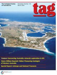
Newsletter Number 150<br />
March 2009<br />
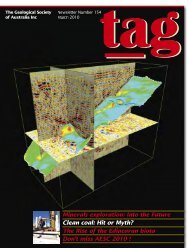
<strong>The</strong> <strong>case</strong> <strong>for</strong> a <strong>greenfields</strong> <strong>renaissance</strong><br />
<strong>Feature</strong>: Tsunami risk in Australia<br />
Part 2: rallying cry <strong>for</strong> geoscience<br />
Focus on geotourism
<strong>The</strong> Australian Geologist<br />
Newsletter 150, March 2009<br />
Registered by Australia Post<br />
Publication No. PP243459/00091<br />
ISSN 0312 4711<br />
Technical Editor: Bill Birch<br />
Production Editor: Heather Catchpole<br />
Send contributions to: tag@gsa.org.au<br />
Central Business Office<br />
Executive Director: Sue Fletcher<br />
Suite 61, 104 Bathurst Street,<br />
Sydney NSW 2000<br />
Tel: (02) 9290 2194<br />
Fax: (02) 9290 2198<br />
Email: info@gsa.org.au<br />
GSA website: www.gsa.org.au<br />
22 From the President<br />
23 Report of the Merger Committee<br />
24 Guest Editor’s Comment<br />
25 <strong>Society</strong> Update<br />
Business Report<br />
Membership Update<br />
From the AJES Editor’s Desk<br />
Education & Outreach<br />
Stratigraphic Column<br />
Data Metallogenica<br />
Design and typesetting <strong>The</strong> Visible Word Pty Ltd<br />
Printed by Ligare Pty Ltd<br />
Distributed by Trade Mailing & Fulfilment Pty Ltd<br />
15 News from the Divisions<br />
17 News<br />
22 <strong>Feature</strong>: Tsunami hazard and mitigation in Australia<br />
25 Special Report: A rallying cry <strong>for</strong> geoscience: part 2<br />
29 In Focus: <strong>The</strong> <strong>case</strong> <strong>for</strong> a <strong>greenfields</strong> <strong>renaissance</strong><br />
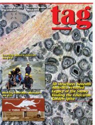
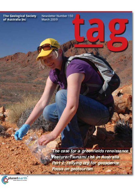
Adelaide University Honours student<br />
Joanna McMahon sampling euro<br />
(also known as the common wallaroo)<br />
droppings in Hidden Valley,<br />
northern Flinders Ranges, as part<br />
of a multi-disciplinary regolith<br />
and biogeochemistry Honours<br />
student research program centred<br />
on the Four Mile uranium (U)<br />
mineralisation. This study found<br />
euro droppings near the Four Mile<br />
mineralisation had concentrations<br />
up to 24 parts per million U. It is<br />
estimated that the samples of euro<br />
droppings provide an approximate<br />
1 km diameter biogeochemical<br />
'footprint' of buried uranium mineralisation<br />
in this region. Reports of<br />
mushroom-shaped dust clouds<br />
originating from jumping kangaroos<br />
are not substantiated! Image<br />
courtesy Steve Hill, University<br />
of Adelaide.<br />
32 ARC grants <strong>for</strong> Earth Science research<br />
37 Book Reviews<br />
42 Letters to the Editor<br />
46 Calendar<br />
47 Office Bearers<br />
48 Publishing Details
From the President<br />
This is our planet and we have a<br />
crucial role to play<br />
Earth Science is THE science of the 21st century and faces two<br />
crucial issues, energy and environment. It is imperative that<br />
Earth Science is front and centre, to provide the necessary<br />
knowledge to understand and to solve these issues.<br />
<strong>The</strong> important role that Earth Science can play in our future has<br />
also recently been recognised by the American <strong>Geological</strong> Institute<br />
(AGI) in its document ‘Critical needs <strong>for</strong> the twenty-first century: the<br />
role of the geosciences’ (a PDF of this document is on the AGI<br />
Government Affairs website at www.agiweb.org/gap/trans08). <strong>The</strong> AGI<br />
prepared this as a policy document <strong>for</strong> the incoming US president, US<br />
Federal agencies and Congress. <strong>The</strong> American <strong>Geological</strong> Institute is a<br />
non-profit federation of 45 organisations that represent more than<br />
120,000 geologists, geophysicists, and other Earth Scientists. <strong>The</strong> AGI<br />
recognises that with pressures from growing human population, rising<br />
demands <strong>for</strong> natural resources and a changing climate, it is critical to<br />
more fully integrate Earth observations and Earth system understanding<br />
into actions <strong>for</strong> a sustainable world. <strong>The</strong> document identifies seven<br />
critical issues facing the world and the role geosciences can play in<br />
addressing them. <strong>The</strong>se are:<br />
1. Energy and climate change: how do we secure stable energy supplies<br />
in an increasingly carbon-constrained world<br />
2. Water: will there be enough fresh water and where will it come<br />
from<br />
3. Waste treatment and disposal: how will we reduce and handle waste<br />
and provide a healthy environment <strong>for</strong> all<br />
4. Natural hazards: how will we mitigate risk and provide a safer<br />
environment<br />
5. Infrastructure modernisation: how will we develop and integrate<br />
new technology and modernise aging infrastructure<br />
6. Raw materials: how will we ensure reliable supplies when they are<br />
needed and where will they come from<br />
7. Geoscience work<strong>for</strong>ce and education: who will do the work to<br />
understand Earth processes and meet demands <strong>for</strong> resources and<br />
resiliency Who will educate the public and train the work<strong>for</strong>ce<br />
<strong>The</strong> report makes three broad recommendations which are built<br />
around:<br />
1) providing expert Earth Science advice to government, ideally<br />
through an advisor or panel with direct access to the head of<br />
government;<br />
2) investing in mapping, monitoring and assessments, as well as State<br />
and Federal surveys of natural resources;<br />
3) investing in research and development to<br />
understand Earth processes. Sustainable<br />
consumption and conservation of resources,<br />
enhancement of environmental quality and resilience from risk depend<br />
on living with our dynamic planet.<br />
<strong>The</strong> need <strong>for</strong> expert advice in the US echoes a similar urgent call<br />
that the <strong>Geological</strong> <strong>Society</strong> of Australia made last year to the Federal<br />
and State governments to establish an independent national advisory<br />
panel of expert geoscientists. This would provide a much-needed highlevel<br />
‘early warning system’ <strong>for</strong> a wide range of issues, particularly<br />
potential environmental crises, years be<strong>for</strong>e these crises become<br />
irreversible. A National Geoscience Expert Panel would serve as<br />
an independent voice to provide scientifically-based warnings and<br />
recommendations on a wide range of issues. See following link:<br />
http://gsa.org.au/ > Resources > Media Centre > 18 August 2008 ><br />
National Geoscience Expert Panel needed as high-level “early warning<br />
system” on environmental disasters<br />
An Australian perspective on the work<strong>for</strong>ce and education component<br />
of the AGI report is provided in this issue of TAG by Jim Ross with<br />
part 2 of ‘A rallying cry <strong>for</strong> geoscience in Australia’. This report draws<br />
upon the 2007 AGC survey published in 2008 and paints a bleak<br />
picture of the sustainability of teaching Earth Science in our tertiary<br />
institutions (something those of us working in the sector have known<br />
instinctively <strong>for</strong> some time). <strong>The</strong> article goes on to emphasise the need<br />
<strong>for</strong> more, and better, integration of Earth and environmental knowledge<br />
into school curricula and the importance of this in securing the<br />
future of the profession.<br />
We as a profession recognise the importance of Earth Science and<br />
its role in society; however, this is not always appreciated in the broader<br />
community. <strong>The</strong>re is a dichotomy between the accomplishments and<br />
vision outlined in reports such as the AGI report and society’s perception<br />
of Earth Science, in which scientists can be portrayed as part of<br />
the problem, rather than being instrumental in finding a solution.<br />
Whether as individuals or through organisations such as the <strong>Geological</strong><br />
<strong>Society</strong> of Australia, we as a profession need to work hard to ensure<br />
Earth Science provides the pathway to a sustainable planet <strong>for</strong> our<br />
children and grandchildren.<br />
PETER CAWOOD<br />
President<br />
2 | TAG March 2009
GSA–AIG merger negotiations<br />
<strong>The</strong> merger committee, consisting of Peter<br />
Cawood, Jim Ross, Jon Hronsky and Andy<br />
Gleadow, is continuing negotiations with the<br />
Australian Institute of Geoscientists about a possible<br />
merger of the two organisations. Discussions of the<br />
GSA merging with other Australian Earth Science<br />
organisations date back to 2004. Specific negotiations<br />
with the AIG commenced during the term of the last<br />
National Executive and are a priority <strong>for</strong> the current<br />
executive, in line with directives from the Council and<br />
Annual General meetings held last July in Perth (see<br />
TAG 148, p23).<br />
<strong>The</strong>re have been a series of meetings between the<br />
merger committees of the two organisations over the<br />
last six months, and both committees have obtained<br />
independent legal and financial advice to guide these<br />
discussions. Whilst there are substantive areas of agreement<br />
between the two negotiating committees on the<br />
merger, some first order issues, including the nature of<br />
the merger vehicle, require further negotiation. <strong>The</strong><br />
GSA National Executive met in early February <strong>for</strong> a<br />
strategy meeting to review progress to date and to provide<br />
guidance to the merger committee in future<br />
negotiations. <strong>The</strong> Executive also approved allocation<br />
of up to $25,000 to provide administrative support<br />
and services to assist the merger process, subject to<br />
satisfactory cost sharing. Strategy meetings of the<br />
Executive will continue on a bimonthly basis during<br />
the merger process.<br />
It is envisaged a merged organisation will mean little<br />
change in the day-to-day activities of the GSA and the<br />
functions and services it provides to members. <strong>The</strong><br />
divisional and specialist group structure would continue,<br />
but with the benefit of stronger divisions as the two<br />
sets of State and Territory-based divisions are merged.<br />
This process has already commenced in Queensland,<br />
where the GSA’s Queensland Division already includes<br />
about 50% AIG members on its Executive. <strong>The</strong> AIG<br />
does not have specialist groups and there<strong>for</strong>e the<br />
current GSA groups would continue. <strong>The</strong> Australian<br />
Journal of Earth Science, our premier publication, will be<br />
unaffected. Both societies produce quarterly member<br />
magazines and these would be merged in any combined<br />
organisation.<br />
A merger would result in a considerable increase in<br />
size; with a combined membership of approximately<br />
3,500 members, taking into account members common<br />
to both organisations. This increase would allow<br />
the new society to more fully represent the Earth<br />
Science profession and provide greater benefits to<br />
members. Importantly, the merged entity would have<br />
more capacity, and more impact, when addressing<br />
external issues such as: expanding our active role in<br />
promoting Earth Science education, and in providing<br />
an Earth Science perspective on issues of national<br />
importance. <strong>The</strong> AIG provides professional registration<br />
<strong>for</strong> Earth Scientists and arrangements to provide <strong>for</strong><br />
this membership category have been agreed in some<br />
detail between the negotiating committees.<br />
More details on the value proposition <strong>for</strong> the merger<br />
are included in TAG 148, p23.<br />
<strong>The</strong> AIG and GSA merger committees will meet<br />
again in late February <strong>for</strong> a workshop with the aim of<br />
finalising the most logical vehicle <strong>for</strong> the merger, in<br />
the light of legal and tax advice, and of settling the<br />
remaining first order issues. We also aim to finalise our<br />
strategy to communicate with the members of both<br />
organisations with the first step being a letter to<br />
every individual member in March. This letter will<br />
detail the implications of the proposed merger, the<br />
feedback mechanisms, the proposed schedule <strong>for</strong><br />
members to vote and, if the vote is in favour, a date <strong>for</strong><br />
commencement of the merged organisation.<br />
Stay tuned.<br />
PETER CAWOOD, JIM ROSS, JON HRONSKY<br />
AND ANDY GLEADOW<br />
Executive Merger Committee<br />
11 February 2009<br />
TAG March 2009 | 3
Guest Editor’s Comment<br />
It is a great honour to be invited to write a guest editorial <strong>for</strong><br />
TAG. It’s hard to believe that it’s almost exactly 35 years<br />
since the first editorial I wrote <strong>for</strong> the initial issue of TAG<br />
appeared. Although there were sceptics among the councillors<br />
when the idea was given the go-ahead, it was the support of<br />
the then president, Dorothy Hill, which saw the newsletter<br />
stagger to its feet. Fortunately, the journal did not, as I suggested<br />
“soon show signs of debility and go into a state of nervous<br />
decline”, but, thanks to those who took over from 1984, Brenda<br />
Franklin in particular, TAG has become an important part of the<br />
<strong>Society</strong>’s story.<br />
In her <strong>for</strong>eword to the first issue, Dorothy Hill emphasised<br />
the importance of the development of the Specialist groups to<br />
the <strong>Society</strong>, and something of their story has been told in Rock<br />
Me Hard…Rock Me Soft…, compiled by Barry Cooper and myself<br />
in 1994. We almost need an update, <strong>for</strong> much has happened in<br />
our profession and in the <strong>Society</strong> in the past 15 years. Not all<br />
members have time to look back into the founding of the GSA,<br />
or to the beginning of geology in Australia, but as I myself<br />
“show signs of debility and go into a state of nervous decline”,<br />
I am pleased to have had the opportunity, through the Earth<br />
Sciences History Specialist Group of the <strong>Society</strong>, to learn about<br />
the pioneers and to pay homage to their work.<br />
This year, we are already hearing a bit about Charles Darwin<br />
as we remember his seminal work on evolution and the bicentenary<br />
of his birthday. It is important to remember that when<br />
the young Darwin visited Australia in 1836, he considered himself<br />
a geologist, albeit a relative neophyte, although he had<br />
learnt quickly, particularly in seeing and recording a wide<br />
variety of geology in South America. Darwin’s ‘geological life’<br />
has been told in a splendid book by the distinguished American<br />
science historian, Sandra Herbert, although his period in<br />
Australia receives scant mention.<br />
This omission is partly rectified by Charles Darwin in<br />
Australia, by Frank and Jan Nicholas (1989), an almost day-byday<br />
coverage of Darwin’s wanderings, which is superbly<br />
illustrated, particularly the illustrations by Darwin’s Beagle<br />
companion, Conrad Martens, who decided to stay in Australia.<br />
Herbert’s book emphasises the geological influence on Darwin<br />
of the writings of Charles Lyell, although a recent paper by<br />
Chris Nicholas and Paul Pearson shows that Darwin’s self-proclaimed<br />
‘instant conversion’ to uni<strong>for</strong>mitarianism, during his<br />
brief visit in 1832 to Santiago, Cape Verde Islands, is somewhat<br />
of an exaggeration.<br />
<strong>The</strong> Darwin celebrations give our profession and the <strong>Society</strong><br />
the opportunity to make geology better known to the<br />
Australian community, and it is pleasing to see biographies of<br />
earlier distinguished workers appearing, including those of<br />
RL Jack, pioneer Queensland geologist; Archibald Liversidge,<br />
mineralogist; and the more recently-deceased Reg Sprigg.<br />
In January, the Royal <strong>Society</strong> of Victoria flew spectators<br />
over the vicinity of the South Magnetic Pole, as it was visited<br />
just 100 years be<strong>for</strong>e by David, Mawson and Mackay, taking in<br />
also the site out to sea found by Charles Barton, on<br />
23 December 2000. Another opportunity <strong>for</strong> publicity seems to<br />
exist in the newly-opened National Portrait Galley in Canberra,<br />
which currently lacks a display featuring any of our wellknown<br />
geoscientists.<br />
DAVID BRANAGAN<br />
Sydney<br />
4 | TAG March 2009
<strong>Society</strong>Update<br />
Business Report<br />
Most members renewed over the holiday season using<br />
the online system, but un<strong>for</strong>tunately there were a<br />
few members who encountered issues with Firefox<br />
and Safari browsers. My apologies <strong>for</strong> your inconvenience —<br />
technology is great when it works, but frustrating when it<br />
doesn’t. Other members chose to take advantage of the direct<br />
debit system, which is great if you want to ‘set and <strong>for</strong>get’. If<br />
you want to know more about the direct debit system, please<br />
email info@gsa.org.au or phone (02) 9290 2194.<br />
With the slowdown in the economy and impact on the<br />
resources sector, some members may reconsider attending<br />
professional development events. But it is during tougher times<br />
that networking and professional development can bring<br />
rewards, knowledge and contacts. For example, <strong>The</strong> Macquarie<br />
Arc 2009 Conference (13–21 April 2009) is nearly upon us and<br />
there is still time to plan your attendance at the <strong>Society</strong> <strong>for</strong><br />
Geology Applied to Mineral Deposits — SGA 2009 (17–20<br />
August 2009) or consider a short course like EGRU’s financial<br />
management <strong>for</strong> professions, in the minerals sector short<br />
courses (now reduced by 50%). If you want the links to these<br />
development opportunities or to know about other events near<br />
you, visit the GSA website: http://gsa.org.au/ and follow the<br />
links > Events > Calendar. You’ll see many events organised<br />
locally and a listing of relevant international conferences, too.<br />
This issue of TAG includes an insert from the Centre <strong>for</strong><br />
Groundwater Studies. This brochure is very in<strong>for</strong>mative <strong>for</strong><br />
those working in groundwater — if that isn’t you, but you know<br />
someone who is, please pass the brochure on or put it in your<br />
tearoom. Inside this issue you will find the feature: ‘Tsunami<br />
hazard in Australia and steps being taken to mitigate it’, from<br />
Barry Drummond, Trevor Dhu and Jane Sexton, Geoscience<br />
Australia; plus a very timely article from Jon Hronsky, BJ<br />
Suchomel and JF Welborn ‘<strong>The</strong> <strong>case</strong> <strong>for</strong> a <strong>greenfields</strong> <strong>renaissance</strong>’.<br />
We also include Part 2 of Jim Ross’ ‘A rallying cry <strong>for</strong><br />
geoscience’. Held over from the December issue was the full<br />
listing of the relevant ARC Linkages and Discovery Grants.<br />
Also, in this issue of TAG you can read an interview with John<br />
Jackson (aka the Rock Doctor) and the importance of<br />
geotourism, as well an update about the GSA merger, a report<br />
from the AIG/GSA merger committee, GSA membership<br />
demographics and the usual columns, news, book reviews and<br />
letters to the Editor.<br />
TAG doesn’t often review exhibitions, but in this instance<br />
we had to include Ken McQueen’s review of the Charles Darwin<br />
exhibition at the National Museum, Canberra. You would<br />
have to have your eyes shut not to<br />
know 2009 sees the commemoration<br />
and celebration of one of the world’s<br />
greatest scientific thinkers; Charles Darwin. Two hundred years<br />
after his birth (born on 14 February 1809) and 150 years after<br />
publishing On the origin of species by means of natural<br />
selection, his scientific thinking influenced and trans<strong>for</strong>med<br />
scientific theory and our relationships to each other and the<br />
planet we live on including: the origins of life, palaeontology,<br />
genetics (well be<strong>for</strong>e DNA sequencing was developed), ecology,<br />
avian biodiversity, medicine, human evolution and psychology.<br />
Many people don’t realise (apart from geologists) that Charles<br />
Darwin was firstly a geologist and the geology of Australia<br />
stimulated his early thinking. <strong>The</strong> Australian leg of Darwin’s<br />
journey on the HMS Beagle took him from Sydney over the Blue<br />
Mountains and onto Bathurst, as well as to Hobart, King<br />
George’s Sound and Albany. This year, there are an enormous<br />
number of activities commemorating his life and work<br />
globally, from exhibitions, public lectures, dinners, workshops,<br />
conferences, specially designed holiday packages (you can go<br />
to “Taz-mania” and “nurture the naturalist in you”). For those<br />
with more time (and money) you can join the Stan<strong>for</strong>d Alumni<br />
<strong>for</strong> the ‘Voyage of the Beagle’ by private jet, on an around-theworld<br />
expedition taking in the Galapagos Islands, Uruguay,<br />
Argentina, New Zealand, Tasmania, the Cape Verde Islands and<br />
finishing at London’s Maritime Museum.<br />
Even if you don’t participate in one of the above activities,<br />
or haven’t organised a Darwin event, it isn’t too late to do<br />
something local. This is a once-in-a-century opportunity to<br />
create education or outreach activities to show the link back to<br />
Earth Sciences, to promote the Earth Sciences to the general<br />
public, to tickle young enquiring minds or to go into the field<br />
with your colleagues and friends.<br />
You can organise a Darwin activity this year — it doesn’t<br />
have to be as grand as the HMS Beagle project or Sir David<br />
Attenborough’s ‘Charles Darwin and the Tree of Life’ program —<br />
and the business office can support your ef<strong>for</strong>ts by promoting<br />
your event, acting as the banker or providing other administrative<br />
assistance. We are here to assist you; lets commemorate<br />
and celebrate Charles Darwin.<br />
SUE FLETCHER<br />
Executive Director<br />
TAG March 2009 | 5
New members<br />
<strong>The</strong> GSA welcomes the<br />
following new members to<br />
the <strong>Society</strong>. May you all<br />
have a long and beneficial<br />
association with the GSA:<br />
ACT<br />
M EMBER<br />
Emma-Kate Chisholm<br />
QLD<br />
M EMBER<br />
Amy Budinski<br />
Michael Cane<br />
Joseph Corrigan<br />
Brent Creevey<br />
Adam Dunstall<br />
Peter Henderson<br />
Joanne Henry<br />
Cameron Huddlestone-Holmes<br />
Harriet Miller<br />
Bonnie Munchinsky<br />
Carl Spandler<br />
Reginald Tandoc<br />
Claire Williams<br />
J OINT M EMBER<br />
Heather Spring<br />
G RADUATE M EMBER<br />
Larianna Morgan<br />
R ETIRED M EMBER<br />
Keith Bed<strong>for</strong>d<br />
S TUDENT<br />
Scott Fredericks<br />
SA<br />
M EMBER<br />
Suzanne Miller<br />
TAS<br />
M EMBER<br />
Daniel Bombardieri<br />
R ETIRED<br />
Bill Sharp<br />
VIC<br />
M EMBER<br />
Matthew Sheppard<br />
WA<br />
M EMBER<br />
Andre Cacciopppoli<br />
Simon Johnson<br />
Don Vreugdenberg<br />
G RADUATE M EMBER<br />
Courtney Gregory<br />
S TUDENT<br />
Saleh Alqahtani<br />
Benjamin Dingli<br />
Ian Pryor<br />
Lee Rummer<br />
Brea Stephen<br />
A SSOCIATE M EMBER<br />
Antonio Tan Jr<br />
Lost member<br />
For following members mail<br />
is being returned to the GSA<br />
office ‘return to sender/not<br />
known at this address’. Thank<br />
you to members in advance<br />
<strong>for</strong> assisting uniting members<br />
and their GSA mail.<br />
Ronald Myson, NSW<br />
Phil Greenhill, NSW<br />
We have reproduced the following membership demographic graphs <strong>for</strong> your interest.<br />
Measurement of demographics continues to in<strong>for</strong>m the society and identifies trends.<br />
Identifiable membership trends include increasing student membership; this may be attributed<br />
to 2007 initiatives and less honour students <strong>for</strong> this period also graduating students choosing<br />
full membership.<br />
6 | TAG March 2009
FAR LEFT<br />
This graph is based on<br />
the Divisions members<br />
have chosen to affiliate<br />
with and shows incremental<br />
changes.<br />
LEFT<br />
Tracking the new<br />
membership take-up<br />
over the past five years;<br />
indicates modest but<br />
continuing new memberships.<br />
2005 could be<br />
interpreted as an<br />
anomaly in comparison<br />
to the intervening years.<br />
LEFT<br />
This graph represents the<br />
members affiliating with<br />
a Specialist Group. Some<br />
members choose to affiliate<br />
with more than one<br />
Specialist Group.<br />
FAR LEFT<br />
<strong>Geological</strong> <strong>Society</strong> of<br />
Australia members work<br />
in a variety of areas. <strong>The</strong><br />
overwhelming majority<br />
of members work in the<br />
Minerals sector,<br />
followed closely by<br />
Tertiary institutions.<br />
LEFT<br />
Membership records<br />
indicate a steady, but<br />
modest upward trend<br />
over the past few years.<br />
Again, 2005 is the lowest<br />
point <strong>for</strong> memberships<br />
and the increase may be<br />
attributed to the minerals<br />
boom.<br />
TAG March 2009 | 7
<strong>Society</strong>Update<br />
From the AJES Hon Editor’s Desk<br />
Some musings on poetry and geology<br />
In a previous article I quoted Edward Hitchcock Jr’s remark,<br />
“Shall not geology, which is the first science in af<strong>for</strong>ding<br />
scope <strong>for</strong> the imagination, be brought into favour with the<br />
Muses, and af<strong>for</strong>d themes <strong>for</strong> the Poet”. Samuel Taylor<br />
Coleridge on the other hand, in his Definition of poetry said,<br />
“Poetry is not the proper antithesis to prose but to science.<br />
Poetry is opposed to science, and prose to metre. <strong>The</strong> proper<br />
and immediate object of science is the acquirement, or<br />
communication, of truth; the proper and immediate object of<br />
poetry is the communication of immediate pleasure” [Alas,<br />
I thought that AJES was communicating truth and giving<br />
pleasure!] However, as Emily Ballou points out “Anyway, he<br />
[Coleridge] was an opium addict so the two things would have<br />
caused some sort of disworkmanship on his brain when<br />
thought of simultaneously…”<br />
In truth, no one has recently tried to write a scientific<br />
paper in poetic <strong>for</strong>m — many authors have enough difficulty<br />
in writing prose. But science has often been the inspiration<br />
<strong>for</strong> a poem. One well known one is about the dinosaur<br />
(attributed to Bert Leston Taylor in the Chicago Tribune).<br />
Behold the mighty dinosaur<br />
Famous in prehistoric lore,<br />
Not only <strong>for</strong> his power and strength<br />
But <strong>for</strong> his intellectual length.<br />
You will observe by these remains<br />
<strong>The</strong> creature had two sets of brains--<br />
One in his head (the usual place),<br />
<strong>The</strong> other in his spinal base.<br />
Thus he could reason A priori<br />
As well as A posteriori.<br />
No problem bothered him a bit<br />
He made both head and tail of it.<br />
So wise was he, so wise and solemn,<br />
Each thought filled just a spinal column.<br />
If one brain found the pressure strong<br />
It passed a few ideas along.<br />
If something slipped his <strong>for</strong>ward mind<br />
'Twas rescued by the one behind.<br />
And if in error he was caught<br />
He had a saving afterthought.<br />
As he thought twice be<strong>for</strong>e he spoke<br />
He had no judgement to revoke.<br />
Thus he could think without congestion<br />
Upon both sides of every question.<br />
Oh, gaze upon this model beast;<br />
Defunct ten million years at least.<br />
<strong>The</strong> American poet Emily Dickinson<br />
learned geology from Edward Hitchcock<br />
Jr, which may have inspired her to write<br />
about volcanoes:<br />
Volcanoes be in Sicily<br />
And South America<br />
I judge from my Geography —<br />
Volcanoes nearer here<br />
A Lava step at any time<br />
Am I inclined to climb —<br />
A Crater I may contemplate<br />
Vesuvius at Home.<br />
Nearer to our own time, geologist Paul Maddock from the<br />
University of London has penned <strong>The</strong> plume soliloquy.<br />
(<strong>The</strong> complete poem may be found at geology.about.<br />
com/od/geopoetry/Geology_Poetry, along with many other<br />
geology-themed poems):<br />
To Plume, or not to Plume — that is the question:<br />
Whether 'tis nobler in the mantle to suffer the Rises and Falls of<br />
outrageous Convection<br />
Or to take Geophysics against a sea of Plumists and by opposing<br />
question them.…<br />
But it is to Erasmus Darwin, Charles Darwin’s grandfather, that<br />
we must turn to see science written as a poem. He was a<br />
physician, natural philosopher, physiologist, inventor as well<br />
as a poet. His best-known work is Zoonomia, a treatise on<br />
biology, which to some extent anticipated Lamarck’s views on<br />
evolution. His poem, <strong>The</strong> temple of nature, was published<br />
posthumously in 1803 and develops his ideas on evolution,<br />
tracing the progression of life from microorganisms to civilised<br />
society. <strong>The</strong> poem starts:<br />
By firm immutable immortal laws<br />
Impress'd on Nature by the great first cause,<br />
say, muse! how rose from elemental strife<br />
Organic <strong>for</strong>ms, and kindled into life;….<br />
and develops the theme<br />
Organic life beneath the shoreless waves 21<br />
Was born and nurs'd in Ocean's pearly caves;<br />
First <strong>for</strong>ms minute, unseen by spheric glass,<br />
Move on the mud, or pierce the watery mass;<br />
<strong>The</strong>se, as successive generations bloom<br />
New powers acquire, and larger limbs assume;<br />
Whence countless groups of vegetation spring,<br />
And breathing realms of fin, and feet, and wing.<br />
8 | TAG March 2009
with footnotes to explain some of the finer points of the poem:<br />
21<br />
beneath the shoreless waves: <strong>The</strong> Earth was originally<br />
covered with water, as appears from some of its highest mountains,<br />
consisting of shells cemented together by a solution of part<br />
of them, as the limestone rocks of the Alps... It must be there<strong>for</strong>e<br />
concluded, that animal life began beneath the sea.<br />
<strong>The</strong> full poem may be found at<br />
www.english.upenn.edu/Projects/knarf/Darwin/templetp.html. 1<br />
While this may not be the clearest way to get one’s message<br />
across to the reader, I eagerly await the first poem submitted to<br />
AJES. But alas! <strong>The</strong> days of the scientist/poet may have gone,<br />
never to return.<br />
ISSUE COPY FINISHED INSERTS<br />
ART<br />
JUNE 2009 30 Apr 5 May 25 May<br />
SEPTEMBER 2009 31 Jul 8 Aug 16 Aug<br />
DECEMBER 2009 30 Oct 3 Nov 10 Nov<br />
MARCH 2010 29 Jan 5 Feb 8 Mar<br />
TONY COCKBAIN<br />
Hon Editor AJES<br />
Reviewers 2008<br />
I would like to thank the following people who reviewed<br />
manuscripts submitted to, or published in, the Australian<br />
Journal of Earth Sciences during 2008.<br />
Annual citation <strong>for</strong> excellence in<br />
reviewing <strong>for</strong> the year 2008<br />
It is my pleasure to commend the following persons <strong>for</strong><br />
consistently providing constructive and thoughtful reviews:<br />
John Bradshaw, Geoff Derrick, Chris Fergusson and Colin Pain.<br />
Wayne Bailey<br />
Graham Baines<br />
Tim Baker<br />
Andy Barnicoat<br />
Mark Bateman<br />
Tony Belperio<br />
Pete Betts<br />
Bill Birch<br />
Gavin Birch<br />
Phil Blevin<br />
Simon Bodorkos<br />
John Bradshaw<br />
Peter Cawood<br />
Jonathan Clarke<br />
Michele Clarke<br />
Phil Commander<br />
Thomas Cudahy<br />
Brett Davis<br />
John De Laeter<br />
Xiaoli Deng<br />
Mike Dentith<br />
Geoff Derrick<br />
Nick Direen<br />
Barry Drummond<br />
Scott Dyksterhuis<br />
John Everard<br />
Nick Eyles<br />
Chris Fergusson<br />
Marc Fiorenti<br />
John Foden<br />
David Foster<br />
Jeff Foster<br />
Richard George<br />
David Gibson<br />
Cathryn Gifkins<br />
Dick Glen<br />
Vic Gostin<br />
David Gray<br />
Kath Grey<br />
David Groves<br />
Peter Haines<br />
Pat Harbison<br />
Anthony Harris<br />
Lyal Harris<br />
John Hellstrom<br />
Guy Holdgate<br />
John Holliday<br />
Michael Hutchinson<br />
Laurie Hutton<br />
Jim Jackson<br />
Brian Jones<br />
Bernie Joyce<br />
Chris Klootwijk<br />
Evan Leitch<br />
Paul Lennox<br />
Qianyu Li<br />
Ted Lilley<br />
Pat Lyons<br />
Roland Maas<br />
Joe McCall<br />
Ian McDougall<br />
Brian McGowran<br />
Sandra McLaren<br />
Ken McNamara<br />
Ken McQueen<br />
Mike McWilliams<br />
Sebastien Meffre<br />
Peter Milligan<br />
Kingsley Mills<br />
Harvey Mitchell<br />
Vince Morand<br />
Arthur Mory<br />
Sharon Mosher<br />
Cec Murray<br />
Tony Naldrett<br />
Ian Nicholls<br />
Geoff O’Brien<br />
Robin Offler<br />
Gordon Packham<br />
Colin Pain<br />
Neil Phillips<br />
Steven Phipps<br />
Bob Pidgeon<br />
Chris Pigram<br />
Brad Pillans<br />
Franco Pirajno<br />
Wolfgang Preiss<br />
Lynn Pryer<br />
Ollie Raymond<br />
Patrice Rey<br />
Angela Riganti<br />
Rick Rogerson<br />
Mac Ross<br />
Bruce Runnegar<br />
Peter Schaubs<br />
Phil Schmidt<br />
Phil Seccombe<br />
Simon Shee<br />
Willem Sijp<br />
Carol Simpson<br />
Keith Sircombe<br />
Catherine Skinner<br />
Rick Squire<br />
Tony Stephenson<br />
Tim Stern<br />
Barney Stevens<br />
Ian Tedder<br />
Alec Trendall<br />
Fons VandenBerg<br />
John Veevers<br />
Ron Vernon<br />
John Walshe<br />
Malcolm Walter<br />
John Webb<br />
Barry Webby<br />
Martin Williams<br />
Ian Withnall<br />
Lisa Worrall<br />
Steve Wyche<br />
Jian-xin Zhao<br />
TAG March 2009 | 9
<strong>Society</strong>Update<br />
Education&Outreach<br />
In the last TAG <strong>for</strong> 2008 I highlighted the need <strong>for</strong> the geoscience<br />
community to respond to the call <strong>for</strong> submissions from the<br />
newly <strong>for</strong>med National Curriculum Board (NCB) on the shape<br />
that a national curriculum and the science curriculum should take.<br />
I am pleased to report that the GSA made a submission on <strong>The</strong> shape<br />
of the national curriculum: a proposal <strong>for</strong> discussion document.<br />
Independent letters of support <strong>for</strong> the GSA submission were also<br />
sent from the Australian Institute of Geoscientists (AIG) and Teacher<br />
Earth Science Education Program (TESEP).<br />
A second submission was made in late February on the specifics<br />
of the science curriculum. Other groups, notably Earth Science<br />
Western Australia (ESWA) and TESEP, have reportedly submitted their<br />
own proposals that no doubt complemented the GSA submission.<br />
To read more visit the NCB website: www.ncb.org.au/default.asp<br />
Specific suggestions <strong>for</strong> a<br />
national curriculum<br />
<strong>The</strong> GSA developed suggestions <strong>for</strong> the NCB with respect to<br />
the three broad categories that the curriculum should deliver <strong>for</strong><br />
students and how these relate to the proposed national curriculum<br />
structure:<br />
1) A solid foundation in skills and knowledge on which further<br />
learning and adult life can be built.<br />
<strong>The</strong> GSA concurred that the curriculum must include a strong<br />
focus on literacy and numeracy that is underpinned by a competent<br />
understanding of the principles of science and encouraged the NCB<br />
to adopt a curriculum that contains:<br />
■ literacy programs that address the issues of the language of<br />
science;<br />
■ numeracy programs that address issues of data analysis;<br />
■ a program that introduces students to the history, philosophy,<br />
culture, ethics and principles of science within the context of the<br />
value that science and scientific method bring to society.<br />
2) Deep knowledge and skills that will enable advanced learning and<br />
an ability to create new ideas and translate them into practical<br />
applications.<br />
<strong>The</strong> requirement that students develop a deep knowledge within<br />
a discipline which enhances the ways in which problems can be<br />
represented, considered and solved, was fully endorsed by the GSA.<br />
<strong>The</strong> GSA recommended a curriculum approach that embraces:<br />
■ a global, 'big picture' emphasis on key learning areas <strong>for</strong> the<br />
21st century. Science should be taught under the banner of<br />
Earth and Space Studies where all traditional sciences are<br />
sub-disciplines united by this overarching theme;<br />
■ at pre-senior level, all science teaching to be approached from<br />
the perspective of understanding how the Earth (and the universe<br />
it sits within) works;<br />
■ in senior studies, all science students<br />
attend an integrated unit of study that<br />
includes elements of traditional biology,<br />
chemistry, physics units as well as some<br />
components of classes that in some<br />
states are called Earth and Environmental Science;<br />
■ a requirement that all sub-disciplines are treated equally as the<br />
content and context <strong>for</strong> the new curriculum are developed.<br />
3) General capabilities that underpin flexible and critical thinking, a<br />
capacity to work with others and an ability to move across subject<br />
disciplines to develop new expertise.<br />
<strong>The</strong> GSA reiterated the proposition that flexible and critical<br />
thinking are essential foundations of good scientific method and<br />
recommended the NCB introduce:<br />
■ an overarching program that utilises the multidisciplinary,<br />
team-oriented nature of much of the Earth Sciences to train<br />
students to think creatively, critically and flexibly;<br />
■ a requirement <strong>for</strong> all science content to be embedded within<br />
a framework that demonstrates the need <strong>for</strong>, and trains students<br />
in the use of, collaborative research, innovative thinking and a<br />
willingness to be open to new ideas.<br />
In discussing the need <strong>for</strong> deep knowledge and skills, the NCB indicated<br />
that it will specify rigorous in-depth study over breadth of<br />
content wherever possible. This approach was supported by the GSA<br />
with caveats that the NCB:<br />
■ adopt a more holistic view of deep knowledge in science that<br />
incorporates Earth Science as an essential complementary component<br />
of the traditional sciences taught at senior levels in school;<br />
■ retain or enhance the current emphasis on Earth Science in<br />
middle school curricula but take steps to ensure it is not a<br />
'disposable' component;<br />
■ avoid further diminishing the presence of 'other sciences' as a<br />
solution to creating space in the curriculum <strong>for</strong> deeper inquiry in<br />
the traditional sciences at any level;<br />
■ acknowledge that part of the 'time poor' problem faced<br />
by teachers is due to large class sizes, reporting and other<br />
administrative duties and that these are genuine barriers to<br />
the effective implementation of a national curriculum that the<br />
government will also need to address if the NCB recommendations<br />
are to be successfully adopted.<br />
GREG McNAMARA<br />
Education and Outreach<br />
Send all comments to Greg McNamara at<br />
outreach@gsa.org.au<br />
10 | TAG March 2009
Coming soon in an<br />
AJES near you<br />
<strong>The</strong>matic issue — Evolution of the Bowen,<br />
Gunnedah and Surat Basins, eastern Australia<br />
RJ Korsch and JM Totterdell (guest editors)<br />
Australian Journal of Earth Sciences 56(3)<br />
Volume 56 Issue 3 will be a thematic issue of 10 papers summarising<br />
the main results generated during the National<br />
Geoscience Mapping Accord's project Sedimentary basins of eastern<br />
Australia, which studied the evolution and petroleum potential<br />
of the Early Permian–Middle Triassic Bowen and Gunnedah<br />
Basins and the Early Jurassic–Early Cretaceous Surat Basin in<br />
Queensland and New South Wales.<br />
Key objectives of the project were to: (i) enhance our knowledge<br />
of, and develop models <strong>for</strong>, the origin and evolution of the<br />
Gunnedah, Surat, southern Bowen and associated basins in eastern<br />
Australia; (ii) relate these models to potential hydrocarbon<br />
occurrences as a basis <strong>for</strong> future exploration and assessment of<br />
resources; (iii) update the understanding of the geology of the<br />
basins; and (iv) provide in<strong>for</strong>mation to explain the distribution of<br />
known, potential and undiscovered occurrences of fossil fuels.<br />
TAG March 2009 | 11
<strong>The</strong> use of liquid crystal displays is now commonplace. Truly amazing advances have been made in recent years in<br />
understanding the behaviour of sub-microscopic particles in response to electric charges. Principles governing the<br />
behaviour of charged particles also apply to high-energy sediment components like clay. Many geologists now<br />
recognise interactions between charged particles and ions in surrounding pore fluids relate to ore <strong>for</strong>ming processes.<br />
This e-book is the first systematic use of modern colloid science to define the properties and<br />
behaviour of the high-energy sediment particles from which crustal rocks and mineral deposits<br />
were <strong>for</strong>med.<br />
World leaders in surface chemistry and the earth sciences have achieved this<br />
classic work over many years and it is based on the current physical chemistry<br />
of small particle systems. Existing problematic observations relating to the<br />
<strong>for</strong>mation of rocks and ore deposits are simply resolved by using principles<br />
more recently established in colloid science.<br />
<strong>The</strong> many far-reaching interdisciplinary research projects have been recorded in<br />
89 progress reports and papers. <strong>The</strong> principles of sediment particle interactions<br />
and surface chemistry apply universally but the cross-referenced e-book selects<br />
and illustrates 259 separate problematic observations to provide clear evidence<br />
of the properties of ancient sediment components. It details the processes by<br />
which veins and mineral deposits were <strong>for</strong>med. <strong>The</strong> photographic records of<br />
actual structures and textures that are preserved in rock outcrops, drill cores,<br />
and polished rock surfaces are there<strong>for</strong>e unusual in number, scope, and their<br />
global extent. Geophysical data, seismic reflection profiles and microscope and<br />
SEM images have also been used. A comprehensive glossary provides simple<br />
explanations of the physical chemistry, particle interactions and rheology.<br />
Recognition of source rocks and understanding the ore <strong>for</strong>ming processes<br />
have resulted in improved exploration success rates. Over 300% better cost effectiveness was achieved in a<br />
comparison of the results of 13 successful exploration companies over 15 years. Exploration managers can now<br />
identify source rocks and assess the likelihood of associated economic mineral deposits.<br />
Principal Technical Advisers and experimental confirmation:<br />
Professor T.W. Healy, Particulate Fluids Processing Centre, <strong>The</strong> University of Melbourne.<br />
Professor A.E. Alexander, Department of Physical Chemistry, <strong>The</strong> University of Sydney.<br />
Professor S.W. Carey, Department of Geology, <strong>The</strong> University of Tasmania.<br />
Professor T.F.W. Barth, <strong>The</strong> University of Oslo, President, 23rd International <strong>Geological</strong> Congress.<br />
Dr. Ralph K. Iler, Cornell University and E.I. DuPont de Nemours & Co, Wilmington, Delaware.<br />
Professor R.L. Stanton, Department of Geology & Geophysics, University of New England, Armidale, NSW. (Independent<br />
complimentary research that established the precursor principle by direct measurement with a microprobe analyzer.)<br />
Particulate Fluids Processing Centre, <strong>The</strong> University of Melbourne. (Independent research that confirmed DLVO theory<br />
by direct measurement of interparticle <strong>for</strong>ces with an atomic <strong>for</strong>ce microscope.)<br />
Research Coordinator and Author:<br />
John Elliston, Research Geologist (Previously Chief Geologist and Executive Director Peko-Wallsend Limited and then<br />
Research Consultant to CRA-Rio-Tinto <strong>for</strong> 12 years).<br />
This E-book contains: - 706 pages, 144 diagrams, 756 colour photographs, 227 references, 4 referee reports,<br />
40 comments and endorsements, Australian Government assessment and certification.<br />
Price: $AU75.00 each plus $10 postage (see order <strong>for</strong>m <strong>for</strong> student concession price at $25).<br />
Printable Order Forms at CODES: http://fcms.its.utas.edu.au/scieng/codes/index.asp<br />
ELLISTON RESEARCH: http://www.ellistonresearch.com.au/book_order.html
<strong>Society</strong>Update<br />
Stratigraphic Column<br />
When geographic names change<br />
<strong>The</strong>re has been a previous Stratigraphic Column that included<br />
this topic, but recently I came across some more Australian<br />
examples to add to the discussion.<br />
As Albert said, we all know that lithostratigraphic units<br />
must be named after a geographic locality. But life has a habit<br />
of throwing up some unexpected problems, such as the<br />
Newcastle suburb of Violet Town changing to Tingira Heights in<br />
the 1960s. What, if anything, should be done if the locality a<br />
unit is named after changes its name or spelling<br />
<strong>The</strong> International Stratigraphic Guide has some guidance on<br />
this. It says “Change in the name of a geographic feature does<br />
not entail change of the name of a stratigraphic unit. <strong>The</strong> original<br />
name of the unit should be maintained; eg the Mauch<br />
Chunk Shale should not be changed to Jim Thorpe Shale<br />
because the <strong>for</strong>mer town of Mauch Chunk is now called Jim<br />
Thorpe. Disappearance of a geographic feature does not require<br />
the elimination of the corresponding name of a stratigraphic<br />
unit. For example, Thurman Sandstone, named from a <strong>for</strong>mer<br />
village in Pittsburgh County, Oklahoma, does not require<br />
renaming.” In Australia, in fact, with our shortage of geographic<br />
names in some areas, some units have used locality names<br />
that were already obsolete at the time the unit was defined.<br />
More common are changes in spelling, such as the change of<br />
Mount Kosciusko to Kosciuszko. <strong>The</strong> same rule applies, and if only<br />
everyone abides by it, it would simplify searches of databases.<br />
Thus the Merrimbula Formation in NSW and Kombolgie Subgroup<br />
in NT remain that way, even though the town is now spelled<br />
Merimbula and Kombolgie Creek became Kambolgie Creek in the<br />
1970s; and Kosciusko Granite does not have to become<br />
Kosciuszko Granite. <strong>The</strong> original published spelling has priority.<br />
That’s the theory, anyway. In real life, people who are<br />
unaware of the old spelling of a locality and don’t check the<br />
unit name closely will inadvertently use the new version, and<br />
those who are unaware that the old spelling has changed will<br />
continue to use the old version, as they’ll have no reason to<br />
think of doing otherwise.<br />
In addition to inadvertent changes, there may be occasions<br />
when the spelling of a stratigraphic name is deliberately<br />
changed. Although not required by stratigraphic guidelines,<br />
sometimes names may be changed out of respect <strong>for</strong> the wishes<br />
of land managers, or local people. This has happened in western<br />
New South Wales, where the Mootwingee Group has been<br />
changed to the Mutawintji Group, to reflect its correct pronunciation.<br />
This change was made at the request of the Mutawintji<br />
people, and applies to the Mutawintji National Park too.<br />
Of course, as was done in this particular <strong>case</strong>, any deliberate<br />
change to a stratigraphic unit name needs to be explained<br />
in a publication, in the same way as any other change to a unit.<br />
This explanation can then be used in the Australian<br />
Stratigraphic Units Database, to indicate the current version of<br />
a unit name and show links to various related unit names,<br />
including previous spellings. In publications where a spelling<br />
change is found without explanation, database staff will<br />
assume it is unintentional and record it as a misspelling of the<br />
original. Of course with some spelling variations, especially in<br />
the first few letters of the name, the link to an existing name<br />
may not be recognised, unless someone familiar with the area<br />
points it out.<br />
Whatever rule is followed in a particular <strong>case</strong>, the result is<br />
that some stratigraphic units have been published with more<br />
than one spelling. So if you want to find all the relevant references,<br />
you should keep in mind the need <strong>for</strong> flexible search<br />
techniques with the geographic part as well as the rank or<br />
descriptive part of the unit name.<br />
CATHY BROWN<br />
National Convenor, Australian Stratigraphy Commission<br />
Geoscience Australia<br />
TAG March 2009 | 13
<strong>Society</strong>Update<br />
Data Metallogenica<br />
Mineral Exploration Roundup held in Vancouver at the<br />
end of January was an important event in Data<br />
Metallogenica’s calendar. It was organised by one of<br />
DM’s valued sponsors, the Association <strong>for</strong> Mineral Exploration<br />
British Columbia. On a world scale Roundup is surpassed in size<br />
only by the Prospectors & Developers Association of Canada<br />
(PDAC) gathering, but arguably caters better to field geologists<br />
and district managers. This suits Data Metallogenica very well<br />
and <strong>for</strong> the fourth year in a row the Data Metallogenica booth<br />
occupied its usual very visible position.<br />
<strong>The</strong> latest e-newsletter reviewing DM’s progress in 2008 is<br />
available at: www.datametallogenica.com/dm_frames.asp<br />
framefile=news_page.htm<br />
Other significant new data<br />
■ Bulgaria: the high sulphidation Chelopech gold–copper<br />
deposit<br />
■ Australia: Ghost Crab (Mt Marion) Au discovery history and<br />
more data on Randalls Au in WA; Bimurra Au in Queensland;<br />
the Merlin molybdenum discovery at Mt Doré in Queensland;<br />
■ Russia: more data on the Sukhoi Log gold deposit;<br />
■ Philippines: Boyongan / Bayugo copper–gold deposits in<br />
Mindanao; and the Didipio-Dinkidi gold-copper mineralised<br />
system in Luzon;<br />
■ New Zealand: more data on the Macraes gold project and<br />
Blackwater gold;<br />
■ Argentina: Cerro Vanguardia gold–silver;<br />
■ Indonesia: the Mt Muro gold deposits in Kalimantan;<br />
■ Papua New Guinea: more data on the Ladolam gold deposit<br />
on Lihir Island;<br />
■ kimberlites: descriptive nomenclature and classification;<br />
■ theses: seven full-text theses have been added, making over<br />
50 theses now available on DM Marcus Willson on the weathering<br />
geochemistry of the Las Cristinas gold–copper deposit in<br />
Venezuela; Charlie Davies on the Cajamarca mining district in<br />
Peru; Matt Godfrey on the Eastern Goldfields of Western<br />
Australia; Nicholas Jansen on the Campamento gold–silver<br />
deposit in Mexico; John Watkins on gold mineralisation in the<br />
Mudgee–Gulgong district of New South Wales; Maya<br />
Kamenetsky on the Udachnaya–East kimberlite pipe in Siberia;<br />
and Tony Longo on the Yanacocha mining district in Peru.<br />
As a Foundation Sponsor of Data Metallogenica, members of<br />
the <strong>Geological</strong> <strong>Society</strong> of Australia pay only $110 pa (inc GST)<br />
<strong>for</strong> an individual (personal) subscription, which is half price.<br />
Subscriptions support maintenance and development of the<br />
database. DM is not-<strong>for</strong>-profit so your contribution will help<br />
us to provide you with a better service and a faster growing<br />
database.<br />
For more in<strong>for</strong>mation please contact: Alan Goode,<br />
DM Project Director: alan.goode@amira.com.au, or Kerry<br />
O’Sullivan, DM Project Manager kerry.osullivan@amira.com.au,<br />
at AMIRA International.<br />
KERRY O’SULLIVAN<br />
DM Project Manager<br />
14 | TAG March 2009
News from the divisions<br />
New South Wales<br />
Hunter branch<br />
<strong>The</strong> GSA Hunter branch of the New South<br />
Wales division has undergone a <strong>renaissance</strong><br />
in the last six months. <strong>The</strong> relocation of the<br />
<strong>Geological</strong> Survey of NSW (GSNSW) from<br />
Sydney to Maitland in late 2004 and a surge<br />
of coal mining in the Hunter region have<br />
seen numbers of local ‘grazing’ geologists rise<br />
from a mob to a multitude. Hunter branch<br />
stalwarts Phil Seccombe and Valerie Smith<br />
have seized the opportunity <strong>for</strong> renewal and<br />
a new committee has been voted in:<br />
Chair: John Greenfield (GSNSW)<br />
Deputy Chair: John Watkins (GSNSW)<br />
Secretary: Phil Gilmore (GSNSW)<br />
Treasurer: Phil Seccombe (University of<br />
Newcastle)<br />
With committee members:<br />
Simone Meakin (GSNSW)<br />
Peter Downes (GSNSW)<br />
Glen Phillips (University of Newcastle)<br />
Valerie Smith (Consultant)<br />
Chris Woodfull (SRK Consulting)<br />
With GSNSW and other entities, the branch<br />
will co-sponsor and organise the Hunter<br />
Earth Science Discussion Group (HEDG),<br />
which produces a bi-monthly series of public<br />
talks presented in Newcastle. <strong>The</strong>re have been<br />
three talks presented since May last year. <strong>The</strong><br />
HEDG diary <strong>for</strong> 2009 includes:<br />
March 10: Dr Glen Phillips (University of<br />
Newcastle): ‘A three billion year record of<br />
continental evolution – evidence <strong>for</strong> continent<br />
building and break-up in Antarctica’.<br />
April 30: John F Dewey, FRS (University of<br />
Cali<strong>for</strong>nia Distinguished Emeritus Professor of<br />
Geology): title to be announced.<br />
August 25: Dr Judy Bailey (University of<br />
Newcastle): ‘Mineral sequestration of CO 2 :<br />
the need to be viable’.<br />
Talks are also planned <strong>for</strong> June, October<br />
(to coincide with Earth Science week) and<br />
November. Dates and speakers will be<br />
confirmed in the near future.<br />
If you would like to attend any of these talks<br />
please contact Phil Gilmore at<br />
phil.gilmore@dpi.nsw.gov.au or phone<br />
(02) 4931 6533.<br />
Other activities the branch will be involved<br />
in include sponsoring awards <strong>for</strong> geology<br />
students at the University of Newcastle and<br />
perhaps running short geological excursions<br />
around the Hunter.<br />
We encourage all GSA members in the Hunter<br />
area to sign up to the Hunter branch and get<br />
involved with the local geological community.<br />
This can be done by changing your membership<br />
details online or contacting Sue Fletcher<br />
at info@gsa.org.au.<br />
I would like to add a personal thank you to<br />
Phil Gilmore, who has been the main ‘mover<br />
and shaker’ in all the progress we’ve made<br />
with HEDG and the Hunter Valley branch.<br />
JOHN GREENFIELD<br />
Chair, GSA Hunter branch<br />
<strong>Geological</strong> Survey of NSW<br />
Maitland<br />
02 49316728<br />
john.greenfield@dpi.nsw.gov.au<br />
QUEENSLAND<br />
<strong>The</strong> Queensland Division of the <strong>Geological</strong><br />
<strong>Society</strong> Australia currently has two medals<br />
that may be awarded annually to individuals.<br />
<strong>The</strong> Dorothy Hill Medal is awarded to those<br />
individuals who have made significant contributions<br />
to the advancement of knowledge<br />
on Queensland geology. <strong>The</strong> Neville Stevens<br />
Medal is awarded to anybody who has distinguished<br />
themselves through public education<br />
of geology and increasing geological<br />
awareness of the general public.<br />
On 26 October 2008 the GSAQ held a medals<br />
presentation night, which was attended by<br />
about 60 members and additional friends<br />
and family members.<br />
For 2008, David O’Connell was presented by<br />
Neville Stevens with the Neville Stevens<br />
Medal <strong>for</strong> his outstanding contribution on<br />
presenting geology to the public. First<br />
convening the Education Subcommittee in<br />
1981 and carrying its activities <strong>for</strong> a number<br />
of years, he has always seen himself more as<br />
a teacher rather than a researcher. Positive<br />
feedback from his students has given him<br />
the drive to become a good teacher and dedicated<br />
anchor within the Education<br />
Subcommittee without ever expecting to be<br />
rewarded <strong>for</strong> it. He was instrumental in<br />
establishing links to Queensland schools with<br />
a geological education newsletter. At QIT and<br />
QUT David was a very well respected geology<br />
lecturer and teacher, and maintained a close<br />
relationship with the GSAQ and the science<br />
teachers fraternity. He was nominated <strong>for</strong><br />
the best lecturer award at QUT in 1999.<br />
David O’Connell responded: “Back in the<br />
Palaeozoic, when I was an undergraduate<br />
student, I was lucky enough to have been<br />
taught by Neville Stevens”. He was surprised,<br />
but pleasantly so to be awarded this honour.<br />
“I have always regarded myself as a teacher,<br />
and not a researcher, and never undertook a<br />
doctorate. My papers were all about teaching<br />
geology, and I think the one I am most proud<br />
of was describing a method of teaching<br />
three-dimensional mine mapping, using our<br />
building as a mine, with corridors as drives,<br />
stair wells as shafts, and with data sheets<br />
fastened to various walls. <strong>The</strong> students had<br />
to produce a three-dimensional perspex<br />
model of this mine, and a cross section and<br />
simple resource calculation. That was published<br />
in 1995 in the English journal<br />
Teaching Earth Science. Prior to publication<br />
I surveyed the students, and the ones who<br />
most valued the exercise were those who<br />
had done work in underground mines during<br />
Co-operative Education placements. I’d<br />
like to thank Lloyd Hamilton, and our late<br />
colleague Joe Williams, <strong>for</strong> contributing<br />
ideas to this project.”<br />
For 2008, Ian Withnall was awarded the<br />
Dorothy Hill Medal <strong>for</strong> his outstanding contributions<br />
to the knowledge of the geology<br />
of Queensland. Since 1972, Ian has worked<br />
within the <strong>Geological</strong> Survey of Queensland<br />
in numerous mapping projects, published<br />
countless geological maps and publications<br />
TAG March 2009 | 15
From left:<br />
Neville Stevens Medal recipient David O’Connell,<br />
Neville Stevens, Dorothy Hill Medal recipient Ian<br />
Withnall and Len Cranfield at the 2008 GSAQ<br />
medals presentation night. Image courtesy of<br />
Chris Withnall.<br />
and also been a major innovator in moving<br />
the GSQ towards a digital environment. A<br />
recipient of the (GSA) WR Browne Medal in<br />
2004, he is widely known in the geological<br />
community <strong>for</strong> his detailed knowledge of the<br />
geology and mineralisation of north<br />
Queensland.<br />
Ian Withnall accepted this honour with great<br />
thanks. He stated that “being honoured by<br />
your peers is probably one of the greatest<br />
honours anyone can have”. Ian also recited<br />
the time in 1971 when he was attending a<br />
class of Prof Hill just be<strong>for</strong>e her retirement<br />
and also mentioned a small booklet by Prof<br />
Hill and Maxwell (1960s) ‘<strong>The</strong> elements of<br />
the stratigraphy of Queensland’, stating that<br />
he was impressed with the breadth of Prof<br />
Hill’s knowledge of the Geology of<br />
Queensland as it was known at the time.<br />
Ian has started his career from this point and<br />
said “it was interesting to reflect on where<br />
we have come since then”. Ian thanked a<br />
series of mentors at BMR and GSQ and his<br />
family.<br />
Ian presented yet another fine talk on<br />
“Advances in understanding the geology of<br />
the Eastern Fold Belt, Mount Isa Region”.<br />
GSAQ Field Conference<br />
6–8 June 2009<br />
<strong>The</strong> GSAQ is again running its popular Field<br />
Conference on the Queen’s Birthday long<br />
weekend from 6–8 June.<br />
This year, the field conference will be held in<br />
the Charters Towers district of north<br />
Queensland in conjunction with the AIG’s<br />
North Queensland Exploration and Mining<br />
Conference (NQEM 2009) being held at<br />
Jupiters Hotel Townsville on 4 and 5 June.<br />
In line with the NQEM 2009 theme of “new<br />
discoveries, mineralisation styles and<br />
advances in the understanding of ore<br />
deposits of north Queensland”, this year’s<br />
field conference will be based on gold mineralisation<br />
styles of the region. It will feature<br />
three days of field excursions, including visits<br />
to Conquest Mining NL’s Mt Carlton deposit<br />
near Collinsville; a high-level epithermal<br />
gold/silver/copper project deposit; Resolute<br />
Mining Ltd’s Ravenswood and Mt Wright<br />
breccia pipe deposit; and Citigold<br />
Corporation Ltd’s deep high-grade gold<br />
deposits at Charters Towers. <strong>Feature</strong>s of the<br />
regional geology will be seen during the<br />
excursion, along with historic features of the<br />
Charters Towers field. Recent releases by<br />
Geoscience Australia and the GSQ of seismic<br />
data in the area will also be reviewed.<br />
Further in<strong>for</strong>mation on registration, accommodation<br />
and sponsorship opportunities will be<br />
confirmed in the near future or by contacting<br />
Doug Young at d.young@findex.net.au.<br />
16 | TAG March 2009
NEWS<br />
IGCP512:<br />
Neoproterozoic Ice Ages<br />
2008 Symposium and<br />
the 33rd International<br />
<strong>Geological</strong> Congress,<br />
Oslo 2008<br />
IGCP512 Neoproterozoic Ice Ages convened<br />
its 2008 symposium within the 33rd<br />
International <strong>Geological</strong> Congress<br />
(Geoscience World Congress 2008 – Earth<br />
system science: foundation <strong>for</strong> sustainable<br />
development) held in Oslo in August last<br />
year. <strong>The</strong> IGCP512 disciplinary symposium,<br />
Neoproterozoic ice ages: Quo vadis, included<br />
about 15 oral and seven poster presentations<br />
over two sessions. Attendance was high in<br />
the first session, but parallel session clashes<br />
in the second session resulted in reduced<br />
numbers. Participation of both experienced<br />
and new researchers in the field allowed <strong>for</strong><br />
a mix of both broader Neoproterozoic Earth<br />
systems-based discussions, and presentation<br />
of new regionally-based research. In particular,<br />
new Russian data presented by Julius<br />
Sovetov reported on the glacigenic succession<br />
of Marnya Formation in the base of<br />
Oselok Group in the north–west Sayan region<br />
of the Siberian Craton, which is correlated<br />
with end Cryogenian glaciation. This presentation<br />
represented work from a new region<br />
that is still poorly known and underresearched.<br />
<strong>The</strong> congress also provided the opportunity<br />
<strong>for</strong> field-based workshops and IGCP512 supported<br />
and funded a seven day, pre-congress<br />
field trip to view Neoproterozoic successions<br />
in Finnmark. <strong>The</strong> trip was organised and led<br />
by Drs Hugh Rice and Marc Edwards, and<br />
included 14 international participants. <strong>The</strong><br />
trip focused on the Varanger type section,<br />
which is time-equivalent to the ‘snowball<br />
Earth’ Marinoan sections of South Australia.<br />
Field investigations included the Smalfjord<br />
(Marinoan glaciation equivalent) and<br />
Mortensnes Formations (Gaskiers glaciation<br />
equivalent; Egan Formation in north–western<br />
Australia), both glacial and non-glacial<br />
facies, and the intervening Nyborg<br />
Formation, which includes the Marinoan cap<br />
dolostone.<br />
Our understanding of Neoproterozoic climate<br />
change has significantly advanced over the<br />
past decade, despite ongoing dissension over<br />
the number, severity and impact of these ice<br />
ages. <strong>The</strong> results presented at this symposium<br />
will contribute to a global synthesis of<br />
Neoproterozoic climate change to be published<br />
in a <strong>for</strong>thcoming book published by<br />
the <strong>Geological</strong> <strong>Society</strong> of London (edited by E<br />
Arnaud).<br />
<strong>The</strong> Australian UNESCO committee <strong>for</strong> the<br />
International <strong>Geological</strong> Programme, sponsored<br />
by the Australian Government, is sincerely<br />
thanked <strong>for</strong> providing me with funding<br />
support to attend the 33rd International<br />
<strong>Geological</strong> Congress and IGCP512 symposium<br />
in my capacities as participant, Australian<br />
correspondent and secretary <strong>for</strong> the 512<br />
group.<br />
MAREE CORKERON<br />
School of Natural Resource Sciences<br />
Queensland University of Technology<br />
Review: Darwin<br />
exhibition, National<br />
Museum of Australia<br />
This excellent exhibition at the National<br />
Museum of Australia reveals the experiences<br />
that led Charles Darwin to <strong>for</strong>mulate his<br />
groundbreaking theory of evolution by natural<br />
selection. It also traces the development<br />
of the young, inquisitive collector of beetles<br />
and other life <strong>for</strong>ms into an accomplished<br />
analytical scientist, largely focussing on his<br />
epic voyage on HMS Beagle between<br />
December 1831 and October 1836. In fact,<br />
as the exhibition points out, Darwin nearly<br />
didn’t go on this expedition.<br />
As well as his scientific work, the exhibition<br />
reveals the human side of Darwin with fascinating<br />
in<strong>for</strong>mation about his personal and<br />
family life. It uses numerous artefacts,<br />
including Darwin’s own personal items,<br />
together with documents, video and interactive<br />
computer displays and even some live<br />
animals and plants, to tell the story of his<br />
life’s work and the importance of his theory.<br />
Highlights include an original notebook used<br />
by Darwin on his voyage on the Beagle, a recreation<br />
of Darwin’s study at Down House,<br />
where he spent most of his life writing up<br />
his observations and ideas, and a display<br />
outlining the connection between Darwin<br />
and Australia during and after his 61-day<br />
visit in early 1836. <strong>The</strong> social reaction to<br />
publication of the ‘theory’, and its critical<br />
importance to modern biology and genetics<br />
are well explained.<br />
One of the most interesting revelations of<br />
this exhibition is the importance of geology<br />
in Darwin’s development as a scientist. I was<br />
interested to learn that Darwin was most<br />
impressed by a geological field trip he made<br />
through Wales with Adam Sedgwick in 1831,<br />
just be<strong>for</strong>e his around-the-world trip. He was<br />
fascinated by how Sedgwick could “read the<br />
history of the land” and this stimulated in<br />
Darwin a new ‘big picture’ way of looking at<br />
the natural world. This approach was put to<br />
good use by Darwin over the next five years.<br />
While in South America he made numerous<br />
geological observations. His notebooks <strong>for</strong><br />
this period contain 368 pages on animals and<br />
1383 pages on geological observations.<br />
One of the prominent artefacts on display is<br />
a geological hammer similar to the one used<br />
by Darwin. Be<strong>for</strong>e, during and after his expedition<br />
on the Beagle, Darwin interacted with,<br />
and communicated with, many of the geologists<br />
of his day. It was a geologist, Charles<br />
Lyell, who finally persuaded Darwin to write<br />
up his theory <strong>for</strong> publication, 21 years after<br />
its initial <strong>for</strong>mulation. This was just be<strong>for</strong>e<br />
Alfred Wallace sent Darwin a copy of his<br />
own very similar theory <strong>for</strong> transmission to<br />
the Linnean <strong>Society</strong> in London. Lyell knew<br />
that Darwin had come up with the theory<br />
first and that he had written a short essay<br />
outlining part of it 15 years earlier. Lyell was<br />
instrumental in organising <strong>for</strong> both scientists<br />
to have papers read and published simultaneously<br />
in the Proceedings of the Linnean<br />
<strong>Society</strong> in August 1858. Within a year<br />
Darwin had completed his major work.<br />
<strong>The</strong> exhibition provides other fascinating<br />
insights. I was amazed to learn how small<br />
the Beagle was (only 90 feet long, 16 feet<br />
shorter than Cook’s HMS Endeavour), but<br />
that it carried a library of 200 volumes, as<br />
well as numerous supplies, scientific and<br />
navigational equipment (including 22<br />
chronometers and five barometers) as well as<br />
eight brass cannon (replacing iron ones to<br />
avoid disturbing the ships compasses). <strong>The</strong><br />
up-to-date library included a copy of Charles<br />
Lyell’s Principles of Geology, hot off the press.<br />
Darwin himself had purchased this on the<br />
advice of his Cambridge professor and mentor,<br />
Reverend JS Henslow, who also advised<br />
him “on no account to accept the views<br />
therein advanced” because they deviated<br />
from conventional religious views.<br />
It is also interesting to realise that Darwin<br />
benefited greatly during the five year voyage<br />
TAG March 2009 | 17
from the extensive network and activities of<br />
the British navy and merchant fleets. <strong>The</strong>se<br />
provided a 19th century world wide web,<br />
allowing him to send thousands of specimens<br />
back to England from diverse localities and<br />
to communicate with many other scientists<br />
around the world. It meant Darwin could<br />
build his reputation while absent from the<br />
centres of learning and research.<br />
I think this exhibition is a ‘must see’ <strong>for</strong><br />
geologists. But you will have to be quick. It<br />
closes at the end of March and apparently<br />
won’t be travelling to any other museums in Rock Doctor John Jackson on site with a school<br />
group, Kweebani Cave, Lamington National Park,<br />
Australia, although it will next be going to<br />
Queensland. Image courtesy of Angus Robinson.<br />
New Zealand.<br />
At the National Museum of Australia,<br />
Dr Jackson is an accomplished raconteur,<br />
Canberra, 10 December 2008 to 29 March<br />
artist, and a geotour leader – in all an<br />
2009. <strong>The</strong> Darwin Exhibition is based on an<br />
effective communicator of geoscience to<br />
exhibition organised by the American<br />
young and old alike. Pictured recently on site<br />
Museum of Natural History, New York, in collaboration<br />
with the Museum of Science,<br />
at Kweebani Cave on the Caves Circuit of the<br />
Lamington National Park, the ‘Rock Doctor’<br />
Boston, <strong>The</strong> Field Museum Chicago, Royal<br />
(as he is now known) is helping some local<br />
Ontario Museum, Toronto and the Natural<br />
school children and accompanying adults on<br />
History Museum, London.<br />
an ecotour to understand the finer points of<br />
the lessons of geology. <strong>The</strong> cave highlights<br />
KEN McQUEEN<br />
structures in the outcropping perlite<br />
University of Canberra<br />
extrusions, all contained within the ash flows<br />
from the ancient Mount Warning volcano.<br />
Rock doctoring geotours<br />
Geotourism has been defined as ecotourism ANGUS M ROBINSON<br />
or tourism related to geological sites and Managing Partner, Leisure Solutions®<br />
features, including geomorphological sites<br />
and landscapes. Geotours visit natural scenic<br />
Geotourism – an exciting<br />
land<strong>for</strong>ms and explain the surface and deep<br />
processes that shaped them. People seeking offshoot of ecotourism<br />
to have the natural environment interpreted An interview with David Tucker by Dianne<br />
<strong>for</strong> them can expect explanations of geology, Tompkins, an Associate of Leisure Solutions®<br />
as well as flora and fauna, creating a holistic Geotourism is fast emerging as an exciting element<br />
of ecotourism. To better understand the<br />
view of ecosystems. <strong>The</strong> selection and training<br />
of tour leaders is a key ingredient to both Australian ‘geoscience interest’ market, Leisure<br />
the success of geotours and to the sustainable<br />
development of geotourism-related & Leisure at Edith Cowan University undertook a<br />
Solutions® and the School of Marketing, Tourism<br />
activity amongst the broader community. cooperative market research survey of members<br />
<strong>The</strong> ‘scenic rim’ region of south–east<br />
of the GSA. As an incentive to return the questionnaire<br />
circulated to GSA members, all respon-<br />
Queensland happens to be the new work place<br />
of John Jackson, a petroleum industry professional<br />
with over 30 years of international tal camera.<br />
dents were placed in a draw to win a Nikon digi-<br />
experience in exploration and development. ECU students have recently completed an initial<br />
John, who grew up on a farm in Inverell, has analysis of the 159 questionnaire responses<br />
had a passion <strong>for</strong> the stories found in rocks (some 7% of the GSA membership) and this<br />
since he was old enough to walk and pick up work will be published in due course and made<br />
his first pebble. He regards rocks and the Earth available to the Executive of the GSA. In the<br />
as the source <strong>for</strong> storytelling. John’s own fascination<br />
with these tales led him through his of Leisure Solutions®, and a long-standing mem-<br />
meantime, Angus M Robinson, Managing Partner<br />
university studies at the University of New ber of both the GSA and Ecotourism Australia<br />
England and on to explore the continents and Ltd, presented some of the preliminary results to<br />
oceans of the globe. During his travels he has the Inaugural Conference on Green Travel,<br />
met people from all walks of life who share Climate Change and Ecotourism, held in<br />
his quest to read and relate the stories that Adelaide, 17–20 November 2008.<br />
rocks can reveal.<br />
18 | TAG March 2009<br />
<strong>The</strong> lucky prize draw winner of the camera was<br />
David Tucker, a geologist with a BSc from the<br />
University of Melbourne and an MSc from James<br />
Cook University. After about 28 years in the<br />
mineral exploration business working <strong>for</strong> a variety<br />
of Australian and overseas companies, David<br />
recently retired from Barrick Gold where during<br />
11 years, his corporate development role trans<strong>for</strong>med<br />
over time to Director Corporate Affairs.<br />
In “retirement” David is a non-executive Director<br />
of Bannerman Resources and otherwise is focusing<br />
on travel with his wife.<br />
David agreed to discuss some of his thoughts on<br />
geotourism with Dianne Tompkins, an Associate<br />
of Leisure Solutions®.<br />
Dianne: How easy is it to book and plan a trip to<br />
areas of geological interest in both Australia and<br />
worldwide<br />
David: Booking the trip is the easy part, but<br />
planning where you want to go and what you<br />
want to see is the challenge. For me, and <strong>for</strong> my<br />
‘non-geological’ wife, sites of geological interest<br />
are important components of any trip but are<br />
very rarely the prime target, let alone the sole<br />
reason <strong>for</strong> the trip. Any geoscientist knows that<br />
the underlying geology, and its resultant land<strong>for</strong>ms,<br />
soil profile etc, is an integral part of any<br />
ecological system. For example, if you go to<br />
southern Africa, as I did recently, it’s pretty easy<br />
at the planning stage to find out what range of<br />
wildlife is on show in any particular region, but<br />
to include even a broad understanding of the<br />
geology and identification of specific sites of<br />
geological interest is not so easy, especially <strong>for</strong><br />
the non-geologist.<br />
Whether it is baby-boomers ‘grey-nomading’<br />
around Australia or backpackers seeing the world<br />
through the eyes of the climate change generation,<br />
I know that if they are provided with a<br />
geological understanding of the land<strong>for</strong>m(s), in<br />
language they understand, they show both fascination<br />
and a thirst <strong>for</strong> more. I suggest that it is<br />
incumbent on the entire geological fraternity to<br />
grasp this opportunity to broaden the public<br />
understanding of geological processes that shape<br />
the environment around them, if <strong>for</strong> no other<br />
reason than to promote a more in<strong>for</strong>med<br />
climate change debate. Easy accessibility of geological<br />
in<strong>for</strong>mation expressed in layman’s terms<br />
should be our goal at every tourist destination.<br />
Dianne: How do you feel about travelling on an<br />
organised tour as opposed to your own independently-organised<br />
travel<br />
David: You probably don’t want to hear this, but<br />
we are very much the independent travellers. We<br />
want the flexibility to move at our own pace. In<br />
our experience organised tours tend to try to<br />
include too much with the result that you spend<br />
lots of time travelling from A to B, but not
David Tucker inspecting the Hoba Meteorite near<br />
Grootfontein, Namibia<br />
You never know when the next one is coming!<br />
(Warning on approach to Hoba Meteorite near<br />
Grootfontein, Namibia. <strong>The</strong> meteorite itself is in<br />
the clearing beyond the trees in left centre of the<br />
photo).<br />
David Tucker on the east flank of Mt Augustus – a<br />
monolith in WA that is bigger, but much less famous<br />
than Uluru. All images courtesy of David Tucker.<br />
enough time taking in whatever it was that you<br />
came to see.<br />
Dianne: What do you think are the three most<br />
important logistical factors to making a trip to<br />
an area of geological interest a success<br />
David: Ease of access, in<strong>for</strong>mation, and preservation.<br />
Not just physical access, but good signposting<br />
to draw the tourist to the site and to keep<br />
them on track, if it’s too hard to find they’ll give<br />
up and go somewhere else. Good interpretive<br />
in<strong>for</strong>mation both on site and in a pre-trip <strong>for</strong>mat<br />
in language that the non-geologist can understand.<br />
A sense of humour never goes astray, <strong>for</strong><br />
example in Namibia recently we visited the Hoba<br />
Meteorite, a 60 tonne block of solid iron–nickel<br />
that is “the largest single meteorite on Earth”<br />
according to my guide book (Grünert, 2008).<br />
<strong>The</strong> sign on the path approaching the meteorite<br />
warns the visitor “BEWARE OF FALLING<br />
METEORITES”!<br />
Nicole Grünert’s travel handbook 1 is a wonderful<br />
example of the kind of in<strong>for</strong>mation required <strong>for</strong><br />
the non-geologist tourist, both <strong>for</strong> pre-reading<br />
and as a tour guide.<br />
Preservation – it goes without saying that if<br />
appropriate steps are not taken to preserve a<br />
site, then its value may rapidly deteriorate.<br />
Dianne: What makes a trip memorable as<br />
opposed to just enjoyable<br />
David: Unique experiences are the ones that are<br />
memorable, even if they aren’t all that enjoyable.<br />
My mind goes right back to a field trip I did to<br />
New Zealand as a student. We did a walk up to<br />
the toe of Fox Glacier in mid-summer. An hour<br />
after setting out in sunshine, the heavens<br />
opened in a way that is characteristic of South<br />
Island west coast. Not only did we get drenched<br />
head to foot but we found ourselves trapped <strong>for</strong><br />
several hours on the wrong side of a major landslide<br />
that was no doubt triggered by the incessant<br />
heavy rain. We got back to town late in the<br />
day miserably cold and wet, but to see that<br />
whole talus slope slide catastrophically from<br />
the valley wall to temporarily dam the glacial<br />
outflow river was a truly memorable experience,<br />
and a geological lesson well learned. <strong>The</strong><br />
enjoyable part came later, telling the story over<br />
and over in the warmth and convivial atmosphere<br />
of the pub.<br />
Dianne: What destinations would you suggest in<br />
Australia <strong>for</strong> travellers new to geotourism<br />
David: Where do I start Every point in this vast<br />
country has its geological story to tell, and that<br />
geology is in some way a controlling factor <strong>for</strong><br />
the local economy, ecology and land-use. For the<br />
new geotourist, sites related to volcanoes, meteorite<br />
craters, fossils (especially dinosaurs), caves,<br />
major fault lines (especially active ones, where<br />
evidence is in the <strong>for</strong>m of damage to man-made<br />
infrastructure), monoliths and heritage mine<br />
sites are probably of most general interest.<br />
I reiterate that geotourism is just part of the<br />
whole ecotourism experience — the important<br />
thing is to ensure that the geological context <strong>for</strong><br />
the flora and fauna experience is available, both<br />
prior to and during the visit.<br />
Dianne: What has been your favourite<br />
geo-destination to date and why<br />
David: That’s the toughest question of the lot!<br />
I suppose <strong>for</strong> pure geological gee-whizz the<br />
a<strong>for</strong>ementioned student trip, and subsequent<br />
trips to New Zealand because active geology is<br />
everywhere. From active volcanoes, to bubbling<br />
mud, fault scarps on recent river terraces and<br />
fast moving glaciers, it’s got it all.<br />
On the other hand, our Namibian experience last<br />
month encompassing the Damara Mobile Belt<br />
marking the collision trace of two ancient cratons,<br />
all overprinted by subsequent tectonics and<br />
climatic conditions that led eventually to the<br />
development of the shifting sands of the Namib-<br />
Naukluft and Skeleton Coast National Parks with<br />
their rare and unique desert adapted flora and<br />
fauna will be a memory to savour.<br />
DIANNE TOMPKINS<br />
REFERENCES<br />
1 Grünert, N, 2008, ‘Namibia — fascination of geology,<br />
a travel handbook’ 4th edition; published by Klaus<br />
Hess Publishers; Europe, ISBN 978-3-933117-13-7<br />
Ian Wark dinner<br />
<strong>The</strong> Ian Wark Medal was presented to Alan<br />
F Reid AM FAA FTSE at a dinner held at the<br />
Adelaide Hyatt on Friday 7 November. <strong>The</strong><br />
Ian Wark Medal and Lecture recognises the<br />
contributions to Australian science and<br />
industry by the late Sir Ian Wark CMG, CBE,<br />
FAA, FTSE. <strong>The</strong> award recognises contributions<br />
to the prosperity of Australia where<br />
such prosperity is attained through the<br />
advancement of scientific knowledge or its<br />
application, or both. <strong>The</strong> award is normally<br />
made every two years.<br />
Dr Reid achieved international recognition<br />
in the areas of solid state chemistry, high<br />
pressure minerals, mineral processing, solar<br />
energy, and automated mineralogy. His most<br />
significant commercial contributions include<br />
understanding of and improvements to heavy<br />
minerals processing, the invention of the<br />
stable and highly efficient AMCRO solar<br />
energy absorber surface now widely used<br />
across Australia, and the early development<br />
of an automated mineral analysis system,<br />
QEMSCAN.<br />
TAG March 2009 | 19
<strong>The</strong> QEMSCAN system is now the basis of<br />
highly successful new company, Intellection<br />
Pty Ltd, and of a new industry – automated<br />
mineralogy. It has had a revolutionary and<br />
financially beneficial effect on the use of<br />
mineralogical data in geology, mining, mineral<br />
processing and oil and gas exploration,<br />
and lately, cosmology and <strong>for</strong>ensics. Dr Reid’s<br />
innovation and development of the technology<br />
brought together a number of emerging<br />
advances in mathematics, statistics, physics,<br />
chemistry, and engineering.<br />
As a senior CSIRO research manager and<br />
leader, Dr Reid established and mentored a<br />
number of successful research groups, and<br />
played a major role in developing and directing<br />
collaborative research between CSIRO<br />
and Australian industry. As a CSIRO executive<br />
he helped to establish major research facilities<br />
in the mining states of Queensland and<br />
Western Australia.<br />
Ian Wark Medalist,<br />
Alan Reid.<br />
Image courtesy<br />
Australian<br />
Academy of<br />
Science.<br />
Dr Reid’s work has been recognised through<br />
many awards including the Rivett Medal in<br />
1970 <strong>for</strong> ‘a decade of outstanding contribution<br />
to physical science’, and a DSc from the<br />
Australian National University <strong>for</strong> contributions<br />
to solid state chemistry. He was elected<br />
to the fellowship of the Academy of Science<br />
in 1982 and to the Australian Academy of<br />
Technological Sciences and Engineering<br />
(ATSE) in 1988, and made a Member of the<br />
Order of Australia in 1993. In 2003 the high<br />
pressure mineral reidite was named after him.<br />
He was <strong>for</strong> 12 years the chairman of the<br />
Australian Petroleum Cooperative Research<br />
Centre, and was a member of the council of<br />
Macquarie University. In 1997 he led an<br />
extensive study into national urban air pollution,<br />
published by ATSE <strong>for</strong> the Australian<br />
Government, and recently co-authored a<br />
paper on the geological history of the Murray<br />
Basin.<br />
For the last four years Dr Reid has studied<br />
painting and drawing at the Adelaide Central<br />
School of Art.<br />
Article reproduced with the permission of the<br />
Australian Academy of Science.<br />
<strong>The</strong> Royal <strong>Society</strong> of<br />
Victoria’s centennial<br />
flyover of the South<br />
Magnetic Pole,<br />
Antarctica, January 2009<br />
On 16 January, 1909, two Australian academics, TW<br />
Edgeworth David and Douglas Mawson, with<br />
Scottish doctor, Alistair Forbes Mackay arrived at the<br />
vicinity of the South Magnetic Pole, so becoming<br />
the first persons to accomplish this feat, and realising<br />
the dream of James Clark Ross who reached the<br />
North Magnetic Pole on 1 June, 1831. <strong>The</strong> 2,000 km<br />
man-hauled sledge journey undertaken by this<br />
three-man northern party of Shackleton’s British<br />
Antarctic Expedition remains one of the most<br />
remarkable epics of the heroic era of Antarctic<br />
exploration and discovery.<br />
Shackleton’s expedition was notable <strong>for</strong> two<br />
other outstanding accomplishments: the first<br />
ascent of the continent’s only active volcano,<br />
Mount Erebus on 10 March 1908, and penetrating<br />
further south than anyone had managed<br />
be<strong>for</strong>e – to within 97 miles of the south<br />
geographic South Pole on 9 January, 1909. Alas,<br />
the successes of the expedition were to be overshadowed<br />
by the subsequent Amundsen/Scott<br />
‘race to the South Pole’ in 1911–12.<br />
It is fitting that the first ‘discovery’ and location<br />
of the South Magnetic Pole should be recognised<br />
100 years on. On Saturday 17 January<br />
2009, the Royal <strong>Society</strong> of Victoria chartered a<br />
Qantas aircraft to fly over the current location<br />
of the South Magnetic Pole, now 250 km out to<br />
sea off the French Antarctic Territory of Adelie<br />
Land, then along the 1,300 km path travelled by<br />
TW Edgeworth David, Douglas Mawson and<br />
Alistair Forbes Mackay at the vicinity of the<br />
South Magnetic Pole, 16 January 1909.<br />
<strong>The</strong> home-made flag has come down through<br />
the David family and is now the property of<br />
the Australian Academy of Science. Image<br />
courtesy of the David family.<br />
the Pole back to the observed 1909 position<br />
deep inland and, possibly, the position estimated<br />
by Ross in 1841.<br />
<strong>The</strong> historic anniversary flight featured an inflight<br />
scientific program arranged by Charles<br />
Barton (Australian National University), Patrick<br />
Quilty (University of Tasmania), Ian Allison<br />
(Australian Antarctic Division and International<br />
Polar Year joint committee co-chair), and Larry<br />
Newitt (Canada).<br />
Guests included HRH Duke of Gloucester and the<br />
Governor of Victoria, David de Kretser FAA (the<br />
<strong>Society</strong>’s patron). Sixty ‘young science ambassadors’<br />
from secondary schools in NZ, Canada,<br />
France, Finland, the UK, and all States and<br />
Territories of Australia also participated.<br />
<strong>The</strong> anniversary flight was part of the society’s<br />
education, outreach, and communication project<br />
contribution to the International Polar Year<br />
Path followed by the<br />
South Magnetic Pole<br />
(the principle point where<br />
the Earth’s magnetic field<br />
is vertically upwards)<br />
since its position was first<br />
accurately determined by<br />
James Clark Ross in 1841.<br />
Observed positions are in<br />
grey; black dots, going<br />
back to 1600, are<br />
positions inferred from<br />
numerical models of<br />
world-wide observations,<br />
such as the International<br />
Geomagnetic Reference<br />
Field. Image courtesy of<br />
Pat Quilty.<br />
20 | TAG March 2009
(IPY), 2007–08 (www.ipy.org), the <strong>Society</strong> having<br />
been associated with all three past International<br />
Polar Years in 1882–83, 1932–33, and 1957–58.<br />
<strong>The</strong> latter became the International Geophysical<br />
Year. <strong>The</strong> society, in association with the Royal<br />
Australian Mint and Australia Post, has also<br />
contributed to the design and release of the<br />
Polar Series coins and stamp issues to mark<br />
Australia’s involvement in the current polar year,<br />
which concluded on 1 March 2009.<br />
DAVID M DODD, CHARLES BARTON,<br />
PATRICK QUILTY and IAN ALLISON<br />
Article reproduced with the permission of the<br />
Australian Academy of Science.<br />
7th International<br />
Conference on<br />
Geomorphology (ANZIAG)<br />
Ancient Landscapes – Modern<br />
Perspectives<br />
Melbourne Exhibition & Convention Centre,<br />
Australia. www.geomorphology2009.com<br />
Program topics<br />
<strong>The</strong> scientific program will accommodate all<br />
aspects of geomorphology, including: river management;<br />
landscapes and geomorphic processes<br />
in drylands; ancient land<strong>for</strong>ms and regolith;<br />
fire and geomorphology; global environmental<br />
change and geomorphology; landscape connectivity;<br />
applications of long-term chronometric<br />
methods, including cosmogenic isotopes landscape<br />
and process modelling; coastal geomorphology;<br />
hillslopes and mass movement; applied<br />
and urban geomorphology; Quaternary and<br />
glacial geomorphology and dating, especially of<br />
the Southern Hemisphere; karst geomorphology;<br />
geomorphology and archaeology; geomorphology<br />
and ecology; planetary geomorphology.<br />
Field trips<br />
A wide range of field trips will be offered <strong>for</strong><br />
delegates to experience the diversity of<br />
Australian and New Zealand land<strong>for</strong>ms. One-day<br />
mid-conference field trips will be offered, as<br />
well as longer pre- and post-conference field<br />
trips. Planned trips may include:<br />
One day mid-conference field trips:<br />
■ geology and land<strong>for</strong>ms of Melbourne’s inner<br />
and northern suburbs;<br />
■ geomorphological processes in urban<br />
Melbourne;<br />
■ Cape Liptrap and Waratah Bay;<br />
■ Western Port Rivers (drainage of the “great<br />
swamp”);<br />
■ Great Ocean Road and Otway Ranges.<br />
Proposed pre and post-conference field trips:<br />
■ north–east Victoria and Gippsland coast;<br />
■ Western Victorian Uplands (including<br />
Grampians), volcanic plains and limestone coast;<br />
■ riverine plain, Lake Mungo World Heritage<br />
site, and the desert country of western NSW;<br />
■ the Great Barrier Reef and tropical rain<strong>for</strong>est<br />
— north–east Queensland;<br />
■ the Red Centre;<br />
■ the Huon Peninsula — sea level and coral<br />
terrace flight;<br />
■ Australian wine regions;<br />
■ field trips across the Tasman Sea: the dynamic<br />
landscapes of New Zealand.<br />
Intensive course <strong>for</strong> young geomorphologists<br />
A three day intensive course <strong>for</strong> young<br />
geomorphologists, partially subsidised by the<br />
IAG and the Organising Committee, will be<br />
held following the conference.<br />
Leader: Kerrie Tomkins, Department of Physical<br />
Geography, Macquarie University.<br />
Further in<strong>for</strong>mation will be posted on the<br />
conference website as details are confirmed.<br />
geomorphology2009@tourhosts.com.au<br />
web: www.geomorphology2009.com<br />
<strong>The</strong> Macquarie International Conference on Island Arc – Continent Collisions<br />
13–21 April 2009<br />
Monday 13 April: evening icebreaker.<br />
Tuesday 14 April: one day trip to the<br />
northern part of the Molong Volcanic<br />
Belt, Fairbridge Volcanics and Copper<br />
Hill Mine, courtesy Golden Cross<br />
Resources.<br />
Wednesday 15 April: one-day trip to the<br />
southern part of the Molong Volcanic Belt,<br />
Cargo Volcanics, Bowen Park Limestone and<br />
Malachis Hill Formation.<br />
Thursday 16 April: presentations: what is an<br />
arc, anomalous subduction, the Ross Orogen<br />
(Bradshaw), NZ, the Delamerian Orogen.<br />
Friday 17 April: presentations on the<br />
Macquarie Arc plus Tasmanides.<br />
Saturday 18 April: presentations on the<br />
Caledonides (Dewey, Ryan, Draut),<br />
Appalachians (van Staal) Cordillera Tectonics<br />
plus mineral deposits (Tosdal, Goldfarb) the<br />
Americas (Dalziel, Rojas Agramonte), generic<br />
(Clift).<br />
Sunday 19 April: presentations on New<br />
Guinea tectonics plus mineral deposits<br />
(Cloos, Davies, Corbett), mineral deposits<br />
(Walshe, Barnicoat, Williams, Herrington,<br />
Tosdal, Goldfarb) Urals (Brown, Puchkov),<br />
Altaids (Kroener, Xiao) inter alia.<br />
Monday 20 April: one-day trip to the<br />
southern part of the Molong Volcanic Belt<br />
and Cadia Valley Deposits, courtesy of<br />
Newcrest Mining, Angullong Volcanics.<br />
Tuesday 21 April: one-day trip to<br />
Junee–Narromine Volcanic Belt (Parkes<br />
geology, Northparkes Mine, courtesy NPM)<br />
Wednesday 22 April: one-day post<br />
conference trip to Cowal Mine via Cargo<br />
Deposit (courtesy Cowal Gold Mine and<br />
Max Rangott).<br />
Wednesday 22–Sunday 26 April: postconference<br />
field trip through the Lachlan<br />
Orogen in southern NSW.<br />
Andesitic lava in the Goonumbla volcanics,<br />
Junee–Narromine Volcanic Belt. Image courtesy<br />
of <strong>Geological</strong> Survey of New South Wales,<br />
Richard Glen.<br />
TAG March 2009 | 21
<strong>Feature</strong><br />
Tsunami hazard and mitigation in Australia<br />
As part of its response to the Indian Ocean tsunami of<br />
26 December 2004, the Australian Government funded<br />
the establishment of the Australian Tsunami<br />
Warning System (ATWS). <strong>The</strong> ATWS has three objectives:<br />
(i) provide a comprehensive warning system <strong>for</strong> Australia,<br />
(ii) contribute to international ef<strong>for</strong>ts to establish an Indian<br />
Ocean Tsunami Warning System, and (iii) facilitate tsunami<br />
warnings in the Pacific Ocean. <strong>The</strong> ATWS has been issuing<br />
warnings <strong>for</strong> Australia since July 2006, and in 2007 started<br />
sharing advisories 1 with other warning centres. It expects to<br />
begin issuing advisories directly to other countries during 2009.<br />
<strong>The</strong> ATWS encompasses all the various Australian,<br />
State/Territory and local government organisations that have a<br />
role in monitoring, warning and responding to tsunami threats<br />
and resulting recovery ef<strong>for</strong>ts. <strong>The</strong>se agencies include; the Joint<br />
Australian Tsunami Warning Centre, operated by Geoscience<br />
Australia and the Australian Bureau of Meteorology, which<br />
monitors earthquakes that have the potential to generate<br />
tsunami, monitors sea level data and issues the tsunami warnings.<br />
Other agencies included in the ATWS are Emergency<br />
Management Australia (EMA), which provides community preparedness<br />
programs and assists in recovery activities and the<br />
various State/Territory emergency management agencies<br />
responsible <strong>for</strong> evacuation, response and recovery.<br />
<strong>The</strong> warning system must monitor<br />
<strong>for</strong> tsunami and issue warnings;<br />
and it must implement response<br />
strategies.<br />
Over 80 people in Geoscience Australia and others in the<br />
Bureau of Meteorology, EMA and the States and Territories<br />
have contributed to the development of the ATWS.<br />
<strong>The</strong> warning system must monitor <strong>for</strong> tsunami and issue<br />
warnings; and it must implement response strategies when a<br />
tsunami approaches the coastline and a recovery phase afterwards<br />
(figure 1). In Australia, responsibility <strong>for</strong> these phases is<br />
shared by the Commonwealth, State/Territory and local governments.<br />
To be successful, an end-to-end warning system must<br />
develop mitigation strategies to prepare communities <strong>for</strong><br />
tsunami. Mitigation strategies include: taking steps to minimise<br />
the impact of a tsunami, eg avoiding building in the likely inundation<br />
zone; and, when this cannot be avoided, building sea<br />
walls; as well as response procedures, such as evacuation plans,<br />
when an event occurs.<br />
FIGURE 1: Successful warning systems must have phases that are undertaken<br />
be<strong>for</strong>e, during and after a tsunami.<br />
Preparing communities<br />
<strong>The</strong> first step towards developing mitigation strategies is<br />
tsunami hazard assessment. This typically relies on the following<br />
steps:<br />
1. Identify potential tsunami sources, and make an assessment<br />
of the magnitude and frequency of tsunami generated by that<br />
source. This is based on the study of earthquake sources,<br />
including fault geometry and likely failure mechanism (thrusts<br />
are considered to generate the worst tsunami); maximum<br />
likely magnitude and its probability; and estimates of the<br />
resulting tsunami height and direction.<br />
2. Use a deep-water propagation model to simulate propagation<br />
of tsunami identified in step 1 through the open ocean.<br />
Geoscience Australia (GA) has produced a probabilistic tsunami<br />
hazard map <strong>for</strong> Australia that shows the minimum tsunami<br />
heights offshore, at the 100 metre isobath, <strong>for</strong> a given probability<br />
of exceedence. <strong>The</strong> portion <strong>for</strong> Western Australia reflects<br />
earthquake source zones along the Indonesia archipelago. (See<br />
www.fesa.wa.gov.au/internet/upload/1139951739/images/TSU<br />
NAMI_THREAT_MAP.gif <strong>for</strong> a WA tsunami hazard map.) Source<br />
zones off eastern Australia extend from the Solomon Islands in<br />
the north–east to the Puysegur Trench south of New Zealand;<br />
the east coast is also exposed to tsunami originating along the<br />
west coast of the Americas.<br />
3. Use a shallow-water inundation model to simulate the<br />
behaviour of the tsunami as it nears the coast, shoals and<br />
potentially inundates the land. Such models are usually run at<br />
a finer resolution and show the effects of local bathymetry on<br />
the tsunami wave.<br />
Palaeotsunami research, which identifies and dates the<br />
geological signatures of past tsunami, can validate and<br />
constrain estimates of tsunami magnitude, frequency and<br />
behaviour.<br />
22 | TAG March 2009
GA and State/Territory emergency managers have used the<br />
probabilistic tsunami hazard map to prioritise coastal communities<br />
<strong>for</strong> inundation modelling as a means of estimating<br />
onshore impacts. <strong>The</strong> modelling indicates the people likely to be<br />
exposed and their vulnerability. Vulnerable people require timely<br />
warnings and pre-planned evacuation routes that lead to<br />
safety and not into further danger. Impact on infrastructure<br />
required to support the community after the event (hospitals,<br />
emergency services, water, food, electricity, gas, transport and<br />
communications systems) must also be considered. This in<strong>for</strong>mation<br />
feeds into the development of mitigation strategies.<br />
Australia is...more likely to face<br />
tsunami with smaller heights<br />
regionally, but possibly increasing<br />
unpredictably to much larger heights<br />
locally.<br />
Images of the tsunami that impacted Thailand on 26<br />
December 2004 showed tsunami several metres high inundating<br />
large sections of shore line. Australia is much farther from<br />
the potential tsunami sources, and is more likely to face tsunami<br />
with smaller heights regionally, but possibly increasing<br />
unpredictably to much larger heights locally. Worst-<strong>case</strong>-scenario<br />
inundation modelling has been undertaken by GA in collaboration<br />
with the Fire and Emergency Services Authority<br />
(WA). Communities in other States will be modelled in 2009.<br />
A further description of the modelling process, including some<br />
examples, is given by Hall, Stevens and Sexton (2008) 2 .<br />
GA officers have worked with emergency management<br />
agencies to conduct training <strong>for</strong> emergency management staff,<br />
who in turn have begun educating and training their communities.<br />
Only after the communities have been fully engaged<br />
with the process will the results of the modelling be released<br />
more widely. Experience overseas shows that premature release<br />
of such in<strong>for</strong>mation can depress local community morale, business<br />
confidence and real estate values <strong>for</strong> a number of years.<br />
On the morning of Sunday 26 December, 2004, a magnitude 9.0 earthquake<br />
occurred off the west coast of northern Sumatra in Indonesia. <strong>The</strong> epicentre<br />
was 30 km under the seabed and approximately 250 km south–southwest of<br />
Banda Aceh. In the nine hours following the earthquake, 14 aftershocks with<br />
magnitudes between 5.7 and 7.3 occurred along an arc extending from<br />
Sumatra towards Nicobar and the Andaman Islands. <strong>The</strong>re have been more<br />
than one hundred aftershocks recorded since. Image courtesy of DigitalGlobe.<br />
Monitoring and warning<br />
Over 80% of tsunami are caused directly or indirectly by earthquakes.<br />
<strong>The</strong> ATWS is to issue warnings 90 minutes be<strong>for</strong>e a<br />
tsunami reaches Australia. To do this, GA must report the<br />
earthquake less than 15 minutes after its origin time. <strong>The</strong><br />
detection of earthquakes requires access to interoperable<br />
national and international near-real-time seismograph networks,<br />
and algorithms <strong>for</strong> the rapid determination of locations<br />
(including depth), magnitude and focal mechanism.<br />
<strong>The</strong> Bureau of Meteorology has focussed on the development<br />
of a real-time sea-level monitoring system to detect the<br />
passage of tsunami, pre-computed scenarios to help populate<br />
warning messages, and tools <strong>for</strong> providing warnings to emergency<br />
managers and the public. <strong>The</strong> content of warnings<br />
depends on whether sea level data confirm that a tsunami was<br />
generated, and the predicted height of the tsunami at the<br />
beach. In <strong>case</strong>s where this cannot be done, the warning system<br />
must rely on predictions based on earthquake parameters<br />
alone.<br />
TAG March 2009 | 23
This pit was dug to study the effects of the July 17, 2006 Java tsunami<br />
on the Western Australian coast (Steep Point). Geologist Amy<br />
Prendergast is collecting samples <strong>for</strong> microfossil analysis from a sand<br />
sheet deposited by the tsunami. Image courtesy of Amy Prendergast.<br />
Research is there<strong>for</strong>e being conducted into new, direct<br />
measures <strong>for</strong> quantifying earthquake rupture, including, <strong>for</strong><br />
example, directly measuring fault rupture length using seismic<br />
arrays (figure 2 above).<br />
Response and recovery<br />
Under the Australian Constitution, response and recovery are<br />
the responsibility of the States and Territories. Emergency<br />
Management Australia coordinates planning and public education<br />
to ensure that a uni<strong>for</strong>m approach is taken. Australia<br />
receives many overseas visitors, and Australians travel overseas.<br />
Tsunami education in Australia is consistent with international<br />
practice. <strong>The</strong> mantra of “Shake; Drop; Roar; Run” is international<br />
– if you are on the beach and you feel an earthquake, if you<br />
see the sea level dropping unexpectedly, if you hear a roar coming<br />
from the ocean, then run to higher ground. <strong>The</strong> ATWS is<br />
working with the United Nations to ensure that warning messages<br />
issued by Australian and overseas authorities and signage<br />
of evacuation routes are consistent.<br />
Acknowledgments<br />
Reviews by Jonathan Griffin and Daniel Jaksa greatly improved<br />
the article. Published with the permission of the CEO of<br />
Geoscience Australia.<br />
BARRY DRUMMOND, TREVOR DHU and JANE SEXTON<br />
Geoscience Australia<br />
REFERENCES<br />
1 A warning can only be issued by a person or agency that has legislated authority<br />
to do so. It contains in<strong>for</strong>mation on what people should do in an emergency. <strong>The</strong><br />
Amy Prendergast collects samples to date sand sheet evidence of prehistoric<br />
tsunamis on Phra Thong Island, Thailand. This trench shows ities in those countries and they must issue the warnings.<br />
ATWS cannot issue a warning to other countries. It advises the appropriate author-<br />
evidence <strong>for</strong> four tsunamis in the last 2500 years. Image courtesy of 2 Stevens, R, Hall, G and Sexton, J, 2008, ‘Tsunami planning and preparation in<br />
Amy Prendergast.<br />
Western Australia: application of scientific modelling and community engagement’<br />
Australian Journal of Emergency Management, 23, 4, p 30–36.<br />
24 | TAG March 2009
Special Report<br />
A rallying cry <strong>for</strong> geoscience in Australia: part 2<br />
Part 1 of this paper in TAG 149 1 outlined the decline in Australian<br />
tertiary geoscience and focused on the state of geoscience teaching in<br />
secondary schools. Part 2 addresses the status of tertiary geoscience,<br />
provides examples of remedial actions in Western Australia, and concludes<br />
with a call <strong>for</strong> action.<br />
Tertiary geoscience: problems<br />
and solutions<br />
<strong>The</strong> decline in Australian tertiary geoscience from 1990–2007 is<br />
evident in several metrics. For example, academic teaching staff<br />
decreased from about 220 to 170, third-year students increased<br />
only slightly from 300 to 381, despite major expansion of our<br />
resource industries, and the Honours retention rate fell from<br />
50% to 31%. <strong>The</strong> latter decrease is of particular concern,<br />
because a well-rounded geoscience qualification requires<br />
Honours or postgraduate studies. <strong>The</strong>se students also provide<br />
geoscience teaching groups with relatively high student-load<br />
income. Industry zeal <strong>for</strong> recent recruiting of BSc graduates is<br />
a very short-sighted strategy. It deprives companies of better<br />
qualified graduates, and weakens the teaching groups responsible<br />
<strong>for</strong> a continuing supply of well-trained geoscientists.<br />
In contrast, the number of full time geoscience researchers<br />
in universities increased from 70 to 187, and this additional<br />
research income enabled some geoscience groups to survive.<br />
Nevertheless, Earth Sciences’ share of Australian R&D expenditure<br />
declined by about 23% from 1996/7–2004/5, despite<br />
continuous economic growth.<br />
<strong>The</strong> status of 17 Australian tertiary geoscience groups in<br />
2007 is shown in figure 1, based on data from the Australian<br />
Geoscience Council (AGC)’s survey. AGC estimated an Equivalent<br />
Full Time Student Load (EFTSL) of at least 150 is required <strong>for</strong><br />
financial independence under current funding models and<br />
referred to a minimum of eight, and ideally 10–12, academic<br />
teaching staff <strong>for</strong> a well-rounded geoscience degree. Although<br />
such comparisons are complicated by curriculum variations<br />
between universities, it is clear that few groups operate with the<br />
desirable combination of EFTSL and staff. Furthermore, the AGC<br />
analysis indicates that the required EFTSL per staff member may<br />
be unsustainable, if quality people are to be attracted to academic<br />
careers. In other words, improving viability through<br />
increased student numbers is not a long term solution; more<br />
funding is required. Finally, AGC’s survey was at an industry high<br />
point, with peak demand and salaries <strong>for</strong> geoscientists; the<br />
EFTSL loads in figure 1 are unlikely to be sustained.<br />
Figure 1 provides another example of market failure, particularly<br />
in resource-rich Queensland, where student loads are<br />
relatively low. Institutional reactions have varied, with only five<br />
stand-alone geoscience departments now remaining. Most are<br />
integrated into larger groups and schools, with disciplines such<br />
FIGURE 1: Plot of academic teaching staff versus equivalent full time student<br />
load (EFTSL) in 2007 <strong>for</strong> 17 tertiary geoscience groups in Australia, identified by<br />
state and institution (source: reference 1). <strong>The</strong> vertical line at EFTSL 100 indicates<br />
very marginal economics without income supplementation.<br />
as geography, environment, marine science, atmospheric<br />
science and soil science. Some geoscientists fret about the loss<br />
of identity, but such integration is consistent with progress in<br />
science, and particularly Earth Science. It is certainly supported<br />
by academic staff at the University of Western Australia (UWA),<br />
who joined geographers and soil scientists in the School of<br />
Earth and Environment.<br />
Figure 2 highlights the per capita strength of third-year<br />
geoscience numbers in Tasmania and the Australian National<br />
University (ANU), in contrast to their unviable standing in<br />
figure 1, and thus demonstrates the flaw in current funding<br />
models and their impact on smaller groups and disciplines. It<br />
also rein<strong>for</strong>ces the lower relative standing of geoscience in<br />
Queensland.<br />
FIGURE 2: Number of third year geoscience students in 2007 per million<br />
people by State (source: reference 1).<br />
TAG March 2009 | 25
<strong>The</strong> Western Australia context<br />
<strong>The</strong> profiles of geoscience at UWA and Curtin University over<br />
the period 1995–2008 (figures 3–6) provide examples of the<br />
array of possible problems and responses at institutional and<br />
State levels. Both have strengths in minerals-related geoscience<br />
and suffer large fluctuations in student load due to industry’s<br />
cyclic demand <strong>for</strong> graduates. First year enrolments (figures 3<br />
and 5) trace the impact of the 1997 international minerals<br />
exploration boom and subsequent decline, in response to deep<br />
and visible retrenchments of exploration geologists. Curtin<br />
reversed this trend in 2002 with a strategy to diversify geoscience<br />
degree offerings, via double degrees linked to other disciplines,<br />
and its upwards trajectory was sustained by exceptional<br />
increases in demand and price <strong>for</strong> mineral and energy commodities<br />
(and <strong>for</strong> geoscientists) from 2004 onwards. In contrast,<br />
the reversal at UWA in 2005 appears to correlate with external<br />
factors.<br />
FIGURE 5: Geoscience at Curtin 1995–2008: showing BSc Geology enrolments<br />
(first year), completions, honours students and full time equivalent (FTE)<br />
teaching staff.<br />
FIGURE 3: Geoscience at UWA 1995–2008: showing first year enrolments, third<br />
year and honours students, and full time academic teaching staff.<br />
FIGURE 6: Geoscience at Curtin 1995–2008: showing PhD enrolments,<br />
FTE research only staff and FTE teaching staff.<br />
FIGURE 4: Geoscience at UWA 1995–2008: showing PhD enrolments, full time<br />
research only staff and academic teaching staff.<br />
26 | TAG March 2009<br />
Figures 3 and 5 also illustrate declining Honours retention rates<br />
after 2004, and increasing teaching load at UWA, as reductions<br />
in academic staff coincided with increasing enrolments. <strong>The</strong><br />
more stable teaching staff numbers at Curtin reflect increased<br />
income from its degree diversification strategy and from<br />
students committing to a BSc in geoscience on entry, a factor in<br />
the high EFTSL score in figure 3. PhD enrolments have also<br />
declined, particularly at UWA (figures 4 and 6), but both show<br />
significant increases in research-only appointments in recent<br />
years.<br />
<strong>The</strong>se differences between Curtin and UWA geoscience<br />
partly reflect the different histories, objectives, priorities and<br />
circumstances of their host institutions. Such differences exist<br />
between all tertiary institutions and there<strong>for</strong>e if national and<br />
State initiatives to address the unacceptable status of<br />
geoscience in Australia are to be fully effective, they need more<br />
comprehensive in<strong>for</strong>mation than is currently available.
Local solutions in Western Australia<br />
It is anticipated that tertiary geoscience in Western Australia<br />
will experience considerable benefits, over time, from the initiatives<br />
of Earth Science Western Australia (ESWA) in secondary<br />
schools described in Part 1 (TAG 149, p31). However, there<br />
are two other examples which are currently addressing the<br />
decline, particularly at UWA. First is the work of the UWA<br />
Geoscience Foundation, initiated in 2002 by UWA geology<br />
alumni in response to the declining status and morale of geoscience<br />
at UWA. It was launched in 2004 with the aim of raising<br />
$1.5 million to strengthen Earth Science commensurate<br />
with the State’s strategic needs by:<br />
— increasing the number and quality of UWA graduates with<br />
strong generic skills;<br />
— strengthening research and postgraduate education<br />
capabilities in petroleum, hydrogeology and climate change,<br />
whilst maintaining traditional strengths in minerals; and<br />
— strengthening the academic/industry interface.<br />
With the assistance of favourable external circumstances, the<br />
Foundation has initiated, or facilitated, new commitments to<br />
geoscience at UWA totalling almost $4 million. <strong>The</strong> Foundation<br />
has catalysed a strengthening of morale, staff numbers, profile,<br />
and institutional support <strong>for</strong> geoscience at UWA. In addition,<br />
the high level Board of alumni provides strategic advice to the<br />
School of Earth and Environment and facilitates links with<br />
industry and other stakeholders.<br />
<strong>The</strong> second example is establishment of the Centre <strong>for</strong><br />
Exploration Targeting (CET). This UWA-based applied research<br />
centre brings together UWA, Curtin and the minerals industry.<br />
It was initiated in 2003 with strong industry input and following<br />
State Government funding of $2.1 million from the Centres<br />
of Excellence scheme, plus commitments from industry, UWA<br />
and Curtin, CET opened in 2005. <strong>The</strong> Centre has benefited from<br />
the excellent legacy of applied research, strong postgraduate<br />
cohort, and industry support that characterised the antecedent<br />
centres led by David Groves from 1987–2003. However, new<br />
leadership and senior staff, a new business model, high standards<br />
of governance, and a majority of industry representatives<br />
on the Board, have been key factors in its outstanding per<strong>for</strong>mance<br />
to date. Like its antecedents, CET strengthens the viability<br />
of its host school.<br />
<strong>The</strong>se two examples have obviously benefited from the<br />
strength of minerals and energy in Western Australia, but that<br />
should not obscure the key message: in<strong>for</strong>med external input<br />
can be a very positive factor in improving the health of individual<br />
tertiary geoscience groups. Whilst more Commonwealth<br />
funding is required <strong>for</strong> most of our tertiary geoscience groups<br />
to be viable, and must be pursued with vigour, its arrival date<br />
is very uncertain. In the meantime, at the scale of individual<br />
institutions, experience in Western Australia indicates that<br />
commitments from alumni, industry and professional organisations,<br />
together with constructive and supportive external influences<br />
on senior university management, is likely to achieve<br />
considerable leverage. In my experience, the external voice is<br />
always heard more clearly.<br />
Entering the era of Earth Science<br />
<strong>The</strong> desire to differentiate appears to be a hard-wired characteristic<br />
and in geoscience we make a plethora of distinctions<br />
and spread ourselves across six professional organisations in<br />
Australia. <strong>The</strong>se distinctions probably have little meaning <strong>for</strong><br />
the general public, which experiences many benefits from<br />
advances in geoscience, and has a strong interest in natural<br />
history documentaries and nature tourism, but little appreciation<br />
of its often unacknowledged contributions. This point is<br />
rein<strong>for</strong>ced by the low level of awareness of geoscience amongst<br />
university entrants.<br />
Part 1 referred to the central role of Earth Science in<br />
several key national issues. If we are to fully capture the potential<br />
benefits that can flow from these issues, we need to adopt<br />
new badges, such as ‘Earth Science’ and ‘Earth Scientists’, and<br />
more consciously educate the public through consistent<br />
branding. As Earth Scientists we may achieve more intuitive<br />
recognition <strong>for</strong> the profession, stimulate more awareness of its<br />
strategic importance to Australia, and more effectively market<br />
Earth Science as a career.<br />
Another reason to consider such a change is our secondary<br />
schools. Since Part 1 was published, data have been obtained<br />
<strong>for</strong> teaching of Earth Science-related subjects in years 11 and<br />
12 and are summarised below:<br />
TABLE 1: Student numbers <strong>for</strong> Earth Science-related courses in<br />
Years 11 and 12, 2007.<br />
WA* SA NT Vic Tas NSW Qld<br />
(EES) (Geol) (Geol) (Env) (Env) (EES) (Earth Sci)<br />
Total students 785 160 36 334 258 2958 461<br />
Students/<br />
1000 people 0.37 0.10 0.16 0.06 0.52 0.42 0.11<br />
*2008<br />
<strong>The</strong>re is potential to raise awareness in secondary schools and<br />
to promote Earth Science, but the big problem is the low per<br />
capita uptake. In Western Australia, the ratio is expected to<br />
exceed 0.7 in 2009 and ESWA’s aim <strong>for</strong> a minimum of 1.0<br />
provides us with an initial target.<br />
Comparison of table 1 with figures 1 and 2 may explain the<br />
relatively low EFTSL scores <strong>for</strong> Queensland and the generally<br />
lower scores <strong>for</strong> Victorian groups, compared with NSW groups<br />
in figure 1, and also the high ranking of Tasmania in figure 2.<br />
At the very least, the data indicate that stronger support <strong>for</strong><br />
Earth Science in secondary schools is essential if Australia is to<br />
have the broader Earth Science expertise we increasingly<br />
require. Current development of a new national curriculum provides<br />
a unique opportunity and all geoscience professional<br />
organisations must ensure that EES becomes one of the four<br />
core senior science subjects.<br />
To rein<strong>for</strong>ce awareness of Earth Science we need consistent<br />
branding, from secondary to tertiary education and in external<br />
communications from our professional organisations. Impacts<br />
will be amplified by closer coordination and integration of the<br />
six professional geoscience organisations at both State and<br />
national levels. Combined membership of almost 10,000,<br />
TAG March 2009 | 27
including overlaps, is smaller than most science and engineering<br />
professional associations and the resulting fragmentation<br />
blunts our impact and diminishes our capacity to address<br />
problems. <strong>The</strong>re<strong>for</strong>e we should be seriously considering<br />
consolidation wherever practical.<br />
An encouraging example is the merger being considered by<br />
GSA and AIG, under the working title “Earth Science Australia”.<br />
If completed in 2009, as planned, it would be logical <strong>for</strong> other<br />
organisations to consider participation. Enlargement will<br />
strengthen the geoscience voice at State and national levels<br />
and lead to more robust divisions with the capacity to influence<br />
the status of Earth Science in secondary schools and tertiary<br />
institutions at the State level.<br />
A call <strong>for</strong> action<br />
<strong>The</strong> parlous state of tertiary geoscience in Australia has had a<br />
long gestation time and will not be corrected quickly. <strong>The</strong> AGC<br />
has made a very important contribution, but corrective action<br />
must be broadened and strengthened and, as active participants,<br />
it is reasonable to expect that the professional organisations<br />
and industry should contribute to the strategic solutions<br />
For example:<br />
■ We must raise public awareness of our brand by consistently<br />
promoting Earth Science and Earth Scientists at all levels<br />
and ensure that our key roles in current issues such as climate<br />
change are recognised;<br />
■ We must strengthen the teaching of EES (Earth and<br />
Environmental Science) in our secondary schools through<br />
State-based initiatives, support <strong>for</strong> TESEP, and by ensuring it<br />
becomes a core senior science subject in the new national<br />
curriculum;<br />
■ We must acknowledge that problems exist at the local,<br />
State and national levels, identify appropriate solutions, and<br />
take action;<br />
■ We must address the fragmentation of our professional<br />
organisations, and harness their combined skills and financial<br />
resources at both State and national levels.<br />
One immediate challenge <strong>for</strong> State divisions of professional<br />
organisations is to strengthen the teaching of Earth Science in<br />
secondary schools in Queensland, Victoria and NSW. <strong>The</strong>se<br />
three States represent 77% of Australia’s population and table<br />
1 and figures 1 and 2 suggest they could provide a good return<br />
on the required investment of ef<strong>for</strong>t and money.<br />
Experience in Western Australia over the last five years in<br />
secondary and tertiary geoscience education indicates that it<br />
takes time to fully understand the issues, acquire the relevant<br />
in<strong>for</strong>mation, and implement effective actions to address them.<br />
At the national level, and probably in most States, we lack the<br />
comprehensive, detailed and internally consistent data sets<br />
required to <strong>for</strong>mulate and guide effective policies in tertiary<br />
and secondary geoscience education. We urgently need such<br />
data.<br />
<strong>The</strong> quickest response is <strong>for</strong> the key stakeholders (eg professional<br />
geoscience organisations, tertiary geoscience groups,<br />
AMC, APPEA, and State-based chambers of minerals and<br />
energy) to subscribe funds <strong>for</strong> a thorough six to 12 month<br />
review by a high-level consultant, coordinated by AGC. <strong>The</strong><br />
review should assess the status and outlook of tertiary geoscience<br />
at the institution, State and national levels through<br />
interaction with all stakeholders. It should also include international<br />
benchmarking and other factors such as: the true status<br />
of secondary school teaching of Earth Science by State; the age<br />
profile of the geoscience work<strong>for</strong>ce and estimates <strong>for</strong> future<br />
demand <strong>for</strong> Australian Earth Scientists; and international<br />
opportunities provided by our high standing in geoscience, such<br />
as postgraduate training of industry geologists from overseas.<br />
Outcomes should include: practical strategies <strong>for</strong> strengthening<br />
Earth Science in Australia to a match our national needs;<br />
recommendations and road maps <strong>for</strong> action at the local, State<br />
and national levels; direct feedback to all stakeholders; and<br />
publications and media reports. Such a review would provide a<br />
mechanism <strong>for</strong> wider sharing of in<strong>for</strong>mation about successful<br />
initiatives, and encourage new ones. It should also provide<br />
mechanisms <strong>for</strong> many concerned geoscientists to become<br />
engaged and contribute to solutions.<br />
We have been in decline <strong>for</strong> too long; it is time to reverse<br />
the trend.<br />
JIM ROSS<br />
Member, GSA Executive; Chair, Earth Science Western<br />
Australia; UWA Geoscience Foundation; John De Laeter Centre<br />
<strong>for</strong> Mass Spectrometry; immediate past Chair of the Centre<br />
<strong>for</strong> Exploration Targeting, and Director, Berkeley Resources Ltd.<br />
REFERENCES<br />
1. Ross, J, 2008, ‘A rallying cry <strong>for</strong> geoscience, part 1’ <strong>The</strong> Australian Geologist,<br />
No 149, p31–34<br />
Amendment to figure 1, Part 1<br />
Status of geoscience in WA secondary schools and universities<br />
<strong>for</strong> the period 1995–2003. This figure, from Part 1 of the<br />
article (TAG 149, p33) was missing the titles of the graph. TAG<br />
apologises <strong>for</strong> the error.<br />
28 | TAG March 2009
In Focus<br />
<strong>The</strong> <strong>case</strong> <strong>for</strong> a <strong>greenfields</strong> <strong>renaissance</strong><br />
<strong>The</strong> collapse in commodity prices in the latter half of<br />
2008, triggered by the global financial crisis, heralded<br />
a clear end to the global mining industry’s most recent<br />
boom cycle. At the beginning of an uncertain 2009, it is opportune<br />
to review and reflect on the large-scale context in which<br />
our industry, and in particular the exploration sector, operates.<br />
<strong>The</strong> strong increase in global demand <strong>for</strong> mineral commodities<br />
that we saw over the period 2003–2007 was driven by rapid<br />
economic growth in east Asia and, to a lesser extent, south Asia.<br />
This demand <strong>for</strong> growth led to an unprecedented global focus<br />
on the mineral resource sector. As a result, many major organisations,<br />
particularly from east Asia, entered the global mineral<br />
commodities market <strong>for</strong> the first time. An initial focus on buying<br />
minerals produced by others rapidly evolved to a move<br />
upstream to secure the primary sources of mineral production.<br />
This trend, together with prevailing high prices <strong>for</strong> mineral commodities,<br />
resulted in strong price increases <strong>for</strong> the pool of<br />
known, undeveloped and available mineral assets, most of<br />
which were discovered decades ago and remained undeveloped<br />
because they were of fundamentally poorer quality than those<br />
assets which were put into production.<br />
With the benefit of hindsight, it is now possible to see that<br />
the prices paid <strong>for</strong> many of these assets were significantly<br />
greater than their underlying value. In fact, many of them are<br />
probably unlikely to be economically viable under any <strong>for</strong>eseeable<br />
set of long-term conditions. <strong>The</strong>ir initial acquisition could<br />
only have been justified by a world view that assumed that a<br />
structural shift in the global economy had occurred, and boomlevel<br />
commodity prices would now be the long-term norm. We<br />
are all aware that this assumption was dramatically punctured<br />
last year. Many companies appear to have based their growth<br />
strategies solely on this assumption and have now suffered significant<br />
reductions in enterprise value.<br />
<strong>The</strong> most significant lesson to emerge from the recent boom<br />
is that increases in commodity prices alone are not enough to<br />
make poor quality deposits economically viable! This conclusion<br />
might seem to be counterintuitive at first glance, but it is easily<br />
understood. In any environment of booming demand <strong>for</strong> metals,<br />
the key cost inputs to metal production (energy, materials and<br />
skilled labour) also dramatically increase in price (although with<br />
a lag effect) and there<strong>for</strong>e margins change little. Furthermore,<br />
mines are most often very large projects with many integrated<br />
parts that must work together with relatively low variation in<br />
order to produce satisfactory returns. Low-quality deposits inherently<br />
restrict the margin <strong>for</strong> error (ie variability) and this is probably<br />
why most newly developed, lower quality deposits incur<br />
significant write downs during the early stages of production.<br />
A key question that our industry must address at the<br />
beginning of 2009 is why the current pool of available resource<br />
assets is of such lesser quality than the world-class mines that<br />
have sustained us in the past. We believe that the fundamental<br />
reason is the lack of investment by the global mineral industry in<br />
<strong>greenfields</strong> exploration over the last 20 years.<br />
Greenfields (also sometimes referred to as “grassroots”)<br />
exploration is the way that all major mining districts begin and is<br />
the foundation of our industry. Greenfields exploration seeks to<br />
discover mineral deposits in new areas, away from the immediate<br />
vicinity of producing mines. In contrast, brownfields exploration<br />
seeks to find new deposits close to existing mines. Greenfields is<br />
a high risk, but high reward, business that creates long-term<br />
option value <strong>for</strong> the discoverers of new deposits. Brownfields<br />
exploration is lower risk, but is unlikely to deliver more<br />
than incremental growth, and the brownfields exploration<br />
opportunities in any one location will ultimately be depleted.<br />
Geoscience Australia has recently compiled expenditure data<br />
<strong>for</strong> the last two decades of Australian mineral exploration<br />
(figure 1). <strong>The</strong>se data clearly illustrate a long term decline in<br />
<strong>greenfields</strong> exploration expenditure. During the same period,<br />
brownfields expenditure gradually trended upward until 2003,<br />
the start of the recent mining boom, when there was explosive<br />
growth.<br />
FIGURE 1: Australian Mineral Exploration Expenditure in constant 2006–2007<br />
dollars separating <strong>greenfields</strong> (solid line) from brownfields (dashed line)<br />
expenditure. Image courtesy of Geoscience Australia (based on ABS survey<br />
data deflated by CPI).<br />
TAG March 2009 | 29
How should we interpret these data Greenfields exploration is a<br />
long-term activity that companies tend to neglect during times of<br />
poor mineral prices. <strong>The</strong> period from the mid 1970s to 2002 was<br />
one of generally declining real metal prices and relatively flat<br />
demand growth that followed a period of globally successful<br />
<strong>greenfields</strong> mineral exploration between about 1960–1975.<br />
<strong>The</strong>re<strong>for</strong>e, it is not surprising that the period 1975–2002 saw a<br />
general decline in <strong>greenfields</strong> investment, and this contributed to<br />
tight mineral supply at the start of the recent mining boom.<br />
Beginning in 2003, a dramatic change occurred in the<br />
macroeconomic environment <strong>for</strong> the global mining industry. As<br />
illustrated in figure 1, the response of the mining industry has<br />
been to increase brownfields exploration dramatically.<br />
<strong>The</strong> explanation <strong>for</strong> the brownfields explosion probably relates<br />
to the recent large expansion in production capacity of existing<br />
mines (including the development of previously un-economic<br />
satellite deposits) in response to surging demand. <strong>The</strong> inevitable<br />
consequence is the shortening of mine life, unless exploration can<br />
keep up, and the reflexive response to this challenge is to increase<br />
brownfields exploration because it is the only exploration that<br />
can have a short-term impact on ore supply.<br />
Many large companies have assumed in recent years that<br />
they would no longer need to do <strong>greenfields</strong> exploration<br />
because the large (although very volatile) increase in capital<br />
flows to the junior sector over the last two decades would see<br />
these smaller companies increasingly doing this work.<br />
Un<strong>for</strong>tunately, as illustrated by figure 1, this has clearly not<br />
been the <strong>case</strong> and in general, the majority of investment by<br />
juniors has been even more incremental and short-term in focus<br />
than by the majors.<br />
Greenfields exploration remains relatively neglected <strong>for</strong> several<br />
reasons. For decision makers in large companies and <strong>for</strong> the<br />
investment market that funds junior explorers, <strong>greenfields</strong><br />
exploration struggles to compete with brownfields exploration.<br />
<strong>The</strong> returns are not as immediate, and in recent decades, <strong>greenfields</strong><br />
investment has probably not delivered enough quality,<br />
high-option value deposits to maintain favour in the<br />
risk–reward trade-offs of portfolio management. In addition,<br />
there remains widespread belief that new <strong>greenfields</strong> exploration<br />
is not really required due to the considerable number of<br />
low-grade, low-quality deposits that exist around the world and<br />
that were discovered during an earlier (1960–1975) period of<br />
<strong>greenfields</strong> success.<br />
However, as discussed above, we are now seeing that many,<br />
if not most, of these low quality deposits are not economically<br />
viable, even in an environment of higher commodity prices, due<br />
to extremely high development and operating costs and to<br />
social concerns. In addition, the recent massive global deleveraging<br />
process is producing a more stringent credit environment,<br />
and this means that borrowing to finance development of lower<br />
quality deposits will become even more difficult.<br />
<strong>The</strong> focus on brownfields exploration, though rational in the<br />
short term and <strong>for</strong> individual smaller mining companies, will<br />
exacerbate long-term problems <strong>for</strong> the global mineral supply.<br />
Recent large increases in production capacity imply that, since<br />
the beginning of the recent boom, the ratio of <strong>greenfields</strong><br />
expenditure to unit of metal production has fallen dramatically<br />
and may now be at historically low levels. It is very likely that<br />
strong fundamental demand <strong>for</strong> resources will continue in the<br />
mid–long term, irrespective of the current global financial<br />
crisis. It is there<strong>for</strong>e a concern that, at a time when the longterm<br />
challenges of mineral supply remain great, we have the<br />
worst long-term investment ratio in <strong>greenfields</strong> exploration of<br />
recent decades!<br />
At the industry scale, brownfields exploration is a lower risk<br />
investment than <strong>greenfields</strong>; however, in a given mining district,<br />
it is inevitably harder to sustain brownfields success over time.<br />
More importantly, <strong>greenfields</strong> exploration is a long-term business<br />
that requires persistence, planning and good risk management.<br />
It cannot be switched on after high quality brownfields<br />
opportunities have been exhausted. <strong>The</strong>re<strong>for</strong>e, it is critical that<br />
the industry put in place <strong>greenfields</strong> programs now so they have<br />
the time to deliver results be<strong>for</strong>e we start to confront the<br />
reality of widespread brownfields depletion.<br />
<strong>The</strong> data in figure 1 only relate to Australia; although we are<br />
not aware of similar data from other jurisdictions, our anecdotal<br />
experience suggests that this is a widespread phenomenon.<br />
With the exception of Canada, and in particular the province of<br />
Quebec, there is little evidence of the most recent mining boom<br />
resulting in a major increase in levels of <strong>greenfields</strong> exploration.<br />
Another global factor is that prior to the 1990s, countries in<br />
the <strong>for</strong>mer communist economic system all maintained very<br />
large State mineral exploration groups charged with the<br />
systematic long-term delineation of mineral resources. <strong>The</strong>se<br />
groups were not governed by market considerations and,<br />
although arguably inefficient in many respects, were responsible<br />
<strong>for</strong> a large proportion of global <strong>greenfields</strong> discoveries in<br />
preceding decades. <strong>The</strong>se discoveries were not just made in<br />
communist countries, but also in many “nonaligned” States,<br />
particularly in Africa, that received aid from the <strong>for</strong>mer Soviet<br />
Union. <strong>The</strong>se groups all essentially disappeared with the fall of<br />
communism, and the market-oriented organisations that have<br />
replaced them in these countries have been much more focused<br />
on exploiting previously discovered resources than finding new<br />
<strong>greenfields</strong> deposits.<br />
What is required to provide the necessary increase in global<br />
<strong>greenfields</strong> exploration As an example, fiscal incentives have<br />
been put in place in Quebec that provide preferential treatment<br />
<strong>for</strong> exploration north of a certain latitude, thereby favouring<br />
<strong>greenfields</strong> exploration. This seems to have led to an increase in<br />
30 | TAG March 2009
Reverse circulation drilling at Paddy's Flat. Gold exploration in Mekatharra by<br />
Mercator Gold Aus Pty Ltd, 2007 (Murchison Province, WA).<br />
Image courtesy of Ignacio Gonzalez-Alvarez.<br />
Contrasted tones of regolith in the northern Yilgarn reflect its origin (transported<br />
or residual regolith). Distinction between the two is critical to <strong>greenfields</strong><br />
exploration. Image courtesy Ravi Anand, CSIRO Exploration and Mining.<br />
<strong>greenfields</strong> exploration expenditure and in the success rate.<br />
Similar incentives are under consideration by the Australian<br />
government. Perhaps we will see the emergence of new players<br />
from Asia who take a longer-term view of the problems of<br />
mineral supply and there<strong>for</strong>e see it to be in their long-term<br />
interests to sustain significant levels of <strong>greenfields</strong> exploration.<br />
<strong>The</strong> Japanese agency JOGMEC already has a stated strategy<br />
which favours investment in <strong>greenfields</strong> exploration projects.<br />
It is also critical that <strong>greenfields</strong> capability be increased; we<br />
need a <strong>renaissance</strong> that (like the period 1960–1975) looks <strong>for</strong><br />
and applies innovative science in unexplored and hard to<br />
explore areas, ie that encourages the risk takers. Such a <strong>renaissance</strong>,<br />
however, will require the following:<br />
■ <strong>The</strong>re must be better education of senior management in<br />
mining and minerals companies as well as governments and<br />
financial industry workers as to the value proposition of<br />
<strong>greenfields</strong> exploration and its challenges.<br />
■ <strong>The</strong>re must be more financial incentives (ie incremental<br />
reduction of short-term risk). Brownfields is often easier to<br />
support because costs can be capitalised and amortised. With<br />
the exception of Quebec and other flow-through regimes in<br />
Canada there are almost no real short-term financial incentives<br />
<strong>for</strong> <strong>greenfields</strong> exploration.<br />
■ Industry capability and experience in the discipline of <strong>greenfields</strong><br />
exploration must improve; there is no use increasing<br />
support <strong>for</strong> <strong>greenfields</strong> if the money won’t be spent effectively.<br />
Finally, the short-term view that is pervasive in public companies<br />
and capital markets is a considerable hurdle <strong>for</strong> a <strong>greenfields</strong><br />
<strong>renaissance</strong>. <strong>The</strong> focus on immediate returns and return ranges<br />
makes it extremely difficult to treat <strong>greenfields</strong> investment as<br />
non-discretionary at some base level, which it must be to<br />
succeed. Much of this short-term thinking makes the fundamental<br />
philosophical mistake of confusing risk (ie the probability of a<br />
positive economic return from a project) with certainty (ie level<br />
of knowledge regarding the probable project parameters). For<br />
example, an acquisition target with a relatively high level of<br />
certainty may be a much higher risk opportunity than an<br />
exploration project with highly uncertain outcomes, if it requires<br />
sustained boom-level commodity prices to be viable.<br />
<strong>The</strong>re is a clear <strong>case</strong> <strong>for</strong> the global mining industry to reverse<br />
the long-term trend of declining <strong>greenfields</strong> exploration. <strong>The</strong><br />
<strong>case</strong> becomes increasingly urgent as we expand production<br />
from existing mines without a commensurate long-term investment<br />
in finding new mining districts. One can only hope that<br />
larger companies might lead the way, especially when faced<br />
with the limits of brownfields exploration and of merger and<br />
acquisition-driven growth.<br />
JMA HRONSKY, BJ SUCHOMEL and JF WELBORN<br />
TAG March 2009 | 31
ARC 2009 grants <strong>for</strong> Earth Science research<br />
Discovery Grants<br />
PROJECT SUMMARY GRANT<br />
Geology<br />
Partial melting in natural metal–silicate<br />
and silicate systems: rheological and<br />
geochemical implications <strong>for</strong> the Earth<br />
and other planets<br />
TA Rushmer<br />
Administering organisation:<br />
Macquarie University:<br />
<strong>The</strong> origin of Australian opal deposits:<br />
unlocking the secrets of an Australian<br />
icon<br />
PF Rey, A Dutkiewicz<br />
Administering organisation:<br />
University of Sydney<br />
Coupled subduction dynamics and<br />
continent de<strong>for</strong>mations: understanding<br />
the Asian and Red Sea tectonics<br />
FA Capitanio, C Faccenna<br />
Administering organisation:<br />
Monash University<br />
<strong>The</strong> cosmogenic 21Ne exposure dating<br />
method: calibration <strong>for</strong> application to<br />
volcanic chronology, landscape evolution<br />
and palaeo-climate change<br />
D Phillips, Dr M Honda<br />
Administering organisation:<br />
University of Melbourne<br />
Building the thermodynamic framework<br />
<strong>for</strong> modelling the Earth<br />
R Powell<br />
Administering organisation:<br />
University of Melbourne<br />
Modelling fluid flow and mineralisation<br />
at crustal interfaces<br />
TG Blenkinsop, NH Oliver, DJ Sanderson, JG McLellan<br />
Administering organisation:<br />
James Cook University<br />
Understanding how fluid and melts migrate through the Earth's crust is vital to<br />
predicting how important minerals, metals and oil can be concentrated.<br />
Understanding fluid–rock systems there<strong>for</strong>e contribute to an environmentally<br />
sustainable Australia (Research Priority 1). Furthering our knowledge of permeable<br />
networks through the use of dynamic experiments is an innovative way to<br />
study their development within naturally-evolving crustal systems as they<br />
respond to changing physical and chemical conditions. Thus, this proposal is<br />
also directly concerned with the continuing aim of building a sustainable<br />
Australia through knowledge of deep-Earth resources.<br />
Opal is the national gemstone of Australia. With over 95% of world's precious<br />
opal being mined in Australia, this precious mineral is not only one of our major<br />
export earners but also the life blood of many central Australian townships.<br />
Despite its economic significance and long history of mining, little is known<br />
about the <strong>for</strong>mation of opal. Consequently, exploration is still based on oldfashioned<br />
prospecting methods rather than on genetic exploration models that<br />
have made base metal exploration so successful. <strong>The</strong> aim of this project is to<br />
investigate the processes controlling the <strong>for</strong>mation of Australian opal and to<br />
use this in<strong>for</strong>mation to construct an exploration model that will lead to more<br />
effective and efficient exploration methods.<br />
Modelling slab pull <strong>for</strong>ces and lithospheric de<strong>for</strong>mation provides a new insight<br />
in the dynamics of plate tectonics. Unravelling the self consistent <strong>for</strong>mation of<br />
faults, rifts, shear zones and up to passive margin will further the understanding<br />
of our planet. Furthermore, the application of these models to specific geological<br />
contexts will support the exploration and assessment of inaccessible Earth<br />
resources, such as hydrocarbons pools, located along the deep Australian continent<br />
margins; and diamonds and ore deposits, associated with continental shear<br />
zones, whose potential is still to be fully discovered.<br />
Accurate calibration of the Neon 21 cosmogenic dating method will provide a<br />
powerful tool <strong>for</strong> dating young volcanic rocks, eroded or buried surfaces and<br />
glacier/ice retreat. This research will have considerable social, national and economic<br />
benefits <strong>for</strong> volcanic hazard assessment, studies of ore systems buried<br />
beneath thick soil cover, landscape evolution, soil erosion, and palaeo-climate<br />
change. In addition, this research will position Australian science at the <strong>for</strong>efront<br />
of cosmogenic dating research and provide essential training <strong>for</strong> the next<br />
generation of Earth Scientists.<br />
<strong>The</strong> Earth holds resources essential <strong>for</strong> society, such as metals and petroleum,<br />
but it also presents risks to society, such as earthquakes and volcanoes. To<br />
understand these, we need to understand how the Earth works, and not just at<br />
or close to the Earth's surface where these things are found or are felt. This fellowship<br />
aims to provide the framework and the tools <strong>for</strong> modelling the processes<br />
involved in how the Earth works. Such tools will, <strong>for</strong> example, dramatically<br />
improve our ability to understand, and there<strong>for</strong>e to find, ore deposits.<br />
Several types of mineral resources, including some uranium, iron, and base<br />
metal ore deposits, may be created by fluid flow through and around interfaces<br />
in the Earth's crust. By understanding how, where and why such deposits <strong>for</strong>m,<br />
we will assist exploration <strong>for</strong> future resources of these metals. Insights will also<br />
be gained into petroleum resource generation and extraction, the distribution of<br />
seismicity and volcanoes in time and space, the problems of underground<br />
nuclear waste disposal and sequestration of CO 2 , and the potential <strong>for</strong> geothermal<br />
energy, with benefits in resource identification and/or hazard assessment in<br />
these areas.<br />
2009: $70,000<br />
2010: $55,000<br />
2011: $60,000<br />
2009: $80,000<br />
2010: $75,000<br />
2011: $70,000<br />
2009: $95,000<br />
2010: $80,000<br />
2011: $80,000<br />
2009: $75,000<br />
2010: $60,000<br />
2011: $60,000<br />
2009: $79,000<br />
2010: $80,000<br />
2011: $83,000<br />
2012: $79,000<br />
2013: $79,000<br />
2009: $100,000<br />
2010: $100,000<br />
2011: $85,000<br />
32 | TAG March 2009
PROJECT SUMMARY GRANT<br />
Geochemistry<br />
Origin of the New England contorted<br />
mountain belt: implications <strong>for</strong> plate<br />
tectonics, magmatism and mineralisation<br />
G Rosenbaum<br />
Administering organisation:<br />
University of Queensland<br />
Biogeochemical characterisation of<br />
Archaean microfossils, biomarkers and<br />
organic matter: probing the nature and<br />
diversity of early life on Earth<br />
B Rasmussen, IR Fletcher, A Bekker<br />
Administering organisation:<br />
Curtin University of Technology<br />
<strong>The</strong> early evolution of the Earth system<br />
from multiple sulphur isotope records of<br />
sediments and seafloor mineral systems<br />
ME Barley, SD Golding, M Fiorentini<br />
Administering organisation:<br />
University of Western Australia<br />
Diamond genesis: cracking the code<br />
<strong>for</strong> deep-Earth processes<br />
WL Griffin, SY O'Reilly, NJ Pearson, T Stachel,<br />
O Navon, JW Harris<br />
Administering organisation:<br />
Macquarie University<br />
Application of very short-lived uraniumseries<br />
isotopes to constraining Earth<br />
system processes<br />
SP Turner, A Dosseto, M Reagan<br />
Administering organisation:<br />
Macquarie University<br />
A new paradigm <strong>for</strong> the geochemistry<br />
of mineral precipitation and dissolution<br />
in aquatic systems: polymer-based<br />
numerical modelling<br />
AL Rose, JC Rose<br />
Administering organisation:<br />
Southern Cross University<br />
Geophysics<br />
Three-dimensional evolution of the Banda Arc:<br />
effects of the collision of the Indo–Australian<br />
plate with the active Banda volcanic arc<br />
MS Miller<br />
Administering organisation:<br />
University of Melbourne<br />
<strong>The</strong> southern New England mountain chain in eastern Australia is characterised<br />
by a tight curved geometry. This research will reconstruct the <strong>for</strong>mation of<br />
these, hitherto unexplained, mountain curves, unravelling their driving mechanisms<br />
and tectonic processes. Results will provide a plate tectonic model <strong>for</strong> the<br />
<strong>for</strong>mation of economic resources, thus facilitating future discoveries of ore<br />
deposits in the New England belt, or energy resources in the associated sedimentary<br />
basins. <strong>The</strong> project will foster a pool of highly trained professionals and<br />
researchers in the fields of structural geology and tectonics, and will enhance<br />
Australia's scientific reputation, maintaining its leading international standing<br />
in plate tectonic research.<br />
Recognising biological signatures in ancient rocks poses the single greatest<br />
challenge to our understanding of the origin and evolution of life. This project<br />
will use new, advanced technology to reveal when and where life first appeared<br />
and assess its impact on the environment, atmosphere and climate. Results are<br />
essential <strong>for</strong> understanding the trans<strong>for</strong>mation of our planet into a suitable<br />
habitat <strong>for</strong> humankind. <strong>The</strong> work will place Australia among world leaders in<br />
one of the most exciting topics of current scientific research, raising Australia's<br />
reputation in this high profile and competitive field. <strong>The</strong> project tackles profound<br />
questions and seeks to attract, inspire and train future scientists in an<br />
ideal location and research environment.<br />
This project addresses the early evolution of the Earth system that is one of the<br />
most important questions in Earth Sciences. It will use Australia's unique rock<br />
record and analytical techniques developed in Australia in collaboration with<br />
leading international researchers. <strong>The</strong> National Research Priority area 'An environmentally<br />
sustainable Australia: developing deep Earth resources' will benefit<br />
through the development of better exploration models <strong>for</strong> Archaean submarine<br />
metal deposits. Students will obtain a high level understanding of the early Earth<br />
system, ore deposits, stable isotope and transition metal geochemistry, which are<br />
directly applicable in both pure and applied research and mineral exploration.<br />
<strong>The</strong> project will provide new insights into the processes by which diamond<br />
crystallises in the Earth's mantle, and will deliver in<strong>for</strong>mation directly relevant<br />
to interpreting the diamond prospectivity of the Australian continent. <strong>The</strong><br />
development of a new diamond mine in Australia, or by Australian companies<br />
abroad, would be a major addition to the economy and Australian-based<br />
industry. Another outcome of this research will be further development of<br />
methodologies <strong>for</strong> identification of sources of individual diamonds, relevant to<br />
the international Kimberley Process <strong>for</strong> reducing theft and illegal diamond<br />
trade. <strong>The</strong> project will be a highly visible Australian contribution to this global<br />
social and economic problem.<br />
This proposal is directly concerned with the continuing aim of building a sustainable<br />
Australia through knowledge of deep Earth resources. Uranium series<br />
isotopes are relevant to the very recent history of the planet (< 350,000 years)<br />
— time scales which are often overlooked. <strong>The</strong> more we know about the rates<br />
of processes the better we will be able to in<strong>for</strong>m models <strong>for</strong> volcanic hazard<br />
mitigation, soil sustainability and resource exploration and safeguarding. It is to<br />
these techniques we must look if we are to understand the immediate past as a<br />
clue to the immediate future of our planet.<br />
<strong>The</strong> ability to predict the <strong>for</strong>mation and dissolution of solids (minerals and precipitates)<br />
in aquatic systems is currently constrained by limitations of the traditional<br />
thermodynamic approach. A new approach based on the kinetics of the<br />
underlying chemical reactions is expected to overcome these limitations and<br />
greatly improve the ability to describe these processes. This new fundamental<br />
knowledge will be useful in many diverse fields including aquatic geochemistry,<br />
soil chemistry, water engineering, and nanotechnology. <strong>The</strong> new approach will<br />
be specifically applied to improve understanding of processes related to the<br />
globally significant environmental issues of marine iron fertilisation, ocean<br />
acidification and acid sulphate soils.<br />
National benefits are associated with the advance of basic science by addressing<br />
fundamental tectonic problems on the geodynamics of convergent plate<br />
boundaries. In particular, the specific study area would provide a better understanding<br />
on the tectonic environment of Australia in the context of the<br />
Asia–Pacific region. In the future, outcomes of this research could potentially be<br />
used to reconstruct the tectonic history of Australia using the Banda region as<br />
a modern analogue.<br />
2009: $80,000<br />
2010: $80,000<br />
2011: $80,000<br />
2009: $100,000<br />
2010: $90,000<br />
2011: $80,000<br />
2009: $70,000<br />
2010: $70,000<br />
2011: $70,000<br />
2009: $157,000<br />
2010: $120,000<br />
2011: $120,000<br />
2009: $98,000<br />
2010: $98,000<br />
2011: $98,000<br />
2012: $103,000<br />
2013: $103,000<br />
2009: $110,000<br />
2010: $70,000<br />
2011: $70,000<br />
2012: $65,000<br />
2013: $65,000<br />
2009: 22$80,000<br />
2010: 22ss$70,000<br />
2011: 22 $70,000<br />
2012: 22 $60,000<br />
TAG March 2009 | 33
PROJECT SUMMARY GRANT<br />
Resistivity of typical rocks at crustal<br />
pressure and temperature conditions from<br />
combined laboratory and magnetotelluric<br />
measurements<br />
K Selway<br />
Administering organisation:<br />
University of Adelaide<br />
Magnetotelluric (MT) surveys are playing an increasing role in Australian geoscience,<br />
including academic research, data collected by geological surveys (including<br />
a role in Geoscience Australia's $58.9 million Onshore Energy and Security<br />
Program), mineral exploration and geothermal exploration. This project will enable<br />
the results of these surveys to be interpreted more accurately and meaningfully by<br />
constraining the expected resistivities of crustal rocks at various pressures and<br />
temperatures. This research is vital if the investment currently being put into MT<br />
surveys is to be capitalised upon.<br />
2009: $130,000<br />
2010: $120,000<br />
2011: $88,000<br />
Seismic tomography using signal and<br />
noise: a new window into deep Earth<br />
N Rawlinson, H Tkalcic, M Sambridge, RA Glen<br />
Administering organisation:<br />
<strong>The</strong> Australian National University<br />
This project will combine traditional imaging techniques based on earthquake<br />
records, and state-of-the-art ambient noise tomography, which exploits oceanic<br />
and atmospheric disturbances, to construct detailed models of the crust and upper<br />
mantle beneath south–east Australia. <strong>The</strong> national benefits of this research<br />
include: a vastly improved understanding of the deep architecture of the<br />
Australian Plate, and how it has evolved over time, a paradigm shift in the interpretation<br />
of seismic data, which will enhance Australia's reputation in the international<br />
scientific community, and important new constraints on the broad scale<br />
geology of prospective regions that host world class mineral deposits.<br />
2009: $130,000<br />
2010: $85,000<br />
2011: $85,000<br />
Resources engineering<br />
Multi-scale modelling of particle<br />
breakage in grinding process<br />
RY Yang<br />
Administering organisation:<br />
University of New South Wales<br />
<strong>The</strong> minerals industry is the largest exporter in Australia, contributing approximately<br />
40% of Australia's total exports. Grinding is one of basic operations in<br />
mineral processing to liberate valuables from the host rock. Grinding process, however,<br />
has very low efficiency and may account <strong>for</strong> 50% of the direct operating cost<br />
of a mineral processing plant. This project is to develop a novel, multi-scale model<br />
to investigate grinding at both process and individual particle levels and to provide<br />
a more accurate prediction of grinding per<strong>for</strong>mance. This will result in improved<br />
control and design of grinding process with reduced energy consumption and mineral<br />
waste, which will be of immense economic and environmental benefit to<br />
Australia.<br />
2009: $115,000<br />
2010: $85,000<br />
2011: $95,000<br />
Confined comminution and particle flow:<br />
a general model <strong>for</strong> large-scale canonical<br />
solutions<br />
I Einav, A Tordesillas<br />
Administering organisation:<br />
University of Western Australia<br />
<strong>The</strong> influence of particle shape<br />
fragmentation and compaction on<br />
3D hopper flow<br />
HB Muhlhaus, JF Grotowski, GP Chitombo, H Hermann<br />
Administering organisation:<br />
University of Queensland<br />
<strong>The</strong> project integrates recent advances in continuum mechanics to develop a novel<br />
theory of comminution <strong>for</strong> large-scale problems of grain-size reduction, beyond<br />
the reach of particle-based simulations. We will deliver new knowledge and predictive<br />
tools by solving fundamental and significant comminution problems.<br />
Underpinning this development will be a direct link between energy and particle<br />
kinematics. This unique methodology will enable the prediction of energy flow in<br />
fault zones, and energy losses from machine to particle and between particles.<br />
According to world-leading material scientist Patrick Richard, "Granular materials<br />
are ubiquitous in nature and are the second-most manipulated material in industry<br />
(the first one is water)". Our research will produce massive three dimensional<br />
computer simulations predicting and analysing the influence of particle size and<br />
shape on the morphology of industrial and natural granular flows. <strong>The</strong> results will<br />
have directly and immediately relevant applications in a range of Australian industries,<br />
including mass mining and minerals processing and will further make a<br />
major contribution to understanding and modelling a variety of geohazards.<br />
2009: $150,000<br />
2010: $120,000<br />
2011: $120,000<br />
2009: $202,000<br />
2010: $168,000<br />
2011: $168,000<br />
Artificial intelligence and signal and image processing<br />
Planet-scale reorganisations of the<br />
plate–mantle system<br />
D Muller, G Morra<br />
Administering organisation:<br />
University of Sydney<br />
Vast sedimentary basins, fold belts and associated resources represent the main<br />
source of Australia's wealth, <strong>for</strong>med largely as consequences of major global tectonic<br />
events. We propose to connect two key national simulation and modelling<br />
infrastructures to a novel geodynamic modelling tool, developed specifically <strong>for</strong><br />
modelling plate tectonics at the global and regional scale and suitable to unravel<br />
the causes and consequences of sudden global plate tectonic reorganisations. <strong>The</strong><br />
knowledge-base derived from this work will considerably improve our understanding<br />
of catastrophic tectonic events affecting plate boundaries and plate interiors.<br />
2009: $110,000<br />
2010: $95,000<br />
2011: $95,000<br />
<strong>The</strong> Subduction Reference Framework:<br />
unravelling the causes of long-term<br />
sea-level change<br />
D Muller, M Sdrolias, M Gurnis, TH Torsvik<br />
Administering organisation:<br />
University of Sydney<br />
Long-term global sea level fluctuations have been a driving <strong>for</strong>ce of biogeography,<br />
climate change and organic evolution. We will assimilate images of<br />
subducted tectonic plates in the Earth's mantle into geodynamic models to<br />
establish a novel Subduction Reference Frame <strong>for</strong> the past 200 million years.<br />
This will <strong>for</strong>m the basis <strong>for</strong> unravelling the effects of subduction on surface<br />
topography and sea-level change. <strong>The</strong> project outcomes will include predictive<br />
models of sedimentation and erosion in continental interiors, and will trans<strong>for</strong>m<br />
knowledge about the nature and magnitude of natural planetary change.<br />
2009: $100,000<br />
2010: $75,000<br />
2011: $75,000<br />
2012: $60,000<br />
34 | TAG March 2009
PROJECT SUMMARY GRANT<br />
Linkage Grants <strong>for</strong> funding commencing in January 2009<br />
Geology<br />
Environmental change in northern<br />
Cenozoic Australia: a multidisciplinary<br />
approach<br />
S Hand, M Archer, Mr SA Hocknull, TH Worthy, JD<br />
Woodhead, DI Cendon, J Zhao, IT Graham, JD Scanlon,<br />
GJ Price, AR Chivas<br />
Administering organisation:<br />
University of New South Wales<br />
Collaborating/partner organisations:<br />
Xstrata Copper North Queensland, Queensland Museum,<br />
Outback at Isa, Mount Isa City Council<br />
<strong>The</strong> Intergovernmental Panel on Climate Change (IPCC) warned that by 2020<br />
to 2050, Australia will suffer significant biodiversity loss and water shortages.<br />
Our research will document and date the evolution of Australia's biota through<br />
three cycles of climate change over the last 25 million years to quantify and<br />
thereby better anticipate the nature and dimension of threats facing our natural<br />
and cultural communities. We will develop innovative techniques to date<br />
prehistoric biotic and climatic events and, using a range of tracers, characterise<br />
ancient environments and groundwater. This project will assist rural and<br />
regional Australia through education and job creation in geotourism and natural<br />
resource interpretation and provide a mechanism to combat generational<br />
skill shortage.<br />
2009: $300,000<br />
2009: $300,000<br />
2010: $300,000<br />
2011: $300,000<br />
A highly resolved chronostratigraphic<br />
and palaeo-environmental framework<br />
<strong>for</strong> pre-salt Brazilian core basins<br />
JD Stilwell<br />
Administering organisation:<br />
Monash University<br />
Collaborating/partner organisations:<br />
Shell International Exploration and Production Inc<br />
Hydrocarbon production and exploration today support viable economies.<br />
<strong>The</strong> engagement of industry with higher learning institutions will advance and<br />
enhance the discipline of petroleum geology, with a resultant spectrum from<br />
new sources of oil and gas, to significantly reducing CO 2 emissions (and<br />
decreasing the impact of global warming). National and community benefits<br />
are diverse: training and research support <strong>for</strong> many graduate students and staff<br />
in Australia, a better understanding of ancient greenhouse climates, testing and<br />
refinement of new techniques (eg bio-events, bio-steering) in petroleum studies<br />
and practical experience of integrating data from frontier exploration wells.<br />
2009: $220,000<br />
2010: $150,000<br />
2011: $100,000<br />
Metallurgy<br />
Characterisation of carbonaceous<br />
materials in production of manganese<br />
alloys<br />
O Ostrovski, G Zhang<br />
Administering organisation:<br />
University of New South Wales<br />
Collaborating/Partner organisation(s)<br />
Tasmanian Electrometallurgical Company<br />
Optimisation of the carbonaceous materials feedstock in production of manganese<br />
alloys will increase energy efficiency and decrease environmental<br />
impact in operation of submerged electric arc furnace. Currently, Australia<br />
processes domestically only about 25% of produced manganese ore, while 75%<br />
is sold as raw material. Increase in production of manganese alloys will add<br />
value to the products and create additional employment opportunities, which<br />
will be beneficial to the Australian economy. <strong>The</strong> project will also contribute to<br />
further understanding of behaviour of coals in pyro-metallurgical processes<br />
that will be beneficial to coal industry.<br />
2009: $60,000<br />
2010: $60,000<br />
2011: $60,000<br />
Chemical engineering<br />
Improving iron ore agglomeration by<br />
studying underlying mechanisms using<br />
experimental studies and dimensional<br />
analysis<br />
TA Langrish, C Loo, HT See<br />
Administering organisation:<br />
University of Sydney<br />
Collaborating/Partner organisation(s)<br />
BHP-Billiton Technology<br />
<strong>The</strong> revenue from Australia's iron ore exports is currently worth over $15<br />
billion. Over 80% of the shipped ores are fines (ie material smaller than 9mm),<br />
which have to be sintered to produce a lumpy product prior to reduction and<br />
smelting in iron making blast furnaces. An understanding of this process at the<br />
fundamental level is essential <strong>for</strong> enhancement of the nation's technological<br />
standing with our key trading partners — that is, to enable Australian iron-ore<br />
exporters to become 'knowledgable' suppliers. In addition, local iron-making<br />
industries will gain direct economic benefit from the improved sintering<br />
processes developed.<br />
2009: $80,000<br />
2010: $70,000<br />
2011: $75,000<br />
Resources engineering<br />
Matching flotation concentrate<br />
composition to downstream processing<br />
in copper production at the Olympic<br />
Dam operations of BHP Billiton<br />
SR Grano, SL Harmer-Bassell, I Ametov<br />
Administering organisation:<br />
University of South Australia<br />
Collaborating/partner organisations:<br />
BHP Billiton Olympic Dam Corporation Pty Ltd<br />
This research is important <strong>for</strong> the Australian and South Australian economies.<br />
<strong>The</strong>re are both large capital and operating costs benefits if a successful and<br />
robust mineral separation can be achieved. Being able to separate different<br />
copper sulphide minerals in copper concentrates will have global significance.<br />
In the particular <strong>case</strong> of Olympic Dam mine, the impact of being able to<br />
separate the copper sulphide minerals at the mineral processing stage is a<br />
significant reduction in operating costs, which is a result of reduced ore<br />
handling, mining and smelting costs.<br />
2009: $150,000<br />
2010: $153,000<br />
2011: $156,000<br />
TAG March 2009 | 35
PROJECT SUMMARY GRANT<br />
Civil engineering<br />
A novel foundation to extend the<br />
operation of mobile structures into<br />
deeper water<br />
C Gaudin, MJ Cassidy, B Bienen, OA Purwana, M Quah<br />
Administering organisation:<br />
University of Western Australia<br />
Collaborating/Partner organisation(s)<br />
Keppel Offshore and Marine Pty Ltd<br />
Oil and gas is a key industry in Australia, contributing $17 billion to the economy.<br />
However, with the large accessible reserves in shallower waters becoming<br />
exhausted, Australian oil and gas companies require new technologies to extend<br />
their capabilities. <strong>The</strong> research in this proposal addresses this concern, providing<br />
an extension of the operational depth range of mobile jack-up plat<strong>for</strong>ms from 120<br />
to 200m. This creates the opportunity to develop the significant number of<br />
Australia's smaller gas fields that are currently uneconomical to exploit. <strong>The</strong> proposed<br />
project will contribute to the future competitiveness of Australia's oil and<br />
gas industry and ensuring energy supply <strong>for</strong> the sustained growth of the<br />
Australian economy.<br />
2009: $50,000<br />
2010: $60,000<br />
2011: $65,000<br />
Soil and water sciences<br />
Conversion of lignite to biochars to Lignite, or brown coal, is used in power generation, but it is uneconomic to transport<br />
2009: $39,000<br />
enhance soil fertility<br />
and acts as a significant source of greenhouse gases. <strong>The</strong> conversion of lignite 2010: $38,000<br />
PR Munroe, SD Joseph, L Van Zwieten<br />
to liquid fuel and char provides an economic source of fuel and the generation of<br />
a char which also lowers the carbon footprint associated with lignite processing.<br />
2011: $38,000<br />
Administering organisation:<br />
Lignite-derived char has potential to act as an agent <strong>for</strong> both promoting plant<br />
University of New South Wales<br />
growth and improving soil health. This project will do much to promote the use of<br />
Collaborating/Partner organisation(s)<br />
chars, from a lignite source, which will increase the economic viability of mining<br />
Ingite Energy Pty Ltd<br />
brown coal.<br />
Atmospheric sciences<br />
<strong>The</strong> climate evolution of high latitude<br />
Melbourne University and the Royal Botanic Gardens will collaborate with three 2009: $80,000<br />
140 to 90 million year old hydrocarbon<br />
companies to investigate climate variability in a 140 to 90 million year old greenhouse<br />
record in southeast Australia. Spore, pollen and algal studies integrated 2011: $70,000<br />
2010: $70,000<br />
prospective strata of south–east<br />
Australia<br />
with wood and plant analyses and zircon dating will improve age estimates of<br />
SJ Gallagher, DJ Cantrill, MW Wallace<br />
hydrocarbon reservoirs in Gippsland where Lakes Oil and Nexus Energy are exploring<br />
in one of Australia's premier oil and gas producing regions. This work will lead<br />
Administering organisation:<br />
University of Melbourne<br />
Collaborating/Partner organisation(s)<br />
to a better understanding of climate change in long-term greenhouse conditions.<br />
Knowledge of this in the past is critical to prediction of climate change into the<br />
future.<br />
Lakes Oil NL, Nexus Energy Limited, Geotrack International P/L<br />
Environmental sciences<br />
Ecosystem restoration of bauxiteprocessing<br />
Alumina production is one of Australia's most important mining activities. Residue 2009: $110,000<br />
residue sand disposal areas from bauxite processing must be managed appropriately to minimise detrimental 2010: $60,000<br />
in Western Australia: important biogeochemical<br />
impacts on the surrounding environment. <strong>The</strong> location of Alcoa's WA refineries in 2011: $50,000<br />
processes and effective environmentally- and community- sensitive areas necessitates a detailed under-<br />
2012: $110,000<br />
fertilisation strategies<br />
C Chen, Z Xu, IR Phillips, LM Conon<br />
Administering organisation:<br />
Griffith University<br />
Collaborating/Partner organisation(s)<br />
Alcoa World Alumina Australia<br />
Other physical sciences<br />
Advanced electromagnetic sensors and<br />
standing of residue disposal area (RDA) management. Currently, little is known<br />
about the biogeochemical cycling of nitrogen, phosphorus and carbon in the<br />
residue sand despite its importance <strong>for</strong> sustainable rehabilitation practice. Findings<br />
from this project are critical <strong>for</strong> developing improved fertilisation strategies and<br />
protocols <strong>for</strong> ecosystem restoration of RDAs, which will be applicable both in<br />
Australia and overseas.<br />
Australia will benefit from the long-standing, world-class mining exploration 2009: $180,000<br />
magnetic gradiometers <strong>for</strong> natural industry. <strong>The</strong> new magnetic gradiometer system would greatly enhance their 2010: $220,000<br />
resources exploration and future space<br />
missions<br />
arsenal of geophysical exploration tools, especially <strong>for</strong> the detection of both<br />
magnetically and/or conductive minerals like nickel sulphide. Due to the inherent<br />
skin-depth issues of conductive cover, a unique condition in Australia, a<br />
2011: $200,000<br />
DG Blair, L Ju, A Veryaskin, P Wolfgram, H Golden low frequency electromagnetic survey system is one of the best methods to<br />
Administering organisation:<br />
penetrate the cover and investigate deeper geological structures. <strong>The</strong> low frequency<br />
isolation system developed in this project will improve the survey<br />
University of Western Australia<br />
Collaborating/Partner organisation(s)<br />
instrument per<strong>for</strong>mance down to 4Hz, providing capability to explore resources<br />
Gravitec Instruments (AU) Pty Ltd,<br />
about 50–100% deeper than existing instrumentation allows.<br />
Fugro Airborne Surveys Pty Ltd
Book Reviews<br />
Pegmatites<br />
David London<br />
<strong>The</strong> Canadian Mineralogist Special Publication 10<br />
Environments and Mineral Exploration<br />
2008<br />
347 pages<br />
This is a wonderful book, full of in<strong>for</strong>mation and<br />
thoughts about pegmatites, superbly presented by<br />
the Mineralogical Association of Canada. David<br />
London visited a pegmatite on his first undergraduate<br />
field trip and was “hooked from that point<br />
on”. This book is a product of a prolific scientific<br />
career focused largely on the study of these<br />
intriguing rocks. It is written <strong>for</strong> a large and<br />
diverse audience and draws on a large base – <strong>for</strong><br />
example, there are 859 references. <strong>The</strong>re are some<br />
new topics in this book – the thermal modelling<br />
and rheological aspects that are discussed are not<br />
a part of London’s past work and probably have<br />
not been presented anywhere by anyone.<br />
<strong>The</strong> book is presented in two parts. Part 1 deals<br />
with the geology of pegmatites, the historical<br />
views, their classification, and mineralogical and<br />
chemical compositions. This includes many colour<br />
photographs of pegmatites and their constituent<br />
minerals, which will be of great interest to collectors.<br />
It’s also basic to understanding the origins of<br />
pegmatites, considered in detail in Part 2, where<br />
advanced laboratory studies relating to these<br />
rocks are considered. Many of the laboratory<br />
observations have been contributed over the years<br />
by London himself.<br />
<strong>The</strong> complete book will interest any petrologist<br />
who has broad interests in the evolution of rocks.<br />
It is immediately relevant to those who study the<br />
felsic igneous rocks, <strong>for</strong> which some pegmatites<br />
are the ultimate evolutionary product. <strong>The</strong> mineral<br />
collector and mineralogist will see that it discusses<br />
mineral occurrences that are “dramatic, complex<br />
and beautiful”, and scientifically challenging.<br />
For the geochemist, it documents the final stages<br />
in the most extreme enrichments of many elements<br />
that were once widely dispersed at very low<br />
abundances in a solar nebula, and then in the<br />
primitive Earth. Pegmatites are the source of many<br />
important industrial minerals and rare elements<br />
with advanced high-technology applications, so<br />
this book will be of immense interest to many<br />
economic and industrial geologists.<br />
Pegmatitic textures can be found in rocks of all<br />
compositions, but granitic pegmatites are by far<br />
the most common. <strong>The</strong>se have bulk compositions<br />
of minimum-temperature melt, and it is fitting<br />
that this book has been published in the 50thanniversary<br />
year of the publication (by Tuttle and<br />
Bowen) of the study that documented the importance<br />
of such compositions. <strong>The</strong> common pegmatites<br />
do not show conspicuous enrichment in<br />
rare elements, but are important as a source of<br />
quartz and feldspar <strong>for</strong> industrial purposes.<br />
For the rare-element pegmatites, London adopts<br />
the subdivision of Černý into the LCT and NYF<br />
groups of pegmatites, named from enrichments in<br />
Li–Cs–Ta and Nb–Y–F, respectively. <strong>The</strong> more<br />
abundant LCT group is strongly peraluminous, and<br />
we agree with London that these probably arose<br />
from metasedimentary sources. Are these the<br />
S-type pegmatites that represent a compositional<br />
stage beyond that of the sometimes large bodies<br />
of highly fractionated two-mica granite <strong>The</strong> LCT<br />
group is distinguished by high P-contents, and<br />
London suggests that this initially results from<br />
high P-contents of the sedimentary protoliths,<br />
combined with the solubility of P in peraluminous<br />
melts. From our own studies of highly-evolved,<br />
S-type granites, we suggest that the second factor<br />
is dominant. London notes that enrichment in NYF<br />
elements is characteristic of granites that are normally<br />
labelled A-type. It is also, in our experience,<br />
characteristic of very strongly fractionated I-type<br />
granites. Since A-type granites are compositionally<br />
a subgroup of the I-type granites, we suggest<br />
that perhaps the NYF group represents the I-type<br />
pegmatites.<br />
Ideas about pegmatite origins have been dominated<br />
<strong>for</strong> many years by the Jahns-Burnham Model.<br />
London pays tribute to that model, stating that<br />
“there is no equal <strong>for</strong> a model that has stood <strong>for</strong><br />
half a century with no further explanation,<br />
inquiry, or alternative needed <strong>for</strong> most geoscientists”.<br />
According to that model, the point at which<br />
granite magma becomes H 2 O-saturated marks the<br />
transition from granite to pegmatite. Potassium<br />
(K) partitions into the vapour, from whence K-rich<br />
silicates precipitate. London considers that, except<br />
<strong>for</strong> the very rare occurrence of miarolitic cavities,<br />
pegmatites do not contain evidence of an aqueous<br />
vapour phase until they reach the end of their<br />
crystallisation. Experimental data also show that<br />
there is little fractionation of alkalis between melt<br />
and vapour, a fundamental requirement of the<br />
Jahns–Burnham Model.<br />
Drawing on diverse lines of evidence, London<br />
proposes an alternative model based on constitutional<br />
zone-refining to account <strong>for</strong> the textural<br />
features and the distribution of minerals within<br />
pegmatites. In this process, a flux-rich boundary<br />
layer of melt moves ahead of the advancing front<br />
of solid crystals. <strong>The</strong> fluxes H 2 O, B, P and F facilitate<br />
the diffusion of Al and Si, which would<br />
otherwise be very difficult to achieve, and which<br />
is necessary <strong>for</strong> the growth of large crystals.<br />
Crystallisation occurs under conditions of strong<br />
undercooling relative to the liquidus. In granitic<br />
pegmatites, the boundary between granitic compositions<br />
rich in rare minerals marks the transition<br />
from crystallisation of the bulk melt through the<br />
flux-rich boundary layer to crystallisation of the<br />
flux-rich medium itself.<br />
David London is to be congratulated on producing<br />
this very fine volume. He emphasises that much<br />
research remains to be done be<strong>for</strong>e we fully<br />
understand the origin of pegmatites. However, we<br />
can be certain that the ideas that he presents in<br />
this volume will feature prominently in any ‘final’<br />
resolution of the questions that are posed by<br />
these fascinating rocks.<br />
BRUCE CHAPPELL<br />
School of Earth and Environmental Sciences<br />
University of Wollongong<br />
ALLAN WHITE<br />
School of Earth Sciences<br />
University of Melbourne<br />
Engineering<br />
geomorphology:<br />
theory and practice<br />
PG Fookes, EM Lee and JS Griffiths<br />
Whittles Publishing<br />
2007<br />
281 pages<br />
ISBN: 9781904445388<br />
This book clearly reflects the long engineering<br />
experience of the authors, all of whom have<br />
previously published on the topic. Consisting of<br />
43 chapters grouped into five parts, it provides<br />
an overview of the role of geomorphology in<br />
engineering. <strong>The</strong> five sections cover the main<br />
geomorphic systems, and the chapters provide<br />
TAG March 2009 | 37
ief discussions of the various parts of each system.<br />
To quote from page one: “This book is concerned<br />
with how the study of the Earth’s surface<br />
and the <strong>for</strong>ces of nature that shape it, ie geomorphology<br />
can help civil engineers develop their<br />
basis <strong>for</strong> rational design and technical management.”<br />
On the whole the book achieves this aim.<br />
Part one consists of 14 chapters that look at land<strong>for</strong>m<br />
change, the controls on land<strong>for</strong>m evolution,<br />
and the implications of land<strong>for</strong>m change <strong>for</strong> engineering<br />
works. <strong>The</strong>y use the current jargon of<br />
“Earth surface systems”. <strong>The</strong> authors note that<br />
geomorphology provides a scientific basis <strong>for</strong><br />
understanding land<strong>for</strong>m change, both modern and<br />
ancient, although ancient tends to mean the<br />
Quaternary, which even in the northern hemisphere<br />
is a bit brief.<br />
Parts two, three and four deal with slopes, rivers<br />
and coasts respectively. In a series of short chapters,<br />
topics such as landslides, soil erosion, river<br />
channels, floods, beaches and deltas are briefly<br />
discussed. Part five covers techniques of investigation,<br />
and includes field observations, remote sensing,<br />
terrain evaluation and geomorphic mapping.<br />
Chapter 38, ‘Desk study and initial terrain models’,<br />
includes a series of interesting-coloured terrain<br />
models <strong>for</strong> a variety of environments. <strong>The</strong> last<br />
chapter is on uncertainty and expert judgement.<br />
<strong>The</strong> authors are to be congratulated <strong>for</strong> providing<br />
a strong argument <strong>for</strong> including geomorphology in<br />
the training and practice of civil engineering. <strong>The</strong><br />
main concepts underpinning geomorphology are<br />
covered, although the historical element is perhaps<br />
a bit short – hundreds of thousands of years<br />
rather than the tens of millions we are used to in<br />
Australia. Although the table of contents suggests<br />
a comprehensive coverage, some chapters are very<br />
brief indeed. It would be a useful adjunct to a<br />
course in geomorphology <strong>for</strong> engineers, providing<br />
as it does an appreciation of functioning geomorphic<br />
environments and the importance of<br />
change as a factor significant to engineers as<br />
well as geomorphologists. It should be read by<br />
engineers, but will probably not be read by many<br />
geomorphologists.<br />
COLIN PAIN<br />
Geoscience Australia<br />
In the heart of the desert:<br />
the story of an exploration<br />
geologist and the search<br />
<strong>for</strong> oil in the Middle East<br />
Michael Quentin Morton<br />
Green Mountain Press<br />
2006<br />
266 pages<br />
ISBN: 978-0-9552212-0-0.<br />
In the heart of the desert is a biography of a<br />
geologist, Mike Morton, written by his son,<br />
Michael Quentin Morton. <strong>The</strong> book is a detailed<br />
and thoroughly researched account of Mike<br />
Morton’s life, beginning with his career as an oil<br />
exploration geologist with the Iraq Petroleum<br />
Company.<br />
One of the greatest periods of exploration in the<br />
twentieth century is attributed largely to the<br />
decision of the British Government to convert its<br />
naval ships from coal to oil, which began in 1912,<br />
but was interrupted by World War II. <strong>The</strong> book is<br />
set in the Middle East, and starts just after the<br />
Second World War when oil exploration<br />
recommenced with a vengeance.<br />
From the <strong>Geological</strong> <strong>Society</strong> of London<br />
•September 2007<br />
Online bookshop<br />
code: WSDVD<br />
Compatible <strong>for</strong><br />
Windows XP/2000.<br />
Please note<br />
Macintosh plat<strong>for</strong>ms<br />
are not supported.<br />
•Hardback ISBN:<br />
978-1-86239-219-9<br />
•Paperback ISBN:<br />
978-1-86239-220-5<br />
•June 2007<br />
•424 pages<br />
• DVD ‘Strata’ Smith: His Two Hundred Year Legacy: Digitally Enhanced Maps and Sections by William<br />
Smith, George Bellas Greenough, John Cary and Richard Thomas 1796–1840<br />
By P. Wigley, P. Dolan, T. Sharpe and H. S. Torrens<br />
William Smith has often been declared to be the ‘Father of English Stratigraphy’. Smith conceived stratigraphy in 3D but endeavoured to represent his concept in 2D<br />
on his remarkable 1815 map, A delineation of the strata of England and Wales, with part of Scotland. Almost two hundred years later his original maps and sections<br />
have been digitized and combined with remote sensing data. For the first time we can see Smith’s maps in 3D, and thereby better appreciate what was going<br />
through his mind, as well as being able to compare them with Greenough’s subsequent maps. An example of John Cary’s magnificent 1796 base map of England<br />
and Wales, without which Smith could never have completed his own map, is also included. <strong>The</strong> maps have been built into a GIS and can be viewed using ESRI’s<br />
ArcReader software. <strong>The</strong> maps are accompanied by a report describing sources, notes on the maps of Smith and Greenough and a technical appendix.<br />
•ISBN: 978-1-86239-244-1 •Prices (plus VAT): List: £20.00/US$40.00 GSL: £10.00/US$20.00 AAPG/SEPM/GSA/RAS/ EFG/PESGB/TMS: £12.00/US$24.00<br />
• <strong>The</strong> Geology of Series <strong>The</strong> Geology of Chile<br />
Edited by T. Moreno and W. Gibbons<br />
This book is the first comprehensive account in English of the geology of Chile, providing a key reference work that brings together many years of research, and<br />
written mostly by Chilean authors from various universities and other centres of research excellence. <strong>The</strong> 13 chapters begin with a general overview, followed by<br />
detailed accounts of Andean tectonostratigraphy and magmatism, the amazingly active volcanism, the world class ore deposits that have proven to be so critical to<br />
the welfare of the country, and Chilean water resources. <strong>The</strong> subject then turns to geophysics with an examination of neotectonics and earthquakes, the hazardous<br />
frequency of which is a daily fact of life <strong>for</strong> the Chilean population. <strong>The</strong>re are chapters on the offshore geology and oceanography of the SE Pacific Ocean, subjects<br />
that continue to attract much research not least from those seeking to understand world climatic variations, and on late Quaternary land environments, concluding<br />
with an account examining human colonization of southernmost America.<br />
•Hardback prices: List: £85.00/US$170.00 GSL: £42.50/US$85.00 AAPG/SEPM/GSA/RAS/EFG/PESGB/TMS: £51.00/US$102.00<br />
•Paperback prices: List: £35.00/US$70.00 GSL: £27.50/US$55.00 AAPG/SEPM/GSA/RAS/EFG/PESGB/TMS: £27.50/US$55.00<br />
•Online bookshop code: Hardback: GOCHH •Online bookshop code:Paperback: GOCHP<br />
Postage: UK: +5% (£4.00 minimum) Europe: +15% (£8.00 minimum) Rest of world: +15% £12.50 minimum) Please allow up to 28 days <strong>for</strong> delivery of in stock items in the UK. Parcels to Europe<br />
and Rest of World are sent by surface mail and can take 6 to 12 weeks to arrive. (Air or courier rates available on request). All prices and postage valid until 31 December 2009.<br />
Please order from: <strong>Geological</strong> <strong>Society</strong> Publishing House, Unit 7 Brassmill Enterprise Centre, Brassmill Lane, Bath BA1 3JN, UK<br />
Fax: +44 (0)1225 442836 Enquiries: Tel: +44(0)1225 445046 Email: sales@geolsoc.org.uk <strong>Society</strong> Web site: www.geolsoc.org.uk<br />
For full details see the Online Bookshop:<br />
www.geolsoc.org.uk/bookshop<br />
<strong>The</strong> <strong>Geological</strong> <strong>Society</strong>’s Lyell Collection: journals, Special Publications and<br />
books online. For more in<strong>for</strong>mation visit www.geolsoc.org.uk/LyellCollection<br />
38 | TAG March 2009
<strong>The</strong> book consists of 21 chapters, and makes use<br />
of Mike Morton’s journals, letters and the writings<br />
of his contemporaries. Black and white photos are<br />
distributed throughout the book, as are period<br />
black and white maps of the areas described. Mike<br />
Morton was also a respectable cartoonist and<br />
some of his cartoons, as well as some of his field<br />
sketches, are also reproduced. <strong>The</strong> end of the book<br />
hosts an epilogue, several appendices, abbreviations<br />
and a number of colour photographs.<br />
At the end of the book I came away with an<br />
impression of a man who had accomplished an<br />
incredible amount under often incredibly adverse<br />
conditions. Sandstorms, searing heat, scorpion<br />
bites, sniper fire from tribesmen, malaria, stomach<br />
upsets from camel-dung-infested water and<br />
numerous other impediments to the task at hand<br />
all seem to have been taken in the stride of the<br />
geologist in those days. In addition, tours of duty<br />
were often weeks to months in duration and<br />
based from tents.<br />
<strong>The</strong> account gave me a fresh appreciation of what<br />
it was like to be a geologist in the field in a<br />
<strong>for</strong>eign country in the mid-twentieth century. It<br />
gave rise to some pretty cynical thoughts about<br />
many of the geologists that have profited from<br />
technology and the minerals booms in recent<br />
decades. <strong>The</strong> conditions endured by the geologists<br />
in the book would not have been tolerated by<br />
many of the current generation who demand high<br />
salaries <strong>for</strong> week on/week off rosters based in<br />
well-equipped camps.<br />
Despite the wealth of anecdotes, the amount of<br />
cultural in<strong>for</strong>mation, and the background history<br />
of oil exploration in the Middle East, the book is<br />
not easily readable. Text regularly flips back and<br />
<strong>for</strong>th between in<strong>for</strong>mation garnered from research<br />
and sentences and paragraphs extracted from<br />
Mike Morton’s diaries. This serves to detract from<br />
a free-flowing narrative. <strong>The</strong> result is a disjointed<br />
biography that is further complicated by an<br />
abundance of local names that readers unfamiliar<br />
with the area will struggle to keep track of.<br />
In summary, the book is a thorough documentation<br />
of the life of a remarkable man. It captures<br />
important events in the Middle East that directed<br />
the progress of oil exploration in the region.<br />
However, unless the reader is familiar with the<br />
region they will struggle to read the volume from<br />
start to end.<br />
BRETT DAVIS<br />
Consolidated Minerals<br />
De<strong>for</strong>mation of the<br />
continental crust: the<br />
legacy of Mike Coward<br />
AC Ries, RWH Butler and RH Graham (Eds)<br />
<strong>Geological</strong> <strong>Society</strong> Special Publication 272<br />
595 pages<br />
This is a well-published book, hard cover, good<br />
quality paper, several of the 29 papers (chapters)<br />
sporting colour plates, with its subject matter<br />
sourced widely across the globe, wherever Mike<br />
Coward’s influence extended.<br />
<strong>The</strong> papers were chosen to build on Coward’s<br />
legacy and follow, approximately chronologically,<br />
the research themes that Coward developed<br />
through his life. <strong>The</strong> lead editor of the book is his<br />
wife of more than 25 years and fellow company<br />
director, Alison Ries.<br />
<strong>The</strong> editors started off with a warm and personal<br />
tribute to Mike Coward (1945–2003), a largerthan-life<br />
character whose career extended from<br />
HH Read Professor of Geology at Imperial College,<br />
London, to running a consulting company. In<br />
between he worked in and explored South<br />
America, Africa, Europe, central Asia and, briefly<br />
early in his career, Australia. Mike was introduced<br />
to structural geology by John Ramsay. He loved<br />
field work and learned early the value of combining<br />
seismic interpretation with geological observations,<br />
which was unusual <strong>for</strong> a geologist of his time. His<br />
<strong>for</strong>te was understanding medium-to-large-scale<br />
structural geology, and scaling up the field observations<br />
to crustal-scale geological evolution.<br />
It would not be possible to sit down to read this<br />
book cover to cover. It starts in the outer<br />
Hebrides, where Coward did the field work <strong>for</strong><br />
his PhD, followed by two useful review papers or<br />
academic chapters on shear zones then back up to<br />
the Moine Thrust of western Scotland <strong>for</strong> another<br />
two papers. <strong>The</strong>n the world tour begins in<br />
Southern Calabria in the Appenines, across to the<br />
Himalaya in Pakistan and then Northern Oman,<br />
where the subducted Arabian continental margin<br />
has conveniently been exhumed (further from<br />
Australia but perhaps easier to access than the<br />
Papuan Peninsula). <strong>The</strong>se papers all look at various<br />
models to explain the observed, highly-complex<br />
de<strong>for</strong>mation and the role Coward played in laying<br />
the framework <strong>for</strong> their interpretations. This<br />
theme continues in the Greek Cyclades and<br />
Zambia be<strong>for</strong>e turning to a long study of tectonic<br />
processes in south–east Turkey. <strong>The</strong> extensivelystudied,<br />
extremely-arcuate orogenic belt that<br />
<strong>for</strong>ms the Carpathian Mountains is discussed in<br />
the next chapter followed by two papers on the<br />
South American Andes, the first with a focus on<br />
Colombia, the second looking at de<strong>for</strong>mation of<br />
the whole Andean chain.<br />
Coward’s involvement in the petroleum and mineral<br />
industries is celebrated with papers dealing<br />
with salt tectonics in Brazil and the North Sea,<br />
and then a seemingly ‘out of place’ paper on basin<br />
inversion using laboratory models. Blind thrusts<br />
are invoked from the seismicity of the Zagros<br />
fold–thrust belt to elucidate the structure of this<br />
complex but important area <strong>for</strong> oil and gas production,<br />
one of the surprisingly few mentions in<br />
this volume of the role of earthquakes in the<br />
de<strong>for</strong>mation cycle.<br />
A global review of hydrocarbon prospectivity in<br />
fold and thrust belts is preceded by a short chapter<br />
on inversion tectonics in Tuscany, which pays<br />
tribute to the pioneering work of Coward in this<br />
field. Hydrocarbon prospectivity in Colombia using<br />
kinematic simulation modelling is the topic of the<br />
next chapter.<br />
<strong>The</strong> last five chapters contain some of the more<br />
interesting chapters <strong>for</strong> this reviewer, particularly<br />
Sibson’s paper on Au–quartz mineralisation in the<br />
continental crust. He mentions <strong>case</strong> studies of the<br />
Victorian gold fields though neither Victoria nor<br />
Australia was mentioned in the index. This paper<br />
highlights how useful it would be to be able to<br />
determine the base of the seismogenic zone more<br />
accurately than we can in Australia at the<br />
moment with such a sparse seismograph network.<br />
Chapters on the nature of fracture swarms in the<br />
chalk of south–east England and development of<br />
the Witwatersrand Basin in South Africa are followed<br />
by two papers on fault reactivation in<br />
Africa and the Western US to complete the volume.<br />
<strong>The</strong>se chapters should be read by anyone<br />
who still believes that Australian earthquakes<br />
should only have thrust mechanisms or that the<br />
principal stress direction should be horizontal<br />
throughout the Australian crust.<br />
<strong>The</strong>re is a lot of interesting material in this book<br />
on stress, strain and crustal de<strong>for</strong>mation. What<br />
holds it all together is the strong sense of<br />
Coward’s involvement in all of the places<br />
mentioned and in the evolution of ideas that<br />
developed to explain the observations, as complex<br />
as they are. <strong>The</strong> audience is wider than just<br />
Coward’s <strong>for</strong>mer students and co-workers, and<br />
would include anyone actively working in any of<br />
the worldwide prospective mineral and petroleum<br />
fold and thrust belts mentioned. It would have<br />
TAG March 2009 | 39
appeared more of a book than a series of unconnected<br />
papers with a concatenated reference list,<br />
although the index and introductory chapter help<br />
there. <strong>The</strong> book is certainly a wonderful tribute to<br />
an energetic and highly intelligent Earth Scientist<br />
and an interesting, charismatic human being.<br />
KEVIN MCCUE<br />
ASC Canberra<br />
Statistics in volcanology<br />
HM Mader, SG Coles, CB Connor and LJ Connor (Eds)<br />
<strong>Geological</strong> <strong>Society</strong> of London;<br />
Special Publications of IAVCEI, No 1<br />
2006<br />
296 pages<br />
ISBN 10: 1-86239-208-0<br />
This is the first research-level textbook on<br />
Statistics in volcanology and the first volume of a<br />
new IAVCEI book series published in association<br />
with the <strong>Geological</strong> <strong>Society</strong> of London.<br />
In their preface the editors say: “...in the last<br />
decade or so, (volcanic) researchers have begun to<br />
exploit a wide range of analytical and statistical<br />
methods <strong>for</strong> dealing with stochastic and distributed<br />
datasets”. This volume aims to show how the<br />
statistical analysis of complex volcanological data<br />
sets (including time series) and numerical models<br />
of volcanic processes can improve our ability to<br />
<strong>for</strong>ecast volcanic eruptions. A glossary of both<br />
volcanological and statistical terminology is provided,<br />
and suggestions <strong>for</strong> further reading are a<br />
feature of each article.<br />
Large, long-lived stratovolcanoes (sometimes long<br />
dormant, and potentially highly dangerous explosive<br />
volcanoes) are the subject of much of the<br />
book. However, the paper by Weller, Martin,<br />
Connor, Connor and Karakhanian, ‘Forecasting<br />
future spatial distribution of volcanoes: an example<br />
from Armenia’, provides a good model <strong>for</strong> work<br />
that could be done on the monogenetic volcanoes<br />
(one eruptive phase only) of south–eastern<br />
Australia and in north–eastern Queensland. Just a<br />
few kilometres from a cluster of 38 young monogenetic<br />
cinder cones, and near the city of Yerevan,<br />
is the Armenian nuclear power plant. <strong>The</strong> authors<br />
apply the Gaussian kernel function to model the<br />
volcano distribution and produce probability of<br />
eruption maps. Few age determinations have been<br />
made, but the probability of a volcanic event<br />
within a given time interval is estimated at one<br />
event every 3,300 years. <strong>The</strong>se two approaches are<br />
then combined to suggest how the nuclear power<br />
plant might be affected by future volcanism.<br />
‘Estimation of volcanic hazards using geostatistical<br />
models’, by Jaquet and Carniel, discusses the<br />
Osteifel of Germany, also a young monogenetic volcanic<br />
area and with a high population density and<br />
large industrial areas. <strong>The</strong>y assemble radiometric<br />
and stratigraphic ages, depict past activity on a<br />
map, and then subject the dating to<br />
variogram analysis and stochastic <strong>for</strong>ecasting in<br />
time, allowing the preparation of maps showing<br />
volcanic hazard from lava flows and the eruption of<br />
cones and domes over the next 12 ka.<br />
Following the international workshop on Statistics<br />
in volcanology, attended by 70 people at the<br />
University of Bristol in March 2004, and which<br />
gave rise to this book, it was agreed that there<br />
GSA MEMBER OFFER: DISCOUNT ON GSA LONDON PUBLICATIONS<br />
GEOLOGICAL SOCIETY OF LONDON SPECIAL BOOK OFFER<br />
To: Alison Tucker, Marketing Executive, Unit 7, Brassmill Lane, Enterprise Centre, Brassmill Lane, Bath BAI 3JN UK<br />
Tel: +44 1 225 445 046. Fax: +44 1 225 442 836. Email: alison.tucker@geolsoc.org.uk<br />
NO. ITEM LIST PRICE GSA MEMBER PRICE<br />
DVD<br />
SP294<br />
Strata’ Smith: His Two Hundred Year Legacy: Digitally Enhanced Maps<br />
and Sections by William Smith, George Bellas Greenough, John Cary and<br />
Richard Thomas 1796–1840<br />
By P Wigley, P Dolan, T Sharpe and HS Torrens £20.00/US$40.00 £12.00/US$24.00<br />
<strong>The</strong> Geology of Series: <strong>The</strong> Geology of Chile<br />
Edited by T Moreno and W Gibbons<br />
Hardback £85.00/US$170.00 £51.00/US$102.00<br />
Paperback £35.00/US$70.00 £27.50/US$55.00<br />
To UK address +5% of the full price (£4 minimum), to Europe address +15% of the full price<br />
(£8 minimum), to Rest of World +15% of the full price (£12.50 minimum)<br />
Please tick<br />
■ VIsa ■ AmEx ■ Diner’s Club ■ MasterCard – <strong>for</strong> the full amount above.<br />
SUBTOTAL:<br />
POSTAGE:<br />
TOTAL $<br />
CARD NUMBER:| | | | | SECURITY CODE EXPIRY DATE |<br />
NAME:<br />
GSA MEMBER NUMBER:<br />
DELIVERY ADDRESS:<br />
PHONE NO:<br />
EMAIL ADDRESS:<br />
Orders can be faxed or posted. members may use VISA, American Express, Diners Club or MasterCard or post a cheque <strong>for</strong> the full amount, payable to<br />
THE GEOLOGICAL SOCIETY OF LONDON. Note: Orders at the GS London member rate must be made on this <strong>for</strong>m (or a photocopy/fax copy of it).<br />
Prepayment is required on all orders. Please allow up to 28 days <strong>for</strong> delivery of in stock items in the UK. Parcels to Europe and Rest of the World are sent surface<br />
mail and can take 6 to 12 weeks to arrive. Air or courier rates are available on request.<br />
40 | TAG March 2009
should be a new IAVCEI Commission on Statistics<br />
in Volcanology (COSIV). This was established in<br />
2007, and held its first meeting in Iceland in<br />
2008. <strong>The</strong>re have been other recent seminars on<br />
this topic, including one at the European<br />
Geosciences Union meeting in Vienna, Austria in<br />
April 2008, and Volcanic Hazard and risk in the<br />
Asia-Pacific region at the American Geophysical<br />
Union Western Pacific Geophysics Meeting in<br />
Cairns in 2008. We can conclude that there is a<br />
rapidly growing interest amongst volcanologists in<br />
applying statistical techniques to dating and<br />
distribution of volcanoes so that future eruption<br />
hazard and risk can be evaluated.<br />
Do you know these geologists<br />
Hint: Location is Luina Tin Mine, Tasmania, 1965. (See page 45)<br />
In Victoria, South Australia and northern<br />
Queensland, young monogenetic volcanoes are<br />
common. <strong>The</strong> similarity of the Armenian and<br />
German volcanic areas to those of Australia’s<br />
young provinces suggest we should also be studying<br />
our own volcanic risk and hazard. Detailed<br />
dating is not complete in Australia, but the techniques<br />
used in Armenia and Germany provides<br />
good examples of what can be done.<br />
With the help of a more mathematically-inclined<br />
engineering colleague, I'm currently working on a<br />
statistical study of eruption risk <strong>for</strong> the young volcanoes<br />
of Victoria (Zeitschrift fur Geomorphologie<br />
NF, Supplementary Vol 140, 2005) and beyond<br />
(‘<strong>The</strong> risk of volcanic eruption in mainland<br />
Australia’ AESC 2006 Extended Abstract) and<br />
I found this book to be a useful starting point <strong>for</strong><br />
further work. Other volcanologists working on<br />
the nearby large long-lived stratovolcanoes of<br />
New Guinea and Indonesia should also find this<br />
book useful.<br />
EB JOYCE<br />
Honorary Principal Fellow<br />
School of Earth Sciences, University of Melbourne<br />
Books <strong>for</strong> reviews<br />
Please contact the <strong>Geological</strong> <strong>Society</strong> of Australia Business<br />
Office (info@gsa.org.au) if you would like to review any of the<br />
following publications.<br />
New <strong>for</strong> March 2009<br />
Gold deposits of the CIS<br />
Gregory Levitan<br />
www.Xlibris.com<br />
Mining and the environment; from ore to metal<br />
K Spitz and J Trudinger<br />
Taylor & Francis / CRC Press / Balkems<br />
www.taylorandfrancis.co.uk / www.crcpress.com /<br />
www.balkema.nl<br />
Re-advertised<br />
Putting Queensland on the map — the life of<br />
Robert Logan Jack, geologist and explorer<br />
Felicity Jack<br />
www.unswpress.com.au<br />
<strong>The</strong> evolution of clastic sedimentology<br />
H Okada and AJ Kenyon-Smith<br />
www.inbooks.com.au<br />
SP244 – Submarine slope systems:<br />
processes and products<br />
DM Hodgson and SS Flint<br />
SP257 – Geomaterials in cultural heritage<br />
M Maggetti and B Messiga<br />
SP263 – Fluid flow and solute movement<br />
in sandstones<br />
RD Barker and JH Tellam<br />
SP264 – Compositional data analysis<br />
in the geosciences<br />
A Buccianti, G Mateu-Figueras and V Pawlowsky-Glahn<br />
SP274 – Coastal and shelf sediment transport<br />
PS Balsom and MB Collins<br />
SP276 – Economic and palaeoceanographic<br />
significance of contourite deposits<br />
AR Viana and M Rebesco<br />
SP277 – Seismic geomorphology<br />
RJ Davies, HW Posamentier, LJ Wood and JA Cartwright<br />
SP281 – <strong>The</strong> role of women in the<br />
history of geology<br />
CV Burek and B Higgs<br />
Key issues in petroleum geology: stratigraphy<br />
P Copestake, J Gregory and JM Pearce<br />
TAG March 2009 | 41
Letters to the Editor<br />
On the importance of<br />
identifying and citing<br />
original sources of<br />
scientific ideas<br />
This is about geomorphology, because that is my<br />
field. People in other disciplines may find something<br />
familiar. It is prompted in part by a note in<br />
Nature Geoscience (2008, Vol 563) reporting that<br />
online, peer-reviewed journal publication has led<br />
to increased citing of more recent papers in fewer<br />
journals (see also Science, 2008, Vol 321, p<br />
395–399). (<strong>The</strong> difficulty of online access to<br />
expensive “mainstream” journals has also resulted<br />
in a “parallel” body of free online science – but<br />
I’ll leave that <strong>for</strong> another time.)<br />
Scientists should remember Isaac Newton’s words<br />
to Hooke (1676): “If I have seen further it is by<br />
standing on the shoulders of giants.” If they don’t,<br />
their scientific horizons may become mundane<br />
and of little consequence.<br />
<strong>The</strong> credit <strong>for</strong> the status of geomorphology as a<br />
science belongs to those early pioneers<br />
(1890s–1960s) who laid its foundations, such as<br />
(to name some of the most illustrious) Gilbert,<br />
Davis, Penck, Savigear, King, Baulig, Wooldridge,<br />
Wolman, Schumm, Chorley, Pitty, Tricart, Cailleux,<br />
Dury, Carson, Kirkby, Thomas, Young, Baker, and<br />
in Australasia, Griffith Taylor, Craft, Cotton,<br />
Jennings, Mabbutt, Ollier, and Twidale, and to<br />
others who have followed in their footsteps during<br />
the latter half of the 20th century. If you don’t<br />
recognise their names, and are not familiar with<br />
their contributions, you don’t know the science of<br />
geomorphology. If you don’t acknowledge the lasting<br />
relevance of these contributions you don’t<br />
appreciate the power of relatively simple observations,<br />
experiments and ideas to capture essential<br />
elements of the complex world around us. Another<br />
reason <strong>for</strong> reading the early work, in the original,<br />
is to make sure they really said what you have<br />
been told they said by later workers. And this<br />
should extend to citing the original work in your<br />
papers, rather than the latest or most accessible<br />
paper on the subject.<br />
<strong>The</strong> alternative that dominates much research<br />
today is describing the complexity of landscapes<br />
at a level of detail allowed by remotely-sensed<br />
images by means of increasingly complex<br />
computerised models. People think this brings us<br />
closer to reality, but instead it is an over-reliance<br />
on the computer at the expense of simple but<br />
rigorous reasoning, focusing on minutiae at the<br />
expense of scientific depth, insight, and the<br />
ability to generalise. We also show a cavalier<br />
disregard <strong>for</strong> the simple but fundamental science<br />
handed to us by our predecessors, on which rests<br />
much of what we presently know and do.<br />
In 2007, I attended the EGU General Assembly in<br />
Vienna, and went to as many of the 11,000 talks<br />
and posters as I could. One in particular stood out<br />
<strong>for</strong> me. It was about water movement on a small<br />
hillslope in Switzerland, in particular the rates<br />
and locations of routes of subsurface water following<br />
rainfall events. It was a fine paper, well<br />
presented, and obviously represented a great deal<br />
of ef<strong>for</strong>t. Trouble is, the same conclusions had<br />
been reached in the 1960s and 70s by, among<br />
others, Mike Kirkby in his book, Hillslope hydrology.<br />
And Mike Kirkby was in the audience! This<br />
is representative of many papers presented at<br />
conferences I have attended over the years. Peerreviewed<br />
journals are not immune to this kind of<br />
reinvention of the wheel.<br />
Another current fad in papers, particularly<br />
obvious at EGU 2008, is to present a description,<br />
with measurement and reporting of various<br />
aspects of interest. This is fine, and as it should<br />
be. But then the whole effect is ruined by the<br />
construction of a mathematical model that gives<br />
the illusion of rigour, but in fact adds nothing to<br />
the argument. All the model does is to provide<br />
great, and misleading, precision while doing nothing<br />
to enhance the original data or descriptions,<br />
let alone any interpretations that might arise. In<br />
this context the model is a waste of time and<br />
space.<br />
Our predecessors didn’t have all the fancy tools<br />
and data that we have now, but they still managed<br />
to produce great results and lasting work.<br />
We must recognise that, without the scientific<br />
depth, insight, and the ability to generalise, the<br />
tools remain expensive doorstops, and the data<br />
pretty pictures that Jackson Pollock might have<br />
been proud of.<br />
If you ignore the early work the chances are you<br />
will repeat it, and produce papers and reports that<br />
will end up in the dustbin of history.<br />
COLIN PAIN<br />
Can scientific consensus<br />
really be science<br />
People believe scientists. When the IPCC’s third<br />
assessment report was presented in January 2001,<br />
Sir John Houghton stood be<strong>for</strong>e a blow-up of figure<br />
1(b) “the past 1000 years” from its Working<br />
Group I (scientific) Summary <strong>for</strong> Policymakers.<br />
This “Mann hockey-stick” showed, in the Northern<br />
Hemisphere, nine centuries of gentle cooling (the<br />
“handle”) followed by one of abrupt warming (the<br />
“blade”). <strong>The</strong> Mediaeval Warm Period, and subsequent<br />
series of Little Ice Age cold periods, had<br />
vanished.<br />
A further stain on IPCC’s credibility was the<br />
“Simulated annual global mean surface temperatures”.<br />
Figure 4(a) “natural” showed that, without<br />
the “anthropogenic” warming from Fig 4(b), Earth<br />
would have been cooler in the latter decades of the<br />
20th Century, than in 1860–1880. <strong>The</strong> warming<br />
trend, between Maunder Minimum quiet Sun<br />
(1645–1715) and Modern Era hyperactive Sun (last<br />
half of 20th Century), had also vanished. But there<br />
was no outcry from the international scientific<br />
community.<br />
President of the Royal <strong>Society</strong>, Sir Robert May –<br />
from Sydney, now the Lord Mayor of Ox<strong>for</strong>d –<br />
organised a statement by 17 learned academies<br />
including Australian academies (‘<strong>The</strong> science of<br />
climate change’ Science 18, May 2001, 292<br />
p1261). It began: <strong>The</strong> work of the Intergovernmental<br />
Panel on Climate Change represents<br />
the consensus of the international scientific<br />
community on climate change science. We<br />
recognise the IPCC as the world’s most reliable<br />
source of in<strong>for</strong>mation on climate change and its<br />
causes; and we endorse its method of achieving<br />
this consensus. Despite increasing consensus on<br />
the science underpinning predictions of global<br />
climate change, doubts have been expressed<br />
recently about the need to mitigate the risks posed<br />
by global climate change. We do not consider<br />
those doubts justified.<br />
42 | TAG March 2009
I complained to Sir Robert about over-hyping<br />
“consensus”. <strong>The</strong> reply (14 June 2001) was a revelation:<br />
As I hope my editorial made clear, I think<br />
new and different and questioning ideas are<br />
always to be welcomed, particularly in the earlier<br />
stages of a science when many possible avenues<br />
lead <strong>for</strong>ward in different directions. Obviously,<br />
the landscape changes over time, as people learn<br />
more and more; this certainly is the <strong>case</strong> in many<br />
aspects of climate change. As they do so, provocative<br />
ideas that initially fully merited exploration<br />
become less supported by the growing body of<br />
knowledge and evidence.<br />
Consensus rules!<br />
David H Green FRS, Director of ANU’s Research<br />
School of Earth Sciences in Canberra, sent me on<br />
3 April 2001 a copy of the RSES submission to an<br />
inquiry into the Kyoto Protocol by Parliament’s<br />
Joint Standing Committee on Treaties (dated<br />
1 September 2000). It was by Professor Green,<br />
Dr M Bird, Prof JMA Chappell, Dr M Gagan,<br />
Prof R Grūn and Prof K Lambeck; and it began<br />
convincingly indeed: <strong>The</strong> statements to the JSCT<br />
inquiry which follow are ‘authoritative’ in the<br />
sense that they are made by well-established scientists<br />
active in leading edge research on the natural<br />
variability of climate…<br />
But it ended rather less so: From the ‘authority’ of<br />
our published and unpublished research at RSES<br />
… we are of the firm view that 20th Century global<br />
warming and sea-level rise are observed and,<br />
on scientific grounds, attributable to changes in<br />
the Earth’s atmospheric composition caused by<br />
human activities.<br />
A separate submission, from Prof Green as<br />
Chairman of the Greenhouse Science Advisory<br />
Committee to the Australian Government, went a<br />
giant step further: In preparation of advice to<br />
Government, GSAC is concerned to maintain the<br />
ethical principles <strong>for</strong> the scientific method and<br />
scientific community, recognising that ‘greenhouse’<br />
issues have attracted sensationalist media<br />
attention, marginal science and pseudo science<br />
and special interest groups…<br />
Powerful support <strong>for</strong> the RSES position came in<br />
IPCC’s fourth assessment report. <strong>The</strong> WG I<br />
Summary <strong>for</strong> Policymakers of February 2007 presented,<br />
in figure SPM-2, a table of “Radiative<br />
Forcing Components”. Since 1750, the only “natural”<br />
<strong>for</strong>cing was a minuscule 0.12 W/m 2 from<br />
increased “solar irradiance”. In contrast, there<br />
was 1.66 W/m 2 of <strong>for</strong>cing by “anthropogenic”<br />
CO 2 . Hence, human-caused CO 2 emissions<br />
provide x 14 as much warming as that from the<br />
greatly-heightened solar activity since 1750.<br />
Climatically, the Sun is now irrelevant; and the<br />
consensus reigns supreme.<br />
One example ‘Adapting to a hotter future’<br />
(Winestate Vol 31 No 7, p 9), begins: Winemakers<br />
in Victoria’s north–east are preparing <strong>for</strong> a long,<br />
hot future with predictions of average annual temperatures<br />
rising by 9°C by 2030. …<strong>The</strong> projections,<br />
based on a medium emissions scenario<br />
assessment by the CSIRO and Australian Bureau<br />
of Meteorology, were recently tabled at a<br />
Rutherglen Winemakers seminar on climate<br />
change.<br />
Varieties “suited to a warmer, drier future” include<br />
primitivo – aka zinfandel – and fiano (Italy),<br />
albarino (Spain), carignan (France) and asyrtico<br />
(Greece).<br />
But, consensus cannot evade the test of time.<br />
Anthropogenic CO 2 emissions continue apace —<br />
while the solar-warming trend may be reversing.<br />
<strong>The</strong> Sun’s irregular orbit about the barycentre of<br />
the solar system is driven by the ever-changing<br />
collective angular momentum of the giant outer<br />
planets. <strong>The</strong> variable torque thus applied to the<br />
Sun modulates its widely-varying ejection of<br />
magnetised plasma into the heliosphere — a major<br />
influence on inner planets (which orbit the Sun),<br />
such as Earth. Crucially, if the Sun keeps playing<br />
by the rules, another Little Ice Age cold period<br />
should be discernible within a decade.<br />
Alternatively, people-driven warming should track<br />
IPCC’s (and CSIRO’s) projections. <strong>The</strong>re<strong>for</strong>e, we<br />
will soon know whether humanity, or the Sun, is<br />
the dominant driver of Earthly climate.<br />
<strong>The</strong> warmest year in the Modern Era was 1998,<br />
and the slight subsequent cooling is accelerating.<br />
Interestingly, the WG I volume of IPCC’s fifth<br />
assessment report is due in 2013. Would continued<br />
cooling until 2013 falsify IPCC’s people-driven<br />
warming hypotheses Might the integrity of<br />
IPCC – and indeed, of the international scientific<br />
community – be then in question Time reveals<br />
truth, remember.<br />
Were I a winegrower, I wouldn’t grub-out my<br />
cool-climate varieties just yet.<br />
BOB FOSTER<br />
Geoscience promotion<br />
Jim Ross in “A rallying cry <strong>for</strong> geoscience in<br />
Australia: part 1” (TAG 149, p31) summarised some<br />
of the previous assessments of the decline of geoscience.<br />
He pulled out four “practical responses” <strong>for</strong><br />
listing.<br />
<strong>The</strong> first included “to address insufficient public<br />
awareness of geoscience by consistent branding<br />
within our secondary schools, tertiary institutions,<br />
and at public interfaces”. <strong>The</strong> second and third<br />
responses were aimed at schools and tertiary<br />
GEOQuiz BY TOR MENTOR Answers on page 44<br />
A few more teasers to exercise the brain in 2009<br />
1. Karoo, Deccan and Belt are all names associated with well-known stratigraphic units.<br />
In which countries do they occur<br />
2. For what is the Burgess Shale famous, what is its age and where does it occur<br />
3. Who introduced the terms Eocene, Miocene, Pliocene as subdivisions of the Tertiary<br />
4. A monadnock is an isolated hill, also known as an inselberg. But where did the name<br />
monadnock come from<br />
5. An erg is a unit of energy in the CGS system of units and equals 10–7 joules. What is an<br />
erg geologically speaking<br />
6. What do the following abbreviations stand <strong>for</strong>: AHD, LGM, MORB, LILE<br />
7. ‘Good men resist war’ is a mnemonic <strong>for</strong> the alpine glacial stages. What are the stages,<br />
who named them and where do the names come from<br />
8. Ladinian, Lochkovian, Lud<strong>for</strong>dian and Lutetian are International Stage names in which<br />
Periods<br />
9. What do pelecypods, bivalves and lamellibranchs have in common<br />
10. Winds are often given names in different parts of the world. Where would you encounter<br />
these winds: Brickfielder, Chinook, Harmattan, Mistral and Sirocco<br />
TAG March 2009 | 43
institutions. <strong>The</strong> fourth seemed to be to rearrange<br />
or take national control of the multiple organisations<br />
involved with or representing geoscience.<br />
<strong>The</strong> rest of Jim Ross’ Special Report was about<br />
Earth Science in secondary schools. Possibly part 2<br />
to appear in TAG late March 2009 will be about<br />
tertiary institutions. (Spot on – see page 25 <strong>for</strong> the<br />
full report, Ed.) <strong>The</strong> part that is seriously missing is<br />
public awareness of geoscience at public interfaces.<br />
I remember discussions with my then boss in 1982.<br />
It seemed that a significant lobby in the P&C of his<br />
daughter’s secondary school wanted to remove science<br />
from the curriculum. <strong>The</strong>n, in 1986, I had<br />
almost weekly discussions with a secondary science<br />
teacher, who lamented the declining number of<br />
students taking science. <strong>The</strong> problem of lack of<br />
public awareness and understanding of science<br />
(and geoscience) has been with us <strong>for</strong> more than 25<br />
years. We are still not effectively tackling this<br />
problem!<br />
Having done 3rd year physics and electronics at<br />
university decades ago, it is not surprising that<br />
I dabble in radio electronics. <strong>The</strong>re are some 14,000<br />
qualified practitioners in the hobby, and about<br />
4,000 members in the organisation representing us<br />
nationally (approximately the same size as the<br />
<strong>Geological</strong> <strong>Society</strong> of Australia).<br />
<strong>The</strong> national organisation spent 2000 to 2004 reorganising<br />
itself. Also from 2003 to 2007 it changed<br />
its qualification procedures to an “outcome based<br />
education” system (the WA education department<br />
have, at least <strong>for</strong> now, rejected an “outcome based<br />
education” system <strong>for</strong> science). Finally, in 2008 the<br />
organisation <strong>for</strong>mally recognised that more ef<strong>for</strong>t<br />
to promote the hobby and raise public awareness is<br />
urgently required. Personally I think they wasted<br />
eight years.<br />
In TAG, the ex-GSA presidents endorsed the GSA<br />
policy on “intelligent design”. We need to push this<br />
in the public arena. <strong>The</strong> <strong>Geological</strong> <strong>Society</strong> of<br />
Australia should not be certifying industry employees<br />
and arranging jobs. We need to be proud of<br />
pursuing the science of geoscience! And we need<br />
to be “loud” and “in the public’s face”!<br />
DOUGAL JOHNSTON<br />
Hampton<br />
Response to Colin Branch<br />
In TAG 149 (Letters, p 42), Colin Branch provided<br />
an interesting and in<strong>for</strong>mative commentary about<br />
his involvement as a member of the Bureau of<br />
Mineral Resources (now Geoscience Australia) in<br />
separating zircons from granites of the Northern<br />
Territory, <strong>for</strong> a <strong>for</strong>m of age determination known<br />
as the lead–alpha (Pb–) method. This work was<br />
undertaken within the Research School of Physical<br />
Sciences’ (RSPhysS) department of radiochemistry<br />
at the Australian National University (ANU), and<br />
was based mainly upon the methods developed by<br />
Larsen et al (1952). Colin was involved in the zircon<br />
separation from January 1957, indicating that<br />
BMR was associated with ANU in attempts at age<br />
determination of rocks earlier than about 1960,<br />
mentioned by myself as the start of the long association<br />
between BMR and the ANU in this field<br />
(McDougall, 2008, AJES Vol 55, p 728). In a sense,<br />
Colin is perfectly correct, but my paper was specifically<br />
dealing with isotope geology in the ANU, and<br />
the Pb–α method is in fact<br />
not an isotopic technique, so<br />
it was excluded from my<br />
review.<br />
Although I was aware of this<br />
earlier collaboration, there<br />
were several other reasons <strong>for</strong><br />
omitting mention of this<br />
approach, which I shall briefly<br />
discuss below.<br />
First, as far as I’m aware the<br />
ef<strong>for</strong>ts made in the department<br />
of radio-chemistry did<br />
not produce any significant<br />
outcomes, such as publication<br />
of actual results. However, at<br />
a later time, Richards et al (1966) published some<br />
revised Pb-α results that were based upon the earlier<br />
unpublished measurements. Second, the technique<br />
involved measuring by counting the alpha<br />
particles emitted by U and Th in the sample of zircon,<br />
from which an estimate of the total U+Th was<br />
made, sometimes with separate fluorimetric (<strong>for</strong> U)<br />
or X-ray fluorescence measurements <strong>for</strong> U and Th,<br />
with the total Pb measured by some chemical,<br />
emission spectroscopic, or spectrophotometric<br />
method. By assuming that all the lead was radiogenic,<br />
an approximate age could be calculated. As<br />
previously mentioned, the approach did not<br />
involve isotopic measurements. My review focused<br />
on the development of actual isotopic dating methods<br />
in what was originally the department of geophysics<br />
in RSPhysS in the ANU, later to become<br />
the Research School of Earth Sciences.<br />
It was generally agreed at the time that the Pb–α<br />
technique gave only approximate numerical ages,<br />
regarded by many as ± 10% in the best <strong>case</strong> (cf.<br />
Larsen et al, 1952). This was so even if the underlying<br />
assumptions were met: especially that all the<br />
lead was radiogenic and was produced from the<br />
decay of U and Th, that Pb loss was negligible, and<br />
that the approximations often made in regard to<br />
the proportions of parent radioactive elements U<br />
and Th were more or less correct.<br />
Thus, although Colin Branch’s statement, that the<br />
BMR became involved with the ANU at least as<br />
early as 1957 in programs to numerically date<br />
rocks, is not disputed, the real beginning<br />
of isotopic age determinations in the ANU was in<br />
1960 within the department of geophysics through<br />
the vision and <strong>for</strong>esight of the professor, JC Jaeger.<br />
IAN MCDOUGALL<br />
Research School of Earth Sciences<br />
Australian National University, Canberra<br />
REFERENCES<br />
Larsen, ES, Jr, Keevil, NB and Harrison, HC, 1952, ‘Method<br />
<strong>for</strong> determining the age of igneous rocks, using the accessory<br />
minerals’ Bulletin of the <strong>Geological</strong> <strong>Society</strong> of America<br />
Vol 63, p 1045–1062<br />
McDougall, I, 2008, ‘Brief history of isotope geology at the<br />
Australian National University’ AJES Vol 55, p 727–736<br />
Richards, JR, Berry, H and Rhodes, JM, 1966, ‘Isotopic and<br />
lead-alpha ages of some Australian zircons’ Journal of the<br />
<strong>Geological</strong> <strong>Society</strong> of Australia Vol 13, p 69–96<br />
44 | TAG March 2009
Know your Geologist . . .<br />
Did you know them<br />
(From page 41)<br />
This photo was taken at the then operating Luina Tin<br />
Mine, near Waratah, Tasmania in December 1965.<br />
From left to right: Dave Falvey (sitting on wheel on<br />
bonnet), Dave Ransom (standing behind man with<br />
dog), Ed Eshuys (standing against door) and Chris<br />
Herbert (squatting, second from right). All of those in<br />
the photograph were aged about 21 or 22 at the time.<br />
Harry Parker (not in photo) was the mine manager.<br />
Ed Eshuys was the assistant mine geologist, Roy Cox<br />
(not in photo) was the mine geologist, Ransom and<br />
Herbert (just finished Honors at Sydney Uni) were<br />
employed as exploration geologists and Falvey and<br />
Moeskops (just finished third year at Sydney Uni)<br />
were employed as geophysicists. Ken Glasson – much<br />
loved – arranged it all. Photographer was GSA member<br />
Pieter Moeskops (now 64).<br />
Photo courtesy of Pieter Moeskops<br />
Please send your ‘Know your Geologist’ to<br />
tag@gsa.org.au <strong>for</strong> the June issue.<br />
GEOQuiz ANSWERS (From page 43)<br />
1. South Africa, India and USA.<br />
2. <strong>The</strong> superbly preserved soft-bodied animals, many of which<br />
have proved difficult to assign to extant phyla. It is of Middle<br />
Cambrian age and occurs in the Yoho National Park, British<br />
Columbia, Canada.<br />
3. Charles Lyell, who based the subdivisions on the percentage of<br />
modern mollusc species in the rocks in the Paris Basin, Eocene<br />
~3%, Miocene 18% and Pliocene >50%.<br />
4. Mt Monadnock in New Hampshire, USA.<br />
5. Sand seas <strong>for</strong>med by the accumulation of dunes in a desert.<br />
6. Australian height datum, Last Glacial Maximum, mid-ocean<br />
ridge basalt, large-ion lithophile elements.<br />
7. Gunz, Mindel, Riss and Wurm, were named by Penck and<br />
Bruckner in 1909 after tributaries of the Danube in Germany.<br />
8. Triassic, Devonian, Silurian and Eocene.<br />
9. All are names given to the molluscan class now known as<br />
Bivalvia.<br />
10. Southern Australian, Rocky Mountains, Sahara Desert across<br />
the Gulf of Guinea and the Cape Verde Islands, northern<br />
Mediterranean, southern Mediterranean.<br />
TAG<br />
apologises...<br />
TAG 149, page 30: <strong>The</strong> ‘Intelligent design policy: science education<br />
and creationism’ omitted Professor John Lovering, AO to the ID policy.<br />
John was President of the <strong>Geological</strong> <strong>Society</strong> of Australia <strong>for</strong> the<br />
period 1978–1980. TAG apologises <strong>for</strong> the omission.<br />
TAG March 2009 | 45
Calendar<br />
2009<br />
13–21 April<br />
<strong>The</strong> Macquarie Arc Conference<br />
Orange, NSW<br />
www.dpi.nsw.gov.au/aboutus/news/events<br />
/minerals<br />
15–18 April<br />
GEOFLUIDS VI conference<br />
University of Adelaide, SA<br />
www.adelaide.edu.au/geofluids/<br />
geofluids@adelaide.edu.au<br />
21–22 April<br />
Project Evaluation 2009 —<br />
Moving Forward<br />
in Challenging Times<br />
www.ausimm.com.au/project_evaluation2<br />
009/<br />
6–7 May<br />
First International Seminar on<br />
Safe and Rapid Development<br />
Mining<br />
ACG Australian Centre <strong>for</strong> Geomechanics<br />
Perth, WA<br />
www.srdm.com.au/<br />
1–4 June<br />
Association of Applied<br />
Geochemistry’s 24th<br />
International Applied<br />
Geochemistry Symposium 2009<br />
New Brunswick, Canada<br />
www.unb.ca/conferences/IAGS2009/<br />
www.appliedgeochemists.org/<br />
4–6 June<br />
North Queensland Exploration<br />
Conference NQEM 2009<br />
Townsville, QLD<br />
lantana@beyond.net.au<br />
6–8 June<br />
GSAQ – AIG Field Conference<br />
Charters Towers District<br />
Charters Towers, Mt Coolon site visits<br />
d.young@findex.net.au<br />
22–26 June<br />
Goldschmidt 2009<br />
Challenges to our Volatile Planet<br />
Davos, Switzerland<br />
www.goldschmidt2009.org<br />
info@goldschmidt2009.org<br />
6–11 July<br />
7th International Conference<br />
on Geomorphology (ANZIAG)<br />
Melbourne, Victoria<br />
www.geomorphology2009.com/<br />
geomorphology2009@tourhosts.com.au<br />
18–21 October<br />
<strong>Geological</strong> <strong>Society</strong> of America<br />
Annual Meeting<br />
Portland, Oregon USA<br />
meetings@geosociety.org<br />
8–13 November<br />
SGGMP – Kangaroo Island 2009<br />
2010<br />
5 February<br />
6th International Brachiopod<br />
Congress<br />
Deakin University, Melbourne, VIC<br />
www.deakin.edu.au/conferences/ibc/<br />
6–9 April<br />
13th Quadrennial Iagod<br />
Symposium<br />
Giant Ore Deposits down-under<br />
Adelaide, SA<br />
www.geology.cz/iagod/activities/symposia<br />
/adelaide-2010<br />
20–22 April<br />
Caving 2010: Second<br />
International Symposiym on<br />
Block and Sublevel Caving<br />
ACG Australian Centre <strong>for</strong> Geomechanics<br />
Perth, WA<br />
www.caving2010.com/<br />
17–20 August<br />
<strong>Society</strong> <strong>for</strong> Geology Applied to<br />
Mineral Deposits (SGA 2009)<br />
Townsville, QLD<br />
http://sga2009.jcu.edu.au/<br />
sga2009@jcu.edu.au<br />
9–11 September<br />
Fourth International<br />
Conference on Mine Closure<br />
ACG Australian Centre <strong>for</strong> Geomechanics<br />
Perth, WA<br />
www.mineclosure2009.com/<br />
4–8 July<br />
Australian Earth Scienes<br />
Convention 2010<br />
Canberra Convention Centre, ACT<br />
5–9 September<br />
5th International Archean<br />
Symposium<br />
Perth, WA<br />
www.5ias.org/<br />
6–8 October<br />
<strong>The</strong> Bowen Basin Symposium<br />
Yeppoon, QLD<br />
46 | TAG March 2009
<strong>Geological</strong> <strong>Society</strong> of Australia Inc. Office Bearers 2009<br />
MEMBERS OF COUNCIL<br />
AND EXECUTIVE<br />
President<br />
Peter Cawood<br />
University of Western Australia<br />
Vice President<br />
Brad Pillans<br />
Australian National University<br />
Secretary<br />
Myra Keep<br />
School of Earth & Geographical Sciences<br />
Treasurer<br />
Fons VandenBerg<br />
GeoScience Victoria<br />
Past President<br />
Andy Gleadow<br />
University of Melbourne<br />
Hon Editor<br />
Australian Journal of Earth Sciences<br />
Tony Cockbain<br />
COUNCILLORS OF THE<br />
EXECUTIVE DIVISION<br />
Administration Officer<br />
Dr Simon Turner<br />
GEMOC<br />
Co-opted Members<br />
Jenny Bevan<br />
E de C Clarke Earth Science Museum<br />
Allan Collins<br />
University of Adelaide<br />
Jon Hronsky<br />
Western Mining Services, LLC<br />
Russell Korsch<br />
Geoscience Australia<br />
Marc Norman<br />
Australian National University<br />
Jim Ross<br />
Ian Scrimgeour<br />
NT <strong>Geological</strong> Survey<br />
Gregg Webb<br />
Qld University of Technology<br />
Chris Yeats<br />
CSIRO Australia<br />
STANDING COMMITTEES<br />
<strong>Geological</strong> Heritage<br />
National Convenor<br />
Susan White<br />
Australian Stratigraphy<br />
Commission<br />
National Convenor and<br />
External Territories Convenor<br />
Cathy Brown<br />
Geoscience Australia<br />
STATE CONVENORS<br />
ACT<br />
Cathy Brown<br />
Geoscience Australia<br />
New South Wales<br />
Lawrence Sherwin<br />
<strong>Geological</strong> Survey of New South Wales<br />
Northern Territory<br />
Pierre Kruse<br />
Northern Territory <strong>Geological</strong> Survey<br />
Queensland<br />
Ian Withnall<br />
<strong>Geological</strong> Survey of Queensland<br />
South Australia<br />
Wayne Cowley<br />
Primary Industries & Resources<br />
South Australia<br />
Tasmania<br />
Stephen Forsyth<br />
Mineral Resources Tasmania<br />
Victoria<br />
Fons VandenBerg<br />
GeoScience Victoria<br />
Western Australia<br />
Roger Hocking<br />
<strong>Geological</strong> Survey of Western Australia<br />
DIVISIONS AND<br />
BRANCHES<br />
Australian Capital Territory<br />
Chair: Brad Pillans<br />
Australian National University<br />
Secretary: Michelle Cooper<br />
New South Wales<br />
www.nsw.gsa.org.au<br />
Chair: Ron Vernon<br />
Macquarie University<br />
Secretary: Craig O’Neill<br />
Dept of Earth & Planetary Science,<br />
Macquarie University<br />
Northern Territory<br />
Chair: Christine Edgoose<br />
Northern Territory <strong>Geological</strong> Survey<br />
Secretary: Julie Hollis<br />
Northern Territory <strong>Geological</strong> Survey<br />
Queensland<br />
www.qld.gsa.org.au<br />
Chair: Gregg Webb<br />
Queensland University of Technology<br />
South Australia<br />
www.sa.gsa.org.au<br />
Chair: Ian Clark<br />
University of South Australia<br />
Secretary: Jim Jago<br />
University of South Australia<br />
Tasmania<br />
Chair: Nick Direen<br />
FrOG Tech<br />
Secretary: Andrew McNeill<br />
CODES<br />
Victoria<br />
www.vic.gsa.org.au<br />
Chair: David Cantrill<br />
National Herbarium of Victoria<br />
Secretary: Adele Seymon<br />
GeoScience Victoria<br />
Western Australia<br />
www.wa.gsa.org.au<br />
Chair: Chris Yeats<br />
CSIRO Exploration & Mining<br />
Secretary: Catherine Spaggiari<br />
<strong>Geological</strong> Survey of Western Australia<br />
Broken Hill Branch<br />
Chair: Barney Stevens<br />
<strong>Geological</strong> Survey of New South Wales<br />
Secretary: Kingsley Mills<br />
Hunter Valley Branch<br />
Chair: John Greenfield<br />
<strong>Geological</strong> Survey of New South Wales<br />
Secretary: Phil Gilmore<br />
<strong>Geological</strong> Survey of New South Wales<br />
SPECIALIST GROUPS<br />
Applied Geochemistry Specialist<br />
Group (SGAG)<br />
www.sgag.gsa.org.au<br />
Chair: Louisa Lawrance<br />
Secretary: Craig Rugless<br />
Association of Australasian<br />
Palaeontologists (AAP)<br />
www.es.mq.edu.au/mucep/aap/index<br />
Chair: Glenn Brock<br />
Department of Earth and Planetary<br />
Sciences<br />
Secretary: John Paterson<br />
University of New England<br />
Australasian Sedimentologists Group<br />
(ASG)<br />
Chair: Bradley Opdyke<br />
Australian National University<br />
Secretary: Sarah Tynan<br />
Australian National University<br />
Coal Geology (CGG)<br />
www.cgg.gsa.org.au<br />
Chair: Wes Nichols<br />
Secretary: Mark Biggs<br />
Earth Sciences History Group (ESHG)<br />
www.vic.gsa.org.au/eshg.htm<br />
Chair: Peter Dunn<br />
Secretary: John Blockley<br />
Economic Geology Specialist Group<br />
sgeg.gsa.org.au<br />
Chair: Frank Bierlein<br />
University of Western Australia<br />
Secretary: Oliver Kreuzer<br />
University of Western Australia<br />
Environmental Engineering &<br />
Hydrogeology Specialist Group<br />
(EEHSG)<br />
Chair: Ken Lawrie<br />
Geoscience Australia<br />
Secretary: Vanessa Wong<br />
Geochemistry, Mineralogy &<br />
Petrology Specialist Group<br />
(SGGMP)<br />
www.gsa.org.au/specialgroups/<br />
sggmp.html<br />
Chair: Chris Clark<br />
Curtin University<br />
Secretary: Nick Timms<br />
Curtin University<br />
<strong>Geological</strong> Education (SGE)<br />
Chair: Greg McNamara<br />
Geoscience Education & Outreach<br />
Services<br />
Planetary Geoscience Specialist<br />
Group (SGPG)<br />
Chair: Graziella Caprarelli<br />
University of Technology<br />
Solid Earth Geophysics Specialist<br />
Group (SGSEG)<br />
www.gsa.org.au/specialgroups/sgseg.<br />
html<br />
Chair: Brian Kennett<br />
Australian National University<br />
Secretary: Bruce Goleby<br />
Geoscience Australia<br />
Tectonics & Structural Geology<br />
Specialist Group (SGTSG)<br />
www.sgtsg.gsa.org.au<br />
Chair: Nathan Daczko<br />
Macquarie University<br />
Secretary: Cameron Quinn<br />
<strong>Geological</strong> Survey of NSW<br />
Volcanology (LAVA)<br />
www.es.mq.edu.au/geology/volcan/<br />
hmpg.htm<br />
Chair: Rick Squire<br />
Monash University<br />
Secretary: Karin Orth<br />
Monash University<br />
TAG March 2009 | 47
Publishing Details<br />
<strong>The</strong> Australian Geologist<br />
48 | TAG March 2009 Background In<strong>for</strong>mation<br />
GENERAL NOTE<br />
<strong>The</strong> Australian Geologist (TAG) a quarterly member magazine which includes society news,<br />
conference details, special reports, feature articles, book reviews and other items of interest to Earth<br />
Scientists. Each issue has a long shelf-life and is read by more than 3,000 geologists, geophysicists,<br />
palaeontologists, hydrologists, geochemists, cartographers and geoscience educators from Australia<br />
and around the world.<br />
COPYRIGHT<br />
Schedule and Deadlines <strong>for</strong> 2009/2010<br />
I SSUE C OPY F INISHED ART I NSERTS<br />
June 2009 30 April 5 May 25 May<br />
September 2009 31 July 8 August 16 August<br />
December 2009 30 October 3 November 10 November<br />
March 2010 29 January 5 February 8 March<br />
Artwork<br />
Material can be supplied electronically via Email (if attachments, total to less than 2Mb) or mail<br />
CD (MAC or PC). <strong>The</strong> advertisements or photographs can be sent as jpeg, eps or tiff. Word files<br />
are not accepted as finished art (please convert to pdf). Do not embed logos, images/pictures in<br />
Word documents. If artwork cannot be supplied in any of the preferred <strong>for</strong>mats listed above, an<br />
additional production/typesetting fee will be charged. Material must be minimum of 300 dpi <strong>for</strong><br />
JPEG, EPS or TIFF <strong>for</strong>mats. Logotypes or line symbols 800dpi or larger, eps or tiff. If advertisements<br />
are two colour, black plus one spot colour, please supply as black and magenta. If finished art is<br />
to be provided <strong>for</strong> the advertising material supply by the copy deadline (see above). CD’s will be<br />
returned upon request only. Please contact the <strong>Geological</strong> <strong>Society</strong> of Australia <strong>for</strong> more<br />
in<strong>for</strong>mation or to discuss other options.<br />
Advertising Rates and Sizes<br />
Full colour advertising is available <strong>for</strong> inside-front and inside-back covers as well as the middle<br />
spread. Advance bookings are essential <strong>for</strong> colour advertising. Spot colour <strong>for</strong> other pages is<br />
available on request. Basic rates quoted are <strong>for</strong> finished art supplied in one of the file <strong>for</strong>mats<br />
specified above. Discount rates apply where the same material is run in two issues within a calendar<br />
year. Where typesetting is required, only one typesetting fee is charged <strong>for</strong> multiple advertisements.<br />
Please note that an additional 10% GST applies to all advertising.<br />
DETAILS 1 ISSUE 2 ISSUES TYPESETTING<br />
Full Page<br />
250mm deep x 180mm wide (Type area)<br />
Full page Trim 275mm x 210mm plus 5mm Bleed<br />
Colour $1,350 $1,280 $tba<br />
EDITORIAL MATTERS<br />
Spot colour Price on request<br />
Black and White $750 $703 $tba<br />
1/2 Page Vertical 250mm deep x 88mm wide<br />
Black and White $375 $350 $tba<br />
1/4 Page 125mm deep x 88mm wide<br />
Black and White $200 $180 $tba<br />
1/2 Page Horizontal 125mm deep x 180mm wide<br />
Black and White $375 $350 $tba<br />
1/3 Page Horizontal 80mm deep x 180mm wide<br />
Black and White $290 $270 $tba<br />
2 Column Horizontal 125mm deep x 119mm wide<br />
(3 Column Page) Black and White $410 $390 $tba<br />
1 Column Vertical 250mm deep x 57mm wide<br />
(3 Column Page) Black and White $410 $390 $tba<br />
INSERTS (as supplied) PER ISSUE<br />
PER ISSUE<br />
A4 size $1,285 $1,180<br />
Colour Advertorials or <strong>Feature</strong> Articles<br />
Three to four page colour advertorials are accepted at a negotiable cost.<br />
It is requested however that these articles have a geological theme.<br />
Black and White Advertorials Cost negotiable.<br />
Contact Sue Fletcher, Executive Director <strong>Geological</strong> <strong>Society</strong> of Australia Inc<br />
Suite 706, 301 George Street Sydney NSW 2000<br />
Tel: 02 9290 2194 Fax: (02) 9290 2198 Email: info@gsa.org.au<br />
<strong>The</strong> Australian Geologist is published by the <strong>Geological</strong> <strong>Society</strong> of<br />
Australia Inc four times a year, March, June, September and December.<br />
<strong>The</strong> Publication is copyright by the GSA Inc unless specifically stated<br />
otherwise. However, material in this issue may be photocopied by individuals<br />
<strong>for</strong> research or classroom use. Permission is also granted to use<br />
short articles, quotes, figures, tables, etc, <strong>for</strong> publication in scientific<br />
books and journals or in other scientific newsletters provided acknowledgement<br />
is made. For permission <strong>for</strong> any other use or publication of<br />
longer articles please contact the Honorary Editor.<br />
Every ef<strong>for</strong>t has been made to trace and acknowledge copyright<br />
holders of material in this publication. If any rights have been omitted,<br />
apologies are offered.<br />
<strong>The</strong> <strong>Geological</strong> <strong>Society</strong> of Australia Inc is a learned <strong>Society</strong>. <strong>The</strong><br />
Australian Geologist is published by the <strong>Geological</strong> <strong>Society</strong> of Australia<br />
Inc, to provide in<strong>for</strong>mation <strong>for</strong> the members and a <strong>for</strong>um <strong>for</strong> the<br />
expression of their professional interests and opinions. Observations,<br />
interpretations and opinions published herein are the responsibility of<br />
the contributors and are not necessarily supported by the <strong>Geological</strong><br />
<strong>Society</strong> of Australia Inc or the Hon Editor.<br />
While the Hon Editor and the <strong>Geological</strong> <strong>Society</strong> of Australia Inc<br />
have taken all reasonable precautions and made all reasonable ef<strong>for</strong>ts<br />
to ensure the accuracy of material contained in this publication the<br />
a<strong>for</strong>esaid make no warranties, expressed or implied with respect to any<br />
of the material contained herein.<br />
BUSINESS CORRESPONDENCE<br />
Advertising/Membership: All business enquiries and correspondence<br />
relating to advertising space, inserts and/or subscription matters,<br />
should be addressed to the Business Manager of the <strong>Society</strong>.<br />
Contributions: All editorial enquiries or contributions should be sent to<br />
tag@gsa.org.au or mailed to the GSA business office.<br />
Contributions are preferred as email. MS WORD documents <strong>for</strong> PC<br />
(or compatible) are the preferred file attachment. Photos, maps, etc,<br />
should be submitted as separate files and saved as either a .tif .pdf or<br />
.jpg at a resolution greater than 300 dpi. If contributors produce a<br />
file greater than 3MB it would be appreciated if they could be copied<br />
to CD and <strong>for</strong>warded to the Hon Editor. Short clearly typed<br />
contributions (up to ~1000 words) are accepted, should a member be<br />
unable to send an email. <strong>The</strong> editor reserves the right to reject, revise<br />
and change text editorially.<br />
Photographs: Cover photograph submissions should preferably be<br />
digital taken at a resolution greater than 300dpi. Web resolution<br />
images and colour prints (unless exceptional) are not of sufficient<br />
quality <strong>for</strong> full colour printing.<br />
Colour transparencies are also acceptable. Photographs <strong>for</strong> articles<br />
may be prints, slides or digital images; they may be black and white<br />
and colour.