Background Report - Town of Georgina
Background Report - Town of Georgina
Background Report - Town of Georgina

You also want an ePaper? Increase the reach of your titles
YUMPU automatically turns print PDFs into web optimized ePapers that Google loves.
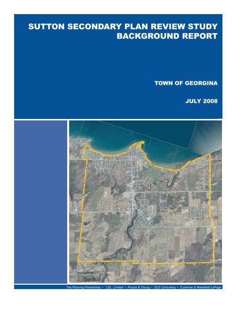
SUTTON SECONDARY PLAN REVIEW STUDY<br />
BACKGROUND REPORT<br />
TOWN OF GEORGINA<br />
JULY 2008<br />
The Planning Partnership • LGL Limited • Poulos & Chung • SCS Consulting • Cushman & Wakefield LePage
TOWN OF GEORGINA, SUTTON SECONDARY PLAN REVIEW STUDY<br />
BACKGROUND REPORT<br />
TABLE OF CONTENTS<br />
1.0 INTRODUCTION 1<br />
1.1 PURPOSE 1<br />
1.2 STUDY LOCATION & CONTEXT 1<br />
2.0 BACKGROUND REPORT SUMMARIES 2<br />
2.1 PLANNING - POLICY CONTEXT 2<br />
2.1.1 Introduction<br />
2.1.2 Policy Context<br />
2.2 EXISTING ENVIRONMENTAL CONDITIONS AND OPPORTUNITIES/ 8<br />
CONSTRAINTS ANALYSIS SUMMARY<br />
2.3 MUNICIPAL SERVICING & STORMWATER MANAGEMENT SUMMARY 10<br />
2.4 TRANSPORTATION SUMMARY 11<br />
2.5 MARKET ANALYSIS - EMPLOYMENT & COMMERCIAL LAND 12<br />
ANALYSIS SUMMARY<br />
3.0 PUBLIC WORKSHOPS / CHARRETTES SUMMARIES 13<br />
3.1 SECONDARY PLAN REVIEW STUDY WORKSHOP 13<br />
SUTTON ARENA (AUGUST 18 - 19, 2007)<br />
3.2 SECONDARY PLAN REVIEW STUDY WORKSHOP 14<br />
SUTTON DISTRICT HIGH SCHOOL (NOVEMBER 23, 2007)<br />
APPENDIX A - SUTTON DEVELOPMENT AREAS & APPLICATIONS<br />
APPENDIX B - EXSISTING ENVIRONMENTAL CONDITIONS AND<br />
OPPORTUNITIES/ CONSTRAINT ANALYSIS<br />
APPENDIX C - MUNICIPAL SERVICING & STORMWATER<br />
MANAGEMENT SUMMARY<br />
APPENDIX D - TRANSPORTATION MEMORANDUM<br />
APPENDIX E - MARKET ANALYSIS - EMPLOYMENT & COMMERCIAL<br />
LAND ANALYSIS<br />
APPENDIX F - SECONDARY PLAN REVIEW STUDY WORKSHOPS / CHARRETTES<br />
(AUGUST 18 - 19 & NOVEMBER 23, 2007)<br />
The Planning Partnership • LGL Limited • Poulos & Chung • SCS Consulting • Cushman & Wakefield LePage | July 2008
1.0 INTRODUCTION<br />
1.1 Purpose<br />
TOWN OF GEORGINA, SUTTON SECONDARY PLAN REVIEW STUDY<br />
BACKGROUND REPORT<br />
The purpose <strong>of</strong> this report is to provide an overview <strong>of</strong> the background work that commenced in the summer<br />
<strong>of</strong> 2007 and completed as <strong>of</strong> June 2008, with respect to the Sutton Secondary Plan Review Study. This report<br />
concludes Phase 1 <strong>of</strong> a three phase study process and also includes a summary <strong>of</strong> the discussions at the public<br />
workshop that was held in Sutton (August 18-19, 2007) and the Sutton High School workshop (November 23,<br />
2007) which form part <strong>of</strong> Phase 2 <strong>of</strong> the study. Initial reports and findings for the Study Area have been provided<br />
with respect to planning, environmental, municipal servicing, transportation and market analysis contexts. A<br />
summary <strong>of</strong> the two workshops is provided in Appendix F.<br />
1.2 Study Location and Context<br />
The Sutton Secondary Plan Study Area is comprised <strong>of</strong> approximately 2,550 hectares (6,300 acres) <strong>of</strong> land.<br />
The Study Area is bounded by Lake Simcoe to the north, Park Road to the east, Latimer Road and the lot line<br />
between Lots 18 and 19, Concessions 7 and 8 (NG) to the south and McCowan Road and the lot line between<br />
Lots 15 and 16, Concession 9 (NG), to the west. The current population within the Study Area is approximately<br />
6,500.<br />
Study Area in Context<br />
The Planning Partnership • LGL Limited • Poulos & Chung • SCS Consulting • Cushman & Wakefield LePage | July 2008<br />
1
TOWN OF GEORGINA, SUTTON SECONDARY PLAN REVIEW STUDY<br />
BACKGROUND REPORT<br />
2.0 BACKGROUND REPORT SUMMARIES<br />
2.1 PLANNING - POLICY CONTEXT<br />
2.1.1 Introduction<br />
The Provincial Policy Statement, the Greenbelt Plan, Places to Grow: Growth Plan for the Greater Golden Horseshoe,<br />
the York Region Official Plan and the <strong>Town</strong> <strong>of</strong> <strong>Georgina</strong> Official Plan were reviewed to determine the policy<br />
context for the Sutton Secondary Plan Study Area. The following is a brief summary <strong>of</strong> background information<br />
from these policy documents that are pertinent to the Secondary Plan Study Area.<br />
2.1.2 Policy Context<br />
Provincial Policy Statement (2005)<br />
The Provincial Policy Statement provides broad overall direction on matters related to land use planning and development.<br />
The Provincial Policy Statement supports improved land use planning and management in order to<br />
accommodate appropriate development to meet future needs through efficient land use patterns which promote<br />
a mix <strong>of</strong> housing, employment, parks and open spaces, and transportation, especially pedestrian and alternative<br />
modes <strong>of</strong> travel. The Preamble and Section 1.0 states:<br />
“The fundamental principles set out in the Provincial Policy Statement apply throughout Ontario, despite regional<br />
variations. To support our collective well-being, now and in the future, all land use must be well managed” and<br />
that “Efficient land use and development patterns support strong, liveable and healthy communities, protect the<br />
environment and public health and safety, and facilitate economic growth.”<br />
Section 1.0 Building Strong Communities, appears to be the most pertinent section with respect to the Sutton<br />
Secondary Plan Study Area. The following are excerpts from the subsections that are <strong>of</strong> particular relevance to<br />
the Study Area:<br />
“1.1.1 Healthy, liveable and safe communities are sustained by:<br />
a) promoting efficient development and land use patterns which sustain the financial well-being <strong>of</strong><br />
the Province and municipalities over the long term;<br />
b) accommodating an appropriate range and mix <strong>of</strong> residential, employment (including industrial,<br />
commercial and institutional uses), recreational and open space uses to meet long-term needs;<br />
c) avoiding development and land use patterns which may cause environmental or public health<br />
and safety concerns;<br />
d) avoiding development and land use patterns that would prevent the efficient expansion <strong>of</strong> settlement<br />
areas in those areas which are adjacent or close to settlement areas;”<br />
e) promoting cost-effective development standards to minimize land consumption and servicing<br />
costs; and,<br />
g) ensuring that necessary infrastructure and public service facilities are or will be available to meet<br />
current and projected needs.”<br />
The Planning Partnership • LGL Limited • Poulos & Chung • SCS Consulting • Cushman & Wakefield LePage | July 2008<br />
2
TOWN OF GEORGINA, SUTTON SECONDARY PLAN REVIEW STUDY<br />
BACKGROUND REPORT<br />
“1.4.3 Planning authorities shall provide for an appropriate range <strong>of</strong> housing types and densities to meet projected<br />
requirements <strong>of</strong> current and future residents <strong>of</strong> the regional market area by:<br />
a) establishing and implementing minimum targets for the provision <strong>of</strong> housing which is affordable<br />
to low and moderate income households. However, where planning is conducted by an uppertier<br />
municipality, the upper-tier municipality in consultation with the lower-tier municipalities may<br />
identify a higher target(s) which shall represent the minimum target(s) for these lower-tier municipalities;<br />
b) permitting and facilitating:<br />
1. all forms <strong>of</strong> housing required to meet the social, health and well-being requirements <strong>of</strong><br />
current and future residents, including special needs requirements;...<br />
c) directing development <strong>of</strong> new housing towards locations where appropriate levels <strong>of</strong> infrastructure<br />
and public service facilities are or will be available to support current and projected needs;<br />
d) promoting densities for new housing which efficiently use land, resources, infrastructure and<br />
public service facilities, and support the use <strong>of</strong> alternative transportation modes and public transit<br />
in areas where it exists or is to be developed; and,<br />
e) establishing development standards for ... new residential development which minimize the cost<br />
<strong>of</strong> housing and facilitate compact form, while maintaining appropriate levels <strong>of</strong> public health and<br />
safety.”<br />
“1.5.1 Healthy, active communities should be promoted by:<br />
a) planning public streets, spaces and facilities to be safe, meet the needs <strong>of</strong> pedestrians, and<br />
facilitate pedestrian and non-motorized movement, including but not limited to, walking and cycling;<br />
b) providing for a full range and equitable distribution <strong>of</strong> publicly-accessible built and natural settings<br />
for recreation, including facilities, parklands, open space areas, trails and, where practical,<br />
water-based resources;<br />
c) providing opportunities for public access to shorelines; and<br />
d) considering the impacts <strong>of</strong> planning decisions on provincial parks, conservation reserves and<br />
conservation areas.”<br />
“1.6.1 Infrastructure and pubic service facilities shall be provided in a coordinated, efficient and cost-effective<br />
manner to accommodate projected needs… Planning for infrastructure and public service facilities shall<br />
be integrated with planning for growth so that these are available to meet current and projected needs.”<br />
In addition to Section 1.0, Section 2.0 <strong>of</strong> the document promotes the protection <strong>of</strong> the Province’s natural heritage,<br />
water, agricultural, mineral, and cultural heritage and archaeological resources to provide for long-term prosperity<br />
and environmental and social health:<br />
“2.1.1 The diversity and connectivity <strong>of</strong> natural features in an area, and the long-term ecological function and<br />
biodiversity <strong>of</strong> natural heritage systems, should be maintained, restored or, where possible, improved,<br />
recognizing linkages between and among natural heritage features and areas, surface water features<br />
and ground water features.”<br />
The emphasis on building strong communities through efficient use <strong>of</strong> land and natural resources, cultural resources,<br />
land patterns and densities, the mix <strong>of</strong> land uses and housing types, pedestrian friendly streets and access<br />
to parks and natural areas in the Provincial Policy Statement will be essential in the review <strong>of</strong> the Secondary<br />
Plan.<br />
The Planning Partnership • LGL Limited • Poulos & Chung • SCS Consulting • Cushman & Wakefield LePage | July 2008<br />
3
Greenbelt Plan (2005)<br />
TOWN OF GEORGINA, SUTTON SECONDARY PLAN REVIEW STUDY<br />
BACKGROUND REPORT<br />
Generally speaking, the Greenbelt Plan identifies a broad area where urbanization cannot occur or is restricted<br />
in order to provide long term protection to the agricultural land base as well as important ecological features and<br />
functions occurring within the Greenbelt.<br />
The Sutton Secondary Plan Study Area is identified as “<strong>Town</strong>s/Villages” in Schedule 1: Greenbelt Plan Area <strong>of</strong><br />
the Greenbelt Plan, which is shown on Map 1 - Excerpt from Schedule 1 <strong>of</strong> Greenbelt Plan below. <strong>Town</strong>s and<br />
Villages” are defined as being the areas within the Protected Countryside that have the largest concentrations <strong>of</strong><br />
population, employment and development.<br />
<strong>Town</strong>s and Villages<br />
Protected Countryside<br />
River Valley Connections<br />
Natural Heritage System<br />
Map 1 - Excerpt from Schedule 1 <strong>of</strong> Greenbelt Plan<br />
According to Section 3.4.2, the policies <strong>of</strong> the Greenbelt Plan do not apply within the Sutton Secondary Plan<br />
boundary, except for the external connections policies in Section 3.2.5 related to development near the Black<br />
River . As a result, there are general policies in section 3.2.5 External Connections with respect to the Natural<br />
Heritage System and features beyond the Greenbelt Plan boundary that are important to consider for the Sutton<br />
Secondary Plan Study Area. In particular, core woodland and wetland features flank the boundary and extend<br />
into the study area providing core woodland and linkage functions with the natural heritage system.<br />
The Planning Partnership • LGL Limited • Poulos & Chung • SCS Consulting • Cushman & Wakefield LePage | July 2008<br />
4
TOWN OF GEORGINA, SUTTON SECONDARY PLAN REVIEW STUDY<br />
BACKGROUND REPORT<br />
Section 3.2.5 External Connections provides the following:<br />
The river valleys that run through existing or approved urban areas and connect the Greenbelt to inland<br />
lakes... are a key component <strong>of</strong> the long-term health <strong>of</strong> the Natural System. In recognition <strong>of</strong> the function <strong>of</strong><br />
the urban river valleys, municipalities and conservation authorities should:<br />
1. Continue with stewardship, remediation and appropriate park and trail initiatives which maintain and, to the<br />
extent possible, enhance the ecological features and functions found within these valley systems;<br />
2. In considering land conversions or redevelopments in or abutting an urban river valley, strive for planning<br />
approaches that:<br />
a) Establish or increase the extent or width <strong>of</strong> vegetation protection zones in natural self-sustaining vegetation,<br />
especially in the most ecologically sensitive areas (i.e. near the stream and below the sable top<br />
<strong>of</strong> bank);<br />
b) Increase or improve fish habitat in streams and in the adjacent riparian lands;<br />
c) Include landscaping and habitat restoration that increase the ability <strong>of</strong> native plants and animals to use<br />
valley systems as both wildlife habitat and movement corridors; and<br />
d) Seek to avoid, minimize and/or mitigate impacts associated with the quality and quantity <strong>of</strong> urban run<strong>of</strong>f<br />
into the valley systems; and<br />
3. Integrate watershed planning and management approaches for lands both within and beyond the Greenbelt.”<br />
Section 3.4.2 also encourages municipalities to support the long-term vitality <strong>of</strong> <strong>Town</strong>s and Villages though appropriate<br />
planning and economic development approaches which seek to maintain, intensify and/or revitalize<br />
these communities. This includes modest growth that is compatible with the long-term role <strong>of</strong> these settlements<br />
as part <strong>of</strong> the Protected Countryside and the capacity to provide locally based sewage and water services.<br />
Growth Plan for the Greater Golden Horseshoe - Places to Grow (2006)<br />
The Growth Plan informs decision-making regarding growth management in the Greater Golden Horseshoe<br />
(GGH). It contains policies that are intended to manage population and employment until 2031, by directing a<br />
significant portion <strong>of</strong> new development to the existing built-up areas, with a focus on urban growth centres, intensification<br />
corridors, major transit station areas and brownfields. Within this timeframe, the GGH is expected<br />
to accommodate approximately 3.7 million additional people and 1.8 million additional jobs. York Region is<br />
forecasted to grow to 1.5 million people and 780,000 jobs in that same 25-year period. Schedule 4 <strong>of</strong> the Plan<br />
identifies the Sutton Secondary Plan Area as being within the “Greenbelt Area”.<br />
Municipalities are required to bring their Official Plans in conformity with the Growth Plan by June 16, 2009. The<br />
review and update <strong>of</strong> the Sutton Secondary Plan must conform with the Growth Plan and constitutes the first<br />
step in the <strong>Town</strong>’s Official Plan conformity exercise. The balance <strong>of</strong> the <strong>Town</strong> <strong>of</strong> <strong>Georgina</strong>’s conformity exercise<br />
is expected to begin sometime in 2008, after York Region has significantly advanced their own Official Plan<br />
amendments.<br />
Presently, York Region is developing a new “Growth Management Strategy” that will allocate growth projections,<br />
as well as, requirements for greenfield development and intensification targets for each <strong>of</strong> the constituent area<br />
municipalities. This work is expected to provide overall direction and specific requirements about how future<br />
urban growth is to be accommodated in the <strong>Town</strong> <strong>of</strong> <strong>Georgina</strong>, and subsequently, within the Sutton community.<br />
The Planning Partnership • LGL Limited • Poulos & Chung • SCS Consulting • Cushman & Wakefield LePage | July 2008<br />
5
TOWN OF GEORGINA, SUTTON SECONDARY PLAN REVIEW STUDY<br />
BACKGROUND REPORT<br />
Greenbelt Area<br />
Source: Places to Grow: Growth Plan for the Greater Golden Horseshoe, Schedule 4, Ontario 2005<br />
In the absence <strong>of</strong> the Regional work, the Growth Plan indicates that by the year 2015 and for each year thereafter,<br />
new growth shall be accommodated through a minimum <strong>of</strong> 40% “intensification” within the built-up area and<br />
that new greenfield development shall achieve a minimum density <strong>of</strong> 50 persons/employees per hectare.<br />
In discussing these Growth Plan requirements with Region <strong>of</strong> York representatives, it is anticipated that in <strong>Georgina</strong>,<br />
given its more rural and small town context, both intensification and minimum density requirements may be<br />
adjusted to permit somewhat less intensive development patterns. This approach has not yet been confirmed,<br />
nor have the new adjusted requirements been articulated.<br />
York Region Official Plan (2007)<br />
The purpose <strong>of</strong> the Region Official Plan is to provide “policies that will help guide economic, environmental and<br />
community-building decisions affecting the use <strong>of</strong> land” and to “help coordinate and set the stage for more detailed<br />
planning by the area municipalities.”<br />
The York Region Official Plan (Map 5: Regional Structure), identifies a large portion the Secondary Plan Study<br />
Area as <strong>Town</strong>s and Villages. The Official Plan, in Section 5.4 Local Centres, identifies Sutton as a Local Centre<br />
with the objective <strong>of</strong> “providing a concentration <strong>of</strong> residential, business, institutional and human service activities<br />
for the surrounding community” and further explains that mainstreets such as Sutton’s “have long served<br />
the needs <strong>of</strong> the surrounding settlements and agricultural communities.” In addition, Section 5.2 Community<br />
Building notes the Region’s focus on growth management and “encourages additional development within the<br />
existing urban areas” and indicates that Local Centers “are also prime locations for infill and intensification, but<br />
at a smaller scale.”<br />
The Planning Partnership • LGL Limited • Poulos & Chung • SCS Consulting • Cushman & Wakefield LePage | July 2008<br />
6
TOWN OF GEORGINA, SUTTON SECONDARY PLAN REVIEW STUDY<br />
BACKGROUND REPORT<br />
Specific reference to Sutton is also made in Section 6.7 Water and Sewer Strategies noting that “the Region will continue<br />
to own and operate Lake Simcoe-based water supply and sewage treatment facilities serving the Keswick and Sutton areas.”<br />
<strong>Town</strong> <strong>of</strong> <strong>Georgina</strong> Official Plan (2002)<br />
The <strong>Town</strong> <strong>of</strong> <strong>Georgina</strong> Official Plan generally identifies the Secondary Plan Study Area noting that “Land use and development<br />
shall be subject to the policies <strong>of</strong> the Sutton Secondary Plan in Section 9.4 and Schedules G1, G2, G3, G4, G5 and<br />
G6” (Section 3.19.4). Section 9.4 (The Sutton Secondary Plan), Schedule G1: Land Use Plan, Schedule G2: Urban Structure<br />
Plan, Schedule G3: Planned Road Widths, Schedule G4: Environmental Resources, Schedule G5: Municipal Servicing<br />
Plan and Schedule G6: Special Provisions establishes policies with respect to land use, growth and development, and<br />
special policy areas for the Secondary Plan Study Area. A summary <strong>of</strong> these Schedules, is as follows:<br />
• Schedule G1: Land Use Plan, indicates an array <strong>of</strong> land use types including low, medium and high density residential,<br />
mixed use areas, rural areas, general commercial/tourist commercial areas, industrial areas, park areas, open space<br />
areas, institutional uses and schools, rural modular home park areas, private open space areas, and environmental<br />
service areas.<br />
• Schedule G2: Urban Structure Plan, identifies special development areas, open space linkages, significant visual<br />
resources, the urban corridor and four development areas within the secondary plan area. The four development<br />
areas include the Northeast Sutton Development Area, Southeast Sutton Development Area, Northwest Sutton Development<br />
Area and Southwest Sutton Development Area.<br />
• Schedule G3: Planned Road Widths, identifies the Provincial, Regional and Municipal Roads in the Secondary Plan<br />
Study Area.<br />
• Schedule G4: Environmental Resources, identifies the water courses, forest and wooded areas, wetlands, aggregate<br />
resources within the Secondary Plan Area.<br />
• Schedule G5: Municipal Servicing Plan, identifies existing and proposed servicing infrastructure for the Secondary<br />
Plan area.<br />
• Schedule G6: Special Provisions<br />
The Planning Partnership • LGL Limited • Poulos & Chung • SCS Consulting • Cushman & Wakefield LePage | July 2008<br />
7
TOWN OF GEORGINA, SUTTON SECONDARY PLAN REVIEW STUDY<br />
BACKGROUND REPORT<br />
2.2 EXISTING ENVIRONMENTAL CONDITIONS AND<br />
OPPORTUNITIES / CONSTRAINTS ANALYSIS SUMMARY<br />
Study Approach<br />
An analysis <strong>of</strong> existing environmental conditions was conducted <strong>of</strong> the Study Area. It consisted <strong>of</strong> background<br />
data review (reports, mapping), windshield surveys and airphoto interpretation. This information was used to<br />
develop a Natural Heritage System (environmental framework) for the Sutton Secondary Plan Review Study.<br />
Furthermore, the results were used to:<br />
• characterize and map the natural environment features / functions within and adjacent to the Study Area;<br />
• identify opportunities / constraints to future urban land use; and,<br />
• identify habitat restoration/enhancement opportunities, including buffers and corridor/linkage enhancements.<br />
The existing conditions overview included the areas <strong>of</strong> Vegetation, Wildlife, Fisheries, Corridors/Linkages, Environmental<br />
Policy Areas, LSRCA Regulation Area, Significant Woodlands, the Greenbelt Plan and Natural Hazards<br />
and Lake Simcoe Shoreline. The opportunities and constraints overview that follows, identifies levels <strong>of</strong><br />
environmental constraints (Levels 1, 2, and 3), and their criteria, and an additional level <strong>of</strong> low constraint (Level<br />
4) which consists <strong>of</strong> existing developed areas, agricultural lands and cultural vegetation. The full report and<br />
analysis is contained in Appendix B.<br />
Existing Conditions Overview<br />
In terms <strong>of</strong> existing vegetation, the Study Area consists <strong>of</strong> meadow, shrub thicket and woodland communities that<br />
have largely established on former agricultural lands. Terrestrial features include deciduous, mixed and coniferous<br />
forest associations <strong>of</strong> varying species composition, age structure and disturbance history. Wetlands within<br />
the Study Area consist <strong>of</strong> swamp (coniferous, mixed, deciduous, shrub thicket), marsh (meadow, open water) and<br />
aquatic communities associated with areas <strong>of</strong> high water table conditions, riparian zones (e.g. Black River and<br />
tributaries) and closed depressions.<br />
Portions <strong>of</strong> the Study Area likely contain Significant Wildlife Habitat, as defined through the Provincial Policy<br />
Statement, and in particular, the large forest blocks, wetlands, Black River corridor and sections <strong>of</strong> the Lake<br />
Simcoe shoreline. The Study Area supports a diversity <strong>of</strong> terrestrial and aquatic wildlife habitat, which is capable<br />
<strong>of</strong> supporting a range <strong>of</strong> resident, summer resident, migrant and winter visitant animals. The key wildlife habitat<br />
function in the study area and surrounding landscape is associated with the Black River corridor (wetland, upland<br />
habitat, Greenbelt Plan external connection between Oak Ridges Moraine to the south and Lake Simcoe<br />
shoreline to the north) and the large block <strong>of</strong> forest/wetlands located in the northwest corner <strong>of</strong> the study area<br />
(east-west linkage connection to the Maskinonge River Corridor to the west). The large wetland and forest block<br />
in the southeast corner <strong>of</strong> the Study Area (Vatchell Swamp) also provides an important connection between large<br />
habitat blocks to the north and south.<br />
With respect to fisheries, the Black River is a productive system that provides habitat for cold water, cool water<br />
and warm water fish species along with an extensive natural corridor system with a direct connection to Lake<br />
Simcoe. The headwaters, located in the Oak Ridges Moraine to the south, support Brook Trout habitat. The<br />
middle and lower reaches support a fish community more tolerant <strong>of</strong> warmwater conditions. The shoals located<br />
along the Lake Simcoe shoreline provide important spawning habitat for Smallmouth Bass, Lake Trout and Lake<br />
Herring. However, anthropogenic induced degradation has limited the potential <strong>of</strong> this system. Direct examples<br />
<strong>of</strong> this within the Study Area include in-stream barriers, nutrient loading, and bank/channel alteration. As a result,<br />
there are numerous restoration opportunities associated with the Black River within the Study Area. The river<br />
The Planning Partnership • LGL Limited • Poulos & Chung • SCS Consulting • Cushman & Wakefield LePage | July 2008<br />
8
TOWN OF GEORGINA, SUTTON SECONDARY PLAN REVIEW STUDY<br />
BACKGROUND REPORT<br />
could be improved through the removal <strong>of</strong> barriers, treatment <strong>of</strong> urban stormwater run<strong>of</strong>f, groundwater recharge,<br />
bank/floodplain restoration, and riparian plantings to increase shading.<br />
Furthermore, the Black River provides an important north-south riparian corridor function that provides a linkage<br />
between the Oak Ridges Moraine to the south and the Lake Simcoe shoreline to the north. The large, contiguous<br />
forest block in the north-west corner <strong>of</strong> the Study Area provides an important connection with the Maskinonge River<br />
corridor to the west, which provides a southerly connection to the Holland River watershed. Combined, these core<br />
forest/wetland blocks and corridors comprise a key component <strong>of</strong> the Greenbelt Plan’s Natural Heritage System<br />
within the <strong>Town</strong> <strong>of</strong> <strong>Georgina</strong> and York Region.<br />
The Black River corridor and the large forest/wetland blocks within the Study Area are identified as core elements<br />
<strong>of</strong> the <strong>Town</strong> <strong>of</strong> <strong>Georgina</strong> and York Region Greenlands System and includes evaluated wetlands such as the Willow<br />
Beach Swamp Provincially Significant Wetland (PSW) , the Vachell Swamp PSW, the Mossington Park PSW,<br />
the Sibbald Point Wetland Complex (Locally Significant Wetland - LSW) and the Environmentally Significant Area’s<br />
(ESA) within or adjacent to the Study Area including Mossington Park, and two shoals along the Lake Simcoe<br />
shoreline.<br />
Watercourses and flood / fill areas are regulated by the Lake Simcoe Region Conservation Authority (LSRCA) within<br />
the Study Area and requires that for any development to proceed in areas under their regulation such as river or<br />
stream valley, a 15 m allowance from the greater <strong>of</strong> stable top <strong>of</strong> bank, floodline or meander belt width and wetlands,<br />
including 120 m from the edge <strong>of</strong> a PSW and 30 m from the edge <strong>of</strong> a non-PSW will require a permit from the<br />
Conservation Authority to proceed.<br />
It is important to note that the Sutton Secondary Plan Study Area’s core woodlands and wetlands are adjacent to the<br />
Greenbelt Plan’s Natural Heritage System and that natural heritage features extend into the Study Area providing<br />
core woodland and linkage functions.<br />
Opportunities and Constraints Overview<br />
Based on the review <strong>of</strong> the existing environmental conditions and key features within and adjacent to the Study<br />
Area, the following features would require protection with respect to future development:<br />
• Black River and Lake Simcoe;<br />
• Provincially Significant and Locally Significant Wetland complexes;<br />
• Environmentally Sensitive Areas (wetlands, upland forest, shoreline shoals);<br />
• Large, contiguous forest blocks (core woodlands, greenlands);<br />
• Corridors and connecting linkages – Black River, large forest blocks; and,<br />
• Environmental buffers/setbacks (stream channels, wetlands, upland forest edge).<br />
The basis <strong>of</strong> the environmental protection framework developed for the Sutton Secondary Plan Review Study is the<br />
LSRCA Natural Heritage System for Lake Simcoe Watershed (Final Draft - Beacon Environmental and LSRCA, April<br />
2007). There are three levels <strong>of</strong> high constraint which consists <strong>of</strong> the following:<br />
• Level 1: Provincially Significant. No Development Intrusion;<br />
• Level 2: Provincially Significant. No Development Intrusion; and,<br />
• Level 3: Watershed Significant. No Development Intrusion.<br />
A fourth level <strong>of</strong> low constraint has also been indicated in Figure 4 <strong>of</strong> Appendix B, as follows:<br />
• Level 4: Low Constraint. Existing Developed Areas, Agricultural Lands and Cultural Vegetation.<br />
The Planning Partnership • LGL Limited • Poulos & Chung • SCS Consulting • Cushman & Wakefield LePage | July 2008<br />
9
TOWN OF GEORGINA, SUTTON SECONDARY PLAN REVIEW STUDY<br />
BACKGROUND REPORT<br />
To protect the identified significant natural features, the following setbacks / buffers from the Level 1, 2 and 3<br />
Natural Heritage Features, are recommended:<br />
• 15 m from regulatory floodplain , meander belt width or stable top <strong>of</strong> bank;<br />
• 15 m setback from a warm water stream channel;<br />
• 30 m setback from a cold water stream channel;<br />
• 30 m wetland buffer (both PSW and LSW); and,<br />
• dripline plus 30 m from significant woodlot/wetland vegetation.<br />
In addition to the environmental work already conducted, some follow-up reconnaissance level field inventories<br />
will take place to complete the environmental characterization and fine-tune the opportunities/constraints framework.<br />
The land use concept plans, developed for the Sutton Secondary Plan Review Study Area, will be evaluated<br />
in the context <strong>of</strong> that opportunities/constraints framework and the Black River Subwatershed Study (State<br />
<strong>of</strong> the Watershed <strong>Report</strong>-Black River Subwatershed - Draft LSRCA 2002).<br />
2.3 MUNICIPAL SERVICING AND STORMWATER MANAGEMENT SUMMARY<br />
A summary analysis <strong>of</strong> current water and sewer servicing allocation and existing servicing infrastructure for the<br />
Sutton Secondary Plan Area was conducted. With respect to water servicing, Sutton is currently allocated an<br />
8,000 persons equivalent from the Willow Beach Water Treatment Plant <strong>of</strong> which 7,831 persons equivalent have<br />
been assigned, leaving 169 persons unassigned for water treatment. York Region is currently reviewing the timing<br />
for the Water Treatment Plant expansion to determine capacity and will help identify the maximum population<br />
that can be municipally serviced within the Sutton Secondary Plan Area.<br />
In terms <strong>of</strong> sanitary servicing, the Water Pollution Control Plant was expanded from 4,500 to 7,500 persons capacity<br />
in 2004. Approximately 4,182 persons capacity services in existing development and approximately 3,000<br />
persons equivalent has been allocated to proposed new development. An Environmental Assessment for further<br />
expansion <strong>of</strong> the Water Pollution Control Plant from 7,500 persons to 16,500 persons was being undertaken<br />
by York Region at the time that SCS Consulting Limited was completing the Current Servicing Allocation Status<br />
Summary, contained in Appendix C. The Provincial regulations have currently imposed a limit to Phosphorus<br />
loading, with respect to Lake Simcoe, <strong>of</strong> 148kg per year until April 2009. This new regulation affects the number<br />
<strong>of</strong> persons that can be serviced and thus also affects future population projections that may have been indicated<br />
previously. With respect to this new information, the future population that can be accomodated will be much<br />
lower than 16,500 persons. A more accurate projection number will be determined once the ongoing Provincial<br />
and Regional work has been finalized.<br />
With respect to current stormwater management in Sutton, the majority <strong>of</strong> sewersheds drain into Black River,<br />
Lake Simcoe and other watercourses without quality or quantity control. Only one sewershed currently has a<br />
stormwater management facility. The Lake Simcoe Region Conservation Authority will require that any new<br />
developments in the Sutton Secondary Plan Study Area follow specific stormwater management criteria with<br />
respect to quality control, quantity control and erosion control.<br />
Further details <strong>of</strong> the analysis that was conducted by SCS Consulting Limited, prior to the new Provincial regulations,<br />
are provided in Appendix C.<br />
The Planning Partnership • LGL Limited • Poulos & Chung • SCS Consulting • Cushman & Wakefield LePage | July 2008<br />
10
TOWN OF GEORGINA, SUTTON SECONDARY PLAN REVIEW STUDY<br />
BACKGROUND REPORT<br />
2.4 TRANSPORTATION - EXISTING CONDITIONS SUMMARY<br />
The review <strong>of</strong> transportation requirements within Sutton generally indicates that even at a future projected population<br />
<strong>of</strong> 16,500 persons, which will include retirees, it will essentially function as a small community that will<br />
generate minimal weekday travel.<br />
With respect to road accessibility, at the Provincial level an extension <strong>of</strong> Highway 404 north <strong>of</strong> Ravenshoe Road<br />
is not being considered prior to 2031. The Secondary Plan Study Area contains a hierarchy <strong>of</strong> existing roads.<br />
The most significant facility is Highway 48 which is under Provincial jurisdiction and provides regional accessibility<br />
and a direct link to the Greater Toronto Area. The existing regional roads such as Dalton Road, Baseline<br />
Road, Woodbine Avenue, and Kennedy Road along with Park Road, Metro Road North, Black River Road, and<br />
High Street will provide for daily travel demands in Sutton. Certain roads such as High Street and Dalton Road<br />
will likely need enhancement over time due to their essential local service nature.<br />
The transportation analysis indicates that within the existing roadway network, Highway 48 will continue to be<br />
the most important road facility for the Sutton community because <strong>of</strong> its current and projected accommodation<br />
<strong>of</strong> significant traffic flow. Sutton is serviced by two intersections (High Street and Park Road) with Highway 48.<br />
These two intersections, designed to Provincial standards, provide very significant capacity for all vehicle turning<br />
movements. In addition, existing roads such as Baseline Road, Woodbine Avenue, Park Road and Kennedy<br />
Road will also be important in terms <strong>of</strong> accommodating increased vehicle demands.<br />
It is observed that the predominant flow <strong>of</strong> traffic is to and from the south and is accommodated, to an acceptable<br />
level, by the existing network <strong>of</strong> roads with the heaviest utilized being Highway 48, High Street and Dalton Road.<br />
In fact, High Street and Dalton Road not only accumulate the traffic flows to access Highway 48 but also provide<br />
direct access to the numerous vehicle generating activities located along these roads. The second most convenient<br />
route to service the pre-dominant direction <strong>of</strong> travel is Woodbine Avenue and as a result both Baseline<br />
Road and Woodbine Avenue serve increased traffic demand and are an alternate to Highway 48.<br />
The transportation review indicates that the existing road network will have to accommodate the increased traffic<br />
flows that will be generated from the proposed development areas through strategic improvements, over time, such<br />
as additional lanes, signal timing modifications and intersection improvements within the available rights-<strong>of</strong>-way.<br />
It concludes that the primary roadway focus to accommodate the planned growth in population in Sutton should<br />
be to:<br />
• Identify the most optimum roadway / intersection configuration in the Dalton Road / High Street and Baseline<br />
Road areas;<br />
• Initiate intersection improvements and modifications where necessary to accommodate the primary northsouth<br />
traffic flow demand on High Street / Dalton Road between Highway 48 and Black River Road;<br />
• Monitor the following regional roads and their intersections to ensure satisfactory operations – Baseline Road,<br />
Kennedy Road, Metro Road North and Woodbine Avenue;<br />
Traffic studies will need to be undertaken, when development is contemplated, to address the timing and type <strong>of</strong><br />
improvements necessary to accommodate the traffic flow demands.<br />
Further details <strong>of</strong> the analysis are provided in Appendix D. It should be noted that Poulos and Chung Limited,<br />
in a separate exercise, are currently conducting a detailed transportation assessment for the Sutton area. The<br />
findings and recommendations <strong>of</strong> that analysis will be included as addenda to this report and Appendix C at a<br />
later date.<br />
The Planning Partnership • LGL Limited • Poulos & Chung • SCS Consulting • Cushman & Wakefield LePage | July 2008<br />
11
TOWN OF GEORGINA, SUTTON SECONDARY PLAN REVIEW STUDY<br />
BACKGROUND REPORT<br />
2.5 EMPLOYMENT & COMMERCIAL LAND MARKET ANALYSIS SUMMARY<br />
The Employment and Commercial Land Analysis <strong>of</strong> the Sutton Secondary Plan Area included the examination <strong>of</strong><br />
currently designated supply <strong>of</strong> employment land, a commercial retail analysis, and observations regarding future<br />
retail land designations in Sutton.<br />
The analysis notes that the <strong>Town</strong> <strong>of</strong> <strong>Georgina</strong> accounts for 127 hectares (314 acres) or 4.4% <strong>of</strong> York Region’s total<br />
employment land inventory and that between 2001 and 2005 only 4.2 acres were absorbed wholly in Keswick<br />
with none in Sutton. The analysis suggests that demand for employment land in Sutton will be limited and that<br />
future demand will largely be fulfilled by the planned Keswick Business Park due to its proximity to established<br />
employment areas to the south in York Region, as well as to future extensions <strong>of</strong> Highway 404. Furthermore, the<br />
analysis points out that the currently designated employment lands in Sutton are not appropriately located from<br />
a market perspective.<br />
It also indicates that the need for additional employment land in Sutton is likely to be very limited but, over the<br />
longer-term (20 years or more), some employment lands could be considered along or in direct proximity to<br />
Highway 48, because it is the current transportation spine through <strong>Georgina</strong> and would be in close proximity to<br />
the future Highway 404 extension near Sutton.<br />
With respect to commercial / retail land, it is noted that Dalton Road and High Street provide retail and commercial<br />
services to the local community, seasonal residents and visitors and that the retail service role and character<br />
<strong>of</strong> these areas should be protected and enhanced. With this in mind, it is recommended that large scale retail<br />
uses should be discouraged outside <strong>of</strong> the commercially designated areas and should only be considered in<br />
commercial areas if they do not compromise the role and character <strong>of</strong> the existing commercial core areas.<br />
Further details <strong>of</strong> the analysis are provided in Appendix E.<br />
The Planning Partnership • LGL Limited • Poulos & Chung • SCS Consulting • Cushman & Wakefield LePage | July 2008<br />
12
TOWN OF GEORGINA, SUTTON SECONDARY PLAN REVIEW STUDY<br />
BACKGROUND REPORT<br />
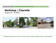
3.0 PUBLIC WORKSHOP / CHARRETTE SUMMARIES<br />
The purpose <strong>of</strong> the workshop/charrette process is to establish a common understanding <strong>of</strong> existing conditions opportunities/<br />
constraints and design principles and to provide a forum for input from stakeholders and the public. Two workshop/charrette<br />
sessions have taken place with respect to the Sutton Secondary Plan Review Study. The first workshop/charrette was a<br />
broader two day event which took place at the Sutton Arena Hall on August 18 and 19, 2007 and involved various stakeholders<br />
and the public. It was identified, during this workshop, that there were very few young adults or teenagers participating<br />
in the process. In order to address this shortcoming, and to capture broader input, a second workshop/charrette was held<br />
at the Sutton District High School on November 23, 2007 with students from the Grade 9 and Grade 12 Geography classes.<br />
The following are brief summaries <strong>of</strong> key findings from the workshops with more details provided in Appendix F.<br />
3.1 SUTTON SECONDARY PLAN REVIEW WORKSHOP (August 18-19, 2007)<br />
The workshop took place over the course <strong>of</strong> two days with the first day concentrating on identifying key attributes and opportunities<br />
for change in the Sutton Secondary Plan Study Area and then establishing design principles for three focus<br />
areas and three broader topics including (1) the High Street Core Area, Jackson’s Point Lakefront and Core Area, Dalton<br />
Road and Baseline Road Corridors, (2) the Natural Heritage System and (3) Sustainable Communities and Community and<br />
Neighbourhood Design. The core design principles established were with respect to the following:<br />
• Natural Features - should be protected, restored, enhanced, contiguous and, provide a framework for future<br />
land use and that the quality <strong>of</strong> both groundwater and water bodies be protected or improved;<br />
• Community Design - should protect existing neighbourhoods; new development to respect character and<br />
scale <strong>of</strong> existing Sutton; small scale commercial for High Street and large scale on Dalton Road; intensify at<br />
key locations; include sustainable design and design control;<br />
• Recreation and Tourism - enhance pedestrian access and connection to key features such as the Lake Simcoe shoreline,<br />
Black River, parks, natural heritage, centres and enhance tourist and recreation facilities; and,<br />
• Transportation - existing regional roads and highways as primary connectors in community, enhance transit, cycling and<br />
pedestrian opportunities.<br />
The second day was focused on developing preliminary design concepts that were based on the information gathered and<br />
the principles established on Day 1. The Day 2 session culminated with a summary presentation <strong>of</strong> the key principles identified<br />
during the workshop and their application in the development <strong>of</strong> conceptual plans (see Appendix F).<br />
The information gathered and the principles established over the two day workshop will inform the policies and preparation<br />
<strong>of</strong> the new Sutton Secondary Plan.<br />
The Planning Partnership • LGL Limited • Poulos & Chung • SCS Consulting • Cushman & Wakefield LePage | July 2008<br />
13
TOWN OF GEORGINA, SUTTON SECONDARY PLAN REVIEW STUDY<br />
BACKGROUND REPORT<br />
3.2 SUTTON DISTRICT HIGH SCHOOL WORKSHOP (November 23, 2007)<br />
The Sutton District High School workshop took place in the High School Library over the course <strong>of</strong> the afternoon.<br />
The workshop concentrated on identifying what the student participants considered key attributes<br />
and opportunities for change in Sutton and what they envisioned for the community in the future. The responses<br />
varied from small scale to large scale concerns and also included specific references to features<br />
in Sutton. The following is a brief summary <strong>of</strong> the general responses:<br />
• Opportunities and Change - maintain and enhance vegetation and environmental systems, better recycling<br />
systems, cleaner river with greater public access, provision for better long term employment, more<br />
frequent public transit, a central park, shopping and gathering amenities for youth (“area to hang out with<br />
friends, have c<strong>of</strong>fee, movie theatre, etc.”), more recreational opportunities and activities (youth centre),<br />
medical centre needed, heritage preservation;<br />
• Attributes - historical landmarks, small town scale, provincial parks, Sutton Fair, Red Barn Theatre,<br />
Lake Simcoe and its shoreline, low density housing, recreational facilities, close to nature, quiet and<br />
clean;<br />
• Opportunities and Change - maintain and enhance vegetation and environmental systems, better recycling<br />
systems, cleaner river with greater public access, provision for better long term employment, more<br />
frequent public transit, a central park, shopping and gathering amenities for youth (“area to hang out with<br />
friends, have c<strong>of</strong>fee, movie theatre, etc.”), more recreational opportunities and activities (youth centre),<br />
medical centre needed, heritage preservation;<br />
The general concern expressed by the participants was about Sutton becoming overdeveloped, that overdevelopment<br />
may lead to higher crime, the “disrespectful out-<strong>of</strong>-towners”, pollution <strong>of</strong> Lake Simcoe and the<br />
“lack <strong>of</strong> motivational spirit in the <strong>Town</strong>.”<br />
The final portion <strong>of</strong> the workshop involved the students conceptually locating some <strong>of</strong> the features they had<br />
previously mentioned on aerial plans <strong>of</strong> the study area. Though time was restricted, some <strong>of</strong> the students<br />
developed a rough concept for a central park <strong>of</strong>f Dalton Road connecting it to Black River, High Street and<br />
to the community opposite the river. The conceptual sketch is included in Appendix F.<br />
This exercise gave the students a chance to express the opportunities and changes in plan as discussed<br />
earlier in the workshop, and allowed them to understand the possible spatial change that could take place<br />
in the Study Area over time. Of particular interest, is that the broad concerns and conceptual designs <strong>of</strong> the<br />
student participants were similar to those expressed at the August 2007 workshop.<br />
The Planning Partnership • LGL Limited • Poulos & Chung • SCS Consulting • Cushman & Wakefield LePage | July 2008<br />
14
TOWN OF GEORGINA, SUTTON SECONDARY PLAN REVIEW STUDY<br />
BACKGROUND REPORT - DRAFT<br />
APPENDIX A<br />
SUTTON DEVELOPMENT AREAS & APPLICATIONS<br />
The Planning Partnership • LGL Limited • Poulos & Chung • SCS Consulting • Cushman & Wakefield LePage | July 2008
TOWN OF GEORGINA, SUTTON SECONDARY PLAN REVIEW STUDY<br />
BACKGROUND REPORT<br />
SUTTON DEVELOPMENT AREAS AND APPLICATIONS<br />
Active Development Applications<br />
The existing Sutton Secondary Plan contains four Development Areas where the majority <strong>of</strong> future residential<br />
growth within the Sutton community is anticipated to take place: Northeast Sutton Development Area, Southeast<br />
Sutton Development Area, Northwest Sutton Development Area and Southwest Sutton Development Area. These<br />
Development Areas, along with corresponding policies, were created to provide for the comprehensive design and<br />
servicing <strong>of</strong> lands within Sutton. Map 2 - Active Development Applications in Sutton below illustrates the location<br />
and status <strong>of</strong> development applications, as <strong>of</strong> June 2008, that are generally within the four development areas<br />
in Sutton. The tables that follow (Tables 1, 2, 3, 4 and 5), provide more details on each <strong>of</strong> these applications.<br />
Study Area Boundary<br />
Urban Service Boundary<br />
Built Boundary as per the<br />
Growth Plan<br />
Approved Development<br />
In Process<br />
At the OMB<br />
Held in Abeyance<br />
NE - Northeast Sutton Development Area<br />
SE - Southeast Sutton Development Area<br />
SW - Southwest Sutton Development Area<br />
NW - Northwest Sutton Development Area<br />
O - Other Areas<br />
O-2<br />
O-3<br />
NE-2<br />
NE-1<br />
NW-3<br />
NW-5<br />
NW-4<br />
NW-1<br />
SE-3<br />
NW-2<br />
SW-4<br />
SE-1<br />
SE-2<br />
SW-3<br />
SW-1<br />
O-1<br />
SW-2<br />
Map 2 -Active Development Applications in Sutton<br />
The Planning Partnership • LGL Limited • Poulos & Chung • SCS Consulting • Cushman & Wakefield LePage | July 2008
TOWN OF GEORGINA, SUTTON SECONDARY PLAN REVIEW STUDY<br />
BACKGROUND REPORT<br />
Table 1 - Northeast Sutton Development Area (NESDA)<br />
<br />
<br />
<br />
<br />
<br />
<br />
<br />
<br />
<br />
<br />
<br />
<br />
<br />
<br />
<br />
<br />
<br />
<br />
<br />
<br />
<br />
<br />
<br />
<br />
<br />
<br />
Table 2 - Southeast Sutton Development Area (SESDA)<br />
<br />
<br />
<br />
<br />
<br />
<br />
<br />
<br />
<br />
<br />
<br />
<br />
<br />
<br />
<br />
<br />
<br />
<br />
<br />
<br />
<br />
<br />
<br />
<br />
<br />
<br />
<br />
<br />
<br />
<br />
<br />
<br />
<br />
<br />
<br />
<br />
<br />
<br />
<br />
<br />
<br />
<br />
<br />
<br />
<br />
<br />
Table 3 - Southwest Sutton Development Area (SWSDA)<br />
<br />
<br />
<br />
<br />
<br />
<br />
<br />
<br />
<br />
<br />
<br />
<br />
<br />
<br />
<br />
<br />
<br />
<br />
<br />
<br />
<br />
<br />
<br />
<br />
<br />
<br />
<br />
<br />
<br />
The Planning Partnership • LGL Limited • Poulos & Chung • SCS Consulting • Cushman & Wakefield LePage | July 2008
TOWN OF GEORGINA, SUTTON SECONDARY PLAN REVIEW STUDY<br />
BACKGROUND REPORT<br />
Table 4 - Northwest<br />
<br />
Sutton<br />
<br />
Development<br />
<br />
Area (NWSDA)<br />
<br />
Plan <strong>of</strong> Subdivision and ZBA<br />
<br />
applications to permit 351 dwelling units<br />
(205 singles, 37 townhouses, 109<br />
mixed use), and blocks for park and<br />
future residential uses<br />
1 534175 Ontario Ltd.<br />
(Saracini Estate)<br />
New Owners (2008): First<br />
Sutton Six Development III<br />
Ltd.<br />
2, 3 Nickolas Court Inc. and<br />
Dimitra’s Walk Estates Inc.<br />
<br />
<br />
Plan <strong>of</strong> Subdivision and ZBA<br />
applications to permit 206 dwelling units<br />
(104 singles, 102 townhouses), and<br />
blocks for open space, environmental<br />
protection, and commercial uses<br />
4 Ballymore Development <br />
Plan<br />
<br />
<strong>of</strong> Subdivision,<br />
<br />
OPA<br />
<br />
and<br />
<br />
ZBA<br />
<br />
(Sutton) Corp.<br />
applications to permit 450 dwellings<br />
units (302 singles, 148 townhouses),<br />
<br />
and blocks for open space, storm water<br />
<br />
<br />
management, park, future residential, <br />
<br />
<br />
and commercial uses <br />
1 st Phase approved by OMB: 100 <br />
dwelling units (79 singles, 21<br />
<br />
townhouses), and blocks for <br />
<br />
<br />
commercial, park, and environmental <br />
protection uses <br />
<br />
<br />
5 Mattamy (Sutton) Limited OPA<br />
<br />
application<br />
<br />
submitted<br />
<br />
in<br />
<br />
November <br />
<br />
<strong>of</strong> 2006 to expand the boundary <strong>of</strong> the<br />
<br />
Northwest Sutton Development Area<br />
and to expand the Urban Service<br />
Boundary in order to permit residential<br />
development (unknown number <strong>of</strong><br />
dwelling units)<br />
<br />
<br />
<br />
Applications held in<br />
abeyance pending the<br />
approval <strong>of</strong> the Northwest<br />
Sutton Development Area<br />
Plan and the availability <strong>of</strong><br />
servicing capacity<br />
Plan <strong>of</strong> Subdivision file<br />
scheduled to be closed by<br />
York Region, followed by<br />
the closure <strong>of</strong> the<br />
associated <strong>Town</strong> files<br />
Plan <strong>of</strong> Subdivision<br />
applications appealed to<br />
the OMB in October <strong>of</strong><br />
2007<br />
Awaiting scheduling <strong>of</strong><br />
OMB hearing<br />
Applications appealed to<br />
the OMB in December <strong>of</strong><br />
2006<br />
Draft plan <strong>of</strong> subdivision<br />
approval issued by the<br />
OMB in May <strong>of</strong> 2008 for<br />
first phase <strong>of</strong> development<br />
<br />
Outstanding appeals on<br />
remaining lands awaiting <br />
outcome <strong>of</strong> the Sutton <br />
Secondary Plan Review <br />
Study <br />
Held in abeyance pending<br />
the completion <strong>of</strong> the<br />
Sutton Secondary Plan<br />
Review Study<br />
<br />
<br />
Table 5 - Other Areas (OA)<br />
<br />
<br />
<br />
<br />
<br />
<br />
<br />
<br />
<br />
<br />
<br />
<br />
<br />
<br />
<br />
<br />
<br />
<br />
<br />
<br />
<br />
<br />
<br />
<br />
<br />
<br />
<br />
<br />
<br />
<br />
<br />
<br />
<br />
<br />
The Planning Partnership • LGL Limited • Poulos & Chung • SCS Consulting • Cushman & Wakefield LePage | July 2008
TOWN OF GEORGINA, SUTTON SECONDARY PLAN REVIEW STUDY<br />
BACKGROUND REPORT - DRAFT<br />
APPENDIX B<br />
EXISTING ENVIRONMENTAL CONDITIONS AND<br />
OPPORTUNITIES / CONSTRAINTS ANALYSIS<br />
LGL Limited<br />
The Planning Partnership • LGL Limited • Poulos & Chung • SCS Consulting • Cushman & Wakefield LePage | July 2008
SUTTON SECONDARY PLAN<br />
REVIEW STUDY<br />
TOWN OF GEORGINA<br />
EXISTING ENVIRONMENTAL CONDITIONS AND<br />
OPPORTUNITIES/CONSTRAINTS ANALYSIS<br />
prepared for<br />
TOWN OF GEORGINA<br />
by<br />
MAY 2008<br />
LGL PROJECT TA4468
SUTTON SECONDARY PLAN<br />
REVIEW STUDY<br />
TOWN OF GEORGINA<br />
EXISTING ENVIRONMENTAL CONDITIONS AND<br />
OPPORTUNITIES/CONSTRAINTS ANALYSIS<br />
prepared by:<br />
Digi-signature<br />
BRAD D. BRICKER, M.Sc.<br />
Manager – Natural Sciences,<br />
Certified Senior Ecologist (ESA)<br />
LGL Limited<br />
environmental research associates<br />
3365 Harvester Road<br />
Burlington, Ontario L7N 3N2<br />
Tel: 905-333-1667 Fax: 905-333-2660<br />
Email: burlington@lgl.com<br />
URL: www.lgl.com<br />
MAY 2008<br />
LGL PROJECT TA4468
TABLE OF CONTENTS<br />
1.0 INTRODUCTION .......................................................................................................................................... 1<br />
2.0 STUDY APPROACH ..................................................................................................................................... 1<br />
2.1 BACKGROUND DATA REVIEW AND COMPILATION ........................................................................................ 1<br />
2.2 IN-SEASON FIELD SURVEYS .......................................................................................................................... 3<br />
2.3 APPLICATION OF ENVIRONMENTAL DATA .................................................................................................... 3<br />
3.0 EXISTING CONDITIONS OVERVIEW .................................................................................................... 3<br />
3.1 VEGETATION ................................................................................................................................................. 3<br />
3.2 FLORA ........................................................................................................................................................... 5<br />
3.3 WILDLIFE ...................................................................................................................................................... 5<br />
3.4 WILDLIFE SUMMARY .................................................................................................................................... 6<br />
3.5 FISHERIES ..................................................................................................................................................... 7<br />
3.6 FISHERIES DISCUSSION ................................................................................................................................. 8<br />
3.7 CORRIDORS/LINKAGES ................................................................................................................................. 9<br />
3.8 ENVIRONMENTAL POLICY AREAS ................................................................................................................. 9<br />
3.9 LSRCA REGULATION AREA ......................................................................................................................... 9<br />
3.10 SIGNIFICANT WOODLANDS ......................................................................................................................... 11<br />
3.11 GREENBELT PLAN ....................................................................................................................................... 11<br />
3.12 NATURAL HAZARDS AND LAKE SIMCOE SHORELINE .................................................................................. 12<br />
4.0 OPPORTUNITIES & CONSTRAINTS OVERVIEW .............................................................................. 12<br />
4.1 ADDITIONAL RECOMMENDATIONS .............................................................................................................. 18<br />
5.0 NEXT STEPS ................................................................................................................................................ 19
Sutton Secondary Plan Review Study May 2008<br />
Existing Environmental Conditions and Opportunities/Constraints Analysis<br />
Project No. TA4468<br />
1.0 INTRODUCTION<br />
The following sections present the results <strong>of</strong> the existing environmental conditions and<br />
opportunities/constraints analysis for the Sutton Secondary Plan Review Study. The environmental<br />
characterization <strong>of</strong> the study area was done primarily through desk-top analysis and consisted <strong>of</strong><br />
background data review (reports, mapping), windshield surveys and airphoto interpretation. This<br />
information was used to develop a Natural Heritage System (environmental framework) for the Sutton<br />
Secondary Plan Review Study.<br />
The location <strong>of</strong> the Sutton Secondary Plan Review Study Area and Urban Servicing Boundary are shown<br />
in Figure 1.<br />
2.0 STUDY APPROACH<br />
2.1 <strong>Background</strong> Data Review and Compilation<br />
<strong>Background</strong> documents that were reviewed as part <strong>of</strong> the analysis included:<br />
• <strong>Town</strong> <strong>of</strong> <strong>Georgina</strong> Natural Features and Greenlands System Study (LGL Limited and Keir<br />
Consultants 1996);<br />
• Natural Heritage System for Lake Simcoe Watershed – Final <strong>Report</strong> (Beacon Environmental<br />
and Lake Simcoe Region Conservation Authority, July 2007);<br />
• York Region, <strong>Town</strong> <strong>of</strong> <strong>Georgina</strong> and Lake Simcoe Region Conservation Authority (LSRCA)<br />
GIS natural heritage databases and aerial photography;<br />
• OMNR Natural Heritage Information Centre database;<br />
• State <strong>of</strong> the Watershed <strong>Report</strong> – Black River Subwatershed (Draft – LSRCA 2002);<br />
• Highway 404 Extension - Davis Drive to Highway 12, Route Planning Study and<br />
Environmental Assessment, Central Region, Ontario Ministry <strong>of</strong> Transportation (Cole<br />
Sherman & Associates Ltd. 1997); and,<br />
• Technical reports submitted in support <strong>of</strong> existing development applications within the study<br />
area.<br />
LGL Limited environmental research associates Page 1
LEGEND<br />
Lake Simcoe<br />
Study Boundary<br />
Urban Servicing Boundary<br />
Metro Road North<br />
Dalton Road<br />
Black River<br />
Black River Road<br />
Baseline Road<br />
Highway 48<br />
Produced using information under License with the<br />
Lake Simcoe Region Conservation Authority © Lake<br />
Simcoe Region Conservation Authority, 2007<br />
Sutton Secondary<br />
Plan Review Study<br />
Study Area and Servicing<br />
Boundary<br />
±<br />
Meters<br />
0 250 500 1,000 1,500<br />
TA4468<br />
December 2007<br />
1 : 25,000<br />
1<br />
JJJ<br />
BDB
Sutton Secondary Plan Review Study May 2008<br />
Existing Environmental Conditions and Opportunities/Constraints Analysis<br />
Project No. TA4468<br />
2.2 In-season Field Surveys<br />
Due to the size <strong>of</strong> the study area and access limitations, in-season vegetation, wildlife and fisheries<br />
surveys were not completed to verify environmental conditions and constraints/opportunities to future<br />
urban land use. Vegetation, wildlife and fisheries characterization was based on a desk-top analysis <strong>of</strong><br />
existing background reports/mapping and windshield surveys.<br />
2.3 Application <strong>of</strong> Environmental Data<br />
The results <strong>of</strong> the background data review, as described above, were used to:<br />
• characterize and map the natural environment features/functions within and adjacent to the<br />
study area;<br />
• identify opportunities/constraints to future urban land use; and,<br />
• identify habitat restoration/enhancement opportunities, including buffers and corridor/linkage<br />
enhancements.<br />
The results <strong>of</strong> this analysis were used to develop a Natural Heritage System for the Sutton Secondary Plan<br />
Review Study area. A more detailed discussion <strong>of</strong> the environmental analysis is provided below.<br />
3.0 EXISTING CONDITIONS OVERVIEW<br />
3.1 Vegetation<br />
The study area is comprised <strong>of</strong> a mosaic <strong>of</strong> cultural, terrestrial and wetland communities, active<br />
agricultural land and existing built-up urban areas (Sutton, Jackson’s Point).<br />
Cultural vegetation features within the study area consist <strong>of</strong> meadow, shrub thicket and woodland<br />
communities that have established on former agricultural lands. Terrestrial features include deciduous,<br />
mixed and coniferous forest associations <strong>of</strong> varying species composition, age structure and disturbance<br />
history. Wetlands within the study area consist <strong>of</strong> swamp (coniferous, mixed, deciduous, shrub thicket),<br />
marsh (meadow, open water) and aquatic communities associated with areas <strong>of</strong> high water table<br />
conditions, riparian zones (e.g. Black River and tributaries) and closed depressions.<br />
LGL Limited environmental research associates Page 3
Sutton Secondary Plan Review Study May 2008<br />
Existing Environmental Conditions and Opportunities/Constraints Analysis<br />
Project No. TA4468<br />
Cultural communities within the study area support a typical assemblage <strong>of</strong> pioneering tree/shrub species<br />
(e.g. white elm, red ash, trembling aspen, white birch, white cedar red-osier/grey dogwood,<br />
hawthorn/buckthorn, brambles) as well as common herbaceous species (e.g. goldenrods, asters) and<br />
forage grass species (e.g. brome grass, orchard grass, bluegrass) that establish on former agricultural land.<br />
Non-native, invasive species are <strong>of</strong>ten associated with these communities and typically comprise a fairly<br />
large percentage <strong>of</strong> the total species composition.<br />
Intact, native plant communities within the study area are associated with upland and wetland habitats<br />
associated with the Black River corridor and the large woodland blocks.<br />
The deciduous forest communities within the study area are comprised <strong>of</strong> immature to mature<br />
associations <strong>of</strong> sugar maple, red maple, white ash, American beech, red oak, large-tooth aspen, black<br />
cherry, with eastern hemlock, white pine and eastern white cedar as occasional/frequent associates.<br />
Immature, mixed forest stands <strong>of</strong> trembling aspen, white birch and eastern white cedar are also associated<br />
with upland habitats. Coniferous forest associations are dominated by eastern white cedar interspersed<br />
with trembling/large-tooth aspen and white birch. The upland forest blocks support an intact and fairly<br />
rich/diverse understorey and groundcover layer. Forest blocks with a fresh to moist drainage regime<br />
(wet-mesic) support a very rich and diverse groundcover layer comprised <strong>of</strong> herbaceous plants, ferns and<br />
sedges/grasses.<br />
Wetlands within the study area comprise deciduous, mixed and coniferous swamp associations, as well as<br />
thicket swamps, marshes (cattail, graminoid, herbaceous) and open water aquatic communities. These<br />
wetland communities are associated with the large forest blocks within the study area as well as the Black<br />
River corridor and tributaries. Wetlands within the study area are associated with seasonally high water<br />
table conditions and spring flooding along the Black River and its tributaries.<br />
Deciduous swamp communities are comprised <strong>of</strong> silver/red maple, trembling aspen, black ash, green ash<br />
and balsam poplar with occasional yellow birch, willow and white elm. Understorey vegetation consists<br />
<strong>of</strong> red-osier dogwood, speckled alder, mountain maple and seedlings/saplings <strong>of</strong> the hardwood overstorey<br />
trees, including eastern white cedar. The groundcover vegetation is comprised <strong>of</strong> a diversity <strong>of</strong> grasses,<br />
sedges (Carex spp.) and ferns. Typical species present include fowl manna grass, reed canary grass, wool<br />
grass, spotted jewelweed, sensitive fern, wood nettle, tall white aster, ostrich fern, false nettle, bulblet fern<br />
and dwarf red raspberry.<br />
Mixed and coniferous swamp communities are dominated by eastern white cedar in association with<br />
swamp maple, trembling aspen, black ash, green ash, yellow birch, white birch and white elm.<br />
LGL Limited environmental research associates Page 4
Sutton Secondary Plan Review Study May 2008<br />
Existing Environmental Conditions and Opportunities/Constraints Analysis<br />
Project No. TA4468<br />
Thicket swamp communities are dominated by a variety <strong>of</strong> shrubs, such as speckled alder, red-osier<br />
dogwood, pussy willow, heartleaf willow, Bebb’s willow, shining willow, sandbar willow and slender<br />
willow. The understorey <strong>of</strong> these communities is comprised <strong>of</strong> a variety <strong>of</strong> sedges, grasses and<br />
herbaceous species. Typical species present include reed canary grass, Canada blue-joint, fowl manna<br />
grass, red-top, tall scouring rush, common cattail, tall white aster, bitter nightshade, purple-stemmed aster<br />
and spotted joe-pye weed.<br />
Marsh communities within the study area include cattail (common, narrow-leaved), graminoid and<br />
herbaceous associations. Graminoid marshes are dominated by reed canary grass, with large bur-reed,<br />
sweetflag, rice-cut grass, lake sedge and tussock sedge as occasional associates. Herbaceous marsh<br />
communities are dominated by tall white aster, purple-stemmed aster, spotted joe-pye weed, spotted<br />
jewelweed, water-pepper and sensitive fern.<br />
Open water aquatic communities are present within the Black River, and consist <strong>of</strong> floating mats <strong>of</strong><br />
common duckweed, Columbia water-meal, northern water-meal, bullhead pond lily and fragrant waterlily.<br />
Submergent species present include coontail, Canada waterweed, common bladderwort, slender<br />
najas, tape-grass, starwort and Eurasian water-milfoil.<br />
Wetland communities associated with the Black River corridor occur in a narrow band on either side <strong>of</strong><br />
the river, in association with bottomland and river meander habitats, as well as seepage zones that occur<br />
at the toe <strong>of</strong> valley slopes.<br />
3.2 Flora<br />
The large, intact upland and wetland habitats within the study area support a rich and diverse assemblage<br />
<strong>of</strong> native plant species, including several species which are considered rare at the provincial, regional and<br />
local (watershed) level.<br />
3.3 Wildlife<br />
Based on the background data review and general knowledge <strong>of</strong> the landscape setting, the study area<br />
supports a diverse assemblage <strong>of</strong> resident wildlife species.<br />
Significant wildlife habitat is identified through the Provincial Policy Statement as:<br />
• Seasonal concentration areas;<br />
• Rare or specialized habitats and centres <strong>of</strong> diversity;<br />
LGL Limited environmental research associates Page 5
Sutton Secondary Plan Review Study May 2008<br />
Existing Environmental Conditions and Opportunities/Constraints Analysis<br />
Project No. TA4468<br />
• Habitats <strong>of</strong> species <strong>of</strong> conservation concern, excluding the habitats <strong>of</strong> endangered and<br />
threatened species; and<br />
• Animal movement corridors.<br />
Given the size, habitat diversity and connectivity <strong>of</strong> the forest and wetland patches within the study area,<br />
we would anticipate that portions <strong>of</strong> the study area (e.g. large, connected forest blocks in the northwest<br />
and southeast portions <strong>of</strong> the study area, Black River corridor, Lake Simcoe shoreline) would support<br />
significant wildlife habitat functions, as defined by the PPS.<br />
Although portions <strong>of</strong> the study area have been influenced by existing urban development, the remnant<br />
forest/wetland patches within the landscape are <strong>of</strong> sufficient size and connectivity to support large<br />
numbers <strong>of</strong> resident and summer resident birds. The mixed and coniferous forest stands within the study<br />
area have been identified by OMNR and LSRCA as important deer wintering habitat. Deer wintering<br />
yards have been identified in the Vachell Swamp (southeast corner <strong>of</strong> study area) and Sibbald Point<br />
Provincial Park (northeast corner <strong>of</strong> study area).<br />
The forest blocks and Black River riparian corridor provide an important linkage function through the<br />
study area and connect to large natural areas to the west, east and south <strong>of</strong> the study area.<br />
Various species <strong>of</strong> waterfowl likely use selective portions <strong>of</strong> the Black River corridor for staging and<br />
nesting.<br />
Suitable habitat for a variety <strong>of</strong> amphibians is also associated with the wetlands and wet-mesic forest<br />
blocks in the study area.<br />
3.4 Wildlife Summary<br />
Portions <strong>of</strong> the study area likely comprise Significant Wildlife Habitat, as defined through PPS, in<br />
particular the large, intact forest blocks, wetlands, Black River corridor and sections <strong>of</strong> the Lake Simcoe<br />
shoreline.<br />
The study area supports a diversity <strong>of</strong> terrestrial and aquatic wildlife habitat, which is capable <strong>of</strong><br />
supporting a range <strong>of</strong> resident, summer resident, migrant and winter visitant animals.<br />
LGL Limited environmental research associates Page 6
Sutton Secondary Plan Review Study May 2008<br />
Existing Environmental Conditions and Opportunities/Constraints Analysis<br />
Project No. TA4468<br />
The study area supports habitat generalists and edge specialists that are tolerant <strong>of</strong> near urban conditions,<br />
as well as species that require forest-interior conditions and large habitat blocks (e.g. Scarlet Tanager,<br />
Wood Thrush, Ovenbird).<br />
The study area includes a riparian wildlife pathway (Black River), shoreline (Lake Simcoe) and large,<br />
connected forest blocks that provide an important linkage function between natural areas within and<br />
adjacent to the study area.<br />
The key wildlife habitat function in the study area and surrounding landscape is associated with the Black<br />
River corridor (wetland, upland habitat, Greenbelt Plan external connection between Oak Ridges Moraine<br />
to the south and Lake Simcoe shoreline to the north) and the large block <strong>of</strong> forest/wetlands located in the<br />
northwest corner <strong>of</strong> the study area (east-west linkage connection to the Maskinonge River Corridor to the<br />
west). The large wetland and forest block in the southeast corner <strong>of</strong> the study area (Vachell Swamp) also<br />
provides an important connection between large habitat blocks to the north and south.<br />
3.5 Fisheries<br />
The majority <strong>of</strong> the study area is mainly located within Subcatchments 15 and 16 <strong>of</strong> the Black River<br />
Subwatershed (LSRCA 2002). The northwest portion <strong>of</strong> the study area is located within the subcatchment<br />
<strong>of</strong> Willow Creek, which drains northerly towards Lake Simcoe. All <strong>of</strong> the watercourses within<br />
the study area ultimately drain into Lake Simcoe.<br />
The Black River is reported to support both coldwater and warmwater fish species. The headwaters,<br />
located in the Oak Ridges Moraine to the south, support Brook Trout habitat. The middle and lower<br />
reaches support a fish community more tolerant <strong>of</strong> warmwater conditions. Mottled Sculpin (coldwater<br />
species), pumpkinseed (warmwater species) and Northern Pike (coolwater species) occur in the lower<br />
reaches <strong>of</strong> the Black River, within the study area. Emerald Shiner and Golden Shiner (baitfish species)<br />
also occur in the lower reaches. Shoals located along the Lake Simcoe shoreline provide important<br />
spawning habitat for Smallmouth Bass, Lake Trout and Lake Herring.<br />
Key issues identified within the study area for the Black River include:<br />
• Streambank alteration and hardening;<br />
• Drains, pipes and stormwater outfalls;<br />
• Streambank erosion;<br />
• Reduction in riparian cover;<br />
LGL Limited environmental research associates Page 7
Sutton Secondary Plan Review Study May 2008<br />
Existing Environmental Conditions and Opportunities/Constraints Analysis<br />
Project No. TA4468<br />
• Off-line ponds draining into river;<br />
• Obstructions to fish passage;<br />
• Water taking;<br />
• Reduction in groundwater recharge;<br />
• Increased water temperature; and,<br />
• Nutrient loading (nitrogen, phosphorous) from agricultural practices and urban stormwater run<strong>of</strong>f<br />
(LSRCA 2002).<br />
3.6 Fisheries Discussion<br />
The Black River is a productive system that provides habitat for coldwater, coolwater and warmwater fish<br />
species along with an extensive natural corridor system with a direct connection to Lake Simcoe.<br />
However, anthropogenic induced degradation has limited the potential <strong>of</strong> this system. Direct examples <strong>of</strong><br />
this within the study area, as previously mentioned, include in-stream barriers, nutrient loading, and<br />
bank/channel alteration. As a result, there are numerous restoration opportunities associated with the<br />
Black River within the study area. The river could improve through implementation <strong>of</strong> the following<br />
restoration activities:<br />
• Removal <strong>of</strong> barriers;<br />
• Treatment <strong>of</strong> urban stormwater run<strong>of</strong>f;<br />
• Groundwater recharge;<br />
• Bank/floodplain restoration; and,<br />
• Riparian plantings to increase shading.<br />
In brief, removal <strong>of</strong> in-stream barriers or installation <strong>of</strong> fish ladders may increase fish production through<br />
migration, re-establish <strong>of</strong> natural sediment transport processes, and reducing thermal loading.<br />
Riparian plantings would help to rehabilitate and stabilize altered stream banks and floodplain areas.<br />
Benefits associated with this activity include, increased bank stability, stream shading, food inputs and<br />
shore cover for both aquatic and terrestrial organisms.<br />
LGL Limited environmental research associates Page 8
Sutton Secondary Plan Review Study May 2008<br />
Existing Environmental Conditions and Opportunities/Constraints Analysis<br />
Project No. TA4468<br />
3.7 Corridors/Linkages<br />
The Black River provides an important north-south riparian corridor function that provides a linkage<br />
between the Oak Ridges Moraine to the south and the Lake Simcoe shoreline to the north. The riparian<br />
corridor also provides a connection to the large forest blocks within the study area that provide an eastwest<br />
connection between natural areas beyond the study area. The large, contiguous forest block in the<br />
northwest corner <strong>of</strong> the study area provides an important connection with the Maskinonge River to the<br />
west. The Maskinonge River corridor provides a southerly connection to the Holland River watershed.<br />
Combined, these large forest/wetland blocks and corridors comprise a key component <strong>of</strong> the Greenbelt<br />
Plan Natural Heritage System within the <strong>Town</strong> <strong>of</strong> <strong>Georgina</strong> and the Region <strong>of</strong> York.<br />
3.8 Environmental Policy Areas<br />
From an environmental policy perspective, the Black River corridor and the large forest/wetland blocks<br />
within the study area are identified as key components <strong>of</strong> the <strong>Town</strong> <strong>of</strong> <strong>Georgina</strong> and Region <strong>of</strong> York<br />
Greenlands System.<br />
The study area supports a number <strong>of</strong> evaluated wetlands including:<br />
• Willow Beach Swamp Provincially Significant Wetland (PSW) Complex located in the northwest<br />
portion <strong>of</strong> the study area;<br />
• Vachell Swamp PSW Complex located in the southeast corner <strong>of</strong> the study area;<br />
• Mossington Park PSW Complex associated with the Black River; and,<br />
• Sibbald Point Wetland Complex (Locally Significant Wetland - LSW) located in the northeast<br />
corner <strong>of</strong> the study area.<br />
Environmentally Significant Area’s (ESA) within or adjacent to the study area include Mossington Park<br />
and two shoals along the Lake Simcoe shoreline (Mossington Point, <strong>Town</strong>line shoals).<br />
3.9 LSRCA Regulation Area<br />
The LSRCA previously regulated watercourses and flood/fill areas under the Fill, Construction and<br />
Alteration to Waterways Regulation. Subsequent to May 8, 2006, this regulation has been superseded by<br />
a new regulation, referred to as the Development, Interference with Wetlands and Alterations to<br />
Shorelines and Watercourses, Ontario Regulation 179/06. Regulated areas within the study area are<br />
mapped on Figure 2.<br />
LGL Limited environmental research associates Page 9
Lake Simcoe<br />
LEGEND<br />
Study Boundary<br />
Watercourse<br />
Development Applications<br />
Waterbody<br />
Approved Development<br />
LSRCA Regulation Limit<br />
Meander Belt Width Overlay*<br />
Floodplain Overlay*<br />
Metro Road North<br />
Dalton Road<br />
Black River<br />
Black River Road<br />
NE-2<br />
SE-3<br />
Baseline Road<br />
Highway 48<br />
* Meander belt width and floodplain occur within the<br />
LSRCA Regulation Limits.<br />
Produced using information under License with the<br />
Lake Simcoe Region Conservation Authority © Lake<br />
Simcoe Region Conservation Authority, 2007<br />
SW-1<br />
Sutton Secondary<br />
Plan Review Study<br />
LSRCA Regulation Limits,<br />
Floodplain and Meander Belt<br />
Widths, Watercourses and<br />
Waterbodies<br />
±<br />
Meters<br />
0 250 500 1,000 1,500<br />
TA4468<br />
December 2007<br />
1 : 25,000<br />
2<br />
JJJ<br />
BDB
Sutton Secondary Plan Review Study May 2008<br />
Existing Environmental Conditions and Opportunities/Constraints Analysis<br />
Project No. TA4468<br />
Areas requiring a permit under the Regulation include:<br />
• River or stream valley plus 15 m allowance from the greater <strong>of</strong> stable top <strong>of</strong> bank, floodline or<br />
meander belt width; and,<br />
• Wetlands, including 120 m from the edge <strong>of</strong> a PSW and 30 m from the edge <strong>of</strong> a non-PSW.<br />
Lands within Regulated Areas require a permit from the Conservation Authority to proceed with any<br />
development. The regulated areas do not constitute a required buffer from a feature but act as a trigger<br />
for further environmental work to confirm limits <strong>of</strong> development and appropriate setbacks/buffers from<br />
features such as floodline, stable top <strong>of</strong> bank, wetlands, riparian vegetation limits and meander belt.<br />
3.10 Significant Woodlands<br />
Many <strong>of</strong> the forest blocks within and immediately adjacent to the study area are <strong>of</strong> a sufficient size,<br />
integrity and ecological function that they meet the test <strong>of</strong> significance under the Provincial Policy<br />
Statement and Region <strong>of</strong> York guidelines. Beyond the limits <strong>of</strong> the Secondary Plan study area, many <strong>of</strong><br />
these woodlands are designated as part <strong>of</strong> the Greenbelt Plan Natural Heritage System.<br />
The size criteria used for identifying woodland significance within the study area was based on the<br />
following ranking system (Source: LSRCA 2007):<br />
• Provincially Significant (Level 1) - > 25 ha in area;<br />
• Provincially Significant (Level 2) - > 10 to < 25 ha in area; and,<br />
• Watershed Significant (Level 3) - > 4 ha and < 10 ha.<br />
3.11 Greenbelt Plan<br />
The Sutton Secondary Plan area is located within the Provincial Greenbelt Plan and is designated as an<br />
existing <strong>Town</strong>/Village. An external river valley connection is identified along the Black River due to its<br />
linkage function between the Lake Simcoe shoreline to the North and the Oak Ridges Moraine to the<br />
south. The significant woodlands and wetlands that flank the boundary <strong>of</strong> the Secondary Plan area are<br />
designated as part <strong>of</strong> the Greenbelt Plan Natural Heritage System. Many <strong>of</strong> these natural heritage features<br />
extend into the Sutton Secondary Plan area providing significant habitat and linkage functions.<br />
The Greenbelt Plan policies call for a minimum 30 m buffer from significant natural heritage features<br />
such as woodlands, wetlands, and fish habitat.<br />
LGL Limited environmental research associates Page 11
Sutton Secondary Plan Review Study May 2008<br />
Existing Environmental Conditions and Opportunities/Constraints Analysis<br />
Project No. TA4468<br />
The location <strong>of</strong> PSW’s, LSW’s, ESA’s, significant woodlands is presented in Figure 3.<br />
3.12 Natural Hazards and Lake Simcoe Shoreline<br />
Natural hazards, such as areas subject to flooding, erosion, steep slopes and unstable soils are associated<br />
with the Black River, other watercourse and wetlands within the Sutton Secondary Plan Review Study<br />
area. The Lake Simcoe Shoreline is also recognized as a “natural hazard” due to flooding, erosion and<br />
dynamic beach hazards. Future development should be directed away from natural hazards, in<br />
accordance with the policies <strong>of</strong> Section 3.0 <strong>of</strong> the Provincial Policy Statement (2005) and Ontario<br />
Regulation 179/06.<br />
Future development within the Sutton Secondary Plan Review Study area should also comply with the<br />
regulations <strong>of</strong> the pending Lake Simcoe Protection Act legislation. This new legislation will provide<br />
water quality protection targets for future growth within the Watershed.<br />
4.0 OPPORTUNITIES & CONSTRAINTS OVERVIEW<br />
Based on the above environmental characterization, the key features within and adjacent to the study area<br />
that requires protection in the context <strong>of</strong> future urban land use includes the following:<br />
• Black River and Lake Simcoe;<br />
• Provincially Significant and Locally Significant Wetland complexes;<br />
• Environmentally Sensitive Areas (wetlands, upland forest, shoreline shoals);<br />
• Large, contiguous forest blocks (significant woodlands, greenlands);<br />
• Corridors and connecting linkages – Black River, large forest blocks; and,<br />
• Environmental buffers/setbacks (stream channels, wetlands, upland forest edge).<br />
The environmental protection framework for the Sutton Secondary Plan area is based largely on the<br />
LSRCA Natural Heritage System for Lake Simcoe Watershed (Beacon Environmental and LSRCA, July<br />
2007), and consists <strong>of</strong> the following levels <strong>of</strong> constraint:<br />
LGL Limited environmental research associates Page 12
LEGEND<br />
<strong>Town</strong>line<br />
Shoal<br />
Study Area<br />
Watercourse<br />
Lake Simcoe<br />
Approved Development<br />
Environmentally Sensitive Area (ESA)<br />
Core Woodlands<br />
Mossington<br />
Park<br />
Provincially Significant Wetlands<br />
Vachell Swamp Wetland Complex<br />
Mossington Park Wetland Complex<br />
Metro Road North<br />
Dalton Road<br />
Black River<br />
Mossington<br />
Park<br />
Black River Road<br />
NE-2<br />
Virginia<br />
Beach<br />
Relict<br />
Willow Beach Wetland Complex<br />
Locally Significant Wetlands<br />
Sibbald Point Wetland Complex<br />
SE-3<br />
Highway 48<br />
Baseline Road<br />
Produced using information under License with the<br />
Lake Simcoe Region Conservation Authority © Lake<br />
Simcoe Region Conservation Authority, 2007<br />
SW-1<br />
Sutton Secondary<br />
Plan Review Study<br />
Provincially Significant Wetlands,<br />
Environmentally Sensitive Areas,<br />
and Core Woodlands<br />
±<br />
Meters<br />
0 255 510 1,020 1,530<br />
TA4468<br />
December 2007<br />
1 : 25,000<br />
3<br />
JJJ<br />
BDB
Sutton Secondary Plan Review Study May 2008<br />
Existing Environmental Conditions and Opportunities/Constraints Analysis<br />
Project No. TA4468<br />
Level 1: Provincially Significant. No Development Intrusion.<br />
Criteria:<br />
• PSW’s<br />
• Woodlands > 25 ha<br />
• Significant Habitat <strong>of</strong> Endangered and Threatened Species<br />
Level 2: Provincially Significant. No Development Intrusion.<br />
Criteria:<br />
• All non-evaluated wetlands > 10 ha<br />
• Any wetland contiguous with evaluated non-PSW’s where the total area > 10 ha<br />
• Unevaluated wetlands contiguous with PSW’s<br />
• Woodlands >10 ha and < 25 ha<br />
• Significant Valleylands<br />
• Core Winter Deer Yards<br />
• Colonial waterbird nesting sites<br />
• Rare vegetation communities<br />
• Provincial Life Science ANSI’s<br />
Level 3: Watershed Significant. No Development Intrusion.<br />
Criteria:<br />
• Evaluated non-PSW’s and designated Locally Significant Wetlands<br />
• Watercourses, water bodies, drains, on-line ponds and mapped <strong>of</strong>f-line ponds within 30 m <strong>of</strong><br />
another NHS feature (habitat for fish)<br />
• Regional Life Science ANSI’s<br />
• Woodlands > 0.5 ha and 0.5 ha that overlap or within or are within 30 m <strong>of</strong> less <strong>of</strong> any identified<br />
Level 1, 2 or 3 NHS feature<br />
• Woodlands > 4 ha and
Sutton Secondary Plan Review Study May 2008<br />
Existing Environmental Conditions and Opportunities/Constraints Analysis<br />
Project No. TA4468<br />
• Stream linkages (minimum 30 m from creek) between Level 1, 2 and/or 3 features (or continuous<br />
Level 4 – supporting feature)<br />
• Proximity Linkages between Level 1, 2 and/or 3 features (or continuous Level 4 – supporting<br />
feature)<br />
Existing built-up urban areas within the study area, agricultural land and cultural/successional features<br />
such as meadows, thickets, plantations, hedgerows and regenerating woodlands are considered to pose a<br />
low constraint to development, relative to the Level 1, 2 and 3 natural heritage features described above.<br />
Supporting natural areas (Level 4) such as small, isolated wetland/woodland blocks ( 10-15 ha) however may provide important ecological<br />
functions at a local or landscape scale such as:<br />
• specialized habitat for plant and wildlife species <strong>of</strong> concern;<br />
• linkage connection between natural areas for species dispersal;<br />
• buffer to sensitive terrestrial, wetland or aquatic habitats; and,<br />
• long-term increase in woodland/forest cover through natural succession.<br />
The ecological importance <strong>of</strong> supporting natural areas within the Sutton Secondary Plan area should be<br />
evaluated at the draft plan stage (through an EIS) to confirm opportunities/constraints to development and<br />
to identify appropriate mitigation measures, including avoidance (where appropriate), buffers/setbacks,<br />
and on-site/<strong>of</strong>f-site habitat compensation.<br />
Recommended setbacks/buffers from Level 1, 2 and 3 Natural Heritage Features are as follows:<br />
• 15 m from Regulatory Floodplain , meander belt width or stable top <strong>of</strong> bank;<br />
• 15 m setback from a warm water stream channel;<br />
• 30 m setback from a cold water stream channel;<br />
• 30 m wetland buffer (both PSW and LSW); and,<br />
• dripline plus 30 m from significant woodlot/wetland vegetation.<br />
LGL Limited environmental research associates Page 15
Sutton Secondary Plan Review Study May 2008<br />
Existing Environmental Conditions and Opportunities/Constraints Analysis<br />
Project No. TA4468<br />
The above constraint criteria have been combined to form a proposed approximate development limit, as<br />
shown on Figure 4 (Natural Heritage System). Mapping <strong>of</strong> certain development setback criteria such as<br />
floodline (plus 15 m setback), the 100-year meander belt width (plus 15 m setback) and stable top <strong>of</strong> bank<br />
(plus 15 m setback) were not part <strong>of</strong> the mandate <strong>of</strong> this study. Depending on the results <strong>of</strong> a floodplain<br />
analysis, fluvial geomorphological assessment <strong>of</strong> the 100-year meander belt width and a geotechnical<br />
assessment <strong>of</strong> the stable top <strong>of</strong> bank (where applicable), additional setbacks may be required along the<br />
Black River corridor and other watercourses. The refinement <strong>of</strong> the final limits <strong>of</strong> development should be<br />
established through an Environmental Impact Study (EIS), at the draft plan <strong>of</strong> subdivision stage.<br />
A proposed Natural Heritage System for the Sutton Secondary Plan Review Study is presented in<br />
Figure 4.<br />
In order to address the protection, enhancement and restoration <strong>of</strong> the Black River (Subcatchments 15 and<br />
16), the following best management practices should be incorporated into future developments within the<br />
Sutton Secondary Plan area:<br />
• Enhanced (former Level 1) quality treatment for stormwater run<strong>of</strong>f;<br />
• Attenuation <strong>of</strong> post-development stormwater run<strong>of</strong>f to pre-development levels for design<br />
storms up to and including the 100 year storm event;<br />
• 24 hr. detention <strong>of</strong> run<strong>of</strong>f from 25 mm storm event;<br />
• Maintenance <strong>of</strong> the pre-development pattern and volume <strong>of</strong> groundwater recharge/discharge<br />
(water balance) to maintain wetland hydrology, stream baseflow and stream thermal regime;<br />
• Removal <strong>of</strong> barriers to fish migration;<br />
• Rehabilitation <strong>of</strong> disturbed stream banks with native plantings (wetland, bottomland) and<br />
other bio-engineering measures to provide shading and habitat creation;<br />
• Storm pond outlets should be located (where feasible) in areas <strong>of</strong> existing disturbance where<br />
rehabilitation is recommended;<br />
• Cooling measures should be incorporated in storm pond outlet design (e.g. buried stone<br />
gallery) to <strong>of</strong>fset thermal loading within the ponds and mimic groundwater seepage zones;<br />
• Promote environmental stewardship/education. Encourage wise use or avoidance <strong>of</strong><br />
commercial lawn chemicals for landscaped areas. Limit use <strong>of</strong> road salt/sand in winter;<br />
• Naturalize buffer/setbacks to environmental protection areas with native species indicative <strong>of</strong><br />
the watershed and local setting. Stabilize erosion prone stream banks with thicket forming<br />
shrubs;<br />
• Remove invasive plant species from forest edges and wetlands; and,<br />
LGL Limited environmental research associates Page 16
LEGEND<br />
Lake Simcoe<br />
Study Boundary<br />
Servicing Boundary<br />
30 m Offset<br />
LSRCA Regulation Limits<br />
Approved Development<br />
Level 1 - Provincially Significant<br />
- PSW’s<br />
- Woodlands > 25 ha<br />
- Significant Habitat <strong>of</strong> Endangered and Threatened<br />
Species<br />
Level 2 - Provincially Significant<br />
Metro Road North<br />
NE-2<br />
- Woodlands >10 ha and < 25 ha<br />
- Significant Valleylands<br />
- Core Winter Deer Yards<br />
- Colonial waterbird nesting sites<br />
- Rare vegetation communities<br />
- Provincial Life Science ANSI’s<br />
Level 3 - Watershed Significant<br />
Dalton Road<br />
Black River<br />
SE-3<br />
Black River Road<br />
- Evaluated non-PSW’s and designated Locally Significant<br />
Wetlands<br />
- Watercourses, water bodies, drains, on-line ponds and<br />
mapped <strong>of</strong>f-line ponds within 30 m <strong>of</strong> another NHS<br />
feature (habitat for fish)<br />
- Regional Life Science ANSI’s<br />
- Woodlands > 0.5 ha and 0.5 ha that overlap or within or<br />
are within 30 m <strong>of</strong> less <strong>of</strong> any identified Level 1, 2 or 3<br />
NHS feature<br />
- Woodlands > 4 ha and
Sutton Secondary Plan Review Study May 2008<br />
Existing Environmental Conditions and Opportunities/Constraints Analysis<br />
Project No. TA4468<br />
• Control/manage pedestrian access within natural areas to protect sensitive wetland, upland<br />
and aquatic habitat.<br />
4.1 Additional Recommendations<br />
Groundwater Recharge/Discharge Zones<br />
The study area supports important and sensitive groundwater recharge/discharge functions that should be<br />
protected. Future development applications must demonstrate to the satisfaction <strong>of</strong> the review and<br />
approval agencies that appropriate mitigation measures will be implemented to maintain (and enhance<br />
where appropriate) the pre-development groundwater regime (i.e. in terms <strong>of</strong> quantity, quality, flow path,<br />
and discharge points).<br />
Unique Physiographic Features<br />
The study area contains unique physiographic features such as the Virginia Beach Relict, located in the<br />
northeast quadrant <strong>of</strong> the Sutton Secondary Plan Review Study area. Where feasible, new development<br />
should have regard for this feature due to its influence on topography, surface water/groundwater regime,<br />
and linkage functions. Landform conservation should be addressed as part <strong>of</strong> an EIS at the time <strong>of</strong> a<br />
development application.<br />
Linkages and Corridors<br />
The protection <strong>of</strong> existing linkages and corridors are essential for sustaining the natural heritage system<br />
within the Sutton Secondary Plan Review Study area, as well as within the adjacent Greenbelt lands.<br />
At the development application stage, existing linkage connections and corridors (including restoration<br />
and enhancement opportunities) must be identified through an EIS and appropriate measures taken to<br />
ensure their protection and function.<br />
Natural Hazards and Lake Simcoe Shoreline<br />
Natural hazard lands, including areas subject to flooding, erosion, steep slopes and unstable soils should<br />
be avoided. Hazardous lands adjacent to the shoreline <strong>of</strong> Lake Simcoe which are impacted by flooding,<br />
erosion or dynamic beach hazards should also be avoided.<br />
LGL Limited environmental research associates Page 18
Sutton Secondary Plan Review Study May 2008<br />
Existing Environmental Conditions and Opportunities/Constraints Analysis<br />
Project No. TA4468<br />
5.0 NEXT STEPS<br />
Alternative land use concept plans for the Sutton Secondary Plan Review Study will be evaluated in the<br />
context <strong>of</strong> the proposed opportunities/constraints framework (Natural Heritage System) and the Black<br />
River Subwatershed Study.<br />
An environmental impact analysis and mitigation strategy will be prepared for the preferred land use<br />
alternative, including refinement <strong>of</strong> the environmental protection and enhancement/restoration measures<br />
described above. Guidelines for an environmental monitoring program will also be provided.<br />
LGL Limited environmental research associates Page 19
TOWN OF GEORGINA, SUTTON SECONDARY PLAN REVIEW STUDY<br />
BACKGROUND REPORT - DRAFT<br />
APPENDIX C<br />
MUNICIPAL SERVICING AND STORMWATER MANAGEMENT<br />
Current Servicing Allocation Status Summary<br />
SCS Consulting Group<br />
The Planning Partnership • LGL Limited • Poulos & Chung • SCS Consulting • Cushman & Wakefield LePage | July 2008
ATTACHMENT A<br />
Sutton Water and Sewage Allocation Summary
ATTACHMENT B<br />
Schedule “B” from Development Charge Credit Agreement
ATTACHMENT C<br />
Servicing Drawings 17 to 21
ATTACHMENT D<br />
Schedule G5 from Sutton Secondary Plan
ATTACHMENT E<br />
Excerpts from the “Black River: State <strong>of</strong> the Watershed <strong>Report</strong> Strategy”
TOWN OF GEORGINA, SUTTON SECONDARY PLAN REVIEW STUDY<br />
BACKGROUND REPORT - DRAFT<br />
APPENDIX D<br />
TRANSPORTATION<br />
Existing Conditions Assessment<br />
Poulos & Chung<br />
The Planning Partnership • LGL Limited • Poulos & Chung • SCS Consulting • Cushman & Wakefield LePage | July 2008
Memo<br />
To:<br />
The Planning Partnership<br />
Mr. John Tassiopoulos<br />
Date: December 12, 2007<br />
From:<br />
Nick Poulos and Norman Chung<br />
RE: Sutton Secondary Plan - Transportation Project #: 07.206<br />
1. Setting<br />
The Sutton area is situated in the north east area <strong>of</strong> York Region on the southern shores <strong>of</strong> Lake Simcoe. The<br />
existing community is somewhat self-contained but the primary travel demand for both employment and<br />
shopping is to and from the municipalities to the south.<br />
The community is the focal point for much <strong>of</strong> this area <strong>of</strong> York Region. High schools and public schools are<br />
available and service a fairly large student catchment area. There is a fairly healthy retail commercial activity<br />
level along Dalton Road. The availability <strong>of</strong> these service facilities somewhat reduces the driving distances for<br />
shopping purposes. The community also contains a population group that either through retirement or<br />
employment opportunities in the community does not have to undertake a daily commute trip.<br />
2. Road Hierarchy<br />
The Secondary Plan Area contains a hierarchy <strong>of</strong> existing roads. The most significant facility is Highway 48<br />
which is under the jurisdiction <strong>of</strong> the Ontario Ministry <strong>of</strong> Transportation. This facility provides regional<br />
accessibility and a direct link to the Greater Toronto Area.<br />
A series <strong>of</strong> roads under the jurisdiction <strong>of</strong> the Region <strong>of</strong> York provide direct access to existing residents,<br />
employment and retail commercial activities. These roads include:<br />
• High Street;<br />
• Dalton Road;<br />
• Park Road;<br />
• Kennedy Road;<br />
• Woodbine Avenue;<br />
• Metro Road North;<br />
• Warden Avenue;<br />
• Black River Road; and,<br />
• Baseline Road.<br />
The grid like formation <strong>of</strong> Regional Roads provides alternate choices for primary travel in the north south<br />
direction as well as the east west direction. With the exception <strong>of</strong> Dalton Road most <strong>of</strong> these roads have two<br />
lanes <strong>of</strong> traffic with one lane <strong>of</strong> travel in each direction. Dalton Road and some <strong>of</strong> the intersections such as<br />
Black River Road provide exclusive left turn lanes for turning vehicles. Most other intersections within Sutton<br />
do not provide exclusive turning lanes.<br />
Sutton is serviced by two intersections (High Street and Park Road) with Highway 48. These two intersections<br />
designed to Provincial standards provide very significant capacity for all vehicle turning movements.<br />
The primary purpose <strong>of</strong> the east west regional roads is to access the north south regional roads. In addition the<br />
P o u l o s & C h u n g L i m i t e d<br />
535 Bur Oak Avenue – Markham, ON, Canada L6C 2S5 – Tel (905) 479-7942 – Fax (905) 479-1266<br />
Specialists in Transportation Planning & Traffic Engineering
Memo<br />
east west roads are used to access the available services on Dalton Street. It is the north south grid road that<br />
services the primary direction <strong>of</strong> travel which is to and from the south. The primary direction <strong>of</strong> travel<br />
accommodates a commute vehicle trip for work purposes as well as most shopping trip purposes.<br />
3. Existing Travel and Roadway Conditions<br />
Observed traffic flows indicate that the pre-dominant direction <strong>of</strong> vehicular travel is to and from the south. The<br />
predominance <strong>of</strong> this direction <strong>of</strong> travel is expected to continue as the planned population grows in Sutton.<br />
Currently all traffic flows are accommodated at acceptable levels <strong>of</strong> service by all <strong>of</strong> the primary roads<br />
(Regional and Provincial).<br />
Local roads which directly serve existing land uses also provide service capacity to satisfactorily meet daily<br />
travel demands.<br />
The roads which serve the highest vehicle demand and as a result use up approximately 40 to 50 per cent <strong>of</strong> the<br />
available roadway capacity include:<br />
• Highway 48;<br />
• High Street;<br />
• Dalton Road.<br />
It is not surprising that these are the heaviest utilized roads in Sutton. These roads accumulate the Sutton area<br />
traffic flows and essentially concentrate the flow at the most significant intersection on Highway 48. This is<br />
the intersection that provides direct access to the most convenient route servicing the travel demand to the<br />
south. The second most convenient route to service the pre-dominant direction <strong>of</strong> travel is Woodbine Avenue.<br />
As a result both Baseline Road and Woodbine Avenue serve ever increasing traffic demand as an alternate to<br />
Highway 48.<br />
The intersection <strong>of</strong> Park Road and Highway 48 also provides a direct route to and from the south. This<br />
intersection is currently not as heavily utilized due to the fact that most existing development is concentrated<br />
around the Dalton Road and Metro Road North corridors.<br />
It is estimated that the current traffic demand in the roadway peak hours uses approximately 45 to 50 percent<br />
<strong>of</strong> the available capacity on High Street and Dalton Road. These two roads not only accumulate the traffic<br />
flows to access Highway 48 but also provide direct access to the numerous vehicle generating activities located<br />
along these roads. It is estimated that the current vehicle demand on Highway 48 uses approximately 55 to 60<br />
percent <strong>of</strong> the available capacity. Traffic flows on Highway 48 do fluctuate due to the summer seasonal traffic<br />
flow. During the summer months the traffic flow on Highway 48 increases, especially on Fridays and weekend<br />
days by approximately 10 to 15 percent<br />
4. Future Development<br />
It is anticipated that the Sutton population will grow to accommodate a total <strong>of</strong> approximately 16,500 people.<br />
In addition it is anticipated that there will be some minor increases in retail / commercial activities in the<br />
designated areas.<br />
It is evident that some <strong>of</strong> the proposed development will contain senior citizen residents. Also the trend to<br />
provide housing for retired couples is expected to continue. These types <strong>of</strong> development do not generate the<br />
typical work trip during the weekday roadway peak hours. In addition this segment <strong>of</strong> the population tends to<br />
P o u l o s & C h u n g L i m i t e d<br />
535 Bur Oak Avenue – Markham, ON, Canada L6C 2S5 – Tel (905) 479-7942 – Fax (905) 479-1266<br />
Specialists in Transportation Planning & Traffic Engineering
Memo<br />
undertake other daily trip purposes within the community.<br />
5. Roadway Network to Accommodate Development<br />
The available primary roadway grid consisting <strong>of</strong> the Regional and Provincial facilities is expected to continue<br />
to provide capacity and accessibility to serve the travel demands <strong>of</strong> the projected population.<br />
The location <strong>of</strong> the proposed development areas indicates that most <strong>of</strong> these grid roads will have to<br />
accommodate increased traffic flows. In particular:<br />
• Park Road will accommodate increased traffic flows. These increased traffic flows can likely<br />
be accommodated by the existing cross-section. In addition, the intersection with Highway 48<br />
appears to have sufficient reserve capacity to satisfactorily meet the increased vehicle<br />
demands;<br />
• Dalton Road and High Street will also attract increased traffic flows since these are the roads<br />
that provide the central access to Highway 48. Consideration will have to be given to<br />
intersection treatments including modifications and improvements to provide sufficient<br />
vehicle capacities particularly for vehicle turning movements. The intersections that will<br />
likely require attention include:<br />
• Highway 48 and High Street where signal timing modifications will likely be required;<br />
• High Street and Burke Street where consideration must be given to prioritizing north<br />
south traffic flows;<br />
• Dalton Road and High Street. The configuration <strong>of</strong> this intersection along with the<br />
Baseline Road alignment should be investigated to determine the most optimum<br />
configuration to serve the pre-dominant traffic flows. A public school is proposed on<br />
Baseline Road which will place increased vehicle demands on the key area regional<br />
road intersections;<br />
• Black River Road and Dalton Road is expected to accommodate increased traffic flow<br />
demands. However it is likely that the existing intersection configuration can<br />
satisfactorily accommodate this demand.<br />
The increased population will also create additional vehicle demands on the other regional roads providing<br />
alternate accessibility to and from the south. These roads include Metro Road North, Baseline Road and<br />
Woodbine Avenue. It is likely that these roads have sufficient reserve capacity to satisfactorily accommodate<br />
the increased traffic flows. However intersections with Kennedy Road and Woodbine Avenue should be<br />
monitored to determine if turning lane additions are necessary along with the introduction <strong>of</strong> upgraded traffic<br />
control devices.<br />
It is concluded that the primary roadway focus to accommodate the planned growth in population should be to:<br />
• Identify the most optimum roadway / intersection configuration in the Dalton Road / High<br />
Street and Baseline Road area;<br />
• Initiate intersection improvements and modifications where necessary to accommodate the<br />
primary north south traffic flow demand on High Street / Dalton Road between Highway 48<br />
and Black River Road;<br />
• Monitor the following regional roads and their intersections to ensure satisfactory operations<br />
– Baseline Road, Kennedy Road, Metro Road North and Woodbine Avenue;<br />
Traffic studies undertaken when development is contemplated will address the timing and type <strong>of</strong><br />
improvement and addition necessary to accommodate the traffic flow demands.<br />
P o u l o s & C h u n g L i m i t e d<br />
535 Bur Oak Avenue – Markham, ON, Canada L6C 2S5 – Tel (905) 479-7942 – Fax (905) 479-1266<br />
Specialists in Transportation Planning & Traffic Engineering
Memo<br />
6. Transit<br />
GO Transit currently provides a transit service to the Sutton area. The operation is a peak period bus service<br />
which provides a direct connection to the East Gwillimbury GO Rail Station and the GO Bus Terminal in the<br />
<strong>Town</strong> <strong>of</strong> Newmarket.<br />
It can be expected that as the population grows that transit will also increase the frequency <strong>of</strong> service to<br />
respond to increases in travel demand.<br />
P o u l o s & C h u n g L i m i t e d<br />
535 Bur Oak Avenue – Markham, ON, Canada L6C 2S5 – Tel (905) 479-7942 – Fax (905) 479-1266<br />
Specialists in Transportation Planning & Traffic Engineering
TOWN OF GEORGINA, SUTTON SECONDARY PLAN REVIEW STUDY<br />
BACKGROUND REPORT - DRAFT<br />
APPENDIX E<br />
MARKET ANALYSIS<br />
Sutton Commercial & Employment Land Analysis<br />
Cushman & Wakefield LePage<br />
The Planning Partnership • LGL Limited • Poulos & Chung • SCS Consulting • Cushman & Wakefield LePage | July 2008
Cushman & Wakefield LePage, Inc.<br />
33 Yonge Street, Suite 1000<br />
Toronto, ON M5E 1S9<br />
Tel: 416-359-2517<br />
Fax: 416-359-2602<br />
July 18, 2007<br />
Mr. Harold Lenters<br />
Director <strong>of</strong> Planning<br />
<strong>Town</strong> <strong>of</strong> <strong>Georgina</strong><br />
26557 Civic Centre Road<br />
Keswick, ON L4P 3G1<br />
Dear Mr. Lenters:<br />
RE: EMPLOYMENT AND COMMERCIAL LAND, SUTTON SECONDARY PLAN<br />
The following outlines our analysis and findings regarding the employment and commercial land opportunities as<br />
background for the Sutton Secondary Plan. As part <strong>of</strong> this analysis, we examined the currently designated supply<br />
<strong>of</strong> employment land and its appropriateness. Also, although a full retail commercial analysis was not undertaken,<br />
some observations regarding the direction <strong>of</strong> future retail land designations in Sutton are also provided. Some <strong>of</strong><br />
this analysis builds upon the Keswick employment and commercial land analysis completed in 2005 for the<br />
Keswick Business Park.<br />
Our findings conclude with the following:<br />
• The currently designated employment lands in Sutton are not appropriate from a market perspective;<br />
• Demand for employment land is likely to be very limited but, over the longer-term, some employment<br />
lands should be considered along or in direct proximity to Highway 48, the current transportation spine<br />
through <strong>Georgina</strong> and roughly aligned near the future Highway 404 near Sutton; and,<br />
• The current Sutton retail commercial lands along Dalton Road and High Street appear to be well located<br />
to serve local residents, seasonal residents and visitors to the community and visually attractive and<br />
compact. These commercial uses should be protected and strengthened in order to maintain the<br />
character and nature <strong>of</strong> uses which attract residents and visitors to Sutton.<br />
Respectfully submitted,<br />
Cushman & Wakefield LePage Inc.<br />
Scott Chandler<br />
Vice President<br />
E: scott.chandler@ca.cushwake.com<br />
T: 416.359.2517
SUTTON SECONDARY PLAN EMPLOYMENT AND COMMERCIAL LAND 1<br />
Employment Land<br />
The Region <strong>of</strong> York completed an update <strong>of</strong> the Region’s vacant employment land inventory in 2005 (updated<br />
from the 2001 survey). The results are presented in the table below and include the following highlights:<br />
<br />
<br />
<br />
There is a total vacant employment land inventory <strong>of</strong> 2,862 net hectares (7,972 net acres) across the Region.<br />
The <strong>Town</strong> <strong>of</strong> <strong>Georgina</strong> accounts for only 127 hectares or 4.4% <strong>of</strong> the Region’s total (this is before the planned<br />
Keswick Business Park- which would add roughly 186 additional hectares, more than doubling the <strong>Town</strong>’s<br />
inventory).<br />
Only 4.2 acres were absorbed in <strong>Georgina</strong> during the 2001-2005 period, or 1.2 acres per year – all <strong>of</strong> this<br />
took place in Keswick, not in Sutton, and represent less than 0.5% <strong>of</strong> the regional absorption during that<br />
period.<br />
Presently, the <strong>Town</strong> <strong>of</strong> <strong>Georgina</strong> has very limited marketable employment land or industrial space (it is not<br />
tracked by major GTA real estate brokers, nor is it regularly listed for sale or lease) and, as indicated in the<br />
table above, represents a small part <strong>of</strong> the current York Region employment land structure.<br />
Over time, and especially as Highway 404 is extended north, it is anticipated that the market for employment land<br />
in <strong>Georgina</strong> will develop. As was outlined in the analysis for the Keswick Business Park, in order for the Region<br />
to reach its employment targets, marketable employment land in <strong>Georgina</strong> is required – and this will be largely<br />
fulfilled by the planned Keswick Business Park.<br />
Transportation infrastructure is crucial for employment lands, providing for the efficient movement <strong>of</strong> goods and<br />
access to markets. Without significant access to transportation routes, employment areas are not competitive<br />
and are unlikely to succeed.<br />
The proposed Keswick Business Park adds approximatly 186 net hectares (459 net acres) <strong>of</strong> employment land.<br />
With its superior location along Woodbine Avenue close to existing retail amenities and, as the most southern<br />
urban area in <strong>Georgina</strong>, closer to established employment areas and future extensions <strong>of</strong> Highway 404, this<br />
employment area will effectively serve as the primary employment area for the <strong>Town</strong> <strong>of</strong> <strong>Georgina</strong>. If approved,<br />
the Keswick Business Park employment lands will largely preclude the need for substantial employment lands<br />
elsewhere in the <strong>Town</strong> for the next 10 – 20 years.
SUTTON SECONDARY PLAN EMPLOYMENT AND COMMERCIAL LAND 2<br />
The competitive position for the currently designated Sutton employment lands, on the other hand, is extremely<br />
compromised. Located roughly 5 kilometres from Highway 48 (and even further from eventual extension <strong>of</strong><br />
Highway 404 to Ravenshoe Road), the currently designated employment lands in Sutton are removed from key<br />
transportation access. Furthermore, we understand that the Black River Road extension is likely not to take<br />
place, making even local access to the designated employment lands in Sutton difficult.
SUTTON SECONDARY PLAN EMPLOYMENT AND COMMERCIAL LAND 3<br />
Furthermore, in response to the Growth Plan employment forecast, the Region <strong>of</strong> York is reviewing its<br />
employment targets across the Region. Although still draft, the employment targets for <strong>Georgina</strong> may end up<br />
being slightly lower than what is presently in the Region’s Official Plan. This suggests that even less employment<br />
land may be required over the longer term in the <strong>Town</strong>. It is anticipated that Keswick Business Park will continue<br />
to provide the majority <strong>of</strong> employment land opportunities in the <strong>Town</strong> and that uncompetitive employment land<br />
locations (such as those designated in Sutton) are even less necessary.<br />
York Region Employment Forecasts - O.P. and Recent Revisions<br />
New - Draft Revised<br />
O.P. Projections (older)<br />
Growth<br />
Growth 2006-<br />
Municpality 2006 2026 2006-2026 2006 2026 2026<br />
Aurora 19,871 33,491 13,620 17,740 33,000 15,260<br />
East Gwillimbury 7,297 23,050 15,753 5,350 20,000 14,650<br />
<strong>Georgina</strong> 8,016 18,307 10,292 9,350 22,000 12,650<br />
King 7,346 11,508 4,163 6,855 12,000 5,145<br />
Markham 143,568 240,607 97,039 122,925 212,000 89,075<br />
Newmarket 41,674 48,866 7,191 35,155 46,000 10,845<br />
Richmond Hill 60,422 91,334 30,912 53,135 119,000 65,865<br />
Vaughan 155,504 258,124 102,619 121,470 215,000 93,530<br />
Whitchurch-Stouffville 11,154 21,550 10,396 8,460 17,000 8,540<br />
York Region 454,851 746,837 291,986 380,440 696,000 315,560<br />
Source: York Region Planning Department, April 2007 - preliminary revised numbers<br />
The demand for employment land in Sutton is likely to be very limited in the short term. There may be a<br />
need for other types <strong>of</strong> employment generating land such as retail / quasi-commercial showroom space.<br />
Over the longer-term (20 years or more), some employment lands could be considered along or in direct<br />
proximity to Highway 48, the current transportation spine through <strong>Georgina</strong> and roughly aligned near the<br />
future Highway 404 near Sutton.<br />
Commercial (Retail) Land<br />
A cursory review <strong>of</strong> the retail commercial structure in Sutton was also undertaken. The current commercial<br />
areas in Sutton, notably on Dalton Road, High Street, and Lake Drive, provide retail and commercial services<br />
to the local community (including two supermarkets) but also serve the seasonal residents and visitors to<br />
Sutton. To a lesser extent, Baseline Road also provides some more land extensive commercial uses but<br />
these uses are disparate.<br />
These commercial areas have an attractive nature and physical character that add to the shopping<br />
experience in Sutton. These commercial areas should be protected and strengthened in order to preserve<br />
their important character. While there may be a demand over time for larger format retail uses which<br />
cannot be accommodated in the designated commercial areas in Sutton, these should only be<br />
considered if they are complimentary to the established uses and do not compromise the unique<br />
character and nature already established in Sutton’s existing commercial core.
TOWN OF GEORGINA, SUTTON SECONDARY PLAN REVIEW STUDY<br />
BACKGROUND REPORT - DRAFT<br />
APPENDIX F<br />
WORKSHOPS / CHARRETTES<br />
August 18-19 and November 23, 2007<br />
The Planning Partnership • LGL Limited • Poulos & Chung • SCS Consulting • Cushman & Wakefield LePage | July 2008
TOWN OF GEORGINA, SUTTON SECONDARY PLAN REVIEW STUDY<br />
BACKGROUND REPORT - DRAFT<br />
TOWN OF GEORGINA, SUTTON SECONDARY PLAN REVIEW STUDY<br />
WORKSHOP/CHARETTE (August 18 - 19, 2007)<br />
Introduction<br />
A Workshop for the Sutton Secondary Plan Review Study was held at the Sutton Arena Hall on August 18 and 19,<br />
2007. The purpose <strong>of</strong> the workshop was to establish a common understanding <strong>of</strong> existing conditions opportunities/constraints<br />
and design principles and to provide a forum for input from stakeholders and the public.<br />
The Agenda<br />
August 18, 2007<br />
9:30 C<strong>of</strong>fee and Registration<br />
10:00 Welcome and Introduction<br />
10:05 Kick Off Presentation<br />
Overview <strong>of</strong> existing Secondary Plan and current planning applications,<br />
Summary <strong>of</strong> background study information: planning, natural environment, servicing, transportation,<br />
market<br />
10:45 Workshop Activity #1<br />
Working with your table group identify:<br />
Key attributes <strong>of</strong> Sutton/Jackson’s Point<br />
Best opportunities for change<br />
11:30 COFFEE BREAK AND LIGHT LUNCH<br />
12:00 Workshop Activity #2<br />
Design Workshop - participants will choose one <strong>of</strong> the following focus areas<br />
High Street Core Area<br />
Jackson’s Point Lakefront and Core Area<br />
Community and Neighbourhood Design<br />
Dalton Road and Baseline Road Corridors<br />
Natural Heritage System<br />
Sustainable Communities (healthy communities, energy conservation, climate change,<br />
aging population)<br />
1:30 Summary <strong>of</strong> Key Findings from Activity #2<br />
2:25 Wrap up and close<br />
2:30 Consultant’s Working Session<br />
3:30 Review Session with Steering Committee<br />
August 19, 2007<br />
9:00 Consultant’s Working Session and Informal Drop In<br />
1:30 Presentation <strong>of</strong> Workshop Results and Next Steps<br />
3:00 Close<br />
The Planning Partnership • LGL Limited • Poulos & Chung • SCS Consulting • Cushman & Wakefield LePage | July 2008
TOWN OF GEORGINA, SUTTON SECONDARY PLAN REVIEW STUDY<br />
BACKGROUND REPORT - DRAFT<br />
The Workshop<br />
The following is a summary <strong>of</strong> the process that took place over the course <strong>of</strong> the two day workshop:<br />
DAY 1 - Design Workshop<br />
The workshop began with a presentation by the study team that included an overview <strong>of</strong> the existing Secondary<br />
Plan, the status <strong>of</strong> current planning applications, as well as a summary <strong>of</strong> key finding <strong>of</strong> the consultant background<br />
studies. This was followed by 2 activities with area residents, the <strong>Town</strong> <strong>of</strong> <strong>Georgina</strong> staff, representatives <strong>of</strong> the<br />
Steering and Technical Committees. The first activity identified key attributes and best opportunities for change<br />
within the Study Area. The second activity was a design workshop which focused on establishing design principles<br />
for 6 focus areas in the community.<br />
ACTIVITY 1 - IDENTIFYING KEY ATTRIBUTES & KEY OPPORTUNITIES<br />
KEY ATTRIBUTES<br />
Natural Heritage<br />
• Lake Simcoe and Waterfront in Jackson’s Point<br />
• Black River connector Between Jackson’s Point and Sutton<br />
• Contiguous Natural Areas<br />
Rural Character<br />
• Working Farms<br />
• Rural Quality and Character in York Region<br />
Tourism<br />
• Tourist Opportunities - ice fishing, Briars, Red Barn Theatre, golfing; Recreation: canoeing, walking and cycling<br />
• Tourism Potential (existing and future)<br />
• Tourist Designation - Tourist Retail<br />
Community Character<br />
• Small <strong>Town</strong> Feeling<br />
• Compact and Small Size, well-serviced<br />
• Friendly - different interests but community<br />
• Strong sense <strong>of</strong> place on the lake<br />
• Strong Village character - treed eclectic architecture (older urban forest)<br />
• Post <strong>of</strong>fice “The village well”<br />
• Small Scale <strong>of</strong> Community<br />
• Small <strong>Town</strong> Friendly Community - Quality <strong>of</strong> Life<br />
• Small, Continuity, Self Contained, No Traffic<br />
The Planning Partnership • LGL Limited • Poulos & Chung • SCS Consulting • Cushman & Wakefield LePage | July 2008
TOWN OF GEORGINA, SUTTON SECONDARY PLAN REVIEW STUDY<br />
BACKGROUND REPORT - DRAFT<br />
Heritage<br />
• Historical Heritage - original cottage country, High Street stores, hedges, large homes<br />
• Cultural Heritage connection to farming, Sutton fair, Sibbald Point Park, museum, High Street Buildings<br />
Location<br />
• Close Proximity<br />
• Transition between village centre and wilder areas<br />
• Proximity to Lake Simcoe<br />
• Access to outdoor activities<br />
• Lake focused recreational activities<br />
Development Potential<br />
• Larger Properties; gradual controlled development<br />
• Designated for growth<br />
• Potential <strong>of</strong> Hwy 48, Hwy 404 - longer term potential<br />
• Already paid for development potential<br />
• Low cost development land<br />
• Large lot size, affordable unit/lot<br />
KEY OPPORTUNITIES<br />
Access<br />
• Serving boat traffic access to stores<br />
• Enhance Hwy 48 and Baseline Road entry points<br />
• New bridge over Black River<br />
• Improve public transit (Hwy 48/High Street Terminal)<br />
• Better Public Realm (views/access/open space) and plan for increasing day tripper use<br />
• Improve Hwy 48/High Street Access<br />
• Transportation availability for seniors<br />
• Provide more public access to Lake and River front<br />
• Explore public transit to other areas in the Region<br />
• Create linking system between schools/parks/community destination<br />
• Address ATV’s as transportation type with its own system<br />
Natural Features<br />
• Protect natural heritage: Trees, river, lakefront, wetlands, forests, create walking/biking trails<br />
• Enhance the river, mill pond - access to and from (i.e. Sutton Public School property as park/docking)<br />
• Enhance natural and built areas<br />
The Planning Partnership • LGL Limited • Poulos & Chung • SCS Consulting • Cushman & Wakefield LePage | July 2008
TOWN OF GEORGINA, SUTTON SECONDARY PLAN REVIEW STUDY<br />
BACKGROUND REPORT - DRAFT<br />
• Expand urban service boundary, while protection <strong>of</strong> natural features<br />
• Ecotourism - Lake Simcoe, Black River, Sibbald Pt.<br />
• Safe trail/travel ways to attach residents, natural features and business area (ex. walking, biking, hiking trails,<br />
sidewalks along Black River Road)<br />
• Recreation opportunities, community events<br />
Development<br />
• Plan community based on best practices<br />
• Improve beauty in buildings and landscape<br />
• Capture drive-though traffic - enhanced facilities/activities<br />
• Enhance/capture baseline road development opportunity - retail/mixed use - higher density<br />
• Revitalize retail opportunities and location<br />
• Local employment: think outside the “big box store” mentally. Community economic development<br />
• High Street and Jackson’s Point businesses and streets like Unionville - build on our heritage<br />
• Mixed use/ residential in commercial areas (no big box)<br />
• Lots: Estates Outside Service Areas; Range <strong>of</strong> lots sites smaller at core<br />
• Neighbourhood structure - high density, surround by lower density<br />
• Provide tourist activities: projects, boat cruises; Retail component to cater to tourists<br />
• Use it or lose it, sewage capacity allocation (attractive to built industry)<br />
Seniors<br />
• Require more medical servicing (more doctors)<br />
• More medical facilities, employment opportunities, better pedestrian/cycle access<br />
• Consider seniors residence near services (school site)<br />
• Develop old school site on Dalton as seniors development with park along river<br />
• Build on business potential for retirement residences bit new development should focus on attracting young families<br />
Heritage<br />
• High Street should be historically designated<br />
• Protect historical heritage: High Street downtown and Dalton Road junction; Hedge Road: hedges and trees;<br />
historical buildings in situ<br />
Involvement<br />
• Statutory protections - community to become more involved; monitor and assess constantly<br />
The Planning Partnership • LGL Limited • Poulos & Chung • SCS Consulting • Cushman & Wakefield LePage | July 2008
TOWN OF GEORGINA, SUTTON SECONDARY PLAN REVIEW STUDY<br />
BACKGROUND REPORT - DRAFT<br />
ACTIVITY 2 - ESTABLISHING DESIGN PRINCIPLES FOR FOCUS AREAS<br />
The second activity, a design workshop, established design principles for six focus areas: High Street Core Area,<br />
Jackson’s Point Lakefront and Core Area, Community and Neighbourhood Design, Dalton Road and Baseline<br />
Road Corridors, the Natural Heritage System and Sustainable Communities (healthy communities, energy conservation,<br />
climate change and aging population). The following discussion summarizes the principles for each <strong>of</strong><br />
the six areas.<br />
JACKSON’S POINT - PRINCIPLES<br />
Environment<br />
• Land-based, Water-based;<br />
• Encourages walkability;<br />
• Support urban canopy;<br />
• Support spawning areas along lake edge; and,<br />
• Preserve existing park/band shell as focus.<br />
Social<br />
• Create a walkable community;<br />
• Bicycle trail system;<br />
• Enforced speed control;<br />
• Balance water’s edge access and activities<br />
for tourists and year-round residents;<br />
• Provide for transient boating; and,<br />
• Develop lake drive as a scenic pedestrian<br />
oriented street for residents and tourists.<br />
Land Use<br />
• Preserve cottage scale development footprint;<br />
• Promote mixed use development combining commercial and residential on lake drive;<br />
• Upgrade and support retail uses on commercial streets (Lake Drive);<br />
• Blend retail use for both tourism and residents; and,<br />
• Address rooming houses and retail conflicts.<br />
Main Opportunities for Change<br />
• Keep tourism as part <strong>of</strong> community mix/balance;<br />
• Retail that would support tourist and residents;<br />
• Support cultural activities and events;<br />
• Provide boating access to lake and from the lake;<br />
• Expand marina to attract transient boaters;<br />
• Create a park for everyone at the waters edge (not day trippers);<br />
• Opportunity for collaboration with park space and the two adjacent developments (developers, residents and town);<br />
• Support mixed use park retail/commercial/residential;<br />
• Neighbourhood road and beach access protection;<br />
• Conservation charge in stable residential areas (consistent with existing development);<br />
• Lake edge development - high environmental standard; and,<br />
• Tree cutting bylaw.<br />
The Planning Partnership • LGL Limited • Poulos & Chung • SCS Consulting • Cushman & Wakefield LePage | July 2008
TOWN OF GEORGINA, SUTTON SECONDARY PLAN REVIEW STUDY<br />
BACKGROUND REPORT - DRAFT<br />
DALTON ROAD AND BASELINE ROAD - PRINCIPLES<br />
• Dalton Road should address river front<br />
• Ensure Dalton Road provides safe pedestrian cyclist movement<br />
• Look for alternative pedestrian path from Dalton - High Street (near River and school)<br />
• Attractive streetscape (median)<br />
• Ensure Dalton is a mixed-use corridor<br />
• Allow for ROW that allows for pedestrian/cycling<br />
• Provide an entry feature along baseline into Sutton<br />
• Better wayfinding signage (Dalton/ Baseline/ High Street)<br />
• Ability to stay in community regardless <strong>of</strong> age<br />
• Provide for clean industrial along baseline<br />
• Concentrate higher density residential or mixed-use at nexus <strong>of</strong> Dalton/Baseline/High Streets<br />
• Old school on Dalton provides for future access to river<br />
• Provide a focal point (part/square) <strong>of</strong>f Dalton (near high Street)<br />
• Design guidelines for corridors<br />
• Landscaping buffer on corridors<br />
• Concentrate commercial corridor perhaps from baseline to Black Rover<br />
• Carefully locate new institutional uses on Dalton<br />
• Small town character/built form<br />
• Preserve significant environmental features<br />
• Control ATV access to Dalton<br />
• Ensure capacity for traffic from new development<br />
• Expansion/widening <strong>of</strong> Baseline to accommodate future traffic<br />
The Planning Partnership • LGL Limited • Poulos & Chung • SCS Consulting • Cushman & Wakefield LePage | July 2008
TOWN OF GEORGINA, SUTTON SECONDARY PLAN REVIEW STUDY<br />
BACKGROUND REPORT - DRAFT<br />
NEW NEIGHBOURHOODS - PRINCIPLES<br />
• Extension <strong>of</strong> High Street and its direction connection with Baseline Road;<br />
• Road closing <strong>of</strong> existing Baseline Road at the Proposed extension;<br />
• Alignment interrupted by development <strong>of</strong> a round-about/ public place/ community focus;<br />
• Live-work units proposed as veneer on High Street extension;<br />
• Major neighbourhood park linking public square with existing environmental protection area;<br />
• Pedestrian access facilitate through neighbourhood housing design (mixed-use complex)<br />
• Existing school relocation utilized to form neighbourhood park to terminate at new east/west collector to view<br />
<strong>of</strong> Black Creek; and,<br />
• Increase density throughout neighbourhood and maximize it surrounding the public square.<br />
* Road extension is conceptual only. Actual alignment will be determined by further study.<br />
The Planning Partnership • LGL Limited • Poulos & Chung • SCS Consulting • Cushman & Wakefield LePage | July 2008
HIGH STREET - PRINCIPLES<br />
TOWN OF GEORGINA, SUTTON SECONDARY PLAN REVIEW STUDY<br />
BACKGROUND REPORT - DRAFT<br />
• Maintain building condition;<br />
• New economic development <strong>of</strong>ficer;<br />
• Deal in entire context - High Street/Dalton Road/Jackson’s Point;<br />
• Recognize mixed use;<br />
• Protect residential heritage;<br />
• Focus middle to Dalton as commercial centre;<br />
• Urban design quality, especially if higher density;<br />
• Gateway at Highway 48;<br />
• Heritage/architectural design control;<br />
• Design review committee;<br />
• Sign control;<br />
• BIA for Sutton and Jackson’s Point;<br />
• Pedestrian orientation, more patios; and,<br />
• Connectivity with fairgrounds, river, key sites, Jackson’s Point, Dalton Road.<br />
The Planning Partnership • LGL Limited • Poulos & Chung • SCS Consulting • Cushman & Wakefield LePage | July 2008
TOWN OF GEORGINA, SUTTON SECONDARY PLAN REVIEW STUDY<br />
BACKGROUND REPORT - DRAFT<br />
NATURAL FEATURES - PRINCIPLES<br />
• Protection, enhancement and enforcement, connectivity - cores and corridors<br />
• Restoration, manage, monitor<br />
• Protect groundwater, aquifer recharge<br />
• Need fieldwork and ground truthing<br />
• Tree cutting by-law<br />
• Conserve grasslands/meadows<br />
• Protect Lake Algonquin shoreline: improve public access, naturalize<br />
• Protect forest cover in northwest corner<br />
• Protect and restore shoreline areas<br />
• Protect wildlife corridors and cores<br />
• Ensure consistency with York Region’s significant forest study and the Natural Heritage Plan<br />
• Provide public access and trails<br />
• Provide fishway ladders around existing impoundments<br />
SUSTAINABLE COMMUNITY - PRINCIPLES<br />
• Support and protect local food production<br />
• Improve life cycle opportunities for aging society<br />
• Reduce car dependency<br />
• Protect central village areas<br />
• Increase opportunities to support local social and medial services<br />
• Improve communal services (i.e. Water and sewage)<br />
• Support alternative energy sources (local initiative to test wind power)<br />
• Encourage LEED initiatives<br />
• Examine co-generation opportunities<br />
• Examine geothermal opportunities<br />
• Examine public/private partnerships<br />
• Examine home energy reduction appliances<br />
• Enhance tree regeneration/protection (tree by-law)<br />
The Planning Partnership • LGL Limited • Poulos & Chung • SCS Consulting • Cushman & Wakefield LePage | July 2008
TOWN OF GEORGINA, SUTTON SECONDARY PLAN REVIEW STUDY<br />
BACKGROUND REPORT - DRAFT<br />
DAY 2 - Consultant Working Session / Workshop Results Presentation<br />
The principles that were established were based on the previous day’s sessions which were then used to<br />
develop a set <strong>of</strong> core design principles that will guide further refinement <strong>of</strong> concepts, where applicable, and<br />
assist in updating the Secondary Plan.<br />
A final workshop presentation took place to present a summary <strong>of</strong> the key attributes/opportunities and design<br />
principles that were generated from the discussions on Day 1 and the morning <strong>of</strong> Day 2. The following<br />
is a list <strong>of</strong> the core design principles compiled from the workshop to guide the review <strong>of</strong> the Secondary<br />
Plan.<br />
Natural Features<br />
1. Natural heritage features (core areas and corridors) will be protected, restored and enhanced. Require<br />
a restoration plan.<br />
2. Natural features shall form a continuous system.<br />
3. Natural features will provide the environmental protection framework for future land use plans.<br />
4. Groundwater quality and quantity shall be protected.<br />
5. Improve the water quality <strong>of</strong> Black River and Lake Simcoe with improved municipal services.<br />
Community Design<br />
6. Existing residential neighbourhoods will be protected.<br />
7. New residential development will complement the small-scale character <strong>of</strong> Sutton/Jackson’s<br />
Point.<br />
8. Small scale commercial development will be focused on High Street and Lake Drive.<br />
9. Larger scale high quality commercial/mixed use development will be on Dalton Road.<br />
10. Encourage intensification in key locations.<br />
11. Design based on principles <strong>of</strong> sustainability.<br />
12. Implement design control.<br />
Recreation and Tourism<br />
13. Enhance pedestrian access to connect the attributes <strong>of</strong> Lake Simcoe shoreline, Black River, major<br />
public parks, commercial centres, environmental features.<br />
14. Enhance tourist and recreation facilities (trails, accommodation, shops).<br />
The Planning Partnership • LGL Limited • Poulos & Chung • SCS Consulting • Cushman & Wakefield LePage | July 2008
TOWN OF GEORGINA, SUTTON SECONDARY PLAN REVIEW STUDY<br />
BACKGROUND REPORT - DRAFT<br />
Transportation<br />
14. Use existing regional roads and provincial highways as primary connectors within the community<br />
and with other communities.<br />
15. Enhance transit, cycling and pedestrian routes.<br />
16. Improve the streetscape quality.<br />
The following two figures represent conceptual demonstration plans for the Sutton Secondary Plan area<br />
and for High Street. They were both developed through the course <strong>of</strong> Day 2 to illustrate some <strong>of</strong> the key<br />
principles established on Day 1.<br />
Conceptual Plan for Sutton<br />
The Planning Partnership • LGL Limited • Poulos & Chung • SCS Consulting • Cushman & Wakefield LePage | July 2008
TOWN OF GEORGINA, SUTTON SECONDARY PLAN REVIEW STUDY<br />
BACKGROUND REPORT - DRAFT<br />
High Street<br />
Conceptual Plan for High Street<br />
Conclusion<br />
The key attributes, opportunities and design principles that were established during the course <strong>of</strong> the workshop<br />
along with the conceptual plans, will provide a basis for the development <strong>of</strong> design demonstrations for the Sutton<br />
Secondary Plan Study Review area. The assembled information and the conceptual plans developed during the<br />
course <strong>of</strong> the workshop, provide a framework that will inform the development <strong>of</strong> the Sutton Secondary Plan.<br />
The Planning Partnership • LGL Limited • Poulos & Chung • SCS Consulting • Cushman & Wakefield LePage | July 2008
TOWN OF GEORGINA, SUTTON SECONDARY PLAN REVIEW STUDY<br />
BACKGROUND REPORT - DRAFT<br />
TOWN OF GEORGINA, SUTTON SECONDARY PLAN REVIEW STUDY<br />
SUTTON DISTRICT HIGH SCHOOL WORKSHOP/CHARETTE (November 23, 2007)<br />
Introduction<br />
An additional workshop for the Sutton Secondary Plan Review Study was held at the Sutton District High School<br />
on November 23, 2007 in the afternoon. The purpose <strong>of</strong> the workshop was to address the lack <strong>of</strong> student participation<br />
at the August 18 -19, 2007 workshop and garner input from students and gain a perspective on how they<br />
currently perceive Sutton and what they envision for the community in the future.<br />
The Workshop<br />
The workshop was attended by both Grade 9 and Grade 12 Geography students who were broken up into separate<br />
groups. These groups were then asked to identify attributes <strong>of</strong>, and opportunities for change in, Sutton.<br />
This was followed by involving the students in conceptually locating different uses and opportunities identified in<br />
the previous exercise. This culminated in presentations <strong>of</strong> the information and conceptual plans gathered from<br />
each table group.<br />
The following is a list <strong>of</strong> comments received during the workshop session:<br />
SUTTON ATTRIBUTES<br />
Natural Heritage<br />
• Provincial Parks<br />
• Lake Simcoe<br />
• Forestry and Trails<br />
Rural Character<br />
• Wide Farm Land<br />
Community Character<br />
• Small <strong>Town</strong><br />
• Sutton Fair<br />
• Forestry and Trails<br />
• Lots <strong>of</strong> Leisure Activities<br />
• Clean (not much pollution or bad smells)<br />
• Red Barn Theatre<br />
• Recreational Centres<br />
• Cemetery by Park Rd.<br />
• Mansion House<br />
• Beautiful Lake Drive<br />
• Area <strong>of</strong> Apples <strong>of</strong> Gold<br />
• Beach( but don’t like that it is dirty)<br />
Heritage<br />
• Historical<br />
• Historical landmarks—Sibbald’s, Knox Church, The Briars<br />
The Planning Partnership • LGL Limited • Poulos & Chung • SCS Consulting • Cushman & Wakefield LePage | July 2008
TOWN OF GEORGINA, SUTTON SECONDARY PLAN REVIEW STUDY<br />
BACKGROUND REPORT - DRAFT<br />
Location<br />
• Everything is Central and Close Proximity<br />
• Access to outdoor activities<br />
Development Potential<br />
• Low Density Housing<br />
• Black River subdivisions<br />
• Large Lot Size<br />
SUTTON OPPORTUNITIES<br />
Access<br />
• More and Better Public Transit<br />
• Public Access/Safe River<br />
• Walking Trails<br />
Natural Features<br />
• Protect Natural Heritage: Trees, River, Lakefront, Wetlands, Forests<br />
• Better Recycling Systems<br />
• Cleaner River<br />
• Clean up our Forests<br />
Development<br />
• Create Central Park<br />
• More Parks (along Black River)<br />
• Park with Seating Areas, Fountains, encourage all ages, stone path, family restaurant, shop overlooking<br />
the river<br />
Amenities<br />
• Places to “hang-out”<br />
• a Hotel<br />
• Medical Centre<br />
• Skate Park<br />
• Movie Theatre<br />
• Bowling Alley<br />
• Recreational Centre<br />
• Youth Centre (YMCA)<br />
• More Food Selection Near School<br />
Heritage<br />
• Protect Heritage<br />
• Memorials<br />
The Planning Partnership • LGL Limited • Poulos & Chung • SCS Consulting • Cushman & Wakefield LePage | July 2008
TOWN OF GEORGINA, SUTTON SECONDARY PLAN REVIEW STUDY<br />
BACKGROUND REPORT - DRAFT<br />
CONCERNS EXPRESSED<br />
• Protect Heritage<br />
• SDHS Needs Update/Upgrade<br />
• Increased Development May Lead to Higher Crime / Vandalism Rates<br />
• Crowded Beaches<br />
• Disrespectful “Out-<strong>of</strong>-<strong>Town</strong>ers”<br />
• Lack <strong>of</strong> Motivational Spirit in the <strong>Town</strong><br />
• Pollution Going Into Lake<br />
DEVELOPMENT OF GATHERING AREAS<br />
The last portion <strong>of</strong> the workshop dealt with the location <strong>of</strong> land uses in Sutton and identifying areas that could possibly<br />
include spatially, one <strong>of</strong> the opportunities identified in the earlier portion <strong>of</strong> the workshop. Overall, various broad concepts<br />
were suggested with respect to where particular land uses should occur. The one recurring theme was creating opportunities<br />
for chance meeting sand gatherings in the community. One <strong>of</strong> the table groups in particular developed a rough concept<br />
for a community park that would link Dalton Road to the Black River and connect it to High Street along the riverfront and to<br />
the adjacent community by a footbridge. The conceptual plan is included below.<br />
Conclusion<br />
The workshop concluded with a presentation <strong>of</strong> each table groups lists <strong>of</strong> attributes, opportunities and very general indications<br />
<strong>of</strong> where certain land uses should be located and where opportunities may be present in Sutton that could incorporate<br />
some <strong>of</strong> the changes the student participants hoped for in the future.<br />
Dalton Road<br />
High Street<br />
Conceptual Plan for Park<br />
The Planning Partnership • LGL Limited • Poulos & Chung • SCS Consulting • Cushman & Wakefield LePage | July 2008