Lecture: Introduction to Seismology and Ground Motion Parameters
Lecture: Introduction to Seismology and Ground Motion Parameters
Lecture: Introduction to Seismology and Ground Motion Parameters

You also want an ePaper? Increase the reach of your titles
YUMPU automatically turns print PDFs into web optimized ePapers that Google loves.
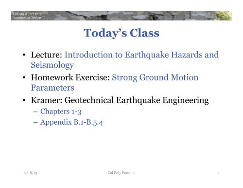
GSC415 Winter 2013<br />
Engineering Geology II<br />
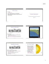
Today’s Class<br />
• <strong>Lecture</strong>: <strong>Introduction</strong> <strong>to</strong> Earthquake Hazards <strong>and</strong><br />
<strong>Seismology</strong><br />
• Homework Exercise: Strong <strong>Ground</strong> <strong>Motion</strong><br />
<strong>Parameters</strong><br />
• Kramer: Geotechnical Earthquake Engineering<br />
– Chapters 1-3<br />
– Appendix B.1-B.5.4<br />
2/18/13 Cal Poly Pomona<br />
1
GSC415 Winter 2013<br />
Engineering Geology II<br />
<strong>Introduction</strong> <strong>to</strong> Earthquake<br />
Hazards <strong>and</strong> <strong>Seismology</strong>
local agency (city or county); show location of fault investigation trenches; 50-foot setbacks perpendicular from fault<br />
plane <strong>and</strong> proposed building footprints.<br />
9. Geologic Hazard Zones (Liquefaction & L<strong>and</strong>slides): (If applicable) Show proposed structures in<br />
relation <strong>to</strong> CGS official map showing zones of required investigation for liquefaction <strong>and</strong> l<strong>and</strong>slide, <strong>and</strong>/or any pertinent<br />
GSC415 Winter geologic 2013 hazard map from the Safety Element of the local agency (city or county).<br />
Engineering Geology II<br />
10. Geotechnical Testing of Representative Samples: Broad suite of appropriate geotechnical tests.<br />
11. Consideration of Geology in Geotechnical Engineering Recommendations:<br />
Checklist Item or Topic Within Consulting Report<br />
NA = not applicable<br />
Discuss California engineering Geological geologic aspects Survey of excavation/grading/fill - Note 48 activities, foundation <strong>and</strong> support of<br />
structures. Checklist for the Include Review geologic of Engineering <strong>and</strong> Geology geotechnical <strong>and</strong> <strong>Seismology</strong> inspections Reports <strong>and</strong> for problems anticipated 16. Site-Specific during <strong>Ground</strong> grading. <strong>Motion</strong> Analysis: (If applicable) Required for sites where<br />
Special California design Public <strong>and</strong> Schools, construction Hospitals, <strong>and</strong> provisions Essential for Services bearing Buildings capacity failure <strong>and</strong>/or footings or foundations<br />
<strong>and</strong> deterministic lower limit. See requirements in CBC §1803A.6.2. Provide design response<br />
founded on weak or expansive January 1, soils. 2011 Consideration of seismic compression of fills; spectrum cut/fill that meets differential<br />
ASCE 7 §21.3. Also provide SDS <strong>and</strong> SD1 values that meet ASCE 7 §21.4.<br />
settlement.<br />
Note 48 is used by the California Geological Survey (CGS) <strong>to</strong> review the geology, seismology, <strong>and</strong> geologic hazards evaluated in<br />
reports that are prepared under California Code of Regulations (CCR), Title 24, California Building Code. CCR Title 24 applies <strong>to</strong> California<br />
Public Schools, Hospitals, Skilled Nursing Facilities, <strong>and</strong> Essential Services Buildings. The Building Official for public schools is the Division of<br />
the State Architect (DSA). Hospitals <strong>and</strong> Skilled Nursing Facilities in California are under the jurisdiction of the Office of Statewide Health<br />
Planning & Development (OSHPD). The California Geological Survey serves under contract with these two state agencies.<br />
<strong>Seismology</strong> & Calculation of Earthquake <strong>Ground</strong> <strong>Motion</strong><br />
<strong>and</strong> scaled time his<strong>to</strong>ries <strong>and</strong> response spectra.<br />
12. Evaluation of His<strong>to</strong>rical Seismicity: Prepare a short description of how his<strong>to</strong>rical<br />
Project Name: ____________________________<br />
Location: ____________________________________<br />
OSHPD or DSA File #: ____________________ Reviewed By: ________________________________<br />
Date 13. Reviewed: Classify __________________________ the Geologic Subgrade California Certified (Site Engineering Class): Geologist 2010 #: _______ CBC Table 1613A.5.2 <strong>and</strong><br />
http://earthquake.usgs.gov/research/hazmaps/design/.<br />
Project Location<br />
1. Site Location Map, Street Address, County Name: Correctly plot site on a<br />
15. 7½-minute Seismic USGS quadrangle Design base-map. Category: Report if S 1 > 0.75<br />
2. Plot Plan with Exploration Data <strong>and</strong> Building Footprint: One boring or exploration<br />
shaft per 5000 ft 2 , with minimum of two for any one building. Explora<strong>to</strong>ry trench locations.<br />
3. Site Coordinates (Latitude & Longitude):<br />
grading.<br />
earthquakes have affected the site.<br />
effectiveness of options <strong>to</strong> mitigate l<strong>and</strong>sliding/slope failure effects. Acceptance criteria for ground-<br />
8. Active Faulting & Coseismic Deformation Across Site: Show conditions proposed structures described in relation <strong>to</strong> in 2010 CBC §1615A.1.227. apply. Dynamic Provide Site Conditions: probabilistic (If applicable) MCE, deterministic Site response analysis MCE <strong>and</strong> <strong>to</strong>pographic effects<br />
Alquist-Priolo Earthquake Fault Zones <strong>and</strong>/or any potential fault rupture hazard identified from the Safety Element of the<br />
should be considered, if appropriate.<br />
local agency (city or county); show location of fault investigation trenches; 50-foot setbacks<br />
<strong>and</strong> deterministic<br />
perpendicular from fault<br />
lower limit. See requirements 28. in Mitigation CBC §1803A.6.2. Options for Provide L<strong>and</strong>sliding/Other design response Slope Failure: (If applicable) Discuss<br />
plane <strong>and</strong> proposed building footprints.<br />
spectrum that meets ASCE 7 §21.3. Also provide S DS <strong>and</strong> S D1 values that meet ASCE 7 §21.4.<br />
9. Geologic Hazard Zones (Liquefaction & L<strong>and</strong>slides): (If applicable) Show proposed structures in<br />
improvement schemes.<br />
relation <strong>to</strong> CGS official map showing zones of required investigation for liquefaction <strong>and</strong> l<strong>and</strong>slide, <strong>and</strong>/or any pertinent<br />
geologic hazard map from the Safety Element of the local agency (city or county).<br />
NR = not addressed by consultant <strong>and</strong> therefore not reviewed at this time<br />
conditions described in 2010 CBC §1615A.1.2 apply. Provide probabilistic MCE, deterministic MCE<br />
17. Deaggregated Seismic Source <strong>Parameters</strong>: (If applicable) Provide controlling<br />
magnitude (Mw) <strong>and</strong> distance <strong>to</strong> fault, if needed for liquefaction, slope stability analysis or for<br />
earthquake record selection.<br />
18. Time His<strong>to</strong>ries of Earthquake <strong>Ground</strong> <strong>Motion</strong>: (If applicable) Compute target spectra,<br />
justify selected earthquake records, scale <strong>to</strong> target <strong>to</strong> meet ASCE 7 §16.1.3 or §17.3 <strong>and</strong> show initial<br />
Liquefaction/Seismic Settlement Analysis<br />
19. Geologic Setting for Occurrence of Liquefaction: Perform screening analysis <strong>to</strong><br />
identify where the following conditions apply:<br />
depth of highest his<strong>to</strong>rical ground water surface
GSC415 Winter 2013<br />
Engineering Geology II<br />
Engineering<br />
<strong>Seismology</strong>:<br />
A Simplified<br />
Picture<br />
• Earthquake source<br />
• Seismic wave propagation<br />
• <strong>Ground</strong> motion<br />
• Building response<br />
2/18/13 Cal Poly Pomona 4
GSC415 Winter 2013<br />
Engineering Geology II<br />
Hazard, Mitigation <strong>and</strong> Risk<br />
Seismic Hazard: any physical phenomenon associated<br />
with an earthquake that may cause damage <strong>and</strong> loss<br />
Hazard is studied <strong>and</strong> evaluated -><br />
Mitigation: design actions <strong>to</strong> reduce loss of life,<br />
injuries <strong>and</strong> damages<br />
Risk: a probability that<br />
social or economic<br />
consequences will<br />
exceed a specified value<br />
2/18/13 Cal Poly Pomona<br />
5
GSC415 Winter 2013<br />
Engineering Geology II<br />
Return Period<br />
Return Period/<br />
Recurrence<br />
Interval: the mean<br />
time period<br />
between samesized<br />
events.<br />
The larger the event,<br />
the longer the<br />
return period.<br />
2/18/13 Cal Poly Pomona<br />
6
GSC415 Winter 2013<br />
Engineering Geology II<br />
Very High Risk:<br />
Tokyo<br />
• One of the world's most<br />
densely populated<br />
metropolitan areas<br />
• In 1923, it suffered a<br />
destructive earthquake, the<br />
Great Kan<strong>to</strong> quake<br />
– 143,000 fatalities<br />
– destroyed two-thirds of<br />
Tokyo<br />
• Estimated recurrence time:<br />
70 years….<br />
2/18/13 Cal Poly Pomona<br />
7
GSC415 Winter 2013<br />
Engineering Geology II<br />
Mitigation: Earthquake Engineering<br />
• Haiti earthquake, 2010:<br />
M7.0, 230,000 deaths<br />
• New Zeal<strong>and</strong> earthquake,<br />
2010: M7.1, 0 deaths<br />
Great earthquake disasters<br />
occur where high population<br />
density, earthquakes, <strong>and</strong><br />
poor construction coincide.<br />
2/18/13 Cal Poly Pomona<br />
8
GSC415 Winter 2013<br />
Engineering Geology II<br />
Fatalities <strong>and</strong> Damages<br />
Vary greatly from year <strong>to</strong> year<br />
Dominated by rare catastrophes<br />
Locations of worst damages are different from those of<br />
fatalities.<br />
Economic Losses:<br />
• Destruction of Infrastructure<br />
• Loss in Productivity<br />
2/18/13 Cal Poly Pomona<br />
9
GSC415 Winter 2013<br />
Engineering Geology II<br />
The Economic <strong>and</strong> Human Impact of Disasters* in the last 12 years<br />
363 Billion<br />
214 Billion<br />
190 Billion<br />
136 Billion<br />
0<br />
46 Billion<br />
27 Billion<br />
52 Billion<br />
69 Billion<br />
34 Billion<br />
74 Billion<br />
46 Billion<br />
131 Billion<br />
659 Million<br />
0<br />
174 Million<br />
108 Million<br />
255 Million<br />
161 Million<br />
160 Million<br />
126 Million<br />
211 Million<br />
221 Million<br />
199 Million<br />
261 Million<br />
162 Million<br />
244,880<br />
242,191<br />
308,152<br />
113,513<br />
93,076<br />
0<br />
39,496<br />
16,666 21,342<br />
29,893<br />
22,424 15,957<br />
32,816<br />
http://www.unisdr.org<br />
2000 2001 2002 2003 2004 2005 2006 2007 2008 2009 2010 2011<br />
KEY<br />
DISASTER<br />
EVENTS<br />
*Disasters refers <strong>to</strong> Natural Disasters as categorized in EM-DAT<br />
Data source: EM-DAT: The OFDA/CRED International Disaster Database<br />
Data version: 10 January 2012 - v12.07<br />
Humanitarian Symbol Set (2008): http://www.ungiwg.org/map/guideline.php<br />
South Asia<br />
July 2002<br />
Europe<br />
Aug 2002<br />
China<br />
Aug 2002<br />
Bam (Iran)<br />
Dec 2003<br />
Indian Ocean<br />
Dec 2004<br />
Kashmir<br />
Oct 2005<br />
Katrina<br />
Aug 2005<br />
Sidr<br />
Nov 2007<br />
Sichuan<br />
May 2008<br />
Nargis<br />
May 2008<br />
2/18/13 Cal Poly Pomona 10<br />
Pakistan<br />
July 2010<br />
Haiti<br />
Dec 2010<br />
Japan<br />
March 2011
GSC415 Winter 2013<br />
Engineering Geology II<br />
Disaster Magnitude <strong>and</strong> Frequency<br />
The occurrence of very<br />
powerful earthquakes is<br />
rare, small scale activity<br />
is common.<br />
2/18/13 Cal Poly Pomona<br />
11
GSC415 Winter 2013<br />
Engineering Geology II<br />
• <strong>Ground</strong> Displacement<br />
Seismic Hazards<br />
• <strong>Ground</strong> Shaking (cause of all other hazards)<br />
• Structural Hazards<br />
– Retaining Structure Failures<br />
– Lifeline Hazards<br />
• Liquefaction<br />
• L<strong>and</strong>slides<br />
• Tsunami <strong>and</strong> Seiche Hazards<br />
2/18/13 Cal Poly Pomona 12
GSC415 Winter 2013<br />
Engineering Geology II<br />
<strong>Ground</strong><br />
Displacement<br />
• Permanent surface offset<br />
on <strong>and</strong> close <strong>to</strong> the fault<br />
2/18/13 Cal Poly Pomona 13
GSC415 Winter 2013<br />
Engineering Geology II<br />
Concrete dam failure resulting from surface fault offset<br />
during the 1999 M7.6 Chi Chi (Taiwan) earthquake<br />
2/18/13 Cal Poly Pomona 14
GSC415 Winter 2013<br />
Engineering Geology II<br />
Greatest Displacement Measured:<br />
2011 Tohoku Earthquake<br />
2/18/13 Cal Poly Pomona 15
GSC415 Winter 2013<br />
Engineering Geology II<br />
How To Estimate Source <strong>Parameters</strong> for<br />
Future Earthquakes<br />
• Use empirical relations between source parameters<br />
compiled for many earthquakes<br />
• Provide estimate, useful average, but: surprises happen!<br />
2/18/13 Cal Poly Pomona 16
GSC415 Winter 2013<br />
Engineering Geology II<br />
Strength of <strong>Ground</strong> Shaking<br />
• Strength <strong>and</strong> duration of<br />
shaking depend on:<br />
– source effects<br />
• orientation<br />
• size<br />
• propagation<br />
direction<br />
– path effects<br />
– site effects<br />
• local rock layering<br />
• immediate soil<br />
conditions<br />
• 3-D basin/hill<br />
<strong>to</strong>pography<br />
2/18/13 Cal Poly Pomona 17
GSC415 Winter 2013<br />
Engineering Geology II<br />
<strong>Ground</strong> Shaking<br />
• For engineering purposes<br />
shaking is usually measured<br />
as acceleration in units of<br />
% g (acceleration of gravity:<br />
9.8 m/s 2 = 100% g = 1 g)<br />
– also used: gal (1 gal = 1 cm/s 2<br />
= 0.01 m/s 2 ~ 0.1% g)<br />
• <strong>Ground</strong> shaking is<br />
perceptible <strong>to</strong> humans if<br />
acceleration exceeds 0.5% g<br />
– “strong ground motion”<br />
• Structural damage in<br />
buildings not designed <strong>to</strong> be<br />
resistant usually occurs at<br />
10% g<br />
2/18/13 Cal Poly Pomona 18
GSC415 Winter 2013<br />
Engineering Geology II<br />
ShakeMaps<br />
2/18/13 Cal Poly Pomona 19
GSC415 Winter 2013<br />
Engineering Geology II<br />
Highest Recorded Acceleration<br />
At a site 3 km from<br />
magnitude 7.2<br />
Nairiku, Japan<br />
earthquake in<br />
2008: over 4g!<br />
2/18/13 Cal Poly Pomona<br />
20
GSC415 Winter 2013<br />
Engineering Geology II<br />
2/18/13 Cal Poly Pomona 21
GSC415 Winter 2013<br />
Engineering Geology II<br />
Christchurch Mw6.3: PGA>2g!<br />
2/18/13 Cal Poly Pomona 22
GSC415 Winter 2013<br />
Engineering Geology II<br />
Highest PGV<br />
2/18/13 Cal Poly Pomona 23
GSC415 Winter 2013<br />
Engineering Geology II<br />
<strong>Ground</strong> Shaking<br />
• Maximum recorded<br />
acceleration for 2008<br />
M5.4 Chino Hills<br />
earthquake: 0.44 g (in<br />
Walnut)<br />
2/18/13 Cal Poly Pomona 24
GSC415 Winter 2013<br />
Engineering Geology II<br />
Liquefaction<br />
Liquefaction:<br />
– strength <strong>and</strong> stiffness of a saturated soil is reduced by<br />
earthquake shaking<br />
• shaking can cause water pressure <strong>to</strong> increase <strong>to</strong> the point where<br />
soil particles can readily move with respect <strong>to</strong> each other<br />
– soil is unable <strong>to</strong> support structures or remain stable<br />
2/18/13 Cal Poly Pomona<br />
25
GSC415 Winter 2013<br />
Engineering Geology II<br />
Liquefaction Lab Experiment<br />
2/18/13 Cal Poly Pomona 26
GSC415 Winter 2013<br />
Engineering Geology II<br />
Liquefaction Examples<br />
S<strong>and</strong> boils/volcanoes in<br />
New Zeal<strong>and</strong> after<br />
2010 earthquake<br />
2/18/13 Cal Poly Pomona 27
GSC415 Winter 2013<br />
Engineering Geology II<br />
Liquefaction Examples<br />
Niigata earthquake in 1964<br />
2/18/13 Cal Poly Pomona 28
GSC415 Winter 2013<br />
Engineering Geology II<br />
Tokyo 2011<br />
2/18/13 Cal Poly Pomona 29
GSC415 Winter 2013<br />
Engineering Geology II<br />
Overturned<br />
apartment<br />
complex<br />
buildings in<br />
Niigata in<br />
1964.<br />
Settling of left section of<br />
building causes destruction<br />
of middle section in Izmit,<br />
1999.<br />
2/18/13 Cal Poly Pomona<br />
30
GSC415 Winter 2013<br />
Engineering Geology II<br />
Haiti Port Damage<br />
2/18/13 Cal Poly Pomona 31
GSC415 Winter 2013<br />
Engineering Geology II<br />
Hazard<br />
Mapping<br />
http://www.conservation.ca.gov/<br />
cgs/shzp/Pages/Index.aspx<br />
2/18/13 Cal Poly Pomona<br />
32
GSC415 Winter 2013<br />
Engineering Geology II<br />
L<strong>and</strong>slides<br />
• may be triggered by<br />
– ground shaking<br />
• slopes marginally stable<br />
under static conditions<br />
– liquefaction<br />
• may create “quake-lakes”<br />
2/18/13 Cal Poly Pomona 33
GSC415 Winter 2013<br />
Engineering Geology II<br />
Tsunami <strong>and</strong><br />
Seiches<br />
• Tsunami: long period<br />
sea waves generated<br />
by rapid vertical<br />
displacement of water<br />
• Seiche: induced waves<br />
in enclosed bodies of<br />
water<br />
• Both can be excited by<br />
earthquakes,<br />
l<strong>and</strong>slides, volcanic<br />
eruptions, etc.<br />
2/18/13 Cal Poly Pomona 34
SAN JU AN CAPISTRAN O<br />
GSC415 Winter 2013<br />
Engineering Geology II<br />
California Emergency Management Agency<br />
California Geological Survey<br />
University of Southern California<br />
118°15'0"W<br />
Tsunami Inundation Map for Emergency Planning<br />
Long Beach Quadrangle<br />
State of California<br />
County of Los Angeles<br />
118°7'30"W<br />
Tsunami<br />
Inundation Maps<br />
33°45'0"N<br />
33°45'0"N<br />
TOPATOPA MOUNTAINS<br />
SANTA PAULA PEAK<br />
SANTA PAULA<br />
CAMARILLO<br />
DEVILS HEART PEAK<br />
FILLMORE<br />
MOORPARK<br />
NEWBURY PARK<br />
COBBLESTONE MTN<br />
PIRU<br />
SIMI VALLEY WEST<br />
THOUSAND OAKS<br />
WHITAKER PEAK<br />
VAL VERDE<br />
SIMI VALLEY EAST<br />
CALABASAS<br />
WARM SPRINGS MOUNTAIN<br />
NEWHALL<br />
OAT MOUNTAIN<br />
CANOGA PARK<br />
GREEN VA LEY<br />
MINT CANYON<br />
SAN FERNANDO<br />
VAN NUYS<br />
SLEEPY VA LEY<br />
AGUA DULCE<br />
SUNLAND<br />
BURBANK<br />
RI TER RIDGE<br />
ACTON<br />
CONDOR PEAK<br />
PASADENA<br />
PALMDALE<br />
PACIFICO MOUNTAIN<br />
CHILAO FLAT<br />
MT WILSON<br />
LITTLEROCK<br />
JUNIPER HILLS<br />
WATERMAN MTN<br />
AZUSA<br />
LOVEJOY BU TES<br />
VALYERMO<br />
CRYSTAL LAKE<br />
GLENDORA<br />
EL MIRAGE<br />
MESCAL CREEK<br />
MOUNT SAN ANTONIO<br />
MT BALDY<br />
http://www.consrv.ca.gov/cgs/<br />
geologic_hazards/Tsunami/<br />
Inundation_Maps/Pages/<br />
Statewide_Maps.aspx<br />
POINT MUGU<br />
TRIUNFO PASS<br />
POINT DUME<br />
MALIBU BEACH<br />
TOPANGA<br />
BEVERLY HILLS<br />
HOLLYWOOD<br />
LOS ANGELES<br />
ELMONTE<br />
BALDWIN PARK<br />
SAN DIMAS<br />
ONTARIO<br />
VENICE<br />
INGLEWOOD<br />
SOUTH GATE<br />
WHITTIER<br />
LA HABRA<br />
YORBA LINDA<br />
PRADO DAM<br />
REDONDO BEACH<br />
TORRANCE<br />
LONG BEACH<br />
LOS ALAMITOS<br />
ANAHEIM<br />
ORANGE<br />
BLACK STAR CANYON<br />
118°15'0"W<br />
2/18/13 118°7'30"W<br />
Cal Poly Pomona 35<br />
METHOD OF PREPARATION<br />
Initial tsunami modeling was performed by the University of Southern California (USC)<br />
Tsunami Research Center funded through the California Emergency Management Agency<br />
(CalEMA) by the National Tsunami Hazard Mitigation Program. The tsunami modeling<br />
process utilized the MOST (Method of Splitting Tsunamis) computational program<br />
(Version 0), which allows for wave evolution over a variable bathymetry <strong>and</strong> <strong>to</strong>pography<br />
used for the inundation mapping (Ti<strong>to</strong>v <strong>and</strong> Gonzalez, 1997; Ti<strong>to</strong>v <strong>and</strong> Synolakis, 1998).<br />
The bathymetric/<strong>to</strong>pographic data that were used in the tsunami models consist of a<br />
series of nested grids. Near-shore grids with a 3 arc-second (75- <strong>to</strong> 90-meters)<br />
resolution or higher, were adjusted <strong>to</strong> “Mean High Water” sea-level conditions,<br />
TSUNAMI INUNDATION MAP<br />
FOR EMERGENCY PLANNING<br />
State of California ~ County of Los Angeles<br />
LONG BEACH QUADRANGLE<br />
SAN PEDRO<br />
SEAL BEACH<br />
NEWPORT BEACH<br />
MAP EXPLANATION<br />
TUSTIN<br />
LAGUNA BEACH<br />
Tsunami Inundation Line<br />
Tsunami Inundation Area
GSC415 Winter 2013<br />
Engineering Geology II<br />
<strong>Seismology</strong><br />
• Science of earthquakes <strong>and</strong><br />
related phenomena. -Richter,<br />
1958<br />
• Basis for all seismic hazard<br />
analysis<br />
• For purpose of engineering<br />
geology, focus on strong<br />
motion seismology<br />
2/18/13<br />
Cal Poly Pomona<br />
36
GSC415 Winter 2013<br />
Engineering Geology II<br />
Seismometers<br />
Seismometers detect <strong>and</strong><br />
record motion (acceleration,<br />
velocity or displacement) of<br />
ground (or building)<br />
2/18/13 Cal Poly Pomona<br />
37
GSC415 Winter 2013<br />
Engineering Geology II<br />
Seismograms<br />
• Each seismogram is composite of:<br />
– Earthquake source effects<br />
– Propagation <strong>and</strong> site effects => Earth structure<br />
• It may therefore be difficult <strong>to</strong> independently resolve either<br />
2/18/13 Cal Poly Pomona<br />
38
GSC415 Winter 2013<br />
Engineering Geology II<br />
Wave<br />
<strong>Parameters</strong><br />
Seismogram<br />
• Amplitude<br />
• Wavelength<br />
• Period = time between waves in seconds<br />
• Frequency = number of waves passing a given point in 1<br />
second (measured in cycles per sec: Hz)<br />
• Velocity (seismic ~ km/sec, depends on material)<br />
2/18/13 Cal Poly Pomona<br />
39
GSC415 Winter 2013<br />
Engineering Geology II<br />
<strong>Ground</strong><br />
<strong>Motion</strong> Period<br />
• Seismograms, like white<br />
light, are composites of<br />
waves of many different<br />
frequencies<br />
• Usually recorded ground<br />
motion will be<br />
combination of short<br />
period motions <strong>and</strong> long<br />
period<br />
2/18/13 Cal Poly Pomona<br />
40
GSC415 Winter 2013<br />
Engineering Geology II<br />
• Body Waves<br />
– Travel through Earth’s interior<br />
– Fastest<br />
– Dominate at short distances<br />
– High frequencies/short period<br />
(1-30 Hz)<br />
• Surface Waves<br />
– Travel along Earth’s surface<br />
– Long period<br />
– Dominate at larger distances<br />
– Generated most efficiently by<br />
shallow earthquakes<br />
• Peak ground motions are<br />
produced by body waves at<br />
distances shorter than ~<br />
twice crustal thickness (30<br />
km)<br />
Seismic Waves<br />
2/18/13 Cal Poly Pomona<br />
41
GSC415 Winter 2013<br />
Engineering Geology II<br />
Body Waves: P-wave<br />
• Primary wave, first <strong>to</strong> arrive<br />
– Used in Early Warning Systems<br />
• Compressional, no rotation<br />
• Particle motion in direction of wave<br />
propagation<br />
• Relatively little damage potential<br />
2/18/13 Cal Poly Pomona<br />
42
GSC415 Winter 2013<br />
Engineering Geology II<br />
Body Waves: S-wave<br />
• Secondary wave, second <strong>to</strong> arrive<br />
• Transverse, shearing, no volume change<br />
• Particle motion at right angles <strong>to</strong> wave<br />
propagation<br />
• Significant damage potential<br />
2/18/13 Cal Poly Pomona<br />
43
GSC415 Winter 2013<br />
Engineering Geology II<br />
Surface Waves: Love waves<br />
• Horizontal, shearing motion<br />
• Contribute <strong>to</strong> damage far from<br />
source<br />
2/18/13 Cal Poly Pomona<br />
44
GSC415 Winter 2013<br />
Engineering Geology II<br />
Surface Waves: Rayleigh waves<br />
• Backward-rotating, elliptical motion<br />
• Vertical as well as horizontal motions<br />
• Contribute <strong>to</strong> damage far from source<br />
2/18/13 Cal Poly Pomona<br />
45
GSC415 Winter 2013<br />
Engineering Geology II<br />
2/18/13 Cal Poly Pomona 46
GSC415 Winter 2013<br />
Engineering Geology II<br />
Southern California Faults<br />
Southern California is traversed<br />
by numerous faults. Some of<br />
these, like the San Andreas<br />
Fault, are major players; others<br />
are minor <strong>and</strong> not so well<br />
known.<br />
2/18/13 Cal Poly Pomona<br />
47
GSC415 Winter 2013<br />
Engineering Geology II<br />
2/18/13 Cal Poly Pomona 48
GSC415 Winter 2013<br />
Engineering Geology II<br />
Geometric Notation<br />
2/18/13 Cal Poly Pomona 49
GSC415 Winter 2013<br />
Engineering Geology II<br />
Geologic Map<br />
2/18/13 Cal Poly Pomona<br />
50
GSC415 Winter 2013<br />
Engineering Geology II<br />
Slip Rate<br />
Map<br />
• Dominance of<br />
SAF, San Jacin<strong>to</strong><br />
fault, <strong>and</strong> Garlock<br />
fault.<br />
• Smaller faults<br />
branching off tend<br />
<strong>to</strong> have moderate<br />
slip rates,<br />
decreasing with<br />
distance from<br />
major fault zones.<br />
2/18/13 Cal Poly Pomona<br />
51
GSC415 Winter 2013<br />
Engineering Geology II<br />
Sense of Slip<br />
• SAF zone: right lateral<br />
• Garlock fault zone, largest<br />
left-lateral strike-slip fault<br />
• Near Transverse Ranges<br />
<strong>and</strong> LA Basin are<br />
numerous reverse faults<br />
• North of Garlock fault:<br />
extension<br />
– normal faulting<br />
– Basin <strong>and</strong> Range tec<strong>to</strong>nic<br />
province<br />
2/18/13 Cal Poly Pomona<br />
52
GSC415 Winter 2013<br />
Engineering Geology II<br />
Earthquake<br />
Failure<br />
• Earthquake failure process is often described as rock fracture<br />
– If rock is subjected <strong>to</strong> stress, eventually fracture occurs<br />
• It may be more appropriate <strong>to</strong> view earthquake faulting as frictional<br />
sliding<br />
– sliding surface ~ earthquake fault, formed by long-term geological<br />
processes, <strong>and</strong> represents weak zone<br />
2/18/13 Cal Poly Pomona<br />
53
GSC415 Winter 2013<br />
Engineering Geology II<br />
Strain Leads <strong>to</strong><br />
Stress: Elastic<br />
Rebound<br />
• Both sides of fault are gradually moving past one another,<br />
whereas fault is locked, accumulating strain<br />
• This flexure places greater <strong>and</strong> greater stress on fault<br />
• When it exceeds strength of fault, fault slips, <strong>and</strong> surrounding<br />
rock rapidly snaps back => earthquake<br />
2/18/13 Cal Poly Pomona<br />
54
GSC415 Winter 2013<br />
Engineering Geology II<br />
Hazard Analysis: Characteristic Earthquake<br />
Elastic rebound: individual<br />
earthquakes on particular fault<br />
segment are not r<strong>and</strong>om<br />
independent events, but depend on<br />
build up of stress<br />
USGS in 1985 predicted M6 along SAF<br />
near Parkfield, between 1987-1993.<br />
Moni<strong>to</strong>ring systems were installed.<br />
Quake occurred in 2004, when most<br />
equipment had been removed.<br />
2/18/13 Cal Poly Pomona<br />
55
GSC415 Winter 2013<br />
Engineering Geology II<br />
Magnitude<br />
Magnitude<br />
= 5.0<br />
• His<strong>to</strong>rically best-known<br />
measure of earthquake size<br />
• All magnitude scales are related<br />
<strong>to</strong> largest amplitude<br />
⇒ Easy <strong>to</strong> measure<br />
• Richter introduced local<br />
magnitude, M L , in 1930s<br />
– Measure A max recorded on Wood-<br />
Anderson seismograph<br />
– Empirical formula:<br />
M L = log 10 A + 2.56log 10 Δ - 1.67<br />
– Measure maximum displacement<br />
amplitude A in 10 -6 m<br />
– Correct for distance, Δ, in km<br />
• Also possible: use nomograph<br />
2/18/13 Cal Poly Pomona<br />
56
GSC415 Winter 2013<br />
Engineering Geology II<br />
• Problems with M L :<br />
– Defined specifically for southern<br />
California<br />
– Depends on outdated Wood-<br />
Anderson instrument<br />
• But: instrument period close <strong>to</strong><br />
resonant frequency of many<br />
buildings (1 Hz)<br />
• More general global scales were<br />
developed, all of general form:<br />
M = log (A/T) + F(h, Δ) + C<br />
– A = amplitude<br />
– T = its dominant period<br />
– F = correction fac<strong>to</strong>r for depth <strong>and</strong><br />
distance<br />
– C = regional scale fac<strong>to</strong>r<br />
Other Scales<br />
2/18/13 Cal Poly Pomona<br />
57
GSC415 Winter 2013<br />
Engineering Geology II<br />
Other<br />
Scales<br />
More general global scales:<br />
• Body wave magnitude, m b<br />
– Dominant period of 1 sec<br />
– Measured from initial part of P-wave<br />
• Surface wave magnitude, M S<br />
– Dominant period of 20 sec<br />
– Only for shallow events: deep events have greatly reduced surface wave<br />
amplitudes<br />
Neither correctly reflects the size of large earthquakes<br />
2/18/13 Cal Poly Pomona<br />
58
GSC415 Winter 2013<br />
Engineering Geology II<br />
Magnitude Saturation<br />
• Measures of earthquake size based on maximum ground<br />
shaking do not account for longer durations of larger events<br />
– M S saturates at about 8.3<br />
– m b at about 6.2<br />
2/18/13 Cal Poly Pomona<br />
59
GSC415 Winter 2013<br />
Engineering Geology II<br />
Moment<br />
Magnitude<br />
Magnitude saturation helped<br />
motivate development of<br />
moment magnitude scale, M w<br />
M w = (log M 0 )/1.5 - 10.73<br />
determined for M 0 , moment, in<br />
dyne-cm<br />
• 10 7 dyne-cm = 1 N-m<br />
M 0 = µ D A, where:<br />
µ : shear modulus<br />
D : average displacement across<br />
fault (slip)<br />
A : area of fault<br />
Gives magnitude directly tied <strong>to</strong><br />
earthquake source processes,<br />
scaled <strong>to</strong> agree with previous<br />
magnitudes for small events.<br />
2/18/13 Cal Poly Pomona<br />
60
GSC415 Winter 2013<br />
Engineering Geology II<br />
Earthquake Intensity<br />
• Described through scales that are based on<br />
intensity of effects experienced by people <strong>and</strong><br />
buildings, developed in the late 1800s.<br />
• Most widely used:<br />
Mercalli scale<br />
2/18/13 Cal Poly Pomona<br />
61
GSC415 Winter 2013<br />
Engineering Geology II<br />
2/18/13 Cal Poly Pomona 62
GSC415 Winter 2013<br />
Engineering Geology II<br />
His<strong>to</strong>ric Earthquakes:<br />
1811/1812 New Madrid<br />
• Intensity can be inferred<br />
from human accounts =><br />
no seismometers are<br />
needed<br />
• His<strong>to</strong>ric earthquakes can<br />
still be analyzed<br />
• Lines of constant intensity:<br />
isoseismals<br />
• Typically, intensity decays<br />
with distance<br />
2/18/13 Cal Poly Pomona<br />
63
GSC415 Winter 2013<br />
Engineering Geology II<br />
Regional Geology<br />
• For fixed earthquake size,<br />
region of strong shaking<br />
can be indication of<br />
regional geologic structure<br />
• Old, eastern section of US<br />
transmits seismic<br />
vibrations very efficiently<br />
relative <strong>to</strong> young California<br />
coastal region<br />
=> for equal-size earthquake,<br />
east is likely <strong>to</strong> experience<br />
a wider extent of damage<br />
than coastal California<br />
2/18/13 Cal Poly Pomona<br />
64
GSC415 Winter 2013<br />
Engineering Geology II<br />
2/18/13 Cal Poly Pomona 65
GSC415 Winter 2013<br />
Engineering Geology II<br />
Strong <strong>Ground</strong> <strong>Motion</strong>
GSC415 Winter 2013<br />
Engineering Geology II<br />
Use of <strong>Ground</strong> <strong>Motion</strong> Measurements<br />
in Reducing Future Losses<br />
Structural engineers must take in<strong>to</strong> account two<br />
fundamental characteristics of earthquake shaking:<br />
1. how ground shaking propagates through the Earth (especially near<br />
the surface)<br />
2. how buildings respond <strong>to</strong> this ground motion<br />
Recordings of ground motion in urban areas by<br />
seismographs/seismometers can be used <strong>to</strong><br />
characterize variability of ground shaking<br />
2/18/13 Cal Poly Pomona 67
GSC415 Winter 2013<br />
Engineering Geology II<br />
<strong>Ground</strong> <strong>Motion</strong> Range<br />
Range of ground motions<br />
of interest <strong>to</strong><br />
seismologists is large,<br />
because earth<br />
deformation occurs at<br />
many different rates<br />
<strong>and</strong> scales.<br />
Different types of<br />
seismometers are used<br />
<strong>to</strong> record ground<br />
motions.<br />
2/18/13 Cal Poly Pomona 68
GSC415 Winter 2013<br />
Engineering Geology II<br />
Seismograph<br />
Simple seismographs (<strong>and</strong> buildings) are Single Degree of<br />
Freedom (SDOF) Oscilla<strong>to</strong>rs<br />
• discrete system whose position can be described by single variable<br />
This system consists of:<br />
• mass m, moving on frictionless surface<br />
• driven by horizontal ground motion with acceleration Ü (dot<br />
notation)<br />
• connected <strong>to</strong> spring with stiffness k <strong>and</strong><br />
• dashpot with coefficient of viscous damping c<br />
Spring <strong>and</strong> dashpot are not rigid, so motion of mass is not<br />
identical <strong>to</strong> that of ground during earthquake<br />
2/18/13 Cal Poly Pomona 69
GSC415 Winter 2013<br />
Engineering Geology II<br />
Review: Free<br />
Vibration Without<br />
Damping<br />
u<br />
Force is proportional <strong>to</strong> amount spring is stretched<br />
“u” with proportionality constant, k:<br />
m˙ u ˙ + ku = 0 !<br />
If we start system by stretching spring by distance A<br />
!<br />
<strong>and</strong> letting go, mass will oscillate with simple<br />
harmonic motion u(t) with amplitude A <strong>and</strong><br />
f<br />
undamped natural n<br />
= 1 k m˙ u ˙ + ku = 0 !<br />
!<br />
frequency f n<br />
!<br />
!<br />
m˙ ! u ˙ + ku = 0!<br />
u(t) ! = Acos(2"f n<br />
t)!<br />
f n ! = 1 k<br />
!<br />
!<br />
2" m !<br />
!<br />
u(t) = Acos(2"f n<br />
t)!<br />
2"<br />
2/18/13 Cal Poly Pomona 70<br />
m !<br />
!<br />
u(t) = Acos(2"f n<br />
t)!<br />
f n<br />
= 1<br />
2"<br />
k<br />
m !
GSC415 Winter 2013<br />
Engineering Geology II<br />
Review: Free<br />
Vibration With<br />
Damping<br />
u<br />
We now add "viscous" damper <strong>to</strong> model, with damping<br />
coefficient c. This adds additional force on mass:<br />
m˙ u ˙ + c˙ u + ku = 0 !<br />
!<br />
u(t) = Ae "#$ nt cos( 1"# 2 2%f<br />
Solution depends u(t) on = amount Ae "#$ cos( of damping, 1"# 2 2%f n<br />
t) !<br />
characterized by<br />
n<br />
!<br />
!<br />
damping ratio:<br />
" =<br />
c<br />
2 km!<br />
m˙ u ˙ + c˙ u + ku = 0!<br />
!<br />
!<br />
which ! is exactly 1 at critical damping, where system returns<br />
<strong>to</strong> equilibrium as quickly as possible without oscillating.<br />
!<br />
" =<br />
c<br />
2 km !<br />
!<br />
!<br />
2/18/13 Cal Poly Pomona 71
GSC415 Winter 2013<br />
Engineering Geology II<br />
Damping<br />
If damping is small enough (damping ratio
GSC415 Winter 2013<br />
Engineering Geology II<br />
Free Vibration With Damping<br />
!<br />
Solution for underdamped<br />
system:<br />
m˙ u ˙ + c˙ u + ku = 0!<br />
!<br />
u(t) = Ae "#$ nt cos( 1"# 2 2%f n<br />
t) !<br />
• exponential determines how fast<br />
system damps down<br />
" =<br />
c<br />
• cosine is oscillation<br />
2 km !<br />
Natural frequency <strong>and</strong><br />
damping determine<br />
behavior of system both in<br />
free <strong>and</strong> forced vibration.<br />
2/18/13 Cal Poly Pomona 73
GSC415 Winter 2013<br />
Engineering Geology II<br />
Forced Vibration With Damping<br />
!<br />
!<br />
We can force SDOF oscilla<strong>to</strong>r<br />
by ground displacement (u g ):<br />
!<br />
!<br />
m˙ u ˙ + c˙ u + ku = "m˙ ˙<br />
If u g is uharmonic " with 2<br />
frequency ω g , displacement response<br />
=<br />
ratio u g<br />
will be: !<br />
!<br />
" = # g<br />
# 0<br />
!<br />
(1# " 2 ) 2 + (2$") 2 !<br />
where β is tuning ratio:<br />
!<br />
!<br />
!<br />
u g<br />
m˙ u ˙ + c˙ u + ku = "m˙ ˙<br />
u<br />
u g<br />
=<br />
" = # g<br />
u g<br />
2/18/13 Cal Poly Pomona 74<br />
" 2<br />
(1# " 2 ) 2 + (2$") 2 !<br />
# 0<br />
!<br />
β = ω g<br />
ω n
GSC415 Winter 2013<br />
Engineering Geology II<br />
Displacement Response Ratio<br />
Displacement response<br />
ratio varies with<br />
frequency <strong>and</strong> damping<br />
• For large β, trace amplitude<br />
is same as ground motion<br />
amplitude<br />
• In lightly damped system<br />
when ground motion<br />
frequency<br />
m˙<br />
nears natural<br />
u ˙ + c˙<br />
frequency, amplitude of<br />
vibration can get very high:<br />
resonance<br />
!<br />
!<br />
u<br />
u g<br />
=<br />
u + ku = "m˙ ˙<br />
" 2<br />
(1# " 2 ) 2 + (2$") 2 !<br />
u g<br />
2/18/13 !<br />
Cal Poly Pomona 75<br />
#<br />
β = ω g<br />
ω n
GSC415 Winter 2013<br />
Engineering Geology II<br />
Forced Vibration<br />
Three identically damped SDOF<br />
oscilla<strong>to</strong>rs, all with natural<br />
frequency f n =1 Hz, are<br />
initially at rest. Harmonic<br />
force is applied <strong>to</strong> each.<br />
Driving frequencies of<br />
applied forces are (matching<br />
colors):<br />
f g =0.4 Hz f g =1.01 Hz f g =1.6 Hz<br />
2/18/13 Cal Poly Pomona 76
GSC415 Winter 2013<br />
Engineering Geology II<br />
Example: Wood-Anderson<br />
• Provided data for early<br />
southern California<br />
earthquake catalog.<br />
• Uses mirror on mass<br />
suspended by vertical wire :<br />
when ground moved<br />
horizontally, wire would<br />
twist, causing deflection of<br />
reflected light<br />
• f n =1.25 Hz<br />
• ζ=0.7<br />
• magnification=2080<br />
2/18/13 Cal Poly Pomona 77
GSC415 Winter 2013<br />
Engineering Geology II<br />
Seismometer<br />
Response Curves<br />
• One way <strong>to</strong><br />
characterize<br />
seismometers:<br />
describe range of<br />
vibration<br />
frequencies that<br />
they can detect<br />
• Plot of amplification<br />
versus frequency is<br />
called seismometer<br />
instrument response<br />
2/18/13 Cal Poly Pomona 78
GSC415 Winter 2013<br />
Engineering Geology II<br />
• Different recording<br />
instruments may<br />
produce different<br />
measurements of<br />
ground motion for an<br />
earthquake due <strong>to</strong> their<br />
instrument response<br />
• Strong ground motion:<br />
motion of sufficient<br />
strength <strong>to</strong> affect<br />
people <strong>and</strong> their<br />
environment<br />
<strong>Ground</strong> <strong>Motion</strong>s<br />
2/18/13 Cal Poly Pomona 79
GSC415 Winter 2013<br />
Engineering Geology II<br />
Accelerometer<br />
• also called accelerograph or strong motion seismometer<br />
• instrument designed <strong>to</strong> record large amplitude <strong>and</strong><br />
high-frequency shaking within few tens of kilometers<br />
near large earthquakes<br />
• strong motion data is basis for all quantitative<br />
earthquake resistant design<br />
2/18/13 Cal Poly Pomona 80
GSC415 Winter 2013<br />
Engineering Geology II<br />
!<br />
Example: SMA-1 Strong <strong>Motion</strong><br />
Accelerograph<br />
• ζ=0.6<br />
– damping similar <strong>to</strong> WA<br />
• high natural frequency: f n = ω n /2π = 18 Hz<br />
!<br />
!<br />
!<br />
u ˙ + 2"# ˙ n<br />
u + # 2 u ˙ + u = $˙ 2"# n<br />
u ˙ + # 2 n<br />
u = $˙ ˙<br />
n<br />
– third term dominates:<br />
u<br />
u g<br />
=<br />
" 2<br />
(1# " 2 ) 2 + (2$") 2 !<br />
=> seismograph trace displacement is proportional <strong>to</strong><br />
acceleration of ground<br />
" = # g<br />
# 0<br />
!<br />
!<br />
!<br />
2/18/13 Cal Poly Pomona 81<br />
u g<br />
!<br />
!<br />
!<br />
u = " 1<br />
# n<br />
2 ˙ ˙ u g<br />
!<br />
" = # g<br />
# 0<br />
!<br />
u g
GSC415 Winter 2013<br />
Engineering Geology II<br />
Strong <strong>Motion</strong> Records<br />
• Usually three components of<br />
ground motion, two horizontals<br />
+ one vertical<br />
• Thous<strong>and</strong>s of acceleration<br />
values measured at increments<br />
of ~ 0.01 sec<br />
2/18/13 Cal Poly Pomona 82
GSC415 Winter 2013<br />
Engineering Geology II<br />
2/18/13 Cal Poly Pomona 83
GSC415 Winter 2013<br />
Engineering Geology II<br />
Deriving Velocity <strong>and</strong> Displacement<br />
• velocity of ground movement can be calculated as<br />
integral of acceleration record<br />
• displacement = integral of velocity<br />
2/18/13 Cal Poly Pomona 84
GSC415 Winter 2013<br />
Engineering Geology II<br />
2/18/13 Cal Poly Pomona 85
GSC415 Winter 2013<br />
Engineering Geology II<br />
March 10, 1933<br />
Mw=6.4 Long Beach Earthquake<br />
First accurate<br />
record of<br />
destructive ground<br />
motions<br />
2/18/13 Cal Poly Pomona<br />
86
GSC415 Winter 2013<br />
Engineering Geology II<br />
National Strong<br />
<strong>Motion</strong> Array<br />
http://nsmp.wr.usgs.gov/<br />
U.S. Geological Survey National Strong-<strong>Motion</strong> Project has<br />
primary Federal responsibility for recording each<br />
damaging earthquake in US on ground <strong>and</strong> in man-made<br />
structures in densely urbanized areas <strong>to</strong> improve public<br />
earthquake safety.<br />
2/18/13 Cal Poly Pomona 87
67&5;&2,K6$,<<br />
:$)K3&++<br />
D7;#,#<br />
!<br />
!<br />
!<br />
!<br />
!<br />
M)7,E2#<br />
M)7,KL7#GG<br />
!<br />
DEL NORTE<br />
HUMBOLDT<br />
}þ1<br />
}þ1<br />
}þ20<br />
MENDOCINO<br />
}þ1<br />
}þ1<br />
!<br />
}þ96<br />
%$++$,5<br />
B9$#C<br />
!<br />
}þ36<br />
}þ20<br />
6+)4&7'#+&<br />
TRINITY<br />
Farallon<br />
Isl<strong>and</strong>s<br />
!<br />
}þ3<br />
}þ29<br />
(#9&.)7,<br />
@&#+'5JE7G<br />
SONOMA<br />
!<br />
!<br />
!<br />
F&J#5,).)+<br />
Lake<br />
Pillsbury<br />
Clear<br />
Lake<br />
6),#,$<br />
}þ1<br />
}þ299<br />
!<br />
LAKE<br />
}þ20<br />
!<br />
MARIN<br />
-)4#,)<br />
!<br />
}þ12<br />
!<br />
!<br />
!<br />
!<br />
}þ3<br />
!(!(!(!(!(!(!(!(!(<br />
S<strong>to</strong>ny Gorge<br />
Reservoir<br />
Indian Va ley<br />
Reservoir<br />
!<br />
!<br />
!<br />
!<br />
!<br />
Clair<br />
Engle<br />
Lake<br />
East Park<br />
Reservoir<br />
!<br />
Lake<br />
!<br />
SAN PABLO BAY<br />
F#2K:#0#&+<br />
}þ1<br />
}þ36<br />
}þ29<br />
}þ37<br />
}þ92<br />
!<br />
!<br />
!<br />
!<br />
! !<br />
! !<br />
Black Butte<br />
Reservoir<br />
!!<br />
!<br />
!<br />
!<br />
!<br />
!<br />
D+#A&'#<br />
SAN<br />
FRANCISCO<br />
}þ35<br />
}þ84<br />
}þ96<br />
87&9#<br />
}þ12}þ121<br />
}þ1<br />
}þ16<br />
BAY<br />
}þ92<br />
}þ9<br />
}þ3<br />
Lake<br />
}þ12<br />
}þ20<br />
6#+$5,)G#<br />
NAPA<br />
F#$2,K@&+&2#<br />
:)C2&7,K=#79<br />
F)2)A#<br />
N$++K#++&<<br />
L7$5J#2&<br />
=#;$0$;#<br />
F#2KN#,&)<br />
@#+0KN))2KL#<<br />
Projection: Teale Albers<br />
North American Datum of 1927 (NAD27)<br />
Plotted Apr 30, 2004<br />
6++#9&<br />
@$GC+#2'5<br />
SAN MATEO<br />
%&&'<br />
! !<br />
!<br />
!<br />
!<br />
!<br />
!<br />
!<br />
Lake<br />
D2'&75)2<br />
!<br />
Lake<br />
Shastina<br />
!<br />
Shasta<br />
!<br />
:&'KL+E00<br />
TEHAMA<br />
GLENN<br />
8)E2,4$++&<br />
!<br />
! !<br />
!<br />
!<br />
!<br />
!<br />
!<br />
!<br />
!<br />
!<br />
!<br />
!<br />
COLUSA<br />
-#.#<br />
:$;CA)2'<br />
F#E5#+$,)<br />
L&79&+&<<br />
}þ24<br />
SISKIYOU<br />
}þ85<br />
!<br />
!<br />
!<br />
!<br />
}þ45<br />
YOLO<br />
}þ1<br />
}þ16<br />
}þ84<br />
!<br />
!<br />
!<br />
}þ17 }þ82<br />
}þ1<br />
!<br />
!<br />
Meiss<br />
Lake<br />
SHASTA<br />
}þ1<br />
}þ45<br />
}þ45<br />
SOLANO<br />
}þ1<br />
!<br />
!<br />
!<br />
}þ36<br />
!<br />
!<br />
!<br />
}þ44<br />
}þ99<br />
!<br />
}þ99<br />
!<br />
}þ89<br />
!<br />
SUTTER<br />
ALAMEDA<br />
SANTA CLARA<br />
N)7G#2K@$++<br />
F;),,5K#++&<<br />
SANTA CRUZ<br />
6#.$,)+# *$+7)<<br />
6#7A&+KL.)7,KL&#;C<br />
Rogers<br />
Dry<br />
Lake<br />
!<br />
}þ1<br />
Salt Lake<br />
()2&K=$2&<br />
}þ60<br />
!<br />
!<br />
!<br />
Airport<br />
Lake<br />
!<br />
!<br />
}þ14 01 395<br />
6#+$0)72$#K6$,<<br />
*+&2')7#<br />
China<br />
Lake<br />
178 }þ178<br />
El Mirage<br />
Lake<br />
D'&+#2,)<br />
! !<br />
}þ83<br />
}þ30<br />
!<br />
Cuddleback<br />
Lake<br />
!<br />
!<br />
Lake<br />
Matthews<br />
!<br />
!<br />
!<br />
!<br />
!<br />
!<br />
Searles<br />
!<br />
Lake<br />
!<br />
Harper<br />
Lake<br />
!<br />
!<br />
Perris<br />
Reservoir<br />
=&77$5<br />
H+5$2)7&<br />
Lake<br />
ORANGE Elsinore<br />
N$55$)2K$&")<br />
}þ74<br />
}þ18<br />
INYO<br />
:$'G&;7&5,<br />
}þ66<br />
}þ60<br />
(#GE2#KL&#;C<br />
F#2KPE#2<br />
6#.$5,7#2)<br />
3#2#K=)$2,<br />
F#2K6+&A&2,&<br />
}þ91<br />
H2;$2$,#5<br />
F)+#2#KL&#;C<br />
3&+KN#7<br />
}þ58<br />
Dry<br />
Lake<br />
!<br />
Lake<br />
Arrowhead<br />
Lake<br />
Skinner<br />
!<br />
!<br />
!<br />
Superior Lake<br />
!<br />
$;,)74$++&<br />
D..+&K#++&< Lucerne<br />
Lake<br />
}þ76<br />
$5,#<br />
6)7)2#')<br />
@&5.&7$#<br />
6#7+5J#'<br />
F#2KN#7;)5<br />
}þ75<br />
}þ79<br />
}þ18<br />
}þ79<br />
!<br />
!<br />
Big Bear<br />
Lake<br />
:&'+#2'5<br />
}þ67<br />
}þ94<br />
!<br />
!<br />
San Vincente<br />
Reservoir<br />
El Capitan<br />
Reservoir<br />
Lovel<strong>and</strong><br />
Reservoir<br />
H+K6#")2<br />
Sweetwater<br />
Reservoir<br />
Cot<strong>to</strong>n Ball<br />
Marsh<br />
L#75,)><br />
Lower Otay<br />
Reservoir<br />
Middle<br />
Basin<br />
Golds<strong>to</strong>ne<br />
Lake<br />
Badwater<br />
Basin<br />
Lost<br />
Lake<br />
Coyote<br />
Lake<br />
Lake<br />
Henshaw<br />
Owl<br />
Lake<br />
Leach Lake<br />
Soggy<br />
Lake<br />
Baldwin<br />
Lake<br />
L$GKLK(#9&<br />
}þ38<br />
}þ38<br />
}þ18<br />
F#2KP#;$2,)<br />
@&A&,<br />
}þ79<br />
}þ74<br />
}þ78 }þ78<br />
=)>#<<br />
F#2,&&<br />
L#22$2G<br />
}þ62<br />
SAN DIEGO<br />
}þ79<br />
Bicycle<br />
Lake<br />
Langford<br />
Well<br />
Lake<br />
!<br />
Melville<br />
Lake<br />
!<br />
!<br />
Galway<br />
Lake<br />
}þ94<br />
Emerson<br />
Lake<br />
6#,C&'7#+K6$,<<br />
:#2;C)KN$7#G&<br />
=#+AK3&5&7,<br />
(#QE$2,#<br />
!<br />
!<br />
Red Pass<br />
Lake<br />
Cronese<br />
Dry Lakes<br />
!<br />
Clark<br />
Lake<br />
}þ78<br />
Dry<br />
Lake<br />
Silurian<br />
Lake<br />
Mojave River Wash<br />
Broadwell<br />
Lake<br />
Silver<br />
Lake<br />
Deadman<br />
Lake<br />
Soda<br />
Lake<br />
SAN BERNARDINO<br />
3&5&7,K@),KF.7$2G5<br />
12'$)<br />
Mesquite<br />
Lake<br />
/>&2,+&<<br />
1A.&7$#+<br />
H+K6&2,7)<br />
!<br />
!<br />
!<br />
!<br />
6#+&I$;)<br />
!<br />
Cadiz<br />
Lake<br />
!<br />
}þ78<br />
Palen<br />
Lake<br />
Danby<br />
Lake<br />
IMPERIAL<br />
@)+,4$++&<br />
}þ62<br />
Ford Dry<br />
Lake<br />
}þ78<br />
-&&'+&5<br />
!<br />
L+
GSC415 Winter 2013<br />
Engineering Geology II<br />
Urban Networks<br />
• Rapid proliferation of arrays in recent years, especially in<br />
urban areas<br />
• Small scale ground motion variability cannot yet be resolved by<br />
most existing arrays: insufficient spatial sampling.<br />
2/18/13 Cal Poly Pomona 89
GSC415 Winter 2013<br />
Engineering Geology II<br />
Building Arrays<br />
• Most seismometers are free<br />
field (i.e. away from large<br />
structures), but some are<br />
located in buildings, dams<br />
or bridges<br />
• For example:<br />
– UCLA Fac<strong>to</strong>r Building<br />
Seismic Array<br />
• 17-s<strong>to</strong>ry moment-resisting<br />
steel frame structure with<br />
embedded 72-channel<br />
accelerometer array<br />
– Bay Bridge<br />
• 72 accelerometers<br />
2/18/13 Cal Poly Pomona 90
GSC415 Winter 2013<br />
Engineering Geology II<br />
2/18/13 Cal Poly Pomona 91
GSC415 Winter 2013<br />
Engineering Geology II<br />
Data<br />
Availability<br />
http://www.strongmotioncenter.org/<br />
• Many strong motion databases are accessible through<br />
Internet<br />
– Parametric data<br />
– Full waveform data<br />
– Some in near real-time<br />
• Format not st<strong>and</strong>ardized<br />
2/18/13 Cal Poly Pomona 92
GSC415 Winter 2013<br />
Engineering Geology II<br />
Data Format<br />
• Most seismogram formats contain:<br />
– header<br />
• event information<br />
• station information: metadata<br />
– location<br />
– response<br />
• time information<br />
– start time<br />
– time interval<br />
– number of points<br />
– ground motion data<br />
2/18/13 Cal Poly Pomona 93