Fishing Regulations - West Virginia Department of Commerce
Fishing Regulations - West Virginia Department of Commerce
Fishing Regulations - West Virginia Department of Commerce

You also want an ePaper? Increase the reach of your titles
YUMPU automatically turns print PDFs into web optimized ePapers that Google loves.
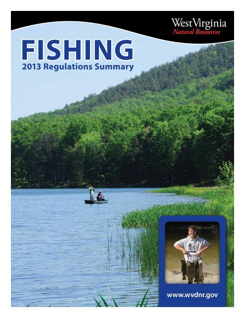
FISHING<br />
2013 <strong>Regulations</strong> Summary<br />
www.wvdnr.gov
FROM THE DIRECTOR<br />
The future looks better for brook trout in the Shavers Fork watershed. The Division<br />
<strong>of</strong> Natural Resources and <strong>West</strong> <strong>Virginia</strong> University have teamed up to restore critical<br />
habitat for the state fish in the upper Shavers Fork near the historic logging town <strong>of</strong><br />
Spruce.<br />
DNR Wildlife Resources Section biologists and <strong>West</strong> <strong>Virginia</strong> University scientists<br />
have been working together to return once pristine mountain streams to conditions<br />
that will benefit the prized brook trout. With grant funding from the National<br />
Oceanic and Atmospheric Administration and the Eastern Brook Trout Joint<br />
Venture, DNR and WVU personnel have been undoing damage done by logging and<br />
railroad construction in the early 1900s, before the implementation <strong>of</strong> modern best<br />
management practices. Many <strong>of</strong> these old practices blocked important spawning<br />
habitat and reduced Shavers Fork mainstem habitat, causing populations to dwindle in<br />
these high mountain headwater streams.<br />
This major restoration project has already included DNR personnel installing fish<br />
friendly culverts on tributary streams and over four miles <strong>of</strong> mainstem restoration being implemented by other agencies to satisfy<br />
their mitigation obligations from another project. Of special interest is the recent installation <strong>of</strong> specially baffled culvert liners that<br />
allow fish passage to spawning areas. Those massive liners were transported to a remote Shavers Fork tributary by the DNR Parks<br />
and Recreation Section using a century-old Shay steam engine from Cass Scenic Railroad State Park. The historic irony <strong>of</strong> this<br />
event was that that same engine, Shay #5, was originally used in old logging operations on Shavers Fork. This type <strong>of</strong> cooperation<br />
ensures a bright future for more restoration activities for brook trout on Shavers Fork and other important streams in <strong>West</strong> <strong>Virginia</strong>.<br />
Frank Jezioro, Director, <strong>West</strong> <strong>Virginia</strong> Division <strong>of</strong> Natural Resources<br />
DISTRICT OFFICES<br />
Main Office - South Charleston, WV 25303<br />
324 4 th Avenue<br />
Warmwater Management − Bret Preston (304) 558-2771<br />
Law Enforcement − Lt. Col. Jerry Jenkins (304) 558-2784<br />
District 1 - Farmington, WV 26571<br />
1110 Railroad Street (304) 825-6787<br />
Fish Management − Frank Jernejcic<br />
Law Enforcement − Capt. William A. Persinger<br />
District 2 - Romney, WV 26757<br />
1 Depot Street (304) 822-3551<br />
Fish Management − Jim Hedrick<br />
Law Enforcement − Capt. Roy Cool<br />
District 3 - French Creek, WV 26218<br />
WV State Wildlife Center<br />
P.O. Box 38<br />
Fish Management − Jim Walker (304) 924-6211<br />
Law Enforcement − Capt. Micheal A. Waugh<br />
District 4 - Beckley, WV 25801<br />
2006 Robert C. Byrd Drive (304) 256-6947<br />
Fish Management − Mark Scott<br />
Law Enforcement − Capt. Larry O. Case III<br />
Cover Photo:<br />
WV Dept. <strong>of</strong> <strong>Commerce</strong>,<br />
Steve Shaluta<br />
Inset Cover Photo:<br />
Stephen Stang<br />
District 5<br />
McClintic WMA<br />
1163 Wildlife Road • Pt. Pleasant, WV 25550<br />
Fish Management (304) 675-0871<br />
Law Enforcement − Capt. Kaven W. Ransom (304) 759-0703<br />
4300 1st Avenue • Nitro, WV 25143<br />
District 6 - Parkersburg, WV 26101<br />
2311 Ohio Avenue (304) 420-4550<br />
Fish Management − Scott Morrison<br />
Law Enforcement − Capt. David Trader<br />
Operations Center - Elkins, WV 26241<br />
Ward Road, P.O. Box 67<br />
Coldwater Management − Mike Shingleton (304) 637-0245
TABLE OF CONTENTS<br />
<strong>Regulations</strong>..............................................................................2-9<br />
Summary.................................................................................................................................................. 2<br />
Special Areas........................................................................................................................................... 3<br />
Other Methods <strong>of</strong> <strong>Fishing</strong>.................................................................................................................. 8<br />
Trophy Fish Citation Program.................................................... 9<br />
<strong>Fishing</strong>.................................................................................. 10-15<br />
Public Lakes and Ponds..................................................................................................................... 10<br />
Favorite Waters..................................................................................................................................... 12<br />
Safety....................................................................................................................................................... 13<br />
Favorite Float Trips.............................................................................................................................. 15<br />
Trout Stocking..................................................................... 16-17<br />
Lakes and Ponds.................................................................................................................................. 16<br />
Streams.................................................................................................................................................... 17<br />
Fish.......................................................................................18-23<br />
State Record Fish................................................................................................................................. 18<br />
Angler’s Alert........................................................................................................................................ 19<br />
A Guide to Your Health......................................................................................................................20<br />
WV Consumption Advisories.......................................................................................................... 21<br />
Ohio River Consumption Advisories............................................................................................23<br />
License Fees and Information.............................................24-25<br />
Sport Fish Identification.......................................................... 26<br />
This pamphlet is a summary <strong>of</strong> the applicable laws and regulations governing sport fishing in <strong>West</strong> <strong>Virginia</strong>. The <strong>West</strong> <strong>Virginia</strong> Code<br />
and the <strong>West</strong> <strong>Virginia</strong> Code <strong>of</strong> Rules contain the details <strong>of</strong> these laws and regulations. Both publications are available for review in the<br />
Director’s Office and Division <strong>of</strong> Natural Resources District Offices. Copies <strong>of</strong> the <strong>of</strong>ficial regulations may be obtained from the <strong>West</strong><br />
<strong>Virginia</strong> Secretary <strong>of</strong> State. Year-round fishing is in effect unless otherwise noted.<br />
New for 2013<br />
Black Bass<br />
Establishment <strong>of</strong> a catch-and-release regulation for black bass at Edwards Run Pond, Hampshire County.<br />
(see page 3)<br />
Muskellunge<br />
Establishment <strong>of</strong> a 40-inch minimum size limit and a 1 fish per day bag limit for muskellunge on a 1.3-mile<br />
section <strong>of</strong> the North Fork <strong>of</strong> the Hughes River from North Bend Lake Dam downstream to the County Rt.<br />
809 bridge at North Bend State Park, Ritchie County. (see page 4)<br />
Tiger Musky and Northern Pike<br />
Increase in the statewide minimum size limit for tiger musky and northern pike from 28 inches to 30<br />
inches. (see page 2)<br />
Licensing<br />
Lifetime license holders who wish to fish for trout and who turn 65 after Dec. 31, 2011 must buy a trout<br />
stamp or the Sr. Lifetime License which includes that privilege. Adults who buy the Apprentice Hunting<br />
License (Class AH and AAH) must buy a fishing license if they want to fish. (see page 24)<br />
Earl Ray Tomblin, Governor<br />
State <strong>of</strong> <strong>West</strong> <strong>Virginia</strong><br />
Frank Jezioro, Director<br />
Division <strong>of</strong> Natural Resources<br />
Curtis I. Taylor, Chief<br />
Wildlife Resources<br />
Col. Dave Murphy, Chief<br />
Law Enforcement Section<br />
Commissioners<br />
Jeffrey S. Bowers − Sugar Grove<br />
Byron Chambers − Romney<br />
Peter L. Cuffaro − Wheeling<br />
Thomas Dotson − White Sulphur Springs<br />
David M. Milne − Bruceton Mills<br />
David F. Truban − Morgantown<br />
Kenny Wilson − Chapmanville<br />
Landowner –<br />
Sportsmen Relations<br />
<strong>West</strong> <strong>Virginia</strong> anglers are indebted to local<br />
landowners throughout the state. Without<br />
their consent and generosity, fishing<br />
would be restricted to state and federal<br />
lands. The opportunity for continued use<br />
<strong>of</strong> private property is largely dependent<br />
upon anglers’ attitudes and conduct. Most<br />
stream closures are the result <strong>of</strong> disrespect<br />
for private property.<br />
Statement <strong>of</strong> Policy Relative<br />
to Public Use <strong>of</strong> Facilities<br />
It is the policy <strong>of</strong> the Division <strong>of</strong> Natural<br />
Resources to provide its facilities,<br />
accommodations, services and programs<br />
to all persons. Complaints should be<br />
mailed to: Director, Division <strong>of</strong> Natural<br />
Resources, 324 Fourth Avenue, Room<br />
341, South Charleston, WV 25303, or<br />
to the Office <strong>of</strong> Human Resources, U.S.<br />
<strong>Department</strong> <strong>of</strong> the Interior, Fish and<br />
Wildlife Service, Hadley, MA 01035-9589.<br />
The Division <strong>of</strong> Natural Resources is an<br />
equal opportunity employer.
REGULATIONS – Summary<br />
Species<br />
Daily Creel<br />
Limit<br />
Minimum<br />
Size<br />
Possession<br />
Limit<br />
*Special <strong>Regulations</strong><br />
Black Bass<br />
Smallmouth,<br />
Largemouth, and<br />
Spotted<br />
6*<br />
(in any<br />
combination)<br />
None*<br />
12*<br />
(in any<br />
combination)<br />
Jennings Randolph Lake: 12-inch minimum size limit, daily creel<br />
limit 5, and possession limit 10.<br />
See Special Area <strong>Regulations</strong><br />
for additional restrictions.<br />
Trout<br />
Rainbow, Golden, Brook<br />
and Brown<br />
6*<br />
(in any<br />
combination)<br />
None<br />
12*<br />
(in any<br />
combination)<br />
Jennings Randolph Lake: Daily creel limit 5, and possession<br />
limit 5.<br />
See Special Area <strong>Regulations</strong><br />
for additional restrictions.<br />
Muskellunge 2* 30 inches* 4*<br />
Tiger Musky 2* 30 inches* 4*<br />
Northern Pike 2 30 inches* 4*<br />
Jennings Randolph Lake: 36-inch minimum size limit, daily creel<br />
limit 1, and possession limit 1 for muskellunge in aggregate with<br />
Tiger Musky.<br />
See Special Area <strong>Regulations</strong><br />
for additional restrictions.<br />
Jennings Randolph Lake: 30-inch minimum size<br />
limit, daily creel limit 2, and possession limit 2.<br />
Hybrid Striped Bass<br />
Striped Bass<br />
White Bass<br />
Hybrid Striped Bass<br />
Striped Bass<br />
White Bass<br />
30*<br />
(in any<br />
combination)<br />
Hybrid Striped Bass<br />
Striped Bass<br />
White Bass<br />
Paddlefish<br />
Shovelnose Sturgeon<br />
Lake Sturgeon<br />
Sauger Lakes - 8*<br />
Rivers - 10*<br />
Saugeye<br />
(in any<br />
Walleye<br />
combination)<br />
no more<br />
than four fish<br />
greater than<br />
15 inches<br />
30 Statewide, except in designated special regulations waters<br />
4* 15 inches* 4* Mt. Storm and East Lynn lakes<br />
0 0 0<br />
Rollins Lake: all hybrid striped bass, striped bass and white bass<br />
must be returned to the water immediately.<br />
0 0 0 All fish must be returned to the water immediately.<br />
None*<br />
Lakes - 16*<br />
Rivers - 20<br />
(in any<br />
combination)<br />
Blue Catfish 2 24 inches None Statewide<br />
Jennings Randolph Lake: 15-inch minimum size limit, daily creel<br />
limit 5, and possession limit 5 for walleye.<br />
See Special Area <strong>Regulations</strong> for additional restrictions on walleye.<br />
Channel Catfish 4* None 16*<br />
In state-managed impoundments (See Public <strong>Fishing</strong> Lakes<br />
and Ponds Chart, pg. 10-11): Daily creel limit 4, possession limit 16.<br />
No restrictions on Mt. Storm, Stonecoal, Cheat,<br />
U.S. Army Corps <strong>of</strong> Engineers lakes and all rivers<br />
and streams.<br />
Yellow Perch None* None None Cheat Lake: Daily creel limit 15<br />
All Others None* None* None*<br />
Jennings Randolph Lake: 14-inch minimum<br />
size limit, daily creel limit 5, and possession<br />
limit 5 for chain pickerel.<br />
Frogs<br />
Green and Bull<br />
10 None 20<br />
Season: 9 p.m. DST, June 16 to midnight July 31.<br />
Big Sandy and Tug Fork rivers bordering Kentucky<br />
Season: Noon (EST), May 18 to midnight, October 31.<br />
Check the 2013 Maryland <strong>Fishing</strong> <strong>Regulations</strong> for special regulations on the North Branch <strong>of</strong> the Potomac and Potomac rivers.<br />
2 W E S T V I R G I N I A F I S H I N G
Special Areas – REGULATIONS<br />
BLACK BASS<br />
Catch-and-Release<br />
1. All black bass (smallmouth, spotted and largemouth)<br />
caught must be returned to the water at once.<br />
2. No black bass shall be in the angler’s possession (creel limit 0)<br />
while fishing in designated catch-and-release lakes and streams.<br />
3. To release a deeply hooked or gill-hooked fish, the line<br />
should be cut 5 to 6 inches above the lure.<br />
Lakes<br />
Dunkard Fork, Edwards Run Pond, Elk Fork, Kimsey Run,<br />
Millers Fork Pond, North Bend, O’Brien, Rockhouse,<br />
Stonewall Jackson, Tuckahoe, Upper Mud and Woodrum.<br />
Streams<br />
New River – Fayette, Raleigh and Summers counties<br />
12-mile section from the I-64 bridge at Sandstone<br />
downstream to NPS Grandview Sandbar access site near<br />
Quinnimont. Access by state Route 41 at Quinnimont and<br />
state Route 20 at Sandstone.<br />
South Branch <strong>of</strong> Potomac River –<br />
Hardy and Hampshire counties<br />
Area 1 8-mile section in Hardy County from 3 miles east<br />
<strong>of</strong> Petersburg at the routes 28, 55 and 220 bridge<br />
(Petersburg Gap bridge) downstream to the<br />
county Route 13 bridge (Fisher bridge).<br />
Area 2 9.5-mile section in Hampshire County from the routes<br />
28 and 50 bridge (Romney bridge) downstream to<br />
the state Route 28 bridge (Blue Beach bridge).<br />
HANDLING & RELEASE PROCEDURES<br />
When practicing catch-and-release fishing, survival <strong>of</strong> the released<br />
fish can be greatly enhanced by following these simple guidelines.<br />
1. Time is important - play and release the fish as quickly as<br />
possible to reduce unnecessary stress.<br />
2. Keep the fish in the water as much as possible and<br />
use a pair <strong>of</strong> forceps or needle-nosed pliers to remove the hook.<br />
3. Handle the fish with bare, wet hands. Do not squeeze the fish,<br />
put your fingers in the eyes or gills, or cause scale loss.<br />
4. When releasing the fish, hold it gently in the water until the fish<br />
is ready to swim <strong>of</strong>f on its own.<br />
5. You may take time to snap a quick photo <strong>of</strong> your catch before<br />
releasing it.<br />
Minimum Size Limit<br />
1. All black bass (smallmouth, spotted and largemouth) under<br />
12 inches long must be returned to the water at once.<br />
2. Measure fish from the tip <strong>of</strong> snout to the end <strong>of</strong> tail. See<br />
Measuring Fish on page 4.<br />
3. To release a deeply hooked or gill-hooked fish, cut the line<br />
5 to 6 inches above the lure.<br />
Lakes<br />
Barboursville, Beech Fork, Chief Logan and Conaway Run.<br />
Streams<br />
Wheeling Creek – Marshall and Ohio counties<br />
Entire length.<br />
Ohio River<br />
Entire length <strong>of</strong> Ohio River from the mouth <strong>of</strong> Mill Creek,<br />
Hancock County, downstream to the mouth <strong>of</strong> the Big<br />
Sandy River, Wayne County. This regulation applies to all<br />
waters included in the Ohio River Reciprocal Agreement<br />
with the State <strong>of</strong> Ohio.<br />
Slot Limit<br />
Lakes<br />
1. All black bass (smallmouth, spotted and largemouth) from<br />
12 to 16 inches long must be returned to the water at once.<br />
2. All black bass harvested must be in accordance with the<br />
daily creel limit regulation.<br />
3. To release a deeply hooked or gill-hooked fish, cut the line<br />
5 to 6 inches above the lure.<br />
South Mill Creek<br />
Streams<br />
1. All black bass (smallmouth, spotted and largemouth) from<br />
12 to 20 inches long must be returned to the water at once.<br />
2. Daily creel limit <strong>of</strong> one black bass over 20 inches caught<br />
within the slot limit area. Black bass under 12 inches may be<br />
harvested. All black bass harvested must be in accordance<br />
with the daily creel limit regulation.<br />
3. To release a deeply hooked or gill-hooked fish, cut the line<br />
5 to 6 inches above the lure.<br />
Greenbrier River – Greenbrier County<br />
6-mile section beginning at the U.S. Route 60 bridge near<br />
Caldwell extending downstream to the U.S. Route 219<br />
bridge at Ronceverte.<br />
REGULATIONS OPEN HOUSE<br />
March 18, 2013<br />
Fairmont, Lewisburg, Martinsburg, Milton, Harrisville<br />
and Summersville<br />
March 19, 2013<br />
Elkins, Glen Dale, Logan, Moorefield, Parkersburg and<br />
Beckley<br />
2 0 1 3 R E G U L A T I O N S S U M M A R Y 3
REGULATIONS – Special Areas<br />
CHILDREN AND CLASS Q<br />
HANDICAP FISHING AREAS<br />
1. Area is managed under special regulations March – May.<br />
2. During this period fishing is restricted to children 10 years<br />
<strong>of</strong> age or under and to handicapped individuals holding a<br />
Class Q license.<br />
3. <strong>Fishing</strong> permitted during daylight hours only.<br />
4. Creel limit is four trout.<br />
5. Another person may assist with baiting hooks and<br />
removing fish.<br />
Coonskin Park Pond – Kanawha County<br />
2.7-acre pond in Coonskin Park. Access by state Route 114<br />
and county Route 51/2.<br />
Handley Pond – Pocahontas County<br />
5-acre pond on the Handley WMA. Access by county routes<br />
17 and 17/1 which intersect U.S. Route 219 at Edray north <strong>of</strong><br />
Marlinton.<br />
Kanawha State Forest Pond – Kanawha County<br />
1-acre pond in Kanawha State Forest. Access by county<br />
Route 42 <strong>of</strong>f county Route 23.<br />
Logan County Airport Pond<br />
1-acre pond. Access by county Route 119/8 <strong>of</strong>f state Route<br />
17.<br />
Mash Fork <strong>of</strong> Camp Creek – Mercer County<br />
100-yard section <strong>of</strong> Mash Fork in Camp Creek State Park/<br />
State Forest at Mash Fork Waterfalls. Access by county<br />
Route 19/5 from I-77, exit 20.<br />
Millers Fork Pond – Wayne County<br />
5-acre pond on the Beech Fork Lake WMA. Access by<br />
county Route 22 <strong>of</strong>f county Route 17.<br />
Raleigh County Airport Pond<br />
1-acre pond at the entrance to the Raleigh County Airport.<br />
Access by county Route 9/9 <strong>of</strong>f I-64 at Airport Exit 125-B.<br />
Underwood Lake – Cabell County<br />
1-acre pond on Huntington YMCA property. Access by state<br />
Route 2.<br />
<strong>West</strong>over Park Pond – Monongalia County<br />
1-acre pond located at the <strong>West</strong>over Park just <strong>of</strong>f U.S. Route<br />
19 approximately .5 mile east <strong>of</strong> I-79 <strong>West</strong>over exit.<br />
Woodbine Area <strong>of</strong> the Cranberry River –<br />
Nicholas County<br />
300-yard section <strong>of</strong> the Cranberry River at the U.S. Forest<br />
Service Woodbine Recreation Area. Access by National<br />
Forest Route 76 from Richwood.<br />
MUSKELLUNGE<br />
Catch-and-Release<br />
Streams<br />
1. All muskellunge caught must be returned to the water<br />
at once.<br />
2. No muskellunge shall be in the angler’s possession while on stream<br />
sections designated as catch-and-release streams.<br />
Buckhannon River – Upshur County<br />
6.5-mile section beginning at the City <strong>of</strong> Buckhannon’s water supply<br />
dam and continuing upstream to the first riffle. Included in this area<br />
is the section <strong>of</strong> French Creek from its mouth to the first riffle. The<br />
entire stream section is commonly referred to as Buckhannon Pool.<br />
Middle Island Creek – Tyler County<br />
6-mile section beginning at the state Route 18 bridge near<br />
Centerville and continuing downstream to the low water bridge<br />
near the Jug WMA. Included in this area are sections <strong>of</strong> Indian Creek<br />
and McElroy Creek from their mouth to their first riffle.<br />
Minimum Size Limit<br />
Lakes<br />
1. All muskellunge under 40 inches long must be returned to the water<br />
at once.<br />
2. Measure fish from the tip <strong>of</strong> snout to the end <strong>of</strong> tail. See Measuring<br />
Fish below.<br />
3. To release a deeply hooked or gill-hooked fish, cut the line 5 to 6<br />
inches above the lure.<br />
North Bend Lake<br />
Streams<br />
1. All muskellunge under 40 inches long must be returned to the<br />
water at once.<br />
2. Daily creel limit <strong>of</strong> one muskellunge.<br />
3. Measure fish from the tip <strong>of</strong> snout to the end <strong>of</strong> tail. See Measuring<br />
Fish below.<br />
4. To release a deeply hooked or gill-hooked fish, cut the line 5 to 6<br />
inches above the lure.<br />
North Fork Hughes River – Ritchie County<br />
1.3 mile section extending from North Bend Lake Dam downstream<br />
to the CR 809 bridge near the North Bend State Park campground.<br />
MEASURING FISH<br />
1. Lay the fish on top <strong>of</strong> a ruler on a flat surface.<br />
2. Close the mouth <strong>of</strong> the fish and squeeze the tail fin lobes together.<br />
3. Measure all fish from the tip <strong>of</strong> the snout to the tip<br />
<strong>of</strong> the tail. Do not measure along the curvature <strong>of</strong> the fish’s body.<br />
4 W E S T V I R G I N I A F I S H I N G
Special Areas – REGULATIONS<br />
TROUT<br />
Catch-and-Release<br />
Streams<br />
1. <strong>Fishing</strong> permitted during daylight hours only.<br />
2. Only artificial flies and lures made <strong>of</strong> metal, wood,<br />
feathers, hair, or synthetic material may be used or<br />
possessed on catch-and-release trout streams during the<br />
catch-and-release season. No lure or fly with any scent,<br />
oil, or edible enticement added onto, or impregnated<br />
into (regardless if the scent is added in the manufacturing<br />
process or applied afterward), may be used or possessed<br />
on any catch-and-release trout stream.<br />
3. Multiple hook lures must have barbless hooks.<br />
4. Single hook lures may have barbed hooks.<br />
5. To release a deeply hooked or gill-hooked fish, the leader<br />
should be cut 5 to 6 inches above the lure.<br />
6. All trout caught must be returned to the water at once.<br />
7. No trout shall be in the angler’s possession while on<br />
stream sections designated as catch-and-release streams.<br />
Powerbait, Gulp and other manufactured scented baits<br />
are considered illegal under this section and may not be<br />
used or possessed on catch-and-release streams.<br />
Back Fork <strong>of</strong> Elk River – Webster County<br />
4-mile section beginning 2 miles upstream from Webster<br />
Springs and extending upstream. Access by county routes<br />
24 and 24/3.<br />
Blackwater River – Tucker County<br />
3.5-mile section from the county Route 29/1 bridge in<br />
Blackwater Falls State Park downstream to the mouth <strong>of</strong><br />
the North Fork.<br />
Cranberry River –<br />
Webster, Pocahontas and Nicholas counties<br />
1. 4.3-mile section from the junction <strong>of</strong> the North and<br />
South forks downstream to the low water bridge at<br />
Dogway Fork. Access by foot on National Forest Route<br />
76 from the Cranberry Glades parking area.<br />
2. Nicholas County – 1.2-mile section from the Woodbine<br />
Recreation Area downstream to Camp Splinter<br />
(Jakeman Run). Access by National Forest Route 76 from<br />
Richwood.<br />
Elk River – Randolph County<br />
2-mile section from the Elk Springs Campground<br />
downstream to Rose Run bridge. Access by county Route<br />
49 <strong>of</strong>f state Route 15 about 4 miles west <strong>of</strong> Valley Head.<br />
Glade Creek <strong>of</strong> New River – Raleigh County<br />
3-mile section from the mouth upstream to the National<br />
Park Service foot bridge. Access by Glade Creek Road <strong>of</strong>f<br />
state Route 41.<br />
North Branch <strong>of</strong> Potomac River – Grant and Mineral counties<br />
See the current Maryland <strong>Fishing</strong> <strong>Regulations</strong> for special<br />
regulations on the North Branch <strong>of</strong> the Potomac and Potomac<br />
Rivers.<br />
North Fork <strong>of</strong> Cherry River – Nicholas County<br />
1.8-mile section extending upstream from Richwood’s water<br />
supply dam to first state Route 39 bridge. Access by state Route 39.<br />
North Fork <strong>of</strong> Cranberry River – Pocahontas County<br />
0.25-mile section from the mouth upstream to the limestone<br />
treatment dam. Access by foot on National Forest Route 76.<br />
North Fork <strong>of</strong> the South Branch – Pendleton County<br />
0.75-mile section at the mouth <strong>of</strong> Seneca Creek near Seneca Rocks<br />
Visitors Center. Access by county Route 28/3 at junction <strong>of</strong> state<br />
Route 28 and U.S. Route 33 at Seneca Rocks.<br />
Paint Creek – Fayette County<br />
2-mile section from mouth <strong>of</strong> Skitter Creek upstream to mouth <strong>of</strong><br />
Milburn Creek. Access is by county Route 15.<br />
Shavers Fork <strong>of</strong> Cheat River – Randolph County<br />
1. 5.5-mile section in Monongahela National Forest, north <strong>of</strong> U. S.<br />
Route 250, from the mouth <strong>of</strong> Whitmeadow Run downstream<br />
to the mouth <strong>of</strong> McGee Run. Access by National Forest Route<br />
92, which intersects U.S. Route 250 four miles west <strong>of</strong> Cheat<br />
Bridge.<br />
2. 0.9-mile section encompassing the Stuart Recreation Area day<br />
use area downstream <strong>of</strong> Bowden. Access by foot from county<br />
route 6 on River Loop Trail, or by driving into Stuart Recreation<br />
Area to river (U.S. Forest Service day-use fee charged from<br />
mid-April through September).<br />
Slatyfork section <strong>of</strong> Elk River – Pocahontas County<br />
4.6-mile section from the junction <strong>of</strong> Big Spring and Old Field<br />
forks downstream to the mouth <strong>of</strong> Dry Branch including Props Run<br />
and Big Run. Access by foot from county routes 219/2 on the north<br />
and 219/12 on the south.<br />
South Branch <strong>of</strong> the Potomac River – Pendleton County<br />
1-mile section beginning 2 miles below U.S. Route 220 at Eagle<br />
Rock and extending downstream. Access by county Route 2.<br />
Williams River – Pocahontas County<br />
2-mile section beginning 2 miles below Tea Creek and extending<br />
downstream. Access by National Forest Route 86.<br />
Delayed Harvest Streams<br />
1. Catch-and-release regulations apply: October 1 – May 31.<br />
2. General regulations apply: June 1 – September 30.<br />
Bluestone River – Summers County<br />
1-mile section from the mouth <strong>of</strong> Mountain Creek downstream to<br />
a stream gauge station within<br />
Pipestem State Park.<br />
2 0 1 3 R E G U L A T I O N S S U M M A R Y 5
REGULATIONS – Special Areas<br />
TROUT continued<br />
Delayed Harvest Streams continued<br />
Clear Fork <strong>of</strong> the Guyandotte River – Wyoming County<br />
1-mile section from the R.D. Bailey WMA manager’s<br />
residence downstream to the state Route 6 bridge.<br />
Middle Wheeling Creek – Ohio County<br />
1.2-mile section from just above the upper limits <strong>of</strong> Middle<br />
Wheeling Creek Lake upstream to mouth <strong>of</strong> Gillespie Run.<br />
Access by county Route 39/6.<br />
Fly-fishing-Only<br />
Streams<br />
1. <strong>Fishing</strong> permitted during daylight hours only.<br />
2. Only artificial flies and streamers may be used or in<br />
possession on any <strong>of</strong> the fly-fishing-only streams.<br />
3. Only conventional fly-fishing tackle may be used. Open-face<br />
and closed-face spinning or spincast reels are prohibited.<br />
4. All fish caught must be returned to water at once.<br />
5. No trout shall be in the angler’s possession while on stream<br />
sections designated as fly-fishing-only streams.<br />
6. No lure or fly with any scent, oil, or edible enticement added<br />
onto, or impregnated into (regardless if the scent is added<br />
in the manufacturing process or applied afterward), may be<br />
used or possessed on any fly-fishing-only trout stream.<br />
Powerbait, Gulp and other manufactured scented baits<br />
are considered illegal under this section and may not be<br />
used or possessed on fly-fishing-only trout streams.<br />
Buffalo Creek <strong>of</strong> New River – Fayette County<br />
Main stream and all tributaries <strong>of</strong> Buffalo Creek. Access by<br />
foot from county Route 25.<br />
Dogway Fork <strong>of</strong> the Cranberry – Webster, Pocahontas<br />
and Greenbrier counties<br />
Main stream and all tributaries <strong>of</strong> Dogway Fork. Access by<br />
foot on National Forest Route 78.<br />
Milligan Creek – Greenbrier County<br />
Marked area about 1 mile north <strong>of</strong> U.S. Route 60 from the<br />
county Route 60/15 bridge extending downstream about<br />
.33 mile to a fence crossing.<br />
Red Run <strong>of</strong> Dry Fork – Tucker County<br />
Main stream and all tributaries <strong>of</strong> Red Run. Access by foot<br />
from state Route 72 and National Forest Route 13.<br />
Second Creek – Greenbrier and Monroe counties<br />
Marked 1.5-mile section on the Monroe/Greenbrier county<br />
line at Rodgers Mill.<br />
Thorn Creek – Pendleton County<br />
Marked .5-mile section beginning approximately 3 miles<br />
above the mouth. Access is by county Route 20.<br />
WALLEYE<br />
Minimum Size Limit<br />
Rivers<br />
1. All walleye under 18 inches long must be returned to the water at<br />
once.<br />
2. Daily creel limit <strong>of</strong> 2 walleye.<br />
3. Measure fish from the tip <strong>of</strong> snout to the end <strong>of</strong> tail. See Measuring<br />
Fish on page 4.<br />
4. To release a deeply hooked or gill-hooked fish, cut the line 5 to 6<br />
inches above the lure.<br />
Cheat, Kanawha, New (mouth <strong>of</strong> Gauley River upstream to<br />
Hawks Nest Dam), and Ohio<br />
Lakes<br />
1. All walleye under 28 inches long must be returned to the water at<br />
once.<br />
2. Daily creel limit <strong>of</strong> 2 walleye.<br />
3. Measure fish from the tip <strong>of</strong> snout to the end <strong>of</strong> tail. See Measuring<br />
Fish on page 4.<br />
4. To release a deeply hooked or gill-hooked fish, cut the line 5 to 6<br />
inches above the lure.<br />
Charles Fork and Moncove<br />
Slot Limit<br />
Rivers<br />
1. All walleye from 20 to 30 inches long must be returned to the water<br />
at once.<br />
2. Daily creel limit <strong>of</strong> 2 walleye, only one <strong>of</strong> which may be over 30<br />
inches long.<br />
3. Measure fish from the tip <strong>of</strong> the snout to the end <strong>of</strong> the tail. See<br />
Measuring Fish on Page 4.<br />
New River from Hawks Nest Dam in Fayette County upstream to<br />
the <strong>West</strong> <strong>Virginia</strong>/<strong>Virginia</strong> state line in Summers County, except<br />
for a catch-and-release area as described below.<br />
Catch-and-Release<br />
Rivers<br />
1. All walleye caught must be returned to the water at once.<br />
2. No walleye shall be in the angler’s possession while on the stream<br />
sections designated as catch-and-release streams.<br />
5-mile section New River from Meadow Creek public access site<br />
upstream to base <strong>of</strong> Sandstone Falls in Raleigh and Summers<br />
counties.<br />
Riparian and Shoreline Habitats<br />
Vegetation is an important component <strong>of</strong> habitats along <strong>West</strong><br />
<strong>Virginia</strong>’s streams and lakes. These riparian areas are crucial in the<br />
protection <strong>of</strong> aquatic habitats for fish and other organisms. Help<br />
protect <strong>West</strong> <strong>Virginia</strong>’s waters by protecting riparian areas.<br />
Please see the following links for more information:<br />
http://www.dep.wv.gov/WWE/Programs/nonptsource/<br />
HomeOwner/Documents/BufferPlanting.pdf<br />
http://water.epa.gov/type/lakes/index.cfm<br />
6 W E S T V I R G I N I A F I S H I N G
Special Areas – REGULATIONS<br />
ALL SPECIES<br />
Catch-and-Release<br />
Lakes<br />
1. All species <strong>of</strong> fish must be returned to the water at once.<br />
2. No fish shall be in the angler’s possession (creel limit 0)<br />
while fishing in designated catch-and-release lakes and<br />
streams.<br />
3. Use <strong>of</strong> live minnows is prohibited.<br />
4. Use <strong>of</strong> barbed hooks is prohibited.<br />
5. To release a deeply hooked or gill-hooked fish, the line<br />
should be cut 5 to 6 inches above the lure.<br />
Dixon (Pedlar Wildlife Management Area)<br />
RECIPROCAL FISHING<br />
Ohio River<br />
Ohio residents who carry fishing licenses valid in Ohio may fish<br />
on the Ohio River and its embayments or from the <strong>West</strong> <strong>Virginia</strong><br />
banks <strong>of</strong> the Ohio River and embayments without obtaining<br />
<strong>West</strong> <strong>Virginia</strong> licenses.<br />
<strong>West</strong> <strong>Virginia</strong> residents who carry fishing licenses valid in <strong>West</strong><br />
<strong>Virginia</strong> may fish on Ohio River embayments in Ohio or from<br />
the Ohio banks <strong>of</strong> the Ohio River and embayments without<br />
obtaining an Ohio license.<br />
Current <strong>West</strong> <strong>Virginia</strong> fishing laws shall apply while fishing on<br />
the Ohio River proper or from <strong>West</strong> <strong>Virginia</strong> banks or in<br />
<strong>West</strong> <strong>Virginia</strong> embayments. The tributaries <strong>of</strong> the Ohio River<br />
above embayments, in both states, are not included as part <strong>of</strong><br />
this agreement.<br />
Current Ohio fishing laws apply while fishing from Ohio banks<br />
or in Ohio embayments.<br />
FISHING AND<br />
BOATING ACCESS SITES<br />
1. Public boating and fishing access facilities shall be<br />
used solely for the purpose <strong>of</strong> launching and retrieving<br />
watercraft or fishing from the shore. No other use <strong>of</strong> the<br />
access sites is allowed.<br />
2. After launching, vehicles shall be parked in available<br />
parking spaces.<br />
3. Any law enforcement <strong>of</strong>ficer acting under proper authority<br />
may prohibit an individual from launching a watercraft<br />
from any public boating and fishing access sites.<br />
The following are prohibited at fishing<br />
and boating access sites:<br />
• consumption <strong>of</strong> alcoholic beverages or possession <strong>of</strong> an<br />
open container <strong>of</strong> alcoholic beverages.<br />
• swimming or bathing.<br />
• camping.<br />
• open fires.<br />
• trash disposal except where trash receptacles are provided.<br />
• discharge <strong>of</strong> firearms, fireworks and explosives.<br />
• leaving unattended watercraft.<br />
• commercial use except as authorized by the director.<br />
• parking <strong>of</strong> any vehicle or the mooring <strong>of</strong> any watercraft<br />
in such a manner as to obstruct any avenue <strong>of</strong> ingress or<br />
egress, except for the purpose <strong>of</strong> launching.<br />
Ohio fishing laws and Ohio River fishing regulations for the<br />
Eastern Unit, which cover the <strong>West</strong> <strong>Virginia</strong> /Ohio border, must<br />
be followed while fishing on embayments or tributaries that<br />
are within the boundaries <strong>of</strong> Ohio.<br />
The embayment and tributary reciprocal boundaries for<br />
each state are listed in the Waterfowl Hunting and <strong>Fishing</strong><br />
on the Ohio River brochure available from <strong>West</strong> <strong>Virginia</strong> DNR<br />
<strong>of</strong>fices, and online at www.wvdnr.gov. Ohio and <strong>West</strong> <strong>Virginia</strong><br />
anglers may travel and fish embayments and tributaries to the<br />
landmark locations listed in the brochure. These locations are<br />
also defined by distance from the mouth <strong>of</strong> the tributary and<br />
GPS coordinates for convenience.<br />
Potomac River<br />
<strong>West</strong> <strong>Virginia</strong> residents who possess valid <strong>West</strong> <strong>Virginia</strong> fishing<br />
licenses may fish by angling in the waters <strong>of</strong> the Potomac River<br />
including the North Branch and Jennings Randolph Lake which<br />
are opposite both the <strong>West</strong> <strong>Virginia</strong> and the Maryland shores,<br />
and they may fish from the Maryland shore, without obtaining<br />
a Maryland fishing license, subject, however, to all other<br />
Maryland laws, rules and regulations applicable to fishing.<br />
Maryland residents who possess valid Maryland fishing licenses<br />
may fish by angling in the waters <strong>of</strong> Jennings Randolph Lake<br />
which are opposite both the Maryland and <strong>West</strong> <strong>Virginia</strong> shores,<br />
and they may fish from the <strong>West</strong> <strong>Virginia</strong> shore <strong>of</strong> the Potomac<br />
River, including the North Branch and Jennings Randolph<br />
Lake, without obtaining a <strong>West</strong> <strong>Virginia</strong> fishing license, subject,<br />
however, to all other <strong>West</strong> <strong>Virginia</strong> fishing laws, rules and<br />
regulations applicable to fishing. This agreement is limited to<br />
the Potomac River including the North Branch and Jennings<br />
Randolph Lake and does not extend to any <strong>of</strong> their tributaries.<br />
The State <strong>of</strong> Maryland has joint law enforcement jurisdiction on<br />
Jennings Randolph Lake.<br />
2 0 1 3 R E G U L A T I O N S S U M M A R Y 7
REGULATIONS – Other Methods <strong>of</strong> <strong>Fishing</strong><br />
Except as authorized below, it is illegal to take fish by any means other than by rod, line and hooks.<br />
It is illegal to:<br />
• use a firearm, crossbow, dynamite or any like explosive, or<br />
a poisonous mixture placed in the water for the purpose <strong>of</strong><br />
killing or taking fish, frogs, aquatic turtles or other forms <strong>of</strong><br />
aquatic life.<br />
• fish with more than two (2) lines or poles in an<br />
impoundment stocked with trout by the DNR from January<br />
1 – May 31.<br />
BOW FISHING<br />
Carp may be taken by bow year-round; other nongame fish may<br />
be taken by bow during all months <strong>of</strong> the year except May and<br />
June. All anglers must have a valid fishing license in order to<br />
fish using a bow. All persons using a bow to fish must observe<br />
all applicable fishing regulations.<br />
It is illegal to:<br />
use an arrow having an explosive head or shaft or an arrow<br />
dipped in or smeared with poison or other chemicals.<br />
DIPPING<br />
Dipping for nongame fish is legal from February 1 to midnight<br />
April 30 with a valid <strong>West</strong> <strong>Virginia</strong> fishing license. A dip net may<br />
not exceed 36 square feet in overall area, and its mesh may not<br />
be smaller than one-fourth (1/4) inch.<br />
You must have a Scientific Collecting Permit to collect the<br />
Diamond Darter because it is proposed to be added to the<br />
federal endangered species list. The permit application is<br />
available on the DNR website. It can’t be collected as bait.<br />
GIGGING, SNAGGING AND SNARING<br />
Suckers, carp, fallfish and creek chubs may be taken by snaring<br />
year-round. Other nongame fish, turtles and eels may be taken<br />
by gigging, snagging, or snaring from January 1 - May 15 and<br />
from July 15 - December 31, except that snagging and gigging<br />
shall be prohibited within 100 feet <strong>of</strong> all U.S. Army Corps <strong>of</strong><br />
Engineers Locks and Dams and their appurtenances. Snagging<br />
<strong>of</strong> game fish is prohibited.<br />
HATCHERY FISH REMOVAL<br />
It is illegal to:<br />
• take fish, frogs, aquatic turtles or other aquatic life from a<br />
state fish hatchery.<br />
ICE FISHING<br />
Holes cut for ice fishing must be no larger than 10 inches<br />
in diameter. This applies to public waters where ice fishing<br />
is allowed.<br />
SEINING FOR MINNOWS /<br />
MINNOW TRAPS<br />
Game fish may not be seined or trapped. A seine may be used<br />
to obtain minnows for use as bait provided the seine is not<br />
longer than six feet nor deeper than four feet. A thrownet<br />
may be used provided the diameter is no larger than six feet<br />
and mesh size no larger than three-eighths (3/8) inch. Minnow<br />
traps may be used provided the openings are not larger than<br />
one inch in diameter. A person may have in his possession no<br />
more than 50 minnows nor more than a total <strong>of</strong> 100 aquatic<br />
animal life unless obtained from a licensed dealer and a bill <strong>of</strong><br />
sale is provided. Possession <strong>of</strong> mussels or any parts there<strong>of</strong> is<br />
prohibited. A valid <strong>West</strong> <strong>Virginia</strong> fishing license is needed to<br />
collect minnows and other aquatic life.<br />
You must have a Scientific Collecting Permit to collect the<br />
Diamond Darter because it is proposed to be added to the<br />
federal endangered species list. The permit application is<br />
available on the DNR website. It can’t be collected as bait.<br />
TROTLINES AND DROPLINES<br />
Trotlines and droplines must be attached to the bank or<br />
a tree thereon, must bear an identification tag that is legible<br />
and waterpro<strong>of</strong>, and must be attended every 24 hours. Wire or<br />
cable lines and hooks with more than one point are prohibited.<br />
It is illegal to:<br />
• fish with trotlines and droplines in state-managed<br />
impoundments except Stonecoal, Hawks Nest, Mt. Storm,<br />
Cheat and U.S. Army Corps <strong>of</strong> Engineers lakes. (See chart on<br />
page 10 for state-managed lakes.)<br />
• attach a trotline to public piers and docks or within 50 feet<br />
<strong>of</strong> dam appurtenances.<br />
• use droplines on the Elk River, Hughes River, Little Kanawha<br />
River, Middle Island Creek, and South Fork <strong>of</strong> Hughes River.<br />
• jug fish.<br />
FREE FISHING DAYS<br />
June 8-9, 2013<br />
8 W E S T V I R G I N I A F I S H I N G
Other Methods <strong>of</strong> <strong>Fishing</strong> – REGULATIONS<br />
SPEARFISHING AND DIVING<br />
1. Nongame fish may be taken by spearfishing from July 1 -<br />
September 30 during daylight hours only.<br />
2. Spearfishing is prohibited on the following:<br />
»»<br />
Elk River, from Sutton Dam downstream to the U.S. Route<br />
19 bridge at Sutton;<br />
»»<br />
New River, from Bluestone Dam downstream to the lower<br />
bridge at Hinton.<br />
3. Spearguns may be discharged only beneath the surface <strong>of</strong><br />
the water.<br />
4. It is illegal to use a bolt having an explosive head or shaft or<br />
a bolt dipped in or smeared with poison or other chemicals.<br />
5. A diver may not spearfish in such a manner as to interfere<br />
with other anglers.<br />
6. A diver may not spearfish in heavily-traveled boat lanes,<br />
marked swimming areas or marked waterskiing areas.<br />
7. “Diver down flag” shall<br />
be a red field <strong>of</strong> not<br />
less than 10 inches x 10<br />
inches dimension with<br />
a white diagonal stripe<br />
not less than 1-1/2 inches<br />
wide running upper left<br />
to lower right. The flag<br />
shall be displayed at all<br />
times and be affixed<br />
to a separate flotation<br />
device. No such flag<br />
shall be attached to any<br />
navigational device or placed so as to obstruct boat traffic.<br />
Divers must come up within 100 feet <strong>of</strong> flag. All powerboats<br />
will remain a minimum distance <strong>of</strong> 100 feet away from the<br />
marker flag. The top <strong>of</strong> the flag shall be at least 3 feet above<br />
the surface <strong>of</strong> the water.<br />
8. Fish taken by spearfishing may not be returned to the water<br />
or left on the bank.<br />
TROPHY FISH CITATION PROGRAM<br />
The trophy fish citation program was initiated to recognize<br />
outstanding fishing achievement. The color fish illustrations<br />
on the citations are reproductions <strong>of</strong> original paintings by<br />
artist Duane Raver. Applications to register a trophy fish<br />
can be obtained from any license agent, Wildlife Resources<br />
<strong>of</strong>fice or www.wvdnr.gov.<br />
Reporting Procedures<br />
• Fish must be legally caught with rod and reel by a<br />
licensed angler in <strong>West</strong> <strong>Virginia</strong>.<br />
• Carp legally taken by bow and meeting minimum size<br />
requirements qualify for a trophy fish citation.<br />
• Fish must meet or exceed the minimum weight or length.<br />
• Fish certified by weight must be weighed on a scale<br />
certified by the <strong>West</strong> <strong>Virginia</strong> Division <strong>of</strong> Labor or at any<br />
<strong>of</strong>fice <strong>of</strong> the <strong>West</strong> <strong>Virginia</strong> Wildlife Resources Section.<br />
Fish must be weighed in the presence <strong>of</strong> a witness who<br />
must sign the application form.<br />
• Fish certified by length must be measured in the<br />
presence <strong>of</strong> a witness who must sign the application<br />
form, or fish must be measured and a photograph must<br />
accompany the application. Measure total length <strong>of</strong> fish<br />
to nearest 1/8 inch from tip <strong>of</strong> snout to end <strong>of</strong> tail. See<br />
Measuring Fish on page 4.<br />
• A clear side view photograph <strong>of</strong> the fish is desirable.<br />
• Nonresidents and residents are eligible for trophy<br />
fish citations.<br />
• Applications must be submitted within 60 days <strong>of</strong> the<br />
date <strong>of</strong> catch.<br />
• A $5 fee must accompany each application. Make checks<br />
or money orders payable to the <strong>West</strong> <strong>Virginia</strong> DNR. Mail<br />
to: DNR Wildlife Resources, 1336 State Street, Room 216,<br />
Gassaway, WV 26624.<br />
Minimum Sizes<br />
Trout<br />
Catfish<br />
Brook 15 in. 1.5 lb. Bullhead 16 in. 2 lb.<br />
Brown 21 in. 4 lb. Channel 25 in. 6 lb.<br />
Rainbow 21 in. 4 lb. Flathead 29 in. 10 lb.<br />
Golden Rainbow 21 in. 4 lb. Blue 29 in. 10 lb.<br />
Bass Crappie 15 in. 1.5 lb.<br />
Largemouth 21 in. 5 lb. Sunfish 10 in. 1 lb.<br />
Smallmouth 20 in. 4 lb. Chain Pickerel 20 in. 2 lb.<br />
Spotted 14 in. 1.5 lb. Northern Pike 32 in. 8 lb.<br />
Rock 11 in. 1 lb. Walleye 25 in. 5 lb.<br />
Striped 25 in. 7 lb. Sauger 17 in. 1.5 lb.<br />
Hybrid Striped 24 in. 7 lb. Yellow Perch 13 in. 1 lb.<br />
White 15 in. 2 lb. Freshwater Drum 27 in. 10 lb.<br />
Muskellunge 40 in. 15 lb. Fallfish 18 in. 2 lb.<br />
Tiger Musky 40 2 0in. 1 3 R15 E Glb. U L ACarp T I O N S S U M M A31 R Y in. 15 lb. 9
FISHING – Public Lakes and Ponds<br />
Lake or Pond - County<br />
Acres<br />
Airport Pond – Raleigh • 1<br />
Anawalt – McDowell • 7 •<br />
Anderson – Kanawha • 7 •<br />
Barboursville – Cabell • 17 P<br />
Bear Rock Lakes – Ohio • 16 • E<br />
Beech Fork – Wayne COE • 720 • • P 10*<br />
Berwind – McDowell • 20 • P E<br />
Big Ditch – Webster • 55 • E<br />
Big Run – Marion 7 • • E<br />
Bluestone – Summers COE • 2040 • • P U*<br />
Boley – Fayette • 18 C P E<br />
Brandywine – Pendleton* • 6 • P E<br />
Brushy Fork – Pendleton 18 • E<br />
Buffalo Fork – Pocahontas* • 22 • E<br />
Burnsville – Braxton COE • 968 • • P U*<br />
Cacapon – Morgan • 6 • NMf<br />
Cameron – Marshall 6 • •<br />
Camp Run – Pendleton* 8 • E<br />
Castleman Run – Brooke, Ohio • 22 • • E<br />
Cedar Creek – Gilmer 8 • • P<br />
Charles Fork – Roane • 70 • E<br />
Cheat Lake – Monongalia • 1730 • • L U*<br />
Chief Cornstalk – Mason • 5 • P E<br />
Chief Logan – Logan • 7 •<br />
Conaway Run – Tyler • 30 • P E<br />
Coonskin Park – Kanawha • 2.5<br />
Coopers Rock – Monongalia • 6 P E<br />
Curtisville – Marion • 30 • • E<br />
Dents Run - Marion 30 E<br />
Doe Run – Taylor 11 • • P E<br />
Dog Run – Harrison 15 • E<br />
Dunkard Fork – Marshall • 49 • • E<br />
East Lynn – Wayne COE • 1005 • • P U*<br />
Edwards Run – Hampshire 1 • L<br />
Elk Fork – Jackson • 278 • • 10<br />
Elk Two Mile (Site 12) – Kanawha 2<br />
Elk Two Mile (Site 13) – Kanawha 3.5<br />
Elk Two Mile (Site 14) – Kanawha 4<br />
Fitzpatrick – Raleigh 2.5 • P<br />
Flat Run – Marion 6 • • E<br />
Ft. Ashby – Mineral 12 • •<br />
French Creek – Upshur 2<br />
Frozencamp Left Fork – Jackson 20 • E<br />
Frozencamp Right Fork – Jackson 20 • E<br />
Handley Pond – Pocahontas • 5 • P E<br />
Hawks Nest – Fayette 250 • • U<br />
Horse Creek – Wyoming • 12 • E<br />
Huey Run – Marion 8 • • E<br />
Hurricane W.S. Reservoir – Putnam • 12 •<br />
Indian Rock – Nicholas • 5<br />
James P. Bailey – Mercer • 28<br />
Jennings Randolph – Mineral COE 952 • • P U*<br />
Jimmy Lewis – Mercer • 15 • E<br />
Kanawha State Forest – Kanawha • 1 P<br />
Kee Reservoir – Mercer 70 • E<br />
Kimsey Run – Hardy • 60 • E<br />
Krodel – Mason • 22 • P E<br />
Larenim – Mineral • 10 • NM<br />
Laurel – Mingo • 29 • E<br />
Lick Creek – Wayne 5 • •<br />
Little Beaver – Raleigh • 18 P R<br />
Lumberport – Harrison 6 • E<br />
KEY<br />
• = the listed feature or activity is available or permitted.<br />
A blank space indicates the feature or activity IS NOT available or<br />
permitted.<br />
Lake - County * = National Forest Stamp required<br />
COE = U.S. Army Corps <strong>of</strong> Engineers lake<br />
Accessibility<br />
Use <strong>of</strong> Live Minnows<br />
Camping L = limited primitive<br />
P = permit required<br />
Night <strong>Fishing</strong> C = registered campers only<br />
P = permit required<br />
Boating NM = no motor boats E = electric motors only<br />
R = rental boats only U = unlimited h.p.<br />
5 = 5 h.p. maximum<br />
10 = 10 h.p. maximum (Larger motors must have props<br />
removed or motor tilted to the maximum limit.)<br />
* = contains no wake zones, speed zones and/or<br />
other restricted areas<br />
f = fee charged for private boats, May 30 - Labor Day<br />
A USCG approved life preserver is required for each occupant <strong>of</strong> ALL BOATS. See<br />
<strong>West</strong> <strong>Virginia</strong> Boating <strong>Regulations</strong>. All boats propelled by machinery must be licensed.<br />
10 W E S T V I R G I N I A F I S H I N G
Public Lakes and Ponds – FISHING<br />
Lake or Pond - County<br />
Acres<br />
Logan County Airport – Logan • 1 E<br />
McClintic Ponds – Mason • 61 • P E<br />
Middle Wheeling Creek – Ohio 30 • • E<br />
Miletree – Roane 10 • E<br />
Mill Creek – Barbour • 8 E<br />
Millers Fork – Wayne • 5<br />
Moncove – Monroe • 144 • P 5<br />
Mount Storm – Grant 1200 • • U*<br />
Mountain Valley – Summers 39 E<br />
Mountwood – Wood • 48 • P E<br />
Newburg Lake – Preston 5<br />
New Creek Dam 14 – Grant 40 •<br />
North Bend – Ritchie • 305 • • P 10<br />
North Bend State Park – Ritchie 1.5 C P<br />
O’Brien – Jackson 217 • • 10<br />
Parker Hollow – Hardy 34 • E<br />
Pedlar Mason – Monongalia • 16 • • E<br />
Pedlar Dixon – Monongalia • 7 •<br />
Pendleton - Tucker 14 NM,R<br />
Pennsboro W. S. Reservoir – Ritchie 9 • E<br />
Pettigrew – Kanawha • 8 NM<br />
Pipestem – Summers • 16 P R<br />
Plum Orchard – Fayette • 202 • P U*<br />
Poorhouse Pond – Berkeley 5<br />
R.D. Bailey – Mingo, Wyoming COE 630 • • P U*<br />
Ridenour – Kanawha • 27 •<br />
Rock Cliff – Hardy* • 17 C P E<br />
Rockhouse – Logan • 14 E<br />
Rollins – Jackson • 41 • E<br />
Salt Lick Pond 9 – Braxton 15 • • E<br />
Seneca – Pocahontas • 3 P E<br />
Sherwood – Greenbrier* 165 P P E<br />
Silcott Fork – Roane 23 •<br />
Sleepy Creek – Berkeley • 205 • • P E<br />
South Mill Creek – Grant • 48 • E<br />
Spruce Knob – Randolph* • 23 • P E<br />
Stephens – Raleigh • 300 • • U*<br />
Stonecoal – Lewis, Upshur • 550 • • P 10*<br />
Stonewall Jackson – Lewis COE • 2650 • • P U*<br />
Summersville – Nicholas COE • 2700 • • P U*<br />
Summit – Greenbrier* • 43 • P E<br />
Sutton – Braxton COE • 1500 • • P U*<br />
Teter Creek – Barbour • 35 • P E<br />
Thomas Park – Tucker 8 • • L E<br />
Tomlinson Run – Hancock 30 • P E<br />
Tracy – Ritchie 11 • L E<br />
Trout Pond – Hardy 2 • P<br />
Tuckahoe – Greenbrier • 40 • E<br />
Turkey Run – Jackson • 15 • • E<br />
Turkey Run – Marshall 15 • • E<br />
Tygart – Taylor COE 1750 • • P U*<br />
Tygart River Backwaters – Randolph • 31 • • E<br />
Underwood Lake – Cabell • 1<br />
Upper Cove Run – Hardy 6.5 • E<br />
Upper Deckers - Preston 16 E<br />
Upper Mud – Lincoln • 307 • • 10<br />
Wallback – Clay • 15 E<br />
Warden – Hardy • 44 • E<br />
Watoga – Pocahontas • 11 P E<br />
<strong>West</strong>over Park – Monongalia • 1.5<br />
Whetstone – Marion 6 • • E<br />
Wolf Run – Marshall 23 • E<br />
Woodrum – Jackson • 240 • • 10<br />
Rules And <strong>Regulations</strong> Governing Public Use Of<br />
<strong>West</strong> <strong>Virginia</strong> <strong>Fishing</strong> And Boating Access Sites<br />
Article 1, Section 7, Chapter 20 <strong>of</strong> the Code <strong>of</strong> <strong>West</strong> <strong>Virginia</strong>,<br />
1961 as amended, the following rules and regulations govern<br />
public use <strong>of</strong> all fishing and boating access sites administered<br />
by the Division <strong>of</strong> Natural Resources, Wildlife Resources<br />
Section.<br />
Requirements And Prohibitions:<br />
1. Public boating and fishing access facilities shall be<br />
used solely for the purpose <strong>of</strong> launching and retrieving<br />
watercraft or fishing from the shore. No other use <strong>of</strong> access<br />
sites is allowed.<br />
2. After launching, vehicles shall be parked in available<br />
parking spaces.<br />
3. Any law enforcement <strong>of</strong>ficer acting under proper authority<br />
may prohibit an individual from launching a watercraft<br />
from any public boating and fishing access sites.<br />
4. The following are prohibited at fishing and boating access<br />
sites:<br />
a. Consumption <strong>of</strong> alcoholic beverages or possession <strong>of</strong> an<br />
open container <strong>of</strong> alcoholic beverages.<br />
b. Swimming or bathing.<br />
c. Camping.<br />
d. Open fires.<br />
e. Trash disposal except where trash receptacles are<br />
provided.<br />
f. Discharge <strong>of</strong> firearms, fireworks and explosives.<br />
g. Leaving unattended watercraft.<br />
h. Commercial use except as authorized by the Director.<br />
i. Parking <strong>of</strong> any vehicle or the mooring <strong>of</strong> any watercraft<br />
in such a manner as to obstruct any avenue <strong>of</strong> ingress or<br />
egress, except for the purpose <strong>of</strong> launching.<br />
Any person violating any <strong>of</strong> these rules and regulations shall<br />
be punished in accordance with the provisions <strong>of</strong> Chapter 20<br />
<strong>of</strong> the Code <strong>of</strong> <strong>West</strong> <strong>Virginia</strong> and such other laws as may be<br />
applicable.<br />
It is the policy <strong>of</strong> the Division <strong>of</strong> Natural Resources to provide<br />
its facilities, accommodations, services and programs to all<br />
persons without regard to sex, race, age, religion, national<br />
origin or ancestry, disability or other protected group status.<br />
The Division <strong>of</strong> Natural Resources is an equal opportunity<br />
employer.<br />
STATE OF WEST VIRGINIA DIVISION OF NATURAL RESOURCES<br />
Effective 05/10/01<br />
2 0 1 3 R E G U L A T I O N S S U M M A R Y 11
FISHING – Favorite Waters<br />
CHANNEL CATFISH<br />
Beech Fork, Bluestone, East Lynn, Burnsville, Stonecoal, Tygart,<br />
and Stonewall Jackson lakes; Kanawha, New, South Branch <strong>of</strong><br />
the Potomac, and Ohio rivers. Most warmwater streams and<br />
state managed impoundments.<br />
Favorite baits<br />
Minnows, night crawlers, chicken livers and other natural baits.<br />
CRAPPIE<br />
Bluestone, Burnsville, East Lynn, R.D. Bailey, Stonewall Jackson,<br />
Sutton, Summersville, and Tygart lakes; Ohio River backwaters.<br />
Favorite baits<br />
Minnows, jigs and minnow-imitating lures.<br />
HYBRID STRIPED BASS/STRIPED BASS<br />
Kanawha and Ohio rivers; Beech Fork, Bluestone, East Lynn, Mt.<br />
Storm and R.D. Bailey lakes.<br />
Favorite baits<br />
White jigs, silver spoons, shad imitation lures and live minnows.<br />
TROUT<br />
Cranberry, Elk above Webster Springs, South Branch <strong>of</strong> the<br />
Potomac near Franklin, North Fork <strong>of</strong> the South Branch, Shavers<br />
Fork <strong>of</strong> Cheat and Williams rivers.<br />
WALLEYE<br />
Jennings Randolph, R.D. Bailey, Summersville, Stonecoal,<br />
and Tygart lakes; Elk, lower Gauley and New rivers; Kanawha,<br />
Monongahela and Ohio river dam tailwaters.<br />
Favorite baits<br />
Live minnows, night crawlers, jigs, minnow-imitating crankbaits<br />
and spinners.<br />
WHITE BASS<br />
Tygart Lake; Ohio, Kanawha and Monongahela rivers.<br />
Favorite baits<br />
Jigs, crankbaits, spinners, streamers and live minnows.<br />
LARGEMOUTH BASS<br />
Beech Fork, Bluestone, Burnsville, Cheat, East Lynn, R.D. Bailey,<br />
Stonewall Jackson and Sutton lakes; Ohio River; most farm<br />
ponds and state managed lakes.<br />
Favorite baits<br />
Minnows, night crawlers, crayfish, crankbaits, spinnerbaits, jigs,<br />
s<strong>of</strong>t plastic and most top-water lures.<br />
MUSKY<br />
Burnsville, North Bend Lake, Stonecoal, and Stonewall Jackson<br />
lakes; Buckhannon, Elk (downstream <strong>of</strong> Sutton), Gauley, Hughes,<br />
Little Kanawha, Monongahela, Mud, New, and <strong>West</strong> Fork rivers;<br />
Dunkard, Middle Island, Mill and Sandy creeks.<br />
Favorite tackle and baits<br />
Bait casting reels using lures imitating minnows; large spinners.<br />
Live creek chubs, suckers or large minnows are excellent bait.<br />
SMALLMOUTH BASS<br />
Summersville and Tygart Lakes; Cacapon, Elk, Greenbrier, Little<br />
Kanawha, New, South Branch <strong>of</strong> the Potomac, mainstream<br />
Potomac, Ohio and Shenandoah rivers<br />
Favorite tackle and baits<br />
Spinning tackle <strong>of</strong> medium-light and ultra-light weight using<br />
spinners and other artificial lures resembling minnows, night<br />
crawlers, hellgrammites, crayfish, crankbaits, jigs, and numerous<br />
s<strong>of</strong>t plastic and top-water baits.<br />
HANDICAP ACCESSIBLE FISHING AREAS<br />
For more information on developed sites contact:<br />
<strong>West</strong> <strong>Virginia</strong> Division <strong>of</strong> Natural Resources<br />
Wildlife Resources Section<br />
324 4 th Avenue<br />
South Charleston, <strong>West</strong> <strong>Virginia</strong> 25303<br />
(304) 558-2771 or www.wvdnr.gov<br />
12 W E S T V I R G I N I A F I S H I N G
Boating and Water Safety – FISHING<br />
Boating Education<br />
Requirement<br />
Anglers using boats must obey boating laws. In <strong>West</strong> <strong>Virginia</strong>,<br />
anyone born after December 31, 1986 must successfully complete a<br />
N.A.S.B.L.A.-approved Boating Education Course before operating<br />
a motorboat.<br />
Contact a Natural Resources Police Officer for an available course<br />
near you. You can also take the online Boating Education Course<br />
available at www.wvdnr.gov. Click on boating under the Law<br />
Enforcement heading.<br />
Safe Boating Rules<br />
Boating accidents usually result from a collision with another boat<br />
or an object in the water such as rocks or pilings. A little boating<br />
knowledge, common sense and courtesy could prevent most<br />
accidents.<br />
• Don’t operate a boat under the influence <strong>of</strong> alcohol or drugs.<br />
• Don’t overload the boat.<br />
• Don’t sit on the edge <strong>of</strong> the boat.<br />
• If you must stand up, do so carefully away from the sides.<br />
• Drive at a safe speed.<br />
• Use navigation lights at night.<br />
• Keep a lookout for other boats and follow the rules<br />
<strong>of</strong> navigation.<br />
• Always let someone know where you are going and when you<br />
plan to return.<br />
• Don’t fish during a thunderstorm.<br />
Check the weather conditions before you leave. Lightning, strong<br />
wind and high waves create hazardous conditions. If caught on<br />
a lake in a strong storm, put all fishing gear in the bottom <strong>of</strong> the<br />
boat, stay low in the boat and get <strong>of</strong>f the water as soon as possible.<br />
In high waves, the best way to keep from capsizing is to steer the<br />
boat at a slight angle into the waves.<br />
Personal Flotation Device (PFD)<br />
Most boating fatalities are the result <strong>of</strong> a boat capsizing or<br />
passenger falling overboard. Nearly 80 percent <strong>of</strong> those who died<br />
in boating accidents were NOT wearing a PFD.<br />
If you are fishing from a boat, <strong>West</strong> <strong>Virginia</strong> law requires that you<br />
have one PFD on board and readily available for each person on<br />
the boat. Any child 12 years <strong>of</strong> age or under must wear a PFD while<br />
the boat is in progress. Make sure the PFD is in good condition<br />
(try it out in the water from time to time), readily available and fits<br />
properly. Boats over 16 feet must also have a ring or cushion on<br />
board that can be thrown to a person in the water.<br />
Courtesy on the Boat Ramp<br />
Boat ramp traffic jams can be prevented if everyone practices<br />
common courtesy at the ramp. Be sure you observe these simple<br />
courtesies.<br />
• Prepare your vessel for launching or for the drive home well<br />
away from the ramp.<br />
• Use at least two experienced people to launch and retrieve the<br />
vessel—one to drive the towing vehicle and one to operate the<br />
vessel.<br />
• Never block a ramp with an unattended vessel or vehicle.<br />
Move the vessel away from the launch lane immediately after<br />
removing it from the trailer. Return briefly to pick up the vehicle<br />
driver once he or she has parked the vehicle and is back at the<br />
ramp.<br />
• When retrieving, do not pull your vessel into a launch lane until<br />
the towing vehicle is at the ramp. The line is formed by vehicles<br />
with trailers, not by vessels in the water. Drop <strong>of</strong>f the vehicle<br />
driver, and wait <strong>of</strong>fshore and clear <strong>of</strong> the ramp until he or she<br />
arrives with the trailer.<br />
Used by permission, © 2011 Kalkomey Enterprises, Inc.<br />
Learn more about boating safety and take an online course at<br />
www.boat-ed.com/westvirginia/<br />
Alcohol and Drugs<br />
Operating a boat under the influence <strong>of</strong> alcohol or drugs creates<br />
the same risks and carries the same penalties as DUI. Intoxication<br />
affects your balance, which is already challenged by being in a<br />
boat. It also affects your coordination, vision and thinking ability.<br />
Alcohol also causes you to lose body heat faster should you fall into<br />
the water, increasing the risk <strong>of</strong> hypothermia.<br />
Commercial River Traffic<br />
While boating on the major rivers <strong>of</strong> <strong>West</strong> <strong>Virginia</strong>, always be alert<br />
for large commercial vessels. Large vessels always have the right<strong>of</strong>-way<br />
because <strong>of</strong> long stopping distances and blind spots around<br />
them. Also, turbulent water around the large vessel could capsize a<br />
small boat easily.<br />
Stay out <strong>of</strong> danger zones and restricted areas around locks and<br />
dams.<br />
Your purchase<br />
<strong>of</strong> fishing equipment<br />
and motor boat fuels supports<br />
Sport Fish Restoration and<br />
boating access facilities.<br />
2 0 1 3 R E G U L A T I O N S S U M M A R Y 13
FISHING – Boating and Water Safety<br />
Safety with <strong>Fishing</strong> Equipment<br />
<strong>Fishing</strong> hooks can be dangerous if not handled properly. Look<br />
behind you before you cast to make sure your hook will not be<br />
caught on a power line, a tree or a person. Do not leave fishing<br />
tackle lying loose on the ground. Someone can trip on it and fall<br />
or step on a hook.<br />
Hypothermia<br />
Hypothermia is a condition in which your body loses heat faster<br />
than it can produce it. Without treatment, your life is in danger.<br />
Exposure to the cold along with wind, wetness and exhaustion<br />
causes hypothermia. A common misconception is that the air<br />
or water temperature must be below freezing before you can<br />
become hypothermic. Actually, many cases <strong>of</strong> hypothermia<br />
develop in air temperatures between 30 and 50 degrees. And<br />
because water takes away body heat 25 times faster than air <strong>of</strong><br />
the same temperature, any water colder than 70 degrees can<br />
cause hypothermia.<br />
Symptoms <strong>of</strong> hypothermia include uncontrollable shivering,<br />
fumbling hands, slow speech, confusion and exhaustion. To<br />
treat hypothermia, get the victim out <strong>of</strong> the cold, give warm<br />
drinks, keep the person awake, remove all wet clothing and get<br />
the victim into dry clothes.<br />
<strong>Fishing</strong> in Cold Weather<br />
To stay warm, wear several layers <strong>of</strong> clothing. Air trapped<br />
between the layers serves as insulation. A wool hat prevents<br />
heat loss from your head. <strong>Fishing</strong> is difficult with most gloves,<br />
but lightweight rubber gloves, gloves without fingertips, and<br />
gloves that have a flap to expose your fingers allow greater<br />
manual dexterity.<br />
WADING<br />
There are several rules you should follow for safe wading.<br />
1. Wade with a fishing buddy.<br />
2. Wear your PFD.<br />
3. Find out whether the bottom is rocky or muddy.<br />
4. Shuffle your feet or probe with a stick along the bottom to<br />
avoid holes.<br />
5. Study how swiftly the water is moving.<br />
6. Wear appropriate foot wear (considering water<br />
temperature and bottom substrate).<br />
PERSON IN WATER<br />
Reach-Throw-Row-Go is a method <strong>of</strong> rescuing a person who is<br />
in trouble in water. If the person is close to you, REACH out with<br />
a long object such as an oar or tree limb to pull the person into<br />
shore or the boat.<br />
If you can’t reach the person, then THROW them a life-saving<br />
device. If possible, it should be tied to the end <strong>of</strong> a line so you<br />
can pull the person to you. An inflatable ball or foam cooler can<br />
be used if the proper device is not available.<br />
If there is nothing to throw, ROW a boat to the person in<br />
trouble. The person should be pulled in over the stern, or back,<br />
<strong>of</strong> the boat if possible to prevent the boat from tipping over. If<br />
the boat has a motor, it must be shut <strong>of</strong>f before you get to the<br />
person in the water.<br />
GO (swim) to the person ONLY as a last resort and only if you<br />
have had life-saving training. People who are drowning <strong>of</strong>ten<br />
panic and injure or drown someone trying to rescue them.<br />
Ice <strong>Fishing</strong><br />
<strong>West</strong> <strong>Virginia</strong> doesn’t possess numerous ice fishing<br />
opportunities and in some ways, that makes the sport a little<br />
riskier. Anglers may be tempted to venture out on a frozen lake<br />
or river before checking the thickness <strong>of</strong> the ice. Ice should be at<br />
least four inches thick before it is considered safe.<br />
14 W E S T V I R G I N I A F I S H I N G
Float Trips – FISHING<br />
Many <strong>of</strong> <strong>West</strong> <strong>Virginia</strong>’s streams <strong>of</strong>fer excellent float trip<br />
fishing when water conditions are suitable. Some popular<br />
trips are listed.<br />
CACAPON RIVER<br />
From To Mile<br />
Capon Lake................................ Yellow Springs................................2.5<br />
Yellow Springs.......................... Yellow Springs North...................5.0<br />
Yellow Springs North............. Rt. 127 Bridge................................19.0<br />
Rt. 127 Bridge............................ Cacapon Crossings....................... 9.0<br />
Cacapon Crossings................. Rt. 9 Bridge....................................18.0<br />
Rt. 9 Bridge*............................... Cacapon Power Plant..................8.5<br />
Cacapon Power Plant............. Great Cacapon...............................2.8<br />
* Contains dam to be portaged.<br />
WALHONDE WATER TRAIL<br />
(Coal River System)<br />
BIG COAL RIVER<br />
From To Miles<br />
Whitesville................................. Orgas................................................. 9.0<br />
Orgas............................................ John Slack Park............................ 11.0<br />
John Slack Park......................... Dartmont......................................... 9.0<br />
Dartmont.................................... Lions Park.......................................12.0<br />
LITTLE COAL RIVER<br />
From To Miles<br />
Madison City Park................... Donald Kuhn Juv. Ctr................... 9.0<br />
Donald P. Kuhn Juv. Ctr.......... Waterway Park...............................6.0<br />
Waterway Park.......................... Rt. 119 Bridge................................12.0<br />
Rt. 119 Bridge............................ Lions Park.........................................2.0<br />
COAL RIVER<br />
From To Miles<br />
Meadowood Park.................... Lower Falls.......................................6.0<br />
*Unimproved access below<br />
Upper Falls Dam<br />
Lower Falls................................. Gateway Shopping Ctr................5.5<br />
*Danger: No Portage around Upper Falls Dam<br />
GREENBRIER RIVER<br />
From To Miles<br />
Renick.......................................... Anthony Bridge...........................10.0<br />
Anthony Bridge........................ Caldwell..........................................12.7<br />
Caldwell...................................... Ronceverte......................................6.0<br />
Ronceverte................................. Fort Spring.......................................8.5<br />
Fort Spring*............................... Alderson...........................................6.0<br />
Alderson..................................... Talcott Bridge...............................13.0<br />
Talcott Bridge**........................ Barger Springs................................4.5<br />
Barger Springs.......................... Willow Wood Bridge....................6.0<br />
* Contains rapids for experienced canoeists only.<br />
**Contains two falls to be portaged.<br />
NEW RIVER<br />
From To Miles<br />
Shanklins Ferry......................... Mouth <strong>of</strong> Indian Creek................6.0<br />
Below Sandstone Falls........... Prince...............................................12.0<br />
Prince........................................... Thurmond......................................12.0<br />
Only experienced canoeists should attempt to float the<br />
New River. Portaging some areas will be necessary.<br />
SOUTH BRANCH RIVER<br />
From To Miles<br />
Petersburg Bridge......................Welton Park.................................... 3.0<br />
Welton Park..................................Fisher Bridge South..................... 5.5<br />
Fisher Bridge South ..................Fisher Bridge..................................2.5<br />
Fisher Bridge................................Old Fields Bridge..........................4.5<br />
Old Fields Bridge........................South Branch WMA (McNeill).... 5.0<br />
South Branch WMA (McNeill)..Harmisons........................................7.0<br />
Harmisons.....................................Stony Run........................................ 1.5<br />
Stony Run......................................Romney Bridge...........................8.75<br />
Romney Bridge............................Hanging Rock................................ 5.0<br />
Hanging Rock..............................Blues Beach Bridge......................4.5<br />
Blues Beach Bridge....................Maple Landing...............................7.5<br />
Maple Landing............................Millesons Mill Bridge................... 2.0<br />
Millesons Mill Bridge.................Blue Ford South/North.............4.75<br />
Blue Ford South/North.............Indian Rock..................................... 4.0<br />
Indian Rock...................................Mouth <strong>of</strong> South Branch..............4.5<br />
2 0 1 3 R E G U L A T I O N S S U M M A R Y 15
TROUT STOCKING – Lakes and Ponds<br />
Code No. Stockings........Period Code No. Stockings........Period Code No. Stockings........Period<br />
Q One...............................1st week <strong>of</strong> March<br />
One................................................. February CR Varies................................................... Varies<br />
One....................................................January<br />
BW<br />
One every two weeks.........March-May<br />
M One each month............. February-May<br />
W Two................................................. February MJ One each month.............. January-April<br />
One each week......................March-May<br />
One....................................................January<br />
BA<br />
Y One..........................................................April<br />
X After April 1 or area is open to public One.......................................................March<br />
One each week... Columbus Day week<br />
F<br />
& following week<br />
Lake or Pond - County<br />
Code<br />
Lake or Pond - County<br />
Code<br />
Anawalt – McDowell<br />
M<br />
Anderson – Kanawha<br />
BA<br />
Barboursville – Cabell<br />
BA<br />
Bear Rock Lakes – Ohio<br />
BW<br />
Beech Fork (Tailwaters) – Wayne<br />
M<br />
Berwind – McDowell<br />
M<br />
Big Run – Marion<br />
Y<br />
Boley – Fayette<br />
M<br />
Brandywine – Pendleton<br />
BW-F<br />
Brushy Fork – Pendleton<br />
BW<br />
Buffalo Fork – Pocahontas<br />
BW-F<br />
Burnsville (Tailwaters) – Braxton<br />
BW<br />
Cacapon – Morgan<br />
W<br />
Castleman Run – Brooke, Ohio<br />
BW<br />
Cedar Creek – Gilmer<br />
BA<br />
Chief Cornstalk – Mason<br />
BA<br />
Chief Logan – Logan<br />
MJ<br />
Conaway Run – Tyler<br />
M<br />
Coonskin Park – Kanawha<br />
Q<br />
Coopers Rock – Monongalia<br />
BW-F<br />
Curtisville – Marion<br />
MJ<br />
Dog Run – Harrison<br />
M<br />
Dunkard Fork – Marshall<br />
M<br />
East Lynn (Tailwaters) – Wayne<br />
M<br />
Edwards Run - Hampshire<br />
M<br />
Fitzpatrick – Raleigh<br />
MJ<br />
Ft. Ashby – Mineral<br />
BW<br />
French Creek – Upshur<br />
BW<br />
Handley – Pocahontas<br />
Q<br />
Horse Creek – Wyoming<br />
M<br />
Huey Run – Marion<br />
BA<br />
Hurricane Water Supply – Putnam<br />
BA<br />
Indian Rock - Nicholas<br />
M<br />
James P. Bailey – Mercer<br />
BA<br />
Jennings Randolph (Tailwaters) – Mineral<br />
M<br />
Jimmy Lewis – Mercer<br />
M<br />
Kanawha State Forest – Kanawha<br />
Q<br />
Kimsey Run – Hardy<br />
BW<br />
Krodel – Mason<br />
BA<br />
Larenim – Mineral<br />
BA<br />
Laurel – Mingo<br />
MJ<br />
Lick Creek – Wayne<br />
MJ<br />
Little Beaver – Raleigh<br />
MJ<br />
Logan County Airport – Logan<br />
Q<br />
Mason Lake – Monongalia<br />
M<br />
Middle Wheeling Creek – Ohio<br />
BW<br />
Miletree – Roane<br />
BA<br />
Mill Creek – Barbour<br />
M<br />
Millers Fork – Wayne<br />
Q<br />
Mountwood – Wood<br />
MJ<br />
Newburg – Preston<br />
M<br />
New Creek Dam 14 – Grant<br />
BW-F<br />
Pennsboro W. S. Reservoir – Ritchie<br />
BA<br />
Pipestem – Summers<br />
M<br />
Poorhouse – Berkeley<br />
M<br />
Raleigh County Airport – Raleigh<br />
Q<br />
R.D. Bailey (Tailwaters) – Mingo, Wyoming<br />
BW-F<br />
Ridenour – Kanawha<br />
BA<br />
Rock Cliff – Hardy<br />
XBW-F<br />
Rockhouse – Logan<br />
M<br />
Rollins – Jackson<br />
MJ<br />
Seneca – Pocahontas<br />
BW-F<br />
South Mill Creek – Grant<br />
BW<br />
Spruce Knob – Randolph<br />
W-F<br />
Stonewall Jackson (Tailwaters) – Lewis<br />
BW<br />
Summersville (Tailwaters) – Nicholas<br />
BW-F<br />
Summit – Greenbrier<br />
W-F<br />
Sutton (Tailwaters) – Braxton<br />
BW-F<br />
Teter Creek – Barbour<br />
BW-F<br />
Thomas Park – Tucker<br />
M<br />
Tomlinson Run – Hancock<br />
MJ<br />
Tracy – Ritchie<br />
BA<br />
Tuckahoe – Greenbrier<br />
M<br />
Turkey Run – Jackson<br />
BA<br />
Tygart (Tailwaters) – Taylor<br />
M-F<br />
Underwood – Cabell<br />
Q<br />
Wallback – Clay, Roane<br />
M<br />
Warden – Hardy<br />
BW<br />
Watoga – Pocahontas<br />
W<br />
<strong>West</strong>over Park – Monongalia<br />
Q<br />
Updated daily during Trout Stocking Season: Hunting and <strong>Fishing</strong> Hotline (304) 558-3399 and online at www.wvdnr.gov<br />
16 W E S T V I R G I N I A F I S H I N G
Streams – TROUT STOCKING<br />
Stream - County<br />
Code<br />
Stream - County<br />
Code<br />
Anthony Creek – Greenbrier<br />
Back Fork <strong>of</strong> Elk River – Webster<br />
Back Fork <strong>of</strong> Elk River (C & R) – Webster<br />
Beech Fork Lake (Tailwaters) – Wayne<br />
Big Bullskin Run – Jefferson<br />
Big Clear Creek – Greenbrier<br />
Big Sandy Creek – Preston<br />
Blackwater River – Tucker<br />
Blackwater River (C & R) – Tucker<br />
Buckhannon River – Upshur<br />
Buffalo Creek – Brooke<br />
Buffalo Creek – Logan<br />
Burnsville Lake (Tailwaters) – Braxton<br />
Camp Creek – Mercer<br />
Cherry River – Nicholas<br />
Clear Fork – McDowell<br />
Clear Fork – Wyoming<br />
Clear Fork (C & R) – Wyoming<br />
Clover Run – Tucker<br />
Cranberry River – Nicholas, Pocahontas, Webster<br />
Cranberry River (C & R) – Nicholas, Pocahontas<br />
Cranberry River, Woodbine Area – Nicholas<br />
Deer Creek – Nicholas<br />
Deer Creek – Pocahontas<br />
Desert Fork – Webster<br />
Dillions Run – Hampshire<br />
Dry Fork – McDowell<br />
Dry Fork – Randolph, Tucker<br />
Dunloup Creek – Fayette<br />
East Fork <strong>of</strong> the Greenbrier River – Pocahontas<br />
East Lynn Lake (Tailwaters) – Wayne<br />
East River <strong>of</strong> New River – Mercer<br />
Edwards Run – Hampshire<br />
Elk River – Randolph, Webster<br />
Elk River (C & R) – Randolph<br />
Evitts Run – Jefferson<br />
Fall Run – Webster<br />
Gandy Creek – Randolph<br />
Glade Creek (Babcock) – Fayette<br />
Glade Creek <strong>of</strong> New River – Raleigh<br />
Glady Fork – Randolph<br />
Greenbrier River – Pocahontas<br />
Hills Creek – Pocahontas<br />
Hopkins Fork – Boone<br />
Horseshoe Run – Tucker<br />
Indian Creek <strong>of</strong> New River – Summers<br />
Kings Creek – Hancock<br />
Knapps Creek - Pocahontas<br />
Laurel Creek - Fayette<br />
Laurel Creek - Greenbrier, Nicholas<br />
Laurel Fork - Randolph<br />
Laurel Fork - Webster<br />
Left Fork <strong>of</strong> Buckhannon River - Upshur<br />
Left Fork <strong>of</strong> Holly River - Webster<br />
Left Fork <strong>of</strong> Right Fork Buckhannon - Randolph, Upshur<br />
Little Clear Creek - Greenbrier<br />
Little Kanawha River (Headwaters) - Lewis, Upshur<br />
Little River (East Fork) - Pocahontas<br />
Little River (<strong>West</strong> Fork) - Pocahontas<br />
Long Marsh Run - Jefferson<br />
Lost River - Hardy<br />
Lower Cove Run - Hardy<br />
Marsh Fork - Raleigh<br />
Mash Fork - Mercer<br />
Meadow Creek - Greenbrier<br />
Meadow Creek - Summers<br />
Middle Creek - Berkeley<br />
W-F<br />
M<br />
CR<br />
M<br />
W<br />
BW-F<br />
BW<br />
W-F<br />
CR<br />
BW-F<br />
BW<br />
M<br />
BW<br />
BW<br />
BW<br />
M<br />
BW<br />
CR<br />
M<br />
W-F<br />
CR<br />
Q<br />
M<br />
M<br />
M<br />
BW<br />
M<br />
BW<br />
M<br />
W<br />
M<br />
BW<br />
BW<br />
W-F<br />
CR<br />
W-F<br />
M<br />
W<br />
BW<br />
BW-F<br />
W<br />
BW<br />
M<br />
M<br />
BW<br />
M<br />
M<br />
W-F<br />
M<br />
M<br />
W<br />
BW<br />
M<br />
BW<br />
BW<br />
BW<br />
M<br />
W<br />
W<br />
M<br />
W-F<br />
M<br />
M<br />
BW<br />
M<br />
M<br />
W<br />
Middle Fork - Barbour, Randolph, Upshur<br />
Middle Wheeling Creek (C&R) - Ohio<br />
Mill Creek - Fayette<br />
Mill Creek - Berkeley<br />
Mill Creek - Hampshire<br />
Milligan Creek - Greenbrier<br />
Mill Run - Berkeley<br />
Mill Run - Hampshire<br />
Moores Run - Hardy<br />
New Creek - Mineral<br />
North Branch <strong>of</strong> Potomac River - Mineral<br />
North River - Hardy<br />
North Fork <strong>of</strong> Anthony Creek - Greenbrier<br />
North Fork <strong>of</strong> Cherry River - Greenbrier, Nicholas<br />
North Fork <strong>of</strong> <strong>Fishing</strong> Creek Dam - Wetzel<br />
North Fork <strong>of</strong> Lunice Creek - Grant<br />
North Fork <strong>of</strong> Patterson Creek - Grant<br />
North Fork <strong>of</strong> South Branch - Grant, Pendleton<br />
North Fork <strong>of</strong> South Branch (C & R) - Pendleton<br />
Opequon Creek - Berkeley, Jefferson<br />
Paint Creek - Fayette, Kanawha<br />
Paint Creek (C & R) - Fayette<br />
Panther Creek - McDowell<br />
Paw Paw Creek - Marion<br />
Pinch Creek - Raleigh<br />
Pinnacle Creek - Wyoming<br />
Pond Fork - Boone<br />
Potts Creek - Monroe<br />
R.D. Bailey Lake (Tailwaters) - Mingo, Wyoming<br />
Red Creek - Tucker<br />
Rhine Creek - Preston<br />
Rich Creek - Monroe<br />
Right Fork <strong>of</strong> Buckhannon River - Upshur<br />
Right Fork <strong>of</strong> Middle Fork - Upshur<br />
Right Fork <strong>of</strong> Little Kanawha River - Upshur, Webster<br />
Rocky Marsh Run - Jefferson<br />
Second Creek (C & R) - Greenbrier, Monroe<br />
Shavers Fork (C & R) - Randolph<br />
Shavers Fork (Lower Section) - Randolph<br />
Shavers Fork (Upper Section) - Randolph<br />
South Branch (Franklin Section) - Pendleton<br />
South Branch (Smoke Hole Section) - Pendleton<br />
South Branch (C & R) - Pendleton<br />
South Fork <strong>of</strong> Cherry River - Greenbrier, Nicholas<br />
South Fork <strong>of</strong> Cranberry River - Pocahontas<br />
South Fork <strong>of</strong> <strong>Fishing</strong> Creek - Wetzel<br />
South Fork <strong>of</strong> Potts Creek - Monroe<br />
Spruce Laurel Fork - Boone<br />
Stonewall Jackson Lake (Tailwaters) - Lewis<br />
Sugar Creek - Webster<br />
Summersville Lake (Tailwaters) - Nicholas<br />
Sutton Lake (Tailwaters) - Braxton<br />
Tilhance Creek - Berkeley<br />
Tomlinson Run - Hancock<br />
Trout Run - Hardy<br />
Tuscarora Creek - Berkeley<br />
Twelvepole Creek (Wayne Dam) - Wayne<br />
Tygart Lake (Tailwaters) - Taylor<br />
Tygart Valley River (Headwaters) - Randolph<br />
Waites Run - Hardy<br />
<strong>West</strong> Fork <strong>of</strong> Greenbrier River - Pocahontas<br />
<strong>West</strong> Fork <strong>of</strong> Twelvepole Creek - Wayne<br />
Wheeling Creek - Marshall, Ohio<br />
Whiteday Creek - Marion, Monongalia<br />
Williams River - Pocahontas, Webster<br />
Williams River (C & R) - Pocahontas<br />
Wolf Creek - Preston<br />
M<br />
CR<br />
M<br />
W<br />
BW<br />
M<br />
M<br />
BW<br />
M<br />
W<br />
M<br />
BW<br />
BW<br />
BW<br />
M<br />
BW<br />
W<br />
W-F<br />
CR<br />
W-F<br />
BW<br />
CR<br />
M<br />
BW<br />
Y<br />
BW-F<br />
BW-F<br />
M<br />
BW-F<br />
BW<br />
M<br />
M<br />
M<br />
M<br />
M<br />
W<br />
CR<br />
CR<br />
W-F<br />
W-F<br />
W-F<br />
W-F<br />
CR<br />
BW<br />
BW<br />
M<br />
M<br />
M<br />
BW<br />
M<br />
BW-F<br />
BW-F<br />
BW<br />
M<br />
W<br />
BW<br />
MJ<br />
M-F<br />
BW-F<br />
W<br />
W-F<br />
M<br />
BW<br />
BW<br />
W-F<br />
CR<br />
M<br />
2 0 1 3 R E G U L A T I O N S S U M M A R Y 17
FISH – State Records<br />
REPORTING<br />
PROCEDURES<br />
A record <strong>of</strong> the largest fish <strong>of</strong> each<br />
species legally taken with rod and reel<br />
by a licensed angler in <strong>West</strong> <strong>Virginia</strong><br />
waters is maintained by the Division<br />
<strong>of</strong> Natural Resources. Certificates <strong>of</strong><br />
accomplishment are awarded for each<br />
record holder.<br />
Anglers landing a potential state record<br />
fish should report the catch as soon<br />
as possible to the district fisheries<br />
biologist in the closest DNR district<br />
<strong>of</strong>fice. Please follow these guidelines to<br />
ensure accuracy <strong>of</strong> reporting.<br />
1. Name, address, and telephone<br />
number <strong>of</strong> angler.<br />
2. Species <strong>of</strong> fish, where, when, and<br />
how caught.<br />
3. Total length <strong>of</strong> fish measured from<br />
tip <strong>of</strong> snout to end <strong>of</strong> tail. Lay fish<br />
on top <strong>of</strong> ruler on a flat surface.<br />
Close the mouth <strong>of</strong> the fish and<br />
squeeze the tail fin lobes together.<br />
Do not measure along the<br />
curvature <strong>of</strong> the fish’s body. See<br />
MEASURING FISH on page 4.<br />
4. Fish must be weighed on a scale<br />
certified by the <strong>West</strong> <strong>Virginia</strong><br />
Division <strong>of</strong> Labor.<br />
5. Signatures and telephone numbers<br />
<strong>of</strong> two persons who witnessed the<br />
length and weight measurements.<br />
6. A DNR fisheries biologist must<br />
verify the species, length, and<br />
weight <strong>of</strong> the fish.<br />
7. A photograph <strong>of</strong> the fish is<br />
desirable.<br />
If a DNR biologist is not immediately<br />
available, wrap the fish in plastic wrap<br />
and freeze it. Contact the local DNR<br />
biologist as soon as possible.<br />
18 W E S T V I R G I N I A F I S H I N G<br />
Species<br />
Yr.<br />
Length<br />
(inches)<br />
Weight<br />
(pounds)<br />
Location Angler<br />
Bass<br />
Largemouth<br />
2001 25.75 9.62 Dog Run Lake Eli Gain<br />
1994 24.8 12.28 Pond - Grant Co. David W. Heeter<br />
Smallmouth<br />
1976 25.5 7.5 New River Franklin J. Elliott<br />
1971 24.25 9.75 South Branch David Lindsay<br />
Rock 1964 13.8 1.75 Big Sandy Creek Warren Ryan<br />
Spotted<br />
2000 19.0 4.77 R. D. Bailey Lake Kevin Dameron<br />
1988 19.0 3.82 R. D. Bailey Lake Leonard Blankenship<br />
Striped 2010 47.16 45.70 Bluestone Lake James Brooks<br />
Hybrid Striped<br />
2000 32.1 14.0 Kanawha River Frankie Harris<br />
1985 31.5 16.75 Kanawha River Robert Honaker<br />
White 1985 20.0 4.56 New River Louis Puskas<br />
Bluegill<br />
1986 11.7 2.75 Pond - Randolph Co. Mark Allen Lewis<br />
1964 13.75 2.25 Farm Pond - Fayette Co. Dennis Criss<br />
Bowfin<br />
1994 32.25 7.54 Pond - Berkeley Co. Donald E. Newcomb, III<br />
2006 28.43 9.25 Ohio River backwater Matt Stender<br />
Buffalo 1976 41.0 38.0 Little Kanawha River Hobert Null<br />
Carp<br />
Common<br />
1998 39.3 47.0 Farm Pond - Preston Co. Gary Johnson<br />
1988 41.0 41.5 Stonecoal Lake Charles J. Cook<br />
Grass<br />
2002 47.1 52.5 Farm Pond - Mason Co. Joseph R. Spencer, II<br />
2005 50.75 71.69 Warden Lake William R. Taucher<br />
Catfish<br />
Blue 2012 43.9 44.5 Ohio River Mark A. Foster<br />
Bullhead 1977 22.75 6.1 Tygart Lake Headwaters Gary R. Freeman<br />
Channel 2005 40.3 33.42 Patterson Creek Michael Sears<br />
Flathead 1956 52.0 70.0 Little Kanawha River L. L. McCLung<br />
Chain Pickerel 2001 27.75 6.19 Tuckahoe Lake Steven Demma<br />
Crappie 1971 19.75 4.05 Meathouse Fork Leonard Edgell<br />
Eel<br />
1983 44.25 6.27 Elk River Steve Woods<br />
1977 44.0 7.25 Bunker Hill Quarry Arlie R. Ruble<br />
Fallfish 1970 21.25 3.5 North Fork <strong>of</strong> So. Branch James Blackwell<br />
Freshwater 1989 35.5 27.0 South Fork <strong>of</strong> Hughes Charles Mickel Lott<br />
Drum<br />
1954 37.0 25.0 Little Kanawha River Bill Dawkins<br />
Gar<br />
2006 52.25 16.42 Kanawha River Shelby Searls<br />
Longnose<br />
2012 52.25 15.0 Ohio River Mark A. Foster<br />
1993 50.5 19.08 Kanawha River Michael Shan Casey<br />
Goldeye 1983 18.5 3.0 Ohio River Delbert McWilliams<br />
Muskellunge<br />
2003 52.7 38.5 Stonecoal Lake Glenn Boyd<br />
1997 50.37 49.75 Stonecoal Lake Anna Marsh<br />
Northern Pike 1989 42.6 22.06 Dog Run Lake Boyd O. Pratt, Sr.<br />
Sauger<br />
1985 23.0 4.75 Ohio River Steve Powell<br />
2012 22.50 5.06 Ohio River David L. Vance<br />
Saugeye 2006 27.68 8.73 East Lynn Lake Everett Chapman<br />
Skipjack<br />
2002 18.4 2.61 Kanawha River Steve Skeens<br />
2012 19.1 2.50 Ohio River Howard Neal Craig<br />
Tiger Musky 1994 49.25 36.5 Mountwood Lake Clyde E. Beckett<br />
Trout<br />
Brook<br />
2004 22.25 7.64 Shavers Fork Gary M. Chapman<br />
1981 23.5 4.78 Lost River Jack E. Foltz<br />
Brown 1968 32.0 16.0 South Branch Paul Barker<br />
Golden Rainbow<br />
1998 26.4 9.31 Brushy Fork Lake Danny Crider<br />
1987 27.5 8.63 Stonecoal Lake Gerald Estep<br />
Rainbow<br />
2005 30.5 15.65 Pond - Monroe Co. Aaron Propps<br />
1993 31.7 11.74 Stonecoal Lake John P. Arnett<br />
Tiger 2011 28.7 10.65 Krodel Lake Mike Connolly<br />
Walleye<br />
2004 30.87 18.97 Elk River Jerry Rose<br />
1976 35.0 15.0 Kanawha Falls Fred Cline<br />
Yellow Perch<br />
1985 14.5 1.83 Tygart Lake Charles Mayle<br />
2010 15.44 1.20 Summersville Lake Craig Hollandsworth
Angler’s Alert - FISH<br />
ANGLERS ALERT<br />
Aquatic invasive species are an increasing threat to aquatic<br />
ecosystems across the country. Introductions <strong>of</strong> invasive zebra<br />
mussels, snakeheads, and Asian Carp have had impacts on and<br />
are threatening sport fishing in the Great Lakes and Mississippi<br />
and Ohio rivers. Recreational impacts and economic costs<br />
associated with invasive species can be substantial if invasive<br />
species do become a problem. Informing anglers <strong>of</strong> these<br />
threats is important because they are our best and first line <strong>of</strong><br />
defense to guard against invasive species. We are concerned<br />
that invasive aquatic species could become established<br />
in <strong>West</strong> <strong>Virginia</strong> and cause significant harm to our aquatic<br />
environments, particularly sport fish populations.<br />
ASIAN CARP<br />
Some species <strong>of</strong> Asian Carp (bighead and silver) pose a<br />
particularly serious threat to WV waters. Native to Asia, they<br />
were introduced into the United States for use as various<br />
biological control agents in the aquaculture industry and have<br />
since escaped. Due to their large size, voracious appetites,<br />
and reproductive capabilities, they are regarded as highly<br />
invasive species and have been moving up the Mississippi<br />
and Ohio River basins at an alarming rate. Their diet consists<br />
<strong>of</strong> plankton, aquatic vegetation, aquatic insects and native<br />
fish larvae, which puts them in direct competition with<br />
native mussels other filter feeders such as the paddlefish and<br />
bigmouth buffalo and other forage fishes like the gizzard<br />
shad, threadfin shad and emerald shiner. Nearly all fish feed<br />
on zooplankton at some point in their life cycle, thus there is<br />
potential for an adverse effect on all fishes in the Mississippi<br />
and Ohio River basins. In states where they have become<br />
established, Asian carp make up as much as 90 percent <strong>of</strong> the<br />
biomass <strong>of</strong> the entire fish community.<br />
Silver carp are also known to leap high out <strong>of</strong> the water<br />
when disturbed by vibrations like those commonly caused by<br />
recreational watercraft, posing an additional threat to boaters.<br />
The <strong>West</strong> <strong>Virginia</strong> section <strong>of</strong> the Ohio River is close to the<br />
leading edge <strong>of</strong> invasion <strong>of</strong> the bighead and silver carps, and<br />
it is important that we work toward slowing their advance into<br />
<strong>West</strong> <strong>Virginia</strong> waters.<br />
What you can do:<br />
• NEVER move fish from one body <strong>of</strong> water to another<br />
• Drain live wells thoroughly before leaving an access area<br />
• Dispose <strong>of</strong> ALL unwanted bait in the trash<br />
• Do not release live aquarium fish into <strong>West</strong> <strong>Virginia</strong>’s waters<br />
• Take a picture, note the location, and report new sightings to<br />
877-STOP-ANS or www.wvdnr.gov<br />
• Learn to identify bighead and silver carp<br />
• Silver and Bighead carp:<br />
- Are silver in color with small scales<br />
- Have a large upturned mouth that lack barbels<br />
- Have low set eyes, below midline <strong>of</strong> body<br />
- Have a keel (ridge) along the abdomen<br />
By following these simple steps, anglers can help ensure<br />
<strong>West</strong> <strong>Virginia</strong>’s good fishing for future generations. For<br />
more information please visit: www.wvdnr.gov/<strong>Fishing</strong>/<br />
AquaticInvasiveSpecies<br />
HOW TO PROPERLY DISINFECT<br />
RECREATIONAL EQUIPMENT<br />
DISINFECTION PROCEDURES<br />
Disinfect boats and personal watercraft prior to moving to<br />
another waterbody, watershed, or upstream site.<br />
There are a number <strong>of</strong> disinfection techniques that will<br />
kill most aquatic invasive species and fish and wildlife<br />
pathogens, including whirling disease and Didymo.<br />
Solutions <strong>of</strong> bleach or dishwashing detergent product<br />
are suggested as they provide the best combination <strong>of</strong><br />
availability, cost and effectiveness against these species. It<br />
is recommended that all disinfected equipment be rinsed<br />
on dry land, away from state waters. It is preferable to drain<br />
used solutions into treated wastewater (e.g. sinks, tubs, etc.)<br />
Suggested Techniques<br />
Non-absorbent items (boats, canoes, rubber waders, etc.)<br />
• Dishwashing Detergent: soak and scrub for at least one<br />
minute with a 5% solution.<br />
• Bleach: soak or spray all surfaces for a least one minute in<br />
a 2% solution <strong>of</strong> household bleach.<br />
• Hot Water: soak for at least one minute in very hot<br />
water (above 140°F - hotter than most tap water) or<br />
for 20 minutes in water kept at 120°F (hot tap water,<br />
uncomfortable to touch).<br />
• Drying: Drying will kill most aquatic pathogens, but<br />
slightly moist environments will support some organisms<br />
for months. This approach should only be used for gear<br />
than can be left in the sun for extended periods <strong>of</strong> time.<br />
• Freeze: Place item in freezer until solid.<br />
Absorbent items (felt-soled waders, clothing, wetsuits,<br />
sandals, etc.)<br />
• These items require longer soaking times to allow<br />
thorough penetration into the materials. The thicker and<br />
denser the material, the longer it will require for adequate<br />
disinfection.<br />
• Bleach solutions are not recommended for absorbent<br />
materials.<br />
• Hot Water: Soak items for at least 40 minutes in very hot<br />
water kept above 140°F (hotter than most tap water)<br />
• Dishwashing Detergent and Hot Water: soak for 30<br />
minutes in a hot 5% detergent/water solution kept above<br />
120°F<br />
Prevent the transport <strong>of</strong> nuisance species.<br />
Clean all recreational equipment.<br />
www.ProtectYourWaters.net<br />
2 0 1 3 R E G U L A T I O N S S U M M A R Y 19
FISH – A Guide to Your Health<br />
HEALTH BENEFITS OF EATING FISH<br />
Fish are nutritious and good to eat. When properly prepared, fish<br />
provide numerous health benefits, especially for the heart. The<br />
American Heart Association recommends eating two to three fish<br />
meals each week.<br />
The benefits <strong>of</strong> eating fish include:<br />
• Fish <strong>of</strong>fer high-quality protein with fewer calories than a<br />
similar-sized portion <strong>of</strong> meat. Example: Both catfish and<br />
ground beef are about 18% protein. But, for an 8-ounce meal,<br />
the catfish will have only about 232 calories, while the regular<br />
ground beef will have about 640 calories.<br />
• Fish are low in sodium and are good sources <strong>of</strong> potassium,<br />
vitamins, and other minerals.<br />
• Fish are generally low in cholesterol and saturated fats, which<br />
have been associated with high blood pressure and heart<br />
disease.<br />
• While the benefits <strong>of</strong> fish on nutrition are still being studied,<br />
much <strong>of</strong> the current research is focused on various kinds <strong>of</strong><br />
beneficial fats in fish, particularly a kind <strong>of</strong> omega-3 fatty<br />
acids which are in some fish and fish oils. Some studies have<br />
indicated that eating these fatty acids have favorable effects on<br />
health conditions such as reducing blood cholesterol levels and<br />
high blood pressure and hardening <strong>of</strong> the arteries.<br />
Keeping Fish Fresh<br />
The two best ways <strong>of</strong> keeping fish fresh on a fishing trip are<br />
to keep them alive or chill them. Since keeping fish alive is not<br />
always possible, a practical solution to the problem is an ice chest.<br />
Keep the drain open on the chest, because dead fish left in water<br />
will soon lose their flavor.<br />
Although not as effective as an ice cooler, fish stringers are <strong>of</strong>ten<br />
used out <strong>of</strong> necessity, especially when wade fishing.<br />
Cleaning Fish<br />
The fresher the fish, the easier it is to clean. Do not freeze the fish<br />
whole or put the job <strong>of</strong>f until the skin is dry and brittle.<br />
Scaling the fish can be done in a variety <strong>of</strong> ways. Fish scalers,<br />
which can be purchased from most tackle shops, do an adequate<br />
job.<br />
When skinning catfish, drive a nail through the head into a<br />
board, with the fish’s belly down. Cut completely through the<br />
skin around the back <strong>of</strong> the head and pull the skin <strong>of</strong>f with pliers.<br />
Then, remove the head and entrails. Larger catfish are best filleted<br />
after they have been skinned and huge ones may be steaked −<br />
leaving the backbone in and cutting crosswise in one-inch steaks.<br />
For frying small panfish such as bluegill or crappie whole in a<br />
skillet, make a cut down each side <strong>of</strong> the dorsal and anal fins, then<br />
pull the fins out by the “roots.” After scaling, make a diagonal cut<br />
through the fish, thus removing the head, entrails and rib cage<br />
in one operation. Leave the tails on. When fried crisp, they make<br />
delicious “crunchies”.<br />
FISH CONSUMPTION ADVISORIES<br />
The <strong>West</strong> <strong>Virginia</strong> Fish Consumption Advisories are presented<br />
in the following pages. These recommendations are intended<br />
to allow you to receive the nutritional benefits from eating fish<br />
while keeping the level <strong>of</strong> contaminants from fish at levels in your<br />
body where health problems are not likely. Fish advisories are<br />
not intended to discourage you from eating fish, but should be<br />
used as a guide to eating fish in the proper amounts so as not to<br />
adversely impact your health. You can reduce your risks by eating<br />
fish less likely to contain contaminants, cleaning and cooking<br />
them properly, and eating portions that correspond to your body<br />
weight.<br />
CONTAMINANTS IN FISH<br />
Some fish take in contaminants (PCBs, for example) from the water<br />
they live in and the food they eat. These contaminants build up in<br />
the fish over time. Eating contaminated fish can result in a buildup<br />
<strong>of</strong> these chemicals in your body, so it is important to keep your<br />
exposure as low as possible. The meal advisory on the following<br />
pages is intended to protect people, especially pregnant and<br />
nursing women, women who may become pregnant in the next<br />
few years, and small children from potential health problems from<br />
eating contaminants in fish.<br />
Which fish are less likely to contain<br />
contaminants<br />
Some fish such as sunfish, crappie, and trout eat insects and other<br />
aquatic life and are less likely to contain contaminants at levels<br />
that might affect your health. If you eat walleye, bass, and other<br />
predatory fish, eat the smaller, younger fish that are less likely to<br />
contain contaminants. Eat fewer fish like carp and catfish, which<br />
feed on the bottom <strong>of</strong> lakes and rivers and are more likely to<br />
contain contaminants.<br />
How should I prepare and cook fish to reduce<br />
the amount <strong>of</strong> contaminants in<br />
the fish<br />
PCBs and Dioxin are contaminants that usually build up in a fish’s<br />
fat deposits and just underneath the skin. By removing the skin and<br />
fat before cooking, you can reduce the levels <strong>of</strong> these chemicals.<br />
Mercury and Selenium collect in the fish’s muscle and cannot be<br />
reduced by cleaning and cooking methods.<br />
To reduce PCBs and Dioxin contaminants:<br />
• Fillet fish and throw away the fat, skin, and internal organs<br />
(where contaminants are most likely to accumulate) before you<br />
cook them. Fat is concentrated on the belly, the middle <strong>of</strong> the<br />
back, the line along the sides, and under the skin.<br />
• Cooking does not destroy the contaminants, but heat<br />
from cooking melts some <strong>of</strong> the fat and allows some <strong>of</strong><br />
the contaminated fat to drain away. Broil, grill, or bake the<br />
trimmed, skinned fish on a rack so the fat drips away. Throw<br />
away the fat that comes from cooking fish.<br />
20 W E S T V I R G I N I A F I S H I N G
WV Statewide Consumption Advisories – FISH<br />
Water Body Species Limit your fish meals to: Contaminants<br />
Hybrid Striped Bass<br />
White Bass<br />
1 meal a month<br />
Black Bass<br />
(largemouth, smallmouth, spotted)<br />
Channel Catfish greater than 17”<br />
All Waters in <strong>West</strong> <strong>Virginia</strong><br />
except where listed in the<br />
Specific Consumption Advisories<br />
on pages 22 and 23.<br />
Flathead Catfish<br />
Rock Bass<br />
Walleye and Saugeye<br />
2 meals a month<br />
Mercury<br />
PCBs<br />
Sauger<br />
All Suckers<br />
Channel Catfish less than 17”<br />
All Other Species<br />
1 meal a week<br />
Rainbow Trout<br />
No Limit<br />
HOW TO USE THIS ADVISORY<br />
Follow the advice presented in this brochure, noting the differences<br />
between the General Advisories for all <strong>West</strong> <strong>Virginia</strong> waters on this<br />
page and the Specific Advisories on pages 22-23. Find the meal<br />
advice for the fish you’ve caught. “Do Not Eat” means no one should<br />
eat those fish because <strong>of</strong> very high contamination. The other groups<br />
(“One Meal a Week”, “Two Meals a Month”, “One Meal a Month”,<br />
and “Six Meals a Year”) are advice for how <strong>of</strong>ten to eat a fish meal.<br />
The size <strong>of</strong> the fish meal depends on your body weight. To adjust<br />
serving sizes, follow the advice in the meal size table.<br />
Women <strong>of</strong> childbearing age, children and people who regularly<br />
eat fish are particularly susceptible to contaminants that build up<br />
over time. If you fall into one <strong>of</strong> these categories, you should be<br />
especially careful to follow the meal sizes and space fish meals out<br />
according to the advisory tables.<br />
Your body can get rid <strong>of</strong> some contaminants over time. Spacing<br />
the meals out helps prevent the contaminants from building up to<br />
harmful levels in the body. For example, if the fish you eat is in the<br />
“One Meal a Month Group”, wait a month before eating another<br />
meal <strong>of</strong> fish from any restricted category. Occasionally eating fish<br />
in quantities slightly greater than the advisories recommend, such<br />
as during an annual fishing vacation, should not present a health<br />
hazard.<br />
A person weighing between<br />
pounds<br />
Meal Sizes<br />
should eat no more than this<br />
amount per meal<br />
ounces <strong>of</strong> precooked fish<br />
20 or less 1.0<br />
21-35 1.5<br />
36-50 2.0<br />
51-70 3.0<br />
71-90 4.0<br />
91-110 5.0<br />
111-130 6.0<br />
131-150 7.0<br />
151 and over 8.0<br />
Remember that 3.0 ounces <strong>of</strong> precooked fish is about the size <strong>of</strong> the<br />
palm <strong>of</strong> your hand or a deck <strong>of</strong> cards<br />
Remember that 1.5 ounces <strong>of</strong> precooked fish is about one-half the size<br />
<strong>of</strong> the palm <strong>of</strong> your hand or one-half the size <strong>of</strong> a deck <strong>of</strong> cards<br />
For Additional Information<br />
The advisory listing was current at the time this summary<br />
went to press. Other fish consumption advisories may have<br />
been issued or lifted since that time. Notice <strong>of</strong> such actions<br />
is released to the public through press releases. For further<br />
information or the most current advice contact:<br />
WVDHHR: (304) 558-2981 • www.wvdhhr.org/fish<br />
WVDNR: (304) 558-2771 • www.wvdnr.gov<br />
WVDEP: (304) 926-0495 • www.dep.wv.gov<br />
USEPA: www.epa.gov/waterscience/fish<br />
2 0 1 3 R E G U L A T I O N S S U M M A R Y 21
FISH – 2013 WV Specific Consumption Advisories<br />
Water Body Species Limit your fish meals to: Contaminants*<br />
Bluestone River Carp 1 meal a month PCBs<br />
Fish Creek Smallmouth Bass, all sizes 1 meal a month Mercury<br />
Flat Fork Creek<br />
Carp<br />
Channel Catfish, all sizes<br />
Do not eat<br />
PCBs<br />
Suckers<br />
Greenbrier River Smallmouth Bass less than 12” 1 meal a month Mercury<br />
Flathead Catfish, all sizes<br />
Kanawha River<br />
downstream <strong>of</strong> I-64 bridge in<br />
Dunbar including all backwaters,<br />
Armour Creek, Heizer Creek,<br />
Manila Creek, lower two miles<br />
Pocatalico River<br />
Channel Catfish, all sizes<br />
Carp<br />
Hybrid Striped Bass<br />
Suckers<br />
Do not eat<br />
Dioxin*<br />
Mercury<br />
PCBs<br />
All other species<br />
1 meal a month<br />
Little Kanawha and<br />
Hughes River<br />
Sauger 1 meal a month Mercury<br />
Upper Mud and Mt. Storm<br />
lakes, and Pinnacle Creek<br />
Follow Advisory Guidelines for WV Statewide Consumption on page 21.<br />
Selenium**<br />
R. D. Bailey Lake Channel Catfish greater than 17” 6 meals a year PCBs<br />
Shenandoah River<br />
Carp Do not eat Mercury PCBs*<br />
Smallmouth Bass, greater than 12” 1 meal a month Mercury<br />
Flathead Catfish, all sizes<br />
1 meal a month<br />
Summersville Lake<br />
Walleye, less than 17”<br />
1 meal a month<br />
Mercury<br />
Walleye, greater than 17”<br />
6 meals a year<br />
Sutton Lake Black Bass, all sizes 1 meal a month Mercury<br />
* PCBs: Polychlorinated Biphenyls<br />
** Measureable levels <strong>of</strong> Selenium were detected in samples from the listed water bodies. The levels measured would suggest advisories that<br />
are less restrictive or consistent with the statewide consumption advice in place for mercury and PCBs.<br />
Note: Contaminant- Meal Limits are determined by the chemical with asterisk. Other chemicals, such as dioxin, (Hg) methyl mercury may<br />
have an advisory at a less restrictive level.<br />
22 W E S T V I R G I N I A F I S H I N G
Ohio River Specific Consumption Advisories – FISH<br />
The protocol used to determine Ohio River fish consumption advisories (ORFCAP) is the product <strong>of</strong> the efforts <strong>of</strong> a multi-agency workgroup<br />
consisting <strong>of</strong> representatives from the six main stem states (Illinois, Indiana, Kentucky, Ohio, Pennsylvania, <strong>West</strong> <strong>Virginia</strong>) as well as the US<br />
EPA and the Ohio River Valley Water Sanitation Commission (ORSANCO) to develop consistent fish advisories along the Ohio River main<br />
stem. The online Ohio River advisory is available at: http://216.68.102.178/comm/fishconsumption/default.asp , please refer to the website<br />
for recent updates.<br />
Ohio River Segment Species Limit your fish meals to: Contaminant(s)*<br />
Channel Catfish 18” and over<br />
Do not eat<br />
Channel Catfish less than 18”<br />
Common Carp<br />
6 meals a year<br />
White Bass<br />
Black Crappie<br />
Pennsylvania Border<br />
(East Liverpool) to Belleville Lock<br />
(Brooke, Hancock, Marshall<br />
Ohio, Pleasants, Tyler, Wetzel and<br />
Wood counties)<br />
Flathead Catfish<br />
Freshwater Drum 14” and over<br />
Largemouth Bass<br />
Sauger<br />
Saugeye<br />
*PCBs<br />
Smallmouth Bass<br />
1 meal a month<br />
Smallmouth Buffalo<br />
Spotted Bass<br />
Striped Bass Hybrid<br />
All Suckers<br />
Walleye<br />
White Crappie<br />
Channel Catfish 18” and over<br />
6 meals a year<br />
Channel Catfish less than 18”<br />
Belleville Lock to the<br />
Kentucky Border<br />
(Cabell, Jackson Mason and Wayne<br />
counties)<br />
Common Carp<br />
Flathead Catfish<br />
Freshwater Drum 14” and over<br />
Striped Bass<br />
1 meal a month<br />
*PCBs<br />
Striped Bass Hybrid<br />
All Suckers<br />
White Bass<br />
* PCBs: Polychlorinated Biphenyls<br />
Note: Contaminant- Meal Limits are determined by the chemical with asterisk. Other chemicals, such as dioxin, (Hg) methyl mercury may<br />
have an advisory at a less restrictive level.<br />
2 0 1 3 R E G U L A T I O N S S U M M A R Y 23
LICENSES – 2013 <strong>Fishing</strong> Fees<br />
<strong>Fishing</strong> and Hunting Licenses are good for the calendar year. You must purchase new licenses at the beginning <strong>of</strong> each year.<br />
All licensed anglers must carry a valid form <strong>of</strong> photo identification while fishing.<br />
RESIDENT LICENSES<br />
Conservation Stamp(Class CS): ........................................................$5<br />
Required for licensed anglers except holders <strong>of</strong><br />
Class X, XJ, XS, A-L, B-L, and AB-L licenses<br />
Hunting and Trapping (Class A):.................................................... $19<br />
<strong>Fishing</strong> (Class B): includes National Forest................................... $19<br />
Sportsman Hunting/<strong>Fishing</strong>/Trapping (Class X):..................$35<br />
for ages 18 through 64<br />
Junior Sportsman Hunting/<strong>Fishing</strong>/<br />
Trapping (Class XJ):........................................................................ $16<br />
for ages 15 through 17<br />
Apprentice Junior Hunting/Trapping/<strong>Fishing</strong> License<br />
(Class AHJ):………………………………………………$16<br />
Same privileges as Class XJ, for ages 15-17 and Completion <strong>of</strong><br />
hunter safety course not required<br />
Trout <strong>Fishing</strong> Stamp (Class O):........................................................ $10<br />
Required <strong>of</strong> licensed anglers fishing for trout, except holders<br />
<strong>of</strong> Class XS license.<br />
NONRESIDENT LICENSES<br />
Conservation/Law Enforcement Stamp (Class CS/LE):....... $13<br />
Required for all licensed anglers<br />
<strong>Fishing</strong> (Class F):.....................................................................................$37<br />
Hunting/Trapping (Class E):...........................................................$119<br />
One Day <strong>Fishing</strong> (Class LL):..................................................................$3<br />
One day<br />
Junior Sportsman Hunting/<strong>Fishing</strong>/Trapping<br />
(Class XXJ):.......................................................................................... $16<br />
for ages 8 through 17. (not required for fishing under age 15).<br />
Apprentice Junior Hunting/Trapping/<strong>Fishing</strong><br />
(Class AAHJ):………………………………………………$16<br />
Same privileges as Class XXJ, for ages 15-17 and Completion<br />
<strong>of</strong> hunter safety course not required<br />
National Forest Hunting/Trapping/<strong>Fishing</strong>(Class I):..............$2<br />
Required <strong>of</strong> licensed anglers except for holders<br />
<strong>of</strong> Class XXJ<br />
Trout <strong>Fishing</strong> Stamp (Class OO):..................................................... $16<br />
Required <strong>of</strong> licensed anglers fishing for trout<br />
Resident and<br />
Nonresident Licenses<br />
Special Hunting and <strong>Fishing</strong> License for Persons<br />
with a Life-threatening Condition (Class DT):............... FREE<br />
Issued for ages 20 or less. Requires no additional<br />
licenses or stamps.<br />
LIFETIME LICENSES<br />
Combination Hunting, Trapping and <strong>Fishing</strong><br />
(Class AB-L)*:..................................................................................$805<br />
Combination Hunting, Trapping and <strong>Fishing</strong> -<br />
Infant (Class AB-L-I)*: ......................................................... $402.50<br />
must be purchased before age 2<br />
Senior Hunting, Trapping and <strong>Fishing</strong> (Class XS)*...............$25<br />
Required for anglers who turn 65 on or after 1/1/12.<br />
<strong>Fishing</strong> (Class B-L)*:........................................................................... $552<br />
<strong>Fishing</strong> - Infant (Class B-L-I)*: ...................................................... $276<br />
must be purchased before age 2<br />
Trout <strong>Fishing</strong> (Class O-L)**:........................................................... $230<br />
Trout <strong>Fishing</strong> - Infant (Class O-L-I)**: ........................................$115<br />
must be purchased before age 2<br />
* Conservation Stamp not required.<br />
** Valid only when accompanied by a Class B, AB-L, AB-L I,<br />
B-L, B-L-I, X, or XJ license.<br />
Trout Stamp Requirements<br />
Lifetime license holders who turn 65 after December 31, 2011<br />
must purchase a trout stamp or the Senior Lifetime License<br />
which includes that privilege.<br />
Individuals in the following groups do not need a trout stamp:<br />
• residents who turned 65 years <strong>of</strong> age before January 1, 2012<br />
• resident and nonresident youth under 15 years <strong>of</strong> age<br />
• residents who are disabled veterans or former POWs<br />
PURCHASING A LICENSE<br />
Licenses may be obtained as follows:<br />
1. At more than 350 retail agent locations throughout the<br />
state and all county clerks <strong>of</strong>fices. ($3 issuing fee for first<br />
purchase and $1 for subsequent purchases.)<br />
2. www.wvfish.com<br />
(Official DNR Web site - $2 fee per transaction.)<br />
3. Directly from the Hunting and <strong>Fishing</strong> License Unit by<br />
phoning (304) 558-2758. ($2 fee per transaction.)<br />
For additional information please contact:<br />
Hunting and <strong>Fishing</strong> License Unit<br />
<strong>West</strong> <strong>Virginia</strong> Division <strong>of</strong> Natural Resources<br />
324 4 th Avenue<br />
South Charleston, <strong>West</strong> <strong>Virginia</strong> 25303<br />
(304) 558-2758 • wvdnrcustomerservice@wv.gov<br />
24 W E S T V I R G I N I A F I S H I N G
Information – LICENSES<br />
FISHING LICENSE<br />
NOT REQUIRED FOR<br />
1. Residents who are totally blind. A physician’s statement or<br />
certificate must be carried while fishing.<br />
2. Residents who turn 65 years <strong>of</strong> age before 1/1/12. A WV<br />
driver’s license or WV photo ID card issued by the Division<br />
<strong>of</strong> Motor Vehicles shall be carried while fishing.<br />
3. Nonresidents or residents under 15 years <strong>of</strong> age.<br />
4. Residents on active duty in the U. S. armed forces while on<br />
military leave. Leave papers shall be carried while fishing.<br />
5. Resident landowners or their resident children, resident<br />
parents, or bona fide resident tenants <strong>of</strong> such land may fish<br />
on their own land during open seasons in accordance with<br />
the laws and regulations applying to such fishing.<br />
6. Residents honorably discharged from the U. S. armed forces<br />
receiving total permanent service-connected disability<br />
benefits or former prisoners <strong>of</strong> war as determined by the<br />
Veterans Administration or resident disabled veterans<br />
who qualify under <strong>West</strong> <strong>Virginia</strong> Code 17A-10-8 and are<br />
exempted from payment <strong>of</strong> any motor vehicle registration<br />
fee by the Commissioner <strong>of</strong> Motor Vehicles. Such persons<br />
must carry a card issued by the DNR.<br />
7. Residents or in-patients <strong>of</strong> any state mental hospital, health or<br />
benevolent institution. Such persons must be under proper<br />
supervision and carry a written statement or certificate<br />
signed by the superintendent <strong>of</strong> the institution or facility.<br />
8. Developmentally disabled residents. A DDFL card issued by<br />
the DNR must be carried while fishing.<br />
9. Trout stamp not required for resident anglers 65 years <strong>of</strong><br />
age or older.<br />
OPEN FISHING<br />
TOURNAMENT SPONSORS<br />
A permit is required from the Division <strong>of</strong> Natural Resources<br />
to hold a tournament that is open to the public or awards<br />
cash or prizes. Club tournaments, which are restricted to<br />
members competing for points, do not require a permit.<br />
Tournament permit requests should be<br />
made to:<br />
<strong>West</strong> <strong>Virginia</strong> Division <strong>of</strong> Natural Resources<br />
Wildlife Resources Section<br />
324 4 th Avenue<br />
South Charleston, <strong>West</strong> <strong>Virginia</strong> 25303<br />
Call (304) 558-2771 for information.<br />
Definition <strong>of</strong> Resident<br />
A person who has been a domiciled resident continuously in<br />
<strong>West</strong> <strong>Virginia</strong> for 30 consecutive days or more immediately<br />
prior to the date <strong>of</strong> application for a license or permit.<br />
This includes members <strong>of</strong> the U.S. armed forces stationed<br />
outside the state who were <strong>West</strong> <strong>Virginia</strong> residents at the<br />
time <strong>of</strong> entry into the service and any full-time student <strong>of</strong> a<br />
college or university <strong>of</strong> this state. Nonresident students do<br />
not qualify for a lifetime license.<br />
VIOLATIONS<br />
Point System for <strong>Fishing</strong> Violations<br />
Persons making false application for a license will have their<br />
license privileges suspended for one year.<br />
Points assigned for other fishing violations:<br />
10 points for use <strong>of</strong> explosives or poison material<br />
in taking fish<br />
6 points for taking fish by illegal method, exceeding daily<br />
creel limit, and using bait in a restricted area<br />
4 points for all other violations<br />
When a violator accumulates 10 or more fishing or hunting points<br />
combined, his/her license(s) will be revoked for a period <strong>of</strong> two<br />
years.<br />
Points will be removed on their second anniversary or upon<br />
restoration <strong>of</strong> the license(s).<br />
Reporting Boating, <strong>Fishing</strong> and Hunting Law<br />
Violations:<br />
In progress – dial 911<br />
Not in progress – call District Law Enforcement Office<br />
during normal operating hours.<br />
1. Observe and write down all <strong>of</strong> the information concerning the<br />
violation.<br />
2. Don’t confront violator.<br />
3. Contact a local Natural Resources Police Officer or county<br />
communication center as soon as possible.<br />
4. Become involved in protecting your sport, be willing to testify<br />
in court.<br />
Stream Pollution or Fish Kills: Call 1-800-642-3074.<br />
The WVDNR has the authority under Federal Welfare Reform<br />
Legislation (Title 42 <strong>of</strong> the U.S. Code Section 666 (a) (13)<br />
to collect the Social Security Number from an applicant<br />
for a recreational license such as a fishing and hunting<br />
license. This facilitates collection <strong>of</strong> child support payments.<br />
States failing to collect a SSN could face loss <strong>of</strong> federal<br />
welfare funds. The DNR takes every precaution including<br />
encryption and masking to protect your SSN.<br />
2 0 1 3 R E G U L A T I O N S S U M M A R Y 25
FISH – Sport Fish Identification<br />
Game Fish Defined: The following are game fish - bluegill, black bass (largemouth, smallmouth, spotted), rock bass, striped bass, white bass, channel<br />
catfish, flathead catfish, chain pickerel, crappie, muskellunge, northern pike, sauger, brook trout, brown trout, golden rainbow trout, rainbow trout, walleye,<br />
other sunfish and all game fish hybrids.<br />
Paintings by Duane Raver.<br />
Bluegill<br />
Carp<br />
Black Crappie<br />
Largemouth Bass<br />
Bullhead Catfish<br />
White Crappie<br />
Smallmouth Bass<br />
Channel Catfish<br />
Fallfish<br />
Flathead Catfish<br />
Spotted Bass<br />
Chain Pickerel<br />
Freshwater Drum<br />
Rock Bass<br />
Muskellunge<br />
Yellow Perch<br />
Striped Bass<br />
Tiger Musky<br />
Brook Trout<br />
Northern Pike<br />
Brown Trout<br />
Hybrid-striped Bass<br />
Sauger<br />
Golden Rainbow Trout<br />
White Bass<br />
Walleye<br />
Rainbow Trout