Read More - Philippine Institute for Development Studies
Read More - Philippine Institute for Development Studies
Read More - Philippine Institute for Development Studies

Create successful ePaper yourself
Turn your PDF publications into a flip-book with our unique Google optimized e-Paper software.
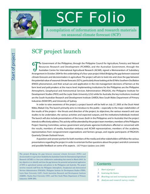
SCF Folio<br />
A compilation of in<strong>for</strong>mation and research materials<br />
on seasonal climate <strong>for</strong>ecast (SCF)<br />
Start of project<br />
SCF project launch<br />
The Government of the <strong>Philippine</strong>s, through the <strong>Philippine</strong> Council <strong>for</strong> Agriculture, Forestry and Natural<br />
Resources Research and <strong>Development</strong> (PCARRD), and the Australian Government, through the<br />
Australian Centre <strong>for</strong> International Agricultural Research (ACIAR), signed a Memorandum of Subsidiary<br />
Arrangement in October 2004 <strong>for</strong> the undertaking of a four-year project titled Bridging the gap between seasonal<br />
climate <strong>for</strong>ecasts and decisionmakers in agriculture. The project will aim to look into and close the gap between<br />
the potential value of seasonal climate <strong>for</strong>ecasts (SCFs), particularly those looking at the El Niño Southern Oscillation<br />
(ENSO) phenomenon, and their actual use and application in the risk-management decisions of farmers at the<br />
farm level and policymakers at the macro level. Implementing institutions <strong>for</strong> the <strong>Philippine</strong>s are the <strong>Philippine</strong><br />
Atmospheric, Geophysical and Astronomical Services Administration (PAGASA), the <strong>Philippine</strong> <strong>Institute</strong> <strong>for</strong><br />
<strong>Development</strong> <strong>Studies</strong> (PIDS) and the Leyte State University (LSU) while <strong>for</strong> Australia, the key institutions involved<br />
are the South Australian Research and <strong>Development</strong> <strong>Institute</strong> (SARDI), New South Wales Department of Primary<br />
Industries (NSW/DPI), and University of Sydney.<br />
In order to raise awareness of the project, a project launch will be held on July 27, 2005 at the Dusit Hotel<br />
Nikko, Makati City. The launch primarily aims to introduce to the public—especially to the major stakeholders of<br />
the results of the project—the thrusts and direction of the project, its objectives, the various research and case<br />
studies to be undertaken, the various activities and expected outputs, and the institutions/individuals involved.<br />
The launch will also include presentations of the issues (both in the <strong>Philippine</strong>s and in Australia) that the project<br />
intends to effectively address. This activity will be attended by the project team members, members of the <strong>Philippine</strong><br />
Project Steering Committee, various government and private agencies/institutions affected or concerned with<br />
the results, members of media, Australian embassy and ACIAR representatives, members of the academe,<br />
representatives from nongovernment organizations and farmers groups, and regular participants of PAGASA’s<br />
Quarterly Climate Outlook Forum.<br />
A question-and-answer portion <strong>for</strong> both members of the media and other stakeholders will follow the various<br />
presentations regarding the project in order to entertain further questions about the project and elicit comments<br />
and possible feedback on some of its aspects. (SCF Project Updates June 2005)<br />
The project Bridging the gap between seasonal climate <strong>for</strong>ecasts (SCFs) and<br />
decisionmakers in agriculture funded by the Australian Centre <strong>for</strong> International Agricultural<br />
Research (ACIAR) is a four-year collaborative undertaking that started in March 2005. Its<br />
key objective is to identify and close the gap between the potential and practical application<br />
of SCFs to agricultural systems and policies in the <strong>Philippine</strong>s and Australia. The project<br />
involves research staff from the <strong>Philippine</strong> Atmospheric, Geophysical and Astronomical<br />
Services Administration (PAGASA), <strong>Philippine</strong> <strong>Institute</strong> <strong>for</strong> <strong>Development</strong> <strong>Studies</strong> (PIDS),<br />
Leyte State University (LSU), South Australian Research and <strong>Development</strong> <strong>Institute</strong><br />
(SARDI), Charles Sturt University (CSU), and New South Wales Department of Primary<br />
Industries (NSW-DPI).<br />
Contents<br />
1 Start of project<br />
5 Learning the basics<br />
13 Reaching out and increasing awareness<br />
31 Analysis and research/survey results
2 SCF Folio<br />
About the project...<br />
Background<br />
Agriculture in the <strong>Philippine</strong>s and eastern Australia is<br />
greatly affected by the El Niño Southern Oscillation<br />
(ENSO). Climate in these two countries has higher<br />
season-to-season variability relative to other regions at<br />
the same latitude and level of annual rainfall. Such<br />
variability has significant effects on farm incomes. In<br />
Australia, it accounts <strong>for</strong> around 40 percent of the<br />
variation in its agricultural income. Similar<br />
consequences are also seen in the <strong>Philippine</strong>s. Climate<br />
variability leaves rainfed agricultural producers exposed<br />
to high levels of risk when making decisions about the<br />
choice of outputs and inputs. It can also lead to<br />
conservative practices that, while reducing the negative<br />
effects of climatic extremes, may however come at the<br />
expense of reduced agricultural incomes and higher<br />
resource degradation. Because of all these, a strategic<br />
mitigation of climatic risk that is so endemic to rainfed<br />
agriculture would clearly be of significant value to<br />
farmers.<br />
Areas affected by ENSO suffer from increased<br />
variability, but one compensation is that improvements<br />
El Niño is a phenomenon that occurs in a specific point in the eastern<br />
equatorial Pacific Ocean—which is quite a distance away from the<br />
<strong>Philippine</strong>s and Australia—but its effects and impact are nonetheless felt<br />
because of the interactions between the ocean surface temperature effect<br />
and the overlying atmosphere in the tropical Pacific region. This<br />
interaction is better known as the El Niño Southern Oscillation (ENSO).<br />
Effect of ENSO in the tropical Pacific<br />
in the understanding of ENSO now provide a degree<br />
of predictability about climate fluctuations. Climate<br />
<strong>for</strong>ecasts offer in<strong>for</strong>mation on climatic conditions in the<br />
coming season and are sometimes presented in the<br />
<strong>for</strong>m of a probability of receiving ‘above median’ or<br />
‘below median’ rainfall. They offer skillful albeit<br />
uncertain in<strong>for</strong>mation about climatic conditions in<br />
periods of 3–12 months ahead.<br />
In Australia, the Bureau of Meteorology provides<br />
three monthly seasonal climate outlooks based on the<br />
Southern Oscillation Index (SOI) and sea surface<br />
temperature (SST) anomalies. Although about 45<br />
percent of Australian farmers claim to take seasonal<br />
climate <strong>for</strong>ecasts into account when making decisions,<br />
focus groups show that many still have reservations on<br />
the accuracy, lead time and economic benefits of their<br />
application to a specific decision. The El Niño-related<br />
drought of 2002 that affected eastern Australia,<br />
however, has led to a heightened media and farmer<br />
interest in climate science.<br />
In the <strong>Philippine</strong>s, PAGASA issues seasonal climate<br />
<strong>for</strong>ecasts based on the state of the equatorial Pacific<br />
Ocean. The <strong>Philippine</strong>s is a country greatly affected by<br />
ENSO. In this regard, PAGASA releases ENSO bulletins<br />
as part of the National ENSO Early Warning Monitoring<br />
System (NEEWMS).<br />
It is important to ensure the accuracy and<br />
timeliness of climate <strong>for</strong>ecasts to reduce the difficulty<br />
of using probabilistic climate <strong>for</strong>ecasts in decisionmaking.<br />
Forecasts that shift the odds but do not remove<br />
all the uncertainty are difficult <strong>for</strong> decisionmakers to<br />
use. Specifically, there is a widespread belief that the<br />
adoption of SCFs is hampered in both the <strong>Philippine</strong>s<br />
and Australia by the lack of robust means of showing<br />
the economic value of SCF <strong>for</strong> specific decisions.<br />
Source: Australian Rainman<br />
Australia and the <strong>Philippine</strong>s promote SCFs<br />
In an attempt to address the above shortcoming, a<br />
Memorandum of Subsidiary Arrangement was inked<br />
between the <strong>Philippine</strong> Council <strong>for</strong> Agriculture, Forestry<br />
and Natural Resources Research and <strong>Development</strong><br />
(PCARRD) and the Australian Centre <strong>for</strong> International<br />
Agricultural Research (ACIAR) in October 2004 <strong>for</strong> the<br />
undertaking of a four-year project titled Bridging the<br />
gap between seasonal climate <strong>for</strong>ecasts and<br />
decisionmakers in agriculture. Implementing<br />
institutions <strong>for</strong> the <strong>Philippine</strong>s are the <strong>Philippine</strong><br />
Atmospheric, Geophysical and Astronomical Services
3<br />
Administration (PAGASA), the <strong>Philippine</strong> <strong>Institute</strong> <strong>for</strong><br />
<strong>Development</strong> <strong>Studies</strong> (PIDS) and the Leyte State<br />
University (LSU) while <strong>for</strong> Australia, the key institutions<br />
involved are South Australian Research and <strong>Development</strong><br />
<strong>Institute</strong> (SARDI), New South Wales Department of Primary<br />
Industries (NSW-DPI), and University of Sydney.<br />
The SCF project between Australian and <strong>Philippine</strong><br />
institutions will draw on economics and other disciplines<br />
to develop robust ways to use SCFs in risk management.<br />
This project will work with decisionmakers in the<br />
<strong>Philippine</strong>s and Australia to see where, when, and why<br />
skillful but uncertain SCFs can be valuable, and the<br />
circumstances when they are best ignored. The end result<br />
will be increased incomes of rural communities in the<br />
<strong>Philippine</strong>s and Australia.<br />
The project is expected to bring about improved<br />
economic, social, and environmental outcomes in the<br />
collaborating countries given that better management of<br />
climate variability has the potential to improve resource<br />
use efficiency by providing economic benefits through<br />
improved crop planting, management and grazing<br />
strategies.<br />
Case studies in the <strong>Philippine</strong>s and Australia will be<br />
used to assess where economic, environmental and social<br />
benefits may arise. The <strong>Philippine</strong> studies will focus on<br />
poor Filipino farmers who are vulnerable to climate<br />
variability while Australian studies will consider the impact<br />
of droughts on farming families and rural communities.<br />
Two key methods are to be employed in this project.<br />
The first is to value the potential contribution of SCF to<br />
decisionmaking under climate uncertainty based on<br />
insights from economics and psychology. The second<br />
method is the use of farm and policy-level case studies in<br />
the <strong>Philippine</strong>s and Australia to gain a practical appreciation<br />
of how decisionmakers actually use SCF and how to<br />
bridge the gap between potential and actual use of SCF.<br />
Case studies will use representative farm models to<br />
estimate the potential value of SCFs and will provide<br />
in<strong>for</strong>mation on how farmers and other decisionmakers<br />
use SCFs to make real decisions. An important component<br />
of the project is the development of extension strategies<br />
based on the case study experiences to promote the value<br />
of SCFs. To help implement this, the project will tap into<br />
extension networks in Australia and the <strong>Philippine</strong>s and<br />
provide tools <strong>for</strong> agricultural advisers to confidently<br />
promote SCFs to decision problems with the greatest<br />
payoff.<br />
Objectives<br />
• To improve the capacity of PAGASA to develop and<br />
deliver SCF <strong>for</strong> the case study regions of the<br />
<strong>Philippine</strong>s;<br />
• To distill key practical and methodological features of<br />
economic and psychological approaches to valuing SCF;<br />
• To estimate the potential economic value of SCF <strong>for</strong><br />
farm and policy or industry level case studies in the<br />
<strong>Philippine</strong>s and Australia;<br />
• To identify those factors leading to a gap between<br />
actual and potential values of SCF; and<br />
• To develop and implement strategies to better match<br />
<strong>for</strong>ecasts with decisionmaker’s needs. (SCF Project<br />
Updates June 2005)<br />
People and organizations involved...<br />
<strong>Philippine</strong> Atmospheric, Geophysical and<br />
Astronomical Services Administration (PAGASA)<br />
PAGASA is the <strong>Philippine</strong>s’ meteorological service<br />
organization and is a member of the World Meteorological<br />
Organization. Its mandate is “to mitigate or reduce the<br />
losses to life, property and the economy of the nation<br />
occasioned by typhoons, floods, droughts and other<br />
destructive weather disturbances.” Its website is http://<br />
www.pagasa. dost.gov.ph/.<br />
Dr. Flaviana D. Hilario is the chief of the Climatology<br />
and Agrometeorology Branch (CAB). She will supervise<br />
the preparation of the SCF and will coordinate with<br />
concerned agencies like the PIDS and LSU in the smooth<br />
implementation of the project.<br />
Ms. Edna L. Juanillo is the head of the Climate<br />
In<strong>for</strong>mation Monitoring and Prediction Center (CLIMPC)<br />
of the PAGASA (Weather Bureau). She is involved in the<br />
interpretation and analysis of the different climate<br />
parameters needed in the preparation of SCF. She will<br />
assist in the coordination of the <strong>Philippine</strong> activities with<br />
PIDS and LSU in the conduct of the study in the first two<br />
years of the project.<br />
Ms. Rosalina de Guzman is the assistant head of<br />
CLIMPC. She is involved in the preparation and issuance
4 SCF Folio<br />
of El Niño/La Niña advisories, weather outlook, and<br />
seasonal <strong>for</strong>ecast. She will participate in the translation<br />
of global climate <strong>for</strong>ecasts into local climate predictions<br />
which is one of the in<strong>for</strong>mation needed in the<br />
preparation of SCF.<br />
Mr. Ernesto R. Verceles is a weather specialist<br />
assigned at the CLIMPC. He is involved in the<br />
preparation and issuance of El Niño/La Niña updates,<br />
climate in<strong>for</strong>mation and <strong>for</strong>ecasts. He will participate<br />
in the translation of global climate <strong>for</strong>ecasts into local<br />
climate predictions.<br />
Dr. Aida M. Jose is the <strong>for</strong>mer chief of the CAB. As a<br />
local consultant of the project, she is involved in the<br />
overall analysis and interpretation of the data and<br />
in<strong>for</strong>mation which will be vital in the preparation of the SCF.<br />
Leyte State University (LSU)<br />
Leyte State University is situated in Eastern Visayas,<br />
<strong>Philippine</strong>s and is recognized as the center of excellence<br />
<strong>for</strong> instruction, research and development in agriculture<br />
and related fields, including <strong>for</strong>estry in the Visayas. It<br />
provides its students with the highest quality of<br />
scientific knowledge to serve the needs of the region.<br />
Its web address is http://www.lsu-visca. edu.ph/.<br />
Dr. Canesio Predo is an assistant professor<br />
(Resource and Environmental Economics) with the<br />
National Abaca Research Center. He is reviewing<br />
methods of valuing SCF and applying these methods<br />
to case studies in the <strong>Philippine</strong>s.<br />
Ms. Eva Monte is an agricultural economics<br />
researcher at LSU. She will be working with Dr. Predo on<br />
the case studies and the development of tools and<br />
in<strong>for</strong>mation packages on valuing SCFs.<br />
<strong>Philippine</strong> <strong>Institute</strong> <strong>for</strong> <strong>Development</strong> <strong>Studies</strong><br />
(PIDS)<br />
The <strong>Institute</strong> is a government research institution<br />
engaged in long-term, policy-oriented research.<br />
Through the <strong>Institute</strong>’s activities, it is hoped that policyoriented<br />
research on social and economic development<br />
can be expanded to assist the government in planning<br />
and policymaking. An important goal of PIDS is to<br />
provide analysis of socioeconomic problems and issues<br />
to support the <strong>for</strong>mulation of plans and policies <strong>for</strong><br />
sustained socioeconomic development in the<br />
<strong>Philippine</strong>s. Its website is http://www.pids.gov.ph/.<br />
Dr. Celia M. Reyes is a senior research fellow at PIDS.<br />
Her expertise lies in econometric modelling and<br />
poverty analysis. She is applying this expertise to both<br />
farm and policy-level case studies in the <strong>Philippine</strong>s.<br />
Ms. Jennifer P.T. Liguton is the director <strong>for</strong> Research<br />
In<strong>for</strong>mation at PIDS. She is involved in coming up with<br />
strategies to communicate the results of the Project’s<br />
studies to farmers and policymakers as well as to other<br />
stakeholders.<br />
Mr. Mario C. Feranil is the concurrent OIC vicepresident<br />
of PIDS and director <strong>for</strong> Project Services. He<br />
will be responsible, in partnership with Dr. Kevin Parton,<br />
<strong>for</strong> the monitoring and evaluation aspects of the project.<br />
Mr. Christian D. Mina is an in<strong>for</strong>mation systems<br />
researcher at PIDS under the supervision of Dr. Celia M.<br />
Reyes. He will be working with Dr. Reyes on the case<br />
studies and the development of tools and in<strong>for</strong>mation<br />
packages on valuing seasonal climate <strong>for</strong>ecasts.<br />
South Australian Research and <strong>Development</strong><br />
<strong>Institute</strong> (SARDI)<br />
SARDI is a leading research and development institute<br />
that conducts innovative applied research and<br />
development to enhance the efficiency and economic<br />
contribution to South Australia’s industries on field crop,<br />
horticulture, livestock, and fishing and aquaculture as<br />
well as on pastures and sustainable resources, and<br />
natural resource management. Its website is<br />
www.sardi.sa.gov.au/index.html.<br />
Dr. Peter Hayman is principal scientist <strong>for</strong> Climate<br />
Applications at the SARDI in Adelaide. As project leader<br />
<strong>for</strong> both the Australian and <strong>Philippine</strong> groups, he will<br />
draw together the inputs from economists, applied<br />
climatologists and farm advisers and will actively be<br />
engaged in developing learning packages <strong>for</strong><br />
intermediaries promoting SCFs. He will particularly<br />
be responsible <strong>for</strong> developing the in<strong>for</strong>mation<br />
packages <strong>for</strong> endusers and will assist in the case<br />
studies in Australia.<br />
New South Wales Department of Primary<br />
Industries (NSW/DPI)<br />
NSW/DPI is the largest provider of research and extension<br />
services to agriculture in New South Wales. It is a partner<br />
in the development of profitable, sustainable primary<br />
industries <strong>for</strong> New South Wales to ensure that primary<br />
industries have appropriate access to natural resources;<br />
communities benefit from the wise use of natural<br />
resources; and regional economies are enhanced. Its<br />
website is http://www.dpi.nsw.gov.au/reader/dpi.
5<br />
Learning the basics<br />
Dr. John Mullen is research leader <strong>for</strong> Economics<br />
Coordination and Evaluation at the NSW/DPI and adjunct<br />
professor at the Faculty of Rural Management at the<br />
University of Sydney. He is involved in the review of<br />
methods <strong>for</strong> valuing SCF and in the proposed case study<br />
in the rangelands of NSW.<br />
University of Sydney<br />
The Faculty of Rural Management has research strengths<br />
in agribusiness, farming systems and natural resource<br />
management. Improvements in the availability and use<br />
of seasonal climate <strong>for</strong>ecasts clearly impact on all three of<br />
these areas. Its web address is http://www.csu.edu.au/.<br />
Professor Kevin Parton is dean of the Faculty of Rural<br />
Management. He will concentrate on the relationships<br />
between the economics and psychology approaches to<br />
decisionmaking and valuation of SCF. Professor Parton will<br />
be involved in policy case studies in both Australia and<br />
the <strong>Philippine</strong>s.<br />
Jason Crean is a postgraduate student at the<br />
University of Sydney and is currently undertaking a PhD<br />
on the value of climate <strong>for</strong>ecasting in selected farming<br />
systems in eastern Australia. He has expertise in the<br />
economic modelling of farming systems and will be<br />
involved in the policy and farm level case studies in<br />
Australia. (SCF Project Updates June 2005)<br />
<strong>Philippine</strong> weather and climate 101<br />
In a <strong>for</strong>um on Basic Climatology Concepts and<br />
In<strong>for</strong>mation organized by the <strong>Philippine</strong> <strong>Institute</strong><br />
<strong>for</strong> <strong>Development</strong> <strong>Studies</strong> (PIDS), in collaboration<br />
with the <strong>Philippine</strong> Atmospheric, Geophysical and<br />
Astronomical Services Administration (PAGASA) and Leyte<br />
State University (LSU), on April 21 under the project on<br />
seasonal climate <strong>for</strong>ecasts (SCFs) funded by the Australian<br />
Centre <strong>for</strong> International Agricultural Research (ACIAR), a<br />
team of climate experts and researchers from PAGASA<br />
briefed an audience of technical and policy-level<br />
representatives from various government agencies and<br />
members of the academe on certain basic concepts and<br />
in<strong>for</strong>mation about <strong>Philippine</strong> weather and climate. The<br />
briefings included a compehensive lecture on the El Niño<br />
phenomenon—its definition, characteristics, evolution,<br />
and tools of prediction, among others.<br />
The <strong>for</strong>um is only the first of a series of <strong>for</strong>a to be<br />
conducted by the abovementioned institutions under the<br />
four-year ACIAR-funded project and is part of the<br />
in<strong>for</strong>mation, education, and communication component<br />
of the project to help people have a better understanding<br />
of the effects of certain climatic events and conditions<br />
like the El Niño phenomenon and how to respond to them.<br />
In his lecture on the El Niño event, <strong>for</strong> instance, Mr.<br />
Ernesto Verceles, a weather specialist from PAGASA,<br />
explained that while the El Niño is a phenomenon that<br />
occurs in a specific point in the eastern equatorial Pacific<br />
Ocean—which is quite a distance away from the<br />
<strong>Philippine</strong>s—its effects and impact are nonetheless felt<br />
in the country because of the interactions between the<br />
ocean surface temperature effect and the overlying<br />
atmosphere in the tropical Pacific region. This interaction<br />
is better known as the El Niño Southern Oscillation (ENSO).<br />
While there is no way that an El Niño and its effects<br />
may be stopped, ef<strong>for</strong>ts in research and prediction<br />
modelling may, however, help improve the capacity to<br />
understand the phenomenon and the reliability of<br />
<strong>for</strong>ecasts about the onset of the El Niño, thereby helping<br />
to prepare <strong>for</strong> it. In the <strong>Philippine</strong>s, PAGASA will play a big<br />
role in providing more reliable SCFs to guide various<br />
stakeholders, more specifically the farm sector. It is<br />
expected that from case studies to be done in different<br />
regions in the country, PAGASA will be in a position to<br />
better match <strong>for</strong>ecasts with decisionmakers’ needs,<br />
thereby closing the gap between actual and potential<br />
values of SCF.<br />
Finally, during the <strong>for</strong>um, the difference between<br />
weather and climate was explained. Weather is a specific<br />
condition of the atmosphere at a particular time and<br />
space while climate is the average weather <strong>for</strong> a longer<br />
period of time. The various elements or factors affecting<br />
the weather and/or climate as well as the different climate<br />
types in the various regions of the <strong>Philippine</strong>s were also<br />
presented and discussed. As a supplement, the PAGASA<br />
also gave an outlook of the climate in the <strong>Philippine</strong>s <strong>for</strong><br />
the next three months. (SCF Project Updates June 2005)
6 SCF Folio<br />
Basics on <strong>Philippine</strong> climatology<br />
In our daily lives, the weather plays a particular<br />
role. Whether we commute to our work stations<br />
or work in the farm or do our daily chores as<br />
homebodies, knowing what the weather outlook will<br />
be is useful <strong>for</strong> our respective purposes.<br />
Beyond the knowledge of having the sun shining<br />
brightly or having rains <strong>for</strong> the day, however, the average<br />
citizen does not know much about the weather or<br />
climate.<br />
And <strong>for</strong> a country like the <strong>Philippine</strong>s where<br />
certain weather/climate conditions affect lives,<br />
properties and sources of livelihood on an almost<br />
regular basis, understanding more about the nature,<br />
causes and manifestations of these conditions may, in<br />
a way, help be better prepared <strong>for</strong> them when they<br />
come. This writeup is thus a starting point <strong>for</strong> learning<br />
a little more about them.<br />
Weather is the specific condition of the atmosphere<br />
at a particular place and time. It can change from hour<br />
to hour and from one season to another. Climate, on<br />
the other hand, is the average weather of a particular<br />
area that prevails over a particular period of, <strong>for</strong> instance,<br />
over a month, one season, a year, or even several years.<br />
Figure 1. Climate map of the <strong>Philippine</strong>s based<br />
on the modified Coronas classification<br />
Weather/climate is measured and characterized by<br />
a number of elements but the three most important<br />
are temperature, humidity and rainfall. Temperature<br />
refers to the degree of hotness and coldness of the<br />
atmosphere. Humidity is the moisture content of the<br />
atmosphere while rainfall is the amount of precipitation<br />
in liquid <strong>for</strong>m falling over a specific area. Its distribution<br />
varies across regions in the country depending on the<br />
direction of moisture-bearing winds and the presence<br />
of mountain systems.<br />
The climate of the Philipines is influenced by the<br />
complex interaction of various factors such as the<br />
country’s geography and topography; principal air<br />
streams; ocean currents; linear systems such as the<br />
intertropical convergence zone; and tropical cyclones<br />
which are classified as tropical depression, tropical<br />
storm or typhoon, depending on their intensities (to<br />
be presented in a separate issue of the Economic Issue<br />
of the Day).<br />
Among these factors, it is perhaps useful to<br />
understand the movements of air streams. Rainfall is<br />
generally a result of the movement and interaction of<br />
cold and warm air masses in a particular period. The<br />
Southwest Monsoon or locally known as Habagat, <strong>for</strong><br />
instance, affects the country from May to September<br />
and occurs when warm moist air flows over the country<br />
from the southwest direction. This brings in rains to the<br />
western portion of the country. The Northeast Monsoon<br />
or Amihan, meanwhile, affects the eastern portions of<br />
the country from October to late March. Cold and dry<br />
air mass from Siberia gathers moisture as it travels over<br />
the Pacific and brings widespread cloudiness with rains<br />
and showers upon reaching the eastern parts of the<br />
<strong>Philippine</strong>s. In addition, a cold front affects the country<br />
from November to February and brings increased<br />
cloudiness and heavy rains. This occurs when a mass of<br />
moving cold air overtakes a mass of moving warm air<br />
resulting in towering cloud <strong>for</strong>mations that bring heavy<br />
rains and thunderstorms.<br />
On the whole, the climate of the <strong>Philippine</strong>s (using<br />
temperature and rainfall as the gauge) can be divided<br />
into two major seasons: the rainy season, which sets in<br />
by June and ends around November, and the dry<br />
season, which sets in by December and ends in May.
7<br />
The dry season is also subdivided into the cool dry season<br />
from December to February and the hot dry season from<br />
March to May.<br />
The entire country, however, may be characterized<br />
by four types or classifications (Figure 1) of climate based<br />
on the distribution of rainfall.<br />
Type I—has two pronounced seasons: dry from<br />
November to April and wet throughout the rest of the<br />
year. The western parts of Luzon, Mindoro, Negros, and<br />
Palawan experience this climate. These areas are shielded<br />
by mountain ranges but are open to rains brought in by<br />
Habagat and tropical cyclones.<br />
Type II—characterized by the absence of a dry<br />
season but with a very pronounced maximum rain period<br />
from November to January. Regions with this climate are<br />
along or very near the eastern coast (Catanduanes,<br />
Sorsogon, eastern part of Albay, eastern and northern<br />
parts of Camarines Norte and Sur, eastern part of Samar,<br />
and large portions of Eastern Mindanao).<br />
Type III—seasons are not very pronounced but are<br />
relatively dry from November to April and wet during the<br />
rest of the year. Areas under this type include the western<br />
part of Cagayan, Isabela, parts of Northern Mindanao, and<br />
most of Eastern Palawan. These areas are partly sheltered<br />
from tradewinds but are open to Habagat and are<br />
frequented by tropical cyclones.<br />
Type IV—characterized by a more or less even<br />
distribution of rainfall throughout the year. Areas with this<br />
climate include Batanes, Northeastern Luzon, Southwest<br />
Camarines Norte, west of Camarines Sur, Albay, Northern<br />
Cebu, Bohol, and most of Central, Eastern, and Southern<br />
Mindanao. (Economic Issue of the Day Vol. V, No. 2-July 2005)<br />
Tropical cyclone signals: bracing<br />
<strong>for</strong> the wind<br />
Typhoons, tropical storms, tropical depressions, and<br />
other weather disturbances are usual occurrences<br />
in the <strong>Philippine</strong>s. According to the <strong>Philippine</strong><br />
Atmospheric, Geophysical and Astronomical Services<br />
Administration (PAGASA), an average of 19–20 tropical<br />
cyclones visit the country every year, some of which may<br />
cause deaths to many people and millions of pesos in<br />
damaged property.<br />
But how strong can tropical cyclones be and how<br />
much damage can they cause What is their pattern of<br />
occurrence<br />
These questions are important to consider especially<br />
<strong>for</strong> a typhoon-frequented country like the <strong>Philippine</strong>s so<br />
In meteorology, a tropical cyclone is a low-pressure system<br />
wherein the central region is warmer than the surrounding<br />
atmosphere. Its strongest winds are concentrated close to its<br />
center. From pictures taken above the earth, a tropical cyclone<br />
resembles a huge whirlpool of white clouds.<br />
Tropical cyclone is the general term <strong>for</strong> all storm circulations<br />
that originate over tropical waters. It is called hurricane over<br />
the Atlantic Ocean, cyclone over the Indian Ocean, and typhoon<br />
over the Pacific Ocean.<br />
that one can be better prepared to deal with them and<br />
thereupon prevent possible damages and loss of lives.<br />
In a nutshell, the various terms listed herein are<br />
actually interchangeable, depending on the intensity of<br />
the weather disturbance and location. By international<br />
agreement, tropical cyclone is the general term <strong>for</strong> all<br />
storm circulations that originate over tropical waters. It is<br />
called hurricane over the Atlantic Ocean, cyclone over the<br />
Indian Ocean and typhoon over the Pacific Ocean.<br />
In meteorology, a tropical cyclone is a low-pressure<br />
system wherein the central region is warmer than the<br />
surrounding atmosphere. Its strongest winds are<br />
concentrated close to its center. From pictures taken<br />
above the earth, a tropical cyclone resembles a huge<br />
whirlpool of white clouds. It has a disc-like shape with a<br />
vertical scale of tens of kilometers against horizontal<br />
dimensions of hundreds of kilometers.<br />
Types of tropical cyclones<br />
Tropical cyclones are categorized into three types:<br />
• Tropical depression – a tropical cyclone with<br />
maximum surface winds ranging from 37 to 62<br />
kilometers per hour (kph) (20 to 33 knots).<br />
• Tropical storm – a tropical cyclone with maximum
8 SCF Folio<br />
Signal No. Wind Speed and Time Impact of Winds<br />
of Occurrence<br />
1 30–60 kph within the next Twigs and branches may be broken; some banana plants may be tilted;<br />
36 hours houses of very light material may be unroofed; flowering rice crop may be<br />
damaged; in general, very little or no damage may be experienced by the<br />
community.<br />
2 60–100 kph within the next Some coconut trees may be tilted and broken; few big trees may be<br />
24 hours uprooted and many banana plants may be downed; rice and corn may be<br />
adversely damaged; many nipa and cogon houses may be partially or totally<br />
unroofed and old galvanized iron roofings may be peeled off; in general,<br />
winds may bring light to moderate damage to the community.<br />
3 100–185 kph within the next Many coconut trees may be broken or destroyed; almost all banana plants<br />
18 hours may be downed while many trees may be uprooted; rice and corn crops<br />
may suffer heavy losses; majority of nipa and cogon houses may be unroofed<br />
or destroyed and there may be considerable damage to structures of light to<br />
medium construction; widespread disruption of electrical power and<br />
communication services may also occur; in general, moderate to heavy<br />
damage may be expected, practically in the agricultural and industrial<br />
sectors.<br />
4 Greater than 185 kph within Coconut, rice, and corn plantations may suffer extensive damage and many<br />
the next 12 hours<br />
large trees may be uprooted; most residential and institutional buildings of<br />
mixed construction may also be severely damaged; electrical power<br />
distribution and communication services may be disrupted; in general,<br />
damage to affected communities can be very heavy.<br />
surface winds in the range of 63 to 117 kph (34 to<br />
63 knots).<br />
• Typhoon/hurricane – a tropical cyclone with<br />
maximum surface winds of 119 to 239 kph (64 to 129<br />
knots).<br />
A super typhoon is a term used by the U.S. Joint<br />
Typhoon Warning Center in Guam <strong>for</strong> typhoons that<br />
reach maximum surface winds of at least 242 kph (130<br />
knots).<br />
The areas affected by these tropical cyclones, as<br />
indicated by their respective term, are those in the<br />
tropics, the region of the earth centered on the equator<br />
and sandwiched between the Tropic of Cancer in the<br />
northern hemisphere and the Tropic of Capricorn in the<br />
southern hemisphere. Countries that are situated in<br />
these areas are found in Africa, Asia, South and Central<br />
America, the Caribbean, and those in the Indian and<br />
Pacific Oceans. Most of these are developing countries<br />
such as Kenya, Mozambique, the <strong>Philippine</strong>s, Indonesia,<br />
Malaysia, Egypt, Mexico, Ecuador, Brazil, Saudi Arabia,<br />
and the Bahamas, among others. It also includes<br />
southern China, Australia, and Chile.<br />
<strong>Philippine</strong> storm warning signals<br />
For the <strong>Philippine</strong>s, PAGASA devised four warning<br />
signals that describe the meteorological conditions and<br />
impact of the winds of an approaching tropical cyclone<br />
as shown above.<br />
Seasons and path of potential destruction<br />
An average of 100 tropical cyclones are <strong>for</strong>med every<br />
year around the world. Of this total, the bulk is <strong>for</strong>med<br />
in one region or area—the western north Pacific Ocean.<br />
An average of 30 cyclones every year are <strong>for</strong>med here.<br />
They usually move westward approaching the<br />
<strong>Philippine</strong>s.<br />
Once in the <strong>Philippine</strong> area of responsibility (PAR),<br />
these tropical cyclones, now called typhoons, usually<br />
move northwest; in the process, leaving destruction to<br />
the provinces in northern Luzon. The typhoons then<br />
exit the PAR and head toward Taiwan, southern China<br />
or Japan.<br />
What has been the pattern of frequency that<br />
tropical cyclones or typhoons enter the <strong>Philippine</strong>s<br />
When and where can they bring potential destruction<br />
PAGASA estimates that the monthly average<br />
frequencies of tropical cyclones that enter the PAR from
9<br />
Tropical cyclone average tracks<br />
Jan to Mar<br />
Apr to Jun<br />
Jul to Sep<br />
January to April are 0.4, 0.3, 0.3, and 0.5, respectively. This<br />
suggests that these months have the slimmest chance of<br />
tropical cyclone activities in the <strong>Philippine</strong>s throughout<br />
the year. Starting May and June, however, an average of<br />
one tropical cyclone <strong>for</strong> each month occurs and then<br />
jumps to about three each <strong>for</strong> the months of July, August,<br />
and September. By October and November, an estimate<br />
of about two per month occurs, signaling the start of<br />
descent of the cyclone activities in the <strong>Philippine</strong>s, with<br />
just about one occurrence <strong>for</strong> the month of December.<br />
Although there is a recession in the number of<br />
tropical cyclone occurrences in the months of October<br />
to December, it is to be noted nevertheless that most of<br />
the destructive cyclones/typhoons that have taken place<br />
were recorded during this period. This is due to the fact<br />
that the paths of these disturbances have, as seen in the<br />
illustrations, a much wider range of possible tracks over<br />
Luzon and Visayas during this period. At the same time,<br />
there is also a high probability that these cyclones tend<br />
to cross the archipelago, creating much damage to the<br />
populace.<br />
Is there any change in the cyclones/typhoons' path<br />
when seasonal phenomena like El Niño and La Niña take<br />
place At the moment, the weather bureau is in the<br />
process of further tracking the average paths of tropical<br />
cyclones and determining if there is a difference in their<br />
usual path during the periods of El Niño and La Niña.<br />
(Economic Issue of the Day Vol. V, Nos. 3&4-December 2005)<br />
References<br />
http://hurricanewaves.org<br />
http://www.hko.gov.hk/in<strong>for</strong>mtc/nature.htm<br />
http://www.ndcc.gov.ph<br />
http://www.pagasa.dost.gov.ph<br />
http://www.typhoon2000.ph/info.htm<br />
http://www.wikipedia.org<br />
Lucero, A. Warning system <strong>for</strong> tropical cyclones in the <strong>Philippine</strong>s.<br />
Powerpoint presentation. PAGASA.<br />
Verceles, E. Climate concepts, climate of the <strong>Philippine</strong>s, and<br />
ENSO. Powerpoint presentation. PAGASA.
10 SCF Folio<br />
Understanding the ENSO phenomenon<br />
and its implications<br />
Ask anyone about what he/she thinks El Niño place and something must be done to address its<br />
is and the usual answers would be—a possible consequences.<br />
severe drought or a long hot summer or a<br />
dry spell followed by heavy rains. While all of these are<br />
indeed associated with El Niño, they are, however,<br />
merely the effects or impacts of this phenomenon. What<br />
it really is lies somewhere in the Pacific.<br />
Feeling the heat<br />
Although the physical occurrence of El Niño (and La<br />
Niña) takes place in the Pacific, its effects are felt in other<br />
parts of the world, similar to a ripple effect in a big pond.<br />
This is due to the so-called southern oscillation (SO)<br />
What it basically is…<br />
El Niño is a condition that takes place in the Central and<br />
Eastern Equatorial Pacific (CEEP) Ocean, when the sea<br />
surface temperature (SST) becomes unusually warmer<br />
than the normal temperature. This condition can prevail<br />
<strong>for</strong> more than a year, thus adversely affecting the<br />
economy in both local and global scale.<br />
The sea or ocean surface usually registers a certain<br />
normal temperature. Any departure from this normal<br />
level is considered an anomaly. If the temperature rises<br />
from normal, it is called a positive anomaly. This<br />
condition is associated with El Niño. Conversely, if the<br />
temperature drops from normal, it is called a negative<br />
anomaly and is more popularly related to La Niña. Either<br />
way, any change in the temperature, just like in the<br />
human body, indicates that something unusual is taking<br />
which refers to a “see-saw” in atmospheric pressure<br />
between the western (represented by Darwin in<br />
Australia) and eastern Pacific (represented by the island<br />
of Tahiti).<br />
These variations in the atmosphere in the Pacific,<br />
combined with changes in the SST as discussed earlier,<br />
are responsible <strong>for</strong> bringing about abnormal climatic<br />
events. The interaction between sea and atmosphere<br />
variations refers to the El Niño Southern Oscillation<br />
(ENSO) and potentially influences extreme climate<br />
events in the world (El Niño refers to the ocean or sea<br />
component of ENSO while the SO refers to the<br />
atmospheric component).<br />
El Niño and La Niña are basically flip sides (warm<br />
and cold phases, respectively) of the ENSO and as such,<br />
do not take place simultaneously in one area/region.<br />
However, in terms of<br />
teleconnection or the links of<br />
El Niño<br />
El Niño (EN) is Spanish <strong>for</strong> “The Christ Child,” a name given by Peruvian fishermen to the<br />
phenomenon that they usually observed during the period near Christmas time when the water in<br />
climate over great distances, if<br />
the eastern part of the Pacific<br />
experiences an unusual ocean<br />
the Pacific Ocean off the coast of Peru would become unusually warm. Every two to nine years, <strong>for</strong><br />
warming and low atmospheric<br />
unexplained reason, trade winds in the Pacific region, which drive the surface warm waters of the<br />
pressure (characteristics of the<br />
tropics to the west Pacific, weaken. As a result, these warm waters of the western Pacific drift<br />
eastward, resulting in the occurrence of El Niño in the eastern part of the Pacific.<br />
warm phase or El Niño), then the<br />
western part of the Pacific will<br />
Southern oscillation<br />
Southern oscilllation (SO) is an east-west balancing movement of air masses between the eastern<br />
likely experience the opposite<br />
effect, characterized by cooler<br />
Pacific and the Indo-Australian areas. It is measured as the difference between the overlying<br />
ocean and high atmospheric<br />
atmospheric pressures at Darwin (northern Australia) and Tahiti (south-central Pacific). This term<br />
pressure.<br />
was coined by the British scientist named Sir Gilbert Walker during the 1920s when he observed<br />
that when the atmospheric pressure rises in the east, the waters of the eastern Pacific are unusually<br />
cold, and when the atmospheric pressure drops in the eastern Pacific, the waters in this part of the<br />
Pacific are unusually warm. The opposite effects are observed in the western Pacific.<br />
The implications<br />
The effects of ENSO on climate<br />
variability all over the globe
11<br />
inevitably have impacts on the various ecological and<br />
agricultural production systems around the world.<br />
In the <strong>Philippine</strong>s, <strong>for</strong> instance, an ENSO event can<br />
trigger extreme climatic effects such as droughts, strong<br />
winds, floods and flashfloods, increasing or decreasing<br />
temperatures and many more. The impacts on <strong>Philippine</strong><br />
climate are initially felt three or five months after the<br />
development of an ENSO phenomenon in the tropical<br />
Pacific. If the ocean-atmosphere interaction or ENSO is<br />
stronger than the usual, however, the <strong>Philippine</strong>s may feel<br />
the weather abnormalities much earlier.<br />
One of the abnormalities brought about by El Niño,<br />
the warm phase of ENSO, is a generally drier weather<br />
condition, the effect of which is greatly felt during the<br />
dry season. From May to September or during the<br />
country’s rainy season due to the southwest monsoon,<br />
though, rains may still be expected or felt even with an El<br />
Niño occurring in the Pacific.<br />
Once the southwest monsoon rainy season ends by<br />
late September or early October, rains may be much lesser<br />
than normal during an El Niño event. This is critical<br />
especially <strong>for</strong> rice farmers in Central Luzon who<br />
traditionally prepare <strong>for</strong> their second cropping season<br />
be<strong>for</strong>e the end of the year. If there is indeed an El Niño<br />
event, this implies, among others, that enough water<br />
should have been stored in the water reservoirs so as to<br />
provide irrigation <strong>for</strong> the crop upon the onset of the dry<br />
season (January to April) when hardly any or no rain might<br />
be expected.<br />
Finally, once the El Niño/La Niña signs start to brew,<br />
there is nothing that can stop them from occurring. It is<br />
nonetheless useful to understand the processes on how<br />
they evolve to be able to be better prepared <strong>for</strong> them.<br />
(Economic Issue of the Day Vol. V, No. 1-July 2005)<br />
Knowing when El Niño/La Niña is here<br />
In a previous Economic Issue of the Day (Vol. V, No. 1,<br />
July 2005), a basic understanding was presented on<br />
what the El Niño Southern Oscillation (ENSO)<br />
phenomenon is all about, its characteristics and two<br />
phases, and its implications.<br />
ENSO is a phenomenon that takes place in the<br />
central and eastern equatorial Pacific largely<br />
characterized by an interaction between the ocean and<br />
the atmosphere and their combined effect on climate. The<br />
mutual interaction between the ocean and the<br />
atmosphere is a critical aspect of the ENSO phenomenon.<br />
Major ENSO indicators are the sea surface<br />
temperature anomaly (SSTA) and the Southern Oscillation<br />
Index (SOI).<br />
SSTA refers to the departure or difference from the<br />
normal value in the sea or ocean surface temperature. El<br />
Niño events are characterized by positive values (greater<br />
than zero) within a defined warm temperature threshold<br />
while La Niña events are characterized by negative values<br />
(less than zero) within a defined cold temperature<br />
threshold.<br />
The SOI, on the other hand, measures the differences<br />
or fluctuations in air or atmospheric pressure that occur<br />
between the western and eastern tropical Pacific during<br />
El Niño and La Niña episodes. It is calculated on the basis<br />
of the differences in air pressure anomaly between Darwin<br />
in Australia (western Pacific) and Tahiti in French Polynesia<br />
(eastern Pacific). These two locations/stations are used in<br />
view of their having long data records.<br />
Albeit the seeming straight<strong>for</strong>ward description of<br />
these ENSO-related events as noted in the above, it is to<br />
be emphasized that through the years, it has not been<br />
easy to come up with a commonly agreed definition and<br />
identification of these ENSO-related events, i.e., El Niño or<br />
La Niña. The reason is due to the use of more than one<br />
standard index as basis in monitoring ENSO phenomena<br />
and the employ of different methods in determining the<br />
magnitude or value of such index and threshold as well<br />
as the length of time that such magnitude persists. In line<br />
with this, the <strong>Philippine</strong>s adopted the World<br />
Meteorological Organization (WMO) Regional Association<br />
IV Consensus Index and Definitions of El Niño and La Niña.<br />
Region IV includes the North and Central America<br />
member nations of the WMO, whose operational<br />
definitions in use of the two ENSO phases are the<br />
following:<br />
El Niño: A phenomenon in the equatorial Pacific<br />
Ocean characterized by a positive SST departure from
12 SCF Folio<br />
normal (<strong>for</strong> the 1971–2000 base period) in the Niño 3.4<br />
region, greater than or equal in magnitude to 0.5<br />
degrees C, and averaged over three consecutive<br />
months. Defined when the threshold or value is met<br />
<strong>for</strong> a minimum of five consecutive overlapping seasons.<br />
La Niña: A phenomenon in the equatorial Pacific<br />
Ocean characterized by a negative SST departure from<br />
normal (<strong>for</strong> the 1971–2000 base period) in the Niño 3.4<br />
region greater than or equal in magnitude to 0.5<br />
degrees C, and averaged over three consecutive<br />
months. Defined when the threshold or value is met<br />
<strong>for</strong> a minimum of five consecutive overlapping seasons.<br />
PAGASA: monitoring El Niño/La Niña events<br />
in the <strong>Philippine</strong>s<br />
In the <strong>Philippine</strong>s, how is El Niño/La Niña identified/<br />
monitored The country’s national meteorological<br />
agency, the <strong>Philippine</strong> Atmospheric, Geophysical and<br />
Astronomical Services Administration (PAGASA), defines<br />
and identifies these phenomena on the basis of the<br />
abovementioned indicators which are also being used<br />
by the National Oceanic and Atmospheric<br />
Administration-National Centers <strong>for</strong> Environmental<br />
Prediction (NOAA-NCEP) of the United States.<br />
Through the years and based on this definition<br />
and data from the NOAA, PAGASA has monitored the<br />
occurrence of El Niño/La Niña by category, as follows:<br />
a) weak El Niño/La Niña – magnitude of +0.5 to +1.0<br />
°C (or -0.5 to -1.0 °C)<br />
b) moderate El Niño/La Niña – magnitude of +1.0 to<br />
+1.5 °C (or -1.0 to -1.5 °C)<br />
c) strong El Niño/La Niña – magnitude of more than<br />
+1.5 °C (or less than -1.5 °C)<br />
When is El Niño/La Niña occurring<br />
Because ENSO-related phenomena have been a major<br />
source of interannual climate variability around the<br />
globe, especially in recent years, it is important to be<br />
able to determine or identify when an El Niño/La Niña<br />
is occurring or will take place.<br />
As noted earlier, monitoring the occurrence of an<br />
El Niño/La Niña involves the use of two most common<br />
indicators, the SSTA and the SOI, with the SSTA based Table 1 shows the years when these events and<br />
on the magnitude of departures/anomalies in the sea their categories have taken place in the last decade. It<br />
surface temperature in the Niño regions (see box), and is to be noted that no two ENSO events are alike in terms<br />
the SOI based on the difference in air pressure between of climate impacts. Accordingly, PAGASA gives out the<br />
Tahiti and Darwin.<br />
appropriate advisories to the various sectors and<br />
decisionmakers concerned on the occurrence/presence<br />
of El Niño/La Niña <strong>for</strong> their<br />
corresponding action.<br />
Box. NIÑO regions<br />
(Economic Issue of the Day Vol.<br />
VII, No. 1-January 2007)<br />
El Niño regions: Although El Niño is a generalized event in the equatorial Pacific, there are different<br />
regions which show different characteristics and different moments in the process. Past studies<br />
References<br />
show that the <strong>Philippine</strong> climate responds more significantly to temperature changes in the NIÑO<br />
3.4 region.<br />
Columbia University. 2006. When<br />
can we say El Niño will occur<br />
[online]. Available from the<br />
World Wide Web:(http://<br />
www.columbia.edu/~za2121/<br />
Peru-ENSO/Peru-ENSO/Webpages/El%20Nino/<br />
When%20will%20it%20<br />
occur.html).<br />
International Research <strong>Institute</strong><br />
<strong>for</strong> Climate and Society. 2006.<br />
Defining ENSO [online]. Available<br />
from the World Wide Web:(http:/<br />
/iri.columbia.edu/climate/ENSO/<br />
Source: International Research <strong>Institute</strong> <strong>for</strong> Climate and Society<br />
background/pastevent.html).
13<br />
Reaching out and increasing awareness<br />
Table 1. El Niño and La Niña episodes during the past decade<br />
Period Event Category<br />
May 1994 – April 1995 El Niño weak to moderate<br />
October 1995 – April 1996 La Niña weak<br />
June 1997 – May 1998 El Niño strong<br />
August 1998 – July 2000 La Niña moderate to strong<br />
November 2000 – March 2001 La Niña moderate<br />
June 2002 – April 2003 El Niño weak to moderate<br />
August 2004 – March 2005 El Niño weak<br />
Source of data: Climate Prediction Center – National Oceanic and Atmospheric<br />
Administration (CPC-NOAA), 2006<br />
Reaching out to local population<br />
on seasonal climate in<strong>for</strong>mation<br />
Part of the in<strong>for</strong>mation dissemination activity of<br />
the project funded by the Australian Centre <strong>for</strong><br />
International Agricultural Research (ACIAR) on<br />
seasonal climate <strong>for</strong>ecasts (SCFs) was a seminar-workshop<br />
held on June 30, 2005 at the Leyte State University (LSU)<br />
in Baybay, Leyte. In coordination with the <strong>Philippine</strong><br />
Atmospheric, Geophysical and Astronomical Services<br />
Administration (PAGASA) and the <strong>Philippine</strong> <strong>Institute</strong> <strong>for</strong><br />
<strong>Development</strong> <strong>Studies</strong> (PIDS), the LSU hosted the seminarworkshop<br />
to in<strong>for</strong>m the local people, particularly<br />
members of the academe in the region, agricultural<br />
officers, and other local officials, about the project and the<br />
value of SCFs in their decisionmaking processes in relation<br />
to crop production, especially in addressing the impact<br />
of El Niño and other extreme climate events. The seminar<br />
also aimed to strengthen the coordination and<br />
cooperation between PAGASA and the agricultural sector<br />
The seminar aimed to in<strong>for</strong>m the local people, particularly<br />
members of the academe in the region, agricultural officers,<br />
and other local officials, about the project and the value of SCFs<br />
in their decisionmaking processes in relation to crop<br />
production, especially in addressing the impact of El Niño and<br />
other extreme climate events.<br />
National Oceanic and Atmospheric Administration (NOAA). 2006.<br />
ENSO cycle: recent evolution, current status, and predictions<br />
[online]. Climate Prediction Center, National Centers <strong>for</strong><br />
Environmental Prediction. Available from the World Wide<br />
Web:(http://www.cpc.ncep.noaa.gov/products/<br />
analysis_monitoring/lanina/.<br />
<strong>Philippine</strong> <strong>Institute</strong> <strong>for</strong> <strong>Development</strong> <strong>Studies</strong>/Australian Centre<br />
<strong>for</strong> International Agricultural Research. 2006. SCF Project<br />
Updates Vol. II Nos. 1&2, 2006. Makati City: PIDS.<br />
Trenberth, K.E. 1997. The definition of El Niño. Bulletin of the<br />
American Meteorological Society 78:2771-2777.<br />
in order <strong>for</strong> the latter to be better served through proper<br />
application of weather and climate in<strong>for</strong>mation.<br />
Similar to what had been presented in the first<br />
Pulong Saliksikan held at the PIDS last April, resource<br />
persons from PAGASA presented basic climatology<br />
concepts and in<strong>for</strong>mation such as <strong>Philippine</strong> climatology,<br />
basic El Niño Southern Oscillation (ENSO) concepts,<br />
tropical cyclone warning system as well as a climate<br />
outlook <strong>for</strong> the province of Leyte. After the PAGASA<br />
lectures, responses from the local government unit (LGU)<br />
representatives regarding their agriculture response<br />
strategies to extreme climate events such as El Niño and<br />
La Niña were presented. The LGU representatives<br />
discussed the various measures they adopt under these<br />
circumstances, as divided into the (a) predisaster phase,<br />
(b) disaster phase, and (c) postdisaster phase.<br />
A lecture on PAGASA’s climate in<strong>for</strong>mation products<br />
and services offered then followed, after which the<br />
participants were divided into two groups and were asked<br />
their assessment of such products and services in terms<br />
of usefulness, timeliness, ease of understanding, and<br />
comprehensiveness. Suggestions on how said products<br />
may be further improved were likewise solicited from the<br />
participants. During this portion, exercises such as the<br />
plotting of a tropical cyclone track and interpretation of<br />
certain/selected PAGASA climate in<strong>for</strong>mation products were<br />
also given to the participants. (SCF Project Updates, June 2005)
14 SCF Folio<br />
Making the most out of seasonal climate<br />
<strong>for</strong>ecasts (SCFs)<br />
No one can tell <strong>for</strong> sure what the next season<br />
will be like. Even when a climate in a<br />
particular place or region is generally<br />
predictable, there is a varying difference in the yearly<br />
duration, intensity and timing of rainy and dry periods.<br />
Thus, it is important to know and understand SCF and<br />
how it may benefit the population.<br />
Global changes in weather and climate are largely<br />
brought about by the cycle of atmospheric and pattern<br />
changes in the Pacific Ocean called the El Niño Southern<br />
Oscillation (ENSO). This usually occurs in December;<br />
hence, the term “El Niño” <strong>for</strong> the “Christ Child,” and<br />
usually has a cycle duration of four years. The ENSO is a<br />
complex process but basically it involves the unusual<br />
warming and cooling of the ocean’s surface sea<br />
temperature. The El Niño is the warm phase of the ENSO<br />
while La Niña is the cool phase. The changes in<br />
temperature that these phases bring affect weather and<br />
climate in many parts of the world, even those that are<br />
far from the Pacific Ocean.<br />
With advances in science and technology, people’s<br />
knowledge on seasonal climate changes such as ENSO<br />
has grown considerably. A seasonal climate <strong>for</strong>ecast is<br />
an estimate of how rainfall or temperature in a coming<br />
season is likely to be different from the prevailing<br />
average climate. SCFs use dynamical (based on laws of<br />
physics) or statistical (based on historical patterns)<br />
methods to predict the climate. They usually <strong>for</strong>ecast<br />
“above median” or “below median” rainfall. Seasonal<br />
climate <strong>for</strong>ecasting is usually done three months to a<br />
year in advance or longer.<br />
Why it is important to understand SCFs<br />
Weather and climate are significant <strong>for</strong>ces in people’s<br />
lives. Important and not-so-important decisions are<br />
made depending on the weather or ensuing climate.<br />
Planning <strong>for</strong> social and economic benefits would be<br />
greatly enhanced by being able to <strong>for</strong>ecast seasonal<br />
conditions in the months ahead. Conversely, it can mean<br />
human lives and incomes lost when changes in climate<br />
are not anticipated. Thus, knowing and understanding<br />
SCFs can save lives, lessen the costs and present<br />
opportunities to various sectors <strong>for</strong> better planning and<br />
decisionmaking.<br />
The agriculture sector would naturally be the<br />
major beneficiary of SCF. For the <strong>Philippine</strong>s, it is one of<br />
the country’s top industries which accounted <strong>for</strong> about<br />
18 percent of the total gross domestic product (GDP)<br />
and whose labor <strong>for</strong>ce reached 11.38 million in 2004.<br />
Since agriculture is vulnerable to climate variability,<br />
farmers may benefit from SCFs by being able to choose<br />
what crops to plant and when to plant them. While the<br />
risks may not be completely eliminated, in<strong>for</strong>mation<br />
from SCFs can lessen the costs that would have been<br />
incurred and may even enable farmers to make<br />
substantial yields and higher incomes.<br />
Other end users of SCFs include the energy<br />
sector—suppliers of electricity and natural gas which<br />
benefit from <strong>for</strong>ecasts to help them plan energy usage<br />
and make operations run efficiently. The tourism<br />
industry is likewise a logical beneficiary as travel agents<br />
and event organizers are able to put together vacation<br />
packages and schedule occasions at appropriate times.<br />
Retailers and other businesses can also benefit from<br />
valuable climate <strong>for</strong>ecasts as they will be able to time<br />
their procurement of stocks that may be in demand<br />
once the weather changes. National and local<br />
governments can strengthen their civil defense<br />
programs by being able to stock up on supplies and<br />
train <strong>for</strong> emergency disaster operations and drought<br />
relief activities.<br />
Limitations of SCFs: bridging the gap<br />
Certainly, SCF is still an imperfect science even with the<br />
advancement of technology and research. The accuracy<br />
of the <strong>for</strong>ecasts is the primary concern which may<br />
fluctuate over a period of time and with successive<br />
<strong>for</strong>ecasts. It is not known what percentage of farmers<br />
in the <strong>Philippine</strong>s rely on SCFs in their decisionmaking.<br />
It is said that the use of SCFs in the country and in<br />
Australia is “hampered by the lack of robust means of<br />
showing the economic value of SCF-specific decisions.”<br />
Some of the major concerns regarding SCFs are<br />
their accuracy and timeliness, the difficulties
15<br />
To ensure that the SCFs are rendered useful to their<br />
beneficiaries, it is important that they reach them in a timely<br />
fashion and that they contain the needed in<strong>for</strong>mation <strong>for</strong> the<br />
decisionmakers. Thus, in<strong>for</strong>mation like when the rains will<br />
come, how frequently they will occur, and how much rainfall<br />
is to be expected must be delivered in the clearest, simplest,<br />
and most accurate manner.<br />
encountered in applying them to farm management<br />
decisions, and the apparent lack of evidence of their<br />
economic value to reduce the risks associated with their<br />
adoption. In view of this, the application of SCFs in<br />
decisionmaking has been more difficult than initially<br />
thought.<br />
blitzes to the farmers on the basics of weather, climate<br />
and seasonal <strong>for</strong>ecasts, issuing frequent weather and<br />
climate analyses in popular mass media, and making<br />
in<strong>for</strong>mation readily available and accessible to the farmers<br />
and other end users.<br />
A study on the usage of SCFs in Zimbabwe found<br />
that farmers complained of receiving climate <strong>for</strong>ecasts<br />
after they have made planting decisions. They also did<br />
not understand nor trusted the <strong>for</strong>ecasts. Thus, any<br />
seasonal climate <strong>for</strong>ecast communications system that<br />
will be developed by any country should involve the<br />
active participation of farmers and other stakeholders. In<br />
so doing, SCFs would have greater relevance, credibility<br />
and legitimacy. (SCF Project Updates, December 2005)<br />
Ground level: reaching out to end users <strong>for</strong> SCF<br />
in<strong>for</strong>mation<br />
To ensure that the SCFs are rendered useful to their<br />
beneficiaries, it is important that they reach them in a<br />
timely fashion and that they contain the needed<br />
in<strong>for</strong>mation <strong>for</strong> the decisionmakers. Thus, in<strong>for</strong>mation like<br />
when the rains will come, how frequently they will occur,<br />
and how much rainfall is to be expected must be delivered<br />
in the clearest, simplest, and most accurate manner. This<br />
may be achieved by conducting frequent in<strong>for</strong>mation<br />
Sources<br />
SCF Project Updates Vol. 1, June 2005.<br />
“Valuing seasonal climate <strong>for</strong>ecasts” by Dr. John Mullen.<br />
www.nscb.gov.ph.<br />
www.ksg.harvard.edu/sed/docs/k4dev/<br />
lemos_k4dev_031002.pp.<br />
www.census.gov.ph/data.<br />
http://iri.columbia.edu/outreach/meeting/MediaWS2001/<br />
Glossary.html.<br />
http://www.bas.gov.ph/agri_dev.php.<br />
Tale of two surveys: feedback to PAGASA’s<br />
climate in<strong>for</strong>mation products and services<br />
On June 30 and December 1, 2005, seminarworkshops<br />
on “Toward bridging the gap between<br />
seasonal climate <strong>for</strong>ecasts and decisionmakers in<br />
agriculture” were held in Baybay, Leyte and Malaybalay,<br />
Bukidnon, respectively. These seminars were part of the<br />
dissemination program of the four-year project with the<br />
above title sponsored by the Australian Centre <strong>for</strong><br />
International Agricultural Research (ACIAR) and were<br />
jointly conducted by the <strong>Philippine</strong> project implementing<br />
institutions, namely, the <strong>Philippine</strong> Atmospheric,<br />
Geophysical and Astronomical Services Administration<br />
(PAGASA), the <strong>Philippine</strong> <strong>Institute</strong> <strong>for</strong> <strong>Development</strong><br />
<strong>Studies</strong> (PIDS), and the Leyte State University (LSU). The<br />
purpose of these seminar-workshops was to introduce the<br />
project to various local government units, members of<br />
academe, and farmer groups in terms of its objectives,<br />
plan of activities, expected outputs, and possible utility in<br />
the decisionmaking and risk management of<br />
stakeholders/decisionmakers in agriculture. Some basic<br />
concepts relating to the project like the El Niño Southern<br />
Oscillation phenomenon, tropical cyclones, climate<br />
outlook and local <strong>for</strong>ecasts, and other useful<br />
meteorological terms and in<strong>for</strong>mation were also<br />
explained. Participants in these two seminars were from<br />
LGUs (mostly municipal agriculturists), the academe, and<br />
a few groups representing farmers.<br />
To help PAGASA in its goal of improving its service<br />
delivery, especially in terms of its climate in<strong>for</strong>mation<br />
products and services, to the agriculture sector and other<br />
related stakeholders, the participants were asked to
16 SCF Folio<br />
answer a survey questionnaire during the seminars. The<br />
questionnaire had two parts. The first referred to the<br />
participants’ profile which identified the respondents’<br />
designations and sector/category representation. The<br />
second referred to the participants’ feedback which had<br />
11 questions on what the respondents thought about<br />
PAGASA’s products and services. Aside from directly<br />
offering in<strong>for</strong>mation to PAGASA, the responses to the<br />
questionnaire may also provide some insights to the<br />
project team members on how decisionmakers in<br />
agriculture source and make use of in<strong>for</strong>mation<br />
regarding climate, including seasonal <strong>for</strong>ecasts.<br />
Findings<br />
Majority of the respondents were municipal<br />
agriculturists and members of the academe with a few<br />
members of farmers’ groups. All of them considered<br />
weather/climate as a factor in planning and<br />
decisionmaking in their work/source of livelihood, with<br />
the majority claiming it is a critical factor.<br />
Radio/tv were cited as the sources of in<strong>for</strong>mation<br />
about weather/climate used by the majority of the<br />
respondents, with PAGASA stations coming in second<br />
and the rest a split among local practices/beliefs,<br />
broadsheets/tabloids, advisories from head offices and<br />
associates and extension workers.<br />
In terms of awareness of PAGASA’s products and<br />
services, majority of the respondents in Leyte were<br />
aware while less than half of the respondents in<br />
Bukidnon were. Those who were aware and went on to<br />
rate these products and services gave generally good<br />
assessments.<br />
Suggestions given by the respondents on how to<br />
improve PAGASA’s products and services were basically<br />
the same as gleaned from the two surveys. Essentially,<br />
what the respondents want is <strong>for</strong> PAGASA to have a<br />
stronger presence in their municipalities and establish<br />
a stronger linkage with them. There was also a clamor<br />
<strong>for</strong> publications that are easier to understand, preferably<br />
PAGASA needs to do more to reach the people who use its products<br />
and services to make decisions that affect their work, especially<br />
since these people are in the rural areas and far from in<strong>for</strong>mationrich<br />
metropolises...<strong>More</strong> ef<strong>for</strong>t must also be made in making the<br />
in<strong>for</strong>mation more understandable and more accessible to the<br />
clients.<br />
in the vernacular, and more in<strong>for</strong>mation and education<br />
campaign (IEC) activities, trainings and seminars from<br />
PAGASA. Establishment of agromet and weather<br />
stations in their local government units (LGUs) was also<br />
shared by many of the respondents as well as the<br />
improvement of PAGASA’s facilities. Perhaps owing to<br />
the difference in the sector they belong to, the<br />
members of the academe in Leyte have access to the<br />
internet and thus wanted weather/climate data<br />
available online.<br />
The respondents in Leyte recommended a closer<br />
link between PAGASA and LGUs in order that the LGUs<br />
themselves could request the kind of in<strong>for</strong>mation that<br />
are more suited to their constituents and localities. They<br />
also cited the need <strong>for</strong> more site-specific data that the<br />
local weather stations could regularly disseminate to<br />
the community. Those in Bukidnon, on the other hand,<br />
basically wanted to have agromet stations and rain<br />
collector systems facilities in addition to more related<br />
publications and trainings from PAGASA.<br />
Implications and recommendations<br />
It is clear that PAGASA needs to do more to reach the<br />
people who use its products and services to make<br />
decisions that affect their work, especially since these<br />
people are in the rural areas and far from in<strong>for</strong>mationrich<br />
metropolises.<br />
In order to achieve this, the weather bureau needs<br />
to have more partners in nongovernment organizations<br />
(NGOs), LGUs, the academic research community and<br />
individual experts who can help disseminate and<br />
explain weather/climate in<strong>for</strong>mation. The more<br />
vigorous partnership with these groups and individuals<br />
would help establish better communication among the<br />
stakeholders and help make the receivers of<br />
in<strong>for</strong>mation in<strong>for</strong>m PAGASA of the data they need in<br />
their localities.<br />
<strong>More</strong> ef<strong>for</strong>t must also be made in making the<br />
in<strong>for</strong>mation more understandable and more accessible<br />
to the clients. This would indeed be challenging since<br />
scientific data are difficult to translate to local dialects<br />
and so it is necessary to have more seminars and<br />
lectures by PAGASA particularly in the regions.<br />
Lastly, the mass media should be tapped not just<br />
to report weather <strong>for</strong>ecasts that are usually steeped in<br />
weather jargon but also to explain basic concepts in<br />
order to reach more people. (SCF Project Updates,<br />
December 2005)
Communicating through climate indicator<br />
signs<br />
17<br />
Bronya Alexander<br />
and Peter Hayman<br />
Motorists are often<br />
exposed to<br />
in<strong>for</strong>mative road<br />
signs such as bushfire risk or<br />
number of road accidents. So why<br />
not have a sign to convey seasonal<br />
climate in<strong>for</strong>mation Based on an<br />
idea from the Birchip cropping<br />
group in Victoria, along with<br />
funding from the South Australian<br />
Grains Industry Trust Fund and<br />
other organizations, the South<br />
Australia Research and<br />
<strong>Development</strong> <strong>Institute</strong> (SARDI) has developed the Climate<br />
Indicator signs. These large signs are used to convey a<br />
range of different types of seasonal climate in<strong>for</strong>mation<br />
through the use of colored dials. They are placed in<br />
paddocks on the road side so that farmers and<br />
agriculturists can see the latest in<strong>for</strong>mation and outlooks.<br />
The signs have also been shown and discussed at<br />
agricultural field days like the one shown in the photo<br />
above.<br />
There are six dials on the signs as seen in Figure 1<br />
and described below.<br />
1) Current growing season rainfall (GSR) decile –<br />
this is calculated by comparing the amount of current<br />
season rainfall with the long-term rainfall at the closest<br />
meteorology station.<br />
2) Forecast GSR deciles – the Department of<br />
Agriculture and Food Western Australia (DAFWA) has<br />
designed an experimental system <strong>for</strong> producing seasonal<br />
climate <strong>for</strong>ecasts. This system draws from indices based<br />
on the El Niño Southern Oscillation (ENSO), and produces<br />
five years that are considered to have per<strong>for</strong>med similarly<br />
to this year. The GSR from these five analogue years are<br />
indicated via the five arrows on the dial.<br />
3) Probability of exceeding median rainfall using<br />
SOI – this shows two arrows. One represents the current<br />
Melissa Rebbeck from SARDI presents the Climate Indicator Signs at a Yorke Peninsula<br />
field day in South Australia in September 2006.<br />
outlook from the Australian Government Bureau of<br />
Meteorology <strong>for</strong> the chance of exceeding the median<br />
rainfall over the following three months. The other arrow<br />
is the outlook based on the SOI, provided by the<br />
Queensland Department of Primary Industries.<br />
4) Yield Prophet – this indicates the expected crop<br />
yield from the Yield Prophet model developed by the<br />
Birchip Cropping Group. Yield Prophet is the interface to<br />
the crop simulation model called APSIM (Agricultural<br />
Production Systems Simulator), which simulates crop<br />
growth on a daily time step.<br />
5) Nitrogen Calculator – this model, developed by<br />
CSIRO (Australian Commonwealth Scientific and Research<br />
Organisation), estimates the expected crop yield and the<br />
corresponding nitrogen amounts recommended <strong>for</strong> the<br />
soil. The expected yield from Nitrogen Calculator is<br />
indicated on the dial.<br />
6) Soil moisture guide – this shows the Yield<br />
Prophet estimate <strong>for</strong> current stored soil moisture.<br />
The SARDI Climate Applications Unit is updating the<br />
signs in Morchard (upper north), Paskeville (Yorke<br />
____________<br />
The authors are Project Officer and Principal Scientist on Climate<br />
Applications, respectively, both from the South Australia Research<br />
and <strong>Development</strong> <strong>Institute</strong> (SARDI).
18 SCF Folio<br />
Figure 1. Electronic version of the Climate Indicator signs created to allow <strong>for</strong> easy distribution<br />
to farmers and consultants via email<br />
Peninsula), and Tarlee (mid-north) in South Australia this<br />
season. An electronic version of the signs has also been<br />
created to help with communicating and distributing<br />
the outputs via email. Some focus group sessions will<br />
be held <strong>for</strong> farmers in these areas to discuss how to use<br />
the in<strong>for</strong>mation in the signs in decisionmaking. The<br />
ACIAR project Bridging the gap between seasonal<br />
climate <strong>for</strong>ecasts and decisionmakers in agriculture has<br />
been assessing how the in<strong>for</strong>mation on the signs has<br />
been used in decisionmaking and analyzing the relative<br />
weight that should be given to measurements such as<br />
the level of water stored in the soil or rainfall to date<br />
versus predictions of the coming season based on<br />
seasonal climate <strong>for</strong>ecast. (SCF Project Updates, June 2007)<br />
Giving better seasonal climate <strong>for</strong>ecasts<br />
and climate-related in<strong>for</strong>mation<br />
The <strong>Philippine</strong> Atmospheric, Geophysical and<br />
Astronomical Service Administration (PAGASA),<br />
the country’s national meteorological agency,<br />
offers a range of climate in<strong>for</strong>mation products on a<br />
regular basis. It has around 10 advisories/in<strong>for</strong>mation<br />
products designed to in<strong>for</strong>m and warn the populace<br />
on upcoming climatic/weather conditions.<br />
<strong>More</strong> significant to seasonal climate variability are<br />
PAGASA’s seasonal climate <strong>for</strong>ecasts (SCFs). SCF is one<br />
of the tools which could help farmers and<br />
decisionmakers better prepare <strong>for</strong> seasonal variability.<br />
SCF applies probabilistic principles in projecting climatic<br />
deviations. PAGASA uses seasonal predictions from both<br />
national and international climate centers in coming up<br />
with its own <strong>for</strong>ecasts <strong>for</strong> a certain period. International<br />
agencies tapped <strong>for</strong> the purpose are the National<br />
Center <strong>for</strong> Environmental Prediction/Climate Prediction<br />
Center (NCEP/CPC), International Research <strong>Institute</strong> <strong>for</strong>
19<br />
Table 1. Awareness, usefulness, and reliabilty of PAGASA climate in<strong>for</strong>mation products<br />
Product Awareness Usefulness * (%) Reliability ** (%)<br />
(%) 1 2 3 4 5 1 2 3 4<br />
Monthly weather situation and outlook 19 1 4 4 8 4 2 6 6 6<br />
Annual seasonal climate <strong>for</strong>ecast 19 1 5 7 2 2 1 4 8 5<br />
El Niño/La Niña advisory 94 11 16 38 16 13 9 26 24 18<br />
Tropical cyclone warning 85 5 14 32 16 14 6 22 27 18<br />
10-day advisory 7 - 1 5 - 1 - 2 2 1<br />
Farm weather <strong>for</strong>ecast 5 - 1 1 - 2 - 1 - 2<br />
<strong>Philippine</strong> Agroclimatic Review and Outlook 2 - - - - 2 - - - 2<br />
Press release on significant events 2 - - 1 - 1 - 1 - 1<br />
Phil agri-weather <strong>for</strong>ecast 4 - - 2 - 1 - 1 1 1<br />
Climate impact assessment bulletin <strong>for</strong> agriculture 4 - - 2 - 1 - 1 1 1<br />
*<br />
Usefulness rating: 1 - not useful, 2 - somewhat useful, 3 - useful, 4 - highly useful, 5 - vital<br />
**<br />
Reliability rating: 1 - unreliable, 2 - somewhat reliable, 3 - reliable, 4 - excellent<br />
Source: Reyes et al. 2006<br />
Climate and Society (IRI), and the Australian Bureau of<br />
Meteorology (ADPC and IRI 2005).<br />
PAGASA’s Climate Monitoring and Prediction Center<br />
(CLIMPC) comes up with monthly and seasonal rainfall<br />
<strong>for</strong>ecasts, and an annual seasonal climate <strong>for</strong>ecast or<br />
outlook. It uses the average values of five different<br />
statistical techniques in <strong>for</strong>ecasting rainfall. These include<br />
the analogue method, Fourier analysis, Rainman, Principal<br />
Component Analysis using sea surface temperature as<br />
predictor, and climate predictability tool (CPT). Fourier<br />
analysis uses long time data series; Rainman is a software<br />
developed by the Australian Center <strong>for</strong> International<br />
Agricultural Research (ACIAR) that uses ENSO indicators;<br />
and CPT is a <strong>for</strong>ecasting tool from the IRI.<br />
Though the list of climate in<strong>for</strong>mation products from<br />
PAGASA is long, only El Niño/La Niña Advisory and Tropical<br />
Cyclone Warning effectively reach majority of the farming<br />
populace. From the study of Reyes et al. (2006), 94 percent<br />
of farmers in Isabela were aware of ENSO <strong>for</strong>ecasts while<br />
85 percent received tropical cyclone warnings. The rest<br />
of the in<strong>for</strong>mation products got a low awareness rating<br />
ranging from 2 percent to 19 percent. Usefulness and<br />
reliability ratings were acceptable with only a few<br />
expressing extreme discontent on the products (Table 1).<br />
However, the figures still indicate that much has to be<br />
done to properly disseminate climatic in<strong>for</strong>mation,<br />
improve its accuracy, and package the products in more<br />
useful ways.<br />
PAGASA has a wide range of meteorological<br />
products, which could address a variety of climate-related<br />
queries and in<strong>for</strong>mational needs among farmers. The<br />
usefulness of these products would be in question if<br />
access to them by target clienteles is impaired. An<br />
advocacy to use wider communication channels would<br />
address this concern. Television and radio programs have<br />
proven to be effective means of bringing in<strong>for</strong>mation to<br />
farmers in the countryside. Print materials in layman <strong>for</strong>m<br />
and preferably written in the local dialect would also help<br />
a lot in in<strong>for</strong>ming farmers and other agricultural<br />
stakeholders.<br />
Another related challenge is the updating and<br />
review of national meteorological archives. Data from all<br />
meteorological stations should be cleaned and<br />
completed <strong>for</strong> ease in analysis and data processing. This<br />
would also open up a lot of windows <strong>for</strong> the application<br />
of new technologies and methodologies like the<br />
application of simulation modeling in assessing the<br />
impact of climatic variability.<br />
A more complex issue to tackle is the upgrading of<br />
PAGASA’a capacity to come up with localized seasonal<br />
climate <strong>for</strong>ecasts, aside from the national and/or regional<br />
<strong>for</strong>ecasts it currently gives. Many farmers had aired the<br />
need <strong>for</strong> more area-specific advisories/in<strong>for</strong>mation given<br />
the archipelagic nature of the country and the diversity<br />
of local climate/weather conditions. This is a more longterm<br />
goal, which would require huge investments in<br />
establishing local facilities and training necessary<br />
manpower. A possible mechanism to make this more<br />
attainable is to link with local governments and<br />
communities <strong>for</strong> manpower and resources support.<br />
PAGASA has been doing much to provide the best<br />
meteorological service to the country’s population but<br />
the challenge to do better is ever pressing. The bottom<br />
line is that <strong>for</strong>ecasts and other climate-related in<strong>for</strong>mation<br />
should reach the most number of users at the earliest<br />
possible time. (SCF Project Updates, December 2007)
20 SCF Folio<br />
Bringing SCFs into the realm<br />
of agricultural decisionmaking in Isabela<br />
For the ACIAR-funded project titled “Bridging<br />
the gap between seasonal climate <strong>for</strong>ecasts<br />
(SCFs) and decisionmakers in agriculture,”<br />
one of the ultimate challenges is on how to be able to<br />
introduce the concept of SCFs and make in<strong>for</strong>mation<br />
relating to them understood by, available to, and used<br />
by the key stakeholders in the agriculture sector in their<br />
decisions and options <strong>for</strong> decisionmaking. The end<br />
objective is to help improve productivity and overall<br />
welfare in said sector.<br />
Certainly, this was a challenge posed to the<br />
<strong>Philippine</strong> project team composed of members from<br />
the <strong>Philippine</strong> Atmospheric, Geophysical, and<br />
Astronomical Services Administration (PAGASA), the<br />
<strong>Philippine</strong> <strong>Institute</strong> <strong>for</strong> <strong>Development</strong> <strong>Studies</strong> (PIDS), and<br />
the <strong>Philippine</strong> Rice Research <strong>Institute</strong> (PhilRice), during<br />
the seminar-workshop that it conducted at the Cagayan<br />
Valley Integrated Agricultural Research Center (CVIARC)<br />
of the Department of Agriculture in Ilagan, province of<br />
Isabela on 14 February 2008 to present some of the<br />
highlights of the project and key findings of its study<br />
surveys in the province.<br />
A good start: full provincial leadership support<br />
The province of Isabela is one of the five study sites in<br />
the <strong>Philippine</strong>s chosen <strong>for</strong> the project to see where,<br />
when, and why SCFs can be valuable—under what<br />
circumstances—and how they may be incorporated as<br />
a major factor in the process of decisionmaking among<br />
the stakeholders in said areas. The other <strong>Philippine</strong><br />
study sites are in the key corn-producing areas of<br />
Bukidnon, Cebu, and Leyte, and in major rice-growing<br />
areas of Nueva Ecija. Counterpart case studies are also<br />
being conducted in certain areas in New South Wales<br />
(NSW) and Southern Australia in Australia, the other<br />
country site of the project.<br />
Isabela was selected not only because it is—and<br />
has always been—one of the top producers of both rice<br />
and corn in the country but also because it is a place<br />
that has often been adversely affected by extreme<br />
climate events in varying degree. This was stressed upon<br />
by PAGASA Director Dr. Prisco Nilo, as he pointed out<br />
that the SCF project is basically about the application<br />
of SCFs by various decisionmakers in agriculture, both<br />
at the national and local levels, as a potential means of<br />
mitigating the adverse impacts of climate variability.<br />
To which Isabela’s governor, the Honorable Maria<br />
Gracia Cielo Padaca, in her keynote address during the<br />
seminar-workshop, expressed elation because she<br />
believes that making the various stakeholders in<br />
agriculture in the province acquainted with the<br />
concepts of SCFs and their possible application in their<br />
decisions would provide them with more knowledge<br />
and understanding on how they can turn the climate<br />
adversities into opportunities <strong>for</strong> them to adopt better<br />
farming systems through, say, crop diversification.<br />
Governor Padaca acknowledged the importance<br />
of the project’s objectives and activities in the province<br />
of Isabela and urged the participants to lend<br />
attentiveness to the presentations so that they may fully<br />
understand the implications of the in<strong>for</strong>mation and be<br />
able to share them with their fellow Isabelinos who are<br />
also challenged by seasonal climate variability. At the<br />
same time, the governor expressed her wish that the<br />
in<strong>for</strong>mation to be conveyed by the project in general<br />
are transmitted in a <strong>for</strong>m that could easily be<br />
understood, especially by the farmers.<br />
Basic climatology concepts and their implications<br />
Serving as a springboard <strong>for</strong> the presentation of the<br />
SCFs <strong>for</strong> Region 2 which includes Isabela, the PAGASA<br />
team of Ms. Daisy Ortega and Ms. Rosalina de Guzman<br />
first explained some basic climatology concepts and<br />
specifics affecting Region 2.<br />
Region 2 is among the areas in the <strong>Philippine</strong>s<br />
classified as having Climate Type III, one of the four<br />
climate typologies in the <strong>Philippine</strong>s that are based on<br />
the distribution of rainfall. Type III is characterized by<br />
seasons that are not very pronounced but are relatively<br />
dry from November to April and wet during the rest of<br />
the year. For this climate type, while the area (Region 2,<br />
in this case) is partly sheltered from tradewinds, it is<br />
open to the southwest monsoon (habagat) which<br />
brings in rains to the western portion of the country.
21<br />
Very often, this leads to extreme climate occurrences<br />
and subsequent calamities. As Governor Padaca earlier<br />
noted, it is un<strong>for</strong>tunate that while their province has a<br />
significant contribution to the food supply of the<br />
<strong>Philippine</strong>s, it is a frequent victim of climate calamities that<br />
eventually result in damages in products and properties<br />
worth billions of pesos. It is in this light that SCFs have to<br />
be continuously improved as well as disseminated and<br />
properly explained in terms of their impact, degree of<br />
uncertainties, value, and applications.<br />
Understanding SCFs<br />
Simply put, SCFs are predictions of the likelihood of the<br />
total amount of rainfall to be above, near, or below the<br />
normal range of rainfall received <strong>for</strong> a particular area in<br />
the coming three to six months. SCFs differ from weather<br />
<strong>for</strong>ecasts in that they provide a longer lead time, say, three<br />
months or sometimes even six months. The question,<br />
however, is: since weather <strong>for</strong>ecasts beyond seven days<br />
tend to decrease in accuracy, how can SCFs provide useful<br />
<strong>for</strong>ecasts if they have a longer lead time period<br />
The reason is because over the years, certain skills in<br />
predicting “anomalies” or “departures from the normal” in<br />
the seasonal average of the weather have been<br />
developed. These anomalies are usually associated with<br />
the earth’s surface conditions that affect the climate like<br />
the sea surface temperature. These are best manifested<br />
in the phenomenon of the El Niño Southern Oscillation<br />
(ENSO)—both in its warm (El Niño) and cold (La Niña)<br />
phases—which causes much of the climate variability in<br />
the world.<br />
SCFs as probabilistic type of <strong>for</strong>ecasts<br />
In presenting the SCFs <strong>for</strong> Region 2, Ms. de Guzman<br />
introduced the example of the “spinning wheel” which is<br />
divided into three terciles representing three ranges of<br />
values of rainfall. One tercile represents the values in the<br />
lower range; another, the values in the middle range; and<br />
the other, in the upper range. In short, each of the terciles<br />
refers to values that are either: (a) lower than the normal<br />
amount of rainfall; (b) near (or middle range) the normal<br />
amount of rainfall; or (c) above the normal amount of<br />
rainfall. Without any <strong>for</strong>ecasting, the probability of any one<br />
of these three terciles occurring will always be the same—<br />
one out of three—every time one spins the wheel.<br />
With <strong>for</strong>ecasting (SCFs), however, based on<br />
measuring and calculating the climate “anomalies”<br />
mentioned earlier, one is able to predict the higher (or<br />
lower) probability of either one of the terciles occurring<br />
than when no <strong>for</strong>ecasts were made.<br />
Responding to El Niño/La Niña: Isabela’s strategies <strong>for</strong> calamity mitigation<br />
The province of Isabela is no stranger to natural calamities. In view of its geographical location and topographic characteristics, it is<br />
regularly frequented by occurrences brought about by climate variability. In the past two or three decades, <strong>for</strong> instance, the province has<br />
seen the onslaught of El Niño/La Niña occurrences.<br />
Because of this, the provincial government, in particular, the Office of the Provincial Agriculturist (OPA), has learned not only to<br />
cope with the adverse effects of such extreme climate events after their occurrence but also to adopt agricultural preparation strategies<br />
be<strong>for</strong>e and during the onset of the phenomena.<br />
During the seminar-workshop sponsored by the project on “Bridging the gap between seasonal climate <strong>for</strong>ecasts (SCFs) and<br />
decisionmakers in agriculture” in Ilagan, Isabela on February 14, 2008, the province’s provincial corn and rice coordinators, Mr. Florencio<br />
Viesca Jr. and Mr. Romeo Cadauan, respectively, presented some of these strategies adopted by the OPA in response to El Niño/La Niña<br />
events be<strong>for</strong>e, during, and after said events’ onset.<br />
Be<strong>for</strong>e the occurrence of said climate phenomena, the OPA conducts a series of in<strong>for</strong>mation dissemination activities on their possible<br />
and expected effects as well as the alternative crops that can be recommended <strong>for</strong> planting during this time. The dissemination activities<br />
take the <strong>for</strong>m of meetings, briefings, radio, television and print features, and leaflets, among others. During the onslaught of the calamity,<br />
the OPA, together with all the local government units (LGUs) of the province, the Department of Agriculture’s Cagayan Valley Integrated<br />
Agricultural Research Center and Bureau of Agricultural Statistics, and other partners monitor the extent of damage caused among the<br />
rice and corn farms within the province and, if and where necessary, position available irrigation pumps in required locations.<br />
After the calamity, meanwhile, a team of concerned agencies first validate the areas affected by computing <strong>for</strong> the amount of damages<br />
and losses caused by the calamity. Thereafter, the Department of Agriculture and sometimes the LGUs, under counterpart agreements,<br />
implement the seed rehabilitation program by giving out free corn, vegetable, and legume seeds to farmers. In addition, the provincial<br />
government has also recently advocated the idea of crop diversification by encouraging the affected farmers to plant legume and vegetable<br />
seeds, apart from corn, on at least a small portion of their farm areas.
22 SCF Folio<br />
For instance, given the observed “anomalies” in the<br />
surface conditions like the sea surface temperatures<br />
associated with an El Niño, the probability of having the<br />
“above normal” rainfall is 15 percent; the “near normal”<br />
is 35 percent; and the “lower than normal” is 50 percent.<br />
This means that the chance or probability <strong>for</strong><br />
experiencing “lower than normal” rainfall or a drier<br />
episode is higher at 50 percent. However, precisely<br />
because the probability is only 50 percent, there is also<br />
equally a 50 percent likelihood that this condition of<br />
getting “lower than normal” rainfall may not happen.<br />
As such, there is still a degree of uncertainty attached<br />
to the <strong>for</strong>ecasts. <strong>More</strong>over, it should be noted that the<br />
<strong>for</strong>ecasts <strong>for</strong> a particular period may vary across<br />
different locations depending on various other factors<br />
like topography.<br />
The ACIAR-sponsored SCF project: what it<br />
hopes to do<br />
Following the presentations on the concepts related to<br />
SCFs, project team member from PAGASA, Dr. Flaviana<br />
Hilario, presented the rationale and objectives of the<br />
“Bridging the gap...” project as well as the activities that<br />
it will undertake in order to address the project’s<br />
objectives. Among the objectives are: (a) to improve the<br />
capacity of PAGASA to develop and deliver SCFs <strong>for</strong> the<br />
case study regions of the <strong>Philippine</strong>s, including the<br />
province of Isabela; (b) to estimate the potential<br />
economic value of SCFs <strong>for</strong> farm and policy case studies<br />
in the <strong>Philippine</strong>s and Australia; (c) to identify the factors<br />
that may lead to gaps, if any, in the actual utilization by<br />
the stakeholders of the SCFs vis-à-vis the SCFs’ potential<br />
economic value; and (d) to develop and implement<br />
strategies to better match the <strong>for</strong>ecasts (SCFs) with the<br />
stakeholders’ needs.<br />
Situation in the field: possible interventions to<br />
help<br />
How useful are SCFs and climate-related in<strong>for</strong>mation<br />
to farmers and other agriculture decisionmakers in the<br />
field In order to have a better understanding of this,<br />
the SCF project conducted a number of case studies in<br />
selected sites. As mentioned earlier, certain locations in<br />
Isabela were selected as sites <strong>for</strong> the conduct of surveys<br />
and focus group discussions (FGDs) with farmers to get<br />
their knowledge, perception, and attitude on climate<br />
in<strong>for</strong>mation and SCFs as well as to have more<br />
in<strong>for</strong>mation about their farm production systems,<br />
points of decisionmaking, and coping mechanisms<br />
during extreme climate events.<br />
Dr. Celia Reyes, project team member from PIDS,<br />
presented the highlights of the results of the surveys<br />
and FGDs conducted among farmers in various sites in<br />
Isabela as well as their policy implications. The results<br />
indicate that despite of the many assistance programs<br />
extended by the national and local governments in<br />
Isabela, there is still much that need to be done. For one,<br />
while the respondents all agree on the importance and<br />
need <strong>for</strong> climate in<strong>for</strong>mation and <strong>for</strong>ecasts to help in<br />
their preparations against possible adverse climate<br />
effects, their actual adoption of risk management and<br />
mitigation measures falls short of the potential benefits<br />
that could be had because other related or<br />
complementary mitigation measures were either not<br />
present or inadequate. As gathered, the types and kinds<br />
of assistance needed and preferred by the farmers are:<br />
(a) better, and preferably localized, climate in<strong>for</strong>mation;<br />
(b) accessible credit; (c) crop insurance; and (d) special<br />
assistance programs like irrigation and seeds provision.<br />
(Details of these preferred mitigation tools by farmers<br />
are discussed in the December 2007 issue of this SCF<br />
Project Updates newsletter.)<br />
A similar presentation that provides a comparative<br />
look at the farmers’ perception, knowledge, and<br />
attitudes on SCFs in the province of Nueva Ecija was<br />
then given by Ms. Rowena Manalili of the PhilRice team<br />
based on their farm and household surveys conducted<br />
in rainfed rice farming communities in said province.<br />
Disseminating SCFs: aiming <strong>for</strong> their better use<br />
Based on the field surveys, interviews, and the<br />
questions/comments raised during the open <strong>for</strong>um in<br />
this Isabela seminar-workshop, it became apparent that<br />
getting farmers and other stakeholders in agriculture<br />
to make good use of climate in<strong>for</strong>mation and SCFs is<br />
premised on how well the in<strong>for</strong>mation is understood<br />
and appreciated by them.<br />
The process there<strong>for</strong>e basically entails that said<br />
in<strong>for</strong>mation are properly disseminated to them and<br />
thereupon explained thoroughly through in<strong>for</strong>mation<br />
and education-sharing type of activities and methods.<br />
This, according to Ms. Jennifer Liguton of the PIDS<br />
project component team, is how the process of<br />
disseminating the SCFs should begin. Ms. Liguton then<br />
traced the present manner of disseminating SCFs as<br />
originating from the country’s national meteorological
23<br />
agency, PAGASA, and sent out to the various national<br />
agencies and media, with the hope that such in<strong>for</strong>mation<br />
are brought by these entities across and down to the<br />
various loci of potential users and decisionmakers in<br />
agriculture.<br />
Un<strong>for</strong>tunately, as gathered during the discussions,<br />
not all the targeted users—basically the farmers—are able<br />
to get the in<strong>for</strong>mation in the manner that will be most<br />
useful to them based on this present dissemination<br />
scheme. In most cases, it becomes clear that not all<br />
national agencies pass on the in<strong>for</strong>mation immediately<br />
and appropriately down to their regional, provincial, and<br />
municipal offices and not all in<strong>for</strong>mation channeled over<br />
radio, television, and print media feature the implications<br />
that are relevant <strong>for</strong> the intended users to know.<br />
Thereupon, the implication is <strong>for</strong> PAGASA to adopt a<br />
deliberate strategy <strong>for</strong> dissemination that makes use of<br />
conduits and various partners that may provide useful<br />
interpretations and sector-specific advice regarding the<br />
climate in<strong>for</strong>mation and <strong>for</strong>ecasts. Ms. Liguton<br />
enumerated some of these conduits/partners that may<br />
be tapped, namely:<br />
• local government units. Partnerships with them<br />
through Memoranda of Agreement (MOA) may be<br />
initiated by PAGASA, with the provincial level as the locus<br />
which will thereupon course the SCFs to the next lower<br />
levels;<br />
• extension workers. Agricultural field workers,<br />
being natural links with farmers, will play a major role in<br />
disseminating, explaining, and interpreting the SCFs to<br />
farmers as well as giving them appropriate advice on how<br />
to make the best use of the SCFs;<br />
• traders/suppliers. Being the major source of<br />
financing <strong>for</strong> farmers, they have a direct link with farmers<br />
and given the proper in<strong>for</strong>mation and knowledge about<br />
SCFs, they may also provide appropriate advice to farmers<br />
on the type and quantity of inputs to acquire and use;<br />
• media. Focused programs at certain given times<br />
most practical <strong>for</strong> farmers may be co-developed with<br />
PAGASA;<br />
• community leaders/farm leaders. Being looked<br />
up by farmers, they can serve as good disseminators of<br />
climate news, <strong>for</strong>ecasts, and advice;<br />
• research and academic-based institutions. Those<br />
engaged in agriculture- and climate-related research<br />
projects and have regular contacts with farmers and<br />
farmer groups are also logical partners; and<br />
• NGOs, including faith/church-based groups. In<br />
recent years, a number of these groups have involved<br />
themselves in environmental concerns and thus may be<br />
tapped to help in the dissemination and interpretation<br />
of SCFs during their regular congregation meetings.<br />
There are, however, requirements called <strong>for</strong> to ensure<br />
the successful use of the abovementioned potential<br />
conduits/partners in dissemination. Among them are: (a)<br />
<strong>for</strong>malized partnerships through the <strong>for</strong>ging of<br />
agreements such as in PAGASA with LGUs, PAGASA with<br />
media, LGUs with traders/financiers, and PAGASA with<br />
research and academic institutions; (b) appropriate<br />
training <strong>for</strong> the partners/conduits on the interpretation<br />
of SCFs and on the meaning of their probabilistic nature<br />
of <strong>for</strong>ecasting; (c) regular briefings; (d) seminar-workshops;<br />
and (e) development and distribution of appropriate<br />
printed in<strong>for</strong>mational materials about SCFs like manuals,<br />
brochures, posters, calendars, comics, and newsletters with<br />
the help of research and academic institutions. See Figure<br />
1 <strong>for</strong> a proposed dissemination chart <strong>for</strong> Isabela using<br />
such conduits.<br />
Having their say: feedback from the participants<br />
The stimulating open discussions where the participants<br />
fielded questions, gave comments, and raised points of<br />
clarifications are a gauge of how receptive the participants<br />
were to understanding and making use of SCFs in their<br />
respective realm of decisionmaking in agriculture in<br />
Isabela. The following are the points taken up.<br />
Dissemination of climate in<strong>for</strong>mation<br />
and <strong>for</strong>ecasts<br />
Forging of a MOA between PAGASA and the<br />
provincial government of Isabela where the Office of the<br />
Provincial Agriculturist (OPA) will be the center of all<br />
climate in<strong>for</strong>mation received as well as the one<br />
responsible <strong>for</strong> relaying the in<strong>for</strong>mation to all the Offices<br />
of Municipal Agriculturist (OMAs) and units below.<br />
In response to the Isabela Provincial Agriculturist’s<br />
(Mr. Danilo Tumamao) request that PAGASA sends its<br />
<strong>for</strong>ecasts directly to the OPA as well as to the OMAs so<br />
that these offices will be the ones to share the in<strong>for</strong>mation<br />
with their local executives, Dr. Nilo suggested that all<br />
in<strong>for</strong>mation, i.e., <strong>for</strong>ecasts, advisories, etc., related to<br />
agriculture that PAGASA produces be sent directly to the<br />
OPA which will thereupon be responsible <strong>for</strong> relaying the<br />
in<strong>for</strong>mation to all the OMAs and other units below.<br />
After some discussions, it was agreed that a MOA<br />
between PAGASA and the provincial government of
24 SCF Folio<br />
Figure 1. Proposed dissemination chart <strong>for</strong> Isabela<br />
weather/climate<br />
updates and broadcast<br />
these in their programs<br />
<strong>for</strong> the farmers’<br />
in<strong>for</strong>mation.<br />
Isabela will be prepared and <strong>for</strong>ged regarding this<br />
particular arrangement. Relatedly, Mr. Tumamao<br />
suggested that all the technical in<strong>for</strong>mation released<br />
by PAGASA as well as the outputs of the SCF project be<br />
translated into a <strong>for</strong>m easily understood by the endusers,<br />
especially the farmers, so that the OPA can easily<br />
disseminate them to the OMAs and all other types of<br />
clients according to location and capacity.<br />
This proposed tie-up/arrangement was welcomed<br />
by the participants, especially by Mr. Arcadio Garcillan<br />
who also expressed the desire to have an opportunity<br />
to gather together the provincial and municipal<br />
agriculturists as well as farmer-leaders and have a closer<br />
access to the SCFs.<br />
Use of broadcast media to disseminate climate<br />
in<strong>for</strong>mation.<br />
In relation to the proposed more focused<br />
dissemination of climate in<strong>for</strong>mation by the media,<br />
especially radio stations, a farmer-leader from Barangay<br />
Jones suggested that climate <strong>for</strong>ecasts being delivered<br />
to the OPA also be furnished radio stations <strong>for</strong> inclusion<br />
in their newscasts <strong>for</strong> 7:00 a.m., 12:00 noon, and 6:00<br />
p.m. Director Nilo promised that PAGASA will arrange<br />
with local radio stations <strong>for</strong> them to call up PAGASA–<br />
Echague office regularly be<strong>for</strong>e 6:00 a.m. <strong>for</strong> the latest<br />
R e g u l a r<br />
interaction between<br />
PAGASA and LGUs on<br />
climate in<strong>for</strong>mation.<br />
Some participants<br />
also raised the<br />
possibility of having a<br />
representative from<br />
PAGASA attend the<br />
regular meetings of the<br />
municipal agriculture<br />
officers (MAOs) so that<br />
he/she may update the<br />
MAOs on the latest<br />
<strong>for</strong>ecasts/advisories and<br />
explain to them the<br />
meaning/interpretations of the <strong>for</strong>ecasts as well as their<br />
implications.<br />
Dr. Hilario of PAGASA agreed to this arrangement<br />
and requested the representative of the MAOs to<br />
provide PAGASA–Echague office with advanced notices<br />
of the schedule of the MAOs’ meetings. Dr. Hilario also<br />
expressed her hope that the local PAGASA office can<br />
be more visible in all relevant activities of the local<br />
agricultural offices in the same vein that PAGASA central<br />
office is actively participating in all relevant activities of<br />
various national government offices.<br />
Request <strong>for</strong> more localized or site-specific<br />
climate <strong>for</strong>ecasts and rain gauges<br />
Regarding the requests <strong>for</strong> more localized and sitespecific<br />
<strong>for</strong>ecasts, PAGASA pointed out that it is currently<br />
downscaling the climate <strong>for</strong>ecasts <strong>for</strong> specific areas in<br />
Isabela, the province being one of the SCF project’s case<br />
study sites. However, it stressed that it is not easy to<br />
develop <strong>for</strong>ecasts <strong>for</strong> each area since PAGASA does not<br />
have a station nor rain gauges in all of these localities.<br />
<strong>More</strong>over, PAGASA has to have a longer period (more<br />
years) of weather data to be able to develop more<br />
skillful and accurate <strong>for</strong>ecasts.<br />
As a starter, PAGASA said that it is exploring certain<br />
schemes where it can install rain gauges in every
25<br />
municipality. LGUs may send in their <strong>for</strong>mal requests <strong>for</strong><br />
the installation of the instrument and likewise indicate if<br />
they will be willing to enter into counterpart<br />
arrangements with PAGASA on the operation and<br />
maintenance of the rain gauges.<br />
Relatedly, Isabela’s Assistant Provincial Planning and<br />
<strong>Development</strong> Coordinator noted that since the rainfall<br />
data of Echague do not give the true picture of the whole<br />
province of Isabela, PAGASA previously distributed 11 rain<br />
gauges to the following municipalities in Isabela: San<br />
Mariano, San Guillermo, Roxas, San Isidro, Palanan, and<br />
Reina Mercedes. Farmers from these areas are there<strong>for</strong>e<br />
advised to get their climate data from the municipalities<br />
where they come from and adjust their cropping patterns<br />
accordingly.<br />
In<strong>for</strong>mation on the probability and level<br />
of accuracy of the SCFs<br />
On the request <strong>for</strong> PAGASA to disseminate to the LGUs<br />
and farmers, through radio broadcasts, also the probability<br />
On the side: additional feedback<br />
Supplementing the in<strong>for</strong>mation/feedback gathered from the participants during the seminar-workshop and focus group discussions are<br />
the insights gathered from the results of the evaluation and dissemination questionnaires given to the participants.<br />
Below are some of the key points gathered.<br />
On PAGASA’s products and services<br />
A majority of the 71 participants who attended the seminar-workshop came from the LGU sector (48%), followed by the farmer sector<br />
(32%), and government (20%) sector. Ninety-seven percent of the participants claimed that weather/climate is a factor in their<br />
decisionmaking process while 62 percent of them said that the role of weather/climate in their decisionmaking is of critical value. Radio/<br />
television ranked the highest—at 97 percent—as their main source of in<strong>for</strong>mation on climate, followed by PAGASA station (52%) and<br />
broadsheet/tabloids (38%). Ninety-three percent of the participants are familiar with PAGASA’s products and services, with the top three<br />
products they are aware of being tropical cyclone warning, El Niño/La Niña advisories, and the annual seasonal climate <strong>for</strong>ecast. Participants<br />
rated PAGASA’s products in terms of accessibility, content, ease of understanding, timeliness, and delivery/medium of dissemination.<br />
For accessibility, 48 percent said PAGASA’s products are very good; <strong>for</strong> content, 63 percent said they are very good; <strong>for</strong> ease of understanding,<br />
45 percent said they are very easy to understand; <strong>for</strong> timeliness, 50 percent said they are timely; and <strong>for</strong> delivery/medium of dissemination,<br />
53 percent said they are very effective.<br />
As to the ways that PAGASA may improve their products, the suggestions include: improve accuracy of the weather <strong>for</strong>ecast;<br />
in<strong>for</strong>mation must reach far-flung barangays; and more pamphlets be distributed <strong>for</strong> guide and localized <strong>for</strong>ecasting. Essentially, the<br />
participants wanted the PAGASA to exert greater ef<strong>for</strong>t in the dissemination of their products. They also said that they need climate<br />
in<strong>for</strong>mation so that the timing of planting and harvesting can be scheduled to minimize losses and increase their production.<br />
On dissemination of climate in<strong>for</strong>mation/SCFs<br />
<strong>More</strong> seminar-workshops and better training of farmers are needed since they are the keys to better diffuse SCF knowledge. Participants<br />
suggested some specific types of climate in<strong>for</strong>mation that will benefit them. These are: when it’s going to rain; more accurate weather<br />
updates; and length of dry spells. Seventy-eight percent of the participants wanted this kind of in<strong>for</strong>mation every 2–3 months; 22 percent<br />
said every quarter, and 13 percent, during the critical months. A majority of farmers prefer to receive this in<strong>for</strong>mation through television<br />
(19%), radio (16%), extension workers (12%), and print (11%). When asked about their role regarding the dissemination of SCF, 77<br />
percent of the participants said that they are both users and disseminators of the in<strong>for</strong>mation.<br />
On the seminar-workshop<br />
The top three recommendations given by the participants are:<br />
• daily releases of news on SCFs through local TV and radio stations,<br />
• increase in the percent assurance/accuracy or probability of the weather <strong>for</strong>ecast, and<br />
• designation of a PAGASA representative to be present during the local agriculturists’ regular meetings.<br />
The participants found the seminar-workshop to be highly successful. They learned from the in<strong>for</strong>mative sessions on the basics of<br />
<strong>Philippine</strong> climatology, climate outlook <strong>for</strong> Isabela, farmers’ perception on SCF, overview and the status of the project, and the dissemination<br />
program of the project. They also found the seminar-workshop materials and handouts as well as posters on display, which are brief and<br />
very in<strong>for</strong>mative, to be very useful. On the whole, the participants were extremely satisfied about the seminar-workshop because in<br />
addition to the knowledge that they have gained, they were also able to have in<strong>for</strong>mal exchanges with other participants on various projects.
26 SCF Folio<br />
of occurrence of the particular <strong>for</strong>ecasts so that farmers<br />
may have a wider outlook or range <strong>for</strong> the planning of<br />
their farming activities, PAGASA responded that SCFs<br />
are really based on the principle of probability. In<br />
disseminating the <strong>for</strong>ecasts, there<strong>for</strong>e, the degree of<br />
probability is always included. Because of this, the<br />
meaning of the probability principle needs to be clearly<br />
explained to the farmers and other end-users, especially<br />
on the implications.<br />
Director Nilo further emphasized that in climate<br />
science, there are datasets on which <strong>for</strong>ecasts are based<br />
and certain methodologies are followed. Per the<br />
datasets and methodology available at the PAGASA, the<br />
level of a 100 percent—or even just 90 percent—<br />
accuracy in terms of the probability or likelihood of the<br />
occurrence of the <strong>for</strong>ecasts cannot yet be delivered. In<br />
Isabela, he said that the highest probability that they<br />
can give, <strong>for</strong> instance, <strong>for</strong> rainfall to be above normal<br />
during a La Niña period is only 50 percent. Nonetheless,<br />
PAGASA is continuously trying to improve its skills in<br />
this particular aspect so that they can respond better to<br />
the needs of farmers.<br />
Relatedly, PAGASA noted, in response to another<br />
query, that the standard coverage of a weather station,<br />
according to the World Meteorological Organization, is<br />
50-km radius. Forecasts <strong>for</strong> a site made on the basis of<br />
such radius are hence quite effective or skillful.<br />
Possible strategic alliance with tradersfinanciers<br />
on provision of input selection advice<br />
to farmers based on climate <strong>for</strong>ecasts received<br />
In order to have a better matching of seed varieties<br />
with the cropping season, there were suggestions and<br />
likewise an agreement in principle to have a better<br />
understanding by both the farmers and traders/<br />
suppliers of the various seed varieties suitable to certain<br />
months of the year. In response to the points raised by<br />
some farmers on the quality of seeds, in particular,<br />
hybrid corn seeds, being sold to them by certain seed<br />
companies and traders, the research director of the<br />
Isabela State University (ISU) suggested the setting up<br />
of an independent body that would assess the<br />
per<strong>for</strong>mance of seeds being sold by seed companies<br />
vis-à-vis their suitability to the farms as well as cropping<br />
season.<br />
In this regard, it was noted that a strategic alliance<br />
between traders-suppliers and farmers could possibly<br />
be established through the help of the MAOs and<br />
PAGASA. By regularly supplying traders-suppliers with<br />
in<strong>for</strong>mation and explanations of the meaning and<br />
interpretations of SCFs and what possible implications<br />
these might have on the characteristics and<br />
per<strong>for</strong>mance of various input varieties, traders-suppliers<br />
may be influenced to keep in stock the appropriate<br />
inputs and varieties as well as be enjoined to provide<br />
the corresponding appropriate advice to farmers on the<br />
varieties that will prove to do well under such<br />
circumstances. Conversely, farmers may likewise<br />
indicate their preferences of the varieties they need<br />
given their farms’ circumstances to which traderssuppliers<br />
may correspondingly adjust their supplies.<br />
A final note<br />
Dr. Celia Reyes concluded the seminar-workshop by<br />
providing a summary of the following major<br />
agreements reached as well as the next steps<br />
considered:<br />
• A MOA between the PAGASA and the province<br />
of Isabela, through the Office of the Provincial<br />
Agriculturist (OPA), will be <strong>for</strong>ged to ensure that all SCFs<br />
and other PAGASA climate in<strong>for</strong>mation/products reach<br />
the stakeholders/decisionmakers in agriculture in the<br />
province.<br />
• PAGASA will now provide modified <strong>for</strong>ecasts<br />
on the basis of probabilities as explained earlier. These<br />
modified <strong>for</strong>ecasts there<strong>for</strong>e call <strong>for</strong> a clearer<br />
explanation of the meaning and implication of the<br />
probabilities.<br />
• The PAGASA central and local offices, with the<br />
help and collaboration of the OPA and MAOs, will <strong>for</strong>ge<br />
agreements/arrangements with the local media,<br />
especially radio stations, on the regular dissemination<br />
and explanation of SCFs and their meanings/<br />
implications to farmers and farmer-groups through<br />
special programs focusing on agriculture-related<br />
climate in<strong>for</strong>mation and <strong>for</strong>ecasts.<br />
• Finally, strategic alliances with traderssuppliers<br />
may be explored where, through regular<br />
in<strong>for</strong>mation and briefings supplied/given to them by<br />
PAGASA and the OPA, they may be used as conduits in<br />
passing on such in<strong>for</strong>mation and giving appropriate<br />
advice to farmers on the corresponding farm inputs<br />
selection that the latter should make. (SCF Project<br />
Updates, March 2008)
27<br />
SCF is popular in Bukidnon but...<br />
Gian Carlo Borines, Rotacio Gravoso,<br />
Jude Nonie Sales, and Ulderico Alviola<br />
Yes, seasonal climate <strong>for</strong>ecast (SCF) is popular<br />
among corn farmers in Bukidnon. This is<br />
according to a recent study on “Corn farmers’<br />
decisionmaking based on probabilistic climate<br />
<strong>for</strong>ecast” conducted by a team of researchers from the<br />
Visayas State University (VSU) based on the results of focus<br />
group discussions among farmers from selected sites in<br />
the province of Bukidnon in Mindanao. The study found<br />
that farmers are aware of SCF, their sources of which<br />
included television, radio, and the PAGASA station in<br />
Malaybalay City. At the same time, it was learned that<br />
PAGASA and the City Agriculture Office often hold<br />
seminars and workshops on the SCF.<br />
Notwithstanding this, however, “farmers depend<br />
more on their indigenous climate <strong>for</strong>ecasting than on<br />
SCF,” the study reported. For one, the study found that<br />
farmers think of climate <strong>for</strong>ecasts as deterministic rather<br />
than probabilistic [please see explanation of probabilistic<br />
nature of SCFs in SCF Project Updates March 2008, page<br />
2]. Thereupon, if the <strong>for</strong>ecasts given do not jibe with what<br />
climatic condition actually takes place, then farmers tend<br />
to lose confidence in the <strong>for</strong>ecasts. They also said that<br />
climate <strong>for</strong>ecasts are hard to understand. Thus, they<br />
suggested that said <strong>for</strong>ecasts use simple words and be<br />
downscaled to their locality.<br />
The decisionmaking exercises utilizing hypothetical<br />
<strong>for</strong>ecasts showed that under unfavorable climate<br />
<strong>for</strong>ecasts, farmers would apply coping mechanisms like<br />
growing short-season crops, backyard gardening, raising<br />
animals, and finding a job in sugarcane plantations and<br />
industries in Malaybalay City. Generally, farmers’ decisions<br />
were aimed to maximize profits and minimize cost. (SCF<br />
Project Updates, June 2008)<br />
Cebu workshop stresses need<br />
to disseminate SCF<br />
The need to disseminate seasonal climate <strong>for</strong>ecasts<br />
(SCFs) has been repeatedly underscored by<br />
researchers and farmers alike in the seminarworkshop<br />
on the “Role of seasonal climate <strong>for</strong>ecast” held<br />
on September 29, 2008 at the Cebu Business Hotel, Cebu City.<br />
Participated in by about 40 farmers, representatives<br />
from the agricultural offices in Cebu, researchers from the<br />
<strong>Philippine</strong> Atmospheric, Geophysical and Astronomical<br />
Services Administration (PAGASA), <strong>Philippine</strong> <strong>Institute</strong> <strong>for</strong><br />
<strong>Development</strong> <strong>Studies</strong> (PIDS), Visayas State University<br />
(VSU), the academe, and Cebu’s media, the workshop was<br />
part of the dissemination ef<strong>for</strong>t of the project, “Bridging<br />
the gap between seasonal climate <strong>for</strong>ecast and<br />
decisionmakers in agriculture,” a collaborative project<br />
between <strong>Philippine</strong> implementing agencies—PAGASA,<br />
PIDS, and the VSU—and their Australian counterparts.<br />
During the workshop, Dr. Flaviana Hilario, Weather<br />
Services Chief of the Climatology and Agrometeorology<br />
Branch (CAB) of PAGASA, noted that SCF is among<br />
PAGASA’s climate products and services that have been<br />
introduced to the public, particularly farmers and<br />
fisherfolks, in recent years and whose benefits to farmers<br />
and fisherfolks, especially during occurrences of climatic<br />
anomalies, have been cited by several studies. She<br />
acknowledged, however, that its dissemination to its<br />
intended end-users has been wanting.<br />
In his presentation, meanwhile, Dr. Canesio Predo of<br />
the VSU, said that the use of SCF allows farmers to improve
28 SCF Folio<br />
Climate in<strong>for</strong>mation needs assessment <strong>for</strong> Cebu<br />
The specific types of climate-related in<strong>for</strong>mation that the respondents during the Cebu workshop want to receive are predicted rainfall<br />
(12.5%), rainfall and temperature pattern (12.5%), onset and termination of wet and dry spells (12.5%), and seasonal climate <strong>for</strong>ecast<br />
(25.0%) as shown in Table 1.<br />
The reasons of the participants on why they need the specific types<br />
of climate-related in<strong>for</strong>mation include: <strong>for</strong> instruction and extension<br />
Table 1. Specific types of climate-related in<strong>for</strong>mation<br />
that the participants want to receive<br />
services (12.5%), <strong>for</strong> decisionmaking (12.5%), <strong>for</strong> maintaining crops on<br />
large scale (12.5%), <strong>for</strong> recommending possible crops to be planted<br />
Item<br />
Predicted rainfall<br />
Rainfall and temperature pattern in Argao<br />
Onset and termination of wet and dry spells<br />
n<br />
1<br />
1<br />
1<br />
%<br />
12.5<br />
12.5<br />
12.5<br />
(12.5%), and <strong>for</strong> disseminating in<strong>for</strong>mation and assisting clients in<br />
decisionmaking (12.5%).<br />
Table 2 presents the participants’ responses on the time and<br />
frequency of receipt of the in<strong>for</strong>mation. Participants said that they want<br />
to receive the in<strong>for</strong>mation during critical periods (12.5%), more than half<br />
No answer 3 37.5 said that they want to get them on quarterly (62.5%) basis, and some<br />
Seasonal climate <strong>for</strong>ecast (SCF) 2 25.0<br />
(25%) answered that it should be within 2–3 months be<strong>for</strong>e the usual<br />
Total 8 100.0<br />
planting season.<br />
The channel through which the participants want to receive the<br />
Table 2. When and how often would the respondents<br />
want to receive the in<strong>for</strong>mation<br />
in<strong>for</strong>mation are through bulletins from weather station (25%), radio<br />
(20.8%), television (16.7%), extension workers (8.3%), print (8.3%), fax<br />
Item n %<br />
(8.3%), internet (e-mail) (8.3%), and pamphlets, manuals, etc. (4.2%).<br />
The results also show (Table 3) that it is with community leaders<br />
and community associations that the participants interact more regarding<br />
2–3 months be<strong>for</strong>e usual planting season 2 25.0<br />
During critical periods 1 12.5<br />
community welfare issues (at 33.3% and 26.7%, respectively). Local<br />
Quarterly<br />
Total<br />
5<br />
8<br />
62.5<br />
100.0<br />
government officials/representatives are next (20%), followed equally<br />
afterwards by the media and nongovernment organizations.<br />
Finally, more than half (62.5%) of the respondents said<br />
that they are both user and disseminator concerning the<br />
Table 3. Sector/group that the respondents normally interact/ dissemination of seasonal climate <strong>for</strong>ecast (Table 4).<br />
discuss on issues affecting community welfare<br />
Item n %<br />
Local government officials/representatives 3 20.0<br />
Community leaders 5 33.3<br />
Media 1 6.7<br />
NGOs/faith-based groups 1 6.7<br />
Community associations 4 26.7<br />
No answer 1 6.7<br />
Total 15 100.0<br />
Table 4. Role of respondents regarding<br />
dissemination of seasonal climate <strong>for</strong>ecast<br />
Item n %<br />
User 3 37.5<br />
Both user and disseminator 5 62.5<br />
Total 8 100.0<br />
profits resulting from better farm management<br />
decisions as they take advantage of the opportunity<br />
during good seasons and minimize losses during bad<br />
seasons. He also discussed the various tactical farm<br />
management applications of SCF to address climate<br />
variability such as crop choice, timing of cropping period<br />
or planting time, and levels of input use, among others.<br />
He likewise presented research findings that show how<br />
farmers found SCF to be valuable in better managing<br />
cropping systems. In particular, SCF was found to be<br />
valuable in deciding what crop/variety to plant during<br />
the growing season. The findings also indicated that<br />
farmers using SCF have realized higher incomes than<br />
those who are not. However, Predo stressed that farmers<br />
need to be conscious of when to apply and when to<br />
disregard the in<strong>for</strong>mation provided by the SCF.<br />
In underscoring the need to disseminate SCF, Mr.<br />
Renelio J. Mabao, City Agricultural Officer of Toledo City,<br />
reported that to date, they only get weather <strong>for</strong>ecasts<br />
through the radio and television, especially during bad<br />
weather. It is only when “there are <strong>for</strong>ecasts on the<br />
occurrence of El Niño or El Niña from PAGASA that either
29<br />
the Provincial Agriculture Office (PAO) or the Department<br />
of Agriculture Regional Field Office (DA-RFO) calls <strong>for</strong> a<br />
meeting <strong>for</strong> precautionary measures,” Mr. Mabao said.<br />
Mr. Mabao said that they disseminate these <strong>for</strong>ecasts<br />
that they get during their meetings with the farmers.<br />
Fisherfolks, meanwhile, depend on the daily weather<br />
<strong>for</strong>ecasts from PAGASA on whether or not they will go<br />
fishing. “Thus, it would be better if there could be a way<br />
by which PAGASA could send us a copy of their SCFs in<br />
advance so as to improve the system of <strong>for</strong>ecasting,”<br />
Magbao added.<br />
In a related focus group discussion (FGD) that the<br />
representatives from PAGASA, PIDS, and VSU had with<br />
corn farmers and their spouses at Brgy. Sangi, Toledo City<br />
(see photo below), Julieta Daclan, one of the farmerleaders<br />
of said barangay, explained that “there is no such<br />
thing as proper time <strong>for</strong> planting corn” in Barangay Sangi.<br />
The reason <strong>for</strong> this, she said, is that most of the farmers<br />
are totally dependent on their corn produce as their<br />
source of living. Thus, immediately after harvesting, land<br />
preparation follows and then, after 3–5 days, the planting<br />
starts, ensuring that the farmers will not all be harvesting<br />
at the same time.<br />
The farmer-leader explained that they harvest their<br />
corn after 72–73 days after planting during the dry season<br />
and after 75 days during the wet season. They harvest<br />
corn as young corn and seldom allow the corn to mature<br />
and be milled into grain.<br />
She also admitted that the climate change has<br />
affected their produce, thereby affecting their livelihood<br />
too. “If PAGASA can in<strong>for</strong>m us ahead that there will be a<br />
drought <strong>for</strong> the coming three months, then we will plant<br />
the native variety of corn that could withstand drought,”<br />
she stressed.<br />
Responding to the call <strong>for</strong> a more proactive<br />
dissemination of the SCF, Ms. Jennifer Liguton, Director<br />
<strong>for</strong> Research In<strong>for</strong>mation at PIDS, discussed the need <strong>for</strong> a<br />
strategic dissemination of SCF involving PAGASA local<br />
offices, community organizations, the media, extension<br />
workers, and the academe. She emphasized that the SCFs<br />
will be more assured of reaching the various stakeholders,<br />
especially the farmers, if the dissemination of said<br />
in<strong>for</strong>mation is devolved. For instance, <strong>for</strong>ecasts from<br />
PAGASA’s central office will be sent to PAGASA’s local<br />
offices or to the Department of<br />
Agriculture, then passed on to<br />
the provincial and municipal<br />
agricultural offices. Extension<br />
workers will play a key role in<br />
the process as they pass on the<br />
in<strong>for</strong>mation to farmers. The<br />
SCF dissemination will likewise<br />
be more effective if the<br />
in<strong>for</strong>mation is presented and<br />
explained in simple and easyto-understand<br />
terms, and if<br />
the <strong>for</strong>ecast is suitable to local<br />
application, specific to sites,<br />
and issued on timely basis.<br />
(SCF Project Updates, September<br />
2008)
30 SCF Folio<br />
PAGASA hosts seminar-workshop<br />
on seasonal climate <strong>for</strong>ecasts<br />
The last of the series of seminar-workshops on<br />
“The Role of Seasonal Climate Forecasts in the<br />
Agriculture Sector” was held at the Pine Hills<br />
Hotel in Malaybalay, Bukidnon on 27 November 2008.<br />
It was well attended and featured speakers coming from<br />
PAGASA, Visayas State University (VSU), and the<br />
<strong>Philippine</strong> <strong>Institute</strong> <strong>for</strong> <strong>Development</strong> <strong>Studies</strong> (PIDS) who<br />
discussed current issues affecting the climate and corn<br />
industry in Bukidnon. The workshop also featured Engr.<br />
Alson G. Quimba, Acting Provincial Agricultural Officer<br />
of Bukidnon, who talked about how climate change is<br />
becoming to be a reality in the province, what with new<br />
climate pattern occurrences like strong typhoons and<br />
flooding taking place in the province, and discussed<br />
how the province is dealing with these. Meanwhile, the<br />
keynote speaker, the Hon. Jose Ma. R. Zubiri, governor<br />
of Bukidnon, in a message read on his behalf, recognized<br />
the importance of the seminar-workshop, particularly<br />
in the applicability of the research results <strong>for</strong> use by<br />
decisionmakers in agriculture, and said that the local<br />
government welcomes projects like these because they<br />
allow them to look at their strengths and limitations <strong>for</strong><br />
the good of the people.<br />
A total of 85 participants representing the different<br />
municipalities of Bukidnon, municipal and city<br />
agriculturists, officials from the Governor’s office, and<br />
members of the academe attended the seminarworkshop.<br />
Members of the project team lectured on<br />
climate concepts to acquaint key decisionmakers in<br />
agriculture in Bukidnon on the possible role of seasonal<br />
climate <strong>for</strong>ecasts in improving productivity and overall<br />
welfare of the agriculture sector in the province.<br />
Also presented were studies relating to riskefficient<br />
planting schedule <strong>for</strong> corn in Bukidnon, and<br />
climate variability and corn farming in Bukidnon as well<br />
as the Decisionmaking Game based on SCF using a<br />
spinning wheel. Dr. Canesio D. Predo, Assistant Professor<br />
of VSU, led the game where the participants were able<br />
to apply the knowledge they gained from the<br />
workshop. Ms. Jennifer P.T. Liguton, Director <strong>for</strong> Research<br />
In<strong>for</strong>mation of PIDS, then presented the different<br />
communication pathways to be employed by the<br />
project in disseminating its various outputs to<br />
agricultural stakeholders.<br />
Finally, Dr. Flaviana D. Hilario of PAGASA, in her<br />
closing remarks, assured the participants that regular<br />
SCF updates will be provided to the province since<br />
Bukidnon is one of the pilot areas of the project. (SCF<br />
Project Updates, September 2008)
31<br />
Analysis and research/survey results<br />
Assessing rainfall variability in <strong>Philippine</strong><br />
study sites: the Rainman application<br />
Because of its geographical location, the ranging from one season to over a year in advance. This<br />
<strong>Philippine</strong>s is prone to extreme weather and improvement means that impending extreme climate<br />
climate events. Floods and droughts have, <strong>for</strong> events can be predicted with greater accuracy.<br />
instance, been common occurrences in the country<br />
especially in the recent past resulting in massive<br />
destruction of property, loss of life, diseases, and food<br />
shortages. Sectors of the economy, including agriculture<br />
and water resources, have likewise been severely affected<br />
by these weather/climate events.<br />
The <strong>Philippine</strong> Atmospheric, Geophysical and<br />
Astronomical Services Administration (PAGASA) monitors<br />
weather and climate conditions from both local and global<br />
perspectives. It has a network of weather stations<br />
strategically located all over the country that monitor<br />
meteorological and weather elements. These parameters<br />
are then analyzed using various statistical techniques and<br />
procedures to come up with weather or climate <strong>for</strong>ecasts.<br />
Provision of these <strong>for</strong>ecasts and early warnings of<br />
potential crop failure due to drought, with a lead time of<br />
30-60 days be<strong>for</strong>e harvest, is important because it enables<br />
policy/decisionmakers to implement alternative courses<br />
of action to mitigate potential damages to the agricultural<br />
Predictability of the climate from season-to-season<br />
and year-to-year arises from the interaction of the ocean<br />
and the atmosphere. The best-known example is the<br />
ENSO phenomenon. The combination of the slowly<br />
changing temperature of the oceans and their<br />
interactions with the atmosphere provides a degree of<br />
predictability <strong>for</strong> seasonal climate in many regions of the<br />
world. Based on global studies, ENSO and other sea<br />
surface temperature anomalies are known to influence<br />
global climate, altering rainfall and other climate variables<br />
throughout much of the tropics and subtropics and in a<br />
few locations in mid-latitudes. Seasonal climate prediction<br />
is based on the expectation of the effects of these<br />
influences in the coming season. In this regard, climate<br />
<strong>for</strong>ecasters normally ask two basic questions: (1) what will<br />
the sea surface temperature anomalies be in the coming<br />
season and (2) how will they impact on global climate<br />
There are models available which can evaluate the<br />
effects of ENSO on seasonal climatic patterns and on the<br />
sector. Seasonal <strong>for</strong>ecasting is an<br />
attempt to provide in<strong>for</strong>mation on Statistical test results on <strong>for</strong>ecasts of rainfall in Southeast Asia<br />
(Analysis of historical data—1903 to 1995—using SST Phase <strong>for</strong>ecast in September <strong>for</strong> rainfall<br />
the likely conditions of the weather<br />
period: Oct to Dec, leadtime of 0 months)<br />
several months in advance.<br />
The Climate In<strong>for</strong>mation,<br />
Monitoring and Prediction Center<br />
(CLIMPC), one of the sections of the<br />
Climatology and Agrometeorology<br />
Branch (CAB) of PAGASA, is<br />
responsible <strong>for</strong> the issuance and<br />
dissemination of seasonal climate<br />
<strong>for</strong>ecasts and advisories. With the<br />
recent advancement in the<br />
understanding of the El Niño<br />
Southern Oscillation (ENSO)<br />
phenomenon and climate<br />
prediction, seasonal to interannual<br />
prediction has made it possible to<br />
predict climate with improved<br />
accuracy and with lead times
32 SCF Folio<br />
The <strong>Philippine</strong> study sites<br />
variability of rainfall in the <strong>Philippine</strong>s. One of these is<br />
Rainman. This brief writeup focuses on the use of this<br />
program in evaluating the effects of the ENSO<br />
phenomenon on seasonal climatic patterns and<br />
variability of rainfall in three selected study sites of the<br />
<strong>Philippine</strong>s—Isabela in the island of Luzon; Baybay<br />
(Leyte) in the Visayas; and Malaybalay (Bukidnon) in<br />
Mindanao.<br />
The Rainman Program: providing an enhanced<br />
method of <strong>for</strong>ecasting ENSO effects on rainfall<br />
Rainman is an integrated package about rainfall and<br />
streamflow in<strong>for</strong>mation developed by the Queensland<br />
Department of Primary Industry, Australia in a previous<br />
ACIAR-funded project. A unique feature of Rainman is<br />
the seasonal rainfall analysis which may be done with<br />
monthly data and also daily data where they are<br />
available. Here, one can see what influence either the<br />
Southern Oscillation index (SOI) or the sea surface<br />
temperature (SST) may have on rainfall, using any<br />
length of season (1–12 months), up to the coming year.<br />
This prediction or <strong>for</strong>ecast is helpful <strong>for</strong> those making<br />
management decisions in a highly variable climate.<br />
The initial results of the seasonal climate <strong>for</strong>ecasts<br />
<strong>for</strong> 12 overlapping seasons (i.e., December-January-<br />
February; January-February-March; February-March-<br />
April; and so on) at zero lead time (meaning that <strong>for</strong><br />
<strong>for</strong>ecasts <strong>for</strong>, say, February-March-April, the data used<br />
are those <strong>for</strong> January) in the three study sites earlier<br />
mentioned are presented here. The statistical skills of<br />
these <strong>for</strong>ecasts were evaluated<br />
using the SST <strong>for</strong>ecast phase system<br />
(the Pacific effects) of Rainman to<br />
indicate whether changes in rainfall<br />
pattern as predicted or <strong>for</strong>ecasted<br />
are real or are due to chance.<br />
*Data substituted <strong>for</strong> Isabela<br />
The <strong>Philippine</strong> study sites<br />
and the test applications<br />
The <strong>Philippine</strong> component of the<br />
ACIAR project on seasonal climate<br />
<strong>for</strong>ecasts selected four sites <strong>for</strong> its<br />
case studies, namely: Isabela in the<br />
island of Luzon; Baybay (Leyte) and<br />
Cebu in the Visayas; and Malaybalay<br />
(Bukidnon) in Mindanao. For this<br />
particular study, however, certain<br />
considerations were taken into<br />
account and some changes/<br />
substitutes were made.<br />
In particular, the significance of<br />
the test results is sensitive to the<br />
number of years of data; the more<br />
years (minimum is 30 years), the<br />
better. In this light, the absence of<br />
longer climate record <strong>for</strong> the stations<br />
in Baybay, Leyte and in Isabela<br />
influenced this study’s use instead<br />
of the climate data in nearby areas<br />
(Tacloban <strong>for</strong> Baybay and<br />
Tuguegarao in Cagayan Valley <strong>for</strong><br />
Isabela) that have the same climate<br />
types as the original study sites.
33<br />
As the results in this initial study suggest, more specific<br />
climate in<strong>for</strong>mation provided in advance of a particular<br />
planting or harvest season will be of great help to those who<br />
make specific decisions in the agriculture sector...What is<br />
important is to be able to determine which <strong>for</strong>ecasting system<br />
will be able to yield better results depending on various<br />
variables like season, location, time of year, lead time, and<br />
the status of ENSO.<br />
decreases from 40 to 20 percent from September to March.<br />
• The seasonal <strong>for</strong>ecast skill in Malaybalay and<br />
Tacloban is statistically significant starting the month of<br />
October up to March.<br />
• Meanwhile, like in Tacloban, the percent chance of<br />
exceeding the median rainfall in Tuguegarao is increased<br />
from 60–80 percent during a cooler Pacific Ocean while<br />
the chance of getting this level is reduced during a hotter<br />
Pacific Ocean.<br />
For the Malaybalay site, meanwhile, since the<br />
available climate record is about 79 years, the same site<br />
was used. On the other hand, no evaluation was done as<br />
yet <strong>for</strong> the Cebu site.<br />
As mentioned, the SST phase system using the Pacific<br />
Ocean effects was the one applied in evaluating the<br />
impact on the study sites. In particular, the following main<br />
effects of the Pacific Ocean were tested: (1) cooler Pacific<br />
Ocean pattern where phases 1, 4, and 7 (which are<br />
associated with wetter than normal rainfall condition in<br />
the <strong>Philippine</strong>s) were combined; (2) neutral Pacific Ocean<br />
pattern where phases 2, 5, and 8 (wherein neutral<br />
conditions indicate that there is an equal chance of<br />
getting above normal or below normal rainfall in the<br />
<strong>Philippine</strong>s) were combined; and (3) hotter Pacific Ocean<br />
pattern where phases 3, 6, and 9 (which are associated<br />
with drier than normal rainfall condition in the <strong>Philippine</strong>s)<br />
were combined.<br />
Results of analysis<br />
The following are the key results of the analysis/<br />
evaluation:<br />
• An analysis of the historical data (from 1919–2004)<br />
in Malaybalay found that there is a 70 percent chance or<br />
probability of having the rains exceed the median rainfall<br />
during a cooler Pacific Ocean from September to February<br />
while there is a lower chance—at 20 to 30 percent—of<br />
getting a median rainfall during a hotter Pacific Ocean<br />
from September to March.<br />
• For the study site in Tacloban, analysis of historical<br />
data showed that <strong>for</strong> a constant lead time (0 month)<br />
be<strong>for</strong>e a three-month rainfall period, there is a 60–80<br />
percent chance of exceeding the median rainfall starting<br />
the month of November up to March during a cooler<br />
Pacific Ocean. During Phases 3, 6, 9 of the hotter Pacific<br />
Ocean pattern, the chance of getting above median rainfall<br />
What do the above results mean<br />
Simply told, the impact of ENSO on the <strong>Philippine</strong>s varies<br />
with season and location. Generally, the <strong>for</strong>ecast skill is<br />
higher <strong>for</strong> October to March.<br />
With regard to the status of the ENSO, the results<br />
indicate that during the onset of El Niño and La Niña<br />
(hotter Pacific Ocean and cooler Pacific Ocean<br />
occurrences, respectively), the trends established in the<br />
chances of getting lesser (<strong>for</strong> the El Niño period) or more<br />
(<strong>for</strong> La Niña period) amounts of rain than the median<br />
rainfall are more distinct.<br />
Un<strong>for</strong>tunately, however, there are also neutral<br />
conditions when there is an equal chance of getting<br />
above or below normal rainfall in the country. During this<br />
period, the <strong>for</strong>ecast skill is not statistically significant and<br />
decisionmakers need to use the long-term climate<br />
record.<br />
Conclusion<br />
As the results in this initial study suggest, more specific<br />
climate in<strong>for</strong>mation provided in advance of a particular<br />
planting or harvest season will be of great help to those<br />
who make specific decisions in the agriculture sector.<br />
For this study, focus was on the use of the SST phase<br />
system as an ENSO indicator at zero lead time. There are,<br />
however, other features in Rainman that can look, <strong>for</strong><br />
instance, at the seasonal <strong>for</strong>ecast skill using various lead<br />
times like, say, 30–60 days be<strong>for</strong>e a harvest season.<br />
In this regard, Rainman will be used and tested in<br />
the coming months to provide better answers to the<br />
specific needs of the users.<br />
What is important is to be able to determine which<br />
<strong>for</strong>ecasting system will be able to yield better results<br />
depending on various variables like season, location, time<br />
of year, lead time, and the status of ENSO. (SCF Project<br />
Updates, December 2005)
34 SCF Folio<br />
A decade of destruction from seasonal<br />
climatic aberrations<br />
Much had happened in the <strong>Philippine</strong>s’ 2004 alone, climatic aberrations had damaged a total<br />
agricultural sector over the past decade. of 4.1 million hectares of prime rice and corn farmlands.<br />
Great technological milestones were Cumulative losses incurred amounted to P16 billion <strong>for</strong><br />
made but setbacks were also ever present. Productivity<br />
in the crop sector has generally been increasing over<br />
the last 10 years but production losses, especially those<br />
from seasonal climatic aberrations, have also been huge.<br />
Data from the Department of Agriculture prove<br />
the vulnerability of the farming sector to the<br />
unpredictability of nature. Droughts, floods, and<br />
typhoons have been wreaking havoc on crops and<br />
causing untold miseries among farmers. From 1995–<br />
rice farmers and P7.2 billion <strong>for</strong> corn growers (Table 1).<br />
A major cause of the climatic catastrophes being<br />
experienced in the country, and in other parts of the<br />
world, is the El Niño Southern Oscillation (ENSO)<br />
phenomenon. ENSO has two major phases: the El Niño<br />
or warm event and the La Niña or cold event. El Niño<br />
conditions lead to drier seasons due to suppressed<br />
tropical cyclone activity and weak monsoon<br />
characterized by delayed onset and early termination<br />
of the rainy season and by prolonged dry<br />
Palay and corn damages<br />
5,000,000<br />
periods. La Niña, on the other hand, is<br />
characterized by above normal rainfall and<br />
longer rainy seasons. The impact of ENSO<br />
4,500,000<br />
was clearly documented during the 1997–<br />
4,000,000<br />
3,500,000<br />
1998 El Niño/La Niña episode when a total<br />
3,000,000<br />
of P7.6 billion in rice and corn production<br />
2,500,000<br />
2,000,000<br />
losses were incurred.<br />
1,500,000<br />
1,000,000<br />
<strong>More</strong> alarming is the seemingly<br />
500,000<br />
frequent occurrence of the ENSO<br />
-<br />
phenomenon in recent years. There has not<br />
1995 1996 1997 1998 1999 2000 2001 2002 2003 2004<br />
Palay Area(ha) Palay Volume(MT) Palay Value (P'000)<br />
been a single year from 1994 up to the<br />
YEAR<br />
Corn Area(ha) Corn Volume (MT) Corn Value (P'000)<br />
present when either the cold or warm phase<br />
of ENSO was not present (Table 2).<br />
This fact is distressing given the<br />
Table 1. Damages to rice and corn production due to droughts, floods, and typhoons<br />
trend that the event only occurred<br />
from 1995–2004<br />
on average by intervals of 2–7 years<br />
Year Palay Damages Corn Damages<br />
during the last 300 years. This<br />
1995<br />
Area (ha)<br />
581,511<br />
Volume(MT)<br />
953,436<br />
Value (P’000)<br />
3,977,341<br />
Area (ha)<br />
126,863<br />
Volume (MT)<br />
192,979<br />
Value (P’000)<br />
476,412<br />
apparent increase in climatic<br />
variability equates to elevated risks<br />
1996 95,326 114,979 234,706 13,196 418,481 704,416<br />
in agricultural production and<br />
1997 201,021 204,186 433,284 30,675 27,697 82,439<br />
1998 1,281,838 1,863,848 4,679,394 350,357 497,075 1,846,004 postproduction operations.<br />
1999 278,956 258,487 809,088 9,883 5,714 32,873<br />
Risks are easily converted to<br />
2000 375,029 510,553 1,594,869 19,394 10,535 57,598<br />
2001 214,593 296,040 805,059 140,882 162,808 546,143<br />
losses when not properly<br />
2002 121,199 220,760 548,347 53,271 87,046 330,354 addressed. ENSO impacts all<br />
2003 287,199 413,155 1,320,091 255,565 663,901 1,696,124<br />
segments of society but among<br />
2004 362,086 649,531 1,696,584 148,578 492,183 1,436,241<br />
the most affected are resourceconstrained<br />
Total 3,798,758 5,484,975 16,098,763 1,148,664 2,558,419 7,208,604<br />
farmers whose<br />
Mean 379,876 548,498 1,609,876 114,866 255,842 720,860<br />
livelihoods are greatly dependent<br />
Source: Department of Agriculture, 2006<br />
on the changing seasons. This is<br />
AMOUNT
35<br />
Table 2. El Niño and La Niña episodes<br />
during the past decade<br />
Period<br />
May 1994 – April 1995<br />
October 1995 – April 1996<br />
June 1997 – May 1998<br />
August 1998 – July 2000<br />
November 2000 – March 2001<br />
June 2002 – April 2003<br />
August 2004 – March 2005<br />
Source:<br />
Event<br />
El Niño<br />
La Niña<br />
El Niño<br />
La Niña<br />
La Niña<br />
El Niño<br />
El Niño<br />
Climate Prediction Center-National<br />
Oceanic and Atmospheric Administration<br />
(CPC-NOAA), 2006<br />
most evident among rainfed farmers who rely exclusively<br />
on rainfall to irrigate their crops.<br />
Other agricultural businesses that operate with<br />
better resources and more modern technology on better<br />
farmlands are also not spared from the same risks.<br />
Prolonged dry spells, excessive rains, and flooding are<br />
critical events that could easily destroy a season’s crop.<br />
The coming of rains signals the start of a new planting<br />
season but the same gift from nature—or lack of it—could<br />
easily wipe out a standing crop. The need to safeguard<br />
the interests and investments of local farmers and<br />
industry players is there<strong>for</strong>e of great importance.<br />
To address these concerns, the <strong>Philippine</strong><br />
government has been implementing a range of risk<br />
management programs <strong>for</strong> farmers and other agricultural<br />
stakeholders. These include price stabilization measures,<br />
typhoon and/or drought relief, livestock and feed<br />
subsidies, fertilizer, and other input subsidies as well as<br />
subsidized crop insurance schemes. Specialized projects<br />
are also being implemented in collaboration with local<br />
and international partners to aid in the ef<strong>for</strong>t.<br />
An example of this workable partnership is the<br />
ACIAR-funded Bridging the gap between SCF and<br />
decisionmakers in agriculture. The project is a<br />
collaborative undertaking between the governments of<br />
Australia and the <strong>Philippine</strong>s, through the <strong>Philippine</strong><br />
Atmospheric, Geophysical and Astronomical Services<br />
Administration (PAGASA), the <strong>Philippine</strong> <strong>Institute</strong> <strong>for</strong><br />
<strong>Development</strong> <strong>Studies</strong> (PIDS), and the Leyte State<br />
University, <strong>for</strong> the <strong>Philippine</strong>s. It essentially deals with<br />
managing climate variability through better <strong>for</strong>ecast<br />
in<strong>for</strong>mation and better utilization and appreciation of<br />
these <strong>for</strong>ecasts by agricultural decisionmakers.<br />
Though not much could be done when a “prolonged<br />
drought” or a “super typhoon” strikes, there is still a wide<br />
array of applicable tools that could help agricultural<br />
workers mitigate environmental challenges and decide<br />
intelligently in the face of seasonal uncertainties. A crop<br />
farmer will have a healthier chance of going through<br />
seasonal abnormalities and coming out unscathed if he<br />
is well in<strong>for</strong>med. The decision to push through with the<br />
cropping season should ideally be the product of an<br />
enlightened process.<br />
A decade of destruction and challenges from<br />
seasonal climate variability should have provided ample<br />
insights and learning to everyone concerned. The coming<br />
years should now serve as testament to this added<br />
wisdom, ushering in a more secured, productive, and<br />
profitable era <strong>for</strong> rice and corn farmers in the country. (SCF<br />
Project Updates, December 2006)<br />
El Niño is here again!<br />
El Niño is back and here to stay, at least until the first<br />
half of year 2007.<br />
Climate monitoring bodies from all over the<br />
world, including the local meteorological agency PAGASA,<br />
have confirmed that the warm phase of the El Niño<br />
Southern Oscillation (ENSO) is continuing to progress. As<br />
of October this year, sea surface temperatures (SSTs) in<br />
the central equatorial Pacific have been rising and the<br />
Southern Oscillation Index (SOI) has been decreasing.<br />
Over the past six months, most of the statistical and<br />
coupled model <strong>for</strong>ecasts employed by climate monitoring<br />
agencies like the Climate Prediction Center (CPC) in the<br />
United States have projected warmer conditions in the<br />
tropical Pacific. Weaker-than-average low-level equatorial<br />
easterly winds have also been observed across most of<br />
the region. CPC stated that collectively, current oceanic<br />
and atmospheric anomalies are consistent with the early<br />
stages of El Niño.
36 SCF Folio<br />
In the <strong>Philippine</strong>s, PAGASA had already come up<br />
with local advisories related to the progressive evolution<br />
of the current El Niño episode. The meteorological agency<br />
reported that the event is likely to intensify during the<br />
next three months and persist through April to June 2007.<br />
Below normal rainfall conditions were already<br />
observed by PAGASA over the past months in parts of<br />
northern and western Luzon, most of northern Panay<br />
Island including Iloilo, southern Cebu, the western parts<br />
of Bohol and Zamboanga provinces, most parts of the<br />
CARAGA provinces, Davao Oriental, eastern part of<br />
Davao del Norte and the southern tip of Davao del Sur,<br />
and South Cotabato. Only the intertropical convergence<br />
zone (ITCZ) and the occurrence of destructive typhoons<br />
had brought above normal rainfall in affected areas, as<br />
witnessed in the recent typhoons Milenyo, Neneng,<br />
Ompong, and Paeng.<br />
Rainfall <strong>for</strong>ecasts <strong>for</strong> November included below<br />
normal projections in most parts of the country, except<br />
in Isabela, Quirino, Aurora, South Cotabato, and Surigao,<br />
and Regions IVB, V, and VIII where rainfall is <strong>for</strong>ecast to<br />
be normal.<br />
This early, the threat to the country’s water reserves<br />
is already being felt by some sectors. Possible shortage<br />
of water supply in Metro Manila is a cause of alarm<br />
because the low rainfall volume might lead to a lower<br />
water level in Angat Dam. Dependent on rainfall to<br />
replenish its water reserve, the dam supplies water to<br />
Metro Manila’s 12 million residents and irrigates the vast<br />
agricultural lands of Central Luzon. The same problem<br />
is expected to be experienced in other parts of the<br />
country as El Niño intensifies.<br />
The government has already advised everybody<br />
to continue implementing appropriate measures to<br />
mitigate the potential adverse impacts of the episode<br />
on agriculture, water resources, hydropower generation,<br />
health and sanitation, and other affected sectors. (SCF<br />
Project Updates, December 2006)<br />
Researcher presents findings on SCF<br />
impact simulation<br />
Dr. Felino Lansigan, Professor of Statistics at the<br />
University of the <strong>Philippine</strong>s Los Baños<br />
(UPLB), presented the results of his study<br />
titled “Analysis of the effects of climate variability on<br />
corn productivity in the <strong>Philippine</strong>s” on September 22,<br />
2006 at the NEDA sa Makati Building, Makati City.<br />
Working with the ACIAR-funded project Bridging<br />
the gap between SCF and decisionmakers in agriculture,<br />
Dr. Lansigan discussed the initial results of his research<br />
during the “Pulong Saliksikan at PIDS” be<strong>for</strong>e an<br />
appreciative crowd of government and NGO<br />
representatives. He presented the effects of climatic<br />
variability on corn yield under different El Niño southern<br />
oscillation (ENSO) phases in three different locations,<br />
Dr. Lansigan succeeded in showing the effect of climate variability<br />
on corn productivity through yield variability and yield<br />
differences within and between locations...As a positive note, he<br />
ended by stressing that the vulnerability of corn-growing areas<br />
may be reduced given appropriate coping strategies.<br />
namely: (a) Los Baños, Laguna, (b) Ilagan, Isabela, and<br />
(c) Malaybalay, Bukidnon.<br />
In assessing the impact of SCF, Dr. Lansigan<br />
classified historical weather data into three categories:<br />
“dry (El Niño) year,” “wet (La Niña) year,” and “average<br />
(neutral) year.” He also generated synthetic weather<br />
data <strong>for</strong> the crop yield—climate variability analysis<br />
using applicable software to complete a 50-year<br />
weather data series.<br />
The CERES-maize model, an ecophysiologicalbased<br />
crop simulation model <strong>for</strong> corn, was used to<br />
simulate yields given varying climatic and cultural<br />
conditions. Results showed that mean crop yields in the<br />
three locations were significantly different during wet<br />
and dry years. Simulated corn yields in Ilagan gave the<br />
highest coefficient of variation (CV) of 35.2 percent<br />
during average years, and 27.7 percent and 27.0 percent<br />
during wet and dry years, respectively. Los Baños gave<br />
the lowest CV at 17.7 percent during wet years, and 28.9<br />
percent and 26.4 percent during dry and average years,<br />
respectively. In Malaybalay, respective CVs <strong>for</strong> dry,
37<br />
average, and wet years were calculated at 22.4, 23.3, and<br />
31.6 percent. Resulting figures also showed negligible<br />
yield differences during wet season cropping and<br />
appreciable changes during dry season cropping.<br />
Dr. Lansigan succeeded in showing the effect of<br />
climate variability on corn productivity through yield<br />
variability and yield differences within and between<br />
locations. Among the study sites, Ilagan, Isabela was found<br />
to be the most vulnerable to climatic variability especially<br />
during dry years, while Los Baños, Laguna proved to be<br />
the least vulnerable. As a positive note, Dr. Lansigan ended<br />
by stressing that the vulnerability of corn-growing areas<br />
may be reduced given appropriate coping strategies. (SCF<br />
Project Updates, December 2006)<br />
SCF use and indigenous knowledge<br />
among corn farmers in Isabela<br />
Corn farmers in Isabela,<br />
<strong>Philippine</strong>s hold both seasonal<br />
climate <strong>for</strong>ecast (SCF) and<br />
indigenous <strong>for</strong>ecasting means in high<br />
regard. A survey done among corn<br />
growers in the province showed that<br />
seasonal climate in<strong>for</strong>mation from both<br />
traditional and scientific sources greatly<br />
influenced farming decisions on<br />
working capital, type of crop to plant,<br />
and time of planting.<br />
When asked on why SCF is<br />
important, 96 percent of the<br />
respondents answered that it aids in onfarm<br />
decisionmaking as it allows<br />
Members of the PIDS-SCF Project Team meet with municipal agriculturists in Isabela.<br />
farmers to prepare <strong>for</strong> climatic events.<br />
Many also recognized the role of climatic in<strong>for</strong>mation in<br />
deciding when to plant or commence the cropping<br />
season.<br />
At the same time, a long list of traditional <strong>for</strong>ecasting<br />
methods was also gathered from many of the interviewed<br />
farmers. To predict the coming of rains, local folks looked<br />
<strong>for</strong> a variety of signs ranging from the appearance of<br />
heavenly bodies like the moon, stars, sun, and clouds;<br />
behavior of local fauna like insects, birds, and farm animals;<br />
and the per<strong>for</strong>mance of local flora like the flowering of<br />
orchids and grasses, and fruiting of trees.<br />
One third of the farmers also believed in<br />
superstitions when commencing farm activities. Good<br />
luck and bad luck beliefs influenced decisions on the<br />
timing of and cultural approaches to certain farm<br />
operations. Though not with scientific basis, these beliefs<br />
and practices are part of the indigenous make-up of local<br />
farmers and should be regarded when pushing <strong>for</strong> the<br />
adoption of applicable technological interventions.<br />
Interestingly, majority of farmers believed in the<br />
reliability of indigenous weather <strong>for</strong>ecasting means.<br />
Among the respondents, only 25 percent voiced out that<br />
such methods were unreliable.<br />
The figures look good as the overall responses of<br />
farmers rein<strong>for</strong>ced the claim on the significance of<br />
seasonal variability and climate <strong>for</strong>ecast. However, enough<br />
caution should be exercised when interpreting things.<br />
Though many claimed to appreciate SCF, actual<br />
application seemed to be not enough. The start of each<br />
cropping season was still principally based on the coming<br />
of rains and the traditional seasonal schedule. Among<br />
those who acknowledged the influence of SCF on the<br />
general timing of planting in farm operations, only 1<br />
percent claimed actual application on the planting
38 SCF Folio<br />
schedule <strong>for</strong> corn. This shortcoming made farmers<br />
vulnerable to climatic variability as proven in 2005 when<br />
many corn growers had to replant three times due to<br />
El Niño/La Niña-induced drought and floodings.<br />
The indigenous means of <strong>for</strong>ecasting also focused<br />
more on seasonal onset and day-to-day weather.<br />
Reliable projections on seasonal variability like the<br />
possible occurrence of drought and excessive rains<br />
were few. Indigenous mitigating measures as well as<br />
modern interventions against droughts and floodings<br />
were also found wanting.<br />
With scarce reliable indigenous knowledge on<br />
climate <strong>for</strong>ecasting, the task becomes the sole<br />
responsibility of the country’s meteorological bureau.<br />
Other support institutions should also do their part in<br />
helping farmers cope up with seasonal challenges. Corn<br />
farmers should not only be recipients of in<strong>for</strong>mation<br />
but should also be target clienteles <strong>for</strong> the transfer of<br />
appropriate agricultural technologies.<br />
What is truly promising in all these is the<br />
continuous validation that climate and climate-related<br />
in<strong>for</strong>mation are of prime consideration to farmers. The<br />
positive figures and responses mentioned above are<br />
close to what researchers and development workers<br />
have been advocating. This seeming match between<br />
the ideals of farmers and change agents could help<br />
offset the technology application gap and possibly<br />
make the campaign on SCF use much easier.<br />
Without putting down the importance of<br />
indigenous practices and know-how, reliable seasonal<br />
climate <strong>for</strong>ecast remains the key to answering the riddle<br />
of seasonal variability. A dependable seasonal advisory<br />
would allow farmers to securely harness the goodness<br />
of the changing seasons. (SCF Project Updates, March 2007)<br />
Indigenous <strong>for</strong>ecasting means in Matalom<br />
and Mahaplag, Leyte<br />
When clouds in the east turn red at sunrise and narra<br />
trees start to bud; when gangis (dragonflies) and<br />
tukbahaw (birds) call and nights turn cold, then rainfall<br />
will not be so bold…<br />
This is neither an excerpt from a poetic piece nor an<br />
introduction to a religious prophecy. Rather, it is an<br />
enumeration of local indigenous indicators among corn<br />
growers in Leyte province signifying that rainfall would<br />
be scarce in the coming planting season.<br />
In a farm and household survey conducted by Dr.<br />
Canesio Predo and the Seasonal Climate Forecasts (SCF)<br />
project team from Leyte State University, 125 corn<br />
farmers from the municipalities of Matalom and<br />
Mahaplag, Leyte were asked about their perception,<br />
awareness, attitude, and indigenous knowledge on<br />
<strong>for</strong>ecasting and mitigating the effects of seasonal<br />
climatic variability.<br />
Farmers enumerated a list of traditional indicators<br />
that are being used to project the overall theme of the<br />
coming planting season. To predict the coming of rains,<br />
many corn growers looked <strong>for</strong> a variety of signs such as<br />
the behavior of plants and animals, appearance of stars,<br />
color of the sky, and direction of the wind.<br />
Among those identified as indigenous means of<br />
<strong>for</strong>ecasting a wetter season were: the falling of leaves<br />
and flowering of narra trees, appearance of red sky<br />
during sunset, presence of winds coming from the<br />
northeast, and sighting of the Big Dipper constellation.<br />
Some also believed in the impakta 1 phenomenon,<br />
which suggests that the conditions of the first 12 days<br />
of the year represent the general conditions of their<br />
corresponding month in the 12-month calendar year.<br />
Farmers generally perceived such indigenous<br />
means as dependable, with around 60 percent of them<br />
believing that traditional <strong>for</strong>ecasting methods were<br />
reliable. Only 39 percent of the farmers claimed<br />
otherwise.<br />
The results of the study are interesting as they<br />
give a glimpse of the psychology and rich culture of<br />
____________<br />
1<br />
Impakta phenomenon occurs, i.e., if the first day of the year is<br />
raining, the whole month of January will be rainy; if the second<br />
day of the year is raining, then the month of February will be rainy;<br />
and so on until 12 days to complete the 12 months of the year.
39<br />
local corn growers. In guiding farmers and infusing science<br />
in their operations and on-farm decisionmaking, there<strong>for</strong>e,<br />
awareness and enough vigilance of such beliefs should<br />
be exercised. Indeed, much could be done to promote<br />
productivity and minimize damages from climatic happenings<br />
when knowledge of these local means is on hand.<br />
Damages from climatic variability during the past<br />
years were indeed immense, with 92 percent of the<br />
respondents claiming that they had experienced losing<br />
crops due to droughts, floods, and typhoons. The situation<br />
is made worse as most of the farmers were pessimistic<br />
about mitigating the adverse effects of these events. Still,<br />
some corn growers claimed to have implemented<br />
indigenous solutions like hilling-up, planting less, and<br />
abandoning/fallowing the field.<br />
A positive light is that more than 90 percent of the<br />
farmers considered weather/climate as a major factor in<br />
planning and crop production decisionmaking. Majority<br />
claimed that advanced seasonal climate in<strong>for</strong>mation<br />
could aid in their production activities. This openness to<br />
intervention, complemented with a rich blend of<br />
experience and culture, could help jumpstart a wave of<br />
development and increased productivity among the<br />
country’s corn growers. (SCF Project Updates, March 2007)<br />
Lunar-based agriculture: logic or folly<br />
For centuries, the mysterious magnificence of the<br />
moon has inspired the human mind to wander<br />
in search of tributes and tales. From the rising<br />
and falling of the tides to countless folklores of charms<br />
and night creatures, the moon has been a staple in many<br />
scientific and literary discourses. The same level of interest<br />
applies to the field of agriculture where many farmers<br />
have designated the various phases and faces of the moon<br />
as indicators <strong>for</strong> a successful cropping or an impending<br />
disaster.<br />
Present-day lunar enthusiasts have tried to put a<br />
semblance of logic to the value of the moon in agriculture.<br />
It is claimed that all water on earth, from seas and rivers<br />
to underground sources, are affected by the moon’s<br />
gravitational pull. As the moon gets bigger during its<br />
waxing phase (1st to 2nd quarter), water is said to rise<br />
and become more available <strong>for</strong> plant growth. During its<br />
waning or decreasing phase (3rd to 4th quarter), the water<br />
table is said to recede. Practitioners of the art there<strong>for</strong>e<br />
recommend that crops that need more water should be<br />
planted during the waxing phase while crops that thrive<br />
in dry conditions should be planted during the waning<br />
phase.<br />
Some sense could be gleaned from the above<br />
premise but prudence is best to be exercised. One should<br />
realize that the lunar cycle is completed every 27.3 days,<br />
with each of the waxing and waning phases lasting <strong>for</strong><br />
only a couple of weeks. A simple review of the physiology<br />
of major economic crops like corn and rice would show<br />
that a typical cropping season extends from 90–120 days.<br />
Both the increasing and decreasing phases of the moon<br />
are there<strong>for</strong>e repeated 3–4 times during the whole<br />
cropping season. The problem of attribution then<br />
becomes a concern.<br />
An article published in the web quoted John<br />
Teasdale, the director of the United States Department of<br />
Agriculture’s (USDA) Agricultural Systems Laboratory in<br />
Maryland, saying, “he is not aware of any research on lunar<br />
influences in agriculture, but a simple hypothesis is that<br />
lunar cycles could influence meteorological cycles which<br />
in turn could influence crops.” Again, it seems reasonable<br />
that if the moon is strong enough to influence ocean tides,<br />
then it must in some way also affect the atmosphere.<br />
Earth and Sky Communications, an internet-based<br />
organization, explained the problem with this hypothesis<br />
by focusing on science. They say that the combined gravity<br />
of the sun and moon does pull both air and water as the<br />
planet rotates, creating tides in both the earth’s oceans<br />
and atmosphere. However, recorded levels of air tides are<br />
very insignificant near the earth’s equator where tidal<br />
effects are supposedly at their strongest. The tidal effect<br />
increases air pressure by only a fraction of one percent,<br />
too insignificant to impact local weather.<br />
Though claims of significance are easily validated<br />
through science, the moon’s romance with the farmers’<br />
psyche has been ongoing <strong>for</strong> hundreds of generations.<br />
Most ancient civilizations had their own versions of lunar<br />
calendars where they based their cropping and
40 SCF Folio<br />
agricultural cycles. In Asia alone, the Chinese, Japanese,<br />
and Korean people have their respective traditional<br />
moon-based calendars. The sociocultural connection<br />
between the moon and the Asian people is indeed very<br />
evident.<br />
In the <strong>Philippine</strong>s where traditional beliefs and<br />
values are very much alive, the moon serves as<br />
foundation <strong>for</strong> many indigenous agricultural practices.<br />
A simple survey in the country’s corn-growing provinces<br />
proved that farmers still give high regard to the stages<br />
and characteristics of the moon when commencing<br />
farm operations and interpreting climatic happenings.<br />
Indeed, it is hard to put sense and exact value to<br />
the relevance of the moon in agricultural operations.<br />
But it is easy to see that the influence of this radiant<br />
heavenly body on the psychology of agricultural<br />
workers rivals its impact on the changing tides. This<br />
knowledge is worth a lot when dealing with farmers<br />
and pushing <strong>for</strong> agricultural re<strong>for</strong>ms. (SCF Project<br />
Updates, March 2007)<br />
Lessons from the Lopez calendar<br />
If the Chinese, Japanese, Thais, and Koreans have their traditional lunar-based agricultural calendars, the Filipinos have the Kalendaryong<br />
Tagalog or the Don Honorio Lopez calendar.<br />
Written more than a century ago by Don Honorio Lopez, a native of Manila, Kalendaryong Tagalog chronicles the lunar cycle and<br />
movements of the tides. It gives advice on a wide range of topics—from the most mundane like mannerisms and good conduct to the most<br />
profound like economic and political concerns. The publication is also a good record of religious events and other significant happenings<br />
in the country and enumerates notable names within religious and social circles. Up until now, Filipino babies are being named after the<br />
saints and personalities enumerated in the pamphlet.<br />
Kalendaryong Tagalog was never just an ordinary calendar depicting the days and events of the year. Since its publication in 1898,<br />
the 40-page pamphlet instantly gained popularity and a lot of loyal following. For most part of the past century, Kalendaryong Tagalog<br />
served as a bible <strong>for</strong> many rural farmers and fisherfolks. Not a few Filipino families allowed the publication to dictate their lives and<br />
activities. There was a time when most rural farmers consulted the calendar on the best time to work the land and plant crops.<br />
Perhaps the most notable accomplishment of Kalendaryong Tagalog is its longevity and impact on the local farming community. At<br />
present, many farmers from Luzon to Mindanao still base their cropping decisions on the calendar. Regardless of climate <strong>for</strong>ecasts, many<br />
crop growers still religiously follow the recommended plowing and planting dates indicated in the publication.<br />
The situation is remarkable yet alarming at the same time. It seems unsound that farmers would prefer traditional ways over science,<br />
especially in an age where advancements in technology give man the ability to look at the inner workings of the atmosphere and <strong>for</strong>ecast<br />
climatic anomalies. The Filipino farmer needs to have a more reliable and systematic guide in his farm activities.<br />
Through Kalendaryong Tagalog, Don Honorio Lopez addressed a legitimate societal need and succeeded in immortalizing his<br />
name and ideas in the process. The challenge <strong>for</strong> present-day scientists and extension workers is to do the same and effectively imbed the<br />
culture of science among local farmers. A reliable science-based option would bring farmers to a more enlightened plane and boost their<br />
productivity to greater heights.<br />
Are seasonal climate <strong>for</strong>ecasts valuable<br />
to farmers in Central West NSW<br />
Jason Crean, Kevin Parton,<br />
and Randall Jones *<br />
Climate variability is a major source of<br />
uncertainty to farmers in Australia. Recent<br />
advances in the understanding and<br />
predictability of interannual climatic variations have led<br />
to renewed interest in the value of seasonal climate<br />
<strong>for</strong>ecasts (SCFs).<br />
Past studies of the value of SCFs in Australia have<br />
focused on the management of single crops rather than<br />
farms and have tended to concentrate on the cropping-<br />
____________<br />
*<br />
Postgraduate research student, University of Sydney; Professor,<br />
Charles Sturt University; and Senior Research Scientist, NSW<br />
Department of Primary Industries, respectively.
41<br />
dominated regions of northern New South Wales (NSW)<br />
and southern Queensland.<br />
One of our Australian case studies attempts to shed<br />
light on whether SCFs are of practical value to mixed<br />
farming systems typical of central and southern NSW. We<br />
use a whole farm analysis to assess the value of SCFs to<br />
improve decisions about crop and livestock mix as well<br />
as the choice of crop fertilizer inputs at sowing.<br />
Approach<br />
In order to have value, SCFs must lead to a different crop<br />
and livestock mix or a different level of crop fertilizer<br />
inputs. Value arises from decisions which either reduce<br />
losses associated with expected adverse climatic<br />
conditions or take advantage of expected good climatic<br />
conditions.<br />
A representative farm model <strong>for</strong> the Central West<br />
region was used to assess the outcomes of decisions taken<br />
with and without SCFs. The model captures some of the<br />
whole farm interactions, resource limitations, and other<br />
influences that may affect the value of SCFs. It uses<br />
biological outputs from a crop simulation model to<br />
determine the optimal area of crops and pasture to grow<br />
and the optimal level of fertilizer to apply.<br />
The Agricultural Production Systems Simulator<br />
(APSIM) simulated crop yields <strong>for</strong> a period of 92 years,<br />
under three starting levels of soil moisture and four<br />
nitrogen application rates.<br />
The climate <strong>for</strong>ecast system assessed in this study is<br />
referred to as the ‘SOI Phase’ system. The phases give<br />
credence to both the absolute value of the SOI and its<br />
rate of change. Seasons in the historical record are<br />
categorized into one of five phases based on two<br />
consecutive monthly values of the SOI. The five phases<br />
are as follows:<br />
Phase 1 - SOI consistently negative (SOI negative)<br />
Phase 2 - SOI consistently positive (SOI positive)<br />
Phase 3 - SOI rapidly falling (SOI falling)<br />
Phase 4 - SOI rapidly rising (SOI rising)<br />
Phase 5 - SOI neutral (SOI neutral)<br />
Phases 1 and 3 identified in late autumn are<br />
associated with below average rainfall in the following<br />
winter and early spring period in eastern Australia while<br />
Phases 2 and 4 are associated with above average rainfall.<br />
Phase 5 is the neutral phase and is associated with<br />
generally average rainfall conditions over the same period.<br />
To estimate the value of an SCF, we rely only on the<br />
observed influence of the SCF on rainfall probabilities and<br />
its correlation with crop yields.<br />
The ‘without SCF’ case (fixed management) is based<br />
on a single farm strategy that per<strong>for</strong>ms best in an average<br />
year over all climatic years. In contrast, the ‘with SCF’ case<br />
(flexible management) implements the best farm strategy<br />
<strong>for</strong> a given <strong>for</strong>ecast type (phase) based on the subset of<br />
years of that phase type. The overall value of SCF is found<br />
by comparing farm profits between fixed and flexible<br />
management over the 92-year simulation period.<br />
Figure 1. Average farm profit with and without seasonal climate <strong>for</strong>ecasts (SOI Phase)<br />
Findings<br />
Average returns<br />
Farm profits with and without the SCF<br />
under different levels of soil moisture are<br />
shown in Figure 1. Farm profits improve as<br />
the starting level of soil moisture increases.<br />
The difference between the bars indicates<br />
the gain in farm profit from <strong>for</strong>ecast use.<br />
Using the SCF at the lowest, moderate, and<br />
maximum level of soil moisture improves<br />
farm returns by 11.6 percent, 7.9 percent,<br />
and 0.2 percent, respectively.<br />
The SCF is found to be of most value<br />
under low levels of starting soil moisture.<br />
Low levels of starting soil moisture mean<br />
that crop yields are more dependent on<br />
in-season rainfall and, hence, better
42 SCF Folio<br />
correlated to growing season<br />
rainfall. Forecasts of lower<br />
rainfall lead to decisions to<br />
plant smaller crop areas and<br />
lower fertilizer rates whereas<br />
<strong>for</strong>ecasts of higher rainfall<br />
lead to larger cropping areas<br />
and higher fertilizer rates.<br />
At the highest level of<br />
soil moisture, we find<br />
practically no value from<br />
SCFs. The reason is that only<br />
one of the <strong>for</strong>ecast categories<br />
(SOI negative) leads to a<br />
different decision and the<br />
outcomes of that decision are<br />
only a minor improvement<br />
over not using the <strong>for</strong>ecast.<br />
Variability of returns<br />
As well as considering the average value of using SCFs,<br />
farmers might also be concerned with the variability in<br />
farm returns. Farm returns over the 92 years with and<br />
without the <strong>for</strong>ecast are ranked from lowest to highest<br />
in the <strong>for</strong>m of cumulative distribution functions (Figure<br />
2). The curves indicate the maximum level of profit<br />
obtained at a given level of probability.<br />
The use of the SCF reduces the probability of<br />
incurring a farm loss from around 20 percent to almost<br />
zero. Losses are avoided because a more conservative<br />
crop and livestock mix is adopted when dry conditions<br />
are <strong>for</strong>ecast (SOI negative and SOI falling). The benefit<br />
of reducing farm losses in dry years does, however, come<br />
at some cost of lower farm profits when better than<br />
predicted seasonal conditions arise. At 2/3 soil moisture,<br />
farm returns become more stable under the SCF as both<br />
gains and losses are limited.<br />
While farm returns can be less variable when<br />
following a SCF, this will not always be the case. Under<br />
the 1/3 soil moisture case, returns were sometimes<br />
found to be more variable as the representative farm<br />
reacted to <strong>for</strong>ecasts of higher seasonal rainfall (SOI<br />
positive and SOI rising). This led to an increase in crop<br />
area in those years when <strong>for</strong>ecasts of higher season<br />
rainfall were issued. This lifted returns when the<br />
favorable seasons predicted occurred but also resulted<br />
in losses when the season was dry despite the <strong>for</strong>ecast.<br />
Figure 2.Distribution of farm profit – with and without SCF (2/3 soil moisture)<br />
On average, however, farmers were much better off with<br />
the SCF as the gains exceeded the losses.<br />
Conclusions<br />
Climate <strong>for</strong>ecasts are valuable to farmers in Central West<br />
NSW with the extent of value dependent on the level<br />
of soil moisture at planting. When starting soil moisture<br />
is low, both the level of crop production and the level<br />
of economic returns are more reliant on in-season<br />
rainfall conditions. Consequently, an accurate <strong>for</strong>ecast<br />
of in-season rainfall is more valuable when these<br />
conditions exist.<br />
There is a complex interaction between SCFs and<br />
farm decisionmaking. At different levels of soil moisture,<br />
<strong>for</strong>ecast categories vary in their influence over farm<br />
decisions and change the distribution of returns. In the<br />
2/3 soil moisture case, the SCF led to more stable returns<br />
whereas returns in the 1/3 soil moisture case were<br />
slightly more variable.<br />
SCFs have the potential to either enhance or<br />
moderate income variability. Individual farmers will<br />
have different attitudes toward these outcomes<br />
depending on their level of risk aversion.<br />
The overall economic value of SCFs can be<br />
dominated by the value associated with following just<br />
one or two <strong>for</strong>ecast categories within that system. A<br />
message from this is that farmers need to be conscious<br />
of when to apply and when best to disregard the<br />
in<strong>for</strong>mation provided by SCFs. (SCF Project Updates, June 2007)
43<br />
The influence of ENSO on frost risk<br />
in eastern and southeastern Australia<br />
Bronya Alexander and Peter Hayman *<br />
Frost can cause large losses in the yield of<br />
agricultural crops in many areas of the world,<br />
including much of Australia’s agricultural<br />
regions. Frosts usually occur from late autumn (May) to<br />
spring (October) in the Southern Hemisphere. In Australia,<br />
frosts typically occur when a region is under the influence<br />
of a high pressure system. This creates clear skies and a<br />
dry atmosphere, and often very little wind—conditions<br />
that are conducive to frost <strong>for</strong>mation. A drier atmosphere<br />
at night allows more heat to escape from the ground,<br />
causing the air near the ground to be cooler. Whereas, if<br />
there is moisture in the atmosphere, it helps to absorb<br />
the escaping heat, keeping it close to the ground and<br />
reducing the chance of frost.<br />
Southeastern Australia has a winter dominant rainfall<br />
pattern, so crops such as wheat and barley are sown midlate<br />
autumn or early winter, and generally flower around<br />
spring. A plant is very susceptible to frost at the time of<br />
flowering, so in frost-prone areas, you want your crop to<br />
flower after the frost-risky season. Later flowering can be<br />
achieved by sowing the crop later. However, the later you<br />
sow, the less yield you are likely to get. There<strong>for</strong>e,<br />
managing frost risk is a balancing act between the crop<br />
flowering too early and suffering frost damage and the<br />
yield penalty from moisture and heat stress of the crop<br />
flowering too late in spring. Ideally, grain farmers would<br />
aim <strong>for</strong> their wheat crop to flower immediately after the<br />
last frost in spring, but this date is highly variable. Figure 1<br />
shows typical sowing and flowering periods with respect<br />
to rainfall and minimum temperature <strong>for</strong> a cropping town<br />
in South Australia.<br />
Impacts from the El Niño Southern Oscillation (ENSO)<br />
are most commonly associated with rainfall. However,<br />
ENSO is also associated with temperatures and there<strong>for</strong>e<br />
may influence the frost risk in Australia. The increased<br />
frequency of clear skies and high surface pressures often<br />
associated with El Niño conditions in Australia generally<br />
mean less clouds, less wind, colder nights, and there<strong>for</strong>e<br />
potentially more frosts. The following study was done to<br />
investigate the effect of ENSO on the frequency of frosts,<br />
and also on the date of the last frost <strong>for</strong> a number of<br />
stations in eastern and southeastern Australia.<br />
Data<br />
The minimum temperature data used in this analysis were<br />
patched point data from the Bureau of Meteorology’s SILO<br />
website. These daily data consist of original measurements<br />
from a particular meteorological station along with<br />
interpolated data used to fill any gaps in the record. Data<br />
from 1900–2005 were analyzed <strong>for</strong> the following eight<br />
stations across eastern and southeastern Australia:<br />
____________<br />
*<br />
Project Officer and Principal Scientist on Climate Applications,<br />
respectively, both from the South Australia Research and<br />
<strong>Development</strong> <strong>Institute</strong> (SARDI).<br />
Figure 1. Mean monthly rainfall and minimum temperature <strong>for</strong> Snowtown in South Australia, 1900–2006<br />
Note: Average rainfall and minimum temperatures across a year at Snowtown, South Australia are shown above. Also shown are<br />
periods of time when sowing, flowering, and frost risk are common.
44 SCF Folio<br />
Emerald and Goondiwindi (Queensland); Gunnedah,<br />
Wagga Wagga, and Deniliquin (New South Wales);<br />
Mildura and Nhill (Victoria); and Snowtown (South<br />
Australia).<br />
To classify years as El Niño or La Niña, we have used<br />
a list provided by the Bureau of Meteorology (Table 1).<br />
Any year that does not appear as El Niño or La Niña<br />
between 1900 and 2005 in this list was classified as a<br />
neutral year by the Bureau.<br />
Graphs<br />
Three types of graphs were analyzed. Figure 2 shows<br />
the probability of there being a particular number of<br />
days of frost [minimum temperature less than 2 degrees<br />
Celsius (C)] per year at Snowtown, South Australia,<br />
throughout the historical record from 1900 to 2005. Also<br />
shown are the probability curves <strong>for</strong> El Niño, La Niña or<br />
neutral years, as well as the curve created from the last<br />
20 years of data.<br />
Figure 3 presents the latest date of a frost each<br />
year at Snowtown, i.e., the probability that the last frost<br />
each year has occurred by the given date. Again, the<br />
probability curves <strong>for</strong> the three ENSO classifications are<br />
shown as well as the last 20 years. The final set of graphs<br />
analyzed were again looking at the latest date of frost,<br />
except that this time, a frost was defined as getting a<br />
minimum temperature less than 0 degrees C.<br />
Discussion<br />
From Figure 2, it can be seen that there are generally<br />
more frost days in El Niño years at Snowtown compared<br />
to La Niña years. For example, in a La Niña year, 50<br />
percent of the time, there are over 14 frost days, whereas<br />
in an El Niño year, 50 percent of the time, there are over<br />
18 frost days. This distinction between the frequency<br />
of frost in El Niño and La Niña years was apparent in all<br />
the locations looked at in this study. It is interesting to<br />
also note from Figure 2 that the number of frosts in the<br />
last 20 years was less than the historical average.<br />
However, this observation was not consistent across the<br />
other sites analyzed, with many showing average frost<br />
frequencies over the last 20 years and two sites showing<br />
an increase in frequency.<br />
Figure 3 displays the latest date of a frost each year<br />
at Snowtown, revealing little distinction between El<br />
Niño and La Niña years, particularly in the latest 30<br />
Table 1. El Niño and La Niña<br />
years as defined by the<br />
Australian Government Bureau<br />
of Meteorology<br />
Figure 2.Probability distribution of the number of frost days (less than 2 degrees<br />
Celsius measured at Stevenson Screen height) at Snowtown, South Australia<br />
El Niño<br />
La Niña<br />
1902 1903<br />
1905 1906<br />
1911 1909<br />
1913 1910<br />
1914 1916<br />
1919 1917<br />
1925 1924<br />
1940 1928<br />
1941 1938<br />
1946 1950<br />
1952 1955<br />
1953 1956<br />
1959 1964<br />
1965 1970<br />
1969 1971<br />
1972 1973<br />
1977 1974<br />
1982 1975<br />
1987 1988<br />
1991 1996<br />
1993 1998<br />
1994<br />
1997<br />
2002<br />
Figure 3.Probability distribution of the latest date of frost (less than 2 degrees<br />
Celsius measured at Stevenson screen height) at Snowtown, South Australia
45<br />
It is the timing of the latest frosts that are useful to know<br />
because they often hit unexpectedly, but it seems that ENSO<br />
does not influence this enough to be of much use in terms of<br />
<strong>for</strong>ecasting potential.<br />
percent of frosts. Similarly, most of the other sites analyzed<br />
did not show much distinction between El Niño and La<br />
Niña in terms of the latest date of frost, particularly <strong>for</strong><br />
the last 20–30 percent of the years. Graphs showing the<br />
latest date of frost, where a frost was defined as less than<br />
zero degrees Celsius were also analyzed. Many locations<br />
showed some distinction with the last frosts more likely<br />
to occur in El Niño years, but most still showed little<br />
distinction <strong>for</strong> the latest 20 percent of frosts. Figure 3 also<br />
demonstrates the wide range in the last date of a frost<br />
from year to year. For example, the last frost (
46 SCF Folio<br />
and most of the irrigation Figure 2.Areas affected by dry spell<br />
requirements of farms in<br />
Bulacan and some areas in<br />
Pampanga, with a belowcritical<br />
level of water supply.<br />
Consequently, this led to a<br />
scarcity in the domestic<br />
water supply, especially in<br />
Metro Manila, and crop<br />
failures in many areas in<br />
Central Luzon due to the<br />
reduced irrigated areas.<br />
Figure 2 shows the areas<br />
badly hit by the dry spell. In<br />
addition, the incidence of<br />
fires and certain health<br />
problems rose.<br />
For the agricultural<br />
sector, the prolonged dry<br />
condition slowed down<br />
productivity due to delays in planting and harvesting, instituted; repair of dikes and other impounding<br />
setting the farmers’ production outputs back by one to infrastructures was ordered; small water impounding<br />
two months. As a result, <strong>for</strong> the first half of 2007, projects were adopted; and cloud seeding operations<br />
agricultural growth slowed down to 3.5 percent as in some areas in Metro Manila, Cagayan Valley, and<br />
compared to the 5.4 percent growth recorded over the Central Luzon were undertaken, among others. On the<br />
same period in 2006. Corn shortages of about 1 million demand side, meanwhile, water conservation was<br />
metric tons were also recorded while rice production encouraged among the public; use of resistant crops<br />
losses of about 400,000 metric tons were estimated. In requiring less water and of early maturing varieties was<br />
sum, about PhP1.14 billion worth of agricultural adopted; and energy conservation was observed in<br />
damages were estimated as a consequence of the dry various public offices.<br />
spell.<br />
In addition, other government bodies led by the<br />
country’s national meteorological agency, the PAGASA,<br />
What were some of the responses<br />
and the Department of Science and Technology (DOST)<br />
A number of mitigating measures were instituted by conducted an intensive in<strong>for</strong>mation, education, and<br />
various government agencies to help address the communication (IEC) campaign <strong>for</strong> Dry Spell Vulnerable<br />
adverse consequences of the dry spell.<br />
Areas. The objective was to raise public awareness on<br />
On the supply side, directives on optimum water the effects of the dry spell and to build the capacity of<br />
allocation and utilization were issued by national water the local chief executives, the constituents, and the<br />
resources agencies; water supply distribution was media in communities under or vulnerable to said dry<br />
spell condition to assess their current situation.<br />
The objective of the IEC campaign <strong>for</strong> Dry Spell Vulnerable Areas Hopefully, they will have a better understanding of the<br />
was to raise public awareness on the effects of the dry spell and to weather and climate advisories issued by PAGASA, and<br />
build the capacity of the local chief executives, the constituents, and will be able to recommend and set up necessary<br />
the media in communities under or vulnerable to said dry spell mitigation measures to address the impact of the dry<br />
condition to assess their current situation. Hopefully, they will have spell. The target areas of this IEC drive include 22<br />
a better understanding of the weather and climate advisories issued provinces in five regions of Luzon (Regions 1, 2, 3, 4, and<br />
by PAGASA, and will be able to recommend and set up necessary the Cordillera Administrative Region). (SCF Project<br />
mitigation measures to address the impact of the dry spell.<br />
Updates, September 2007)
A model <strong>for</strong> valuing seasonal climate <strong>for</strong>ecast<br />
47<br />
The losses and setbacks in agricultural production<br />
experienced recently by many farms in Luzon due<br />
to the dry spell that hit the country last June and<br />
July raise the question on whether such losses could have<br />
been reduced, if not totally prevented, had farmers<br />
adjusted their production activities accordingly with<br />
advanced in<strong>for</strong>mation given them on the possible onset,<br />
timing, and duration of the dry spell.<br />
In the first place, too, do farmers and other<br />
agricultural decisionmakers get advanced in<strong>for</strong>mation or<br />
climate <strong>for</strong>ecasts regarding the coming of seasonal<br />
climate phenomena like El Niño, La Niña, dry spell or wet<br />
spell<br />
And how much is it worth to a farmer in terms of<br />
“saved” or increased incomes/revenues if he indeed has<br />
The losses and setbacks in agricultural production experienced<br />
recently by many farms in Luzon due to the dry spell that hit<br />
the country last June and July raise the question on whether<br />
such losses could have been reduced, if not totally prevented,<br />
had farmers adjusted their production activities accordingly<br />
with advanced in<strong>for</strong>mation given them on the possible onset,<br />
timing, and duration of the dry spell.<br />
Figure 1. Economic valuation framework used in the study<br />
these seasonal climate <strong>for</strong>ecasts (SCFs) and makes good<br />
use of them<br />
In the joint Australian-<strong>Philippine</strong> project titled<br />
“Bridging the gap between seasonal climate <strong>for</strong>ecasts and<br />
decisionmakers in agriculture” sponsored by the<br />
Australian Centre <strong>for</strong> International Agricultural Research<br />
(ACIAR), one of the objectives is to determine, through<br />
case studies and surveys, if a farmer gets the right<br />
in<strong>for</strong>mation about the onset of seasonal climate<br />
phenomena like the El Niño Southern Oscillation (ENSO)<br />
phases (El Niño and La Niña) at the appropriate time and<br />
if he does, whether or not he makes use of them and<br />
incorporates them in his decisions affecting crop<br />
production and choices.<br />
Assuming that the farmer incorporates the<br />
in<strong>for</strong>mation in his decisionmaking, what economic value<br />
does he gain, if any With the additional in<strong>for</strong>mation, does<br />
he have more options to choose from Does it give him<br />
additional income Does it reduce his potential losses visà-vis<br />
a situation where he has no such in<strong>for</strong>mation about<br />
the onset of these climate occurrences<br />
In order to answer these questions, Dr. Canesio Predo<br />
and Ms. Zyra May Holmes of the Visayas State University<br />
(<strong>for</strong>merly Leyte State University) adopted<br />
an economic valuation framework that<br />
builds on the expected utility theory and<br />
decision tree analysis but employs an<br />
alternative approach in measuring and<br />
estimating the value and utility of SCFs in<br />
the context of farm level cropping<br />
decisions. Predo and Holmes applied the<br />
framework in their <strong>Philippine</strong> case study<br />
areas <strong>for</strong> the seasonal climate <strong>for</strong>ecasts<br />
project in Bohol and Leyte.<br />
The model, as seen in Figure 1, looks<br />
at farming decisions under two scenarios,<br />
namely: (a) without SCFs, and (b) with SCFs.<br />
For both scenarios, crop simulation<br />
models are required to be calibrated with<br />
corn farming systems’ input parameters,<br />
e.g., biophysical data, input requirements,<br />
prices, etc. Simulation outputs are also<br />
generated to come up with the crop<br />
yields under various ENSO phases such as
48 SCF Folio<br />
Peso value of SCF use in Bohol Province<br />
In an economic assessment of seasonal climate <strong>for</strong>ecast (SCF) use in corn production decisions of farmers in Bohol<br />
Province as conducted by Ms. Zyra May Holmes and Dr. Canesio Predo of the Visayas State University (VSU), the authors<br />
calculated the economic value of using SCF <strong>for</strong> corn cropping system to be around PhP51.22/ha/season. This is based on<br />
the summary statistics of simulated results showing that the stochastic net returns of cropping choice without SCF ranged<br />
from PhP2,084.47 to PhP2,837.63/ha/season with a mean of PhP2,439.31/ha/season. With SCF <strong>for</strong>ecast, the stochastic<br />
net returns ranged from PhP2,119.24 to PhP2,934.21/ha/season with a mean of PhP2,490.53/ha/season.<br />
While the amount may be considered too minimal <strong>for</strong> individual smallholder corn farmers to change their cropping<br />
decision, the figure, however, is significant enough if the total corn-producing area of Bohol Province is to be considered.<br />
The authors made the calculations using the economic valuation model that they adopted (see feature on the Model).<br />
Valuing SCF use <strong>for</strong> corn farmers in Leyte<br />
Using the same model as the one they used in their case study in Bohol Province, Ms. Zyra May Holmes and Dr. Canesio<br />
Predo of the Visayas State University (VSU) estimated the economic value of using SCFs in corn farming areas in Mahaplag<br />
and Matalom municipalities in Leyte Province to be PhP119/ha/season. A <strong>for</strong>ecast was found to be valuable in deciding<br />
when to plant corn. A <strong>for</strong>ecast has value if the “with <strong>for</strong>ecast “ scenario leads to different decisions and improved outcomes<br />
over those in the “without <strong>for</strong>ecast” scenario. In the Leyte case study sites, the authors found that there was indeed value<br />
as shown in their resulting estimates.<br />
El Niño, La Niña, and neutral years as noted in Figure 1.<br />
However, to generate crop yields under different ENSO<br />
years, complete historical daily climate data such as<br />
rainfall, solar radiation, minimum and maximum<br />
temperatures, among others, are required.<br />
Because these data are not, however, available (or<br />
incomplete during the time of analysis) in the <strong>Philippine</strong><br />
case study areas, Predo and Holmes decided to employ<br />
an alternative approach through the use of experts’<br />
opinions/observations and farmers’ practices regarding<br />
corn yields during dry years (El Niño), wet years (La Niña),<br />
and normal years (neutral years). For each category of<br />
ENSO years, farmers were asked to provide corn yield<br />
estimates during good, average, and poor seasons.<br />
To see what the additional value of the in<strong>for</strong>mation to be provided<br />
by the <strong>for</strong>ecasts or the SCFs would be or what value any revision<br />
in a farmer’s prior decision would be, the RAINMAN international<br />
software package, developed under a previous ACIAR project,<br />
was used to provide the probability of a good, average, and poor<br />
season based on the Southern Oscillation Index (SOI) system of<br />
<strong>for</strong>ecasts...With this model/framework, it would thus be possible<br />
to calculate the value in peso terms <strong>for</strong> the farmers regarding the<br />
use of climate <strong>for</strong>ecasts in making production decisions.<br />
Using these data, the stochastic decision tree<br />
analysis within the framework of expected monetary<br />
value or expected payoffs of the crop choice was<br />
estimated and valued.<br />
To see what the additional value of the in<strong>for</strong>mation<br />
to be provided by the <strong>for</strong>ecasts or the SCFs (amount of<br />
rainfall, timing of rainfall events, frequency of rainfall)<br />
would be or what value any revision in a farmer’s prior<br />
decision (when he had no <strong>for</strong>ecasts) would be, the<br />
RAINMAN international software package, developed<br />
under a previous ACIAR project, was used to provide<br />
the probability of a good, average, and poor season<br />
based on the Southern Oscillation Index (SOI) system<br />
of <strong>for</strong>ecasts. The stochastic gross margin <strong>for</strong> the<br />
outcome of each season was calculated using the<br />
SIMETAR software to generate the cumulative<br />
distribution function of the expected value of crop<br />
choice <strong>for</strong> both “with SCF” and “without SCF” scenarios.<br />
The value of the SCF is derived as the difference<br />
between the expected value of choice with <strong>for</strong>ecast and<br />
the expected value of action without <strong>for</strong>ecast.<br />
With this model/framework, it would thus be<br />
possible to calculate the value in peso terms <strong>for</strong> the<br />
farmers regarding the use of climate <strong>for</strong>ecasts in making<br />
production decisions. (SCF Project Updates, September 2007)
49<br />
And on rice crop...<br />
Nueva Ecija farmers favor SCF over traditional<br />
<strong>for</strong>ecasting methods<br />
Although they were aware of some indigenous<br />
<strong>for</strong>ecasting methods, most of the rice farmers<br />
in two municipalities of Nueva Ecija have faith<br />
only in the seasonal climate <strong>for</strong>ecasts (SCFs) provided by<br />
PAGASA.<br />
This was the result of a survey conducted by PhilRice<br />
researchers among 120 farmers in Talugtug and Lupao,<br />
Nueva Ecija. The farmers served as participants in the<br />
study that aims to assess the potential farm-level value of<br />
SCF <strong>for</strong> rice-based farming systems in Central Luzon,<br />
<strong>Philippine</strong>s.<br />
Both of the study sites are rainfed, flood plain<br />
belonging to the upper vega. Rice farmers plant only<br />
during the wet season and some farmers use<br />
supplementary irrigation sourced from deep well, small<br />
farm reservoir, and shallow tube wells.<br />
Random sampling was used to identify respondents<br />
based on the list of samples taken from the municipalities’<br />
Agriculture Offices. Of the 120 respondents, 60 were taken<br />
from each of the two municipalities.<br />
Most of the respondents were male (83%), married<br />
(89%), and with an average age of 50 years. Their average<br />
number of years in rice farming was 25.<br />
Ninety-six percent of the farmers considered climate<br />
in their farm planning and decisionmaking. They also<br />
opined that early climate <strong>for</strong>ecasts would help in their<br />
decisionmaking. However, the result of the survey also<br />
shows that most of the farmers do not have mitigation<br />
measures and risk-coping mechanisms in times of calamity.<br />
<strong>More</strong> than half of the respondents (74%) said that<br />
they were satisfied with the climate-related in<strong>for</strong>mation<br />
that they have been receiving. As to the sufficiency and<br />
correctness of the in<strong>for</strong>mation they received, 66 percent<br />
claimed that they received sufficient in<strong>for</strong>mation while<br />
47 percent said that the climate-related in<strong>for</strong>mation that<br />
they received was correct.<br />
Farmers also said that most of the climate advisories<br />
that they received were on typhoons and El Niño, with<br />
their main sources of in<strong>for</strong>mation coming from radio and<br />
television. (SCF Project Updates, September 2007)<br />
Looking <strong>for</strong> options amidst seasonal<br />
climate variability<br />
The vulnerability of agriculture to the<br />
unpredictability of nature is an age-old riddle,<br />
which has left even the wisest of men without<br />
answers. In most cases, people are given no other recourse<br />
but to adapt to environmental happenings and make do<br />
with what they have. In the <strong>Philippine</strong>s where agricultural<br />
production represents a major source of livelihood <strong>for</strong><br />
many rural people, the pressure to do better amidst<br />
seasonal climatic variability is immense.<br />
Scholars claim that climatic variability has great<br />
socioeconomic consequences and would worsen the<br />
disparity between the rich and poor. With more than 90<br />
percent of local agricultural workers classified as<br />
smallholders, many could not af<strong>for</strong>d a failed season of<br />
cropping. Measures to address this concern should<br />
there<strong>for</strong>e be multidimensional—tackling both physical<br />
and welfare issues. Safeguarding the livelihood and<br />
interests of local farmers entails concrete action in the<br />
social, economic, and political fronts.<br />
A major cause of the climatic variability and<br />
catastrophes being experienced in the country is the El<br />
Niño Southern Oscillation (ENSO) phenomenon. ENSO<br />
shows its destructive face through two major phases: the<br />
El Niño or warm event and the La Niña or cold event. El
50 SCF Folio<br />
Niño conditions generally lead to drier seasons due to<br />
suppressed tropical cyclone activity and weak monsoon<br />
characterized by delayed onset, dry periods, and short<br />
monsoon season. In contrast, La Niña is characterized<br />
by above normal rainfall and longer rainy seasons.<br />
The destructive power of ENSO was clearly<br />
documented during the 1997–1998 El Niño/La Niña<br />
episode when a total of PhP7.6 billion in rice and corn<br />
production losses were incurred. Greenpeace (2007)<br />
also estimated that from 1975 to 2002 alone,<br />
intensifying tropical cyclones in the <strong>Philippine</strong>s have<br />
caused an average yearly damage to property of PhP4.5<br />
billion with agricultural damages reaching as high as<br />
PhP3 billion. The organization further claimed that the<br />
<strong>Philippine</strong>s, like the rest of the region, would likely<br />
continue to experience extreme climatic variability as<br />
manifestation of the impact of climate change.<br />
Nature’s challenges are daunting <strong>for</strong> everyone<br />
concerned. Farmers with their meager resources and<br />
traditional ways have been trying to adapt and survive.<br />
National and local governments, nongovernment<br />
organizations (NGOs), and other institutional bodies/<br />
stakeholders are doing their part but further<br />
consolidation of ef<strong>for</strong>ts is needed. Among the measures<br />
that the <strong>Philippine</strong> government has come up with to<br />
assist farmers in the face of seasonal climate variability<br />
are price stabilization measures, typhoon and/or<br />
drought relief, livestock and feed subsidies, farm input<br />
subsidies, agricultural credit, and subsidized crop<br />
insurance schemes.<br />
Indeed, the identified problems and issues due to<br />
climatic variability also present opportunities <strong>for</strong><br />
interventions. But most important to consider<br />
in any development ef<strong>for</strong>t is the suitability of the<br />
intervention to the needs and situation of the<br />
target population. Not a few development<br />
initiatives have failed because of mismatch<br />
between the help offered and what was<br />
required in the field. The best way to proceed<br />
then is to do situational analysis and extract from<br />
the target clientele the types and kinds of<br />
assistance that are needed and preferred.<br />
Decades of agricultural support, risk<br />
mitigation, and relief ef<strong>for</strong>ts have resulted to<br />
some degree of success, but a more lasting and<br />
sustainable solution is yet to come. <strong>Studies</strong> done<br />
under the ACIAR-funded project “Bridging the<br />
gap between seasonal climate <strong>for</strong>ecasts (SCFs)<br />
and decisionmakers in agriculture” characterized the<br />
target farmer populace and put value to SCFs and other<br />
possible interventions. Surveys among rice and corn<br />
farmers in key producing municipalities made it<br />
apparent that the sector still needs much assistance.<br />
General farm productivity needs to be improved, farms<br />
are still very vulnerable to damages brought about by<br />
floods, drought, and typhoons, and many farmers are<br />
up to their necks in debt. There are a number of possible<br />
entry points <strong>for</strong> development interventions that the<br />
surveys identified. Among the most preferred by<br />
farmers are provision of better climate in<strong>for</strong>mation,<br />
accessible credit, crop insurance, and special assistance<br />
programs.<br />
Individually, farmers could decide to work with a<br />
number of on-farm mitigating measures like proper<br />
timing of planting, use of appropriate crops and crop<br />
varieties, and establishment of on-farm supplementary<br />
irrigation systems, among others. The range of<br />
applicable tools, however, is usually subject to the<br />
availability of in<strong>for</strong>mation and resources and their<br />
openness to interventions.<br />
A lot could be done to alleviate the plight of<br />
smallholder farmers and help increase their capacity to<br />
cope with shocks and environmental stresses. The<br />
specific interventions, though administered individually,<br />
should complement, justify, and strengthen each other.<br />
Ultimately, the smallholder farmer should end up with<br />
appropriate tools and increased capacity to better deal<br />
with the challenges offered by seasonal climate<br />
variability. (SCF Project Updates, December 2007)
51<br />
Security against climate variability<br />
through agricultural insurance<br />
Experts agree that agricultural insurance is one of<br />
the best ways to address the adverse impacts of<br />
seasonal climatic variability and secure the welfare<br />
of smallholder farmers. Designed to protect agricultural<br />
producers against loss due to natural calamities, pests, and<br />
other risks, agricultural insurance has a lot of potential<br />
benefits especially in the <strong>Philippine</strong>s where climatic and<br />
other environmental uncertainties are of great concern.<br />
Agricultural insurance in the country is implemented<br />
and managed by the <strong>Philippine</strong> Crop Insurance<br />
Corporation (PCIC). Although the government subsidizes<br />
insurance <strong>for</strong> rice and corn, the PCIC operates as a business<br />
corporation and does not receive any budget from the<br />
government <strong>for</strong> its administrative operations.<br />
Rice and corn insurance constitute about 84 percent<br />
of PCIC’s total business. From 1981 to 2007, the program<br />
was able to serve a total of 3,468,155 farmers, insuring a<br />
total sum of PhP31 billion. Total gross premiums received<br />
during the period exceeded indemnities paid at a ratio<br />
of 1.27:1. Earlier, however, the PCIC had a rough time<br />
during its first decade of operation when damage claims<br />
consistently surpassed premium collections from 1983 to<br />
1989. The program had its highest accomplishment<br />
during the early part of the 1990s when it reached its peak<br />
coverage at 336,000 farmers.<br />
Seasonal climate variability proved to be the top<br />
source of uncertainty <strong>for</strong> rice and corn farmers. Overall,<br />
typhoons and floods were the major causes of production<br />
damage <strong>for</strong> rice while drought was the number one cause<br />
of loss <strong>for</strong> corn. Claims on rice insurance from typhoon<br />
and flooding totaled PhP1.050 billion from 1981 to 2007.<br />
Table 1. Cumulative insurance coverage and claims paid <strong>for</strong> rice<br />
and corn from 1981 to 2007<br />
Insurance Insurance Coverage Claims Paid<br />
Lines No. of Farmers/ Sum Insured No. of Farmers/ Claims Paid<br />
Policies Written (PM) Policies Paid (PM)<br />
Rice 3,010,929 26,437.23 845,812 1,960.54<br />
Corn 457,226 5,011.11 189,548 611.22<br />
TOTAL 3,468,155 31,448 1,035,360 2,572<br />
Source: PCIC 2007<br />
Claims on corn insurance caused by drought amounted<br />
to PhP258 million from 1982 to 2007.<br />
The PCIC attributes an aggregate amount of PhP1.7<br />
billion in rice and corn crop insurance claims to damages<br />
from typhoons/floods and droughts. This figure<br />
represents 66 percent of the total indemnity paid by PCIC<br />
<strong>for</strong> all insured commodities covering all causes since the<br />
start of its operation. This effectively describes the impact<br />
of seasonal climate variability on crop insurance<br />
operations and agricultural productivity as a whole.<br />
Bridging SCF with agricultural insurance use could<br />
possibly soften the damage figures.<br />
While agricultural insurance has earned its place in<br />
the government’s risk management portfolio, program<br />
implementation is greatly hampered by a number of<br />
concerns. In the <strong>Philippine</strong>s and in many parts of the<br />
developing world, harnessing the potential benefits from<br />
the scheme is constrained by operational and<br />
sustainability issues.<br />
In a recent PIDS-led survey conducted in Isabela,<br />
<strong>Philippine</strong>s, <strong>for</strong> instance, it was found that <strong>for</strong>mal lending<br />
institutions and crop insurance were virtually nonexistent<br />
in select farming communities. Insurance service is also<br />
inadequate in many other key agricultural production<br />
areas. Data from the PCIC showed that program coverage<br />
drastically declined after reaching its peak in 1991. By year<br />
2001, the number of covered farmers leveled off just<br />
below the 50,000 mark. PCIC closed the year 2006 with<br />
barely 36,000 farmers covered.<br />
Estacio and Mordeno (2001) attributed the decline<br />
in insured farmers to the contraction of the self-financed<br />
market program and the shrinking of directed credit<br />
programs which automatically availed of insurance<br />
coverage. PCIC also claimed that with the borrowing<br />
farmers dominating the traditional lines, the<br />
decreasing trend on crop insurance coverage greatly<br />
reflected the lending per<strong>for</strong>mance of <strong>for</strong>mal lenders,<br />
particularly the Land Bank of the <strong>Philippine</strong>s (LBP)<br />
which accounted <strong>for</strong> 77 percent of its clients.<br />
As it is right now, agricultural credit and<br />
agricultural insurance are intertwined. If the<br />
insurance program is not allowed by law to impose
52 SCF Folio<br />
commercially competitive rates and profit from<br />
smallholder farmers, then the program has no choice<br />
but to stick close to <strong>for</strong>mal lenders and avail of subsidies.<br />
But still, the market <strong>for</strong> borrowing farmers is big enough<br />
<strong>for</strong> PCIC to create waves and generate significant<br />
impact. The program just has to find creative ways to<br />
expand its share of the market.<br />
International development organizations have<br />
been claiming that traditional crop insurance schemes<br />
like the one in the <strong>Philippine</strong>s are plagued with inherent<br />
problems. The common ones are problems in<br />
in<strong>for</strong>mation asymmetry, adverse selection, moral hazard,<br />
and high administrative and<br />
transaction costs. In<strong>for</strong>mation<br />
asymmetry refers to the unequal<br />
in<strong>for</strong>mation available to insurers and<br />
clients; adverse selection refers to<br />
the noninclination of low-risk<br />
farmers to buy insurance; moral<br />
hazard relates to a farmer’s<br />
inclination not to do enough to<br />
avoid or minimize loss; and high<br />
administrative and transaction costs<br />
refer to the huge expense in<br />
marketing, calculating, and<br />
collecting individual premiums and paying claims.<br />
If the agricultural insurance program is to survive<br />
and become operationally sustainable, it will have to<br />
operate as an economically viable unit. Ef<strong>for</strong>ts must be<br />
made to streamline the program’s operation and install<br />
a more aggressive marketing component. It may be<br />
wise to explore emerging innovative insurance<br />
schemes like index-based and market-based insurance<br />
products. Ultimately, the PCIC and the <strong>Philippine</strong><br />
agricultural insurance program must go after its<br />
mandated target market with more efficiency and<br />
determination. (SCF Project Updates, December 2007)<br />
Augmenting resources of smallholder<br />
farmers through agricultural credit<br />
Lack of capital limits most smallholder farmers<br />
from achieving greater farm productivity. The<br />
presence of <strong>for</strong>mal and in<strong>for</strong>mal lenders in the<br />
rural financial scene serves a critical purpose and<br />
ensures that farmers are able to meet their operational<br />
and household needs.<br />
Formal lenders include commercial banks, thrift<br />
and development banks, rural banks, and credit<br />
guarantee institutions. In<strong>for</strong>mal lenders, on the other<br />
hand, include traditional moneylenders and credit<br />
organizations/groupings.<br />
On the part of the government, the Agricultural<br />
Credit Policy Council (ACPC) oversees agricultural credit<br />
and helps develop and implement strategies and<br />
policies designed to increase and sustain the flow of<br />
credit to agriculture and fisheries, improve the viability<br />
of farmers and fisherfolk, and support agriculture<br />
modernization, food security, and poverty alleviation.<br />
Government banks like the Land Bank of the <strong>Philippine</strong>s<br />
(LBP) and the <strong>Development</strong> Bank of the <strong>Philippine</strong>s<br />
(DBP) are also key players in rural credit. LBP is the most<br />
active bank in agricultural credit while DBP also<br />
provides credit to agriculture and small and mediumscale<br />
industries. QUEDANCOR or the Quedan and Rural<br />
Credit Guarantee Corporation, a semigovernment<br />
entity, also supports farmers and rural enterprises and<br />
is tasked to accelerate the flow of investments and<br />
credit resources into the countryside.<br />
While government and private banks have been<br />
providing agricultural credit, in<strong>for</strong>mal lenders have
53<br />
been dominating the Table 1. Borrowing by major source of loans, 1996–2002 setting. If <strong>for</strong>mal<br />
rural lending scene <strong>for</strong><br />
Source 1996–1997 1999–2000 2001–2002<br />
institutions are to<br />
decades. Data from the<br />
regain a substantial<br />
Bangko Sentral ng All borrowers 100.0 100.0 100.0<br />
portion of the credit<br />
Formal institutions 24.0 28.6 34.4<br />
Pilipinas (BSP) prove In<strong>for</strong>mal lenders 76.0 61.3 60.3 market, they will have to<br />
that majority of farmers Formal and in<strong>for</strong>mal lenders 5.3 adopt some flexibility.<br />
go to in<strong>for</strong>mal lenders<br />
Source: ACPC 2002<br />
One way of doing<br />
<strong>for</strong> their credit needs<br />
this is to accept<br />
and although in<strong>for</strong>mal<br />
lending decreased by 16 percent from 1996 to 2002, its<br />
hold on the credit market is still <strong>for</strong>midable at 60 percent.<br />
The risk averseness of <strong>for</strong>mal banks when it comes to<br />
targeting clients makes it hard <strong>for</strong> them to fully venture<br />
into the rural financial market.<br />
Seasonal climate variability, aside from increasing<br />
risks in agricultural operations, further decreases the<br />
attractiveness of farmers to <strong>for</strong>mal lenders. Extreme<br />
climate/weather events like floods, droughts, and<br />
typhoons could easily destroy a season’s crop and erode<br />
whatever financial capacity farmers have. Available figures<br />
on damages to agriculture from extreme climatic events<br />
substitute collaterals.<br />
In<strong>for</strong>mal lenders have long been exploiting this<br />
alternative by accepting pawning of cultivation rights,<br />
required sale of output to trader-lenders, joint liability or<br />
having a guarantor to back up the loan, mutual guarantee<br />
by group members, interlinked contracts, and<br />
government guarantee (Llanto 2004). In short, <strong>for</strong>mal<br />
institutions need to evolve if they are to fare well in the<br />
rural credit market.<br />
Another possible workable arrangement is shown<br />
in the government’s attempts to partner with in<strong>for</strong>mal<br />
lenders in rural credit delivery. QUEDANCOR, <strong>for</strong> instance,<br />
has tapped traders and millers with access to traditional<br />
are staggering. With local and international banking as credit intermediaries. Guarantees were given<br />
meteorological organizations predicting that the<br />
occurrence of ENSO and other extreme climatic events<br />
would be more frequent and intense, the future does not<br />
seem to be more attractive to <strong>for</strong>mal bank ventures. In<br />
contrast, in<strong>for</strong>mal lenders are able to capitalize on these<br />
events since they are still able to earn through collateral<br />
substitution even when farmers’ crops fail.<br />
The small presence of <strong>for</strong>mal banks/creditors in the<br />
rural scene has opened up opportunities <strong>for</strong> in<strong>for</strong>mal<br />
entities to grow and fill in this void. The ability of in<strong>for</strong>mal<br />
lenders to adapt to local requirements sets them apart<br />
from their <strong>for</strong>mal counterparts. High transaction costs as<br />
well as high loan risk impair the ability of <strong>for</strong>mal banks to<br />
operate cost-effectively under a rural set-up. Their rigid<br />
credit requirements also do not go well with the rural<br />
to these traders and millers who, after obtaining bank<br />
loans, provided credit to their small farmer clients in turn.<br />
The LBP was also motivated to use NGOs and cooperatives<br />
as credit intermediaries to deliver credit to numerous<br />
small borrowers. Practical arrangements like these should<br />
be considered more seriously to take advantage of the<br />
strengths of the in<strong>for</strong>mal lending sector.<br />
A promising development is the present popularity<br />
of alternative lending schemes like microcredit.<br />
Microfinance institutions (MFIs) may charge marketoriented<br />
interest rates, enabling them to recover costs and<br />
allowing their operations to get a semblance of<br />
sustainability. NGOs have also pioneered the use of<br />
lending techniques that draw inspiration from the<br />
in<strong>for</strong>mal moneylenders like the use of third party<br />
guarantees, timely processing and quick release of loans,<br />
Seasonal climate variability, aside from increasing risks in<br />
agricultural operations, further decreases the attractiveness of<br />
farmers to <strong>for</strong>mal lenders. Extreme climate/weather events like<br />
floods, droughts, and typhoons could easily destroy a season’s<br />
crop and erode whatever financial capacity farmers have...In<br />
contrast, in<strong>for</strong>mal lenders are able to capitalize on these events<br />
since they are still able to earn through collateral substitution<br />
even when farmers’ crops fail.<br />
and lending without requiring traditional collateral,<br />
among others (Llanto 2004).<br />
In sum, more ef<strong>for</strong>ts must be exerted by concerned<br />
parties to make the operation of <strong>for</strong>mal institutions in the<br />
countryside more attractive and viable. Alternative<br />
modalities like microfinancing present great potential in<br />
bringing better credit service to the countryside. (SCF<br />
Project Updates, December 2007)
54 SCF Folio<br />
Addressing farmers’ needs through<br />
other special development programs<br />
The importance of rice and corn to the economy<br />
and welfare of many Filipinos as well as the<br />
immense challenge in improving productivity<br />
justifies government intervention through special<br />
programs.<br />
A snapshot of the rice and corn industries shows<br />
both promise and despair. With an average annual<br />
national production of 11.20 million tons (MT) <strong>for</strong> rice<br />
and 5.25 MT <strong>for</strong> corn, the <strong>Philippine</strong>s incurs yearly<br />
production deficits of 1.5 MT and 1.33 MT <strong>for</strong> rice and<br />
corn, respectively (PCARRD 2005, Lantican 2004, BAS<br />
2006). The country fills this supply gap through<br />
appropriate importation from neighboring countries.<br />
Farmers and industry people could cash in on the<br />
unmet demand through greater productivity and more<br />
efficient trade.<br />
A little over 4 million hectares are planted to rice<br />
while another 2.5 million hectares are planted to corn.<br />
Lantican (2004) estimated that <strong>for</strong> the <strong>Philippine</strong>s to be<br />
self-sufficient in its grain requirements, productivity <strong>for</strong><br />
both crops should be raised to at least 3.80T/ha. Salazar<br />
(2003), on the other hand, deduced that given an annual<br />
population growth rate of 2.2 percent and an estimated<br />
rice consumption of 105 kg per person per year, the<br />
country will need to produce 21 MT of rice in 2025 and<br />
34 MT in 2050 to feed about 123 million and 203 million<br />
people, respectively.<br />
Adequate farm inputs and irrigation water are<br />
necessary if greater productivity and higher areas<br />
planted to crops, especially rice, are to be targeted. This<br />
is very much true <strong>for</strong> rice where increased yield would<br />
entail proper irrigation support. Corn, on the other hand,<br />
could survive in less developed agricultural lands and<br />
thrive exclusively on rainfall. Better corn productivity,<br />
however, could be had if water during the crop’s critical<br />
growth stages could be assured.<br />
Various types of assistance are being offered by<br />
the government to rice and corn farmers. For example,<br />
subsidies on seeds and other inputs, irrigation<br />
development, credit facilitation, crop insurance, farmto-market<br />
roads, capacity building through technical<br />
assistance, training and extension, postharvest<br />
development, and price support, among others, are<br />
being made available by government to farmers.<br />
Among these interventions, seed subsidy during<br />
calamities and irrigation development were mentioned<br />
by interviewed farmers as most needed and relevant<br />
in coping with seasonal climate variability.<br />
To help small farmers meet the high cost of inputs,<br />
the government, through the Department of<br />
Agriculture (DA), implements programs that subsidize<br />
the price of hybrid and inbred seeds <strong>for</strong> rice; and hybrid<br />
and open pollinated varieties <strong>for</strong> corn. The seeds are<br />
provided during regular season to increase farm<br />
productivity, and at times during postcalamity relief to<br />
aid in the rehabilitation and replanting of damaged<br />
farms. Two umbrella programs within the DA, the<br />
Ginintuang Masaganang Ani (GMA) Rice Program and<br />
the GMA Corn Program cover the implementation of<br />
the seed subsidy programs.<br />
Input subsidies such as provision of seeds <strong>for</strong> rice<br />
and corn farmers are of big help to many. However, the<br />
cost-effectiveness of this intervention must be studied<br />
more carefully. Billions have already been incurred by<br />
the government in providing highly subsidized hybrid<br />
and inbred seeds, without the benefit of seeing<br />
dramatic productivity improvements and social<br />
benefits. Provision of seeds as part of relief assistance<br />
to areas damaged by drought/flood/typhoon, though,<br />
is commendable and necessary especially <strong>for</strong><br />
subsistence farmers.<br />
For irrigation support, the National Irrigation<br />
Administration (NIA) operated and maintained national<br />
irrigation systems (NIS) servicing around 972,692 ha in<br />
the year 2005. This consisted of 496,242 ha <strong>for</strong> wet crops<br />
and 476,450 ha <strong>for</strong> dry crops. The total irrigated area by<br />
Communal Irrigation Systems (CIS) totaled 558,598 ha<br />
comprising of 291,891 ha during wet season and<br />
266,707 ha during the dry season. All in all, NIA (2006)<br />
estimated that the total irrigated area in both wet and<br />
dry seasons <strong>for</strong> NIS and CIS is 1,531,290 ha.<br />
As of 2007, the Bureau of Soils and Water<br />
Management (BSWM) also reported the construction<br />
of a total of 1,399 small water impounding projects
55<br />
The need to help rice and corn farmers is ever pressing,<br />
especially given problems on seasonal climate variability.<br />
Government programs on input subsidy and irrigation<br />
support serve a very good purpose but prudence should also<br />
be exercised in ensuring the cost-effectiveness and<br />
sustainability of any development intervention.<br />
(SWIPs), 22,282 small farm reservoirs (SFRs) and 30,728<br />
shallow tubewells (STWs). These are classified as smallscale<br />
irrigation systems, with each structure servicing only<br />
limited farm areas. Average service areas <strong>for</strong> the systems<br />
are 55 ha <strong>for</strong> SWIP, 1–2 ha <strong>for</strong> SFR, and 3–5 ha <strong>for</strong> STW.<br />
Though relatively limited in coverage, small scale irrigation<br />
systems have lower investment cost per hectare, and most<br />
could be developed by private persons or entities.<br />
As mitigating measure against climatic aberration<br />
like droughts and floods, irrigation facilities serve both as<br />
water reservoir and drainage. There are, however,<br />
limitations. During times of drought, <strong>for</strong> instance, the<br />
service areas of NIA-administered systems are drastically<br />
cut. The tail-end portion of serviced farms often<br />
experience water shortages during prolonged dry spells<br />
or sometimes even during regular dry season. The<br />
situation entails the use of supplementary water sources<br />
such as on-farm reservoirs or other small-scale irrigation<br />
systems.<br />
Agronomists agree that irrigation support <strong>for</strong> rice is<br />
necessary if greater productivity is to be desired. However,<br />
the cost involved in establishing, rehabilitiating, and<br />
managing irrigation systems is staggering. PCARRD (2005)<br />
estimated that the cost of just rehabilitating existing<br />
irrigation facilities is about P100,000 to P150,000 per<br />
hectare with an operation cost of P2,000–3,000 per<br />
hectare per year. As most irrigation facilities in the country<br />
service only rice, it may be wise to look into diversification,<br />
specifically into the possibility of providing irrigation to<br />
more high-value crops/commodities. Another option is<br />
the establishment of small-scale irrigation systems, which<br />
cost much less per hectare as compared to national and<br />
communal irrigation systems.<br />
The need to help rice and corn farmers is ever<br />
pressing, especially given problems on seasonal climate<br />
variability. Government programs on input subsidy and<br />
irrigation support serve a very good purpose but<br />
prudence should also be exercised in ensuring the costeffectiveness<br />
and sustainability of any development<br />
intervention. (SCF Project Updates, December 2007)<br />
Evolution of the 2007–2008 La Niña<br />
episode and the climate scenario<br />
In July 2007, signs of an evolving La Niña episode<br />
were already confirmed which later developed into<br />
a full-blown La Niña, albeit a weak one, in September<br />
2007. This then reached its maximum strength in February<br />
2008. By May 2008, though, transition from this cold event<br />
to a neutral condition began to be observed and this<br />
month—June—the La Niña episode is expected to end.<br />
<strong>Development</strong>s that unfolded<br />
The onset of La Niña toward the last quarter of last year<br />
brought to an end the June–July 2007 dry spell condition<br />
experienced in Regions 1, 2, Cordillera Administrative<br />
Region (CAR), National Capital Region (NCR), and Central<br />
Luzon (see story on the 2007 dry spell in Luzon in the SCF<br />
Project Updates issue of September 2007). With it came a<br />
significant increase in rainfall volume as three tropical<br />
cyclones immediately entered the <strong>Philippine</strong>s’ area of<br />
responsibility (PAR) in August 2007, followed by another<br />
rainy month in September with the coming of another<br />
three cyclones, namely, Falcon, Goring, and Hanna. These<br />
disturbances, especially Hanna which crossed the country,<br />
brought heavy rains, widespread flooding, and landslides<br />
over Western Visayas and some areas of Luzon. This was<br />
the time when the southwest monsoon was active.<br />
As the transition period from the southwest to the<br />
northeast monsoon season took place in October, the<br />
presence of the ridge of high pressure area persisted over<br />
Luzon, signifying generally good weather with below<br />
normal rainfall condition <strong>for</strong> the area. Un<strong>for</strong>tunately, <strong>for</strong><br />
the other parts of the country like the Visayas and some
56 SCF Folio<br />
areas in southern Mindanao, this was not the case as<br />
they experienced above normal rainfall, bringing in<br />
floods and landslides in certain places. The La Niña<br />
gathered moderate strength and from November to<br />
December 2007, affected the country’s climate through<br />
the enhanced northeast monsoon by bringing in three<br />
tropical cyclones that crossed the country and<br />
thereupon causing widespread rains and landslides in<br />
most areas of Luzon, some areas of the Bicol region, and<br />
southern Mindanao.<br />
La Niña conditions intensified in January 2008 and<br />
as earlier mentioned, reached maximum strength last<br />
February. The cold event enhanced the northeast<br />
monsoon activity which in turn brought massive<br />
flooding and landslides over most areas of the Visayas,<br />
Bicol region, and Mindanao due to the week-long rains.<br />
In Borongan, Eastern Samar, the historical record of<br />
“highest 24-hour rainfall” of 298.5 mm registered on<br />
February 10, 1939 was surpassed, setting a new record<br />
<strong>for</strong> the country on February 14, 2008 at 371.4 mm. No<br />
tropical cyclones, however, developed or entered the<br />
PAR during the period.<br />
Signs of a weakening of the cold event were<br />
observed by March, after La Niña reached its peak in<br />
February, as manifested by the warming in the eastern<br />
equatorial Pacific Ocean.<br />
In the meantime, the period from mid-March to<br />
June normally represents the warmest months of the<br />
year. The hot condition is usually seen as a precursor to<br />
Table 1. Summary of tropical cyclones in the <strong>Philippine</strong>s,<br />
January–June 2008<br />
Month Tropical Tropical Typhoon Crossed<br />
Depression Storm the Country<br />
January<br />
February<br />
March<br />
April 1 1<br />
May 2 2 1<br />
June 1 1<br />
Total 3 3 3<br />
Source: PAGASA<br />
thunderstorm activity. The northeast monsoon season<br />
came to an end in late March and the transition to the<br />
southwest monsoon season took place in April. By mid-<br />
April, the first tropical storm <strong>for</strong> 2008—Ambo—entered<br />
the country.<br />
The “official” onset of the rainy season associated<br />
with the southwest monsoon, though, began in the<br />
middle of May 2008, with the passage of tropical storm<br />
Cosme which developed in the South China Sea. Cosme<br />
was not supposed to touch land in the country but its<br />
movement toward an exit to the northwest was blocked<br />
by the presence of the ridge of high pressure area<br />
whose axis extended north of the <strong>Philippine</strong>s toward<br />
Southern China and Thailand. And with the<br />
simultaneous development of typhoon Dindo in the<br />
northeastern section of Luzon, Cosme’s movement was<br />
pulled and propelled by Dindo toward the northeastern<br />
direction. The interaction of these two tropical cyclones<br />
thereupon caused Cosme to make a landfall in western<br />
Pangasinan and to cross the country as it raced toward<br />
northeastern Luzon, causing massive destruction to<br />
properties, agriculture, fisheries, and infrastructures<br />
along the path that it crossed due to its torrential rains<br />
and strong winds. As reported by the National Disaster<br />
Coordinating Council (NDCC), overall damages reached<br />
more than PhP180 million, particularly in Regions 1, 3,<br />
and the Cordillera Administrative Region (CAR).<br />
Two more tropical cyclones entered the country<br />
in May, making a total of four and setting the highest<br />
record of typhoons <strong>for</strong> the month since 1948. Above<br />
normal rainfall in most parts of the country, especially<br />
over the Visayas and parts of Northern Luzon, was<br />
experienced.<br />
Just recently this month (June), typhoon Frank<br />
wrought havoc to lives, properties, infrastructures,<br />
agriculture, fisheries, and the maritime industry in the<br />
<strong>Philippine</strong>s worth billions of pesos as massive flooding,<br />
flashfloods, landslides, and storm surges took place in<br />
several provinces, especially in Western Visayas, where<br />
they have been declared to be under a state of calamity<br />
even several weeks after the onslaught of the typhoon.<br />
Table 1 summarizes the number of tropical<br />
cyclones that entered the PAR in the first half of 2008<br />
and indicates how many crossed the country.<br />
The La Niña event is seen to come to an end this<br />
June. On the whole, its impact was particularly felt in<br />
the Visayas area and some areas in Mindanao as<br />
manifested by the rainfall conditions during the event.
57<br />
Figure 1. Rainfall outlook, July–August 2008<br />
What to expect in the next two months<br />
For July 2008, the western part of Luzon, except the Ilocos<br />
region, will likely experience below normal rainfall<br />
condition. Ditto with the southern part of Bicol, provinces<br />
of Leyte, Masbate, and northern Cebu. Meanwhile, above<br />
normal rainfall is expected<br />
over Cagayan Valley, as the<br />
rest of the country will<br />
likely receive near normal<br />
rainfall.<br />
The August <strong>for</strong>ecast<br />
seems to veer toward near<br />
normal to below normal<br />
rainfall conditions over<br />
Luzon, including most<br />
parts of Eastern Visayas. For<br />
Central and Western<br />
Visayas as well as most<br />
parts of Mindanao, the<br />
likely scenario will be near<br />
normal rainfall condition.<br />
Western Mindanao,<br />
however, is expected to<br />
have the opposite<br />
condition as above normal<br />
rainfall condition is <strong>for</strong>ecast to prevail there in August.<br />
Figure 1 shows the rainfall outlook <strong>for</strong> the country<br />
<strong>for</strong> the months of July and August 2008. (SCF Project<br />
Updates, June 2008)<br />
SCFs in monetary terms: How much<br />
is their worth to farmers<br />
In Isabela: marginal, individually but significant, on the whole<br />
As part of the ACIAR-funded project “Bridging<br />
the gap between seasonal climate <strong>for</strong>ecasts<br />
(SCFs) and decisionmakers in agriculture,” a<br />
simulation study was carried out in selected sites in the<br />
province of Isabela, with the aim of developing an<br />
approach to valuing the contribution of SCFs in<br />
decisionmaking under conditions of climate uncertainty.<br />
The study was conducted in Angadanan and<br />
Echague, the top two corn-producing municipalities of<br />
Isabela province. From the two municipalities, three<br />
barangays were chosen based on their land types—river/<br />
flood plain, broad plain, and hilly/rolling. The agroclimatic<br />
condition, which mainly determines the timing and<br />
number of cropping a rainfed farmer can have in a year, is<br />
dry to moist <strong>for</strong> Echague and moist <strong>for</strong> Angadangan. The<br />
traditional corn planting seasons in Echague and<br />
Angadangan are April to June <strong>for</strong> the wet season cropping<br />
and October to December <strong>for</strong> the dry season cropping.<br />
Each cropping season lasts approximately 120 days or 4<br />
months.<br />
Historic climatic data (1951–2006) of Tuguegarao, 1<br />
which include daily values of solar radiation (MJ/m2-day),<br />
____________<br />
1<br />
Un<strong>for</strong>tunately, solar radiation data from Isabela are unavailable.<br />
The nearest weather station, with similar climatic conditions as<br />
Isabela, is in Tuguegarao.
58 SCF Folio<br />
daily maximum and minimum air temperature (C), and<br />
daily rainfall (mm), were collected from PAGASA while<br />
crop management practices of farmers were gathered<br />
using the Decision Support System <strong>for</strong> Agrotechnology<br />
Transfer (DSSAT) program. The DSSAT program is an<br />
approach developed <strong>for</strong> the purpose of helping provide<br />
a more precise SCF and simulates outcomes of corn<br />
yield.<br />
Said program allows the simulation of different<br />
corn varieties and cropping systems, targeting issues<br />
such as climate variability, crop rotations, and<br />
management alternatives in generating corn yields. In<br />
terms of corn varieties, the only local hybrid variety<br />
available in the DSSAT program is the Pioneer corn<br />
variety. Thus, even if the survey conducted by the<br />
project team did not actually use such variety, corn<br />
yields <strong>for</strong> the areas using the DSSAT were simulated<br />
based on this variety <strong>for</strong> both the wet and dry seasons.<br />
Yields were also simulated under different climate<br />
variability conditions, viz, <strong>for</strong> El Niño (poor year), La Niña<br />
(good year), and Neutral (neutral year) scenarios. The<br />
amount of rainfall is an important variable that greatly<br />
influences corn production. In view of this, having an<br />
accurate <strong>for</strong>ecast is potentially of value to the farmers<br />
inasmuch as it could help them decide whether to grow<br />
their corn now or to delay it <strong>for</strong> the next cropping<br />
opportunity. Meanwhile, the simulated long-term corn<br />
yields generated from the DSSAT were then used to<br />
calculate farmers’ income. Income was calculated by<br />
multiplying the simulated corn yield by the price of corn,<br />
a variable gathered from the responses during the<br />
interview process.<br />
For the study, with the use of weather data from<br />
Tuguegarao, corn yield was simulated using DSSAT <strong>for</strong><br />
the period 1950 to 2006. The crop parameters used<br />
were within the observed values reported in the survey,<br />
Table 1. Expected gross margin (PhP/ha/season)<br />
of Pioneer corn variety at various climatic<br />
variabilities during wet and dry season<br />
Season/Climate Good Neutral Poor<br />
Wet 31,378 26,903 26,704<br />
Dry 29,067 29,626 28,958<br />
implying that crop growth and development were<br />
simulated realistically. Hence, the simulation provides<br />
confidence that the DSSAT is able to capture the<br />
sensitivity of corn productivity to climate over a long<br />
time series.<br />
To be able to evaluate the monetary value of SCF<br />
in<strong>for</strong>mation, the expected gross margin of each Pioneer<br />
corn variety was calculated at various climatic<br />
conditions (Table 1). Corn is very susceptible to climate<br />
variations due to the plant’s requirement <strong>for</strong> water <strong>for</strong><br />
cell elongation and its inability to delay vegetative<br />
growth. There<strong>for</strong>e, there is always the danger of yield<br />
loss regardless of the timing of planting. The amount of<br />
yield loss that occurs during climate variations depends<br />
on what growth stage the corn is in and how severe<br />
the climate conditions may become. Highest yields will<br />
be obtained only where environmental conditions are<br />
favorable at all stages of growth.<br />
Based on the results, it was found that during the<br />
wet season, the good years (La Niña) yielded<br />
PhP31,378/ha on average; more than the yield <strong>for</strong><br />
neutral years at PhP26,903/ha. On the other hand, the<br />
neutral years yielded more (PhP29,626/ha) than the<br />
good years (PhP29,067/ha) during the dry season.<br />
Hence, the Pioneer variety is estimated to have higher<br />
gross margin during the dry season across different<br />
climatic variabilities.<br />
The value of SCF in<strong>for</strong>mation can be computed as<br />
the difference between the gross margins of those with<br />
and without SCF scenarios. Chances of farmers who<br />
were not using SCF to attain higher gross margin might<br />
be lower than those who were using the <strong>for</strong>ecast. Such<br />
value difference calculated was found to be PhP221/<br />
ha/season. While this figure could be considered very<br />
marginal <strong>for</strong> the individual subsistence farmers whose<br />
landholdings average only about 3.56 hectares,<br />
translating this amount to the total land area planted<br />
to corn in the <strong>Philippine</strong>s (2.6 million hectares as of<br />
2007) would, however, redound to a substantial amount<br />
and thereupon be of great significance <strong>for</strong> <strong>Philippine</strong><br />
agriculture. Because of this, it would be of critical<br />
importance <strong>for</strong> decisionmakers/policymakers in<br />
agriculture to greatly improve the access of farmers to<br />
SCF in<strong>for</strong>mation as well as to make such in<strong>for</strong>mation<br />
af<strong>for</strong>dable and efficiently available to corn farmers.
59<br />
In Cebu: use of SCF gives higher income to corn farmers<br />
Recently, a survey conducted by the Visayas State<br />
University in connection with the ACIAR-funded<br />
project “Bridging the gap between seasonal<br />
climate <strong>for</strong>ecasts (SCFs) and decisionmakers in agriculture”<br />
shows that almost all of the SCF-user respondents<br />
considered climate in their production decisions. In fact,<br />
they considered SCF as having a medium to high<br />
significance in terms of value or contribution to their<br />
farming enterprise. The main reason cited by farmers is<br />
that climate plays a major role in corn production.<br />
The study also indicates that both users and<br />
nonusers of SCF received adequate in<strong>for</strong>mation about<br />
weather/climate. However, a higher proportion of SCFuser<br />
respondents reported receiving more accurate<br />
in<strong>for</strong>mation about climate.<br />
Using SCF innovation in corn production has indeed<br />
provided monetary benefits to corn farmers in Cebu. The<br />
study shows that the mean gross margin during the first<br />
season <strong>for</strong> SCF users was about PhP4,290/ha. This is<br />
comparatively higher than the mean gross margin of<br />
nonusers of SCF (PhP3,080/ha). Computed as the<br />
difference of gross margin between users and nonusers<br />
of SCF, the economic value of using SCF was found to be<br />
PhP1,210/ha. For the second cropping, the mean gross<br />
margin obtained by SCF users was about PhP7,867/ha<br />
while nonusers of SCF realized only PhP3,080/ha, which<br />
indicates that the economic value of using SCF in corn<br />
production decision is about PhP4,787/ha. Findings of this<br />
study imply that there is economic incentive <strong>for</strong> farmers<br />
to use farming innovation such as SCF in corn production.<br />
(SCF Project Updates, June 2008)<br />
The challenge of using seasonal climate<br />
<strong>for</strong>ecasts <strong>for</strong> decisionmaking:<br />
proposed frameworks<br />
Seasonal climate <strong>for</strong>ecasting based on the<br />
interaction of the ocean and atmosphere has<br />
been regarded by experts as one of the premier<br />
advances in the field of atmospheric sciences in the 20 th<br />
century; yet its use in decisionmaking is greatly hampered<br />
by communication and application issues.<br />
In their paper titled “Frameworks <strong>for</strong> using seasonal<br />
climate <strong>for</strong>ecasts <strong>for</strong> decisionmaking,” Peter Hayman,<br />
Kevin Parton, Bronya Alexander, and Canesio Predo 1<br />
explored some ideas on how in<strong>for</strong>mation on probabilistic<br />
<strong>for</strong>ecasts can be used in agricultural decisionmaking.<br />
____________<br />
1<br />
Principal Scientist, South Australian Research and <strong>Development</strong><br />
<strong>Institute</strong> (SARDI); Professor of Economics, Charles Sturt University;<br />
Project Officer, SARDI; and Assistant Professor, Visayas State<br />
University, respectively.<br />
The authors recognized that majority of users find it<br />
difficult to comprehend and use <strong>for</strong>ecasts when they are<br />
presented as probabilities. Many people, when faced with<br />
uncertainty, rely on mental shortcuts which sometimes<br />
lead to biases that impair the decisionmaking process.<br />
An accurate categorical <strong>for</strong>ecast that fits the logic of<br />
IF, THEN, ELSE has been the more appreciated <strong>for</strong>mat by<br />
decisionmakers. An example of this reasoning is, ‘IF the<br />
season ahead is going to be a drought, THEN reduce<br />
inputs, ELSE continue as normal.’<br />
It is common <strong>for</strong> intermediaries such as agronomists<br />
to state that farmers need a categorical <strong>for</strong>ecast because<br />
in the end, they need to make a decision. The media is<br />
also more inclined to sending out categorical statements.<br />
Forecasts <strong>for</strong> El Niño or La Niña episodes, <strong>for</strong> instance, are<br />
respectively simplified to <strong>for</strong>ecasts <strong>for</strong> drought or
60 SCF Folio<br />
...The notion that probabilistic <strong>for</strong>ecasts cannot be used in<br />
decisionmaking is not true. Notwithstanding difficulties in<br />
communication, a <strong>for</strong>ecast should be presented as a<br />
probability because it is the honest way of doing it...The<br />
challenge is how to communicate and use in decisionmaking<br />
skillful but uncertain <strong>for</strong>ecasts that are best represented as<br />
shifts in climatological probability distributions.<br />
excessive rains rather than to a more qualified<br />
statement of increased chances of the events occurring.<br />
Implied in these inclinations is the notion that<br />
probabilistic <strong>for</strong>ecasts cannot be used in<br />
decisionmaking. This notion, however, needs to be<br />
corrected because it is not true. Notwithstanding<br />
difficulties in communication, a <strong>for</strong>ecast should be<br />
presented as a probability because it is the honest way<br />
of doing it. As an expert puts it, the atmosphere is a<br />
complex chaotic fluid, and although patterns of ocean<br />
temperatures ‘nudge’ this chaos in certain directions,<br />
there will always be a significant proportion of<br />
unexplained variation. Hence, the challenge is how to<br />
communicate and use in decisionmaking skillful but<br />
uncertain <strong>for</strong>ecasts that are best represented as shifts<br />
in climatological probability distributions.<br />
Probabilistic <strong>for</strong>ecasts also ensure that risk<br />
management is not hindered. A farmer who<br />
misunderstands SCF as a categorical <strong>for</strong>ecast may be<br />
led to devise poorer risk management strategies<br />
compared to a situation where he did not hear of the<br />
Figure 1. Decision tree analysis showing gross margins <strong>for</strong> different fertilizer rates and season<br />
types, and probability weighted value <strong>for</strong> each of the three fertilizer rates<br />
<strong>for</strong>ecast at all. A crop grower may plan <strong>for</strong> a wide range<br />
of outcomes in the absence of a <strong>for</strong>ecast. But if only<br />
one outcome is in his mind, then the planning exercise<br />
will definitely be narrower.<br />
An imposing challenge there<strong>for</strong>e is how to use<br />
uncertain in<strong>for</strong>mation <strong>for</strong> decisionmaking. The use of<br />
decision analysis was mentioned as an approach that<br />
provides a logical framework <strong>for</strong> a decisionmaker to<br />
<strong>for</strong>mulate preferences, assess uncertainty, and make<br />
judgments. There has been a tradition in agricultural<br />
science to talk the language of choice-consequence.<br />
For example, if you put on x units of nitrogen, you will<br />
get a yield of y. A more <strong>for</strong>ward-looking language is that<br />
of choice-chance-consequences. This means that if<br />
you put on x units of nitrogen, depending on the season<br />
type, you will get a yield of either y 1<br />
, y 2<br />
, or y 3<br />
.<br />
A good example (Figure 1) is the use of decision<br />
tree analysis in determining the level of fertilizer inputs<br />
given uncertain <strong>for</strong>ecasts. Decision tree analysis is a<br />
technique to aid decisionmakers in identifying the<br />
outcomes <strong>for</strong> each decision alternative. It involves<br />
assessing the probabilities associated with each<br />
outcome, assigning payoffs, and keeping the sequence<br />
of outcomes and decisions in the proper chronological<br />
order. Because the decision tree reflects choices,<br />
probabilities, and consequences, it thereupon<br />
effectively illustrates how uncertain <strong>for</strong>ecasts might be<br />
used to change fertilizer decisions.<br />
The figure shows how <strong>for</strong>ecasts can influence the<br />
decision of N fertilizer rates application. For instance,<br />
during the season with a<br />
poor, average, and good<br />
outcome, about 20, 60, and<br />
100 units, respectively, of N<br />
fertilizer will be applied.<br />
Given this in<strong>for</strong>mation and<br />
knowing the expected<br />
season from the seasonal<br />
climate <strong>for</strong>ecast, the farmer<br />
can there<strong>for</strong>e decide on the<br />
level of fertilizer application.<br />
Results from the figure<br />
show that if the <strong>for</strong>ecast is<br />
neutral, the farmer is better<br />
off when he will apply 100<br />
units than 20 units and even<br />
60 units of N fertilizer.<br />
However, if he will apply 100
61<br />
units of N fertilizer based on good outcome season but<br />
the actual season turns out to be poor, the farmer will<br />
incur a loss or negative gross margin. Similarly, if he is<br />
expecting a poor season outcome by applying 20 units<br />
of N fertilizer but a good season has actually occurred,<br />
then he has missed the opportunity <strong>for</strong> a bigger gross margin.<br />
In the paper, the authors also present a fresher and<br />
more fun way of looking at decision analysis through<br />
‘Wonder Bean,’ an innovative game about choosing the<br />
right crop to plant given SCF and seasonal climate<br />
variability. The game features spinning probability disks<br />
in a simple Excel®-based spreadsheet where participants<br />
decide on the area of a farm to plant to a higher-return<br />
but higher-risk crop vis-à-vis the area to leave to a lowerreturn<br />
but lower-risk crop.<br />
Although the enumerated applications with<br />
spinning probability disks, decision trees and crop choice<br />
games are not intended <strong>for</strong> regular decision support<br />
systems, they are nonetheless useful in organizing ideas<br />
and engaging decisionmakers. A step toward bridging the<br />
gap between climate science and decisionmaking, no<br />
matter how small, is after all a step toward better<br />
managing the risks from seasonal climate variability. (SCF<br />
Project Updates, September 2008)<br />
Choosing risk-efficient planting schedules<br />
<strong>for</strong> corn: the Matalom, Leyte case<br />
One of the most important decisions affecting crop<br />
production in rainfed areas is the timing of<br />
planting. A farmer may select a planting schedule<br />
in such a way that the cropping period would be less risky,<br />
avoiding or minimizing the impact of projected<br />
destructive seasonal climatic events within the growing<br />
season. This is now made more possible with recent<br />
developments in atmospheric science, particularly on<br />
seasonal climate <strong>for</strong>ecasting (SCF).<br />
Remberto Patindol, Canesio Predo, and Rosalina de<br />
Guzman 1 explored this possibility of shifting cropping<br />
schedules from traditional dates to fit <strong>for</strong>ecast seasonal<br />
climatic events in a rainfed area in Matalom, Leyte,<br />
<strong>Philippine</strong>s. In a study titled “Risk-efficient planting<br />
schedules <strong>for</strong> corn in Matalom, Leyte,” they looked into<br />
historical weather data and in<strong>for</strong>mation about past<br />
occurrences of the different El Niño Southern Oscillation<br />
(ENSO) phases to see if these can be used in selecting the<br />
best cropping schedules.<br />
Local farmers usually follow traditional planting<br />
schedules under the assumption that the conditions<br />
____________<br />
1<br />
Associate Professor and Assistant Professor at the Visayas State<br />
University, and Assistant Head, Climate In<strong>for</strong>mation, Monitoring, and<br />
Prediction Services Center of the <strong>Philippine</strong> Atmospheric,<br />
Geophysical, and Astronomical Services Administration (PAGASA),<br />
respectively.<br />
during a particular planting period are repeated over the<br />
years. Thus, it would not be uncommon to observe farmers<br />
in a given locality, <strong>for</strong> example, to plant corn in the first<br />
week of May and repeat this schedule over the years. This<br />
practice, however, makes local farming prone to damages<br />
because farmers usually do not use SCF and account <strong>for</strong><br />
seasonal climate variability especially during El Niño and<br />
La Niña events.<br />
The authors thus identified risk-efficient planting<br />
schedules <strong>for</strong> corn using stochastic dominance analysis<br />
of simulated yields given ENSO <strong>for</strong>ecasts <strong>for</strong> different<br />
cropping periods. The method requires the use of<br />
probability distributions of corn yields <strong>for</strong> different<br />
planting schedules. Given the absence of historical data<br />
and lack of time <strong>for</strong> conducting multiyear experiments,<br />
corn yields <strong>for</strong> the different planting scenarios were<br />
generated through the use of a simulation modelling<br />
software. The model utilized actual and synthetic data to<br />
reflect the variability associated with the different ENSO<br />
phases.<br />
Inputs in the yield simulation modelling included<br />
actual and generated weather data from the nearest
62 SCF Folio<br />
Table 1. Summary of the simulated yields (kg/ha)<br />
<strong>for</strong> the most preferred planting schedules<br />
during the first season<br />
Schedule Rank Mean Standard Minimum<br />
Deviation<br />
La Niña<br />
June, week 3 1 2,591.29 133.27 2,419.00<br />
June, week 1 2 2,510.14 113.07 2,377.00<br />
April, week 4 3 2,476.67 78.56 2,371.00<br />
June, week 4 4 2,500.00 143.18 2,347.00<br />
June, week 2 5 2,528.57 135.76 2,286.00<br />
El Niño<br />
June, week 1 1 2,510.22 109.44 2,372.00<br />
June, week 2 2 2,490.78 151.16 2,052.00<br />
May, week 3 3 2,404.60 95.09 2,264.00<br />
June, week 4 4 2,411.00 113.70 2,221.00<br />
July, week 3 5 2,416.45 158.50 2,084.00<br />
Neutral<br />
July, week 1 1 2,418.73 145.71 2,141.00<br />
July, week 2 2 2,468.87 159.31 2,087.00<br />
July, week 3 3 2,417.80 152.50 2,081.00<br />
May, week 3 4 2,378.94 147.06 2,152.00<br />
June, week 3 5 2,397.11 184.20 2,093.00<br />
All Years<br />
May, week 3 1 2,412.88 135.53 2,152.00<br />
July, week 3 2 2,416.68 141.33 2,081.00<br />
June, week 3 3 2,455.71 191.45 2,066.00<br />
June, week 4 4 2,414.85 163.40 2,050.00<br />
May, week 4 5 2,403.53 158.53 2,066.00<br />
Table 2. Summary of the simulated yields (kg/ha)<br />
<strong>for</strong> the most preferred planting schedules<br />
during the second season<br />
Schedule Rank Mean Standard Minimum<br />
Deviation<br />
La Niña<br />
December, week 4 1 2,540.11 198.21 2,290.00<br />
December, week 1 2 2,527.78 173.09 2,204.00<br />
December, week 2 3 2,466.11 151.57 2,244.00<br />
December, week 3 4 2,443.33 167.73 2,246.00<br />
August, week 1 5 2,400.90 125.48 2,179.00<br />
El Niño<br />
December, week 1 1 2,602.82 178.54 2,351.00<br />
September, week 2 2 2,413.30 74.83 2,308.00<br />
September, week 3 3 2,452.80 125.61 2,229.00<br />
December, week 2 4 2,547.55 228.52 2,192.00<br />
December, week 4 5 2,451.82 169.58 2,171.00<br />
Neutral<br />
December, week 1 1 2,518.14 153.80 2,253.00<br />
September, week 1 2 2,370.71 90.14 2,237.00<br />
December, week 2 3 2,502.36 208.62 2,133.00<br />
August, week 4 4 2,374.23 134.37 2,211.00<br />
October, week 3 5 2,377.54 153.52 2,141.00<br />
All Years<br />
December, week 1 1 2,548.09 166.53 2,204.00<br />
December, week 2 2 2,507.38 198.87 2,133.00<br />
December, week 4 3 2,500.85 223.84 2,099.00<br />
December, week 3 4 2,449.21 185.02 2,056.00<br />
August, week 3 5 2,339.91 152.89 2,102.00<br />
weather station, soil characteristics of the site, cropspecific<br />
parameters, and common cultural practices in<br />
corn production. The method of stochastic dominance<br />
analysis was then applied on the probability<br />
distributions of the simulated yields using two criteria:<br />
first-degree stochastic dominance and stochastic<br />
dominance with respect to a function, with three levels<br />
of risk aversion.<br />
The process led to the identification of riskefficient<br />
strategies <strong>for</strong> each stochastic dominance<br />
criterion and the most preferred schedule within each<br />
season, given the ENSO episode during the cropping<br />
period. These schedules could be used as guide by<br />
farmers in the site if PAGASA could provide a <strong>for</strong>ecast<br />
about the ENSO episode in the next cropping period.<br />
Likewise, the study was able to identify the risk-efficient<br />
and most preferred schedules within every season<br />
without considering the ENSO episode during the<br />
cropping period. The schedules identified in this<br />
manner can be used by the farmers in the site if no<br />
<strong>for</strong>ecast is available (represented as All Years in Tables 1<br />
and 2).<br />
The study successfully demonstrated in principle<br />
that stochastic dominance analysis can be applied to<br />
identify risk-efficient schedules under the different<br />
ENSO episodes using probability distributions of<br />
simulated yields. It also showed that stochastic<br />
dominance analysis is sensitive in the sense that it can<br />
still provide a ranking of the strategies even with<br />
relatively small differences in the mean values. This<br />
implies that the method could be a good alternative<br />
when comparing outcomes of different strategies.<br />
The ultimate question would be on how to make<br />
the outputs of the study relevant to local farmers.<br />
Considering that the actual schedules followed by<br />
farmers in the site differed from the risk-efficient<br />
schedules identified in the study, the authors expressed<br />
the need <strong>for</strong> a more detailed enquiry. For one, the<br />
research did not incorporate all factors that may have<br />
some influence in a farmer’s choice of planting<br />
schedule. In the absence of relevant explanations <strong>for</strong><br />
farmers’ actual choices, dissemination of in<strong>for</strong>mation<br />
pertaining to risk-efficient planting schedules was<br />
thereupon advised. (SCF Project Updates, September 2008)
63<br />
Determining corn farmers’ decisions<br />
based on SCFs<br />
Gian Carlo M. Borines, Rotacio S. Gravoso,<br />
Canesio D. Predo *<br />
The advent of the anomalous weather and climate<br />
conditions aggravated by global warming has<br />
underscored the need to disseminate climate<br />
in<strong>for</strong>mation to guide farmers in their farm decisions.<br />
Advance climate in<strong>for</strong>mation, like the seasonal climate<br />
<strong>for</strong>ecast (SCF), helps farmers decide which land to use <strong>for</strong><br />
a particular crop, chart out production schedules, and<br />
devise commercialization strategies—decisions that are<br />
normally made by farmers long be<strong>for</strong>e the sowing season<br />
starts. Experiences from other countries show that the risk<br />
of production losses due to anomalous climatic conditions<br />
can be mitigated if farmers are aware of and use SCF.<br />
In the <strong>Philippine</strong>s, the project, “Bridging the gap<br />
between seasonal climate <strong>for</strong>ecasts and decisionmakers<br />
in agriculture,” funded by the Australian Centre <strong>for</strong><br />
International Agricultural Research (ACIAR), has shown the<br />
possibility <strong>for</strong> farmers to improve their income if they use<br />
SCF. Thus, the project intends to actively disseminate and<br />
encourage farmers to incorporate SCF into their farming<br />
practices.<br />
Central to the use and application of climate<br />
in<strong>for</strong>mation is the decisionmaking by farmers. Based on<br />
existing literature, in dealing with uncertain climate<br />
in<strong>for</strong>mation, farmers engage themselves in descriptionand<br />
experience-based modes of decisionmaking,<br />
thereupon increasing the risks of possible losses. This<br />
study was there<strong>for</strong>e conducted to find out how farmers<br />
will decide if they are presented with probabilistic climate<br />
<strong>for</strong>ecasts.<br />
Methods<br />
This study was conducted in Brgy. Miglamin, Brgy. Laguitas,<br />
and Brgy. Magsaysay in Malaybalay City, Bukidnon<br />
Province in consultation with the Department of<br />
Agriculture in Malaybalay City.<br />
____________<br />
*<br />
Staff and faculty, Visayas State University.<br />
A focus group discussion (FGD) was conducted to<br />
gather the background on the farmers’ exposure, access<br />
and use of SCF. To find out about the farmers’<br />
decisionmaking based on uncertain in<strong>for</strong>mation, two<br />
decisionmaking workshops were conducted. In each<br />
workshop, farmer participants were made to assume five<br />
varying hypothetic assumptions wherein they have<br />
experienced unfavorable cropping seasons in the past<br />
three consecutive years (March–June, 2005–2007). The<br />
participants were then presented with a climate <strong>for</strong>ecast<br />
(in video) developed specifically <strong>for</strong> this study (Table 1).<br />
Subsequently, farmers were asked to make decisions or<br />
courses of action <strong>for</strong> the next cropping season based on<br />
the <strong>for</strong>ecast (Table 2). A total of 30 farmers participated in<br />
the two workshops.<br />
Highlights of results<br />
Exposure and access to SCF in<strong>for</strong>mation<br />
Data showed that farmers in this study were aware of SCFs<br />
and climate in<strong>for</strong>mation. Farmers, especially those who<br />
are planting in big areas of land or are producing crops<br />
on a large scale, pay visits to the PAGASA station in<br />
Malaybalay or the Department of Agriculture (DA) office<br />
to consult on what the climate would be like be<strong>for</strong>e they<br />
begin to plant and what crops would be best to plant.<br />
In<strong>for</strong>mation obtained from these consultations is used to<br />
schedule the time of planting and to decide on which<br />
crop to plant.<br />
Not all farmers in Malaybalay, however, are able to<br />
go to the city proper to inquire about the climatic<br />
conditions. Thus, PAGASA and the DA hold seminars and<br />
<strong>for</strong>a about the climate in areas surrounding the province.<br />
Likewise, staff from the PAGASA station are invited<br />
occasionally to air climate <strong>for</strong>ecasts and issues over the<br />
local radio station.<br />
Evaluation of SCF in<strong>for</strong>mation<br />
Farmers reported that they get climate <strong>for</strong>ecasts from the<br />
radio or television through the national stations. In<br />
general, they felt that climate <strong>for</strong>ecasts are helpful.<br />
However, to be more useful, they suggested some<br />
changes. These suggestions include: 1) avoid the use of
64 SCF Folio<br />
Table 1. Forecasts given to farmers<br />
Hypothetic Assumption and Forecast<br />
Wet season <strong>for</strong> March–June, 2005–07;<br />
<strong>for</strong>ecast with dry season <strong>for</strong> March-June 2008<br />
Dry season <strong>for</strong> March–June, 2005–07;<br />
<strong>for</strong>ecast with dry season <strong>for</strong> March–June 2008<br />
Wet season <strong>for</strong> March–June, 2005–07;<br />
<strong>for</strong>ecast with wet season <strong>for</strong> March–June 2008<br />
Average season <strong>for</strong> March–June, 2005–07;<br />
<strong>for</strong>ecast with dry season <strong>for</strong> March–June 2008<br />
Average season <strong>for</strong> March–June 2005–07;<br />
<strong>for</strong>ecast with La Niña <strong>for</strong> March–June 2008<br />
Detailed Description of Event<br />
Farmers were told to assume that hypothetically, they experienced a<br />
rainy season <strong>for</strong> the last cropping season <strong>for</strong> three consecutive years.<br />
They were then given a dry season <strong>for</strong>ecast <strong>for</strong> the incoming cropping<br />
season. Farmers were then allowed to make decisions <strong>for</strong> their farms,<br />
bearing the knowledge that <strong>for</strong>ecasts are not always 100 percent<br />
accurate.<br />
Farmers were told to assume that hypothetically, they experienced<br />
drought <strong>for</strong> the last cropping season <strong>for</strong> three consecutive years. They<br />
were then given a dry season <strong>for</strong>ecast <strong>for</strong> the incoming cropping<br />
season. Farmers are then allowed to make decisions <strong>for</strong> their farms,<br />
bearing the knowledge that <strong>for</strong>ecasts are not always 100 percent<br />
accurate.<br />
Farmers were told to assume that hypothetically, they experienced a<br />
rainy season <strong>for</strong> the last cropping season <strong>for</strong> three consecutive years.<br />
They were then given another wet season <strong>for</strong>ecast <strong>for</strong> the incoming<br />
cropping season. Farmers are then allowed to make decisions <strong>for</strong> their<br />
farms, bearing the knowledge that <strong>for</strong>ecasts are not always 100<br />
percent accurate.<br />
Farmers were told to assume that hypothetically, they experienced<br />
normal amount of rainfall <strong>for</strong> the last cropping season <strong>for</strong> three<br />
consecutive years. They were then given a dry season <strong>for</strong>ecast <strong>for</strong> the<br />
incoming cropping season. Farmers are then allowed to make<br />
decisions <strong>for</strong> their farms, bearing the knowledge that <strong>for</strong>ecasts are not<br />
always 100 percent accurate.<br />
Farmers were told to assume that hypothetically, they experienced<br />
normal amount of rainfall <strong>for</strong> the last cropping season <strong>for</strong> three<br />
consecutive years. They were then given a La Niña <strong>for</strong>ecast <strong>for</strong> the<br />
incoming cropping season. Farmers are then allowed to make<br />
decisions <strong>for</strong> their farms, bearing the knowledge that <strong>for</strong>ecasts are not<br />
always 100 percent accurate.<br />
scientific terms, 2) downscale the <strong>for</strong>ecast to their<br />
locality, and 3) <strong>for</strong>ecasters should “tell the truth.” The<br />
third suggestion emanated from their experience of a<br />
<strong>for</strong>ecast of an unsuitable cropping season that did not<br />
come true. This resulted in an opportunity missed <strong>for</strong><br />
the farmers to plant their crops. For farmers like them<br />
who rely on their ability to produce crops <strong>for</strong> sustenance<br />
of their households, missing an opportunity to plant<br />
crops may result in their inability to feed their respective<br />
families.<br />
The farmers also said that they use SCF in deciding<br />
farm activities. However, some of them likewise said that<br />
they just predict the climate by themselves and do not<br />
rely on SCFs provided by PAGASA. “Mo tan-aw tan-aw<br />
na lang ko og sakto ba kaha ipamugas ang panahon,<br />
ug sakto unya mo pugas pud ako mga silingan, aw mo<br />
pugas pud ko” (I just observe the climate, if my<br />
neighbors sow, I also sow), a farmer reported. Farmers<br />
also said that if they feel that a <strong>for</strong>ecast will not<br />
materialize, they just ignore it, “Mo sugal na lang mi”<br />
(To some extent, we just gamble). By this statement,<br />
farmers mean that they are prepared to face the<br />
possibility of a cropping failure due to planting in an<br />
unfavorable climate condition.<br />
Farmers in Malaybalay had a hard time trying to<br />
understand the complex terms used in climate <strong>for</strong>ecasts<br />
such as monsoons, intertropical convergence zone<br />
(ITCZ) and low- pressure areas. Because of this, farmers<br />
are unable to completely comprehend the in<strong>for</strong>mation.<br />
Farmers’ decisions based on probabilistic<br />
climate <strong>for</strong>ecasts<br />
For the various <strong>for</strong>ecasts given them during the<br />
decisionmaking workshops, the following decisions<br />
came out (refer also to Table 2):<br />
Wet cropping season experience and dry <strong>for</strong>ecast.<br />
For this situation, farmers said that they would cultivate<br />
only a small portion of their land to minimize cost <strong>for</strong><br />
the labor of land preparation. They also said that if the<br />
dry season comes, they would plant crops resistant to<br />
drought (i.e., sugarcane, cassava, banana, and other<br />
similar crops) or short-season crops like sweet potato,
65<br />
Table 2. Farmers’ responses to SCFs<br />
Experiential Data Analytical Data Farmers’ Decisions<br />
(Hypothetic Assumption) (Climate Forecast)<br />
Wet cropping season <strong>for</strong> Dry season Prepare a small portion of their land to minimize spending. If the dry<br />
three years<br />
season comes, plant crops which are resistant to drought or shortseason<br />
crops. Plant in small quantities to avoid too much input <strong>for</strong> an<br />
expected below-average output.<br />
Dry cropping season Dry season Find other means of earning income. Practise backyard gardening to<br />
<strong>for</strong> three years<br />
have an immediate source of food <strong>for</strong> their family. Raise farm<br />
animals such as chickens, goats, cows, and pigs to have alternative<br />
sources of income. Look <strong>for</strong> work in Malaybalay. Switch from corn to<br />
more drought-tolerant crops (high risk option).<br />
Wet cropping season Wet season Still plant corn, and plant other crops in the periphery to earn<br />
<strong>for</strong> three years<br />
additional income. There would be very little (or no) changes in their<br />
farming practices because of the rainy climate <strong>for</strong> the cropping<br />
season.<br />
Average cropping season Dry season Prepare a small portion of their land. Farmers and their families will<br />
<strong>for</strong> three years<br />
cultivate their land to minimize cost in land preparation. If the dry<br />
season comes, plant crops which are resistant to drought. Plant in<br />
small quantities.<br />
Average cropping season La Niña Plant crops that grow even with too much water or use corn varieties<br />
<strong>for</strong> three years<br />
that thrive under a wet climate condition.<br />
mongo, soybeans, cowpeas, and other leguminous plants<br />
so that be<strong>for</strong>e the dry season comes, they would have<br />
had finished harvesting. They added that they would leave<br />
the silage of their crops to fertilize the land. They<br />
maintained that they would plant in small quantities to<br />
minimize production cost <strong>for</strong> what they expect to be a<br />
low yield due to the dry climate.<br />
Dry cropping season experience and dry <strong>for</strong>ecast.<br />
Under this situation, the decisions made by the<br />
respondents were more <strong>for</strong> sustaining their households<br />
and not <strong>for</strong> income. They reasoned that by the fourth year<br />
of a drought, they would have run out of savings <strong>for</strong> their<br />
families. Participants said that they would find alternative<br />
livelihood or other means of earning an income. One of<br />
the alternative sources of income they mentioned was to<br />
work as hired laborers in sugarcane plantations. They<br />
claimed that sugarcane is a drought-resistant crop; hence,<br />
sugarcane plantations will continue to operate even<br />
during drought.<br />
Some farmers said that they would find other work<br />
in Malaybalay. Other farmers said that they would practice<br />
handicraft making as an alternative source of income. As<br />
an immediate source of food, participants said that they<br />
would venture into backyard gardening. They claimed<br />
that it is easier to maintain crops when grown in small<br />
numbers. For these backyard gardens, they would use<br />
their used water at home to water their crops. Farmers<br />
said that they would also raise farm animals like chicken,<br />
goats, pigs, and cows <strong>for</strong> additional income.<br />
Wet cropping season experience and wet <strong>for</strong>ecast.<br />
For this situation, participants said that they would still<br />
plant corn but will use the native or the “bisaya” variety.<br />
They claimed that the native variety is cheaper and grows<br />
well both in wet and dry seasons compared to the hybrid<br />
varieties. Other than corn, they would also plant other<br />
crops in the sides of their farm as a source of additional<br />
income.<br />
Average cropping season experience and dry<br />
<strong>for</strong>ecast. Farmers’ decisions in this situation are similar to<br />
the decisions they have made in the wet <strong>for</strong>ecast. Farmers<br />
said that they would cultivate corn in a small portion of<br />
their land. According to them, they will not hire laborers<br />
to cultivate their land. Instead, their family members will<br />
help, from land preparation to planting until harvesting.<br />
If the dry season comes, a small number of farmers said<br />
that they would plant crops that are resistant to drought<br />
such as banana, sugarcane, rubber, and cassava. They<br />
maintained that they would be planting in smaller<br />
quantities.<br />
Average season experience and La Niña <strong>for</strong>ecast. For<br />
this situation, farmers were asked to assume that they<br />
have experienced an average climate <strong>for</strong> the cropping<br />
season <strong>for</strong> three consecutive years in the past and were<br />
then given a La Niña <strong>for</strong>ecast <strong>for</strong> the present cropping
66 SCF Folio<br />
season. In response,<br />
farmers said that they<br />
would plant crops that are<br />
water-tolerant or use corn<br />
varieties that thrive even<br />
under wet conditions.<br />
However, farmers in<br />
Bukidnon rarely cultivate<br />
rice because according to<br />
them, the area is not<br />
suitable <strong>for</strong> rice<br />
production. Farmers stated<br />
that even with a La Niña<br />
<strong>for</strong>ecast, they need to plant<br />
crops or else they will have<br />
nothing to spend <strong>for</strong> the<br />
education of their children<br />
and <strong>for</strong> their day-to-day<br />
sustenance.<br />
Implications<br />
Despite the popularity of<br />
SCFs among farmers in Malaybalay, the value of this<br />
in<strong>for</strong>mation is not maximized because farmers just<br />
ignore them. According to them, they have several<br />
experiences where <strong>for</strong>ecasts did not materialize. There<br />
is, there<strong>for</strong>e, a need to implement an intensive<br />
educational campaign to explain to farmers about the<br />
probabilistic nature of the SCF and to teach them on<br />
how to make use of these <strong>for</strong>ecasts wisely.<br />
This study found that farmers apply indigenous<br />
climate <strong>for</strong>ecasting in their farming practices. For<br />
example, to decide when to sow, they observe what<br />
they call “planting by the moon,” that is, they sow during<br />
full moon. According to them, a full moon ensures them<br />
of a good harvest. While, according to farmers, there is<br />
no scientific explanation <strong>for</strong> this practice that they know<br />
of as yet, they have nonetheless observed that “planting<br />
by the moon” has been bringing them good harvests<br />
and profits. Considering this finding, it is suggested that<br />
agencies mandated to provide climate advisory to<br />
farmers should look <strong>for</strong> ways to integrate farmers’<br />
indigenous <strong>for</strong>ecasting system in their ef<strong>for</strong>ts to<br />
encourage farmers to use seasonal climate <strong>for</strong>ecasts.<br />
Despite the popularity of SCF in Malaybalay, farmers often ignore these in<strong>for</strong>mation because<br />
according to them, the <strong>for</strong>ecast did not come true. In this photo, farmers watch an SCF in<br />
video during a decisionmaking workshop. They will plan their farming activities <strong>for</strong> the next<br />
season based on the <strong>for</strong>ecasts.<br />
Judging from the outputs generated during the<br />
decisionmaking workshops, farmers’ coping<br />
mechanisms <strong>for</strong> extreme climate will enable them to<br />
earn income that will sustain their respective families’<br />
needs. The problem, however, is that in extremely<br />
unfavorable cropping conditions, their only choice is to<br />
work as menial laborers in factories, department stores,<br />
and other industries in Malaybalay City. Since climate<br />
change is inevitable, research and development<br />
agencies are called on to start technology development<br />
works that will help farmers mitigate the impacts of or<br />
make farmers adapt to the climate change.<br />
Finally, findings in this study showing that farmers<br />
find it hard to appreciate and understand climate<br />
<strong>for</strong>ecasts suggest the need <strong>for</strong> academic institutions to<br />
integrate climate reporting in their curricular programs.<br />
To date, contents of communication programs usually<br />
relegate this topic to the background. Hence, this is one<br />
area that may be seriously considered to help in the<br />
communication and understanding of seasonal climate<br />
<strong>for</strong>ecasts and their probabilistic nature. (SCF Project<br />
Updates, December 2008)
67<br />
Project Team<br />
Australia<br />
Dr. Peter Hayman<br />
South Australian Research and <strong>Development</strong> <strong>Institute</strong><br />
Prof. Kevin Parton<br />
Charles Sturt University<br />
Dr. John Mullen<br />
New South Wales Department of Primary Industries<br />
Mr. Jason Crean<br />
New South Wales Department of Primary Industries<br />
Ms. Bronya Alexander<br />
South Australian Research and <strong>Development</strong> <strong>Institute</strong><br />
<strong>Philippine</strong>s<br />
<strong>Philippine</strong> <strong>Institute</strong> <strong>for</strong> <strong>Development</strong> <strong>Studies</strong><br />
Dr. Celia M. Reyes<br />
Ms. Jennifer P. T. Liguton<br />
Mr. Sonny N. Domingo<br />
Mr. Christian D. Mina<br />
Ms. Kathrina G. Gonzales<br />
Visayas State University<br />
Dr. Canesio D. Predo<br />
National Abaca Research Center /<br />
Department of Economics<br />
Dr. Rotacio S. Gravoso<br />
Department of <strong>Development</strong> Communication<br />
Dr. Remberto A. Patindol<br />
College of Arts and Sciences<br />
Ms. Eva L. Monte<br />
National Abaca Research Center<br />
<strong>Philippine</strong> Atmospheric, Geophysical and Astronomical<br />
Services Administration<br />
Dr. Flaviana D. Hilario<br />
Climatology and Agrometeorology Division<br />
Ms. Edna L. Juanillo<br />
Climatology and Agrometeorology Division<br />
Ms. Rosalina G. De Guzman<br />
Climatology and Agrometeorology Division<br />
Ms. Daisy F. Ortega<br />
Climate In<strong>for</strong>mation Monitoring and Prediction Services Center<br />
<strong>Philippine</strong> Rice Research <strong>Institute</strong><br />
Dr. Eduardo Jimmy P. Quilang<br />
Agronomy and Soils Division<br />
Dr. Constancio Asis, Jr.<br />
Agronomy and Soils Division<br />
Ms. Rowena G. Manalili<br />
Socioeconomic Division<br />
Mr. Jovino De Dios<br />
Agronomy and Soils Division<br />
Ms. Guadalupe Redondo<br />
Socioeconomic Division<br />
Mr. Roy F. Tabalno<br />
Socioeconomic Division<br />
Sources<br />
SCF Project Updates (various issues beginning June 2005 up to<br />
December 2008). This is the official newsletter of the SCF<br />
project. It started as a newsletter published on a semestral<br />
basis but beginning 2007, it appeared on a quarterly basis.<br />
Economic Issue of the Day (various issues). This explains<br />
concepts related to economic matters and relates the concepts<br />
to everyday activities and how they may apply to daily lives.<br />
Design and layout by<br />
Jane C. Alcantara
68 SCF Folio<br />
Bridging the gap between seasonal<br />
climate <strong>for</strong>ecasts and decisionmakers<br />
in agriculture<br />
Implementing<br />
Agencies<br />
A project funded by<br />
Australian Government<br />
Australian Centre <strong>for</strong> International<br />
Agricultural Research